

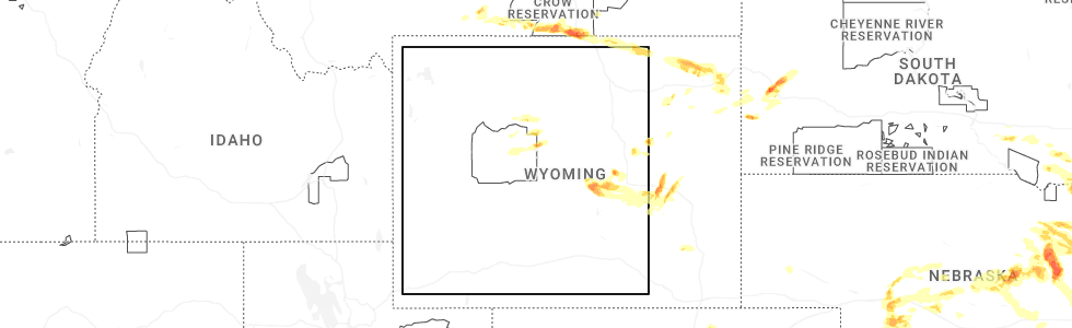
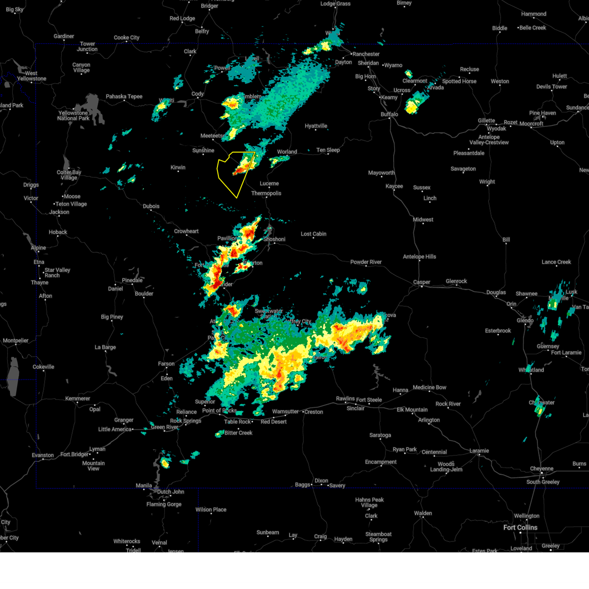
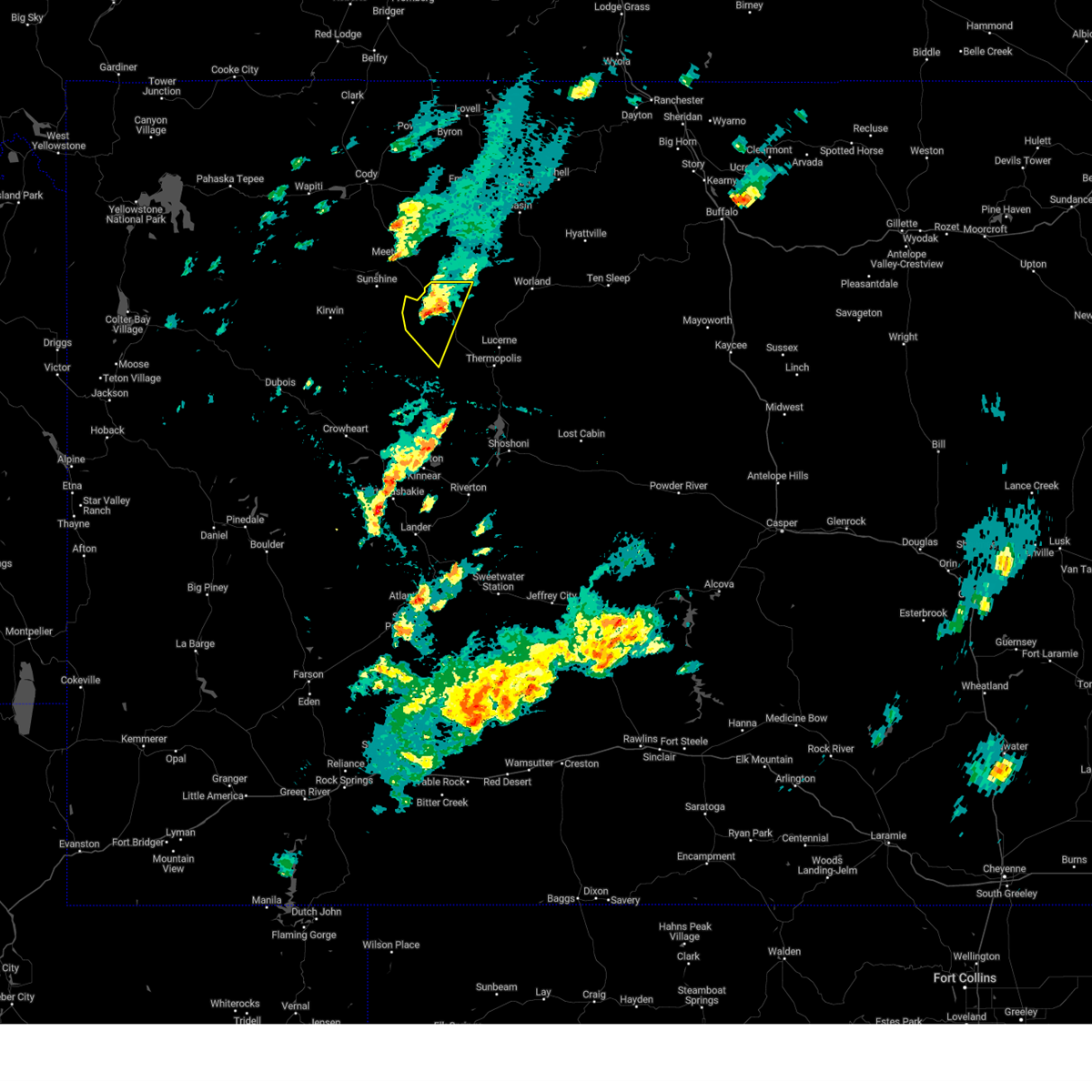
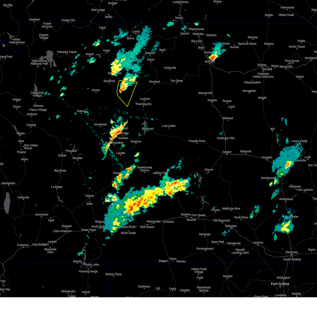
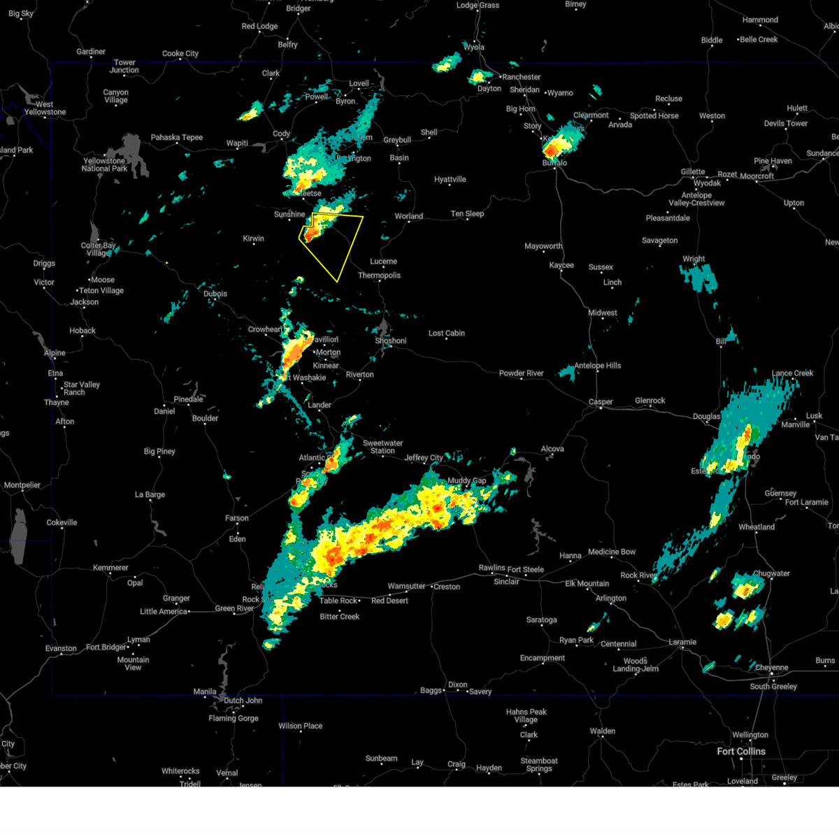
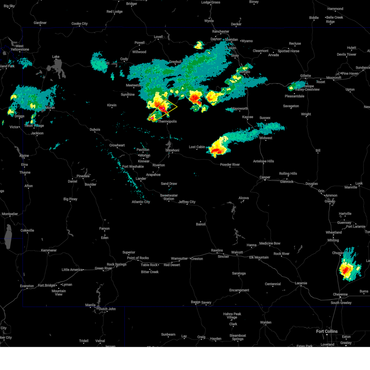
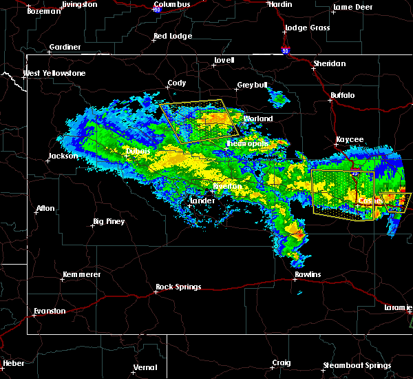
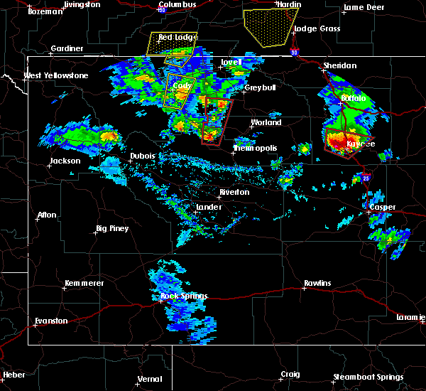
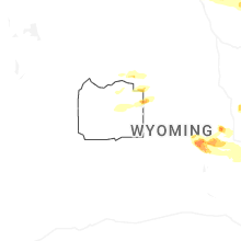
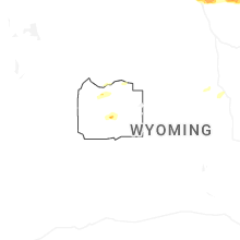
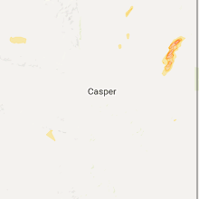
Hail Map for Owl Creek, WY
The Owl Creek, WY area has had 2 reports of on-the-ground hail by trained spotters, and has been under severe weather warnings 3 times during the past 12 months. Doppler radar has detected hail at or near Owl Creek, WY on 34 occasions, including 2 occasions during the past year.
| Name: | Owl Creek, WY |
| Where Located: | 53.3 miles N of Riverton, WY |
| Map: | Google Map for Owl Creek, WY |
| Population: | 5 |
| Housing Units: | 2 |
| More Info: | Search Google for Owl Creek, WY |
0
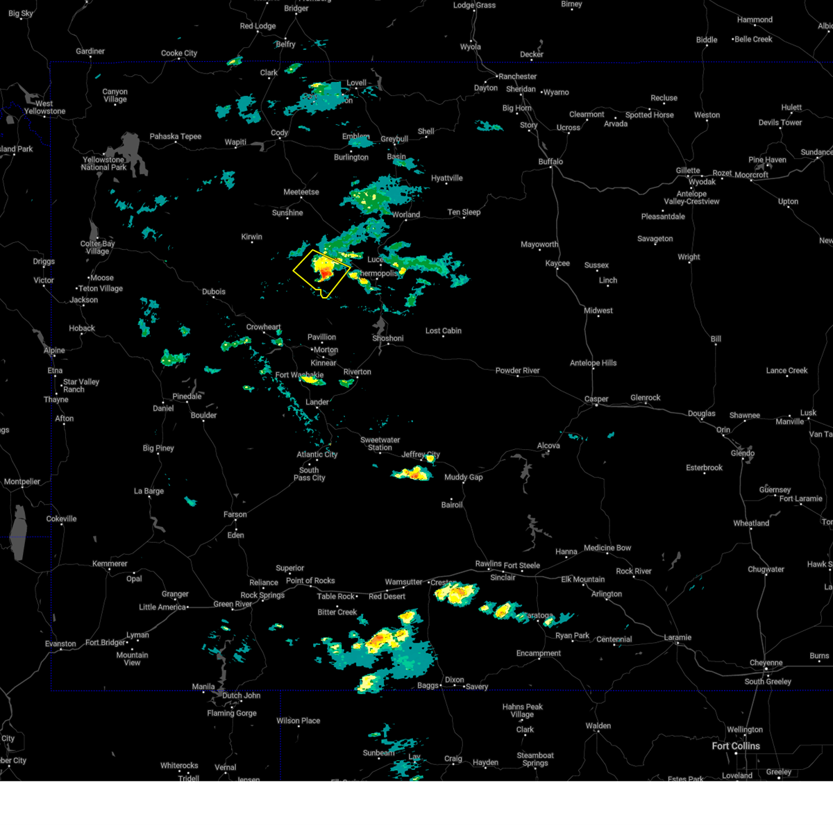
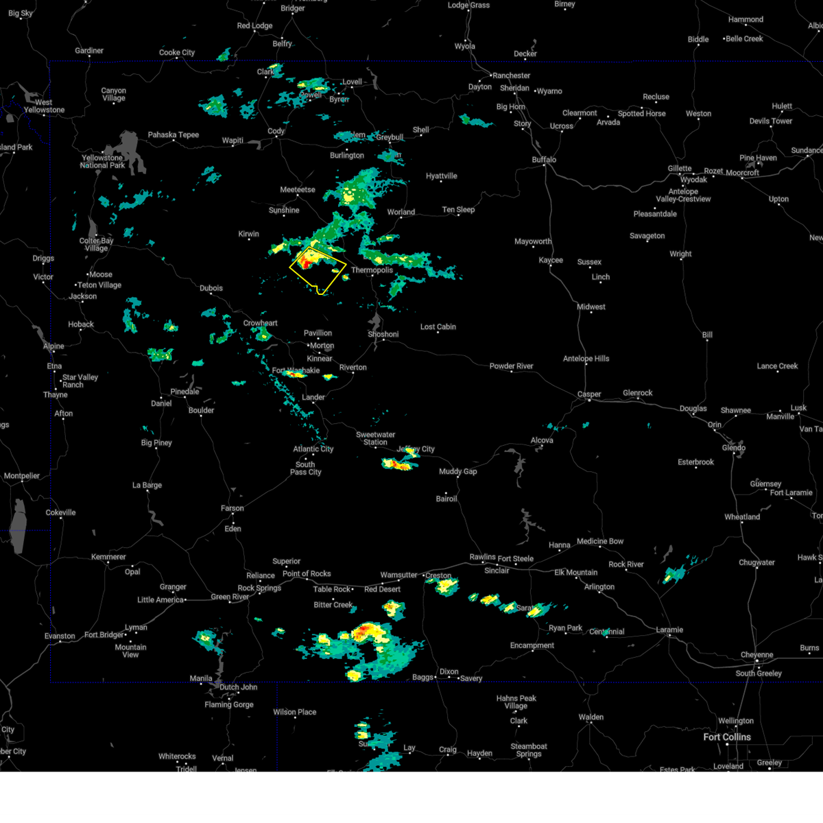
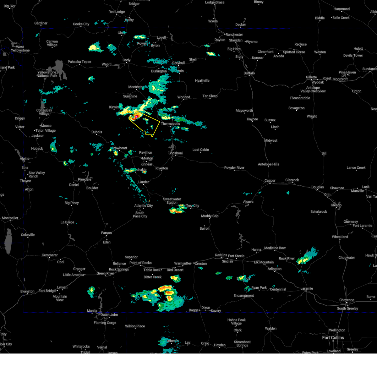
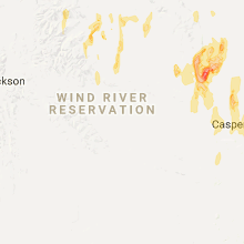
The Top Recent Hail Date for Owl Creek, WY is Monday, June 16, 2025 (13th out of 34)
Hail and Wind Damage Spotted near Owl Creek, WY
| Date / Time | Report Details |
|---|---|
| 8/9/2024 3:51 PM MDT |
 The storm which prompted the warning has weakened below severe limits, and no longer poses an immediate threat to life or property. therefore, the warning will be allowed to expire. however, gusty winds are still possible with this thunderstorm. The storm which prompted the warning has weakened below severe limits, and no longer poses an immediate threat to life or property. therefore, the warning will be allowed to expire. however, gusty winds are still possible with this thunderstorm.
|
| 8/9/2024 3:37 PM MDT |
 At 337 pm mdt, a severe thunderstorm was located near anchor dam, which is 28 miles west of thermopolis, moving southeast at 35 mph (radar indicated). Hazards include 60 mph wind gusts and quarter size hail. Hail damage to vehicles is expected. expect wind damage to roofs, siding, and trees. Locations impacted include, anchor dam. At 337 pm mdt, a severe thunderstorm was located near anchor dam, which is 28 miles west of thermopolis, moving southeast at 35 mph (radar indicated). Hazards include 60 mph wind gusts and quarter size hail. Hail damage to vehicles is expected. expect wind damage to roofs, siding, and trees. Locations impacted include, anchor dam.
|
| 8/9/2024 3:27 PM MDT |
 Svrriw the national weather service in riverton has issued a * severe thunderstorm warning for, southwestern hot springs county in central wyoming, * until 400 pm mdt. * at 327 pm mdt, a severe thunderstorm was located near anchor dam, which is 27 miles south of meeteetse, moving southeast at 40 mph (radar indicated). Hazards include 60 mph wind gusts and half dollar size hail. Hail damage to vehicles is expected. expect wind damage to roofs, siding, and trees. This severe thunderstorm will remain over mainly rural areas of southwestern hot springs county. Svrriw the national weather service in riverton has issued a * severe thunderstorm warning for, southwestern hot springs county in central wyoming, * until 400 pm mdt. * at 327 pm mdt, a severe thunderstorm was located near anchor dam, which is 27 miles south of meeteetse, moving southeast at 40 mph (radar indicated). Hazards include 60 mph wind gusts and half dollar size hail. Hail damage to vehicles is expected. expect wind damage to roofs, siding, and trees. This severe thunderstorm will remain over mainly rural areas of southwestern hot springs county.
|
| 6/21/2024 2:54 PM MDT |
 The storm which prompted the warning has weakened below severe limits, and no longer poses an immediate threat to life or property. therefore, the warning will be allowed to expire. however, small hail and gusty winds are still possible with this thunderstorm. a severe thunderstorm watch remains in effect until 900 pm mdt for central wyoming. to report severe weather, contact your nearest law enforcement agency. they will relay your report to the national weather service riverton. The storm which prompted the warning has weakened below severe limits, and no longer poses an immediate threat to life or property. therefore, the warning will be allowed to expire. however, small hail and gusty winds are still possible with this thunderstorm. a severe thunderstorm watch remains in effect until 900 pm mdt for central wyoming. to report severe weather, contact your nearest law enforcement agency. they will relay your report to the national weather service riverton.
|
| 6/21/2024 2:36 PM MDT |
 At 236 pm mdt, a severe thunderstorm was located near legend rock state petroglyph site, which is 24 miles southeast of meeteetse, moving east at 25 mph (radar indicated). Hazards include 60 mph wind gusts and quarter size hail. Hail damage to vehicles is expected. expect wind damage to roofs, siding, and trees. Locations impacted include, hamilton dome, legend rock state petroglyph site, grass creek, and badlands overlook. At 236 pm mdt, a severe thunderstorm was located near legend rock state petroglyph site, which is 24 miles southeast of meeteetse, moving east at 25 mph (radar indicated). Hazards include 60 mph wind gusts and quarter size hail. Hail damage to vehicles is expected. expect wind damage to roofs, siding, and trees. Locations impacted include, hamilton dome, legend rock state petroglyph site, grass creek, and badlands overlook.
|
| 6/21/2024 2:22 PM MDT |
 At 222 pm mdt, a severe thunderstorm was located 8 miles northwest of legend rock state petroglyph site, which is 20 miles southeast of meeteetse, moving east at 25 mph (radar indicated). Hazards include 60 mph wind gusts and half dollar size hail. Hail damage to vehicles is expected. expect wind damage to roofs, siding, and trees. Locations impacted include, hamilton dome, legend rock state petroglyph site, grass creek, and badlands overlook. At 222 pm mdt, a severe thunderstorm was located 8 miles northwest of legend rock state petroglyph site, which is 20 miles southeast of meeteetse, moving east at 25 mph (radar indicated). Hazards include 60 mph wind gusts and half dollar size hail. Hail damage to vehicles is expected. expect wind damage to roofs, siding, and trees. Locations impacted include, hamilton dome, legend rock state petroglyph site, grass creek, and badlands overlook.
|
| 6/21/2024 2:08 PM MDT |
 Svrriw the national weather service in riverton has issued a * severe thunderstorm warning for, north central hot springs county in central wyoming, west central washakie county in central wyoming, * until 300 pm mdt. * at 208 pm mdt, a severe thunderstorm was located 13 miles northwest of legend rock state petroglyph site, which is 16 miles south of meeteetse, moving east at 20 mph (radar indicated). Hazards include 60 mph wind gusts and half dollar size hail. Hail damage to vehicles is expected. Expect wind damage to roofs, siding, and trees. Svrriw the national weather service in riverton has issued a * severe thunderstorm warning for, north central hot springs county in central wyoming, west central washakie county in central wyoming, * until 300 pm mdt. * at 208 pm mdt, a severe thunderstorm was located 13 miles northwest of legend rock state petroglyph site, which is 16 miles south of meeteetse, moving east at 20 mph (radar indicated). Hazards include 60 mph wind gusts and half dollar size hail. Hail damage to vehicles is expected. Expect wind damage to roofs, siding, and trees.
|
| 6/26/2023 6:17 PM MDT |
 At 616 pm mdt, a severe thunderstorm was located near hamilton dome, which is also 14 miles northwest of thermopolis, moving northeast at 40 mph (radar indicated). Hazards include half dollar size hail. damage to vehicles is expected At 616 pm mdt, a severe thunderstorm was located near hamilton dome, which is also 14 miles northwest of thermopolis, moving northeast at 40 mph (radar indicated). Hazards include half dollar size hail. damage to vehicles is expected
|
| 6/26/2023 5:48 PM MDT |
 At 548 pm mdt, a severe thunderstorm was located over legend rock state petroglyph site, which is also 20 miles northwest of thermopolis, moving east at 30 mph (radar indicated). Hazards include 60 mph wind gusts and half dollar size hail. Hail damage to vehicles is expected. expect wind damage to roofs, siding, and trees. this severe thunderstorm will remain over mainly rural areas of central hot springs county, including the following locations, hot springs county airport. hail threat, radar indicated max hail size, 1. 25 in wind threat, radar indicated max wind gust, 60 mph. At 548 pm mdt, a severe thunderstorm was located over legend rock state petroglyph site, which is also 20 miles northwest of thermopolis, moving east at 30 mph (radar indicated). Hazards include 60 mph wind gusts and half dollar size hail. Hail damage to vehicles is expected. expect wind damage to roofs, siding, and trees. this severe thunderstorm will remain over mainly rural areas of central hot springs county, including the following locations, hot springs county airport. hail threat, radar indicated max hail size, 1. 25 in wind threat, radar indicated max wind gust, 60 mph.
|
| 6/6/2020 4:41 PM MDT |
 The severe thunderstorm warning for hot springs and central washakie counties will expire at 445 pm mdt, the storms which prompted the warning have weakened below severe limits, and no longer pose an immediate threat to life or property. therefore, the warning will be allowed to expire. however gusty winds up to 40 mph are still possible with these thunderstorms. a severe thunderstorm watch remains in effect until 800 pm mdt for central wyoming. to report severe weather, contact your nearest law enforcement agency. they will relay your report to the national weather service riverton. The severe thunderstorm warning for hot springs and central washakie counties will expire at 445 pm mdt, the storms which prompted the warning have weakened below severe limits, and no longer pose an immediate threat to life or property. therefore, the warning will be allowed to expire. however gusty winds up to 40 mph are still possible with these thunderstorms. a severe thunderstorm watch remains in effect until 800 pm mdt for central wyoming. to report severe weather, contact your nearest law enforcement agency. they will relay your report to the national weather service riverton.
|
| 6/6/2020 3:59 PM MDT |
 At 358 pm mdt, severe thunderstorms were located along a line extending from 10 miles northwest of boysen state park to 7 miles west of cottonwood pass, moving north at 45 mph (radar indicated). Hazards include 60 mph wind gusts. Expect damage to roofs, siding, and trees. severe thunderstorms will be near, thermopolis and hot springs state park around 420 pm mdt. lucerne around 430 pm mdt. kirby around 435 pm mdt. winchester around 440 pm mdt. Other locations impacted by these severe thunderstorms include badlands overlook, washakie county fairgrounds, hot springs county airport and hot springs county fairgrounds. At 358 pm mdt, severe thunderstorms were located along a line extending from 10 miles northwest of boysen state park to 7 miles west of cottonwood pass, moving north at 45 mph (radar indicated). Hazards include 60 mph wind gusts. Expect damage to roofs, siding, and trees. severe thunderstorms will be near, thermopolis and hot springs state park around 420 pm mdt. lucerne around 430 pm mdt. kirby around 435 pm mdt. winchester around 440 pm mdt. Other locations impacted by these severe thunderstorms include badlands overlook, washakie county fairgrounds, hot springs county airport and hot springs county fairgrounds.
|
| 6/6/2020 2:51 AM MDT |
 The severe thunderstorm warning for hot springs, southern johnson and washakie counties will expire at 300 am mdt, the storms which prompted the warning have weakened. therefore, the warning will be allowed to expire. The severe thunderstorm warning for hot springs, southern johnson and washakie counties will expire at 300 am mdt, the storms which prompted the warning have weakened. therefore, the warning will be allowed to expire.
|
| 6/6/2020 2:37 AM MDT |
 At 234 am mdt, doppler radar indicated scattered showers across hot springs, southern johnson and washakie counties (radar indicated). Hazards include 60 mph wind gusts. Expect damage to roofs, siding, and trees. These showers are capable of producing wind gusts of 50 to 65 mph with little or no notice. At 234 am mdt, doppler radar indicated scattered showers across hot springs, southern johnson and washakie counties (radar indicated). Hazards include 60 mph wind gusts. Expect damage to roofs, siding, and trees. These showers are capable of producing wind gusts of 50 to 65 mph with little or no notice.
|
| 6/6/2020 1:46 AM MDT |
 At 142 am mdt, weak showers with damaging winds were located along a line extending from near anchor dam to near midwest, moving north at 45 mph (radar indicated. at 1235 am, the casper airport measured a wind gust of 60 mph. at 125 am, the riverton airport measured a 59 mph wind gust). Hazards include 60 mph wind gusts. Expect damage to roofs, siding, and trees. severe thunderstorms will be near, midwest and edgerton around 150 am mdt. hamilton dome around 200 am mdt. linch and legend rock state petroglyph site around 205 am mdt. fort reno historical site around 225 am mdt. other locations impacted by these severe thunderstorms include badlands overlook, hot springs county airport, hot springs county fairgrounds, grass creek, leigh creek campground, wigwam fish rearing station, washakie county fairgrounds, sussex, lost cabin campground and barnum. This includes interstate 25 between mile markers 220 and 285. At 142 am mdt, weak showers with damaging winds were located along a line extending from near anchor dam to near midwest, moving north at 45 mph (radar indicated. at 1235 am, the casper airport measured a wind gust of 60 mph. at 125 am, the riverton airport measured a 59 mph wind gust). Hazards include 60 mph wind gusts. Expect damage to roofs, siding, and trees. severe thunderstorms will be near, midwest and edgerton around 150 am mdt. hamilton dome around 200 am mdt. linch and legend rock state petroglyph site around 205 am mdt. fort reno historical site around 225 am mdt. other locations impacted by these severe thunderstorms include badlands overlook, hot springs county airport, hot springs county fairgrounds, grass creek, leigh creek campground, wigwam fish rearing station, washakie county fairgrounds, sussex, lost cabin campground and barnum. This includes interstate 25 between mile markers 220 and 285.
|
| 7/1/2019 1:20 PM MDT | Golf Ball sized hail reported 8.7 miles NE of Owl Creek, WY |
| 7/1/2019 1:10 PM MDT |
 At 110 pm mdt, a severe thunderstorm was located near hamilton dome, which is 13 miles northwest of thermopolis, moving east at 15 mph (radar indicated). Hazards include ping pong ball size hail and 60 mph wind gusts. People and animals outdoors will be injured. expect hail damage to roofs, siding, windows, and vehicles. expect wind damage to roofs, siding, and trees. this severe storm will be near, thermopolis, lucerne, kirby and hot springs state park around 145 pm mdt. Other locations impacted by this severe thunderstorm include hot springs county fairgrounds and hot springs county airport. At 110 pm mdt, a severe thunderstorm was located near hamilton dome, which is 13 miles northwest of thermopolis, moving east at 15 mph (radar indicated). Hazards include ping pong ball size hail and 60 mph wind gusts. People and animals outdoors will be injured. expect hail damage to roofs, siding, windows, and vehicles. expect wind damage to roofs, siding, and trees. this severe storm will be near, thermopolis, lucerne, kirby and hot springs state park around 145 pm mdt. Other locations impacted by this severe thunderstorm include hot springs county fairgrounds and hot springs county airport.
|
| 7/1/2019 12:55 PM MDT |
 At 1254 pm mdt, a severe thunderstorm was located over hamilton dome, which is 17 miles west of thermopolis, moving east at 15 mph (radar indicated). Hazards include 60 mph wind gusts and quarter size hail. Hail damage to vehicles is expected. expect wind damage to roofs, siding, and trees. this severe thunderstorm will be near, thermopolis, lucerne, kirby and hot springs state park around 145 pm mdt. Other locations impacted by this severe thunderstorm include hot springs county fairgrounds and hot springs county airport. At 1254 pm mdt, a severe thunderstorm was located over hamilton dome, which is 17 miles west of thermopolis, moving east at 15 mph (radar indicated). Hazards include 60 mph wind gusts and quarter size hail. Hail damage to vehicles is expected. expect wind damage to roofs, siding, and trees. this severe thunderstorm will be near, thermopolis, lucerne, kirby and hot springs state park around 145 pm mdt. Other locations impacted by this severe thunderstorm include hot springs county fairgrounds and hot springs county airport.
|
| 8/18/2018 3:52 PM MDT |
 The severe thunderstorm warning for southwestern hot springs county will expire at 400 pm mdt, the storm which prompted the warning has moved out of the area. therefore, the warning will be allowed to expire. however large hail is still possible with this thunderstorm. to report severe weather, contact your nearest law enforcement agency. they will relay your report to the national weather service riverton. The severe thunderstorm warning for southwestern hot springs county will expire at 400 pm mdt, the storm which prompted the warning has moved out of the area. therefore, the warning will be allowed to expire. however large hail is still possible with this thunderstorm. to report severe weather, contact your nearest law enforcement agency. they will relay your report to the national weather service riverton.
|
| 8/18/2018 3:51 PM MDT |
 At 350 pm mdt, a severe thunderstorm was located over legend rock state petroglyph site, or 20 miles northwest of thermopolis, moving southeast at 25 mph (radar indicated). Hazards include two inch hail. People and animals outdoors will be injured. expect damage to roofs, siding, windows, and vehicles. This severe thunderstorm will remain over mainly rural areas of central hot springs county, including the following locations, hot sprgs county thermopolis airport and legion town and country golf course. At 350 pm mdt, a severe thunderstorm was located over legend rock state petroglyph site, or 20 miles northwest of thermopolis, moving southeast at 25 mph (radar indicated). Hazards include two inch hail. People and animals outdoors will be injured. expect damage to roofs, siding, windows, and vehicles. This severe thunderstorm will remain over mainly rural areas of central hot springs county, including the following locations, hot sprgs county thermopolis airport and legion town and country golf course.
|
| 8/18/2018 3:32 PM MDT |
 At 331 pm mdt, a severe thunderstorm was located 9 miles west of legend rock state petroglyph site, or 24 miles south of meeteetse, moving southeast at 25 mph (radar indicated). Hazards include ping pong ball size hail. People and animals outdoors will be injured. expect damage to roofs, siding, windows, and vehicles. this severe thunderstorm will be near, legend rock state petroglyph site and anchor dam around 345 pm mdt. Hamilton dome around 350 pm mdt. At 331 pm mdt, a severe thunderstorm was located 9 miles west of legend rock state petroglyph site, or 24 miles south of meeteetse, moving southeast at 25 mph (radar indicated). Hazards include ping pong ball size hail. People and animals outdoors will be injured. expect damage to roofs, siding, windows, and vehicles. this severe thunderstorm will be near, legend rock state petroglyph site and anchor dam around 345 pm mdt. Hamilton dome around 350 pm mdt.
|
| 7/28/2018 3:28 PM MDT |
 At 326 pm mdt, a severe thunderstorm was located near hamilton dome, or 17 miles west of thermopolis, moving east at 30 mph (radar indicated). Hazards include 60 mph wind gusts and quarter size hail. Hail damage to vehicles is expected. expect wind damage to roofs, siding, and trees. this severe thunderstorm will be near, thermopolis, lucerne and hot springs state park around 355 pm mdt. Other locations impacted by this severe thunderstorm include hot springs county fairgrounds, hot sprgs county thermopolis airport and legion town and country golf course. At 326 pm mdt, a severe thunderstorm was located near hamilton dome, or 17 miles west of thermopolis, moving east at 30 mph (radar indicated). Hazards include 60 mph wind gusts and quarter size hail. Hail damage to vehicles is expected. expect wind damage to roofs, siding, and trees. this severe thunderstorm will be near, thermopolis, lucerne and hot springs state park around 355 pm mdt. Other locations impacted by this severe thunderstorm include hot springs county fairgrounds, hot sprgs county thermopolis airport and legion town and country golf course.
|
| 5/27/2018 4:56 PM MDT |
 At 455 pm mdt, a severe thunderstorm was located 14 miles east of meeteetse, moving northwest at 35 mph (trained weather spotters). Hazards include 70 mph wind gusts and quarter size hail. Hail damage to vehicles is expected. expect considerable tree damage. wind damage is also likely to mobile homes, roofs, and outbuildings. locations impacted include, meeteetse, gooseberry creek, and state highway 120. An automated sensor reported a wind gust to 64 mph near grass creek around 442 pm mdt. At 455 pm mdt, a severe thunderstorm was located 14 miles east of meeteetse, moving northwest at 35 mph (trained weather spotters). Hazards include 70 mph wind gusts and quarter size hail. Hail damage to vehicles is expected. expect considerable tree damage. wind damage is also likely to mobile homes, roofs, and outbuildings. locations impacted include, meeteetse, gooseberry creek, and state highway 120. An automated sensor reported a wind gust to 64 mph near grass creek around 442 pm mdt.
|
| 5/27/2018 4:38 PM MDT |
 At 437 pm mdt, a severe thunderstorm was located 14 miles northeast of legend rock state petroglyph site, which is 23 miles southeast of meeteetse, moving northwest at 35 mph (radar indicated). Hazards include 60 to 70 mph wind gusts and quarter size hail. Hail damage to vehicles is expected. expect considerable tree damage. wind damage is also likely to mobile homes, roofs, and outbuildings. This severe thunderstorm will impact state highway 120, gooseberry creek rest area, and meeteetse. At 437 pm mdt, a severe thunderstorm was located 14 miles northeast of legend rock state petroglyph site, which is 23 miles southeast of meeteetse, moving northwest at 35 mph (radar indicated). Hazards include 60 to 70 mph wind gusts and quarter size hail. Hail damage to vehicles is expected. expect considerable tree damage. wind damage is also likely to mobile homes, roofs, and outbuildings. This severe thunderstorm will impact state highway 120, gooseberry creek rest area, and meeteetse.
|
| 6/27/2017 8:10 AM MDT |
 The severe thunderstorm warning for southern hot springs, east central sublette and central fremont counties will expire at 215 pm mdt, the storms which prompted the warning have weakened below severe limits, and no longer pose an immediate threat to life or property. therefore the warning will be allowed to expire. however very strong winds of 50 to 55 mph are still expected with these thunderstorms. The severe thunderstorm warning for southern hot springs, east central sublette and central fremont counties will expire at 215 pm mdt, the storms which prompted the warning have weakened below severe limits, and no longer pose an immediate threat to life or property. therefore the warning will be allowed to expire. however very strong winds of 50 to 55 mph are still expected with these thunderstorms.
|
| 6/27/2017 7:55 AM MDT |
 The severe thunderstorm warning for hot springs, southwestern big horn, northwestern washakie and southeastern park counties will expire at 200 pm mdt, the storms which prompted the warning have weakened below severe limits, and no longer pose an immediate threat to life or property. therefore the warning will be allowed to expire. however strong winds gusts of 50 to 55 mph are still expected with these thunderstorms. The severe thunderstorm warning for hot springs, southwestern big horn, northwestern washakie and southeastern park counties will expire at 200 pm mdt, the storms which prompted the warning have weakened below severe limits, and no longer pose an immediate threat to life or property. therefore the warning will be allowed to expire. however strong winds gusts of 50 to 55 mph are still expected with these thunderstorms.
|
| 6/27/2017 7:40 AM MDT |
 At 139 pm mdt, severe thunderstorms were located along a line extending from 9 miles northwest of thermopolis to 12 miles northwest of cirque of the towers, moving east at 60 mph (radar indicated). Hazards include 60 mph wind gusts and up to half inch size hail. Expect damage to roofs, siding, and trees. Locations impacted include, thermopolis, fort washakie, pavillion, ethete, lucerne, east thermopolis, morton, kinnear, crowheart, hamilton dome, pilot butte reservoir, winkleman dome, anchor dam, white pine ski area, dickinson park, burris, bull lake, ocean lake, hot springs state park and maverik spring dome field. At 139 pm mdt, severe thunderstorms were located along a line extending from 9 miles northwest of thermopolis to 12 miles northwest of cirque of the towers, moving east at 60 mph (radar indicated). Hazards include 60 mph wind gusts and up to half inch size hail. Expect damage to roofs, siding, and trees. Locations impacted include, thermopolis, fort washakie, pavillion, ethete, lucerne, east thermopolis, morton, kinnear, crowheart, hamilton dome, pilot butte reservoir, winkleman dome, anchor dam, white pine ski area, dickinson park, burris, bull lake, ocean lake, hot springs state park and maverik spring dome field.
|
| 6/27/2017 7:33 AM MDT |
 At 131 pm mdt, severe thunderstorms were located along a line extending from 12 miles south of garland to near hamilton dome, moving east at 40 mph (radar indicated). Hazards include 60 mph wind gusts and half inch size hail. Expect damage to roofs, siding, and trees. these severe storms will be near, hamilton dome and legend rock state petroglyph site around 135 pm mdt. Thermopolis, lucerne, east thermopolis and hot springs state park around 200 pm mdt. At 131 pm mdt, severe thunderstorms were located along a line extending from 12 miles south of garland to near hamilton dome, moving east at 40 mph (radar indicated). Hazards include 60 mph wind gusts and half inch size hail. Expect damage to roofs, siding, and trees. these severe storms will be near, hamilton dome and legend rock state petroglyph site around 135 pm mdt. Thermopolis, lucerne, east thermopolis and hot springs state park around 200 pm mdt.
|
| 6/27/2017 7:26 AM MDT |
 At 124 pm mdt, severe thunderstorms were located along a line extending from legend rock state petroglyph site to 6 miles east of white pine ski area, moving east at 40 mph (radar indicated). Hazards include 60 mph wind gusts and half inch size hail. Expect damage to roofs, siding, and trees. severe thunderstorms will be near, crowheart, hamilton dome and legend rock state petroglyph site around 130 pm mdt. thermopolis, lucerne, east thermopolis and hot springs state park around 200 pm mdt. Fort washakie and dickinson park around 215 pm mdt. At 124 pm mdt, severe thunderstorms were located along a line extending from legend rock state petroglyph site to 6 miles east of white pine ski area, moving east at 40 mph (radar indicated). Hazards include 60 mph wind gusts and half inch size hail. Expect damage to roofs, siding, and trees. severe thunderstorms will be near, crowheart, hamilton dome and legend rock state petroglyph site around 130 pm mdt. thermopolis, lucerne, east thermopolis and hot springs state park around 200 pm mdt. Fort washakie and dickinson park around 215 pm mdt.
|
| 6/27/2017 7:19 AM MDT |
 At 118 pm mdt, severe thunderstorms were located along a line extending from 6 miles southeast of ralston to near anchor dam, moving east at 30 mph (radar indicated). Hazards include 60 mph wind gusts. Expect damage to roofs, siding, and trees. severe thunderstorms will be near, legend rock state petroglyph site around 135 pm mdt. Hamilton dome around 140 pm mdt. At 118 pm mdt, severe thunderstorms were located along a line extending from 6 miles southeast of ralston to near anchor dam, moving east at 30 mph (radar indicated). Hazards include 60 mph wind gusts. Expect damage to roofs, siding, and trees. severe thunderstorms will be near, legend rock state petroglyph site around 135 pm mdt. Hamilton dome around 140 pm mdt.
|
| 6/12/2017 5:40 PM MDT |
 At 539 pm mdt, a severe thunderstorm capable of producing a tornado was located near legend rock state petroglyph site, which is 20 miles northwest of thermopolis, moving north at 45 mph (radar indicated rotation). Hazards include tornado and ping pong ball size hail. Flying debris will be dangerous to those caught without shelter. mobile homes will be damaged or destroyed. damage to roofs, windows, and vehicles will occur. tree damage is likely. This tornadic thunderstorm will remain over mainly rural areas of north central hot springs, southwestern big horn and northwestern washakie counties, including the following locations: badlands overlook. At 539 pm mdt, a severe thunderstorm capable of producing a tornado was located near legend rock state petroglyph site, which is 20 miles northwest of thermopolis, moving north at 45 mph (radar indicated rotation). Hazards include tornado and ping pong ball size hail. Flying debris will be dangerous to those caught without shelter. mobile homes will be damaged or destroyed. damage to roofs, windows, and vehicles will occur. tree damage is likely. This tornadic thunderstorm will remain over mainly rural areas of north central hot springs, southwestern big horn and northwestern washakie counties, including the following locations: badlands overlook.
|
| 7/27/2016 5:14 PM MDT |
 At 514 pm mdt, a severe thunderstorm was located over legend rock state petroglyph site, which is 21 miles northwest of thermopolis, moving southeast at 35 mph (radar indicated). Hazards include quarter size hail. Damage to vehicles is expected. this severe thunderstorm will be near, lucerne around 550 pm mdt. Thermopolis, east thermopolis and hot springs state park around 555 pm mdt. At 514 pm mdt, a severe thunderstorm was located over legend rock state petroglyph site, which is 21 miles northwest of thermopolis, moving southeast at 35 mph (radar indicated). Hazards include quarter size hail. Damage to vehicles is expected. this severe thunderstorm will be near, lucerne around 550 pm mdt. Thermopolis, east thermopolis and hot springs state park around 555 pm mdt.
|
| 7/15/2015 2:43 PM MDT |
 At 242 pm mdt, severe thunderstorms were located along a line extending from near maverik spring dome field to near milford, moving northeast at 35 mph (radar indicated). Hazards include 60 mph wind gusts. Expect damage to roofs. siding and trees. severe thunderstorms will be near, arapahoe and hudson around 300 pm mdt. Other locations impacted by these severe thunderstorms include riverton regional airport, owl creek kampgrounds, fremont county library, lander golf course, rendezvous elementary school, wyoming indian middle school, trinity lutheran school, wind river rv park, ashgrove elementary school and south elementary school. At 242 pm mdt, severe thunderstorms were located along a line extending from near maverik spring dome field to near milford, moving northeast at 35 mph (radar indicated). Hazards include 60 mph wind gusts. Expect damage to roofs. siding and trees. severe thunderstorms will be near, arapahoe and hudson around 300 pm mdt. Other locations impacted by these severe thunderstorms include riverton regional airport, owl creek kampgrounds, fremont county library, lander golf course, rendezvous elementary school, wyoming indian middle school, trinity lutheran school, wind river rv park, ashgrove elementary school and south elementary school.
|
| 7/3/2015 6:11 PM MDT |
 At 610 pm mdt, a severe thunderstorm was located near gooseberry creek, which is 17 miles southeast of meeteetse, moving southeast at 25 mph (radar indicated). Hazards include quarter size hail. Damage to vehicles is expected. this severe thunderstorm will be near, kirby around 700 pm mdt. Other locations impacted by this severe thunderstorm include badlands overlook and grass creek. At 610 pm mdt, a severe thunderstorm was located near gooseberry creek, which is 17 miles southeast of meeteetse, moving southeast at 25 mph (radar indicated). Hazards include quarter size hail. Damage to vehicles is expected. this severe thunderstorm will be near, kirby around 700 pm mdt. Other locations impacted by this severe thunderstorm include badlands overlook and grass creek.
|
| 6/30/2015 4:39 PM MDT |
 The severe thunderstorm warning for south central hot springs county will expire at 445 pm mdt, the storm which prompted the warning has weakened below severe limits, and no longer pose an immediate threat to life or property. therefore the warning will be allowed to expire. however small. The severe thunderstorm warning for south central hot springs county will expire at 445 pm mdt, the storm which prompted the warning has weakened below severe limits, and no longer pose an immediate threat to life or property. therefore the warning will be allowed to expire. however small.
|
| 6/30/2015 4:18 PM MDT |
 At 417 pm mdt, a severe thunderstorm was located near thermopolis, moving southeast at 45 mph (radar indicated). Hazards include 60 mph wind gusts and quarter size hail. Hail damage to vehicles is expected. expect wind damage to roofs, siding and trees. this severe storm will be near, east thermopolis and hot springs state park around 425 pm mdt. At 417 pm mdt, a severe thunderstorm was located near thermopolis, moving southeast at 45 mph (radar indicated). Hazards include 60 mph wind gusts and quarter size hail. Hail damage to vehicles is expected. expect wind damage to roofs, siding and trees. this severe storm will be near, east thermopolis and hot springs state park around 425 pm mdt.
|
| 6/30/2015 3:54 PM MDT |
 At 353 pm mdt, a severe thunderstorm was located near hamilton dome, which is 21 miles west of thermopolis, moving southeast at 35 mph (radar indicated). Hazards include 60 mph wind gusts and quarter to half dollar size hail. Hail damage to vehicles is expected. expect wind damage to roofs, siding and trees. this severe thunderstorm will be near, hot springs state park around 430 pm mdt. Thermopolis and east thermopolis around 435 pm mdt. At 353 pm mdt, a severe thunderstorm was located near hamilton dome, which is 21 miles west of thermopolis, moving southeast at 35 mph (radar indicated). Hazards include 60 mph wind gusts and quarter to half dollar size hail. Hail damage to vehicles is expected. expect wind damage to roofs, siding and trees. this severe thunderstorm will be near, hot springs state park around 430 pm mdt. Thermopolis and east thermopolis around 435 pm mdt.
|
| 6/16/2015 2:00 PM MDT | Quarter sized hail reported 13.9 miles NNW of Owl Creek, WY |
| 6/16/2015 1:56 PM MDT |
 At 156 pm mdt, a severe thunderstorm was located near hamilton dome, which is 13 miles west of thermopolis, moving east at 40 mph (radar indicated). Hazards include quarter size hail. Damage to vehicles is expected. this severe thunderstorm will be near, thermopolis, lucerne, east thermopolis and hot springs state park around 220 pm mdt. Other locations impacted by this severe thunderstorm include hot sprgs county thermopolis airport, thermopolis high school, hotsprings middle school, legion town and country golf course, ralph witters elementary school, thermopolis middle school, hot springs county fairgrounds, hot springs county library, thermopolis hot springs county memorial hospital and hot springs state park. At 156 pm mdt, a severe thunderstorm was located near hamilton dome, which is 13 miles west of thermopolis, moving east at 40 mph (radar indicated). Hazards include quarter size hail. Damage to vehicles is expected. this severe thunderstorm will be near, thermopolis, lucerne, east thermopolis and hot springs state park around 220 pm mdt. Other locations impacted by this severe thunderstorm include hot sprgs county thermopolis airport, thermopolis high school, hotsprings middle school, legion town and country golf course, ralph witters elementary school, thermopolis middle school, hot springs county fairgrounds, hot springs county library, thermopolis hot springs county memorial hospital and hot springs state park.
|
| 6/2/2015 3:01 PM MDT | At 258 pm mdt, a severe thunderstorm was located near hamilton dome, which is 18 miles northwest of thermopolis, moving east at 30 mph (radar indicated). Hazards include 60 mph wind gusts and quarter size hail. Hail damage to vehicles is expected. expect wind damage to roofs, siding and trees. this severe thunderstorm will be near, lucerne, kirby, thermopolis and winchester around 330 pm mdt. Wyoming boys school around 345 pm mdt. |
| 7/21/2014 7:15 PM MDT | Grass creek divide raws. wind gust occurred between 642 pm and 742 p in hot springs county WY, 16.2 miles ESE of Owl Creek, WY |
| 9/10/2012 11:42 AM MDT | Measured at grass creek raw in hot springs county WY, 15.8 miles ESE of Owl Creek, WY |
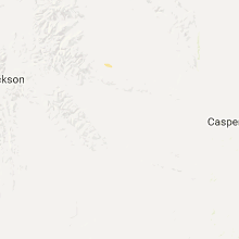
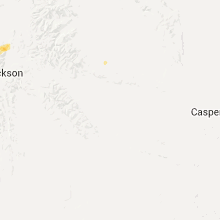
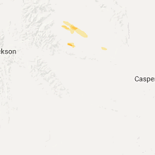
Hail Maps for Owl Creek, WY


Connect with Interactive Hail Maps