

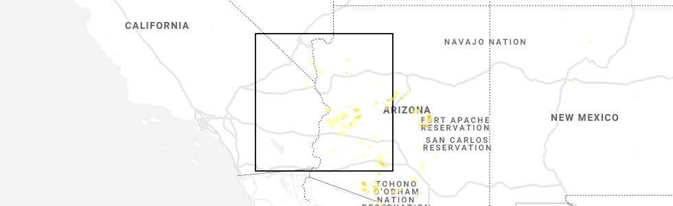
Hail Map for Parker Strip, AZ
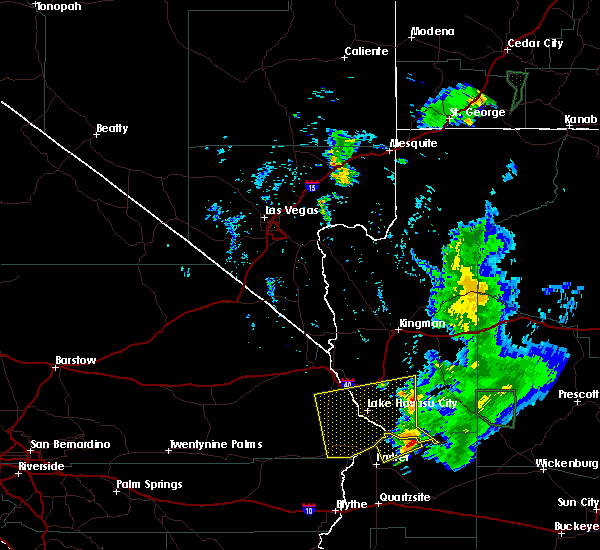
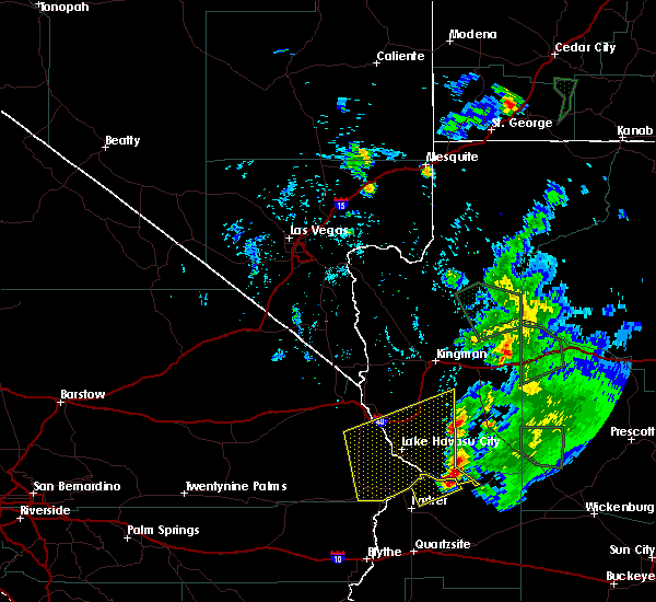
The Parker Strip, AZ area has had 0 reports of on-the-ground hail by trained spotters, and has been under severe weather warnings 0 times during the past 12 months. Doppler radar has detected hail at or near Parker Strip, AZ on 7 occasions.
| Name: | Parker Strip, AZ |
| Where Located: | 18.5 miles SE of Lake Havasu City, AZ |
| Map: | Google Map for Parker Strip, AZ |
| Population: | 662 |
| Housing Units: | 1387 |
| More Info: | Search Google for Parker Strip, AZ |
5
The Top Recent Hail Date for Parker Strip, AZ is Sunday, September 1, 2019 (1st out of 7)
Hail and Wind Damage Spotted near Parker Strip, AZ
| Date / Time | Report Details |
|---|---|
| 10/3/2022 3:23 PM PDT |
 The severe thunderstorm warning for southwestern mohave and eastern san bernardino counties will expire at 330 pm pdt/330 pm mst/, the storm which prompted the warning has weakened below severe limits, and no longer poses an immediate threat to life or property. therefore, the warning will be allowed to expire. The severe thunderstorm warning for southwestern mohave and eastern san bernardino counties will expire at 330 pm pdt/330 pm mst/, the storm which prompted the warning has weakened below severe limits, and no longer poses an immediate threat to life or property. therefore, the warning will be allowed to expire.
|
| 10/3/2022 2:56 PM PDT |
 At 255 pm pdt/255 pm mst/, a severe thunderstorm was located over lake havasu city, moving southeast at 20 mph (radar indicated). Hazards include 60 mph wind gusts and quarter size hail. Hail damage to vehicles is expected. expect wind damage to roofs and trees. locations impacted include, lake havasu city, parker dam, three dunes campground, cattail cove state park, desert hills and black meadow landing campground. hail threat, radar indicated max hail size, 1. 00 in wind threat, radar indicated max wind gust, 60 mph. At 255 pm pdt/255 pm mst/, a severe thunderstorm was located over lake havasu city, moving southeast at 20 mph (radar indicated). Hazards include 60 mph wind gusts and quarter size hail. Hail damage to vehicles is expected. expect wind damage to roofs and trees. locations impacted include, lake havasu city, parker dam, three dunes campground, cattail cove state park, desert hills and black meadow landing campground. hail threat, radar indicated max hail size, 1. 00 in wind threat, radar indicated max wind gust, 60 mph.
|
| 10/3/2022 2:34 PM PDT |
 At 233 pm pdt/233 pm mst/, a severe thunderstorm was located near desert hills, or 7 miles northwest of lake havasu city, moving southeast at 20 mph (radar indicated). Hazards include 60 mph wind gusts and quarter size hail. Hail damage to vehicles is expected. Expect wind damage to roofs and trees. At 233 pm pdt/233 pm mst/, a severe thunderstorm was located near desert hills, or 7 miles northwest of lake havasu city, moving southeast at 20 mph (radar indicated). Hazards include 60 mph wind gusts and quarter size hail. Hail damage to vehicles is expected. Expect wind damage to roofs and trees.
|
| 9/12/2022 3:50 PM MST |
 The severe thunderstorm warning for north central la paz county will expire at 400 pm mst, the storm which prompted the warning has weakened below severe limits, and has exited the warned area. therefore, the warning will be allowed to expire. The severe thunderstorm warning for north central la paz county will expire at 400 pm mst, the storm which prompted the warning has weakened below severe limits, and has exited the warned area. therefore, the warning will be allowed to expire.
|
| 9/12/2022 3:34 PM PDT |
 At 334 pm pdt/334 pm mst/, a severe thunderstorm was located near cattail cove state park, or 11 miles north of parker dam, moving northwest at 20 mph (radar indicated). Hazards include 60 mph wind gusts. Expect damage to roofs and trees. locations impacted include, lake havasu city, parker dam, three dunes campground, cattail cove state park, desert hills, black meadow landing campground, earp and big river. hail threat, radar indicated max hail size, <. 75 in wind threat, radar indicated max wind gust, 60 mph. At 334 pm pdt/334 pm mst/, a severe thunderstorm was located near cattail cove state park, or 11 miles north of parker dam, moving northwest at 20 mph (radar indicated). Hazards include 60 mph wind gusts. Expect damage to roofs and trees. locations impacted include, lake havasu city, parker dam, three dunes campground, cattail cove state park, desert hills, black meadow landing campground, earp and big river. hail threat, radar indicated max hail size, <. 75 in wind threat, radar indicated max wind gust, 60 mph.
|
| 9/12/2022 3:13 PM PDT |
 At 312 pm pdt/312 pm mst/, a severe thunderstorm was located over parker dam, moving north at 20 mph (radar indicated). Hazards include 60 mph wind gusts. expect damage to roofs and trees At 312 pm pdt/312 pm mst/, a severe thunderstorm was located over parker dam, moving north at 20 mph (radar indicated). Hazards include 60 mph wind gusts. expect damage to roofs and trees
|
| 9/12/2022 3:04 PM MST |
 At 304 pm mst, a severe thunderstorm was located near parker, moving north at 20 mph (radar indicated). Hazards include 60 mph wind gusts and penny size hail. expect damage to roofs, siding, and trees At 304 pm mst, a severe thunderstorm was located near parker, moving north at 20 mph (radar indicated). Hazards include 60 mph wind gusts and penny size hail. expect damage to roofs, siding, and trees
|
| 8/21/2022 11:09 PM MST | The severe thunderstorm warning for southwestern mohave and southeastern san bernardino counties will expire at 1115 pm pdt/1115 pm mst/, the storm which prompted the warning has weakened below severe limits, and no longer poses an immediate threat to life or property. therefore, the warning will be allowed to expire. however gusty winds are still possible with this thunderstorm. |
| 8/21/2022 11:09 PM MST | The severe thunderstorm warning for southwestern mohave and southeastern san bernardino counties will expire at 1115 pm pdt/1115 pm mst/, the storm which prompted the warning has weakened below severe limits, and no longer poses an immediate threat to life or property. therefore, the warning will be allowed to expire. however gusty winds are still possible with this thunderstorm. |
| 8/21/2022 11:01 PM MST | At 1101 pm mst/1101 pm pdt/, severe thunderstorms were located along a line extending from near big river to 17 miles west of bouse to 7 miles east of quartzsite to 6 miles southeast of brenda, moving southwest at 35 mph (radar indicated). Hazards include 60 mph wind gusts. Expect damage to roofs, siding, and trees. locations impacted include, parker, quartzsite, salome, brenda, vicksburg junction, buckskin mountain park, wenden, kofa wildlife refuge, vicksburg, bouse, harcuvar and poston. this includes the following highways, az interstate 10 between mile markers 11 and 54. us highway 60 between mile markers 31 and 64. az route 72 between mile markers 14 and 49. hail threat, radar indicated max hail size, <. 75 in wind threat, radar indicated max wind gust, 60 mph. |
| 8/21/2022 11:01 PM MST | At 1101 pm mst/1101 pm pdt/, severe thunderstorms were located along a line extending from near big river to 17 miles west of bouse to 7 miles east of quartzsite to 6 miles southeast of brenda, moving southwest at 35 mph (radar indicated). Hazards include 60 mph wind gusts. Expect damage to roofs, siding, and trees. locations impacted include, parker, quartzsite, salome, brenda, vicksburg junction, buckskin mountain park, wenden, kofa wildlife refuge, vicksburg, bouse, harcuvar and poston. this includes the following highways, az interstate 10 between mile markers 11 and 54. us highway 60 between mile markers 31 and 64. az route 72 between mile markers 14 and 49. hail threat, radar indicated max hail size, <. 75 in wind threat, radar indicated max wind gust, 60 mph. |
| 8/21/2022 10:41 PM MST | At 1040 pm pdt/1040 pm mst/, a severe thunderstorm was located 10 miles northeast of desert hills, or 11 miles northeast of lake havasu city, moving southwest at 30 mph. wind gusts to 60 mph were observed at yucca with this storm earlier (radar indicated). Hazards include 60 mph wind gusts. Expect damage to roofs and trees. locations impacted include, lake havasu city, topock, parker dam, needles, three dunes campground, cattail cove state park, desert hills, black meadow landing campground, earp and big river. this includes the following highways, interstate 40 in arizona between mile markers 0 and 22. interstate 40 in california between mile markers 148 and 155. hail threat, radar indicated max hail size, <. 75 in wind threat, radar indicated max wind gust, 60 mph. |
| 8/21/2022 10:41 PM MST | At 1040 pm pdt/1040 pm mst/, a severe thunderstorm was located 10 miles northeast of desert hills, or 11 miles northeast of lake havasu city, moving southwest at 30 mph. wind gusts to 60 mph were observed at yucca with this storm earlier (radar indicated). Hazards include 60 mph wind gusts. Expect damage to roofs and trees. locations impacted include, lake havasu city, topock, parker dam, needles, three dunes campground, cattail cove state park, desert hills, black meadow landing campground, earp and big river. this includes the following highways, interstate 40 in arizona between mile markers 0 and 22. interstate 40 in california between mile markers 148 and 155. hail threat, radar indicated max hail size, <. 75 in wind threat, radar indicated max wind gust, 60 mph. |
| 8/21/2022 10:33 PM MST | At 1032 pm mst/1032 pm pdt/, severe thunderstorms were located along a line extending from parker dam to 7 miles northwest of bouse to 8 miles northwest of vicksburg to near salome, moving southwest at 25 mph (radar indicated). Hazards include 60 mph wind gusts. expect damage to roofs, siding, and trees |
| 8/21/2022 10:33 PM MST | At 1032 pm mst/1032 pm pdt/, severe thunderstorms were located along a line extending from parker dam to 7 miles northwest of bouse to 8 miles northwest of vicksburg to near salome, moving southwest at 25 mph (radar indicated). Hazards include 60 mph wind gusts. expect damage to roofs, siding, and trees |
| 8/21/2022 10:03 PM MST | At 1003 pm pdt/1003 pm mst/, a severe thunderstorm was located near yucca, moving south at 30 mph. this storm will approach lake havasu city through 11pm (radar indicated). Hazards include 60 mph wind gusts and quarter size hail. Hail damage to vehicles is expected. Expect wind damage to roofs and trees. |
| 8/21/2022 10:03 PM MST | At 1003 pm pdt/1003 pm mst/, a severe thunderstorm was located near yucca, moving south at 30 mph. this storm will approach lake havasu city through 11pm (radar indicated). Hazards include 60 mph wind gusts and quarter size hail. Hail damage to vehicles is expected. Expect wind damage to roofs and trees. |
| 8/18/2022 7:50 PM PDT |
 The severe thunderstorm warning for southern mohave and southeastern san bernardino counties will expire at 800 pm pdt/800 pm mst/, the severe thunderstorm which prompted the warning has weakened. therefore, the warning will be allowed to expire. to report severe weather, contact your nearest law enforcement agency. they will relay your report to the national weather service las vegas. The severe thunderstorm warning for southern mohave and southeastern san bernardino counties will expire at 800 pm pdt/800 pm mst/, the severe thunderstorm which prompted the warning has weakened. therefore, the warning will be allowed to expire. to report severe weather, contact your nearest law enforcement agency. they will relay your report to the national weather service las vegas.
|
| 8/18/2022 7:31 PM PDT |
 At 731 pm pdt/731 pm mst/, a severe thunderstorm was located near parker, moving southeast at 15 mph (radar indicated). Hazards include 60 mph wind gusts. Expect damage to roofs and trees. locations impacted include, parker dam, three dunes campground, cattail cove state park, black meadow landing campground, earp and big river. hail threat, radar indicated max hail size, <. 75 in wind threat, radar indicated max wind gust, 60 mph. At 731 pm pdt/731 pm mst/, a severe thunderstorm was located near parker, moving southeast at 15 mph (radar indicated). Hazards include 60 mph wind gusts. Expect damage to roofs and trees. locations impacted include, parker dam, three dunes campground, cattail cove state park, black meadow landing campground, earp and big river. hail threat, radar indicated max hail size, <. 75 in wind threat, radar indicated max wind gust, 60 mph.
|
| 8/18/2022 7:08 PM PDT |
 At 707 pm pdt/707 pm mst/, a severe thunderstorm was located near buckskin mountain park, or near parker, moving southeast at 15 mph (radar indicated). Hazards include 60 mph wind gusts. expect damage to roofs and trees At 707 pm pdt/707 pm mst/, a severe thunderstorm was located near buckskin mountain park, or near parker, moving southeast at 15 mph (radar indicated). Hazards include 60 mph wind gusts. expect damage to roofs and trees
|
| 7/28/2022 6:09 PM PDT |
 At 609 pm pdt/609 pm mst/, a severe thunderstorm was located near lake havasu city, moving southwest at 20 mph (radar indicated). Hazards include 60 mph wind gusts. Expect damage to roofs and trees. locations impacted include, lake havasu city, highway 95 at mile marker 29, parker dam, three dunes campground, cattail cove state park, desert hills, black meadow landing campground, essex, earp, vidal junction and big river. hail threat, radar indicated max hail size, <. 75 in wind threat, radar indicated max wind gust, 60 mph. At 609 pm pdt/609 pm mst/, a severe thunderstorm was located near lake havasu city, moving southwest at 20 mph (radar indicated). Hazards include 60 mph wind gusts. Expect damage to roofs and trees. locations impacted include, lake havasu city, highway 95 at mile marker 29, parker dam, three dunes campground, cattail cove state park, desert hills, black meadow landing campground, essex, earp, vidal junction and big river. hail threat, radar indicated max hail size, <. 75 in wind threat, radar indicated max wind gust, 60 mph.
|
| 7/28/2022 5:46 PM PDT |
 At 546 pm pdt/546 pm mst/, a severe thunderstorm was located over lake havasu city, moving southwest at 20 mph (radar indicated). Hazards include 60 mph wind gusts. expect damage to roofs and trees At 546 pm pdt/546 pm mst/, a severe thunderstorm was located over lake havasu city, moving southwest at 20 mph (radar indicated). Hazards include 60 mph wind gusts. expect damage to roofs and trees
|
| 7/16/2022 11:48 PM MST |
 At 1147 pm pdt/1147 pm mst/, a severe thunderstorm was located near lake havasu city, moving northwest at 45 mph (radar indicated). Hazards include 60 mph wind gusts. Expect damage to roofs and trees. locations impacted include, lake havasu city, parker dam, three dunes campground, cattail cove state park and black meadow landing campground. hail threat, radar indicated max hail size, <. 75 in wind threat, radar indicated max wind gust, 60 mph. At 1147 pm pdt/1147 pm mst/, a severe thunderstorm was located near lake havasu city, moving northwest at 45 mph (radar indicated). Hazards include 60 mph wind gusts. Expect damage to roofs and trees. locations impacted include, lake havasu city, parker dam, three dunes campground, cattail cove state park and black meadow landing campground. hail threat, radar indicated max hail size, <. 75 in wind threat, radar indicated max wind gust, 60 mph.
|
| 7/16/2022 11:16 PM MST |
 At 1113 pm pdt/1113 pm mst/, a severe thunderstorm was located 9 miles east of buckskin mountain park, or 9 miles east of parker dam, moving northwest at 45 mph (radar indicated). Hazards include 60 mph wind gusts. expect damage to roofs and trees At 1113 pm pdt/1113 pm mst/, a severe thunderstorm was located 9 miles east of buckskin mountain park, or 9 miles east of parker dam, moving northwest at 45 mph (radar indicated). Hazards include 60 mph wind gusts. expect damage to roofs and trees
|
| 8/10/2021 7:23 PM PDT |
 The severe thunderstorm warning for southeastern san bernardino county will expire at 730 pm pdt, the storms which prompted the warning have weakened below severe limits, and have exited the warned area. therefore, the warning will be allowed to expire. however, thunderstorms continue to produce heavy rainfall and a flash flood warning remains in effect for southeast san bernardino county, primarily along highway 95 south of needles. The severe thunderstorm warning for southeastern san bernardino county will expire at 730 pm pdt, the storms which prompted the warning have weakened below severe limits, and have exited the warned area. therefore, the warning will be allowed to expire. however, thunderstorms continue to produce heavy rainfall and a flash flood warning remains in effect for southeast san bernardino county, primarily along highway 95 south of needles.
|
| 8/10/2021 7:03 PM PDT |
 At 659 pm pdt, severe thunderstorms were located along a line extending from 16 miles northwest of highway 95 at mile marker 29 to 10 miles northwest of vidal junction to 8 miles southwest of big river to 14 miles west of bouse, moving southwest at 30 mph (radar indicated). Hazards include 60 mph wind gusts. Expect damage to roofs and trees. locations impacted include, highway 95 at mile marker 29, earp, vidal junction and big river. hail threat, radar indicated max hail size, <. 75 in wind threat, observed max wind gust, 60 mph. At 659 pm pdt, severe thunderstorms were located along a line extending from 16 miles northwest of highway 95 at mile marker 29 to 10 miles northwest of vidal junction to 8 miles southwest of big river to 14 miles west of bouse, moving southwest at 30 mph (radar indicated). Hazards include 60 mph wind gusts. Expect damage to roofs and trees. locations impacted include, highway 95 at mile marker 29, earp, vidal junction and big river. hail threat, radar indicated max hail size, <. 75 in wind threat, observed max wind gust, 60 mph.
|
| 8/10/2021 6:53 PM MST |
 At 651 pm mst/pdt, severe thunderstorms were over northern and western la paz county and moving south-southwest at up to 45 mph (radar indicated). Hazards include 60 mph wind gusts. half inch sized hail. Expect damage to roofs, siding, and trees. locations impacted include, parker, quartzsite, salome, brenda, wenden, vicksburg, bouse, harcuvar and poston. this includes the following highways, az interstate 10 between mile markers 8 and 64. us highway 60 between mile markers 31 and 73. Az route 72 between mile markers 14 and 49. At 651 pm mst/pdt, severe thunderstorms were over northern and western la paz county and moving south-southwest at up to 45 mph (radar indicated). Hazards include 60 mph wind gusts. half inch sized hail. Expect damage to roofs, siding, and trees. locations impacted include, parker, quartzsite, salome, brenda, wenden, vicksburg, bouse, harcuvar and poston. this includes the following highways, az interstate 10 between mile markers 8 and 64. us highway 60 between mile markers 31 and 73. Az route 72 between mile markers 14 and 49.
|
| 8/10/2021 6:43 PM PDT |
 At 641 pm pdt/641 pm mst/, severe thunderstorms were located along a line extending from 17 miles southwest of needles to near big river, moving southwest at 30 mph (radar indicated). Hazards include 60 mph wind gusts. expect damage to roofs and trees At 641 pm pdt/641 pm mst/, severe thunderstorms were located along a line extending from 17 miles southwest of needles to near big river, moving southwest at 30 mph (radar indicated). Hazards include 60 mph wind gusts. expect damage to roofs and trees
|
| 8/10/2021 6:31 PM MST |
 At 628 pm pdt/628 pm mst/, severe thunderstorms were located along a line extending from 8 miles south of needles to 4 miles west of lake havasu city to near parker, moving southwest at 25 mph (wind speeds of 59 mph have been observed in lake havasu city). Hazards include 60 mph wind gusts and near zero visibility due to blowing dust. Expect damage to roofs and trees. locations impacted include, lake havasu city, highway 95 at mile marker 29, topock, parker dam, alamo lake, needles, three dunes campground, alamo state park, desert hills, black meadow landing campground, mohave valley, cattail cove state park, arizona village, earp, vidal junction, big river, mesquite creek, mojave ranch estates and willow valley. this includes the following highways, interstate 40 in arizona between mile markers 0 and 17. interstate 40 in california between mile markers 140 and 155. hail threat, radar indicated max hail size, <. 75 in wind threat, observed max wind gust, 60 mph. At 628 pm pdt/628 pm mst/, severe thunderstorms were located along a line extending from 8 miles south of needles to 4 miles west of lake havasu city to near parker, moving southwest at 25 mph (wind speeds of 59 mph have been observed in lake havasu city). Hazards include 60 mph wind gusts and near zero visibility due to blowing dust. Expect damage to roofs and trees. locations impacted include, lake havasu city, highway 95 at mile marker 29, topock, parker dam, alamo lake, needles, three dunes campground, alamo state park, desert hills, black meadow landing campground, mohave valley, cattail cove state park, arizona village, earp, vidal junction, big river, mesquite creek, mojave ranch estates and willow valley. this includes the following highways, interstate 40 in arizona between mile markers 0 and 17. interstate 40 in california between mile markers 140 and 155. hail threat, radar indicated max hail size, <. 75 in wind threat, observed max wind gust, 60 mph.
|
| 8/10/2021 6:30 PM MST |
 At 625 pm mst/pdt, severe thunderstorms were located over northern and western portions of la paz county moving south and southwest at 45 mph (radar indicated). Hazards include 60 mph wind gusts. half inch sized hail. expect damage to roofs, siding, and trees At 625 pm mst/pdt, severe thunderstorms were located over northern and western portions of la paz county moving south and southwest at 45 mph (radar indicated). Hazards include 60 mph wind gusts. half inch sized hail. expect damage to roofs, siding, and trees
|
| 8/10/2021 5:59 PM MST |
 At 557 pm pdt/557 pm mst/, severe thunderstorms were located along a line extending from near arizona village to desert hills to 2 miles east of lake havasu city to near parker dam, moving southwest at 25 mph (radar indicated). Hazards include 60 mph wind gusts. Expect damage to roofs and trees. locations impacted include, lake havasu city, highway 95 at mile marker 29, topock, parker dam, alamo lake, needles, three dunes campground, alamo state park, desert hills, black meadow landing campground, mohave valley, cattail cove state park, arizona village, earp, vidal junction, big river, mesquite creek, mojave ranch estates and willow valley. this includes the following highways, interstate 40 in arizona between mile markers 0 and 17. interstate 40 in california between mile markers 140 and 155. hail threat, radar indicated max hail size, <. 75 in wind threat, radar indicated max wind gust, 60 mph. At 557 pm pdt/557 pm mst/, severe thunderstorms were located along a line extending from near arizona village to desert hills to 2 miles east of lake havasu city to near parker dam, moving southwest at 25 mph (radar indicated). Hazards include 60 mph wind gusts. Expect damage to roofs and trees. locations impacted include, lake havasu city, highway 95 at mile marker 29, topock, parker dam, alamo lake, needles, three dunes campground, alamo state park, desert hills, black meadow landing campground, mohave valley, cattail cove state park, arizona village, earp, vidal junction, big river, mesquite creek, mojave ranch estates and willow valley. this includes the following highways, interstate 40 in arizona between mile markers 0 and 17. interstate 40 in california between mile markers 140 and 155. hail threat, radar indicated max hail size, <. 75 in wind threat, radar indicated max wind gust, 60 mph.
|
| 8/10/2021 5:35 PM MST |
 At 534 pm pdt/534 pm mst/, severe thunderstorms were located along a line extending from near arizona village to 6 miles northeast of lake havasu city to 14 miles east of parker dam to 13 miles south of alamo state park, moving southwest at 30 mph (radar indicated). Hazards include 60 mph wind gusts. Expect damage to roofs and trees. locations impacted include, lake havasu city, highway 95 at mile marker 29, topock, parker dam, alamo lake, needles, three dunes campground, alamo state park, desert hills, black meadow landing campground, mohave valley, cattail cove state park, arizona village, earp, vidal junction, big river, mesquite creek, mojave ranch estates and willow valley. this includes the following highways, interstate 40 in arizona between mile markers 0 and 17. interstate 40 in california between mile markers 140 and 155. hail threat, radar indicated max hail size, <. 75 in wind threat, radar indicated max wind gust, 60 mph. At 534 pm pdt/534 pm mst/, severe thunderstorms were located along a line extending from near arizona village to 6 miles northeast of lake havasu city to 14 miles east of parker dam to 13 miles south of alamo state park, moving southwest at 30 mph (radar indicated). Hazards include 60 mph wind gusts. Expect damage to roofs and trees. locations impacted include, lake havasu city, highway 95 at mile marker 29, topock, parker dam, alamo lake, needles, three dunes campground, alamo state park, desert hills, black meadow landing campground, mohave valley, cattail cove state park, arizona village, earp, vidal junction, big river, mesquite creek, mojave ranch estates and willow valley. this includes the following highways, interstate 40 in arizona between mile markers 0 and 17. interstate 40 in california between mile markers 140 and 155. hail threat, radar indicated max hail size, <. 75 in wind threat, radar indicated max wind gust, 60 mph.
|
| 8/10/2021 5:13 PM MST |
 At 509 pm pdt/509 pm mst/, severe thunderstorms were located along a line extending from near oatman to 11 miles south of yucca to the south to the la paz county line, moving southwest at 25 mph (radar indicated). Hazards include 60 mph wind gusts. expect damage to roofs and trees At 509 pm pdt/509 pm mst/, severe thunderstorms were located along a line extending from near oatman to 11 miles south of yucca to the south to the la paz county line, moving southwest at 25 mph (radar indicated). Hazards include 60 mph wind gusts. expect damage to roofs and trees
|
| 7/30/2021 1:51 PM MST |
 At 149 pm pdt/149 pm mst/, a severe thunderstorm was located over lake havasu city, moving northwest at 15 mph. the storm has now collapsed. severe outflow winds remain possible (radar indicated). Hazards include 60 mph wind gusts. Expect damage to roofs and trees. Locations impacted include, lake havasu city, three dunes campground, cattail cove state park, desert hills and black meadow landing campground. At 149 pm pdt/149 pm mst/, a severe thunderstorm was located over lake havasu city, moving northwest at 15 mph. the storm has now collapsed. severe outflow winds remain possible (radar indicated). Hazards include 60 mph wind gusts. Expect damage to roofs and trees. Locations impacted include, lake havasu city, three dunes campground, cattail cove state park, desert hills and black meadow landing campground.
|
| 7/30/2021 1:14 PM MST |
 At 114 pm pdt/114 pm mst/, a severe thunderstorm was located near three dunes campground, or 8 miles southeast of lake havasu city, moving northwest at 15 mph (radar indicated). Hazards include 60 mph wind gusts. expect damage to roofs and trees At 114 pm pdt/114 pm mst/, a severe thunderstorm was located near three dunes campground, or 8 miles southeast of lake havasu city, moving northwest at 15 mph (radar indicated). Hazards include 60 mph wind gusts. expect damage to roofs and trees
|
| 7/21/2018 7:42 AM MST |
 The severe thunderstorm warning for northwestern la paz and riverside counties will expire at 745 am mst/745 am pdt/, the storms which prompted the warning have weakened below severe limits, and no longer pose an immediate threat to life or property. therefore, the warning will be allowed to expire. The severe thunderstorm warning for northwestern la paz and riverside counties will expire at 745 am mst/745 am pdt/, the storms which prompted the warning have weakened below severe limits, and no longer pose an immediate threat to life or property. therefore, the warning will be allowed to expire.
|
| 7/21/2018 7:33 AM MST |
 At 731 am mst/731 am pdt/, severe thunderstorms were located along a line extending from 7 miles southwest of black meadow landing campground to 9 miles southwest of big river to 9 miles east of midland to nicholls warm springs to 8 miles west of cibola, moving west at 40 mph. areas along the leading edge of this storm have recorded gusts up to 55 mph (radar indicated). Hazards include 60 mph wind gusts. Expect damage to roofs, siding, and trees. locations impacted include, parker, blythe, nicholls warm springs, midland, buckskin mountain park, blythe airport, ripley, east blythe, poston and ehrenberg. this includes the following highways, ca interstate 10 between mile markers 127 and 156. az route 95 between mile markers 135 and 146, between mile markers 148 and 154, and between mile markers 156 and 161. Ca route 95 between mile markers 1 and 36. At 731 am mst/731 am pdt/, severe thunderstorms were located along a line extending from 7 miles southwest of black meadow landing campground to 9 miles southwest of big river to 9 miles east of midland to nicholls warm springs to 8 miles west of cibola, moving west at 40 mph. areas along the leading edge of this storm have recorded gusts up to 55 mph (radar indicated). Hazards include 60 mph wind gusts. Expect damage to roofs, siding, and trees. locations impacted include, parker, blythe, nicholls warm springs, midland, buckskin mountain park, blythe airport, ripley, east blythe, poston and ehrenberg. this includes the following highways, ca interstate 10 between mile markers 127 and 156. az route 95 between mile markers 135 and 146, between mile markers 148 and 154, and between mile markers 156 and 161. Ca route 95 between mile markers 1 and 36.
|
| 7/21/2018 7:05 AM MST |
 At 705 am mst/705 am pdt/, severe thunderstorms were located along a line extending from 7 miles east of buckskin mountain park to 8 miles south of parker to 15 miles northwest of quartzsite to near blythe to 8 miles southeast of cibola, moving west at 40 mph (radar indicated). Hazards include 60 mph wind gusts. expect damage to roofs, siding, and trees At 705 am mst/705 am pdt/, severe thunderstorms were located along a line extending from 7 miles east of buckskin mountain park to 8 miles south of parker to 15 miles northwest of quartzsite to near blythe to 8 miles southeast of cibola, moving west at 40 mph (radar indicated). Hazards include 60 mph wind gusts. expect damage to roofs, siding, and trees
|
| 7/18/2018 12:49 AM PDT |
 At 1247 am pdt/1247 am mst/, a severe thunderstorm was located 8 miles west of black meadow landing campground, or 11 miles west of parker dam, moving west at 35 mph. at 1235 am a gust to 60 mph was reported at the lake havasu city airport (automated wind sensor). Hazards include 60 mph wind gusts. Expect damage to roofs and trees. Locations impacted include, lake havasu city, highway 95 at mile marker 29, parker dam, three dunes campground, cattail cove state park, desert hills, black meadow landing campground, earp, vidal junction and big river. At 1247 am pdt/1247 am mst/, a severe thunderstorm was located 8 miles west of black meadow landing campground, or 11 miles west of parker dam, moving west at 35 mph. at 1235 am a gust to 60 mph was reported at the lake havasu city airport (automated wind sensor). Hazards include 60 mph wind gusts. Expect damage to roofs and trees. Locations impacted include, lake havasu city, highway 95 at mile marker 29, parker dam, three dunes campground, cattail cove state park, desert hills, black meadow landing campground, earp, vidal junction and big river.
|
| 7/18/2018 12:31 AM PDT |
 At 1230 am pdt/1230 am mst/, a severe thunderstorm was located over parker dam, moving west at 35 mph (radar indicated). Hazards include 60 mph wind gusts. expect damage to roofs and trees as well as dangerous wave conditions on lake havasu At 1230 am pdt/1230 am mst/, a severe thunderstorm was located over parker dam, moving west at 35 mph (radar indicated). Hazards include 60 mph wind gusts. expect damage to roofs and trees as well as dangerous wave conditions on lake havasu
|
| 8/1/2017 6:38 PM MST |
 The severe thunderstorm warning for southwestern mohave and east central san bernardino counties will expire at 645 pm pdt/645 pm mst/, the storm which prompted the warning has weakened below severe limits, and no longer poses an immediate threat to life or property. therefore the warning will be allowed to expire. however gusty winds are still possible with this thunderstorm. remember, a severe thunderstorm warning still remains in effect for mohave valley, bullhead city, and lake mohave. The severe thunderstorm warning for southwestern mohave and east central san bernardino counties will expire at 645 pm pdt/645 pm mst/, the storm which prompted the warning has weakened below severe limits, and no longer poses an immediate threat to life or property. therefore the warning will be allowed to expire. however gusty winds are still possible with this thunderstorm. remember, a severe thunderstorm warning still remains in effect for mohave valley, bullhead city, and lake mohave.
|
| 8/1/2017 5:59 PM MST |
 At 558 pm pdt/558 pm mst/, a severe thunderstorm was located near lake havasu city, moving southwest at 25 mph (radar indicated). Hazards include 60 mph wind gusts and quarter size hail. Hail damage to vehicles is expected. expect wind damage to roofs, siding, and trees. locations impacted include, lake havasu city, topock, parker dam, yucca, needles, three dunes campground, cattail cove state park, desert hills and black meadow landing campground. this includes the following highways, interstate 40 in arizona between mile markers 0 and 29. Interstate 40 in california between mile markers 144 and 155. At 558 pm pdt/558 pm mst/, a severe thunderstorm was located near lake havasu city, moving southwest at 25 mph (radar indicated). Hazards include 60 mph wind gusts and quarter size hail. Hail damage to vehicles is expected. expect wind damage to roofs, siding, and trees. locations impacted include, lake havasu city, topock, parker dam, yucca, needles, three dunes campground, cattail cove state park, desert hills and black meadow landing campground. this includes the following highways, interstate 40 in arizona between mile markers 0 and 29. Interstate 40 in california between mile markers 144 and 155.
|
| 8/1/2017 5:30 PM MST |
 At 530 pm pdt/530 pm mst/, a severe thunderstorm was located 14 miles northeast of cattail cove state park, or 16 miles east of lake havasu city, moving southwest at 25 mph (radar indicated). Hazards include 60 mph wind gusts and quarter size hail. Hail damage to vehicles is expected. Expect wind damage to roofs, siding, and trees. At 530 pm pdt/530 pm mst/, a severe thunderstorm was located 14 miles northeast of cattail cove state park, or 16 miles east of lake havasu city, moving southwest at 25 mph (radar indicated). Hazards include 60 mph wind gusts and quarter size hail. Hail damage to vehicles is expected. Expect wind damage to roofs, siding, and trees.
|
| 7/17/2017 8:33 PM MST |
 At 833 pm pdt/833 pm mst/, severe thunderstorms were located along a line extending from near yucca to near black meadow landing campground to 14 miles east of bouse, moving west at 15 mph (radar indicated). Hazards include 60 mph wind gusts and penny size hail. Expect damage to roofs, siding, and trees. Locations impacted include, lake havasu city, parker dam, three dunes campground, cattail cove state park, black meadow landing campground, earp, big river and desert hills. At 833 pm pdt/833 pm mst/, severe thunderstorms were located along a line extending from near yucca to near black meadow landing campground to 14 miles east of bouse, moving west at 15 mph (radar indicated). Hazards include 60 mph wind gusts and penny size hail. Expect damage to roofs, siding, and trees. Locations impacted include, lake havasu city, parker dam, three dunes campground, cattail cove state park, black meadow landing campground, earp, big river and desert hills.
|
| 7/17/2017 8:09 PM MST |
 At 809 pm pdt/809 pm mst/, severe thunderstorms were located along a line extending from yucca to near parker dam to 13 miles northwest of wenden, moving west at 15 mph (radar indicated). Hazards include 60 mph wind gusts and quarter size hail. Hail damage to vehicles is expected. Expect wind damage to roofs, siding, and trees. At 809 pm pdt/809 pm mst/, severe thunderstorms were located along a line extending from yucca to near parker dam to 13 miles northwest of wenden, moving west at 15 mph (radar indicated). Hazards include 60 mph wind gusts and quarter size hail. Hail damage to vehicles is expected. Expect wind damage to roofs, siding, and trees.
|
| 7/17/2017 8:05 PM MST |
 At 805 pm mst, a severe thunderstorm was located 7 miles east of buckskin mountain park, or 7 miles east of parker dam, moving west at 5 mph (radar indicated). Hazards include 60 mph wind gusts and penny size hail. Expect damage to roofs, siding, and trees. Locations impacted include, buckskin mountain park. At 805 pm mst, a severe thunderstorm was located 7 miles east of buckskin mountain park, or 7 miles east of parker dam, moving west at 5 mph (radar indicated). Hazards include 60 mph wind gusts and penny size hail. Expect damage to roofs, siding, and trees. Locations impacted include, buckskin mountain park.
|
| 7/17/2017 7:50 PM MST |
 At 749 pm pdt/749 pm mst/, severe thunderstorms were located along a line extending from near yucca to near parker dam to 12 miles north of wenden, moving west at 15 mph (radar indicated). Hazards include 60 mph wind gusts and quarter size hail. Hail damage to vehicles is expected. expect wind damage to roofs, siding, and trees. locations impacted include, lake havasu city, highway 95 at mile marker 29, parker dam, three dunes campground, cattail cove state park, desert hills, black meadow landing campground, earp, vidal junction and big river. This includes interstate 40 in arizona between mile markers 12 and 13. At 749 pm pdt/749 pm mst/, severe thunderstorms were located along a line extending from near yucca to near parker dam to 12 miles north of wenden, moving west at 15 mph (radar indicated). Hazards include 60 mph wind gusts and quarter size hail. Hail damage to vehicles is expected. expect wind damage to roofs, siding, and trees. locations impacted include, lake havasu city, highway 95 at mile marker 29, parker dam, three dunes campground, cattail cove state park, desert hills, black meadow landing campground, earp, vidal junction and big river. This includes interstate 40 in arizona between mile markers 12 and 13.
|
| 7/17/2017 7:35 PM MST |
 At 735 pm mst, a severe thunderstorm was located 10 miles east of buckskin mountain park, or 11 miles east of parker dam, moving west at 5 mph (radar indicated). Hazards include 60 mph wind gusts and penny size hail. expect damage to roofs, siding, and trees At 735 pm mst, a severe thunderstorm was located 10 miles east of buckskin mountain park, or 11 miles east of parker dam, moving west at 5 mph (radar indicated). Hazards include 60 mph wind gusts and penny size hail. expect damage to roofs, siding, and trees
|
| 7/17/2017 7:19 PM MST |
 At 718 pm pdt/718 pm mst/, severe thunderstorms were located along a line extending from 11 miles east of yucca to 11 miles east of parker dam to 13 miles northwest of gladden, moving west at 15 mph towards lake havasu city and parker dam (radar indicated). Hazards include 60 mph wind gusts and quarter size hail. Hail damage to vehicles is expected. Expect wind damage to roofs, siding, and trees. At 718 pm pdt/718 pm mst/, severe thunderstorms were located along a line extending from 11 miles east of yucca to 11 miles east of parker dam to 13 miles northwest of gladden, moving west at 15 mph towards lake havasu city and parker dam (radar indicated). Hazards include 60 mph wind gusts and quarter size hail. Hail damage to vehicles is expected. Expect wind damage to roofs, siding, and trees.
|
| 7/8/2017 8:21 PM MST |
 The severe thunderstorm warning for southwestern mohave county will expire at 830 pm mst, the storm which prompted the warning has moved out of the area. therefore the warning will be allowed to expire. however gusty winds will persist through at least 9 pm. The severe thunderstorm warning for southwestern mohave county will expire at 830 pm mst, the storm which prompted the warning has moved out of the area. therefore the warning will be allowed to expire. however gusty winds will persist through at least 9 pm.
|
| 7/8/2017 8:12 PM MST |
 At 810 pm mst, a severe thunderstorm was located 7 miles west of black meadow landing campground, or 9 miles south of lake havasu city, moving southwest at 25 mph. strongest winds are now pushing west of the colorado river into california (radar indicated). Hazards include 60 mph wind gusts and blowing dust. Expect damage to roofs, siding, and trees. Locations impacted include, lake havasu city, three dunes campground, cattail cove state park and desert hills. At 810 pm mst, a severe thunderstorm was located 7 miles west of black meadow landing campground, or 9 miles south of lake havasu city, moving southwest at 25 mph. strongest winds are now pushing west of the colorado river into california (radar indicated). Hazards include 60 mph wind gusts and blowing dust. Expect damage to roofs, siding, and trees. Locations impacted include, lake havasu city, three dunes campground, cattail cove state park and desert hills.
|
| 7/8/2017 7:48 PM MST |
 At 746 pm mst, a severe thunderstorm was located near three dunes campground, or 9 miles southeast of lake havasu city, moving southwest at 25 mph. spotters have reported significant reductions in visibility to below a half mile in blowing dust. dime sized hail has also been reported (radar indicated). Hazards include 60 mph wind gusts...dime sized hail...and blowing dust. Expect damage to roofs, siding, and trees. locations impacted include, lake havasu city, three dunes campground, cattail cove state park and desert hills. At 746 pm mst, a severe thunderstorm was located near three dunes campground, or 9 miles southeast of lake havasu city, moving southwest at 25 mph. spotters have reported significant reductions in visibility to below a half mile in blowing dust. dime sized hail has also been reported (radar indicated). Hazards include 60 mph wind gusts...dime sized hail...and blowing dust. Expect damage to roofs, siding, and trees. locations impacted include, lake havasu city, three dunes campground, cattail cove state park and desert hills.
|
| 7/8/2017 7:36 PM MST |
 At 734 pm mst, a severe thunderstorm was located 7 miles northeast of cattail cove state park, or 12 miles east of lake havasu city, moving southwest at 25 mph (radar indicated). Hazards include 60 mph wind gusts. expect damage to roofs, siding, and trees At 734 pm mst, a severe thunderstorm was located 7 miles northeast of cattail cove state park, or 12 miles east of lake havasu city, moving southwest at 25 mph (radar indicated). Hazards include 60 mph wind gusts. expect damage to roofs, siding, and trees
|
| 7/30/2016 12:36 AM MST |
 At 1232 am pdt/1232 am mst/, trained spotters reported thunderstorm wind gusts creating blowing dust reducing visibility to one-quarter mile across southern mohave and southeast san bernardino counties. wind gusts to 60 mph are possible with this storm. the gust front was moving northwest at 35 mph across southeast san bernardino county. locations impacted include, lake havasu city, wikieup, alamo lake, highway 95 at mile marker 29, parker dam, three dunes campground, earp, cattail cove state park, desert hills, burro creek campground, vidal junction, black meadow landing campground and big river. At 1232 am pdt/1232 am mst/, trained spotters reported thunderstorm wind gusts creating blowing dust reducing visibility to one-quarter mile across southern mohave and southeast san bernardino counties. wind gusts to 60 mph are possible with this storm. the gust front was moving northwest at 35 mph across southeast san bernardino county. locations impacted include, lake havasu city, wikieup, alamo lake, highway 95 at mile marker 29, parker dam, three dunes campground, earp, cattail cove state park, desert hills, burro creek campground, vidal junction, black meadow landing campground and big river.
|
| 7/29/2016 11:41 PM MST |
 The national weather service in las vegas has issued a * severe thunderstorm warning for. southwestern mohave county in northwestern arizona. southeastern san bernardino county in southern california. until 115 am pdt/115 am mst/ * at 1139 pm pdt/1139 pm mst/. Doppler radar indicated severe. The national weather service in las vegas has issued a * severe thunderstorm warning for. southwestern mohave county in northwestern arizona. southeastern san bernardino county in southern california. until 115 am pdt/115 am mst/ * at 1139 pm pdt/1139 pm mst/. Doppler radar indicated severe.
|
| 7/29/2016 11:41 PM MST |
 At 1139 pm pdt/1139 pm mst/, doppler radar indicated severe thunderstorm capable of producing damaging winds in excess of 60 mph as well as blowing dust with visibility briefly below one quarter mile. the storms are located just east of lake havasu city moving northwest at 35 mph. At 1139 pm pdt/1139 pm mst/, doppler radar indicated severe thunderstorm capable of producing damaging winds in excess of 60 mph as well as blowing dust with visibility briefly below one quarter mile. the storms are located just east of lake havasu city moving northwest at 35 mph.
|
| 7/30/2015 3:57 PM MST | The severe thunderstorm warning for southwestern mohave and east central san bernardino counties will expire at 400 pm pdt, the storm which prompted the warning has moved out of the area and now focused further north near needles and topock. therefore the warning will be allowed to expire. however gusty winds are still possible in the area. |
| 7/30/2015 3:57 PM MST | The severe thunderstorm warning for southwestern mohave and east central san bernardino counties will expire at 400 pm pdt, the storm which prompted the warning has moved out of the area and now focused further north near needles and topock. therefore the warning will be allowed to expire. however gusty winds are still possible in the area. |
| 7/30/2015 3:33 PM MST |
 At 332 pm pdt /332 pm mst/, doppler radar continued to indicate a severe thunderstorm capable of producing damaging winds in excess of 60 mph. this storm was located near lake havasu city, moving northwest at 5 mph. at 310 pm, lake havasu airport reported a gust to 56 mph. locations impacted include, lake havasu city, topock, three dunes campground, cattail cove state park, desert hills and black meadow landing campground. this includes the following highways, interstate 40 in arizona between mile markers 0 and 14. interstate 40 in california between mile markers 153 and 155. At 332 pm pdt /332 pm mst/, doppler radar continued to indicate a severe thunderstorm capable of producing damaging winds in excess of 60 mph. this storm was located near lake havasu city, moving northwest at 5 mph. at 310 pm, lake havasu airport reported a gust to 56 mph. locations impacted include, lake havasu city, topock, three dunes campground, cattail cove state park, desert hills and black meadow landing campground. this includes the following highways, interstate 40 in arizona between mile markers 0 and 14. interstate 40 in california between mile markers 153 and 155.
|
| 7/30/2015 3:02 PM MST |
 At 301 pm pdt /301 pm mst/, doppler radar indicated a severe thunderstorm capable of producing damaging winds in excess of 60 mph. this storm was located near lake havasu city, and moving northwest at 5 mph. At 301 pm pdt /301 pm mst/, doppler radar indicated a severe thunderstorm capable of producing damaging winds in excess of 60 mph. this storm was located near lake havasu city, and moving northwest at 5 mph.
|
| 7/1/2015 12:55 AM MST |
 The severe thunderstorm warning for southwestern mohave and southeastern san bernardino counties will expire at 100 am pdt, the storm which prompted the warning has weakened below severe limits, and no longer poses an immediate threat to life or property. therefore the warning will be allowed to expire. however gusty winds are still possible with this thunderstorm. The severe thunderstorm warning for southwestern mohave and southeastern san bernardino counties will expire at 100 am pdt, the storm which prompted the warning has weakened below severe limits, and no longer poses an immediate threat to life or property. therefore the warning will be allowed to expire. however gusty winds are still possible with this thunderstorm.
|
| 7/1/2015 12:27 AM MST |
 At 1226 am pdt /1226 am mst/, doppler radar indicated a severe thunderstorm capable of producing quarter size hail and damaging winds in excess of 60 mph. this storm was located near three dunes campground, or near lake havasu city, moving west at 45 mph. a private weather station located in the southern part of lake havasu city reported a peak wind gust of 57 mph around 1220 pm mst. locations impacted include, lake havasu city, highway 95 at mile marker 29, parker dam, three dunes campground, cattail cove state park, desert hills, vidal junction and black meadow landing campground. At 1226 am pdt /1226 am mst/, doppler radar indicated a severe thunderstorm capable of producing quarter size hail and damaging winds in excess of 60 mph. this storm was located near three dunes campground, or near lake havasu city, moving west at 45 mph. a private weather station located in the southern part of lake havasu city reported a peak wind gust of 57 mph around 1220 pm mst. locations impacted include, lake havasu city, highway 95 at mile marker 29, parker dam, three dunes campground, cattail cove state park, desert hills, vidal junction and black meadow landing campground.
|
| 7/1/2015 12:01 AM MST |
 At 1201 am pdt /1201 am mst/, doppler radar indicated a severe thunderstorm capable of producing quarter size hail and damaging winds in excess of 60 mph. this storm was located 13 miles northeast of parker dam, and moving west at 45 mph. At 1201 am pdt /1201 am mst/, doppler radar indicated a severe thunderstorm capable of producing quarter size hail and damaging winds in excess of 60 mph. this storm was located 13 miles northeast of parker dam, and moving west at 45 mph.
|
Hail Maps for Parker Strip, AZ


Connect with Interactive Hail Maps