

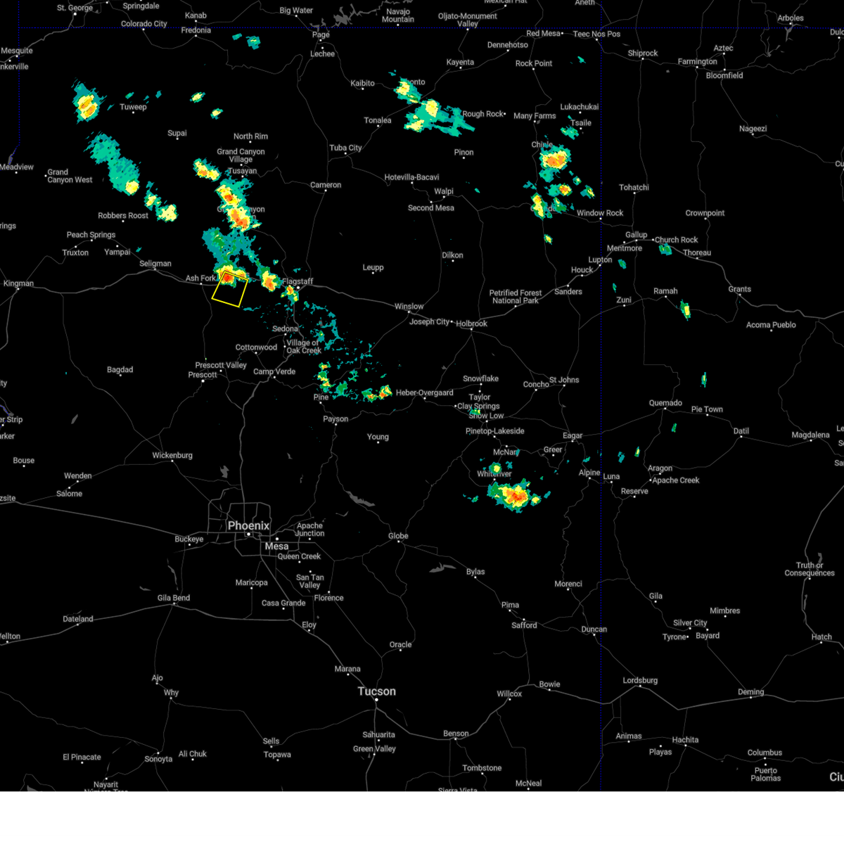
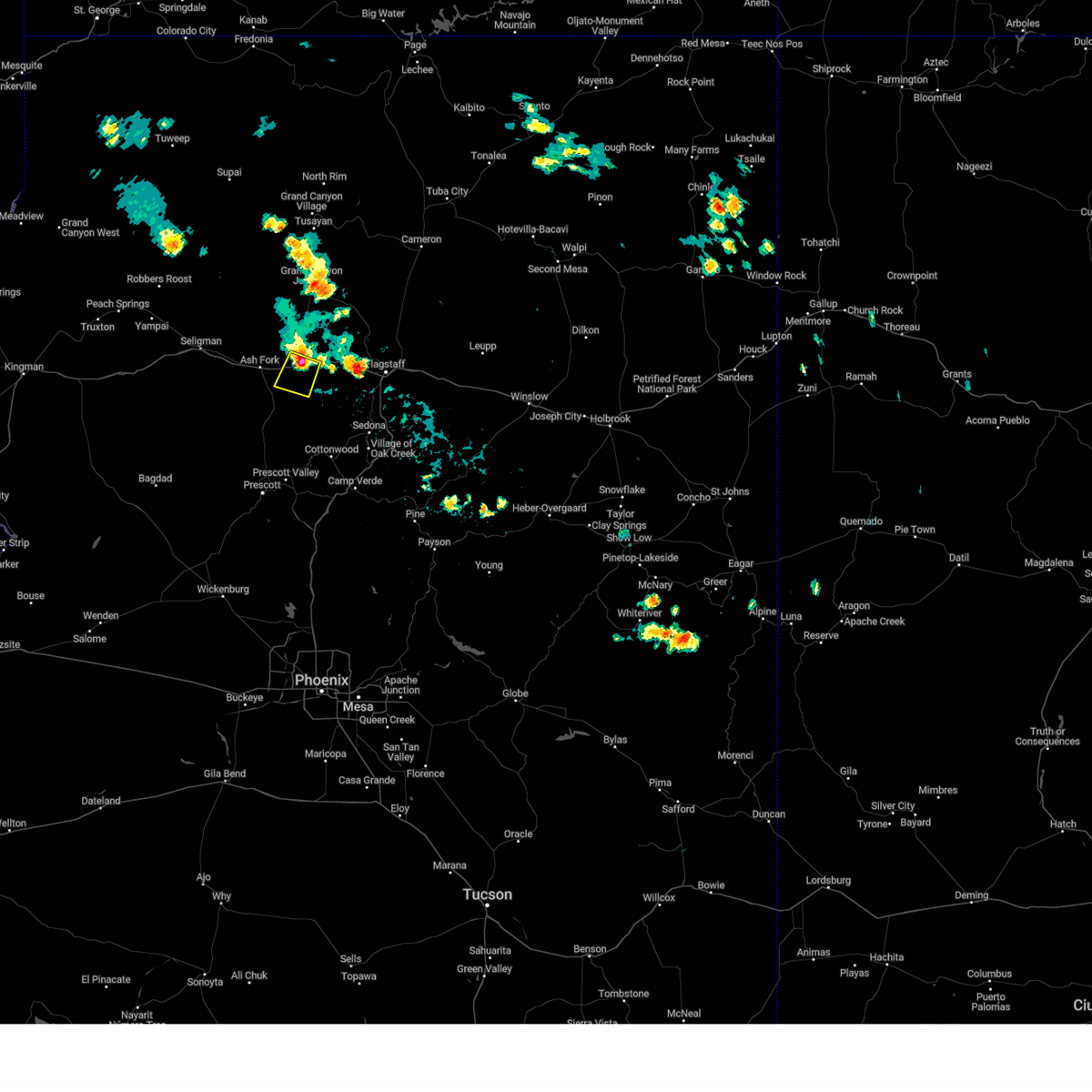
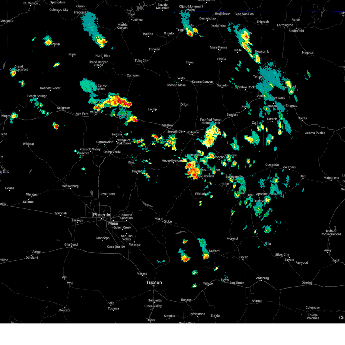
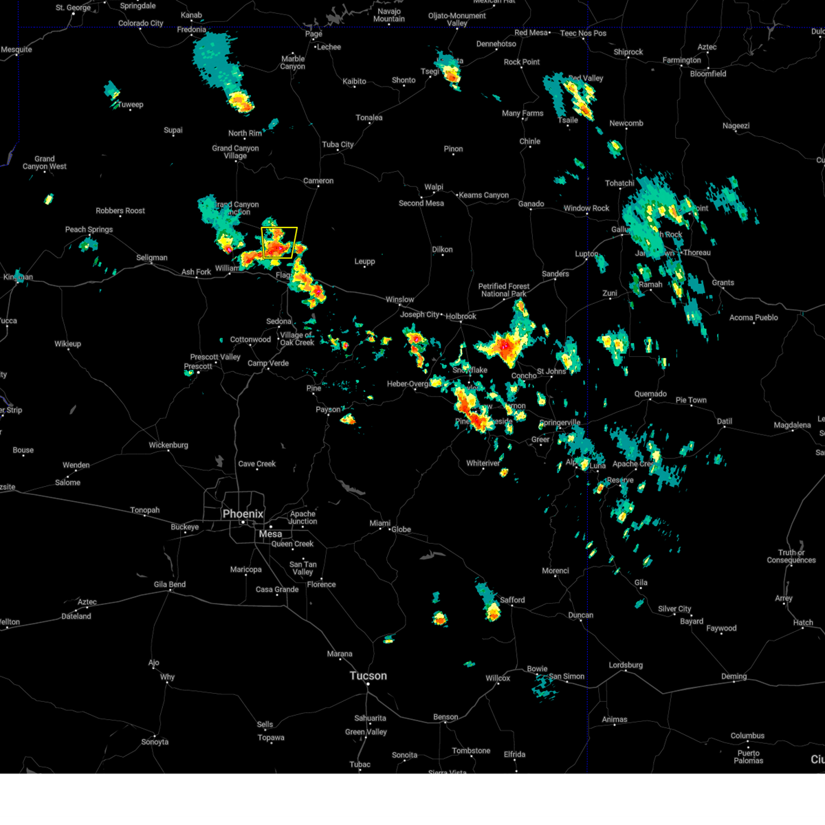
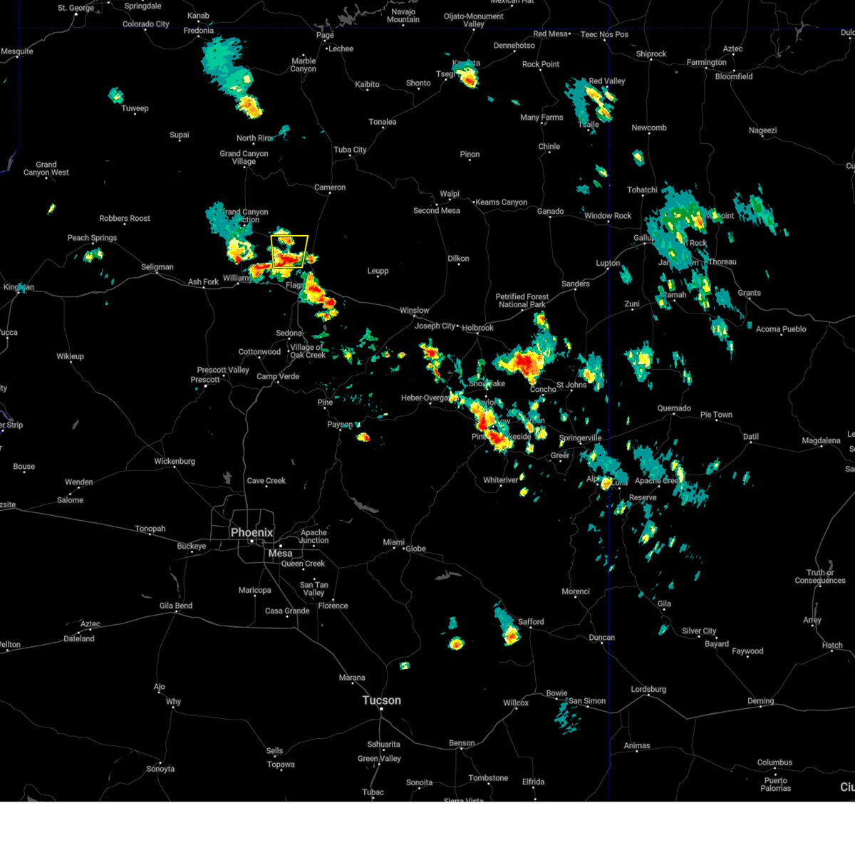
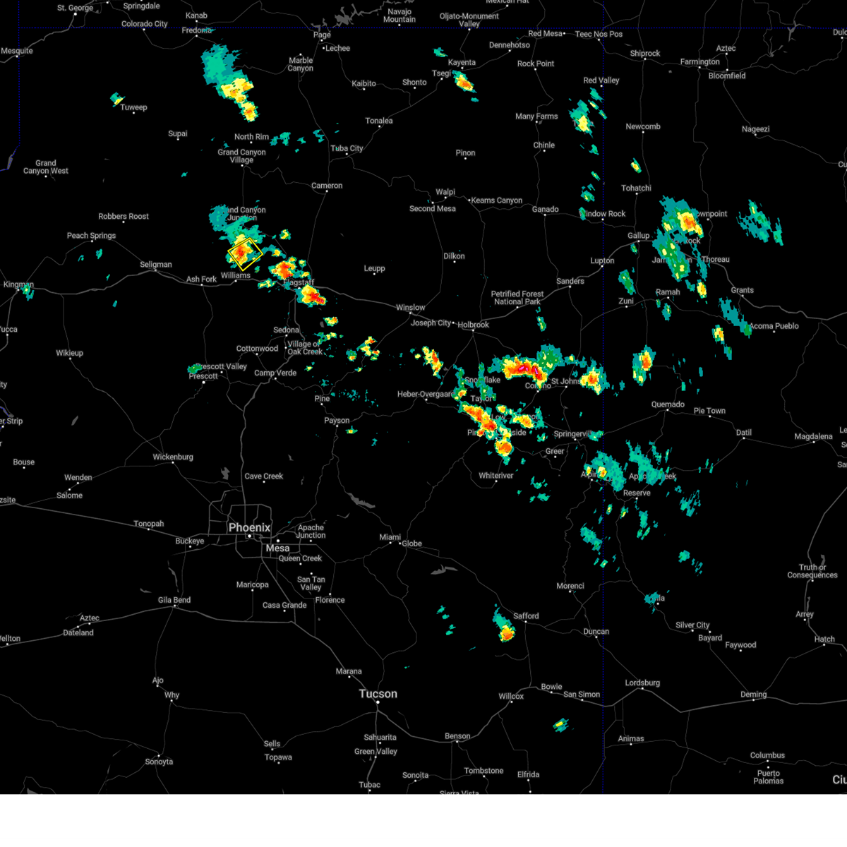
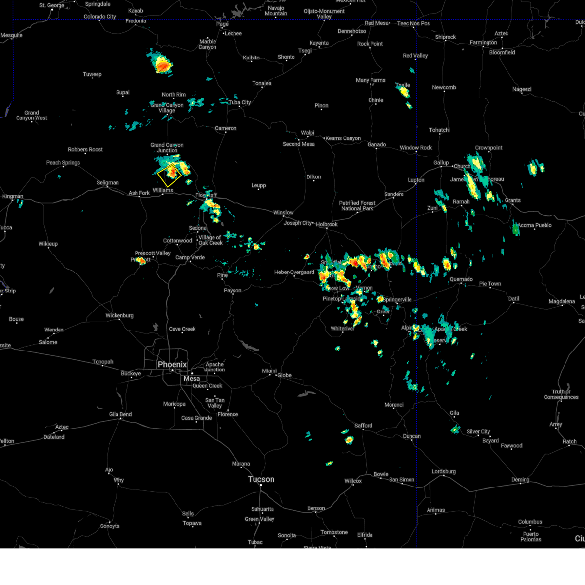
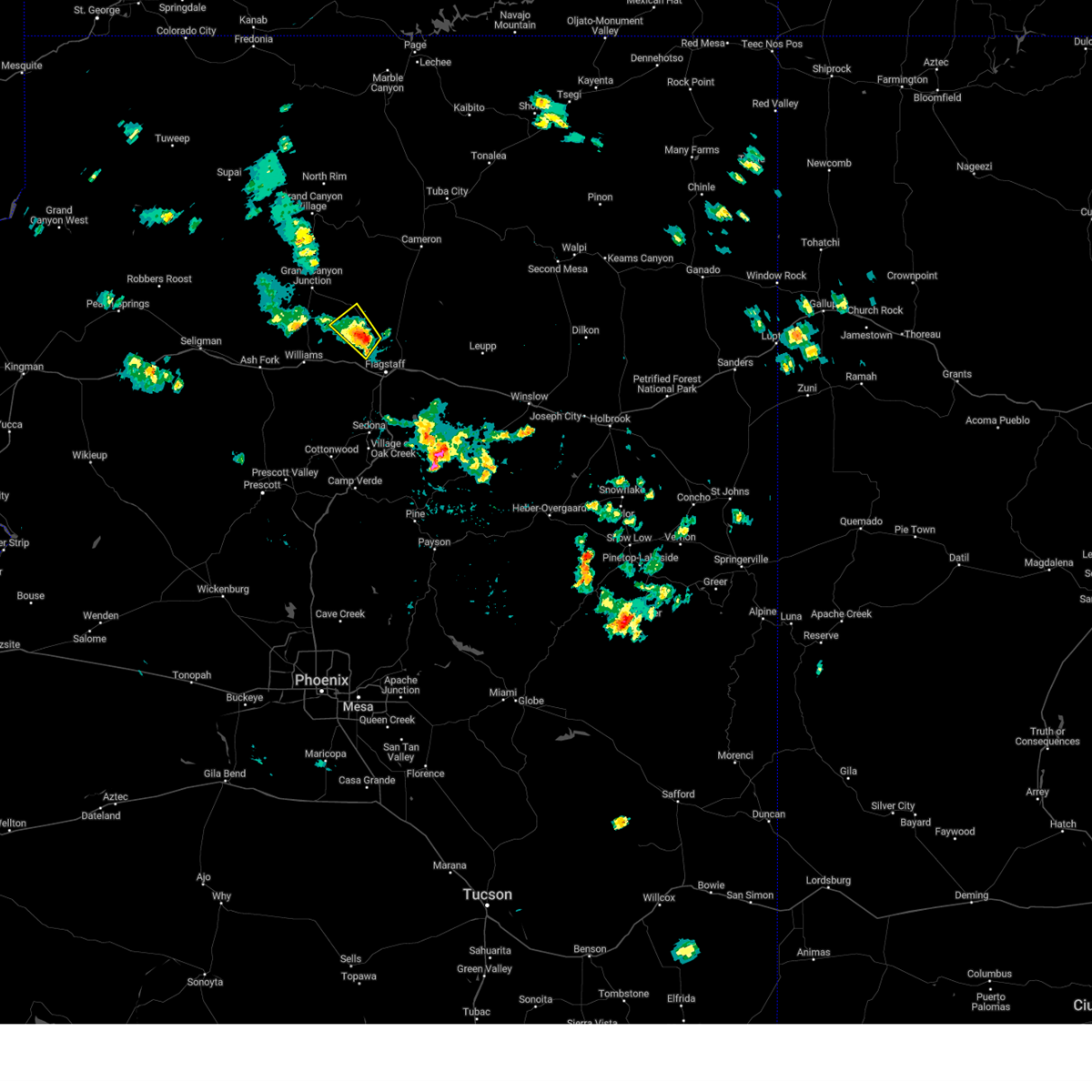
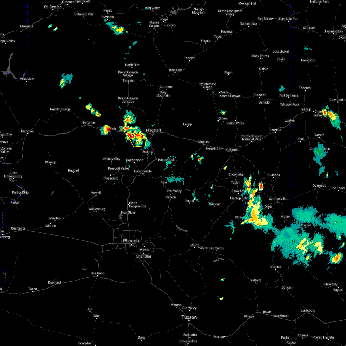
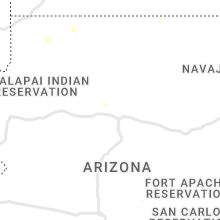
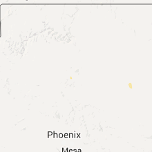
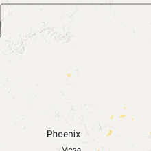
Hail Map for Parks, AZ
The Parks, AZ area has had 2 reports of on-the-ground hail by trained spotters, and has been under severe weather warnings 0 times during the past 12 months. Doppler radar has detected hail at or near Parks, AZ on 45 occasions.
| Name: | Parks, AZ |
| Where Located: | 20.6 miles WNW of Flagstaff, AZ |
| Map: | Google Map for Parks, AZ |
| Population: | 1188 |
| Housing Units: | 1288 |
| More Info: | Search Google for Parks, AZ |
1
The Top Recent Hail Date for Parks, AZ is Wednesday, August 9, 2023 (9th out of 45)

Hail and Wind Damage Spotted near Parks, AZ
| Date / Time | Report Details |
|---|---|
| 7/12/2024 1:38 PM MST |
 the severe thunderstorm warning has been cancelled and is no longer in effect the severe thunderstorm warning has been cancelled and is no longer in effect
|
| 7/12/2024 1:19 PM MST |
 Svrfgz the national weather service in flagstaff has issued a * severe thunderstorm warning for, yavapai county in west central arizona, coconino county in north central arizona, * until 200 pm mst. * at 119 pm mst, a severe thunderstorm was located over bill williams mountain, or 31 miles west of flagstaff, moving south at 20 mph (radar indicated). Hazards include quarter size hail. damage to vehicles is expected Svrfgz the national weather service in flagstaff has issued a * severe thunderstorm warning for, yavapai county in west central arizona, coconino county in north central arizona, * until 200 pm mst. * at 119 pm mst, a severe thunderstorm was located over bill williams mountain, or 31 miles west of flagstaff, moving south at 20 mph (radar indicated). Hazards include quarter size hail. damage to vehicles is expected
|
| 4/25/2024 4:28 PM MST |
 The storm which prompted the warning has weakened below severe limits, and no longer poses an immediate threat to life or property. therefore, the warning will be allowed to expire. however, small hail and gusty winds are still possible with this thunderstorm. The storm which prompted the warning has weakened below severe limits, and no longer poses an immediate threat to life or property. therefore, the warning will be allowed to expire. however, small hail and gusty winds are still possible with this thunderstorm.
|
| 4/25/2024 4:10 PM MST |
 At 409 pm mst, a severe thunderstorm was located over signal mountain, or 33 miles north of chino valley, moving southeast at 15 mph (radar indicated). Hazards include 60 mph wind gusts and penny size hail. Expect damage to roofs, siding, and trees. locations impacted include, williams, dogtown lake, bixter mountain, signal mountain, cataract lake, bill williams mountain, bill williams cg, h. a. clark memorial field, and kaibab lake campground. this includes the following highways, business interstate 40 between mile markers 163 and 165. interstate 40 between mile markers 152 and 168. State route 64 near mile marker 186. At 409 pm mst, a severe thunderstorm was located over signal mountain, or 33 miles north of chino valley, moving southeast at 15 mph (radar indicated). Hazards include 60 mph wind gusts and penny size hail. Expect damage to roofs, siding, and trees. locations impacted include, williams, dogtown lake, bixter mountain, signal mountain, cataract lake, bill williams mountain, bill williams cg, h. a. clark memorial field, and kaibab lake campground. this includes the following highways, business interstate 40 between mile markers 163 and 165. interstate 40 between mile markers 152 and 168. State route 64 near mile marker 186.
|
| 4/25/2024 3:53 PM MST |
 Svrfgz the national weather service in flagstaff has issued a * severe thunderstorm warning for, coconino county in north central arizona, yavapai county in west central arizona, * until 430 pm mst. * at 352 pm mst, a severe thunderstorm was located over corva hill, or 37 miles north of chino valley, moving southeast at 15 mph (radar indicated). Hazards include 60 mph wind gusts and penny size hail. expect damage to roofs, siding, and trees Svrfgz the national weather service in flagstaff has issued a * severe thunderstorm warning for, coconino county in north central arizona, yavapai county in west central arizona, * until 430 pm mst. * at 352 pm mst, a severe thunderstorm was located over corva hill, or 37 miles north of chino valley, moving southeast at 15 mph (radar indicated). Hazards include 60 mph wind gusts and penny size hail. expect damage to roofs, siding, and trees
|
| 8/9/2023 5:19 PM MST |
 At 518 pm mst, a severe thunderstorm was located over lava river cave, or 15 miles northwest of flagstaff, moving east at 20 mph (radar indicated). Hazards include 60 mph wind gusts and penny size hail. Expect damage to roofs, siding, and trees. locations impacted include, bellemont, sherwood forest estates, camp navajo, sitgreaves mountain, government prairie, scholz lake, lava river cave, kendrick peak, parks, oak hill snow play area, wing mountain, and a1 mountain. this includes the following highways, interstate 40 between mile markers 169 and 190. Highway 180 between mile markers 226 and 234, and near mile marker 240. At 518 pm mst, a severe thunderstorm was located over lava river cave, or 15 miles northwest of flagstaff, moving east at 20 mph (radar indicated). Hazards include 60 mph wind gusts and penny size hail. Expect damage to roofs, siding, and trees. locations impacted include, bellemont, sherwood forest estates, camp navajo, sitgreaves mountain, government prairie, scholz lake, lava river cave, kendrick peak, parks, oak hill snow play area, wing mountain, and a1 mountain. this includes the following highways, interstate 40 between mile markers 169 and 190. Highway 180 between mile markers 226 and 234, and near mile marker 240.
|
| 8/9/2023 4:58 PM MST |
 At 457 pm mst, a severe thunderstorm was located near sitgreaves mountain, or 21 miles west of flagstaff, moving east at 20 mph (radar indicated). Hazards include 60 mph wind gusts and quarter size hail. Hail damage to vehicles is expected. Expect wind damage to roofs, siding, and trees. At 457 pm mst, a severe thunderstorm was located near sitgreaves mountain, or 21 miles west of flagstaff, moving east at 20 mph (radar indicated). Hazards include 60 mph wind gusts and quarter size hail. Hail damage to vehicles is expected. Expect wind damage to roofs, siding, and trees.
|
| 8/2/2023 12:58 PM MST |
 The severe thunderstorm warning for near parks in coconino county will expire at 100 pm mst, the storm which prompted the warning has weakened below severe limits, and no longer poses an immediate threat to life or property. therefore, the warning will be allowed to expire. however, gusty winds and heavy rain are still occurring with this thunderstorm. The severe thunderstorm warning for near parks in coconino county will expire at 100 pm mst, the storm which prompted the warning has weakened below severe limits, and no longer poses an immediate threat to life or property. therefore, the warning will be allowed to expire. however, gusty winds and heavy rain are still occurring with this thunderstorm.
|
| 8/2/2023 12:47 PM MST |
 At 1246 pm mst, a severe thunderstorm was located near parks, or 19 miles west of flagstaff, moving northeast at 20 mph (radar indicated). Hazards include 60 mph wind gusts and penny size hail. Expect damage to roofs, siding, and trees. locations impacted include, bellemont, parks, raymond boy scout camp, dogtown lake campground, and white horse lake campground. this includes interstate 40 between mile markers 170 and 188. hail threat, radar indicated max hail size, 0. 75 in wind threat, radar indicated max wind gust, 60 mph. At 1246 pm mst, a severe thunderstorm was located near parks, or 19 miles west of flagstaff, moving northeast at 20 mph (radar indicated). Hazards include 60 mph wind gusts and penny size hail. Expect damage to roofs, siding, and trees. locations impacted include, bellemont, parks, raymond boy scout camp, dogtown lake campground, and white horse lake campground. this includes interstate 40 between mile markers 170 and 188. hail threat, radar indicated max hail size, 0. 75 in wind threat, radar indicated max wind gust, 60 mph.
|
| 8/2/2023 12:36 PM MST |
 At 1236 pm mst, a severe thunderstorm was located 7 miles southwest of parks, or 22 miles west of flagstaff, moving northeast at 20 mph (radar indicated). Hazards include 60 mph wind gusts and quarter size hail. Hail damage to vehicles is expected. Expect wind damage to roofs, siding, and trees. At 1236 pm mst, a severe thunderstorm was located 7 miles southwest of parks, or 22 miles west of flagstaff, moving northeast at 20 mph (radar indicated). Hazards include 60 mph wind gusts and quarter size hail. Hail damage to vehicles is expected. Expect wind damage to roofs, siding, and trees.
|
| 7/31/2023 1:25 PM MST |
 The severe thunderstorm warning for coconino county will expire at 130 pm mst, the storm which prompted the warning has weakened below severe limits, and no longer poses an immediate threat to life or property. therefore, the warning will be allowed to expire. however, small hail, gusty winds and heavy rain are still possible with this thunderstorm. The severe thunderstorm warning for coconino county will expire at 130 pm mst, the storm which prompted the warning has weakened below severe limits, and no longer poses an immediate threat to life or property. therefore, the warning will be allowed to expire. however, small hail, gusty winds and heavy rain are still possible with this thunderstorm.
|
| 7/31/2023 1:02 PM MST |
 At 102 pm mst, a severe thunderstorm was located 14 miles northwest of wupatki trails, or 20 miles northwest of flagstaff, moving north at 20 mph (radar indicated). Hazards include 60 mph wind gusts and half dollar size hail. Hail damage to vehicles is expected. expect wind damage to roofs, siding, and trees. this severe thunderstorm will remain over mainly rural areas of coconino county. this includes highway 180 between mile markers 232 and 250. hail threat, radar indicated max hail size, 1. 25 in wind threat, radar indicated max wind gust, 60 mph. At 102 pm mst, a severe thunderstorm was located 14 miles northwest of wupatki trails, or 20 miles northwest of flagstaff, moving north at 20 mph (radar indicated). Hazards include 60 mph wind gusts and half dollar size hail. Hail damage to vehicles is expected. expect wind damage to roofs, siding, and trees. this severe thunderstorm will remain over mainly rural areas of coconino county. this includes highway 180 between mile markers 232 and 250. hail threat, radar indicated max hail size, 1. 25 in wind threat, radar indicated max wind gust, 60 mph.
|
| 7/31/2023 12:55 PM MST |
 At 1255 pm mst, a severe thunderstorm was located 13 miles north of fort valley, or 19 miles northwest of flagstaff, moving north at 20 mph (radar indicated). Hazards include 60 mph wind gusts and quarter size hail. Hail damage to vehicles is expected. expect wind damage to roofs, siding, and trees. this severe thunderstorm will remain over mainly rural areas of coconino county. this includes highway 180 between mile markers 232 and 250. hail threat, radar indicated max hail size, 1. 00 in wind threat, radar indicated max wind gust, 60 mph. At 1255 pm mst, a severe thunderstorm was located 13 miles north of fort valley, or 19 miles northwest of flagstaff, moving north at 20 mph (radar indicated). Hazards include 60 mph wind gusts and quarter size hail. Hail damage to vehicles is expected. expect wind damage to roofs, siding, and trees. this severe thunderstorm will remain over mainly rural areas of coconino county. this includes highway 180 between mile markers 232 and 250. hail threat, radar indicated max hail size, 1. 00 in wind threat, radar indicated max wind gust, 60 mph.
|
| 7/31/2023 12:36 PM MST |
 The severe thunderstorm warning for coconino county will expire at 1245 pm mst, the storm which prompted the warning has weakened below severe limits, and no longer poses an immediate threat to life or property. therefore, the warning will be allowed to expire. The severe thunderstorm warning for coconino county will expire at 1245 pm mst, the storm which prompted the warning has weakened below severe limits, and no longer poses an immediate threat to life or property. therefore, the warning will be allowed to expire.
|
| 7/31/2023 12:15 PM MST |
 At 1214 pm mst, a severe thunderstorm was located 14 miles north of williams, or 31 miles northwest of flagstaff, moving southwest at 10 mph (radar indicated). Hazards include 60 mph wind gusts and quarter size hail. Hail damage to vehicles is expected. expect wind damage to roofs, siding, and trees. this severe thunderstorm will remain over mainly rural areas of coconino county. this includes state route 64 between mile markers 193 and 202. hail threat, radar indicated max hail size, 1. 00 in wind threat, radar indicated max wind gust, 60 mph. At 1214 pm mst, a severe thunderstorm was located 14 miles north of williams, or 31 miles northwest of flagstaff, moving southwest at 10 mph (radar indicated). Hazards include 60 mph wind gusts and quarter size hail. Hail damage to vehicles is expected. expect wind damage to roofs, siding, and trees. this severe thunderstorm will remain over mainly rural areas of coconino county. this includes state route 64 between mile markers 193 and 202. hail threat, radar indicated max hail size, 1. 00 in wind threat, radar indicated max wind gust, 60 mph.
|
| 7/25/2023 3:43 PM MST |
 At 342 pm mst, a severe thunderstorm was located near perkinsville, or 16 miles west of sedona, moving northeast at 15 mph (radar indicated). Hazards include 60 mph wind gusts and quarter size hail. Hail damage to vehicles is expected. Expect wind damage to roofs, siding, and trees. At 342 pm mst, a severe thunderstorm was located near perkinsville, or 16 miles west of sedona, moving northeast at 15 mph (radar indicated). Hazards include 60 mph wind gusts and quarter size hail. Hail damage to vehicles is expected. Expect wind damage to roofs, siding, and trees.
|
| 7/23/2023 1:50 PM MST |
 At 149 pm mst, a severe thunderstorm was located near kendrick peak and lava river cave or 7 miles northwest of fort valley, moving northwest at 5 mph (radar indicated). Hazards include 60 mph wind gusts and quarter size hail. Hail damage to vehicles is expected. expect wind damage to roofs, siding, and trees. this includes highway 180 between mile markers 227 and 248. hail threat, radar indicated max hail size, 1. 00 in wind threat, radar indicated max wind gust, 60 mph. At 149 pm mst, a severe thunderstorm was located near kendrick peak and lava river cave or 7 miles northwest of fort valley, moving northwest at 5 mph (radar indicated). Hazards include 60 mph wind gusts and quarter size hail. Hail damage to vehicles is expected. expect wind damage to roofs, siding, and trees. this includes highway 180 between mile markers 227 and 248. hail threat, radar indicated max hail size, 1. 00 in wind threat, radar indicated max wind gust, 60 mph.
|
| 7/23/2023 1:42 PM MST |
 At 141 pm mst, a severe thunderstorm was located near lava river cave or 7 miles north of fort valley, moving northwest at 15 mph (radar indicated). Hazards include 60 mph wind gusts and quarter size hail. Hail damage to vehicles is expected. Expect wind damage to roofs, siding, and trees. At 141 pm mst, a severe thunderstorm was located near lava river cave or 7 miles north of fort valley, moving northwest at 15 mph (radar indicated). Hazards include 60 mph wind gusts and quarter size hail. Hail damage to vehicles is expected. Expect wind damage to roofs, siding, and trees.
|
| 7/23/2023 1:09 PM MST |
 At 107 pm mst, a severe thunderstorm was located near red lake or 11 miles northeast of williams. this storm was drifting to the west at around 5 mph (radar indicated). Hazards include 60 mph wind gusts and quarter size hail. Hail damage to vehicles is expected. expect wind damage to roofs, siding, and trees. this severe thunderstorm will impact areas near red lake and locations 11 miles north of williams, including state highway 64. this includes state highway 64 between mile markers 190 and 201. hail threat, radar indicated max hail size, 1. 00 in wind threat, radar indicated max wind gust, 60 mph. At 107 pm mst, a severe thunderstorm was located near red lake or 11 miles northeast of williams. this storm was drifting to the west at around 5 mph (radar indicated). Hazards include 60 mph wind gusts and quarter size hail. Hail damage to vehicles is expected. expect wind damage to roofs, siding, and trees. this severe thunderstorm will impact areas near red lake and locations 11 miles north of williams, including state highway 64. this includes state highway 64 between mile markers 190 and 201. hail threat, radar indicated max hail size, 1. 00 in wind threat, radar indicated max wind gust, 60 mph.
|
| 7/23/2023 12:56 PM MST |
 At 1255 pm mst, a severe thunderstorm was located 11 miles northeast of williams, drifting to the west at around 5 mph (radar indicated). Hazards include 60 mph wind gusts and quarter size hail. Hail damage to vehicles is expected. expect wind damage to roofs, siding, and trees. this severe thunderstorm will impact areas near cedar mountain heights and red lake this includes state route 64 between mile markers 188 and 201. hail threat, radar indicated max hail size, 1. 00 in wind threat, radar indicated max wind gust, 60 mph. At 1255 pm mst, a severe thunderstorm was located 11 miles northeast of williams, drifting to the west at around 5 mph (radar indicated). Hazards include 60 mph wind gusts and quarter size hail. Hail damage to vehicles is expected. expect wind damage to roofs, siding, and trees. this severe thunderstorm will impact areas near cedar mountain heights and red lake this includes state route 64 between mile markers 188 and 201. hail threat, radar indicated max hail size, 1. 00 in wind threat, radar indicated max wind gust, 60 mph.
|
| 10/3/2022 12:41 PM MST |
 At 1240 pm mst, a severe thunderstorm was located 9 miles north of williams, or 35 miles west of flagstaff, moving east at 15 mph (radar indicated). Hazards include quarter size hail. Damage to vehicles is expected. this severe thunderstorm will remain over mainly rural areas of coconino county. This includes state route 64 between mile markers 190 and 202. At 1240 pm mst, a severe thunderstorm was located 9 miles north of williams, or 35 miles west of flagstaff, moving east at 15 mph (radar indicated). Hazards include quarter size hail. Damage to vehicles is expected. this severe thunderstorm will remain over mainly rural areas of coconino county. This includes state route 64 between mile markers 190 and 202.
|
| 9/6/2022 2:11 PM MST |
 The severe thunderstorm warning for coconino county will expire at 215 pm mst, the storm which prompted the warning norther of williams has weakened below severe limits, and no longer poses an immediate threat to life or property. therefore, the warning will be allowed to expire. The severe thunderstorm warning for coconino county will expire at 215 pm mst, the storm which prompted the warning norther of williams has weakened below severe limits, and no longer poses an immediate threat to life or property. therefore, the warning will be allowed to expire.
|
| 9/6/2022 1:41 PM MST |
 At 140 pm mst, a severe thunderstorm was located 9 miles north of williams, moving west at 15 mph (radar indicated). Hazards include 60 mph wind gusts and quarter size hail. Hail damage to vehicles is expected. expect wind damage to roofs, siding, and trees. this severe thunderstorm will remain over mainly rural areas of coconino county. this includes state route 64 between mile markers 188 and 202. hail threat, radar indicated max hail size, 1. 00 in wind threat, radar indicated max wind gust, 60 mph. At 140 pm mst, a severe thunderstorm was located 9 miles north of williams, moving west at 15 mph (radar indicated). Hazards include 60 mph wind gusts and quarter size hail. Hail damage to vehicles is expected. expect wind damage to roofs, siding, and trees. this severe thunderstorm will remain over mainly rural areas of coconino county. this includes state route 64 between mile markers 188 and 202. hail threat, radar indicated max hail size, 1. 00 in wind threat, radar indicated max wind gust, 60 mph.
|
| 8/17/2021 1:39 PM MST |
 The severe thunderstorm warning for coconino county will expire at 145 pm mst, the storm which prompted the warning has weakened below severe limits, and no longer poses an immediate threat to life or property. therefore, the warning will be allowed to expire. however a flash flood warning continues for this area and heavy rain is still possible with this thunderstorm. The severe thunderstorm warning for coconino county will expire at 145 pm mst, the storm which prompted the warning has weakened below severe limits, and no longer poses an immediate threat to life or property. therefore, the warning will be allowed to expire. however a flash flood warning continues for this area and heavy rain is still possible with this thunderstorm.
|
| 8/17/2021 12:59 PM MST |
 At 1258 pm mst, a severe thunderstorm was located over fort valley, or 7 miles northwest of flagstaff, and is nearly stationary (radar indicated). Hazards include 60 mph wind gusts and quarter size hail. Hail damage to vehicles is expected. Expect wind damage to roofs, siding, and trees. At 1258 pm mst, a severe thunderstorm was located over fort valley, or 7 miles northwest of flagstaff, and is nearly stationary (radar indicated). Hazards include 60 mph wind gusts and quarter size hail. Hail damage to vehicles is expected. Expect wind damage to roofs, siding, and trees.
|
| 7/29/2021 12:36 PM MST |
 At 1236 pm mst, a severe thunderstorm was located over parks, or 20 miles west of flagstaff, moving northwest at 15 mph (radar indicated). Hazards include quarter size hail. damage to vehicles is expected At 1236 pm mst, a severe thunderstorm was located over parks, or 20 miles west of flagstaff, moving northwest at 15 mph (radar indicated). Hazards include quarter size hail. damage to vehicles is expected
|
| 7/12/2021 5:56 PM MST |
 At 555 pm mst, a severe thunderstorm was located 10 miles south of parks, moving southeast at 20 mph (radar indicated). Hazards include half dollar size hail. damage to vehicles is expected At 555 pm mst, a severe thunderstorm was located 10 miles south of parks, moving southeast at 20 mph (radar indicated). Hazards include half dollar size hail. damage to vehicles is expected
|
| 8/2/2019 2:10 PM MST | Quarter sized hail reported 6 miles NNW of Parks, AZ, quarter sized hail just south of the parks exit on i-40. |
| 8/2/2019 2:08 PM MST |
 At 207 pm mst, a severe thunderstorm was located over parks, or 19 miles west of flagstaff, moving northwest at 15 mph (radar indicated). Hazards include quarter size hail. damage to vehicles is expected At 207 pm mst, a severe thunderstorm was located over parks, or 19 miles west of flagstaff, moving northwest at 15 mph (radar indicated). Hazards include quarter size hail. damage to vehicles is expected
|
| 10/3/2018 4:58 PM MST |
 The severe thunderstorm warning for coconino county will expire at 500 pm mst, the severe thunderstorm south of parks has weakened below severe limits, and no longer poses an immediate threat to life or property. therefore, the warning will be allowed to expire. small hail and heavy rain are still possible with this thunderstorm from parks to west of bellemont. The severe thunderstorm warning for coconino county will expire at 500 pm mst, the severe thunderstorm south of parks has weakened below severe limits, and no longer poses an immediate threat to life or property. therefore, the warning will be allowed to expire. small hail and heavy rain are still possible with this thunderstorm from parks to west of bellemont.
|
| 10/3/2018 4:26 PM MST |
 At 425 pm mst, a pair of severe thunderstorms were located 10 miles southwest of parks, moving northeast at 25 to 30 mph (radar indicated). Hazards include 60 mph wind gusts and half dollar size hail. Hail damage to vehicles is expected. Expect wind damage to roofs, siding, and trees. At 425 pm mst, a pair of severe thunderstorms were located 10 miles southwest of parks, moving northeast at 25 to 30 mph (radar indicated). Hazards include 60 mph wind gusts and half dollar size hail. Hail damage to vehicles is expected. Expect wind damage to roofs, siding, and trees.
|
| 8/11/2018 1:30 PM MST |
 At 129 pm mst, a severe thunderstorm was located near williams, or 30 miles west of flagstaff, moving west at 10 mph (radar indicated). Hazards include 60 mph wind gusts and half dollar size hail. Hail damage to vehicles is expected. Expect wind damage to roofs, siding, and trees. At 129 pm mst, a severe thunderstorm was located near williams, or 30 miles west of flagstaff, moving west at 10 mph (radar indicated). Hazards include 60 mph wind gusts and half dollar size hail. Hail damage to vehicles is expected. Expect wind damage to roofs, siding, and trees.
|
| 8/11/2018 1:01 PM MST |
 At 100 pm mst, a severe thunderstorm was located near williams, or 32 miles west of flagstaff, moving west at 15 mph (radar indicated). Hazards include 60 mph wind gusts and half dollar size hail. Hail damage to vehicles is expected. expect wind damage to roofs, siding, and trees. locations impacted include, williams, dogtown lake campground and kaibab lake campground. this includes the following highways, business interstate 40 between mile markers 163 and 165. interstate 40 between mile markers 153 and 172. State route 64 between mile markers 186 and 197. At 100 pm mst, a severe thunderstorm was located near williams, or 32 miles west of flagstaff, moving west at 15 mph (radar indicated). Hazards include 60 mph wind gusts and half dollar size hail. Hail damage to vehicles is expected. expect wind damage to roofs, siding, and trees. locations impacted include, williams, dogtown lake campground and kaibab lake campground. this includes the following highways, business interstate 40 between mile markers 163 and 165. interstate 40 between mile markers 153 and 172. State route 64 between mile markers 186 and 197.
|
| 8/11/2018 12:41 PM MST |
 At 1241 pm mst, a severe thunderstorm was located near williams, or 27 miles west of flagstaff, moving west at 15 mph (radar indicated). Hazards include 60 mph wind gusts and half dollar size hail. Hail damage to vehicles is expected. Expect wind damage to roofs, siding, and trees. At 1241 pm mst, a severe thunderstorm was located near williams, or 27 miles west of flagstaff, moving west at 15 mph (radar indicated). Hazards include 60 mph wind gusts and half dollar size hail. Hail damage to vehicles is expected. Expect wind damage to roofs, siding, and trees.
|
| 8/10/2018 5:13 PM MST |
 At 451 pm mst, a severe thunderstorm was located near williams, or 29 miles west of flagstaff, moving west at 15 mph (radar indicated). Hazards include quarter size hail. damage to vehicles is expected At 451 pm mst, a severe thunderstorm was located near williams, or 29 miles west of flagstaff, moving west at 15 mph (radar indicated). Hazards include quarter size hail. damage to vehicles is expected
|
| 8/10/2018 4:52 PM MST |
 At 451 pm mst, a severe thunderstorm was located near williams, or 29 miles west of flagstaff, moving west at 15 mph (radar indicated). Hazards include quarter size hail. damage to vehicles is expected At 451 pm mst, a severe thunderstorm was located near williams, or 29 miles west of flagstaff, moving west at 15 mph (radar indicated). Hazards include quarter size hail. damage to vehicles is expected
|
| 8/10/2018 3:51 PM MST |
 At 351 pm mst, a severe thunderstorm was located 13 miles southwest of williams, or 24 miles northeast of chino valley, moving southwest at 20 mph (radar indicated). Hazards include quarter size hail. Damage to vehicles is expected. locations impacted include, williams, perkinsville, ash fork and dogtown lake campground. this includes the following highways, business interstate 40 between mile markers 146 and 165. interstate 40 between mile markers 144 and 163, and between mile markers 166 and 168. State route 89 between mile markers 358 and 363. At 351 pm mst, a severe thunderstorm was located 13 miles southwest of williams, or 24 miles northeast of chino valley, moving southwest at 20 mph (radar indicated). Hazards include quarter size hail. Damage to vehicles is expected. locations impacted include, williams, perkinsville, ash fork and dogtown lake campground. this includes the following highways, business interstate 40 between mile markers 146 and 165. interstate 40 between mile markers 144 and 163, and between mile markers 166 and 168. State route 89 between mile markers 358 and 363.
|
| 8/10/2018 3:29 PM MST |
 At 329 pm mst, a severe thunderstorm was located 7 miles south of williams, or 28 miles northwest of sedona, moving southwest at 15 mph (radar indicated). Hazards include 60 mph wind gusts and quarter size hail. Hail damage to vehicles is expected. Expect wind damage to roofs, siding, and trees. At 329 pm mst, a severe thunderstorm was located 7 miles south of williams, or 28 miles northwest of sedona, moving southwest at 15 mph (radar indicated). Hazards include 60 mph wind gusts and quarter size hail. Hail damage to vehicles is expected. Expect wind damage to roofs, siding, and trees.
|
| 8/10/2018 2:53 PM MST |
 At 253 pm mst, a severe thunderstorm was located 8 miles southeast of williams, or 26 miles northwest of sedona, moving southwest at 15 mph (radar indicated). Hazards include 60 mph wind gusts and quarter size hail. Hail damage to vehicles is expected. expect wind damage to roofs, siding, and trees. locations impacted include, williams, raymond boy scout camp, dogtown lake campground and white horse lake campground. this includes the following highways, business interstate 40 between mile markers 163 and 165. interstate 40 between mile markers 150 and 177. State route 64 near mile marker 186. At 253 pm mst, a severe thunderstorm was located 8 miles southeast of williams, or 26 miles northwest of sedona, moving southwest at 15 mph (radar indicated). Hazards include 60 mph wind gusts and quarter size hail. Hail damage to vehicles is expected. expect wind damage to roofs, siding, and trees. locations impacted include, williams, raymond boy scout camp, dogtown lake campground and white horse lake campground. this includes the following highways, business interstate 40 between mile markers 163 and 165. interstate 40 between mile markers 150 and 177. State route 64 near mile marker 186.
|
| 8/10/2018 2:38 PM MST |
 At 238 pm mst, a severe thunderstorm was located 7 miles southwest of parks, or 23 miles west of flagstaff, moving southwest at 15 mph (radar indicated). Hazards include 60 mph wind gusts and quarter size hail. Hail damage to vehicles is expected. Expect wind damage to roofs, siding, and trees. At 238 pm mst, a severe thunderstorm was located 7 miles southwest of parks, or 23 miles west of flagstaff, moving southwest at 15 mph (radar indicated). Hazards include 60 mph wind gusts and quarter size hail. Hail damage to vehicles is expected. Expect wind damage to roofs, siding, and trees.
|
| 8/9/2018 4:58 PM MST |
 The national weather service in flagstaff has issued a * severe thunderstorm warning for. yavapai county in west central arizona. coconino county in north central arizona. Until 545 pm mst * at 458 pm mst, severe thunderstorms were located along a line. The national weather service in flagstaff has issued a * severe thunderstorm warning for. yavapai county in west central arizona. coconino county in north central arizona. Until 545 pm mst * at 458 pm mst, severe thunderstorms were located along a line.
|
| 8/9/2018 4:49 PM MST |
 At 448 pm mst, a severe thunderstorm was located near williams, or 26 miles west of flagstaff, moving west at 10 mph (radar indicated). Hazards include 60 mph wind gusts and half dollar size hail. Hail damage to vehicles is expected. expect wind damage to roofs, siding, and trees. locations impacted include, williams, parks, raymond boy scout camp, dogtown lake campground, kaibab lake campground and white horse lake campground. this includes the following highways, business interstate 40 between mile markers 163 and 165. interstate 40 between mile markers 162 and 183. State route 64 between mile markers 186 and 196. At 448 pm mst, a severe thunderstorm was located near williams, or 26 miles west of flagstaff, moving west at 10 mph (radar indicated). Hazards include 60 mph wind gusts and half dollar size hail. Hail damage to vehicles is expected. expect wind damage to roofs, siding, and trees. locations impacted include, williams, parks, raymond boy scout camp, dogtown lake campground, kaibab lake campground and white horse lake campground. this includes the following highways, business interstate 40 between mile markers 163 and 165. interstate 40 between mile markers 162 and 183. State route 64 between mile markers 186 and 196.
|
| 8/9/2018 4:03 PM MST |
 At 403 pm mst, a severe thunderstorm was located just south of parks, or 18 miles west of flagstaff, moving west at 10 mph (radar indicated). Hazards include 60 mph wind gusts and half dollar size hail. Hail damage to vehicles is expected. Expect wind damage to roofs, siding, and trees. At 403 pm mst, a severe thunderstorm was located just south of parks, or 18 miles west of flagstaff, moving west at 10 mph (radar indicated). Hazards include 60 mph wind gusts and half dollar size hail. Hail damage to vehicles is expected. Expect wind damage to roofs, siding, and trees.
|
| 8/9/2018 3:47 PM MST |
 At 347 pm mst, a severe thunderstorm was located near parks, or 18 miles west of flagstaff, moving west at 20 mph (trained weather spotters). Hazards include 60 mph wind gusts and quarter size hail. Hail damage to vehicles is expected. expect wind damage to roofs, siding, and trees. locations impacted include, bellemont, parks, white horse lake campground, raymond boy scout camp, sterling fish hatchery, dogtown lake campground and kaibab lake campground. this includes the following highways, interstate 40 between mile markers 166 and 191. state route 64 between mile markers 186 and 193. state route 89a between mile markers 388 and 396. Highway 180 near mile marker 225. At 347 pm mst, a severe thunderstorm was located near parks, or 18 miles west of flagstaff, moving west at 20 mph (trained weather spotters). Hazards include 60 mph wind gusts and quarter size hail. Hail damage to vehicles is expected. expect wind damage to roofs, siding, and trees. locations impacted include, bellemont, parks, white horse lake campground, raymond boy scout camp, sterling fish hatchery, dogtown lake campground and kaibab lake campground. this includes the following highways, interstate 40 between mile markers 166 and 191. state route 64 between mile markers 186 and 193. state route 89a between mile markers 388 and 396. Highway 180 near mile marker 225.
|
| 8/9/2018 3:33 PM MST | Hen Egg sized hail reported 11.2 miles NW of Parks, AZ, measured up to 2 inch hail stones on camp navajo. the duration of the hail event was 10 minutes. |
| 8/9/2018 3:31 PM MST |
 At 330 pm mst, a severe thunderstorm was located over bellemont, or 12 miles west of flagstaff, moving west at 20 mph (trained spotter indicated). Hazards include 60 mph wind gusts and half dollar size hail. Hail damage to vehicles is expected. Expect wind damage to roofs, siding, and trees. At 330 pm mst, a severe thunderstorm was located over bellemont, or 12 miles west of flagstaff, moving west at 20 mph (trained spotter indicated). Hazards include 60 mph wind gusts and half dollar size hail. Hail damage to vehicles is expected. Expect wind damage to roofs, siding, and trees.
|
| 7/21/2018 3:38 PM MST |
 At 335 pm mst, a severe thunderstorm was located 5 miles north of fort valley, or 10 miles northwest of flagstaff, moving north at 10 mph (radar indicated). Hazards include quarter size hail. Damage to vehicles is expected. locations impacted include, fort valley. This includes highway 180 between mile markers 221 and 240 and interstate 40 near mile marker 183. At 335 pm mst, a severe thunderstorm was located 5 miles north of fort valley, or 10 miles northwest of flagstaff, moving north at 10 mph (radar indicated). Hazards include quarter size hail. Damage to vehicles is expected. locations impacted include, fort valley. This includes highway 180 between mile markers 221 and 240 and interstate 40 near mile marker 183.
|
| 7/21/2018 3:10 PM MST |
 At 309 pm mst, a severe thunderstorm was located over fort valley, or 10 miles northwest of flagstaff, moving north at 15 mph (radar indicated). Hazards include quarter size hail. damage to vehicles is expected At 309 pm mst, a severe thunderstorm was located over fort valley, or 10 miles northwest of flagstaff, moving north at 15 mph (radar indicated). Hazards include quarter size hail. damage to vehicles is expected
|
| 7/19/2018 2:56 PM MST |
 The severe thunderstorm warning for coconino county will expire at 300 pm mst, the severe thunderstorm east of williams which prompted the warning has weakened below severe limits, and no longer poses an immediate threat to life or property. therefore, the warning will be allowed to expire. heavy rain is still occurring with this thunderstorm. The severe thunderstorm warning for coconino county will expire at 300 pm mst, the severe thunderstorm east of williams which prompted the warning has weakened below severe limits, and no longer poses an immediate threat to life or property. therefore, the warning will be allowed to expire. heavy rain is still occurring with this thunderstorm.
|
| 7/19/2018 2:10 PM MST |
 At 208 pm mst, a severe thunderstorm was located 7 miles southeast of williams, moving northwest at 15 mph (radar indicated). Hazards include quarter to half dollar size hail. damage to vehicles is expected At 208 pm mst, a severe thunderstorm was located 7 miles southeast of williams, moving northwest at 15 mph (radar indicated). Hazards include quarter to half dollar size hail. damage to vehicles is expected
|
| 7/1/2015 3:29 PM MST |
 At 327 pm mst, doppler radar indicated a severe thunderstorm capable of producing half dollar size hail. this storm was located near williams, or 28 miles west of flagstaff, and moving west at 20 mph. * this severe thunderstorm will be, 5 miles south of williams around 345 pm mst. other locations impacted by this severe thunderstorm include dogtown lake campground. At 327 pm mst, doppler radar indicated a severe thunderstorm capable of producing half dollar size hail. this storm was located near williams, or 28 miles west of flagstaff, and moving west at 20 mph. * this severe thunderstorm will be, 5 miles south of williams around 345 pm mst. other locations impacted by this severe thunderstorm include dogtown lake campground.
|
| 7/1/2015 2:43 PM MST |
 At 241 pm mst, doppler radar indicated a severe thunderstorm capable of producing large hail up to golf ball size and damaging winds in excess of 60 mph. this storm was located near parks, or 23 miles west of flagstaff, and moving west at 15 mph. At 241 pm mst, doppler radar indicated a severe thunderstorm capable of producing large hail up to golf ball size and damaging winds in excess of 60 mph. this storm was located near parks, or 23 miles west of flagstaff, and moving west at 15 mph.
|
| 7/1/2015 2:36 PM MST |
 At 235 pm mst, doppler radar indicated a severe thunderstorm capable of producing quarter size hail and damaging winds in excess of 60 mph. this storm was located over bellemont, or 10 miles west of flagstaff, and moving west at 10 mph. At 235 pm mst, doppler radar indicated a severe thunderstorm capable of producing quarter size hail and damaging winds in excess of 60 mph. this storm was located over bellemont, or 10 miles west of flagstaff, and moving west at 10 mph.
|
| 7/1/2015 2:17 PM MST |
 At 216 pm mst, doppler radar indicated a severe thunderstorm capable of producing half dollar size hail and destructive winds in excess of 70 mph. this storm was located over parks, or 20 miles west of flagstaff, and moving west at 10 mph. At 216 pm mst, doppler radar indicated a severe thunderstorm capable of producing half dollar size hail and destructive winds in excess of 70 mph. this storm was located over parks, or 20 miles west of flagstaff, and moving west at 10 mph.
|
| 6/30/2015 4:20 PM MST |
 At 419 pm mst, doppler radar indicated a severe thunderstorm capable of producing half dollar size hail and damaging winds in excess of 60 mph. this storm was located 7 miles south of parks, or 20 miles west of flagstaff, moving northwest at 15 mph. locations impacted include, white horse lake campground and raymond boy scout camp. At 419 pm mst, doppler radar indicated a severe thunderstorm capable of producing half dollar size hail and damaging winds in excess of 60 mph. this storm was located 7 miles south of parks, or 20 miles west of flagstaff, moving northwest at 15 mph. locations impacted include, white horse lake campground and raymond boy scout camp.
|
| 6/30/2015 4:06 PM MST |
 At 405 pm mst, doppler radar indicated a severe thunderstorm capable of producing half dollar size hail and damaging winds in excess of 60 mph. this storm was located 8 miles southwest of bellemont, or 16 miles west of flagstaff, and moving northwest at 15 mph. At 405 pm mst, doppler radar indicated a severe thunderstorm capable of producing half dollar size hail and damaging winds in excess of 60 mph. this storm was located 8 miles southwest of bellemont, or 16 miles west of flagstaff, and moving northwest at 15 mph.
|
Hail Maps for Parks, AZ


Connect with Interactive Hail Maps