

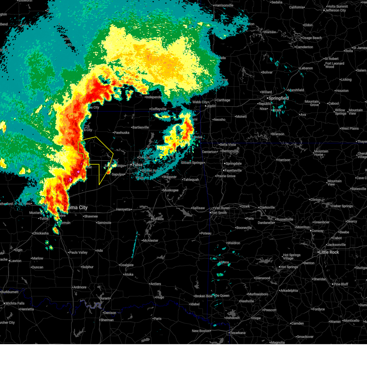
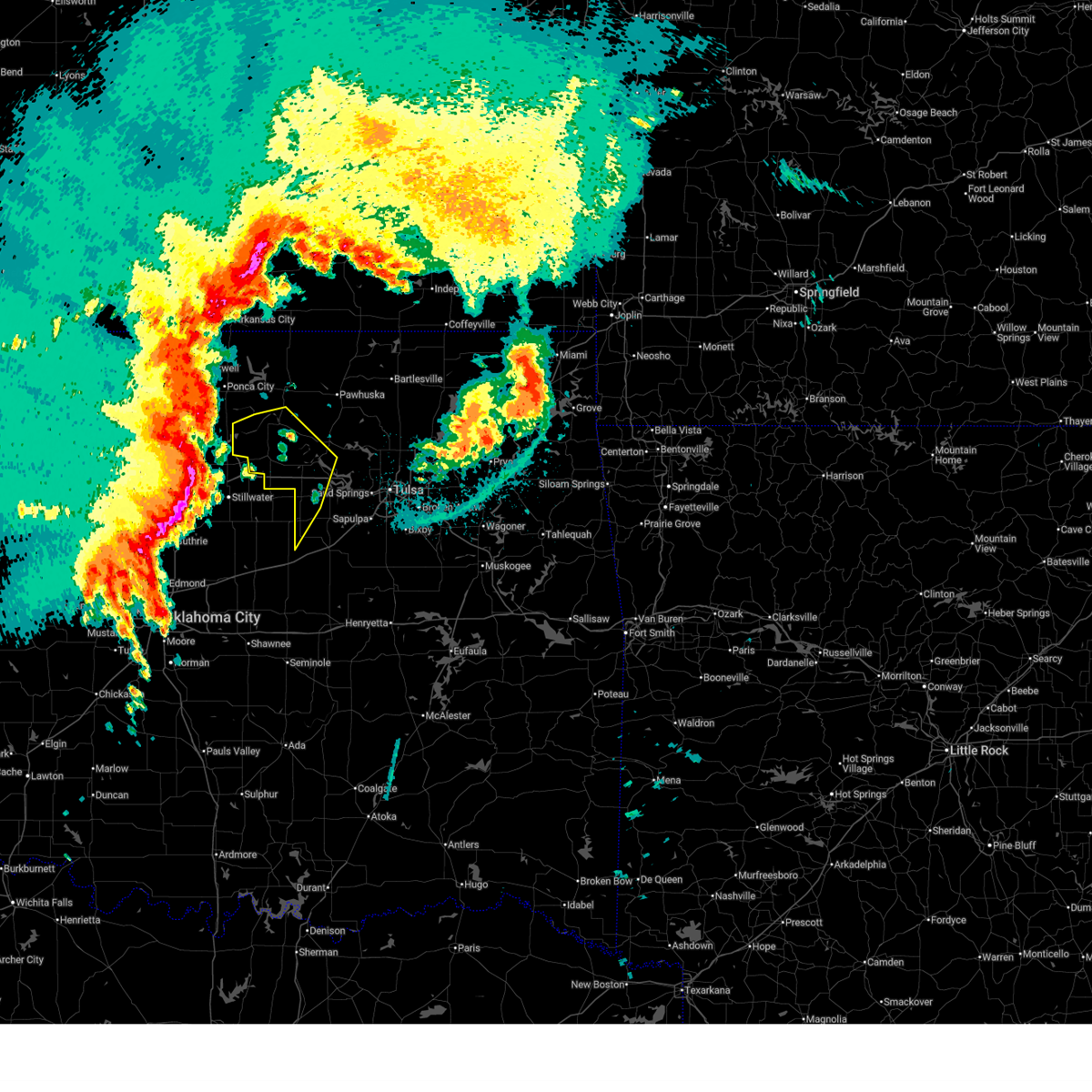
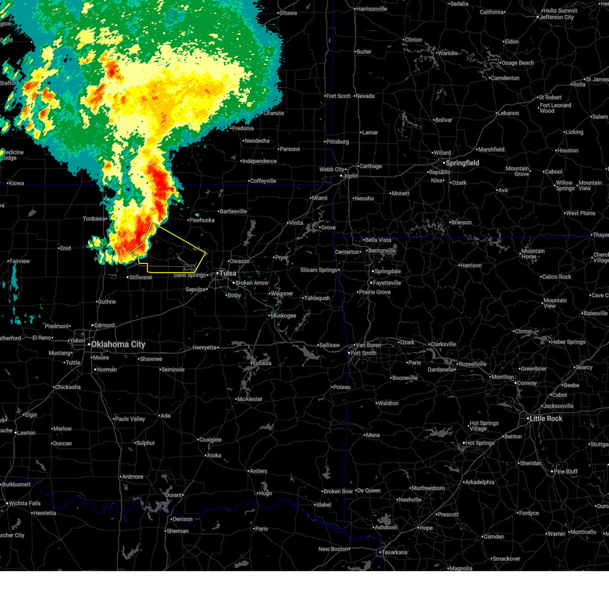
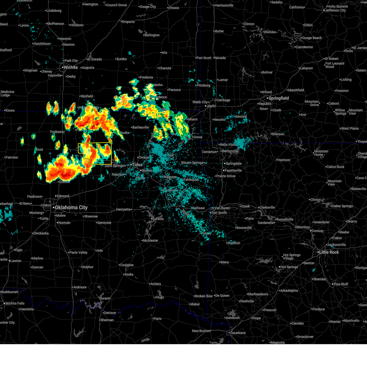
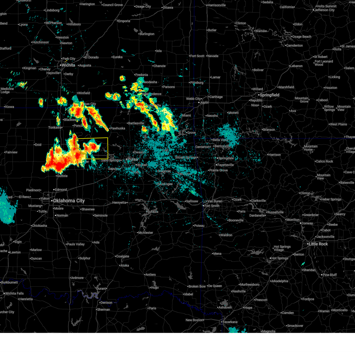
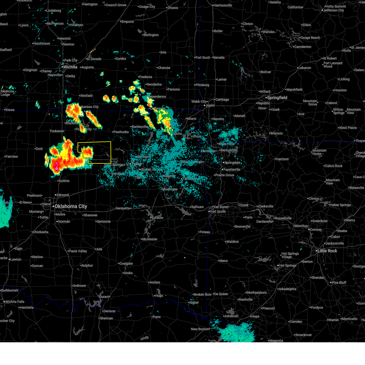
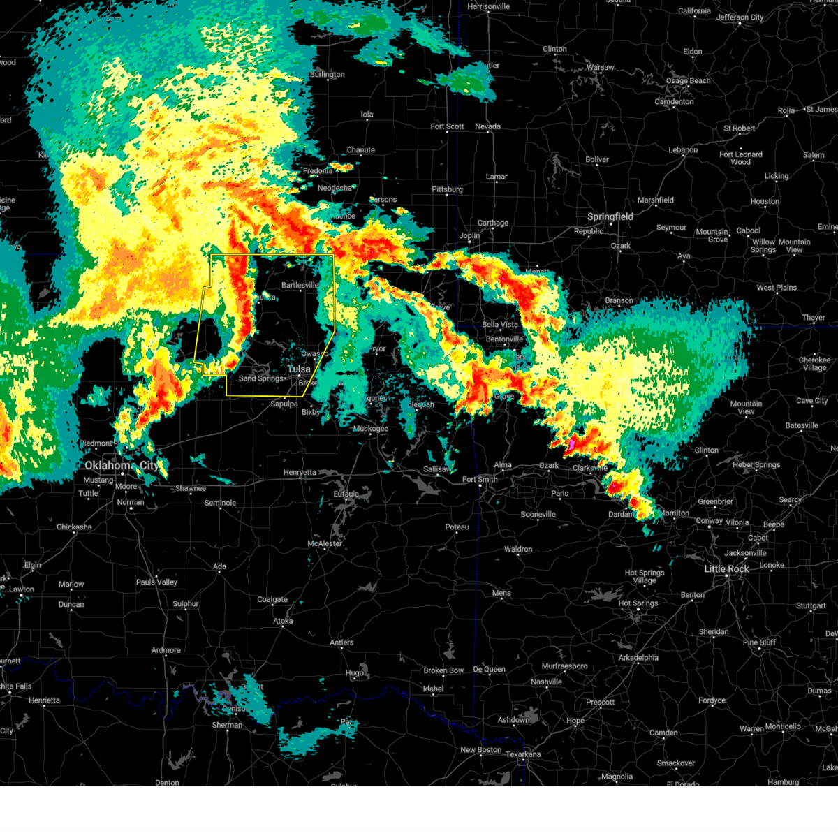
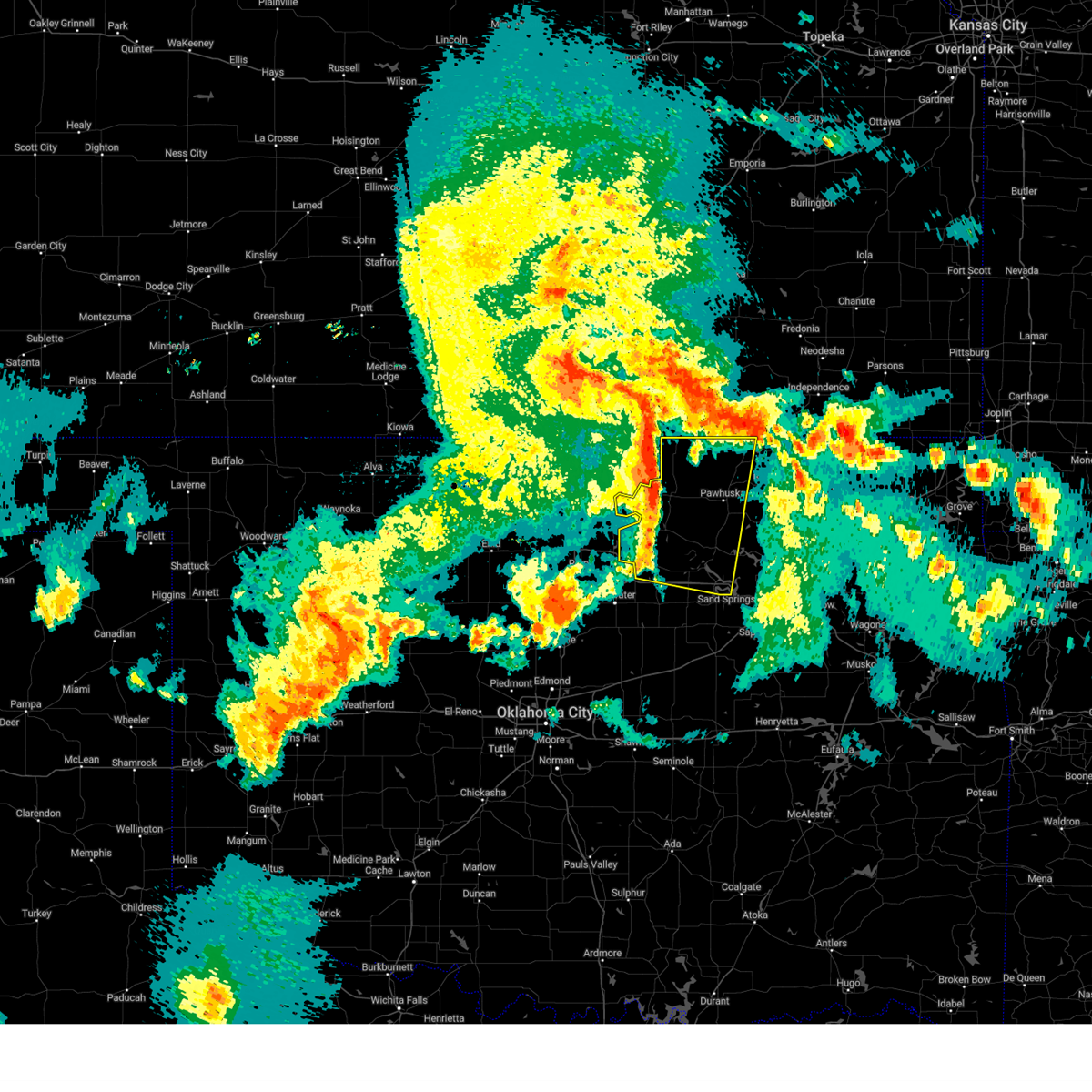
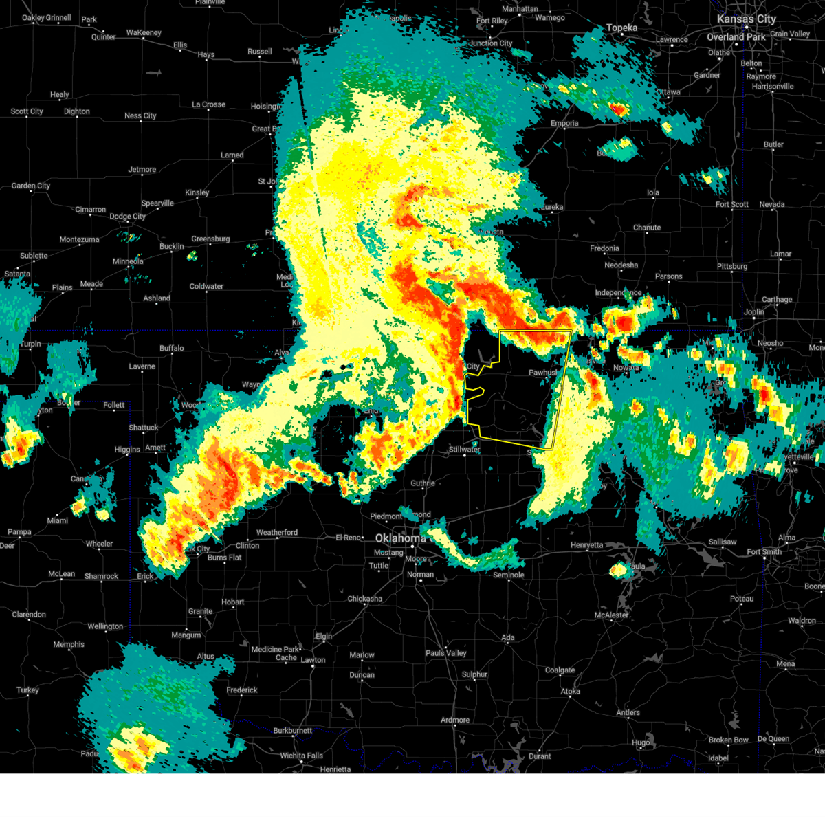
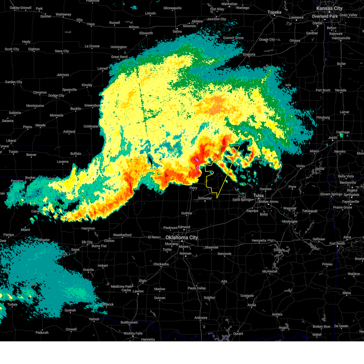
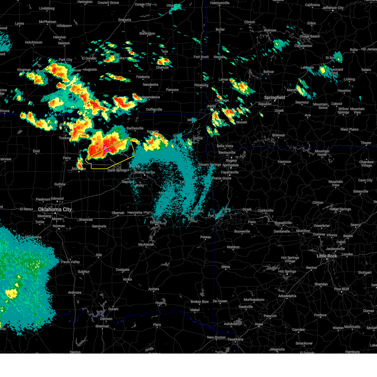
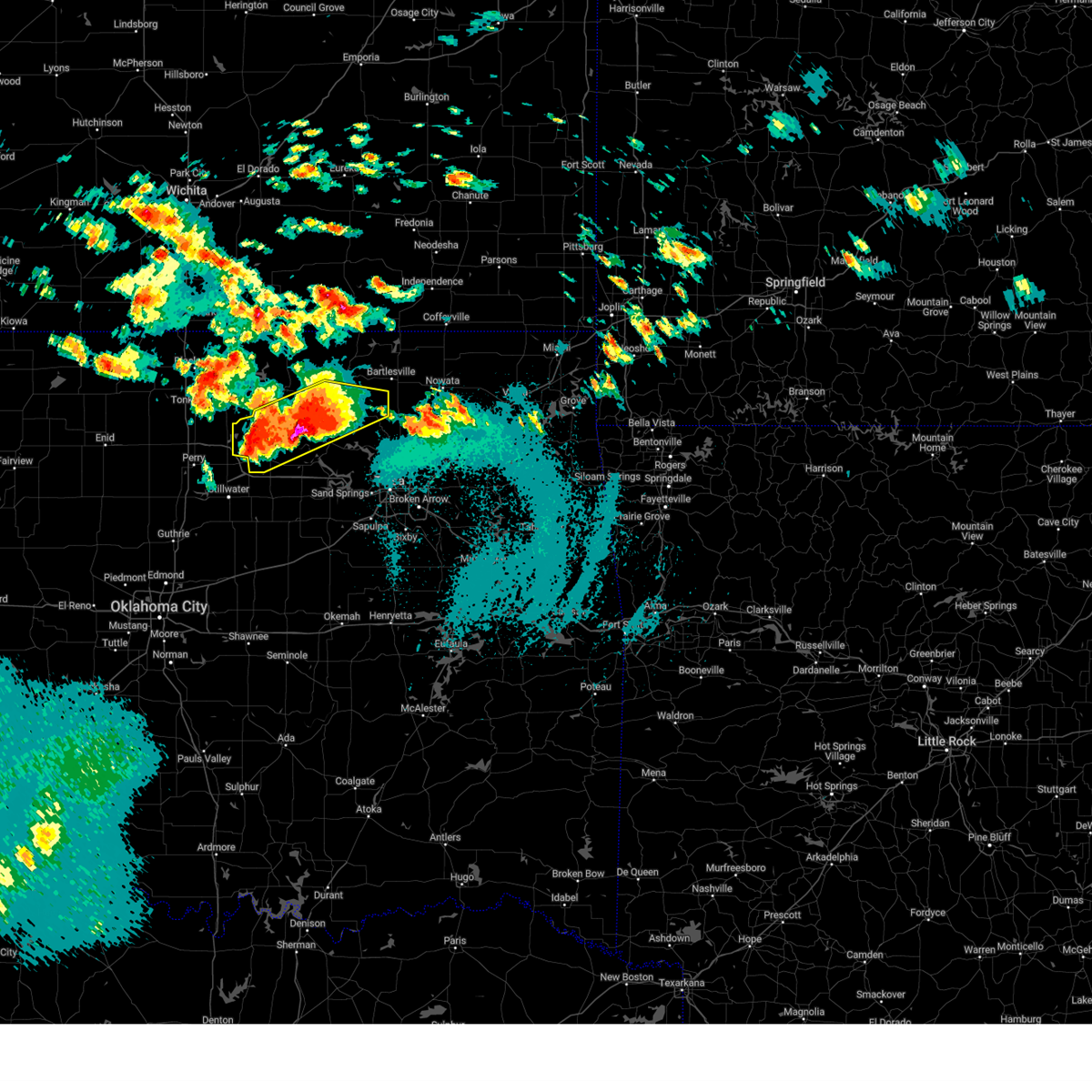
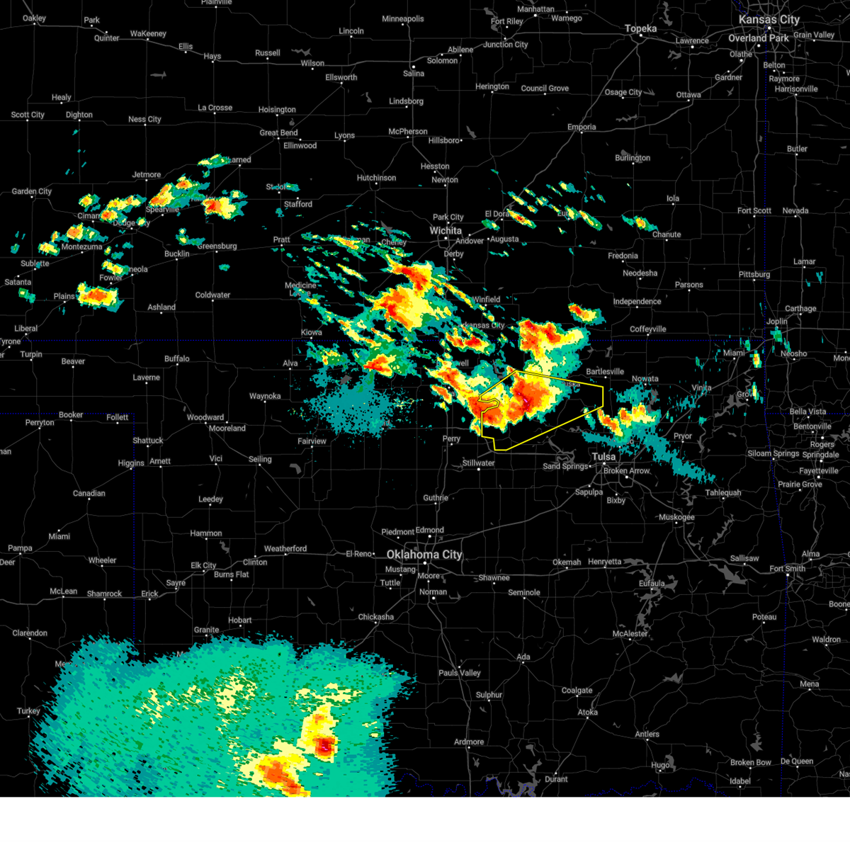
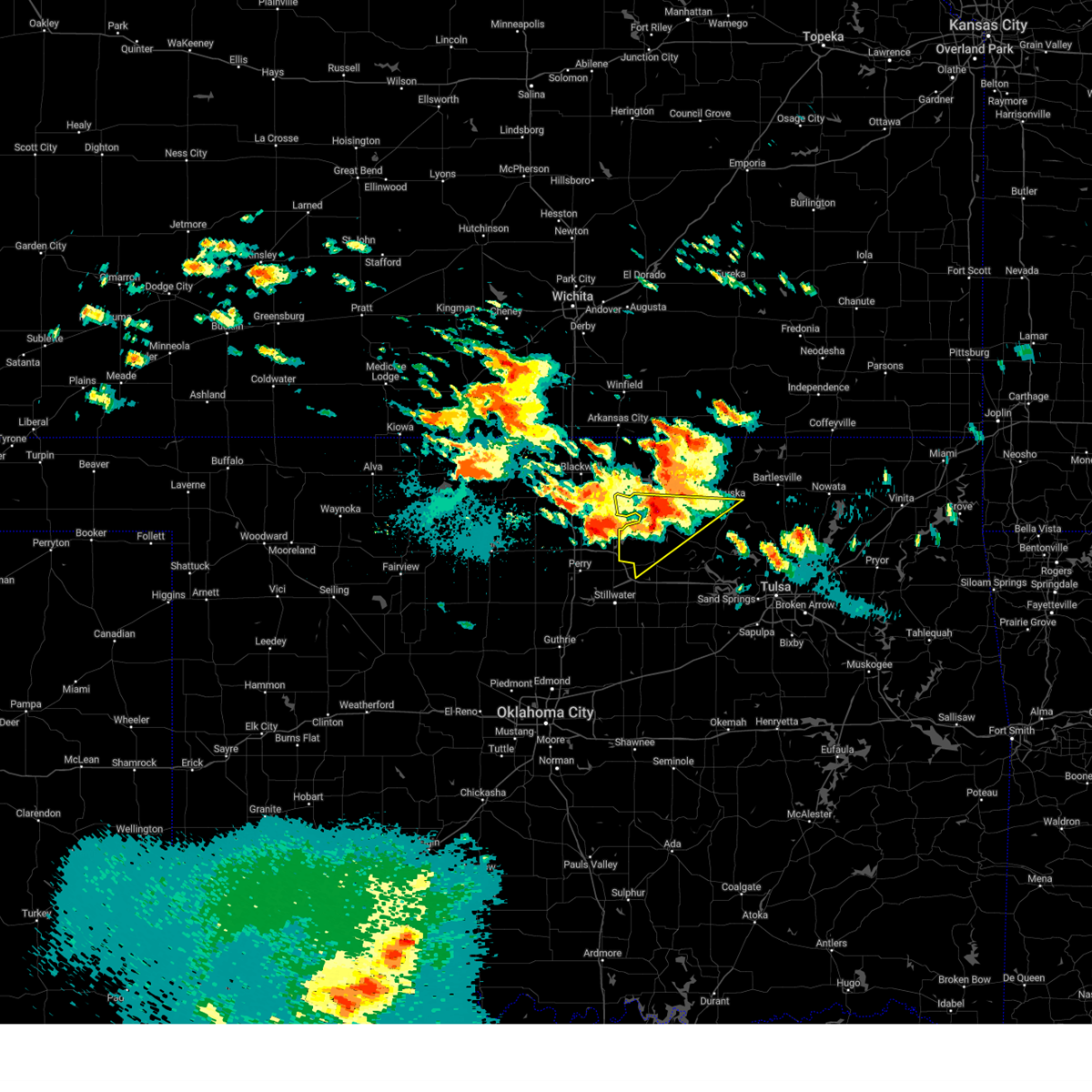
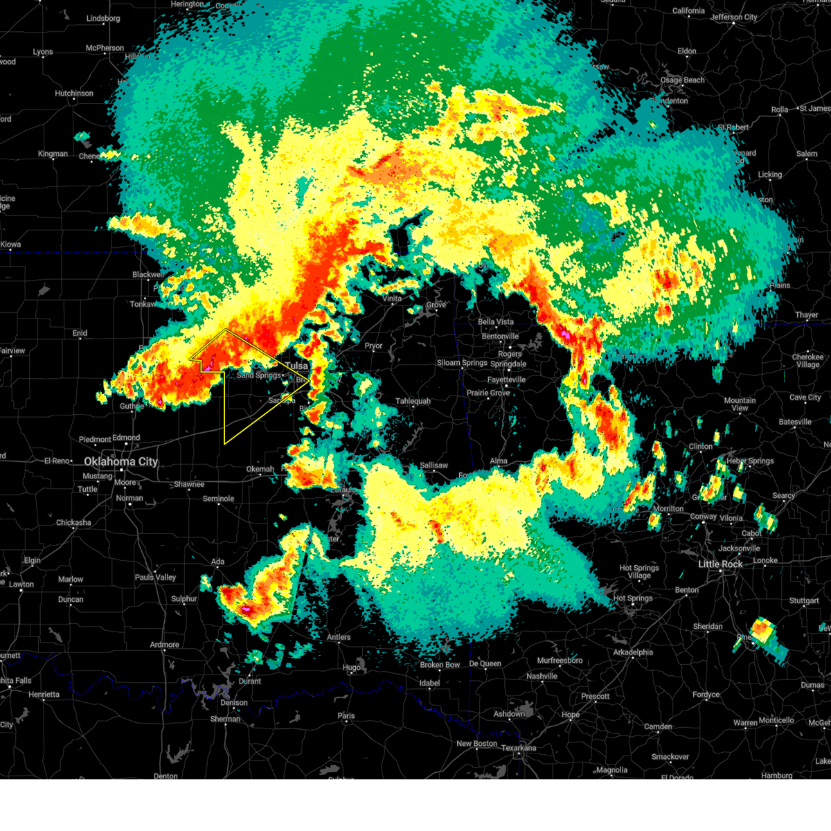
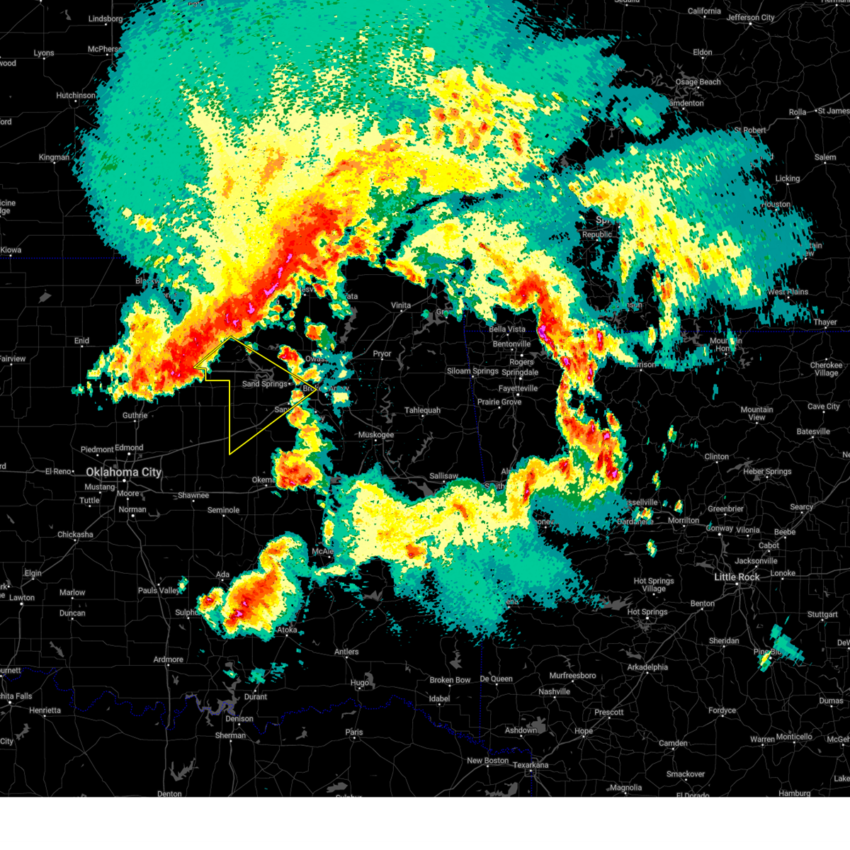
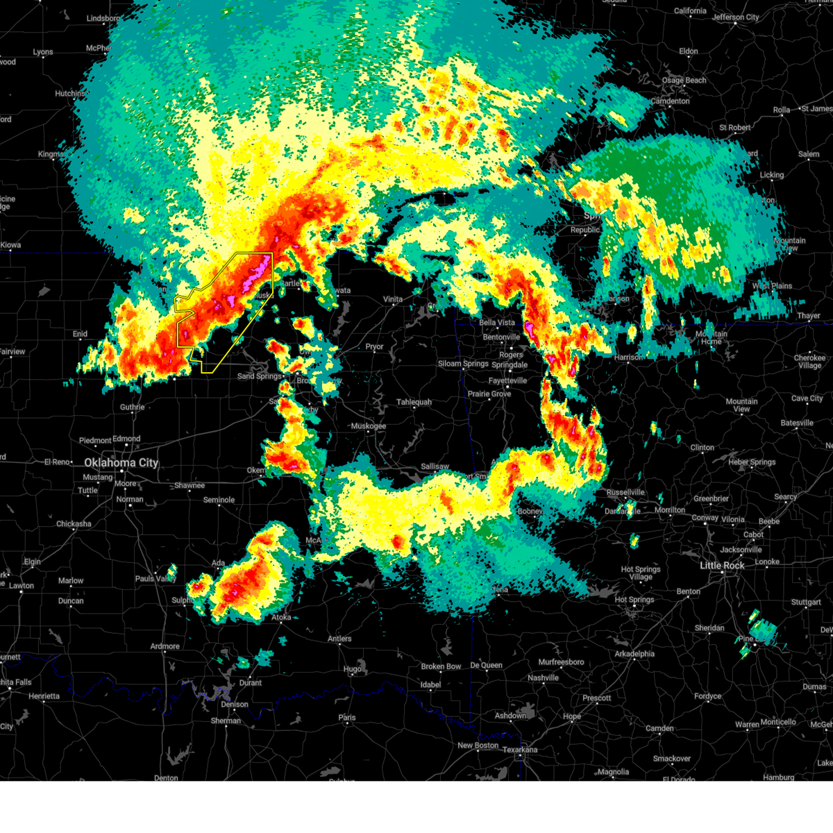
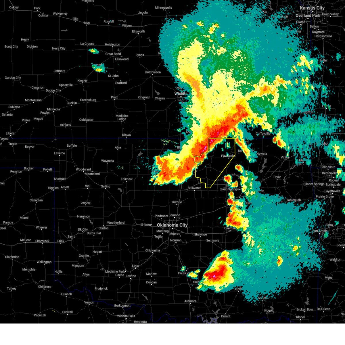
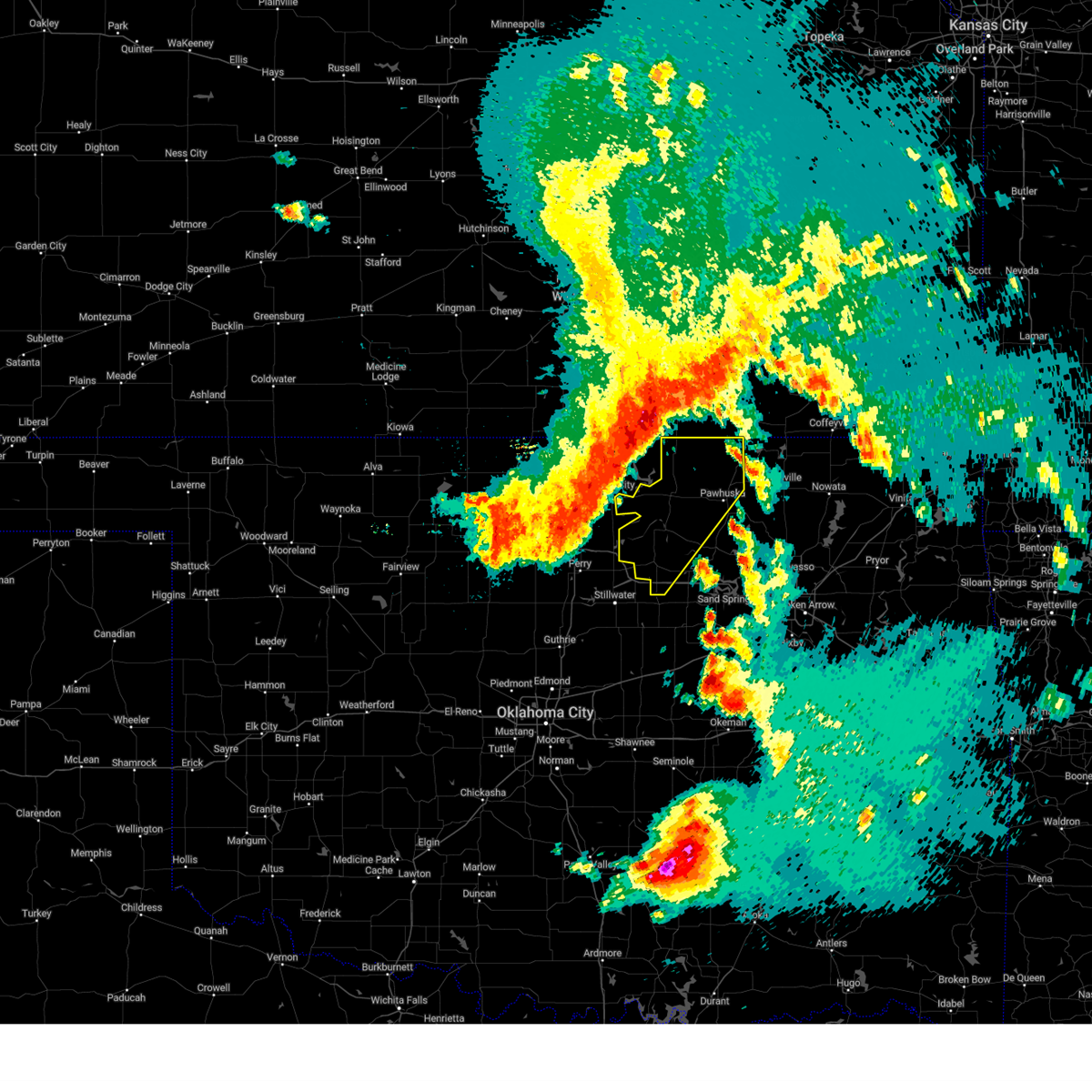
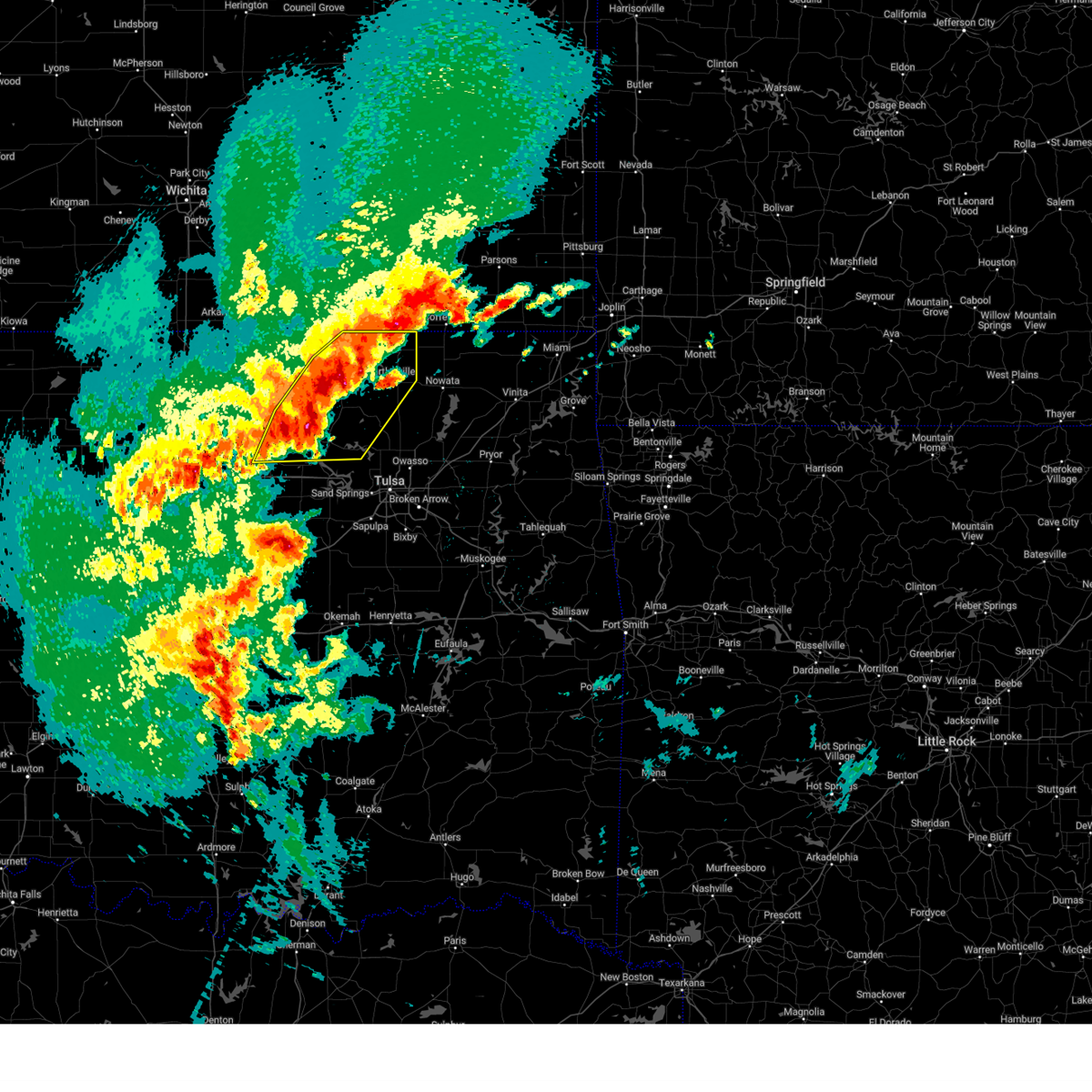
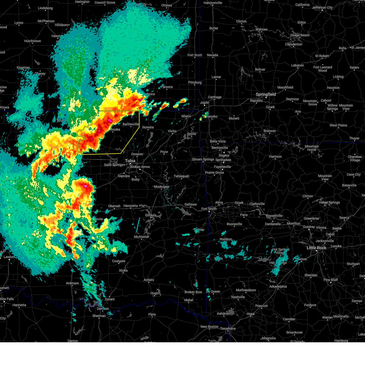
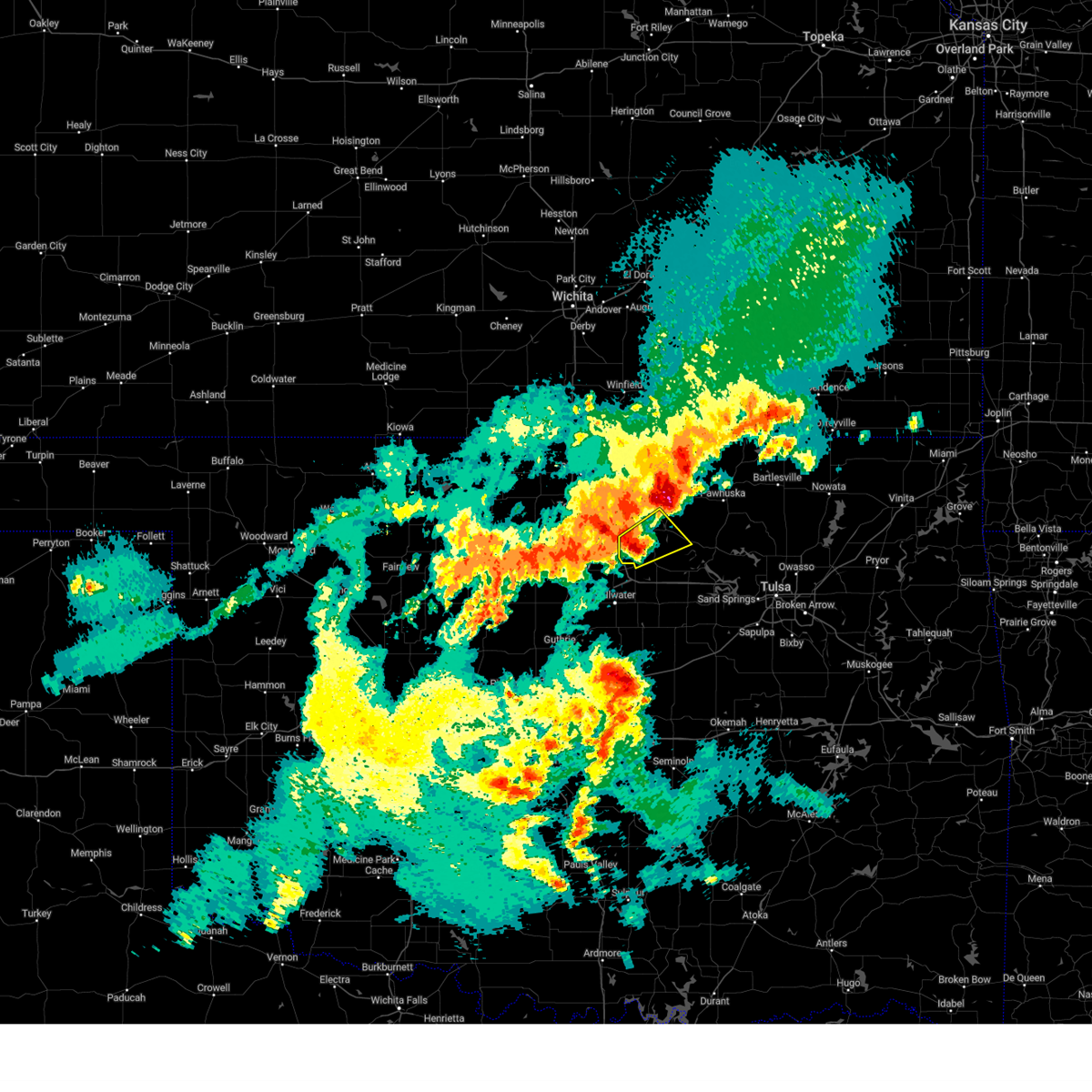
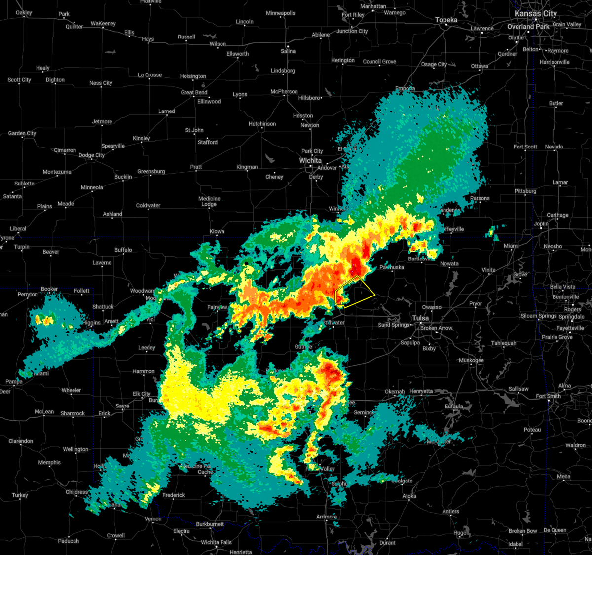
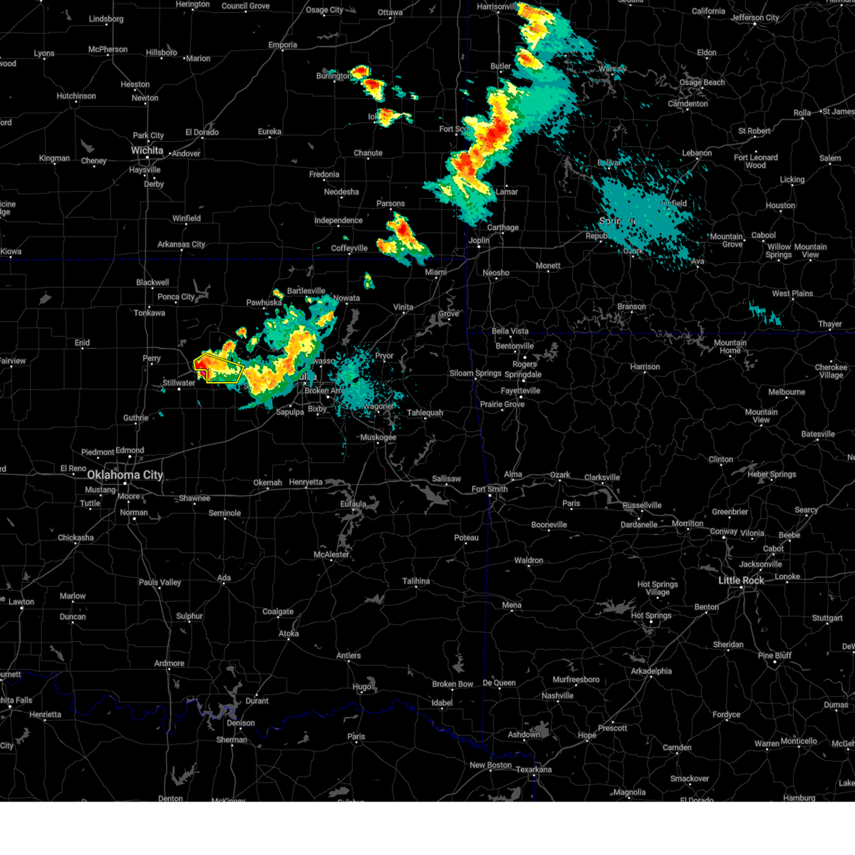
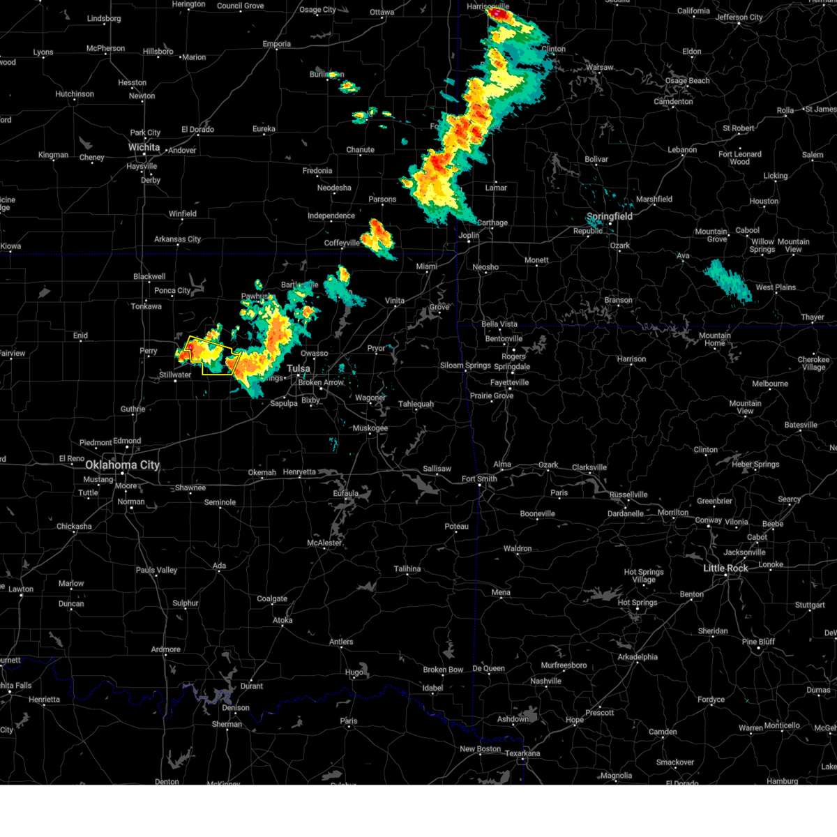
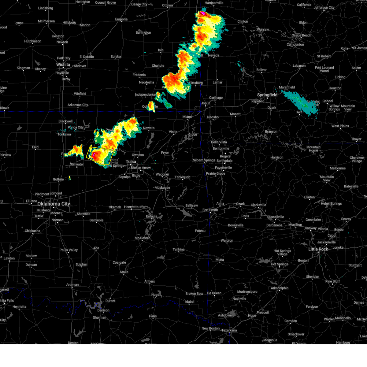
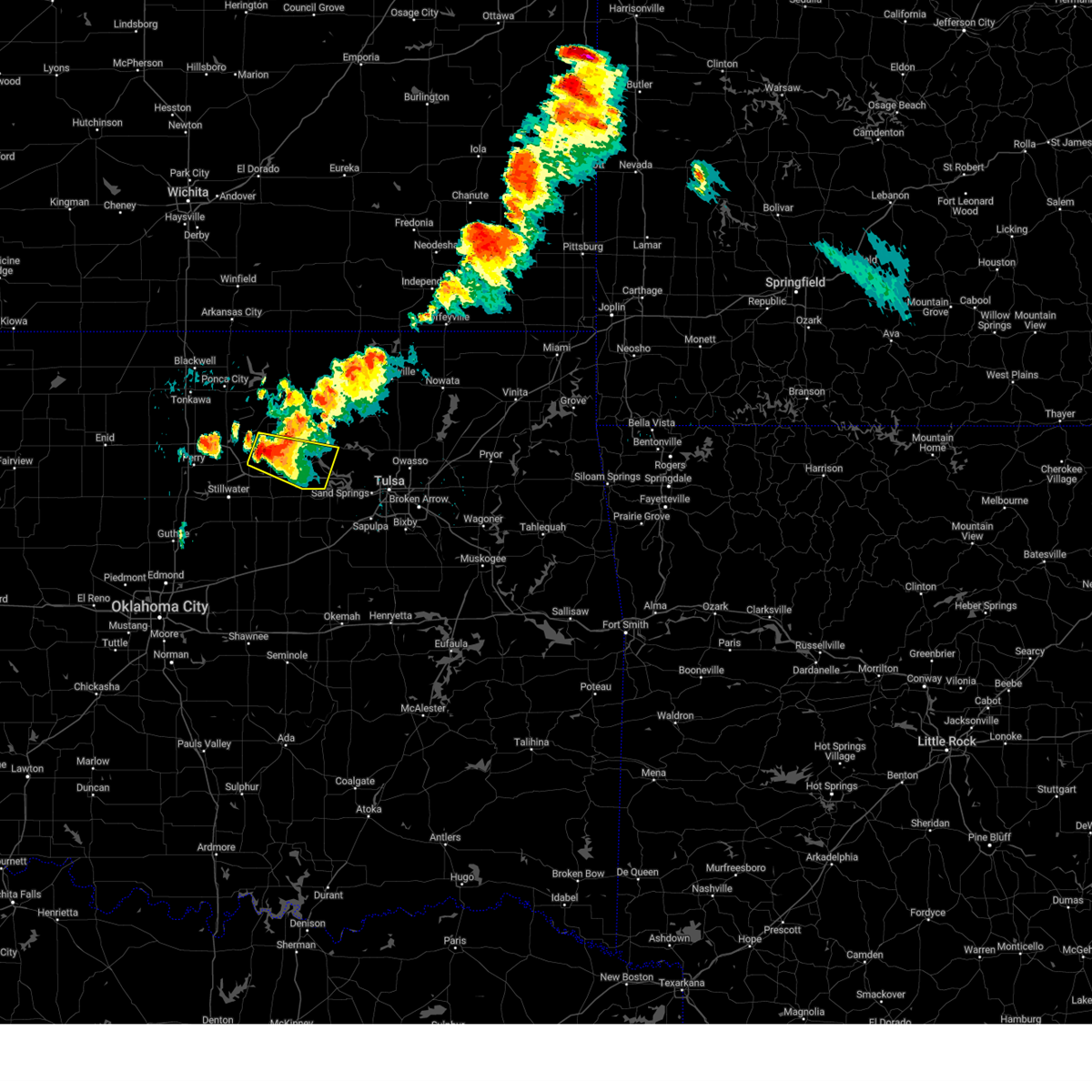
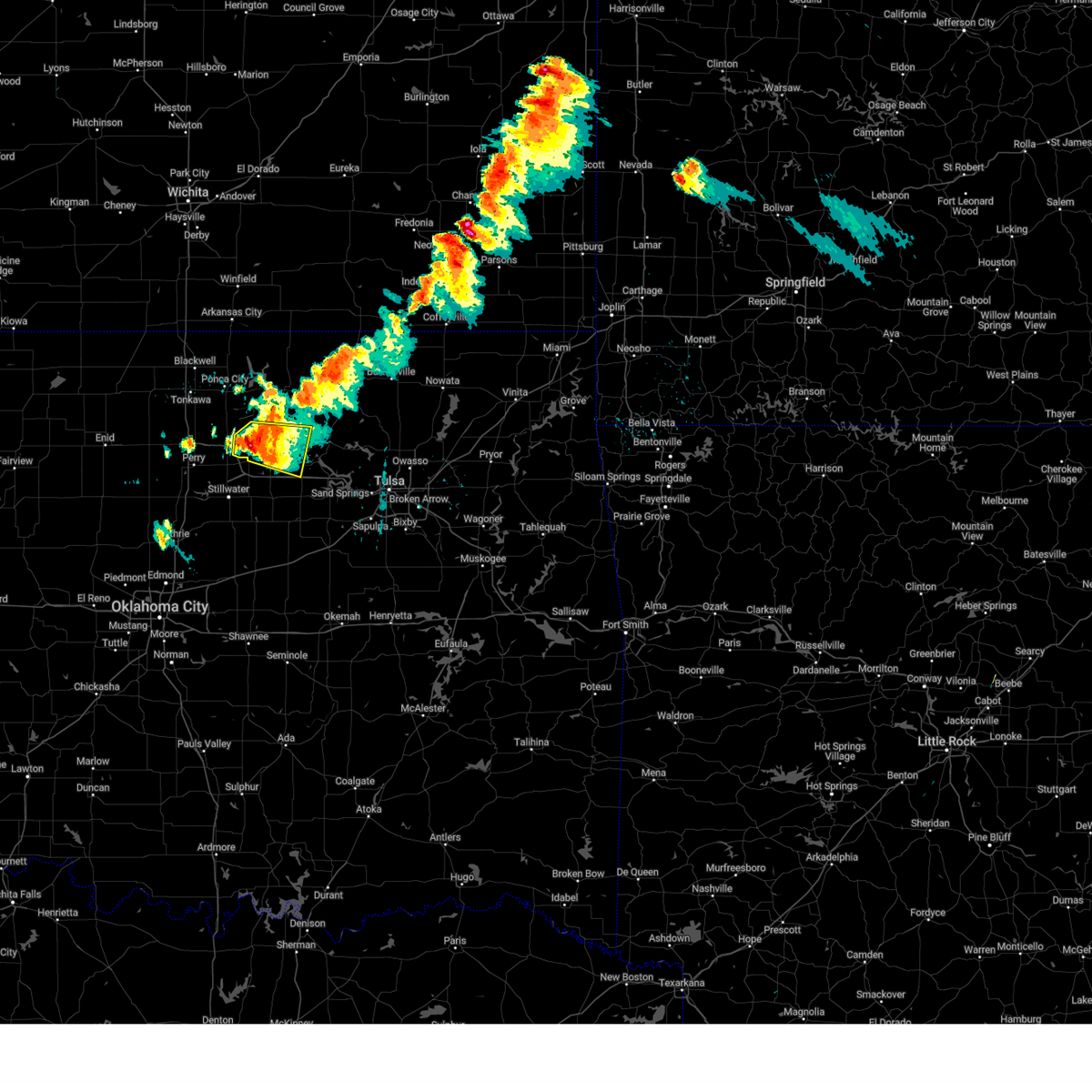
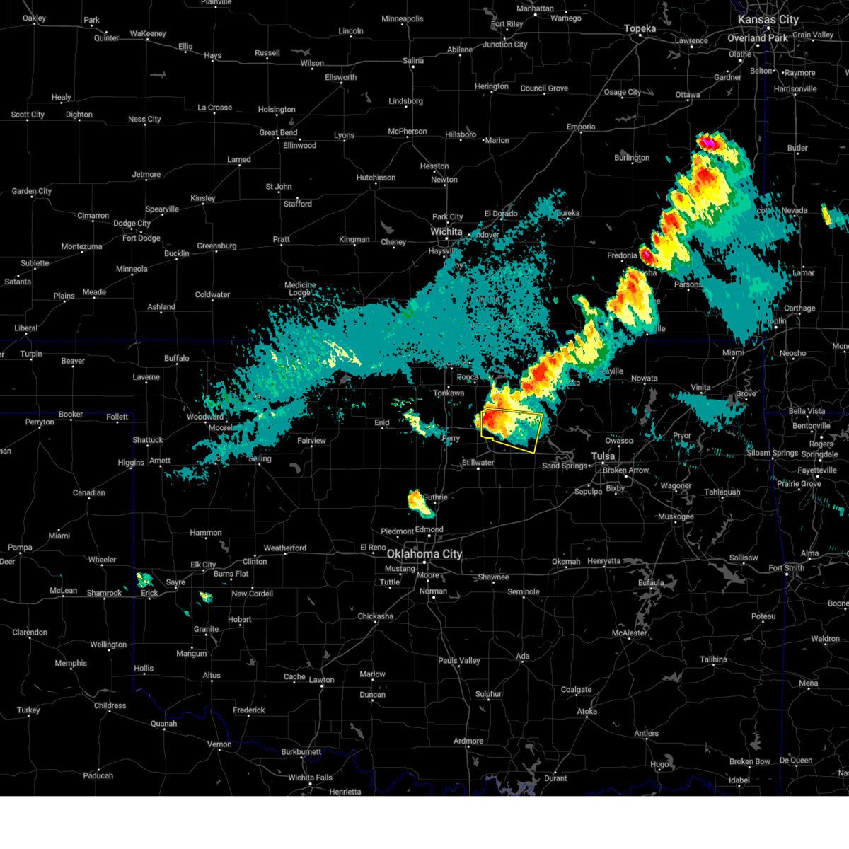
Hail Map for Pawnee, OK
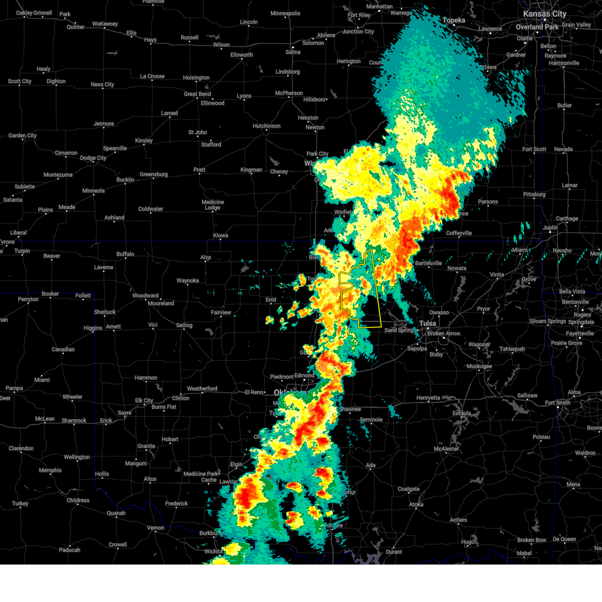
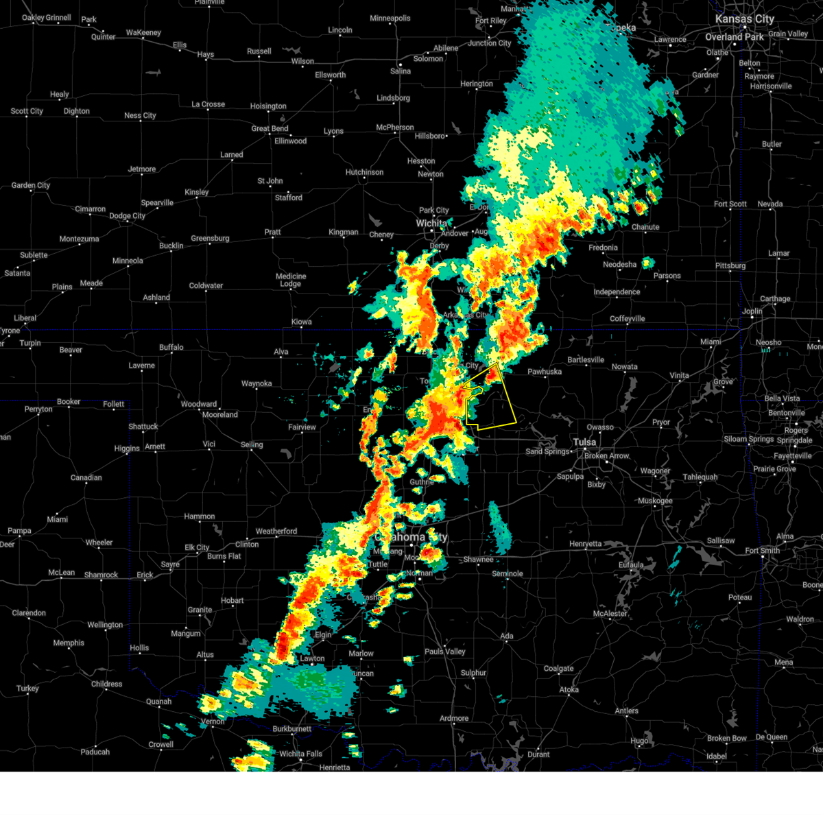
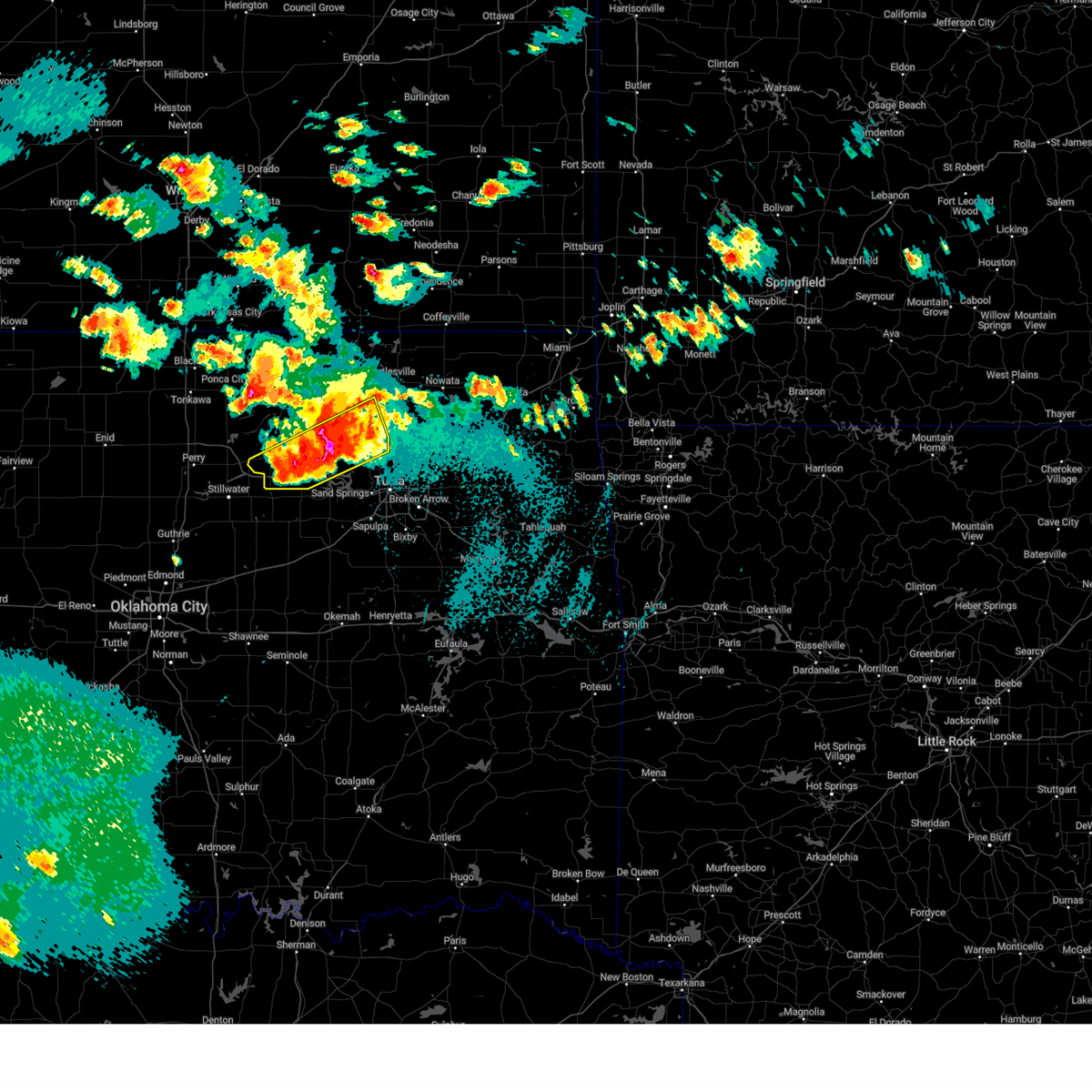
The Pawnee, OK area has had 5 reports of on-the-ground hail by trained spotters, and has been under severe weather warnings 46 times during the past 12 months. Doppler radar has detected hail at or near Pawnee, OK on 82 occasions, including 8 occasions during the past year.
| Name: | Pawnee, OK |
| Where Located: | 46.9 miles WNW of Tulsa, OK |
| Map: | Google Map for Pawnee, OK |
| Population: | 2196 |
| Housing Units: | 1049 |
| More Info: | Search Google for Pawnee, OK |
2
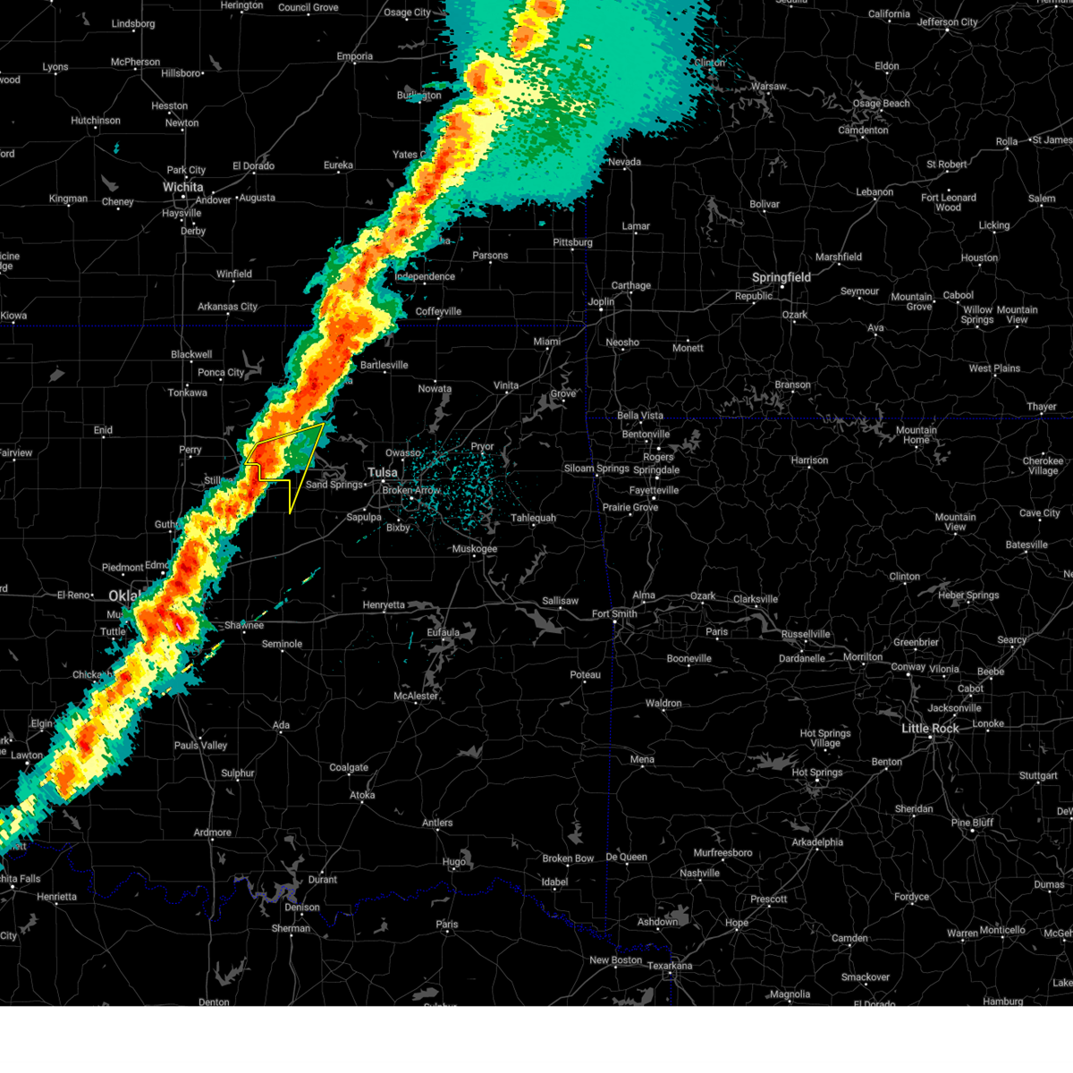
The Top Recent Hail Date for Pawnee, OK is Thursday, September 19, 2024 (10th out of 82)

Hail and Wind Damage Spotted near Pawnee, OK
| Date / Time | Report Details |
|---|---|
| 6/29/2025 10:35 PM CDT | Corrects previous tstm wnd gst report from 3 sw skede in pawnee county OK, 3 miles WSW of Pawnee, OK |
| 6/17/2025 11:13 PM CDT |
 At 1113 pm cdt, severe thunderstorms were located along a line extending from near sooner lake to 5 miles north of glencoe to 5 miles southeast of stillwater to near meridian, moving east at 65 mph (radar indicated). Hazards include 70 mph wind gusts and quarter size hail. Hail damage to vehicles is expected. expect considerable tree damage. wind damage is also likely to mobile homes, roofs, and outbuildings. Locations impacted include, pawnee, cleveland, drumright, fairfax, oilton, jennings, ralston, osage, hallett, blackburn, terlton, shamrock, maramec, skedee, sooner lake, and silver city. At 1113 pm cdt, severe thunderstorms were located along a line extending from near sooner lake to 5 miles north of glencoe to 5 miles southeast of stillwater to near meridian, moving east at 65 mph (radar indicated). Hazards include 70 mph wind gusts and quarter size hail. Hail damage to vehicles is expected. expect considerable tree damage. wind damage is also likely to mobile homes, roofs, and outbuildings. Locations impacted include, pawnee, cleveland, drumright, fairfax, oilton, jennings, ralston, osage, hallett, blackburn, terlton, shamrock, maramec, skedee, sooner lake, and silver city.
|
| 6/17/2025 10:53 PM CDT |
 Svrtsa the national weather service in tulsa has issued a * severe thunderstorm warning for, southwestern osage county in northeastern oklahoma, northwestern creek county in northeastern oklahoma, pawnee county in northeastern oklahoma, * until 1145 pm cdt. * at 1053 pm cdt, severe thunderstorms were located along a line extending from 8 miles west of red rock to 4 miles east of perry to 4 miles east of mulhall to 3 miles southeast of cedar valley, moving east at 65 mph (radar indicated). Hazards include 70 mph wind gusts and quarter size hail. Hail damage to vehicles is expected. expect considerable tree damage. Wind damage is also likely to mobile homes, roofs, and outbuildings. Svrtsa the national weather service in tulsa has issued a * severe thunderstorm warning for, southwestern osage county in northeastern oklahoma, northwestern creek county in northeastern oklahoma, pawnee county in northeastern oklahoma, * until 1145 pm cdt. * at 1053 pm cdt, severe thunderstorms were located along a line extending from 8 miles west of red rock to 4 miles east of perry to 4 miles east of mulhall to 3 miles southeast of cedar valley, moving east at 65 mph (radar indicated). Hazards include 70 mph wind gusts and quarter size hail. Hail damage to vehicles is expected. expect considerable tree damage. Wind damage is also likely to mobile homes, roofs, and outbuildings.
|
| 6/17/2025 6:53 AM CDT |
 Svrtsa the national weather service in tulsa has issued a * severe thunderstorm warning for, southern osage county in northeastern oklahoma, pawnee county in northeastern oklahoma, * until 745 am cdt. * at 653 am cdt, severe thunderstorms were located along a line extending from near fairfax to 3 miles north of pawnee to near morrison, moving southeast at 35 mph (radar indicated). Hazards include 60 mph wind gusts and quarter size hail. Hail damage to vehicles is expected. Expect wind damage to roofs, siding, and trees. Svrtsa the national weather service in tulsa has issued a * severe thunderstorm warning for, southern osage county in northeastern oklahoma, pawnee county in northeastern oklahoma, * until 745 am cdt. * at 653 am cdt, severe thunderstorms were located along a line extending from near fairfax to 3 miles north of pawnee to near morrison, moving southeast at 35 mph (radar indicated). Hazards include 60 mph wind gusts and quarter size hail. Hail damage to vehicles is expected. Expect wind damage to roofs, siding, and trees.
|
| 6/14/2025 10:43 PM CDT |
 The storm which prompted the warning has weakened below severe limits, and no longer poses an immediate threat to life or property. therefore, the warning will be allowed to expire. however, small hail and gusty winds are still possible with this thunderstorm. a severe thunderstorm watch remains in effect until 600 am cdt for northeastern oklahoma. The storm which prompted the warning has weakened below severe limits, and no longer poses an immediate threat to life or property. therefore, the warning will be allowed to expire. however, small hail and gusty winds are still possible with this thunderstorm. a severe thunderstorm watch remains in effect until 600 am cdt for northeastern oklahoma.
|
| 6/14/2025 10:20 PM CDT |
 At 1019 pm cdt, a severe thunderstorm was located over blackburn, moving east at 25 mph. another severe thunderstorm was near glencoe (radar indicated). Hazards include 60 mph wind gusts and quarter size hail. Hail damage to vehicles is expected. expect wind damage to roofs, siding, and trees. Locations in or near the path include, hominy, maramec, skedee, osage, terlton, hallett, pawnee, jennings, cleveland, blackburn,. At 1019 pm cdt, a severe thunderstorm was located over blackburn, moving east at 25 mph. another severe thunderstorm was near glencoe (radar indicated). Hazards include 60 mph wind gusts and quarter size hail. Hail damage to vehicles is expected. expect wind damage to roofs, siding, and trees. Locations in or near the path include, hominy, maramec, skedee, osage, terlton, hallett, pawnee, jennings, cleveland, blackburn,.
|
| 6/14/2025 10:00 PM CDT |
 Svrtsa the national weather service in tulsa has issued a * severe thunderstorm warning for, southwestern osage county in northeastern oklahoma, pawnee county in northeastern oklahoma, * until 1045 pm cdt. * at 1000 pm cdt, a severe thunderstorm was located over pawnee, moving east at 25 mph (radar indicated). Hazards include 60 mph wind gusts and half dollar size hail. Hail damage to vehicles is expected. expect wind damage to roofs, siding, and trees. Locations in or near the path include, hominy, maramec, skedee, osage, terlton, hallett, pawnee, jennings, cleveland, blackburn,. Svrtsa the national weather service in tulsa has issued a * severe thunderstorm warning for, southwestern osage county in northeastern oklahoma, pawnee county in northeastern oklahoma, * until 1045 pm cdt. * at 1000 pm cdt, a severe thunderstorm was located over pawnee, moving east at 25 mph (radar indicated). Hazards include 60 mph wind gusts and half dollar size hail. Hail damage to vehicles is expected. expect wind damage to roofs, siding, and trees. Locations in or near the path include, hominy, maramec, skedee, osage, terlton, hallett, pawnee, jennings, cleveland, blackburn,.
|
| 6/7/2025 3:11 AM CDT |
 Svrtsa the national weather service in tulsa has issued a * severe thunderstorm warning for, northwestern rogers county in northeastern oklahoma, osage county in northeastern oklahoma, northern creek county in northeastern oklahoma, washington county in northeastern oklahoma, western nowata county in northeastern oklahoma, pawnee county in northeastern oklahoma, central tulsa county in northeastern oklahoma, * until 400 am cdt. * at 310 am cdt, severe thunderstorms were located along a line extending from 9 miles northeast of foraker to 4 miles west of wynona to 3 miles southwest of jennings, moving east at 55 mph (radar indicated). Hazards include 60 to 70 mph wind gusts and penny size hail. Expect considerable tree damage. damage is likely to mobile homes, roofs, and outbuildings. Locations in or near the path include, barnsdall, sand springs, wann, collinsville, jenks riverside airport, pawhuska, ralston, osage hills state park, grainola, vera, nelagoney, wolco, owasso, keystone state park, hominy, oilton, ochelata, apperson, sunset lake, fairfax, this includes interstate 44 between mile markers 212 and 226. Svrtsa the national weather service in tulsa has issued a * severe thunderstorm warning for, northwestern rogers county in northeastern oklahoma, osage county in northeastern oklahoma, northern creek county in northeastern oklahoma, washington county in northeastern oklahoma, western nowata county in northeastern oklahoma, pawnee county in northeastern oklahoma, central tulsa county in northeastern oklahoma, * until 400 am cdt. * at 310 am cdt, severe thunderstorms were located along a line extending from 9 miles northeast of foraker to 4 miles west of wynona to 3 miles southwest of jennings, moving east at 55 mph (radar indicated). Hazards include 60 to 70 mph wind gusts and penny size hail. Expect considerable tree damage. damage is likely to mobile homes, roofs, and outbuildings. Locations in or near the path include, barnsdall, sand springs, wann, collinsville, jenks riverside airport, pawhuska, ralston, osage hills state park, grainola, vera, nelagoney, wolco, owasso, keystone state park, hominy, oilton, ochelata, apperson, sunset lake, fairfax, this includes interstate 44 between mile markers 212 and 226.
|
| 6/7/2025 3:00 AM CDT | Storm damage reported in pawnee county OK, 3 miles WSW of Pawnee, OK |
| 6/7/2025 3:00 AM CDT |
 At 259 am cdt, severe thunderstorms were located along a line extending from near grainola to skedee, moving east at 60 mph (radar indicated). Hazards include 70 mph wind gusts and nickel size hail. Expect considerable tree damage. damage is likely to mobile homes, roofs, and outbuildings. Locations in or near the path include, bigheart, skedee, hallett, pawhuska, cleveland, blackburn, ralston, osage hills state park, pershing, foraker, grainola, nelagoney, shidler, pawnee, westport, hominy, pearsonia, walnut creek state park, wynona, webb city,. At 259 am cdt, severe thunderstorms were located along a line extending from near grainola to skedee, moving east at 60 mph (radar indicated). Hazards include 70 mph wind gusts and nickel size hail. Expect considerable tree damage. damage is likely to mobile homes, roofs, and outbuildings. Locations in or near the path include, bigheart, skedee, hallett, pawhuska, cleveland, blackburn, ralston, osage hills state park, pershing, foraker, grainola, nelagoney, shidler, pawnee, westport, hominy, pearsonia, walnut creek state park, wynona, webb city,.
|
| 6/7/2025 2:32 AM CDT |
 Svrtsa the national weather service in tulsa has issued a * severe thunderstorm warning for, osage county in northeastern oklahoma, pawnee county in northeastern oklahoma, * until 315 am cdt. * at 232 am cdt, severe thunderstorms were located along a line extending from 2 miles southeast of chilocco to 5 miles southeast of red rock, moving east at 60 mph (radar indicated). Hazards include 70 mph wind gusts and nickel size hail. Expect considerable tree damage. damage is likely to mobile homes, roofs, and outbuildings. Locations in or near the path include, bigheart, skedee, hallett, pawhuska, cleveland, blackburn, ralston, osage hills state park, pershing, foraker, grainola, nelagoney, shidler, pawnee, westport, hominy, pearsonia, walnut creek state park, wynona, webb city,. Svrtsa the national weather service in tulsa has issued a * severe thunderstorm warning for, osage county in northeastern oklahoma, pawnee county in northeastern oklahoma, * until 315 am cdt. * at 232 am cdt, severe thunderstorms were located along a line extending from 2 miles southeast of chilocco to 5 miles southeast of red rock, moving east at 60 mph (radar indicated). Hazards include 70 mph wind gusts and nickel size hail. Expect considerable tree damage. damage is likely to mobile homes, roofs, and outbuildings. Locations in or near the path include, bigheart, skedee, hallett, pawhuska, cleveland, blackburn, ralston, osage hills state park, pershing, foraker, grainola, nelagoney, shidler, pawnee, westport, hominy, pearsonia, walnut creek state park, wynona, webb city,.
|
| 6/6/2025 3:40 AM CDT |
 At 339 am cdt, severe thunderstorms were located along a line extending from 7 miles south of pearsonia to 7 miles north of blackburn to 4 miles southeast of pawnee, moving east at 40 mph (radar indicated). Hazards include 70 mph wind gusts and ping pong ball size hail. People and animals outdoors will be injured. expect hail damage to roofs, siding, windows, and vehicles. expect considerable tree damage. wind damage is also likely to mobile homes, roofs, and outbuildings. Locations in or near the path include, hominy, skedee, wynona, hallett, jennings, tallant, apperson, pawhuska, cleveland, burbank, sunset lake, fairfax, blackburn, ralston, osage hills state park, pershing, maramec, osage, terlton, nelagoney,. At 339 am cdt, severe thunderstorms were located along a line extending from 7 miles south of pearsonia to 7 miles north of blackburn to 4 miles southeast of pawnee, moving east at 40 mph (radar indicated). Hazards include 70 mph wind gusts and ping pong ball size hail. People and animals outdoors will be injured. expect hail damage to roofs, siding, windows, and vehicles. expect considerable tree damage. wind damage is also likely to mobile homes, roofs, and outbuildings. Locations in or near the path include, hominy, skedee, wynona, hallett, jennings, tallant, apperson, pawhuska, cleveland, burbank, sunset lake, fairfax, blackburn, ralston, osage hills state park, pershing, maramec, osage, terlton, nelagoney,.
|
| 6/6/2025 3:23 AM CDT |
 Svrtsa the national weather service in tulsa has issued a * severe thunderstorm warning for, central osage county in northeastern oklahoma, pawnee county in northeastern oklahoma, * until 415 am cdt. * at 323 am cdt, severe thunderstorms were located along a line extending from 2 miles northeast of burbank to 2 miles west of ralston to 3 miles northeast of morrison, moving east at 30 mph (radar indicated). Hazards include 70 mph wind gusts and ping pong ball size hail. People and animals outdoors will be injured. expect hail damage to roofs, siding, windows, and vehicles. expect considerable tree damage. wind damage is also likely to mobile homes, roofs, and outbuildings. Locations in or near the path include, hominy, skedee, wynona, hallett, jennings, tallant, apperson, pawhuska, cleveland, burbank, sunset lake, fairfax, blackburn, ralston, osage hills state park, pershing, maramec, osage, terlton, nelagoney,. Svrtsa the national weather service in tulsa has issued a * severe thunderstorm warning for, central osage county in northeastern oklahoma, pawnee county in northeastern oklahoma, * until 415 am cdt. * at 323 am cdt, severe thunderstorms were located along a line extending from 2 miles northeast of burbank to 2 miles west of ralston to 3 miles northeast of morrison, moving east at 30 mph (radar indicated). Hazards include 70 mph wind gusts and ping pong ball size hail. People and animals outdoors will be injured. expect hail damage to roofs, siding, windows, and vehicles. expect considerable tree damage. wind damage is also likely to mobile homes, roofs, and outbuildings. Locations in or near the path include, hominy, skedee, wynona, hallett, jennings, tallant, apperson, pawhuska, cleveland, burbank, sunset lake, fairfax, blackburn, ralston, osage hills state park, pershing, maramec, osage, terlton, nelagoney,.
|
| 6/6/2025 3:12 AM CDT |
 At 310 am cdt, severe thunderstorms were located along a line extending from 4 miles north of kaw lake to 6 miles northwest of morrison, moving east at 35 mph (radar indicated. at around 3 am, a 71 mph wind gust was reported at ponca city). Hazards include 70 mph wind gusts and quarter size hail. Hail damage to vehicles is expected. expect considerable tree damage. wind damage is also likely to mobile homes, roofs, and outbuildings. Locations in or near the path include, ralston, foraker, grainola, skedee, webb city, shidler, pawnee, apperson, burbank, fairfax,. At 310 am cdt, severe thunderstorms were located along a line extending from 4 miles north of kaw lake to 6 miles northwest of morrison, moving east at 35 mph (radar indicated. at around 3 am, a 71 mph wind gust was reported at ponca city). Hazards include 70 mph wind gusts and quarter size hail. Hail damage to vehicles is expected. expect considerable tree damage. wind damage is also likely to mobile homes, roofs, and outbuildings. Locations in or near the path include, ralston, foraker, grainola, skedee, webb city, shidler, pawnee, apperson, burbank, fairfax,.
|
| 6/6/2025 2:54 AM CDT |
 Svrtsa the national weather service in tulsa has issued a * severe thunderstorm warning for, northwestern osage county in northeastern oklahoma, western pawnee county in northeastern oklahoma, * until 345 am cdt. * at 254 am cdt, severe thunderstorms were located along a line extending from 2 miles east of newkirk to 5 miles north of perry, moving east at 35 mph (radar indicated). Hazards include 70 mph wind gusts and quarter size hail. Hail damage to vehicles is expected. expect considerable tree damage. wind damage is also likely to mobile homes, roofs, and outbuildings. Locations in or near the path include, ralston, foraker, grainola, skedee, webb city, shidler, pawnee, apperson, burbank, fairfax,. Svrtsa the national weather service in tulsa has issued a * severe thunderstorm warning for, northwestern osage county in northeastern oklahoma, western pawnee county in northeastern oklahoma, * until 345 am cdt. * at 254 am cdt, severe thunderstorms were located along a line extending from 2 miles east of newkirk to 5 miles north of perry, moving east at 35 mph (radar indicated). Hazards include 70 mph wind gusts and quarter size hail. Hail damage to vehicles is expected. expect considerable tree damage. wind damage is also likely to mobile homes, roofs, and outbuildings. Locations in or near the path include, ralston, foraker, grainola, skedee, webb city, shidler, pawnee, apperson, burbank, fairfax,.
|
| 6/3/2025 5:34 PM CDT |
 the severe thunderstorm warning has been cancelled and is no longer in effect the severe thunderstorm warning has been cancelled and is no longer in effect
|
| 6/3/2025 5:24 PM CDT | At 523 pm cdt, severe thunderstorms were located along a line extending from 2 miles east of ponca city to 4 miles east of lake mcmurtry, moving northeast at 35 mph (radar indicated). Hazards include 60 mph wind gusts. Expect damage to roofs, siding, and trees. Locations in or near the path include, ralston, maramec, skedee, webb city, hallett, shidler, pawnee, jennings, apperson, burbank, fairfax, blackburn,. |
| 6/3/2025 5:14 PM CDT | Svrtsa the national weather service in tulsa has issued a * severe thunderstorm warning for, northwestern osage county in northeastern oklahoma, pawnee county in northeastern oklahoma, * until 600 pm cdt. * at 514 pm cdt, severe thunderstorms were located along a line extending from 2 miles south of ponca city to 2 miles east of lake carl blackwell, moving northeast at 35 mph (radar indicated). Hazards include 60 mph wind gusts and penny size hail. Expect damage to roofs, siding, and trees. Locations in or near the path include, ralston, maramec, skedee, webb city, hallett, shidler, pawnee, jennings, apperson, burbank, fairfax, blackburn,. |
| 6/3/2025 4:35 PM CDT | At 434 pm cdt, a severe thunderstorm was located 3 miles west of sooner lake, moving east at 30 mph (radar indicated). Hazards include 60 mph wind gusts and quarter size hail. Hail damage to vehicles is expected. expect wind damage to roofs, siding, and trees. Locations in or near the path include, ralston, skedee, fairfax, apperson,. |
| 6/3/2025 4:17 PM CDT |
 Svrtsa the national weather service in tulsa has issued a * severe thunderstorm warning for, west central osage county in northeastern oklahoma, northwestern pawnee county in northeastern oklahoma, * until 515 pm cdt. * at 416 pm cdt, a severe thunderstorm was located 6 miles southwest of red rock, moving east at 30 mph (radar indicated). Hazards include 60 mph wind gusts and half dollar size hail. Hail damage to vehicles is expected. expect wind damage to roofs, siding, and trees. Locations in or near the path include, ralston, pawnee, skedee, fairfax, apperson,. Svrtsa the national weather service in tulsa has issued a * severe thunderstorm warning for, west central osage county in northeastern oklahoma, northwestern pawnee county in northeastern oklahoma, * until 515 pm cdt. * at 416 pm cdt, a severe thunderstorm was located 6 miles southwest of red rock, moving east at 30 mph (radar indicated). Hazards include 60 mph wind gusts and half dollar size hail. Hail damage to vehicles is expected. expect wind damage to roofs, siding, and trees. Locations in or near the path include, ralston, pawnee, skedee, fairfax, apperson,.
|
| 5/25/2025 2:07 AM CDT |
 At 207 am cdt, severe thunderstorms were located along a line extending from near hominy to 4 miles northwest of maramec, moving southeast at 20 mph (radar indicated). Hazards include two inch hail and 60 mph wind gusts. People and animals outdoors will be injured. expect hail damage to roofs, siding, windows, and vehicles. expect wind damage to roofs, siding, and trees. Locations in or near the path include, barnsdall, hominy, skedee, wynona, hallett, jennings, tallant, cleveland, blackburn, maramec, osage, terlton, avant, pawnee, wolco, skiatook,. At 207 am cdt, severe thunderstorms were located along a line extending from near hominy to 4 miles northwest of maramec, moving southeast at 20 mph (radar indicated). Hazards include two inch hail and 60 mph wind gusts. People and animals outdoors will be injured. expect hail damage to roofs, siding, windows, and vehicles. expect wind damage to roofs, siding, and trees. Locations in or near the path include, barnsdall, hominy, skedee, wynona, hallett, jennings, tallant, cleveland, blackburn, maramec, osage, terlton, avant, pawnee, wolco, skiatook,.
|
| 5/25/2025 1:46 AM CDT |
 Svrtsa the national weather service in tulsa has issued a * severe thunderstorm warning for, southeastern osage county in northeastern oklahoma, southern pawnee county in northeastern oklahoma, * until 230 am cdt. * at 145 am cdt, severe thunderstorms were located along a line extending from 6 miles west of hominy to near pawnee, moving east at 25 mph (radar indicated). Hazards include two inch hail and 60 mph wind gusts. People and animals outdoors will be injured. expect hail damage to roofs, siding, windows, and vehicles. expect wind damage to roofs, siding, and trees. Locations in or near the path include, barnsdall, hominy, skedee, wynona, hallett, jennings, tallant, cleveland, blackburn, maramec, osage, terlton, avant, pawnee, wolco, skiatook,. Svrtsa the national weather service in tulsa has issued a * severe thunderstorm warning for, southeastern osage county in northeastern oklahoma, southern pawnee county in northeastern oklahoma, * until 230 am cdt. * at 145 am cdt, severe thunderstorms were located along a line extending from 6 miles west of hominy to near pawnee, moving east at 25 mph (radar indicated). Hazards include two inch hail and 60 mph wind gusts. People and animals outdoors will be injured. expect hail damage to roofs, siding, windows, and vehicles. expect wind damage to roofs, siding, and trees. Locations in or near the path include, barnsdall, hominy, skedee, wynona, hallett, jennings, tallant, cleveland, blackburn, maramec, osage, terlton, avant, pawnee, wolco, skiatook,.
|
| 5/25/2025 1:36 AM CDT |
 At 135 am cdt, severe thunderstorms were located along a line extending from 8 miles north of blackburn to 4 miles east of sooner lake, moving east at 25 mph (radar indicated). Hazards include tennis ball size hail and 60 mph wind gusts. People and animals outdoors will be injured. expect hail damage to roofs, siding, windows, and vehicles. expect wind damage to roofs, siding, and trees. Locations in or near the path include, barnsdall, hominy, skedee, wynona, tallant, pawhuska, fairfax, blackburn, ralston, pershing, nelagoney, pawnee, wolco,. At 135 am cdt, severe thunderstorms were located along a line extending from 8 miles north of blackburn to 4 miles east of sooner lake, moving east at 25 mph (radar indicated). Hazards include tennis ball size hail and 60 mph wind gusts. People and animals outdoors will be injured. expect hail damage to roofs, siding, windows, and vehicles. expect wind damage to roofs, siding, and trees. Locations in or near the path include, barnsdall, hominy, skedee, wynona, tallant, pawhuska, fairfax, blackburn, ralston, pershing, nelagoney, pawnee, wolco,.
|
| 5/25/2025 1:16 AM CDT |
 Svrtsa the national weather service in tulsa has issued a * severe thunderstorm warning for, central osage county in northeastern oklahoma, northwestern pawnee county in northeastern oklahoma, * until 200 am cdt. * at 115 am cdt, severe thunderstorms were located along a line extending from 5 miles east of fairfax to 5 miles north of sooner lake, moving east at 25 mph (radar indicated). Hazards include two inch hail and 60 mph wind gusts. People and animals outdoors will be injured. expect hail damage to roofs, siding, windows, and vehicles. expect wind damage to roofs, siding, and trees. Locations in or near the path include, barnsdall, hominy, skedee, wynona, tallant, apperson, pawhuska, burbank, fairfax, blackburn, ralston, pershing, nelagoney, pawnee, wolco, shidler,. Svrtsa the national weather service in tulsa has issued a * severe thunderstorm warning for, central osage county in northeastern oklahoma, northwestern pawnee county in northeastern oklahoma, * until 200 am cdt. * at 115 am cdt, severe thunderstorms were located along a line extending from 5 miles east of fairfax to 5 miles north of sooner lake, moving east at 25 mph (radar indicated). Hazards include two inch hail and 60 mph wind gusts. People and animals outdoors will be injured. expect hail damage to roofs, siding, windows, and vehicles. expect wind damage to roofs, siding, and trees. Locations in or near the path include, barnsdall, hominy, skedee, wynona, tallant, apperson, pawhuska, burbank, fairfax, blackburn, ralston, pershing, nelagoney, pawnee, wolco, shidler,.
|
| 5/25/2025 1:04 AM CDT |
 At 104 am cdt, severe thunderstorms were located along a line extending from near fairfax to 3 miles northwest of sooner lake, moving east at 25 mph (radar indicated). Hazards include ping pong ball size hail and 60 mph wind gusts. People and animals outdoors will be injured. expect hail damage to roofs, siding, windows, and vehicles. expect wind damage to roofs, siding, and trees. Locations in or near the path include, ralston, pawnee, skedee, pawhuska, fairfax, burbank,. At 104 am cdt, severe thunderstorms were located along a line extending from near fairfax to 3 miles northwest of sooner lake, moving east at 25 mph (radar indicated). Hazards include ping pong ball size hail and 60 mph wind gusts. People and animals outdoors will be injured. expect hail damage to roofs, siding, windows, and vehicles. expect wind damage to roofs, siding, and trees. Locations in or near the path include, ralston, pawnee, skedee, pawhuska, fairfax, burbank,.
|
| 5/25/2025 12:52 AM CDT |
 Svrtsa the national weather service in tulsa has issued a * severe thunderstorm warning for, central osage county in northeastern oklahoma, northwestern pawnee county in northeastern oklahoma, * until 130 am cdt. * at 1252 am cdt, severe thunderstorms were located along a line extending from 3 miles northwest of fairfax to near red rock, moving east at 30 mph (radar indicated). Hazards include 60 mph wind gusts and quarter size hail. Hail damage to vehicles is expected. expect wind damage to roofs, siding, and trees. Locations in or near the path include, ralston, pawnee, skedee, pawhuska, fairfax, burbank,. Svrtsa the national weather service in tulsa has issued a * severe thunderstorm warning for, central osage county in northeastern oklahoma, northwestern pawnee county in northeastern oklahoma, * until 130 am cdt. * at 1252 am cdt, severe thunderstorms were located along a line extending from 3 miles northwest of fairfax to near red rock, moving east at 30 mph (radar indicated). Hazards include 60 mph wind gusts and quarter size hail. Hail damage to vehicles is expected. expect wind damage to roofs, siding, and trees. Locations in or near the path include, ralston, pawnee, skedee, pawhuska, fairfax, burbank,.
|
| 5/24/2025 5:38 AM CDT |
 At 538 am cdt, severe thunderstorms were located along a line extending from 3 miles east of osage to near tryon, moving southeast at 65 mph (radar indicated). Hazards include 70 mph wind gusts and penny size hail. Expect considerable tree damage. damage is likely to mobile homes, roofs, and outbuildings. Locations in or near the path include, sand springs, skedee, shamrock, mannford, sapulpa, hallett, jenks riverside airport, depew, jennings, cleveland, blackburn, westport, keystone state park, bristow, walnut creek state park, oilton, milfay, silver city, drumright, maramec, this includes interstate 44 between mile markers 178 and 226. At 538 am cdt, severe thunderstorms were located along a line extending from 3 miles east of osage to near tryon, moving southeast at 65 mph (radar indicated). Hazards include 70 mph wind gusts and penny size hail. Expect considerable tree damage. damage is likely to mobile homes, roofs, and outbuildings. Locations in or near the path include, sand springs, skedee, shamrock, mannford, sapulpa, hallett, jenks riverside airport, depew, jennings, cleveland, blackburn, westport, keystone state park, bristow, walnut creek state park, oilton, milfay, silver city, drumright, maramec, this includes interstate 44 between mile markers 178 and 226.
|
| 5/24/2025 5:22 AM CDT |
 Svrtsa the national weather service in tulsa has issued a * severe thunderstorm warning for, south central osage county in northeastern oklahoma, creek county in northeastern oklahoma, pawnee county in northeastern oklahoma, west central tulsa county in northeastern oklahoma, * until 615 am cdt. * at 521 am cdt, severe thunderstorms were located along a line extending from 2 miles northwest of blackburn to 3 miles northeast of coyle, moving east at 35 mph (radar indicated. a 64 mph gust was reported at the pawnee mesonet). Hazards include 70 mph wind gusts. Expect considerable tree damage. damage is likely to mobile homes, roofs, and outbuildings. Locations in or near the path include, sand springs, skedee, shamrock, mannford, sapulpa, hallett, jenks riverside airport, depew, jennings, cleveland, blackburn, westport, keystone state park, bristow, walnut creek state park, oilton, milfay, silver city, drumright, maramec, this includes interstate 44 between mile markers 178 and 226. Svrtsa the national weather service in tulsa has issued a * severe thunderstorm warning for, south central osage county in northeastern oklahoma, creek county in northeastern oklahoma, pawnee county in northeastern oklahoma, west central tulsa county in northeastern oklahoma, * until 615 am cdt. * at 521 am cdt, severe thunderstorms were located along a line extending from 2 miles northwest of blackburn to 3 miles northeast of coyle, moving east at 35 mph (radar indicated. a 64 mph gust was reported at the pawnee mesonet). Hazards include 70 mph wind gusts. Expect considerable tree damage. damage is likely to mobile homes, roofs, and outbuildings. Locations in or near the path include, sand springs, skedee, shamrock, mannford, sapulpa, hallett, jenks riverside airport, depew, jennings, cleveland, blackburn, westport, keystone state park, bristow, walnut creek state park, oilton, milfay, silver city, drumright, maramec, this includes interstate 44 between mile markers 178 and 226.
|
| 5/24/2025 5:10 AM CDT | Storm damage reported in pawnee county OK, 3 miles WSW of Pawnee, OK |
| 5/24/2025 5:09 AM CDT |
 At 508 am cdt, severe thunderstorms were located along a line extending from 3 miles south of elgin to 4 miles east of morrison, moving east at 50 mph (trained weather spotters. at 458 am cdt, 60 to 70 mph winds and nickel sized hail were reported in burbank. the burbank mesonet also gusted to 61 mph). Hazards include 60 mph wind gusts and nickel size hail. Expect damage to roofs, siding, and trees. Locations in or near the path include, bigheart, pearsonia, skedee, webb city, apperson, pawhuska, burbank, sunset lake, fairfax, blackburn, ralston, foraker, maramec, shidler, pawnee,. At 508 am cdt, severe thunderstorms were located along a line extending from 3 miles south of elgin to 4 miles east of morrison, moving east at 50 mph (trained weather spotters. at 458 am cdt, 60 to 70 mph winds and nickel sized hail were reported in burbank. the burbank mesonet also gusted to 61 mph). Hazards include 60 mph wind gusts and nickel size hail. Expect damage to roofs, siding, and trees. Locations in or near the path include, bigheart, pearsonia, skedee, webb city, apperson, pawhuska, burbank, sunset lake, fairfax, blackburn, ralston, foraker, maramec, shidler, pawnee,.
|
| 5/24/2025 4:51 AM CDT |
 At 451 am cdt, severe thunderstorms were located along a line extending from 6 miles northeast of grainola to 7 miles west of morrison, moving east at 55 mph (radar indicated). Hazards include 60 mph wind gusts and penny size hail. Expect damage to roofs, siding, and trees. Locations in or near the path include, bigheart, pearsonia, skedee, webb city, apperson, pawhuska, burbank, sunset lake, fairfax, blackburn, ralston, foraker, maramec, grainola, shidler, pawnee,. At 451 am cdt, severe thunderstorms were located along a line extending from 6 miles northeast of grainola to 7 miles west of morrison, moving east at 55 mph (radar indicated). Hazards include 60 mph wind gusts and penny size hail. Expect damage to roofs, siding, and trees. Locations in or near the path include, bigheart, pearsonia, skedee, webb city, apperson, pawhuska, burbank, sunset lake, fairfax, blackburn, ralston, foraker, maramec, grainola, shidler, pawnee,.
|
| 5/24/2025 4:39 AM CDT |
 Svrtsa the national weather service in tulsa has issued a * severe thunderstorm warning for, northwestern osage county in northeastern oklahoma, pawnee county in northeastern oklahoma, * until 530 am cdt. * at 439 am cdt, severe thunderstorms were located along a line extending from 2 miles northeast of hardy to 5 miles northwest of perry, moving southeast at 50 mph (radar indicated). Hazards include 60 mph wind gusts and penny size hail. Expect damage to roofs, siding, and trees. Locations in or near the path include, bigheart, pearsonia, skedee, webb city, apperson, pawhuska, burbank, sunset lake, fairfax, blackburn, ralston, foraker, maramec, grainola, shidler, pawnee,. Svrtsa the national weather service in tulsa has issued a * severe thunderstorm warning for, northwestern osage county in northeastern oklahoma, pawnee county in northeastern oklahoma, * until 530 am cdt. * at 439 am cdt, severe thunderstorms were located along a line extending from 2 miles northeast of hardy to 5 miles northwest of perry, moving southeast at 50 mph (radar indicated). Hazards include 60 mph wind gusts and penny size hail. Expect damage to roofs, siding, and trees. Locations in or near the path include, bigheart, pearsonia, skedee, webb city, apperson, pawhuska, burbank, sunset lake, fairfax, blackburn, ralston, foraker, maramec, grainola, shidler, pawnee,.
|
| 4/29/2025 6:27 AM CDT |
 At 627 am cdt, severe thunderstorms were located along a line extending from 5 miles east of bigheart to 3 miles northeast of pawhuska to 9 miles west of wynona, moving east at 45 mph (radar indicated). Hazards include 60 mph wind gusts and quarter size hail. Hail damage to vehicles is expected. expect wind damage to roofs, siding, and trees. Locations in or near the path include, barnsdall, bigheart, skedee, dewey, bartlesville municipal airport, tallant, pawhuska, blackburn, ralston, osage hills state park, pershing, nelagoney, pawnee, wolco, hominy, pearsonia, wah sha she state park, wynona, hulah, ochelata,. At 627 am cdt, severe thunderstorms were located along a line extending from 5 miles east of bigheart to 3 miles northeast of pawhuska to 9 miles west of wynona, moving east at 45 mph (radar indicated). Hazards include 60 mph wind gusts and quarter size hail. Hail damage to vehicles is expected. expect wind damage to roofs, siding, and trees. Locations in or near the path include, barnsdall, bigheart, skedee, dewey, bartlesville municipal airport, tallant, pawhuska, blackburn, ralston, osage hills state park, pershing, nelagoney, pawnee, wolco, hominy, pearsonia, wah sha she state park, wynona, hulah, ochelata,.
|
| 4/29/2025 6:08 AM CDT |
 Svrtsa the national weather service in tulsa has issued a * severe thunderstorm warning for, osage county in northeastern oklahoma, washington county in northeastern oklahoma, northwestern pawnee county in northeastern oklahoma, * until 700 am cdt. * at 608 am cdt, severe thunderstorms were located along a line extending from 4 miles northeast of pearsonia to 9 miles southeast of shidler to near ralston, moving east at 45 mph (radar indicated). Hazards include 60 mph wind gusts and quarter size hail. Hail damage to vehicles is expected. expect wind damage to roofs, siding, and trees. Locations in or near the path include, barnsdall, bigheart, skedee, dewey, bartlesville municipal airport, tallant, pawhuska, blackburn, ralston, osage hills state park, pershing, foraker, grainola, nelagoney, shidler, pawnee, wolco, hominy, pearsonia, wah sha she state park,. Svrtsa the national weather service in tulsa has issued a * severe thunderstorm warning for, osage county in northeastern oklahoma, washington county in northeastern oklahoma, northwestern pawnee county in northeastern oklahoma, * until 700 am cdt. * at 608 am cdt, severe thunderstorms were located along a line extending from 4 miles northeast of pearsonia to 9 miles southeast of shidler to near ralston, moving east at 45 mph (radar indicated). Hazards include 60 mph wind gusts and quarter size hail. Hail damage to vehicles is expected. expect wind damage to roofs, siding, and trees. Locations in or near the path include, barnsdall, bigheart, skedee, dewey, bartlesville municipal airport, tallant, pawhuska, blackburn, ralston, osage hills state park, pershing, foraker, grainola, nelagoney, shidler, pawnee, wolco, hominy, pearsonia, wah sha she state park,.
|
| 4/29/2025 6:05 AM CDT |
 At 604 am cdt, a severe thunderstorm was located 3 miles west of ralston, moving northeast at 50 mph (radar indicated). Hazards include 60 mph wind gusts and quarter size hail. Hail damage to vehicles is expected. expect wind damage to roofs, siding, and trees. Locations in or near the path include, ralston, skedee, fairfax, pawnee,. At 604 am cdt, a severe thunderstorm was located 3 miles west of ralston, moving northeast at 50 mph (radar indicated). Hazards include 60 mph wind gusts and quarter size hail. Hail damage to vehicles is expected. expect wind damage to roofs, siding, and trees. Locations in or near the path include, ralston, skedee, fairfax, pawnee,.
|
| 4/29/2025 5:52 AM CDT |
 Svrtsa the national weather service in tulsa has issued a * severe thunderstorm warning for, west central osage county in northeastern oklahoma, northwestern pawnee county in northeastern oklahoma, * until 630 am cdt. * at 552 am cdt, a severe thunderstorm was located 4 miles southeast of sooner lake, moving northeast at 40 mph (radar indicated). Hazards include 60 mph wind gusts and quarter size hail. Hail damage to vehicles is expected. expect wind damage to roofs, siding, and trees. Locations in or near the path include, ralston, skedee, fairfax, pawnee,. Svrtsa the national weather service in tulsa has issued a * severe thunderstorm warning for, west central osage county in northeastern oklahoma, northwestern pawnee county in northeastern oklahoma, * until 630 am cdt. * at 552 am cdt, a severe thunderstorm was located 4 miles southeast of sooner lake, moving northeast at 40 mph (radar indicated). Hazards include 60 mph wind gusts and quarter size hail. Hail damage to vehicles is expected. expect wind damage to roofs, siding, and trees. Locations in or near the path include, ralston, skedee, fairfax, pawnee,.
|
| 4/19/2025 1:08 AM CDT |
 the severe thunderstorm warning has been cancelled and is no longer in effect the severe thunderstorm warning has been cancelled and is no longer in effect
|
| 4/19/2025 12:55 AM CDT |
 At 1255 am cdt, a severe thunderstorm was located 4 miles southwest of ralston, moving northeast at 60 mph (radar indicated). Hazards include quarter size hail. Damage to vehicles is expected. Locations in or near the path include, ralston, foraker, pearsonia, skedee, shidler, pawnee, pawhuska, burbank, fairfax,. At 1255 am cdt, a severe thunderstorm was located 4 miles southwest of ralston, moving northeast at 60 mph (radar indicated). Hazards include quarter size hail. Damage to vehicles is expected. Locations in or near the path include, ralston, foraker, pearsonia, skedee, shidler, pawnee, pawhuska, burbank, fairfax,.
|
| 4/19/2025 12:40 AM CDT |
 Svrtsa the national weather service in tulsa has issued a * severe thunderstorm warning for, central osage county in northeastern oklahoma, western pawnee county in northeastern oklahoma, * until 130 am cdt. * at 1239 am cdt, a severe thunderstorm was located near morrison, moving northeast at 60 mph (radar indicated). Hazards include half dollar size hail. Damage to vehicles is expected. Locations in or near the path include, ralston, foraker, grainola, pearsonia, skedee, webb city, shidler, pawnee, apperson, pawhuska, burbank, fairfax,. Svrtsa the national weather service in tulsa has issued a * severe thunderstorm warning for, central osage county in northeastern oklahoma, western pawnee county in northeastern oklahoma, * until 130 am cdt. * at 1239 am cdt, a severe thunderstorm was located near morrison, moving northeast at 60 mph (radar indicated). Hazards include half dollar size hail. Damage to vehicles is expected. Locations in or near the path include, ralston, foraker, grainola, pearsonia, skedee, webb city, shidler, pawnee, apperson, pawhuska, burbank, fairfax,.
|
| 4/2/2025 5:26 AM CDT |
 At 526 am cdt, severe thunderstorms were located along a line extending from 7 miles north of blackburn to 3 miles northeast of ripley, moving northeast at 65 mph (radar indicated). Hazards include 70 mph wind gusts and quarter size hail. Hail damage to vehicles is expected. expect considerable tree damage. wind damage is also likely to mobile homes, roofs, and outbuildings. Locations in or near the path include, maramec, skedee, hallett, oilton, pawnee, jennings, blackburn, cleveland,. At 526 am cdt, severe thunderstorms were located along a line extending from 7 miles north of blackburn to 3 miles northeast of ripley, moving northeast at 65 mph (radar indicated). Hazards include 70 mph wind gusts and quarter size hail. Hail damage to vehicles is expected. expect considerable tree damage. wind damage is also likely to mobile homes, roofs, and outbuildings. Locations in or near the path include, maramec, skedee, hallett, oilton, pawnee, jennings, blackburn, cleveland,.
|
| 4/2/2025 4:57 AM CDT |
 Svrtsa the national weather service in tulsa has issued a * severe thunderstorm warning for, south central osage county in northeastern oklahoma, northwestern creek county in northeastern oklahoma, southwestern pawnee county in northeastern oklahoma, * until 545 am cdt. * at 457 am cdt, severe thunderstorms were located along a line extending from 3 miles east of sooner lake to 2 miles southeast of guthrie, moving northeast at 55 mph (radar indicated). Hazards include 60 mph wind gusts and half dollar size hail. Hail damage to vehicles is expected. expect wind damage to roofs, siding, and trees. Locations in or near the path include, maramec, skedee, hallett, oilton, pawnee, jennings, blackburn, cleveland,. Svrtsa the national weather service in tulsa has issued a * severe thunderstorm warning for, south central osage county in northeastern oklahoma, northwestern creek county in northeastern oklahoma, southwestern pawnee county in northeastern oklahoma, * until 545 am cdt. * at 457 am cdt, severe thunderstorms were located along a line extending from 3 miles east of sooner lake to 2 miles southeast of guthrie, moving northeast at 55 mph (radar indicated). Hazards include 60 mph wind gusts and half dollar size hail. Hail damage to vehicles is expected. expect wind damage to roofs, siding, and trees. Locations in or near the path include, maramec, skedee, hallett, oilton, pawnee, jennings, blackburn, cleveland,.
|
| 10/30/2024 8:33 PM CDT |
 At 833 pm cdt, a severe thunderstorm was located 3 miles southeast of skedee, moving northeast at 55 mph (radar indicated). Hazards include 60 mph wind gusts and quarter size hail. Hail damage to vehicles is expected. expect wind damage to roofs, siding, and trees. Locations in or near the path include, pawnee, hominy, cleveland, jennings, westport, osage, hallett, blackburn, terlton, maramec, skedee, walnut creek state park,. At 833 pm cdt, a severe thunderstorm was located 3 miles southeast of skedee, moving northeast at 55 mph (radar indicated). Hazards include 60 mph wind gusts and quarter size hail. Hail damage to vehicles is expected. expect wind damage to roofs, siding, and trees. Locations in or near the path include, pawnee, hominy, cleveland, jennings, westport, osage, hallett, blackburn, terlton, maramec, skedee, walnut creek state park,.
|
| 10/30/2024 8:19 PM CDT |
 Svrtsa the national weather service in tulsa has issued a * severe thunderstorm warning for, south central osage county in northeastern oklahoma, pawnee county in northeastern oklahoma, * until 845 pm cdt. * at 819 pm cdt, a severe thunderstorm was located 3 miles northeast of glencoe, moving east at 55 mph (radar indicated). Hazards include 60 mph wind gusts and quarter size hail. Hail damage to vehicles is expected. expect wind damage to roofs, siding, and trees. Locations in or near the path include, pawnee, hominy, cleveland, jennings, westport, osage, hallett, blackburn, terlton, maramec, skedee, walnut creek state park,. Svrtsa the national weather service in tulsa has issued a * severe thunderstorm warning for, south central osage county in northeastern oklahoma, pawnee county in northeastern oklahoma, * until 845 pm cdt. * at 819 pm cdt, a severe thunderstorm was located 3 miles northeast of glencoe, moving east at 55 mph (radar indicated). Hazards include 60 mph wind gusts and quarter size hail. Hail damage to vehicles is expected. expect wind damage to roofs, siding, and trees. Locations in or near the path include, pawnee, hominy, cleveland, jennings, westport, osage, hallett, blackburn, terlton, maramec, skedee, walnut creek state park,.
|
| 9/19/2024 8:00 PM CDT |
 At 800 pm cdt, a severe thunderstorm was located 4 miles south of pawnee, moving southeast at 25 mph (radar indicated). Hazards include 60 mph wind gusts and quarter size hail. Hail damage to vehicles is expected. expect wind damage to roofs, siding, and trees. Locations in or near the path include, pawnee, jennings, hallett, maramec,. At 800 pm cdt, a severe thunderstorm was located 4 miles south of pawnee, moving southeast at 25 mph (radar indicated). Hazards include 60 mph wind gusts and quarter size hail. Hail damage to vehicles is expected. expect wind damage to roofs, siding, and trees. Locations in or near the path include, pawnee, jennings, hallett, maramec,.
|
| 9/19/2024 7:44 PM CDT |
 Svrtsa the national weather service in tulsa has issued a * severe thunderstorm warning for, southwestern pawnee county in northeastern oklahoma, * until 830 pm cdt. * at 744 pm cdt, a severe thunderstorm was located 5 miles west of pawnee, moving southeast at 25 mph (radar indicated). Hazards include 60 mph wind gusts and quarter size hail. Hail damage to vehicles is expected. expect wind damage to roofs, siding, and trees. Locations in or near the path include, pawnee, jennings, hallett, maramec,. Svrtsa the national weather service in tulsa has issued a * severe thunderstorm warning for, southwestern pawnee county in northeastern oklahoma, * until 830 pm cdt. * at 744 pm cdt, a severe thunderstorm was located 5 miles west of pawnee, moving southeast at 25 mph (radar indicated). Hazards include 60 mph wind gusts and quarter size hail. Hail damage to vehicles is expected. expect wind damage to roofs, siding, and trees. Locations in or near the path include, pawnee, jennings, hallett, maramec,.
|
| 9/19/2024 7:15 PM CDT | Golf Ball sized hail reported 6.5 miles WNW of Pawnee, OK, report from mping: golf ball (1.75 in.). |
| 9/19/2024 7:11 PM CDT |
 At 709 pm cdt, a severe thunderstorm was located 3 miles east of pawnee, moving east at 25 mph (radar indicated). Hazards include at 700 pm a 70 mph wind gust was reported 3 miles ene of pawnee. this storm is also capable of producing golf ball size hail. People and animals outdoors will be injured. expect hail damage to roofs, siding, windows, and vehicles. expect considerable tree damage. wind damage is also likely to mobile homes, roofs, and outbuildings. Locations in or near the path include, pawnee, cleveland, jennings, osage, hallett, blackburn, terlton, maramec, skedee,. At 709 pm cdt, a severe thunderstorm was located 3 miles east of pawnee, moving east at 25 mph (radar indicated). Hazards include at 700 pm a 70 mph wind gust was reported 3 miles ene of pawnee. this storm is also capable of producing golf ball size hail. People and animals outdoors will be injured. expect hail damage to roofs, siding, windows, and vehicles. expect considerable tree damage. wind damage is also likely to mobile homes, roofs, and outbuildings. Locations in or near the path include, pawnee, cleveland, jennings, osage, hallett, blackburn, terlton, maramec, skedee,.
|
| 9/19/2024 7:05 PM CDT | Storm damage reported in pawnee county OK, 3 miles WSW of Pawnee, OK |
| 9/19/2024 7:00 PM CDT | Numerous power poles and trees down through town. several roads closed due to the significant amount of damag in pawnee county OK, 0.2 miles SSW of Pawnee, OK |
| 9/19/2024 7:00 PM CDT | *** 1 fatal *** multiple overturned rvs at pawnee lake campground; time estimated by radar and mesonet wind report; relayed by medi in pawnee county OK, 2.3 miles S of Pawnee, OK |
| 9/19/2024 7:00 PM CDT | Storm damage reported in pawnee county OK, 3 miles WSW of Pawnee, OK |
| 9/19/2024 6:58 PM CDT |
 Svrtsa the national weather service in tulsa has issued a * severe thunderstorm warning for, south central osage county in northeastern oklahoma, pawnee county in northeastern oklahoma, * until 745 pm cdt. * at 658 pm cdt, a severe thunderstorm was located over pawnee, moving east at 25 mph (radar indicated). Hazards include 70 mph wind gusts and ping pong ball size hail. People and animals outdoors will be injured. expect hail damage to roofs, siding, windows, and vehicles. expect considerable tree damage. wind damage is also likely to mobile homes, roofs, and outbuildings. Locations in or near the path include, pawnee, cleveland, jennings, osage, hallett, blackburn, terlton, maramec, skedee,. Svrtsa the national weather service in tulsa has issued a * severe thunderstorm warning for, south central osage county in northeastern oklahoma, pawnee county in northeastern oklahoma, * until 745 pm cdt. * at 658 pm cdt, a severe thunderstorm was located over pawnee, moving east at 25 mph (radar indicated). Hazards include 70 mph wind gusts and ping pong ball size hail. People and animals outdoors will be injured. expect hail damage to roofs, siding, windows, and vehicles. expect considerable tree damage. wind damage is also likely to mobile homes, roofs, and outbuildings. Locations in or near the path include, pawnee, cleveland, jennings, osage, hallett, blackburn, terlton, maramec, skedee,.
|
| 9/19/2024 6:42 PM CDT |
 At 641 pm cdt, a severe thunderstorm was located 5 miles north of pawnee, moving east at 25 mph (radar indicated). Hazards include 70 mph wind gusts and ping pong ball size hail. People and animals outdoors will be injured. expect hail damage to roofs, siding, windows, and vehicles. expect considerable tree damage. wind damage is also likely to mobile homes, roofs, and outbuildings. Locations in or near the path include, pawnee, ralston, blackburn, maramec, skedee,. At 641 pm cdt, a severe thunderstorm was located 5 miles north of pawnee, moving east at 25 mph (radar indicated). Hazards include 70 mph wind gusts and ping pong ball size hail. People and animals outdoors will be injured. expect hail damage to roofs, siding, windows, and vehicles. expect considerable tree damage. wind damage is also likely to mobile homes, roofs, and outbuildings. Locations in or near the path include, pawnee, ralston, blackburn, maramec, skedee,.
|
| 9/19/2024 6:20 PM CDT |
 Svrtsa the national weather service in tulsa has issued a * severe thunderstorm warning for, southwestern osage county in northeastern oklahoma, western pawnee county in northeastern oklahoma, * until 700 pm cdt. * at 620 pm cdt, a severe thunderstorm was located over sooner lake, moving east at 25 mph (radar indicated). Hazards include 60 mph wind gusts and quarter size hail. Hail damage to vehicles is expected. expect wind damage to roofs, siding, and trees. Locations in or near the path include, pawnee, ralston, blackburn, maramec, skedee,. Svrtsa the national weather service in tulsa has issued a * severe thunderstorm warning for, southwestern osage county in northeastern oklahoma, western pawnee county in northeastern oklahoma, * until 700 pm cdt. * at 620 pm cdt, a severe thunderstorm was located over sooner lake, moving east at 25 mph (radar indicated). Hazards include 60 mph wind gusts and quarter size hail. Hail damage to vehicles is expected. expect wind damage to roofs, siding, and trees. Locations in or near the path include, pawnee, ralston, blackburn, maramec, skedee,.
|
| 6/29/2024 9:15 PM CDT |
 The storm which prompted the warning has weakened below severe limits, and no longer poses an immediate threat to life or property. therefore, the warning will be allowed to expire. however, gusty winds to 50 mph are still possible with this thunderstorm. a severe thunderstorm watch remains in effect until 1100 pm cdt for northeastern oklahoma. The storm which prompted the warning has weakened below severe limits, and no longer poses an immediate threat to life or property. therefore, the warning will be allowed to expire. however, gusty winds to 50 mph are still possible with this thunderstorm. a severe thunderstorm watch remains in effect until 1100 pm cdt for northeastern oklahoma.
|
| 6/29/2024 8:49 PM CDT |
 At 848 pm cdt, a severe thunderstorm was located 4 miles north of blackburn, moving east at 25 mph (radar indicated. at 840 pm...the oklahoma mesonet station east-northeast of pawnee measured 59 mph thunderstorm wind gusts). Hazards include 60 mph wind gusts and nickel size hail. Expect damage to roofs, siding, and trees. Locations in or near the path include, pawnee, hominy, cleveland, fairfax, wynona, ralston, osage, blackburn, skedee,. At 848 pm cdt, a severe thunderstorm was located 4 miles north of blackburn, moving east at 25 mph (radar indicated. at 840 pm...the oklahoma mesonet station east-northeast of pawnee measured 59 mph thunderstorm wind gusts). Hazards include 60 mph wind gusts and nickel size hail. Expect damage to roofs, siding, and trees. Locations in or near the path include, pawnee, hominy, cleveland, fairfax, wynona, ralston, osage, blackburn, skedee,.
|
| 6/29/2024 8:40 PM CDT | Storm damage reported in pawnee county OK, 3 miles WSW of Pawnee, OK |
| 6/29/2024 8:32 PM CDT |
 Svrtsa the national weather service in tulsa has issued a * severe thunderstorm warning for, southwestern osage county in northeastern oklahoma, central pawnee county in northeastern oklahoma, * until 915 pm cdt. * at 831 pm cdt, a severe thunderstorm was located 3 miles southeast of ralston, moving east at 25 mph (radar indicated). Hazards include 60 mph wind gusts and nickel size hail. Expect damage to roofs, siding, and trees. Locations in or near the path include, pawnee, hominy, cleveland, fairfax, wynona, ralston, osage, blackburn, skedee,. Svrtsa the national weather service in tulsa has issued a * severe thunderstorm warning for, southwestern osage county in northeastern oklahoma, central pawnee county in northeastern oklahoma, * until 915 pm cdt. * at 831 pm cdt, a severe thunderstorm was located 3 miles southeast of ralston, moving east at 25 mph (radar indicated). Hazards include 60 mph wind gusts and nickel size hail. Expect damage to roofs, siding, and trees. Locations in or near the path include, pawnee, hominy, cleveland, fairfax, wynona, ralston, osage, blackburn, skedee,.
|
| 5/25/2024 8:53 PM CDT |
 Svrtsa the national weather service in tulsa has issued a * severe thunderstorm warning for, southeastern osage county in northeastern oklahoma, pawnee county in northeastern oklahoma, * until 1000 pm cdt. * at 852 pm cdt, a severe thunderstorm was located 3 miles south of pawnee, moving east at 60 mph (radar indicated). Hazards include 60 mph wind gusts and quarter size hail. Hail damage to vehicles is expected. expect wind damage to roofs, siding, and trees. Locations in or near the path include, tulsa, sand springs, pawnee, skiatook, hominy, cleveland, jennings, avant, westport, osage, hallett, blackburn, terlton, maramec, skedee, walnut creek state park, wolco,. Svrtsa the national weather service in tulsa has issued a * severe thunderstorm warning for, southeastern osage county in northeastern oklahoma, pawnee county in northeastern oklahoma, * until 1000 pm cdt. * at 852 pm cdt, a severe thunderstorm was located 3 miles south of pawnee, moving east at 60 mph (radar indicated). Hazards include 60 mph wind gusts and quarter size hail. Hail damage to vehicles is expected. expect wind damage to roofs, siding, and trees. Locations in or near the path include, tulsa, sand springs, pawnee, skiatook, hominy, cleveland, jennings, avant, westport, osage, hallett, blackburn, terlton, maramec, skedee, walnut creek state park, wolco,.
|
| 5/25/2024 8:50 PM CDT |
 At 850 pm cdt, a severe thunderstorm was located 4 miles southwest of pawnee, moving east at 60 mph (radar indicated). Hazards include 60 mph wind gusts and quarter size hail. Hail damage to vehicles is expected. expect wind damage to roofs, siding, and trees. Locations in or near the path include, tulsa, sand springs, pawnee, skiatook, hominy, cleveland, jennings, avant, westport, osage, hallett, blackburn, terlton, maramec, skedee, walnut creek state park,. At 850 pm cdt, a severe thunderstorm was located 4 miles southwest of pawnee, moving east at 60 mph (radar indicated). Hazards include 60 mph wind gusts and quarter size hail. Hail damage to vehicles is expected. expect wind damage to roofs, siding, and trees. Locations in or near the path include, tulsa, sand springs, pawnee, skiatook, hominy, cleveland, jennings, avant, westport, osage, hallett, blackburn, terlton, maramec, skedee, walnut creek state park,.
|
| 5/25/2024 8:33 PM CDT |
 At 832 pm cdt, a severe thunderstorm was located over lake mcmurtry, moving east at 50 mph. anouther strong to severe thunderstorm was located near pawnee (radar indicated). Hazards include 60 mph wind gusts and quarter size hail. Hail damage to vehicles is expected. expect wind damage to roofs, siding, and trees. Locations in or near the path include, tulsa, sand springs, pawnee, skiatook, hominy, cleveland, jennings, ralston, avant, westport, osage, hallett, blackburn, terlton, maramec, skedee, walnut creek state park,. At 832 pm cdt, a severe thunderstorm was located over lake mcmurtry, moving east at 50 mph. anouther strong to severe thunderstorm was located near pawnee (radar indicated). Hazards include 60 mph wind gusts and quarter size hail. Hail damage to vehicles is expected. expect wind damage to roofs, siding, and trees. Locations in or near the path include, tulsa, sand springs, pawnee, skiatook, hominy, cleveland, jennings, ralston, avant, westport, osage, hallett, blackburn, terlton, maramec, skedee, walnut creek state park,.
|
| 5/25/2024 7:58 PM CDT |
 Svrtsa the national weather service in tulsa has issued a * severe thunderstorm warning for, southern osage county in northeastern oklahoma, pawnee county in northeastern oklahoma, * until 900 pm cdt. * at 757 pm cdt, a severe thunderstorm was located 7 miles west of morrison, moving east at 75 mph (radar indicated). Hazards include 60 mph wind gusts and quarter size hail. Hail damage to vehicles is expected. expect wind damage to roofs, siding, and trees. Locations in or near the path include, tulsa, sand springs, pawnee, skiatook, hominy, cleveland, jennings, ralston, avant, westport, osage, hallett, blackburn, terlton, maramec, skedee, walnut creek state park,. Svrtsa the national weather service in tulsa has issued a * severe thunderstorm warning for, southern osage county in northeastern oklahoma, pawnee county in northeastern oklahoma, * until 900 pm cdt. * at 757 pm cdt, a severe thunderstorm was located 7 miles west of morrison, moving east at 75 mph (radar indicated). Hazards include 60 mph wind gusts and quarter size hail. Hail damage to vehicles is expected. expect wind damage to roofs, siding, and trees. Locations in or near the path include, tulsa, sand springs, pawnee, skiatook, hominy, cleveland, jennings, ralston, avant, westport, osage, hallett, blackburn, terlton, maramec, skedee, walnut creek state park,.
|
| 5/20/2024 1:45 AM CDT |
 The storm which prompted the warning has moved out of the area. therefore, the warning has been allowed to expire. a severe thunderstorm watch remains in effect until 600 am cdt for northeastern oklahoma. The storm which prompted the warning has moved out of the area. therefore, the warning has been allowed to expire. a severe thunderstorm watch remains in effect until 600 am cdt for northeastern oklahoma.
|
| 5/20/2024 1:23 AM CDT |
 At 123 am cdt, a severe thunderstorm was located 3 miles southwest of pawnee, moving northeast at 20 mph (radar indicated). Hazards include 60 mph wind gusts and half dollar size hail. Hail damage to vehicles is expected. expect wind damage to roofs, siding, and trees. Locations in or near the path include, pawnee, ralston, blackburn, skedee,. At 123 am cdt, a severe thunderstorm was located 3 miles southwest of pawnee, moving northeast at 20 mph (radar indicated). Hazards include 60 mph wind gusts and half dollar size hail. Hail damage to vehicles is expected. expect wind damage to roofs, siding, and trees. Locations in or near the path include, pawnee, ralston, blackburn, skedee,.
|
| 5/20/2024 12:57 AM CDT |
 Svrtsa the national weather service in tulsa has issued a * severe thunderstorm warning for, northwestern pawnee county in northeastern oklahoma, * until 145 am cdt. * at 1257 am cdt, a severe thunderstorm was located over morrison, moving northeast at 25 mph (radar indicated). Hazards include 60 mph wind gusts and half dollar size hail. Hail damage to vehicles is expected. expect wind damage to roofs, siding, and trees. Locations in or near the path include, pawnee, ralston, blackburn, skedee,. Svrtsa the national weather service in tulsa has issued a * severe thunderstorm warning for, northwestern pawnee county in northeastern oklahoma, * until 145 am cdt. * at 1257 am cdt, a severe thunderstorm was located over morrison, moving northeast at 25 mph (radar indicated). Hazards include 60 mph wind gusts and half dollar size hail. Hail damage to vehicles is expected. expect wind damage to roofs, siding, and trees. Locations in or near the path include, pawnee, ralston, blackburn, skedee,.
|
| 5/6/2024 9:39 PM CDT |
 At 938 pm cdt, severe thunderstorms were located along a line extending from 5 miles southeast of shidler to 5 miles south of wynona to near oilton, moving east at 70 mph (radar indicated). Hazards include 70 mph wind gusts and nickel size hail. Expect considerable tree damage. damage is likely to mobile homes, roofs, and outbuildings. Locations in or near the path include, tulsa, bartlesville, sand springs, pawhuska, pawnee, sapulpa, skiatook, hominy, cleveland, mannford, drumright, fairfax, barnsdall, oilton, wynona, jennings, ralston, avant, westport, osage, this includes interstate 44 between mile markers 206 and 218. At 938 pm cdt, severe thunderstorms were located along a line extending from 5 miles southeast of shidler to 5 miles south of wynona to near oilton, moving east at 70 mph (radar indicated). Hazards include 70 mph wind gusts and nickel size hail. Expect considerable tree damage. damage is likely to mobile homes, roofs, and outbuildings. Locations in or near the path include, tulsa, bartlesville, sand springs, pawhuska, pawnee, sapulpa, skiatook, hominy, cleveland, mannford, drumright, fairfax, barnsdall, oilton, wynona, jennings, ralston, avant, westport, osage, this includes interstate 44 between mile markers 206 and 218.
|
| 5/6/2024 9:17 PM CDT |
 Svrtsa the national weather service in tulsa has issued a * severe thunderstorm warning for, osage county in northeastern oklahoma, northern creek county in northeastern oklahoma, pawnee county in northeastern oklahoma, west central tulsa county in northeastern oklahoma, * until 1015 pm cdt. * at 917 pm cdt, severe thunderstorms were located along a line extending from 6 miles southeast of ponca city to 4 miles northwest of maramec to 2 miles northwest of ripley, moving east at 60 mph (radar indicated). Hazards include 70 mph wind gusts and quarter size hail. Hail damage to vehicles is expected. expect considerable tree damage. wind damage is also likely to mobile homes, roofs, and outbuildings. Locations in or near the path include, tulsa, bartlesville, sand springs, pawhuska, pawnee, sapulpa, skiatook, hominy, cleveland, mannford, drumright, fairfax, barnsdall, oilton, shidler, wynona, jennings, ralston, avant, westport, this includes interstate 44 between mile markers 206 and 218. Svrtsa the national weather service in tulsa has issued a * severe thunderstorm warning for, osage county in northeastern oklahoma, northern creek county in northeastern oklahoma, pawnee county in northeastern oklahoma, west central tulsa county in northeastern oklahoma, * until 1015 pm cdt. * at 917 pm cdt, severe thunderstorms were located along a line extending from 6 miles southeast of ponca city to 4 miles northwest of maramec to 2 miles northwest of ripley, moving east at 60 mph (radar indicated). Hazards include 70 mph wind gusts and quarter size hail. Hail damage to vehicles is expected. expect considerable tree damage. wind damage is also likely to mobile homes, roofs, and outbuildings. Locations in or near the path include, tulsa, bartlesville, sand springs, pawhuska, pawnee, sapulpa, skiatook, hominy, cleveland, mannford, drumright, fairfax, barnsdall, oilton, shidler, wynona, jennings, ralston, avant, westport, this includes interstate 44 between mile markers 206 and 218.
|
| 5/6/2024 8:41 PM CDT |
 At 840 pm cdt, a severe thunderstorm was located 5 miles southeast of sooner lake, moving east at 50 mph (radar indicated). Hazards include 70 mph wind gusts and quarter size hail. Hail damage to vehicles is expected. expect considerable tree damage. wind damage is also likely to mobile homes, roofs, and outbuildings. Locations in or near the path include, pawnee, cleveland, fairfax, ralston, burbank, blackburn, skedee, apperson,. At 840 pm cdt, a severe thunderstorm was located 5 miles southeast of sooner lake, moving east at 50 mph (radar indicated). Hazards include 70 mph wind gusts and quarter size hail. Hail damage to vehicles is expected. expect considerable tree damage. wind damage is also likely to mobile homes, roofs, and outbuildings. Locations in or near the path include, pawnee, cleveland, fairfax, ralston, burbank, blackburn, skedee, apperson,.
|
| 5/6/2024 8:21 PM CDT |
 Svrtsa the national weather service in tulsa has issued a * severe thunderstorm warning for, western osage county in northeastern oklahoma, pawnee county in northeastern oklahoma, * until 915 pm cdt. * at 820 pm cdt, a severe thunderstorm was located 5 miles northwest of perry, moving northeast at 40 mph (radar indicated). Hazards include 70 mph wind gusts and half dollar size hail. Hail damage to vehicles is expected. expect considerable tree damage. wind damage is also likely to mobile homes, roofs, and outbuildings. Locations in or near the path include, pawnee, cleveland, fairfax, ralston, burbank, blackburn, skedee, apperson,. Svrtsa the national weather service in tulsa has issued a * severe thunderstorm warning for, western osage county in northeastern oklahoma, pawnee county in northeastern oklahoma, * until 915 pm cdt. * at 820 pm cdt, a severe thunderstorm was located 5 miles northwest of perry, moving northeast at 40 mph (radar indicated). Hazards include 70 mph wind gusts and half dollar size hail. Hail damage to vehicles is expected. expect considerable tree damage. wind damage is also likely to mobile homes, roofs, and outbuildings. Locations in or near the path include, pawnee, cleveland, fairfax, ralston, burbank, blackburn, skedee, apperson,.
|
| 4/27/2024 11:20 PM CDT |
 Svrtsa the national weather service in tulsa has issued a * severe thunderstorm warning for, west central osage county in northeastern oklahoma, northwestern pawnee county in northeastern oklahoma, * until 1215 am cdt. * at 1119 pm cdt, severe thunderstorms were located along a line extending from 7 miles east of sooner lake to 3 miles south of skedee, moving northeast at 40 mph (radar indicated). Hazards include 60 mph wind gusts. Expect damage to roofs, siding, and trees. Locations in or near the path include, pawnee, fairfax, shidler, ralston, burbank, skedee, apperson,. Svrtsa the national weather service in tulsa has issued a * severe thunderstorm warning for, west central osage county in northeastern oklahoma, northwestern pawnee county in northeastern oklahoma, * until 1215 am cdt. * at 1119 pm cdt, severe thunderstorms were located along a line extending from 7 miles east of sooner lake to 3 miles south of skedee, moving northeast at 40 mph (radar indicated). Hazards include 60 mph wind gusts. Expect damage to roofs, siding, and trees. Locations in or near the path include, pawnee, fairfax, shidler, ralston, burbank, skedee, apperson,.
|
| 4/1/2024 7:10 PM CDT |
 Svrtsa the national weather service in tulsa has issued a * severe thunderstorm warning for, south central osage county in northeastern oklahoma, pawnee county in northeastern oklahoma, * until 800 pm cdt. * at 710 pm cdt, a severe thunderstorm was located 3 miles east of glencoe, moving east at 35 mph (radar indicated). Hazards include 60 mph wind gusts and quarter size hail. Hail damage to vehicles is expected. expect wind damage to roofs, siding, and trees. Locations in or near the path include, pawnee, hominy, cleveland, jennings, osage, hallett, blackburn, terlton, maramec, skedee,. Svrtsa the national weather service in tulsa has issued a * severe thunderstorm warning for, south central osage county in northeastern oklahoma, pawnee county in northeastern oklahoma, * until 800 pm cdt. * at 710 pm cdt, a severe thunderstorm was located 3 miles east of glencoe, moving east at 35 mph (radar indicated). Hazards include 60 mph wind gusts and quarter size hail. Hail damage to vehicles is expected. expect wind damage to roofs, siding, and trees. Locations in or near the path include, pawnee, hominy, cleveland, jennings, osage, hallett, blackburn, terlton, maramec, skedee,.
|
| 4/1/2024 6:44 PM CDT |
 Svrtsa the national weather service in tulsa has issued a * severe thunderstorm warning for, central osage county in northeastern oklahoma, western pawnee county in northeastern oklahoma, * until 730 pm cdt. * at 644 pm cdt, a severe thunderstorm was located 5 miles northwest of pawnee, moving northeast at 40 mph (radar indicated). Hazards include 60 mph wind gusts and quarter size hail. Hail damage to vehicles is expected. expect wind damage to roofs, siding, and trees. Locations in or near the path include, pawnee, fairfax, wynona, ralston, blackburn, skedee,. Svrtsa the national weather service in tulsa has issued a * severe thunderstorm warning for, central osage county in northeastern oklahoma, western pawnee county in northeastern oklahoma, * until 730 pm cdt. * at 644 pm cdt, a severe thunderstorm was located 5 miles northwest of pawnee, moving northeast at 40 mph (radar indicated). Hazards include 60 mph wind gusts and quarter size hail. Hail damage to vehicles is expected. expect wind damage to roofs, siding, and trees. Locations in or near the path include, pawnee, fairfax, wynona, ralston, blackburn, skedee,.
|
| 8/14/2023 12:18 AM CDT |
 At 1217 am cdt, severe thunderstorms were located along a line extending from near burbank to 8 miles north of blackburn to 3 miles northeast of hallett, moving east at 50 mph (radar indicated). Hazards include 65 mph wind gusts. Expect damage to roofs, siding, and trees. locations in or near the path include, pawhuska, pawnee, hominy, cleveland, fairfax, shidler, wynona, ralston, osage, burbank, hallett, blackburn, maramec, skedee, pearsonia, sunset lake, apperson, pershing, nelagoney, hail threat, radar indicated max hail size, <. 75 in wind threat, radar indicated max wind gust, 60 mph. At 1217 am cdt, severe thunderstorms were located along a line extending from near burbank to 8 miles north of blackburn to 3 miles northeast of hallett, moving east at 50 mph (radar indicated). Hazards include 65 mph wind gusts. Expect damage to roofs, siding, and trees. locations in or near the path include, pawhuska, pawnee, hominy, cleveland, fairfax, shidler, wynona, ralston, osage, burbank, hallett, blackburn, maramec, skedee, pearsonia, sunset lake, apperson, pershing, nelagoney, hail threat, radar indicated max hail size, <. 75 in wind threat, radar indicated max wind gust, 60 mph.
|
| 8/13/2023 11:54 PM CDT |
 At 1154 pm cdt, severe thunderstorms were located along a line extending from 7 miles east of marland to 5 miles southeast of glencoe, moving east at 50 mph (radar indicated). Hazards include 60 mph wind gusts. Expect damage to roofs, siding, and trees. locations in or near the path include, pawhuska, pawnee, hominy, cleveland, fairfax, shidler, wynona, ralston, osage, burbank, hallett, blackburn, maramec, skedee, pearsonia, sunset lake, apperson, pershing, nelagoney, hail threat, radar indicated max hail size, <. 75 in wind threat, radar indicated max wind gust, 60 mph. At 1154 pm cdt, severe thunderstorms were located along a line extending from 7 miles east of marland to 5 miles southeast of glencoe, moving east at 50 mph (radar indicated). Hazards include 60 mph wind gusts. Expect damage to roofs, siding, and trees. locations in or near the path include, pawhuska, pawnee, hominy, cleveland, fairfax, shidler, wynona, ralston, osage, burbank, hallett, blackburn, maramec, skedee, pearsonia, sunset lake, apperson, pershing, nelagoney, hail threat, radar indicated max hail size, <. 75 in wind threat, radar indicated max wind gust, 60 mph.
|
| 8/11/2023 11:00 PM CDT |
 At 1100 pm cdt, a severe thunderstorm was located 6 miles northeast of sooner lake, moving east at 35 mph (radar indicated). Hazards include 60 mph wind gusts and quarter size hail. Hail damage to vehicles is expected. expect wind damage to roofs, siding, and trees. locations in or near the path include, pawnee, fairfax, ralston, burbank, blackburn, skedee, hail threat, radar indicated max hail size, 1. 00 in wind threat, radar indicated max wind gust, 60 mph. At 1100 pm cdt, a severe thunderstorm was located 6 miles northeast of sooner lake, moving east at 35 mph (radar indicated). Hazards include 60 mph wind gusts and quarter size hail. Hail damage to vehicles is expected. expect wind damage to roofs, siding, and trees. locations in or near the path include, pawnee, fairfax, ralston, burbank, blackburn, skedee, hail threat, radar indicated max hail size, 1. 00 in wind threat, radar indicated max wind gust, 60 mph.
|
| 8/11/2023 10:44 PM CDT |
 At 1043 pm cdt, a severe thunderstorm was located 4 miles east of red rock, moving east at 40 mph (radar indicated). Hazards include 60 mph wind gusts and quarter size hail. Hail damage to vehicles is expected. expect wind damage to roofs, siding, and trees. locations in or near the path include, pawnee, fairfax, ralston, burbank, blackburn, skedee, hail threat, radar indicated max hail size, 1. 00 in wind threat, radar indicated max wind gust, 60 mph. At 1043 pm cdt, a severe thunderstorm was located 4 miles east of red rock, moving east at 40 mph (radar indicated). Hazards include 60 mph wind gusts and quarter size hail. Hail damage to vehicles is expected. expect wind damage to roofs, siding, and trees. locations in or near the path include, pawnee, fairfax, ralston, burbank, blackburn, skedee, hail threat, radar indicated max hail size, 1. 00 in wind threat, radar indicated max wind gust, 60 mph.
|
| 7/21/2023 5:26 AM CDT |
 At 525 am cdt, severe thunderstorms were located along a line extending from 2 miles northeast of blackburn to 2 miles south of terlton to 2 miles northeast of shamrock, moving east at 50 mph (radar indicated). Hazards include 70 mph wind gusts. Expect considerable tree damage. damage is likely to mobile homes, roofs, and outbuildings. locations in or near the path include, tulsa, sand springs, bristow, pawnee, sapulpa, hominy, cleveland, mannford, drumright, kellyville, oilton, jennings, avant, westport, osage, slick, hallett, blackburn, terlton, shamrock, this includes interstate 44 between mile markers 185 and 216. thunderstorm damage threat, considerable hail threat, radar indicated max hail size, <. 75 in wind threat, radar indicated max wind gust, 70 mph. At 525 am cdt, severe thunderstorms were located along a line extending from 2 miles northeast of blackburn to 2 miles south of terlton to 2 miles northeast of shamrock, moving east at 50 mph (radar indicated). Hazards include 70 mph wind gusts. Expect considerable tree damage. damage is likely to mobile homes, roofs, and outbuildings. locations in or near the path include, tulsa, sand springs, bristow, pawnee, sapulpa, hominy, cleveland, mannford, drumright, kellyville, oilton, jennings, avant, westport, osage, slick, hallett, blackburn, terlton, shamrock, this includes interstate 44 between mile markers 185 and 216. thunderstorm damage threat, considerable hail threat, radar indicated max hail size, <. 75 in wind threat, radar indicated max wind gust, 70 mph.
|
| 7/21/2023 5:09 AM CDT |
 At 509 am cdt, severe thunderstorms were located along a line extending from 4 miles north of pawnee to near quay to 2 miles southwest of cushing, moving east at 45 mph (radar indicated). Hazards include 70 mph wind gusts. Expect considerable tree damage. damage is likely to mobile homes, roofs, and outbuildings. locations in or near the path include, tulsa, sand springs, bristow, pawnee, sapulpa, hominy, cleveland, mannford, drumright, kellyville, oilton, jennings, avant, westport, osage, slick, hallett, blackburn, terlton, shamrock, this includes interstate 44 between mile markers 185 and 216. thunderstorm damage threat, considerable hail threat, radar indicated max hail size, <. 75 in wind threat, radar indicated max wind gust, 70 mph. At 509 am cdt, severe thunderstorms were located along a line extending from 4 miles north of pawnee to near quay to 2 miles southwest of cushing, moving east at 45 mph (radar indicated). Hazards include 70 mph wind gusts. Expect considerable tree damage. damage is likely to mobile homes, roofs, and outbuildings. locations in or near the path include, tulsa, sand springs, bristow, pawnee, sapulpa, hominy, cleveland, mannford, drumright, kellyville, oilton, jennings, avant, westport, osage, slick, hallett, blackburn, terlton, shamrock, this includes interstate 44 between mile markers 185 and 216. thunderstorm damage threat, considerable hail threat, radar indicated max hail size, <. 75 in wind threat, radar indicated max wind gust, 70 mph.
|
| 7/21/2023 4:52 AM CDT |
 At 452 am cdt, severe thunderstorms were located along a line extending from near sooner lake to 2 miles west of glencoe to 3 miles north of perkins, moving east at 50 mph (radar indicated). Hazards include 70 mph wind gusts. Expect considerable tree damage. damage is likely to mobile homes, roofs, and outbuildings. Locations in or near the path include, pawnee, fairfax, ralston, maramec, skedee,. At 452 am cdt, severe thunderstorms were located along a line extending from near sooner lake to 2 miles west of glencoe to 3 miles north of perkins, moving east at 50 mph (radar indicated). Hazards include 70 mph wind gusts. Expect considerable tree damage. damage is likely to mobile homes, roofs, and outbuildings. Locations in or near the path include, pawnee, fairfax, ralston, maramec, skedee,.
|
| 7/21/2023 4:38 AM CDT |
 At 438 am cdt, severe thunderstorms were located along a line extending from 6 miles west of red rock to 4 miles east of perry to 3 miles south of lake carl blackwell, moving east at 45 mph (radar indicated). Hazards include 70 mph wind gusts. Expect considerable tree damage. damage is likely to mobile homes, roofs, and outbuildings. Locations in or near the path include, pawnee, fairfax, ralston, maramec, skedee,. At 438 am cdt, severe thunderstorms were located along a line extending from 6 miles west of red rock to 4 miles east of perry to 3 miles south of lake carl blackwell, moving east at 45 mph (radar indicated). Hazards include 70 mph wind gusts. Expect considerable tree damage. damage is likely to mobile homes, roofs, and outbuildings. Locations in or near the path include, pawnee, fairfax, ralston, maramec, skedee,.
|
| 7/14/2023 7:15 PM CDT |
 At 715 pm cdt, severe thunderstorms were located along a line extending from ochelata to 3 miles north of hominy to 6 miles northeast of morrison, moving southeast at 40 mph (radar indicated). Hazards include 70 mph wind gusts and quarter size hail. Hail damage to vehicles is expected. expect considerable tree damage. wind damage is also likely to mobile homes, roofs, and outbuildings. locations in or near the path include, bartlesville, pawhuska, pawnee, hominy, cleveland, fairfax, barnsdall, oologah, ramona, wynona, ochelata, ralston, avant, talala, vera, blackburn, skedee, okesa, tallant, pershing, thunderstorm damage threat, considerable hail threat, radar indicated max hail size, 1. 00 in wind threat, radar indicated max wind gust, 70 mph. At 715 pm cdt, severe thunderstorms were located along a line extending from ochelata to 3 miles north of hominy to 6 miles northeast of morrison, moving southeast at 40 mph (radar indicated). Hazards include 70 mph wind gusts and quarter size hail. Hail damage to vehicles is expected. expect considerable tree damage. wind damage is also likely to mobile homes, roofs, and outbuildings. locations in or near the path include, bartlesville, pawhuska, pawnee, hominy, cleveland, fairfax, barnsdall, oologah, ramona, wynona, ochelata, ralston, avant, talala, vera, blackburn, skedee, okesa, tallant, pershing, thunderstorm damage threat, considerable hail threat, radar indicated max hail size, 1. 00 in wind threat, radar indicated max wind gust, 70 mph.
|
| 7/14/2023 6:52 PM CDT |
 At 652 pm cdt, severe thunderstorms were located along a line extending from near okesa to 7 miles northeast of fairfax to near marland, moving southeast at 35 mph (radar indicated). Hazards include 70 mph wind gusts and quarter size hail. Hail damage to vehicles is expected. expect considerable tree damage. wind damage is also likely to mobile homes, roofs, and outbuildings. locations in or near the path include, bartlesville, pawhuska, pawnee, hominy, cleveland, fairfax, barnsdall, oologah, ramona, wynona, ochelata, ralston, avant, talala, vera, blackburn, skedee, bigheart, osage hills state park, sunset lake, thunderstorm damage threat, considerable hail threat, radar indicated max hail size, 1. 00 in wind threat, radar indicated max wind gust, 70 mph. At 652 pm cdt, severe thunderstorms were located along a line extending from near okesa to 7 miles northeast of fairfax to near marland, moving southeast at 35 mph (radar indicated). Hazards include 70 mph wind gusts and quarter size hail. Hail damage to vehicles is expected. expect considerable tree damage. wind damage is also likely to mobile homes, roofs, and outbuildings. locations in or near the path include, bartlesville, pawhuska, pawnee, hominy, cleveland, fairfax, barnsdall, oologah, ramona, wynona, ochelata, ralston, avant, talala, vera, blackburn, skedee, bigheart, osage hills state park, sunset lake, thunderstorm damage threat, considerable hail threat, radar indicated max hail size, 1. 00 in wind threat, radar indicated max wind gust, 70 mph.
|
| 6/17/2023 11:43 PM CDT |
 At 1142 pm cdt, severe thunderstorms were located along a line extending from 6 miles west of elgin to 5 miles northwest of quay, moving east at 45 mph (radar indicated). Hazards include 60 mph wind gusts and nickel size hail. Expect damage to roofs, siding, and trees. locations in or near the path include, bartlesville, pawhuska, pawnee, skiatook, hominy, cleveland, fairfax, barnsdall, shidler, wynona, ralston, avant, osage, hallett, blackburn, maramec, skedee, foraker, bigheart, bartlesville municipal airport, hail threat, radar indicated max hail size, 0. 88 in wind threat, radar indicated max wind gust, 60 mph. At 1142 pm cdt, severe thunderstorms were located along a line extending from 6 miles west of elgin to 5 miles northwest of quay, moving east at 45 mph (radar indicated). Hazards include 60 mph wind gusts and nickel size hail. Expect damage to roofs, siding, and trees. locations in or near the path include, bartlesville, pawhuska, pawnee, skiatook, hominy, cleveland, fairfax, barnsdall, shidler, wynona, ralston, avant, osage, hallett, blackburn, maramec, skedee, foraker, bigheart, bartlesville municipal airport, hail threat, radar indicated max hail size, 0. 88 in wind threat, radar indicated max wind gust, 60 mph.
|
| 6/17/2023 11:23 PM CDT |
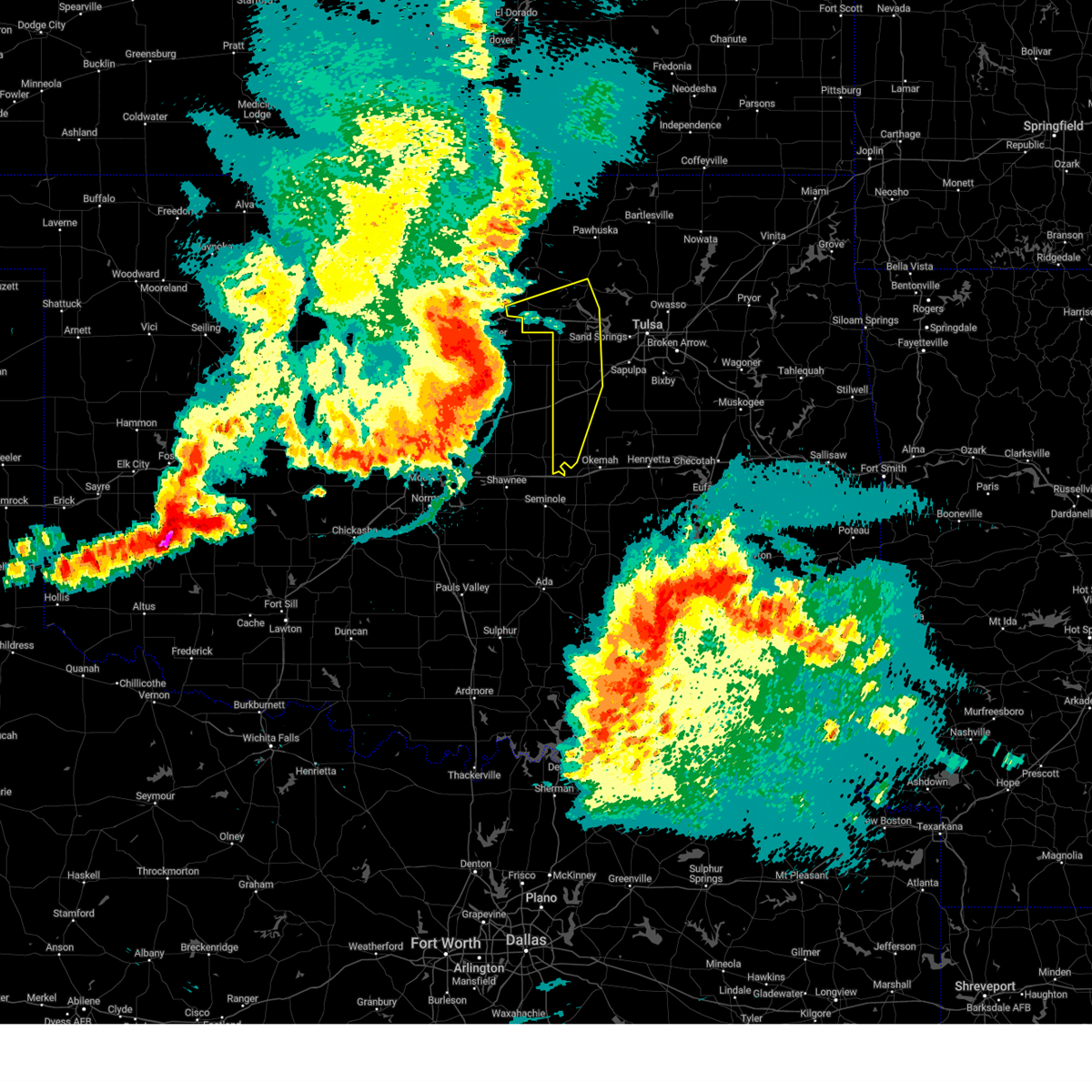 At 1122 pm cdt, severe thunderstorms were located along a line extending from 4 miles north of stillwater to 3 miles southwest of ripley to 3 miles south of wellston, moving east at 60 mph (radar indicated). Hazards include 80 mph wind gusts and quarter size hail. Flying debris will be dangerous to those caught without shelter. mobile homes will be heavily damaged. expect considerable damage to roofs, windows, and vehicles. extensive tree damage and power outages are likely. locations in or near the path include, bristow, pawnee, hominy, cleveland, mannford, drumright, boley, oilton, depew, paden, jennings, westport, osage, hallett, blackburn, terlton, shamrock, maramec, welty, silver city, this includes interstate 44 between mile markers 178 and 198. thunderstorm damage threat, destructive hail threat, radar indicated max hail size, 1. 00 in wind threat, radar indicated max wind gust, 80 mph. At 1122 pm cdt, severe thunderstorms were located along a line extending from 4 miles north of stillwater to 3 miles southwest of ripley to 3 miles south of wellston, moving east at 60 mph (radar indicated). Hazards include 80 mph wind gusts and quarter size hail. Flying debris will be dangerous to those caught without shelter. mobile homes will be heavily damaged. expect considerable damage to roofs, windows, and vehicles. extensive tree damage and power outages are likely. locations in or near the path include, bristow, pawnee, hominy, cleveland, mannford, drumright, boley, oilton, depew, paden, jennings, westport, osage, hallett, blackburn, terlton, shamrock, maramec, welty, silver city, this includes interstate 44 between mile markers 178 and 198. thunderstorm damage threat, destructive hail threat, radar indicated max hail size, 1. 00 in wind threat, radar indicated max wind gust, 80 mph.
|
| 6/17/2023 11:19 PM CDT |
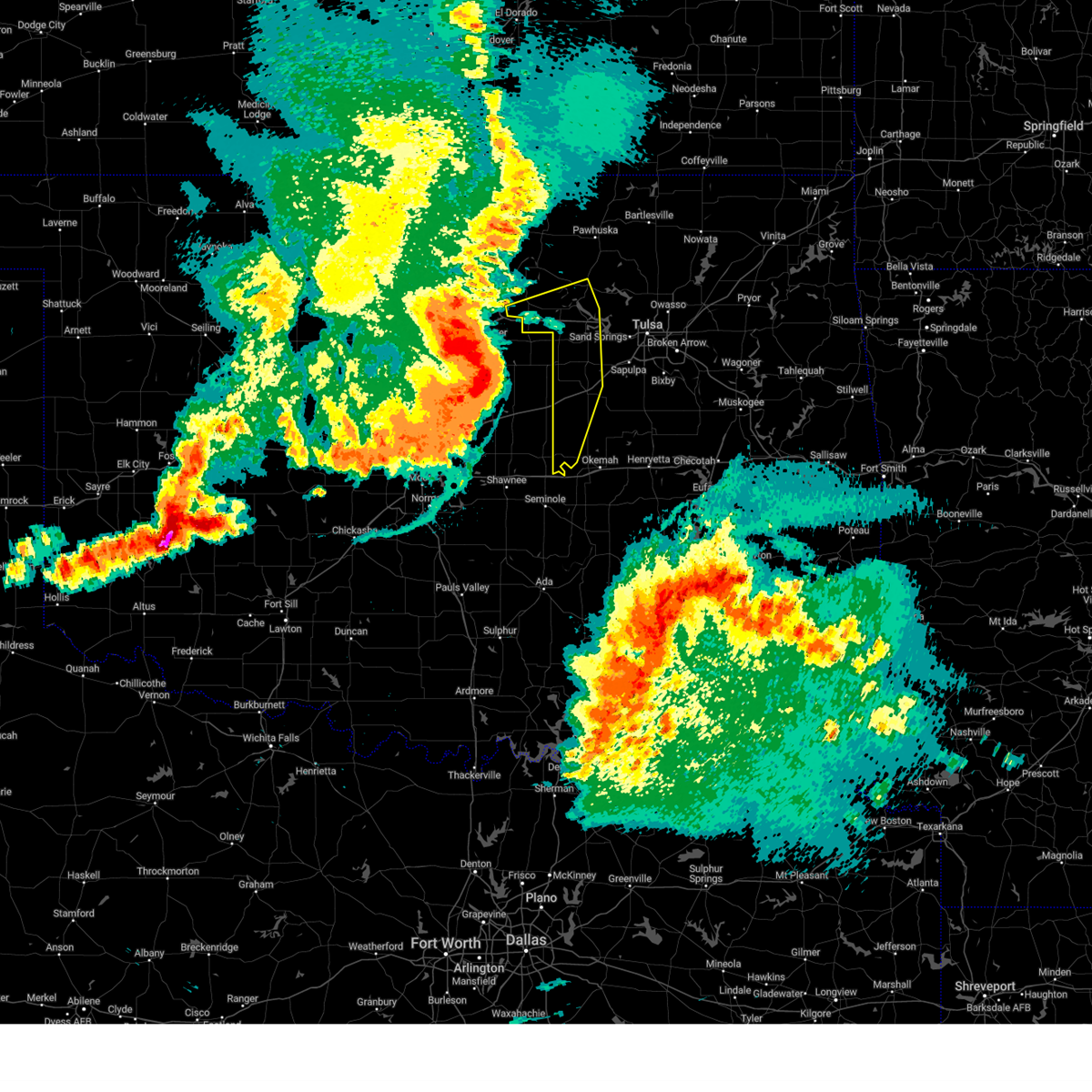 At 1119 pm cdt, severe thunderstorms were located along a line extending from 4 miles northwest of stillwater to 2 miles east of perkins to 3 miles east of luther, moving east at 55 mph (radar indicated). Hazards include 70 mph wind gusts and quarter size hail. Hail damage to vehicles is expected. expect considerable tree damage. wind damage is also likely to mobile homes, roofs, and outbuildings. locations in or near the path include, bristow, pawnee, hominy, cleveland, mannford, drumright, boley, oilton, depew, paden, jennings, westport, osage, hallett, blackburn, terlton, shamrock, maramec, welty, silver city, this includes interstate 44 between mile markers 178 and 198. thunderstorm damage threat, considerable hail threat, radar indicated max hail size, 1. 00 in wind threat, radar indicated max wind gust, 70 mph. At 1119 pm cdt, severe thunderstorms were located along a line extending from 4 miles northwest of stillwater to 2 miles east of perkins to 3 miles east of luther, moving east at 55 mph (radar indicated). Hazards include 70 mph wind gusts and quarter size hail. Hail damage to vehicles is expected. expect considerable tree damage. wind damage is also likely to mobile homes, roofs, and outbuildings. locations in or near the path include, bristow, pawnee, hominy, cleveland, mannford, drumright, boley, oilton, depew, paden, jennings, westport, osage, hallett, blackburn, terlton, shamrock, maramec, welty, silver city, this includes interstate 44 between mile markers 178 and 198. thunderstorm damage threat, considerable hail threat, radar indicated max hail size, 1. 00 in wind threat, radar indicated max wind gust, 70 mph.
|
| 6/17/2023 11:07 PM CDT |
 At 1106 pm cdt, severe thunderstorms were located along a line extending from near hardy to kaw lake to 7 miles west of morrison, moving east at 40 mph (radar indicated). Hazards include 70 mph wind gusts and quarter size hail. Hail damage to vehicles is expected. expect considerable tree damage. wind damage is also likely to mobile homes, roofs, and outbuildings. locations in or near the path include, pawhuska, pawnee, hominy, fairfax, shidler, wynona, ralston, burbank, hallett, blackburn, maramec, skedee, grainola, foraker, bigheart, pearsonia, sunset lake, osage hills state park, webb city, apperson, thunderstorm damage threat, considerable hail threat, radar indicated max hail size, 1. 00 in wind threat, radar indicated max wind gust, 70 mph. At 1106 pm cdt, severe thunderstorms were located along a line extending from near hardy to kaw lake to 7 miles west of morrison, moving east at 40 mph (radar indicated). Hazards include 70 mph wind gusts and quarter size hail. Hail damage to vehicles is expected. expect considerable tree damage. wind damage is also likely to mobile homes, roofs, and outbuildings. locations in or near the path include, pawhuska, pawnee, hominy, fairfax, shidler, wynona, ralston, burbank, hallett, blackburn, maramec, skedee, grainola, foraker, bigheart, pearsonia, sunset lake, osage hills state park, webb city, apperson, thunderstorm damage threat, considerable hail threat, radar indicated max hail size, 1. 00 in wind threat, radar indicated max wind gust, 70 mph.
|
| 6/17/2023 10:41 PM CDT |
 At 1041 pm cdt, severe thunderstorms were located along a line extending from 7 miles southwest of geuda springs to 4 miles east of blackwell to 4 miles northeast of covington, moving east at 55 mph (radar indicated). Hazards include 70 mph wind gusts and quarter size hail. Hail damage to vehicles is expected. expect considerable tree damage. wind damage is also likely to mobile homes, roofs, and outbuildings. locations in or near the path include, pawhuska, pawnee, hominy, fairfax, shidler, wynona, ralston, burbank, hallett, blackburn, maramec, skedee, grainola, foraker, bigheart, pearsonia, sunset lake, osage hills state park, webb city, apperson, thunderstorm damage threat, considerable hail threat, radar indicated max hail size, 1. 00 in wind threat, radar indicated max wind gust, 70 mph. At 1041 pm cdt, severe thunderstorms were located along a line extending from 7 miles southwest of geuda springs to 4 miles east of blackwell to 4 miles northeast of covington, moving east at 55 mph (radar indicated). Hazards include 70 mph wind gusts and quarter size hail. Hail damage to vehicles is expected. expect considerable tree damage. wind damage is also likely to mobile homes, roofs, and outbuildings. locations in or near the path include, pawhuska, pawnee, hominy, fairfax, shidler, wynona, ralston, burbank, hallett, blackburn, maramec, skedee, grainola, foraker, bigheart, pearsonia, sunset lake, osage hills state park, webb city, apperson, thunderstorm damage threat, considerable hail threat, radar indicated max hail size, 1. 00 in wind threat, radar indicated max wind gust, 70 mph.
|
| 6/15/2023 9:39 PM CDT |
 At 939 pm cdt, severe thunderstorms were located along a line extending from 4 miles southeast of newkirk to 7 miles north of sooner lake to 2 miles north of perkins, moving east at 45 mph (radar indicated). Hazards include 60 mph wind gusts and penny size hail. Expect damage to roofs, siding, and trees. locations in or near the path include, pawnee, cleveland, drumright, fairfax, oilton, shidler, jennings, ralston, burbank, hallett, blackburn, terlton, shamrock, maramec, skedee, grainola, foraker, webb city, apperson, silver city, hail threat, radar indicated max hail size, 0. 75 in wind threat, radar indicated max wind gust, 60 mph. At 939 pm cdt, severe thunderstorms were located along a line extending from 4 miles southeast of newkirk to 7 miles north of sooner lake to 2 miles north of perkins, moving east at 45 mph (radar indicated). Hazards include 60 mph wind gusts and penny size hail. Expect damage to roofs, siding, and trees. locations in or near the path include, pawnee, cleveland, drumright, fairfax, oilton, shidler, jennings, ralston, burbank, hallett, blackburn, terlton, shamrock, maramec, skedee, grainola, foraker, webb city, apperson, silver city, hail threat, radar indicated max hail size, 0. 75 in wind threat, radar indicated max wind gust, 60 mph.
|
| 6/15/2023 9:15 PM CDT |
 At 915 pm cdt, severe thunderstorms were located along a line extending from 3 miles north of blackwell to 7 miles northwest of red rock to 5 miles southeast of mulhall, moving east at 45 mph (radar indicated). Hazards include 70 mph wind gusts and nickel size hail. Expect considerable tree damage. damage is likely to mobile homes, roofs, and outbuildings. locations in or near the path include, pawnee, cleveland, drumright, fairfax, oilton, shidler, jennings, ralston, burbank, hallett, blackburn, terlton, shamrock, maramec, skedee, grainola, foraker, webb city, apperson, silver city, thunderstorm damage threat, considerable hail threat, radar indicated max hail size, 0. 88 in wind threat, radar indicated max wind gust, 70 mph. At 915 pm cdt, severe thunderstorms were located along a line extending from 3 miles north of blackwell to 7 miles northwest of red rock to 5 miles southeast of mulhall, moving east at 45 mph (radar indicated). Hazards include 70 mph wind gusts and nickel size hail. Expect considerable tree damage. damage is likely to mobile homes, roofs, and outbuildings. locations in or near the path include, pawnee, cleveland, drumright, fairfax, oilton, shidler, jennings, ralston, burbank, hallett, blackburn, terlton, shamrock, maramec, skedee, grainola, foraker, webb city, apperson, silver city, thunderstorm damage threat, considerable hail threat, radar indicated max hail size, 0. 88 in wind threat, radar indicated max wind gust, 70 mph.
|
| 5/12/2023 11:39 PM CDT |
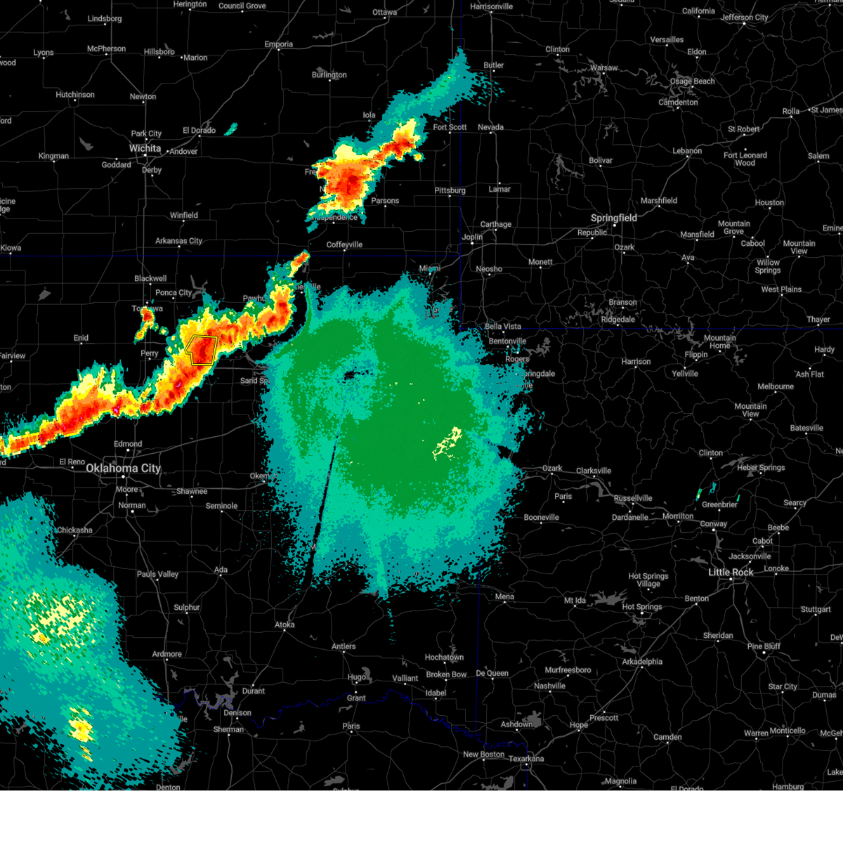 The severe thunderstorm warning for southwestern pawnee county will expire at 1145 pm cdt, the storm which prompted the warning has weakened below severe limits, and no longer poses an immediate threat to life or property. therefore, the warning will be allowed to expire. however small hail and gusty winds are still possible with this thunderstorm. a severe thunderstorm watch remains in effect until 200 am cdt for northeastern oklahoma. The severe thunderstorm warning for southwestern pawnee county will expire at 1145 pm cdt, the storm which prompted the warning has weakened below severe limits, and no longer poses an immediate threat to life or property. therefore, the warning will be allowed to expire. however small hail and gusty winds are still possible with this thunderstorm. a severe thunderstorm watch remains in effect until 200 am cdt for northeastern oklahoma.
|
| 5/12/2023 11:29 PM CDT |
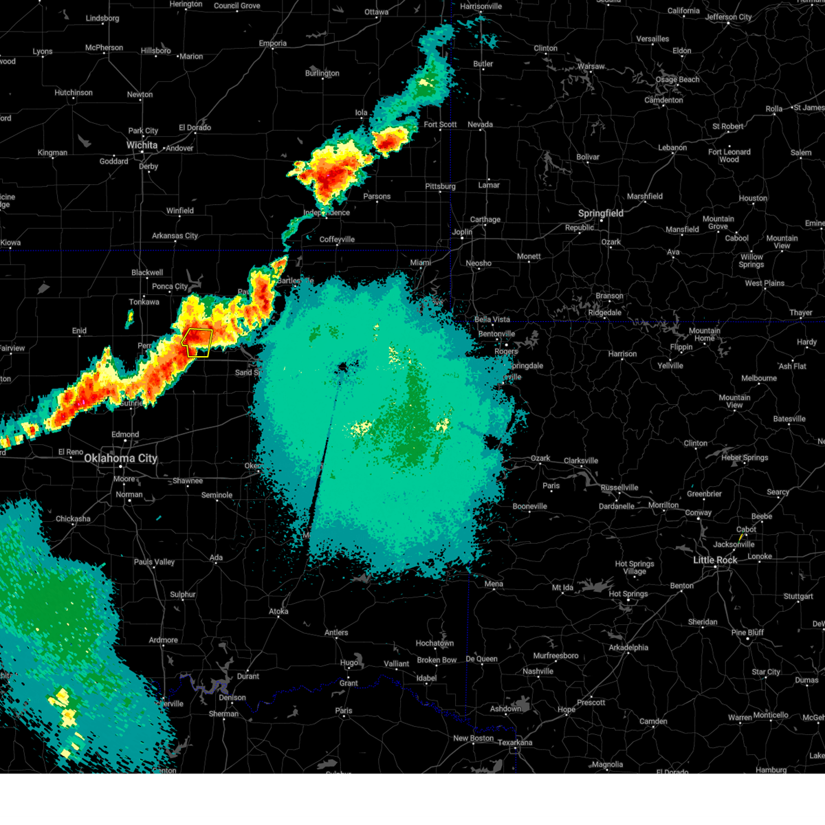 At 1129 pm cdt, a severe thunderstorm was located near pawnee, moving east at 30 mph (radar indicated). Hazards include 60 mph wind gusts and quarter size hail. Hail damage to vehicles is expected. expect wind damage to roofs, siding, and trees. locations in or near the path include, pawnee, hail threat, radar indicated max hail size, 1. 00 in wind threat, radar indicated max wind gust, 60 mph. At 1129 pm cdt, a severe thunderstorm was located near pawnee, moving east at 30 mph (radar indicated). Hazards include 60 mph wind gusts and quarter size hail. Hail damage to vehicles is expected. expect wind damage to roofs, siding, and trees. locations in or near the path include, pawnee, hail threat, radar indicated max hail size, 1. 00 in wind threat, radar indicated max wind gust, 60 mph.
|
| 5/12/2023 11:23 PM CDT |
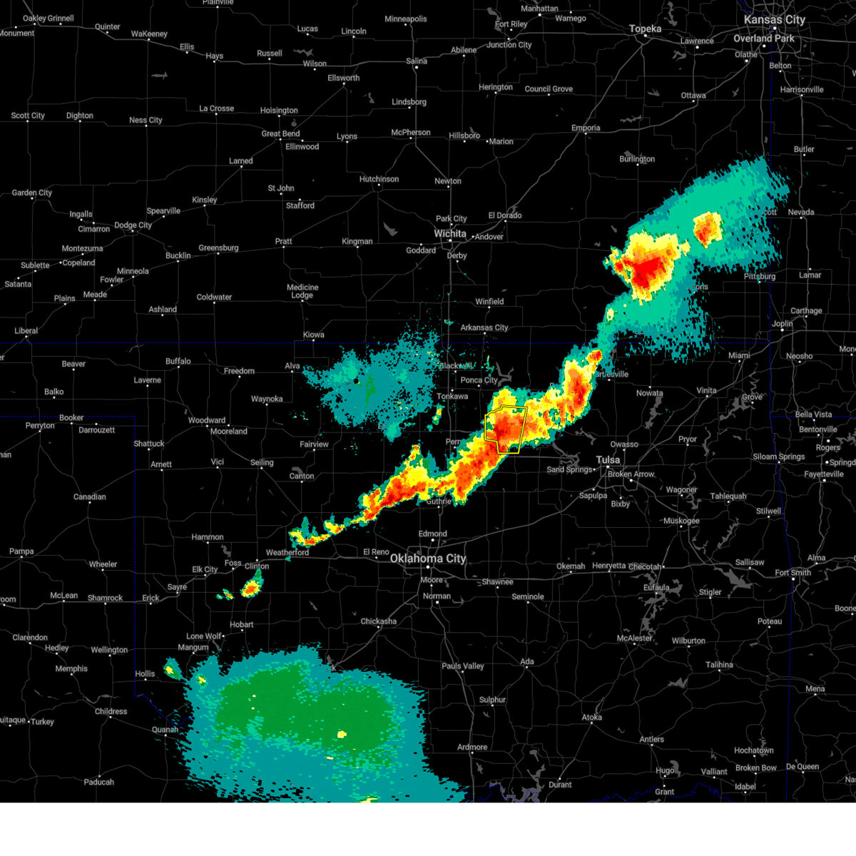 At 1122 pm cdt, a severe thunderstorm was located 4 miles west of pawnee, moving southeast at 15 mph (radar indicated). Hazards include 60 mph wind gusts and quarter size hail. Hail damage to vehicles is expected. expect wind damage to roofs, siding, and trees. locations in or near the path include, pawnee, fairfax, ralston, hail threat, radar indicated max hail size, 1. 00 in wind threat, radar indicated max wind gust, 60 mph. At 1122 pm cdt, a severe thunderstorm was located 4 miles west of pawnee, moving southeast at 15 mph (radar indicated). Hazards include 60 mph wind gusts and quarter size hail. Hail damage to vehicles is expected. expect wind damage to roofs, siding, and trees. locations in or near the path include, pawnee, fairfax, ralston, hail threat, radar indicated max hail size, 1. 00 in wind threat, radar indicated max wind gust, 60 mph.
|
| 5/12/2023 11:07 PM CDT |
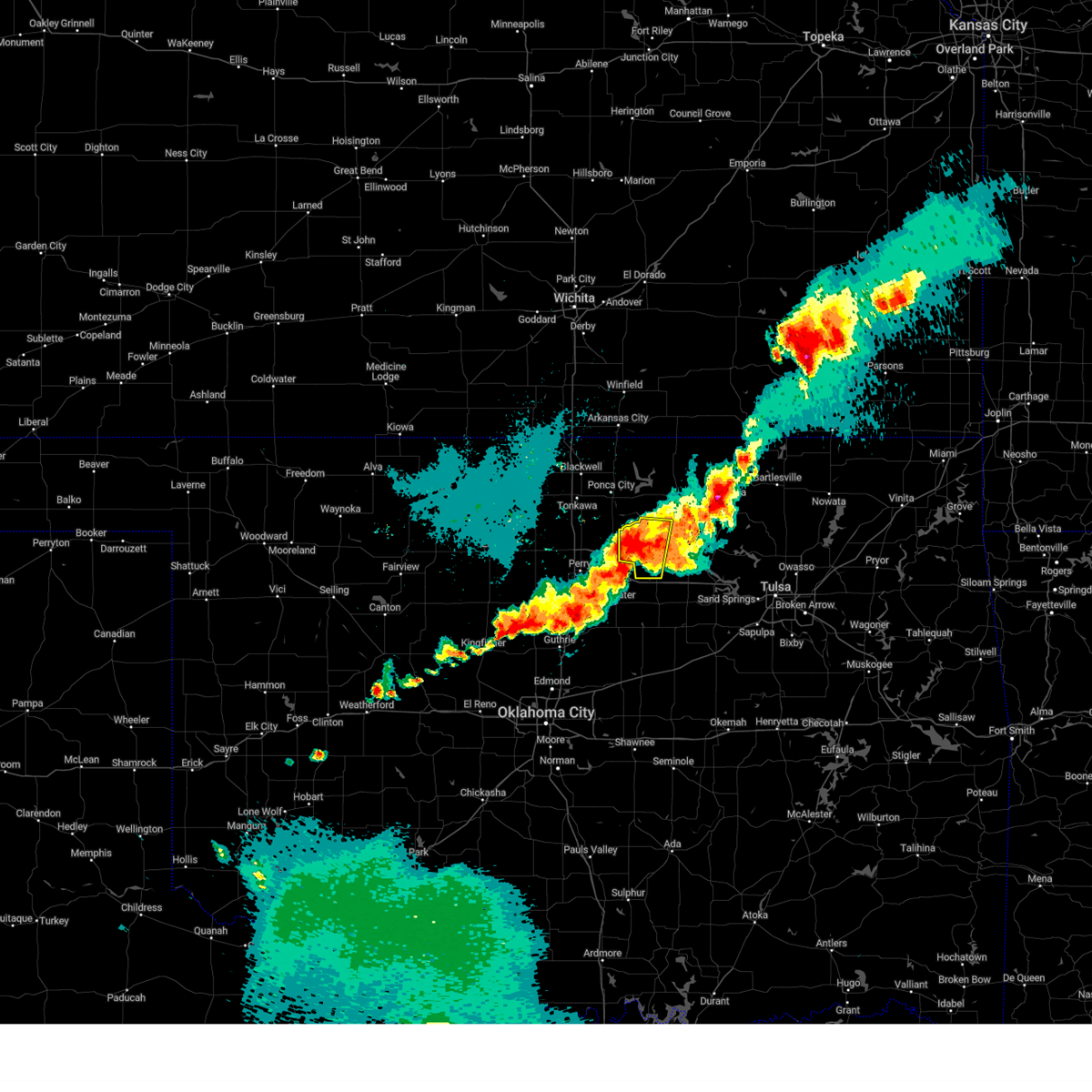 At 1107 pm cdt, a severe thunderstorm was located 6 miles northwest of pawnee, moving north at 15 mph (radar indicated). Hazards include 70 mph wind gusts and quarter size hail. Hail damage to vehicles is expected. expect considerable tree damage. wind damage is also likely to mobile homes, roofs, and outbuildings. locations in or near the path include, pawnee, fairfax, ralston, thunderstorm damage threat, considerable hail threat, radar indicated max hail size, 1. 00 in wind threat, radar indicated max wind gust, 70 mph. At 1107 pm cdt, a severe thunderstorm was located 6 miles northwest of pawnee, moving north at 15 mph (radar indicated). Hazards include 70 mph wind gusts and quarter size hail. Hail damage to vehicles is expected. expect considerable tree damage. wind damage is also likely to mobile homes, roofs, and outbuildings. locations in or near the path include, pawnee, fairfax, ralston, thunderstorm damage threat, considerable hail threat, radar indicated max hail size, 1. 00 in wind threat, radar indicated max wind gust, 70 mph.
|
| 5/12/2023 10:53 PM CDT |
 At 1053 pm cdt, a severe thunderstorm was located near pawnee, moving northeast at 15 mph (radar indicated). Hazards include 70 mph wind gusts and quarter size hail. Hail damage to vehicles is expected. expect considerable tree damage. wind damage is also likely to mobile homes, roofs, and outbuildings. locations in or near the path include, pawnee, blackburn, skedee, thunderstorm damage threat, considerable hail threat, radar indicated max hail size, 1. 00 in wind threat, radar indicated max wind gust, 70 mph. At 1053 pm cdt, a severe thunderstorm was located near pawnee, moving northeast at 15 mph (radar indicated). Hazards include 70 mph wind gusts and quarter size hail. Hail damage to vehicles is expected. expect considerable tree damage. wind damage is also likely to mobile homes, roofs, and outbuildings. locations in or near the path include, pawnee, blackburn, skedee, thunderstorm damage threat, considerable hail threat, radar indicated max hail size, 1. 00 in wind threat, radar indicated max wind gust, 70 mph.
|
| 5/12/2023 10:30 PM CDT |
 At 1030 pm cdt, a severe thunderstorm was located over pawnee, moving northeast at 25 mph (radar indicated). Hazards include 60 mph wind gusts and quarter size hail. Hail damage to vehicles is expected. expect wind damage to roofs, siding, and trees. locations in or near the path include, pawnee, blackburn, skedee, hail threat, radar indicated max hail size, 1. 00 in wind threat, radar indicated max wind gust, 60 mph. At 1030 pm cdt, a severe thunderstorm was located over pawnee, moving northeast at 25 mph (radar indicated). Hazards include 60 mph wind gusts and quarter size hail. Hail damage to vehicles is expected. expect wind damage to roofs, siding, and trees. locations in or near the path include, pawnee, blackburn, skedee, hail threat, radar indicated max hail size, 1. 00 in wind threat, radar indicated max wind gust, 60 mph.
|
| 4/19/2023 6:49 PM CDT |
 At 649 pm cdt, a severe thunderstorm was located 3 miles southeast of glencoe, moving northeast at 50 mph (radar indicated). Hazards include 60 mph wind gusts and half dollar size hail. Hail damage to vehicles is expected. expect wind damage to roofs, siding, and trees. locations in or near the path include, pawnee, hominy, fairfax, ralston, blackburn, maramec, skedee, hail threat, radar indicated max hail size, 1. 25 in wind threat, radar indicated max wind gust, 60 mph. At 649 pm cdt, a severe thunderstorm was located 3 miles southeast of glencoe, moving northeast at 50 mph (radar indicated). Hazards include 60 mph wind gusts and half dollar size hail. Hail damage to vehicles is expected. expect wind damage to roofs, siding, and trees. locations in or near the path include, pawnee, hominy, fairfax, ralston, blackburn, maramec, skedee, hail threat, radar indicated max hail size, 1. 25 in wind threat, radar indicated max wind gust, 60 mph.
|
| 3/23/2023 4:13 PM CDT |
 At 413 pm cdt, a severe thunderstorm was located 6 miles west of quay, moving northeast at 65 mph (radar indicated). Hazards include 60 mph wind gusts and quarter size hail. Hail damage to vehicles is expected. expect wind damage to roofs, siding, and trees. locations in or near the path include, pawnee, hominy, cleveland, jennings, osage, hallett, blackburn, terlton, maramec, skedee, hail threat, radar indicated max hail size, 1. 00 in wind threat, radar indicated max wind gust, 60 mph. At 413 pm cdt, a severe thunderstorm was located 6 miles west of quay, moving northeast at 65 mph (radar indicated). Hazards include 60 mph wind gusts and quarter size hail. Hail damage to vehicles is expected. expect wind damage to roofs, siding, and trees. locations in or near the path include, pawnee, hominy, cleveland, jennings, osage, hallett, blackburn, terlton, maramec, skedee, hail threat, radar indicated max hail size, 1. 00 in wind threat, radar indicated max wind gust, 60 mph.
|
| 8/29/2022 12:57 PM CDT | The severe thunderstorm warning for western pawnee county will expire at 100 pm cdt, the storm which prompted the warning has weakened below severe limits, and no longer poses an immediate threat to life or property. therefore, the warning will be allowed to expire. however gusty winds and heavy rain are still possible with this thunderstorm. |
| 8/29/2022 12:42 PM CDT | At 1242 pm cdt, a severe thunderstorm was located over pawnee, moving northeast at 15 mph (radar indicated). Hazards include 60 mph wind gusts and nickel size hail. Expect damage to roofs, siding, and trees. locations in or near the path include, pawnee, ralston, blackburn, skedee, hail threat, radar indicated max hail size, 0. 88 in wind threat, radar indicated max wind gust, 60 mph. |
| 8/29/2022 12:29 PM CDT | At 1228 pm cdt, a severe thunderstorm was located over pawnee, moving northeast at 10 mph (radar indicated). Hazards include 70 mph wind gusts and half dollar size hail. Hail damage to vehicles is expected. expect considerable tree damage. wind damage is also likely to mobile homes, roofs, and outbuildings. locations in or near the path include, pawnee, ralston, blackburn, skedee, thunderstorm damage threat, considerable hail threat, radar indicated max hail size, 1. 25 in wind threat, radar indicated max wind gust, 70 mph. |
| 8/29/2022 12:21 PM CDT | At 1221 pm cdt, a severe thunderstorm was located over pawnee, moving northeast at 10 mph (radar indicated). Hazards include 60 mph wind gusts and quarter size hail. Hail damage to vehicles is expected. expect wind damage to roofs, siding, and trees. locations in or near the path include, pawnee, ralston, blackburn, skedee, hail threat, radar indicated max hail size, 1. 00 in wind threat, radar indicated max wind gust, 60 mph. |
| 6/10/2022 4:42 AM CDT |
 The severe thunderstorm warning for western osage and northwestern pawnee counties will expire at 445 am cdt, the storms which prompted the warning have weakened below severe limits, and have exited the warned area. therefore, the warning will be allowed to expire. a severe thunderstorm watch remains in effect until 800 am cdt for northeastern oklahoma. The severe thunderstorm warning for western osage and northwestern pawnee counties will expire at 445 am cdt, the storms which prompted the warning have weakened below severe limits, and have exited the warned area. therefore, the warning will be allowed to expire. a severe thunderstorm watch remains in effect until 800 am cdt for northeastern oklahoma.
|
| 6/10/2022 4:23 AM CDT |
 At 422 am cdt, severe thunderstorms were located along a line extending from 6 miles southeast of shidler to 4 miles northwest of fairfax to 6 miles north of sooner lake, moving southeast at 40 mph (radar indicated). Hazards include 60 mph wind gusts. Expect damage to roofs, siding, and trees. locations in or near the path include, pawnee, fairfax, shidler, ralston, burbank, blackburn, skedee, webb city, apperson, hail threat, radar indicated max hail size, <. 75 in wind threat, radar indicated max wind gust, 60 mph. At 422 am cdt, severe thunderstorms were located along a line extending from 6 miles southeast of shidler to 4 miles northwest of fairfax to 6 miles north of sooner lake, moving southeast at 40 mph (radar indicated). Hazards include 60 mph wind gusts. Expect damage to roofs, siding, and trees. locations in or near the path include, pawnee, fairfax, shidler, ralston, burbank, blackburn, skedee, webb city, apperson, hail threat, radar indicated max hail size, <. 75 in wind threat, radar indicated max wind gust, 60 mph.
|
| 6/10/2022 4:07 AM CDT |
 At 407 am cdt, severe thunderstorms were located along a line extending from 2 miles northwest of shidler to 5 miles south of kaw city to 5 miles northeast of marland, moving southeast at 40 mph (radar indicated). Hazards include 60 mph wind gusts. Expect damage to roofs, siding, and trees. locations in or near the path include, pawnee, fairfax, shidler, ralston, burbank, blackburn, skedee, webb city, apperson, hail threat, radar indicated max hail size, <. 75 in wind threat, radar indicated max wind gust, 60 mph. At 407 am cdt, severe thunderstorms were located along a line extending from 2 miles northwest of shidler to 5 miles south of kaw city to 5 miles northeast of marland, moving southeast at 40 mph (radar indicated). Hazards include 60 mph wind gusts. Expect damage to roofs, siding, and trees. locations in or near the path include, pawnee, fairfax, shidler, ralston, burbank, blackburn, skedee, webb city, apperson, hail threat, radar indicated max hail size, <. 75 in wind threat, radar indicated max wind gust, 60 mph.
|
| 6/6/2022 1:50 AM CDT |
 At 150 am cdt, severe thunderstorms were located along a line extending from 2 miles north of hallett to 3 miles south of lake carl blackwell, moving southeast at 45 mph (radar indicated). Hazards include 60 mph wind gusts. Expect damage to roofs, siding, and trees. locations in or near the path include, tulsa, sand springs, pawnee, sapulpa, jenks, glenpool, mannford, drumright, kellyville, oilton, jennings, hallett, terlton, shamrock, maramec, keystone state park, jenks riverside airport, silver city, this includes interstate 44 between mile markers 196 and 216. hail threat, radar indicated max hail size, <. 75 in wind threat, radar indicated max wind gust, 60 mph. At 150 am cdt, severe thunderstorms were located along a line extending from 2 miles north of hallett to 3 miles south of lake carl blackwell, moving southeast at 45 mph (radar indicated). Hazards include 60 mph wind gusts. Expect damage to roofs, siding, and trees. locations in or near the path include, tulsa, sand springs, pawnee, sapulpa, jenks, glenpool, mannford, drumright, kellyville, oilton, jennings, hallett, terlton, shamrock, maramec, keystone state park, jenks riverside airport, silver city, this includes interstate 44 between mile markers 196 and 216. hail threat, radar indicated max hail size, <. 75 in wind threat, radar indicated max wind gust, 60 mph.
|
| 6/6/2022 1:38 AM CDT |
 At 137 am cdt, severe thunderstorms were located along a line extending from 3 miles northwest of hominy to 4 miles south of blackburn to 3 miles south of sooner lake, moving east at 60 mph (radar indicated). Hazards include 60 mph wind gusts. Expect damage to roofs, siding, and trees. locations in or near the path include, pawnee, skiatook, hominy, cleveland, jennings, ralston, westport, osage, hallett, blackburn, terlton, maramec, skedee, walnut creek state park, hail threat, radar indicated max hail size, <. 75 in wind threat, radar indicated max wind gust, 60 mph. At 137 am cdt, severe thunderstorms were located along a line extending from 3 miles northwest of hominy to 4 miles south of blackburn to 3 miles south of sooner lake, moving east at 60 mph (radar indicated). Hazards include 60 mph wind gusts. Expect damage to roofs, siding, and trees. locations in or near the path include, pawnee, skiatook, hominy, cleveland, jennings, ralston, westport, osage, hallett, blackburn, terlton, maramec, skedee, walnut creek state park, hail threat, radar indicated max hail size, <. 75 in wind threat, radar indicated max wind gust, 60 mph.
|
| 6/6/2022 1:22 AM CDT |
 At 121 am cdt, severe thunderstorms were located along a line extending from 5 miles west of ralston to 7 miles north of lake mcmurtry, moving southeast at 45 mph (radar indicated). Hazards include 60 mph wind gusts. Expect damage to roofs, siding, and trees. locations in or near the path include, pawnee, skiatook, hominy, cleveland, jennings, ralston, westport, osage, hallett, blackburn, terlton, maramec, skedee, walnut creek state park, at 1:10 am, the red rock oklahoma mesonet station reported a wind gust of 60 mph. hail threat, radar indicated max hail size, <. 75 in wind threat, radar indicated max wind gust, 60 mph. At 121 am cdt, severe thunderstorms were located along a line extending from 5 miles west of ralston to 7 miles north of lake mcmurtry, moving southeast at 45 mph (radar indicated). Hazards include 60 mph wind gusts. Expect damage to roofs, siding, and trees. locations in or near the path include, pawnee, skiatook, hominy, cleveland, jennings, ralston, westport, osage, hallett, blackburn, terlton, maramec, skedee, walnut creek state park, at 1:10 am, the red rock oklahoma mesonet station reported a wind gust of 60 mph. hail threat, radar indicated max hail size, <. 75 in wind threat, radar indicated max wind gust, 60 mph.
|
| 5/19/2022 3:27 AM CDT |
 At 326 am cdt, severe thunderstorms were located along a line extending from 4 miles southeast of braman to sooner lake to 4 miles east of meridian, moving east at 60 mph (radar indicated). Hazards include 60 mph wind gusts. Expect damage to roofs, siding, and trees. locations in or near the path include, pawhuska, pawnee, hominy, cleveland, mannford, drumright, fairfax, oilton, shidler, wynona, jennings, ralston, westport, osage, burbank, hallett, blackburn, terlton, maramec, skedee, hail threat, radar indicated max hail size, <. 75 in wind threat, radar indicated max wind gust, 60 mph. At 326 am cdt, severe thunderstorms were located along a line extending from 4 miles southeast of braman to sooner lake to 4 miles east of meridian, moving east at 60 mph (radar indicated). Hazards include 60 mph wind gusts. Expect damage to roofs, siding, and trees. locations in or near the path include, pawhuska, pawnee, hominy, cleveland, mannford, drumright, fairfax, oilton, shidler, wynona, jennings, ralston, westport, osage, burbank, hallett, blackburn, terlton, maramec, skedee, hail threat, radar indicated max hail size, <. 75 in wind threat, radar indicated max wind gust, 60 mph.
|
| 5/15/2022 12:08 AM CDT |
 At 1206 am cdt, severe thunderstorms were located along a line extending from near ponca city to carney, moving east at 30 mph (radar indicated). Hazards include 60 mph wind gusts and quarter size hail. Hail damage to vehicles is expected. expect wind damage to roofs, siding, and trees. locations in or near the path include, pawnee, fairfax, ralston, burbank, maramec, skedee, apperson, hail threat, radar indicated max hail size, 1. 00 in wind threat, radar indicated max wind gust, 60 mph. At 1206 am cdt, severe thunderstorms were located along a line extending from near ponca city to carney, moving east at 30 mph (radar indicated). Hazards include 60 mph wind gusts and quarter size hail. Hail damage to vehicles is expected. expect wind damage to roofs, siding, and trees. locations in or near the path include, pawnee, fairfax, ralston, burbank, maramec, skedee, apperson, hail threat, radar indicated max hail size, 1. 00 in wind threat, radar indicated max wind gust, 60 mph.
|
| 5/2/2022 6:46 PM CDT |
 At 645 pm cdt, a severe thunderstorm was located 3 miles north of hallett, moving northeast at 35 mph (radar indicated). Hazards include 60 mph wind gusts and quarter size hail. Hail damage to vehicles is expected. expect wind damage to roofs, siding, and trees. Locations in or near the path include, tulsa, sand springs, pawhuska, pawnee, hominy, cleveland, barnsdall, wynona, jennings, ralston, westport, osage, hallett, blackburn, terlton, maramec, skedee, walnut creek state park, tallant, pershing,. At 645 pm cdt, a severe thunderstorm was located 3 miles north of hallett, moving northeast at 35 mph (radar indicated). Hazards include 60 mph wind gusts and quarter size hail. Hail damage to vehicles is expected. expect wind damage to roofs, siding, and trees. Locations in or near the path include, tulsa, sand springs, pawhuska, pawnee, hominy, cleveland, barnsdall, wynona, jennings, ralston, westport, osage, hallett, blackburn, terlton, maramec, skedee, walnut creek state park, tallant, pershing,.
|
| 5/2/2022 6:37 PM CDT |
 The tornado warning for south central osage and central pawnee counties will expire at 645 pm cdt, the tornado threat has diminished and the tornado warning will be allowed to expire. however, damaging winds and large hail remain likely and a severe thunderstorm warning remains in effect for the area. a tornado watch remains in effect until 1000 pm cdt for northeastern oklahoma. The tornado warning for south central osage and central pawnee counties will expire at 645 pm cdt, the tornado threat has diminished and the tornado warning will be allowed to expire. however, damaging winds and large hail remain likely and a severe thunderstorm warning remains in effect for the area. a tornado watch remains in effect until 1000 pm cdt for northeastern oklahoma.
|
| 5/2/2022 6:28 PM CDT |
 At 628 pm cdt, a severe thunderstorm capable of producing a tornado was located over skedee, moving east at 40 mph (radar indicated rotation). Hazards include tornado and quarter size hail. Flying debris will be dangerous to those caught without shelter. mobile homes will be damaged or destroyed. damage to roofs, windows, and vehicles will occur. tree damage is likely. Locations in or near the path include, pawnee, ralston, blackburn, skedee,. At 628 pm cdt, a severe thunderstorm capable of producing a tornado was located over skedee, moving east at 40 mph (radar indicated rotation). Hazards include tornado and quarter size hail. Flying debris will be dangerous to those caught without shelter. mobile homes will be damaged or destroyed. damage to roofs, windows, and vehicles will occur. tree damage is likely. Locations in or near the path include, pawnee, ralston, blackburn, skedee,.
|
| 5/2/2022 6:24 PM CDT |
 At 623 pm cdt, a severe thunderstorm was located over skedee, moving east at 40 mph (radar indicated). Hazards include 60 mph wind gusts and quarter size hail. Hail damage to vehicles is expected. expect wind damage to roofs, siding, and trees. Locations in or near the path include, tulsa, sand springs, pawhuska, pawnee, hominy, cleveland, barnsdall, wynona, jennings, ralston, westport, osage, hallett, blackburn, terlton, maramec, skedee, walnut creek state park, tallant, pershing,. At 623 pm cdt, a severe thunderstorm was located over skedee, moving east at 40 mph (radar indicated). Hazards include 60 mph wind gusts and quarter size hail. Hail damage to vehicles is expected. expect wind damage to roofs, siding, and trees. Locations in or near the path include, tulsa, sand springs, pawhuska, pawnee, hominy, cleveland, barnsdall, wynona, jennings, ralston, westport, osage, hallett, blackburn, terlton, maramec, skedee, walnut creek state park, tallant, pershing,.
|
| 5/2/2022 6:16 PM CDT |
 At 616 pm cdt, a severe thunderstorm capable of producing a tornado was located 4 miles northwest of pawnee, moving east at 40 mph (radar indicated rotation). Hazards include tornado and quarter size hail. Flying debris will be dangerous to those caught without shelter. mobile homes will be damaged or destroyed. damage to roofs, windows, and vehicles will occur. tree damage is likely. Locations in or near the path include, pawnee, ralston, blackburn, skedee,. At 616 pm cdt, a severe thunderstorm capable of producing a tornado was located 4 miles northwest of pawnee, moving east at 40 mph (radar indicated rotation). Hazards include tornado and quarter size hail. Flying debris will be dangerous to those caught without shelter. mobile homes will be damaged or destroyed. damage to roofs, windows, and vehicles will occur. tree damage is likely. Locations in or near the path include, pawnee, ralston, blackburn, skedee,.
|
| 5/2/2022 6:11 PM CDT |
 At 610 pm cdt, severe thunderstorms were located along a line extending from 4 miles north of hardy to 3 miles southeast of glencoe, moving east at 45 mph (radar indicated). Hazards include 60 mph wind gusts and quarter size hail. Hail damage to vehicles is expected. expect wind damage to roofs, siding, and trees. Locations in or near the path include, pawnee, fairfax, shidler, ralston, burbank, maramec, skedee, webb city, apperson,. At 610 pm cdt, severe thunderstorms were located along a line extending from 4 miles north of hardy to 3 miles southeast of glencoe, moving east at 45 mph (radar indicated). Hazards include 60 mph wind gusts and quarter size hail. Hail damage to vehicles is expected. expect wind damage to roofs, siding, and trees. Locations in or near the path include, pawnee, fairfax, shidler, ralston, burbank, maramec, skedee, webb city, apperson,.
|
| 5/2/2022 6:08 PM CDT |
 At 608 pm cdt, a severe thunderstorm capable of producing a tornado was located 5 miles southeast of sooner lake, moving east at 30 mph (radar indicated rotation). Hazards include tornado and quarter size hail. Flying debris will be dangerous to those caught without shelter. mobile homes will be damaged or destroyed. damage to roofs, windows, and vehicles will occur. tree damage is likely. Locations in or near the path include, pawnee, ralston, blackburn, skedee,. At 608 pm cdt, a severe thunderstorm capable of producing a tornado was located 5 miles southeast of sooner lake, moving east at 30 mph (radar indicated rotation). Hazards include tornado and quarter size hail. Flying debris will be dangerous to those caught without shelter. mobile homes will be damaged or destroyed. damage to roofs, windows, and vehicles will occur. tree damage is likely. Locations in or near the path include, pawnee, ralston, blackburn, skedee,.
|
| 5/2/2022 6:00 PM CDT |
 At 600 pm cdt, a confirmed tornado was located 4 miles north of morrison, moving east at 40 mph (weather spotters confirmed tornado). Hazards include damaging tornado and quarter size hail. Flying debris will be dangerous to those caught without shelter. mobile homes will be damaged or destroyed. damage to roofs, windows, and vehicles will occur. tree damage is likely. Locations in or near the path include, pawnee, cleveland, ralston, blackburn, skedee,. At 600 pm cdt, a confirmed tornado was located 4 miles north of morrison, moving east at 40 mph (weather spotters confirmed tornado). Hazards include damaging tornado and quarter size hail. Flying debris will be dangerous to those caught without shelter. mobile homes will be damaged or destroyed. damage to roofs, windows, and vehicles will occur. tree damage is likely. Locations in or near the path include, pawnee, cleveland, ralston, blackburn, skedee,.
|
| 5/2/2022 5:56 PM CDT |
 At 556 pm cdt, severe thunderstorms were located along a line extending from 3 miles southeast of arkansas city to 2 miles north of stillwater, moving east at 35 mph (radar indicated). Hazards include 60 mph wind gusts and quarter size hail. Hail damage to vehicles is expected. expect wind damage to roofs, siding, and trees. Locations in or near the path include, pawnee, fairfax, shidler, ralston, burbank, maramec, skedee, webb city, apperson,. At 556 pm cdt, severe thunderstorms were located along a line extending from 3 miles southeast of arkansas city to 2 miles north of stillwater, moving east at 35 mph (radar indicated). Hazards include 60 mph wind gusts and quarter size hail. Hail damage to vehicles is expected. expect wind damage to roofs, siding, and trees. Locations in or near the path include, pawnee, fairfax, shidler, ralston, burbank, maramec, skedee, webb city, apperson,.
|
| 5/2/2022 5:35 PM CDT |
 At 535 pm cdt, severe thunderstorms were located along a line extending from 7 miles west of hardy to lake carl blackwell, moving east at 40 mph (radar indicated). Hazards include 60 mph wind gusts and quarter size hail. Hail damage to vehicles is expected. expect wind damage to roofs, siding, and trees. Locations in or near the path include, pawnee, fairfax, shidler, jennings, ralston, burbank, hallett, blackburn, maramec, skedee, grainola, foraker, pearsonia, webb city, apperson,. At 535 pm cdt, severe thunderstorms were located along a line extending from 7 miles west of hardy to lake carl blackwell, moving east at 40 mph (radar indicated). Hazards include 60 mph wind gusts and quarter size hail. Hail damage to vehicles is expected. expect wind damage to roofs, siding, and trees. Locations in or near the path include, pawnee, fairfax, shidler, jennings, ralston, burbank, hallett, blackburn, maramec, skedee, grainola, foraker, pearsonia, webb city, apperson,.
|
| 4/30/2022 12:22 AM CDT |
 At 1222 am cdt, severe thunderstorms were located along a line extending from 3 miles south of chautauqua to 4 miles south of glencoe, moving east at 45 mph (radar indicated). Hazards include 60 mph wind gusts and quarter size hail. Hail damage to vehicles is expected. expect wind damage to roofs, siding, and trees. locations in or near the path include, bartlesville, pawhuska, pawnee, hominy, dewey, cleveland, mannford, fairfax, barnsdall, oilton, south coffeyville, copan, ramona, wynona, ochelata, jennings, ralston, avant, westport, lenapah, hail threat, radar indicated max hail size, 1. 00 in wind threat, radar indicated max wind gust, 60 mph. At 1222 am cdt, severe thunderstorms were located along a line extending from 3 miles south of chautauqua to 4 miles south of glencoe, moving east at 45 mph (radar indicated). Hazards include 60 mph wind gusts and quarter size hail. Hail damage to vehicles is expected. expect wind damage to roofs, siding, and trees. locations in or near the path include, bartlesville, pawhuska, pawnee, hominy, dewey, cleveland, mannford, fairfax, barnsdall, oilton, south coffeyville, copan, ramona, wynona, ochelata, jennings, ralston, avant, westport, lenapah, hail threat, radar indicated max hail size, 1. 00 in wind threat, radar indicated max wind gust, 60 mph.
|
| 4/30/2022 12:15 AM CDT |
 At 1214 am cdt, severe thunderstorms were located along a line extending from 3 miles southeast of elgin to 2 miles west of pawnee, moving east at 35 mph (radar indicated). Hazards include 60 mph wind gusts and half dollar size hail. Hail damage to vehicles is expected. expect wind damage to roofs, siding, and trees. locations in or near the path include, pawhuska, pawnee, fairfax, shidler, wynona, ralston, burbank, blackburn, maramec, skedee, foraker, bigheart, pearsonia, hulah, sunset lake, osage hills state park, wah sha she state park, pershing, hail threat, radar indicated max hail size, 1. 25 in wind threat, radar indicated max wind gust, 60 mph. At 1214 am cdt, severe thunderstorms were located along a line extending from 3 miles southeast of elgin to 2 miles west of pawnee, moving east at 35 mph (radar indicated). Hazards include 60 mph wind gusts and half dollar size hail. Hail damage to vehicles is expected. expect wind damage to roofs, siding, and trees. locations in or near the path include, pawhuska, pawnee, fairfax, shidler, wynona, ralston, burbank, blackburn, maramec, skedee, foraker, bigheart, pearsonia, hulah, sunset lake, osage hills state park, wah sha she state park, pershing, hail threat, radar indicated max hail size, 1. 25 in wind threat, radar indicated max wind gust, 60 mph.
|
| 4/29/2022 11:52 PM CDT |
 At 1152 pm cdt, severe thunderstorms were located along a line extending from 8 miles south of cedar vale to sooner lake, moving east at 40 mph (radar indicated). Hazards include 60 mph wind gusts and half dollar size hail. Hail damage to vehicles is expected. expect wind damage to roofs, siding, and trees. locations in or near the path include, pawhuska, pawnee, fairfax, shidler, wynona, ralston, burbank, blackburn, maramec, skedee, grainola, foraker, bigheart, pearsonia, hulah, sunset lake, osage hills state park, webb city, wah sha she state park, apperson, hail threat, radar indicated max hail size, 1. 25 in wind threat, radar indicated max wind gust, 60 mph. At 1152 pm cdt, severe thunderstorms were located along a line extending from 8 miles south of cedar vale to sooner lake, moving east at 40 mph (radar indicated). Hazards include 60 mph wind gusts and half dollar size hail. Hail damage to vehicles is expected. expect wind damage to roofs, siding, and trees. locations in or near the path include, pawhuska, pawnee, fairfax, shidler, wynona, ralston, burbank, blackburn, maramec, skedee, grainola, foraker, bigheart, pearsonia, hulah, sunset lake, osage hills state park, webb city, wah sha she state park, apperson, hail threat, radar indicated max hail size, 1. 25 in wind threat, radar indicated max wind gust, 60 mph.
|
| 4/29/2022 11:30 PM CDT |
 At 1130 pm cdt, severe thunderstorms were located along a line extending from 3 miles northeast of hardy to 5 miles west of red rock, moving east at 50 mph (radar indicated). Hazards include 60 mph wind gusts and half dollar size hail. Hail damage to vehicles is expected. expect wind damage to roofs, siding, and trees. locations in or near the path include, pawhuska, pawnee, fairfax, shidler, wynona, ralston, burbank, blackburn, maramec, skedee, grainola, foraker, bigheart, pearsonia, hulah, sunset lake, osage hills state park, webb city, wah sha she state park, apperson, hail threat, radar indicated max hail size, 1. 25 in wind threat, radar indicated max wind gust, 60 mph. At 1130 pm cdt, severe thunderstorms were located along a line extending from 3 miles northeast of hardy to 5 miles west of red rock, moving east at 50 mph (radar indicated). Hazards include 60 mph wind gusts and half dollar size hail. Hail damage to vehicles is expected. expect wind damage to roofs, siding, and trees. locations in or near the path include, pawhuska, pawnee, fairfax, shidler, wynona, ralston, burbank, blackburn, maramec, skedee, grainola, foraker, bigheart, pearsonia, hulah, sunset lake, osage hills state park, webb city, wah sha she state park, apperson, hail threat, radar indicated max hail size, 1. 25 in wind threat, radar indicated max wind gust, 60 mph.
|
| 4/10/2022 11:07 PM CDT |
 At 1106 pm cdt, a severe thunderstorm was located 4 miles west of skedee, moving east at 40 mph (radar indicated). Hazards include ping pong ball size hail and 60 mph wind gusts. People and animals outdoors will be injured. expect hail damage to roofs, siding, windows, and vehicles. expect wind damage to roofs, siding, and trees. locations in or near the path include, pawnee, hominy, cleveland, wynona, ralston, westport, osage, hallett, blackburn, maramec, skedee, walnut creek state park, hail threat, radar indicated max hail size, 1. 50 in wind threat, radar indicated max wind gust, 60 mph. At 1106 pm cdt, a severe thunderstorm was located 4 miles west of skedee, moving east at 40 mph (radar indicated). Hazards include ping pong ball size hail and 60 mph wind gusts. People and animals outdoors will be injured. expect hail damage to roofs, siding, windows, and vehicles. expect wind damage to roofs, siding, and trees. locations in or near the path include, pawnee, hominy, cleveland, wynona, ralston, westport, osage, hallett, blackburn, maramec, skedee, walnut creek state park, hail threat, radar indicated max hail size, 1. 50 in wind threat, radar indicated max wind gust, 60 mph.
|
| 4/10/2022 10:57 PM CDT |
 At 1057 pm cdt, a severe thunderstorm was located 6 miles northwest of pawnee, moving east at 40 mph (radar indicated). Hazards include 60 mph wind gusts and quarter size hail. Hail damage to vehicles is expected. expect wind damage to roofs, siding, and trees. locations in or near the path include, pawnee, hominy, cleveland, wynona, ralston, westport, osage, hallett, blackburn, maramec, skedee, walnut creek state park, hail threat, radar indicated max hail size, 1. 00 in wind threat, radar indicated max wind gust, 60 mph. At 1057 pm cdt, a severe thunderstorm was located 6 miles northwest of pawnee, moving east at 40 mph (radar indicated). Hazards include 60 mph wind gusts and quarter size hail. Hail damage to vehicles is expected. expect wind damage to roofs, siding, and trees. locations in or near the path include, pawnee, hominy, cleveland, wynona, ralston, westport, osage, hallett, blackburn, maramec, skedee, walnut creek state park, hail threat, radar indicated max hail size, 1. 00 in wind threat, radar indicated max wind gust, 60 mph.
|
| 3/17/2022 9:12 PM CDT |
 At 910 pm cdt, a severe thunderstorm was located 3 miles west of ripley, moving northeast at 25 mph (radar indicated). Hazards include 60 mph wind gusts and quarter size hail. Hail damage to vehicles is expected. expect wind damage to roofs, siding, and trees. locations in or near the path include, pawnee, mannford, drumright, oilton, jennings, hallett, terlton, maramec, skedee, silver city, hail threat, radar indicated max hail size, 1. 00 in wind threat, radar indicated max wind gust, 60 mph. At 910 pm cdt, a severe thunderstorm was located 3 miles west of ripley, moving northeast at 25 mph (radar indicated). Hazards include 60 mph wind gusts and quarter size hail. Hail damage to vehicles is expected. expect wind damage to roofs, siding, and trees. locations in or near the path include, pawnee, mannford, drumright, oilton, jennings, hallett, terlton, maramec, skedee, silver city, hail threat, radar indicated max hail size, 1. 00 in wind threat, radar indicated max wind gust, 60 mph.
|
| 10/10/2021 8:58 PM CDT |
 At 857 pm cdt, a severe thunderstorm was located near skedee, moving northeast at 25 mph (radar indicated). Hazards include 60 mph wind gusts. Expect damage to roofs, siding, and trees. locations in or near the path include, pawnee, hominy, cleveland, fairfax, wynona, ralston, osage, hallett, blackburn, maramec, skedee, walnut creek state park, hail threat, radar indicated max hail size, <. 75 in wind threat, radar indicated max wind gust, 60 mph. At 857 pm cdt, a severe thunderstorm was located near skedee, moving northeast at 25 mph (radar indicated). Hazards include 60 mph wind gusts. Expect damage to roofs, siding, and trees. locations in or near the path include, pawnee, hominy, cleveland, fairfax, wynona, ralston, osage, hallett, blackburn, maramec, skedee, walnut creek state park, hail threat, radar indicated max hail size, <. 75 in wind threat, radar indicated max wind gust, 60 mph.
|
| 10/10/2021 8:31 PM CDT |
 At 831 pm cdt, a severe thunderstorm was located 3 miles northeast of glencoe, moving northeast at 40 mph (radar indicated). Hazards include 60 mph wind gusts. Expect damage to roofs, siding, and trees. locations in or near the path include, pawnee, hominy, cleveland, fairfax, wynona, ralston, osage, hallett, blackburn, maramec, skedee, walnut creek state park, hail threat, radar indicated max hail size, <. 75 in wind threat, radar indicated max wind gust, 60 mph. At 831 pm cdt, a severe thunderstorm was located 3 miles northeast of glencoe, moving northeast at 40 mph (radar indicated). Hazards include 60 mph wind gusts. Expect damage to roofs, siding, and trees. locations in or near the path include, pawnee, hominy, cleveland, fairfax, wynona, ralston, osage, hallett, blackburn, maramec, skedee, walnut creek state park, hail threat, radar indicated max hail size, <. 75 in wind threat, radar indicated max wind gust, 60 mph.
|
| 10/10/2021 8:21 PM CDT |
 At 820 pm cdt, a severe thunderstorm was located 3 miles west of glencoe, moving northeast at 40 mph (radar indicated). Hazards include 60 mph wind gusts. Expect damage to roofs, siding, and trees. locations in or near the path include, pawnee, hominy, cleveland, fairfax, wynona, ralston, osage, hallett, blackburn, maramec, skedee, walnut creek state park, hail threat, radar indicated max hail size, <. 75 in wind threat, radar indicated max wind gust, 60 mph. At 820 pm cdt, a severe thunderstorm was located 3 miles west of glencoe, moving northeast at 40 mph (radar indicated). Hazards include 60 mph wind gusts. Expect damage to roofs, siding, and trees. locations in or near the path include, pawnee, hominy, cleveland, fairfax, wynona, ralston, osage, hallett, blackburn, maramec, skedee, walnut creek state park, hail threat, radar indicated max hail size, <. 75 in wind threat, radar indicated max wind gust, 60 mph.
|
| 7/10/2021 6:08 PM CDT |
 At 608 pm cdt, a severe thunderstorm was located 6 miles north of blackburn, moving east at 30 mph (radar indicated). Hazards include 60 mph wind gusts and quarter size hail. Hail damage to vehicles is expected. expect wind damage to roofs, siding, and trees. Locations in or near the path include, pawnee, hominy, cleveland, fairfax, ralston, osage, blackburn, skedee,. At 608 pm cdt, a severe thunderstorm was located 6 miles north of blackburn, moving east at 30 mph (radar indicated). Hazards include 60 mph wind gusts and quarter size hail. Hail damage to vehicles is expected. expect wind damage to roofs, siding, and trees. Locations in or near the path include, pawnee, hominy, cleveland, fairfax, ralston, osage, blackburn, skedee,.
|
| 7/10/2021 5:52 PM CDT |
 At 552 pm cdt, a severe thunderstorm was located over ralston, moving east at 25 mph (radar indicated). Hazards include 60 mph wind gusts and half dollar size hail. Hail damage to vehicles is expected. expect wind damage to roofs, siding, and trees. Locations in or near the path include, pawnee, hominy, cleveland, fairfax, ralston, osage, blackburn, skedee,. At 552 pm cdt, a severe thunderstorm was located over ralston, moving east at 25 mph (radar indicated). Hazards include 60 mph wind gusts and half dollar size hail. Hail damage to vehicles is expected. expect wind damage to roofs, siding, and trees. Locations in or near the path include, pawnee, hominy, cleveland, fairfax, ralston, osage, blackburn, skedee,.
|
| 6/12/2021 12:14 AM CDT |
 At 1213 am cdt, severe thunderstorms were located along a line extending from 4 miles northeast of skedee to 7 miles west of yale to 7 miles south of lake carl blackwell, moving south at 40 mph (radar indicated). Hazards include 60 mph wind gusts and quarter size hail. Hail damage to vehicles is expected. expect wind damage to roofs, siding, and trees. Locations in or near the path include, pawnee, ralston, blackburn, maramec, skedee,. At 1213 am cdt, severe thunderstorms were located along a line extending from 4 miles northeast of skedee to 7 miles west of yale to 7 miles south of lake carl blackwell, moving south at 40 mph (radar indicated). Hazards include 60 mph wind gusts and quarter size hail. Hail damage to vehicles is expected. expect wind damage to roofs, siding, and trees. Locations in or near the path include, pawnee, ralston, blackburn, maramec, skedee,.
|
| 6/11/2021 11:50 PM CDT |
 At 1150 pm cdt, severe thunderstorms were located along a line extending from 4 miles east of burbank to near pawnee to 7 miles east of perry, moving south at 20 mph (radar indicated). Hazards include 60 mph wind gusts and quarter size hail. Hail damage to vehicles is expected. expect wind damage to roofs, siding, and trees. Locations in or near the path include, pawnee, cleveland, fairfax, shidler, jennings, ralston, burbank, hallett, blackburn, terlton, maramec, skedee,. At 1150 pm cdt, severe thunderstorms were located along a line extending from 4 miles east of burbank to near pawnee to 7 miles east of perry, moving south at 20 mph (radar indicated). Hazards include 60 mph wind gusts and quarter size hail. Hail damage to vehicles is expected. expect wind damage to roofs, siding, and trees. Locations in or near the path include, pawnee, cleveland, fairfax, shidler, jennings, ralston, burbank, hallett, blackburn, terlton, maramec, skedee,.
|
| 6/11/2021 11:29 PM CDT |
 At 1129 pm cdt, a severe thunderstorm was located near burbank, moving south at 35 mph (radar indicated). Hazards include 60 mph wind gusts and quarter size hail. Hail damage to vehicles is expected. expect wind damage to roofs, siding, and trees. Locations in or near the path include, pawnee, fairfax, shidler, ralston, burbank, skedee, apperson,. At 1129 pm cdt, a severe thunderstorm was located near burbank, moving south at 35 mph (radar indicated). Hazards include 60 mph wind gusts and quarter size hail. Hail damage to vehicles is expected. expect wind damage to roofs, siding, and trees. Locations in or near the path include, pawnee, fairfax, shidler, ralston, burbank, skedee, apperson,.
|
| 6/11/2021 11:08 PM CDT |
 At 1108 pm cdt, a severe thunderstorm was located 3 miles north of kaw lake, moving south at 45 mph (radar indicated). Hazards include 60 mph wind gusts. Expect damage to roofs, siding, and trees. Locations in or near the path include, pawnee, fairfax, ralston, burbank, skedee, webb city, apperson,. At 1108 pm cdt, a severe thunderstorm was located 3 miles north of kaw lake, moving south at 45 mph (radar indicated). Hazards include 60 mph wind gusts. Expect damage to roofs, siding, and trees. Locations in or near the path include, pawnee, fairfax, ralston, burbank, skedee, webb city, apperson,.
|
| 5/3/2021 11:43 PM CDT |
 At 1143 pm cdt, a severe thunderstorm was located over pawnee, moving north at 25 mph (radar indicated). Hazards include half dollar size hail. Damage to vehicles is expected. Locations in or near the path include, pawnee, ralston,. At 1143 pm cdt, a severe thunderstorm was located over pawnee, moving north at 25 mph (radar indicated). Hazards include half dollar size hail. Damage to vehicles is expected. Locations in or near the path include, pawnee, ralston,.
|
| 5/3/2021 11:26 PM CDT |
 At 1125 pm cdt, a severe thunderstorm was located 4 miles east of glencoe, moving north at 35 mph (radar indicated). Hazards include golf ball size hail. People and animals outdoors will be injured. expect damage to roofs, siding, windows, and vehicles. Locations in or near the path include, pawnee, ralston,. At 1125 pm cdt, a severe thunderstorm was located 4 miles east of glencoe, moving north at 35 mph (radar indicated). Hazards include golf ball size hail. People and animals outdoors will be injured. expect damage to roofs, siding, windows, and vehicles. Locations in or near the path include, pawnee, ralston,.
|
| 4/9/2021 5:25 PM CDT |
 At 525 pm cdt, severe thunderstorms were located along a line extending from near skedee to 4 miles south of blackburn, moving northeast at 15 mph (radar indicated). Hazards include 60 mph wind gusts and quarter size hail. Hail damage to vehicles is expected. expect wind damage to roofs, siding, and trees. Locations in or near the path include, pawnee, cleveland, ralston, osage, blackburn, skedee,. At 525 pm cdt, severe thunderstorms were located along a line extending from near skedee to 4 miles south of blackburn, moving northeast at 15 mph (radar indicated). Hazards include 60 mph wind gusts and quarter size hail. Hail damage to vehicles is expected. expect wind damage to roofs, siding, and trees. Locations in or near the path include, pawnee, cleveland, ralston, osage, blackburn, skedee,.
|
| 4/9/2021 5:07 PM CDT |
 At 506 pm cdt, severe thunderstorms were located along a line extending from 3 miles southwest of pawnee to near maramec, moving east at 10 mph (radar indicated). Hazards include 60 mph wind gusts and quarter size hail. Hail damage to vehicles is expected. expect wind damage to roofs, siding, and trees. Locations in or near the path include, pawnee, cleveland, ralston, osage, hallett, blackburn, maramec, skedee,. At 506 pm cdt, severe thunderstorms were located along a line extending from 3 miles southwest of pawnee to near maramec, moving east at 10 mph (radar indicated). Hazards include 60 mph wind gusts and quarter size hail. Hail damage to vehicles is expected. expect wind damage to roofs, siding, and trees. Locations in or near the path include, pawnee, cleveland, ralston, osage, hallett, blackburn, maramec, skedee,.
|
| 4/9/2021 4:32 PM CDT |
 At 432 pm cdt, a severe thunderstorm was located 5 miles east of morrison, moving northeast at 15 mph (radar indicated). Hazards include 60 mph wind gusts and quarter size hail. Hail damage to vehicles is expected. expect wind damage to roofs, siding, and trees. Locations in or near the path include, pawnee, skedee,. At 432 pm cdt, a severe thunderstorm was located 5 miles east of morrison, moving northeast at 15 mph (radar indicated). Hazards include 60 mph wind gusts and quarter size hail. Hail damage to vehicles is expected. expect wind damage to roofs, siding, and trees. Locations in or near the path include, pawnee, skedee,.
|
| 3/17/2021 4:25 AM CDT |
 At 424 am cdt, severe thunderstorms were located along a line extending from 8 miles south of cedar vale to 6 miles southeast of shidler to 3 miles west of skedee, moving east at 55 mph (radar indicated). Hazards include 60 mph wind gusts and quarter size hail. Hail damage to vehicles is expected. expect wind damage to roofs, siding, and trees. Locations in or near the path include, bartlesville, pawhuska, pawnee, hominy, dewey, fairfax, barnsdall, copan, ramona, shidler, wynona, ochelata, ralston, avant, vera, burbank, wann, blackburn, skedee, foraker,. At 424 am cdt, severe thunderstorms were located along a line extending from 8 miles south of cedar vale to 6 miles southeast of shidler to 3 miles west of skedee, moving east at 55 mph (radar indicated). Hazards include 60 mph wind gusts and quarter size hail. Hail damage to vehicles is expected. expect wind damage to roofs, siding, and trees. Locations in or near the path include, bartlesville, pawhuska, pawnee, hominy, dewey, fairfax, barnsdall, copan, ramona, shidler, wynona, ochelata, ralston, avant, vera, burbank, wann, blackburn, skedee, foraker,.
|
| 3/17/2021 4:08 AM CDT |
 At 408 am cdt, severe thunderstorms were located along a line extending from 3 miles northwest of shidler to 4 miles northeast of morrison, moving east at 60 mph (radar indicated). Hazards include 60 mph wind gusts and quarter size hail. Hail damage to vehicles is expected. expect wind damage to roofs, siding, and trees. Locations in or near the path include, pawnee, fairfax, shidler, ralston, burbank, skedee, foraker, pearsonia, webb city,. At 408 am cdt, severe thunderstorms were located along a line extending from 3 miles northwest of shidler to 4 miles northeast of morrison, moving east at 60 mph (radar indicated). Hazards include 60 mph wind gusts and quarter size hail. Hail damage to vehicles is expected. expect wind damage to roofs, siding, and trees. Locations in or near the path include, pawnee, fairfax, shidler, ralston, burbank, skedee, foraker, pearsonia, webb city,.
|
| 3/17/2021 3:46 AM CDT |
 At 346 am cdt, severe thunderstorms were located along a line extending from 4 miles west of kaw city to 4 miles northeast of orlando, moving northeast at 35 mph (radar indicated). Hazards include 60 mph wind gusts and quarter size hail. Hail damage to vehicles is expected. expect wind damage to roofs, siding, and trees. Locations in or near the path include, pawnee, fairfax, shidler, ralston, burbank, skedee, foraker, pearsonia, webb city, apperson,. At 346 am cdt, severe thunderstorms were located along a line extending from 4 miles west of kaw city to 4 miles northeast of orlando, moving northeast at 35 mph (radar indicated). Hazards include 60 mph wind gusts and quarter size hail. Hail damage to vehicles is expected. expect wind damage to roofs, siding, and trees. Locations in or near the path include, pawnee, fairfax, shidler, ralston, burbank, skedee, foraker, pearsonia, webb city, apperson,.
|
| 8/31/2020 6:28 PM CDT |
 The severe thunderstorm warning for southwestern pawnee county will expire at 630 pm cdt, the severe thunderstorm which prompted the warning has moved out of the warned area. therefore the warning will be allowed to expire. however, there are strong to severe storms upstream over payne and noble counties that could affect pawnee county. be alert for more possible warnings. a severe thunderstorm watch remains in effect until 1100 pm cdt for northeastern oklahoma. The severe thunderstorm warning for southwestern pawnee county will expire at 630 pm cdt, the severe thunderstorm which prompted the warning has moved out of the warned area. therefore the warning will be allowed to expire. however, there are strong to severe storms upstream over payne and noble counties that could affect pawnee county. be alert for more possible warnings. a severe thunderstorm watch remains in effect until 1100 pm cdt for northeastern oklahoma.
|
| 8/31/2020 6:05 PM CDT |
 At 604 pm cdt, a severe thunderstorm was located over skedee, moving northeast at 35 mph (radar indicated). Hazards include ping pong ball size hail and 60 mph wind gusts. People and animals outdoors will be injured. expect hail damage to roofs, siding, windows, and vehicles. expect wind damage to roofs, siding, and trees. Locations in or near the path include, pawnee, hominy, wynona, blackburn, skedee,. At 604 pm cdt, a severe thunderstorm was located over skedee, moving northeast at 35 mph (radar indicated). Hazards include ping pong ball size hail and 60 mph wind gusts. People and animals outdoors will be injured. expect hail damage to roofs, siding, windows, and vehicles. expect wind damage to roofs, siding, and trees. Locations in or near the path include, pawnee, hominy, wynona, blackburn, skedee,.
|
| 8/31/2020 6:04 PM CDT | Storm damage reported in pawnee county OK, 3 miles WSW of Pawnee, OK |
| 8/31/2020 5:58 PM CDT |
 At 557 pm cdt, a severe thunderstorm was located near pawnee, moving east at 35 mph (radar indicated). Hazards include 60 mph wind gusts and quarter size hail. Hail damage to vehicles is expected. expect wind damage to roofs, siding, and trees. Locations in or near the path include, pawnee, hallett, maramec, skedee,. At 557 pm cdt, a severe thunderstorm was located near pawnee, moving east at 35 mph (radar indicated). Hazards include 60 mph wind gusts and quarter size hail. Hail damage to vehicles is expected. expect wind damage to roofs, siding, and trees. Locations in or near the path include, pawnee, hallett, maramec, skedee,.
|
| 8/31/2020 5:47 PM CDT |
 At 546 pm cdt, a severe thunderstorm was located 6 miles east of glencoe, moving northeast at 20 mph (radar indicated). Hazards include 60 mph wind gusts and half dollar size hail. Hail damage to vehicles is expected. expect wind damage to roofs, siding, and trees. Locations in or near the path include, pawnee, jennings, hallett, terlton, maramec, skedee,. At 546 pm cdt, a severe thunderstorm was located 6 miles east of glencoe, moving northeast at 20 mph (radar indicated). Hazards include 60 mph wind gusts and half dollar size hail. Hail damage to vehicles is expected. expect wind damage to roofs, siding, and trees. Locations in or near the path include, pawnee, jennings, hallett, terlton, maramec, skedee,.
|
| 8/31/2020 5:28 PM CDT |
 At 528 pm cdt, a severe thunderstorm was located 4 miles northeast of ripley, moving northeast at 20 mph (radar indicated). Hazards include 60 mph wind gusts and half dollar size hail. Hail damage to vehicles is expected. expect wind damage to roofs, siding, and trees. Locations in or near the path include, pawnee, jennings, hallett, terlton, maramec, skedee,. At 528 pm cdt, a severe thunderstorm was located 4 miles northeast of ripley, moving northeast at 20 mph (radar indicated). Hazards include 60 mph wind gusts and half dollar size hail. Hail damage to vehicles is expected. expect wind damage to roofs, siding, and trees. Locations in or near the path include, pawnee, jennings, hallett, terlton, maramec, skedee,.
|
| 7/30/2020 12:18 AM CDT |
 At 1218 am cdt, severe thunderstorms were located along a line extending from 3 miles northeast of sooner lake to 3 miles north of lake mcmurtry, moving east at 50 mph (radar indicated). Hazards include 60 mph wind gusts. Expect damage to roofs, siding, and trees. Locations in or near the path include, pawnee, hominy, cleveland, jennings, ralston, hallett, blackburn, maramec, skedee,. At 1218 am cdt, severe thunderstorms were located along a line extending from 3 miles northeast of sooner lake to 3 miles north of lake mcmurtry, moving east at 50 mph (radar indicated). Hazards include 60 mph wind gusts. Expect damage to roofs, siding, and trees. Locations in or near the path include, pawnee, hominy, cleveland, jennings, ralston, hallett, blackburn, maramec, skedee,.
|
| 7/11/2020 9:15 PM CDT |
 At 915 pm cdt, severe thunderstorms were located along a line extending from near burbank to 3 miles southwest of maramec, moving east at 30 mph (radar indicated). Hazards include golf ball size hail and 70 mph wind gusts. People and animals outdoors will be injured. expect hail damage to roofs, siding, windows, and vehicles. expect considerable tree damage. wind damage is also likely to mobile homes, roofs, and outbuildings. Locations in or near the path include, pawhuska, pawnee, hominy, cleveland, mannford, fairfax, wynona, jennings, ralston, westport, osage, burbank, hallett, blackburn, terlton, maramec, skedee, keystone state park, walnut creek state park, tallant,. At 915 pm cdt, severe thunderstorms were located along a line extending from near burbank to 3 miles southwest of maramec, moving east at 30 mph (radar indicated). Hazards include golf ball size hail and 70 mph wind gusts. People and animals outdoors will be injured. expect hail damage to roofs, siding, windows, and vehicles. expect considerable tree damage. wind damage is also likely to mobile homes, roofs, and outbuildings. Locations in or near the path include, pawhuska, pawnee, hominy, cleveland, mannford, fairfax, wynona, jennings, ralston, westport, osage, burbank, hallett, blackburn, terlton, maramec, skedee, keystone state park, walnut creek state park, tallant,.
|
| 7/11/2020 8:31 PM CDT |
 At 831 pm cdt, a severe thunderstorm was located 4 miles northwest of morrison, moving east at 45 mph (radar indicated). Hazards include golf ball size hail and 70 mph wind gusts. People and animals outdoors will be injured. expect hail damage to roofs, siding, windows, and vehicles. expect considerable tree damage. wind damage is also likely to mobile homes, roofs, and outbuildings. Locations in or near the path include, pawnee, jennings, ralston, hallett, blackburn, maramec, skedee,. At 831 pm cdt, a severe thunderstorm was located 4 miles northwest of morrison, moving east at 45 mph (radar indicated). Hazards include golf ball size hail and 70 mph wind gusts. People and animals outdoors will be injured. expect hail damage to roofs, siding, windows, and vehicles. expect considerable tree damage. wind damage is also likely to mobile homes, roofs, and outbuildings. Locations in or near the path include, pawnee, jennings, ralston, hallett, blackburn, maramec, skedee,.
|
| 7/2/2020 12:36 PM CDT |
 The severe thunderstorm warning for southeastern osage and central pawnee counties will expire at 1245 pm cdt, the storms which prompted the warning have weakened below severe limits, and have exited the warned area. therefore the warning will be allowed to expire. however gusty winds and heavy rain are still possible with these thunderstorms. The severe thunderstorm warning for southeastern osage and central pawnee counties will expire at 1245 pm cdt, the storms which prompted the warning have weakened below severe limits, and have exited the warned area. therefore the warning will be allowed to expire. however gusty winds and heavy rain are still possible with these thunderstorms.
|
| 7/2/2020 12:25 PM CDT |
 At 1225 pm cdt, severe thunderstorms were located along a line extending from pawnee to 3 miles northeast of osage, moving southeast at 15 mph (radar indicated). Hazards include 60 mph wind gusts. Expect damage to roofs, siding, and trees. Locations in or near the path include, pawnee, hominy, blackburn, skedee,. At 1225 pm cdt, severe thunderstorms were located along a line extending from pawnee to 3 miles northeast of osage, moving southeast at 15 mph (radar indicated). Hazards include 60 mph wind gusts. Expect damage to roofs, siding, and trees. Locations in or near the path include, pawnee, hominy, blackburn, skedee,.
|
| 7/2/2020 12:04 PM CDT |
 At 1204 pm cdt, severe thunderstorms were located along a line extending from 4 miles northwest of pawnee to 3 miles southwest of hominy, moving southeast at 30 mph (radar indicated). Hazards include 60 mph wind gusts. Expect damage to roofs, siding, and trees. Locations in or near the path include, pawnee, hominy, fairfax, ralston, blackburn, skedee,. At 1204 pm cdt, severe thunderstorms were located along a line extending from 4 miles northwest of pawnee to 3 miles southwest of hominy, moving southeast at 30 mph (radar indicated). Hazards include 60 mph wind gusts. Expect damage to roofs, siding, and trees. Locations in or near the path include, pawnee, hominy, fairfax, ralston, blackburn, skedee,.
|
| 7/2/2020 11:43 AM CDT |
 At 1143 am cdt, severe thunderstorms were located along a line extending from 7 miles northeast of sooner lake to 9 miles northwest of hominy, moving southeast at 15 mph (radar indicated). Hazards include 60 mph wind gusts and penny size hail. Expect damage to roofs, siding, and trees. Locations in or near the path include, pawnee, hominy, fairfax, ralston, blackburn, skedee,. At 1143 am cdt, severe thunderstorms were located along a line extending from 7 miles northeast of sooner lake to 9 miles northwest of hominy, moving southeast at 15 mph (radar indicated). Hazards include 60 mph wind gusts and penny size hail. Expect damage to roofs, siding, and trees. Locations in or near the path include, pawnee, hominy, fairfax, ralston, blackburn, skedee,.
|
| 5/22/2020 5:35 AM CDT | Storm damage reported in pawnee county OK, 3 miles WSW of Pawnee, OK |
| 5/22/2020 5:28 AM CDT |
 At 528 am cdt, severe thunderstorms were located along a line extending from 5 miles west of fairfax to 6 miles west of quay, moving east at 40 mph (radar indicated). Hazards include 60 mph wind gusts and nickel size hail. Expect damage to roofs, siding, and trees. Locations in or near the path include, pawnee, fairfax, jennings, ralston, hallett, blackburn, maramec, skedee,. At 528 am cdt, severe thunderstorms were located along a line extending from 5 miles west of fairfax to 6 miles west of quay, moving east at 40 mph (radar indicated). Hazards include 60 mph wind gusts and nickel size hail. Expect damage to roofs, siding, and trees. Locations in or near the path include, pawnee, fairfax, jennings, ralston, hallett, blackburn, maramec, skedee,.
|
| 5/22/2020 5:03 AM CDT |
 At 503 am cdt, a severe thunderstorm was located 3 miles west of sooner lake, moving east at 40 mph (radar indicated). Hazards include 60 mph wind gusts and nickel size hail. Expect damage to roofs, siding, and trees. Locations in or near the path include, pawnee, fairfax, jennings, ralston, hallett, blackburn, maramec, skedee,. At 503 am cdt, a severe thunderstorm was located 3 miles west of sooner lake, moving east at 40 mph (radar indicated). Hazards include 60 mph wind gusts and nickel size hail. Expect damage to roofs, siding, and trees. Locations in or near the path include, pawnee, fairfax, jennings, ralston, hallett, blackburn, maramec, skedee,.
|
| 4/28/2020 5:38 PM CDT |
 At 538 pm cdt, severe thunderstorms were located along a line extending from 2 miles northwest of ralston to 2 miles south of pawnee, moving east at 30 mph (radar indicated). Hazards include 60 mph wind gusts and quarter size hail. Hail damage to vehicles is expected. expect wind damage to roofs, siding, and trees. Locations in or near the path include, pawnee, fairfax, ralston, blackburn, maramec, skedee, a tornado watch remains in effect until 1100 pm cdt for northeastern oklahoma. At 538 pm cdt, severe thunderstorms were located along a line extending from 2 miles northwest of ralston to 2 miles south of pawnee, moving east at 30 mph (radar indicated). Hazards include 60 mph wind gusts and quarter size hail. Hail damage to vehicles is expected. expect wind damage to roofs, siding, and trees. Locations in or near the path include, pawnee, fairfax, ralston, blackburn, maramec, skedee, a tornado watch remains in effect until 1100 pm cdt for northeastern oklahoma.
|
| 4/28/2020 5:23 PM CDT |
 At 523 pm cdt, severe thunderstorms were located along a line extending from 9 miles west of ralston to 5 miles west of pawnee, moving east at 25 mph (radar indicated). Hazards include 60 mph wind gusts and quarter size hail. Hail damage to vehicles is expected. expect wind damage to roofs, siding, and trees. Locations in or near the path include, pawnee, fairfax, ralston, blackburn, maramec, skedee, a tornado watch remains in effect until 1100 pm cdt for northeastern oklahoma. At 523 pm cdt, severe thunderstorms were located along a line extending from 9 miles west of ralston to 5 miles west of pawnee, moving east at 25 mph (radar indicated). Hazards include 60 mph wind gusts and quarter size hail. Hail damage to vehicles is expected. expect wind damage to roofs, siding, and trees. Locations in or near the path include, pawnee, fairfax, ralston, blackburn, maramec, skedee, a tornado watch remains in effect until 1100 pm cdt for northeastern oklahoma.
|
| 4/28/2020 5:09 PM CDT |
 At 509 pm cdt, a severe thunderstorm was located 4 miles northeast of morrison, moving east at 20 mph (radar indicated). Hazards include 60 mph wind gusts and quarter size hail. Hail damage to vehicles is expected. expect wind damage to roofs, siding, and trees. Locations in or near the path include, pawnee, blackburn, skedee, a tornado watch remains in effect until 1100 pm cdt for northeastern oklahoma. At 509 pm cdt, a severe thunderstorm was located 4 miles northeast of morrison, moving east at 20 mph (radar indicated). Hazards include 60 mph wind gusts and quarter size hail. Hail damage to vehicles is expected. expect wind damage to roofs, siding, and trees. Locations in or near the path include, pawnee, blackburn, skedee, a tornado watch remains in effect until 1100 pm cdt for northeastern oklahoma.
|
| 4/28/2020 4:57 PM CDT |
 At 456 pm cdt, a severe thunderstorm was located 3 miles north of morrison, moving southeast at 25 mph (radar indicated). Hazards include 60 mph wind gusts and quarter size hail. Hail damage to vehicles is expected. expect wind damage to roofs, siding, and trees. Locations in or near the path include, pawnee, ralston, blackburn, skedee, a tornado watch remains in effect until 1100 pm cdt for northeastern oklahoma. At 456 pm cdt, a severe thunderstorm was located 3 miles north of morrison, moving southeast at 25 mph (radar indicated). Hazards include 60 mph wind gusts and quarter size hail. Hail damage to vehicles is expected. expect wind damage to roofs, siding, and trees. Locations in or near the path include, pawnee, ralston, blackburn, skedee, a tornado watch remains in effect until 1100 pm cdt for northeastern oklahoma.
|
| 4/28/2020 4:39 PM CDT |
 At 439 pm cdt, severe thunderstorms were located along a line extending from 8 miles west of ralston to 3 miles southwest of sooner lake, moving east at 30 mph (radar indicated). Hazards include 60 mph wind gusts and quarter size hail. Hail damage to vehicles is expected. expect wind damage to roofs, siding, and trees. Locations in or near the path include, pawnee, ralston, blackburn, skedee, a tornado watch remains in effect until 1100 pm cdt for northeastern oklahoma. At 439 pm cdt, severe thunderstorms were located along a line extending from 8 miles west of ralston to 3 miles southwest of sooner lake, moving east at 30 mph (radar indicated). Hazards include 60 mph wind gusts and quarter size hail. Hail damage to vehicles is expected. expect wind damage to roofs, siding, and trees. Locations in or near the path include, pawnee, ralston, blackburn, skedee, a tornado watch remains in effect until 1100 pm cdt for northeastern oklahoma.
|
| 4/22/2020 8:17 AM CDT |
 At 817 am cdt, a severe thunderstorm was located 5 miles north of pawnee, moving northeast at 45 mph (radar indicated). Hazards include quarter size hail. Damage to vehicles is expected. Locations in or near the path include, pawhuska, pawnee, fairfax, wynona, ralston, skedee, pershing,. At 817 am cdt, a severe thunderstorm was located 5 miles north of pawnee, moving northeast at 45 mph (radar indicated). Hazards include quarter size hail. Damage to vehicles is expected. Locations in or near the path include, pawhuska, pawnee, fairfax, wynona, ralston, skedee, pershing,.
|
| 4/22/2020 7:18 AM CDT |
 At 717 am cdt, a severe thunderstorm was located near skedee, moving east at 35 mph (radar indicated). Hazards include two inch hail. People and animals outdoors will be injured. expect damage to roofs, siding, windows, and vehicles. Locations in or near the path include, pawnee, hominy, fairfax, ralston, blackburn, skedee,. At 717 am cdt, a severe thunderstorm was located near skedee, moving east at 35 mph (radar indicated). Hazards include two inch hail. People and animals outdoors will be injured. expect damage to roofs, siding, windows, and vehicles. Locations in or near the path include, pawnee, hominy, fairfax, ralston, blackburn, skedee,.
|
| 4/22/2020 7:10 AM CDT | Ping Pong Ball sized hail reported 0.2 miles SSW of Pawnee, OK |
| 4/22/2020 7:08 AM CDT |
 At 708 am cdt, a severe thunderstorm was located 3 miles north of pawnee, moving east at 30 mph (radar indicated). Hazards include two inch hail. People and animals outdoors will be injured. expect damage to roofs, siding, windows, and vehicles. Locations in or near the path include, pawnee, hominy, fairfax, ralston, blackburn, skedee,. At 708 am cdt, a severe thunderstorm was located 3 miles north of pawnee, moving east at 30 mph (radar indicated). Hazards include two inch hail. People and animals outdoors will be injured. expect damage to roofs, siding, windows, and vehicles. Locations in or near the path include, pawnee, hominy, fairfax, ralston, blackburn, skedee,.
|
| 4/22/2020 7:00 AM CDT |
 At 700 am cdt, a severe thunderstorm was located 3 miles northwest of pawnee, moving east at 35 mph (radar indicated). Hazards include two inch hail. People and animals outdoors will be injured. expect damage to roofs, siding, windows, and vehicles. Locations in or near the path include, pawnee, hominy, fairfax, ralston, blackburn, skedee,. At 700 am cdt, a severe thunderstorm was located 3 miles northwest of pawnee, moving east at 35 mph (radar indicated). Hazards include two inch hail. People and animals outdoors will be injured. expect damage to roofs, siding, windows, and vehicles. Locations in or near the path include, pawnee, hominy, fairfax, ralston, blackburn, skedee,.
|
| 4/22/2020 6:57 AM CDT |
 At 657 am cdt, a severe thunderstorm was located 3 miles south of skedee, moving northeast at 25 mph (radar indicated). Hazards include quarter size hail. Damage to vehicles is expected. Locations in or near the path include, hominy, cleveland, blackburn, skedee,. At 657 am cdt, a severe thunderstorm was located 3 miles south of skedee, moving northeast at 25 mph (radar indicated). Hazards include quarter size hail. Damage to vehicles is expected. Locations in or near the path include, hominy, cleveland, blackburn, skedee,.
|
| 4/22/2020 6:46 AM CDT |
 At 646 am cdt, a severe thunderstorm was located 4 miles north of morrison, moving northeast at 30 mph (radar indicated). Hazards include ping pong ball size hail. People and animals outdoors will be injured. expect damage to roofs, siding, windows, and vehicles. Locations in or near the path include, pawnee, ralston, blackburn, skedee,. At 646 am cdt, a severe thunderstorm was located 4 miles north of morrison, moving northeast at 30 mph (radar indicated). Hazards include ping pong ball size hail. People and animals outdoors will be injured. expect damage to roofs, siding, windows, and vehicles. Locations in or near the path include, pawnee, ralston, blackburn, skedee,.
|
| 4/22/2020 6:44 AM CDT |
 At 644 am cdt, a severe thunderstorm was located 4 miles south of pawnee, moving northeast at 25 mph (radar indicated). Hazards include half dollar size hail. Damage to vehicles is expected. Locations in or near the path include, pawnee, hominy, cleveland, osage, hallett, blackburn, maramec, skedee,. At 644 am cdt, a severe thunderstorm was located 4 miles south of pawnee, moving northeast at 25 mph (radar indicated). Hazards include half dollar size hail. Damage to vehicles is expected. Locations in or near the path include, pawnee, hominy, cleveland, osage, hallett, blackburn, maramec, skedee,.
|
| 4/22/2020 6:30 AM CDT |
 At 630 am cdt, a severe thunderstorm was located 5 miles east of perry, moving northeast at 25 mph (radar indicated). Hazards include two inch hail. People and animals outdoors will be injured. expect damage to roofs, siding, windows, and vehicles. Locations in or near the path include, pawnee, ralston, blackburn, skedee,. At 630 am cdt, a severe thunderstorm was located 5 miles east of perry, moving northeast at 25 mph (radar indicated). Hazards include two inch hail. People and animals outdoors will be injured. expect damage to roofs, siding, windows, and vehicles. Locations in or near the path include, pawnee, ralston, blackburn, skedee,.
|
| 10/20/2019 8:20 PM CDT |
 At 820 pm cdt, a severe thunderstorm was located 3 miles east of glencoe, moving northeast at 60 mph (radar indicated). Hazards include 60 mph wind gusts and quarter size hail. Hail damage to vehicles is expected. expect wind damage to roofs, siding, and trees. Locations in or near the path include, pawnee, hominy, cleveland, fairfax, barnsdall, wynona, jennings, ralston, hallett, blackburn, maramec, skedee, pershing,. At 820 pm cdt, a severe thunderstorm was located 3 miles east of glencoe, moving northeast at 60 mph (radar indicated). Hazards include 60 mph wind gusts and quarter size hail. Hail damage to vehicles is expected. expect wind damage to roofs, siding, and trees. Locations in or near the path include, pawnee, hominy, cleveland, fairfax, barnsdall, wynona, jennings, ralston, hallett, blackburn, maramec, skedee, pershing,.
|
| 9/26/2019 12:21 AM CDT |
 At 1220 am cdt, severe thunderstorms were located along a line extending from 4 miles southwest of okesa to 4 miles east of blackburn to 3 miles south of perry, moving southeast at 40 mph (radar indicated). Hazards include 60 mph wind gusts and penny size hail. Expect damage to roofs, siding, and trees. Locations in or near the path include, tulsa, sand springs, pawnee, owasso, sapulpa, jenks, glenpool, skiatook, catoosa, collinsville, hominy, cleveland, mannford, drumright, kiefer, barnsdall, sperry, kellyville, oologah, oilton, this includes interstate 44 between mile markers 199 and 229. At 1220 am cdt, severe thunderstorms were located along a line extending from 4 miles southwest of okesa to 4 miles east of blackburn to 3 miles south of perry, moving southeast at 40 mph (radar indicated). Hazards include 60 mph wind gusts and penny size hail. Expect damage to roofs, siding, and trees. Locations in or near the path include, tulsa, sand springs, pawnee, owasso, sapulpa, jenks, glenpool, skiatook, catoosa, collinsville, hominy, cleveland, mannford, drumright, kiefer, barnsdall, sperry, kellyville, oologah, oilton, this includes interstate 44 between mile markers 199 and 229.
|
| 9/12/2019 6:12 PM CDT | Storm damage reported in pawnee county OK, 2.3 miles S of Pawnee, OK |
| 9/12/2019 6:06 PM CDT |
 At 605 pm cdt, severe thunderstorms were located along a line extending from 5 miles southwest of ralston to near skedee to 6 miles east of pawnee to 2 miles west of maramec to 5 miles northwest of quay, moving east at 45 mph (radar indicated). Hazards include 60 mph wind gusts. Expect damage to roofs, siding, and trees. Locations in or near the path include, sand springs, pawnee, hominy, cleveland, jennings, westport, osage, hallett, blackburn, terlton, maramec, skedee, walnut creek state park,. At 605 pm cdt, severe thunderstorms were located along a line extending from 5 miles southwest of ralston to near skedee to 6 miles east of pawnee to 2 miles west of maramec to 5 miles northwest of quay, moving east at 45 mph (radar indicated). Hazards include 60 mph wind gusts. Expect damage to roofs, siding, and trees. Locations in or near the path include, sand springs, pawnee, hominy, cleveland, jennings, westport, osage, hallett, blackburn, terlton, maramec, skedee, walnut creek state park,.
|
| 9/12/2019 5:48 PM CDT |
 At 548 pm cdt, severe thunderstorms were located along a line extending from 5 miles northeast of sooner lake to 6 miles northeast of morrison to 2 miles northwest of glencoe to 6 miles east of lake mcmurtry, moving east at 40 mph (radar indicated). Hazards include 60 mph wind gusts. Expect damage to roofs, siding, and trees. Locations in or near the path include, pawnee, ralston, blackburn, maramec, skedee,. At 548 pm cdt, severe thunderstorms were located along a line extending from 5 miles northeast of sooner lake to 6 miles northeast of morrison to 2 miles northwest of glencoe to 6 miles east of lake mcmurtry, moving east at 40 mph (radar indicated). Hazards include 60 mph wind gusts. Expect damage to roofs, siding, and trees. Locations in or near the path include, pawnee, ralston, blackburn, maramec, skedee,.
|
| 9/12/2019 5:28 PM CDT |
 The national weather service in tulsa has issued a * severe thunderstorm warning for. southwestern osage county in northeastern oklahoma. pawnee county in northeastern oklahoma. until 615 pm cdt. At 528 pm cdt, severe thunderstorms were located along a line. The national weather service in tulsa has issued a * severe thunderstorm warning for. southwestern osage county in northeastern oklahoma. pawnee county in northeastern oklahoma. until 615 pm cdt. At 528 pm cdt, severe thunderstorms were located along a line.
|
| 8/30/2019 3:54 AM CDT |
 The severe thunderstorm warning for rogers, southern osage, northern creek, mayes, southern washington, southwestern nowata, northern wagoner, pawnee and tulsa counties will expire at 400 am cdt, the storms which prompted the warning have weakened below severe limits, and no longer pose an immediate threat to life or property. therefore the warning will be allowed to expire. however gusty winds 50 to 55 mph and heavy rain are still possible with these thunderstorms. The severe thunderstorm warning for rogers, southern osage, northern creek, mayes, southern washington, southwestern nowata, northern wagoner, pawnee and tulsa counties will expire at 400 am cdt, the storms which prompted the warning have weakened below severe limits, and no longer pose an immediate threat to life or property. therefore the warning will be allowed to expire. however gusty winds 50 to 55 mph and heavy rain are still possible with these thunderstorms.
|
| 8/30/2019 3:33 AM CDT |
 At 333 am cdt, severe thunderstorms were located along a line extending from near chelsea to 2 miles northeast of owasso to 3 miles north of maramec, moving southeast at 45 mph (radar indicated). Hazards include 60 mph wind gusts and nickel size hail. Expect damage to roofs, siding, and trees. Locations in or near the path include, tulsa, broken arrow, sand springs, claremore, pawnee, pryor, owasso, bixby, jenks, coweta, pryor creek, skiatook, catoosa, collinsville, verdigris, hominy, cleveland, mannford, chouteau, chelsea, this includes interstate 44 between mile markers 212 and 272. At 333 am cdt, severe thunderstorms were located along a line extending from near chelsea to 2 miles northeast of owasso to 3 miles north of maramec, moving southeast at 45 mph (radar indicated). Hazards include 60 mph wind gusts and nickel size hail. Expect damage to roofs, siding, and trees. Locations in or near the path include, tulsa, broken arrow, sand springs, claremore, pawnee, pryor, owasso, bixby, jenks, coweta, pryor creek, skiatook, catoosa, collinsville, verdigris, hominy, cleveland, mannford, chouteau, chelsea, this includes interstate 44 between mile markers 212 and 272.
|
| 8/30/2019 3:15 AM CDT |
 At 314 am cdt, severe thunderstorms were located along a line extending from 4 miles north of new alluwe to near vera to 2 miles north of skedee, moving southeast at 55 mph (radar indicated. at 305 am, the oklahoma mesonet station 2 miles south of wynona reported a 62 mph wind gust). Hazards include 60 mph wind gusts and nickel size hail. Expect damage to roofs, siding, and trees. Locations in or near the path include, tulsa, broken arrow, sand springs, claremore, pawhuska, pawnee, pryor, owasso, bixby, jenks, coweta, pryor creek, skiatook, catoosa, collinsville, verdigris, hominy, cleveland, mannford, chouteau, this includes interstate 44 between mile markers 212 and 272. At 314 am cdt, severe thunderstorms were located along a line extending from 4 miles north of new alluwe to near vera to 2 miles north of skedee, moving southeast at 55 mph (radar indicated. at 305 am, the oklahoma mesonet station 2 miles south of wynona reported a 62 mph wind gust). Hazards include 60 mph wind gusts and nickel size hail. Expect damage to roofs, siding, and trees. Locations in or near the path include, tulsa, broken arrow, sand springs, claremore, pawhuska, pawnee, pryor, owasso, bixby, jenks, coweta, pryor creek, skiatook, catoosa, collinsville, verdigris, hominy, cleveland, mannford, chouteau, this includes interstate 44 between mile markers 212 and 272.
|
| 8/30/2019 2:48 AM CDT |
 At 247 am cdt, severe thunderstorms were located along a line extending from 4 miles northwest of bartlesville municipal airport to 3 miles southwest of ponca city, moving southeast at 35 mph (radar indicated). Hazards include 60 mph wind gusts and penny size hail. Expect damage to roofs, siding, and trees. Locations in or near the path include, bartlesville, pawhuska, pawnee, skiatook, hominy, cleveland, fairfax, barnsdall, ramona, shidler, wynona, ochelata, ralston, avant, vera, osage, burbank, hallett, blackburn, maramec,. At 247 am cdt, severe thunderstorms were located along a line extending from 4 miles northwest of bartlesville municipal airport to 3 miles southwest of ponca city, moving southeast at 35 mph (radar indicated). Hazards include 60 mph wind gusts and penny size hail. Expect damage to roofs, siding, and trees. Locations in or near the path include, bartlesville, pawhuska, pawnee, skiatook, hominy, cleveland, fairfax, barnsdall, ramona, shidler, wynona, ochelata, ralston, avant, vera, osage, burbank, hallett, blackburn, maramec,.
|
| 8/26/2019 7:43 PM CDT |
 At 743 pm cdt, a severe thunderstorm was located 10 miles west of fairfax, moving east at 20 mph (radar indicated). Hazards include 60 mph wind gusts and quarter size hail. Hail damage to vehicles is expected. expect wind damage to roofs, siding, and trees. Locations in or near the path include, pawnee, fairfax, ralston, skedee,. At 743 pm cdt, a severe thunderstorm was located 10 miles west of fairfax, moving east at 20 mph (radar indicated). Hazards include 60 mph wind gusts and quarter size hail. Hail damage to vehicles is expected. expect wind damage to roofs, siding, and trees. Locations in or near the path include, pawnee, fairfax, ralston, skedee,.
|
| 8/26/2019 7:22 PM CDT |
 At 722 pm cdt, a severe thunderstorm was located 5 miles southeast of marland, moving east at 30 mph (radar indicated). Hazards include 60 mph wind gusts and quarter size hail. Hail damage to vehicles is expected. expect wind damage to roofs, siding, and trees. Locations in or near the path include, pawnee, fairfax, ralston, skedee,. At 722 pm cdt, a severe thunderstorm was located 5 miles southeast of marland, moving east at 30 mph (radar indicated). Hazards include 60 mph wind gusts and quarter size hail. Hail damage to vehicles is expected. expect wind damage to roofs, siding, and trees. Locations in or near the path include, pawnee, fairfax, ralston, skedee,.
|
| 7/3/2019 2:53 PM CDT |
 At 252 pm cdt, a severe thunderstorm was located over maramec, moving northeast at 15 mph. another strong to severe thunderstorm was 5 miles south of fairfax, also moving northeast at 15 mph (radar indicated). Hazards include 60 mph wind gusts and penny size hail. Expect damage to roofs, siding, and trees. Locations in or near the path include, pawnee, cleveland, fairfax, jennings, ralston, osage, hallett, blackburn, terlton, maramec, skedee,. At 252 pm cdt, a severe thunderstorm was located over maramec, moving northeast at 15 mph. another strong to severe thunderstorm was 5 miles south of fairfax, also moving northeast at 15 mph (radar indicated). Hazards include 60 mph wind gusts and penny size hail. Expect damage to roofs, siding, and trees. Locations in or near the path include, pawnee, cleveland, fairfax, jennings, ralston, osage, hallett, blackburn, terlton, maramec, skedee,.
|
| 7/3/2019 2:45 PM CDT |
 At 245 pm cdt, a severe thunderstorm was located over maramec, moving northeast at 15 mph (radar indicated). Hazards include 60 mph wind gusts and penny size hail. Expect damage to roofs, siding, and trees. Locations in or near the path include, pawnee, hallett, maramec, skedee,. At 245 pm cdt, a severe thunderstorm was located over maramec, moving northeast at 15 mph (radar indicated). Hazards include 60 mph wind gusts and penny size hail. Expect damage to roofs, siding, and trees. Locations in or near the path include, pawnee, hallett, maramec, skedee,.
|
| 7/3/2019 2:21 PM CDT |
 At 221 pm cdt, a severe thunderstorm was located 5 miles northwest of quay, moving northeast at 10 mph (radar indicated). Hazards include 60 mph wind gusts and penny size hail. Expect damage to roofs, siding, and trees. Locations in or near the path include, pawnee, hallett, maramec, skedee,. At 221 pm cdt, a severe thunderstorm was located 5 miles northwest of quay, moving northeast at 10 mph (radar indicated). Hazards include 60 mph wind gusts and penny size hail. Expect damage to roofs, siding, and trees. Locations in or near the path include, pawnee, hallett, maramec, skedee,.
|
| 6/16/2019 1:12 AM CDT |
 At 112 am cdt, severe thunderstorms were located along a line extending from 3 miles north of osage to 7 miles northwest of bald hill to 4 miles southwest of hanna, moving east at 45 mph (radar indicated). Hazards include 60 mph wind gusts. Expect damage to roofs, siding, and trees. locations in or near the path include, tulsa, broken arrow, sand springs, okmulgee, eufaula, pawnee, owasso, bixby, sapulpa, jenks, glenpool, coweta, skiatook, catoosa, henryetta, hominy, cleveland, mannford, haskell, kiefer, this includes the following highways, interstate 40 in oklahoma between mile markers 237 and 261. Interstate 44 between mile markers 203 and 232. At 112 am cdt, severe thunderstorms were located along a line extending from 3 miles north of osage to 7 miles northwest of bald hill to 4 miles southwest of hanna, moving east at 45 mph (radar indicated). Hazards include 60 mph wind gusts. Expect damage to roofs, siding, and trees. locations in or near the path include, tulsa, broken arrow, sand springs, okmulgee, eufaula, pawnee, owasso, bixby, sapulpa, jenks, glenpool, coweta, skiatook, catoosa, henryetta, hominy, cleveland, mannford, haskell, kiefer, this includes the following highways, interstate 40 in oklahoma between mile markers 237 and 261. Interstate 44 between mile markers 203 and 232.
|
| 6/16/2019 12:53 AM CDT |
 At 1253 am cdt, severe thunderstorms were located along a line extending from 3 miles northeast of maramec to 4 miles west of beggs to 4 miles southwest of horntown, moving east at 45 mph (radar indicated). Hazards include 60 mph wind gusts. Expect damage to roofs, siding, and trees. locations in or near the path include, tulsa, broken arrow, sand springs, okmulgee, okemah, eufaula, pawnee, owasso, bixby, sapulpa, jenks, okfuskee, glenpool, coweta, skiatook, catoosa, henryetta, hominy, cleveland, mannford, this includes the following highways, interstate 40 in oklahoma between mile markers 219 and 261. Interstate 44 between mile markers 192 and 232. At 1253 am cdt, severe thunderstorms were located along a line extending from 3 miles northeast of maramec to 4 miles west of beggs to 4 miles southwest of horntown, moving east at 45 mph (radar indicated). Hazards include 60 mph wind gusts. Expect damage to roofs, siding, and trees. locations in or near the path include, tulsa, broken arrow, sand springs, okmulgee, okemah, eufaula, pawnee, owasso, bixby, sapulpa, jenks, okfuskee, glenpool, coweta, skiatook, catoosa, henryetta, hominy, cleveland, mannford, this includes the following highways, interstate 40 in oklahoma between mile markers 219 and 261. Interstate 44 between mile markers 192 and 232.
|
| 6/16/2019 12:37 AM CDT |
 At 1236 am cdt, severe thunderstorms were located along a line extending from near maramec to 3 miles northeast of welty to 3 miles northwest of yeager, moving east at 50 mph (radar indicated). Hazards include 60 mph wind gusts. Expect damage to roofs, siding, and trees. locations in or near the path include, bristow, okemah, pawnee, okfuskee, cleveland, mannford, drumright, boley, oilton, weleetka, depew, paden, jennings, bearden, slick, hallett, blackburn, terlton, castle, shamrock, this includes the following highways, interstate 40 in oklahoma between mile markers 212 and 234. Interstate 44 between mile markers 178 and 202. At 1236 am cdt, severe thunderstorms were located along a line extending from near maramec to 3 miles northeast of welty to 3 miles northwest of yeager, moving east at 50 mph (radar indicated). Hazards include 60 mph wind gusts. Expect damage to roofs, siding, and trees. locations in or near the path include, bristow, okemah, pawnee, okfuskee, cleveland, mannford, drumright, boley, oilton, weleetka, depew, paden, jennings, bearden, slick, hallett, blackburn, terlton, castle, shamrock, this includes the following highways, interstate 40 in oklahoma between mile markers 212 and 234. Interstate 44 between mile markers 178 and 202.
|
| 6/16/2019 12:13 AM CDT |
 At 1212 am cdt, severe thunderstorms were located along a line extending from 3 miles southeast of lake carl blackwell to 5 miles east of sparks to near bowlegs, moving east at 50 mph (radar indicated). Hazards include 70 mph wind gusts and quarter size hail. Hail damage to vehicles is expected. expect considerable tree damage. wind damage is also likely to mobile homes, roofs, and outbuildings. locations in or near the path include, bristow, okemah, pawnee, okfuskee, cleveland, mannford, drumright, boley, oilton, weleetka, depew, paden, jennings, bearden, slick, hallett, blackburn, terlton, castle, shamrock, this includes the following highways, interstate 40 in oklahoma between mile markers 212 and 234. Interstate 44 between mile markers 178 and 202. At 1212 am cdt, severe thunderstorms were located along a line extending from 3 miles southeast of lake carl blackwell to 5 miles east of sparks to near bowlegs, moving east at 50 mph (radar indicated). Hazards include 70 mph wind gusts and quarter size hail. Hail damage to vehicles is expected. expect considerable tree damage. wind damage is also likely to mobile homes, roofs, and outbuildings. locations in or near the path include, bristow, okemah, pawnee, okfuskee, cleveland, mannford, drumright, boley, oilton, weleetka, depew, paden, jennings, bearden, slick, hallett, blackburn, terlton, castle, shamrock, this includes the following highways, interstate 40 in oklahoma between mile markers 212 and 234. Interstate 44 between mile markers 178 and 202.
|
| 5/28/2019 7:55 PM CDT |
 At 755 pm cdt, a severe thunderstorm was located 4 miles southeast of glencoe, moving northeast at 35 mph (radar indicated). Hazards include 60 mph wind gusts and quarter size hail. Hail damage to vehicles is expected. expect wind damage to roofs, siding, and trees. Locations in or near the path include, pawnee, cleveland, hallett, blackburn, maramec, skedee, a tornado watch remains in effect until 1000 pm cdt for northeastern oklahoma. At 755 pm cdt, a severe thunderstorm was located 4 miles southeast of glencoe, moving northeast at 35 mph (radar indicated). Hazards include 60 mph wind gusts and quarter size hail. Hail damage to vehicles is expected. expect wind damage to roofs, siding, and trees. Locations in or near the path include, pawnee, cleveland, hallett, blackburn, maramec, skedee, a tornado watch remains in effect until 1000 pm cdt for northeastern oklahoma.
|
| 5/25/2019 9:57 PM CDT |
 At 955 pm cdt, severe thunderstorms were located along a line extending from 3 miles northwest of burbank to 6 miles west of ralston to 2 miles northeast of morrison, moving east at 35 mph (radar indicated). Hazards include 60 mph wind gusts. Expect damage to roofs, siding, and trees. Locations in or near the path include, pawnee, fairfax, shidler, ralston, burbank, skedee,. At 955 pm cdt, severe thunderstorms were located along a line extending from 3 miles northwest of burbank to 6 miles west of ralston to 2 miles northeast of morrison, moving east at 35 mph (radar indicated). Hazards include 60 mph wind gusts. Expect damage to roofs, siding, and trees. Locations in or near the path include, pawnee, fairfax, shidler, ralston, burbank, skedee,.
|
| 5/25/2019 9:48 PM CDT |
 At 947 pm cdt, severe thunderstorms were located along a line extending from 4 miles south of kaw city to 5 miles southeast of sooner lake to near morrison, moving east at 35 mph (radar indicated). Hazards include 60 mph wind gusts. Expect damage to roofs, siding, and trees. Locations in or near the path include, pawnee, fairfax, ralston, burbank, blackburn, maramec, skedee, sooner lake, southwestern kaw lake,. At 947 pm cdt, severe thunderstorms were located along a line extending from 4 miles south of kaw city to 5 miles southeast of sooner lake to near morrison, moving east at 35 mph (radar indicated). Hazards include 60 mph wind gusts. Expect damage to roofs, siding, and trees. Locations in or near the path include, pawnee, fairfax, ralston, burbank, blackburn, maramec, skedee, sooner lake, southwestern kaw lake,.
|
| 5/25/2019 9:22 PM CDT |
 The national weather service in tulsa has issued a * severe thunderstorm warning for. southwest osage county in northeastern oklahoma. western pawnee county in northeastern oklahoma. until 1000 pm cdt. At 920 pm cdt, severe thunderstorms were located along a line. The national weather service in tulsa has issued a * severe thunderstorm warning for. southwest osage county in northeastern oklahoma. western pawnee county in northeastern oklahoma. until 1000 pm cdt. At 920 pm cdt, severe thunderstorms were located along a line.
|
| 5/24/2019 9:20 PM CDT |
 The severe thunderstorm warning for southeastern osage and eastern pawnee counties will expire at 930 pm cdt, the storms which prompted the warning have weakened below severe limits, and no longer pose an immediate threat to life or property. therefore the warning will be allowed to expire. however heavy rain is still possible with these thunderstorms. a tornado watch remains in effect until 1000 pm cdt for northeastern oklahoma. The severe thunderstorm warning for southeastern osage and eastern pawnee counties will expire at 930 pm cdt, the storms which prompted the warning have weakened below severe limits, and no longer pose an immediate threat to life or property. therefore the warning will be allowed to expire. however heavy rain is still possible with these thunderstorms. a tornado watch remains in effect until 1000 pm cdt for northeastern oklahoma.
|
| 5/24/2019 9:11 PM CDT |
 At 911 pm cdt, severe thunderstorms were located along a line extending from 3 miles northwest of barnsdall to 3 miles northwest of hallett, moving east at 30 mph (radar indicated). Hazards include 60 mph wind gusts and nickel size hail. Expect damage to roofs, siding, and trees. Locations in or near the path include, pawhuska, pawnee, hominy, cleveland, barnsdall, wynona, osage, hallett, blackburn, maramec, skedee, tallant, pershing, nelagoney, a tornado watch remains in effect until 1000 pm cdt for northeastern oklahoma. At 911 pm cdt, severe thunderstorms were located along a line extending from 3 miles northwest of barnsdall to 3 miles northwest of hallett, moving east at 30 mph (radar indicated). Hazards include 60 mph wind gusts and nickel size hail. Expect damage to roofs, siding, and trees. Locations in or near the path include, pawhuska, pawnee, hominy, cleveland, barnsdall, wynona, osage, hallett, blackburn, maramec, skedee, tallant, pershing, nelagoney, a tornado watch remains in effect until 1000 pm cdt for northeastern oklahoma.
|
| 5/24/2019 8:47 PM CDT |
 At 847 pm cdt, severe thunderstorms were located along a line extending from 2 miles south of elgin to 2 miles north of wynona to near maramec, moving east at 40 mph (radar indicated). Hazards include 60 mph wind gusts and nickel size hail. Expect damage to roofs, siding, and trees. Locations in or near the path include, bartlesville, pawhuska, pawnee, hominy, cleveland, fairfax, barnsdall, wynona, ralston, osage, hallett, blackburn, maramec, skedee, bigheart, bartlesville municipal airport, osage hills state park, pearsonia, hulah, sunset lake, a tornado watch remains in effect until 1000 pm cdt for northeastern oklahoma. At 847 pm cdt, severe thunderstorms were located along a line extending from 2 miles south of elgin to 2 miles north of wynona to near maramec, moving east at 40 mph (radar indicated). Hazards include 60 mph wind gusts and nickel size hail. Expect damage to roofs, siding, and trees. Locations in or near the path include, bartlesville, pawhuska, pawnee, hominy, cleveland, fairfax, barnsdall, wynona, ralston, osage, hallett, blackburn, maramec, skedee, bigheart, bartlesville municipal airport, osage hills state park, pearsonia, hulah, sunset lake, a tornado watch remains in effect until 1000 pm cdt for northeastern oklahoma.
|
| 5/24/2019 8:28 PM CDT |
 At 828 pm cdt, severe thunderstorms were located along a line extending from 3 miles northeast of grainola to 10 miles east of fairfax to 3 miles south of pawnee, moving east at 40 mph (radar indicated). Hazards include 60 mph wind gusts and nickel size hail. Expect damage to roofs, siding, and trees. Locations in or near the path include, bartlesville, pawhuska, pawnee, hominy, cleveland, fairfax, barnsdall, shidler, wynona, ralston, osage, burbank, hallett, blackburn, maramec, elgin, skedee, grainola, foraker, bigheart, a tornado watch remains in effect until 1000 pm cdt for northeastern oklahoma. At 828 pm cdt, severe thunderstorms were located along a line extending from 3 miles northeast of grainola to 10 miles east of fairfax to 3 miles south of pawnee, moving east at 40 mph (radar indicated). Hazards include 60 mph wind gusts and nickel size hail. Expect damage to roofs, siding, and trees. Locations in or near the path include, bartlesville, pawhuska, pawnee, hominy, cleveland, fairfax, barnsdall, shidler, wynona, ralston, osage, burbank, hallett, blackburn, maramec, elgin, skedee, grainola, foraker, bigheart, a tornado watch remains in effect until 1000 pm cdt for northeastern oklahoma.
|
| 5/24/2019 8:05 PM CDT |
 At 804 pm cdt, severe thunderstorms were located along a line extending from 5 miles northwest of kaw lake to 4 miles northwest of burbank to 4 miles west of pawnee, moving northeast at 55 mph (radar indicated). Hazards include 70 mph wind gusts and nickel size hail. Expect considerable tree damage. damage is likely to mobile homes, roofs, and outbuildings. Locations in or near the path include, pawhuska, pawnee, hominy, cleveland, fairfax, shidler, wynona, ralston, burbank, hallett, blackburn, maramec, skedee, grainola, foraker, pearsonia, sooner lake, southwestern kaw lake, webb city, apperson, a tornado watch remains in effect until 1000 pm cdt for northeastern oklahoma. At 804 pm cdt, severe thunderstorms were located along a line extending from 5 miles northwest of kaw lake to 4 miles northwest of burbank to 4 miles west of pawnee, moving northeast at 55 mph (radar indicated). Hazards include 70 mph wind gusts and nickel size hail. Expect considerable tree damage. damage is likely to mobile homes, roofs, and outbuildings. Locations in or near the path include, pawhuska, pawnee, hominy, cleveland, fairfax, shidler, wynona, ralston, burbank, hallett, blackburn, maramec, skedee, grainola, foraker, pearsonia, sooner lake, southwestern kaw lake, webb city, apperson, a tornado watch remains in effect until 1000 pm cdt for northeastern oklahoma.
|
| 5/24/2019 7:35 PM CDT |
 At 734 pm cdt, severe thunderstorms were located along a line extending from 3 miles southwest of tonkawa to 2 miles west of marland to 4 miles north of lake mcmurtry, moving northeast at 55 mph (radar indicated). Hazards include 70 mph wind gusts and nickel size hail. Expect considerable tree damage. damage is likely to mobile homes, roofs, and outbuildings. Locations in or near the path include, pawhuska, pawnee, hominy, cleveland, fairfax, shidler, wynona, ralston, burbank, hallett, blackburn, maramec, skedee, grainola, foraker, pearsonia, sooner lake, southwestern kaw lake, webb city, apperson, a tornado watch remains in effect until 1000 pm cdt for northeastern oklahoma. At 734 pm cdt, severe thunderstorms were located along a line extending from 3 miles southwest of tonkawa to 2 miles west of marland to 4 miles north of lake mcmurtry, moving northeast at 55 mph (radar indicated). Hazards include 70 mph wind gusts and nickel size hail. Expect considerable tree damage. damage is likely to mobile homes, roofs, and outbuildings. Locations in or near the path include, pawhuska, pawnee, hominy, cleveland, fairfax, shidler, wynona, ralston, burbank, hallett, blackburn, maramec, skedee, grainola, foraker, pearsonia, sooner lake, southwestern kaw lake, webb city, apperson, a tornado watch remains in effect until 1000 pm cdt for northeastern oklahoma.
|
| 5/22/2019 8:35 PM CDT |
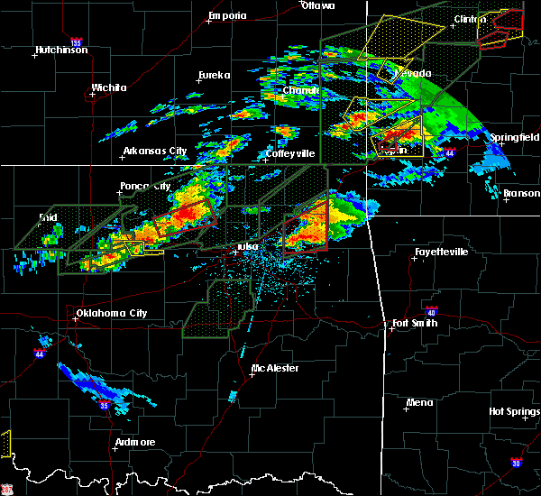 At 835 pm cdt, a severe thunderstorm capable of producing a tornado was located 3 miles southeast of glencoe, moving east at 25 mph (radar indicated rotation). Hazards include tornado. Flying debris will be dangerous to those caught without shelter. mobile homes will be damaged or destroyed. damage to roofs, windows, and vehicles will occur. tree damage is likely. Locations in or near the path include, pawnee, jennings, hallett, maramec,. At 835 pm cdt, a severe thunderstorm capable of producing a tornado was located 3 miles southeast of glencoe, moving east at 25 mph (radar indicated rotation). Hazards include tornado. Flying debris will be dangerous to those caught without shelter. mobile homes will be damaged or destroyed. damage to roofs, windows, and vehicles will occur. tree damage is likely. Locations in or near the path include, pawnee, jennings, hallett, maramec,.
|
| 5/22/2019 7:47 PM CDT |
 At 747 pm cdt, a severe thunderstorm capable of producing a tornado was located near pawnee, moving northeast at 50 mph (radar indicated rotation). Hazards include tornado. Flying debris will be dangerous to those caught without shelter. mobile homes will be damaged or destroyed. damage to roofs, windows, and vehicles will occur. tree damage is likely. Locations in or near the path include, pawnee, fairfax, ralston, skedee,. At 747 pm cdt, a severe thunderstorm capable of producing a tornado was located near pawnee, moving northeast at 50 mph (radar indicated rotation). Hazards include tornado. Flying debris will be dangerous to those caught without shelter. mobile homes will be damaged or destroyed. damage to roofs, windows, and vehicles will occur. tree damage is likely. Locations in or near the path include, pawnee, fairfax, ralston, skedee,.
|
| 5/20/2019 7:43 PM CDT |
 At 742 pm cdt, a severe thunderstorm was located near osage, moving east at 30 mph (radar indicated). Hazards include 60 mph wind gusts and quarter size hail. Hail damage to vehicles is expected. expect wind damage to roofs, siding, and trees. Locations in or near the path include, tulsa, sand springs, pawnee, skiatook, hominy, cleveland, mannford, jennings, avant, westport, osage, hallett, blackburn, terlton, maramec, skedee, walnut creek state park, a tornado watch remains in effect until 1000 pm cdt for northeastern oklahoma. At 742 pm cdt, a severe thunderstorm was located near osage, moving east at 30 mph (radar indicated). Hazards include 60 mph wind gusts and quarter size hail. Hail damage to vehicles is expected. expect wind damage to roofs, siding, and trees. Locations in or near the path include, tulsa, sand springs, pawnee, skiatook, hominy, cleveland, mannford, jennings, avant, westport, osage, hallett, blackburn, terlton, maramec, skedee, walnut creek state park, a tornado watch remains in effect until 1000 pm cdt for northeastern oklahoma.
|
| 5/20/2019 7:31 PM CDT |
 At 731 pm cdt, severe thunderstorms were located along a line extending from 2 miles east of edna to 3 miles west of watova to 3 miles southwest of osage, moving east at 45 mph (radar indicated). Hazards include 60 mph wind gusts and quarter size hail. Hail damage to vehicles is expected. expect wind damage to roofs, siding, and trees. locations in or near the path include, tulsa, bartlesville, sand springs, nowata, pawhuska, pawnee, owasso, skiatook, collinsville, hominy, dewey, cleveland, chelsea, barnsdall, sperry, oologah, south coffeyville, copan, ramona, wynona, a tornado watch remains in effect until 1000 pm cdt for northeastern oklahoma. A tornado watch also remains in effect until 100 am cdt for northeastern oklahoma. At 731 pm cdt, severe thunderstorms were located along a line extending from 2 miles east of edna to 3 miles west of watova to 3 miles southwest of osage, moving east at 45 mph (radar indicated). Hazards include 60 mph wind gusts and quarter size hail. Hail damage to vehicles is expected. expect wind damage to roofs, siding, and trees. locations in or near the path include, tulsa, bartlesville, sand springs, nowata, pawhuska, pawnee, owasso, skiatook, collinsville, hominy, dewey, cleveland, chelsea, barnsdall, sperry, oologah, south coffeyville, copan, ramona, wynona, a tornado watch remains in effect until 1000 pm cdt for northeastern oklahoma. A tornado watch also remains in effect until 100 am cdt for northeastern oklahoma.
|
| 5/20/2019 6:57 PM CDT |
 At 657 pm cdt, severe thunderstorms were located along a line extending from 4 miles south of dearing to 2 miles east of barnsdall to 4 miles southeast of glencoe, moving east at 45 mph (radar indicated). Hazards include 60 mph wind gusts and quarter size hail. Hail damage to vehicles is expected. expect wind damage to roofs, siding, and trees. locations in or near the path include, tulsa, bartlesville, sand springs, nowata, pawhuska, pawnee, owasso, skiatook, collinsville, hominy, dewey, cleveland, chelsea, barnsdall, sperry, oologah, south coffeyville, copan, ramona, wynona, a tornado watch remains in effect until 1000 pm cdt for northeastern oklahoma. A tornado watch also remains in effect until 100 am cdt for northeastern oklahoma. At 657 pm cdt, severe thunderstorms were located along a line extending from 4 miles south of dearing to 2 miles east of barnsdall to 4 miles southeast of glencoe, moving east at 45 mph (radar indicated). Hazards include 60 mph wind gusts and quarter size hail. Hail damage to vehicles is expected. expect wind damage to roofs, siding, and trees. locations in or near the path include, tulsa, bartlesville, sand springs, nowata, pawhuska, pawnee, owasso, skiatook, collinsville, hominy, dewey, cleveland, chelsea, barnsdall, sperry, oologah, south coffeyville, copan, ramona, wynona, a tornado watch remains in effect until 1000 pm cdt for northeastern oklahoma. A tornado watch also remains in effect until 100 am cdt for northeastern oklahoma.
|
| 5/20/2019 6:11 PM CDT |
 At 611 pm cdt, a severe thunderstorm capable of producing a tornado was located 5 miles north of pawnee, moving east at 45 mph (radar indicated rotation). Hazards include tornado and half dollar size hail. Flying debris will be dangerous to those caught without shelter. mobile homes will be damaged or destroyed. damage to roofs, windows, and vehicles will occur. tree damage is likely. Locations in or near the path include, pawhuska, pawnee, hominy, cleveland, fairfax, wynona, ralston, westport, osage, hallett, blackburn, maramec, skedee, walnut creek state park, sooner lake,. At 611 pm cdt, a severe thunderstorm capable of producing a tornado was located 5 miles north of pawnee, moving east at 45 mph (radar indicated rotation). Hazards include tornado and half dollar size hail. Flying debris will be dangerous to those caught without shelter. mobile homes will be damaged or destroyed. damage to roofs, windows, and vehicles will occur. tree damage is likely. Locations in or near the path include, pawhuska, pawnee, hominy, cleveland, fairfax, wynona, ralston, westport, osage, hallett, blackburn, maramec, skedee, walnut creek state park, sooner lake,.
|
| 5/20/2019 5:57 PM CDT |
 At 555 pm cdt, a severe thunderstorm capable of producing a tornado was located 4 miles north of glencoe. another severe thunderstorm capable of producing a tornado was located north of pawnee. both of these storms were moving east at 45 mph (radar indicated rotation). Hazards include tornado and half dollar size hail. Flying debris will be dangerous to those caught without shelter. mobile homes will be damaged or destroyed. damage to roofs, windows, and vehicles will occur. tree damage is likely. Locations in or near the path include, pawnee, cleveland, jennings, ralston, osage, hallett, blackburn, terlton, maramec, skedee, sooner lake,. At 555 pm cdt, a severe thunderstorm capable of producing a tornado was located 4 miles north of glencoe. another severe thunderstorm capable of producing a tornado was located north of pawnee. both of these storms were moving east at 45 mph (radar indicated rotation). Hazards include tornado and half dollar size hail. Flying debris will be dangerous to those caught without shelter. mobile homes will be damaged or destroyed. damage to roofs, windows, and vehicles will occur. tree damage is likely. Locations in or near the path include, pawnee, cleveland, jennings, ralston, osage, hallett, blackburn, terlton, maramec, skedee, sooner lake,.
|
| 5/20/2019 5:33 PM CDT |
 At 533 pm cdt, a severe thunderstorm capable of producing a tornado was located 5 miles northwest of morrison, moving east at 55 mph (radar indicated rotation). Hazards include tornado. Flying debris will be dangerous to those caught without shelter. mobile homes will be damaged or destroyed. damage to roofs, windows, and vehicles will occur. tree damage is likely. Locations in or near the path include, pawnee, cleveland, jennings, ralston, osage, hallett, blackburn, terlton, maramec, skedee, sooner lake,. At 533 pm cdt, a severe thunderstorm capable of producing a tornado was located 5 miles northwest of morrison, moving east at 55 mph (radar indicated rotation). Hazards include tornado. Flying debris will be dangerous to those caught without shelter. mobile homes will be damaged or destroyed. damage to roofs, windows, and vehicles will occur. tree damage is likely. Locations in or near the path include, pawnee, cleveland, jennings, ralston, osage, hallett, blackburn, terlton, maramec, skedee, sooner lake,.
|
| 5/8/2019 12:38 AM CDT |
 At 1237 am cdt, severe thunderstorms were located along a line extending from 8 miles west of ralston to 4 miles south of glencoe to 2 miles west of perkins, moving northeast at 40 mph (radar indicated). Hazards include 60 mph wind gusts and penny size hail. Expect damage to roofs, siding, and trees. Locations in or near the path include, pawnee, ralston, maramec, skedee, sooner lake, a tornado watch remains in effect until 500 am cdt for northeastern oklahoma. At 1237 am cdt, severe thunderstorms were located along a line extending from 8 miles west of ralston to 4 miles south of glencoe to 2 miles west of perkins, moving northeast at 40 mph (radar indicated). Hazards include 60 mph wind gusts and penny size hail. Expect damage to roofs, siding, and trees. Locations in or near the path include, pawnee, ralston, maramec, skedee, sooner lake, a tornado watch remains in effect until 500 am cdt for northeastern oklahoma.
|
| 5/8/2019 12:11 AM CDT |
 At 1211 am cdt, severe thunderstorms were located along a line extending from 6 miles southwest of red rock to 2 miles southwest of lake carl blackwell to 3 miles northeast of cedar valley, moving east at 35 mph (radar indicated). Hazards include 70 mph wind gusts and nickel size hail. Expect considerable tree damage. damage is likely to mobile homes, roofs, and outbuildings. Locations in or near the path include, pawnee, fairfax, ralston, maramec, skedee, sooner lake, a tornado watch remains in effect until 500 am cdt for northeastern oklahoma. At 1211 am cdt, severe thunderstorms were located along a line extending from 6 miles southwest of red rock to 2 miles southwest of lake carl blackwell to 3 miles northeast of cedar valley, moving east at 35 mph (radar indicated). Hazards include 70 mph wind gusts and nickel size hail. Expect considerable tree damage. damage is likely to mobile homes, roofs, and outbuildings. Locations in or near the path include, pawnee, fairfax, ralston, maramec, skedee, sooner lake, a tornado watch remains in effect until 500 am cdt for northeastern oklahoma.
|
| 5/6/2019 12:37 AM CDT |
 At 1237 am cdt, severe thunderstorms were located along a line extending from 3 miles south of ralston to 2 miles south of pawnee, moving east at 30 mph (radar indicated). Hazards include 60 mph wind gusts. Expect damage to roofs, siding, and trees. Locations in or near the path include, pawnee, hominy, cleveland, ralston, blackburn, skedee,. At 1237 am cdt, severe thunderstorms were located along a line extending from 3 miles south of ralston to 2 miles south of pawnee, moving east at 30 mph (radar indicated). Hazards include 60 mph wind gusts. Expect damage to roofs, siding, and trees. Locations in or near the path include, pawnee, hominy, cleveland, ralston, blackburn, skedee,.
|
| 5/6/2019 12:26 AM CDT | Storm spotter measured a brief gust to 75 mph near lela on the pawnee and noble county line. relayed by media via nwscha in pawnee county OK, 6.1 miles ENE of Pawnee, OK |
| 5/6/2019 12:20 AM CDT |
 At 1219 am cdt, a severe thunderstorm was located 4 miles northeast of morrison, moving east at 35 mph (radar indicated). Hazards include 60 mph wind gusts. Expect damage to roofs, siding, and trees. Locations in or near the path include, pawnee, ralston, blackburn, maramec, skedee, sooner lake,. At 1219 am cdt, a severe thunderstorm was located 4 miles northeast of morrison, moving east at 35 mph (radar indicated). Hazards include 60 mph wind gusts. Expect damage to roofs, siding, and trees. Locations in or near the path include, pawnee, ralston, blackburn, maramec, skedee, sooner lake,.
|
| 5/6/2019 12:05 AM CDT |
 At 1204 am cdt, a severe thunderstorm was located 5 miles west of morrison, moving east at 35 mph (radar indicated). Hazards include 60 mph wind gusts and penny size hail. Expect damage to roofs, siding, and trees. Locations in or near the path include, pawnee, ralston, blackburn, maramec, skedee, sooner lake,. At 1204 am cdt, a severe thunderstorm was located 5 miles west of morrison, moving east at 35 mph (radar indicated). Hazards include 60 mph wind gusts and penny size hail. Expect damage to roofs, siding, and trees. Locations in or near the path include, pawnee, ralston, blackburn, maramec, skedee, sooner lake,.
|
| 4/17/2019 10:14 PM CDT |
 At 1013 pm cdt, severe thunderstorms were located along a line extending from 3 miles north of grainola to 2 miles south of burbank to 5 miles northwest of blackburn to near quay, moving northeast at 50 mph. a 63 mph wind gust was measured near pawnee (radar indicated). Hazards include 70 mph wind gusts and quarter size hail. Hail damage to vehicles is expected. expect considerable tree damage. wind damage is also likely to mobile homes, roofs, and outbuildings. Locations in or near the path include, pawnee, cleveland, fairfax, shidler, jennings, ralston, osage, burbank, hallett, blackburn, terlton, maramec, skedee, grainola, foraker, pearsonia, sooner lake, southern kaw lake, webb city, apperson,. At 1013 pm cdt, severe thunderstorms were located along a line extending from 3 miles north of grainola to 2 miles south of burbank to 5 miles northwest of blackburn to near quay, moving northeast at 50 mph. a 63 mph wind gust was measured near pawnee (radar indicated). Hazards include 70 mph wind gusts and quarter size hail. Hail damage to vehicles is expected. expect considerable tree damage. wind damage is also likely to mobile homes, roofs, and outbuildings. Locations in or near the path include, pawnee, cleveland, fairfax, shidler, jennings, ralston, osage, burbank, hallett, blackburn, terlton, maramec, skedee, grainola, foraker, pearsonia, sooner lake, southern kaw lake, webb city, apperson,.
|
| 4/17/2019 10:05 PM CDT | Storm damage reported in pawnee county OK, 3 miles WSW of Pawnee, OK |
| 4/17/2019 10:00 PM CDT | Roof lifted off house and set back down. several trees uprooted. windows busted out in 2 vehicles. occurred on east end of tow in pawnee county OK, 0.2 miles SSW of Pawnee, OK |
| 4/17/2019 10:00 PM CDT |
 At 958 pm cdt, severe thunderstorms were located along a line extending from 2 miles southeast of arkansas city to 8 miles northwest of ralston to 3 miles northwest of ripley, moving northeast at 60 mph. these storms have a history of producing tree damage and rolling trucks on interstate 35 (emergency management). Hazards include 70 mph wind gusts and quarter size hail. Hail damage to vehicles is expected. expect considerable tree damage. wind damage is also likely to mobile homes, roofs, and outbuildings. Locations in or near the path include, pawnee, cleveland, fairfax, shidler, jennings, ralston, osage, burbank, hallett, blackburn, terlton, maramec, skedee, grainola, foraker, pearsonia, sooner lake, southern kaw lake, webb city, apperson,. At 958 pm cdt, severe thunderstorms were located along a line extending from 2 miles southeast of arkansas city to 8 miles northwest of ralston to 3 miles northwest of ripley, moving northeast at 60 mph. these storms have a history of producing tree damage and rolling trucks on interstate 35 (emergency management). Hazards include 70 mph wind gusts and quarter size hail. Hail damage to vehicles is expected. expect considerable tree damage. wind damage is also likely to mobile homes, roofs, and outbuildings. Locations in or near the path include, pawnee, cleveland, fairfax, shidler, jennings, ralston, osage, burbank, hallett, blackburn, terlton, maramec, skedee, grainola, foraker, pearsonia, sooner lake, southern kaw lake, webb city, apperson,.
|
| 4/17/2019 9:34 PM CDT |
 At 934 pm cdt, severe thunderstorms were located along a line extending from 4 miles northwest of braman to 3 miles northwest of red rock to 4 miles northwest of coyle, moving northeast at 50 mph (radar indicated). Hazards include 70 mph wind gusts and quarter size hail. Hail damage to vehicles is expected. expect considerable tree damage. wind damage is also likely to mobile homes, roofs, and outbuildings. Locations in or near the path include, pawnee, cleveland, fairfax, shidler, jennings, ralston, osage, burbank, hallett, blackburn, terlton, maramec, skedee, grainola, foraker, pearsonia, sooner lake, southern kaw lake, webb city, apperson,. At 934 pm cdt, severe thunderstorms were located along a line extending from 4 miles northwest of braman to 3 miles northwest of red rock to 4 miles northwest of coyle, moving northeast at 50 mph (radar indicated). Hazards include 70 mph wind gusts and quarter size hail. Hail damage to vehicles is expected. expect considerable tree damage. wind damage is also likely to mobile homes, roofs, and outbuildings. Locations in or near the path include, pawnee, cleveland, fairfax, shidler, jennings, ralston, osage, burbank, hallett, blackburn, terlton, maramec, skedee, grainola, foraker, pearsonia, sooner lake, southern kaw lake, webb city, apperson,.
|
| 3/29/2019 7:03 AM CDT |
 At 702 am cdt, a severe thunderstorm was located near sooner lake, moving northeast at 30 mph (radar indicated). Hazards include half dollar size hail. Damage to vehicles is expected. Locations in or near the path include, fairfax, ralston, skedee, sooner lake, southern kaw lake,. At 702 am cdt, a severe thunderstorm was located near sooner lake, moving northeast at 30 mph (radar indicated). Hazards include half dollar size hail. Damage to vehicles is expected. Locations in or near the path include, fairfax, ralston, skedee, sooner lake, southern kaw lake,.
|
| 10/7/2018 7:15 PM CDT |
 At 641 pm cdt, severe thunderstorms were located along a line extending from near marland to near sooner lake to 3 miles northwest of stillwater, moving northeast at 35 mph (radar indicated). Hazards include 60 mph wind gusts and nickel size hail. Expect damage to roofs, siding, and trees. Locations in or near the path include, pawnee, fairfax, shidler, ralston, burbank, maramec, skedee, sooner lake, southern kaw lake, webb city, apperson,. At 641 pm cdt, severe thunderstorms were located along a line extending from near marland to near sooner lake to 3 miles northwest of stillwater, moving northeast at 35 mph (radar indicated). Hazards include 60 mph wind gusts and nickel size hail. Expect damage to roofs, siding, and trees. Locations in or near the path include, pawnee, fairfax, shidler, ralston, burbank, maramec, skedee, sooner lake, southern kaw lake, webb city, apperson,.
|
| 10/7/2018 6:41 PM CDT |
 At 641 pm cdt, severe thunderstorms were located along a line extending from near marland to near sooner lake to 3 miles northwest of stillwater, moving northeast at 35 mph (radar indicated). Hazards include 60 mph wind gusts and nickel size hail. Expect damage to roofs, siding, and trees. Locations in or near the path include, pawnee, fairfax, shidler, ralston, burbank, maramec, skedee, sooner lake, southern kaw lake, webb city, apperson,. At 641 pm cdt, severe thunderstorms were located along a line extending from near marland to near sooner lake to 3 miles northwest of stillwater, moving northeast at 35 mph (radar indicated). Hazards include 60 mph wind gusts and nickel size hail. Expect damage to roofs, siding, and trees. Locations in or near the path include, pawnee, fairfax, shidler, ralston, burbank, maramec, skedee, sooner lake, southern kaw lake, webb city, apperson,.
|
| 8/16/2018 3:49 PM CDT |
 At 348 pm cdt, severe thunderstorms were located along a line extending from near kildare to 3 miles north of skedee to 3 miles southeast of hominy, moving east at 40 mph (radar indicated). Hazards include 60 mph wind gusts. Expect damage to roofs, siding, and trees. Locations in or near the path include, pawhuska, pawnee, hominy, cleveland, fairfax, barnsdall, shidler, wynona, ralston, osage, burbank, blackburn, skedee, grainola, foraker, pearsonia, sunset lake, southern kaw lake, webb city, tallant,. At 348 pm cdt, severe thunderstorms were located along a line extending from near kildare to 3 miles north of skedee to 3 miles southeast of hominy, moving east at 40 mph (radar indicated). Hazards include 60 mph wind gusts. Expect damage to roofs, siding, and trees. Locations in or near the path include, pawhuska, pawnee, hominy, cleveland, fairfax, barnsdall, shidler, wynona, ralston, osage, burbank, blackburn, skedee, grainola, foraker, pearsonia, sunset lake, southern kaw lake, webb city, tallant,.
|
| 8/14/2018 8:12 PM CDT |
 At 811 pm cdt, a severe thunderstorm was located over ralston, moving east at 35 mph (radar indicated). Hazards include 60 mph wind gusts and quarter size hail. Hail damage to vehicles is expected. expect wind damage to roofs, siding, and trees. Locations in or near the path include, pawhuska, pawnee, hominy, fairfax, wynona, ralston, blackburn, skedee, pershing, nelagoney,. At 811 pm cdt, a severe thunderstorm was located over ralston, moving east at 35 mph (radar indicated). Hazards include 60 mph wind gusts and quarter size hail. Hail damage to vehicles is expected. expect wind damage to roofs, siding, and trees. Locations in or near the path include, pawhuska, pawnee, hominy, fairfax, wynona, ralston, blackburn, skedee, pershing, nelagoney,.
|
| 7/29/2018 5:01 AM CDT |
 At 436 am cdt, severe thunderstorms were located along a line extending from 5 miles northeast of blackwell to 3 miles north of red rock to 5 miles west of orlando, moving east at 40 mph (radar indicated). Hazards include 60 mph wind gusts. Expect damage to roofs, siding, and trees. Locations in or near the path include, pawnee, fairfax, shidler, ralston, burbank, hallett, blackburn, maramec, skedee, grainola, foraker, pearsonia, sooner lake, southern kaw lake, webb city, apperson,. At 436 am cdt, severe thunderstorms were located along a line extending from 5 miles northeast of blackwell to 3 miles north of red rock to 5 miles west of orlando, moving east at 40 mph (radar indicated). Hazards include 60 mph wind gusts. Expect damage to roofs, siding, and trees. Locations in or near the path include, pawnee, fairfax, shidler, ralston, burbank, hallett, blackburn, maramec, skedee, grainola, foraker, pearsonia, sooner lake, southern kaw lake, webb city, apperson,.
|
| 7/29/2018 4:37 AM CDT |
 At 436 am cdt, severe thunderstorms were located along a line extending from 5 miles northeast of blackwell to 3 miles north of red rock to 5 miles west of orlando, moving east at 40 mph (radar indicated). Hazards include 60 mph wind gusts. Expect damage to roofs, siding, and trees. Locations in or near the path include, pawnee, fairfax, shidler, ralston, burbank, hallett, blackburn, maramec, skedee, grainola, foraker, pearsonia, sooner lake, southern kaw lake, webb city, apperson,. At 436 am cdt, severe thunderstorms were located along a line extending from 5 miles northeast of blackwell to 3 miles north of red rock to 5 miles west of orlando, moving east at 40 mph (radar indicated). Hazards include 60 mph wind gusts. Expect damage to roofs, siding, and trees. Locations in or near the path include, pawnee, fairfax, shidler, ralston, burbank, hallett, blackburn, maramec, skedee, grainola, foraker, pearsonia, sooner lake, southern kaw lake, webb city, apperson,.
|
| 6/30/2018 6:26 PM CDT |
 At 606 pm cdt, severe thunderstorms were located along a line extending from 5 miles west of newkirk to 3 miles north of maramec to 4 miles southeast of stroud, moving northeast at 35 mph (radar indicated). Hazards include 60 mph wind gusts and nickel size hail. Expect damage to roofs, siding, and trees. Locations in or near the path include, bristow, pawnee, hominy, cleveland, mannford, drumright, fairfax, kellyville, oilton, depew, shidler, jennings, ralston, westport, osage, burbank, hallett, blackburn, terlton, shamrock, this includes interstate 44 between mile markers 178 and 205. At 606 pm cdt, severe thunderstorms were located along a line extending from 5 miles west of newkirk to 3 miles north of maramec to 4 miles southeast of stroud, moving northeast at 35 mph (radar indicated). Hazards include 60 mph wind gusts and nickel size hail. Expect damage to roofs, siding, and trees. Locations in or near the path include, bristow, pawnee, hominy, cleveland, mannford, drumright, fairfax, kellyville, oilton, depew, shidler, jennings, ralston, westport, osage, burbank, hallett, blackburn, terlton, shamrock, this includes interstate 44 between mile markers 178 and 205.
|
| 6/30/2018 6:06 PM CDT |
 At 606 pm cdt, severe thunderstorms were located along a line extending from 5 miles west of newkirk to 3 miles north of maramec to 4 miles southeast of stroud, moving northeast at 35 mph (radar indicated). Hazards include 60 mph wind gusts and nickel size hail. Expect damage to roofs, siding, and trees. Locations in or near the path include, bristow, pawnee, hominy, cleveland, mannford, drumright, fairfax, kellyville, oilton, depew, shidler, jennings, ralston, westport, osage, burbank, hallett, blackburn, terlton, shamrock, this includes interstate 44 between mile markers 178 and 205. At 606 pm cdt, severe thunderstorms were located along a line extending from 5 miles west of newkirk to 3 miles north of maramec to 4 miles southeast of stroud, moving northeast at 35 mph (radar indicated). Hazards include 60 mph wind gusts and nickel size hail. Expect damage to roofs, siding, and trees. Locations in or near the path include, bristow, pawnee, hominy, cleveland, mannford, drumright, fairfax, kellyville, oilton, depew, shidler, jennings, ralston, westport, osage, burbank, hallett, blackburn, terlton, shamrock, this includes interstate 44 between mile markers 178 and 205.
|
| 6/30/2018 5:35 PM CDT |
 At 534 pm cdt, severe thunderstorms were located along a line extending from 5 miles northeast of billings to 6 miles east of stillwater to 5 miles southeast of sparks, moving northeast at 35 mph (radar indicated). Hazards include 60 mph wind gusts and nickel size hail. Expect damage to roofs, siding, and trees. Locations in or near the path include, bristow, pawnee, hominy, cleveland, mannford, drumright, fairfax, kellyville, oilton, depew, shidler, jennings, ralston, westport, osage, burbank, hallett, blackburn, terlton, shamrock, this includes interstate 44 between mile markers 178 and 205. At 534 pm cdt, severe thunderstorms were located along a line extending from 5 miles northeast of billings to 6 miles east of stillwater to 5 miles southeast of sparks, moving northeast at 35 mph (radar indicated). Hazards include 60 mph wind gusts and nickel size hail. Expect damage to roofs, siding, and trees. Locations in or near the path include, bristow, pawnee, hominy, cleveland, mannford, drumright, fairfax, kellyville, oilton, depew, shidler, jennings, ralston, westport, osage, burbank, hallett, blackburn, terlton, shamrock, this includes interstate 44 between mile markers 178 and 205.
|
| 6/25/2018 3:05 AM CDT |
 At 247 am cdt, severe thunderstorms were located along a line extending from 4 miles northeast of grainola to near glencoe, moving east at 55 mph (radar indicated). Hazards include 60 mph wind gusts and penny size hail. Expect damage to roofs, siding, and trees. Locations in or near the path include, pawnee, fairfax, shidler, ralston, burbank, skedee, grainola, foraker, pearsonia, sooner lake, southern kaw lake, webb city, apperson,. At 247 am cdt, severe thunderstorms were located along a line extending from 4 miles northeast of grainola to near glencoe, moving east at 55 mph (radar indicated). Hazards include 60 mph wind gusts and penny size hail. Expect damage to roofs, siding, and trees. Locations in or near the path include, pawnee, fairfax, shidler, ralston, burbank, skedee, grainola, foraker, pearsonia, sooner lake, southern kaw lake, webb city, apperson,.
|
| 6/25/2018 3:01 AM CDT |
 The national weather service in tulsa has issued a * severe thunderstorm warning for. osage county in northeastern oklahoma. northwestern creek county in northeastern oklahoma. pawnee county in northeastern oklahoma. Until 400 am cdt. The national weather service in tulsa has issued a * severe thunderstorm warning for. osage county in northeastern oklahoma. northwestern creek county in northeastern oklahoma. pawnee county in northeastern oklahoma. Until 400 am cdt.
|
| 6/25/2018 2:47 AM CDT |
 At 247 am cdt, severe thunderstorms were located along a line extending from 4 miles northeast of grainola to near glencoe, moving east at 55 mph (radar indicated). Hazards include 60 mph wind gusts and penny size hail. Expect damage to roofs, siding, and trees. Locations in or near the path include, pawnee, fairfax, shidler, ralston, burbank, skedee, grainola, foraker, pearsonia, sooner lake, southern kaw lake, webb city, apperson,. At 247 am cdt, severe thunderstorms were located along a line extending from 4 miles northeast of grainola to near glencoe, moving east at 55 mph (radar indicated). Hazards include 60 mph wind gusts and penny size hail. Expect damage to roofs, siding, and trees. Locations in or near the path include, pawnee, fairfax, shidler, ralston, burbank, skedee, grainola, foraker, pearsonia, sooner lake, southern kaw lake, webb city, apperson,.
|
| 6/25/2018 2:11 AM CDT |
 At 210 am cdt, severe thunderstorms were located along a line extending from 2 miles southeast of arkansas city to 7 miles west of red rock, moving east at 45 mph (radar indicated). Hazards include 60 mph wind gusts and penny size hail. Expect damage to roofs, siding, and trees. Locations in or near the path include, pawnee, fairfax, shidler, ralston, burbank, skedee, grainola, foraker, pearsonia, sooner lake, southern kaw lake, webb city, apperson,. At 210 am cdt, severe thunderstorms were located along a line extending from 2 miles southeast of arkansas city to 7 miles west of red rock, moving east at 45 mph (radar indicated). Hazards include 60 mph wind gusts and penny size hail. Expect damage to roofs, siding, and trees. Locations in or near the path include, pawnee, fairfax, shidler, ralston, burbank, skedee, grainola, foraker, pearsonia, sooner lake, southern kaw lake, webb city, apperson,.
|
| 6/24/2018 4:01 AM CDT |
 The national weather service in tulsa has issued a * severe thunderstorm warning for. southern osage county in northeastern oklahoma. creek county in northeastern oklahoma. pawnee county in northeastern oklahoma. Southwestern tulsa county in northeastern oklahoma. The national weather service in tulsa has issued a * severe thunderstorm warning for. southern osage county in northeastern oklahoma. creek county in northeastern oklahoma. pawnee county in northeastern oklahoma. Southwestern tulsa county in northeastern oklahoma.
|
| 6/24/2018 3:42 AM CDT |
 At 342 am cdt, severe thunderstorms were located along a line extending from 5 miles south of ponca city to 4 miles north of morrison to 4 miles northwest of stillwater to 5 miles north of guthrie, moving east at 45 mph (radar indicated). Hazards include 70 mph wind gusts and quarter size hail. Hail damage to vehicles is expected. expect considerable tree damage. wind damage is also likely to mobile homes, roofs, and outbuildings. Locations in or near the path include, pawnee, cleveland, fairfax, shidler, jennings, ralston, burbank, hallett, blackburn, terlton, maramec, skedee, sooner lake, southern kaw lake, webb city, apperson,. At 342 am cdt, severe thunderstorms were located along a line extending from 5 miles south of ponca city to 4 miles north of morrison to 4 miles northwest of stillwater to 5 miles north of guthrie, moving east at 45 mph (radar indicated). Hazards include 70 mph wind gusts and quarter size hail. Hail damage to vehicles is expected. expect considerable tree damage. wind damage is also likely to mobile homes, roofs, and outbuildings. Locations in or near the path include, pawnee, cleveland, fairfax, shidler, jennings, ralston, burbank, hallett, blackburn, terlton, maramec, skedee, sooner lake, southern kaw lake, webb city, apperson,.
|
| 6/24/2018 3:22 AM CDT |
 At 322 am cdt, severe thunderstorms were located along a line extending from 3 miles northeast of tonkawa to 4 miles southwest of red rock to 5 miles west of orlando to 4 miles southeast of dover, moving east at 40 mph (radar indicated). Hazards include 70 mph wind gusts and quarter size hail. Hail damage to vehicles is expected. expect considerable tree damage. wind damage is also likely to mobile homes, roofs, and outbuildings. Locations in or near the path include, pawnee, cleveland, fairfax, shidler, jennings, ralston, burbank, hallett, blackburn, terlton, maramec, skedee, sooner lake, southern kaw lake, webb city, apperson,. At 322 am cdt, severe thunderstorms were located along a line extending from 3 miles northeast of tonkawa to 4 miles southwest of red rock to 5 miles west of orlando to 4 miles southeast of dover, moving east at 40 mph (radar indicated). Hazards include 70 mph wind gusts and quarter size hail. Hail damage to vehicles is expected. expect considerable tree damage. wind damage is also likely to mobile homes, roofs, and outbuildings. Locations in or near the path include, pawnee, cleveland, fairfax, shidler, jennings, ralston, burbank, hallett, blackburn, terlton, maramec, skedee, sooner lake, southern kaw lake, webb city, apperson,.
|
| 6/22/2018 11:06 PM CDT |
 At 1106 pm cdt, severe thunderstorms were located along a line extending from 9 miles east of fairfax to 5 miles southeast of glencoe, moving east at 45 mph (radar indicated). Hazards include 70 mph wind gusts. Expect considerable tree damage. damage is likely to mobile homes, roofs, and outbuildings. Locations in or near the path include, pawnee, hominy, cleveland, mannford, drumright, oilton, jennings, ralston, westport, osage, hallett, blackburn, terlton, maramec, skedee, silver city,. At 1106 pm cdt, severe thunderstorms were located along a line extending from 9 miles east of fairfax to 5 miles southeast of glencoe, moving east at 45 mph (radar indicated). Hazards include 70 mph wind gusts. Expect considerable tree damage. damage is likely to mobile homes, roofs, and outbuildings. Locations in or near the path include, pawnee, hominy, cleveland, mannford, drumright, oilton, jennings, ralston, westport, osage, hallett, blackburn, terlton, maramec, skedee, silver city,.
|
| 6/22/2018 10:39 PM CDT |
 At 1038 pm cdt, a severe thunderstorm was located 3 miles northwest of morrison, moving east at 55 mph (radar indicated). Hazards include 70 mph wind gusts. Expect considerable tree damage. damage is likely to mobile homes, roofs, and outbuildings. Locations in or near the path include, pawnee, hominy, cleveland, mannford, drumright, oilton, jennings, ralston, westport, osage, hallett, blackburn, terlton, maramec, skedee, sooner lake, silver city,. At 1038 pm cdt, a severe thunderstorm was located 3 miles northwest of morrison, moving east at 55 mph (radar indicated). Hazards include 70 mph wind gusts. Expect considerable tree damage. damage is likely to mobile homes, roofs, and outbuildings. Locations in or near the path include, pawnee, hominy, cleveland, mannford, drumright, oilton, jennings, ralston, westport, osage, hallett, blackburn, terlton, maramec, skedee, sooner lake, silver city,.
|
| 6/12/2018 5:41 AM CDT |
 At 540 am cdt, severe thunderstorms were located along a line extending from 4 miles south of avant to 5 miles northeast of skedee, moving southwest at 35 mph (radar indicated). Hazards include 60 mph wind gusts and half dollar size hail. Hail damage to vehicles is expected. expect wind damage to roofs, siding, and trees. Locations in or near the path include, sand springs, pawnee, skiatook, hominy, cleveland, mannford, drumright, oilton, jennings, westport, osage, hallett, blackburn, terlton, maramec, skedee, keystone state park, walnut creek state park, silver city, this includes interstate 44 between mile markers 205 and 207. At 540 am cdt, severe thunderstorms were located along a line extending from 4 miles south of avant to 5 miles northeast of skedee, moving southwest at 35 mph (radar indicated). Hazards include 60 mph wind gusts and half dollar size hail. Hail damage to vehicles is expected. expect wind damage to roofs, siding, and trees. Locations in or near the path include, sand springs, pawnee, skiatook, hominy, cleveland, mannford, drumright, oilton, jennings, westport, osage, hallett, blackburn, terlton, maramec, skedee, keystone state park, walnut creek state park, silver city, this includes interstate 44 between mile markers 205 and 207.
|
| 6/12/2018 5:22 AM CDT |
 At 521 am cdt, severe thunderstorms were located along a line extending from avant to 5 miles east of fairfax, moving southwest at 40 mph (radar indicated). Hazards include 70 mph wind gusts and half dollar size hail. Hail damage to vehicles is expected. expect considerable tree damage. wind damage is also likely to mobile homes, roofs, and outbuildings. Locations in or near the path include, sand springs, pawnee, skiatook, hominy, cleveland, fairfax, wynona, ralston, avant, westport, osage, hallett, blackburn, terlton, maramec, skedee, walnut creek state park, wolco,. At 521 am cdt, severe thunderstorms were located along a line extending from avant to 5 miles east of fairfax, moving southwest at 40 mph (radar indicated). Hazards include 70 mph wind gusts and half dollar size hail. Hail damage to vehicles is expected. expect considerable tree damage. wind damage is also likely to mobile homes, roofs, and outbuildings. Locations in or near the path include, sand springs, pawnee, skiatook, hominy, cleveland, fairfax, wynona, ralston, avant, westport, osage, hallett, blackburn, terlton, maramec, skedee, walnut creek state park, wolco,.
|
| 6/12/2018 5:05 AM CDT |
 At 504 am cdt, severe thunderstorms were located along a line extending from near avant to 8 miles southwest of pearsonia, moving southwest at 50 mph (radar indicated). Hazards include 70 mph wind gusts and half dollar size hail. Hail damage to vehicles is expected. expect considerable tree damage. wind damage is also likely to mobile homes, roofs, and outbuildings. Locations in or near the path include, tulsa, sand springs, pawhuska, pawnee, jenks, skiatook, hominy, cleveland, mannford, fairfax, barnsdall, sperry, wynona, jennings, ralston, avant, westport, osage, hallett, blackburn, this includes interstate 44 between mile markers 212 and 222. At 504 am cdt, severe thunderstorms were located along a line extending from near avant to 8 miles southwest of pearsonia, moving southwest at 50 mph (radar indicated). Hazards include 70 mph wind gusts and half dollar size hail. Hail damage to vehicles is expected. expect considerable tree damage. wind damage is also likely to mobile homes, roofs, and outbuildings. Locations in or near the path include, tulsa, sand springs, pawhuska, pawnee, jenks, skiatook, hominy, cleveland, mannford, fairfax, barnsdall, sperry, wynona, jennings, ralston, avant, westport, osage, hallett, blackburn, this includes interstate 44 between mile markers 212 and 222.
|
| 5/31/2018 2:08 AM CDT |
 At 207 am cdt, severe thunderstorms were located along a line extending from 4 miles south of ralston to 3 miles southwest of agra, moving east at 50 mph (radar indicated). Hazards include 70 mph wind gusts and nickel size hail. Expect considerable tree damage. damage is likely to mobile homes, roofs, and outbuildings. Locations in or near the path include, bristow, hominy, cleveland, mannford, drumright, oilton, depew, jennings, westport, osage, hallett, blackburn, terlton, shamrock, maramec, skedee, silver city, this includes interstate 44 between mile markers 182 and 196. At 207 am cdt, severe thunderstorms were located along a line extending from 4 miles south of ralston to 3 miles southwest of agra, moving east at 50 mph (radar indicated). Hazards include 70 mph wind gusts and nickel size hail. Expect considerable tree damage. damage is likely to mobile homes, roofs, and outbuildings. Locations in or near the path include, bristow, hominy, cleveland, mannford, drumright, oilton, depew, jennings, westport, osage, hallett, blackburn, terlton, shamrock, maramec, skedee, silver city, this includes interstate 44 between mile markers 182 and 196.
|
| 5/31/2018 1:49 AM CDT |
 At 149 am cdt, severe thunderstorms were located along a line extending from 4 miles northwest of grainola to 2 miles north of glencoe, moving east at 55 mph (radar indicated). Hazards include 70 mph wind gusts and quarter size hail. Hail damage to vehicles is expected. expect considerable tree damage. wind damage is also likely to mobile homes, roofs, and outbuildings. Locations in or near the path include, pawnee, cleveland, fairfax, shidler, jennings, ralston, osage, burbank, hallett, blackburn, terlton, maramec, skedee, grainola, foraker, pearsonia, sooner lake, southern kaw lake, webb city, apperson,. At 149 am cdt, severe thunderstorms were located along a line extending from 4 miles northwest of grainola to 2 miles north of glencoe, moving east at 55 mph (radar indicated). Hazards include 70 mph wind gusts and quarter size hail. Hail damage to vehicles is expected. expect considerable tree damage. wind damage is also likely to mobile homes, roofs, and outbuildings. Locations in or near the path include, pawnee, cleveland, fairfax, shidler, jennings, ralston, osage, burbank, hallett, blackburn, terlton, maramec, skedee, grainola, foraker, pearsonia, sooner lake, southern kaw lake, webb city, apperson,.
|
| 5/31/2018 1:16 AM CDT |
 At 116 am cdt, severe thunderstorms were located along a line extending from 5 miles northeast of braman to 2 miles north of lake mcmurtry, moving east at 40 mph (radar indicated). Hazards include 70 mph wind gusts and quarter size hail. Hail damage to vehicles is expected. expect considerable tree damage. wind damage is also likely to mobile homes, roofs, and outbuildings. Locations in or near the path include, pawnee, cleveland, fairfax, shidler, jennings, ralston, osage, burbank, hallett, blackburn, terlton, maramec, skedee, grainola, foraker, pearsonia, sooner lake, southern kaw lake, webb city, apperson,. At 116 am cdt, severe thunderstorms were located along a line extending from 5 miles northeast of braman to 2 miles north of lake mcmurtry, moving east at 40 mph (radar indicated). Hazards include 70 mph wind gusts and quarter size hail. Hail damage to vehicles is expected. expect considerable tree damage. wind damage is also likely to mobile homes, roofs, and outbuildings. Locations in or near the path include, pawnee, cleveland, fairfax, shidler, jennings, ralston, osage, burbank, hallett, blackburn, terlton, maramec, skedee, grainola, foraker, pearsonia, sooner lake, southern kaw lake, webb city, apperson,.
|
| 5/19/2018 2:23 PM CDT |
 At 223 pm cdt, a severe thunderstorm was located 8 miles east of marland, moving northeast at 35 mph (radar indicated). Hazards include golf ball size hail and 70 mph wind gusts. People and animals outdoors will be injured. expect hail damage to roofs, siding, windows, and vehicles. expect considerable tree damage. wind damage is also likely to mobile homes, roofs, and outbuildings. Locations in or near the path include, pawhuska, pawnee, hominy, fairfax, shidler, wynona, ralston, burbank, blackburn, skedee, grainola, foraker, pearsonia, sooner lake, southern kaw lake, webb city, apperson, pershing,. At 223 pm cdt, a severe thunderstorm was located 8 miles east of marland, moving northeast at 35 mph (radar indicated). Hazards include golf ball size hail and 70 mph wind gusts. People and animals outdoors will be injured. expect hail damage to roofs, siding, windows, and vehicles. expect considerable tree damage. wind damage is also likely to mobile homes, roofs, and outbuildings. Locations in or near the path include, pawhuska, pawnee, hominy, fairfax, shidler, wynona, ralston, burbank, blackburn, skedee, grainola, foraker, pearsonia, sooner lake, southern kaw lake, webb city, apperson, pershing,.
|
| 5/2/2018 9:29 PM CDT |
 At 929 pm cdt, severe thunderstorms were located along a line extending from 7 miles northwest of pawnee to 2 miles south of ripley, moving northeast at 45 mph (radar indicated). Hazards include 60 mph wind gusts. Expect damage to roofs, siding, and trees. Locations in or near the path include, pawhuska, pawnee, hominy, cleveland, mannford, fairfax, oilton, wynona, jennings, ralston, westport, osage, hallett, blackburn, terlton, maramec, skedee, sooner lake, silver city, a tornado watch remains in effect until 300 am cdt for northeastern oklahoma. At 929 pm cdt, severe thunderstorms were located along a line extending from 7 miles northwest of pawnee to 2 miles south of ripley, moving northeast at 45 mph (radar indicated). Hazards include 60 mph wind gusts. Expect damage to roofs, siding, and trees. Locations in or near the path include, pawhuska, pawnee, hominy, cleveland, mannford, fairfax, oilton, wynona, jennings, ralston, westport, osage, hallett, blackburn, terlton, maramec, skedee, sooner lake, silver city, a tornado watch remains in effect until 300 am cdt for northeastern oklahoma.
|
| 10/21/2017 8:46 PM CDT |
 At 845 pm cdt, severe thunderstorms were located along a line extending from 3 miles southwest of caney to 3 miles west of jennings, moving east at 45 mph (radar indicated). Hazards include 60 mph wind gusts. Expect damage to roofs, siding, and trees. Locations in or near the path include, northwestern tulsa, bartlesville, sand springs, pawhuska, pawnee, skiatook, hominy, dewey, cleveland, fairfax, barnsdall, copan, wynona, ochelata, jennings, ralston, avant, westport, osage, hallett, a tornado watch remains in effect until 200 am cdt for northeastern oklahoma. At 845 pm cdt, severe thunderstorms were located along a line extending from 3 miles southwest of caney to 3 miles west of jennings, moving east at 45 mph (radar indicated). Hazards include 60 mph wind gusts. Expect damage to roofs, siding, and trees. Locations in or near the path include, northwestern tulsa, bartlesville, sand springs, pawhuska, pawnee, skiatook, hominy, dewey, cleveland, fairfax, barnsdall, copan, wynona, ochelata, jennings, ralston, avant, westport, osage, hallett, a tornado watch remains in effect until 200 am cdt for northeastern oklahoma.
|
| 10/21/2017 8:30 PM CDT |
 At 829 pm cdt, severe thunderstorms were located along a line extending from 4 miles east of chautauqua to 4 miles west of hominy, moving east at 40 mph (at 819 pm a wind gust of 50 mph was reported near foraker by the oklahoma mesonet). Hazards include 70 mph wind gusts. Expect considerable tree damage. damage is likely to mobile homes, roofs, and outbuildings. Locations in or near the path include, northwestern tulsa, bartlesville, sand springs, pawhuska, pawnee, skiatook, hominy, dewey, cleveland, fairfax, barnsdall, copan, shidler, wynona, ochelata, jennings, ralston, avant, westport, osage, a tornado watch remains in effect until 200 am cdt for northeastern oklahoma. At 829 pm cdt, severe thunderstorms were located along a line extending from 4 miles east of chautauqua to 4 miles west of hominy, moving east at 40 mph (at 819 pm a wind gust of 50 mph was reported near foraker by the oklahoma mesonet). Hazards include 70 mph wind gusts. Expect considerable tree damage. damage is likely to mobile homes, roofs, and outbuildings. Locations in or near the path include, northwestern tulsa, bartlesville, sand springs, pawhuska, pawnee, skiatook, hominy, dewey, cleveland, fairfax, barnsdall, copan, shidler, wynona, ochelata, jennings, ralston, avant, westport, osage, a tornado watch remains in effect until 200 am cdt for northeastern oklahoma.
|
| 10/21/2017 8:13 PM CDT |
 At 813 pm cdt, severe thunderstorms were located along a line extending from 5 miles west of elgin to 3 miles north of maramec, moving east at 40 mph (radar indicated). Hazards include 70 mph wind gusts. Expect considerable tree damage. damage is likely to mobile homes, roofs, and outbuildings. Locations in or near the path include, northwestern tulsa, bartlesville, sand springs, pawhuska, pawnee, skiatook, hominy, dewey, cleveland, fairfax, barnsdall, copan, shidler, wynona, ochelata, jennings, ralston, avant, westport, osage, a tornado watch remains in effect until 200 am cdt for northeastern oklahoma. At 813 pm cdt, severe thunderstorms were located along a line extending from 5 miles west of elgin to 3 miles north of maramec, moving east at 40 mph (radar indicated). Hazards include 70 mph wind gusts. Expect considerable tree damage. damage is likely to mobile homes, roofs, and outbuildings. Locations in or near the path include, northwestern tulsa, bartlesville, sand springs, pawhuska, pawnee, skiatook, hominy, dewey, cleveland, fairfax, barnsdall, copan, shidler, wynona, ochelata, jennings, ralston, avant, westport, osage, a tornado watch remains in effect until 200 am cdt for northeastern oklahoma.
|
| 10/21/2017 7:52 PM CDT |
 At 749 pm cdt, severe thunderstorms were located along a line extending from 5 miles north of hardy to 3 miles north of skedee, moving east at 40 mph (at 740 pm a 59 mph wind gust was reported by the oklahoma mesonet at burbank. the public also reports wind gusts of 50 t0 60 mph in burbank). Hazards include 70 mph wind gusts. Expect damage to roofs, siding, and trees. Locations in or near the path include, pawhuska, pawnee, hominy, fairfax, shidler, ralston, burbank, blackburn, skedee, grainola, foraker, pearsonia, southern kaw lake, webb city, apperson, a tornado watch remains in effect until 200 am cdt for northeastern oklahoma. At 749 pm cdt, severe thunderstorms were located along a line extending from 5 miles north of hardy to 3 miles north of skedee, moving east at 40 mph (at 740 pm a 59 mph wind gust was reported by the oklahoma mesonet at burbank. the public also reports wind gusts of 50 t0 60 mph in burbank). Hazards include 70 mph wind gusts. Expect damage to roofs, siding, and trees. Locations in or near the path include, pawhuska, pawnee, hominy, fairfax, shidler, ralston, burbank, blackburn, skedee, grainola, foraker, pearsonia, southern kaw lake, webb city, apperson, a tornado watch remains in effect until 200 am cdt for northeastern oklahoma.
|
| 10/21/2017 7:36 PM CDT |
 At 735 pm cdt, severe thunderstorms were located along a line extending from 6 miles southeast of arkansas city to 4 miles northwest of pawnee, moving east at 40 mph (radar indicated). Hazards include 70 mph wind gusts. Expect considerable tree damage. damage is likely to mobile homes, roofs, and outbuildings. Locations in or near the path include, pawhuska, pawnee, hominy, fairfax, shidler, ralston, burbank, blackburn, skedee, grainola, foraker, pearsonia, southern kaw lake, webb city, apperson, a tornado watch remains in effect until 200 am cdt for northeastern oklahoma. At 735 pm cdt, severe thunderstorms were located along a line extending from 6 miles southeast of arkansas city to 4 miles northwest of pawnee, moving east at 40 mph (radar indicated). Hazards include 70 mph wind gusts. Expect considerable tree damage. damage is likely to mobile homes, roofs, and outbuildings. Locations in or near the path include, pawhuska, pawnee, hominy, fairfax, shidler, ralston, burbank, blackburn, skedee, grainola, foraker, pearsonia, southern kaw lake, webb city, apperson, a tornado watch remains in effect until 200 am cdt for northeastern oklahoma.
|
| 8/16/2017 8:55 PM CDT |
 At 855 pm cdt, severe thunderstorms were located along a line extending from 3 miles east of barnsdall to 6 miles northeast of walnut creek state park to 3 miles south of osage, moving east at 50 mph (radar indicated). Hazards include 70 mph wind gusts. Expect considerable tree damage. damage is likely to mobile homes, roofs, and outbuildings. Locations in or near the path include, tulsa, sand springs, claremore, pawhuska, pawnee, owasso, bixby, sapulpa, jenks, glenpool, skiatook, catoosa, collinsville, hominy, cleveland, mannford, kiefer, barnsdall, sperry, mounds, this includes interstate 44 between mile markers 202 and 235. At 855 pm cdt, severe thunderstorms were located along a line extending from 3 miles east of barnsdall to 6 miles northeast of walnut creek state park to 3 miles south of osage, moving east at 50 mph (radar indicated). Hazards include 70 mph wind gusts. Expect considerable tree damage. damage is likely to mobile homes, roofs, and outbuildings. Locations in or near the path include, tulsa, sand springs, claremore, pawhuska, pawnee, owasso, bixby, sapulpa, jenks, glenpool, skiatook, catoosa, collinsville, hominy, cleveland, mannford, kiefer, barnsdall, sperry, mounds, this includes interstate 44 between mile markers 202 and 235.
|
| 8/16/2017 8:39 PM CDT |
 At 839 pm cdt, severe thunderstorms were located along a line extending from 3 miles north of wynona to 2 miles southwest of hominy to 5 miles northwest of hallett, moving east at 50 mph (radar indicated). Hazards include 70 mph wind gusts. Expect considerable tree damage. damage is likely to mobile homes, roofs, and outbuildings. Locations in or near the path include, tulsa, sand springs, claremore, pawhuska, pawnee, owasso, bixby, sapulpa, jenks, glenpool, skiatook, catoosa, collinsville, hominy, cleveland, mannford, kiefer, barnsdall, sperry, mounds, this includes interstate 44 between mile markers 202 and 235. At 839 pm cdt, severe thunderstorms were located along a line extending from 3 miles north of wynona to 2 miles southwest of hominy to 5 miles northwest of hallett, moving east at 50 mph (radar indicated). Hazards include 70 mph wind gusts. Expect considerable tree damage. damage is likely to mobile homes, roofs, and outbuildings. Locations in or near the path include, tulsa, sand springs, claremore, pawhuska, pawnee, owasso, bixby, sapulpa, jenks, glenpool, skiatook, catoosa, collinsville, hominy, cleveland, mannford, kiefer, barnsdall, sperry, mounds, this includes interstate 44 between mile markers 202 and 235.
|
| 8/16/2017 8:19 PM CDT |
 At 819 pm cdt, severe thunderstorms were located along a line extending from 8 miles west of pawhuska to 4 miles southeast of ralston to 2 miles north of morrison, moving east at 40 mph (radar indicated). Hazards include 70 mph wind gusts. Expect considerable tree damage. damage is likely to mobile homes, roofs, and outbuildings. Locations in or near the path include, pawhuska, pawnee, hominy, cleveland, fairfax, barnsdall, wynona, ralston, burbank, hallett, blackburn, maramec, skedee, tallant, pershing, nelagoney, wolco,. At 819 pm cdt, severe thunderstorms were located along a line extending from 8 miles west of pawhuska to 4 miles southeast of ralston to 2 miles north of morrison, moving east at 40 mph (radar indicated). Hazards include 70 mph wind gusts. Expect considerable tree damage. damage is likely to mobile homes, roofs, and outbuildings. Locations in or near the path include, pawhuska, pawnee, hominy, cleveland, fairfax, barnsdall, wynona, ralston, burbank, hallett, blackburn, maramec, skedee, tallant, pershing, nelagoney, wolco,.
|
| 8/16/2017 8:06 PM CDT |
 At 806 pm cdt, severe thunderstorms were located along a line extending from 6 miles west of pawhuska to 5 miles west of morrison, moving east at 55 mph (radar indicated). Hazards include 70 mph wind gusts and penny size hail. Expect considerable tree damage. damage is likely to mobile homes, roofs, and outbuildings. Locations in or near the path include, pawhuska, pawnee, hominy, cleveland, fairfax, barnsdall, wynona, ralston, burbank, hallett, blackburn, maramec, skedee, southwestern kaw lake, tallant, pershing, nelagoney, wolco,. At 806 pm cdt, severe thunderstorms were located along a line extending from 6 miles west of pawhuska to 5 miles west of morrison, moving east at 55 mph (radar indicated). Hazards include 70 mph wind gusts and penny size hail. Expect considerable tree damage. damage is likely to mobile homes, roofs, and outbuildings. Locations in or near the path include, pawhuska, pawnee, hominy, cleveland, fairfax, barnsdall, wynona, ralston, burbank, hallett, blackburn, maramec, skedee, southwestern kaw lake, tallant, pershing, nelagoney, wolco,.
|
| 8/16/2017 7:49 PM CDT |
 At 749 pm cdt, severe thunderstorms were located along a line extending from 3 miles north of burbank to 6 miles northwest of perry, moving east at 40 mph (radar indicated). Hazards include 70 mph wind gusts and nickel size hail. Expect considerable tree damage. damage is likely to mobile homes, roofs, and outbuildings. Locations in or near the path include, pawhuska, pawnee, hominy, cleveland, fairfax, barnsdall, wynona, ralston, burbank, hallett, blackburn, maramec, skedee, southwestern kaw lake, tallant, pershing, nelagoney, wolco,. At 749 pm cdt, severe thunderstorms were located along a line extending from 3 miles north of burbank to 6 miles northwest of perry, moving east at 40 mph (radar indicated). Hazards include 70 mph wind gusts and nickel size hail. Expect considerable tree damage. damage is likely to mobile homes, roofs, and outbuildings. Locations in or near the path include, pawhuska, pawnee, hominy, cleveland, fairfax, barnsdall, wynona, ralston, burbank, hallett, blackburn, maramec, skedee, southwestern kaw lake, tallant, pershing, nelagoney, wolco,.
|
| 7/14/2017 5:27 PM CDT |
 At 527 pm cdt, severe thunderstorms were located along a line extending from 11 miles east of marland to 8 miles north of morrison, moving east at 20 mph (radar indicated). Hazards include 60 mph wind gusts and dime size hail. Expect damage to roofs, siding, and trees. Locations in or near the path include, pawnee, fairfax, ralston,. At 527 pm cdt, severe thunderstorms were located along a line extending from 11 miles east of marland to 8 miles north of morrison, moving east at 20 mph (radar indicated). Hazards include 60 mph wind gusts and dime size hail. Expect damage to roofs, siding, and trees. Locations in or near the path include, pawnee, fairfax, ralston,.
|
| 7/14/2017 4:58 PM CDT |
 At 457 pm cdt, a severe thunderstorm was located 6 miles southeast of marland, moving east at 25 mph (radar indicated). Hazards include 60 mph wind gusts and quarter size hail. Hail damage to vehicles is expected. expect wind damage to roofs, siding, and trees. Locations in or near the path include, pawnee, fairfax, ralston, skedee,. At 457 pm cdt, a severe thunderstorm was located 6 miles southeast of marland, moving east at 25 mph (radar indicated). Hazards include 60 mph wind gusts and quarter size hail. Hail damage to vehicles is expected. expect wind damage to roofs, siding, and trees. Locations in or near the path include, pawnee, fairfax, ralston, skedee,.
|
| 7/3/2017 10:01 PM CDT |
 At 1001 pm cdt, severe thunderstorms were located along a line extending from 2 miles south of wynona to 3 miles southwest of hominy to near maramec, moving east at 20 mph (radar indicated). Hazards include 60 mph wind gusts and quarter size hail. Hail damage to vehicles is expected. expect wind damage to roofs, siding, and trees. Locations in or near the path include, northwestern tulsa, sand springs, pawhuska, pawnee, skiatook, hominy, cleveland, fairfax, barnsdall, sperry, wynona, jennings, ralston, avant, westport, osage, hallett, blackburn, terlton, maramec,. At 1001 pm cdt, severe thunderstorms were located along a line extending from 2 miles south of wynona to 3 miles southwest of hominy to near maramec, moving east at 20 mph (radar indicated). Hazards include 60 mph wind gusts and quarter size hail. Hail damage to vehicles is expected. expect wind damage to roofs, siding, and trees. Locations in or near the path include, northwestern tulsa, sand springs, pawhuska, pawnee, skiatook, hominy, cleveland, fairfax, barnsdall, sperry, wynona, jennings, ralston, avant, westport, osage, hallett, blackburn, terlton, maramec,.
|
| 7/3/2017 9:39 PM CDT |
 At 939 pm cdt, severe thunderstorms were located along a line extending from 3 miles north of burbank to 7 miles southeast of fairfax to 4 miles west of maramec, moving east at 50 mph (radar indicated). Hazards include 60 mph wind gusts and quarter size hail. Hail damage to vehicles is expected. expect wind damage to roofs, siding, and trees. Locations in or near the path include, northwestern tulsa, bartlesville, sand springs, pawhuska, pawnee, skiatook, hominy, cleveland, fairfax, barnsdall, sperry, shidler, wynona, jennings, ralston, avant, westport, osage, burbank, hallett,. At 939 pm cdt, severe thunderstorms were located along a line extending from 3 miles north of burbank to 7 miles southeast of fairfax to 4 miles west of maramec, moving east at 50 mph (radar indicated). Hazards include 60 mph wind gusts and quarter size hail. Hail damage to vehicles is expected. expect wind damage to roofs, siding, and trees. Locations in or near the path include, northwestern tulsa, bartlesville, sand springs, pawhuska, pawnee, skiatook, hominy, cleveland, fairfax, barnsdall, sperry, shidler, wynona, jennings, ralston, avant, westport, osage, burbank, hallett,.
|
| 7/3/2017 9:21 PM CDT |
 At 920 pm cdt, severe thunderstorms were located along a line extending from 10 miles northwest of ralston to 3 miles southwest of perkins, moving east at 35 mph (radar indicated. at 910 pm, the oklahoma mesonet site at red rock reported a 59 mph wind gust). Hazards include 70 mph wind gusts and quarter size hail. Hail damage to vehicles is expected. expect considerable tree damage. wind damage is also likely to mobile homes, roofs, and outbuildings. Locations in or near the path include, pawnee, cleveland, drumright, fairfax, oilton, shidler, jennings, ralston, burbank, hallett, blackburn, terlton, shamrock, maramec, skedee, grainola, foraker, pearsonia, southwestern kaw lake, webb city, this includes interstate 44 between mile markers 178 and 182. At 920 pm cdt, severe thunderstorms were located along a line extending from 10 miles northwest of ralston to 3 miles southwest of perkins, moving east at 35 mph (radar indicated. at 910 pm, the oklahoma mesonet site at red rock reported a 59 mph wind gust). Hazards include 70 mph wind gusts and quarter size hail. Hail damage to vehicles is expected. expect considerable tree damage. wind damage is also likely to mobile homes, roofs, and outbuildings. Locations in or near the path include, pawnee, cleveland, drumright, fairfax, oilton, shidler, jennings, ralston, burbank, hallett, blackburn, terlton, shamrock, maramec, skedee, grainola, foraker, pearsonia, southwestern kaw lake, webb city, this includes interstate 44 between mile markers 178 and 182.
|
| 7/3/2017 8:55 PM CDT |
 At 855 pm cdt, severe thunderstorms were located along a line extending from 2 miles north of red rock to near meridian, moving east at 35 mph (radar indicated). Hazards include 70 mph wind gusts and quarter size hail. Hail damage to vehicles is expected. expect considerable tree damage. wind damage is also likely to mobile homes, roofs, and outbuildings. Locations in or near the path include, pawnee, cleveland, drumright, fairfax, oilton, shidler, jennings, ralston, burbank, hallett, blackburn, terlton, shamrock, maramec, skedee, grainola, foraker, pearsonia, southwestern kaw lake, webb city, this includes interstate 44 between mile markers 178 and 182. At 855 pm cdt, severe thunderstorms were located along a line extending from 2 miles north of red rock to near meridian, moving east at 35 mph (radar indicated). Hazards include 70 mph wind gusts and quarter size hail. Hail damage to vehicles is expected. expect considerable tree damage. wind damage is also likely to mobile homes, roofs, and outbuildings. Locations in or near the path include, pawnee, cleveland, drumright, fairfax, oilton, shidler, jennings, ralston, burbank, hallett, blackburn, terlton, shamrock, maramec, skedee, grainola, foraker, pearsonia, southwestern kaw lake, webb city, this includes interstate 44 between mile markers 178 and 182.
|
| 6/29/2017 10:01 PM CDT |
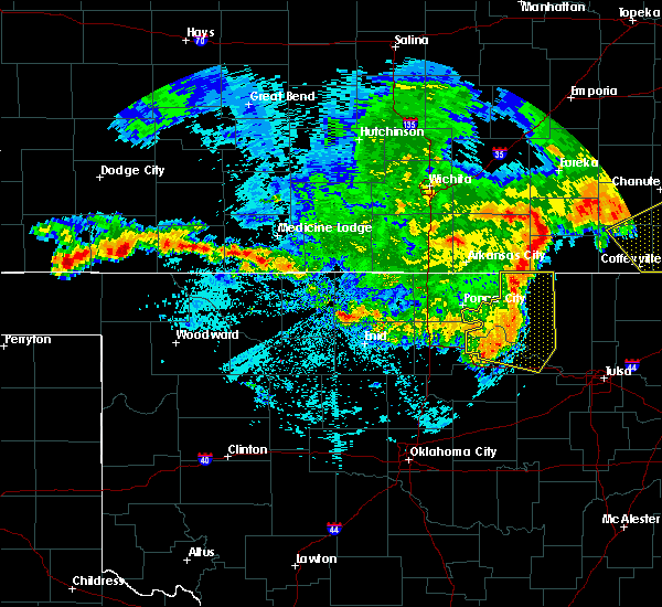 At 301 am cdt, severe thunderstorms were located along a line extending from 5 miles northeast of foraker to 6 miles east of fairfax to 3 miles south of pawnee, moving southeast at 45 mph (radar indicated). Hazards include 60 mph wind gusts and quarter size hail. Hail damage to vehicles is expected. expect wind damage to roofs, siding, and trees. Locations in or near the path include, pawhuska, pawnee, hominy, cleveland, fairfax, shidler, wynona, ralston, osage, burbank, hallett, blackburn, maramec, skedee, grainola, foraker, pearsonia, southern kaw lake, webb city, apperson,. At 301 am cdt, severe thunderstorms were located along a line extending from 5 miles northeast of foraker to 6 miles east of fairfax to 3 miles south of pawnee, moving southeast at 45 mph (radar indicated). Hazards include 60 mph wind gusts and quarter size hail. Hail damage to vehicles is expected. expect wind damage to roofs, siding, and trees. Locations in or near the path include, pawhuska, pawnee, hominy, cleveland, fairfax, shidler, wynona, ralston, osage, burbank, hallett, blackburn, maramec, skedee, grainola, foraker, pearsonia, southern kaw lake, webb city, apperson,.
|
| 6/29/2017 9:28 PM CDT |
 At 228 am cdt, severe thunderstorms were located along a line extending from 6 miles northeast of newkirk to 6 miles southeast of ponca city to 6 miles east of red rock, moving east at 45 mph (radar indicated). Hazards include 60 mph wind gusts. Expect damage to roofs, siding, and trees. Locations in or near the path include, pawhuska, pawnee, hominy, cleveland, fairfax, shidler, wynona, ralston, osage, burbank, hallett, blackburn, maramec, skedee, grainola, foraker, pearsonia, southern kaw lake, webb city, apperson,. At 228 am cdt, severe thunderstorms were located along a line extending from 6 miles northeast of newkirk to 6 miles southeast of ponca city to 6 miles east of red rock, moving east at 45 mph (radar indicated). Hazards include 60 mph wind gusts. Expect damage to roofs, siding, and trees. Locations in or near the path include, pawhuska, pawnee, hominy, cleveland, fairfax, shidler, wynona, ralston, osage, burbank, hallett, blackburn, maramec, skedee, grainola, foraker, pearsonia, southern kaw lake, webb city, apperson,.
|
| 6/29/2017 9:12 PM CDT |
 At 211 am cdt, severe thunderstorms were located along a line extending from 6 miles west of chilocco to 6 miles southwest of ponca city to 6 miles west of red rock, moving east at 50 mph (radar indicated). Hazards include 60 mph wind gusts. Expect damage to roofs, siding, and trees. Locations in or near the path include, pawhuska, pawnee, hominy, cleveland, fairfax, shidler, wynona, ralston, osage, burbank, hallett, blackburn, maramec, skedee, grainola, foraker, pearsonia, southern kaw lake, webb city, apperson,. At 211 am cdt, severe thunderstorms were located along a line extending from 6 miles west of chilocco to 6 miles southwest of ponca city to 6 miles west of red rock, moving east at 50 mph (radar indicated). Hazards include 60 mph wind gusts. Expect damage to roofs, siding, and trees. Locations in or near the path include, pawhuska, pawnee, hominy, cleveland, fairfax, shidler, wynona, ralston, osage, burbank, hallett, blackburn, maramec, skedee, grainola, foraker, pearsonia, southern kaw lake, webb city, apperson,.
|
| 6/18/2017 6:43 AM CDT |
 At 642 am cdt, a severe thunderstorm was located 3 miles south of pawnee, moving southeast at 35 mph (radar indicated). Hazards include golf ball size hail and 60 mph wind gusts. People and animals outdoors will be injured. expect hail damage to roofs, siding, windows, and vehicles. expect wind damage to roofs, siding, and trees. Locations in or near the path include, pawnee, cleveland, mannford, oilton, jennings, westport, hallett, terlton, maramec, skedee, silver city,. At 642 am cdt, a severe thunderstorm was located 3 miles south of pawnee, moving southeast at 35 mph (radar indicated). Hazards include golf ball size hail and 60 mph wind gusts. People and animals outdoors will be injured. expect hail damage to roofs, siding, windows, and vehicles. expect wind damage to roofs, siding, and trees. Locations in or near the path include, pawnee, cleveland, mannford, oilton, jennings, westport, hallett, terlton, maramec, skedee, silver city,.
|
| 6/15/2017 10:28 PM CDT |
 At 1028 pm cdt, severe thunderstorms were located along a line extending from 3 miles east of welch to 4 miles south of chelsea to near skedee, moving southeast at 25 mph (radar indicated). Hazards include 70 mph wind gusts and nickel size hail. Expect considerable tree damage. damage is likely to mobile homes, roofs, and outbuildings. Locations in or near the path include, northwestern tulsa, claremore, vinita, pawnee, owasso, skiatook, collinsville, hominy, cleveland, chelsea, fairfax, barnsdall, sperry, oologah, adair, welch, ramona, ketchum, wynona, ochelata, this includes interstate 44 between mile markers 261 and 292. At 1028 pm cdt, severe thunderstorms were located along a line extending from 3 miles east of welch to 4 miles south of chelsea to near skedee, moving southeast at 25 mph (radar indicated). Hazards include 70 mph wind gusts and nickel size hail. Expect considerable tree damage. damage is likely to mobile homes, roofs, and outbuildings. Locations in or near the path include, northwestern tulsa, claremore, vinita, pawnee, owasso, skiatook, collinsville, hominy, cleveland, chelsea, fairfax, barnsdall, sperry, oologah, adair, welch, ramona, ketchum, wynona, ochelata, this includes interstate 44 between mile markers 261 and 292.
|
| 6/15/2017 9:51 PM CDT |
 At 951 pm cdt, severe thunderstorms were located along a line extending from 2 miles north of wynona to 9 miles east of marland, moving southeast at 45 mph (radar indicated). Hazards include 60 mph wind gusts and quarter size hail. Hail damage to vehicles is expected. expect wind damage to roofs, siding, and trees. Locations in or near the path include, pawnee, hominy, cleveland, fairfax, shidler, jennings, ralston, westport, osage, burbank, hallett, blackburn, terlton, maramec, skedee, foraker, pearsonia, walnut creek state park, southern kaw lake, webb city,. At 951 pm cdt, severe thunderstorms were located along a line extending from 2 miles north of wynona to 9 miles east of marland, moving southeast at 45 mph (radar indicated). Hazards include 60 mph wind gusts and quarter size hail. Hail damage to vehicles is expected. expect wind damage to roofs, siding, and trees. Locations in or near the path include, pawnee, hominy, cleveland, fairfax, shidler, jennings, ralston, westport, osage, burbank, hallett, blackburn, terlton, maramec, skedee, foraker, pearsonia, walnut creek state park, southern kaw lake, webb city,.
|
| 5/11/2017 3:22 PM CDT |
 At 321 pm cdt, a severe thunderstorm was located 5 miles southeast of marland, moving east at 15 mph (radar indicated). Hazards include 60 mph wind gusts and quarter size hail. Hail damage to vehicles is expected. expect wind damage to roofs, siding, and trees. Locations in or near the path include, pawnee, fairfax, ralston, burbank, skedee,. At 321 pm cdt, a severe thunderstorm was located 5 miles southeast of marland, moving east at 15 mph (radar indicated). Hazards include 60 mph wind gusts and quarter size hail. Hail damage to vehicles is expected. expect wind damage to roofs, siding, and trees. Locations in or near the path include, pawnee, fairfax, ralston, burbank, skedee,.
|
| 5/10/2017 10:02 PM CDT |
 At 1002 pm cdt, severe thunderstorms were located along a line extending from 3 miles northwest of hallett to 4 miles east of oilton to 3 miles southeast of shamrock, moving east at 50 mph (radar indicated). Hazards include 60 mph wind gusts and penny size hail. Expect damage to roofs, siding, and trees. Locations in or near the path include, pawnee, cleveland, mannford, drumright, oilton, jennings, westport, hallett, terlton, shamrock, maramec, silver city, this includes interstate 44 near mile marker 201. At 1002 pm cdt, severe thunderstorms were located along a line extending from 3 miles northwest of hallett to 4 miles east of oilton to 3 miles southeast of shamrock, moving east at 50 mph (radar indicated). Hazards include 60 mph wind gusts and penny size hail. Expect damage to roofs, siding, and trees. Locations in or near the path include, pawnee, cleveland, mannford, drumright, oilton, jennings, westport, hallett, terlton, shamrock, maramec, silver city, this includes interstate 44 near mile marker 201.
|
| 5/10/2017 9:41 PM CDT |
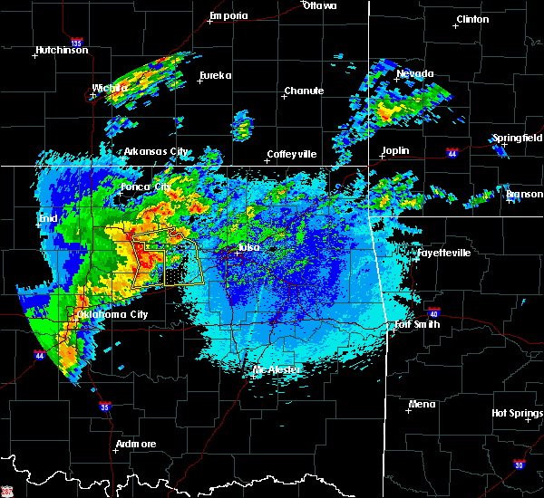 At 940 pm cdt, severe thunderstorms were located along a line extending from glencoe to 4 miles northeast of ripley to 4 miles south of agra, moving east at 50 mph (radar indicated). Hazards include 60 mph wind gusts and penny size hail. at 930 pm, the oklahoma mesonet station at perkins oklahoma measured a 61 mph wind gust. Expect damage to roofs, siding, and trees. Locations in or near the path include, bristow, pawnee, cleveland, mannford, drumright, oilton, jennings, westport, hallett, terlton, shamrock, maramec, silver city, this includes interstate 44 between mile markers 185 and 201. At 940 pm cdt, severe thunderstorms were located along a line extending from glencoe to 4 miles northeast of ripley to 4 miles south of agra, moving east at 50 mph (radar indicated). Hazards include 60 mph wind gusts and penny size hail. at 930 pm, the oklahoma mesonet station at perkins oklahoma measured a 61 mph wind gust. Expect damage to roofs, siding, and trees. Locations in or near the path include, bristow, pawnee, cleveland, mannford, drumright, oilton, jennings, westport, hallett, terlton, shamrock, maramec, silver city, this includes interstate 44 between mile markers 185 and 201.
|
| 5/3/2017 3:17 AM CDT |
 At 316 am cdt, severe thunderstorms were located along a line extending from 3 miles north of hardy to shidler to 3 miles northwest of skedee, moving east at 50 mph (radar indicated. at 309 am a wind gust to 58 mph was reported at the newkirk mesonet in kay county). Hazards include 60 mph wind gusts and penny size hail. Expect damage to roofs, siding, and trees. Locations in or near the path include, pawnee, fairfax, shidler, ralston, burbank, blackburn, skedee, grainola, foraker, pearsonia, southern kaw lake, webb city, apperson,. At 316 am cdt, severe thunderstorms were located along a line extending from 3 miles north of hardy to shidler to 3 miles northwest of skedee, moving east at 50 mph (radar indicated. at 309 am a wind gust to 58 mph was reported at the newkirk mesonet in kay county). Hazards include 60 mph wind gusts and penny size hail. Expect damage to roofs, siding, and trees. Locations in or near the path include, pawnee, fairfax, shidler, ralston, burbank, blackburn, skedee, grainola, foraker, pearsonia, southern kaw lake, webb city, apperson,.
|
| 5/3/2017 2:49 AM CDT |
 At 249 am cdt, severe thunderstorms were located along a line extending from 7 miles west of chilocco to 3 miles north of ponca city to 4 miles southeast of red rock, moving east at 50 mph (radar indicated). Hazards include 60 mph wind gusts and penny size hail. Expect damage to roofs, siding, and trees. Locations in or near the path include, pawnee, fairfax, shidler, ralston, burbank, blackburn, skedee, grainola, foraker, pearsonia, southern kaw lake, webb city, apperson,. At 249 am cdt, severe thunderstorms were located along a line extending from 7 miles west of chilocco to 3 miles north of ponca city to 4 miles southeast of red rock, moving east at 50 mph (radar indicated). Hazards include 60 mph wind gusts and penny size hail. Expect damage to roofs, siding, and trees. Locations in or near the path include, pawnee, fairfax, shidler, ralston, burbank, blackburn, skedee, grainola, foraker, pearsonia, southern kaw lake, webb city, apperson,.
|
| 4/25/2017 7:34 PM CDT |
 At 734 pm cdt, a severe thunderstorm was located 4 miles south of skedee, moving northeast at 35 mph (radar indicated). Hazards include 60 mph wind gusts and quarter size hail. Hail damage to vehicles is expected. expect wind damage to roofs, siding, and trees. Locations in or near the path include, pawnee, cleveland, blackburn, maramec, skedee,. At 734 pm cdt, a severe thunderstorm was located 4 miles south of skedee, moving northeast at 35 mph (radar indicated). Hazards include 60 mph wind gusts and quarter size hail. Hail damage to vehicles is expected. expect wind damage to roofs, siding, and trees. Locations in or near the path include, pawnee, cleveland, blackburn, maramec, skedee,.
|
| 4/25/2017 7:21 PM CDT |
 At 721 pm cdt, a severe thunderstorm was located 3 miles east of glencoe, moving northeast at 35 mph (radar indicated). Hazards include 60 mph wind gusts and quarter size hail. Hail damage to vehicles is expected. expect wind damage to roofs, siding, and trees. Locations in or near the path include, pawnee, cleveland, blackburn, maramec, skedee,. At 721 pm cdt, a severe thunderstorm was located 3 miles east of glencoe, moving northeast at 35 mph (radar indicated). Hazards include 60 mph wind gusts and quarter size hail. Hail damage to vehicles is expected. expect wind damage to roofs, siding, and trees. Locations in or near the path include, pawnee, cleveland, blackburn, maramec, skedee,.
|
| 3/28/2017 11:02 PM CDT |
 At 1102 pm cdt, severe thunderstorms were located along a line extending from 2 miles southeast of ponca city to 8 miles northwest of ralston to 3 miles northwest of skedee to 2 miles northeast of quay, moving northeast at 50 mph (radar indicated). Hazards include 60 mph wind gusts and penny size hail. Expect damage to roofs, siding, and trees. Locations in or near the path include, pawnee, fairfax, ralston, hallett, blackburn, maramec, skedee,. At 1102 pm cdt, severe thunderstorms were located along a line extending from 2 miles southeast of ponca city to 8 miles northwest of ralston to 3 miles northwest of skedee to 2 miles northeast of quay, moving northeast at 50 mph (radar indicated). Hazards include 60 mph wind gusts and penny size hail. Expect damage to roofs, siding, and trees. Locations in or near the path include, pawnee, fairfax, ralston, hallett, blackburn, maramec, skedee,.
|
| 3/28/2017 10:31 PM CDT |
 At 1031 pm cdt, severe thunderstorms were located along a line extending from 5 miles north of perry to 4 miles southwest of morrison to 4 miles southeast of stillwater to 2 miles southwest of tryon, moving northeast at 50 mph (radar indicated). Hazards include 60 mph wind gusts and penny size hail. Expect damage to roofs, siding, and trees. Locations in or near the path include, pawnee, fairfax, ralston, hallett, blackburn, maramec, skedee,. At 1031 pm cdt, severe thunderstorms were located along a line extending from 5 miles north of perry to 4 miles southwest of morrison to 4 miles southeast of stillwater to 2 miles southwest of tryon, moving northeast at 50 mph (radar indicated). Hazards include 60 mph wind gusts and penny size hail. Expect damage to roofs, siding, and trees. Locations in or near the path include, pawnee, fairfax, ralston, hallett, blackburn, maramec, skedee,.
|
| 9/9/2016 10:06 PM CDT |
 At 1005 pm cdt, severe thunderstorms were located along a line extending from 5 miles northwest of cedar vale to 3 miles south of kaw city to 4 miles northeast of lake mcmurtry, moving east at 35 mph (radar indicated. at 955 pm...the red rock mesonet site reported a 60 mph wind gust). Hazards include 60 mph wind gusts. Expect damage to roofs. siding. and trees. Locations in or near the path include, pawhuska, pawnee, fairfax, shidler, ralston, burbank, hallett, blackburn, maramec, elgin, skedee, grainola, foraker, pearsonia, bigheart, southern kaw lake, webb city, apperson, wah sha she state park,. At 1005 pm cdt, severe thunderstorms were located along a line extending from 5 miles northwest of cedar vale to 3 miles south of kaw city to 4 miles northeast of lake mcmurtry, moving east at 35 mph (radar indicated. at 955 pm...the red rock mesonet site reported a 60 mph wind gust). Hazards include 60 mph wind gusts. Expect damage to roofs. siding. and trees. Locations in or near the path include, pawhuska, pawnee, fairfax, shidler, ralston, burbank, hallett, blackburn, maramec, elgin, skedee, grainola, foraker, pearsonia, bigheart, southern kaw lake, webb city, apperson, wah sha she state park,.
|
| 9/9/2016 9:48 PM CDT |
 At 948 pm cdt, severe thunderstorms were located along a line extending from 4 miles north of dexter to 2 miles southeast of kildare to 3 miles northwest of perry, moving east at 30 mph (radar indicated. at 939 pm, the newkirk mesonet site reported a 61 mph wind gust). Hazards include 60 mph wind gusts. Expect damage to roofs. siding. and trees. Locations in or near the path include, pawhuska, pawnee, fairfax, shidler, ralston, burbank, hallett, blackburn, maramec, elgin, skedee, grainola, foraker, pearsonia, bigheart, southern kaw lake, webb city, apperson, wah sha she state park,. At 948 pm cdt, severe thunderstorms were located along a line extending from 4 miles north of dexter to 2 miles southeast of kildare to 3 miles northwest of perry, moving east at 30 mph (radar indicated. at 939 pm, the newkirk mesonet site reported a 61 mph wind gust). Hazards include 60 mph wind gusts. Expect damage to roofs. siding. and trees. Locations in or near the path include, pawhuska, pawnee, fairfax, shidler, ralston, burbank, hallett, blackburn, maramec, elgin, skedee, grainola, foraker, pearsonia, bigheart, southern kaw lake, webb city, apperson, wah sha she state park,.
|
| 7/14/2016 11:48 AM CDT |
 At 1147 am cdt, severe thunderstorms were located along a line extending from 9 miles northeast of foraker to 4 miles southeast of blackburn, moving east at 45 mph. other severe storms were developing near just west of skiatook and sperry, and were lifting northeast at 20 mph (radar indicated). Hazards include 60 mph wind gusts and quarter size hail. Hail damage to vehicles is expected. expect wind damage to roofs, siding, and trees. Locations in or near the path include, northern tulsa, bartlesville, sand springs, pawhuska, pawnee, owasso, skiatook, catoosa, collinsville, hominy, dewey, cleveland, fairfax, barnsdall, sperry, copan, ramona, shidler, wynona, ochelata, this includes interstate 44 between mile markers 231 and 232. At 1147 am cdt, severe thunderstorms were located along a line extending from 9 miles northeast of foraker to 4 miles southeast of blackburn, moving east at 45 mph. other severe storms were developing near just west of skiatook and sperry, and were lifting northeast at 20 mph (radar indicated). Hazards include 60 mph wind gusts and quarter size hail. Hail damage to vehicles is expected. expect wind damage to roofs, siding, and trees. Locations in or near the path include, northern tulsa, bartlesville, sand springs, pawhuska, pawnee, owasso, skiatook, catoosa, collinsville, hominy, dewey, cleveland, fairfax, barnsdall, sperry, copan, ramona, shidler, wynona, ochelata, this includes interstate 44 between mile markers 231 and 232.
|
| 7/14/2016 11:22 AM CDT |
 At 1122 am cdt, a severe thunderstorm was located over glencoe, moving northeast at 40 mph (radar indicated). Hazards include 60 mph wind gusts and quarter size hail. Hail damage to vehicles is expected. expect wind damage to roofs, siding, and trees. Locations in or near the path include, pawnee, cleveland, jennings, westport, hallett, terlton, maramec,. At 1122 am cdt, a severe thunderstorm was located over glencoe, moving northeast at 40 mph (radar indicated). Hazards include 60 mph wind gusts and quarter size hail. Hail damage to vehicles is expected. expect wind damage to roofs, siding, and trees. Locations in or near the path include, pawnee, cleveland, jennings, westport, hallett, terlton, maramec,.
|
| 7/8/2016 8:04 AM CDT |
 At 804 am cdt, severe thunderstorms were located along a line extending from glencoe to 2 miles west of cushing to 2 miles southeast of sparks, moving east at 35 mph (radar indicated). Hazards include 60 mph wind gusts and quarter size hail. Hail damage to vehicles is expected. expect wind damage to roofs, siding, and trees. Locations in or near the path include, bristow, pawnee, okfuskee, hominy, cleveland, mannford, drumright, oilton, depew, jennings, westport, osage, slick, hallett, blackburn, terlton, shamrock, maramec, skedee, welty, this includes interstate 44 between mile markers 178 and 203. At 804 am cdt, severe thunderstorms were located along a line extending from glencoe to 2 miles west of cushing to 2 miles southeast of sparks, moving east at 35 mph (radar indicated). Hazards include 60 mph wind gusts and quarter size hail. Hail damage to vehicles is expected. expect wind damage to roofs, siding, and trees. Locations in or near the path include, bristow, pawnee, okfuskee, hominy, cleveland, mannford, drumright, oilton, depew, jennings, westport, osage, slick, hallett, blackburn, terlton, shamrock, maramec, skedee, welty, this includes interstate 44 between mile markers 178 and 203.
|
| 6/30/2016 6:51 PM CDT |
 The severe thunderstorm warning for west central osage and northwestern pawnee counties will expire at 700 pm cdt, the storm which prompted the warning has weakened below severe limits, and no longer poses an immediate threat to life or property. therefore the warning will be allowed to expire. however gusty winds and heavy rain are still possible with this thunderstorm. The severe thunderstorm warning for west central osage and northwestern pawnee counties will expire at 700 pm cdt, the storm which prompted the warning has weakened below severe limits, and no longer poses an immediate threat to life or property. therefore the warning will be allowed to expire. however gusty winds and heavy rain are still possible with this thunderstorm.
|
| 6/30/2016 6:30 PM CDT |
 At 630 pm cdt, a severe thunderstorm was located 9 miles northwest of ralston, moving southeast at 20 mph (radar indicated). Hazards include 60 mph wind gusts and quarter size hail. Hail damage to vehicles is expected. expect wind damage to roofs, siding, and trees. Locations in or near the path include, pawnee, fairfax, ralston, skedee,. At 630 pm cdt, a severe thunderstorm was located 9 miles northwest of ralston, moving southeast at 20 mph (radar indicated). Hazards include 60 mph wind gusts and quarter size hail. Hail damage to vehicles is expected. expect wind damage to roofs, siding, and trees. Locations in or near the path include, pawnee, fairfax, ralston, skedee,.
|
| 5/9/2016 6:45 PM CDT |
 At 645 pm cdt, a severe thunderstorm capable of producing a tornado was located over pawnee, moving east at 35 mph (radar indicated rotation). Hazards include tornado and half dollar size hail. Flying debris will be dangerous to those caught without shelter. mobile homes will be damaged or destroyed. damage to roofs, windows, and vehicles will occur. tree damage is likely. Locations in or near the path include, pawnee, blackburn, skedee,. At 645 pm cdt, a severe thunderstorm capable of producing a tornado was located over pawnee, moving east at 35 mph (radar indicated rotation). Hazards include tornado and half dollar size hail. Flying debris will be dangerous to those caught without shelter. mobile homes will be damaged or destroyed. damage to roofs, windows, and vehicles will occur. tree damage is likely. Locations in or near the path include, pawnee, blackburn, skedee,.
|
| 5/9/2016 6:39 PM CDT |
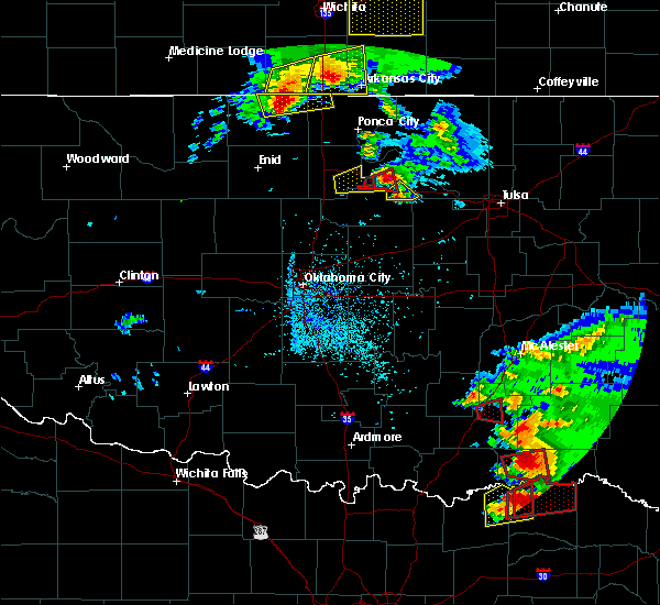 At 639 pm cdt, a severe thunderstorm capable of producing a tornado was located 4 miles southwest of pawnee, moving east at 30 mph (radar indicated rotation). Hazards include tornado and golf ball size hail. Flying debris will be dangerous to those caught without shelter. mobile homes will be damaged or destroyed. damage to roofs, windows, and vehicles will occur. tree damage is likely. Locations in or near the path include, pawnee,. At 639 pm cdt, a severe thunderstorm capable of producing a tornado was located 4 miles southwest of pawnee, moving east at 30 mph (radar indicated rotation). Hazards include tornado and golf ball size hail. Flying debris will be dangerous to those caught without shelter. mobile homes will be damaged or destroyed. damage to roofs, windows, and vehicles will occur. tree damage is likely. Locations in or near the path include, pawnee,.
|
| 5/9/2016 6:28 PM CDT |
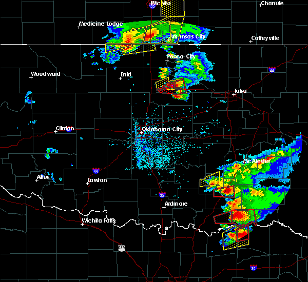 At 628 pm cdt, a severe thunderstorm capable of producing a tornado was located near morrison, moving east at 30 mph (radar indicated rotation). Hazards include tornado and golf ball size hail. Flying debris will be dangerous to those caught without shelter. mobile homes will be damaged or destroyed. damage to roofs, windows, and vehicles will occur. tree damage is likely. Locations in or near the path include, pawnee,. At 628 pm cdt, a severe thunderstorm capable of producing a tornado was located near morrison, moving east at 30 mph (radar indicated rotation). Hazards include tornado and golf ball size hail. Flying debris will be dangerous to those caught without shelter. mobile homes will be damaged or destroyed. damage to roofs, windows, and vehicles will occur. tree damage is likely. Locations in or near the path include, pawnee,.
|
| 5/9/2016 6:18 PM CDT |
 At 618 pm cdt, a severe thunderstorm was located near morrison, moving east at 30 mph (radar indicated). Hazards include 60 mph wind gusts and quarter size hail. Hail damage to vehicles is expected. expect wind damage to roofs, siding, and trees. Locations in or near the path include, pawnee, a tornado watch remains in effect until 900 pm cdt for northeastern oklahoma. At 618 pm cdt, a severe thunderstorm was located near morrison, moving east at 30 mph (radar indicated). Hazards include 60 mph wind gusts and quarter size hail. Hail damage to vehicles is expected. expect wind damage to roofs, siding, and trees. Locations in or near the path include, pawnee, a tornado watch remains in effect until 900 pm cdt for northeastern oklahoma.
|
| 5/9/2016 6:07 PM CDT |
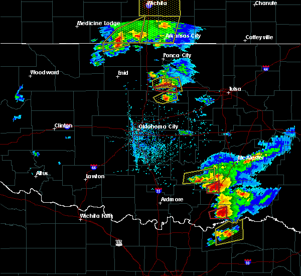 At 607 pm cdt, a severe thunderstorm was located 5 miles southwest of morrison, moving east at 30 mph (radar indicated). Hazards include 60 mph wind gusts and quarter size hail. Hail damage to vehicles is expected. expect wind damage to roofs, siding, and trees. Locations in or near the path include, pawnee, a tornado watch remains in effect until 900 pm cdt for northeastern oklahoma. At 607 pm cdt, a severe thunderstorm was located 5 miles southwest of morrison, moving east at 30 mph (radar indicated). Hazards include 60 mph wind gusts and quarter size hail. Hail damage to vehicles is expected. expect wind damage to roofs, siding, and trees. Locations in or near the path include, pawnee, a tornado watch remains in effect until 900 pm cdt for northeastern oklahoma.
|
| 4/26/2016 9:50 PM CDT |
 At 950 pm cdt, severe thunderstorms were located along a line extending from 3 miles northeast of grainola to 8 miles southwest of pawhuska to near terlton, moving northeast at 70 mph (radar indicated). Hazards include 70 mph wind gusts and nickel size hail. Expect considerable tree damage. damage is likely to mobile homes, roofs, and outbuildings. Locations in or near the path include, pawnee, fairfax, shidler, ralston, burbank, blackburn, maramec, elgin, skedee, grainola, foraker, pearsonia, eastern kaw lake, webb city, apperson, a tornado watch remains in effect until midnight cdt for northeastern oklahoma. At 950 pm cdt, severe thunderstorms were located along a line extending from 3 miles northeast of grainola to 8 miles southwest of pawhuska to near terlton, moving northeast at 70 mph (radar indicated). Hazards include 70 mph wind gusts and nickel size hail. Expect considerable tree damage. damage is likely to mobile homes, roofs, and outbuildings. Locations in or near the path include, pawnee, fairfax, shidler, ralston, burbank, blackburn, maramec, elgin, skedee, grainola, foraker, pearsonia, eastern kaw lake, webb city, apperson, a tornado watch remains in effect until midnight cdt for northeastern oklahoma.
|
| 4/26/2016 9:31 PM CDT |
 At 930 pm cdt, severe thunderstorms were located along a line extending from 5 miles west of quay to 3 miles west of paden, moving northeast at 60 mph (radar indicated). Hazards include 70 mph wind gusts and penny size hail. Expect considerable tree damage. damage is likely to mobile homes, roofs, and outbuildings. locations in or near the path include, bristow, pawnee, okfuskee, hominy, cleveland, mannford, drumright, beggs, boley, kellyville, oilton, depew, paden, jennings, westport, osage, slick, hallett, blackburn, castle, this includes interstate 44 between mile markers 178 and 208. A tornado watch remains in effect until midnight cdt for northeastern oklahoma. At 930 pm cdt, severe thunderstorms were located along a line extending from 5 miles west of quay to 3 miles west of paden, moving northeast at 60 mph (radar indicated). Hazards include 70 mph wind gusts and penny size hail. Expect considerable tree damage. damage is likely to mobile homes, roofs, and outbuildings. locations in or near the path include, bristow, pawnee, okfuskee, hominy, cleveland, mannford, drumright, beggs, boley, kellyville, oilton, depew, paden, jennings, westport, osage, slick, hallett, blackburn, castle, this includes interstate 44 between mile markers 178 and 208. A tornado watch remains in effect until midnight cdt for northeastern oklahoma.
|
| 4/26/2016 9:14 PM CDT |
 At 913 pm cdt, a severe thunderstorm was located near perkins, moving northeast at 60 mph (radar indicated). Hazards include 70 mph wind gusts and nickel size hail. Expect considerable tree damage. damage is likely to mobile homes, roofs, and outbuildings. Locations in or near the path include, pawnee, fairfax, shidler, ralston, burbank, blackburn, maramec, elgin, skedee, grainola, foraker, pearsonia, southern kaw lake, webb city, apperson, a tornado watch remains in effect until midnight cdt for northeastern oklahoma. At 913 pm cdt, a severe thunderstorm was located near perkins, moving northeast at 60 mph (radar indicated). Hazards include 70 mph wind gusts and nickel size hail. Expect considerable tree damage. damage is likely to mobile homes, roofs, and outbuildings. Locations in or near the path include, pawnee, fairfax, shidler, ralston, burbank, blackburn, maramec, elgin, skedee, grainola, foraker, pearsonia, southern kaw lake, webb city, apperson, a tornado watch remains in effect until midnight cdt for northeastern oklahoma.
|
| 4/11/2016 12:59 AM CDT |
 At 1259 am cdt, a severe thunderstorm was located 4 miles northwest of quay, moving northeast at 15 mph (radar indicated). Hazards include 60 mph wind gusts. Expect damage to roofs. siding. and trees. Locations in or near the path include, pawnee, blackburn, maramec, skedee,. At 1259 am cdt, a severe thunderstorm was located 4 miles northwest of quay, moving northeast at 15 mph (radar indicated). Hazards include 60 mph wind gusts. Expect damage to roofs. siding. and trees. Locations in or near the path include, pawnee, blackburn, maramec, skedee,.
|
| 11/17/2015 2:50 AM CST |
 At 249 am cst, severe thunderstorms were located along a line extending from 3 miles northeast of foraker to 4 miles northwest of wynona to hallett, moving east at 45 mph (radar indicated). Hazards include 60 mph wind gusts. Damage to roofs. siding and trees is possible. Locations in or near the path include, northwestern tulsa, bartlesville, sand springs, pawhuska, pawnee, skiatook, hominy, cleveland, mannford, fairfax, barnsdall, oilton, shidler, wynona, jennings, ralston, avant, westport, osage, burbank,. At 249 am cst, severe thunderstorms were located along a line extending from 3 miles northeast of foraker to 4 miles northwest of wynona to hallett, moving east at 45 mph (radar indicated). Hazards include 60 mph wind gusts. Damage to roofs. siding and trees is possible. Locations in or near the path include, northwestern tulsa, bartlesville, sand springs, pawhuska, pawnee, skiatook, hominy, cleveland, mannford, fairfax, barnsdall, oilton, shidler, wynona, jennings, ralston, avant, westport, osage, burbank,.
|
| 11/17/2015 2:37 AM CST |
 At 237 am cst, severe thunderstorms were located along a line extending from 2 miles west of shidler to 8 miles east of fairfax to near maramec, moving east at 50 mph (radar indicated). Hazards include 70 mph wind gusts. Expect considerable tree damage. damage is likely to mobile homes, roofs and outbuildings. Locations in or near the path include, northwestern tulsa, bartlesville, sand springs, pawhuska, pawnee, skiatook, hominy, cleveland, mannford, fairfax, barnsdall, oilton, shidler, wynona, jennings, ralston, avant, westport, osage, burbank,. At 237 am cst, severe thunderstorms were located along a line extending from 2 miles west of shidler to 8 miles east of fairfax to near maramec, moving east at 50 mph (radar indicated). Hazards include 70 mph wind gusts. Expect considerable tree damage. damage is likely to mobile homes, roofs and outbuildings. Locations in or near the path include, northwestern tulsa, bartlesville, sand springs, pawhuska, pawnee, skiatook, hominy, cleveland, mannford, fairfax, barnsdall, oilton, shidler, wynona, jennings, ralston, avant, westport, osage, burbank,.
|
| 11/17/2015 2:22 AM CST |
 At 222 am cst, severe thunderstorms were located along a line extending from 7 miles south of hardy to 4 miles west of quay, moving east at 45 mph (radar indicated). Hazards include 70 mph wind gusts. Expect considerable tree damage. damage is likely to mobile homes, roofs, and outbuildings. Locations in or near the path include, northwestern tulsa, bartlesville, sand springs, pawhuska, pawnee, skiatook, hominy, cleveland, mannford, fairfax, barnsdall, oilton, shidler, wynona, jennings, ralston, avant, westport, osage, burbank,. At 222 am cst, severe thunderstorms were located along a line extending from 7 miles south of hardy to 4 miles west of quay, moving east at 45 mph (radar indicated). Hazards include 70 mph wind gusts. Expect considerable tree damage. damage is likely to mobile homes, roofs, and outbuildings. Locations in or near the path include, northwestern tulsa, bartlesville, sand springs, pawhuska, pawnee, skiatook, hominy, cleveland, mannford, fairfax, barnsdall, oilton, shidler, wynona, jennings, ralston, avant, westport, osage, burbank,.
|
| 11/17/2015 2:04 AM CST |
 At 203 am cst, severe thunderstorms were located along a line extending from 3 miles west of kildare to near morrison, moving east at 40 mph. these are very dangerous storms (radar indicated). Hazards include 80 mph wind gusts. Flying debris will be dangerous to those caught without shelter. mobile homes will be heavily damaged. expect considerable damage to roofs, windows, and vehicles. extensive tree damage and power outages are likely. Locations in or near the path include, pawnee, fairfax, shidler, ralston, burbank, blackburn, maramec, skedee, grainola, foraker, southern kaw lake, webb city, apperson,. At 203 am cst, severe thunderstorms were located along a line extending from 3 miles west of kildare to near morrison, moving east at 40 mph. these are very dangerous storms (radar indicated). Hazards include 80 mph wind gusts. Flying debris will be dangerous to those caught without shelter. mobile homes will be heavily damaged. expect considerable damage to roofs, windows, and vehicles. extensive tree damage and power outages are likely. Locations in or near the path include, pawnee, fairfax, shidler, ralston, burbank, blackburn, maramec, skedee, grainola, foraker, southern kaw lake, webb city, apperson,.
|
| 11/17/2015 1:56 AM CST |
 At 154 am cst, severe thunderstorms were located along a line extending from 3 miles southeast of blackwell to 2 miles east of lake mcmurtry, moving east at 40 mph (radar indicated). Hazards include 60 mph wind gusts. Damage to roofs. siding and trees will be possible. Locations in or near the path include, pawnee, fairfax, shidler, ralston, burbank, blackburn, maramec, skedee, grainola, foraker, southern kaw lake, webb city, apperson,. At 154 am cst, severe thunderstorms were located along a line extending from 3 miles southeast of blackwell to 2 miles east of lake mcmurtry, moving east at 40 mph (radar indicated). Hazards include 60 mph wind gusts. Damage to roofs. siding and trees will be possible. Locations in or near the path include, pawnee, fairfax, shidler, ralston, burbank, blackburn, maramec, skedee, grainola, foraker, southern kaw lake, webb city, apperson,.
|
| 9/8/2015 5:56 PM CDT |
 The severe thunderstorm warning for central osage and central pawnee counties will expire at 600 pm cdt, the storms which prompted the warning have weakened below severe limits, and no longer pose an immediate threat to life or property. therefore the warning will be allowed to expire. however gusty winds and heavy rain are still possible with these thunderstorms. The severe thunderstorm warning for central osage and central pawnee counties will expire at 600 pm cdt, the storms which prompted the warning have weakened below severe limits, and no longer pose an immediate threat to life or property. therefore the warning will be allowed to expire. however gusty winds and heavy rain are still possible with these thunderstorms.
|
| 9/8/2015 5:38 PM CDT |
 At 538 pm cdt, severe thunderstorms were located along a line extending from 9 miles northeast of fairfax to 3 miles east of pawnee, moving northeast at 40 mph (radar indicated). Hazards include 60 mph wind gusts and quarter size hail. Hail damage to vehicles is expected. expect wind damage to roofs, siding and trees. Locations in or near the path include, pawhuska, pawnee, hominy, cleveland, wynona, blackburn, skedee, osage hills state park, pershing, nelagoney,. At 538 pm cdt, severe thunderstorms were located along a line extending from 9 miles northeast of fairfax to 3 miles east of pawnee, moving northeast at 40 mph (radar indicated). Hazards include 60 mph wind gusts and quarter size hail. Hail damage to vehicles is expected. expect wind damage to roofs, siding and trees. Locations in or near the path include, pawhuska, pawnee, hominy, cleveland, wynona, blackburn, skedee, osage hills state park, pershing, nelagoney,.
|
| 9/8/2015 5:16 PM CDT |
 At 514 pm cdt, severe thunderstorms were located along a line extending from 11 miles east of marland to 3 miles northeast of lake mcmurtry, moving northeast at 60 mph (trained weather spotters. at 5:05 pm...59 mph wind gusts were recorded at the red rock mesonet site). Hazards include 60 mph wind gusts and quarter size hail. Hail damage to vehicles is expected. expect wind damage to roofs, siding and trees. Locations in or near the path include, pawhuska, pawnee, hominy, cleveland, fairfax, wynona, ralston, osage, blackburn, skedee, osage hills state park, pershing, nelagoney,. At 514 pm cdt, severe thunderstorms were located along a line extending from 11 miles east of marland to 3 miles northeast of lake mcmurtry, moving northeast at 60 mph (trained weather spotters. at 5:05 pm...59 mph wind gusts were recorded at the red rock mesonet site). Hazards include 60 mph wind gusts and quarter size hail. Hail damage to vehicles is expected. expect wind damage to roofs, siding and trees. Locations in or near the path include, pawhuska, pawnee, hominy, cleveland, fairfax, wynona, ralston, osage, blackburn, skedee, osage hills state park, pershing, nelagoney,.
|
| 5/16/2015 9:42 PM CDT | At 941 pm cdt, severe thunderstorms were located along a line extending from fairfax to skedee to quay, and moving east at 60 mph (radar indicated). Hazards include 60 mph wind gusts and penny size hail. Expect damage to roofs. siding and trees. locations in or near the path include, maramec and blackburn , 0. 75in. |
| 5/16/2015 9:16 PM CDT | At 914 pm cdt, severe thunderstorms were located along a line extending from 6 miles west of sooner lake to 6 miles north of stillwater to 7 miles northwest of perkins, and moving northeast at 50 mph (radar indicated). Hazards include 60 mph wind gusts and nickel size hail. Expect damage to roofs. siding and trees. locations in or near the path include, pawnee, quay, ralston, skedee, fairfax, maramec, hallett and blackburn. 0. 88in. |
| 3/25/2015 4:32 PM CDT | A severe thunderstorm warning remains in effect for pawnee and southern osage counties until 445 pm cdt. at 431 pm cdt. severe thunderstorms were located along a line extending from maramec to 7 miles northeast of blackburn to 8 miles west of wynona. and moving northeast at 35 mph. hazard. 60 mph wind gusts and quarter size hail. |
| 3/25/2015 4:04 PM CDT | The national weather service in tulsa has issued a * severe thunderstorm warning for. southern osage county in northeast oklahoma. pawnee county in northeast oklahoma. until 445 pm cdt * at 402 pm cdt. Severe thunderstorms were located along a line. |
| 6/5/2014 10:45 PM CDT | Half Dollar sized hail reported 6.2 miles SE of Pawnee, OK, estimated wind to 55 mph... funnel cloud spotted |
| 7/24/2013 12:52 AM CDT | Large tree limbs down in and near pawne in pawnee county OK, 0.2 miles SSW of Pawnee, OK |
| 6/27/2013 8:40 PM CDT | Storm damage reported in pawnee county OK, 3 miles WSW of Pawnee, OK |
| 5/29/2013 10:20 PM CDT | Storm damage reported in pawnee county OK, 3 miles WSW of Pawnee, OK |
| 5/29/2013 7:30 PM CDT | Storm damage reported in pawnee county OK, 3 miles WSW of Pawnee, OK |
| 4/15/2012 4:54 AM CDT | Oklahoma mesonet in pawnee county OK, 3 miles WSW of Pawnee, OK |
| 4/14/2012 3:40 AM CDT | 4 inch tree limbs down and tin blown off a building just north of pawnee in pawnee county OK, 0.9 miles S of Pawnee, OK |
| 1/1/0001 12:00 AM | Storm damage reported in pawnee county OK, 3 miles WSW of Pawnee, OK |
| 1/1/0001 12:00 AM | Tor081- trees downed in pawne in pawnee county OK, 0.2 miles SSW of Pawnee, OK |
| 1/1/0001 12:00 AM | Considerable tree damage from wind. large limbs broke in pawnee county OK, 1.8 miles N of Pawnee, OK |
| 4/14/2011 4:08 PM CDT | Golf Ball sized hail reported 0.2 miles SSW of Pawnee, OK |
| 2/10/2009 5:01 PM CST | Quarter sized hail reported 0.9 miles S of Pawnee, OK |
Hail Maps for Pawnee, OK

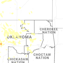
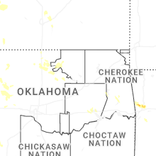


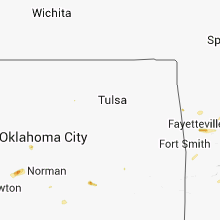


Connect with Interactive Hail Maps