

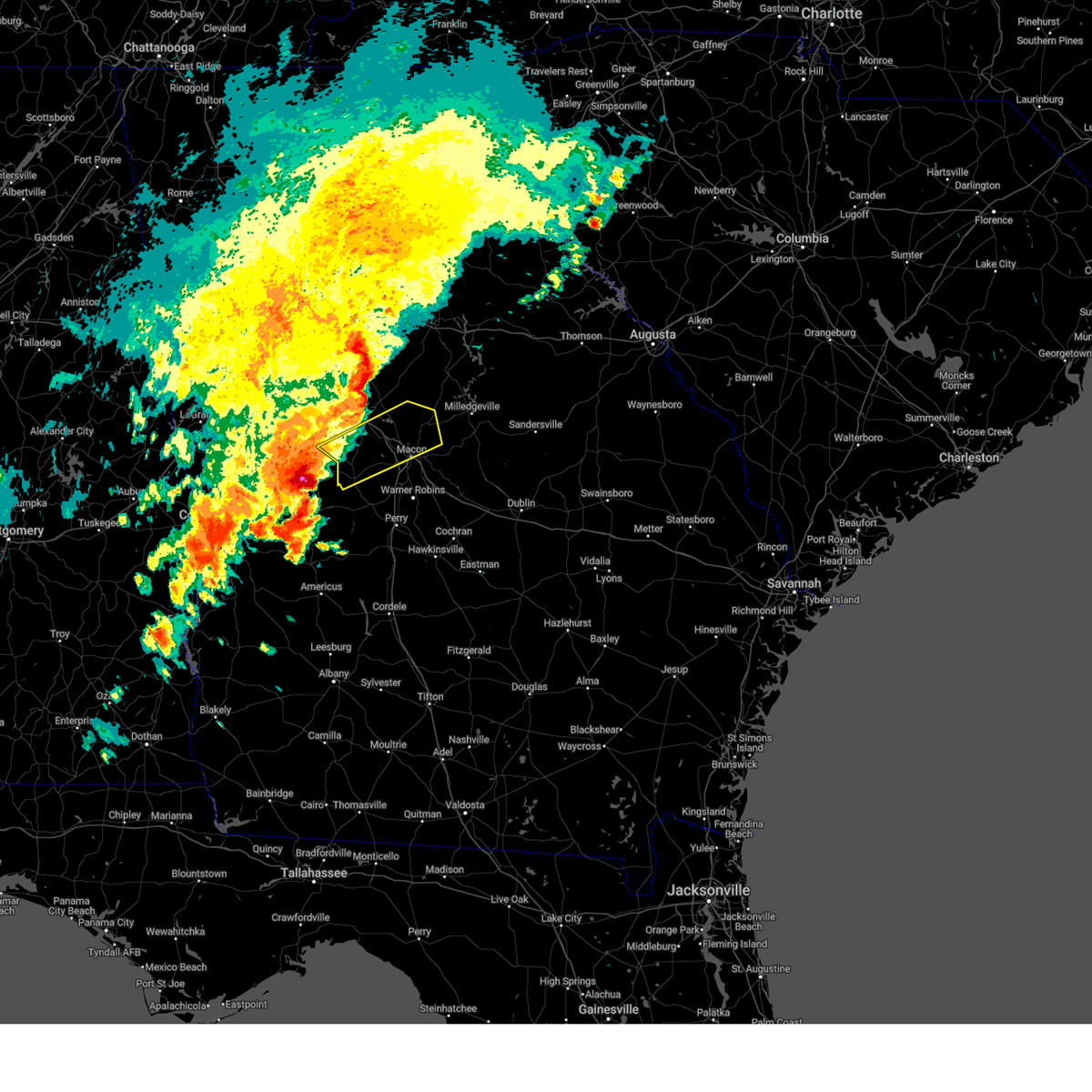
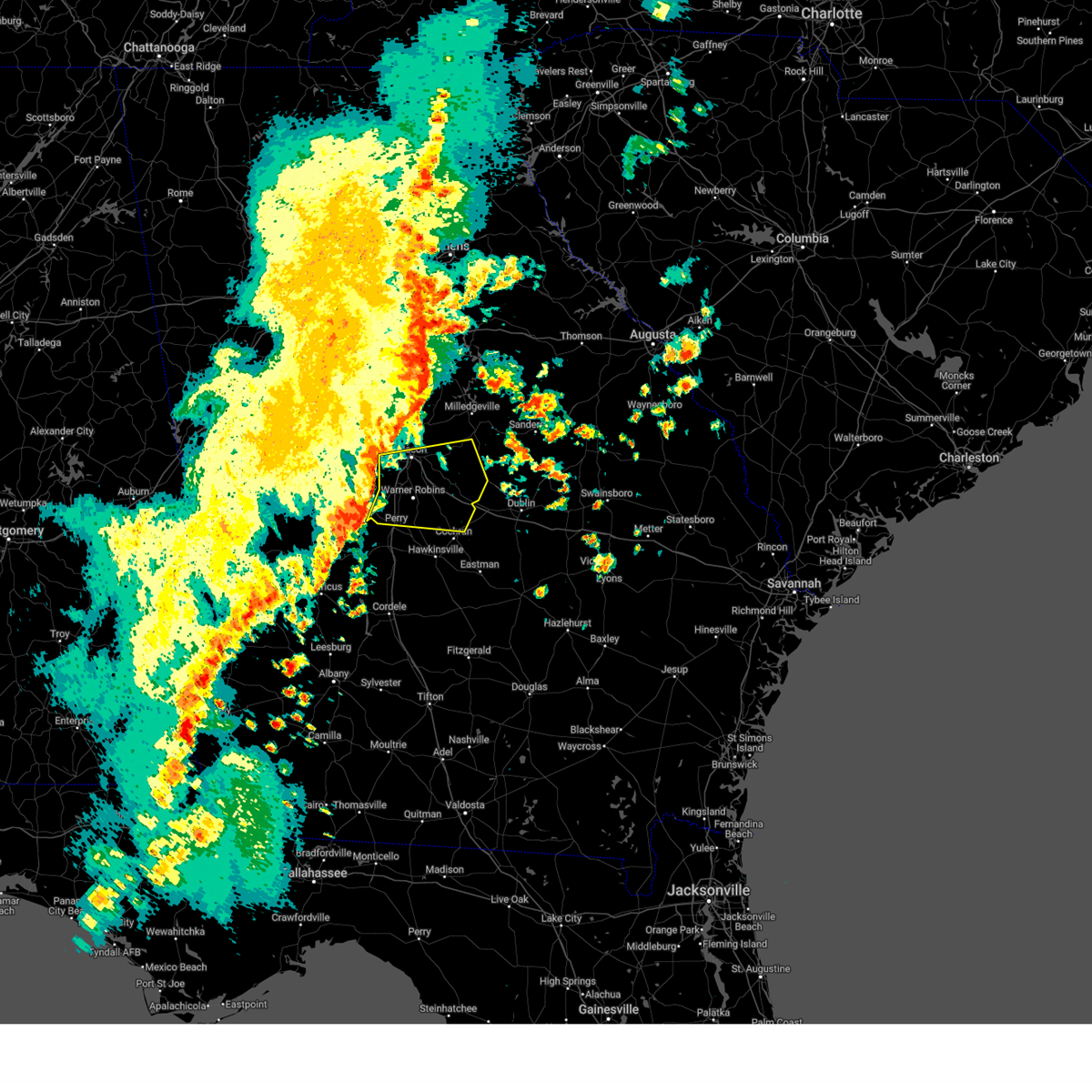
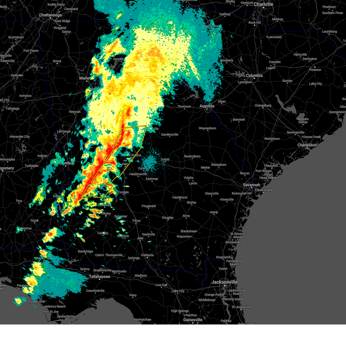
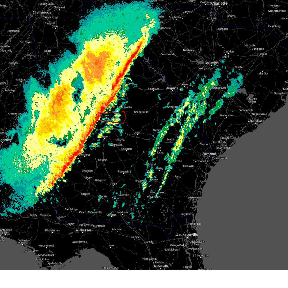
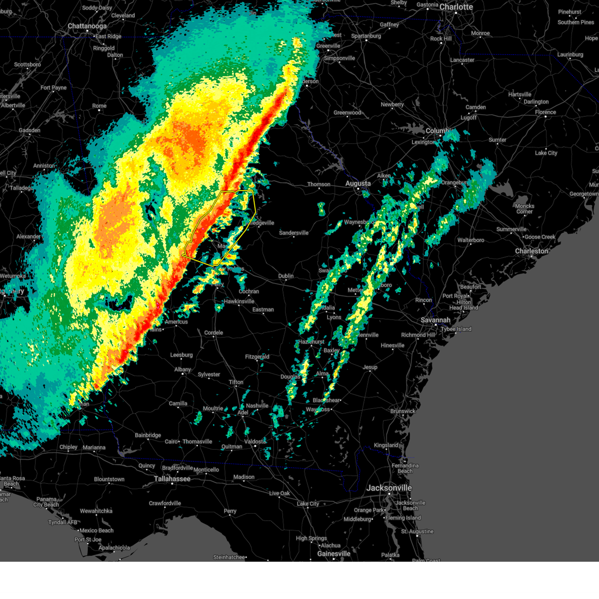
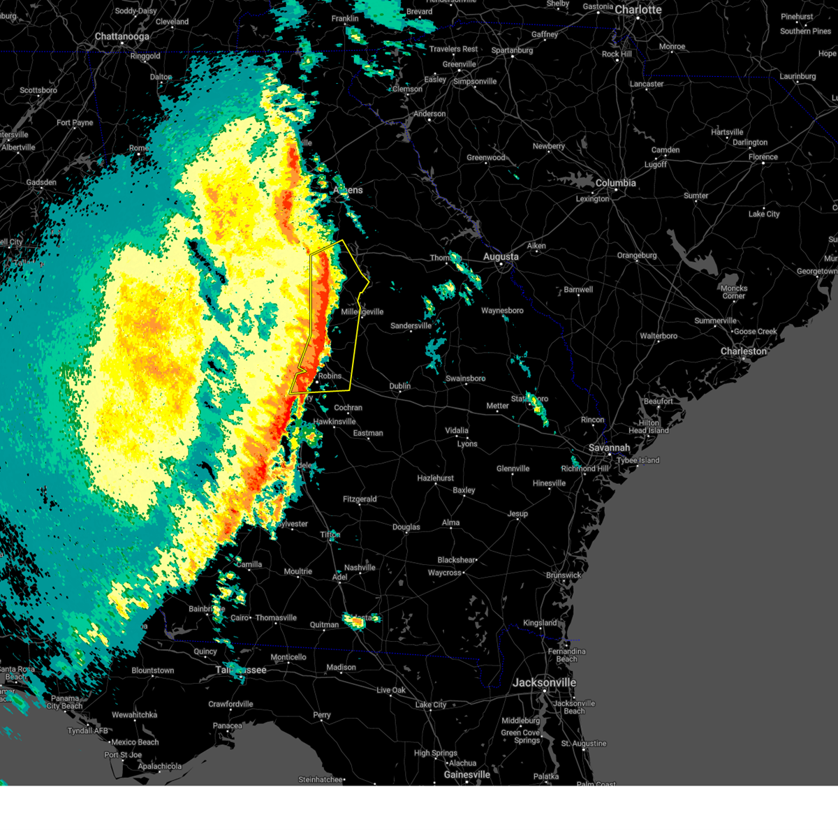
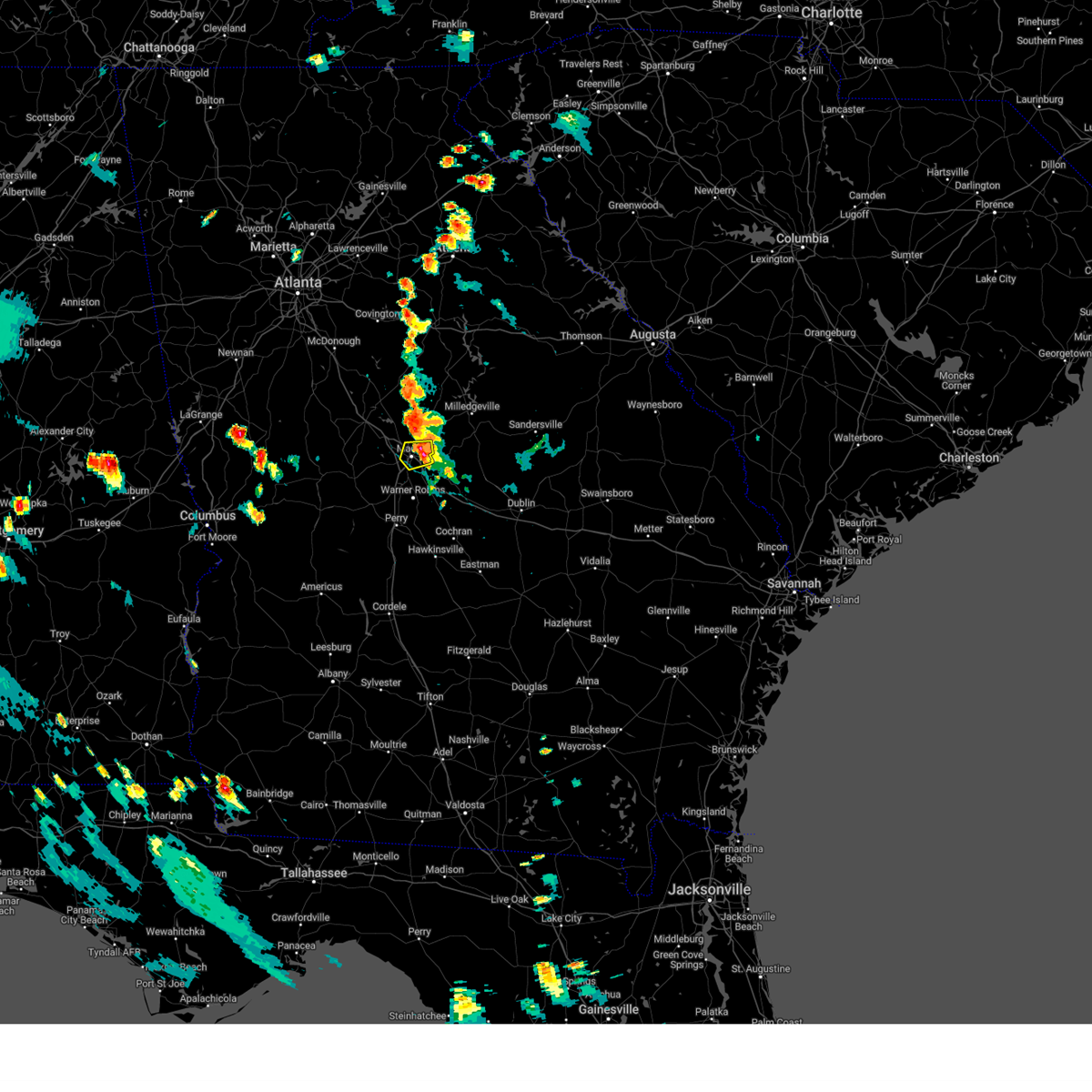
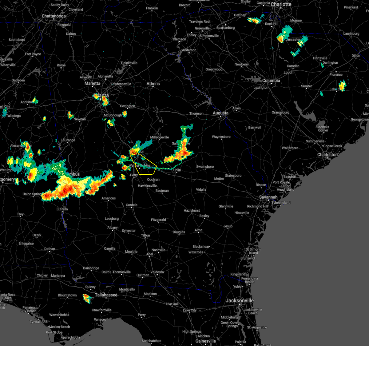
Hail Map for Payne, GA
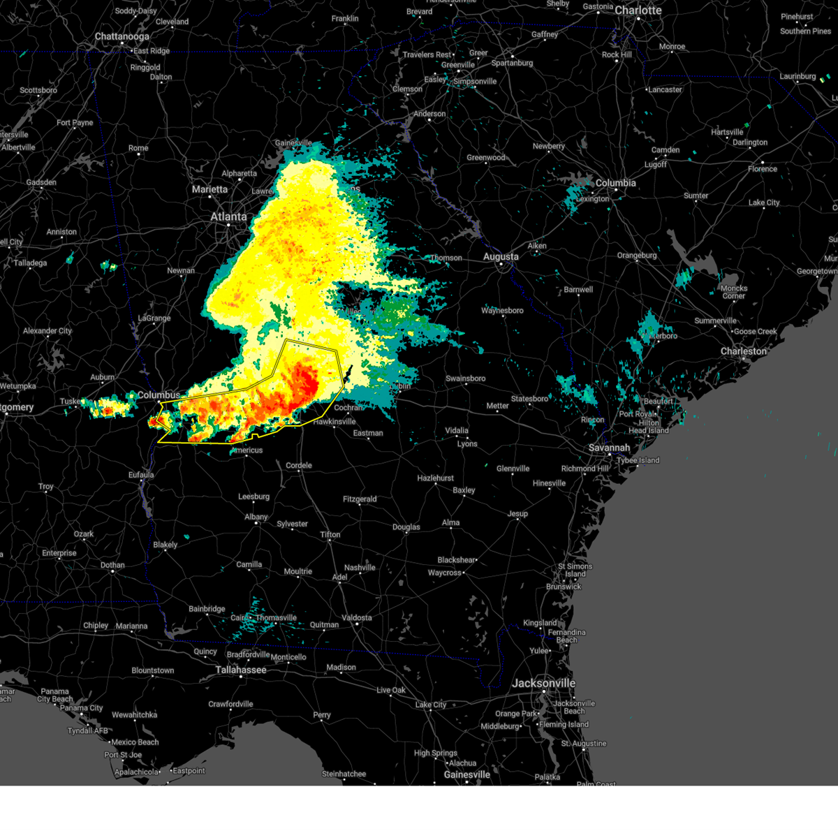
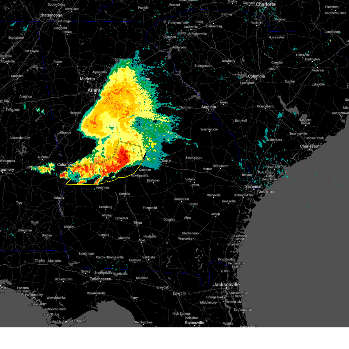
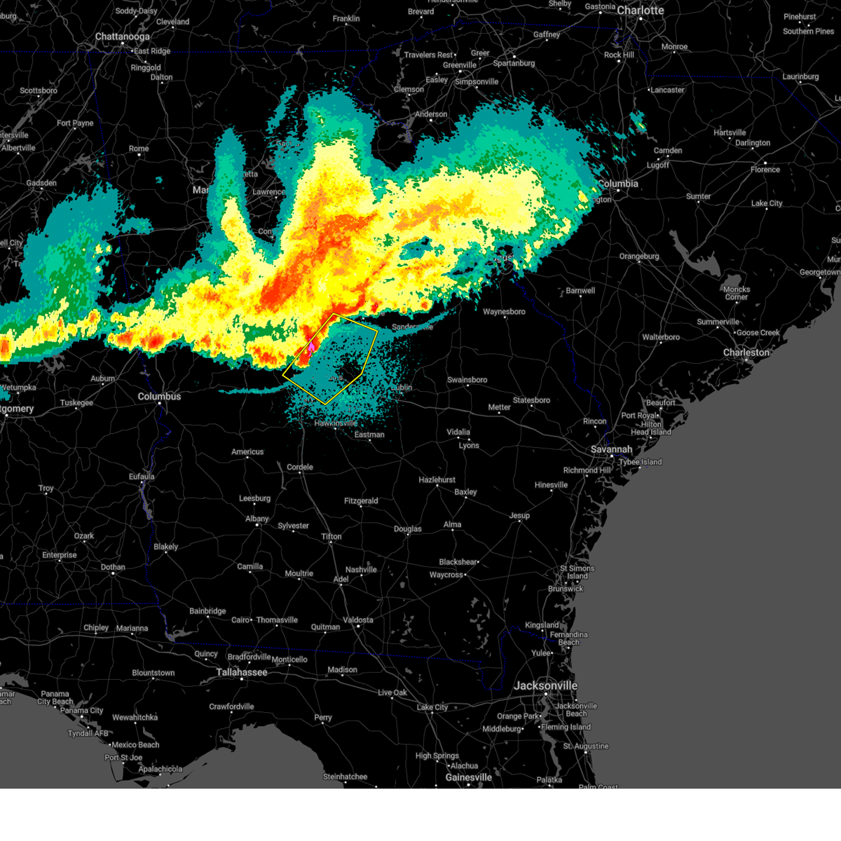
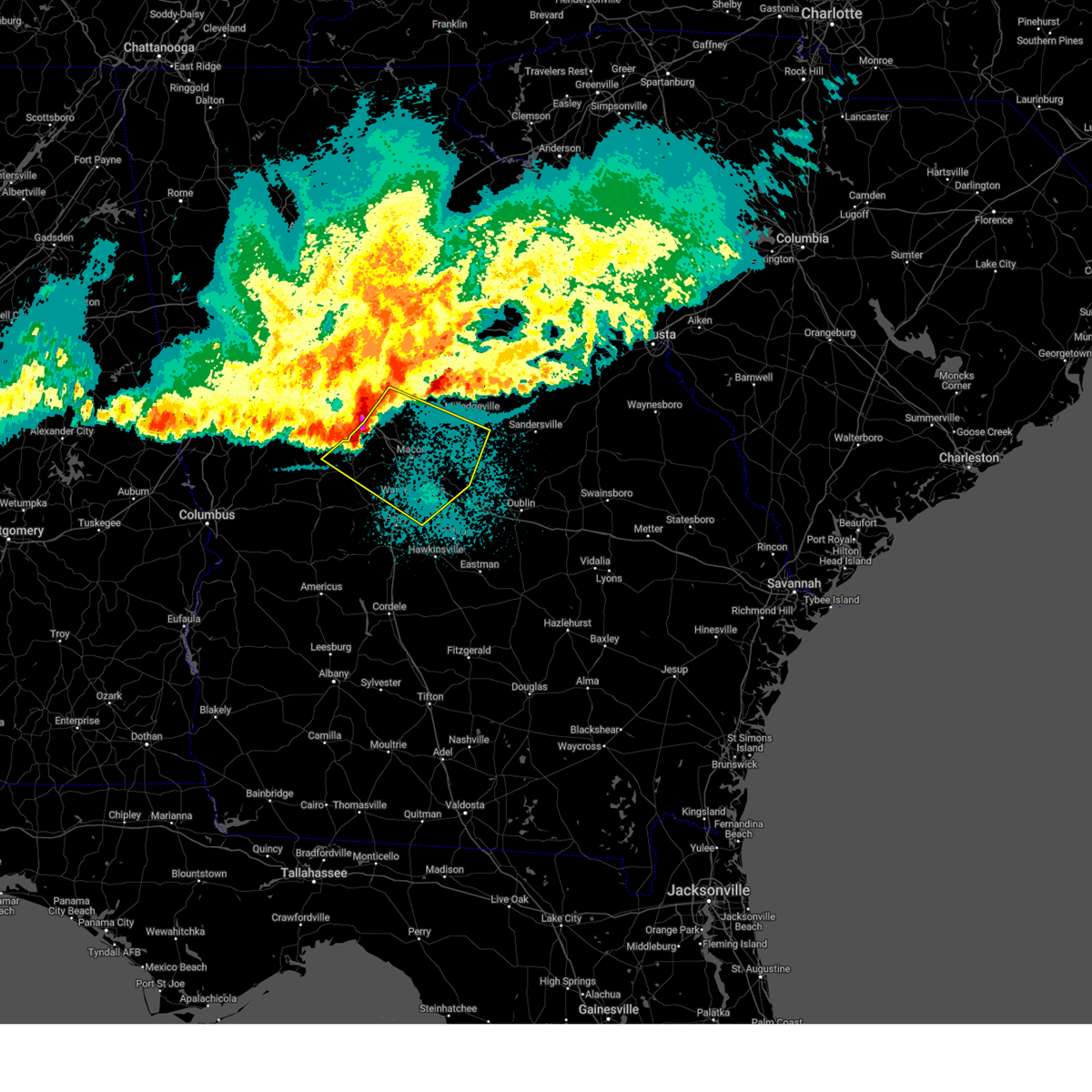
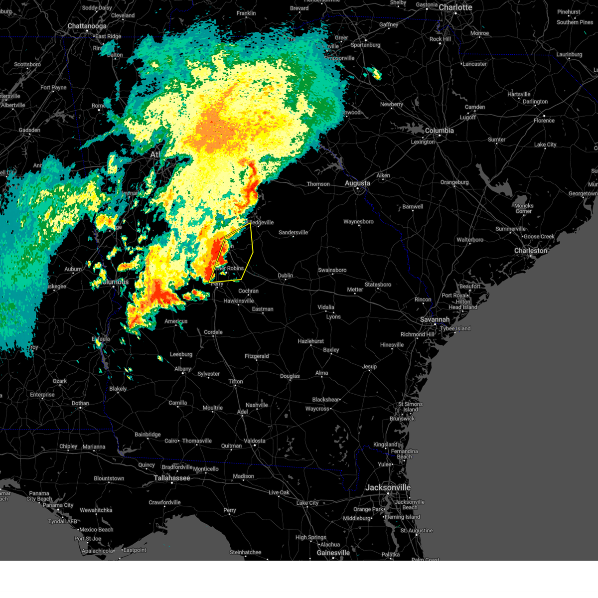
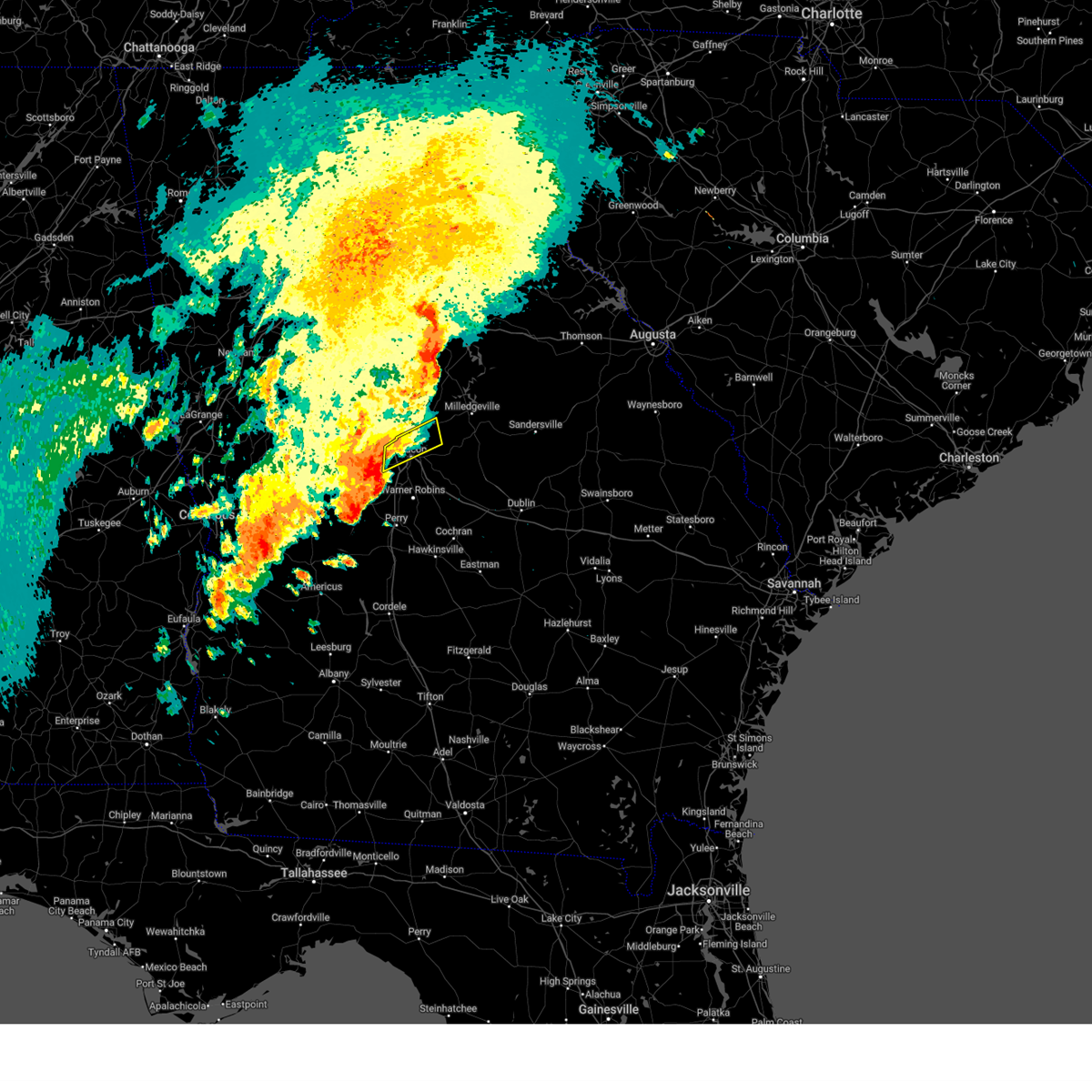
The Payne, GA area has had 0 reports of on-the-ground hail by trained spotters, and has been under severe weather warnings 29 times during the past 12 months. Doppler radar has detected hail at or near Payne, GA on 49 occasions, including 7 occasions during the past year.
| Name: | Payne, GA |
| Where Located: | 74.2 miles SSE of Atlanta, GA |
| Map: | Google Map for Payne, GA |
| Population: | 218 |
| Housing Units: | 106 |
| More Info: | Search Google for Payne, GA |
5
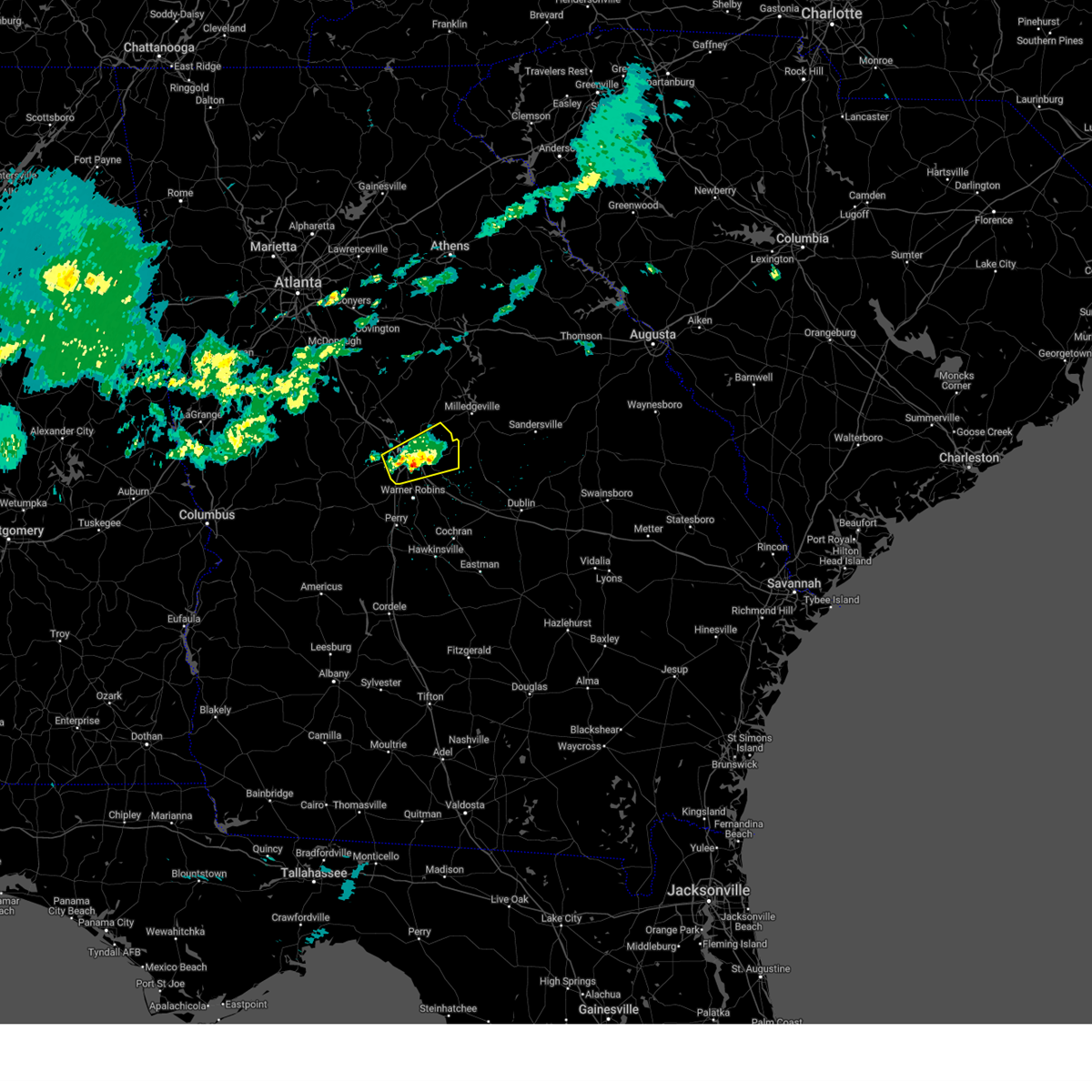
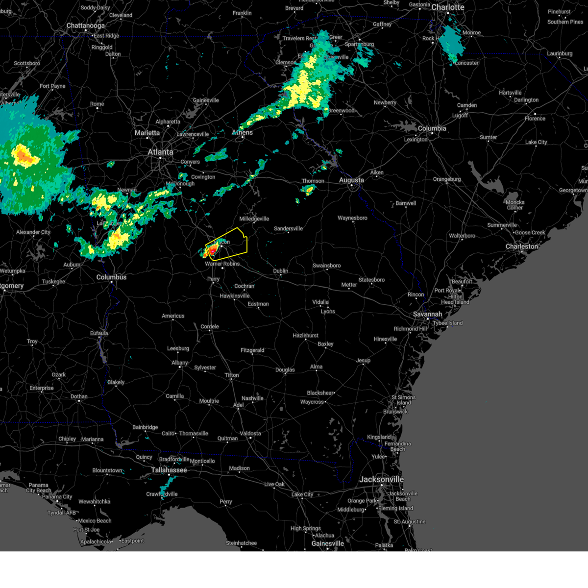
The Top Recent Hail Date for Payne, GA is Thursday, April 10, 2025 (1st out of 49)

Hail and Wind Damage Spotted near Payne, GA
| Date / Time | Report Details |
|---|---|
| 5/18/2025 11:03 AM EDT |
 The storms which prompted the warning have moved out of the area. therefore, the warning has been allowed to expire. a severe thunderstorm watch remains in effect until 100 pm edt for central and west central georgia. The storms which prompted the warning have moved out of the area. therefore, the warning has been allowed to expire. a severe thunderstorm watch remains in effect until 100 pm edt for central and west central georgia.
|
| 5/18/2025 10:47 AM EDT |
 the severe thunderstorm warning has been cancelled and is no longer in effect the severe thunderstorm warning has been cancelled and is no longer in effect
|
| 5/18/2025 10:47 AM EDT |
 At 1047 am edt, severe thunderstorms were located along a line extending from near lake tobesofkee to near skipperton to near saint louis to near garden valley to buena vista, moving east at 55 mph (radar indicated). Hazards include 60 mph wind gusts and quarter size hail. Hail damage to vehicles is expected. expect wind damage to roofs, siding, and trees. Locations impacted include, macon, perry, fort valley, buena vista, butler, ellaville, oglethorpe, cusseta, warner robins, centerville, byron, montezuma, marshallville, reynolds, ideal, payne, robins afb, payne city, north fort benning, and fort benning/lawson army air fld. At 1047 am edt, severe thunderstorms were located along a line extending from near lake tobesofkee to near skipperton to near saint louis to near garden valley to buena vista, moving east at 55 mph (radar indicated). Hazards include 60 mph wind gusts and quarter size hail. Hail damage to vehicles is expected. expect wind damage to roofs, siding, and trees. Locations impacted include, macon, perry, fort valley, buena vista, butler, ellaville, oglethorpe, cusseta, warner robins, centerville, byron, montezuma, marshallville, reynolds, ideal, payne, robins afb, payne city, north fort benning, and fort benning/lawson army air fld.
|
| 5/18/2025 10:11 AM EDT |
 Svrffc the national weather service in peachtree city has issued a * severe thunderstorm warning for, marion county in west central georgia, bibb county in central georgia, southeastern pike county in west central georgia, muscogee county in west central georgia, monroe county in central georgia, chattahoochee county in west central georgia, northern stewart county in west central georgia, eastern upson county in west central georgia, houston county in central georgia, central jones county in central georgia, southeastern harris county in west central georgia, macon county in west central georgia, western twiggs county in central georgia, northwestern webster county in west central georgia, peach county in central georgia, crawford county in central georgia, schley county in west central georgia, southern talbot county in west central georgia, taylor county in west central georgia, lamar county in west central georgia, * until 1100 am edt. * at 1011 am edt, severe thunderstorms were located along a line extending from piedmont to logtown to near howard to juniper to benning park, moving east at 55 mph (radar indicated). Hazards include 60 mph wind gusts and quarter size hail. Hail damage to vehicles is expected. Expect wind damage to roofs, siding, and trees. Svrffc the national weather service in peachtree city has issued a * severe thunderstorm warning for, marion county in west central georgia, bibb county in central georgia, southeastern pike county in west central georgia, muscogee county in west central georgia, monroe county in central georgia, chattahoochee county in west central georgia, northern stewart county in west central georgia, eastern upson county in west central georgia, houston county in central georgia, central jones county in central georgia, southeastern harris county in west central georgia, macon county in west central georgia, western twiggs county in central georgia, northwestern webster county in west central georgia, peach county in central georgia, crawford county in central georgia, schley county in west central georgia, southern talbot county in west central georgia, taylor county in west central georgia, lamar county in west central georgia, * until 1100 am edt. * at 1011 am edt, severe thunderstorms were located along a line extending from piedmont to logtown to near howard to juniper to benning park, moving east at 55 mph (radar indicated). Hazards include 60 mph wind gusts and quarter size hail. Hail damage to vehicles is expected. Expect wind damage to roofs, siding, and trees.
|
| 4/22/2025 6:33 PM EDT |
 the severe thunderstorm warning has been cancelled and is no longer in effect the severe thunderstorm warning has been cancelled and is no longer in effect
|
| 4/22/2025 6:00 PM EDT |
 Svrffc the national weather service in peachtree city has issued a * severe thunderstorm warning for, west central wilkinson county in central georgia, bibb county in central georgia, northwestern twiggs county in central georgia, southeastern jones county in central georgia, * until 645 pm edt. * at 559 pm edt, a severe thunderstorm was located near skipperton, or near macon, moving east at 20 mph (radar indicated). Hazards include quarter size hail. damage to vehicles is expected Svrffc the national weather service in peachtree city has issued a * severe thunderstorm warning for, west central wilkinson county in central georgia, bibb county in central georgia, northwestern twiggs county in central georgia, southeastern jones county in central georgia, * until 645 pm edt. * at 559 pm edt, a severe thunderstorm was located near skipperton, or near macon, moving east at 20 mph (radar indicated). Hazards include quarter size hail. damage to vehicles is expected
|
| 4/10/2025 11:00 PM EDT |
 At 1100 pm edt, severe thunderstorms were located along a line extending from near greenberry crossroads to dry branch to near centerville, moving southeast at 55 mph (radar indicated). Hazards include 60 mph wind gusts and quarter size hail. Hail damage to vehicles is expected. expect wind damage to roofs, siding, and trees. Locations impacted include, jeffersonville, postell, robins air force base, mountain springs, griswoldville, district path, wesleyan, powerville, skipperton, browns crossing, warner robins, kathleen, byron, gordon, gray, ivey, james, macon, jack brown estates, and coopers. At 1100 pm edt, severe thunderstorms were located along a line extending from near greenberry crossroads to dry branch to near centerville, moving southeast at 55 mph (radar indicated). Hazards include 60 mph wind gusts and quarter size hail. Hail damage to vehicles is expected. expect wind damage to roofs, siding, and trees. Locations impacted include, jeffersonville, postell, robins air force base, mountain springs, griswoldville, district path, wesleyan, powerville, skipperton, browns crossing, warner robins, kathleen, byron, gordon, gray, ivey, james, macon, jack brown estates, and coopers.
|
| 4/10/2025 11:00 PM EDT |
 the severe thunderstorm warning has been cancelled and is no longer in effect the severe thunderstorm warning has been cancelled and is no longer in effect
|
| 4/10/2025 10:29 PM EDT |
 Svrffc the national weather service in peachtree city has issued a * severe thunderstorm warning for, western wilkinson county in central georgia, southern baldwin county in central georgia, bibb county in central georgia, twiggs county in central georgia, monroe county in central georgia, east central upson county in west central georgia, northeastern peach county in central georgia, northeastern houston county in central georgia, northern crawford county in central georgia, jones county in central georgia, southwestern jasper county in central georgia, * until 1115 pm edt. * at 1028 pm edt, severe thunderstorms were located along a line extending from near juliette to near forsyth to near culloden, moving southeast at 55 mph (radar indicated). Hazards include 60 mph wind gusts and quarter size hail. Hail damage to vehicles is expected. Expect wind damage to roofs, siding, and trees. Svrffc the national weather service in peachtree city has issued a * severe thunderstorm warning for, western wilkinson county in central georgia, southern baldwin county in central georgia, bibb county in central georgia, twiggs county in central georgia, monroe county in central georgia, east central upson county in west central georgia, northeastern peach county in central georgia, northeastern houston county in central georgia, northern crawford county in central georgia, jones county in central georgia, southwestern jasper county in central georgia, * until 1115 pm edt. * at 1028 pm edt, severe thunderstorms were located along a line extending from near juliette to near forsyth to near culloden, moving southeast at 55 mph (radar indicated). Hazards include 60 mph wind gusts and quarter size hail. Hail damage to vehicles is expected. Expect wind damage to roofs, siding, and trees.
|
| 4/6/2025 5:45 PM EDT |
 Svrffc the national weather service in peachtree city has issued a * severe thunderstorm warning for, northwestern wilkinson county in central georgia, southwestern baldwin county in central georgia, eastern bibb county in central georgia, twiggs county in central georgia, northeastern peach county in central georgia, northeastern houston county in central georgia, southeastern jones county in central georgia, * until 630 pm edt. * at 544 pm edt, severe thunderstorms were located along a line extending from near arkwright to near miami valley, moving east at 25 mph (radar indicated). Hazards include 60 mph wind gusts and nickel size hail. expect damage to roofs, siding, and trees Svrffc the national weather service in peachtree city has issued a * severe thunderstorm warning for, northwestern wilkinson county in central georgia, southwestern baldwin county in central georgia, eastern bibb county in central georgia, twiggs county in central georgia, northeastern peach county in central georgia, northeastern houston county in central georgia, southeastern jones county in central georgia, * until 630 pm edt. * at 544 pm edt, severe thunderstorms were located along a line extending from near arkwright to near miami valley, moving east at 25 mph (radar indicated). Hazards include 60 mph wind gusts and nickel size hail. expect damage to roofs, siding, and trees
|
| 4/6/2025 5:31 PM EDT |
 The storm which prompted the warning has moved out of the area. therefore, the warning has been allowed to expire. a tornado watch remains in effect until 700 pm edt for central and west central georgia. remember, a severe thunderstorm warning still remains in effect for bibb and jones county. The storm which prompted the warning has moved out of the area. therefore, the warning has been allowed to expire. a tornado watch remains in effect until 700 pm edt for central and west central georgia. remember, a severe thunderstorm warning still remains in effect for bibb and jones county.
|
| 4/6/2025 5:30 PM EDT |
 Svrffc the national weather service in peachtree city has issued a * severe thunderstorm warning for, northern bibb county in central georgia, southeastern jones county in central georgia, * until 545 pm edt. * at 529 pm edt, a severe thunderstorm was located over lizella, or 8 miles west of macon, moving east at 40 mph (radar indicated). Hazards include 60 mph wind gusts and nickel size hail. expect damage to roofs, siding, and trees Svrffc the national weather service in peachtree city has issued a * severe thunderstorm warning for, northern bibb county in central georgia, southeastern jones county in central georgia, * until 545 pm edt. * at 529 pm edt, a severe thunderstorm was located over lizella, or 8 miles west of macon, moving east at 40 mph (radar indicated). Hazards include 60 mph wind gusts and nickel size hail. expect damage to roofs, siding, and trees
|
| 4/6/2025 4:47 PM EDT |
 Svrffc the national weather service in peachtree city has issued a * severe thunderstorm warning for, northern bibb county in central georgia, monroe county in central georgia, east central upson county in west central georgia, northwestern crawford county in central georgia, jones county in central georgia, southeastern lamar county in west central georgia, * until 530 pm edt. * at 447 pm edt, a severe thunderstorm was located over salem, or 8 miles west of roberta, moving northeast at 55 mph (emergency management). Hazards include 60 mph wind gusts and quarter size hail. Hail damage to vehicles is expected. Expect wind damage to roofs, siding, and trees. Svrffc the national weather service in peachtree city has issued a * severe thunderstorm warning for, northern bibb county in central georgia, monroe county in central georgia, east central upson county in west central georgia, northwestern crawford county in central georgia, jones county in central georgia, southeastern lamar county in west central georgia, * until 530 pm edt. * at 447 pm edt, a severe thunderstorm was located over salem, or 8 miles west of roberta, moving northeast at 55 mph (emergency management). Hazards include 60 mph wind gusts and quarter size hail. Hail damage to vehicles is expected. Expect wind damage to roofs, siding, and trees.
|
| 3/31/2025 2:05 PM EDT |
 Svrffc the national weather service in peachtree city has issued a * severe thunderstorm warning for, western wilkinson county in central georgia, bibb county in central georgia, twiggs county in central georgia, northwestern bleckley county in central georgia, peach county in central georgia, northern houston county in central georgia, east central crawford county in central georgia, southeastern jones county in central georgia, * until 245 pm edt. * at 205 pm edt, severe thunderstorms were located along a line extending from near lake tobesofkee to byron to saint louis, moving east at 50 mph (radar indicated). Hazards include 60 mph wind gusts. expect damage to roofs, siding, and trees Svrffc the national weather service in peachtree city has issued a * severe thunderstorm warning for, western wilkinson county in central georgia, bibb county in central georgia, twiggs county in central georgia, northwestern bleckley county in central georgia, peach county in central georgia, northern houston county in central georgia, east central crawford county in central georgia, southeastern jones county in central georgia, * until 245 pm edt. * at 205 pm edt, severe thunderstorms were located along a line extending from near lake tobesofkee to byron to saint louis, moving east at 50 mph (radar indicated). Hazards include 60 mph wind gusts. expect damage to roofs, siding, and trees
|
| 3/16/2025 3:13 AM EDT |
 Svrffc the national weather service in peachtree city has issued a * severe thunderstorm warning for, bibb county in central georgia, southeastern monroe county in central georgia, central houston county in central georgia, jones county in central georgia, sumter county in west central georgia, macon county in west central georgia, western baldwin county in central georgia, northwestern twiggs county in central georgia, southern webster county in west central georgia, peach county in central georgia, crawford county in central georgia, schley county in west central georgia, southeastern taylor county in west central georgia, * until 400 am edt. * at 312 am edt, severe thunderstorms were located along a line extending from plant scherer to near lizella to leveretts, moving east at 35 mph (radar indicated). Hazards include 60 mph wind gusts. expect damage to roofs, siding, and trees Svrffc the national weather service in peachtree city has issued a * severe thunderstorm warning for, bibb county in central georgia, southeastern monroe county in central georgia, central houston county in central georgia, jones county in central georgia, sumter county in west central georgia, macon county in west central georgia, western baldwin county in central georgia, northwestern twiggs county in central georgia, southern webster county in west central georgia, peach county in central georgia, crawford county in central georgia, schley county in west central georgia, southeastern taylor county in west central georgia, * until 400 am edt. * at 312 am edt, severe thunderstorms were located along a line extending from plant scherer to near lizella to leveretts, moving east at 35 mph (radar indicated). Hazards include 60 mph wind gusts. expect damage to roofs, siding, and trees
|
| 2/16/2025 5:59 AM EST |
 Svrffc the national weather service in peachtree city has issued a * severe thunderstorm warning for, northern laurens county in central georgia, central bibb county in central georgia, hancock county in east central georgia, glascock county in east central georgia, northeastern houston county in central georgia, eastern jones county in central georgia, northwestern jefferson county in east central georgia, wilkinson county in central georgia, baldwin county in central georgia, southern warren county in east central georgia, twiggs county in central georgia, southeastern putnam county in central georgia, northeastern bleckley county in central georgia, northeastern peach county in central georgia, washington county in east central georgia, northwestern johnson county in east central georgia, * until 700 am est. * at 558 am est, severe thunderstorms were located along a line extending from near rockville to near james to jack brown estates, moving east at 55 mph (radar indicated). Hazards include 60 mph wind gusts. expect damage to roofs, siding, and trees Svrffc the national weather service in peachtree city has issued a * severe thunderstorm warning for, northern laurens county in central georgia, central bibb county in central georgia, hancock county in east central georgia, glascock county in east central georgia, northeastern houston county in central georgia, eastern jones county in central georgia, northwestern jefferson county in east central georgia, wilkinson county in central georgia, baldwin county in central georgia, southern warren county in east central georgia, twiggs county in central georgia, southeastern putnam county in central georgia, northeastern bleckley county in central georgia, northeastern peach county in central georgia, washington county in east central georgia, northwestern johnson county in east central georgia, * until 700 am est. * at 558 am est, severe thunderstorms were located along a line extending from near rockville to near james to jack brown estates, moving east at 55 mph (radar indicated). Hazards include 60 mph wind gusts. expect damage to roofs, siding, and trees
|
| 2/16/2025 5:39 AM EST |
 Torffc the national weather service in peachtree city has issued a * tornado warning for, northwestern wilkinson county in central georgia, southwestern baldwin county in central georgia, northern bibb county in central georgia, north central twiggs county in central georgia, southeastern monroe county in central georgia, southern jones county in central georgia, * until 630 am est. * at 539 am est, a severe thunderstorm capable of producing a tornado was located near bolingbroke, or 9 miles south of forsyth, moving east at 55 mph (radar indicated rotation). Hazards include tornado. Flying debris will be dangerous to those caught without shelter. mobile homes will be damaged or destroyed. damage to roofs, windows, and vehicles will occur. Tree damage is likely. Torffc the national weather service in peachtree city has issued a * tornado warning for, northwestern wilkinson county in central georgia, southwestern baldwin county in central georgia, northern bibb county in central georgia, north central twiggs county in central georgia, southeastern monroe county in central georgia, southern jones county in central georgia, * until 630 am est. * at 539 am est, a severe thunderstorm capable of producing a tornado was located near bolingbroke, or 9 miles south of forsyth, moving east at 55 mph (radar indicated rotation). Hazards include tornado. Flying debris will be dangerous to those caught without shelter. mobile homes will be damaged or destroyed. damage to roofs, windows, and vehicles will occur. Tree damage is likely.
|
| 2/16/2025 5:37 AM EST |
 At 537 am est, severe thunderstorms were located along a line extending from calvin to near adgateville to plant scherer to near russellville, moving east at 55 mph (radar indicated). Hazards include 70 mph wind gusts. Expect considerable tree damage. damage is likely to mobile homes, roofs, and outbuildings. Locations impacted include, macon, eatonton, forsyth, gray, monticello, shady dale, payne, culloden, payne city, postell, lake tobesofkee, bradley, wayside, resseaus crossroads, round oak, russellville, central georgia experiment stn, plant harlee branch, wesleyan, and skipperton. At 537 am est, severe thunderstorms were located along a line extending from calvin to near adgateville to plant scherer to near russellville, moving east at 55 mph (radar indicated). Hazards include 70 mph wind gusts. Expect considerable tree damage. damage is likely to mobile homes, roofs, and outbuildings. Locations impacted include, macon, eatonton, forsyth, gray, monticello, shady dale, payne, culloden, payne city, postell, lake tobesofkee, bradley, wayside, resseaus crossroads, round oak, russellville, central georgia experiment stn, plant harlee branch, wesleyan, and skipperton.
|
| 2/16/2025 5:37 AM EST |
 the severe thunderstorm warning has been cancelled and is no longer in effect the severe thunderstorm warning has been cancelled and is no longer in effect
|
| 2/16/2025 5:05 AM EST | Svrffc the national weather service in peachtree city has issued a * severe thunderstorm warning for, eastern spalding county in west central georgia, bibb county in central georgia, southeastern pike county in west central georgia, monroe county in central georgia, upson county in west central georgia, butts county in central georgia, jones county in central georgia, south central newton county in north central georgia, northwestern baldwin county in central georgia, putnam county in central georgia, southeastern henry county in north central georgia, northern crawford county in central georgia, jasper county in central georgia, lamar county in west central georgia, * until 600 am est. * at 505 am est, severe thunderstorms were located along a line extending from blacksville to walker mill to near milner to sprewell bluff state park, moving east at 55 mph (radar indicated). Hazards include 70 mph wind gusts. Expect considerable tree damage. Damage is likely to mobile homes, roofs, and outbuildings. |
| 12/29/2024 5:31 AM EST |
 the severe thunderstorm warning has been cancelled and is no longer in effect the severe thunderstorm warning has been cancelled and is no longer in effect
|
| 12/29/2024 5:31 AM EST |
 At 530 am est, severe thunderstorms were located along a line extending from near rutledge to clinton to near lakewood, moving east at 55 mph (radar indicated). Hazards include 60 mph wind gusts. Expect damage to roofs, siding, and trees. Locations impacted include, macon, milledgeville, eatonton, madison, gray, monticello, jeffersonville, warner robins, centerville, byron, gordon, ivey, shady dale, payne, buckhead, robins afb, payne city, phoenix, meriwether, and marion. At 530 am est, severe thunderstorms were located along a line extending from near rutledge to clinton to near lakewood, moving east at 55 mph (radar indicated). Hazards include 60 mph wind gusts. Expect damage to roofs, siding, and trees. Locations impacted include, macon, milledgeville, eatonton, madison, gray, monticello, jeffersonville, warner robins, centerville, byron, gordon, ivey, shady dale, payne, buckhead, robins afb, payne city, phoenix, meriwether, and marion.
|
| 12/29/2024 5:18 AM EST |
 the severe thunderstorm warning has been cancelled and is no longer in effect the severe thunderstorm warning has been cancelled and is no longer in effect
|
| 12/29/2024 5:18 AM EST |
 At 518 am est, severe thunderstorms were located along a line extending from conyers to calvin to near monticello to near jarrell plantation to fort valley, moving northeast at 75 mph (radar indicated). Hazards include 60 mph wind gusts. Expect damage to roofs, siding, and trees. Locations impacted include, macon, milledgeville, conyers, monroe, covington, fort valley, eatonton, madison, gray, monticello, jeffersonville, warner robins, centerville, byron, social circle, oxford, gordon, porterdale, walnut grove, and ivey. At 518 am est, severe thunderstorms were located along a line extending from conyers to calvin to near monticello to near jarrell plantation to fort valley, moving northeast at 75 mph (radar indicated). Hazards include 60 mph wind gusts. Expect damage to roofs, siding, and trees. Locations impacted include, macon, milledgeville, conyers, monroe, covington, fort valley, eatonton, madison, gray, monticello, jeffersonville, warner robins, centerville, byron, social circle, oxford, gordon, porterdale, walnut grove, and ivey.
|
| 12/29/2024 4:53 AM EST |
 Svrffc the national weather service in peachtree city has issued a * severe thunderstorm warning for, bibb county in central georgia, monroe county in central georgia, northeastern houston county in central georgia, butts county in central georgia, jones county in central georgia, newton county in north central georgia, rockdale county in north central georgia, northwestern wilkinson county in central georgia, western baldwin county in central georgia, morgan county in north central georgia, twiggs county in central georgia, putnam county in central georgia, henry county in north central georgia, walton county in north central georgia, peach county in central georgia, crawford county in central georgia, jasper county in central georgia, northeastern taylor county in west central georgia, northeastern lamar county in west central georgia, * until 600 am est. * at 452 am est, severe thunderstorms were located along a line extending from stockbridge to high falls state park to brent to near reynolds, moving east at 50 mph (radar indicated). Hazards include 60 mph wind gusts. expect damage to roofs, siding, and trees Svrffc the national weather service in peachtree city has issued a * severe thunderstorm warning for, bibb county in central georgia, monroe county in central georgia, northeastern houston county in central georgia, butts county in central georgia, jones county in central georgia, newton county in north central georgia, rockdale county in north central georgia, northwestern wilkinson county in central georgia, western baldwin county in central georgia, morgan county in north central georgia, twiggs county in central georgia, putnam county in central georgia, henry county in north central georgia, walton county in north central georgia, peach county in central georgia, crawford county in central georgia, jasper county in central georgia, northeastern taylor county in west central georgia, northeastern lamar county in west central georgia, * until 600 am est. * at 452 am est, severe thunderstorms were located along a line extending from stockbridge to high falls state park to brent to near reynolds, moving east at 50 mph (radar indicated). Hazards include 60 mph wind gusts. expect damage to roofs, siding, and trees
|
| 8/29/2024 6:58 PM EDT | the severe thunderstorm warning has been cancelled and is no longer in effect |
| 8/29/2024 6:40 PM EDT |
 Svrffc the national weather service in peachtree city has issued a * severe thunderstorm warning for, northeastern bibb county in central georgia, south central jones county in central georgia, * until 730 pm edt. * at 640 pm edt, a severe thunderstorm was located over cross keys, or near macon, moving west at 10 mph (radar indicated). Hazards include 60 mph wind gusts. expect damage to roofs, siding, and trees Svrffc the national weather service in peachtree city has issued a * severe thunderstorm warning for, northeastern bibb county in central georgia, south central jones county in central georgia, * until 730 pm edt. * at 640 pm edt, a severe thunderstorm was located over cross keys, or near macon, moving west at 10 mph (radar indicated). Hazards include 60 mph wind gusts. expect damage to roofs, siding, and trees
|
| 8/18/2024 7:01 PM EDT |
 Svrffc the national weather service in peachtree city has issued a * severe thunderstorm warning for, central bibb county in central georgia, twiggs county in central georgia, northeastern houston county in central georgia, * until 745 pm edt. * at 700 pm edt, a severe thunderstorm was located near payne city, or just southwest of downtown macon, moving southeast at 35 mph (radar indicated). Hazards include 60 mph wind gusts and penny size hail. expect damage to roofs, siding, and trees Svrffc the national weather service in peachtree city has issued a * severe thunderstorm warning for, central bibb county in central georgia, twiggs county in central georgia, northeastern houston county in central georgia, * until 745 pm edt. * at 700 pm edt, a severe thunderstorm was located near payne city, or just southwest of downtown macon, moving southeast at 35 mph (radar indicated). Hazards include 60 mph wind gusts and penny size hail. expect damage to roofs, siding, and trees
|
| 7/17/2024 5:17 PM EDT | Svrffc the national weather service in peachtree city has issued a * severe thunderstorm warning for, northwestern wilkinson county in central georgia, southwestern baldwin county in central georgia, northeastern bibb county in central georgia, north central twiggs county in central georgia, jones county in central georgia, * until 545 pm edt. * at 517 pm edt, a severe thunderstorm was located near cross keys, or near macon, moving east at 20 mph (radar indicated). Hazards include 60 mph wind gusts and penny size hail. expect damage to roofs, siding, and trees |
| 5/27/2024 2:01 PM EDT |
 Svrffc the national weather service in peachtree city has issued a * severe thunderstorm warning for, central wilkinson county in central georgia, bibb county in central georgia, twiggs county in central georgia, northeastern peach county in central georgia, northeastern houston county in central georgia, northeastern crawford county in central georgia, * until 245 pm edt. * at 200 pm edt, a severe thunderstorm was located near lizella, or 11 miles southwest of macon, moving east at 50 mph (radar indicated). Hazards include 60 mph wind gusts and quarter size hail. Hail damage to vehicles is expected. Expect wind damage to roofs, siding, and trees. Svrffc the national weather service in peachtree city has issued a * severe thunderstorm warning for, central wilkinson county in central georgia, bibb county in central georgia, twiggs county in central georgia, northeastern peach county in central georgia, northeastern houston county in central georgia, northeastern crawford county in central georgia, * until 245 pm edt. * at 200 pm edt, a severe thunderstorm was located near lizella, or 11 miles southwest of macon, moving east at 50 mph (radar indicated). Hazards include 60 mph wind gusts and quarter size hail. Hail damage to vehicles is expected. Expect wind damage to roofs, siding, and trees.
|
| 5/27/2024 1:51 PM EDT |
 At 150 pm edt, severe thunderstorms were located along a line extending from near forsyth to near lizella to knoxville, moving east at 50 mph (radar indicated). Hazards include 60 mph wind gusts and quarter size hail. Hail damage to vehicles is expected. expect wind damage to roofs, siding, and trees. Locations impacted include, macon, forsyth, roberta, payne, culloden, payne city, lake tobesofkee, bolingbroke, wayside, jack brown estates, dames ferry, russellville, brent, musella, jarrell plantation, knoxville, wesleyan, lizella, arkwright, and sandy point. At 150 pm edt, severe thunderstorms were located along a line extending from near forsyth to near lizella to knoxville, moving east at 50 mph (radar indicated). Hazards include 60 mph wind gusts and quarter size hail. Hail damage to vehicles is expected. expect wind damage to roofs, siding, and trees. Locations impacted include, macon, forsyth, roberta, payne, culloden, payne city, lake tobesofkee, bolingbroke, wayside, jack brown estates, dames ferry, russellville, brent, musella, jarrell plantation, knoxville, wesleyan, lizella, arkwright, and sandy point.
|
| 5/27/2024 1:51 PM EDT |
 the severe thunderstorm warning has been cancelled and is no longer in effect the severe thunderstorm warning has been cancelled and is no longer in effect
|
| 5/27/2024 1:36 PM EDT |
 Svrffc the national weather service in peachtree city has issued a * severe thunderstorm warning for, bibb county in central georgia, monroe county in central georgia, crawford county in central georgia, southwestern jones county in central georgia, northeastern taylor county in west central georgia, * until 200 pm edt. * at 136 pm edt, severe thunderstorms were located along a line extending from near brent to musella to near fickling mill, moving east at 50 mph (radar indicated). Hazards include 60 mph wind gusts and quarter size hail. Hail damage to vehicles is expected. Expect wind damage to roofs, siding, and trees. Svrffc the national weather service in peachtree city has issued a * severe thunderstorm warning for, bibb county in central georgia, monroe county in central georgia, crawford county in central georgia, southwestern jones county in central georgia, northeastern taylor county in west central georgia, * until 200 pm edt. * at 136 pm edt, severe thunderstorms were located along a line extending from near brent to musella to near fickling mill, moving east at 50 mph (radar indicated). Hazards include 60 mph wind gusts and quarter size hail. Hail damage to vehicles is expected. Expect wind damage to roofs, siding, and trees.
|
| 5/25/2024 1:47 PM EDT |
 At 147 pm edt, a severe thunderstorm was located over griswoldville, or 11 miles southeast of gray, moving east at 35 mph (radar indicated). Hazards include 60 mph wind gusts and quarter size hail. Hail damage to vehicles is expected. expect wind damage to roofs, siding, and trees. Locations impacted include, macon, gray, jeffersonville, irwinton, gordon, ivey, mcintyre, payne, payne city, postell, james, mountain springs, griswoldville, fitzpatrick, greenberry crossroads, clinton, ripley, cross keys, wesleyan, and dry branch. At 147 pm edt, a severe thunderstorm was located over griswoldville, or 11 miles southeast of gray, moving east at 35 mph (radar indicated). Hazards include 60 mph wind gusts and quarter size hail. Hail damage to vehicles is expected. expect wind damage to roofs, siding, and trees. Locations impacted include, macon, gray, jeffersonville, irwinton, gordon, ivey, mcintyre, payne, payne city, postell, james, mountain springs, griswoldville, fitzpatrick, greenberry crossroads, clinton, ripley, cross keys, wesleyan, and dry branch.
|
| 5/25/2024 1:47 PM EDT |
 the severe thunderstorm warning has been cancelled and is no longer in effect the severe thunderstorm warning has been cancelled and is no longer in effect
|
| 5/25/2024 1:16 PM EDT |
 Svrffc the national weather service in peachtree city has issued a * severe thunderstorm warning for, western wilkinson county in central georgia, southwestern baldwin county in central georgia, central bibb county in central georgia, northern twiggs county in central georgia, southeastern monroe county in central georgia, southern jones county in central georgia, * until 200 pm edt. * at 115 pm edt, a severe thunderstorm was located over bolingbroke, or 9 miles northwest of macon, moving east at 35 mph (radar indicated). Hazards include 60 mph wind gusts and penny size hail. expect damage to roofs, siding, and trees Svrffc the national weather service in peachtree city has issued a * severe thunderstorm warning for, western wilkinson county in central georgia, southwestern baldwin county in central georgia, central bibb county in central georgia, northern twiggs county in central georgia, southeastern monroe county in central georgia, southern jones county in central georgia, * until 200 pm edt. * at 115 pm edt, a severe thunderstorm was located over bolingbroke, or 9 miles northwest of macon, moving east at 35 mph (radar indicated). Hazards include 60 mph wind gusts and penny size hail. expect damage to roofs, siding, and trees
|
| 4/20/2024 6:51 PM EDT |
 the severe thunderstorm warning has been cancelled and is no longer in effect the severe thunderstorm warning has been cancelled and is no longer in effect
|
| 4/20/2024 6:51 PM EDT |
 At 650 pm edt, severe thunderstorms were located along a line extending from macon to skipperton, moving east at 15 mph (radar indicated). Hazards include 60 mph wind gusts and quarter size hail. Hail damage to vehicles is expected. expect wind damage to roofs, siding, and trees. Locations impacted include, macon, payne, payne city, postell, lake tobesofkee, rutland, griswoldville, huber, cross keys, wesleyan, dry branch, lizella, skipperton, franklinton, middle georgia regional airport, and elberta. At 650 pm edt, severe thunderstorms were located along a line extending from macon to skipperton, moving east at 15 mph (radar indicated). Hazards include 60 mph wind gusts and quarter size hail. Hail damage to vehicles is expected. expect wind damage to roofs, siding, and trees. Locations impacted include, macon, payne, payne city, postell, lake tobesofkee, rutland, griswoldville, huber, cross keys, wesleyan, dry branch, lizella, skipperton, franklinton, middle georgia regional airport, and elberta.
|
| 4/20/2024 6:32 PM EDT |
 Svrffc the national weather service in peachtree city has issued a * severe thunderstorm warning for, bibb county in central georgia, northwestern twiggs county in central georgia, northeastern peach county in central georgia, north central houston county in central georgia, northeastern crawford county in central georgia, south central jones county in central georgia, * until 715 pm edt. * at 632 pm edt, severe thunderstorms were located along a line extending from near payne city to near jack brown estates, moving east at 15 mph (radar indicated). Hazards include 60 mph wind gusts and quarter size hail. Hail damage to vehicles is expected. Expect wind damage to roofs, siding, and trees. Svrffc the national weather service in peachtree city has issued a * severe thunderstorm warning for, bibb county in central georgia, northwestern twiggs county in central georgia, northeastern peach county in central georgia, north central houston county in central georgia, northeastern crawford county in central georgia, south central jones county in central georgia, * until 715 pm edt. * at 632 pm edt, severe thunderstorms were located along a line extending from near payne city to near jack brown estates, moving east at 15 mph (radar indicated). Hazards include 60 mph wind gusts and quarter size hail. Hail damage to vehicles is expected. Expect wind damage to roofs, siding, and trees.
|
| 9/7/2023 5:20 PM EDT |
 At 520 pm edt, a severe thunderstorm was located over cross keys, or near macon, moving southeast at 25 mph (radar indicated). Hazards include 60 mph wind gusts and quarter size hail. Hail damage to vehicles is expected. Expect wind damage to roofs, siding, and trees. At 520 pm edt, a severe thunderstorm was located over cross keys, or near macon, moving southeast at 25 mph (radar indicated). Hazards include 60 mph wind gusts and quarter size hail. Hail damage to vehicles is expected. Expect wind damage to roofs, siding, and trees.
|
| 8/15/2023 5:05 PM EDT |
 At 505 pm edt, a severe thunderstorm was located over macon, moving east at 15 mph (radar indicated). Hazards include 60 mph wind gusts and quarter size hail. Hail damage to vehicles is expected. Expect wind damage to roofs, siding, and trees. At 505 pm edt, a severe thunderstorm was located over macon, moving east at 15 mph (radar indicated). Hazards include 60 mph wind gusts and quarter size hail. Hail damage to vehicles is expected. Expect wind damage to roofs, siding, and trees.
|
| 8/7/2023 7:43 PM EDT |
 The severe thunderstorm warning for northeastern bibb and south central jones counties will expire at 745 pm edt, the storm which prompted the warning has moved out of the area. therefore, the warning will be allowed to expire. a severe thunderstorm watch remains in effect until midnight edt for central georgia. The severe thunderstorm warning for northeastern bibb and south central jones counties will expire at 745 pm edt, the storm which prompted the warning has moved out of the area. therefore, the warning will be allowed to expire. a severe thunderstorm watch remains in effect until midnight edt for central georgia.
|
| 8/7/2023 7:33 PM EDT |
 At 733 pm edt, a severe thunderstorm was located over greenberry crossroads, or 8 miles southeast of gray, moving east at 40 mph (radar indicated). Hazards include 60 mph wind gusts. Expect damage to roofs, siding, and trees. locations impacted include, macon, payne, payne city, cross keys, and postell. hail threat, radar indicated max hail size, <. 75 in wind threat, radar indicated max wind gust, 60 mph. At 733 pm edt, a severe thunderstorm was located over greenberry crossroads, or 8 miles southeast of gray, moving east at 40 mph (radar indicated). Hazards include 60 mph wind gusts. Expect damage to roofs, siding, and trees. locations impacted include, macon, payne, payne city, cross keys, and postell. hail threat, radar indicated max hail size, <. 75 in wind threat, radar indicated max wind gust, 60 mph.
|
| 8/7/2023 7:03 PM EDT |
 At 703 pm edt, a severe thunderstorm was located near lake tobesofkee, or 7 miles west of macon, moving east at 40 mph (radar indicated). Hazards include 60 mph wind gusts. expect damage to roofs, siding, and trees At 703 pm edt, a severe thunderstorm was located near lake tobesofkee, or 7 miles west of macon, moving east at 40 mph (radar indicated). Hazards include 60 mph wind gusts. expect damage to roofs, siding, and trees
|
| 8/7/2023 5:09 PM EDT |
 At 509 pm edt, a severe thunderstorm was located over macon, moving east at 25 mph (radar indicated). Hazards include 60 mph wind gusts and penny size hail. expect damage to roofs, siding, and trees At 509 pm edt, a severe thunderstorm was located over macon, moving east at 25 mph (radar indicated). Hazards include 60 mph wind gusts and penny size hail. expect damage to roofs, siding, and trees
|
| 8/3/2023 6:35 PM EDT |
 At 635 pm edt, severe thunderstorms were located along a line extending from flovilla to goggins to near crest, moving southeast at 40 mph (radar indicated). Hazards include 60 mph wind gusts. expect damage to roofs, siding, and trees At 635 pm edt, severe thunderstorms were located along a line extending from flovilla to goggins to near crest, moving southeast at 40 mph (radar indicated). Hazards include 60 mph wind gusts. expect damage to roofs, siding, and trees
|
| 6/25/2023 7:42 PM EDT |
 At 742 pm edt, severe thunderstorms were located along a line extending from crest to near russellville to wayside, moving southeast at 40 mph (radar indicated). Hazards include 60 mph wind gusts. expect damage to roofs, siding, and trees At 742 pm edt, severe thunderstorms were located along a line extending from crest to near russellville to wayside, moving southeast at 40 mph (radar indicated). Hazards include 60 mph wind gusts. expect damage to roofs, siding, and trees
|
| 6/22/2023 8:45 PM EDT |
 At 844 pm edt, a severe thunderstorm was located over cross keys, or near macon, moving northeast at 20 mph (radar indicated). Hazards include 60 mph wind gusts and quarter size hail. Hail damage to vehicles is expected. expect wind damage to roofs, siding, and trees. locations impacted include, macon, gray, payne, payne city, postell, james, mountain springs, griswoldville, greenberry crossroads, clinton, cross keys, wesleyan, arkwright and franklinton. hail threat, radar indicated max hail size, 1. 00 in wind threat, radar indicated max wind gust, 60 mph. At 844 pm edt, a severe thunderstorm was located over cross keys, or near macon, moving northeast at 20 mph (radar indicated). Hazards include 60 mph wind gusts and quarter size hail. Hail damage to vehicles is expected. expect wind damage to roofs, siding, and trees. locations impacted include, macon, gray, payne, payne city, postell, james, mountain springs, griswoldville, greenberry crossroads, clinton, cross keys, wesleyan, arkwright and franklinton. hail threat, radar indicated max hail size, 1. 00 in wind threat, radar indicated max wind gust, 60 mph.
|
| 6/22/2023 8:32 PM EDT |
 At 832 pm edt, a severe thunderstorm was located over macon, moving northeast at 20 mph (radar indicated). Hazards include 60 mph wind gusts and quarter size hail. Hail damage to vehicles is expected. Expect wind damage to roofs, siding, and trees. At 832 pm edt, a severe thunderstorm was located over macon, moving northeast at 20 mph (radar indicated). Hazards include 60 mph wind gusts and quarter size hail. Hail damage to vehicles is expected. Expect wind damage to roofs, siding, and trees.
|
| 3/27/2023 8:34 AM EDT |
 At 833 am edt, a severe thunderstorm was located over macon, moving east at 40 mph (radar indicated). Hazards include 60 mph wind gusts and quarter size hail. Hail damage to vehicles is expected. Expect wind damage to roofs, siding, and trees. At 833 am edt, a severe thunderstorm was located over macon, moving east at 40 mph (radar indicated). Hazards include 60 mph wind gusts and quarter size hail. Hail damage to vehicles is expected. Expect wind damage to roofs, siding, and trees.
|
| 3/27/2023 6:47 AM EDT |
 At 647 am edt, a severe thunderstorm was located near bolingbroke, or near forsyth, moving east at 40 mph (radar indicated). Hazards include ping pong ball size hail and 60 mph wind gusts. People and animals outdoors will be injured. expect hail damage to roofs, siding, windows, and vehicles. expect wind damage to roofs, siding, and trees. locations impacted include, macon, forsyth, gray, payne, payne city, bradley, bolingbroke, wayside, dames ferry, round oak, clinton, jarrell plantation, wesleyan, arkwright and plant scherer. hail threat, radar indicated max hail size, 1. 50 in wind threat, radar indicated max wind gust, 60 mph. At 647 am edt, a severe thunderstorm was located near bolingbroke, or near forsyth, moving east at 40 mph (radar indicated). Hazards include ping pong ball size hail and 60 mph wind gusts. People and animals outdoors will be injured. expect hail damage to roofs, siding, windows, and vehicles. expect wind damage to roofs, siding, and trees. locations impacted include, macon, forsyth, gray, payne, payne city, bradley, bolingbroke, wayside, dames ferry, round oak, clinton, jarrell plantation, wesleyan, arkwright and plant scherer. hail threat, radar indicated max hail size, 1. 50 in wind threat, radar indicated max wind gust, 60 mph.
|
| 3/27/2023 6:39 AM EDT |
 At 639 am edt, a severe thunderstorm was located over russellville, or 7 miles south of forsyth, moving east at 40 mph (radar indicated). Hazards include 60 mph wind gusts and quarter size hail. Hail damage to vehicles is expected. expect wind damage to roofs, siding, and trees. locations impacted include, macon, forsyth, gray, payne, payne city, bradley, bolingbroke, wayside, dames ferry, round oak, russellville, brent, clinton, jarrell plantation, wesleyan, arkwright, collier, juliette and plant scherer. hail threat, radar indicated max hail size, 1. 00 in wind threat, radar indicated max wind gust, 60 mph. At 639 am edt, a severe thunderstorm was located over russellville, or 7 miles south of forsyth, moving east at 40 mph (radar indicated). Hazards include 60 mph wind gusts and quarter size hail. Hail damage to vehicles is expected. expect wind damage to roofs, siding, and trees. locations impacted include, macon, forsyth, gray, payne, payne city, bradley, bolingbroke, wayside, dames ferry, round oak, russellville, brent, clinton, jarrell plantation, wesleyan, arkwright, collier, juliette and plant scherer. hail threat, radar indicated max hail size, 1. 00 in wind threat, radar indicated max wind gust, 60 mph.
|
| 3/27/2023 6:28 AM EDT |
 At 628 am edt, a severe thunderstorm was located over culloden, or 11 miles south of barnesville, moving east at 40 mph (radar indicated). Hazards include 60 mph wind gusts and quarter size hail. Hail damage to vehicles is expected. Expect wind damage to roofs, siding, and trees. At 628 am edt, a severe thunderstorm was located over culloden, or 11 miles south of barnesville, moving east at 40 mph (radar indicated). Hazards include 60 mph wind gusts and quarter size hail. Hail damage to vehicles is expected. Expect wind damage to roofs, siding, and trees.
|
| 3/27/2023 5:32 AM EDT |
 At 532 am edt, a severe thunderstorm was located near skipperton, or near macon, moving east at 40 mph (radar indicated). Hazards include 60 mph wind gusts. Expect damage to roofs, siding, and trees. locations impacted include, macon, payne, payne city, skipperton and rutland. hail threat, radar indicated max hail size, <. 75 in wind threat, radar indicated max wind gust, 60 mph. At 532 am edt, a severe thunderstorm was located near skipperton, or near macon, moving east at 40 mph (radar indicated). Hazards include 60 mph wind gusts. Expect damage to roofs, siding, and trees. locations impacted include, macon, payne, payne city, skipperton and rutland. hail threat, radar indicated max hail size, <. 75 in wind threat, radar indicated max wind gust, 60 mph.
|
| 3/27/2023 5:24 AM EDT |
 At 524 am edt, a severe thunderstorm was located over lizella, or 10 miles southwest of macon, moving east at 40 mph (radar indicated). Hazards include 60 mph wind gusts. Expect damage to roofs, siding, and trees. locations impacted include, macon, payne, payne city, lizella, jack brown estates, skipperton and rutland. hail threat, radar indicated max hail size, <. 75 in wind threat, radar indicated max wind gust, 60 mph. At 524 am edt, a severe thunderstorm was located over lizella, or 10 miles southwest of macon, moving east at 40 mph (radar indicated). Hazards include 60 mph wind gusts. Expect damage to roofs, siding, and trees. locations impacted include, macon, payne, payne city, lizella, jack brown estates, skipperton and rutland. hail threat, radar indicated max hail size, <. 75 in wind threat, radar indicated max wind gust, 60 mph.
|
| 3/27/2023 5:12 AM EDT |
 At 512 am edt, a severe thunderstorm was located over sandy point, or near roberta, moving east at 40 mph (radar indicated). Hazards include 60 mph wind gusts. expect damage to roofs, siding, and trees At 512 am edt, a severe thunderstorm was located over sandy point, or near roberta, moving east at 40 mph (radar indicated). Hazards include 60 mph wind gusts. expect damage to roofs, siding, and trees
|
| 1/12/2023 2:20 PM EST |
 At 219 pm est, a severe thunderstorm capable of producing a tornado was located over musella, or near roberta, moving northeast at 40 mph (radar indicated rotation). Hazards include tornado. Flying debris will be dangerous to those caught without shelter. mobile homes will be damaged or destroyed. damage to roofs, windows, and vehicles will occur. Tree damage is likely. At 219 pm est, a severe thunderstorm capable of producing a tornado was located over musella, or near roberta, moving northeast at 40 mph (radar indicated rotation). Hazards include tornado. Flying debris will be dangerous to those caught without shelter. mobile homes will be damaged or destroyed. damage to roofs, windows, and vehicles will occur. Tree damage is likely.
|
| 1/3/2023 6:12 PM EST |
 At 612 pm est, a severe thunderstorm was located over roberta, moving east at 25 mph (radar indicated). Hazards include 60 mph wind gusts. expect damage to roofs, siding, and trees At 612 pm est, a severe thunderstorm was located over roberta, moving east at 25 mph (radar indicated). Hazards include 60 mph wind gusts. expect damage to roofs, siding, and trees
|
| 7/3/2022 5:14 PM EDT |
 At 514 pm edt, a severe thunderstorm was located over payne, or over macon, and is nearly stationary (radar indicated). Hazards include 60 mph wind gusts and quarter size hail. Hail damage to vehicles is expected. Expect wind damage to roofs, siding, and trees. At 514 pm edt, a severe thunderstorm was located over payne, or over macon, and is nearly stationary (radar indicated). Hazards include 60 mph wind gusts and quarter size hail. Hail damage to vehicles is expected. Expect wind damage to roofs, siding, and trees.
|
| 6/24/2022 8:29 PM EDT |
 At 829 pm edt, severe thunderstorms were located along a line extending from carsonville to near unadilla, moving west at 15 mph (radar indicated). Hazards include 70 mph wind gusts and ping pong ball size hail. People and animals outdoors will be injured. expect hail damage to roofs, siding, windows, and vehicles. expect considerable tree damage. wind damage is also likely to mobile homes, roofs, and outbuildings. locations impacted include, macon, perry, fort valley, roberta, warner robins, centerville, byron, payne, robins air force base, payne city, nakomis, lake tobesofkee, houston lake, powerville, skipperton, horns, miami valley, kathleen, jack brown estates and rutland. thunderstorm damage threat, considerable hail threat, radar indicated max hail size, 1. 50 in wind threat, radar indicated max wind gust, 70 mph. At 829 pm edt, severe thunderstorms were located along a line extending from carsonville to near unadilla, moving west at 15 mph (radar indicated). Hazards include 70 mph wind gusts and ping pong ball size hail. People and animals outdoors will be injured. expect hail damage to roofs, siding, windows, and vehicles. expect considerable tree damage. wind damage is also likely to mobile homes, roofs, and outbuildings. locations impacted include, macon, perry, fort valley, roberta, warner robins, centerville, byron, payne, robins air force base, payne city, nakomis, lake tobesofkee, houston lake, powerville, skipperton, horns, miami valley, kathleen, jack brown estates and rutland. thunderstorm damage threat, considerable hail threat, radar indicated max hail size, 1. 50 in wind threat, radar indicated max wind gust, 70 mph.
|
| 6/24/2022 8:04 PM EDT |
 At 803 pm edt, severe thunderstorms were located along a line extending from near salem to browndale, moving west at 15 mph (radar indicated). Hazards include 60 mph wind gusts and quarter size hail. Hail damage to vehicles is expected. Expect wind damage to roofs, siding, and trees. At 803 pm edt, severe thunderstorms were located along a line extending from near salem to browndale, moving west at 15 mph (radar indicated). Hazards include 60 mph wind gusts and quarter size hail. Hail damage to vehicles is expected. Expect wind damage to roofs, siding, and trees.
|
| 4/5/2022 3:38 PM EDT |
 At 338 pm edt, a confirmed tornado was located near payne, or near macon, moving east at 55 mph (radar confirmed tornado). Hazards include damaging tornado. Flying debris will be dangerous to those caught without shelter. mobile homes will be damaged or destroyed. damage to roofs, windows, and vehicles will occur. tree damage is likely. Locations impacted include, macon, payne, cross keys and postell. At 338 pm edt, a confirmed tornado was located near payne, or near macon, moving east at 55 mph (radar confirmed tornado). Hazards include damaging tornado. Flying debris will be dangerous to those caught without shelter. mobile homes will be damaged or destroyed. damage to roofs, windows, and vehicles will occur. tree damage is likely. Locations impacted include, macon, payne, cross keys and postell.
|
| 4/5/2022 3:32 PM EDT |
 At 332 pm edt, a severe thunderstorm capable of producing a tornado was located over wesleyan, or 7 miles northwest of macon, moving northeast at 50 mph (radar indicated rotation). Hazards include tornado. Flying debris will be dangerous to those caught without shelter. mobile homes will be damaged or destroyed. damage to roofs, windows, and vehicles will occur. tree damage is likely. Locations impacted include, macon, payne, payne city, cross keys, wesleyan, postell and arkwright. At 332 pm edt, a severe thunderstorm capable of producing a tornado was located over wesleyan, or 7 miles northwest of macon, moving northeast at 50 mph (radar indicated rotation). Hazards include tornado. Flying debris will be dangerous to those caught without shelter. mobile homes will be damaged or destroyed. damage to roofs, windows, and vehicles will occur. tree damage is likely. Locations impacted include, macon, payne, payne city, cross keys, wesleyan, postell and arkwright.
|
| 4/5/2022 3:28 PM EDT |
 At 328 pm edt, severe thunderstorms were located along a line extending from near wayside to jack brown estates to saint louis, moving east at 30 mph (radar indicated). Hazards include 60 mph wind gusts and penny size hail. expect damage to roofs, siding, and trees At 328 pm edt, severe thunderstorms were located along a line extending from near wayside to jack brown estates to saint louis, moving east at 30 mph (radar indicated). Hazards include 60 mph wind gusts and penny size hail. expect damage to roofs, siding, and trees
|
| 4/5/2022 3:23 PM EDT |
 At 323 pm edt, a severe thunderstorm capable of producing a tornado was located over lizella, or 10 miles northeast of roberta, moving northeast at 50 mph (radar indicated rotation). Hazards include tornado. Flying debris will be dangerous to those caught without shelter. mobile homes will be damaged or destroyed. damage to roofs, windows, and vehicles will occur. Tree damage is likely. At 323 pm edt, a severe thunderstorm capable of producing a tornado was located over lizella, or 10 miles northeast of roberta, moving northeast at 50 mph (radar indicated rotation). Hazards include tornado. Flying debris will be dangerous to those caught without shelter. mobile homes will be damaged or destroyed. damage to roofs, windows, and vehicles will occur. Tree damage is likely.
|
| 8/17/2021 5:23 AM EDT |
 At 523 am edt, a severe thunderstorm capable of producing a tornado was located near skipperton and southern parts of macon, moving north at 30 mph (radar indicated rotation). Hazards include tornado. Flying debris will be dangerous to those caught without shelter. mobile homes will be damaged or destroyed. damage to roofs, windows, and vehicles will occur. tree damage is likely. Locations impacted include, macon, payne, payne city, skipperton and rutland. At 523 am edt, a severe thunderstorm capable of producing a tornado was located near skipperton and southern parts of macon, moving north at 30 mph (radar indicated rotation). Hazards include tornado. Flying debris will be dangerous to those caught without shelter. mobile homes will be damaged or destroyed. damage to roofs, windows, and vehicles will occur. tree damage is likely. Locations impacted include, macon, payne, payne city, skipperton and rutland.
|
| 8/17/2021 5:12 AM EDT |
 At 512 am edt, a severe thunderstorm capable of producing a tornado was located just north of the middle georgia regional airport, or 8 miles south of macon, moving north at 30 mph (radar indicated rotation). Hazards include tornado. Flying debris will be dangerous to those caught without shelter. mobile homes will be damaged or destroyed. damage to roofs, windows, and vehicles will occur. tree damage is likely. Locations impacted include, macon, payne, payne city, cross keys, skipperton, rutland and middle georgia regional airport. At 512 am edt, a severe thunderstorm capable of producing a tornado was located just north of the middle georgia regional airport, or 8 miles south of macon, moving north at 30 mph (radar indicated rotation). Hazards include tornado. Flying debris will be dangerous to those caught without shelter. mobile homes will be damaged or destroyed. damage to roofs, windows, and vehicles will occur. tree damage is likely. Locations impacted include, macon, payne, payne city, cross keys, skipperton, rutland and middle georgia regional airport.
|
| 8/17/2021 5:06 AM EDT |
 At 505 am edt, a severe thunderstorm capable of producing a tornado was located near middle georgia regional airport, or 11 miles south of macon, moving north at 30 mph (radar indicated rotation). Hazards include tornado. Flying debris will be dangerous to those caught without shelter. mobile homes will be damaged or destroyed. damage to roofs, windows, and vehicles will occur. Tree damage is likely. At 505 am edt, a severe thunderstorm capable of producing a tornado was located near middle georgia regional airport, or 11 miles south of macon, moving north at 30 mph (radar indicated rotation). Hazards include tornado. Flying debris will be dangerous to those caught without shelter. mobile homes will be damaged or destroyed. damage to roofs, windows, and vehicles will occur. Tree damage is likely.
|
| 5/4/2021 10:11 PM EDT |
 The severe thunderstorm warning for bibb, southeastern pike, monroe, eastern upson, houston, sumter, crisp, macon, western pulaski, dooly, peach, crawford and lamar counties will expire at 1015 pm edt, the storms which prompted the warning have weakened below severe limits, and no longer pose an immediate threat to life or property. therefore, the warning will be allowed to expire. however gusty winds and heavy rain are still possible with these thunderstorms. a severe thunderstorm watch remains in effect until 100 am edt for central and west central georgia. The severe thunderstorm warning for bibb, southeastern pike, monroe, eastern upson, houston, sumter, crisp, macon, western pulaski, dooly, peach, crawford and lamar counties will expire at 1015 pm edt, the storms which prompted the warning have weakened below severe limits, and no longer pose an immediate threat to life or property. therefore, the warning will be allowed to expire. however gusty winds and heavy rain are still possible with these thunderstorms. a severe thunderstorm watch remains in effect until 100 am edt for central and west central georgia.
|
| 5/4/2021 9:50 PM EDT |
 At 949 pm edt, severe thunderstorms were located along a line extending from meansville to near salem to montezuma to maddox, moving east at 45 mph (radar indicated). Hazards include 60 mph wind gusts and nickel size hail. expect damage to roofs, siding, and trees At 949 pm edt, severe thunderstorms were located along a line extending from meansville to near salem to montezuma to maddox, moving east at 45 mph (radar indicated). Hazards include 60 mph wind gusts and nickel size hail. expect damage to roofs, siding, and trees
|
| 8/10/2020 5:07 PM EDT |
 At 507 pm edt, a severe thunderstorm was located near cross keys, or near macon, moving southeast at 15 mph (radar indicated). Hazards include 60 mph wind gusts and nickel size hail. expect damage to roofs, siding, and trees At 507 pm edt, a severe thunderstorm was located near cross keys, or near macon, moving southeast at 15 mph (radar indicated). Hazards include 60 mph wind gusts and nickel size hail. expect damage to roofs, siding, and trees
|
| 6/22/2020 5:48 PM EDT |
 At 547 pm edt, severe thunderstorms were located along a line extending from near arkwright to huber to near meadowdale, moving east at 35 mph (radar indicated). Hazards include 60 mph wind gusts. expect damage to roofs, siding, and trees At 547 pm edt, severe thunderstorms were located along a line extending from near arkwright to huber to near meadowdale, moving east at 35 mph (radar indicated). Hazards include 60 mph wind gusts. expect damage to roofs, siding, and trees
|
| 6/22/2020 5:18 PM EDT |
 At 518 pm edt, severe thunderstorms were located along a line extending from sandy point to powerville, moving northeast at 35 mph (radar indicated). Hazards include 60 mph wind gusts. expect damage to roofs, siding, and trees At 518 pm edt, severe thunderstorms were located along a line extending from sandy point to powerville, moving northeast at 35 mph (radar indicated). Hazards include 60 mph wind gusts. expect damage to roofs, siding, and trees
|
| 4/13/2020 2:54 AM EDT |
 At 254 am edt, severe thunderstorms were located along a line extending from near mcelheneys crossroads to near bolingbroke to near lee pope, moving east at 45 mph (radar indicated). Hazards include 60 mph wind gusts. expect damage to roofs, siding, and trees At 254 am edt, severe thunderstorms were located along a line extending from near mcelheneys crossroads to near bolingbroke to near lee pope, moving east at 45 mph (radar indicated). Hazards include 60 mph wind gusts. expect damage to roofs, siding, and trees
|
| 3/31/2020 1:09 PM EDT |
 At 109 pm edt, a severe thunderstorm was located over clinton, or near gray, moving east at 60 mph (radar indicated). Hazards include 60 mph wind gusts. expect damage to roofs, siding, and trees At 109 pm edt, a severe thunderstorm was located over clinton, or near gray, moving east at 60 mph (radar indicated). Hazards include 60 mph wind gusts. expect damage to roofs, siding, and trees
|
| 1/11/2020 7:26 PM EST |
 At 726 pm est, a severe thunderstorm was located over rutland, or 7 miles south of macon, moving east at 60 mph (radar indicated). Hazards include 60 mph wind gusts. Expect damage to roofs, siding, and trees. Locations impacted include, macon, fort valley, warner robins, centerville, byron, payne, robins air force base, payne city, nakomis, lake tobesofkee, wesleyan, powerville, skipperton, horns, jack brown estates, bullard, rutland, lakewood, huber and cross keys. At 726 pm est, a severe thunderstorm was located over rutland, or 7 miles south of macon, moving east at 60 mph (radar indicated). Hazards include 60 mph wind gusts. Expect damage to roofs, siding, and trees. Locations impacted include, macon, fort valley, warner robins, centerville, byron, payne, robins air force base, payne city, nakomis, lake tobesofkee, wesleyan, powerville, skipperton, horns, jack brown estates, bullard, rutland, lakewood, huber and cross keys.
|
| 1/11/2020 6:58 PM EST |
 At 657 pm est, a severe thunderstorm was located over reynolds, or 8 miles east of butler, moving east at 60 mph (radar indicated). Hazards include 60 mph wind gusts. expect damage to roofs, siding, and trees At 657 pm est, a severe thunderstorm was located over reynolds, or 8 miles east of butler, moving east at 60 mph (radar indicated). Hazards include 60 mph wind gusts. expect damage to roofs, siding, and trees
|
| 8/1/2019 5:11 PM EDT |
 At 511 pm edt, a severe thunderstorm was located over rutland, or 7 miles south of macon, and is nearly stationary (radar indicated). Hazards include 60 mph wind gusts and quarter size hail. Hail damage to vehicles is expected. Expect wind damage to roofs, siding, and trees. At 511 pm edt, a severe thunderstorm was located over rutland, or 7 miles south of macon, and is nearly stationary (radar indicated). Hazards include 60 mph wind gusts and quarter size hail. Hail damage to vehicles is expected. Expect wind damage to roofs, siding, and trees.
|
| 7/19/2019 4:56 PM EDT |
 At 456 pm edt, a severe thunderstorm was located over payne city, or near macon, and is nearly stationary (radar indicated). Hazards include 60 mph wind gusts and penny size hail. expect damage to roofs, siding, and trees At 456 pm edt, a severe thunderstorm was located over payne city, or near macon, and is nearly stationary (radar indicated). Hazards include 60 mph wind gusts and penny size hail. expect damage to roofs, siding, and trees
|
| 6/23/2019 2:57 PM EDT |
 At 257 pm edt, a severe thunderstorm was located over bolingbroke, or 9 miles southeast of forsyth, moving north at 10 mph (radar indicated). Hazards include 60 mph wind gusts and quarter size hail. Hail damage to vehicles is expected. Expect wind damage to roofs, siding, and trees. At 257 pm edt, a severe thunderstorm was located over bolingbroke, or 9 miles southeast of forsyth, moving north at 10 mph (radar indicated). Hazards include 60 mph wind gusts and quarter size hail. Hail damage to vehicles is expected. Expect wind damage to roofs, siding, and trees.
|
| 6/22/2019 7:13 PM EDT |
 At 713 pm edt, a severe thunderstorm was located over lake tobesofkee, or 8 miles west of macon, moving southeast at 15 mph (radar indicated). Hazards include 60 mph wind gusts and quarter size hail. Hail damage to vehicles is expected. Expect wind damage to roofs, siding, and trees. At 713 pm edt, a severe thunderstorm was located over lake tobesofkee, or 8 miles west of macon, moving southeast at 15 mph (radar indicated). Hazards include 60 mph wind gusts and quarter size hail. Hail damage to vehicles is expected. Expect wind damage to roofs, siding, and trees.
|
| 6/22/2019 6:03 PM EDT |
 At 548 pm edt, a severe thunderstorm was located over griswoldville, or 10 miles east of macon, moving southeast at 15 mph (radar indicated). Hazards include 60 mph wind gusts and penny size hail. expect damage to roofs, siding, and trees At 548 pm edt, a severe thunderstorm was located over griswoldville, or 10 miles east of macon, moving southeast at 15 mph (radar indicated). Hazards include 60 mph wind gusts and penny size hail. expect damage to roofs, siding, and trees
|
| 6/22/2019 5:48 PM EDT |
 At 548 pm edt, a severe thunderstorm was located over griswoldville, or 10 miles east of macon, moving southeast at 15 mph (radar indicated). Hazards include 60 mph wind gusts and penny size hail. expect damage to roofs, siding, and trees At 548 pm edt, a severe thunderstorm was located over griswoldville, or 10 miles east of macon, moving southeast at 15 mph (radar indicated). Hazards include 60 mph wind gusts and penny size hail. expect damage to roofs, siding, and trees
|
| 6/20/2019 4:30 PM EDT |
 At 430 pm edt, a severe thunderstorm was located over greenberry crossroads, or 7 miles southeast of gray, moving east at 55 mph (radar indicated). Hazards include 60 mph wind gusts and penny size hail. Expect damage to roofs, siding, and trees. this storm has a history of producing damaging winds. Locations impacted include, macon, milledgeville, gray, irwinton, gordon, ivey, mcintyre, payne, payne city, midway-hardwick, postell, bradley, allenwood, mountain springs, griswoldville, hardwick, browns crossing, james, coopers and haddock. At 430 pm edt, a severe thunderstorm was located over greenberry crossroads, or 7 miles southeast of gray, moving east at 55 mph (radar indicated). Hazards include 60 mph wind gusts and penny size hail. Expect damage to roofs, siding, and trees. this storm has a history of producing damaging winds. Locations impacted include, macon, milledgeville, gray, irwinton, gordon, ivey, mcintyre, payne, payne city, midway-hardwick, postell, bradley, allenwood, mountain springs, griswoldville, hardwick, browns crossing, james, coopers and haddock.
|
| 6/20/2019 4:14 PM EDT |
 At 414 pm edt, a severe thunderstorm was located near arkwright, or 8 miles southwest of gray, moving east at 55 mph (radar indicated). Hazards include 70 mph wind gusts and penny size hail. Expect considerable tree damage. Damage is likely to mobile homes, roofs, and outbuildings. At 414 pm edt, a severe thunderstorm was located near arkwright, or 8 miles southwest of gray, moving east at 55 mph (radar indicated). Hazards include 70 mph wind gusts and penny size hail. Expect considerable tree damage. Damage is likely to mobile homes, roofs, and outbuildings.
|
| 6/20/2019 4:02 PM EDT |
 At 401 pm edt, a severe thunderstorm was located over brent, or near forsyth, moving east at 50 mph (radar indicated. this storm has a history of widespread wind damage). Hazards include 70 mph wind gusts and quarter size hail. Hail damage to vehicles is expected. expect considerable tree damage. wind damage is also possible to mobile homes, roofs, and outbuildings. Locations impacted include, macon, barnesville, forsyth, yatesville, payne, payne city, bolingbroke, dames ferry, russellville, brent, jarrell plantation, wesleyan, redbone, arkwright, collier and plant scherer. At 401 pm edt, a severe thunderstorm was located over brent, or near forsyth, moving east at 50 mph (radar indicated. this storm has a history of widespread wind damage). Hazards include 70 mph wind gusts and quarter size hail. Hail damage to vehicles is expected. expect considerable tree damage. wind damage is also possible to mobile homes, roofs, and outbuildings. Locations impacted include, macon, barnesville, forsyth, yatesville, payne, payne city, bolingbroke, dames ferry, russellville, brent, jarrell plantation, wesleyan, redbone, arkwright, collier and plant scherer.
|
| 6/20/2019 3:57 PM EDT |
 At 357 pm edt, a severe thunderstorm was located over brent, or 7 miles southwest of forsyth, moving east at 50 mph (radar indicated). Hazards include 60 mph wind gusts and quarter size hail. Hail damage to vehicles is expected. expect wind damage to roofs, siding, and trees. Locations impacted include, macon, barnesville, forsyth, yatesville, payne, payne city, bolingbroke, dames ferry, russellville, brent, jarrell plantation, wesleyan, redbone, arkwright, collier and plant scherer. At 357 pm edt, a severe thunderstorm was located over brent, or 7 miles southwest of forsyth, moving east at 50 mph (radar indicated). Hazards include 60 mph wind gusts and quarter size hail. Hail damage to vehicles is expected. expect wind damage to roofs, siding, and trees. Locations impacted include, macon, barnesville, forsyth, yatesville, payne, payne city, bolingbroke, dames ferry, russellville, brent, jarrell plantation, wesleyan, redbone, arkwright, collier and plant scherer.
|
| 6/20/2019 3:44 PM EDT |
 At 344 pm edt, a severe thunderstorm was located over the rock, or near barnesville, moving east at 50 mph (radar indicated). Hazards include 60 mph wind gusts and quarter size hail. Hail damage to vehicles is expected. Expect wind damage to roofs, siding, and trees. At 344 pm edt, a severe thunderstorm was located over the rock, or near barnesville, moving east at 50 mph (radar indicated). Hazards include 60 mph wind gusts and quarter size hail. Hail damage to vehicles is expected. Expect wind damage to roofs, siding, and trees.
|
| 3/3/2019 3:24 PM EST |
 At 323 pm est, a large and extremely dangerous tornado was located over jack brown estates, or 10 miles northeast of fort valley, moving northeast at 55 mph. this is a particularly dangerous situation. take cover now! (radar indicated rotation). Hazards include damaging tornado. You are in a life-threatening situation. flying debris may be deadly to those caught without shelter. mobile homes will be destroyed. considerable damage to homes, businesses, and vehicles is likely and complete destruction is possible. Locations impacted include, macon, fort valley, warner robins, centerville, byron, payne, payne city, lake tobesofkee, jack brown estates, rutland, huber, cross keys, wesleyan, lizella, powerville, skipperton, elberta, lee pope, franklinton and horns. At 323 pm est, a large and extremely dangerous tornado was located over jack brown estates, or 10 miles northeast of fort valley, moving northeast at 55 mph. this is a particularly dangerous situation. take cover now! (radar indicated rotation). Hazards include damaging tornado. You are in a life-threatening situation. flying debris may be deadly to those caught without shelter. mobile homes will be destroyed. considerable damage to homes, businesses, and vehicles is likely and complete destruction is possible. Locations impacted include, macon, fort valley, warner robins, centerville, byron, payne, payne city, lake tobesofkee, jack brown estates, rutland, huber, cross keys, wesleyan, lizella, powerville, skipperton, elberta, lee pope, franklinton and horns.
|
| 3/3/2019 3:11 PM EST |
 At 311 pm est, a severe thunderstorm capable of producing a tornado was located over lee pope, or near roberta, moving northeast at 55 mph (radar indicated rotation). Hazards include tornado. Flying debris will be dangerous to those caught without shelter. mobile homes will be damaged or destroyed. damage to roofs, windows, and vehicles will occur. Tree damage is likely. At 311 pm est, a severe thunderstorm capable of producing a tornado was located over lee pope, or near roberta, moving northeast at 55 mph (radar indicated rotation). Hazards include tornado. Flying debris will be dangerous to those caught without shelter. mobile homes will be damaged or destroyed. damage to roofs, windows, and vehicles will occur. Tree damage is likely.
|
| 11/7/2018 5:40 PM EST |
 At 540 pm est, a severe thunderstorm capable of producing a tornado was located over skipperton, or 7 miles southwest of macon, moving east at 50 mph (radar indicated rotation). Hazards include tornado. Flying debris will be dangerous to those caught without shelter. mobile homes will be damaged or destroyed. damage to roofs, windows, and vehicles will occur. Tree damage is likely. At 540 pm est, a severe thunderstorm capable of producing a tornado was located over skipperton, or 7 miles southwest of macon, moving east at 50 mph (radar indicated rotation). Hazards include tornado. Flying debris will be dangerous to those caught without shelter. mobile homes will be damaged or destroyed. damage to roofs, windows, and vehicles will occur. Tree damage is likely.
|
| 11/7/2018 5:35 PM EST |
 At 535 pm est, severe thunderstorms were located along a line extending from near bolingbroke to jack brown estates, moving east at 45 mph (radar indicated). Hazards include 60 mph wind gusts. Expect damage to roofs, siding, and trees. Locations impacted include, macon, gray, byron, payne, payne city, marion, postell, lake tobesofkee, mountain springs, griswoldville, wesleyan, skipperton, arkwright, james, bolingbroke, jack brown estates, rutland, fitzpatrick, greenberry crossroads and clinton. At 535 pm est, severe thunderstorms were located along a line extending from near bolingbroke to jack brown estates, moving east at 45 mph (radar indicated). Hazards include 60 mph wind gusts. Expect damage to roofs, siding, and trees. Locations impacted include, macon, gray, byron, payne, payne city, marion, postell, lake tobesofkee, mountain springs, griswoldville, wesleyan, skipperton, arkwright, james, bolingbroke, jack brown estates, rutland, fitzpatrick, greenberry crossroads and clinton.
|
| 11/7/2018 5:24 PM EST |
 At 524 pm est, severe thunderstorms were located along a line extending from near forsyth to near horns, moving east at 45 mph (radar indicated). Hazards include 60 mph wind gusts. expect damage to roofs, siding, and trees At 524 pm est, severe thunderstorms were located along a line extending from near forsyth to near horns, moving east at 45 mph (radar indicated). Hazards include 60 mph wind gusts. expect damage to roofs, siding, and trees
|
| 8/8/2018 8:08 PM EDT |
 At 808 pm edt, a severe thunderstorm was located over arkwright, or 7 miles northwest of macon, moving northeast at 25 mph (radar indicated). Hazards include 60 mph wind gusts and quarter size hail. Hail damage to vehicles is expected. Expect wind damage to roofs, siding, and trees. At 808 pm edt, a severe thunderstorm was located over arkwright, or 7 miles northwest of macon, moving northeast at 25 mph (radar indicated). Hazards include 60 mph wind gusts and quarter size hail. Hail damage to vehicles is expected. Expect wind damage to roofs, siding, and trees.
|
| 7/22/2018 1:21 AM EDT |
 At 121 am edt, a severe thunderstorm was located over sandy point, or 7 miles northeast of roberta, moving east at 60 mph (radar indicated). Hazards include 60 mph wind gusts and quarter size hail. Hail damage to vehicles is expected. Expect wind damage to roofs, siding, and trees. At 121 am edt, a severe thunderstorm was located over sandy point, or 7 miles northeast of roberta, moving east at 60 mph (radar indicated). Hazards include 60 mph wind gusts and quarter size hail. Hail damage to vehicles is expected. Expect wind damage to roofs, siding, and trees.
|
| 6/25/2018 5:25 PM EDT |
 The severe thunderstorm warning for bibb and northeastern crawford counties will expire at 530 pm edt, the storm which prompted the warning has weakened below severe limits, and no longer poses an immediate threat to life or property. therefore, the warning will be allowed to expire. The severe thunderstorm warning for bibb and northeastern crawford counties will expire at 530 pm edt, the storm which prompted the warning has weakened below severe limits, and no longer poses an immediate threat to life or property. therefore, the warning will be allowed to expire.
|
| 6/25/2018 5:00 PM EDT |
 At 500 pm edt, a severe thunderstorm was located near lizella, or 10 miles northeast of roberta, moving southeast at 15 mph (radar indicated). Hazards include 60 mph wind gusts. expect damage to roofs, siding, and trees At 500 pm edt, a severe thunderstorm was located near lizella, or 10 miles northeast of roberta, moving southeast at 15 mph (radar indicated). Hazards include 60 mph wind gusts. expect damage to roofs, siding, and trees
|
| 6/3/2018 8:35 PM EDT |
 At 835 pm edt, a severe thunderstorm was located over wesleyan, or near macon, moving southeast at 25 mph (radar indicated). Hazards include 60 mph wind gusts and nickel size hail. expect damage to roofs, siding, and trees At 835 pm edt, a severe thunderstorm was located over wesleyan, or near macon, moving southeast at 25 mph (radar indicated). Hazards include 60 mph wind gusts and nickel size hail. expect damage to roofs, siding, and trees
|
| 6/1/2018 5:21 PM EDT |
 At 521 pm edt, severe thunderstorms were located along a line extending from birdie to hilltop to near saint marks, moving south at 50 mph (radar indicated). Hazards include 60 mph wind gusts. expect damage to roofs, siding, and trees At 521 pm edt, severe thunderstorms were located along a line extending from birdie to hilltop to near saint marks, moving south at 50 mph (radar indicated). Hazards include 60 mph wind gusts. expect damage to roofs, siding, and trees
|
| 9/22/2017 6:28 PM EDT |
 At 628 pm edt, severe thunderstorms were located along a line extending from near franklinton to near lizella, moving southwest at 15 mph (radar indicated). Hazards include 60 mph wind gusts and quarter size hail. Hail damage to vehicles is expected. Expect wind damage to roofs, siding, and trees. At 628 pm edt, severe thunderstorms were located along a line extending from near franklinton to near lizella, moving southwest at 15 mph (radar indicated). Hazards include 60 mph wind gusts and quarter size hail. Hail damage to vehicles is expected. Expect wind damage to roofs, siding, and trees.
|
| 9/22/2017 6:01 PM EDT |
 At 600 pm edt, a severe thunderstorm was located over franklinton, or near macon, moving west at 5 mph (radar indicated). Hazards include 60 mph wind gusts and penny size hail. expect damage to roofs, siding, and trees At 600 pm edt, a severe thunderstorm was located over franklinton, or near macon, moving west at 5 mph (radar indicated). Hazards include 60 mph wind gusts and penny size hail. expect damage to roofs, siding, and trees
|
| 5/24/2017 7:57 PM EDT |
 At 757 pm edt, a severe thunderstorm was located over franklinton, or 7 miles southeast of macon, moving northeast at 45 mph (radar indicated). Hazards include 60 mph wind gusts and penny size hail. expect damage to roofs, siding, and trees At 757 pm edt, a severe thunderstorm was located over franklinton, or 7 miles southeast of macon, moving northeast at 45 mph (radar indicated). Hazards include 60 mph wind gusts and penny size hail. expect damage to roofs, siding, and trees
|
| 4/27/2017 3:02 PM EDT |
 At 302 pm edt, a severe thunderstorm was located over macon, moving east at 35 mph (radar indicated). Hazards include 60 mph wind gusts. expect damage to roofs, siding, and trees At 302 pm edt, a severe thunderstorm was located over macon, moving east at 35 mph (radar indicated). Hazards include 60 mph wind gusts. expect damage to roofs, siding, and trees
|
| 4/3/2017 1:32 PM EDT |
 At 132 pm edt, severe thunderstorms were located along a line extending from near adgateville to jarrell plantation to payne city, moving east at 40 mph (radar indicated). Hazards include 60 mph wind gusts and penny size hail. expect damage to roofs, siding, and trees At 132 pm edt, severe thunderstorms were located along a line extending from near adgateville to jarrell plantation to payne city, moving east at 40 mph (radar indicated). Hazards include 60 mph wind gusts and penny size hail. expect damage to roofs, siding, and trees
|
| 8/29/2016 7:17 PM EDT |
 At 716 pm edt, a severe thunderstorm was located over payne, or near macon, moving west at 30 mph (radar indicated). Hazards include 60 mph wind gusts. Expect damage to roofs. siding. and trees. Other locations in the warning include but are not limited to macon, payne, payne city, wesleyan, rutland, skipperton, franklinton, lizella, postell, lake tobesofkee, cross keys, bolingbroke and arkwright. At 716 pm edt, a severe thunderstorm was located over payne, or near macon, moving west at 30 mph (radar indicated). Hazards include 60 mph wind gusts. Expect damage to roofs. siding. and trees. Other locations in the warning include but are not limited to macon, payne, payne city, wesleyan, rutland, skipperton, franklinton, lizella, postell, lake tobesofkee, cross keys, bolingbroke and arkwright.
|
| 8/29/2016 6:57 PM EDT |
 At 657 pm edt, a severe thunderstorm was located over griswoldville, or 9 miles east of macon, moving west at 35 mph (radar indicated). Hazards include 60 mph wind gusts and quarter size hail. Hail damage to vehicles is expected. expect wind damage to roofs, siding, and trees. Other locations in the warning include but are not limited to macon, payne, payne city, wesleyan, james, dry branch, skipperton, rutland, franklinton, lizella, griswoldville, mountain springs, postell, fitzpatrick, greenberry crossroads, lake tobesofkee, cross keys, arkwright and bolingbroke. At 657 pm edt, a severe thunderstorm was located over griswoldville, or 9 miles east of macon, moving west at 35 mph (radar indicated). Hazards include 60 mph wind gusts and quarter size hail. Hail damage to vehicles is expected. expect wind damage to roofs, siding, and trees. Other locations in the warning include but are not limited to macon, payne, payne city, wesleyan, james, dry branch, skipperton, rutland, franklinton, lizella, griswoldville, mountain springs, postell, fitzpatrick, greenberry crossroads, lake tobesofkee, cross keys, arkwright and bolingbroke.
|
| 7/31/2016 2:53 PM EDT |
 At 252 pm edt, a severe thunderstorm was located near payne city, or near macon, moving east at 20 mph (radar indicated). Hazards include 60 mph wind gusts. Expect damage to roofs. siding. and trees. Other locations in the warning include but are not limited to macon, payne, payne city, wesleyan, dry branch, rutland, skipperton, franklinton, lizella, lake tobesofkee, cross keys, arkwright and fitzpatrick. At 252 pm edt, a severe thunderstorm was located near payne city, or near macon, moving east at 20 mph (radar indicated). Hazards include 60 mph wind gusts. Expect damage to roofs. siding. and trees. Other locations in the warning include but are not limited to macon, payne, payne city, wesleyan, dry branch, rutland, skipperton, franklinton, lizella, lake tobesofkee, cross keys, arkwright and fitzpatrick.
|
| 7/9/2016 3:47 PM EDT |
 At 347 pm edt, a severe thunderstorm was located 7 miles north of payne city, or 8 miles north of macon, moving east at 35 mph (radar indicated). Hazards include 60 mph wind gusts and penny size hail. Expect damage to roofs. siding. and trees. Other locations in the warning include but are not limited to macon, gray, payne, payne city, wesleyan, james, jarrell plantation, griswoldville, haddock, mountain springs, blountsville, dames ferry, postell, clinton, bradley, wayside, greenberry crossroads, cross keys, arkwright and bolingbroke. At 347 pm edt, a severe thunderstorm was located 7 miles north of payne city, or 8 miles north of macon, moving east at 35 mph (radar indicated). Hazards include 60 mph wind gusts and penny size hail. Expect damage to roofs. siding. and trees. Other locations in the warning include but are not limited to macon, gray, payne, payne city, wesleyan, james, jarrell plantation, griswoldville, haddock, mountain springs, blountsville, dames ferry, postell, clinton, bradley, wayside, greenberry crossroads, cross keys, arkwright and bolingbroke.
|
| 7/9/2016 3:32 PM EDT |
 At 332 pm edt, a severe thunderstorm was located 8 miles northwest of payne city, or 10 miles southeast of forsyth, moving east at 40 mph (radar indicated). Hazards include 60 mph wind gusts and penny size hail. Expect damage to roofs. siding. and trees. Other locations in the warning include but are not limited to macon, gray, payne, payne city, wesleyan, james, jarrell plantation, griswoldville, haddock, mountain springs, blountsville, dames ferry, postell, clinton, bradley, wayside, greenberry crossroads, cross keys, arkwright and bolingbroke. At 332 pm edt, a severe thunderstorm was located 8 miles northwest of payne city, or 10 miles southeast of forsyth, moving east at 40 mph (radar indicated). Hazards include 60 mph wind gusts and penny size hail. Expect damage to roofs. siding. and trees. Other locations in the warning include but are not limited to macon, gray, payne, payne city, wesleyan, james, jarrell plantation, griswoldville, haddock, mountain springs, blountsville, dames ferry, postell, clinton, bradley, wayside, greenberry crossroads, cross keys, arkwright and bolingbroke.
|
| 5/21/2016 3:44 PM EDT |
 At 344 pm edt, a severe thunderstorm was located over payne, or over macon, moving east at 35 mph (radar indicated). Hazards include 60 mph wind gusts and quarter size hail. Hail damage to vehicles is expected. expect wind damage to roofs, siding, and trees. Other locations in the warning include but are not limited to macon, jeffersonville, payne, payne city, marion, wesleyan, dry branch, rutland, franklinton, huber, griswoldville, myricks mill, fitzpatrick, cross keys, ripley and skipperton. At 344 pm edt, a severe thunderstorm was located over payne, or over macon, moving east at 35 mph (radar indicated). Hazards include 60 mph wind gusts and quarter size hail. Hail damage to vehicles is expected. expect wind damage to roofs, siding, and trees. Other locations in the warning include but are not limited to macon, jeffersonville, payne, payne city, marion, wesleyan, dry branch, rutland, franklinton, huber, griswoldville, myricks mill, fitzpatrick, cross keys, ripley and skipperton.
|
| 8/23/2015 10:37 AM EDT |
 At 1037 am edt, severe thunderstorms were located extending from near payne city to 8 miles southeast of marshallville, moving northeast at 35 mph (radar indicated). Hazards include 60 mph wind gusts. Expect damage to roofs. siding and trees. Other locations in the warning include but are not limited to macon, perry, warner robins, centerville, byron, payne, robins afb, payne city, marion, franklinton, lakewood, houston lake, griswoldville, postell, bullard, fitzpatrick, kathleen, elberta, moss oak and greenberry crossroads. At 1037 am edt, severe thunderstorms were located extending from near payne city to 8 miles southeast of marshallville, moving northeast at 35 mph (radar indicated). Hazards include 60 mph wind gusts. Expect damage to roofs. siding and trees. Other locations in the warning include but are not limited to macon, perry, warner robins, centerville, byron, payne, robins afb, payne city, marion, franklinton, lakewood, houston lake, griswoldville, postell, bullard, fitzpatrick, kathleen, elberta, moss oak and greenberry crossroads.
|
| 8/23/2015 10:18 AM EDT |
 At 1018 am edt, severe thunderstorms were located extending from 6 miles east of roberta to near fort valley to 6 miles northeast of ideal, moving east at 30 mph (radar indicated). Hazards include 60 mph wind gusts. Expect damage to roofs. siding and trees. Other locations in the warning include but are not limited to macon, perry, fort valley, warner robins, centerville, byron, marshallville, payne, skipperton, rutland, lee pope, lakewood, elberta, saint louis, powerville, cross keys, nakomis, sandy point, winchester and middle georgia regional airport. At 1018 am edt, severe thunderstorms were located extending from 6 miles east of roberta to near fort valley to 6 miles northeast of ideal, moving east at 30 mph (radar indicated). Hazards include 60 mph wind gusts. Expect damage to roofs. siding and trees. Other locations in the warning include but are not limited to macon, perry, fort valley, warner robins, centerville, byron, marshallville, payne, skipperton, rutland, lee pope, lakewood, elberta, saint louis, powerville, cross keys, nakomis, sandy point, winchester and middle georgia regional airport.
|
| 8/6/2015 4:28 PM EDT |
 At 428 pm edt, a severe thunderstorm was located over macon, moving east at 40 mph (radar indicated). Hazards include 60 mph wind gusts and penny size hail. Expect damage to roofs. siding and trees. Other locations in the warning include but are not limited to macon, gray, payne, payne city, wesleyan, james, dry branch, skipperton, rutland, franklinton, griswoldville, haddock, mountain springs, myricks mill, postell, clinton, greenberry crossroads, cross keys, arkwright and bolingbroke. At 428 pm edt, a severe thunderstorm was located over macon, moving east at 40 mph (radar indicated). Hazards include 60 mph wind gusts and penny size hail. Expect damage to roofs. siding and trees. Other locations in the warning include but are not limited to macon, gray, payne, payne city, wesleyan, james, dry branch, skipperton, rutland, franklinton, griswoldville, haddock, mountain springs, myricks mill, postell, clinton, greenberry crossroads, cross keys, arkwright and bolingbroke.
|
| 7/15/2015 6:18 PM EDT |
 At 617 pm edt, a severe thunderstorm was located 10 miles northwest of jeffersonville, moving southeast at 35 mph (radar indicated). Hazards include 60 mph wind gusts. Expect damage to roofs. siding and trees. Other locations in the warning include but are not limited to macon, jeffersonville, payne, payne city, marion, dry branch, rutland, franklinton, huber, myricks mill, bullard, fitzpatrick, cross keys and ripley. At 617 pm edt, a severe thunderstorm was located 10 miles northwest of jeffersonville, moving southeast at 35 mph (radar indicated). Hazards include 60 mph wind gusts. Expect damage to roofs. siding and trees. Other locations in the warning include but are not limited to macon, jeffersonville, payne, payne city, marion, dry branch, rutland, franklinton, huber, myricks mill, bullard, fitzpatrick, cross keys and ripley.
|
| 7/15/2015 5:50 PM EDT |
 At 550 pm edt, a severe thunderstorm was located near payne city, or near macon, moving southeast at 35 mph (radar indicated). Hazards include 60 mph wind gusts and penny size hail. Expect damage to roofs. siding and trees. Other locations in the warning include but are not limited to macon, jeffersonville, payne, payne city, marion, wesleyan, dry branch, rutland, franklinton, huber, griswoldville, myricks mill, bullard, fitzpatrick, cross keys, ripley and arkwright. At 550 pm edt, a severe thunderstorm was located near payne city, or near macon, moving southeast at 35 mph (radar indicated). Hazards include 60 mph wind gusts and penny size hail. Expect damage to roofs. siding and trees. Other locations in the warning include but are not limited to macon, jeffersonville, payne, payne city, marion, wesleyan, dry branch, rutland, franklinton, huber, griswoldville, myricks mill, bullard, fitzpatrick, cross keys, ripley and arkwright.
|
| 6/27/2015 6:37 PM EDT |
 At 637 pm edt, a severe thunderstorm was located 8 miles west of payne city, or 10 miles west of macon, moving southeast at 45 mph (radar indicated). Hazards include 60 mph wind gusts. Expect damage to roofs. siding and trees. Other locations in the warning include but are not limited to macon, warner robins, centerville, byron, payne, robins afb, payne city, marion, dry branch, bonaire, skipperton, rutland, franklinton, huber, griswoldville, bullard, fitzpatrick, elberta, cross keys and ripley. At 637 pm edt, a severe thunderstorm was located 8 miles west of payne city, or 10 miles west of macon, moving southeast at 45 mph (radar indicated). Hazards include 60 mph wind gusts. Expect damage to roofs. siding and trees. Other locations in the warning include but are not limited to macon, warner robins, centerville, byron, payne, robins afb, payne city, marion, dry branch, bonaire, skipperton, rutland, franklinton, huber, griswoldville, bullard, fitzpatrick, elberta, cross keys and ripley.
|
Hail Maps for Payne, GA
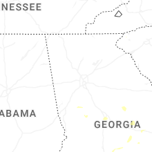

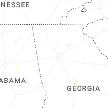

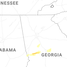


Connect with Interactive Hail Maps