

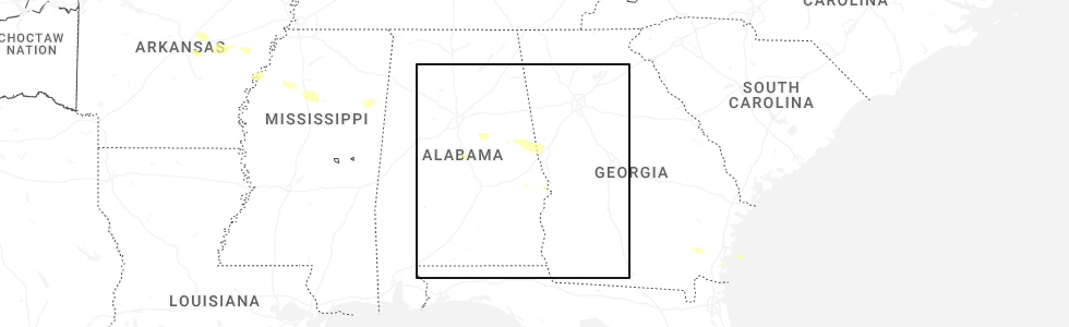
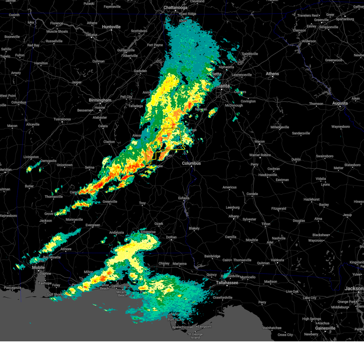
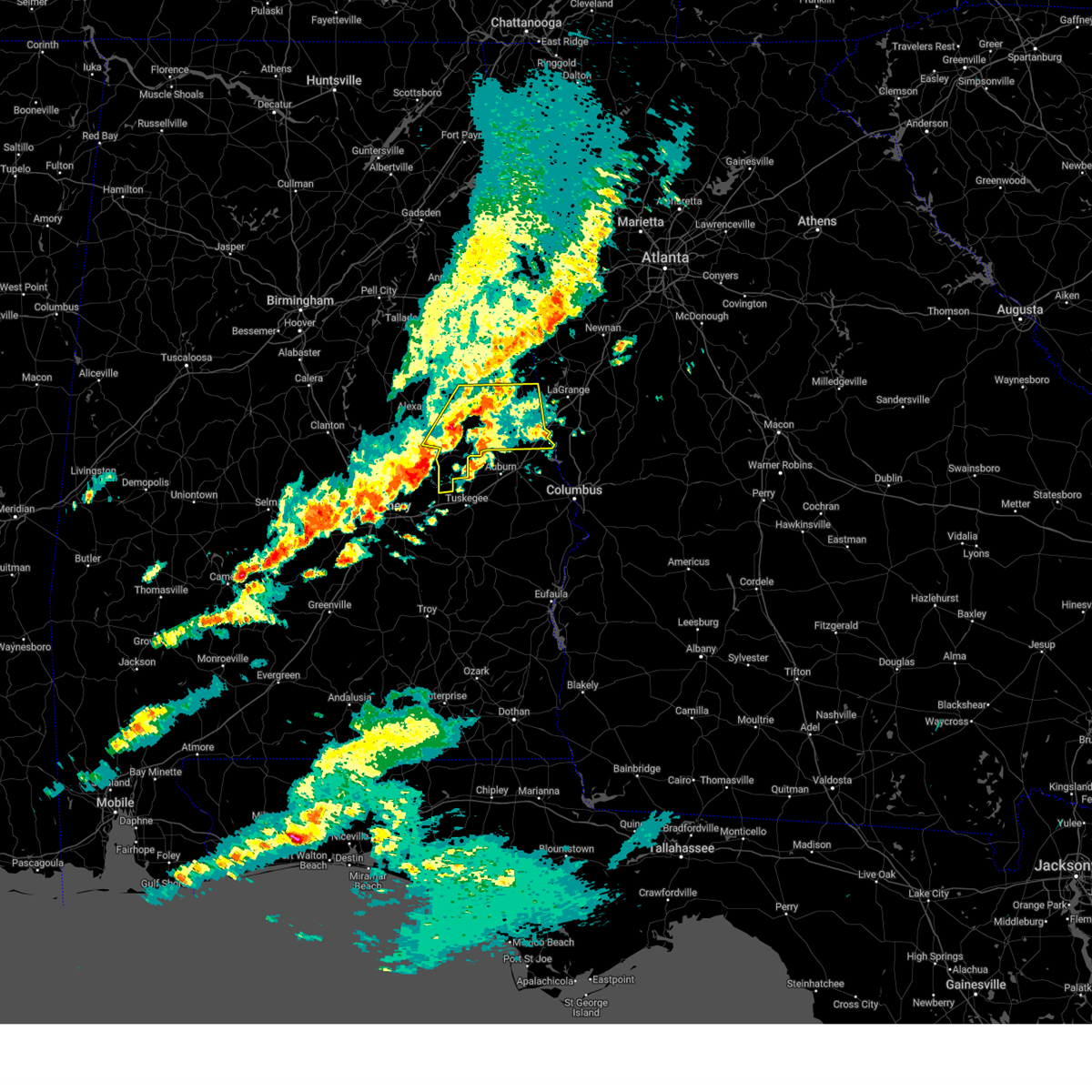
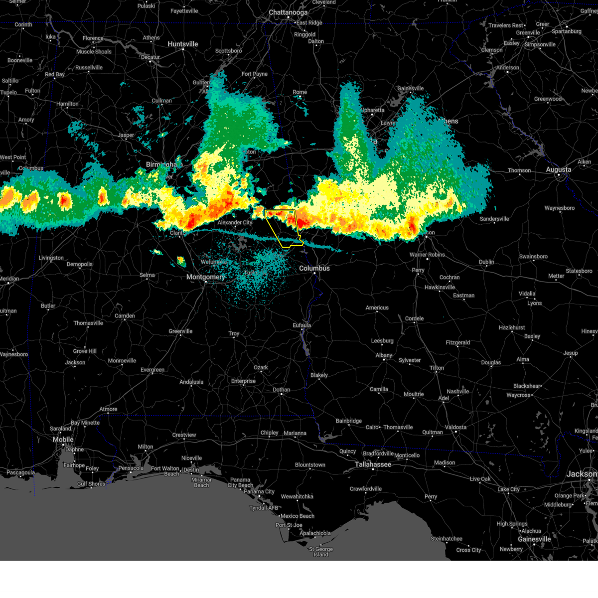
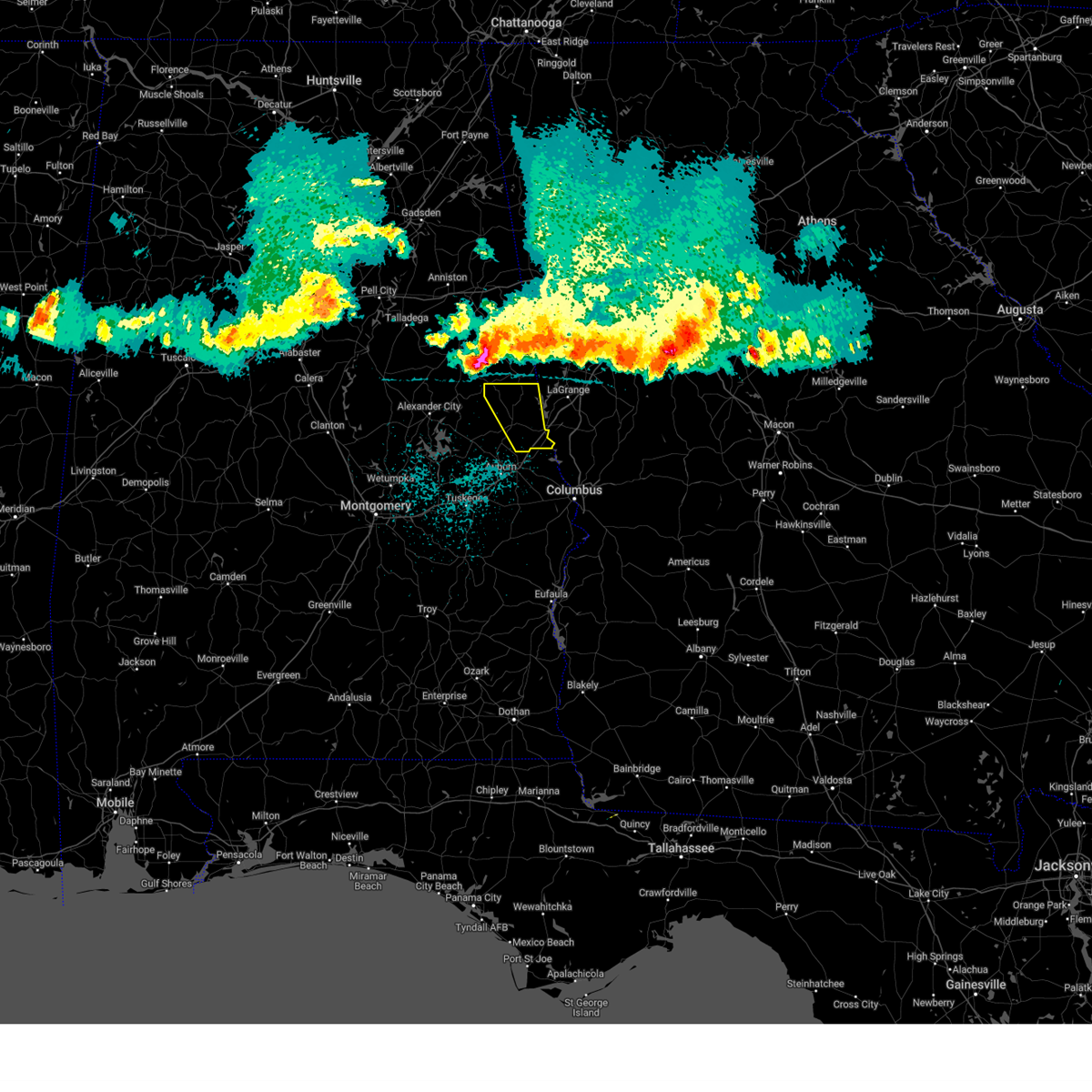
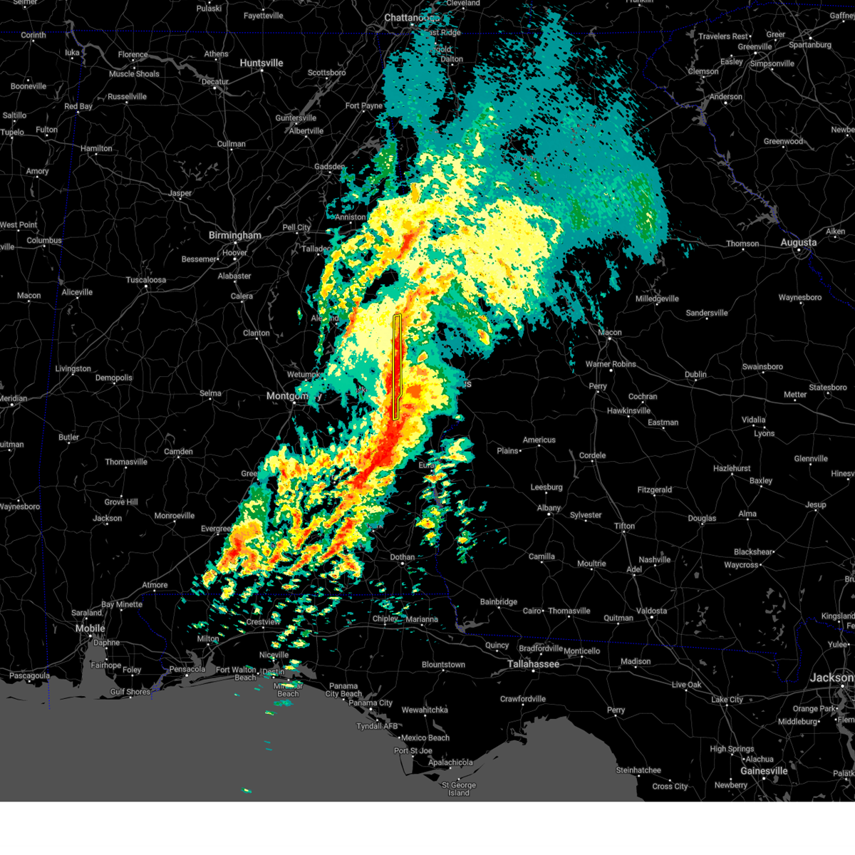
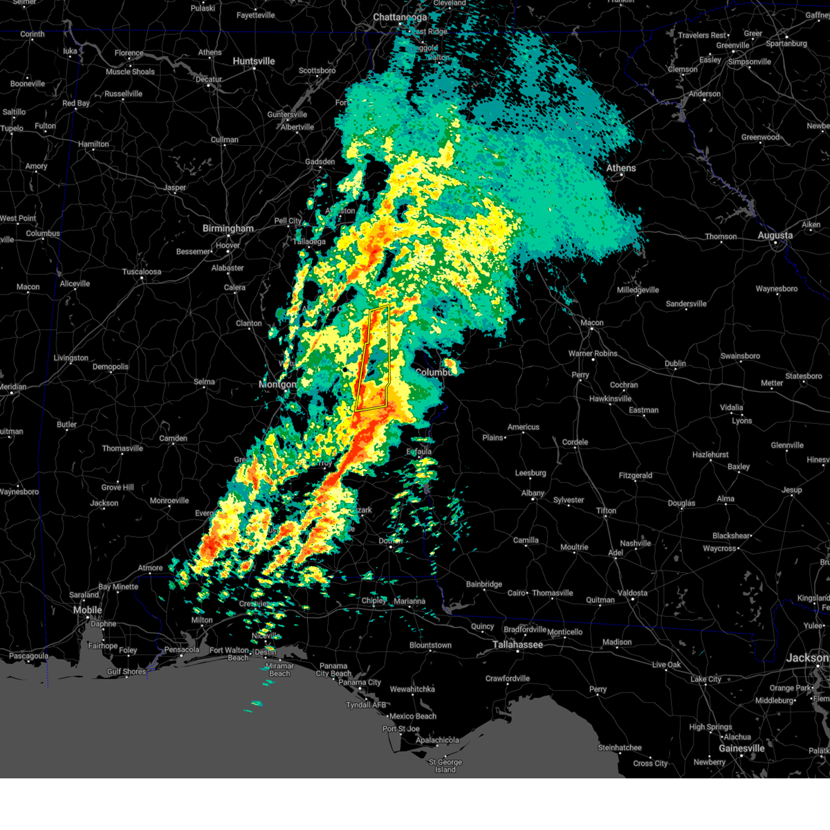
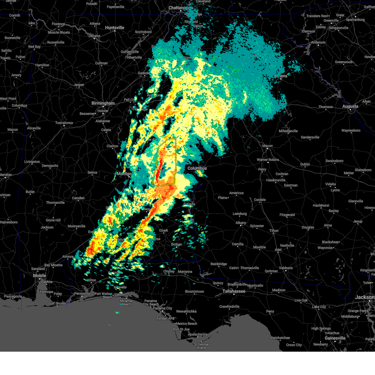
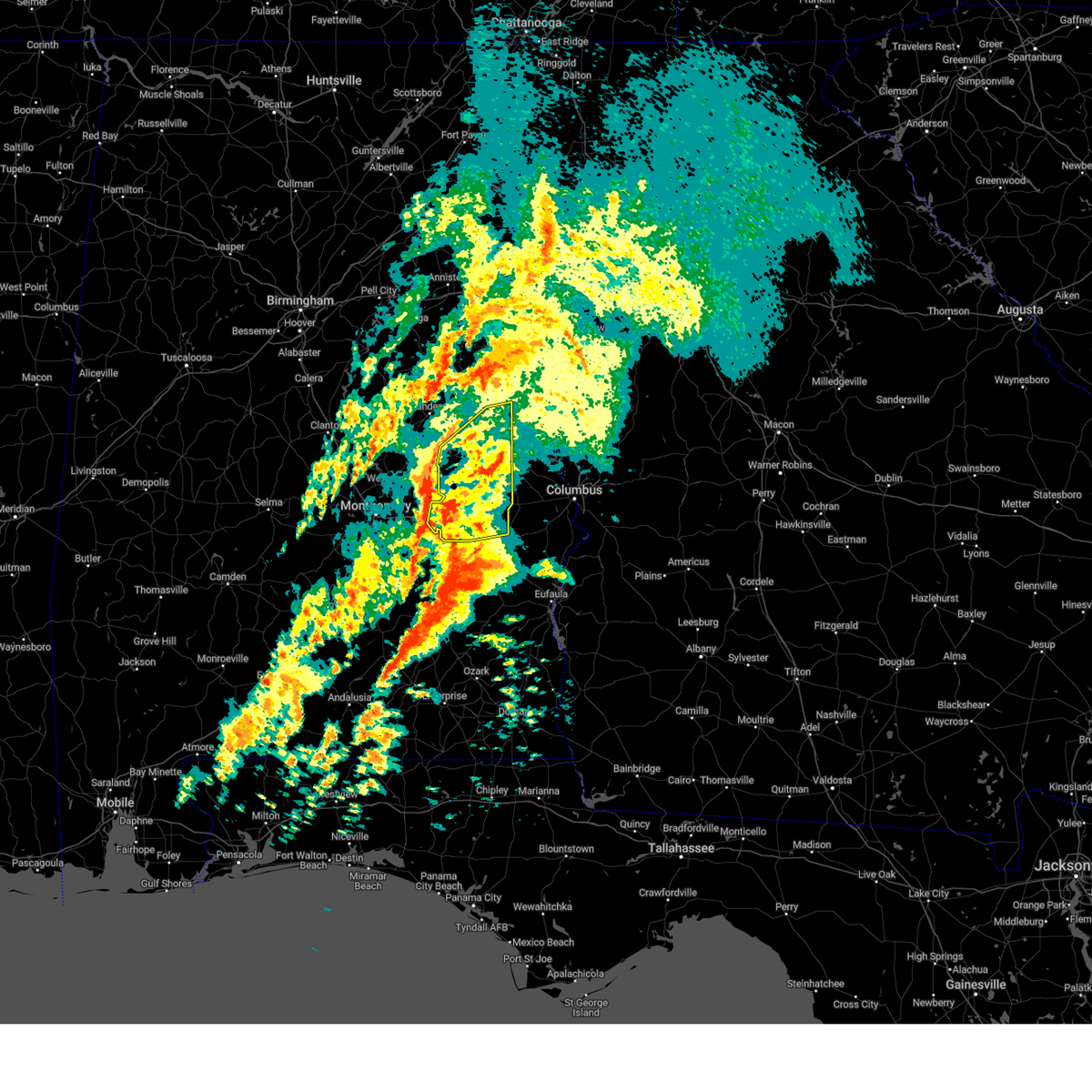
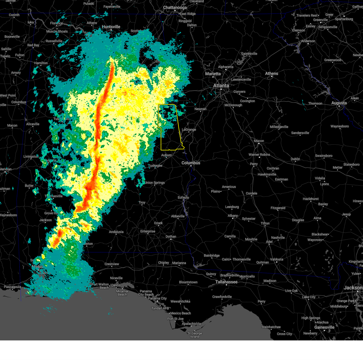
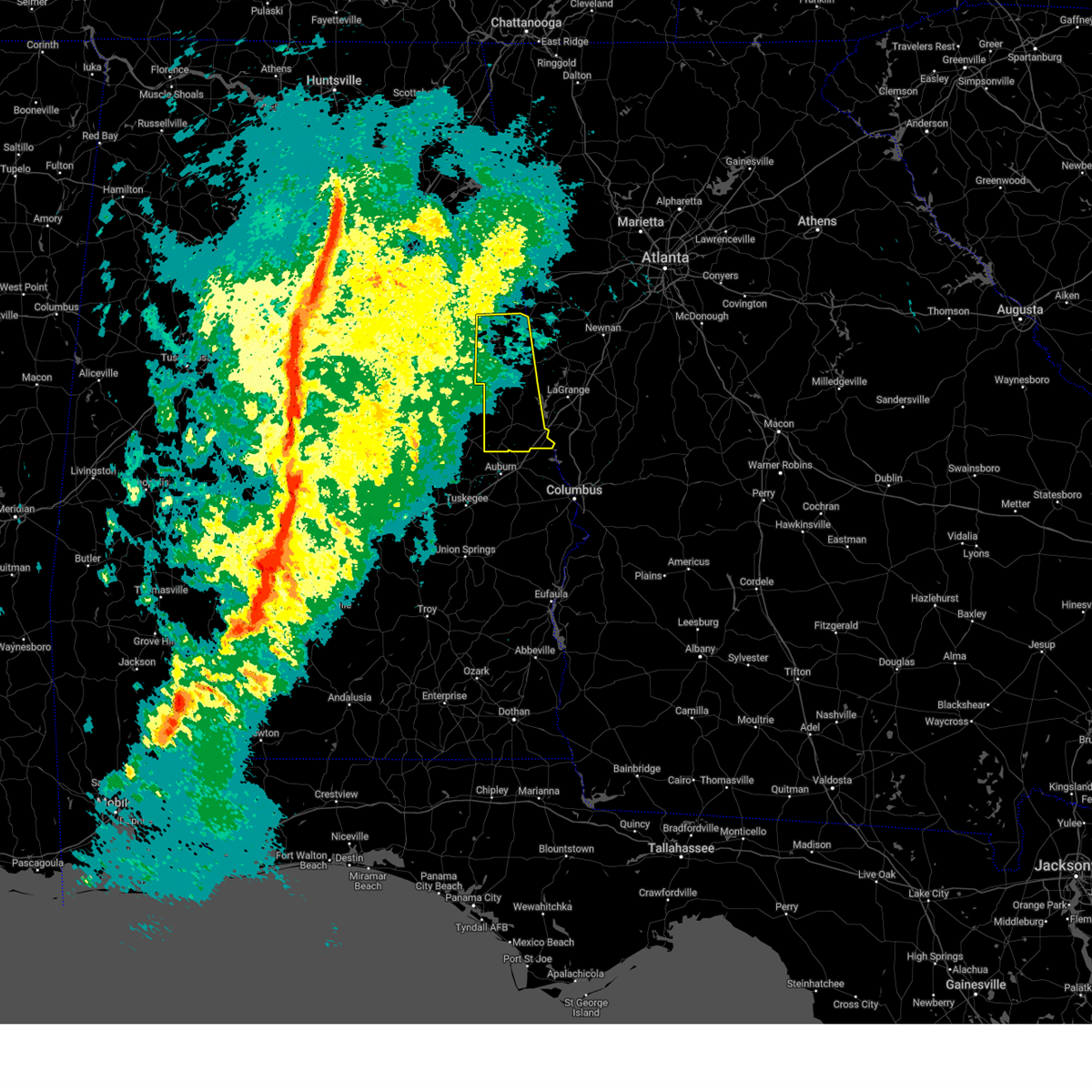
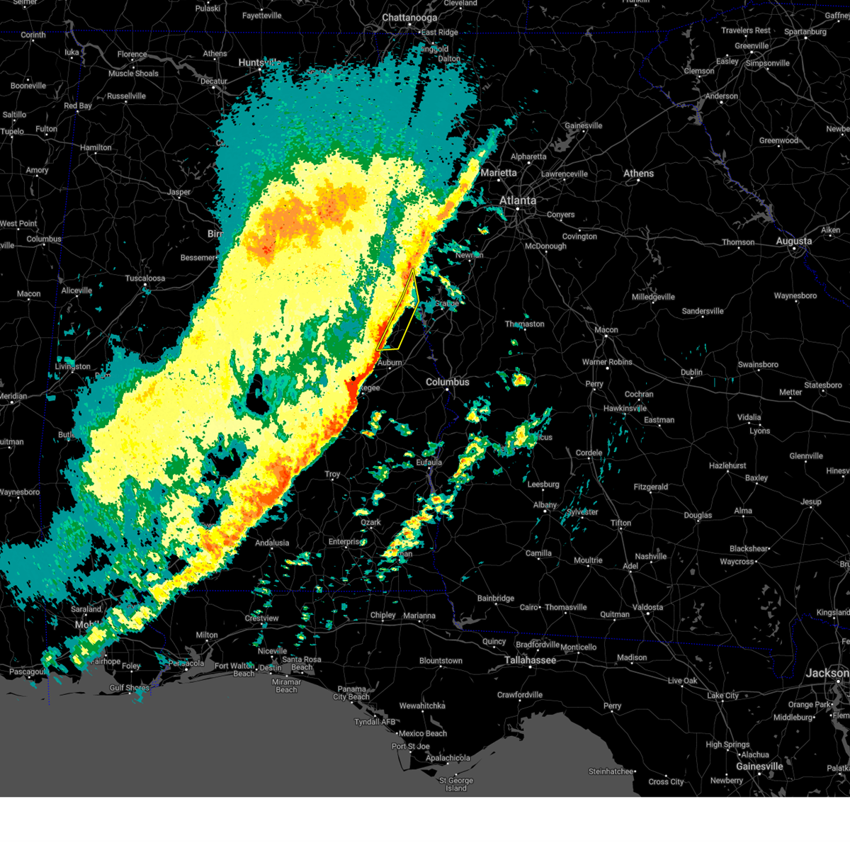
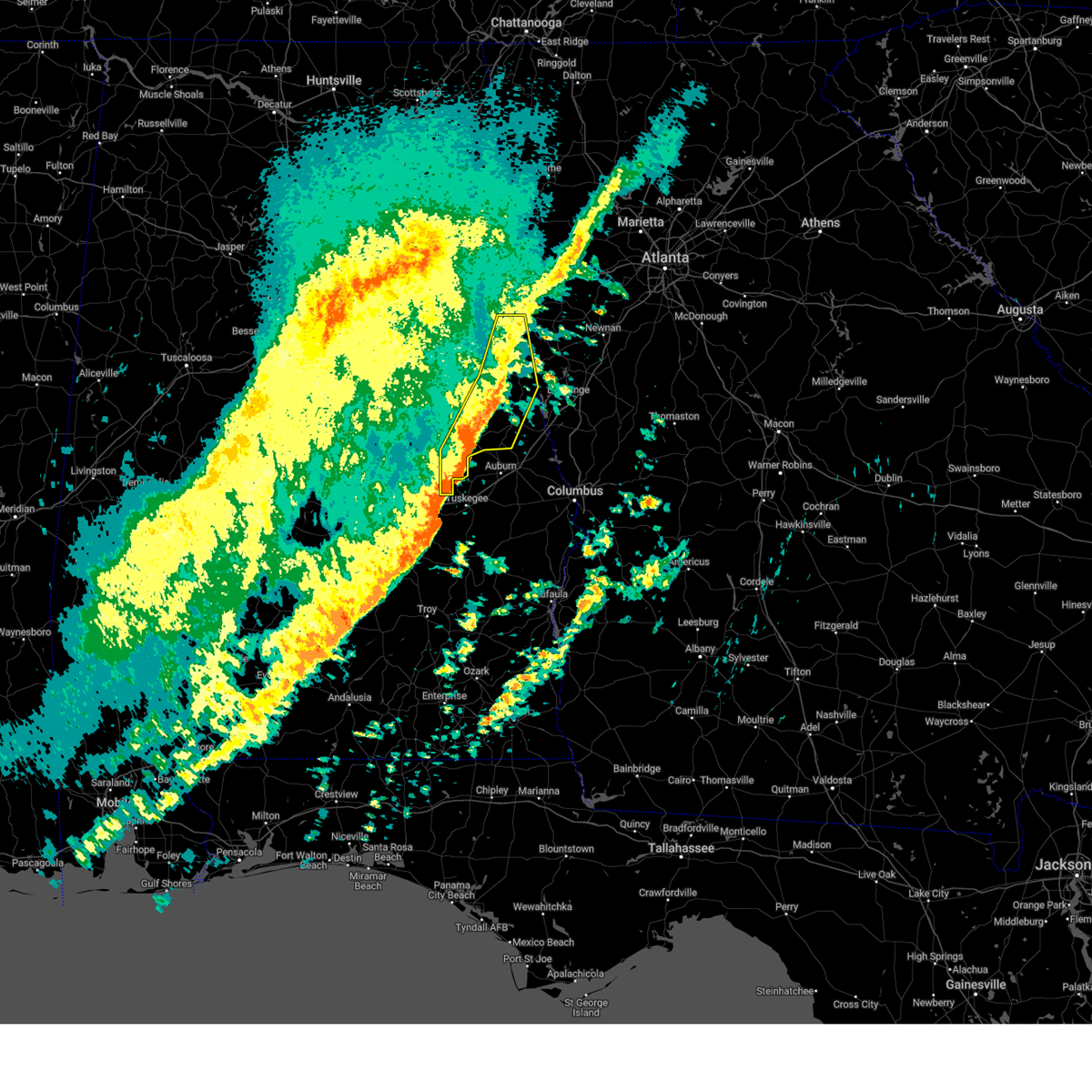
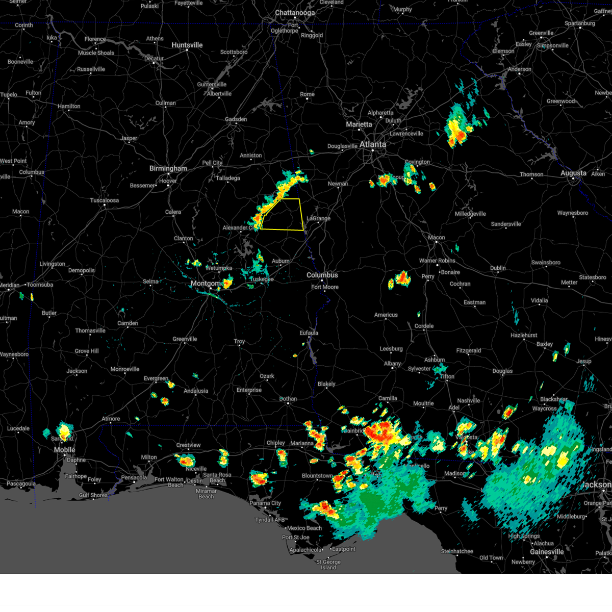
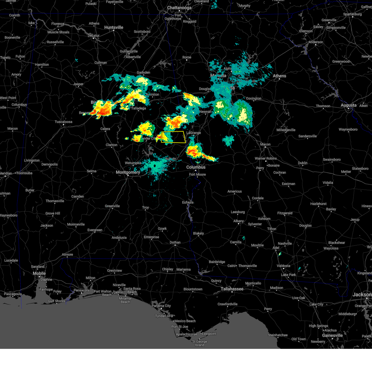
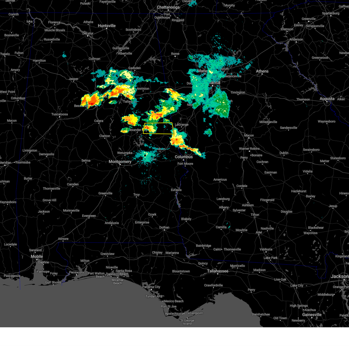
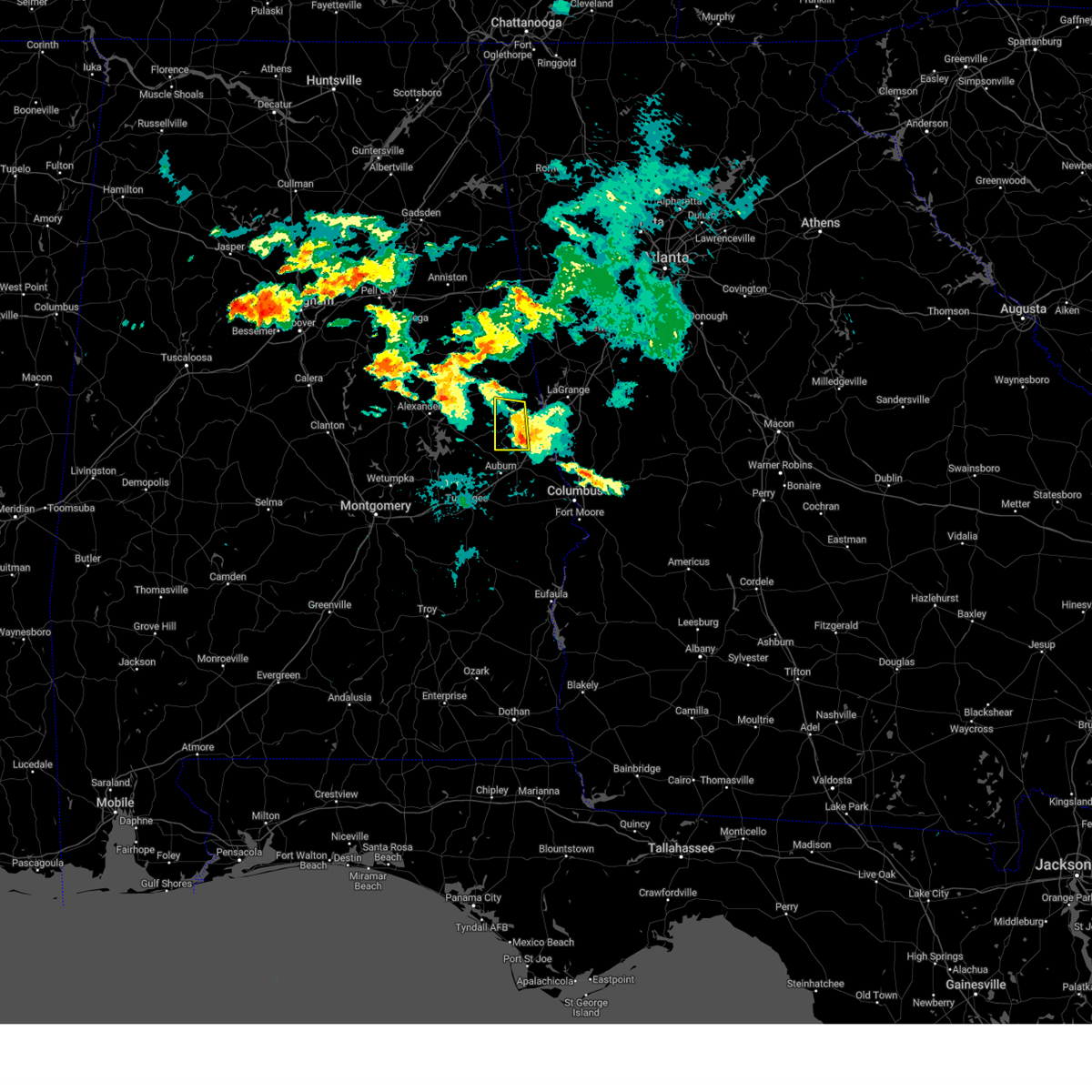
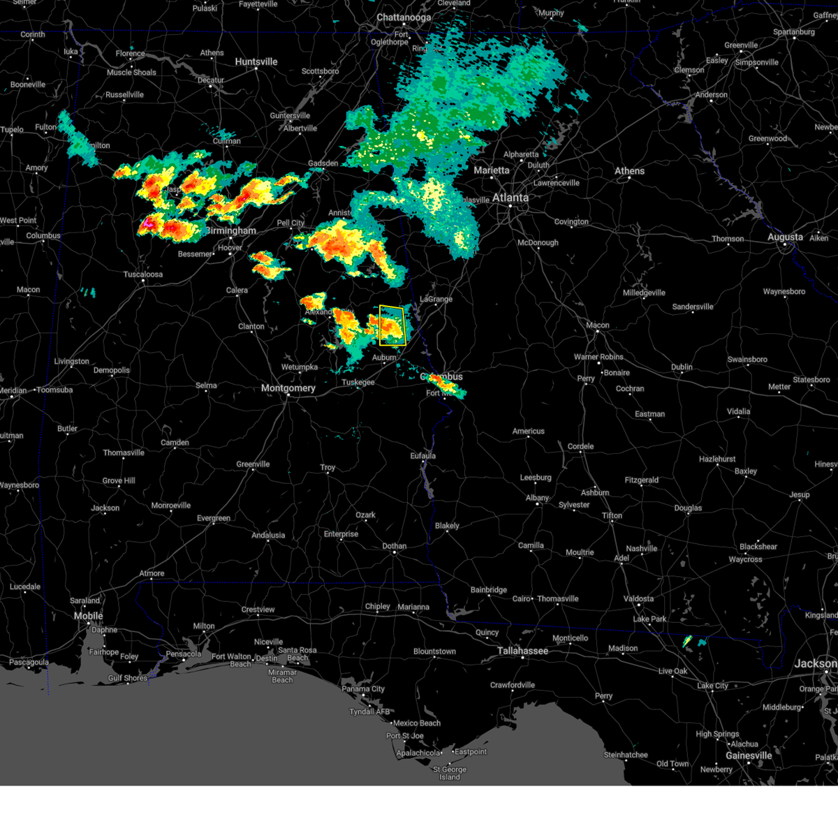
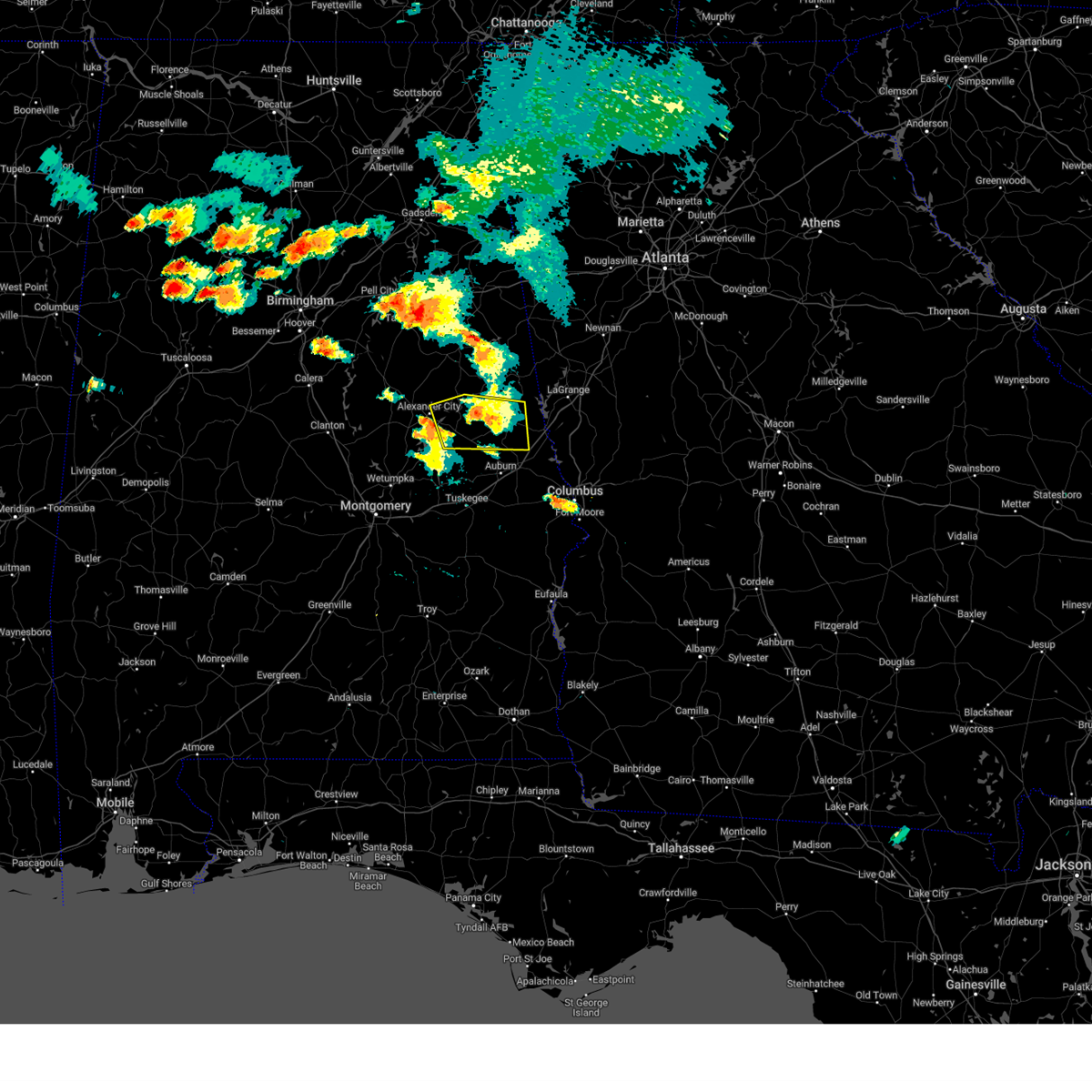
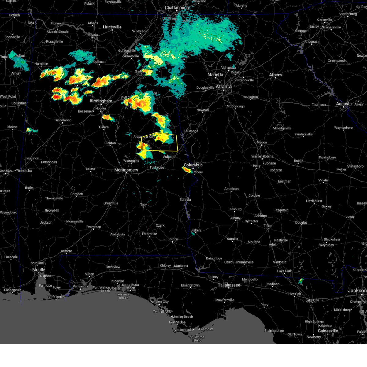
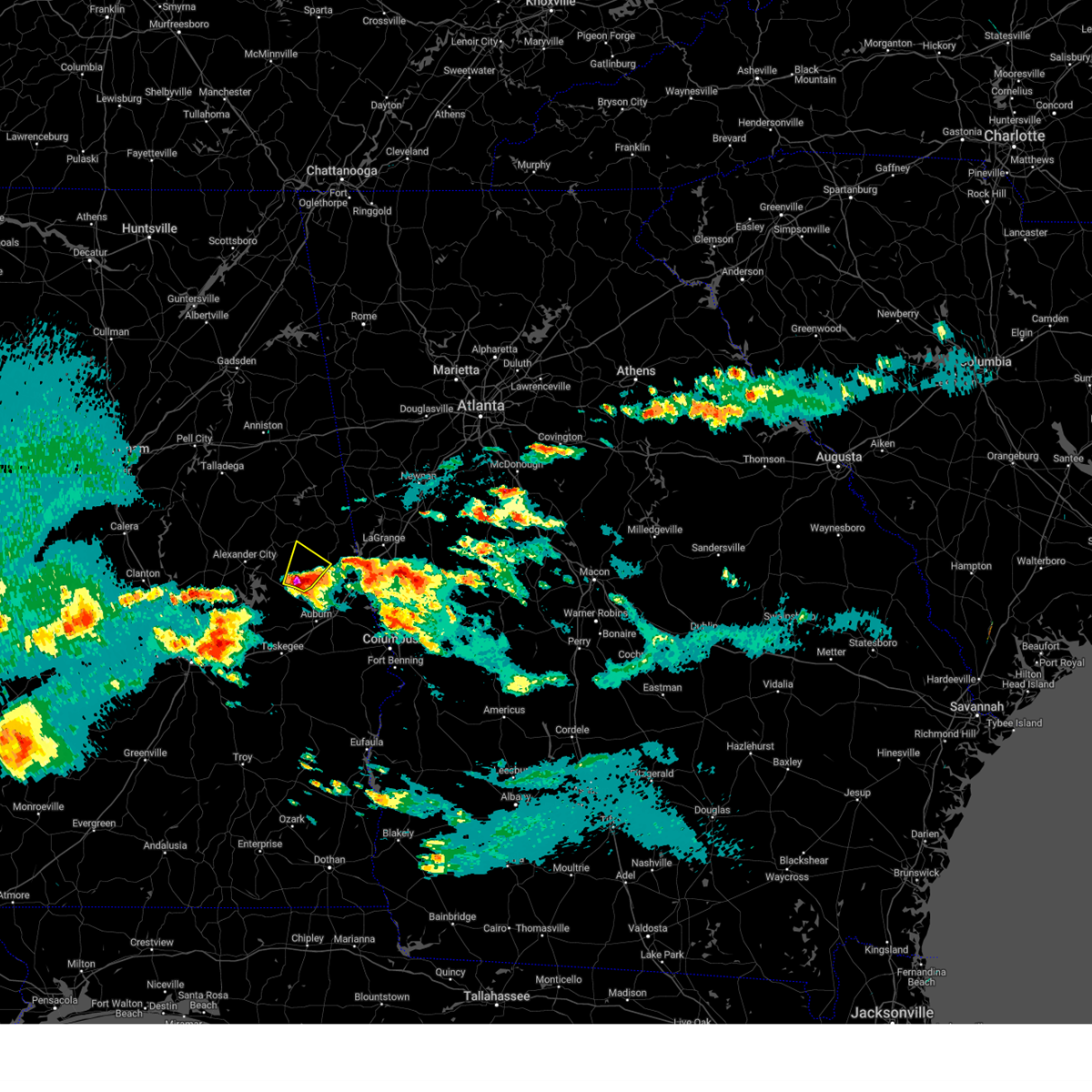
Hail Map for Penton, AL
The Penton, AL area has had 1 report of on-the-ground hail by trained spotters, and has been under severe weather warnings 30 times during the past 12 months. Doppler radar has detected hail at or near Penton, AL on 45 occasions, including 3 occasions during the past year.
| Name: | Penton, AL |
| Where Located: | 27.6 miles N of Auburn, AL |
| Map: | Google Map for Penton, AL |
| Population: | 201 |
| Housing Units: | 93 |
| More Info: | Search Google for Penton, AL |
1
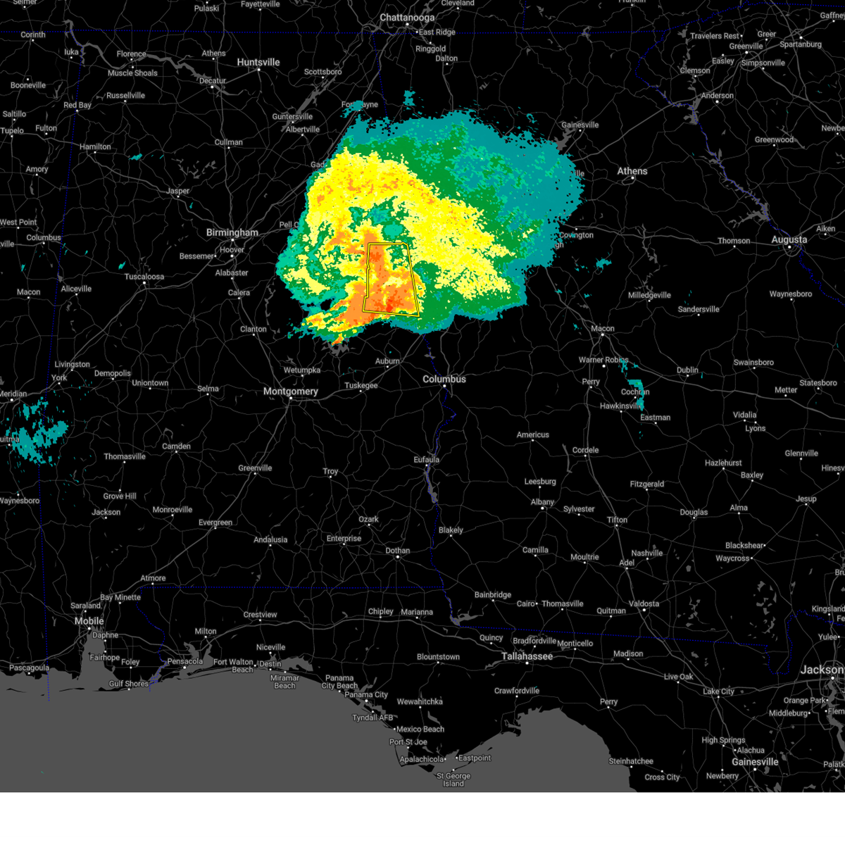
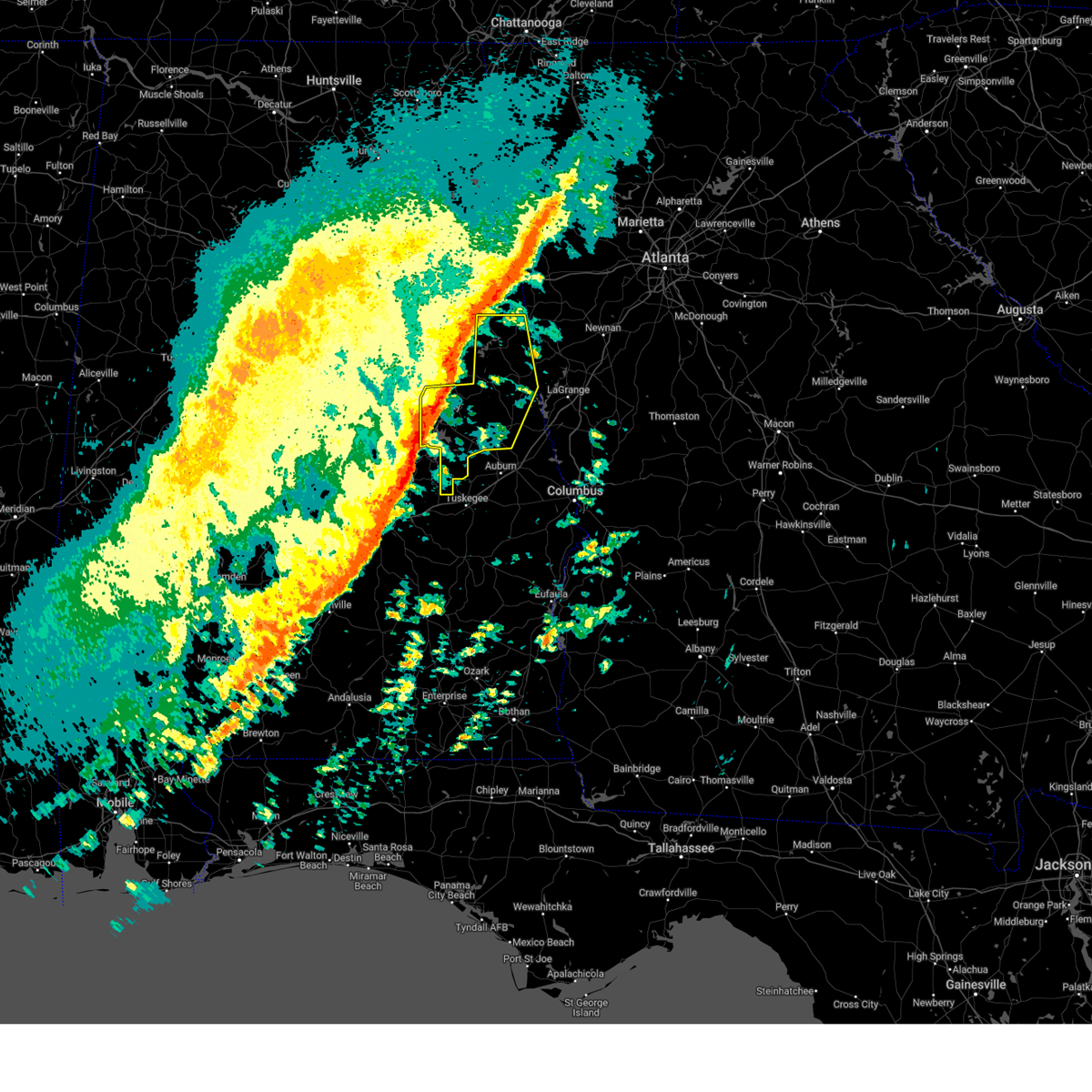
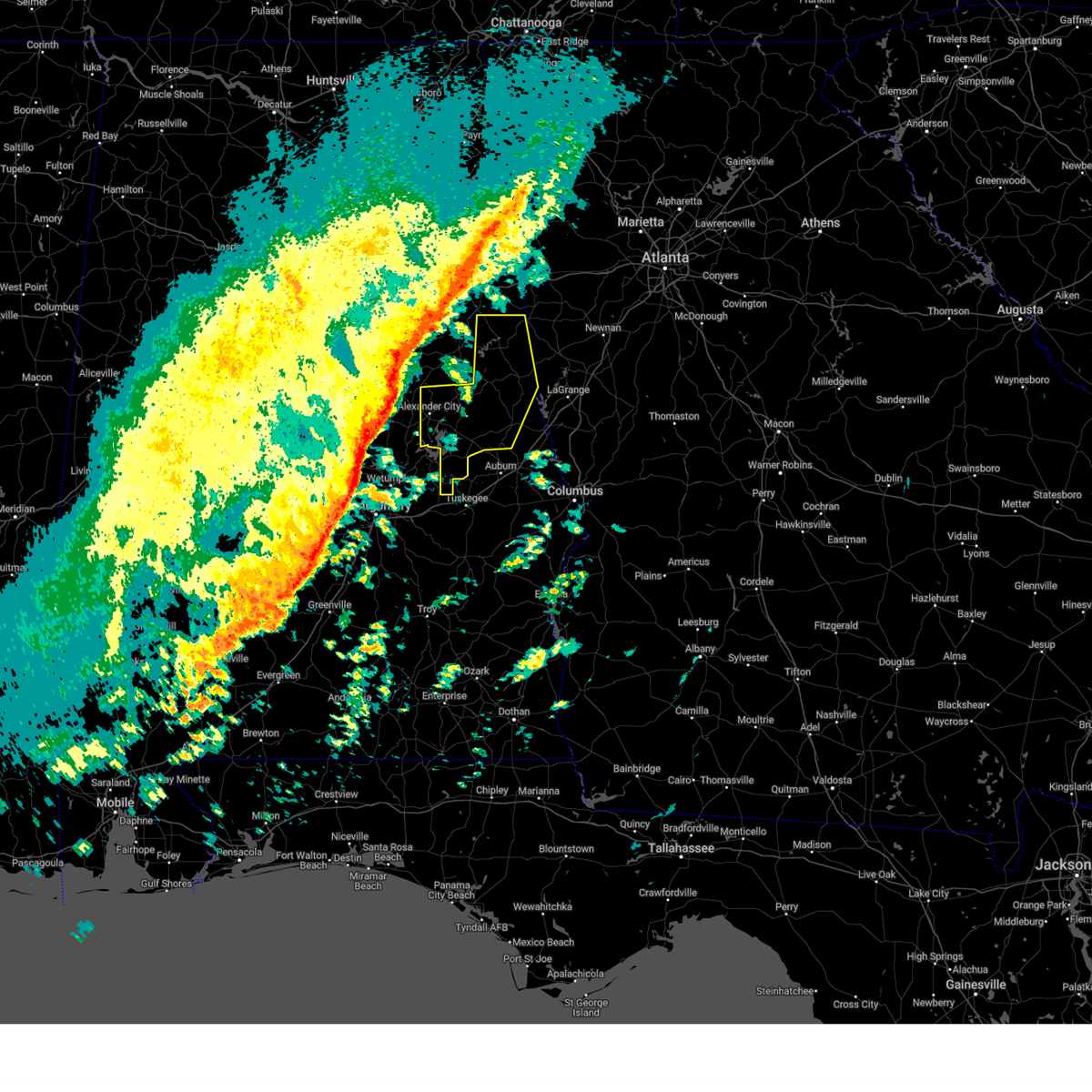
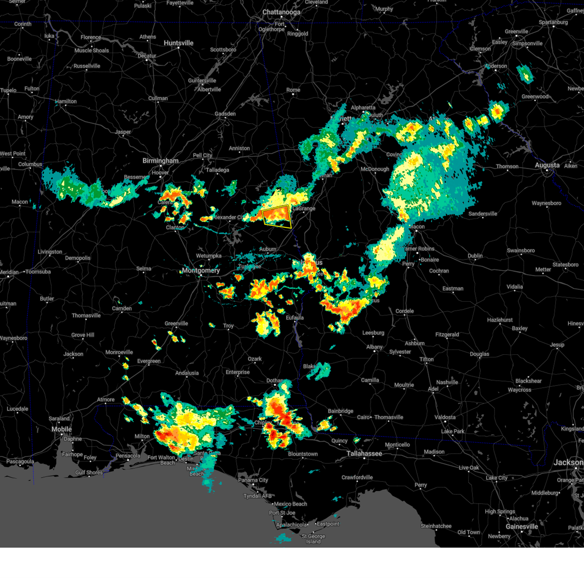
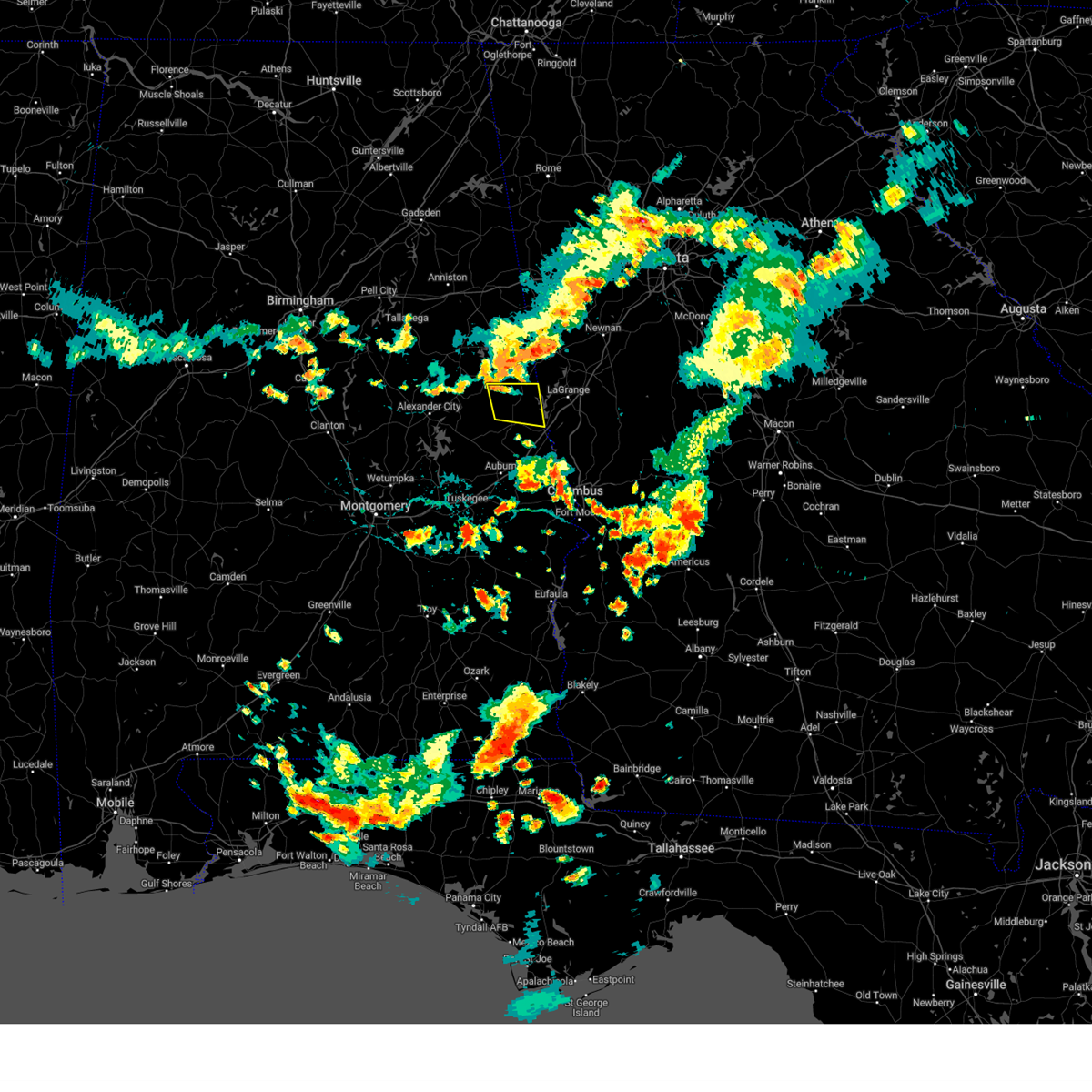
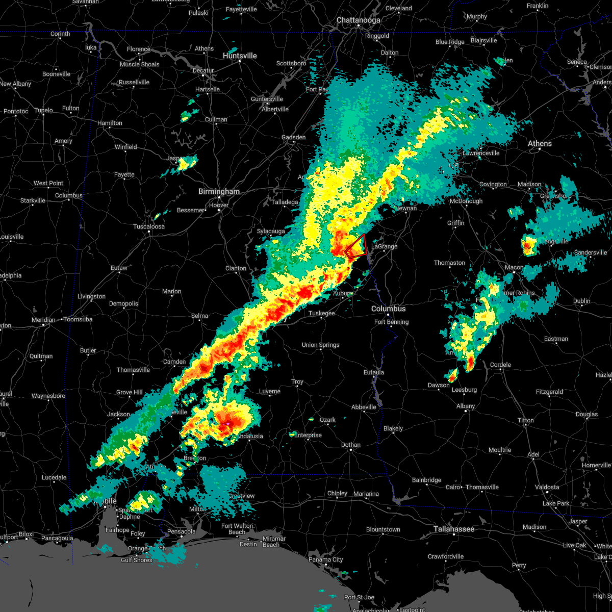
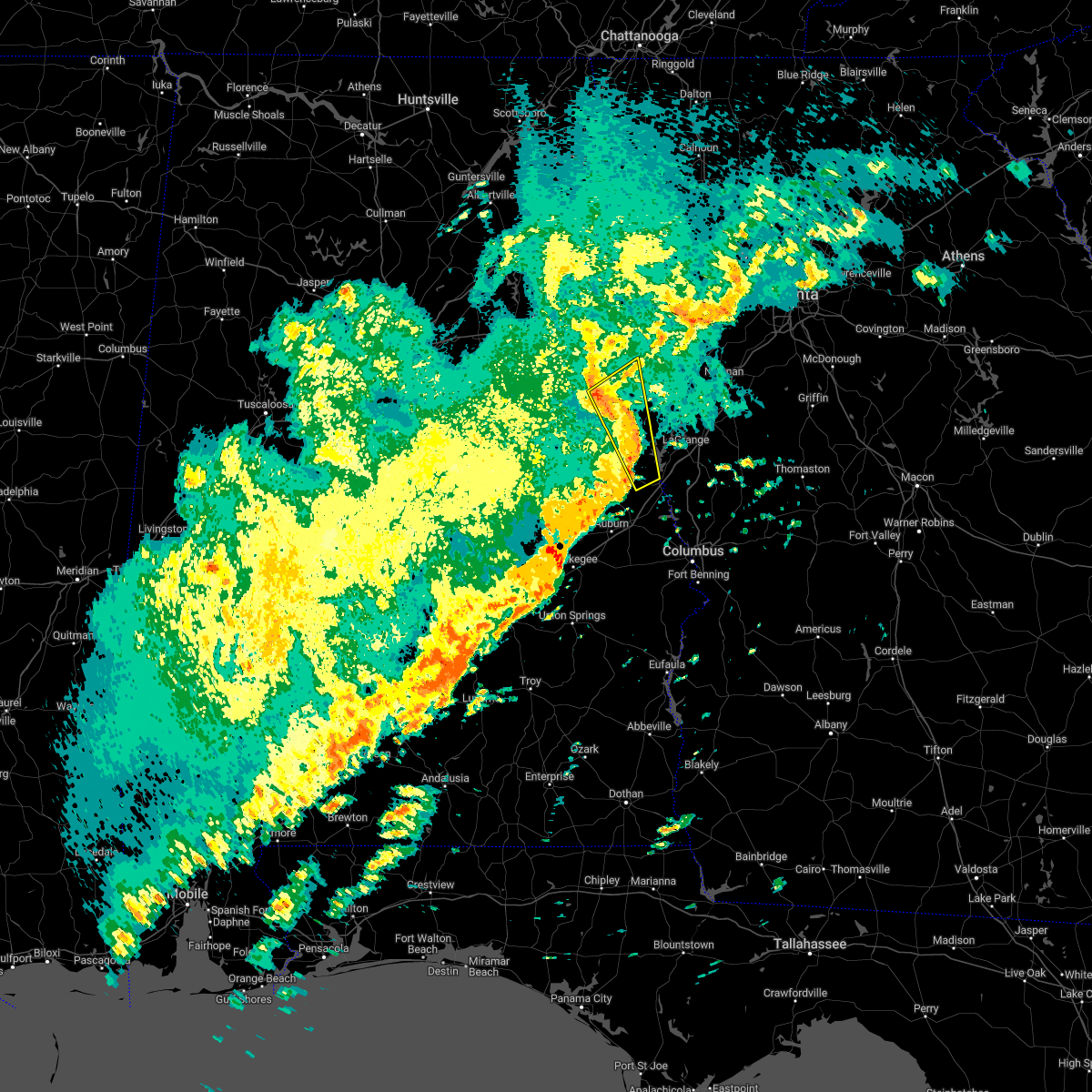
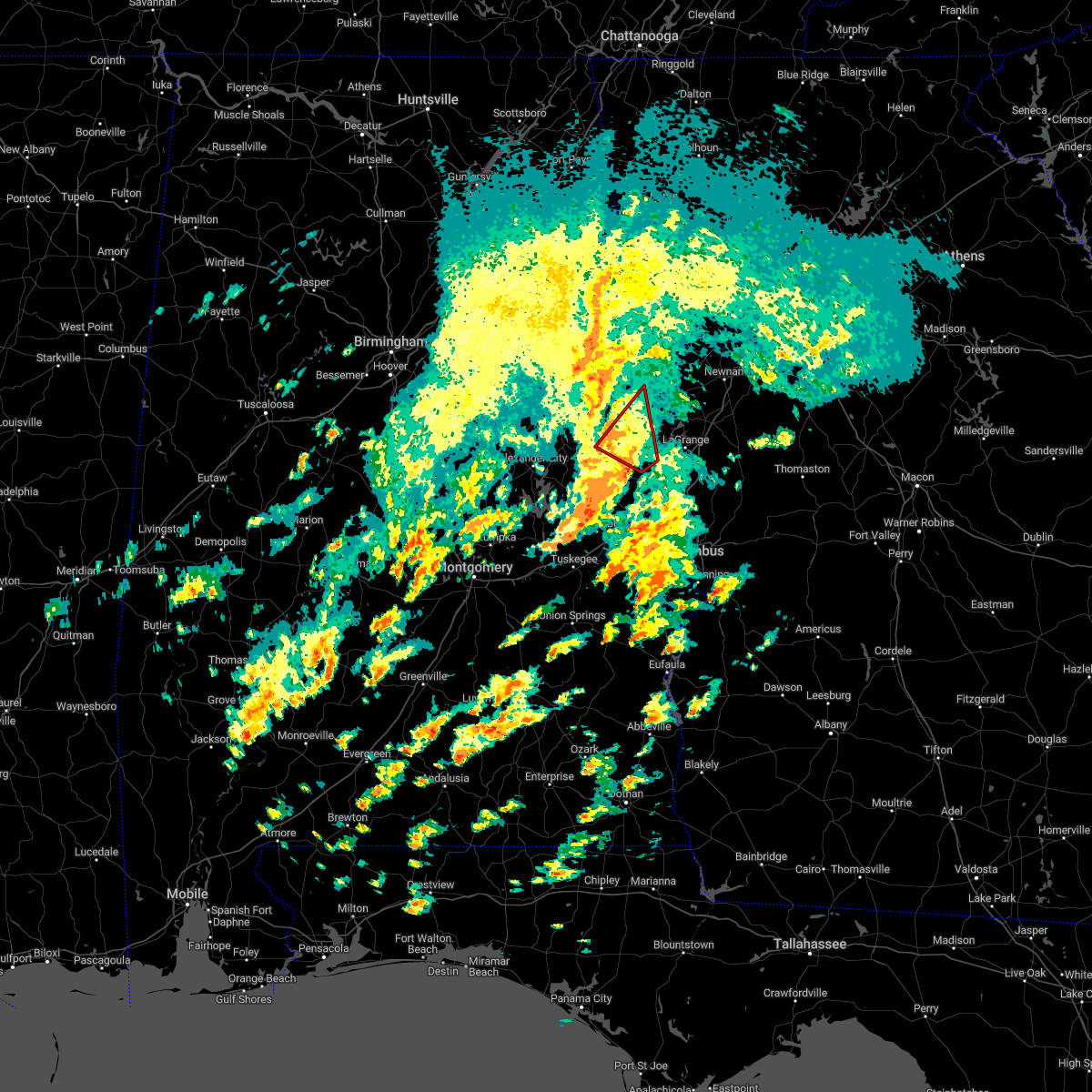
The Top Recent Hail Date for Penton, AL is Sunday, May 18, 2025 (10th out of 45)
Hail and Wind Damage Spotted near Penton, AL
| Date / Time | Report Details |
|---|---|
| 6/14/2025 6:44 PM CDT |
 At 644 pm cdt, a severe thunderstorm was located near denson, or near lafayette, moving east at 20 mph (radar indicated). Hazards include 60 mph wind gusts. Expect damage to roofs, siding, and trees. Locations impacted include, valley, lanett, lafayette, la fayette, lakeview, five points, cusseta, chambers county lake, fredonia, post oak forks, veasey creek park, denson, huguley, fairfax, amity park, sturkie, oak bowery, penton, buffalo, and west chambers. At 644 pm cdt, a severe thunderstorm was located near denson, or near lafayette, moving east at 20 mph (radar indicated). Hazards include 60 mph wind gusts. Expect damage to roofs, siding, and trees. Locations impacted include, valley, lanett, lafayette, la fayette, lakeview, five points, cusseta, chambers county lake, fredonia, post oak forks, veasey creek park, denson, huguley, fairfax, amity park, sturkie, oak bowery, penton, buffalo, and west chambers.
|
| 6/14/2025 6:00 PM CDT |
 Svrbmx the national weather service in birmingham has issued a * severe thunderstorm warning for, chambers county in east central alabama, * until 700 pm cdt. * at 600 pm cdt, a severe thunderstorm was located near west chambers, or near camp hill, moving east at 20 mph (radar indicated). Hazards include 60 mph wind gusts. expect damage to roofs, siding, and trees Svrbmx the national weather service in birmingham has issued a * severe thunderstorm warning for, chambers county in east central alabama, * until 700 pm cdt. * at 600 pm cdt, a severe thunderstorm was located near west chambers, or near camp hill, moving east at 20 mph (radar indicated). Hazards include 60 mph wind gusts. expect damage to roofs, siding, and trees
|
| 6/8/2025 5:19 AM CDT |
 Svrbmx the national weather service in birmingham has issued a * severe thunderstorm warning for, chambers county in east central alabama, * until 600 am cdt. * at 519 am cdt, a severe thunderstorm was located over buffalo, or near lafayette, moving east at 40 mph (radar indicated). Hazards include 60 mph wind gusts. expect damage to roofs, siding, and trees Svrbmx the national weather service in birmingham has issued a * severe thunderstorm warning for, chambers county in east central alabama, * until 600 am cdt. * at 519 am cdt, a severe thunderstorm was located over buffalo, or near lafayette, moving east at 40 mph (radar indicated). Hazards include 60 mph wind gusts. expect damage to roofs, siding, and trees
|
| 5/18/2025 8:07 AM CDT |
 At 807 am cdt, severe thunderstorms were located along a line extending from fredonia to near lafayette to near waverly, moving east at 60 mph (radar indicated). Hazards include 60 mph wind gusts and quarter size hail. Hail damage to vehicles is expected. expect wind damage to roofs, siding, and trees. Locations impacted include, southern harbor, post oak forks, camp hill, denson, i 85 welcome center at lanett, river view, cusseta, amity park, sturkie, ridge grove, buffalo, chambers county lake, fredonia, lakeview, la fayette, veasey creek park, white plains, lanett municipal airport, huguley, and fairfax. At 807 am cdt, severe thunderstorms were located along a line extending from fredonia to near lafayette to near waverly, moving east at 60 mph (radar indicated). Hazards include 60 mph wind gusts and quarter size hail. Hail damage to vehicles is expected. expect wind damage to roofs, siding, and trees. Locations impacted include, southern harbor, post oak forks, camp hill, denson, i 85 welcome center at lanett, river view, cusseta, amity park, sturkie, ridge grove, buffalo, chambers county lake, fredonia, lakeview, la fayette, veasey creek park, white plains, lanett municipal airport, huguley, and fairfax.
|
| 5/18/2025 8:06 AM CDT |
 The storms which prompted the warning have moved out of the area. therefore, the warning will be allowed to expire. a severe thunderstorm watch remains in effect until noon cdt for east central alabama. The storms which prompted the warning have moved out of the area. therefore, the warning will be allowed to expire. a severe thunderstorm watch remains in effect until noon cdt for east central alabama.
|
| 5/18/2025 7:54 AM CDT |
 the severe thunderstorm warning has been cancelled and is no longer in effect the severe thunderstorm warning has been cancelled and is no longer in effect
|
| 5/18/2025 7:54 AM CDT |
 At 753 am cdt, severe thunderstorms were located along a line extending from corinth to near wedowee to near trammel crossroads, moving east at 70 mph (radar indicated). Hazards include 60 mph wind gusts and quarter size hail. Hail damage to vehicles is expected. expect wind damage to roofs, siding, and trees. locations impacted include, malone, graham, dickert, lake wedowee, post oak forks, morrison cross roads, newell, r. l. Harris dam, roanoke, woodland, tennant, amity park, abanda, rock mills, standing rock, big springs, welch, roanoke municipal airport, corinth, and wadley. At 753 am cdt, severe thunderstorms were located along a line extending from corinth to near wedowee to near trammel crossroads, moving east at 70 mph (radar indicated). Hazards include 60 mph wind gusts and quarter size hail. Hail damage to vehicles is expected. expect wind damage to roofs, siding, and trees. locations impacted include, malone, graham, dickert, lake wedowee, post oak forks, morrison cross roads, newell, r. l. Harris dam, roanoke, woodland, tennant, amity park, abanda, rock mills, standing rock, big springs, welch, roanoke municipal airport, corinth, and wadley.
|
| 5/18/2025 7:39 AM CDT |
 Svrbmx the national weather service in birmingham has issued a * severe thunderstorm warning for, northern tallapoosa county in east central alabama, chambers county in east central alabama, * until 830 am cdt. * at 739 am cdt, severe thunderstorms were located along a line extending from near goldville to new site to near alexander city, moving east at 60 mph (radar indicated). Hazards include 60 mph wind gusts and quarter size hail. Hail damage to vehicles is expected. Expect wind damage to roofs, siding, and trees. Svrbmx the national weather service in birmingham has issued a * severe thunderstorm warning for, northern tallapoosa county in east central alabama, chambers county in east central alabama, * until 830 am cdt. * at 739 am cdt, severe thunderstorms were located along a line extending from near goldville to new site to near alexander city, moving east at 60 mph (radar indicated). Hazards include 60 mph wind gusts and quarter size hail. Hail damage to vehicles is expected. Expect wind damage to roofs, siding, and trees.
|
| 5/18/2025 7:35 AM CDT |
 At 734 am cdt, severe thunderstorms were located along a line extending from near munford to ashland to near hillabee creek, moving east at 70 mph (radar indicated). Hazards include 60 mph wind gusts and quarter size hail. Hail damage to vehicles is expected. expect wind damage to roofs, siding, and trees. Locations impacted include, graham, cleveland crossroads, dickert, goodwater, tennant, roanoke municipal airport, corinth, lineville, mellow valley, gunthertown, grant town, hollis crossroads, white plains, state line park, five points, chandler springs, chalafinnee, stroud, crystal lake, and roselle. At 734 am cdt, severe thunderstorms were located along a line extending from near munford to ashland to near hillabee creek, moving east at 70 mph (radar indicated). Hazards include 60 mph wind gusts and quarter size hail. Hail damage to vehicles is expected. expect wind damage to roofs, siding, and trees. Locations impacted include, graham, cleveland crossroads, dickert, goodwater, tennant, roanoke municipal airport, corinth, lineville, mellow valley, gunthertown, grant town, hollis crossroads, white plains, state line park, five points, chandler springs, chalafinnee, stroud, crystal lake, and roselle.
|
| 5/18/2025 7:35 AM CDT |
 the severe thunderstorm warning has been cancelled and is no longer in effect the severe thunderstorm warning has been cancelled and is no longer in effect
|
| 5/18/2025 7:14 AM CDT |
 Svrbmx the national weather service in birmingham has issued a * severe thunderstorm warning for, central talladega county in east central alabama, randolph county in east central alabama, southeastern st. clair county in central alabama, northern tallapoosa county in east central alabama, northern chambers county in east central alabama, southern cleburne county in east central alabama, northeastern coosa county in east central alabama, clay county in east central alabama, * until 815 am cdt. * at 714 am cdt, severe thunderstorms were located along a line extending from near logan martin lake to near winterboro to near stewartville, moving east at 70 mph (radar indicated). Hazards include 70 mph wind gusts and quarter size hail. Hail damage to vehicles is expected. expect considerable tree damage. Wind damage is also likely to mobile homes, roofs, and outbuildings. Svrbmx the national weather service in birmingham has issued a * severe thunderstorm warning for, central talladega county in east central alabama, randolph county in east central alabama, southeastern st. clair county in central alabama, northern tallapoosa county in east central alabama, northern chambers county in east central alabama, southern cleburne county in east central alabama, northeastern coosa county in east central alabama, clay county in east central alabama, * until 815 am cdt. * at 714 am cdt, severe thunderstorms were located along a line extending from near logan martin lake to near winterboro to near stewartville, moving east at 70 mph (radar indicated). Hazards include 70 mph wind gusts and quarter size hail. Hail damage to vehicles is expected. expect considerable tree damage. Wind damage is also likely to mobile homes, roofs, and outbuildings.
|
| 5/3/2025 7:04 PM CDT |
 the severe thunderstorm warning has been cancelled and is no longer in effect the severe thunderstorm warning has been cancelled and is no longer in effect
|
| 5/3/2025 6:54 PM CDT |
 At 653 pm cdt, severe thunderstorms were located along a line extending from near welch to near camp hill, moving east at 25 mph (radar indicated). Hazards include 60 mph wind gusts and quarter size hail. Hail damage to vehicles is expected. expect wind damage to roofs, siding, and trees. Locations impacted include, southern harbor, post oak forks, denson, i 85 welcome center at lanett, river view, cusseta, amity park, rocky point, sturkie, standing rock, welch, trammel crossroads, ridge grove, buffalo, chambers county lake, fredonia, lakeview, la fayette, veasey creek park, and white plains. At 653 pm cdt, severe thunderstorms were located along a line extending from near welch to near camp hill, moving east at 25 mph (radar indicated). Hazards include 60 mph wind gusts and quarter size hail. Hail damage to vehicles is expected. expect wind damage to roofs, siding, and trees. Locations impacted include, southern harbor, post oak forks, denson, i 85 welcome center at lanett, river view, cusseta, amity park, rocky point, sturkie, standing rock, welch, trammel crossroads, ridge grove, buffalo, chambers county lake, fredonia, lakeview, la fayette, veasey creek park, and white plains.
|
| 5/3/2025 6:54 PM CDT |
 the severe thunderstorm warning has been cancelled and is no longer in effect the severe thunderstorm warning has been cancelled and is no longer in effect
|
| 5/3/2025 6:43 PM CDT |
 At 643 pm cdt, severe thunderstorms were located along a line extending from near welch to near still waters resort, moving east at 25 mph (radar indicated). Hazards include 60 mph wind gusts and quarter size hail. Hail damage to vehicles is expected. expect wind damage to roofs, siding, and trees. Locations impacted include, southern harbor, post oak forks, camp hill, denson, reeves airport, dadeville, i 85 welcome center at lanett, river view, cusseta, amity park, rocky point, sturkie, standing rock, southern lake martin, welch, trammel crossroads, ridge grove, buffalo, chambers county lake, and fredonia. At 643 pm cdt, severe thunderstorms were located along a line extending from near welch to near still waters resort, moving east at 25 mph (radar indicated). Hazards include 60 mph wind gusts and quarter size hail. Hail damage to vehicles is expected. expect wind damage to roofs, siding, and trees. Locations impacted include, southern harbor, post oak forks, camp hill, denson, reeves airport, dadeville, i 85 welcome center at lanett, river view, cusseta, amity park, rocky point, sturkie, standing rock, southern lake martin, welch, trammel crossroads, ridge grove, buffalo, chambers county lake, and fredonia.
|
| 5/3/2025 6:26 PM CDT |
 Svrbmx the national weather service in birmingham has issued a * severe thunderstorm warning for, tallapoosa county in east central alabama, chambers county in east central alabama, * until 745 pm cdt. * at 626 pm cdt, severe thunderstorms were located along a line extending from near abanda to near southern lake martin, moving east at 25 mph (radar indicated). Hazards include 60 mph wind gusts and quarter size hail. Hail damage to vehicles is expected. Expect wind damage to roofs, siding, and trees. Svrbmx the national weather service in birmingham has issued a * severe thunderstorm warning for, tallapoosa county in east central alabama, chambers county in east central alabama, * until 745 pm cdt. * at 626 pm cdt, severe thunderstorms were located along a line extending from near abanda to near southern lake martin, moving east at 25 mph (radar indicated). Hazards include 60 mph wind gusts and quarter size hail. Hail damage to vehicles is expected. Expect wind damage to roofs, siding, and trees.
|
| 4/10/2025 9:44 PM CDT |
 the severe thunderstorm warning has been cancelled and is no longer in effect the severe thunderstorm warning has been cancelled and is no longer in effect
|
| 4/10/2025 8:55 PM CDT |
 Svrbmx the national weather service in birmingham has issued a * severe thunderstorm warning for, chambers county in east central alabama, * until 1000 pm cdt. * at 854 pm cdt, a severe thunderstorm was located over malone, or near lake wedowee, moving southeast at 45 mph (radar indicated). Hazards include 60 mph wind gusts and half dollar size hail. Hail damage to vehicles is expected. Expect wind damage to roofs, siding, and trees. Svrbmx the national weather service in birmingham has issued a * severe thunderstorm warning for, chambers county in east central alabama, * until 1000 pm cdt. * at 854 pm cdt, a severe thunderstorm was located over malone, or near lake wedowee, moving southeast at 45 mph (radar indicated). Hazards include 60 mph wind gusts and half dollar size hail. Hail damage to vehicles is expected. Expect wind damage to roofs, siding, and trees.
|
| 3/16/2025 12:01 AM CDT |
 At 1201 am cdt, severe thunderstorms were located along a line extending from post oak forks to near cusseta to society hill, moving northeast at 70 mph (radar indicated). Hazards include 70 mph wind gusts. Expect considerable tree damage. damage is likely to mobile homes, roofs, and outbuildings. locations impacted include, oak bowery, society hill, robert g. Pitts airport, la fayette, auburn, and opelika. At 1201 am cdt, severe thunderstorms were located along a line extending from post oak forks to near cusseta to society hill, moving northeast at 70 mph (radar indicated). Hazards include 70 mph wind gusts. Expect considerable tree damage. damage is likely to mobile homes, roofs, and outbuildings. locations impacted include, oak bowery, society hill, robert g. Pitts airport, la fayette, auburn, and opelika.
|
| 3/15/2025 11:49 PM CDT |
 the severe thunderstorm warning has been cancelled and is no longer in effect the severe thunderstorm warning has been cancelled and is no longer in effect
|
| 3/15/2025 11:49 PM CDT |
 At 1149 pm cdt, severe thunderstorms were located along a line extending from near la fayette to near auburn university to near davisville, moving northeast at 60 mph (radar indicated). Hazards include 70 mph wind gusts. Expect considerable tree damage. damage is likely to mobile homes, roofs, and outbuildings. locations impacted include, warriorstand, robert g. Pitts airport, i 85 rest area, auburn, loachapoka, auburn university, creek stand, tuskegee national forest, sturkie, waverly, chewacla state park, oak bowery, davisville, society hill, trammel crossroads, ridge grove, west chambers, la fayette, opelika, and notasulga. At 1149 pm cdt, severe thunderstorms were located along a line extending from near la fayette to near auburn university to near davisville, moving northeast at 60 mph (radar indicated). Hazards include 70 mph wind gusts. Expect considerable tree damage. damage is likely to mobile homes, roofs, and outbuildings. locations impacted include, warriorstand, robert g. Pitts airport, i 85 rest area, auburn, loachapoka, auburn university, creek stand, tuskegee national forest, sturkie, waverly, chewacla state park, oak bowery, davisville, society hill, trammel crossroads, ridge grove, west chambers, la fayette, opelika, and notasulga.
|
| 3/15/2025 11:37 PM CDT |
 At 1137 pm cdt, severe thunderstorms were located along a line extending from near eastern lake martin to tallassee to near shopton, moving northeast at 60 mph (radar indicated). Hazards include 70 mph wind gusts. Expect considerable tree damage. damage is likely to mobile homes, roofs, and outbuildings. locations impacted include, franklin, warriorstand, camp hill, loachapoka, uphapee creek, lake tuskegee, auburn university, fort davis, tuskegee national forest, sturkie, tuskegee, chewacla state park, davisville, trammel crossroads, ridge grove, liverpool, robert g. Pitts airport, i 85 rest area, liberty city, and auburn. At 1137 pm cdt, severe thunderstorms were located along a line extending from near eastern lake martin to tallassee to near shopton, moving northeast at 60 mph (radar indicated). Hazards include 70 mph wind gusts. Expect considerable tree damage. damage is likely to mobile homes, roofs, and outbuildings. locations impacted include, franklin, warriorstand, camp hill, loachapoka, uphapee creek, lake tuskegee, auburn university, fort davis, tuskegee national forest, sturkie, tuskegee, chewacla state park, davisville, trammel crossroads, ridge grove, liverpool, robert g. Pitts airport, i 85 rest area, liberty city, and auburn.
|
| 3/15/2025 11:23 PM CDT |
 Svrbmx the national weather service in birmingham has issued a * severe thunderstorm warning for, western lee county in east central alabama, macon county in southeastern alabama, southeastern tallapoosa county in east central alabama, southwestern chambers county in east central alabama, * until 1215 am cdt. * at 1122 pm cdt, severe thunderstorms were located along a line extending from still waters resort to near milstead to near hardaway, moving northeast at 70 mph (radar indicated). Hazards include 60 mph wind gusts. expect damage to roofs, siding, and trees Svrbmx the national weather service in birmingham has issued a * severe thunderstorm warning for, western lee county in east central alabama, macon county in southeastern alabama, southeastern tallapoosa county in east central alabama, southwestern chambers county in east central alabama, * until 1215 am cdt. * at 1122 pm cdt, severe thunderstorms were located along a line extending from still waters resort to near milstead to near hardaway, moving northeast at 70 mph (radar indicated). Hazards include 60 mph wind gusts. expect damage to roofs, siding, and trees
|
| 3/4/2025 11:51 PM CST |
 The storms which prompted the warning have moved out of the area. therefore, the warning will be allowed to expire. however, gusty winds are still possible with these thunderstorms. a severe thunderstorm watch remains in effect until 300 am cst for east central alabama. The storms which prompted the warning have moved out of the area. therefore, the warning will be allowed to expire. however, gusty winds are still possible with these thunderstorms. a severe thunderstorm watch remains in effect until 300 am cst for east central alabama.
|
| 3/4/2025 10:43 PM CST |
 Svrbmx the national weather service in birmingham has issued a * severe thunderstorm warning for, randolph county in east central alabama, chambers county in east central alabama, * until midnight cst. * at 1042 pm cst, severe thunderstorms were located along a line extending from mount cheaha to near still waters resort, moving east at 40 mph (radar indicated). Hazards include 60 mph wind gusts. expect damage to roofs, siding, and trees Svrbmx the national weather service in birmingham has issued a * severe thunderstorm warning for, randolph county in east central alabama, chambers county in east central alabama, * until midnight cst. * at 1042 pm cst, severe thunderstorms were located along a line extending from mount cheaha to near still waters resort, moving east at 40 mph (radar indicated). Hazards include 60 mph wind gusts. expect damage to roofs, siding, and trees
|
| 2/16/2025 3:04 AM CST |
 the severe thunderstorm warning has been cancelled and is no longer in effect the severe thunderstorm warning has been cancelled and is no longer in effect
|
| 2/16/2025 3:04 AM CST |
 At 304 am cst, severe thunderstorms were located along a line extending from roopville to near welch to near notasulga, moving east at 55 mph (radar indicated). Hazards include 70 mph wind gusts. Expect considerable tree damage. damage is likely to mobile homes, roofs, and outbuildings. Locations impacted include, roanoke, lafayette, stroud, la fayette, waverly, five points, fredonia, post oak forks, sturkie, standing rock, oak bowery, welch, buffalo, west chambers, white plains, and rock mills. At 304 am cst, severe thunderstorms were located along a line extending from roopville to near welch to near notasulga, moving east at 55 mph (radar indicated). Hazards include 70 mph wind gusts. Expect considerable tree damage. damage is likely to mobile homes, roofs, and outbuildings. Locations impacted include, roanoke, lafayette, stroud, la fayette, waverly, five points, fredonia, post oak forks, sturkie, standing rock, oak bowery, welch, buffalo, west chambers, white plains, and rock mills.
|
| 2/16/2025 2:53 AM CST |
 At 253 am cst, severe thunderstorms were located along a line extending from near ranburne to near abanda to near liberty city, moving east at 55 mph (radar indicated). Hazards include 70 mph wind gusts. Expect considerable tree damage. damage is likely to mobile homes, roofs, and outbuildings. Locations impacted include, roanoke, tallassee, dadeville, camp hill, wedowee, stroud, lafayette, la fayette, jacksons' gap, wadley, woodland, waverly, five points, sturkie, trammel crossroads, buffalo, liberty city, tallapoosa city, crystal lake, and oak bowery. At 253 am cst, severe thunderstorms were located along a line extending from near ranburne to near abanda to near liberty city, moving east at 55 mph (radar indicated). Hazards include 70 mph wind gusts. Expect considerable tree damage. damage is likely to mobile homes, roofs, and outbuildings. Locations impacted include, roanoke, tallassee, dadeville, camp hill, wedowee, stroud, lafayette, la fayette, jacksons' gap, wadley, woodland, waverly, five points, sturkie, trammel crossroads, buffalo, liberty city, tallapoosa city, crystal lake, and oak bowery.
|
| 2/16/2025 2:32 AM CST |
 At 232 am cst, severe thunderstorms were located along a line extending from corinth to near goldville to near emerald mountain, moving east at 65 mph (radar indicated). Hazards include 70 mph wind gusts. Expect considerable tree damage. damage is likely to mobile homes, roofs, and outbuildings. Locations impacted include, alexander city, roanoke, tallassee, dadeville, camp hill, wedowee, stroud, lake wedowee, lafayette, la fayette, jacksons' gap, new site, wadley, woodland, waverly, five points, goldville, sturkie, trammel crossroads, and corinth. At 232 am cst, severe thunderstorms were located along a line extending from corinth to near goldville to near emerald mountain, moving east at 65 mph (radar indicated). Hazards include 70 mph wind gusts. Expect considerable tree damage. damage is likely to mobile homes, roofs, and outbuildings. Locations impacted include, alexander city, roanoke, tallassee, dadeville, camp hill, wedowee, stroud, lake wedowee, lafayette, la fayette, jacksons' gap, new site, wadley, woodland, waverly, five points, goldville, sturkie, trammel crossroads, and corinth.
|
| 2/16/2025 2:14 AM CST |
 Svrbmx the national weather service in birmingham has issued a * severe thunderstorm warning for, randolph county in east central alabama, tallapoosa county in east central alabama, chambers county in east central alabama, * until 330 am cst. * at 214 am cst, severe thunderstorms were located along a line extending from near mount cheaha to parkdale to near deatsville, moving east at 55 mph (radar indicated). Hazards include 70 mph wind gusts. Expect considerable tree damage. Damage is likely to mobile homes, roofs, and outbuildings. Svrbmx the national weather service in birmingham has issued a * severe thunderstorm warning for, randolph county in east central alabama, tallapoosa county in east central alabama, chambers county in east central alabama, * until 330 am cst. * at 214 am cst, severe thunderstorms were located along a line extending from near mount cheaha to parkdale to near deatsville, moving east at 55 mph (radar indicated). Hazards include 70 mph wind gusts. Expect considerable tree damage. Damage is likely to mobile homes, roofs, and outbuildings.
|
| 8/14/2023 5:35 PM CDT |
 At 535 pm cdt, severe thunderstorms were located along a line extending from 7 miles southwest of franklin to near penton to near trammel crossroads, moving east at 20 mph (radar indicated). Hazards include 60 mph wind gusts. Expect damage to roofs, siding, and trees. locations impacted include, stroud, five points, amity park, fredonia, post oak forks, veasey creek park, standing rock, welch, penton, trammel crossroads, stroud creek and white plains. hail threat, radar indicated max hail size, <. 75 in wind threat, radar indicated max wind gust, 60 mph. At 535 pm cdt, severe thunderstorms were located along a line extending from 7 miles southwest of franklin to near penton to near trammel crossroads, moving east at 20 mph (radar indicated). Hazards include 60 mph wind gusts. Expect damage to roofs, siding, and trees. locations impacted include, stroud, five points, amity park, fredonia, post oak forks, veasey creek park, standing rock, welch, penton, trammel crossroads, stroud creek and white plains. hail threat, radar indicated max hail size, <. 75 in wind threat, radar indicated max wind gust, 60 mph.
|
| 8/14/2023 5:24 PM CDT |
 At 523 pm cdt, severe thunderstorms were located along a line extending from 8 miles northeast of roanoke to near abanda to trammel crossroads, moving east at 20 mph (radar indicated). Hazards include 60 mph wind gusts. Expect damage to roofs, siding, and trees. locations impacted include, roanoke, stroud, wadley, five points, fredonia, post oak forks, veasey creek park, amity park, abanda, standing rock, crystal lake, welch, penton, trammel crossroads, sparkling springs, dickert, white plains, rock mills, stroud creek and paran. hail threat, radar indicated max hail size, <. 75 in wind threat, radar indicated max wind gust, 60 mph. At 523 pm cdt, severe thunderstorms were located along a line extending from 8 miles northeast of roanoke to near abanda to trammel crossroads, moving east at 20 mph (radar indicated). Hazards include 60 mph wind gusts. Expect damage to roofs, siding, and trees. locations impacted include, roanoke, stroud, wadley, five points, fredonia, post oak forks, veasey creek park, amity park, abanda, standing rock, crystal lake, welch, penton, trammel crossroads, sparkling springs, dickert, white plains, rock mills, stroud creek and paran. hail threat, radar indicated max hail size, <. 75 in wind threat, radar indicated max wind gust, 60 mph.
|
| 8/14/2023 5:03 PM CDT |
 At 503 pm cdt, severe thunderstorms were located along a line extending from near crystal lake to wadley to 6 miles southwest of sparkling springs, moving east at 20 mph (radar indicated). Hazards include 60 mph wind gusts. expect damage to roofs, siding, and trees At 503 pm cdt, severe thunderstorms were located along a line extending from near crystal lake to wadley to 6 miles southwest of sparkling springs, moving east at 20 mph (radar indicated). Hazards include 60 mph wind gusts. expect damage to roofs, siding, and trees
|
| 8/12/2023 5:52 PM CDT |
 At 551 pm cdt, severe thunderstorms were located along a line extending from amity park to 6 miles northwest of ridge grove, moving southeast at 20 mph (radar indicated). Hazards include 60 mph wind gusts. Expect damage to roofs, siding, and trees. locations impacted include, lafayette, stroud, la fayette, lakeview, five points, fredonia, post oak forks, veasey creek park, denson, amity park, standing rock, welch, penton, buffalo, southern harbor, white plains, rocky point and stroud creek. hail threat, radar indicated max hail size, <. 75 in wind threat, radar indicated max wind gust, 60 mph. At 551 pm cdt, severe thunderstorms were located along a line extending from amity park to 6 miles northwest of ridge grove, moving southeast at 20 mph (radar indicated). Hazards include 60 mph wind gusts. Expect damage to roofs, siding, and trees. locations impacted include, lafayette, stroud, la fayette, lakeview, five points, fredonia, post oak forks, veasey creek park, denson, amity park, standing rock, welch, penton, buffalo, southern harbor, white plains, rocky point and stroud creek. hail threat, radar indicated max hail size, <. 75 in wind threat, radar indicated max wind gust, 60 mph.
|
| 8/12/2023 5:50 PM CDT | Tree down near the intersection of county roads 158 and 16 in chambers county AL, 3.2 miles SW of Penton, AL |
| 8/12/2023 5:25 PM CDT |
 At 525 pm cdt, severe thunderstorms were located along a line extending from 6 miles northeast of crystal lake to near abanda, moving southeast at 20 mph (radar indicated). Hazards include 60 mph wind gusts. expect damage to roofs, siding, and trees At 525 pm cdt, severe thunderstorms were located along a line extending from 6 miles northeast of crystal lake to near abanda, moving southeast at 20 mph (radar indicated). Hazards include 60 mph wind gusts. expect damage to roofs, siding, and trees
|
| 8/9/2023 8:53 PM CDT |
 At 853 pm cdt, a severe thunderstorm was located over trammel crossroads, or 8 miles northwest of lafayette, moving east at 20 mph (radar indicated). Hazards include 60 mph wind gusts and half dollar size hail. Hail damage to vehicles is expected. expect wind damage to roofs, siding, and trees. locations impacted include, la fayette, five points, fredonia, post oak forks, veasey creek park, denson, amity park, penton, trammel crossroads, buffalo, southern harbor, white plains, rocky point and stroud creek. hail threat, radar indicated max hail size, 1. 25 in wind threat, radar indicated max wind gust, 60 mph. At 853 pm cdt, a severe thunderstorm was located over trammel crossroads, or 8 miles northwest of lafayette, moving east at 20 mph (radar indicated). Hazards include 60 mph wind gusts and half dollar size hail. Hail damage to vehicles is expected. expect wind damage to roofs, siding, and trees. locations impacted include, la fayette, five points, fredonia, post oak forks, veasey creek park, denson, amity park, penton, trammel crossroads, buffalo, southern harbor, white plains, rocky point and stroud creek. hail threat, radar indicated max hail size, 1. 25 in wind threat, radar indicated max wind gust, 60 mph.
|
| 8/9/2023 8:46 PM CDT |
 At 845 pm cdt, a severe thunderstorm was located near trammel crossroads, or 12 miles northwest of lafayette, moving east at 20 mph (radar indicated). Hazards include 60 mph wind gusts and half dollar size hail. Hail damage to vehicles is expected. expect wind damage to roofs, siding, and trees. locations impacted include, stroud, la fayette, lakeview, five points, fredonia, post oak forks, veasey creek park, denson, amity park, standing rock, welch, penton, trammel crossroads, buffalo, daviston, southern harbor, white plains, rocky point and stroud creek. hail threat, radar indicated max hail size, 1. 25 in wind threat, radar indicated max wind gust, 60 mph. At 845 pm cdt, a severe thunderstorm was located near trammel crossroads, or 12 miles northwest of lafayette, moving east at 20 mph (radar indicated). Hazards include 60 mph wind gusts and half dollar size hail. Hail damage to vehicles is expected. expect wind damage to roofs, siding, and trees. locations impacted include, stroud, la fayette, lakeview, five points, fredonia, post oak forks, veasey creek park, denson, amity park, standing rock, welch, penton, trammel crossroads, buffalo, daviston, southern harbor, white plains, rocky point and stroud creek. hail threat, radar indicated max hail size, 1. 25 in wind threat, radar indicated max wind gust, 60 mph.
|
| 8/9/2023 8:24 PM CDT |
 At 823 pm cdt, a severe thunderstorm was located near new site, or 12 miles north of dadeville, moving east at 20 mph (radar indicated). Hazards include 60 mph wind gusts and half dollar size hail. Hail damage to vehicles is expected. Expect wind damage to roofs, siding, and trees. At 823 pm cdt, a severe thunderstorm was located near new site, or 12 miles north of dadeville, moving east at 20 mph (radar indicated). Hazards include 60 mph wind gusts and half dollar size hail. Hail damage to vehicles is expected. Expect wind damage to roofs, siding, and trees.
|
| 8/9/2023 8:06 PM CDT |
 The severe thunderstorm warning for central chambers county will expire at 815 pm cdt, the storm which prompted the warning has moved out of the area. therefore, the warning will be allowed to expire. a severe thunderstorm watch remains in effect until 1100 pm cdt for east central alabama. The severe thunderstorm warning for central chambers county will expire at 815 pm cdt, the storm which prompted the warning has moved out of the area. therefore, the warning will be allowed to expire. a severe thunderstorm watch remains in effect until 1100 pm cdt for east central alabama.
|
| 8/9/2023 7:39 PM CDT |
 At 739 pm cdt, a severe thunderstorm was located near lafayette, moving east at 30 mph (radar indicated). Hazards include 60 mph wind gusts and penny size hail. Expect damage to roofs, siding, and trees. locations impacted include, lafayette, la fayette, five points, cusseta, chambers county lake, sturkie, oak bowery, penton, buffalo, west chambers and white plains. hail threat, radar indicated max hail size, 0. 75 in wind threat, radar indicated max wind gust, 60 mph. At 739 pm cdt, a severe thunderstorm was located near lafayette, moving east at 30 mph (radar indicated). Hazards include 60 mph wind gusts and penny size hail. Expect damage to roofs, siding, and trees. locations impacted include, lafayette, la fayette, five points, cusseta, chambers county lake, sturkie, oak bowery, penton, buffalo, west chambers and white plains. hail threat, radar indicated max hail size, 0. 75 in wind threat, radar indicated max wind gust, 60 mph.
|
| 8/9/2023 7:22 PM CDT |
 At 722 pm cdt, severe thunderstorms were located along a line extending from near hillabee creek to ridge grove, moving east at 20 mph (radar indicated). Hazards include 60 mph wind gusts and quarter size hail. Hail damage to vehicles is expected. expect wind damage to roofs, siding, and trees. locations impacted include, alexander city, dadeville, camp hill, lafayette, la fayette, jacksons` gap, new site, five points, cusseta, sturkie, trammel crossroads, ridge grove, buffalo, hillabee creek, chambers county lake, eastern lake martin, northern lake martin, oak bowery, penton and west chambers. hail threat, radar indicated max hail size, 1. 00 in wind threat, radar indicated max wind gust, 60 mph. At 722 pm cdt, severe thunderstorms were located along a line extending from near hillabee creek to ridge grove, moving east at 20 mph (radar indicated). Hazards include 60 mph wind gusts and quarter size hail. Hail damage to vehicles is expected. expect wind damage to roofs, siding, and trees. locations impacted include, alexander city, dadeville, camp hill, lafayette, la fayette, jacksons` gap, new site, five points, cusseta, sturkie, trammel crossroads, ridge grove, buffalo, hillabee creek, chambers county lake, eastern lake martin, northern lake martin, oak bowery, penton and west chambers. hail threat, radar indicated max hail size, 1. 00 in wind threat, radar indicated max wind gust, 60 mph.
|
| 8/9/2023 7:05 PM CDT |
 At 705 pm cdt, severe thunderstorms were located along a line extending from near western lake martin to near trammel crossroads, moving east at 20 mph (radar indicated). Hazards include 60 mph wind gusts and quarter size hail. Hail damage to vehicles is expected. Expect wind damage to roofs, siding, and trees. At 705 pm cdt, severe thunderstorms were located along a line extending from near western lake martin to near trammel crossroads, moving east at 20 mph (radar indicated). Hazards include 60 mph wind gusts and quarter size hail. Hail damage to vehicles is expected. Expect wind damage to roofs, siding, and trees.
|
| 8/9/2023 6:56 PM CDT |
 At 656 pm cdt, severe thunderstorms were located along a line extending from lineville to 7 miles southeast of new site, moving east at 20 mph (radar indicated). Hazards include 60 mph wind gusts and penny size hail. Expect damage to roofs, siding, and trees. locations impacted include, roanoke, lineville, ashland, lake wedowee, stroud, new site, wadley, five points, goldville, malone, barfield, abanda, penton, sparkling springs, daviston, dickert, cragford, r. l. harris dam, horseshoe bend national military park and ofelia. hail threat, radar indicated max hail size, 0. 75 in wind threat, radar indicated max wind gust, 60 mph. At 656 pm cdt, severe thunderstorms were located along a line extending from lineville to 7 miles southeast of new site, moving east at 20 mph (radar indicated). Hazards include 60 mph wind gusts and penny size hail. Expect damage to roofs, siding, and trees. locations impacted include, roanoke, lineville, ashland, lake wedowee, stroud, new site, wadley, five points, goldville, malone, barfield, abanda, penton, sparkling springs, daviston, dickert, cragford, r. l. harris dam, horseshoe bend national military park and ofelia. hail threat, radar indicated max hail size, 0. 75 in wind threat, radar indicated max wind gust, 60 mph.
|
| 8/9/2023 6:30 PM CDT |
 At 629 pm cdt, severe thunderstorms were located along a line extending from near ashland to near new site, moving east at 25 mph (radar indicated). Hazards include 60 mph wind gusts and quarter size hail. Hail damage to vehicles is expected. Expect wind damage to roofs, siding, and trees. At 629 pm cdt, severe thunderstorms were located along a line extending from near ashland to near new site, moving east at 25 mph (radar indicated). Hazards include 60 mph wind gusts and quarter size hail. Hail damage to vehicles is expected. Expect wind damage to roofs, siding, and trees.
|
| 8/3/2023 5:03 PM CDT |
 At 503 pm cdt, severe thunderstorms were located along a line extending from amity park to near ten cedar estates, moving southeast at 30 mph (radar indicated). Hazards include 60 mph wind gusts. Expect damage to roofs, siding, and trees. locations impacted include, alexander city, valley, lanett, tallassee, dadeville, camp hill, rockford, equality, stroud, lafayette, la fayette, jacksons` gap, waverly, lakeview, five points, cusseta, sturkie, trammel crossroads, buffalo and western lake martin. hail threat, radar indicated max hail size, <. 75 in wind threat, radar indicated max wind gust, 60 mph. At 503 pm cdt, severe thunderstorms were located along a line extending from amity park to near ten cedar estates, moving southeast at 30 mph (radar indicated). Hazards include 60 mph wind gusts. Expect damage to roofs, siding, and trees. locations impacted include, alexander city, valley, lanett, tallassee, dadeville, camp hill, rockford, equality, stroud, lafayette, la fayette, jacksons` gap, waverly, lakeview, five points, cusseta, sturkie, trammel crossroads, buffalo and western lake martin. hail threat, radar indicated max hail size, <. 75 in wind threat, radar indicated max wind gust, 60 mph.
|
| 8/3/2023 4:51 PM CDT |
 At 451 pm cdt, severe thunderstorms were located along a line extending from post oak forks to welona, moving southeast at 25 mph (radar indicated). Hazards include 60 mph wind gusts. expect damage to roofs, siding, and trees At 451 pm cdt, severe thunderstorms were located along a line extending from post oak forks to welona, moving southeast at 25 mph (radar indicated). Hazards include 60 mph wind gusts. expect damage to roofs, siding, and trees
|
| 6/30/2023 2:54 PM CDT |
 At 253 pm cdt, severe thunderstorms were located along a line extending from near ridge grove to oak bowery to beulah, moving south at 40 mph (radar indicated). Hazards include 60 mph wind gusts and quarter size hail. Hail damage to vehicles is expected. expect wind damage to roofs, siding, and trees. locations impacted include, auburn, opelika, valley, lanett, camp hill, notasulga, smiths, lafayette, smiths station, la fayette, waverly, lakeview, five points, cusseta, beulah, beauregard, sturkie, trammel crossroads, buffalo and huguley. hail threat, radar indicated max hail size, 1. 00 in wind threat, radar indicated max wind gust, 60 mph. At 253 pm cdt, severe thunderstorms were located along a line extending from near ridge grove to oak bowery to beulah, moving south at 40 mph (radar indicated). Hazards include 60 mph wind gusts and quarter size hail. Hail damage to vehicles is expected. expect wind damage to roofs, siding, and trees. locations impacted include, auburn, opelika, valley, lanett, camp hill, notasulga, smiths, lafayette, smiths station, la fayette, waverly, lakeview, five points, cusseta, beulah, beauregard, sturkie, trammel crossroads, buffalo and huguley. hail threat, radar indicated max hail size, 1. 00 in wind threat, radar indicated max wind gust, 60 mph.
|
| 6/30/2023 2:32 PM CDT |
 At 232 pm cdt, severe thunderstorms were located along a line extending from near goldville to near buffalo to near lakeview, moving south at 40 mph (radar indicated). Hazards include 60 mph wind gusts and quarter size hail. Hail damage to vehicles is expected. Expect wind damage to roofs, siding, and trees. At 232 pm cdt, severe thunderstorms were located along a line extending from near goldville to near buffalo to near lakeview, moving south at 40 mph (radar indicated). Hazards include 60 mph wind gusts and quarter size hail. Hail damage to vehicles is expected. Expect wind damage to roofs, siding, and trees.
|
| 3/27/2023 5:09 AM CDT |
 At 509 am cdt, a severe thunderstorm capable of producing a tornado was located over buffalo, or over lafayette, moving east at 30 mph (radar indicated rotation). Hazards include tornado. Flying debris will be dangerous to those caught without shelter. mobile homes will be damaged or destroyed. damage to roofs, windows, and vehicles will occur. tree damage is likely. Locations impacted include, lanett, lafayette, la fayette, lakeview, fredonia, veasey creek park, denson, amity park, buffalo, huguley, southern harbor, white plains and rocky point. At 509 am cdt, a severe thunderstorm capable of producing a tornado was located over buffalo, or over lafayette, moving east at 30 mph (radar indicated rotation). Hazards include tornado. Flying debris will be dangerous to those caught without shelter. mobile homes will be damaged or destroyed. damage to roofs, windows, and vehicles will occur. tree damage is likely. Locations impacted include, lanett, lafayette, la fayette, lakeview, fredonia, veasey creek park, denson, amity park, buffalo, huguley, southern harbor, white plains and rocky point.
|
| 3/27/2023 5:03 AM CDT |
 At 503 am cdt, a severe thunderstorm capable of producing a tornado was located near buffalo, or near lafayette, moving east at 30 mph (radar indicated rotation). Hazards include tornado. Flying debris will be dangerous to those caught without shelter. mobile homes will be damaged or destroyed. damage to roofs, windows, and vehicles will occur. Tree damage is likely. At 503 am cdt, a severe thunderstorm capable of producing a tornado was located near buffalo, or near lafayette, moving east at 30 mph (radar indicated rotation). Hazards include tornado. Flying debris will be dangerous to those caught without shelter. mobile homes will be damaged or destroyed. damage to roofs, windows, and vehicles will occur. Tree damage is likely.
|
| 3/27/2023 4:59 AM CDT |
 At 459 am cdt, a severe thunderstorm was located near buffalo, or near lafayette, moving east at 50 mph (radar indicated). Hazards include 60 mph wind gusts. Expect damage to roofs, siding, and trees. locations impacted include, lanett, lafayette, la fayette, lakeview, five points, fredonia, post oak forks, veasey creek park, denson, huguley, amity park, penton, trammel crossroads, ridge grove, buffalo, southern harbor, white plains, i 85 welcome center at lanett, stroud creek and rocky point. hail threat, radar indicated max hail size, <. 75 in wind threat, radar indicated max wind gust, 60 mph. At 459 am cdt, a severe thunderstorm was located near buffalo, or near lafayette, moving east at 50 mph (radar indicated). Hazards include 60 mph wind gusts. Expect damage to roofs, siding, and trees. locations impacted include, lanett, lafayette, la fayette, lakeview, five points, fredonia, post oak forks, veasey creek park, denson, huguley, amity park, penton, trammel crossroads, ridge grove, buffalo, southern harbor, white plains, i 85 welcome center at lanett, stroud creek and rocky point. hail threat, radar indicated max hail size, <. 75 in wind threat, radar indicated max wind gust, 60 mph.
|
| 3/27/2023 4:51 AM CDT |
 At 451 am cdt, a severe thunderstorm was located over trammel crossroads, or 10 miles west of lafayette, moving east at 50 mph (radar indicated). Hazards include 60 mph wind gusts. expect damage to roofs, siding, and trees At 451 am cdt, a severe thunderstorm was located over trammel crossroads, or 10 miles west of lafayette, moving east at 50 mph (radar indicated). Hazards include 60 mph wind gusts. expect damage to roofs, siding, and trees
|
| 3/26/2023 10:59 PM CDT |
 At 1058 pm cdt, severe thunderstorms were located along a line extending from buffalo to near chambers county lake to near beauregard, moving east at 60 mph (radar indicated). Hazards include 60 mph wind gusts. Expect damage to roofs, siding, and trees. locations impacted include, auburn, opelika, valley, lanett, smiths, lafayette, stroud, smiths station, la fayette, lakeview, five points, cusseta, beulah, post oak forks, denson, beans mill, beauregard, standing rock, bleecker and buffalo. hail threat, radar indicated max hail size, <. 75 in wind threat, radar indicated max wind gust, 60 mph. At 1058 pm cdt, severe thunderstorms were located along a line extending from buffalo to near chambers county lake to near beauregard, moving east at 60 mph (radar indicated). Hazards include 60 mph wind gusts. Expect damage to roofs, siding, and trees. locations impacted include, auburn, opelika, valley, lanett, smiths, lafayette, stroud, smiths station, la fayette, lakeview, five points, cusseta, beulah, post oak forks, denson, beans mill, beauregard, standing rock, bleecker and buffalo. hail threat, radar indicated max hail size, <. 75 in wind threat, radar indicated max wind gust, 60 mph.
|
| 3/26/2023 10:49 PM CDT |
 At 1049 pm cdt, severe thunderstorms were located along a line extending from ridge grove to near waverly to near tuskegee national forest, moving east at 60 mph (radar indicated). Hazards include 60 mph wind gusts. Expect damage to roofs, siding, and trees. locations impacted include, auburn, opelika, valley, lanett, smiths, lafayette, stroud, smiths station, la fayette, waverly, lakeview, five points, cusseta, beulah, post oak forks, denson, beans mill, auburn university, tuskegee national forest and beauregard. hail threat, radar indicated max hail size, <. 75 in wind threat, radar indicated max wind gust, 60 mph. At 1049 pm cdt, severe thunderstorms were located along a line extending from ridge grove to near waverly to near tuskegee national forest, moving east at 60 mph (radar indicated). Hazards include 60 mph wind gusts. Expect damage to roofs, siding, and trees. locations impacted include, auburn, opelika, valley, lanett, smiths, lafayette, stroud, smiths station, la fayette, waverly, lakeview, five points, cusseta, beulah, post oak forks, denson, beans mill, auburn university, tuskegee national forest and beauregard. hail threat, radar indicated max hail size, <. 75 in wind threat, radar indicated max wind gust, 60 mph.
|
| 3/26/2023 10:42 PM CDT |
 At 1042 pm cdt, severe thunderstorms were located along a line extending from near dadeville to near waverly to near lake tuskegee, moving east at 60 mph (radar indicated). Hazards include 60 mph wind gusts. Expect damage to roofs, siding, and trees. locations impacted include, auburn, opelika, tuskegee, valley, lanett, dadeville, camp hill, notasulga, smiths, stroud, lafayette, smiths station, la fayette, waverly, lakeview, five points, cusseta, beulah, lake tuskegee and tuskegee national forest. hail threat, radar indicated max hail size, <. 75 in wind threat, radar indicated max wind gust, 60 mph. At 1042 pm cdt, severe thunderstorms were located along a line extending from near dadeville to near waverly to near lake tuskegee, moving east at 60 mph (radar indicated). Hazards include 60 mph wind gusts. Expect damage to roofs, siding, and trees. locations impacted include, auburn, opelika, tuskegee, valley, lanett, dadeville, camp hill, notasulga, smiths, stroud, lafayette, smiths station, la fayette, waverly, lakeview, five points, cusseta, beulah, lake tuskegee and tuskegee national forest. hail threat, radar indicated max hail size, <. 75 in wind threat, radar indicated max wind gust, 60 mph.
|
| 3/26/2023 10:35 PM CDT |
 At 1035 pm cdt, severe thunderstorms were located along a line extending from near dadeville to near still waters resort to liverpool, moving east at 55 mph (radar indicated). Hazards include 60 mph wind gusts. Expect damage to roofs, siding, and trees. locations impacted include, auburn, opelika, alexander city, tuskegee, valley, lanett, roanoke, dadeville, camp hill, notasulga, smiths, stroud, milstead, lafayette, smiths station, la fayette, jacksons` gap, new site, wadley and shorter. hail threat, radar indicated max hail size, <. 75 in wind threat, radar indicated max wind gust, 60 mph. At 1035 pm cdt, severe thunderstorms were located along a line extending from near dadeville to near still waters resort to liverpool, moving east at 55 mph (radar indicated). Hazards include 60 mph wind gusts. Expect damage to roofs, siding, and trees. locations impacted include, auburn, opelika, alexander city, tuskegee, valley, lanett, roanoke, dadeville, camp hill, notasulga, smiths, stroud, milstead, lafayette, smiths station, la fayette, jacksons` gap, new site, wadley and shorter. hail threat, radar indicated max hail size, <. 75 in wind threat, radar indicated max wind gust, 60 mph.
|
| 3/26/2023 10:09 PM CDT |
 At 1008 pm cdt, severe thunderstorms were located along a line extending from near nixburg to martin dam to near shorter, moving east at 60 mph (radar indicated). Hazards include 60 mph wind gusts. expect damage to roofs, siding, and trees At 1008 pm cdt, severe thunderstorms were located along a line extending from near nixburg to martin dam to near shorter, moving east at 60 mph (radar indicated). Hazards include 60 mph wind gusts. expect damage to roofs, siding, and trees
|
| 3/26/2023 7:22 PM CDT |
 At 722 pm cdt, a severe thunderstorm was located near penton, or near stroud, moving northeast at 35 mph (radar indicated). Hazards include 60 mph wind gusts and quarter size hail. Hail damage to vehicles is expected. expect wind damage to roofs, siding, and trees. locations impacted include, roanoke, stroud, five points, fredonia, post oak forks, standing rock, crystal lake, welch, penton, buffalo, dickert, white plains, rock mills, big springs, paran, roanoke municipal airport and rock stand. hail threat, radar indicated max hail size, 1. 00 in wind threat, radar indicated max wind gust, 60 mph. At 722 pm cdt, a severe thunderstorm was located near penton, or near stroud, moving northeast at 35 mph (radar indicated). Hazards include 60 mph wind gusts and quarter size hail. Hail damage to vehicles is expected. expect wind damage to roofs, siding, and trees. locations impacted include, roanoke, stroud, five points, fredonia, post oak forks, standing rock, crystal lake, welch, penton, buffalo, dickert, white plains, rock mills, big springs, paran, roanoke municipal airport and rock stand. hail threat, radar indicated max hail size, 1. 00 in wind threat, radar indicated max wind gust, 60 mph.
|
| 3/26/2023 7:11 PM CDT |
 At 711 pm cdt, a severe thunderstorm was located over trammel crossroads, or 8 miles northwest of lafayette, moving northeast at 30 mph. this is a destructive storm for trammel crossroads (radar indicated). Hazards include baseball size hail and 70 mph wind gusts. People and animals outdoors will be severely injured. expect shattered windows, extensive damage to roofs, siding, and vehicles. locations impacted include, la fayette and trammel crossroads. thunderstorm damage threat, destructive hail threat, radar indicated max hail size, 2. 75 in wind threat, radar indicated max wind gust, 70 mph. At 711 pm cdt, a severe thunderstorm was located over trammel crossroads, or 8 miles northwest of lafayette, moving northeast at 30 mph. this is a destructive storm for trammel crossroads (radar indicated). Hazards include baseball size hail and 70 mph wind gusts. People and animals outdoors will be severely injured. expect shattered windows, extensive damage to roofs, siding, and vehicles. locations impacted include, la fayette and trammel crossroads. thunderstorm damage threat, destructive hail threat, radar indicated max hail size, 2. 75 in wind threat, radar indicated max wind gust, 70 mph.
|
| 3/26/2023 7:05 PM CDT |
 At 705 pm cdt, a severe thunderstorm was located over ridge grove, or 8 miles west of lafayette, moving northeast at 35 mph (radar indicated). Hazards include golf ball size hail and 60 mph wind gusts. People and animals outdoors will be injured. expect hail damage to roofs, siding, windows, and vehicles. Expect wind damage to roofs, siding, and trees. At 705 pm cdt, a severe thunderstorm was located over ridge grove, or 8 miles west of lafayette, moving northeast at 35 mph (radar indicated). Hazards include golf ball size hail and 60 mph wind gusts. People and animals outdoors will be injured. expect hail damage to roofs, siding, windows, and vehicles. Expect wind damage to roofs, siding, and trees.
|
| 3/26/2023 6:54 PM CDT |
 At 653 pm cdt, a severe thunderstorm was located near camp hill, moving northeast at 30 mph. this is a destructive storm for eastern tallapoosa county and western chambers county (radar indicated). Hazards include baseball size hail and 70 mph wind gusts. People and animals outdoors will be severely injured. expect shattered windows, extensive damage to roofs, siding, and vehicles. locations impacted include, camp hill, la fayette, trammel crossroads, ridge grove, west chambers and daviston. thunderstorm damage threat, destructive hail threat, radar indicated max hail size, 2. 75 in wind threat, radar indicated max wind gust, 70 mph. At 653 pm cdt, a severe thunderstorm was located near camp hill, moving northeast at 30 mph. this is a destructive storm for eastern tallapoosa county and western chambers county (radar indicated). Hazards include baseball size hail and 70 mph wind gusts. People and animals outdoors will be severely injured. expect shattered windows, extensive damage to roofs, siding, and vehicles. locations impacted include, camp hill, la fayette, trammel crossroads, ridge grove, west chambers and daviston. thunderstorm damage threat, destructive hail threat, radar indicated max hail size, 2. 75 in wind threat, radar indicated max wind gust, 70 mph.
|
| 3/26/2023 6:42 PM CDT |
 At 642 pm cdt, a severe thunderstorm was located over camp hill, moving northeast at 30 mph (radar indicated). Hazards include two inch hail and 60 mph wind gusts. People and animals outdoors will be injured. expect hail damage to roofs, siding, windows, and vehicles. expect wind damage to roofs, siding, and trees. locations impacted include, dadeville, camp hill, la fayette, waverly, trammel crossroads, ridge grove, west chambers and daviston. thunderstorm damage threat, considerable hail threat, radar indicated max hail size, 2. 00 in wind threat, radar indicated max wind gust, 60 mph. At 642 pm cdt, a severe thunderstorm was located over camp hill, moving northeast at 30 mph (radar indicated). Hazards include two inch hail and 60 mph wind gusts. People and animals outdoors will be injured. expect hail damage to roofs, siding, windows, and vehicles. expect wind damage to roofs, siding, and trees. locations impacted include, dadeville, camp hill, la fayette, waverly, trammel crossroads, ridge grove, west chambers and daviston. thunderstorm damage threat, considerable hail threat, radar indicated max hail size, 2. 00 in wind threat, radar indicated max wind gust, 60 mph.
|
| 3/26/2023 6:29 PM CDT |
 At 628 pm cdt, a severe thunderstorm was located near still waters resort, or 9 miles northwest of notasulga, moving northeast at 30 mph (radar indicated). Hazards include ping pong ball size hail and 60 mph wind gusts. People and animals outdoors will be injured. expect hail damage to roofs, siding, windows, and vehicles. Expect wind damage to roofs, siding, and trees. At 628 pm cdt, a severe thunderstorm was located near still waters resort, or 9 miles northwest of notasulga, moving northeast at 30 mph (radar indicated). Hazards include ping pong ball size hail and 60 mph wind gusts. People and animals outdoors will be injured. expect hail damage to roofs, siding, windows, and vehicles. Expect wind damage to roofs, siding, and trees.
|
| 3/26/2023 5:32 AM CDT | Car blown off the road into a ditch along county rd 114 near county rd 5 in chambers county AL, 2.1 miles NE of Penton, AL |
| 3/26/2023 5:31 AM CDT |
 At 530 am cdt, a severe thunderstorm was located over five points, or near stroud, moving east at 40 mph (radar indicated). Hazards include 60 mph wind gusts and quarter size hail. Hail damage to vehicles is expected. expect wind damage to roofs, siding, and trees. locations impacted include, stroud, five points, fredonia, post oak forks, veasey creek park, denson, amity park, standing rock, welch, penton, trammel crossroads, buffalo, abanda, southern harbor, white plains, rocky point and stroud creek. hail threat, radar indicated max hail size, 1. 00 in wind threat, radar indicated max wind gust, 60 mph. At 530 am cdt, a severe thunderstorm was located over five points, or near stroud, moving east at 40 mph (radar indicated). Hazards include 60 mph wind gusts and quarter size hail. Hail damage to vehicles is expected. expect wind damage to roofs, siding, and trees. locations impacted include, stroud, five points, fredonia, post oak forks, veasey creek park, denson, amity park, standing rock, welch, penton, trammel crossroads, buffalo, abanda, southern harbor, white plains, rocky point and stroud creek. hail threat, radar indicated max hail size, 1. 00 in wind threat, radar indicated max wind gust, 60 mph.
|
| 3/26/2023 5:18 AM CDT |
 At 518 am cdt, a severe thunderstorm was located near penton, or 10 miles northwest of lafayette, moving east at 40 mph (radar indicated). Hazards include 60 mph wind gusts and quarter size hail. Hail damage to vehicles is expected. expect wind damage to roofs, siding, and trees. locations impacted include, stroud, five points, fredonia, post oak forks, veasey creek park, denson, amity park, abanda, standing rock, welch, penton, trammel crossroads, buffalo, sparkling springs, daviston, southern harbor, white plains, rocky point and stroud creek. hail threat, radar indicated max hail size, 1. 00 in wind threat, radar indicated max wind gust, 60 mph. At 518 am cdt, a severe thunderstorm was located near penton, or 10 miles northwest of lafayette, moving east at 40 mph (radar indicated). Hazards include 60 mph wind gusts and quarter size hail. Hail damage to vehicles is expected. expect wind damage to roofs, siding, and trees. locations impacted include, stroud, five points, fredonia, post oak forks, veasey creek park, denson, amity park, abanda, standing rock, welch, penton, trammel crossroads, buffalo, sparkling springs, daviston, southern harbor, white plains, rocky point and stroud creek. hail threat, radar indicated max hail size, 1. 00 in wind threat, radar indicated max wind gust, 60 mph.
|
| 3/26/2023 5:00 AM CDT |
 At 500 am cdt, a severe thunderstorm was located near new site, or 13 miles north of dadeville, moving east at 40 mph (radar indicated). Hazards include 60 mph wind gusts and quarter size hail. Hail damage to vehicles is expected. Expect wind damage to roofs, siding, and trees. At 500 am cdt, a severe thunderstorm was located near new site, or 13 miles north of dadeville, moving east at 40 mph (radar indicated). Hazards include 60 mph wind gusts and quarter size hail. Hail damage to vehicles is expected. Expect wind damage to roofs, siding, and trees.
|
| 3/26/2023 4:18 AM CDT |
 At 418 am cdt, severe thunderstorms were located along a line extending from sparkling springs to penton, moving northeast at 45 mph (radar indicated). Hazards include 60 mph wind gusts and quarter size hail. Hail damage to vehicles is expected. expect wind damage to roofs, siding, and trees. locations impacted include, roanoke, stroud, wadley, five points, post oak forks, abanda, standing rock, crystal lake, welch, penton, sparkling springs, dickert, white plains, rock mills, big springs, stroud creek, paran, roanoke municipal airport and rock stand. hail threat, radar indicated max hail size, 1. 00 in wind threat, radar indicated max wind gust, 60 mph. At 418 am cdt, severe thunderstorms were located along a line extending from sparkling springs to penton, moving northeast at 45 mph (radar indicated). Hazards include 60 mph wind gusts and quarter size hail. Hail damage to vehicles is expected. expect wind damage to roofs, siding, and trees. locations impacted include, roanoke, stroud, wadley, five points, post oak forks, abanda, standing rock, crystal lake, welch, penton, sparkling springs, dickert, white plains, rock mills, big springs, stroud creek, paran, roanoke municipal airport and rock stand. hail threat, radar indicated max hail size, 1. 00 in wind threat, radar indicated max wind gust, 60 mph.
|
| 3/26/2023 4:04 AM CDT |
 At 403 am cdt, severe thunderstorms were located along a line extending from near new site to near ridge grove, moving northeast at 45 mph (radar indicated). Hazards include 60 mph wind gusts and half dollar size hail. Hail damage to vehicles is expected. Expect wind damage to roofs, siding, and trees. At 403 am cdt, severe thunderstorms were located along a line extending from near new site to near ridge grove, moving northeast at 45 mph (radar indicated). Hazards include 60 mph wind gusts and half dollar size hail. Hail damage to vehicles is expected. Expect wind damage to roofs, siding, and trees.
|
| 3/26/2023 2:55 AM CDT |
 At 255 am cdt, a severe thunderstorm was located near camp hill, moving northeast at 45 mph (radar indicated). Hazards include tennis ball size hail and 60 mph wind gusts. People and animals outdoors will be injured. expect hail damage to roofs, siding, windows, and vehicles. expect wind damage to roofs, siding, and trees. locations impacted include, lanett, dadeville, camp hill, lafayette, stroud, la fayette, jacksons` gap, lakeview, five points, post oak forks, denson, amity park, sturkie, standing rock, trammel crossroads, ridge grove, buffalo, chambers county lake, fredonia and veasey creek park. thunderstorm damage threat, considerable hail threat, radar indicated max hail size, 2. 50 in wind threat, radar indicated max wind gust, 60 mph. At 255 am cdt, a severe thunderstorm was located near camp hill, moving northeast at 45 mph (radar indicated). Hazards include tennis ball size hail and 60 mph wind gusts. People and animals outdoors will be injured. expect hail damage to roofs, siding, windows, and vehicles. expect wind damage to roofs, siding, and trees. locations impacted include, lanett, dadeville, camp hill, lafayette, stroud, la fayette, jacksons` gap, lakeview, five points, post oak forks, denson, amity park, sturkie, standing rock, trammel crossroads, ridge grove, buffalo, chambers county lake, fredonia and veasey creek park. thunderstorm damage threat, considerable hail threat, radar indicated max hail size, 2. 50 in wind threat, radar indicated max wind gust, 60 mph.
|
| 3/26/2023 2:46 AM CDT |
 At 246 am cdt, a severe thunderstorm was located over dadeville, moving northeast at 45 mph (radar indicated). Hazards include tennis ball size hail and 60 mph wind gusts. People and animals outdoors will be injured. expect hail damage to roofs, siding, windows, and vehicles. Expect wind damage to roofs, siding, and trees. At 246 am cdt, a severe thunderstorm was located over dadeville, moving northeast at 45 mph (radar indicated). Hazards include tennis ball size hail and 60 mph wind gusts. People and animals outdoors will be injured. expect hail damage to roofs, siding, windows, and vehicles. Expect wind damage to roofs, siding, and trees.
|
| 3/12/2023 8:59 AM CDT |
 At 859 am cdt, a severe thunderstorm was located near lafayette, moving east at 40 mph (radar indicated). Hazards include 60 mph wind gusts. Expect damage to roofs, siding, and trees. locations impacted include, valley, lanett, lafayette, la fayette, lakeview, five points, chambers county lake, fredonia, veasey creek park, denson, huguley, amity park, penton, trammel crossroads, ridge grove, buffalo, west chambers, southern harbor, white plains and lanett municipal airport. hail threat, radar indicated max hail size, <. 75 in wind threat, radar indicated max wind gust, 60 mph. At 859 am cdt, a severe thunderstorm was located near lafayette, moving east at 40 mph (radar indicated). Hazards include 60 mph wind gusts. Expect damage to roofs, siding, and trees. locations impacted include, valley, lanett, lafayette, la fayette, lakeview, five points, chambers county lake, fredonia, veasey creek park, denson, huguley, amity park, penton, trammel crossroads, ridge grove, buffalo, west chambers, southern harbor, white plains and lanett municipal airport. hail threat, radar indicated max hail size, <. 75 in wind threat, radar indicated max wind gust, 60 mph.
|
| 3/12/2023 8:46 AM CDT |
 At 845 am cdt, a severe thunderstorm was located over ridge grove, or 7 miles northeast of camp hill, moving east at 30 mph (radar indicated). Hazards include 60 mph wind gusts. expect damage to roofs, siding, and trees At 845 am cdt, a severe thunderstorm was located over ridge grove, or 7 miles northeast of camp hill, moving east at 30 mph (radar indicated). Hazards include 60 mph wind gusts. expect damage to roofs, siding, and trees
|
| 1/12/2023 2:11 PM CST |
 At 211 pm cst, a severe thunderstorm capable of producing a tornado was located over five points, or near stroud, moving northeast at 60 mph (radar indicated rotation). Hazards include tornado and ping pong ball size hail. Flying debris will be dangerous to those caught without shelter. mobile homes will be damaged or destroyed. damage to roofs, windows, and vehicles will occur. tree damage is likely. Locations impacted include, roanoke, stroud, five points, post oak forks, standing rock, welch, rock mills, stroud creek and white plains. At 211 pm cst, a severe thunderstorm capable of producing a tornado was located over five points, or near stroud, moving northeast at 60 mph (radar indicated rotation). Hazards include tornado and ping pong ball size hail. Flying debris will be dangerous to those caught without shelter. mobile homes will be damaged or destroyed. damage to roofs, windows, and vehicles will occur. tree damage is likely. Locations impacted include, roanoke, stroud, five points, post oak forks, standing rock, welch, rock mills, stroud creek and white plains.
|
| 1/12/2023 1:57 PM CST |
 At 156 pm cst, a tornado producing storm was located 7 miles west of trammel crossroads, or 10 miles northeast of dadeville, moving east at 55 mph (radar confirmed tornado). Hazards include damaging tornado and ping pong ball size hail. Flying debris will be dangerous to those caught without shelter. mobile homes will be damaged or destroyed. damage to roofs, windows, and vehicles will occur. Tree damage is likely. At 156 pm cst, a tornado producing storm was located 7 miles west of trammel crossroads, or 10 miles northeast of dadeville, moving east at 55 mph (radar confirmed tornado). Hazards include damaging tornado and ping pong ball size hail. Flying debris will be dangerous to those caught without shelter. mobile homes will be damaged or destroyed. damage to roofs, windows, and vehicles will occur. Tree damage is likely.
|
| 1/12/2023 1:49 PM CST |
 At 149 pm cst, severe thunderstorms were located along a line extending from near new site to near dadeville to near still waters resort to near southern lake martin, moving east at 65 mph (radar indicated). Hazards include 70 mph wind gusts and quarter size hail. Hail damage to vehicles is expected. expect considerable tree damage. Wind damage is also likely to mobile homes, roofs, and outbuildings. At 149 pm cst, severe thunderstorms were located along a line extending from near new site to near dadeville to near still waters resort to near southern lake martin, moving east at 65 mph (radar indicated). Hazards include 70 mph wind gusts and quarter size hail. Hail damage to vehicles is expected. expect considerable tree damage. Wind damage is also likely to mobile homes, roofs, and outbuildings.
|
| 1/4/2023 3:41 AM CST |
 At 341 am cst, severe thunderstorms were located along a line extending from near woodland to 7 miles northeast of roanoke to denson, moving northeast at 60 mph (radar indicated). Hazards include 60 mph wind gusts. Expect damage to roofs, siding, and trees. Locations impacted include, roanoke, wedowee, stroud, la fayette, woodland, lakeview, five points, post oak forks, denson, amity park, standing rock, welch, buffalo, fredonia, veasey creek park, crystal lake, huguley, graham, dickert and southern harbor. At 341 am cst, severe thunderstorms were located along a line extending from near woodland to 7 miles northeast of roanoke to denson, moving northeast at 60 mph (radar indicated). Hazards include 60 mph wind gusts. Expect damage to roofs, siding, and trees. Locations impacted include, roanoke, wedowee, stroud, la fayette, woodland, lakeview, five points, post oak forks, denson, amity park, standing rock, welch, buffalo, fredonia, veasey creek park, crystal lake, huguley, graham, dickert and southern harbor.
|
| 1/4/2023 3:19 AM CST |
 At 319 am cst, severe thunderstorms were located along a line extending from 6 miles northeast of goldville to near sparkling springs to near waverly, moving northeast at 65 mph (radar indicated). Hazards include 60 mph wind gusts. expect damage to roofs, siding, and trees At 319 am cst, severe thunderstorms were located along a line extending from 6 miles northeast of goldville to near sparkling springs to near waverly, moving northeast at 65 mph (radar indicated). Hazards include 60 mph wind gusts. expect damage to roofs, siding, and trees
|
| 1/3/2023 3:28 PM CST |
 At 328 pm cst, severe thunderstorms capable of producing both tornadoes and extensive straight line wind damage were located along a line extending from abanda to near fredonia, moving northeast at 45 mph (radar indicated rotation). Hazards include tornado. Flying debris will be dangerous to those caught without shelter. mobile homes will be damaged or destroyed. damage to roofs, windows, and vehicles will occur. Tree damage is likely. At 328 pm cst, severe thunderstorms capable of producing both tornadoes and extensive straight line wind damage were located along a line extending from abanda to near fredonia, moving northeast at 45 mph (radar indicated rotation). Hazards include tornado. Flying debris will be dangerous to those caught without shelter. mobile homes will be damaged or destroyed. damage to roofs, windows, and vehicles will occur. Tree damage is likely.
|
| 1/3/2023 3:21 PM CST |
 At 321 pm cst, severe thunderstorms were located along a line extending from near five points to near lafayette to waverly, moving east at 50 mph (radar indicated). Hazards include 60 mph wind gusts. Expect damage to roofs, siding, and trees. locations impacted include, valley, lanett, lafayette, stroud, la fayette, waverly, lakeview, five points, cusseta, post oak forks, denson, amity park, sturkie, standing rock, buffalo, chambers county lake, fredonia, veasey creek park, huguley and fairfax. hail threat, radar indicated max hail size, <. 75 in wind threat, radar indicated max wind gust, 60 mph. At 321 pm cst, severe thunderstorms were located along a line extending from near five points to near lafayette to waverly, moving east at 50 mph (radar indicated). Hazards include 60 mph wind gusts. Expect damage to roofs, siding, and trees. locations impacted include, valley, lanett, lafayette, stroud, la fayette, waverly, lakeview, five points, cusseta, post oak forks, denson, amity park, sturkie, standing rock, buffalo, chambers county lake, fredonia, veasey creek park, huguley and fairfax. hail threat, radar indicated max hail size, <. 75 in wind threat, radar indicated max wind gust, 60 mph.
|
| 1/3/2023 3:14 PM CST |
 At 314 pm cst, severe thunderstorms were located along a line extending from near trammel crossroads to west chambers to near waverly, moving east at 50 mph (radar indicated). Hazards include 60 mph wind gusts. Expect damage to roofs, siding, and trees. locations impacted include, valley, lanett, camp hill, lafayette, stroud, la fayette, waverly, lakeview, five points, cusseta, post oak forks, denson, amity park, sturkie, standing rock, trammel crossroads, ridge grove, buffalo, chambers county lake and fredonia. hail threat, radar indicated max hail size, <. 75 in wind threat, radar indicated max wind gust, 60 mph. At 314 pm cst, severe thunderstorms were located along a line extending from near trammel crossroads to west chambers to near waverly, moving east at 50 mph (radar indicated). Hazards include 60 mph wind gusts. Expect damage to roofs, siding, and trees. locations impacted include, valley, lanett, camp hill, lafayette, stroud, la fayette, waverly, lakeview, five points, cusseta, post oak forks, denson, amity park, sturkie, standing rock, trammel crossroads, ridge grove, buffalo, chambers county lake and fredonia. hail threat, radar indicated max hail size, <. 75 in wind threat, radar indicated max wind gust, 60 mph.
|
| 1/3/2023 2:56 PM CST |
 At 256 pm cst, severe thunderstorms were located along a line extending from near jacksons` gap to near dadeville to near martin dam, moving east at 40 mph (radar indicated). Hazards include 60 mph wind gusts. expect damage to roofs, siding, and trees At 256 pm cst, severe thunderstorms were located along a line extending from near jacksons` gap to near dadeville to near martin dam, moving east at 40 mph (radar indicated). Hazards include 60 mph wind gusts. expect damage to roofs, siding, and trees
|
| 7/21/2022 2:45 PM CDT |
 At 245 pm cdt, severe thunderstorms were located along a line extending from near buffalo to near fairfax, moving southwest at 15 mph (radar indicated). Hazards include 60 mph wind gusts. Expect damage to roofs, siding, and trees. locations impacted include, valley, lanett, lafayette, la fayette, lakeview, five points, cusseta, chambers county lake, fredonia, denson, huguley, fairfax, river view, buffalo, white plains, lanett municipal airport and i 85 welcome center at lanett. hail threat, radar indicated max hail size, <. 75 in wind threat, radar indicated max wind gust, 60 mph. At 245 pm cdt, severe thunderstorms were located along a line extending from near buffalo to near fairfax, moving southwest at 15 mph (radar indicated). Hazards include 60 mph wind gusts. Expect damage to roofs, siding, and trees. locations impacted include, valley, lanett, lafayette, la fayette, lakeview, five points, cusseta, chambers county lake, fredonia, denson, huguley, fairfax, river view, buffalo, white plains, lanett municipal airport and i 85 welcome center at lanett. hail threat, radar indicated max hail size, <. 75 in wind threat, radar indicated max wind gust, 60 mph.
|
| 7/21/2022 2:21 PM CDT |
 At 221 pm cdt, severe thunderstorms were located along a line extending from stroud to river view, moving southwest at 15 mph (radar indicated). Hazards include 60 mph wind gusts. Expect damage to roofs, siding, and trees. locations impacted include, valley, lanett, lafayette, stroud, la fayette, lakeview, five points, cusseta, post oak forks, denson, river view, amity park, standing rock, welch, buffalo, chambers county lake, fredonia, veasey creek park, huguley and fairfax. hail threat, radar indicated max hail size, <. 75 in wind threat, radar indicated max wind gust, 60 mph. At 221 pm cdt, severe thunderstorms were located along a line extending from stroud to river view, moving southwest at 15 mph (radar indicated). Hazards include 60 mph wind gusts. Expect damage to roofs, siding, and trees. locations impacted include, valley, lanett, lafayette, stroud, la fayette, lakeview, five points, cusseta, post oak forks, denson, river view, amity park, standing rock, welch, buffalo, chambers county lake, fredonia, veasey creek park, huguley and fairfax. hail threat, radar indicated max hail size, <. 75 in wind threat, radar indicated max wind gust, 60 mph.
|
| 7/21/2022 2:06 PM CDT |
 At 205 pm cdt, severe thunderstorms were located along a line extending from welch to near river view, moving southwest at 15 mph (radar indicated). Hazards include 60 mph wind gusts. expect damage to roofs, siding, and trees At 205 pm cdt, severe thunderstorms were located along a line extending from welch to near river view, moving southwest at 15 mph (radar indicated). Hazards include 60 mph wind gusts. expect damage to roofs, siding, and trees
|
| 6/15/2022 7:33 PM CDT |
 At 733 pm cdt, severe thunderstorms were located along a line extending from 6 miles south of woodland to five points to near waverly, moving southwest at 20 mph (radar indicated). Hazards include 60 mph wind gusts and penny size hail. Expect damage to roofs, siding, and trees. locations impacted include, roanoke, wedowee, lafayette, stroud, la fayette, wadley, woodland, waverly, five points, malone, post oak forks, denson, sturkie, abanda, standing rock, welch, trammel crossroads, ridge grove, buffalo and chambers county lake. hail threat, radar indicated max hail size, 0. 75 in wind threat, radar indicated max wind gust, 60 mph. At 733 pm cdt, severe thunderstorms were located along a line extending from 6 miles south of woodland to five points to near waverly, moving southwest at 20 mph (radar indicated). Hazards include 60 mph wind gusts and penny size hail. Expect damage to roofs, siding, and trees. locations impacted include, roanoke, wedowee, lafayette, stroud, la fayette, wadley, woodland, waverly, five points, malone, post oak forks, denson, sturkie, abanda, standing rock, welch, trammel crossroads, ridge grove, buffalo and chambers county lake. hail threat, radar indicated max hail size, 0. 75 in wind threat, radar indicated max wind gust, 60 mph.
|
| 6/15/2022 7:09 PM CDT |
 At 709 pm cdt, severe thunderstorms were located along a line extending from near ephesus to amity park, moving west at 20 mph (radar indicated). Hazards include 60 mph wind gusts and quarter size hail. Hail damage to vehicles is expected. Expect wind damage to roofs, siding, and trees. At 709 pm cdt, severe thunderstorms were located along a line extending from near ephesus to amity park, moving west at 20 mph (radar indicated). Hazards include 60 mph wind gusts and quarter size hail. Hail damage to vehicles is expected. Expect wind damage to roofs, siding, and trees.
|
| 2/3/2022 5:52 PM CST |
 At 552 pm cst, severe thunderstorms were located along a line extending from near hillabee creek to near camp hill to near waverly to near tysonville, moving northeast at 50 mph (radar indicated). Hazards include 60 mph wind gusts. expect damage to roofs, siding, and trees At 552 pm cst, severe thunderstorms were located along a line extending from near hillabee creek to near camp hill to near waverly to near tysonville, moving northeast at 50 mph (radar indicated). Hazards include 60 mph wind gusts. expect damage to roofs, siding, and trees
|
| 5/4/2021 7:09 PM CDT |
 At 708 pm cdt, severe thunderstorms were located along a line extending from abanda to near opelika to near tuskegee national forest, moving east at 55 mph (radar indicated). Hazards include 60 mph wind gusts. Expect damage to roofs, siding, and trees. Locations impacted include, auburn, opelika, valley, lanett, notasulga, smiths, stroud, lafayette, smiths station, la fayette, waverly, lakeview, cusseta, beulah, beauregard, sturkie, trammel crossroads, buffalo, huguley and fairfax. At 708 pm cdt, severe thunderstorms were located along a line extending from abanda to near opelika to near tuskegee national forest, moving east at 55 mph (radar indicated). Hazards include 60 mph wind gusts. Expect damage to roofs, siding, and trees. Locations impacted include, auburn, opelika, valley, lanett, notasulga, smiths, stroud, lafayette, smiths station, la fayette, waverly, lakeview, cusseta, beulah, beauregard, sturkie, trammel crossroads, buffalo, huguley and fairfax.
|
| 5/4/2021 6:41 PM CDT |
 The national weather service in birmingham has issued a * severe thunderstorm warning for. lee county in east central alabama. chambers county in east central alabama. until 800 pm cdt. At 640 pm cdt, severe thunderstorms were located along a line. The national weather service in birmingham has issued a * severe thunderstorm warning for. lee county in east central alabama. chambers county in east central alabama. until 800 pm cdt. At 640 pm cdt, severe thunderstorms were located along a line.
|
| 4/24/2021 7:30 PM CDT |
 At 730 pm cdt, severe thunderstorms were located along a line extending from 9 miles south of ephesus to welch to trammel crossroads, moving east at 55 mph (radar indicated). Hazards include 60 mph wind gusts and nickel size hail. Expect damage to roofs, siding, and trees. Locations impacted include, roanoke, stroud, fredonia, post oak forks, veasey creek park, amity park, standing rock, crystal lake, welch, penton, dickert, rocky point, rock mills, big springs, stroud creek, paran and roanoke municipal airport. At 730 pm cdt, severe thunderstorms were located along a line extending from 9 miles south of ephesus to welch to trammel crossroads, moving east at 55 mph (radar indicated). Hazards include 60 mph wind gusts and nickel size hail. Expect damage to roofs, siding, and trees. Locations impacted include, roanoke, stroud, fredonia, post oak forks, veasey creek park, amity park, standing rock, crystal lake, welch, penton, dickert, rocky point, rock mills, big springs, stroud creek, paran and roanoke municipal airport.
|
| 4/24/2021 7:15 PM CDT |
 At 715 pm cdt, severe thunderstorms were located along a line extending from near ephesus to abanda to near new site, moving southeast at 40 mph (radar indicated). Hazards include 70 mph wind gusts and quarter size hail. Hail damage to vehicles is expected. expect considerable tree damage. wind damage is also likely to mobile homes, roofs, and outbuildings. Locations impacted include, roanoke, wedowee, stroud, new site, wadley, woodland, malone, post oak forks, amity park, abanda, standing rock, welch, fredonia, veasey creek park, crystal lake, penton, sparkling springs, daviston, dickert and tennant. At 715 pm cdt, severe thunderstorms were located along a line extending from near ephesus to abanda to near new site, moving southeast at 40 mph (radar indicated). Hazards include 70 mph wind gusts and quarter size hail. Hail damage to vehicles is expected. expect considerable tree damage. wind damage is also likely to mobile homes, roofs, and outbuildings. Locations impacted include, roanoke, wedowee, stroud, new site, wadley, woodland, malone, post oak forks, amity park, abanda, standing rock, welch, fredonia, veasey creek park, crystal lake, penton, sparkling springs, daviston, dickert and tennant.
|
| 4/24/2021 7:06 PM CDT |
 At 705 pm cdt, severe thunderstorms were located along a line extending from near ephesus to near lake wedowee to new site, moving east at 55 mph (radar indicated). Hazards include 70 mph wind gusts and penny size hail. Expect considerable tree damage. damage is likely to mobile homes, roofs, and outbuildings. Locations impacted include, roanoke, wedowee, lake wedowee, stroud, new site, wadley, woodland, goldville, malone, post oak forks, amity park, abanda, standing rock, welch, fredonia, veasey creek park, crystal lake, penton, sparkling springs and morrison cross roads. At 705 pm cdt, severe thunderstorms were located along a line extending from near ephesus to near lake wedowee to new site, moving east at 55 mph (radar indicated). Hazards include 70 mph wind gusts and penny size hail. Expect considerable tree damage. damage is likely to mobile homes, roofs, and outbuildings. Locations impacted include, roanoke, wedowee, lake wedowee, stroud, new site, wadley, woodland, goldville, malone, post oak forks, amity park, abanda, standing rock, welch, fredonia, veasey creek park, crystal lake, penton, sparkling springs and morrison cross roads.
|
| 4/24/2021 7:03 PM CDT |
 At 703 pm cdt, severe thunderstorms were located along a line extending from near ephesus to near lake wedowee to new site, moving east at 55 mph (radar indicated). Hazards include 60 mph wind gusts and penny size hail. Expect damage to roofs, siding, and trees. Locations impacted include, roanoke, wedowee, lake wedowee, stroud, new site, wadley, woodland, goldville, malone, post oak forks, morrison cross roads, amity park, abanda, standing rock, welch, fredonia, veasey creek park, crystal lake, penton and sparkling springs. At 703 pm cdt, severe thunderstorms were located along a line extending from near ephesus to near lake wedowee to new site, moving east at 55 mph (radar indicated). Hazards include 60 mph wind gusts and penny size hail. Expect damage to roofs, siding, and trees. Locations impacted include, roanoke, wedowee, lake wedowee, stroud, new site, wadley, woodland, goldville, malone, post oak forks, morrison cross roads, amity park, abanda, standing rock, welch, fredonia, veasey creek park, crystal lake, penton and sparkling springs.
|
| 4/24/2021 6:48 PM CDT |
 At 647 pm cdt, severe thunderstorms were located along a line extending from near ranburne to ashland to goodwater, moving east at 50 mph (radar indicated). Hazards include 60 mph wind gusts and penny size hail. expect damage to roofs, siding, and trees At 647 pm cdt, severe thunderstorms were located along a line extending from near ranburne to ashland to goodwater, moving east at 50 mph (radar indicated). Hazards include 60 mph wind gusts and penny size hail. expect damage to roofs, siding, and trees
|
| 7/12/2020 3:45 PM CDT |
 At 345 pm cdt, severe thunderstorms were located along a line extending from near post oak forks to near oak bowery to near franklin, moving southeast at 40 mph (radar indicated). Hazards include 60 mph wind gusts. Expect damage to roofs, siding, and trees. Locations impacted include, auburn, opelika, tuskegee, valley, lanett, tallassee, notasulga, lafayette, stroud, la fayette, franklin, waverly, lakeview, cusseta, post oak forks, denson, beans mill, reeves airport, auburn university and river view. At 345 pm cdt, severe thunderstorms were located along a line extending from near post oak forks to near oak bowery to near franklin, moving southeast at 40 mph (radar indicated). Hazards include 60 mph wind gusts. Expect damage to roofs, siding, and trees. Locations impacted include, auburn, opelika, tuskegee, valley, lanett, tallassee, notasulga, lafayette, stroud, la fayette, franklin, waverly, lakeview, cusseta, post oak forks, denson, beans mill, reeves airport, auburn university and river view.
|
| 7/12/2020 3:35 PM CDT |
 At 316 pm cdt, severe thunderstorms were located along a line extending from near sparkling springs to near camp hill to martin dam, moving southeast at 40 mph (radar indicated). Hazards include 60 mph wind gusts. expect damage to roofs, siding, and trees At 316 pm cdt, severe thunderstorms were located along a line extending from near sparkling springs to near camp hill to martin dam, moving southeast at 40 mph (radar indicated). Hazards include 60 mph wind gusts. expect damage to roofs, siding, and trees
|
| 7/12/2020 3:17 PM CDT |
 At 316 pm cdt, severe thunderstorms were located along a line extending from near sparkling springs to near camp hill to martin dam, moving southeast at 40 mph (radar indicated). Hazards include 60 mph wind gusts. expect damage to roofs, siding, and trees At 316 pm cdt, severe thunderstorms were located along a line extending from near sparkling springs to near camp hill to martin dam, moving southeast at 40 mph (radar indicated). Hazards include 60 mph wind gusts. expect damage to roofs, siding, and trees
|
| 4/19/2020 8:05 AM CDT |
 The severe thunderstorm warning for chambers county will expire at 815 am cdt, the storm which prompted the warning has weakened below severe limits, and no longer poses an immediate threat to life or property. therefore, the warning will be allowed to expire. however gusty winds are still possible with this thunderstorm. to report severe weather, contact your nearest law enforcement agency. they will relay your report to the national weather service birmingham. The severe thunderstorm warning for chambers county will expire at 815 am cdt, the storm which prompted the warning has weakened below severe limits, and no longer poses an immediate threat to life or property. therefore, the warning will be allowed to expire. however gusty winds are still possible with this thunderstorm. to report severe weather, contact your nearest law enforcement agency. they will relay your report to the national weather service birmingham.
|
| 4/19/2020 7:54 AM CDT |
 At 754 am cdt, a severe thunderstorm was located over huguley, or over lanett, moving east at 40 mph (radar indicated). Hazards include 60 mph wind gusts and penny size hail. Expect damage to roofs, siding, and trees. Locations impacted include, valley, lanett, lafayette, stroud, la fayette, waverly, lakeview, cusseta, post oak forks, denson, river view, amity park, sturkie, buffalo, chambers county lake, fredonia, veasey creek park, huguley, fairfax and oak bowery. At 754 am cdt, a severe thunderstorm was located over huguley, or over lanett, moving east at 40 mph (radar indicated). Hazards include 60 mph wind gusts and penny size hail. Expect damage to roofs, siding, and trees. Locations impacted include, valley, lanett, lafayette, stroud, la fayette, waverly, lakeview, cusseta, post oak forks, denson, river view, amity park, sturkie, buffalo, chambers county lake, fredonia, veasey creek park, huguley, fairfax and oak bowery.
|
| 4/19/2020 7:38 AM CDT |
 At 738 am cdt, a severe thunderstorm was located over chambers county lake, or over lafayette, moving east at 60 mph (radar indicated). Hazards include 60 mph wind gusts and penny size hail. Expect damage to roofs, siding, and trees. Locations impacted include, auburn, opelika, valley, lanett, dadeville, camp hill, lafayette, stroud, la fayette, waverly, lakeview, cusseta, beulah, post oak forks, denson, beans mill, river view, amity park, sturkie and bleecker. At 738 am cdt, a severe thunderstorm was located over chambers county lake, or over lafayette, moving east at 60 mph (radar indicated). Hazards include 60 mph wind gusts and penny size hail. Expect damage to roofs, siding, and trees. Locations impacted include, auburn, opelika, valley, lanett, dadeville, camp hill, lafayette, stroud, la fayette, waverly, lakeview, cusseta, beulah, post oak forks, denson, beans mill, river view, amity park, sturkie and bleecker.
|
| 4/19/2020 7:21 AM CDT |
 At 720 am cdt, a severe thunderstorm was located near dadeville, moving east at 60 mph (radar indicated). Hazards include 70 mph wind gusts and half dollar size hail. Hail damage to vehicles is expected. expect considerable tree damage. Wind damage is also likely to mobile homes, roofs, and outbuildings. At 720 am cdt, a severe thunderstorm was located near dadeville, moving east at 60 mph (radar indicated). Hazards include 70 mph wind gusts and half dollar size hail. Hail damage to vehicles is expected. expect considerable tree damage. Wind damage is also likely to mobile homes, roofs, and outbuildings.
|
| 3/31/2020 9:06 AM CDT |
 At 905 am cdt, severe thunderstorms were located along a line extending from near mount cheaha to near ashland to near goodwater, moving east at 60 mph (radar indicated). Hazards include 60 mph wind gusts. expect damage to roofs, siding, and trees At 905 am cdt, severe thunderstorms were located along a line extending from near mount cheaha to near ashland to near goodwater, moving east at 60 mph (radar indicated). Hazards include 60 mph wind gusts. expect damage to roofs, siding, and trees
|
| 1/11/2020 3:47 PM CST |
 At 347 pm cst, severe thunderstorms were located along a line extending from post oak forks to near ladonia to near spring hill, moving east at 65 mph (radar indicated). Hazards include 70 mph wind gusts. Expect considerable tree damage. damage is likely to mobile homes, roofs, and outbuildings. Locations impacted include, auburn, phenix city, opelika, valley, lanett, hurtsboro, smiths, stroud, lafayette, smiths station, la fayette, lakeview, cusseta, beulah, beauregard, buffalo, seale, huguley, fairfax and ladonia. At 347 pm cst, severe thunderstorms were located along a line extending from post oak forks to near ladonia to near spring hill, moving east at 65 mph (radar indicated). Hazards include 70 mph wind gusts. Expect considerable tree damage. damage is likely to mobile homes, roofs, and outbuildings. Locations impacted include, auburn, phenix city, opelika, valley, lanett, hurtsboro, smiths, stroud, lafayette, smiths station, la fayette, lakeview, cusseta, beulah, beauregard, buffalo, seale, huguley, fairfax and ladonia.
|
| 1/11/2020 3:35 PM CST |
 At 335 pm cst, severe thunderstorms were located along a line extending from crystal lake to near midway, moving east at 50 mph (radar indicated). Hazards include 70 mph wind gusts. Expect considerable tree damage. damage is likely to mobile homes, roofs, and outbuildings. Locations impacted include, auburn, phenix city, opelika, valley, lanett, hurtsboro, smiths, stroud, lafayette, smiths station, la fayette, waverly, lakeview, cusseta, beulah, beauregard, sturkie, trammel crossroads, buffalo and seale. At 335 pm cst, severe thunderstorms were located along a line extending from crystal lake to near midway, moving east at 50 mph (radar indicated). Hazards include 70 mph wind gusts. Expect considerable tree damage. damage is likely to mobile homes, roofs, and outbuildings. Locations impacted include, auburn, phenix city, opelika, valley, lanett, hurtsboro, smiths, stroud, lafayette, smiths station, la fayette, waverly, lakeview, cusseta, beulah, beauregard, sturkie, trammel crossroads, buffalo and seale.
|
| 1/11/2020 3:34 PM CST | Several trees were blown down along cr 12 in chambers county AL, 3.5 miles E of Penton, AL |
| 1/11/2020 3:07 PM CST |
 At 307 pm cst, severe thunderstorms were located along a line extending from corinth to near franklin field, moving east at 55 mph (radar indicated). Hazards include 70 mph wind gusts. Expect considerable tree damage. Damage is likely to mobile homes, roofs, and outbuildings. At 307 pm cst, severe thunderstorms were located along a line extending from corinth to near franklin field, moving east at 55 mph (radar indicated). Hazards include 70 mph wind gusts. Expect considerable tree damage. Damage is likely to mobile homes, roofs, and outbuildings.
|
| 6/22/2019 5:42 PM CDT |
 At 542 pm cdt, severe thunderstorms were located along a line extending from near ten cedar estates to near dadeville to amity park, moving southeast at 20 mph (radar indicated). Hazards include 60 mph wind gusts and nickel size hail. Expect damage to roofs, siding, and trees. Locations impacted include, alexander city, valley, wetumpka, lanett, dadeville, camp hill, stroud, lafayette, la fayette, eclectic, jacksons` gap, waverly, lakeview, cusseta, martin dam, santuck, sturkie, dexter, trammel crossroads and buffalo. At 542 pm cdt, severe thunderstorms were located along a line extending from near ten cedar estates to near dadeville to amity park, moving southeast at 20 mph (radar indicated). Hazards include 60 mph wind gusts and nickel size hail. Expect damage to roofs, siding, and trees. Locations impacted include, alexander city, valley, wetumpka, lanett, dadeville, camp hill, stroud, lafayette, la fayette, eclectic, jacksons` gap, waverly, lakeview, cusseta, martin dam, santuck, sturkie, dexter, trammel crossroads and buffalo.
|
| 6/22/2019 5:38 PM CDT | Tree down on cr 114. time estimated from rada in chambers county AL, 3.7 miles WNW of Penton, AL |
| 6/22/2019 5:17 PM CDT |
 At 517 pm cdt, severe thunderstorms were located along a line extending from equality to dadeville to near stroud, moving southeast at 25 mph (radar indicated). Hazards include 60 mph wind gusts and nickel size hail. expect damage to roofs, siding, and trees At 517 pm cdt, severe thunderstorms were located along a line extending from equality to dadeville to near stroud, moving southeast at 25 mph (radar indicated). Hazards include 60 mph wind gusts and nickel size hail. expect damage to roofs, siding, and trees
|
| 7/21/2018 5:28 PM CDT |
 At 528 pm cdt, severe thunderstorms were located along a line extending from near roanoke to near trammel crossroads to near beans mill, moving east at 25 mph (radar indicated). Hazards include ping pong ball size hail and 60 mph wind gusts. People and animals outdoors will be injured. expect hail damage to roofs, siding, windows, and vehicles. Expect wind damage to roofs, siding, and trees. At 528 pm cdt, severe thunderstorms were located along a line extending from near roanoke to near trammel crossroads to near beans mill, moving east at 25 mph (radar indicated). Hazards include ping pong ball size hail and 60 mph wind gusts. People and animals outdoors will be injured. expect hail damage to roofs, siding, windows, and vehicles. Expect wind damage to roofs, siding, and trees.
|
| 7/21/2018 5:05 PM CDT |
 At 505 pm cdt, severe thunderstorms were located along a line extending from 6 miles east of new site to amity park, moving east at 35 mph (radar indicated). Hazards include 60 mph wind gusts and quarter size hail. Hail damage to vehicles is expected. expect wind damage to roofs, siding, and trees. Locations impacted include, valley, lanett, roanoke, lafayette, stroud, la fayette, wadley, lakeview, cusseta, malone, post oak forks, denson, river view, amity park, sturkie, abanda, standing rock, welch, trammel crossroads and ridge grove. At 505 pm cdt, severe thunderstorms were located along a line extending from 6 miles east of new site to amity park, moving east at 35 mph (radar indicated). Hazards include 60 mph wind gusts and quarter size hail. Hail damage to vehicles is expected. expect wind damage to roofs, siding, and trees. Locations impacted include, valley, lanett, roanoke, lafayette, stroud, la fayette, wadley, lakeview, cusseta, malone, post oak forks, denson, river view, amity park, sturkie, abanda, standing rock, welch, trammel crossroads and ridge grove.
|
| 7/21/2018 4:44 PM CDT |
 At 444 pm cdt, severe thunderstorms were located along a line extending from near goldville to buffalo, moving east at 40 mph (radar indicated). Hazards include ping pong ball size hail and 60 mph wind gusts. People and animals outdoors will be injured. expect hail damage to roofs, siding, windows, and vehicles. Expect wind damage to roofs, siding, and trees. At 444 pm cdt, severe thunderstorms were located along a line extending from near goldville to buffalo, moving east at 40 mph (radar indicated). Hazards include ping pong ball size hail and 60 mph wind gusts. People and animals outdoors will be injured. expect hail damage to roofs, siding, windows, and vehicles. Expect wind damage to roofs, siding, and trees.
|
| 6/28/2018 2:49 PM CDT |
 At 249 pm cdt, severe thunderstorms were located along a line extending from harpersville to 6 miles southwest of ashland to ephesus, moving south at 40 mph (emergency management). Hazards include 70 mph wind gusts and penny size hail. Expect considerable tree damage. Damage is likely to mobile homes, roofs, and outbuildings. At 249 pm cdt, severe thunderstorms were located along a line extending from harpersville to 6 miles southwest of ashland to ephesus, moving south at 40 mph (emergency management). Hazards include 70 mph wind gusts and penny size hail. Expect considerable tree damage. Damage is likely to mobile homes, roofs, and outbuildings.
|
| 6/28/2018 2:45 PM CDT | Rvs rolled over. roofs missing from several barns. windows blown out at a residenc in chambers county AL, 4.8 miles WNW of Penton, AL |
| 6/22/2018 5:21 PM CDT |
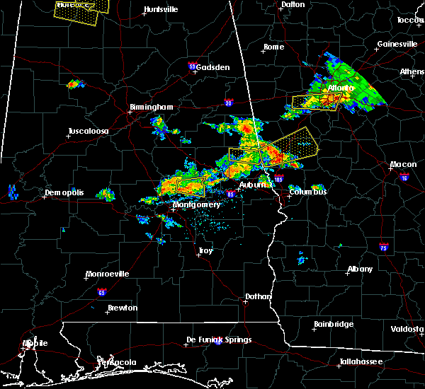 The severe thunderstorm warning for northern chambers county will expire at 530 pm cdt, the storms which prompted the warning have weakened below severe limits, and no longer pose an immediate threat to life or property. therefore, the warning will be allowed to expire. to report severe weather, contact your nearest law enforcement agency. they will relay your report to the national weather service birmingham. The severe thunderstorm warning for northern chambers county will expire at 530 pm cdt, the storms which prompted the warning have weakened below severe limits, and no longer pose an immediate threat to life or property. therefore, the warning will be allowed to expire. to report severe weather, contact your nearest law enforcement agency. they will relay your report to the national weather service birmingham.
|
| 6/22/2018 5:07 PM CDT |
 At 507 pm cdt, severe thunderstorms were located along a line extending from near trammel crossroads to near lagrange, moving northeast at 40 mph (radar indicated). Hazards include 60 mph wind gusts. Expect damage to roofs, siding, and trees. Locations impacted include, stroud, fredonia, post oak forks, veasey creek park, denson, amity park, penton, trammel crossroads, buffalo, sparkling springs, southern harbor, rocky point and stroud creek. At 507 pm cdt, severe thunderstorms were located along a line extending from near trammel crossroads to near lagrange, moving northeast at 40 mph (radar indicated). Hazards include 60 mph wind gusts. Expect damage to roofs, siding, and trees. Locations impacted include, stroud, fredonia, post oak forks, veasey creek park, denson, amity park, penton, trammel crossroads, buffalo, sparkling springs, southern harbor, rocky point and stroud creek.
|
| 6/22/2018 5:00 PM CDT | 911 dispatch center reports multiple power lines down in various areas. time estimated by rada in chambers county AL, 3.5 miles NNW of Penton, AL |
| 6/22/2018 4:56 PM CDT |
 At 456 pm cdt, severe thunderstorms were located along a line extending from 6 miles west of trammel crossroads to lakeview, moving northeast at 40 mph (radar indicated). Hazards include 60 mph wind gusts. Expect damage to roofs, siding, and trees. Locations impacted include, lafayette, stroud, la fayette, chambers county lake, fredonia, post oak forks, veasey creek park, denson, amity park, penton, trammel crossroads, ridge grove, buffalo, sparkling springs, huguley, daviston, southern harbor, rocky point and stroud creek. At 456 pm cdt, severe thunderstorms were located along a line extending from 6 miles west of trammel crossroads to lakeview, moving northeast at 40 mph (radar indicated). Hazards include 60 mph wind gusts. Expect damage to roofs, siding, and trees. Locations impacted include, lafayette, stroud, la fayette, chambers county lake, fredonia, post oak forks, veasey creek park, denson, amity park, penton, trammel crossroads, ridge grove, buffalo, sparkling springs, huguley, daviston, southern harbor, rocky point and stroud creek.
|
| 6/22/2018 4:46 PM CDT |
 At 446 pm cdt, severe thunderstorms were located along a line extending from near dadeville to near chambers county lake, moving northeast at 40 mph (radar indicated). Hazards include 60 mph wind gusts. expect damage to roofs, siding, and trees At 446 pm cdt, severe thunderstorms were located along a line extending from near dadeville to near chambers county lake, moving northeast at 40 mph (radar indicated). Hazards include 60 mph wind gusts. expect damage to roofs, siding, and trees
|
| 6/22/2018 4:46 PM CDT |
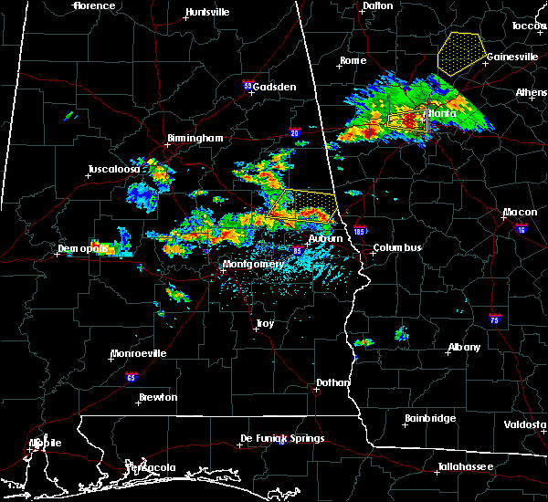 At 446 pm cdt, severe thunderstorms were located along a line extending from near dadeville to near chambers county lake, moving northeast at 40 mph (radar indicated). Hazards include 60 mph wind gusts. expect damage to roofs, siding, and trees At 446 pm cdt, severe thunderstorms were located along a line extending from near dadeville to near chambers county lake, moving northeast at 40 mph (radar indicated). Hazards include 60 mph wind gusts. expect damage to roofs, siding, and trees
|
| 6/15/2017 5:16 PM CDT |
 At 516 pm cdt, severe thunderstorms were located along a line extending from near welch to shorter, moving southeast at 50 mph (radar indicated). Hazards include 60 mph wind gusts and penny size hail. these storms have a history of blowing down trees. expect damage to roofs, siding, and trees At 516 pm cdt, severe thunderstorms were located along a line extending from near welch to shorter, moving southeast at 50 mph (radar indicated). Hazards include 60 mph wind gusts and penny size hail. these storms have a history of blowing down trees. expect damage to roofs, siding, and trees
|
| 4/5/2017 8:47 PM CDT |
 At 847 pm cdt, a confirmed tornado was located over penton, or near stroud, moving northeast at 50 mph (radar confirmed tornado). Hazards include damaging tornado. Flying debris will be dangerous to those caught without shelter. mobile homes will be damaged or destroyed. damage to roofs, windows, and vehicles will occur. tree damage is likely. Locations impacted include, stroud and penton. At 847 pm cdt, a confirmed tornado was located over penton, or near stroud, moving northeast at 50 mph (radar confirmed tornado). Hazards include damaging tornado. Flying debris will be dangerous to those caught without shelter. mobile homes will be damaged or destroyed. damage to roofs, windows, and vehicles will occur. tree damage is likely. Locations impacted include, stroud and penton.
|
| 4/5/2017 8:42 PM CDT | Several trees blown down. possible tornad in chambers county AL, 0.6 miles W of Penton, AL |
| 4/5/2017 8:41 PM CDT | Several trees blown down. possible tornad in chambers county AL, 0.6 miles N of Penton, AL |
| 4/5/2017 8:40 PM CDT | Radar detected tds in northwest chambers count in chambers county AL, 2.9 miles E of Penton, AL |
| 4/5/2017 8:35 PM CDT |
 At 835 pm cdt, a severe thunderstorm capable of producing a tornado was located near trammel crossroads, or 12 miles northwest of lafayette, moving northeast at 50 mph (radar indicated rotation). Hazards include tornado and quarter size hail. Flying debris will be dangerous to those caught without shelter. mobile homes will be damaged or destroyed. damage to roofs, windows, and vehicles will occur. Tree damage is likely. At 835 pm cdt, a severe thunderstorm capable of producing a tornado was located near trammel crossroads, or 12 miles northwest of lafayette, moving northeast at 50 mph (radar indicated rotation). Hazards include tornado and quarter size hail. Flying debris will be dangerous to those caught without shelter. mobile homes will be damaged or destroyed. damage to roofs, windows, and vehicles will occur. Tree damage is likely.
|
| 4/5/2017 5:39 AM CDT |
 At 539 am cdt, a severe thunderstorm was located over penton, or near lafayette, moving northeast at 45 mph (radar indicated). Hazards include 60 mph wind gusts and half dollar size hail. Hail damage to vehicles is expected. expect wind damage to roofs, siding, and trees. Locations impacted include, lafayette, stroud, la fayette, red level, fredonia, post oak forks, veasey creek park, denson, amity park, standing rock, welch, penton, trammel crossroads, ridge grove, buffalo and stroud creek. At 539 am cdt, a severe thunderstorm was located over penton, or near lafayette, moving northeast at 45 mph (radar indicated). Hazards include 60 mph wind gusts and half dollar size hail. Hail damage to vehicles is expected. expect wind damage to roofs, siding, and trees. Locations impacted include, lafayette, stroud, la fayette, red level, fredonia, post oak forks, veasey creek park, denson, amity park, standing rock, welch, penton, trammel crossroads, ridge grove, buffalo and stroud creek.
|
| 4/5/2017 5:24 AM CDT |
 At 524 am cdt, a severe thunderstorm was located near ridge grove, or near camp hill, moving northeast at 45 mph (radar indicated). Hazards include 60 mph wind gusts and half dollar size hail. Hail damage to vehicles is expected. Expect wind damage to roofs, siding, and trees. At 524 am cdt, a severe thunderstorm was located near ridge grove, or near camp hill, moving northeast at 45 mph (radar indicated). Hazards include 60 mph wind gusts and half dollar size hail. Hail damage to vehicles is expected. Expect wind damage to roofs, siding, and trees.
|
| 1/22/2017 2:30 PM CST |
 At 228 pm cst, severe thunderstorms were located along a line extending from 7 miles southwest of franklin to near hamilton to near upatoi, moving east at 65 mph (radar indicated). Hazards include 60 mph wind gusts and quarter size hail. Hail damage to vehicles is expected. expect wind damage to roofs, siding, and trees. locations impacted include, opelika, valley, lanett, roanoke, lafayette, smiths, stroud, smiths station, la fayette, wadley, red level, lakeview, cusseta, beans mill, welch, crystal lake, penton, huguley, fairfax and chambers county lake. A tornado watch remains in effect until 700 pm cst for southeastern and east central alabama. At 228 pm cst, severe thunderstorms were located along a line extending from 7 miles southwest of franklin to near hamilton to near upatoi, moving east at 65 mph (radar indicated). Hazards include 60 mph wind gusts and quarter size hail. Hail damage to vehicles is expected. expect wind damage to roofs, siding, and trees. locations impacted include, opelika, valley, lanett, roanoke, lafayette, smiths, stroud, smiths station, la fayette, wadley, red level, lakeview, cusseta, beans mill, welch, crystal lake, penton, huguley, fairfax and chambers county lake. A tornado watch remains in effect until 700 pm cst for southeastern and east central alabama.
|
| 1/22/2017 1:41 PM CST |
 At 140 pm cst, severe thunderstorms were located along a line extending from near kellyton to near notasulga to near tuskegee national forest, moving east at 65 mph (radar indicated). Hazards include 60 mph wind gusts and quarter size hail. Hail damage to vehicles is expected. Expect wind damage to roofs, siding, and trees. At 140 pm cst, severe thunderstorms were located along a line extending from near kellyton to near notasulga to near tuskegee national forest, moving east at 65 mph (radar indicated). Hazards include 60 mph wind gusts and quarter size hail. Hail damage to vehicles is expected. Expect wind damage to roofs, siding, and trees.
|
| 1/21/2017 9:08 AM CST |
 At 908 am cst, tornado producing storms were located along a line extending from near ridge grove to near beans mill to near griffen mill, moving northeast at 45 mph (radar confirmed tornado). Hazards include damaging tornado. Flying debris will be dangerous to those caught without shelter. mobile homes will be damaged or destroyed. damage to roofs, windows, and vehicles will occur. tree damage is likely. Locations impacted include, opelika, valley, lanett, lafayette, smiths, smiths station, la fayette, lakeview, cusseta, west chambers, beans mill, ridge grove, huguley, trammel crossroads, fairfax, chambers county lake, bleecker, griffen mill, river view and post oak forks. At 908 am cst, tornado producing storms were located along a line extending from near ridge grove to near beans mill to near griffen mill, moving northeast at 45 mph (radar confirmed tornado). Hazards include damaging tornado. Flying debris will be dangerous to those caught without shelter. mobile homes will be damaged or destroyed. damage to roofs, windows, and vehicles will occur. tree damage is likely. Locations impacted include, opelika, valley, lanett, lafayette, smiths, smiths station, la fayette, lakeview, cusseta, west chambers, beans mill, ridge grove, huguley, trammel crossroads, fairfax, chambers county lake, bleecker, griffen mill, river view and post oak forks.
|
| 1/21/2017 8:54 AM CST |
 At 854 am cst, tornado producing storms were located along a line extending from near trammel crossroads to near beauregard to near uchee, moving east at 60 mph (radar confirmed tornado). Hazards include damaging tornado. Flying debris will be dangerous to those caught without shelter. mobile homes will be damaged or destroyed. damage to roofs, windows, and vehicles will occur. tree damage is likely. Locations impacted include, auburn, opelika, valley, lanett, lafayette, smiths, smiths station, la fayette, waverly, lakeview, cusseta, west chambers, beans mill, ridge grove, huguley, trammel crossroads, fairfax, chambers county lake, bleecker and griffen mill. At 854 am cst, tornado producing storms were located along a line extending from near trammel crossroads to near beauregard to near uchee, moving east at 60 mph (radar confirmed tornado). Hazards include damaging tornado. Flying debris will be dangerous to those caught without shelter. mobile homes will be damaged or destroyed. damage to roofs, windows, and vehicles will occur. tree damage is likely. Locations impacted include, auburn, opelika, valley, lanett, lafayette, smiths, smiths station, la fayette, waverly, lakeview, cusseta, west chambers, beans mill, ridge grove, huguley, trammel crossroads, fairfax, chambers county lake, bleecker and griffen mill.
|
| 1/21/2017 8:41 AM CST |
 At 840 am cst, severe thunderstorms capable of producing both tornadoes and extensive straight line wind damage were located along a line extending from near jacksons` gap to near tuskegee national forest to 6 miles southwest of society hill, moving east at 60 mph (radar indicated rotation). Hazards include tornado. Flying debris will be dangerous to those caught without shelter. mobile homes will be damaged or destroyed. damage to roofs, windows, and vehicles will occur. Tree damage is likely. At 840 am cst, severe thunderstorms capable of producing both tornadoes and extensive straight line wind damage were located along a line extending from near jacksons` gap to near tuskegee national forest to 6 miles southwest of society hill, moving east at 60 mph (radar indicated rotation). Hazards include tornado. Flying debris will be dangerous to those caught without shelter. mobile homes will be damaged or destroyed. damage to roofs, windows, and vehicles will occur. Tree damage is likely.
|
| 7/9/2016 2:48 PM CDT |
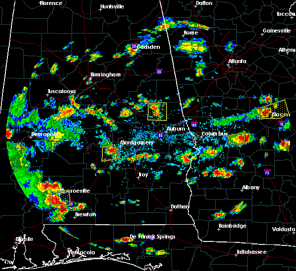 At 248 pm cdt, severe thunderstorms were located along a line extending from near new site to near dadeville, moving southeast at 10 mph (radar indicated). Hazards include 60 mph wind gusts. Expect damage to roofs. siding. And trees. At 248 pm cdt, severe thunderstorms were located along a line extending from near new site to near dadeville, moving southeast at 10 mph (radar indicated). Hazards include 60 mph wind gusts. Expect damage to roofs. siding. And trees.
|
| 6/17/2016 4:42 PM CDT |
 At 442 pm cdt, severe thunderstorms were located along a line extending from 6 miles west of trammel crossroads to near fairfax, moving south at 30 mph (radar indicated). Hazards include 60 mph wind gusts. Expect damage to roofs. siding. and trees. Locations impacted include, valley, lanett, lafayette, la fayette, waverly, cusseta, west chambers, river view, denson, abanda, ridge grove, penton, huguley, trammel crossroads, fairfax, chambers county lake, sparkling springs, oak bowery, sturkie and buffalo. At 442 pm cdt, severe thunderstorms were located along a line extending from 6 miles west of trammel crossroads to near fairfax, moving south at 30 mph (radar indicated). Hazards include 60 mph wind gusts. Expect damage to roofs. siding. and trees. Locations impacted include, valley, lanett, lafayette, la fayette, waverly, cusseta, west chambers, river view, denson, abanda, ridge grove, penton, huguley, trammel crossroads, fairfax, chambers county lake, sparkling springs, oak bowery, sturkie and buffalo.
|
| 6/17/2016 4:22 PM CDT |
 At 421 pm cdt, severe thunderstorms were located along a line extending from trammel crossroads to near lakeview, moving south at 35 mph (radar indicated). Hazards include 60 mph wind gusts. Expect damage to roofs. siding. and trees. Locations impacted include, valley, lanett, lafayette, stroud, la fayette, red level, waverly, lakeview, cusseta, west chambers, welch, ridge grove, penton, huguley, trammel crossroads, fairfax, chambers county lake, river view, post oak forks and standing rock. At 421 pm cdt, severe thunderstorms were located along a line extending from trammel crossroads to near lakeview, moving south at 35 mph (radar indicated). Hazards include 60 mph wind gusts. Expect damage to roofs. siding. and trees. Locations impacted include, valley, lanett, lafayette, stroud, la fayette, red level, waverly, lakeview, cusseta, west chambers, welch, ridge grove, penton, huguley, trammel crossroads, fairfax, chambers county lake, river view, post oak forks and standing rock.
|
| 6/17/2016 4:00 PM CDT |
 At 400 pm cdt, severe thunderstorms were located along a line extending from near corinth to near standing rock, moving south at 20 mph (radar indicated). Hazards include 60 mph wind gusts. Expect damage to roofs. siding. And trees. At 400 pm cdt, severe thunderstorms were located along a line extending from near corinth to near standing rock, moving south at 20 mph (radar indicated). Hazards include 60 mph wind gusts. Expect damage to roofs. siding. And trees.
|
| 7/4/2015 12:13 AM CDT |
 At 1213 am cdt, severe thunderstorms were located along a line extending from near malone to near sparkling springs to near sturkie, moving east at 60 mph (radar indicated). Hazards include 60 mph wind gusts. Expect damage to roofs. Siding and trees. At 1213 am cdt, severe thunderstorms were located along a line extending from near malone to near sparkling springs to near sturkie, moving east at 60 mph (radar indicated). Hazards include 60 mph wind gusts. Expect damage to roofs. Siding and trees.
|
| 6/24/2015 7:09 PM CDT |
 The severe thunderstorm warning for southwestern randolph and northwestern chambers counties will expire at 715 pm cdt, the storm which prompted the warning has moved out of the area. therefore the warning will be allowed to expire. however heavy rain is still possible with this thunderstorm. a severe thunderstorm watch remains in effect until 900 pm cdt for east central alabama. to report severe weather, contact your nearest law enforcement agency. they will relay your report to the national weather service birmingham. The severe thunderstorm warning for southwestern randolph and northwestern chambers counties will expire at 715 pm cdt, the storm which prompted the warning has moved out of the area. therefore the warning will be allowed to expire. however heavy rain is still possible with this thunderstorm. a severe thunderstorm watch remains in effect until 900 pm cdt for east central alabama. to report severe weather, contact your nearest law enforcement agency. they will relay your report to the national weather service birmingham.
|
| 6/24/2015 6:43 PM CDT |
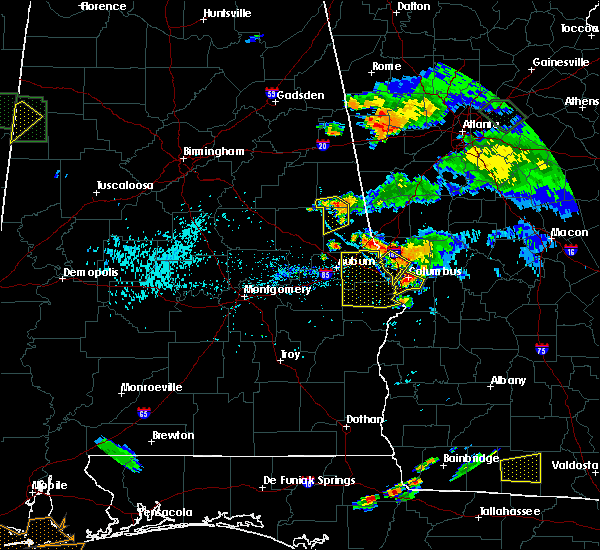 At 643 pm cdt, a severe thunderstorm was located over abanda, or 8 miles west of roanoke, moving southwest at 15 mph (radar indicated). Hazards include 60 mph wind gusts. Expect damage to roofs. siding and trees. Locations impacted include, roanoke, wadley, red level, trammel crossroads, sparkling springs, abanda, penton and dickert. At 643 pm cdt, a severe thunderstorm was located over abanda, or 8 miles west of roanoke, moving southwest at 15 mph (radar indicated). Hazards include 60 mph wind gusts. Expect damage to roofs. siding and trees. Locations impacted include, roanoke, wadley, red level, trammel crossroads, sparkling springs, abanda, penton and dickert.
|
| 6/24/2015 6:20 PM CDT |
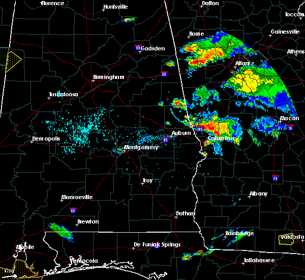 At 620 pm cdt, a severe thunderstorm was located near crystal lake, or near roanoke, moving southwest at 15 mph (radar indicated). Hazards include 60 mph wind gusts and quarter size hail. Hail damage to vehicles is expected. Expect wind damage to roofs, siding and trees. At 620 pm cdt, a severe thunderstorm was located near crystal lake, or near roanoke, moving southwest at 15 mph (radar indicated). Hazards include 60 mph wind gusts and quarter size hail. Hail damage to vehicles is expected. Expect wind damage to roofs, siding and trees.
|
| 6/18/2015 2:17 PM CDT | At 216 pm cdt, a severe thunderstorm was located over denson, or near lanett, moving north at 5 mph (radar indicated). Hazards include 60 mph wind gusts and quarter size hail. Hail damage to vehicles is expected. Expect wind damage to roofs, siding and trees. |
| 7/24/2013 1:10 PM CDT | Corrected for time of event. a few trees were blown down in western chambers county. many limbs were also blown down and corn was flattene in chambers county AL, 4.4 miles NE of Penton, AL |
| 7/24/2013 12:52 PM CDT | A few trees were blown down in western chambers county. many limbs were also blown down and corn was flattene in chambers county AL, 4.4 miles NE of Penton, AL |
| 7/1/2012 3:54 PM CDT | Quarter sized hail reported 0.6 miles W of Penton, AL, quarter sized hail reported on highway 77. |
| 1/1/0001 12:00 AM | Several trees were blown down along cr160 north of lafayette. at least 6 homes suffered roof damage and several autos were damaged by fallen trees. possible tornad in chambers county AL, 4.1 miles W of Penton, AL |
Hail Maps for Penton, AL
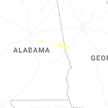


Connect with Interactive Hail Maps