

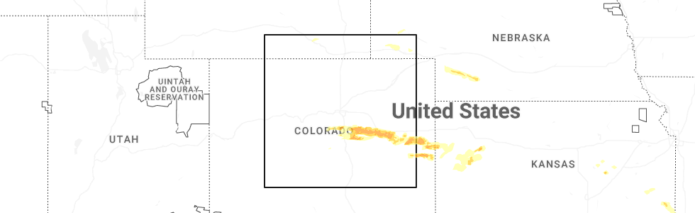
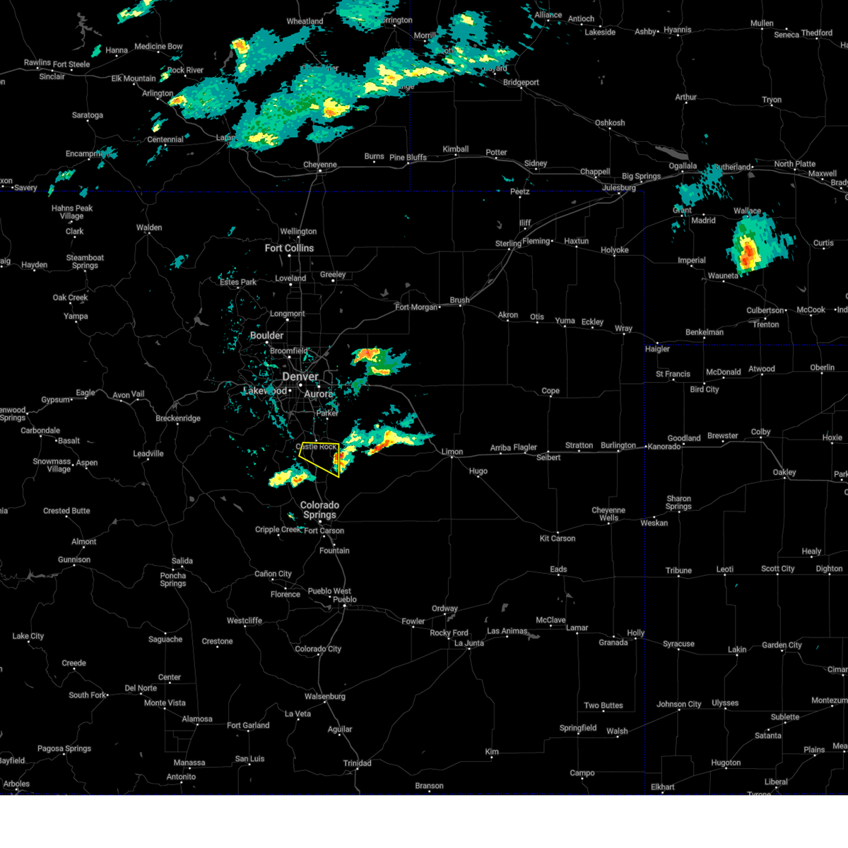
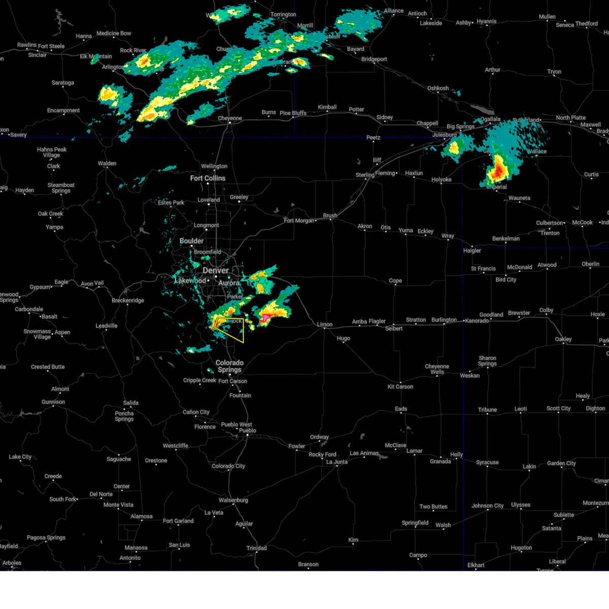
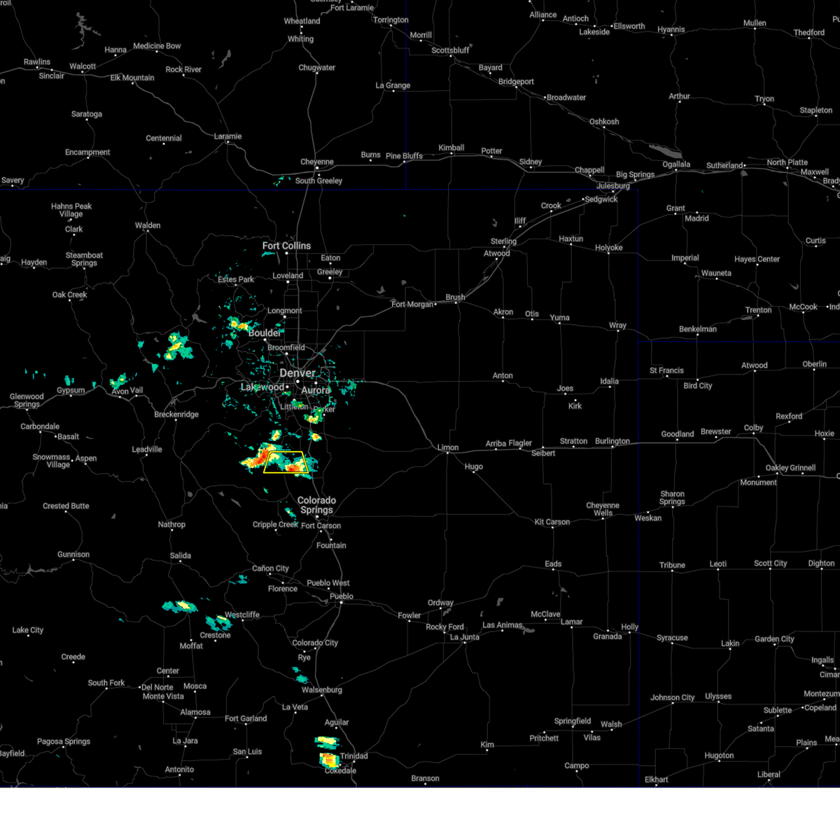
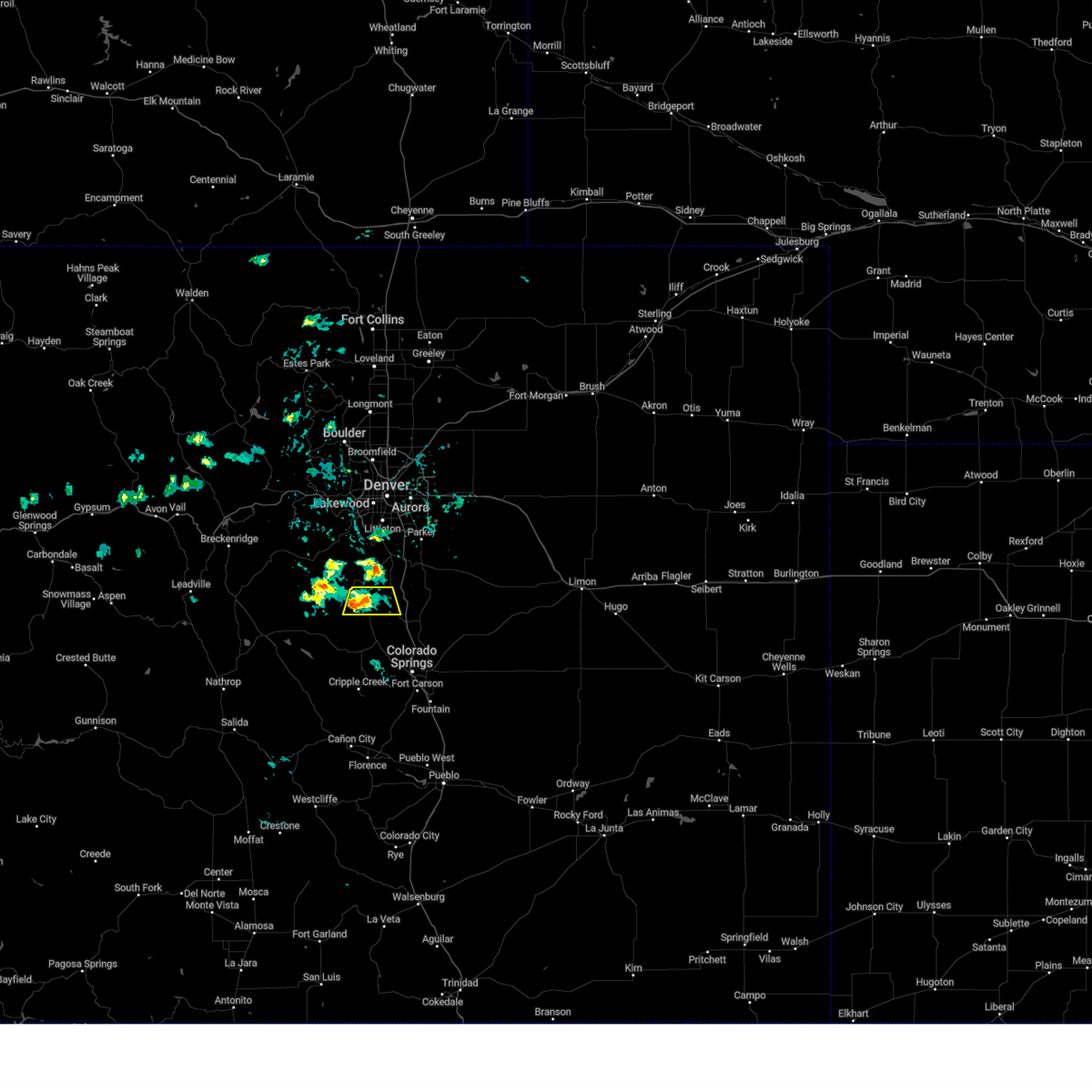
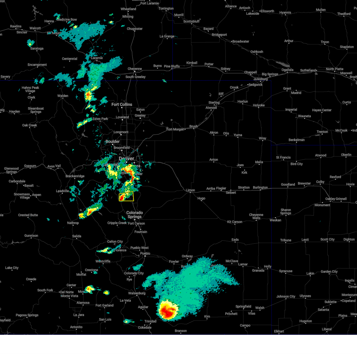
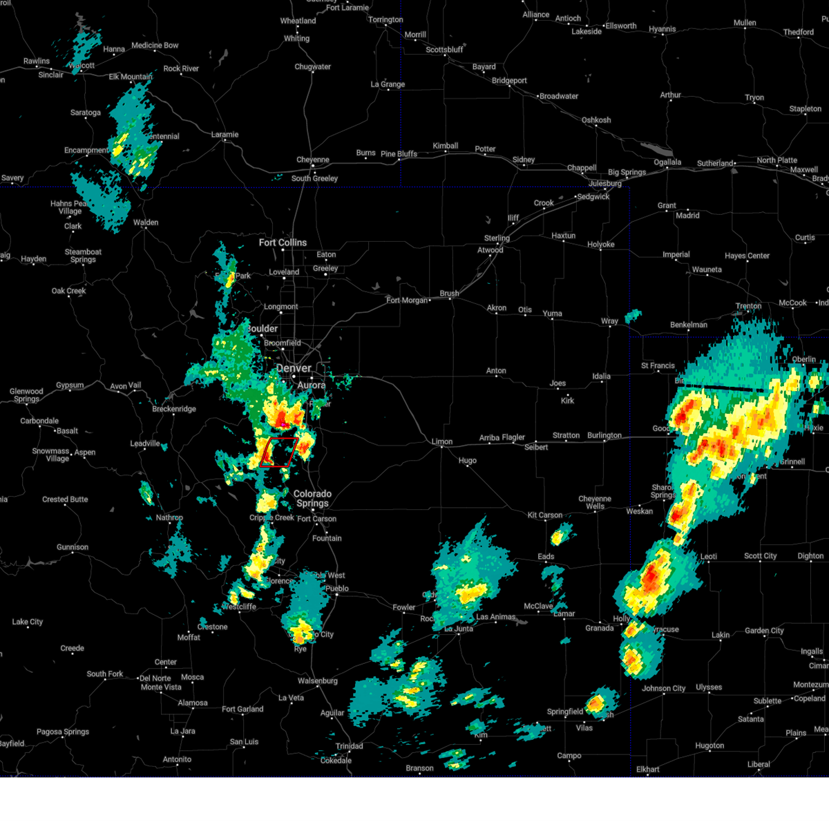
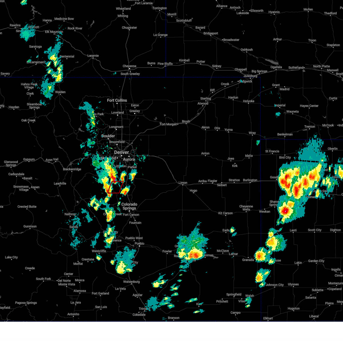
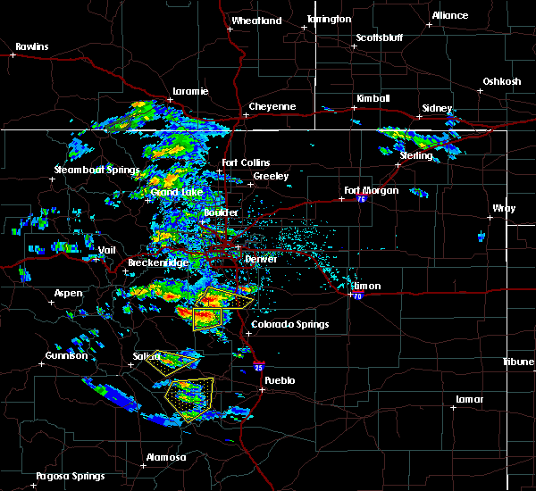
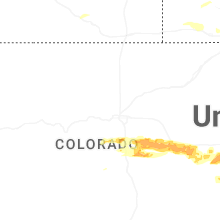
Hail Map for Perry Park, CO
The Perry Park, CO area has had 0 reports of on-the-ground hail by trained spotters, and has been under severe weather warnings 6 times during the past 12 months. Doppler radar has detected hail at or near Perry Park, CO on 61 occasions, including 3 occasions during the past year.
| Name: | Perry Park, CO |
| Where Located: | 33.1 miles S of Denver, CO |
| Map: | Google Map for Perry Park, CO |
| Population: | 1646 |
| Housing Units: | 748 |
| More Info: | Search Google for Perry Park, CO |
1
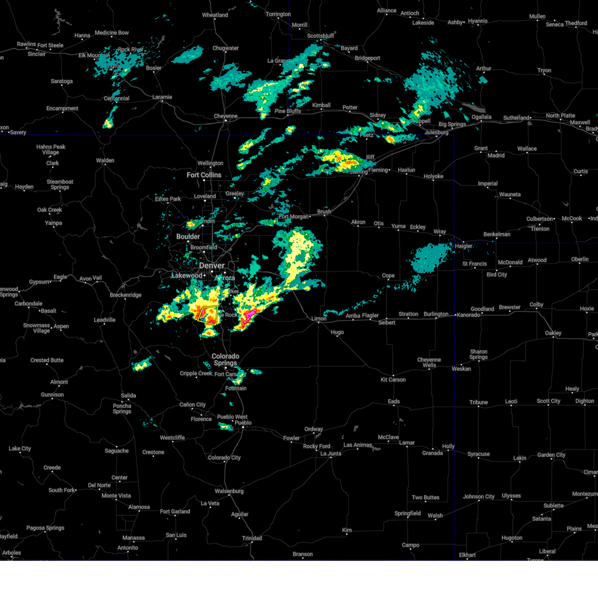
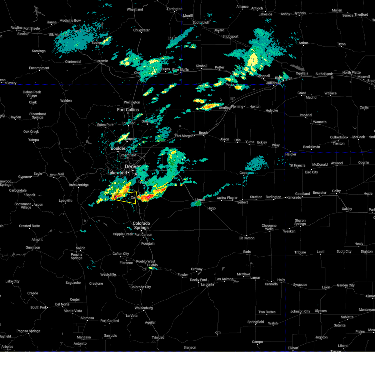
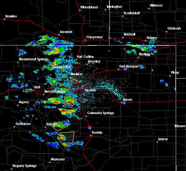
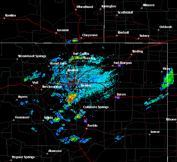
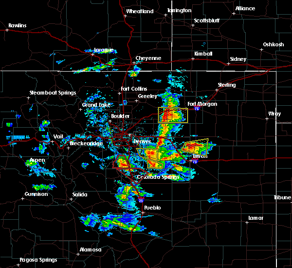
The Top Recent Hail Date for Perry Park, CO is Saturday, May 24, 2025 (16th out of 61)
Hail and Wind Damage Spotted near Perry Park, CO
| Date / Time | Report Details |
|---|---|
| 5/24/2025 7:43 PM MDT |
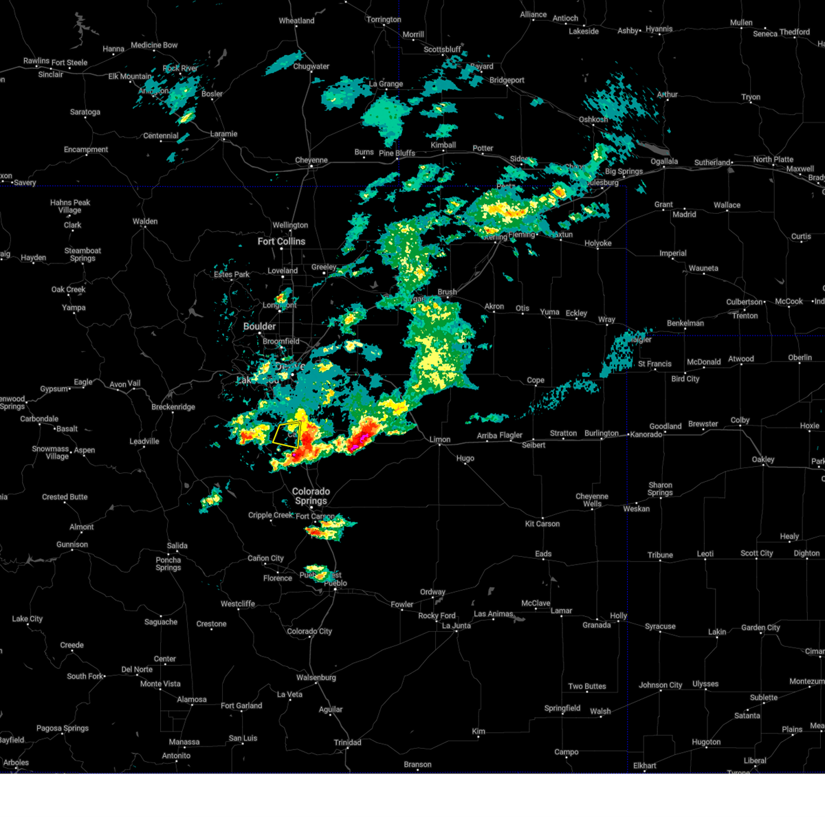 The storm which prompted the warning has moved out of the area. therefore, the warning will be allowed to expire. a severe thunderstorm warning still remains in effect for southeastern douglas and west central elbert counties until 830 pm. The storm which prompted the warning has moved out of the area. therefore, the warning will be allowed to expire. a severe thunderstorm warning still remains in effect for southeastern douglas and west central elbert counties until 830 pm.
|
| 5/24/2025 7:19 PM MDT |
 the severe thunderstorm warning has been cancelled and is no longer in effect the severe thunderstorm warning has been cancelled and is no longer in effect
|
| 5/24/2025 7:19 PM MDT |
 At 719 pm mdt, a severe thunderstorm was located over sprucewood, or 28 miles south of denver, moving east at 25 mph (radar indicated). Hazards include quarter size hail. Damage to vehicles is expected. Locations impacted include, perry park, sprucewood and shamballa. At 719 pm mdt, a severe thunderstorm was located over sprucewood, or 28 miles south of denver, moving east at 25 mph (radar indicated). Hazards include quarter size hail. Damage to vehicles is expected. Locations impacted include, perry park, sprucewood and shamballa.
|
| 5/24/2025 6:57 PM MDT |
 Svrbou the national weather service in denver has issued a * severe thunderstorm warning for, southwestern jefferson county in central colorado, central douglas county in northeastern colorado, * until 745 pm mdt. * at 657 pm mdt, a severe thunderstorm was located near buffalo creek, or 33 miles southwest of denver, moving east at 20 mph (radar indicated). Hazards include half dollar size hail. damage to vehicles is expected Svrbou the national weather service in denver has issued a * severe thunderstorm warning for, southwestern jefferson county in central colorado, central douglas county in northeastern colorado, * until 745 pm mdt. * at 657 pm mdt, a severe thunderstorm was located near buffalo creek, or 33 miles southwest of denver, moving east at 20 mph (radar indicated). Hazards include half dollar size hail. damage to vehicles is expected
|
| 5/24/2025 3:33 PM MDT |
 The storm which prompted the warning has weakened below severe limits, and has exited the warned area. therefore, the warning has been allowed to expire. however, small hail and gusty winds are still possible with this thunderstorm. a severe thunderstorm watch remains in effect until 800 pm mdt saturday for a portion of northeast colorado. The storm which prompted the warning has weakened below severe limits, and has exited the warned area. therefore, the warning has been allowed to expire. however, small hail and gusty winds are still possible with this thunderstorm. a severe thunderstorm watch remains in effect until 800 pm mdt saturday for a portion of northeast colorado.
|
| 5/24/2025 2:49 PM MDT |
 Svrbou the national weather service in denver has issued a * severe thunderstorm warning for, southeastern douglas county in northeastern colorado, * until 330 pm mdt. * at 249 pm mdt, a severe thunderstorm was located near perry park, or 30 miles south of denver, moving east at 30 mph (radar indicated). Hazards include half dollar size hail. damage to vehicles is expected Svrbou the national weather service in denver has issued a * severe thunderstorm warning for, southeastern douglas county in northeastern colorado, * until 330 pm mdt. * at 249 pm mdt, a severe thunderstorm was located near perry park, or 30 miles south of denver, moving east at 30 mph (radar indicated). Hazards include half dollar size hail. damage to vehicles is expected
|
| 6/9/2024 6:42 PM MDT |
 The storm which prompted the warning has weakened below severe limits, and no longer poses an immediate threat to life or property. therefore, the warning will be allowed to expire. however, heavy rain and flash flooding are occuring with this thunderstorm. The storm which prompted the warning has weakened below severe limits, and no longer poses an immediate threat to life or property. therefore, the warning will be allowed to expire. however, heavy rain and flash flooding are occuring with this thunderstorm.
|
| 6/9/2024 6:18 PM MDT |
 At 617 pm mdt, a severe thunderstorm was located near castle rock, or 27 miles south of denver, moving south at 5 mph (radar indicated). Hazards include quarter size hail. Damage to vehicles is expected. Locations impacted include, castle rock, franktown, perry park, and ponderosa park. At 617 pm mdt, a severe thunderstorm was located near castle rock, or 27 miles south of denver, moving south at 5 mph (radar indicated). Hazards include quarter size hail. Damage to vehicles is expected. Locations impacted include, castle rock, franktown, perry park, and ponderosa park.
|
| 6/9/2024 5:52 PM MDT |
 Svrbou the national weather service in denver colorado has issued a * severe thunderstorm warning for, northeastern douglas county in northeastern colorado, * until 645 pm mdt. * at 552 pm mdt, severe thunderstorms were located along a line extending from parker to castle rock, or along a line extending from 18 miles southeast of denver to 34 miles north of colorado springs, moving south at 10 mph (radar indicated). Hazards include quarter size hail. damage to vehicles is expected Svrbou the national weather service in denver colorado has issued a * severe thunderstorm warning for, northeastern douglas county in northeastern colorado, * until 645 pm mdt. * at 552 pm mdt, severe thunderstorms were located along a line extending from parker to castle rock, or along a line extending from 18 miles southeast of denver to 34 miles north of colorado springs, moving south at 10 mph (radar indicated). Hazards include quarter size hail. damage to vehicles is expected
|
| 8/2/2023 8:18 PM MDT |
 At 817 pm mdt, severe thunderstorms were located along a line extending from near red rocks park to near louviers to near greenland, or along a line extending from 14 miles west of denver to 82 miles southwest of fort morgan to 24 miles north of colorado springs, moving northeast at 35 mph (radar indicated). Hazards include 60 mph wind gusts and penny size hail. Expect damage to roofs, siding, and trees. severe thunderstorms will be near, highlands ranch and castle pines around 825 pm mdt. littleton, wheat ridge and lone tree around 830 pm mdt. southeastern arvada, centennial, parker and greenwood village around 835 pm mdt. other locations in the path of these severe thunderstorms include aurora, franktown, federal heights, elizabeth, the pinery, northglenn, buckley sfb, ponderosa park, arapahoe park, southeastern westminster, thornton, commerce city, brighton and todd creek. hail threat, radar indicated max hail size, 0. 75 in wind threat, radar indicated max wind gust, 60 mph. At 817 pm mdt, severe thunderstorms were located along a line extending from near red rocks park to near louviers to near greenland, or along a line extending from 14 miles west of denver to 82 miles southwest of fort morgan to 24 miles north of colorado springs, moving northeast at 35 mph (radar indicated). Hazards include 60 mph wind gusts and penny size hail. Expect damage to roofs, siding, and trees. severe thunderstorms will be near, highlands ranch and castle pines around 825 pm mdt. littleton, wheat ridge and lone tree around 830 pm mdt. southeastern arvada, centennial, parker and greenwood village around 835 pm mdt. other locations in the path of these severe thunderstorms include aurora, franktown, federal heights, elizabeth, the pinery, northglenn, buckley sfb, ponderosa park, arapahoe park, southeastern westminster, thornton, commerce city, brighton and todd creek. hail threat, radar indicated max hail size, 0. 75 in wind threat, radar indicated max wind gust, 60 mph.
|
| 7/26/2023 1:26 PM MDT |
 At 125 pm mdt, a severe thunderstorm was located 4 miles north of larkspur, or 29 miles south of denver, moving east at 30 mph (radar indicated). Hazards include 60 mph wind gusts and half dollar size hail. Expect damage to roofs, siding, and trees. hail damage to vehicles is expected. this severe thunderstorm will be near, greenland around 135 pm mdt. other locations in the path of this severe thunderstorm include elbert. hail threat, radar indicated max hail size, 1. 25 in wind threat, radar indicated max wind gust, 60 mph. At 125 pm mdt, a severe thunderstorm was located 4 miles north of larkspur, or 29 miles south of denver, moving east at 30 mph (radar indicated). Hazards include 60 mph wind gusts and half dollar size hail. Expect damage to roofs, siding, and trees. hail damage to vehicles is expected. this severe thunderstorm will be near, greenland around 135 pm mdt. other locations in the path of this severe thunderstorm include elbert. hail threat, radar indicated max hail size, 1. 25 in wind threat, radar indicated max wind gust, 60 mph.
|
| 7/10/2023 12:53 PM MDT |
 At 1253 pm mdt, a severe thunderstorm was located over southwestern castle rock, or 25 miles south of denver, moving east at 20 mph (radar indicated). Hazards include 60 mph wind gusts. Expect damage to roofs, siding, and trees. locations impacted include, franktown, the pinery and ponderosa park. hail threat, radar indicated max hail size, <. 75 in wind threat, radar indicated max wind gust, 60 mph. At 1253 pm mdt, a severe thunderstorm was located over southwestern castle rock, or 25 miles south of denver, moving east at 20 mph (radar indicated). Hazards include 60 mph wind gusts. Expect damage to roofs, siding, and trees. locations impacted include, franktown, the pinery and ponderosa park. hail threat, radar indicated max hail size, <. 75 in wind threat, radar indicated max wind gust, 60 mph.
|
| 7/10/2023 12:18 PM MDT |
 At 1218 pm mdt, a severe thunderstorm was located over sprucewood, or 27 miles south of denver, moving northeast at 25 mph (radar indicated). Hazards include 60 mph wind gusts. Expect damage to roofs, siding, and trees. this severe thunderstorm will be near, roxborough park around 1235 pm mdt. other locations in the path of this severe thunderstorm include castle rock, sedalia, louviers, southwestern centennial, highlands ranch, parker, lone tree, castle pines and the pinery. hail threat, radar indicated max hail size, <. 75 in wind threat, radar indicated max wind gust, 60 mph. At 1218 pm mdt, a severe thunderstorm was located over sprucewood, or 27 miles south of denver, moving northeast at 25 mph (radar indicated). Hazards include 60 mph wind gusts. Expect damage to roofs, siding, and trees. this severe thunderstorm will be near, roxborough park around 1235 pm mdt. other locations in the path of this severe thunderstorm include castle rock, sedalia, louviers, southwestern centennial, highlands ranch, parker, lone tree, castle pines and the pinery. hail threat, radar indicated max hail size, <. 75 in wind threat, radar indicated max wind gust, 60 mph.
|
| 7/5/2023 2:41 PM MDT |
 The severe thunderstorm warning for southwestern douglas county will expire at 245 pm mdt, the storm which prompted the warning has weakened below severe limits, and no longer poses an immediate threat to life or property. therefore, the warning will be allowed to expire. however small hail, gusty winds and heavy rain are still possible with this thunderstorm. The severe thunderstorm warning for southwestern douglas county will expire at 245 pm mdt, the storm which prompted the warning has weakened below severe limits, and no longer poses an immediate threat to life or property. therefore, the warning will be allowed to expire. however small hail, gusty winds and heavy rain are still possible with this thunderstorm.
|
| 7/5/2023 2:18 PM MDT |
 At 218 pm mdt, a severe thunderstorm was located over westcreek, or 28 miles northwest of colorado springs, moving east at 20 mph (radar indicated). Hazards include 60 mph wind gusts and quarter size hail. Expect damage to roofs, siding, and trees. hail damage to vehicles is expected. this severe thunderstorm will remain over mainly rural areas of southwestern douglas county. hail threat, radar indicated max hail size, 1. 00 in wind threat, radar indicated max wind gust, 60 mph. At 218 pm mdt, a severe thunderstorm was located over westcreek, or 28 miles northwest of colorado springs, moving east at 20 mph (radar indicated). Hazards include 60 mph wind gusts and quarter size hail. Expect damage to roofs, siding, and trees. hail damage to vehicles is expected. this severe thunderstorm will remain over mainly rural areas of southwestern douglas county. hail threat, radar indicated max hail size, 1. 00 in wind threat, radar indicated max wind gust, 60 mph.
|
| 6/11/2023 3:20 PM MDT |
 At 320 pm mdt, a severe thunderstorm was located 4 miles east of westcreek, or 26 miles northwest of colorado springs, moving east at 15 mph (radar indicated). Hazards include ping pong ball size hail. People and animals outdoors will be injured. Expect damage to roofs, siding, windows, and vehicles. At 320 pm mdt, a severe thunderstorm was located 4 miles east of westcreek, or 26 miles northwest of colorado springs, moving east at 15 mph (radar indicated). Hazards include ping pong ball size hail. People and animals outdoors will be injured. Expect damage to roofs, siding, windows, and vehicles.
|
| 5/10/2023 3:30 PM MDT |
 At 329 pm mdt, a severe thunderstorm capable of producing a tornado was located near devil`s head, or 31 miles south of denver, moving north at 35 mph (radar indicated rotation). Hazards include tornado and half dollar size hail. Flying debris will be dangerous to those caught without shelter. mobile homes will be damaged or destroyed. damage to roofs, windows, and vehicles will occur. tree damage is likely. this dangerous storm will be near, sprucewood around 335 pm mdt. south platte around 340 pm mdt. Other locations in the path of this tornadic thunderstorm include roxborough park, sedalia, louviers and southern highlands ranch. At 329 pm mdt, a severe thunderstorm capable of producing a tornado was located near devil`s head, or 31 miles south of denver, moving north at 35 mph (radar indicated rotation). Hazards include tornado and half dollar size hail. Flying debris will be dangerous to those caught without shelter. mobile homes will be damaged or destroyed. damage to roofs, windows, and vehicles will occur. tree damage is likely. this dangerous storm will be near, sprucewood around 335 pm mdt. south platte around 340 pm mdt. Other locations in the path of this tornadic thunderstorm include roxborough park, sedalia, louviers and southern highlands ranch.
|
| 5/10/2023 3:22 PM MDT |
 At 321 pm mdt, a severe thunderstorm was located near larkspur, or 29 miles north of colorado springs, moving north at 25 mph (radar indicated). Hazards include 60 mph wind gusts and quarter size hail. Expect damage to roofs, siding, and trees. hail damage to vehicles is expected. this severe thunderstorm will be near, castle rock around 330 pm mdt. other locations in the path of this severe thunderstorm include franktown, sedalia, the pinery, eastern highlands ranch, parker, lone tree and castle pines. hail threat, radar indicated max hail size, 1. 00 in wind threat, radar indicated max wind gust, 60 mph. At 321 pm mdt, a severe thunderstorm was located near larkspur, or 29 miles north of colorado springs, moving north at 25 mph (radar indicated). Hazards include 60 mph wind gusts and quarter size hail. Expect damage to roofs, siding, and trees. hail damage to vehicles is expected. this severe thunderstorm will be near, castle rock around 330 pm mdt. other locations in the path of this severe thunderstorm include franktown, sedalia, the pinery, eastern highlands ranch, parker, lone tree and castle pines. hail threat, radar indicated max hail size, 1. 00 in wind threat, radar indicated max wind gust, 60 mph.
|
| 5/10/2023 3:12 PM MDT |
 At 312 pm mdt, a severe thunderstorm capable of producing a tornado was located near deckers, or 33 miles northwest of colorado springs, moving north at 25 mph (radar indicated rotation). Hazards include tornado and half dollar size hail. Flying debris will be dangerous to those caught without shelter. mobile homes will be damaged or destroyed. damage to roofs, windows, and vehicles will occur. tree damage is likely. This tornadic thunderstorm will remain over mainly rural areas of southwestern douglas county. At 312 pm mdt, a severe thunderstorm capable of producing a tornado was located near deckers, or 33 miles northwest of colorado springs, moving north at 25 mph (radar indicated rotation). Hazards include tornado and half dollar size hail. Flying debris will be dangerous to those caught without shelter. mobile homes will be damaged or destroyed. damage to roofs, windows, and vehicles will occur. tree damage is likely. This tornadic thunderstorm will remain over mainly rural areas of southwestern douglas county.
|
| 5/10/2023 2:57 PM MDT |
 At 257 pm mdt, a severe thunderstorm capable of producing a tornado was located near westcreek, or 29 miles northwest of colorado springs, moving northeast at 30 mph (radar indicated rotation). Hazards include tornado and quarter size hail. Flying debris will be dangerous to those caught without shelter. mobile homes will be damaged or destroyed. damage to roofs, windows, and vehicles will occur. tree damage is likely. this dangerous storm will be near, westcreek around 300 pm mdt. deckers around 310 pm mdt. devil`s head around 315 pm mdt. Other locations in the path of this tornadic thunderstorm include perry park. At 257 pm mdt, a severe thunderstorm capable of producing a tornado was located near westcreek, or 29 miles northwest of colorado springs, moving northeast at 30 mph (radar indicated rotation). Hazards include tornado and quarter size hail. Flying debris will be dangerous to those caught without shelter. mobile homes will be damaged or destroyed. damage to roofs, windows, and vehicles will occur. tree damage is likely. this dangerous storm will be near, westcreek around 300 pm mdt. deckers around 310 pm mdt. devil`s head around 315 pm mdt. Other locations in the path of this tornadic thunderstorm include perry park.
|
| 5/10/2023 2:56 PM MDT |
 At 255 pm mdt, a severe thunderstorm capable of producing a tornado was located over sprucewood, or 25 miles south of denver, moving northeast at 35 mph (radar indicated rotation). Hazards include tornado and half dollar size hail. Flying debris will be dangerous to those caught without shelter. mobile homes will be damaged or destroyed. damage to roofs, windows, and vehicles will occur. tree damage is likely. this dangerous storm will be near, roxborough park and sedalia around 310 pm mdt. louviers around 315 pm mdt. Other locations in the path of this tornadic thunderstorm include chatfield reservoir, castle pines, highlands ranch, lone tree, southern centennial and southern littleton. At 255 pm mdt, a severe thunderstorm capable of producing a tornado was located over sprucewood, or 25 miles south of denver, moving northeast at 35 mph (radar indicated rotation). Hazards include tornado and half dollar size hail. Flying debris will be dangerous to those caught without shelter. mobile homes will be damaged or destroyed. damage to roofs, windows, and vehicles will occur. tree damage is likely. this dangerous storm will be near, roxborough park and sedalia around 310 pm mdt. louviers around 315 pm mdt. Other locations in the path of this tornadic thunderstorm include chatfield reservoir, castle pines, highlands ranch, lone tree, southern centennial and southern littleton.
|
| 7/6/2022 4:12 PM MDT |
 The severe thunderstorm warning for southeastern douglas county will expire at 415 pm mdt, the storm which prompted the warning has moved out of the area. therefore, the warning will be allowed to expire. a severe thunderstorm watch remains in effect until 900 pm mdt for northeastern colorado. The severe thunderstorm warning for southeastern douglas county will expire at 415 pm mdt, the storm which prompted the warning has moved out of the area. therefore, the warning will be allowed to expire. a severe thunderstorm watch remains in effect until 900 pm mdt for northeastern colorado.
|
| 7/6/2022 3:28 PM MDT |
 At 328 pm mdt, a severe thunderstorm was located 5 miles southwest of perry park, or 27 miles northwest of colorado springs, moving east at 20 mph (radar indicated). Hazards include 60 mph wind gusts and quarter size hail. Expect damage to roofs, siding, and trees. hail damage to vehicles is expected. this severe thunderstorm will be near, perry park around 335 pm mdt. other locations in the path of this severe thunderstorm include larkspur and greenland. hail threat, radar indicated max hail size, 1. 00 in wind threat, radar indicated max wind gust, 60 mph. At 328 pm mdt, a severe thunderstorm was located 5 miles southwest of perry park, or 27 miles northwest of colorado springs, moving east at 20 mph (radar indicated). Hazards include 60 mph wind gusts and quarter size hail. Expect damage to roofs, siding, and trees. hail damage to vehicles is expected. this severe thunderstorm will be near, perry park around 335 pm mdt. other locations in the path of this severe thunderstorm include larkspur and greenland. hail threat, radar indicated max hail size, 1. 00 in wind threat, radar indicated max wind gust, 60 mph.
|
| 7/6/2022 3:01 PM MDT |
 At 301 pm mdt, a severe thunderstorm was located over cheesman reservoir, or 34 miles northwest of colorado springs, moving east at 20 mph (radar indicated). Hazards include 60 mph wind gusts and quarter size hail. Expect damage to roofs, siding, and trees. hail damage to vehicles is expected. this severe thunderstorm will be near, westcreek around 315 pm mdt. other locations in the path of this severe thunderstorm include devil`s head and perry park. hail threat, radar indicated max hail size, 1. 00 in wind threat, radar indicated max wind gust, 60 mph. At 301 pm mdt, a severe thunderstorm was located over cheesman reservoir, or 34 miles northwest of colorado springs, moving east at 20 mph (radar indicated). Hazards include 60 mph wind gusts and quarter size hail. Expect damage to roofs, siding, and trees. hail damage to vehicles is expected. this severe thunderstorm will be near, westcreek around 315 pm mdt. other locations in the path of this severe thunderstorm include devil`s head and perry park. hail threat, radar indicated max hail size, 1. 00 in wind threat, radar indicated max wind gust, 60 mph.
|
| 6/5/2021 7:04 PM MDT |
 At 704 pm mdt, a severe thunderstorm was located near castle rock, or 26 miles south of denver, moving northeast at 5 mph (radar indicated). Hazards include quarter size hail. damage to vehicles is expected At 704 pm mdt, a severe thunderstorm was located near castle rock, or 26 miles south of denver, moving northeast at 5 mph (radar indicated). Hazards include quarter size hail. damage to vehicles is expected
|
| 7/3/2020 2:34 PM MDT |
 At 234 pm mdt, a severe thunderstorm was located near perry park, or 29 miles south of denver, moving northeast at 10 mph (radar indicated). Hazards include 60 mph wind gusts and quarter size hail. Expect damage to roofs, siding, and trees. hail damage to vehicles is expected. Locations impacted include, southwestern castle rock, roxborough park, sprucewood, perry park and devil`s head. At 234 pm mdt, a severe thunderstorm was located near perry park, or 29 miles south of denver, moving northeast at 10 mph (radar indicated). Hazards include 60 mph wind gusts and quarter size hail. Expect damage to roofs, siding, and trees. hail damage to vehicles is expected. Locations impacted include, southwestern castle rock, roxborough park, sprucewood, perry park and devil`s head.
|
| 7/3/2020 2:16 PM MDT |
 At 216 pm mdt, a severe thunderstorm was located over perry park, or 31 miles northwest of colorado springs, moving northeast at 10 mph (radar indicated). Hazards include 60 mph wind gusts and half dollar size hail. Expect damage to roofs, siding, and trees. Hail damage to vehicles is expected. At 216 pm mdt, a severe thunderstorm was located over perry park, or 31 miles northwest of colorado springs, moving northeast at 10 mph (radar indicated). Hazards include 60 mph wind gusts and half dollar size hail. Expect damage to roofs, siding, and trees. Hail damage to vehicles is expected.
|
| 6/26/2020 2:39 PM MDT |
 The national weather service in denver colorado has issued a * severe thunderstorm warning for. northeastern douglas county in northeastern colorado. northwestern elbert county in east central colorado. until 330 pm mdt. At 238 pm mdt, a severe thunderstorm was located over northwestern. The national weather service in denver colorado has issued a * severe thunderstorm warning for. northeastern douglas county in northeastern colorado. northwestern elbert county in east central colorado. until 330 pm mdt. At 238 pm mdt, a severe thunderstorm was located over northwestern.
|
| 6/6/2020 4:44 PM MDT |
 At 444 pm mdt, severe thunderstorms were located along a line extending from 8 miles south of grover to near orchard to 5 miles southwest of leader to 3 miles east of elbert, or along a line extending from 40 miles southeast of cheyenne to 20 miles west of fort morgan to 43 miles east of denver to 27 miles northeast of colorado springs, moving east at 35 mph. these are very dangerous storms (radar indicated). Hazards include 80 mph wind gusts. Flying debris will be dangerous to those caught without shelter. mobile homes will be heavily damaged. expect considerable damage to roofs, windows, and vehicles. extensive tree damage and power outages are likely. locations impacted include, eastern denver, southeastern greeley, aurora, eastern centennial, southeastern highlands ranch, castle rock, eastern commerce city, parker, elbert, greenwood village, lone tree, denver international airport, d. i. A terminal and concourses, lochbuie, hudson, bennett, kersey, elizabeth, keenesburg and kiowa. At 444 pm mdt, severe thunderstorms were located along a line extending from 8 miles south of grover to near orchard to 5 miles southwest of leader to 3 miles east of elbert, or along a line extending from 40 miles southeast of cheyenne to 20 miles west of fort morgan to 43 miles east of denver to 27 miles northeast of colorado springs, moving east at 35 mph. these are very dangerous storms (radar indicated). Hazards include 80 mph wind gusts. Flying debris will be dangerous to those caught without shelter. mobile homes will be heavily damaged. expect considerable damage to roofs, windows, and vehicles. extensive tree damage and power outages are likely. locations impacted include, eastern denver, southeastern greeley, aurora, eastern centennial, southeastern highlands ranch, castle rock, eastern commerce city, parker, elbert, greenwood village, lone tree, denver international airport, d. i. A terminal and concourses, lochbuie, hudson, bennett, kersey, elizabeth, keenesburg and kiowa.
|
| 6/6/2020 3:56 PM MDT |
 At 355 pm mdt, severe thunderstorms were located along a line extending from 6 miles south of carr to 3 miles east of dacono to aurora to 5 miles east of greenland, or along a line extending from 21 miles northeast of fort collins to 24 miles south of greeley to 10 miles east of denver to 22 miles north of colorado springs, moving northeast at 60 mph. these are very dangerous storms (radar indicated). Hazards include 80 mph wind gusts. Flying debris will be dangerous to those caught without shelter. mobile homes will be heavily damaged. expect considerable damage to roofs, windows, and vehicles. Extensive tree damage and power outages are likely. At 355 pm mdt, severe thunderstorms were located along a line extending from 6 miles south of carr to 3 miles east of dacono to aurora to 5 miles east of greenland, or along a line extending from 21 miles northeast of fort collins to 24 miles south of greeley to 10 miles east of denver to 22 miles north of colorado springs, moving northeast at 60 mph. these are very dangerous storms (radar indicated). Hazards include 80 mph wind gusts. Flying debris will be dangerous to those caught without shelter. mobile homes will be heavily damaged. expect considerable damage to roofs, windows, and vehicles. Extensive tree damage and power outages are likely.
|
| 6/6/2020 3:46 PM MDT |
 At 342 pm mdt, severe thunderstorms were located along a line extending from 3 miles north of drake to near aspen springs to 7 miles west of elevenmile canyon reservoir, or along a line extending from 15 miles west of fort collins to 28 miles west of denver to 39 miles north of hayden pass burn scar, the storms are moving northeast at 60 mph. these are very dangerous storms (an automated weather station in lakewood recorded a peak wind gust to 70 mph at bear creek golf club in southwest lakewood). Hazards include 75 mph wind gusts. Flying debris will be dangerous to those caught without shelter. mobile homes will be heavily damaged. expect considerable damage to roofs, windows, and vehicles. extensive tree damage and power outages are likely. Locations impacted include, denver, fort collins, greeley, aurora, lakewood, thornton, arvada, westminster, centennial, boulder, longmont, loveland, broomfield, highlands ranch, castle rock, commerce city, parker, littleton, northglenn and brighton. At 342 pm mdt, severe thunderstorms were located along a line extending from 3 miles north of drake to near aspen springs to 7 miles west of elevenmile canyon reservoir, or along a line extending from 15 miles west of fort collins to 28 miles west of denver to 39 miles north of hayden pass burn scar, the storms are moving northeast at 60 mph. these are very dangerous storms (an automated weather station in lakewood recorded a peak wind gust to 70 mph at bear creek golf club in southwest lakewood). Hazards include 75 mph wind gusts. Flying debris will be dangerous to those caught without shelter. mobile homes will be heavily damaged. expect considerable damage to roofs, windows, and vehicles. extensive tree damage and power outages are likely. Locations impacted include, denver, fort collins, greeley, aurora, lakewood, thornton, arvada, westminster, centennial, boulder, longmont, loveland, broomfield, highlands ranch, castle rock, commerce city, parker, littleton, northglenn and brighton.
|
| 6/6/2020 3:03 PM MDT |
 At 303 pm mdt, severe thunderstorms were located along a line extending from 3 miles north of drake to near aspen springs to 8 miles west of elevenmile canyon reservoir, or along a line extending from 15 miles west of fort collins to 28 miles west of denver to 39 miles north of hayden pass burn scar, moving northeast at 65 mph. these are very dangerous storms (radar indicated). Hazards include 80 mph wind gusts. Flying debris will be dangerous to those caught without shelter. mobile homes will be heavily damaged. expect considerable damage to roofs, windows, and vehicles. Extensive tree damage and power outages are likely. At 303 pm mdt, severe thunderstorms were located along a line extending from 3 miles north of drake to near aspen springs to 8 miles west of elevenmile canyon reservoir, or along a line extending from 15 miles west of fort collins to 28 miles west of denver to 39 miles north of hayden pass burn scar, moving northeast at 65 mph. these are very dangerous storms (radar indicated). Hazards include 80 mph wind gusts. Flying debris will be dangerous to those caught without shelter. mobile homes will be heavily damaged. expect considerable damage to roofs, windows, and vehicles. Extensive tree damage and power outages are likely.
|
| 9/6/2019 4:28 PM MDT |
 At 427 pm mdt, a severe thunderstorm was located over the pinery, or 22 miles southeast of denver, moving east at 15 mph (radar indicated). Hazards include 60 mph wind gusts and quarter size hail. Expect damage to roofs, siding, and trees. hail damage to vehicles is expected. Locations impacted include, castle rock, larkspur, franktown, perry park and greenland. At 427 pm mdt, a severe thunderstorm was located over the pinery, or 22 miles southeast of denver, moving east at 15 mph (radar indicated). Hazards include 60 mph wind gusts and quarter size hail. Expect damage to roofs, siding, and trees. hail damage to vehicles is expected. Locations impacted include, castle rock, larkspur, franktown, perry park and greenland.
|
| 9/6/2019 3:59 PM MDT |
 The national weather service in denver colorado has issued a * severe thunderstorm warning for. eastern douglas county in northeastern colorado. western arapahoe county in northeastern colorado. south central denver county in northeastern colorado. Until 445 pm mdt. The national weather service in denver colorado has issued a * severe thunderstorm warning for. eastern douglas county in northeastern colorado. western arapahoe county in northeastern colorado. south central denver county in northeastern colorado. Until 445 pm mdt.
|
| 7/21/2019 8:27 PM MDT |
 At 827 pm mdt, a severe thunderstorm was located near roxborough park, or 21 miles south of denver, moving southeast at 10 mph (radar indicated). Hazards include 60 mph wind gusts and half dollar size hail. Expect damage to roofs, siding, and trees. Hail damage to vehicles is expected. At 827 pm mdt, a severe thunderstorm was located near roxborough park, or 21 miles south of denver, moving southeast at 10 mph (radar indicated). Hazards include 60 mph wind gusts and half dollar size hail. Expect damage to roofs, siding, and trees. Hail damage to vehicles is expected.
|
| 7/20/2019 3:19 PM MDT |
 At 303 pm mdt, a severe thunderstorm was located near perry park, or 30 miles south of denver, moving southeast at 15 mph (radar indicated). Hazards include ping pong ball size hail and 60 mph wind gusts. Expect damage to roofs, siding, and trees. people and animals outdoors will be injured. Expect hail damage to roofs, siding, windows, and vehicles. At 303 pm mdt, a severe thunderstorm was located near perry park, or 30 miles south of denver, moving southeast at 15 mph (radar indicated). Hazards include ping pong ball size hail and 60 mph wind gusts. Expect damage to roofs, siding, and trees. people and animals outdoors will be injured. Expect hail damage to roofs, siding, windows, and vehicles.
|
| 7/20/2019 3:03 PM MDT |
 At 303 pm mdt, a severe thunderstorm was located near perry park, or 30 miles south of denver, moving southeast at 15 mph (radar indicated). Hazards include ping pong ball size hail and 60 mph wind gusts. Expect damage to roofs, siding, and trees. people and animals outdoors will be injured. Expect hail damage to roofs, siding, windows, and vehicles. At 303 pm mdt, a severe thunderstorm was located near perry park, or 30 miles south of denver, moving southeast at 15 mph (radar indicated). Hazards include ping pong ball size hail and 60 mph wind gusts. Expect damage to roofs, siding, and trees. people and animals outdoors will be injured. Expect hail damage to roofs, siding, windows, and vehicles.
|
| 8/6/2018 8:39 PM MDT |
 A severe thunderstorm warning remains in effect until 915 pm mdt for northeastern douglas county. at 838 pm mdt, a severe thunderstorm was located near surrey ridge, or 16 miles south of denver, moving southeast at 25 mph. hazard. 60 mph wind gusts and quarter size hail. source. Radar indicated. A severe thunderstorm warning remains in effect until 915 pm mdt for northeastern douglas county. at 838 pm mdt, a severe thunderstorm was located near surrey ridge, or 16 miles south of denver, moving southeast at 25 mph. hazard. 60 mph wind gusts and quarter size hail. source. Radar indicated.
|
| 8/6/2018 8:28 PM MDT |
 At 828 pm mdt, a severe thunderstorm was located over northern highlands ranch, or 11 miles south of denver, moving southeast at 25 mph (radar indicated). Hazards include golf ball size hail and 60 mph wind gusts. Expect damage to roofs, siding, and trees. people and animals outdoors will be injured. Expect hail damage to roofs, siding, windows, and vehicles. At 828 pm mdt, a severe thunderstorm was located over northern highlands ranch, or 11 miles south of denver, moving southeast at 25 mph (radar indicated). Hazards include golf ball size hail and 60 mph wind gusts. Expect damage to roofs, siding, and trees. people and animals outdoors will be injured. Expect hail damage to roofs, siding, windows, and vehicles.
|
| 7/23/2018 2:54 PM MDT |
 The severe thunderstorm warning for southern douglas county will expire at 300 pm mdt, the storm which prompted the warning has weakened below severe limits, and no longer poses an immediate threat to life or property. therefore, the warning will be allowed to expire. however heavy rain is occuring with this thunderstorm and there is a small stream flood advisory in effect until 430 pm across the hayman burn scar in southwest douglas county. a severe thunderstorm watch remains in effect until 700 pm mdt for central and northeastern colorado. The severe thunderstorm warning for southern douglas county will expire at 300 pm mdt, the storm which prompted the warning has weakened below severe limits, and no longer poses an immediate threat to life or property. therefore, the warning will be allowed to expire. however heavy rain is occuring with this thunderstorm and there is a small stream flood advisory in effect until 430 pm across the hayman burn scar in southwest douglas county. a severe thunderstorm watch remains in effect until 700 pm mdt for central and northeastern colorado.
|
| 7/23/2018 2:31 PM MDT |
 At 230 pm mdt, a severe thunderstorm was located near deckers, or 33 miles northwest of colorado springs, moving southeast at 25 mph (radar indicated). Hazards include quarter size hail. Damage to vehicles is expected. Locations impacted include, larkspur, westcreek, deckers, perry park, devils head and greenland. At 230 pm mdt, a severe thunderstorm was located near deckers, or 33 miles northwest of colorado springs, moving southeast at 25 mph (radar indicated). Hazards include quarter size hail. Damage to vehicles is expected. Locations impacted include, larkspur, westcreek, deckers, perry park, devils head and greenland.
|
| 7/23/2018 2:14 PM MDT |
 At 214 pm mdt, a severe thunderstorm was located near deckers, or 33 miles southwest of denver, moving southeast at 30 mph (radar indicated). Hazards include half dollar size hail. damage to vehicles is expected At 214 pm mdt, a severe thunderstorm was located near deckers, or 33 miles southwest of denver, moving southeast at 30 mph (radar indicated). Hazards include half dollar size hail. damage to vehicles is expected
|
| 5/14/2018 12:47 PM MDT |
 At 1246 pm mdt, a severe thunderstorm was located near sedalia, or 23 miles south of denver, moving northeast at 20 mph (radar indicated). Hazards include 60 mph wind gusts and half dollar size hail. Hail damage to vehicles is expected. Expect wind damage to roofs, siding, and trees. At 1246 pm mdt, a severe thunderstorm was located near sedalia, or 23 miles south of denver, moving northeast at 20 mph (radar indicated). Hazards include 60 mph wind gusts and half dollar size hail. Hail damage to vehicles is expected. Expect wind damage to roofs, siding, and trees.
|
| 7/8/2016 12:37 AM MDT |
 The severe thunderstorm warning for northwestern elbert and southeastern douglas counties will expire at 1245 am mdt, the storms which prompted the warning have weakened below severe limits, and no longer pose an immediate threat to life or property. therefore the warning will be allowed to expire. The severe thunderstorm warning for northwestern elbert and southeastern douglas counties will expire at 1245 am mdt, the storms which prompted the warning have weakened below severe limits, and no longer pose an immediate threat to life or property. therefore the warning will be allowed to expire.
|
| 7/7/2016 11:57 PM MDT |
 At 1156 pm mdt, severe thunderstorms were located along a line extending from near ponderosa park to 3 miles northeast of perry park, or along a line extending from 27 miles southeast of denver to 33 miles north of colorado springs, moving southeast at 5 mph (radar indicated. at 1156 pm quarter size hail was reported 5 miles east of castle rock). Hazards include ping pong ball size hail. People and animals outdoors will be injured. Expect damage to roofs, siding, windows, and vehicles. At 1156 pm mdt, severe thunderstorms were located along a line extending from near ponderosa park to 3 miles northeast of perry park, or along a line extending from 27 miles southeast of denver to 33 miles north of colorado springs, moving southeast at 5 mph (radar indicated. at 1156 pm quarter size hail was reported 5 miles east of castle rock). Hazards include ping pong ball size hail. People and animals outdoors will be injured. Expect damage to roofs, siding, windows, and vehicles.
|
| 6/25/2016 2:41 PM MDT |
 The severe thunderstorm warning for southeastern douglas county will expire at 245 pm mdt, the storm which prompted the warning has weakened below severe limits, and have exited the warned area. therefore the warning will be allowed to expire. however small hail, gusty winds and heavy rain are still possible with this thunderstorm. The severe thunderstorm warning for southeastern douglas county will expire at 245 pm mdt, the storm which prompted the warning has weakened below severe limits, and have exited the warned area. therefore the warning will be allowed to expire. however small hail, gusty winds and heavy rain are still possible with this thunderstorm.
|
| 6/25/2016 2:30 PM MDT |
 At 229 pm mdt, a severe thunderstorm was located over larkspur, or 24 miles north of colorado springs, moving east at 30 mph (radar indicated). Hazards include 60 mph wind gusts and quarter size hail. Hail damage to vehicles is expected. expect wind damage to roofs, siding, and trees. Locations impacted include, larkspur, greenland and perry park. At 229 pm mdt, a severe thunderstorm was located over larkspur, or 24 miles north of colorado springs, moving east at 30 mph (radar indicated). Hazards include 60 mph wind gusts and quarter size hail. Hail damage to vehicles is expected. expect wind damage to roofs, siding, and trees. Locations impacted include, larkspur, greenland and perry park.
|
| 6/25/2016 2:18 PM MDT |
 At 217 pm mdt, a severe thunderstorm was located 4 miles south of perry park, or 26 miles northwest of colorado springs, moving southeast at 30 mph (radar indicated). Hazards include 60 mph wind gusts and quarter size hail. Hail damage to vehicles is expected. Expect wind damage to roofs, siding, and trees. At 217 pm mdt, a severe thunderstorm was located 4 miles south of perry park, or 26 miles northwest of colorado springs, moving southeast at 30 mph (radar indicated). Hazards include 60 mph wind gusts and quarter size hail. Hail damage to vehicles is expected. Expect wind damage to roofs, siding, and trees.
|
| 6/25/2016 2:02 PM MDT |
 At 201 pm mdt, a severe thunderstorm was located near westcreek, or 28 miles northwest of colorado springs, moving southeast at 15 mph (radar indicated). Hazards include 60 mph wind gusts and quarter size hail. Hail damage to vehicles is expected. expect wind damage to roofs, siding, and trees. Locations impacted include, westcreek, deckers, perry park and devils head. At 201 pm mdt, a severe thunderstorm was located near westcreek, or 28 miles northwest of colorado springs, moving southeast at 15 mph (radar indicated). Hazards include 60 mph wind gusts and quarter size hail. Hail damage to vehicles is expected. expect wind damage to roofs, siding, and trees. Locations impacted include, westcreek, deckers, perry park and devils head.
|
| 6/25/2016 1:50 PM MDT |
 At 149 pm mdt, a severe thunderstorm was located near westcreek, or 31 miles northwest of colorado springs, moving southeast at 15 mph (radar indicated). Hazards include 60 mph wind gusts and quarter size hail. Hail damage to vehicles is expected. Expect wind damage to roofs, siding, and trees. At 149 pm mdt, a severe thunderstorm was located near westcreek, or 31 miles northwest of colorado springs, moving southeast at 15 mph (radar indicated). Hazards include 60 mph wind gusts and quarter size hail. Hail damage to vehicles is expected. Expect wind damage to roofs, siding, and trees.
|
| 6/20/2016 5:56 PM MDT | The severe thunderstorm warning for southeastern douglas county will expire at 600 pm mdt, the storm which prompted the warning has weakened below severe limits, and no longer pose an immediate threat to life or property. therefore the warning will be allowed to expire. |
| 6/20/2016 5:37 PM MDT |
 At 537 pm mdt, a severe thunderstorm was located 4 miles southeast of devils head, or 28 miles northwest of colorado springs, moving southeast at 20 mph (radar indicated). Hazards include half dollar size hail. damage to vehicles is expected At 537 pm mdt, a severe thunderstorm was located 4 miles southeast of devils head, or 28 miles northwest of colorado springs, moving southeast at 20 mph (radar indicated). Hazards include half dollar size hail. damage to vehicles is expected
|
| 6/13/2016 10:44 AM MDT |
 At 1044 am mdt, a severe thunderstorm was located over deckers, or 34 miles northwest of colorado springs, moving northeast at 30 mph (radar indicated). Hazards include 60 mph wind gusts. Expect damage to roofs. siding. And trees. At 1044 am mdt, a severe thunderstorm was located over deckers, or 34 miles northwest of colorado springs, moving northeast at 30 mph (radar indicated). Hazards include 60 mph wind gusts. Expect damage to roofs. siding. And trees.
|
| 8/17/2015 4:11 PM MDT |
 The tornado warning for southwestern douglas county will expire at 415 pm mdt, the storm which prompted the warning has weakened below severe limits, and no longer appears capable of producing a tornado. therefore the warning will be allowed to expire. however gusty winds and heavy rain are still possible with this thunderstorm. a tornado watch remains in effect until 1100 pm mdt for northeastern colorado. The tornado warning for southwestern douglas county will expire at 415 pm mdt, the storm which prompted the warning has weakened below severe limits, and no longer appears capable of producing a tornado. therefore the warning will be allowed to expire. however gusty winds and heavy rain are still possible with this thunderstorm. a tornado watch remains in effect until 1100 pm mdt for northeastern colorado.
|
| 8/17/2015 3:53 PM MDT |
 At 352 pm mdt, a severe thunderstorm capable of producing a tornado was located 5 miles southwest of perry park, or 26 miles northwest of colorado springs, moving southeast at 25 mph (radar indicated rotation). Hazards include tornado and golf ball size hail. Flying debris will be dangerous to those caught without shelter. mobile homes will be damaged or destroyed. damage to roofs, windows and vehicles will occur. tree damage is likely. Locations impacted include, larkspur, westcreek, perry park and devils head. At 352 pm mdt, a severe thunderstorm capable of producing a tornado was located 5 miles southwest of perry park, or 26 miles northwest of colorado springs, moving southeast at 25 mph (radar indicated rotation). Hazards include tornado and golf ball size hail. Flying debris will be dangerous to those caught without shelter. mobile homes will be damaged or destroyed. damage to roofs, windows and vehicles will occur. tree damage is likely. Locations impacted include, larkspur, westcreek, perry park and devils head.
|
| 8/17/2015 3:43 PM MDT |
 At 342 pm mdt, a confirmed tornado was located near devils head, or 30 miles northwest of colorado springs, moving southeast at 25 mph (weather spotters confirmed tornado). Hazards include damaging tornado and ping pong ball size hail. Flying debris will be dangerous to those caught without shelter. mobile homes will be damaged or destroyed. damage to roofs, windows and vehicles will occur. Tree damage is likely. At 342 pm mdt, a confirmed tornado was located near devils head, or 30 miles northwest of colorado springs, moving southeast at 25 mph (weather spotters confirmed tornado). Hazards include damaging tornado and ping pong ball size hail. Flying debris will be dangerous to those caught without shelter. mobile homes will be damaged or destroyed. damage to roofs, windows and vehicles will occur. Tree damage is likely.
|
| 6/17/2015 5:54 PM MDT |
 At 553 pm mdt, a severe thunderstorm was located near deckers, or 36 miles southwest of denver, moving southeast at 15 mph. another developing thunderstorm was located just to the west of perry park (radar indicated). Hazards include half dollar size hail. damage to vehicles is expected At 553 pm mdt, a severe thunderstorm was located near deckers, or 36 miles southwest of denver, moving southeast at 15 mph. another developing thunderstorm was located just to the west of perry park (radar indicated). Hazards include half dollar size hail. damage to vehicles is expected
|
| 6/3/2015 3:38 PM MDT | At 338 pm mdt, a severe thunderstorm was located 5 miles east of perry park, or 30 miles south of denver, moving northeast at 15 mph (trained weather spotters). Hazards include half dollar size hail. Damage to vehicles is expected. locations impacted include, castle rock, larkspur, franktown, perry park and the pinery. A tornado watch remains in effect until 900 pm mdt for northeastern colorado. |
| 6/3/2015 3:24 PM MDT | At 323 pm mdt, a severe thunderstorm was located near perry park, or 30 miles north of colorado springs, moving northeast at 15 mph (radar indicated). Hazards include quarter size hail. damage to vehicles is expected |
Hail Maps for Perry Park, CO


Connect with Interactive Hail Maps