

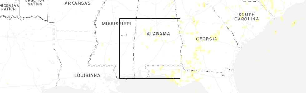
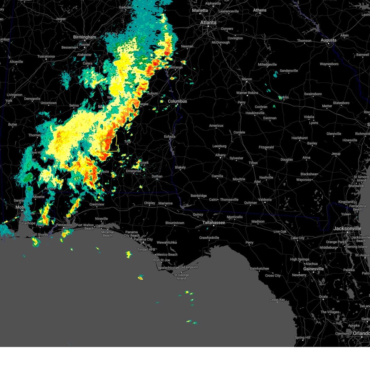
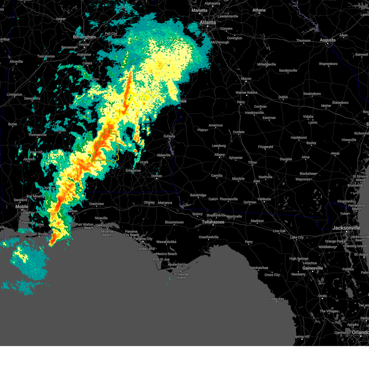
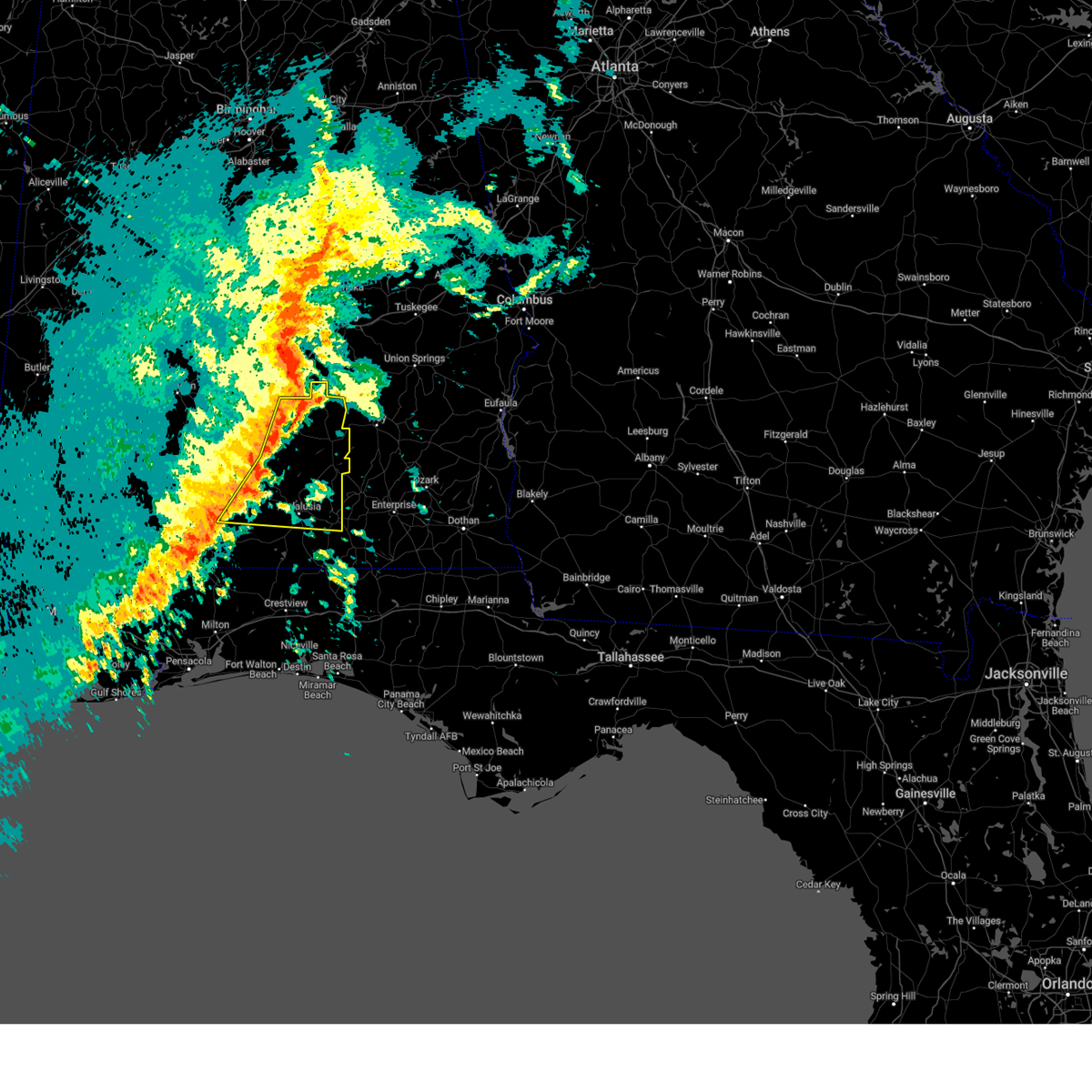
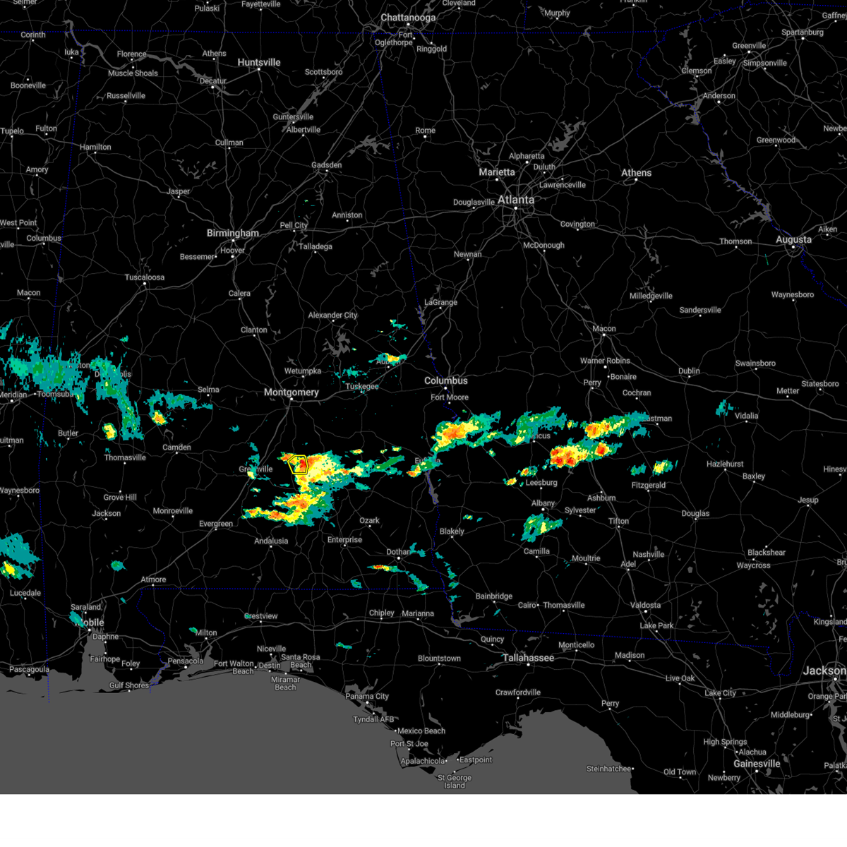
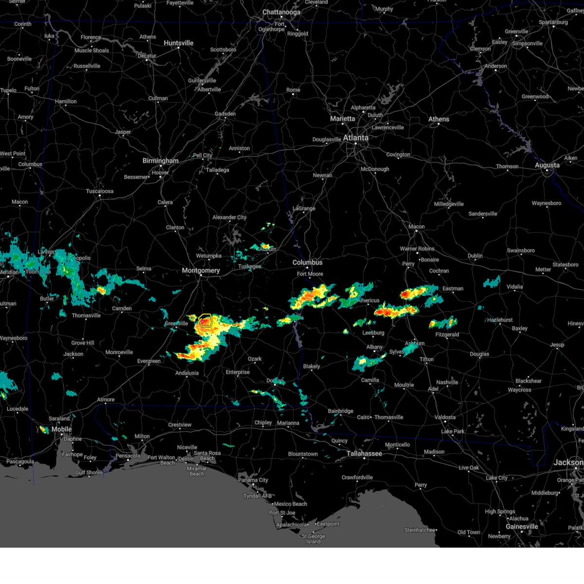
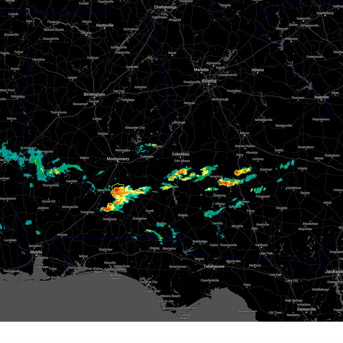
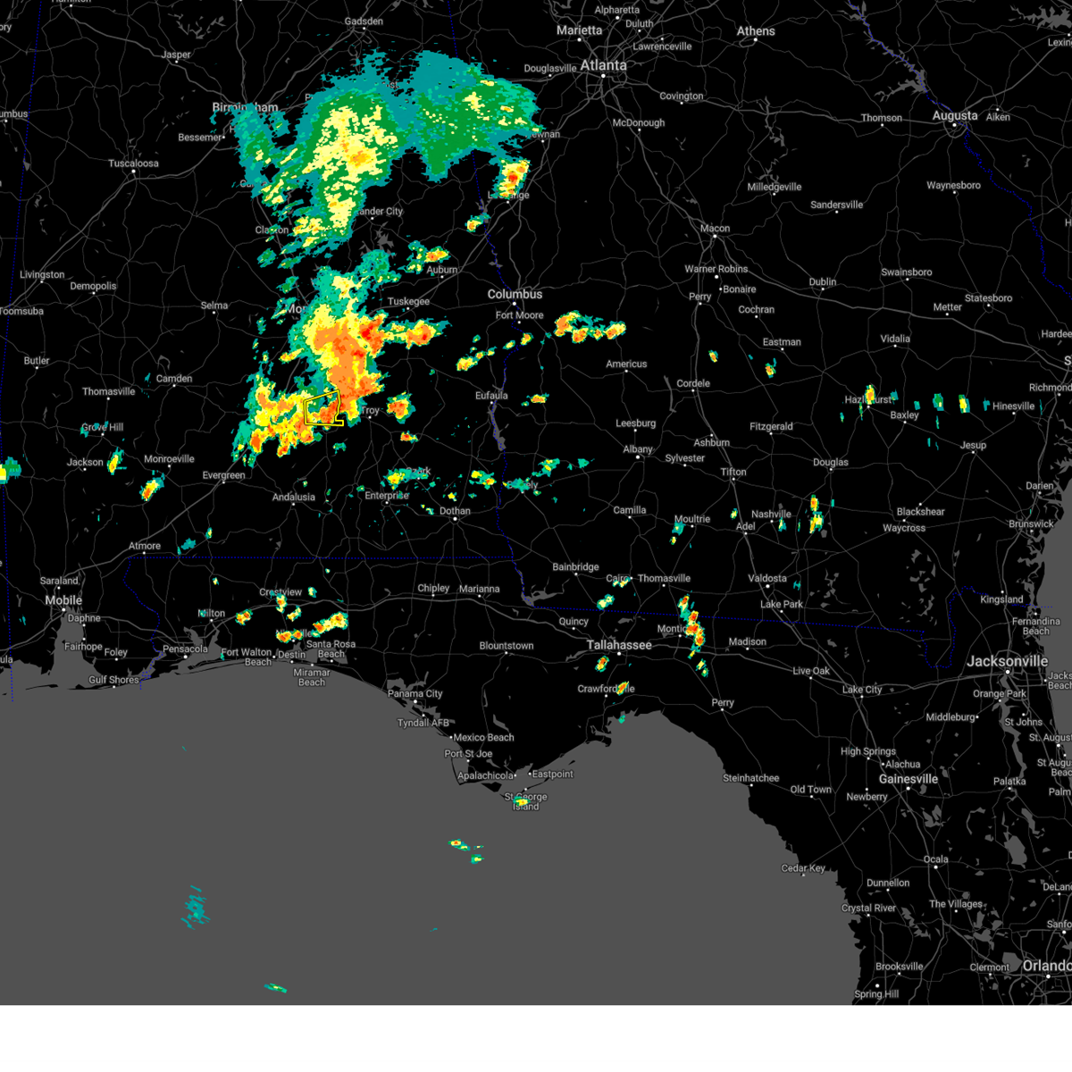
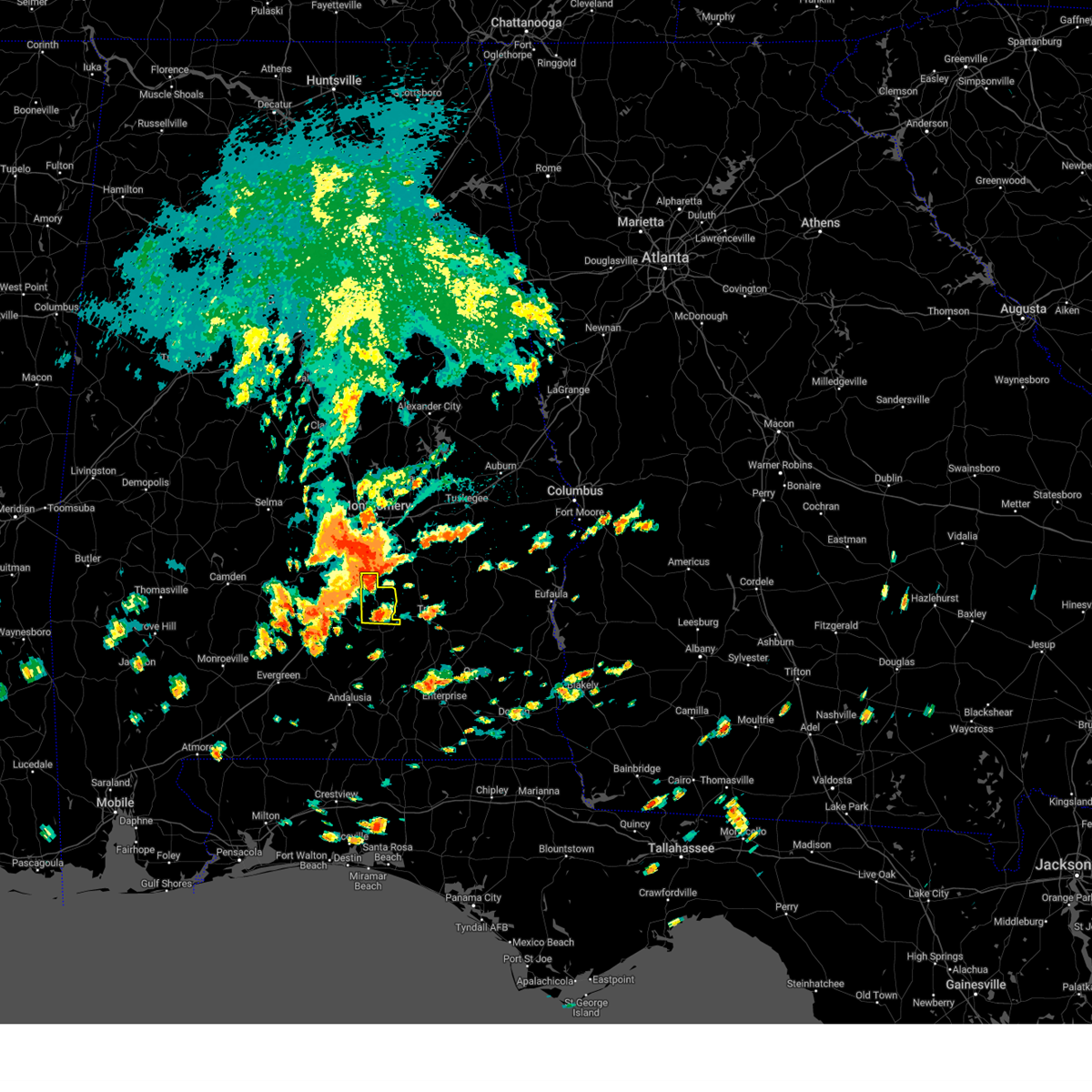
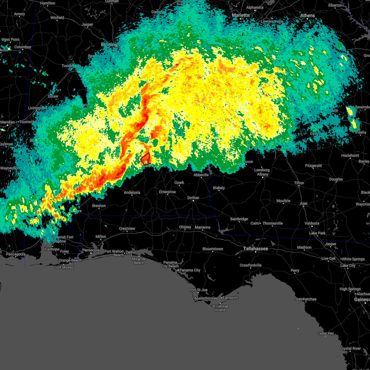
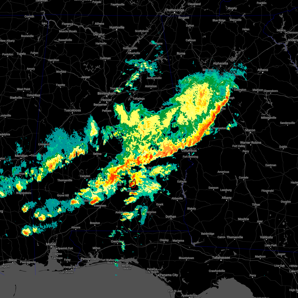
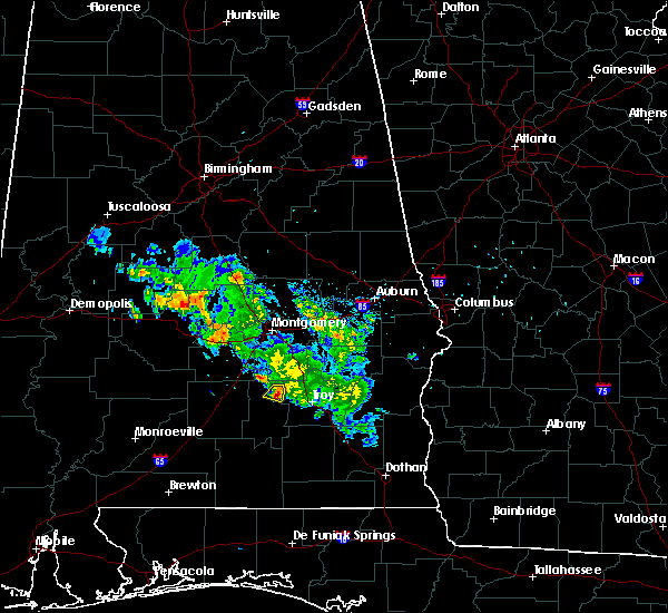
Hail Map for Petrey, AL
The Petrey, AL area has had 2 reports of on-the-ground hail by trained spotters, and has been under severe weather warnings 17 times during the past 12 months. Doppler radar has detected hail at or near Petrey, AL on 38 occasions, including 2 occasions during the past year.
| Name: | Petrey, AL |
| Where Located: | 64.5 miles E of Camden, AL |
| Map: | Google Map for Petrey, AL |
| Population: | 58 |
| Housing Units: | 37 |
| More Info: | Search Google for Petrey, AL |
0
The Top Recent Hail Date for Petrey, AL is Wednesday, June 25, 2025 (38th out of 38)
Hail and Wind Damage Spotted near Petrey, AL
| Date / Time | Report Details |
|---|---|
| 7/1/2025 7:13 PM CDT |
 the severe thunderstorm warning has been cancelled and is no longer in effect the severe thunderstorm warning has been cancelled and is no longer in effect
|
| 7/1/2025 6:52 PM CDT |
 the severe thunderstorm warning has been cancelled and is no longer in effect the severe thunderstorm warning has been cancelled and is no longer in effect
|
| 7/1/2025 6:52 PM CDT |
 At 651 pm cdt, severe thunderstorms were located along a line extending from grady to 3 miles west of petrey to 8 miles northwest of rutledge, moving southeast at 30 mph (radar indicated). Hazards include 60 mph wind gusts. Expect damage to roofs, siding, and trees. Locations impacted include, luverne, rutledge, glenwood, petrey, and highland home. At 651 pm cdt, severe thunderstorms were located along a line extending from grady to 3 miles west of petrey to 8 miles northwest of rutledge, moving southeast at 30 mph (radar indicated). Hazards include 60 mph wind gusts. Expect damage to roofs, siding, and trees. Locations impacted include, luverne, rutledge, glenwood, petrey, and highland home.
|
| 7/1/2025 6:41 PM CDT | Svrmob the national weather service in mobile has issued a * severe thunderstorm warning for, northeastern butler county in south central alabama, northern crenshaw county in south central alabama, * until 730 pm cdt. * at 641 pm cdt, severe thunderstorms were located along a line extending from near strata to 3 miles south of highland home to 9 miles south of logan, moving southeast at 30 mph (radar indicated). Hazards include 60 mph wind gusts. expect damage to roofs, siding, and trees |
| 5/27/2025 1:40 PM CDT |
 At 139 pm cdt, a severe thunderstorm was located near rutledge, or 5 miles northwest of luverne, moving east at 55 mph (radar indicated). Hazards include 60 mph wind gusts and nickel size hail. Expect damage to roofs, siding, and trees. Locations impacted include, rutledge, luverne, and petrey. At 139 pm cdt, a severe thunderstorm was located near rutledge, or 5 miles northwest of luverne, moving east at 55 mph (radar indicated). Hazards include 60 mph wind gusts and nickel size hail. Expect damage to roofs, siding, and trees. Locations impacted include, rutledge, luverne, and petrey.
|
| 5/27/2025 1:40 PM CDT |
 the severe thunderstorm warning has been cancelled and is no longer in effect the severe thunderstorm warning has been cancelled and is no longer in effect
|
| 5/27/2025 1:34 PM CDT |
 At 134 pm cdt, a severe thunderstorm was located 6 miles west of rutledge, or 9 miles west of luverne, moving east at 35 mph (radar indicated). Hazards include 60 mph wind gusts and nickel size hail. Expect damage to roofs, siding, and trees. Locations impacted include, rutledge, luverne, and petrey. At 134 pm cdt, a severe thunderstorm was located 6 miles west of rutledge, or 9 miles west of luverne, moving east at 35 mph (radar indicated). Hazards include 60 mph wind gusts and nickel size hail. Expect damage to roofs, siding, and trees. Locations impacted include, rutledge, luverne, and petrey.
|
| 5/27/2025 1:16 PM CDT |
 Svrmob the national weather service in mobile has issued a * severe thunderstorm warning for, east central butler county in south central alabama, central crenshaw county in south central alabama, * until 200 pm cdt. * at 115 pm cdt, a severe thunderstorm was located 6 miles south of greenville, moving east at 55 mph (radar indicated). Hazards include 60 mph wind gusts and nickel size hail. expect damage to roofs, siding, and trees Svrmob the national weather service in mobile has issued a * severe thunderstorm warning for, east central butler county in south central alabama, central crenshaw county in south central alabama, * until 200 pm cdt. * at 115 pm cdt, a severe thunderstorm was located 6 miles south of greenville, moving east at 55 mph (radar indicated). Hazards include 60 mph wind gusts and nickel size hail. expect damage to roofs, siding, and trees
|
| 3/4/2025 11:28 PM CST |
 The storms which prompted the warning have moved out of the area. therefore, the warning will be allowed to expire. a tornado watch remains in effect until 100 am cst for south central alabama. The storms which prompted the warning have moved out of the area. therefore, the warning will be allowed to expire. a tornado watch remains in effect until 100 am cst for south central alabama.
|
| 3/4/2025 11:06 PM CST |
 At 1105 pm cst, severe thunderstorms were located along a line extending from near shopton to 3 miles southeast of petrey to near brantley, moving east at 35 mph (radar indicated). Hazards include 60 mph wind gusts. Expect damage to roofs, siding, and trees. Locations impacted include, glenwood, rutledge, luverne, petrey, and brantley. At 1105 pm cst, severe thunderstorms were located along a line extending from near shopton to 3 miles southeast of petrey to near brantley, moving east at 35 mph (radar indicated). Hazards include 60 mph wind gusts. Expect damage to roofs, siding, and trees. Locations impacted include, glenwood, rutledge, luverne, petrey, and brantley.
|
| 3/4/2025 11:06 PM CST |
 the severe thunderstorm warning has been cancelled and is no longer in effect the severe thunderstorm warning has been cancelled and is no longer in effect
|
| 3/4/2025 10:31 PM CST |
 Svrmob the national weather service in mobile has issued a * severe thunderstorm warning for, eastern butler county in south central alabama, crenshaw county in south central alabama, * until 1130 pm cst. * at 1030 pm cst, severe thunderstorms were located along a line extending from sellers to 8 miles southeast of greenville to 5 miles east of mckenzie, moving east at 35 mph (radar indicated). Hazards include 60 mph wind gusts. expect damage to roofs, siding, and trees Svrmob the national weather service in mobile has issued a * severe thunderstorm warning for, eastern butler county in south central alabama, crenshaw county in south central alabama, * until 1130 pm cst. * at 1030 pm cst, severe thunderstorms were located along a line extending from sellers to 8 miles southeast of greenville to 5 miles east of mckenzie, moving east at 35 mph (radar indicated). Hazards include 60 mph wind gusts. expect damage to roofs, siding, and trees
|
| 2/16/2025 2:58 AM CST |
 Svrmob the national weather service in mobile has issued a * severe thunderstorm warning for, eastern butler county in south central alabama, northern crenshaw county in south central alabama, * until 315 am cst. * at 257 am cst, severe thunderstorms were located along a line extending from highland home to 6 miles west of rutledge, moving east at 45 mph (radar indicated). Hazards include 60 mph wind gusts. expect damage to roofs, siding, and trees Svrmob the national weather service in mobile has issued a * severe thunderstorm warning for, eastern butler county in south central alabama, northern crenshaw county in south central alabama, * until 315 am cst. * at 257 am cst, severe thunderstorms were located along a line extending from highland home to 6 miles west of rutledge, moving east at 45 mph (radar indicated). Hazards include 60 mph wind gusts. expect damage to roofs, siding, and trees
|
| 2/16/2025 2:18 AM CST |
 Svrmob the national weather service in mobile has issued a * severe thunderstorm warning for, northern butler county in south central alabama, northern crenshaw county in south central alabama, * until 300 am cst. * at 218 am cst, severe thunderstorms were located along a line extending from 3 miles southeast of beechwood to 8 miles south of pine apple, moving east at 65 mph (radar indicated). Hazards include 60 mph wind gusts. expect damage to roofs, siding, and trees Svrmob the national weather service in mobile has issued a * severe thunderstorm warning for, northern butler county in south central alabama, northern crenshaw county in south central alabama, * until 300 am cst. * at 218 am cst, severe thunderstorms were located along a line extending from 3 miles southeast of beechwood to 8 miles south of pine apple, moving east at 65 mph (radar indicated). Hazards include 60 mph wind gusts. expect damage to roofs, siding, and trees
|
| 12/29/2024 1:21 AM CST |
 At 120 am cst, severe thunderstorms were located along a line extending from 3 miles north of troy municipal airport to brantley to 4 miles south of andalusia, moving east at 35 mph (radar indicated). Hazards include 60 mph wind gusts. Expect damage to roofs, siding, and trees. Locations impacted include, gantt, rutledge, brantley, andalusia, river falls, glenwood, dozier, luverne, petrey, heath, and opp. At 120 am cst, severe thunderstorms were located along a line extending from 3 miles north of troy municipal airport to brantley to 4 miles south of andalusia, moving east at 35 mph (radar indicated). Hazards include 60 mph wind gusts. Expect damage to roofs, siding, and trees. Locations impacted include, gantt, rutledge, brantley, andalusia, river falls, glenwood, dozier, luverne, petrey, heath, and opp.
|
| 12/29/2024 1:21 AM CST |
 the severe thunderstorm warning has been cancelled and is no longer in effect the severe thunderstorm warning has been cancelled and is no longer in effect
|
| 12/29/2024 12:30 AM CST |
 Svrmob the national weather service in mobile has issued a * severe thunderstorm warning for, eastern butler county in south central alabama, crenshaw county in south central alabama, northern escambia county in south central alabama, southeastern conecuh county in south central alabama, northern covington county in south central alabama, * until 130 am cst. * at 1229 am cst, severe thunderstorms were located along a line extending from logan to 6 miles east of georgiana to 4 miles south of castleberry, moving east at 45 mph (radar indicated). Hazards include 60 mph wind gusts. expect damage to roofs, siding, and trees Svrmob the national weather service in mobile has issued a * severe thunderstorm warning for, eastern butler county in south central alabama, crenshaw county in south central alabama, northern escambia county in south central alabama, southeastern conecuh county in south central alabama, northern covington county in south central alabama, * until 130 am cst. * at 1229 am cst, severe thunderstorms were located along a line extending from logan to 6 miles east of georgiana to 4 miles south of castleberry, moving east at 45 mph (radar indicated). Hazards include 60 mph wind gusts. expect damage to roofs, siding, and trees
|
| 5/10/2024 3:06 AM CDT |
 The storms which prompted the warning have moved out of the area. therefore, the warning will be allowed to expire. a severe thunderstorm watch remains in effect until 500 am cdt for south central alabama. The storms which prompted the warning have moved out of the area. therefore, the warning will be allowed to expire. a severe thunderstorm watch remains in effect until 500 am cdt for south central alabama.
|
| 5/10/2024 2:39 AM CDT |
 the severe thunderstorm warning has been cancelled and is no longer in effect the severe thunderstorm warning has been cancelled and is no longer in effect
|
| 5/10/2024 2:39 AM CDT |
 At 239 am cdt, severe thunderstorms were located along a line extending from 9 miles east of greenville to 10 miles southwest of rutledge to 6 miles north of red level, moving east at 70 mph (radar indicated). Hazards include 60 mph wind gusts and quarter size hail. Hail damage to vehicles is expected. expect wind damage to roofs, siding, and trees. Locations impacted include, luverne, brantley, rutledge, dozier, glenwood, petrey, and highland home. At 239 am cdt, severe thunderstorms were located along a line extending from 9 miles east of greenville to 10 miles southwest of rutledge to 6 miles north of red level, moving east at 70 mph (radar indicated). Hazards include 60 mph wind gusts and quarter size hail. Hail damage to vehicles is expected. expect wind damage to roofs, siding, and trees. Locations impacted include, luverne, brantley, rutledge, dozier, glenwood, petrey, and highland home.
|
| 5/10/2024 2:18 AM CDT |
 Svrmob the national weather service in mobile has issued a * severe thunderstorm warning for, butler county in south central alabama, crenshaw county in south central alabama, northeastern conecuh county in south central alabama, northern covington county in south central alabama, * until 315 am cdt. * at 218 am cdt, a severe thunderstorm was located 8 miles west of georgiana, or 17 miles north of evergreen, moving east at 55 mph (radar indicated). Hazards include 60 mph wind gusts and quarter size hail. Hail damage to vehicles is expected. Expect wind damage to roofs, siding, and trees. Svrmob the national weather service in mobile has issued a * severe thunderstorm warning for, butler county in south central alabama, crenshaw county in south central alabama, northeastern conecuh county in south central alabama, northern covington county in south central alabama, * until 315 am cdt. * at 218 am cdt, a severe thunderstorm was located 8 miles west of georgiana, or 17 miles north of evergreen, moving east at 55 mph (radar indicated). Hazards include 60 mph wind gusts and quarter size hail. Hail damage to vehicles is expected. Expect wind damage to roofs, siding, and trees.
|
| 4/20/2024 2:46 PM CDT |
 The storm which prompted the warning has moved out of the area. therefore, the warning has been allowed to expire. The storm which prompted the warning has moved out of the area. therefore, the warning has been allowed to expire.
|
| 4/20/2024 2:34 PM CDT |
 At 233 pm cdt, a severe thunderstorm was located 4 miles north of petrey, or 12 miles southwest of meadville, moving east at 25 mph (radar indicated). Hazards include 60 mph wind gusts and half dollar size hail. Hail damage to vehicles is expected. expect wind damage to roofs, siding, and trees. Locations impacted include, petrey. At 233 pm cdt, a severe thunderstorm was located 4 miles north of petrey, or 12 miles southwest of meadville, moving east at 25 mph (radar indicated). Hazards include 60 mph wind gusts and half dollar size hail. Hail damage to vehicles is expected. expect wind damage to roofs, siding, and trees. Locations impacted include, petrey.
|
| 4/20/2024 2:22 PM CDT |
 At 222 pm cdt, a severe thunderstorm was located 5 miles south of highland home, or 11 miles north of luverne, moving east at 15 mph (radar indicated). Hazards include ping pong ball size hail and 60 mph wind gusts. People and animals outdoors will be injured. expect hail damage to roofs, siding, windows, and vehicles. expect wind damage to roofs, siding, and trees. Locations impacted include, petrey and highland home. At 222 pm cdt, a severe thunderstorm was located 5 miles south of highland home, or 11 miles north of luverne, moving east at 15 mph (radar indicated). Hazards include ping pong ball size hail and 60 mph wind gusts. People and animals outdoors will be injured. expect hail damage to roofs, siding, windows, and vehicles. expect wind damage to roofs, siding, and trees. Locations impacted include, petrey and highland home.
|
| 4/20/2024 2:22 PM CDT |
 the severe thunderstorm warning has been cancelled and is no longer in effect the severe thunderstorm warning has been cancelled and is no longer in effect
|
| 4/20/2024 2:05 PM CDT |
 Svrmob the national weather service in mobile has issued a * severe thunderstorm warning for, northeastern butler county in south central alabama, northern crenshaw county in south central alabama, * until 245 pm cdt. * at 205 pm cdt, a severe thunderstorm was located 8 miles southwest of highland home, or 12 miles east of greenville, moving east at 15 mph (radar indicated). Hazards include 60 mph wind gusts and quarter size hail. Hail damage to vehicles is expected. Expect wind damage to roofs, siding, and trees. Svrmob the national weather service in mobile has issued a * severe thunderstorm warning for, northeastern butler county in south central alabama, northern crenshaw county in south central alabama, * until 245 pm cdt. * at 205 pm cdt, a severe thunderstorm was located 8 miles southwest of highland home, or 12 miles east of greenville, moving east at 15 mph (radar indicated). Hazards include 60 mph wind gusts and quarter size hail. Hail damage to vehicles is expected. Expect wind damage to roofs, siding, and trees.
|
| 8/8/2023 2:26 PM CDT |
 At 226 pm cdt, a severe thunderstorm was located over luverne, moving east at 30 mph (radar indicated). Hazards include 60 mph wind gusts. expect damage to roofs, siding, and trees At 226 pm cdt, a severe thunderstorm was located over luverne, moving east at 30 mph (radar indicated). Hazards include 60 mph wind gusts. expect damage to roofs, siding, and trees
|
| 8/8/2023 2:19 PM CDT |
 At 219 pm cdt, a severe thunderstorm was located 5 miles north of rutledge, or 6 miles northwest of luverne, moving east at 30 mph (radar indicated). Hazards include 60 mph wind gusts. Expect damage to roofs, siding, and trees. locations impacted include, petrey. hail threat, radar indicated max hail size, <. 75 in wind threat, radar indicated max wind gust, 60 mph. At 219 pm cdt, a severe thunderstorm was located 5 miles north of rutledge, or 6 miles northwest of luverne, moving east at 30 mph (radar indicated). Hazards include 60 mph wind gusts. Expect damage to roofs, siding, and trees. locations impacted include, petrey. hail threat, radar indicated max hail size, <. 75 in wind threat, radar indicated max wind gust, 60 mph.
|
| 8/8/2023 2:00 PM CDT | Trees and power lines down on ramer grady roa in montgomery county AL, 12.3 miles S of Petrey, AL |
| 8/8/2023 1:58 PM CDT |
 At 157 pm cdt, a severe thunderstorm was located near highland home, or 13 miles southwest of meadville, moving east at 40 mph (radar indicated). Hazards include 60 mph wind gusts. expect damage to roofs, siding, and trees At 157 pm cdt, a severe thunderstorm was located near highland home, or 13 miles southwest of meadville, moving east at 40 mph (radar indicated). Hazards include 60 mph wind gusts. expect damage to roofs, siding, and trees
|
| 6/25/2023 11:05 PM CDT |
 At 1104 pm cdt, a severe thunderstorm was located over petrey, or 7 miles northeast of luverne, moving south at 10 mph (radar indicated). Hazards include 60 mph wind gusts and quarter size hail. Hail damage to vehicles is expected. Expect wind damage to roofs, siding, and trees. At 1104 pm cdt, a severe thunderstorm was located over petrey, or 7 miles northeast of luverne, moving south at 10 mph (radar indicated). Hazards include 60 mph wind gusts and quarter size hail. Hail damage to vehicles is expected. Expect wind damage to roofs, siding, and trees.
|
| 6/19/2023 4:49 AM CDT |
 At 448 am cdt, severe thunderstorms were located along a line extending from near beechwood to 3 miles southwest of logan to greenville to 3 miles northwest of georgiana, moving east at 65 mph (radar indicated). Hazards include 70 mph wind gusts. Expect considerable tree damage. Damage is likely to mobile homes, roofs, and outbuildings. At 448 am cdt, severe thunderstorms were located along a line extending from near beechwood to 3 miles southwest of logan to greenville to 3 miles northwest of georgiana, moving east at 65 mph (radar indicated). Hazards include 70 mph wind gusts. Expect considerable tree damage. Damage is likely to mobile homes, roofs, and outbuildings.
|
| 6/16/2023 8:42 PM CDT |
 At 842 pm cdt, a severe thunderstorm was located 10 miles northwest of greenville, moving east at 45 mph (radar indicated). Hazards include 60 mph wind gusts and quarter size hail. Hail damage to vehicles is expected. Expect wind damage to roofs, siding, and trees. At 842 pm cdt, a severe thunderstorm was located 10 miles northwest of greenville, moving east at 45 mph (radar indicated). Hazards include 60 mph wind gusts and quarter size hail. Hail damage to vehicles is expected. Expect wind damage to roofs, siding, and trees.
|
| 6/16/2023 8:28 AM CDT |
 At 827 am cdt, severe thunderstorms were located along a line extending from near pine apple to 6 miles west of i65 and us 84 to 8 miles southwest of bratt, moving east at 65 mph (radar indicated). Hazards include 70 mph wind gusts and penny size hail. Expect considerable tree damage. Damage is likely to mobile homes, roofs, and outbuildings. At 827 am cdt, severe thunderstorms were located along a line extending from near pine apple to 6 miles west of i65 and us 84 to 8 miles southwest of bratt, moving east at 65 mph (radar indicated). Hazards include 70 mph wind gusts and penny size hail. Expect considerable tree damage. Damage is likely to mobile homes, roofs, and outbuildings.
|
| 6/15/2023 1:58 AM CDT |
 At 157 am cdt, a severe thunderstorm was located over greenville, moving east at 35 mph (radar indicated). Hazards include 60 mph wind gusts and quarter size hail. Hail damage to vehicles is expected. Expect wind damage to roofs, siding, and trees. At 157 am cdt, a severe thunderstorm was located over greenville, moving east at 35 mph (radar indicated). Hazards include 60 mph wind gusts and quarter size hail. Hail damage to vehicles is expected. Expect wind damage to roofs, siding, and trees.
|
| 6/14/2023 5:57 PM CDT |
 At 556 pm cdt, severe thunderstorms were located along a line extending from 4 miles northwest of ansley to goshen to 8 miles northwest of dozier to 7 miles northeast of evergreen, moving southeast at 60 mph (radar indicated). Hazards include 70 mph wind gusts and penny size hail. Expect considerable tree damage. Damage is likely to mobile homes, roofs, and outbuildings. At 556 pm cdt, severe thunderstorms were located along a line extending from 4 miles northwest of ansley to goshen to 8 miles northwest of dozier to 7 miles northeast of evergreen, moving southeast at 60 mph (radar indicated). Hazards include 70 mph wind gusts and penny size hail. Expect considerable tree damage. Damage is likely to mobile homes, roofs, and outbuildings.
|
| 6/14/2023 5:49 PM CDT |
 At 549 pm cdt, severe thunderstorms were located along a line extending from lapine to petrey to 6 miles southwest of rutledge to 7 miles east of georgiana, moving southeast at 65 mph (radar indicated). Hazards include 60 mph wind gusts and quarter size hail. Hail damage to vehicles is expected. expect wind damage to roofs, siding, and trees. locations impacted include, greenville, luverne, brantley, rutledge, glenwood, petrey and highland home. hail threat, radar indicated max hail size, 1. 00 in wind threat, radar indicated max wind gust, 60 mph. At 549 pm cdt, severe thunderstorms were located along a line extending from lapine to petrey to 6 miles southwest of rutledge to 7 miles east of georgiana, moving southeast at 65 mph (radar indicated). Hazards include 60 mph wind gusts and quarter size hail. Hail damage to vehicles is expected. expect wind damage to roofs, siding, and trees. locations impacted include, greenville, luverne, brantley, rutledge, glenwood, petrey and highland home. hail threat, radar indicated max hail size, 1. 00 in wind threat, radar indicated max wind gust, 60 mph.
|
| 6/14/2023 5:38 PM CDT | Algo reports storm debris on us331 blocking both directions near sardis rd. time using rada in crenshaw county AL, 7 miles ESE of Petrey, AL |
| 6/14/2023 5:15 PM CDT |
 At 514 pm cdt, severe thunderstorms were located along a line extending from 5 miles west of gordonville to 10 miles southwest of beechwood to 5 miles northwest of pine apple, moving southeast at 50 mph (radar indicated). Hazards include 60 mph wind gusts and quarter size hail. Hail damage to vehicles is expected. Expect wind damage to roofs, siding, and trees. At 514 pm cdt, severe thunderstorms were located along a line extending from 5 miles west of gordonville to 10 miles southwest of beechwood to 5 miles northwest of pine apple, moving southeast at 50 mph (radar indicated). Hazards include 60 mph wind gusts and quarter size hail. Hail damage to vehicles is expected. Expect wind damage to roofs, siding, and trees.
|
| 6/14/2023 4:22 PM CDT | Numerous trees reported down on meriwether trai in montgomery county AL, 11.2 miles S of Petrey, AL |
| 6/13/2023 12:29 PM CDT | Golf Ball sized hail reported 12.6 miles SSW of Petrey, AL, golf ball size hail reported at two locations in the dublin community. |
| 1/12/2023 3:13 PM CST |
 The severe thunderstorm warning for northeastern butler and northern crenshaw counties will expire at 315 pm cst, the storms which prompted the warning have weakened below severe limits. therefore, the warning will be allowed to expire. a tornado watch remains in effect until 500 pm cst for south central alabama. The severe thunderstorm warning for northeastern butler and northern crenshaw counties will expire at 315 pm cst, the storms which prompted the warning have weakened below severe limits. therefore, the warning will be allowed to expire. a tornado watch remains in effect until 500 pm cst for south central alabama.
|
| 1/12/2023 2:46 PM CST |
 At 246 pm cst, severe thunderstorms were located along a line extending from near sprague to greenville, moving east at 45 mph (radar indicated). Hazards include 60 mph wind gusts. Expect damage to roofs, siding, and trees. locations impacted include, petrey and highland home. hail threat, radar indicated max hail size, <. 75 in wind threat, radar indicated max wind gust, 60 mph. At 246 pm cst, severe thunderstorms were located along a line extending from near sprague to greenville, moving east at 45 mph (radar indicated). Hazards include 60 mph wind gusts. Expect damage to roofs, siding, and trees. locations impacted include, petrey and highland home. hail threat, radar indicated max hail size, <. 75 in wind threat, radar indicated max wind gust, 60 mph.
|
| 1/12/2023 2:32 PM CST |
 At 231 pm cst, severe thunderstorms were located along a line extending from near davenport to 7 miles northwest of greenville, moving east at 65 mph (radar indicated). Hazards include 60 mph wind gusts. expect damage to roofs, siding, and trees At 231 pm cst, severe thunderstorms were located along a line extending from near davenport to 7 miles northwest of greenville, moving east at 65 mph (radar indicated). Hazards include 60 mph wind gusts. expect damage to roofs, siding, and trees
|
| 11/30/2022 5:17 AM CST |
 At 516 am cst, severe thunderstorms were located along a line extending from 5 miles northwest of rutledge to 6 miles southwest of red level to 5 miles northeast of mccullough, moving east at 60 mph (radar indicated). Hazards include 70 mph wind gusts. Expect considerable tree damage. damage is likely to mobile homes, roofs, and outbuildings. Locations impacted include, andalusia, opp, evergreen, luverne, brantley, river falls, castleberry, red level, rutledge, dozier, heath, gantt, glenwood, petrey, i65 and us 84 and i65 and al 113. At 516 am cst, severe thunderstorms were located along a line extending from 5 miles northwest of rutledge to 6 miles southwest of red level to 5 miles northeast of mccullough, moving east at 60 mph (radar indicated). Hazards include 70 mph wind gusts. Expect considerable tree damage. damage is likely to mobile homes, roofs, and outbuildings. Locations impacted include, andalusia, opp, evergreen, luverne, brantley, river falls, castleberry, red level, rutledge, dozier, heath, gantt, glenwood, petrey, i65 and us 84 and i65 and al 113.
|
| 11/30/2022 4:48 AM CST |
 At 448 am cst, severe thunderstorms were located along a line extending from 7 miles southeast of greenville to 9 miles southeast of evergreen to 3 miles northwest of mccullough, moving east at 60 mph (radar indicated). Hazards include 70 mph wind gusts. Expect considerable tree damage. damage is likely to mobile homes, roofs, and outbuildings. Locations impacted include, andalusia, greenville, opp, evergreen, luverne, frisco city, mccullough, georgiana, uriah, brantley, mckenzie, river falls, castleberry, excel, red level, rutledge, dozier, repton, heath and gantt. At 448 am cst, severe thunderstorms were located along a line extending from 7 miles southeast of greenville to 9 miles southeast of evergreen to 3 miles northwest of mccullough, moving east at 60 mph (radar indicated). Hazards include 70 mph wind gusts. Expect considerable tree damage. damage is likely to mobile homes, roofs, and outbuildings. Locations impacted include, andalusia, greenville, opp, evergreen, luverne, frisco city, mccullough, georgiana, uriah, brantley, mckenzie, river falls, castleberry, excel, red level, rutledge, dozier, repton, heath and gantt.
|
| 11/30/2022 4:37 AM CST | At 436 am cst, severe thunderstorms were located along a line extending from 5 miles southwest of greenville to 3 miles northeast of castleberry to 12 miles northwest of poarch creek reservation, moving east at 55 mph (radar indicated). Hazards include 60 mph wind gusts. expect damage to roofs, siding, and trees |
| 7/21/2022 8:45 PM CDT |
 At 844 pm cdt, severe thunderstorms were located along a line extending from near lauderdale to 7 miles north of yellow bluff to 3 miles northwest of greenville to 6 miles north of troy municipal airport, moving south at 35 mph (public). Hazards include 60 mph wind gusts and quarter size hail. Hail damage to vehicles is expected. expect wind damage to roofs, siding, and trees. locations impacted include, greenville, monroeville, thomasville, luverne, camden, butler, grove hill, peterman, georgiana, whatley, pine hill, brantley, lisman, mckenzie, red level, rutledge, beatrice, dozier, coffeeville and pennington. hail threat, radar indicated max hail size, 1. 00 in wind threat, observed max wind gust, 60 mph. At 844 pm cdt, severe thunderstorms were located along a line extending from near lauderdale to 7 miles north of yellow bluff to 3 miles northwest of greenville to 6 miles north of troy municipal airport, moving south at 35 mph (public). Hazards include 60 mph wind gusts and quarter size hail. Hail damage to vehicles is expected. expect wind damage to roofs, siding, and trees. locations impacted include, greenville, monroeville, thomasville, luverne, camden, butler, grove hill, peterman, georgiana, whatley, pine hill, brantley, lisman, mckenzie, red level, rutledge, beatrice, dozier, coffeeville and pennington. hail threat, radar indicated max hail size, 1. 00 in wind threat, observed max wind gust, 60 mph.
|
| 7/21/2022 8:11 PM CDT |
 At 810 pm cdt, severe thunderstorms were located along a line extending from 4 miles southeast of alamucha to near thomaston to mosses to 5 miles south of pike road, moving south at 35 mph (public). Hazards include 60 mph wind gusts and quarter size hail. Hail damage to vehicles is expected. Expect wind damage to roofs, siding, and trees. At 810 pm cdt, severe thunderstorms were located along a line extending from 4 miles southeast of alamucha to near thomaston to mosses to 5 miles south of pike road, moving south at 35 mph (public). Hazards include 60 mph wind gusts and quarter size hail. Hail damage to vehicles is expected. Expect wind damage to roofs, siding, and trees.
|
| 7/8/2022 7:10 PM CDT |
 The severe thunderstorm warning for northern crenshaw county will expire at 715 pm cdt, the storm which prompted the warning has weakened below severe limits. therefore, the warning will be allowed to expire. however gusty winds and heavy rain are still possible with this thunderstorm. The severe thunderstorm warning for northern crenshaw county will expire at 715 pm cdt, the storm which prompted the warning has weakened below severe limits. therefore, the warning will be allowed to expire. however gusty winds and heavy rain are still possible with this thunderstorm.
|
| 7/8/2022 6:34 PM CDT |
 At 633 pm cdt, a severe thunderstorm was located near highland home, or 13 miles north of luverne, moving south at 10 mph (radar indicated). Hazards include 60 mph wind gusts and penny size hail. expect damage to roofs, siding, and trees At 633 pm cdt, a severe thunderstorm was located near highland home, or 13 miles north of luverne, moving south at 10 mph (radar indicated). Hazards include 60 mph wind gusts and penny size hail. expect damage to roofs, siding, and trees
|
| 4/14/2022 12:28 AM CDT |
 The severe thunderstorm warning for crenshaw and northeastern covington counties will expire at 1230 am cdt, the storms which prompted the warning have moved out of the area. therefore, the warning will be allowed to expire. a severe thunderstorm watch remains in effect until 200 am cdt for south central alabama. The severe thunderstorm warning for crenshaw and northeastern covington counties will expire at 1230 am cdt, the storms which prompted the warning have moved out of the area. therefore, the warning will be allowed to expire. a severe thunderstorm watch remains in effect until 200 am cdt for south central alabama.
|
| 4/14/2022 12:09 AM CDT |
 At 1209 am cdt, severe thunderstorms were located along a line extending from 4 miles southeast of lapine to luverne to 3 miles north of dozier, moving east at 50 mph (radar indicated). Hazards include 60 mph wind gusts. Expect damage to roofs, siding, and trees. Locations impacted include, luverne, brantley, rutledge, dozier, glenwood and petrey. At 1209 am cdt, severe thunderstorms were located along a line extending from 4 miles southeast of lapine to luverne to 3 miles north of dozier, moving east at 50 mph (radar indicated). Hazards include 60 mph wind gusts. Expect damage to roofs, siding, and trees. Locations impacted include, luverne, brantley, rutledge, dozier, glenwood and petrey.
|
| 4/13/2022 11:57 PM CDT |
 At 1157 pm cdt, severe thunderstorms were located along a line extending from near highland home to 4 miles west of rutledge to 9 miles northwest of dozier, moving east at 50 mph (radar indicated). Hazards include 60 mph wind gusts. Expect damage to roofs, siding, and trees. Locations impacted include, luverne, brantley, mckenzie, rutledge, dozier, glenwood, petrey and highland home. At 1157 pm cdt, severe thunderstorms were located along a line extending from near highland home to 4 miles west of rutledge to 9 miles northwest of dozier, moving east at 50 mph (radar indicated). Hazards include 60 mph wind gusts. Expect damage to roofs, siding, and trees. Locations impacted include, luverne, brantley, mckenzie, rutledge, dozier, glenwood, petrey and highland home.
|
| 4/13/2022 11:23 PM CDT |
 At 1123 pm cdt, severe thunderstorms were located along a line extending from 12 miles southwest of gordonville to 10 miles northwest of georgiana to 12 miles north of evergreen, moving east at 50 mph (radar indicated). Hazards include 60 mph wind gusts. expect damage to roofs, siding, and trees At 1123 pm cdt, severe thunderstorms were located along a line extending from 12 miles southwest of gordonville to 10 miles northwest of georgiana to 12 miles north of evergreen, moving east at 50 mph (radar indicated). Hazards include 60 mph wind gusts. expect damage to roofs, siding, and trees
|
| 4/5/2022 11:15 AM CDT | Structural damage to a church near the intersection of shady grove rd and lapine hwy. in addition... damage reported to nearby chicken houses at the intersection of sha in crenshaw county AL, 2 miles S of Petrey, AL |
| 4/5/2022 11:03 AM CDT |
 At 1102 am cdt, severe thunderstorms were located along a line extending from near davenport to 7 miles west of rutledge to 11 miles east of georgiana, moving east at 60 mph. these are destructive storms for luverne and petrey (radar indicated). Hazards include 80 mph wind gusts and quarter size hail. Flying debris will be dangerous to those caught without shelter. mobile homes will be heavily damaged. expect considerable damage to roofs, windows, and vehicles. Extensive tree damage and power outages are likely. At 1102 am cdt, severe thunderstorms were located along a line extending from near davenport to 7 miles west of rutledge to 11 miles east of georgiana, moving east at 60 mph. these are destructive storms for luverne and petrey (radar indicated). Hazards include 80 mph wind gusts and quarter size hail. Flying debris will be dangerous to those caught without shelter. mobile homes will be heavily damaged. expect considerable damage to roofs, windows, and vehicles. Extensive tree damage and power outages are likely.
|
| 4/5/2022 10:55 AM CDT |
 At 1055 am cdt, a severe thunderstorm capable of producing a tornado was located over petrey, or 7 miles north of luverne, moving northeast at 50 mph (radar indicated rotation). Hazards include tornado and quarter size hail. Flying debris will be dangerous to those caught without shelter. mobile homes will be damaged or destroyed. damage to roofs, windows, and vehicles will occur. tree damage is likely. This tornadic thunderstorm will remain over mainly rural areas of northeastern crenshaw county. At 1055 am cdt, a severe thunderstorm capable of producing a tornado was located over petrey, or 7 miles north of luverne, moving northeast at 50 mph (radar indicated rotation). Hazards include tornado and quarter size hail. Flying debris will be dangerous to those caught without shelter. mobile homes will be damaged or destroyed. damage to roofs, windows, and vehicles will occur. tree damage is likely. This tornadic thunderstorm will remain over mainly rural areas of northeastern crenshaw county.
|
| 4/5/2022 10:54 AM CDT | Crenshaw county ema reports structural damage to a church near shady grove rd and lapine hwy. time estimated from rada in crenshaw county AL, 2 miles S of Petrey, AL |
| 4/5/2022 10:51 AM CDT |
 At 1050 am cdt, severe thunderstorms were located along a line extending from lowndes county airport to 9 miles northeast of georgiana to 3 miles north of evergreen to 3 miles southwest of excel, moving east at 45 mph (radar indicated). Hazards include 70 mph wind gusts and quarter size hail. Hail damage to vehicles is expected. expect considerable tree damage. wind damage is also likely to mobile homes, roofs, and outbuildings. Locations impacted include, greenville, monroeville, evergreen, luverne, frisco city, peterman, georgiana, brantley, mckenzie, excel, red level, rutledge, dozier, repton, gantt, glenwood, petrey, i65 and us 84 and highland home. At 1050 am cdt, severe thunderstorms were located along a line extending from lowndes county airport to 9 miles northeast of georgiana to 3 miles north of evergreen to 3 miles southwest of excel, moving east at 45 mph (radar indicated). Hazards include 70 mph wind gusts and quarter size hail. Hail damage to vehicles is expected. expect considerable tree damage. wind damage is also likely to mobile homes, roofs, and outbuildings. Locations impacted include, greenville, monroeville, evergreen, luverne, frisco city, peterman, georgiana, brantley, mckenzie, excel, red level, rutledge, dozier, repton, gantt, glenwood, petrey, i65 and us 84 and highland home.
|
| 4/5/2022 10:47 AM CDT |
 At 1046 am cdt, a severe thunderstorm capable of producing a tornado was located near rutledge, or 5 miles northwest of luverne, moving northeast at 55 mph (radar indicated rotation). Hazards include tornado and quarter size hail. Flying debris will be dangerous to those caught without shelter. mobile homes will be damaged or destroyed. damage to roofs, windows, and vehicles will occur. tree damage is likely. This dangerous storm will be near, petrey around 1055 am cdt. At 1046 am cdt, a severe thunderstorm capable of producing a tornado was located near rutledge, or 5 miles northwest of luverne, moving northeast at 55 mph (radar indicated rotation). Hazards include tornado and quarter size hail. Flying debris will be dangerous to those caught without shelter. mobile homes will be damaged or destroyed. damage to roofs, windows, and vehicles will occur. tree damage is likely. This dangerous storm will be near, petrey around 1055 am cdt.
|
| 4/5/2022 10:37 AM CDT |
 At 1037 am cdt, a severe thunderstorm capable of producing a tornado was located 7 miles west of rutledge, or 9 miles west of luverne, moving northeast at 50 mph (radar indicated rotation). Hazards include tornado and quarter size hail. Flying debris will be dangerous to those caught without shelter. mobile homes will be damaged or destroyed. damage to roofs, windows, and vehicles will occur. tree damage is likely. this dangerous storm will be near, rutledge around 1045 am cdt. luverne around 1050 am cdt. Petrey around 1055 am cdt. At 1037 am cdt, a severe thunderstorm capable of producing a tornado was located 7 miles west of rutledge, or 9 miles west of luverne, moving northeast at 50 mph (radar indicated rotation). Hazards include tornado and quarter size hail. Flying debris will be dangerous to those caught without shelter. mobile homes will be damaged or destroyed. damage to roofs, windows, and vehicles will occur. tree damage is likely. this dangerous storm will be near, rutledge around 1045 am cdt. luverne around 1050 am cdt. Petrey around 1055 am cdt.
|
| 4/5/2022 10:25 AM CDT |
 At 1025 am cdt, a severe thunderstorm capable of producing a tornado was located 10 miles east of georgiana, or 14 miles south of greenville, moving northeast at 50 mph (radar indicated rotation). Hazards include tornado and quarter size hail. Flying debris will be dangerous to those caught without shelter. mobile homes will be damaged or destroyed. damage to roofs, windows, and vehicles will occur. tree damage is likely. this dangerous storm will be near, rutledge around 1045 am cdt. luverne around 1050 am cdt. Petrey around 1055 am cdt. At 1025 am cdt, a severe thunderstorm capable of producing a tornado was located 10 miles east of georgiana, or 14 miles south of greenville, moving northeast at 50 mph (radar indicated rotation). Hazards include tornado and quarter size hail. Flying debris will be dangerous to those caught without shelter. mobile homes will be damaged or destroyed. damage to roofs, windows, and vehicles will occur. tree damage is likely. this dangerous storm will be near, rutledge around 1045 am cdt. luverne around 1050 am cdt. Petrey around 1055 am cdt.
|
| 4/5/2022 10:23 AM CDT |
 At 1023 am cdt, severe thunderstorms were located along a line extending from 10 miles north of pine apple to 12 miles west of georgiana to 6 miles north of uriah, moving east at 60 mph (radar indicated). Hazards include 70 mph wind gusts and quarter size hail. Hail damage to vehicles is expected. expect considerable tree damage. Wind damage is also likely to mobile homes, roofs, and outbuildings. At 1023 am cdt, severe thunderstorms were located along a line extending from 10 miles north of pine apple to 12 miles west of georgiana to 6 miles north of uriah, moving east at 60 mph (radar indicated). Hazards include 70 mph wind gusts and quarter size hail. Hail damage to vehicles is expected. expect considerable tree damage. Wind damage is also likely to mobile homes, roofs, and outbuildings.
|
| 4/5/2022 7:58 AM CDT |
 The severe thunderstorm warning for east central crenshaw county will expire at 800 am cdt, the storm which prompted the warning has moved out of the area. therefore, the warning will be allowed to expire. a tornado watch remains in effect until 200 pm cdt for south central alabama. The severe thunderstorm warning for east central crenshaw county will expire at 800 am cdt, the storm which prompted the warning has moved out of the area. therefore, the warning will be allowed to expire. a tornado watch remains in effect until 200 pm cdt for south central alabama.
|
| 4/5/2022 7:46 AM CDT |
 At 745 am cdt, a severe thunderstorm was located over luverne, moving northeast at 55 mph (radar indicated). Hazards include golf ball size hail and 60 mph wind gusts. People and animals outdoors will be injured. expect hail damage to roofs, siding, windows, and vehicles. expect wind damage to roofs, siding, and trees. locations impacted include, luverne, rutledge, glenwood and petrey. thunderstorm damage threat, considerable hail threat, radar indicated max hail size, 1. 75 in wind threat, radar indicated max wind gust, 60 mph. At 745 am cdt, a severe thunderstorm was located over luverne, moving northeast at 55 mph (radar indicated). Hazards include golf ball size hail and 60 mph wind gusts. People and animals outdoors will be injured. expect hail damage to roofs, siding, windows, and vehicles. expect wind damage to roofs, siding, and trees. locations impacted include, luverne, rutledge, glenwood and petrey. thunderstorm damage threat, considerable hail threat, radar indicated max hail size, 1. 75 in wind threat, radar indicated max wind gust, 60 mph.
|
| 4/5/2022 7:35 AM CDT |
 At 734 am cdt, a severe thunderstorm was located 5 miles west of rutledge, or 8 miles west of luverne, moving northeast at 40 mph (radar indicated). Hazards include golf ball size hail and 60 mph wind gusts. People and animals outdoors will be injured. expect hail damage to roofs, siding, windows, and vehicles. expect wind damage to roofs, siding, and trees. locations impacted include, luverne, rutledge, glenwood and petrey. thunderstorm damage threat, considerable hail threat, radar indicated max hail size, 1. 75 in wind threat, radar indicated max wind gust, 60 mph. At 734 am cdt, a severe thunderstorm was located 5 miles west of rutledge, or 8 miles west of luverne, moving northeast at 40 mph (radar indicated). Hazards include golf ball size hail and 60 mph wind gusts. People and animals outdoors will be injured. expect hail damage to roofs, siding, windows, and vehicles. expect wind damage to roofs, siding, and trees. locations impacted include, luverne, rutledge, glenwood and petrey. thunderstorm damage threat, considerable hail threat, radar indicated max hail size, 1. 75 in wind threat, radar indicated max wind gust, 60 mph.
|
| 4/5/2022 7:16 AM CDT |
 At 716 am cdt, a severe thunderstorm was located 9 miles northeast of mckenzie, or 15 miles south of greenville, moving northeast at 45 mph (radar indicated). Hazards include golf ball size hail and 60 mph wind gusts. People and animals outdoors will be injured. expect hail damage to roofs, siding, windows, and vehicles. Expect wind damage to roofs, siding, and trees. At 716 am cdt, a severe thunderstorm was located 9 miles northeast of mckenzie, or 15 miles south of greenville, moving northeast at 45 mph (radar indicated). Hazards include golf ball size hail and 60 mph wind gusts. People and animals outdoors will be injured. expect hail damage to roofs, siding, windows, and vehicles. Expect wind damage to roofs, siding, and trees.
|
| 3/31/2022 2:25 AM CDT |
 The severe thunderstorm warning for eastern crenshaw and covington counties will expire at 230 am cdt, the storms which prompted the warning have weakened below severe limits, and have exited the warned area. therefore, the warning will be allowed to expire. a tornado watch remains in effect until 400 am cdt for south central alabama, and northwestern florida. The severe thunderstorm warning for eastern crenshaw and covington counties will expire at 230 am cdt, the storms which prompted the warning have weakened below severe limits, and have exited the warned area. therefore, the warning will be allowed to expire. a tornado watch remains in effect until 400 am cdt for south central alabama, and northwestern florida.
|
| 3/31/2022 1:53 AM CDT |
 At 153 am cdt, severe thunderstorms were located along a line extending from near grady to 4 miles northwest of laurel hill, moving east at 30 mph (radar indicated). Hazards include 60 mph wind gusts. Expect damage to roofs, siding, and trees. Locations impacted include, andalusia, opp, luverne, florala, brantley, lockhart, rutledge, dozier, heath, glenwood and petrey. At 153 am cdt, severe thunderstorms were located along a line extending from near grady to 4 miles northwest of laurel hill, moving east at 30 mph (radar indicated). Hazards include 60 mph wind gusts. Expect damage to roofs, siding, and trees. Locations impacted include, andalusia, opp, luverne, florala, brantley, lockhart, rutledge, dozier, heath, glenwood and petrey.
|
| 3/31/2022 1:29 AM CDT |
 At 128 am cdt, severe thunderstorms were located along a line extending from near highland home to 14 miles north of baker, moving east at 30 mph (radar indicated). Hazards include 60 mph wind gusts. expect damage to roofs, siding, and trees At 128 am cdt, severe thunderstorms were located along a line extending from near highland home to 14 miles north of baker, moving east at 30 mph (radar indicated). Hazards include 60 mph wind gusts. expect damage to roofs, siding, and trees
|
| 3/31/2022 1:16 AM CDT |
 At 116 am cdt, severe thunderstorms were located along a line extending from 3 miles northwest of highland home to 15 miles northwest of baker, moving east at 35 mph (radar indicated). Hazards include 70 mph wind gusts. Expect considerable tree damage. damage is likely to mobile homes, roofs, and outbuildings. Locations impacted include, andalusia, luverne, brantley, river falls, red level, rutledge, dozier, heath, gantt, glenwood, petrey and highland home. At 116 am cdt, severe thunderstorms were located along a line extending from 3 miles northwest of highland home to 15 miles northwest of baker, moving east at 35 mph (radar indicated). Hazards include 70 mph wind gusts. Expect considerable tree damage. damage is likely to mobile homes, roofs, and outbuildings. Locations impacted include, andalusia, luverne, brantley, river falls, red level, rutledge, dozier, heath, gantt, glenwood, petrey and highland home.
|
| 3/31/2022 12:58 AM CDT |
 At 1258 am cdt, severe thunderstorms were located along a line extending from near logan to 6 miles southeast of riverview, moving east at 25 mph (radar indicated). Hazards include 70 mph wind gusts. Expect considerable tree damage. damage is likely to mobile homes, roofs, and outbuildings. Locations impacted include, andalusia, greenville, brewton, luverne, east brewton, georgiana, brantley, mckenzie, river falls, red level, rutledge, dozier, heath, gantt, glenwood, riverview, petrey and highland home. At 1258 am cdt, severe thunderstorms were located along a line extending from near logan to 6 miles southeast of riverview, moving east at 25 mph (radar indicated). Hazards include 70 mph wind gusts. Expect considerable tree damage. damage is likely to mobile homes, roofs, and outbuildings. Locations impacted include, andalusia, greenville, brewton, luverne, east brewton, georgiana, brantley, mckenzie, river falls, red level, rutledge, dozier, heath, gantt, glenwood, riverview, petrey and highland home.
|
| 3/31/2022 12:23 AM CDT |
 At 1223 am cdt, severe thunderstorms were located along a line extending from 11 miles west of lowndes county airport to near pollard, moving east at 35 mph (radar indicated). Hazards include 60 mph wind gusts. expect damage to roofs, siding, and trees At 1223 am cdt, severe thunderstorms were located along a line extending from 11 miles west of lowndes county airport to near pollard, moving east at 35 mph (radar indicated). Hazards include 60 mph wind gusts. expect damage to roofs, siding, and trees
|
| 3/18/2022 9:58 AM CDT |
 At 958 am cdt, a severe thunderstorm was located 8 miles east of evergreen, moving northeast at 45 mph (radar indicated). Hazards include 60 mph wind gusts and quarter size hail. Hail damage to vehicles is expected. Expect wind damage to roofs, siding, and trees. At 958 am cdt, a severe thunderstorm was located 8 miles east of evergreen, moving northeast at 45 mph (radar indicated). Hazards include 60 mph wind gusts and quarter size hail. Hail damage to vehicles is expected. Expect wind damage to roofs, siding, and trees.
|
| 2/3/2022 5:43 PM CST |
 At 542 pm cst, severe thunderstorms were located along a line extending from 3 miles west of strata to 5 miles northwest of rutledge to 8 miles east of georgiana, moving east at 45 mph (radar indicated). Hazards include 70 mph wind gusts. Expect considerable tree damage. Damage is likely to mobile homes, roofs, and outbuildings. At 542 pm cst, severe thunderstorms were located along a line extending from 3 miles west of strata to 5 miles northwest of rutledge to 8 miles east of georgiana, moving east at 45 mph (radar indicated). Hazards include 70 mph wind gusts. Expect considerable tree damage. Damage is likely to mobile homes, roofs, and outbuildings.
|
| 2/3/2022 5:03 PM CST |
 At 503 pm cst, severe thunderstorms were located along a line extending from pine apple to 15 miles east of beatrice to 12 miles west of georgiana to 11 miles north of evergreen to 9 miles northwest of i65 and us 84, moving east at 65 mph (radar indicated). Hazards include 70 mph wind gusts. Expect considerable tree damage. Damage is likely to mobile homes, roofs, and outbuildings. At 503 pm cst, severe thunderstorms were located along a line extending from pine apple to 15 miles east of beatrice to 12 miles west of georgiana to 11 miles north of evergreen to 9 miles northwest of i65 and us 84, moving east at 65 mph (radar indicated). Hazards include 70 mph wind gusts. Expect considerable tree damage. Damage is likely to mobile homes, roofs, and outbuildings.
|
| 1/9/2022 4:16 PM CST |
 At 416 pm cst, a severe thunderstorm capable of producing a tornado was located over petrey, or 11 miles north of luverne, moving northeast at 20 mph (radar indicated rotation). Hazards include tornado. Flying debris will be dangerous to those caught without shelter. mobile homes will be damaged or destroyed. damage to roofs, windows, and vehicles will occur. tree damage is likely. This tornadic thunderstorm will remain over mainly rural areas of northeastern crenshaw county. At 416 pm cst, a severe thunderstorm capable of producing a tornado was located over petrey, or 11 miles north of luverne, moving northeast at 20 mph (radar indicated rotation). Hazards include tornado. Flying debris will be dangerous to those caught without shelter. mobile homes will be damaged or destroyed. damage to roofs, windows, and vehicles will occur. tree damage is likely. This tornadic thunderstorm will remain over mainly rural areas of northeastern crenshaw county.
|
| 12/11/2021 9:55 AM CST |
 At 955 am cst, a severe thunderstorm capable of producing a tornado was located over greenville, moving northeast at 30 mph (radar indicated rotation). Hazards include tornado. Flying debris will be dangerous to those caught without shelter. mobile homes will be damaged or destroyed. damage to roofs, windows, and vehicles will occur. tree damage is likely. this dangerous storm will be near, highland home around 1035 am cst. Petrey around 1040 am cst. At 955 am cst, a severe thunderstorm capable of producing a tornado was located over greenville, moving northeast at 30 mph (radar indicated rotation). Hazards include tornado. Flying debris will be dangerous to those caught without shelter. mobile homes will be damaged or destroyed. damage to roofs, windows, and vehicles will occur. tree damage is likely. this dangerous storm will be near, highland home around 1035 am cst. Petrey around 1040 am cst.
|
| 8/31/2021 6:09 AM CDT |
 At 608 am cdt, a severe thunderstorm was located near rutledge, or 5 miles northwest of luverne, moving northeast at 35 mph (radar indicated). Hazards include 60 mph wind gusts. Expect damage to roofs, siding, and trees. Locations impacted include, rutledge, petrey and highland home. At 608 am cdt, a severe thunderstorm was located near rutledge, or 5 miles northwest of luverne, moving northeast at 35 mph (radar indicated). Hazards include 60 mph wind gusts. Expect damage to roofs, siding, and trees. Locations impacted include, rutledge, petrey and highland home.
|
| 8/31/2021 5:46 AM CDT |
 At 545 am cdt, a severe thunderstorm was located 13 miles east of georgiana, or 14 miles southeast of greenville, moving northeast at 40 mph (radar indicated). Hazards include 60 mph wind gusts. expect damage to roofs, siding, and trees At 545 am cdt, a severe thunderstorm was located 13 miles east of georgiana, or 14 miles southeast of greenville, moving northeast at 40 mph (radar indicated). Hazards include 60 mph wind gusts. expect damage to roofs, siding, and trees
|
| 8/11/2021 7:30 PM CDT |
 At 730 pm cdt, severe thunderstorms were located along a line extending from 10 miles east of georgiana to 5 miles southeast of glenwood, moving north at 15 mph (radar indicated). Hazards include 60 mph wind gusts and penny size hail. expect damage to roofs, siding, and trees At 730 pm cdt, severe thunderstorms were located along a line extending from 10 miles east of georgiana to 5 miles southeast of glenwood, moving north at 15 mph (radar indicated). Hazards include 60 mph wind gusts and penny size hail. expect damage to roofs, siding, and trees
|
| 8/11/2021 7:07 PM CDT |
 The severe thunderstorm warning for southeastern crenshaw county will expire at 715 pm cdt, the storm which prompted the warning has weakened to below severe limits, and no longer poses an immediate threat to life or property. therefore, the warning will be allowed to expire. however, heavy rain is still possible with this thunderstorm. remember, a severe thunderstorm warning still remains in effect for southern crenshaw county in south-central alabama until 745 pm cdt. The severe thunderstorm warning for southeastern crenshaw county will expire at 715 pm cdt, the storm which prompted the warning has weakened to below severe limits, and no longer poses an immediate threat to life or property. therefore, the warning will be allowed to expire. however, heavy rain is still possible with this thunderstorm. remember, a severe thunderstorm warning still remains in effect for southern crenshaw county in south-central alabama until 745 pm cdt.
|
| 8/11/2021 6:29 PM CDT |
 At 627 pm cdt, a severe thunderstorm was located 4 miles south of ansley, or 7 miles west of troy, moving southwest at 10 mph (radar indicated). Hazards include 60 mph wind gusts and penny size hail. expect damage to roofs, siding, and trees At 627 pm cdt, a severe thunderstorm was located 4 miles south of ansley, or 7 miles west of troy, moving southwest at 10 mph (radar indicated). Hazards include 60 mph wind gusts and penny size hail. expect damage to roofs, siding, and trees
|
| 5/4/2021 7:12 PM CDT |
 At 711 pm cdt, severe thunderstorms were located along a line extending from sellers to 5 miles northwest of rutledge to 10 miles northwest of dozier to 5 miles west of red level, moving east at 50 mph (radar indicated). Hazards include 60 mph wind gusts. Expect damage to roofs, siding, and trees. Locations impacted include, luverne, brantley, mckenzie, red level, rutledge, dozier, gantt, glenwood, petrey and highland home. At 711 pm cdt, severe thunderstorms were located along a line extending from sellers to 5 miles northwest of rutledge to 10 miles northwest of dozier to 5 miles west of red level, moving east at 50 mph (radar indicated). Hazards include 60 mph wind gusts. Expect damage to roofs, siding, and trees. Locations impacted include, luverne, brantley, mckenzie, red level, rutledge, dozier, gantt, glenwood, petrey and highland home.
|
| 5/4/2021 6:58 PM CDT |
 At 657 pm cdt, severe thunderstorms were located along a line extending from 4 miles west of davenport to greenville to georgiana to 8 miles north of evergreen, moving east at 45 mph (radar indicated). Hazards include 60 mph wind gusts. Expect damage to roofs, siding, and trees. Locations impacted include, greenville, luverne, georgiana, brantley, mckenzie, red level, rutledge, dozier, gantt, glenwood, petrey and highland home. At 657 pm cdt, severe thunderstorms were located along a line extending from 4 miles west of davenport to greenville to georgiana to 8 miles north of evergreen, moving east at 45 mph (radar indicated). Hazards include 60 mph wind gusts. Expect damage to roofs, siding, and trees. Locations impacted include, greenville, luverne, georgiana, brantley, mckenzie, red level, rutledge, dozier, gantt, glenwood, petrey and highland home.
|
| 5/4/2021 6:47 PM CDT |
 At 646 pm cdt, severe thunderstorms were located along a line extending from 4 miles southeast of beechwood to 5 miles west of greenville to 8 miles west of georgiana to 11 miles east of peterman, moving east at 45 mph (radar indicated). Hazards include 60 mph wind gusts. Expect damage to roofs, siding, and trees. Locations impacted include, greenville, luverne, georgiana, brantley, mckenzie, red level, rutledge, dozier, gantt, glenwood, petrey and highland home. At 646 pm cdt, severe thunderstorms were located along a line extending from 4 miles southeast of beechwood to 5 miles west of greenville to 8 miles west of georgiana to 11 miles east of peterman, moving east at 45 mph (radar indicated). Hazards include 60 mph wind gusts. Expect damage to roofs, siding, and trees. Locations impacted include, greenville, luverne, georgiana, brantley, mckenzie, red level, rutledge, dozier, gantt, glenwood, petrey and highland home.
|
| 5/4/2021 6:28 PM CDT |
 At 628 pm cdt, severe thunderstorms were located along a line extending from 4 miles southwest of gordonville to 4 miles east of pine apple to 6 miles east of beatrice to peterman, moving east at 45 mph (radar indicated). Hazards include 60 mph wind gusts. expect damage to roofs, siding, and trees At 628 pm cdt, severe thunderstorms were located along a line extending from 4 miles southwest of gordonville to 4 miles east of pine apple to 6 miles east of beatrice to peterman, moving east at 45 mph (radar indicated). Hazards include 60 mph wind gusts. expect damage to roofs, siding, and trees
|
| 4/24/2021 5:35 PM CDT |
 The severe thunderstorm warning for northeastern butler and northern crenshaw counties will expire at 545 pm cdt, the storm which prompted the warning has moved out of the area. therefore, the warning will be allowed to expire. a severe thunderstorm watch remains in effect until 900 pm cdt for south central alabama. The severe thunderstorm warning for northeastern butler and northern crenshaw counties will expire at 545 pm cdt, the storm which prompted the warning has moved out of the area. therefore, the warning will be allowed to expire. a severe thunderstorm watch remains in effect until 900 pm cdt for south central alabama.
|
| 4/24/2021 5:14 PM CDT |
 At 514 pm cdt, a severe thunderstorm was located 5 miles southwest of highland home, or 13 miles northwest of luverne, moving east at 50 mph (radar indicated). Hazards include 60 mph wind gusts and half dollar size hail. Hail damage to vehicles is expected. expect wind damage to roofs, siding, and trees. Locations impacted include, greenville, petrey and highland home. At 514 pm cdt, a severe thunderstorm was located 5 miles southwest of highland home, or 13 miles northwest of luverne, moving east at 50 mph (radar indicated). Hazards include 60 mph wind gusts and half dollar size hail. Hail damage to vehicles is expected. expect wind damage to roofs, siding, and trees. Locations impacted include, greenville, petrey and highland home.
|
| 4/24/2021 4:54 PM CDT |
 At 454 pm cdt, a severe thunderstorm was located 4 miles northwest of greenville, moving east at 45 mph (radar indicated). Hazards include 60 mph wind gusts and half dollar size hail. Hail damage to vehicles is expected. Expect wind damage to roofs, siding, and trees. At 454 pm cdt, a severe thunderstorm was located 4 miles northwest of greenville, moving east at 45 mph (radar indicated). Hazards include 60 mph wind gusts and half dollar size hail. Hail damage to vehicles is expected. Expect wind damage to roofs, siding, and trees.
|
| 4/24/2021 3:20 PM CDT |
 At 319 pm cdt, a severe thunderstorm was located near evergreen, moving east at 45 mph (radar indicated). Hazards include golf ball size hail and 70 mph wind gusts. People and animals outdoors will be injured. expect hail damage to roofs, siding, windows, and vehicles. expect considerable tree damage. Wind damage is also likely to mobile homes, roofs, and outbuildings. At 319 pm cdt, a severe thunderstorm was located near evergreen, moving east at 45 mph (radar indicated). Hazards include golf ball size hail and 70 mph wind gusts. People and animals outdoors will be injured. expect hail damage to roofs, siding, windows, and vehicles. expect considerable tree damage. Wind damage is also likely to mobile homes, roofs, and outbuildings.
|
| 4/10/2021 4:33 AM CDT |
 At 432 am cdt, severe thunderstorms were located along a line extending from 3 miles southwest of logan to 5 miles north of red level to 15 miles southeast of castleberry, moving east at 50 mph (radar indicated). Hazards include 60 mph wind gusts and penny size hail. expect damage to roofs, siding, and trees At 432 am cdt, severe thunderstorms were located along a line extending from 3 miles southwest of logan to 5 miles north of red level to 15 miles southeast of castleberry, moving east at 50 mph (radar indicated). Hazards include 60 mph wind gusts and penny size hail. expect damage to roofs, siding, and trees
|
| 3/31/2021 3:58 PM CDT |
 At 358 pm cdt, severe thunderstorms were located along a line extending from 9 miles southwest of highland home to 8 miles west of rutledge to 10 miles east of mckenzie, moving east at 60 mph (radar indicated). Hazards include 60 mph wind gusts and quarter size hail. Hail damage to vehicles is expected. Expect wind damage to roofs, siding, and trees. At 358 pm cdt, severe thunderstorms were located along a line extending from 9 miles southwest of highland home to 8 miles west of rutledge to 10 miles east of mckenzie, moving east at 60 mph (radar indicated). Hazards include 60 mph wind gusts and quarter size hail. Hail damage to vehicles is expected. Expect wind damage to roofs, siding, and trees.
|
| 3/25/2021 1:38 AM CDT |
 At 137 am cdt, a severe thunderstorm was located over rutledge, or 4 miles west of luverne, moving east at 40 mph (radar indicated). Hazards include 60 mph wind gusts and penny size hail. expect damage to roofs, siding, and trees At 137 am cdt, a severe thunderstorm was located over rutledge, or 4 miles west of luverne, moving east at 40 mph (radar indicated). Hazards include 60 mph wind gusts and penny size hail. expect damage to roofs, siding, and trees
|
| 3/17/2021 10:29 PM CDT |
 At 1028 pm cdt, severe thunderstorms were located along a line extending from pinedale to 3 miles east of sprague to 4 miles northwest of petrey to 3 miles northwest of rutledge, moving east at 50 mph (radar indicated). Hazards include 60 mph wind gusts. Expect damage to roofs, siding, and trees. Locations impacted include, petrey and highland home. At 1028 pm cdt, severe thunderstorms were located along a line extending from pinedale to 3 miles east of sprague to 4 miles northwest of petrey to 3 miles northwest of rutledge, moving east at 50 mph (radar indicated). Hazards include 60 mph wind gusts. Expect damage to roofs, siding, and trees. Locations impacted include, petrey and highland home.
|
| 3/17/2021 10:14 PM CDT |
 At 1014 pm cdt, severe thunderstorms were located along a line extending from 5 miles southwest of dannelly field to 3 miles north of davenport to 8 miles south of logan to 7 miles southeast of greenville, moving east at 50 mph (radar indicated). Hazards include 60 mph wind gusts. Expect damage to roofs, siding, and trees. Locations impacted include, greenville, luverne, rutledge, petrey and highland home. At 1014 pm cdt, severe thunderstorms were located along a line extending from 5 miles southwest of dannelly field to 3 miles north of davenport to 8 miles south of logan to 7 miles southeast of greenville, moving east at 50 mph (radar indicated). Hazards include 60 mph wind gusts. Expect damage to roofs, siding, and trees. Locations impacted include, greenville, luverne, rutledge, petrey and highland home.
|
| 3/17/2021 9:55 PM CDT |
 At 954 pm cdt, severe thunderstorms were located along a line extending from 3 miles northwest of mosses to 4 miles south of beechwood to 5 miles west of greenville to 5 miles northwest of georgiana, moving east at 50 mph (radar indicated). Hazards include 60 mph wind gusts. expect damage to roofs, siding, and trees At 954 pm cdt, severe thunderstorms were located along a line extending from 3 miles northwest of mosses to 4 miles south of beechwood to 5 miles west of greenville to 5 miles northwest of georgiana, moving east at 50 mph (radar indicated). Hazards include 60 mph wind gusts. expect damage to roofs, siding, and trees
|
| 3/16/2021 1:57 PM CDT |
 At 128 pm cdt, a severe thunderstorm was located near logan, or 6 miles southeast of fort deposit, moving east at 35 mph (radar indicated). Hazards include 60 mph wind gusts and penny size hail. Expect damage to roofs, siding, and trees. Locations impacted include, petrey and highland home. At 128 pm cdt, a severe thunderstorm was located near logan, or 6 miles southeast of fort deposit, moving east at 35 mph (radar indicated). Hazards include 60 mph wind gusts and penny size hail. Expect damage to roofs, siding, and trees. Locations impacted include, petrey and highland home.
|
| 3/16/2021 1:49 PM CDT | Wind damage reported on owens farm rd. a storage trailer was overturned and a storage shed was destroyed. a mobile home also suffered minor siding damag in crenshaw county AL, 8.6 miles ESE of Petrey, AL |
| 3/16/2021 1:29 PM CDT |
 At 128 pm cdt, a severe thunderstorm was located near logan, or 6 miles southeast of fort deposit, moving east at 35 mph (radar indicated). Hazards include 60 mph wind gusts and penny size hail. Expect damage to roofs, siding, and trees. Locations impacted include, petrey and highland home. At 128 pm cdt, a severe thunderstorm was located near logan, or 6 miles southeast of fort deposit, moving east at 35 mph (radar indicated). Hazards include 60 mph wind gusts and penny size hail. Expect damage to roofs, siding, and trees. Locations impacted include, petrey and highland home.
|
| 3/16/2021 1:11 PM CDT |
 At 110 pm cdt, a severe thunderstorm was located 6 miles southwest of lowndes county airport, or 7 miles northwest of greenville, moving east at 35 mph (radar indicated). Hazards include 60 mph wind gusts and penny size hail. expect damage to roofs, siding, and trees At 110 pm cdt, a severe thunderstorm was located 6 miles southwest of lowndes county airport, or 7 miles northwest of greenville, moving east at 35 mph (radar indicated). Hazards include 60 mph wind gusts and penny size hail. expect damage to roofs, siding, and trees
|
| 6/28/2020 4:53 PM CDT | Numerous trees snapped and blown down from possible microburs in montgomery county AL, 11.7 miles S of Petrey, AL |
| 6/24/2020 4:41 PM CDT |
 At 441 pm cdt, severe thunderstorms were located along a line extending from 3 miles south of grady to luverne to dozier, moving southeast at 50 mph (radar indicated). Hazards include 60 mph wind gusts. Expect damage to roofs, siding, and trees. Locations impacted include, luverne, brantley, rutledge, glenwood, petrey and highland home. At 441 pm cdt, severe thunderstorms were located along a line extending from 3 miles south of grady to luverne to dozier, moving southeast at 50 mph (radar indicated). Hazards include 60 mph wind gusts. Expect damage to roofs, siding, and trees. Locations impacted include, luverne, brantley, rutledge, glenwood, petrey and highland home.
|
| 6/24/2020 4:27 PM CDT |
 At 427 pm cdt, a severe thunderstorm was located 9 miles southwest of highland home, or 12 miles northwest of luverne, moving northeast at 40 mph (radar indicated). Hazards include 60 mph wind gusts. Expect damage to roofs, siding, and trees. Locations impacted include, luverne, brantley, rutledge, glenwood, petrey and highland home. At 427 pm cdt, a severe thunderstorm was located 9 miles southwest of highland home, or 12 miles northwest of luverne, moving northeast at 40 mph (radar indicated). Hazards include 60 mph wind gusts. Expect damage to roofs, siding, and trees. Locations impacted include, luverne, brantley, rutledge, glenwood, petrey and highland home.
|
| 6/24/2020 4:11 PM CDT |
 At 410 pm cdt, a severe thunderstorm was located near greenville, moving northeast at 25 mph (radar indicated). Hazards include 60 mph wind gusts. Expect damage to roofs, siding, and trees. Locations impacted include, greenville, luverne, brantley, mckenzie, rutledge, glenwood, petrey and highland home. At 410 pm cdt, a severe thunderstorm was located near greenville, moving northeast at 25 mph (radar indicated). Hazards include 60 mph wind gusts. Expect damage to roofs, siding, and trees. Locations impacted include, greenville, luverne, brantley, mckenzie, rutledge, glenwood, petrey and highland home.
|
| 6/24/2020 3:54 PM CDT |
 The national weather service in mobile has issued a * severe thunderstorm warning for. butler county in south central alabama. crenshaw county in south central alabama. east central conecuh county in south central alabama. Northwestern covington county in south central alabama. The national weather service in mobile has issued a * severe thunderstorm warning for. butler county in south central alabama. crenshaw county in south central alabama. east central conecuh county in south central alabama. Northwestern covington county in south central alabama.
|
| 5/22/2020 4:35 PM CDT |
 The severe thunderstorm warning for northeastern crenshaw county will expire at 445 pm cdt, the storm which prompted the warning has weakened below severe limits, and has exited the warned area. therefore, the warning will be allowed to expire. The severe thunderstorm warning for northeastern crenshaw county will expire at 445 pm cdt, the storm which prompted the warning has weakened below severe limits, and has exited the warned area. therefore, the warning will be allowed to expire.
|
| 5/22/2020 4:15 PM CDT |
 At 415 pm cdt, a severe thunderstorm was located 4 miles south of highland home, or 12 miles north of luverne, moving northeast at 15 mph (radar indicated). Hazards include 60 mph wind gusts and nickel size hail. Expect damage to roofs, siding, and trees. Locations impacted include, rutledge and petrey. At 415 pm cdt, a severe thunderstorm was located 4 miles south of highland home, or 12 miles north of luverne, moving northeast at 15 mph (radar indicated). Hazards include 60 mph wind gusts and nickel size hail. Expect damage to roofs, siding, and trees. Locations impacted include, rutledge and petrey.
|
| 5/22/2020 4:12 PM CDT | Quarter sized hail reported 12.6 miles SSW of Petrey, AL, reported near the intersection of huffman rd and hwy 94. |
| 5/22/2020 3:45 PM CDT |
 At 345 pm cdt, a severe thunderstorm was located 5 miles northwest of rutledge, or 7 miles northwest of luverne, moving northeast at 15 mph (radar indicated). Hazards include 60 mph wind gusts and nickel size hail. expect damage to roofs, siding, and trees At 345 pm cdt, a severe thunderstorm was located 5 miles northwest of rutledge, or 7 miles northwest of luverne, moving northeast at 15 mph (radar indicated). Hazards include 60 mph wind gusts and nickel size hail. expect damage to roofs, siding, and trees
|
| 5/21/2020 7:24 PM CDT |
 The severe thunderstorm warning for northeastern crenshaw county will expire at 730 pm cdt, the storm which prompted the warning has weakened below severe limits and has exited the warned area. therefore, the warning will be allowed to expire. The severe thunderstorm warning for northeastern crenshaw county will expire at 730 pm cdt, the storm which prompted the warning has weakened below severe limits and has exited the warned area. therefore, the warning will be allowed to expire.
|
| 5/21/2020 7:15 PM CDT |
 At 715 pm cdt, a severe thunderstorm was located near petrey, or 12 miles north of luverne, moving east at 30 mph (radar indicated). Hazards include 60 mph wind gusts and half dollar size hail. Hail damage to vehicles is expected. expect wind damage to roofs, siding, and trees. Locations impacted include, petrey. At 715 pm cdt, a severe thunderstorm was located near petrey, or 12 miles north of luverne, moving east at 30 mph (radar indicated). Hazards include 60 mph wind gusts and half dollar size hail. Hail damage to vehicles is expected. expect wind damage to roofs, siding, and trees. Locations impacted include, petrey.
|
| 5/21/2020 7:05 PM CDT |
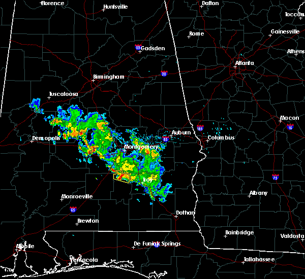 At 705 pm cdt, a severe thunderstorm was located near highland home, or 13 miles north of luverne, moving east at 30 mph (radar indicated). Hazards include 60 mph wind gusts and half dollar size hail. Hail damage to vehicles is expected. expect wind damage to roofs, siding, and trees. Locations impacted include, petrey and highland home. At 705 pm cdt, a severe thunderstorm was located near highland home, or 13 miles north of luverne, moving east at 30 mph (radar indicated). Hazards include 60 mph wind gusts and half dollar size hail. Hail damage to vehicles is expected. expect wind damage to roofs, siding, and trees. Locations impacted include, petrey and highland home.
|
| 5/21/2020 6:55 PM CDT |
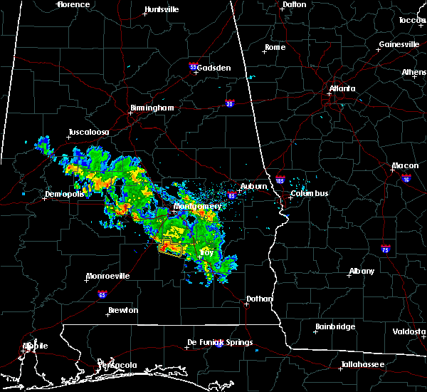 At 655 pm cdt, a severe thunderstorm was located 5 miles west of highland home, or 10 miles southeast of fort deposit, moving east at 30 mph (radar indicated). Hazards include 60 mph wind gusts and quarter size hail. Hail damage to vehicles is expected. expect wind damage to roofs, siding, and trees. Locations impacted include, petrey and highland home. At 655 pm cdt, a severe thunderstorm was located 5 miles west of highland home, or 10 miles southeast of fort deposit, moving east at 30 mph (radar indicated). Hazards include 60 mph wind gusts and quarter size hail. Hail damage to vehicles is expected. expect wind damage to roofs, siding, and trees. Locations impacted include, petrey and highland home.
|
| 5/21/2020 6:51 PM CDT |
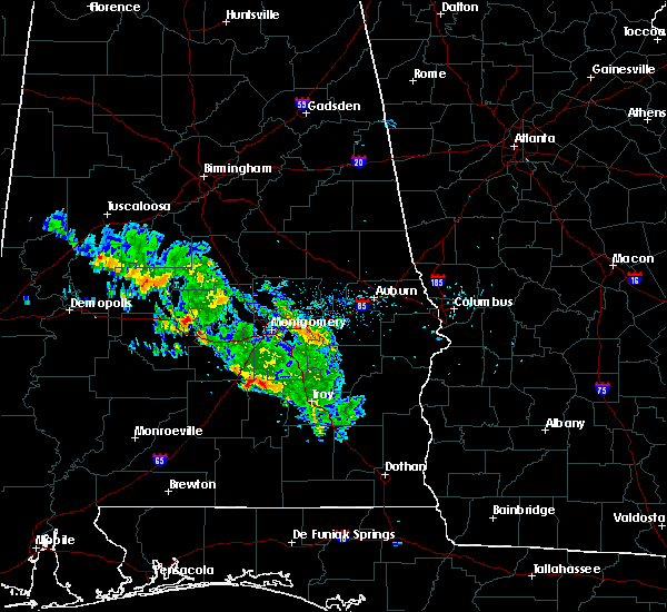 At 651 pm cdt, a severe thunderstorm was located 4 miles southeast of logan, or 8 miles southeast of fort deposit, moving east at 30 mph (radar indicated). Hazards include 60 mph wind gusts and penny size hail. expect damage to roofs, siding, and trees At 651 pm cdt, a severe thunderstorm was located 4 miles southeast of logan, or 8 miles southeast of fort deposit, moving east at 30 mph (radar indicated). Hazards include 60 mph wind gusts and penny size hail. expect damage to roofs, siding, and trees
|
| 4/19/2020 10:40 PM CDT |
 At 1039 pm cdt, severe thunderstorms were located along a line extending from 3 miles north of petrey to 4 miles north of gantt, moving east at 60 mph (radar indicated). Hazards include 60 mph wind gusts. expect damage to roofs, siding, and trees At 1039 pm cdt, severe thunderstorms were located along a line extending from 3 miles north of petrey to 4 miles north of gantt, moving east at 60 mph (radar indicated). Hazards include 60 mph wind gusts. expect damage to roofs, siding, and trees
|
| 4/19/2020 8:10 PM CDT |
 At 810 pm cdt, severe thunderstorms were located along a line extending from 3 miles west of strata to 5 miles west of petrey to 4 miles west of rutledge, moving east at 50 mph (radar indicated). Hazards include 70 mph wind gusts and quarter size hail. Hail damage to vehicles is expected. expect considerable tree damage. wind damage is also likely to mobile homes, roofs, and outbuildings. Locations impacted include, luverne, rutledge, petrey and highland home. At 810 pm cdt, severe thunderstorms were located along a line extending from 3 miles west of strata to 5 miles west of petrey to 4 miles west of rutledge, moving east at 50 mph (radar indicated). Hazards include 70 mph wind gusts and quarter size hail. Hail damage to vehicles is expected. expect considerable tree damage. wind damage is also likely to mobile homes, roofs, and outbuildings. Locations impacted include, luverne, rutledge, petrey and highland home.
|
| 4/19/2020 8:01 PM CDT | Reports of trees down near highland home and lapin in crenshaw county AL, 12.3 miles SSE of Petrey, AL |
| 4/19/2020 7:54 PM CDT |
 At 754 pm cdt, a severe thunderstorm was located 8 miles east of greenville, moving east at 50 mph (radar indicated). Hazards include 70 mph wind gusts and quarter size hail. Hail damage to vehicles is expected. expect considerable tree damage. Wind damage is also likely to mobile homes, roofs, and outbuildings. At 754 pm cdt, a severe thunderstorm was located 8 miles east of greenville, moving east at 50 mph (radar indicated). Hazards include 70 mph wind gusts and quarter size hail. Hail damage to vehicles is expected. expect considerable tree damage. Wind damage is also likely to mobile homes, roofs, and outbuildings.
|
| 4/19/2020 4:30 PM CDT |
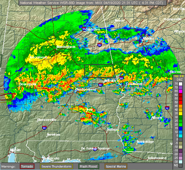 At 430 pm cdt, a severe thunderstorm was located over grady, or 6 miles south of meadville, moving northeast at 55 mph (radar indicated). Hazards include 60 mph wind gusts and quarter size hail. Hail damage to vehicles is expected. expect wind damage to roofs, siding, and trees. Locations impacted include, petrey and highland home. At 430 pm cdt, a severe thunderstorm was located over grady, or 6 miles south of meadville, moving northeast at 55 mph (radar indicated). Hazards include 60 mph wind gusts and quarter size hail. Hail damage to vehicles is expected. expect wind damage to roofs, siding, and trees. Locations impacted include, petrey and highland home.
|
| 4/19/2020 4:15 PM CDT |
 At 414 pm cdt, a severe thunderstorm was located 5 miles north of rutledge, or 7 miles northwest of luverne, moving northeast at 45 mph (radar indicated). Hazards include 60 mph wind gusts and quarter size hail. Hail damage to vehicles is expected. expect wind damage to roofs, siding, and trees. Locations impacted include, rutledge, petrey and highland home. At 414 pm cdt, a severe thunderstorm was located 5 miles north of rutledge, or 7 miles northwest of luverne, moving northeast at 45 mph (radar indicated). Hazards include 60 mph wind gusts and quarter size hail. Hail damage to vehicles is expected. expect wind damage to roofs, siding, and trees. Locations impacted include, rutledge, petrey and highland home.
|
| 4/19/2020 3:58 PM CDT |
 At 358 pm cdt, a severe thunderstorm was located 11 miles southwest of rutledge, or 14 miles west of luverne, moving northeast at 45 mph (radar indicated). Hazards include 60 mph wind gusts and quarter size hail. Hail damage to vehicles is expected. Expect wind damage to roofs, siding, and trees. At 358 pm cdt, a severe thunderstorm was located 11 miles southwest of rutledge, or 14 miles west of luverne, moving northeast at 45 mph (radar indicated). Hazards include 60 mph wind gusts and quarter size hail. Hail damage to vehicles is expected. Expect wind damage to roofs, siding, and trees.
|
| 4/13/2020 12:39 AM CDT |
 At 1238 am cdt, severe thunderstorms were located along a line extending from 8 miles west of rutledge to 5 miles northwest of dozier to 3 miles north of gantt, moving northeast at 80 mph (radar indicated). Hazards include 60 mph wind gusts. Expect damage to roofs, siding, and trees. Locations impacted include, luverne, rutledge and petrey. At 1238 am cdt, severe thunderstorms were located along a line extending from 8 miles west of rutledge to 5 miles northwest of dozier to 3 miles north of gantt, moving northeast at 80 mph (radar indicated). Hazards include 60 mph wind gusts. Expect damage to roofs, siding, and trees. Locations impacted include, luverne, rutledge and petrey.
|
| 4/13/2020 12:16 AM CDT |
 At 1215 am cdt, severe thunderstorms were located along a line extending from 3 miles north of ansley to luverne to 8 miles north of dozier, moving east at 45 mph (radar indicated). Hazards include 60 mph wind gusts. Expect damage to roofs, siding, and trees. Locations impacted include, luverne, mckenzie, rutledge, petrey and highland home. At 1215 am cdt, severe thunderstorms were located along a line extending from 3 miles north of ansley to luverne to 8 miles north of dozier, moving east at 45 mph (radar indicated). Hazards include 60 mph wind gusts. Expect damage to roofs, siding, and trees. Locations impacted include, luverne, mckenzie, rutledge, petrey and highland home.
|
| 4/13/2020 12:00 AM CDT | Numerous trees down along magnolia shores r in crenshaw county AL, 7.9 miles SE of Petrey, AL |
| 4/12/2020 11:58 PM CDT |
 At 1158 pm cdt, severe thunderstorms were located along a line extending from sellers to 9 miles south of logan to 6 miles northeast of mckenzie, moving northeast at 65 mph (radar indicated). Hazards include 60 mph wind gusts. expect damage to roofs, siding, and trees At 1158 pm cdt, severe thunderstorms were located along a line extending from sellers to 9 miles south of logan to 6 miles northeast of mckenzie, moving northeast at 65 mph (radar indicated). Hazards include 60 mph wind gusts. expect damage to roofs, siding, and trees
|
| 3/31/2020 10:07 AM CDT | Trees down on pouncy roa in crenshaw county AL, 5.1 miles SE of Petrey, AL |
| 3/31/2020 10:07 AM CDT |
 At 1007 am cdt, severe thunderstorms were located along a line extending from 6 miles northwest of rutledge to 9 miles east of mckenzie to 7 miles southeast of evergreen to mccullough, moving east at 40 mph (radar indicated). Hazards include 70 mph wind gusts and quarter size hail. Hail damage to vehicles is expected. expect considerable tree damage. Wind damage is also likely to mobile homes, roofs, and outbuildings. At 1007 am cdt, severe thunderstorms were located along a line extending from 6 miles northwest of rutledge to 9 miles east of mckenzie to 7 miles southeast of evergreen to mccullough, moving east at 40 mph (radar indicated). Hazards include 70 mph wind gusts and quarter size hail. Hail damage to vehicles is expected. expect considerable tree damage. Wind damage is also likely to mobile homes, roofs, and outbuildings.
|
| 3/4/2020 6:35 AM CST |
 At 635 am cst, severe thunderstorms were located along a line extending from 8 miles west of lowndes county airport to 5 miles west of greenville to 9 miles northwest of georgiana, moving east at 40 mph (radar indicated). Hazards include 60 mph wind gusts and quarter size hail. Hail damage to vehicles is expected. expect wind damage to roofs, siding, and trees. Locations impacted include, greenville, luverne, rutledge, glenwood, petrey and highland home. At 635 am cst, severe thunderstorms were located along a line extending from 8 miles west of lowndes county airport to 5 miles west of greenville to 9 miles northwest of georgiana, moving east at 40 mph (radar indicated). Hazards include 60 mph wind gusts and quarter size hail. Hail damage to vehicles is expected. expect wind damage to roofs, siding, and trees. Locations impacted include, greenville, luverne, rutledge, glenwood, petrey and highland home.
|
| 3/4/2020 6:20 AM CST | Trees down near jordan rd and bradleyton r in crenshaw county AL, 3.8 miles SE of Petrey, AL |
| 3/4/2020 6:18 AM CST |
 At 617 am cst, severe thunderstorms were located along a line extending from 12 miles south of belknap to near pine apple to 8 miles east of beatrice, moving east at 45 mph (radar indicated). Hazards include 60 mph wind gusts and quarter size hail. Hail damage to vehicles is expected. Expect wind damage to roofs, siding, and trees. At 617 am cst, severe thunderstorms were located along a line extending from 12 miles south of belknap to near pine apple to 8 miles east of beatrice, moving east at 45 mph (radar indicated). Hazards include 60 mph wind gusts and quarter size hail. Hail damage to vehicles is expected. Expect wind damage to roofs, siding, and trees.
|
| 3/4/2020 6:05 AM CST | Several trees and a few power lines down in the highland home and panola area in crenshaw county AL, 10.1 miles SE of Petrey, AL |
| 2/6/2020 12:42 AM CST |
 At 1242 am cst, a severe thunderstorm capable of producing a tornado was located near glenwood, or 4 miles southeast of luverne, moving northeast at 40 mph (radar indicated rotation). Hazards include tornado. Flying debris will be dangerous to those caught without shelter. mobile homes will be damaged or destroyed. damage to roofs, windows, and vehicles will occur. tree damage is likely. This dangerous storm will be near, glenwood around 1245 am cst. At 1242 am cst, a severe thunderstorm capable of producing a tornado was located near glenwood, or 4 miles southeast of luverne, moving northeast at 40 mph (radar indicated rotation). Hazards include tornado. Flying debris will be dangerous to those caught without shelter. mobile homes will be damaged or destroyed. damage to roofs, windows, and vehicles will occur. tree damage is likely. This dangerous storm will be near, glenwood around 1245 am cst.
|
| 1/11/2020 3:01 PM CST |
 At 300 pm cst, severe thunderstorms were located along a line extending from 4 miles northeast of luverne to near andalusia, moving east at 35 mph (radar indicated). Hazards include 60 mph wind gusts. Expect damage to roofs, siding, and trees. Locations impacted include, andalusia, opp, luverne, brantley, river falls, rutledge, dozier, heath, gantt, glenwood and petrey. At 300 pm cst, severe thunderstorms were located along a line extending from 4 miles northeast of luverne to near andalusia, moving east at 35 mph (radar indicated). Hazards include 60 mph wind gusts. Expect damage to roofs, siding, and trees. Locations impacted include, andalusia, opp, luverne, brantley, river falls, rutledge, dozier, heath, gantt, glenwood and petrey.
|
| 1/11/2020 2:39 PM CST |
 At 239 pm cst, severe thunderstorms were located along a line extending from near grady to 7 miles south of red level, moving northeast at 40 mph (radar indicated). Hazards include 60 mph wind gusts. expect damage to roofs, siding, and trees At 239 pm cst, severe thunderstorms were located along a line extending from near grady to 7 miles south of red level, moving northeast at 40 mph (radar indicated). Hazards include 60 mph wind gusts. expect damage to roofs, siding, and trees
|
| 1/11/2020 2:31 PM CST | Social media report of trees down on a shed on new ebenezer roa in crenshaw county AL, 9.1 miles SE of Petrey, AL |
| 1/11/2020 2:30 PM CST |
 At 229 pm cst, severe thunderstorms were located along a line extending from near pintlala to 5 miles west of rutledge to 3 miles northwest of red level, moving northeast at 55 mph (public report of multiple trees down in greenville, alabama). Hazards include 70 mph wind gusts. Expect considerable tree damage. damage is likely to mobile homes, roofs, and outbuildings. Locations impacted include, luverne, georgiana, mckenzie, river falls, red level, rutledge, petrey and highland home. At 229 pm cst, severe thunderstorms were located along a line extending from near pintlala to 5 miles west of rutledge to 3 miles northwest of red level, moving northeast at 55 mph (public report of multiple trees down in greenville, alabama). Hazards include 70 mph wind gusts. Expect considerable tree damage. damage is likely to mobile homes, roofs, and outbuildings. Locations impacted include, luverne, georgiana, mckenzie, river falls, red level, rutledge, petrey and highland home.
|
| 1/11/2020 2:04 PM CST |
 At 204 pm cst, severe thunderstorms were located along a line extending from 6 miles west of lowndes county airport to georgiana to near castleberry, moving northeast at 55 mph (radar indicated). Hazards include 70 mph wind gusts. Expect considerable tree damage. damage is likely to mobile homes, roofs, and outbuildings. Locations impacted include, greenville, evergreen, luverne, georgiana, mckenzie, river falls, castleberry, red level, rutledge, petrey, i65 and us 84 and highland home. At 204 pm cst, severe thunderstorms were located along a line extending from 6 miles west of lowndes county airport to georgiana to near castleberry, moving northeast at 55 mph (radar indicated). Hazards include 70 mph wind gusts. Expect considerable tree damage. damage is likely to mobile homes, roofs, and outbuildings. Locations impacted include, greenville, evergreen, luverne, georgiana, mckenzie, river falls, castleberry, red level, rutledge, petrey, i65 and us 84 and highland home.
|
| 1/11/2020 1:54 PM CST |
 At 154 pm cst, severe thunderstorms were located along a line extending from 11 miles northeast of pine apple to 8 miles southwest of georgiana to 5 miles west of castleberry, moving northeast at 55 mph (radar indicated). Hazards include 60 mph wind gusts. expect damage to roofs, siding, and trees At 154 pm cst, severe thunderstorms were located along a line extending from 11 miles northeast of pine apple to 8 miles southwest of georgiana to 5 miles west of castleberry, moving northeast at 55 mph (radar indicated). Hazards include 60 mph wind gusts. expect damage to roofs, siding, and trees
|
| 9/9/2019 2:27 PM CDT |
 At 226 pm cdt, a severe thunderstorm was located 8 miles west of rutledge, or 10 miles west of luverne, moving northwest at 10 mph (radar indicated). Hazards include 60 mph wind gusts. expect damage to roofs, siding, and trees At 226 pm cdt, a severe thunderstorm was located 8 miles west of rutledge, or 10 miles west of luverne, moving northwest at 10 mph (radar indicated). Hazards include 60 mph wind gusts. expect damage to roofs, siding, and trees
|
| 8/4/2019 1:37 PM CDT |
 At 137 pm cdt, a severe thunderstorm was located over petrey, or 11 miles north of luverne, moving east at 10 mph (radar indicated). Hazards include 60 mph wind gusts. expect damage to roofs, siding, and trees At 137 pm cdt, a severe thunderstorm was located over petrey, or 11 miles north of luverne, moving east at 10 mph (radar indicated). Hazards include 60 mph wind gusts. expect damage to roofs, siding, and trees
|
| 4/19/2019 1:46 AM CDT |
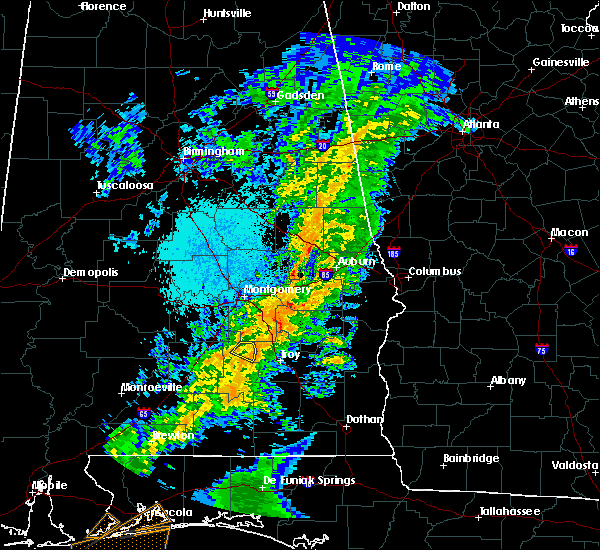 At 146 am cdt, a severe thunderstorm was located near petrey, or 12 miles south of meadville, moving northeast at 50 mph (radar indicated). Hazards include 60 mph wind gusts. Expect damage to roofs, siding, and trees. Locations impacted include, petrey and highland home. At 146 am cdt, a severe thunderstorm was located near petrey, or 12 miles south of meadville, moving northeast at 50 mph (radar indicated). Hazards include 60 mph wind gusts. Expect damage to roofs, siding, and trees. Locations impacted include, petrey and highland home.
|
| 4/19/2019 1:28 AM CDT |
 At 128 am cdt, a severe thunderstorm was located 4 miles west of rutledge, or 6 miles west of luverne, moving northeast at 50 mph (radar indicated). Hazards include 60 mph wind gusts. expect damage to roofs, siding, and trees At 128 am cdt, a severe thunderstorm was located 4 miles west of rutledge, or 6 miles west of luverne, moving northeast at 50 mph (radar indicated). Hazards include 60 mph wind gusts. expect damage to roofs, siding, and trees
|
| 4/18/2019 10:06 PM CDT |
 The severe thunderstorm warning for crenshaw county will expire at 1015 pm cdt, the storms which prompted the warning have weakened below severe limits, and the warning will be allowed to expire. a tornado watch remains in effect until 1100 pm cdt for south central alabama. The severe thunderstorm warning for crenshaw county will expire at 1015 pm cdt, the storms which prompted the warning have weakened below severe limits, and the warning will be allowed to expire. a tornado watch remains in effect until 1100 pm cdt for south central alabama.
|
| 4/18/2019 9:31 PM CDT |
 At 930 pm cdt, severe thunderstorms were located along a line extending from 5 miles southeast of logan to 3 miles north of dozier, moving east at 45 mph (radar indicated). Hazards include 60 mph wind gusts. Expect damage to roofs, siding, and trees. Locations impacted include, luverne, brantley, rutledge, glenwood, petrey and highland home. At 930 pm cdt, severe thunderstorms were located along a line extending from 5 miles southeast of logan to 3 miles north of dozier, moving east at 45 mph (radar indicated). Hazards include 60 mph wind gusts. Expect damage to roofs, siding, and trees. Locations impacted include, luverne, brantley, rutledge, glenwood, petrey and highland home.
|
| 4/18/2019 9:10 PM CDT |
 At 910 pm cdt, severe thunderstorms were located along a line extending from near fort deposit to mckenzie, moving east at 35 mph (radar indicated). Hazards include 60 mph wind gusts. expect damage to roofs, siding, and trees At 910 pm cdt, severe thunderstorms were located along a line extending from near fort deposit to mckenzie, moving east at 35 mph (radar indicated). Hazards include 60 mph wind gusts. expect damage to roofs, siding, and trees
|
| 4/14/2019 6:32 AM CDT |
 At 631 am cdt, severe thunderstorms were located along a line extending from 8 miles west of rutledge to near brantley to dozier to 5 miles northeast of gantt, moving northeast at 40 mph (radar indicated). Hazards include 70 mph wind gusts. Expect considerable tree damage. damage is likely to mobile homes, roofs, and outbuildings. Locations impacted include, luverne, brantley, rutledge, dozier, glenwood and petrey. At 631 am cdt, severe thunderstorms were located along a line extending from 8 miles west of rutledge to near brantley to dozier to 5 miles northeast of gantt, moving northeast at 40 mph (radar indicated). Hazards include 70 mph wind gusts. Expect considerable tree damage. damage is likely to mobile homes, roofs, and outbuildings. Locations impacted include, luverne, brantley, rutledge, dozier, glenwood and petrey.
|
| 4/14/2019 6:22 AM CDT |
 At 622 am cdt, severe thunderstorms were located along a line extending from 11 miles east of georgiana to 11 miles west of brantley to dozier to 7 miles north of heath to gantt, moving northeast at 35 mph (radar indicated). Hazards include 70 mph wind gusts. Expect considerable tree damage. damage is likely to mobile homes, roofs, and outbuildings. Locations impacted include, luverne, brantley, rutledge, dozier, glenwood, petrey and highland home. At 622 am cdt, severe thunderstorms were located along a line extending from 11 miles east of georgiana to 11 miles west of brantley to dozier to 7 miles north of heath to gantt, moving northeast at 35 mph (radar indicated). Hazards include 70 mph wind gusts. Expect considerable tree damage. damage is likely to mobile homes, roofs, and outbuildings. Locations impacted include, luverne, brantley, rutledge, dozier, glenwood, petrey and highland home.
|
| 4/14/2019 6:11 AM CDT |
 At 611 am cdt, severe thunderstorms were located along a line extending from naftel to 8 miles east of mckenzie, moving northeast at 90 mph (radar indicated). Hazards include 60 mph wind gusts. expect damage to roofs, siding, and trees At 611 am cdt, severe thunderstorms were located along a line extending from naftel to 8 miles east of mckenzie, moving northeast at 90 mph (radar indicated). Hazards include 60 mph wind gusts. expect damage to roofs, siding, and trees
|
| 4/14/2019 5:26 AM CDT |
 At 526 am cdt, severe thunderstorms were located along a line extending from 3 miles southwest of lowndes county airport to 4 miles northeast of evergreen, moving east at 35 mph (radar indicated). Hazards include 60 mph wind gusts. expect damage to roofs, siding, and trees At 526 am cdt, severe thunderstorms were located along a line extending from 3 miles southwest of lowndes county airport to 4 miles northeast of evergreen, moving east at 35 mph (radar indicated). Hazards include 60 mph wind gusts. expect damage to roofs, siding, and trees
|
| 4/14/2019 4:48 AM CDT |
 At 448 am cdt, severe thunderstorms were located along a line extending from 4 miles southwest of gordonville to 8 miles northwest of greenville to 8 miles northwest of i65 and us 84, moving northeast at 75 mph (radar indicated). Hazards include 60 mph wind gusts. expect damage to roofs, siding, and trees At 448 am cdt, severe thunderstorms were located along a line extending from 4 miles southwest of gordonville to 8 miles northwest of greenville to 8 miles northwest of i65 and us 84, moving northeast at 75 mph (radar indicated). Hazards include 60 mph wind gusts. expect damage to roofs, siding, and trees
|
| 3/3/2019 2:55 PM CST |
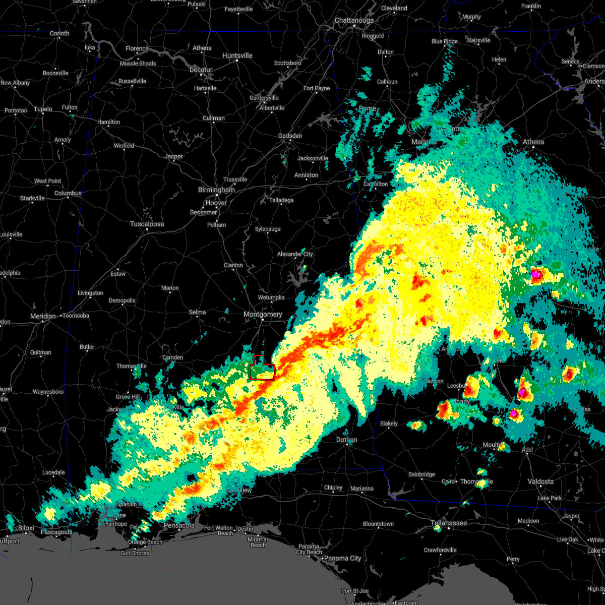 The tornado warning for northern crenshaw county will expire at 300 pm cst, the storm which prompted the warning has moved out of the area. therefore, the warning will be allowed to expire. a tornado watch remains in effect until 600 pm cst for south central alabama. remember, a severe thunderstorm warning still remains in effect for all of crenshaw county until 330 pm cst. The tornado warning for northern crenshaw county will expire at 300 pm cst, the storm which prompted the warning has moved out of the area. therefore, the warning will be allowed to expire. a tornado watch remains in effect until 600 pm cst for south central alabama. remember, a severe thunderstorm warning still remains in effect for all of crenshaw county until 330 pm cst.
|
| 3/3/2019 2:45 PM CST |
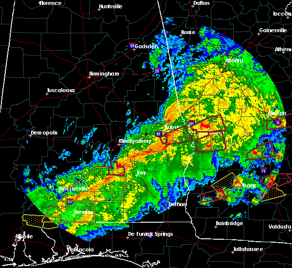 At 244 pm cst, a severe thunderstorm capable of producing a tornado was located over lapine, or 11 miles southwest of meadville, moving east at 55 mph (radar indicated rotation). Hazards include tornado and quarter size hail. Flying debris will be dangerous to those caught without shelter. mobile homes will be damaged or destroyed. damage to roofs, windows, and vehicles will occur. tree damage is likely. This tornadic thunderstorm will remain over mainly rural areas of northern crenshaw county. At 244 pm cst, a severe thunderstorm capable of producing a tornado was located over lapine, or 11 miles southwest of meadville, moving east at 55 mph (radar indicated rotation). Hazards include tornado and quarter size hail. Flying debris will be dangerous to those caught without shelter. mobile homes will be damaged or destroyed. damage to roofs, windows, and vehicles will occur. tree damage is likely. This tornadic thunderstorm will remain over mainly rural areas of northern crenshaw county.
|
| 3/3/2019 2:31 PM CST |
 At 231 pm cst, a severe thunderstorm capable of producing a tornado was located 4 miles south of logan, or 7 miles southeast of fort deposit, moving east at 55 mph (radar indicated rotation). Hazards include tornado. Flying debris will be dangerous to those caught without shelter. mobile homes will be damaged or destroyed. damage to roofs, windows, and vehicles will occur. tree damage is likely. this dangerous storm will be near, highland home around 240 pm cst. Petrey around 250 pm cst. At 231 pm cst, a severe thunderstorm capable of producing a tornado was located 4 miles south of logan, or 7 miles southeast of fort deposit, moving east at 55 mph (radar indicated rotation). Hazards include tornado. Flying debris will be dangerous to those caught without shelter. mobile homes will be damaged or destroyed. damage to roofs, windows, and vehicles will occur. tree damage is likely. this dangerous storm will be near, highland home around 240 pm cst. Petrey around 250 pm cst.
|
| 3/3/2019 2:23 PM CST |
 At 223 pm cst, severe thunderstorms were located along a line extending from 4 miles west of greenville to 5 miles southwest of excel, moving east at 45 mph (radar indicated). Hazards include 60 mph wind gusts and nickel size hail. expect damage to roofs, siding, and trees At 223 pm cst, severe thunderstorms were located along a line extending from 4 miles west of greenville to 5 miles southwest of excel, moving east at 45 mph (radar indicated). Hazards include 60 mph wind gusts and nickel size hail. expect damage to roofs, siding, and trees
|
| 1/19/2019 3:14 PM CST |
 At 314 pm cst, a severe thunderstorm was located near greenville, moving northeast at 40 mph (radar indicated). Hazards include 60 mph wind gusts. expect damage to roofs, siding, and trees At 314 pm cst, a severe thunderstorm was located near greenville, moving northeast at 40 mph (radar indicated). Hazards include 60 mph wind gusts. expect damage to roofs, siding, and trees
|
| 6/28/2018 6:09 PM CDT |
 At 542 pm cdt, severe thunderstorms were located along a line extending from georgiana to 4 miles northwest of dozier to 6 miles northwest of fort rucker, moving southeast at 35 mph (radar indicated). Hazards include 60 mph wind gusts. expect damage to roofs, siding, and trees At 542 pm cdt, severe thunderstorms were located along a line extending from georgiana to 4 miles northwest of dozier to 6 miles northwest of fort rucker, moving southeast at 35 mph (radar indicated). Hazards include 60 mph wind gusts. expect damage to roofs, siding, and trees
|
| 6/28/2018 5:43 PM CDT |
 At 542 pm cdt, severe thunderstorms were located along a line extending from georgiana to 4 miles northwest of dozier to 6 miles northwest of fort rucker, moving southeast at 35 mph (radar indicated). Hazards include 60 mph wind gusts. expect damage to roofs, siding, and trees At 542 pm cdt, severe thunderstorms were located along a line extending from georgiana to 4 miles northwest of dozier to 6 miles northwest of fort rucker, moving southeast at 35 mph (radar indicated). Hazards include 60 mph wind gusts. expect damage to roofs, siding, and trees
|
| 6/28/2018 5:31 PM CDT |
 At 530 pm cdt, severe thunderstorms were located along a line extending from 9 miles west of greenville to 5 miles north of dozier to 5 miles east of brantley, moving south at 45 mph (radar indicated). Hazards include 60 mph wind gusts. Expect damage to roofs, siding, and trees. Locations impacted include, greenville, luverne, georgiana, brantley, rutledge, dozier, glenwood, petrey and highland home. At 530 pm cdt, severe thunderstorms were located along a line extending from 9 miles west of greenville to 5 miles north of dozier to 5 miles east of brantley, moving south at 45 mph (radar indicated). Hazards include 60 mph wind gusts. Expect damage to roofs, siding, and trees. Locations impacted include, greenville, luverne, georgiana, brantley, rutledge, dozier, glenwood, petrey and highland home.
|
| 6/28/2018 4:59 PM CDT |
 The national weather service in mobile has issued a * severe thunderstorm warning for. butler county in south central alabama. crenshaw county in south central alabama. until 545 pm cdt. At 458 pm cdt, severe thunderstorms were located along a line. The national weather service in mobile has issued a * severe thunderstorm warning for. butler county in south central alabama. crenshaw county in south central alabama. until 545 pm cdt. At 458 pm cdt, severe thunderstorms were located along a line.
|
| 4/22/2018 2:30 PM CDT | Trees down on naftel-ramer road. possible tornad in montgomery county AL, 11.2 miles S of Petrey, AL |
| 4/22/2018 2:14 PM CDT | Pictures of trees snapped and numerous large branches down near a home in the area of highland home and magnolia spring in crenshaw county AL, 8.3 miles SE of Petrey, AL |
| 8/30/2017 5:33 PM CDT | Broadcast media reports a few trees down across highland home in crenshaw county in crenshaw county AL, 9.2 miles SE of Petrey, AL |
| 8/30/2017 5:32 PM CDT |
 At 529 pm cdt, a severe thunderstorm capable of producing a tornado was located over petrey, or 8 miles north of luverne, moving north at 25 mph (radar indicated rotation). Hazards include tornado. Flying debris will be dangerous to those caught without shelter. mobile homes will be damaged or destroyed. damage to roofs, windows, and vehicles will occur. tree damage is likely. this tornadic thunderstorm will remain over mainly rural areas of northeastern crenshaw county. Another strong thunderstorm is being closely monitored was located over southwest crenshaw county moving north at 25 mph. At 529 pm cdt, a severe thunderstorm capable of producing a tornado was located over petrey, or 8 miles north of luverne, moving north at 25 mph (radar indicated rotation). Hazards include tornado. Flying debris will be dangerous to those caught without shelter. mobile homes will be damaged or destroyed. damage to roofs, windows, and vehicles will occur. tree damage is likely. this tornadic thunderstorm will remain over mainly rural areas of northeastern crenshaw county. Another strong thunderstorm is being closely monitored was located over southwest crenshaw county moving north at 25 mph.
|
| 8/30/2017 5:15 PM CDT |
 At 515 pm cdt, a severe thunderstorm capable of producing a tornado was located near luverne, moving north at 20 mph (radar indicated rotation). Hazards include tornado. Flying debris will be dangerous to those caught without shelter. mobile homes will be damaged or destroyed. damage to roofs, windows, and vehicles will occur. tree damage is likely. This dangerous storm will be near, petrey around 540 pm cdt. At 515 pm cdt, a severe thunderstorm capable of producing a tornado was located near luverne, moving north at 20 mph (radar indicated rotation). Hazards include tornado. Flying debris will be dangerous to those caught without shelter. mobile homes will be damaged or destroyed. damage to roofs, windows, and vehicles will occur. tree damage is likely. This dangerous storm will be near, petrey around 540 pm cdt.
|
| 8/14/2017 5:27 PM CDT |
 The severe thunderstorm warning for crenshaw county will expire at 530 pm cdt, the storms which prompted the warning have weakened below severe limits, and no longer pose an immediate threat to life or property. therefore the warning will be allowed to expire. however, gusty winds and heavy rain are still possible with these thunderstorms. to report severe weather, contact your nearest law enforcement agency. they will relay your report to the national weather service mobile. additional statements will be issued as conditions warrant. The severe thunderstorm warning for crenshaw county will expire at 530 pm cdt, the storms which prompted the warning have weakened below severe limits, and no longer pose an immediate threat to life or property. therefore the warning will be allowed to expire. however, gusty winds and heavy rain are still possible with these thunderstorms. to report severe weather, contact your nearest law enforcement agency. they will relay your report to the national weather service mobile. additional statements will be issued as conditions warrant.
|
| 8/14/2017 5:12 PM CDT |
 At 510 pm cdt, severe thunderstorms were located along a line extending from 9 miles southwest of highland home to near rutledge to 6 miles southwest of luverne, moving east at 20 mph (radar indicated). Hazards include 60 mph wind gusts and penny size hail. Expect damage to roofs, siding, and trees. Locations impacted include, luverne, rutledge, petrey, highland home and lapine. At 510 pm cdt, severe thunderstorms were located along a line extending from 9 miles southwest of highland home to near rutledge to 6 miles southwest of luverne, moving east at 20 mph (radar indicated). Hazards include 60 mph wind gusts and penny size hail. Expect damage to roofs, siding, and trees. Locations impacted include, luverne, rutledge, petrey, highland home and lapine.
|
| 8/14/2017 4:38 PM CDT |
 At 437 pm cdt, a cluster of severe thunderstorms was located near greenville, moving northeast at 45 mph (radar indicated). Hazards include 60 mph wind gusts and quarter size hail. Hail damage to vehicles is expected. Expect wind damage to roofs, siding, and trees. At 437 pm cdt, a cluster of severe thunderstorms was located near greenville, moving northeast at 45 mph (radar indicated). Hazards include 60 mph wind gusts and quarter size hail. Hail damage to vehicles is expected. Expect wind damage to roofs, siding, and trees.
|
| 4/3/2017 9:22 AM CDT |
 The severe thunderstorm warning for eastern butler, crenshaw, eastern escambia, southeastern conecuh, covington, northern okaloosa and northeastern santa rosa counties will expire at 930 am cdt, the storms which prompted the warning have have weakened and will moved out of the warned area. it is possible a new warnign may be issued across northern okaloosa and covington counties however. a tornado watch remains in effect until 100 pm cdt for south central alabama, and northwestern florida. The severe thunderstorm warning for eastern butler, crenshaw, eastern escambia, southeastern conecuh, covington, northern okaloosa and northeastern santa rosa counties will expire at 930 am cdt, the storms which prompted the warning have have weakened and will moved out of the warned area. it is possible a new warnign may be issued across northern okaloosa and covington counties however. a tornado watch remains in effect until 100 pm cdt for south central alabama, and northwestern florida.
|
| 4/3/2017 9:09 AM CDT |
 At 909 am cdt, severe thunderstorms were located along a line extending from near ansley to near opp to 6 miles northwest of lockhart, moving southeast at 30 mph (radar indicated). Hazards include 60 mph wind gusts and quarter size hail. Hail damage to vehicles is expected. expect wind damage to roofs, siding, and trees. locations impacted include, andalusia, greenville, opp, luverne, florala, brantley, mckenzie, river falls, red level, laurel hill, lockhart, rutledge, dozier, heath, gantt, glenwood and petrey. A tornado watch remains in effect until 100 pm cdt for south central alabama, and northwestern florida. At 909 am cdt, severe thunderstorms were located along a line extending from near ansley to near opp to 6 miles northwest of lockhart, moving southeast at 30 mph (radar indicated). Hazards include 60 mph wind gusts and quarter size hail. Hail damage to vehicles is expected. expect wind damage to roofs, siding, and trees. locations impacted include, andalusia, greenville, opp, luverne, florala, brantley, mckenzie, river falls, red level, laurel hill, lockhart, rutledge, dozier, heath, gantt, glenwood and petrey. A tornado watch remains in effect until 100 pm cdt for south central alabama, and northwestern florida.
|
| 4/3/2017 8:54 AM CDT |
 At 854 am cdt, a severe thunderstorm capable of producing a tornado was located over petrey, or 10 miles north of luverne, moving northeast at 45 mph (radar indicated rotation). Hazards include tornado and quarter size hail. Flying debris will be dangerous to those caught without shelter. mobile homes will be damaged or destroyed. damage to roofs, windows, and vehicles will occur. tree damage is likely. This tornadic thunderstorm will remain over mainly rural areas of northern crenshaw county. At 854 am cdt, a severe thunderstorm capable of producing a tornado was located over petrey, or 10 miles north of luverne, moving northeast at 45 mph (radar indicated rotation). Hazards include tornado and quarter size hail. Flying debris will be dangerous to those caught without shelter. mobile homes will be damaged or destroyed. damage to roofs, windows, and vehicles will occur. tree damage is likely. This tornadic thunderstorm will remain over mainly rural areas of northern crenshaw county.
|
| 4/3/2017 8:45 AM CDT |
 At 845 am cdt, severe thunderstorms were located along a line extending from near highland home to gantt to 14 miles west of laurel hill, moving northeast at 40 mph (radar indicated). Hazards include 60 mph wind gusts and quarter size hail. Hail damage to vehicles is expected. expect wind damage to roofs, siding, and trees. locations impacted include, andalusia, greenville, opp, luverne, florala, georgiana, brantley, mckenzie, river falls, red level, laurel hill, lockhart, rutledge, dozier, heath, gantt, glenwood and petrey. A tornado watch remains in effect until 100 pm cdt for south central alabama, and northwestern florida. At 845 am cdt, severe thunderstorms were located along a line extending from near highland home to gantt to 14 miles west of laurel hill, moving northeast at 40 mph (radar indicated). Hazards include 60 mph wind gusts and quarter size hail. Hail damage to vehicles is expected. expect wind damage to roofs, siding, and trees. locations impacted include, andalusia, greenville, opp, luverne, florala, georgiana, brantley, mckenzie, river falls, red level, laurel hill, lockhart, rutledge, dozier, heath, gantt, glenwood and petrey. A tornado watch remains in effect until 100 pm cdt for south central alabama, and northwestern florida.
|
| 4/3/2017 8:26 AM CDT |
 At 825 am cdt, severe thunderstorms were located along a line extending from near greenville to 7 miles south of red level to 12 miles southeast of riverview, moving northeast at 40 mph (radar indicated). Hazards include 60 mph wind gusts and quarter size hail. Hail damage to vehicles is expected. Expect wind damage to roofs, siding, and trees. At 825 am cdt, severe thunderstorms were located along a line extending from near greenville to 7 miles south of red level to 12 miles southeast of riverview, moving northeast at 40 mph (radar indicated). Hazards include 60 mph wind gusts and quarter size hail. Hail damage to vehicles is expected. Expect wind damage to roofs, siding, and trees.
|
| 1/22/2017 12:37 PM CST |
 At 1237 pm cst, a severe thunderstorm was located near rutledge, or 7 miles northwest of luverne, moving east at 55 mph (radar indicated). Hazards include 60 mph wind gusts and quarter size hail. Hail damage to vehicles is expected. expect wind damage to roofs, siding, and trees. locations impacted include, petrey, highland home and lapine. A tornado watch remains in effect until 200 pm cst for south central alabama. At 1237 pm cst, a severe thunderstorm was located near rutledge, or 7 miles northwest of luverne, moving east at 55 mph (radar indicated). Hazards include 60 mph wind gusts and quarter size hail. Hail damage to vehicles is expected. expect wind damage to roofs, siding, and trees. locations impacted include, petrey, highland home and lapine. A tornado watch remains in effect until 200 pm cst for south central alabama.
|
| 1/22/2017 12:26 PM CST |
 At 1226 pm cst, a severe thunderstorm was located 8 miles southeast of greenville, moving east at 55 mph (radar indicated). Hazards include 60 mph wind gusts and quarter size hail. Hail damage to vehicles is expected. Expect wind damage to roofs, siding, and trees. At 1226 pm cst, a severe thunderstorm was located 8 miles southeast of greenville, moving east at 55 mph (radar indicated). Hazards include 60 mph wind gusts and quarter size hail. Hail damage to vehicles is expected. Expect wind damage to roofs, siding, and trees.
|
| 1/21/2017 8:43 AM CST |
 At 843 am cst, severe thunderstorms were located along a line extending from near highland home to near red level, moving east at 60 mph (radar indicated). Hazards include 60 mph wind gusts. Expect damage to roofs, siding, and trees. locations impacted include, luverne, brantley, red level, rutledge, dozier, gantt, glenwood, petrey, highland home and lapine. A tornado watch remains in effect until 1100 am cst for south central alabama. At 843 am cst, severe thunderstorms were located along a line extending from near highland home to near red level, moving east at 60 mph (radar indicated). Hazards include 60 mph wind gusts. Expect damage to roofs, siding, and trees. locations impacted include, luverne, brantley, red level, rutledge, dozier, gantt, glenwood, petrey, highland home and lapine. A tornado watch remains in effect until 1100 am cst for south central alabama.
|
| 1/21/2017 8:32 AM CST |
 At 831 am cst, severe thunderstorms were located along a line extending from near lowndes county airport to 6 miles west of red level, moving east at 45 mph (radar indicated). Hazards include 60 mph wind gusts. Expect damage to roofs, siding, and trees. locations impacted include, greenville, luverne, brantley, mckenzie, red level, rutledge, dozier, gantt, glenwood, petrey, highland home and lapine. A tornado watch remains in effect until 1100 am cst for south central alabama. At 831 am cst, severe thunderstorms were located along a line extending from near lowndes county airport to 6 miles west of red level, moving east at 45 mph (radar indicated). Hazards include 60 mph wind gusts. Expect damage to roofs, siding, and trees. locations impacted include, greenville, luverne, brantley, mckenzie, red level, rutledge, dozier, gantt, glenwood, petrey, highland home and lapine. A tornado watch remains in effect until 1100 am cst for south central alabama.
|
| 1/21/2017 8:18 AM CST |
 At 818 am cst, severe thunderstorms were located along a line extending from 9 miles northwest of greenville to 6 miles east of evergreen, moving east at 60 mph (radar indicated). Hazards include 60 mph wind gusts. expect damage to roofs, siding, and trees At 818 am cst, severe thunderstorms were located along a line extending from 9 miles northwest of greenville to 6 miles east of evergreen, moving east at 60 mph (radar indicated). Hazards include 60 mph wind gusts. expect damage to roofs, siding, and trees
|
| 1/2/2017 4:25 PM CST |
 At 424 pm cst, a severe thunderstorm was located 9 miles west of rutledge, or 10 miles southeast of greenville, moving northeast at 45 mph (radar indicated). Hazards include 60 mph wind gusts and quarter size hail. Hail damage to vehicles is expected. expect wind damage to roofs, siding, and trees. locations impacted include, greenville, luverne, georgiana, rutledge, petrey, highland home and lapine. A tornado watch remains in effect until 800 pm cst for south central alabama. At 424 pm cst, a severe thunderstorm was located 9 miles west of rutledge, or 10 miles southeast of greenville, moving northeast at 45 mph (radar indicated). Hazards include 60 mph wind gusts and quarter size hail. Hail damage to vehicles is expected. expect wind damage to roofs, siding, and trees. locations impacted include, greenville, luverne, georgiana, rutledge, petrey, highland home and lapine. A tornado watch remains in effect until 800 pm cst for south central alabama.
|
| 1/2/2017 4:06 PM CST |
 At 406 pm cst, a severe thunderstorm was located near georgiana, or 13 miles south of greenville, moving northeast at 40 mph (radar indicated). Hazards include 60 mph wind gusts and quarter size hail. Hail damage to vehicles is expected. Expect wind damage to roofs, siding, and trees. At 406 pm cst, a severe thunderstorm was located near georgiana, or 13 miles south of greenville, moving northeast at 40 mph (radar indicated). Hazards include 60 mph wind gusts and quarter size hail. Hail damage to vehicles is expected. Expect wind damage to roofs, siding, and trees.
|
| 1/2/2017 3:23 PM CST |
 At 323 pm cst, a severe thunderstorm capable of producing a tornado was located near luverne, moving northeast at 30 mph (radar indicated rotation). Hazards include tornado and quarter size hail. Flying debris will be dangerous to those caught without shelter. mobile homes will be damaged or destroyed. damage to roofs, windows, and vehicles will occur. tree damage is likely. This tornadic thunderstorm will remain over mainly rural areas of east central crenshaw county. At 323 pm cst, a severe thunderstorm capable of producing a tornado was located near luverne, moving northeast at 30 mph (radar indicated rotation). Hazards include tornado and quarter size hail. Flying debris will be dangerous to those caught without shelter. mobile homes will be damaged or destroyed. damage to roofs, windows, and vehicles will occur. tree damage is likely. This tornadic thunderstorm will remain over mainly rural areas of east central crenshaw county.
|
| 1/2/2017 3:13 PM CST |
 At 313 pm cst, severe thunderstorms were located along a line extending from near beechwood to greenville to near georgiana, moving east at 40 mph (radar indicated). Hazards include 60 mph wind gusts. expect damage to roofs, siding, and trees At 313 pm cst, severe thunderstorms were located along a line extending from near beechwood to greenville to near georgiana, moving east at 40 mph (radar indicated). Hazards include 60 mph wind gusts. expect damage to roofs, siding, and trees
|
| 1/2/2017 3:09 PM CST |
 At 309 pm cst, a severe thunderstorm capable of producing a tornado was located near rutledge, or near luverne, moving northeast at 35 mph (radar indicated rotation). Hazards include tornado and quarter size hail. Flying debris will be dangerous to those caught without shelter. mobile homes will be damaged or destroyed. damage to roofs, windows, and vehicles will occur. tree damage is likely. this dangerous storm will be near, luverne around 315 pm cst. glenwood around 320 pm cst. Petrey around 330 pm cst. At 309 pm cst, a severe thunderstorm capable of producing a tornado was located near rutledge, or near luverne, moving northeast at 35 mph (radar indicated rotation). Hazards include tornado and quarter size hail. Flying debris will be dangerous to those caught without shelter. mobile homes will be damaged or destroyed. damage to roofs, windows, and vehicles will occur. tree damage is likely. this dangerous storm will be near, luverne around 315 pm cst. glenwood around 320 pm cst. Petrey around 330 pm cst.
|
| 1/2/2017 2:50 PM CST |
 At 250 pm cst, a severe thunderstorm capable of producing a tornado was located near dozier, or 12 miles southwest of luverne, moving northeast at 45 mph (radar indicated rotation). Hazards include tornado and quarter size hail. Flying debris will be dangerous to those caught without shelter. mobile homes will be damaged or destroyed. damage to roofs, windows, and vehicles will occur. tree damage is likely. this dangerous storm will be near, brantley around 300 pm cst. luverne and rutledge around 305 pm cst. glenwood around 310 pm cst. Petrey around 315 pm cst. At 250 pm cst, a severe thunderstorm capable of producing a tornado was located near dozier, or 12 miles southwest of luverne, moving northeast at 45 mph (radar indicated rotation). Hazards include tornado and quarter size hail. Flying debris will be dangerous to those caught without shelter. mobile homes will be damaged or destroyed. damage to roofs, windows, and vehicles will occur. tree damage is likely. this dangerous storm will be near, brantley around 300 pm cst. luverne and rutledge around 305 pm cst. glenwood around 310 pm cst. Petrey around 315 pm cst.
|
| 6/17/2016 6:11 PM CDT |
 At 610 pm cdt, severe thunderstorms were located along a line extending from near moss to 6 miles southwest of state line to near castleberry to near goshen, moving southeast at 50 mph (radar indicated). Hazards include 60 mph wind gusts and quarter size hail. Hail damage to vehicles is expected. expect wind damage to roofs, siding, and trees. Locations impacted include, andalusia, atmore, greenville, monroeville, opp, brewton, jackson, waynesboro, citronelle, evergreen, luverne, florala, frisco city, chatom, richton, leakesville, mccullough, peterman, saint stephens and wagarville. At 610 pm cdt, severe thunderstorms were located along a line extending from near moss to 6 miles southwest of state line to near castleberry to near goshen, moving southeast at 50 mph (radar indicated). Hazards include 60 mph wind gusts and quarter size hail. Hail damage to vehicles is expected. expect wind damage to roofs, siding, and trees. Locations impacted include, andalusia, atmore, greenville, monroeville, opp, brewton, jackson, waynesboro, citronelle, evergreen, luverne, florala, frisco city, chatom, richton, leakesville, mccullough, peterman, saint stephens and wagarville.
|
| 6/17/2016 6:00 PM CDT |
 At 559 pm cdt, severe thunderstorms were located along a line extending from bay springs to near buckatunna to near i65 and us 84 to near lapine, moving southeast at 50 mph (radar indicated). Hazards include 60 mph wind gusts and nickel size hail. Expect damage to roofs. siding. And trees. At 559 pm cdt, severe thunderstorms were located along a line extending from bay springs to near buckatunna to near i65 and us 84 to near lapine, moving southeast at 50 mph (radar indicated). Hazards include 60 mph wind gusts and nickel size hail. Expect damage to roofs. siding. And trees.
|
| 6/17/2016 5:26 PM CDT |
 At 523 pm cdt, severe thunderstorms were located along a line extending from near pintlala to near pine apple to near silas to bay springs, moving south at 45 mph (radar indicated. several reports of winds around 60 mph have been received with this line of storms. trees have been blown down in choctaw and clarke counties). Hazards include 60 mph wind gusts and quarter size hail. Hail damage to vehicles is expected. expect wind damage to roofs, siding, and trees. Locations impacted include, greenville, monroeville, jackson, waynesboro, thomasville, luverne, camden, butler, frisco city, grove hill, chatom, peterman, saint stephens, wagarville, leroy, clara, georgiana, whatley, pine hill and mckenzie. At 523 pm cdt, severe thunderstorms were located along a line extending from near pintlala to near pine apple to near silas to bay springs, moving south at 45 mph (radar indicated. several reports of winds around 60 mph have been received with this line of storms. trees have been blown down in choctaw and clarke counties). Hazards include 60 mph wind gusts and quarter size hail. Hail damage to vehicles is expected. expect wind damage to roofs, siding, and trees. Locations impacted include, greenville, monroeville, jackson, waynesboro, thomasville, luverne, camden, butler, frisco city, grove hill, chatom, peterman, saint stephens, wagarville, leroy, clara, georgiana, whatley, pine hill and mckenzie.
|
| 6/17/2016 5:02 PM CDT |
 At 500 pm cdt, severe thunderstorms were located along a line extending from near dannelly field to 10 miles southeast of dannelly reservoir to near butler to near conehatta, moving south at 45 mph. additional severe thunderstorm development is possible ahead of the main line (radar indicated). Hazards include 60 mph wind gusts and quarter size hail. Hail damage to vehicles is expected. Expect wind damage to roofs, siding, and trees. At 500 pm cdt, severe thunderstorms were located along a line extending from near dannelly field to 10 miles southeast of dannelly reservoir to near butler to near conehatta, moving south at 45 mph. additional severe thunderstorm development is possible ahead of the main line (radar indicated). Hazards include 60 mph wind gusts and quarter size hail. Hail damage to vehicles is expected. Expect wind damage to roofs, siding, and trees.
|
| 4/27/2016 4:49 PM CDT |
 At 449 pm cdt, another severe thunderstorm was located 8 miles southeast of greenville, moving northeast at 25 mph (radar indicated). Hazards include 60 mph wind gusts. Expect damage to roofs. siding. And trees. At 449 pm cdt, another severe thunderstorm was located 8 miles southeast of greenville, moving northeast at 25 mph (radar indicated). Hazards include 60 mph wind gusts. Expect damage to roofs. siding. And trees.
|
| 4/27/2016 4:20 PM CDT |
 At 420 pm cdt, a severe thunderstorm was located over greenville, moving northeast at 15 mph (radar indicated). Hazards include 60 mph wind gusts. Expect damage to roofs. siding. And trees. At 420 pm cdt, a severe thunderstorm was located over greenville, moving northeast at 15 mph (radar indicated). Hazards include 60 mph wind gusts. Expect damage to roofs. siding. And trees.
|
| 3/24/2016 3:12 PM CDT |
 At 312 pm cdt, severe thunderstorms were located along a line extending from 8 miles northwest of rutledge to glenwood to near elba, moving northeast at 45 mph (radar indicated). Hazards include 60 mph wind gusts and penny size hail. Expect damage to roofs. siding. And trees. At 312 pm cdt, severe thunderstorms were located along a line extending from 8 miles northwest of rutledge to glenwood to near elba, moving northeast at 45 mph (radar indicated). Hazards include 60 mph wind gusts and penny size hail. Expect damage to roofs. siding. And trees.
|
| 3/24/2016 2:53 PM CDT |
 At 253 pm cdt, severe thunderstorms were located along a line extending from near greenville to 6 miles southeast of rose hill to babbie to near laurel hill, moving east at 50 mph (radar indicated). Hazards include 70 mph wind gusts and penny size hail. Expect considerable tree damage. damage is likely to mobile homes, roofs, and outbuildings. locations impacted include, andalusia, greenville, opp, luverne, florala, brantley, babbie, river falls, lockhart, red level, rutledge, dozier, carolina, heath, sanford, horn hill, gantt, glenwood, onycha and libertyville. A tornado watch remains in effect until 700 pm cdt for south central alabama. At 253 pm cdt, severe thunderstorms were located along a line extending from near greenville to 6 miles southeast of rose hill to babbie to near laurel hill, moving east at 50 mph (radar indicated). Hazards include 70 mph wind gusts and penny size hail. Expect considerable tree damage. damage is likely to mobile homes, roofs, and outbuildings. locations impacted include, andalusia, greenville, opp, luverne, florala, brantley, babbie, river falls, lockhart, red level, rutledge, dozier, carolina, heath, sanford, horn hill, gantt, glenwood, onycha and libertyville. A tornado watch remains in effect until 700 pm cdt for south central alabama.
|
| 3/24/2016 2:31 PM CDT |
 At 231 pm cdt, severe thunderstorms were located along a line extending from near i65 and al 10 to near river falls to 8 miles southwest of carolina to 11 miles south of us 29 and cr 43, moving east at 55 mph (radar indicated). Hazards include 70 mph wind gusts and penny size hail. Expect considerable tree damage. Damage is likely to mobile homes, roofs, and outbuildings. At 231 pm cdt, severe thunderstorms were located along a line extending from near i65 and al 10 to near river falls to 8 miles southwest of carolina to 11 miles south of us 29 and cr 43, moving east at 55 mph (radar indicated). Hazards include 70 mph wind gusts and penny size hail. Expect considerable tree damage. Damage is likely to mobile homes, roofs, and outbuildings.
|
| 2/15/2016 5:57 PM CST | The tornado warning for northeastern crenshaw county will expire at 600 pm cst, the storm which prompted the warning has moved out of the area. therefore the warning will be allowed to expire. however gusty winds are still possible with thunderstorms moving across crenshaw county. a tornado watch remains in effect until 900 pm cst for south central alabama. stay tuned for further updates from your national weather service in mobile. |
| 2/15/2016 5:41 PM CST |
 At 540 pm cst, a severe thunderstorm capable of producing a tornado was located near petrey, moving northeast at 45 mph (radar indicated rotation). Hazards include tornado. Flying debris will be dangerous to those caught without shelter. mobile homes will be damaged or destroyed. damage to roofs, windows, and vehicles will occur. tree damage is likely. This dangerous storm will be near, petrey around 545 pm cst. At 540 pm cst, a severe thunderstorm capable of producing a tornado was located near petrey, moving northeast at 45 mph (radar indicated rotation). Hazards include tornado. Flying debris will be dangerous to those caught without shelter. mobile homes will be damaged or destroyed. damage to roofs, windows, and vehicles will occur. tree damage is likely. This dangerous storm will be near, petrey around 545 pm cst.
|
| 2/15/2016 5:30 PM CST |
 At 528 pm cst, a severe thunderstorm capable of producing a tornado was located near rutledge, or near luverne, moving northeast at 45 mph. there have been numerous reports of tornadoes and damage associated with this severe thunderstorm (radar indicated rotation). Hazards include tornado and quarter size hail. Flying debris will be dangerous to those caught without shelter. mobile homes will be damaged or destroyed. damage to roofs, windows, and vehicles will occur. tree damage is likely. this dangerous storm will be near, luverne around 535 pm cst. Petrey around 545 pm cst. At 528 pm cst, a severe thunderstorm capable of producing a tornado was located near rutledge, or near luverne, moving northeast at 45 mph. there have been numerous reports of tornadoes and damage associated with this severe thunderstorm (radar indicated rotation). Hazards include tornado and quarter size hail. Flying debris will be dangerous to those caught without shelter. mobile homes will be damaged or destroyed. damage to roofs, windows, and vehicles will occur. tree damage is likely. this dangerous storm will be near, luverne around 535 pm cst. Petrey around 545 pm cst.
|
| 2/15/2016 5:21 PM CST |
 At 518 pm cst, a severe thunderstorm capable of producing a tornado was located 10 miles southwest of rutledge, or 12 miles west of luverne, moving northeast at 45 mph. there have been numerous reports of tornadoes and damage associated with this severe thunderstorm (radar indicated rotation). Hazards include tornado and quarter size hail. Flying debris will be dangerous to those caught without shelter. mobile homes will be damaged or destroyed. damage to roofs, windows, and vehicles will occur. tree damage is likely. this dangerous storm will be near, luverne and rutledge around 530 pm cst. petrey around 545 pm cst. Lapine around 550 pm cst. At 518 pm cst, a severe thunderstorm capable of producing a tornado was located 10 miles southwest of rutledge, or 12 miles west of luverne, moving northeast at 45 mph. there have been numerous reports of tornadoes and damage associated with this severe thunderstorm (radar indicated rotation). Hazards include tornado and quarter size hail. Flying debris will be dangerous to those caught without shelter. mobile homes will be damaged or destroyed. damage to roofs, windows, and vehicles will occur. tree damage is likely. this dangerous storm will be near, luverne and rutledge around 530 pm cst. petrey around 545 pm cst. Lapine around 550 pm cst.
|
| 2/15/2016 5:10 PM CST |
 At 508 pm cst, a confirmed tornado was located 9 miles east of mckenzie, or 17 miles north of andalusia, moving northeast at 50 mph. numerous reports of tornadoes and damage have been received in association with this tornadic thunderstorm (weather spotters confirmed tornado). Hazards include damaging tornado and quarter size hail. Flying debris will be dangerous to those caught without shelter. mobile homes will be damaged or destroyed. damage to roofs, windows, and vehicles will occur. tree damage is likely. the tornado will be near, rutledge around 530 pm cst. luverne around 535 pm cst. petrey around 545 pm cst. Lapine around 550 pm cst. At 508 pm cst, a confirmed tornado was located 9 miles east of mckenzie, or 17 miles north of andalusia, moving northeast at 50 mph. numerous reports of tornadoes and damage have been received in association with this tornadic thunderstorm (weather spotters confirmed tornado). Hazards include damaging tornado and quarter size hail. Flying debris will be dangerous to those caught without shelter. mobile homes will be damaged or destroyed. damage to roofs, windows, and vehicles will occur. tree damage is likely. the tornado will be near, rutledge around 530 pm cst. luverne around 535 pm cst. petrey around 545 pm cst. Lapine around 550 pm cst.
|
| 2/15/2016 4:54 PM CST |
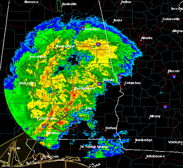 At 454 pm cst, a severe thunderstorm was located 8 miles southeast of greenville, moving northeast at 40 mph (radar indicated). Hazards include 60 mph wind gusts and quarter size hail. Hail damage to vehicles is expected. Expect wind damage to roofs, siding, and trees. At 454 pm cst, a severe thunderstorm was located 8 miles southeast of greenville, moving northeast at 40 mph (radar indicated). Hazards include 60 mph wind gusts and quarter size hail. Hail damage to vehicles is expected. Expect wind damage to roofs, siding, and trees.
|
| 7/4/2015 5:56 PM CDT |
 At 555 pm cdt, a severe thunderstorm capable of producing damaging winds over 60 mph was located near petrey, or 10 miles north of luverne, moving east at 25 mph. At 555 pm cdt, a severe thunderstorm capable of producing damaging winds over 60 mph was located near petrey, or 10 miles north of luverne, moving east at 25 mph.
|
| 7/4/2015 5:13 PM CDT |
 At 511 pm cdt, an area of severe thunderstorms capable of producing damaging winds over 60 mph was located over west butler county, and moving northeast at 20 mph. At 511 pm cdt, an area of severe thunderstorms capable of producing damaging winds over 60 mph was located over west butler county, and moving northeast at 20 mph.
|
| 4/14/2013 10:06 AM CDT | Power lines down on dauphin island parkway at river road. radar measured 45 kt in crenshaw county AL, 3.9 miles ENE of Petrey, AL |
| 1/1/0001 12:00 AM | Emergency manager reported that two storage buildings were flipped over and a business received roof damage in highland hom in crenshaw county AL, 9.2 miles SE of Petrey, AL |
Hail Maps for Petrey, AL


Connect with Interactive Hail Maps