

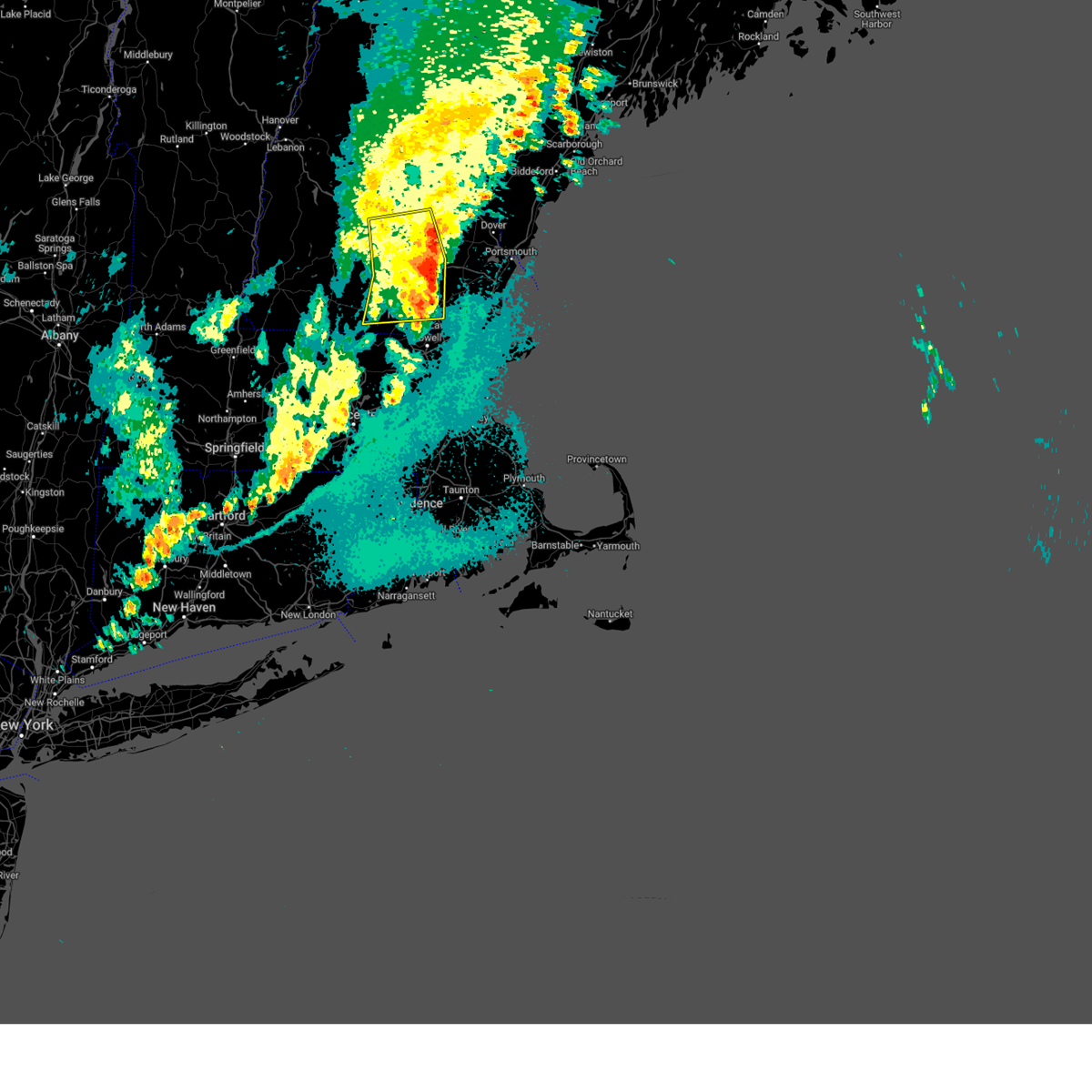
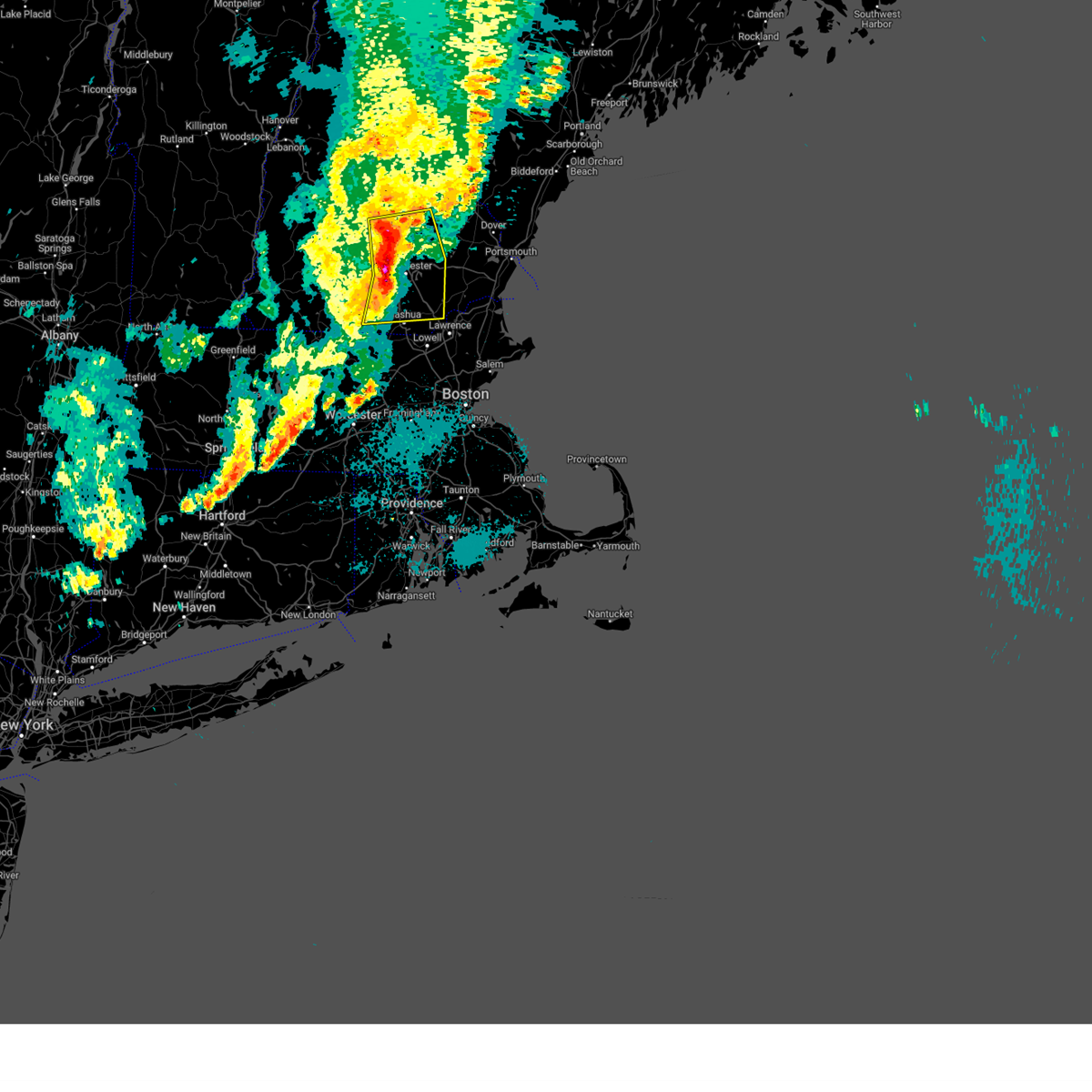
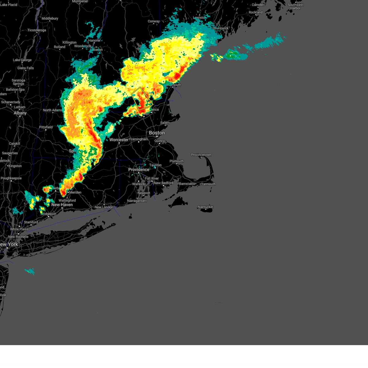
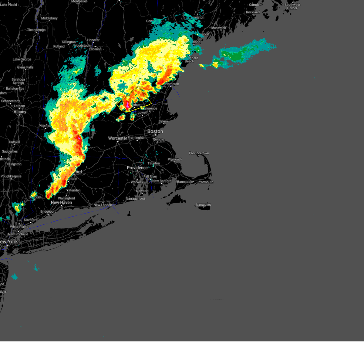
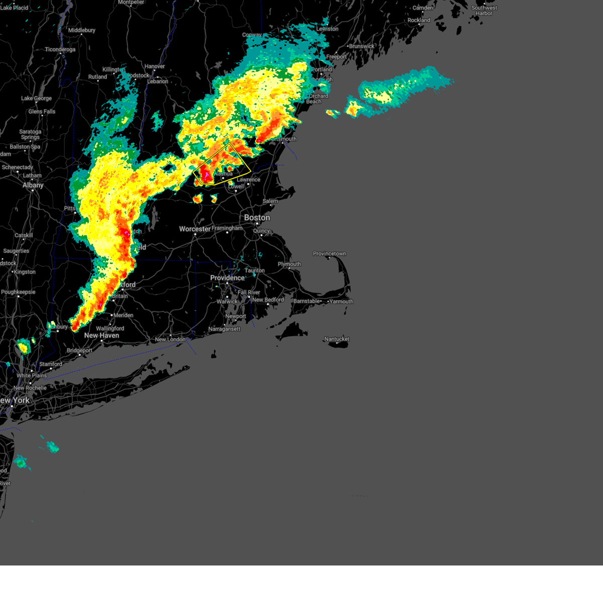
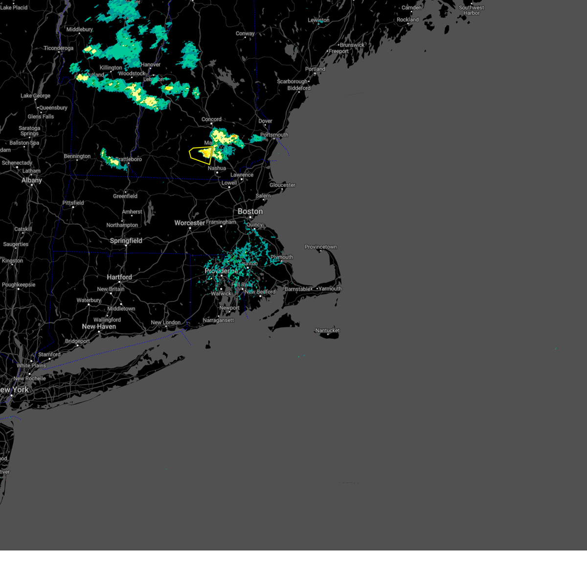
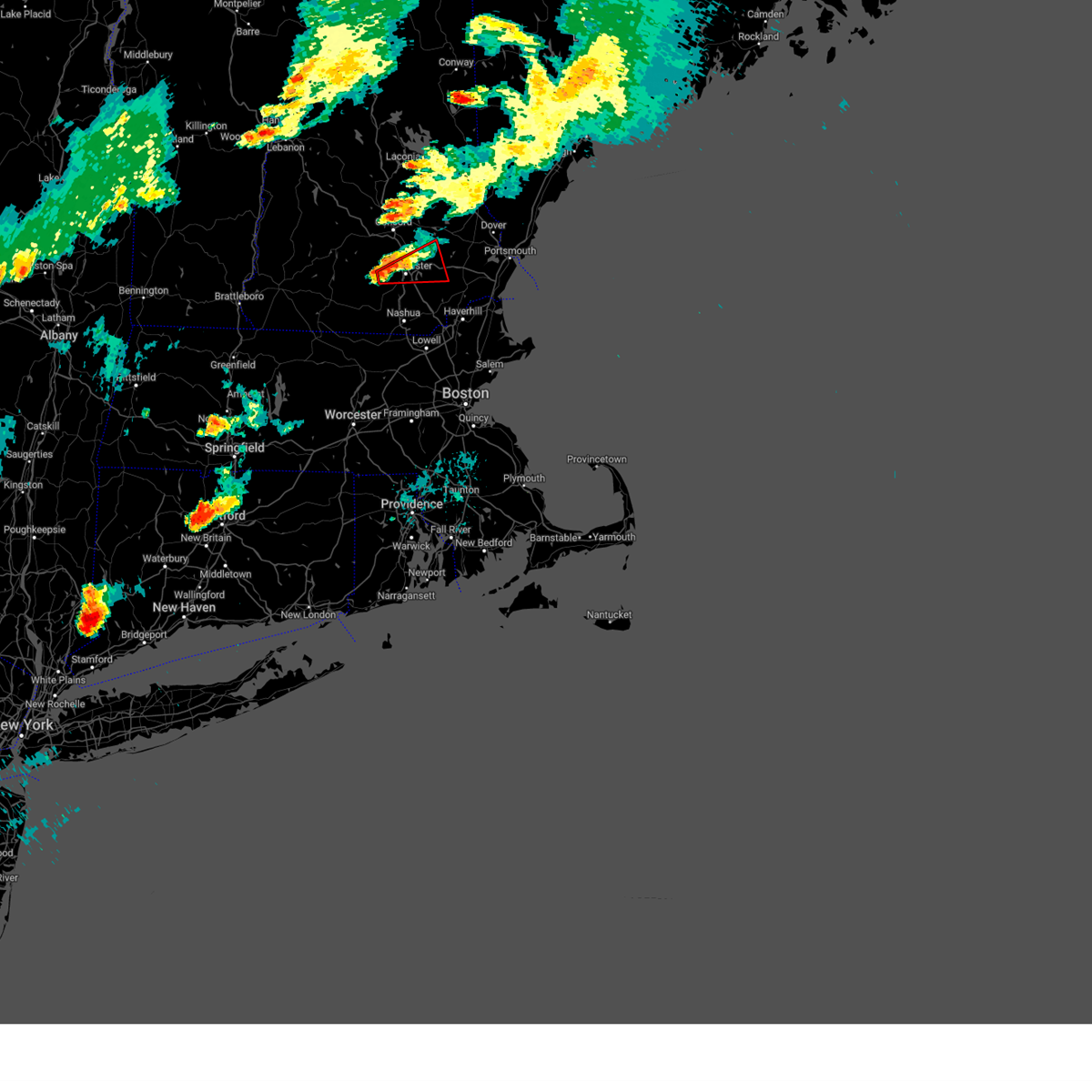
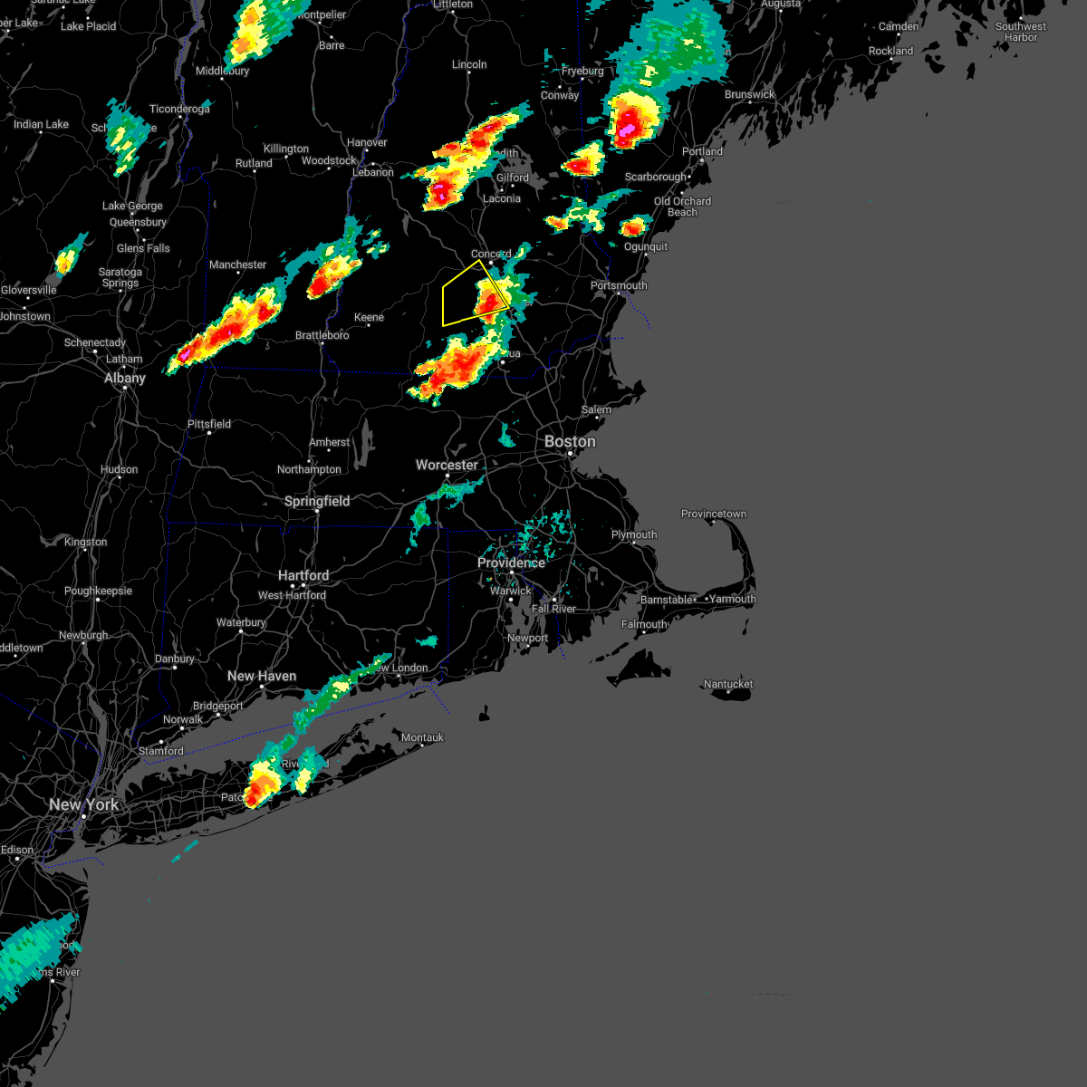
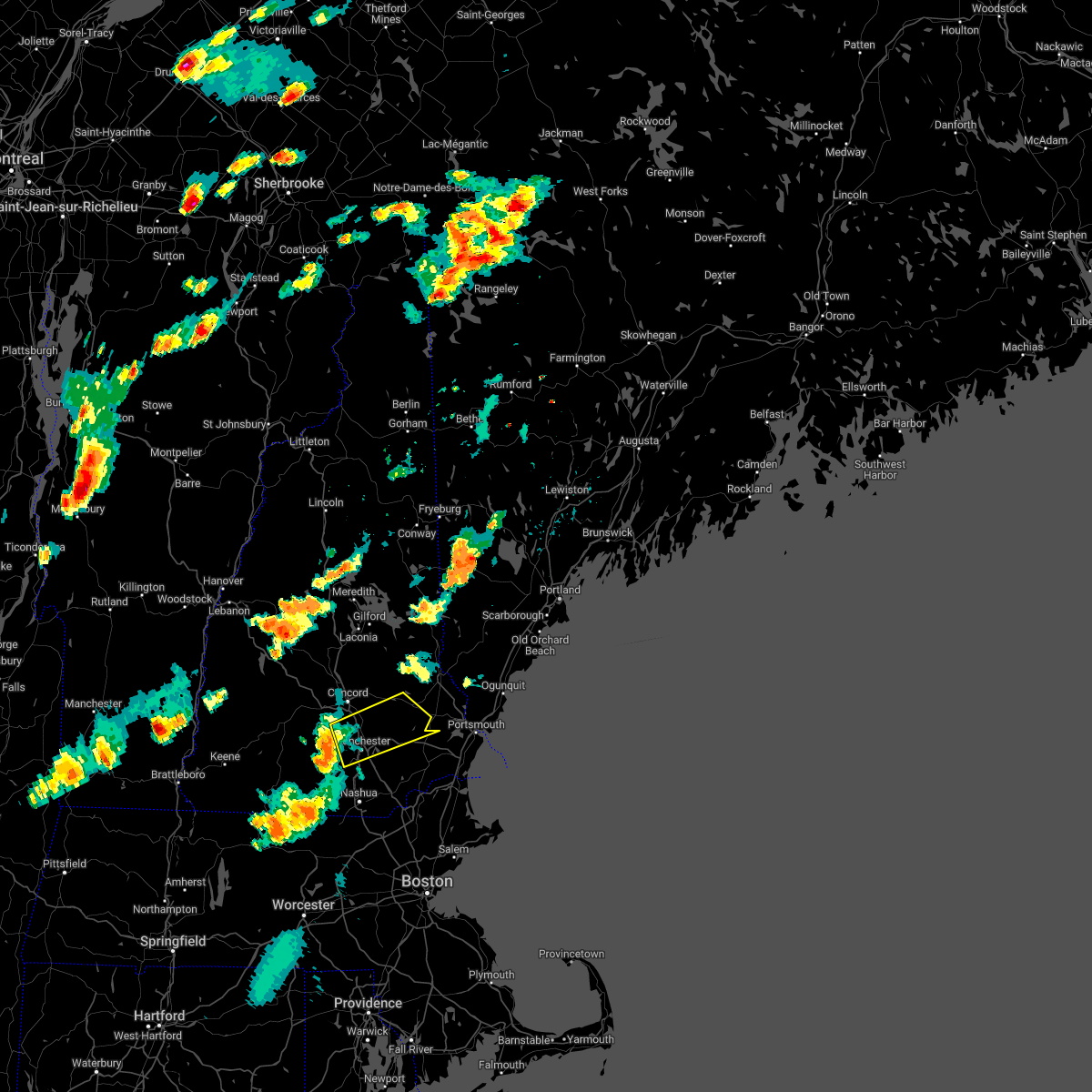
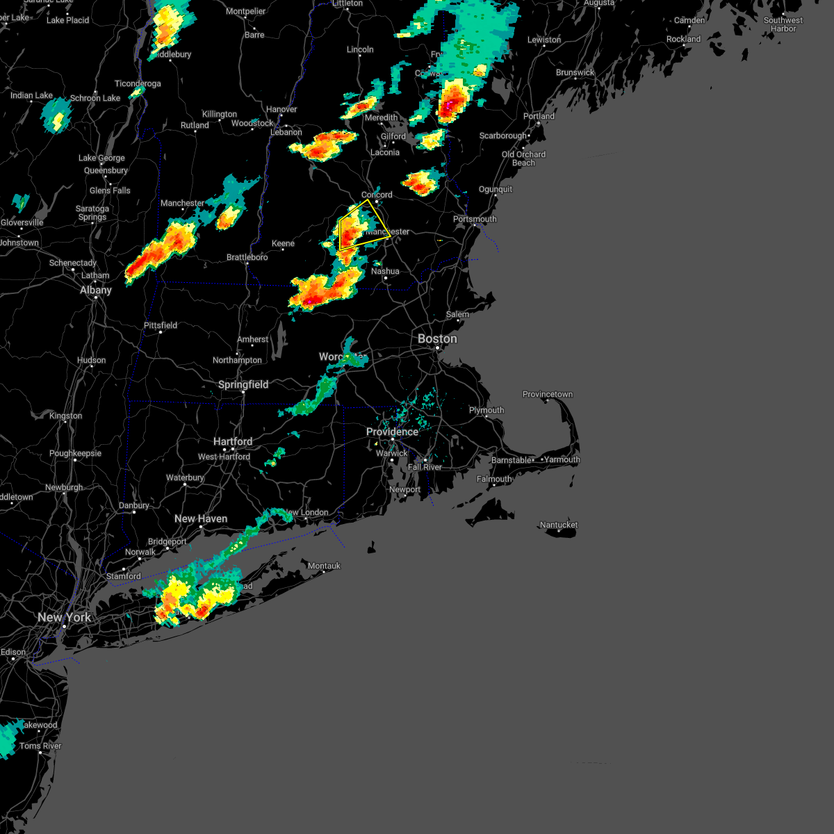
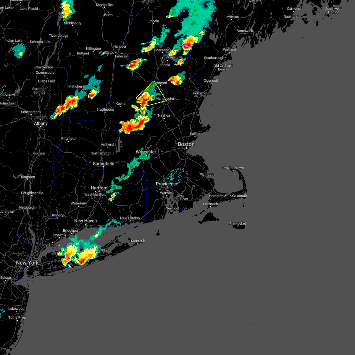
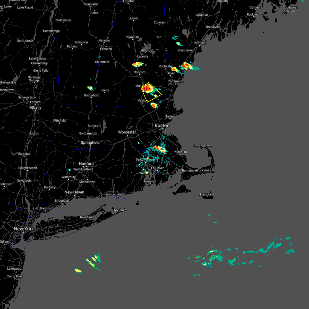
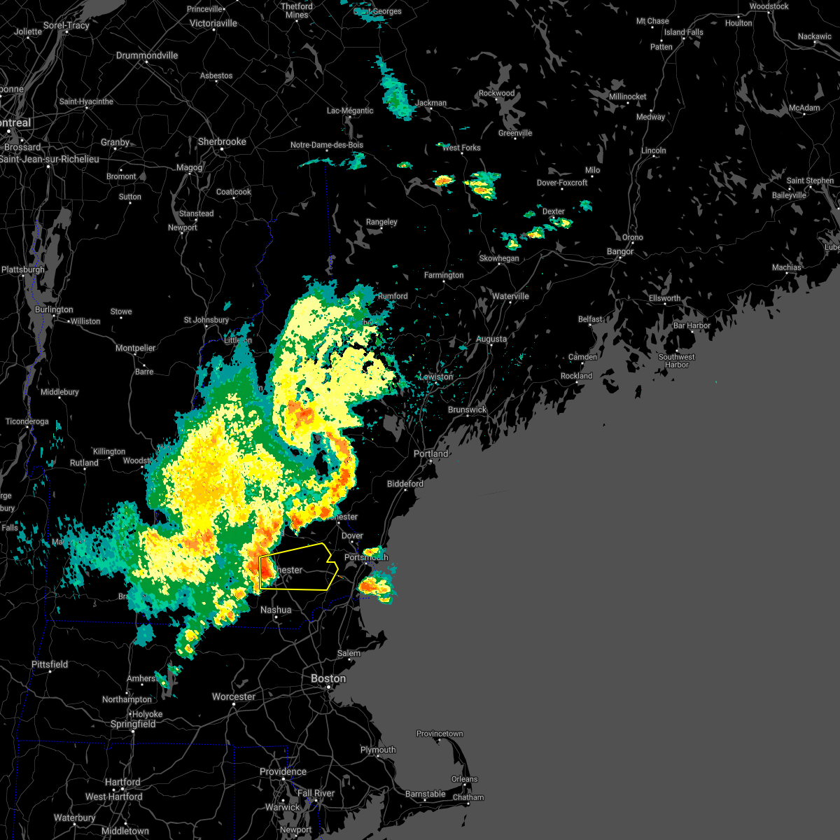
Hail Map for Pinardville, NH
The Pinardville, NH area has had 0 reports of on-the-ground hail by trained spotters, and has been under severe weather warnings 15 times during the past 12 months. Doppler radar has detected hail at or near Pinardville, NH on 15 occasions, including 1 occasion during the past year.
| Name: | Pinardville, NH |
| Where Located: | 78.3 miles SW of Portland, ME |
| Map: | Google Map for Pinardville, NH |
| Population: | 4780 |
| Housing Units: | 2036 |
| More Info: | Search Google for Pinardville, NH |
3
The Top Recent Hail Date for Pinardville, NH is Thursday, August 15, 2024 (5th out of 15)

Hail and Wind Damage Spotted near Pinardville, NH
| Date / Time | Report Details |
|---|---|
| 5/17/2025 9:15 PM EDT |
 The storms which prompted the warning have weakened. therefore, the warning will be allowed to expire. The storms which prompted the warning have weakened. therefore, the warning will be allowed to expire.
|
| 5/17/2025 8:46 PM EDT |
 Svrgyx the national weather service in gray maine has issued a * severe thunderstorm warning for, western rockingham county in southern new hampshire, central hillsborough county in southern new hampshire, southeastern merrimack county in central new hampshire, * until 915 pm edt. * at 845 pm edt, severe thunderstorms were located along a line extending from near concord to goffstown to mason, moving east at 40 mph (radar indicated). Hazards include 60 mph wind gusts and nickel size hail. expect damage to roofs, siding, and trees Svrgyx the national weather service in gray maine has issued a * severe thunderstorm warning for, western rockingham county in southern new hampshire, central hillsborough county in southern new hampshire, southeastern merrimack county in central new hampshire, * until 915 pm edt. * at 845 pm edt, severe thunderstorms were located along a line extending from near concord to goffstown to mason, moving east at 40 mph (radar indicated). Hazards include 60 mph wind gusts and nickel size hail. expect damage to roofs, siding, and trees
|
| 5/3/2025 4:52 PM EDT | The storm which prompted the warning has weakened below severe limits, and has exited the warned area. therefore, the warning has been allowed to expire. a severe thunderstorm watch remains in effect until 800 pm edt for southern and central new hampshire. |
| 5/3/2025 4:33 PM EDT |
 At 433 pm edt, a severe thunderstorm was located near derry, moving east at 40 mph (radar indicated). Hazards include 60 mph wind gusts and nickel size hail. Expect damage to roofs, siding, and trees. Locations impacted include, windham, atkinson, hudson, litchfield, auburn, londonderry, derry, manchester, bedford, salem, hampstead, chester, hooksett, merrimack, pelham, candia, and goffstown. At 433 pm edt, a severe thunderstorm was located near derry, moving east at 40 mph (radar indicated). Hazards include 60 mph wind gusts and nickel size hail. Expect damage to roofs, siding, and trees. Locations impacted include, windham, atkinson, hudson, litchfield, auburn, londonderry, derry, manchester, bedford, salem, hampstead, chester, hooksett, merrimack, pelham, candia, and goffstown.
|
| 5/3/2025 4:13 PM EDT |
 At 412 pm edt, a severe thunderstorm was located near milford, or near merrimack, moving northeast at 45 mph (radar indicated). Hazards include 60 mph wind gusts and quarter size hail. Hail damage to vehicles is expected. expect wind damage to roofs, siding, and trees. Locations impacted include, windham, atkinson, nashua, derry, merrimack, salem, milford, hudson, litchfield, auburn, wilton, brookline, londonderry, mason, amherst, manchester, bedford, hollis, mont vernon, and mount vernon. At 412 pm edt, a severe thunderstorm was located near milford, or near merrimack, moving northeast at 45 mph (radar indicated). Hazards include 60 mph wind gusts and quarter size hail. Hail damage to vehicles is expected. expect wind damage to roofs, siding, and trees. Locations impacted include, windham, atkinson, nashua, derry, merrimack, salem, milford, hudson, litchfield, auburn, wilton, brookline, londonderry, mason, amherst, manchester, bedford, hollis, mont vernon, and mount vernon.
|
| 5/3/2025 4:08 PM EDT |
 Svrgyx the national weather service in gray maine has issued a * severe thunderstorm warning for, southwestern rockingham county in southern new hampshire, southeastern hillsborough county in southern new hampshire, southern merrimack county in central new hampshire, * until 445 pm edt. * at 408 pm edt, a severe thunderstorm was located over milford, or 7 miles southwest of merrimack, moving northeast at 45 mph (radar indicated). Hazards include 60 mph wind gusts and quarter size hail. Hail damage to vehicles is expected. Expect wind damage to roofs, siding, and trees. Svrgyx the national weather service in gray maine has issued a * severe thunderstorm warning for, southwestern rockingham county in southern new hampshire, southeastern hillsborough county in southern new hampshire, southern merrimack county in central new hampshire, * until 445 pm edt. * at 408 pm edt, a severe thunderstorm was located over milford, or 7 miles southwest of merrimack, moving northeast at 45 mph (radar indicated). Hazards include 60 mph wind gusts and quarter size hail. Hail damage to vehicles is expected. Expect wind damage to roofs, siding, and trees.
|
| 8/15/2024 3:39 PM EDT |
 The storms which prompted the warning have weakened below severe limits, and no longer pose an immediate threat to life or property. therefore, the warning will be allowed to expire. however, gusty winds and heavy rain are still possible with these thunderstorms. The storms which prompted the warning have weakened below severe limits, and no longer pose an immediate threat to life or property. therefore, the warning will be allowed to expire. however, gusty winds and heavy rain are still possible with these thunderstorms.
|
| 8/15/2024 3:06 PM EDT |
 Svrgyx the national weather service in gray maine has issued a * severe thunderstorm warning for, southwestern rockingham county in southern new hampshire, hillsborough county in southern new hampshire, south central merrimack county in central new hampshire, * until 345 pm edt. * at 306 pm edt, severe thunderstorms were located along a line extending from near henniker to litchfield to near salem, moving south at 25 mph (radar indicated). Hazards include 60 mph wind gusts and quarter size hail. Hail damage to vehicles is expected. Expect wind damage to roofs, siding, and trees. Svrgyx the national weather service in gray maine has issued a * severe thunderstorm warning for, southwestern rockingham county in southern new hampshire, hillsborough county in southern new hampshire, south central merrimack county in central new hampshire, * until 345 pm edt. * at 306 pm edt, severe thunderstorms were located along a line extending from near henniker to litchfield to near salem, moving south at 25 mph (radar indicated). Hazards include 60 mph wind gusts and quarter size hail. Hail damage to vehicles is expected. Expect wind damage to roofs, siding, and trees.
|
| 8/15/2024 2:16 PM EDT |
 Svrgyx the national weather service in gray maine has issued a * severe thunderstorm warning for, north central hillsborough county in southern new hampshire, southeastern merrimack county in central new hampshire, * until 300 pm edt. * at 215 pm edt, a severe thunderstorm was located over concord, moving south at 15 mph (radar indicated). Hazards include 60 mph wind gusts and quarter size hail. Hail damage to vehicles is expected. Expect wind damage to roofs, siding, and trees. Svrgyx the national weather service in gray maine has issued a * severe thunderstorm warning for, north central hillsborough county in southern new hampshire, southeastern merrimack county in central new hampshire, * until 300 pm edt. * at 215 pm edt, a severe thunderstorm was located over concord, moving south at 15 mph (radar indicated). Hazards include 60 mph wind gusts and quarter size hail. Hail damage to vehicles is expected. Expect wind damage to roofs, siding, and trees.
|
| 8/5/2024 3:37 PM EDT |
 The storm which prompted the warning has weakened below severe limits, and no longer poses an immediate threat to life or property. therefore, the warning will be allowed to expire. a severe thunderstorm watch remains in effect until 800 pm edt for southern new hampshire. The storm which prompted the warning has weakened below severe limits, and no longer poses an immediate threat to life or property. therefore, the warning will be allowed to expire. a severe thunderstorm watch remains in effect until 800 pm edt for southern new hampshire.
|
| 8/5/2024 3:26 PM EDT |
 At 325 pm edt, a severe thunderstorm was located over mount vernon, or 10 miles northwest of merrimack, moving east at 30 mph (radar indicated). Hazards include 60 mph wind gusts and quarter size hail. Hail damage to vehicles is expected. expect wind damage to roofs, siding, and trees. Locations impacted include, merrimack, bedford, amherst, new boston, mont vernon, lyndeborough, francestown, mount vernon, and goffstown. At 325 pm edt, a severe thunderstorm was located over mount vernon, or 10 miles northwest of merrimack, moving east at 30 mph (radar indicated). Hazards include 60 mph wind gusts and quarter size hail. Hail damage to vehicles is expected. expect wind damage to roofs, siding, and trees. Locations impacted include, merrimack, bedford, amherst, new boston, mont vernon, lyndeborough, francestown, mount vernon, and goffstown.
|
| 8/5/2024 3:07 PM EDT |
 At 305 pm edt, a severe thunderstorm was located over greenfield, or 12 miles northeast of jaffrey, moving east at 30 mph (radar indicated). Hazards include 60 mph wind gusts and quarter size hail. Hail damage to vehicles is expected. expect wind damage to roofs, siding, and trees. locations impacted include, merrimack, bedford, milford, amherst, hollis, peterborough, new boston, mont vernon, greenfield, lyndeborough, francestown, bennington, goffstown, mount vernon, wilton, temple, hancock, and weare. This also includes, north pack monadnock. At 305 pm edt, a severe thunderstorm was located over greenfield, or 12 miles northeast of jaffrey, moving east at 30 mph (radar indicated). Hazards include 60 mph wind gusts and quarter size hail. Hail damage to vehicles is expected. expect wind damage to roofs, siding, and trees. locations impacted include, merrimack, bedford, milford, amherst, hollis, peterborough, new boston, mont vernon, greenfield, lyndeborough, francestown, bennington, goffstown, mount vernon, wilton, temple, hancock, and weare. This also includes, north pack monadnock.
|
| 8/5/2024 3:07 PM EDT |
 the severe thunderstorm warning has been cancelled and is no longer in effect the severe thunderstorm warning has been cancelled and is no longer in effect
|
| 8/5/2024 2:48 PM EDT |
 Svrgyx the national weather service in gray maine has issued a * severe thunderstorm warning for, east central cheshire county in southern new hampshire, southwestern hillsborough county in southern new hampshire, * until 345 pm edt. * at 247 pm edt, a severe thunderstorm was located over nelson, or 10 miles north of jaffrey, moving east at 25 mph (radar indicated). Hazards include golf ball size hail and 60 mph wind gusts. People and animals outdoors will be injured. expect hail damage to roofs, siding, windows, and vehicles. Expect wind damage to roofs, siding, and trees. Svrgyx the national weather service in gray maine has issued a * severe thunderstorm warning for, east central cheshire county in southern new hampshire, southwestern hillsborough county in southern new hampshire, * until 345 pm edt. * at 247 pm edt, a severe thunderstorm was located over nelson, or 10 miles north of jaffrey, moving east at 25 mph (radar indicated). Hazards include golf ball size hail and 60 mph wind gusts. People and animals outdoors will be injured. expect hail damage to roofs, siding, windows, and vehicles. Expect wind damage to roofs, siding, and trees.
|
| 7/16/2024 7:42 PM EDT |
 Svrgyx the national weather service in gray maine has issued a * severe thunderstorm warning for, rockingham county in southern new hampshire, southwestern strafford county in central new hampshire, southeastern cheshire county in southern new hampshire, hillsborough county in southern new hampshire, southeastern merrimack county in central new hampshire, * until 830 pm edt. * at 741 pm edt, severe thunderstorms were located along a line extending from near deering to near new ipswich, moving east at 60 mph (radar indicated). Hazards include 60 mph wind gusts. expect damage to roofs, siding, and trees Svrgyx the national weather service in gray maine has issued a * severe thunderstorm warning for, rockingham county in southern new hampshire, southwestern strafford county in central new hampshire, southeastern cheshire county in southern new hampshire, hillsborough county in southern new hampshire, southeastern merrimack county in central new hampshire, * until 830 pm edt. * at 741 pm edt, severe thunderstorms were located along a line extending from near deering to near new ipswich, moving east at 60 mph (radar indicated). Hazards include 60 mph wind gusts. expect damage to roofs, siding, and trees
|
| 6/23/2024 5:59 PM EDT |
 The storm which prompted the warning has moved out of the area. therefore, the warning will be allowed to expire. a tornado watch remains in effect until 800 pm edt for southern and central new hampshire. The storm which prompted the warning has moved out of the area. therefore, the warning will be allowed to expire. a tornado watch remains in effect until 800 pm edt for southern and central new hampshire.
|
| 6/23/2024 5:56 PM EDT |
 The storm which prompted the warning has moved out of the area. therefore, the warning will be allowed to expire. a tornado watch remains in effect until 800 pm edt for southern and central new hampshire. The storm which prompted the warning has moved out of the area. therefore, the warning will be allowed to expire. a tornado watch remains in effect until 800 pm edt for southern and central new hampshire.
|
| 6/23/2024 5:48 PM EDT |
 Torgyx the national weather service in gray maine has issued a * tornado warning for, northwestern rockingham county in southern new hampshire, east central hillsborough county in southern new hampshire, southeastern merrimack county in central new hampshire, * until 615 pm edt. * at 548 pm edt, a severe thunderstorm capable of producing a tornado was located over goffstown, or near manchester, moving east at 45 mph (radar indicated rotation). Hazards include tornado and quarter size hail. Flying debris will be dangerous to those caught without shelter. mobile homes will be damaged or destroyed. damage to roofs, windows, and vehicles will occur. tree damage is likely. this dangerous storm will be near, manchester, bedford, hooksett, and goffstown around 555 pm edt. raymond around 600 pm edt. other locations impacted by this tornadic thunderstorm include chester, auburn, candia, deerfield, allenstown, and sandown. this includes the following highways, interstate 293 between mile markers 1 and 11. Interstate 93 between mile markers 19 and 28. Torgyx the national weather service in gray maine has issued a * tornado warning for, northwestern rockingham county in southern new hampshire, east central hillsborough county in southern new hampshire, southeastern merrimack county in central new hampshire, * until 615 pm edt. * at 548 pm edt, a severe thunderstorm capable of producing a tornado was located over goffstown, or near manchester, moving east at 45 mph (radar indicated rotation). Hazards include tornado and quarter size hail. Flying debris will be dangerous to those caught without shelter. mobile homes will be damaged or destroyed. damage to roofs, windows, and vehicles will occur. tree damage is likely. this dangerous storm will be near, manchester, bedford, hooksett, and goffstown around 555 pm edt. raymond around 600 pm edt. other locations impacted by this tornadic thunderstorm include chester, auburn, candia, deerfield, allenstown, and sandown. this includes the following highways, interstate 293 between mile markers 1 and 11. Interstate 93 between mile markers 19 and 28.
|
| 6/23/2024 5:26 PM EDT |
 Torgyx the national weather service in gray maine has issued a * tornado warning for, central hillsborough county in southern new hampshire, * until 600 pm edt. * at 526 pm edt, a severe thunderstorm capable of producing a tornado was located over greenfield, or 12 miles northeast of jaffrey, moving east at 40 mph (radar indicated rotation). Hazards include tornado and quarter size hail. Flying debris will be dangerous to those caught without shelter. mobile homes will be damaged or destroyed. damage to roofs, windows, and vehicles will occur. tree damage is likely. this dangerous storm will be near, amherst, new boston, mont vernon, greenfield, lyndeborough, francestown, weare, and mount vernon around 530 pm edt. bedford and goffstown around 535 pm edt. merrimack around 540 pm edt. This also includes, north pack monadnock. Torgyx the national weather service in gray maine has issued a * tornado warning for, central hillsborough county in southern new hampshire, * until 600 pm edt. * at 526 pm edt, a severe thunderstorm capable of producing a tornado was located over greenfield, or 12 miles northeast of jaffrey, moving east at 40 mph (radar indicated rotation). Hazards include tornado and quarter size hail. Flying debris will be dangerous to those caught without shelter. mobile homes will be damaged or destroyed. damage to roofs, windows, and vehicles will occur. tree damage is likely. this dangerous storm will be near, amherst, new boston, mont vernon, greenfield, lyndeborough, francestown, weare, and mount vernon around 530 pm edt. bedford and goffstown around 535 pm edt. merrimack around 540 pm edt. This also includes, north pack monadnock.
|
| 6/23/2024 5:11 PM EDT |
 Svrgyx the national weather service in gray maine has issued a * severe thunderstorm warning for, central hillsborough county in southern new hampshire, * until 600 pm edt. * at 510 pm edt, a severe thunderstorm was located over hancock, or 9 miles north of jaffrey, moving east at 50 mph (radar indicated). Hazards include 60 mph wind gusts and quarter size hail. Hail damage to vehicles is expected. Expect wind damage to roofs, siding, and trees. Svrgyx the national weather service in gray maine has issued a * severe thunderstorm warning for, central hillsborough county in southern new hampshire, * until 600 pm edt. * at 510 pm edt, a severe thunderstorm was located over hancock, or 9 miles north of jaffrey, moving east at 50 mph (radar indicated). Hazards include 60 mph wind gusts and quarter size hail. Hail damage to vehicles is expected. Expect wind damage to roofs, siding, and trees.
|
| 6/20/2024 7:43 PM EDT |
 the severe thunderstorm warning has been cancelled and is no longer in effect the severe thunderstorm warning has been cancelled and is no longer in effect
|
| 6/20/2024 7:31 PM EDT |
 At 731 pm edt, a severe thunderstorm was located over amherst, or near merrimack, moving east at 30 mph (radar indicated). Hazards include 60 mph wind gusts. Expect damage to roofs, siding, and trees. locations impacted include, manchester, nashua, derry, merrimack, salem, bedford, milford, amherst, litchfield, hollis, new boston, mont vernon, lyndeborough, francestown, mount vernon, hudson, wilton, pelham, goffstown, and raymond. this includes the following highways, interstate 293 between mile markers 1 and 8. Interstate 93 between mile markers 4 and 23. At 731 pm edt, a severe thunderstorm was located over amherst, or near merrimack, moving east at 30 mph (radar indicated). Hazards include 60 mph wind gusts. Expect damage to roofs, siding, and trees. locations impacted include, manchester, nashua, derry, merrimack, salem, bedford, milford, amherst, litchfield, hollis, new boston, mont vernon, lyndeborough, francestown, mount vernon, hudson, wilton, pelham, goffstown, and raymond. this includes the following highways, interstate 293 between mile markers 1 and 8. Interstate 93 between mile markers 4 and 23.
|
| 6/20/2024 7:07 PM EDT |
 Svrgyx the national weather service in gray maine has issued a * severe thunderstorm warning for, southwestern rockingham county in southern new hampshire, southern hillsborough county in southern new hampshire, * until 800 pm edt. * at 707 pm edt, a severe thunderstorm was located over lyndeborough, or 13 miles east of jaffrey, moving east at 30 mph (radar indicated). Hazards include 60 mph wind gusts and quarter size hail. Hail damage to vehicles is expected. Expect wind damage to roofs, siding, and trees. Svrgyx the national weather service in gray maine has issued a * severe thunderstorm warning for, southwestern rockingham county in southern new hampshire, southern hillsborough county in southern new hampshire, * until 800 pm edt. * at 707 pm edt, a severe thunderstorm was located over lyndeborough, or 13 miles east of jaffrey, moving east at 30 mph (radar indicated). Hazards include 60 mph wind gusts and quarter size hail. Hail damage to vehicles is expected. Expect wind damage to roofs, siding, and trees.
|
| 5/21/2024 7:05 PM EDT |
 the severe thunderstorm warning has been cancelled and is no longer in effect the severe thunderstorm warning has been cancelled and is no longer in effect
|
| 5/21/2024 6:54 PM EDT |
 At 654 pm edt, a severe thunderstorm was located over manchester, moving east at 25 mph (radar indicated). Hazards include 60 mph wind gusts and quarter size hail. Hail damage to vehicles is expected. expect wind damage to roofs, siding, and trees. locations impacted include, manchester, derry, merrimack, bedford, hooksett, amherst, litchfield, raymond, goffstown, londonderry, bow, auburn, chester, allenstown, deerfield, candia, dunbarton, sandown, nottingham, and pembroke. this includes the following highways, interstate 293 between mile markers 1 and 11. Interstate 93 between mile markers 12 and 32. At 654 pm edt, a severe thunderstorm was located over manchester, moving east at 25 mph (radar indicated). Hazards include 60 mph wind gusts and quarter size hail. Hail damage to vehicles is expected. expect wind damage to roofs, siding, and trees. locations impacted include, manchester, derry, merrimack, bedford, hooksett, amherst, litchfield, raymond, goffstown, londonderry, bow, auburn, chester, allenstown, deerfield, candia, dunbarton, sandown, nottingham, and pembroke. this includes the following highways, interstate 293 between mile markers 1 and 11. Interstate 93 between mile markers 12 and 32.
|
| 5/21/2024 6:42 PM EDT |
 Svrgyx the national weather service in gray maine has issued a * severe thunderstorm warning for, southwestern rockingham county in southern new hampshire, central hillsborough county in southern new hampshire, southeastern merrimack county in central new hampshire, * until 730 pm edt. * at 642 pm edt, a severe thunderstorm was located over goffstown, or near manchester, moving east at 25 mph (radar indicated). Hazards include 60 mph wind gusts and quarter size hail. Hail damage to vehicles is expected. Expect wind damage to roofs, siding, and trees. Svrgyx the national weather service in gray maine has issued a * severe thunderstorm warning for, southwestern rockingham county in southern new hampshire, central hillsborough county in southern new hampshire, southeastern merrimack county in central new hampshire, * until 730 pm edt. * at 642 pm edt, a severe thunderstorm was located over goffstown, or near manchester, moving east at 25 mph (radar indicated). Hazards include 60 mph wind gusts and quarter size hail. Hail damage to vehicles is expected. Expect wind damage to roofs, siding, and trees.
|
| 9/8/2023 6:54 PM EDT |
 At 654 pm edt, a severe thunderstorm was located near hooksett, or near manchester, moving northeast at 20 mph (radar indicated). Hazards include 60 mph wind gusts and quarter size hail. Hail damage to vehicles is expected. Expect wind damage to roofs, siding, and trees. At 654 pm edt, a severe thunderstorm was located near hooksett, or near manchester, moving northeast at 20 mph (radar indicated). Hazards include 60 mph wind gusts and quarter size hail. Hail damage to vehicles is expected. Expect wind damage to roofs, siding, and trees.
|
| 9/8/2023 3:19 PM EDT |
 At 319 pm edt, severe thunderstorms were located along a line extending from amherst to near litchfield to near salem, moving northeast at 20 mph (radar indicated). Hazards include 60 mph wind gusts and quarter size hail. Hail damage to vehicles is expected. Expect wind damage to roofs, siding, and trees. At 319 pm edt, severe thunderstorms were located along a line extending from amherst to near litchfield to near salem, moving northeast at 20 mph (radar indicated). Hazards include 60 mph wind gusts and quarter size hail. Hail damage to vehicles is expected. Expect wind damage to roofs, siding, and trees.
|
| 7/29/2023 2:11 PM EDT |
 At 210 pm edt, a severe thunderstorm was located over manchester, moving northeast at 20 mph (radar indicated). Hazards include 60 mph wind gusts and quarter size hail. Expect wind damage to trees and power lines. Minor hail damage to vehicles is possible. At 210 pm edt, a severe thunderstorm was located over manchester, moving northeast at 20 mph (radar indicated). Hazards include 60 mph wind gusts and quarter size hail. Expect wind damage to trees and power lines. Minor hail damage to vehicles is possible.
|
| 7/27/2023 4:21 PM EDT |
 The severe thunderstorm warning for west central rockingham and east central hillsborough counties will expire at 430 pm edt, the storm which prompted the warning has weakened below severe limits, and no longer poses an immediate threat to life or property. therefore, the warning will be allowed to expire. however heavy rain is still possible with this thunderstorm. a severe thunderstorm watch remains in effect until 800 pm edt for southern and central new hampshire. The severe thunderstorm warning for west central rockingham and east central hillsborough counties will expire at 430 pm edt, the storm which prompted the warning has weakened below severe limits, and no longer poses an immediate threat to life or property. therefore, the warning will be allowed to expire. however heavy rain is still possible with this thunderstorm. a severe thunderstorm watch remains in effect until 800 pm edt for southern and central new hampshire.
|
| 7/27/2023 4:02 PM EDT |
 At 402 pm edt, a severe thunderstorm was located near manchester, moving east at 35 mph (radar indicated). Hazards include 60 mph wind gusts. expect damage to roofs, siding, and trees At 402 pm edt, a severe thunderstorm was located near manchester, moving east at 35 mph (radar indicated). Hazards include 60 mph wind gusts. expect damage to roofs, siding, and trees
|
| 7/21/2023 4:16 PM EDT |
 At 416 pm edt, a severe thunderstorm was located near mason, or 12 miles west of nashua, moving east at 20 mph (radar indicated). Hazards include 60 mph wind gusts and penny size hail. expect damage to roofs, siding, and trees At 416 pm edt, a severe thunderstorm was located near mason, or 12 miles west of nashua, moving east at 20 mph (radar indicated). Hazards include 60 mph wind gusts and penny size hail. expect damage to roofs, siding, and trees
|
| 7/16/2023 8:55 AM EDT |
 The tornado warning for northwestern rockingham, east central hillsborough and southeastern merrimack counties will expire at 900 am edt, the storm which prompted the warning has weakened below severe limits, and no longer appears capable of producing a tornado. therefore, the warning will be allowed to expire. however heavy rain is still possible with this thunderstorm. a tornado watch remains in effect until 300 pm edt for southern and central new hampshire. The tornado warning for northwestern rockingham, east central hillsborough and southeastern merrimack counties will expire at 900 am edt, the storm which prompted the warning has weakened below severe limits, and no longer appears capable of producing a tornado. therefore, the warning will be allowed to expire. however heavy rain is still possible with this thunderstorm. a tornado watch remains in effect until 300 pm edt for southern and central new hampshire.
|
| 7/16/2023 8:29 AM EDT |
 At 829 am edt, a severe thunderstorm capable of producing a tornado was located near manchester, moving northeast at 30 mph (radar indicated rotation). Hazards include tornado. Flying debris will be dangerous to those caught without shelter. mobile homes will be damaged or destroyed. damage to roofs, windows, and vehicles will occur. tree damage is likely. this dangerous storm will be near, northwood and epsom around 900 am edt. other locations impacted by this tornadic thunderstorm include nottingham, candia, allenstown, auburn, deerfield, chester, pembroke and londonderry. this includes the following highways, interstate 293 near mile marker 1, and between mile markers 6 and 11. Interstate 93 between mile markers 18 and 26. At 829 am edt, a severe thunderstorm capable of producing a tornado was located near manchester, moving northeast at 30 mph (radar indicated rotation). Hazards include tornado. Flying debris will be dangerous to those caught without shelter. mobile homes will be damaged or destroyed. damage to roofs, windows, and vehicles will occur. tree damage is likely. this dangerous storm will be near, northwood and epsom around 900 am edt. other locations impacted by this tornadic thunderstorm include nottingham, candia, allenstown, auburn, deerfield, chester, pembroke and londonderry. this includes the following highways, interstate 293 near mile marker 1, and between mile markers 6 and 11. Interstate 93 between mile markers 18 and 26.
|
| 11/30/2022 6:50 PM EST |
 At 649 pm est, a severe thunderstorm was located over bedford, or near manchester, moving northeast at 40 mph (radar indicated). Hazards include 60 mph wind gusts and penny size hail. Expect damage to roofs, siding, and trees. locations impacted include, manchester, nashua, derry, merrimack, bedford, milford, hooksett, amherst, litchfield, hollis, new boston, mont vernon, raymond, goffstown, mount vernon, londonderry, hampstead, chester, candia and dunbarton. this includes the following highways, interstate 293 between mile markers 1 and 11. Interstate 93 between mile markers 11 and 28. At 649 pm est, a severe thunderstorm was located over bedford, or near manchester, moving northeast at 40 mph (radar indicated). Hazards include 60 mph wind gusts and penny size hail. Expect damage to roofs, siding, and trees. locations impacted include, manchester, nashua, derry, merrimack, bedford, milford, hooksett, amherst, litchfield, hollis, new boston, mont vernon, raymond, goffstown, mount vernon, londonderry, hampstead, chester, candia and dunbarton. this includes the following highways, interstate 293 between mile markers 1 and 11. Interstate 93 between mile markers 11 and 28.
|
| 11/30/2022 6:20 PM EST |
 At 619 pm est, a severe thunderstorm was located over new ipswich, or 10 miles east of jaffrey, moving northeast at 40 mph (radar indicated). Hazards include 60 mph wind gusts and penny size hail. expect damage to roofs, siding, and trees At 619 pm est, a severe thunderstorm was located over new ipswich, or 10 miles east of jaffrey, moving northeast at 40 mph (radar indicated). Hazards include 60 mph wind gusts and penny size hail. expect damage to roofs, siding, and trees
|
| 9/13/2022 9:08 PM EDT |
 At 908 pm edt, a severe thunderstorm was located near manchester, moving northeast at 25 mph (radar indicated). Hazards include 60 mph wind gusts and penny size hail. Expect damage to roofs, siding, and trees. locations impacted include, manchester, derry, merrimack, bedford, hooksett, litchfield, epsom, goffstown, londonderry, bow, chester, allenstown, deerfield, candia, dunbarton and pembroke. this includes the following highways, interstate 293 between mile markers 1 and 11. Interstate 93 between mile markers 13 and 34. At 908 pm edt, a severe thunderstorm was located near manchester, moving northeast at 25 mph (radar indicated). Hazards include 60 mph wind gusts and penny size hail. Expect damage to roofs, siding, and trees. locations impacted include, manchester, derry, merrimack, bedford, hooksett, litchfield, epsom, goffstown, londonderry, bow, chester, allenstown, deerfield, candia, dunbarton and pembroke. this includes the following highways, interstate 293 between mile markers 1 and 11. Interstate 93 between mile markers 13 and 34.
|
| 9/13/2022 8:56 PM EDT |
 At 856 pm edt, a severe thunderstorm was located over bedford, or near manchester, moving east at 25 mph (radar indicated). Hazards include 60 mph wind gusts and penny size hail. Expect damage to roofs, siding, and trees. locations impacted include, manchester, nashua, derry, merrimack, bedford, milford, hooksett, amherst, litchfield, hollis, new boston, epsom, mont vernon, goffstown, hudson, pelham, weare, mount vernon, londonderry and bow. this includes the following highways, interstate 293 between mile markers 1 and 11. Interstate 93 between mile markers 9 and 34. At 856 pm edt, a severe thunderstorm was located over bedford, or near manchester, moving east at 25 mph (radar indicated). Hazards include 60 mph wind gusts and penny size hail. Expect damage to roofs, siding, and trees. locations impacted include, manchester, nashua, derry, merrimack, bedford, milford, hooksett, amherst, litchfield, hollis, new boston, epsom, mont vernon, goffstown, hudson, pelham, weare, mount vernon, londonderry and bow. this includes the following highways, interstate 293 between mile markers 1 and 11. Interstate 93 between mile markers 9 and 34.
|
| 9/13/2022 8:43 PM EDT |
 At 843 pm edt, a severe thunderstorm was located over new boston, or 11 miles northwest of merrimack, moving east at 15 mph (radar indicated). Hazards include 60 mph wind gusts and penny size hail. expect damage to roofs, siding, and trees At 843 pm edt, a severe thunderstorm was located over new boston, or 11 miles northwest of merrimack, moving east at 15 mph (radar indicated). Hazards include 60 mph wind gusts and penny size hail. expect damage to roofs, siding, and trees
|
| 8/7/2022 3:34 PM EDT |
 At 334 pm edt, severe thunderstorms were located along a line extending from near hooksett to derry, moving east at 25 mph (radar indicated). Hazards include 60 mph wind gusts and penny size hail. Expect damage to roofs, siding, and trees. locations impacted include, manchester, concord, derry, northwood, merrimack, bedford, hooksett, litchfield, epping, hopkinton, epsom, brentwood, raymond, goffstown, londonderry, hampstead, bow, atkinson, kingston and chester. this includes the following highways, interstate 293 between mile markers 1 and 11. interstate 89 between mile markers 0 and 5. interstate 93 between mile markers 10 and 40. hail threat, radar indicated max hail size, 0. 75 in wind threat, radar indicated max wind gust, 60 mph. At 334 pm edt, severe thunderstorms were located along a line extending from near hooksett to derry, moving east at 25 mph (radar indicated). Hazards include 60 mph wind gusts and penny size hail. Expect damage to roofs, siding, and trees. locations impacted include, manchester, concord, derry, northwood, merrimack, bedford, hooksett, litchfield, epping, hopkinton, epsom, brentwood, raymond, goffstown, londonderry, hampstead, bow, atkinson, kingston and chester. this includes the following highways, interstate 293 between mile markers 1 and 11. interstate 89 between mile markers 0 and 5. interstate 93 between mile markers 10 and 40. hail threat, radar indicated max hail size, 0. 75 in wind threat, radar indicated max wind gust, 60 mph.
|
| 8/7/2022 3:22 PM EDT |
 At 321 pm edt, a severe thunderstorm was located over new boston, or 11 miles west of manchester, moving east at 35 mph (radar indicated). Hazards include 60 mph wind gusts and quarter size hail. Hail damage to vehicles is expected. Expect wind damage to roofs, siding, and trees. At 321 pm edt, a severe thunderstorm was located over new boston, or 11 miles west of manchester, moving east at 35 mph (radar indicated). Hazards include 60 mph wind gusts and quarter size hail. Hail damage to vehicles is expected. Expect wind damage to roofs, siding, and trees.
|
| 7/25/2022 1:40 PM EDT |
 At 139 pm edt, a severe thunderstorm was located over manchester, moving northeast at 45 mph (radar indicated). Hazards include 60 mph wind gusts and quarter size hail. Hail damage to vehicles is expected. Expect wind damage to roofs, siding, and trees. At 139 pm edt, a severe thunderstorm was located over manchester, moving northeast at 45 mph (radar indicated). Hazards include 60 mph wind gusts and quarter size hail. Hail damage to vehicles is expected. Expect wind damage to roofs, siding, and trees.
|
| 7/25/2022 11:25 AM EDT |
 At 1124 am edt, a severe thunderstorm was located near mount vernon, or 9 miles west of merrimack, moving northeast at 55 mph (radar indicated). Hazards include 60 mph wind gusts and quarter size hail. Hail damage to vehicles is expected. expect wind damage to roofs, siding, and trees. locations impacted include, manchester, nashua, derry, merrimack, salem, bedford, milford, hooksett, amherst, litchfield, hollis, peterborough, new boston, mont vernon, greenfield, lyndeborough, new ipswich, sharon, goffstown and mount vernon. this includes the following highways, interstate 293 between mile markers 1 and 11. Interstate 93 between mile markers 7 and 29. At 1124 am edt, a severe thunderstorm was located near mount vernon, or 9 miles west of merrimack, moving northeast at 55 mph (radar indicated). Hazards include 60 mph wind gusts and quarter size hail. Hail damage to vehicles is expected. expect wind damage to roofs, siding, and trees. locations impacted include, manchester, nashua, derry, merrimack, salem, bedford, milford, hooksett, amherst, litchfield, hollis, peterborough, new boston, mont vernon, greenfield, lyndeborough, new ipswich, sharon, goffstown and mount vernon. this includes the following highways, interstate 293 between mile markers 1 and 11. Interstate 93 between mile markers 7 and 29.
|
| 7/25/2022 11:06 AM EDT |
 At 1105 am edt, a severe thunderstorm was located over rindge, or 8 miles south of jaffrey, moving northeast at 55 mph (radar indicated). Hazards include 60 mph wind gusts and quarter size hail. Hail damage to vehicles is expected. Expect wind damage to roofs, siding, and trees. At 1105 am edt, a severe thunderstorm was located over rindge, or 8 miles south of jaffrey, moving northeast at 55 mph (radar indicated). Hazards include 60 mph wind gusts and quarter size hail. Hail damage to vehicles is expected. Expect wind damage to roofs, siding, and trees.
|
| 7/21/2022 5:42 PM EDT |
 At 542 pm edt, severe thunderstorms were located along a line extending from hillsborough to bennington to near richmond, moving east at 30 mph (radar indicated). Hazards include 60 mph wind gusts and quarter size hail. Hail damage to vehicles is expected. expect wind damage to roofs, siding, and trees. locations impacted include, manchester, nashua, merrimack, bedford, milford, amherst, litchfield, hollis, peterborough, new boston, mont vernon, greenfield, lyndeborough, francestown, harrisville, hancock, new ipswich, sharon, mount vernon and greenville. this includes the following highways, interstate 293 between mile markers 1 and 6. interstate 93 between mile markers 18 and 20. hail threat, radar indicated max hail size, 1. 00 in wind threat, radar indicated max wind gust, 60 mph. At 542 pm edt, severe thunderstorms were located along a line extending from hillsborough to bennington to near richmond, moving east at 30 mph (radar indicated). Hazards include 60 mph wind gusts and quarter size hail. Hail damage to vehicles is expected. expect wind damage to roofs, siding, and trees. locations impacted include, manchester, nashua, merrimack, bedford, milford, amherst, litchfield, hollis, peterborough, new boston, mont vernon, greenfield, lyndeborough, francestown, harrisville, hancock, new ipswich, sharon, mount vernon and greenville. this includes the following highways, interstate 293 between mile markers 1 and 6. interstate 93 between mile markers 18 and 20. hail threat, radar indicated max hail size, 1. 00 in wind threat, radar indicated max wind gust, 60 mph.
|
| 7/21/2022 5:19 PM EDT |
 At 519 pm edt, severe thunderstorms were located along a line extending from marlow to nelson to near hinsdale, moving east at 30 mph (radar indicated). Hazards include 60 mph wind gusts. expect damage to roofs, siding, and trees At 519 pm edt, severe thunderstorms were located along a line extending from marlow to nelson to near hinsdale, moving east at 30 mph (radar indicated). Hazards include 60 mph wind gusts. expect damage to roofs, siding, and trees
|
| 7/21/2022 4:15 PM EDT |
 At 414 pm edt, a severe thunderstorm was located over manchester, moving east at 40 mph (radar indicated). Hazards include 60 mph wind gusts and quarter size hail. Hail damage to vehicles is expected. expect wind damage to roofs, siding, and trees. locations impacted include, manchester, northwood, bedford, hooksett, barrington, epping, epsom, raymond, goffstown, newmarket, bow, chester, allenstown, deerfield, candia, dunbarton, nottingham, pembroke and strafford. this includes the following highways, interstate 293 between mile markers 1 and 11. Interstate 93 between mile markers 19 and 33. At 414 pm edt, a severe thunderstorm was located over manchester, moving east at 40 mph (radar indicated). Hazards include 60 mph wind gusts and quarter size hail. Hail damage to vehicles is expected. expect wind damage to roofs, siding, and trees. locations impacted include, manchester, northwood, bedford, hooksett, barrington, epping, epsom, raymond, goffstown, newmarket, bow, chester, allenstown, deerfield, candia, dunbarton, nottingham, pembroke and strafford. this includes the following highways, interstate 293 between mile markers 1 and 11. Interstate 93 between mile markers 19 and 33.
|
| 7/21/2022 4:09 PM EDT |
 The severe thunderstorm warning for northeastern hillsborough and south central merrimack counties will expire at 415 pm edt, the storm which prompted the warning is moving out of the area. therefore, the warning will be allowed to expire. a severe thunderstorm watch remains in effect until 800 pm edt for southern and central new hampshire. The severe thunderstorm warning for northeastern hillsborough and south central merrimack counties will expire at 415 pm edt, the storm which prompted the warning is moving out of the area. therefore, the warning will be allowed to expire. a severe thunderstorm watch remains in effect until 800 pm edt for southern and central new hampshire.
|
| 7/21/2022 4:08 PM EDT |
 At 407 pm edt, a severe thunderstorm was located near goffstown, or near manchester, moving east at 35 mph (radar indicated). Hazards include 60 mph wind gusts and quarter size hail. Hail damage to vehicles is expected. Expect wind damage to roofs, siding, and trees. At 407 pm edt, a severe thunderstorm was located near goffstown, or near manchester, moving east at 35 mph (radar indicated). Hazards include 60 mph wind gusts and quarter size hail. Hail damage to vehicles is expected. Expect wind damage to roofs, siding, and trees.
|
| 7/21/2022 3:56 PM EDT |
 At 356 pm edt, a severe thunderstorm was located over mason, or 13 miles west of nashua, moving east at 35 mph (radar indicated). Hazards include ping pong ball size hail and 60 mph wind gusts. People and animals outdoors will be injured. expect hail damage to roofs, siding, windows, and vehicles. expect wind damage to roofs, siding, and trees. locations impacted include, manchester, nashua, merrimack, bedford, milford, amherst, litchfield, hollis, peterborough, new boston, mont vernon, greenfield, lyndeborough, rindge, new ipswich, sharon, mount vernon, greenville, hudson and wilton. this includes the following highways, interstate 293 between mile markers 1 and 8. Interstate 93 between mile markers 18 and 23. At 356 pm edt, a severe thunderstorm was located over mason, or 13 miles west of nashua, moving east at 35 mph (radar indicated). Hazards include ping pong ball size hail and 60 mph wind gusts. People and animals outdoors will be injured. expect hail damage to roofs, siding, windows, and vehicles. expect wind damage to roofs, siding, and trees. locations impacted include, manchester, nashua, merrimack, bedford, milford, amherst, litchfield, hollis, peterborough, new boston, mont vernon, greenfield, lyndeborough, rindge, new ipswich, sharon, mount vernon, greenville, hudson and wilton. this includes the following highways, interstate 293 between mile markers 1 and 8. Interstate 93 between mile markers 18 and 23.
|
| 7/21/2022 3:52 PM EDT |
 At 352 pm edt, a severe thunderstorm was located near hooksett, or 7 miles south of concord, moving east at 35 mph (radar indicated). Hazards include 60 mph wind gusts and quarter size hail. Hail damage to vehicles is expected. expect wind damage to roofs, siding, and trees. locations impacted include, manchester, concord, henniker, hooksett, hopkinton, new boston, greenfield, lyndeborough, francestown, goffstown, weare, deering, bow and dunbarton. this includes the following highways, interstate 293 between mile markers 8 and 11. interstate 89 between mile markers 3 and 8. interstate 93 between mile markers 23 and 26. hail threat, radar indicated max hail size, 1. 00 in wind threat, radar indicated max wind gust, 60 mph. At 352 pm edt, a severe thunderstorm was located near hooksett, or 7 miles south of concord, moving east at 35 mph (radar indicated). Hazards include 60 mph wind gusts and quarter size hail. Hail damage to vehicles is expected. expect wind damage to roofs, siding, and trees. locations impacted include, manchester, concord, henniker, hooksett, hopkinton, new boston, greenfield, lyndeborough, francestown, goffstown, weare, deering, bow and dunbarton. this includes the following highways, interstate 293 between mile markers 8 and 11. interstate 89 between mile markers 3 and 8. interstate 93 between mile markers 23 and 26. hail threat, radar indicated max hail size, 1. 00 in wind threat, radar indicated max wind gust, 60 mph.
|
| 7/21/2022 3:43 PM EDT |
 At 343 pm edt, a severe thunderstorm was located near weare, or 11 miles southeast of henniker, moving east at 35 mph (radar indicated). Hazards include 60 mph wind gusts and quarter size hail. Hail damage to vehicles is expected. expect wind damage to roofs, siding, and trees. locations impacted include, manchester, concord, henniker, hooksett, hopkinton, new boston, antrim, greenfield, lyndeborough, hancock, francestown, bennington, goffstown, deering, weare, hillsborough, bow and dunbarton. this includes the following highways, interstate 293 between mile markers 8 and 11. interstate 89 between mile markers 3 and 11. interstate 93 between mile markers 23 and 26. hail threat, radar indicated max hail size, 1. 00 in wind threat, radar indicated max wind gust, 60 mph. At 343 pm edt, a severe thunderstorm was located near weare, or 11 miles southeast of henniker, moving east at 35 mph (radar indicated). Hazards include 60 mph wind gusts and quarter size hail. Hail damage to vehicles is expected. expect wind damage to roofs, siding, and trees. locations impacted include, manchester, concord, henniker, hooksett, hopkinton, new boston, antrim, greenfield, lyndeborough, hancock, francestown, bennington, goffstown, deering, weare, hillsborough, bow and dunbarton. this includes the following highways, interstate 293 between mile markers 8 and 11. interstate 89 between mile markers 3 and 11. interstate 93 between mile markers 23 and 26. hail threat, radar indicated max hail size, 1. 00 in wind threat, radar indicated max wind gust, 60 mph.
|
| 7/21/2022 3:28 PM EDT |
 At 327 pm edt, a severe thunderstorm was located near fitzwilliam, or 11 miles south of jaffrey, moving northeast at 40 mph (radar indicated). Hazards include ping pong ball size hail and 60 mph wind gusts. People and animals outdoors will be injured. expect hail damage to roofs, siding, windows, and vehicles. Expect wind damage to roofs, siding, and trees. At 327 pm edt, a severe thunderstorm was located near fitzwilliam, or 11 miles south of jaffrey, moving northeast at 40 mph (radar indicated). Hazards include ping pong ball size hail and 60 mph wind gusts. People and animals outdoors will be injured. expect hail damage to roofs, siding, windows, and vehicles. Expect wind damage to roofs, siding, and trees.
|
| 7/21/2022 3:12 PM EDT |
 At 312 pm edt, a severe thunderstorm was located over hancock, or 11 miles north of jaffrey, moving east at 35 mph (radar indicated). Hazards include ping pong ball size hail and 60 mph wind gusts. People and animals outdoors will be injured. expect hail damage to roofs, siding, windows, and vehicles. expect wind damage to roofs, siding, and trees. locations impacted include, manchester, concord, henniker, hooksett, peterborough, hopkinton, new boston, antrim, greenfield, lyndeborough, francestown, bennington, harrisville, windsor, hancock, goffstown, deering, hillsborough, weare and bow. this includes the following highways, interstate 293 between mile markers 8 and 11. interstate 89 between mile markers 3 and 13. Interstate 93 between mile markers 23 and 26. At 312 pm edt, a severe thunderstorm was located over hancock, or 11 miles north of jaffrey, moving east at 35 mph (radar indicated). Hazards include ping pong ball size hail and 60 mph wind gusts. People and animals outdoors will be injured. expect hail damage to roofs, siding, windows, and vehicles. expect wind damage to roofs, siding, and trees. locations impacted include, manchester, concord, henniker, hooksett, peterborough, hopkinton, new boston, antrim, greenfield, lyndeborough, francestown, bennington, harrisville, windsor, hancock, goffstown, deering, hillsborough, weare and bow. this includes the following highways, interstate 293 between mile markers 8 and 11. interstate 89 between mile markers 3 and 13. Interstate 93 between mile markers 23 and 26.
|
| 7/21/2022 3:08 PM EDT |
 At 308 pm edt, a severe thunderstorm was located over harrisville, or 10 miles north of jaffrey, moving east at 35 mph (radar indicated). Hazards include ping pong ball size hail and 60 mph wind gusts. People and animals outdoors will be injured. expect hail damage to roofs, siding, windows, and vehicles. Expect wind damage to roofs, siding, and trees. At 308 pm edt, a severe thunderstorm was located over harrisville, or 10 miles north of jaffrey, moving east at 35 mph (radar indicated). Hazards include ping pong ball size hail and 60 mph wind gusts. People and animals outdoors will be injured. expect hail damage to roofs, siding, windows, and vehicles. Expect wind damage to roofs, siding, and trees.
|
| 7/17/2022 2:09 PM EDT |
 At 209 pm edt, a severe thunderstorm was located over auburn, moving southeast at 15 mph (radar indicated). Hazards include 60 mph wind gusts and quarter size hail. Hail damage to vehicles is expected. Expect wind damage to roofs, siding, and trees. At 209 pm edt, a severe thunderstorm was located over auburn, moving southeast at 15 mph (radar indicated). Hazards include 60 mph wind gusts and quarter size hail. Hail damage to vehicles is expected. Expect wind damage to roofs, siding, and trees.
|
| 7/12/2022 5:40 PM EDT |
 At 540 pm edt, severe thunderstorms were located along a line extending from near northwood to near new boston, moving east at 25 mph (radar indicated). Hazards include 60 mph wind gusts and quarter size hail. Hail damage to vehicles is expected. Expect wind damage to roofs, siding, and trees. At 540 pm edt, severe thunderstorms were located along a line extending from near northwood to near new boston, moving east at 25 mph (radar indicated). Hazards include 60 mph wind gusts and quarter size hail. Hail damage to vehicles is expected. Expect wind damage to roofs, siding, and trees.
|
| 7/12/2022 5:23 PM EDT |
 At 522 pm edt, a severe thunderstorm was located near bedford, or 7 miles west of manchester, moving east at 50 mph (radar indicated). Hazards include 60 mph wind gusts and quarter size hail. Hail damage to vehicles is expected. expect wind damage to roofs, siding, and trees. locations impacted include, manchester, merrimack, bedford, milford, amherst, litchfield, peterborough, new boston, antrim, mont vernon, greenfield, lyndeborough, dublin, francestown, bennington, hancock, goffstown, deering, mount vernon and weare. this includes the following highways, interstate 293 between mile markers 1 and 9. interstate 93 between mile markers 18 and 23. hail threat, radar indicated max hail size, 1. 00 in wind threat, radar indicated max wind gust, 60 mph. At 522 pm edt, a severe thunderstorm was located near bedford, or 7 miles west of manchester, moving east at 50 mph (radar indicated). Hazards include 60 mph wind gusts and quarter size hail. Hail damage to vehicles is expected. expect wind damage to roofs, siding, and trees. locations impacted include, manchester, merrimack, bedford, milford, amherst, litchfield, peterborough, new boston, antrim, mont vernon, greenfield, lyndeborough, dublin, francestown, bennington, hancock, goffstown, deering, mount vernon and weare. this includes the following highways, interstate 293 between mile markers 1 and 9. interstate 93 between mile markers 18 and 23. hail threat, radar indicated max hail size, 1. 00 in wind threat, radar indicated max wind gust, 60 mph.
|
| 7/12/2022 4:55 PM EDT |
 At 454 pm edt, a severe thunderstorm was located near nelson, or 13 miles north of jaffrey, moving east at 50 mph (radar indicated). Hazards include 60 mph wind gusts and quarter size hail. Hail damage to vehicles is expected. Expect wind damage to roofs, siding, and trees. At 454 pm edt, a severe thunderstorm was located near nelson, or 13 miles north of jaffrey, moving east at 50 mph (radar indicated). Hazards include 60 mph wind gusts and quarter size hail. Hail damage to vehicles is expected. Expect wind damage to roofs, siding, and trees.
|
| 5/16/2022 7:07 PM EDT |
 At 707 pm edt, severe thunderstorms were located along a line extending from 7 miles south of danbury to hopkinton to near lyndeborough, moving east at 45 mph (radar indicated). Hazards include 60 mph wind gusts and penny size hail. Expect damage to roofs, siding, and trees. locations impacted include, concord, franklin, henniker, bedford, milford, amherst, peterborough, hopkinton, new boston, loudon, mont vernon, canterbury, greenfield, lyndeborough, francestown, goffstown, warner, mount vernon, weare and temple. this includes the following highways, interstate 89 between mile markers 0 and 21. Interstate 93 between mile markers 33 and 61. At 707 pm edt, severe thunderstorms were located along a line extending from 7 miles south of danbury to hopkinton to near lyndeborough, moving east at 45 mph (radar indicated). Hazards include 60 mph wind gusts and penny size hail. Expect damage to roofs, siding, and trees. locations impacted include, concord, franklin, henniker, bedford, milford, amherst, peterborough, hopkinton, new boston, loudon, mont vernon, canterbury, greenfield, lyndeborough, francestown, goffstown, warner, mount vernon, weare and temple. this includes the following highways, interstate 89 between mile markers 0 and 21. Interstate 93 between mile markers 33 and 61.
|
| 5/16/2022 6:45 PM EDT |
 At 644 pm edt, severe thunderstorms were located along a line extending from newport to windsor to near troy, moving northeast at 40 mph (radar indicated). Hazards include 60 mph wind gusts and penny size hail. expect damage to roofs, siding, and trees At 644 pm edt, severe thunderstorms were located along a line extending from newport to windsor to near troy, moving northeast at 40 mph (radar indicated). Hazards include 60 mph wind gusts and penny size hail. expect damage to roofs, siding, and trees
|
| 3/7/2022 9:44 PM EST |
 At 944 pm est, severe thunderstorms were located along a line extending from near new boston to near greenville to 16 miles south of fitzwilliam, moving east at 55 mph (radar indicated). Hazards include 60 mph wind gusts. Expect damage to roofs, siding, and trees. locations impacted include, manchester, nashua, merrimack, bedford, milford, hooksett, amherst, litchfield, hollis, new boston, mont vernon, lyndeborough, francestown, new ipswich, goffstown, mount vernon, greenville, hudson, wilton and brookline. hail threat, radar indicated max hail size, <. 75 in wind threat, radar indicated max wind gust, 60 mph. At 944 pm est, severe thunderstorms were located along a line extending from near new boston to near greenville to 16 miles south of fitzwilliam, moving east at 55 mph (radar indicated). Hazards include 60 mph wind gusts. Expect damage to roofs, siding, and trees. locations impacted include, manchester, nashua, merrimack, bedford, milford, hooksett, amherst, litchfield, hollis, new boston, mont vernon, lyndeborough, francestown, new ipswich, goffstown, mount vernon, greenville, hudson, wilton and brookline. hail threat, radar indicated max hail size, <. 75 in wind threat, radar indicated max wind gust, 60 mph.
|
| 3/7/2022 9:28 PM EST |
 At 927 pm est, severe thunderstorms were located along a line extending from antrim to fitzwilliam to 19 miles southwest of hinsdale, moving east at 65 mph (radar indicated). Hazards include 60 mph wind gusts. Expect damage to roofs, siding, and trees. locations impacted include, manchester, nashua, jaffrey, henniker, merrimack, bedford, milford, hooksett, amherst, litchfield, hollis, peterborough, new boston, winchester, antrim, marlborough, mont vernon, greenfield, lyndeborough and dublin. hail threat, radar indicated max hail size, <. 75 in wind threat, radar indicated max wind gust, 60 mph. At 927 pm est, severe thunderstorms were located along a line extending from antrim to fitzwilliam to 19 miles southwest of hinsdale, moving east at 65 mph (radar indicated). Hazards include 60 mph wind gusts. Expect damage to roofs, siding, and trees. locations impacted include, manchester, nashua, jaffrey, henniker, merrimack, bedford, milford, hooksett, amherst, litchfield, hollis, peterborough, new boston, winchester, antrim, marlborough, mont vernon, greenfield, lyndeborough and dublin. hail threat, radar indicated max hail size, <. 75 in wind threat, radar indicated max wind gust, 60 mph.
|
| 3/7/2022 9:00 PM EST |
 At 859 pm est, severe thunderstorms were located along a line extending from 10 miles west of walpole to 10 miles west of hinsdale to 40 miles southwest of winchester, moving east at 60 mph (radar indicated). Hazards include 60 mph wind gusts. expect damage to roofs, siding, and trees At 859 pm est, severe thunderstorms were located along a line extending from 10 miles west of walpole to 10 miles west of hinsdale to 40 miles southwest of winchester, moving east at 60 mph (radar indicated). Hazards include 60 mph wind gusts. expect damage to roofs, siding, and trees
|
| 9/15/2021 5:09 PM EDT |
 At 509 pm edt, severe thunderstorms were located along a line extending from hillsborough to dublin to 6 miles southwest of richmond, moving east at 25 mph (radar indicated). Hazards include 60 mph wind gusts and quarter size hail. Hail damage to vehicles is expected. Expect wind damage to roofs, siding, and trees. At 509 pm edt, severe thunderstorms were located along a line extending from hillsborough to dublin to 6 miles southwest of richmond, moving east at 25 mph (radar indicated). Hazards include 60 mph wind gusts and quarter size hail. Hail damage to vehicles is expected. Expect wind damage to roofs, siding, and trees.
|
| 7/23/2021 5:25 PM EDT |
 The severe thunderstorm warning for northwestern rockingham, central hillsborough and southeastern merrimack counties will expire at 530 pm edt, the storms which prompted the warning have weakened below severe limits, and no longer pose an immediate threat to life or property. therefore, the warning will be allowed to expire. to report severe weather, contact your nearest law enforcement agency. they will relay your report to the national weather service gray maine. The severe thunderstorm warning for northwestern rockingham, central hillsborough and southeastern merrimack counties will expire at 530 pm edt, the storms which prompted the warning have weakened below severe limits, and no longer pose an immediate threat to life or property. therefore, the warning will be allowed to expire. to report severe weather, contact your nearest law enforcement agency. they will relay your report to the national weather service gray maine.
|
| 7/23/2021 4:43 PM EDT |
 At 442 pm edt, severe thunderstorms were located along a line extending from near epsom to near henniker, moving south at 15 mph (radar indicated). Hazards include 60 mph wind gusts and quarter size hail. Hail damage to vehicles is expected. Expect wind damage to roofs, siding, and trees. At 442 pm edt, severe thunderstorms were located along a line extending from near epsom to near henniker, moving south at 15 mph (radar indicated). Hazards include 60 mph wind gusts and quarter size hail. Hail damage to vehicles is expected. Expect wind damage to roofs, siding, and trees.
|
| 7/20/2021 11:37 PM EDT |
 The severe thunderstorm warning for southeastern cheshire, hillsborough, southeastern belknap and southeastern merrimack counties will expire at 1145 pm edt, the storms which prompted the warning have weakened below severe limits, and have exited the warned area. therefore, the warning will be allowed to expire. however heavy rain is still possible with these thunderstorms. The severe thunderstorm warning for southeastern cheshire, hillsborough, southeastern belknap and southeastern merrimack counties will expire at 1145 pm edt, the storms which prompted the warning have weakened below severe limits, and have exited the warned area. therefore, the warning will be allowed to expire. however heavy rain is still possible with these thunderstorms.
|
| 7/20/2021 11:28 PM EDT |
 At 1128 pm edt, a severe thunderstorm was located near goffstown, or near manchester, moving east at 40 mph (radar indicated). Hazards include 60 mph wind gusts and quarter size hail. Hail damage to vehicles is expected. Expect wind damage to roofs, siding, and trees. At 1128 pm edt, a severe thunderstorm was located near goffstown, or near manchester, moving east at 40 mph (radar indicated). Hazards include 60 mph wind gusts and quarter size hail. Hail damage to vehicles is expected. Expect wind damage to roofs, siding, and trees.
|
| 7/20/2021 10:57 PM EDT |
 At 1057 pm edt, severe thunderstorms were located along a line extending from near warner to near richmond, moving east at 30 mph (radar indicated). Hazards include 60 mph wind gusts and quarter size hail. Hail damage to vehicles is expected. Expect wind damage to roofs, siding, and trees. At 1057 pm edt, severe thunderstorms were located along a line extending from near warner to near richmond, moving east at 30 mph (radar indicated). Hazards include 60 mph wind gusts and quarter size hail. Hail damage to vehicles is expected. Expect wind damage to roofs, siding, and trees.
|
| 5/26/2021 6:48 PM EDT |
 At 646 pm edt, severe thunderstorms were located along a line extending from near loudon to near hooksett to near brookline, moving east at 40 mph. these storms have a history of producing wind damage (radar indicated). Hazards include 60 mph wind gusts. Expect damage to roofs, siding, and trees. locations impacted include, manchester, nashua, concord, derry, rochester, merrimack, northwood, bedford, milford, hooksett, amherst, barrington, litchfield, hollis, farmington, epping, lebanon, hopkinton, new boston and loudon. this includes the following highways, interstate 293 between mile markers 1 and 11. interstate 89 between mile markers 0 and 4. Interstate 93 between mile markers 8 and 41. At 646 pm edt, severe thunderstorms were located along a line extending from near loudon to near hooksett to near brookline, moving east at 40 mph. these storms have a history of producing wind damage (radar indicated). Hazards include 60 mph wind gusts. Expect damage to roofs, siding, and trees. locations impacted include, manchester, nashua, concord, derry, rochester, merrimack, northwood, bedford, milford, hooksett, amherst, barrington, litchfield, hollis, farmington, epping, lebanon, hopkinton, new boston and loudon. this includes the following highways, interstate 293 between mile markers 1 and 11. interstate 89 between mile markers 0 and 4. Interstate 93 between mile markers 8 and 41.
|
| 5/26/2021 6:30 PM EDT |
 At 629 pm edt, severe thunderstorms were located along a line extending from near canterbury to near hopkinton to near new ipswich, moving east at 40 mph (radar indicated). Hazards include 60 mph wind gusts. Expect damage to roofs, siding, and trees. locations impacted include, manchester, nashua, concord, derry, rochester, franklin, jaffrey, henniker, merrimack, northwood, bedford, milford, hooksett, amherst, barrington, litchfield, hollis, farmington, epping and peterborough. this also includes, north pack monadnock. this includes the following highways, interstate 293 between mile markers 1 and 11. interstate 89 between mile markers 0 and 17. Interstate 93 between mile markers 8 and 54. At 629 pm edt, severe thunderstorms were located along a line extending from near canterbury to near hopkinton to near new ipswich, moving east at 40 mph (radar indicated). Hazards include 60 mph wind gusts. Expect damage to roofs, siding, and trees. locations impacted include, manchester, nashua, concord, derry, rochester, franklin, jaffrey, henniker, merrimack, northwood, bedford, milford, hooksett, amherst, barrington, litchfield, hollis, farmington, epping and peterborough. this also includes, north pack monadnock. this includes the following highways, interstate 293 between mile markers 1 and 11. interstate 89 between mile markers 0 and 17. Interstate 93 between mile markers 8 and 54.
|
| 5/26/2021 5:58 PM EDT |
 At 557 pm edt, severe thunderstorms were located along a line extending from near bradford to near windsor to near richmond, moving east at 40 mph. these storms have a history of producing wind damage (radar indicated). Hazards include 60 mph wind gusts. expect damage to roofs, siding, and trees At 557 pm edt, severe thunderstorms were located along a line extending from near bradford to near windsor to near richmond, moving east at 40 mph. these storms have a history of producing wind damage (radar indicated). Hazards include 60 mph wind gusts. expect damage to roofs, siding, and trees
|
| 10/7/2020 5:30 PM EDT |
 At 529 pm edt, severe thunderstorms were located along a line extending from near hooksett to brookline, moving east at 65 mph (radar indicated). Hazards include 60 mph wind gusts. expect damage to roofs, siding, and trees At 529 pm edt, severe thunderstorms were located along a line extending from near hooksett to brookline, moving east at 65 mph (radar indicated). Hazards include 60 mph wind gusts. expect damage to roofs, siding, and trees
|
| 8/24/2020 3:38 PM EDT |
 At 337 pm edt, a severe thunderstorm was located near goffstown, or near manchester, moving east at 25 mph (radar indicated). Hazards include 60 mph wind gusts and quarter size hail. Hail damage to vehicles is expected. Expect wind damage to roofs, siding, and trees. At 337 pm edt, a severe thunderstorm was located near goffstown, or near manchester, moving east at 25 mph (radar indicated). Hazards include 60 mph wind gusts and quarter size hail. Hail damage to vehicles is expected. Expect wind damage to roofs, siding, and trees.
|
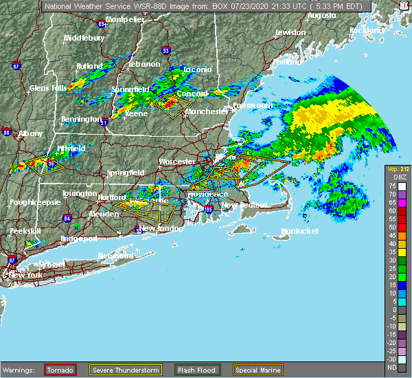
| 7/23/2020 6:26 PM EDT |
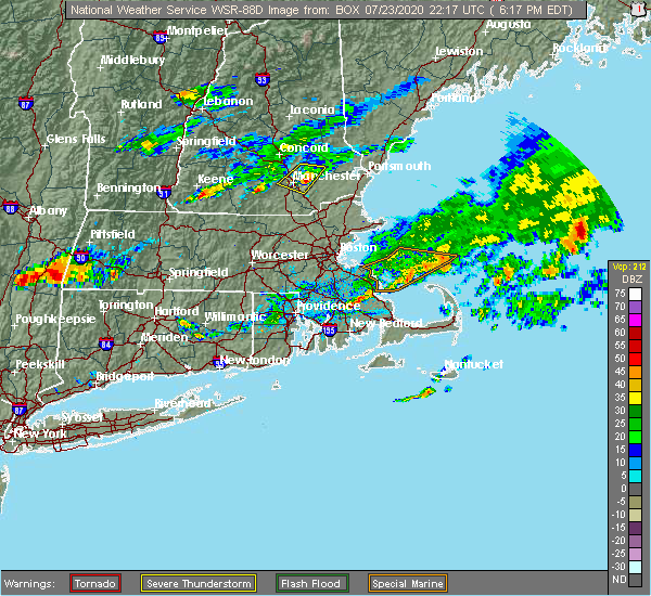 The severe thunderstorm warning for west central rockingham, east central hillsborough and southeastern merrimack counties will expire at 630 pm edt, the storm which prompted the warning has weakened below severe limits, and has exited the warned area. therefore, the warning will be allowed to expire. however small hail and gusty winds are still possible with this thunderstorm. a severe thunderstorm watch remains in effect until 800 pm edt for southern and central new hampshire. The severe thunderstorm warning for west central rockingham, east central hillsborough and southeastern merrimack counties will expire at 630 pm edt, the storm which prompted the warning has weakened below severe limits, and has exited the warned area. therefore, the warning will be allowed to expire. however small hail and gusty winds are still possible with this thunderstorm. a severe thunderstorm watch remains in effect until 800 pm edt for southern and central new hampshire.
|
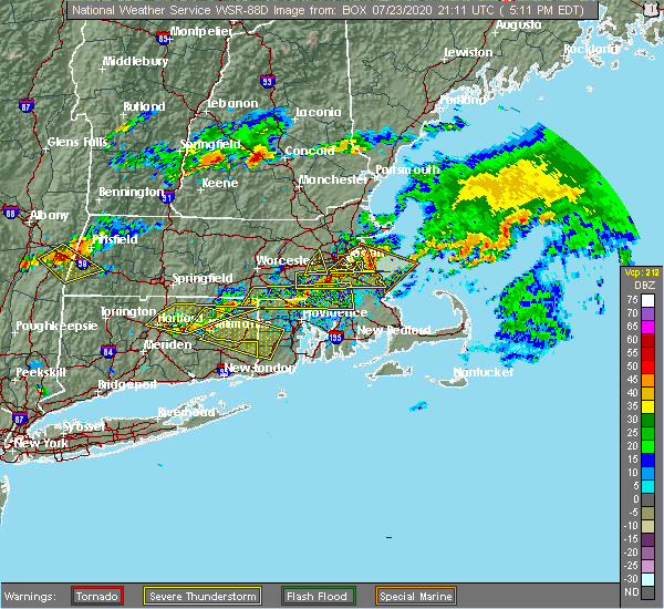
| 7/23/2020 6:11 PM EDT |
 The severe thunderstorm warning for north central hillsborough and southeastern merrimack counties will expire at 615 pm edt, the storm which prompted the warning has moved out of the area. therefore, the warning will be allowed to expire. a severe thunderstorm watch remains in effect until 800 pm edt for southern and central new hampshire. remember, a severe thunderstorm warning still remains in effect for northest hillsborough, southeast merrimack, western rockingham counties until 6:30 pm edt. The severe thunderstorm warning for north central hillsborough and southeastern merrimack counties will expire at 615 pm edt, the storm which prompted the warning has moved out of the area. therefore, the warning will be allowed to expire. a severe thunderstorm watch remains in effect until 800 pm edt for southern and central new hampshire. remember, a severe thunderstorm warning still remains in effect for northest hillsborough, southeast merrimack, western rockingham counties until 6:30 pm edt.
|
| 7/23/2020 6:08 PM EDT |
 At 607 pm edt, a severe thunderstorm was located over auburn, moving east at 30 mph (radar indicated). Hazards include 60 mph wind gusts and half dollar size hail. Hail damage to vehicles is expected. expect wind damage to roofs, siding, and trees. locations impacted include, manchester, derry, bedford, hooksett, raymond, goffstown, londonderry, chester, allenstown, deerfield, candia and nottingham. this includes the following highways, interstate 293 between mile markers 1 and 11. Interstate 93 between mile markers 15 and 27. At 607 pm edt, a severe thunderstorm was located over auburn, moving east at 30 mph (radar indicated). Hazards include 60 mph wind gusts and half dollar size hail. Hail damage to vehicles is expected. expect wind damage to roofs, siding, and trees. locations impacted include, manchester, derry, bedford, hooksett, raymond, goffstown, londonderry, chester, allenstown, deerfield, candia and nottingham. this includes the following highways, interstate 293 between mile markers 1 and 11. Interstate 93 between mile markers 15 and 27.
|
| 7/23/2020 5:47 PM EDT |
 At 547 pm edt, a severe thunderstorm was located near hooksett, or near concord, moving east at 25 mph (radar indicated). Hazards include 60 mph wind gusts and half dollar size hail. Hail damage to vehicles is expected. Expect wind damage to roofs, siding, and trees. At 547 pm edt, a severe thunderstorm was located near hooksett, or near concord, moving east at 25 mph (radar indicated). Hazards include 60 mph wind gusts and half dollar size hail. Hail damage to vehicles is expected. Expect wind damage to roofs, siding, and trees.
|
| 7/23/2020 5:38 PM EDT |
 At 538 pm edt, a severe thunderstorm was located near hopkinton, or near concord, moving southeast at 30 mph (public). Hazards include 60 mph wind gusts and half dollar size hail. Hail damage to vehicles is expected. expect wind damage to roofs, siding, and trees. locations impacted include, manchester, concord, bedford, hooksett, hopkinton, new boston, epsom, goffstown, weare, bow, allenstown, dunbarton and pembroke. this includes the following highways, interstate 89 between mile markers 0 and 8. Interstate 93 between mile markers 28 and 40. At 538 pm edt, a severe thunderstorm was located near hopkinton, or near concord, moving southeast at 30 mph (public). Hazards include 60 mph wind gusts and half dollar size hail. Hail damage to vehicles is expected. expect wind damage to roofs, siding, and trees. locations impacted include, manchester, concord, bedford, hooksett, hopkinton, new boston, epsom, goffstown, weare, bow, allenstown, dunbarton and pembroke. this includes the following highways, interstate 89 between mile markers 0 and 8. Interstate 93 between mile markers 28 and 40.
|
| 7/23/2020 5:25 PM EDT |
 At 525 pm edt, a severe thunderstorm was located near hopkinton, or near henniker, moving southeast at 20 mph (radar indicated). Hazards include 60 mph wind gusts and quarter size hail. Hail damage to vehicles is expected. Expect wind damage to roofs, siding, and trees. At 525 pm edt, a severe thunderstorm was located near hopkinton, or near henniker, moving southeast at 20 mph (radar indicated). Hazards include 60 mph wind gusts and quarter size hail. Hail damage to vehicles is expected. Expect wind damage to roofs, siding, and trees.
|
| 5/15/2020 8:16 PM EDT |
 At 815 pm edt, severe thunderstorms were located along a line extending from near canterbury to near goffstown to hollis, moving east at 50 mph (radar indicated). Hazards include 60 mph wind gusts and penny size hail. expect damage to roofs, siding, and trees At 815 pm edt, severe thunderstorms were located along a line extending from near canterbury to near goffstown to hollis, moving east at 50 mph (radar indicated). Hazards include 60 mph wind gusts and penny size hail. expect damage to roofs, siding, and trees
|
| 5/15/2020 7:55 PM EDT |
 At 755 pm edt, severe thunderstorms were located along a line extending from near bradford to near peterborough to near fitzwilliam, moving east at 50 mph (radar indicated). Hazards include 70 mph wind gusts and penny size hail. Expect considerable tree damage. damage is likely to mobile homes, roofs, and outbuildings. locations impacted include, nashua, jaffrey, henniker, merrimack, bedford, milford, amherst, hollis, peterborough, hopkinton, new boston, antrim, mont vernon, greenfield, lyndeborough, bradford, dublin, francestown, bennington and harrisville. this also includes, north pack monadnock. This includes interstate 89 between mile markers 8 and 20. At 755 pm edt, severe thunderstorms were located along a line extending from near bradford to near peterborough to near fitzwilliam, moving east at 50 mph (radar indicated). Hazards include 70 mph wind gusts and penny size hail. Expect considerable tree damage. damage is likely to mobile homes, roofs, and outbuildings. locations impacted include, nashua, jaffrey, henniker, merrimack, bedford, milford, amherst, hollis, peterborough, hopkinton, new boston, antrim, mont vernon, greenfield, lyndeborough, bradford, dublin, francestown, bennington and harrisville. this also includes, north pack monadnock. This includes interstate 89 between mile markers 8 and 20.
|
| 5/15/2020 7:37 PM EDT |
 At 736 pm edt, severe thunderstorms were located along a line extending from near newport to near roxbury to near winchester, moving east at 50 mph (radar indicated). Hazards include 70 mph wind gusts and penny size hail. Expect considerable tree damage. Damage is likely to mobile homes, roofs, and outbuildings. At 736 pm edt, severe thunderstorms were located along a line extending from near newport to near roxbury to near winchester, moving east at 50 mph (radar indicated). Hazards include 70 mph wind gusts and penny size hail. Expect considerable tree damage. Damage is likely to mobile homes, roofs, and outbuildings.
|
| 8/21/2019 5:32 PM EDT |
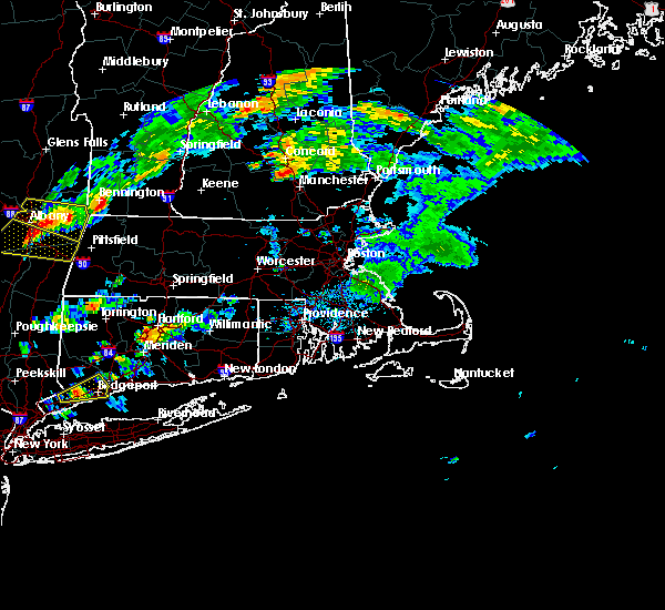 The national weather service in gray maine has issued a * severe thunderstorm warning for. northwestern rockingham county in southern new hampshire. east central hillsborough county in southern new hampshire. southeastern merrimack county in central new hampshire. Until 615 pm edt. The national weather service in gray maine has issued a * severe thunderstorm warning for. northwestern rockingham county in southern new hampshire. east central hillsborough county in southern new hampshire. southeastern merrimack county in central new hampshire. Until 615 pm edt.
|
| 6/2/2019 5:06 PM EDT |
 At 505 pm edt, severe thunderstorms were located along a line extending from concord to manchester, moving northeast at 35 mph (radar indicated). Hazards include 60 mph wind gusts and penny size hail. Expect damage to roofs, siding, and trees. locations impacted include, manchester, concord, derry, exeter, merrimack, northwood, bedford, hooksett, litchfield, epping, hopkinton, loudon, barnstead, epsom, brentwood, gilmanton, canterbury, raymond, goffstown and londonderry. this includes the following highways, interstate 293 between mile markers 1 and 11. interstate 89 between mile markers 0 and 5. Interstate 93 between mile markers 10 and 47. At 505 pm edt, severe thunderstorms were located along a line extending from concord to manchester, moving northeast at 35 mph (radar indicated). Hazards include 60 mph wind gusts and penny size hail. Expect damage to roofs, siding, and trees. locations impacted include, manchester, concord, derry, exeter, merrimack, northwood, bedford, hooksett, litchfield, epping, hopkinton, loudon, barnstead, epsom, brentwood, gilmanton, canterbury, raymond, goffstown and londonderry. this includes the following highways, interstate 293 between mile markers 1 and 11. interstate 89 between mile markers 0 and 5. Interstate 93 between mile markers 10 and 47.
|
| 6/2/2019 4:52 PM EDT |
 The national weather service in gray maine has issued a * severe thunderstorm warning for. northwestern rockingham county in southern new hampshire. central hillsborough county in southern new hampshire. southeastern merrimack county in central new hampshire. Until 530 pm edt. The national weather service in gray maine has issued a * severe thunderstorm warning for. northwestern rockingham county in southern new hampshire. central hillsborough county in southern new hampshire. southeastern merrimack county in central new hampshire. Until 530 pm edt.
|
| 8/3/2018 5:12 PM EDT |
 At 512 pm edt, severe thunderstorms were located along a line extending from manchester to new ipswich, moving northeast at 20 mph (radar indicated). Hazards include 60 mph wind gusts and quarter size hail. Hail damage to vehicles is expected. Expect wind damage to roofs, siding, and trees. At 512 pm edt, severe thunderstorms were located along a line extending from manchester to new ipswich, moving northeast at 20 mph (radar indicated). Hazards include 60 mph wind gusts and quarter size hail. Hail damage to vehicles is expected. Expect wind damage to roofs, siding, and trees.
|
| 7/17/2018 11:34 AM EDT |
 At 1134 am edt, a severe thunderstorm was located over manchester, moving east at 20 mph (radar indicated). Hazards include 60 mph wind gusts and penny size hail. expect damage to roofs, siding, and trees At 1134 am edt, a severe thunderstorm was located over manchester, moving east at 20 mph (radar indicated). Hazards include 60 mph wind gusts and penny size hail. expect damage to roofs, siding, and trees
|
| 7/15/2018 5:23 PM EDT |
 The severe thunderstorm warning for southwestern rockingham, southeastern hillsborough and southeastern merrimack counties will expire at 530 pm edt, the storm which prompted the warning has weakened below severe limits, and no longer poses an immediate threat to life or property. therefore, the warning will be allowed to expire. The severe thunderstorm warning for southwestern rockingham, southeastern hillsborough and southeastern merrimack counties will expire at 530 pm edt, the storm which prompted the warning has weakened below severe limits, and no longer poses an immediate threat to life or property. therefore, the warning will be allowed to expire.
|
| 7/15/2018 4:42 PM EDT |
 At 441 pm edt, a severe thunderstorm was located over bedford, or near manchester, moving south at 15 mph (radar indicated). Hazards include 60 mph wind gusts and penny size hail. expect damage to roofs, siding, and trees At 441 pm edt, a severe thunderstorm was located over bedford, or near manchester, moving south at 15 mph (radar indicated). Hazards include 60 mph wind gusts and penny size hail. expect damage to roofs, siding, and trees
|
| 7/15/2018 4:40 PM EDT | Trees down on new boston road in hillsborough county NH, 2.6 miles NNE of Pinardville, NH |
| 7/15/2018 4:02 PM EDT |
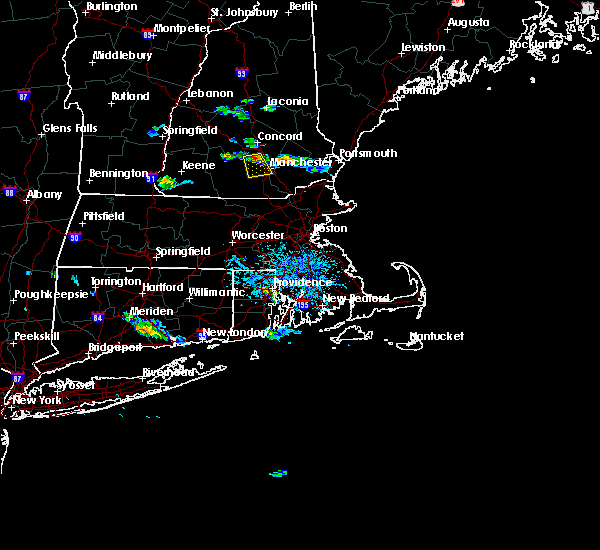 At 401 pm edt, a severe thunderstorm was located near goffstown, or 9 miles south of concord, moving south at 15 mph (radar indicated). Hazards include 60 mph wind gusts and nickel size hail. expect damage to roofs, siding, and trees At 401 pm edt, a severe thunderstorm was located near goffstown, or 9 miles south of concord, moving south at 15 mph (radar indicated). Hazards include 60 mph wind gusts and nickel size hail. expect damage to roofs, siding, and trees
|
| 6/18/2018 5:51 PM EDT |
 At 550 pm edt, severe thunderstorms were located along a line extending from near warner to near weare to milford to near new ipswich, moving east at 45 mph. these storms are producing widespread wind damage (radar indicated). Hazards include 70 mph wind gusts. Expect considerable tree damage. Damage is likely to mobile homes, roofs, and outbuildings. At 550 pm edt, severe thunderstorms were located along a line extending from near warner to near weare to milford to near new ipswich, moving east at 45 mph. these storms are producing widespread wind damage (radar indicated). Hazards include 70 mph wind gusts. Expect considerable tree damage. Damage is likely to mobile homes, roofs, and outbuildings.
|
| 6/18/2018 5:24 PM EDT |
 At 524 pm edt, severe thunderstorms were located along a line extending from 6 miles south of newport to near hancock to near richmond, moving east at 45 mph (radar indicated). Hazards include 60 mph wind gusts. expect damage to roofs, siding, and trees At 524 pm edt, severe thunderstorms were located along a line extending from 6 miles south of newport to near hancock to near richmond, moving east at 45 mph (radar indicated). Hazards include 60 mph wind gusts. expect damage to roofs, siding, and trees
|
| 8/22/2017 10:28 PM EDT |
 At 1028 pm edt, severe thunderstorms were located along a line extending from near warner to deering to peterborough to near richmond, moving east at 45 mph (radar indicated). Hazards include 60 mph wind gusts. Expect damage to trees, and power lines. locations impacted include, concord, keene, jaffrey, henniker, bedford, milford, amherst, swanzey, peterborough, hopkinton, new boston, loudon, winchester, antrim, mont vernon, canterbury, greenfield, lyndeborough, bradford and dublin. this also includes, mount monadnock and north pack monadnock. this includes the following highways, interstate 89 between mile markers 0 and 19. Interstate 93 between mile markers 33 and 45. At 1028 pm edt, severe thunderstorms were located along a line extending from near warner to deering to peterborough to near richmond, moving east at 45 mph (radar indicated). Hazards include 60 mph wind gusts. Expect damage to trees, and power lines. locations impacted include, concord, keene, jaffrey, henniker, bedford, milford, amherst, swanzey, peterborough, hopkinton, new boston, loudon, winchester, antrim, mont vernon, canterbury, greenfield, lyndeborough, bradford and dublin. this also includes, mount monadnock and north pack monadnock. this includes the following highways, interstate 89 between mile markers 0 and 19. Interstate 93 between mile markers 33 and 45.
|
| 8/22/2017 10:21 PM EDT |
 At 1021 pm edt, severe thunderstorms were located along a line extending from near bradford to near deering to dublin to near richmond, moving east at 45 mph (radar indicated). Hazards include 60 mph wind gusts. Expect damage to trees, and power lines. locations impacted include, concord, keene, jaffrey, henniker, bedford, milford, amherst, swanzey, peterborough, hopkinton, new boston, loudon, winchester, antrim, mont vernon, canterbury, greenfield, lyndeborough, bradford and dublin. this also includes, mount monadnock and north pack monadnock. this includes the following highways, interstate 89 between mile markers 0 and 19. Interstate 93 between mile markers 33 and 45. At 1021 pm edt, severe thunderstorms were located along a line extending from near bradford to near deering to dublin to near richmond, moving east at 45 mph (radar indicated). Hazards include 60 mph wind gusts. Expect damage to trees, and power lines. locations impacted include, concord, keene, jaffrey, henniker, bedford, milford, amherst, swanzey, peterborough, hopkinton, new boston, loudon, winchester, antrim, mont vernon, canterbury, greenfield, lyndeborough, bradford and dublin. this also includes, mount monadnock and north pack monadnock. this includes the following highways, interstate 89 between mile markers 0 and 19. Interstate 93 between mile markers 33 and 45.
|
| 8/22/2017 10:08 PM EDT |
 At 1008 pm edt, severe thunderstorms were located along a line extending from 6 miles southeast of newport to near nelson to near troy to near hinsdale, moving east at 45 mph (radar indicated). Hazards include 60 mph wind gusts. expect damage to trees, and power lines At 1008 pm edt, severe thunderstorms were located along a line extending from 6 miles southeast of newport to near nelson to near troy to near hinsdale, moving east at 45 mph (radar indicated). Hazards include 60 mph wind gusts. expect damage to trees, and power lines
|
| 7/8/2017 1:26 PM EDT |
 At 125 pm edt, severe thunderstorms were located along a line extending from standish to 6 miles southwest of new ipswich, moving east at 35 mph (public). Hazards include 60 mph wind gusts and penny size hail. Expect damage to trees, and power lines. locations impacted include, manchester, nashua, concord, derry, rochester, biddeford, durham, jaffrey, alfred, sanford, merrimack, northwood, ossipee, dover, bedford, saco, milford, hooksett, somersworth and amherst. this also includes, north pack monadnock. this includes the following highways, interstate 293 between mile markers 1 and 11. interstate 89 between mile markers 0 and 5. Interstate 93 between mile markers 10 and 40. At 125 pm edt, severe thunderstorms were located along a line extending from standish to 6 miles southwest of new ipswich, moving east at 35 mph (public). Hazards include 60 mph wind gusts and penny size hail. Expect damage to trees, and power lines. locations impacted include, manchester, nashua, concord, derry, rochester, biddeford, durham, jaffrey, alfred, sanford, merrimack, northwood, ossipee, dover, bedford, saco, milford, hooksett, somersworth and amherst. this also includes, north pack monadnock. this includes the following highways, interstate 293 between mile markers 1 and 11. interstate 89 between mile markers 0 and 5. Interstate 93 between mile markers 10 and 40.
|
| 7/8/2017 12:58 PM EDT |
 The national weather service in gray maine has issued a * severe thunderstorm warning for. york county in southwestern maine. northwestern rockingham county in southern new hampshire. strafford county in central new hampshire. Southeastern cheshire county in southern new hampshire. The national weather service in gray maine has issued a * severe thunderstorm warning for. york county in southwestern maine. northwestern rockingham county in southern new hampshire. strafford county in central new hampshire. Southeastern cheshire county in southern new hampshire.
|
| 7/8/2017 12:58 PM EDT |
 At 1257 pm edt, severe thunderstorms were located along a line extending from near effingham to 9 miles south of richmond, moving east at 35 mph (public). Hazards include 60 mph wind gusts and penny size hail. expect damage to trees, and power lines At 1257 pm edt, severe thunderstorms were located along a line extending from near effingham to 9 miles south of richmond, moving east at 35 mph (public). Hazards include 60 mph wind gusts and penny size hail. expect damage to trees, and power lines
|
| 6/19/2017 6:40 PM EDT |
 The severe thunderstorm warning for central hillsborough and merrimack counties will expire at 645 pm edt, the storms which prompted the warning have moved out of the area. therefore the warning will be allowed to expire. a severe thunderstorm watch remains in effect until 800 pm edt for central and southern new hampshire. to report severe weather, contact your nearest law enforcement agency. they will relay your report to the national weather service gray maine. The severe thunderstorm warning for central hillsborough and merrimack counties will expire at 645 pm edt, the storms which prompted the warning have moved out of the area. therefore the warning will be allowed to expire. a severe thunderstorm watch remains in effect until 800 pm edt for central and southern new hampshire. to report severe weather, contact your nearest law enforcement agency. they will relay your report to the national weather service gray maine.
|
| 6/19/2017 6:23 PM EDT |
 At 622 pm edt, severe thunderstorms were located along a line extending from near franklin to goffstown, moving northeast at 45 mph (radar indicated). Hazards include 60 mph wind gusts. Expect damage to trees, and power lines. locations impacted include, manchester, concord, merrimack, franklin, henniker, bedford, milford, hooksett, amherst, litchfield, hopkinton, new boston, loudon, epsom, mont vernon, canterbury, goffstown, mount vernon, weare and warner. this includes the following highways, interstate 293 between mile markers 1 and 11. interstate 89 between mile markers 0 and 17. Interstate 93 between mile markers 18 and 56. At 622 pm edt, severe thunderstorms were located along a line extending from near franklin to goffstown, moving northeast at 45 mph (radar indicated). Hazards include 60 mph wind gusts. Expect damage to trees, and power lines. locations impacted include, manchester, concord, merrimack, franklin, henniker, bedford, milford, hooksett, amherst, litchfield, hopkinton, new boston, loudon, epsom, mont vernon, canterbury, goffstown, mount vernon, weare and warner. this includes the following highways, interstate 293 between mile markers 1 and 11. interstate 89 between mile markers 0 and 17. Interstate 93 between mile markers 18 and 56.
|
| 6/19/2017 6:09 PM EDT |
 At 608 pm edt, severe thunderstorms were located along a line extending from near warner to near lyndeborough, moving northeast at 45 mph. some of the strongest winds will be headed toward weare and concord (radar indicated and law enforcement reported). Hazards include 60 mph wind gusts. Expect damage to trees, and power lines. locations impacted include, manchester, concord, merrimack, franklin, henniker, new london, bedford, milford, hooksett, amherst, litchfield, peterborough, hopkinton, new boston, loudon, epsom, antrim, mont vernon, canterbury and greenfield. this also includes, north pack monadnock and mount kearsage. this includes the following highways, interstate 293 between mile markers 1 and 11. interstate 89 between mile markers 0 and 30. Interstate 93 between mile markers 18 and 56. At 608 pm edt, severe thunderstorms were located along a line extending from near warner to near lyndeborough, moving northeast at 45 mph. some of the strongest winds will be headed toward weare and concord (radar indicated and law enforcement reported). Hazards include 60 mph wind gusts. Expect damage to trees, and power lines. locations impacted include, manchester, concord, merrimack, franklin, henniker, new london, bedford, milford, hooksett, amherst, litchfield, peterborough, hopkinton, new boston, loudon, epsom, antrim, mont vernon, canterbury and greenfield. this also includes, north pack monadnock and mount kearsage. this includes the following highways, interstate 293 between mile markers 1 and 11. interstate 89 between mile markers 0 and 30. Interstate 93 between mile markers 18 and 56.
|
| 6/19/2017 5:41 PM EDT |
 At 540 pm edt, severe thunderstorms were located along a line extending from near marlow to near jaffrey, moving northeast at 45 mph (radar indicuated and law enforcement reported). Hazards include 60 mph wind gusts. expect damage to trees, and power lines At 540 pm edt, severe thunderstorms were located along a line extending from near marlow to near jaffrey, moving northeast at 45 mph (radar indicuated and law enforcement reported). Hazards include 60 mph wind gusts. expect damage to trees, and power lines
|
| 5/31/2017 8:13 PM EDT |
 At 813 pm edt, severe thunderstorms were located along a line extending from manchester to hudson to 11 miles south of nashua, moving east at 25 mph (radar indicated). Hazards include 60 mph wind gusts and penny size hail. expect damage to trees, and power lines At 813 pm edt, severe thunderstorms were located along a line extending from manchester to hudson to 11 miles south of nashua, moving east at 25 mph (radar indicated). Hazards include 60 mph wind gusts and penny size hail. expect damage to trees, and power lines
|
| 5/18/2017 10:02 PM EDT |
 At 1001 pm edt, severe thunderstorms were located along a line extending from concord to near merrimack to 15 miles south of mason, moving east at 45 mph (radar indicated). Hazards include 60 mph wind gusts. Expect damage to trees, and power lines. locations impacted include, manchester, nashua, derry, merrimack, salem, northwood, bedford, milford, hooksett, amherst, litchfield, hollis, epping, new boston, mont vernon, lyndeborough, raymond, new ipswich, goffstown and mount vernon. this includes the following highways, interstate 293 between mile markers 1 and 11. Interstate 93 between mile markers 1 and 31. At 1001 pm edt, severe thunderstorms were located along a line extending from concord to near merrimack to 15 miles south of mason, moving east at 45 mph (radar indicated). Hazards include 60 mph wind gusts. Expect damage to trees, and power lines. locations impacted include, manchester, nashua, derry, merrimack, salem, northwood, bedford, milford, hooksett, amherst, litchfield, hollis, epping, new boston, mont vernon, lyndeborough, raymond, new ipswich, goffstown and mount vernon. this includes the following highways, interstate 293 between mile markers 1 and 11. Interstate 93 between mile markers 1 and 31.
|
| 5/18/2017 9:37 PM EDT |
 At 937 pm edt, severe thunderstorms were located along a line extending from near bradford to peterborough to 13 miles south of fitzwilliam, moving east at 45 mph (radar indicated). Hazards include 60 mph wind gusts. expect damage to trees, and power lines At 937 pm edt, severe thunderstorms were located along a line extending from near bradford to peterborough to 13 miles south of fitzwilliam, moving east at 45 mph (radar indicated). Hazards include 60 mph wind gusts. expect damage to trees, and power lines
|
| 9/11/2016 9:31 AM EDT |
 At 930 am edt, severe thunderstorms were located along a line extending from near laconia to near goffstown, moving east at 45 mph (radar indicated). Hazards include 60 mph wind gusts. Expect damage to roofs. siding. and trees. Locations impacted include, manchester, concord, rochester, laconia, northwood, bedford, hooksett, amherst, barrington, farmington, loudon, alton, barnstead, epsom, gilmanton, canterbury, wolfeboro, goffstown, raymond and bow. At 930 am edt, severe thunderstorms were located along a line extending from near laconia to near goffstown, moving east at 45 mph (radar indicated). Hazards include 60 mph wind gusts. Expect damage to roofs. siding. and trees. Locations impacted include, manchester, concord, rochester, laconia, northwood, bedford, hooksett, amherst, barrington, farmington, loudon, alton, barnstead, epsom, gilmanton, canterbury, wolfeboro, goffstown, raymond and bow.
|
| 9/11/2016 9:06 AM EDT |
 At 906 am edt, severe thunderstorms were located along a line extending from near franklin to near sharon, moving east at 55 mph (radar indicated). Hazards include 60 mph wind gusts. Expect damage to roofs. siding. And trees. At 906 am edt, severe thunderstorms were located along a line extending from near franklin to near sharon, moving east at 55 mph (radar indicated). Hazards include 60 mph wind gusts. Expect damage to roofs. siding. And trees.
|
| 7/23/2016 6:30 PM EDT |
 At 630 pm edt, severe thunderstorms were located along a line extending from newington to manchester to swanzey, moving southeast at 25 mph (radar indicated). Hazards include 60 mph wind gusts and nickel size hail. Expect damage to roofs. siding. and trees. Locations impacted include, manchester, nashua, derry, merrimack, keene, portsmouth, hampton, durham, exeter, jaffrey, salem, northwood, dover, bedford, milford, hooksett, somersworth, amherst, barrington and litchfield. At 630 pm edt, severe thunderstorms were located along a line extending from newington to manchester to swanzey, moving southeast at 25 mph (radar indicated). Hazards include 60 mph wind gusts and nickel size hail. Expect damage to roofs. siding. and trees. Locations impacted include, manchester, nashua, derry, merrimack, keene, portsmouth, hampton, durham, exeter, jaffrey, salem, northwood, dover, bedford, milford, hooksett, somersworth, amherst, barrington and litchfield.
|
| 7/23/2016 6:08 PM EDT |
 At 608 pm edt, severe thunderstorms were located along a line extending from near dover to goffstown to walpole, moving southeast at 25 mph (radar indicated). Hazards include 60 mph wind gusts and nickel size hail. Expect damage to roofs. siding. And trees. At 608 pm edt, severe thunderstorms were located along a line extending from near dover to goffstown to walpole, moving southeast at 25 mph (radar indicated). Hazards include 60 mph wind gusts and nickel size hail. Expect damage to roofs. siding. And trees.
|
| 7/23/2016 5:21 PM EDT |
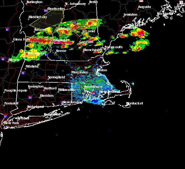 At 521 pm edt, severe thunderstorms were located along a line extending from 9 miles southwest of ascutney to warner, moving east at 45 mph (radar indicated). Hazards include 60 mph wind gusts and quarter size hail. Hail damage to vehicles is expected. Expect wind damage to roofs, siding, and trees. At 521 pm edt, severe thunderstorms were located along a line extending from 9 miles southwest of ascutney to warner, moving east at 45 mph (radar indicated). Hazards include 60 mph wind gusts and quarter size hail. Hail damage to vehicles is expected. Expect wind damage to roofs, siding, and trees.
|
| 7/18/2016 3:15 PM EDT |
 At 315 pm edt, severe thunderstorms were located along a line extending from lyndeborough to hollis to fitchburg, moving east at 50 mph (radar indicated). Hazards include 60 mph wind gusts and penny size hail. Expect damage to roofs. siding. and trees. Locations impacted include, manchester, nashua, merrimack, salem, bedford, milford, hooksett, amherst, litchfield, hollis, new boston, mont vernon, greenfield, lyndeborough, francestown, mason, mount vernon, wilton, goffstown and greenville. At 315 pm edt, severe thunderstorms were located along a line extending from lyndeborough to hollis to fitchburg, moving east at 50 mph (radar indicated). Hazards include 60 mph wind gusts and penny size hail. Expect damage to roofs. siding. and trees. Locations impacted include, manchester, nashua, merrimack, salem, bedford, milford, hooksett, amherst, litchfield, hollis, new boston, mont vernon, greenfield, lyndeborough, francestown, mason, mount vernon, wilton, goffstown and greenville.
|
| 7/18/2016 3:05 PM EDT |
 At 305 pm edt, severe thunderstorms were located along a line extending from near peterborough to mason to near gardner, moving east at 60 mph (radar indicated). Hazards include 60 mph wind gusts and penny size hail. Expect damage to roofs. siding. and trees. Locations impacted include, manchester, nashua, merrimack, salem, bedford, milford, hooksett, amherst, litchfield, hollis, peterborough, new boston, ashby, mont vernon, greenfield, lyndeborough, francestown, mason, new ipswich and mount vernon. At 305 pm edt, severe thunderstorms were located along a line extending from near peterborough to mason to near gardner, moving east at 60 mph (radar indicated). Hazards include 60 mph wind gusts and penny size hail. Expect damage to roofs. siding. and trees. Locations impacted include, manchester, nashua, merrimack, salem, bedford, milford, hooksett, amherst, litchfield, hollis, peterborough, new boston, ashby, mont vernon, greenfield, lyndeborough, francestown, mason, new ipswich and mount vernon.
|
| 7/18/2016 2:56 PM EDT |
 At 256 pm edt, severe thunderstorms were located along a line extending from jaffrey to near new ipswich to templeton, moving east at 50 mph (radar indicated). Hazards include 60 mph wind gusts. Expect damage to roofs. siding. and trees. Locations impacted include, manchester, nashua, merrimack, salem, bedford, milford, hooksett, amherst, litchfield, hollis, peterborough, new boston, ashby, mont vernon, greenfield, lyndeborough, francestown, mason, harrisville and new ipswich. At 256 pm edt, severe thunderstorms were located along a line extending from jaffrey to near new ipswich to templeton, moving east at 50 mph (radar indicated). Hazards include 60 mph wind gusts. Expect damage to roofs. siding. and trees. Locations impacted include, manchester, nashua, merrimack, salem, bedford, milford, hooksett, amherst, litchfield, hollis, peterborough, new boston, ashby, mont vernon, greenfield, lyndeborough, francestown, mason, harrisville and new ipswich.
|
| 7/18/2016 2:48 PM EDT |
 At 248 pm edt, severe thunderstorms were located along a line extending from near jaffrey to near rindge to phillipston, moving east at 50 mph (radar indicated). Hazards include 60 mph wind gusts. Expect damage to roofs. siding. And trees. At 248 pm edt, severe thunderstorms were located along a line extending from near jaffrey to near rindge to phillipston, moving east at 50 mph (radar indicated). Hazards include 60 mph wind gusts. Expect damage to roofs. siding. And trees.
|
| 8/25/2015 4:54 PM EDT |
 At 454 pm edt, doppler radar indicated a severe thunderstorm capable of producing quarter size hail and damaging winds in excess of 60 mph. this storm was located over francestown, or 13 miles south of henniker, and moving northeast at 20 mph. At 454 pm edt, doppler radar indicated a severe thunderstorm capable of producing quarter size hail and damaging winds in excess of 60 mph. this storm was located over francestown, or 13 miles south of henniker, and moving northeast at 20 mph.
|
| 8/25/2015 12:57 PM EDT |
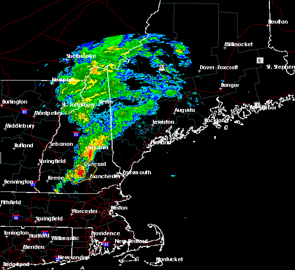 At 1256 pm edt, doppler radar indicated a severe thunderstorm capable of producing quarter size hail and damaging winds in excess of 60 mph. this storm was located near goffstown, or 8 miles southwest of concord, moving northeast at 25 mph. locations impacted include, manchester, concord, henniker, hooksett, hopkinton, loudon, epsom, canterbury, goffstown, weare, bow, allenstown, boscawen, dunbarton, chichester and pembroke. At 1256 pm edt, doppler radar indicated a severe thunderstorm capable of producing quarter size hail and damaging winds in excess of 60 mph. this storm was located near goffstown, or 8 miles southwest of concord, moving northeast at 25 mph. locations impacted include, manchester, concord, henniker, hooksett, hopkinton, loudon, epsom, canterbury, goffstown, weare, bow, allenstown, boscawen, dunbarton, chichester and pembroke.
|
| 8/25/2015 12:40 PM EDT |
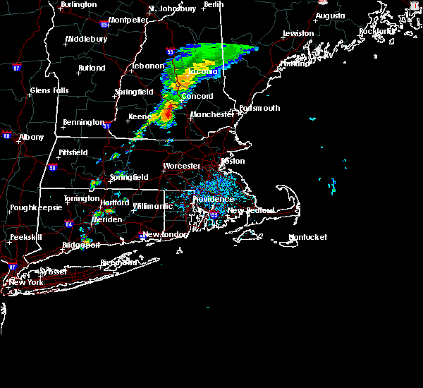 At 1240 pm edt, doppler radar indicated a severe thunderstorm capable of producing quarter size hail and damaging winds in excess of 60 mph. this storm was located near weare, or 11 miles southeast of henniker, and moving northeast at 25 mph. At 1240 pm edt, doppler radar indicated a severe thunderstorm capable of producing quarter size hail and damaging winds in excess of 60 mph. this storm was located near weare, or 11 miles southeast of henniker, and moving northeast at 25 mph.
|
| 8/4/2015 2:30 PM EDT |
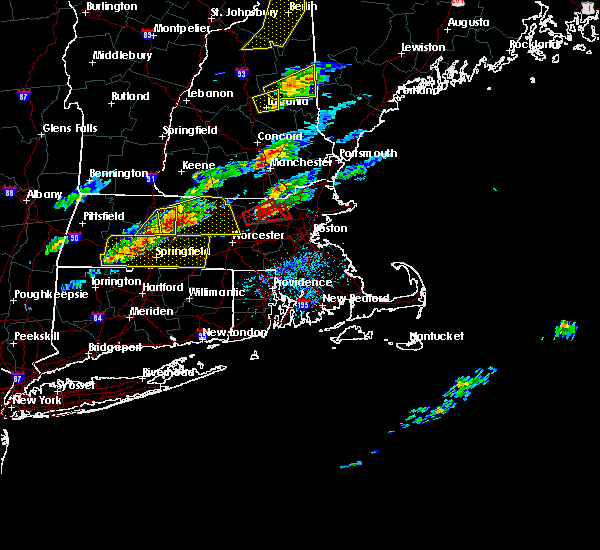 At 230 pm edt, doppler radar indicated a severe thunderstorm capable of producing quarter size hail and damaging winds in excess of 60 mph. this storm was located near hooksett, or near auburn, and moving east at 35 mph. At 230 pm edt, doppler radar indicated a severe thunderstorm capable of producing quarter size hail and damaging winds in excess of 60 mph. this storm was located near hooksett, or near auburn, and moving east at 35 mph.
|
| 8/3/2015 8:41 PM EDT |
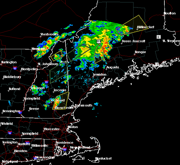 At 840 pm edt, doppler radar indicated a line of severe thunderstorms capable of producing damaging winds in excess of 60 mph. these storms were located along a line extending from near alton to near epsom to near auburn, moving east at 30 mph. locations impacted include, rochester, northwood, hooksett, barrington, farmington, epping, eastern loudon, alton, barnstead, epsom, gilmanton, pawtuckaway state park, bear brook state park, raymond, bow, chester, allenstown, fremont, deerfield and candia. At 840 pm edt, doppler radar indicated a line of severe thunderstorms capable of producing damaging winds in excess of 60 mph. these storms were located along a line extending from near alton to near epsom to near auburn, moving east at 30 mph. locations impacted include, rochester, northwood, hooksett, barrington, farmington, epping, eastern loudon, alton, barnstead, epsom, gilmanton, pawtuckaway state park, bear brook state park, raymond, bow, chester, allenstown, fremont, deerfield and candia.
|
| 8/3/2015 8:27 PM EDT |
 At 827 pm edt, doppler radar indicated a line of severe thunderstorms capable of producing damaging winds in excess of 60 mph. these storms were located along a line extending from near gilmanton to near bear brook state park to near bedford, and moving east at 30 mph. At 827 pm edt, doppler radar indicated a line of severe thunderstorms capable of producing damaging winds in excess of 60 mph. these storms were located along a line extending from near gilmanton to near bear brook state park to near bedford, and moving east at 30 mph.
|
| 7/1/2015 6:58 PM EDT |
 At 657 pm edt, doppler radar indicated a line of severe thunderstorms capable of producing damaging winds in excess of 60 mph. these storms were located along a line extending from near pawtuckaway state park to hollis, moving east at 30 mph. locations impacted include, nashua, derry, dracut, merrimack, western exeter, salem, bedford, hooksett, amherst, litchfield, hollis, epping, brentwood, raymond, newmarket, londonderry, hampstead, atkinson, kingston and chester. At 657 pm edt, doppler radar indicated a line of severe thunderstorms capable of producing damaging winds in excess of 60 mph. these storms were located along a line extending from near pawtuckaway state park to hollis, moving east at 30 mph. locations impacted include, nashua, derry, dracut, merrimack, western exeter, salem, bedford, hooksett, amherst, litchfield, hollis, epping, brentwood, raymond, newmarket, londonderry, hampstead, atkinson, kingston and chester.
|
| 7/1/2015 6:28 PM EDT |
 At 627 pm edt, doppler radar indicated a line of severe thunderstorms capable of producing damaging winds in excess of 60 mph. these storms were located along a line extending from near hooksett to near new ipswich, and moving east at 35 mph. At 627 pm edt, doppler radar indicated a line of severe thunderstorms capable of producing damaging winds in excess of 60 mph. these storms were located along a line extending from near hooksett to near new ipswich, and moving east at 35 mph.
|
| 7/1/2015 6:16 PM EDT |
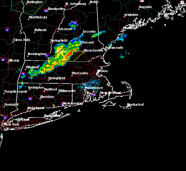 At 616 pm edt, doppler radar indicated a line of severe thunderstorms capable of producing damaging winds in excess of 60 mph. these storms were located along a line extending from near new boston to royalston, moving east at 30 mph. locations impacted include, merrimack, jaffrey, bedford, milford, amherst, peterborough, rindge, new boston, new ipswich, brookline, wilton, mont vernon, fitzwilliam, greenville, greenfield, lyndeborough, hancock, dublin, francestown and bennington. At 616 pm edt, doppler radar indicated a line of severe thunderstorms capable of producing damaging winds in excess of 60 mph. these storms were located along a line extending from near new boston to royalston, moving east at 30 mph. locations impacted include, merrimack, jaffrey, bedford, milford, amherst, peterborough, rindge, new boston, new ipswich, brookline, wilton, mont vernon, fitzwilliam, greenville, greenfield, lyndeborough, hancock, dublin, francestown and bennington.
|
| 7/1/2015 5:52 PM EDT |
 At 552 pm edt, doppler radar indicated a line of severe thunderstorms capable of producing damaging winds in excess of 60 mph. these storms were located along a line extending from bennington to near warwick, and moving east at 30 mph. At 552 pm edt, doppler radar indicated a line of severe thunderstorms capable of producing damaging winds in excess of 60 mph. these storms were located along a line extending from bennington to near warwick, and moving east at 30 mph.
|
| 5/28/2015 4:08 PM EDT | At 408 pm edt, doppler radar indicated a severe thunderstorm capable of producing quarter size hail and damaging winds in excess of 60 mph. this storm was located over amherst, or over merrimack, moving east at 35 mph. locations impacted include, nashua, merrimack, bedford, milford, amherst, litchfield, hollis, new ipswich, brookline, wilton, mont vernon, greenville, lyndeborough, mason and londonderry. |
| 5/28/2015 3:49 PM EDT | At 349 pm edt, doppler radar indicated a severe thunderstorm capable of producing quarter size hail and damaging winds in excess of 60 mph. this storm was located over wilton, or 12 miles west of merrimack, and moving east at 40 mph. |
Hail Maps for Pinardville, NH


Connect with Interactive Hail Maps