

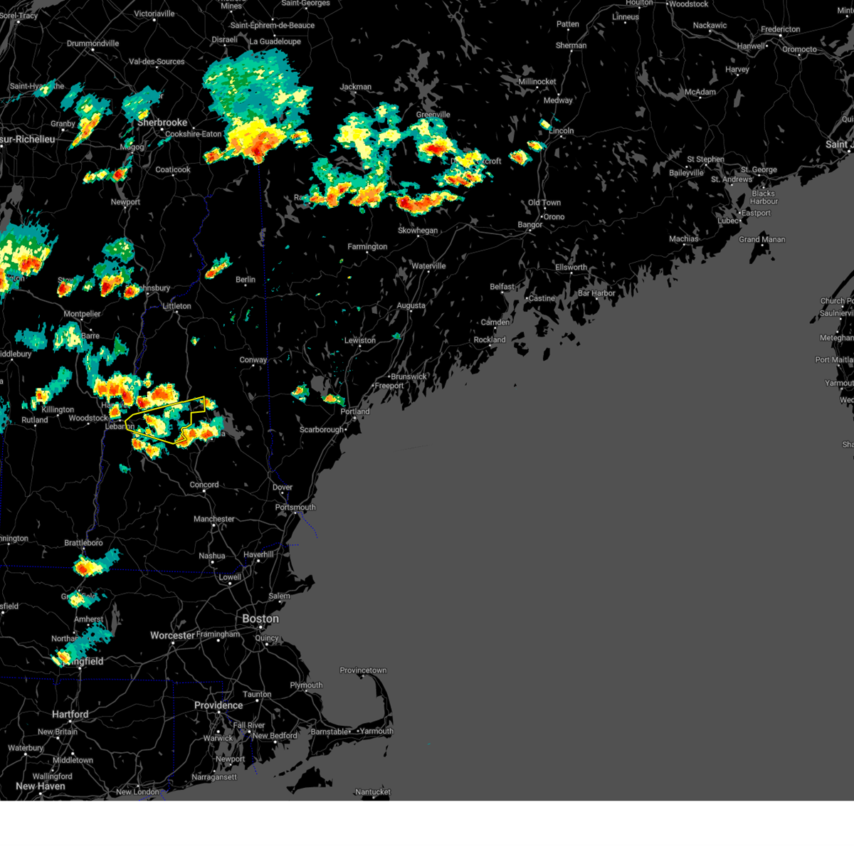
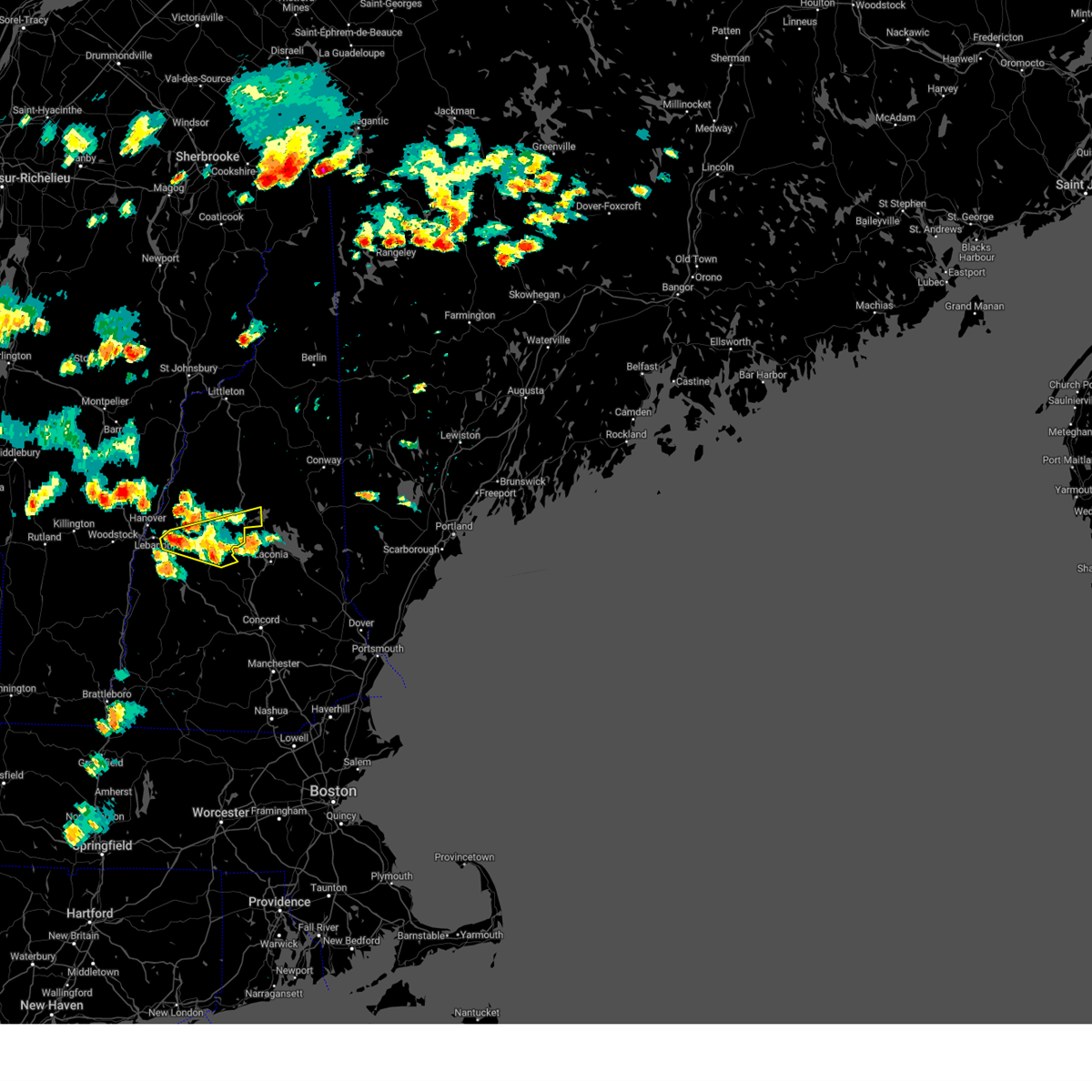
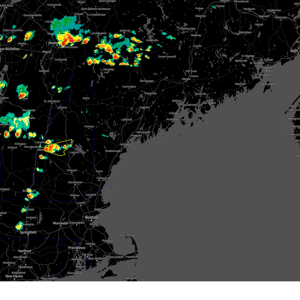
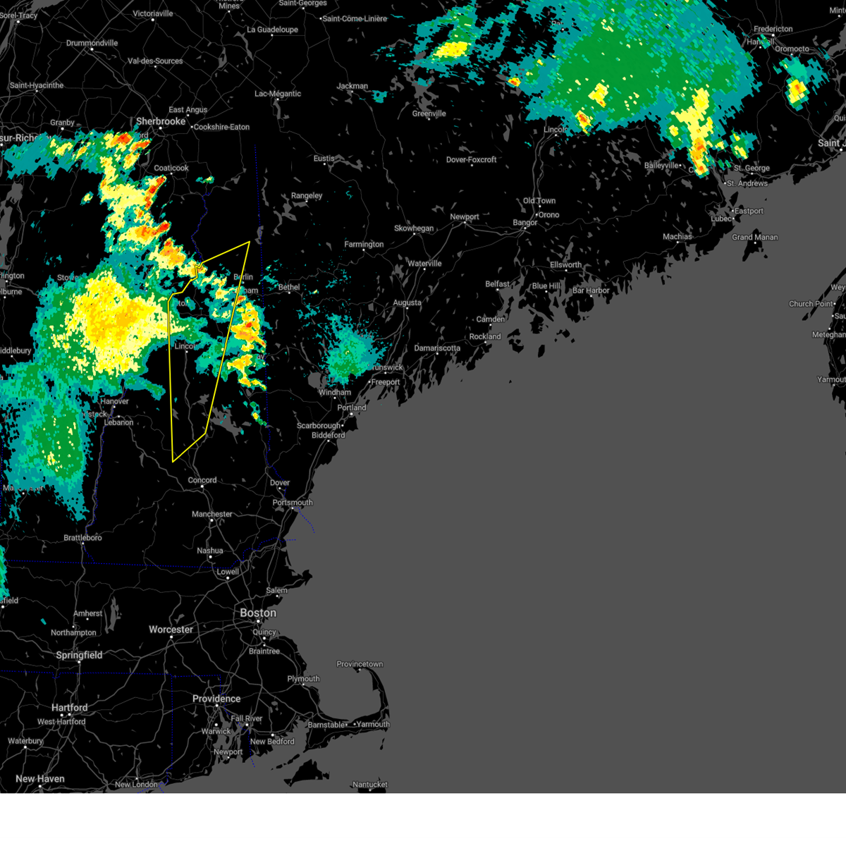
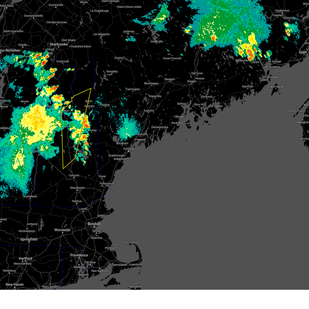
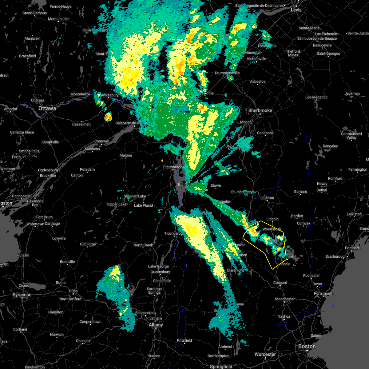
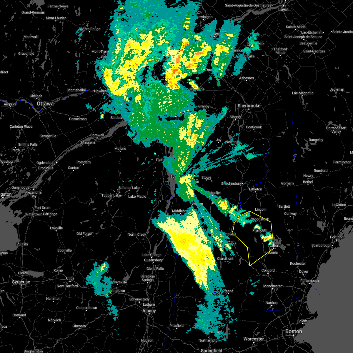
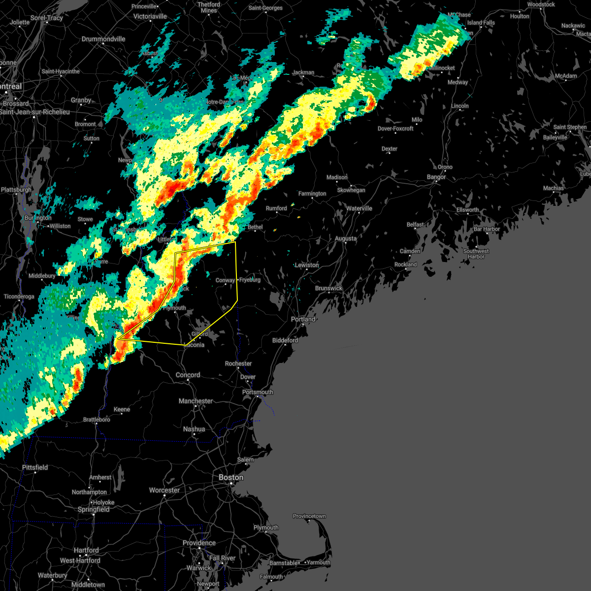
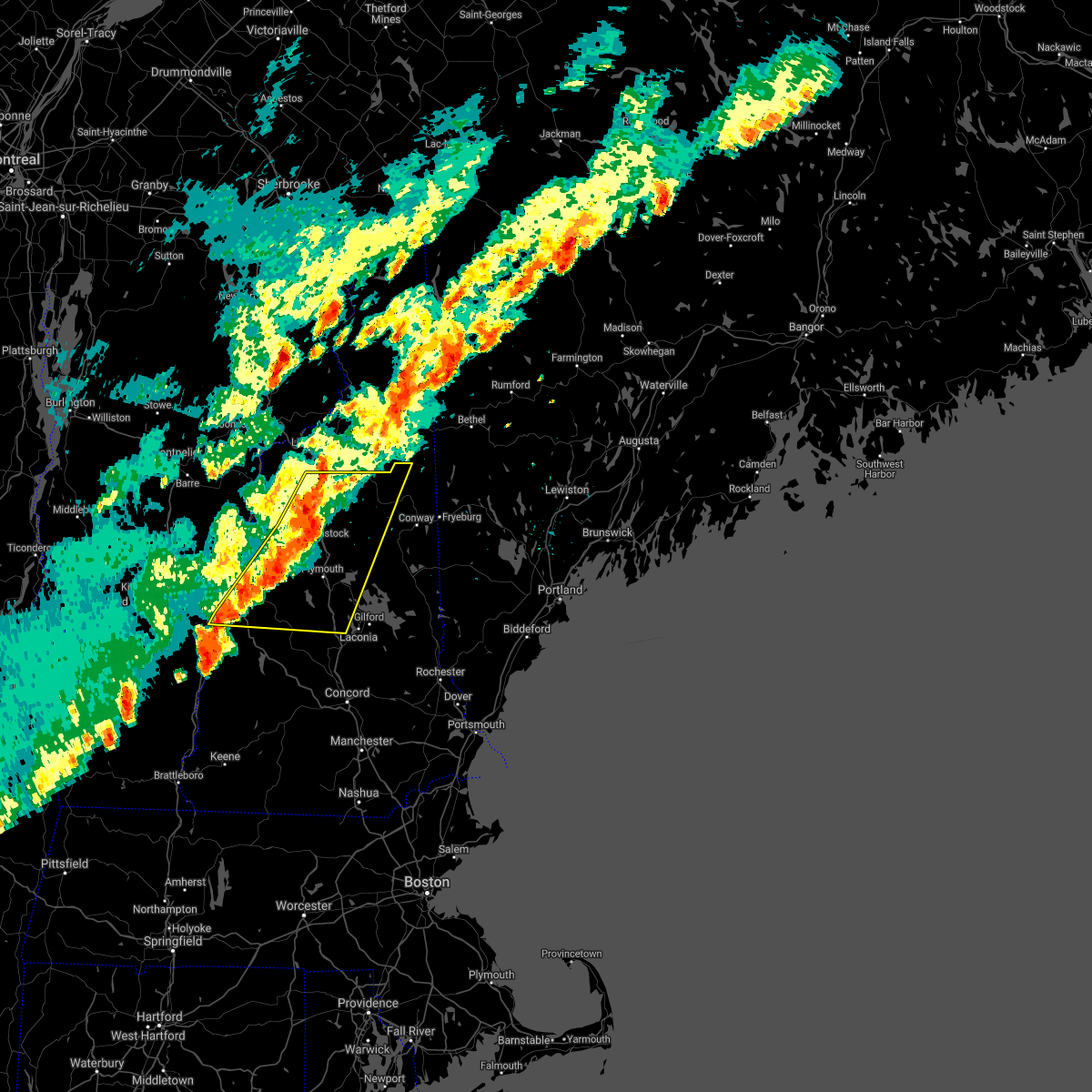
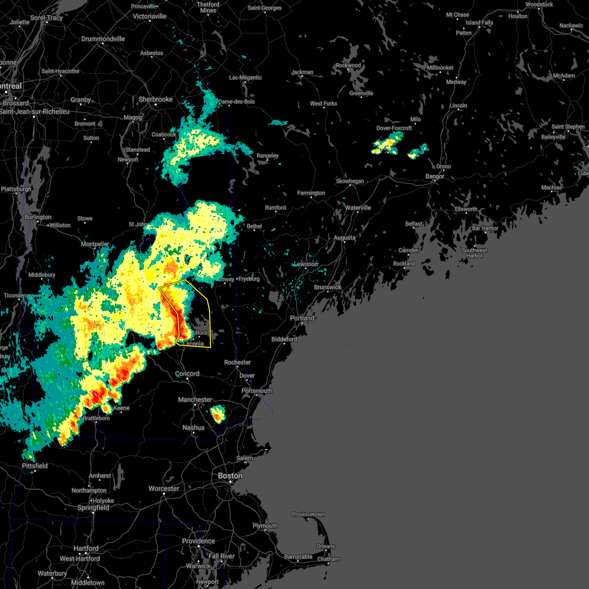
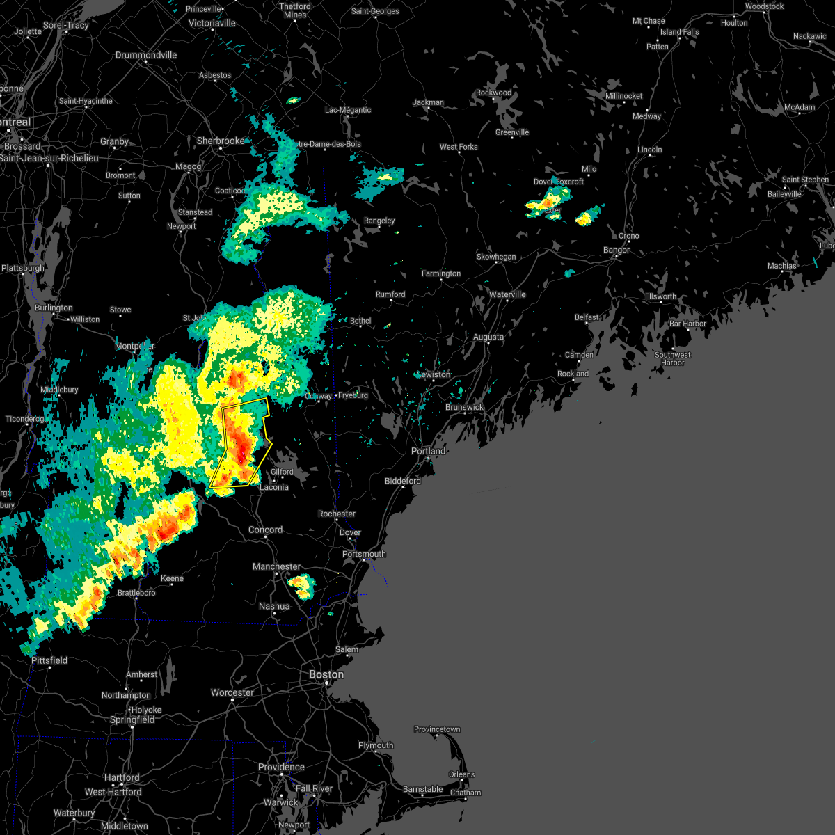
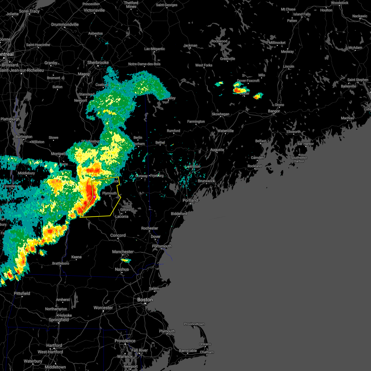
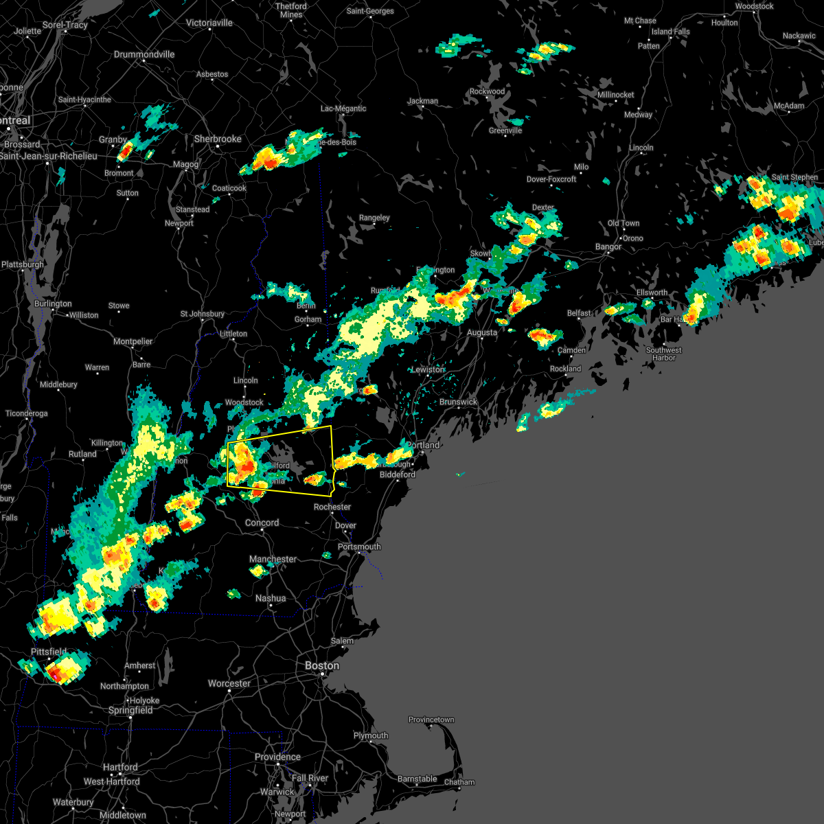
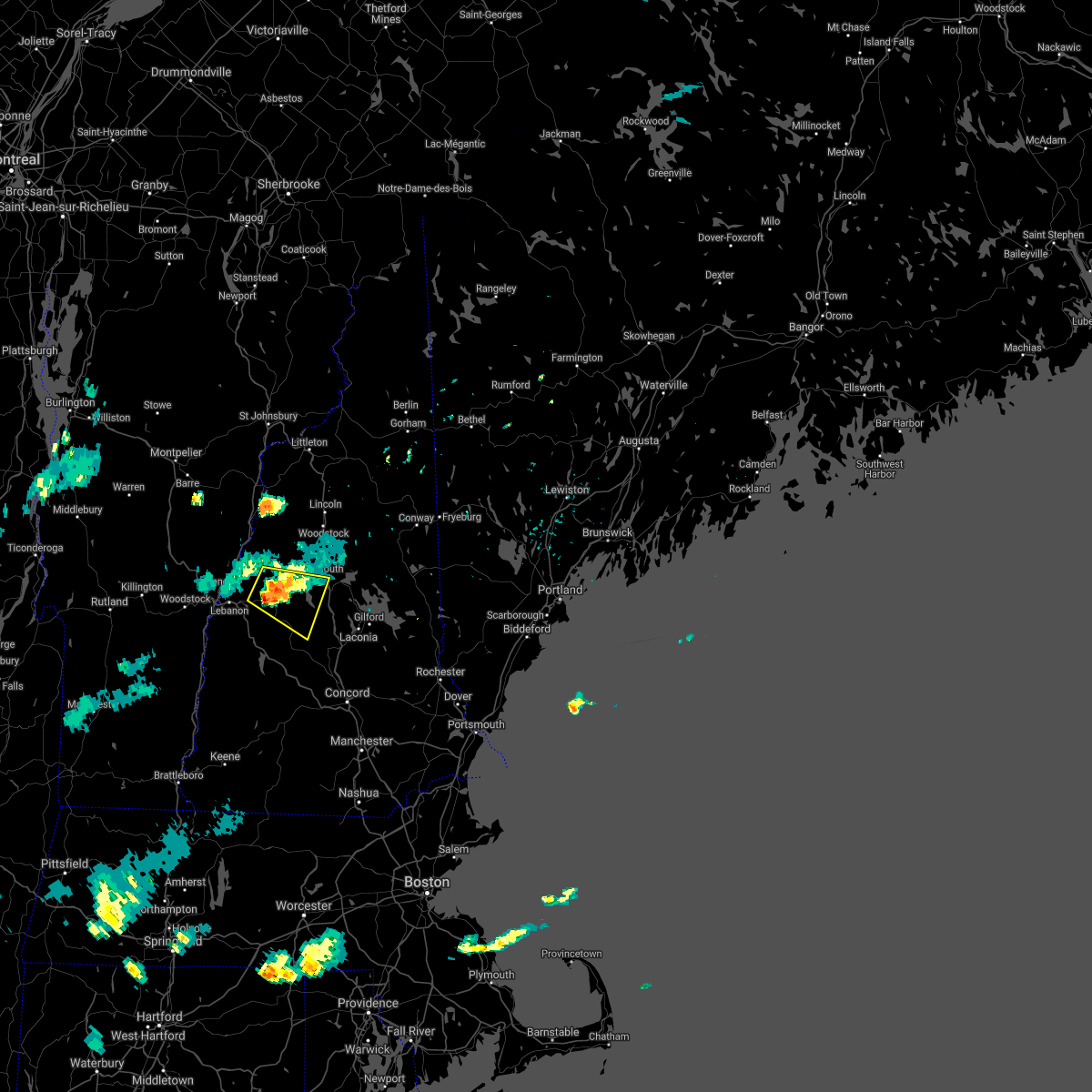
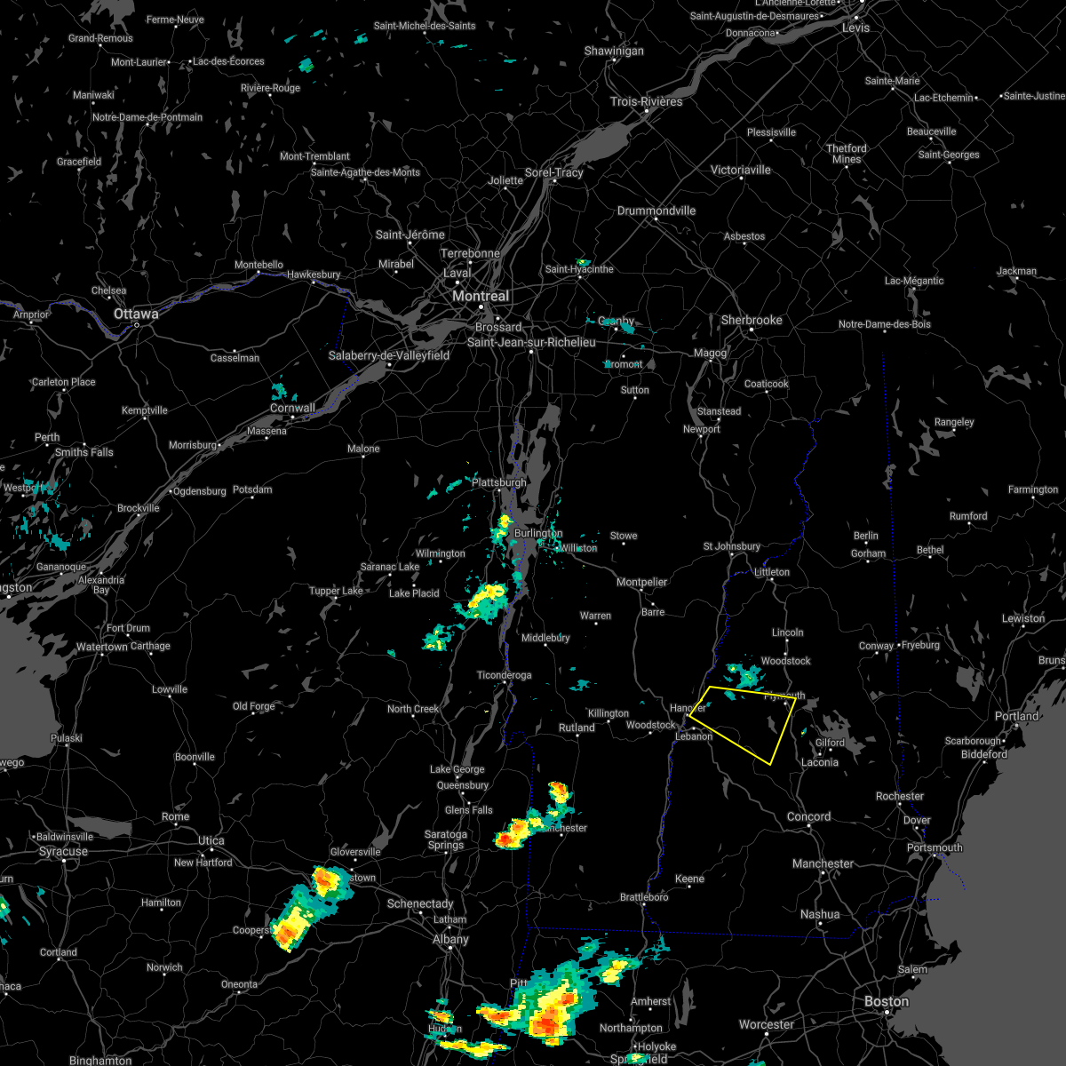
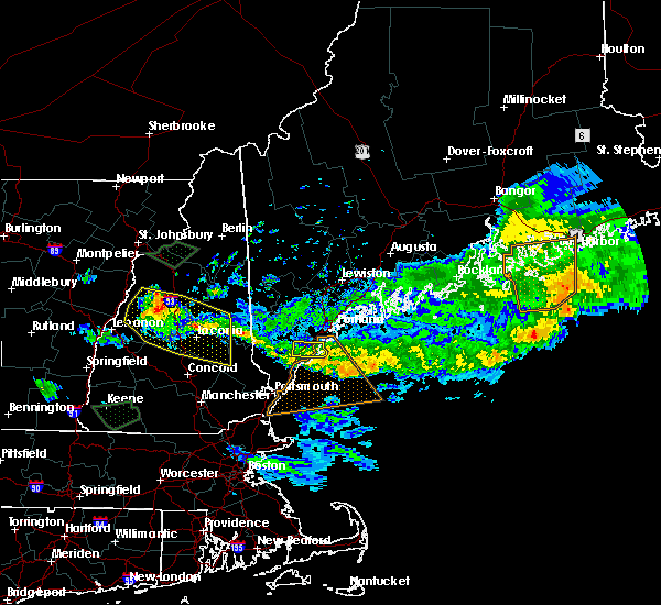
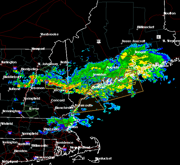
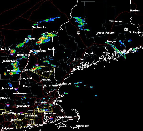
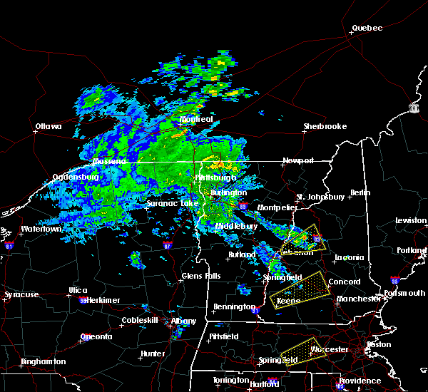
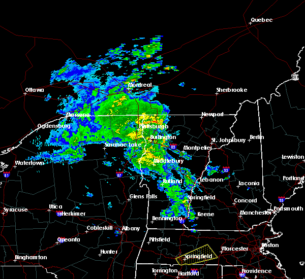
Hail Map for Plymouth, NH
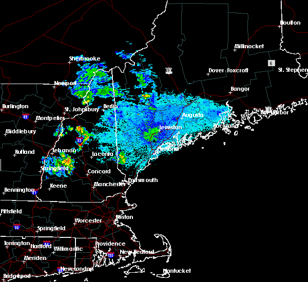
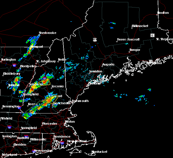
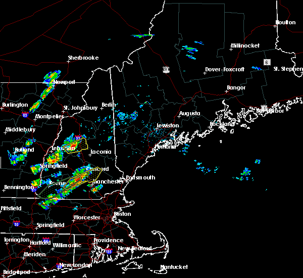
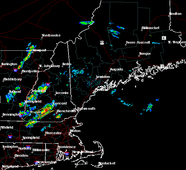
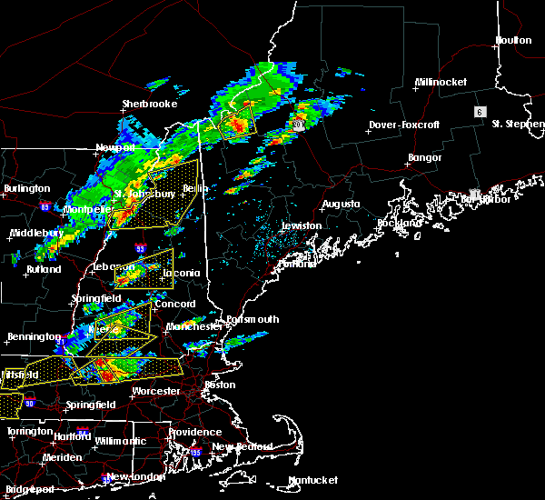
The Plymouth, NH area has had 5 reports of on-the-ground hail by trained spotters, and has been under severe weather warnings 0 times during the past 12 months. Doppler radar has detected hail at or near Plymouth, NH on 15 occasions, including 1 occasion during the past year.
| Name: | Plymouth, NH |
| Where Located: | 72.2 miles W of Portland, ME |
| Map: | Google Map for Plymouth, NH |
| Population: | 4456 |
| Housing Units: | 910 |
| More Info: | Search Google for Plymouth, NH |
1
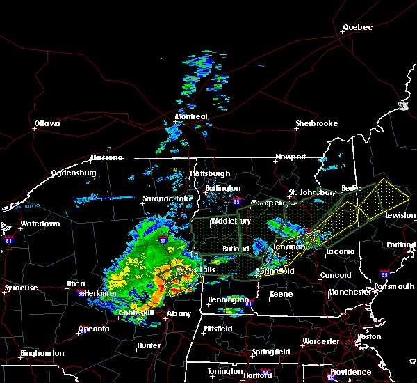
The Top Recent Hail Date for Plymouth, NH is Thursday, August 15, 2024 (5th out of 15)

Hail and Wind Damage Spotted near Plymouth, NH
| Date / Time | Report Details |
|---|---|
| 6/20/2024 3:07 PM EDT |
 the severe thunderstorm warning has been cancelled and is no longer in effect the severe thunderstorm warning has been cancelled and is no longer in effect
|
| 6/20/2024 2:48 PM EDT |
 At 248 pm edt, a severe thunderstorm was located near grafton, or 10 miles southwest of plymouth, moving east at 20 mph (radar indicated). Hazards include 60 mph wind gusts and penny size hail. Expect damage to roofs, siding, and trees. locations impacted include, lebanon, plymouth, grafton, hanover, enfield, canaan, holderness, ashland, danbury, groton, bristol, alexandria, hill, bridgewater, hebron, dorchester, orange, and new hampton. this includes the following highways, interstate 89 between mile markers 50 and 53. Interstate 93 between mile markers 75 and 80. At 248 pm edt, a severe thunderstorm was located near grafton, or 10 miles southwest of plymouth, moving east at 20 mph (radar indicated). Hazards include 60 mph wind gusts and penny size hail. Expect damage to roofs, siding, and trees. locations impacted include, lebanon, plymouth, grafton, hanover, enfield, canaan, holderness, ashland, danbury, groton, bristol, alexandria, hill, bridgewater, hebron, dorchester, orange, and new hampton. this includes the following highways, interstate 89 between mile markers 50 and 53. Interstate 93 between mile markers 75 and 80.
|
| 6/20/2024 2:23 PM EDT |
 Svrgyx the national weather service in gray maine has issued a * severe thunderstorm warning for, southern grafton county in northern new hampshire, north central merrimack county in central new hampshire, * until 330 pm edt. * at 223 pm edt, a severe thunderstorm was located near grafton, or 13 miles southwest of plymouth, moving east at 25 mph (radar indicated). Hazards include 60 mph wind gusts and quarter size hail. Hail damage to vehicles is expected. Expect wind damage to roofs, siding, and trees. Svrgyx the national weather service in gray maine has issued a * severe thunderstorm warning for, southern grafton county in northern new hampshire, north central merrimack county in central new hampshire, * until 330 pm edt. * at 223 pm edt, a severe thunderstorm was located near grafton, or 13 miles southwest of plymouth, moving east at 25 mph (radar indicated). Hazards include 60 mph wind gusts and quarter size hail. Hail damage to vehicles is expected. Expect wind damage to roofs, siding, and trees.
|
| 6/19/2024 4:35 PM EDT | Numerous trees and wires reported down throughout rumney... nh. tree reported leaning on home. time estimated from rada in grafton county NH, 7 miles ESE of Plymouth, NH |
| 9/7/2023 11:57 PM EDT |
 The severe thunderstorm warning for southern coos, eastern grafton, northwestern belknap, north central merrimack and northwestern carroll counties will expire at midnight edt, the storms which prompted the warning have weakened below severe limits, and have exited the warned area. therefore, the warning will be allowed to expire. The severe thunderstorm warning for southern coos, eastern grafton, northwestern belknap, north central merrimack and northwestern carroll counties will expire at midnight edt, the storms which prompted the warning have weakened below severe limits, and have exited the warned area. therefore, the warning will be allowed to expire.
|
| 9/7/2023 11:43 PM EDT |
 At 1140 pm edt, severe thunderstorms were located along a line extending from near lancaster to near holderness, moving northeast at 50 mph (radar indicated). Hazards include 60 mph wind gusts and quarter size hail. Expect wind damage to trees and power lines. Minor hail damage to vehicles is possible. At 1140 pm edt, severe thunderstorms were located along a line extending from near lancaster to near holderness, moving northeast at 50 mph (radar indicated). Hazards include 60 mph wind gusts and quarter size hail. Expect wind damage to trees and power lines. Minor hail damage to vehicles is possible.
|
| 9/7/2023 11:10 PM EDT | Delayed report. tree down on route 49 near dunkin donuts. also... 12 inch diameter tree damaged the roof of an equipment shed at a local schoo in grafton county NH, 7.7 miles SSW of Plymouth, NH |
| 9/7/2023 11:09 PM EDT |
 At 1108 pm edt, severe thunderstorms were located along a line extending from 6 miles east of haverhill to 7 miles north of warner, moving northeast at 40 mph (radar indicated). Hazards include 60 mph wind gusts and quarter size hail. Expect wind damage to trees and power lines. Minor hail damage to vehicles is possible. At 1108 pm edt, severe thunderstorms were located along a line extending from 6 miles east of haverhill to 7 miles north of warner, moving northeast at 40 mph (radar indicated). Hazards include 60 mph wind gusts and quarter size hail. Expect wind damage to trees and power lines. Minor hail damage to vehicles is possible.
|
| 8/4/2023 6:01 PM EDT |
 At 600 pm edt, a severe thunderstorm was located over grafton, or 8 miles north of new london, moving east at 30 mph (radar indicated). Hazards include 60 mph wind gusts and quarter size hail. Hail damage to vehicles is expected. Expect wind damage to roofs, siding, and trees. At 600 pm edt, a severe thunderstorm was located over grafton, or 8 miles north of new london, moving east at 30 mph (radar indicated). Hazards include 60 mph wind gusts and quarter size hail. Hail damage to vehicles is expected. Expect wind damage to roofs, siding, and trees.
|
| 7/13/2023 8:02 PM EDT |
 At 802 pm edt, severe thunderstorms were located along a line extending from 11 miles west of littleton to 9 miles southwest of lebanon, moving northeast at 65 mph (radar indicated). Hazards include 60 mph wind gusts. expect damage to roofs, siding, and trees At 802 pm edt, severe thunderstorms were located along a line extending from 11 miles west of littleton to 9 miles southwest of lebanon, moving northeast at 65 mph (radar indicated). Hazards include 60 mph wind gusts. expect damage to roofs, siding, and trees
|
| 12/23/2022 5:18 PM EST |
 At 518 pm est, severe thunderstorms were located along a line extending from 11 miles west of piermont to near canterbury to 7 miles southwest of seabrook, moving northeast at 45 mph (radar indicated). Hazards include 70 mph wind gusts. Expect considerable tree damage. Damage is likely to mobile homes, roofs, and outbuildings. At 518 pm est, severe thunderstorms were located along a line extending from 11 miles west of piermont to near canterbury to 7 miles southwest of seabrook, moving northeast at 45 mph (radar indicated). Hazards include 70 mph wind gusts. Expect considerable tree damage. Damage is likely to mobile homes, roofs, and outbuildings.
|
| 8/26/2022 3:06 PM EDT | The severe thunderstorm warning for northern sullivan, south central grafton, northwestern belknap and northwestern merrimack counties will expire at 315 pm edt, the storms which prompted the warning have weakened below severe limits, and no longer pose an immediate threat to life or property. therefore, the warning will be allowed to expire. however heavy rain is still possible with these thunderstorms. a severe thunderstorm watch remains in effect until 800 pm edt for central and northern new hampshire. |
| 8/26/2022 2:27 PM EDT | At 227 pm edt, severe thunderstorms were located along a line extending from 6 miles northeast of claremont to near new london to bradford, moving northeast at 60 mph (radar indicated). Hazards include 60 mph wind gusts and nickel size hail. expect damage to roofs, siding, and trees |
| 8/26/2022 2:13 PM EDT | The severe thunderstorm warning for southeastern grafton, northwestern belknap and northwestern carroll counties will expire at 215 pm edt, the storms which prompted the warning have moved out of the area. therefore, the warning will be allowed to expire. however heavy rain is still possible with these thunderstorms. a severe thunderstorm watch remains in effect until 800 pm edt for central and northern new hampshire. |
| 8/26/2022 1:38 PM EDT | At 138 pm edt, severe thunderstorms were located along a line extending from near woodstock to near groton, moving east at 30 mph (radar indicated). Hazards include 60 mph wind gusts and quarter size hail. Hail damage to vehicles is expected. expect wind damage to roofs, siding, and trees. locations impacted include, lincoln, plymouth, meredith, moultonborough, grafton, holderness, ashland, groton, woodstock, sandwich, bristol, center harber, hebron, benton, dorchester, ellsworth, thornton, livermore, rumney and campton. This includes interstate 93 between mile markers 68 and 102. |
| 8/26/2022 1:28 PM EDT | Tree reported down on wires off of ranch rd. time approximated from rada in grafton county NH, 10.7 miles SE of Plymouth, NH |
| 8/26/2022 1:24 PM EDT | At 123 pm edt, severe thunderstorms were located along a line extending from 10 miles southeast of piermont to canaan, moving east at 25 mph (radar indicated). Hazards include 60 mph wind gusts and nickel size hail. expect damage to roofs, siding, and trees |
| 7/21/2022 2:48 PM EDT |
 At 247 pm edt, severe thunderstorms were located along a line extending from near groton to near grafton, moving northeast at 25 mph (radar indicated). Hazards include ping pong ball size hail and 60 mph wind gusts. People and animals outdoors will be injured. expect hail damage to roofs, siding, windows, and vehicles. expect wind damage to roofs, siding, and trees. locations impacted include, laconia, franklin, plymouth, meredith, moultonborough, grafton, alton, gilmanton, holderness, ashland, danbury, groton, sandwich, belmont, gilford, bristol, andover, alexandria, center harber and hill. this includes interstate 93 between mile markers 58 and 80. hail threat, radar indicated max hail size, 1. 50 in wind threat, radar indicated max wind gust, 60 mph. At 247 pm edt, severe thunderstorms were located along a line extending from near groton to near grafton, moving northeast at 25 mph (radar indicated). Hazards include ping pong ball size hail and 60 mph wind gusts. People and animals outdoors will be injured. expect hail damage to roofs, siding, windows, and vehicles. expect wind damage to roofs, siding, and trees. locations impacted include, laconia, franklin, plymouth, meredith, moultonborough, grafton, alton, gilmanton, holderness, ashland, danbury, groton, sandwich, belmont, gilford, bristol, andover, alexandria, center harber and hill. this includes interstate 93 between mile markers 58 and 80. hail threat, radar indicated max hail size, 1. 50 in wind threat, radar indicated max wind gust, 60 mph.
|
| 7/21/2022 2:40 PM EDT | Non-nws meteorologist reported tree down on interstate 93. time estimated by rada in belknap county NH, 5.6 miles NNW of Plymouth, NH |
| 7/21/2022 2:23 PM EDT |
 At 223 pm edt, severe thunderstorms were located along a line extending from near grafton to 6 miles northeast of newport, moving northeast at 25 mph (radar indicated). Hazards include ping pong ball size hail and 60 mph wind gusts. People and animals outdoors will be injured. expect hail damage to roofs, siding, windows, and vehicles. Expect wind damage to roofs, siding, and trees. At 223 pm edt, severe thunderstorms were located along a line extending from near grafton to 6 miles northeast of newport, moving northeast at 25 mph (radar indicated). Hazards include ping pong ball size hail and 60 mph wind gusts. People and animals outdoors will be injured. expect hail damage to roofs, siding, windows, and vehicles. Expect wind damage to roofs, siding, and trees.
|
| 7/21/2022 2:15 PM EDT |
 At 214 pm edt, severe thunderstorms were located along a line extending from grafton to near newport, moving northeast at 25 mph (radar indicated). Hazards include golf ball size hail and 60 mph wind gusts. People and animals outdoors will be injured. expect hail damage to roofs, siding, windows, and vehicles. expect wind damage to roofs, siding, and trees. locations impacted include, claremont, franklin, new london, plymouth, grafton, enfield, canaan, danbury, groton, newport, bristol, grantham, andover, cornish, hill, croydon, hebron, orange, wilmot and sunapee. This includes interstate 89 between mile markers 31 and 50. At 214 pm edt, severe thunderstorms were located along a line extending from grafton to near newport, moving northeast at 25 mph (radar indicated). Hazards include golf ball size hail and 60 mph wind gusts. People and animals outdoors will be injured. expect hail damage to roofs, siding, windows, and vehicles. expect wind damage to roofs, siding, and trees. locations impacted include, claremont, franklin, new london, plymouth, grafton, enfield, canaan, danbury, groton, newport, bristol, grantham, andover, cornish, hill, croydon, hebron, orange, wilmot and sunapee. This includes interstate 89 between mile markers 31 and 50.
|
| 7/21/2022 2:11 PM EDT |
 At 211 pm edt, severe thunderstorms were located along a line extending from near grafton to near newport, moving northeast at 20 mph (radar indicated). Hazards include 60 mph wind gusts and half dollar size hail. Hail damage to vehicles is expected. expect wind damage to roofs, siding, and trees. locations impacted include, claremont, franklin, new london, plymouth, grafton, enfield, canaan, danbury, groton, newport, bristol, grantham, andover, cornish, hill, croydon, hebron, orange, wilmot and sunapee. This includes interstate 89 between mile markers 31 and 50. At 211 pm edt, severe thunderstorms were located along a line extending from near grafton to near newport, moving northeast at 20 mph (radar indicated). Hazards include 60 mph wind gusts and half dollar size hail. Hail damage to vehicles is expected. expect wind damage to roofs, siding, and trees. locations impacted include, claremont, franklin, new london, plymouth, grafton, enfield, canaan, danbury, groton, newport, bristol, grantham, andover, cornish, hill, croydon, hebron, orange, wilmot and sunapee. This includes interstate 89 between mile markers 31 and 50.
|
| 7/21/2022 1:37 PM EDT |
 At 137 pm edt, a severe thunderstorm was located 8 miles north of newport, or 10 miles northwest of new london, moving east at 30 mph (radar indicated). Hazards include 60 mph wind gusts and quarter size hail. Hail damage to vehicles is expected. expect wind damage to roofs, siding, and trees. locations impacted include, claremont, lebanon, franklin, new london, plymouth, grafton, enfield, canaan, danbury, groton, newport, bristol, grantham, andover, cornish, hill, croydon, hebron, plainfield and orange. This includes interstate 89 between mile markers 31 and 51. At 137 pm edt, a severe thunderstorm was located 8 miles north of newport, or 10 miles northwest of new london, moving east at 30 mph (radar indicated). Hazards include 60 mph wind gusts and quarter size hail. Hail damage to vehicles is expected. expect wind damage to roofs, siding, and trees. locations impacted include, claremont, lebanon, franklin, new london, plymouth, grafton, enfield, canaan, danbury, groton, newport, bristol, grantham, andover, cornish, hill, croydon, hebron, plainfield and orange. This includes interstate 89 between mile markers 31 and 51.
|
| 7/21/2022 1:33 PM EDT |
 At 132 pm edt, a severe thunderstorm was located 7 miles north of newport, or 8 miles northeast of claremont, moving east at 30 mph (radar indicated). Hazards include 60 mph wind gusts and quarter size hail. Hail damage to vehicles is expected. Expect wind damage to roofs, siding, and trees. At 132 pm edt, a severe thunderstorm was located 7 miles north of newport, or 8 miles northeast of claremont, moving east at 30 mph (radar indicated). Hazards include 60 mph wind gusts and quarter size hail. Hail damage to vehicles is expected. Expect wind damage to roofs, siding, and trees.
|
| 7/12/2022 4:30 PM EDT | Tree dow in grafton county NH, 0.3 miles SSW of Plymouth, NH |
| 7/12/2022 4:24 PM EDT |
 At 422 pm edt, severe thunderstorms were located along a line extending from plymouth to near hillsborough, moving east at 40 mph (trained weather spotters. these storms have a history of producing damaging winds). Hazards include 60 mph wind gusts and quarter size hail. Hail damage to vehicles is expected. Expect wind damage to roofs, siding, and trees. At 422 pm edt, severe thunderstorms were located along a line extending from plymouth to near hillsborough, moving east at 40 mph (trained weather spotters. these storms have a history of producing damaging winds). Hazards include 60 mph wind gusts and quarter size hail. Hail damage to vehicles is expected. Expect wind damage to roofs, siding, and trees.
|
| 7/12/2022 4:09 PM EDT |
 At 409 pm edt, severe thunderstorms were located along a line extending from 10 miles northwest of groton to near marlow, moving east at 40 mph (radar indicated). Hazards include 60 mph wind gusts and quarter size hail. Hail damage to vehicles is expected. expect wind damage to roofs, siding, and trees. locations impacted include, claremont, henniker, new london, plymouth, grafton, hanover, charlestown, enfield, canaan, holderness, ashland, bradford, danbury, groton, newport, warner, marlow, alstead, woodstock and hillsborough. this includes the following highways, interstate 89 between mile markers 19 and 49. interstate 93 between mile markers 78 and 93. hail threat, radar indicated max hail size, 1. 00 in wind threat, radar indicated max wind gust, 60 mph. At 409 pm edt, severe thunderstorms were located along a line extending from 10 miles northwest of groton to near marlow, moving east at 40 mph (radar indicated). Hazards include 60 mph wind gusts and quarter size hail. Hail damage to vehicles is expected. expect wind damage to roofs, siding, and trees. locations impacted include, claremont, henniker, new london, plymouth, grafton, hanover, charlestown, enfield, canaan, holderness, ashland, bradford, danbury, groton, newport, warner, marlow, alstead, woodstock and hillsborough. this includes the following highways, interstate 89 between mile markers 19 and 49. interstate 93 between mile markers 78 and 93. hail threat, radar indicated max hail size, 1. 00 in wind threat, radar indicated max wind gust, 60 mph.
|
| 7/12/2022 3:46 PM EDT |
 At 345 pm edt, severe thunderstorms were located along a line extending from 10 miles southwest of piermont to near charlestown, moving east at 40 mph (radar indicated). Hazards include 60 mph wind gusts and quarter size hail. Hail damage to vehicles is expected. expect wind damage to roofs, siding, and trees. locations impacted include, claremont, lebanon, henniker, new london, plymouth, grafton, hanover, charlestown, enfield, canaan, holderness, ashland, bradford, danbury, groton, newport, warner, marlow, piermont and alstead. this includes the following highways, interstate 89 between mile markers 19 and 60. interstate 93 between mile markers 78 and 93. hail threat, radar indicated max hail size, 1. 00 in wind threat, radar indicated max wind gust, 60 mph. At 345 pm edt, severe thunderstorms were located along a line extending from 10 miles southwest of piermont to near charlestown, moving east at 40 mph (radar indicated). Hazards include 60 mph wind gusts and quarter size hail. Hail damage to vehicles is expected. expect wind damage to roofs, siding, and trees. locations impacted include, claremont, lebanon, henniker, new london, plymouth, grafton, hanover, charlestown, enfield, canaan, holderness, ashland, bradford, danbury, groton, newport, warner, marlow, piermont and alstead. this includes the following highways, interstate 89 between mile markers 19 and 60. interstate 93 between mile markers 78 and 93. hail threat, radar indicated max hail size, 1. 00 in wind threat, radar indicated max wind gust, 60 mph.
|
| 7/12/2022 3:32 PM EDT |
 At 331 pm edt, severe thunderstorms were located along a line extending from 13 miles northwest of hanover to 11 miles west of charlestown, moving east at 40 mph (radar indicated). Hazards include 60 mph wind gusts and nickel size hail. expect damage to roofs, siding, and trees At 331 pm edt, severe thunderstorms were located along a line extending from 13 miles northwest of hanover to 11 miles west of charlestown, moving east at 40 mph (radar indicated). Hazards include 60 mph wind gusts and nickel size hail. expect damage to roofs, siding, and trees
|
| 5/16/2022 7:51 PM EDT |
 The severe thunderstorm warning for southern grafton, northwestern belknap, north central merrimack and west central carroll counties will expire at 800 pm edt, the storms which prompted the warning have weakened below severe limits, and have exited the warned area. therefore, the warning will be allowed to expire. however gusty winds are still possible with these thunderstorms. a severe thunderstorm watch remains in effect until 1100 pm edt for central and northern new hampshire. The severe thunderstorm warning for southern grafton, northwestern belknap, north central merrimack and west central carroll counties will expire at 800 pm edt, the storms which prompted the warning have weakened below severe limits, and have exited the warned area. therefore, the warning will be allowed to expire. however gusty winds are still possible with these thunderstorms. a severe thunderstorm watch remains in effect until 1100 pm edt for central and northern new hampshire.
|
| 5/16/2022 7:31 PM EDT |
 At 731 pm edt, severe thunderstorms were located along a line extending from 7 miles southeast of piermont to holderness to near meredith, moving northeast at 45 mph (radar indicated). Hazards include 60 mph wind gusts. Expect damage to roofs, siding, and trees. locations impacted include, laconia, franklin, plymouth, meredith, moultonborough, haverhill, canaan, holderness, ashland, groton, piermont, woodstock, sandwich, belmont, gilford, bristol, andover, lyme, alexandria and center harber. this includes interstate 93 between mile markers 59 and 96. hail threat, radar indicated max hail size, <. 75 in wind threat, radar indicated max wind gust, 60 mph. At 731 pm edt, severe thunderstorms were located along a line extending from 7 miles southeast of piermont to holderness to near meredith, moving northeast at 45 mph (radar indicated). Hazards include 60 mph wind gusts. Expect damage to roofs, siding, and trees. locations impacted include, laconia, franklin, plymouth, meredith, moultonborough, haverhill, canaan, holderness, ashland, groton, piermont, woodstock, sandwich, belmont, gilford, bristol, andover, lyme, alexandria and center harber. this includes interstate 93 between mile markers 59 and 96. hail threat, radar indicated max hail size, <. 75 in wind threat, radar indicated max wind gust, 60 mph.
|
| 5/16/2022 7:13 PM EDT |
 At 712 pm edt, severe thunderstorms were located along a line extending from near enfield to near grafton to 6 miles south of danbury, moving northeast at 35 mph (radar indicated). Hazards include 60 mph wind gusts. expect damage to roofs, siding, and trees At 712 pm edt, severe thunderstorms were located along a line extending from near enfield to near grafton to 6 miles south of danbury, moving northeast at 35 mph (radar indicated). Hazards include 60 mph wind gusts. expect damage to roofs, siding, and trees
|
| 9/15/2021 3:45 PM EDT | One tree and power line down on upper mad river r in grafton county NH, 10 miles SSW of Plymouth, NH |
| 9/15/2021 3:22 PM EDT |
 At 322 pm edt, severe thunderstorms were located along a line extending from 7 miles southeast of bethlehem to near lincoln to near plymouth to 8 miles south of enfield, moving east at 25 mph (radar indicated). Hazards include 60 mph wind gusts and penny size hail. expect damage to roofs, siding, and trees At 322 pm edt, severe thunderstorms were located along a line extending from 7 miles southeast of bethlehem to near lincoln to near plymouth to 8 miles south of enfield, moving east at 25 mph (radar indicated). Hazards include 60 mph wind gusts and penny size hail. expect damage to roofs, siding, and trees
|
| 9/15/2021 3:14 PM EDT |
 At 313 pm edt, severe thunderstorms were located along a line extending from 6 miles south of lancaster to near canaan, moving east at 30 mph. the greatest wind threat appears to be near warren through lincoln, including i-93 (radar indicated). Hazards include 70 mph wind gusts and penny size hail. Expect considerable tree damage. damage is likely to mobile homes, roofs, and outbuildings. Locations impacted include, laconia, lebanon, bethlehem, lincoln, plymouth, meredith, moultonborough, grafton, hanover, enfield, canaan, holderness, ashland, danbury, franconia, groton, woodstock, sandwich, piermont and tamworth. At 313 pm edt, severe thunderstorms were located along a line extending from 6 miles south of lancaster to near canaan, moving east at 30 mph. the greatest wind threat appears to be near warren through lincoln, including i-93 (radar indicated). Hazards include 70 mph wind gusts and penny size hail. Expect considerable tree damage. damage is likely to mobile homes, roofs, and outbuildings. Locations impacted include, laconia, lebanon, bethlehem, lincoln, plymouth, meredith, moultonborough, grafton, hanover, enfield, canaan, holderness, ashland, danbury, franconia, groton, woodstock, sandwich, piermont and tamworth.
|
| 9/15/2021 2:31 PM EDT |
 At 231 pm edt, severe thunderstorms were located along a line extending from 8 miles west of littleton to near lebanon, moving east at 30 mph (radar indicated). Hazards include 60 mph wind gusts and nickel size hail. expect damage to roofs, siding, and trees At 231 pm edt, severe thunderstorms were located along a line extending from 8 miles west of littleton to near lebanon, moving east at 30 mph (radar indicated). Hazards include 60 mph wind gusts and nickel size hail. expect damage to roofs, siding, and trees
|
| 7/20/2021 10:10 PM EDT |
 At 1010 pm edt, severe thunderstorms were located along a line extending from 10 miles southwest of woodstock to plymouth to 9 miles south of ashland to near franklin, moving east at 25 mph (radar indicated). Hazards include 60 mph wind gusts and quarter size hail. Hail damage to vehicles is expected. Expect wind damage to roofs, siding, and trees. At 1010 pm edt, severe thunderstorms were located along a line extending from 10 miles southwest of woodstock to plymouth to 9 miles south of ashland to near franklin, moving east at 25 mph (radar indicated). Hazards include 60 mph wind gusts and quarter size hail. Hail damage to vehicles is expected. Expect wind damage to roofs, siding, and trees.
|
| 7/20/2021 10:03 PM EDT |
 At 1002 pm edt, severe thunderstorms were located along a line extending from near woodstock to plymouth to danbury, moving east at 30 mph (radar indicated). Hazards include 60 mph wind gusts and quarter size hail. Hail damage to vehicles is expected. expect wind damage to roofs, siding, and trees. locations impacted include, franklin, plymouth, meredith, moultonborough, grafton, holderness, ashland, danbury, groton, woodstock, sandwich, bristol, center harber, hill, hebron, ellsworth, thornton, rumney, campton and new hampton. this also includes, rumney rocks, squam lake, carr mountain, stinson mountain, and mount tecumseh. This includes interstate 93 between mile markers 66 and 96. At 1002 pm edt, severe thunderstorms were located along a line extending from near woodstock to plymouth to danbury, moving east at 30 mph (radar indicated). Hazards include 60 mph wind gusts and quarter size hail. Hail damage to vehicles is expected. expect wind damage to roofs, siding, and trees. locations impacted include, franklin, plymouth, meredith, moultonborough, grafton, holderness, ashland, danbury, groton, woodstock, sandwich, bristol, center harber, hill, hebron, ellsworth, thornton, rumney, campton and new hampton. this also includes, rumney rocks, squam lake, carr mountain, stinson mountain, and mount tecumseh. This includes interstate 93 between mile markers 66 and 96.
|
| 7/20/2021 10:00 PM EDT | Quarter sized hail reported 7.8 miles ENE of Plymouth, NH |
| 7/20/2021 9:35 PM EDT |
 At 935 pm edt, severe thunderstorms were located along a line extending from 8 miles southeast of piermont to near groton to 6 miles south of enfield, moving east at 30 mph (radar indicated). Hazards include 60 mph wind gusts and quarter size hail. Hail damage to vehicles is expected. Expect wind damage to roofs, siding, and trees. At 935 pm edt, severe thunderstorms were located along a line extending from 8 miles southeast of piermont to near groton to 6 miles south of enfield, moving east at 30 mph (radar indicated). Hazards include 60 mph wind gusts and quarter size hail. Hail damage to vehicles is expected. Expect wind damage to roofs, siding, and trees.
|
| 6/30/2021 4:01 PM EDT |
 At 400 pm edt, a severe thunderstorm was located near laconia, moving east at 50 mph (radar indicated). Hazards include 60 mph wind gusts and nickel size hail. expect damage to roofs, siding, and trees At 400 pm edt, a severe thunderstorm was located near laconia, moving east at 50 mph (radar indicated). Hazards include 60 mph wind gusts and nickel size hail. expect damage to roofs, siding, and trees
|
| 6/29/2021 6:31 PM EDT |
 At 631 pm edt, a severe thunderstorm was located over canaan, or 14 miles east of lebanon, moving east at 30 mph (radar indicated). Hazards include 60 mph wind gusts and quarter size hail. Hail damage to vehicles is expected. expect wind damage to roofs, siding, and trees. locations impacted include, plymouth, grafton, enfield, canaan, holderness, ashland, danbury, groton, bristol, lyme, hill, hebron, dorchester and orange. This includes interstate 93 between mile markers 78 and 79. At 631 pm edt, a severe thunderstorm was located over canaan, or 14 miles east of lebanon, moving east at 30 mph (radar indicated). Hazards include 60 mph wind gusts and quarter size hail. Hail damage to vehicles is expected. expect wind damage to roofs, siding, and trees. locations impacted include, plymouth, grafton, enfield, canaan, holderness, ashland, danbury, groton, bristol, lyme, hill, hebron, dorchester and orange. This includes interstate 93 between mile markers 78 and 79.
|
| 6/29/2021 6:12 PM EDT |
 At 611 pm edt, a severe thunderstorm was located near enfield, or 8 miles northeast of lebanon, moving southeast at 30 mph (radar indicated). Hazards include 60 mph wind gusts and quarter size hail. Hail damage to vehicles is expected. Expect wind damage to roofs, siding, and trees. At 611 pm edt, a severe thunderstorm was located near enfield, or 8 miles northeast of lebanon, moving southeast at 30 mph (radar indicated). Hazards include 60 mph wind gusts and quarter size hail. Hail damage to vehicles is expected. Expect wind damage to roofs, siding, and trees.
|
| 5/26/2021 5:52 PM EDT |
 At 550 pm edt, severe thunderstorms were located along a line extending from near sandwich to near danbury to near new london to near bradford, moving east at 55 mph (radar indicated). Hazards include 60 mph wind gusts. this storm has already produced damaging winds in several towns. expect damage to roofs, siding, and trees At 550 pm edt, severe thunderstorms were located along a line extending from near sandwich to near danbury to near new london to near bradford, moving east at 55 mph (radar indicated). Hazards include 60 mph wind gusts. this storm has already produced damaging winds in several towns. expect damage to roofs, siding, and trees
|
| 5/26/2021 5:36 PM EDT |
 At 536 pm edt, a severe thunderstorm was located near grafton, or 8 miles north of new london, moving east at 45 mph (radar indicated). Hazards include 60 mph wind gusts. Expect damage to roofs, siding, and trees. locations impacted include, claremont, lebanon, franklin, new london, plymouth, grafton, hanover, charlestown, enfield, canaan, holderness, ashland, danbury, groton, newport, warner, bristol, grantham, andover and cornish. this also includes, mount kearsage. this includes the following highways, interstate 89 between mile markers 26 and 59. Interstate 93 between mile markers 73 and 83. At 536 pm edt, a severe thunderstorm was located near grafton, or 8 miles north of new london, moving east at 45 mph (radar indicated). Hazards include 60 mph wind gusts. Expect damage to roofs, siding, and trees. locations impacted include, claremont, lebanon, franklin, new london, plymouth, grafton, hanover, charlestown, enfield, canaan, holderness, ashland, danbury, groton, newport, warner, bristol, grantham, andover and cornish. this also includes, mount kearsage. this includes the following highways, interstate 89 between mile markers 26 and 59. Interstate 93 between mile markers 73 and 83.
|
| 5/26/2021 5:07 PM EDT |
 At 507 pm edt, severe thunderstorms were located along a line extending from near hanover to 6 miles west of claremont, moving east at 50 mph (radar indicated). Hazards include 60 mph wind gusts. expect damage to roofs, siding, and trees At 507 pm edt, severe thunderstorms were located along a line extending from near hanover to 6 miles west of claremont, moving east at 50 mph (radar indicated). Hazards include 60 mph wind gusts. expect damage to roofs, siding, and trees
|
| 7/8/2020 7:54 PM EDT |
 At 753 pm edt, a severe thunderstorm was located near rumney, moving southeast at 35 mph (radar indicated). Hazards include 60 mph wind gusts and quarter size hail. Hail damage to vehicles is expected. expect wind damage to roofs, siding, and trees. locations impacted include, laconia, moultonborough, plymouth, meredith, alton, canaan, holderness, ashland, groton, sandwich, woodstock, belmont, gilford, bristol, alexandria, center harber, bridgewater, hebron, benton and dorchester. this also includes, lake winnipesaukee, rumney rocks, squam lake, carr mountain, and stinson mountain. This includes interstate 93 between mile markers 66 and 96. At 753 pm edt, a severe thunderstorm was located near rumney, moving southeast at 35 mph (radar indicated). Hazards include 60 mph wind gusts and quarter size hail. Hail damage to vehicles is expected. expect wind damage to roofs, siding, and trees. locations impacted include, laconia, moultonborough, plymouth, meredith, alton, canaan, holderness, ashland, groton, sandwich, woodstock, belmont, gilford, bristol, alexandria, center harber, bridgewater, hebron, benton and dorchester. this also includes, lake winnipesaukee, rumney rocks, squam lake, carr mountain, and stinson mountain. This includes interstate 93 between mile markers 66 and 96.
|
| 7/8/2020 7:35 PM EDT |
 At 735 pm edt, a severe thunderstorm was located near meredith, moving southeast at 15 mph. another severe thunderstorm was located near wentworth, also moving southeast at 15 mph (radar indicated). Hazards include 60 mph wind gusts and quarter size hail. Hail damage to vehicles is expected. expect wind damage to roofs, siding, and trees. locations impacted include, laconia, franklin, moultonborough, plymouth, meredith, ossipee, grafton, hanover, loudon, alton, haverhill, barnstead, canaan, gilmanton, canterbury, holderness, ashland, danbury, groton and wolfeboro. this also includes, lake winnipesaukee, rumney rocks, squam lake, carr mountain, and stinson mountain. This includes interstate 93 between mile markers 55 and 96. At 735 pm edt, a severe thunderstorm was located near meredith, moving southeast at 15 mph. another severe thunderstorm was located near wentworth, also moving southeast at 15 mph (radar indicated). Hazards include 60 mph wind gusts and quarter size hail. Hail damage to vehicles is expected. expect wind damage to roofs, siding, and trees. locations impacted include, laconia, franklin, moultonborough, plymouth, meredith, ossipee, grafton, hanover, loudon, alton, haverhill, barnstead, canaan, gilmanton, canterbury, holderness, ashland, danbury, groton and wolfeboro. this also includes, lake winnipesaukee, rumney rocks, squam lake, carr mountain, and stinson mountain. This includes interstate 93 between mile markers 55 and 96.
|
| 7/8/2020 7:14 PM EDT |
 At 714 pm edt, severe thunderstorms were located along a line extending from near haverhill to 7 miles southeast of piermont to near hanover, moving southeast at 60 mph (radar indicated). Hazards include 60 mph wind gusts and quarter size hail. Hail damage to vehicles is expected. Expect wind damage to roofs, siding, and trees. At 714 pm edt, severe thunderstorms were located along a line extending from near haverhill to 7 miles southeast of piermont to near hanover, moving southeast at 60 mph (radar indicated). Hazards include 60 mph wind gusts and quarter size hail. Hail damage to vehicles is expected. Expect wind damage to roofs, siding, and trees.
|
| 7/8/2020 7:05 PM EDT |
 At 705 pm edt, severe thunderstorms were located along a line extending from near effingham to 6 miles north of holderness, moving southeast at 20 mph (radar indicated). Hazards include 60 mph wind gusts and quarter size hail. Hail damage to vehicles is expected. expect wind damage to roofs, siding, and trees. locations impacted include, plymouth, ossipee, moultonborough, meredith, holderness, ashland, effingham, tamworth, sandwich, wolfeboro, madison, freedom, center harber, bridgewater, eaton, ellsworth, tuftonboro, campton, thornton and rumney. this also includes, squam lake. This includes interstate 93 between mile markers 76 and 91. At 705 pm edt, severe thunderstorms were located along a line extending from near effingham to 6 miles north of holderness, moving southeast at 20 mph (radar indicated). Hazards include 60 mph wind gusts and quarter size hail. Hail damage to vehicles is expected. expect wind damage to roofs, siding, and trees. locations impacted include, plymouth, ossipee, moultonborough, meredith, holderness, ashland, effingham, tamworth, sandwich, wolfeboro, madison, freedom, center harber, bridgewater, eaton, ellsworth, tuftonboro, campton, thornton and rumney. this also includes, squam lake. This includes interstate 93 between mile markers 76 and 91.
|
| 7/8/2020 6:35 PM EDT |
 At 635 pm edt, severe thunderstorms were located along a line extending from near conway to near woodstock, moving south at 15 mph (radar indicated). Hazards include 60 mph wind gusts and quarter size hail. Hail damage to vehicles is expected. Expect wind damage to roofs, siding, and trees. At 635 pm edt, severe thunderstorms were located along a line extending from near conway to near woodstock, moving south at 15 mph (radar indicated). Hazards include 60 mph wind gusts and quarter size hail. Hail damage to vehicles is expected. Expect wind damage to roofs, siding, and trees.
|
| 5/15/2020 7:56 PM EDT |
 The severe thunderstorm warning for sullivan, southern grafton and northwestern merrimack counties will expire at 800 pm edt, the storms which prompted the warning have moved out of the area. therefore, the warning will be allowed to expire. however gusty winds and heavy rain are still possible with these thunderstorms. a tornado watch remains in effect until 1000 pm edt for central and northern new hampshire. The severe thunderstorm warning for sullivan, southern grafton and northwestern merrimack counties will expire at 800 pm edt, the storms which prompted the warning have moved out of the area. therefore, the warning will be allowed to expire. however gusty winds and heavy rain are still possible with these thunderstorms. a tornado watch remains in effect until 1000 pm edt for central and northern new hampshire.
|
| 5/15/2020 7:43 PM EDT |
 At 743 pm edt, severe thunderstorms were located along a line extending from 8 miles north of groton to 7 miles west of grafton to near claremont, moving east at 60 mph (radar indicated). Hazards include 60 mph wind gusts. expect damage to roofs, siding, and trees At 743 pm edt, severe thunderstorms were located along a line extending from 8 miles north of groton to 7 miles west of grafton to near claremont, moving east at 60 mph (radar indicated). Hazards include 60 mph wind gusts. expect damage to roofs, siding, and trees
|
| 5/15/2020 7:16 PM EDT |
 At 715 pm edt, severe thunderstorms were located along a line extending from 9 miles northeast of hanover to 10 miles northwest of claremont, moving east at 50 mph (radar indicated). Hazards include 60 mph wind gusts and penny size hail. expect damage to roofs, siding, and trees At 715 pm edt, severe thunderstorms were located along a line extending from 9 miles northeast of hanover to 10 miles northwest of claremont, moving east at 50 mph (radar indicated). Hazards include 60 mph wind gusts and penny size hail. expect damage to roofs, siding, and trees
|
| 8/17/2019 8:40 PM EDT |
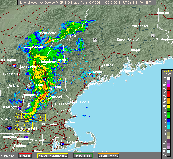 At 840 pm edt, severe thunderstorms were located along a line extending from near woodstock to near canterbury to henniker, moving east at 30 mph (radar indicated). Hazards include 60 mph wind gusts. Expect damage to roofs, siding, and trees. locations impacted include, franklin, henniker, lincoln, plymouth, meredith, hopkinton, canterbury, holderness, ashland, bradford, groton, woodstock, warner, belmont, boscawen, bristol, andover, center harber, hill and hebron. this also includes, mount moosilauke, carr mountain, stinson mountain, and elbow pond recreation area. this includes the following highways, interstate 89 between mile markers 14 and 23. Interstate 93 between mile markers 45 and 102. At 840 pm edt, severe thunderstorms were located along a line extending from near woodstock to near canterbury to henniker, moving east at 30 mph (radar indicated). Hazards include 60 mph wind gusts. Expect damage to roofs, siding, and trees. locations impacted include, franklin, henniker, lincoln, plymouth, meredith, hopkinton, canterbury, holderness, ashland, bradford, groton, woodstock, warner, belmont, boscawen, bristol, andover, center harber, hill and hebron. this also includes, mount moosilauke, carr mountain, stinson mountain, and elbow pond recreation area. this includes the following highways, interstate 89 between mile markers 14 and 23. Interstate 93 between mile markers 45 and 102.
|
| 8/17/2019 8:10 PM EDT |
 At 809 pm edt, severe thunderstorms were located along a line extending from near piermont to near bradford, moving east at 30 mph (radar indicated). Hazards include 60 mph wind gusts. expect damage to roofs, siding, and trees At 809 pm edt, severe thunderstorms were located along a line extending from near piermont to near bradford, moving east at 30 mph (radar indicated). Hazards include 60 mph wind gusts. expect damage to roofs, siding, and trees
|
| 6/26/2019 10:26 PM EDT |
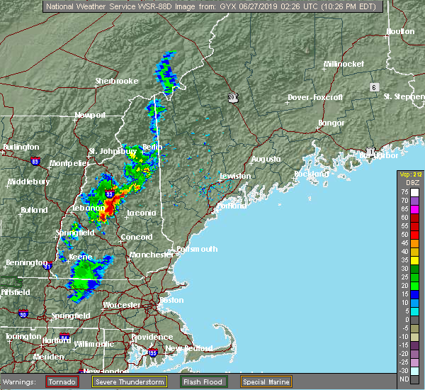 At 1026 pm edt, severe thunderstorms were located along a line extending from 6 miles north of plymouth to near ashland to near danbury, moving east at 15 mph (radar indicated). Hazards include 60 mph wind gusts. expect damage to roofs, siding, and trees At 1026 pm edt, severe thunderstorms were located along a line extending from 6 miles north of plymouth to near ashland to near danbury, moving east at 15 mph (radar indicated). Hazards include 60 mph wind gusts. expect damage to roofs, siding, and trees
|
| 8/17/2018 9:01 PM EDT |
 At 901 pm edt, a severe thunderstorm was located 9 miles southeast of piermont, or 14 miles northwest of plymouth, moving northeast at 25 mph (radar indicated). Hazards include 60 mph wind gusts and penny size hail. Expect damage to roofs, siding, and trees. locations impacted include, plymouth, hanover, canaan, holderness, groton, woodstock, piermont, lyme, benton, dorchester, ellsworth, wentworth, rumney, campton, thornton and orford. this also includes, mount moosilauke, rumney rocks, carr mountain, stinson mountain, and elbow pond recreation area. This includes interstate 93 between mile markers 81 and 86, and between mile markers 88 and 93. At 901 pm edt, a severe thunderstorm was located 9 miles southeast of piermont, or 14 miles northwest of plymouth, moving northeast at 25 mph (radar indicated). Hazards include 60 mph wind gusts and penny size hail. Expect damage to roofs, siding, and trees. locations impacted include, plymouth, hanover, canaan, holderness, groton, woodstock, piermont, lyme, benton, dorchester, ellsworth, wentworth, rumney, campton, thornton and orford. this also includes, mount moosilauke, rumney rocks, carr mountain, stinson mountain, and elbow pond recreation area. This includes interstate 93 between mile markers 81 and 86, and between mile markers 88 and 93.
|
| 8/17/2018 8:36 PM EDT |
 At 836 pm edt, a severe thunderstorm was located 10 miles south of piermont, or 13 miles northeast of lebanon, moving northeast at 25 mph (radar indicated). Hazards include 60 mph wind gusts and quarter size hail. Hail damage to vehicles is expected. Expect wind damage to roofs, siding, and trees. At 836 pm edt, a severe thunderstorm was located 10 miles south of piermont, or 13 miles northeast of lebanon, moving northeast at 25 mph (radar indicated). Hazards include 60 mph wind gusts and quarter size hail. Hail damage to vehicles is expected. Expect wind damage to roofs, siding, and trees.
|
| 6/18/2018 3:20 PM EDT |
 The national weather service in gray maine has issued a * severe thunderstorm warning for. central grafton county in northern new hampshire. until 415 pm edt. At 319 pm edt, severe thunderstorms were located along a line extending from 11 miles west of haverhill to 7 miles north of. The national weather service in gray maine has issued a * severe thunderstorm warning for. central grafton county in northern new hampshire. until 415 pm edt. At 319 pm edt, severe thunderstorms were located along a line extending from 11 miles west of haverhill to 7 miles north of.
|
| 5/4/2018 9:50 PM EDT | Trees and wired downe in grafton county NH, 10 miles S of Plymouth, NH |
| 5/4/2018 9:40 PM EDT |
 At 939 pm edt, severe thunderstorms were located along a line extending from near mount washington to 8 miles east of lincoln to near woodstock to near groton, moving east at 60 mph (radar indicated). Hazards include 60 mph wind gusts. Expect damage to roofs, siding, and trees. locations impacted include, lincoln, plymouth, grafton, hanover, enfield, canaan, holderness, ashland, danbury, franconia, groton, woodstock, piermont, sandwich, bristol, grantham, lyme, hill, albany and hebron. this also includes, franconia notch, mount moosilauke, rumney rocks, cannon mountain, and franconia ridge. this includes the following highways, interstate 89 between mile markers 47 and 51. Interstate 93 between mile markers 75 and 115. At 939 pm edt, severe thunderstorms were located along a line extending from near mount washington to 8 miles east of lincoln to near woodstock to near groton, moving east at 60 mph (radar indicated). Hazards include 60 mph wind gusts. Expect damage to roofs, siding, and trees. locations impacted include, lincoln, plymouth, grafton, hanover, enfield, canaan, holderness, ashland, danbury, franconia, groton, woodstock, piermont, sandwich, bristol, grantham, lyme, hill, albany and hebron. this also includes, franconia notch, mount moosilauke, rumney rocks, cannon mountain, and franconia ridge. this includes the following highways, interstate 89 between mile markers 47 and 51. Interstate 93 between mile markers 75 and 115.
|
| 5/4/2018 9:23 PM EDT |
 At 922 pm edt, severe thunderstorms were located along a line extending from bethlehem to 8 miles west of lincoln to 6 miles southeast of piermont to 6 miles northeast of hanover, moving east at 60 mph (radar indicated). Hazards include 60 mph wind gusts. Expect damage to roofs, siding, and trees. locations impacted include, lebanon, lincoln, plymouth, grafton, hanover, haverhill, enfield, canaan, holderness, ashland, danbury, franconia, groton, woodstock, piermont, sandwich, bristol, grantham, lyme and lisbon. this also includes, franconia notch, mount moosilauke, rumney rocks, cannon mountain, and franconia ridge. this includes the following highways, interstate 89 between mile markers 47 and 60. Interstate 93 between mile markers 75 and 115. At 922 pm edt, severe thunderstorms were located along a line extending from bethlehem to 8 miles west of lincoln to 6 miles southeast of piermont to 6 miles northeast of hanover, moving east at 60 mph (radar indicated). Hazards include 60 mph wind gusts. Expect damage to roofs, siding, and trees. locations impacted include, lebanon, lincoln, plymouth, grafton, hanover, haverhill, enfield, canaan, holderness, ashland, danbury, franconia, groton, woodstock, piermont, sandwich, bristol, grantham, lyme and lisbon. this also includes, franconia notch, mount moosilauke, rumney rocks, cannon mountain, and franconia ridge. this includes the following highways, interstate 89 between mile markers 47 and 60. Interstate 93 between mile markers 75 and 115.
|
| 5/4/2018 8:54 PM EDT |
 At 853 pm edt, severe thunderstorms were located along a line extending from 15 miles northwest of haverhill to 13 miles west of piermont to 14 miles northwest of hanover to 22 miles west of lebanon, moving east at 55 mph (radar indicated). Hazards include 60 mph wind gusts. expect damage to roofs, siding, and trees At 853 pm edt, severe thunderstorms were located along a line extending from 15 miles northwest of haverhill to 13 miles west of piermont to 14 miles northwest of hanover to 22 miles west of lebanon, moving east at 55 mph (radar indicated). Hazards include 60 mph wind gusts. expect damage to roofs, siding, and trees
|
| 8/22/2017 9:52 PM EDT |
 At 952 pm edt, severe thunderstorms were located along a line extending from 10 miles southeast of piermont to groton to near danbury to near new london to 6 miles southeast of newport, moving east at 40 mph (radar indicated). Hazards include 60 mph wind gusts. expect damage to trees, and power lines At 952 pm edt, severe thunderstorms were located along a line extending from 10 miles southeast of piermont to groton to near danbury to near new london to 6 miles southeast of newport, moving east at 40 mph (radar indicated). Hazards include 60 mph wind gusts. expect damage to trees, and power lines
|
| 7/17/2017 7:06 PM EDT |
 At 706 pm edt, a severe thunderstorm was located over ashland, or near plymouth, moving northeast at 20 mph (radar indicated). Hazards include 60 mph wind gusts and quarter size hail. Minor hail damage to vehicles is possible. Expect wind damage to roofs, siding, and trees. At 706 pm edt, a severe thunderstorm was located over ashland, or near plymouth, moving northeast at 20 mph (radar indicated). Hazards include 60 mph wind gusts and quarter size hail. Minor hail damage to vehicles is possible. Expect wind damage to roofs, siding, and trees.
|
| 7/1/2017 5:50 PM EDT |
 At 550 pm edt, severe thunderstorms were located along a line extending from 7 miles north of tamworth to near new london, moving east at 30 mph (radar indicated). Hazards include 60 mph wind gusts and quarter size hail. Minor hail damage to vehicles is possible. Expect wind damage to roofs, siding, and trees. At 550 pm edt, severe thunderstorms were located along a line extending from 7 miles north of tamworth to near new london, moving east at 30 mph (radar indicated). Hazards include 60 mph wind gusts and quarter size hail. Minor hail damage to vehicles is possible. Expect wind damage to roofs, siding, and trees.
|
| 7/1/2017 5:37 PM EDT |
 At 536 pm edt, severe thunderstorms were located along a line extending from 8 miles north of groton to near newport, moving east at 35 mph (radar indicated). Hazards include 60 mph wind gusts and penny size hail. Expect damage to trees, and power lines. locations impacted include, claremont, lebanon, plymouth, new london, grafton, hanover, charlestown, enfield, canaan, danbury, groton, newport, grantham, lyme, cornish, goshen, croydon, hebron, dorchester and ellsworth. this also includes, rumney rocks, stinson mountain, welch mountain, and dickey mountain. this includes the following highways, interstate 89 between mile markers 37 and 52. Interstate 93 between mile markers 81 and 91. At 536 pm edt, severe thunderstorms were located along a line extending from 8 miles north of groton to near newport, moving east at 35 mph (radar indicated). Hazards include 60 mph wind gusts and penny size hail. Expect damage to trees, and power lines. locations impacted include, claremont, lebanon, plymouth, new london, grafton, hanover, charlestown, enfield, canaan, danbury, groton, newport, grantham, lyme, cornish, goshen, croydon, hebron, dorchester and ellsworth. this also includes, rumney rocks, stinson mountain, welch mountain, and dickey mountain. this includes the following highways, interstate 89 between mile markers 37 and 52. Interstate 93 between mile markers 81 and 91.
|
| 7/1/2017 5:04 PM EDT |
 At 504 pm edt, severe thunderstorms were located along a line extending from near hanover to 7 miles northwest of charlestown, moving east at 35 mph (radar indicated). Hazards include 60 mph wind gusts and penny size hail. expect damage to trees, and power lines At 504 pm edt, severe thunderstorms were located along a line extending from near hanover to 7 miles northwest of charlestown, moving east at 35 mph (radar indicated). Hazards include 60 mph wind gusts and penny size hail. expect damage to trees, and power lines
|
| 7/1/2017 4:02 PM EDT |
 At 402 pm edt, a severe thunderstorm was located 7 miles northeast of hanover, or 10 miles north of lebanon, moving northeast at 40 mph (radar indicated). Hazards include 60 mph wind gusts and penny size hail. expect damage to trees, and power lines At 402 pm edt, a severe thunderstorm was located 7 miles northeast of hanover, or 10 miles north of lebanon, moving northeast at 40 mph (radar indicated). Hazards include 60 mph wind gusts and penny size hail. expect damage to trees, and power lines
|
| 5/31/2017 5:59 PM EDT |
 At 559 pm edt, severe thunderstorms were located along a line extending from 11 miles southwest of woodstock to near enfield, moving east at 30 mph (radar indicated). Hazards include 60 mph wind gusts and quarter size hail. Minor hail damage to vehicles is possible. expect wind damage to roofs, siding, and trees. locations impacted include, lebanon, plymouth, grafton, hanover, enfield, canaan, holderness, ashland, danbury, groton, woodstock, bristol, grantham, lyme, cornish, hill, hebron, dorchester, ellsworth and orange. this includes the following highways, interstate 89 between mile markers 43 and 54. Interstate 93 between mile markers 79 and 93. At 559 pm edt, severe thunderstorms were located along a line extending from 11 miles southwest of woodstock to near enfield, moving east at 30 mph (radar indicated). Hazards include 60 mph wind gusts and quarter size hail. Minor hail damage to vehicles is possible. expect wind damage to roofs, siding, and trees. locations impacted include, lebanon, plymouth, grafton, hanover, enfield, canaan, holderness, ashland, danbury, groton, woodstock, bristol, grantham, lyme, cornish, hill, hebron, dorchester, ellsworth and orange. this includes the following highways, interstate 89 between mile markers 43 and 54. Interstate 93 between mile markers 79 and 93.
|
| 5/31/2017 5:17 PM EDT |
 At 516 pm edt, severe thunderstorms were located along a line extending from 12 miles southwest of piermont to 7 miles west of lebanon, moving east at 35 mph (radar indicated). Hazards include 60 mph wind gusts and quarter size hail. Minor hail damage to vehicles is possible. Expect wind damage to roofs, siding, and trees. At 516 pm edt, severe thunderstorms were located along a line extending from 12 miles southwest of piermont to 7 miles west of lebanon, moving east at 35 mph (radar indicated). Hazards include 60 mph wind gusts and quarter size hail. Minor hail damage to vehicles is possible. Expect wind damage to roofs, siding, and trees.
|
| 9/11/2016 8:40 AM EDT |
 At 840 am edt, severe thunderstorms were located along a line extending from 6 miles northwest of mount washington to near canaan, moving northeast at 45 mph (radar indicated). Hazards include 60 mph wind gusts and penny size hail. Expect damage to roofs. siding. and trees. Locations impacted include, berlin, bethlehem, lincoln, plymouth, grafton, enfield, canaan, holderness, ashland, danbury, franconia, groton, pinkham notch, woodstock, mount washington, sandwich, carroll, bristol, gorham and jefferson. At 840 am edt, severe thunderstorms were located along a line extending from 6 miles northwest of mount washington to near canaan, moving northeast at 45 mph (radar indicated). Hazards include 60 mph wind gusts and penny size hail. Expect damage to roofs. siding. and trees. Locations impacted include, berlin, bethlehem, lincoln, plymouth, grafton, enfield, canaan, holderness, ashland, danbury, franconia, groton, pinkham notch, woodstock, mount washington, sandwich, carroll, bristol, gorham and jefferson.
|
| 9/11/2016 8:06 AM EDT |
 At 806 am edt, severe thunderstorms were located along a line extending from near littleton to near lebanon, moving northeast at 55 mph (radar indicated). Hazards include 60 mph wind gusts and penny size hail. Expect damage to roofs. siding. And trees. At 806 am edt, severe thunderstorms were located along a line extending from near littleton to near lebanon, moving northeast at 55 mph (radar indicated). Hazards include 60 mph wind gusts and penny size hail. Expect damage to roofs. siding. And trees.
|
| 7/23/2016 5:55 PM EDT |
 The severe thunderstorm warning for southeastern grafton, southwestern carroll and northwestern belknap counties will expire at 600 pm edt, the storm which prompted the warning has moved out of the area. therefore, the warning will be allowed to expire. however small. The severe thunderstorm warning for southeastern grafton, southwestern carroll and northwestern belknap counties will expire at 600 pm edt, the storm which prompted the warning has moved out of the area. therefore, the warning will be allowed to expire. however small.
|
| 7/23/2016 5:30 PM EDT |
 At 529 pm edt, a severe thunderstorm was located over holderness, or near meredith, moving southeast at 35 mph (radar indicated). Hazards include 60 mph wind gusts and quarter size hail. Hail damage to vehicles is expected. expect wind damage to roofs, siding, and trees. Locations impacted include, laconia, plymouth, meredith, moultonborough, holderness, ashland, sandwich, belmont, gilford, bristol, center harber, bridgewater, hebron, new hampton, sanbornton, campton, tilton and tuftonboro. At 529 pm edt, a severe thunderstorm was located over holderness, or near meredith, moving southeast at 35 mph (radar indicated). Hazards include 60 mph wind gusts and quarter size hail. Hail damage to vehicles is expected. expect wind damage to roofs, siding, and trees. Locations impacted include, laconia, plymouth, meredith, moultonborough, holderness, ashland, sandwich, belmont, gilford, bristol, center harber, bridgewater, hebron, new hampton, sanbornton, campton, tilton and tuftonboro.
|
| 7/23/2016 5:17 PM EDT | Trees and wires down on texas hill roa in grafton county NH, 1 miles S of Plymouth, NH |
| 7/23/2016 5:15 PM EDT | Trees dow in grafton county NH, 1.1 miles NNE of Plymouth, NH |
| 7/23/2016 5:10 PM EDT |
 At 509 pm edt, a severe thunderstorm was located near plymouth, moving southeast at 30 mph (radar indicated). Hazards include 60 mph wind gusts and quarter size hail. Hail damage to vehicles is expected. Expect wind damage to roofs, siding, and trees. At 509 pm edt, a severe thunderstorm was located near plymouth, moving southeast at 30 mph (radar indicated). Hazards include 60 mph wind gusts and quarter size hail. Hail damage to vehicles is expected. Expect wind damage to roofs, siding, and trees.
|
| 7/1/2016 8:33 PM EDT |
 At 832 pm edt, severe thunderstorms were located along a line extending from 6 miles northeast of bethlehem to 10 miles northeast of lincoln to near sandwich to near ashland, moving northeast at 45 mph (radar indicated). Hazards include 60 mph wind gusts. Expect damage to roofs. siding. and trees. Locations impacted include, laconia, bethlehem, lincoln, moultonborough, plymouth, meredith, ossipee, grafton, alton, holderness, ashland, danbury, franconia, tamworth, woodstock, sandwich, wolfeboro, carroll, gilford and bristol. At 832 pm edt, severe thunderstorms were located along a line extending from 6 miles northeast of bethlehem to 10 miles northeast of lincoln to near sandwich to near ashland, moving northeast at 45 mph (radar indicated). Hazards include 60 mph wind gusts. Expect damage to roofs. siding. and trees. Locations impacted include, laconia, bethlehem, lincoln, moultonborough, plymouth, meredith, ossipee, grafton, alton, holderness, ashland, danbury, franconia, tamworth, woodstock, sandwich, wolfeboro, carroll, gilford and bristol.
|
| 7/1/2016 8:08 PM EDT |
 At 808 pm edt, severe thunderstorms were located along a line extending from near franconia to near woodstock to near groton to near danbury, moving northeast at 45 mph (radar indicated). Hazards include 60 mph wind gusts. Expect damage to roofs. siding. And trees. At 808 pm edt, severe thunderstorms were located along a line extending from near franconia to near woodstock to near groton to near danbury, moving northeast at 45 mph (radar indicated). Hazards include 60 mph wind gusts. Expect damage to roofs. siding. And trees.
|
| 9/8/2015 10:04 PM EDT |
 At 1003 pm edt, doppler radar indicated a severe thunderstorm capable of producing quarter size hail and damaging winds in excess of 60 mph. this storm was located near plymouth, and moving east at 25 mph. it will impact portions of interstate 93 in grafton county. At 1003 pm edt, doppler radar indicated a severe thunderstorm capable of producing quarter size hail and damaging winds in excess of 60 mph. this storm was located near plymouth, and moving east at 25 mph. it will impact portions of interstate 93 in grafton county.
|
| 8/25/2015 5:52 PM EDT |
 At 552 pm edt, doppler radar indicated a severe thunderstorm capable of producing quarter size hail and damaging winds in excess of 60 mph. this storm was located over plymouth, moving northeast at 25 mph. locations impacted include, plymouth, holderness, ashland, groton, center harber, hebron, campton, rumney and thornton. At 552 pm edt, doppler radar indicated a severe thunderstorm capable of producing quarter size hail and damaging winds in excess of 60 mph. this storm was located over plymouth, moving northeast at 25 mph. locations impacted include, plymouth, holderness, ashland, groton, center harber, hebron, campton, rumney and thornton.
|
| 8/25/2015 5:31 PM EDT |
 At 530 pm edt, doppler radar indicated a severe thunderstorm capable of producing quarter size hail and damaging winds in excess of 60 mph. this storm was located over groton, or near plymouth, moving northeast at 30 mph. locations impacted include, plymouth, holderness, ashland, groton, center harber, hebron, ellsworth, rumney, campton and thornton. At 530 pm edt, doppler radar indicated a severe thunderstorm capable of producing quarter size hail and damaging winds in excess of 60 mph. this storm was located over groton, or near plymouth, moving northeast at 30 mph. locations impacted include, plymouth, holderness, ashland, groton, center harber, hebron, ellsworth, rumney, campton and thornton.
|
| 8/25/2015 5:22 PM EDT |
 At 522 pm edt, doppler radar indicated a severe thunderstorm capable of producing quarter size hail and damaging winds in excess of 60 mph. this storm was located over groton, or 9 miles southwest of plymouth, and moving northeast at 25 mph. At 522 pm edt, doppler radar indicated a severe thunderstorm capable of producing quarter size hail and damaging winds in excess of 60 mph. this storm was located over groton, or 9 miles southwest of plymouth, and moving northeast at 25 mph.
|
| 8/4/2015 1:38 PM EDT |
 At 138 pm edt, doppler radar indicated a severe thunderstorm capable of producing quarter size hail and damaging winds in excess of 60 mph. this storm was located near danbury, or 11 miles northwest of franklin, and moving east at 35 mph. At 138 pm edt, doppler radar indicated a severe thunderstorm capable of producing quarter size hail and damaging winds in excess of 60 mph. this storm was located near danbury, or 11 miles northwest of franklin, and moving east at 35 mph.
|
| 8/3/2015 7:10 PM EDT |
 The severe thunderstorm warning for carroll, southeastern coos, southeastern grafton and northwestern belknap counties will expire at 715 pm edt, the storms which prompted the warning have moved out of the area. therefore the warning will be allowed to expire. The severe thunderstorm warning for carroll, southeastern coos, southeastern grafton and northwestern belknap counties will expire at 715 pm edt, the storms which prompted the warning have moved out of the area. therefore the warning will be allowed to expire.
|
| 8/3/2015 6:13 PM EDT |
 At 612 pm edt, doppler radar indicated a line of severe thunderstorms capable of producing quarter size hail and destructive winds in excess of 70 mph. these storms were located along a line extending from mount washington to near woodstock to near ashland, and moving east at 40 mph. At 612 pm edt, doppler radar indicated a line of severe thunderstorms capable of producing quarter size hail and destructive winds in excess of 70 mph. these storms were located along a line extending from mount washington to near woodstock to near ashland, and moving east at 40 mph.
|
| 8/3/2015 6:10 PM EDT | Trees down all over town in grafton county NH, 1 miles S of Plymouth, NH |
| 8/3/2015 5:59 PM EDT |
 At 559 pm edt, doppler radar indicated a severe thunderstorm capable of producing quarter size hail and destructive winds in excess of 70 mph. this storm was located near groton, or 7 miles west of plymouth, moving east at 40 mph. locations impacted include, lincoln, plymouth, canaan, holderness, ashland, groton, woodstock, bristol, hebron, benton, dorchester, ellsworth, wellington state park, wentworth, thornton, campton, rumney, waterville valley, livermore and orange. At 559 pm edt, doppler radar indicated a severe thunderstorm capable of producing quarter size hail and destructive winds in excess of 70 mph. this storm was located near groton, or 7 miles west of plymouth, moving east at 40 mph. locations impacted include, lincoln, plymouth, canaan, holderness, ashland, groton, woodstock, bristol, hebron, benton, dorchester, ellsworth, wellington state park, wentworth, thornton, campton, rumney, waterville valley, livermore and orange.
|
| 8/3/2015 5:42 PM EDT |
 At 542 pm edt, doppler radar indicated a line of severe thunderstorms capable of producing quarter size hail and damaging winds in excess of 60 mph. these storms were located along a line extending from 8 miles east of haverhill to hanover, and moving northeast at 50 mph. At 542 pm edt, doppler radar indicated a line of severe thunderstorms capable of producing quarter size hail and damaging winds in excess of 60 mph. these storms were located along a line extending from 8 miles east of haverhill to hanover, and moving northeast at 50 mph.
|
| 7/20/2015 3:24 AM EDT | Volunteer firefighter reported 60 mph wind and 3/4 inch hai in grafton county NH, 5.2 miles S of Plymouth, NH |
| 7/20/2015 3:20 AM EDT | Quarter sized hail reported 5.2 miles S of Plymouth, NH |
| 7/20/2015 3:18 AM EDT |
 At 317 am edt, doppler radar indicated a severe thunderstorm capable of producing quarter size hail and damaging winds in excess of 60 mph. this storm was located near woodstock, or 9 miles south of lincoln, and moving east at 55 mph. At 317 am edt, doppler radar indicated a severe thunderstorm capable of producing quarter size hail and damaging winds in excess of 60 mph. this storm was located near woodstock, or 9 miles south of lincoln, and moving east at 55 mph.
|
| 7/20/2015 3:06 AM EDT |
 At 306 am edt, doppler radar indicated a severe thunderstorm capable of producing quarter size hail and damaging winds in excess of 60 mph. this storm was located near woodstock, or 8 miles southwest of lincoln, moving east at 45 mph. locations impacted include, lincoln, plymouth, holderness, ashland, groton, woodstock, piermont, lyme, benton, dorchester, easton, ellsworth, lake tarleton state park, livermore, waterville valley, wentworth, thornton, campton, rumney and orford. At 306 am edt, doppler radar indicated a severe thunderstorm capable of producing quarter size hail and damaging winds in excess of 60 mph. this storm was located near woodstock, or 8 miles southwest of lincoln, moving east at 45 mph. locations impacted include, lincoln, plymouth, holderness, ashland, groton, woodstock, piermont, lyme, benton, dorchester, easton, ellsworth, lake tarleton state park, livermore, waterville valley, wentworth, thornton, campton, rumney and orford.
|
| 7/20/2015 2:35 AM EDT |
 At 234 am edt, doppler radar indicated a severe thunderstorm capable of producing quarter size hail and damaging winds in excess of 60 mph. this storm was located over corinth, or 19 miles southeast of barre, and moving east at 40 mph. At 234 am edt, doppler radar indicated a severe thunderstorm capable of producing quarter size hail and damaging winds in excess of 60 mph. this storm was located over corinth, or 19 miles southeast of barre, and moving east at 40 mph.
|
| 7/19/2015 5:51 PM EDT |
 At 550 pm edt, doppler radar indicated a severe thunderstorm capable of producing large hail up to ping pong ball size and damaging winds in excess of 60 mph. this storm was located near groton, or 11 miles west of plymouth, moving southeast at 45 mph. locations impacted include, plymouth, holderness, ashland, groton, lyme, hebron, dorchester, rumney, wentworth and campton. At 550 pm edt, doppler radar indicated a severe thunderstorm capable of producing large hail up to ping pong ball size and damaging winds in excess of 60 mph. this storm was located near groton, or 11 miles west of plymouth, moving southeast at 45 mph. locations impacted include, plymouth, holderness, ashland, groton, lyme, hebron, dorchester, rumney, wentworth and campton.
|
| 7/19/2015 5:11 PM EDT |
 At 511 pm edt, doppler radar indicated a severe thunderstorm capable of producing large hail up to ping pong ball size and damaging winds in excess of 60 mph. this storm was located over fairlee, or 19 miles north of lebanon, and moving east at 30 mph. At 511 pm edt, doppler radar indicated a severe thunderstorm capable of producing large hail up to ping pong ball size and damaging winds in excess of 60 mph. this storm was located over fairlee, or 19 miles north of lebanon, and moving east at 30 mph.
|
| 6/23/2015 5:30 PM EDT |
 At 530 pm edt, doppler radar indicated a severe thunderstorm capable of producing a tornado. this dangerous storm was located over ashland, or near plymouth, and moving east at 30 mph. At 530 pm edt, doppler radar indicated a severe thunderstorm capable of producing a tornado. this dangerous storm was located over ashland, or near plymouth, and moving east at 30 mph.
|
| 6/23/2015 5:25 PM EDT | Quarter sized hail reported 1.5 miles NW of Plymouth, NH |
| 6/23/2015 5:17 PM EDT |
 At 516 pm edt, doppler radar indicated a severe thunderstorm capable of producing quarter size hail and damaging winds in excess of 60 mph. this storm was located over ashland, or near meredith, moving east at 45 mph. locations impacted include, laconia, plymouth, meredith, ossipee, moultonborough, alton, barnstead, canaan, gilmanton, holderness, ashland, effingham, groton, sandwich, wolfeboro, tamworth, belmont, gilford, bristol and alexandria. a tornado watch remains in effect until 1100 pm edt for southwestern maine and northern new hampshire. At 516 pm edt, doppler radar indicated a severe thunderstorm capable of producing quarter size hail and damaging winds in excess of 60 mph. this storm was located over ashland, or near meredith, moving east at 45 mph. locations impacted include, laconia, plymouth, meredith, ossipee, moultonborough, alton, barnstead, canaan, gilmanton, holderness, ashland, effingham, groton, sandwich, wolfeboro, tamworth, belmont, gilford, bristol and alexandria. a tornado watch remains in effect until 1100 pm edt for southwestern maine and northern new hampshire.
|
| 6/23/2015 5:09 PM EDT |
 At 508 pm edt, doppler radar indicated a severe thunderstorm capable of producing quarter size hail and damaging winds in excess of 60 mph. this storm was located near plymouth, and moving east at 45 mph. At 508 pm edt, doppler radar indicated a severe thunderstorm capable of producing quarter size hail and damaging winds in excess of 60 mph. this storm was located near plymouth, and moving east at 45 mph.
|
| 6/9/2015 5:24 PM EDT |
 At 524 pm edt, doppler radar indicated a severe thunderstorm capable of producing quarter size hail and damaging winds in excess of 60 mph. this storm was located 9 miles southeast of piermont, or 15 miles northwest of plymouth, moving northeast at 25 mph. locations impacted include, lincoln, plymouth, canaan, holderness, groton, woodstock, piermont, lyme, benton, dorchester, easton, ellsworth, wentworth, thornton, campton, rumney and orford. At 524 pm edt, doppler radar indicated a severe thunderstorm capable of producing quarter size hail and damaging winds in excess of 60 mph. this storm was located 9 miles southeast of piermont, or 15 miles northwest of plymouth, moving northeast at 25 mph. locations impacted include, lincoln, plymouth, canaan, holderness, groton, woodstock, piermont, lyme, benton, dorchester, easton, ellsworth, wentworth, thornton, campton, rumney and orford.
|
| 6/9/2015 4:56 PM EDT |
 At 456 pm edt, doppler radar indicated a severe thunderstorm capable of producing quarter size hail and damaging winds in excess of 60 mph. this storm was located near thetford hill state park, or 11 miles northeast of lebanon, and moving northeast at 25 mph. At 456 pm edt, doppler radar indicated a severe thunderstorm capable of producing quarter size hail and damaging winds in excess of 60 mph. this storm was located near thetford hill state park, or 11 miles northeast of lebanon, and moving northeast at 25 mph.
|
| 5/27/2015 5:51 PM EDT | At 550 pm edt, doppler radar indicated a line of severe thunderstorms capable of producing damaging winds in excess of 60 mph. these storms were located along a line extending from plymouth to 6 miles southwest of ashland, moving east at 55 mph. locations impacted include, plymouth, enfield, canaan, holderness, ashland, danbury, groton, cardigan mountain state park, grafton, bristol, hill, hebron, dorchester, wellington state park, campton, orange, new hampton, springfield and rumney. |
| 5/27/2015 5:33 PM EDT | At 533 pm edt, doppler radar indicated a line of severe thunderstorms capable of producing damaging winds in excess of 60 mph. these storms were located along a line extending from near canaan to near grafton, moving east at 55 mph. locations impacted include, lebanon, plymouth, southern hanover, enfield, canaan, holderness, ashland, danbury, groton, cardigan mountain state park, grafton, bristol, grantham, hill, croydon, hebron, dorchester, orange, wellington state park and campton. |
| 5/27/2015 5:31 PM EDT | At 531 pm edt, doppler radar indicated a line of severe thunderstorms capable of producing damaging winds in excess of 60 mph. these storms were located along a line extending from 8 miles south of lancaster to 8 miles east of franconia notch state park to near plymouth to near groton, and moving northeast at 50 mph. |
| 5/27/2015 5:25 PM EDT | Trees and power lines down in grafton county NH, 5.8 miles SSW of Plymouth, NH |
| 5/27/2015 5:17 PM EDT | At 516 pm edt, doppler radar indicated a line of severe thunderstorms capable of producing damaging winds in excess of 60 mph. these storms were located along a line extending from lebanon to 6 miles southeast of hartland, and moving east at 55 mph. |
| 5/10/2015 7:18 PM EDT | At 717 pm edt, doppler radar indicated a severe thunderstorm capable of producing damaging winds in excess of 60 mph. this storm was located 7 miles southwest of ashland, or 9 miles south of plymouth. this storm was nearly stationary. locations impacted include, western laconia, franklin, plymouth, meredith, canaan, canterbury, holderness, ashland, danbury, groton, cardigan mountain state park, grafton, belmont, bristol, andover, center harber, hill, hebron, dorchester and sanbornton. |
| 5/10/2015 6:59 PM EDT | At 658 pm edt, doppler radar indicated a severe thunderstorm capable of producing damaging winds in excess of 60 mph. this storm was located over canaan, or 13 miles east of lebanon, and moving east at 35 mph. |
| 5/10/2015 6:34 PM EDT | At 633 pm edt, doppler radar indicated a severe thunderstorm capable of producing damaging winds in excess of 60 mph. this storm was located over northern lebanon, and moving east at 40 mph. |
| 7/28/2014 4:52 PM EDT | Trees and wires down on highland s in grafton county NH, 1 miles S of Plymouth, NH |
| 9/11/2013 9:00 PM EDT | Lakes region dispatch. trees and wires dow in grafton county NH, 1 miles S of Plymouth, NH |
| 9/11/2013 9:00 PM EDT | Trees and wires down. route 25 closed in rumney. lakes region dispatch in grafton county NH, 7.4 miles SE of Plymouth, NH |
| 7/17/2013 9:30 PM EDT | Tree down on wires on rte 25 near school street in grafton county NH, 7.4 miles SE of Plymouth, NH |
| 6/2/2013 3:35 PM EDT | Trees down near plymouth elementary school in grafton county NH, 1 miles S of Plymouth, NH |
| 6/2/2013 3:20 PM EDT | Large limbs and powerlines down in grafton county NH, 12.4 miles ESE of Plymouth, NH |
| 10/30/2012 9:40 PM EDT | Trees down in grafton county NH, 1 miles S of Plymouth, NH |
| 7/4/2012 5:35 PM EDT | Trees and wires down on buffalo rd in grafton county NH, 7.4 miles SE of Plymouth, NH |
| 7/4/2012 5:35 PM EDT | Trees and wires down on rte 25 and on stinson lake road in grafton county NH, 7.4 miles SE of Plymouth, NH |
| 1/1/0001 12:00 AM | Trees blocking road between i93 and plymouth in grafton county NH, 1 miles S of Plymouth, NH |
| 1/1/0001 12:00 AM | Tree across buffalo rd and wires down in grafton county NH, 7.4 miles SE of Plymouth, NH |
| 1/1/0001 12:00 AM | Tree fell across rt 25 and took down wires in grafton county NH, 7.4 miles SE of Plymouth, NH |
| 1/1/0001 12:00 AM | Trees and wires down on stimson lake road in grafton county NH, 7.4 miles SE of Plymouth, NH |
| 1/1/0001 12:00 AM | Tree on apartment building in grafton county NH, 1 miles S of Plymouth, NH |
| 1/1/0001 12:00 AM | Trees down on i93 exit 26 in grafton county NH, 1 miles S of Plymouth, NH |
| 1/1/0001 12:00 AM | Tree down on red carpet inn in grafton county NH, 1 miles S of Plymouth, NH |
| 1/1/0001 12:00 AM | Tree on building on tenny mountain highway in grafton county NH, 1 miles S of Plymouth, NH |
| 1/1/0001 12:00 AM | Trees down on buildings in grafton county NH, 1 miles S of Plymouth, NH |
| 1/1/0001 12:00 AM | Trees down on wires in grafton county NH, 1 miles S of Plymouth, NH |
| 1/1/0001 12:00 AM | Trees down on wires on morgan drive in grafton county NH, 1 miles S of Plymouth, NH |
| 1/1/0001 12:00 AM | Golf Ball sized hail reported 8.5 miles SSW of Plymouth, NH |
| 1/1/0001 12:00 AM | Quarter sized hail reported 7.4 miles SE of Plymouth, NH |
Hail Maps for Plymouth, NH


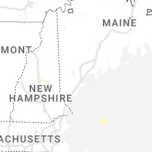


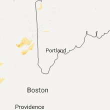


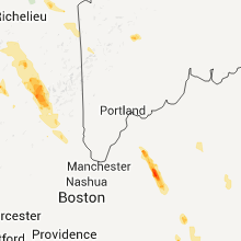


Connect with Interactive Hail Maps