

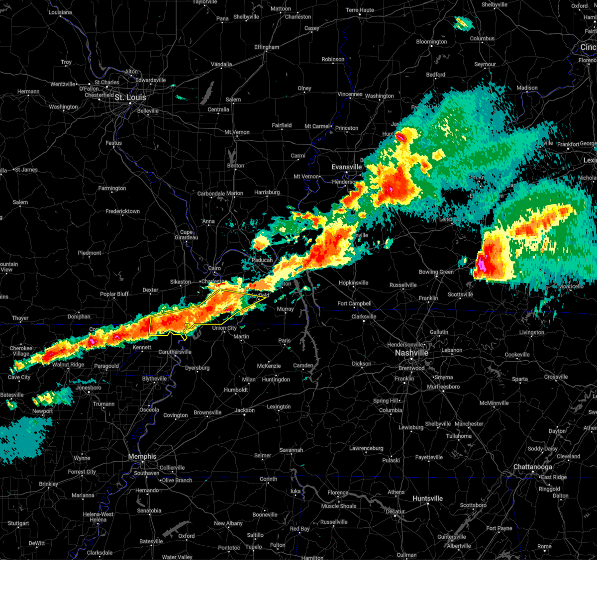
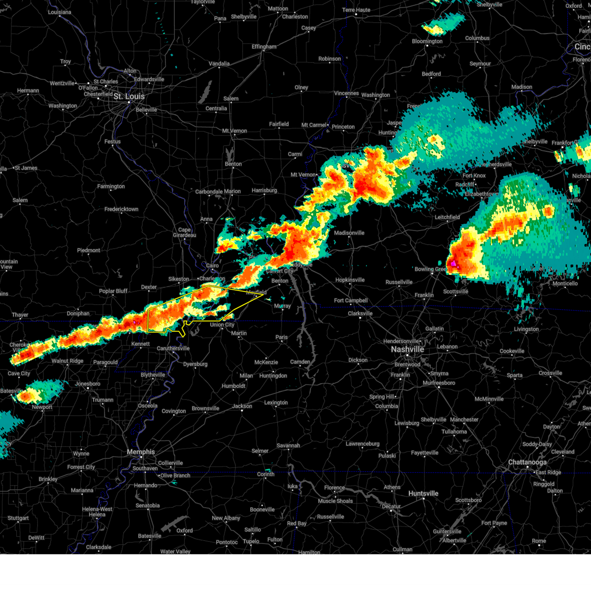
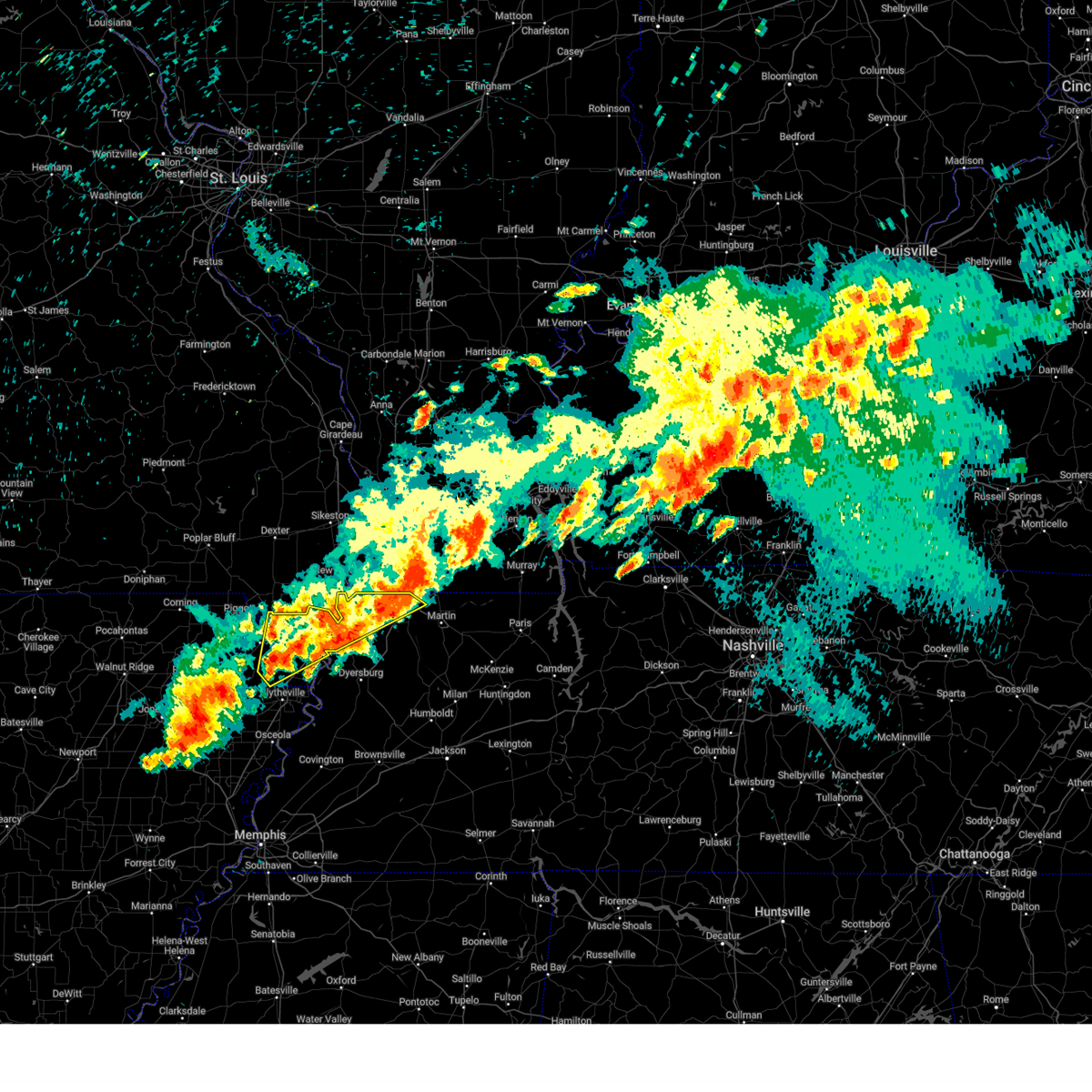
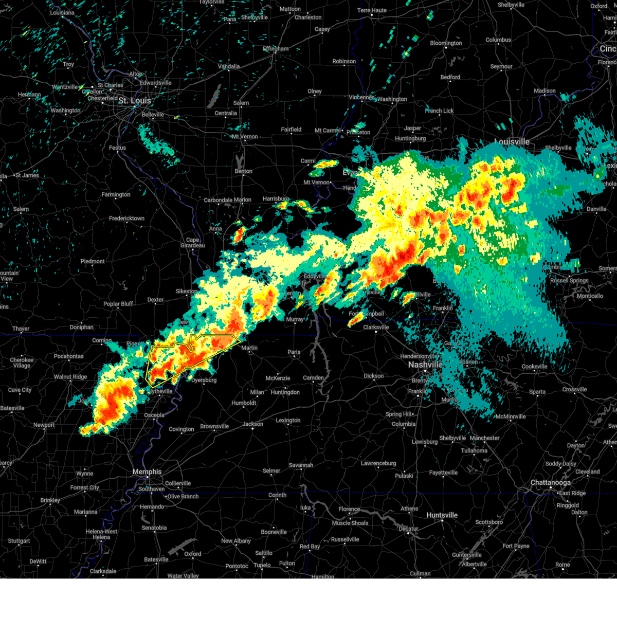
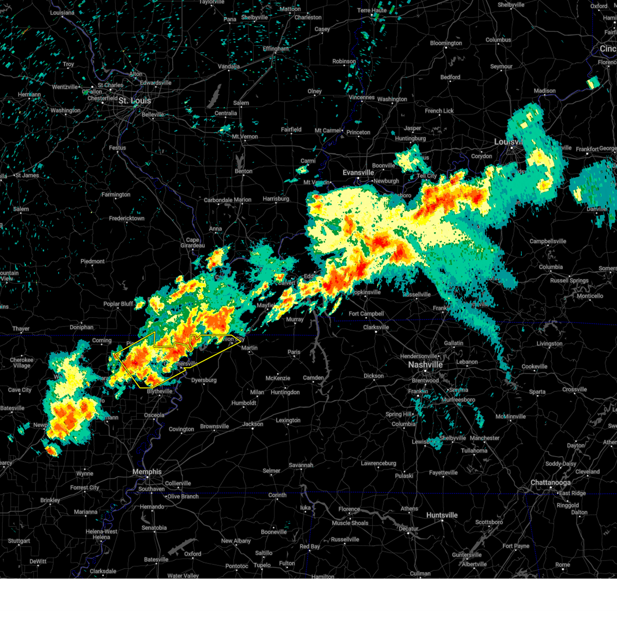
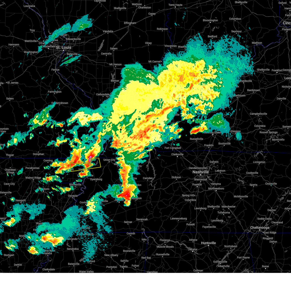
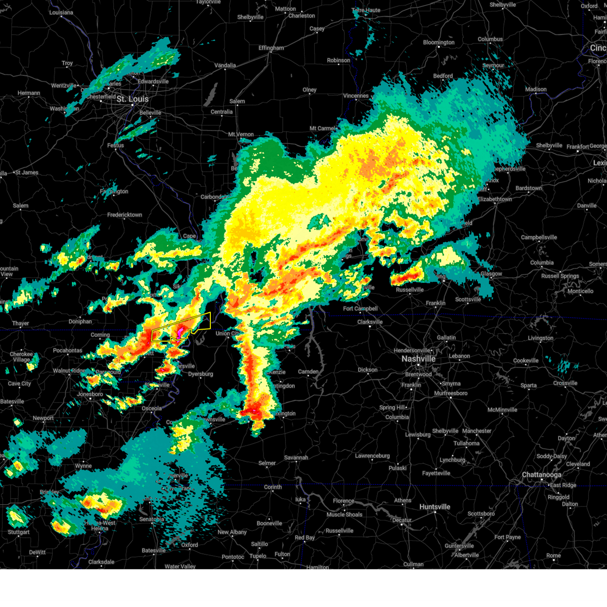
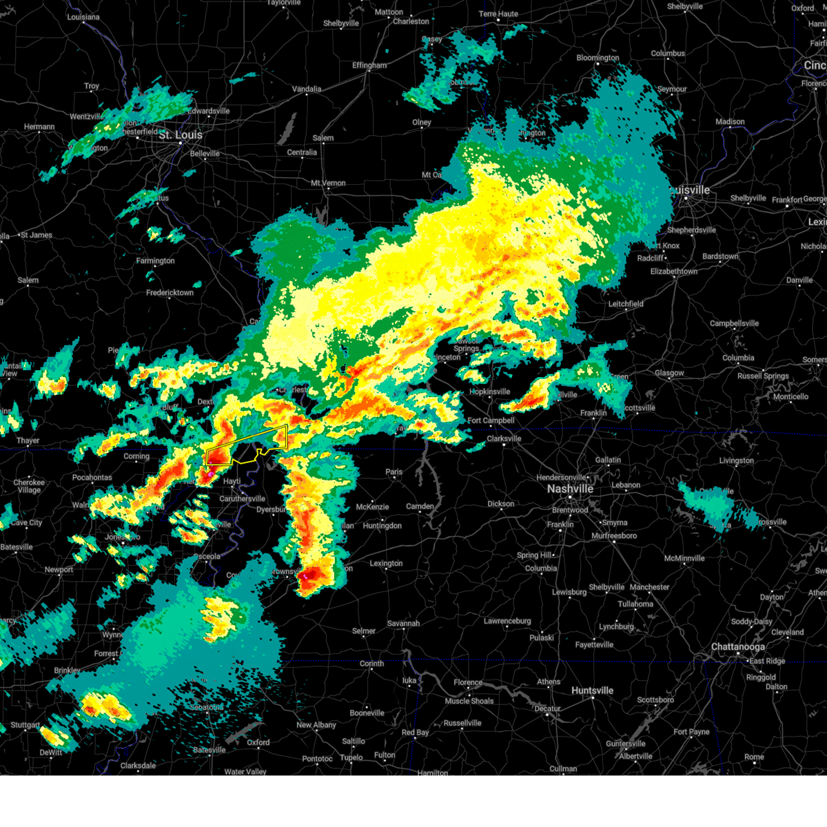
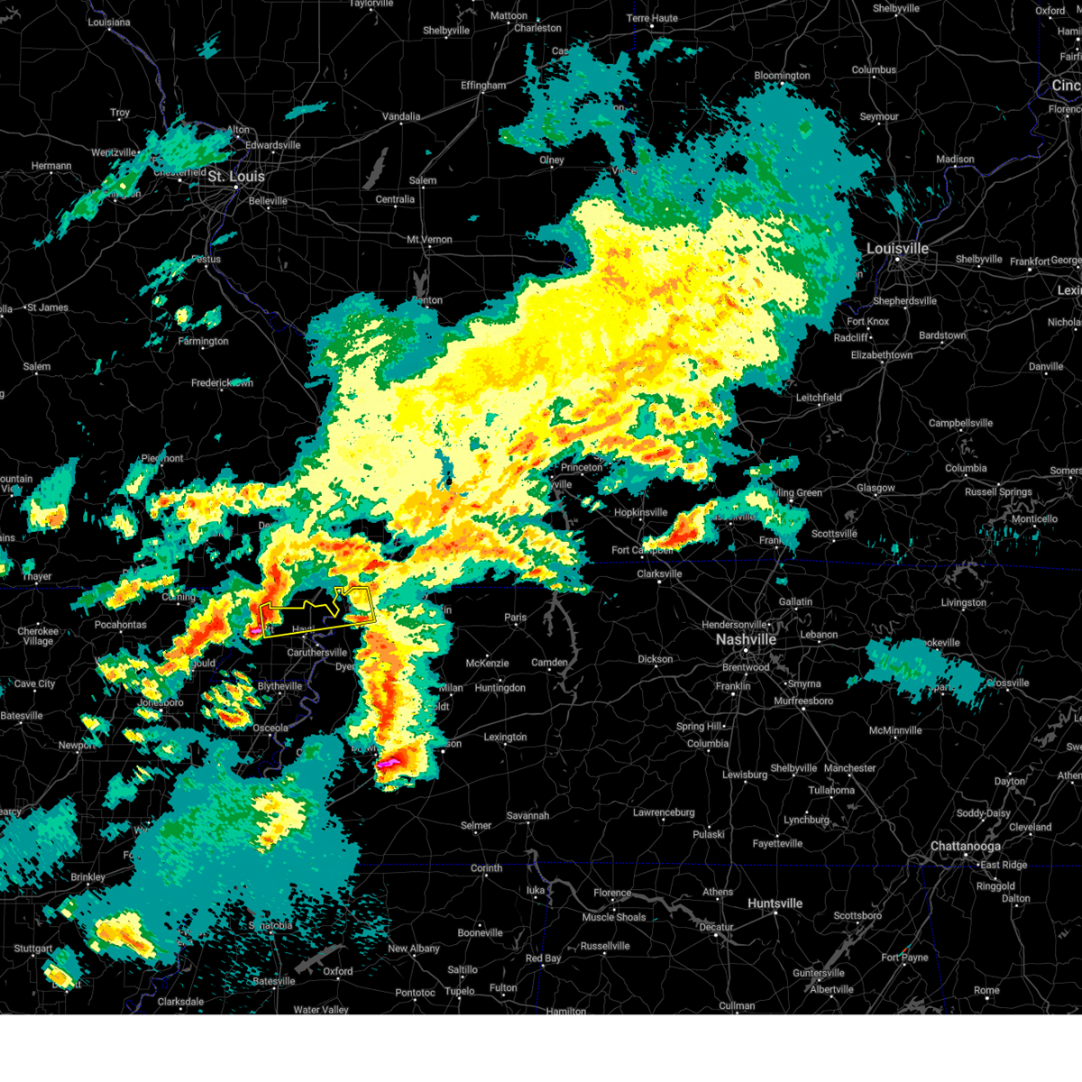
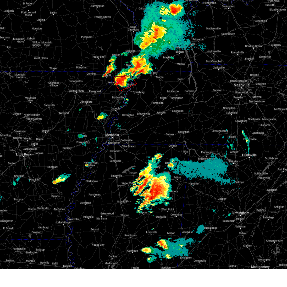
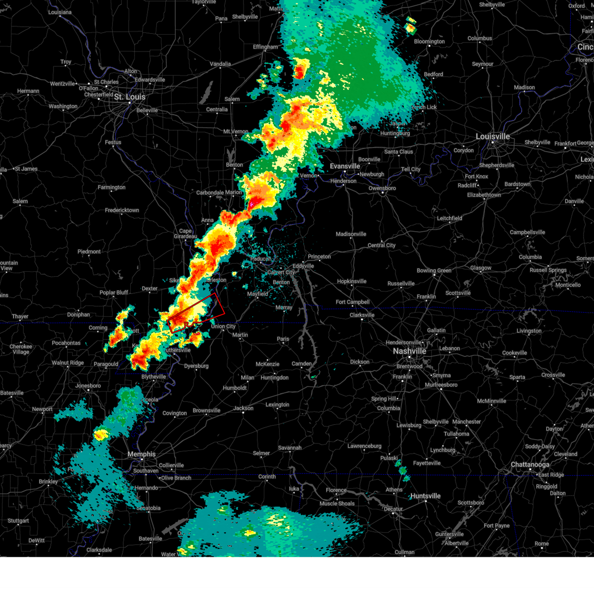
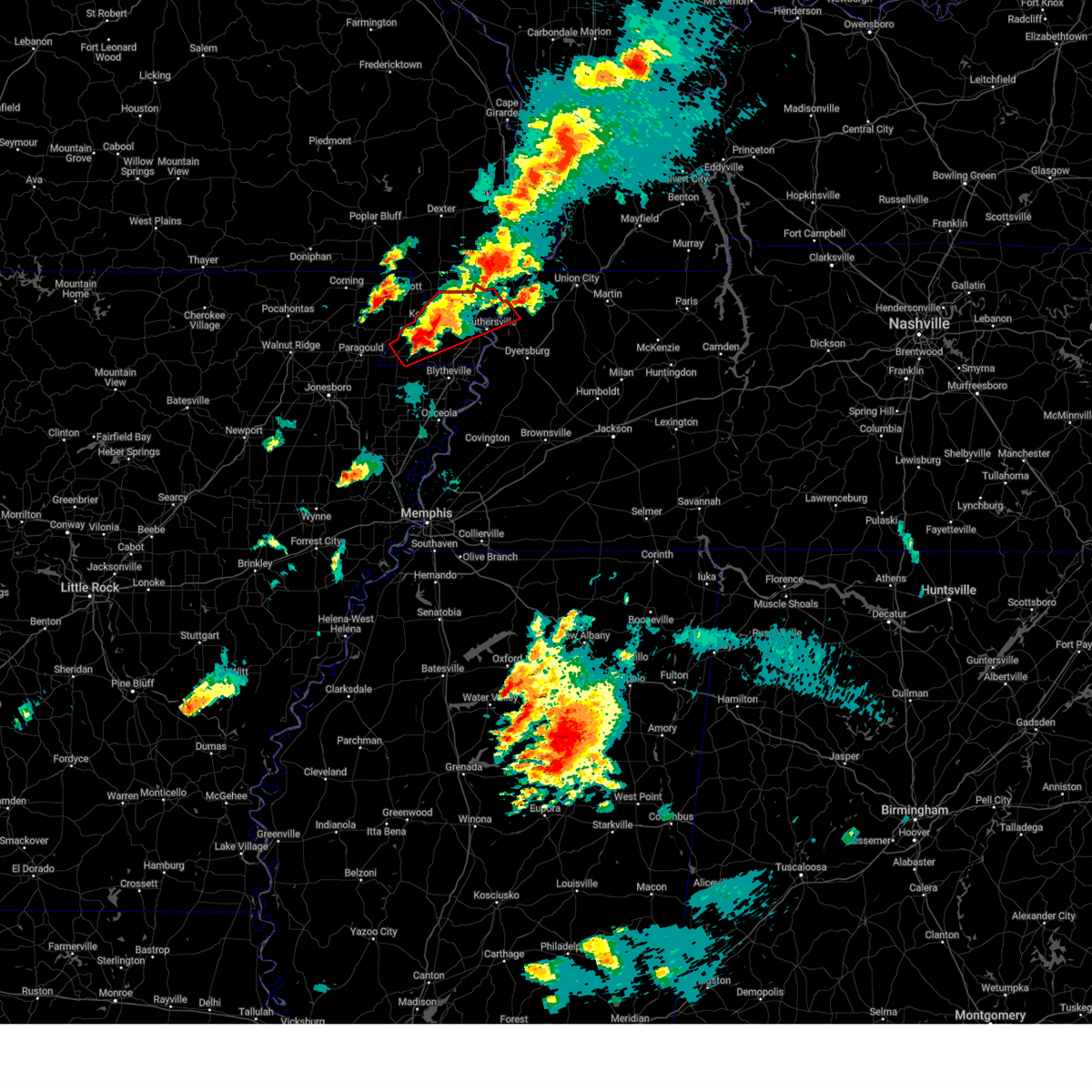
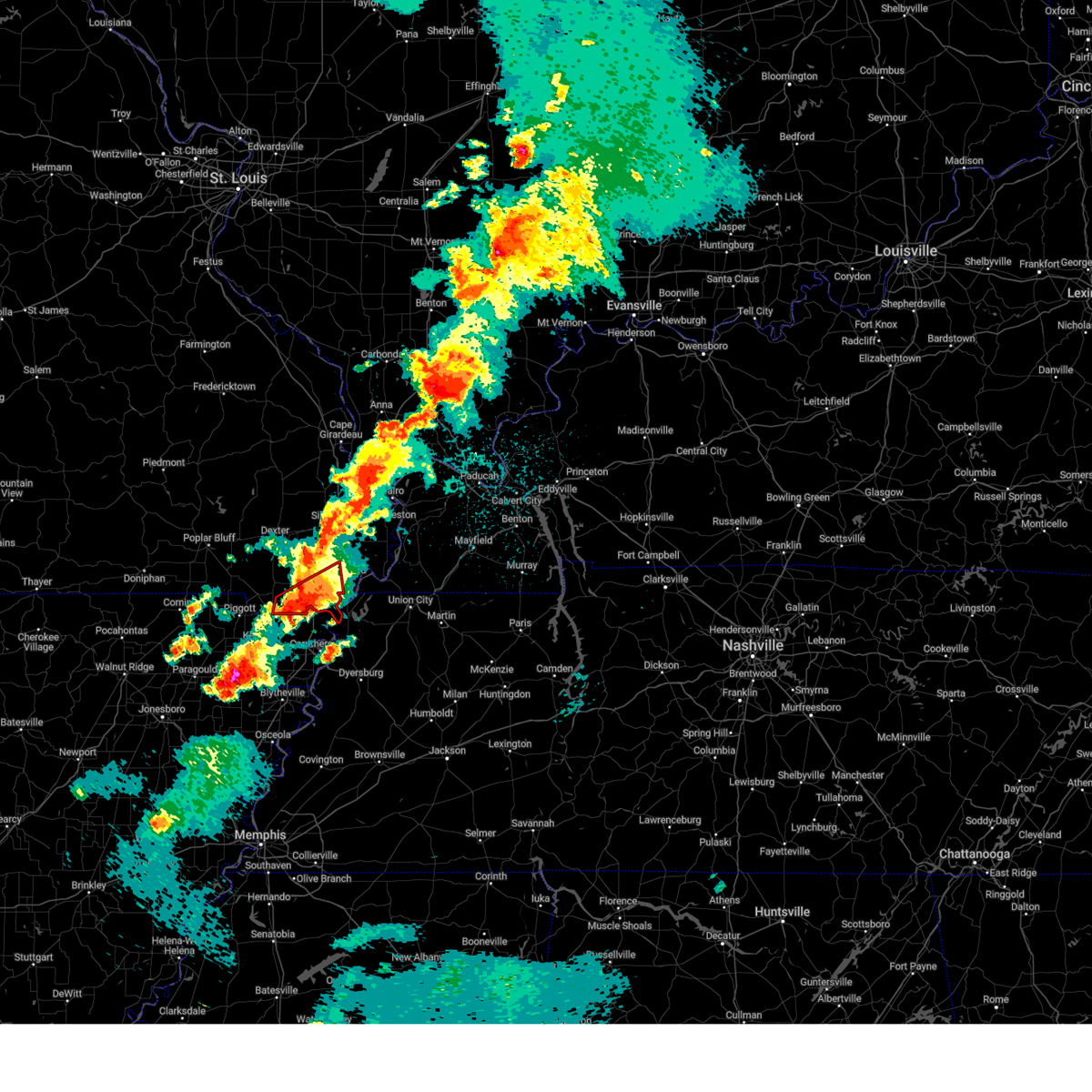
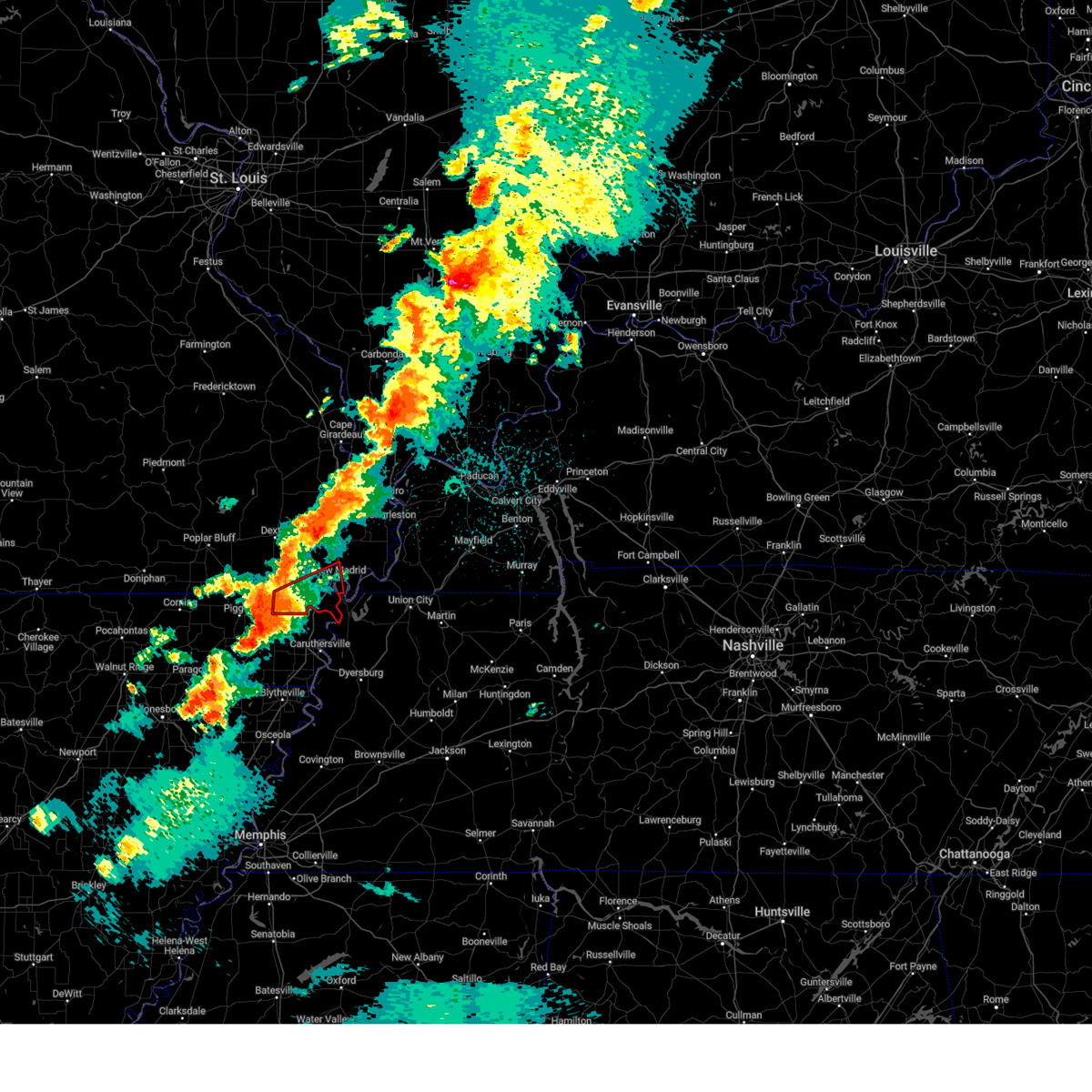
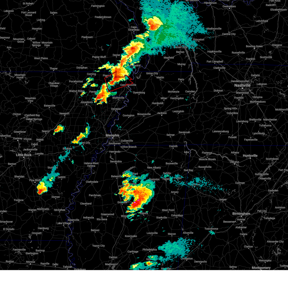
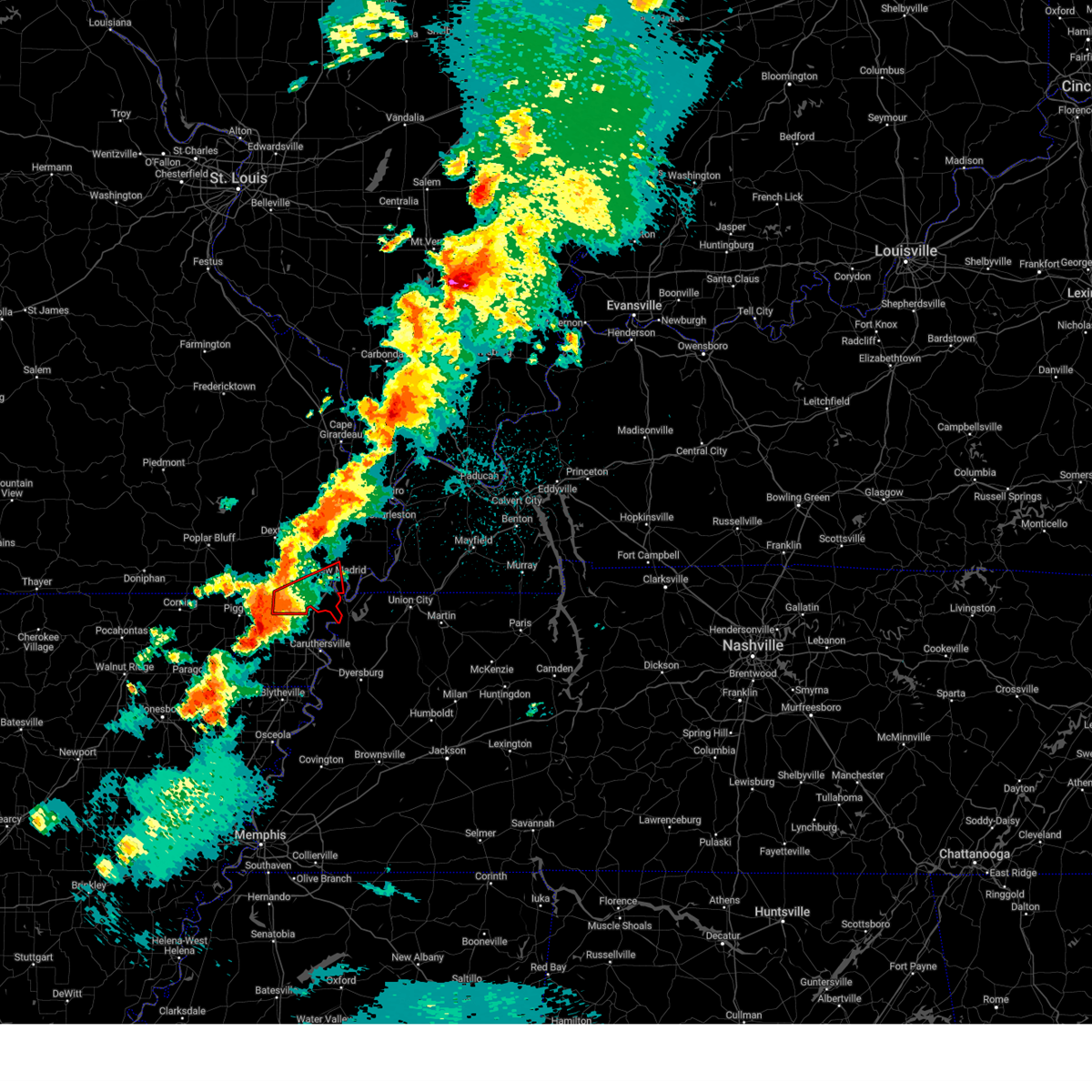
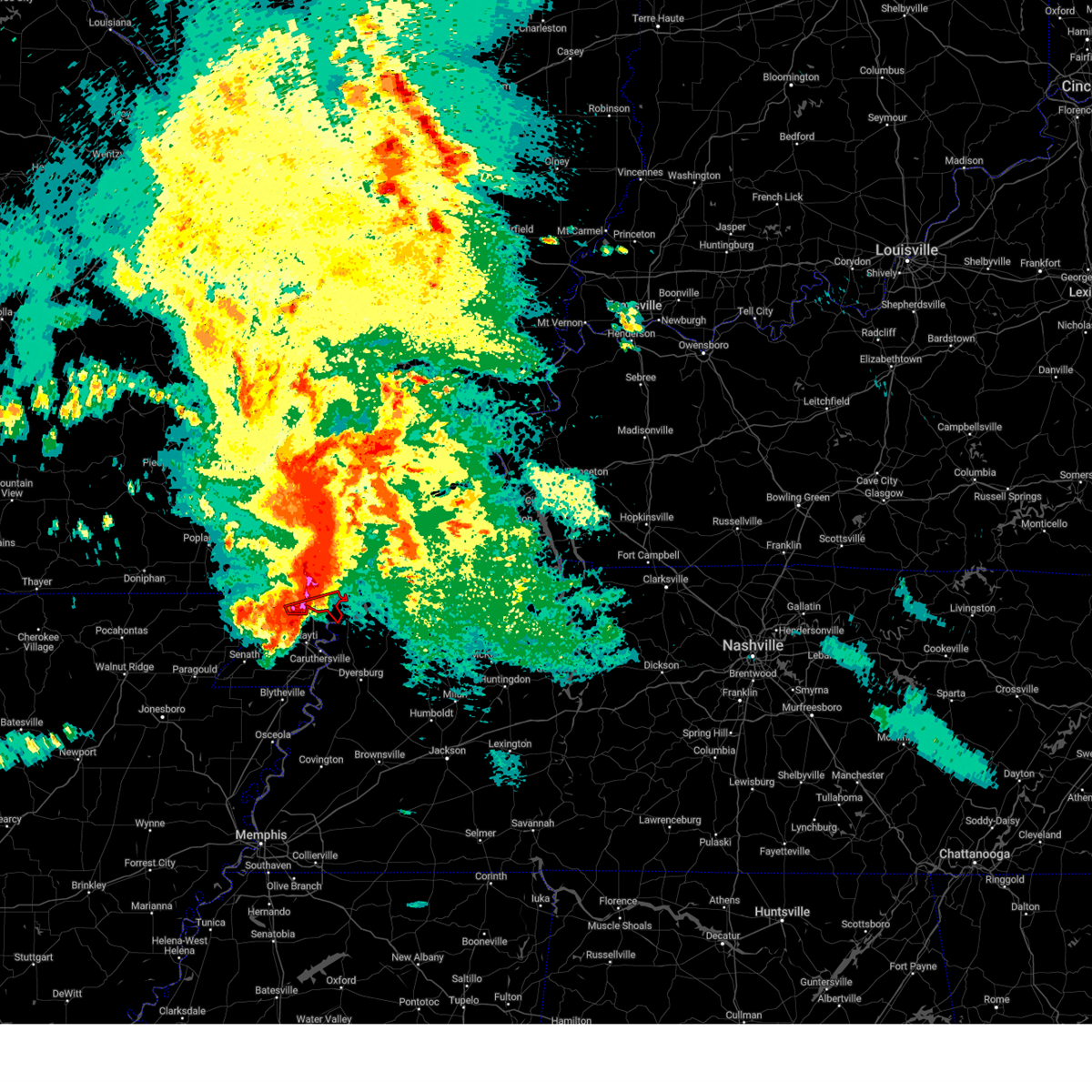
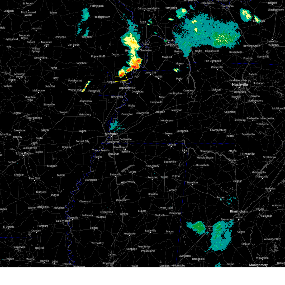
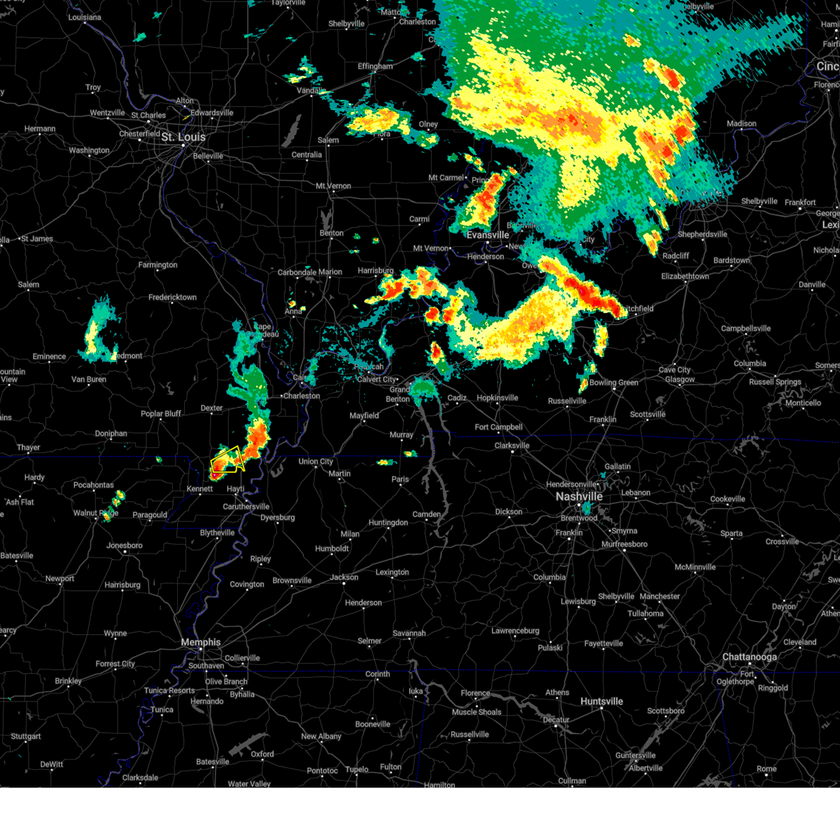
Hail Map for Portageville, MO
The Portageville, MO area has had 8 reports of on-the-ground hail by trained spotters, and has been under severe weather warnings 49 times during the past 12 months. Doppler radar has detected hail at or near Portageville, MO on 54 occasions, including 5 occasions during the past year.
| Name: | Portageville, MO |
| Where Located: | 61.2 miles S of Cape Girardeau, MO |
| Map: | Google Map for Portageville, MO |
| Population: | 3228 |
| Housing Units: | 1409 |
| More Info: | Search Google for Portageville, MO |
5
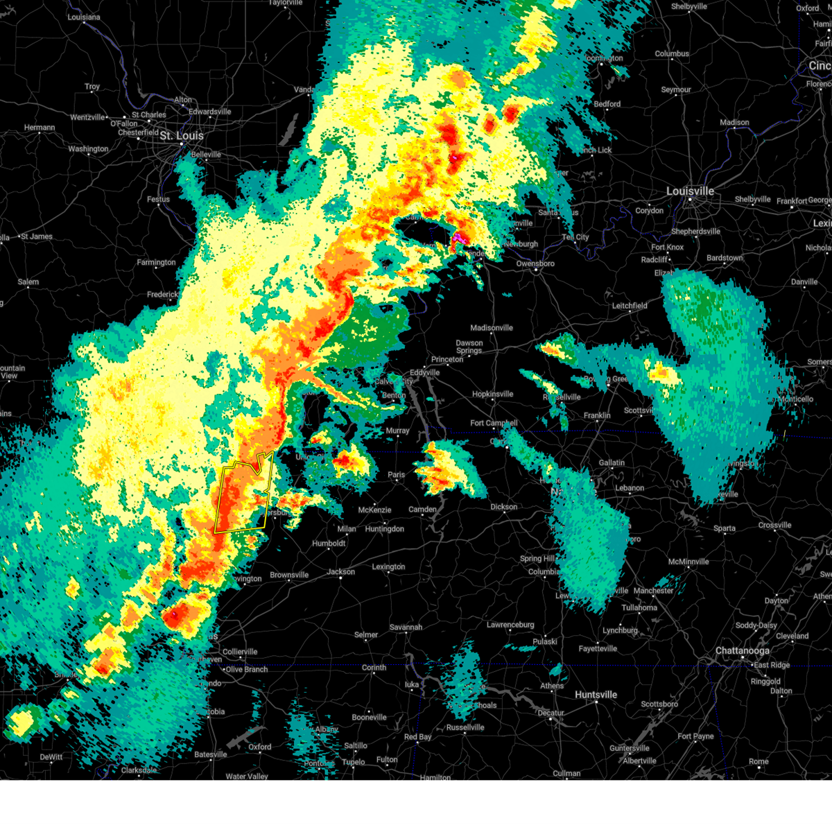
The Top Recent Hail Date for Portageville, MO is Thursday, April 3, 2025 (2nd out of 54)

Hail and Wind Damage Spotted near Portageville, MO
| Date / Time | Report Details |
|---|---|
| 5/16/2025 8:52 PM CDT | At 852 pm cdt, severe thunderstorms were located along a line extending from near fulton to reelfoot lake state park to 6 miles west of wardell, moving east at 40 mph (radar indicated). Hazards include 60 mph wind gusts and quarter size hail. Hail damage to vehicles is expected. expect wind damage to roofs, siding, and trees. Locations impacted include, tiptonville, south fulton, latham, shaffner, terrell, pascola, jacksonville, reelfoot national wildlife refuge, peach orchard, madie, spout springs, moffatt, homestown, clayton, troy, wardell, hayti heights, lassiter corner, mccutchen heights, and gratio. |
| 5/16/2025 8:32 PM CDT | Svrmeg the national weather service in memphis has issued a * severe thunderstorm warning for, northern pemiscot county in southeastern missouri, northern weakley county in west tennessee, obion county in west tennessee, lake county in west tennessee, * until 915 pm cdt. * at 831 pm cdt, severe thunderstorms were located along a line extending from near cayce to near reelfoot lake state park to near wardell, moving east at 40 mph (radar indicated). Hazards include 60 mph wind gusts and quarter size hail. Hail damage to vehicles is expected. Expect wind damage to roofs, siding, and trees. |
| 5/16/2025 8:17 PM CDT |
 At 817 pm cdt, severe thunderstorms were located along a line extending from 10 miles northwest of mayfield to dorena to 6 miles southeast of portageville, moving east at 50 mph (radar indicated). Hazards include 60 mph wind gusts and penny size hail. Expect damage to roofs, siding, and trees. locations impacted include, mayfield, portageville, new madrid, hickman, clinton, lilbourn, hunter-dawson state historic site, towosahgy state historic site, big oak tree state park, gideon, marston, howardville, risco, cayce, dorena, fulgham, arlington, columbus, tallapoosa, and catron. this includes the following highways, interstate 69 in kentucky between mile markers 17 and 26. Interstate 55 between mile markers 33 and 50. At 817 pm cdt, severe thunderstorms were located along a line extending from 10 miles northwest of mayfield to dorena to 6 miles southeast of portageville, moving east at 50 mph (radar indicated). Hazards include 60 mph wind gusts and penny size hail. Expect damage to roofs, siding, and trees. locations impacted include, mayfield, portageville, new madrid, hickman, clinton, lilbourn, hunter-dawson state historic site, towosahgy state historic site, big oak tree state park, gideon, marston, howardville, risco, cayce, dorena, fulgham, arlington, columbus, tallapoosa, and catron. this includes the following highways, interstate 69 in kentucky between mile markers 17 and 26. Interstate 55 between mile markers 33 and 50.
|
| 5/16/2025 8:17 PM CDT |
 the severe thunderstorm warning has been cancelled and is no longer in effect the severe thunderstorm warning has been cancelled and is no longer in effect
|
| 5/16/2025 7:55 PM CDT |
 Svrpah the national weather service in paducah has issued a * severe thunderstorm warning for, fulton county in western kentucky, southern carlisle county in western kentucky, hickman county in western kentucky, central graves county in western kentucky, southern mississippi county in southeastern missouri, new madrid county in southeastern missouri, southeastern stoddard county in southeastern missouri, * until 845 pm cdt. * at 755 pm cdt, severe thunderstorms were located along a line extending from 8 miles southwest of bardwell to new madrid to near wardell, moving east at 50 mph (radar indicated). Hazards include 60 mph wind gusts and penny size hail. expect damage to roofs, siding, and trees Svrpah the national weather service in paducah has issued a * severe thunderstorm warning for, fulton county in western kentucky, southern carlisle county in western kentucky, hickman county in western kentucky, central graves county in western kentucky, southern mississippi county in southeastern missouri, new madrid county in southeastern missouri, southeastern stoddard county in southeastern missouri, * until 845 pm cdt. * at 755 pm cdt, severe thunderstorms were located along a line extending from 8 miles southwest of bardwell to new madrid to near wardell, moving east at 50 mph (radar indicated). Hazards include 60 mph wind gusts and penny size hail. expect damage to roofs, siding, and trees
|
| 5/16/2025 7:54 AM CDT |
 the severe thunderstorm warning has been cancelled and is no longer in effect the severe thunderstorm warning has been cancelled and is no longer in effect
|
| 5/16/2025 7:54 AM CDT |
 At 754 am cdt, a severe thunderstorm was located over deering, or near steele, moving northeast at 50 mph (radar indicated). Hazards include 60 mph wind gusts and quarter size hail. Hail damage to vehicles is expected. expect wind damage to roofs, siding, and trees. Locations impacted include, west hermondale, tiptonville, new survey, denton, gobler, covington, caruthersville, deer land, temples corner, west kennett, pascola, jacksonville, reelfoot national wildlife refuge, peach orchard, samford, madie, spout springs, channel, homestown, and clayton. At 754 am cdt, a severe thunderstorm was located over deering, or near steele, moving northeast at 50 mph (radar indicated). Hazards include 60 mph wind gusts and quarter size hail. Hail damage to vehicles is expected. expect wind damage to roofs, siding, and trees. Locations impacted include, west hermondale, tiptonville, new survey, denton, gobler, covington, caruthersville, deer land, temples corner, west kennett, pascola, jacksonville, reelfoot national wildlife refuge, peach orchard, samford, madie, spout springs, channel, homestown, and clayton.
|
| 5/16/2025 7:24 AM CDT |
 Svrmeg the national weather service in memphis has issued a * severe thunderstorm warning for, northeastern greene county in eastern arkansas, southeastern clay county in eastern arkansas, pemiscot county in southeastern missouri, dunklin county in southeastern missouri, northern obion county in west tennessee, lake county in west tennessee, * until 815 am cdt. * at 724 am cdt, a severe thunderstorm was located near kennett, moving northeast at 55 mph (radar indicated). Hazards include 60 mph wind gusts and quarter size hail. Hail damage to vehicles is expected. Expect wind damage to roofs, siding, and trees. Svrmeg the national weather service in memphis has issued a * severe thunderstorm warning for, northeastern greene county in eastern arkansas, southeastern clay county in eastern arkansas, pemiscot county in southeastern missouri, dunklin county in southeastern missouri, northern obion county in west tennessee, lake county in west tennessee, * until 815 am cdt. * at 724 am cdt, a severe thunderstorm was located near kennett, moving northeast at 55 mph (radar indicated). Hazards include 60 mph wind gusts and quarter size hail. Hail damage to vehicles is expected. Expect wind damage to roofs, siding, and trees.
|
| 5/16/2025 7:00 AM CDT | At 700 am cdt, a severe thunderstorm was located near holcomb, or 10 miles southeast of campbell, moving east at 55 mph (radar indicated). Hazards include 60 mph wind gusts and quarter size hail. Hail damage to vehicles is expected. expect wind damage to roofs, siding, and trees. Locations impacted include, ipley, kennett, homestown, holcomb, stewart, wardell, lorine, stanley, north wardell, frisbee, west kennett, white oak, bolton, swift, hayward, peach orchard, baird, bragg city, and portageville. |
| 5/16/2025 6:47 AM CDT |
 the severe thunderstorm warning has been cancelled and is no longer in effect the severe thunderstorm warning has been cancelled and is no longer in effect
|
| 5/16/2025 6:47 AM CDT |
 At 646 am cdt, a severe thunderstorm was located near piggott, moving northeast at 60 mph (radar indicated). Hazards include 60 mph wind gusts and quarter size hail. Hail damage to vehicles is expected. expect wind damage to roofs, siding, and trees. Locations impacted include, ipley, heubner, clarkton, rector, stewart, lorine, chalk bluff battlefield park, baird, stanley, pollard, frisbee, mcguires, west kennett, leonard, white oak, hayward, peach orchard, nimmons, saint francis, and bell city. At 646 am cdt, a severe thunderstorm was located near piggott, moving northeast at 60 mph (radar indicated). Hazards include 60 mph wind gusts and quarter size hail. Hail damage to vehicles is expected. expect wind damage to roofs, siding, and trees. Locations impacted include, ipley, heubner, clarkton, rector, stewart, lorine, chalk bluff battlefield park, baird, stanley, pollard, frisbee, mcguires, west kennett, leonard, white oak, hayward, peach orchard, nimmons, saint francis, and bell city.
|
| 5/16/2025 6:44 AM CDT |
 At 644 am cdt, a severe thunderstorm was located over piggott, moving northeast at 60 mph (radar indicated). Hazards include 60 mph wind gusts and quarter size hail. Hail damage to vehicles is expected. expect wind damage to roofs, siding, and trees. Locations impacted include, knobel, ipley, stonewall, heubner, marmaduke, tipperary, clarkton, fritz, rector, hickoria, stewart, lorine, chalk bluff battlefield park, baird, stanley, pollard, frisbee, mcguires, west kennett, and leonard. At 644 am cdt, a severe thunderstorm was located over piggott, moving northeast at 60 mph (radar indicated). Hazards include 60 mph wind gusts and quarter size hail. Hail damage to vehicles is expected. expect wind damage to roofs, siding, and trees. Locations impacted include, knobel, ipley, stonewall, heubner, marmaduke, tipperary, clarkton, fritz, rector, hickoria, stewart, lorine, chalk bluff battlefield park, baird, stanley, pollard, frisbee, mcguires, west kennett, and leonard.
|
| 5/16/2025 6:25 AM CDT |
 Svrmeg the national weather service in memphis has issued a * severe thunderstorm warning for, northeastern greene county in eastern arkansas, eastern clay county in eastern arkansas, northern pemiscot county in southeastern missouri, northeastern dunklin county in southeastern missouri, * until 715 am cdt. * at 625 am cdt, a severe thunderstorm was located near lafe, or near marmaduke, moving northeast at 60 mph (radar indicated). Hazards include quarter size hail. damage to vehicles is expected Svrmeg the national weather service in memphis has issued a * severe thunderstorm warning for, northeastern greene county in eastern arkansas, eastern clay county in eastern arkansas, northern pemiscot county in southeastern missouri, northeastern dunklin county in southeastern missouri, * until 715 am cdt. * at 625 am cdt, a severe thunderstorm was located near lafe, or near marmaduke, moving northeast at 60 mph (radar indicated). Hazards include quarter size hail. damage to vehicles is expected
|
| 4/3/2025 9:10 PM CDT |
 The storm which prompted the warning has moved out of the area. therefore, the warning will be allowed to expire. however, small hail, gusty winds and heavy rain are still possible with this thunderstorm. The storm which prompted the warning has moved out of the area. therefore, the warning will be allowed to expire. however, small hail, gusty winds and heavy rain are still possible with this thunderstorm.
|
| 4/3/2025 8:53 PM CDT |
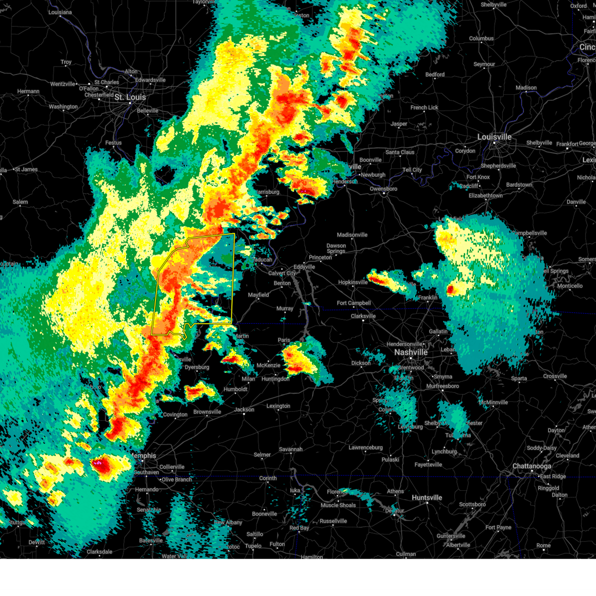
 At 852 pm cdt, a severe thunderstorm was located near marston, or near new madrid, moving east at 50 mph (broadcast media reported ping pong size hail near portageville). Hazards include ping pong ball size hail and 60 mph wind gusts. People and animals outdoors will be injured. expect hail damage to roofs, siding, windows, and vehicles. expect wind damage to roofs, siding, and trees. locations impacted include, boundurant, tallapoosa, hunter-dawson state historic site, new madrid, portageville, howardville, big oak tree state park, marston, gideon, and lilbourn. This includes interstate 55 between mile markers 32 and 46. At 852 pm cdt, a severe thunderstorm was located near marston, or near new madrid, moving east at 50 mph (broadcast media reported ping pong size hail near portageville). Hazards include ping pong ball size hail and 60 mph wind gusts. People and animals outdoors will be injured. expect hail damage to roofs, siding, windows, and vehicles. expect wind damage to roofs, siding, and trees. locations impacted include, boundurant, tallapoosa, hunter-dawson state historic site, new madrid, portageville, howardville, big oak tree state park, marston, gideon, and lilbourn. This includes interstate 55 between mile markers 32 and 46.
|
| 4/3/2025 8:40 PM CDT | Ping Pong Ball sized hail reported 1.2 miles NNE of Portageville, MO, ping pong ball sized hail near portageville. |
| 4/3/2025 8:37 PM CDT | Ping Pong Ball sized hail reported 0.4 miles S of Portageville, MO |
| 4/3/2025 8:29 PM CDT |
 Svrpah the national weather service in paducah has issued a * severe thunderstorm warning for, western fulton county in western kentucky, south central mississippi county in southeastern missouri, southern new madrid county in southeastern missouri, * until 915 pm cdt. * at 828 pm cdt, a severe thunderstorm was located near gideon, or 7 miles west of portageville, moving east at 50 mph (radar indicated). Hazards include 60 mph wind gusts and half dollar size hail. Hail damage to vehicles is expected. Expect wind damage to roofs, siding, and trees. Svrpah the national weather service in paducah has issued a * severe thunderstorm warning for, western fulton county in western kentucky, south central mississippi county in southeastern missouri, southern new madrid county in southeastern missouri, * until 915 pm cdt. * at 828 pm cdt, a severe thunderstorm was located near gideon, or 7 miles west of portageville, moving east at 50 mph (radar indicated). Hazards include 60 mph wind gusts and half dollar size hail. Hail damage to vehicles is expected. Expect wind damage to roofs, siding, and trees.
|
| 4/3/2025 8:26 PM CDT |
 Svrmeg the national weather service in memphis has issued a * severe thunderstorm warning for, northern pemiscot county in southeastern missouri, east central dunklin county in southeastern missouri, northwestern obion county in west tennessee, lake county in west tennessee, * until 915 pm cdt. * at 825 pm cdt, a severe thunderstorm was located near wardell, or 8 miles northeast of kennett, moving east at 45 mph (radar indicated). Hazards include 60 mph wind gusts and half dollar size hail. Hail damage to vehicles is expected. Expect wind damage to roofs, siding, and trees. Svrmeg the national weather service in memphis has issued a * severe thunderstorm warning for, northern pemiscot county in southeastern missouri, east central dunklin county in southeastern missouri, northwestern obion county in west tennessee, lake county in west tennessee, * until 915 pm cdt. * at 825 pm cdt, a severe thunderstorm was located near wardell, or 8 miles northeast of kennett, moving east at 45 mph (radar indicated). Hazards include 60 mph wind gusts and half dollar size hail. Hail damage to vehicles is expected. Expect wind damage to roofs, siding, and trees.
|
| 4/2/2025 8:07 PM CDT |
 Svrmeg the national weather service in memphis has issued a * severe thunderstorm warning for, northeastern mississippi county in eastern arkansas, central pemiscot county in southeastern missouri, northwestern crockett county in west tennessee, western weakley county in west tennessee, dyer county in west tennessee, western gibson county in west tennessee, obion county in west tennessee, northeastern lauderdale county in west tennessee, lake county in west tennessee, * until 900 pm cdt. * at 806 pm cdt, severe thunderstorms were located along a line extending from tiptonville to near miston to 7 miles south of heloise, moving northeast at 60 mph (radar indicated). Hazards include 60 mph wind gusts and quarter size hail. Hail damage to vehicles is expected. Expect wind damage to roofs, siding, and trees. Svrmeg the national weather service in memphis has issued a * severe thunderstorm warning for, northeastern mississippi county in eastern arkansas, central pemiscot county in southeastern missouri, northwestern crockett county in west tennessee, western weakley county in west tennessee, dyer county in west tennessee, western gibson county in west tennessee, obion county in west tennessee, northeastern lauderdale county in west tennessee, lake county in west tennessee, * until 900 pm cdt. * at 806 pm cdt, severe thunderstorms were located along a line extending from tiptonville to near miston to 7 miles south of heloise, moving northeast at 60 mph (radar indicated). Hazards include 60 mph wind gusts and quarter size hail. Hail damage to vehicles is expected. Expect wind damage to roofs, siding, and trees.
|
| 4/2/2025 7:55 PM CDT |
 the severe thunderstorm warning has been cancelled and is no longer in effect the severe thunderstorm warning has been cancelled and is no longer in effect
|
| 4/2/2025 7:55 PM CDT |
 At 755 pm cdt, a severe thunderstorm was located near cottonwood grove, or near caruthersville, moving east at 65 mph (radar indicated). Hazards include 60 mph wind gusts and nickel size hail. Expect damage to roofs, siding, and trees. Locations impacted include, tiptonville, tyler, covington, caruthersville, pascola, broadmoor, madie, homestown, steele, wardell, tennemo, hayti heights, blytheville, boothspoint, big boy junction, huffman, cates, bessie, bolton, and swift. At 755 pm cdt, a severe thunderstorm was located near cottonwood grove, or near caruthersville, moving east at 65 mph (radar indicated). Hazards include 60 mph wind gusts and nickel size hail. Expect damage to roofs, siding, and trees. Locations impacted include, tiptonville, tyler, covington, caruthersville, pascola, broadmoor, madie, homestown, steele, wardell, tennemo, hayti heights, blytheville, boothspoint, big boy junction, huffman, cates, bessie, bolton, and swift.
|
| 4/2/2025 7:45 PM CDT | At 745 pm cdt, a severe thunderstorm was located near portageville, moving northeast at 50 mph (radar indicated). Hazards include 60 mph wind gusts and nickel size hail. Expect damage to roofs, siding, and trees. Locations impacted include, west hermondale, tiptonville, calumet, new survey, denton, tyler, gobler, covington, caruthersville, buckeye, deer land, temples corner, pascola, peach orchard, broadmoor, samford, madie, channel, homestown, and gosnell. |
| 4/2/2025 7:44 PM CDT | the severe thunderstorm warning has been cancelled and is no longer in effect |
| 4/2/2025 7:44 PM CDT | At 744 pm cdt, a severe thunderstorm was located near hayti, moving northeast at 50 mph (radar indicated). Hazards include 60 mph wind gusts and nickel size hail. Expect damage to roofs, siding, and trees. Locations impacted include, west hermondale, tiptonville, calumet, new survey, denton, tyler, gobler, covington, caruthersville, deer land, temples corner, pascola, peach orchard, broadmoor, samford, madie, channel, homestown, gosnell, and steele. |
| 4/2/2025 7:33 PM CDT |
 At 733 pm cdt, severe thunderstorms were located along a line extending from near tamms to near miner to near portageville, moving northeast at 55 mph (radar indicated). Hazards include 70 mph wind gusts and quarter size hail. Hail damage to vehicles is expected. expect considerable tree damage. wind damage is also likely to mobile homes, roofs, and outbuildings. locations impacted include, charleston, canalou, cayce, diehlstadt, anniston, morley, bertrand, commerce, dorena, big oak tree state park, mounds, bardwell, ullin, sikeston, hay-wood city, chaffee, arlington, bell city, hunter-dawson state historic site, and blandville. this includes the following highways, interstate 57 in illinois between mile markers 1 and 23. interstate 57 in missouri between mile markers 1 and 21. Interstate 55 between mile markers 33 and 91. At 733 pm cdt, severe thunderstorms were located along a line extending from near tamms to near miner to near portageville, moving northeast at 55 mph (radar indicated). Hazards include 70 mph wind gusts and quarter size hail. Hail damage to vehicles is expected. expect considerable tree damage. wind damage is also likely to mobile homes, roofs, and outbuildings. locations impacted include, charleston, canalou, cayce, diehlstadt, anniston, morley, bertrand, commerce, dorena, big oak tree state park, mounds, bardwell, ullin, sikeston, hay-wood city, chaffee, arlington, bell city, hunter-dawson state historic site, and blandville. this includes the following highways, interstate 57 in illinois between mile markers 1 and 23. interstate 57 in missouri between mile markers 1 and 21. Interstate 55 between mile markers 33 and 91.
|
| 4/2/2025 7:13 PM CDT | Svrmeg the national weather service in memphis has issued a * severe thunderstorm warning for, northeastern greene county in eastern arkansas, northern mississippi county in eastern arkansas, eastern clay county in eastern arkansas, pemiscot county in southeastern missouri, dunklin county in southeastern missouri, western dyer county in west tennessee, lake county in west tennessee, * until 815 pm cdt. * at 713 pm cdt, a severe thunderstorm was located near kennett, moving northeast at 50 mph (radar indicated). Hazards include 60 mph wind gusts and nickel size hail. expect damage to roofs, siding, and trees |
| 4/2/2025 7:10 PM CDT | Svrpah the national weather service in paducah has issued a * severe thunderstorm warning for, southeastern union county in southern illinois, pulaski county in southern illinois, southwestern johnson county in southern illinois, alexander county in southern illinois, fulton county in western kentucky, western carlisle county in western kentucky, northwestern hickman county in western kentucky, ballard county in western kentucky, mississippi county in southeastern missouri, scott county in southeastern missouri, new madrid county in southeastern missouri, eastern stoddard county in southeastern missouri, * until 800 pm cdt. * at 710 pm cdt, severe thunderstorms were located along a line extending from near ware to near bell city to near holcomb, moving northeast at 55 mph (radar indicated). Hazards include 70 mph wind gusts and quarter size hail. Hail damage to vehicles is expected. expect considerable tree damage. Wind damage is also likely to mobile homes, roofs, and outbuildings. |
| 3/30/2025 7:45 PM CDT | Svrmeg the national weather service in memphis has issued a * severe thunderstorm warning for, pemiscot county in southeastern missouri, southeastern dunklin county in southeastern missouri, northwestern weakley county in west tennessee, dyer county in west tennessee, northwestern gibson county in west tennessee, obion county in west tennessee, lake county in west tennessee, * until 830 pm cdt. * at 745 pm cdt, severe thunderstorms were located along a line extending from 6 miles northwest of tiptonville to hayti to near hornersville, moving east at 60 mph (radar indicated). Hazards include 60 mph wind gusts and quarter size hail. Hail damage to vehicles is expected. Expect wind damage to roofs, siding, and trees. |
| 3/30/2025 7:43 PM CDT | Quarter sized hail reported 5.4 miles SW of Portageville, MO, report from mping: quarter (1.00 in.). |
| 3/30/2025 7:33 PM CDT | At 732 pm cdt, severe thunderstorms were located along a line extending from wardell to near deering to near cardwell, moving east at 45 mph (radar indicated). Hazards include 60 mph wind gusts and half dollar size hail. Hail damage to vehicles is expected. expect wind damage to roofs, siding, and trees. Locations impacted include, west hermondale, paulding, scobeville, calumet, new survey, denton, gobler, covington, caruthersville, buckeye, cardwell, caruth, deer land, arkmo, temples corner, west kennett, pascola, white oak, peach orchard, and samford. |
| 3/30/2025 7:33 PM CDT | the severe thunderstorm warning has been cancelled and is no longer in effect |
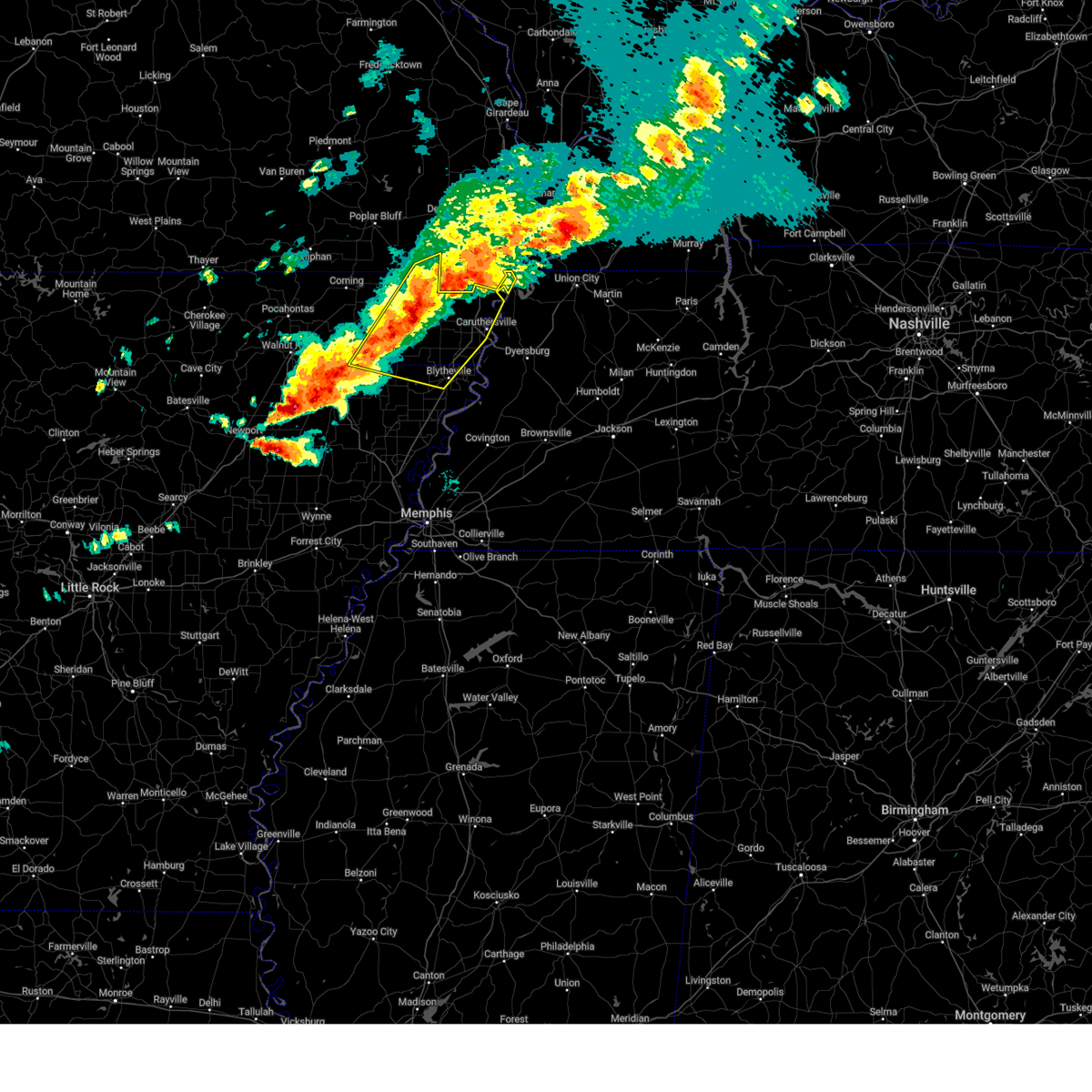
| 3/30/2025 7:29 PM CDT | At 729 pm cdt, a severe thunderstorm capable of producing a tornado was located near portageville, moving northeast at 30 mph (radar indicated rotation). Hazards include tornado and quarter size hail. Flying debris will be dangerous to those caught without shelter. mobile homes will be damaged or destroyed. damage to roofs, windows, and vehicles will occur. tree damage is likely. this dangerous storm will be near, howardville, marston, lilbourn, and new madrid around 735 pm cdt. other locations impacted by this tornadic thunderstorm include tallapoosa and north lilbourn. This includes interstate 55 between mile markers 33 and 45. |
| 3/30/2025 7:23 PM CDT |
 At 723 pm cdt, severe thunderstorms were located along a line extending from near holcomb to near kennett to near cardwell, moving east at 45 mph (radar indicated). Hazards include 60 mph wind gusts and half dollar size hail. Hail damage to vehicles is expected. expect wind damage to roofs, siding, and trees. locations impacted include, paulding, scobeville, calumet, new survey, marmaduke, gobler, covington, mounds, leonard, providence, st. Francis, noland, carryville, buck donic, homestown, dillman, piggott, steele, stark city, and hollywood. At 723 pm cdt, severe thunderstorms were located along a line extending from near holcomb to near kennett to near cardwell, moving east at 45 mph (radar indicated). Hazards include 60 mph wind gusts and half dollar size hail. Hail damage to vehicles is expected. expect wind damage to roofs, siding, and trees. locations impacted include, paulding, scobeville, calumet, new survey, marmaduke, gobler, covington, mounds, leonard, providence, st. Francis, noland, carryville, buck donic, homestown, dillman, piggott, steele, stark city, and hollywood.
|
| 3/30/2025 7:07 PM CDT | Svrmeg the national weather service in memphis has issued a * severe thunderstorm warning for, greene county in eastern arkansas, northeastern craighead county in eastern arkansas, northwestern mississippi county in eastern arkansas, eastern clay county in eastern arkansas, pemiscot county in southeastern missouri, dunklin county in southeastern missouri, western lake county in west tennessee, * until 745 pm cdt. * at 707 pm cdt, severe thunderstorms were located along a line extending from st. francis to near rector to near paragould, moving east at 40 mph (radar indicated). Hazards include golf ball size hail and 60 mph wind gusts. People and animals outdoors will be injured. expect hail damage to roofs, siding, windows, and vehicles. Expect wind damage to roofs, siding, and trees. |
| 3/30/2025 7:04 PM CDT | Torpah the national weather service in paducah has issued a * tornado warning for, southwestern fulton county in western kentucky, southwestern new madrid county in southeastern missouri, * until 745 pm cdt. * at 704 pm cdt, a severe thunderstorm capable of producing a tornado was located near gideon, or 11 miles southeast of campbell, moving northeast at 35 mph (radar indicated rotation). Hazards include tornado and quarter size hail. Flying debris will be dangerous to those caught without shelter. mobile homes will be damaged or destroyed. damage to roofs, windows, and vehicles will occur. tree damage is likely. this dangerous storm will be near, portageville and gideon around 710 pm cdt. risco around 715 pm cdt. marston around 725 pm cdt. howardville, lilbourn, and new madrid around 730 pm cdt. other locations impacted by this tornadic thunderstorm include tallapoosa, catron, and north lilbourn. This includes interstate 55 between mile markers 33 and 45. |
| 3/30/2025 6:56 PM CDT | Svrpah the national weather service in paducah has issued a * severe thunderstorm warning for, southwestern new madrid county in southeastern missouri, southeastern stoddard county in southeastern missouri, * until 745 pm cdt. * at 655 pm cdt, a severe thunderstorm was located over clarkton, or near campbell, moving east at 35 mph (radar indicated). Hazards include 60 mph wind gusts and quarter size hail. Hail damage to vehicles is expected. Expect wind damage to roofs, siding, and trees. |
| 3/15/2025 2:04 AM CDT |
 the tornado warning has been cancelled and is no longer in effect the tornado warning has been cancelled and is no longer in effect
|
| 3/15/2025 1:58 AM CDT |
 the tornado warning has been cancelled and is no longer in effect the tornado warning has been cancelled and is no longer in effect
|
| 3/15/2025 1:58 AM CDT |
 At 157 am cdt, a severe thunderstorm capable of producing a tornado was located over bolton, or near hayti, moving northeast at 65 mph (radar indicated rotation). Hazards include tornado and ping pong ball size hail. Flying debris will be dangerous to those caught without shelter. mobile homes will be damaged or destroyed. damage to roofs, windows, and vehicles will occur. tree damage is likely. Locations impacted include, wardell, stanley, north wardell, ridgely, madie, mooring, bolton, swift, homestown, hayward, stewart, and portageville. At 157 am cdt, a severe thunderstorm capable of producing a tornado was located over bolton, or near hayti, moving northeast at 65 mph (radar indicated rotation). Hazards include tornado and ping pong ball size hail. Flying debris will be dangerous to those caught without shelter. mobile homes will be damaged or destroyed. damage to roofs, windows, and vehicles will occur. tree damage is likely. Locations impacted include, wardell, stanley, north wardell, ridgely, madie, mooring, bolton, swift, homestown, hayward, stewart, and portageville.
|
| 3/15/2025 1:53 AM CDT |
 At 152 am cdt, a severe thunderstorm capable of producing a tornado was located near bolton, or near hayti, moving northeast at 65 mph (radar indicated rotation). Hazards include tornado and ping pong ball size hail. Flying debris will be dangerous to those caught without shelter. mobile homes will be damaged or destroyed. damage to roofs, windows, and vehicles will occur. tree damage is likely. Locations impacted include, ridgely, stewart, shade, caruthersville, bakerville, hathaway, deering, hayti, stanley, pascola, canady, hayward, peach orchard, braggadocio, madie, mooring, homestown, wardell, north wardell, and hayti heights. At 152 am cdt, a severe thunderstorm capable of producing a tornado was located near bolton, or near hayti, moving northeast at 65 mph (radar indicated rotation). Hazards include tornado and ping pong ball size hail. Flying debris will be dangerous to those caught without shelter. mobile homes will be damaged or destroyed. damage to roofs, windows, and vehicles will occur. tree damage is likely. Locations impacted include, ridgely, stewart, shade, caruthersville, bakerville, hathaway, deering, hayti, stanley, pascola, canady, hayward, peach orchard, braggadocio, madie, mooring, homestown, wardell, north wardell, and hayti heights.
|
| 3/15/2025 1:46 AM CDT | At 146 am cdt, a severe thunderstorm capable of producing a tornado was located over deering, or 7 miles east of kennett, moving northeast at 70 mph (radar indicated rotation). Hazards include tornado and ping pong ball size hail. Flying debris will be dangerous to those caught without shelter. mobile homes will be damaged or destroyed. damage to roofs, windows, and vehicles will occur. tree damage is likely. Locations impacted include, ipley, scobeville, ridgely, new survey, vincit, gobler, covington, tinkerville, stewart, shade, lorine, caruthersville, bakerville, hathaway, deering, hayti, stanley, deer land, west kennett, and pascola. |
| 3/15/2025 1:36 AM CDT |
 Torpah the national weather service in paducah has issued a * tornado warning for, western fulton county in western kentucky, northwestern hickman county in western kentucky, southeastern mississippi county in southeastern missouri, southeastern new madrid county in southeastern missouri, * until 200 am cdt. * at 136 am cdt, a severe thunderstorm capable of producing a tornado was located near portageville, moving northeast at 55 mph (radar indicated rotation). Hazards include tornado. Flying debris will be dangerous to those caught without shelter. mobile homes will be damaged or destroyed. damage to roofs, windows, and vehicles will occur. tree damage is likely. this dangerous storm will be near, hunter-dawson state historic site, howardville, marston, and new madrid around 140 am cdt. big oak tree state park around 155 am cdt. other locations impacted by this tornadic thunderstorm include boundurant. This includes interstate 55 between mile markers 33 and 47. Torpah the national weather service in paducah has issued a * tornado warning for, western fulton county in western kentucky, northwestern hickman county in western kentucky, southeastern mississippi county in southeastern missouri, southeastern new madrid county in southeastern missouri, * until 200 am cdt. * at 136 am cdt, a severe thunderstorm capable of producing a tornado was located near portageville, moving northeast at 55 mph (radar indicated rotation). Hazards include tornado. Flying debris will be dangerous to those caught without shelter. mobile homes will be damaged or destroyed. damage to roofs, windows, and vehicles will occur. tree damage is likely. this dangerous storm will be near, hunter-dawson state historic site, howardville, marston, and new madrid around 140 am cdt. big oak tree state park around 155 am cdt. other locations impacted by this tornadic thunderstorm include boundurant. This includes interstate 55 between mile markers 33 and 47.
|
| 3/15/2025 1:33 AM CDT |
 Tormeg the national weather service in memphis has issued a * tornado warning for, pemiscot county in southeastern missouri, southeastern dunklin county in southeastern missouri, southwestern lake county in west tennessee, * until 215 am cdt. * at 133 am cdt, a severe thunderstorm capable of producing a tornado was located over hornersville, or near senath, moving northeast at 45 mph (radar indicated rotation). Hazards include tornado and golf ball size hail. Flying debris will be dangerous to those caught without shelter. mobile homes will be damaged or destroyed. damage to roofs, windows, and vehicles will occur. Tree damage is likely. Tormeg the national weather service in memphis has issued a * tornado warning for, pemiscot county in southeastern missouri, southeastern dunklin county in southeastern missouri, southwestern lake county in west tennessee, * until 215 am cdt. * at 133 am cdt, a severe thunderstorm capable of producing a tornado was located over hornersville, or near senath, moving northeast at 45 mph (radar indicated rotation). Hazards include tornado and golf ball size hail. Flying debris will be dangerous to those caught without shelter. mobile homes will be damaged or destroyed. damage to roofs, windows, and vehicles will occur. Tree damage is likely.
|
| 3/15/2025 1:25 AM CDT |
 At 125 am cdt, a confirmed tornado was located over wardell, or near portageville, moving northeast at 55 mph (weather spotters confirmed tornado). Hazards include damaging tornado. Flying debris will be dangerous to those caught without shelter. mobile homes will be damaged or destroyed. damage to roofs, windows, and vehicles will occur. tree damage is likely. this tornado will be near, portageville and marston around 130 am cdt. howardville and new madrid around 140 am cdt. hunter-dawson state historic site around 145 am cdt. other locations impacted by this tornadic thunderstorm include tallapoosa and north lilbourn. This includes interstate 55 between mile markers 33 and 51. At 125 am cdt, a confirmed tornado was located over wardell, or near portageville, moving northeast at 55 mph (weather spotters confirmed tornado). Hazards include damaging tornado. Flying debris will be dangerous to those caught without shelter. mobile homes will be damaged or destroyed. damage to roofs, windows, and vehicles will occur. tree damage is likely. this tornado will be near, portageville and marston around 130 am cdt. howardville and new madrid around 140 am cdt. hunter-dawson state historic site around 145 am cdt. other locations impacted by this tornadic thunderstorm include tallapoosa and north lilbourn. This includes interstate 55 between mile markers 33 and 51.
|
| 3/15/2025 1:14 AM CDT |
 At 114 am cdt, a confirmed large and extremely dangerous tornado was located near kennett, moving northeast at 45 mph. this is a particularly dangerous situation. take cover now! (public confirmed tornado). Hazards include damaging tornado. You are in a life-threatening situation. flying debris may be deadly to those caught without shelter. mobile homes will be destroyed. considerable damage to homes, businesses, and vehicles is likely and complete destruction is possible. Locations impacted include, ipley, clarkton, stewart, lorine, bakerville, hayti, baird, stanley, frisbee, west kennett, pascola, white oak, hayward, peach orchard, nimmons, carryville, homestown, holcomb, rhyne, and wardell. At 114 am cdt, a confirmed large and extremely dangerous tornado was located near kennett, moving northeast at 45 mph. this is a particularly dangerous situation. take cover now! (public confirmed tornado). Hazards include damaging tornado. You are in a life-threatening situation. flying debris may be deadly to those caught without shelter. mobile homes will be destroyed. considerable damage to homes, businesses, and vehicles is likely and complete destruction is possible. Locations impacted include, ipley, clarkton, stewart, lorine, bakerville, hayti, baird, stanley, frisbee, west kennett, pascola, white oak, hayward, peach orchard, nimmons, carryville, homestown, holcomb, rhyne, and wardell.
|
| 3/15/2025 1:12 AM CDT |
 At 112 am cdt, a confirmed large and extremely dangerous tornado was located near kennett, moving northeast at 50 mph. this is a particularly dangerous situation. take cover now! (public confirmed tornado). Hazards include damaging tornado. You are in a life-threatening situation. flying debris may be deadly to those caught without shelter. mobile homes will be destroyed. considerable damage to homes, businesses, and vehicles is likely and complete destruction is possible. Locations impacted include, ipley, octa, scobeville, vincit, clarkton, gobler, tinkerville, stewart, lorine, bakerville, deering, hayti, baird, stanley, caruth, deer land, frisbee, west kennett, pascola, and white oak. At 112 am cdt, a confirmed large and extremely dangerous tornado was located near kennett, moving northeast at 50 mph. this is a particularly dangerous situation. take cover now! (public confirmed tornado). Hazards include damaging tornado. You are in a life-threatening situation. flying debris may be deadly to those caught without shelter. mobile homes will be destroyed. considerable damage to homes, businesses, and vehicles is likely and complete destruction is possible. Locations impacted include, ipley, octa, scobeville, vincit, clarkton, gobler, tinkerville, stewart, lorine, bakerville, deering, hayti, baird, stanley, caruth, deer land, frisbee, west kennett, pascola, and white oak.
|
| 3/15/2025 1:10 AM CDT |
 At 110 am cdt, a confirmed tornado was located near kennett, moving northeast at 60 mph (weather spotters confirmed tornado). Hazards include damaging tornado. Flying debris will be dangerous to those caught without shelter. mobile homes will be damaged or destroyed. damage to roofs, windows, and vehicles will occur. tree damage is likely. this tornado will be near, gideon around 115 am cdt. portageville around 120 am cdt. marston around 130 am cdt. hunter-dawson state historic site, howardville, lilbourn, and new madrid around 135 am cdt. other locations impacted by this tornadic thunderstorm include tallapoosa and north lilbourn. This includes interstate 55 between mile markers 33 and 51. At 110 am cdt, a confirmed tornado was located near kennett, moving northeast at 60 mph (weather spotters confirmed tornado). Hazards include damaging tornado. Flying debris will be dangerous to those caught without shelter. mobile homes will be damaged or destroyed. damage to roofs, windows, and vehicles will occur. tree damage is likely. this tornado will be near, gideon around 115 am cdt. portageville around 120 am cdt. marston around 130 am cdt. hunter-dawson state historic site, howardville, lilbourn, and new madrid around 135 am cdt. other locations impacted by this tornadic thunderstorm include tallapoosa and north lilbourn. This includes interstate 55 between mile markers 33 and 51.
|
| 3/15/2025 1:08 AM CDT |
 the tornado warning has been cancelled and is no longer in effect the tornado warning has been cancelled and is no longer in effect
|
| 3/15/2025 1:08 AM CDT |
 At 108 am cdt, a severe thunderstorm capable of producing a tornado was located near kennett, moving northeast at 50 mph (radar indicated rotation). Hazards include tornado and half dollar size hail. Flying debris will be dangerous to those caught without shelter. mobile homes will be damaged or destroyed. damage to roofs, windows, and vehicles will occur. tree damage is likely. Locations impacted include, ipley, octa, scobeville, vincit, clarkton, gobler, tinkerville, stewart, lorine, bakerville, deering, hayti, baird, stanley, caruth, deer land, frisbee, west kennett, pascola, and white oak. At 108 am cdt, a severe thunderstorm capable of producing a tornado was located near kennett, moving northeast at 50 mph (radar indicated rotation). Hazards include tornado and half dollar size hail. Flying debris will be dangerous to those caught without shelter. mobile homes will be damaged or destroyed. damage to roofs, windows, and vehicles will occur. tree damage is likely. Locations impacted include, ipley, octa, scobeville, vincit, clarkton, gobler, tinkerville, stewart, lorine, bakerville, deering, hayti, baird, stanley, caruth, deer land, frisbee, west kennett, pascola, and white oak.
|
| 3/15/2025 1:06 AM CDT |
 Torpah the national weather service in paducah has issued a * tornado warning for, southwestern fulton county in western kentucky, southwestern new madrid county in southeastern missouri, * until 145 am cdt. * at 105 am cdt, a severe thunderstorm capable of producing a tornado was located over kennett, moving northeast at 60 mph (radar indicated rotation). Hazards include tornado. Flying debris will be dangerous to those caught without shelter. mobile homes will be damaged or destroyed. damage to roofs, windows, and vehicles will occur. tree damage is likely. this dangerous storm will be near, gideon around 115 am cdt. portageville around 120 am cdt. marston around 125 am cdt. howardville, lilbourn, and new madrid around 130 am cdt. hunter-dawson state historic site around 135 am cdt. other locations impacted by this tornadic thunderstorm include tallapoosa and north lilbourn. This includes interstate 55 between mile markers 33 and 51. Torpah the national weather service in paducah has issued a * tornado warning for, southwestern fulton county in western kentucky, southwestern new madrid county in southeastern missouri, * until 145 am cdt. * at 105 am cdt, a severe thunderstorm capable of producing a tornado was located over kennett, moving northeast at 60 mph (radar indicated rotation). Hazards include tornado. Flying debris will be dangerous to those caught without shelter. mobile homes will be damaged or destroyed. damage to roofs, windows, and vehicles will occur. tree damage is likely. this dangerous storm will be near, gideon around 115 am cdt. portageville around 120 am cdt. marston around 125 am cdt. howardville, lilbourn, and new madrid around 130 am cdt. hunter-dawson state historic site around 135 am cdt. other locations impacted by this tornadic thunderstorm include tallapoosa and north lilbourn. This includes interstate 55 between mile markers 33 and 51.
|
| 3/15/2025 12:42 AM CDT | Tormeg the national weather service in memphis has issued a * tornado warning for, eastern greene county in eastern arkansas, southeastern clay county in eastern arkansas, northern pemiscot county in southeastern missouri, southern dunklin county in southeastern missouri, * until 130 am cdt. * at 1242 am cdt, a severe thunderstorm capable of producing a tornado was located near marmaduke, moving northeast at 50 mph (radar indicated rotation). Hazards include tornado and half dollar size hail. Flying debris will be dangerous to those caught without shelter. mobile homes will be damaged or destroyed. damage to roofs, windows, and vehicles will occur. Tree damage is likely. |
| 6/26/2024 9:15 AM CDT |
 Svrmeg the national weather service in memphis has issued a * severe thunderstorm warning for, northeastern pemiscot county in southeastern missouri, northwestern obion county in west tennessee, northwestern lake county in west tennessee, * until 945 am cdt. * at 915 am cdt, a severe thunderstorm was located near portageville, moving northeast at 35 mph (radar indicated). Hazards include 60 mph wind gusts and nickel size hail. expect damage to roofs, siding, and trees Svrmeg the national weather service in memphis has issued a * severe thunderstorm warning for, northeastern pemiscot county in southeastern missouri, northwestern obion county in west tennessee, northwestern lake county in west tennessee, * until 945 am cdt. * at 915 am cdt, a severe thunderstorm was located near portageville, moving northeast at 35 mph (radar indicated). Hazards include 60 mph wind gusts and nickel size hail. expect damage to roofs, siding, and trees
|
| 6/9/2024 12:16 AM CDT |
 Svrmeg the national weather service in memphis has issued a * severe thunderstorm warning for, east central craighead county in eastern arkansas, mississippi county in eastern arkansas, pemiscot county in southeastern missouri, southeastern dunklin county in southeastern missouri, western dyer county in west tennessee, western obion county in west tennessee, northwestern lauderdale county in west tennessee, lake county in west tennessee, * until 100 am cdt. * at 1216 am cdt, severe thunderstorms were located along a line extending from near portageville to near senath to near monette, moving southeast at 40 mph (radar indicated). Hazards include ping pong ball size hail and 60 mph wind gusts. People and animals outdoors will be injured. expect hail damage to roofs, siding, windows, and vehicles. Expect wind damage to roofs, siding, and trees. Svrmeg the national weather service in memphis has issued a * severe thunderstorm warning for, east central craighead county in eastern arkansas, mississippi county in eastern arkansas, pemiscot county in southeastern missouri, southeastern dunklin county in southeastern missouri, western dyer county in west tennessee, western obion county in west tennessee, northwestern lauderdale county in west tennessee, lake county in west tennessee, * until 100 am cdt. * at 1216 am cdt, severe thunderstorms were located along a line extending from near portageville to near senath to near monette, moving southeast at 40 mph (radar indicated). Hazards include ping pong ball size hail and 60 mph wind gusts. People and animals outdoors will be injured. expect hail damage to roofs, siding, windows, and vehicles. Expect wind damage to roofs, siding, and trees.
|
| 5/26/2024 11:54 PM CDT |
 Svrmeg the national weather service in memphis has issued a * severe thunderstorm warning for, eastern craighead county in eastern arkansas, northern mississippi county in eastern arkansas, pemiscot county in southeastern missouri, southeastern dunklin county in southeastern missouri, western dyer county in west tennessee, north central lauderdale county in west tennessee, western lake county in west tennessee, * until 1245 am cdt. * at 1153 pm cdt, severe thunderstorms were located along a line extending from near miston to near gosnell to near lake city, moving southeast at 20 mph (radar indicated). Hazards include 60 mph wind gusts and quarter size hail. Hail damage to vehicles is expected. Expect wind damage to roofs, siding, and trees. Svrmeg the national weather service in memphis has issued a * severe thunderstorm warning for, eastern craighead county in eastern arkansas, northern mississippi county in eastern arkansas, pemiscot county in southeastern missouri, southeastern dunklin county in southeastern missouri, western dyer county in west tennessee, north central lauderdale county in west tennessee, western lake county in west tennessee, * until 1245 am cdt. * at 1153 pm cdt, severe thunderstorms were located along a line extending from near miston to near gosnell to near lake city, moving southeast at 20 mph (radar indicated). Hazards include 60 mph wind gusts and quarter size hail. Hail damage to vehicles is expected. Expect wind damage to roofs, siding, and trees.
|
| 5/26/2024 11:10 PM CDT |
 At 1110 pm cdt, severe thunderstorms were located along a line extending from wardell to kennett to near senath to near lake frierson state park, moving southeast at 20 mph (radar indicated). Hazards include ping pong ball size hail and 60 mph wind gusts. People and animals outdoors will be injured. expect hail damage to roofs, siding, windows, and vehicles. expect wind damage to roofs, siding, and trees. Locations impacted include, jonesboro, paragould, kennett, caruthersville, piggott, portageville, hayti, campbell, rector, senath, brookland, monette, marmaduke, crowleys ridge state park, lake frierson state park, clarkton, oak grove heights, cardwell, hornersville, and holcomb. At 1110 pm cdt, severe thunderstorms were located along a line extending from wardell to kennett to near senath to near lake frierson state park, moving southeast at 20 mph (radar indicated). Hazards include ping pong ball size hail and 60 mph wind gusts. People and animals outdoors will be injured. expect hail damage to roofs, siding, windows, and vehicles. expect wind damage to roofs, siding, and trees. Locations impacted include, jonesboro, paragould, kennett, caruthersville, piggott, portageville, hayti, campbell, rector, senath, brookland, monette, marmaduke, crowleys ridge state park, lake frierson state park, clarkton, oak grove heights, cardwell, hornersville, and holcomb.
|
| 5/26/2024 10:58 PM CDT |
 At 1058 pm cdt, severe thunderstorms were located along a line extending from near wardell to near kennett to near rector to lake frierson state park, moving southeast at 20 mph (radar indicated). Hazards include ping pong ball size hail and 60 mph wind gusts. People and animals outdoors will be injured. expect hail damage to roofs, siding, windows, and vehicles. expect wind damage to roofs, siding, and trees. Locations impacted include, jonesboro, paragould, kennett, caruthersville, piggott, portageville, hayti, campbell, rector, senath, brookland, monette, marmaduke, chalk bluff natural area, crowleys ridge state park, lake frierson state park, clarkton, oak grove heights, cardwell, and hornersville. At 1058 pm cdt, severe thunderstorms were located along a line extending from near wardell to near kennett to near rector to lake frierson state park, moving southeast at 20 mph (radar indicated). Hazards include ping pong ball size hail and 60 mph wind gusts. People and animals outdoors will be injured. expect hail damage to roofs, siding, windows, and vehicles. expect wind damage to roofs, siding, and trees. Locations impacted include, jonesboro, paragould, kennett, caruthersville, piggott, portageville, hayti, campbell, rector, senath, brookland, monette, marmaduke, chalk bluff natural area, crowleys ridge state park, lake frierson state park, clarkton, oak grove heights, cardwell, and hornersville.
|
| 5/26/2024 10:46 PM CDT |
 At 1045 pm cdt, severe thunderstorms were located along a line extending from near gideon to near greenway to rector to near fontaine, moving southeast at 20 mph (radar indicated). Hazards include ping pong ball size hail and 60 mph wind gusts. People and animals outdoors will be injured. expect hail damage to roofs, siding, windows, and vehicles. expect wind damage to roofs, siding, and trees. Locations impacted include, jonesboro, paragould, kennett, caruthersville, piggott, portageville, hayti, campbell, rector, senath, brookland, monette, marmaduke, chalk bluff natural area, crowleys ridge state park, lake frierson state park, clarkton, oak grove heights, cardwell, and hornersville. At 1045 pm cdt, severe thunderstorms were located along a line extending from near gideon to near greenway to rector to near fontaine, moving southeast at 20 mph (radar indicated). Hazards include ping pong ball size hail and 60 mph wind gusts. People and animals outdoors will be injured. expect hail damage to roofs, siding, windows, and vehicles. expect wind damage to roofs, siding, and trees. Locations impacted include, jonesboro, paragould, kennett, caruthersville, piggott, portageville, hayti, campbell, rector, senath, brookland, monette, marmaduke, chalk bluff natural area, crowleys ridge state park, lake frierson state park, clarkton, oak grove heights, cardwell, and hornersville.
|
| 5/26/2024 10:41 PM CDT |
 Svrmeg the national weather service in memphis has issued a * severe thunderstorm warning for, greene county in eastern arkansas, northeastern craighead county in eastern arkansas, clay county in eastern arkansas, pemiscot county in southeastern missouri, dunklin county in southeastern missouri, * until 1130 pm cdt. * at 1040 pm cdt, severe thunderstorms were located along a line extending from near clarkton to near greenway to rector to near fontaine, moving southeast at 20 mph (radar indicated). Hazards include 60 mph wind gusts and half dollar size hail. Hail damage to vehicles is expected. Expect wind damage to roofs, siding, and trees. Svrmeg the national weather service in memphis has issued a * severe thunderstorm warning for, greene county in eastern arkansas, northeastern craighead county in eastern arkansas, clay county in eastern arkansas, pemiscot county in southeastern missouri, dunklin county in southeastern missouri, * until 1130 pm cdt. * at 1040 pm cdt, severe thunderstorms were located along a line extending from near clarkton to near greenway to rector to near fontaine, moving southeast at 20 mph (radar indicated). Hazards include 60 mph wind gusts and half dollar size hail. Hail damage to vehicles is expected. Expect wind damage to roofs, siding, and trees.
|
| 5/26/2024 7:40 AM CDT |
 At 740 am cdt, a severe thunderstorm capable of producing a tornado was located over portageville, moving east at 35 mph (radar indicated rotation). Hazards include tornado and quarter size hail. Flying debris will be dangerous to those caught without shelter. mobile homes will be damaged or destroyed. damage to roofs, windows, and vehicles will occur. tree damage is likely. Locations impacted include, portageville, tiptonville, clayton, samburg, spout springs, walnut log, wright, cronanville, grays camp, cates, bessie, proctor city, new markham, stewart, stanley, hayward, and reelfoot national wildlife refuge. At 740 am cdt, a severe thunderstorm capable of producing a tornado was located over portageville, moving east at 35 mph (radar indicated rotation). Hazards include tornado and quarter size hail. Flying debris will be dangerous to those caught without shelter. mobile homes will be damaged or destroyed. damage to roofs, windows, and vehicles will occur. tree damage is likely. Locations impacted include, portageville, tiptonville, clayton, samburg, spout springs, walnut log, wright, cronanville, grays camp, cates, bessie, proctor city, new markham, stewart, stanley, hayward, and reelfoot national wildlife refuge.
|
| 5/26/2024 7:34 AM CDT |
 the severe thunderstorm warning has been cancelled and is no longer in effect the severe thunderstorm warning has been cancelled and is no longer in effect
|
| 5/26/2024 7:34 AM CDT |
 At 734 am cdt, severe thunderstorms were located along a line extending from near tiptonville to near burdette, moving southeast at 60 mph (radar indicated). Hazards include 60 mph wind gusts and quarter size hail. Hail damage to vehicles is expected. expect wind damage to roofs, siding, and trees. Locations impacted include, caruthersville, malden, portageville, hayti, steele, reelfoot lake state park, tiptonville, ridgely, hayti heights, cooter, wardell, clayton, bolton, deering, heloise, cottonwood grove, holland, samburg, bragg city, and pascola. At 734 am cdt, severe thunderstorms were located along a line extending from near tiptonville to near burdette, moving southeast at 60 mph (radar indicated). Hazards include 60 mph wind gusts and quarter size hail. Hail damage to vehicles is expected. expect wind damage to roofs, siding, and trees. Locations impacted include, caruthersville, malden, portageville, hayti, steele, reelfoot lake state park, tiptonville, ridgely, hayti heights, cooter, wardell, clayton, bolton, deering, heloise, cottonwood grove, holland, samburg, bragg city, and pascola.
|
| 5/26/2024 7:31 AM CDT | Multiple trees down in the portageville and new madrid area in new madrid county MO, 0.4 miles S of Portageville, MO |
| 5/26/2024 7:31 AM CDT |
 the severe thunderstorm warning has been cancelled and is no longer in effect the severe thunderstorm warning has been cancelled and is no longer in effect
|
| 5/26/2024 7:31 AM CDT |
 At 730 am cdt, severe thunderstorms were located along a line extending from near chaffee to near miner to near portageville, moving northeast at 75 mph (radar indicated). Hazards include 70 mph wind gusts. Expect considerable tree damage. damage is likely to mobile homes, roofs, and outbuildings. locations impacted include, sikeston, charleston, scott city, portageville, east prairie, new madrid, cairo, oran, lilbourn, miner, benton, towosahgy state historic site, big oak tree state park, hunter-dawson state historic site, bertrand, mounds, morley, tamms, matthews, and kelso. this includes the following highways, interstate 57 in illinois between mile markers 1 and 21. interstate 57 in missouri between mile markers 1 and 21. Interstate 55 between mile markers 33 and 88. At 730 am cdt, severe thunderstorms were located along a line extending from near chaffee to near miner to near portageville, moving northeast at 75 mph (radar indicated). Hazards include 70 mph wind gusts. Expect considerable tree damage. damage is likely to mobile homes, roofs, and outbuildings. locations impacted include, sikeston, charleston, scott city, portageville, east prairie, new madrid, cairo, oran, lilbourn, miner, benton, towosahgy state historic site, big oak tree state park, hunter-dawson state historic site, bertrand, mounds, morley, tamms, matthews, and kelso. this includes the following highways, interstate 57 in illinois between mile markers 1 and 21. interstate 57 in missouri between mile markers 1 and 21. Interstate 55 between mile markers 33 and 88.
|
| 5/26/2024 7:28 AM CDT |
 Tormeg the national weather service in memphis has issued a * tornado warning for, northeastern pemiscot county in southeastern missouri, northwestern obion county in west tennessee, northeastern lake county in west tennessee, * until 815 am cdt. * at 728 am cdt, a severe thunderstorm capable of producing a tornado was located near wardell, or near portageville, moving east at 40 mph (radar indicated rotation). Hazards include tornado and quarter size hail. Flying debris will be dangerous to those caught without shelter. mobile homes will be damaged or destroyed. damage to roofs, windows, and vehicles will occur. Tree damage is likely. Tormeg the national weather service in memphis has issued a * tornado warning for, northeastern pemiscot county in southeastern missouri, northwestern obion county in west tennessee, northeastern lake county in west tennessee, * until 815 am cdt. * at 728 am cdt, a severe thunderstorm capable of producing a tornado was located near wardell, or near portageville, moving east at 40 mph (radar indicated rotation). Hazards include tornado and quarter size hail. Flying debris will be dangerous to those caught without shelter. mobile homes will be damaged or destroyed. damage to roofs, windows, and vehicles will occur. Tree damage is likely.
|
| 5/26/2024 7:27 AM CDT |
 Torpah the national weather service in paducah has issued a * tornado warning for, southwestern new madrid county in southeastern missouri, * until 745 am cdt. * at 727 am cdt, a severe thunderstorm capable of producing a tornado was located near wardell, or near portageville, moving east at 70 mph (radar indicated rotation). Hazards include tornado. Flying debris will be dangerous to those caught without shelter. mobile homes will be damaged or destroyed. damage to roofs, windows, and vehicles will occur. tree damage is likely. this dangerous storm will be near, portageville around 730 am cdt. other locations impacted by this tornadic thunderstorm include bessie. This includes interstate 55 between mile markers 32 and 38. Torpah the national weather service in paducah has issued a * tornado warning for, southwestern new madrid county in southeastern missouri, * until 745 am cdt. * at 727 am cdt, a severe thunderstorm capable of producing a tornado was located near wardell, or near portageville, moving east at 70 mph (radar indicated rotation). Hazards include tornado. Flying debris will be dangerous to those caught without shelter. mobile homes will be damaged or destroyed. damage to roofs, windows, and vehicles will occur. tree damage is likely. this dangerous storm will be near, portageville around 730 am cdt. other locations impacted by this tornadic thunderstorm include bessie. This includes interstate 55 between mile markers 32 and 38.
|
| 5/26/2024 7:19 AM CDT |
 the severe thunderstorm warning has been cancelled and is no longer in effect the severe thunderstorm warning has been cancelled and is no longer in effect
|
| 5/26/2024 7:19 AM CDT |
 At 719 am cdt, severe thunderstorms were located along a line extending from portageville to near hornersville, moving southeast at 60 mph (radar indicated). Hazards include 60 mph wind gusts and quarter size hail. Hail damage to vehicles is expected. expect wind damage to roofs, siding, and trees. locations impacted include, kennett, caruthersville, malden, piggott, portageville, hayti, steele, campbell, rector, senath, marmaduke, reelfoot lake state park, tiptonville, ridgely, holcomb, hayti heights, cooter, wardell, st. Francis, and greenway. At 719 am cdt, severe thunderstorms were located along a line extending from portageville to near hornersville, moving southeast at 60 mph (radar indicated). Hazards include 60 mph wind gusts and quarter size hail. Hail damage to vehicles is expected. expect wind damage to roofs, siding, and trees. locations impacted include, kennett, caruthersville, malden, piggott, portageville, hayti, steele, campbell, rector, senath, marmaduke, reelfoot lake state park, tiptonville, ridgely, holcomb, hayti heights, cooter, wardell, st. Francis, and greenway.
|
| 5/26/2024 7:12 AM CDT |
 At 712 am cdt, severe thunderstorms were located along a line extending from near bell city to near parma to holcomb, moving east at 70 mph (radar indicated). Hazards include 70 mph wind gusts. Expect considerable tree damage. damage is likely to mobile homes, roofs, and outbuildings. locations impacted include, sikeston, dexter, charleston, scott city, portageville, east prairie, new madrid, cairo, bernie, bloomfield, oran, lilbourn, miner, benton, big oak tree state park, hunter-dawson state historic site, towosahgy state historic site, malden, clarkton, and gideon. this includes the following highways, interstate 57 in illinois between mile markers 1 and 21. interstate 57 in missouri between mile markers 1 and 21. Interstate 55 between mile markers 33 and 88. At 712 am cdt, severe thunderstorms were located along a line extending from near bell city to near parma to holcomb, moving east at 70 mph (radar indicated). Hazards include 70 mph wind gusts. Expect considerable tree damage. damage is likely to mobile homes, roofs, and outbuildings. locations impacted include, sikeston, dexter, charleston, scott city, portageville, east prairie, new madrid, cairo, bernie, bloomfield, oran, lilbourn, miner, benton, big oak tree state park, hunter-dawson state historic site, towosahgy state historic site, malden, clarkton, and gideon. this includes the following highways, interstate 57 in illinois between mile markers 1 and 21. interstate 57 in missouri between mile markers 1 and 21. Interstate 55 between mile markers 33 and 88.
|
| 5/26/2024 7:12 AM CDT |
 the severe thunderstorm warning has been cancelled and is no longer in effect the severe thunderstorm warning has been cancelled and is no longer in effect
|
| 5/26/2024 7:03 AM CDT |
 Svrmeg the national weather service in memphis has issued a * severe thunderstorm warning for, northeastern greene county in eastern arkansas, northeastern mississippi county in eastern arkansas, eastern clay county in eastern arkansas, pemiscot county in southeastern missouri, dunklin county in southeastern missouri, western dyer county in west tennessee, obion county in west tennessee, lake county in west tennessee, * until 745 am cdt. * at 702 am cdt, severe thunderstorms were located along a line extending from malden to near marmaduke, moving southeast at 35 mph (radar indicated). Hazards include 60 mph wind gusts and quarter size hail. Hail damage to vehicles is expected. Expect wind damage to roofs, siding, and trees. Svrmeg the national weather service in memphis has issued a * severe thunderstorm warning for, northeastern greene county in eastern arkansas, northeastern mississippi county in eastern arkansas, eastern clay county in eastern arkansas, pemiscot county in southeastern missouri, dunklin county in southeastern missouri, western dyer county in west tennessee, obion county in west tennessee, lake county in west tennessee, * until 745 am cdt. * at 702 am cdt, severe thunderstorms were located along a line extending from malden to near marmaduke, moving southeast at 35 mph (radar indicated). Hazards include 60 mph wind gusts and quarter size hail. Hail damage to vehicles is expected. Expect wind damage to roofs, siding, and trees.
|
| 5/8/2024 11:37 PM CDT |
 At 1137 pm cdt, a severe thunderstorm was located near lilbourn, moving east at 50 mph (radar indicated). Hazards include 60 mph wind gusts. Expect damage to roofs, siding, and trees. locations impacted include, portageville, new madrid, lilbourn, hunter-dawson state historic site, marston, howardville, catron, north lilbourn, and boundurant. This includes interstate 55 between mile markers 33 and 51. At 1137 pm cdt, a severe thunderstorm was located near lilbourn, moving east at 50 mph (radar indicated). Hazards include 60 mph wind gusts. Expect damage to roofs, siding, and trees. locations impacted include, portageville, new madrid, lilbourn, hunter-dawson state historic site, marston, howardville, catron, north lilbourn, and boundurant. This includes interstate 55 between mile markers 33 and 51.
|
| 5/8/2024 11:37 PM CDT |
 the severe thunderstorm warning has been cancelled and is no longer in effect the severe thunderstorm warning has been cancelled and is no longer in effect
|
| 5/8/2024 11:22 PM CDT |
 Svrpah the national weather service in paducah has issued a * severe thunderstorm warning for, western fulton county in western kentucky, new madrid county in southeastern missouri, southeastern stoddard county in southeastern missouri, * until midnight cdt. * at 1122 pm cdt, a severe thunderstorm was located near risco, or near malden, moving east at 50 mph (radar indicated). Hazards include 60 mph wind gusts. expect damage to roofs, siding, and trees Svrpah the national weather service in paducah has issued a * severe thunderstorm warning for, western fulton county in western kentucky, new madrid county in southeastern missouri, southeastern stoddard county in southeastern missouri, * until midnight cdt. * at 1122 pm cdt, a severe thunderstorm was located near risco, or near malden, moving east at 50 mph (radar indicated). Hazards include 60 mph wind gusts. expect damage to roofs, siding, and trees
|
| 5/8/2024 10:24 PM CDT |
 At 1024 pm cdt, a severe thunderstorm was located near portageville, moving east at 30 mph (radar indicated). Hazards include 60 mph wind gusts and quarter size hail. Hail damage to vehicles is expected. expect wind damage to roofs, siding, and trees. locations impacted include, portageville, new madrid, lilbourn, marston, howardville, risco, tallapoosa, and north lilbourn. This includes interstate 55 between mile markers 34 and 46. At 1024 pm cdt, a severe thunderstorm was located near portageville, moving east at 30 mph (radar indicated). Hazards include 60 mph wind gusts and quarter size hail. Hail damage to vehicles is expected. expect wind damage to roofs, siding, and trees. locations impacted include, portageville, new madrid, lilbourn, marston, howardville, risco, tallapoosa, and north lilbourn. This includes interstate 55 between mile markers 34 and 46.
|
| 5/8/2024 10:23 PM CDT |
 At 1023 pm cdt, a severe thunderstorm capable of producing a tornado was located near portageville, moving east at 25 mph (radar indicated rotation). Hazards include tornado and quarter size hail. Flying debris will be dangerous to those caught without shelter. mobile homes will be damaged or destroyed. damage to roofs, windows, and vehicles will occur. tree damage is likely. this dangerous storm will be near, portageville, lilbourn, marston, and howardville around 1030 pm cdt. This includes interstate 55 between mile markers 34 and 43. At 1023 pm cdt, a severe thunderstorm capable of producing a tornado was located near portageville, moving east at 25 mph (radar indicated rotation). Hazards include tornado and quarter size hail. Flying debris will be dangerous to those caught without shelter. mobile homes will be damaged or destroyed. damage to roofs, windows, and vehicles will occur. tree damage is likely. this dangerous storm will be near, portageville, lilbourn, marston, and howardville around 1030 pm cdt. This includes interstate 55 between mile markers 34 and 43.
|
| 5/8/2024 10:13 PM CDT |
 Torpah the national weather service in paducah has issued a * tornado warning for, southwestern new madrid county in southeastern missouri, * until 1100 pm cdt. * at 1013 pm cdt, a severe thunderstorm capable of producing a tornado was located near gideon, or 8 miles west of portageville, moving east at 25 mph (radar indicated rotation). Hazards include tornado and half dollar size hail. Flying debris will be dangerous to those caught without shelter. mobile homes will be damaged or destroyed. damage to roofs, windows, and vehicles will occur. tree damage is likely. this dangerous storm will be near, portageville around 1020 pm cdt. marston around 1025 pm cdt. lilbourn and howardville around 1030 pm cdt. other locations impacted by this tornadic thunderstorm include tallapoosa. This includes interstate 55 between mile markers 34 and 43. Torpah the national weather service in paducah has issued a * tornado warning for, southwestern new madrid county in southeastern missouri, * until 1100 pm cdt. * at 1013 pm cdt, a severe thunderstorm capable of producing a tornado was located near gideon, or 8 miles west of portageville, moving east at 25 mph (radar indicated rotation). Hazards include tornado and half dollar size hail. Flying debris will be dangerous to those caught without shelter. mobile homes will be damaged or destroyed. damage to roofs, windows, and vehicles will occur. tree damage is likely. this dangerous storm will be near, portageville around 1020 pm cdt. marston around 1025 pm cdt. lilbourn and howardville around 1030 pm cdt. other locations impacted by this tornadic thunderstorm include tallapoosa. This includes interstate 55 between mile markers 34 and 43.
|
| 5/8/2024 10:10 PM CDT |
 Svrpah the national weather service in paducah has issued a * severe thunderstorm warning for, southwestern new madrid county in southeastern missouri, * until 1100 pm cdt. * at 1009 pm cdt, a severe thunderstorm was located over gideon, or 9 miles southeast of malden, moving east at 25 mph (radar indicated). Hazards include 60 mph wind gusts and half dollar size hail. Hail damage to vehicles is expected. Expect wind damage to roofs, siding, and trees. Svrpah the national weather service in paducah has issued a * severe thunderstorm warning for, southwestern new madrid county in southeastern missouri, * until 1100 pm cdt. * at 1009 pm cdt, a severe thunderstorm was located over gideon, or 9 miles southeast of malden, moving east at 25 mph (radar indicated). Hazards include 60 mph wind gusts and half dollar size hail. Hail damage to vehicles is expected. Expect wind damage to roofs, siding, and trees.
|
| 8/12/2023 8:50 AM CDT | Several trees dow in new madrid county MO, 0.4 miles S of Portageville, MO |
| 7/1/2023 8:54 PM CDT |
 The severe thunderstorm warning for northwestern pemiscot county will expire at 900 pm cdt, the storm which prompted the warning has moved out of the area. therefore, the warning will be allowed to expire. however small hail and gusty winds are still possible with this thunderstorm. a severe thunderstorm watch remains in effect until 900 pm cdt for southeastern missouri. The severe thunderstorm warning for northwestern pemiscot county will expire at 900 pm cdt, the storm which prompted the warning has moved out of the area. therefore, the warning will be allowed to expire. however small hail and gusty winds are still possible with this thunderstorm. a severe thunderstorm watch remains in effect until 900 pm cdt for southeastern missouri.
|
| 7/1/2023 8:47 PM CDT |
 At 847 pm cdt, a severe thunderstorm was located near farrenburg, or near east prairie, moving east at 45 mph (law enforcement). Hazards include 60 mph wind gusts. Expect damage to roofs, siding, and trees. locations impacted include, charleston, portageville, east prairie, new madrid, hickman, lilbourn, hunter-dawson state historic site, towosahgy state historic site, big oak tree state park, matthews, marston, howardville, canalou, anniston, farrenburg, dorena and north lilbourn. this includes the following highways, interstate 57 in missouri between mile markers 10 and 14. interstate 55 between mile markers 34 and 62. hail threat, radar indicated max hail size, <. 75 in wind threat, radar indicated max wind gust, 60 mph. At 847 pm cdt, a severe thunderstorm was located near farrenburg, or near east prairie, moving east at 45 mph (law enforcement). Hazards include 60 mph wind gusts. Expect damage to roofs, siding, and trees. locations impacted include, charleston, portageville, east prairie, new madrid, hickman, lilbourn, hunter-dawson state historic site, towosahgy state historic site, big oak tree state park, matthews, marston, howardville, canalou, anniston, farrenburg, dorena and north lilbourn. this includes the following highways, interstate 57 in missouri between mile markers 10 and 14. interstate 55 between mile markers 34 and 62. hail threat, radar indicated max hail size, <. 75 in wind threat, radar indicated max wind gust, 60 mph.
|
| 7/1/2023 8:45 PM CDT |
 At 845 pm cdt, a severe thunderstorm was located near gideon, or 8 miles west of portageville, moving east at 40 mph (radar indicated). Hazards include 60 mph wind gusts and quarter size hail. Hail damage to vehicles is expected. expect wind damage to roofs, siding, and trees. locations impacted include, portageville, gideon and tallapoosa. this includes interstate 55 between mile markers 32 and 33. hail threat, radar indicated max hail size, 1. 00 in wind threat, radar indicated max wind gust, 60 mph. At 845 pm cdt, a severe thunderstorm was located near gideon, or 8 miles west of portageville, moving east at 40 mph (radar indicated). Hazards include 60 mph wind gusts and quarter size hail. Hail damage to vehicles is expected. expect wind damage to roofs, siding, and trees. locations impacted include, portageville, gideon and tallapoosa. this includes interstate 55 between mile markers 32 and 33. hail threat, radar indicated max hail size, 1. 00 in wind threat, radar indicated max wind gust, 60 mph.
|
| 7/1/2023 8:43 PM CDT |
 At 842 pm cdt, a severe thunderstorm was located over from near marston to near matthews, moving east at 40 mph (law enforcement). Hazards include 60 mph wind gusts. Expect damage to roofs, siding, and trees. locations impacted include, charleston, portageville, east prairie, new madrid, hickman, lilbourn, hunter-dawson state historic site, towosahgy state historic site, big oak tree state park, matthews, marston, howardville, canalou, anniston, farrenburg, dorena, catron and north lilbourn. this includes the following highways, interstate 57 in missouri between mile markers 10 and 15. interstate 55 between mile markers 34 and 63. hail threat, radar indicated max hail size, <. 75 in wind threat, radar indicated max wind gust, 60 mph. At 842 pm cdt, a severe thunderstorm was located over from near marston to near matthews, moving east at 40 mph (law enforcement). Hazards include 60 mph wind gusts. Expect damage to roofs, siding, and trees. locations impacted include, charleston, portageville, east prairie, new madrid, hickman, lilbourn, hunter-dawson state historic site, towosahgy state historic site, big oak tree state park, matthews, marston, howardville, canalou, anniston, farrenburg, dorena, catron and north lilbourn. this includes the following highways, interstate 57 in missouri between mile markers 10 and 15. interstate 55 between mile markers 34 and 63. hail threat, radar indicated max hail size, <. 75 in wind threat, radar indicated max wind gust, 60 mph.
|
| 7/1/2023 8:43 PM CDT |
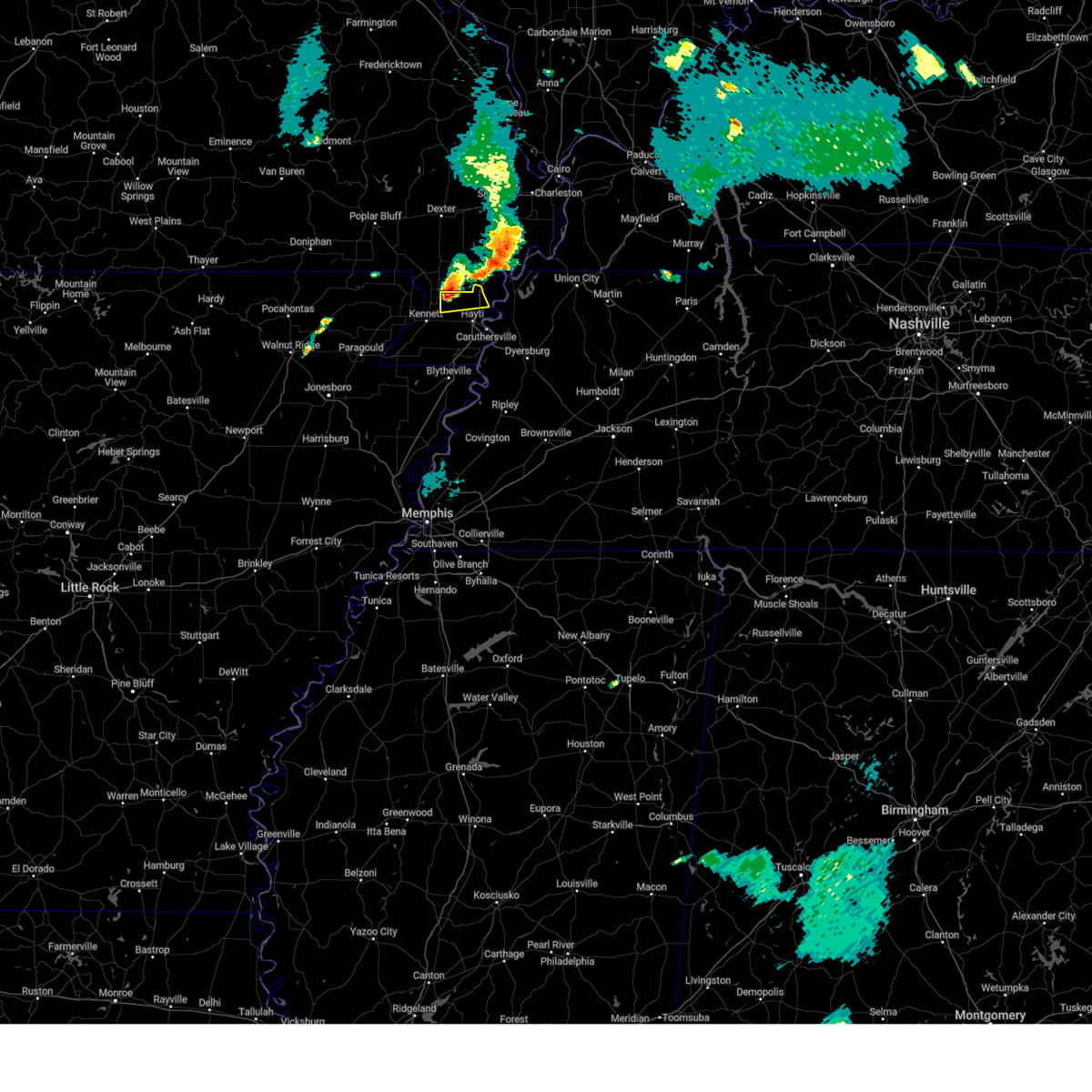 At 843 pm cdt, a severe thunderstorm was located near wardell, or 11 miles northeast of kennett, moving east at 30 mph (radar indicated). Hazards include 60 mph wind gusts and quarter size hail. Hail damage to vehicles is expected. expect wind damage to roofs, siding, and trees. locations impacted include, portageville, wardell, bolton, north wardell, homestown, stanley, swift and peach orchard. hail threat, radar indicated max hail size, 1. 00 in wind threat, radar indicated max wind gust, 60 mph. At 843 pm cdt, a severe thunderstorm was located near wardell, or 11 miles northeast of kennett, moving east at 30 mph (radar indicated). Hazards include 60 mph wind gusts and quarter size hail. Hail damage to vehicles is expected. expect wind damage to roofs, siding, and trees. locations impacted include, portageville, wardell, bolton, north wardell, homestown, stanley, swift and peach orchard. hail threat, radar indicated max hail size, 1. 00 in wind threat, radar indicated max wind gust, 60 mph.
|
| 7/1/2023 8:38 PM CDT |
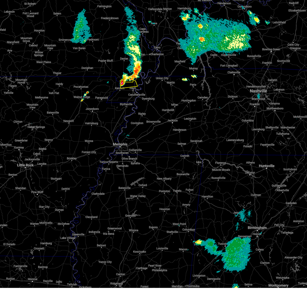 At 838 pm cdt, a severe thunderstorm was located near holcomb, or 9 miles northeast of kennett, moving east at 30 mph (radar indicated). Hazards include 60 mph wind gusts and quarter size hail. Hail damage to vehicles is expected. expect wind damage to roofs, siding, and trees. locations impacted include, kennett, portageville, clarkton, holcomb, wardell, bolton, lorine, north wardell, white oak, homestown, ipley, baird, stanley, frisbee, swift, peach orchard and hayward. hail threat, radar indicated max hail size, 1. 00 in wind threat, radar indicated max wind gust, 60 mph. At 838 pm cdt, a severe thunderstorm was located near holcomb, or 9 miles northeast of kennett, moving east at 30 mph (radar indicated). Hazards include 60 mph wind gusts and quarter size hail. Hail damage to vehicles is expected. expect wind damage to roofs, siding, and trees. locations impacted include, kennett, portageville, clarkton, holcomb, wardell, bolton, lorine, north wardell, white oak, homestown, ipley, baird, stanley, frisbee, swift, peach orchard and hayward. hail threat, radar indicated max hail size, 1. 00 in wind threat, radar indicated max wind gust, 60 mph.
|
| 7/1/2023 8:37 PM CDT |
 At 837 pm cdt, a severe thunderstorm was located over farrenburg, or near hunter-dawson state historic site, moving east at 45 mph (radar indicated). Hazards include 60 mph wind gusts. expect damage to roofs, siding, and trees At 837 pm cdt, a severe thunderstorm was located over farrenburg, or near hunter-dawson state historic site, moving east at 45 mph (radar indicated). Hazards include 60 mph wind gusts. expect damage to roofs, siding, and trees
|
| 7/1/2023 8:28 PM CDT |
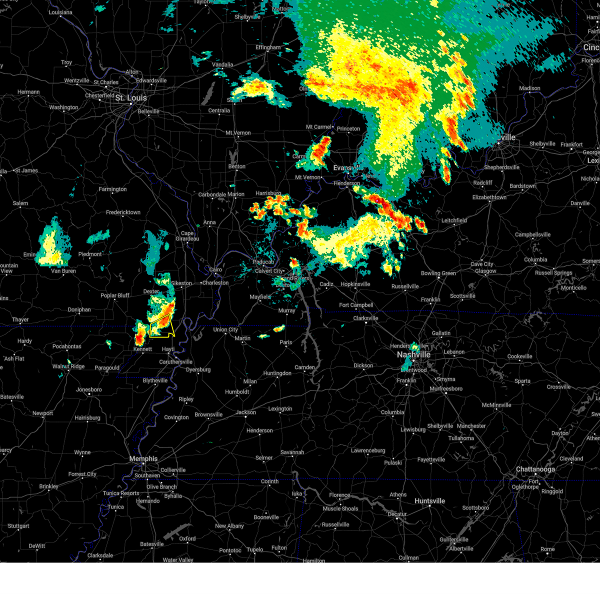 At 828 pm cdt, a severe thunderstorm was located over holcomb, or 8 miles south of campbell, moving east at 40 mph (radar indicated). Hazards include 60 mph wind gusts and quarter size hail. Hail damage to vehicles is expected. Expect wind damage to roofs, siding, and trees. At 828 pm cdt, a severe thunderstorm was located over holcomb, or 8 miles south of campbell, moving east at 40 mph (radar indicated). Hazards include 60 mph wind gusts and quarter size hail. Hail damage to vehicles is expected. Expect wind damage to roofs, siding, and trees.
|
| 7/1/2023 8:27 PM CDT |
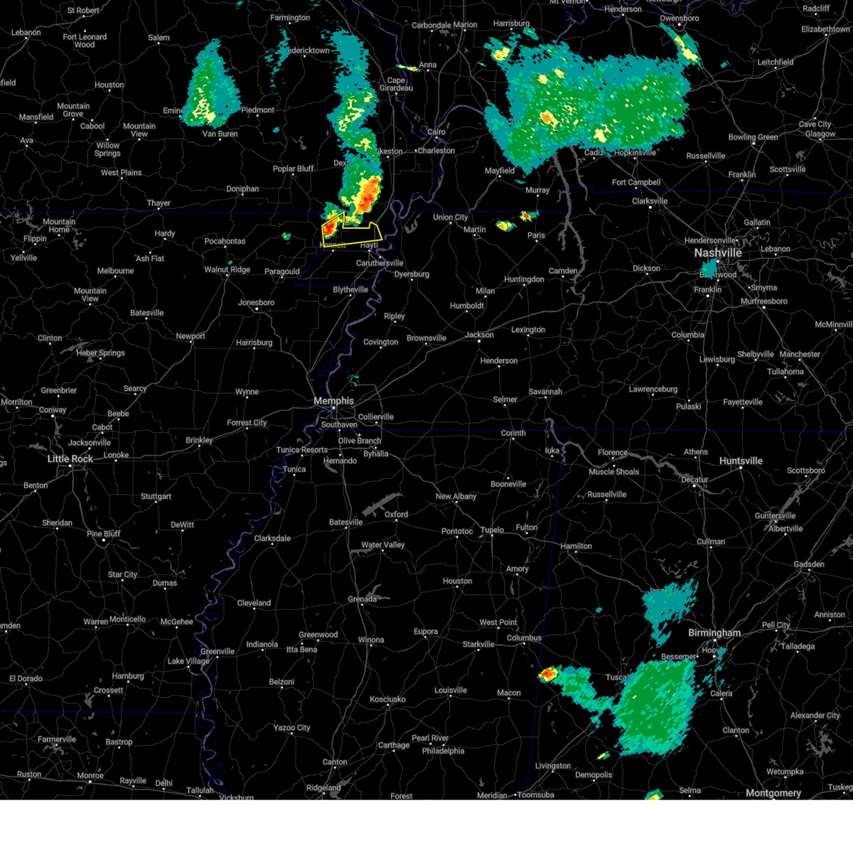 At 827 pm cdt, a severe thunderstorm was located over holcomb, or 8 miles south of campbell, moving east at 45 mph (radar indicated). Hazards include 60 mph wind gusts and quarter size hail. Hail damage to vehicles is expected. Expect wind damage to roofs, siding, and trees. At 827 pm cdt, a severe thunderstorm was located over holcomb, or 8 miles south of campbell, moving east at 45 mph (radar indicated). Hazards include 60 mph wind gusts and quarter size hail. Hail damage to vehicles is expected. Expect wind damage to roofs, siding, and trees.
|
| 7/1/2023 5:09 PM CDT |
 At 508 pm cdt, a severe thunderstorm was located near risco, or 7 miles northwest of portageville, moving northeast at 35 mph (radar indicated). Hazards include 60 mph wind gusts and half dollar size hail. Hail damage to vehicles is expected. expect wind damage to roofs, siding, and trees. locations impacted include, portageville, gideon, parma, marston, risco, tallapoosa and catron. this includes interstate 55 between mile markers 32 and 42. hail threat, radar indicated max hail size, 1. 25 in wind threat, radar indicated max wind gust, 60 mph. At 508 pm cdt, a severe thunderstorm was located near risco, or 7 miles northwest of portageville, moving northeast at 35 mph (radar indicated). Hazards include 60 mph wind gusts and half dollar size hail. Hail damage to vehicles is expected. expect wind damage to roofs, siding, and trees. locations impacted include, portageville, gideon, parma, marston, risco, tallapoosa and catron. this includes interstate 55 between mile markers 32 and 42. hail threat, radar indicated max hail size, 1. 25 in wind threat, radar indicated max wind gust, 60 mph.
|
| 7/1/2023 4:59 PM CDT |
 At 459 pm cdt, a severe thunderstorm was located over gideon, or 9 miles southeast of malden, moving northeast at 35 mph (radar indicated). Hazards include 60 mph wind gusts and quarter size hail. Hail damage to vehicles is expected. Expect wind damage to roofs, siding, and trees. At 459 pm cdt, a severe thunderstorm was located over gideon, or 9 miles southeast of malden, moving northeast at 35 mph (radar indicated). Hazards include 60 mph wind gusts and quarter size hail. Hail damage to vehicles is expected. Expect wind damage to roofs, siding, and trees.
|
| 7/1/2023 2:58 PM CDT |
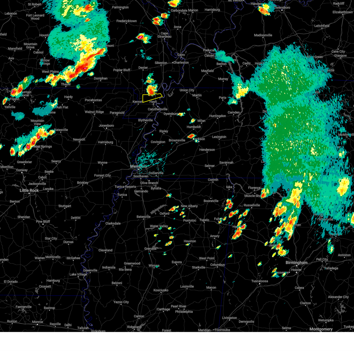 The severe thunderstorm warning for northern pemiscot county will expire at 300 pm cdt, the storm which prompted the warning has moved out of the area. therefore, the warning will be allowed to expire. a severe thunderstorm watch remains in effect until 900 pm cdt for southeastern missouri. The severe thunderstorm warning for northern pemiscot county will expire at 300 pm cdt, the storm which prompted the warning has moved out of the area. therefore, the warning will be allowed to expire. a severe thunderstorm watch remains in effect until 900 pm cdt for southeastern missouri.
|
| 7/1/2023 2:49 PM CDT |
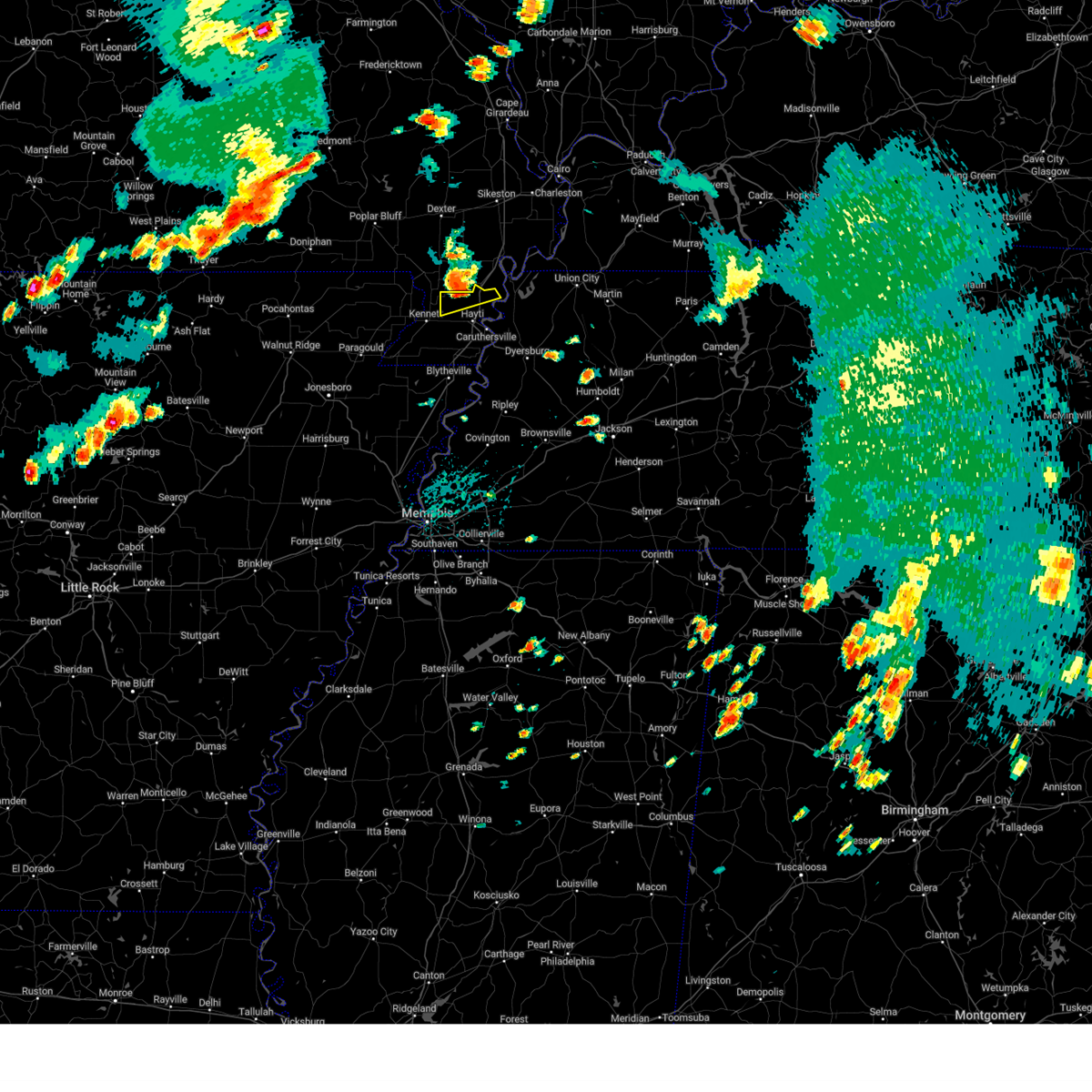 At 249 pm cdt, a severe thunderstorm was located near wardell, or near portageville, moving northeast at 55 mph (radar indicated). Hazards include 60 mph wind gusts and quarter size hail. Hail damage to vehicles is expected. expect wind damage to roofs, siding, and trees. locations impacted include, portageville, wardell, bolton, north wardell, homestown, stanley, swift, hayward, peach orchard and stewart. hail threat, radar indicated max hail size, 1. 00 in wind threat, radar indicated max wind gust, 60 mph. At 249 pm cdt, a severe thunderstorm was located near wardell, or near portageville, moving northeast at 55 mph (radar indicated). Hazards include 60 mph wind gusts and quarter size hail. Hail damage to vehicles is expected. expect wind damage to roofs, siding, and trees. locations impacted include, portageville, wardell, bolton, north wardell, homestown, stanley, swift, hayward, peach orchard and stewart. hail threat, radar indicated max hail size, 1. 00 in wind threat, radar indicated max wind gust, 60 mph.
|
| 7/1/2023 2:41 PM CDT |
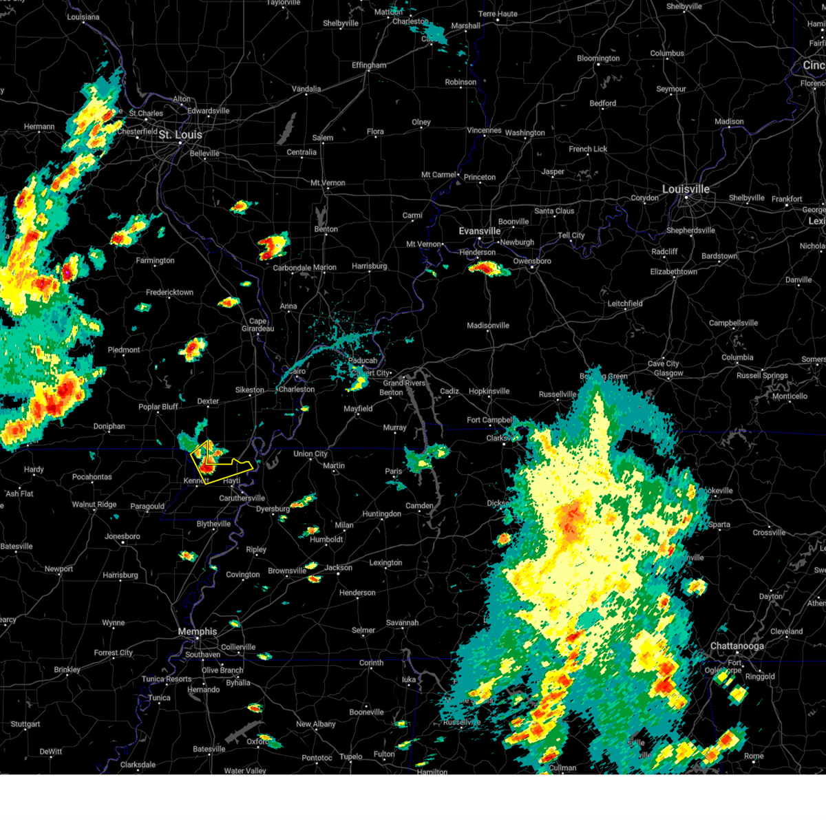 At 241 pm cdt, a severe thunderstorm was located near holcomb, or 11 miles southeast of campbell, moving northeast at 45 mph (radar indicated). Hazards include ping pong ball size hail and 60 mph wind gusts. People and animals outdoors will be injured. expect hail damage to roofs, siding, windows, and vehicles. expect wind damage to roofs, siding, and trees. locations impacted include, portageville, campbell, malden, clarkton, holcomb, wardell, bolton, bragg city, north wardell, white oak, homestown, providence, stewart, baird, stanley, frisbee, mcguires, swift, hayward and peach orchard. hail threat, radar indicated max hail size, 1. 50 in wind threat, radar indicated max wind gust, 60 mph. At 241 pm cdt, a severe thunderstorm was located near holcomb, or 11 miles southeast of campbell, moving northeast at 45 mph (radar indicated). Hazards include ping pong ball size hail and 60 mph wind gusts. People and animals outdoors will be injured. expect hail damage to roofs, siding, windows, and vehicles. expect wind damage to roofs, siding, and trees. locations impacted include, portageville, campbell, malden, clarkton, holcomb, wardell, bolton, bragg city, north wardell, white oak, homestown, providence, stewart, baird, stanley, frisbee, mcguires, swift, hayward and peach orchard. hail threat, radar indicated max hail size, 1. 50 in wind threat, radar indicated max wind gust, 60 mph.
|
| 7/1/2023 2:33 PM CDT |
 At 232 pm cdt, a severe thunderstorm was located near holcomb, or 8 miles north of kennett, moving northeast at 35 mph (radar indicated). Hazards include ping pong ball size hail and 60 mph wind gusts. People and animals outdoors will be injured. expect hail damage to roofs, siding, windows, and vehicles. expect wind damage to roofs, siding, and trees. locations impacted include, kennett, portageville, campbell, malden, clarkton, holcomb, wardell, bolton, bragg city, lorine, west kennett, carryville, north wardell, white oak, homestown, ipley, stewart, baird, stanley and frisbee. hail threat, radar indicated max hail size, 1. 50 in wind threat, radar indicated max wind gust, 60 mph. At 232 pm cdt, a severe thunderstorm was located near holcomb, or 8 miles north of kennett, moving northeast at 35 mph (radar indicated). Hazards include ping pong ball size hail and 60 mph wind gusts. People and animals outdoors will be injured. expect hail damage to roofs, siding, windows, and vehicles. expect wind damage to roofs, siding, and trees. locations impacted include, kennett, portageville, campbell, malden, clarkton, holcomb, wardell, bolton, bragg city, lorine, west kennett, carryville, north wardell, white oak, homestown, ipley, stewart, baird, stanley and frisbee. hail threat, radar indicated max hail size, 1. 50 in wind threat, radar indicated max wind gust, 60 mph.
|
| 7/1/2023 2:33 PM CDT |
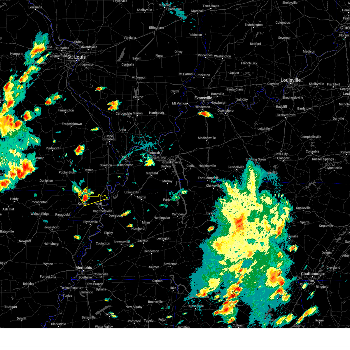 At 232 pm cdt, a severe thunderstorm was located near holcomb, or 8 miles north of kennett, moving northeast at 35 mph (radar indicated). Hazards include ping pong ball size hail and 60 mph wind gusts. People and animals outdoors will be injured. expect hail damage to roofs, siding, windows, and vehicles. expect wind damage to roofs, siding, and trees. locations impacted include, kennett, portageville, campbell, malden, clarkton, holcomb, wardell, bolton, bragg city, lorine, west kennett, carryville, north wardell, white oak, homestown, ipley, stewart, baird, stanley and frisbee. hail threat, radar indicated max hail size, 1. 50 in wind threat, radar indicated max wind gust, 60 mph. At 232 pm cdt, a severe thunderstorm was located near holcomb, or 8 miles north of kennett, moving northeast at 35 mph (radar indicated). Hazards include ping pong ball size hail and 60 mph wind gusts. People and animals outdoors will be injured. expect hail damage to roofs, siding, windows, and vehicles. expect wind damage to roofs, siding, and trees. locations impacted include, kennett, portageville, campbell, malden, clarkton, holcomb, wardell, bolton, bragg city, lorine, west kennett, carryville, north wardell, white oak, homestown, ipley, stewart, baird, stanley and frisbee. hail threat, radar indicated max hail size, 1. 50 in wind threat, radar indicated max wind gust, 60 mph.
|
| 7/1/2023 2:22 PM CDT |
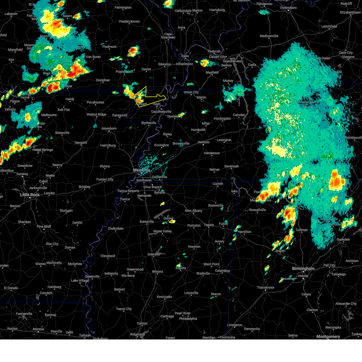 At 222 pm cdt, a severe thunderstorm was located near holcomb, or 7 miles north of kennett, moving northeast at 40 mph (radar indicated). Hazards include 60 mph wind gusts and quarter size hail. Hail damage to vehicles is expected. Expect wind damage to roofs, siding, and trees. At 222 pm cdt, a severe thunderstorm was located near holcomb, or 7 miles north of kennett, moving northeast at 40 mph (radar indicated). Hazards include 60 mph wind gusts and quarter size hail. Hail damage to vehicles is expected. Expect wind damage to roofs, siding, and trees.
|
| 5/8/2023 10:22 PM CDT |
 At 1021 pm cdt, strong winds out ahead of a line of thunderstorms were located along a line extending from near oran to canalou to near malden, moving east at 50 mph (radar indicated). Hazards include 60 mph wind gusts and quarter size hail. Hail damage to vehicles is expected. Expect wind damage to roofs, siding, and trees. At 1021 pm cdt, strong winds out ahead of a line of thunderstorms were located along a line extending from near oran to canalou to near malden, moving east at 50 mph (radar indicated). Hazards include 60 mph wind gusts and quarter size hail. Hail damage to vehicles is expected. Expect wind damage to roofs, siding, and trees.
|
| 4/15/2023 8:55 PM CDT |
 The severe thunderstorm warning for northern mississippi, pemiscot, southeastern dunklin, dyer, western obion, northeastern lauderdale and lake counties will expire at 900 pm cdt, the storms which prompted the warning have weakened below severe limits, and no longer pose an immediate threat to life or property. therefore, the warning will be allowed to expire. however gusty winds are still possible with these thunderstorms. a severe thunderstorm watch remains in effect until 200 am cdt for eastern arkansas, southeastern missouri, and west tennessee. to report severe weather, contact your nearest law enforcement agency. they will relay your report to the national weather service memphis. The severe thunderstorm warning for northern mississippi, pemiscot, southeastern dunklin, dyer, western obion, northeastern lauderdale and lake counties will expire at 900 pm cdt, the storms which prompted the warning have weakened below severe limits, and no longer pose an immediate threat to life or property. therefore, the warning will be allowed to expire. however gusty winds are still possible with these thunderstorms. a severe thunderstorm watch remains in effect until 200 am cdt for eastern arkansas, southeastern missouri, and west tennessee. to report severe weather, contact your nearest law enforcement agency. they will relay your report to the national weather service memphis.
|
| 4/15/2023 8:50 PM CDT |
 At 850 pm cdt, a severe thunderstorm was located over marston, or near lilbourn, moving east at 60 mph (radar indicated). Hazards include 60 mph wind gusts and penny size hail. Expect damage to roofs, siding, and trees. locations impacted include, portageville, east prairie, new madrid, lilbourn, hunter-dawson state historic site, big oak tree state park, gideon, parma, matthews, marston, howardville, risco, farrenburg, tallapoosa, catron, north lilbourn and boundurant. this includes interstate 55 between mile markers 33 and 58. hail threat, radar indicated max hail size, 0. 75 in wind threat, radar indicated max wind gust, 60 mph. At 850 pm cdt, a severe thunderstorm was located over marston, or near lilbourn, moving east at 60 mph (radar indicated). Hazards include 60 mph wind gusts and penny size hail. Expect damage to roofs, siding, and trees. locations impacted include, portageville, east prairie, new madrid, lilbourn, hunter-dawson state historic site, big oak tree state park, gideon, parma, matthews, marston, howardville, risco, farrenburg, tallapoosa, catron, north lilbourn and boundurant. this includes interstate 55 between mile markers 33 and 58. hail threat, radar indicated max hail size, 0. 75 in wind threat, radar indicated max wind gust, 60 mph.
|
| 4/15/2023 8:42 PM CDT |
 At 842 pm cdt, severe thunderstorms were located along a line extending from near risco to heloise to fort pillow state park, moving east at 60 mph (radar indicated). Hazards include 60 mph wind gusts. Expect damage to roofs, siding, and trees. locations impacted include, dyersburg, blytheville, kennett, ripley, caruthersville, gosnell, manila, portageville, hayti, steele, reelfoot lake state park, tiptonville, malden, newbern, halls, ridgely, troy, obion, hornersville and hayti heights. hail threat, radar indicated max hail size, <. 75 in wind threat, radar indicated max wind gust, 60 mph. At 842 pm cdt, severe thunderstorms were located along a line extending from near risco to heloise to fort pillow state park, moving east at 60 mph (radar indicated). Hazards include 60 mph wind gusts. Expect damage to roofs, siding, and trees. locations impacted include, dyersburg, blytheville, kennett, ripley, caruthersville, gosnell, manila, portageville, hayti, steele, reelfoot lake state park, tiptonville, malden, newbern, halls, ridgely, troy, obion, hornersville and hayti heights. hail threat, radar indicated max hail size, <. 75 in wind threat, radar indicated max wind gust, 60 mph.
|
| 4/15/2023 8:38 PM CDT |
 At 837 pm cdt, a severe thunderstorm was located over risco, or 9 miles east of malden, moving east at 50 mph (radar indicated). Hazards include 60 mph wind gusts. Expect damage to roofs, siding, and trees. locations impacted include, portageville, east prairie, new madrid, lilbourn, hunter-dawson state historic site, big oak tree state park, gideon, parma, matthews, marston, howardville, risco, farrenburg, tallapoosa, catron, north lilbourn and boundurant. this includes interstate 55 between mile markers 33 and 58. hail threat, radar indicated max hail size, <. 75 in wind threat, radar indicated max wind gust, 60 mph. At 837 pm cdt, a severe thunderstorm was located over risco, or 9 miles east of malden, moving east at 50 mph (radar indicated). Hazards include 60 mph wind gusts. Expect damage to roofs, siding, and trees. locations impacted include, portageville, east prairie, new madrid, lilbourn, hunter-dawson state historic site, big oak tree state park, gideon, parma, matthews, marston, howardville, risco, farrenburg, tallapoosa, catron, north lilbourn and boundurant. this includes interstate 55 between mile markers 33 and 58. hail threat, radar indicated max hail size, <. 75 in wind threat, radar indicated max wind gust, 60 mph.
|
| 4/15/2023 8:24 PM CDT |
 At 824 pm cdt, a severe thunderstorm was located over malden, moving east at 55 mph (radar indicated). Hazards include 60 mph wind gusts and penny size hail. expect damage to roofs, siding, and trees At 824 pm cdt, a severe thunderstorm was located over malden, moving east at 55 mph (radar indicated). Hazards include 60 mph wind gusts and penny size hail. expect damage to roofs, siding, and trees
|
| 4/15/2023 8:20 PM CDT |
 At 820 pm cdt, severe thunderstorms were located along a line extending from chalk bluff natural area to near gosnell to dyess, moving east at 60 mph (radar indicated). Hazards include 60 mph wind gusts. expect damage to roofs, siding, and trees At 820 pm cdt, severe thunderstorms were located along a line extending from chalk bluff natural area to near gosnell to dyess, moving east at 60 mph (radar indicated). Hazards include 60 mph wind gusts. expect damage to roofs, siding, and trees
|
| 4/5/2023 12:20 PM CDT |
 At 1220 pm cdt, severe thunderstorms were located along a line extending from near dudley to near risco to near hornersville, moving east at 60 mph (radar indicated). Hazards include 60 mph wind gusts and penny size hail. expect damage to roofs, siding, and trees At 1220 pm cdt, severe thunderstorms were located along a line extending from near dudley to near risco to near hornersville, moving east at 60 mph (radar indicated). Hazards include 60 mph wind gusts and penny size hail. expect damage to roofs, siding, and trees
|
| 5/21/2022 7:47 PM CDT |
 At 747 pm cdt, severe thunderstorms were located along a line extending from near lilbourn to near miston to burdette, moving east at 50 mph (radar indicated). Hazards include 60 mph wind gusts and quarter size hail. Hail damage to vehicles is expected. expect wind damage to roofs, siding, and trees. locations impacted include, blytheville, caruthersville, gosnell, portageville, hayti, steele, luxora, reelfoot lake state park, tiptonville, ridgely, hayti heights, cooter, wardell, dell, burdette, bolton, heloise, miston, ashport and cottonwood grove. hail threat, radar indicated max hail size, 1. 00 in wind threat, radar indicated max wind gust, 60 mph. At 747 pm cdt, severe thunderstorms were located along a line extending from near lilbourn to near miston to burdette, moving east at 50 mph (radar indicated). Hazards include 60 mph wind gusts and quarter size hail. Hail damage to vehicles is expected. expect wind damage to roofs, siding, and trees. locations impacted include, blytheville, caruthersville, gosnell, portageville, hayti, steele, luxora, reelfoot lake state park, tiptonville, ridgely, hayti heights, cooter, wardell, dell, burdette, bolton, heloise, miston, ashport and cottonwood grove. hail threat, radar indicated max hail size, 1. 00 in wind threat, radar indicated max wind gust, 60 mph.
|
| 5/21/2022 7:38 PM CDT |
 At 737 pm cdt, severe thunderstorms were located along a line extending from risco to near caruthersville to near dell, moving east at 50 mph (radar indicated). Hazards include 60 mph wind gusts and quarter size hail. Hail damage to vehicles is expected. expect wind damage to roofs, siding, and trees. locations impacted include, blytheville, caruthersville, malden, gosnell, manila, portageville, hayti, steele, campbell, luxora, reelfoot lake state park, tiptonville, ridgely, holcomb, hayti heights, cooter, wardell, dell, burdette and deering. hail threat, radar indicated max hail size, 1. 00 in wind threat, radar indicated max wind gust, 60 mph. At 737 pm cdt, severe thunderstorms were located along a line extending from risco to near caruthersville to near dell, moving east at 50 mph (radar indicated). Hazards include 60 mph wind gusts and quarter size hail. Hail damage to vehicles is expected. expect wind damage to roofs, siding, and trees. locations impacted include, blytheville, caruthersville, malden, gosnell, manila, portageville, hayti, steele, campbell, luxora, reelfoot lake state park, tiptonville, ridgely, holcomb, hayti heights, cooter, wardell, dell, burdette and deering. hail threat, radar indicated max hail size, 1. 00 in wind threat, radar indicated max wind gust, 60 mph.
|
| 5/21/2022 7:20 PM CDT |
 At 719 pm cdt, severe thunderstorms were located along a line extending from campbell to near steele to caraway, moving east at 50 mph (radar indicated). Hazards include 60 mph wind gusts and quarter size hail. Hail damage to vehicles is expected. expect wind damage to roofs, siding, and trees. locations impacted include, blytheville, kennett, caruthersville, malden, piggott, gosnell, manila, portageville, hayti, steele, leachville, campbell, caraway, luxora, reelfoot lake state park, chalk bluff natural area, tiptonville, ridgely, hornersville and holcomb. hail threat, radar indicated max hail size, 1. 00 in wind threat, radar indicated max wind gust, 60 mph. At 719 pm cdt, severe thunderstorms were located along a line extending from campbell to near steele to caraway, moving east at 50 mph (radar indicated). Hazards include 60 mph wind gusts and quarter size hail. Hail damage to vehicles is expected. expect wind damage to roofs, siding, and trees. locations impacted include, blytheville, kennett, caruthersville, malden, piggott, gosnell, manila, portageville, hayti, steele, leachville, campbell, caraway, luxora, reelfoot lake state park, chalk bluff natural area, tiptonville, ridgely, hornersville and holcomb. hail threat, radar indicated max hail size, 1. 00 in wind threat, radar indicated max wind gust, 60 mph.
|
| 5/21/2022 7:01 PM CDT |
 At 701 pm cdt, severe thunderstorms were located along a line extending from near mcdougal to near arbyrd to near bay, moving east at 50 mph (radar indicated). Hazards include 60 mph wind gusts and quarter size hail. Hail damage to vehicles is expected. Expect wind damage to roofs, siding, and trees. At 701 pm cdt, severe thunderstorms were located along a line extending from near mcdougal to near arbyrd to near bay, moving east at 50 mph (radar indicated). Hazards include 60 mph wind gusts and quarter size hail. Hail damage to vehicles is expected. Expect wind damage to roofs, siding, and trees.
|
| 5/21/2022 2:27 PM CDT |
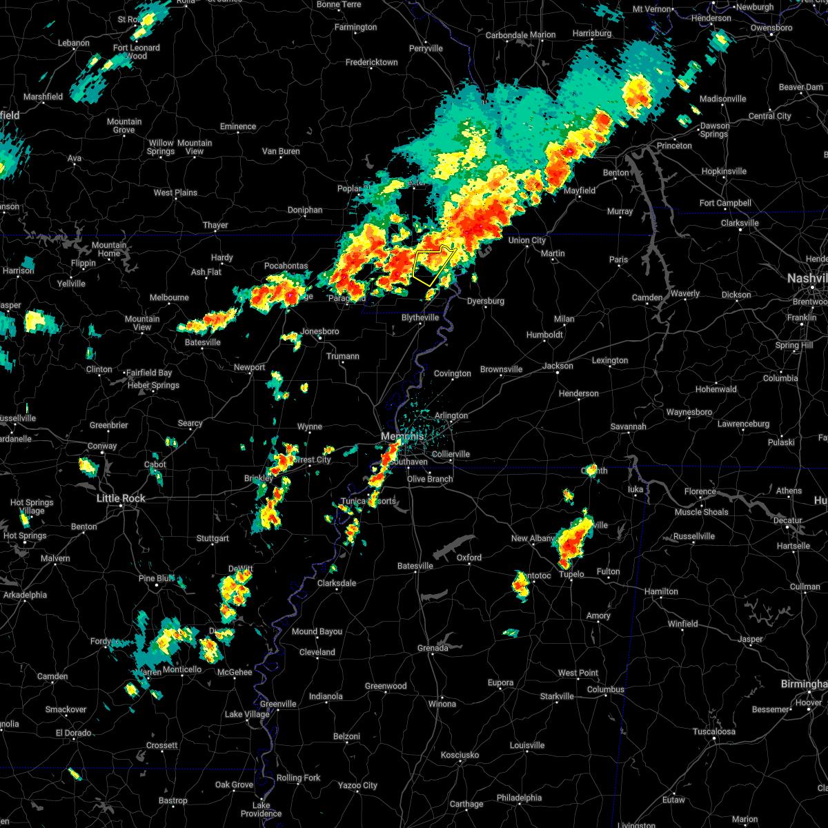 The severe thunderstorm warning for northwestern pemiscot county will expire at 230 pm cdt, the storm which prompted the warning has weakened below severe limits, and has exited the warned area. therefore, the warning will be allowed to expire. The severe thunderstorm warning for northwestern pemiscot county will expire at 230 pm cdt, the storm which prompted the warning has weakened below severe limits, and has exited the warned area. therefore, the warning will be allowed to expire.
|
| 5/21/2022 2:05 PM CDT |
 At 204 pm cdt, a severe thunderstorm was located near deering, or 7 miles west of hayti, moving northeast at 20 mph (radar indicated). Hazards include 60 mph wind gusts and quarter size hail. Hail damage to vehicles is expected. Expect wind damage to roofs, siding, and trees. At 204 pm cdt, a severe thunderstorm was located near deering, or 7 miles west of hayti, moving northeast at 20 mph (radar indicated). Hazards include 60 mph wind gusts and quarter size hail. Hail damage to vehicles is expected. Expect wind damage to roofs, siding, and trees.
|
| 5/15/2022 4:54 PM CDT |
 The severe thunderstorm warning for western new madrid and southeastern stoddard counties will expire at 500 pm cdt, the storm which prompted the warning has moved out of the area. therefore, the warning will be allowed to expire. however heavy rain is still possible with this thunderstorm. a severe thunderstorm watch remains in effect until 800 pm cdt for western kentucky, and southeastern missouri. The severe thunderstorm warning for western new madrid and southeastern stoddard counties will expire at 500 pm cdt, the storm which prompted the warning has moved out of the area. therefore, the warning will be allowed to expire. however heavy rain is still possible with this thunderstorm. a severe thunderstorm watch remains in effect until 800 pm cdt for western kentucky, and southeastern missouri.
|
| 5/15/2022 4:34 PM CDT |
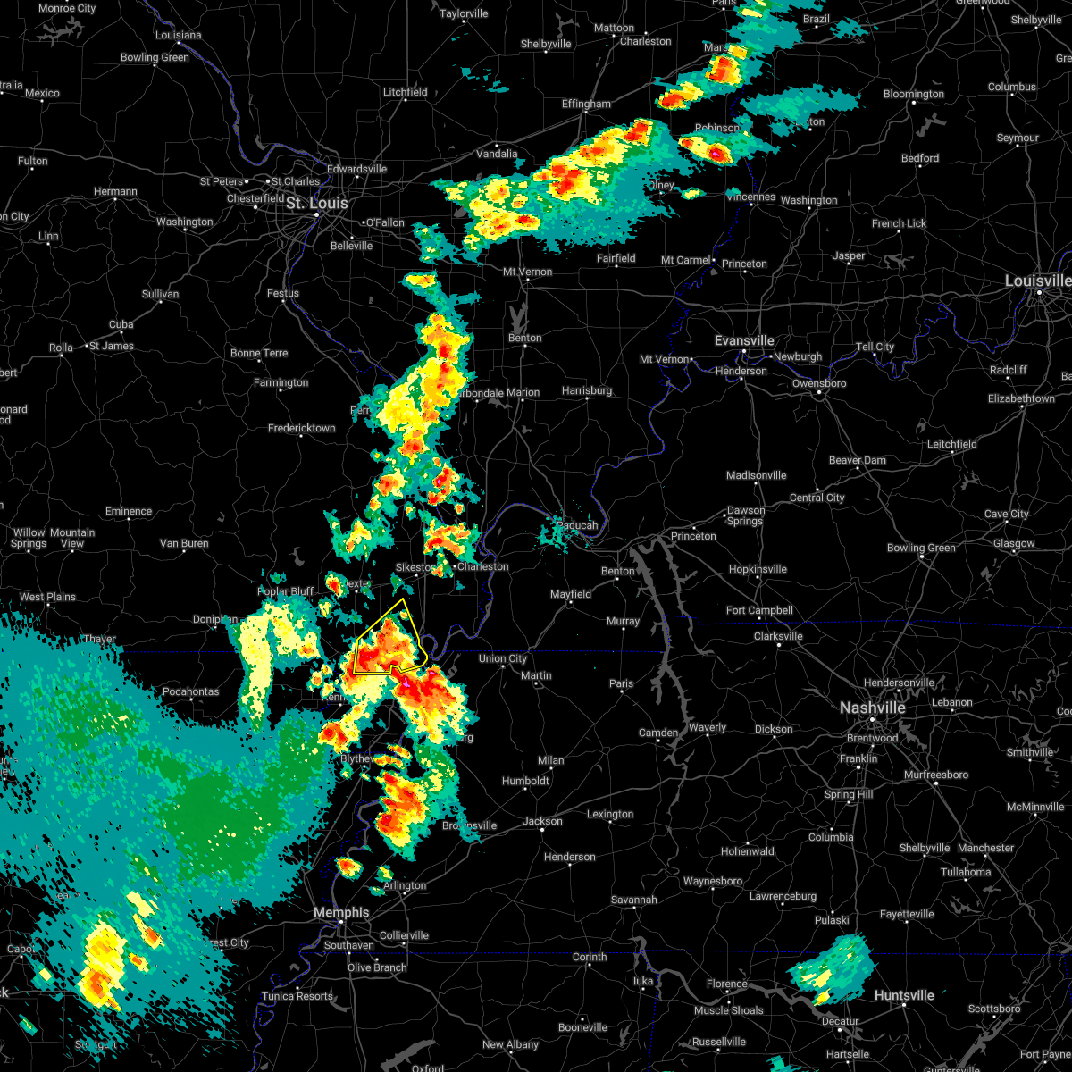 At 434 pm cdt, a severe thunderstorm was located over risco, or 9 miles east of malden, moving east at 35 mph (radar indicated). Hazards include 60 mph wind gusts and quarter size hail. Hail damage to vehicles is expected. expect wind damage to roofs, siding, and trees. locations impacted include, marston, lilbourn, howardville and new madrid. this includes interstate 55 between mile markers 32 and 44. hail threat, radar indicated max hail size, 1. 00 in wind threat, radar indicated max wind gust, 60 mph. At 434 pm cdt, a severe thunderstorm was located over risco, or 9 miles east of malden, moving east at 35 mph (radar indicated). Hazards include 60 mph wind gusts and quarter size hail. Hail damage to vehicles is expected. expect wind damage to roofs, siding, and trees. locations impacted include, marston, lilbourn, howardville and new madrid. this includes interstate 55 between mile markers 32 and 44. hail threat, radar indicated max hail size, 1. 00 in wind threat, radar indicated max wind gust, 60 mph.
|
| 5/15/2022 4:13 PM CDT |
 At 412 pm cdt, a severe thunderstorm was located over campbell, moving east at 35 mph (radar indicated). Hazards include 60 mph wind gusts and quarter size hail. Hail damage to vehicles is expected. expect wind damage to roofs, siding, and trees. this severe thunderstorm will be near, gideon around 425 pm cdt. other locations in the path of this severe thunderstorm include parma, risco, lilbourn, marston, howardville and new madrid. this includes interstate 55 between mile markers 32 and 44. hail threat, radar indicated max hail size, 1. 00 in wind threat, radar indicated max wind gust, 60 mph. At 412 pm cdt, a severe thunderstorm was located over campbell, moving east at 35 mph (radar indicated). Hazards include 60 mph wind gusts and quarter size hail. Hail damage to vehicles is expected. expect wind damage to roofs, siding, and trees. this severe thunderstorm will be near, gideon around 425 pm cdt. other locations in the path of this severe thunderstorm include parma, risco, lilbourn, marston, howardville and new madrid. this includes interstate 55 between mile markers 32 and 44. hail threat, radar indicated max hail size, 1. 00 in wind threat, radar indicated max wind gust, 60 mph.
|
| 5/2/2022 10:25 PM CDT |
 The severe thunderstorm warning for southeastern new madrid county will expire at 1030 pm cdt, the storm which prompted the warning has moved out of the area. therefore, the warning will be allowed to expire. however small hail, gusty winds and heavy rain are still possible with this thunderstorm. to report severe weather, contact your nearest law enforcement agency. they will relay your report to the national weather service paducah. remember, a severe thunderstorm warning still remains in effect for southeast new madrid county until 1030 pm cdt. The severe thunderstorm warning for southeastern new madrid county will expire at 1030 pm cdt, the storm which prompted the warning has moved out of the area. therefore, the warning will be allowed to expire. however small hail, gusty winds and heavy rain are still possible with this thunderstorm. to report severe weather, contact your nearest law enforcement agency. they will relay your report to the national weather service paducah. remember, a severe thunderstorm warning still remains in effect for southeast new madrid county until 1030 pm cdt.
|
| 5/2/2022 10:08 PM CDT |
 At 1008 pm cdt, a severe thunderstorm was located near marston, or 7 miles southeast of new madrid, moving east at 50 mph (radar indicated). Hazards include 60 mph wind gusts and quarter size hail. Hail damage to vehicles is expected. expect wind damage to roofs, siding, and trees. this severe thunderstorm will remain over mainly rural areas of southeastern new madrid county. this includes interstate 55 between mile markers 33 and 45. hail threat, radar indicated max hail size, 1. 00 in wind threat, radar indicated max wind gust, 60 mph. At 1008 pm cdt, a severe thunderstorm was located near marston, or 7 miles southeast of new madrid, moving east at 50 mph (radar indicated). Hazards include 60 mph wind gusts and quarter size hail. Hail damage to vehicles is expected. expect wind damage to roofs, siding, and trees. this severe thunderstorm will remain over mainly rural areas of southeastern new madrid county. this includes interstate 55 between mile markers 33 and 45. hail threat, radar indicated max hail size, 1. 00 in wind threat, radar indicated max wind gust, 60 mph.
|
| 5/2/2022 9:54 PM CDT |
 At 953 pm cdt, a severe thunderstorm was located over portageville, moving east at 50 mph (radar indicated). Hazards include 60 mph wind gusts and quarter size hail. Hail damage to vehicles is expected. expect wind damage to roofs, siding, and trees. this severe thunderstorm will be near, marston around 1000 pm cdt. new madrid and howardville around 1005 pm cdt. this includes interstate 55 between mile markers 33 and 45. hail threat, radar indicated max hail size, 1. 00 in wind threat, radar indicated max wind gust, 60 mph. At 953 pm cdt, a severe thunderstorm was located over portageville, moving east at 50 mph (radar indicated). Hazards include 60 mph wind gusts and quarter size hail. Hail damage to vehicles is expected. expect wind damage to roofs, siding, and trees. this severe thunderstorm will be near, marston around 1000 pm cdt. new madrid and howardville around 1005 pm cdt. this includes interstate 55 between mile markers 33 and 45. hail threat, radar indicated max hail size, 1. 00 in wind threat, radar indicated max wind gust, 60 mph.
|
| 4/13/2022 3:45 PM CDT |
 At 345 pm cdt, a severe thunderstorm producing a tornado was located near clayton, or 10 miles west of union city, moving northeast at 70 mph (radar indicated rotation). Hazards include tornado. Flying debris will be dangerous to those caught without shelter. mobile homes will be damaged or destroyed. damage to roofs, windows, and vehicles will occur. tree damage is likely. Locations impacted include, martin, union city, portageville, fulton, reelfoot lake state park, tiptonville, south fulton, ridgely, troy, obion, latham, clayton, cloverdale, miston, cottonwood grove, trimble, hornbeak, woodland mills, rives and samburg. At 345 pm cdt, a severe thunderstorm producing a tornado was located near clayton, or 10 miles west of union city, moving northeast at 70 mph (radar indicated rotation). Hazards include tornado. Flying debris will be dangerous to those caught without shelter. mobile homes will be damaged or destroyed. damage to roofs, windows, and vehicles will occur. tree damage is likely. Locations impacted include, martin, union city, portageville, fulton, reelfoot lake state park, tiptonville, south fulton, ridgely, troy, obion, latham, clayton, cloverdale, miston, cottonwood grove, trimble, hornbeak, woodland mills, rives and samburg.
|
| 4/13/2022 3:35 PM CDT |
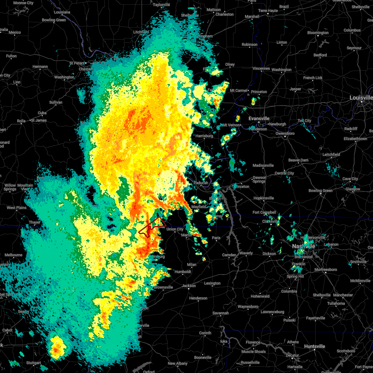 At 335 pm cdt, a severe thunderstorm capable of producing a tornado was located near tiptonville, or near reelfoot lake state park, moving northeast at 70 mph (radar indicated rotation). Hazards include tornado. Flying debris will be dangerous to those caught without shelter. mobile homes will be damaged or destroyed. damage to roofs, windows, and vehicles will occur. tree damage is likely. locations impacted include, boundurant. This includes interstate 55 near mile marker 33. At 335 pm cdt, a severe thunderstorm capable of producing a tornado was located near tiptonville, or near reelfoot lake state park, moving northeast at 70 mph (radar indicated rotation). Hazards include tornado. Flying debris will be dangerous to those caught without shelter. mobile homes will be damaged or destroyed. damage to roofs, windows, and vehicles will occur. tree damage is likely. locations impacted include, boundurant. This includes interstate 55 near mile marker 33.
|
| 4/13/2022 3:34 PM CDT |
 At 333 pm cdt, severe thunderstorms were located along a line extending from near portageville to near cooter to near dixonville, moving east at 40 mph (radar indicated). Hazards include 70 mph wind gusts and quarter size hail. Hail damage to vehicles is expected. expect considerable tree damage. wind damage is also likely to mobile homes, roofs, and outbuildings. locations impacted include, dyersburg, blytheville, ripley, osceola, caruthersville, portageville, hayti, steele, luxora, wilson, reelfoot lake state park, fort pillow state park, munford, tiptonville, newbern, brighton, halls, ridgely, hayti heights and joiner. thunderstorm damage threat, considerable hail threat, radar indicated max hail size, 1. 00 in wind threat, radar indicated max wind gust, 70 mph. At 333 pm cdt, severe thunderstorms were located along a line extending from near portageville to near cooter to near dixonville, moving east at 40 mph (radar indicated). Hazards include 70 mph wind gusts and quarter size hail. Hail damage to vehicles is expected. expect considerable tree damage. wind damage is also likely to mobile homes, roofs, and outbuildings. locations impacted include, dyersburg, blytheville, ripley, osceola, caruthersville, portageville, hayti, steele, luxora, wilson, reelfoot lake state park, fort pillow state park, munford, tiptonville, newbern, brighton, halls, ridgely, hayti heights and joiner. thunderstorm damage threat, considerable hail threat, radar indicated max hail size, 1. 00 in wind threat, radar indicated max wind gust, 70 mph.
|
| 4/13/2022 3:26 PM CDT |
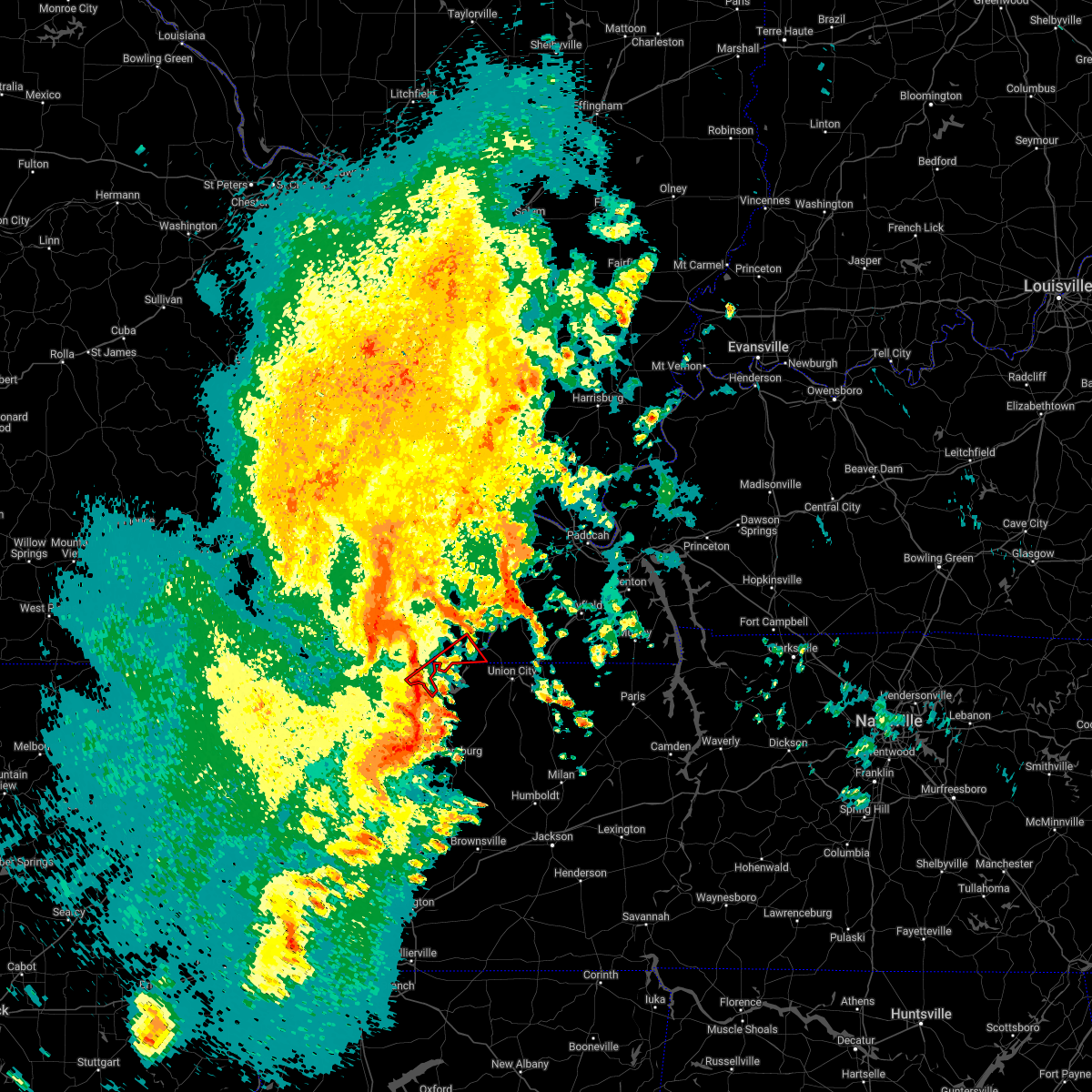 At 325 pm cdt, a severe thunderstorm capable of producing a tornado was located 7 miles southeast of portageville, moving northeast at 70 mph (radar indicated rotation). Hazards include tornado. Flying debris will be dangerous to those caught without shelter. mobile homes will be damaged or destroyed. damage to roofs, windows, and vehicles will occur. tree damage is likely. this tornadic thunderstorm will remain over mainly rural areas of western fulton and southeastern new madrid counties, including the following locations, boundurant. This includes interstate 55 near mile marker 33. At 325 pm cdt, a severe thunderstorm capable of producing a tornado was located 7 miles southeast of portageville, moving northeast at 70 mph (radar indicated rotation). Hazards include tornado. Flying debris will be dangerous to those caught without shelter. mobile homes will be damaged or destroyed. damage to roofs, windows, and vehicles will occur. tree damage is likely. this tornadic thunderstorm will remain over mainly rural areas of western fulton and southeastern new madrid counties, including the following locations, boundurant. This includes interstate 55 near mile marker 33.
|
| 4/13/2022 3:26 PM CDT |
 At 326 pm cdt, a severe thunderstorm producing a tornado was located near cottonwood grove, or near caruthersville, moving northeast at 65 mph (radar indicated rotation). Hazards include tornado. Flying debris will be dangerous to those caught without shelter. mobile homes will be damaged or destroyed. damage to roofs, windows, and vehicles will occur. Tree damage is likely. At 326 pm cdt, a severe thunderstorm producing a tornado was located near cottonwood grove, or near caruthersville, moving northeast at 65 mph (radar indicated rotation). Hazards include tornado. Flying debris will be dangerous to those caught without shelter. mobile homes will be damaged or destroyed. damage to roofs, windows, and vehicles will occur. Tree damage is likely.
|
| 4/13/2022 3:26 PM CDT |
 At 325 pm cdt, a severe thunderstorm capable of producing a tornado was located 7 miles southeast of portageville, moving northeast at 70 mph (radar indicated rotation). Hazards include tornado. Flying debris will be dangerous to those caught without shelter. mobile homes will be damaged or destroyed. damage to roofs, windows, and vehicles will occur. tree damage is likely. this tornadic thunderstorm will remain over mainly rural areas of western fulton and southeastern new madrid counties, including the following locations, boundurant. This includes interstate 55 near mile marker 33. At 325 pm cdt, a severe thunderstorm capable of producing a tornado was located 7 miles southeast of portageville, moving northeast at 70 mph (radar indicated rotation). Hazards include tornado. Flying debris will be dangerous to those caught without shelter. mobile homes will be damaged or destroyed. damage to roofs, windows, and vehicles will occur. tree damage is likely. this tornadic thunderstorm will remain over mainly rural areas of western fulton and southeastern new madrid counties, including the following locations, boundurant. This includes interstate 55 near mile marker 33.
|
| 4/13/2022 3:26 PM CDT |
 At 326 pm cdt, a severe thunderstorm producing a tornado was located near cottonwood grove, or near caruthersville, moving northeast at 65 mph (radar indicated rotation). Hazards include tornado. Flying debris will be dangerous to those caught without shelter. mobile homes will be damaged or destroyed. damage to roofs, windows, and vehicles will occur. Tree damage is likely. At 326 pm cdt, a severe thunderstorm producing a tornado was located near cottonwood grove, or near caruthersville, moving northeast at 65 mph (radar indicated rotation). Hazards include tornado. Flying debris will be dangerous to those caught without shelter. mobile homes will be damaged or destroyed. damage to roofs, windows, and vehicles will occur. Tree damage is likely.
|
| 4/13/2022 3:25 PM CDT |
 At 304 pm cdt, severe thunderstorms were located along a line extending from clarkton to near gosnell, moving northeast at 80 mph (radar indicated). Hazards include 60 mph wind gusts and quarter size hail. Hail damage to vehicles is expected. expect wind damage to roofs, siding, and trees. severe thunderstorms will be near, malden, clarkton and gideon around 310 pm cdt. parma and risco around 315 pm cdt. lilbourn and howardville around 320 pm cdt. other locations in the path of these severe thunderstorms include new madrid, hunter-dawson state historic site, matthews, farrenburg, east prairie, anniston and wyatt. This includes interstate 55 between mile markers 33 and 61. At 304 pm cdt, severe thunderstorms were located along a line extending from clarkton to near gosnell, moving northeast at 80 mph (radar indicated). Hazards include 60 mph wind gusts and quarter size hail. Hail damage to vehicles is expected. expect wind damage to roofs, siding, and trees. severe thunderstorms will be near, malden, clarkton and gideon around 310 pm cdt. parma and risco around 315 pm cdt. lilbourn and howardville around 320 pm cdt. other locations in the path of these severe thunderstorms include new madrid, hunter-dawson state historic site, matthews, farrenburg, east prairie, anniston and wyatt. This includes interstate 55 between mile markers 33 and 61.
|
| 4/13/2022 3:25 PM CDT |
 At 324 pm cdt, severe thunderstorms were located along a line extending from 6 miles south of canalou to near marston to caruthersville, moving northeast at 70 mph (radar indicated). Hazards include 70 mph wind gusts and quarter size hail. Hail damage to vehicles is expected. expect considerable tree damage. wind damage is also likely to mobile homes, roofs, and outbuildings. locations impacted include, new madrid, lilbourn, hunter-dawson state historic site, matthews, howardville, farrenburg, east prairie, big oak tree state park, towosahgy state historic site, anniston and wyatt. This includes interstate 55 between mile markers 33 and 61. At 324 pm cdt, severe thunderstorms were located along a line extending from 6 miles south of canalou to near marston to caruthersville, moving northeast at 70 mph (radar indicated). Hazards include 70 mph wind gusts and quarter size hail. Hail damage to vehicles is expected. expect considerable tree damage. wind damage is also likely to mobile homes, roofs, and outbuildings. locations impacted include, new madrid, lilbourn, hunter-dawson state historic site, matthews, howardville, farrenburg, east prairie, big oak tree state park, towosahgy state historic site, anniston and wyatt. This includes interstate 55 between mile markers 33 and 61.
|
| 4/13/2022 3:20 PM CDT | Power poles snapped on i-55 between wardell and hayward exit in pemiscot county MO, 3.8 miles N of Portageville, MO |
| 4/13/2022 3:11 PM CDT |
 At 311 pm cdt, severe thunderstorms were located along a line extending from clarkton to gosnell to near gilmore, moving east at 40 mph (radar indicated). Hazards include 70 mph wind gusts and quarter size hail. Hail damage to vehicles is expected. expect considerable tree damage. Wind damage is also likely to mobile homes, roofs, and outbuildings. At 311 pm cdt, severe thunderstorms were located along a line extending from clarkton to gosnell to near gilmore, moving east at 40 mph (radar indicated). Hazards include 70 mph wind gusts and quarter size hail. Hail damage to vehicles is expected. expect considerable tree damage. Wind damage is also likely to mobile homes, roofs, and outbuildings.
|
| 4/13/2022 3:07 PM CDT |
 At 307 pm cdt, a severe thunderstorm producing a tornado was located near steele, moving northeast at 55 mph (radar indicated rotation). Hazards include tornado. Flying debris will be dangerous to those caught without shelter. mobile homes will be damaged or destroyed. damage to roofs, windows, and vehicles will occur. Tree damage is likely. At 307 pm cdt, a severe thunderstorm producing a tornado was located near steele, moving northeast at 55 mph (radar indicated rotation). Hazards include tornado. Flying debris will be dangerous to those caught without shelter. mobile homes will be damaged or destroyed. damage to roofs, windows, and vehicles will occur. Tree damage is likely.
|
| 4/13/2022 3:05 PM CDT |
 At 304 pm cdt, severe thunderstorms were located along a line extending from clarkton to near gosnell, moving northeast at 80 mph (radar indicated). Hazards include 60 mph wind gusts and quarter size hail. Hail damage to vehicles is expected. expect wind damage to roofs, siding, and trees. severe thunderstorms will be near, malden, clarkton and gideon around 310 pm cdt. parma and risco around 315 pm cdt. lilbourn and howardville around 320 pm cdt. other locations in the path of these severe thunderstorms include new madrid, hunter-dawson state historic site, matthews, farrenburg, east prairie, anniston and wyatt. This includes interstate 55 between mile markers 33 and 61. At 304 pm cdt, severe thunderstorms were located along a line extending from clarkton to near gosnell, moving northeast at 80 mph (radar indicated). Hazards include 60 mph wind gusts and quarter size hail. Hail damage to vehicles is expected. expect wind damage to roofs, siding, and trees. severe thunderstorms will be near, malden, clarkton and gideon around 310 pm cdt. parma and risco around 315 pm cdt. lilbourn and howardville around 320 pm cdt. other locations in the path of these severe thunderstorms include new madrid, hunter-dawson state historic site, matthews, farrenburg, east prairie, anniston and wyatt. This includes interstate 55 between mile markers 33 and 61.
|
| 4/13/2022 2:33 PM CDT |
 At 233 pm cdt, a severe thunderstorm was located over hayti heights, or over hayti, moving northeast at 70 mph (radar indicated). Hazards include 70 mph wind gusts and quarter size hail. Hail damage to vehicles is expected. expect considerable tree damage. wind damage is also likely to mobile homes, roofs, and outbuildings. locations impacted include, caruthersville, portageville, hayti, steele, reelfoot lake state park, tiptonville, ridgely, hayti heights, wardell, deering, bolton, samburg, bragg city, pascola, wynnburg, wright, cronanville, hathaway, roneys store and sunkist beach. thunderstorm damage threat, considerable hail threat, radar indicated max hail size, 1. 00 in wind threat, radar indicated max wind gust, 70 mph. At 233 pm cdt, a severe thunderstorm was located over hayti heights, or over hayti, moving northeast at 70 mph (radar indicated). Hazards include 70 mph wind gusts and quarter size hail. Hail damage to vehicles is expected. expect considerable tree damage. wind damage is also likely to mobile homes, roofs, and outbuildings. locations impacted include, caruthersville, portageville, hayti, steele, reelfoot lake state park, tiptonville, ridgely, hayti heights, wardell, deering, bolton, samburg, bragg city, pascola, wynnburg, wright, cronanville, hathaway, roneys store and sunkist beach. thunderstorm damage threat, considerable hail threat, radar indicated max hail size, 1. 00 in wind threat, radar indicated max wind gust, 70 mph.
|
| 4/13/2022 2:28 PM CDT |
 At 227 pm cdt, a severe thunderstorm was located near steele, moving northeast at 70 mph (radar indicated). Hazards include 70 mph wind gusts and quarter size hail. Hail damage to vehicles is expected. expect considerable tree damage. wind damage is also likely to mobile homes, roofs, and outbuildings. locations impacted include, caruthersville, portageville, hayti, steele, reelfoot lake state park, tiptonville, ridgely, hayti heights, wardell, bolton, deering, cottonwood grove, holland, samburg, bragg city, pascola, madie, spout springs, lassiter corner and cates. thunderstorm damage threat, considerable hail threat, radar indicated max hail size, 1. 00 in wind threat, radar indicated max wind gust, 70 mph. At 227 pm cdt, a severe thunderstorm was located near steele, moving northeast at 70 mph (radar indicated). Hazards include 70 mph wind gusts and quarter size hail. Hail damage to vehicles is expected. expect considerable tree damage. wind damage is also likely to mobile homes, roofs, and outbuildings. locations impacted include, caruthersville, portageville, hayti, steele, reelfoot lake state park, tiptonville, ridgely, hayti heights, wardell, bolton, deering, cottonwood grove, holland, samburg, bragg city, pascola, madie, spout springs, lassiter corner and cates. thunderstorm damage threat, considerable hail threat, radar indicated max hail size, 1. 00 in wind threat, radar indicated max wind gust, 70 mph.
|
| 4/13/2022 2:23 PM CDT |
 At 222 pm cdt, a severe thunderstorm was located near hornersville, or 7 miles north of gosnell, moving northeast at 60 mph (radar indicated). Hazards include 70 mph wind gusts and quarter size hail. Hail damage to vehicles is expected. expect considerable tree damage. Wind damage is also likely to mobile homes, roofs, and outbuildings. At 222 pm cdt, a severe thunderstorm was located near hornersville, or 7 miles north of gosnell, moving northeast at 60 mph (radar indicated). Hazards include 70 mph wind gusts and quarter size hail. Hail damage to vehicles is expected. expect considerable tree damage. Wind damage is also likely to mobile homes, roofs, and outbuildings.
|
| 4/11/2022 7:42 PM CDT |
 The severe thunderstorm warning for southwestern fulton and southeastern new madrid counties will expire at 745 pm cdt, the storm which prompted the warning has weakened below severe limits, and has exited the warned area. therefore, the warning will be allowed to expire. The severe thunderstorm warning for southwestern fulton and southeastern new madrid counties will expire at 745 pm cdt, the storm which prompted the warning has weakened below severe limits, and has exited the warned area. therefore, the warning will be allowed to expire.
|
| 4/11/2022 7:39 PM CDT |
 The severe thunderstorm warning for northeastern pemiscot and northeastern lake counties will expire at 745 pm cdt, the storm which prompted the warning has weakened below severe limits, and no longer poses an immediate threat to life or property. therefore, the warning will be allowed to expire. however small hail is still possible with this thunderstorm. The severe thunderstorm warning for northeastern pemiscot and northeastern lake counties will expire at 745 pm cdt, the storm which prompted the warning has weakened below severe limits, and no longer poses an immediate threat to life or property. therefore, the warning will be allowed to expire. however small hail is still possible with this thunderstorm.
|
| 4/11/2022 7:30 PM CDT | Quarter sized hail reported 3.2 miles NW of Portageville, MO |
| 4/11/2022 7:25 PM CDT |
 At 725 pm cdt, a severe thunderstorm was located over bolton, or near hayti, moving east at 50 mph (broadcast media). Hazards include 60 mph wind gusts and quarter size hail. Hail damage to vehicles is expected. expect wind damage to roofs, siding, and trees. locations impacted include, portageville, reelfoot lake state park, tiptonville, wardell, bolton, wright, cronanville, grays camp, north wardell, sunkist beach, cates, bessie, blue bank, proctor city, new markham, homestown, stewart, stanley, swift and hayward. hail threat, observed max hail size, 1. 00 in wind threat, radar indicated max wind gust, 60 mph. At 725 pm cdt, a severe thunderstorm was located over bolton, or near hayti, moving east at 50 mph (broadcast media). Hazards include 60 mph wind gusts and quarter size hail. Hail damage to vehicles is expected. expect wind damage to roofs, siding, and trees. locations impacted include, portageville, reelfoot lake state park, tiptonville, wardell, bolton, wright, cronanville, grays camp, north wardell, sunkist beach, cates, bessie, blue bank, proctor city, new markham, homestown, stewart, stanley, swift and hayward. hail threat, observed max hail size, 1. 00 in wind threat, radar indicated max wind gust, 60 mph.
|
| 4/11/2022 7:19 PM CDT |
 At 719 pm cdt, a severe thunderstorm was located near wardell, or 7 miles northwest of hayti, moving northeast at 55 mph (radar indicated). Hazards include 60 mph wind gusts and half dollar size hail. Hail damage to vehicles is expected. expect wind damage to roofs, siding, and trees. this severe thunderstorm will be near, portageville around 730 pm cdt. other locations in the path of this severe thunderstorm include marston. this includes interstate 55 between mile markers 32 and 43. hail threat, radar indicated max hail size, 1. 25 in wind threat, radar indicated max wind gust, 60 mph. At 719 pm cdt, a severe thunderstorm was located near wardell, or 7 miles northwest of hayti, moving northeast at 55 mph (radar indicated). Hazards include 60 mph wind gusts and half dollar size hail. Hail damage to vehicles is expected. expect wind damage to roofs, siding, and trees. this severe thunderstorm will be near, portageville around 730 pm cdt. other locations in the path of this severe thunderstorm include marston. this includes interstate 55 between mile markers 32 and 43. hail threat, radar indicated max hail size, 1. 25 in wind threat, radar indicated max wind gust, 60 mph.
|
| 4/11/2022 7:16 PM CDT |
 At 716 pm cdt, a severe thunderstorm was located near deering, or 8 miles west of hayti, moving east at 50 mph (broadcast media). Hazards include quarter size hail. Damage to vehicles is expected. locations impacted include, caruthersville, portageville, hayti, reelfoot lake state park, tiptonville, ridgely, hayti heights, wardell, deering, bolton, cottonwood grove, bragg city, pascola, wynnburg, wright, cronanville, hathaway, sunkist beach, blue bank and proctor city. hail threat, observed max hail size, 1. 00 in wind threat, radar indicated max wind gust, <50 mph. At 716 pm cdt, a severe thunderstorm was located near deering, or 8 miles west of hayti, moving east at 50 mph (broadcast media). Hazards include quarter size hail. Damage to vehicles is expected. locations impacted include, caruthersville, portageville, hayti, reelfoot lake state park, tiptonville, ridgely, hayti heights, wardell, deering, bolton, cottonwood grove, bragg city, pascola, wynnburg, wright, cronanville, hathaway, sunkist beach, blue bank and proctor city. hail threat, observed max hail size, 1. 00 in wind threat, radar indicated max wind gust, <50 mph.
|
| 4/11/2022 7:03 PM CDT |
 At 703 pm cdt, a severe thunderstorm was located over kennett, moving east at 50 mph (radar indicated). Hazards include 60 mph wind gusts and quarter size hail. Hail damage to vehicles is expected. Expect wind damage to roofs, siding, and trees. At 703 pm cdt, a severe thunderstorm was located over kennett, moving east at 50 mph (radar indicated). Hazards include 60 mph wind gusts and quarter size hail. Hail damage to vehicles is expected. Expect wind damage to roofs, siding, and trees.
|
| 3/30/2022 4:05 PM CDT |
 At 405 pm cdt, severe thunderstorms were located along a line extending from near farrenburg to 6 miles north of tiptonville to cottonwood grove, moving northeast at 45 mph (radar indicated). Hazards include 60 mph wind gusts. Expect damage to roofs, siding, and trees. locations impacted include, matthews and farrenburg. this includes interstate 55 between mile markers 33 and 65. hail threat, radar indicated max hail size, <. 75 in wind threat, radar indicated max wind gust, 60 mph. At 405 pm cdt, severe thunderstorms were located along a line extending from near farrenburg to 6 miles north of tiptonville to cottonwood grove, moving northeast at 45 mph (radar indicated). Hazards include 60 mph wind gusts. Expect damage to roofs, siding, and trees. locations impacted include, matthews and farrenburg. this includes interstate 55 between mile markers 33 and 65. hail threat, radar indicated max hail size, <. 75 in wind threat, radar indicated max wind gust, 60 mph.
|
| 3/30/2022 3:39 PM CDT |
 At 339 pm cdt, severe thunderstorms were located along a line extending from near risco to near bolton to near steele, moving northeast at 50 mph (radar indicated). Hazards include 60 mph wind gusts. expect damage to roofs, siding, and trees At 339 pm cdt, severe thunderstorms were located along a line extending from near risco to near bolton to near steele, moving northeast at 50 mph (radar indicated). Hazards include 60 mph wind gusts. expect damage to roofs, siding, and trees
|
| 3/30/2022 3:09 PM CDT |
 At 309 pm cdt, severe thunderstorms were located along a line extending from near wappapello to qulin to near pollard, moving northeast at 45 to 50 mph (radar indicated). Hazards include 60 mph wind gusts. Expect damage to roofs, siding, and trees. severe thunderstorms will be near, puxico around 320 pm cdt. other locations in the path of these severe thunderstorms include bernie, dudley, dexter, malden, bloomfield, advance, essex, bell city, risco, parma, sikeston and morehouse. this includes interstate 55 between mile markers 33 and 65. hail threat, radar indicated max hail size, <. 75 in wind threat, radar indicated max wind gust, 60 mph. At 309 pm cdt, severe thunderstorms were located along a line extending from near wappapello to qulin to near pollard, moving northeast at 45 to 50 mph (radar indicated). Hazards include 60 mph wind gusts. Expect damage to roofs, siding, and trees. severe thunderstorms will be near, puxico around 320 pm cdt. other locations in the path of these severe thunderstorms include bernie, dudley, dexter, malden, bloomfield, advance, essex, bell city, risco, parma, sikeston and morehouse. this includes interstate 55 between mile markers 33 and 65. hail threat, radar indicated max hail size, <. 75 in wind threat, radar indicated max wind gust, 60 mph.
|
| 2/22/2022 5:39 AM CST |
 At 538 am cst, severe thunderstorms were located along a line extending from 6 miles north of parma to 7 miles north of deering, moving east at 75 mph (radar indicated). Hazards include 60 mph wind gusts. Expect damage to roofs, siding, and trees. severe thunderstorms will be near, canalou around 545 am cst. matthews and farrenburg around 550 am cst. marston around 555 am cst. other locations in the path of these severe thunderstorms include east prairie and anniston. This includes interstate 55 between mile markers 33 and 60. At 538 am cst, severe thunderstorms were located along a line extending from 6 miles north of parma to 7 miles north of deering, moving east at 75 mph (radar indicated). Hazards include 60 mph wind gusts. Expect damage to roofs, siding, and trees. severe thunderstorms will be near, canalou around 545 am cst. matthews and farrenburg around 550 am cst. marston around 555 am cst. other locations in the path of these severe thunderstorms include east prairie and anniston. This includes interstate 55 between mile markers 33 and 60.
|
| 2/22/2022 5:27 AM CST |
 At 526 am cst, severe thunderstorms were located along a line extending from near glennonville to near senath to near lake city, moving east at 60 mph (radar indicated). Hazards include 60 mph wind gusts and penny size hail. expect damage to roofs, siding, and trees At 526 am cst, severe thunderstorms were located along a line extending from near glennonville to near senath to near lake city, moving east at 60 mph (radar indicated). Hazards include 60 mph wind gusts and penny size hail. expect damage to roofs, siding, and trees
|
| 1/1/2022 2:21 AM CST |
 At 221 am cst, a severe thunderstorm was located near wardell, or 11 miles northwest of hayti, moving east at 50 mph (radar indicated). Hazards include 60 mph wind gusts. Expect damage to roofs, siding, and trees. locations impacted include, portageville, hayti, hayti heights, wardell, bolton, bragg city, pascola, north wardell, homestown, stewart, bakerville, stanley, swift, hayward and peach orchard. hail threat, radar indicated max hail size, <. 75 in wind threat, radar indicated max wind gust, 60 mph. At 221 am cst, a severe thunderstorm was located near wardell, or 11 miles northwest of hayti, moving east at 50 mph (radar indicated). Hazards include 60 mph wind gusts. Expect damage to roofs, siding, and trees. locations impacted include, portageville, hayti, hayti heights, wardell, bolton, bragg city, pascola, north wardell, homestown, stewart, bakerville, stanley, swift, hayward and peach orchard. hail threat, radar indicated max hail size, <. 75 in wind threat, radar indicated max wind gust, 60 mph.
|
| 1/1/2022 2:04 AM CST |
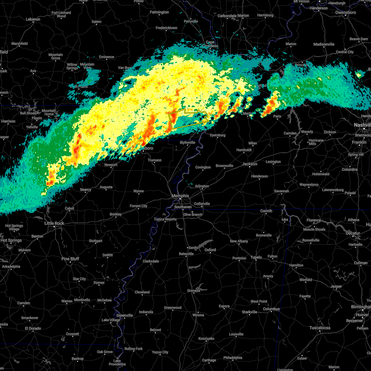 At 204 am cst, a severe thunderstorm was located near greenway, or near kennett, moving east at 50 mph (radar indicated). Hazards include 60 mph wind gusts. expect damage to roofs, siding, and trees At 204 am cst, a severe thunderstorm was located near greenway, or near kennett, moving east at 50 mph (radar indicated). Hazards include 60 mph wind gusts. expect damage to roofs, siding, and trees
|
| 10/25/2021 12:38 AM CDT |
 At 1237 am cdt, severe thunderstorms were located along a line extending from near matthews to near risco to near piggott, moving east at 55 mph (radar indicated). Hazards include 60 mph wind gusts. Expect damage to roofs, siding, and trees. locations impacted include, kennett, caruthersville, malden, piggott, portageville, hayti, campbell, rector, chalk bluff natural area, holcomb, hayti heights, wardell, st. francis, pollard, greenway, mcdougal, bolton, deering, saint francis and crockett. hail threat, radar indicated max hail size, <. 75 in wind threat, radar indicated max wind gust, 60 mph. At 1237 am cdt, severe thunderstorms were located along a line extending from near matthews to near risco to near piggott, moving east at 55 mph (radar indicated). Hazards include 60 mph wind gusts. Expect damage to roofs, siding, and trees. locations impacted include, kennett, caruthersville, malden, piggott, portageville, hayti, campbell, rector, chalk bluff natural area, holcomb, hayti heights, wardell, st. francis, pollard, greenway, mcdougal, bolton, deering, saint francis and crockett. hail threat, radar indicated max hail size, <. 75 in wind threat, radar indicated max wind gust, 60 mph.
|
| 10/25/2021 12:05 AM CDT |
 At 1205 am cdt, severe thunderstorms were located along a line extending from near qulin to near corning to near biggers, moving east at 55 mph (radar indicated). Hazards include 60 mph wind gusts and nickel size hail. expect damage to roofs, siding, and trees At 1205 am cdt, severe thunderstorms were located along a line extending from near qulin to near corning to near biggers, moving east at 55 mph (radar indicated). Hazards include 60 mph wind gusts and nickel size hail. expect damage to roofs, siding, and trees
|
| 7/10/2021 11:01 PM CDT |
 At 1101 pm cdt, a severe thunderstorm was located over glennonville, or near chalk bluff natural area, moving east at 45 mph (radar indicated). Hazards include 60 mph wind gusts. Expect damage to roofs, siding, and trees. locations impacted include, malden, piggott, portageville, campbell, chalk bluff natural area, holcomb, wardell, st. Francis, pollard, greenway, glennonville, saint francis, crockett, carryville, rhyne, north wardell, white oak, homestown, valley ridge and chalk bluff battlefield park. At 1101 pm cdt, a severe thunderstorm was located over glennonville, or near chalk bluff natural area, moving east at 45 mph (radar indicated). Hazards include 60 mph wind gusts. Expect damage to roofs, siding, and trees. locations impacted include, malden, piggott, portageville, campbell, chalk bluff natural area, holcomb, wardell, st. Francis, pollard, greenway, glennonville, saint francis, crockett, carryville, rhyne, north wardell, white oak, homestown, valley ridge and chalk bluff battlefield park.
|
| 7/10/2021 10:49 PM CDT |
 At 1049 pm cdt, a severe thunderstorm was located over qulin, or near chalk bluff natural area, moving east at 45 mph (radar indicated). Hazards include 60 mph wind gusts. Expect damage to roofs, siding, and trees. locations impacted include, malden, piggott, corning, portageville, campbell, chalk bluff natural area, holcomb, wardell, st. Francis, pollard, greenway, mcdougal, glennonville, saint francis, crockett, hickoria, carryville, rhyne, north wardell and white oak. At 1049 pm cdt, a severe thunderstorm was located over qulin, or near chalk bluff natural area, moving east at 45 mph (radar indicated). Hazards include 60 mph wind gusts. Expect damage to roofs, siding, and trees. locations impacted include, malden, piggott, corning, portageville, campbell, chalk bluff natural area, holcomb, wardell, st. Francis, pollard, greenway, mcdougal, glennonville, saint francis, crockett, hickoria, carryville, rhyne, north wardell and white oak.
|
| 7/10/2021 10:34 PM CDT |
 At 1034 pm cdt, a severe thunderstorm was located 7 miles east of neelyville, or 10 miles northwest of chalk bluff natural area, moving east at 55 mph (radar indicated). Hazards include 60 mph wind gusts. expect damage to roofs, siding, and trees At 1034 pm cdt, a severe thunderstorm was located 7 miles east of neelyville, or 10 miles northwest of chalk bluff natural area, moving east at 55 mph (radar indicated). Hazards include 60 mph wind gusts. expect damage to roofs, siding, and trees
|
| 5/4/2021 3:36 AM CDT |
 The severe thunderstorm warning for fulton, west central hickman, mississippi, southern scott, new madrid and stoddard counties will expire at 345 am cdt, the storms which prompted the warning have moved out of the area. therefore, the warning will be allowed to expire. a severe thunderstorm watch remains in effect until 800 am cdt for southern illinois, western kentucky, and southeastern missouri. The severe thunderstorm warning for fulton, west central hickman, mississippi, southern scott, new madrid and stoddard counties will expire at 345 am cdt, the storms which prompted the warning have moved out of the area. therefore, the warning will be allowed to expire. a severe thunderstorm watch remains in effect until 800 am cdt for southern illinois, western kentucky, and southeastern missouri.
|
| 5/4/2021 3:07 AM CDT |
 At 307 am cdt, severe thunderstorms were located along a line extending from 6 miles southeast of marston to cooter, moving east at 45 mph (radar indicated). Hazards include 60 mph wind gusts and quarter size hail. Hail damage to vehicles is expected. expect wind damage to roofs, siding, and trees. Locations impacted include, blytheville, kennett, osceola, caruthersville, malden, gosnell, manila, portageville, hayti, steele, caraway, luxora, hornersville, holcomb, hayti heights, cooter, wardell, dell, burdette and bolton. At 307 am cdt, severe thunderstorms were located along a line extending from 6 miles southeast of marston to cooter, moving east at 45 mph (radar indicated). Hazards include 60 mph wind gusts and quarter size hail. Hail damage to vehicles is expected. expect wind damage to roofs, siding, and trees. Locations impacted include, blytheville, kennett, osceola, caruthersville, malden, gosnell, manila, portageville, hayti, steele, caraway, luxora, hornersville, holcomb, hayti heights, cooter, wardell, dell, burdette and bolton.
|
| 5/4/2021 2:59 AM CDT |
 At 258 am cdt, severe thunderstorms were located along a line extending from near bolton to near caruthersville to near marie, moving east at 65 mph (radar indicated). Hazards include 60 mph wind gusts and quarter size hail. Hail damage to vehicles is expected. Expect wind damage to roofs, siding, and trees. At 258 am cdt, severe thunderstorms were located along a line extending from near bolton to near caruthersville to near marie, moving east at 65 mph (radar indicated). Hazards include 60 mph wind gusts and quarter size hail. Hail damage to vehicles is expected. Expect wind damage to roofs, siding, and trees.
|
| 5/4/2021 2:50 AM CDT |
 At 249 am cdt, severe thunderstorms were located along a line extending from 6 miles west of bloomfield to near gideon to near deering, moving east at 45 mph (radar indicated). Hazards include 60 mph wind gusts and quarter size hail. Hail damage to vehicles is expected. Expect wind damage to roofs, siding, and trees. At 249 am cdt, severe thunderstorms were located along a line extending from 6 miles west of bloomfield to near gideon to near deering, moving east at 45 mph (radar indicated). Hazards include 60 mph wind gusts and quarter size hail. Hail damage to vehicles is expected. Expect wind damage to roofs, siding, and trees.
|
| 5/4/2021 2:40 AM CDT |
 At 240 am cdt, severe thunderstorms were located along a line extending from near gideon to near hornersville, moving east at 45 mph (radar indicated). Hazards include 60 mph wind gusts and quarter size hail. Hail damage to vehicles is expected. expect wind damage to roofs, siding, and trees. Locations impacted include, blytheville, kennett, osceola, caruthersville, malden, piggott, gosnell, manila, portageville, hayti, steele, leachville, campbell, senath, caraway, luxora, cardwell, hornersville, holcomb and hayti heights. At 240 am cdt, severe thunderstorms were located along a line extending from near gideon to near hornersville, moving east at 45 mph (radar indicated). Hazards include 60 mph wind gusts and quarter size hail. Hail damage to vehicles is expected. expect wind damage to roofs, siding, and trees. Locations impacted include, blytheville, kennett, osceola, caruthersville, malden, piggott, gosnell, manila, portageville, hayti, steele, leachville, campbell, senath, caraway, luxora, cardwell, hornersville, holcomb and hayti heights.
|
| 5/4/2021 2:25 AM CDT |
 At 224 am cdt, severe thunderstorms were located along a line extending from near holcomb to near cardwell, moving east at 45 mph (radar indicated). Hazards include 60 mph wind gusts and quarter size hail. Hail damage to vehicles is expected. Expect wind damage to roofs, siding, and trees. At 224 am cdt, severe thunderstorms were located along a line extending from near holcomb to near cardwell, moving east at 45 mph (radar indicated). Hazards include 60 mph wind gusts and quarter size hail. Hail damage to vehicles is expected. Expect wind damage to roofs, siding, and trees.
|
| 5/4/2021 2:19 AM CDT |
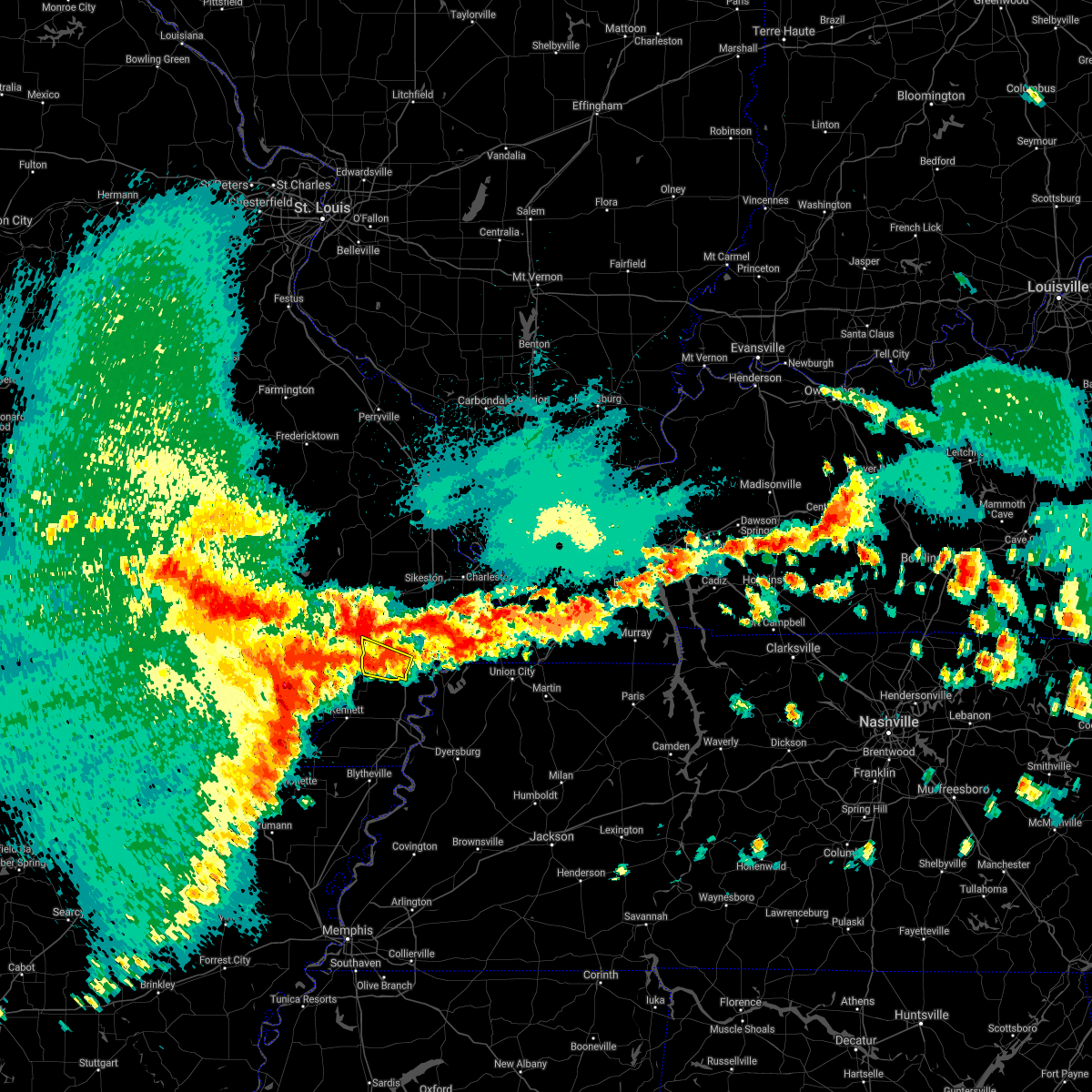 At 219 am cdt, a severe thunderstorm was located near risco, or 8 miles northwest of portageville, moving northeast at 20 mph (radar indicated). Hazards include 60 mph wind gusts and quarter size hail. Hail damage to vehicles is expected. expect wind damage to roofs, siding, and trees. Locations impacted include, portageville, gideon, risco and tallapoosa. At 219 am cdt, a severe thunderstorm was located near risco, or 8 miles northwest of portageville, moving northeast at 20 mph (radar indicated). Hazards include 60 mph wind gusts and quarter size hail. Hail damage to vehicles is expected. expect wind damage to roofs, siding, and trees. Locations impacted include, portageville, gideon, risco and tallapoosa.
|
| 5/4/2021 2:04 AM CDT |
 At 204 am cdt, a severe thunderstorm was located near gideon, or 8 miles west of portageville, moving northeast at 25 mph (radar indicated). Hazards include 60 mph wind gusts and quarter size hail. Hail damage to vehicles is expected. expect wind damage to roofs, siding, and trees. Locations impacted include, portageville, clarkton, holcomb, wardell, bolton, north wardell, white oak, homestown, providence, baird, frisbee, mcguires, swift and peach orchard. At 204 am cdt, a severe thunderstorm was located near gideon, or 8 miles west of portageville, moving northeast at 25 mph (radar indicated). Hazards include 60 mph wind gusts and quarter size hail. Hail damage to vehicles is expected. expect wind damage to roofs, siding, and trees. Locations impacted include, portageville, clarkton, holcomb, wardell, bolton, north wardell, white oak, homestown, providence, baird, frisbee, mcguires, swift and peach orchard.
|
| 5/4/2021 1:48 AM CDT |
 At 134 am cdt, a severe thunderstorm was located near kennett, moving northeast at 25 mph (radar indicated). Hazards include 60 mph wind gusts and quarter size hail. Hail damage to vehicles is expected. Expect wind damage to roofs, siding, and trees. At 134 am cdt, a severe thunderstorm was located near kennett, moving northeast at 25 mph (radar indicated). Hazards include 60 mph wind gusts and quarter size hail. Hail damage to vehicles is expected. Expect wind damage to roofs, siding, and trees.
|
| 5/4/2021 1:36 AM CDT |
 At 136 am cdt, a severe thunderstorm was located near deering, or 7 miles east of kennett, moving northeast at 15 mph (radar indicated). Hazards include 60 mph wind gusts and quarter size hail. Hail damage to vehicles is expected. Expect wind damage to roofs, siding, and trees. At 136 am cdt, a severe thunderstorm was located near deering, or 7 miles east of kennett, moving northeast at 15 mph (radar indicated). Hazards include 60 mph wind gusts and quarter size hail. Hail damage to vehicles is expected. Expect wind damage to roofs, siding, and trees.
|
| 5/4/2021 1:34 AM CDT |
 At 134 am cdt, a severe thunderstorm was located near kennett, moving northeast at 25 mph (radar indicated). Hazards include 60 mph wind gusts and quarter size hail. Hail damage to vehicles is expected. Expect wind damage to roofs, siding, and trees. At 134 am cdt, a severe thunderstorm was located near kennett, moving northeast at 25 mph (radar indicated). Hazards include 60 mph wind gusts and quarter size hail. Hail damage to vehicles is expected. Expect wind damage to roofs, siding, and trees.
|
| 4/28/2021 4:19 PM CDT |
 At 418 pm cdt, severe thunderstorms were located along a line extending from near sikeston to 6 miles north of tiptonville, moving east at 30 mph (radar indicated). Hazards include 60 mph wind gusts and penny size hail. Expect damage to roofs, siding, and trees. Locations impacted include, sikeston, portageville, new madrid, lilbourn, hunter-dawson state historic site, matthews, marston, howardville, canalou, farrenburg, catron and north lilbourn. At 418 pm cdt, severe thunderstorms were located along a line extending from near sikeston to 6 miles north of tiptonville, moving east at 30 mph (radar indicated). Hazards include 60 mph wind gusts and penny size hail. Expect damage to roofs, siding, and trees. Locations impacted include, sikeston, portageville, new madrid, lilbourn, hunter-dawson state historic site, matthews, marston, howardville, canalou, farrenburg, catron and north lilbourn.
|
| 4/28/2021 3:56 PM CDT |
 At 355 pm cdt, severe thunderstorms were located along a line extending from 6 miles north of parma to near bolton, moving east at 25 mph (radar indicated). Hazards include 60 mph wind gusts and penny size hail. expect damage to roofs, siding, and trees At 355 pm cdt, severe thunderstorms were located along a line extending from 6 miles north of parma to near bolton, moving east at 25 mph (radar indicated). Hazards include 60 mph wind gusts and penny size hail. expect damage to roofs, siding, and trees
|
| 6/5/2020 11:07 AM CDT |
 At 1107 am cdt, severe thunderstorms were located along a line extending from near parma to near greenway to near marmaduke to near crowleys ridge state park, moving southeast at 35 mph (radar indicated). Hazards include 60 mph wind gusts. expect damage to roofs, siding, and trees At 1107 am cdt, severe thunderstorms were located along a line extending from near parma to near greenway to near marmaduke to near crowleys ridge state park, moving southeast at 35 mph (radar indicated). Hazards include 60 mph wind gusts. expect damage to roofs, siding, and trees
|
| 5/4/2020 6:05 PM CDT |
 The severe thunderstorm warning for pemiscot, northern dyer, western obion and lake counties will expire at 615 pm cdt, the storm which prompted the warning has moved out of the area. therefore, the warning will be allowed to expire. however gusty winds are still possible with this thunderstorm. a severe thunderstorm watch remains in effect until 1000 pm cdt for southeastern missouri, and western tennessee. The severe thunderstorm warning for pemiscot, northern dyer, western obion and lake counties will expire at 615 pm cdt, the storm which prompted the warning has moved out of the area. therefore, the warning will be allowed to expire. however gusty winds are still possible with this thunderstorm. a severe thunderstorm watch remains in effect until 1000 pm cdt for southeastern missouri, and western tennessee.
|
| 5/4/2020 5:58 PM CDT |
 At 557 pm cdt, a severe thunderstorm was located over ridgely, or near reelfoot lake state park, moving east at 55 mph (radar indicated). Hazards include 60 mph wind gusts and quarter size hail. Hail damage to vehicles is expected. expect wind damage to roofs, siding, and trees. Locations impacted include, caruthersville, portageville, hayti, steele, reelfoot lake state park, tiptonville, newbern, ridgely, hayti heights, wardell, bolton, cloverdale, deering, miston, cottonwood grove, hornbeak, samburg, bragg city, pascola and cat corner. At 557 pm cdt, a severe thunderstorm was located over ridgely, or near reelfoot lake state park, moving east at 55 mph (radar indicated). Hazards include 60 mph wind gusts and quarter size hail. Hail damage to vehicles is expected. expect wind damage to roofs, siding, and trees. Locations impacted include, caruthersville, portageville, hayti, steele, reelfoot lake state park, tiptonville, newbern, ridgely, hayti heights, wardell, bolton, cloverdale, deering, miston, cottonwood grove, hornbeak, samburg, bragg city, pascola and cat corner.
|
| 5/4/2020 5:42 PM CDT |
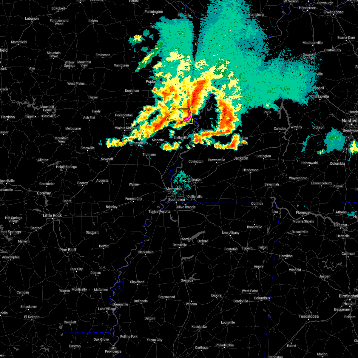 The severe thunderstorm warning for southeastern clay, northwestern pemiscot and east central dunklin counties will expire at 545 pm cdt, the storm which prompted the warning has moved out of the area. therefore, the warning will be allowed to expire. however gusty winds are still possible with this thunderstorm. a severe thunderstorm watch remains in effect until 1000 pm cdt for eastern arkansas, and southeastern missouri. remember, a severe thunderstorm warning still remains in effect for southeast dunklin county and pemiscot county. The severe thunderstorm warning for southeastern clay, northwestern pemiscot and east central dunklin counties will expire at 545 pm cdt, the storm which prompted the warning has moved out of the area. therefore, the warning will be allowed to expire. however gusty winds are still possible with this thunderstorm. a severe thunderstorm watch remains in effect until 1000 pm cdt for eastern arkansas, and southeastern missouri. remember, a severe thunderstorm warning still remains in effect for southeast dunklin county and pemiscot county.
|
| 5/4/2020 5:41 PM CDT |
 At 541 pm cdt, a severe thunderstorm was located over hayti heights, or over hayti, moving east at 55 mph (radar indicated). Hazards include 60 mph wind gusts and quarter size hail. Hail damage to vehicles is expected. Expect wind damage to roofs, siding, and trees. At 541 pm cdt, a severe thunderstorm was located over hayti heights, or over hayti, moving east at 55 mph (radar indicated). Hazards include 60 mph wind gusts and quarter size hail. Hail damage to vehicles is expected. Expect wind damage to roofs, siding, and trees.
|
| 5/4/2020 5:37 PM CDT |
 At 536 pm cdt, severe thunderstorms were located along a line extending from risco to near wardell, moving east at 55 mph (radar indicated). Hazards include 60 mph wind gusts and quarter size hail. Hail damage to vehicles is expected. expect wind damage to roofs, siding, and trees. Locations impacted include, portageville, new madrid, lilbourn, hunter-dawson state historic site, parma, marston, howardville, risco, tallapoosa, catron and north lilbourn. At 536 pm cdt, severe thunderstorms were located along a line extending from risco to near wardell, moving east at 55 mph (radar indicated). Hazards include 60 mph wind gusts and quarter size hail. Hail damage to vehicles is expected. expect wind damage to roofs, siding, and trees. Locations impacted include, portageville, new madrid, lilbourn, hunter-dawson state historic site, parma, marston, howardville, risco, tallapoosa, catron and north lilbourn.
|
| 5/4/2020 5:32 PM CDT |
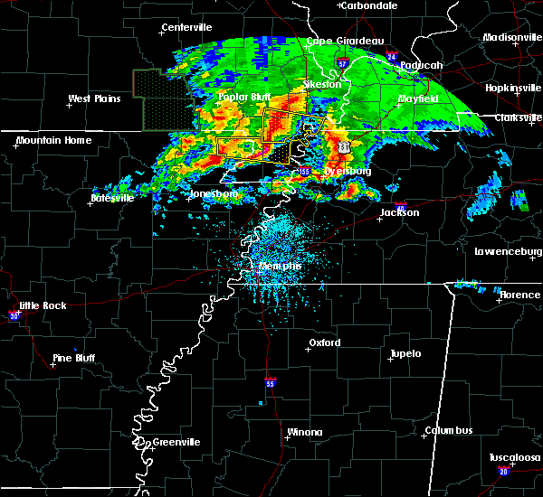 At 531 pm cdt, a severe thunderstorm was located near holcomb, or 9 miles southeast of campbell, moving east at 55 mph (radar indicated). Hazards include 60 mph wind gusts and quarter size hail. Hail damage to vehicles is expected. expect wind damage to roofs, siding, and trees. Locations impacted include, kennett, portageville, hayti, holcomb, hayti heights, wardell, deering, bolton, bragg city, pascola, nimmons, lorine, west kennett, bell city, holly island, north wardell, white oak, homestown, ipley and bakerville. At 531 pm cdt, a severe thunderstorm was located near holcomb, or 9 miles southeast of campbell, moving east at 55 mph (radar indicated). Hazards include 60 mph wind gusts and quarter size hail. Hail damage to vehicles is expected. expect wind damage to roofs, siding, and trees. Locations impacted include, kennett, portageville, hayti, holcomb, hayti heights, wardell, deering, bolton, bragg city, pascola, nimmons, lorine, west kennett, bell city, holly island, north wardell, white oak, homestown, ipley and bakerville.
|
| 5/4/2020 5:26 PM CDT |
 At 525 pm cdt, severe thunderstorms were located along a line extending from near bernie to near holcomb, moving east at 55 mph (trained weather spotters. this line of storms has a history of producing damaging winds in excess of 60 mph). Hazards include golf ball size hail and 60 mph wind gusts. People and animals outdoors will be injured. expect hail damage to roofs, siding, windows, and vehicles. expect wind damage to roofs, siding, and trees. Locations impacted include, portageville, new madrid, lilbourn, hunter-dawson state historic site, malden, clarkton, gideon, parma, marston, howardville, risco, tallapoosa, catron and north lilbourn. At 525 pm cdt, severe thunderstorms were located along a line extending from near bernie to near holcomb, moving east at 55 mph (trained weather spotters. this line of storms has a history of producing damaging winds in excess of 60 mph). Hazards include golf ball size hail and 60 mph wind gusts. People and animals outdoors will be injured. expect hail damage to roofs, siding, windows, and vehicles. expect wind damage to roofs, siding, and trees. Locations impacted include, portageville, new madrid, lilbourn, hunter-dawson state historic site, malden, clarkton, gideon, parma, marston, howardville, risco, tallapoosa, catron and north lilbourn.
|
| 5/4/2020 5:13 PM CDT |
 At 513 pm cdt, severe thunderstorms were located along a line extending from 6 miles west of bernie to piggott, moving east at 55 mph (trained weather spotters. this line of storms has a history of producing damaging winds). Hazards include 60 mph wind gusts and half dollar size hail. Hail damage to vehicles is expected. Expect wind damage to roofs, siding, and trees. At 513 pm cdt, severe thunderstorms were located along a line extending from 6 miles west of bernie to piggott, moving east at 55 mph (trained weather spotters. this line of storms has a history of producing damaging winds). Hazards include 60 mph wind gusts and half dollar size hail. Hail damage to vehicles is expected. Expect wind damage to roofs, siding, and trees.
|
| 5/4/2020 5:12 PM CDT |
 At 512 pm cdt, a severe thunderstorm was located near pollard, or near piggott, moving east at 55 mph (radar indicated). Hazards include 60 mph wind gusts and quarter size hail. Hail damage to vehicles is expected. Expect wind damage to roofs, siding, and trees. At 512 pm cdt, a severe thunderstorm was located near pollard, or near piggott, moving east at 55 mph (radar indicated). Hazards include 60 mph wind gusts and quarter size hail. Hail damage to vehicles is expected. Expect wind damage to roofs, siding, and trees.
|
| 5/3/2020 2:00 PM CDT |
 At 159 pm cdt, severe thunderstorms were located along a line extending from near advance to near bell city to matthews to howardville to near portageville, moving east at 60 mph (trained weather spotters. a car was reported flipped near brownwood with a possible tornado). Hazards include 70 mph wind gusts and nickel size hail. Expect considerable tree damage. damage is likely to mobile homes, roofs, and outbuildings. Locations impacted include, sikeston, charleston, portageville, east prairie, new madrid, cairo, bloomfield, advance, oran, lilbourn, miner, benton, towosahgy state historic site, big oak tree state park, hunter-dawson state historic site, gideon, morehouse, bertrand, morley and matthews. At 159 pm cdt, severe thunderstorms were located along a line extending from near advance to near bell city to matthews to howardville to near portageville, moving east at 60 mph (trained weather spotters. a car was reported flipped near brownwood with a possible tornado). Hazards include 70 mph wind gusts and nickel size hail. Expect considerable tree damage. damage is likely to mobile homes, roofs, and outbuildings. Locations impacted include, sikeston, charleston, portageville, east prairie, new madrid, cairo, bloomfield, advance, oran, lilbourn, miner, benton, towosahgy state historic site, big oak tree state park, hunter-dawson state historic site, gideon, morehouse, bertrand, morley and matthews.
|
| 5/3/2020 1:50 PM CDT |
 At 149 pm cdt, severe thunderstorms were located along a line extending from near parma to near senath, moving east at 55 mph (radar indicated). Hazards include 70 mph wind gusts and half dollar size hail. Hail damage to vehicles is expected. expect considerable tree damage. wind damage is also likely to mobile homes, roofs, and outbuildings. Locations impacted include, paragould, dyersburg, kennett, caruthersville, piggott, portageville, hayti, steele, campbell, rector, senath, marmaduke, reelfoot lake state park, chalk bluff natural area, tiptonville, malden, ridgely, oak grove heights, cardwell and hornersville. At 149 pm cdt, severe thunderstorms were located along a line extending from near parma to near senath, moving east at 55 mph (radar indicated). Hazards include 70 mph wind gusts and half dollar size hail. Hail damage to vehicles is expected. expect considerable tree damage. wind damage is also likely to mobile homes, roofs, and outbuildings. Locations impacted include, paragould, dyersburg, kennett, caruthersville, piggott, portageville, hayti, steele, campbell, rector, senath, marmaduke, reelfoot lake state park, chalk bluff natural area, tiptonville, malden, ridgely, oak grove heights, cardwell and hornersville.
|
| 5/3/2020 1:47 PM CDT |
 At 146 pm cdt, severe thunderstorms were located along a line extending from 10 miles southeast of grassy to 6 miles south of advance to near canalou to risco to near gideon, moving east at 65 mph (trained weather spotters. trees were reported snapped in dexter). Hazards include 70 mph wind gusts and nickel size hail. Expect considerable tree damage. damage is likely to mobile homes, roofs, and outbuildings. Locations impacted include, sikeston, dexter, charleston, portageville, east prairie, new madrid, cairo, bernie, bloomfield, advance, oran, lilbourn, miner, benton, towosahgy state historic site, big oak tree state park, hunter-dawson state historic site, malden, clarkton and gideon. At 146 pm cdt, severe thunderstorms were located along a line extending from 10 miles southeast of grassy to 6 miles south of advance to near canalou to risco to near gideon, moving east at 65 mph (trained weather spotters. trees were reported snapped in dexter). Hazards include 70 mph wind gusts and nickel size hail. Expect considerable tree damage. damage is likely to mobile homes, roofs, and outbuildings. Locations impacted include, sikeston, dexter, charleston, portageville, east prairie, new madrid, cairo, bernie, bloomfield, advance, oran, lilbourn, miner, benton, towosahgy state historic site, big oak tree state park, hunter-dawson state historic site, malden, clarkton and gideon.
|
| 5/3/2020 1:30 PM CDT |
 At 130 pm cdt, severe thunderstorms were located along a line extending from near glennonville to near oak grove heights, moving east at 70 mph (radar indicated). Hazards include 70 mph wind gusts and half dollar size hail. Hail damage to vehicles is expected. expect considerable tree damage. Wind damage is also likely to mobile homes, roofs, and outbuildings. At 130 pm cdt, severe thunderstorms were located along a line extending from near glennonville to near oak grove heights, moving east at 70 mph (radar indicated). Hazards include 70 mph wind gusts and half dollar size hail. Hail damage to vehicles is expected. expect considerable tree damage. Wind damage is also likely to mobile homes, roofs, and outbuildings.
|
| 5/3/2020 1:22 PM CDT |
 At 121 pm cdt, severe thunderstorms were located along a line extending from near greenville to fisk to near mcdougal, moving east at 65 mph (trained weather spotters). Hazards include 70 mph wind gusts and quarter size hail. Hail damage to vehicles is expected. expect considerable tree damage. Wind damage is also likely to mobile homes, roofs, and outbuildings. At 121 pm cdt, severe thunderstorms were located along a line extending from near greenville to fisk to near mcdougal, moving east at 65 mph (trained weather spotters). Hazards include 70 mph wind gusts and quarter size hail. Hail damage to vehicles is expected. expect considerable tree damage. Wind damage is also likely to mobile homes, roofs, and outbuildings.
|
| 4/29/2020 12:25 AM CDT |
 The severe thunderstorm warning for southeastern craighead, mississippi, southeastern clay, pemiscot, dunklin, western dyer, central lauderdale and central lake counties will expire at 1230 am cdt, the storm which prompted the warning has weakened below severe limits, and has exited the warned area. therefore, the warning will be allowed to expire. a severe thunderstorm watch remains in effect until 300 am cdt for eastern arkansas, southeastern missouri, and western tennessee. The severe thunderstorm warning for southeastern craighead, mississippi, southeastern clay, pemiscot, dunklin, western dyer, central lauderdale and central lake counties will expire at 1230 am cdt, the storm which prompted the warning has weakened below severe limits, and has exited the warned area. therefore, the warning will be allowed to expire. a severe thunderstorm watch remains in effect until 300 am cdt for eastern arkansas, southeastern missouri, and western tennessee.
|
| 4/28/2020 11:43 PM CDT |
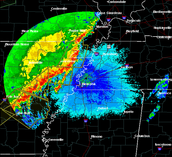 At 1139 pm cdt, a severe thunderstorm was located near steele, moving east at 65 mph (radar indicated). Hazards include 70 mph wind gusts. Expect considerable tree damage. Damage is likely to mobile homes, roofs, and outbuildings. At 1139 pm cdt, a severe thunderstorm was located near steele, moving east at 65 mph (radar indicated). Hazards include 70 mph wind gusts. Expect considerable tree damage. Damage is likely to mobile homes, roofs, and outbuildings.
|
| 3/28/2020 6:27 PM CDT |
 At 627 pm cdt, a severe thunderstorm capable of producing a tornado was located over lilbourn, moving northeast at 55 mph (radar indicated rotation). Hazards include tornado and quarter size hail. Flying debris will be dangerous to those caught without shelter. mobile homes will be damaged or destroyed. damage to roofs, windows, and vehicles will occur. tree damage is likely. this dangerous storm will be near, farrenburg around 640 pm cdt. Other locations impacted by this tornadic thunderstorm include catron and north lilbourn. At 627 pm cdt, a severe thunderstorm capable of producing a tornado was located over lilbourn, moving northeast at 55 mph (radar indicated rotation). Hazards include tornado and quarter size hail. Flying debris will be dangerous to those caught without shelter. mobile homes will be damaged or destroyed. damage to roofs, windows, and vehicles will occur. tree damage is likely. this dangerous storm will be near, farrenburg around 640 pm cdt. Other locations impacted by this tornadic thunderstorm include catron and north lilbourn.
|
| 3/28/2020 6:18 PM CDT |
 At 617 pm cdt, a severe thunderstorm capable of producing a tornado was located near risco, or 7 miles northwest of portageville, moving northeast at 60 mph (radar indicated rotation). Hazards include tornado and quarter size hail. Flying debris will be dangerous to those caught without shelter. mobile homes will be damaged or destroyed. damage to roofs, windows, and vehicles will occur. tree damage is likely. this dangerous storm will be near, marston around 625 pm cdt. new madrid, lilbourn, hunter-dawson state historic site and howardville around 630 pm cdt. farrenburg around 635 pm cdt. other locations impacted by this tornadic thunderstorm include tallapoosa, catron and north lilbourn. This includes interstate 55 between mile markers 32 and 57. At 617 pm cdt, a severe thunderstorm capable of producing a tornado was located near risco, or 7 miles northwest of portageville, moving northeast at 60 mph (radar indicated rotation). Hazards include tornado and quarter size hail. Flying debris will be dangerous to those caught without shelter. mobile homes will be damaged or destroyed. damage to roofs, windows, and vehicles will occur. tree damage is likely. this dangerous storm will be near, marston around 625 pm cdt. new madrid, lilbourn, hunter-dawson state historic site and howardville around 630 pm cdt. farrenburg around 635 pm cdt. other locations impacted by this tornadic thunderstorm include tallapoosa, catron and north lilbourn. This includes interstate 55 between mile markers 32 and 57.
|
| 1/11/2020 2:47 AM CST |
 At 247 am cst, severe thunderstorms were located along a line extending from near portageville to near osceola, moving east at 40 mph (radar indicated). Hazards include 60 mph wind gusts. Expect damage to roofs, siding, and trees. Locations impacted include, dyersburg, blytheville, kennett, osceola, caruthersville, gosnell, manila, portageville, hayti, steele, caraway, luxora, keiser, reelfoot lake state park, tiptonville, ridgely, hornersville, hayti heights, cooter and wardell. At 247 am cst, severe thunderstorms were located along a line extending from near portageville to near osceola, moving east at 40 mph (radar indicated). Hazards include 60 mph wind gusts. Expect damage to roofs, siding, and trees. Locations impacted include, dyersburg, blytheville, kennett, osceola, caruthersville, gosnell, manila, portageville, hayti, steele, caraway, luxora, keiser, reelfoot lake state park, tiptonville, ridgely, hornersville, hayti heights, cooter and wardell.
|
| 1/11/2020 2:26 AM CST |
 At 225 am cst, severe thunderstorms were located along a line extending from near gideon to near caraway, moving northeast at 40 mph (radar indicated). Hazards include 60 mph wind gusts. expect damage to roofs, siding, and trees At 225 am cst, severe thunderstorms were located along a line extending from near gideon to near caraway, moving northeast at 40 mph (radar indicated). Hazards include 60 mph wind gusts. expect damage to roofs, siding, and trees
|
| 1/11/2020 1:52 AM CST |
 At 152 am cst, severe thunderstorms were located along a line extending from near clarkton to trumann, moving northeast at 45 mph (radar indicated). Hazards include 70 mph wind gusts. Expect considerable tree damage. Damage is likely to mobile homes, roofs, and outbuildings. At 152 am cst, severe thunderstorms were located along a line extending from near clarkton to trumann, moving northeast at 45 mph (radar indicated). Hazards include 70 mph wind gusts. Expect considerable tree damage. Damage is likely to mobile homes, roofs, and outbuildings.
|
| 6/23/2019 3:55 PM CDT |
 At 354 pm cdt, severe thunderstorms were located along a line extending from near marston to near heloise to near fort pillow state park, moving east at 45 mph (trained weather spotters. at 335 pm cdt, a 59 mph wind gust was measured in kennett. trees were down across southern dunklin county). Hazards include 60 mph wind gusts. Expect damage to roofs, siding, and trees. Locations impacted include, blytheville, osceola, caruthersville, gosnell, manila, portageville, hayti, steele, luxora, keiser, reelfoot lake state park, tiptonville, ridgely, hayti heights, cooter, wardell, dell, burdette, deering and heloise. At 354 pm cdt, severe thunderstorms were located along a line extending from near marston to near heloise to near fort pillow state park, moving east at 45 mph (trained weather spotters. at 335 pm cdt, a 59 mph wind gust was measured in kennett. trees were down across southern dunklin county). Hazards include 60 mph wind gusts. Expect damage to roofs, siding, and trees. Locations impacted include, blytheville, osceola, caruthersville, gosnell, manila, portageville, hayti, steele, luxora, keiser, reelfoot lake state park, tiptonville, ridgely, hayti heights, cooter, wardell, dell, burdette, deering and heloise.
|
| 6/23/2019 3:52 PM CDT |
 At 352 pm cdt, severe thunderstorms were located along a line extending from near cedar lake area to near charleston to near bolton, moving east at 45 mph (radar indicated). Hazards include 60 mph wind gusts and nickel size hail. Expect damage to roofs, siding, and trees. Locations impacted include, cape girardeau, sikeston, charleston, scott city, anna, portageville, east prairie, new madrid, chaffee, cairo, hickman, jonesboro, clinton, oran, lilbourn, la center, miner, benton, bardwell and wickliffe. At 352 pm cdt, severe thunderstorms were located along a line extending from near cedar lake area to near charleston to near bolton, moving east at 45 mph (radar indicated). Hazards include 60 mph wind gusts and nickel size hail. Expect damage to roofs, siding, and trees. Locations impacted include, cape girardeau, sikeston, charleston, scott city, anna, portageville, east prairie, new madrid, chaffee, cairo, hickman, jonesboro, clinton, oran, lilbourn, la center, miner, benton, bardwell and wickliffe.
|
| 6/23/2019 3:31 PM CDT |
 At 330 pm cdt, severe thunderstorms were located along a line extending from near altenburg to near miner to near kennett, moving east at 45 mph (radar indicated). Hazards include 60 mph wind gusts and nickel size hail. expect damage to roofs, siding, and trees At 330 pm cdt, severe thunderstorms were located along a line extending from near altenburg to near miner to near kennett, moving east at 45 mph (radar indicated). Hazards include 60 mph wind gusts and nickel size hail. expect damage to roofs, siding, and trees
|
| 6/23/2019 3:28 PM CDT |
 At 327 pm cdt, severe thunderstorms were located along a line extending from near gideon to near gosnell to near dyess, moving east at 45 mph (radar indicated). Hazards include 60 mph wind gusts. expect damage to roofs, siding, and trees At 327 pm cdt, severe thunderstorms were located along a line extending from near gideon to near gosnell to near dyess, moving east at 45 mph (radar indicated). Hazards include 60 mph wind gusts. expect damage to roofs, siding, and trees
|
| 6/21/2019 5:46 PM CDT |
 At 544 pm cdt, severe thunderstorms were located along a line extending from near tiptonville to near o`kean, moving southeast at 25 mph (radar indicated, measured at kennett missouri airport). Hazards include 60 mph wind gusts. expect damage to roofs, siding, and trees At 544 pm cdt, severe thunderstorms were located along a line extending from near tiptonville to near o`kean, moving southeast at 25 mph (radar indicated, measured at kennett missouri airport). Hazards include 60 mph wind gusts. expect damage to roofs, siding, and trees
|
| 6/21/2019 5:46 PM CDT |
 The national weather service in memphis has issued a * severe thunderstorm warning for. greene county in eastern arkansas. central craighead county in eastern arkansas. northwestern mississippi county in eastern arkansas. Clay county in eastern arkansas. The national weather service in memphis has issued a * severe thunderstorm warning for. greene county in eastern arkansas. central craighead county in eastern arkansas. northwestern mississippi county in eastern arkansas. Clay county in eastern arkansas.
|
| 6/21/2019 5:25 PM CDT |
 At 525 pm cdt, a severe thunderstorm was located over mcdougal, or 8 miles west of chalk bluff natural area, moving southeast at 5 mph (radar indicated). Hazards include 60 mph wind gusts and nickel size hail. Expect damage to roofs, siding, and trees. locations impacted include, kennett, malden, piggott, corning, portageville, hayti, campbell, rector, marmaduke, chalk bluff natural area, tiptonville, oak grove heights, holcomb, hayti heights, lafe, reyno, wardell, knobel, st. Francis and pollard. At 525 pm cdt, a severe thunderstorm was located over mcdougal, or 8 miles west of chalk bluff natural area, moving southeast at 5 mph (radar indicated). Hazards include 60 mph wind gusts and nickel size hail. Expect damage to roofs, siding, and trees. locations impacted include, kennett, malden, piggott, corning, portageville, hayti, campbell, rector, marmaduke, chalk bluff natural area, tiptonville, oak grove heights, holcomb, hayti heights, lafe, reyno, wardell, knobel, st. Francis and pollard.
|
| 6/21/2019 5:25 PM CDT |
 At 456 pm cdt, severe thunderstorms were located along a line extending from near bernie to near success, moving southeast at 30 mph (radar indicated). Hazards include 60 mph wind gusts. expect damage to roofs, siding, and trees At 456 pm cdt, severe thunderstorms were located along a line extending from near bernie to near success, moving southeast at 30 mph (radar indicated). Hazards include 60 mph wind gusts. expect damage to roofs, siding, and trees
|
| 6/21/2019 5:19 PM CDT |
 At 516 pm cdt, severe thunderstorms were located along a line extending from near dixon springs to near bardwell to big oak tree state park to near marston to clarkton, moving east at 65 mph (trained weather spotters and automated weather observation systems indicated winds of 60 to 70 mph along with tree damage and power outages, as well as torrential rainfall. ). Hazards include 70 mph wind gusts and nickel size hail. Expect considerable tree damage. damage is likely to mobile homes, roofs, and outbuildings. Locations impacted include, metropolis, charleston, portageville, east prairie, new madrid, cairo, lilbourn, la center, bardwell, wickliffe, towosahgy state historic site, big oak tree state park, hunter-dawson state historic site, gideon, barlow, mound city, marston, howardville, risco and wyatt. At 516 pm cdt, severe thunderstorms were located along a line extending from near dixon springs to near bardwell to big oak tree state park to near marston to clarkton, moving east at 65 mph (trained weather spotters and automated weather observation systems indicated winds of 60 to 70 mph along with tree damage and power outages, as well as torrential rainfall. ). Hazards include 70 mph wind gusts and nickel size hail. Expect considerable tree damage. damage is likely to mobile homes, roofs, and outbuildings. Locations impacted include, metropolis, charleston, portageville, east prairie, new madrid, cairo, lilbourn, la center, bardwell, wickliffe, towosahgy state historic site, big oak tree state park, hunter-dawson state historic site, gideon, barlow, mound city, marston, howardville, risco and wyatt.
|
| 6/21/2019 5:19 PM CDT |
 A severe thunderstorm warning remains in effect until 530 pm cdt for western fulton. northwestern hickman. carlisle. western mccracken. ballard. mississippi and new madrid counties. At 516 pm cdt, severe thunderstorms were located along a line extending from near dixon springs to near bardwell to big oak tree state park to near marston to clarkton, moving east at 65 mph. A severe thunderstorm warning remains in effect until 530 pm cdt for western fulton. northwestern hickman. carlisle. western mccracken. ballard. mississippi and new madrid counties. At 516 pm cdt, severe thunderstorms were located along a line extending from near dixon springs to near bardwell to big oak tree state park to near marston to clarkton, moving east at 65 mph.
|
| 6/21/2019 4:56 PM CDT |
 At 456 pm cdt, severe thunderstorms were located along a line extending from near bernie to near success, moving southeast at 30 mph (radar indicated). Hazards include 60 mph wind gusts. expect damage to roofs, siding, and trees At 456 pm cdt, severe thunderstorms were located along a line extending from near bernie to near success, moving southeast at 30 mph (radar indicated). Hazards include 60 mph wind gusts. expect damage to roofs, siding, and trees
|
| 6/21/2019 4:49 PM CDT |
 At 447 pm cdt, severe thunderstorms were located along a line extending from 6 miles northeast of dongola to near horseshoe lake conservation area to near dexter to naylor, moving east at 55 mph (trained weather spotters and automated weather observation sites have been reporting winds of 60 to 70 mph, along with trees down and power outages with the line of storms). Hazards include 70 mph wind gusts and nickel size hail. Expect considerable tree damage. Damage is likely to mobile homes, roofs, and outbuildings. At 447 pm cdt, severe thunderstorms were located along a line extending from 6 miles northeast of dongola to near horseshoe lake conservation area to near dexter to naylor, moving east at 55 mph (trained weather spotters and automated weather observation sites have been reporting winds of 60 to 70 mph, along with trees down and power outages with the line of storms). Hazards include 70 mph wind gusts and nickel size hail. Expect considerable tree damage. Damage is likely to mobile homes, roofs, and outbuildings.
|
| 6/21/2019 4:49 PM CDT |
 The national weather service in paducah has issued a * severe thunderstorm warning for. western fulton county in western kentucky. northwestern hickman county in western kentucky. carlisle county in western kentucky. Western mccracken county in western kentucky. The national weather service in paducah has issued a * severe thunderstorm warning for. western fulton county in western kentucky. northwestern hickman county in western kentucky. carlisle county in western kentucky. Western mccracken county in western kentucky.
|
| 6/16/2019 5:37 PM CDT |
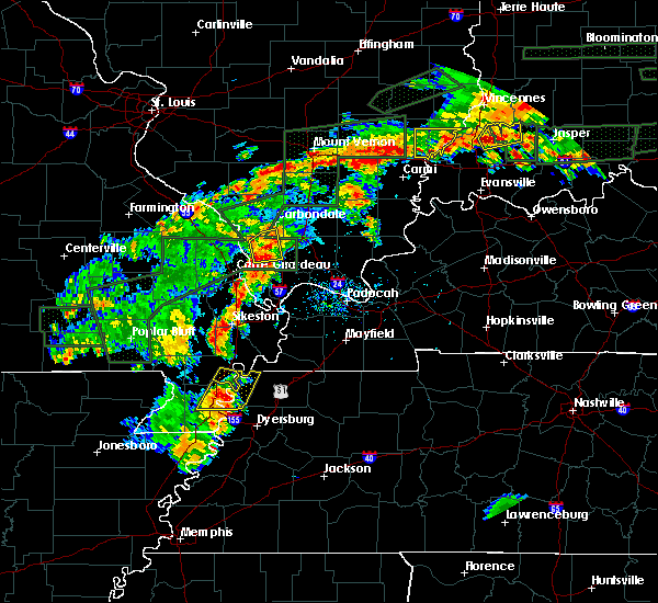 At 537 pm cdt, a severe thunderstorm was located near portageville, moving northeast at 20 mph (radar indicated). Hazards include 60 mph wind gusts and quarter size hail. Hail damage to vehicles is expected. Expect wind damage to roofs, siding, and trees. At 537 pm cdt, a severe thunderstorm was located near portageville, moving northeast at 20 mph (radar indicated). Hazards include 60 mph wind gusts and quarter size hail. Hail damage to vehicles is expected. Expect wind damage to roofs, siding, and trees.
|
| 6/16/2019 5:22 PM CDT |
 At 522 pm cdt, a severe thunderstorm was located over hayti, moving northeast at 50 mph (radar indicated). Hazards include ping pong ball size hail and 60 mph wind gusts. People and animals outdoors will be injured. expect hail damage to roofs, siding, windows, and vehicles. expect wind damage to roofs, siding, and trees. Locations impacted include, caruthersville, portageville, hayti, reelfoot lake state park, tiptonville, ridgely, hayti heights, bolton, cottonwood grove, pascola, wynnburg, wright, cronanville, hathaway, sunkist beach, blue bank, proctor city, madie, mooring and grays camp. At 522 pm cdt, a severe thunderstorm was located over hayti, moving northeast at 50 mph (radar indicated). Hazards include ping pong ball size hail and 60 mph wind gusts. People and animals outdoors will be injured. expect hail damage to roofs, siding, windows, and vehicles. expect wind damage to roofs, siding, and trees. Locations impacted include, caruthersville, portageville, hayti, reelfoot lake state park, tiptonville, ridgely, hayti heights, bolton, cottonwood grove, pascola, wynnburg, wright, cronanville, hathaway, sunkist beach, blue bank, proctor city, madie, mooring and grays camp.
|
| 5/2/2019 6:15 PM CDT |
 At 615 pm cdt, a severe thunderstorm was located over caruthersville, moving northeast at 25 mph (radar indicated). Hazards include 60 mph wind gusts and quarter size hail. Hail damage to vehicles is expected. Expect wind damage to roofs, siding, and trees. At 615 pm cdt, a severe thunderstorm was located over caruthersville, moving northeast at 25 mph (radar indicated). Hazards include 60 mph wind gusts and quarter size hail. Hail damage to vehicles is expected. Expect wind damage to roofs, siding, and trees.
|
| 3/14/2019 8:17 AM CDT |
 At 817 am cdt, a severe thunderstorm was located over portageville, moving northeast at 70 mph (radar indicated). Hazards include 60 mph wind gusts. expect damage to roofs, siding, and trees At 817 am cdt, a severe thunderstorm was located over portageville, moving northeast at 70 mph (radar indicated). Hazards include 60 mph wind gusts. expect damage to roofs, siding, and trees
|
| 6/28/2018 9:22 PM CDT |
 At 922 pm cdt, a severe thunderstorm was located near troy, or 8 miles west of union city, moving south at 60 mph (radar indicated). Hazards include 60 mph wind gusts and quarter size hail. Hail damage to vehicles is expected. Expect wind damage to roofs, siding, and trees. At 922 pm cdt, a severe thunderstorm was located near troy, or 8 miles west of union city, moving south at 60 mph (radar indicated). Hazards include 60 mph wind gusts and quarter size hail. Hail damage to vehicles is expected. Expect wind damage to roofs, siding, and trees.
|
| 6/1/2018 12:00 AM CDT |
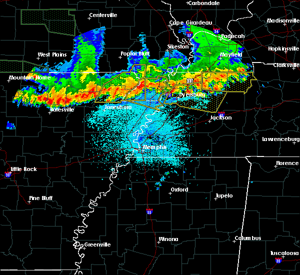 At 1200 am cdt, a severe thunderstorm was located over kennett, moving east at 50 mph (radar indicated). Hazards include 60 mph wind gusts. expect damage to roofs, siding, and trees At 1200 am cdt, a severe thunderstorm was located over kennett, moving east at 50 mph (radar indicated). Hazards include 60 mph wind gusts. expect damage to roofs, siding, and trees
|
| 6/1/2018 12:00 AM CDT |
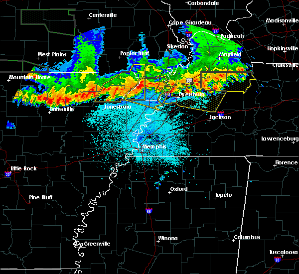 At 1200 am cdt, a severe thunderstorm was located over kennett, moving east at 50 mph (radar indicated). Hazards include 60 mph wind gusts. expect damage to roofs, siding, and trees At 1200 am cdt, a severe thunderstorm was located over kennett, moving east at 50 mph (radar indicated). Hazards include 60 mph wind gusts. expect damage to roofs, siding, and trees
|
| 5/31/2018 10:25 PM CDT |
 At 1025 pm cdt, severe thunderstorms were located along a line extending from near matthews to near portageville, moving east at 30 mph (radar indicated). Hazards include 60 mph wind gusts. Expect damage to roofs, siding, and trees. Locations impacted include, portageville, east prairie, new madrid, lilbourn, hunter-dawson state historic site, matthews, marston, howardville, farrenburg, catron and north lilbourn. At 1025 pm cdt, severe thunderstorms were located along a line extending from near matthews to near portageville, moving east at 30 mph (radar indicated). Hazards include 60 mph wind gusts. Expect damage to roofs, siding, and trees. Locations impacted include, portageville, east prairie, new madrid, lilbourn, hunter-dawson state historic site, matthews, marston, howardville, farrenburg, catron and north lilbourn.
|
| 5/31/2018 10:09 PM CDT |
 At 1008 pm cdt, severe thunderstorms were located along a line extending from morehouse to near gideon, moving east at 30 mph (radar indicated). Hazards include 60 mph wind gusts. expect damage to roofs, siding, and trees At 1008 pm cdt, severe thunderstorms were located along a line extending from morehouse to near gideon, moving east at 30 mph (radar indicated). Hazards include 60 mph wind gusts. expect damage to roofs, siding, and trees
|
| 5/20/2018 3:30 PM CDT |
 At 330 pm cdt, a severe thunderstorm was located near marston, or near portageville, moving east at 25 mph (radar indicated). Hazards include golf ball size hail and 60 mph wind gusts. People and animals outdoors will be injured. expect hail damage to roofs, siding, windows, and vehicles. Expect wind damage to roofs, siding, and trees. At 330 pm cdt, a severe thunderstorm was located near marston, or near portageville, moving east at 25 mph (radar indicated). Hazards include golf ball size hail and 60 mph wind gusts. People and animals outdoors will be injured. expect hail damage to roofs, siding, windows, and vehicles. Expect wind damage to roofs, siding, and trees.
|
| 5/20/2018 3:28 PM CDT |
 At 328 pm cdt, severe thunderstorms were located along a line extending from lilbourn to portageville, moving east at 10 mph (radar indicated). Hazards include 60 mph wind gusts and quarter size hail. Hail damage to vehicles is expected. Expect wind damage to roofs, siding, and trees. At 328 pm cdt, severe thunderstorms were located along a line extending from lilbourn to portageville, moving east at 10 mph (radar indicated). Hazards include 60 mph wind gusts and quarter size hail. Hail damage to vehicles is expected. Expect wind damage to roofs, siding, and trees.
|
| 5/20/2018 3:25 PM CDT | Trees damaged with storm in new madrid county MO, 2.4 miles S of Portageville, MO |
| 5/20/2018 3:25 PM CDT | Quarter sized hail reported 2.4 miles S of Portageville, MO, quarter size hail reported. |
| 5/20/2018 3:03 PM CDT |
 At 303 pm cdt, a severe thunderstorm was located near gideon, or 9 miles northwest of portageville, moving northeast at 25 mph (radar indicated). Hazards include two inch hail and 70 mph wind gusts. People and animals outdoors will be injured. expect hail damage to roofs, siding, windows, and vehicles. expect considerable tree damage. wind damage is also likely to mobile homes, roofs, and outbuildings. Locations impacted include, portageville, gideon, parma, risco, tallapoosa and catron. At 303 pm cdt, a severe thunderstorm was located near gideon, or 9 miles northwest of portageville, moving northeast at 25 mph (radar indicated). Hazards include two inch hail and 70 mph wind gusts. People and animals outdoors will be injured. expect hail damage to roofs, siding, windows, and vehicles. expect considerable tree damage. wind damage is also likely to mobile homes, roofs, and outbuildings. Locations impacted include, portageville, gideon, parma, risco, tallapoosa and catron.
|
| 5/20/2018 2:45 PM CDT |
 At 244 pm cdt, a severe thunderstorm was located over clarkton, or 7 miles east of campbell, moving east at 25 mph (radar indicated). Hazards include 60 mph wind gusts and half dollar size hail. Hail damage to vehicles is expected. Expect wind damage to roofs, siding, and trees. At 244 pm cdt, a severe thunderstorm was located over clarkton, or 7 miles east of campbell, moving east at 25 mph (radar indicated). Hazards include 60 mph wind gusts and half dollar size hail. Hail damage to vehicles is expected. Expect wind damage to roofs, siding, and trees.
|
| 2/24/2018 6:53 PM CST |
 The severe thunderstorm warning for northeastern mississippi, pemiscot, dyer, western obion, northeastern lauderdale and lake counties will expire at 700 pm cst, the storms which prompted the warning have moved out of the area. therefore the warning will be allowed to expire. a tornado watch remains in effect until 900 pm cst for eastern arkansas, southeastern missouri, and southwestern and northwestern tennessee. The severe thunderstorm warning for northeastern mississippi, pemiscot, dyer, western obion, northeastern lauderdale and lake counties will expire at 700 pm cst, the storms which prompted the warning have moved out of the area. therefore the warning will be allowed to expire. a tornado watch remains in effect until 900 pm cst for eastern arkansas, southeastern missouri, and southwestern and northwestern tennessee.
|
| 2/24/2018 6:36 PM CST |
 At 635 pm cst, a severe thunderstorm capable of producing a tornado was located over hunter-dawson state historic site, moving northeast at 55 mph (radar indicated rotation). Hazards include tornado. Flying debris will be dangerous to those caught without shelter. mobile homes will be damaged or destroyed. damage to roofs, windows, and vehicles will occur. tree damage is likely. Locations impacted include, portageville, new madrid, lilbourn, hunter-dawson state historic site, marston, howardville and north lilbourn. At 635 pm cst, a severe thunderstorm capable of producing a tornado was located over hunter-dawson state historic site, moving northeast at 55 mph (radar indicated rotation). Hazards include tornado. Flying debris will be dangerous to those caught without shelter. mobile homes will be damaged or destroyed. damage to roofs, windows, and vehicles will occur. tree damage is likely. Locations impacted include, portageville, new madrid, lilbourn, hunter-dawson state historic site, marston, howardville and north lilbourn.
|
| 2/24/2018 6:22 PM CST |
 At 622 pm cst, severe thunderstorms were located along a line extending from near parma to near burdette, moving east at 50 mph (radar indicated). Hazards include 60 mph wind gusts. expect damage to roofs, siding, and trees At 622 pm cst, severe thunderstorms were located along a line extending from near parma to near burdette, moving east at 50 mph (radar indicated). Hazards include 60 mph wind gusts. expect damage to roofs, siding, and trees
|
| 2/24/2018 6:22 PM CST |
 The national weather service in memphis has issued a * severe thunderstorm warning for. northeastern mississippi county in eastern arkansas. pemiscot county in southeastern missouri. dyer county in northwestern tennessee. Western obion county in northwestern tennessee. The national weather service in memphis has issued a * severe thunderstorm warning for. northeastern mississippi county in eastern arkansas. pemiscot county in southeastern missouri. dyer county in northwestern tennessee. Western obion county in northwestern tennessee.
|
| 2/24/2018 6:22 PM CST |
 At 622 pm cst, severe thunderstorms were located along a line extending from near parma to near burdette, moving east at 50 mph (radar indicated). Hazards include 60 mph wind gusts. expect damage to roofs, siding, and trees At 622 pm cst, severe thunderstorms were located along a line extending from near parma to near burdette, moving east at 50 mph (radar indicated). Hazards include 60 mph wind gusts. expect damage to roofs, siding, and trees
|
| 2/24/2018 6:19 PM CST |
 At 618 pm cst, a severe thunderstorm capable of producing a tornado was located over gideon, or 9 miles southeast of malden, moving east at 55 mph (radar indicated rotation). Hazards include tornado. Flying debris will be dangerous to those caught without shelter. mobile homes will be damaged or destroyed. damage to roofs, windows, and vehicles will occur. Tree damage is likely. At 618 pm cst, a severe thunderstorm capable of producing a tornado was located over gideon, or 9 miles southeast of malden, moving east at 55 mph (radar indicated rotation). Hazards include tornado. Flying debris will be dangerous to those caught without shelter. mobile homes will be damaged or destroyed. damage to roofs, windows, and vehicles will occur. Tree damage is likely.
|
| 2/24/2018 6:12 PM CST |
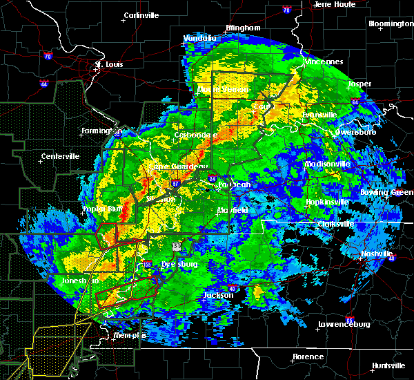 At 611 pm cst, a confirmed tornado was located near gideon, crossing i-55 near mile marker 34, or 8 miles west of portageville, moving east at 55 mph (radar confirmed tornado). Hazards include damaging tornado. Flying debris will be dangerous to those caught without shelter. mobile homes will be damaged or destroyed. damage to roofs, windows, and vehicles will occur. tree damage is likely. locations impacted include, malden, piggott, portageville, campbell, chalk bluff natural area, clarkton, holcomb, st. Francis, saint francis, glennonville, nimmons, carryville, rhyne, white oak, valley ridge, providence, wilhelmina, brian, baird and frisbee. At 611 pm cst, a confirmed tornado was located near gideon, crossing i-55 near mile marker 34, or 8 miles west of portageville, moving east at 55 mph (radar confirmed tornado). Hazards include damaging tornado. Flying debris will be dangerous to those caught without shelter. mobile homes will be damaged or destroyed. damage to roofs, windows, and vehicles will occur. tree damage is likely. locations impacted include, malden, piggott, portageville, campbell, chalk bluff natural area, clarkton, holcomb, st. Francis, saint francis, glennonville, nimmons, carryville, rhyne, white oak, valley ridge, providence, wilhelmina, brian, baird and frisbee.
|
| 2/24/2018 6:04 PM CST |
 At 603 pm cst, severe thunderstorms were located along a line extending from kennett to bassett, moving northeast at 60 mph (radar indicated). Hazards include 60 mph wind gusts. Expect damage to roofs, siding, and trees. locations impacted include, blytheville, kennett, osceola, gosnell, manila, portageville, hayti, marked tree, steele, leachville, lepanto, senath, caraway, luxora, wilson, tyronza, keiser, fort pillow state park, hornersville and hayti heights. A tornado watch remains in effect until 900 pm cst for eastern arkansas, southeastern missouri, and southwestern and northwestern tennessee. At 603 pm cst, severe thunderstorms were located along a line extending from kennett to bassett, moving northeast at 60 mph (radar indicated). Hazards include 60 mph wind gusts. Expect damage to roofs, siding, and trees. locations impacted include, blytheville, kennett, osceola, gosnell, manila, portageville, hayti, marked tree, steele, leachville, lepanto, senath, caraway, luxora, wilson, tyronza, keiser, fort pillow state park, hornersville and hayti heights. A tornado watch remains in effect until 900 pm cst for eastern arkansas, southeastern missouri, and southwestern and northwestern tennessee.
|
| 2/24/2018 5:56 PM CST |
 At 556 pm cst, a severe thunderstorm producing a tornado was located near holcomb, or near piggott, moving east at 55 mph (radar indicated rotation). Hazards include tornado. Flying debris will be dangerous to those caught without shelter. mobile homes will be damaged or destroyed. damage to roofs, windows, and vehicles will occur. Tree damage is likely. At 556 pm cst, a severe thunderstorm producing a tornado was located near holcomb, or near piggott, moving east at 55 mph (radar indicated rotation). Hazards include tornado. Flying debris will be dangerous to those caught without shelter. mobile homes will be damaged or destroyed. damage to roofs, windows, and vehicles will occur. Tree damage is likely.
|
| 2/24/2018 5:42 PM CST |
 At 542 pm cst, severe thunderstorms were located along a line extending from near cardwell to near tyronza, moving northeast at 55 mph (radar indicated). Hazards include 60 mph wind gusts. expect damage to roofs, siding, and trees At 542 pm cst, severe thunderstorms were located along a line extending from near cardwell to near tyronza, moving northeast at 55 mph (radar indicated). Hazards include 60 mph wind gusts. expect damage to roofs, siding, and trees
|
| 2/20/2018 11:36 PM CST |
 At 1133 pm cst, a severe thunderstorm was located over risco, or 8 miles northwest of portageville, moving northeast at 55 mph (radar indicated). Hazards include 60 mph wind gusts. expect damage to roofs, siding, and trees At 1133 pm cst, a severe thunderstorm was located over risco, or 8 miles northwest of portageville, moving northeast at 55 mph (radar indicated). Hazards include 60 mph wind gusts. expect damage to roofs, siding, and trees
|
| 2/20/2018 11:29 PM CST |
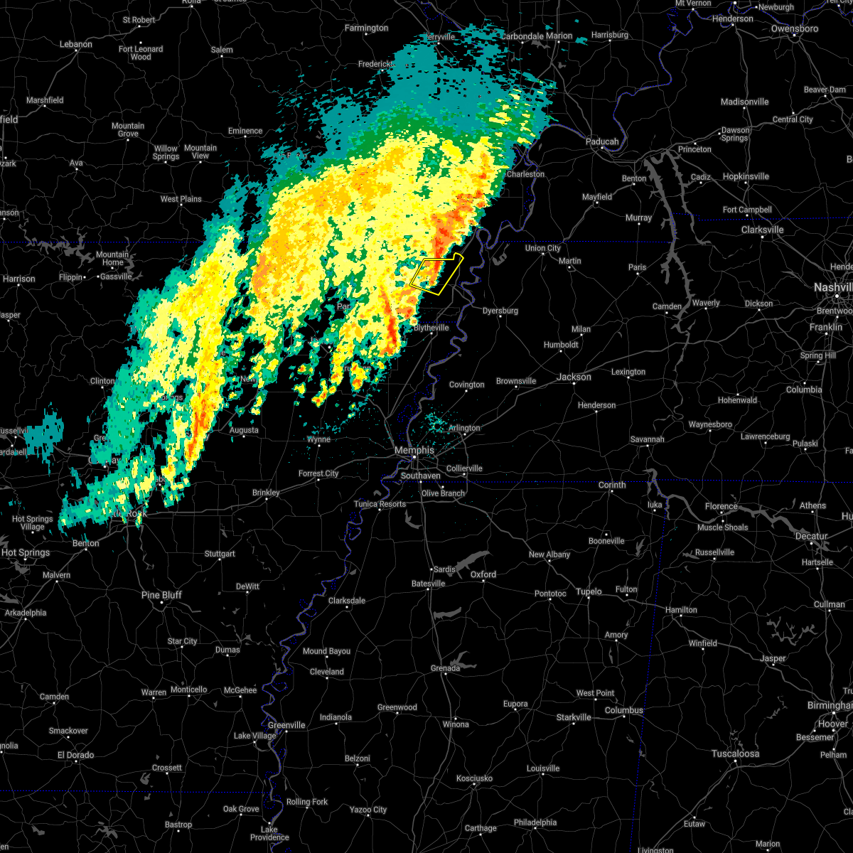 At 1128 pm cst, a severe thunderstorm was located near kennett, moving northeast at 60 mph (radar indicated). Hazards include 60 mph wind gusts. Expect damage to roofs, siding, and trees. Locations impacted include, kennett, portageville, wardell, deering, bolton, bragg city, pascola, north wardell, west kennett, homestown, ipley, bakerville, swift and peach orchard. At 1128 pm cst, a severe thunderstorm was located near kennett, moving northeast at 60 mph (radar indicated). Hazards include 60 mph wind gusts. Expect damage to roofs, siding, and trees. Locations impacted include, kennett, portageville, wardell, deering, bolton, bragg city, pascola, north wardell, west kennett, homestown, ipley, bakerville, swift and peach orchard.
|
| 2/20/2018 11:23 PM CST |
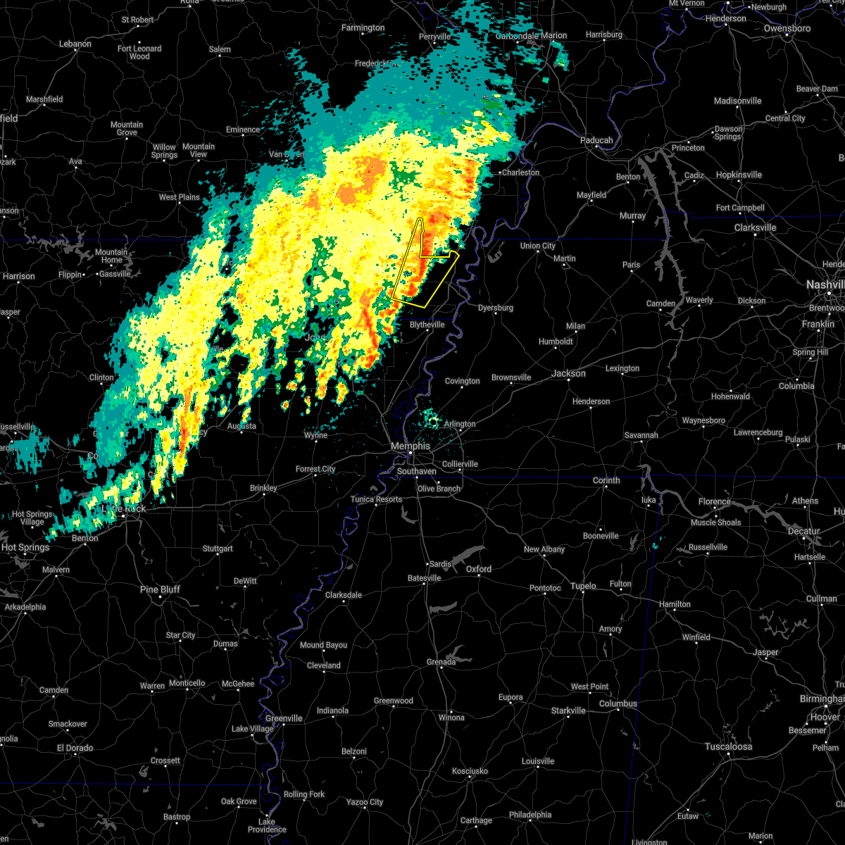 The national weather service in memphis has issued a * severe thunderstorm warning for. southeastern clay county in eastern arkansas. northwestern pemiscot county in southeastern missouri. eastern dunklin county in southeastern missouri. Until 1215 am cst. The national weather service in memphis has issued a * severe thunderstorm warning for. southeastern clay county in eastern arkansas. northwestern pemiscot county in southeastern missouri. eastern dunklin county in southeastern missouri. Until 1215 am cst.
|
| 6/18/2017 9:59 AM CDT |
 At 958 am cdt, a severe thunderstorm was located over marston, or near portageville, moving southeast at 20 mph (radar indicated). Hazards include 60 mph wind gusts and quarter size hail. Hail damage to vehicles is expected. Expect wind damage to roofs, siding, and trees. At 958 am cdt, a severe thunderstorm was located over marston, or near portageville, moving southeast at 20 mph (radar indicated). Hazards include 60 mph wind gusts and quarter size hail. Hail damage to vehicles is expected. Expect wind damage to roofs, siding, and trees.
|
| 5/27/2017 10:16 PM CDT |
 At 1016 pm cdt, a severe thunderstorm was located near caruthersville, moving southeast at 70 mph. this is a very dangerous storm (radar indicated). Hazards include 80 mph wind gusts and quarter size hail. Flying debris will be dangerous to those caught without shelter. mobile homes will be heavily damaged. expect considerable damage to roofs, windows, and vehicles. extensive tree damage and power outages are likely. locations impacted include, dyersburg, blytheville, kennett, ripley, caruthersville, gosnell, portageville, hayti, steele, senath, reelfoot lake state park, tiptonville, ridgely, clarkton, hornersville, holcomb, hayti heights, arbyrd, cooter and wardell. a tornado watch remains in effect until 200 am cdt for eastern arkansas, and southeastern missouri. A tornado watch also remains in effect until 500 am cdt for western tennessee. At 1016 pm cdt, a severe thunderstorm was located near caruthersville, moving southeast at 70 mph. this is a very dangerous storm (radar indicated). Hazards include 80 mph wind gusts and quarter size hail. Flying debris will be dangerous to those caught without shelter. mobile homes will be heavily damaged. expect considerable damage to roofs, windows, and vehicles. extensive tree damage and power outages are likely. locations impacted include, dyersburg, blytheville, kennett, ripley, caruthersville, gosnell, portageville, hayti, steele, senath, reelfoot lake state park, tiptonville, ridgely, clarkton, hornersville, holcomb, hayti heights, arbyrd, cooter and wardell. a tornado watch remains in effect until 200 am cdt for eastern arkansas, and southeastern missouri. A tornado watch also remains in effect until 500 am cdt for western tennessee.
|
| 5/27/2017 9:55 PM CDT |
 At 955 pm cdt, a severe thunderstorm was located near holcomb, or near kennett, moving southeast at 70 mph (radar indicated). Hazards include 70 mph wind gusts and quarter size hail. Hail damage to vehicles is expected. expect considerable tree damage. Wind damage is also likely to mobile homes, roofs, and outbuildings. At 955 pm cdt, a severe thunderstorm was located near holcomb, or near kennett, moving southeast at 70 mph (radar indicated). Hazards include 70 mph wind gusts and quarter size hail. Hail damage to vehicles is expected. expect considerable tree damage. Wind damage is also likely to mobile homes, roofs, and outbuildings.
|
| 5/27/2017 5:54 AM CDT |
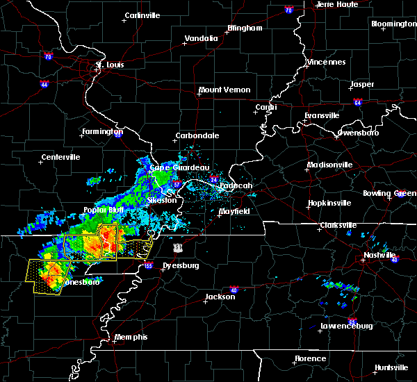 At 554 am cdt, severe thunderstorms were located along a line extending from glennonville to near holcomb to near kennett, moving east at 45 mph (radar indicated). Hazards include 60 mph wind gusts and quarter size hail. Hail damage to vehicles is expected. Expect wind damage to roofs, siding, and trees. At 554 am cdt, severe thunderstorms were located along a line extending from glennonville to near holcomb to near kennett, moving east at 45 mph (radar indicated). Hazards include 60 mph wind gusts and quarter size hail. Hail damage to vehicles is expected. Expect wind damage to roofs, siding, and trees.
|
| 5/11/2017 7:11 PM CDT |
 The severe thunderstorm warning for northeastern pemiscot and northeastern lake counties will expire at 715 pm cdt, the storm which prompted the warning has weakened below severe limits, and has exited the warned area. therefore, the warning will be allowed to expire. however heavy rain is still possible with this thunderstorm. The severe thunderstorm warning for northeastern pemiscot and northeastern lake counties will expire at 715 pm cdt, the storm which prompted the warning has weakened below severe limits, and has exited the warned area. therefore, the warning will be allowed to expire. however heavy rain is still possible with this thunderstorm.
|
| 5/11/2017 7:09 PM CDT |
 The severe thunderstorm warning for southeastern new madrid county will expire at 715 pm cdt, the storm which prompted the warning has weakened below severe limits, and no longer poses an immediate threat to life or property. therefore the warning will be allowed to expire. The severe thunderstorm warning for southeastern new madrid county will expire at 715 pm cdt, the storm which prompted the warning has weakened below severe limits, and no longer poses an immediate threat to life or property. therefore the warning will be allowed to expire.
|
| 5/11/2017 6:40 PM CDT |
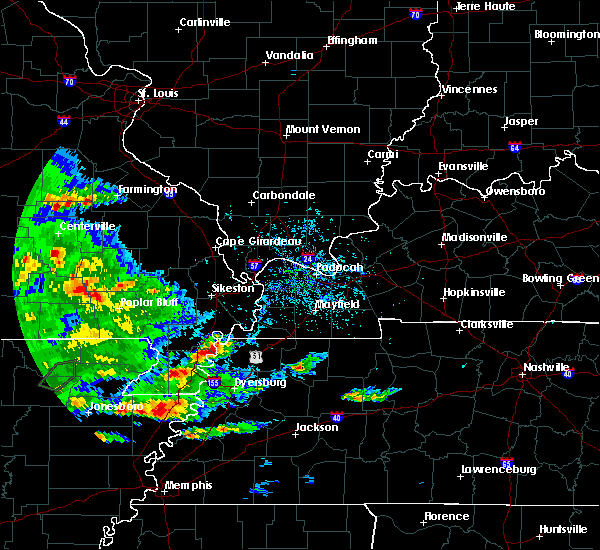 At 639 pm cdt, a severe thunderstorm was located near portageville, moving northeast at 20 mph (radar indicated). Hazards include 60 mph wind gusts and half dollar size hail. Hail damage to vehicles is expected. expect wind damage to roofs, siding, and trees. This severe thunderstorm will remain over mainly rural areas of southeastern new madrid county. At 639 pm cdt, a severe thunderstorm was located near portageville, moving northeast at 20 mph (radar indicated). Hazards include 60 mph wind gusts and half dollar size hail. Hail damage to vehicles is expected. expect wind damage to roofs, siding, and trees. This severe thunderstorm will remain over mainly rural areas of southeastern new madrid county.
|
| 5/11/2017 6:34 PM CDT |
 At 634 pm cdt, a severe thunderstorm was located near portageville, moving northeast at 25 mph (radar indicated). Hazards include 60 mph wind gusts and quarter size hail. Hail damage to vehicles is expected. Expect wind damage to roofs, siding, and trees. At 634 pm cdt, a severe thunderstorm was located near portageville, moving northeast at 25 mph (radar indicated). Hazards include 60 mph wind gusts and quarter size hail. Hail damage to vehicles is expected. Expect wind damage to roofs, siding, and trees.
|
| 4/30/2017 2:41 AM CDT |
 At 240 am cdt, a severe thunderstorm was located near tiptonville, or 7 miles southeast of portageville, moving northeast at 70 mph (radar indicated). Hazards include 60 mph wind gusts and penny size hail. expect damage to roofs, siding, and trees At 240 am cdt, a severe thunderstorm was located near tiptonville, or 7 miles southeast of portageville, moving northeast at 70 mph (radar indicated). Hazards include 60 mph wind gusts and penny size hail. expect damage to roofs, siding, and trees
|
| 4/30/2017 1:56 AM CDT |
 At 155 am cdt, a severe thunderstorm was located over piggott, moving east at 65 mph (radar indicated). Hazards include 60 mph wind gusts. expect damage to roofs, siding, and trees At 155 am cdt, a severe thunderstorm was located over piggott, moving east at 65 mph (radar indicated). Hazards include 60 mph wind gusts. expect damage to roofs, siding, and trees
|
| 3/9/2017 8:26 PM CST |
 At 824 pm cst, severe thunderstorms were located along a line extending from near hunter-dawson state historic site to tiptonville to near hayti, moving east at 70 mph. brief tornadoes may also occur within the fast moving line (radar indicated). Hazards include 70 mph wind gusts and quarter size hail. Hail damage to vehicles is expected. expect considerable tree damage. wind damage is also likely to mobile homes, roofs, and outbuildings. Locations impacted include, union city, portageville, reelfoot lake state park, tiptonville, ridgely, troy, kenton, obion, wardell, clayton, bolton, cloverdale, cottonwood grove, hornbeak, woodland mills, rives, samburg, shaffner, elbridge and jacksonville. At 824 pm cst, severe thunderstorms were located along a line extending from near hunter-dawson state historic site to tiptonville to near hayti, moving east at 70 mph. brief tornadoes may also occur within the fast moving line (radar indicated). Hazards include 70 mph wind gusts and quarter size hail. Hail damage to vehicles is expected. expect considerable tree damage. wind damage is also likely to mobile homes, roofs, and outbuildings. Locations impacted include, union city, portageville, reelfoot lake state park, tiptonville, ridgely, troy, kenton, obion, wardell, clayton, bolton, cloverdale, cottonwood grove, hornbeak, woodland mills, rives, samburg, shaffner, elbridge and jacksonville.
|
| 3/9/2017 8:05 PM CST |
 At 805 pm cst, severe thunderstorms were located along a line extending from farrenburg to near wardell, moving east at 35 mph (radar indicated). Hazards include 60 mph wind gusts and half dollar size hail. Hail damage to vehicles is expected. Expect wind damage to roofs, siding, and trees. At 805 pm cst, severe thunderstorms were located along a line extending from farrenburg to near wardell, moving east at 35 mph (radar indicated). Hazards include 60 mph wind gusts and half dollar size hail. Hail damage to vehicles is expected. Expect wind damage to roofs, siding, and trees.
|
| 3/9/2017 8:00 PM CST |
 At 758 pm cst, severe thunderstorms were located along a line extending from near canalou to near risco to near clarkton, moving east at 45 mph (radar indicated). Hazards include 70 mph wind gusts and quarter size hail. Hail damage to vehicles is expected. expect considerable tree damage. Wind damage is also likely to mobile homes, roofs, and outbuildings. At 758 pm cst, severe thunderstorms were located along a line extending from near canalou to near risco to near clarkton, moving east at 45 mph (radar indicated). Hazards include 70 mph wind gusts and quarter size hail. Hail damage to vehicles is expected. expect considerable tree damage. Wind damage is also likely to mobile homes, roofs, and outbuildings.
|
| 3/7/2017 3:42 AM CST |
 At 342 am cst, a severe thunderstorm was located over kennett, moving east at 60 mph (radar indicated). Hazards include 60 mph wind gusts and quarter size hail. Hail damage to vehicles is expected. Expect wind damage to roofs, siding, and trees. At 342 am cst, a severe thunderstorm was located over kennett, moving east at 60 mph (radar indicated). Hazards include 60 mph wind gusts and quarter size hail. Hail damage to vehicles is expected. Expect wind damage to roofs, siding, and trees.
|
| 3/1/2017 4:26 AM CST |
 At 425 am cst, severe thunderstorms were located along a line extending from near bloomfield to near bernie to near clarkton, moving east at 70 mph (radar indicated). Hazards include 60 mph wind gusts and penny size hail. expect damage to roofs, siding, and trees At 425 am cst, severe thunderstorms were located along a line extending from near bloomfield to near bernie to near clarkton, moving east at 70 mph (radar indicated). Hazards include 60 mph wind gusts and penny size hail. expect damage to roofs, siding, and trees
|
| 12/17/2016 5:04 PM CST |
 At 504 pm cst, a severe thunderstorm was located near portageville, moving northeast at 60 mph (radar indicated). Hazards include 60 mph wind gusts. expect damage to roofs, siding, and trees At 504 pm cst, a severe thunderstorm was located near portageville, moving northeast at 60 mph (radar indicated). Hazards include 60 mph wind gusts. expect damage to roofs, siding, and trees
|
| 12/17/2016 4:53 PM CST |
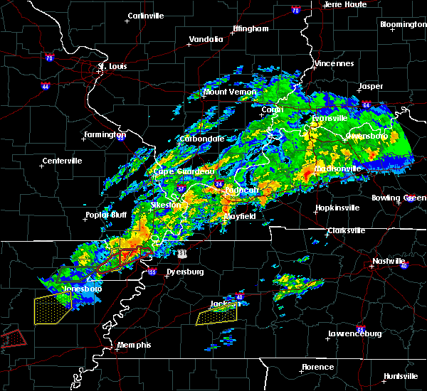 At 453 pm cst, a confirmed tornado was located near deering, or 8 miles northeast of kennett, moving northeast at 35 mph (emergency management confirmed tornado). Hazards include damaging tornado. Flying debris will be dangerous to those caught without shelter. mobile homes will be damaged or destroyed. damage to roofs, windows, and vehicles will occur. tree damage is likely. this tornado will be near, wardell and bolton around 505 pm cst. portageville around 515 pm cst. Other locations impacted by this tornadic thunderstorm include north wardell, hayward, bragg city, homestown, bakerville, peach orchard, stanley, pascola, swift and stewart. At 453 pm cst, a confirmed tornado was located near deering, or 8 miles northeast of kennett, moving northeast at 35 mph (emergency management confirmed tornado). Hazards include damaging tornado. Flying debris will be dangerous to those caught without shelter. mobile homes will be damaged or destroyed. damage to roofs, windows, and vehicles will occur. tree damage is likely. this tornado will be near, wardell and bolton around 505 pm cst. portageville around 515 pm cst. Other locations impacted by this tornadic thunderstorm include north wardell, hayward, bragg city, homestown, bakerville, peach orchard, stanley, pascola, swift and stewart.
|
| 12/17/2016 4:45 PM CST |
 At 444 pm cst, a confirmed tornado was located over kennett, moving northeast at 35 mph (law enforcement confirmed tornado). Hazards include damaging tornado. Flying debris will be dangerous to those caught without shelter. mobile homes will be damaged or destroyed. damage to roofs, windows, and vehicles will occur. tree damage is likely. the tornado will be near, wardell and bolton around 505 pm cst. portageville around 515 pm cst. Other locations impacted by this tornadic thunderstorm include north wardell, hayward, bragg city, homestown, bakerville, peach orchard, stanley, pascola, swift and stewart. At 444 pm cst, a confirmed tornado was located over kennett, moving northeast at 35 mph (law enforcement confirmed tornado). Hazards include damaging tornado. Flying debris will be dangerous to those caught without shelter. mobile homes will be damaged or destroyed. damage to roofs, windows, and vehicles will occur. tree damage is likely. the tornado will be near, wardell and bolton around 505 pm cst. portageville around 515 pm cst. Other locations impacted by this tornadic thunderstorm include north wardell, hayward, bragg city, homestown, bakerville, peach orchard, stanley, pascola, swift and stewart.
|
| 12/17/2016 3:24 PM CST |
 At 324 pm cst, a severe thunderstorm was located over clarkton, or near campbell, moving northeast at 50 mph (radar indicated). Hazards include 60 mph wind gusts and quarter size hail. Hail damage to vehicles is expected. Expect wind damage to roofs, siding, and trees. At 324 pm cst, a severe thunderstorm was located over clarkton, or near campbell, moving northeast at 50 mph (radar indicated). Hazards include 60 mph wind gusts and quarter size hail. Hail damage to vehicles is expected. Expect wind damage to roofs, siding, and trees.
|
| 12/17/2016 3:06 PM CST |
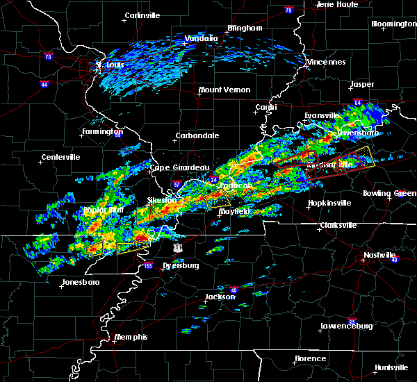 At 305 pm cst, a severe thunderstorm capable of producing a tornado was located over portageville, moving northeast at 50 mph (radar indicated rotation). Hazards include tornado and half dollar size hail. Flying debris will be dangerous to those caught without shelter. mobile homes will be damaged or destroyed. damage to roofs, windows, and vehicles will occur. tree damage is likely. this dangerous storm will be near, marston around 315 pm cst. Other locations impacted by this tornadic thunderstorm include boundurant. At 305 pm cst, a severe thunderstorm capable of producing a tornado was located over portageville, moving northeast at 50 mph (radar indicated rotation). Hazards include tornado and half dollar size hail. Flying debris will be dangerous to those caught without shelter. mobile homes will be damaged or destroyed. damage to roofs, windows, and vehicles will occur. tree damage is likely. this dangerous storm will be near, marston around 315 pm cst. Other locations impacted by this tornadic thunderstorm include boundurant.
|
| 12/17/2016 3:06 PM CST |
 The severe thunderstorm warning for northern pemiscot county will expire at 315 pm cst, the storm which prompted the warning has moved out of the area. therefore the warning will be allowed to expire. a tornado watch remains in effect until 900 pm cst for southeastern missouri, and western tennessee. to report severe weather, contact your nearest law enforcement agency. they will relay your report to the national weather service memphis. The severe thunderstorm warning for northern pemiscot county will expire at 315 pm cst, the storm which prompted the warning has moved out of the area. therefore the warning will be allowed to expire. a tornado watch remains in effect until 900 pm cst for southeastern missouri, and western tennessee. to report severe weather, contact your nearest law enforcement agency. they will relay your report to the national weather service memphis.
|
| 12/17/2016 3:06 PM CST |
 At 305 pm cst, a severe thunderstorm capable of producing a tornado was located over portageville, moving northeast at 50 mph (radar indicated rotation). Hazards include tornado and half dollar size hail. Flying debris will be dangerous to those caught without shelter. mobile homes will be damaged or destroyed. damage to roofs, windows, and vehicles will occur. tree damage is likely. this dangerous storm will be near, marston around 315 pm cst. Other locations impacted by this tornadic thunderstorm include boundurant. At 305 pm cst, a severe thunderstorm capable of producing a tornado was located over portageville, moving northeast at 50 mph (radar indicated rotation). Hazards include tornado and half dollar size hail. Flying debris will be dangerous to those caught without shelter. mobile homes will be damaged or destroyed. damage to roofs, windows, and vehicles will occur. tree damage is likely. this dangerous storm will be near, marston around 315 pm cst. Other locations impacted by this tornadic thunderstorm include boundurant.
|
| 12/17/2016 2:54 PM CST |
 At 254 pm cst, a severe thunderstorm was located over wardell, or 9 miles northwest of hayti, moving northeast at 25 mph (radar indicated). Hazards include 60 mph wind gusts and half dollar size hail. Hail damage to vehicles is expected. expect wind damage to roofs, siding, and trees. locations impacted include, portageville, wardell, bolton, bragg city, north wardell, homestown, hayward, peach orchard, stanley, stewart and swift. A tornado watch remains in effect until 900 pm cst for southeastern missouri, and western tennessee. At 254 pm cst, a severe thunderstorm was located over wardell, or 9 miles northwest of hayti, moving northeast at 25 mph (radar indicated). Hazards include 60 mph wind gusts and half dollar size hail. Hail damage to vehicles is expected. expect wind damage to roofs, siding, and trees. locations impacted include, portageville, wardell, bolton, bragg city, north wardell, homestown, hayward, peach orchard, stanley, stewart and swift. A tornado watch remains in effect until 900 pm cst for southeastern missouri, and western tennessee.
|
| 8/14/2016 5:40 PM CDT |
 The severe thunderstorm warning for northeastern pemiscot and lake counties will expire at 545 pm cdt, the storm which prompted the warning has moved out of the area. therefore, the warning will be allowed to expire. The severe thunderstorm warning for northeastern pemiscot and lake counties will expire at 545 pm cdt, the storm which prompted the warning has moved out of the area. therefore, the warning will be allowed to expire.
|
| 8/14/2016 5:27 PM CDT |
 At 526 pm cdt, a severe thunderstorm was located 7 miles west of tiptonville, or 7 miles southeast of portageville, moving north at 30 mph (radar indicated). Hazards include 60 mph wind gusts. Expect damage to roofs. siding. and trees. Locations impacted include, portageville, reelfoot lake state park, tiptonville, ridgely, cottonwood grove, haynes, new markham, blue bank, wright, mooring, cates, proctor city, wynnburg, sunkist beach, cronanville, madie, bessie, keefe, stewart and hayward. At 526 pm cdt, a severe thunderstorm was located 7 miles west of tiptonville, or 7 miles southeast of portageville, moving north at 30 mph (radar indicated). Hazards include 60 mph wind gusts. Expect damage to roofs. siding. and trees. Locations impacted include, portageville, reelfoot lake state park, tiptonville, ridgely, cottonwood grove, haynes, new markham, blue bank, wright, mooring, cates, proctor city, wynnburg, sunkist beach, cronanville, madie, bessie, keefe, stewart and hayward.
|
| 8/14/2016 5:03 PM CDT |
 At 502 pm cdt, a severe thunderstorm was located over caruthersville, moving north at 30 mph (radar indicated). Hazards include 60 mph wind gusts. Expect damage to roofs. siding. And trees. At 502 pm cdt, a severe thunderstorm was located over caruthersville, moving north at 30 mph (radar indicated). Hazards include 60 mph wind gusts. Expect damage to roofs. siding. And trees.
|
| 7/6/2016 1:00 PM CDT |
 At 1259 pm cdt, a severe thunderstorm was located near gideon, or 8 miles west of portageville, moving east at 55 mph (radar indicated). Hazards include 60 mph wind gusts. Expect damage to roofs. siding. And trees. At 1259 pm cdt, a severe thunderstorm was located near gideon, or 8 miles west of portageville, moving east at 55 mph (radar indicated). Hazards include 60 mph wind gusts. Expect damage to roofs. siding. And trees.
|
| 7/6/2016 12:42 PM CDT |
 At 1241 pm cdt, severe thunderstorms were located along a line extending from 6 miles northeast of daisy to chaffee to campbell, moving east at 50 mph (radar indicated). Hazards include 60 mph wind gusts and nickel size hail. Expect damage to roofs. siding. And trees. At 1241 pm cdt, severe thunderstorms were located along a line extending from 6 miles northeast of daisy to chaffee to campbell, moving east at 50 mph (radar indicated). Hazards include 60 mph wind gusts and nickel size hail. Expect damage to roofs. siding. And trees.
|
| 7/3/2016 4:52 PM CDT |
 At 451 pm cdt, a severe thunderstorm was located near portageville, moving northeast at 35 mph (radar indicated). Hazards include 60 mph wind gusts and quarter size hail. Hail damage to vehicles is expected. Expect wind damage to roofs, siding, and trees. At 451 pm cdt, a severe thunderstorm was located near portageville, moving northeast at 35 mph (radar indicated). Hazards include 60 mph wind gusts and quarter size hail. Hail damage to vehicles is expected. Expect wind damage to roofs, siding, and trees.
|
| 6/15/2016 7:32 PM CDT |
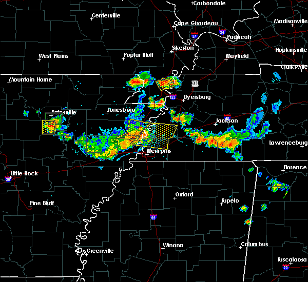 At 732 pm cdt, a severe thunderstorm was located near portageville, moving southeast at 15 mph (radar indicated). Hazards include 60 mph wind gusts and penny size hail. Expect damage to roofs. siding. And trees. At 732 pm cdt, a severe thunderstorm was located near portageville, moving southeast at 15 mph (radar indicated). Hazards include 60 mph wind gusts and penny size hail. Expect damage to roofs. siding. And trees.
|
| 6/15/2016 3:54 PM CDT |
 At 354 pm cdt, a severe thunderstorm was located near troy, or near union city, moving east at 20 mph (radar indicated). Hazards include 60 mph wind gusts and quarter size hail. Hail damage to vehicles is expected. Expect wind damage to roofs, siding, and trees. At 354 pm cdt, a severe thunderstorm was located near troy, or near union city, moving east at 20 mph (radar indicated). Hazards include 60 mph wind gusts and quarter size hail. Hail damage to vehicles is expected. Expect wind damage to roofs, siding, and trees.
|
| 5/9/2016 9:57 PM CDT |
 At 955 pm cdt, severe thunderstorms were located along a line extending from near leopold to near bloomfield to near morehouse to risco, moving east at 60 mph (law enforcement. there are many reports of trees down in butler county and power lines down in dexter). Hazards include 60 mph wind gusts. Expect damage to roofs. siding. and trees. Locations impacted include, dexter, portageville, bloomfield, marble hill, advance, clarkton, gideon, morehouse, parma, essex, bell city, risco, glen allen, leopold, baker, tallapoosa, catron, penermon and glenallen. At 955 pm cdt, severe thunderstorms were located along a line extending from near leopold to near bloomfield to near morehouse to risco, moving east at 60 mph (law enforcement. there are many reports of trees down in butler county and power lines down in dexter). Hazards include 60 mph wind gusts. Expect damage to roofs. siding. and trees. Locations impacted include, dexter, portageville, bloomfield, marble hill, advance, clarkton, gideon, morehouse, parma, essex, bell city, risco, glen allen, leopold, baker, tallapoosa, catron, penermon and glenallen.
|
| 5/9/2016 9:43 PM CDT |
 At 941 pm cdt, severe thunderstorms were located along a line extending from near grassy to near puxico to near bernie to near campbell, moving east at 55 mph (law enforcement. these storms produced damage to the west and south of poplar bluff). Hazards include 60 mph wind gusts. Expect damage to roofs. siding. and trees. Locations impacted include, dexter, portageville, bernie, bloomfield, marble hill, advance, clarkton, gideon, morehouse, puxico, parma, essex, bell city, risco, dudley, glen allen, leopold, grassy, baker and tallapoosa. At 941 pm cdt, severe thunderstorms were located along a line extending from near grassy to near puxico to near bernie to near campbell, moving east at 55 mph (law enforcement. these storms produced damage to the west and south of poplar bluff). Hazards include 60 mph wind gusts. Expect damage to roofs. siding. and trees. Locations impacted include, dexter, portageville, bernie, bloomfield, marble hill, advance, clarkton, gideon, morehouse, puxico, parma, essex, bell city, risco, dudley, glen allen, leopold, grassy, baker and tallapoosa.
|
| 5/9/2016 9:27 PM CDT |
 At 925 pm cdt, severe thunderstorms were located along a line extending from near lodi to near glennonville to near chalk bluff natural area, moving east at 60 mph (law enforcement). Hazards include 60 mph wind gusts. a tree and power lines were reported down south of poplar bluff as these storms moved through. Expect damage to roofs. siding. And trees. At 925 pm cdt, severe thunderstorms were located along a line extending from near lodi to near glennonville to near chalk bluff natural area, moving east at 60 mph (law enforcement). Hazards include 60 mph wind gusts. a tree and power lines were reported down south of poplar bluff as these storms moved through. Expect damage to roofs. siding. And trees.
|
| 3/31/2016 11:41 AM CDT | The severe thunderstorm warning for pemiscot county will expire at 1145 am cdt, the storms which prompted the warning have weakened below severe limits, and exited the warned area. therefore the warning will be allowed to expire. however gusty winds up to 50 mph and heavy rain are still possible with these thunderstorms. a severe thunderstorm watch remains in effect until 400 pm cdt for southeastern missouri and western tennessee. |
| 3/31/2016 11:36 AM CDT |
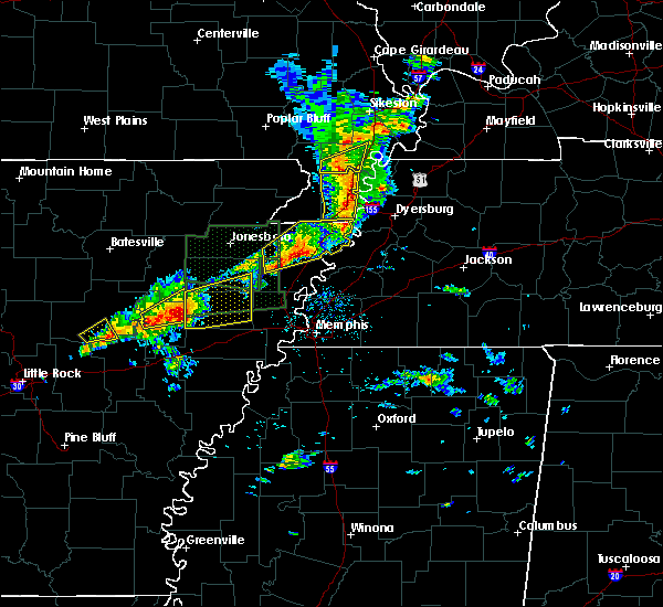 At 1136 am cdt, severe thunderstorms were located along a line extending from near portageville to near cooter, moving east at 50 mph (radar indicated). Hazards include 60 mph wind gusts and quarter size hail. Hail damage to vehicles is expected. expect wind damage to roofs, siding, and trees. Locations impacted include, caruthersville, portageville, hayti, steele, hayti heights, cooter, wardell, bolton, deering, holland, bragg city, pascola, north wardell, homestown, canady, braggadocio, stubtown, samford, denton and hayward. At 1136 am cdt, severe thunderstorms were located along a line extending from near portageville to near cooter, moving east at 50 mph (radar indicated). Hazards include 60 mph wind gusts and quarter size hail. Hail damage to vehicles is expected. expect wind damage to roofs, siding, and trees. Locations impacted include, caruthersville, portageville, hayti, steele, hayti heights, cooter, wardell, bolton, deering, holland, bragg city, pascola, north wardell, homestown, canady, braggadocio, stubtown, samford, denton and hayward.
|
| 3/31/2016 11:24 AM CDT |
 At 1123 am cdt, a severe thunderstorm was located over gideon, or 11 miles southeast of campbell, moving northeast at 55 mph (radar indicated). Hazards include 60 mph wind gusts. Expect damage to roofs. siding. And trees. At 1123 am cdt, a severe thunderstorm was located over gideon, or 11 miles southeast of campbell, moving northeast at 55 mph (radar indicated). Hazards include 60 mph wind gusts. Expect damage to roofs. siding. And trees.
|
| 3/31/2016 11:12 AM CDT |
 At 1112 am cdt, severe thunderstorms were located along a line extending from near piggott to near hornersville, moving east at 50 mph (radar indicated). Hazards include 60 mph wind gusts and quarter size hail. Hail damage to vehicles is expected. expect wind damage to roofs, siding, and trees. Locations impacted include, kennett, caruthersville, piggott, portageville, hayti, steele, senath, clarkton, hornersville, holcomb, hayti heights, arbyrd, cooter, wardell, greenway, deering, bolton, holland, bragg city and pascola. At 1112 am cdt, severe thunderstorms were located along a line extending from near piggott to near hornersville, moving east at 50 mph (radar indicated). Hazards include 60 mph wind gusts and quarter size hail. Hail damage to vehicles is expected. expect wind damage to roofs, siding, and trees. Locations impacted include, kennett, caruthersville, piggott, portageville, hayti, steele, senath, clarkton, hornersville, holcomb, hayti heights, arbyrd, cooter, wardell, greenway, deering, bolton, holland, bragg city and pascola.
|
| 3/31/2016 11:12 AM CDT |
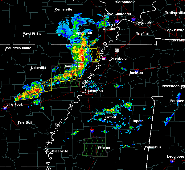 At 1112 am cdt, severe thunderstorms were located along a line extending from near piggott to near hornersville, moving east at 50 mph (radar indicated). Hazards include 60 mph wind gusts and quarter size hail. Hail damage to vehicles is expected. expect wind damage to roofs, siding, and trees. Locations impacted include, kennett, caruthersville, piggott, portageville, hayti, steele, senath, clarkton, hornersville, holcomb, hayti heights, arbyrd, cooter, wardell, greenway, deering, bolton, holland, bragg city and pascola. At 1112 am cdt, severe thunderstorms were located along a line extending from near piggott to near hornersville, moving east at 50 mph (radar indicated). Hazards include 60 mph wind gusts and quarter size hail. Hail damage to vehicles is expected. expect wind damage to roofs, siding, and trees. Locations impacted include, kennett, caruthersville, piggott, portageville, hayti, steele, senath, clarkton, hornersville, holcomb, hayti heights, arbyrd, cooter, wardell, greenway, deering, bolton, holland, bragg city and pascola.
|
| 3/31/2016 10:59 AM CDT |
 At 1059 am cdt, severe thunderstorms were located along a line extending from near rector to near leachville, moving east at 50 mph (radar indicated). Hazards include 60 mph wind gusts and quarter size hail. Hail damage to vehicles is expected. Expect wind damage to roofs, siding, and trees. At 1059 am cdt, severe thunderstorms were located along a line extending from near rector to near leachville, moving east at 50 mph (radar indicated). Hazards include 60 mph wind gusts and quarter size hail. Hail damage to vehicles is expected. Expect wind damage to roofs, siding, and trees.
|
| 3/31/2016 10:59 AM CDT |
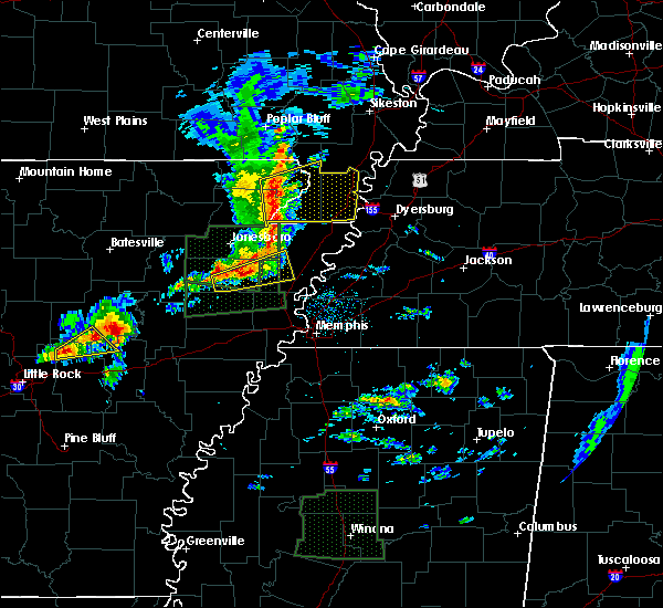 At 1059 am cdt, severe thunderstorms were located along a line extending from near rector to near leachville, moving east at 50 mph (radar indicated). Hazards include 60 mph wind gusts and quarter size hail. Hail damage to vehicles is expected. Expect wind damage to roofs, siding, and trees. At 1059 am cdt, severe thunderstorms were located along a line extending from near rector to near leachville, moving east at 50 mph (radar indicated). Hazards include 60 mph wind gusts and quarter size hail. Hail damage to vehicles is expected. Expect wind damage to roofs, siding, and trees.
|
| 12/23/2015 2:21 PM CST | At 220 pm cst, a severe thunderstorm was located near tiptonville, or near portageville, moving northeast at 60 mph (radar indicated. at 210 pm law enforcement reported 60mph winds and golfball size hail near i-55 at the portageville exit). Hazards include golf ball size hail and 60 mph wind gusts. People and animals outdoors will be injured. expect hail damage to roofs, siding, windows and vehicles. expect wind damage to roofs, siding and trees. this severe storm will be near, reelfoot lake state park around 225 pm cst. other locations impacted by this severe thunderstorm include fremont, woodland mills, haynes, lassiter corner, new markham, blue bank, wright, mooring, walnut log and stewart. A tornado watch remains in effect until 500 pm cst for southeastern missouri and western tennessee. |
| 12/23/2015 2:21 PM CST | At 220 pm cst, a severe thunderstorm was located near tiptonville, or near portageville, moving northeast at 60 mph (radar indicated. at 210 pm law enforcement reported 60mph winds and golfball size hail near i-55 at the portageville exit). Hazards include golf ball size hail and 60 mph wind gusts. People and animals outdoors will be injured. expect hail damage to roofs, siding, windows and vehicles. expect wind damage to roofs, siding and trees. this severe storm will be near, reelfoot lake state park around 225 pm cst. other locations impacted by this severe thunderstorm include fremont, woodland mills, haynes, lassiter corner, new markham, blue bank, wright, mooring, walnut log and stewart. A tornado watch remains in effect until 500 pm cst for southeastern missouri and western tennessee. |
| 12/23/2015 2:15 PM CST | Storm damage reported in pemiscot county MO, 8.2 miles NNW of Portageville, MO |
| 12/23/2015 2:06 PM CST | At 205 pm cst, severe thunderstorms were located along a line extending from near sikeston to near bolton, moving northeast at 55 mph (radar indicated). Hazards include 70 mph wind gusts and penny size hail. Expect considerable tree damage. damage is likely to mobile homes, roofs and outbuildings. locations impacted include, sikeston, portageville, new madrid, lilbourn, gideon, morehouse, parma, matthews, marston, howardville, risco, canalou, farrenburg, tallapoosa, catron and north lilbourn. A tornado watch remains in effect until 500 pm cst for western kentucky and southeastern missouri. |
| 12/23/2015 2:06 PM CST | At 205 pm cst, severe thunderstorms were located along a line extending from near sikeston to near bolton, moving northeast at 55 mph (radar indicated). Hazards include 70 mph wind gusts and penny size hail. Expect considerable tree damage. damage is likely to mobile homes, roofs and outbuildings. locations impacted include, sikeston, portageville, new madrid, lilbourn, gideon, morehouse, parma, matthews, marston, howardville, risco, canalou, farrenburg, tallapoosa, catron and north lilbourn. A tornado watch remains in effect until 500 pm cst for western kentucky and southeastern missouri. |
| 12/23/2015 2:04 PM CST | At 204 pm cst, a severe thunderstorm was located over hayti heights, or near hayti, moving northeast at 60 mph (radar indicated). Hazards include 60 mph wind gusts and quarter size hail. Hail damage to vehicles is expected. expect wind damage to roofs, siding and trees. this severe thunderstorm will be near, portageville around 215 pm cst. reelfoot lake state park and tiptonville around 225 pm cst. clayton around 235 pm cst. other locations impacted by this severe thunderstorm include woodland mills, blue bank, stubtown, spout springs, hayward, wynnburg, old fremont, hathaway, stanley and grays camp. A tornado watch remains in effect until 500 pm cst for southeastern missouri and western tennessee. |
| 12/23/2015 2:04 PM CST | At 204 pm cst, a severe thunderstorm was located over hayti heights, or near hayti, moving northeast at 60 mph (radar indicated). Hazards include 60 mph wind gusts and quarter size hail. Hail damage to vehicles is expected. expect wind damage to roofs, siding and trees. this severe thunderstorm will be near, portageville around 215 pm cst. reelfoot lake state park and tiptonville around 225 pm cst. clayton around 235 pm cst. other locations impacted by this severe thunderstorm include woodland mills, blue bank, stubtown, spout springs, hayward, wynnburg, old fremont, hathaway, stanley and grays camp. A tornado watch remains in effect until 500 pm cst for southeastern missouri and western tennessee. |
| 12/23/2015 1:57 PM CST | At 156 pm cst, a severe thunderstorm was located near canalou, or 7 miles northwest of lilbourn, moving northeast at 60 mph (radar indicated). Hazards include 70 mph wind gusts and penny size hail. Expect considerable tree damage. damage is likely to mobile homes, roofs and outbuildings. locations impacted include, sikeston, portageville, new madrid, lilbourn, gideon, morehouse, parma, matthews, marston, howardville, risco, canalou, farrenburg, baker, tallapoosa, catron and north lilbourn. A tornado watch remains in effect until 500 pm cst for western kentucky and southeastern missouri. |
| 12/23/2015 1:57 PM CST | At 156 pm cst, a severe thunderstorm was located near canalou, or 7 miles northwest of lilbourn, moving northeast at 60 mph (radar indicated). Hazards include 70 mph wind gusts and penny size hail. Expect considerable tree damage. damage is likely to mobile homes, roofs and outbuildings. locations impacted include, sikeston, portageville, new madrid, lilbourn, gideon, morehouse, parma, matthews, marston, howardville, risco, canalou, farrenburg, baker, tallapoosa, catron and north lilbourn. A tornado watch remains in effect until 500 pm cst for western kentucky and southeastern missouri. |
| 12/23/2015 1:46 PM CST | At 146 pm cst, a severe thunderstorm was located over parma, or 7 miles east of malden, moving northeast at 70 mph (radar indicated). Hazards include 70 mph wind gusts and penny size hail. Expect considerable tree damage. damage is likely to mobile homes, roofs and outbuildings. locations impacted include, sikeston, portageville, new madrid, bernie, lilbourn, clarkton, gideon, morehouse, parma, matthews, marston, howardville, risco, canalou, farrenburg, baker, tallapoosa, catron and north lilbourn. A tornado watch remains in effect until 500 pm cst for western kentucky and southeastern missouri. |
| 12/23/2015 1:46 PM CST | At 146 pm cst, a severe thunderstorm was located over parma, or 7 miles east of malden, moving northeast at 70 mph (radar indicated). Hazards include 70 mph wind gusts and penny size hail. Expect considerable tree damage. damage is likely to mobile homes, roofs and outbuildings. locations impacted include, sikeston, portageville, new madrid, bernie, lilbourn, clarkton, gideon, morehouse, parma, matthews, marston, howardville, risco, canalou, farrenburg, baker, tallapoosa, catron and north lilbourn. A tornado watch remains in effect until 500 pm cst for western kentucky and southeastern missouri. |
| 12/23/2015 1:32 PM CST | At 131 pm cst, a severe thunderstorm was located near saint francis, or near campbell, in northeast arkansas, moving northeast at 60 mph (radar indicated). Hazards include 70 mph wind gusts and penny size hail. Expect considerable tree damage. Damage is likely to mobile homes, roofs and outbuildings. |
| 12/23/2015 1:32 PM CST | At 131 pm cst, a severe thunderstorm was located near saint francis, or near campbell, in northeast arkansas, moving northeast at 60 mph (radar indicated). Hazards include 70 mph wind gusts and penny size hail. Expect considerable tree damage. Damage is likely to mobile homes, roofs and outbuildings. |
| 6/5/2015 6:53 PM CDT | The severe thunderstorm warning for northeastern pemiscot and lake counties will expire at 700 pm cdt, the storm which prompted the warning has weakened below severe limits, and no longer pose an immediate threat to life or property. therefore the warning will be allowed to expire. however gusty winds and heavy rain are still possible with this thunderstorm. to report severe weather, contact your nearest law enforcement agency. they will relay your report to the national weather service memphis. |
| 6/5/2015 6:53 PM CDT | The severe thunderstorm warning for northeastern pemiscot and lake counties will expire at 700 pm cdt, the storm which prompted the warning has weakened below severe limits, and no longer pose an immediate threat to life or property. therefore the warning will be allowed to expire. however gusty winds and heavy rain are still possible with this thunderstorm. to report severe weather, contact your nearest law enforcement agency. they will relay your report to the national weather service memphis. |
| 6/5/2015 6:09 PM CDT | At 608 pm cdt, a severe thunderstorm was located 10 miles northwest of tiptonville, or 13 miles northwest of reelfoot lake state park, moving southeast at 20 mph (radar indicated). Hazards include 60 mph wind gusts and half dollar size hail. Hail damage to vehicles is expected. Expect wind damage to roofs, siding and trees. |
| 6/5/2015 6:09 PM CDT | At 608 pm cdt, a severe thunderstorm was located 10 miles northwest of tiptonville, or 13 miles northwest of reelfoot lake state park, moving southeast at 20 mph (radar indicated). Hazards include 60 mph wind gusts and half dollar size hail. Hail damage to vehicles is expected. Expect wind damage to roofs, siding and trees. |
| 4/19/2015 8:56 PM CDT | At 856 pm cdt, a severe thunderstorm was located over hayti heights, or over hayti, moving east at 55 mph (radar indicated). Hazards include 60 mph wind gusts. Expect damage to roofs. siding and trees. locations impacted include, kennett, caruthersville, hayti, steele, senath, hornersville, holcomb, hayti heights, cooter, wardell, deering, bolton, holland, bragg city, pascola, nimmons, west kennett, bell city, rhyne and lorine. a tornado watch remains in effect until 300 am cdt for southeastern missouri and northwestern tennessee. 75in. |
| 4/19/2015 8:56 PM CDT | At 856 pm cdt, a severe thunderstorm was located over hayti heights, or over hayti, moving east at 55 mph (radar indicated). Hazards include 60 mph wind gusts. Expect damage to roofs. siding and trees. locations impacted include, kennett, caruthersville, hayti, steele, senath, hornersville, holcomb, hayti heights, cooter, wardell, deering, bolton, holland, bragg city, pascola, nimmons, west kennett, bell city, rhyne and lorine. a tornado watch remains in effect until 300 am cdt for southeastern missouri and northwestern tennessee. 75in. |
| 4/19/2015 8:35 PM CDT | At 834 pm cdt, a severe thunderstorm was located over campbell, moving east at 45 mph (radar indicated). Hazards include 60 mph wind gusts and quarter size hail. Hail damage to vehicles is expected. Expect wind damage to roofs, siding and trees. |
| 4/19/2015 8:32 PM CDT | At 832 pm cdt, a severe thunderstorm was located near senath, moving east at 55 mph (radar indicated). Hazards include 60 mph wind gusts. Expect damage to roofs. Siding and trees. |
| 4/19/2015 8:32 PM CDT | At 832 pm cdt, a severe thunderstorm was located near senath, moving east at 55 mph (radar indicated). Hazards include 60 mph wind gusts. Expect damage to roofs. Siding and trees. |
| 4/19/2015 5:09 PM CDT | A severe thunderstorm warning remains in effect until 530 pm cdt for pemiscot. east central dunklin and lake counties. at 509 pm cdt. a severe thunderstorm was located near bolton. or 8 miles north of hayti. moving east at 45 mph. hazard. 60 mph wind gusts and penny size hail. source. Radar indicated. |
| 4/19/2015 5:09 PM CDT | A severe thunderstorm warning remains in effect until 530 pm cdt for pemiscot. east central dunklin and lake counties. at 509 pm cdt. a severe thunderstorm was located near bolton. or 8 miles north of hayti. moving east at 45 mph. hazard. 60 mph wind gusts and penny size hail. source. Radar indicated. |
| 4/19/2015 5:00 PM CDT | At 500 pm cdt, a severe thunderstorm was located over wardell, or 11 miles northwest of hayti, moving east at 45 mph (radar indicated). Hazards include 60 mph wind gusts and penny size hail. Expect damage to roofs. siding and trees. locations impacted include, kennett, caruthersville, hayti, reelfoot lake state park, tiptonville, ridgely, clarkton, holcomb, hayti heights, wardell, cottonwood grove, deering, bolton, bragg city, pascola, nimmons, blue bank, west kennett, bell city and hathaway. 0. 75in. |
| 4/19/2015 5:00 PM CDT | A severe thunderstorm warning remains in effect until 530 pm cdt for southeastern clay. pemiscot. east central dunklin and lake counties. at 500 pm cdt. a severe thunderstorm was located over wardell. or 11 miles northwest of hayti. moving east at 45 mph. hazard. 60 mph wind gusts and penny size hail. |
| 4/19/2015 5:00 PM CDT | A severe thunderstorm warning remains in effect until 530 pm cdt for southeastern clay. pemiscot. east central dunklin and lake counties. at 500 pm cdt. a severe thunderstorm was located over wardell. or 11 miles northwest of hayti. moving east at 45 mph. hazard. 60 mph wind gusts and penny size hail. |
| 4/19/2015 4:50 PM CDT | The national weather service in memphis has issued a * severe thunderstorm warning for. southeastern clay county in eastern arkansas. pemiscot county in southeastern missouri. east central dunklin county in southeastern missouri. Lake county in northwestern tennessee. |
| 4/19/2015 4:50 PM CDT | At 450 pm cdt, a severe thunderstorm was located over holcomb, or 8 miles north of kennett, moving east at 45 mph (radar indicated). Hazards include 60 mph wind gusts and penny size hail. Expect damage to roofs. Siding and trees. |
| 4/19/2015 4:50 PM CDT | The national weather service in memphis has issued a * severe thunderstorm warning for. southeastern clay county in eastern arkansas. pemiscot county in southeastern missouri. east central dunklin county in southeastern missouri. Lake county in northwestern tennessee. |
| 5/31/2012 3:02 PM CDT | Quarter sized hail reported 0.4 miles S of Portageville, MO |
| 1/1/0001 12:00 AM | Golf Ball sized hail reported 6.4 miles NNW of Portageville, MO, wardell fire department reported golfball size hail 6 miles southeast of portageville or about 3 miles southwest of stewart. |
| 1/1/0001 12:00 AM | Tree limbs down and damage to carpor in pemiscot county MO, 0.4 miles S of Portageville, MO |
| 1/1/0001 12:00 AM | Quarter sized hail reported 1.7 miles E of Portageville, MO, hail fell on the southside in the town of portageville |
| 1/1/0001 12:00 AM | Pea size hail with the stor in new madrid county MO, 0.4 miles S of Portageville, MO |
Hail Maps for Portageville, MO


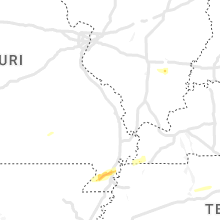


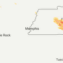


Connect with Interactive Hail Maps