

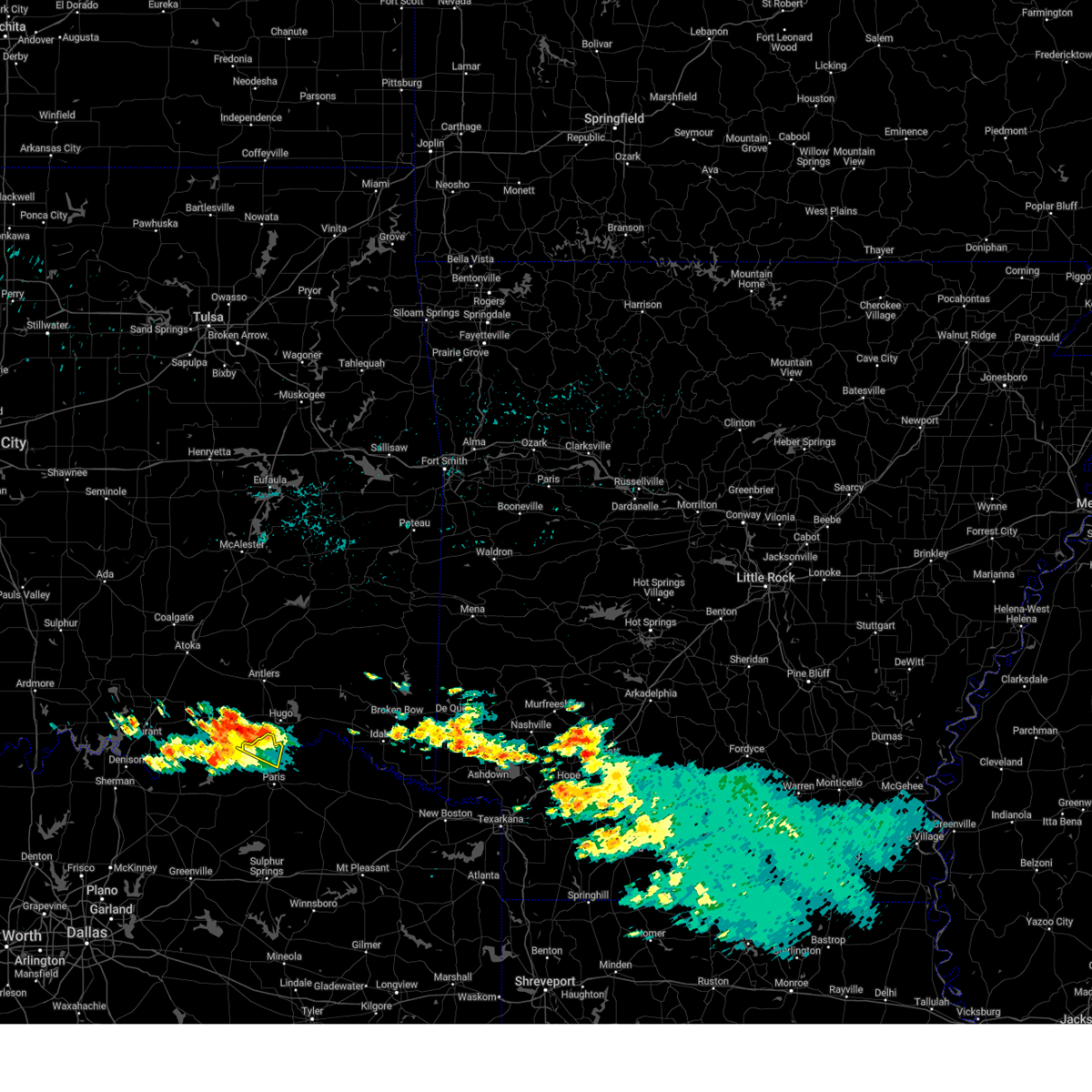
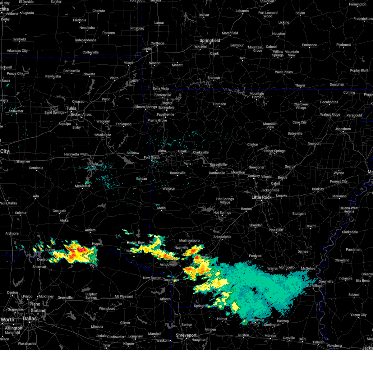
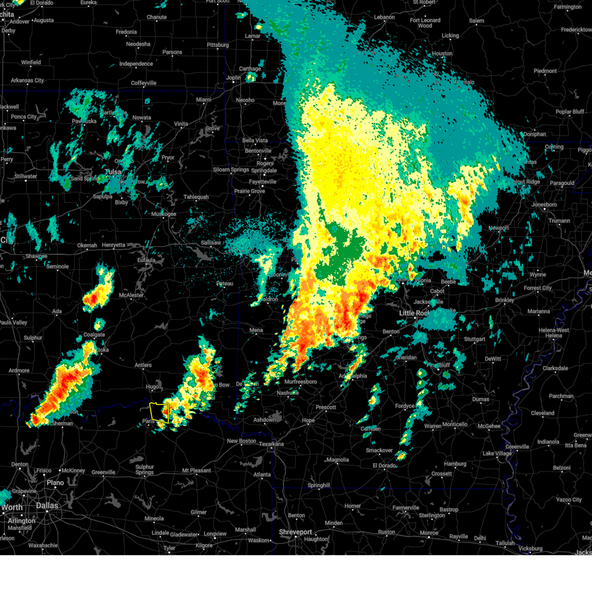
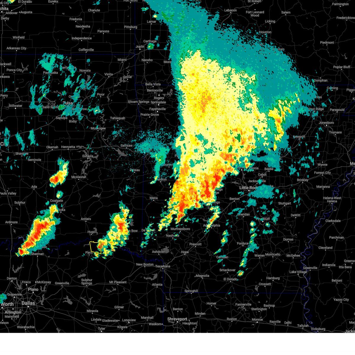
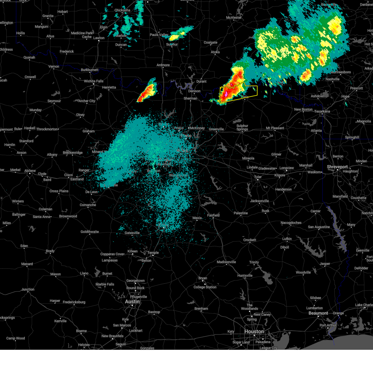
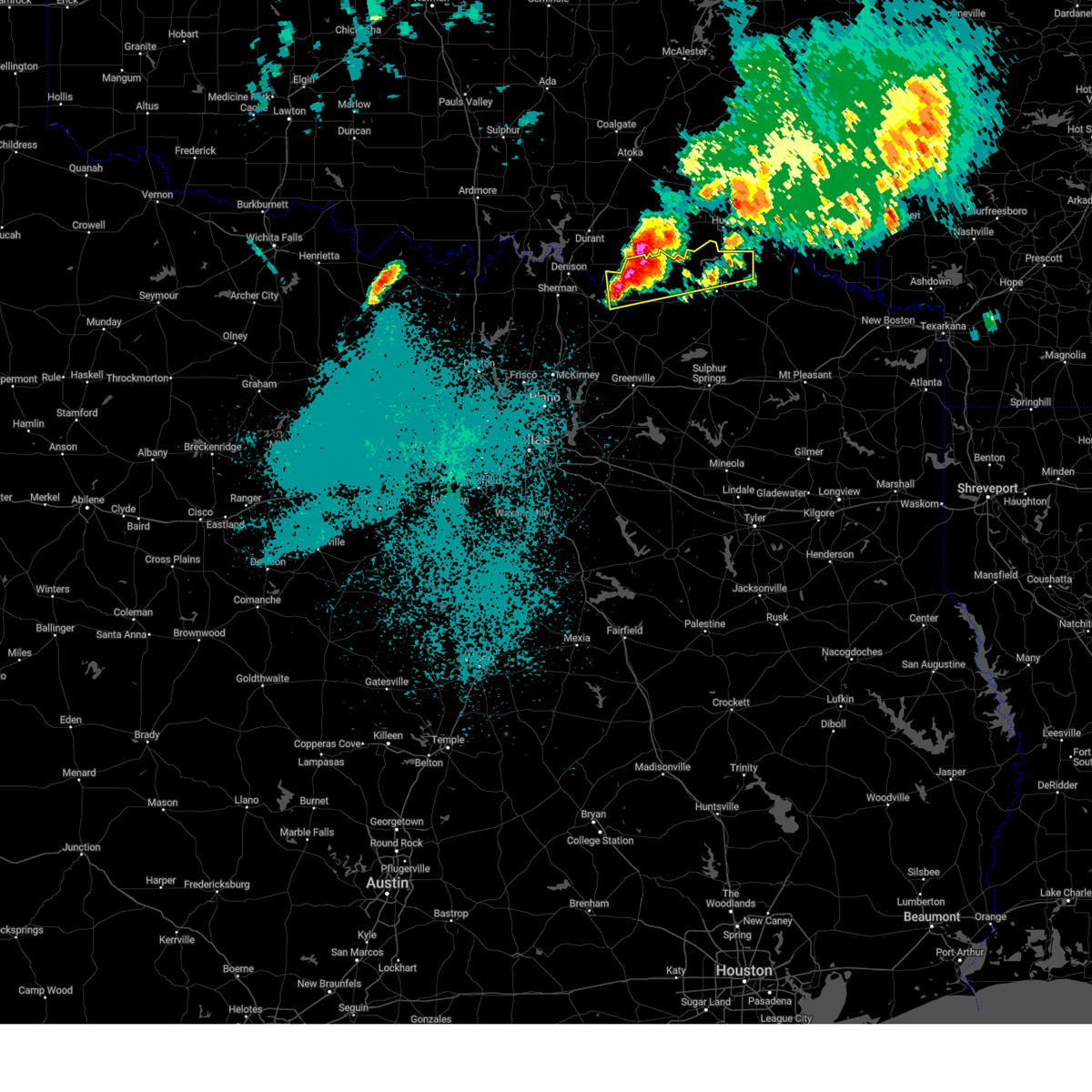
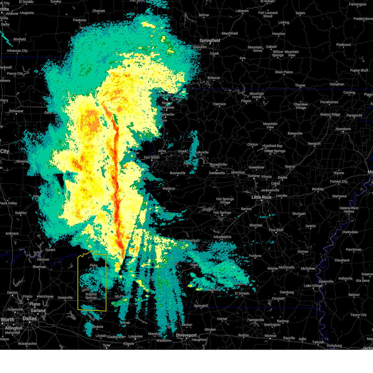
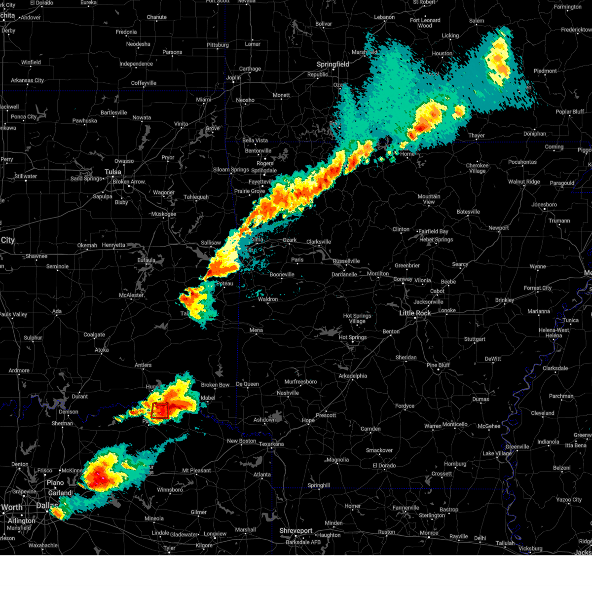
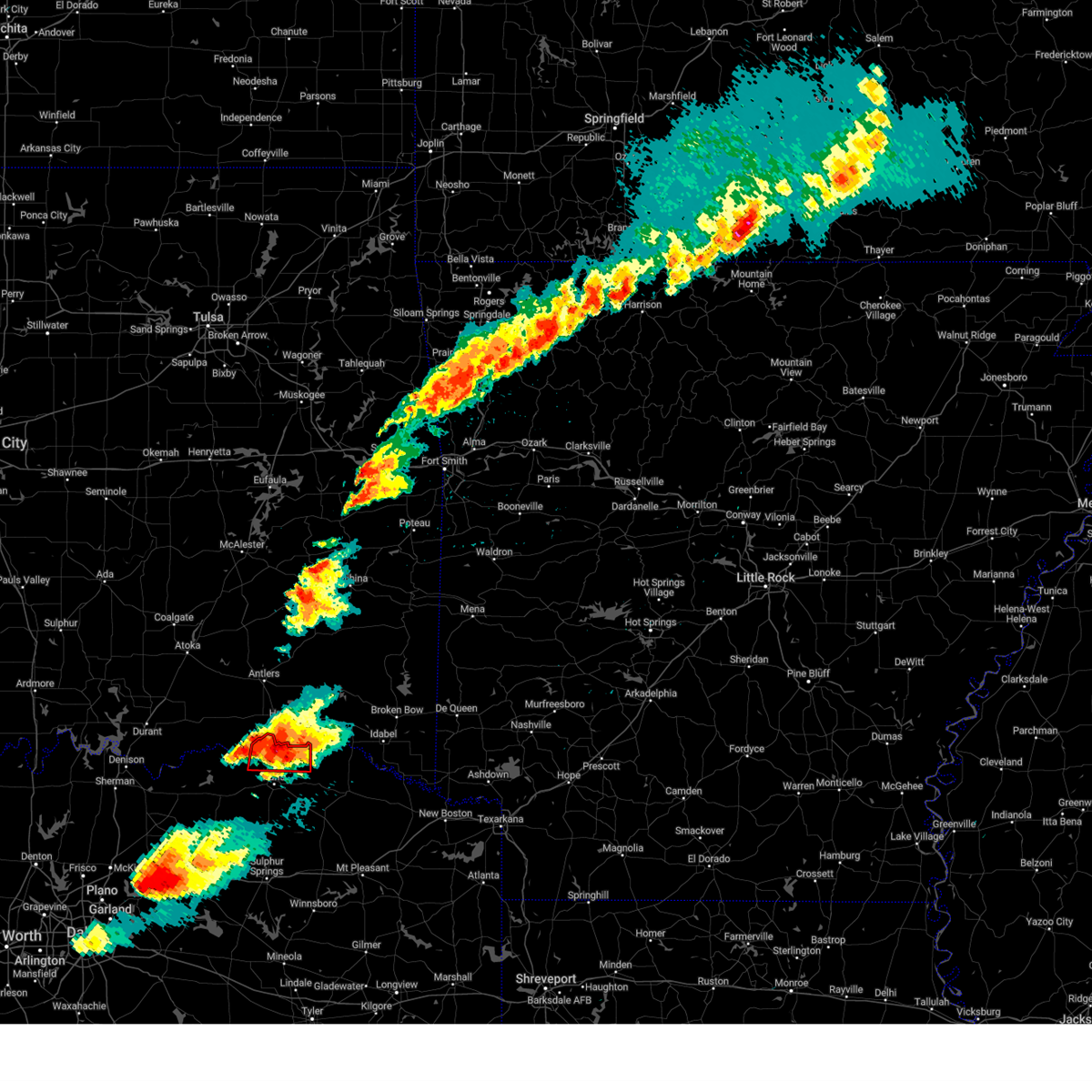
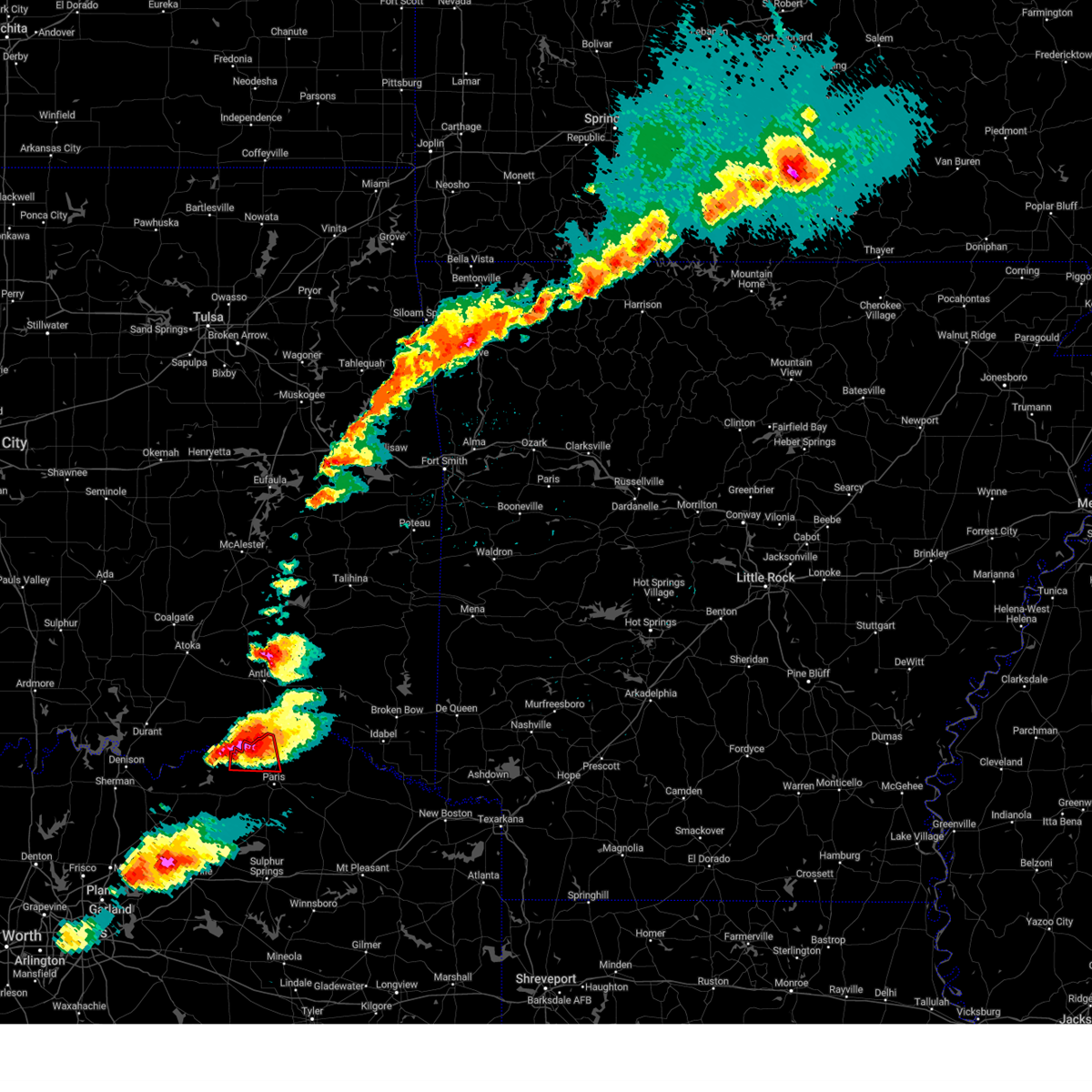
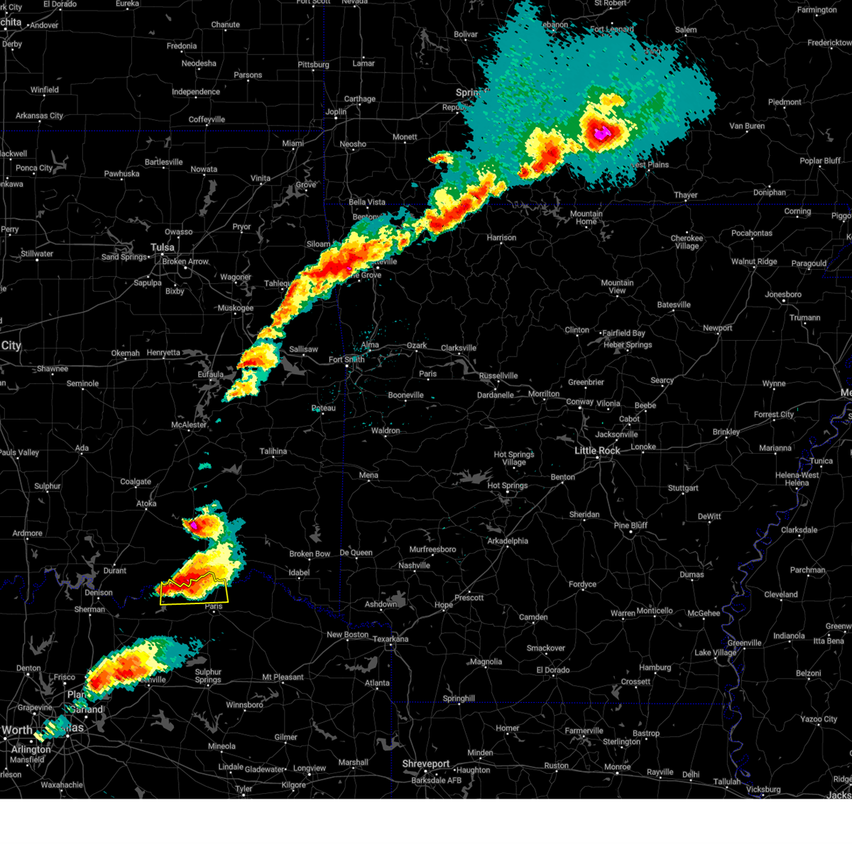
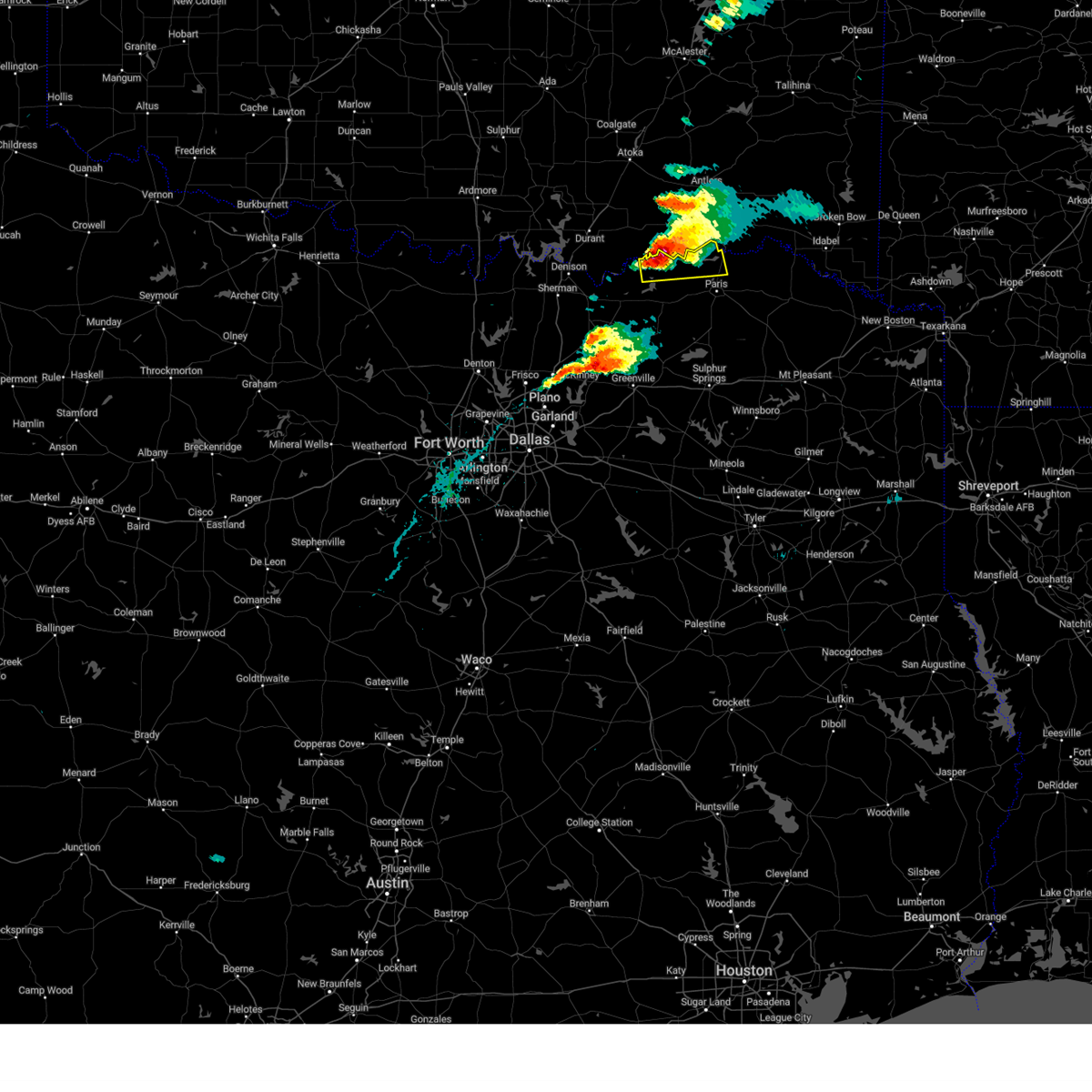
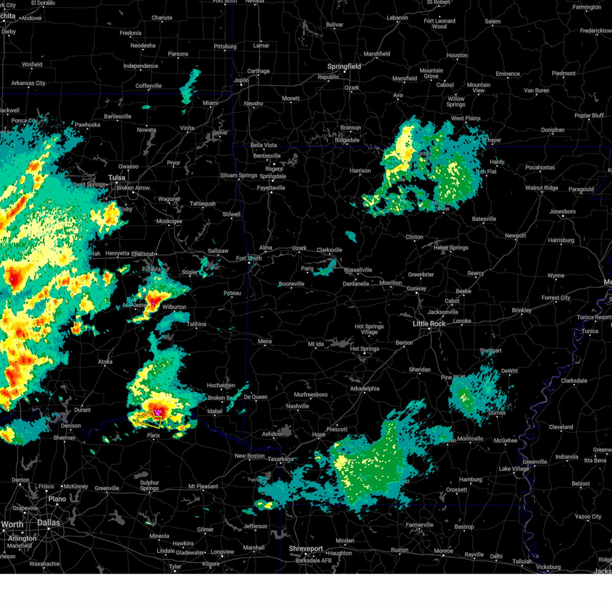
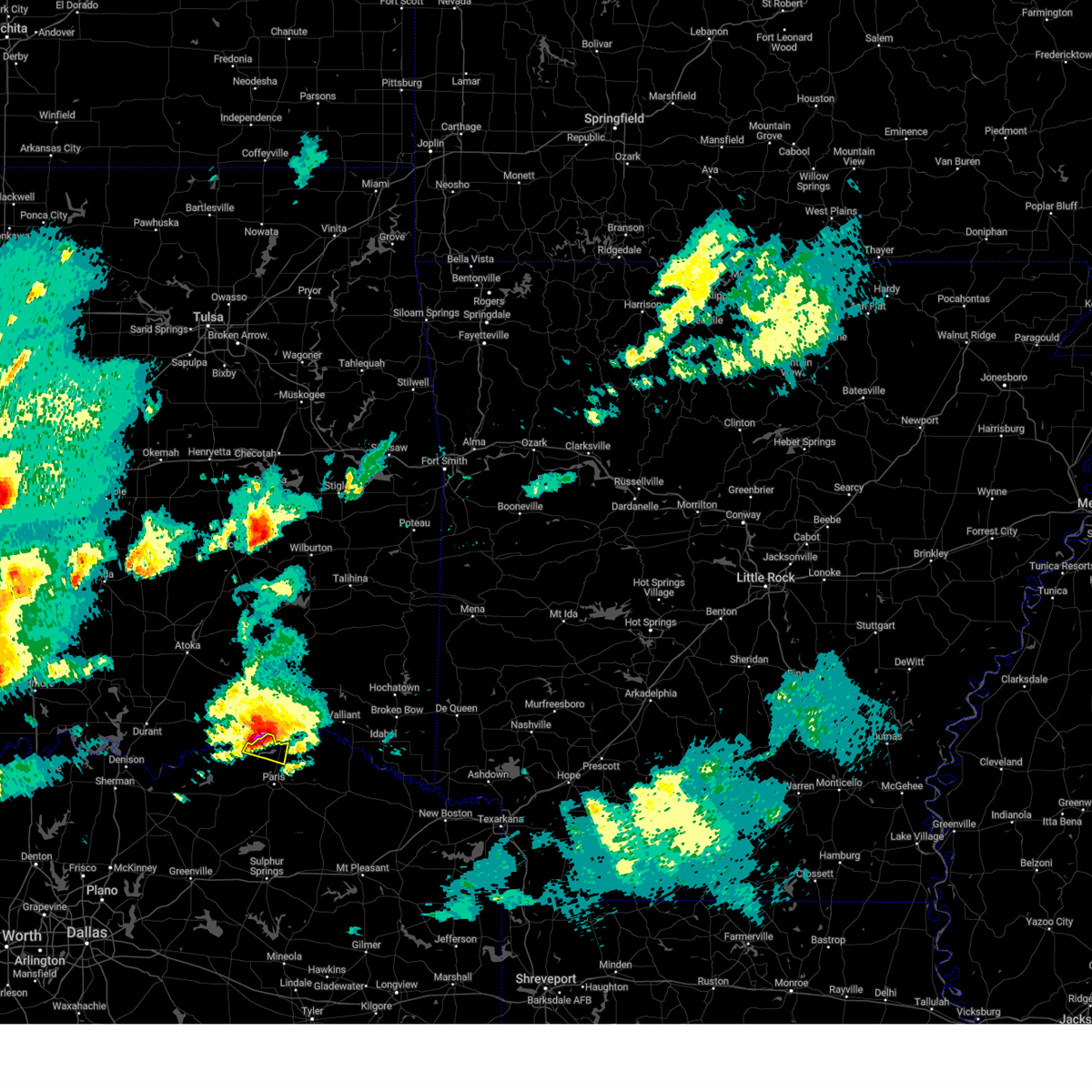
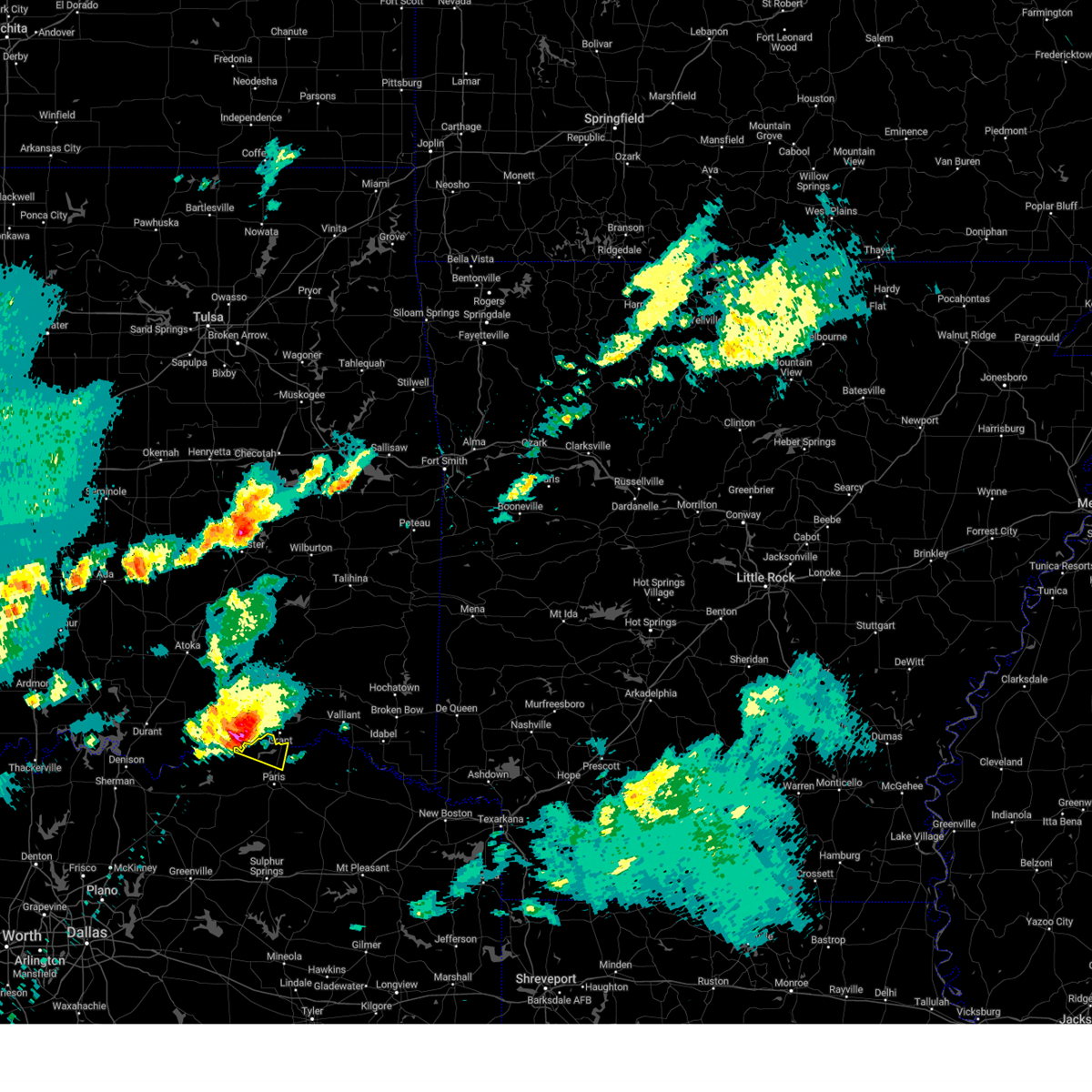
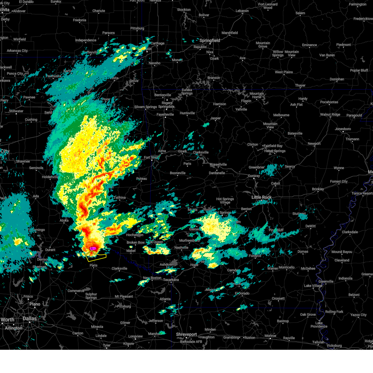
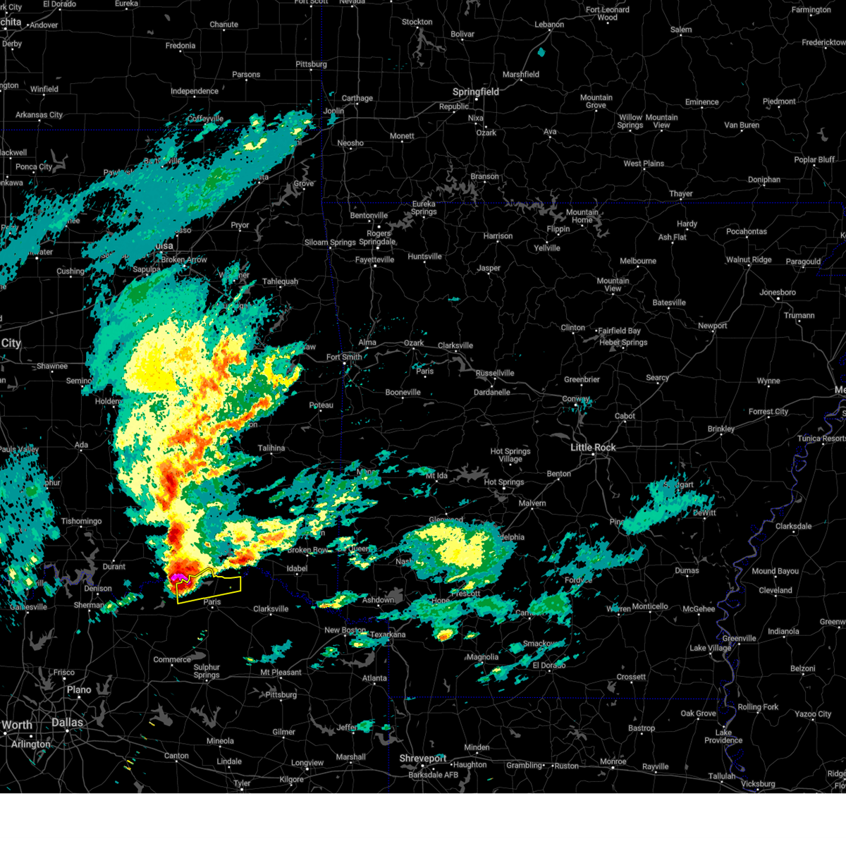
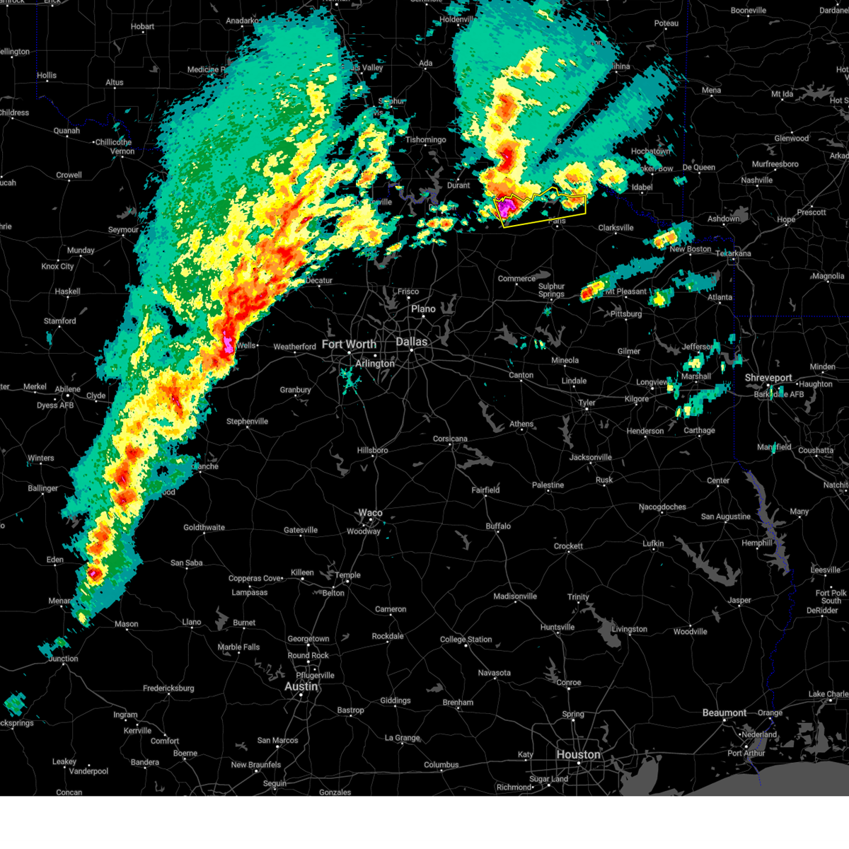
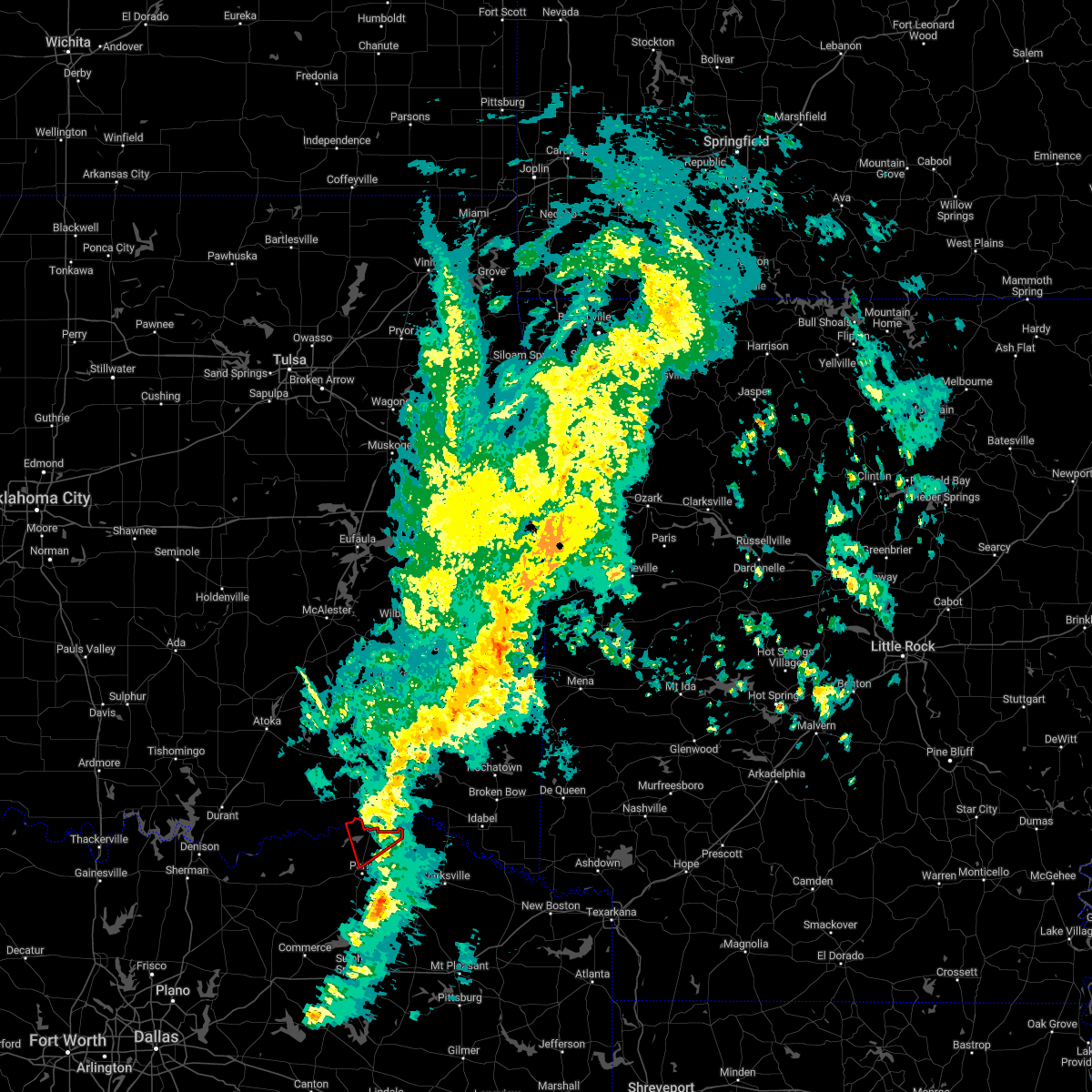
Hail Map for Powderly, TX
The Powderly, TX area has had 8 reports of on-the-ground hail by trained spotters, and has been under severe weather warnings 22 times during the past 12 months. Doppler radar has detected hail at or near Powderly, TX on 75 occasions, including 2 occasions during the past year.
| Name: | Powderly, TX |
| Where Located: | 53.5 miles SE of Atoka, OK |
| Map: | Google Map for Powderly, TX |
| Population: | 1178 |
| Housing Units: | 526 |
| More Info: | Search Google for Powderly, TX |
1
The Top Recent Hail Date for Powderly, TX is Saturday, May 17, 2025 (8th out of 75)
Hail and Wind Damage Spotted near Powderly, TX
| Date / Time | Report Details |
|---|---|
| 6/8/2025 11:34 PM CDT |
 the severe thunderstorm warning has been cancelled and is no longer in effect the severe thunderstorm warning has been cancelled and is no longer in effect
|
| 6/8/2025 11:22 PM CDT |
 the severe thunderstorm warning has been cancelled and is no longer in effect the severe thunderstorm warning has been cancelled and is no longer in effect
|
| 6/8/2025 11:22 PM CDT |
 At 1121 pm cdt, severe thunderstorms were located along a line extending from near bogata to near point, moving southeast at 45 mph (radar indicated). Hazards include 70 mph wind gusts. Expect considerable tree damage. damage is likely to mobile homes, roofs, and outbuildings. These severe thunderstorms will impact areas of hopkins, delta and lamar counties, including the following locations, new birthright, ridgeway, glory, pacio, midcity, minter, taylor town, nelta, sun valley, and novice. At 1121 pm cdt, severe thunderstorms were located along a line extending from near bogata to near point, moving southeast at 45 mph (radar indicated). Hazards include 70 mph wind gusts. Expect considerable tree damage. damage is likely to mobile homes, roofs, and outbuildings. These severe thunderstorms will impact areas of hopkins, delta and lamar counties, including the following locations, new birthright, ridgeway, glory, pacio, midcity, minter, taylor town, nelta, sun valley, and novice.
|
| 6/8/2025 10:58 PM CDT | At 1057 pm cdt, severe thunderstorms were located along a line extending from near paris to near greenville club lake, moving east at 55 mph (radar indicated). Hazards include 70 mph wind gusts and penny size hail. Expect considerable tree damage. damage is likely to mobile homes, roofs, and outbuildings. These severe thunderstorms will impact areas of northern hunt, hopkins, delta and lamar counties, including the following locations, neylandville, new birthright, ridgeway, pacio, midcity, taylor town, sun valley, peerless, dike, and atlas. |
| 6/8/2025 10:58 PM CDT | the severe thunderstorm warning has been cancelled and is no longer in effect |
| 6/8/2025 10:28 PM CDT |
 Svrfwd the national weather service in fort worth has issued a * severe thunderstorm warning for, hunt county in north central texas, hopkins county in north central texas, delta county in north central texas, lamar county in north central texas, southeastern collin county in north central texas, southern fannin county in north central texas, * until 1145 pm cdt. * at 1026 pm cdt, severe thunderstorms were located along a line extending from near dodd city to fairview, moving southeast at 45 mph (radar indicated). Hazards include 70 mph wind gusts and penny size hail. Expect considerable tree damage. damage is likely to mobile homes, roofs, and outbuildings. these severe thunderstorms will affect areas from plano to blue ridge to wolfe city to paris, including the following locations, neylandville, new birthright, ridgeway, pacio, nobility, midcity, direct, forest hill, taylor town, and floyd. This includes interstate 30 between mile markers 82 and 142. Svrfwd the national weather service in fort worth has issued a * severe thunderstorm warning for, hunt county in north central texas, hopkins county in north central texas, delta county in north central texas, lamar county in north central texas, southeastern collin county in north central texas, southern fannin county in north central texas, * until 1145 pm cdt. * at 1026 pm cdt, severe thunderstorms were located along a line extending from near dodd city to fairview, moving southeast at 45 mph (radar indicated). Hazards include 70 mph wind gusts and penny size hail. Expect considerable tree damage. damage is likely to mobile homes, roofs, and outbuildings. these severe thunderstorms will affect areas from plano to blue ridge to wolfe city to paris, including the following locations, neylandville, new birthright, ridgeway, pacio, nobility, midcity, direct, forest hill, taylor town, and floyd. This includes interstate 30 between mile markers 82 and 142.
|
| 6/8/2025 3:50 AM CDT |
 the severe thunderstorm warning has been cancelled and is no longer in effect the severe thunderstorm warning has been cancelled and is no longer in effect
|
| 6/8/2025 3:42 AM CDT |
 Svrfwd the national weather service in fort worth has issued a * severe thunderstorm warning for, northwestern lamar county in north central texas, * until 430 am cdt. * at 342 am cdt, a severe thunderstorm was located 8 miles southeast of boswell, or 17 miles west of hugo, moving east at 20 mph (radar indicated). Hazards include 60 mph wind gusts and half dollar size hail. Hail damage to vehicles is expected. Expect wind damage to roofs, siding, and trees. Svrfwd the national weather service in fort worth has issued a * severe thunderstorm warning for, northwestern lamar county in north central texas, * until 430 am cdt. * at 342 am cdt, a severe thunderstorm was located 8 miles southeast of boswell, or 17 miles west of hugo, moving east at 20 mph (radar indicated). Hazards include 60 mph wind gusts and half dollar size hail. Hail damage to vehicles is expected. Expect wind damage to roofs, siding, and trees.
|
| 5/19/2025 11:51 PM CDT |
 the severe thunderstorm warning has been cancelled and is no longer in effect the severe thunderstorm warning has been cancelled and is no longer in effect
|
| 5/19/2025 11:47 PM CDT |
 At 1147 pm cdt, a severe thunderstorm was located 9 miles northeast of blossom, or 15 miles northeast of paris, moving east at 45 mph (radar indicated). Hazards include 60 mph wind gusts and quarter size hail. Hail damage to vehicles is expected. expect wind damage to roofs, siding, and trees. This severe thunderstorm will remain over mainly rural areas of northeastern lamar county, including the following locations, faught, midcity, and novice. At 1147 pm cdt, a severe thunderstorm was located 9 miles northeast of blossom, or 15 miles northeast of paris, moving east at 45 mph (radar indicated). Hazards include 60 mph wind gusts and quarter size hail. Hail damage to vehicles is expected. expect wind damage to roofs, siding, and trees. This severe thunderstorm will remain over mainly rural areas of northeastern lamar county, including the following locations, faught, midcity, and novice.
|
| 5/19/2025 11:11 PM CDT | Svrfwd the national weather service in fort worth has issued a * severe thunderstorm warning for, lamar county in north central texas, * until 1215 am cdt. * at 1110 pm cdt, a severe thunderstorm was located near lake gibbons, or 9 miles west of paris, moving east at 30 mph (radar indicated). Hazards include 65 mph wind gusts and quarter size hail. Hail damage to vehicles is expected. expect wind damage to roofs, siding, and trees. this severe thunderstorm will be near, paris and lake gibbons around 1115 pm cdt. lake crook around 1120 pm cdt. reno around 1130 pm cdt. blossom around 1140 pm cdt. pattonville around 1145 pm cdt. Other locations impacted by this severe thunderstorm include toco, atlas, noble, glory, forest chapel, broadway junction, midcity, garretts bluff, deport, and biardstown. |
| 5/19/2025 11:07 PM CDT | the severe thunderstorm warning has been cancelled and is no longer in effect |
| 5/19/2025 11:07 PM CDT | At 1106 pm cdt, a severe thunderstorm was located over sumner, or 9 miles west of paris, moving east at 30 mph (radar indicated). Hazards include 65 mph wind gusts and quarter size hail. Hail damage to vehicles is expected. expect wind damage to roofs, siding, and trees. this severe storm will be near, lake crook, sumner, paris, and lake gibbons around 1110 pm cdt. camp maxey around 1115 pm cdt. powderly around 1120 pm cdt. Other locations impacted by this severe thunderstorm include forest hill, chicota, globe, faught, tigertown, forest chapel, novice, belk, midcity, and garretts bluff. |
| 5/19/2025 10:44 PM CDT |
 At 1044 pm cdt, a severe thunderstorm was located near crockett lake, or 19 miles west of paris, moving east at 50 mph (radar indicated). Hazards include 65 mph wind gusts and half dollar size hail. Hail damage to vehicles is expected. expect wind damage to roofs, siding, and trees. this severe storm will be near, sumner and pat mayse lake around 1055 pm cdt. camp maxey around 1100 pm cdt. powderly and arthur city around 1105 pm cdt. Other locations impacted by this severe thunderstorm include monkstown, east direct, telephone, forest chapel, midcity, allens chapel, garretts bluff, direct, allens point, and forest hill. At 1044 pm cdt, a severe thunderstorm was located near crockett lake, or 19 miles west of paris, moving east at 50 mph (radar indicated). Hazards include 65 mph wind gusts and half dollar size hail. Hail damage to vehicles is expected. expect wind damage to roofs, siding, and trees. this severe storm will be near, sumner and pat mayse lake around 1055 pm cdt. camp maxey around 1100 pm cdt. powderly and arthur city around 1105 pm cdt. Other locations impacted by this severe thunderstorm include monkstown, east direct, telephone, forest chapel, midcity, allens chapel, garretts bluff, direct, allens point, and forest hill.
|
| 5/19/2025 10:18 PM CDT |
 Svrfwd the national weather service in fort worth has issued a * severe thunderstorm warning for, northern lamar county in north central texas, northern fannin county in north central texas, * until 1115 pm cdt. * at 1018 pm cdt, a severe thunderstorm was located near lake bonham, or 8 miles north of bonham, moving east at 40 mph (radar indicated). Hazards include 65 mph wind gusts and half dollar size hail. Hail damage to vehicles is expected. expect wind damage to roofs, siding, and trees. this severe thunderstorm will be near, coffee mill lake around 1025 pm cdt. crockett lake around 1030 pm cdt. sumner around 1055 pm cdt. camp maxey and pat mayse lake around 1100 pm cdt. paris around 1105 pm cdt. lake crook around 1110 pm cdt. Other locations impacted by this severe thunderstorm include ridings, monkstown, east direct, telephone, boyd, forest chapel, duplex, midcity, allens chapel, and garretts bluff. Svrfwd the national weather service in fort worth has issued a * severe thunderstorm warning for, northern lamar county in north central texas, northern fannin county in north central texas, * until 1115 pm cdt. * at 1018 pm cdt, a severe thunderstorm was located near lake bonham, or 8 miles north of bonham, moving east at 40 mph (radar indicated). Hazards include 65 mph wind gusts and half dollar size hail. Hail damage to vehicles is expected. expect wind damage to roofs, siding, and trees. this severe thunderstorm will be near, coffee mill lake around 1025 pm cdt. crockett lake around 1030 pm cdt. sumner around 1055 pm cdt. camp maxey and pat mayse lake around 1100 pm cdt. paris around 1105 pm cdt. lake crook around 1110 pm cdt. Other locations impacted by this severe thunderstorm include ridings, monkstown, east direct, telephone, boyd, forest chapel, duplex, midcity, allens chapel, and garretts bluff.
|
| 5/17/2025 8:48 PM CDT |
 the severe thunderstorm warning has been cancelled and is no longer in effect the severe thunderstorm warning has been cancelled and is no longer in effect
|
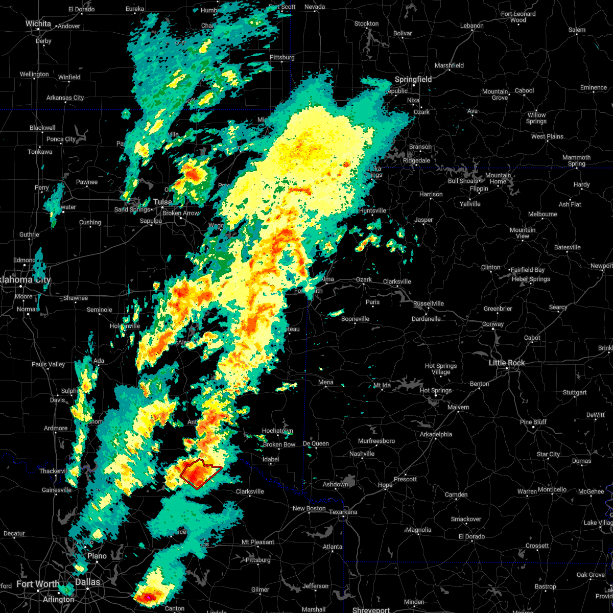
| 5/17/2025 8:29 PM CDT |
 Svrfwd the national weather service in fort worth has issued a * severe thunderstorm warning for, northeastern lamar county in north central texas, * until 915 pm cdt. * at 829 pm cdt, a severe thunderstorm was located near powderly, or 11 miles northeast of paris, moving northeast at 25 mph (radar indicated). Hazards include 60 mph wind gusts and quarter size hail. Hail damage to vehicles is expected. Expect wind damage to roofs, siding, and trees. Svrfwd the national weather service in fort worth has issued a * severe thunderstorm warning for, northeastern lamar county in north central texas, * until 915 pm cdt. * at 829 pm cdt, a severe thunderstorm was located near powderly, or 11 miles northeast of paris, moving northeast at 25 mph (radar indicated). Hazards include 60 mph wind gusts and quarter size hail. Hail damage to vehicles is expected. Expect wind damage to roofs, siding, and trees.
|
| 3/4/2025 7:30 AM CST |
 The storms which prompted the warning have moved out of the area. therefore the warning has been allowed to expire. however gusty winds are still possible with these thunderstorms. a tornado watch remains in effect until 1100 am cst for north central texas. The storms which prompted the warning have moved out of the area. therefore the warning has been allowed to expire. however gusty winds are still possible with these thunderstorms. a tornado watch remains in effect until 1100 am cst for north central texas.
|
| 3/4/2025 6:51 AM CST |
 the severe thunderstorm warning has been cancelled and is no longer in effect the severe thunderstorm warning has been cancelled and is no longer in effect
|
| 3/4/2025 6:51 AM CST |
 At 650 am cst, severe thunderstorms were located along a line extending from paris to sulphur springs, moving east at 55 mph (radar indicated). Hazards include 65 mph wind gusts and quarter size hail. Hail damage to vehicles is expected. expect wind damage to roofs, siding, and trees. Locations impacted include, new birthright, ridgeway, pacio, como, midcity, direct, forest hill, cooper lake, taylor town, sun valley, peerless, dike, atlas, weaver, tira, noble, forest chapel, pine forest, broadway junction, and garretts bluff. At 650 am cst, severe thunderstorms were located along a line extending from paris to sulphur springs, moving east at 55 mph (radar indicated). Hazards include 65 mph wind gusts and quarter size hail. Hail damage to vehicles is expected. expect wind damage to roofs, siding, and trees. Locations impacted include, new birthright, ridgeway, pacio, como, midcity, direct, forest hill, cooper lake, taylor town, sun valley, peerless, dike, atlas, weaver, tira, noble, forest chapel, pine forest, broadway junction, and garretts bluff.
|
| 3/4/2025 6:31 AM CST |
 At 629 am cst, severe thunderstorms were located along a line extending from near crockett lake to pecan gap to cumby, moving east at 60 mph. several reports of wind damage have been received with this line of storms (emergency management). Hazards include 65 mph wind gusts and quarter size hail. Hail damage to vehicles is expected. expect wind damage to roofs, siding, and trees. These severe thunderstorms will move over most of hunt, hopkins, delta, lamar and eastern fannin counties, including the following locations, neylandville, new birthright, ridgeway, pacio, midcity, direct, forest hill, taylor town, sun valley, and gober. At 629 am cst, severe thunderstorms were located along a line extending from near crockett lake to pecan gap to cumby, moving east at 60 mph. several reports of wind damage have been received with this line of storms (emergency management). Hazards include 65 mph wind gusts and quarter size hail. Hail damage to vehicles is expected. expect wind damage to roofs, siding, and trees. These severe thunderstorms will move over most of hunt, hopkins, delta, lamar and eastern fannin counties, including the following locations, neylandville, new birthright, ridgeway, pacio, midcity, direct, forest hill, taylor town, sun valley, and gober.
|
| 3/4/2025 6:19 AM CST | Svrfwd the national weather service in fort worth has issued a * severe thunderstorm warning for, eastern hunt county in north central texas, hopkins county in north central texas, delta county in north central texas, lamar county in north central texas, eastern fannin county in north central texas, * until 730 am cst. * at 618 am cst, severe thunderstorms were located along a line extending from near dodd city to wolfe city to near greenville, moving east at 60 mph (radar indicated). Hazards include 65 mph wind gusts and quarter size hail. Hail damage to vehicles is expected. expect wind damage to roofs, siding, and trees. other locations impacted by this severe thunderstorm include neylandville, new birthright, ridgeway, pacio, midcity, direct, forest hill, taylor town, sun valley, and gober. This includes interstate 30 between mile markers 95 and 142. |
| 6/4/2024 5:21 AM CDT |
 the severe thunderstorm warning has been cancelled and is no longer in effect the severe thunderstorm warning has been cancelled and is no longer in effect
|
| 6/4/2024 4:42 AM CDT |
 Svrfwd the national weather service in fort worth has issued a * severe thunderstorm warning for, lamar county in north central texas, northeastern fannin county in north central texas, * until 545 am cdt. * at 442 am cdt, severe thunderstorms were located along a line extending from near monkstown to near hugo, moving southeast at 45 mph (radar indicated). Hazards include 60 mph wind gusts. Expect damage to roofs, siding, and trees. severe thunderstorms will be near, pat mayse lake around 445 am cdt. camp maxey, arthur city, and sumner around 450 am cdt. paris, powderly, and lake gibbons around 455 am cdt. lake crook around 500 am cdt. reno around 505 am cdt. blossom around 510 am cdt. pattonville around 515 am cdt. Other locations impacted by these severe thunderstorms include east direct, toco, monkstown, atlas, glory, forest chapel, midcity, direct, garretts bluff, and minter. Svrfwd the national weather service in fort worth has issued a * severe thunderstorm warning for, lamar county in north central texas, northeastern fannin county in north central texas, * until 545 am cdt. * at 442 am cdt, severe thunderstorms were located along a line extending from near monkstown to near hugo, moving southeast at 45 mph (radar indicated). Hazards include 60 mph wind gusts. Expect damage to roofs, siding, and trees. severe thunderstorms will be near, pat mayse lake around 445 am cdt. camp maxey, arthur city, and sumner around 450 am cdt. paris, powderly, and lake gibbons around 455 am cdt. lake crook around 500 am cdt. reno around 505 am cdt. blossom around 510 am cdt. pattonville around 515 am cdt. Other locations impacted by these severe thunderstorms include east direct, toco, monkstown, atlas, glory, forest chapel, midcity, direct, garretts bluff, and minter.
|
| 5/22/2024 8:42 PM CDT |
 The storm which prompted the warning has weakened below severe limits. therefore the warning will be allowed to expire. however small hail is still possible with this thunderstorm. The storm which prompted the warning has weakened below severe limits. therefore the warning will be allowed to expire. however small hail is still possible with this thunderstorm.
|
| 5/22/2024 8:19 PM CDT |
 At 818 pm cdt, a severe thunderstorm was located over cooper, or 15 miles north of sulphur springs, moving east at 25 mph (radar indicated). Hazards include golf ball size hail and 65 mph wind gusts. People and animals outdoors will be injured. expect hail damage to roofs, siding, windows, and vehicles. expect wind damage to roofs, siding, and trees. Locations impacted include, paris, cooper, blossom, roxton, cooper lake, lake crook, lake gibbons, big creek lake, cooper lake state park, pattonville, klondike, powderly, sumner, camp maxey, forest hill, deport, tira, pecan gap, novice, and toco. At 818 pm cdt, a severe thunderstorm was located over cooper, or 15 miles north of sulphur springs, moving east at 25 mph (radar indicated). Hazards include golf ball size hail and 65 mph wind gusts. People and animals outdoors will be injured. expect hail damage to roofs, siding, windows, and vehicles. expect wind damage to roofs, siding, and trees. Locations impacted include, paris, cooper, blossom, roxton, cooper lake, lake crook, lake gibbons, big creek lake, cooper lake state park, pattonville, klondike, powderly, sumner, camp maxey, forest hill, deport, tira, pecan gap, novice, and toco.
|
| 5/22/2024 7:57 PM CDT |
 Svrfwd the national weather service in fort worth has issued a * severe thunderstorm warning for, hopkins county in north central texas, delta county in north central texas, lamar county in north central texas, * until 845 pm cdt. * at 757 pm cdt, a severe thunderstorm was located near sulphur springs, moving east at 40 mph. another severe storm was located just south of paris, moving east at 40 mph (radar indicated). Hazards include ping pong ball size hail and 65 mph wind gusts. People and animals outdoors will be injured. expect hail damage to roofs, siding, windows, and vehicles. expect wind damage to roofs, siding, and trees. this severe thunderstorm will remain over mainly rural areas of hopkins, delta and lamar counties, including the following locations, new birthright, glory, pacio, minter, forest hill, petty, taylor town, globe, pecan gap, and nelta. This includes interstate 30 between mile markers 120 and 142. Svrfwd the national weather service in fort worth has issued a * severe thunderstorm warning for, hopkins county in north central texas, delta county in north central texas, lamar county in north central texas, * until 845 pm cdt. * at 757 pm cdt, a severe thunderstorm was located near sulphur springs, moving east at 40 mph. another severe storm was located just south of paris, moving east at 40 mph (radar indicated). Hazards include ping pong ball size hail and 65 mph wind gusts. People and animals outdoors will be injured. expect hail damage to roofs, siding, windows, and vehicles. expect wind damage to roofs, siding, and trees. this severe thunderstorm will remain over mainly rural areas of hopkins, delta and lamar counties, including the following locations, new birthright, glory, pacio, minter, forest hill, petty, taylor town, globe, pecan gap, and nelta. This includes interstate 30 between mile markers 120 and 142.
|
| 5/9/2024 4:21 PM CDT |
 At 420 pm cdt, a severe thunderstorm was located near roxton, or 10 miles west of paris, moving northeast at 40 mph (radar indicated). Hazards include ping pong ball size hail and 60 mph wind gusts. People and animals outdoors will be injured. expect damage to roofs, siding, windows, and vehicles. this severe storm will be near, paris and lake gibbons around 425 pm cdt. lake crook and sumner around 430 pm cdt. reno around 435 pm cdt. Other locations impacted by this severe thunderstorm include east direct, toco, atlas, noble, forest chapel, midcity, direct, garretts bluff, forest hill, and chicota. At 420 pm cdt, a severe thunderstorm was located near roxton, or 10 miles west of paris, moving northeast at 40 mph (radar indicated). Hazards include ping pong ball size hail and 60 mph wind gusts. People and animals outdoors will be injured. expect damage to roofs, siding, windows, and vehicles. this severe storm will be near, paris and lake gibbons around 425 pm cdt. lake crook and sumner around 430 pm cdt. reno around 435 pm cdt. Other locations impacted by this severe thunderstorm include east direct, toco, atlas, noble, forest chapel, midcity, direct, garretts bluff, forest hill, and chicota.
|
| 5/9/2024 4:21 PM CDT |
 the severe thunderstorm warning has been cancelled and is no longer in effect the severe thunderstorm warning has been cancelled and is no longer in effect
|
| 5/9/2024 3:59 PM CDT |
 Svrfwd the national weather service in fort worth has issued a * severe thunderstorm warning for, lamar county in north central texas, southeastern fannin county in north central texas, * until 515 pm cdt. * at 359 pm cdt, a severe thunderstorm was located near honey grove, or 12 miles east of bonham, moving northeast at 40 mph (radar indicated). Hazards include 60 mph wind gusts and quarter size hail. Hail damage to vehicles is expected. expect wind damage to roofs, siding, and trees. this severe thunderstorm will be near, honey grove around 405 pm cdt. paris and lake gibbons around 425 pm cdt. lake crook around 430 pm cdt. reno around 435 pm cdt. Other locations impacted by this severe thunderstorm include midcity, direct, forest hill, bug tussle, petty, globe, brookston, sun valley, novice, and lamasco. Svrfwd the national weather service in fort worth has issued a * severe thunderstorm warning for, lamar county in north central texas, southeastern fannin county in north central texas, * until 515 pm cdt. * at 359 pm cdt, a severe thunderstorm was located near honey grove, or 12 miles east of bonham, moving northeast at 40 mph (radar indicated). Hazards include 60 mph wind gusts and quarter size hail. Hail damage to vehicles is expected. expect wind damage to roofs, siding, and trees. this severe thunderstorm will be near, honey grove around 405 pm cdt. paris and lake gibbons around 425 pm cdt. lake crook around 430 pm cdt. reno around 435 pm cdt. Other locations impacted by this severe thunderstorm include midcity, direct, forest hill, bug tussle, petty, globe, brookston, sun valley, novice, and lamasco.
|
| 5/8/2024 8:30 PM CDT |
 The storm which prompted the warning has moved out of the area. therefore the warning will be allowed to expire. however small hail and gusty winds are still possible with this thunderstorm. a tornado watch remains in effect until 1000 pm cdt for north central texas. The storm which prompted the warning has moved out of the area. therefore the warning will be allowed to expire. however small hail and gusty winds are still possible with this thunderstorm. a tornado watch remains in effect until 1000 pm cdt for north central texas.
|
| 5/8/2024 8:23 PM CDT |
 At 823 pm cdt, a severe thunderstorm capable of producing a tornado was located 7 miles east of powderly, or 12 miles northeast of paris, moving east at 20 mph (radar indicated rotation). Hazards include tornado and ping pong ball size hail. Flying debris will be dangerous to those caught without shelter. mobile homes will be damaged or destroyed. damage to roofs, windows, and vehicles will occur. tree damage is likely. Locations impacted include, arthur city, novice, faught, and midcity. At 823 pm cdt, a severe thunderstorm capable of producing a tornado was located 7 miles east of powderly, or 12 miles northeast of paris, moving east at 20 mph (radar indicated rotation). Hazards include tornado and ping pong ball size hail. Flying debris will be dangerous to those caught without shelter. mobile homes will be damaged or destroyed. damage to roofs, windows, and vehicles will occur. tree damage is likely. Locations impacted include, arthur city, novice, faught, and midcity.
|
| 5/8/2024 7:57 PM CDT |
 Torfwd the national weather service in fort worth has issued a * tornado warning for, northeastern lamar county in north central texas, * until 830 pm cdt. * at 757 pm cdt, a severe thunderstorm capable of producing a tornado was located over camp maxey, or 9 miles north of paris, moving east at 20 mph (radar indicated rotation). Hazards include tornado and ping pong ball size hail. Flying debris will be dangerous to those caught without shelter. mobile homes will be damaged or destroyed. damage to roofs, windows, and vehicles will occur. Tree damage is likely. Torfwd the national weather service in fort worth has issued a * tornado warning for, northeastern lamar county in north central texas, * until 830 pm cdt. * at 757 pm cdt, a severe thunderstorm capable of producing a tornado was located over camp maxey, or 9 miles north of paris, moving east at 20 mph (radar indicated rotation). Hazards include tornado and ping pong ball size hail. Flying debris will be dangerous to those caught without shelter. mobile homes will be damaged or destroyed. damage to roofs, windows, and vehicles will occur. Tree damage is likely.
|
| 5/8/2024 7:50 PM CDT | Hen Egg sized hail reported 6.1 miles SE of Powderly, TX, picture sent of 2 inch hail in chicota. |
| 5/8/2024 7:45 PM CDT | Golf Ball sized hail reported 3.5 miles SE of Powderly, TX, golf ball hail at pat mayse dam. |
| 5/8/2024 7:45 PM CDT | Corrects previous non-tstm wnd gst report from 14 n paris. em relayed report of 60 mph wind and quarter hail near chicot in lamar county TX, 5.7 miles SE of Powderly, TX |
| 5/8/2024 7:29 PM CDT |
 Torfwd the national weather service in fort worth has issued a * tornado warning for, northwestern lamar county in north central texas, * until 800 pm cdt. * at 728 pm cdt, a severe thunderstorm capable of producing a tornado was located 7 miles northwest of sumner, or 16 miles northwest of paris, moving east at 25 mph (radar indicated rotation). Hazards include tornado and ping pong ball size hail. Flying debris will be dangerous to those caught without shelter. mobile homes will be damaged or destroyed. damage to roofs, windows, and vehicles will occur. Tree damage is likely. Torfwd the national weather service in fort worth has issued a * tornado warning for, northwestern lamar county in north central texas, * until 800 pm cdt. * at 728 pm cdt, a severe thunderstorm capable of producing a tornado was located 7 miles northwest of sumner, or 16 miles northwest of paris, moving east at 25 mph (radar indicated rotation). Hazards include tornado and ping pong ball size hail. Flying debris will be dangerous to those caught without shelter. mobile homes will be damaged or destroyed. damage to roofs, windows, and vehicles will occur. Tree damage is likely.
|
| 5/8/2024 7:13 PM CDT |
 Svrfwd the national weather service in fort worth has issued a * severe thunderstorm warning for, northwestern lamar county in north central texas, northeastern fannin county in north central texas, * until 815 pm cdt. * at 713 pm cdt, a severe thunderstorm was located 7 miles northeast of crockett lake, or 20 miles northwest of paris, moving east at 20 mph (radar indicated). Hazards include 60 mph wind gusts and half dollar size hail. Hail damage to vehicles is expected. Expect wind damage to roofs, siding, and trees. Svrfwd the national weather service in fort worth has issued a * severe thunderstorm warning for, northwestern lamar county in north central texas, northeastern fannin county in north central texas, * until 815 pm cdt. * at 713 pm cdt, a severe thunderstorm was located 7 miles northeast of crockett lake, or 20 miles northwest of paris, moving east at 20 mph (radar indicated). Hazards include 60 mph wind gusts and half dollar size hail. Hail damage to vehicles is expected. Expect wind damage to roofs, siding, and trees.
|
| 5/8/2024 6:52 PM CDT |
 Svrfwd the national weather service in fort worth has issued a * severe thunderstorm warning for, northwestern lamar county in north central texas, northeastern fannin county in north central texas, * until 715 pm cdt. * at 651 pm cdt, a severe thunderstorm was located 8 miles northeast of crockett lake, or 21 miles northwest of paris, moving east at 50 mph (radar indicated). Hazards include 60 mph wind gusts and half dollar size hail. Hail damage to vehicles is expected. Expect wind damage to roofs, siding, and trees. Svrfwd the national weather service in fort worth has issued a * severe thunderstorm warning for, northwestern lamar county in north central texas, northeastern fannin county in north central texas, * until 715 pm cdt. * at 651 pm cdt, a severe thunderstorm was located 8 miles northeast of crockett lake, or 21 miles northwest of paris, moving east at 50 mph (radar indicated). Hazards include 60 mph wind gusts and half dollar size hail. Hail damage to vehicles is expected. Expect wind damage to roofs, siding, and trees.
|
| 3/14/2024 10:25 PM CDT |
 The storms which prompted the warning have moved out of the area. therefore the warning will be allowed to expire. however small hail, gusty winds and heavy rain are still possible with these thunderstorms. a severe thunderstorm watch remains in effect until midnight cdt for north central texas. The storms which prompted the warning have moved out of the area. therefore the warning will be allowed to expire. however small hail, gusty winds and heavy rain are still possible with these thunderstorms. a severe thunderstorm watch remains in effect until midnight cdt for north central texas.
|
| 3/14/2024 10:04 PM CDT |
 At 1002 pm cdt, severe thunderstorms were located along a line extending from 7 miles southwest of raymond gary state park to big creek lake, moving east at 35 mph (radar indicated). Hazards include 60 mph wind gusts and half dollar size hail. Hail damage to vehicles is expected. expect wind damage to roofs, siding, and trees. Locations impacted include, paris, cooper, blossom, roxton, lake crook, cooper lake, powderly, sumner, lake gibbons, big creek lake, pattonville, arthur city, camp maxey, klondike, pat mayse lake, cooper lake state park, forest hill, deport, pecan gap, and novice. At 1002 pm cdt, severe thunderstorms were located along a line extending from 7 miles southwest of raymond gary state park to big creek lake, moving east at 35 mph (radar indicated). Hazards include 60 mph wind gusts and half dollar size hail. Hail damage to vehicles is expected. expect wind damage to roofs, siding, and trees. Locations impacted include, paris, cooper, blossom, roxton, lake crook, cooper lake, powderly, sumner, lake gibbons, big creek lake, pattonville, arthur city, camp maxey, klondike, pat mayse lake, cooper lake state park, forest hill, deport, pecan gap, and novice.
|
| 3/14/2024 10:04 PM CDT |
 the severe thunderstorm warning has been cancelled and is no longer in effect the severe thunderstorm warning has been cancelled and is no longer in effect
|
| 3/14/2024 9:35 PM CDT |
 Svrfwd the national weather service in fort worth has issued a * severe thunderstorm warning for, northeastern hunt county in north central texas, delta county in north central texas, lamar county in north central texas, southeastern fannin county in north central texas, * until 1030 pm cdt. * at 934 pm cdt, severe thunderstorms were located along a line extending from pat mayse lake to near wolfe city, moving east at 35 mph (radar indicated). Hazards include 60 mph wind gusts and half dollar size hail. Hail damage to vehicles is expected. Expect wind damage to roofs, siding, and trees. Svrfwd the national weather service in fort worth has issued a * severe thunderstorm warning for, northeastern hunt county in north central texas, delta county in north central texas, lamar county in north central texas, southeastern fannin county in north central texas, * until 1030 pm cdt. * at 934 pm cdt, severe thunderstorms were located along a line extending from pat mayse lake to near wolfe city, moving east at 35 mph (radar indicated). Hazards include 60 mph wind gusts and half dollar size hail. Hail damage to vehicles is expected. Expect wind damage to roofs, siding, and trees.
|
| 10/4/2023 8:02 PM CDT |
 At 801 pm cdt, a severe thunderstorm was located near crockett lake, or 20 miles northwest of paris, moving east at 35 mph (radar indicated). Hazards include 60 mph wind gusts and quarter size hail. Hail damage to vehicles is expected. Expect wind damage to roofs, siding, and trees. At 801 pm cdt, a severe thunderstorm was located near crockett lake, or 20 miles northwest of paris, moving east at 35 mph (radar indicated). Hazards include 60 mph wind gusts and quarter size hail. Hail damage to vehicles is expected. Expect wind damage to roofs, siding, and trees.
|
| 10/4/2023 5:12 PM CDT |
 The severe thunderstorm warning for northwestern lamar county will expire at 515 pm cdt, the storm which prompted the warning has moved out of the area. therefore the warning will be allowed to expire. however gusty winds and heavy rain are still possible with this thunderstorm. a severe thunderstorm watch remains in effect until 1000 pm cdt for north central texas. The severe thunderstorm warning for northwestern lamar county will expire at 515 pm cdt, the storm which prompted the warning has moved out of the area. therefore the warning will be allowed to expire. however gusty winds and heavy rain are still possible with this thunderstorm. a severe thunderstorm watch remains in effect until 1000 pm cdt for north central texas.
|
| 10/4/2023 4:51 PM CDT |
 At 451 pm cdt, a severe thunderstorm was located near pat mayse lake, or 8 miles southwest of hugo, moving east at 25 mph (radar indicated). Hazards include 60 mph wind gusts and quarter size hail. Hail damage to vehicles is expected. expect wind damage to roofs, siding, and trees. locations impacted include, powderly, camp maxey, arthur city, pat mayse lake, chicota, forest chapel, belk, garretts bluff, and midcity. hail threat, radar indicated max hail size, 1. 00 in wind threat, radar indicated max wind gust, 60 mph. At 451 pm cdt, a severe thunderstorm was located near pat mayse lake, or 8 miles southwest of hugo, moving east at 25 mph (radar indicated). Hazards include 60 mph wind gusts and quarter size hail. Hail damage to vehicles is expected. expect wind damage to roofs, siding, and trees. locations impacted include, powderly, camp maxey, arthur city, pat mayse lake, chicota, forest chapel, belk, garretts bluff, and midcity. hail threat, radar indicated max hail size, 1. 00 in wind threat, radar indicated max wind gust, 60 mph.
|
| 10/4/2023 4:28 PM CDT |
 At 427 pm cdt, a severe thunderstorm was located 8 miles southeast of boswell, or 16 miles west of hugo, moving east at 25 mph (radar indicated). Hazards include 60 mph wind gusts and quarter size hail. Hail damage to vehicles is expected. Expect wind damage to roofs, siding, and trees. At 427 pm cdt, a severe thunderstorm was located 8 miles southeast of boswell, or 16 miles west of hugo, moving east at 25 mph (radar indicated). Hazards include 60 mph wind gusts and quarter size hail. Hail damage to vehicles is expected. Expect wind damage to roofs, siding, and trees.
|
| 9/24/2023 7:57 PM CDT |
 The severe thunderstorm warning for central lamar county will expire at 800 pm cdt, the storm which prompted the warning has weakened below severe limits. therefore the warning will be allowed to expire. however small hail and gusty winds are still possible with this thunderstorm. a severe thunderstorm watch remains in effect until 1100 pm cdt for north central texas. The severe thunderstorm warning for central lamar county will expire at 800 pm cdt, the storm which prompted the warning has weakened below severe limits. therefore the warning will be allowed to expire. however small hail and gusty winds are still possible with this thunderstorm. a severe thunderstorm watch remains in effect until 1100 pm cdt for north central texas.
|
| 9/24/2023 7:31 PM CDT |
 At 731 pm cdt, a severe thunderstorm was located near lake gibbons, or 9 miles west of paris, moving northeast at 20 mph (radar indicated). Hazards include 60 mph wind gusts and quarter size hail. Hail damage to vehicles is expected. expect wind damage to roofs, siding, and trees. locations impacted include, paris, lake crook, sumner, lake gibbons, camp maxey, pat mayse lake, powderly, toco, atlas, globe, and brookston. hail threat, radar indicated max hail size, 1. 00 in wind threat, radar indicated max wind gust, 60 mph. At 731 pm cdt, a severe thunderstorm was located near lake gibbons, or 9 miles west of paris, moving northeast at 20 mph (radar indicated). Hazards include 60 mph wind gusts and quarter size hail. Hail damage to vehicles is expected. expect wind damage to roofs, siding, and trees. locations impacted include, paris, lake crook, sumner, lake gibbons, camp maxey, pat mayse lake, powderly, toco, atlas, globe, and brookston. hail threat, radar indicated max hail size, 1. 00 in wind threat, radar indicated max wind gust, 60 mph.
|
| 9/24/2023 7:10 PM CDT |
 At 710 pm cdt, a severe thunderstorm was located near roxton, or 13 miles west of paris, moving northeast at 15 mph (radar indicated). Hazards include 60 mph wind gusts and quarter size hail. Hail damage to vehicles is expected. expect wind damage to roofs, siding, and trees. locations impacted include, paris, roxton, lake crook, sumner, lake gibbons, camp maxey, pat mayse lake, powderly, forest hill, toco, atlas, noble, petty, globe, and brookston. hail threat, radar indicated max hail size, 1. 00 in wind threat, radar indicated max wind gust, 60 mph. At 710 pm cdt, a severe thunderstorm was located near roxton, or 13 miles west of paris, moving northeast at 15 mph (radar indicated). Hazards include 60 mph wind gusts and quarter size hail. Hail damage to vehicles is expected. expect wind damage to roofs, siding, and trees. locations impacted include, paris, roxton, lake crook, sumner, lake gibbons, camp maxey, pat mayse lake, powderly, forest hill, toco, atlas, noble, petty, globe, and brookston. hail threat, radar indicated max hail size, 1. 00 in wind threat, radar indicated max wind gust, 60 mph.
|
| 9/24/2023 6:55 PM CDT |
 At 655 pm cdt, a severe thunderstorm was located near honey grove, or 17 miles west of paris, moving northeast at 15 mph (radar indicated). Hazards include 60 mph wind gusts and quarter size hail. Hail damage to vehicles is expected. Expect wind damage to roofs, siding, and trees. At 655 pm cdt, a severe thunderstorm was located near honey grove, or 17 miles west of paris, moving northeast at 15 mph (radar indicated). Hazards include 60 mph wind gusts and quarter size hail. Hail damage to vehicles is expected. Expect wind damage to roofs, siding, and trees.
|
| 7/16/2023 11:57 AM CDT |
 At 1157 am cdt, a severe thunderstorm was located over pattonville, or 9 miles southeast of paris, moving east at 45 mph (radar indicated). Hazards include 60 mph wind gusts and penny size hail. expect damage to roofs, siding, and trees At 1157 am cdt, a severe thunderstorm was located over pattonville, or 9 miles southeast of paris, moving east at 45 mph (radar indicated). Hazards include 60 mph wind gusts and penny size hail. expect damage to roofs, siding, and trees
|
| 7/16/2023 11:48 AM CDT |
 At 1148 am cdt, a severe thunderstorm was located over paris, moving east at 35 mph (radar indicated). Hazards include 60 mph wind gusts and penny size hail. Expect damage to roofs, siding, and trees. locations impacted include, paris, commerce, cooper, honey grove, blossom, roxton, campbell, cooper lake, pat mayse lake, lake crook, powderly, sumner, lake gibbons, big creek lake, cooper lake state park, pattonville, arthur city, camp maxey, klondike and forest hill. hail threat, radar indicated max hail size, 0. 75 in wind threat, radar indicated max wind gust, 60 mph. At 1148 am cdt, a severe thunderstorm was located over paris, moving east at 35 mph (radar indicated). Hazards include 60 mph wind gusts and penny size hail. Expect damage to roofs, siding, and trees. locations impacted include, paris, commerce, cooper, honey grove, blossom, roxton, campbell, cooper lake, pat mayse lake, lake crook, powderly, sumner, lake gibbons, big creek lake, cooper lake state park, pattonville, arthur city, camp maxey, klondike and forest hill. hail threat, radar indicated max hail size, 0. 75 in wind threat, radar indicated max wind gust, 60 mph.
|
| 7/16/2023 11:22 AM CDT |
 At 1122 am cdt, a severe thunderstorm was located 7 miles northwest of roxton, or 13 miles west of paris, moving east at 35 mph (radar indicated). Hazards include 60 mph wind gusts and penny size hail. expect damage to roofs, siding, and trees At 1122 am cdt, a severe thunderstorm was located 7 miles northwest of roxton, or 13 miles west of paris, moving east at 35 mph (radar indicated). Hazards include 60 mph wind gusts and penny size hail. expect damage to roofs, siding, and trees
|
| 7/3/2023 7:52 PM CDT |
 At 752 pm cdt, severe thunderstorms were located along a line extending from 8 miles west of big creek lake to near sumner, moving southeast at 10 mph (radar indicated). Hazards include 60 mph wind gusts and quarter size hail. Hail damage to vehicles is expected. Expect wind damage to roofs, siding, and trees. At 752 pm cdt, severe thunderstorms were located along a line extending from 8 miles west of big creek lake to near sumner, moving southeast at 10 mph (radar indicated). Hazards include 60 mph wind gusts and quarter size hail. Hail damage to vehicles is expected. Expect wind damage to roofs, siding, and trees.
|
| 6/18/2023 6:35 AM CDT |
 The severe thunderstorm warning for northeastern lamar county will expire at 645 am cdt, the storm which prompted the warning has moved out of the area. therefore the warning will be allowed to expire. The severe thunderstorm warning for northeastern lamar county will expire at 645 am cdt, the storm which prompted the warning has moved out of the area. therefore the warning will be allowed to expire.
|
| 6/18/2023 6:07 AM CDT |
 At 607 am cdt, a severe thunderstorm was located over paris, moving southeast at 45 mph (radar indicated). Hazards include half dollar size hail. Damage to vehicles is possible. locations impacted include, paris, blossom, lake crook, arthur city, powderly, sumner, lake gibbons, camp maxey, pat mayse lake, pattonville, novice, toco, sun valley, midcity and faught. hail threat, radar indicated max hail size, 1. 25 in wind threat, radar indicated max wind gust, <50 mph. At 607 am cdt, a severe thunderstorm was located over paris, moving southeast at 45 mph (radar indicated). Hazards include half dollar size hail. Damage to vehicles is possible. locations impacted include, paris, blossom, lake crook, arthur city, powderly, sumner, lake gibbons, camp maxey, pat mayse lake, pattonville, novice, toco, sun valley, midcity and faught. hail threat, radar indicated max hail size, 1. 25 in wind threat, radar indicated max wind gust, <50 mph.
|
| 6/18/2023 5:53 AM CDT |
 At 553 am cdt, a severe thunderstorm was located near pat mayse lake, or 12 miles northwest of paris, moving east at 45 mph (radar indicated). Hazards include half dollar size hail. Damage to vehicles is possible. locations impacted include, paris, blossom, lake crook, arthur city, powderly, sumner, lake gibbons, camp maxey, pat mayse lake, pattonville, forest hill, novice, toco, sun valley, east direct, forest chapel, direct, garretts bluff, midcity and chicota. hail threat, radar indicated max hail size, 1. 25 in wind threat, radar indicated max wind gust, <50 mph. At 553 am cdt, a severe thunderstorm was located near pat mayse lake, or 12 miles northwest of paris, moving east at 45 mph (radar indicated). Hazards include half dollar size hail. Damage to vehicles is possible. locations impacted include, paris, blossom, lake crook, arthur city, powderly, sumner, lake gibbons, camp maxey, pat mayse lake, pattonville, forest hill, novice, toco, sun valley, east direct, forest chapel, direct, garretts bluff, midcity and chicota. hail threat, radar indicated max hail size, 1. 25 in wind threat, radar indicated max wind gust, <50 mph.
|
| 6/18/2023 5:38 AM CDT |
 At 537 am cdt, a severe thunderstorm was located 9 miles north of crockett lake, moving east at 45 mph (radar indicated). Hazards include half dollar size hail. damage to vehicles is possible At 537 am cdt, a severe thunderstorm was located 9 miles north of crockett lake, moving east at 45 mph (radar indicated). Hazards include half dollar size hail. damage to vehicles is possible
|
| 6/18/2023 12:21 AM CDT |
 At 1221 am cdt, a severe thunderstorm was located 9 miles east of powderly, or 13 miles northeast of paris, moving east at 35 mph (radar indicated). Hazards include 65 mph wind gusts and half dollar size hail. Hail damage to vehicles is expected. expect wind damage to roofs, siding, and trees. locations impacted include, paris, blossom, lake crook, pattonville, arthur city, powderly, sumner, lake gibbons, camp maxey, pat mayse lake, deport, novice, toco, sun valley, forest chapel, midcity, biardstown, chicota, faught and clardy. hail threat, radar indicated max hail size, 1. 25 in wind threat, radar indicated max wind gust, 65 mph. At 1221 am cdt, a severe thunderstorm was located 9 miles east of powderly, or 13 miles northeast of paris, moving east at 35 mph (radar indicated). Hazards include 65 mph wind gusts and half dollar size hail. Hail damage to vehicles is expected. expect wind damage to roofs, siding, and trees. locations impacted include, paris, blossom, lake crook, pattonville, arthur city, powderly, sumner, lake gibbons, camp maxey, pat mayse lake, deport, novice, toco, sun valley, forest chapel, midcity, biardstown, chicota, faught and clardy. hail threat, radar indicated max hail size, 1. 25 in wind threat, radar indicated max wind gust, 65 mph.
|
| 6/18/2023 12:15 AM CDT | *** 1 inj *** tree fell on a camper and tent at pat mayse lake camping area with a minor injury reported. there were also multiple reports of trees down across northern in lamar county TX, 5.6 miles ESE of Powderly, TX |
| 6/18/2023 12:08 AM CDT |
 At 1208 am cdt, a severe thunderstorm was located over lake gibbons, or near paris, moving east at 30 mph (radar indicated). Hazards include 65 mph wind gusts and half dollar size hail. Hail damage to vehicles is expected. expect wind damage to roofs, siding, and trees. locations impacted include, paris, blossom, roxton, lake crook, powderly, sumner, lake gibbons, pattonville, arthur city, camp maxey, pat mayse lake, forest hill, deport, novice, toco, sun valley, glory, pacio, direct and midcity. hail threat, radar indicated max hail size, 1. 25 in wind threat, radar indicated max wind gust, 65 mph. At 1208 am cdt, a severe thunderstorm was located over lake gibbons, or near paris, moving east at 30 mph (radar indicated). Hazards include 65 mph wind gusts and half dollar size hail. Hail damage to vehicles is expected. expect wind damage to roofs, siding, and trees. locations impacted include, paris, blossom, roxton, lake crook, powderly, sumner, lake gibbons, pattonville, arthur city, camp maxey, pat mayse lake, forest hill, deport, novice, toco, sun valley, glory, pacio, direct and midcity. hail threat, radar indicated max hail size, 1. 25 in wind threat, radar indicated max wind gust, 65 mph.
|
| 6/17/2023 11:50 PM CDT |
 At 1150 pm cdt, a severe thunderstorm was located near sumner, or 15 miles northwest of paris, moving east at 30 mph (radar indicated). Hazards include 65 mph wind gusts and half dollar size hail. Hail damage to vehicles is expected. Expect wind damage to roofs, siding, and trees. At 1150 pm cdt, a severe thunderstorm was located near sumner, or 15 miles northwest of paris, moving east at 30 mph (radar indicated). Hazards include 65 mph wind gusts and half dollar size hail. Hail damage to vehicles is expected. Expect wind damage to roofs, siding, and trees.
|
| 6/14/2023 11:11 AM CDT |
 At 1110 am cdt, severe thunderstorms were located along a line extending from blossom to near roxton, moving east at 50 mph (radar indicated). Hazards include ping pong ball size hail and 60 mph wind gusts. People and animals outdoors will be injured. expect hail damage to roofs, siding, windows, and vehicles. expect wind damage to roofs, siding, and trees. locations impacted include, paris, blossom, roxton, lake crook, lake gibbons, pattonville, powderly, sumner, camp maxey, forest hill, deport, novice, toco, sun valley, glory, minter, petty, taylor town, brookston and cunningham. hail threat, observed max hail size, 1. 50 in wind threat, radar indicated max wind gust, 60 mph. At 1110 am cdt, severe thunderstorms were located along a line extending from blossom to near roxton, moving east at 50 mph (radar indicated). Hazards include ping pong ball size hail and 60 mph wind gusts. People and animals outdoors will be injured. expect hail damage to roofs, siding, windows, and vehicles. expect wind damage to roofs, siding, and trees. locations impacted include, paris, blossom, roxton, lake crook, lake gibbons, pattonville, powderly, sumner, camp maxey, forest hill, deport, novice, toco, sun valley, glory, minter, petty, taylor town, brookston and cunningham. hail threat, observed max hail size, 1. 50 in wind threat, radar indicated max wind gust, 60 mph.
|
| 6/14/2023 11:05 AM CDT |
 At 1105 am cdt, severe thunderstorms were located along a line extending from near paris to near roxton, moving east at 45 mph (radar indicated). Hazards include golf ball size hail and 60 mph wind gusts. People and animals outdoors will be injured. expect hail damage to roofs, siding, windows, and vehicles. expect wind damage to roofs, siding, and trees. locations impacted include, paris, blossom, roxton, lake crook, powderly, sumner, lake gibbons, pattonville, arthur city, camp maxey, pat mayse lake, forest hill, deport, novice, toco, sun valley, glory, direct, midcity and minter. thunderstorm damage threat, considerable hail threat, observed max hail size, 1. 75 in wind threat, radar indicated max wind gust, 60 mph. At 1105 am cdt, severe thunderstorms were located along a line extending from near paris to near roxton, moving east at 45 mph (radar indicated). Hazards include golf ball size hail and 60 mph wind gusts. People and animals outdoors will be injured. expect hail damage to roofs, siding, windows, and vehicles. expect wind damage to roofs, siding, and trees. locations impacted include, paris, blossom, roxton, lake crook, powderly, sumner, lake gibbons, pattonville, arthur city, camp maxey, pat mayse lake, forest hill, deport, novice, toco, sun valley, glory, direct, midcity and minter. thunderstorm damage threat, considerable hail threat, observed max hail size, 1. 75 in wind threat, radar indicated max wind gust, 60 mph.
|
| 6/14/2023 11:00 AM CDT |
 At 1059 am cdt, severe thunderstorms were located along a line extending from paris to near honey grove, moving east at 45 mph (radar indicated). Hazards include golf ball size hail and 60 mph wind gusts. People and animals outdoors will be injured. expect hail damage to roofs, siding, windows, and vehicles. expect wind damage to roofs, siding, and trees. locations impacted include, paris, honey grove, blossom, roxton, dodd city, lake crook, powderly, sumner, lake gibbons, pattonville, arthur city, camp maxey, pat mayse lake, forest hill, deport, windom, novice, toco, sun valley and glory. thunderstorm damage threat, considerable hail threat, observed max hail size, 1. 75 in wind threat, radar indicated max wind gust, 60 mph. At 1059 am cdt, severe thunderstorms were located along a line extending from paris to near honey grove, moving east at 45 mph (radar indicated). Hazards include golf ball size hail and 60 mph wind gusts. People and animals outdoors will be injured. expect hail damage to roofs, siding, windows, and vehicles. expect wind damage to roofs, siding, and trees. locations impacted include, paris, honey grove, blossom, roxton, dodd city, lake crook, powderly, sumner, lake gibbons, pattonville, arthur city, camp maxey, pat mayse lake, forest hill, deport, windom, novice, toco, sun valley and glory. thunderstorm damage threat, considerable hail threat, observed max hail size, 1. 75 in wind threat, radar indicated max wind gust, 60 mph.
|
| 6/14/2023 10:58 AM CDT |
 At 1058 am cdt, severe thunderstorms were located along a line extending from paris to near honey grove, moving east at 45 mph (radar indicated). Hazards include 60 mph wind gusts and half dollar size hail. Hail damage to vehicles is expected. expect wind damage to roofs, siding, and trees. locations impacted include, paris, honey grove, blossom, roxton, dodd city, lake crook, powderly, sumner, lake gibbons, pattonville, arthur city, camp maxey, pat mayse lake, forest hill, deport, windom, novice, toco, sun valley and glory. hail threat, radar indicated max hail size, 1. 25 in wind threat, radar indicated max wind gust, 60 mph. At 1058 am cdt, severe thunderstorms were located along a line extending from paris to near honey grove, moving east at 45 mph (radar indicated). Hazards include 60 mph wind gusts and half dollar size hail. Hail damage to vehicles is expected. expect wind damage to roofs, siding, and trees. locations impacted include, paris, honey grove, blossom, roxton, dodd city, lake crook, powderly, sumner, lake gibbons, pattonville, arthur city, camp maxey, pat mayse lake, forest hill, deport, windom, novice, toco, sun valley and glory. hail threat, radar indicated max hail size, 1. 25 in wind threat, radar indicated max wind gust, 60 mph.
|
| 6/14/2023 10:48 AM CDT |
 At 1048 am cdt, severe thunderstorms were located along a line extending from lake gibbons to near coffee mill lake, moving east at 55 mph (radar indicated). Hazards include 60 mph wind gusts and half dollar size hail. Hail damage to vehicles is expected. expect wind damage to roofs, siding, and trees. locations impacted include, paris, honey grove, blossom, roxton, dodd city, lake crook, powderly, sumner, lake gibbons, pattonville, arthur city, camp maxey, pat mayse lake, forest hill, deport, windom, novice, toco, sun valley and glory. hail threat, radar indicated max hail size, 1. 25 in wind threat, radar indicated max wind gust, 60 mph. At 1048 am cdt, severe thunderstorms were located along a line extending from lake gibbons to near coffee mill lake, moving east at 55 mph (radar indicated). Hazards include 60 mph wind gusts and half dollar size hail. Hail damage to vehicles is expected. expect wind damage to roofs, siding, and trees. locations impacted include, paris, honey grove, blossom, roxton, dodd city, lake crook, powderly, sumner, lake gibbons, pattonville, arthur city, camp maxey, pat mayse lake, forest hill, deport, windom, novice, toco, sun valley and glory. hail threat, radar indicated max hail size, 1. 25 in wind threat, radar indicated max wind gust, 60 mph.
|
| 6/14/2023 10:42 AM CDT |
 At 1042 am cdt, severe thunderstorms were located along a line extending from near crockett lake to near coffee mill lake, moving east at 45 mph (radar indicated). Hazards include 60 mph wind gusts and quarter size hail. Hail damage to vehicles is expected. expect wind damage to roofs, siding, and trees. locations impacted include, paris, bonham, honey grove, blossom, roxton, dodd city, lake bonham, pat mayse lake, lake crook, powderly, sumner, lake gibbons, pattonville, arthur city, camp maxey, forest hill, boyd, deport, windom and novice. hail threat, radar indicated max hail size, 1. 00 in wind threat, radar indicated max wind gust, 60 mph. At 1042 am cdt, severe thunderstorms were located along a line extending from near crockett lake to near coffee mill lake, moving east at 45 mph (radar indicated). Hazards include 60 mph wind gusts and quarter size hail. Hail damage to vehicles is expected. expect wind damage to roofs, siding, and trees. locations impacted include, paris, bonham, honey grove, blossom, roxton, dodd city, lake bonham, pat mayse lake, lake crook, powderly, sumner, lake gibbons, pattonville, arthur city, camp maxey, forest hill, boyd, deport, windom and novice. hail threat, radar indicated max hail size, 1. 00 in wind threat, radar indicated max wind gust, 60 mph.
|
| 6/14/2023 10:37 AM CDT |
 At 1037 am cdt, severe thunderstorms were located along a line extending from near crockett lake to near lake bonham, moving east at 45 mph (radar indicated). Hazards include quarter size hail. damage to vehicles is possible At 1037 am cdt, severe thunderstorms were located along a line extending from near crockett lake to near lake bonham, moving east at 45 mph (radar indicated). Hazards include quarter size hail. damage to vehicles is possible
|
| 6/11/2023 8:10 PM CDT |
 At 810 pm cdt, a severe thunderstorm was located near sumner, or 7 miles northwest of paris, moving south at 25 mph (radar indicated). Hazards include 60 mph wind gusts and half dollar size hail. Hail damage to vehicles is expected. Expect wind damage to roofs, siding, and trees. At 810 pm cdt, a severe thunderstorm was located near sumner, or 7 miles northwest of paris, moving south at 25 mph (radar indicated). Hazards include 60 mph wind gusts and half dollar size hail. Hail damage to vehicles is expected. Expect wind damage to roofs, siding, and trees.
|
| 5/4/2023 10:40 PM CDT |
 At 1039 pm cdt, a cluster of severe thunderstorms was located near roxton, or 13 miles west of paris, moving east at 35 mph (radar indicated). Hazards include 60 mph wind gusts and quarter size hail. Hail damage to vehicles is expected. Expect wind damage to roofs, siding, and trees. At 1039 pm cdt, a cluster of severe thunderstorms was located near roxton, or 13 miles west of paris, moving east at 35 mph (radar indicated). Hazards include 60 mph wind gusts and quarter size hail. Hail damage to vehicles is expected. Expect wind damage to roofs, siding, and trees.
|
| 4/26/2023 11:25 PM CDT |
 The severe thunderstorm warning for northern lamar county will expire at 1130 pm cdt, the storm which prompted the warning has weakened below severe limits, and has exited the warned area. therefore, the warning will be allowed to expire. The severe thunderstorm warning for northern lamar county will expire at 1130 pm cdt, the storm which prompted the warning has weakened below severe limits, and has exited the warned area. therefore, the warning will be allowed to expire.
|
| 4/26/2023 10:48 PM CDT |
 At 1047 pm cdt, a severe thunderstorm was located 7 miles northeast of honey grove, or 14 miles west of paris, moving northeast at 40 mph (radar indicated). Hazards include quarter size hail. damage to vehicles is possible At 1047 pm cdt, a severe thunderstorm was located 7 miles northeast of honey grove, or 14 miles west of paris, moving northeast at 40 mph (radar indicated). Hazards include quarter size hail. damage to vehicles is possible
|
| 4/2/2023 4:51 PM CDT |
 At 451 pm cdt, a severe thunderstorm was located over ravenna, or near bonham, moving east at 65 mph (radar indicated). Hazards include 60 mph wind gusts and quarter size hail. Hail damage to vehicles is expected. Expect wind damage to roofs, siding, and trees. At 451 pm cdt, a severe thunderstorm was located over ravenna, or near bonham, moving east at 65 mph (radar indicated). Hazards include 60 mph wind gusts and quarter size hail. Hail damage to vehicles is expected. Expect wind damage to roofs, siding, and trees.
|
| 3/2/2023 8:36 PM CST |
 The severe thunderstorm warning for northeastern delta and eastern lamar counties will expire at 845 pm cst, the storms which prompted the warning have moved out of the area. therefore the warning will be allowed to expire. however gusty winds are still possible with these thunderstorms. a tornado watch remains in effect until 1000 pm cst for north central texas. The severe thunderstorm warning for northeastern delta and eastern lamar counties will expire at 845 pm cst, the storms which prompted the warning have moved out of the area. therefore the warning will be allowed to expire. however gusty winds are still possible with these thunderstorms. a tornado watch remains in effect until 1000 pm cst for north central texas.
|
| 3/2/2023 8:25 PM CST |
 At 823 pm cst, severe thunderstorms were located along a line extending from the red river to blossom to sulfur bluf, moving east at 50 mph (radar indicated). Hazards include 60 mph wind gusts. Expect damage to roofs, siding, and trees. locations impacted include, paris, blossom, lake crook, powderly, pattonville, arthur city, camp maxey, pat mayse lake, deport, novice, sun valley, glory, pacio, midcity, minter, taylor town, cunningham, broadway junction, biardstown and chicota. hail threat, radar indicated max hail size, <. 75 in wind threat, observed max wind gust, 60 mph. At 823 pm cst, severe thunderstorms were located along a line extending from the red river to blossom to sulfur bluf, moving east at 50 mph (radar indicated). Hazards include 60 mph wind gusts. Expect damage to roofs, siding, and trees. locations impacted include, paris, blossom, lake crook, powderly, pattonville, arthur city, camp maxey, pat mayse lake, deport, novice, sun valley, glory, pacio, midcity, minter, taylor town, cunningham, broadway junction, biardstown and chicota. hail threat, radar indicated max hail size, <. 75 in wind threat, observed max wind gust, 60 mph.
|
| 3/2/2023 8:03 PM CST |
 At 803 pm cst, severe thunderstorms were located along a line extending from arthur city to paris to cooper lake state park, moving east at 50 mph (radar indicated). Hazards include 70 mph wind gusts. Expect considerable tree damage. damage is likely to mobile homes, roofs, and outbuildings. locations impacted include, paris, cooper, blossom, roxton, cooper lake, pat mayse lake, lake crook, powderly, sumner, lake gibbons, big creek lake, pattonville, arthur city, camp maxey, klondike, cooper lake state park, forest hill, deport, pecan gap and novice. thunderstorm damage threat, considerable hail threat, radar indicated max hail size, <. 75 in wind threat, observed max wind gust, 70 mph. At 803 pm cst, severe thunderstorms were located along a line extending from arthur city to paris to cooper lake state park, moving east at 50 mph (radar indicated). Hazards include 70 mph wind gusts. Expect considerable tree damage. damage is likely to mobile homes, roofs, and outbuildings. locations impacted include, paris, cooper, blossom, roxton, cooper lake, pat mayse lake, lake crook, powderly, sumner, lake gibbons, big creek lake, pattonville, arthur city, camp maxey, klondike, cooper lake state park, forest hill, deport, pecan gap and novice. thunderstorm damage threat, considerable hail threat, radar indicated max hail size, <. 75 in wind threat, observed max wind gust, 70 mph.
|
| 3/2/2023 7:29 PM CST |
 At 727 pm cst, severe thunderstorms were located along a line extending from the red river to near commerce, moving east at 45 mph (radar indicated). Hazards include 70 mph wind gusts. Expect considerable tree damage. Damage is likely to mobile homes, roofs, and outbuildings. At 727 pm cst, severe thunderstorms were located along a line extending from the red river to near commerce, moving east at 45 mph (radar indicated). Hazards include 70 mph wind gusts. Expect considerable tree damage. Damage is likely to mobile homes, roofs, and outbuildings.
|
| 3/2/2023 5:19 PM CST |
 At 519 pm cst, a severe thunderstorm was located near hugo, moving east at 55 mph (radar indicated). Hazards include ping pong ball size hail and 60 mph wind gusts. People and animals outdoors will be injured. expect hail damage to roofs, siding, windows, and vehicles. expect wind damage to roofs, siding, and trees. locations impacted include, powderly, pat mayse lake, camp maxey, arthur city, chicota, forest chapel, midcity and garretts bluff. hail threat, radar indicated max hail size, 1. 50 in wind threat, radar indicated max wind gust, 60 mph. At 519 pm cst, a severe thunderstorm was located near hugo, moving east at 55 mph (radar indicated). Hazards include ping pong ball size hail and 60 mph wind gusts. People and animals outdoors will be injured. expect hail damage to roofs, siding, windows, and vehicles. expect wind damage to roofs, siding, and trees. locations impacted include, powderly, pat mayse lake, camp maxey, arthur city, chicota, forest chapel, midcity and garretts bluff. hail threat, radar indicated max hail size, 1. 50 in wind threat, radar indicated max wind gust, 60 mph.
|
| 3/2/2023 5:03 PM CST |
 At 502 pm cst, a severe thunderstorm was located near pat mayse lake, or 14 miles southwest of hugo, moving east at 55 mph (radar indicated). Hazards include ping pong ball size hail and 60 mph wind gusts. People and animals outdoors will be injured. expect hail damage to roofs, siding, windows, and vehicles. expect wind damage to roofs, siding, and trees. locations impacted include, paris, arthur city, powderly, sumner, pat mayse lake, camp maxey, novice, east direct, forest chapel, midcity, garretts bluff, direct, chicota, globe, tigertown and belk. hail threat, radar indicated max hail size, 1. 50 in wind threat, radar indicated max wind gust, 60 mph. At 502 pm cst, a severe thunderstorm was located near pat mayse lake, or 14 miles southwest of hugo, moving east at 55 mph (radar indicated). Hazards include ping pong ball size hail and 60 mph wind gusts. People and animals outdoors will be injured. expect hail damage to roofs, siding, windows, and vehicles. expect wind damage to roofs, siding, and trees. locations impacted include, paris, arthur city, powderly, sumner, pat mayse lake, camp maxey, novice, east direct, forest chapel, midcity, garretts bluff, direct, chicota, globe, tigertown and belk. hail threat, radar indicated max hail size, 1. 50 in wind threat, radar indicated max wind gust, 60 mph.
|
| 3/2/2023 4:48 PM CST |
 At 447 pm cst, a severe thunderstorm was located near crockett lake, or 21 miles northeast of bonham, moving east at 55 mph (radar indicated). Hazards include two inch hail and 60 mph wind gusts. People and animals outdoors will be injured. expect hail damage to roofs, siding, windows, and vehicles. Expect wind damage to roofs, siding, and trees. At 447 pm cst, a severe thunderstorm was located near crockett lake, or 21 miles northeast of bonham, moving east at 55 mph (radar indicated). Hazards include two inch hail and 60 mph wind gusts. People and animals outdoors will be injured. expect hail damage to roofs, siding, windows, and vehicles. Expect wind damage to roofs, siding, and trees.
|
| 1/2/2023 11:56 PM CST |
 At 1156 pm cst, a severe thunderstorm was located near powderly, or 12 miles northeast of paris, moving northeast at 55 mph (radar indicated). Hazards include quarter size hail. Damage to vehicles is possible. locations impacted include, paris, blossom, powderly, camp maxey, arthur city, pat mayse lake, novice, sun valley, chicota, faught and midcity. hail threat, radar indicated max hail size, 1. 00 in wind threat, radar indicated max wind gust, <50 mph. At 1156 pm cst, a severe thunderstorm was located near powderly, or 12 miles northeast of paris, moving northeast at 55 mph (radar indicated). Hazards include quarter size hail. Damage to vehicles is possible. locations impacted include, paris, blossom, powderly, camp maxey, arthur city, pat mayse lake, novice, sun valley, chicota, faught and midcity. hail threat, radar indicated max hail size, 1. 00 in wind threat, radar indicated max wind gust, <50 mph.
|
| 1/2/2023 11:39 PM CST |
 At 1138 pm cst, a severe thunderstorm was located near toco, moving northeast at 55 mph (radar indicated). Hazards include quarter size hail. damage to vehicles is possible At 1138 pm cst, a severe thunderstorm was located near toco, moving northeast at 55 mph (radar indicated). Hazards include quarter size hail. damage to vehicles is possible
|
| 12/13/2022 11:23 AM CST |
 The tornado warning for northeastern lamar county will expire at 1130 am cst, the storm which prompted the warning has moved out of the area. therefore the warning will be allowed to expire. a tornado watch remains in effect until 500 pm cst for north central texas. The tornado warning for northeastern lamar county will expire at 1130 am cst, the storm which prompted the warning has moved out of the area. therefore the warning will be allowed to expire. a tornado watch remains in effect until 500 pm cst for north central texas.
|
| 12/13/2022 11:15 AM CST |
 At 1115 am cst, a confirmed tornado was located over arthur city, or 10 miles south of hugo, moving northeast at 55 mph (emergency management confirmed tornado). Hazards include damaging tornado and quarter size hail. Flying debris will be dangerous to those caught without shelter. mobile homes will be damaged or destroyed. damage to roofs, windows, and vehicles will occur. tree damage is likely. Locations impacted include, paris, powderly, pat mayse lake, camp maxey, arthur city, lake crook, chicota, forest chapel and midcity. At 1115 am cst, a confirmed tornado was located over arthur city, or 10 miles south of hugo, moving northeast at 55 mph (emergency management confirmed tornado). Hazards include damaging tornado and quarter size hail. Flying debris will be dangerous to those caught without shelter. mobile homes will be damaged or destroyed. damage to roofs, windows, and vehicles will occur. tree damage is likely. Locations impacted include, paris, powderly, pat mayse lake, camp maxey, arthur city, lake crook, chicota, forest chapel and midcity.
|
| 12/13/2022 10:51 AM CST |
 At 1050 am cst, a confirmed tornado was located near sumner, or 12 miles west of paris, moving northeast at 65 mph (emergency management confirmed tornado. a tornado was reported in western lamar county near tigertown). Hazards include damaging tornado and quarter size hail. Flying debris will be dangerous to those caught without shelter. mobile homes will be damaged or destroyed. damage to roofs, windows, and vehicles will occur. Tree damage is likely. At 1050 am cst, a confirmed tornado was located near sumner, or 12 miles west of paris, moving northeast at 65 mph (emergency management confirmed tornado. a tornado was reported in western lamar county near tigertown). Hazards include damaging tornado and quarter size hail. Flying debris will be dangerous to those caught without shelter. mobile homes will be damaged or destroyed. damage to roofs, windows, and vehicles will occur. Tree damage is likely.
|
| 11/4/2022 5:37 PM CDT |
 At 536 pm cdt, severe thunderstorms were located along a line extending from 9 miles south of bennington to near wolfe city, moving northeast at 45 mph (radar indicated). Hazards include 60 mph wind gusts and quarter size hail. Hail damage to vehicles is expected. Expect wind damage to roofs, siding, and trees. At 536 pm cdt, severe thunderstorms were located along a line extending from 9 miles south of bennington to near wolfe city, moving northeast at 45 mph (radar indicated). Hazards include 60 mph wind gusts and quarter size hail. Hail damage to vehicles is expected. Expect wind damage to roofs, siding, and trees.
|
| 11/4/2022 4:38 PM CDT |
 At 437 pm cdt, a confirmed tornado was located over pat mayse lake, or 12 miles north of paris, moving northeast at 60 mph (weather spotters confirmed tornado. multiple trained storm spotters have reported a tornado as this storm has tracked through northern lamar county). Hazards include damaging tornado and quarter size hail. Flying debris will be dangerous to those caught without shelter. mobile homes will be damaged or destroyed. damage to roofs, windows, and vehicles will occur. Tree damage is likely. At 437 pm cdt, a confirmed tornado was located over pat mayse lake, or 12 miles north of paris, moving northeast at 60 mph (weather spotters confirmed tornado. multiple trained storm spotters have reported a tornado as this storm has tracked through northern lamar county). Hazards include damaging tornado and quarter size hail. Flying debris will be dangerous to those caught without shelter. mobile homes will be damaged or destroyed. damage to roofs, windows, and vehicles will occur. Tree damage is likely.
|
| 11/4/2022 4:29 PM CDT |
 At 427 pm cdt, a confirmed tornado was located over sumner, or 9 miles west of paris, moving northeast at 40 mph (weather spotters confirmed a tornado north of brookston a few minutes ago). Hazards include damaging tornado and quarter size hail. Flying debris will be dangerous to those caught without shelter. mobile homes will be damaged or destroyed. damage to roofs, windows, and vehicles will occur. tree damage is likely. this tornado will be near, lake crook around 435 pm cdt. camp maxey around 440 pm cdt. pat mayse lake and powderly around 445 pm cdt. arthur city around 450 pm cdt. Other locations impacted by this tornadic thunderstorm include east direct, toco, chicota, globe, brookston, tigertown, forest chapel, belk, midcity and garretts bluff. At 427 pm cdt, a confirmed tornado was located over sumner, or 9 miles west of paris, moving northeast at 40 mph (weather spotters confirmed a tornado north of brookston a few minutes ago). Hazards include damaging tornado and quarter size hail. Flying debris will be dangerous to those caught without shelter. mobile homes will be damaged or destroyed. damage to roofs, windows, and vehicles will occur. tree damage is likely. this tornado will be near, lake crook around 435 pm cdt. camp maxey around 440 pm cdt. pat mayse lake and powderly around 445 pm cdt. arthur city around 450 pm cdt. Other locations impacted by this tornadic thunderstorm include east direct, toco, chicota, globe, brookston, tigertown, forest chapel, belk, midcity and garretts bluff.
|
| 11/4/2022 4:18 PM CDT |
 At 417 pm cdt, a confirmed tornado was located near roxton, or 14 miles west of paris, moving northeast at 45 mph (weather spotters confirmed tornado near honey grove a few minutes ago). Hazards include damaging tornado and quarter size hail. Flying debris will be dangerous to those caught without shelter. mobile homes will be damaged or destroyed. damage to roofs, windows, and vehicles will occur. tree damage is likely. this tornado will be near, sumner and lake gibbons around 430 pm cdt. paris, camp maxey and lake crook around 440 pm cdt. pat mayse lake, powderly and arthur city around 445 pm cdt. Other locations impacted by this tornadic thunderstorm include east direct, toco, noble, forest chapel, midcity, garretts bluff, allens chapel, allens point, forest hill and chicota. At 417 pm cdt, a confirmed tornado was located near roxton, or 14 miles west of paris, moving northeast at 45 mph (weather spotters confirmed tornado near honey grove a few minutes ago). Hazards include damaging tornado and quarter size hail. Flying debris will be dangerous to those caught without shelter. mobile homes will be damaged or destroyed. damage to roofs, windows, and vehicles will occur. tree damage is likely. this tornado will be near, sumner and lake gibbons around 430 pm cdt. paris, camp maxey and lake crook around 440 pm cdt. pat mayse lake, powderly and arthur city around 445 pm cdt. Other locations impacted by this tornadic thunderstorm include east direct, toco, noble, forest chapel, midcity, garretts bluff, allens chapel, allens point, forest hill and chicota.
|
| 11/4/2022 4:14 PM CDT |
 At 414 pm cdt, a severe thunderstorm capable of producing a tornado was located near honey grove, or 15 miles west of paris, moving northeast at 45 mph (radar indicated rotation). Hazards include tornado and quarter size hail. Flying debris will be dangerous to those caught without shelter. mobile homes will be damaged or destroyed. damage to roofs, windows, and vehicles will occur. tree damage is likely. this dangerous storm will be near, sumner and lake gibbons around 430 pm cdt. lake crook around 435 pm cdt. paris and camp maxey around 440 pm cdt. pat mayse lake and powderly around 445 pm cdt. arthur city around 450 pm cdt. Other locations impacted by this tornadic thunderstorm include east direct, toco, noble, forest chapel, midcity, garretts bluff, allens chapel, allens point, forest hill and chicota. At 414 pm cdt, a severe thunderstorm capable of producing a tornado was located near honey grove, or 15 miles west of paris, moving northeast at 45 mph (radar indicated rotation). Hazards include tornado and quarter size hail. Flying debris will be dangerous to those caught without shelter. mobile homes will be damaged or destroyed. damage to roofs, windows, and vehicles will occur. tree damage is likely. this dangerous storm will be near, sumner and lake gibbons around 430 pm cdt. lake crook around 435 pm cdt. paris and camp maxey around 440 pm cdt. pat mayse lake and powderly around 445 pm cdt. arthur city around 450 pm cdt. Other locations impacted by this tornadic thunderstorm include east direct, toco, noble, forest chapel, midcity, garretts bluff, allens chapel, allens point, forest hill and chicota.
|
| 11/4/2022 4:00 PM CDT |
 At 359 pm cdt, a severe thunderstorm was located over honey grove, or 15 miles east of bonham, moving northeast at 65 mph (radar indicated). Hazards include 60 mph wind gusts and quarter size hail. Hail damage to vehicles is expected. expect wind damage to roofs, siding, and trees. locations impacted include, paris, honey grove, dodd city, powderly, sumner, lake gibbons, crockett lake, arthur city, coffee mill lake, pat mayse lake, camp maxey, bonham state park, lake crook, forest hill, ladonia, pecan gap, windom, telephone, cotton center and midcity. hail threat, radar indicated max hail size, 1. 00 in wind threat, radar indicated max wind gust, 60 mph. At 359 pm cdt, a severe thunderstorm was located over honey grove, or 15 miles east of bonham, moving northeast at 65 mph (radar indicated). Hazards include 60 mph wind gusts and quarter size hail. Hail damage to vehicles is expected. expect wind damage to roofs, siding, and trees. locations impacted include, paris, honey grove, dodd city, powderly, sumner, lake gibbons, crockett lake, arthur city, coffee mill lake, pat mayse lake, camp maxey, bonham state park, lake crook, forest hill, ladonia, pecan gap, windom, telephone, cotton center and midcity. hail threat, radar indicated max hail size, 1. 00 in wind threat, radar indicated max wind gust, 60 mph.
|
| 11/4/2022 3:56 PM CDT |
 At 356 pm cdt, a severe thunderstorm capable of producing a tornado was located near honey grove, or 14 miles southeast of bonham, moving northeast at 50 mph (radar indicated rotation). Hazards include tornado and quarter size hail. Flying debris will be dangerous to those caught without shelter. mobile homes will be damaged or destroyed. damage to roofs, windows, and vehicles will occur. tree damage is likely. this dangerous storm will be near, honey grove around 400 pm cdt. roxton around 410 pm cdt. sumner and lake gibbons around 425 pm cdt. paris, camp maxey and lake crook around 430 pm cdt. pat mayse lake and powderly around 435 pm cdt. arthur city around 440 pm cdt. Other locations impacted by this tornadic thunderstorm include east direct, toco, noble, forest chapel, cotton center, midcity, garretts bluff, direct, allens chapel and allens point. At 356 pm cdt, a severe thunderstorm capable of producing a tornado was located near honey grove, or 14 miles southeast of bonham, moving northeast at 50 mph (radar indicated rotation). Hazards include tornado and quarter size hail. Flying debris will be dangerous to those caught without shelter. mobile homes will be damaged or destroyed. damage to roofs, windows, and vehicles will occur. tree damage is likely. this dangerous storm will be near, honey grove around 400 pm cdt. roxton around 410 pm cdt. sumner and lake gibbons around 425 pm cdt. paris, camp maxey and lake crook around 430 pm cdt. pat mayse lake and powderly around 435 pm cdt. arthur city around 440 pm cdt. Other locations impacted by this tornadic thunderstorm include east direct, toco, noble, forest chapel, cotton center, midcity, garretts bluff, direct, allens chapel and allens point.
|
| 11/4/2022 3:44 PM CDT |
 At 344 pm cdt, a severe thunderstorm was located near wolfe city, or 11 miles southeast of bonham, moving northeast at 55 mph (radar indicated). Hazards include 60 mph wind gusts and quarter size hail. Hail damage to vehicles is expected. Expect wind damage to roofs, siding, and trees. At 344 pm cdt, a severe thunderstorm was located near wolfe city, or 11 miles southeast of bonham, moving northeast at 55 mph (radar indicated). Hazards include 60 mph wind gusts and quarter size hail. Hail damage to vehicles is expected. Expect wind damage to roofs, siding, and trees.
|
| 4/24/2022 8:06 PM CDT |
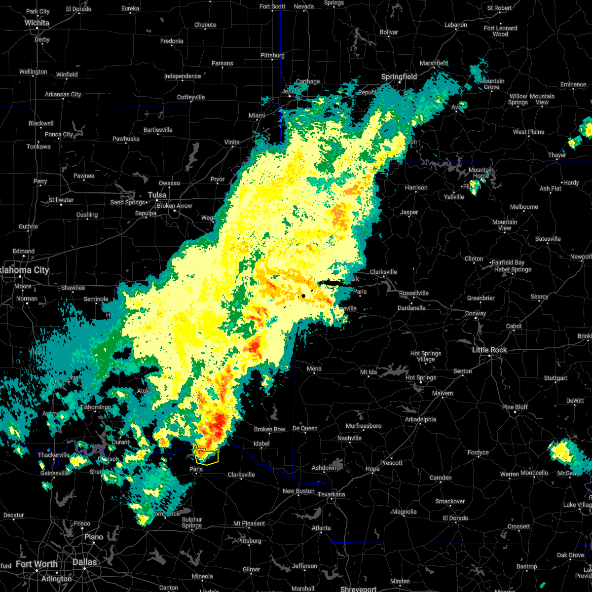 At 805 pm cdt, a severe thunderstorm was located 10 miles south of sawyer, or 11 miles southeast of hugo, moving east at 35 mph (radar indicated). Hazards include 60 mph wind gusts and quarter size hail. Hail damage to vehicles is expected. expect wind damage to roofs, siding, and trees. this severe thunderstorm will remain over mainly rural areas of northeastern lamar county. hail threat, radar indicated max hail size, 1. 00 in wind threat, radar indicated max wind gust, 60 mph. At 805 pm cdt, a severe thunderstorm was located 10 miles south of sawyer, or 11 miles southeast of hugo, moving east at 35 mph (radar indicated). Hazards include 60 mph wind gusts and quarter size hail. Hail damage to vehicles is expected. expect wind damage to roofs, siding, and trees. this severe thunderstorm will remain over mainly rural areas of northeastern lamar county. hail threat, radar indicated max hail size, 1. 00 in wind threat, radar indicated max wind gust, 60 mph.
|
| 4/24/2022 7:48 PM CDT |
 At 747 pm cdt, a severe thunderstorm was located 10 miles south of goodland, or 11 miles north of paris, moving east at 40 mph (radar indicated). Hazards include 60 mph wind gusts and quarter size hail. Hail damage to vehicles is expected. expect wind damage to roofs, siding, and trees. locations impacted include, powderly, arthur city. hail threat, radar indicated max hail size, 1. 00 in wind threat, radar indicated max wind gust, 60 mph. At 747 pm cdt, a severe thunderstorm was located 10 miles south of goodland, or 11 miles north of paris, moving east at 40 mph (radar indicated). Hazards include 60 mph wind gusts and quarter size hail. Hail damage to vehicles is expected. expect wind damage to roofs, siding, and trees. locations impacted include, powderly, arthur city. hail threat, radar indicated max hail size, 1. 00 in wind threat, radar indicated max wind gust, 60 mph.
|
| 4/24/2022 7:38 PM CDT |
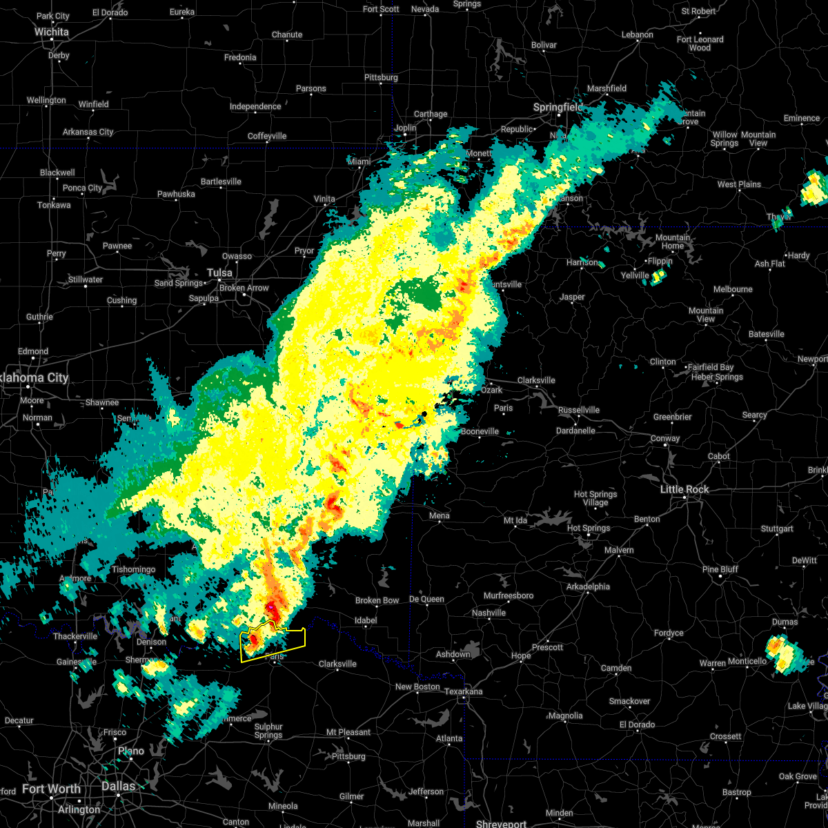 At 738 pm cdt, a severe thunderstorm was located 12 miles northwest of paris, moving east at 40 mph (radar indicated). Hazards include 60 mph wind gusts and quarter size hail. Hail damage to vehicles is expected. Expect wind damage to roofs, siding, and trees. At 738 pm cdt, a severe thunderstorm was located 12 miles northwest of paris, moving east at 40 mph (radar indicated). Hazards include 60 mph wind gusts and quarter size hail. Hail damage to vehicles is expected. Expect wind damage to roofs, siding, and trees.
|
| 4/4/2022 9:44 PM CDT |
 At 943 pm cdt, a severe thunderstorm was located near honey grove, or 14 miles west of paris, moving northeast at 30 mph (radar indicated). Hazards include 60 mph wind gusts and quarter size hail. Hail damage to vehicles is expected. Expect wind damage to roofs, siding, and trees. At 943 pm cdt, a severe thunderstorm was located near honey grove, or 14 miles west of paris, moving northeast at 30 mph (radar indicated). Hazards include 60 mph wind gusts and quarter size hail. Hail damage to vehicles is expected. Expect wind damage to roofs, siding, and trees.
|
| 3/30/2022 6:12 AM CDT |
 The severe thunderstorm warning for north central hopkins, eastern lamar and northeastern delta counties will expire at 615 am cdt, the storm which prompted the warning has moved out of the area. therefore the warning will be allowed to expire. however gusty winds are still possible with this thunderstorm. a tornado watch remains in effect until 700 am cdt for north central texas. The severe thunderstorm warning for north central hopkins, eastern lamar and northeastern delta counties will expire at 615 am cdt, the storm which prompted the warning has moved out of the area. therefore the warning will be allowed to expire. however gusty winds are still possible with this thunderstorm. a tornado watch remains in effect until 700 am cdt for north central texas.
|
| 3/30/2022 6:02 AM CDT |
 At 601 am cdt, a cluster of severe thunderstorms was located from near paris to tira, moving northeast at 55 mph (radar indicated). Hazards include 60 mph wind gusts. Expect damage to roofs, siding, and trees. locations impacted include, paris, blossom, deport, tira and sun valley. hail threat, radar indicated max hail size, <. 75 in wind threat, radar indicated max wind gust, 60 mph. At 601 am cdt, a cluster of severe thunderstorms was located from near paris to tira, moving northeast at 55 mph (radar indicated). Hazards include 60 mph wind gusts. Expect damage to roofs, siding, and trees. locations impacted include, paris, blossom, deport, tira and sun valley. hail threat, radar indicated max hail size, <. 75 in wind threat, radar indicated max wind gust, 60 mph.
|
| 3/30/2022 5:51 AM CDT |
 At 550 am cdt, a cluster of severe thunderstorms was located from near paris to north of sulphur springs , moving northeast at 55 mph (radar indicated). Hazards include 60 mph wind gusts. Expect damage to roofs, siding, and trees. locations impacted include, paris, cooper, blossom, deport, cooper lake park south sulphur, cooper lake park doctors creek, tira, toco and sun valley. hail threat, radar indicated max hail size, <. 75 in wind threat, radar indicated max wind gust, 60 mph. At 550 am cdt, a cluster of severe thunderstorms was located from near paris to north of sulphur springs , moving northeast at 55 mph (radar indicated). Hazards include 60 mph wind gusts. Expect damage to roofs, siding, and trees. locations impacted include, paris, cooper, blossom, deport, cooper lake park south sulphur, cooper lake park doctors creek, tira, toco and sun valley. hail threat, radar indicated max hail size, <. 75 in wind threat, radar indicated max wind gust, 60 mph.
|
| 3/30/2022 5:38 AM CDT |
 At 538 am cdt, a severe thunderstorm was located 5 miles northwest of sulphur springs, moving northeast at 55 mph (radar indicated). Hazards include 60 mph wind gusts. Expect damage to roofs, siding, and trees. locations impacted include, paris, cooper, blossom, cumby, deport, cooper lake park south sulphur, cooper lake park doctors creek, roxton, tira, pecan gap, toco and sun valley. hail threat, radar indicated max hail size, <. 75 in wind threat, radar indicated max wind gust, 60 mph. At 538 am cdt, a severe thunderstorm was located 5 miles northwest of sulphur springs, moving northeast at 55 mph (radar indicated). Hazards include 60 mph wind gusts. Expect damage to roofs, siding, and trees. locations impacted include, paris, cooper, blossom, cumby, deport, cooper lake park south sulphur, cooper lake park doctors creek, roxton, tira, pecan gap, toco and sun valley. hail threat, radar indicated max hail size, <. 75 in wind threat, radar indicated max wind gust, 60 mph.
|
| 3/30/2022 5:19 AM CDT |
 At 518 am cdt, a line of severe thunderstorms was located from honey grove to commerce, moving northeast at 55 mph (radar indicated). Hazards include 60 mph wind gusts. expect damage to roofs, siding, and trees At 518 am cdt, a line of severe thunderstorms was located from honey grove to commerce, moving northeast at 55 mph (radar indicated). Hazards include 60 mph wind gusts. expect damage to roofs, siding, and trees
|
| 3/30/2022 5:06 AM CDT |
 At 505 am cdt, a severe thunderstorm was located 10 miles northwest of paris, moving northeast at 60 mph (radar indicated). Hazards include 60 mph wind gusts. Expect damage to roofs, siding, and trees. locations impacted include, paris and toco. hail threat, radar indicated max hail size, <. 75 in wind threat, radar indicated max wind gust, 60 mph. At 505 am cdt, a severe thunderstorm was located 10 miles northwest of paris, moving northeast at 60 mph (radar indicated). Hazards include 60 mph wind gusts. Expect damage to roofs, siding, and trees. locations impacted include, paris and toco. hail threat, radar indicated max hail size, <. 75 in wind threat, radar indicated max wind gust, 60 mph.
|
| 3/30/2022 4:59 AM CDT |
 At 458 am cdt, a severe thunderstorm was located 15 miles northwest of paris, moving northeast at 50 mph (radar indicated). Hazards include 60 mph wind gusts. Expect damage to roofs, siding, and trees. locations impacted include, honey grove, roxton, ladonia, windom and toco. hail threat, radar indicated max hail size, <. 75 in wind threat, radar indicated max wind gust, 60 mph. At 458 am cdt, a severe thunderstorm was located 15 miles northwest of paris, moving northeast at 50 mph (radar indicated). Hazards include 60 mph wind gusts. Expect damage to roofs, siding, and trees. locations impacted include, honey grove, roxton, ladonia, windom and toco. hail threat, radar indicated max hail size, <. 75 in wind threat, radar indicated max wind gust, 60 mph.
|
| 3/30/2022 4:47 AM CDT |
 At 447 am cdt, a severe thunderstorm was located between telephone and honey grove, moving northeast at 60 mph (radar indicated). Hazards include 60 mph wind gusts. expect damage to roofs, siding, and trees At 447 am cdt, a severe thunderstorm was located between telephone and honey grove, moving northeast at 60 mph (radar indicated). Hazards include 60 mph wind gusts. expect damage to roofs, siding, and trees
|
| 3/21/2022 8:59 PM CDT |
 At 859 pm cdt, severe thunderstorms were located along a line extending from 11 miles southeast of goodland to 10 miles south of paris, moving northeast at 65 mph (radar indicated). Hazards include 60 mph wind gusts and quarter size hail. Hail damage to vehicles is expected. Expect wind damage to roofs, siding, and trees. At 859 pm cdt, severe thunderstorms were located along a line extending from 11 miles southeast of goodland to 10 miles south of paris, moving northeast at 65 mph (radar indicated). Hazards include 60 mph wind gusts and quarter size hail. Hail damage to vehicles is expected. Expect wind damage to roofs, siding, and trees.
|
| 11/10/2021 9:32 PM CST |
 At 932 pm cst, a severe thunderstorm was located near paris, moving east at 35 mph (radar indicated). Hazards include 60 mph wind gusts and penny size hail. Expect damage to roofs, siding, and trees. locations impacted include, paris, blossom and sun valley. hail threat, radar indicated max hail size, 0. 75 in wind threat, radar indicated max wind gust, 60 mph. At 932 pm cst, a severe thunderstorm was located near paris, moving east at 35 mph (radar indicated). Hazards include 60 mph wind gusts and penny size hail. Expect damage to roofs, siding, and trees. locations impacted include, paris, blossom and sun valley. hail threat, radar indicated max hail size, 0. 75 in wind threat, radar indicated max wind gust, 60 mph.
|
| 11/10/2021 9:05 PM CST | At 905 pm cst, a severe thunderstorm was located 12 miles northeast of honey grove, or 14 miles west of paris, moving east at 35 mph (radar indicated). Hazards include 60 mph wind gusts and penny size hail. expect damage to roofs, siding, and trees |
| 10/11/2021 12:10 AM CDT |
 The severe thunderstorm warning for southeastern hunt, northwestern van zandt, hopkins, rains, southeastern lamar and delta counties will expire at 1215 am cdt, the storms which prompted the warning have moved out of the area. therefore the warning will be allowed to expire. a tornado watch remains in effect until 200 am cdt for north central texas. The severe thunderstorm warning for southeastern hunt, northwestern van zandt, hopkins, rains, southeastern lamar and delta counties will expire at 1215 am cdt, the storms which prompted the warning have moved out of the area. therefore the warning will be allowed to expire. a tornado watch remains in effect until 200 am cdt for north central texas.
|
| 10/10/2021 11:28 PM CDT |
 At 1126 pm cdt, severe thunderstorms were located along a line extending from near paris to near wills point, moving east at 40 mph (radar indicated). Hazards include 60 mph wind gusts. expect damage to roofs, siding, and trees At 1126 pm cdt, severe thunderstorms were located along a line extending from near paris to near wills point, moving east at 40 mph (radar indicated). Hazards include 60 mph wind gusts. expect damage to roofs, siding, and trees
|
| 10/10/2021 10:34 PM CDT |
 At 1034 pm cdt, severe thunderstorms were located along a line extending from 11 miles southeast of albany to near greenville to near combine, moving east at 60 mph (radar indicated). Hazards include 60 mph wind gusts and penny size hail. expect damage to roofs, siding, and trees At 1034 pm cdt, severe thunderstorms were located along a line extending from 11 miles southeast of albany to near greenville to near combine, moving east at 60 mph (radar indicated). Hazards include 60 mph wind gusts and penny size hail. expect damage to roofs, siding, and trees
|
| 4/23/2021 9:53 PM CDT | Tree 12 inches in diameter uprooted and down. time estimated via rada in lamar county TX, 1.3 miles ENE of Powderly, TX |
| 4/23/2021 9:43 PM CDT |
 At 942 pm cdt, a severe thunderstorm was located 10 miles northwest of paris, moving east at 30 mph (radar indicated). Hazards include 60 mph wind gusts and nickel size hail. Expect damage to roofs, siding, and trees. Locations impacted include, paris and toco. At 942 pm cdt, a severe thunderstorm was located 10 miles northwest of paris, moving east at 30 mph (radar indicated). Hazards include 60 mph wind gusts and nickel size hail. Expect damage to roofs, siding, and trees. Locations impacted include, paris and toco.
|
| 4/23/2021 9:12 PM CDT |
 At 912 pm cdt, a severe thunderstorm was located 10 miles north of honey grove, or 19 miles northeast of bonham, moving northeast at 35 mph (radar indicated). Hazards include 60 mph wind gusts and nickel size hail. expect damage to roofs, siding, and trees At 912 pm cdt, a severe thunderstorm was located 10 miles north of honey grove, or 19 miles northeast of bonham, moving northeast at 35 mph (radar indicated). Hazards include 60 mph wind gusts and nickel size hail. expect damage to roofs, siding, and trees
|
| 4/9/2021 10:37 PM CDT |
 At 1037 pm cdt, severe thunderstorms were located along a line extending from near idabel to near campbell, moving southeast at 55 mph (radar indicated). Hazards include 60 mph wind gusts. Expect damage to roofs, siding, and trees. Locations impacted include, paris, honey grove, blossom, deport, roxton, ladonia, pecan gap, toco and sun valley. At 1037 pm cdt, severe thunderstorms were located along a line extending from near idabel to near campbell, moving southeast at 55 mph (radar indicated). Hazards include 60 mph wind gusts. Expect damage to roofs, siding, and trees. Locations impacted include, paris, honey grove, blossom, deport, roxton, ladonia, pecan gap, toco and sun valley.
|
| 4/9/2021 10:21 PM CDT |
 At 1021 pm cdt, severe thunderstorms were located along a line extending from near powderly to leonard, moving southeast at 50 mph (radar indicated). Hazards include 60 mph wind gusts and penny size hail. Expect damage to roofs, siding, and trees. Locations impacted include, paris, bonham, leonard, honey grove, blossom, deport, dodd city, bailey, bonham state park, roxton, ladonia, pecan gap, windom, toco and sun valley. At 1021 pm cdt, severe thunderstorms were located along a line extending from near powderly to leonard, moving southeast at 50 mph (radar indicated). Hazards include 60 mph wind gusts and penny size hail. Expect damage to roofs, siding, and trees. Locations impacted include, paris, bonham, leonard, honey grove, blossom, deport, dodd city, bailey, bonham state park, roxton, ladonia, pecan gap, windom, toco and sun valley.
|
| 4/9/2021 10:03 PM CDT |
 At 1003 pm cdt, severe thunderstorms were located along a line extending from fort towson to whitewright, moving southeast at 45 mph (radar indicated). Hazards include 60 mph wind gusts and penny size hail. Expect damage to roofs, siding, and trees. Locations impacted include, paris, bonham, leonard, honey grove, whitewright, blossom, savoy, ector, deport, dodd city, bailey, ravenna, bonham state park, roxton, trenton, ladonia, pecan gap, windom, toco and sun valley. At 1003 pm cdt, severe thunderstorms were located along a line extending from fort towson to whitewright, moving southeast at 45 mph (radar indicated). Hazards include 60 mph wind gusts and penny size hail. Expect damage to roofs, siding, and trees. Locations impacted include, paris, bonham, leonard, honey grove, whitewright, blossom, savoy, ector, deport, dodd city, bailey, ravenna, bonham state park, roxton, trenton, ladonia, pecan gap, windom, toco and sun valley.
|
| 4/9/2021 9:42 PM CDT |
 At 941 pm cdt, severe thunderstorms were located along a line extending from near savoy to telephone to antlers, moving southeast at 55 mph (radar indicated). Hazards include 60 mph wind gusts and penny size hail. expect damage to roofs, siding, and trees At 941 pm cdt, severe thunderstorms were located along a line extending from near savoy to telephone to antlers, moving southeast at 55 mph (radar indicated). Hazards include 60 mph wind gusts and penny size hail. expect damage to roofs, siding, and trees
|
| 11/24/2020 9:43 PM CST |
 At 942 pm cst, a severe thunderstorm was located 7 miles southwest of paris, moving east at 55 mph (radar indicated). Hazards include 60 mph wind gusts. Expect damage to roofs, siding, and trees. Locations impacted include, paris, cooper, blossom, deport, cooper lake park doctors creek, roxton, pecan gap, toco and sun valley. At 942 pm cst, a severe thunderstorm was located 7 miles southwest of paris, moving east at 55 mph (radar indicated). Hazards include 60 mph wind gusts. Expect damage to roofs, siding, and trees. Locations impacted include, paris, cooper, blossom, deport, cooper lake park doctors creek, roxton, pecan gap, toco and sun valley.
|
| 11/24/2020 9:14 PM CST |
 At 914 pm cst, a severe thunderstorm was located near bailey, or 9 miles southeast of bonham, moving east at 55 mph (radar indicated). Hazards include 60 mph wind gusts. expect damage to roofs, siding, and trees At 914 pm cst, a severe thunderstorm was located near bailey, or 9 miles southeast of bonham, moving east at 55 mph (radar indicated). Hazards include 60 mph wind gusts. expect damage to roofs, siding, and trees
|
| 9/27/2020 10:49 PM CDT |
 At 1048 pm cdt, severe thunderstorms were located along a line extending from a bonham to paris line, moving southwest at 25 mph (radar indicated). Hazards include 60 mph wind gusts and quarter size hail. Hail damage to vehicles is expected. expect wind damage to roofs, siding, and trees. these severe storms will be near, bonham, dodd city, ravenna and bonham state park around 1055 pm cdt. honey grove around 1105 pm cdt. Other locations impacted by these severe thunderstorms include toco, roxton, sun valley, ladonia, windom and pecan gap. At 1048 pm cdt, severe thunderstorms were located along a line extending from a bonham to paris line, moving southwest at 25 mph (radar indicated). Hazards include 60 mph wind gusts and quarter size hail. Hail damage to vehicles is expected. expect wind damage to roofs, siding, and trees. these severe storms will be near, bonham, dodd city, ravenna and bonham state park around 1055 pm cdt. honey grove around 1105 pm cdt. Other locations impacted by these severe thunderstorms include toco, roxton, sun valley, ladonia, windom and pecan gap.
|
| 9/27/2020 10:13 PM CDT |
 At 1012 pm cdt, severe thunderstorms were located along a line extending from near boswell to 12 miles southeast of bennington to near ravenna, moving southeast at 30 mph (radar indicated). Hazards include 65 mph wind gusts and quarter size hail. Hail damage to vehicles is expected. expect wind damage to roofs, siding, and trees. severe thunderstorms will be near, bonham state park around 1035 pm cdt. dodd city around 1040 pm cdt. paris and honey grove around 1050 pm cdt. blossom around 1110 pm cdt. Other locations impacted by these severe thunderstorms include direct, camp maxey, toco, powderly, roxton, sun valley, ladonia, windom and pecan gap. At 1012 pm cdt, severe thunderstorms were located along a line extending from near boswell to 12 miles southeast of bennington to near ravenna, moving southeast at 30 mph (radar indicated). Hazards include 65 mph wind gusts and quarter size hail. Hail damage to vehicles is expected. expect wind damage to roofs, siding, and trees. severe thunderstorms will be near, bonham state park around 1035 pm cdt. dodd city around 1040 pm cdt. paris and honey grove around 1050 pm cdt. blossom around 1110 pm cdt. Other locations impacted by these severe thunderstorms include direct, camp maxey, toco, powderly, roxton, sun valley, ladonia, windom and pecan gap.
|
| 7/12/2020 12:55 AM CDT |
 At 1254 am cdt, severe thunderstorms were located along a line extending from 9 miles north of boswell to near sawyer to 10 miles east of raymond gary state park, moving south at 40 mph (radar indicated). Hazards include 60 mph wind gusts. expect damage to roofs, siding, and trees At 1254 am cdt, severe thunderstorms were located along a line extending from 9 miles north of boswell to near sawyer to 10 miles east of raymond gary state park, moving south at 40 mph (radar indicated). Hazards include 60 mph wind gusts. expect damage to roofs, siding, and trees
|
| 5/8/2020 4:08 AM CDT |
 At 407 am cdt, severe thunderstorms were located along a line extending from near blossom to 7 miles north of dodd city to 6 miles west of knollwood to lindsay, moving southeast at 30 mph (radar indicated). Hazards include 60 mph wind gusts and quarter size hail. Hail damage to vehicles is expected. Expect wind damage to roofs, siding, and trees. At 407 am cdt, severe thunderstorms were located along a line extending from near blossom to 7 miles north of dodd city to 6 miles west of knollwood to lindsay, moving southeast at 30 mph (radar indicated). Hazards include 60 mph wind gusts and quarter size hail. Hail damage to vehicles is expected. Expect wind damage to roofs, siding, and trees.
|
| 5/8/2020 3:50 AM CDT |
 At 349 am cdt, severe thunderstorms were located along a line extending from 8 miles west of broken bow to near clarksville to near paris to near ravenna, moving southeast at 50 mph (radar indicated). Hazards include 70 mph wind gusts and quarter size hail. Hail damage to vehicles is expected. expect considerable tree damage. wind damage is also likely to mobile homes, roofs, and outbuildings. Locations impacted include, greenville, paris, sulphur springs, bonham, commerce, leonard, cooper, honey grove, whitewright, blossom, wolfe city, savoy, celeste, ector, campbell, deport, dodd city, bailey, ravenna and bonham state park. At 349 am cdt, severe thunderstorms were located along a line extending from 8 miles west of broken bow to near clarksville to near paris to near ravenna, moving southeast at 50 mph (radar indicated). Hazards include 70 mph wind gusts and quarter size hail. Hail damage to vehicles is expected. expect considerable tree damage. wind damage is also likely to mobile homes, roofs, and outbuildings. Locations impacted include, greenville, paris, sulphur springs, bonham, commerce, leonard, cooper, honey grove, whitewright, blossom, wolfe city, savoy, celeste, ector, campbell, deport, dodd city, bailey, ravenna and bonham state park.
|
| 5/8/2020 3:13 AM CDT |
 At 312 am cdt, severe thunderstorms were located along a line extending from 7 miles southeast of kosoma to 7 miles south of soper to near durant, moving southeast at 65 mph (radar indicated). Hazards include 70 mph wind gusts and quarter size hail. Hail damage to vehicles is expected. expect considerable tree damage. Wind damage is also likely to mobile homes, roofs, and outbuildings. At 312 am cdt, severe thunderstorms were located along a line extending from 7 miles southeast of kosoma to 7 miles south of soper to near durant, moving southeast at 65 mph (radar indicated). Hazards include 70 mph wind gusts and quarter size hail. Hail damage to vehicles is expected. expect considerable tree damage. Wind damage is also likely to mobile homes, roofs, and outbuildings.
|
| 4/28/2020 10:32 PM CDT |
 At 1031 pm cdt, severe thunderstorms were located along a line extending from sawyer to lake texoma, moving south at 40 mph (radar indicated). Hazards include 60 mph wind gusts and quarter size hail. Hail damage to vehicles is expected. Expect wind damage to roofs, siding, and trees. At 1031 pm cdt, severe thunderstorms were located along a line extending from sawyer to lake texoma, moving south at 40 mph (radar indicated). Hazards include 60 mph wind gusts and quarter size hail. Hail damage to vehicles is expected. Expect wind damage to roofs, siding, and trees.
|
| 4/24/2020 7:50 PM CDT |
 At 749 pm cdt, a severe thunderstorm capable of producing a tornado was located near paris, moving east at 45 mph (radar indicated rotation). Hazards include tornado and two inch hail. Flying debris will be dangerous to those caught without shelter. mobile homes will be damaged or destroyed. damage to roofs, windows, and vehicles will occur. tree damage is likely. this dangerous storm will be near, blossom around 805 pm cdt. Other locations impacted by this tornadic thunderstorm include sun valley. At 749 pm cdt, a severe thunderstorm capable of producing a tornado was located near paris, moving east at 45 mph (radar indicated rotation). Hazards include tornado and two inch hail. Flying debris will be dangerous to those caught without shelter. mobile homes will be damaged or destroyed. damage to roofs, windows, and vehicles will occur. tree damage is likely. this dangerous storm will be near, blossom around 805 pm cdt. Other locations impacted by this tornadic thunderstorm include sun valley.
|
| 4/24/2020 7:35 PM CDT |
 At 734 pm cdt, a thunderstorm with a history of producing tornadoes was located 15 miles northwest of paris, moving southeast at 20 mph (weather spotters confirmed tornado). Hazards include damaging tornado and hail up to two inches in diameter. Flying debris will be dangerous to those caught without shelter. mobile homes will be damaged or destroyed. damage to roofs, windows, and vehicles will occur. tree damage is likely. the tornado will be near, paris around 815 pm cdt. Other locations impacted by this tornadic thunderstorm include sun valley. At 734 pm cdt, a thunderstorm with a history of producing tornadoes was located 15 miles northwest of paris, moving southeast at 20 mph (weather spotters confirmed tornado). Hazards include damaging tornado and hail up to two inches in diameter. Flying debris will be dangerous to those caught without shelter. mobile homes will be damaged or destroyed. damage to roofs, windows, and vehicles will occur. tree damage is likely. the tornado will be near, paris around 815 pm cdt. Other locations impacted by this tornadic thunderstorm include sun valley.
|
| 4/24/2020 6:45 PM CDT |
 At 645 pm cdt, a severe thunderstorm was located near honey grove, or 15 miles west of paris, moving east at 20 mph (radar indicated). Hazards include 60 mph wind gusts and quarter size hail. Hail damage to vehicles is expected. Expect wind damage to roofs, siding, and trees. At 645 pm cdt, a severe thunderstorm was located near honey grove, or 15 miles west of paris, moving east at 20 mph (radar indicated). Hazards include 60 mph wind gusts and quarter size hail. Hail damage to vehicles is expected. Expect wind damage to roofs, siding, and trees.
|
| 4/22/2020 8:39 PM CDT |
 The severe thunderstorm warning for northeastern lamar county will expire at 845 pm cdt, the storms which prompted the warning have weakened below severe limits, and have exited the warned area. therefore the warning will be allowed to expire. however gusty winds are still possible with these thunderstorms. a tornado watch remains in effect until 900 pm cdt for north central texas. The severe thunderstorm warning for northeastern lamar county will expire at 845 pm cdt, the storms which prompted the warning have weakened below severe limits, and have exited the warned area. therefore the warning will be allowed to expire. however gusty winds are still possible with these thunderstorms. a tornado watch remains in effect until 900 pm cdt for north central texas.
|
| 4/22/2020 8:24 PM CDT |
 At 823 pm cdt, severe thunderstorms were located along a line extending from 6 miles north of manchester to 10 miles north of blossom to paris, moving east at 35 mph (radar indicated). Hazards include 70 mph wind gusts and quarter size hail. Hail damage to vehicles is expected. expect considerable tree damage. wind damage is also likely to mobile homes, roofs, and outbuildings. locations impacted include, paris, blossom and sun valley. A tornado watch remains in effect until 900 pm cdt for north texas. At 823 pm cdt, severe thunderstorms were located along a line extending from 6 miles north of manchester to 10 miles north of blossom to paris, moving east at 35 mph (radar indicated). Hazards include 70 mph wind gusts and quarter size hail. Hail damage to vehicles is expected. expect considerable tree damage. wind damage is also likely to mobile homes, roofs, and outbuildings. locations impacted include, paris, blossom and sun valley. A tornado watch remains in effect until 900 pm cdt for north texas.
|
| 4/22/2020 8:03 PM CDT |
 At 801 pm cdt, severe thunderstorms were located along a line extending from 7 miles south of sawyer to 10 miles northeast of paris to 9 miles east of honey grove, moving east at 40 mph (radar indicated). Hazards include 70 to 75 mph wind gusts and ping pong ball size hail. People and animals outdoors will be injured. expect hail damage to roofs, siding, windows, and vehicles. expect considerable tree damage. wind damage is also likely to mobile homes, roofs, and outbuildings. locations impacted include, paris, blossom, roxton, toco. novice, faught and sun valley. A tornado watch remains in effect until 900 pm cdt for north texas. At 801 pm cdt, severe thunderstorms were located along a line extending from 7 miles south of sawyer to 10 miles northeast of paris to 9 miles east of honey grove, moving east at 40 mph (radar indicated). Hazards include 70 to 75 mph wind gusts and ping pong ball size hail. People and animals outdoors will be injured. expect hail damage to roofs, siding, windows, and vehicles. expect considerable tree damage. wind damage is also likely to mobile homes, roofs, and outbuildings. locations impacted include, paris, blossom, roxton, toco. novice, faught and sun valley. A tornado watch remains in effect until 900 pm cdt for north texas.
|
| 4/22/2020 7:40 PM CDT |
 At 738 pm cdt, severe thunderstorms were located along a line extending from 9 miles southwest of goodland to 10 miles northwest of paris to near dodd city, moving east at 45 mph (radar indicated). Hazards include 70 mph wind gusts and ping pong ball size hail. People and animals outdoors will be injured. expect hail damage to roofs, siding, windows, and vehicles. expect considerable tree damage. Wind damage is also likely to mobile homes, roofs, and outbuildings. At 738 pm cdt, severe thunderstorms were located along a line extending from 9 miles southwest of goodland to 10 miles northwest of paris to near dodd city, moving east at 45 mph (radar indicated). Hazards include 70 mph wind gusts and ping pong ball size hail. People and animals outdoors will be injured. expect hail damage to roofs, siding, windows, and vehicles. expect considerable tree damage. Wind damage is also likely to mobile homes, roofs, and outbuildings.
|
| 4/22/2020 7:20 PM CDT |
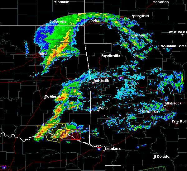 At 719 pm cdt, a severe thunderstorm was located near powderly, or 16 miles northeast of paris, moving east at 30 mph (radar indicated). Hazards include 60 mph wind gusts and quarter size hail. Hail damage to vehicles is expected. expect wind damage to roofs, siding, and trees. this severe thunderstorm will move toward the community of novice in extreme eastern lamar county. A tornado watch remains in effect until 900 pm cdt for north central texas. At 719 pm cdt, a severe thunderstorm was located near powderly, or 16 miles northeast of paris, moving east at 30 mph (radar indicated). Hazards include 60 mph wind gusts and quarter size hail. Hail damage to vehicles is expected. expect wind damage to roofs, siding, and trees. this severe thunderstorm will move toward the community of novice in extreme eastern lamar county. A tornado watch remains in effect until 900 pm cdt for north central texas.
|
| 4/22/2020 7:16 PM CDT | Report from mping: trees uprooted or snappe in lamar county TX, 0.3 miles NNE of Powderly, TX |
| 4/22/2020 7:10 PM CDT | Multiple homes with roof damage and numerous trees down. possible tornad in lamar county TX, 3.8 miles WSW of Powderly, TX |
| 4/22/2020 6:57 PM CDT |
 At 655 pm cdt, a confirmed tornado was located near camp maxey and powderly or 12 miles south of hugo, moving east at 30 mph (weather spotters confirmed tornado a tornado near powderly near highway 271 and farm to market road 2648). Hazards include damaging tornado and two inch hail. Flying debris will be dangerous to those caught without shelter. mobile homes will be damaged or destroyed. damage to roofs, windows, and vehicles will occur. tree damage is likely. This tornadic thunderstorm move near the powderly, camp maxey and novice communities. At 655 pm cdt, a confirmed tornado was located near camp maxey and powderly or 12 miles south of hugo, moving east at 30 mph (weather spotters confirmed tornado a tornado near powderly near highway 271 and farm to market road 2648). Hazards include damaging tornado and two inch hail. Flying debris will be dangerous to those caught without shelter. mobile homes will be damaged or destroyed. damage to roofs, windows, and vehicles will occur. tree damage is likely. This tornadic thunderstorm move near the powderly, camp maxey and novice communities.
|
| 4/22/2020 6:42 PM CDT |
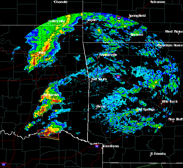 At 642 pm cdt, a severe thunderstorm capable of producing a tornado was located 11 miles southwest of goodland, or 13 miles northwest of paris, moving east at 30 mph (radar indicated rotation). Hazards include tornado and hail up to two inches in diameter. Flying debris will be dangerous to those caught without shelter. mobile homes will be damaged or destroyed. damage to roofs, windows, and vehicles will occur. tree damage is likely. This tornadic thunderstorm will approach the communities of arthur city, belk, garretts bluff, forest chapel, powderly, midcity. At 642 pm cdt, a severe thunderstorm capable of producing a tornado was located 11 miles southwest of goodland, or 13 miles northwest of paris, moving east at 30 mph (radar indicated rotation). Hazards include tornado and hail up to two inches in diameter. Flying debris will be dangerous to those caught without shelter. mobile homes will be damaged or destroyed. damage to roofs, windows, and vehicles will occur. tree damage is likely. This tornadic thunderstorm will approach the communities of arthur city, belk, garretts bluff, forest chapel, powderly, midcity.
|
| 4/22/2020 6:39 PM CDT |
 At 638 pm cdt, a severe thunderstorm was located 11 miles southwest of goodland, or 13 miles northwest of paris, moving east at 30 mph (radar indicated). Hazards include two inch hail and 70 mph wind gusts. People and animals outdoors will be injured. expect hail damage to roofs, siding, windows, and vehicles. expect considerable tree damage. Wind damage is also likely to mobile homes, roofs, and outbuildings. At 638 pm cdt, a severe thunderstorm was located 11 miles southwest of goodland, or 13 miles northwest of paris, moving east at 30 mph (radar indicated). Hazards include two inch hail and 70 mph wind gusts. People and animals outdoors will be injured. expect hail damage to roofs, siding, windows, and vehicles. expect considerable tree damage. Wind damage is also likely to mobile homes, roofs, and outbuildings.
|
| 4/19/2020 2:45 PM CDT |
 At 245 pm cdt, a severe thunderstorm was located 8 miles northwest of blossom, or 9 miles northeast of paris, moving northeast at 45 mph (radar indicated). Hazards include quarter size hail. Damage to vehicles is possible. Locations impacted include, sun valley. At 245 pm cdt, a severe thunderstorm was located 8 miles northwest of blossom, or 9 miles northeast of paris, moving northeast at 45 mph (radar indicated). Hazards include quarter size hail. Damage to vehicles is possible. Locations impacted include, sun valley.
|
| 4/19/2020 2:33 PM CDT |
 At 233 pm cdt, a severe thunderstorm was located over paris, moving northeast at 45 mph (radar indicated). Hazards include quarter size hail. Damage to vehicles is possible. Locations impacted include, paris, blossom, toco and sun valley. At 233 pm cdt, a severe thunderstorm was located over paris, moving northeast at 45 mph (radar indicated). Hazards include quarter size hail. Damage to vehicles is possible. Locations impacted include, paris, blossom, toco and sun valley.
|
| 4/19/2020 2:20 PM CDT |
 At 220 pm cdt, a severe thunderstorm was located 8 miles southwest of paris, moving northeast at 45 mph (radar indicated). Hazards include quarter size hail. damage to vehicles is possible At 220 pm cdt, a severe thunderstorm was located 8 miles southwest of paris, moving northeast at 45 mph (radar indicated). Hazards include quarter size hail. damage to vehicles is possible
|
| 4/12/2020 4:45 PM CDT |
 At 444 pm cdt, a severe thunderstorm was located 7 miles northeast of paris, moving east at 30 mph (law enforcement). Hazards include ping pong ball size hail. People and animals outdoors will be injured. expect damage to roofs, siding, windows, and vehicles. Locations impacted include, paris, blossom and sun valley. At 444 pm cdt, a severe thunderstorm was located 7 miles northeast of paris, moving east at 30 mph (law enforcement). Hazards include ping pong ball size hail. People and animals outdoors will be injured. expect damage to roofs, siding, windows, and vehicles. Locations impacted include, paris, blossom and sun valley.
|
| 4/12/2020 4:10 PM CDT |
 At 409 pm cdt, a severe thunderstorm was located 13 miles northeast of honey grove, or 16 miles northwest of paris, moving east at 25 mph. a second severe thunderstorm capable of producing quarter size hail may impact northern fannin county (radar indicated). Hazards include half dollar size hail. damage to vehicles is possible At 409 pm cdt, a severe thunderstorm was located 13 miles northeast of honey grove, or 16 miles northwest of paris, moving east at 25 mph. a second severe thunderstorm capable of producing quarter size hail may impact northern fannin county (radar indicated). Hazards include half dollar size hail. damage to vehicles is possible
|
| 11/30/2019 8:13 AM CST |
 The severe thunderstorm warning for lamar, northwestern delta and southeastern fannin counties will expire at 815 am cst, the storm which prompted the warning has weakened below severe limits. therefore the warning will be allowed to expire. however heavy rain is still possible with this thunderstorm. The severe thunderstorm warning for lamar, northwestern delta and southeastern fannin counties will expire at 815 am cst, the storm which prompted the warning has weakened below severe limits. therefore the warning will be allowed to expire. however heavy rain is still possible with this thunderstorm.
|
| 11/30/2019 7:36 AM CST |
 At 735 am cst, a severe thunderstorm was located 8 miles south of honey grove, or 16 miles north of commerce, moving northeast at 50 mph (radar indicated). Hazards include quarter size hail. damage to vehicles is possible At 735 am cst, a severe thunderstorm was located 8 miles south of honey grove, or 16 miles north of commerce, moving northeast at 50 mph (radar indicated). Hazards include quarter size hail. damage to vehicles is possible
|
| 10/21/2019 1:17 AM CDT |
 At 117 am cdt, a severe thunderstorm was located near paris, moving east at 50 mph (radar indicated). Hazards include 60 mph wind gusts. Expect damage to roofs, siding, and trees. locations impacted include, paris, blossom, roxton, toco and sun valley. A tornado watch remains in effect until 200 am cdt for north central texas. At 117 am cdt, a severe thunderstorm was located near paris, moving east at 50 mph (radar indicated). Hazards include 60 mph wind gusts. Expect damage to roofs, siding, and trees. locations impacted include, paris, blossom, roxton, toco and sun valley. A tornado watch remains in effect until 200 am cdt for north central texas.
|
| 10/21/2019 12:53 AM CDT |
 At 1253 am cdt, a severe thunderstorm was located near honey grove, or 16 miles west of paris, moving east at 55 mph (radar indicated). Hazards include 60 mph wind gusts. expect damage to roofs, siding, and trees At 1253 am cdt, a severe thunderstorm was located near honey grove, or 16 miles west of paris, moving east at 55 mph (radar indicated). Hazards include 60 mph wind gusts. expect damage to roofs, siding, and trees
|
| 10/15/2019 5:27 PM CDT |
 At 527 pm cdt, a severe thunderstorm was located near blossom, or 12 miles northeast of paris, moving southeast at 20 mph (radar indicated). Hazards include 60 mph wind gusts and quarter size hail. Hail damage to vehicles is expected. expect wind damage to roofs, siding, and trees. Locations impacted include, blossom. At 527 pm cdt, a severe thunderstorm was located near blossom, or 12 miles northeast of paris, moving southeast at 20 mph (radar indicated). Hazards include 60 mph wind gusts and quarter size hail. Hail damage to vehicles is expected. expect wind damage to roofs, siding, and trees. Locations impacted include, blossom.
|
| 10/15/2019 5:12 PM CDT |
 At 512 pm cdt, a severe thunderstorm was located 9 miles north of blossom, or 11 miles northeast of paris, moving southeast at 20 mph (radar indicated). Hazards include 60 mph wind gusts and quarter size hail. Hail damage to vehicles is expected. Expect wind damage to roofs, siding, and trees. At 512 pm cdt, a severe thunderstorm was located 9 miles north of blossom, or 11 miles northeast of paris, moving southeast at 20 mph (radar indicated). Hazards include 60 mph wind gusts and quarter size hail. Hail damage to vehicles is expected. Expect wind damage to roofs, siding, and trees.
|
| 10/15/2019 4:55 PM CDT |
 At 426 pm cdt, a severe thunderstorm was located near goodland, or near hugo, moving southeast at 20 mph (radar indicated). Hazards include 60 mph wind gusts and quarter size hail. Hail damage to vehicles is expected. Expect wind damage to roofs, siding, and trees. At 426 pm cdt, a severe thunderstorm was located near goodland, or near hugo, moving southeast at 20 mph (radar indicated). Hazards include 60 mph wind gusts and quarter size hail. Hail damage to vehicles is expected. Expect wind damage to roofs, siding, and trees.
|
| 10/15/2019 4:26 PM CDT |
 At 426 pm cdt, a severe thunderstorm was located near goodland, or near hugo, moving southeast at 20 mph (radar indicated). Hazards include 60 mph wind gusts and quarter size hail. Hail damage to vehicles is expected. Expect wind damage to roofs, siding, and trees. At 426 pm cdt, a severe thunderstorm was located near goodland, or near hugo, moving southeast at 20 mph (radar indicated). Hazards include 60 mph wind gusts and quarter size hail. Hail damage to vehicles is expected. Expect wind damage to roofs, siding, and trees.
|
| 6/23/2019 7:11 PM CDT |
 At 711 pm cdt, a severe thunderstorm was located over paris, moving northeast at 30 mph (radar indicated). Hazards include 60 mph wind gusts and quarter size hail. Hail damage to vehicles is expected. Expect wind damage to roofs, siding, and trees. At 711 pm cdt, a severe thunderstorm was located over paris, moving northeast at 30 mph (radar indicated). Hazards include 60 mph wind gusts and quarter size hail. Hail damage to vehicles is expected. Expect wind damage to roofs, siding, and trees.
|
| 6/19/2019 8:51 PM CDT |
 At 850 pm cdt, a severe thunderstorm was located over paris, moving east at 25 mph (trained weather spotters). Hazards include golf ball size hail. People and animals outdoors will be injured. Expect damage to roofs, siding, windows, and vehicles. At 850 pm cdt, a severe thunderstorm was located over paris, moving east at 25 mph (trained weather spotters). Hazards include golf ball size hail. People and animals outdoors will be injured. Expect damage to roofs, siding, windows, and vehicles.
|
| 6/19/2019 6:19 PM CDT |
 At 618 pm cdt, severe thunderstorms were located near blossom and near paris, moving northeast at 30 mph (radar indicated). Hazards include 60 mph wind gusts and quarter size hail. Hail damage to vehicles is expected. expect wind damage to roofs, siding, and trees. locations impacted include, paris, blossom, deport and sun valley. A tornado watch remains in effect until midnight cdt for north central texas. At 618 pm cdt, severe thunderstorms were located near blossom and near paris, moving northeast at 30 mph (radar indicated). Hazards include 60 mph wind gusts and quarter size hail. Hail damage to vehicles is expected. expect wind damage to roofs, siding, and trees. locations impacted include, paris, blossom, deport and sun valley. A tornado watch remains in effect until midnight cdt for north central texas.
|
| 6/19/2019 5:57 PM CDT |
 At 557 pm cdt, a severe thunderstorm was located over paris, moving northeast at 30 mph (radar indicated). Hazards include 60 mph wind gusts and quarter size hail. Hail damage to vehicles is expected. Expect wind damage to roofs, siding, and trees. At 557 pm cdt, a severe thunderstorm was located over paris, moving northeast at 30 mph (radar indicated). Hazards include 60 mph wind gusts and quarter size hail. Hail damage to vehicles is expected. Expect wind damage to roofs, siding, and trees.
|
| 6/19/2019 5:00 PM CDT |
 At 500 pm cdt, a severe thunderstorm was located 8 miles north of cooper, or 15 miles southwest of paris, moving northeast at 30 mph (radar indicated). Hazards include 60 mph wind gusts and quarter size hail. Hail damage to vehicles is expected. Expect wind damage to roofs, siding, and trees. At 500 pm cdt, a severe thunderstorm was located 8 miles north of cooper, or 15 miles southwest of paris, moving northeast at 30 mph (radar indicated). Hazards include 60 mph wind gusts and quarter size hail. Hail damage to vehicles is expected. Expect wind damage to roofs, siding, and trees.
|
| 5/29/2019 3:25 PM CDT |
 At 325 pm cdt, a severe thunderstorm was located near blossom, or 11 miles northeast of paris, moving northeast at 25 mph (radar indicated). Hazards include golf ball size hail and 60 mph wind gusts. People and animals outdoors will be injured. expect hail damage to roofs, siding, windows, and vehicles. expect wind damage to roofs, siding, and trees. locations impacted include, blossom. A tornado watch remains in effect until 800 pm cdt for north central texas. At 325 pm cdt, a severe thunderstorm was located near blossom, or 11 miles northeast of paris, moving northeast at 25 mph (radar indicated). Hazards include golf ball size hail and 60 mph wind gusts. People and animals outdoors will be injured. expect hail damage to roofs, siding, windows, and vehicles. expect wind damage to roofs, siding, and trees. locations impacted include, blossom. A tornado watch remains in effect until 800 pm cdt for north central texas.
|
| 5/29/2019 3:08 PM CDT |
 At 308 pm cdt, a severe thunderstorm was located near blossom, or near paris, moving northeast at 25 mph (radar indicated). Hazards include ping pong ball size hail and 60 mph wind gusts. People and animals outdoors will be injured. expect hail damage to roofs, siding, windows, and vehicles. expect wind damage to roofs, siding, and trees. locations impacted include, paris, blossom and sun valley. A tornado watch remains in effect until 800 pm cdt for north central texas. At 308 pm cdt, a severe thunderstorm was located near blossom, or near paris, moving northeast at 25 mph (radar indicated). Hazards include ping pong ball size hail and 60 mph wind gusts. People and animals outdoors will be injured. expect hail damage to roofs, siding, windows, and vehicles. expect wind damage to roofs, siding, and trees. locations impacted include, paris, blossom and sun valley. A tornado watch remains in effect until 800 pm cdt for north central texas.
|
| 5/29/2019 2:57 PM CDT |
 At 257 pm cdt, a severe thunderstorm was located near paris, moving northeast at 25 mph (radar indicated). Hazards include 60 mph wind gusts and quarter size hail. Hail damage to vehicles is expected. Expect wind damage to roofs, siding, and trees. At 257 pm cdt, a severe thunderstorm was located near paris, moving northeast at 25 mph (radar indicated). Hazards include 60 mph wind gusts and quarter size hail. Hail damage to vehicles is expected. Expect wind damage to roofs, siding, and trees.
|
| 3/13/2019 6:38 AM CDT |
 At 637 am cdt, severe thunderstorms were located along a line extending from north of paris to near sulphur springs to canton, moving east at 45 mph (radar indicated). Hazards include 60 mph wind gusts. Expect damage to roofs, siding, and trees. Locations impacted include, paris, sulphur springs, canton, grand saline, van, cooper, blossom, edgewood, emory, como, deport, fruitvale, edom, cooper lake park south sulphur, cooper lake park doctors creek, roxton, tira, toco and sun valley. At 637 am cdt, severe thunderstorms were located along a line extending from north of paris to near sulphur springs to canton, moving east at 45 mph (radar indicated). Hazards include 60 mph wind gusts. Expect damage to roofs, siding, and trees. Locations impacted include, paris, sulphur springs, canton, grand saline, van, cooper, blossom, edgewood, emory, como, deport, fruitvale, edom, cooper lake park south sulphur, cooper lake park doctors creek, roxton, tira, toco and sun valley.
|
| 3/13/2019 6:06 AM CDT |
 At 605 am cdt, severe thunderstorms were located along a line extending from the red river north of honey grove to commerce to kemp, moving east at 45 mph (radar indicated). Hazards include 60 mph wind gusts. expect damage to roofs, siding, and trees At 605 am cdt, severe thunderstorms were located along a line extending from the red river north of honey grove to commerce to kemp, moving east at 45 mph (radar indicated). Hazards include 60 mph wind gusts. expect damage to roofs, siding, and trees
|
| 5/30/2018 4:15 AM CDT | Trees down near hwy 271 at hwy 2648 in lamar county TX, 4.8 miles NNE of Powderly, TX |
| 4/6/2018 4:03 PM CDT |
 At 400 pm cdt, a severe thunderstorm was located just east of paris, moving east at 25 mph (radar indicated). Hazards include 60 mph wind gusts and quarter size hail. Hail damage to vehicles is expected. expect wind damage to roofs, siding, and trees. this severe storm will be near, blossom around 415 pm cdt. Quarter size hail was reported at the paris justice center. At 400 pm cdt, a severe thunderstorm was located just east of paris, moving east at 25 mph (radar indicated). Hazards include 60 mph wind gusts and quarter size hail. Hail damage to vehicles is expected. expect wind damage to roofs, siding, and trees. this severe storm will be near, blossom around 415 pm cdt. Quarter size hail was reported at the paris justice center.
|
| 4/6/2018 3:44 PM CDT |
 At 342 pm cdt, a severe thunderstorm was located near paris, moving east at 30 mph (radar indicated). Hazards include 60 mph wind gusts and quarter size hail. Hail damage to vehicles is expected. expect wind damage to roofs, siding, and trees. The hail core will move over northern portions of the city of paris. At 342 pm cdt, a severe thunderstorm was located near paris, moving east at 30 mph (radar indicated). Hazards include 60 mph wind gusts and quarter size hail. Hail damage to vehicles is expected. expect wind damage to roofs, siding, and trees. The hail core will move over northern portions of the city of paris.
|
| 4/6/2018 3:25 PM CDT |
 At 324 pm cdt, a severe thunderstorm was located 12 miles northeast of honey grove, or 12 miles west of paris, moving east at 25 mph (radar indicated). Hazards include 60 mph wind gusts and quarter size hail. Hail damage to vehicles is expected. Expect wind damage to roofs, siding, and trees. At 324 pm cdt, a severe thunderstorm was located 12 miles northeast of honey grove, or 12 miles west of paris, moving east at 25 mph (radar indicated). Hazards include 60 mph wind gusts and quarter size hail. Hail damage to vehicles is expected. Expect wind damage to roofs, siding, and trees.
|
| 4/3/2018 2:47 PM CDT |
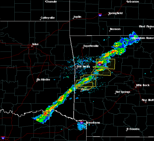 At 247 pm cdt, a severe thunderstorm was located 10 miles north of blossom, or 11 miles northeast of paris, moving east at 30 mph (radar indicated). Hazards include quarter size hail. Damage to vehicles is possible. This severe thunderstorm will remain over mainly rural areas of northeastern lamar county. At 247 pm cdt, a severe thunderstorm was located 10 miles north of blossom, or 11 miles northeast of paris, moving east at 30 mph (radar indicated). Hazards include quarter size hail. Damage to vehicles is possible. This severe thunderstorm will remain over mainly rural areas of northeastern lamar county.
|
| 1/21/2018 4:52 PM CST |
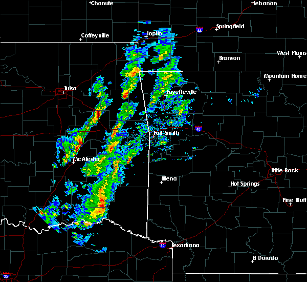 The tornado warning for northeastern lamar county will expire at 500 pm cst, the storm which prompted the warning has moved out of the area. therefore the warning will be allowed to expire. a tornado watch remains in effect until 1100 pm cst for north central texas. The tornado warning for northeastern lamar county will expire at 500 pm cst, the storm which prompted the warning has moved out of the area. therefore the warning will be allowed to expire. a tornado watch remains in effect until 1100 pm cst for north central texas.
|
| 1/21/2018 4:38 PM CST |
 At 437 pm cst, a severe thunderstorm capable of producing a tornado was located 8 miles north of paris, moving northeast at 40 mph (radar indicated rotation). Hazards include tornado and quarter size hail. Flying debris will be dangerous to those caught without shelter. mobile homes will be damaged or destroyed. damage to roofs, windows, and vehicles will occur. tree damage is likely. Locations impacted include, north of paris. At 437 pm cst, a severe thunderstorm capable of producing a tornado was located 8 miles north of paris, moving northeast at 40 mph (radar indicated rotation). Hazards include tornado and quarter size hail. Flying debris will be dangerous to those caught without shelter. mobile homes will be damaged or destroyed. damage to roofs, windows, and vehicles will occur. tree damage is likely. Locations impacted include, north of paris.
|
| 1/21/2018 4:31 PM CST |
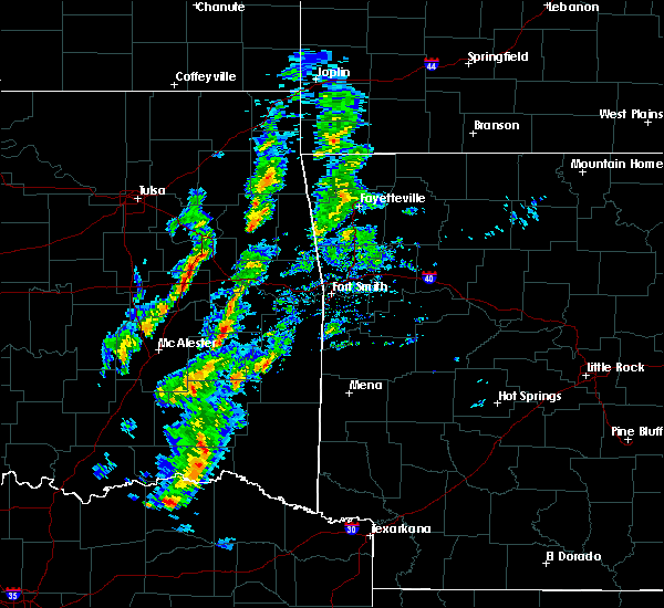 At 431 pm cst, a severe thunderstorm capable of producing a tornado was located near paris, moving northeast at 40 mph (radar indicated rotation). Hazards include tornado and quarter size hail. Flying debris will be dangerous to those caught without shelter. mobile homes will be damaged or destroyed. damage to roofs, windows, and vehicles will occur. tree damage is likely. This tornadic thunderstorm will remain over mainly rural areas of northern lamar county. At 431 pm cst, a severe thunderstorm capable of producing a tornado was located near paris, moving northeast at 40 mph (radar indicated rotation). Hazards include tornado and quarter size hail. Flying debris will be dangerous to those caught without shelter. mobile homes will be damaged or destroyed. damage to roofs, windows, and vehicles will occur. tree damage is likely. This tornadic thunderstorm will remain over mainly rural areas of northern lamar county.
|
| 1/21/2018 4:23 PM CST |
 At 423 pm cst, a severe thunderstorm was located 7 miles west of paris, moving northeast at 45 mph (radar indicated). Hazards include 60 mph wind gusts and quarter size hail. Hail damage to vehicles is expected. expect wind damage to roofs, siding, and trees. locations impacted include, paris and toco. A tornado watch remains in effect until 1100 pm cst for north central texas. At 423 pm cst, a severe thunderstorm was located 7 miles west of paris, moving northeast at 45 mph (radar indicated). Hazards include 60 mph wind gusts and quarter size hail. Hail damage to vehicles is expected. expect wind damage to roofs, siding, and trees. locations impacted include, paris and toco. A tornado watch remains in effect until 1100 pm cst for north central texas.
|
| 1/21/2018 3:56 PM CST |
 At 355 pm cst, a severe thunderstorm was located 7 miles south of honey grove, or 16 miles north of commerce, moving northeast at 45 mph (radar indicated). Hazards include 60 mph wind gusts and quarter size hail. Hail damage to vehicles is expected. Expect wind damage to roofs, siding, and trees. At 355 pm cst, a severe thunderstorm was located 7 miles south of honey grove, or 16 miles north of commerce, moving northeast at 45 mph (radar indicated). Hazards include 60 mph wind gusts and quarter size hail. Hail damage to vehicles is expected. Expect wind damage to roofs, siding, and trees.
|
| 7/23/2017 8:17 PM CDT |
 At 816 pm cdt, severe thunderstorms were located along a line extending from near raymond gary state park to near dorchester, moving south at 40 mph (radar indicated). Hazards include 60 mph wind gusts and hail to penny size. expect damage to roofs, siding, and trees At 816 pm cdt, severe thunderstorms were located along a line extending from near raymond gary state park to near dorchester, moving south at 40 mph (radar indicated). Hazards include 60 mph wind gusts and hail to penny size. expect damage to roofs, siding, and trees
|
| 5/11/2017 3:17 PM CDT |
 At 317 pm cdt, a severe thunderstorm was located 9 miles northwest of paris, moving northeast at 55 mph (radar indicated). Hazards include half dollar size hail. Damage to vehicles is possible. Locations impacted include, paris, honey grove, dodd city, roxton, windom and toco. At 317 pm cdt, a severe thunderstorm was located 9 miles northwest of paris, moving northeast at 55 mph (radar indicated). Hazards include half dollar size hail. Damage to vehicles is possible. Locations impacted include, paris, honey grove, dodd city, roxton, windom and toco.
|
| 5/11/2017 3:01 PM CDT |
 At 254 pm cdt, a severe thunderstorm was located near honey grove, or 16 miles east of bonham, moving northeast at 55 mph (trained weather spotters). Hazards include half dollar size hail. Damage to vehicles is possible. Locations impacted include, paris, leonard, honey grove, dodd city, bailey, roxton, ladonia, pecan gap, windom and toco. At 254 pm cdt, a severe thunderstorm was located near honey grove, or 16 miles east of bonham, moving northeast at 55 mph (trained weather spotters). Hazards include half dollar size hail. Damage to vehicles is possible. Locations impacted include, paris, leonard, honey grove, dodd city, bailey, roxton, ladonia, pecan gap, windom and toco.
|
| 5/11/2017 2:55 PM CDT |
 At 254 pm cdt, a severe thunderstorm was located near honey grove, or 16 miles east of bonham, moving northeast at 55 mph (trained weather spotters). Hazards include half dollar size hail. Damage to vehicles is possible. Locations impacted include, paris, leonard, honey grove, dodd city, bailey, roxton, ladonia, pecan gap, windom and toco. At 254 pm cdt, a severe thunderstorm was located near honey grove, or 16 miles east of bonham, moving northeast at 55 mph (trained weather spotters). Hazards include half dollar size hail. Damage to vehicles is possible. Locations impacted include, paris, leonard, honey grove, dodd city, bailey, roxton, ladonia, pecan gap, windom and toco.
|
| 5/11/2017 2:36 PM CDT |
 At 235 pm cdt, a severe thunderstorm was located over wolfe city, or 13 miles northwest of commerce, moving northeast at 50 mph (radar indicated). Hazards include quarter size hail. damage to vehicles is possible At 235 pm cdt, a severe thunderstorm was located over wolfe city, or 13 miles northwest of commerce, moving northeast at 50 mph (radar indicated). Hazards include quarter size hail. damage to vehicles is possible
|
| 4/26/2017 7:45 AM CDT |
 At 745 am cdt, a severe thunderstorm was located 9 miles south of paris, moving northeast at 50 mph (radar indicated). Hazards include half dollar size hail. damage to vehicles is possible At 745 am cdt, a severe thunderstorm was located 9 miles south of paris, moving northeast at 50 mph (radar indicated). Hazards include half dollar size hail. damage to vehicles is possible
|
| 4/4/2017 8:50 PM CDT |
 At 848 pm cdt, a severe thunderstorm was located near paris, moving northeast at 50 mph (radar indicated). Hazards include golf ball size hail and 60 mph wind gusts. People and animals outdoors will be injured. expect hail damage to roofs, siding, windows, and vehicles. expect wind damage to roofs, siding, and trees. locations impacted include, paris, blossom, deport, roxton, toco and sun valley. Another storm just southwest of roxton may produce quarter size hail. At 848 pm cdt, a severe thunderstorm was located near paris, moving northeast at 50 mph (radar indicated). Hazards include golf ball size hail and 60 mph wind gusts. People and animals outdoors will be injured. expect hail damage to roofs, siding, windows, and vehicles. expect wind damage to roofs, siding, and trees. locations impacted include, paris, blossom, deport, roxton, toco and sun valley. Another storm just southwest of roxton may produce quarter size hail.
|
| 4/4/2017 8:36 PM CDT |
 At 836 pm cdt, a severe thunderstorm was located 10 miles north of cooper, or 13 miles southwest of paris, moving northeast at 50 mph (radar indicated). Hazards include half dollar size hail. Damage to vehicles is possible. Locations impacted include, paris, blossom, deport, roxton, pecan gap, toco and sun valley. At 836 pm cdt, a severe thunderstorm was located 10 miles north of cooper, or 13 miles southwest of paris, moving northeast at 50 mph (radar indicated). Hazards include half dollar size hail. Damage to vehicles is possible. Locations impacted include, paris, blossom, deport, roxton, pecan gap, toco and sun valley.
|
| 4/4/2017 8:24 PM CDT |
 At 824 pm cdt, a severe thunderstorm was located 9 miles south of honey grove, or 15 miles north of commerce, moving northeast at 50 mph (radar indicated). Hazards include quarter size hail. damage to vehicles is possible At 824 pm cdt, a severe thunderstorm was located 9 miles south of honey grove, or 15 miles north of commerce, moving northeast at 50 mph (radar indicated). Hazards include quarter size hail. damage to vehicles is possible
|
| 8/12/2016 4:10 PM CDT |
 The severe thunderstorm warning for fannin and lamar counties will expire at 415 pm cdt, the storms which prompted the warning have weakened below severe limits. therefore the warning will be allowed to expire. however gusty winds and heavy rain are still possible with these thunderstorms. The severe thunderstorm warning for fannin and lamar counties will expire at 415 pm cdt, the storms which prompted the warning have weakened below severe limits. therefore the warning will be allowed to expire. however gusty winds and heavy rain are still possible with these thunderstorms.
|
| 8/12/2016 3:44 PM CDT |
 At 343 pm cdt, several strong to severe thunderstorms were located along a line extending from near whitewright to honey grove to 7 miles west of paris to 8 miles northwest of blossom, moving southeast at 30 mph (radar indicated). Hazards include 60 mph wind gusts. Expect damage to roofs. siding. and trees. these severe storms will be near, paris around 350 pm cdt. blossom around 400 pm cdt. bailey around 405 pm cdt. Other locations impacted by these severe thunderstorms include ladonia, roxton, trenton, toco, sun valley, windom and pecan gap. At 343 pm cdt, several strong to severe thunderstorms were located along a line extending from near whitewright to honey grove to 7 miles west of paris to 8 miles northwest of blossom, moving southeast at 30 mph (radar indicated). Hazards include 60 mph wind gusts. Expect damage to roofs. siding. and trees. these severe storms will be near, paris around 350 pm cdt. blossom around 400 pm cdt. bailey around 405 pm cdt. Other locations impacted by these severe thunderstorms include ladonia, roxton, trenton, toco, sun valley, windom and pecan gap.
|
| 8/12/2016 3:21 PM CDT |
 At 320 pm cdt, severe thunderstorms were located along a line extending from near savoy to 15 miles south of boswell, moving southeast at 20 mph (radar indicated). Hazards include 60 mph wind gusts and quarter size hail. Hail damage to vehicles is expected. expect wind damage to roofs, siding, and trees. severe thunderstorms will be near, bonham around 335 pm cdt. bonham state park around 350 pm cdt. bailey around 405 pm cdt. leonard around 410 pm cdt. Other locations impacted by these severe thunderstorms include ladonia, roxton, trenton, toco, sun valley, windom and pecan gap. At 320 pm cdt, severe thunderstorms were located along a line extending from near savoy to 15 miles south of boswell, moving southeast at 20 mph (radar indicated). Hazards include 60 mph wind gusts and quarter size hail. Hail damage to vehicles is expected. expect wind damage to roofs, siding, and trees. severe thunderstorms will be near, bonham around 335 pm cdt. bonham state park around 350 pm cdt. bailey around 405 pm cdt. leonard around 410 pm cdt. Other locations impacted by these severe thunderstorms include ladonia, roxton, trenton, toco, sun valley, windom and pecan gap.
|
| 5/9/2016 8:52 PM CDT |
 At 850 pm cdt, a severe thunderstorm was located near paris, moving east at 25 mph (radar indicated). Hazards include golf ball size hail and 70 mph wind gusts. People and animals outdoors will be injured. expect hail damage to roofs, siding, windows, and vehicles. expect considerable tree damage. wind damage is also likely to mobile homes, roofs, and outbuildings. this severe storm will be near, blossom around 915 pm cdt. other locations impacted by this severe thunderstorm include sun valley and toco. A tornado watch remains in effect until 900 pm cdt for north central texas. At 850 pm cdt, a severe thunderstorm was located near paris, moving east at 25 mph (radar indicated). Hazards include golf ball size hail and 70 mph wind gusts. People and animals outdoors will be injured. expect hail damage to roofs, siding, windows, and vehicles. expect considerable tree damage. wind damage is also likely to mobile homes, roofs, and outbuildings. this severe storm will be near, blossom around 915 pm cdt. other locations impacted by this severe thunderstorm include sun valley and toco. A tornado watch remains in effect until 900 pm cdt for north central texas.
|
| 5/9/2016 8:26 PM CDT |
 At 825 pm cdt, a severe thunderstorm was located 8 miles east of honey grove, or 13 miles southwest of paris, moving east at 25 mph (radar indicated). Hazards include golf ball size hail and 70 mph wind gusts. People and animals outdoors will be injured. expect hail damage to roofs, siding, windows, and vehicles. expect considerable tree damage. wind damage is also likely to mobile homes, roofs, and outbuildings. this severe thunderstorm will be near, reno around 900 pm cdt. blossom around 915 pm cdt. other locations impacted by this severe thunderstorm include sun valley, roxton and toco. A tornado watch remains in effect until 900 pm cdt for north central texas. At 825 pm cdt, a severe thunderstorm was located 8 miles east of honey grove, or 13 miles southwest of paris, moving east at 25 mph (radar indicated). Hazards include golf ball size hail and 70 mph wind gusts. People and animals outdoors will be injured. expect hail damage to roofs, siding, windows, and vehicles. expect considerable tree damage. wind damage is also likely to mobile homes, roofs, and outbuildings. this severe thunderstorm will be near, reno around 900 pm cdt. blossom around 915 pm cdt. other locations impacted by this severe thunderstorm include sun valley, roxton and toco. A tornado watch remains in effect until 900 pm cdt for north central texas.
|
| 5/9/2016 8:05 PM CDT |
 At 805 pm cdt, a severe thunderstorm was located 8 miles north of blossom, or 14 miles northeast of paris, moving east at 25 mph. this is a very dangerous storm (radar indicated). Hazards include baseball size hail and 70 mph wind gusts. People and animals outdoors will be severely injured. expect shattered windows, extensive damage to roofs, siding, and vehicles. this severe thunderstorm will remain over mainly rural areas of lamar county, including the following locations: sun valley, roxton and toco. A tornado watch remains in effect until 900 pm cdt for north central texas. At 805 pm cdt, a severe thunderstorm was located 8 miles north of blossom, or 14 miles northeast of paris, moving east at 25 mph. this is a very dangerous storm (radar indicated). Hazards include baseball size hail and 70 mph wind gusts. People and animals outdoors will be severely injured. expect shattered windows, extensive damage to roofs, siding, and vehicles. this severe thunderstorm will remain over mainly rural areas of lamar county, including the following locations: sun valley, roxton and toco. A tornado watch remains in effect until 900 pm cdt for north central texas.
|
| 5/9/2016 7:28 PM CDT |
 At 727 pm cdt, a severe thunderstorm was located near paris, moving east at 25 mph. this is a very dangerous storm with a history of producing baseball size hail northwest of paris (radar indicated). Hazards include baseball size hail and 70 mph wind gusts. People and animals outdoors will be severely injured. expect shattered windows, extensive damage to roofs, siding, and vehicles. this severe thunderstorm will be near, paris around 740 pm cdt. north of reno and blossom around 745 pm cdt. other locations impacted by this severe thunderstorm include toco and sun valley. A tornado watch remains in effect until 900 pm cdt for north central texas. At 727 pm cdt, a severe thunderstorm was located near paris, moving east at 25 mph. this is a very dangerous storm with a history of producing baseball size hail northwest of paris (radar indicated). Hazards include baseball size hail and 70 mph wind gusts. People and animals outdoors will be severely injured. expect shattered windows, extensive damage to roofs, siding, and vehicles. this severe thunderstorm will be near, paris around 740 pm cdt. north of reno and blossom around 745 pm cdt. other locations impacted by this severe thunderstorm include toco and sun valley. A tornado watch remains in effect until 900 pm cdt for north central texas.
|
| 5/9/2016 7:16 PM CDT |
 At 715 pm cdt, a severe thunderstorm capable of producing a tornado was located 10 miles northwest of blossom, or 10 miles northeast of paris, moving northeast at 25 mph (radar indicated rotation). Hazards include tornado and half dollar size hail. Flying debris will be dangerous to those caught without shelter. mobile homes will be damaged or destroyed. damage to roofs, windows, and vehicles will occur. tree damage is likely. Locations impacted include, powderly. At 715 pm cdt, a severe thunderstorm capable of producing a tornado was located 10 miles northwest of blossom, or 10 miles northeast of paris, moving northeast at 25 mph (radar indicated rotation). Hazards include tornado and half dollar size hail. Flying debris will be dangerous to those caught without shelter. mobile homes will be damaged or destroyed. damage to roofs, windows, and vehicles will occur. tree damage is likely. Locations impacted include, powderly.
|
| 5/9/2016 6:56 PM CDT |
 At 655 pm cdt, a severe thunderstorm capable of producing a tornado was located 7 miles north of paris, moving northeast at 25 mph (radar indicated rotation). Hazards include tornado and ping pong ball size hail. Flying debris will be dangerous to those caught without shelter. mobile homes will be damaged or destroyed. damage to roofs, windows, and vehicles will occur. tree damage is likely. This tornadic thunderstorm will remain over mainly rural areas of northeastern lamar county, including the following locations: powderly. At 655 pm cdt, a severe thunderstorm capable of producing a tornado was located 7 miles north of paris, moving northeast at 25 mph (radar indicated rotation). Hazards include tornado and ping pong ball size hail. Flying debris will be dangerous to those caught without shelter. mobile homes will be damaged or destroyed. damage to roofs, windows, and vehicles will occur. tree damage is likely. This tornadic thunderstorm will remain over mainly rural areas of northeastern lamar county, including the following locations: powderly.
|
| 5/9/2016 6:36 PM CDT |
 At 635 pm cdt, a severe thunderstorm capable of producing a tornado was located 10 miles west of paris, moving northeast at 30 mph (radar indicated rotation). Hazards include tornado and hail up to two inches in diameter. Flying debris will be dangerous to those caught without shelter. mobile homes will be damaged or destroyed. damage to roofs, windows, and vehicles will occur. tree damage is likely. this dangerous storm will be near, sumner around 640 pm cdt. north side of paris around 650 pm cdt. Other locations impacted by this tornadic thunderstorm include powderly. At 635 pm cdt, a severe thunderstorm capable of producing a tornado was located 10 miles west of paris, moving northeast at 30 mph (radar indicated rotation). Hazards include tornado and hail up to two inches in diameter. Flying debris will be dangerous to those caught without shelter. mobile homes will be damaged or destroyed. damage to roofs, windows, and vehicles will occur. tree damage is likely. this dangerous storm will be near, sumner around 640 pm cdt. north side of paris around 650 pm cdt. Other locations impacted by this tornadic thunderstorm include powderly.
|
| 4/11/2016 4:10 PM CDT |
 The severe thunderstorm warning for northeastern lamar county will expire at 415 pm cdt, the severe thunderstorm which prompted the warning has moved out of the warned area therefore the warning will be allowed to expire. a severe thunderstorm watch remains in effect until 900 pm cdt for north central texas. The severe thunderstorm warning for northeastern lamar county will expire at 415 pm cdt, the severe thunderstorm which prompted the warning has moved out of the warned area therefore the warning will be allowed to expire. a severe thunderstorm watch remains in effect until 900 pm cdt for north central texas.
|
| 4/11/2016 3:55 PM CDT |
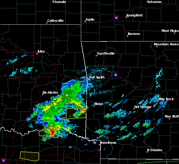 At 354 pm cdt, a severe thunderstorm was located 10 miles north of blossom, or 11 miles northeast of paris, moving east at 50 mph (radar indicated). Hazards include 60 mph wind gusts and quarter size hail. Hail damage to vehicles is expected. expect wind damage to roofs, siding, and trees. This severe thunderstorm will remain over mainly rural areas of northeastern lamar county, but will affect the community of novice. At 354 pm cdt, a severe thunderstorm was located 10 miles north of blossom, or 11 miles northeast of paris, moving east at 50 mph (radar indicated). Hazards include 60 mph wind gusts and quarter size hail. Hail damage to vehicles is expected. expect wind damage to roofs, siding, and trees. This severe thunderstorm will remain over mainly rural areas of northeastern lamar county, but will affect the community of novice.
|
| 4/11/2016 3:53 PM CDT | Quarter sized hail reported 3.6 miles NNE of Powderly, TX, quarter size hail 8-10 miles n of paris |
| 4/11/2016 3:31 PM CDT |
 At 329 pm cdt, a severe thunderstorm was located 14 miles south of soper, or 16 miles northwest of paris, moving east at 50 mph (radar indicated). Hazards include 60 mph wind gusts and half dollar size hail. Hail damage to vehicles is expected. expect wind damage to roofs, siding, and trees. Locations impacted include, pat mayse lake, paris, blossom and sun valley. At 329 pm cdt, a severe thunderstorm was located 14 miles south of soper, or 16 miles northwest of paris, moving east at 50 mph (radar indicated). Hazards include 60 mph wind gusts and half dollar size hail. Hail damage to vehicles is expected. expect wind damage to roofs, siding, and trees. Locations impacted include, pat mayse lake, paris, blossom and sun valley.
|
| 4/11/2016 2:58 PM CDT |
 At 257 pm cdt, a severe thunderstorm was located 17 miles north of bonham, moving east at 40 mph (radar indicated). Hazards include 60 mph wind gusts and half dollar size hail. Hail damage to vehicles is expected. expect wind damage to roofs, siding, and trees. This severe thunderstorm will remain over mainly rural areas of northeastern fannin and northern lamar counties, including the following locations: sun valley. At 257 pm cdt, a severe thunderstorm was located 17 miles north of bonham, moving east at 40 mph (radar indicated). Hazards include 60 mph wind gusts and half dollar size hail. Hail damage to vehicles is expected. expect wind damage to roofs, siding, and trees. This severe thunderstorm will remain over mainly rural areas of northeastern fannin and northern lamar counties, including the following locations: sun valley.
|
| 3/18/2016 12:51 PM CDT |
 The severe thunderstorm warning for east central lamar county will expire at 100 pm cdt, the storm which prompted the warning has moved out of the area. therefore the warning will be allowed to expire. The severe thunderstorm warning for east central lamar county will expire at 100 pm cdt, the storm which prompted the warning has moved out of the area. therefore the warning will be allowed to expire.
|
| 3/18/2016 12:41 PM CDT |
 At 1241 pm cdt, a severe thunderstorm was located over blossom, or 9 miles east of paris, moving east at 35 mph (radar indicated). Hazards include quarter size hail. Damage to vehicles is expected. Locations impacted include, paris, blossom and sun valley. At 1241 pm cdt, a severe thunderstorm was located over blossom, or 9 miles east of paris, moving east at 35 mph (radar indicated). Hazards include quarter size hail. Damage to vehicles is expected. Locations impacted include, paris, blossom and sun valley.
|
| 3/18/2016 11:24 AM CDT |
 The severe thunderstorm warning for northeastern lamar county will expire at 1130 am cdt, the storm which prompted the warning has weakened below severe limits, and has exited the warned area. therefore the warning will be allowed to expire. The severe thunderstorm warning for northeastern lamar county will expire at 1130 am cdt, the storm which prompted the warning has weakened below severe limits, and has exited the warned area. therefore the warning will be allowed to expire.
|
| 3/18/2016 11:12 AM CDT |
 At 1112 am cdt, a severe thunderstorm was located 8 miles west of manchester, or 17 miles northeast of paris, moving southeast at 30 mph (radar indicated). Hazards include quarter size hail. Damage to vehicles is expected. Locations impacted include, paris, blossom and sun valley. At 1112 am cdt, a severe thunderstorm was located 8 miles west of manchester, or 17 miles northeast of paris, moving southeast at 30 mph (radar indicated). Hazards include quarter size hail. Damage to vehicles is expected. Locations impacted include, paris, blossom and sun valley.
|
| 3/18/2016 10:45 AM CDT |
 At 1044 am cdt, a severe thunderstorm was located 7 miles southwest of sawyer, or 7 miles southeast of hugo, moving southeast at 40 mph (radar indicated). Hazards include quarter size hail. damage to vehicles is expected At 1044 am cdt, a severe thunderstorm was located 7 miles southwest of sawyer, or 7 miles southeast of hugo, moving southeast at 40 mph (radar indicated). Hazards include quarter size hail. damage to vehicles is expected
|
| 3/17/2016 8:39 AM CDT |
 At 839 am cdt, a severe thunderstorm was located 11 miles north of blossom, or 11 miles northeast of paris, moving east at 40 mph (radar indicated). Hazards include 60 mph wind gusts and quarter size hail. Hail damage to vehicles is expected. Expect wind damage to roofs, siding, and trees. At 839 am cdt, a severe thunderstorm was located 11 miles north of blossom, or 11 miles northeast of paris, moving east at 40 mph (radar indicated). Hazards include 60 mph wind gusts and quarter size hail. Hail damage to vehicles is expected. Expect wind damage to roofs, siding, and trees.
|
| 3/8/2016 10:43 AM CST |
 At 1043 am cst, a severe thunderstorm was located 7 miles northwest of paris, moving northeast at 45 mph (radar indicated). Hazards include 60 mph wind gusts. Expect damage to roofs. siding. and trees. This severe thunderstorm will remain over mainly rural areas of lamar county, including the following locations: sun valley, roxton and toco. At 1043 am cst, a severe thunderstorm was located 7 miles northwest of paris, moving northeast at 45 mph (radar indicated). Hazards include 60 mph wind gusts. Expect damage to roofs. siding. and trees. This severe thunderstorm will remain over mainly rural areas of lamar county, including the following locations: sun valley, roxton and toco.
|
| 3/8/2016 10:18 AM CST |
 At 1017 am cst, a severe thunderstorm was located near honey grove, or 20 miles west of paris, moving northeast at 50 mph (radar indicated). Hazards include 60 mph wind gusts. Expect damage to roofs. siding. and trees. this severe thunderstorm will be near, paris and reno around 1040 am cst. Other locations impacted by this severe thunderstorm include sun valley, toco and roxton. At 1017 am cst, a severe thunderstorm was located near honey grove, or 20 miles west of paris, moving northeast at 50 mph (radar indicated). Hazards include 60 mph wind gusts. Expect damage to roofs. siding. and trees. this severe thunderstorm will be near, paris and reno around 1040 am cst. Other locations impacted by this severe thunderstorm include sun valley, toco and roxton.
|
| 12/23/2015 4:56 AM CST |
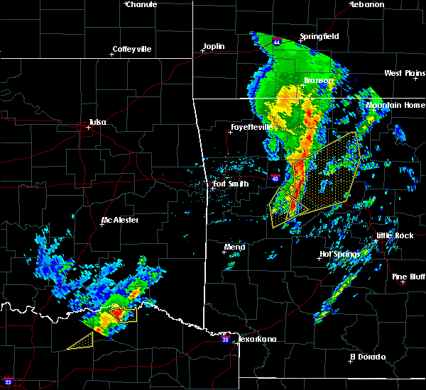 At 456 am cst, a severe thunderstorm was located 10 miles south of goodland, or 11 miles north of paris, moving northeast at 60 mph (radar indicated). Hazards include 60 mph wind gusts and quarter size hail. Hail damage to vehicles is expected. Expect wind damage to roofs, siding and trees. At 456 am cst, a severe thunderstorm was located 10 miles south of goodland, or 11 miles north of paris, moving northeast at 60 mph (radar indicated). Hazards include 60 mph wind gusts and quarter size hail. Hail damage to vehicles is expected. Expect wind damage to roofs, siding and trees.
|
| 11/17/2015 5:27 AM CST |
 At 525 am cst, severe thunderstorms were located along a line extending from 14 miles north of honey grove to 6 miles southeast of wolfe city, moving east at 35 mph (radar indicated. this storm has produced wind damage). Hazards include 60 mph wind gusts and penny size hail. Expect damage to roofs. Siding and trees. At 525 am cst, severe thunderstorms were located along a line extending from 14 miles north of honey grove to 6 miles southeast of wolfe city, moving east at 35 mph (radar indicated. this storm has produced wind damage). Hazards include 60 mph wind gusts and penny size hail. Expect damage to roofs. Siding and trees.
|
| 5/9/2015 2:20 PM CDT | Golf Ball sized hail reported 6 miles E of Powderly, TX, delayed report of hail up to the size of golf balls near lamar point near pat mayse lake |
| 5/9/2015 2:14 PM CDT | At 212 pm cdt, a severe thunderstorm was located 8 miles west of paris, moving east at 40 mph (radar indicated). Hazards include 60 mph wind gusts and half dollar size hail. Hail damage to vehicles is expected. expect wind damage to roofs, siding and trees. this severe storm will be near, toco around 220 pm cdt. paris around 225 pm cdt. 1. 25in. |
| 5/9/2015 1:49 PM CDT | At 149 pm cdt, a severe thunderstorm was located over honey grove, or 17 miles east of bonham, moving northeast at 25 mph (radar indicated). Hazards include 65 mph wind gusts and quarter size hail. Hail damage to vehicles is expected. expect wind damage to roofs, siding and trees. this severe thunderstorm will be near, toco around 240 pm cdt. a tornado watch remains in effect until 900 pm cdt for north central texas. 1. 00in. |
| 3/25/2015 7:54 AM CDT | The national weather service in fort worth has issued a * severe thunderstorm warning for. eastern lamar county in northeastern texas. until 830 am cdt * at 753 am cdt. Doppler radar indicated a severe thunderstorm capable of producing half dollar size hail and damaging winds in. |
| 4/19/2011 7:01 PM CDT | Ping Pong Ball sized hail reported 1.6 miles NE of Powderly, TX, 1.50 inch hail reported in powderly |
| 4/19/2011 6:28 PM CDT | Golf Ball sized hail reported 4.8 miles NE of Powderly, TX |
| 4/19/2011 6:24 PM CDT | Golf Ball sized hail reported 1.6 miles NE of Powderly, TX, golfball size hail reported in powderly |
| 1/1/0001 12:00 AM | Golf Ball sized hail reported 5.7 miles SE of Powderly, TX |
Hail Maps for Powderly, TX


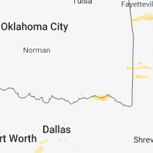


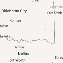


Connect with Interactive Hail Maps