

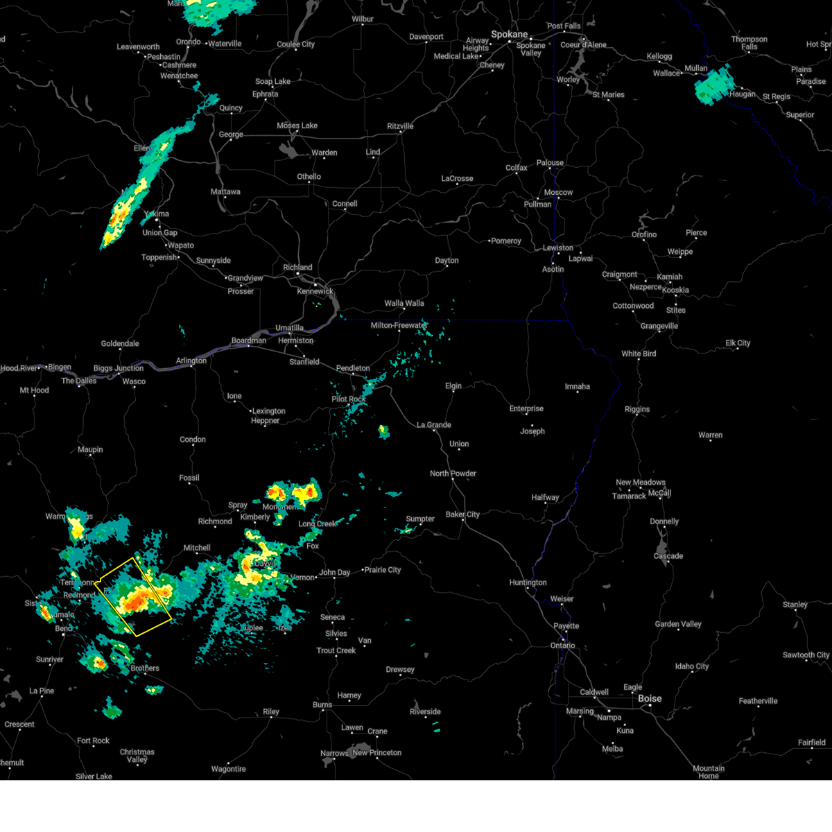
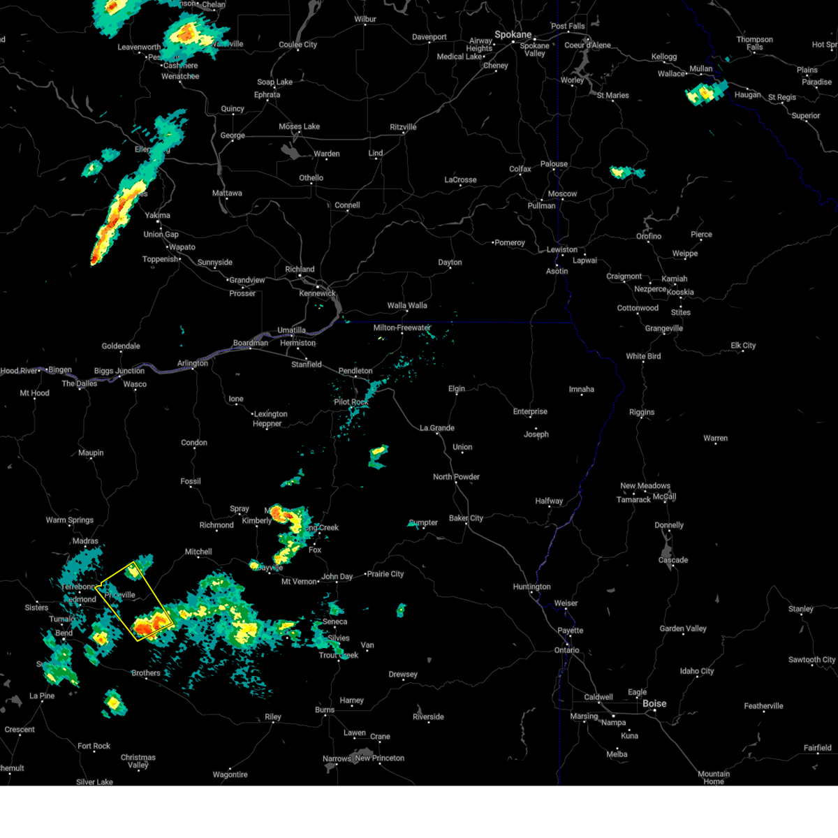
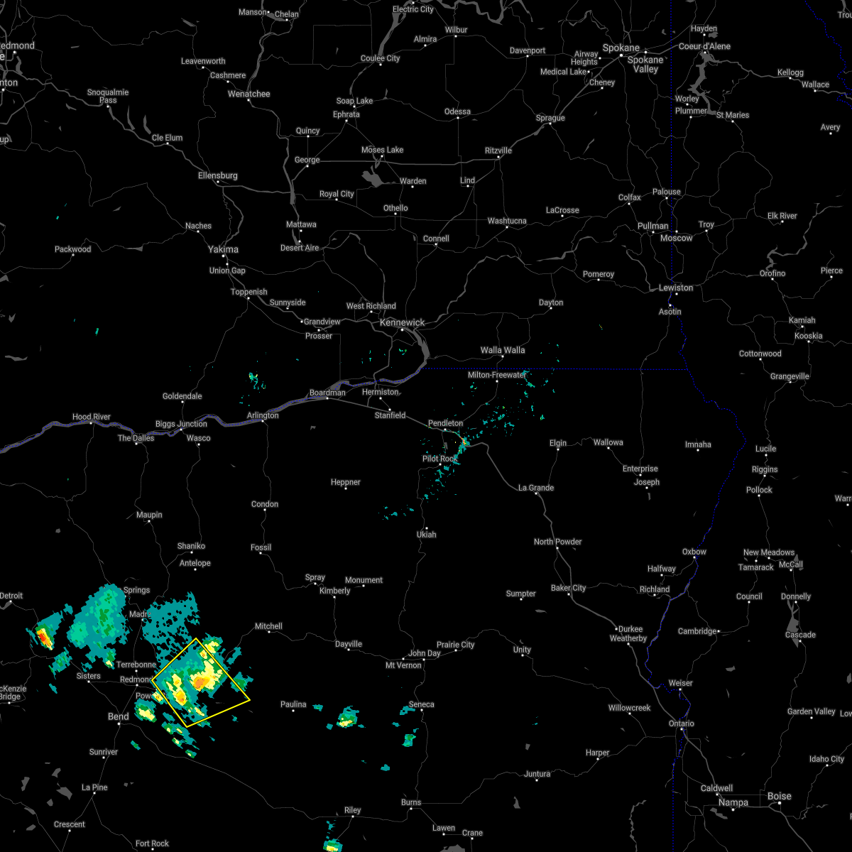
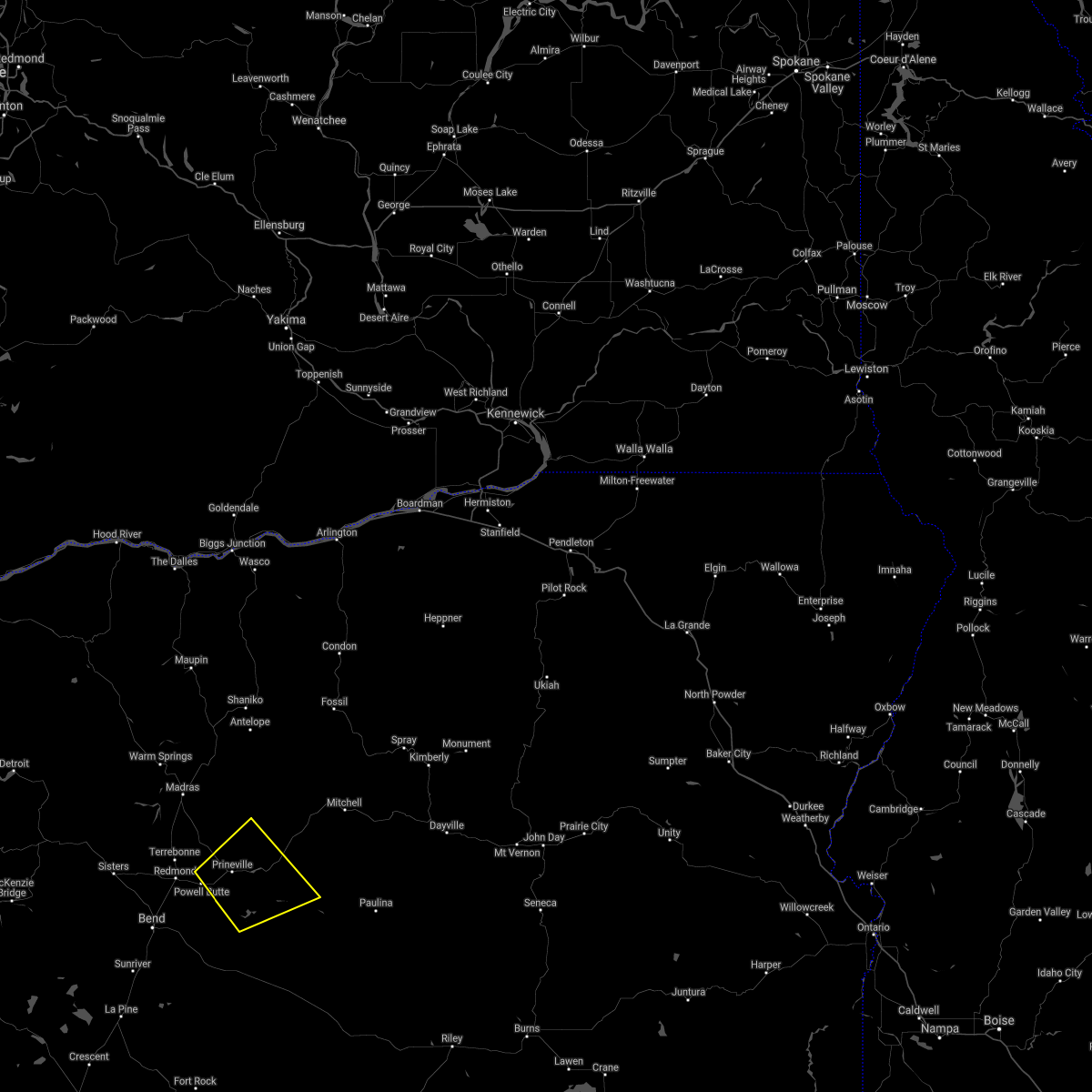
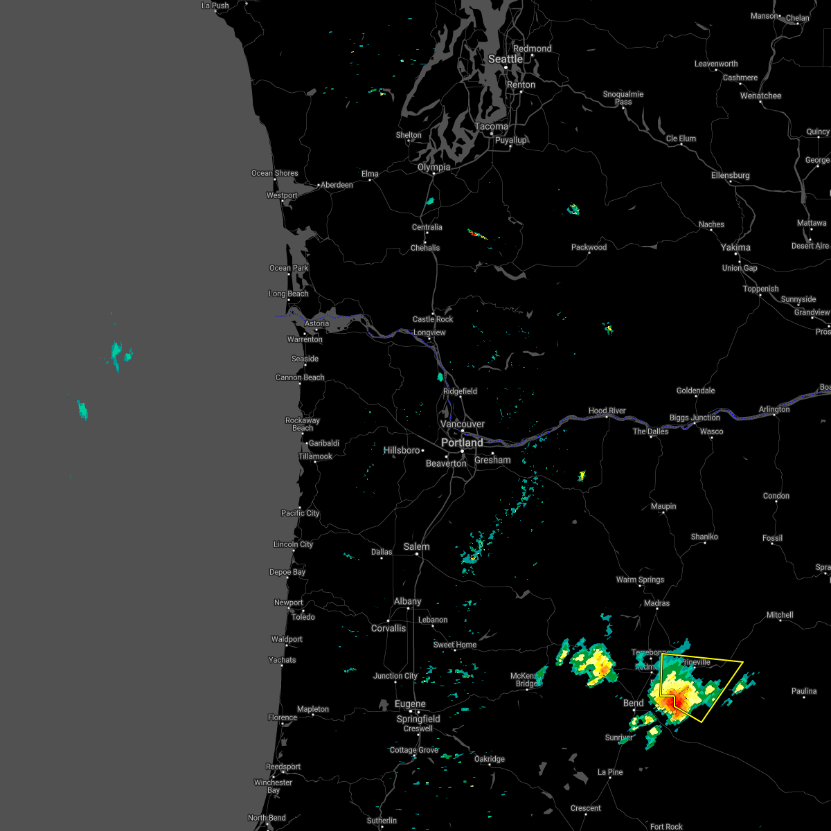
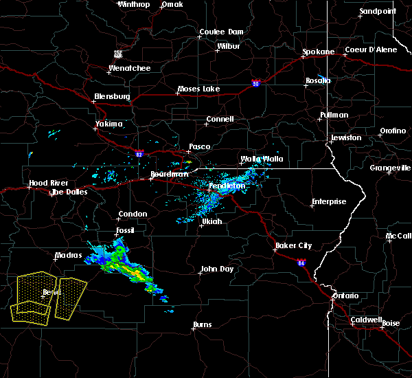
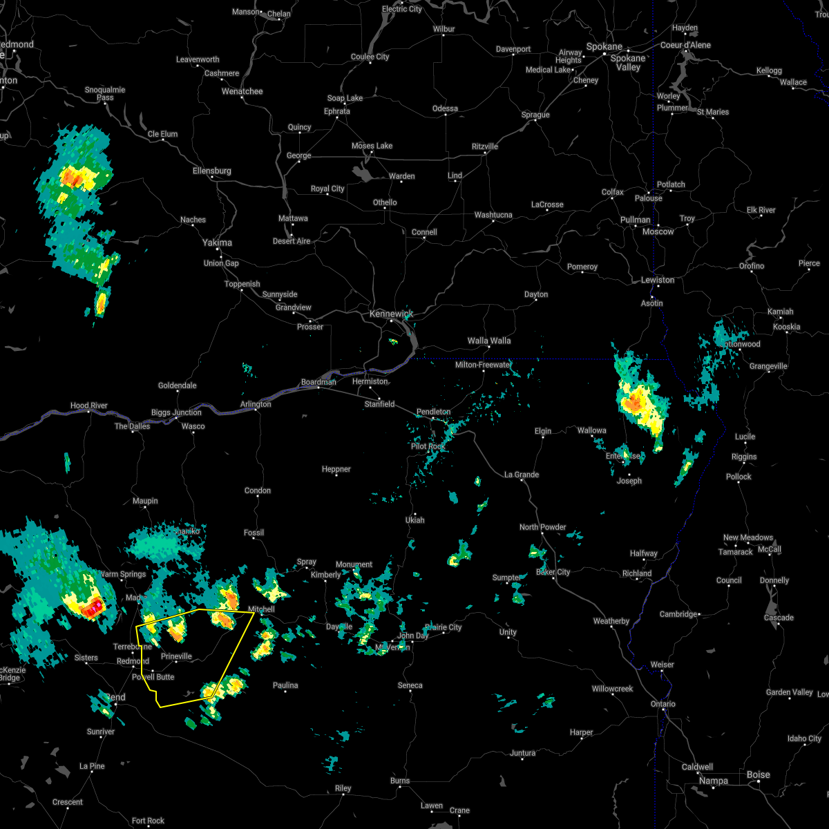
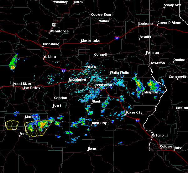
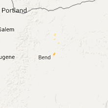
Hail Map for Prineville, OR
The Prineville, OR area has had 6 reports of on-the-ground hail by trained spotters, and has been under severe weather warnings 0 times during the past 12 months. Doppler radar has detected hail at or near Prineville, OR on 5 occasions, including 1 occasion during the past year.
| Name: | Prineville, OR |
| Where Located: | 0.4 miles WNW of Bend, OR |
| Map: | Google Map for Prineville, OR |
| Population: | 9253 |
| Housing Units: | 4181 |
| More Info: | Search Google for Prineville, OR |
1
The Top Recent Hail Date for Prineville, OR is Sunday, August 4, 2024 (3rd out of 5)

Hail and Wind Damage Spotted near Prineville, OR
| Date / Time | Report Details |
|---|---|
| 7/16/2024 8:05 PM PDT | Spotter reported 4 large trees down... with gusts estimated up to 55mph. power was also reported to have gone out around 1950 pd in crook county OR, 3.1 miles SW of Prineville, OR |
| 5/20/2023 6:47 PM PDT |
 At 646 pm pdt, a severe thunderstorm was located 10 miles north of ritter, or 27 miles southeast of heppner, and is nearly stationary (radar indicated). Hazards include quarter size hail. Damage to vehicles is expected. locations impacted include, prineville and post. hail threat, radar indicated max hail size, 1. 00 in wind threat, radar indicated max wind gust, <50 mph. At 646 pm pdt, a severe thunderstorm was located 10 miles north of ritter, or 27 miles southeast of heppner, and is nearly stationary (radar indicated). Hazards include quarter size hail. Damage to vehicles is expected. locations impacted include, prineville and post. hail threat, radar indicated max hail size, 1. 00 in wind threat, radar indicated max wind gust, <50 mph.
|
| 5/20/2023 6:10 PM PDT |
 At 609 pm pdt, a severe thunderstorm was located 10 miles west of post, or 12 miles southeast of prineville, moving northwest at 30 mph (radar indicated). Hazards include 60 mph wind gusts and quarter size hail. Hail damage to vehicles is expected. Expect wind damage to roofs, siding, and trees. At 609 pm pdt, a severe thunderstorm was located 10 miles west of post, or 12 miles southeast of prineville, moving northwest at 30 mph (radar indicated). Hazards include 60 mph wind gusts and quarter size hail. Hail damage to vehicles is expected. Expect wind damage to roofs, siding, and trees.
|
| 8/2/2022 9:15 AM PDT | 6 inch diameter tree branch and limbs fallen from thunderstorm winds...occurred around 4 a in crook county OR, 2.7 miles WSW of Prineville, OR |
| 8/2/2021 2:04 PM PDT |
 At 202 pm pdt, a severe thunderstorm was located 10 miles south of prineville, moving northeast at 10 mph (public). Hazards include quarter size hail and torrential rain fall have occurred. this storm is beginning to weaken. Damage to vehicles is expected. Locations impacted include, prineville and post. At 202 pm pdt, a severe thunderstorm was located 10 miles south of prineville, moving northeast at 10 mph (public). Hazards include quarter size hail and torrential rain fall have occurred. this storm is beginning to weaken. Damage to vehicles is expected. Locations impacted include, prineville and post.
|
| 8/2/2021 1:45 PM PDT |
 At 145 pm pdt, a severe thunderstorm was located 7 miles northeast of alfalfa, or 12 miles south of prineville, moving northeast at 10 mph (public). Hazards include quarter size hail. damage to vehicles is expected At 145 pm pdt, a severe thunderstorm was located 7 miles northeast of alfalfa, or 12 miles south of prineville, moving northeast at 10 mph (public). Hazards include quarter size hail. damage to vehicles is expected
|
| 8/2/2021 1:21 PM PDT |
 At 120 pm pdt, a severe thunderstorm was located near alfalfa, or 14 miles south of prineville, moving northeast at 10 mph (radar indicated). Hazards include quarter size hail. damage to vehicles is expected At 120 pm pdt, a severe thunderstorm was located near alfalfa, or 14 miles south of prineville, moving northeast at 10 mph (radar indicated). Hazards include quarter size hail. damage to vehicles is expected
|
| 6/23/2021 6:42 PM PDT |
 The severe thunderstorm warning for southwestern jefferson, west central crook and north central deschutes counties will expire at 645 pm pdt, the severe thunderstorm which prompted the warning has weakened and moved out of the warned area. therefore, the warning will be allowed to expire. The severe thunderstorm warning for southwestern jefferson, west central crook and north central deschutes counties will expire at 645 pm pdt, the severe thunderstorm which prompted the warning has weakened and moved out of the warned area. therefore, the warning will be allowed to expire.
|
| 6/23/2021 6:19 PM PDT |
 At 618 pm pdt, a severe thunderstorm was located near redmond, moving northeast at 10 mph (radar indicated). Hazards include 60 mph wind gusts and quarter size hail. Hail damage to vehicles is expected. expect wind damage to roofs, siding, and trees. Locations impacted include, bend, redmond, prineville, culver, tumalo, terrebonne, powell butte and deschutes river woods. At 618 pm pdt, a severe thunderstorm was located near redmond, moving northeast at 10 mph (radar indicated). Hazards include 60 mph wind gusts and quarter size hail. Hail damage to vehicles is expected. expect wind damage to roofs, siding, and trees. Locations impacted include, bend, redmond, prineville, culver, tumalo, terrebonne, powell butte and deschutes river woods.
|
| 6/23/2021 5:56 PM PDT |
 At 556 pm pdt, a severe thunderstorm was located near tumalo, or 8 miles north of bend, moving northeast at 10 mph (radar indicated). Hazards include 60 mph wind gusts and quarter size hail. Hail damage to vehicles is expected. Expect wind damage to roofs, siding, and trees. At 556 pm pdt, a severe thunderstorm was located near tumalo, or 8 miles north of bend, moving northeast at 10 mph (radar indicated). Hazards include 60 mph wind gusts and quarter size hail. Hail damage to vehicles is expected. Expect wind damage to roofs, siding, and trees.
|
| 5/30/2020 2:40 PM PDT | 30 foot tree blown down in crook county OR, 0.6 miles WSW of Prineville, OR |
| 5/30/2020 2:34 PM PDT |
 At 233 pm pdt, a severe thunderstorm was located 8 miles southeast of prineville, moving north at 35 mph (radar indicated). Hazards include 60 mph wind gusts and half dollar size hail. Hail damage to vehicles is expected. Expect wind damage to roofs, siding, and trees. At 233 pm pdt, a severe thunderstorm was located 8 miles southeast of prineville, moving north at 35 mph (radar indicated). Hazards include 60 mph wind gusts and half dollar size hail. Hail damage to vehicles is expected. Expect wind damage to roofs, siding, and trees.
|
| 5/30/2020 2:27 PM PDT | Quarter sized hail reported 5.7 miles NW of Prineville, OR, time estimated by radar |
| 5/30/2020 1:51 PM PDT |
 At 151 pm pdt, a severe thunderstorm was located near millican, or 22 miles southeast of bend, moving north at 45 mph (radar indicated). Hazards include 60 mph wind gusts and quarter size hail. Hail damage to vehicles is expected. Expect wind damage to roofs, siding, and trees. At 151 pm pdt, a severe thunderstorm was located near millican, or 22 miles southeast of bend, moving north at 45 mph (radar indicated). Hazards include 60 mph wind gusts and quarter size hail. Hail damage to vehicles is expected. Expect wind damage to roofs, siding, and trees.
|
| 8/9/2019 5:13 PM PDT |
 The severe thunderstorm warning for southwestern wheeler, northwestern crook and southeastern jefferson counties will expire at 515 pm pdt, the severe thunderstorm which prompted the warning has weakened and moved out of the warned area. therefore, the warning will be allowed to expire. a severe thunderstorm watch remains in effect until 1000 pm pdt for central and northeastern oregon. The severe thunderstorm warning for southwestern wheeler, northwestern crook and southeastern jefferson counties will expire at 515 pm pdt, the severe thunderstorm which prompted the warning has weakened and moved out of the warned area. therefore, the warning will be allowed to expire. a severe thunderstorm watch remains in effect until 1000 pm pdt for central and northeastern oregon.
|
| 8/9/2019 4:36 PM PDT |
 At 435 pm pdt, a severe thunderstorm was located 19 miles northeast of prineville, moving northeast at 20 mph (radar indicated). Hazards include 60 mph wind gusts and quarter size hail. Hail damage to vehicles is expected. expect wind damage to roofs, siding, and trees. Locations impacted include, prineville, grizzly and powell butte. At 435 pm pdt, a severe thunderstorm was located 19 miles northeast of prineville, moving northeast at 20 mph (radar indicated). Hazards include 60 mph wind gusts and quarter size hail. Hail damage to vehicles is expected. expect wind damage to roofs, siding, and trees. Locations impacted include, prineville, grizzly and powell butte.
|
| 8/9/2019 4:24 PM PDT |
 At 423 pm pdt, a severe thunderstorm was located 14 miles northeast of prineville, moving northeast at 35 mph (radar indicated). Hazards include 60 mph wind gusts and quarter size hail. Hail damage to vehicles is expected. Expect wind damage to roofs, siding, and trees. At 423 pm pdt, a severe thunderstorm was located 14 miles northeast of prineville, moving northeast at 35 mph (radar indicated). Hazards include 60 mph wind gusts and quarter size hail. Hail damage to vehicles is expected. Expect wind damage to roofs, siding, and trees.
|
| 8/8/2019 5:40 PM PDT |
 The severe thunderstorm warning for northwestern crook, south central jefferson and north central deschutes counties will expire at 545 pm pdt, the storm which prompted the warning has weakened below severe limits, and no longer poses an immediate threat to life or property. therefore, the warning will be allowed to expire. The severe thunderstorm warning for northwestern crook, south central jefferson and north central deschutes counties will expire at 545 pm pdt, the storm which prompted the warning has weakened below severe limits, and no longer poses an immediate threat to life or property. therefore, the warning will be allowed to expire.
|
| 8/8/2019 5:23 PM PDT |
 At 522 pm pdt, a severe thunderstorm was located near terrebonne, or 9 miles northeast of redmond, moving north at 15 mph (radar indicated). Hazards include 60 mph wind gusts and quarter size hail. Hail damage to vehicles is expected. expect wind damage to roofs, siding, and trees. Locations impacted include, redmond, grizzly, terrebonne and powell butte. At 522 pm pdt, a severe thunderstorm was located near terrebonne, or 9 miles northeast of redmond, moving north at 15 mph (radar indicated). Hazards include 60 mph wind gusts and quarter size hail. Hail damage to vehicles is expected. expect wind damage to roofs, siding, and trees. Locations impacted include, redmond, grizzly, terrebonne and powell butte.
|
| 8/8/2019 5:02 PM PDT |
 The national weather service in pendleton oregon has issued a * severe thunderstorm warning for. northwestern crook county in central oregon. south central jefferson county in central oregon. north central deschutes county in central oregon. Until 545 pm pdt. The national weather service in pendleton oregon has issued a * severe thunderstorm warning for. northwestern crook county in central oregon. south central jefferson county in central oregon. north central deschutes county in central oregon. Until 545 pm pdt.
|
| 8/25/2013 2:47 PM PDT | Half Dollar sized hail reported 1.7 miles S of Prineville, OR, near intersection of hwy 26 and lone pine rd. heavy rain and 1.25 inch diameter hail covering ground. |
| 8/25/2013 2:47 PM PDT | Half Dollar sized hail reported 4.4 miles E of Prineville, OR, near intersection of hwy 26 and lone pine rd. heavy rain and 1.25 inch diameter hail covering ground. |
| 8/16/2013 6:05 PM PDT | Quarter sized hail reported 1.1 miles WSW of Prineville, OR, 1 inch |
| 8/16/2013 6:02 PM PDT | Quarter sized hail reported 0.6 miles WSW of Prineville, OR, 1 inch hail at prineville airport |
| 8/16/2013 5:56 PM PDT | Ping Pong Ball sized hail reported 6.6 miles NE of Prineville, OR |
Hail Maps for Prineville, OR


Connect with Interactive Hail Maps