

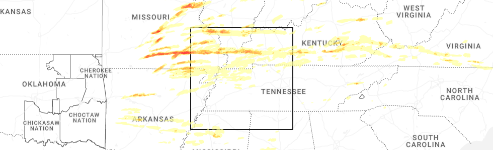
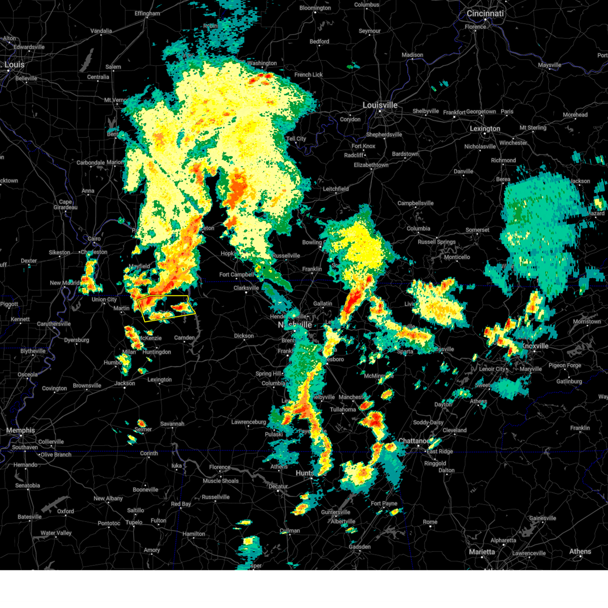
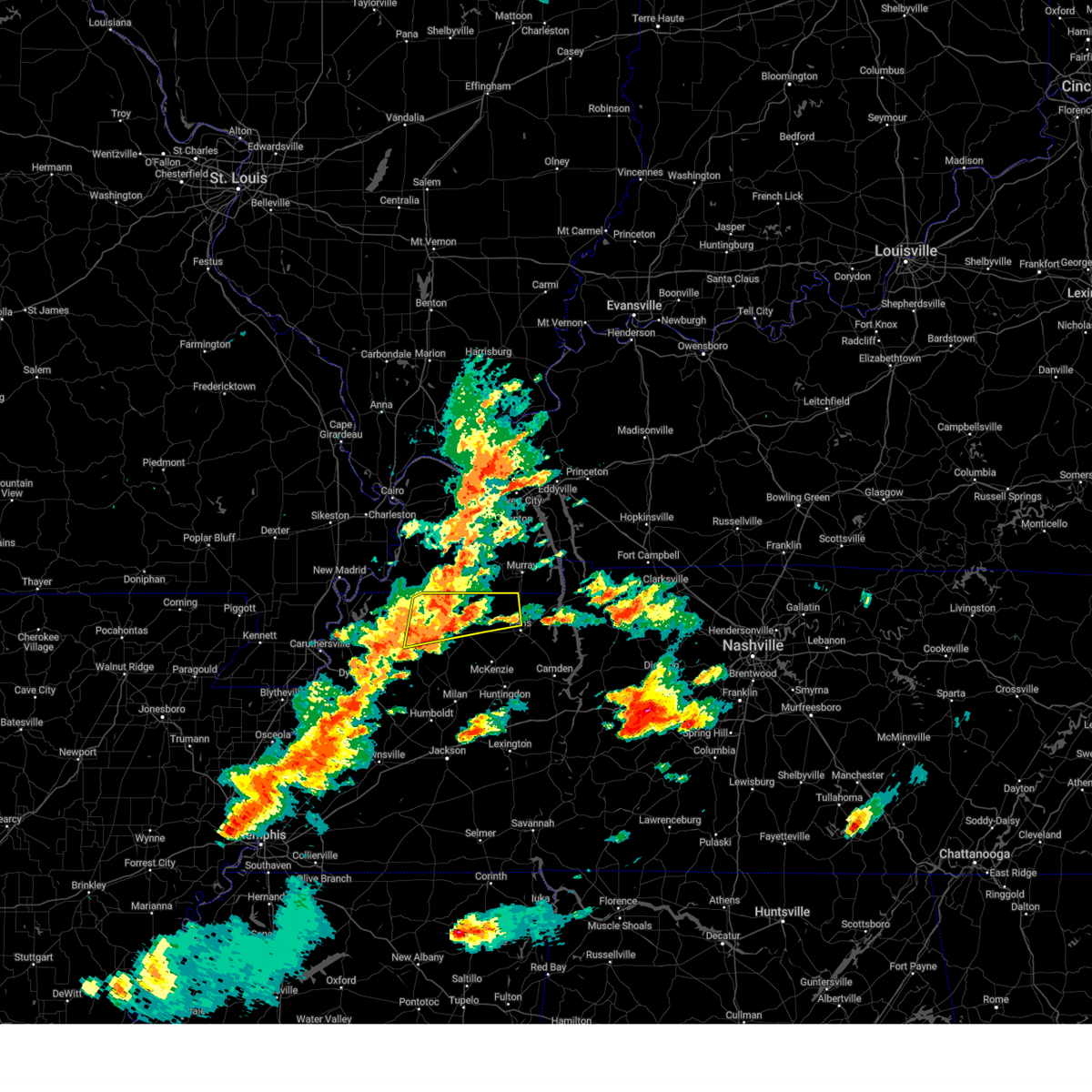
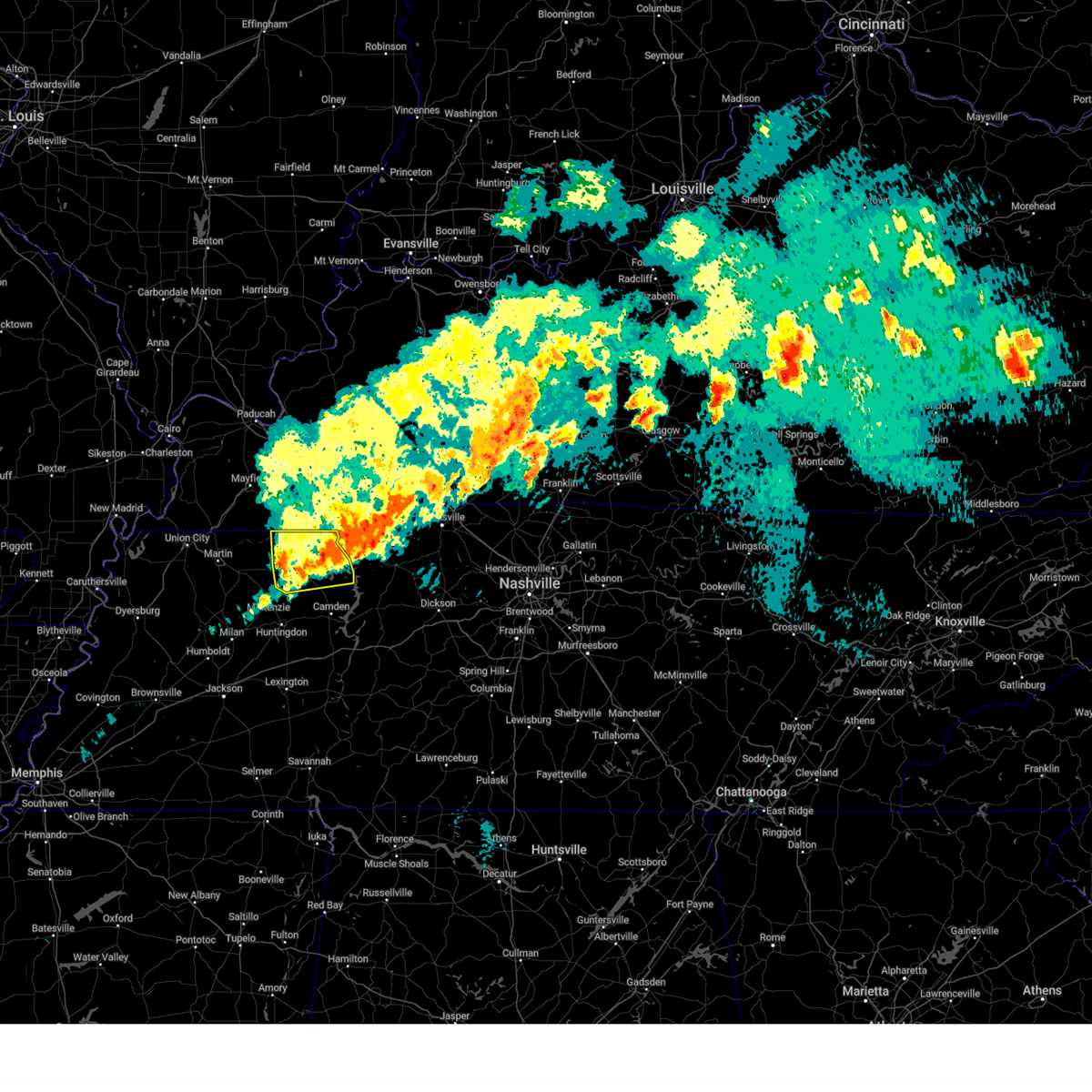
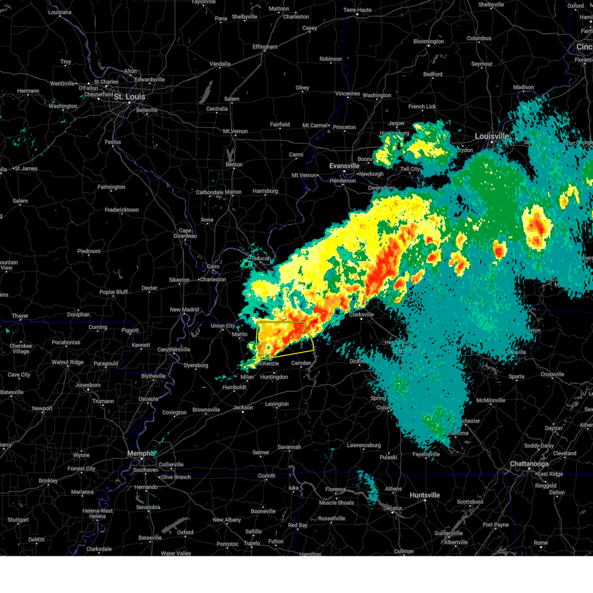
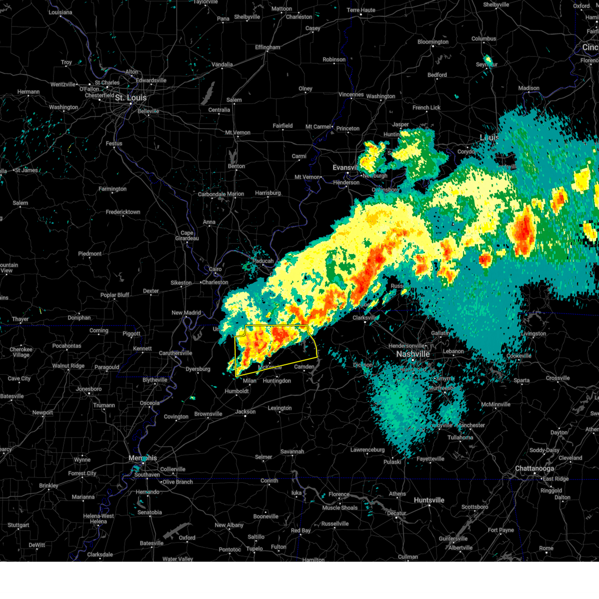
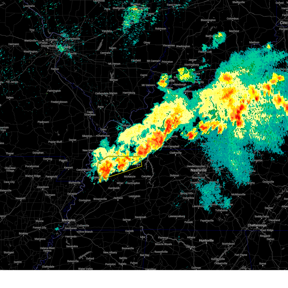
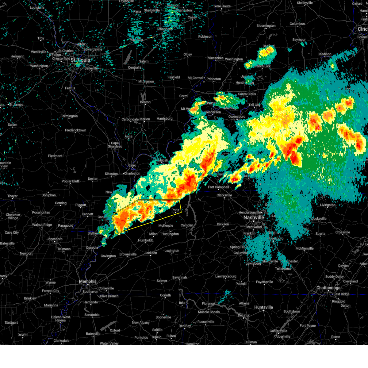
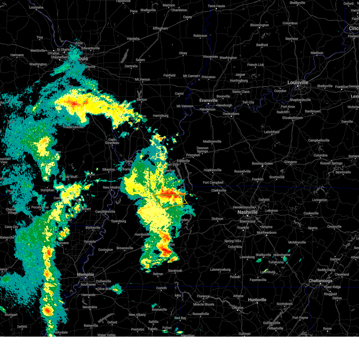
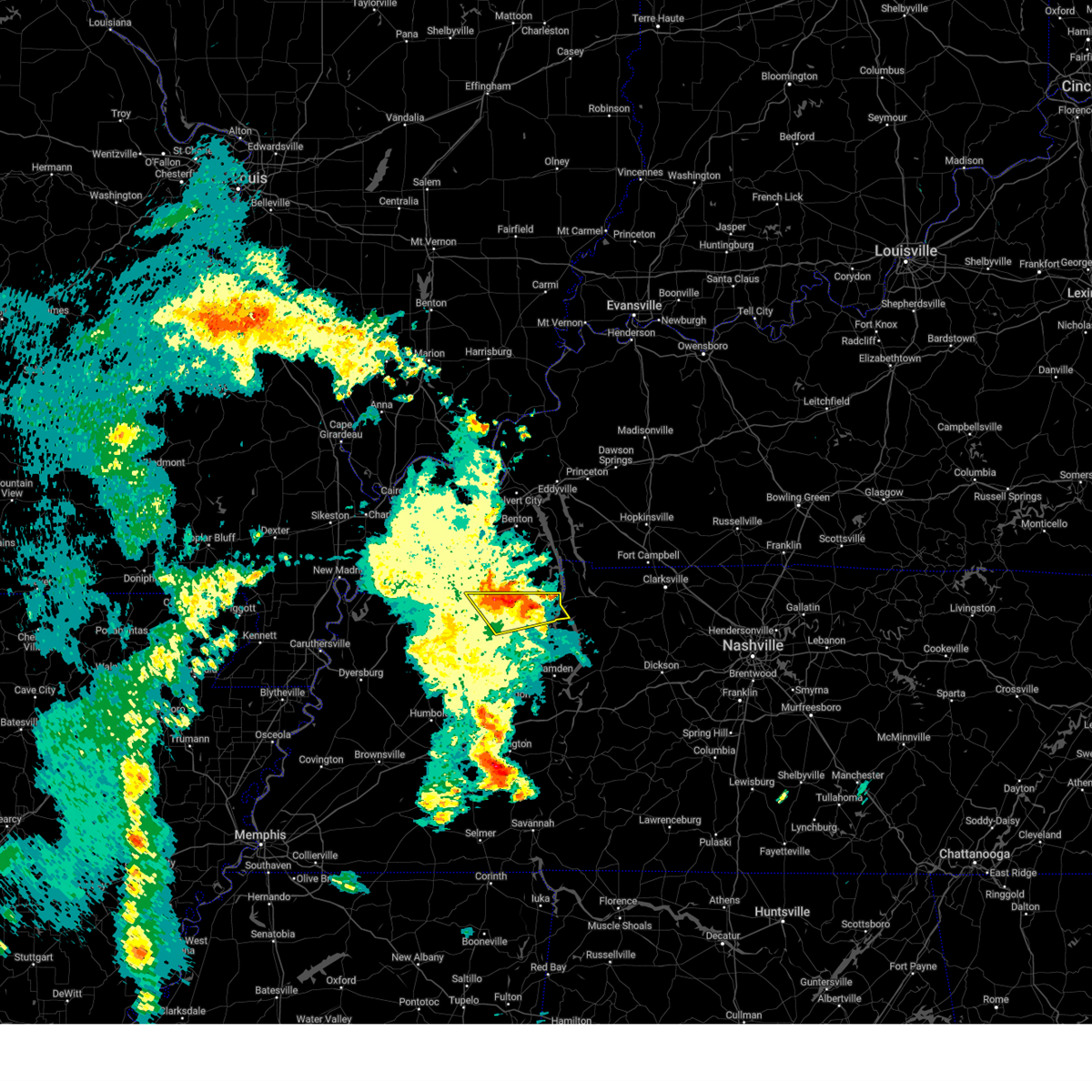
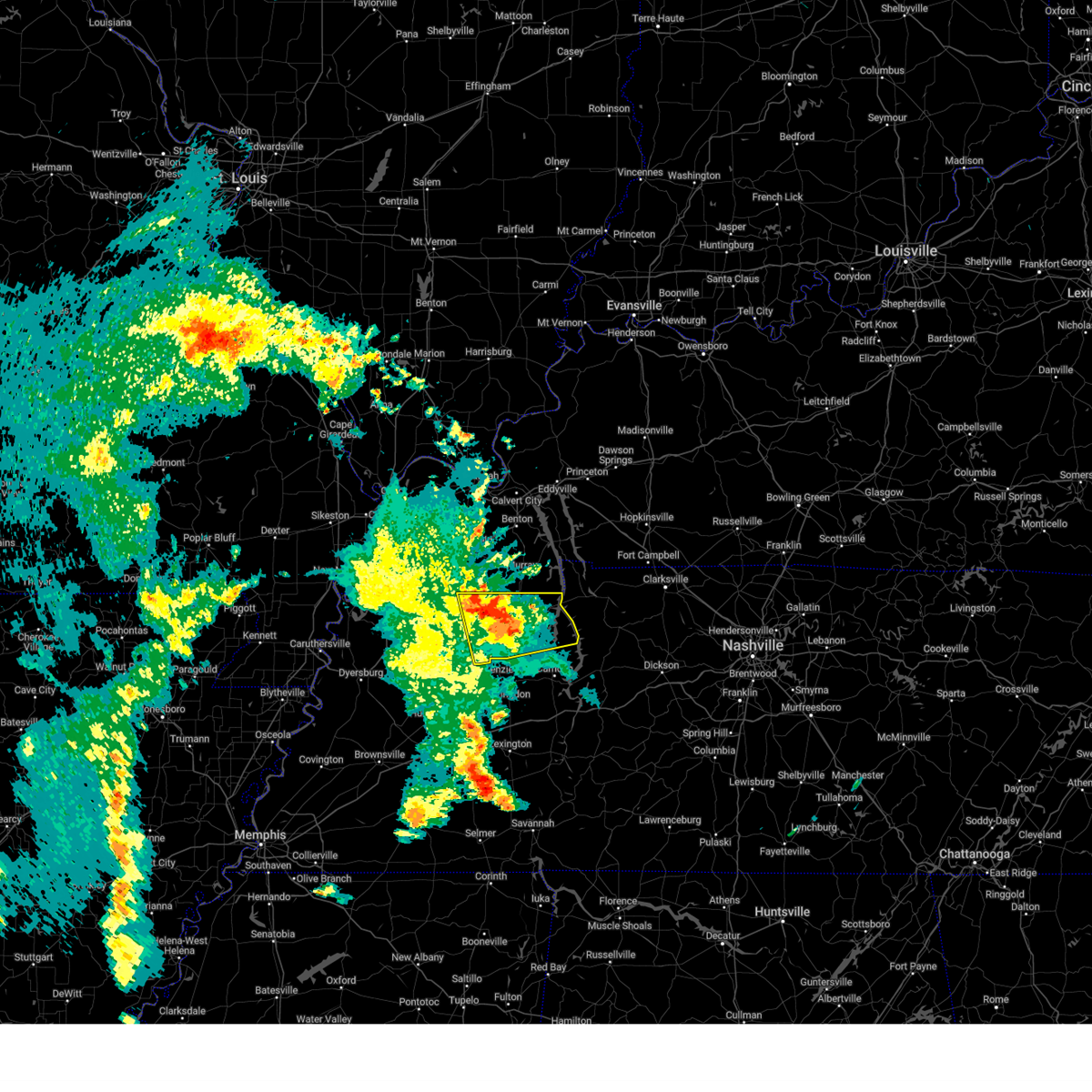
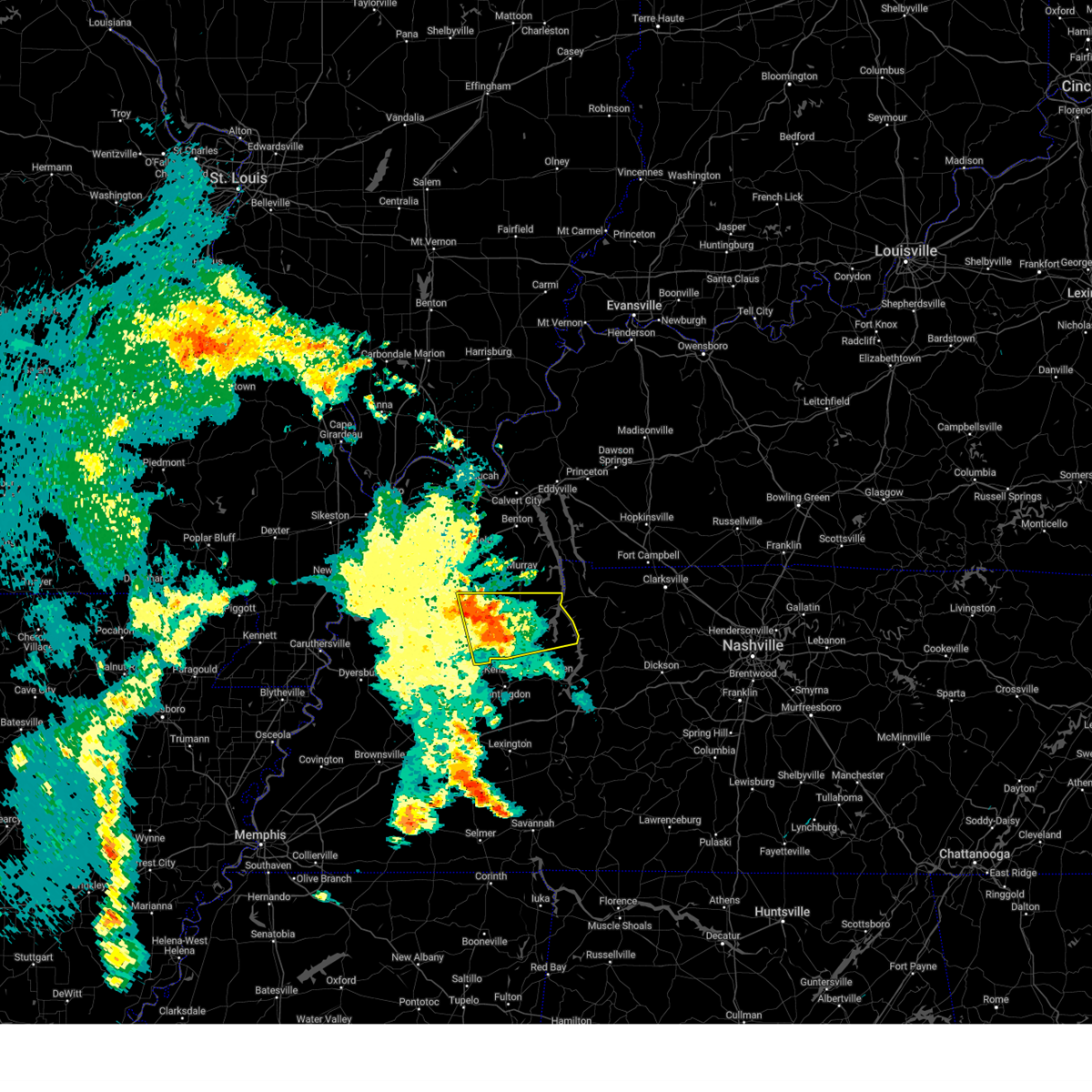
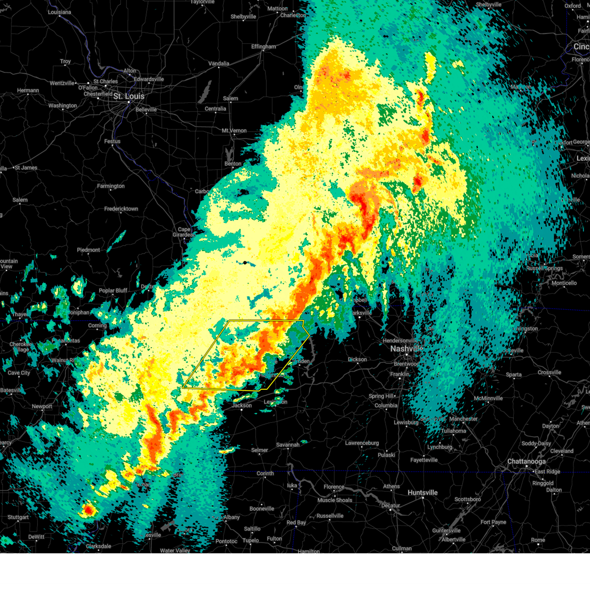
Hail Map for Puryear, TN
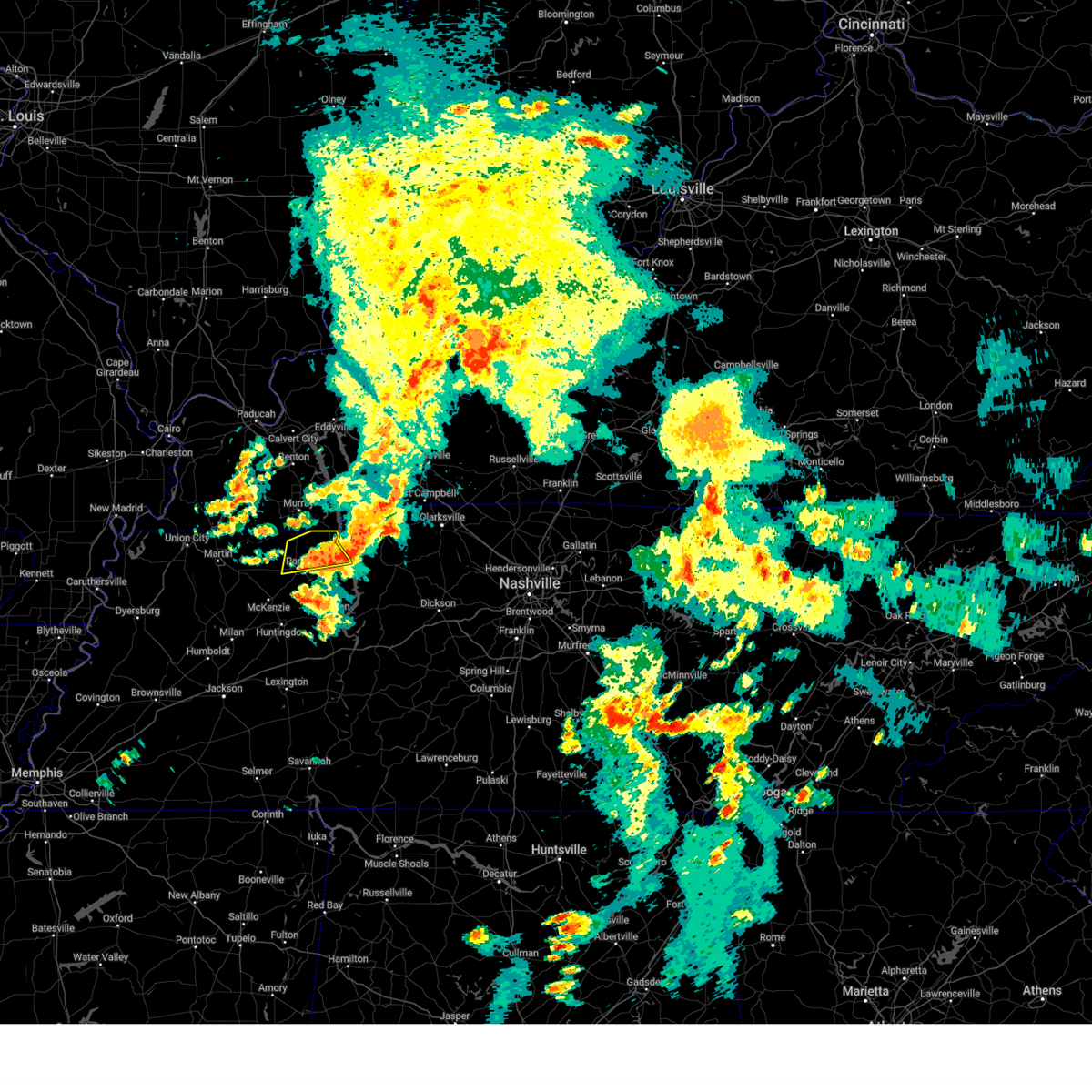
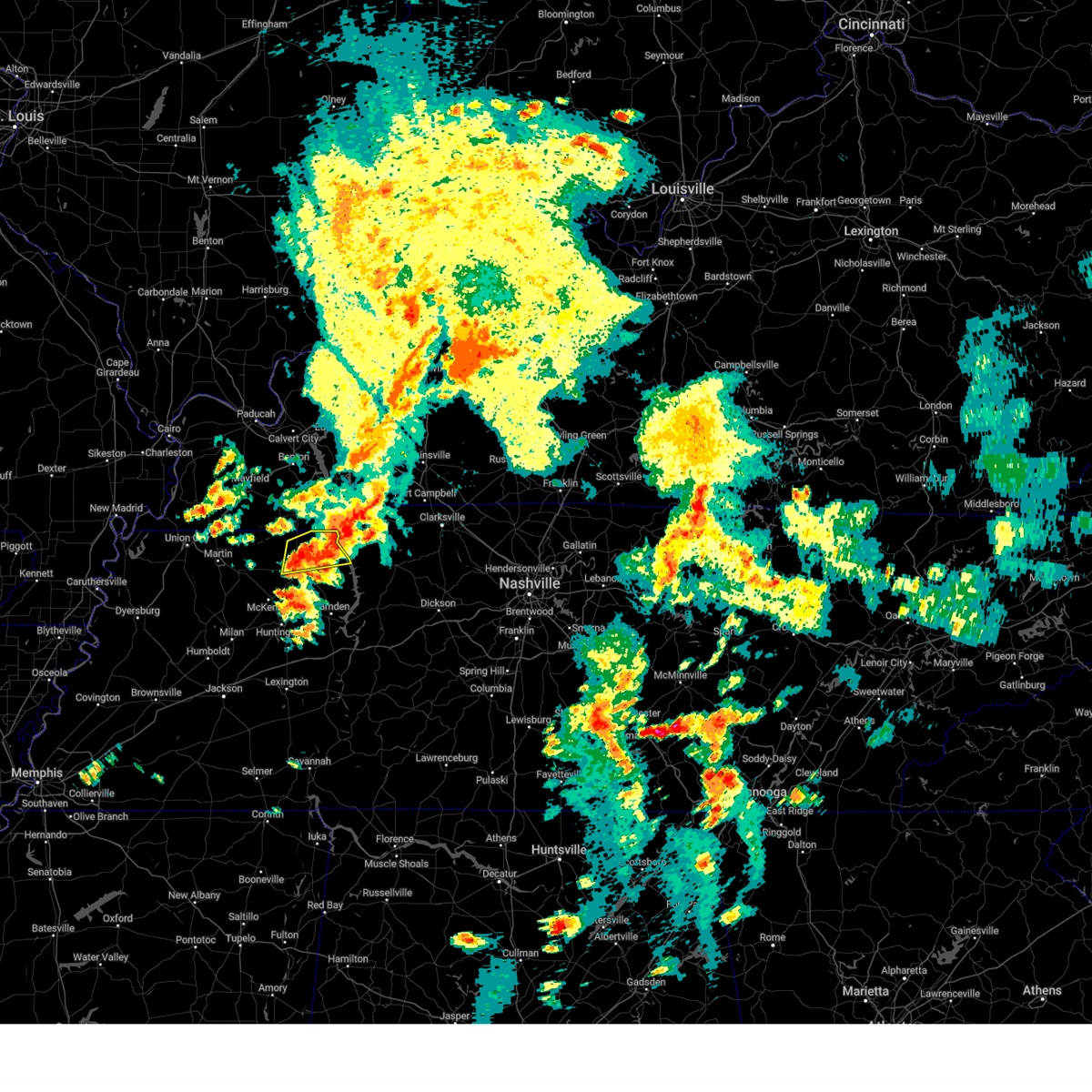
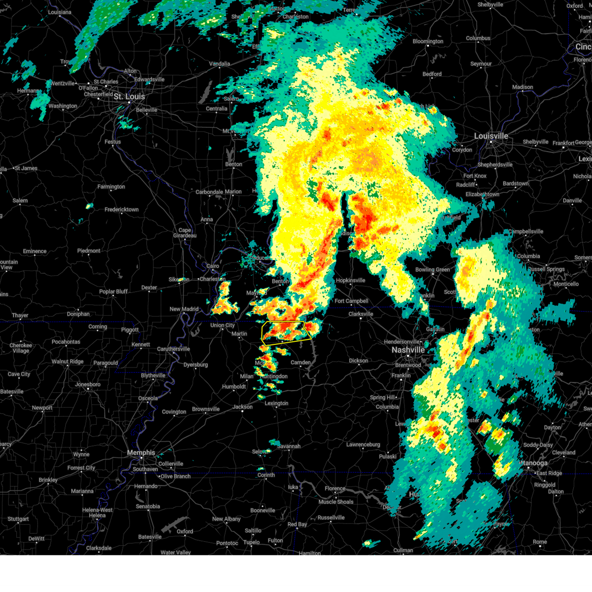
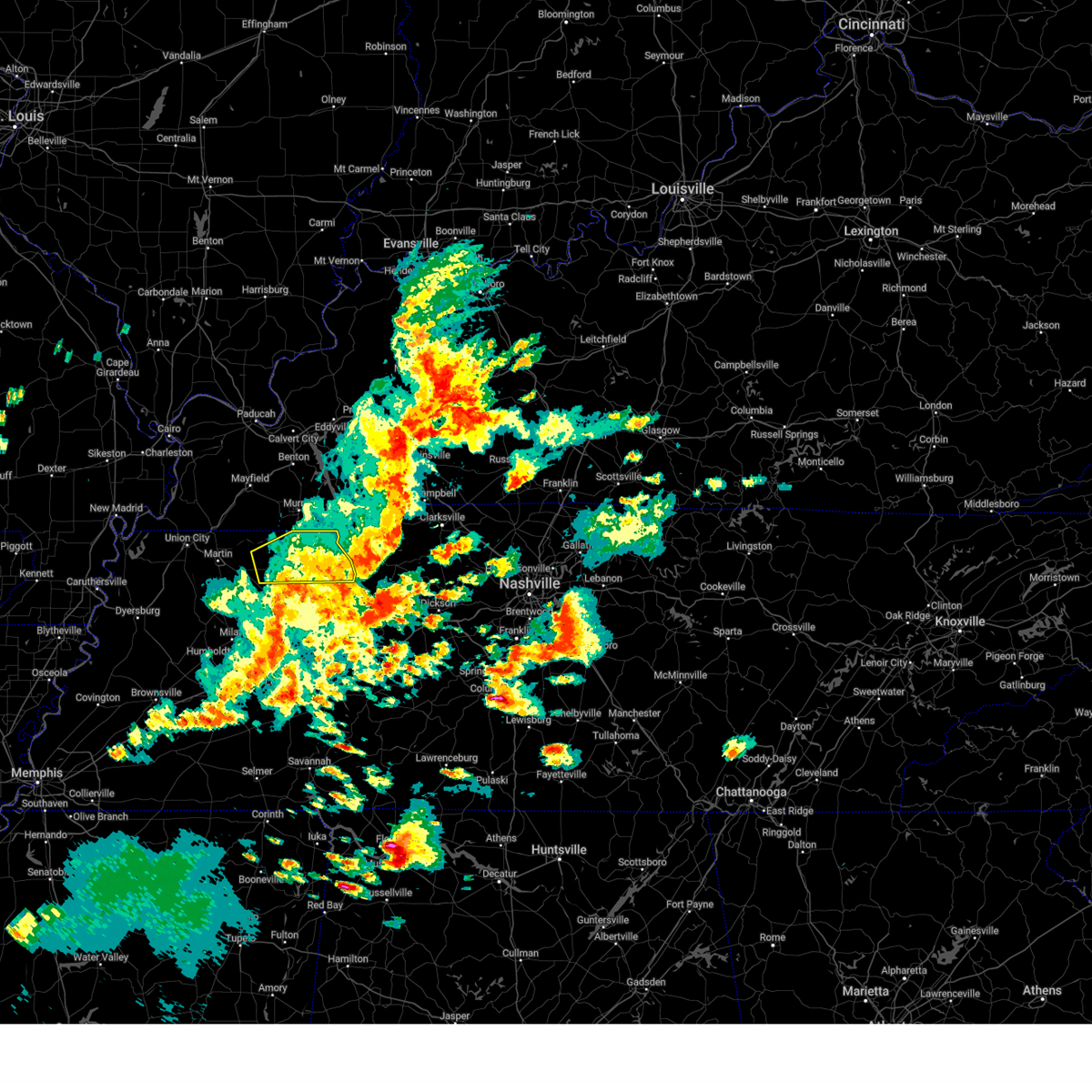
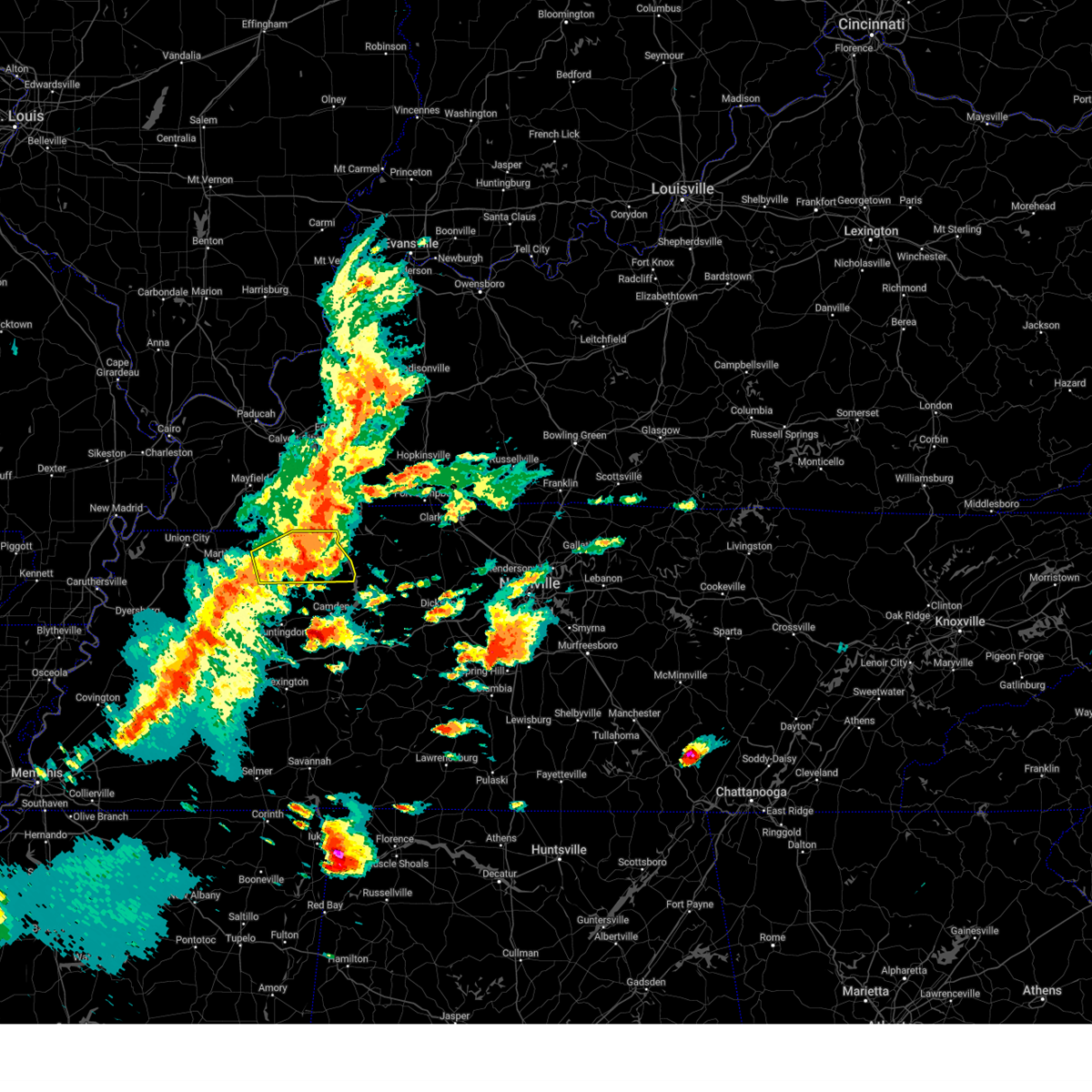
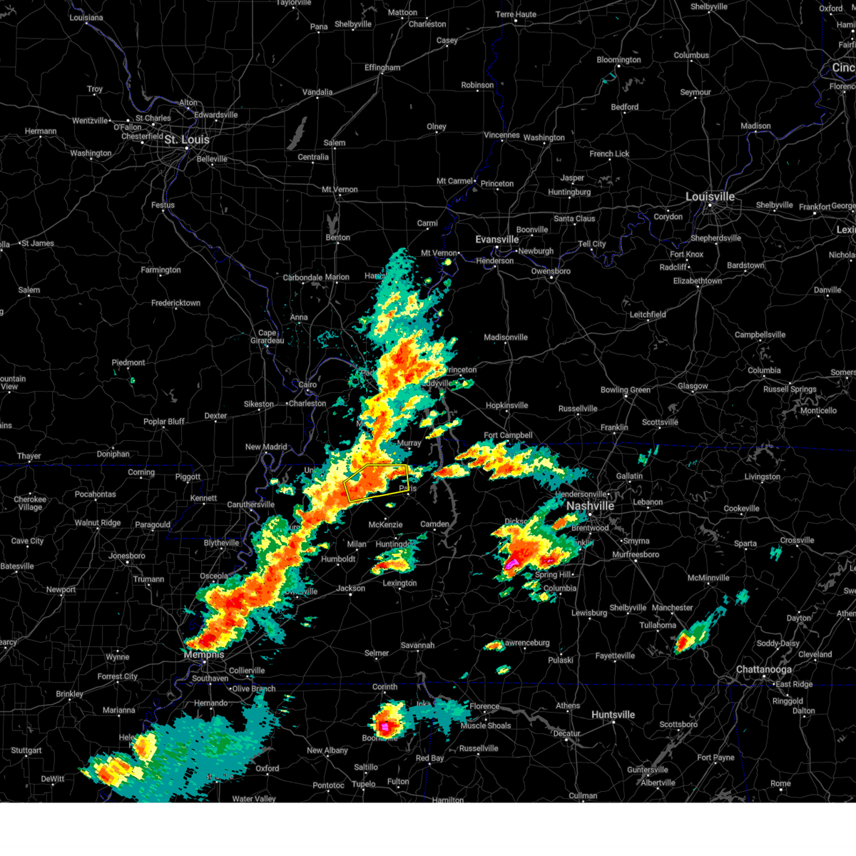
The Puryear, TN area has had 3 reports of on-the-ground hail by trained spotters, and has been under severe weather warnings 62 times during the past 12 months. Doppler radar has detected hail at or near Puryear, TN on 66 occasions, including 6 occasions during the past year.
| Name: | Puryear, TN |
| Where Located: | 23.8 miles NNE of Mc Kenzie, TN |
| Map: | Google Map for Puryear, TN |
| Population: | 671 |
| Housing Units: | 299 |
| More Info: | Search Google for Puryear, TN |
5
The Top Recent Hail Date for Puryear, TN is Friday, May 16, 2025 (14th out of 66)
Hail and Wind Damage Spotted near Puryear, TN
| Date / Time | Report Details |
|---|---|
| 6/6/2025 4:42 PM CDT |
 The storm which prompted the warning has weakened below severe limits, and has exited the warned area. therefore, the warning will be allowed to expire. however, small hail and gusty winds are still possible with this thunderstorm. a tornado watch remains in effect until 800 pm cdt for west tennessee. The storm which prompted the warning has weakened below severe limits, and has exited the warned area. therefore, the warning will be allowed to expire. however, small hail and gusty winds are still possible with this thunderstorm. a tornado watch remains in effect until 800 pm cdt for west tennessee.
|
| 6/6/2025 4:29 PM CDT |
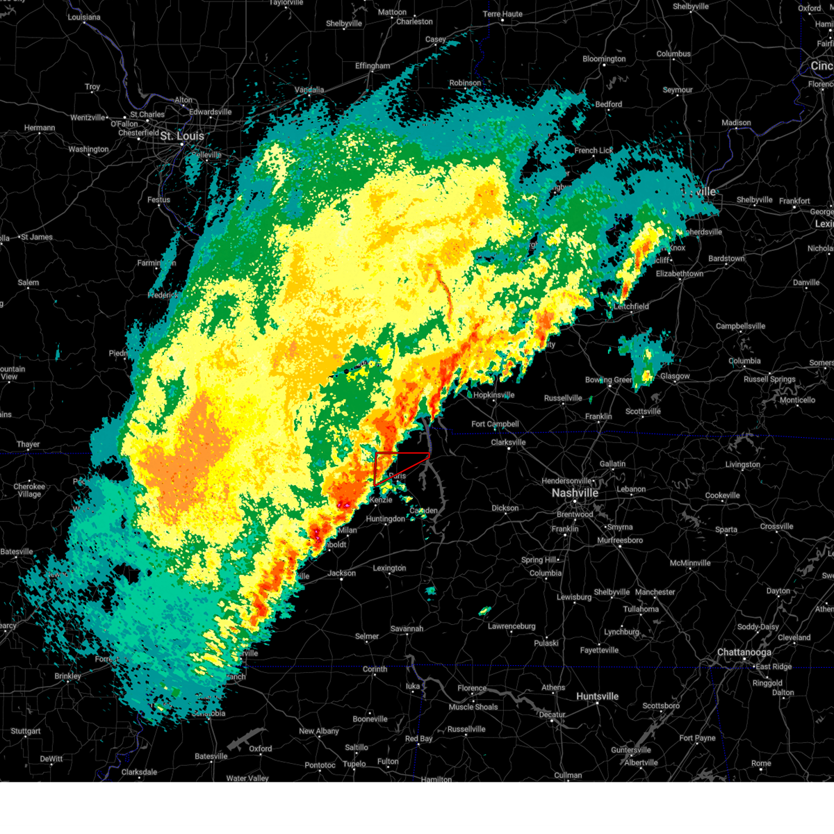
 At 429 pm cdt, a severe thunderstorm was located 7 miles northeast of paris, moving east at 40 mph (radar indicated). Hazards include 60 mph wind gusts and quarter size hail. Hail damage to vehicles is expected. expect wind damage to roofs, siding, and trees. Locations impacted include, paris, paris landing state park, puryear, foundry hill, buchanan, india, osage, sunnyside, whitlock, porter court, conyersville, pine hill, and big sandy unit tennessee national wildlife refuge. At 429 pm cdt, a severe thunderstorm was located 7 miles northeast of paris, moving east at 40 mph (radar indicated). Hazards include 60 mph wind gusts and quarter size hail. Hail damage to vehicles is expected. expect wind damage to roofs, siding, and trees. Locations impacted include, paris, paris landing state park, puryear, foundry hill, buchanan, india, osage, sunnyside, whitlock, porter court, conyersville, pine hill, and big sandy unit tennessee national wildlife refuge.
|
| 6/6/2025 4:16 PM CDT | the severe thunderstorm warning has been cancelled and is no longer in effect |
| 6/6/2025 4:16 PM CDT | At 416 pm cdt, a severe thunderstorm was located 9 miles northeast of cottage grove, or 9 miles north of paris, moving east at 45 mph (public). Hazards include ping pong ball size hail and 60 mph wind gusts. People and animals outdoors will be injured. expect hail damage to roofs, siding, windows, and vehicles. expect wind damage to roofs, siding, and trees. Locations impacted include, paris, paris landing state park, cottage grove, puryear, jones mill, foundry hill, crossland, como, buchanan, india, mill creek, osage, sunnyside, whitlock, porter court, conyersville, pine hill, and big sandy unit tennessee national wildlife refuge. |
| 6/6/2025 4:11 PM CDT |
 At 411 pm cdt, a severe thunderstorm was located near cottage grove, or 9 miles northwest of paris, moving east at 45 mph (radar indicated). Hazards include ping pong ball size hail and 60 mph wind gusts. People and animals outdoors will be injured. expect hail damage to roofs, siding, windows, and vehicles. expect wind damage to roofs, siding, and trees. Locations impacted include, paris, paris landing state park, cottage grove, puryear, jones mill, foundry hill, crossland, como, buchanan, india, mill creek, osage, sunnyside, whitlock, porter court, conyersville, pine hill, and big sandy unit tennessee national wildlife refuge. At 411 pm cdt, a severe thunderstorm was located near cottage grove, or 9 miles northwest of paris, moving east at 45 mph (radar indicated). Hazards include ping pong ball size hail and 60 mph wind gusts. People and animals outdoors will be injured. expect hail damage to roofs, siding, windows, and vehicles. expect wind damage to roofs, siding, and trees. Locations impacted include, paris, paris landing state park, cottage grove, puryear, jones mill, foundry hill, crossland, como, buchanan, india, mill creek, osage, sunnyside, whitlock, porter court, conyersville, pine hill, and big sandy unit tennessee national wildlife refuge.
|
| 6/6/2025 4:00 PM CDT |
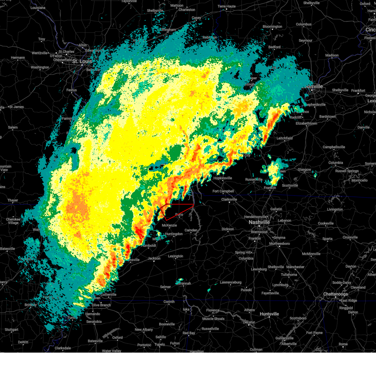
 Svrmeg the national weather service in memphis has issued a * severe thunderstorm warning for, northeastern weakley county in west tennessee, north central benton county in west tennessee, henry county in west tennessee, * until 445 pm cdt. * at 400 pm cdt, a severe thunderstorm was located over palmersville, or 14 miles northwest of paris, moving east at 45 mph (radar indicated). Hazards include 60 mph wind gusts and quarter size hail. Hail damage to vehicles is expected. Expect wind damage to roofs, siding, and trees. Svrmeg the national weather service in memphis has issued a * severe thunderstorm warning for, northeastern weakley county in west tennessee, north central benton county in west tennessee, henry county in west tennessee, * until 445 pm cdt. * at 400 pm cdt, a severe thunderstorm was located over palmersville, or 14 miles northwest of paris, moving east at 45 mph (radar indicated). Hazards include 60 mph wind gusts and quarter size hail. Hail damage to vehicles is expected. Expect wind damage to roofs, siding, and trees.
|
| 5/20/2025 4:57 PM CDT |
 The warning will be allowed to expire. a tornado watch remains in effect until 800 pm cdt for west tennessee. remember, a severe thunderstorm warning still remains in effect for southern henry county. The warning will be allowed to expire. a tornado watch remains in effect until 800 pm cdt for west tennessee. remember, a severe thunderstorm warning still remains in effect for southern henry county.
|
| 5/20/2025 4:29 PM CDT |
 At 428 pm cdt, a severe thunderstorm was located near paris, moving east at 40 mph (trained weather spotters. at 429 pm, trees were downed across the cottage grove area). Hazards include 60 mph wind gusts and quarter size hail. Hail damage to vehicles is expected. expect wind damage to roofs, siding, and trees. Locations impacted include, ore springs, haigler ridge, jones mill, foundry hill, cottage grove, big sandy, old springville, como, buchanan, india, mill creek, puryear, big sandy unit tennessee national wildlife refuge, osage, sunnyside, whitlock, springville, porter court, conyersville, and paris landing state park. At 428 pm cdt, a severe thunderstorm was located near paris, moving east at 40 mph (trained weather spotters. at 429 pm, trees were downed across the cottage grove area). Hazards include 60 mph wind gusts and quarter size hail. Hail damage to vehicles is expected. expect wind damage to roofs, siding, and trees. Locations impacted include, ore springs, haigler ridge, jones mill, foundry hill, cottage grove, big sandy, old springville, como, buchanan, india, mill creek, puryear, big sandy unit tennessee national wildlife refuge, osage, sunnyside, whitlock, springville, porter court, conyersville, and paris landing state park.
|
| 5/20/2025 4:17 PM CDT | Trees and powerlines down on ferguson rd in puryea in henry county TN, 0.5 miles ENE of Puryear, TN |
| 5/20/2025 4:10 PM CDT | Svrmeg the national weather service in memphis has issued a * severe thunderstorm warning for, east central weakley county in west tennessee, northeastern benton county in west tennessee, henry county in west tennessee, * until 500 pm cdt. * at 410 pm cdt, a severe thunderstorm was located near cottage grove, or 11 miles west of paris, moving east at 40 mph (radar indicated). Hazards include 60 mph wind gusts and quarter size hail. Hail damage to vehicles is expected. Expect wind damage to roofs, siding, and trees. |
| 5/20/2025 3:59 PM CDT |
 At 359 pm cdt, a severe thunderstorm was located near dresden, or 10 miles east of martin, moving east at 45 mph (radar indicated). Hazards include 60 mph wind gusts and quarter size hail. Hail damage to vehicles is expected. expect wind damage to roofs, siding, and trees. Locations impacted include, matheny grove, ore springs, dresden, hyndsver, jones mill, foundry hill, latham, cottage grove, palmersville, martin, crossland, ralston, mill creek, osage, brundige, pisgah, whitlock, and puryear. At 359 pm cdt, a severe thunderstorm was located near dresden, or 10 miles east of martin, moving east at 45 mph (radar indicated). Hazards include 60 mph wind gusts and quarter size hail. Hail damage to vehicles is expected. expect wind damage to roofs, siding, and trees. Locations impacted include, matheny grove, ore springs, dresden, hyndsver, jones mill, foundry hill, latham, cottage grove, palmersville, martin, crossland, ralston, mill creek, osage, brundige, pisgah, whitlock, and puryear.
|
| 5/20/2025 3:59 PM CDT |
 the severe thunderstorm warning has been cancelled and is no longer in effect the severe thunderstorm warning has been cancelled and is no longer in effect
|
| 5/20/2025 3:42 PM CDT |
 Svrmeg the national weather service in memphis has issued a * severe thunderstorm warning for, northern weakley county in west tennessee, eastern obion county in west tennessee, northwestern henry county in west tennessee, * until 430 pm cdt. * at 342 pm cdt, a severe thunderstorm was located near south fulton, or near fulton, moving northeast at 40 mph (radar indicated). Hazards include 60 mph wind gusts and quarter size hail. Hail damage to vehicles is expected. Expect wind damage to roofs, siding, and trees. Svrmeg the national weather service in memphis has issued a * severe thunderstorm warning for, northern weakley county in west tennessee, eastern obion county in west tennessee, northwestern henry county in west tennessee, * until 430 pm cdt. * at 342 pm cdt, a severe thunderstorm was located near south fulton, or near fulton, moving northeast at 40 mph (radar indicated). Hazards include 60 mph wind gusts and quarter size hail. Hail damage to vehicles is expected. Expect wind damage to roofs, siding, and trees.
|
| 5/16/2025 10:27 PM CDT |
 the severe thunderstorm warning has been cancelled and is no longer in effect the severe thunderstorm warning has been cancelled and is no longer in effect
|
| 5/16/2025 10:27 PM CDT |
 At 1026 pm cdt, severe thunderstorms were located along a line extending from 6 miles northeast of springville to sharon to near miston, moving east at 35 mph (radar indicated). Hazards include 60 mph wind gusts and quarter size hail. Hail damage to vehicles is expected. expect wind damage to roofs, siding, and trees. Locations impacted include, cat corner, newbern, jones mill, latham, old springville, como, locust grove, ralston, maxey, rutherford, elbridge, pisgah, porter court, pine hill, broadmoor, ore springs, kenton, haigler ridge, lane, and moffatt. At 1026 pm cdt, severe thunderstorms were located along a line extending from 6 miles northeast of springville to sharon to near miston, moving east at 35 mph (radar indicated). Hazards include 60 mph wind gusts and quarter size hail. Hail damage to vehicles is expected. expect wind damage to roofs, siding, and trees. Locations impacted include, cat corner, newbern, jones mill, latham, old springville, como, locust grove, ralston, maxey, rutherford, elbridge, pisgah, porter court, pine hill, broadmoor, ore springs, kenton, haigler ridge, lane, and moffatt.
|
| 5/16/2025 10:15 PM CDT | Svrmeg the national weather service in memphis has issued a * severe thunderstorm warning for, weakley county in west tennessee, northern dyer county in west tennessee, northwestern gibson county in west tennessee, obion county in west tennessee, henry county in west tennessee, southeastern lake county in west tennessee, * until 1100 pm cdt. * at 1015 pm cdt, severe thunderstorms were located along a line extending from 7 miles southeast of paris landing state park to dresden to near miston, moving east at 45 mph (radar indicated). Hazards include 60 mph wind gusts and quarter size hail. Hail damage to vehicles is expected. Expect wind damage to roofs, siding, and trees. |
| 5/16/2025 9:45 PM CDT | The storms which prompted the warning continue and this warning has been replaced by a newer severe thunderstorm warning. |
| 5/16/2025 9:44 PM CDT | the severe thunderstorm warning has been cancelled and is no longer in effect |
| 5/16/2025 9:44 PM CDT | At 944 pm cdt, severe thunderstorms were located along a line extending from near paris landing state park to near paris to near gleason, moving east at 50 mph (radar indicated). Hazards include 70 mph wind gusts and quarter size hail. Hail damage to vehicles is expected. expect considerable tree damage. wind damage is also likely to mobile homes, roofs, and outbuildings. Locations impacted include, dresden, jones mill, cottage grove, crossland, como, sunnyside, whitlock, porter court, conyersville, paris landing state park, pine hill, routon, matheny grove, ore springs, foundry hill, palmersville, buchanan, india, mill creek, and puryear. |
| 5/16/2025 9:37 PM CDT | Svrmeg the national weather service in memphis has issued a * severe thunderstorm warning for, weakley county in west tennessee, east central obion county in west tennessee, henry county in west tennessee, * until 1015 pm cdt. * at 937 pm cdt, a severe thunderstorm was located near dresden, or near martin, moving east at 35 mph (radar indicated). Hazards include 60 mph wind gusts and quarter size hail. Hail damage to vehicles is expected. Expect wind damage to roofs, siding, and trees. |
| 5/16/2025 9:05 PM CDT |
 Svrmeg the national weather service in memphis has issued a * severe thunderstorm warning for, northeastern weakley county in west tennessee, northern henry county in west tennessee, * until 945 pm cdt. * at 905 pm cdt, severe thunderstorms were located along a line extending from near turkey bay to near murray to near palmersville, moving east at 60 mph (radar indicated). Hazards include 70 mph wind gusts and quarter size hail. Hail damage to vehicles is expected. expect considerable tree damage. Wind damage is also likely to mobile homes, roofs, and outbuildings. Svrmeg the national weather service in memphis has issued a * severe thunderstorm warning for, northeastern weakley county in west tennessee, northern henry county in west tennessee, * until 945 pm cdt. * at 905 pm cdt, severe thunderstorms were located along a line extending from near turkey bay to near murray to near palmersville, moving east at 60 mph (radar indicated). Hazards include 70 mph wind gusts and quarter size hail. Hail damage to vehicles is expected. expect considerable tree damage. Wind damage is also likely to mobile homes, roofs, and outbuildings.
|
| 5/16/2025 9:41 AM CDT |
 the severe thunderstorm warning has been cancelled and is no longer in effect the severe thunderstorm warning has been cancelled and is no longer in effect
|
| 5/16/2025 9:37 AM CDT |
 At 937 am cdt, a severe thunderstorm was located near paris landing state park, moving east at 80 mph (radar indicated). Hazards include 60 mph wind gusts and quarter size hail. Hail damage to vehicles is expected. expect wind damage to roofs, siding, and trees. Locations impacted include, jones mill, cottage grove, old springville, crossland, big sandy unit tennessee national wildlife refuge, sunnyside, whitlock, porter court, conyersville, paris landing state park, pine hill, routon, henry, haigler ridge, foundry hill, manleyville, big sandy, buchanan, india, and mill creek. At 937 am cdt, a severe thunderstorm was located near paris landing state park, moving east at 80 mph (radar indicated). Hazards include 60 mph wind gusts and quarter size hail. Hail damage to vehicles is expected. expect wind damage to roofs, siding, and trees. Locations impacted include, jones mill, cottage grove, old springville, crossland, big sandy unit tennessee national wildlife refuge, sunnyside, whitlock, porter court, conyersville, paris landing state park, pine hill, routon, henry, haigler ridge, foundry hill, manleyville, big sandy, buchanan, india, and mill creek.
|
| 5/16/2025 9:37 AM CDT |
 the severe thunderstorm warning has been cancelled and is no longer in effect the severe thunderstorm warning has been cancelled and is no longer in effect
|
| 5/16/2025 9:29 AM CDT |
 the severe thunderstorm warning has been cancelled and is no longer in effect the severe thunderstorm warning has been cancelled and is no longer in effect
|
| 5/16/2025 9:29 AM CDT |
 At 929 am cdt, a severe thunderstorm was located 9 miles northeast of cottage grove, or 10 miles south of murray, moving northeast at 80 mph (radar indicated). Hazards include 60 mph wind gusts and quarter size hail. Hail damage to vehicles is expected. expect wind damage to roofs, siding, and trees. Locations impacted include, mansfield, jones mill, cottage grove, old springville, crossland, como, big sandy unit tennessee national wildlife refuge, sunnyside, whitlock, porter court, conyersville, paris landing state park, pine hill, routon, henry, matheny grove, ore springs, haigler ridge, foundry hill, and manleyville. At 929 am cdt, a severe thunderstorm was located 9 miles northeast of cottage grove, or 10 miles south of murray, moving northeast at 80 mph (radar indicated). Hazards include 60 mph wind gusts and quarter size hail. Hail damage to vehicles is expected. expect wind damage to roofs, siding, and trees. Locations impacted include, mansfield, jones mill, cottage grove, old springville, crossland, como, big sandy unit tennessee national wildlife refuge, sunnyside, whitlock, porter court, conyersville, paris landing state park, pine hill, routon, henry, matheny grove, ore springs, haigler ridge, foundry hill, and manleyville.
|
| 5/16/2025 9:20 AM CDT |
 the severe thunderstorm warning has been cancelled and is no longer in effect the severe thunderstorm warning has been cancelled and is no longer in effect
|
| 5/16/2025 9:20 AM CDT |
 At 920 am cdt, a severe thunderstorm was located over palmersville, or 15 miles northwest of paris, moving northeast at 80 mph (radar indicated). Hazards include 60 mph wind gusts and quarter size hail. Hail damage to vehicles is expected. expect wind damage to roofs, siding, and trees. Locations impacted include, bradford, jones mill, latham, old springville, como, ralston, pisgah, porter court, mckenzie, pine hill, laneview, ore springs, haigler ridge, kimery, buchanan, india, mill creek, puryear, van dyke, and mixie. At 920 am cdt, a severe thunderstorm was located over palmersville, or 15 miles northwest of paris, moving northeast at 80 mph (radar indicated). Hazards include 60 mph wind gusts and quarter size hail. Hail damage to vehicles is expected. expect wind damage to roofs, siding, and trees. Locations impacted include, bradford, jones mill, latham, old springville, como, ralston, pisgah, porter court, mckenzie, pine hill, laneview, ore springs, haigler ridge, kimery, buchanan, india, mill creek, puryear, van dyke, and mixie.
|
| 5/16/2025 9:09 AM CDT |
 At 909 am cdt, a severe thunderstorm was located near martin, moving northeast at 55 mph (trained weather spotters). Hazards include 60 mph wind gusts and quarter size hail. Hail damage to vehicles is expected. expect wind damage to roofs, siding, and trees. Locations impacted include, south fulton, jones mill, latham, como, ralston, shaffner, rutherford, terrell, pisgah, porter court, ore springs, kenton, moffatt, kimery, india, mill creek, puryear, mccutchen heights, gardner, and sandhill. At 909 am cdt, a severe thunderstorm was located near martin, moving northeast at 55 mph (trained weather spotters). Hazards include 60 mph wind gusts and quarter size hail. Hail damage to vehicles is expected. expect wind damage to roofs, siding, and trees. Locations impacted include, south fulton, jones mill, latham, como, ralston, shaffner, rutherford, terrell, pisgah, porter court, ore springs, kenton, moffatt, kimery, india, mill creek, puryear, mccutchen heights, gardner, and sandhill.
|
| 5/16/2025 9:09 AM CDT |
 the severe thunderstorm warning has been cancelled and is no longer in effect the severe thunderstorm warning has been cancelled and is no longer in effect
|
| 5/16/2025 9:08 AM CDT |
 Svrmeg the national weather service in memphis has issued a * severe thunderstorm warning for, weakley county in west tennessee, northeastern gibson county in west tennessee, northern benton county in west tennessee, eastern obion county in west tennessee, northwestern carroll county in west tennessee, henry county in west tennessee, * until 1000 am cdt. * at 908 am cdt, a severe thunderstorm was located over martin, moving east at 70 mph (radar indicated). Hazards include 60 mph wind gusts and quarter size hail. Hail damage to vehicles is expected. Expect wind damage to roofs, siding, and trees. Svrmeg the national weather service in memphis has issued a * severe thunderstorm warning for, weakley county in west tennessee, northeastern gibson county in west tennessee, northern benton county in west tennessee, eastern obion county in west tennessee, northwestern carroll county in west tennessee, henry county in west tennessee, * until 1000 am cdt. * at 908 am cdt, a severe thunderstorm was located over martin, moving east at 70 mph (radar indicated). Hazards include 60 mph wind gusts and quarter size hail. Hail damage to vehicles is expected. Expect wind damage to roofs, siding, and trees.
|
| 5/16/2025 8:57 AM CDT |
 At 857 am cdt, a severe thunderstorm was located near kenton, or 12 miles south of union city, moving east at 70 mph (trained weather spotters). Hazards include 70 mph wind gusts and quarter size hail. Hail damage to vehicles is expected. expect considerable tree damage. wind damage is also likely to mobile homes, roofs, and outbuildings. Locations impacted include, south fulton, newbern, jones mill, lapata, latham, como, locust grove, ralston, shaffner, rutherford, elbridge, terrell, pisgah, porter court, jacksonville, edgewood, ore springs, kenton, moffatt, and kimery. At 857 am cdt, a severe thunderstorm was located near kenton, or 12 miles south of union city, moving east at 70 mph (trained weather spotters). Hazards include 70 mph wind gusts and quarter size hail. Hail damage to vehicles is expected. expect considerable tree damage. wind damage is also likely to mobile homes, roofs, and outbuildings. Locations impacted include, south fulton, newbern, jones mill, lapata, latham, como, locust grove, ralston, shaffner, rutherford, elbridge, terrell, pisgah, porter court, jacksonville, edgewood, ore springs, kenton, moffatt, and kimery.
|
| 5/16/2025 8:57 AM CDT |
 the severe thunderstorm warning has been cancelled and is no longer in effect the severe thunderstorm warning has been cancelled and is no longer in effect
|
| 5/16/2025 8:44 AM CDT |
 the severe thunderstorm warning has been cancelled and is no longer in effect the severe thunderstorm warning has been cancelled and is no longer in effect
|
| 5/16/2025 8:44 AM CDT |
 At 844 am cdt, a severe thunderstorm was located over miston, or 8 miles northwest of dyersburg, moving northeast at 40 mph (trained weather spotters). Hazards include 70 mph wind gusts and quarter size hail. Hail damage to vehicles is expected. expect considerable tree damage. wind damage is also likely to mobile homes, roofs, and outbuildings. Locations impacted include, south fulton, newbern, jones mill, lapata, como, ralston, shaffner, rohoboth, terrell, edgewood, ore springs, kenton, madie, lane, moffatt, troy, india, mill creek, nauvoo, and lassiter corner. At 844 am cdt, a severe thunderstorm was located over miston, or 8 miles northwest of dyersburg, moving northeast at 40 mph (trained weather spotters). Hazards include 70 mph wind gusts and quarter size hail. Hail damage to vehicles is expected. expect considerable tree damage. wind damage is also likely to mobile homes, roofs, and outbuildings. Locations impacted include, south fulton, newbern, jones mill, lapata, como, ralston, shaffner, rohoboth, terrell, edgewood, ore springs, kenton, madie, lane, moffatt, troy, india, mill creek, nauvoo, and lassiter corner.
|
| 5/16/2025 8:32 AM CDT |
 At 831 am cdt, a severe thunderstorm was located near union city, moving northeast at 55 mph (trained weather spotters). Hazards include 60 mph wind gusts and quarter size hail. Hail damage to vehicles is expected. expect wind damage to roofs, siding, and trees. Locations impacted include, south fulton, newbern, jones mill, lapata, como, ralston, shaffner, rohoboth, terrell, edgewood, ore springs, kenton, madie, lane, moffatt, troy, india, tennemo, mill creek, and nauvoo. At 831 am cdt, a severe thunderstorm was located near union city, moving northeast at 55 mph (trained weather spotters). Hazards include 60 mph wind gusts and quarter size hail. Hail damage to vehicles is expected. expect wind damage to roofs, siding, and trees. Locations impacted include, south fulton, newbern, jones mill, lapata, como, ralston, shaffner, rohoboth, terrell, edgewood, ore springs, kenton, madie, lane, moffatt, troy, india, tennemo, mill creek, and nauvoo.
|
| 5/16/2025 8:15 AM CDT |
 Svrmeg the national weather service in memphis has issued a * severe thunderstorm warning for, east central pemiscot county in southeastern missouri, weakley county in west tennessee, dyer county in west tennessee, northwestern gibson county in west tennessee, obion county in west tennessee, northwestern henry county in west tennessee, southeastern lake county in west tennessee, * until 915 am cdt. * at 815 am cdt, a severe thunderstorm was located over obion, or 12 miles southeast of reelfoot lake state park, moving northeast at 55 mph (radar indicated). Hazards include 60 mph wind gusts and quarter size hail. Hail damage to vehicles is expected. Expect wind damage to roofs, siding, and trees. Svrmeg the national weather service in memphis has issued a * severe thunderstorm warning for, east central pemiscot county in southeastern missouri, weakley county in west tennessee, dyer county in west tennessee, northwestern gibson county in west tennessee, obion county in west tennessee, northwestern henry county in west tennessee, southeastern lake county in west tennessee, * until 915 am cdt. * at 815 am cdt, a severe thunderstorm was located over obion, or 12 miles southeast of reelfoot lake state park, moving northeast at 55 mph (radar indicated). Hazards include 60 mph wind gusts and quarter size hail. Hail damage to vehicles is expected. Expect wind damage to roofs, siding, and trees.
|
| 5/2/2025 11:07 AM CDT |
 The storm which prompted the warning has moved out of the area. therefore, the warning will be allowed to expire. however, gusty winds are still possible with this thunderstorm. a severe thunderstorm watch remains in effect until 500 pm cdt for west tennessee. The storm which prompted the warning has moved out of the area. therefore, the warning will be allowed to expire. however, gusty winds are still possible with this thunderstorm. a severe thunderstorm watch remains in effect until 500 pm cdt for west tennessee.
|
| 5/2/2025 11:00 AM CDT | Trees down onto power lines on state line road in haze in calloway county KY, 4 miles S of Puryear, TN |
| 5/2/2025 11:00 AM CDT | Uprooted tree fell onto a truck at 1397 state line road west near haze in calloway county KY, 5.5 miles SE of Puryear, TN |
| 5/2/2025 10:54 AM CDT |
 the severe thunderstorm warning has been cancelled and is no longer in effect the severe thunderstorm warning has been cancelled and is no longer in effect
|
| 5/2/2025 10:54 AM CDT |
 At 1054 am cdt, a severe thunderstorm was located 7 miles northeast of cottage grove, or 9 miles north of paris, moving northeast at 35 mph (radar indicated). Hazards include 70 mph wind gusts and quarter size hail. Hail damage to vehicles is expected. expect considerable tree damage. wind damage is also likely to mobile homes, roofs, and outbuildings. Locations impacted include, jones mill, foundry hill, cottage grove, palmersville, crossland, buchanan, india, mill creek, puryear, big sandy unit tennessee national wildlife refuge, osage, whitlock, porter court, conyersville, paris landing state park, pine hill, and paris. At 1054 am cdt, a severe thunderstorm was located 7 miles northeast of cottage grove, or 9 miles north of paris, moving northeast at 35 mph (radar indicated). Hazards include 70 mph wind gusts and quarter size hail. Hail damage to vehicles is expected. expect considerable tree damage. wind damage is also likely to mobile homes, roofs, and outbuildings. Locations impacted include, jones mill, foundry hill, cottage grove, palmersville, crossland, buchanan, india, mill creek, puryear, big sandy unit tennessee national wildlife refuge, osage, whitlock, porter court, conyersville, paris landing state park, pine hill, and paris.
|
| 5/2/2025 10:50 AM CDT | Trees down at mill creek rd and highway 14 in henry county TN, 3.8 miles E of Puryear, TN |
| 5/2/2025 10:44 AM CDT |
 At 1044 am cdt, a severe thunderstorm was located near paris, moving northeast at 35 mph (radar indicated). Hazards include 70 mph wind gusts and quarter size hail. Hail damage to vehicles is expected. expect considerable tree damage. wind damage is also likely to mobile homes, roofs, and outbuildings. Locations impacted include, sandhill, mansfield, jones mill, latham, cottage grove, old springville, crossland, como, big sandy unit tennessee national wildlife refuge, brundige, sunnyside, whitlock, porter court, conyersville, paris landing state park, pine hill, routon, henry, matheny grove, and ore springs. At 1044 am cdt, a severe thunderstorm was located near paris, moving northeast at 35 mph (radar indicated). Hazards include 70 mph wind gusts and quarter size hail. Hail damage to vehicles is expected. expect considerable tree damage. wind damage is also likely to mobile homes, roofs, and outbuildings. Locations impacted include, sandhill, mansfield, jones mill, latham, cottage grove, old springville, crossland, como, big sandy unit tennessee national wildlife refuge, brundige, sunnyside, whitlock, porter court, conyersville, paris landing state park, pine hill, routon, henry, matheny grove, and ore springs.
|
| 5/2/2025 10:36 AM CDT |
 Svrmeg the national weather service in memphis has issued a * severe thunderstorm warning for, eastern weakley county in west tennessee, northeastern benton county in west tennessee, henry county in west tennessee, * until 1115 am cdt. * at 1036 am cdt, a severe thunderstorm was located near routon, or 7 miles west of paris, moving northeast at 35 mph (radar indicated). Hazards include 60 mph wind gusts and quarter size hail. Hail damage to vehicles is expected. Expect wind damage to roofs, siding, and trees. Svrmeg the national weather service in memphis has issued a * severe thunderstorm warning for, eastern weakley county in west tennessee, northeastern benton county in west tennessee, henry county in west tennessee, * until 1115 am cdt. * at 1036 am cdt, a severe thunderstorm was located near routon, or 7 miles west of paris, moving northeast at 35 mph (radar indicated). Hazards include 60 mph wind gusts and quarter size hail. Hail damage to vehicles is expected. Expect wind damage to roofs, siding, and trees.
|
| 4/2/2025 11:24 PM CDT | The storms which prompted the warning have moved out of the area. therefore, the warning will be allowed to expire. however, gusty winds are still possible with these thunderstorms. a tornado watch remains in effect until midnight cdt for west tennessee. |
| 4/2/2025 11:08 PM CDT | At 1107 pm cdt, severe thunderstorms were located along a line extending from paris to 6 miles southwest of huntingdon, moving northeast at 45 mph (radar indicated). Hazards include 70 mph wind gusts and quarter size hail. Hail damage to vehicles is expected. expect considerable tree damage. wind damage is also likely to mobile homes, roofs, and outbuildings. Locations impacted include, paris, huntingdon, dollar, atwood, old springville, ledbetter, como, bruceton, leach, porter court, mckenzie, tate, palmer shelter, pine hill, gann, buena vista, hollow rock, camden, haigler ridge, clarksburg, trezevant, and vale. |
| 4/2/2025 10:52 PM CDT | The storm which prompted the warning has moved out of the area. therefore, the warning will be allowed to expire. a tornado watch remains in effect until midnight cdt for west tennessee. remember, a tornado warning still remains in effect for vale and eastern henry county until 11:30 pm. |
| 4/2/2025 10:39 PM CDT | Svrmeg the national weather service in memphis has issued a * severe thunderstorm warning for, weakley county in west tennessee, central gibson county in west tennessee, benton county in west tennessee, carroll county in west tennessee, henry county in west tennessee, * until 1130 pm cdt. * at 1038 pm cdt, severe thunderstorms were located along a line extending from 10 miles south of wranglers campground to near bradford, moving northeast at 50 mph (radar indicated). Hazards include 60 mph wind gusts and quarter size hail. Hail damage to vehicles is expected. Expect wind damage to roofs, siding, and trees. |
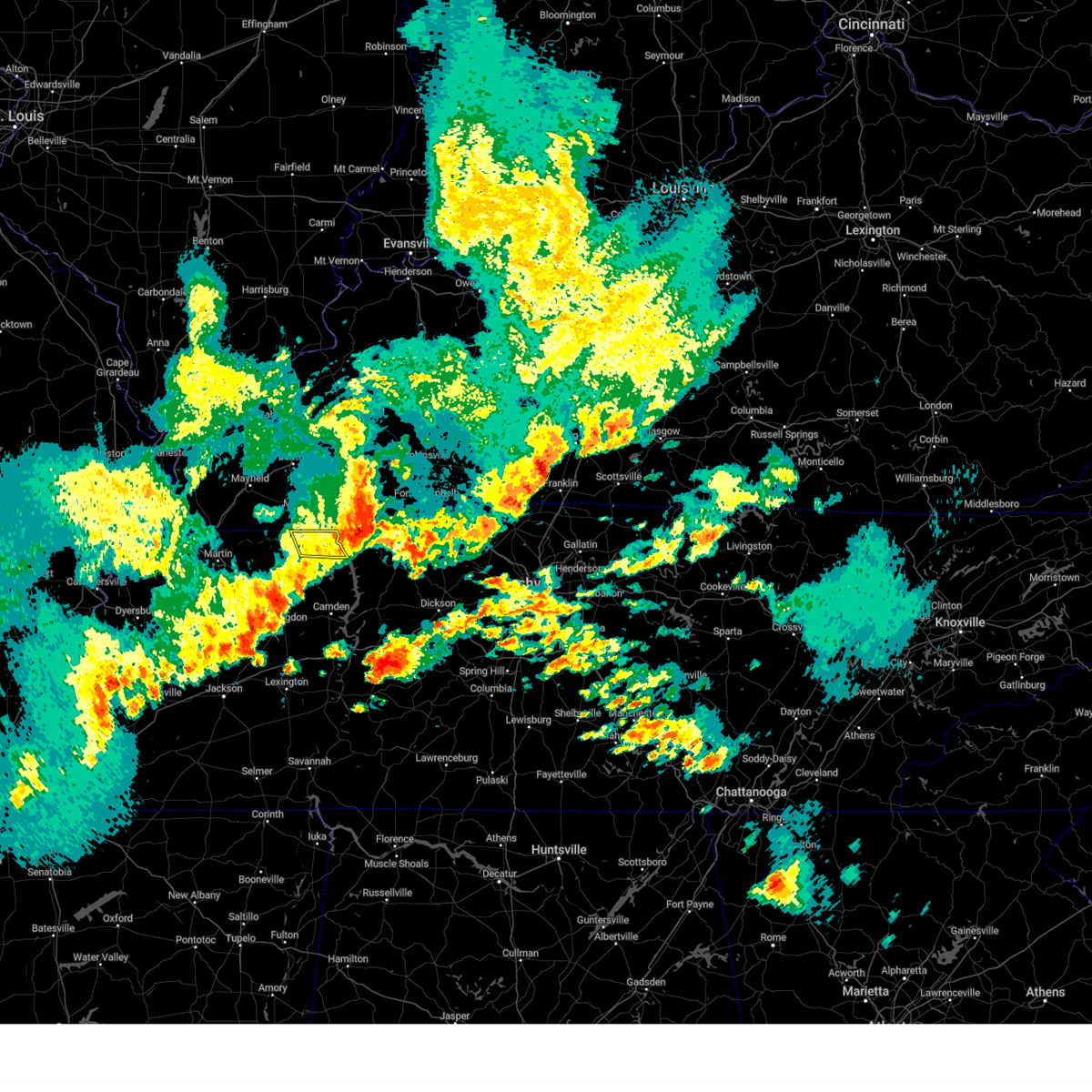
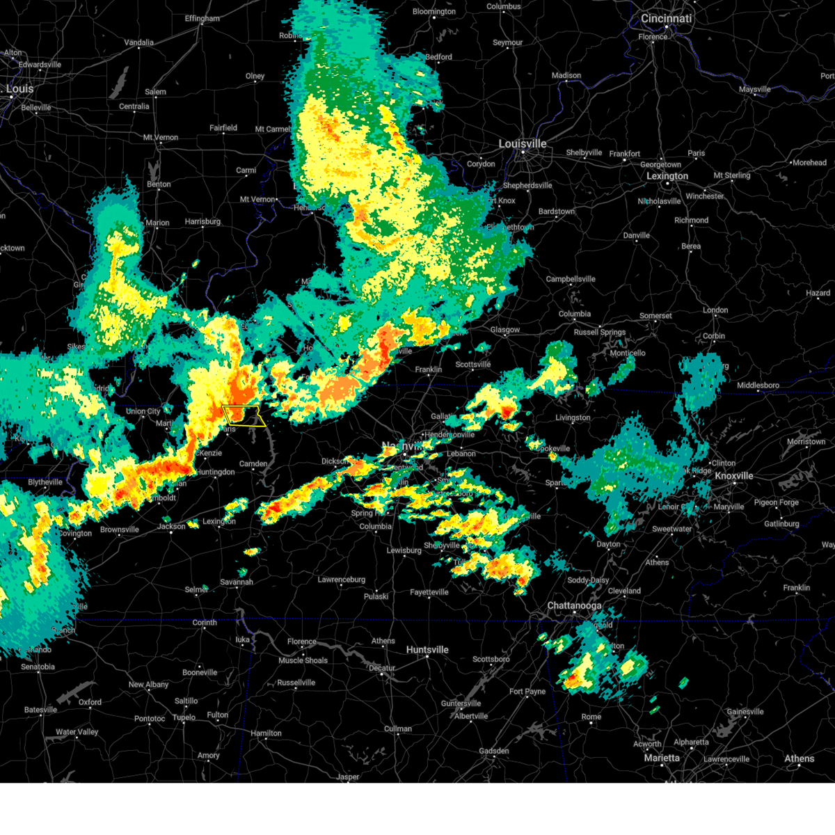
| 4/2/2025 10:29 PM CDT | At 1029 pm cdt, a severe thunderstorm capable of producing a tornado was located near paris landing state park, moving northeast at 50 mph (radar indicated rotation). Hazards include tornado and quarter size hail. Flying debris will be dangerous to those caught without shelter. mobile homes will be damaged or destroyed. damage to roofs, windows, and vehicles will occur. tree damage is likely. Locations impacted include, haigler ridge, foundry hill, manleyville, big sandy, old springville, buchanan, india, puryear, big sandy unit tennessee national wildlife refuge, osage, sunnyside, van dyke, whitlock, springville, spring creek, porter court, conyersville, paris landing state park, pine hill, and paris. |
| 4/2/2025 10:18 PM CDT | Tormeg the national weather service in memphis has issued a * tornado warning for, northern benton county in west tennessee, henry county in west tennessee, * until 1100 pm cdt. * at 1018 pm cdt, a severe thunderstorm capable of producing a tornado was located over paris, moving northeast at 50 mph (radar indicated rotation). Hazards include tornado and quarter size hail. Flying debris will be dangerous to those caught without shelter. mobile homes will be damaged or destroyed. damage to roofs, windows, and vehicles will occur. Tree damage is likely. |
| 4/2/2025 10:15 PM CDT | the severe thunderstorm warning has been cancelled and is no longer in effect |
| 4/2/2025 10:15 PM CDT | At 1015 pm cdt, severe thunderstorms were located along a line extending from 7 miles northwest of paris landing state park to humboldt, moving northeast at 50 mph (radar indicated). Hazards include 60 mph wind gusts and quarter size hail. Hail damage to vehicles is expected. expect wind damage to roofs, siding, and trees. Locations impacted include, tuckers corner, dyer, grizzard, bradford, atwood, jones mill, cades, como, ralston, leach, currie, mckenzie, maury junction, pine hill, gann, georgetown, laneview, ore springs, trezevant, and fruitland. |
| 4/2/2025 9:56 PM CDT |
 At 956 pm cdt, severe thunderstorms were located along a line extending from 8 miles south of murray to alamo, moving northeast at 50 mph (radar indicated). Hazards include 60 mph wind gusts and quarter size hail. Hail damage to vehicles is expected. expect wind damage to roofs, siding, and trees. Locations impacted include, tuckers corner, dyer, grizzard, south fulton, bradford, newbern, atwood, fowlkes, jones mill, lapata, cades, bonicord, como, ralston, shaffner, rohoboth, leach, terrell, currie, and mckenzie. At 956 pm cdt, severe thunderstorms were located along a line extending from 8 miles south of murray to alamo, moving northeast at 50 mph (radar indicated). Hazards include 60 mph wind gusts and quarter size hail. Hail damage to vehicles is expected. expect wind damage to roofs, siding, and trees. Locations impacted include, tuckers corner, dyer, grizzard, south fulton, bradford, newbern, atwood, fowlkes, jones mill, lapata, cades, bonicord, como, ralston, shaffner, rohoboth, leach, terrell, currie, and mckenzie.
|
| 4/2/2025 9:54 PM CDT | At 954 pm cdt, severe thunderstorms were located along a line extending from near turkey bay to 8 miles southwest of wranglers campground to 8 miles southeast of murray, moving northeast at 55 mph (radar indicated). Hazards include 60 mph wind gusts and nickel size hail. Expect damage to roofs, siding, and trees. Locations impacted include, sandhill, dresden, jones mill, latham, cottage grove, ruthville, crossland, sharon, como, ralston, brundige, pisgah, whitlock, porter court, conyersville, routon, henry, matheny grove, ore springs, and sidonia. |
| 4/2/2025 9:52 PM CDT | The tornado threat has diminished and the tornado warning has been cancelled. however, large hail and damaging winds remain likely and a severe thunderstorm warning remains in effect for the area. however, small hail and gusty winds are still possible with this thunderstorm. a tornado watch remains in effect until midnight cdt for west tennessee. |
| 4/2/2025 9:50 PM CDT | Svrmeg the national weather service in memphis has issued a * severe thunderstorm warning for, central crockett county in west tennessee, weakley county in west tennessee, eastern dyer county in west tennessee, gibson county in west tennessee, northwestern benton county in west tennessee, eastern obion county in west tennessee, northeastern lauderdale county in west tennessee, carroll county in west tennessee, henry county in west tennessee, * until 1045 pm cdt. * at 950 pm cdt, severe thunderstorms were located along a line extending from 8 miles northeast of cottage grove to near alamo, moving northeast at 50 mph (radar indicated). Hazards include 60 mph wind gusts and quarter size hail. Hail damage to vehicles is expected. Expect wind damage to roofs, siding, and trees. |
| 4/2/2025 9:34 PM CDT | Tormeg the national weather service in memphis has issued a * tornado warning for, northwestern henry county in west tennessee, * until 1000 pm cdt. * at 934 pm cdt, a severe thunderstorm capable of producing a tornado was located 9 miles south of murray, moving northeast at 50 mph (radar indicated rotation). Hazards include tornado. Flying debris will be dangerous to those caught without shelter. mobile homes will be damaged or destroyed. damage to roofs, windows, and vehicles will occur. Tree damage is likely. |
| 4/2/2025 9:12 PM CDT | Svrmeg the national weather service in memphis has issued a * severe thunderstorm warning for, weakley county in west tennessee, western henry county in west tennessee, * until 1000 pm cdt. * at 911 pm cdt, severe thunderstorms were located along a line extending from 8 miles east of fulton to near latham to sharon, moving northeast at 50 mph (radar indicated). Hazards include 60 mph wind gusts and nickel size hail. expect damage to roofs, siding, and trees |
| 2/15/2025 7:57 PM CST |
 At 757 pm cst, a severe thunderstorm capable of producing a tornado was located near paris landing state park, moving northeast at 50 mph (radar indicated rotation). Hazards include tornado and ping pong ball size hail. Flying debris will be dangerous to those caught without shelter. mobile homes will be damaged or destroyed. damage to roofs, windows, and vehicles will occur. tree damage is likely. Locations impacted include, paris, mckenzie, huntingdon, paris landing state park, dresden, gleason, atwood, cottage grove, routon, vale, springville, trezevant, puryear, big sandy, henry, mclemoresville, sandhill, mansfield, old springville, and como. At 757 pm cst, a severe thunderstorm capable of producing a tornado was located near paris landing state park, moving northeast at 50 mph (radar indicated rotation). Hazards include tornado and ping pong ball size hail. Flying debris will be dangerous to those caught without shelter. mobile homes will be damaged or destroyed. damage to roofs, windows, and vehicles will occur. tree damage is likely. Locations impacted include, paris, mckenzie, huntingdon, paris landing state park, dresden, gleason, atwood, cottage grove, routon, vale, springville, trezevant, puryear, big sandy, henry, mclemoresville, sandhill, mansfield, old springville, and como.
|
| 2/15/2025 7:42 PM CST |
 At 742 pm cst, a severe thunderstorm capable of producing a tornado was located over paris, moving northeast at 55 mph (radar indicated rotation). Hazards include tornado and ping pong ball size hail. Flying debris will be dangerous to those caught without shelter. mobile homes will be damaged or destroyed. damage to roofs, windows, and vehicles will occur. tree damage is likely. Locations impacted include, paris, mckenzie, huntingdon, paris landing state park, dresden, greenfield, gleason, atwood, cottage grove, routon, vale, springville, trezevant, puryear, big sandy, henry, mclemoresville, sandhill, mansfield, and old springville. At 742 pm cst, a severe thunderstorm capable of producing a tornado was located over paris, moving northeast at 55 mph (radar indicated rotation). Hazards include tornado and ping pong ball size hail. Flying debris will be dangerous to those caught without shelter. mobile homes will be damaged or destroyed. damage to roofs, windows, and vehicles will occur. tree damage is likely. Locations impacted include, paris, mckenzie, huntingdon, paris landing state park, dresden, greenfield, gleason, atwood, cottage grove, routon, vale, springville, trezevant, puryear, big sandy, henry, mclemoresville, sandhill, mansfield, and old springville.
|
| 2/15/2025 7:38 PM CST |
 Tormeg the national weather service in memphis has issued a * tornado warning for, southeastern weakley county in west tennessee, northern benton county in west tennessee, northern carroll county in west tennessee, henry county in west tennessee, * until 830 pm cst. * at 738 pm cst, a severe thunderstorm capable of producing a tornado was located over routon, or near paris, moving northeast at 55 mph (radar indicated rotation). Hazards include tornado and quarter size hail. Flying debris will be dangerous to those caught without shelter. mobile homes will be damaged or destroyed. damage to roofs, windows, and vehicles will occur. Tree damage is likely. Tormeg the national weather service in memphis has issued a * tornado warning for, southeastern weakley county in west tennessee, northern benton county in west tennessee, northern carroll county in west tennessee, henry county in west tennessee, * until 830 pm cst. * at 738 pm cst, a severe thunderstorm capable of producing a tornado was located over routon, or near paris, moving northeast at 55 mph (radar indicated rotation). Hazards include tornado and quarter size hail. Flying debris will be dangerous to those caught without shelter. mobile homes will be damaged or destroyed. damage to roofs, windows, and vehicles will occur. Tree damage is likely.
|
| 2/15/2025 7:25 PM CST | the tornado warning has been cancelled and is no longer in effect |
| 2/15/2025 7:16 PM CST |
 At 715 pm cst, a severe thunderstorm capable of producing a tornado was located 7 miles south of murray, moving northeast at 55 mph (radar indicated rotation). Hazards include tornado and quarter size hail. Flying debris will be dangerous to those caught without shelter. mobile homes will be damaged or destroyed. damage to roofs, windows, and vehicles will occur. tree damage is likely. Locations impacted include, cottage grove, puryear, mill creek, osage, whitlock, jones mill, foundry hill, conyersville, pine hill, crossland, and como. At 715 pm cst, a severe thunderstorm capable of producing a tornado was located 7 miles south of murray, moving northeast at 55 mph (radar indicated rotation). Hazards include tornado and quarter size hail. Flying debris will be dangerous to those caught without shelter. mobile homes will be damaged or destroyed. damage to roofs, windows, and vehicles will occur. tree damage is likely. Locations impacted include, cottage grove, puryear, mill creek, osage, whitlock, jones mill, foundry hill, conyersville, pine hill, crossland, and como.
|
| 2/15/2025 7:16 PM CST |
 the tornado warning has been cancelled and is no longer in effect the tornado warning has been cancelled and is no longer in effect
|
| 2/15/2025 7:04 PM CST |
 Tormeg the national weather service in memphis has issued a * tornado warning for, northeastern weakley county in west tennessee, northwestern henry county in west tennessee, * until 745 pm cst. * at 704 pm cst, a severe thunderstorm capable of producing a tornado was located near cottage grove, or 12 miles northwest of paris, moving northeast at 55 mph (radar indicated rotation). Hazards include tornado. Flying debris will be dangerous to those caught without shelter. mobile homes will be damaged or destroyed. damage to roofs, windows, and vehicles will occur. Tree damage is likely. Tormeg the national weather service in memphis has issued a * tornado warning for, northeastern weakley county in west tennessee, northwestern henry county in west tennessee, * until 745 pm cst. * at 704 pm cst, a severe thunderstorm capable of producing a tornado was located near cottage grove, or 12 miles northwest of paris, moving northeast at 55 mph (radar indicated rotation). Hazards include tornado. Flying debris will be dangerous to those caught without shelter. mobile homes will be damaged or destroyed. damage to roofs, windows, and vehicles will occur. Tree damage is likely.
|
| 5/27/2024 12:07 AM CDT |
 The storms which prompted the warning have weakened below severe limits, and no longer pose an immediate threat to life or property. therefore, the warning will be allowed to expire. however, gusty winds are still possible with these thunderstorms. a tornado watch remains in effect until 500 am cdt for west tennessee. a tornado watch also remains in effect until 400 am cdt for west tennessee. The storms which prompted the warning have weakened below severe limits, and no longer pose an immediate threat to life or property. therefore, the warning will be allowed to expire. however, gusty winds are still possible with these thunderstorms. a tornado watch remains in effect until 500 am cdt for west tennessee. a tornado watch also remains in effect until 400 am cdt for west tennessee.
|
| 5/26/2024 11:55 PM CDT |
 At 1155 pm cdt, severe thunderstorms were located along a line extending from near tennessee ridge to near huntingdon to near dyersburg, moving southeast at 25 mph (radar indicated). Hazards include 60 mph wind gusts and nickel size hail. Expect damage to roofs, siding, and trees. Locations impacted include, dyersburg, martin, union city, paris, milan, mckenzie, trenton, huntingdon, camden, fulton, paris landing state park, reelfoot lake state park, tiptonville, newbern, dresden, south fulton, dyer, greenfield, new johnsonville, and ridgely. At 1155 pm cdt, severe thunderstorms were located along a line extending from near tennessee ridge to near huntingdon to near dyersburg, moving southeast at 25 mph (radar indicated). Hazards include 60 mph wind gusts and nickel size hail. Expect damage to roofs, siding, and trees. Locations impacted include, dyersburg, martin, union city, paris, milan, mckenzie, trenton, huntingdon, camden, fulton, paris landing state park, reelfoot lake state park, tiptonville, newbern, dresden, south fulton, dyer, greenfield, new johnsonville, and ridgely.
|
| 5/26/2024 11:33 PM CDT | Tree down blocking the roadway in the 5700 block of old paris murray r in henry county TN, 4 miles NNW of Puryear, TN |
| 5/26/2024 11:30 PM CDT |
 Svrmeg the national weather service in memphis has issued a * severe thunderstorm warning for, weakley county in west tennessee, northeastern dyer county in west tennessee, gibson county in west tennessee, benton county in west tennessee, obion county in west tennessee, carroll county in west tennessee, henry county in west tennessee, northeastern decatur county in west tennessee, lake county in west tennessee, * until 1215 am cdt. * at 1130 pm cdt, severe thunderstorms were located along a line extending from near paris landing state park to near huntingdon to cottonwood grove, moving southeast at 25 mph (radar indicated). Hazards include 60 mph wind gusts and nickel size hail. expect damage to roofs, siding, and trees Svrmeg the national weather service in memphis has issued a * severe thunderstorm warning for, weakley county in west tennessee, northeastern dyer county in west tennessee, gibson county in west tennessee, benton county in west tennessee, obion county in west tennessee, carroll county in west tennessee, henry county in west tennessee, northeastern decatur county in west tennessee, lake county in west tennessee, * until 1215 am cdt. * at 1130 pm cdt, severe thunderstorms were located along a line extending from near paris landing state park to near huntingdon to cottonwood grove, moving southeast at 25 mph (radar indicated). Hazards include 60 mph wind gusts and nickel size hail. expect damage to roofs, siding, and trees
|
| 5/26/2024 9:05 AM CDT |
 The storm which prompted the warning has moved out of the area. therefore, the warning will be allowed to expire. a tornado watch remains in effect until 1000 am cdt for west tennessee. The storm which prompted the warning has moved out of the area. therefore, the warning will be allowed to expire. a tornado watch remains in effect until 1000 am cdt for west tennessee.
|
| 5/26/2024 8:58 AM CDT |
 Svrmeg the national weather service in memphis has issued a * severe thunderstorm warning for, northern benton county in west tennessee, henry county in west tennessee, * until 945 am cdt. * at 858 am cdt, a severe thunderstorm was located near paris, moving east at 55 mph (radar indicated). Hazards include ping pong ball size hail and 60 mph wind gusts. People and animals outdoors will be injured. expect hail damage to roofs, siding, windows, and vehicles. Expect wind damage to roofs, siding, and trees. Svrmeg the national weather service in memphis has issued a * severe thunderstorm warning for, northern benton county in west tennessee, henry county in west tennessee, * until 945 am cdt. * at 858 am cdt, a severe thunderstorm was located near paris, moving east at 55 mph (radar indicated). Hazards include ping pong ball size hail and 60 mph wind gusts. People and animals outdoors will be injured. expect hail damage to roofs, siding, windows, and vehicles. Expect wind damage to roofs, siding, and trees.
|
| 5/26/2024 8:49 AM CDT |
 At 849 am cdt, a severe thunderstorm was located near routon, or 9 miles west of paris, moving east at 50 mph (radar indicated). Hazards include golf ball size hail and 60 mph wind gusts. People and animals outdoors will be injured. expect hail damage to roofs, siding, windows, and vehicles. expect wind damage to roofs, siding, and trees. Locations impacted include, paris, mckenzie, dresden, gleason, cottage grove, routon, palmersville, vale, puryear, henry, sandhill, mansfield, jones mill, crossland, como, sunnyside, whitlock, porter court, conyersville, and ephesus. At 849 am cdt, a severe thunderstorm was located near routon, or 9 miles west of paris, moving east at 50 mph (radar indicated). Hazards include golf ball size hail and 60 mph wind gusts. People and animals outdoors will be injured. expect hail damage to roofs, siding, windows, and vehicles. expect wind damage to roofs, siding, and trees. Locations impacted include, paris, mckenzie, dresden, gleason, cottage grove, routon, palmersville, vale, puryear, henry, sandhill, mansfield, jones mill, crossland, como, sunnyside, whitlock, porter court, conyersville, and ephesus.
|
| 5/26/2024 8:42 AM CDT |
 the severe thunderstorm warning has been cancelled and is no longer in effect the severe thunderstorm warning has been cancelled and is no longer in effect
|
| 5/26/2024 8:42 AM CDT |
 At 842 am cdt, a severe thunderstorm was located near gleason, or 11 miles north of mckenzie, moving east at 50 mph (radar indicated). Hazards include 60 mph wind gusts and half dollar size hail. Hail damage to vehicles is expected. expect wind damage to roofs, siding, and trees. Locations impacted include, paris, mckenzie, dresden, greenfield, gleason, cottage grove, routon, palmersville, vale, puryear, henry, sandhill, mansfield, jones mill, crossland, como, brundige, sunnyside, whitlock, and porter court. At 842 am cdt, a severe thunderstorm was located near gleason, or 11 miles north of mckenzie, moving east at 50 mph (radar indicated). Hazards include 60 mph wind gusts and half dollar size hail. Hail damage to vehicles is expected. expect wind damage to roofs, siding, and trees. Locations impacted include, paris, mckenzie, dresden, greenfield, gleason, cottage grove, routon, palmersville, vale, puryear, henry, sandhill, mansfield, jones mill, crossland, como, brundige, sunnyside, whitlock, and porter court.
|
| 5/26/2024 8:25 AM CDT |
 Svrmeg the national weather service in memphis has issued a * severe thunderstorm warning for, weakley county in west tennessee, northeastern gibson county in west tennessee, northern carroll county in west tennessee, henry county in west tennessee, * until 915 am cdt. * at 825 am cdt, a severe thunderstorm was located over martin, moving east at 50 mph (radar indicated). Hazards include 60 mph wind gusts and quarter size hail. Hail damage to vehicles is expected. Expect wind damage to roofs, siding, and trees. Svrmeg the national weather service in memphis has issued a * severe thunderstorm warning for, weakley county in west tennessee, northeastern gibson county in west tennessee, northern carroll county in west tennessee, henry county in west tennessee, * until 915 am cdt. * at 825 am cdt, a severe thunderstorm was located over martin, moving east at 50 mph (radar indicated). Hazards include 60 mph wind gusts and quarter size hail. Hail damage to vehicles is expected. Expect wind damage to roofs, siding, and trees.
|
| 5/9/2024 1:10 AM CDT |
 the severe thunderstorm warning has been cancelled and is no longer in effect the severe thunderstorm warning has been cancelled and is no longer in effect
|
| 5/9/2024 12:55 AM CDT |
 Svrmeg the national weather service in memphis has issued a * severe thunderstorm warning for, northeastern henry county in west tennessee, * until 145 am cdt. * at 1255 am cdt, a severe thunderstorm was located over paris landing state park, moving east at 30 mph (radar indicated). Hazards include 60 mph wind gusts and quarter size hail. Hail damage to vehicles is expected. Expect wind damage to roofs, siding, and trees. Svrmeg the national weather service in memphis has issued a * severe thunderstorm warning for, northeastern henry county in west tennessee, * until 145 am cdt. * at 1255 am cdt, a severe thunderstorm was located over paris landing state park, moving east at 30 mph (radar indicated). Hazards include 60 mph wind gusts and quarter size hail. Hail damage to vehicles is expected. Expect wind damage to roofs, siding, and trees.
|
| 5/8/2024 3:54 PM CDT |
 At 354 pm cdt, severe thunderstorms were located along a line extending from near murray to 11 miles west of paris landing state park to near paris to near springville, moving northeast at 35 mph (radar indicated). Hazards include 60 mph wind gusts and half dollar size hail. Hail damage to vehicles is expected. expect wind damage to roofs, siding, and trees. Locations impacted include, paris, paris landing state park, springville, puryear, big sandy, haigler ridge, manleyville, old springville, buchanan, india, sunnyside, conyersville, pine hill, and big sandy unit tennessee national wildlife refuge. At 354 pm cdt, severe thunderstorms were located along a line extending from near murray to 11 miles west of paris landing state park to near paris to near springville, moving northeast at 35 mph (radar indicated). Hazards include 60 mph wind gusts and half dollar size hail. Hail damage to vehicles is expected. expect wind damage to roofs, siding, and trees. Locations impacted include, paris, paris landing state park, springville, puryear, big sandy, haigler ridge, manleyville, old springville, buchanan, india, sunnyside, conyersville, pine hill, and big sandy unit tennessee national wildlife refuge.
|
| 5/8/2024 3:37 PM CDT |
 the severe thunderstorm warning has been cancelled and is no longer in effect the severe thunderstorm warning has been cancelled and is no longer in effect
|
| 5/8/2024 3:37 PM CDT |
 At 336 pm cdt, severe thunderstorms were located along a line extending from 7 miles southeast of lynnville to near cottage grove to near paris to near routon, moving northeast at 40 mph (trained weather spotters. at 333 pm, weather spotters reported quarter sized hail). Hazards include ping pong ball size hail and 60 mph wind gusts. People and animals outdoors will be injured. expect hail damage to roofs, siding, windows, and vehicles. expect wind damage to roofs, siding, and trees. Locations impacted include, paris, paris landing state park, cottage grove, routon, springville, puryear, big sandy, henry, jones mill, old springville, crossland, sunnyside, whitlock, porter court, conyersville, pine hill, haigler ridge, foundry hill, manleyville, and buchanan. At 336 pm cdt, severe thunderstorms were located along a line extending from 7 miles southeast of lynnville to near cottage grove to near paris to near routon, moving northeast at 40 mph (trained weather spotters. at 333 pm, weather spotters reported quarter sized hail). Hazards include ping pong ball size hail and 60 mph wind gusts. People and animals outdoors will be injured. expect hail damage to roofs, siding, windows, and vehicles. expect wind damage to roofs, siding, and trees. Locations impacted include, paris, paris landing state park, cottage grove, routon, springville, puryear, big sandy, henry, jones mill, old springville, crossland, sunnyside, whitlock, porter court, conyersville, pine hill, haigler ridge, foundry hill, manleyville, and buchanan.
|
| 5/8/2024 3:28 PM CDT |
 At 328 pm cdt, severe thunderstorms were located along a line extending from near lynnville to near palmersville to near cottage grove to near routon, moving northeast at 35 mph (radar indicated). Hazards include ping pong ball size hail and 60 mph wind gusts. People and animals outdoors will be injured. expect hail damage to roofs, siding, windows, and vehicles. expect wind damage to roofs, siding, and trees. Locations impacted include, paris, paris landing state park, cottage grove, routon, palmersville, springville, puryear, big sandy, henry, jones mill, old springville, crossland, como, sunnyside, whitlock, porter court, conyersville, pine hill, haigler ridge, and foundry hill. At 328 pm cdt, severe thunderstorms were located along a line extending from near lynnville to near palmersville to near cottage grove to near routon, moving northeast at 35 mph (radar indicated). Hazards include ping pong ball size hail and 60 mph wind gusts. People and animals outdoors will be injured. expect hail damage to roofs, siding, windows, and vehicles. expect wind damage to roofs, siding, and trees. Locations impacted include, paris, paris landing state park, cottage grove, routon, palmersville, springville, puryear, big sandy, henry, jones mill, old springville, crossland, como, sunnyside, whitlock, porter court, conyersville, pine hill, haigler ridge, and foundry hill.
|
| 5/8/2024 3:24 PM CDT |
 Svrmeg the national weather service in memphis has issued a * severe thunderstorm warning for, northeastern weakley county in west tennessee, northeastern benton county in west tennessee, henry county in west tennessee, * until 415 pm cdt. * at 324 pm cdt, severe thunderstorms were located along a line extending from near lynnville to near palmersville to near cottage grove to near routon, moving northeast at 35 mph (radar indicated). Hazards include 60 mph wind gusts and quarter size hail. Hail damage to vehicles is expected. Expect wind damage to roofs, siding, and trees. Svrmeg the national weather service in memphis has issued a * severe thunderstorm warning for, northeastern weakley county in west tennessee, northeastern benton county in west tennessee, henry county in west tennessee, * until 415 pm cdt. * at 324 pm cdt, severe thunderstorms were located along a line extending from near lynnville to near palmersville to near cottage grove to near routon, moving northeast at 35 mph (radar indicated). Hazards include 60 mph wind gusts and quarter size hail. Hail damage to vehicles is expected. Expect wind damage to roofs, siding, and trees.
|
| 4/8/2024 7:52 PM CDT |
 The storm which prompted the warning has weakened below severe limits, and no longer poses an immediate threat to life or property. therefore, the warning will be allowed to expire. The storm which prompted the warning has weakened below severe limits, and no longer poses an immediate threat to life or property. therefore, the warning will be allowed to expire.
|
| 4/8/2024 7:36 PM CDT | Half Dollar sized hail reported 2.2 miles N of Puryear, TN |
| 4/8/2024 7:21 PM CDT |
 Svrmeg the national weather service in memphis has issued a * severe thunderstorm warning for, east central weakley county in west tennessee, north central benton county in west tennessee, henry county in west tennessee, * until 800 pm cdt. * at 721 pm cdt, a severe thunderstorm was located near routon, or 7 miles west of paris, moving northeast at 40 mph (radar indicated). Hazards include 60 mph wind gusts and half dollar size hail. Hail damage to vehicles is expected. Expect wind damage to roofs, siding, and trees. Svrmeg the national weather service in memphis has issued a * severe thunderstorm warning for, east central weakley county in west tennessee, north central benton county in west tennessee, henry county in west tennessee, * until 800 pm cdt. * at 721 pm cdt, a severe thunderstorm was located near routon, or 7 miles west of paris, moving northeast at 40 mph (radar indicated). Hazards include 60 mph wind gusts and half dollar size hail. Hail damage to vehicles is expected. Expect wind damage to roofs, siding, and trees.
|
| 4/7/2024 11:44 PM CDT |
 The storm which prompted the warning has weakened below severe limits, and no longer poses an immediate threat to life or property. therefore, the warning will be allowed to expire. The storm which prompted the warning has weakened below severe limits, and no longer poses an immediate threat to life or property. therefore, the warning will be allowed to expire.
|
| 4/7/2024 11:33 PM CDT |
 At 1132 pm cdt, a severe thunderstorm was located near paris, moving northeast at 55 mph (radar indicated). Hazards include quarter size hail. Damage to vehicles is expected. Locations impacted include, paris, mckenzie, dresden, gleason, cottage grove, routon, springville, puryear, henry, sandhill, mansfield, jones mill, old springville, crossland, como, sunnyside, whitlock, porter court, conyersville, and ore springs. At 1132 pm cdt, a severe thunderstorm was located near paris, moving northeast at 55 mph (radar indicated). Hazards include quarter size hail. Damage to vehicles is expected. Locations impacted include, paris, mckenzie, dresden, gleason, cottage grove, routon, springville, puryear, henry, sandhill, mansfield, jones mill, old springville, crossland, como, sunnyside, whitlock, porter court, conyersville, and ore springs.
|
| 4/7/2024 11:22 PM CDT |
 At 1121 pm cdt, a severe thunderstorm was located near gleason, or near mckenzie, moving northeast at 45 mph (radar indicated). Hazards include quarter size hail. Damage to vehicles is expected. Locations impacted include, paris, mckenzie, dresden, greenfield, gleason, cottage grove, routon, springville, trezevant, puryear, henry, sandhill, mansfield, jones mill, old springville, crossland, como, staffords store, sunnyside, and whitlock. At 1121 pm cdt, a severe thunderstorm was located near gleason, or near mckenzie, moving northeast at 45 mph (radar indicated). Hazards include quarter size hail. Damage to vehicles is expected. Locations impacted include, paris, mckenzie, dresden, greenfield, gleason, cottage grove, routon, springville, trezevant, puryear, henry, sandhill, mansfield, jones mill, old springville, crossland, como, staffords store, sunnyside, and whitlock.
|
| 4/7/2024 11:22 PM CDT |
 the severe thunderstorm warning has been cancelled and is no longer in effect the severe thunderstorm warning has been cancelled and is no longer in effect
|
| 4/7/2024 11:07 PM CDT |
 Svrmeg the national weather service in memphis has issued a * severe thunderstorm warning for, southeastern weakley county in west tennessee, northeastern gibson county in west tennessee, northwestern carroll county in west tennessee, henry county in west tennessee, * until 1145 pm cdt. * at 1106 pm cdt, a severe thunderstorm was located near bradford, or 11 miles north of milan, moving northeast at 45 mph (radar indicated). Hazards include quarter size hail. damage to vehicles is expected Svrmeg the national weather service in memphis has issued a * severe thunderstorm warning for, southeastern weakley county in west tennessee, northeastern gibson county in west tennessee, northwestern carroll county in west tennessee, henry county in west tennessee, * until 1145 pm cdt. * at 1106 pm cdt, a severe thunderstorm was located near bradford, or 11 miles north of milan, moving northeast at 45 mph (radar indicated). Hazards include quarter size hail. damage to vehicles is expected
|
| 12/9/2023 12:23 PM CST |
 The tornado warning for central weakley and western henry counties will expire at 1230 pm cst, the tornado warning that was previously in effect has been reissued and is in effect until 1pm. please refer to that bulletin for the latest severe weather information. a tornado watch remains in effect until 700 pm cst for west tennessee. The tornado warning for central weakley and western henry counties will expire at 1230 pm cst, the tornado warning that was previously in effect has been reissued and is in effect until 1pm. please refer to that bulletin for the latest severe weather information. a tornado watch remains in effect until 700 pm cst for west tennessee.
|
| 12/9/2023 12:22 PM CST |
 At 1221 pm cst, a severe thunderstorm capable of producing a tornado was located over cottage grove, or 8 miles northwest of paris, moving northeast at 45 mph (radar indicated rotation). Hazards include tornado. Flying debris will be dangerous to those caught without shelter. mobile homes will be damaged or destroyed. damage to roofs, windows, and vehicles will occur. Tree damage is likely. At 1221 pm cst, a severe thunderstorm capable of producing a tornado was located over cottage grove, or 8 miles northwest of paris, moving northeast at 45 mph (radar indicated rotation). Hazards include tornado. Flying debris will be dangerous to those caught without shelter. mobile homes will be damaged or destroyed. damage to roofs, windows, and vehicles will occur. Tree damage is likely.
|
| 12/9/2023 12:21 PM CST |
 At 1221 pm cst, a severe thunderstorm was located over gleason, or 9 miles northwest of mckenzie, moving northeast at 65 mph (radar indicated). Hazards include 60 mph wind gusts and quarter size hail. Hail damage to vehicles is expected. expect wind damage to roofs, siding, and trees. locations impacted include, paris, mckenzie, paris landing state park, dresden, greenfield, gleason, sharon, cottage grove, routon, puryear, henry, sandhill, old springville, como, sunnyside, whitlock, porter court, conyersville, pine hill, and ore springs. hail threat, radar indicated max hail size, 1. 00 in wind threat, radar indicated max wind gust, 60 mph. At 1221 pm cst, a severe thunderstorm was located over gleason, or 9 miles northwest of mckenzie, moving northeast at 65 mph (radar indicated). Hazards include 60 mph wind gusts and quarter size hail. Hail damage to vehicles is expected. expect wind damage to roofs, siding, and trees. locations impacted include, paris, mckenzie, paris landing state park, dresden, greenfield, gleason, sharon, cottage grove, routon, puryear, henry, sandhill, old springville, como, sunnyside, whitlock, porter court, conyersville, pine hill, and ore springs. hail threat, radar indicated max hail size, 1. 00 in wind threat, radar indicated max wind gust, 60 mph.
|
| 12/9/2023 12:18 PM CST |
 At 1218 pm cst, a severe thunderstorm capable of producing a tornado was located near cottage grove, or 7 miles northwest of paris, moving northeast at 50 mph (radar indicated rotation). Hazards include tornado and quarter size hail. Flying debris will be dangerous to those caught without shelter. mobile homes will be damaged or destroyed. damage to roofs, windows, and vehicles will occur. tree damage is likely. Locations impacted include, martin, paris, mckenzie, dresden, greenfield, gleason, sharon, cottage grove, routon, palmersville, puryear, henry, sandhill, jones mill, crossland, como, ralston, sunnyside, pisgah, and whitlock. At 1218 pm cst, a severe thunderstorm capable of producing a tornado was located near cottage grove, or 7 miles northwest of paris, moving northeast at 50 mph (radar indicated rotation). Hazards include tornado and quarter size hail. Flying debris will be dangerous to those caught without shelter. mobile homes will be damaged or destroyed. damage to roofs, windows, and vehicles will occur. tree damage is likely. Locations impacted include, martin, paris, mckenzie, dresden, greenfield, gleason, sharon, cottage grove, routon, palmersville, puryear, henry, sandhill, jones mill, crossland, como, ralston, sunnyside, pisgah, and whitlock.
|
| 12/9/2023 12:08 PM CST |
 At 1207 pm cst, a severe thunderstorm was located near greenfield, or 12 miles south of martin, moving east at 65 mph (radar indicated). Hazards include 60 mph wind gusts and quarter size hail. Hail damage to vehicles is expected. Expect wind damage to roofs, siding, and trees. At 1207 pm cst, a severe thunderstorm was located near greenfield, or 12 miles south of martin, moving east at 65 mph (radar indicated). Hazards include 60 mph wind gusts and quarter size hail. Hail damage to vehicles is expected. Expect wind damage to roofs, siding, and trees.
|
| 12/9/2023 11:58 AM CST |
 At 1157 am cst, a confirmed large and extremely dangerous tornado was located over dresden, or 9 miles southeast of martin, moving northeast at 50 mph. this is a particularly dangerous situation. take cover now! (radar confirmed tornado). Hazards include damaging tornado. You are in a life-threatening situation. flying debris may be deadly to those caught without shelter. mobile homes will be destroyed. considerable damage to homes, businesses, and vehicles is likely and complete destruction is possible. Locations impacted include, martin, paris, mckenzie, dresden, greenfield, gleason, sharon, cottage grove, routon, palmersville, puryear, henry, sandhill, jones mill, crossland, como, ralston, sunnyside, pisgah, and whitlock. At 1157 am cst, a confirmed large and extremely dangerous tornado was located over dresden, or 9 miles southeast of martin, moving northeast at 50 mph. this is a particularly dangerous situation. take cover now! (radar confirmed tornado). Hazards include damaging tornado. You are in a life-threatening situation. flying debris may be deadly to those caught without shelter. mobile homes will be destroyed. considerable damage to homes, businesses, and vehicles is likely and complete destruction is possible. Locations impacted include, martin, paris, mckenzie, dresden, greenfield, gleason, sharon, cottage grove, routon, palmersville, puryear, henry, sandhill, jones mill, crossland, como, ralston, sunnyside, pisgah, and whitlock.
|
| 12/9/2023 11:48 AM CST |
 At 1148 am cst, a confirmed large and extremely dangerous tornado was located over sharon, or 8 miles south of martin, moving northeast at 50 mph. this is a particularly dangerous situation. take cover now! (radar confirmed tornado). Hazards include damaging tornado. You are in a life-threatening situation. flying debris may be deadly to those caught without shelter. mobile homes will be destroyed. considerable damage to homes, businesses, and vehicles is likely and complete destruction is possible. Locations impacted include, martin, paris, mckenzie, dresden, dyer, greenfield, gleason, kenton, rutherford, bradford, sharon, cottage grove, routon, palmersville, puryear, henry, sandhill, jones mill, good luck, and crossland. At 1148 am cst, a confirmed large and extremely dangerous tornado was located over sharon, or 8 miles south of martin, moving northeast at 50 mph. this is a particularly dangerous situation. take cover now! (radar confirmed tornado). Hazards include damaging tornado. You are in a life-threatening situation. flying debris may be deadly to those caught without shelter. mobile homes will be destroyed. considerable damage to homes, businesses, and vehicles is likely and complete destruction is possible. Locations impacted include, martin, paris, mckenzie, dresden, dyer, greenfield, gleason, kenton, rutherford, bradford, sharon, cottage grove, routon, palmersville, puryear, henry, sandhill, jones mill, good luck, and crossland.
|
| 12/9/2023 11:44 AM CST |
 At 1144 am cst, a severe thunderstorm capable of producing a tornado was located near sharon, or 10 miles south of martin, moving northeast at 50 mph (radar indicated rotation). Hazards include tornado. Flying debris will be dangerous to those caught without shelter. mobile homes will be damaged or destroyed. damage to roofs, windows, and vehicles will occur. Tree damage is likely. At 1144 am cst, a severe thunderstorm capable of producing a tornado was located near sharon, or 10 miles south of martin, moving northeast at 50 mph (radar indicated rotation). Hazards include tornado. Flying debris will be dangerous to those caught without shelter. mobile homes will be damaged or destroyed. damage to roofs, windows, and vehicles will occur. Tree damage is likely.
|
| 7/19/2023 4:39 AM CDT |
 The severe thunderstorm warning for northern benton and central henry counties will expire at 445 am cdt, the storm which prompted the warning has weakened below severe limits, and has exited the warned area. therefore, the warning will be allowed to expire. however gusty winds and heavy rain are still possible with this thunderstorm. a severe thunderstorm watch remains in effect until 1000 am cdt for west tennessee. The severe thunderstorm warning for northern benton and central henry counties will expire at 445 am cdt, the storm which prompted the warning has weakened below severe limits, and has exited the warned area. therefore, the warning will be allowed to expire. however gusty winds and heavy rain are still possible with this thunderstorm. a severe thunderstorm watch remains in effect until 1000 am cdt for west tennessee.
|
| 7/19/2023 4:30 AM CDT |
 At 429 am cdt, a severe thunderstorm was located 8 miles north of camden, moving southeast at 45 mph (radar indicated). Hazards include 60 mph wind gusts and quarter size hail. Hail damage to vehicles is expected. expect wind damage to roofs, siding, and trees. locations impacted include, paris, camden, paris landing state park, springville, puryear, big sandy, haigler ridge, foundry hill, manleyville, old springville, crossland, buchanan, india, sunnyside, whitlock, spring creek, porter court, conyersville, pine hill and big sandy unit tennessee national wildlife refuge. hail threat, radar indicated max hail size, 1. 00 in wind threat, radar indicated max wind gust, 60 mph. At 429 am cdt, a severe thunderstorm was located 8 miles north of camden, moving southeast at 45 mph (radar indicated). Hazards include 60 mph wind gusts and quarter size hail. Hail damage to vehicles is expected. expect wind damage to roofs, siding, and trees. locations impacted include, paris, camden, paris landing state park, springville, puryear, big sandy, haigler ridge, foundry hill, manleyville, old springville, crossland, buchanan, india, sunnyside, whitlock, spring creek, porter court, conyersville, pine hill and big sandy unit tennessee national wildlife refuge. hail threat, radar indicated max hail size, 1. 00 in wind threat, radar indicated max wind gust, 60 mph.
|
| 7/19/2023 4:09 AM CDT |
 At 408 am cdt, a severe thunderstorm was located near paris, moving southeast at 30 mph (radar indicated). Hazards include 60 mph wind gusts and quarter size hail. Hail damage to vehicles is expected. expect wind damage to roofs, siding, and trees. Locations impacted include, paris, camden, paris landing state park, springville, puryear, big sandy, mansfield, haigler ridge, foundry hill, manleyville, old springville, crossland, buchanan, india, sunnyside, van dyke, whitlock, spring creek, porter court and conyersville. At 408 am cdt, a severe thunderstorm was located near paris, moving southeast at 30 mph (radar indicated). Hazards include 60 mph wind gusts and quarter size hail. Hail damage to vehicles is expected. expect wind damage to roofs, siding, and trees. Locations impacted include, paris, camden, paris landing state park, springville, puryear, big sandy, mansfield, haigler ridge, foundry hill, manleyville, old springville, crossland, buchanan, india, sunnyside, van dyke, whitlock, spring creek, porter court and conyersville.
|
| 7/19/2023 4:06 AM CDT |
 The severe thunderstorm warning for northeastern weakley and western henry counties will expire at 415 am cdt, the storm which prompted the warning has moved out of the area. therefore, the warning will be allowed to expire. however gusty winds are still possible with this thunderstorm. a severe thunderstorm watch remains in effect until 1000 am cdt for west tennessee. The severe thunderstorm warning for northeastern weakley and western henry counties will expire at 415 am cdt, the storm which prompted the warning has moved out of the area. therefore, the warning will be allowed to expire. however gusty winds are still possible with this thunderstorm. a severe thunderstorm watch remains in effect until 1000 am cdt for west tennessee.
|
| 7/19/2023 3:56 AM CDT |
 At 356 am cdt, a severe thunderstorm was located 10 miles northeast of cottage grove, or 10 miles north of paris, moving southeast at 30 mph (radar indicated). Hazards include 70 mph wind gusts. Expect considerable tree damage. Damage is likely to mobile homes, roofs, and outbuildings. At 356 am cdt, a severe thunderstorm was located 10 miles northeast of cottage grove, or 10 miles north of paris, moving southeast at 30 mph (radar indicated). Hazards include 70 mph wind gusts. Expect considerable tree damage. Damage is likely to mobile homes, roofs, and outbuildings.
|
| 7/19/2023 3:47 AM CDT |
 At 347 am cdt, a severe thunderstorm was located near cottage grove, or 10 miles northwest of paris, moving southeast at 35 mph (radar indicated). Hazards include 60 mph wind gusts. Expect damage to roofs, siding, and trees. locations impacted include, paris, mckenzie, cottage grove, palmersville, routon, puryear, henry, mansfield, jones mill, foundry hill, crossland, como, mill creek, osage, van dyke, whitlock and porter court. hail threat, radar indicated max hail size, <. 75 in wind threat, radar indicated max wind gust, 60 mph. At 347 am cdt, a severe thunderstorm was located near cottage grove, or 10 miles northwest of paris, moving southeast at 35 mph (radar indicated). Hazards include 60 mph wind gusts. Expect damage to roofs, siding, and trees. locations impacted include, paris, mckenzie, cottage grove, palmersville, routon, puryear, henry, mansfield, jones mill, foundry hill, crossland, como, mill creek, osage, van dyke, whitlock and porter court. hail threat, radar indicated max hail size, <. 75 in wind threat, radar indicated max wind gust, 60 mph.
|
| 7/19/2023 3:31 AM CDT |
 At 330 am cdt, a severe thunderstorm was located near lynnville, or 16 miles southwest of murray, moving southeast at 35 mph (radar indicated). Hazards include 70 mph wind gusts. Expect considerable tree damage. damage is likely to mobile homes, roofs, and outbuildings. locations impacted include, paris, mckenzie, dresden, gleason, cottage grove, latham, routon, palmersville, puryear, henry, sandhill, mansfield, jones mill, crossland, como, brundige, pisgah, whitlock, porter court and matheny grove. thunderstorm damage threat, considerable hail threat, radar indicated max hail size, <. 75 in wind threat, radar indicated max wind gust, 70 mph. At 330 am cdt, a severe thunderstorm was located near lynnville, or 16 miles southwest of murray, moving southeast at 35 mph (radar indicated). Hazards include 70 mph wind gusts. Expect considerable tree damage. damage is likely to mobile homes, roofs, and outbuildings. locations impacted include, paris, mckenzie, dresden, gleason, cottage grove, latham, routon, palmersville, puryear, henry, sandhill, mansfield, jones mill, crossland, como, brundige, pisgah, whitlock, porter court and matheny grove. thunderstorm damage threat, considerable hail threat, radar indicated max hail size, <. 75 in wind threat, radar indicated max wind gust, 70 mph.
|
| 7/19/2023 3:27 AM CDT |
 At 327 am cdt, a severe thunderstorm was located near lynnville, or 15 miles south of mayfield, moving southeast at 35 mph (radar indicated). Hazards include 60 mph wind gusts. expect damage to roofs, siding, and trees At 327 am cdt, a severe thunderstorm was located near lynnville, or 15 miles south of mayfield, moving southeast at 35 mph (radar indicated). Hazards include 60 mph wind gusts. expect damage to roofs, siding, and trees
|
| 7/19/2023 3:18 AM CDT |
 At 318 am cdt, a severe thunderstorm was located near paris landing state park, moving east at 25 mph (radar indicated). Hazards include 60 mph wind gusts and quarter size hail. Hail damage to vehicles is expected. expect wind damage to roofs, siding, and trees. locations impacted include, paris, paris landing state park, springville, puryear, big sandy, haigler ridge, sunnyside, conyersville, old springville, buchanan, india and big sandy unit tennessee national wildlife refuge. hail threat, radar indicated max hail size, 1. 00 in wind threat, radar indicated max wind gust, 60 mph. At 318 am cdt, a severe thunderstorm was located near paris landing state park, moving east at 25 mph (radar indicated). Hazards include 60 mph wind gusts and quarter size hail. Hail damage to vehicles is expected. expect wind damage to roofs, siding, and trees. locations impacted include, paris, paris landing state park, springville, puryear, big sandy, haigler ridge, sunnyside, conyersville, old springville, buchanan, india and big sandy unit tennessee national wildlife refuge. hail threat, radar indicated max hail size, 1. 00 in wind threat, radar indicated max wind gust, 60 mph.
|
| 7/19/2023 3:07 AM CDT |
 At 307 am cdt, a severe thunderstorm was located near paris, moving east at 30 mph (radar indicated). Hazards include 60 mph wind gusts and quarter size hail. Hail damage to vehicles is expected. expect wind damage to roofs, siding, and trees. locations impacted include, paris, paris landing state park, springville, puryear, big sandy, haigler ridge, foundry hill, old springville, buchanan, india, sunnyside, whitlock, porter court, conyersville and big sandy unit tennessee national wildlife refuge. hail threat, radar indicated max hail size, 1. 00 in wind threat, radar indicated max wind gust, 60 mph. At 307 am cdt, a severe thunderstorm was located near paris, moving east at 30 mph (radar indicated). Hazards include 60 mph wind gusts and quarter size hail. Hail damage to vehicles is expected. expect wind damage to roofs, siding, and trees. locations impacted include, paris, paris landing state park, springville, puryear, big sandy, haigler ridge, foundry hill, old springville, buchanan, india, sunnyside, whitlock, porter court, conyersville and big sandy unit tennessee national wildlife refuge. hail threat, radar indicated max hail size, 1. 00 in wind threat, radar indicated max wind gust, 60 mph.
|
| 7/19/2023 3:00 AM CDT | Quarter sized hail reported 0.2 miles NNW of Puryear, TN |
| 7/19/2023 2:59 AM CDT |
 At 258 am cdt, a severe thunderstorm was located near cottage grove, or 7 miles northwest of paris, moving east at 20 mph (radar indicated). Hazards include 60 mph wind gusts and half dollar size hail. Hail damage to vehicles is expected. Expect wind damage to roofs, siding, and trees. At 258 am cdt, a severe thunderstorm was located near cottage grove, or 7 miles northwest of paris, moving east at 20 mph (radar indicated). Hazards include 60 mph wind gusts and half dollar size hail. Hail damage to vehicles is expected. Expect wind damage to roofs, siding, and trees.
|
| 7/19/2023 2:49 AM CDT |
 At 249 am cdt, a severe thunderstorm was located near cottage grove, or 8 miles northwest of paris, moving east at 30 mph (radar indicated). Hazards include golf ball size hail and 60 mph wind gusts. People and animals outdoors will be injured. expect hail damage to roofs, siding, windows, and vehicles. expect wind damage to roofs, siding, and trees. locations impacted include, paris, cottage grove, routon, puryear, jones mill, foundry hill, india, mill creek, osage, sunnyside, van dyke, whitlock, porter court and conyersville. thunderstorm damage threat, considerable hail threat, radar indicated max hail size, 1. 75 in wind threat, radar indicated max wind gust, 60 mph. At 249 am cdt, a severe thunderstorm was located near cottage grove, or 8 miles northwest of paris, moving east at 30 mph (radar indicated). Hazards include golf ball size hail and 60 mph wind gusts. People and animals outdoors will be injured. expect hail damage to roofs, siding, windows, and vehicles. expect wind damage to roofs, siding, and trees. locations impacted include, paris, cottage grove, routon, puryear, jones mill, foundry hill, india, mill creek, osage, sunnyside, van dyke, whitlock, porter court and conyersville. thunderstorm damage threat, considerable hail threat, radar indicated max hail size, 1. 75 in wind threat, radar indicated max wind gust, 60 mph.
|
| 7/19/2023 2:31 AM CDT |
 At 231 am cdt, a severe thunderstorm was located near palmersville, or 15 miles northwest of paris, moving southeast at 15 mph (radar indicated). Hazards include 60 mph wind gusts and quarter size hail. Hail damage to vehicles is expected. expect wind damage to roofs, siding, and trees. locations impacted include, paris, cottage grove, palmersville, springville, routon, puryear, haigler ridge, jones mill, foundry hill, manleyville, old springville, como, india, mill creek, osage, brundige, sunnyside, van dyke, whitlock and spring creek. hail threat, radar indicated max hail size, 1. 00 in wind threat, radar indicated max wind gust, 60 mph. At 231 am cdt, a severe thunderstorm was located near palmersville, or 15 miles northwest of paris, moving southeast at 15 mph (radar indicated). Hazards include 60 mph wind gusts and quarter size hail. Hail damage to vehicles is expected. expect wind damage to roofs, siding, and trees. locations impacted include, paris, cottage grove, palmersville, springville, routon, puryear, haigler ridge, jones mill, foundry hill, manleyville, old springville, como, india, mill creek, osage, brundige, sunnyside, van dyke, whitlock and spring creek. hail threat, radar indicated max hail size, 1. 00 in wind threat, radar indicated max wind gust, 60 mph.
|
| 7/19/2023 2:18 AM CDT |
 At 217 am cdt, a severe thunderstorm was located over cottage grove, or 11 miles northwest of paris, moving southeast at 15 mph (radar indicated). Hazards include 60 mph wind gusts and half dollar size hail. Hail damage to vehicles is expected. expect wind damage to roofs, siding, and trees. locations impacted include, paris, cottage grove, palmersville, springville, routon, puryear, henry, mansfield, haigler ridge, jones mill, foundry hill, manleyville, old springville, como, india, mill creek, osage, brundige, sunnyside and van dyke. hail threat, radar indicated max hail size, 1. 25 in wind threat, radar indicated max wind gust, 60 mph. At 217 am cdt, a severe thunderstorm was located over cottage grove, or 11 miles northwest of paris, moving southeast at 15 mph (radar indicated). Hazards include 60 mph wind gusts and half dollar size hail. Hail damage to vehicles is expected. expect wind damage to roofs, siding, and trees. locations impacted include, paris, cottage grove, palmersville, springville, routon, puryear, henry, mansfield, haigler ridge, jones mill, foundry hill, manleyville, old springville, como, india, mill creek, osage, brundige, sunnyside and van dyke. hail threat, radar indicated max hail size, 1. 25 in wind threat, radar indicated max wind gust, 60 mph.
|
| 7/19/2023 2:03 AM CDT |
 At 203 am cdt, a severe thunderstorm was located near palmersville, or 15 miles northwest of paris, moving southeast at 25 mph (radar indicated). Hazards include golf ball size hail and 60 mph wind gusts. People and animals outdoors will be injured. expect hail damage to roofs, siding, windows, and vehicles. expect wind damage to roofs, siding, and trees. locations impacted include, paris, cottage grove, palmersville, springville, routon, puryear, henry, mansfield, haigler ridge, jones mill, foundry hill, manleyville, old springville, como, india, mill creek, osage, brundige, sunnyside and van dyke. thunderstorm damage threat, considerable hail threat, radar indicated max hail size, 1. 75 in wind threat, radar indicated max wind gust, 60 mph. At 203 am cdt, a severe thunderstorm was located near palmersville, or 15 miles northwest of paris, moving southeast at 25 mph (radar indicated). Hazards include golf ball size hail and 60 mph wind gusts. People and animals outdoors will be injured. expect hail damage to roofs, siding, windows, and vehicles. expect wind damage to roofs, siding, and trees. locations impacted include, paris, cottage grove, palmersville, springville, routon, puryear, henry, mansfield, haigler ridge, jones mill, foundry hill, manleyville, old springville, como, india, mill creek, osage, brundige, sunnyside and van dyke. thunderstorm damage threat, considerable hail threat, radar indicated max hail size, 1. 75 in wind threat, radar indicated max wind gust, 60 mph.
|
| 7/19/2023 1:54 AM CDT |
 At 154 am cdt, a severe thunderstorm was located near palmersville, or 16 miles southwest of murray, moving southeast at 25 mph (radar indicated). Hazards include ping pong ball size hail and 60 mph wind gusts. People and animals outdoors will be injured. expect hail damage to roofs, siding, windows, and vehicles. Expect wind damage to roofs, siding, and trees. At 154 am cdt, a severe thunderstorm was located near palmersville, or 16 miles southwest of murray, moving southeast at 25 mph (radar indicated). Hazards include ping pong ball size hail and 60 mph wind gusts. People and animals outdoors will be injured. expect hail damage to roofs, siding, windows, and vehicles. Expect wind damage to roofs, siding, and trees.
|
| 7/18/2023 2:24 PM CDT |
 At 223 pm cdt, severe thunderstorms were located along a line extending from 7 miles southeast of paris landing state park to near dresden, moving southeast at 45 mph (radar indicated). Hazards include 60 mph wind gusts and penny size hail. expect damage to roofs, siding, and trees At 223 pm cdt, severe thunderstorms were located along a line extending from 7 miles southeast of paris landing state park to near dresden, moving southeast at 45 mph (radar indicated). Hazards include 60 mph wind gusts and penny size hail. expect damage to roofs, siding, and trees
|
| 7/18/2023 1:59 PM CDT |
 At 159 pm cdt, severe thunderstorms were located along a line extending from 8 miles east of murray to near cottage grove to dresden, moving southeast at 45 mph (radar indicated). Hazards include 70 mph wind gusts. Expect considerable tree damage. damage is likely to mobile homes, roofs, and outbuildings. locations impacted include, martin, union city, paris, mckenzie, fulton, paris landing state park, dresden, south fulton, gleason, cottage grove, latham, springville, routon, palmersville, puryear, big sandy, henry, woodland mills, jones mill and old springville. thunderstorm damage threat, considerable hail threat, radar indicated max hail size, <. 75 in wind threat, radar indicated max wind gust, 70 mph. At 159 pm cdt, severe thunderstorms were located along a line extending from 8 miles east of murray to near cottage grove to dresden, moving southeast at 45 mph (radar indicated). Hazards include 70 mph wind gusts. Expect considerable tree damage. damage is likely to mobile homes, roofs, and outbuildings. locations impacted include, martin, union city, paris, mckenzie, fulton, paris landing state park, dresden, south fulton, gleason, cottage grove, latham, springville, routon, palmersville, puryear, big sandy, henry, woodland mills, jones mill and old springville. thunderstorm damage threat, considerable hail threat, radar indicated max hail size, <. 75 in wind threat, radar indicated max wind gust, 70 mph.
|
| 7/18/2023 1:39 PM CDT |
 At 139 pm cdt, severe thunderstorms were located along a line extending from near benton to near lynnville to near south fulton, moving southeast at 45 mph (radar indicated). Hazards include 60 mph wind gusts and penny size hail. expect damage to roofs, siding, and trees At 139 pm cdt, severe thunderstorms were located along a line extending from near benton to near lynnville to near south fulton, moving southeast at 45 mph (radar indicated). Hazards include 60 mph wind gusts and penny size hail. expect damage to roofs, siding, and trees
|
| 2/16/2023 5:25 AM CST |
 The tornado warning for east central weakley and henry counties will expire at 530 am cst, the storm which prompted the warning has weakened below severe limits, and has exited the warned area. therefore, the warning will be allowed to expire. a tornado watch remains in effect until noon cst for west tennessee. The tornado warning for east central weakley and henry counties will expire at 530 am cst, the storm which prompted the warning has weakened below severe limits, and has exited the warned area. therefore, the warning will be allowed to expire. a tornado watch remains in effect until noon cst for west tennessee.
|
| 2/16/2023 4:39 AM CST |
 At 439 am cst, a severe thunderstorm capable of producing a tornado was located near cottage grove, or near paris, moving northeast at 40 mph (radar indicated rotation). Hazards include tornado. Flying debris will be dangerous to those caught without shelter. mobile homes will be damaged or destroyed. damage to roofs, windows, and vehicles will occur. Tree damage is likely. At 439 am cst, a severe thunderstorm capable of producing a tornado was located near cottage grove, or near paris, moving northeast at 40 mph (radar indicated rotation). Hazards include tornado. Flying debris will be dangerous to those caught without shelter. mobile homes will be damaged or destroyed. damage to roofs, windows, and vehicles will occur. Tree damage is likely.
|
| 2/16/2023 4:39 AM CST |
 At 438 am cst, a severe thunderstorm was located near paris, moving northeast at 40 mph (radar indicated). Hazards include quarter size hail. damage to vehicles is expected At 438 am cst, a severe thunderstorm was located near paris, moving northeast at 40 mph (radar indicated). Hazards include quarter size hail. damage to vehicles is expected
|
| 6/7/2022 4:43 PM CDT |
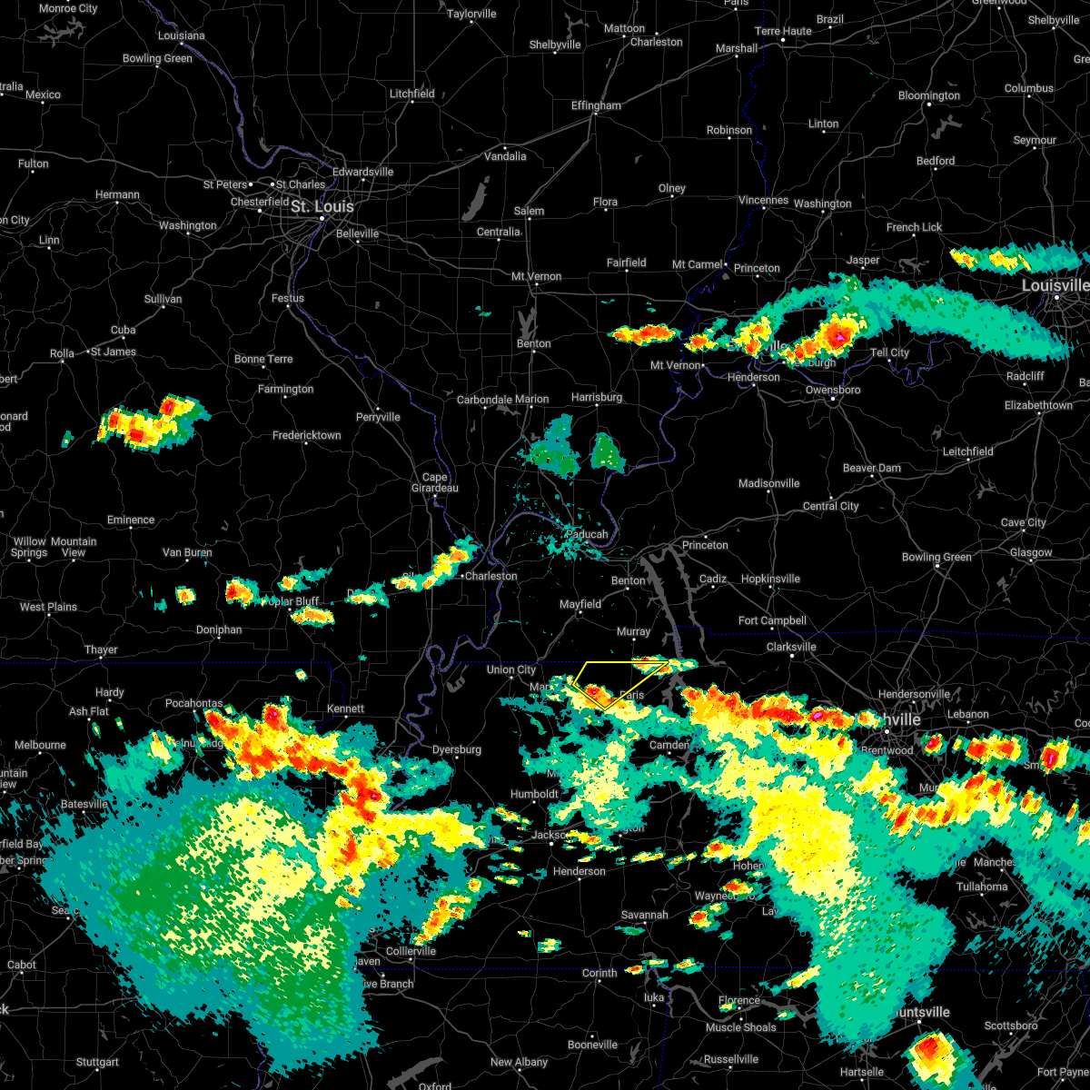 At 442 pm cdt, a severe thunderstorm was located over palmersville, or 15 miles northwest of paris, moving northeast at 20 mph (radar indicated). Hazards include quarter size hail. damage to vehicles is expected At 442 pm cdt, a severe thunderstorm was located over palmersville, or 15 miles northwest of paris, moving northeast at 20 mph (radar indicated). Hazards include quarter size hail. damage to vehicles is expected
|
| 5/21/2022 4:52 PM CDT |
 The severe thunderstorm warning for weakley, northeastern dyer, northwestern gibson, northwestern benton, obion and henry counties will expire at 500 pm cdt, the storms which prompted the warning have weakened below severe limits, and no longer pose an immediate threat to life or property. therefore, the warning will be allowed to expire. however small hail and gusty winds are still possible with these thunderstorms. a severe thunderstorm watch remains in effect until 1000 pm cdt for west tennessee. The severe thunderstorm warning for weakley, northeastern dyer, northwestern gibson, northwestern benton, obion and henry counties will expire at 500 pm cdt, the storms which prompted the warning have weakened below severe limits, and no longer pose an immediate threat to life or property. therefore, the warning will be allowed to expire. however small hail and gusty winds are still possible with these thunderstorms. a severe thunderstorm watch remains in effect until 1000 pm cdt for west tennessee.
|
| 5/21/2022 4:42 PM CDT |
 At 442 pm cdt, severe thunderstorms were located along a line extending from near kenton to 10 miles southeast of paris landing state park, moving northeast at 20 mph (radar indicated). Hazards include 60 mph wind gusts and quarter size hail. Hail damage to vehicles is expected. expect wind damage to roofs, siding, and trees. locations impacted include, martin, union city, paris, mckenzie, fulton, paris landing state park, dresden, south fulton, greenfield, gleason, troy, kenton, rutherford, obion, sharon, cottage grove, latham, springville, routon and palmersville. hail threat, radar indicated max hail size, 1. 00 in wind threat, radar indicated max wind gust, 60 mph. At 442 pm cdt, severe thunderstorms were located along a line extending from near kenton to 10 miles southeast of paris landing state park, moving northeast at 20 mph (radar indicated). Hazards include 60 mph wind gusts and quarter size hail. Hail damage to vehicles is expected. expect wind damage to roofs, siding, and trees. locations impacted include, martin, union city, paris, mckenzie, fulton, paris landing state park, dresden, south fulton, greenfield, gleason, troy, kenton, rutherford, obion, sharon, cottage grove, latham, springville, routon and palmersville. hail threat, radar indicated max hail size, 1. 00 in wind threat, radar indicated max wind gust, 60 mph.
|
| 5/21/2022 4:34 PM CDT |
 At 434 pm cdt, severe thunderstorms were located along a line extending from near kenton to 8 miles east of springville, moving east at 20 mph (radar indicated). Hazards include 60 mph wind gusts and quarter size hail. Hail damage to vehicles is expected. expect wind damage to roofs, siding, and trees. locations impacted include, martin, union city, paris, mckenzie, fulton, paris landing state park, dresden, south fulton, greenfield, gleason, troy, kenton, rutherford, obion, sharon, cottage grove, latham, springville, routon and palmersville. hail threat, radar indicated max hail size, 1. 00 in wind threat, radar indicated max wind gust, 60 mph. At 434 pm cdt, severe thunderstorms were located along a line extending from near kenton to 8 miles east of springville, moving east at 20 mph (radar indicated). Hazards include 60 mph wind gusts and quarter size hail. Hail damage to vehicles is expected. expect wind damage to roofs, siding, and trees. locations impacted include, martin, union city, paris, mckenzie, fulton, paris landing state park, dresden, south fulton, greenfield, gleason, troy, kenton, rutherford, obion, sharon, cottage grove, latham, springville, routon and palmersville. hail threat, radar indicated max hail size, 1. 00 in wind threat, radar indicated max wind gust, 60 mph.
|
| 5/21/2022 4:30 PM CDT | Multiple trees down on clayton town roa in henry county TN, 6.3 miles W of Puryear, TN |
| 5/21/2022 4:19 PM CDT |
 At 419 pm cdt, severe thunderstorms were located along a line extending from 6 miles southeast of obion to near springville, moving northeast at 20 mph (radar indicated). Hazards include 60 mph wind gusts and quarter size hail. Hail damage to vehicles is expected. Expect wind damage to roofs, siding, and trees. At 419 pm cdt, severe thunderstorms were located along a line extending from 6 miles southeast of obion to near springville, moving northeast at 20 mph (radar indicated). Hazards include 60 mph wind gusts and quarter size hail. Hail damage to vehicles is expected. Expect wind damage to roofs, siding, and trees.
|
| 4/13/2022 5:01 PM CDT |
 At 501 pm cdt, severe thunderstorms were located along a line extending from 12 miles southeast of murray to near paris landing state park to near paris, moving east at 40 mph (radar indicated). Hazards include 60 mph wind gusts. expect damage to roofs, siding, and trees At 501 pm cdt, severe thunderstorms were located along a line extending from 12 miles southeast of murray to near paris landing state park to near paris, moving east at 40 mph (radar indicated). Hazards include 60 mph wind gusts. expect damage to roofs, siding, and trees
|
| 4/13/2022 4:27 PM CDT |
 At 425 pm cdt, severe thunderstorms were located along a line extending from near lynnville to near dresden to greenfield, moving northeast at 60 mph (radar indicated). Hazards include 60 mph wind gusts. expect damage to roofs, siding, and trees At 425 pm cdt, severe thunderstorms were located along a line extending from near lynnville to near dresden to greenfield, moving northeast at 60 mph (radar indicated). Hazards include 60 mph wind gusts. expect damage to roofs, siding, and trees
|
| 4/13/2022 3:42 PM CDT |
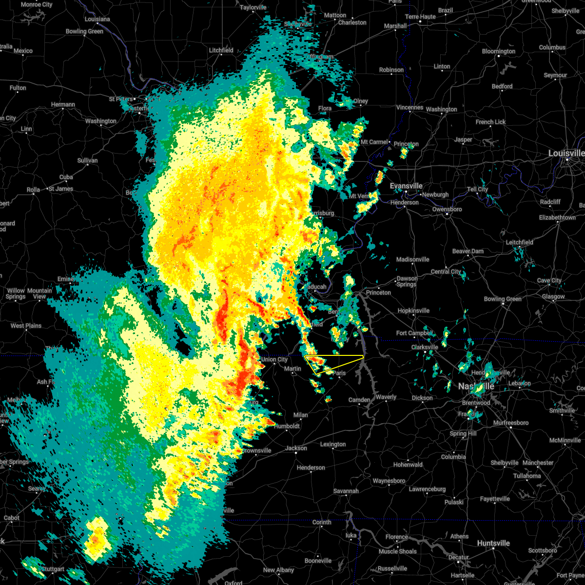 At 342 pm cdt, a severe thunderstorm was located near palmersville, or 15 miles southwest of murray, moving northeast at 60 mph (radar indicated). Hazards include 60 mph wind gusts and quarter size hail. Hail damage to vehicles is expected. expect wind damage to roofs, siding, and trees. locations impacted include, cottage grove, palmersville, puryear, mill creek, brundige, jones mill, foundry hill, conyersville, pine hill and crossland. hail threat, radar indicated max hail size, 1. 00 in wind threat, radar indicated max wind gust, 60 mph. At 342 pm cdt, a severe thunderstorm was located near palmersville, or 15 miles southwest of murray, moving northeast at 60 mph (radar indicated). Hazards include 60 mph wind gusts and quarter size hail. Hail damage to vehicles is expected. expect wind damage to roofs, siding, and trees. locations impacted include, cottage grove, palmersville, puryear, mill creek, brundige, jones mill, foundry hill, conyersville, pine hill and crossland. hail threat, radar indicated max hail size, 1. 00 in wind threat, radar indicated max wind gust, 60 mph.
|
| 4/13/2022 3:38 PM CDT |
 At 338 pm cdt, a severe thunderstorm was located over palmersville, or 14 miles northeast of martin, moving northeast at 60 mph (radar indicated). Hazards include 60 mph wind gusts and quarter size hail. Hail damage to vehicles is expected. Expect wind damage to roofs, siding, and trees. At 338 pm cdt, a severe thunderstorm was located over palmersville, or 14 miles northeast of martin, moving northeast at 60 mph (radar indicated). Hazards include 60 mph wind gusts and quarter size hail. Hail damage to vehicles is expected. Expect wind damage to roofs, siding, and trees.
|
| 1/1/2022 2:23 AM CST |
 At 223 am cst, a severe thunderstorm producing a tornado was located near paris landing state park, moving east at 45 mph (radar indicated rotation). Hazards include tornado and quarter size hail. Flying debris will be dangerous to those caught without shelter. mobile homes will be damaged or destroyed. damage to roofs, windows, and vehicles will occur. tree damage is likely. Locations impacted include, paris landing state park, puryear, mill creek, whitlock, foundry hill, conyersville, pine hill, crossland and buchanan. At 223 am cst, a severe thunderstorm producing a tornado was located near paris landing state park, moving east at 45 mph (radar indicated rotation). Hazards include tornado and quarter size hail. Flying debris will be dangerous to those caught without shelter. mobile homes will be damaged or destroyed. damage to roofs, windows, and vehicles will occur. tree damage is likely. Locations impacted include, paris landing state park, puryear, mill creek, whitlock, foundry hill, conyersville, pine hill, crossland and buchanan.
|
| 1/1/2022 2:16 AM CST |
 At 215 am cst, a severe thunderstorm producing a tornado was located 10 miles north of paris, moving east at 45 mph (radar indicated rotation). Hazards include tornado and quarter size hail. Flying debris will be dangerous to those caught without shelter. mobile homes will be damaged or destroyed. damage to roofs, windows, and vehicles will occur. tree damage is likely. Locations impacted include, paris landing state park, cottage grove, puryear, mill creek, osage, whitlock, jones mill, foundry hill, conyersville, pine hill, crossland and buchanan. At 215 am cst, a severe thunderstorm producing a tornado was located 10 miles north of paris, moving east at 45 mph (radar indicated rotation). Hazards include tornado and quarter size hail. Flying debris will be dangerous to those caught without shelter. mobile homes will be damaged or destroyed. damage to roofs, windows, and vehicles will occur. tree damage is likely. Locations impacted include, paris landing state park, cottage grove, puryear, mill creek, osage, whitlock, jones mill, foundry hill, conyersville, pine hill, crossland and buchanan.
|
| 1/1/2022 2:08 AM CST |
 The tornado warning for northern weakley and northwestern henry counties will expire at 215 am cst, the tornado warning that was previously in effect has been reissued for henry county and is in effect until 2:45. please refer to that bulletin for the latest severe weather information. a tornado watch remains in effect until 700 am cst for western tennessee. The tornado warning for northern weakley and northwestern henry counties will expire at 215 am cst, the tornado warning that was previously in effect has been reissued for henry county and is in effect until 2:45. please refer to that bulletin for the latest severe weather information. a tornado watch remains in effect until 700 am cst for western tennessee.
|
| 1/1/2022 1:57 AM CST |
 At 157 am cst, a severe thunderstorm producing a tornado was located over palmersville, or 15 miles northwest of paris, moving east at 45 mph (radar indicated rotation). Hazards include tornado and quarter size hail. Flying debris will be dangerous to those caught without shelter. mobile homes will be damaged or destroyed. damage to roofs, windows, and vehicles will occur. Tree damage is likely. At 157 am cst, a severe thunderstorm producing a tornado was located over palmersville, or 15 miles northwest of paris, moving east at 45 mph (radar indicated rotation). Hazards include tornado and quarter size hail. Flying debris will be dangerous to those caught without shelter. mobile homes will be damaged or destroyed. damage to roofs, windows, and vehicles will occur. Tree damage is likely.
|
| 1/1/2022 1:41 AM CST |
 At 141 am cst, a severe thunderstorm producing a tornado was located near latham, or near martin, moving northeast at 50 mph (radar indicated rotation). Hazards include tornado and quarter size hail. Flying debris will be dangerous to those caught without shelter. mobile homes will be damaged or destroyed. damage to roofs, windows, and vehicles will occur. Tree damage is likely. At 141 am cst, a severe thunderstorm producing a tornado was located near latham, or near martin, moving northeast at 50 mph (radar indicated rotation). Hazards include tornado and quarter size hail. Flying debris will be dangerous to those caught without shelter. mobile homes will be damaged or destroyed. damage to roofs, windows, and vehicles will occur. Tree damage is likely.
|
| 12/6/2021 4:13 AM CST |
 The severe thunderstorm warning for northeastern benton and northern henry counties will expire at 415 am cst, the storm which prompted the warning has moved out of the area. therefore, the warning will be allowed to expire. The severe thunderstorm warning for northeastern benton and northern henry counties will expire at 415 am cst, the storm which prompted the warning has moved out of the area. therefore, the warning will be allowed to expire.
|
| 12/6/2021 4:05 AM CST | Trees down in the 6000 block of highway 140 eas in henry county TN, 5.9 miles WNW of Puryear, TN |
| 12/6/2021 4:02 AM CST |
 At 401 am cst, a severe thunderstorm was located 7 miles north of paris landing state park, moving east at 60 mph (radar indicated). Hazards include 60 mph wind gusts. Expect damage to roofs, siding, and trees. Locations impacted include, paris, paris landing state park, springville, puryear, big sandy, haigler ridge, foundry hill, old springville, buchanan, india, osage, sunnyside, whitlock, porter court, conyersville, pine hill and big sandy unit tennessee national wildlife refuge. At 401 am cst, a severe thunderstorm was located 7 miles north of paris landing state park, moving east at 60 mph (radar indicated). Hazards include 60 mph wind gusts. Expect damage to roofs, siding, and trees. Locations impacted include, paris, paris landing state park, springville, puryear, big sandy, haigler ridge, foundry hill, old springville, buchanan, india, osage, sunnyside, whitlock, porter court, conyersville, pine hill and big sandy unit tennessee national wildlife refuge.
|
| 12/6/2021 3:54 AM CST |
 At 354 am cst, a severe thunderstorm was located 9 miles southeast of murray, moving east at 60 mph (radar indicated). Hazards include 60 mph wind gusts. Expect damage to roofs, siding, and trees. Locations impacted include, paris, paris landing state park, cottage grove, springville, puryear, big sandy, haigler ridge, jones mill, foundry hill, old springville, crossland, buchanan, india, mill creek, osage, sunnyside, whitlock, porter court, conyersville and pine hill. At 354 am cst, a severe thunderstorm was located 9 miles southeast of murray, moving east at 60 mph (radar indicated). Hazards include 60 mph wind gusts. Expect damage to roofs, siding, and trees. Locations impacted include, paris, paris landing state park, cottage grove, springville, puryear, big sandy, haigler ridge, jones mill, foundry hill, old springville, crossland, buchanan, india, mill creek, osage, sunnyside, whitlock, porter court, conyersville and pine hill.
|
| 12/6/2021 3:51 AM CST | Tree down blocking one lane on west goldston springs r in henry county TN, 3.2 miles E of Puryear, TN |
| 12/6/2021 3:44 AM CST |
 At 344 am cst, a severe thunderstorm was located near murray, moving east at 60 mph (radar indicated). Hazards include 60 mph wind gusts. expect damage to roofs, siding, and trees At 344 am cst, a severe thunderstorm was located near murray, moving east at 60 mph (radar indicated). Hazards include 60 mph wind gusts. expect damage to roofs, siding, and trees
|
| 6/12/2021 5:27 PM CDT |
 At 526 pm cdt, a severe thunderstorm was located over paris, moving south at 10 mph (radar indicated). Hazards include 60 mph wind gusts and quarter size hail. Hail damage to vehicles is expected. Expect wind damage to roofs, siding, and trees. At 526 pm cdt, a severe thunderstorm was located over paris, moving south at 10 mph (radar indicated). Hazards include 60 mph wind gusts and quarter size hail. Hail damage to vehicles is expected. Expect wind damage to roofs, siding, and trees.
|
| 5/4/2021 4:37 AM CDT |
 At 436 am cdt, severe thunderstorms were located along a line extending from 8 miles north of paris landing state park to bruceton, moving southeast at 45 mph (radar indicated). Hazards include 60 mph wind gusts. Expect damage to roofs, siding, and trees. Locations impacted include, paris, huntingdon, camden, paris landing state park, bruceton, routon, vale, springville, hollow rock, puryear, big sandy, henry, mansfield, old springville, sunnyside, whitlock, porter court, conyersville, pine hill and ephesus. At 436 am cdt, severe thunderstorms were located along a line extending from 8 miles north of paris landing state park to bruceton, moving southeast at 45 mph (radar indicated). Hazards include 60 mph wind gusts. Expect damage to roofs, siding, and trees. Locations impacted include, paris, huntingdon, camden, paris landing state park, bruceton, routon, vale, springville, hollow rock, puryear, big sandy, henry, mansfield, old springville, sunnyside, whitlock, porter court, conyersville, pine hill and ephesus.
|
| 5/4/2021 4:18 AM CDT |
 At 418 am cdt, severe thunderstorms were located along a line extending from 7 miles south of murray to near huntingdon, moving east at 55 mph (radar indicated). Hazards include 60 mph wind gusts. expect damage to roofs, siding, and trees At 418 am cdt, severe thunderstorms were located along a line extending from 7 miles south of murray to near huntingdon, moving east at 55 mph (radar indicated). Hazards include 60 mph wind gusts. expect damage to roofs, siding, and trees
|
| 5/4/2021 4:13 AM CDT | Several trees down on highway 64 in calloway county KY, 4 miles S of Puryear, TN |
| 4/28/2021 6:31 PM CDT |
 At 630 pm cdt, doppler radar indicated a severe thunderstorm producing a tornado was located near cottage grove, or 7 miles northwest of paris, moving east at 25 mph (radar indicated rotation. at 625 pm cdt, a funnel cloud was reported by a member of the public south of cottage grove). Hazards include tornado and quarter size hail. Flying debris will be dangerous to those caught without shelter. mobile homes will be damaged or destroyed. damage to roofs, windows, and vehicles will occur. tree damage is likely. Locations impacted include, cottage grove, puryear, mill creek, osage, whitlock, foundry hill, conyersville and india. At 630 pm cdt, doppler radar indicated a severe thunderstorm producing a tornado was located near cottage grove, or 7 miles northwest of paris, moving east at 25 mph (radar indicated rotation. at 625 pm cdt, a funnel cloud was reported by a member of the public south of cottage grove). Hazards include tornado and quarter size hail. Flying debris will be dangerous to those caught without shelter. mobile homes will be damaged or destroyed. damage to roofs, windows, and vehicles will occur. tree damage is likely. Locations impacted include, cottage grove, puryear, mill creek, osage, whitlock, foundry hill, conyersville and india.
|
| 4/28/2021 6:23 PM CDT |
 At 623 pm cdt, doppler radar indicated a severe thunderstorm producing a tornado was located over cottage grove, or 8 miles northwest of paris, moving east at 30 mph (radar indicated rotation). Hazards include tornado and quarter size hail. Flying debris will be dangerous to those caught without shelter. mobile homes will be damaged or destroyed. damage to roofs, windows, and vehicles will occur. tree damage is likely. Locations impacted include, cottage grove, puryear, mill creek, osage, whitlock, foundry hill, conyersville and india. At 623 pm cdt, doppler radar indicated a severe thunderstorm producing a tornado was located over cottage grove, or 8 miles northwest of paris, moving east at 30 mph (radar indicated rotation). Hazards include tornado and quarter size hail. Flying debris will be dangerous to those caught without shelter. mobile homes will be damaged or destroyed. damage to roofs, windows, and vehicles will occur. tree damage is likely. Locations impacted include, cottage grove, puryear, mill creek, osage, whitlock, foundry hill, conyersville and india.
|
| 4/28/2021 6:11 PM CDT |
 At 610 pm cdt, doppler radar indicated a severe thunderstorm producing a tornado was located near palmersville, or 14 miles west of paris, moving east at 30 mph (radar indicated rotation). Hazards include tornado and quarter size hail. Flying debris will be dangerous to those caught without shelter. mobile homes will be damaged or destroyed. damage to roofs, windows, and vehicles will occur. Tree damage is likely. At 610 pm cdt, doppler radar indicated a severe thunderstorm producing a tornado was located near palmersville, or 14 miles west of paris, moving east at 30 mph (radar indicated rotation). Hazards include tornado and quarter size hail. Flying debris will be dangerous to those caught without shelter. mobile homes will be damaged or destroyed. damage to roofs, windows, and vehicles will occur. Tree damage is likely.
|
| 8/27/2020 7:21 PM CDT |
 At 721 pm cdt, a severe thunderstorm was located near paris, moving north at 35 mph (radar indicated). Hazards include 60 mph wind gusts. Expect damage to roofs, siding, and trees. Locations impacted include, paris, cottage grove, palmersville, puryear, jones mill, foundry hill, crossland, como, mill creek, osage, whitlock, porter court and conyersville. At 721 pm cdt, a severe thunderstorm was located near paris, moving north at 35 mph (radar indicated). Hazards include 60 mph wind gusts. Expect damage to roofs, siding, and trees. Locations impacted include, paris, cottage grove, palmersville, puryear, jones mill, foundry hill, crossland, como, mill creek, osage, whitlock, porter court and conyersville.
|
| 8/27/2020 7:02 PM CDT |
 At 702 pm cdt, a severe thunderstorm was located near routon, or 7 miles south of paris, moving north at 35 mph (radar indicated). Hazards include 60 mph wind gusts. expect damage to roofs, siding, and trees At 702 pm cdt, a severe thunderstorm was located near routon, or 7 miles south of paris, moving north at 35 mph (radar indicated). Hazards include 60 mph wind gusts. expect damage to roofs, siding, and trees
|
| 5/3/2020 3:19 PM CDT |
 A severe thunderstorm warning remains in effect until 330 pm cdt for benton. northern carroll and henry counties. at 317 pm cdt, severe thunderstorms were located along a line extending from 7 miles northeast of paris to near vale to near atwood, moving east at 60 mph. hazard. 70 mph wind gusts and penny size hail. A severe thunderstorm warning remains in effect until 330 pm cdt for benton. northern carroll and henry counties. at 317 pm cdt, severe thunderstorms were located along a line extending from 7 miles northeast of paris to near vale to near atwood, moving east at 60 mph. hazard. 70 mph wind gusts and penny size hail.
|
| 5/3/2020 3:09 PM CDT |
 At 309 pm cdt, severe thunderstorms were located along a line extending from near paris to near routon to near milan, moving east at 60 mph (radar indicated). Hazards include 70 mph wind gusts and nickel size hail. Expect considerable tree damage. damage is likely to mobile homes, roofs, and outbuildings. Locations impacted include, paris, mckenzie, huntingdon, camden, paris landing state park, dresden, new johnsonville, bruceton, gleason, bradford, atwood, cottage grove, vale, springville, routon, trezevant, hollow rock, puryear, big sandy and henry. At 309 pm cdt, severe thunderstorms were located along a line extending from near paris to near routon to near milan, moving east at 60 mph (radar indicated). Hazards include 70 mph wind gusts and nickel size hail. Expect considerable tree damage. damage is likely to mobile homes, roofs, and outbuildings. Locations impacted include, paris, mckenzie, huntingdon, camden, paris landing state park, dresden, new johnsonville, bruceton, gleason, bradford, atwood, cottage grove, vale, springville, routon, trezevant, hollow rock, puryear, big sandy and henry.
|
| 5/3/2020 3:03 PM CDT |
 At 302 pm cdt, severe thunderstorms were located along a line extending from near cottage grove to near mckenzie to near milan, moving east at 60 mph (radar indicated). Hazards include 70 mph wind gusts. Expect considerable tree damage. damage is likely to mobile homes, roofs, and outbuildings. Locations impacted include, paris, mckenzie, huntingdon, camden, paris landing state park, dresden, dyer, greenfield, new johnsonville, bruceton, gleason, bradford, sharon, atwood, cottage grove, vale, springville, routon, palmersville and trezevant. At 302 pm cdt, severe thunderstorms were located along a line extending from near cottage grove to near mckenzie to near milan, moving east at 60 mph (radar indicated). Hazards include 70 mph wind gusts. Expect considerable tree damage. damage is likely to mobile homes, roofs, and outbuildings. Locations impacted include, paris, mckenzie, huntingdon, camden, paris landing state park, dresden, dyer, greenfield, new johnsonville, bruceton, gleason, bradford, sharon, atwood, cottage grove, vale, springville, routon, palmersville and trezevant.
|
| 5/3/2020 2:38 PM CDT |
 At 238 pm cdt, severe thunderstorms were located along a line extending from near south fulton to near martin to near newbern, moving east at 65 mph (radar indicated). Hazards include 70 mph wind gusts and quarter size hail. Hail damage to vehicles is expected. expect considerable tree damage. Wind damage is also likely to mobile homes, roofs, and outbuildings. At 238 pm cdt, severe thunderstorms were located along a line extending from near south fulton to near martin to near newbern, moving east at 65 mph (radar indicated). Hazards include 70 mph wind gusts and quarter size hail. Hail damage to vehicles is expected. expect considerable tree damage. Wind damage is also likely to mobile homes, roofs, and outbuildings.
|
| 4/8/2020 8:58 PM CDT |
 At 858 pm cdt, a severe thunderstorm was located over routon, or near paris, moving southeast at 40 mph (radar indicated). Hazards include golf ball size hail and 60 mph wind gusts. People and animals outdoors will be injured. expect hail damage to roofs, siding, windows, and vehicles. expect wind damage to roofs, siding, and trees. Locations impacted include, paris, paris landing state park, cottage grove, routon, springville, puryear, big sandy, henry, mansfield, jones mill, old springville, sunnyside, whitlock, porter court, conyersville, haigler ridge, foundry hill, manleyville, buchanan and india. At 858 pm cdt, a severe thunderstorm was located over routon, or near paris, moving southeast at 40 mph (radar indicated). Hazards include golf ball size hail and 60 mph wind gusts. People and animals outdoors will be injured. expect hail damage to roofs, siding, windows, and vehicles. expect wind damage to roofs, siding, and trees. Locations impacted include, paris, paris landing state park, cottage grove, routon, springville, puryear, big sandy, henry, mansfield, jones mill, old springville, sunnyside, whitlock, porter court, conyersville, haigler ridge, foundry hill, manleyville, buchanan and india.
|
| 4/8/2020 8:37 PM CDT |
 At 836 pm cdt, a severe thunderstorm was located over palmersville, or 16 miles northwest of paris, moving southeast at 35 mph. in addition, a second severe storm was east of puryear, and was moving southeast at 35 mph (radar indicated). Hazards include golf ball size hail and 60 mph wind gusts. People and animals outdoors will be injured. expect hail damage to roofs, siding, windows, and vehicles. Expect wind damage to roofs, siding, and trees. At 836 pm cdt, a severe thunderstorm was located over palmersville, or 16 miles northwest of paris, moving southeast at 35 mph. in addition, a second severe storm was east of puryear, and was moving southeast at 35 mph (radar indicated). Hazards include golf ball size hail and 60 mph wind gusts. People and animals outdoors will be injured. expect hail damage to roofs, siding, windows, and vehicles. Expect wind damage to roofs, siding, and trees.
|
| 4/8/2020 8:36 PM CDT | Quarter sized hail reported 9 miles W of Puryear, TN |
| 4/8/2020 8:12 PM CDT |
 At 812 pm cdt, a severe thunderstorm was located near murray, moving southeast at 30 mph (radar indicated). Hazards include golf ball size hail and 60 mph wind gusts. People and animals outdoors will be injured. expect hail damage to roofs, siding, windows, and vehicles. expect wind damage to roofs, siding, and trees. Locations impacted include, paris, paris landing state park, springville, puryear, haigler ridge, jones mill, foundry hill, manleyville, old springville, crossland, buchanan, india, mill creek, sunnyside, whitlock, spring creek, porter court, conyersville, pine hill and big sandy unit tennessee national wildlife refuge. At 812 pm cdt, a severe thunderstorm was located near murray, moving southeast at 30 mph (radar indicated). Hazards include golf ball size hail and 60 mph wind gusts. People and animals outdoors will be injured. expect hail damage to roofs, siding, windows, and vehicles. expect wind damage to roofs, siding, and trees. Locations impacted include, paris, paris landing state park, springville, puryear, haigler ridge, jones mill, foundry hill, manleyville, old springville, crossland, buchanan, india, mill creek, sunnyside, whitlock, spring creek, porter court, conyersville, pine hill and big sandy unit tennessee national wildlife refuge.
|
| 4/8/2020 7:58 PM CDT |
 At 758 pm cdt, a severe thunderstorm was located near murray, moving southeast at 35 mph (radar indicated). Hazards include 60 mph wind gusts and quarter size hail. Hail damage to vehicles is expected. Expect wind damage to roofs, siding, and trees. At 758 pm cdt, a severe thunderstorm was located near murray, moving southeast at 35 mph (radar indicated). Hazards include 60 mph wind gusts and quarter size hail. Hail damage to vehicles is expected. Expect wind damage to roofs, siding, and trees.
|
| 1/11/2020 6:38 AM CST |
 At 637 am cst, a severe thunderstorm was located near vale, or near huntingdon, moving northeast at 70 mph (radar indicated). Hazards include 60 mph wind gusts. expect damage to roofs, siding, and trees At 637 am cst, a severe thunderstorm was located near vale, or near huntingdon, moving northeast at 70 mph (radar indicated). Hazards include 60 mph wind gusts. expect damage to roofs, siding, and trees
|
| 10/26/2019 1:42 PM CDT |
 At 141 pm cdt, a severe thunderstorm was located near camden, moving north at 65 mph (radar indicated). Hazards include 70 mph wind gusts. Expect considerable tree damage. Damage is likely to mobile homes, roofs, and outbuildings. At 141 pm cdt, a severe thunderstorm was located near camden, moving north at 65 mph (radar indicated). Hazards include 70 mph wind gusts. Expect considerable tree damage. Damage is likely to mobile homes, roofs, and outbuildings.
|
| 7/17/2019 9:30 PM CDT |
 At 930 pm cdt, a severe thunderstorm was located 7 miles northeast of paris, moving southeast at 40 mph (radar indicated). Hazards include 60 mph wind gusts. expect damage to roofs, siding, and trees At 930 pm cdt, a severe thunderstorm was located 7 miles northeast of paris, moving southeast at 40 mph (radar indicated). Hazards include 60 mph wind gusts. expect damage to roofs, siding, and trees
|
| 6/21/2019 6:41 PM CDT |
 The severe thunderstorm warning for weakley, northeastern dyer, northwestern gibson, north central benton, obion, henry and southeastern lake counties will expire at 645 pm cdt, the storms which prompted the warning have moved out of the area. therefore, the warning will be allowed to expire. however strong winds to 45 mph is still possible with these thunderstorms. a severe thunderstorm watch remains in effect until 100 am cdt for southeastern missouri, and western tennessee. The severe thunderstorm warning for weakley, northeastern dyer, northwestern gibson, north central benton, obion, henry and southeastern lake counties will expire at 645 pm cdt, the storms which prompted the warning have moved out of the area. therefore, the warning will be allowed to expire. however strong winds to 45 mph is still possible with these thunderstorms. a severe thunderstorm watch remains in effect until 100 am cdt for southeastern missouri, and western tennessee.
|
| 6/21/2019 6:29 PM CDT |
 At 629 pm cdt, severe thunderstorms were located along a line extending from 6 miles south of cottage grove to near dyersburg, moving southeast at 35 mph (radar indicated). Hazards include 60 mph wind gusts. Expect damage to roofs, siding, and trees. Locations impacted include, dyersburg, martin, union city, paris, fulton, paris landing state park, newbern, dresden, greenfield, ridgely, gleason, troy, kenton, rutherford, obion, sharon, cottage grove, latham, cloverdale and miston. At 629 pm cdt, severe thunderstorms were located along a line extending from 6 miles south of cottage grove to near dyersburg, moving southeast at 35 mph (radar indicated). Hazards include 60 mph wind gusts. Expect damage to roofs, siding, and trees. Locations impacted include, dyersburg, martin, union city, paris, fulton, paris landing state park, newbern, dresden, greenfield, ridgely, gleason, troy, kenton, rutherford, obion, sharon, cottage grove, latham, cloverdale and miston.
|
| 6/21/2019 5:54 PM CDT |
 At 553 pm cdt, severe thunderstorms were located along a line extending from near latham to cottonwood grove, moving south at 25 mph (radar indicated). Hazards include 60 mph wind gusts. expect damage to roofs, siding, and trees At 553 pm cdt, severe thunderstorms were located along a line extending from near latham to cottonwood grove, moving south at 25 mph (radar indicated). Hazards include 60 mph wind gusts. expect damage to roofs, siding, and trees
|
| 7/15/2018 1:26 PM CDT |
 The severe thunderstorm warning for northeastern henry county will expire at 130 pm cdt, the storm which prompted the warning has weakened below severe limits, and no longer poses an immediate threat to life or property. therefore, the warning will be allowed to expire. however, gusty winds and heavy rain will continue with this thunderstorm. The severe thunderstorm warning for northeastern henry county will expire at 130 pm cdt, the storm which prompted the warning has weakened below severe limits, and no longer poses an immediate threat to life or property. therefore, the warning will be allowed to expire. however, gusty winds and heavy rain will continue with this thunderstorm.
|
| 7/15/2018 1:01 PM CDT |
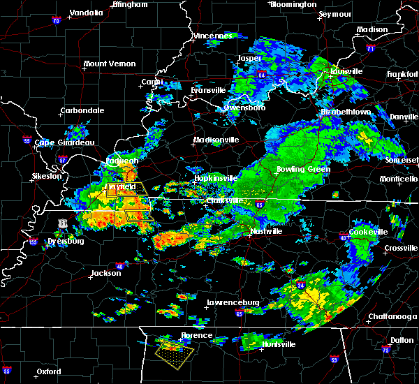 At 100 pm cdt, a severe thunderstorm was located 8 miles west of paris landing state park, moving east at 15 mph (radar indicated). Hazards include 60 mph wind gusts. Expect damage to roofs, siding, and trees. Locations impacted include, paris landing state park, puryear, conyersville, pine hill, buchanan and big sandy unit tennessee national wildlife refuge. At 100 pm cdt, a severe thunderstorm was located 8 miles west of paris landing state park, moving east at 15 mph (radar indicated). Hazards include 60 mph wind gusts. Expect damage to roofs, siding, and trees. Locations impacted include, paris landing state park, puryear, conyersville, pine hill, buchanan and big sandy unit tennessee national wildlife refuge.
|
| 7/15/2018 12:43 PM CDT |
 The national weather service in memphis has issued a * severe thunderstorm warning for. northeastern henry county in northwestern tennessee. until 130 pm cdt. At 1243 pm cdt, a severe thunderstorm was located 10 miles south of murray, moving east at 15 mph. The national weather service in memphis has issued a * severe thunderstorm warning for. northeastern henry county in northwestern tennessee. until 130 pm cdt. At 1243 pm cdt, a severe thunderstorm was located 10 miles south of murray, moving east at 15 mph.
|
| 7/5/2018 7:20 PM CDT |
 At 720 pm cdt, a severe thunderstorm was located 7 miles west of paris landing state park, moving southwest at 25 mph (radar indicated). Hazards include 60 mph wind gusts and quarter size hail. Hail damage to vehicles is expected. expect wind damage to roofs, siding, and trees. Locations impacted include, paris, mckenzie, paris landing state park, cottage grove, routon, puryear, henry, foundry hill, como, buchanan, india, mill creek, osage, sunnyside, whitlock, porter court, conyersville, pine hill and big sandy unit tennessee national wildlife refuge. At 720 pm cdt, a severe thunderstorm was located 7 miles west of paris landing state park, moving southwest at 25 mph (radar indicated). Hazards include 60 mph wind gusts and quarter size hail. Hail damage to vehicles is expected. expect wind damage to roofs, siding, and trees. Locations impacted include, paris, mckenzie, paris landing state park, cottage grove, routon, puryear, henry, foundry hill, como, buchanan, india, mill creek, osage, sunnyside, whitlock, porter court, conyersville, pine hill and big sandy unit tennessee national wildlife refuge.
|
| 7/5/2018 7:04 PM CDT |
 At 704 pm cdt, a severe thunderstorm was located over paris landing state park, moving southwest at 30 mph (radar indicated). Hazards include 60 mph wind gusts and quarter size hail. Hail damage to vehicles is expected. Expect wind damage to roofs, siding, and trees. At 704 pm cdt, a severe thunderstorm was located over paris landing state park, moving southwest at 30 mph (radar indicated). Hazards include 60 mph wind gusts and quarter size hail. Hail damage to vehicles is expected. Expect wind damage to roofs, siding, and trees.
|
| 6/28/2018 9:27 PM CDT |
 At 927 pm cdt, a severe thunderstorm was located near palmersville, or 14 miles east of martin, moving south at 60 mph (radar indicated). Hazards include 70 mph wind gusts and quarter size hail. Hail damage to vehicles is expected. expect considerable tree damage. Wind damage is also likely to mobile homes, roofs, and outbuildings. At 927 pm cdt, a severe thunderstorm was located near palmersville, or 14 miles east of martin, moving south at 60 mph (radar indicated). Hazards include 70 mph wind gusts and quarter size hail. Hail damage to vehicles is expected. expect considerable tree damage. Wind damage is also likely to mobile homes, roofs, and outbuildings.
|
| 6/28/2018 8:59 PM CDT |
 At 842 pm cdt, severe thunderstorms were located along a line extending from near energy to 7 miles southeast of wyatt, moving south at 60 mph (radar indicated). Hazards include 60 mph wind gusts. Expect damage to roofs, siding, and trees. Locations impacted include, martin, union city, paris, caruthersville, mckenzie, fulton, paris landing state park, reelfoot lake state park, tiptonville, newbern, dresden, south fulton, dyer, greenfield, ridgely, gleason, troy, kenton, rutherford and obion. At 842 pm cdt, severe thunderstorms were located along a line extending from near energy to 7 miles southeast of wyatt, moving south at 60 mph (radar indicated). Hazards include 60 mph wind gusts. Expect damage to roofs, siding, and trees. Locations impacted include, martin, union city, paris, caruthersville, mckenzie, fulton, paris landing state park, reelfoot lake state park, tiptonville, newbern, dresden, south fulton, dyer, greenfield, ridgely, gleason, troy, kenton, rutherford and obion.
|
| 6/28/2018 8:42 PM CDT |
 At 842 pm cdt, severe thunderstorms were located along a line extending from near energy to 7 miles southeast of wyatt, moving south at 60 mph (radar indicated). Hazards include 60 mph wind gusts. Expect damage to roofs, siding, and trees. Locations impacted include, martin, union city, paris, caruthersville, mckenzie, fulton, paris landing state park, reelfoot lake state park, tiptonville, newbern, dresden, south fulton, dyer, greenfield, ridgely, gleason, troy, kenton, rutherford and obion. At 842 pm cdt, severe thunderstorms were located along a line extending from near energy to 7 miles southeast of wyatt, moving south at 60 mph (radar indicated). Hazards include 60 mph wind gusts. Expect damage to roofs, siding, and trees. Locations impacted include, martin, union city, paris, caruthersville, mckenzie, fulton, paris landing state park, reelfoot lake state park, tiptonville, newbern, dresden, south fulton, dyer, greenfield, ridgely, gleason, troy, kenton, rutherford and obion.
|
| 6/28/2018 8:36 PM CDT |
 At 836 pm cdt, severe thunderstorms were located along a line extending from energy to 7 miles north of towosahgy state historic site, moving northeast at 30 mph (radar indicated). Hazards include 60 mph wind gusts. expect damage to roofs, siding, and trees At 836 pm cdt, severe thunderstorms were located along a line extending from energy to 7 miles north of towosahgy state historic site, moving northeast at 30 mph (radar indicated). Hazards include 60 mph wind gusts. expect damage to roofs, siding, and trees
|
| 6/28/2018 11:56 AM CDT |
 At 1156 am cdt, a severe thunderstorm was located near springville, or near paris, moving southeast at 40 mph (radar indicated). Hazards include 60 mph wind gusts. Expect damage to roofs, siding, and trees. Locations impacted include, paris, paris landing state park, cottage grove, routon, springville, puryear, big sandy, henry, jones mill, old springville, sunnyside, whitlock, porter court, conyersville, pine hill, haigler ridge, foundry hill, manleyville, buchanan and india. At 1156 am cdt, a severe thunderstorm was located near springville, or near paris, moving southeast at 40 mph (radar indicated). Hazards include 60 mph wind gusts. Expect damage to roofs, siding, and trees. Locations impacted include, paris, paris landing state park, cottage grove, routon, springville, puryear, big sandy, henry, jones mill, old springville, sunnyside, whitlock, porter court, conyersville, pine hill, haigler ridge, foundry hill, manleyville, buchanan and india.
|
| 6/28/2018 11:38 AM CDT |
 The severe thunderstorm warning for northern benton, northeastern carroll and central henry counties will expire at 1145 am cdt, the severe thunderstorm which prompted the warning has been replaced by other severe thunderstorm warnings in the area. therefore, the warning will be allowed to expire. a severe thunderstorm watch remains in effect until 700 pm cdt for western and northwestern tennessee. The severe thunderstorm warning for northern benton, northeastern carroll and central henry counties will expire at 1145 am cdt, the severe thunderstorm which prompted the warning has been replaced by other severe thunderstorm warnings in the area. therefore, the warning will be allowed to expire. a severe thunderstorm watch remains in effect until 700 pm cdt for western and northwestern tennessee.
|
| 6/28/2018 11:31 AM CDT |
 At 1130 am cdt, a severe thunderstorm was located near cottage grove, or 11 miles southwest of murray, moving southeast at 30 mph (radar indicated). Hazards include 60 mph wind gusts. expect damage to roofs, siding, and trees At 1130 am cdt, a severe thunderstorm was located near cottage grove, or 11 miles southwest of murray, moving southeast at 30 mph (radar indicated). Hazards include 60 mph wind gusts. expect damage to roofs, siding, and trees
|
| 6/28/2018 11:27 AM CDT |
 At 1118 am cdt, a severe thunderstorm was located near springville, or 7 miles southeast of paris, moving southeast at 40 mph (radar indicated). Hazards include 60 mph wind gusts and quarter size hail. Hail damage to vehicles is expected. expect wind damage to roofs, siding, and trees. Locations impacted include, paris, camden, bruceton, vale, springville, puryear, big sandy, mansfield, haigler ridge, foundry hill, manleyville, old springville, india, osage, sunnyside, van dyke, whitlock, spring creek, porter court and conyersville. At 1118 am cdt, a severe thunderstorm was located near springville, or 7 miles southeast of paris, moving southeast at 40 mph (radar indicated). Hazards include 60 mph wind gusts and quarter size hail. Hail damage to vehicles is expected. expect wind damage to roofs, siding, and trees. Locations impacted include, paris, camden, bruceton, vale, springville, puryear, big sandy, mansfield, haigler ridge, foundry hill, manleyville, old springville, india, osage, sunnyside, van dyke, whitlock, spring creek, porter court and conyersville.
|
| 6/28/2018 11:18 AM CDT |
 At 1118 am cdt, a severe thunderstorm was located near springville, or 7 miles southeast of paris, moving southeast at 40 mph (radar indicated). Hazards include 60 mph wind gusts and quarter size hail. Hail damage to vehicles is expected. expect wind damage to roofs, siding, and trees. Locations impacted include, paris, camden, bruceton, vale, springville, puryear, big sandy, mansfield, haigler ridge, foundry hill, manleyville, old springville, india, osage, sunnyside, van dyke, whitlock, spring creek, porter court and conyersville. At 1118 am cdt, a severe thunderstorm was located near springville, or 7 miles southeast of paris, moving southeast at 40 mph (radar indicated). Hazards include 60 mph wind gusts and quarter size hail. Hail damage to vehicles is expected. expect wind damage to roofs, siding, and trees. Locations impacted include, paris, camden, bruceton, vale, springville, puryear, big sandy, mansfield, haigler ridge, foundry hill, manleyville, old springville, india, osage, sunnyside, van dyke, whitlock, spring creek, porter court and conyersville.
|
| 6/28/2018 11:06 AM CDT |
 At 1105 am cdt, a severe thunderstorm was located over paris, moving southeast at 30 mph (radar indicated). Hazards include 60 mph wind gusts and quarter size hail. Hail damage to vehicles is expected. Expect wind damage to roofs, siding, and trees. At 1105 am cdt, a severe thunderstorm was located over paris, moving southeast at 30 mph (radar indicated). Hazards include 60 mph wind gusts and quarter size hail. Hail damage to vehicles is expected. Expect wind damage to roofs, siding, and trees.
|
| 6/27/2018 8:43 PM CDT |
 At 843 pm cdt, a severe thunderstorm was located 8 miles southeast of murray, moving southeast at 25 mph (radar indicated). Hazards include 60 mph wind gusts and half dollar size hail. Hail damage to vehicles is expected. expect wind damage to roofs, siding, and trees. Locations impacted include, paris, paris landing state park, puryear, big sandy, haigler ridge, foundry hill, old springville, buchanan, india, sunnyside, whitlock, porter court, conyersville, pine hill and big sandy unit tennessee national wildlife refuge. At 843 pm cdt, a severe thunderstorm was located 8 miles southeast of murray, moving southeast at 25 mph (radar indicated). Hazards include 60 mph wind gusts and half dollar size hail. Hail damage to vehicles is expected. expect wind damage to roofs, siding, and trees. Locations impacted include, paris, paris landing state park, puryear, big sandy, haigler ridge, foundry hill, old springville, buchanan, india, sunnyside, whitlock, porter court, conyersville, pine hill and big sandy unit tennessee national wildlife refuge.
|
| 6/27/2018 8:23 PM CDT |
 At 822 pm cdt, a severe thunderstorm was located near murray, moving southeast at 30 mph (radar indicated). Hazards include ping pong ball size hail and 60 mph wind gusts. People and animals outdoors will be injured. expect hail damage to roofs, siding, windows, and vehicles. Expect wind damage to roofs, siding, and trees. At 822 pm cdt, a severe thunderstorm was located near murray, moving southeast at 30 mph (radar indicated). Hazards include ping pong ball size hail and 60 mph wind gusts. People and animals outdoors will be injured. expect hail damage to roofs, siding, windows, and vehicles. Expect wind damage to roofs, siding, and trees.
|
| 6/1/2018 12:04 AM CDT |
 At 1204 am cdt, a severe thunderstorm was located over murray, moving northeast at 55 mph (radar indicated). Hazards include 60 mph wind gusts and quarter size hail. Hail damage to vehicles is expected. expect wind damage to roofs, siding, and trees. Locations impacted include, martin, paris, mckenzie, paris landing state park, dresden, greenfield, gleason, sharon, cottage grove, latham, routon, palmersville, springville, puryear, henry, sandhill, mansfield, mount pelia, jones mill and old springville. At 1204 am cdt, a severe thunderstorm was located over murray, moving northeast at 55 mph (radar indicated). Hazards include 60 mph wind gusts and quarter size hail. Hail damage to vehicles is expected. expect wind damage to roofs, siding, and trees. Locations impacted include, martin, paris, mckenzie, paris landing state park, dresden, greenfield, gleason, sharon, cottage grove, latham, routon, palmersville, springville, puryear, henry, sandhill, mansfield, mount pelia, jones mill and old springville.
|
| 5/31/2018 11:43 PM CDT |
 At 1142 pm cdt, a severe thunderstorm was located over palmersville, or 15 miles northeast of martin, moving southeast at 55 mph (radar indicated). Hazards include 60 mph wind gusts and quarter size hail. Hail damage to vehicles is expected. expect wind damage to roofs, siding, and trees. Locations impacted include, martin, paris, mckenzie, fulton, paris landing state park, dresden, south fulton, greenfield, gleason, sharon, cottage grove, latham, springville, routon, palmersville, puryear, henry, jones mill, old springville and como. At 1142 pm cdt, a severe thunderstorm was located over palmersville, or 15 miles northeast of martin, moving southeast at 55 mph (radar indicated). Hazards include 60 mph wind gusts and quarter size hail. Hail damage to vehicles is expected. expect wind damage to roofs, siding, and trees. Locations impacted include, martin, paris, mckenzie, fulton, paris landing state park, dresden, south fulton, greenfield, gleason, sharon, cottage grove, latham, springville, routon, palmersville, puryear, henry, jones mill, old springville and como.
|
| 5/31/2018 11:40 PM CDT |
 At 1140 pm cdt, a severe thunderstorm was located near palmersville, or 13 miles northeast of martin, moving northeast at 55 mph (radar indicated). Hazards include 60 mph wind gusts and quarter size hail. Hail damage to vehicles is expected. Expect wind damage to roofs, siding, and trees. At 1140 pm cdt, a severe thunderstorm was located near palmersville, or 13 miles northeast of martin, moving northeast at 55 mph (radar indicated). Hazards include 60 mph wind gusts and quarter size hail. Hail damage to vehicles is expected. Expect wind damage to roofs, siding, and trees.
|
| 5/19/2018 5:29 PM CDT |
 At 529 pm cdt, a severe thunderstorm was located near paris, moving east at 15 mph (radar indicated). Hazards include 60 mph wind gusts and quarter size hail. Hail damage to vehicles is expected. Expect wind damage to roofs, siding, and trees. At 529 pm cdt, a severe thunderstorm was located near paris, moving east at 15 mph (radar indicated). Hazards include 60 mph wind gusts and quarter size hail. Hail damage to vehicles is expected. Expect wind damage to roofs, siding, and trees.
|
| 2/24/2018 8:21 PM CST |
 The tornado warning for northeastern benton and henry counties will expire at 830 pm cst, the storm which prompted the warning has moved out of the area. therefore the warning will be allowed to expire. a tornado watch remains in effect until 900 pm cst for northwestern and middle tennessee. The tornado warning for northeastern benton and henry counties will expire at 830 pm cst, the storm which prompted the warning has moved out of the area. therefore the warning will be allowed to expire. a tornado watch remains in effect until 900 pm cst for northwestern and middle tennessee.
|
| 2/24/2018 8:09 PM CST |
 At 809 pm cst, a confirmed tornado was located near paris landing state park, moving northeast at 55 mph (radar confirmed tornado). Hazards include damaging tornado. Flying debris will be dangerous to those caught without shelter. mobile homes will be damaged or destroyed. damage to roofs, windows, and vehicles will occur. tree damage is likely. Locations impacted include, paris, paris landing state park, springville, routon, puryear, big sandy, mansfield, haigler ridge, jones mill, foundry hill, manleyville, old springville, crossland, buchanan, india, mill creek, osage, sunnyside, van dyke and whitlock. At 809 pm cst, a confirmed tornado was located near paris landing state park, moving northeast at 55 mph (radar confirmed tornado). Hazards include damaging tornado. Flying debris will be dangerous to those caught without shelter. mobile homes will be damaged or destroyed. damage to roofs, windows, and vehicles will occur. tree damage is likely. Locations impacted include, paris, paris landing state park, springville, routon, puryear, big sandy, mansfield, haigler ridge, jones mill, foundry hill, manleyville, old springville, crossland, buchanan, india, mill creek, osage, sunnyside, van dyke and whitlock.
|
| 2/24/2018 8:06 PM CST |
 At 805 pm cst, severe thunderstorms were located along a line extending from near big rock to 10 miles northeast of parsons, moving east at 65 mph (radar indicated). Hazards include 60 mph wind gusts. Expect damage to roofs, siding, and trees. locations impacted include, paris, lexington, mckenzie, huntingdon, camden, natchez trace state park, natchez trace state forest, paris landing state park, parsons, bruceton, cottage grove, blue goose, vale, bargerton, wildersville, springville, routon, parkers crossroads, hollow rock and puryear. A tornado watch remains in effect until 900 pm cst for southwestern, northwestern and middle tennessee. At 805 pm cst, severe thunderstorms were located along a line extending from near big rock to 10 miles northeast of parsons, moving east at 65 mph (radar indicated). Hazards include 60 mph wind gusts. Expect damage to roofs, siding, and trees. locations impacted include, paris, lexington, mckenzie, huntingdon, camden, natchez trace state park, natchez trace state forest, paris landing state park, parsons, bruceton, cottage grove, blue goose, vale, bargerton, wildersville, springville, routon, parkers crossroads, hollow rock and puryear. A tornado watch remains in effect until 900 pm cst for southwestern, northwestern and middle tennessee.
|
| 2/24/2018 8:03 PM CST |
 At 803 pm cst, a severe thunderstorm producing a tornado was located near paris, moving northeast at 60 mph (radar indicated rotation). Hazards include tornado. Flying debris will be dangerous to those caught without shelter. mobile homes will be damaged or destroyed. damage to roofs, windows, and vehicles will occur. tree damage is likely. Locations impacted include, paris, paris landing state park, springville, routon, puryear, big sandy, mansfield, haigler ridge, jones mill, foundry hill, manleyville, old springville, crossland, buchanan, india, mill creek, osage, sunnyside, van dyke and whitlock. At 803 pm cst, a severe thunderstorm producing a tornado was located near paris, moving northeast at 60 mph (radar indicated rotation). Hazards include tornado. Flying debris will be dangerous to those caught without shelter. mobile homes will be damaged or destroyed. damage to roofs, windows, and vehicles will occur. tree damage is likely. Locations impacted include, paris, paris landing state park, springville, routon, puryear, big sandy, mansfield, haigler ridge, jones mill, foundry hill, manleyville, old springville, crossland, buchanan, india, mill creek, osage, sunnyside, van dyke and whitlock.
|
| 2/24/2018 7:49 PM CST |
 At 748 pm cst, a confirmed tornado was located near gleason, or 11 miles north of mckenzie, moving northeast at 50 mph (radar confirmed tornado). Hazards include damaging tornado. Flying debris will be dangerous to those caught without shelter. mobile homes will be damaged or destroyed. damage to roofs, windows, and vehicles will occur. tree damage is likely. Locations impacted include, paris, mckenzie, paris landing state park, dresden, gleason, cottage grove, routon, palmersville, springville, trezevant, puryear, big sandy, henry, sandhill, mansfield, jones mill, old springville, crossland, como and sunnyside. At 748 pm cst, a confirmed tornado was located near gleason, or 11 miles north of mckenzie, moving northeast at 50 mph (radar confirmed tornado). Hazards include damaging tornado. Flying debris will be dangerous to those caught without shelter. mobile homes will be damaged or destroyed. damage to roofs, windows, and vehicles will occur. tree damage is likely. Locations impacted include, paris, mckenzie, paris landing state park, dresden, gleason, cottage grove, routon, palmersville, springville, trezevant, puryear, big sandy, henry, sandhill, mansfield, jones mill, old springville, crossland, como and sunnyside.
|
| 2/24/2018 7:43 PM CST |
 At 743 pm cst, a severe thunderstorm producing a tornado was located near gleason, or 11 miles north of mckenzie, moving northeast at 55 mph (radar indicated rotation). Hazards include tornado. Flying debris will be dangerous to those caught without shelter. mobile homes will be damaged or destroyed. damage to roofs, windows, and vehicles will occur. Tree damage is likely. At 743 pm cst, a severe thunderstorm producing a tornado was located near gleason, or 11 miles north of mckenzie, moving northeast at 55 mph (radar indicated rotation). Hazards include tornado. Flying debris will be dangerous to those caught without shelter. mobile homes will be damaged or destroyed. damage to roofs, windows, and vehicles will occur. Tree damage is likely.
|
| 2/24/2018 7:30 PM CST |
 At 729 pm cst, a tornado producing storm was located over palmersville, or 16 miles northeast of martin, moving east at 60 mph (radar confirmed tornado). Hazards include damaging tornado. Flying debris will be dangerous to those caught without shelter. mobile homes will be damaged or destroyed. damage to roofs, windows, and vehicles will occur. Tree damage is likely. At 729 pm cst, a tornado producing storm was located over palmersville, or 16 miles northeast of martin, moving east at 60 mph (radar confirmed tornado). Hazards include damaging tornado. Flying debris will be dangerous to those caught without shelter. mobile homes will be damaged or destroyed. damage to roofs, windows, and vehicles will occur. Tree damage is likely.
|
| 2/24/2018 7:27 PM CST |
 At 727 pm cst, severe thunderstorms were located along a line extending from near palmersville to near adair, moving east at 55 mph (radar indicated). Hazards include 60 mph wind gusts. expect damage to roofs, siding, and trees At 727 pm cst, severe thunderstorms were located along a line extending from near palmersville to near adair, moving east at 55 mph (radar indicated). Hazards include 60 mph wind gusts. expect damage to roofs, siding, and trees
|
| 10/7/2017 8:01 PM CDT |
 At 801 pm cdt, a severe thunderstorm producing a tornado was located near cottage grove, or 7 miles northwest of paris, moving northeast at 30 mph (radar indicated rotation). Hazards include tornado. Flying debris will be dangerous to those caught without shelter. mobile homes will be damaged or destroyed. damage to roofs, windows, and vehicles will occur. tree damage is likely. This tornadic thunderstorm will remain over mainly rural areas of northwestern henry county, including the following locations: foundry hill, puryear, conyersville, osage and whitlock. At 801 pm cdt, a severe thunderstorm producing a tornado was located near cottage grove, or 7 miles northwest of paris, moving northeast at 30 mph (radar indicated rotation). Hazards include tornado. Flying debris will be dangerous to those caught without shelter. mobile homes will be damaged or destroyed. damage to roofs, windows, and vehicles will occur. tree damage is likely. This tornadic thunderstorm will remain over mainly rural areas of northwestern henry county, including the following locations: foundry hill, puryear, conyersville, osage and whitlock.
|
| 5/27/2017 10:34 PM CDT |
 At 1034 pm cdt, a severe thunderstorm producing a tornado was located over palmersville, or 14 miles east of martin, moving east at 60 mph (radar indicated rotation). Hazards include tornado. Flying debris will be dangerous to those caught without shelter. mobile homes will be damaged or destroyed. damage to roofs, windows, and vehicles will occur. tree damage is likely. this dangerous storm will be near, cottage grove around 1040 pm cdt. paris around 1050 pm cdt. Other locations impacted by this tornadic thunderstorm include matheny grove, ore springs, jones mill, foundry hill, crossland, como, buchanan, india, mill creek and puryear. At 1034 pm cdt, a severe thunderstorm producing a tornado was located over palmersville, or 14 miles east of martin, moving east at 60 mph (radar indicated rotation). Hazards include tornado. Flying debris will be dangerous to those caught without shelter. mobile homes will be damaged or destroyed. damage to roofs, windows, and vehicles will occur. tree damage is likely. this dangerous storm will be near, cottage grove around 1040 pm cdt. paris around 1050 pm cdt. Other locations impacted by this tornadic thunderstorm include matheny grove, ore springs, jones mill, foundry hill, crossland, como, buchanan, india, mill creek and puryear.
|
| 5/27/2017 7:03 PM CDT |
 At 702 pm cdt, severe thunderstorms were located along a line extending from 6 miles northwest of murray to near union city, moving east at 40 mph (radar indicated). Hazards include 70 mph wind gusts and quarter size hail. Hail damage to vehicles is expected. expect considerable tree damage. Wind damage is also likely to mobile homes, roofs, and outbuildings. At 702 pm cdt, severe thunderstorms were located along a line extending from 6 miles northwest of murray to near union city, moving east at 40 mph (radar indicated). Hazards include 70 mph wind gusts and quarter size hail. Hail damage to vehicles is expected. expect considerable tree damage. Wind damage is also likely to mobile homes, roofs, and outbuildings.
|
| 4/30/2017 4:05 AM CDT |
 At 405 am cdt, a severe thunderstorm was located near cottage grove, or 9 miles northwest of paris, moving northeast at 40 mph (radar indicated). Hazards include 60 mph wind gusts. Expect damage to roofs, siding, and trees. Locations impacted include, paris, paris landing state park, cottage grove, springville, routon, puryear, haigler ridge, jones mill, foundry hill, manleyville, old springville, como, buchanan, india, mill creek, osage, sunnyside, whitlock, porter court and conyersville. At 405 am cdt, a severe thunderstorm was located near cottage grove, or 9 miles northwest of paris, moving northeast at 40 mph (radar indicated). Hazards include 60 mph wind gusts. Expect damage to roofs, siding, and trees. Locations impacted include, paris, paris landing state park, cottage grove, springville, routon, puryear, haigler ridge, jones mill, foundry hill, manleyville, old springville, como, buchanan, india, mill creek, osage, sunnyside, whitlock, porter court and conyersville.
|
| 4/30/2017 3:44 AM CDT |
 At 344 am cdt, a severe thunderstorm was located near palmersville, or 13 miles east of martin, moving northeast at 50 mph (radar indicated). Hazards include 60 mph wind gusts. expect damage to roofs, siding, and trees At 344 am cdt, a severe thunderstorm was located near palmersville, or 13 miles east of martin, moving northeast at 50 mph (radar indicated). Hazards include 60 mph wind gusts. expect damage to roofs, siding, and trees
|
| 3/9/2017 9:10 PM CST |
 At 909 pm cst, severe thunderstorms were located along a line extending from 6 miles northwest of murray to near lynnville, moving southeast at 35 mph. brief tornadoes will be possible within the fast moving line of storms (radar indicated). Hazards include 60 mph wind gusts and quarter size hail. Hail damage to vehicles is expected. Expect wind damage to roofs, siding, and trees. At 909 pm cst, severe thunderstorms were located along a line extending from 6 miles northwest of murray to near lynnville, moving southeast at 35 mph. brief tornadoes will be possible within the fast moving line of storms (radar indicated). Hazards include 60 mph wind gusts and quarter size hail. Hail damage to vehicles is expected. Expect wind damage to roofs, siding, and trees.
|
| 3/1/2017 6:10 AM CST |
 The severe thunderstorm warning for henderson, benton, carroll, henry and northern decatur counties will expire at 615 am cst, the storms which prompted the warning have moved out of the area. therefore the warning will be allowed to expire. however gusty winds are still possible with these thunderstorms. a tornado watch remains in effect until 800 am cst for western and west tennessee. The severe thunderstorm warning for henderson, benton, carroll, henry and northern decatur counties will expire at 615 am cst, the storms which prompted the warning have moved out of the area. therefore the warning will be allowed to expire. however gusty winds are still possible with these thunderstorms. a tornado watch remains in effect until 800 am cst for western and west tennessee.
|
| 3/1/2017 5:24 AM CST |
 At 524 am cst, severe thunderstorms were located along a line extending from near palmersville to near milan to near hillville, moving east at 65 mph (radar indicated). Hazards include 70 mph wind gusts. Expect considerable tree damage. Damage is likely to mobile homes, roofs, and outbuildings. At 524 am cst, severe thunderstorms were located along a line extending from near palmersville to near milan to near hillville, moving east at 65 mph (radar indicated). Hazards include 70 mph wind gusts. Expect considerable tree damage. Damage is likely to mobile homes, roofs, and outbuildings.
|
| 12/17/2016 7:28 PM CST |
 At 727 pm cst, a severe thunderstorm was located near routon, or near mckenzie, moving northeast at 70 mph (radar indicated). Hazards include 60 mph wind gusts. Expect damage to roofs, siding, and trees. locations impacted include, paris, mckenzie, huntingdon, camden, paris landing state park, bruceton, atwood, cottage grove, springville, vale, routon, trezevant, hollow rock, puryear, big sandy, henry, mclemoresville, new zion, whitlock and india. A tornado watch remains in effect until 900 pm cst for western and west tennessee. At 727 pm cst, a severe thunderstorm was located near routon, or near mckenzie, moving northeast at 70 mph (radar indicated). Hazards include 60 mph wind gusts. Expect damage to roofs, siding, and trees. locations impacted include, paris, mckenzie, huntingdon, camden, paris landing state park, bruceton, atwood, cottage grove, springville, vale, routon, trezevant, hollow rock, puryear, big sandy, henry, mclemoresville, new zion, whitlock and india. A tornado watch remains in effect until 900 pm cst for western and west tennessee.
|
| 12/17/2016 7:07 PM CST |
 At 707 pm cst, a severe thunderstorm was located over bradford, or 8 miles northeast of trenton, moving northeast at 60 mph (radar indicated). Hazards include 60 mph wind gusts. expect damage to roofs, siding, and trees At 707 pm cst, a severe thunderstorm was located over bradford, or 8 miles northeast of trenton, moving northeast at 60 mph (radar indicated). Hazards include 60 mph wind gusts. expect damage to roofs, siding, and trees
|
| 8/1/2016 5:01 PM CDT |
 At 501 pm cdt, a severe thunderstorm was located near routon, or 7 miles northeast of mckenzie, moving southeast at 45 mph (radar indicated). Hazards include 60 mph wind gusts. Expect damage to roofs. siding. and trees. Locations impacted include, paris, mckenzie, camden, paris landing state park, bruceton, gleason, cottage grove, springville, vale, palmersville, routon, hollow rock, puryear, big sandy, henry, whitlock, india, haigler ridge, jones mill and porter court. At 501 pm cdt, a severe thunderstorm was located near routon, or 7 miles northeast of mckenzie, moving southeast at 45 mph (radar indicated). Hazards include 60 mph wind gusts. Expect damage to roofs. siding. and trees. Locations impacted include, paris, mckenzie, camden, paris landing state park, bruceton, gleason, cottage grove, springville, vale, palmersville, routon, hollow rock, puryear, big sandy, henry, whitlock, india, haigler ridge, jones mill and porter court.
|
| 8/1/2016 4:43 PM CDT |
 At 443 pm cdt, a severe thunderstorm was located over cottage grove, or 10 miles northwest of paris, moving southeast at 45 mph (radar indicated). Hazards include 60 mph wind gusts. Expect damage to roofs. siding. And trees. At 443 pm cdt, a severe thunderstorm was located over cottage grove, or 10 miles northwest of paris, moving southeast at 45 mph (radar indicated). Hazards include 60 mph wind gusts. Expect damage to roofs. siding. And trees.
|
| 7/6/2016 2:47 PM CDT |
 At 247 pm cdt, a severe thunderstorm was located over paris landing state park, moving east at 35 mph (radar indicated). Hazards include 60 mph wind gusts. Expect damage to roofs. siding. and trees. Locations impacted include, paris, camden, paris landing state park, springville, routon, puryear, big sandy, henry, old springville, whitlock, spring creek, buchanan, conyersville, manleyville, pine hill, sunnyside, india, haigler ridge, foundry hill and van dyke. At 247 pm cdt, a severe thunderstorm was located over paris landing state park, moving east at 35 mph (radar indicated). Hazards include 60 mph wind gusts. Expect damage to roofs. siding. and trees. Locations impacted include, paris, camden, paris landing state park, springville, routon, puryear, big sandy, henry, old springville, whitlock, spring creek, buchanan, conyersville, manleyville, pine hill, sunnyside, india, haigler ridge, foundry hill and van dyke.
|
| 7/6/2016 2:27 PM CDT |
 At 227 pm cdt, a severe thunderstorm was located over paris landing state park, moving east at 55 mph (radar indicated). Hazards include 60 mph wind gusts. Expect damage to roofs. siding. And trees. At 227 pm cdt, a severe thunderstorm was located over paris landing state park, moving east at 55 mph (radar indicated). Hazards include 60 mph wind gusts. Expect damage to roofs. siding. And trees.
|
| 7/6/2016 2:17 PM CDT |
 At 217 pm cdt, a severe thunderstorm was located 9 miles south of murray, moving east at 55 mph (radar indicated). Hazards include 60 mph wind gusts. Expect damage to roofs. siding. and trees. Locations impacted include, puryear, mill creek, conyersville, foundry hill, jones mill and crossland. At 217 pm cdt, a severe thunderstorm was located 9 miles south of murray, moving east at 55 mph (radar indicated). Hazards include 60 mph wind gusts. Expect damage to roofs. siding. and trees. Locations impacted include, puryear, mill creek, conyersville, foundry hill, jones mill and crossland.
|
| 7/6/2016 1:53 PM CDT |
 At 153 pm cdt, a severe thunderstorm was located near lynnville, or 12 miles east of fulton, moving east at 55 mph (radar indicated). Hazards include 60 mph wind gusts. Expect damage to roofs. siding. And trees. At 153 pm cdt, a severe thunderstorm was located near lynnville, or 12 miles east of fulton, moving east at 55 mph (radar indicated). Hazards include 60 mph wind gusts. Expect damage to roofs. siding. And trees.
|
| 6/15/2016 3:39 PM CDT |
 The severe thunderstorm warning for eastern weakley, northern carroll, benton and henry counties will expire at 345 pm cdt, the storm which prompted the warning has weakened below severe limits, and no longer poses an immediate threat to life or property. therefore the warning will be allowed to expire. however gusty winds and heavy rain are still possible with this thunderstorm. a severe thunderstorm watch remains in effect until 900 pm cdt for western tennessee. The severe thunderstorm warning for eastern weakley, northern carroll, benton and henry counties will expire at 345 pm cdt, the storm which prompted the warning has weakened below severe limits, and no longer poses an immediate threat to life or property. therefore the warning will be allowed to expire. however gusty winds and heavy rain are still possible with this thunderstorm. a severe thunderstorm watch remains in effect until 900 pm cdt for western tennessee.
|
| 6/15/2016 3:16 PM CDT |
 At 316 pm cdt, a severe thunderstorm was located over paris, moving east at 25 mph (radar indicated). Hazards include 60 mph wind gusts and nickel size hail. Expect damage to roofs. siding. and trees. Locations impacted include, paris, mckenzie, huntingdon, camden, paris landing state park, dresden, bruceton, gleason, cottage grove, springville, vale, palmersville, routon, hollow rock, puryear, big sandy, henry, whitlock, matheny grove and india. At 316 pm cdt, a severe thunderstorm was located over paris, moving east at 25 mph (radar indicated). Hazards include 60 mph wind gusts and nickel size hail. Expect damage to roofs. siding. and trees. Locations impacted include, paris, mckenzie, huntingdon, camden, paris landing state park, dresden, bruceton, gleason, cottage grove, springville, vale, palmersville, routon, hollow rock, puryear, big sandy, henry, whitlock, matheny grove and india.
|
| 6/15/2016 2:48 PM CDT |
 At 248 pm cdt, a severe thunderstorm was located near cottage grove, or 10 miles west of paris, moving east at 25 mph (radar indicated). Hazards include 60 mph wind gusts and penny size hail. Expect damage to roofs. siding. And trees. At 248 pm cdt, a severe thunderstorm was located near cottage grove, or 10 miles west of paris, moving east at 25 mph (radar indicated). Hazards include 60 mph wind gusts and penny size hail. Expect damage to roofs. siding. And trees.
|
| 6/15/2016 2:39 PM CDT |
 At 238 pm cdt, a severe thunderstorm was located 8 miles southeast of murray, moving southeast at 25 mph (radar indicated). Hazards include 60 mph wind gusts and penny size hail. Expect damage to roofs. siding. and trees. Locations impacted include, paris, paris landing state park, cottage grove, palmersville, latham, puryear, brundige, whitlock, pisgah, buchanan, mill creek, conyersville, matheny grove, pine hill, crossland, india, hyndsver, foundry hill, jones mill and ruthville. At 238 pm cdt, a severe thunderstorm was located 8 miles southeast of murray, moving southeast at 25 mph (radar indicated). Hazards include 60 mph wind gusts and penny size hail. Expect damage to roofs. siding. and trees. Locations impacted include, paris, paris landing state park, cottage grove, palmersville, latham, puryear, brundige, whitlock, pisgah, buchanan, mill creek, conyersville, matheny grove, pine hill, crossland, india, hyndsver, foundry hill, jones mill and ruthville.
|
| 6/15/2016 2:18 PM CDT |
 At 218 pm cdt, a severe thunderstorm was located over murray, moving southeast at 25 mph (radar indicated). Hazards include 60 mph wind gusts and penny size hail. Expect damage to roofs. siding. And trees. At 218 pm cdt, a severe thunderstorm was located over murray, moving southeast at 25 mph (radar indicated). Hazards include 60 mph wind gusts and penny size hail. Expect damage to roofs. siding. And trees.
|
| 5/12/2016 12:21 PM CDT |
 At 1220 pm cdt, severe thunderstorms were located along a line extending from 9 miles west of paris landing state park to 8 miles northeast of natchez trace state park, moving east at 40 mph (radar indicated). Hazards include 60 mph wind gusts and penny size hail. Expect damage to roofs. siding. and trees. Locations impacted include, paris, huntingdon, camden, paris landing state park, bruceton, springville, vale, routon, hollow rock, puryear, big sandy, henry, clarksburg, whitlock, india, haigler ridge, holladay, porter court, ephesus and osage. At 1220 pm cdt, severe thunderstorms were located along a line extending from 9 miles west of paris landing state park to 8 miles northeast of natchez trace state park, moving east at 40 mph (radar indicated). Hazards include 60 mph wind gusts and penny size hail. Expect damage to roofs. siding. and trees. Locations impacted include, paris, huntingdon, camden, paris landing state park, bruceton, springville, vale, routon, hollow rock, puryear, big sandy, henry, clarksburg, whitlock, india, haigler ridge, holladay, porter court, ephesus and osage.
|
| 5/12/2016 12:03 PM CDT |
 At 1203 pm cdt, severe thunderstorms were located along a line extending from near lynnville to 7 miles northwest of parkers crossroads, moving northeast at 35 mph (radar indicated). Hazards include 60 mph wind gusts and penny size hail. Expect damage to roofs. siding. And trees. At 1203 pm cdt, severe thunderstorms were located along a line extending from near lynnville to 7 miles northwest of parkers crossroads, moving northeast at 35 mph (radar indicated). Hazards include 60 mph wind gusts and penny size hail. Expect damage to roofs. siding. And trees.
|
| 5/1/2016 1:48 PM CDT |
 At 148 pm cdt, a severe thunderstorm was located near murray, moving east at 25 mph (radar indicated). Hazards include 60 mph wind gusts and quarter size hail. Hail damage to vehicles is expected. Expect wind damage to roofs, siding, and trees. At 148 pm cdt, a severe thunderstorm was located near murray, moving east at 25 mph (radar indicated). Hazards include 60 mph wind gusts and quarter size hail. Hail damage to vehicles is expected. Expect wind damage to roofs, siding, and trees.
|
| 12/23/2015 5:22 PM CST | The tornado warning for northwestern henry and eastern weakley counties will expire at 530 pm cst, the storm which prompted the warning has moved out of the area. therefore the warning will be allowed to expire. a tornado watch remains in effect until 800 pm cst for western tennessee. |
| 12/23/2015 5:10 PM CST | At 510 pm cst, a severe thunderstorm was located over paris, moving northeast at 65 mph (radar indicated). Hazards include 60 mph wind gusts. Expect damage to roofs. Siding and trees. |
| 12/23/2015 4:59 PM CST | At 459 pm cst, a severe thunderstorm producing a tornado was located near gleason, or 9 miles north of mckenzie, moving northeast at 60 mph (radar indicated rotation). Hazards include tornado. Flying debris will be dangerous to those caught without shelter. mobile homes will be damaged or destroyed. damage to roofs, windows and vehicles will occur. tree damage is likely. this dangerous storm will be near, palmersville around 505 pm cst. paris and cottage grove around 510 pm cst. Other locations impacted by this tornadic thunderstorm include whitlock, buchanan, puryear, mill creek, conyersville, matheny grove, ore springs, pine hill, india and foundry hill. |
| 12/23/2015 4:45 PM CST | At 444 pm cst, a severe thunderstorm producing a tornado was located over greenfield, or 14 miles north of milan, moving northeast at 60 mph (radar indicated rotation). Hazards include tornado. Flying debris will be dangerous to those caught without shelter. mobile homes will be damaged or destroyed. damage to roofs, windows and vehicles will occur. tree damage is likely. this dangerous storm will be near, gleason around 455 pm cst. palmersville around 505 pm cst. paris and cottage grove around 510 pm cst. Other locations impacted by this tornadic thunderstorm include brundige, whitlock, crowley store, buchanan, puryear, mill creek, conyersville, pillowville, matheny grove and ore springs. |
| 12/23/2015 4:45 PM CST | At 444 pm cst, a severe thunderstorm producing a tornado was located over greenfield, or 14 miles north of milan, moving northeast at 60 mph (radar indicated rotation). Hazards include tornado. Flying debris will be dangerous to those caught without shelter. mobile homes will be damaged or destroyed. damage to roofs, windows and vehicles will occur. tree damage is likely. this dangerous storm will be near, gleason around 455 pm cst. palmersville around 505 pm cst. paris and cottage grove around 510 pm cst. Other locations impacted by this tornadic thunderstorm include brundige, whitlock, crowley store, buchanan, puryear, mill creek, conyersville, pillowville, matheny grove and ore springs. |
| 10/12/2015 6:07 PM CDT |
 The severe thunderstorm warning for henry and northern benton counties will expire at 615 pm cdt, the storm which prompted the warning has weakened below severe limits, and no longer poses an immediate threat to life or property. therefore the warning will be allowed to expire. The severe thunderstorm warning for henry and northern benton counties will expire at 615 pm cdt, the storm which prompted the warning has weakened below severe limits, and no longer poses an immediate threat to life or property. therefore the warning will be allowed to expire.
|
| 10/12/2015 5:39 PM CDT |
 At 538 pm cdt, a severe thunderstorm was located near cottage grove, or near paris, moving southeast at 50 mph (radar indicated). Hazards include 60 mph wind gusts and quarter size hail. Hail damage to vehicles is expected. Expect wind damage to roofs, siding and trees. At 538 pm cdt, a severe thunderstorm was located near cottage grove, or near paris, moving southeast at 50 mph (radar indicated). Hazards include 60 mph wind gusts and quarter size hail. Hail damage to vehicles is expected. Expect wind damage to roofs, siding and trees.
|
| 8/10/2015 4:50 AM CDT |
 The severe thunderstorm warning for henry, western carroll, weakley, eastern obion and central gibson counties will expire at 500 am cdt, the storm which prompted the warning has weakened below severe limits, and no longer poses an immediate threat to life or property. therefore the warning will be allowed to expire. however gusty winds are still possible with this thunderstorm. The severe thunderstorm warning for henry, western carroll, weakley, eastern obion and central gibson counties will expire at 500 am cdt, the storm which prompted the warning has weakened below severe limits, and no longer poses an immediate threat to life or property. therefore the warning will be allowed to expire. however gusty winds are still possible with this thunderstorm.
|
| 8/10/2015 4:14 AM CDT |
 At 413 am cdt, a severe thunderstorm was located over martin, moving southeast at 40 mph (radar indicated). Hazards include 60 mph wind gusts. Expect damage to roofs. Siding and trees. At 413 am cdt, a severe thunderstorm was located over martin, moving southeast at 40 mph (radar indicated). Hazards include 60 mph wind gusts. Expect damage to roofs. Siding and trees.
|
| 5/30/2015 3:00 PM CDT | At 300 pm cdt, a severe thunderstorm was located 16 miles north of paris landing state park, moving northeast at 45 mph (radar indicated). Hazards include 60 mph wind gusts. Expect damage to roofs. siding and trees. Locations impacted include, paris, mckenzie, paris landing state park, cottage grove, springville, routon, puryear, henry, whitlock, india, haigler ridge, jones mill, porter court, osage, old springville, spring creek, buchanan, mill creek, conyersville and manleyville. |
| 5/30/2015 2:16 PM CDT | At 216 pm cdt, a severe thunderstorm was located near gleason, or 10 miles northwest of mckenzie, moving northeast at 45 mph (radar indicated). Hazards include 60 mph wind gusts. Expect damage to roofs. Siding and trees. |
| 5/29/2012 4:10 PM CDT | Tree down on hw in henry county TN, 0.2 miles NNW of Puryear, TN |
Hail Maps for Puryear, TN
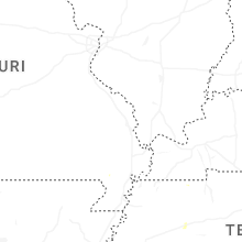
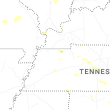

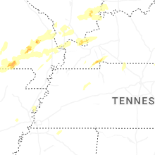
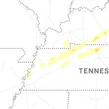


Connect with Interactive Hail Maps