

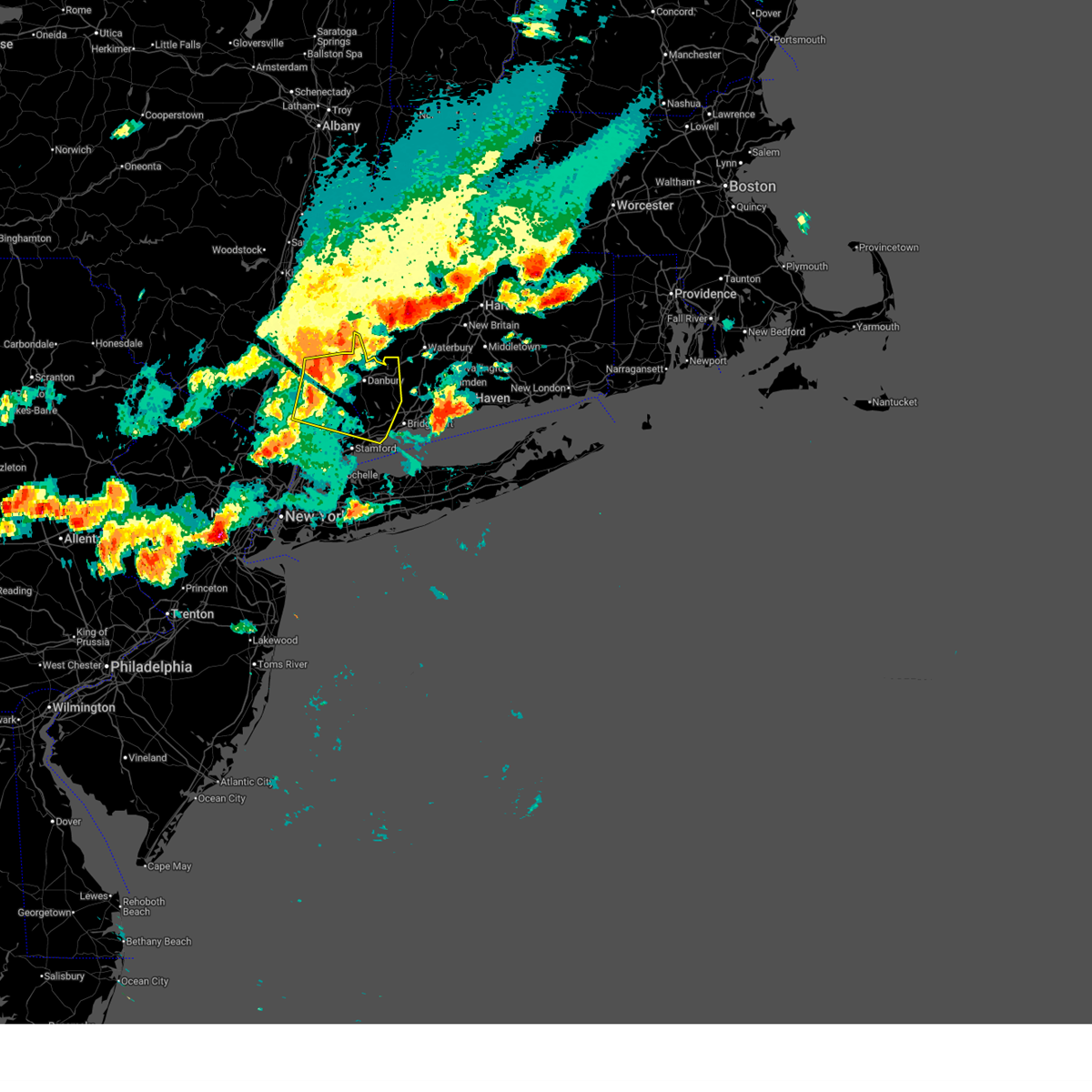
Hail Map for Putnam Lake, NY
The Putnam Lake, NY area has had 0 reports of on-the-ground hail by trained spotters, and has been under severe weather warnings 8 times during the past 12 months. Doppler radar has detected hail at or near Putnam Lake, NY on 26 occasions.
| Name: | Putnam Lake, NY |
| Where Located: | 58.5 miles NNE of Brooklyn, NY |
| Map: | Google Map for Putnam Lake, NY |
| Population: | 3844 |
| Housing Units: | 1565 |
| More Info: | Search Google for Putnam Lake, NY |
0
The Top Recent Hail Date for Putnam Lake, NY is Sunday, June 30, 2024 (21st out of 26)

Hail and Wind Damage Spotted near Putnam Lake, NY
| Date / Time | Report Details |
|---|---|
| 7/3/2025 6:05 PM EDT |
 Svrokx the national weather service in upton ny has issued a * severe thunderstorm warning for, fairfield county in southern connecticut, western new haven county in southern connecticut, northern westchester county in southeastern new york, putnam county in southeastern new york, * until 645 pm edt. * at 604 pm edt, severe thunderstorms were located along a line extending from near hopewell junction to 6 miles east of fishkill to near fahnestock state park to near yorktown heights, moving east at 55 mph (radar indicated). Hazards include 60 mph wind gusts and quarter size hail. Minor hail damage to vehicles is possible. expect wind damage to trees and power lines. severe thunderstorms will be near, mount kisco and mahopac around 610 pm edt. danbury and sherman around 615 pm edt. stamford and new canaan around 620 pm edt. norwalk and southbury around 625 pm edt. Fairfield and trumbull around 630 pm edt. Svrokx the national weather service in upton ny has issued a * severe thunderstorm warning for, fairfield county in southern connecticut, western new haven county in southern connecticut, northern westchester county in southeastern new york, putnam county in southeastern new york, * until 645 pm edt. * at 604 pm edt, severe thunderstorms were located along a line extending from near hopewell junction to 6 miles east of fishkill to near fahnestock state park to near yorktown heights, moving east at 55 mph (radar indicated). Hazards include 60 mph wind gusts and quarter size hail. Minor hail damage to vehicles is possible. expect wind damage to trees and power lines. severe thunderstorms will be near, mount kisco and mahopac around 610 pm edt. danbury and sherman around 615 pm edt. stamford and new canaan around 620 pm edt. norwalk and southbury around 625 pm edt. Fairfield and trumbull around 630 pm edt.
|
| 4/26/2025 7:07 PM EDT |
 The storms which prompted the warning have moved out of the area. therefore, the warning will be allowed to expire. The storms which prompted the warning have moved out of the area. therefore, the warning will be allowed to expire.
|
| 4/26/2025 6:51 PM EDT | Eversource reports 75 customers without powe in fairfield county CT, 3.9 miles SSW of Putnam Lake, NY |
| 4/26/2025 6:46 PM EDT |
 Svrokx the national weather service in upton ny has issued a * severe thunderstorm warning for, north central fairfield county in southern connecticut, eastern putnam county in southeastern new york, * until 715 pm edt. * at 646 pm edt, severe thunderstorms were located along a line extending from near sherman to near new fairfield to near lake carmel, moving northeast at 30 mph (radar indicated). Hazards include 60 mph wind gusts and quarter size hail. Minor hail damage to vehicles is possible. expect wind damage to trees and power lines. Severe thunderstorms will be near, sherman and new fairfield around 650 pm edt. Svrokx the national weather service in upton ny has issued a * severe thunderstorm warning for, north central fairfield county in southern connecticut, eastern putnam county in southeastern new york, * until 715 pm edt. * at 646 pm edt, severe thunderstorms were located along a line extending from near sherman to near new fairfield to near lake carmel, moving northeast at 30 mph (radar indicated). Hazards include 60 mph wind gusts and quarter size hail. Minor hail damage to vehicles is possible. expect wind damage to trees and power lines. Severe thunderstorms will be near, sherman and new fairfield around 650 pm edt.
|
| 7/17/2024 4:33 PM EDT | Svrokx the national weather service in upton ny has issued a * severe thunderstorm warning for, fairfield county in southern connecticut, western new haven county in southern connecticut, east central bergen county in northeastern new jersey, westchester county in southeastern new york, eastern putnam county in southeastern new york, bronx county in southeastern new york, rockland county in southeastern new york, * until 515 pm edt. * at 432 pm edt, severe thunderstorms were located along a line extending from near brewster to near hawthorne to englewood, moving east at 25 mph (radar indicated). Hazards include 60 mph wind gusts. Expect damage to trees and power lines. severe thunderstorms will be near, yonkers and stamford around 435 pm edt. harrison and redding around 440 pm edt. new rochelle and new canaan around 445 pm edt. port chester around 450 pm edt. rye and newtown around 455 pm edt. Norwalk around 500 pm edt. |
| 7/17/2024 4:09 PM EDT |
 At 409 pm edt, a severe thunderstorm was located over carmel, or near brewster, moving east at 25 mph (radar indicated). Hazards include 60 mph wind gusts and quarter size hail. Minor hail damage to vehicles is possible. expect wind damage to trees and power lines. this severe storm will be near, danbury and brewster around 415 pm edt. ridgefield and new fairfield around 420 pm edt. Bethel and brookfield around 435 pm edt. At 409 pm edt, a severe thunderstorm was located over carmel, or near brewster, moving east at 25 mph (radar indicated). Hazards include 60 mph wind gusts and quarter size hail. Minor hail damage to vehicles is possible. expect wind damage to trees and power lines. this severe storm will be near, danbury and brewster around 415 pm edt. ridgefield and new fairfield around 420 pm edt. Bethel and brookfield around 435 pm edt.
|
| 7/17/2024 4:07 PM EDT |
 the severe thunderstorm warning has been cancelled and is no longer in effect the severe thunderstorm warning has been cancelled and is no longer in effect
|
| 7/17/2024 4:06 PM EDT |
 Svrokx the national weather service in upton ny has issued a * severe thunderstorm warning for, north central fairfield county in southern connecticut, putnam county in southeastern new york, * until 445 pm edt. * at 405 pm edt, a severe thunderstorm was located over carmel, or over mahopac, moving east at 25 mph (radar indicated). Hazards include 60 mph wind gusts and quarter size hail. Minor hail damage to vehicles is possible. expect wind damage to trees and power lines. this severe thunderstorm will be near, brewster and carmel around 410 pm edt. danbury around 415 pm edt. ridgefield and new fairfield around 420 pm edt. Bethel and brookfield around 435 pm edt. Svrokx the national weather service in upton ny has issued a * severe thunderstorm warning for, north central fairfield county in southern connecticut, putnam county in southeastern new york, * until 445 pm edt. * at 405 pm edt, a severe thunderstorm was located over carmel, or over mahopac, moving east at 25 mph (radar indicated). Hazards include 60 mph wind gusts and quarter size hail. Minor hail damage to vehicles is possible. expect wind damage to trees and power lines. this severe thunderstorm will be near, brewster and carmel around 410 pm edt. danbury around 415 pm edt. ridgefield and new fairfield around 420 pm edt. Bethel and brookfield around 435 pm edt.
|
| 7/17/2024 3:44 PM EDT |
 Svrokx the national weather service in upton ny has issued a * severe thunderstorm warning for, north central fairfield county in southern connecticut, putnam county in southeastern new york, * until 430 pm edt. * at 343 pm edt, a severe thunderstorm was located over fahnestock state park, or near lake carmel, moving east at 25 mph (radar indicated). Hazards include 60 mph wind gusts and quarter size hail. Minor hail damage to vehicles is possible. expect wind damage to trees and power lines. this severe thunderstorm will be near, lake carmel around 350 pm edt. Sherman and new fairfield around 410 pm edt. Svrokx the national weather service in upton ny has issued a * severe thunderstorm warning for, north central fairfield county in southern connecticut, putnam county in southeastern new york, * until 430 pm edt. * at 343 pm edt, a severe thunderstorm was located over fahnestock state park, or near lake carmel, moving east at 25 mph (radar indicated). Hazards include 60 mph wind gusts and quarter size hail. Minor hail damage to vehicles is possible. expect wind damage to trees and power lines. this severe thunderstorm will be near, lake carmel around 350 pm edt. Sherman and new fairfield around 410 pm edt.
|
| 6/30/2024 2:17 PM EDT |
 the severe thunderstorm warning has been cancelled and is no longer in effect the severe thunderstorm warning has been cancelled and is no longer in effect
|
| 6/30/2024 2:10 PM EDT |
 the severe thunderstorm warning has been cancelled and is no longer in effect the severe thunderstorm warning has been cancelled and is no longer in effect
|
| 6/30/2024 2:01 PM EDT |
 At 200 pm edt, a severe thunderstorm was located near redding, or 8 miles south of newtown, moving southeast at 40 mph (radar indicated). Hazards include 60 mph wind gusts and quarter size hail. Minor hail damage to vehicles is possible. expect wind damage to trees and power lines. this severe storm will be near, bridgeport and fairfield around 205 pm edt. shelton and stratford around 210 pm edt. Milford around 215 pm edt. At 200 pm edt, a severe thunderstorm was located near redding, or 8 miles south of newtown, moving southeast at 40 mph (radar indicated). Hazards include 60 mph wind gusts and quarter size hail. Minor hail damage to vehicles is possible. expect wind damage to trees and power lines. this severe storm will be near, bridgeport and fairfield around 205 pm edt. shelton and stratford around 210 pm edt. Milford around 215 pm edt.
|
| 6/30/2024 1:38 PM EDT |
 Svrokx the national weather service in upton ny has issued a * severe thunderstorm warning for, central fairfield county in southern connecticut, south central new haven county in southern connecticut, east central putnam county in southeastern new york, * until 230 pm edt. * at 138 pm edt, a severe thunderstorm was located over brewster, moving southeast at 40 mph (radar indicated). Hazards include 60 mph wind gusts and quarter size hail. Minor hail damage to vehicles is possible. expect wind damage to trees and power lines. this severe thunderstorm will be near, danbury and ridgefield around 145 pm edt. newtown around 150 pm edt. monroe and weston around 155 pm edt. fairfield and trumbull around 200 pm edt. bridgeport around 205 pm edt. stratford around 210 pm edt. Milford around 215 pm edt. Svrokx the national weather service in upton ny has issued a * severe thunderstorm warning for, central fairfield county in southern connecticut, south central new haven county in southern connecticut, east central putnam county in southeastern new york, * until 230 pm edt. * at 138 pm edt, a severe thunderstorm was located over brewster, moving southeast at 40 mph (radar indicated). Hazards include 60 mph wind gusts and quarter size hail. Minor hail damage to vehicles is possible. expect wind damage to trees and power lines. this severe thunderstorm will be near, danbury and ridgefield around 145 pm edt. newtown around 150 pm edt. monroe and weston around 155 pm edt. fairfield and trumbull around 200 pm edt. bridgeport around 205 pm edt. stratford around 210 pm edt. Milford around 215 pm edt.
|
| 6/30/2024 1:29 PM EDT |
 Svrokx the national weather service in upton ny has issued a * severe thunderstorm warning for, north central fairfield county in southern connecticut, eastern putnam county in southeastern new york, * until 230 pm edt. * at 128 pm edt, a severe thunderstorm was located near pawling, moving east at 25 mph (radar indicated). Hazards include 60 mph wind gusts and quarter size hail. Minor hail damage to vehicles is possible. expect wind damage to trees and power lines. This severe thunderstorm will be near, sherman and new fairfield around 135 pm edt. Svrokx the national weather service in upton ny has issued a * severe thunderstorm warning for, north central fairfield county in southern connecticut, eastern putnam county in southeastern new york, * until 230 pm edt. * at 128 pm edt, a severe thunderstorm was located near pawling, moving east at 25 mph (radar indicated). Hazards include 60 mph wind gusts and quarter size hail. Minor hail damage to vehicles is possible. expect wind damage to trees and power lines. This severe thunderstorm will be near, sherman and new fairfield around 135 pm edt.
|
| 6/26/2024 9:17 PM EDT |
 The storms which prompted the warning will move east of the expired warned area, but will move into the new downstream warned area. a severe thunderstorm watch remains in effect until midnight edt for southern connecticut, and southeastern new york. The storms which prompted the warning will move east of the expired warned area, but will move into the new downstream warned area. a severe thunderstorm watch remains in effect until midnight edt for southern connecticut, and southeastern new york.
|
| 6/26/2024 9:07 PM EDT |
 Svrokx the national weather service in upton ny has issued a * severe thunderstorm warning for, fairfield county in southern connecticut, central middlesex county in southern connecticut, new haven county in southern connecticut, northern westchester county in southeastern new york, eastern putnam county in southeastern new york, * until 945 pm edt. * at 907 pm edt, severe thunderstorms were located along a line extending from near dover plains to near ridgefield to near darien, moving east at 45 mph (radar indicated). Hazards include 60 mph wind gusts. Expect damage to trees and power lines. severe thunderstorms will be near, stamford and norwalk around 910 pm edt. southbury and fairfield around 915 pm edt. bridgeport and shelton around 920 pm edt. stratford and seymour around 925 pm edt. milford and naugatuck around 930 pm edt. new haven and waterbury around 935 pm edt. Prospect around 940 pm edt. Svrokx the national weather service in upton ny has issued a * severe thunderstorm warning for, fairfield county in southern connecticut, central middlesex county in southern connecticut, new haven county in southern connecticut, northern westchester county in southeastern new york, eastern putnam county in southeastern new york, * until 945 pm edt. * at 907 pm edt, severe thunderstorms were located along a line extending from near dover plains to near ridgefield to near darien, moving east at 45 mph (radar indicated). Hazards include 60 mph wind gusts. Expect damage to trees and power lines. severe thunderstorms will be near, stamford and norwalk around 910 pm edt. southbury and fairfield around 915 pm edt. bridgeport and shelton around 920 pm edt. stratford and seymour around 925 pm edt. milford and naugatuck around 930 pm edt. new haven and waterbury around 935 pm edt. Prospect around 940 pm edt.
|
| 6/26/2024 8:26 PM EDT |
 Svrokx the national weather service in upton ny has issued a * severe thunderstorm warning for, fairfield county in southern connecticut, westchester county in southeastern new york, eastern orange county in southeastern new york, putnam county in southeastern new york, rockland county in southeastern new york, * until 915 pm edt. * at 826 pm edt, severe thunderstorms were located along a line extending from near phillipsport to near west point to near monsey, moving east at 50 mph (radar indicated). Hazards include 60 mph wind gusts. Expect damage to trees and power lines. severe thunderstorms will be near, new city and peekskill around 830 pm edt. newburgh and ossining around 835 pm edt. yorktown heights and fahnestock state park around 840 pm edt. mount kisco and mahopac around 845 pm edt. stamford and brewster around 850 pm edt. danbury and new canaan around 855 pm edt. darien and wilton around 900 pm edt. norwalk and sherman around 905 pm edt. Newtown around 910 pm edt. Svrokx the national weather service in upton ny has issued a * severe thunderstorm warning for, fairfield county in southern connecticut, westchester county in southeastern new york, eastern orange county in southeastern new york, putnam county in southeastern new york, rockland county in southeastern new york, * until 915 pm edt. * at 826 pm edt, severe thunderstorms were located along a line extending from near phillipsport to near west point to near monsey, moving east at 50 mph (radar indicated). Hazards include 60 mph wind gusts. Expect damage to trees and power lines. severe thunderstorms will be near, new city and peekskill around 830 pm edt. newburgh and ossining around 835 pm edt. yorktown heights and fahnestock state park around 840 pm edt. mount kisco and mahopac around 845 pm edt. stamford and brewster around 850 pm edt. danbury and new canaan around 855 pm edt. darien and wilton around 900 pm edt. norwalk and sherman around 905 pm edt. Newtown around 910 pm edt.
|
| 6/23/2024 7:36 PM EDT |
 At 735 pm edt, severe thunderstorms were located along a line extending from near sherman to near ridgefield, moving east at 50 mph (radar indicated. widespread wind damage has been reported). Hazards include 60 mph wind gusts. Expect damage to trees and power lines. these severe storms will be near, danbury and southbury around 740 pm edt. Trumbull and monroe around 745 pm edt. At 735 pm edt, severe thunderstorms were located along a line extending from near sherman to near ridgefield, moving east at 50 mph (radar indicated. widespread wind damage has been reported). Hazards include 60 mph wind gusts. Expect damage to trees and power lines. these severe storms will be near, danbury and southbury around 740 pm edt. Trumbull and monroe around 745 pm edt.
|
| 6/23/2024 7:36 PM EDT |
 the severe thunderstorm warning has been cancelled and is no longer in effect the severe thunderstorm warning has been cancelled and is no longer in effect
|
| 6/23/2024 7:31 PM EDT | Tree into a house on lake shore d in putnam county NY, 0.5 miles WNW of Putnam Lake, NY |
| 6/23/2024 7:15 PM EDT |
 Svrokx the national weather service in upton ny has issued a * severe thunderstorm warning for, central fairfield county in southern connecticut, northern westchester county in southeastern new york, putnam county in southeastern new york, rockland county in southeastern new york, * until 800 pm edt. * at 714 pm edt, a severe thunderstorm was located near mahopac, moving east at 40 mph (radar indicated). Hazards include 60 mph wind gusts. Expect damage to trees and power lines. this severe thunderstorm will be near, mahopac and carmel around 720 pm edt. brewster around 725 pm edt. danbury and ridgefield around 730 pm edt. new fairfield around 735 pm edt. newtown and bethel around 740 pm edt. redding around 745 pm edt. Monroe around 755 pm edt. Svrokx the national weather service in upton ny has issued a * severe thunderstorm warning for, central fairfield county in southern connecticut, northern westchester county in southeastern new york, putnam county in southeastern new york, rockland county in southeastern new york, * until 800 pm edt. * at 714 pm edt, a severe thunderstorm was located near mahopac, moving east at 40 mph (radar indicated). Hazards include 60 mph wind gusts. Expect damage to trees and power lines. this severe thunderstorm will be near, mahopac and carmel around 720 pm edt. brewster around 725 pm edt. danbury and ridgefield around 730 pm edt. new fairfield around 735 pm edt. newtown and bethel around 740 pm edt. redding around 745 pm edt. Monroe around 755 pm edt.
|
| 5/23/2024 9:12 AM EDT |
 The storm which prompted the warning has weakened below severe limits, and no longer poses an immediate threat to life or property. therefore, the warning will be allowed to expire. however, small hail, gusty winds and heavy rain are still possible with this thunderstorm. The storm which prompted the warning has weakened below severe limits, and no longer poses an immediate threat to life or property. therefore, the warning will be allowed to expire. however, small hail, gusty winds and heavy rain are still possible with this thunderstorm.
|
| 5/23/2024 8:39 AM EDT |
 Svrokx the national weather service in upton ny has issued a * severe thunderstorm warning for, central fairfield county in southern connecticut, new haven county in southern connecticut, eastern putnam county in southeastern new york, * until 915 am edt. * at 839 am edt, a severe thunderstorm was located over brookfield, or near newtown, moving northeast at 30 mph (radar indicated). Hazards include 60 mph wind gusts and quarter size hail. Minor hail damage to vehicles is possible. expect wind damage to trees and power lines. this severe thunderstorm will be near, southbury and newtown around 845 am edt. middlebury around 850 am edt. Waterbury and naugatuck around 900 am edt. Svrokx the national weather service in upton ny has issued a * severe thunderstorm warning for, central fairfield county in southern connecticut, new haven county in southern connecticut, eastern putnam county in southeastern new york, * until 915 am edt. * at 839 am edt, a severe thunderstorm was located over brookfield, or near newtown, moving northeast at 30 mph (radar indicated). Hazards include 60 mph wind gusts and quarter size hail. Minor hail damage to vehicles is possible. expect wind damage to trees and power lines. this severe thunderstorm will be near, southbury and newtown around 845 am edt. middlebury around 850 am edt. Waterbury and naugatuck around 900 am edt.
|
| 5/23/2024 7:54 AM EDT |
 Svrokx the national weather service in upton ny has issued a * severe thunderstorm warning for, central fairfield county in southern connecticut, northern westchester county in southeastern new york, eastern putnam county in southeastern new york, * until 845 am edt. * at 754 am edt, a severe thunderstorm was located near yorktown heights, or near peekskill, moving east at 40 mph (radar indicated). Hazards include quarter size hail. Minor damage to vehicles is possible. this severe thunderstorm will be near, yorktown heights around 800 am edt. danbury and ridgefield around 815 am edt. redding around 820 am edt. bethel around 825 am edt. Newtown and brookfield around 830 am edt. Svrokx the national weather service in upton ny has issued a * severe thunderstorm warning for, central fairfield county in southern connecticut, northern westchester county in southeastern new york, eastern putnam county in southeastern new york, * until 845 am edt. * at 754 am edt, a severe thunderstorm was located near yorktown heights, or near peekskill, moving east at 40 mph (radar indicated). Hazards include quarter size hail. Minor damage to vehicles is possible. this severe thunderstorm will be near, yorktown heights around 800 am edt. danbury and ridgefield around 815 am edt. redding around 820 am edt. bethel around 825 am edt. Newtown and brookfield around 830 am edt.
|
| 9/8/2023 4:13 PM EDT |
 At 413 pm edt, a severe thunderstorm was located over brewster, moving east at 40 mph (radar indicated). Hazards include 60 mph wind gusts and quarter size hail. Minor hail damage to vehicles is possible. expect wind damage to trees and power lines. this severe thunderstorm will be near, danbury and ridgefield around 420 pm edt. bethel and brookfield around 425 pm edt. newtown around 430 pm edt. southbury around 435 pm edt. middlebury around 445 pm edt. waterbury and naugatuck around 450 pm edt. hail threat, radar indicated max hail size, 1. 00 in wind threat, radar indicated max wind gust, 60 mph. At 413 pm edt, a severe thunderstorm was located over brewster, moving east at 40 mph (radar indicated). Hazards include 60 mph wind gusts and quarter size hail. Minor hail damage to vehicles is possible. expect wind damage to trees and power lines. this severe thunderstorm will be near, danbury and ridgefield around 420 pm edt. bethel and brookfield around 425 pm edt. newtown around 430 pm edt. southbury around 435 pm edt. middlebury around 445 pm edt. waterbury and naugatuck around 450 pm edt. hail threat, radar indicated max hail size, 1. 00 in wind threat, radar indicated max wind gust, 60 mph.
|
| 8/12/2023 9:10 PM EDT |
 The severe thunderstorm warning for central fairfield, northwestern new haven, northern westchester and eastern putnam counties will expire at 915 pm edt, the storm which prompted the warning has moved out of the area. therefore, the warning will be allowed to expire. however, gusty winds are still possible with this thunderstorm. a severe thunderstorm watch remains in effect until midnight edt for southern connecticut, and southeastern new york. remember, a severe thunderstorm warning still remains in effect for fairfield and new haven counties. The severe thunderstorm warning for central fairfield, northwestern new haven, northern westchester and eastern putnam counties will expire at 915 pm edt, the storm which prompted the warning has moved out of the area. therefore, the warning will be allowed to expire. however, gusty winds are still possible with this thunderstorm. a severe thunderstorm watch remains in effect until midnight edt for southern connecticut, and southeastern new york. remember, a severe thunderstorm warning still remains in effect for fairfield and new haven counties.
|
| 8/12/2023 9:05 PM EDT | Tree down on wires on route 37 south of durgy lan in fairfield county CT, 4.5 miles SSW of Putnam Lake, NY |
| 8/12/2023 8:57 PM EDT |
 At 857 pm edt, a severe thunderstorm was located over newtown, moving east at 45 mph (radar indicated). Hazards include 60 mph wind gusts and quarter size hail. Minor hail damage to vehicles is possible. expect wind damage to trees and power lines. locations impacted include, danbury, southbury, mahopac, lake carmel, sherman, brewster, newtown, ridgefield, monroe, bethel, wilton, brookfield, new fairfield, weston, and redding. hail threat, radar indicated max hail size, 1. 00 in wind threat, radar indicated max wind gust, 60 mph. At 857 pm edt, a severe thunderstorm was located over newtown, moving east at 45 mph (radar indicated). Hazards include 60 mph wind gusts and quarter size hail. Minor hail damage to vehicles is possible. expect wind damage to trees and power lines. locations impacted include, danbury, southbury, mahopac, lake carmel, sherman, brewster, newtown, ridgefield, monroe, bethel, wilton, brookfield, new fairfield, weston, and redding. hail threat, radar indicated max hail size, 1. 00 in wind threat, radar indicated max wind gust, 60 mph.
|
| 8/12/2023 8:43 PM EDT |
 The severe thunderstorm warning for north central fairfield and putnam counties will expire at 845 pm edt, the storm which prompted the warning has moved out of the area. therefore, the warning will be allowed to expire. however, gusty winds are still possible with this thunderstorm. a severe thunderstorm watch remains in effect until midnight edt for southern connecticut, and southeastern new york. remember, a severe thunderstorm warning still remains in effect for putnam, westchester and fairfield counties. The severe thunderstorm warning for north central fairfield and putnam counties will expire at 845 pm edt, the storm which prompted the warning has moved out of the area. therefore, the warning will be allowed to expire. however, gusty winds are still possible with this thunderstorm. a severe thunderstorm watch remains in effect until midnight edt for southern connecticut, and southeastern new york. remember, a severe thunderstorm warning still remains in effect for putnam, westchester and fairfield counties.
|
| 8/12/2023 8:35 PM EDT |
 At 835 pm edt, a severe thunderstorm was located over lake carmel, moving east at 45 mph (radar indicated). Hazards include 60 mph wind gusts and quarter size hail. Minor hail damage to vehicles is possible. Expect wind damage to trees and power lines. At 835 pm edt, a severe thunderstorm was located over lake carmel, moving east at 45 mph (radar indicated). Hazards include 60 mph wind gusts and quarter size hail. Minor hail damage to vehicles is possible. Expect wind damage to trees and power lines.
|
| 8/12/2023 8:14 PM EDT |
 At 806 pm edt, a severe thunderstorm was located over marlboro, or near poughkeepsie, moving southeast at 30 mph (radar indicated). Hazards include 60 mph wind gusts and quarter size hail. Minor hail damage to vehicles is possible. Expect wind damage to trees and power lines. At 806 pm edt, a severe thunderstorm was located over marlboro, or near poughkeepsie, moving southeast at 30 mph (radar indicated). Hazards include 60 mph wind gusts and quarter size hail. Minor hail damage to vehicles is possible. Expect wind damage to trees and power lines.
|
| 8/12/2023 8:14 PM EDT |
 At 814 pm edt, a severe thunderstorm was located over wappingers falls, or near beacon, moving east at 30 mph (radar indicated). Hazards include 70 mph wind gusts and quarter size hail. Minor hail damage to vehicles is possible. expect considerable tree damage. wind damage is also likely to mobile homes, roofs, and outbuildings. locations impacted include, danbury, lake carmel, sherman, cold spring, new fairfield, carmel, fahnestock state park, patterson, putnam lake, and brewster hill. thunderstorm damage threat, considerable hail threat, radar indicated max hail size, 1. 00 in wind threat, radar indicated max wind gust, 70 mph. At 814 pm edt, a severe thunderstorm was located over wappingers falls, or near beacon, moving east at 30 mph (radar indicated). Hazards include 70 mph wind gusts and quarter size hail. Minor hail damage to vehicles is possible. expect considerable tree damage. wind damage is also likely to mobile homes, roofs, and outbuildings. locations impacted include, danbury, lake carmel, sherman, cold spring, new fairfield, carmel, fahnestock state park, patterson, putnam lake, and brewster hill. thunderstorm damage threat, considerable hail threat, radar indicated max hail size, 1. 00 in wind threat, radar indicated max wind gust, 70 mph.
|
| 8/12/2023 8:07 PM EDT |
 At 806 pm edt, a severe thunderstorm was located over marlboro, or near poughkeepsie, moving southeast at 30 mph (radar indicated). Hazards include 60 mph wind gusts and quarter size hail. Minor hail damage to vehicles is possible. Expect wind damage to trees and power lines. At 806 pm edt, a severe thunderstorm was located over marlboro, or near poughkeepsie, moving southeast at 30 mph (radar indicated). Hazards include 60 mph wind gusts and quarter size hail. Minor hail damage to vehicles is possible. Expect wind damage to trees and power lines.
|
| 7/27/2023 6:07 PM EDT |
 At 607 pm edt, severe thunderstorms were located along a line extending from thomaston to woodbury center to near bethel, moving east at 45 mph (radar indicated). Hazards include 60 mph wind gusts. Expect damage to trees and power lines. these severe storms will be near, waterbury and naugatuck around 610 pm edt. shelton and trumbull around 615 pm edt. meriden and wallingford around 620 pm edt. middletown and north haven around 625 pm edt. hail threat, radar indicated max hail size, <. 75 in wind threat, radar indicated max wind gust, 60 mph. At 607 pm edt, severe thunderstorms were located along a line extending from thomaston to woodbury center to near bethel, moving east at 45 mph (radar indicated). Hazards include 60 mph wind gusts. Expect damage to trees and power lines. these severe storms will be near, waterbury and naugatuck around 610 pm edt. shelton and trumbull around 615 pm edt. meriden and wallingford around 620 pm edt. middletown and north haven around 625 pm edt. hail threat, radar indicated max hail size, <. 75 in wind threat, radar indicated max wind gust, 60 mph.
|
| 7/27/2023 5:34 PM EDT |
 At 534 pm edt, severe thunderstorms were located along a line extending from near dover plains to near wingdale to near fahnestock state park, moving east at 45 mph (radar indicated). Hazards include 60 mph wind gusts and penny size hail. Expect damage to trees and power lines. severe thunderstorms will be near, lake carmel and sherman around 540 pm edt. brewster and new fairfield around 545 pm edt. danbury and brookfield around 550 pm edt. southbury and newtown around 555 pm edt. middlebury around 600 pm edt. waterbury and wolcott around 605 pm edt. hail threat, radar indicated max hail size, 0. 75 in wind threat, radar indicated max wind gust, 60 mph. At 534 pm edt, severe thunderstorms were located along a line extending from near dover plains to near wingdale to near fahnestock state park, moving east at 45 mph (radar indicated). Hazards include 60 mph wind gusts and penny size hail. Expect damage to trees and power lines. severe thunderstorms will be near, lake carmel and sherman around 540 pm edt. brewster and new fairfield around 545 pm edt. danbury and brookfield around 550 pm edt. southbury and newtown around 555 pm edt. middlebury around 600 pm edt. waterbury and wolcott around 605 pm edt. hail threat, radar indicated max hail size, 0. 75 in wind threat, radar indicated max wind gust, 60 mph.
|
| 7/9/2023 12:38 PM EDT |
 At 1236 pm edt, severe thunderstorms were located along a line extending from near new fairfield to carmel, moving north at 10 mph (radar indicated). Hazards include 60 mph wind gusts and quarter size hail. Minor hail damage to vehicles is possible. expect wind damage to trees and power lines. locations impacted include, lake carmel, sherman, new fairfield, carmel, patterson, putnam lake and brewster hill. In eastern putnam county ny, doppler radar indicated some rotation so a brief tornado is possible. At 1236 pm edt, severe thunderstorms were located along a line extending from near new fairfield to carmel, moving north at 10 mph (radar indicated). Hazards include 60 mph wind gusts and quarter size hail. Minor hail damage to vehicles is possible. expect wind damage to trees and power lines. locations impacted include, lake carmel, sherman, new fairfield, carmel, patterson, putnam lake and brewster hill. In eastern putnam county ny, doppler radar indicated some rotation so a brief tornado is possible.
|
| 7/9/2023 12:18 PM EDT |
 At 1217 pm edt, severe thunderstorms were located along a line extending from near brewster to mahopac, moving north at 10 mph (radar indicated). Hazards include 60 mph wind gusts and quarter size hail. Minor hail damage to vehicles is possible. Expect wind damage to trees and power lines. At 1217 pm edt, severe thunderstorms were located along a line extending from near brewster to mahopac, moving north at 10 mph (radar indicated). Hazards include 60 mph wind gusts and quarter size hail. Minor hail damage to vehicles is possible. Expect wind damage to trees and power lines.
|
| 6/2/2023 6:06 PM EDT |
 At 605 pm edt, a severe thunderstorm was located near mahopac, moving south at 15 mph (radar indicated). Hazards include 60 mph wind gusts and quarter size hail. Minor hail damage to vehicles is possible. expect wind damage to trees and power lines. this severe thunderstorm will be near, peekskill around 625 pm edt. yorktown heights around 630 pm edt. mount kisco around 650 pm edt. ossining and haverstraw around 700 pm edt. hail threat, radar indicated max hail size, 1. 00 in wind threat, radar indicated max wind gust, 60 mph. At 605 pm edt, a severe thunderstorm was located near mahopac, moving south at 15 mph (radar indicated). Hazards include 60 mph wind gusts and quarter size hail. Minor hail damage to vehicles is possible. expect wind damage to trees and power lines. this severe thunderstorm will be near, peekskill around 625 pm edt. yorktown heights around 630 pm edt. mount kisco around 650 pm edt. ossining and haverstraw around 700 pm edt. hail threat, radar indicated max hail size, 1. 00 in wind threat, radar indicated max wind gust, 60 mph.
|
| 7/21/2022 2:39 PM EDT |
 The severe thunderstorm warning for central fairfield, northwestern new haven, northern westchester and eastern putnam counties will expire at 245 pm edt, the storm which prompted the warning has moved out of the area. therefore, the warning will be allowed to expire. a severe thunderstorm watch remains in effect until 800 pm edt for southern connecticut, and southeastern new york. The severe thunderstorm warning for central fairfield, northwestern new haven, northern westchester and eastern putnam counties will expire at 245 pm edt, the storm which prompted the warning has moved out of the area. therefore, the warning will be allowed to expire. a severe thunderstorm watch remains in effect until 800 pm edt for southern connecticut, and southeastern new york.
|
| 7/21/2022 1:59 PM EDT |
 At 158 pm edt, a severe thunderstorm was located over ridgefield, or near danbury, moving northeast at 30 mph (radar indicated). Hazards include 60 mph wind gusts and quarter size hail. Minor hail damage to vehicles is possible. expect wind damage to trees and power lines. this severe thunderstorm will be near, redding around 210 pm edt. danbury and bethel around 215 pm edt. newtown around 220 pm edt. southbury around 230 pm edt. middlebury around 240 pm edt. hail threat, radar indicated max hail size, 1. 00 in wind threat, radar indicated max wind gust, 60 mph. At 158 pm edt, a severe thunderstorm was located over ridgefield, or near danbury, moving northeast at 30 mph (radar indicated). Hazards include 60 mph wind gusts and quarter size hail. Minor hail damage to vehicles is possible. expect wind damage to trees and power lines. this severe thunderstorm will be near, redding around 210 pm edt. danbury and bethel around 215 pm edt. newtown around 220 pm edt. southbury around 230 pm edt. middlebury around 240 pm edt. hail threat, radar indicated max hail size, 1. 00 in wind threat, radar indicated max wind gust, 60 mph.
|
| 7/2/2022 6:00 PM EDT |
 At 559 pm edt, a severe thunderstorm was located near pawling, moving east at 35 mph (radar indicated). Hazards include 60 mph wind gusts and quarter size hail. Minor hail damage to vehicles is possible. expect wind damage to trees and power lines. this severe thunderstorm will be near, new fairfield around 605 pm edt. danbury and brookfield around 615 pm edt. newtown and bethel around 620 pm edt. redding around 625 pm edt. monroe around 635 pm edt. shelton and trumbull around 640 pm edt. seymour and derby around 645 pm edt. milford and stratford around 650 pm edt. orange around 655 pm edt. new haven around 700 pm edt. hail threat, radar indicated max hail size, 1. 00 in wind threat, radar indicated max wind gust, 60 mph. At 559 pm edt, a severe thunderstorm was located near pawling, moving east at 35 mph (radar indicated). Hazards include 60 mph wind gusts and quarter size hail. Minor hail damage to vehicles is possible. expect wind damage to trees and power lines. this severe thunderstorm will be near, new fairfield around 605 pm edt. danbury and brookfield around 615 pm edt. newtown and bethel around 620 pm edt. redding around 625 pm edt. monroe around 635 pm edt. shelton and trumbull around 640 pm edt. seymour and derby around 645 pm edt. milford and stratford around 650 pm edt. orange around 655 pm edt. new haven around 700 pm edt. hail threat, radar indicated max hail size, 1. 00 in wind threat, radar indicated max wind gust, 60 mph.
|
| 5/22/2022 7:36 PM EDT |
 At 734 pm edt, a severe thunderstorm was located over mahopac, moving east at 15 mph (radar indicated). Hazards include 60 mph wind gusts and quarter size hail. Minor hail damage to vehicles is possible. expect wind damage to trees and power lines. this severe thunderstorm will be near, lake carmel around 745 pm edt. brewster around 750 pm edt. ridgefield around 820 pm edt. danbury and newtown around 830 pm edt. hail threat, radar indicated max hail size, 1. 00 in wind threat, radar indicated max wind gust, 60 mph. At 734 pm edt, a severe thunderstorm was located over mahopac, moving east at 15 mph (radar indicated). Hazards include 60 mph wind gusts and quarter size hail. Minor hail damage to vehicles is possible. expect wind damage to trees and power lines. this severe thunderstorm will be near, lake carmel around 745 pm edt. brewster around 750 pm edt. ridgefield around 820 pm edt. danbury and newtown around 830 pm edt. hail threat, radar indicated max hail size, 1. 00 in wind threat, radar indicated max wind gust, 60 mph.
|
| 3/31/2022 9:53 PM EDT |
 At 952 pm edt, severe thunderstorms were located along a line extending from near pawling to near new fairfield to brewster to near mahopac, moving east at 50 mph (radar indicated). Hazards include 60 mph wind gusts. Expect damage to trees and power lines. these severe storms will be near, sherman and new fairfield around 955 pm edt. danbury around 1000 pm edt. ridgefield around 1005 pm edt. redding around 1015 pm edt. hail threat, radar indicated max hail size, <. 75 in wind threat, radar indicated max wind gust, 60 mph. At 952 pm edt, severe thunderstorms were located along a line extending from near pawling to near new fairfield to brewster to near mahopac, moving east at 50 mph (radar indicated). Hazards include 60 mph wind gusts. Expect damage to trees and power lines. these severe storms will be near, sherman and new fairfield around 955 pm edt. danbury around 1000 pm edt. ridgefield around 1005 pm edt. redding around 1015 pm edt. hail threat, radar indicated max hail size, <. 75 in wind threat, radar indicated max wind gust, 60 mph.
|
| 3/31/2022 9:24 PM EDT |
 At 923 pm edt, severe thunderstorms were located along a line extending from beacon to cold spring to near west point to near harriman, moving east at 50 mph (radar indicated). Hazards include 60 mph wind gusts. Expect damage to trees and power lines. severe thunderstorms will be near, fahnestock state park around 930 pm edt. mahopac and lake carmel around 940 pm edt. brewster and carmel around 945 pm edt. sherman and new fairfield around 950 pm edt. danbury around 955 pm edt. ridgefield around 1000 pm edt. redding around 1005 pm edt. hail threat, radar indicated max hail size, <. 75 in wind threat, radar indicated max wind gust, 60 mph. At 923 pm edt, severe thunderstorms were located along a line extending from beacon to cold spring to near west point to near harriman, moving east at 50 mph (radar indicated). Hazards include 60 mph wind gusts. Expect damage to trees and power lines. severe thunderstorms will be near, fahnestock state park around 930 pm edt. mahopac and lake carmel around 940 pm edt. brewster and carmel around 945 pm edt. sherman and new fairfield around 950 pm edt. danbury around 955 pm edt. ridgefield around 1000 pm edt. redding around 1005 pm edt. hail threat, radar indicated max hail size, <. 75 in wind threat, radar indicated max wind gust, 60 mph.
|
| 3/7/2022 9:30 PM EST |
 At 928 pm est, a severe thunderstorm was located over mahopac, moving east at 55 mph (radar indicated). Hazards include 60 mph wind gusts. Expect damage to trees and power lines. this severe storm will be near, brewster around 935 pm est. ridgefield and bethel around 945 pm est. wilton and weston around 950 pm est. monroe around 1000 pm est. hail threat, radar indicated max hail size, <. 75 in wind threat, radar indicated max wind gust, 60 mph. At 928 pm est, a severe thunderstorm was located over mahopac, moving east at 55 mph (radar indicated). Hazards include 60 mph wind gusts. Expect damage to trees and power lines. this severe storm will be near, brewster around 935 pm est. ridgefield and bethel around 945 pm est. wilton and weston around 950 pm est. monroe around 1000 pm est. hail threat, radar indicated max hail size, <. 75 in wind threat, radar indicated max wind gust, 60 mph.
|
| 3/7/2022 9:01 PM EST |
 At 901 pm est, a severe thunderstorm was located near goshen, moving east at 55 mph (radar indicated). Hazards include 60 mph wind gusts. Expect damage to trees and power lines. this severe thunderstorm will be near, newburgh and west point around 915 pm est. peekskill around 920 pm est. fahnestock state park around 925 pm est. mahopac and lake carmel around 930 pm est. brewster around 935 pm est. new canaan and ridgefield around 945 pm est. wilton and weston around 950 pm est. monroe around 1000 pm est. hail threat, radar indicated max hail size, <. 75 in wind threat, radar indicated max wind gust, 60 mph. At 901 pm est, a severe thunderstorm was located near goshen, moving east at 55 mph (radar indicated). Hazards include 60 mph wind gusts. Expect damage to trees and power lines. this severe thunderstorm will be near, newburgh and west point around 915 pm est. peekskill around 920 pm est. fahnestock state park around 925 pm est. mahopac and lake carmel around 930 pm est. brewster around 935 pm est. new canaan and ridgefield around 945 pm est. wilton and weston around 950 pm est. monroe around 1000 pm est. hail threat, radar indicated max hail size, <. 75 in wind threat, radar indicated max wind gust, 60 mph.
|
| 10/16/2021 5:54 PM EDT |
 At 553 pm edt, severe thunderstorms were located along a line extending from near lake carmel to harrison, moving northeast at 40 mph (radar indicated). Hazards include 60 mph wind gusts. Expect damage to trees and power lines. severe thunderstorms will be near, lake carmel around 600 pm edt. new fairfield and bedford around 605 pm edt. stamford and darien around 610 pm edt. sherman around 615 pm edt. norwalk and new canaan around 620 pm edt. wilton and georgetown around 625 pm edt. westport and weston around 630 pm edt. fairfield around 635 pm edt. trumbull and monroe around 645 pm edt. hail threat, radar indicated max hail size, <. 75 in wind threat, radar indicated max wind gust, 60 mph. At 553 pm edt, severe thunderstorms were located along a line extending from near lake carmel to harrison, moving northeast at 40 mph (radar indicated). Hazards include 60 mph wind gusts. Expect damage to trees and power lines. severe thunderstorms will be near, lake carmel around 600 pm edt. new fairfield and bedford around 605 pm edt. stamford and darien around 610 pm edt. sherman around 615 pm edt. norwalk and new canaan around 620 pm edt. wilton and georgetown around 625 pm edt. westport and weston around 630 pm edt. fairfield around 635 pm edt. trumbull and monroe around 645 pm edt. hail threat, radar indicated max hail size, <. 75 in wind threat, radar indicated max wind gust, 60 mph.
|
| 7/6/2021 5:26 PM EDT |
 At 526 pm edt, a severe thunderstorm was located near lake carmel, moving southeast at 25 mph (radar indicated). Hazards include 60 mph wind gusts. Expect damage to trees and power lines. Locations impacted include, mahopac, lake carmel, brewster, carmel, patterson, putnam lake, brewster hill and peach lake. At 526 pm edt, a severe thunderstorm was located near lake carmel, moving southeast at 25 mph (radar indicated). Hazards include 60 mph wind gusts. Expect damage to trees and power lines. Locations impacted include, mahopac, lake carmel, brewster, carmel, patterson, putnam lake, brewster hill and peach lake.
|
| 7/6/2021 5:08 PM EDT |
 At 508 pm edt, a severe thunderstorm was located over fishkill, or over beacon, moving east at 30 mph (radar indicated). Hazards include 60 mph wind gusts. expect damage to trees and power lines At 508 pm edt, a severe thunderstorm was located over fishkill, or over beacon, moving east at 30 mph (radar indicated). Hazards include 60 mph wind gusts. expect damage to trees and power lines
|
| 4/21/2021 2:53 PM EDT |
 At 253 pm edt, severe thunderstorms were located along a line extending from gaylordsville to port washington, moving east at 40 mph (radar indicated). Hazards include 60 mph wind gusts and penny size hail. expect damage to trees and power lines At 253 pm edt, severe thunderstorms were located along a line extending from gaylordsville to port washington, moving east at 40 mph (radar indicated). Hazards include 60 mph wind gusts and penny size hail. expect damage to trees and power lines
|
| 4/21/2021 2:42 PM EDT |
 At 242 pm edt, a severe thunderstorm was located over carmel, or near lake carmel, moving east at 30 mph (radar indicated). Hazards include 60 mph wind gusts. Expect damage to trees and power lines. this severe storm will be near, lake carmel around 245 pm edt. brewster around 250 pm edt. new fairfield around 300 pm edt. brookfield around 310 pm edt. Danbury and bethel around 315 pm edt. At 242 pm edt, a severe thunderstorm was located over carmel, or near lake carmel, moving east at 30 mph (radar indicated). Hazards include 60 mph wind gusts. Expect damage to trees and power lines. this severe storm will be near, lake carmel around 245 pm edt. brewster around 250 pm edt. new fairfield around 300 pm edt. brookfield around 310 pm edt. Danbury and bethel around 315 pm edt.
|
| 4/21/2021 2:10 PM EDT |
 At 209 pm edt, a severe thunderstorm was located over cold spring, moving east at 45 mph (radar indicated). Hazards include 60 mph wind gusts. Expect damage to trees and power lines. this severe thunderstorm will be near, fahnestock state park around 220 pm edt. lake carmel and carmel around 230 pm edt. brewster around 235 pm edt. new fairfield around 240 pm edt. danbury and brookfield around 250 pm edt. Newtown around 255 pm edt. At 209 pm edt, a severe thunderstorm was located over cold spring, moving east at 45 mph (radar indicated). Hazards include 60 mph wind gusts. Expect damage to trees and power lines. this severe thunderstorm will be near, fahnestock state park around 220 pm edt. lake carmel and carmel around 230 pm edt. brewster around 235 pm edt. new fairfield around 240 pm edt. danbury and brookfield around 250 pm edt. Newtown around 255 pm edt.
|
| 11/15/2020 8:53 PM EST |
 At 852 pm est, a squall line capable of producing both tornadoes and extensive straight line wind damage was located near brewster, moving northeast at 50 mph (radar indicated rotation). Hazards include tornado. Flying debris will be dangerous to those caught without shelter. mobile homes will be damaged or destroyed. damage to roofs, windows, and vehicles will occur. tree damage is likely. these dangerous storms will be near, danbury and bethel around 910 pm est. newtown around 915 pm est. Monroe around 920 pm est. At 852 pm est, a squall line capable of producing both tornadoes and extensive straight line wind damage was located near brewster, moving northeast at 50 mph (radar indicated rotation). Hazards include tornado. Flying debris will be dangerous to those caught without shelter. mobile homes will be damaged or destroyed. damage to roofs, windows, and vehicles will occur. tree damage is likely. these dangerous storms will be near, danbury and bethel around 910 pm est. newtown around 915 pm est. Monroe around 920 pm est.
|
| 11/15/2020 8:44 PM EST |
 At 843 pm est, severe thunderstorms capable of producing both tornadoes and extensive straight line wind damage were located over yorktown heights, or near mahopac, moving northeast at 50 mph (radar indicated rotation). Hazards include tornado. Flying debris will be dangerous to those caught without shelter. mobile homes will be damaged or destroyed. damage to roofs, windows, and vehicles will occur. tree damage is likely. these dangerous storms will be near, brewster around 855 pm est. ridgefield around 900 pm est. danbury and bethel around 910 pm est. Newtown around 915 pm est. At 843 pm est, severe thunderstorms capable of producing both tornadoes and extensive straight line wind damage were located over yorktown heights, or near mahopac, moving northeast at 50 mph (radar indicated rotation). Hazards include tornado. Flying debris will be dangerous to those caught without shelter. mobile homes will be damaged or destroyed. damage to roofs, windows, and vehicles will occur. tree damage is likely. these dangerous storms will be near, brewster around 855 pm est. ridgefield around 900 pm est. danbury and bethel around 910 pm est. Newtown around 915 pm est.
|
| 11/15/2020 8:41 PM EST |
 At 840 pm est, severe thunderstorms were located along a line extending from lake carmel to near sandy hook, moving east at 70 mph (radar indicated). Hazards include 60 mph wind gusts. Expect damage to trees and power lines. severe thunderstorms will be near, brewster around 845 pm est. danbury and bethel around 850 pm est. long beach and newtown around 855 pm est. freeport and jones beach around 900 pm est. massapequa and southbury around 905 pm est. waterbury and lindenhurst around 910 pm est. islip and brentwood around 915 pm est. ronkonkoma and sayville around 920 pm est. patchogue and holbrook around 925 pm est. shirley and medford around 930 pm est. manorville and center moriches around 935 pm est. Calverton around 940 pm est. At 840 pm est, severe thunderstorms were located along a line extending from lake carmel to near sandy hook, moving east at 70 mph (radar indicated). Hazards include 60 mph wind gusts. Expect damage to trees and power lines. severe thunderstorms will be near, brewster around 845 pm est. danbury and bethel around 850 pm est. long beach and newtown around 855 pm est. freeport and jones beach around 900 pm est. massapequa and southbury around 905 pm est. waterbury and lindenhurst around 910 pm est. islip and brentwood around 915 pm est. ronkonkoma and sayville around 920 pm est. patchogue and holbrook around 925 pm est. shirley and medford around 930 pm est. manorville and center moriches around 935 pm est. Calverton around 940 pm est.
|
| 11/15/2020 8:31 PM EST |
 At 830 pm est, severe thunderstorms were located along a line extending from near myers corner to peekskill to near hackensack to union city to near east brunswick, moving east at 55 mph (radar indicated). Hazards include 60 mph wind gusts. Expect damage to trees and power lines. these severe storms will be near, peekskill and harlem around 835 pm est. flushing and mott haven around 840 pm est. jamaica and yonkers around 845 pm est. new rochelle and white plains around 850 pm est. ridgefield around 855 pm est. Rockaway beach around 905 pm est. At 830 pm est, severe thunderstorms were located along a line extending from near myers corner to peekskill to near hackensack to union city to near east brunswick, moving east at 55 mph (radar indicated). Hazards include 60 mph wind gusts. Expect damage to trees and power lines. these severe storms will be near, peekskill and harlem around 835 pm est. flushing and mott haven around 840 pm est. jamaica and yonkers around 845 pm est. new rochelle and white plains around 850 pm est. ridgefield around 855 pm est. Rockaway beach around 905 pm est.
|
| 11/15/2020 7:57 PM EST |
 At 757 pm est, severe thunderstorms were located along a line extending from 6 miles northwest of wallkill to near franklin to chester to near bridgewater to near doylestown, moving east at 55 mph (radar indicated). Hazards include 60 mph wind gusts. Expect damage to trees and power lines. severe thunderstorms will be near, west milford around 800 pm est. upper greenwood lake around 805 pm est. plainfield and ringwood around 810 pm est. summit and millburn around 815 pm est. orange and monsey around 820 pm est. newark and paterson around 825 pm est. jersey city and passaic around 830 pm est. hoboken and hackensack around 835 pm est. mott haven and nanuet around 840 pm est. yonkers and east tremont around 845 pm est. new rochelle and white plains around 850 pm est. Todt hill and port richmond around 855 pm est. At 757 pm est, severe thunderstorms were located along a line extending from 6 miles northwest of wallkill to near franklin to chester to near bridgewater to near doylestown, moving east at 55 mph (radar indicated). Hazards include 60 mph wind gusts. Expect damage to trees and power lines. severe thunderstorms will be near, west milford around 800 pm est. upper greenwood lake around 805 pm est. plainfield and ringwood around 810 pm est. summit and millburn around 815 pm est. orange and monsey around 820 pm est. newark and paterson around 825 pm est. jersey city and passaic around 830 pm est. hoboken and hackensack around 835 pm est. mott haven and nanuet around 840 pm est. yonkers and east tremont around 845 pm est. new rochelle and white plains around 850 pm est. Todt hill and port richmond around 855 pm est.
|
| 10/7/2020 6:04 PM EDT |
 At 603 pm edt, severe thunderstorms were located along a line extending from near portland to near newtown, moving east at 45 mph (radar indicated). Hazards include 60 mph wind gusts. Expect damage to trees and power lines. these severe storms will be near, durham and killingworth around 610 pm edt. bridgeport around 615 pm edt. shelton and stratford around 620 pm edt. orange around 625 pm edt. new haven and milford around 630 pm edt. Branford and north brandford around 640 pm edt. At 603 pm edt, severe thunderstorms were located along a line extending from near portland to near newtown, moving east at 45 mph (radar indicated). Hazards include 60 mph wind gusts. Expect damage to trees and power lines. these severe storms will be near, durham and killingworth around 610 pm edt. bridgeport around 615 pm edt. shelton and stratford around 620 pm edt. orange around 625 pm edt. new haven and milford around 630 pm edt. Branford and north brandford around 640 pm edt.
|
| 10/7/2020 5:30 PM EDT |
 At 529 pm edt, severe thunderstorms were located along a line extending from near wolcott to lake carmel, moving east at 45 mph (radar indicated). Hazards include 60 mph wind gusts. Expect damage to trees and power lines. severe thunderstorms will be near, waterbury and wolcott around 535 pm edt. cheshire around 540 pm edt. meriden and brookfield around 545 pm edt. danbury and middletown around 550 pm edt. newtown and hartford around 555 pm edt. durham and redding around 600 pm edt. monroe around 605 pm edt. bridgeport and trumbull around 610 pm edt. New haven and milford around 615 pm edt. At 529 pm edt, severe thunderstorms were located along a line extending from near wolcott to lake carmel, moving east at 45 mph (radar indicated). Hazards include 60 mph wind gusts. Expect damage to trees and power lines. severe thunderstorms will be near, waterbury and wolcott around 535 pm edt. cheshire around 540 pm edt. meriden and brookfield around 545 pm edt. danbury and middletown around 550 pm edt. newtown and hartford around 555 pm edt. durham and redding around 600 pm edt. monroe around 605 pm edt. bridgeport and trumbull around 610 pm edt. New haven and milford around 615 pm edt.
|
| 8/27/2020 4:59 PM EDT |
 At 426 pm edt, a severe thunderstorm was located over fishkill, or near beacon, moving southeast at 45 mph (radar indicated). Hazards include 60 mph wind gusts. Expect damage to trees and power lines. this severe thunderstorm will be near, fahnestock state park around 430 pm edt. new york--newark around 435 pm edt. lake carmel and mahopac around 440 pm edt. brewster around 445 pm edt. danbury and bedford around 455 pm edt. new canaan and ridgefield around 500 pm edt. wilton and weston around 505 pm edt. Norwalk and fairfield around 510 pm edt. At 426 pm edt, a severe thunderstorm was located over fishkill, or near beacon, moving southeast at 45 mph (radar indicated). Hazards include 60 mph wind gusts. Expect damage to trees and power lines. this severe thunderstorm will be near, fahnestock state park around 430 pm edt. new york--newark around 435 pm edt. lake carmel and mahopac around 440 pm edt. brewster around 445 pm edt. danbury and bedford around 455 pm edt. new canaan and ridgefield around 500 pm edt. wilton and weston around 505 pm edt. Norwalk and fairfield around 510 pm edt.
|
| 8/27/2020 4:59 PM EDT |
 A severe thunderstorm warning remains in effect until 515 pm edt for fairfield. northern westchester and putnam counties. at 459 pm edt, a severe thunderstorm was located near mahopac, moving southeast at 50 mph. hazard. 60 mph wind gusts. source. Radar indicated. A severe thunderstorm warning remains in effect until 515 pm edt for fairfield. northern westchester and putnam counties. at 459 pm edt, a severe thunderstorm was located near mahopac, moving southeast at 50 mph. hazard. 60 mph wind gusts. source. Radar indicated.
|
| 8/27/2020 4:27 PM EDT |
 At 426 pm edt, a severe thunderstorm was located over fishkill, or near beacon, moving southeast at 45 mph (radar indicated). Hazards include 60 mph wind gusts. Expect damage to trees and power lines. this severe thunderstorm will be near, fahnestock state park around 430 pm edt. new york--newark around 435 pm edt. lake carmel and mahopac around 440 pm edt. brewster around 445 pm edt. danbury and bedford around 455 pm edt. new canaan and ridgefield around 500 pm edt. wilton and weston around 505 pm edt. Norwalk and fairfield around 510 pm edt. At 426 pm edt, a severe thunderstorm was located over fishkill, or near beacon, moving southeast at 45 mph (radar indicated). Hazards include 60 mph wind gusts. Expect damage to trees and power lines. this severe thunderstorm will be near, fahnestock state park around 430 pm edt. new york--newark around 435 pm edt. lake carmel and mahopac around 440 pm edt. brewster around 445 pm edt. danbury and bedford around 455 pm edt. new canaan and ridgefield around 500 pm edt. wilton and weston around 505 pm edt. Norwalk and fairfield around 510 pm edt.
|
| 8/27/2020 3:45 PM EDT |
 At 344 pm edt, severe thunderstorms were located along a line extending from near hartford to near thomaston, moving southeast at 65 mph (radar indicated). Hazards include 70 mph wind gusts and quarter size hail. Minor hail damage to vehicles is possible. expect considerable tree damage. wind damage is also likely to mobile homes, roofs, and outbuildings. these severe storms will be near, hartford and cromwell around 350 pm edt. naugatuck and east hampton around 355 pm edt. cheshire around 400 pm edt. meriden and middletown around 405 pm edt. guilford and durham around 410 pm edt. killingworth and north madison around 415 pm edt. clinton and chester around 420 pm edt. Old saybrook and westbrook around 425 pm edt. At 344 pm edt, severe thunderstorms were located along a line extending from near hartford to near thomaston, moving southeast at 65 mph (radar indicated). Hazards include 70 mph wind gusts and quarter size hail. Minor hail damage to vehicles is possible. expect considerable tree damage. wind damage is also likely to mobile homes, roofs, and outbuildings. these severe storms will be near, hartford and cromwell around 350 pm edt. naugatuck and east hampton around 355 pm edt. cheshire around 400 pm edt. meriden and middletown around 405 pm edt. guilford and durham around 410 pm edt. killingworth and north madison around 415 pm edt. clinton and chester around 420 pm edt. Old saybrook and westbrook around 425 pm edt.
|
| 8/27/2020 3:17 PM EDT |
 At 316 pm edt, severe thunderstorms were located along a line extending from near litchfield to near amenia, moving southeast at 65 mph (radar indicated). Hazards include 60 mph wind gusts and quarter size hail. Minor hail damage to vehicles is possible. expect wind damage to trees and power lines. severe thunderstorms will be near, meriden around 340 pm edt. middletown and hartford around 345 pm edt. waterbury and naugatuck around 350 pm edt. wolcott and east hampton around 355 pm edt. chester and hamden around 400 pm edt. wallingford and old saybrook around 405 pm edt. guilford and old lyme around 410 pm edt. Clinton and north madison around 415 pm edt. At 316 pm edt, severe thunderstorms were located along a line extending from near litchfield to near amenia, moving southeast at 65 mph (radar indicated). Hazards include 60 mph wind gusts and quarter size hail. Minor hail damage to vehicles is possible. expect wind damage to trees and power lines. severe thunderstorms will be near, meriden around 340 pm edt. middletown and hartford around 345 pm edt. waterbury and naugatuck around 350 pm edt. wolcott and east hampton around 355 pm edt. chester and hamden around 400 pm edt. wallingford and old saybrook around 405 pm edt. guilford and old lyme around 410 pm edt. Clinton and north madison around 415 pm edt.
|
| 8/4/2020 1:38 PM EDT |
 The national weather service in upton ny has issued a * tornado warning for. central fairfield county in southern connecticut. until 215 pm edt. At 138 pm edt, a severe thunderstorm capable of producing a tornado was located near norwalk, moving north at 70 mph. The national weather service in upton ny has issued a * tornado warning for. central fairfield county in southern connecticut. until 215 pm edt. At 138 pm edt, a severe thunderstorm capable of producing a tornado was located near norwalk, moving north at 70 mph.
|
| 8/3/2020 10:39 PM EDT |
 The severe thunderstorm warning for fairfield, new haven, central middlesex, central westchester and eastern putnam counties will expire at 1045 pm edt, the storms which prompted the warning have weakened below severe limits, and no longer pose an immediate threat to life or property. therefore, the warning will be allowed to expire. however gusty winds over 40 mph are still possible with these thunderstorms. The severe thunderstorm warning for fairfield, new haven, central middlesex, central westchester and eastern putnam counties will expire at 1045 pm edt, the storms which prompted the warning have weakened below severe limits, and no longer pose an immediate threat to life or property. therefore, the warning will be allowed to expire. however gusty winds over 40 mph are still possible with these thunderstorms.
|
| 8/3/2020 10:22 PM EDT |
 At 1022 pm edt, severe thunderstorms were located along a line extending from near yorktown heights to near bridgeport--stamford to near branford, moving northeast at 60 mph (radar indicated). Hazards include 60 mph wind gusts. Expect damage to trees and power lines. these severe storms will be near, new haven and milford around 1025 pm edt. branford and north brandford around 1030 pm edt. newtown and lake carmel around 1035 pm edt. wallingford and guilford around 1040 pm edt. Naugatuck and durham around 1045 pm edt. At 1022 pm edt, severe thunderstorms were located along a line extending from near yorktown heights to near bridgeport--stamford to near branford, moving northeast at 60 mph (radar indicated). Hazards include 60 mph wind gusts. Expect damage to trees and power lines. these severe storms will be near, new haven and milford around 1025 pm edt. branford and north brandford around 1030 pm edt. newtown and lake carmel around 1035 pm edt. wallingford and guilford around 1040 pm edt. Naugatuck and durham around 1045 pm edt.
|
| 8/3/2020 9:45 PM EDT |
 At 945 pm edt, severe thunderstorms were located along a line extending from tappan to near stony brook, moving northeast at 30 mph (radar indicated). Hazards include 60 mph wind gusts. Expect damage to trees and power lines. severe thunderstorms will be near, white plains around 955 pm edt. mount kisco around 1020 pm edt. milford and bedford around 1030 pm edt. Brewster and lake carmel around 1045 pm edt. At 945 pm edt, severe thunderstorms were located along a line extending from tappan to near stony brook, moving northeast at 30 mph (radar indicated). Hazards include 60 mph wind gusts. Expect damage to trees and power lines. severe thunderstorms will be near, white plains around 955 pm edt. mount kisco around 1020 pm edt. milford and bedford around 1030 pm edt. Brewster and lake carmel around 1045 pm edt.
|
| 7/3/2020 6:08 PM EDT |
 At 608 pm edt, a severe thunderstorm was located over carmel, or over brewster, moving east at 20 mph (radar indicated). Hazards include quarter size hail. Minor damage to vehicles is possible. this severe thunderstorm will be near, brewster around 615 pm edt. danbury and ridgefield around 645 pm edt. Redding around 700 pm edt. At 608 pm edt, a severe thunderstorm was located over carmel, or over brewster, moving east at 20 mph (radar indicated). Hazards include quarter size hail. Minor damage to vehicles is possible. this severe thunderstorm will be near, brewster around 615 pm edt. danbury and ridgefield around 645 pm edt. Redding around 700 pm edt.
|
| 6/3/2020 8:39 PM EDT |
 The severe thunderstorm warning for central fairfield, west central new haven, northeastern bergen, westchester, southeastern orange, putnam and rockland counties will expire at 845 pm edt, the storms which prompted the warning have weakened below severe limits and are about to move out of the warned area, and no longer pose an immediate threat to life or property. therefore, the warning will be allowed to expire. The severe thunderstorm warning for central fairfield, west central new haven, northeastern bergen, westchester, southeastern orange, putnam and rockland counties will expire at 845 pm edt, the storms which prompted the warning have weakened below severe limits and are about to move out of the warned area, and no longer pose an immediate threat to life or property. therefore, the warning will be allowed to expire.
|
| 6/3/2020 8:17 PM EDT |
 At 817 pm edt, severe thunderstorms were located along a line extending from brewster to new city, moving east at 70 mph (radar indicated). Hazards include 60 mph wind gusts. Expect damage to trees and power lines. these severe storms will be near, danbury and bethel around 825 pm edt. newtown and redding around 830 pm edt. bedford around 835 pm edt. Greenwich around 840 pm edt. At 817 pm edt, severe thunderstorms were located along a line extending from brewster to new city, moving east at 70 mph (radar indicated). Hazards include 60 mph wind gusts. Expect damage to trees and power lines. these severe storms will be near, danbury and bethel around 825 pm edt. newtown and redding around 830 pm edt. bedford around 835 pm edt. Greenwich around 840 pm edt.
|
| 6/3/2020 7:57 PM EDT |
 At 757 pm edt, severe thunderstorms were located along a line extending from near new windsor to near vernon valley, moving east at 70 mph (radar indicated). Hazards include 60 mph wind gusts. Expect damage to trees and power lines. severe thunderstorms will be near, newburgh and cold spring around 800 pm edt. fahnestock state park around 805 pm edt. suffern and sloatsburg around 810 pm edt. brewster and monsey around 815 pm edt. haverstraw and nyack around 820 pm edt. danbury and ossining around 825 pm edt. mount kisco and newtown around 830 pm edt. Greenwich and bedford around 835 pm edt. At 757 pm edt, severe thunderstorms were located along a line extending from near new windsor to near vernon valley, moving east at 70 mph (radar indicated). Hazards include 60 mph wind gusts. Expect damage to trees and power lines. severe thunderstorms will be near, newburgh and cold spring around 800 pm edt. fahnestock state park around 805 pm edt. suffern and sloatsburg around 810 pm edt. brewster and monsey around 815 pm edt. haverstraw and nyack around 820 pm edt. danbury and ossining around 825 pm edt. mount kisco and newtown around 830 pm edt. Greenwich and bedford around 835 pm edt.
|
| 5/15/2020 8:55 PM EDT |
 At 854 pm edt, severe thunderstorms were located along a line extending from near lake carmel to brewster to near mahopac to near yorktown heights, moving east at 55 mph (radar indicated). Hazards include 60 mph wind gusts. Expect damage to trees and power lines. these severe storms will be near, brookfield and new fairfield around 900 pm edt. danbury and bethel around 905 pm edt. newtown around 910 pm edt. southbury and new canaan around 915 pm edt. wilton and weston around 920 pm edt. Trumbull around 925 pm edt. At 854 pm edt, severe thunderstorms were located along a line extending from near lake carmel to brewster to near mahopac to near yorktown heights, moving east at 55 mph (radar indicated). Hazards include 60 mph wind gusts. Expect damage to trees and power lines. these severe storms will be near, brookfield and new fairfield around 900 pm edt. danbury and bethel around 905 pm edt. newtown around 910 pm edt. southbury and new canaan around 915 pm edt. wilton and weston around 920 pm edt. Trumbull around 925 pm edt.
|
| 5/15/2020 8:55 PM EDT |
 A severe thunderstorm warning remains in effect until 915 pm edt for central fairfield. northern westchester and eastern putnam counties. At 854 pm edt, severe thunderstorms were located along a line extending from near lake carmel to brewster to near mahopac to near yorktown heights, moving east at 55 mph. A severe thunderstorm warning remains in effect until 915 pm edt for central fairfield. northern westchester and eastern putnam counties. At 854 pm edt, severe thunderstorms were located along a line extending from near lake carmel to brewster to near mahopac to near yorktown heights, moving east at 55 mph.
|
| 5/15/2020 8:30 PM EDT |
 At 830 pm edt, severe thunderstorms were located along a line extending from gardnertown to new windsor to near west point to near harriman, moving east at 55 mph (radar indicated). Hazards include 60 mph wind gusts. Expect damage to trees and power lines. severe thunderstorms will be near, cold spring around 835 pm edt. peekskill and fahnestock state park around 845 pm edt. mahopac and carmel around 850 pm edt. brewster and lake carmel around 855 pm edt. new fairfield around 900 pm edt. danbury and brookfield around 905 pm edt. new canaan and ridgefield around 910 pm edt. Newtown and trumbull around 915 pm edt. At 830 pm edt, severe thunderstorms were located along a line extending from gardnertown to new windsor to near west point to near harriman, moving east at 55 mph (radar indicated). Hazards include 60 mph wind gusts. Expect damage to trees and power lines. severe thunderstorms will be near, cold spring around 835 pm edt. peekskill and fahnestock state park around 845 pm edt. mahopac and carmel around 850 pm edt. brewster and lake carmel around 855 pm edt. new fairfield around 900 pm edt. danbury and brookfield around 905 pm edt. new canaan and ridgefield around 910 pm edt. Newtown and trumbull around 915 pm edt.
|
| 11/1/2019 1:21 AM EDT |
 At 121 am edt, severe thunderstorms were located along a line extending from wingdale to near new canaan to woodmere, moving northeast at 50 mph (radar indicated). Hazards include 60 mph wind gusts. expect damage to trees and power lines At 121 am edt, severe thunderstorms were located along a line extending from wingdale to near new canaan to woodmere, moving northeast at 50 mph (radar indicated). Hazards include 60 mph wind gusts. expect damage to trees and power lines
|
| 11/1/2019 12:50 AM EDT |
 At 1249 am edt, showers and thunderstorms were located along a line extending from newburgh to near oradell to port richmond, moving east at 55 mph (radar indicated). Hazards include 60 mph wind gusts. Expect damage to trees and power lines. these severe storms will be near, newburgh and nyack around 1255 am edt. new york and yonkers around 100 am edt. new rochelle and white plains around 105 am edt. port chester and rye around 110 am edt. Valley stream and lynbrook around 115 am edt. At 1249 am edt, showers and thunderstorms were located along a line extending from newburgh to near oradell to port richmond, moving east at 55 mph (radar indicated). Hazards include 60 mph wind gusts. Expect damage to trees and power lines. these severe storms will be near, newburgh and nyack around 1255 am edt. new york and yonkers around 100 am edt. new rochelle and white plains around 105 am edt. port chester and rye around 110 am edt. Valley stream and lynbrook around 115 am edt.
|
| 11/1/2019 12:28 AM EDT |
 At 1226 am edt, showers and possible thunderstorms were located along a line extending from near goshen to near boonton to society hill, moving northeast at 50 mph (radar indicated). Hazards include 60 mph wind gusts. Expect damage to trees and power lines. severe thunderstorms will be near, goshen and chester around 1230 am edt. wayne and pompton lakes around 1235 am edt. paterson and linden around 1240 am edt. elizabeth and newburgh around 1245 am edt. newark and bayonne around 1250 am edt. jersey city and secaucus around 1255 am edt. hoboken and tarrytown around 100 am edt. new york and white plains around 105 am edt. flushing and laguardia airport around 110 am edt. mount kisco and great neck around 115 am edt. sherman and bedford around 120 am edt. Stamford and glen cove around 125 am edt. At 1226 am edt, showers and possible thunderstorms were located along a line extending from near goshen to near boonton to society hill, moving northeast at 50 mph (radar indicated). Hazards include 60 mph wind gusts. Expect damage to trees and power lines. severe thunderstorms will be near, goshen and chester around 1230 am edt. wayne and pompton lakes around 1235 am edt. paterson and linden around 1240 am edt. elizabeth and newburgh around 1245 am edt. newark and bayonne around 1250 am edt. jersey city and secaucus around 1255 am edt. hoboken and tarrytown around 100 am edt. new york and white plains around 105 am edt. flushing and laguardia airport around 110 am edt. mount kisco and great neck around 115 am edt. sherman and bedford around 120 am edt. Stamford and glen cove around 125 am edt.
|
| 11/1/2019 12:07 AM EDT |
 At 1206 am edt, a severe thunderstorm was located over fahnestock state park, or 7 miles northeast of cold spring, moving northeast at 70 mph (radar indicated). Hazards include 60 mph wind gusts. Expect damage to trees and power lines. this severe storm will be near, lake carmel and carmel around 1210 am edt. new york--newark around 1215 am edt. new fairfield around 1220 am edt. Sherman around 1225 am edt. At 1206 am edt, a severe thunderstorm was located over fahnestock state park, or 7 miles northeast of cold spring, moving northeast at 70 mph (radar indicated). Hazards include 60 mph wind gusts. Expect damage to trees and power lines. this severe storm will be near, lake carmel and carmel around 1210 am edt. new york--newark around 1215 am edt. new fairfield around 1220 am edt. Sherman around 1225 am edt.
|
| 11/1/2019 12:07 AM EDT |
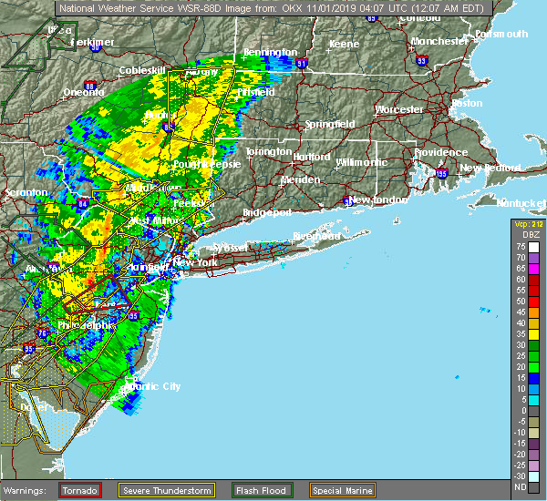 At 1206 am edt, a severe thunderstorm was located over fahnestock state park, or 7 miles northeast of cold spring, moving northeast at 70 mph (radar indicated). Hazards include 60 mph wind gusts. Expect damage to trees and power lines. this severe storm will be near, lake carmel and carmel around 1210 am edt. new york--newark around 1215 am edt. new fairfield around 1220 am edt. Sherman around 1225 am edt. At 1206 am edt, a severe thunderstorm was located over fahnestock state park, or 7 miles northeast of cold spring, moving northeast at 70 mph (radar indicated). Hazards include 60 mph wind gusts. Expect damage to trees and power lines. this severe storm will be near, lake carmel and carmel around 1210 am edt. new york--newark around 1215 am edt. new fairfield around 1220 am edt. Sherman around 1225 am edt.
|
| 10/31/2019 11:34 PM EDT |
 At 1133 pm edt, a severe thunderstorm was located over west milford, moving northeast at 70 mph (radar indicated). Hazards include 60 mph wind gusts. Expect damage to trees and power lines. this severe thunderstorm will be near, greenwood lake around 1140 pm edt. sloatsburg around 1145 pm edt. monroe and pomona around 1150 pm edt. peekskill around 1155 pm edt. cold spring and west point around 1200 am edt. mahopac and fahnestock state park around 1205 am edt. lake carmel and carmel around 1210 am edt. new york--newark around 1215 am edt. new fairfield around 1220 am edt. Sherman around 1225 am edt. At 1133 pm edt, a severe thunderstorm was located over west milford, moving northeast at 70 mph (radar indicated). Hazards include 60 mph wind gusts. Expect damage to trees and power lines. this severe thunderstorm will be near, greenwood lake around 1140 pm edt. sloatsburg around 1145 pm edt. monroe and pomona around 1150 pm edt. peekskill around 1155 pm edt. cold spring and west point around 1200 am edt. mahopac and fahnestock state park around 1205 am edt. lake carmel and carmel around 1210 am edt. new york--newark around 1215 am edt. new fairfield around 1220 am edt. Sherman around 1225 am edt.
|
| 8/8/2019 7:12 PM EDT |
 The severe thunderstorm warning for central fairfield, northern westchester, eastern orange, putnam and rockland counties will expire at 715 pm edt, the storms which prompted the warning have moved out of the warned area. therefore, the warning will be allowed to expire. a severe thunderstorm watch remains in effect until midnight edt for southern connecticut, and southeastern new york. The severe thunderstorm warning for central fairfield, northern westchester, eastern orange, putnam and rockland counties will expire at 715 pm edt, the storms which prompted the warning have moved out of the warned area. therefore, the warning will be allowed to expire. a severe thunderstorm watch remains in effect until midnight edt for southern connecticut, and southeastern new york.
|
| 8/8/2019 6:36 PM EDT |
 At 636 pm edt, severe thunderstorms were located along a line extending from near pawling to near fahnestock state park to near sloatsburg, moving east at 45 mph (radar indicated). Hazards include 60 mph wind gusts. Expect damage to trees and power lines. these severe storms will be near, new fairfield around 640 pm edt. mahopac and brookfield around 645 pm edt. danbury and new city around 650 pm edt. haverstraw and brewster around 655 pm edt. ossining and upper nyack around 700 pm edt. mount kisco and ridgefield around 710 pm edt. Redding and bedford around 715 pm edt. At 636 pm edt, severe thunderstorms were located along a line extending from near pawling to near fahnestock state park to near sloatsburg, moving east at 45 mph (radar indicated). Hazards include 60 mph wind gusts. Expect damage to trees and power lines. these severe storms will be near, new fairfield around 640 pm edt. mahopac and brookfield around 645 pm edt. danbury and new city around 650 pm edt. haverstraw and brewster around 655 pm edt. ossining and upper nyack around 700 pm edt. mount kisco and ridgefield around 710 pm edt. Redding and bedford around 715 pm edt.
|
| 8/8/2019 6:15 PM EDT |
 At 614 pm edt, severe thunderstorms were located along a line extending from near hopewell junction to near new windsor to near vernon valley, moving southeast at 45 mph. this line of storms has a history of bringing down trees and power lines (radar indicated). Hazards include 60 mph wind gusts. Expect damage to trees and power lines. severe thunderstorms will be near, newburgh and new windsor around 620 pm edt. west point around 625 pm edt. monroe and cold spring around 630 pm edt. sherman and sloatsburg around 635 pm edt. new fairfield around 640 pm edt. danbury and monsey around 645 pm edt. new city and lake carmel around 650 pm edt. haverstraw and brewster around 655 pm edt. ossining and upper nyack around 700 pm edt. ridgefield around 705 pm edt. mount kisco around 710 pm edt. Redding and bedford around 715 pm edt. At 614 pm edt, severe thunderstorms were located along a line extending from near hopewell junction to near new windsor to near vernon valley, moving southeast at 45 mph. this line of storms has a history of bringing down trees and power lines (radar indicated). Hazards include 60 mph wind gusts. Expect damage to trees and power lines. severe thunderstorms will be near, newburgh and new windsor around 620 pm edt. west point around 625 pm edt. monroe and cold spring around 630 pm edt. sherman and sloatsburg around 635 pm edt. new fairfield around 640 pm edt. danbury and monsey around 645 pm edt. new city and lake carmel around 650 pm edt. haverstraw and brewster around 655 pm edt. ossining and upper nyack around 700 pm edt. ridgefield around 705 pm edt. mount kisco around 710 pm edt. Redding and bedford around 715 pm edt.
|
| 8/3/2019 8:23 PM EDT |
 At 823 pm edt, a severe thunderstorm was located over brewster, moving southeast at 20 mph (radar indicated). Hazards include 60 mph wind gusts and penny size hail. Expect damage to trees and power lines. this severe thunderstorm will be near, ridgefield around 850 pm edt. georgetown around 905 pm edt. stamford and new canaan around 910 pm edt. Norwalk and westport around 915 pm edt. At 823 pm edt, a severe thunderstorm was located over brewster, moving southeast at 20 mph (radar indicated). Hazards include 60 mph wind gusts and penny size hail. Expect damage to trees and power lines. this severe thunderstorm will be near, ridgefield around 850 pm edt. georgetown around 905 pm edt. stamford and new canaan around 910 pm edt. Norwalk and westport around 915 pm edt.
|
| 8/3/2019 8:23 PM EDT |
 The national weather service in upton ny has issued a * severe thunderstorm warning for. central fairfield county in southern connecticut. northern westchester county in southeastern new york. eastern putnam county in southeastern new york. Until 915 pm edt. The national weather service in upton ny has issued a * severe thunderstorm warning for. central fairfield county in southern connecticut. northern westchester county in southeastern new york. eastern putnam county in southeastern new york. Until 915 pm edt.
|
| 7/22/2019 3:56 PM EDT |
 At 355 pm edt, severe thunderstorms were located along a line extending from near fahnestock state park to near yorktown heights to ossining, moving east at 35 mph (radar indicated). Hazards include 60 mph wind gusts. Expect damage to trees and power lines. severe thunderstorms will be near, mahopac around 400 pm edt. lake carmel and carmel around 405 pm edt. mount kisco and brewster around 410 pm edt. new fairfield and bedford around 420 pm edt. ridgefield and brookfield around 425 pm edt. stamford and danbury around 430 pm edt. norwalk and new canaan around 435 pm edt. Bridgeport and shelton around 445 pm edt. At 355 pm edt, severe thunderstorms were located along a line extending from near fahnestock state park to near yorktown heights to ossining, moving east at 35 mph (radar indicated). Hazards include 60 mph wind gusts. Expect damage to trees and power lines. severe thunderstorms will be near, mahopac around 400 pm edt. lake carmel and carmel around 405 pm edt. mount kisco and brewster around 410 pm edt. new fairfield and bedford around 420 pm edt. ridgefield and brookfield around 425 pm edt. stamford and danbury around 430 pm edt. norwalk and new canaan around 435 pm edt. Bridgeport and shelton around 445 pm edt.
|
| 6/30/2019 1:33 PM EDT |
 At 133 pm edt, a severe thunderstorm was located near lake carmel, moving south at 40 mph (radar indicated). Hazards include 60 mph wind gusts and quarter size hail. Minor hail damage to vehicles is possible. expect wind damage to trees and power lines. this severe thunderstorm will be near, new fairfield around 140 pm edt. carmel around 150 pm edt. brewster around 155 pm edt. Ridgefield around 215 pm edt. At 133 pm edt, a severe thunderstorm was located near lake carmel, moving south at 40 mph (radar indicated). Hazards include 60 mph wind gusts and quarter size hail. Minor hail damage to vehicles is possible. expect wind damage to trees and power lines. this severe thunderstorm will be near, new fairfield around 140 pm edt. carmel around 150 pm edt. brewster around 155 pm edt. Ridgefield around 215 pm edt.
|
| 6/26/2019 8:19 PM EDT |
 At 817 pm edt, a severe thunderstorm was located over hopewell junction, or 8 miles west of pawling, moving east at 25 mph (radar indicated). Hazards include 60 mph wind gusts. Expect damage to trees and power lines. this severe thunderstorm will be near, lake carmel around 835 pm edt. Danbury and new fairfield around 845 pm edt. At 817 pm edt, a severe thunderstorm was located over hopewell junction, or 8 miles west of pawling, moving east at 25 mph (radar indicated). Hazards include 60 mph wind gusts. Expect damage to trees and power lines. this severe thunderstorm will be near, lake carmel around 835 pm edt. Danbury and new fairfield around 845 pm edt.
|
| 6/18/2018 7:32 PM EDT |
 At 732 pm edt, a severe thunderstorm was located over brewster, moving southeast at 45 mph (radar indicated). Hazards include 60 mph wind gusts. Expect damage to trees and power lines. Locations impacted include, mahopac, lake carmel, west point, brewster, cold spring, carmel, fahnestock state park, putnam valley, highland falls, putnam lake, brewster hill, peach lake and fort montgomery. At 732 pm edt, a severe thunderstorm was located over brewster, moving southeast at 45 mph (radar indicated). Hazards include 60 mph wind gusts. Expect damage to trees and power lines. Locations impacted include, mahopac, lake carmel, west point, brewster, cold spring, carmel, fahnestock state park, putnam valley, highland falls, putnam lake, brewster hill, peach lake and fort montgomery.
|
| 6/18/2018 7:07 PM EDT |
 At 706 pm edt, a severe thunderstorm was located over beacon, moving east at 45 mph (radar indicated). Hazards include 60 mph wind gusts. Expect damage to trees and power lines. this severe thunderstorm will be near, fahnestock state park around 725 pm edt. mahopac around 735 pm edt. lake carmel and carmel around 740 pm edt. Brewster around 745 pm edt. At 706 pm edt, a severe thunderstorm was located over beacon, moving east at 45 mph (radar indicated). Hazards include 60 mph wind gusts. Expect damage to trees and power lines. this severe thunderstorm will be near, fahnestock state park around 725 pm edt. mahopac around 735 pm edt. lake carmel and carmel around 740 pm edt. Brewster around 745 pm edt.
|
| 5/15/2018 4:51 PM EDT |
 At 448 pm edt, severe thunderstorms were located along a line extending from near windsor locks to sherman to danbury to near pomona to boonton to near bloomsbury, moving east at 45 mph (mesonet observations and trained weather spotters. the new york state mesonet site at beacon reported winds of 78 mph at 420 pm). Hazards include 70 mph wind gusts and quarter size hail. Minor hail damage to vehicles is possible. expect considerable tree damage. Wind damage is also likely to mobile homes, roofs, and outbuildings. At 448 pm edt, severe thunderstorms were located along a line extending from near windsor locks to sherman to danbury to near pomona to boonton to near bloomsbury, moving east at 45 mph (mesonet observations and trained weather spotters. the new york state mesonet site at beacon reported winds of 78 mph at 420 pm). Hazards include 70 mph wind gusts and quarter size hail. Minor hail damage to vehicles is possible. expect considerable tree damage. Wind damage is also likely to mobile homes, roofs, and outbuildings.
|
| 5/15/2018 4:38 PM EDT |
 At 437 pm edt, severe thunderstorms were located along a line extending from lake carmel to near west point to victory gardens to washington to near coffeetown, moving east at 45 mph. these are very dangerous storms (the new york state mesonet site at beacon reported winds of 78 mph at 420 pm). Hazards include 80 mph wind gusts and penny size hail. Flying debris will be dangerous to those caught without shelter. mobile homes will be heavily damaged. expect considerable damage to roofs, windows, and vehicles. extensive tree damage and power outages are likely. Locations impacted include, yonkers, paterson, stamford, waterbury, danbury, passaic, white plains, wayne, bloomfield, hackensack, shelton, new city, naugatuck, orange and newburgh. At 437 pm edt, severe thunderstorms were located along a line extending from lake carmel to near west point to victory gardens to washington to near coffeetown, moving east at 45 mph. these are very dangerous storms (the new york state mesonet site at beacon reported winds of 78 mph at 420 pm). Hazards include 80 mph wind gusts and penny size hail. Flying debris will be dangerous to those caught without shelter. mobile homes will be heavily damaged. expect considerable damage to roofs, windows, and vehicles. extensive tree damage and power outages are likely. Locations impacted include, yonkers, paterson, stamford, waterbury, danbury, passaic, white plains, wayne, bloomfield, hackensack, shelton, new city, naugatuck, orange and newburgh.
|
| 5/15/2018 4:06 PM EDT |
 At 405 pm edt, severe thunderstorms were located along a line extending from near wallkill to near high point to near dingmans ferry to stormville to near tamaqua, moving east at 110 mph (radar indicated). Hazards include 70 mph wind gusts and quarter size hail. Minor hail damage to vehicles is possible. expect considerable tree damage. wind damage is also likely to mobile homes, roofs, and outbuildings. Locations that could be impacted include, yonkers, paterson, stamford, waterbury, danbury, passaic, white plains, wayne, bloomfield, hackensack, shelton, new city, naugatuck, orange and newburgh. At 405 pm edt, severe thunderstorms were located along a line extending from near wallkill to near high point to near dingmans ferry to stormville to near tamaqua, moving east at 110 mph (radar indicated). Hazards include 70 mph wind gusts and quarter size hail. Minor hail damage to vehicles is possible. expect considerable tree damage. wind damage is also likely to mobile homes, roofs, and outbuildings. Locations that could be impacted include, yonkers, paterson, stamford, waterbury, danbury, passaic, white plains, wayne, bloomfield, hackensack, shelton, new city, naugatuck, orange and newburgh.
|
| 5/15/2018 3:34 PM EDT |
 At 331 pm edt, severe thunderstorms were located along a line extending from hazel to near lava to new boston-morea, moving east at 70 mph (radar indicated). Hazards include 70 mph wind gusts and quarter size hail. Minor hail damage to vehicles is possible. expect considerable tree damage. wind damage is also likely to mobile homes, roofs, and outbuildings. severe thunderstorms will be near, howells around 350 pm edt. montgomery around 400 pm edt. walden around 405 pm edt. newburgh and new windsor around 410 pm edt. fahnestock state park around 420 pm edt. lake carmel around 425 pm edt. brookfield and new fairfield around 435 pm edt. danbury and newtown around 440 pm edt. summit and southbury around 450 pm edt. waterbury and naugatuck around 455 pm edt. Bloomfield and rutherford around 500 pm edt. At 331 pm edt, severe thunderstorms were located along a line extending from hazel to near lava to new boston-morea, moving east at 70 mph (radar indicated). Hazards include 70 mph wind gusts and quarter size hail. Minor hail damage to vehicles is possible. expect considerable tree damage. wind damage is also likely to mobile homes, roofs, and outbuildings. severe thunderstorms will be near, howells around 350 pm edt. montgomery around 400 pm edt. walden around 405 pm edt. newburgh and new windsor around 410 pm edt. fahnestock state park around 420 pm edt. lake carmel around 425 pm edt. brookfield and new fairfield around 435 pm edt. danbury and newtown around 440 pm edt. summit and southbury around 450 pm edt. waterbury and naugatuck around 455 pm edt. Bloomfield and rutherford around 500 pm edt.
|
| 9/5/2017 5:28 PM EDT |
 The severe thunderstorm warning for north central fairfield, northern westchester, east central orange, putnam and rockland counties will expire at 530 pm edt, the storm which prompted the warning is weakening below severe limits, and no longer poses an immediate threat to life or property. therefore the warning will be allowed to expire. small hail and wind gusts to 50 mph are still possible with this storm as it tracks through extreme northern fairfield county through 6pm. The severe thunderstorm warning for north central fairfield, northern westchester, east central orange, putnam and rockland counties will expire at 530 pm edt, the storm which prompted the warning is weakening below severe limits, and no longer poses an immediate threat to life or property. therefore the warning will be allowed to expire. small hail and wind gusts to 50 mph are still possible with this storm as it tracks through extreme northern fairfield county through 6pm.
|
| 9/5/2017 5:24 PM EDT | Downed tree near 450 east branch road in putnam county NY, 4.1 miles SE of Putnam Lake, NY |
| 9/5/2017 4:58 PM EDT |
 At 455 pm edt, a severe thunderstorm was located near fahnestock state park, or near mahopac, moving northeast at 30 mph (radar indicated). Hazards include 60 mph wind gusts and half dollar size hail. Minor hail damage to vehicles is possible. expect wind damage to trees and power lines. this severe storm will be near, lake carmel and brewster around 505 pm edt. new fairfield around 520 pm edt. danbury around 525 pm edt. Sherman and brookfield around 530 pm edt. At 455 pm edt, a severe thunderstorm was located near fahnestock state park, or near mahopac, moving northeast at 30 mph (radar indicated). Hazards include 60 mph wind gusts and half dollar size hail. Minor hail damage to vehicles is possible. expect wind damage to trees and power lines. this severe storm will be near, lake carmel and brewster around 505 pm edt. new fairfield around 520 pm edt. danbury around 525 pm edt. Sherman and brookfield around 530 pm edt.
|
| 9/5/2017 4:29 PM EDT |
 At 428 pm edt, a severe thunderstorm was located near west point, moving northeast at 30 mph (radar indicated). Hazards include 60 mph wind gusts. Expect damage to trees and power lines. this severe thunderstorm will be near, peekskill around 435 pm edt. cold spring around 440 pm edt. mahopac and fahnestock state park around 455 pm edt. carmel around 505 pm edt. lake carmel and brewster around 510 pm edt. new fairfield around 525 pm edt. Danbury and brookfield around 530 pm edt. At 428 pm edt, a severe thunderstorm was located near west point, moving northeast at 30 mph (radar indicated). Hazards include 60 mph wind gusts. Expect damage to trees and power lines. this severe thunderstorm will be near, peekskill around 435 pm edt. cold spring around 440 pm edt. mahopac and fahnestock state park around 455 pm edt. carmel around 505 pm edt. lake carmel and brewster around 510 pm edt. new fairfield around 525 pm edt. Danbury and brookfield around 530 pm edt.
|
| 6/30/2017 6:20 PM EDT |
 At 619 pm edt, a severe thunderstorm was located over brewster, moving east at 40 mph (radar indicated). Hazards include 60 mph wind gusts and quarter size hail. Hail damage to vehicles is expected. expect wind damage to roofs, siding, and trees. Heavy downpours are expected. At 619 pm edt, a severe thunderstorm was located over brewster, moving east at 40 mph (radar indicated). Hazards include 60 mph wind gusts and quarter size hail. Hail damage to vehicles is expected. expect wind damage to roofs, siding, and trees. Heavy downpours are expected.
|
| 6/30/2017 6:04 PM EDT |
 At 603 pm edt, a severe thunderstorm was located near carmel, or near mahopac, moving east at 25 mph (radar indicated). Hazards include 60 mph wind gusts and quarter size hail. Hail damage to vehicles is expected. expect wind damage to roofs, siding, and trees. this severe thunderstorm will be near, carmel around 610 pm edt. lake carmel around 615 pm edt. brewster around 620 pm edt. new fairfield around 630 pm edt. ridgefield around 635 pm edt. danbury and brookfield around 640 pm edt. Newtown and bethel around 645 pm edt. At 603 pm edt, a severe thunderstorm was located near carmel, or near mahopac, moving east at 25 mph (radar indicated). Hazards include 60 mph wind gusts and quarter size hail. Hail damage to vehicles is expected. expect wind damage to roofs, siding, and trees. this severe thunderstorm will be near, carmel around 610 pm edt. lake carmel around 615 pm edt. brewster around 620 pm edt. new fairfield around 630 pm edt. ridgefield around 635 pm edt. danbury and brookfield around 640 pm edt. Newtown and bethel around 645 pm edt.
|
| 6/19/2017 4:40 PM EDT |
 At 440 pm edt, a severe thunderstorm was located over wingdale, or 7 miles northwest of sherman, moving north at 45 mph (radar indicated). Hazards include 60 mph wind gusts and quarter size hail. Hail damage to vehicles is expected. expect wind damage to roofs, siding, and trees. This severe thunderstorm will remain over mainly rural areas of north central fairfield and eastern putnam counties. At 440 pm edt, a severe thunderstorm was located over wingdale, or 7 miles northwest of sherman, moving north at 45 mph (radar indicated). Hazards include 60 mph wind gusts and quarter size hail. Hail damage to vehicles is expected. expect wind damage to roofs, siding, and trees. This severe thunderstorm will remain over mainly rural areas of north central fairfield and eastern putnam counties.
|
| 6/19/2017 4:22 PM EDT |
 At 422 pm edt, a severe thunderstorm was located over lake carmel, moving north at 45 mph (radar indicated). Hazards include 60 mph wind gusts and quarter size hail. Hail damage to vehicles is expected. expect wind damage to roofs, siding, and trees. this severe thunderstorm will be near, new fairfield around 425 pm edt. Sherman around 440 pm edt. At 422 pm edt, a severe thunderstorm was located over lake carmel, moving north at 45 mph (radar indicated). Hazards include 60 mph wind gusts and quarter size hail. Hail damage to vehicles is expected. expect wind damage to roofs, siding, and trees. this severe thunderstorm will be near, new fairfield around 425 pm edt. Sherman around 440 pm edt.
|
| 6/19/2017 3:24 PM EDT | Trees down on wires on route 311 in patterson in putnam county NY, 4.1 miles SE of Putnam Lake, NY |
| 6/13/2017 4:21 PM EDT |
 At 420 pm edt, severe thunderstorms were located along a line extending from near brookfield to brewster, moving east at 30 mph (radar indicated). Hazards include 60 mph wind gusts and quarter size hail. Hail damage to vehicles is expected. expect wind damage to roofs, siding, and trees. these severe storms will be near, newtown around 425 pm edt. brookfield around 435 pm edt. southbury and bethel around 440 pm edt. Naugatuck and redding around 445 pm edt. At 420 pm edt, severe thunderstorms were located along a line extending from near brookfield to brewster, moving east at 30 mph (radar indicated). Hazards include 60 mph wind gusts and quarter size hail. Hail damage to vehicles is expected. expect wind damage to roofs, siding, and trees. these severe storms will be near, newtown around 425 pm edt. brookfield around 435 pm edt. southbury and bethel around 440 pm edt. Naugatuck and redding around 445 pm edt.
|
| 6/13/2017 3:59 PM EDT |
 At 357 pm edt, severe thunderstorms were located along a line extending from near sherman to near fahnestock state park, moving east at 30 mph (radar indicated). Hazards include 60 mph wind gusts and quarter size hail. Hail damage to vehicles is expected. expect wind damage to roofs, siding, and trees. severe thunderstorms will be near, new fairfield around 400 pm edt. danbury and brookfield around 410 pm edt. brewster around 415 pm edt. newtown around 420 pm edt. ridgefield and bethel around 435 pm edt. southbury and middlebury around 440 pm edt. Naugatuck and redding around 445 pm edt. At 357 pm edt, severe thunderstorms were located along a line extending from near sherman to near fahnestock state park, moving east at 30 mph (radar indicated). Hazards include 60 mph wind gusts and quarter size hail. Hail damage to vehicles is expected. expect wind damage to roofs, siding, and trees. severe thunderstorms will be near, new fairfield around 400 pm edt. danbury and brookfield around 410 pm edt. brewster around 415 pm edt. newtown around 420 pm edt. ridgefield and bethel around 435 pm edt. southbury and middlebury around 440 pm edt. Naugatuck and redding around 445 pm edt.
|
| 6/13/2017 3:40 PM EDT |
 At 339 pm edt, a severe thunderstorm was located over sherman, moving east at 25 mph (radar indicated). Hazards include 60 mph wind gusts and quarter size hail. Hail damage to vehicles is expected. expect wind damage to roofs, siding, and trees. this severe storm will be near, new fairfield around 345 pm edt. danbury and brookfield around 355 pm edt. Newtown and bethel around 400 pm edt. At 339 pm edt, a severe thunderstorm was located over sherman, moving east at 25 mph (radar indicated). Hazards include 60 mph wind gusts and quarter size hail. Hail damage to vehicles is expected. expect wind damage to roofs, siding, and trees. this severe storm will be near, new fairfield around 345 pm edt. danbury and brookfield around 355 pm edt. Newtown and bethel around 400 pm edt.
|
| 6/13/2017 3:17 PM EDT |
 At 316 pm edt, a severe thunderstorm was located near pawling, moving southeast at 25 mph (radar indicated). Hazards include 60 mph wind gusts and quarter size hail. Hail damage to vehicles is expected. expect wind damage to roofs, siding, and trees. this severe thunderstorm will be near, sherman around 335 pm edt. new fairfield around 340 pm edt. danbury and brookfield around 355 pm edt. Newtown and bethel around 400 pm edt. At 316 pm edt, a severe thunderstorm was located near pawling, moving southeast at 25 mph (radar indicated). Hazards include 60 mph wind gusts and quarter size hail. Hail damage to vehicles is expected. expect wind damage to roofs, siding, and trees. this severe thunderstorm will be near, sherman around 335 pm edt. new fairfield around 340 pm edt. danbury and brookfield around 355 pm edt. Newtown and bethel around 400 pm edt.
|
| 2/25/2017 6:46 PM EST |
 At 645 pm est, severe thunderstorms were located along a line extending from gaylordsville to bedford to dobbs ferry, moving northeast at 60 mph (radar indicated). Hazards include 60 mph wind gusts and penny size hail. Expect damage to roofs, siding, and trees. these severe storms will be near, sherman around 650 pm est. new canaan around 655 pm est. Brewster and ridgefield around 700 pm est. At 645 pm est, severe thunderstorms were located along a line extending from gaylordsville to bedford to dobbs ferry, moving northeast at 60 mph (radar indicated). Hazards include 60 mph wind gusts and penny size hail. Expect damage to roofs, siding, and trees. these severe storms will be near, sherman around 650 pm est. new canaan around 655 pm est. Brewster and ridgefield around 700 pm est.
|
| 2/25/2017 6:29 PM EST |
 At 629 pm est, severe thunderstorms were located along a line extending from near pawling to near yorktown heights to near pearl river, moving northeast at 65 mph (radar indicated). Hazards include 60 mph wind gusts. Expect damage to roofs, siding, and trees. these severe storms will be near, mahopac and sherman around 640 pm est. lake carmel around 645 pm est. danbury and bethel around 650 pm est. brookfield around 655 pm est. Brewster and ridgefield around 700 pm est. At 629 pm est, severe thunderstorms were located along a line extending from near pawling to near yorktown heights to near pearl river, moving northeast at 65 mph (radar indicated). Hazards include 60 mph wind gusts. Expect damage to roofs, siding, and trees. these severe storms will be near, mahopac and sherman around 640 pm est. lake carmel around 645 pm est. danbury and bethel around 650 pm est. brookfield around 655 pm est. Brewster and ridgefield around 700 pm est.
|
| 2/25/2017 6:10 PM EST |
 At 609 pm est, severe thunderstorms were located along a line extending from near fahnestock state park to near suffern to near ridgewood, moving northeast at 45 mph (radar indicated). Hazards include 60 mph wind gusts and penny size hail. Expect damage to roofs, siding, and trees. severe thunderstorms will be near, cold spring and fahnestock state park around 615 pm est. tarrytown and lake carmel around 625 pm est. ossining and peekskill around 630 pm est. new fairfield and yorktown heights around 635 pm est. mount kisco and greenwich around 640 pm est. mahopac and sherman around 645 pm est. stamford and brewster around 650 pm est. new canaan around 655 pm est. Danbury and ridgefield around 700 pm est. At 609 pm est, severe thunderstorms were located along a line extending from near fahnestock state park to near suffern to near ridgewood, moving northeast at 45 mph (radar indicated). Hazards include 60 mph wind gusts and penny size hail. Expect damage to roofs, siding, and trees. severe thunderstorms will be near, cold spring and fahnestock state park around 615 pm est. tarrytown and lake carmel around 625 pm est. ossining and peekskill around 630 pm est. new fairfield and yorktown heights around 635 pm est. mount kisco and greenwich around 640 pm est. mahopac and sherman around 645 pm est. stamford and brewster around 650 pm est. new canaan around 655 pm est. Danbury and ridgefield around 700 pm est.
|
| 8/14/2016 5:29 PM EDT |
 At 528 pm edt, a severe thunderstorm was located near lake carmel, moving east at 40 mph (radar indicated). Hazards include 60 mph wind gusts. Expect damage to roofs. siding. and trees. this severe thunderstorm will be near, brewster around 540 pm edt. new fairfield around 545 pm edt. brookfield around 550 pm edt. danbury and bethel around 555 pm edt. newtown and redding around 600 pm edt. Shelton, trumbull, monroe, seymour, derby and bridgeport-- stamford around 615 pm edt. At 528 pm edt, a severe thunderstorm was located near lake carmel, moving east at 40 mph (radar indicated). Hazards include 60 mph wind gusts. Expect damage to roofs. siding. and trees. this severe thunderstorm will be near, brewster around 540 pm edt. new fairfield around 545 pm edt. brookfield around 550 pm edt. danbury and bethel around 555 pm edt. newtown and redding around 600 pm edt. Shelton, trumbull, monroe, seymour, derby and bridgeport-- stamford around 615 pm edt.
|
| 8/13/2016 9:03 PM EDT |
 At 902 pm edt, a severe thunderstorm was located over brewster, moving east at 30 mph (radar indicated). Hazards include 60 mph wind gusts. Expect damage to roofs. siding. and trees. this severe thunderstorm will be near, new fairfield around 910 pm edt. danbury, bethel and brookfield around 920 pm edt. redding around 925 pm edt. newtown around 930 pm edt. monroe around 940 pm edt. Shelton, naugatuck, southbury, seymour, middlebury, beacon falls and bridgeport--stamford around 945 pm edt. At 902 pm edt, a severe thunderstorm was located over brewster, moving east at 30 mph (radar indicated). Hazards include 60 mph wind gusts. Expect damage to roofs. siding. and trees. this severe thunderstorm will be near, new fairfield around 910 pm edt. danbury, bethel and brookfield around 920 pm edt. redding around 925 pm edt. newtown around 930 pm edt. monroe around 940 pm edt. Shelton, naugatuck, southbury, seymour, middlebury, beacon falls and bridgeport--stamford around 945 pm edt.
|
| 8/11/2016 8:56 PM EDT |
 At 855 pm edt, a severe thunderstorm was located over southbury, moving east at 25 mph (radar indicated). Hazards include quarter size hail. Damage to vehicles is expected. This severe thunderstorm will remain over mainly rural areas of north central fairfield and east central putnam counties, including the following locations: peach lake, brewster hill, chimney point and putnam lake. At 855 pm edt, a severe thunderstorm was located over southbury, moving east at 25 mph (radar indicated). Hazards include quarter size hail. Damage to vehicles is expected. This severe thunderstorm will remain over mainly rural areas of north central fairfield and east central putnam counties, including the following locations: peach lake, brewster hill, chimney point and putnam lake.
|
| 8/11/2016 8:37 PM EDT |
 At 836 pm edt, a severe thunderstorm was located over brookfield, or near danbury, moving east at 25 mph (radar indicated). Hazards include quarter size hail. Damage to vehicles is expected. this severe thunderstorm will be near, newtown around 845 pm edt. Other locations impacted by this severe thunderstorm include peach lake, brewster hill, chimney point and putnam lake. At 836 pm edt, a severe thunderstorm was located over brookfield, or near danbury, moving east at 25 mph (radar indicated). Hazards include quarter size hail. Damage to vehicles is expected. this severe thunderstorm will be near, newtown around 845 pm edt. Other locations impacted by this severe thunderstorm include peach lake, brewster hill, chimney point and putnam lake.
|
| 7/1/2016 5:50 PM EDT |
 The severe thunderstorm warning for north central fairfield, putnam, northern westchester and east central orange counties will expire at 600 pm edt, the storms which prompted the warning have weakened. therefore, the warning will be allowed to expire. a tornado watch remains in effect until 1000 pm edt for southern connecticut, and southeastern new york. The severe thunderstorm warning for north central fairfield, putnam, northern westchester and east central orange counties will expire at 600 pm edt, the storms which prompted the warning have weakened. therefore, the warning will be allowed to expire. a tornado watch remains in effect until 1000 pm edt for southern connecticut, and southeastern new york.
|
| 7/1/2016 5:39 PM EDT |
 At 538 pm edt, severe thunderstorms were located along a line extending from 6 miles northeast of hopewell junction to near west point, moving east at 30 mph (radar indicated). Hazards include 60 mph wind gusts. Expect damage to roofs. siding. and trees. these severe storms will be near, sherman, mahopac, lake carmel and carmel around 600 pm edt. other locations impacted by these severe thunderstorms include central valley, peach lake, brewster hill, chimney point, cornwall on hudson, putnam lake, jefferson valley, highland mills, firthcliffe and highland falls. A tornado watch remains in effect until 1000 pm edt for southern connecticut, and southeastern new york. At 538 pm edt, severe thunderstorms were located along a line extending from 6 miles northeast of hopewell junction to near west point, moving east at 30 mph (radar indicated). Hazards include 60 mph wind gusts. Expect damage to roofs. siding. and trees. these severe storms will be near, sherman, mahopac, lake carmel and carmel around 600 pm edt. other locations impacted by these severe thunderstorms include central valley, peach lake, brewster hill, chimney point, cornwall on hudson, putnam lake, jefferson valley, highland mills, firthcliffe and highland falls. A tornado watch remains in effect until 1000 pm edt for southern connecticut, and southeastern new york.
|
| 7/1/2016 5:12 PM EDT |
 At 512 pm edt, severe thunderstorms were located along a line extending from near wappingers falls to near upper greenwood lake, moving east at 35 mph (radar indicated). Hazards include 60 mph wind gusts. Expect damage to roofs. siding. and trees. severe thunderstorms will be near, newburgh and gardnertown around 515 pm edt. ramsey and suffern around 530 pm edt. monsey and new york--newark around 535 pm edt. nanuet, pomona and pearl river around 540 pm edt. new city around 545 pm edt. peekskill, haverstraw, nyack, new fairfield and upper nyack around 550 pm edt. ossining, tarrytown, sherman and north tarrytown around 555 pm edt. mount kisco, brookfield, hawthorne and yorktown heights around 600 pm edt. other locations impacted by these severe thunderstorms include west haverstraw, pleasantville, upper saddle river, west nyack, balmville, highland mills, spring valley, montvale, brewster hill and thiells. A tornado watch remains in effect until 1000 pm edt for southern connecticut, northeastern new jersey, and southeastern new york. At 512 pm edt, severe thunderstorms were located along a line extending from near wappingers falls to near upper greenwood lake, moving east at 35 mph (radar indicated). Hazards include 60 mph wind gusts. Expect damage to roofs. siding. and trees. severe thunderstorms will be near, newburgh and gardnertown around 515 pm edt. ramsey and suffern around 530 pm edt. monsey and new york--newark around 535 pm edt. nanuet, pomona and pearl river around 540 pm edt. new city around 545 pm edt. peekskill, haverstraw, nyack, new fairfield and upper nyack around 550 pm edt. ossining, tarrytown, sherman and north tarrytown around 555 pm edt. mount kisco, brookfield, hawthorne and yorktown heights around 600 pm edt. other locations impacted by these severe thunderstorms include west haverstraw, pleasantville, upper saddle river, west nyack, balmville, highland mills, spring valley, montvale, brewster hill and thiells. A tornado watch remains in effect until 1000 pm edt for southern connecticut, northeastern new jersey, and southeastern new york.
|
| 2/25/2016 12:27 AM EST | The severe thunderstorm warning for western new haven, fairfield, union, essex, hudson, eastern passaic, bergen, eastern orange, kings, queens, richmond, rockland, westchester, new york, bronx, central nassau and putnam counties will expire at 1230 am est, the storms which prompted the warning have moved out of the warned area. therefore the warning will be allowed to expire. |
| 2/25/2016 12:27 AM EST | The severe thunderstorm warning for western new haven, fairfield, union, essex, hudson, eastern passaic, bergen, eastern orange, kings, queens, richmond, rockland, westchester, new york, bronx, central nassau and putnam counties will expire at 1230 am est, the storms which prompted the warning have moved out of the warned area. therefore the warning will be allowed to expire. |
| 2/25/2016 12:27 AM EST | The severe thunderstorm warning for western new haven, fairfield, union, essex, hudson, eastern passaic, bergen, eastern orange, kings, queens, richmond, rockland, westchester, new york, bronx, central nassau and putnam counties will expire at 1230 am est, the storms which prompted the warning have moved out of the warned area. therefore the warning will be allowed to expire. |
| 2/25/2016 12:00 AM EST |
 At 1159 pm est, doppler radar indicated a line of severe thunderstorms capable of producing damaging winds in excess of 60 mph. these storms were located along a line extending from near myers corner to near new city to lyndhurst, moving northeast at 50 mph. these severe storms will be near, peekskill around 1205 am est. ridgewood, yorktown heights and riverdale around 1210 am est. yonkers, dobbs ferry, tappan, mahopac, bronxville, norwood and pearl river around 1215 am est. white plains, tarrytown, nyack, brewster, north tarrytown, lake carmel, nanuet, carmel, upper nyack and orangeburg around 1220 am est. new york--newark and hawthorne around 1225 am est. mount kisco, pawling and new fairfield around 1230 am est. other locations impacted by these severe thunderstorms include west hempstead, thomaston, west haverstraw, pleasantville, springfield, mount vernon, montclair, spring valley, hillside and washington heights. At 1159 pm est, doppler radar indicated a line of severe thunderstorms capable of producing damaging winds in excess of 60 mph. these storms were located along a line extending from near myers corner to near new city to lyndhurst, moving northeast at 50 mph. these severe storms will be near, peekskill around 1205 am est. ridgewood, yorktown heights and riverdale around 1210 am est. yonkers, dobbs ferry, tappan, mahopac, bronxville, norwood and pearl river around 1215 am est. white plains, tarrytown, nyack, brewster, north tarrytown, lake carmel, nanuet, carmel, upper nyack and orangeburg around 1220 am est. new york--newark and hawthorne around 1225 am est. mount kisco, pawling and new fairfield around 1230 am est. other locations impacted by these severe thunderstorms include west hempstead, thomaston, west haverstraw, pleasantville, springfield, mount vernon, montclair, spring valley, hillside and washington heights.
|
| 2/24/2016 11:26 PM EST |
 At 1122 pm est, doppler radar indicated a line of severe thunderstorms capable of producing damaging winds in excess of 60 mph. this line extending across the lower hudson valley of new york through portions of new york city and portions of northeast new jersey. it was moving northeast at 40 mph. * severe thunderstorms will be near, bergenfield, and riverdale around 1130 pm est. yonkers, tappan, norwood and orangeburg around 1135 pm est. new rochelle, tarrytown, dobbs ferry, nyack, bronxville and upper nyack around 1140 pm est. north tarrytown and scarsdale around 1145 pm est. white plains, perth amboy, harrison, hawthorne and colonia around 1150 pm est. port chester around 1155 pm est. linden, greenwich and carteret around 1200 am est. bedford and port richmond around 1205 am est. other locations impacted by these severe thunderstorms include west hempstead, thomaston, west haverstraw, pleasantville, springfield, mount vernon, montclair, spring valley, hillside and washington heights. At 1122 pm est, doppler radar indicated a line of severe thunderstorms capable of producing damaging winds in excess of 60 mph. this line extending across the lower hudson valley of new york through portions of new york city and portions of northeast new jersey. it was moving northeast at 40 mph. * severe thunderstorms will be near, bergenfield, and riverdale around 1130 pm est. yonkers, tappan, norwood and orangeburg around 1135 pm est. new rochelle, tarrytown, dobbs ferry, nyack, bronxville and upper nyack around 1140 pm est. north tarrytown and scarsdale around 1145 pm est. white plains, perth amboy, harrison, hawthorne and colonia around 1150 pm est. port chester around 1155 pm est. linden, greenwich and carteret around 1200 am est. bedford and port richmond around 1205 am est. other locations impacted by these severe thunderstorms include west hempstead, thomaston, west haverstraw, pleasantville, springfield, mount vernon, montclair, spring valley, hillside and washington heights.
|
| 6/23/2015 3:44 PM EDT |
 At 343 pm edt, doppler radar indicated an area of severe thunderstorms capable of producing destructive winds in excess of 60 mph. these storms are located near yorktown heights, or near mount kisco, and moving east at 60 mph. penny size hail may also accompany the damaging winds. At 343 pm edt, doppler radar indicated an area of severe thunderstorms capable of producing destructive winds in excess of 60 mph. these storms are located near yorktown heights, or near mount kisco, and moving east at 60 mph. penny size hail may also accompany the damaging winds.
|
Hail Maps for Putnam Lake, NY


Connect with Interactive Hail Maps