

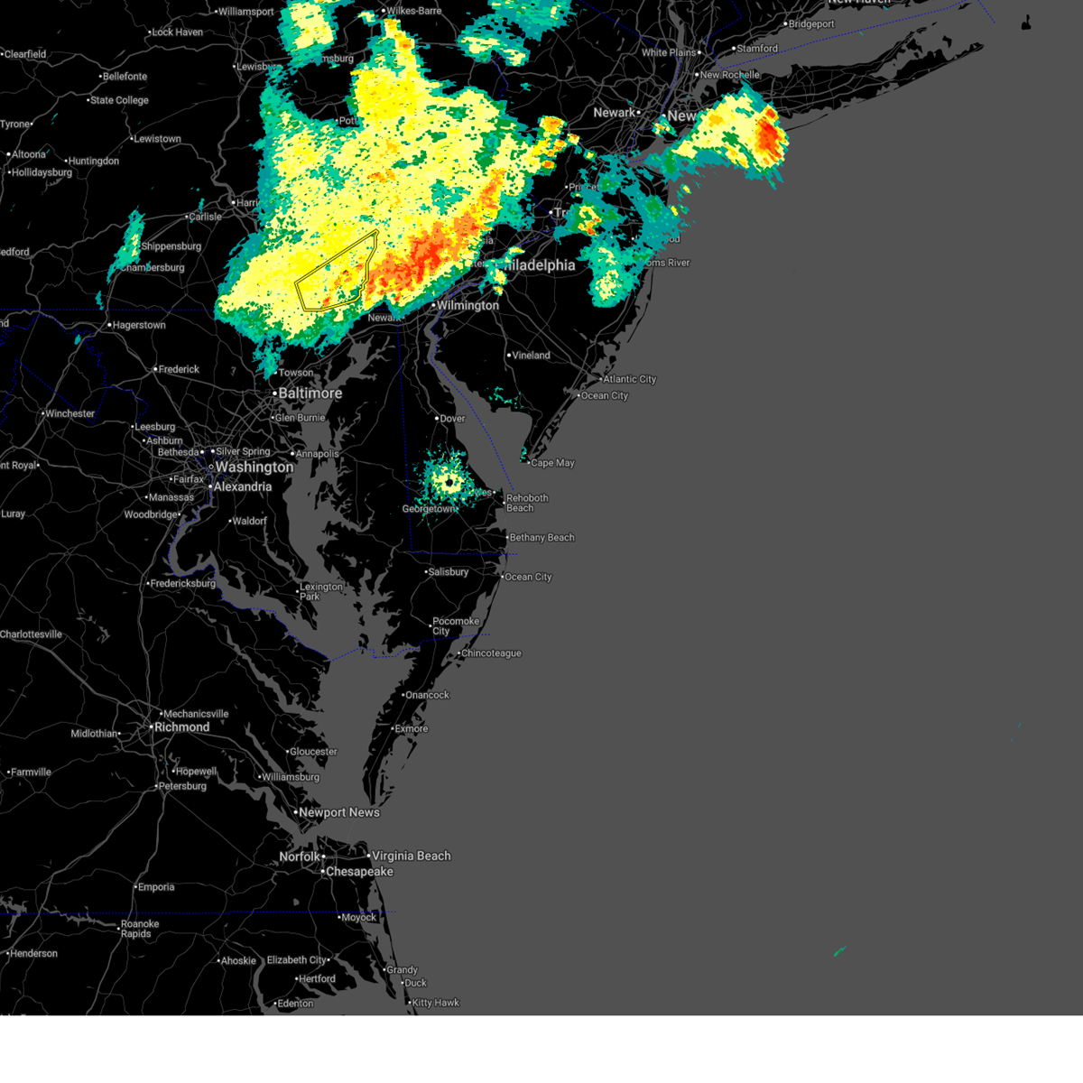
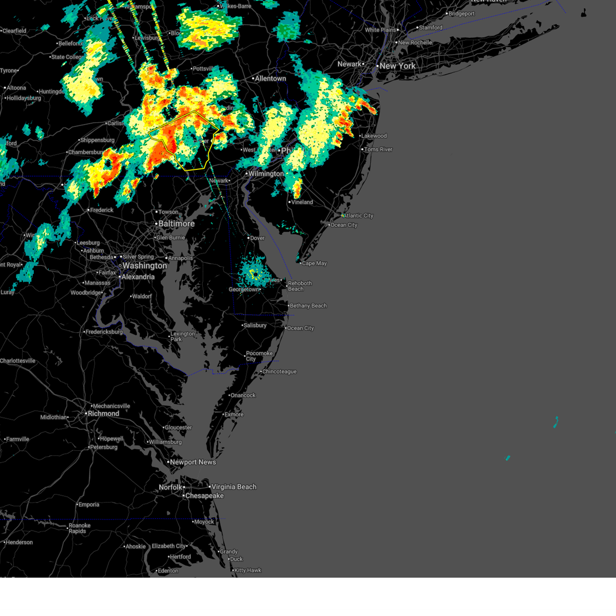
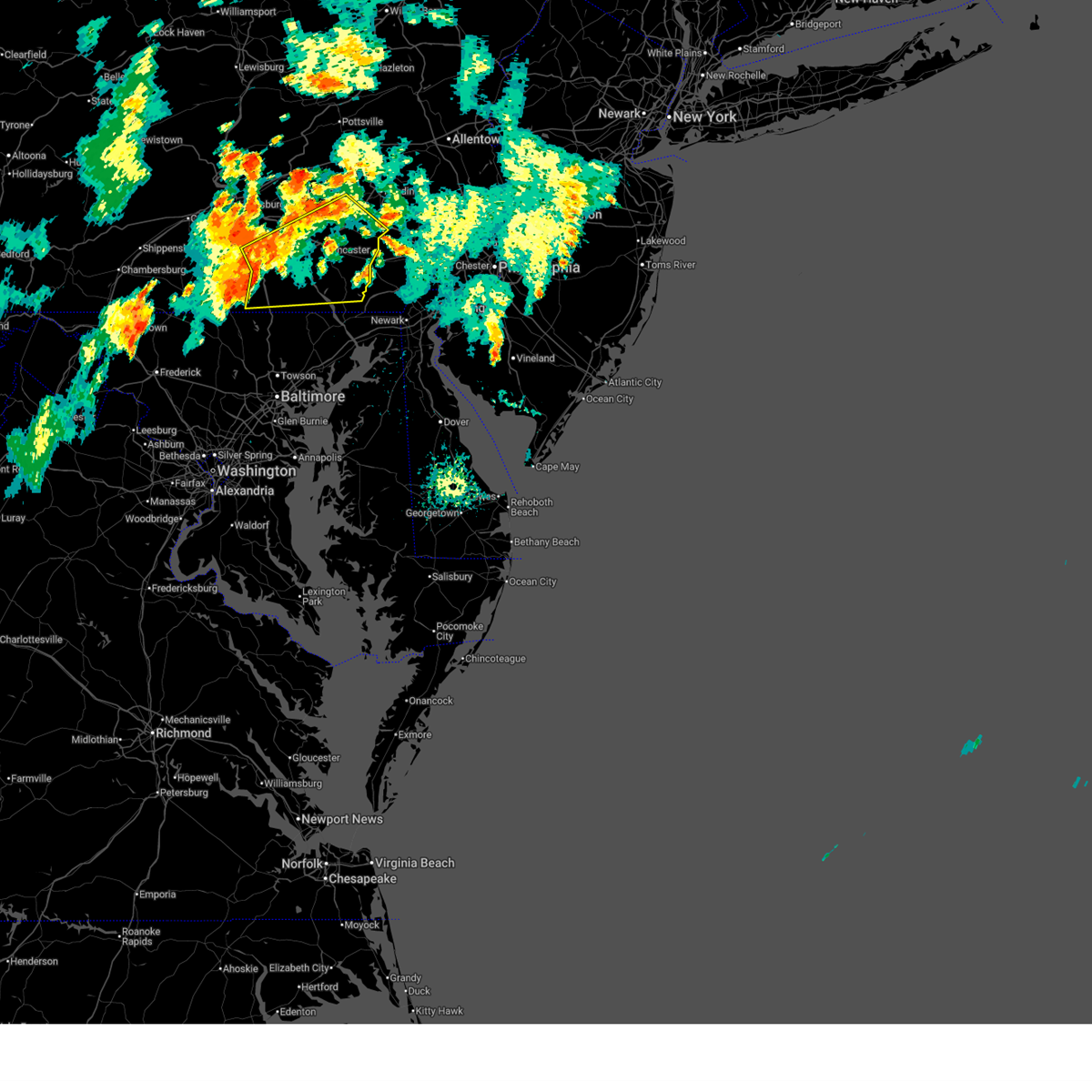
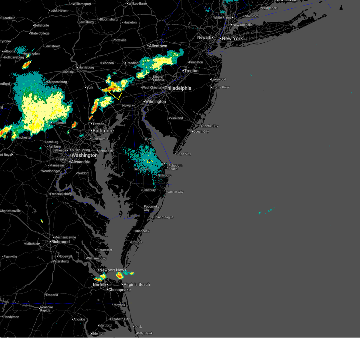
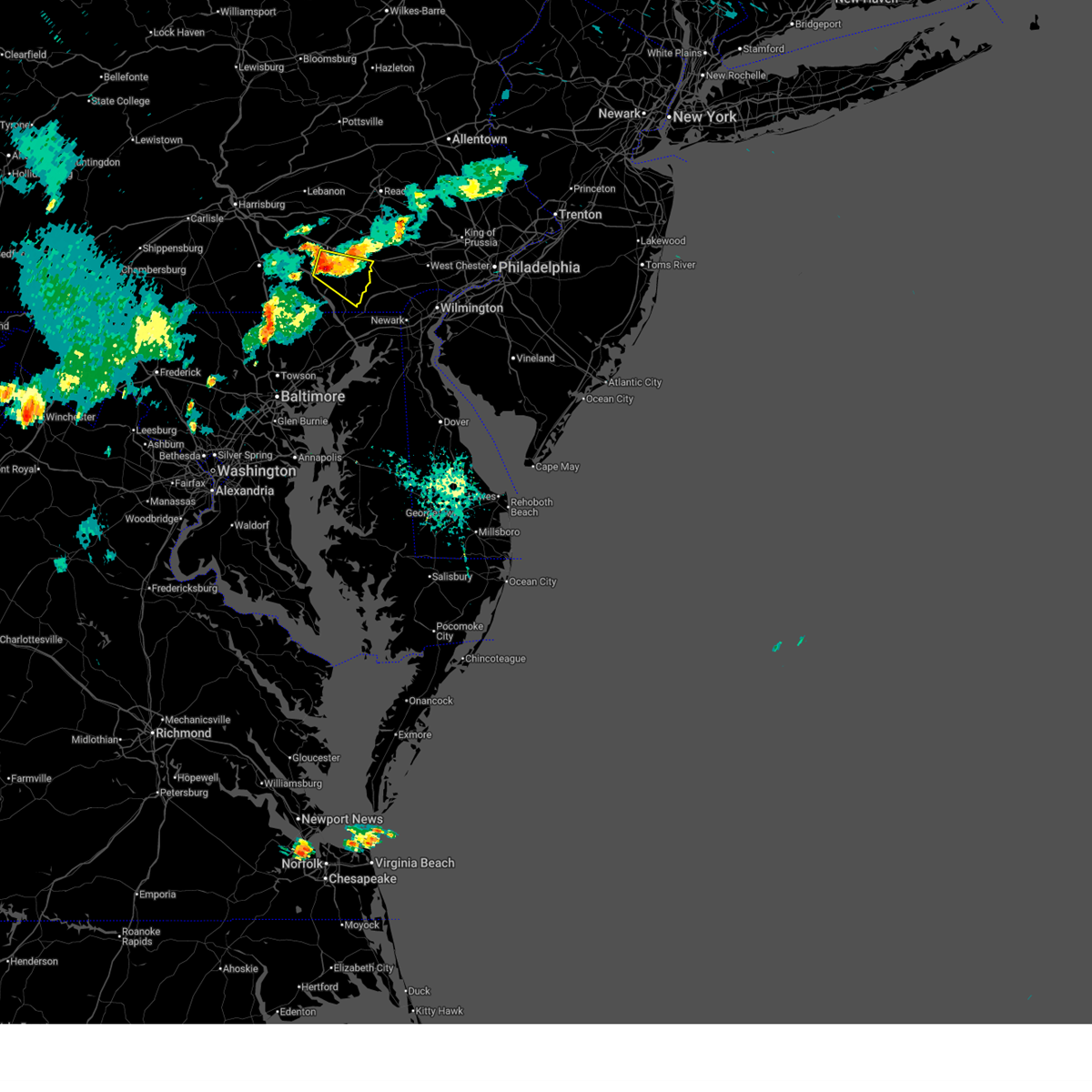
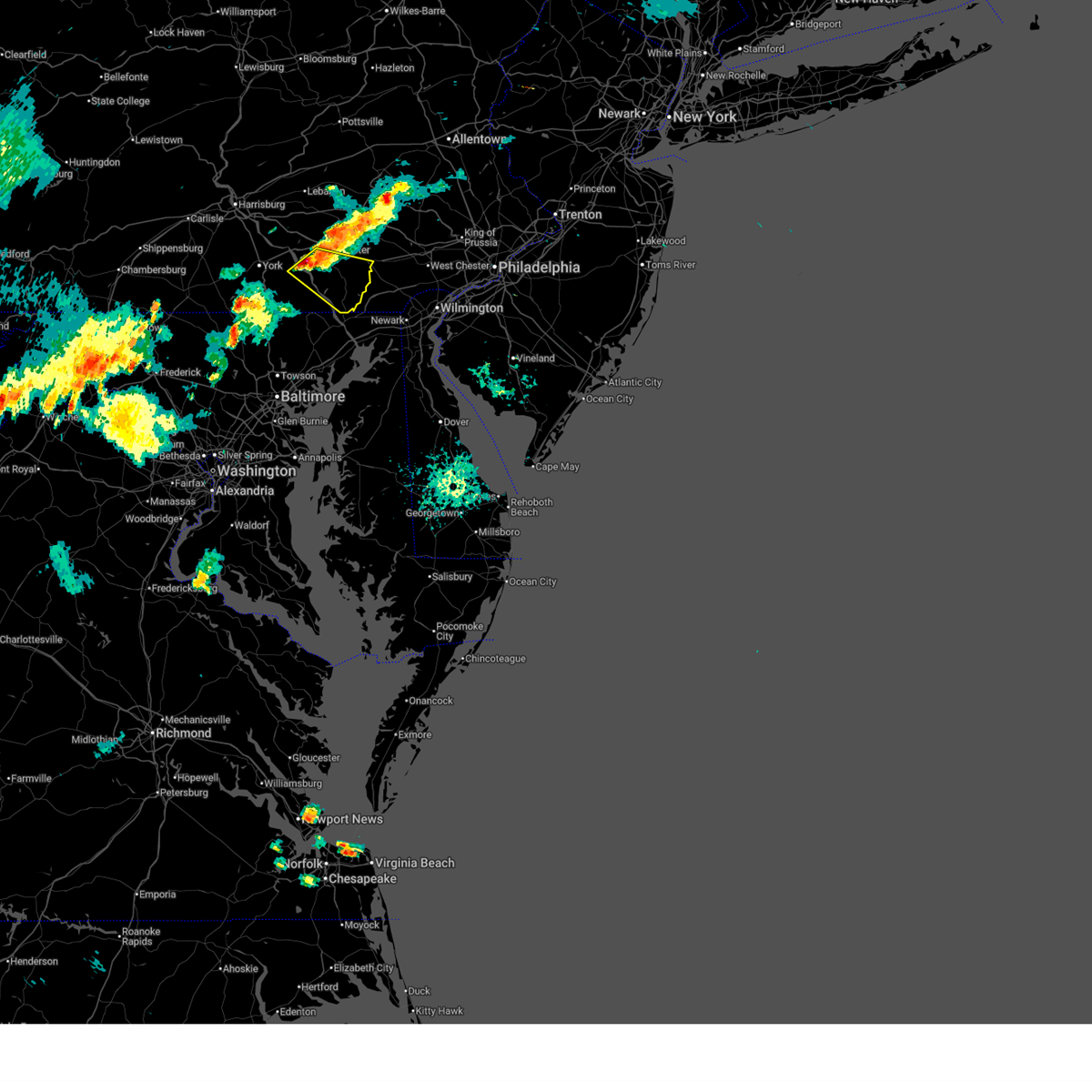
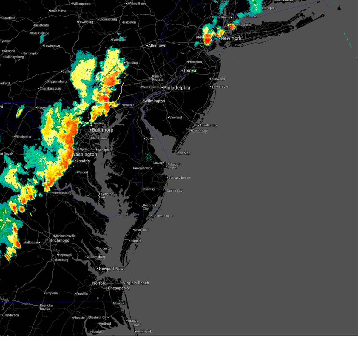
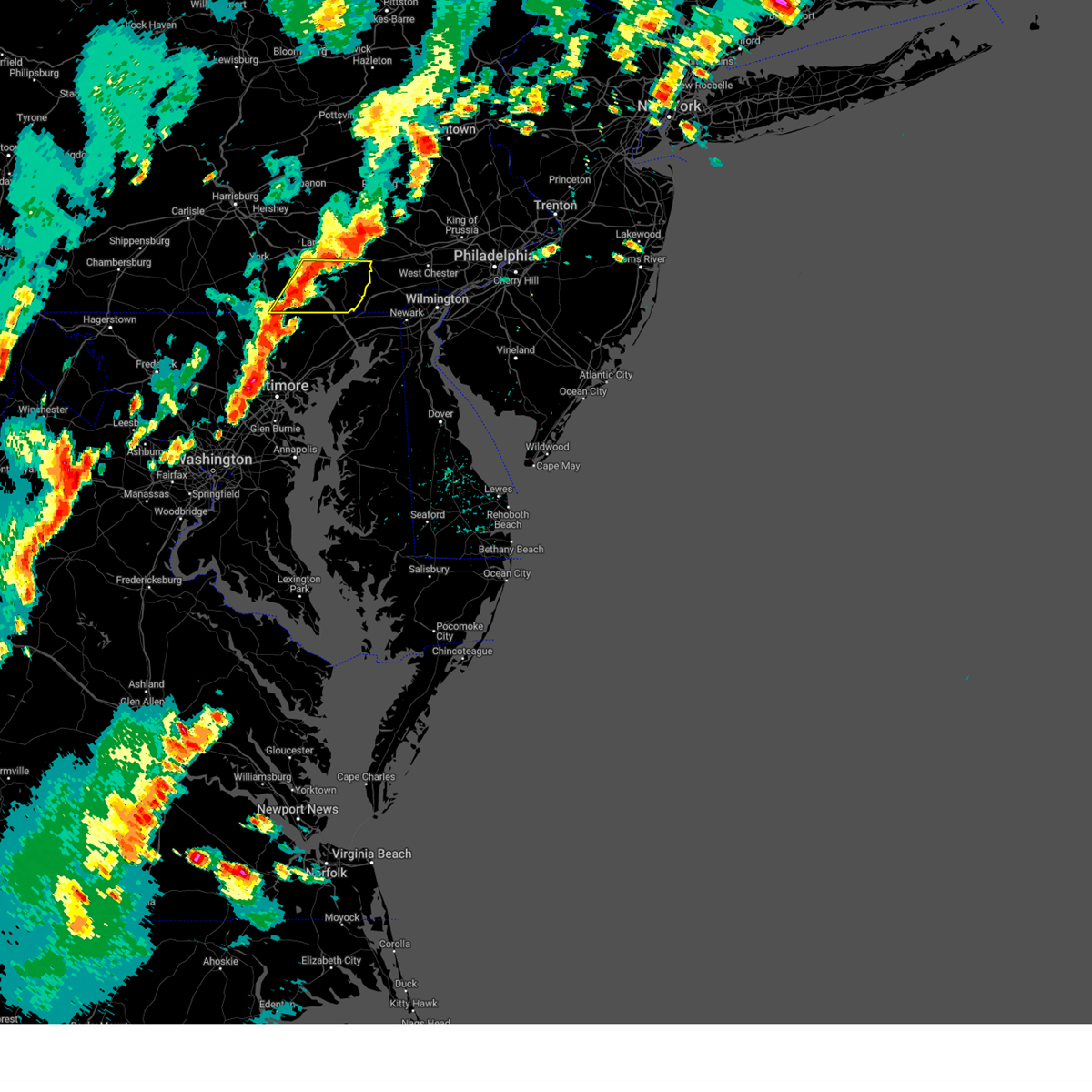
Hail Map for Quarryville, PA
The Quarryville, PA area has had 1 report of on-the-ground hail by trained spotters, and has been under severe weather warnings 27 times during the past 12 months. Doppler radar has detected hail at or near Quarryville, PA on 38 occasions, including 3 occasions during the past year.
| Name: | Quarryville, PA |
| Where Located: | 48.1 miles NNE of Baltimore, MD |
| Map: | Google Map for Quarryville, PA |
| Population: | 2576 |
| Housing Units: | 1070 |
| More Info: | Search Google for Quarryville, PA |
0
The Top Recent Hail Date for Quarryville, PA is Thursday, June 26, 2025 (38th out of 38)

Hail and Wind Damage Spotted near Quarryville, PA
| Date / Time | Report Details |
|---|---|
| 7/1/2025 1:06 AM EDT |
 The storm which prompted the warning has weakened below severe limits, and has exited the warned area. therefore, the warning will be allowed to expire. however, heavy rain is still possible with this thunderstorm. The storm which prompted the warning has weakened below severe limits, and has exited the warned area. therefore, the warning will be allowed to expire. however, heavy rain is still possible with this thunderstorm.
|
| 7/1/2025 12:23 AM EDT |
 Svrctp the national weather service in state college pa has issued a * severe thunderstorm warning for, southeastern lancaster county in south central pennsylvania, southeastern york county in south central pennsylvania, * until 115 am edt. * at 1223 am edt, a severe thunderstorm was located over holtwood, moving northeast at 30 mph (radar indicated). Hazards include 60 mph wind gusts. expect damage to roofs, siding, and trees Svrctp the national weather service in state college pa has issued a * severe thunderstorm warning for, southeastern lancaster county in south central pennsylvania, southeastern york county in south central pennsylvania, * until 115 am edt. * at 1223 am edt, a severe thunderstorm was located over holtwood, moving northeast at 30 mph (radar indicated). Hazards include 60 mph wind gusts. expect damage to roofs, siding, and trees
|
| 7/1/2025 12:15 AM EDT |
 The storms which prompted the warning have moved out of the area. therefore, the warning will be allowed to expire. however, gusty winds are still possible with these thunderstorms. remember, a flash flood emergency remains in effect for northern and western lancaster county and far southern lebanon county until 245 pm edt. The storms which prompted the warning have moved out of the area. therefore, the warning will be allowed to expire. however, gusty winds are still possible with these thunderstorms. remember, a flash flood emergency remains in effect for northern and western lancaster county and far southern lebanon county until 245 pm edt.
|
| 6/30/2025 11:40 PM EDT |
 At 1139 pm edt, severe thunderstorms were located along a line extending from lititz to leola to willow street, moving east at 45 mph (radar indicated). Hazards include 60 mph wind gusts. Expect damage to roofs, siding, and trees. locations impacted include, lancaster, ephrata, lititz, willow street, new holland, manheim, east petersburg, akron, leola, paradise, denver, and reamstown. this includes the pennsylvania turnpike from mile markers 270 to 295. The very wet ground and trees wet and heavy will likely make it easier for trees to get knocked down. At 1139 pm edt, severe thunderstorms were located along a line extending from lititz to leola to willow street, moving east at 45 mph (radar indicated). Hazards include 60 mph wind gusts. Expect damage to roofs, siding, and trees. locations impacted include, lancaster, ephrata, lititz, willow street, new holland, manheim, east petersburg, akron, leola, paradise, denver, and reamstown. this includes the pennsylvania turnpike from mile markers 270 to 295. The very wet ground and trees wet and heavy will likely make it easier for trees to get knocked down.
|
| 6/30/2025 11:25 PM EDT |
 At 1123 pm edt, severe thunderstorms were located along a line extending from mount joy to east petersburg to safe harbor, moving east at 45 mph (radar indicated). Hazards include 60 mph wind gusts. Expect damage to roofs, siding, and trees. locations impacted include, lancaster, ephrata, elizabethtown, columbia, lititz, millersville, willow street, mount joy, new holland, manheim, east petersburg, and akron. This includes the pennsylvania turnpike from mile markers 269 to 295. At 1123 pm edt, severe thunderstorms were located along a line extending from mount joy to east petersburg to safe harbor, moving east at 45 mph (radar indicated). Hazards include 60 mph wind gusts. Expect damage to roofs, siding, and trees. locations impacted include, lancaster, ephrata, elizabethtown, columbia, lititz, millersville, willow street, mount joy, new holland, manheim, east petersburg, and akron. This includes the pennsylvania turnpike from mile markers 269 to 295.
|
| 6/30/2025 11:25 PM EDT |
 the severe thunderstorm warning has been cancelled and is no longer in effect the severe thunderstorm warning has been cancelled and is no longer in effect
|
| 6/30/2025 10:55 PM EDT |
 Svrctp the national weather service in state college pa has issued a * severe thunderstorm warning for, lancaster county in south central pennsylvania, southeastern york county in south central pennsylvania, * until 1215 am edt. * at 1054 pm edt, severe thunderstorms were located along a line extending from dover to east york to glen rock, moving east at 45 mph (radar indicated). Hazards include 60 mph wind gusts. expect damage to roofs, siding, and trees Svrctp the national weather service in state college pa has issued a * severe thunderstorm warning for, lancaster county in south central pennsylvania, southeastern york county in south central pennsylvania, * until 1215 am edt. * at 1054 pm edt, severe thunderstorms were located along a line extending from dover to east york to glen rock, moving east at 45 mph (radar indicated). Hazards include 60 mph wind gusts. expect damage to roofs, siding, and trees
|
| 6/28/2025 8:56 PM EDT |
 At 856 pm edt, a severe thunderstorm was located over quarryville, moving east at 15 mph (radar indicated). Hazards include 60 mph wind gusts and quarter size hail. Hail damage to vehicles is expected. expect wind damage to roofs, siding, and trees. Locations impacted include, quarryville, smithville, atglen, georgetown, kirkwood, refton, and buck. At 856 pm edt, a severe thunderstorm was located over quarryville, moving east at 15 mph (radar indicated). Hazards include 60 mph wind gusts and quarter size hail. Hail damage to vehicles is expected. expect wind damage to roofs, siding, and trees. Locations impacted include, quarryville, smithville, atglen, georgetown, kirkwood, refton, and buck.
|
| 6/28/2025 8:35 PM EDT |
 At 833 pm edt, a severe thunderstorm was located over smithville, moving east at 15 mph (radar indicated). Hazards include 60 mph wind gusts and quarter size hail. Hail damage to vehicles is expected. expect wind damage to roofs, siding, and trees. Locations impacted include, lancaster, willow street, paradise, strasburg, quarryville, gap, smithville, lampeter, atglen, conestoga, christiana, and georgetown. At 833 pm edt, a severe thunderstorm was located over smithville, moving east at 15 mph (radar indicated). Hazards include 60 mph wind gusts and quarter size hail. Hail damage to vehicles is expected. expect wind damage to roofs, siding, and trees. Locations impacted include, lancaster, willow street, paradise, strasburg, quarryville, gap, smithville, lampeter, atglen, conestoga, christiana, and georgetown.
|
| 6/28/2025 8:35 PM EDT |
 the severe thunderstorm warning has been cancelled and is no longer in effect the severe thunderstorm warning has been cancelled and is no longer in effect
|
| 6/28/2025 7:58 PM EDT |
 Svrctp the national weather service in state college pa has issued a * severe thunderstorm warning for, southeastern lancaster county in south central pennsylvania, east central york county in south central pennsylvania, * until 915 pm edt. * at 757 pm edt, a severe thunderstorm was located over millersville, moving east at 15 mph (radar indicated). Hazards include 60 mph wind gusts and quarter size hail. Hail damage to vehicles is expected. Expect wind damage to roofs, siding, and trees. Svrctp the national weather service in state college pa has issued a * severe thunderstorm warning for, southeastern lancaster county in south central pennsylvania, east central york county in south central pennsylvania, * until 915 pm edt. * at 757 pm edt, a severe thunderstorm was located over millersville, moving east at 15 mph (radar indicated). Hazards include 60 mph wind gusts and quarter size hail. Hail damage to vehicles is expected. Expect wind damage to roofs, siding, and trees.
|
| 6/26/2025 6:51 PM EDT |
 At 651 pm edt, severe thunderstorms were located along a line extending from glenmoore to delta, moving southeast at 15 mph (radar indicated). Hazards include 60 mph wind gusts and penny size hail. Expect damage to roofs, siding, and trees. Locations impacted include, paradise, quarryville, gap, delta, wakefield, smithville, holtwood, sunnyburn, susquehanna trails, christiana, georgetown, and fawn grove. At 651 pm edt, severe thunderstorms were located along a line extending from glenmoore to delta, moving southeast at 15 mph (radar indicated). Hazards include 60 mph wind gusts and penny size hail. Expect damage to roofs, siding, and trees. Locations impacted include, paradise, quarryville, gap, delta, wakefield, smithville, holtwood, sunnyburn, susquehanna trails, christiana, georgetown, and fawn grove.
|
| 6/26/2025 6:26 PM EDT |
 Svrctp the national weather service in state college pa has issued a * severe thunderstorm warning for, southeastern lancaster county in south central pennsylvania, southeastern york county in south central pennsylvania, * until 730 pm edt. * at 626 pm edt, severe thunderstorms were located along a line extending from elverson to sunnyburn, moving southeast at 15 mph (radar indicated). Hazards include 60 mph wind gusts and penny size hail. expect damage to roofs, siding, and trees Svrctp the national weather service in state college pa has issued a * severe thunderstorm warning for, southeastern lancaster county in south central pennsylvania, southeastern york county in south central pennsylvania, * until 730 pm edt. * at 626 pm edt, severe thunderstorms were located along a line extending from elverson to sunnyburn, moving southeast at 15 mph (radar indicated). Hazards include 60 mph wind gusts and penny size hail. expect damage to roofs, siding, and trees
|
| 6/19/2025 4:56 PM EDT |
 The storms which prompted the warning have moved out of the area. therefore, the warning will be allowed to expire. The storms which prompted the warning have moved out of the area. therefore, the warning will be allowed to expire.
|
| 6/19/2025 4:24 PM EDT |
 At 424 pm edt, severe thunderstorms were located along a line extending from terre hill to paradise to delta, moving east at 30 mph (radar indicated). Hazards include 70 mph wind gusts and quarter size hail. Hail damage to vehicles is expected. expect considerable tree damage. wind damage is also likely to mobile homes, roofs, and outbuildings. locations impacted include, lancaster, ephrata, lititz, millersville, willow street, new holland, akron, leola, paradise, denver, reamstown, and rothsville. this includes the pennsylvania turnpike from mile markers 281 to 295. this includes the following highways, route 30 from lancaster to the chester county line. route 222 from the maryland border to the berks county line. route 322 from ephrata to the chester county line. state road 41 from gap to the chester county line. state road 501 from lancaster to lancaster. State highway 283 near lancaster. At 424 pm edt, severe thunderstorms were located along a line extending from terre hill to paradise to delta, moving east at 30 mph (radar indicated). Hazards include 70 mph wind gusts and quarter size hail. Hail damage to vehicles is expected. expect considerable tree damage. wind damage is also likely to mobile homes, roofs, and outbuildings. locations impacted include, lancaster, ephrata, lititz, millersville, willow street, new holland, akron, leola, paradise, denver, reamstown, and rothsville. this includes the pennsylvania turnpike from mile markers 281 to 295. this includes the following highways, route 30 from lancaster to the chester county line. route 222 from the maryland border to the berks county line. route 322 from ephrata to the chester county line. state road 41 from gap to the chester county line. state road 501 from lancaster to lancaster. State highway 283 near lancaster.
|
| 6/19/2025 3:56 PM EDT | Svrctp the national weather service in state college pa has issued a * severe thunderstorm warning for, lancaster county in south central pennsylvania, southeastern york county in south central pennsylvania, * until 500 pm edt. * at 356 pm edt, severe thunderstorms were located along a line extending from manheim to millersville to stewartstown, moving east at 25 mph (radar indicated). Hazards include 60 mph wind gusts and penny size hail. expect damage to roofs, siding, and trees |
| 3/16/2025 9:32 PM EDT |
 Svrctp the national weather service in state college pa has issued a * severe thunderstorm warning for, lancaster county in south central pennsylvania, southern york county in south central pennsylvania, * until 1015 pm edt. * at 931 pm edt, a severe thunderstorm was located over spring grove, moving northeast at 70 mph (radar indicated). Hazards include 60 mph wind gusts and nickel size hail. expect damage to roofs, siding, and trees Svrctp the national weather service in state college pa has issued a * severe thunderstorm warning for, lancaster county in south central pennsylvania, southern york county in south central pennsylvania, * until 1015 pm edt. * at 931 pm edt, a severe thunderstorm was located over spring grove, moving northeast at 70 mph (radar indicated). Hazards include 60 mph wind gusts and nickel size hail. expect damage to roofs, siding, and trees
|
| 8/18/2024 9:13 PM EDT |
 the severe thunderstorm warning has been cancelled and is no longer in effect the severe thunderstorm warning has been cancelled and is no longer in effect
|
| 8/18/2024 8:34 PM EDT |
 Svrctp the national weather service in state college pa has issued a * severe thunderstorm warning for, southeastern lancaster county in south central pennsylvania, southeastern york county in south central pennsylvania, * until 945 pm edt. * at 834 pm edt, a severe thunderstorm was located over smithville, moving southeast at 15 mph (radar indicated). Hazards include 60 mph wind gusts and quarter size hail. Hail damage to vehicles is expected. Expect wind damage to roofs, siding, and trees. Svrctp the national weather service in state college pa has issued a * severe thunderstorm warning for, southeastern lancaster county in south central pennsylvania, southeastern york county in south central pennsylvania, * until 945 pm edt. * at 834 pm edt, a severe thunderstorm was located over smithville, moving southeast at 15 mph (radar indicated). Hazards include 60 mph wind gusts and quarter size hail. Hail damage to vehicles is expected. Expect wind damage to roofs, siding, and trees.
|
| 8/3/2024 5:44 PM EDT |
 The storms which prompted the warning have weakened below severe limits, and no longer pose an immediate threat to life or property. therefore, the warning will be allowed to expire. however, small hail and gusty winds are still possible with these thunderstorms. a severe thunderstorm watch remains in effect until 900 pm edt for south central pennsylvania. The storms which prompted the warning have weakened below severe limits, and no longer pose an immediate threat to life or property. therefore, the warning will be allowed to expire. however, small hail and gusty winds are still possible with these thunderstorms. a severe thunderstorm watch remains in effect until 900 pm edt for south central pennsylvania.
|
| 8/3/2024 5:01 PM EDT |
 Svrctp the national weather service in state college pa has issued a * severe thunderstorm warning for, southeastern lancaster county in south central pennsylvania, southeastern york county in south central pennsylvania, * until 545 pm edt. * at 501 pm edt, severe thunderstorms were located along a line extending from smithville to near stewartstown, moving east at 25 mph (radar indicated). Hazards include 60 mph wind gusts and quarter size hail. Hail damage to vehicles is expected. Expect wind damage to roofs, siding, and trees. Svrctp the national weather service in state college pa has issued a * severe thunderstorm warning for, southeastern lancaster county in south central pennsylvania, southeastern york county in south central pennsylvania, * until 545 pm edt. * at 501 pm edt, severe thunderstorms were located along a line extending from smithville to near stewartstown, moving east at 25 mph (radar indicated). Hazards include 60 mph wind gusts and quarter size hail. Hail damage to vehicles is expected. Expect wind damage to roofs, siding, and trees.
|
| 7/17/2024 2:11 PM EDT |
 Svrctp the national weather service in state college pa has issued a * severe thunderstorm warning for, eastern lancaster county in south central pennsylvania, * until 245 pm edt. * at 211 pm edt, severe thunderstorms were located along a line extending from terre hill to gap to smithville, moving east at 25 mph (radar indicated). Hazards include 60 mph wind gusts and penny size hail. expect damage to roofs, siding, and trees Svrctp the national weather service in state college pa has issued a * severe thunderstorm warning for, eastern lancaster county in south central pennsylvania, * until 245 pm edt. * at 211 pm edt, severe thunderstorms were located along a line extending from terre hill to gap to smithville, moving east at 25 mph (radar indicated). Hazards include 60 mph wind gusts and penny size hail. expect damage to roofs, siding, and trees
|
| 7/16/2024 9:19 PM EDT |
 At 919 pm edt, a severe thunderstorm was located over ashland, moving east at 55 mph (radar indicated). Hazards include 60 mph wind gusts and quarter size hail. Hail damage to vehicles is expected. expect wind damage to roofs, siding, and trees. Locations impacted include, quarryville, delta, wakefield, holtwood, sunnyburn, susquehanna trails, atglen, christiana, georgetown, kirkwood, little britain, and buck. At 919 pm edt, a severe thunderstorm was located over ashland, moving east at 55 mph (radar indicated). Hazards include 60 mph wind gusts and quarter size hail. Hail damage to vehicles is expected. expect wind damage to roofs, siding, and trees. Locations impacted include, quarryville, delta, wakefield, holtwood, sunnyburn, susquehanna trails, atglen, christiana, georgetown, kirkwood, little britain, and buck.
|
| 7/16/2024 8:53 PM EDT | Wires down at spruce grove rd and blue gill r in lancaster county PA, 7.8 miles NW of Quarryville, PA |
| 7/16/2024 8:50 PM EDT | Tree and wires down at intersection of clendenin rd and fulton view r in lancaster county PA, 5.3 miles N of Quarryville, PA |
| 7/16/2024 8:44 PM EDT | Svrctp the national weather service in state college pa has issued a * severe thunderstorm warning for, southeastern lancaster county in south central pennsylvania, southeastern york county in south central pennsylvania, * until 930 pm edt. * at 843 pm edt, a severe thunderstorm was located over delta, moving east at 35 mph. this storm was part of a large cluster of storms (radar indicated). Hazards include 60 mph wind gusts and quarter size hail. Hail damage to vehicles is expected. Expect wind damage to roofs, siding, and trees. |
| 7/16/2024 8:13 PM EDT |
 At 811 pm edt, severe thunderstorms were located along a line extending from codorus to stewartstown to christiana, moving southeast at 15 mph (radar indicated). Hazards include 60 mph wind gusts and quarter size hail. Hail damage to vehicles is expected. expect wind damage to roofs, siding, and trees. locations impacted include, hanover, parkville, shrewsbury, codorus, quarryville, stewartstown, glen rock, pennville, gap, jacobus, delta, and wakefield. This includes interstate 83 from mile markers 0 to 10. At 811 pm edt, severe thunderstorms were located along a line extending from codorus to stewartstown to christiana, moving southeast at 15 mph (radar indicated). Hazards include 60 mph wind gusts and quarter size hail. Hail damage to vehicles is expected. expect wind damage to roofs, siding, and trees. locations impacted include, hanover, parkville, shrewsbury, codorus, quarryville, stewartstown, glen rock, pennville, gap, jacobus, delta, and wakefield. This includes interstate 83 from mile markers 0 to 10.
|
| 7/16/2024 8:13 PM EDT |
 the severe thunderstorm warning has been cancelled and is no longer in effect the severe thunderstorm warning has been cancelled and is no longer in effect
|
| 7/16/2024 7:28 PM EDT |
 Svrctp the national weather service in state college pa has issued a * severe thunderstorm warning for, southeastern adams county in south central pennsylvania, lancaster county in south central pennsylvania, york county in south central pennsylvania, * until 845 pm edt. * at 726 pm edt, severe thunderstorms were located along a line extending from churchtown to east york to parkville, moving southeast at 15 mph (radar indicated). Hazards include 60 mph wind gusts and quarter size hail. Expect wind damage to roofs, siding, and trees. Hail damage to vehicles is expected. Svrctp the national weather service in state college pa has issued a * severe thunderstorm warning for, southeastern adams county in south central pennsylvania, lancaster county in south central pennsylvania, york county in south central pennsylvania, * until 845 pm edt. * at 726 pm edt, severe thunderstorms were located along a line extending from churchtown to east york to parkville, moving southeast at 15 mph (radar indicated). Hazards include 60 mph wind gusts and quarter size hail. Expect wind damage to roofs, siding, and trees. Hail damage to vehicles is expected.
|
| 6/30/2024 5:05 PM EDT |
 the severe thunderstorm warning has been cancelled and is no longer in effect the severe thunderstorm warning has been cancelled and is no longer in effect
|
| 6/30/2024 5:05 PM EDT |
 At 505 pm edt, a severe thunderstorm was located over homeville, moving east at 35 mph (radar indicated). Hazards include 60 mph wind gusts and quarter size hail. Hail damage to vehicles is expected. expect wind damage to roofs, siding, and trees. Locations impacted include, quarryville, wakefield, holtwood, smithville, christiana, georgetown, kirkwood, little britain, buck, peach bottom, and rawlinsville. At 505 pm edt, a severe thunderstorm was located over homeville, moving east at 35 mph (radar indicated). Hazards include 60 mph wind gusts and quarter size hail. Hail damage to vehicles is expected. expect wind damage to roofs, siding, and trees. Locations impacted include, quarryville, wakefield, holtwood, smithville, christiana, georgetown, kirkwood, little britain, buck, peach bottom, and rawlinsville.
|
| 6/30/2024 4:31 PM EDT |
 Svrctp the national weather service in state college pa has issued a * severe thunderstorm warning for, southeastern lancaster county in south central pennsylvania, east central york county in south central pennsylvania, * until 515 pm edt. * at 431 pm edt, a severe thunderstorm was located over columbia, moving east at 30 mph (radar indicated). Hazards include 60 mph wind gusts and quarter size hail. Hail damage to vehicles is expected. Expect wind damage to roofs, siding, and trees. Svrctp the national weather service in state college pa has issued a * severe thunderstorm warning for, southeastern lancaster county in south central pennsylvania, east central york county in south central pennsylvania, * until 515 pm edt. * at 431 pm edt, a severe thunderstorm was located over columbia, moving east at 30 mph (radar indicated). Hazards include 60 mph wind gusts and quarter size hail. Hail damage to vehicles is expected. Expect wind damage to roofs, siding, and trees.
|
| 9/8/2023 9:26 PM EDT |
 The severe thunderstorm warning for southeastern lancaster county will expire at 930 pm edt, the storm which prompted the warning for southern lancaster county has weakened below severe limits, and no longer poses an immediate threat to life or property. therefore, the warning will be allowed to expire. a severe thunderstorm watch remains in effect until 1100 pm edt for south central pennsylvania. remember, a severe thunderstorm warning still remains in effect for northeastern lancaster county until 10 pm edt. The severe thunderstorm warning for southeastern lancaster county will expire at 930 pm edt, the storm which prompted the warning for southern lancaster county has weakened below severe limits, and no longer poses an immediate threat to life or property. therefore, the warning will be allowed to expire. a severe thunderstorm watch remains in effect until 1100 pm edt for south central pennsylvania. remember, a severe thunderstorm warning still remains in effect for northeastern lancaster county until 10 pm edt.
|
| 9/8/2023 9:11 PM EDT |
 At 911 pm edt, a severe thunderstorm was located over parkesburg, moving northeast at 25 mph (law enforcement). Hazards include 60 mph wind gusts and penny size hail. Expect damage to roofs, siding, and trees. locations impacted include, quarryville, gap, christiana, georgetown and kirkwood. hail threat, radar indicated max hail size, 0. 75 in wind threat, radar indicated max wind gust, 60 mph. At 911 pm edt, a severe thunderstorm was located over parkesburg, moving northeast at 25 mph (law enforcement). Hazards include 60 mph wind gusts and penny size hail. Expect damage to roofs, siding, and trees. locations impacted include, quarryville, gap, christiana, georgetown and kirkwood. hail threat, radar indicated max hail size, 0. 75 in wind threat, radar indicated max wind gust, 60 mph.
|
| 9/8/2023 8:50 PM EDT | Tree and wires down. time estimated by rada in lancaster county PA, 7.5 miles NNE of Quarryville, PA |
| 9/8/2023 8:43 PM EDT |
 At 843 pm edt, a severe thunderstorm was located over quarryville, moving northeast at 25 mph. numerous trees have been reported to be downed from this storm (law enforcement). Hazards include 60 mph wind gusts and penny size hail. expect damage to roofs, siding, and trees At 843 pm edt, a severe thunderstorm was located over quarryville, moving northeast at 25 mph. numerous trees have been reported to be downed from this storm (law enforcement). Hazards include 60 mph wind gusts and penny size hail. expect damage to roofs, siding, and trees
|
| 9/8/2023 8:37 PM EDT |
 At 837 pm edt, a severe thunderstorm was located over quarryville, moving northeast at 20 mph (radar indicated). Hazards include 60 mph wind gusts and penny size hail. Expect damage to roofs, siding, and trees. locations impacted include, quarryville, wakefield, holtwood, kirkwood, little britain, buck and peach bottom. hail threat, radar indicated max hail size, 0. 75 in wind threat, radar indicated max wind gust, 60 mph. At 837 pm edt, a severe thunderstorm was located over quarryville, moving northeast at 20 mph (radar indicated). Hazards include 60 mph wind gusts and penny size hail. Expect damage to roofs, siding, and trees. locations impacted include, quarryville, wakefield, holtwood, kirkwood, little britain, buck and peach bottom. hail threat, radar indicated max hail size, 0. 75 in wind threat, radar indicated max wind gust, 60 mph.
|
| 9/8/2023 8:02 PM EDT |
 At 802 pm edt, a severe thunderstorm was located over delta, moving northeast at 20 mph (radar indicated). Hazards include 60 mph wind gusts and penny size hail. expect damage to roofs, siding, and trees At 802 pm edt, a severe thunderstorm was located over delta, moving northeast at 20 mph (radar indicated). Hazards include 60 mph wind gusts and penny size hail. expect damage to roofs, siding, and trees
|
| 9/7/2023 7:45 PM EDT |
 At 744 pm edt, severe thunderstorms were located along a line from new holland to kirkwood, moving northeast at 30 mph (radar indicated). Hazards include 60 mph wind gusts and quarter size hail. Hail damage to vehicles is expected. expect wind damage to roofs, siding, and trees. locations impacted include, new holland, paradise, reamstown, strasburg, quarryville, gap, adamstown, terre hill, churchtown, bareville, bowmansville and reinholds. this includes the pennsylvania turnpike from mile markers 284 to 295. hail threat, radar indicated max hail size, 1. 00 in wind threat, radar indicated max wind gust, 60 mph. At 744 pm edt, severe thunderstorms were located along a line from new holland to kirkwood, moving northeast at 30 mph (radar indicated). Hazards include 60 mph wind gusts and quarter size hail. Hail damage to vehicles is expected. expect wind damage to roofs, siding, and trees. locations impacted include, new holland, paradise, reamstown, strasburg, quarryville, gap, adamstown, terre hill, churchtown, bareville, bowmansville and reinholds. this includes the pennsylvania turnpike from mile markers 284 to 295. hail threat, radar indicated max hail size, 1. 00 in wind threat, radar indicated max wind gust, 60 mph.
|
| 9/7/2023 7:27 PM EDT |
 At 726 pm edt, severe thunderstorms were located along a line extending from adamstown to strasburg to glen roy, moving northeast at 35 mph. the strongest part of the line is over southern lancaster county from strasburg to wakefield (radar indicated). Hazards include 70 mph wind gusts and quarter size hail. Hail damage to vehicles is expected. expect considerable tree damage. wind damage is also likely to mobile homes, roofs, and outbuildings. locations impacted include, lancaster, ephrata, lititz, millersville, willow street, new holland, akron, leola, paradise, denver, reamstown and rothsville. this includes the pennsylvania turnpike from mile markers 276 to 295. thunderstorm damage threat, considerable hail threat, radar indicated max hail size, 1. 00 in wind threat, radar indicated max wind gust, 70 mph. At 726 pm edt, severe thunderstorms were located along a line extending from adamstown to strasburg to glen roy, moving northeast at 35 mph. the strongest part of the line is over southern lancaster county from strasburg to wakefield (radar indicated). Hazards include 70 mph wind gusts and quarter size hail. Hail damage to vehicles is expected. expect considerable tree damage. wind damage is also likely to mobile homes, roofs, and outbuildings. locations impacted include, lancaster, ephrata, lititz, millersville, willow street, new holland, akron, leola, paradise, denver, reamstown and rothsville. this includes the pennsylvania turnpike from mile markers 276 to 295. thunderstorm damage threat, considerable hail threat, radar indicated max hail size, 1. 00 in wind threat, radar indicated max wind gust, 70 mph.
|
| 9/7/2023 7:12 PM EDT |
 At 712 pm edt, severe thunderstorms were located along a line extending from brickerville to leacock to safe harbor to delta, moving northeast at 30 mph (radar indicated). Hazards include 70 mph wind gusts and quarter size hail. Hail damage to vehicles is expected. expect considerable tree damage. wind damage is also likely to mobile homes, roofs, and outbuildings. locations impacted include, lancaster, ephrata, columbia, lititz, millersville, willow street, mount joy, new holland, manheim, east petersburg, akron and leola. this includes the pennsylvania turnpike from mile markers 270 to 295. thunderstorm damage threat, considerable hail threat, radar indicated max hail size, 1. 00 in wind threat, radar indicated max wind gust, 70 mph. At 712 pm edt, severe thunderstorms were located along a line extending from brickerville to leacock to safe harbor to delta, moving northeast at 30 mph (radar indicated). Hazards include 70 mph wind gusts and quarter size hail. Hail damage to vehicles is expected. expect considerable tree damage. wind damage is also likely to mobile homes, roofs, and outbuildings. locations impacted include, lancaster, ephrata, columbia, lititz, millersville, willow street, mount joy, new holland, manheim, east petersburg, akron and leola. this includes the pennsylvania turnpike from mile markers 270 to 295. thunderstorm damage threat, considerable hail threat, radar indicated max hail size, 1. 00 in wind threat, radar indicated max wind gust, 70 mph.
|
| 9/7/2023 6:44 PM EDT |
 At 644 pm edt, severe thunderstorms were located along a line extending from columbia to brogue to stewartstown, moving northeast at 30 mph (radar indicated). Hazards include 60 mph wind gusts and nickel size hail. expect damage to roofs, siding, and trees At 644 pm edt, severe thunderstorms were located along a line extending from columbia to brogue to stewartstown, moving northeast at 30 mph (radar indicated). Hazards include 60 mph wind gusts and nickel size hail. expect damage to roofs, siding, and trees
|
| 9/7/2023 5:41 PM EDT |
 The severe thunderstorm warning for eastern lancaster and southeastern york counties will expire at 545 pm edt, the storm which prompted the warning is moving out of the area. therefore, the warning will be allowed to expire. a severe thunderstorm watch remains in effect until 900 pm edt for south central pennsylvania. The severe thunderstorm warning for eastern lancaster and southeastern york counties will expire at 545 pm edt, the storm which prompted the warning is moving out of the area. therefore, the warning will be allowed to expire. a severe thunderstorm watch remains in effect until 900 pm edt for south central pennsylvania.
|
| 9/7/2023 5:11 PM EDT |
 At 511 pm edt, severe thunderstorms were located along a line extending from terre hill to gap to delta, moving northeast at 40 mph (radar indicated). Hazards include 60 mph wind gusts and quarter size hail. Hail damage to vehicles is expected. Expect wind damage to roofs, siding, and trees. At 511 pm edt, severe thunderstorms were located along a line extending from terre hill to gap to delta, moving northeast at 40 mph (radar indicated). Hazards include 60 mph wind gusts and quarter size hail. Hail damage to vehicles is expected. Expect wind damage to roofs, siding, and trees.
|
| 9/7/2023 4:58 PM EDT |
 At 458 pm edt, severe thunderstorms were located along a line extending from robesonia to reamstown to delta, moving northeast at 30 mph (radar indicated). Hazards include 60 mph wind gusts and quarter size hail. Hail damage to vehicles is expected. expect wind damage to roofs, siding, and trees. locations impacted include, lancaster, ephrata, lititz, millersville, willow street, new holland, manheim, east petersburg, akron, leola, paradise and salunga-landisville. this includes the pennsylvania turnpike from mile markers 271 to 287. hail threat, radar indicated max hail size, 1. 00 in wind threat, radar indicated max wind gust, 60 mph. At 458 pm edt, severe thunderstorms were located along a line extending from robesonia to reamstown to delta, moving northeast at 30 mph (radar indicated). Hazards include 60 mph wind gusts and quarter size hail. Hail damage to vehicles is expected. expect wind damage to roofs, siding, and trees. locations impacted include, lancaster, ephrata, lititz, millersville, willow street, new holland, manheim, east petersburg, akron, leola, paradise and salunga-landisville. this includes the pennsylvania turnpike from mile markers 271 to 287. hail threat, radar indicated max hail size, 1. 00 in wind threat, radar indicated max wind gust, 60 mph.
|
| 9/7/2023 4:46 PM EDT |
 At 445 pm edt, severe thunderstorms were located along a line extending from fredericksburg to richland to leola to delta, moving east at 35 mph (radar indicated). Hazards include 60 mph wind gusts and quarter size hail. Hail damage to vehicles is expected. expect wind damage to roofs, siding, and trees. locations impacted include, lancaster, lebanon, ephrata, columbia, lititz, millersville, willow street, mount joy, new holland, manheim, east petersburg and cornwall. this includes the following interstates, the pennsylvania turnpike from mile markers 265 to 287. interstate 78 from mile markers 2 to 7. interstate 81 from mile markers 94 to 96. hail threat, radar indicated max hail size, 1. 00 in wind threat, radar indicated max wind gust, 60 mph. At 445 pm edt, severe thunderstorms were located along a line extending from fredericksburg to richland to leola to delta, moving east at 35 mph (radar indicated). Hazards include 60 mph wind gusts and quarter size hail. Hail damage to vehicles is expected. expect wind damage to roofs, siding, and trees. locations impacted include, lancaster, lebanon, ephrata, columbia, lititz, millersville, willow street, mount joy, new holland, manheim, east petersburg and cornwall. this includes the following interstates, the pennsylvania turnpike from mile markers 265 to 287. interstate 78 from mile markers 2 to 7. interstate 81 from mile markers 94 to 96. hail threat, radar indicated max hail size, 1. 00 in wind threat, radar indicated max wind gust, 60 mph.
|
| 9/7/2023 4:22 PM EDT |
 At 422 pm edt, severe thunderstorms were located along a line extending from branchdale to lawn to jarrettsville, moving northeast at 30 mph (radar indicated). Hazards include 60 mph wind gusts and quarter size hail. Hail damage to vehicles is expected. Expect wind damage to roofs, siding, and trees. At 422 pm edt, severe thunderstorms were located along a line extending from branchdale to lawn to jarrettsville, moving northeast at 30 mph (radar indicated). Hazards include 60 mph wind gusts and quarter size hail. Hail damage to vehicles is expected. Expect wind damage to roofs, siding, and trees.
|
| 8/7/2023 5:30 PM EDT |
 At 529 pm edt, severe thunderstorms were located along a line extending from valley green to delta, moving east at 45 mph (radar indicated). Hazards include 70 mph wind gusts. Expect considerable tree damage. Damage is likely to mobile homes, roofs, and outbuildings. At 529 pm edt, severe thunderstorms were located along a line extending from valley green to delta, moving east at 45 mph (radar indicated). Hazards include 70 mph wind gusts. Expect considerable tree damage. Damage is likely to mobile homes, roofs, and outbuildings.
|
| 7/28/2023 7:46 PM EDT |
 At 746 pm edt, a severe thunderstorm was located over mount vernon, moving southeast at 35 mph (radar indicated). Hazards include 60 mph wind gusts. expect damage to roofs, siding, and trees At 746 pm edt, a severe thunderstorm was located over mount vernon, moving southeast at 35 mph (radar indicated). Hazards include 60 mph wind gusts. expect damage to roofs, siding, and trees
|
| 7/27/2023 5:58 PM EDT |
 At 558 pm edt, a severe thunderstorm was located over gap, moving east at 35 mph (radar indicated). Hazards include 60 mph wind gusts. Expect damage to roofs, siding, and trees. locations impacted include, quarryville, christiana, georgetown and kirkwood. hail threat, radar indicated max hail size, <. 75 in wind threat, radar indicated max wind gust, 60 mph. At 558 pm edt, a severe thunderstorm was located over gap, moving east at 35 mph (radar indicated). Hazards include 60 mph wind gusts. Expect damage to roofs, siding, and trees. locations impacted include, quarryville, christiana, georgetown and kirkwood. hail threat, radar indicated max hail size, <. 75 in wind threat, radar indicated max wind gust, 60 mph.
|
| 7/27/2023 5:33 PM EDT |
 At 532 pm edt, a severe thunderstorm was located over willow street, moving east at 35 mph (radar indicated). Hazards include 60 mph wind gusts. Expect damage to roofs, siding, and trees. locations impacted include, lancaster, millersville, willow street, paradise, strasburg, mountville, quarryville, gap, smithville, safe harbor, lampeter and intercourse. hail threat, radar indicated max hail size, <. 75 in wind threat, radar indicated max wind gust, 60 mph. At 532 pm edt, a severe thunderstorm was located over willow street, moving east at 35 mph (radar indicated). Hazards include 60 mph wind gusts. Expect damage to roofs, siding, and trees. locations impacted include, lancaster, millersville, willow street, paradise, strasburg, mountville, quarryville, gap, smithville, safe harbor, lampeter and intercourse. hail threat, radar indicated max hail size, <. 75 in wind threat, radar indicated max wind gust, 60 mph.
|
| 7/27/2023 5:15 PM EDT |
 At 515 pm edt, a severe thunderstorm was located over wrightsville, moving east at 30 mph (radar indicated). Hazards include 60 mph wind gusts. expect damage to roofs, siding, and trees At 515 pm edt, a severe thunderstorm was located over wrightsville, moving east at 30 mph (radar indicated). Hazards include 60 mph wind gusts. expect damage to roofs, siding, and trees
|
| 7/25/2023 3:08 PM EDT |
 At 308 pm edt, a severe thunderstorm was located over lancaster, moving east at 20 mph (radar indicated). Hazards include 60 mph wind gusts and nickel size hail. expect damage to roofs, siding, and trees At 308 pm edt, a severe thunderstorm was located over lancaster, moving east at 20 mph (radar indicated). Hazards include 60 mph wind gusts and nickel size hail. expect damage to roofs, siding, and trees
|
| 7/21/2023 2:19 AM EDT |
 At 219 am edt, severe thunderstorms were located along a line extending from adamstown to rothsville to lancaster to shenks ferry to stewartstown to near hampstead, moving southeast at 30 mph (radar indicated). Hazards include 60 mph wind gusts. Expect damage to roofs, siding, and trees. these severe storms will be near, akron, willow street and lancaster around 220 am edt. leola, bareville and holtwood around 230 am edt. new holland, quarryville and churchtown around 240 am edt. wakefield and gap around 250 am edt. other locations impacted by these severe thunderstorms include buck, bowmansville, peach bottom, reinholds and rawlinsville. this includes the following interstates, the pennsylvania turnpike from mile markers 280 to 295. interstate 83 from mile markers 1 to 4. hail threat, radar indicated max hail size, <. 75 in wind threat, radar indicated max wind gust, 60 mph. At 219 am edt, severe thunderstorms were located along a line extending from adamstown to rothsville to lancaster to shenks ferry to stewartstown to near hampstead, moving southeast at 30 mph (radar indicated). Hazards include 60 mph wind gusts. Expect damage to roofs, siding, and trees. these severe storms will be near, akron, willow street and lancaster around 220 am edt. leola, bareville and holtwood around 230 am edt. new holland, quarryville and churchtown around 240 am edt. wakefield and gap around 250 am edt. other locations impacted by these severe thunderstorms include buck, bowmansville, peach bottom, reinholds and rawlinsville. this includes the following interstates, the pennsylvania turnpike from mile markers 280 to 295. interstate 83 from mile markers 1 to 4. hail threat, radar indicated max hail size, <. 75 in wind threat, radar indicated max wind gust, 60 mph.
|
| 7/21/2023 1:48 AM EDT |
 At 147 am edt, severe thunderstorms were located along a line extending from fredericksburg to annville to lawn to bainbridge to shiloh to near parkville, moving east at 20 mph (radar indicated). Hazards include 60 mph wind gusts. Expect damage to roofs, siding, and trees. severe thunderstorms will be near, annville, elizabethtown and bainbridge around 150 am edt. cornwall, lebanon and myerstown around 200 am edt. spry, dallastown and mount joy around 210 am edt. red lion, columbia and manheim around 220 am edt. lititz, mountville and kleinfeltersville around 230 am edt. other locations impacted by these severe thunderstorms include york haven, buck, east prospect, bowmansville and peach bottom. this includes the following interstates, the pennsylvania turnpike from mile markers 256 to 295. interstate 78 from mile markers 7 to 8. interstate 83 from mile markers 1 to 27. hail threat, radar indicated max hail size, <. 75 in wind threat, radar indicated max wind gust, 60 mph. At 147 am edt, severe thunderstorms were located along a line extending from fredericksburg to annville to lawn to bainbridge to shiloh to near parkville, moving east at 20 mph (radar indicated). Hazards include 60 mph wind gusts. Expect damage to roofs, siding, and trees. severe thunderstorms will be near, annville, elizabethtown and bainbridge around 150 am edt. cornwall, lebanon and myerstown around 200 am edt. spry, dallastown and mount joy around 210 am edt. red lion, columbia and manheim around 220 am edt. lititz, mountville and kleinfeltersville around 230 am edt. other locations impacted by these severe thunderstorms include york haven, buck, east prospect, bowmansville and peach bottom. this includes the following interstates, the pennsylvania turnpike from mile markers 256 to 295. interstate 78 from mile markers 7 to 8. interstate 83 from mile markers 1 to 27. hail threat, radar indicated max hail size, <. 75 in wind threat, radar indicated max wind gust, 60 mph.
|
| 6/27/2023 1:05 PM EDT |
 At 103 pm edt, severe thunderstorms were located along a line extending from strasburg to smithville to holtwood to delta, moving northeast at 20 mph (radar indicated). Hazards include 60 mph wind gusts and quarter size hail. Hail damage to vehicles is expected. Expect wind damage to roofs, siding, and trees. At 103 pm edt, severe thunderstorms were located along a line extending from strasburg to smithville to holtwood to delta, moving northeast at 20 mph (radar indicated). Hazards include 60 mph wind gusts and quarter size hail. Hail damage to vehicles is expected. Expect wind damage to roofs, siding, and trees.
|
| 6/16/2023 10:52 AM EDT | Trees and wires down on a mobile home. time estimated by rada in lancaster county PA, 1.3 miles SE of Quarryville, PA |
| 6/16/2023 10:50 AM EDT |
 At 1049 am edt, severe thunderstorms capable of producing both tornadoes and extensive straight line wind damage were located over quarryville, moving east at 30 mph (radar indicated rotation). Hazards include tornado and quarter size hail. Flying debris will be dangerous to those caught without shelter. mobile homes will be damaged or destroyed. damage to roofs, windows, and vehicles will occur. tree damage is likely. these dangerous storms will be near, gap around 1110 am edt. Other locations impacted by this tornadic thunderstorm include little britain, christiana, white horse, kirkwood and georgetown. At 1049 am edt, severe thunderstorms capable of producing both tornadoes and extensive straight line wind damage were located over quarryville, moving east at 30 mph (radar indicated rotation). Hazards include tornado and quarter size hail. Flying debris will be dangerous to those caught without shelter. mobile homes will be damaged or destroyed. damage to roofs, windows, and vehicles will occur. tree damage is likely. these dangerous storms will be near, gap around 1110 am edt. Other locations impacted by this tornadic thunderstorm include little britain, christiana, white horse, kirkwood and georgetown.
|
| 6/16/2023 10:33 AM EDT |
 At 1033 am edt, a severe thunderstorm was located over delta, moving east at 30 mph (radar indicated). Hazards include 60 mph wind gusts and quarter size hail. Hail damage to vehicles is expected. expect wind damage to roofs, siding, and trees. this severe thunderstorm will be near, wakefield around 1040 am edt. quarryville around 1050 am edt. other locations impacted by this severe thunderstorm include christiana, buck, peach bottom, little britain and susquehanna trails. hail threat, radar indicated max hail size, 1. 00 in wind threat, radar indicated max wind gust, 60 mph. At 1033 am edt, a severe thunderstorm was located over delta, moving east at 30 mph (radar indicated). Hazards include 60 mph wind gusts and quarter size hail. Hail damage to vehicles is expected. expect wind damage to roofs, siding, and trees. this severe thunderstorm will be near, wakefield around 1040 am edt. quarryville around 1050 am edt. other locations impacted by this severe thunderstorm include christiana, buck, peach bottom, little britain and susquehanna trails. hail threat, radar indicated max hail size, 1. 00 in wind threat, radar indicated max wind gust, 60 mph.
|
| 6/14/2023 1:56 PM EDT |
 At 155 pm edt, a severe thunderstorm was located over quarryville, moving east at 35 mph (radar indicated). Hazards include 60 mph wind gusts and quarter size hail. Hail damage to vehicles is expected. Expect wind damage to roofs, siding, and trees. At 155 pm edt, a severe thunderstorm was located over quarryville, moving east at 35 mph (radar indicated). Hazards include 60 mph wind gusts and quarter size hail. Hail damage to vehicles is expected. Expect wind damage to roofs, siding, and trees.
|
| 4/22/2023 3:58 PM EDT |
 At 358 pm edt, a severe thunderstorm was located over wakefield, moving northeast at 40 mph (radar indicated). Hazards include 60 mph wind gusts and quarter size hail. Hail damage to vehicles is expected. expect wind damage to roofs, siding, and trees. this severe thunderstorm will be near, wakefield around 400 pm edt. quarryville and smithville around 410 pm edt. paradise, strasburg and gap around 420 pm edt. new holland, bareville and leola around 430 pm edt. churchtown, terre hill and adamstown around 440 pm edt. other locations impacted by this severe thunderstorm include smoketown, christiana, buck, white horse and bowmansville. this includes the pennsylvania turnpike from mile markers 285 to 295. hail threat, radar indicated max hail size, 1. 00 in wind threat, radar indicated max wind gust, 60 mph. At 358 pm edt, a severe thunderstorm was located over wakefield, moving northeast at 40 mph (radar indicated). Hazards include 60 mph wind gusts and quarter size hail. Hail damage to vehicles is expected. expect wind damage to roofs, siding, and trees. this severe thunderstorm will be near, wakefield around 400 pm edt. quarryville and smithville around 410 pm edt. paradise, strasburg and gap around 420 pm edt. new holland, bareville and leola around 430 pm edt. churchtown, terre hill and adamstown around 440 pm edt. other locations impacted by this severe thunderstorm include smoketown, christiana, buck, white horse and bowmansville. this includes the pennsylvania turnpike from mile markers 285 to 295. hail threat, radar indicated max hail size, 1. 00 in wind threat, radar indicated max wind gust, 60 mph.
|
| 4/22/2023 3:16 PM EDT |
 At 316 pm edt, severe thunderstorms were located along a line extending from manchester to jacobus to shrewsbury to near jarrettsville, moving northeast at 55 mph (radar indicated). Hazards include 60 mph wind gusts and quarter size hail. Hail damage to vehicles is expected. expect wind damage to roofs, siding, and trees. severe thunderstorms will be near, spry, dallastown and red lion around 320 pm edt. elizabethtown, hallam and windsor around 330 pm edt. annville, mount joy and cornwall around 340 pm edt. east petersburg, willow street and lancaster around 350 pm edt. myerstown, akron and new holland around 400 pm edt. other locations impacted by these severe thunderstorms include york haven, buck, east prospect, mount gretna and reinholds. this includes the following interstates, the pennsylvania turnpike from mile markers 256 to 288. interstate 78 from mile markers 5 to 8. interstate 83 from mile markers 0 to 23. hail threat, radar indicated max hail size, 1. 00 in wind threat, radar indicated max wind gust, 60 mph. At 316 pm edt, severe thunderstorms were located along a line extending from manchester to jacobus to shrewsbury to near jarrettsville, moving northeast at 55 mph (radar indicated). Hazards include 60 mph wind gusts and quarter size hail. Hail damage to vehicles is expected. expect wind damage to roofs, siding, and trees. severe thunderstorms will be near, spry, dallastown and red lion around 320 pm edt. elizabethtown, hallam and windsor around 330 pm edt. annville, mount joy and cornwall around 340 pm edt. east petersburg, willow street and lancaster around 350 pm edt. myerstown, akron and new holland around 400 pm edt. other locations impacted by these severe thunderstorms include york haven, buck, east prospect, mount gretna and reinholds. this includes the following interstates, the pennsylvania turnpike from mile markers 256 to 288. interstate 78 from mile markers 5 to 8. interstate 83 from mile markers 0 to 23. hail threat, radar indicated max hail size, 1. 00 in wind threat, radar indicated max wind gust, 60 mph.
|
| 4/1/2023 5:58 PM EDT |
 At 557 pm edt, severe thunderstorms were located along a line extending from new morgan to paradise to cross roads, moving east at 40 mph (radar indicated). Hazards include 70 mph wind gusts. Expect considerable tree damage. damage is likely to mobile homes, roofs, and outbuildings. locations impacted include, lancaster, ephrata, columbia, millersville, willow street, new holland, east petersburg, akron, leola, paradise, reamstown and rothsville. this includes the pennsylvania turnpike from mile markers 285 to 294. thunderstorm damage threat, considerable hail threat, radar indicated max hail size, <. 75 in wind threat, radar indicated max wind gust, 70 mph. At 557 pm edt, severe thunderstorms were located along a line extending from new morgan to paradise to cross roads, moving east at 40 mph (radar indicated). Hazards include 70 mph wind gusts. Expect considerable tree damage. damage is likely to mobile homes, roofs, and outbuildings. locations impacted include, lancaster, ephrata, columbia, millersville, willow street, new holland, east petersburg, akron, leola, paradise, reamstown and rothsville. this includes the pennsylvania turnpike from mile markers 285 to 294. thunderstorm damage threat, considerable hail threat, radar indicated max hail size, <. 75 in wind threat, radar indicated max wind gust, 70 mph.
|
| 4/1/2023 5:39 PM EDT |
 At 538 pm edt, severe thunderstorms were located along a line extending from adamstown to lancaster to jacobus, moving east at 40 mph (radar indicated). Hazards include 60 mph wind gusts. Expect damage to roofs, siding, and trees. locations impacted include, lancaster, york, hanover, ephrata, weigelstown, columbia, lititz, millersville, willow street, mount joy, parkville and red lion. this includes the following interstates, the pennsylvania turnpike from mile markers 273 to 295. interstate 83 from mile markers 1 to 24. hail threat, radar indicated max hail size, <. 75 in wind threat, radar indicated max wind gust, 60 mph. At 538 pm edt, severe thunderstorms were located along a line extending from adamstown to lancaster to jacobus, moving east at 40 mph (radar indicated). Hazards include 60 mph wind gusts. Expect damage to roofs, siding, and trees. locations impacted include, lancaster, york, hanover, ephrata, weigelstown, columbia, lititz, millersville, willow street, mount joy, parkville and red lion. this includes the following interstates, the pennsylvania turnpike from mile markers 273 to 295. interstate 83 from mile markers 1 to 24. hail threat, radar indicated max hail size, <. 75 in wind threat, radar indicated max wind gust, 60 mph.
|
| 4/1/2023 5:33 PM EDT |
 At 531 pm edt, severe thunderstorms were located along a line extending from myerstown to east petersburg to spring grove, moving east at 60 mph (radar indicated). Hazards include 60 mph wind gusts. Expect damage to roofs, siding, and trees. locations impacted include, lancaster, york, lebanon, hanover, ephrata, weigelstown, elizabethtown, columbia, lititz, millersville, willow street and mount joy. this includes the following interstates, the pennsylvania turnpike from mile markers 253 to 295. interstate 78 from mile markers 0 to 8. interstate 81 from mile markers 86 to 102. interstate 83 from mile markers 1 to 32. hail threat, radar indicated max hail size, <. 75 in wind threat, radar indicated max wind gust, 60 mph. At 531 pm edt, severe thunderstorms were located along a line extending from myerstown to east petersburg to spring grove, moving east at 60 mph (radar indicated). Hazards include 60 mph wind gusts. Expect damage to roofs, siding, and trees. locations impacted include, lancaster, york, lebanon, hanover, ephrata, weigelstown, elizabethtown, columbia, lititz, millersville, willow street and mount joy. this includes the following interstates, the pennsylvania turnpike from mile markers 253 to 295. interstate 78 from mile markers 0 to 8. interstate 81 from mile markers 86 to 102. interstate 83 from mile markers 1 to 32. hail threat, radar indicated max hail size, <. 75 in wind threat, radar indicated max wind gust, 60 mph.
|
| 4/1/2023 5:16 PM EDT |
 At 516 pm edt, severe thunderstorms were located along a line extending from pine grove to bonneauville, moving east at 40 mph (radar indicated). Hazards include 60 mph wind gusts. expect damage to roofs, siding, and trees At 516 pm edt, severe thunderstorms were located along a line extending from pine grove to bonneauville, moving east at 40 mph (radar indicated). Hazards include 60 mph wind gusts. expect damage to roofs, siding, and trees
|
| 8/4/2022 6:41 PM EDT |
 At 640 pm edt, severe thunderstorms were located along a line extending from quarryville to delta, moving east at 10 mph (radar indicated). Hazards include 60 mph wind gusts and penny size hail. Expect damage to roofs, siding, and trees. locations impacted include, quarryville, gap, delta, wakefield, holtwood, sunnyburn, smithville, susquehanna trails, christiana, georgetown, fawn grove and kirkwood. hail threat, radar indicated max hail size, 0. 75 in wind threat, radar indicated max wind gust, 60 mph. At 640 pm edt, severe thunderstorms were located along a line extending from quarryville to delta, moving east at 10 mph (radar indicated). Hazards include 60 mph wind gusts and penny size hail. Expect damage to roofs, siding, and trees. locations impacted include, quarryville, gap, delta, wakefield, holtwood, sunnyburn, smithville, susquehanna trails, christiana, georgetown, fawn grove and kirkwood. hail threat, radar indicated max hail size, 0. 75 in wind threat, radar indicated max wind gust, 60 mph.
|
| 8/4/2022 6:16 PM EDT |
 At 616 pm edt, severe thunderstorms were located along a line extending from smitville to stewartstown, moving southeast at 5 mph (radar indicated). Hazards include 60 mph wind gusts and nickel size hail. expect damage to roofs, siding, and trees At 616 pm edt, severe thunderstorms were located along a line extending from smitville to stewartstown, moving southeast at 5 mph (radar indicated). Hazards include 60 mph wind gusts and nickel size hail. expect damage to roofs, siding, and trees
|
| 7/2/2022 3:43 PM EDT | Ping Pong Ball sized hail reported 2.6 miles NNW of Quarryville, PA, quarter to ping pong ball size hail in east drumore twp. |
| 7/2/2022 3:42 PM EDT |
 At 341 pm edt, a severe thunderstorm was located over quarryville, moving southeast at 20 mph (radar indicated). Hazards include 60 mph wind gusts and half dollar size hail. Hail damage to vehicles is expected. Expect wind damage to roofs, siding, and trees. At 341 pm edt, a severe thunderstorm was located over quarryville, moving southeast at 20 mph (radar indicated). Hazards include 60 mph wind gusts and half dollar size hail. Hail damage to vehicles is expected. Expect wind damage to roofs, siding, and trees.
|
| 7/2/2022 3:40 PM EDT | Trees down on wire in lancaster county PA, 4.9 miles ENE of Quarryville, PA |
| 7/2/2022 3:25 PM EDT |
 At 325 pm edt, a severe thunderstorm was located over smithville, moving east at 30 mph (radar indicated). Hazards include 60 mph wind gusts and quarter size hail. Hail damage to vehicles is expected. expect wind damage to roofs, siding, and trees. locations impacted include, millersville, willow street, quarryville, smithville, safe harbor, shenks ferry, conestoga, georgetown, kirkwood, refton, buck and rawlinsville. hail threat, radar indicated max hail size, 1. 00 in wind threat, radar indicated max wind gust, 60 mph. At 325 pm edt, a severe thunderstorm was located over smithville, moving east at 30 mph (radar indicated). Hazards include 60 mph wind gusts and quarter size hail. Hail damage to vehicles is expected. expect wind damage to roofs, siding, and trees. locations impacted include, millersville, willow street, quarryville, smithville, safe harbor, shenks ferry, conestoga, georgetown, kirkwood, refton, buck and rawlinsville. hail threat, radar indicated max hail size, 1. 00 in wind threat, radar indicated max wind gust, 60 mph.
|
| 7/2/2022 3:07 PM EDT |
 At 306 pm edt, a severe thunderstorm was located over safe harbor, moving east at 25 mph (radar indicated). Hazards include 60 mph wind gusts and quarter size hail. Hail damage to vehicles is expected. Expect wind damage to roofs, siding, and trees. At 306 pm edt, a severe thunderstorm was located over safe harbor, moving east at 25 mph (radar indicated). Hazards include 60 mph wind gusts and quarter size hail. Hail damage to vehicles is expected. Expect wind damage to roofs, siding, and trees.
|
| 7/1/2022 3:10 PM EDT | Trees down on wires along route 47 in lancaster county PA, 0.3 miles SW of Quarryville, PA |
| 7/1/2022 2:57 PM EDT |
 At 257 pm edt, a severe thunderstorm was located over stewartstown, moving east at 35 mph (radar indicated). Hazards include 60 mph wind gusts and quarter size hail. Hail damage to vehicles is expected. expect wind damage to roofs, siding, and trees. this severe thunderstorm will be near, stewartstown and cross roads around 300 pm edt. delta, sunnyburn and holtwood around 320 pm edt. wakefield and quarryville around 340 pm edt. other locations impacted by this severe thunderstorm include fawn grove, buck, peach bottom, little britain and airville. this includes interstate 83 from mile markers 0 to 4. hail threat, radar indicated max hail size, 1. 00 in wind threat, radar indicated max wind gust, 60 mph. At 257 pm edt, a severe thunderstorm was located over stewartstown, moving east at 35 mph (radar indicated). Hazards include 60 mph wind gusts and quarter size hail. Hail damage to vehicles is expected. expect wind damage to roofs, siding, and trees. this severe thunderstorm will be near, stewartstown and cross roads around 300 pm edt. delta, sunnyburn and holtwood around 320 pm edt. wakefield and quarryville around 340 pm edt. other locations impacted by this severe thunderstorm include fawn grove, buck, peach bottom, little britain and airville. this includes interstate 83 from mile markers 0 to 4. hail threat, radar indicated max hail size, 1. 00 in wind threat, radar indicated max wind gust, 60 mph.
|
| 6/16/2022 9:19 AM EDT |
 At 919 am edt, a severe thunderstorm was located over homeville, moving southeast at 30 mph (radar indicated). Hazards include 60 mph wind gusts and penny size hail. Expect damage to roofs, siding, and trees. this severe thunderstorm will remain over mainly rural areas of southeastern lancaster county, including the following locations, christiana, buck, gordonville, bird-in-hand and refton. hail threat, radar indicated max hail size, 0. 75 in wind threat, radar indicated max wind gust, 60 mph. At 919 am edt, a severe thunderstorm was located over homeville, moving southeast at 30 mph (radar indicated). Hazards include 60 mph wind gusts and penny size hail. Expect damage to roofs, siding, and trees. this severe thunderstorm will remain over mainly rural areas of southeastern lancaster county, including the following locations, christiana, buck, gordonville, bird-in-hand and refton. hail threat, radar indicated max hail size, 0. 75 in wind threat, radar indicated max wind gust, 60 mph.
|
| 6/16/2022 9:04 AM EDT |
 At 904 am edt, a severe thunderstorm was located over strasburg, moving southeast at 35 mph (radar indicated). Hazards include 60 mph wind gusts and penny size hail. Expect damage to roofs, siding, and trees. this severe thunderstorm will be near, gap around 910 am edt. other locations impacted by this severe thunderstorm include christiana, buck, gordonville, bird-in-hand and refton. hail threat, radar indicated max hail size, 0. 75 in wind threat, radar indicated max wind gust, 60 mph. At 904 am edt, a severe thunderstorm was located over strasburg, moving southeast at 35 mph (radar indicated). Hazards include 60 mph wind gusts and penny size hail. Expect damage to roofs, siding, and trees. this severe thunderstorm will be near, gap around 910 am edt. other locations impacted by this severe thunderstorm include christiana, buck, gordonville, bird-in-hand and refton. hail threat, radar indicated max hail size, 0. 75 in wind threat, radar indicated max wind gust, 60 mph.
|
| 5/27/2022 2:02 PM EDT |
 At 202 pm edt, a severe thunderstorm was located over wakefield, moving northeast at 45 mph (radar indicated). Hazards include 60 mph wind gusts. expect damage to roofs, siding, and trees At 202 pm edt, a severe thunderstorm was located over wakefield, moving northeast at 45 mph (radar indicated). Hazards include 60 mph wind gusts. expect damage to roofs, siding, and trees
|
| 5/22/2022 5:01 PM EDT |
 At 501 pm edt, severe thunderstorms were located along a line extending from honey brook to quarryville, moving east at 30 mph (radar indicated). Hazards include 60 mph wind gusts and penny size hail. expect damage to roofs, siding, and trees At 501 pm edt, severe thunderstorms were located along a line extending from honey brook to quarryville, moving east at 30 mph (radar indicated). Hazards include 60 mph wind gusts and penny size hail. expect damage to roofs, siding, and trees
|
| 3/7/2022 8:20 PM EST |
 The severe thunderstorm warning for lancaster, southeastern york and southeastern lebanon counties will expire at 830 pm est, the storms which prompted the warning have weakened below severe limits, and no longer pose an immediate threat to life or property. therefore, the warning will be allowed to expire. however gusty winds are still possible with these thunderstorms. The severe thunderstorm warning for lancaster, southeastern york and southeastern lebanon counties will expire at 830 pm est, the storms which prompted the warning have weakened below severe limits, and no longer pose an immediate threat to life or property. therefore, the warning will be allowed to expire. however gusty winds are still possible with these thunderstorms.
|
| 3/7/2022 7:56 PM EST |
 At 755 pm est, severe thunderstorms were located along a line extending from timber hills to glen rock, moving east at 55 mph (radar indicated). Hazards include 60 mph wind gusts. Expect damage to roofs, siding, and trees. locations impacted include, lancaster, york, ephrata, elizabethtown, columbia, lititz, millersville, mount joy, red lion, new holland, manheim, akron, east york, willow street, leola, stonybrook-wilshire, paradise, west york, salunga-landisville and east petersburg. this includes the following interstates, the pennsylvania turnpike from mile markers 260 to 295. interstate 83 from mile markers 0 to 21. hail threat, radar indicated max hail size, <. 75 in wind threat, radar indicated max wind gust, 60 mph. At 755 pm est, severe thunderstorms were located along a line extending from timber hills to glen rock, moving east at 55 mph (radar indicated). Hazards include 60 mph wind gusts. Expect damage to roofs, siding, and trees. locations impacted include, lancaster, york, ephrata, elizabethtown, columbia, lititz, millersville, mount joy, red lion, new holland, manheim, akron, east york, willow street, leola, stonybrook-wilshire, paradise, west york, salunga-landisville and east petersburg. this includes the following interstates, the pennsylvania turnpike from mile markers 260 to 295. interstate 83 from mile markers 0 to 21. hail threat, radar indicated max hail size, <. 75 in wind threat, radar indicated max wind gust, 60 mph.
|
| 3/7/2022 7:33 PM EST |
 At 733 pm est, severe thunderstorms were located along a line extending from steelton to bonneauville, moving east at 55 mph (radar indicated). Hazards include 60 mph wind gusts. expect damage to roofs, siding, and trees At 733 pm est, severe thunderstorms were located along a line extending from steelton to bonneauville, moving east at 55 mph (radar indicated). Hazards include 60 mph wind gusts. expect damage to roofs, siding, and trees
|
| 9/1/2021 4:21 PM EDT |
 At 421 pm edt, a severe thunderstorm was located over homeville, moving northeast at 50 mph (radar indicated). Hazards include 60 mph wind gusts. expect damage to roofs, siding, and trees At 421 pm edt, a severe thunderstorm was located over homeville, moving northeast at 50 mph (radar indicated). Hazards include 60 mph wind gusts. expect damage to roofs, siding, and trees
|
| 9/1/2021 3:25 PM EDT |
 At 324 pm edt, a severe thunderstorm was located near delta, moving northeast at 25 mph (radar indicated). Hazards include 60 mph wind gusts. Expect damage to roofs, siding, and trees. this severe thunderstorm will be near, wakefield around 340 pm edt. Other locations impacted by this severe thunderstorm include little britain, christiana, susquehanna trails, kirkwood, peach bottom and georgetown. At 324 pm edt, a severe thunderstorm was located near delta, moving northeast at 25 mph (radar indicated). Hazards include 60 mph wind gusts. Expect damage to roofs, siding, and trees. this severe thunderstorm will be near, wakefield around 340 pm edt. Other locations impacted by this severe thunderstorm include little britain, christiana, susquehanna trails, kirkwood, peach bottom and georgetown.
|
| 8/27/2021 6:08 PM EDT |
 The severe thunderstorm warning for east central lancaster county will expire at 615 pm edt, the storm which prompted the warning has weakened below severe limits, and no longer poses an immediate threat to life or property. therefore, the warning will be allowed to expire. to report severe weather, contact your nearest law enforcement agency. they will relay your report to the national weather service state college pa. The severe thunderstorm warning for east central lancaster county will expire at 615 pm edt, the storm which prompted the warning has weakened below severe limits, and no longer poses an immediate threat to life or property. therefore, the warning will be allowed to expire. to report severe weather, contact your nearest law enforcement agency. they will relay your report to the national weather service state college pa.
|
| 8/27/2021 5:16 PM EDT |
 At 516 pm edt, a severe thunderstorm was located over strasburg, moving north at 10 mph (radar indicated). Hazards include 60 mph wind gusts and penny size hail. expect damage to roofs, siding, and trees At 516 pm edt, a severe thunderstorm was located over strasburg, moving north at 10 mph (radar indicated). Hazards include 60 mph wind gusts and penny size hail. expect damage to roofs, siding, and trees
|
| 8/18/2021 11:06 PM EDT |
 At 1105 pm edt, a severe thunderstorm was located near churchtown, moving northeast at 30 mph (radar indicated). Hazards include 60 mph wind gusts. Expect damage to roofs, siding, and trees. locations impacted include, paradise, quarryville, gap, churchtown, intercourse, christiana, georgetown, goodville, buck and white horse. This includes the pennsylvania turnpike from mile markers 293 to 295. At 1105 pm edt, a severe thunderstorm was located near churchtown, moving northeast at 30 mph (radar indicated). Hazards include 60 mph wind gusts. Expect damage to roofs, siding, and trees. locations impacted include, paradise, quarryville, gap, churchtown, intercourse, christiana, georgetown, goodville, buck and white horse. This includes the pennsylvania turnpike from mile markers 293 to 295.
|
| 8/18/2021 10:28 PM EDT |
 At 1027 pm edt, a severe thunderstorm was located over smithville, moving northeast at 30 mph (radar indicated). Hazards include 60 mph wind gusts. expect damage to roofs, siding, and trees At 1027 pm edt, a severe thunderstorm was located over smithville, moving northeast at 30 mph (radar indicated). Hazards include 60 mph wind gusts. expect damage to roofs, siding, and trees
|
| 8/18/2021 7:30 PM EDT |
 At 730 pm edt, severe thunderstorms were located along a line extending from mount joy to wrightsville to yoe to near codorus to near parkville, moving east at 40 mph (radar indicated). Hazards include 60 mph wind gusts. Expect damage to roofs, siding, and trees. severe thunderstorms will be near, east petersburg, manheim, millersville, columbia, mountville, salunga-landisville and wrightsville around 740 pm edt. willow street, lititz, lancaster, rothsville, safe harbor, brogue and brickerville around 750 pm edt. ephrata, akron, shenks ferry, bareville, leola, leacock, reamstown and denver around 800 pm edt. new holland, strasburg, terre hill, paradise, smithville, sunnyburn, churchtown, holtwood, gap and adamstown around 810 pm edt. other locations impacted by these severe thunderstorms include buck, east prospect, bowmansville, peach bottom, rawlinsville, fawn grove, goodville, glenville, loganville and blue ball. this includes the following interstates, the pennsylvania turnpike from mile markers 283 to 295. Interstate 83 from mile markers 0 to 15. At 730 pm edt, severe thunderstorms were located along a line extending from mount joy to wrightsville to yoe to near codorus to near parkville, moving east at 40 mph (radar indicated). Hazards include 60 mph wind gusts. Expect damage to roofs, siding, and trees. severe thunderstorms will be near, east petersburg, manheim, millersville, columbia, mountville, salunga-landisville and wrightsville around 740 pm edt. willow street, lititz, lancaster, rothsville, safe harbor, brogue and brickerville around 750 pm edt. ephrata, akron, shenks ferry, bareville, leola, leacock, reamstown and denver around 800 pm edt. new holland, strasburg, terre hill, paradise, smithville, sunnyburn, churchtown, holtwood, gap and adamstown around 810 pm edt. other locations impacted by these severe thunderstorms include buck, east prospect, bowmansville, peach bottom, rawlinsville, fawn grove, goodville, glenville, loganville and blue ball. this includes the following interstates, the pennsylvania turnpike from mile markers 283 to 295. Interstate 83 from mile markers 0 to 15.
|
| 8/11/2021 6:19 PM EDT |
 At 619 pm edt, severe thunderstorms were located along a line extending from paradise to quarryville, moving east at 30 mph (radar indicated). Hazards include 60 mph wind gusts and nickel size hail. Expect damage to roofs, siding, and trees. locations impacted include, lancaster, millersville, willow street, new holland, leola, paradise, strasburg, quarryville, leacock, bareville, smithville, lampeter, intercourse, georgetown, gordonville, bird-in-hand, smoketown, refton, buck and rawlinsville. hail threat, radar indicated max hail size, 0. 88 in wind threat, radar indicated max wind gust, 60 mph. At 619 pm edt, severe thunderstorms were located along a line extending from paradise to quarryville, moving east at 30 mph (radar indicated). Hazards include 60 mph wind gusts and nickel size hail. Expect damage to roofs, siding, and trees. locations impacted include, lancaster, millersville, willow street, new holland, leola, paradise, strasburg, quarryville, leacock, bareville, smithville, lampeter, intercourse, georgetown, gordonville, bird-in-hand, smoketown, refton, buck and rawlinsville. hail threat, radar indicated max hail size, 0. 88 in wind threat, radar indicated max wind gust, 60 mph.
|
| 8/11/2021 5:54 PM EDT |
 At 554 pm edt, severe thunderstorms were located along a line extending from near millersville to near brogue, moving northeast at 30 mph (radar indicated). Hazards include 60 mph wind gusts and quarter size hail. Hail damage to vehicles is expected. Expect wind damage to roofs, siding, and trees. At 554 pm edt, severe thunderstorms were located along a line extending from near millersville to near brogue, moving northeast at 30 mph (radar indicated). Hazards include 60 mph wind gusts and quarter size hail. Hail damage to vehicles is expected. Expect wind damage to roofs, siding, and trees.
|
| 8/10/2021 8:06 PM EDT |
 The severe thunderstorm warning for southeastern lancaster county will expire at 815 pm edt, the storms which prompted the warning have moved out of the area. therefore, the warning will be allowed to expire. The severe thunderstorm warning for southeastern lancaster county will expire at 815 pm edt, the storms which prompted the warning have moved out of the area. therefore, the warning will be allowed to expire.
|
| 8/10/2021 7:39 PM EDT | Widespread downed powerlines and wire in lancaster county PA, 5 miles W of Quarryville, PA |
| 8/10/2021 7:39 PM EDT |
 At 739 pm edt, severe thunderstorms were located along a line extending from honey brook to delta, moving east at 30 mph (trained weather spotters). Hazards include 60 mph wind gusts. Expect damage to roofs, siding, and trees. locations impacted include, millersville, willow street, paradise, strasburg, quarryville, gap, wakefield, smithville, safe harbor, holtwood, shenks ferry, lampeter, intercourse, conestoga, christiana, georgetown, washington boro, gordonville, kirkwood and little britain. hail threat, radar indicated max hail size, <. 75 in wind threat, observed max wind gust, 60 mph. At 739 pm edt, severe thunderstorms were located along a line extending from honey brook to delta, moving east at 30 mph (trained weather spotters). Hazards include 60 mph wind gusts. Expect damage to roofs, siding, and trees. locations impacted include, millersville, willow street, paradise, strasburg, quarryville, gap, wakefield, smithville, safe harbor, holtwood, shenks ferry, lampeter, intercourse, conestoga, christiana, georgetown, washington boro, gordonville, kirkwood and little britain. hail threat, radar indicated max hail size, <. 75 in wind threat, observed max wind gust, 60 mph.
|
| 8/10/2021 7:21 PM EDT |
 At 721 pm edt, severe thunderstorms were located along a line extending from new holland to near stewartstown, moving east at 30 mph (trained weather spotters). Hazards include 70 mph wind gusts. Expect considerable tree damage. damage is likely to mobile homes, roofs, and outbuildings. locations impacted include, lancaster, columbia, millersville, willow street, red lion, new holland, dallastown, leola, paradise, salunga-landisville, shrewsbury, strasburg, mountville, marietta, quarryville, wrightsville, stewartstown, gap, windsor and delta. this includes interstate 83 from mile markers 0 to 7. thunderstorm damage threat, considerable hail threat, radar indicated max hail size, <. 75 in wind threat, observed max wind gust, 70 mph. At 721 pm edt, severe thunderstorms were located along a line extending from new holland to near stewartstown, moving east at 30 mph (trained weather spotters). Hazards include 70 mph wind gusts. Expect considerable tree damage. damage is likely to mobile homes, roofs, and outbuildings. locations impacted include, lancaster, columbia, millersville, willow street, red lion, new holland, dallastown, leola, paradise, salunga-landisville, shrewsbury, strasburg, mountville, marietta, quarryville, wrightsville, stewartstown, gap, windsor and delta. this includes interstate 83 from mile markers 0 to 7. thunderstorm damage threat, considerable hail threat, radar indicated max hail size, <. 75 in wind threat, observed max wind gust, 70 mph.
|
| 8/10/2021 7:00 PM EDT |
 At 700 pm edt, severe thunderstorms were located along a line extending from near leacock to near shrewsbury, moving east at 30 mph (radar indicated). Hazards include 60 mph wind gusts. expect damage to roofs, siding, and trees At 700 pm edt, severe thunderstorms were located along a line extending from near leacock to near shrewsbury, moving east at 30 mph (radar indicated). Hazards include 60 mph wind gusts. expect damage to roofs, siding, and trees
|
| 7/17/2021 3:21 PM EDT |
 At 320 pm edt, a severe thunderstorm was located over shenks ferry, moving north at 20 mph (radar indicated). Hazards include 60 mph wind gusts and quarter size hail. Hail damage to vehicles is expected. expect wind damage to roofs, siding, and trees. Locations impacted include, quarryville, smithville, safe harbor, holtwood, shenks ferry, buck and rawlinsville. At 320 pm edt, a severe thunderstorm was located over shenks ferry, moving north at 20 mph (radar indicated). Hazards include 60 mph wind gusts and quarter size hail. Hail damage to vehicles is expected. expect wind damage to roofs, siding, and trees. Locations impacted include, quarryville, smithville, safe harbor, holtwood, shenks ferry, buck and rawlinsville.
|
| 7/17/2021 3:14 PM EDT |
 At 314 pm edt, a severe thunderstorm was located over smithville, moving northeast at 15 mph (radar indicated). Hazards include 60 mph wind gusts and quarter size hail. Hail damage to vehicles is expected. Expect wind damage to roofs, siding, and trees. At 314 pm edt, a severe thunderstorm was located over smithville, moving northeast at 15 mph (radar indicated). Hazards include 60 mph wind gusts and quarter size hail. Hail damage to vehicles is expected. Expect wind damage to roofs, siding, and trees.
|
| 7/17/2021 2:56 PM EDT |
 At 255 pm edt, a severe thunderstorm was located near sunnyburn, moving north at 20 mph (radar indicated). Hazards include 60 mph wind gusts and quarter size hail. Hail damage to vehicles is expected. Expect wind damage to roofs, siding, and trees. At 255 pm edt, a severe thunderstorm was located near sunnyburn, moving north at 20 mph (radar indicated). Hazards include 60 mph wind gusts and quarter size hail. Hail damage to vehicles is expected. Expect wind damage to roofs, siding, and trees.
|
| 7/12/2021 6:05 PM EDT |
 At 605 pm edt, a severe thunderstorm was located over pughtown, moving east at 30 mph (radar indicated). Hazards include 60 mph wind gusts and penny size hail. Expect damage to roofs, siding, and trees. Locations impacted include, lancaster, millersville, willow street, paradise, strasburg, quarryville, gap, smithville, safe harbor, lampeter, intercourse, conestoga, christiana, georgetown, gordonville, bird-in-hand, smoketown, refton, white horse and dutch wonderland. At 605 pm edt, a severe thunderstorm was located over pughtown, moving east at 30 mph (radar indicated). Hazards include 60 mph wind gusts and penny size hail. Expect damage to roofs, siding, and trees. Locations impacted include, lancaster, millersville, willow street, paradise, strasburg, quarryville, gap, smithville, safe harbor, lampeter, intercourse, conestoga, christiana, georgetown, gordonville, bird-in-hand, smoketown, refton, white horse and dutch wonderland.
|
| 7/12/2021 5:29 PM EDT |
 At 529 pm edt, a severe thunderstorm was located over churchtown, moving east at 30 mph (radar indicated). Hazards include 60 mph wind gusts and penny size hail. expect damage to roofs, siding, and trees At 529 pm edt, a severe thunderstorm was located over churchtown, moving east at 30 mph (radar indicated). Hazards include 60 mph wind gusts and penny size hail. expect damage to roofs, siding, and trees
|
| 7/12/2021 4:42 PM EDT |
 At 442 pm edt, severe thunderstorms were located along a line extending from hershey to royalton to near mount wolf to dover, moving southeast at 25 mph (radar indicated). Hazards include 60 mph wind gusts and penny size hail. Expect damage to roofs, siding, and trees. severe thunderstorms will be near, elizabethtown, palmyra, bainbridge, mount wolf, manchester and campbelltown around 450 pm edt. york, annville, west york, north york, rheems, lawn and emigsville around 500 pm edt. mount joy, spry, cornwall, valley view, tyler run-queens gate, east york, wrightsville, marietta, grantley and stonybrook-wilshire around 510 pm edt. red lion, columbia, dallastown, salunga-landisville, yoe and yorkana around 520 pm edt. other locations impacted by these severe thunderstorms include york haven, buck, three mile island, east prospect, mount gretna, rawlinsville, schoeneck, loganville, new salem and goldsboro. this includes the following interstates, the pennsylvania turnpike from mile markers 249 to 286. interstate 81 from mile markers 76 to 77. Interstate 83 from mile markers 9 to 32. At 442 pm edt, severe thunderstorms were located along a line extending from hershey to royalton to near mount wolf to dover, moving southeast at 25 mph (radar indicated). Hazards include 60 mph wind gusts and penny size hail. Expect damage to roofs, siding, and trees. severe thunderstorms will be near, elizabethtown, palmyra, bainbridge, mount wolf, manchester and campbelltown around 450 pm edt. york, annville, west york, north york, rheems, lawn and emigsville around 500 pm edt. mount joy, spry, cornwall, valley view, tyler run-queens gate, east york, wrightsville, marietta, grantley and stonybrook-wilshire around 510 pm edt. red lion, columbia, dallastown, salunga-landisville, yoe and yorkana around 520 pm edt. other locations impacted by these severe thunderstorms include york haven, buck, three mile island, east prospect, mount gretna, rawlinsville, schoeneck, loganville, new salem and goldsboro. this includes the following interstates, the pennsylvania turnpike from mile markers 249 to 286. interstate 81 from mile markers 76 to 77. Interstate 83 from mile markers 9 to 32.
|
| 7/9/2021 6:29 PM EDT |
 At 628 pm edt, severe thunderstorms were located along a line extending from paradise to near smithville to near sunnyburn, moving southeast at 20 mph (radar indicated). Hazards include 60 mph wind gusts. Expect damage to roofs, siding, and trees. Locations impacted include, lancaster, millersville, willow street, paradise, strasburg, quarryville, gap, delta, wakefield, brogue, smithville, holtwood, sunnyburn, shenks ferry, safe harbor, susquehanna trails, lampeter, intercourse, conestoga and christiana. At 628 pm edt, severe thunderstorms were located along a line extending from paradise to near smithville to near sunnyburn, moving southeast at 20 mph (radar indicated). Hazards include 60 mph wind gusts. Expect damage to roofs, siding, and trees. Locations impacted include, lancaster, millersville, willow street, paradise, strasburg, quarryville, gap, delta, wakefield, brogue, smithville, holtwood, sunnyburn, shenks ferry, safe harbor, susquehanna trails, lampeter, intercourse, conestoga and christiana.
|
| 7/9/2021 5:58 PM EDT |
 At 555 pm edt, a severe thunderstorm was located near east petersburg, moving southeast at 30 mph. this is a very dangerous storm (radar indicated). Hazards include 80 mph wind gusts and penny size hail. Flying debris will be dangerous to those caught without shelter. mobile homes will be heavily damaged. expect considerable damage to roofs, windows, and vehicles. extensive tree damage and power outages are likely. this severe storm will be near, akron, willow street and leacock around 600 pm edt. bareville, leola and strasburg around 610 pm edt. new holland and paradise around 620 pm edt. gap around 630 pm edt. other locations impacted by this severe thunderstorm include buck, east prospect, peach bottom, rawlinsville, susquehanna trails, georgetown, farmersville, smoketown, christiana and washington boro. this includes the pennsylvania turnpike from mile markers 268 to 269. this includes the following highways, route 30 from hallam to the chester county line. route 222 from the maryland border to near akron. state road 41 from gap to the chester county line. state road 501 from lancaster to lititz. State highway 283 from mount joy to lancaster. At 555 pm edt, a severe thunderstorm was located near east petersburg, moving southeast at 30 mph. this is a very dangerous storm (radar indicated). Hazards include 80 mph wind gusts and penny size hail. Flying debris will be dangerous to those caught without shelter. mobile homes will be heavily damaged. expect considerable damage to roofs, windows, and vehicles. extensive tree damage and power outages are likely. this severe storm will be near, akron, willow street and leacock around 600 pm edt. bareville, leola and strasburg around 610 pm edt. new holland and paradise around 620 pm edt. gap around 630 pm edt. other locations impacted by this severe thunderstorm include buck, east prospect, peach bottom, rawlinsville, susquehanna trails, georgetown, farmersville, smoketown, christiana and washington boro. this includes the pennsylvania turnpike from mile markers 268 to 269. this includes the following highways, route 30 from hallam to the chester county line. route 222 from the maryland border to near akron. state road 41 from gap to the chester county line. state road 501 from lancaster to lititz. State highway 283 from mount joy to lancaster.
|
| 7/9/2021 5:24 PM EDT |
 At 523 pm edt, a severe thunderstorm was located over elizabethtown, moving southeast at 40 mph (radar indicated). Hazards include 70 mph wind gusts and penny size hail. Expect considerable tree damage. Damage is likely to mobile homes, roofs, and outbuildings. At 523 pm edt, a severe thunderstorm was located over elizabethtown, moving southeast at 40 mph (radar indicated). Hazards include 70 mph wind gusts and penny size hail. Expect considerable tree damage. Damage is likely to mobile homes, roofs, and outbuildings.
|
| 6/21/2021 5:58 PM EDT |
 At 556 pm edt, severe thunderstorms were located along a line extending from near windsor to brogue to near cross roads, moving east at 50 mph (radar indicated). Hazards include 60 mph wind gusts. expect damage to roofs, siding, and trees At 556 pm edt, severe thunderstorms were located along a line extending from near windsor to brogue to near cross roads, moving east at 50 mph (radar indicated). Hazards include 60 mph wind gusts. expect damage to roofs, siding, and trees
|
| 6/9/2021 7:35 PM EDT |
 At 733 pm edt, a severe thunderstorm was located just south of smithville, moving southeast at 25 mph. other strong storms were nearby (radar indicated). Hazards include 60 mph wind gusts and quarter size hail. Hail damage to vehicles is expected. expect wind damage to roofs, siding, and trees. Locations impacted include, delta, wakefield, holtwood, sunnyburn, smithville, shenks ferry, susquehanna trails, little britain, buck, peach bottom, airville and rawlinsville. At 733 pm edt, a severe thunderstorm was located just south of smithville, moving southeast at 25 mph. other strong storms were nearby (radar indicated). Hazards include 60 mph wind gusts and quarter size hail. Hail damage to vehicles is expected. expect wind damage to roofs, siding, and trees. Locations impacted include, delta, wakefield, holtwood, sunnyburn, smithville, shenks ferry, susquehanna trails, little britain, buck, peach bottom, airville and rawlinsville.
|
| 6/9/2021 7:09 PM EDT |
 At 709 pm edt, a severe thunderstorm was located over holtwood, moving southeast at 25 mph (radar indicated). Hazards include 60 mph wind gusts and quarter size hail. Hail damage to vehicles is expected. Expect wind damage to roofs, siding, and trees. At 709 pm edt, a severe thunderstorm was located over holtwood, moving southeast at 25 mph (radar indicated). Hazards include 60 mph wind gusts and quarter size hail. Hail damage to vehicles is expected. Expect wind damage to roofs, siding, and trees.
|
| 5/26/2021 5:37 PM EDT |
 At 537 pm edt, a severe thunderstorm was located over mount vernon, moving east at 35 mph (radar indicated). Hazards include 60 mph wind gusts. expect damage to trees, roofs, and siding At 537 pm edt, a severe thunderstorm was located over mount vernon, moving east at 35 mph (radar indicated). Hazards include 60 mph wind gusts. expect damage to trees, roofs, and siding
|
| 11/15/2020 7:10 PM EST |
 The severe thunderstorm warning for eastern lancaster and southeastern york counties will expire at 715 pm est, the storms which prompted the warning have moved out of the area. therefore, the warning will be allowed to expire. The severe thunderstorm warning for eastern lancaster and southeastern york counties will expire at 715 pm est, the storms which prompted the warning have moved out of the area. therefore, the warning will be allowed to expire.
|
| 11/15/2020 6:53 PM EST |
 At 652 pm est, severe thunderstorms were located along a line extending from near birdsboro to near new holland to near stewartstown, moving east at 40 mph (trained weather spotters). Hazards include 60 mph wind gusts. Expect damage to trees, roofs, and siding. locations impacted include, lancaster, willow street, new holland, leola, paradise, strasburg, quarryville, stewartstown, gap, adamstown, terre hill, delta, wakefield, churchtown, bareville, smithville, holtwood, sunnyburn, shenks ferry and safe harbor. This includes the pennsylvania turnpike from mile markers 287 to 295. At 652 pm est, severe thunderstorms were located along a line extending from near birdsboro to near new holland to near stewartstown, moving east at 40 mph (trained weather spotters). Hazards include 60 mph wind gusts. Expect damage to trees, roofs, and siding. locations impacted include, lancaster, willow street, new holland, leola, paradise, strasburg, quarryville, stewartstown, gap, adamstown, terre hill, delta, wakefield, churchtown, bareville, smithville, holtwood, sunnyburn, shenks ferry and safe harbor. This includes the pennsylvania turnpike from mile markers 287 to 295.
|
| 11/15/2020 6:23 PM EST |
 At 622 pm est, severe thunderstorms were located along a line extending from womelsdorf to salunga-landisville to near manchester, moving east at 50 mph (trained weather spotters). Hazards include 60 mph wind gusts. Expect damage to trees, roofs, and siding. locations impacted include, lancaster, ephrata, columbia, lititz, millersville, willow street, mount joy, red lion, new holland, spry, manheim, east petersburg, dallastown, akron, east york, leola, stonybrook-wilshire, paradise, salunga-landisville and denver. this includes the following interstates, the pennsylvania turnpike from mile markers 270 to 295. Interstate 83 from mile markers 0 to 18. At 622 pm est, severe thunderstorms were located along a line extending from womelsdorf to salunga-landisville to near manchester, moving east at 50 mph (trained weather spotters). Hazards include 60 mph wind gusts. Expect damage to trees, roofs, and siding. locations impacted include, lancaster, ephrata, columbia, lititz, millersville, willow street, mount joy, red lion, new holland, spry, manheim, east petersburg, dallastown, akron, east york, leola, stonybrook-wilshire, paradise, salunga-landisville and denver. this includes the following interstates, the pennsylvania turnpike from mile markers 270 to 295. Interstate 83 from mile markers 0 to 18.
|
| 11/15/2020 5:51 PM EST |
 At 551 pm est, severe thunderstorms were located along a line extending from near fort indiantown gap to bainbridge to near hanover, moving east at 40 mph (trained weather spotters). Hazards include 60 mph wind gusts. expect damage to trees, roofs, and siding At 551 pm est, severe thunderstorms were located along a line extending from near fort indiantown gap to bainbridge to near hanover, moving east at 40 mph (trained weather spotters). Hazards include 60 mph wind gusts. expect damage to trees, roofs, and siding
|
| 8/28/2020 4:13 PM EDT |
 At 412 pm edt, a broken line of severe thunderstorms was located along a line extending from near schwenksville to churchtown to near quarryville to near delta, moving east at 30 mph (radar indicated). Hazards include 60 mph wind gusts and nickel size hail. Expect damage to trees, roofs, and siding. Locations impacted include, new holland, paradise, strasburg, quarryville, gap, delta, wakefield, churchtown, holtwood, susquehanna trails, intercourse, christiana, blue ball, georgetown, gordonville, goodville, kirkwood, little britain, buck and white horse. At 412 pm edt, a broken line of severe thunderstorms was located along a line extending from near schwenksville to churchtown to near quarryville to near delta, moving east at 30 mph (radar indicated). Hazards include 60 mph wind gusts and nickel size hail. Expect damage to trees, roofs, and siding. Locations impacted include, new holland, paradise, strasburg, quarryville, gap, delta, wakefield, churchtown, holtwood, susquehanna trails, intercourse, christiana, blue ball, georgetown, gordonville, goodville, kirkwood, little britain, buck and white horse.
|
| 8/28/2020 3:35 PM EDT |
 At 333 pm edt, severe thunderstorms were located along a line extending from near adamstown to near manheim to near windsor to near manchester, moving east at 35 mph (radar indicated). Hazards include 60 mph wind gusts and nickel size hail. expect damage to trees, roofs, and siding At 333 pm edt, severe thunderstorms were located along a line extending from near adamstown to near manheim to near windsor to near manchester, moving east at 35 mph (radar indicated). Hazards include 60 mph wind gusts and nickel size hail. expect damage to trees, roofs, and siding
|
| 8/17/2020 5:27 PM EDT |
 At 527 pm edt, severe thunderstorms were located along a line extending from near new holland to quarryville to near delta, moving east at 35 mph (radar indicated). Hazards include 60 mph wind gusts and nickel size hail. expect damage to trees, roofs, and siding At 527 pm edt, severe thunderstorms were located along a line extending from near new holland to quarryville to near delta, moving east at 35 mph (radar indicated). Hazards include 60 mph wind gusts and nickel size hail. expect damage to trees, roofs, and siding
|
| 7/6/2020 8:37 PM EDT |
 The severe thunderstorm warning for southeastern lancaster county will expire at 845 pm edt, the storm which prompted the warning has weakened below severe limits, and no longer poses an immediate threat to life or property. therefore, the warning will be allowed to expire. a severe thunderstorm watch remains in effect until 1100 pm edt for south central pennsylvania. to report severe weather, contact your nearest law enforcement agency. they will relay your report to the national weather service state college pa. The severe thunderstorm warning for southeastern lancaster county will expire at 845 pm edt, the storm which prompted the warning has weakened below severe limits, and no longer poses an immediate threat to life or property. therefore, the warning will be allowed to expire. a severe thunderstorm watch remains in effect until 1100 pm edt for south central pennsylvania. to report severe weather, contact your nearest law enforcement agency. they will relay your report to the national weather service state college pa.
|
| 7/6/2020 7:57 PM EDT |
 At 757 pm edt, a severe thunderstorm was located over quarryville, moving southeast at 15 mph (radar indicated). Hazards include 60 mph wind gusts and quarter size hail. Hail damage to vehicles is expected. Expect wind damage to trees, roofs, and siding. At 757 pm edt, a severe thunderstorm was located over quarryville, moving southeast at 15 mph (radar indicated). Hazards include 60 mph wind gusts and quarter size hail. Hail damage to vehicles is expected. Expect wind damage to trees, roofs, and siding.
|
| 7/6/2020 7:42 PM EDT |
 At 741 pm edt, a severe thunderstorm was located over strasburg, moving southeast at 10 mph (trained weather spotters). Hazards include 60 mph wind gusts and half dollar size hail. Hail damage to vehicles is expected. expect wind damage to trees, roofs, and siding. Locations impacted include, lancaster, millersville, willow street, east petersburg, leola, paradise, strasburg, quarryville, gap, leacock, bareville, lampeter, intercourse, christiana, georgetown, gordonville, bird-in-hand, kirkwood, smoketown and refton. At 741 pm edt, a severe thunderstorm was located over strasburg, moving southeast at 10 mph (trained weather spotters). Hazards include 60 mph wind gusts and half dollar size hail. Hail damage to vehicles is expected. expect wind damage to trees, roofs, and siding. Locations impacted include, lancaster, millersville, willow street, east petersburg, leola, paradise, strasburg, quarryville, gap, leacock, bareville, lampeter, intercourse, christiana, georgetown, gordonville, bird-in-hand, kirkwood, smoketown and refton.
|
| 7/6/2020 7:20 PM EDT |
 At 720 pm edt, a severe thunderstorm was located near leacock, moving southeast at 5 mph (radar indicated). Hazards include 60 mph wind gusts and quarter size hail. Hail damage to vehicles is expected. Expect wind damage to trees, roofs, and siding. At 720 pm edt, a severe thunderstorm was located near leacock, moving southeast at 5 mph (radar indicated). Hazards include 60 mph wind gusts and quarter size hail. Hail damage to vehicles is expected. Expect wind damage to trees, roofs, and siding.
|
| 7/6/2020 6:00 PM EDT |
 At 559 pm edt, a severe thunderstorm was located over mount vernon, moving east at 5 mph (radar indicated). Hazards include 60 mph wind gusts and quarter size hail. Hail damage to vehicles is expected. Expect wind damage to trees, roofs, and siding. At 559 pm edt, a severe thunderstorm was located over mount vernon, moving east at 5 mph (radar indicated). Hazards include 60 mph wind gusts and quarter size hail. Hail damage to vehicles is expected. Expect wind damage to trees, roofs, and siding.
|
| 6/3/2020 6:12 PM EDT |
 At 611 pm edt, severe thunderstorms were located along a line extending from womelsdorf to richland to near avon to lebanon south to annville, moving southeast at 30 mph (radar indicated). Hazards include 70 mph wind gusts and ping pong ball size hail. People and animals outdoors will be injured. expect hail damage to roofs, siding, windows, and vehicles. expect considerable tree damage. wind damage is also likely to mobile homes, roofs, and outbuildings. severe thunderstorms will be near, kleinfeltersville and newmanstown around 620 pm edt. brickerville around 630 pm edt. ephrata, lititz, east petersburg, reamstown, denver and adamstown around 640 pm edt. akron, lancaster, terre hill and rothsville around 650 pm edt. other locations impacted by these severe thunderstorms include smoketown, christiana, white horse, bowmansville, penryn, mount gretna, fivepointville, kirkwood, reinholds and goodville. this includes the pennsylvania turnpike from mile markers 262 to 295. This includes the following covid-19 test sites, clipper magazine stadium, good samaritan hospital, lancaster general hospital, lebanon va medical center, medexpress urgent care, pennsylvania college of health sciences, upmc, and wellspan health. At 611 pm edt, severe thunderstorms were located along a line extending from womelsdorf to richland to near avon to lebanon south to annville, moving southeast at 30 mph (radar indicated). Hazards include 70 mph wind gusts and ping pong ball size hail. People and animals outdoors will be injured. expect hail damage to roofs, siding, windows, and vehicles. expect considerable tree damage. wind damage is also likely to mobile homes, roofs, and outbuildings. severe thunderstorms will be near, kleinfeltersville and newmanstown around 620 pm edt. brickerville around 630 pm edt. ephrata, lititz, east petersburg, reamstown, denver and adamstown around 640 pm edt. akron, lancaster, terre hill and rothsville around 650 pm edt. other locations impacted by these severe thunderstorms include smoketown, christiana, white horse, bowmansville, penryn, mount gretna, fivepointville, kirkwood, reinholds and goodville. this includes the pennsylvania turnpike from mile markers 262 to 295. This includes the following covid-19 test sites, clipper magazine stadium, good samaritan hospital, lancaster general hospital, lebanon va medical center, medexpress urgent care, pennsylvania college of health sciences, upmc, and wellspan health.
|
| 6/3/2020 11:19 AM EDT |
 At 1119 am edt, severe thunderstorms were located along a line extending from richland to near palmyra to paxtang to near schlusser to near plainfield, moving southeast at 55 mph (radar indicated). Hazards include 60 mph wind gusts and penny size hail. Expect damage to trees, roofs, and siding. severe thunderstorms will be near, palmyra, myerstown, hershey, annville, middletown, hummelstown, richland, newmanstown, rutherford and highspire around 1120 am edt. elizabethtown, cornwall, lebanon, mount joy, quentin, siddonsburg, dillsburg, rheems, lebanon south and lawn around 1130 am edt. ephrata, east petersburg, akron, manheim, lancaster, lititz, weigelstown, bainbridge, reamstown and denver around 1140 am edt. columbia, spry, york, dallastown, millersville, red lion, new holland, stonybrook-wilshire, yorklyn and churchtown around 1150 am edt. other locations impacted by these severe thunderstorms include york haven, buck, reinholds, avon heights, blue ball, georgetown, smoketown, christiana, washington boro and white horse. this includes the following interstates, the pennsylvania turnpike from mile markers 239 to 295. interstate 81 near mile marker 69, and between mile markers 73 and 75, and near mile marker 77. interstate 83 between mile markers 12 and 39, and from mile markers 43 to 50. interstate 283 from mile markers 0 to 2. This includes the following covid-19 test sites, clipper magazine stadium, colonial park harrisburg urgent care, eastside campus, good samaritan hospital, hershey medical center, inaging center of lancaster, lancaster general hospital, lebanon va medical center, manchester, medexpress urgent care, old memorial hospital, pennsylvania college of health sciences, rite aid, upmc, upmc pinnacle, wellspan health, wellspan pediatrics/wellspan ob/gyn, windsor health center, york expo center, and york va community clinic. At 1119 am edt, severe thunderstorms were located along a line extending from richland to near palmyra to paxtang to near schlusser to near plainfield, moving southeast at 55 mph (radar indicated). Hazards include 60 mph wind gusts and penny size hail. Expect damage to trees, roofs, and siding. severe thunderstorms will be near, palmyra, myerstown, hershey, annville, middletown, hummelstown, richland, newmanstown, rutherford and highspire around 1120 am edt. elizabethtown, cornwall, lebanon, mount joy, quentin, siddonsburg, dillsburg, rheems, lebanon south and lawn around 1130 am edt. ephrata, east petersburg, akron, manheim, lancaster, lititz, weigelstown, bainbridge, reamstown and denver around 1140 am edt. columbia, spry, york, dallastown, millersville, red lion, new holland, stonybrook-wilshire, yorklyn and churchtown around 1150 am edt. other locations impacted by these severe thunderstorms include york haven, buck, reinholds, avon heights, blue ball, georgetown, smoketown, christiana, washington boro and white horse. this includes the following interstates, the pennsylvania turnpike from mile markers 239 to 295. interstate 81 near mile marker 69, and between mile markers 73 and 75, and near mile marker 77. interstate 83 between mile markers 12 and 39, and from mile markers 43 to 50. interstate 283 from mile markers 0 to 2. This includes the following covid-19 test sites, clipper magazine stadium, colonial park harrisburg urgent care, eastside campus, good samaritan hospital, hershey medical center, inaging center of lancaster, lancaster general hospital, lebanon va medical center, manchester, medexpress urgent care, old memorial hospital, pennsylvania college of health sciences, rite aid, upmc, upmc pinnacle, wellspan health, wellspan pediatrics/wellspan ob/gyn, windsor health center, york expo center, and york va community clinic.
|
| 4/13/2020 2:45 PM EDT |
 At 245 pm edt, a severe thunderstorm was located over quarryville, moving east at 45 mph (radar indicated). Hazards include 60 mph wind gusts. Expect damage to trees, roofs, and siding. this severe storm will be near, paradise around 250 pm edt. gap around 300 pm edt. Other locations impacted by this severe thunderstorm include christiana, buck, white horse, peach bottom, conestoga, little britain, refton, kirkwood, georgetown and rawlinsville. At 245 pm edt, a severe thunderstorm was located over quarryville, moving east at 45 mph (radar indicated). Hazards include 60 mph wind gusts. Expect damage to trees, roofs, and siding. this severe storm will be near, paradise around 250 pm edt. gap around 300 pm edt. Other locations impacted by this severe thunderstorm include christiana, buck, white horse, peach bottom, conestoga, little britain, refton, kirkwood, georgetown and rawlinsville.
|
| 4/13/2020 2:44 PM EDT | Trees and wires down in new providence in lancaster county PA, 2.1 miles SE of Quarryville, PA |
| 4/13/2020 2:13 PM EDT |
 At 211 pm edt, a severe thunderstorm was located near windsor, moving east at 55 mph (radar indicated). Hazards include 60 mph wind gusts. Expect damage to trees, roofs, and siding. this severe thunderstorm will be near, millersville and holtwood around 220 pm edt. willow street, strasburg, smithville and quarryville around 230 pm edt. gap and paradise around 240 pm edt. other locations impacted by this severe thunderstorm include buck, bowmansville, peach bottom, reinholds, rawlinsville, goodville, schoeneck, blue ball, georgetown and farmersville. this includes the pennsylvania turnpike from mile markers 265 to 295. This includes the following covid-19 test sites, pennsylvania college of health sciences, upmc, and wellspan health. At 211 pm edt, a severe thunderstorm was located near windsor, moving east at 55 mph (radar indicated). Hazards include 60 mph wind gusts. Expect damage to trees, roofs, and siding. this severe thunderstorm will be near, millersville and holtwood around 220 pm edt. willow street, strasburg, smithville and quarryville around 230 pm edt. gap and paradise around 240 pm edt. other locations impacted by this severe thunderstorm include buck, bowmansville, peach bottom, reinholds, rawlinsville, goodville, schoeneck, blue ball, georgetown and farmersville. this includes the pennsylvania turnpike from mile markers 265 to 295. This includes the following covid-19 test sites, pennsylvania college of health sciences, upmc, and wellspan health.
|
| 4/13/2020 1:10 PM EDT | Trees and wires down east of quarryville in lancaster county PA, 1.2 miles SW of Quarryville, PA |
| 4/13/2020 12:52 PM EDT |
 At 1251 pm edt, a severe thunderstorm was located over delta, moving northeast at 55 mph (radar indicated). Hazards include 60 mph wind gusts and nickel size hail. expect damage to trees, roofs, and siding At 1251 pm edt, a severe thunderstorm was located over delta, moving northeast at 55 mph (radar indicated). Hazards include 60 mph wind gusts and nickel size hail. expect damage to trees, roofs, and siding
|
| 4/9/2020 11:51 PM EDT |
 The severe thunderstorm warning for southeastern lancaster and southeastern york counties will expire at midnight edt, the storms which prompted the warning have moved out of the area. therefore, the warning will be allowed to expire. to report severe weather, contact your nearest law enforcement agency. they will relay your report to the national weather service state college pa. The severe thunderstorm warning for southeastern lancaster and southeastern york counties will expire at midnight edt, the storms which prompted the warning have moved out of the area. therefore, the warning will be allowed to expire. to report severe weather, contact your nearest law enforcement agency. they will relay your report to the national weather service state college pa.
|
| 4/9/2020 11:31 PM EDT |
 At 1131 pm edt, severe thunderstorms were located along a line extending from akron to near quarryville to shrewsbury, moving east at 50 mph (radar indicated). Hazards include 60 mph wind gusts and penny size hail. Expect damage to trees, roofs, and siding. locations impacted include, new holland, paradise, strasburg, quarryville, stewartstown, gap, delta, wakefield, churchtown, holtwood, sunnyburn, smithville, susquehanna trails, intercourse, christiana, blue ball, georgetown, gordonville, goodville and fawn grove. this includes the following interstates, the pennsylvania turnpike from mile markers 291 to 295. Interstate 83 from mile markers 0 to 1. At 1131 pm edt, severe thunderstorms were located along a line extending from akron to near quarryville to shrewsbury, moving east at 50 mph (radar indicated). Hazards include 60 mph wind gusts and penny size hail. Expect damage to trees, roofs, and siding. locations impacted include, new holland, paradise, strasburg, quarryville, stewartstown, gap, delta, wakefield, churchtown, holtwood, sunnyburn, smithville, susquehanna trails, intercourse, christiana, blue ball, georgetown, gordonville, goodville and fawn grove. this includes the following interstates, the pennsylvania turnpike from mile markers 291 to 295. Interstate 83 from mile markers 0 to 1.
|
| 4/9/2020 11:18 PM EDT |
 At 1116 pm edt, a line of showers and thunderstorms producing strong wind gusts was located along a line extending from near lititz to near holtwood to near codorus. very strong and possibly damaging wind gusts are likely as this line races east at 50 mph (radar indicated). Hazards include 60 mph wind gusts and penny size hail. expect damage to trees, roofs, and siding At 1116 pm edt, a line of showers and thunderstorms producing strong wind gusts was located along a line extending from near lititz to near holtwood to near codorus. very strong and possibly damaging wind gusts are likely as this line races east at 50 mph (radar indicated). Hazards include 60 mph wind gusts and penny size hail. expect damage to trees, roofs, and siding
|
| 2/7/2020 9:10 AM EST |
 At 909 am est, severe thunderstorms were located along a line extending from schaefferstown to near bareville to near quarryville, moving northeast at 50 mph (radar indicated). Hazards include 60 mph wind gusts. Expect damage to trees, roofs, and siding. locations impacted include, ephrata, lititz, new holland, akron, leola, paradise, denver, reamstown, rothsville, strasburg, quarryville, gap, adamstown, terre hill, churchtown, leacock, bareville, bowmansville, intercourse and christiana. This includes the pennsylvania turnpike from mile markers 283 to 295. At 909 am est, severe thunderstorms were located along a line extending from schaefferstown to near bareville to near quarryville, moving northeast at 50 mph (radar indicated). Hazards include 60 mph wind gusts. Expect damage to trees, roofs, and siding. locations impacted include, ephrata, lititz, new holland, akron, leola, paradise, denver, reamstown, rothsville, strasburg, quarryville, gap, adamstown, terre hill, churchtown, leacock, bareville, bowmansville, intercourse and christiana. This includes the pennsylvania turnpike from mile markers 283 to 295.
|
| 2/7/2020 8:42 AM EST |
 At 841 am est, severe thunderstorms were located along a line extending from bainbridge to near brogue to 6 miles north of jarrettsville, moving northeast at 50 mph (radar indicated). Hazards include 60 mph wind gusts. expect damage to trees, roofs, and siding At 841 am est, severe thunderstorms were located along a line extending from bainbridge to near brogue to 6 miles north of jarrettsville, moving northeast at 50 mph (radar indicated). Hazards include 60 mph wind gusts. expect damage to trees, roofs, and siding
|
| 10/31/2019 10:27 PM EDT | Multiple trees and wires down in providence township in lancaster county PA, 0.3 miles SW of Quarryville, PA |
| 10/31/2019 10:25 PM EDT |
 At 1025 pm edt, severe thunderstorms were located along a line extending from near new morgan to wakefield, moving northeast at 60 mph (radar indicated). Hazards include 70 mph wind gusts. Expect considerable tree damage. Damage is likely to mobile homes, roofs, and outbuildings. At 1025 pm edt, severe thunderstorms were located along a line extending from near new morgan to wakefield, moving northeast at 60 mph (radar indicated). Hazards include 70 mph wind gusts. Expect considerable tree damage. Damage is likely to mobile homes, roofs, and outbuildings.
|
| 8/1/2019 3:13 PM EDT |
 At 312 pm edt, a severe thunderstorm was located over gap, moving southeast at 15 mph (radar indicated). Hazards include 60 mph wind gusts and quarter size hail. Hail damage to vehicles is expected. Expect wind damage to trees, roofs, and siding. At 312 pm edt, a severe thunderstorm was located over gap, moving southeast at 15 mph (radar indicated). Hazards include 60 mph wind gusts and quarter size hail. Hail damage to vehicles is expected. Expect wind damage to trees, roofs, and siding.
|
| 7/30/2019 7:17 PM EDT |
 At 717 pm edt, a severe thunderstorm was located over shenks ferry, moving northeast at 30 mph (radar indicated). Hazards include 60 mph wind gusts and half dollar size hail. Hail damage to vehicles is expected. Expect wind damage to trees, roofs, and siding. At 717 pm edt, a severe thunderstorm was located over shenks ferry, moving northeast at 30 mph (radar indicated). Hazards include 60 mph wind gusts and half dollar size hail. Hail damage to vehicles is expected. Expect wind damage to trees, roofs, and siding.
|
| 7/22/2019 10:06 PM EDT |
 At 1005 pm edt, severe thunderstorms were located along a line extending from near dallastown to 6 miles southeast of stewartstown, moving northeast at 25 mph (radar indicated). Hazards include 60 mph wind gusts. expect damage to trees, roofs, and siding At 1005 pm edt, severe thunderstorms were located along a line extending from near dallastown to 6 miles southeast of stewartstown, moving northeast at 25 mph (radar indicated). Hazards include 60 mph wind gusts. expect damage to trees, roofs, and siding
|
| 7/22/2019 3:33 PM EDT |
 At 332 pm edt, a severe thunderstorm was located over wakefield, moving northeast at 30 mph (radar indicated). Hazards include 60 mph wind gusts. Expect damage to trees, roofs, and siding. Locations impacted include, quarryville, wakefield, kirkwood, little britain and peach bottom. At 332 pm edt, a severe thunderstorm was located over wakefield, moving northeast at 30 mph (radar indicated). Hazards include 60 mph wind gusts. Expect damage to trees, roofs, and siding. Locations impacted include, quarryville, wakefield, kirkwood, little britain and peach bottom.
|
| 7/22/2019 3:00 PM EDT |
 The national weather service in state college pa has issued a * severe thunderstorm warning for. southeastern lancaster county in south central pennsylvania. until 400 pm edt. At 259 pm edt, a severe thunderstorm was located over wakefield, moving east at 30 mph. The national weather service in state college pa has issued a * severe thunderstorm warning for. southeastern lancaster county in south central pennsylvania. until 400 pm edt. At 259 pm edt, a severe thunderstorm was located over wakefield, moving east at 30 mph.
|
| 7/21/2019 8:37 PM EDT |
 At 837 pm edt, a severe thunderstorm was located near brogue, moving east at 20 mph (radar indicated). Hazards include 60 mph wind gusts and quarter size hail. Hail damage to vehicles is expected. Expect wind damage to trees, roofs, and siding. At 837 pm edt, a severe thunderstorm was located near brogue, moving east at 20 mph (radar indicated). Hazards include 60 mph wind gusts and quarter size hail. Hail damage to vehicles is expected. Expect wind damage to trees, roofs, and siding.
|
| 7/17/2019 6:12 PM EDT |
 At 611 pm edt, severe thunderstorms were located along a line extending from near royalton to near marietta to near yorkana to near brogue to delta, moving northeast at 35 mph (radar indicated). Hazards include 60 mph wind gusts and penny size hail. Expect damage to trees, roofs, and siding. severe thunderstorms will be near, mount joy, wakefield, shenks ferry, holtwood and safe harbor around 620 pm edt. millersville, lancaster, east petersburg, willow street, hershey, salunga-landisville, lawn, mountville and campbelltown around 630 pm edt. lititz, manheim, annville, palmyra, timber hills, mount gretna heights, smithville and quarryville around 640 pm edt. cornwall, akron, lebanon, brickerville, paradise, lebanon south, quentin, leola, strasburg and avon around 650 pm edt. other locations impacted by these severe thunderstorms include york haven, three mile island, bowmansville, peach bottom, mount goodville and schoeneck. This includes the pennsylvania turnpike from mile markers 252 to 291. At 611 pm edt, severe thunderstorms were located along a line extending from near royalton to near marietta to near yorkana to near brogue to delta, moving northeast at 35 mph (radar indicated). Hazards include 60 mph wind gusts and penny size hail. Expect damage to trees, roofs, and siding. severe thunderstorms will be near, mount joy, wakefield, shenks ferry, holtwood and safe harbor around 620 pm edt. millersville, lancaster, east petersburg, willow street, hershey, salunga-landisville, lawn, mountville and campbelltown around 630 pm edt. lititz, manheim, annville, palmyra, timber hills, mount gretna heights, smithville and quarryville around 640 pm edt. cornwall, akron, lebanon, brickerville, paradise, lebanon south, quentin, leola, strasburg and avon around 650 pm edt. other locations impacted by these severe thunderstorms include york haven, three mile island, bowmansville, peach bottom, mount goodville and schoeneck. This includes the pennsylvania turnpike from mile markers 252 to 291.
|
| 7/6/2019 6:26 PM EDT |
 At 625 pm edt, severe thunderstorms were located along a line extending from richland to near manchester, moving east at 15 mph (radar indicated). Hazards include 60 mph wind gusts and quarter size hail. Hail damage to vehicles is expected. Expect wind damage to trees, roofs, and siding. At 625 pm edt, severe thunderstorms were located along a line extending from richland to near manchester, moving east at 15 mph (radar indicated). Hazards include 60 mph wind gusts and quarter size hail. Hail damage to vehicles is expected. Expect wind damage to trees, roofs, and siding.
|
| 7/2/2019 7:14 PM EDT |
 At 713 pm edt, a severe thunderstorm was located over glen roy, moving southeast at 30 mph (radar indicated). Hazards include 60 mph wind gusts and nickel size hail. Expect damage to trees, roofs, and siding. Locations impacted include, new holland, paradise, strasburg, quarryville, gap, intercourse, christiana, blue ball, georgetown, gordonville, goodville, kirkwood, little britain, buck and white horse. At 713 pm edt, a severe thunderstorm was located over glen roy, moving southeast at 30 mph (radar indicated). Hazards include 60 mph wind gusts and nickel size hail. Expect damage to trees, roofs, and siding. Locations impacted include, new holland, paradise, strasburg, quarryville, gap, intercourse, christiana, blue ball, georgetown, gordonville, goodville, kirkwood, little britain, buck and white horse.
|
| 7/2/2019 6:27 PM EDT |
 At 627 pm edt, a severe thunderstorm was located near wrightsville, moving east at 30 mph (radar indicated). Hazards include 60 mph wind gusts and nickel size hail. expect damage to trees, roofs, and siding At 627 pm edt, a severe thunderstorm was located near wrightsville, moving east at 30 mph (radar indicated). Hazards include 60 mph wind gusts and nickel size hail. expect damage to trees, roofs, and siding
|
| 6/29/2019 3:52 PM EDT |
 At 352 pm edt, severe thunderstorms were located along a line extending from near honey brook to near kennett square to wakefield, moving east at 55 mph (radar indicated). Hazards include 60 mph wind gusts and quarter size hail. Hail damage to vehicles is expected. expect wind damage to trees, roofs, and siding. locations impacted include, willow street, new holland, paradise, strasburg, quarryville, gap, wakefield, churchtown, smithville, holtwood, safe harbor, shenks ferry, lampeter, intercourse, conestoga, christiana, blue ball, georgetown, gordonville and goodville. This includes the pennsylvania turnpike from mile markers 294 to 295. At 352 pm edt, severe thunderstorms were located along a line extending from near honey brook to near kennett square to wakefield, moving east at 55 mph (radar indicated). Hazards include 60 mph wind gusts and quarter size hail. Hail damage to vehicles is expected. expect wind damage to trees, roofs, and siding. locations impacted include, willow street, new holland, paradise, strasburg, quarryville, gap, wakefield, churchtown, smithville, holtwood, safe harbor, shenks ferry, lampeter, intercourse, conestoga, christiana, blue ball, georgetown, gordonville and goodville. This includes the pennsylvania turnpike from mile markers 294 to 295.
|
| 6/29/2019 3:15 PM EDT |
 At 315 pm edt, severe thunderstorms were located along a line extending from rothsville to near strasburg to near brogue, moving east at 20 mph (radar indicated). Hazards include 60 mph wind gusts and quarter size hail. Hail damage to vehicles is expected. Expect wind damage to trees, roofs, and siding. At 315 pm edt, severe thunderstorms were located along a line extending from rothsville to near strasburg to near brogue, moving east at 20 mph (radar indicated). Hazards include 60 mph wind gusts and quarter size hail. Hail damage to vehicles is expected. Expect wind damage to trees, roofs, and siding.
|
| 6/28/2019 4:04 PM EDT |
 At 403 pm edt, a severe thunderstorm was located near holtwood, moving southeast at 15 mph (radar indicated). Hazards include 60 mph wind gusts and quarter size hail. Hail damage to vehicles is expected. Expect wind damage to trees, roofs, and siding. At 403 pm edt, a severe thunderstorm was located near holtwood, moving southeast at 15 mph (radar indicated). Hazards include 60 mph wind gusts and quarter size hail. Hail damage to vehicles is expected. Expect wind damage to trees, roofs, and siding.
|
| 6/2/2019 5:55 PM EDT |
 At 555 pm edt, a severe thunderstorm was located over willow street, moving east at 25 mph (radar indicated). Hazards include 60 mph wind gusts and quarter size hail. Hail damage to vehicles is expected. Expect wind damage to trees, roofs, and siding. At 555 pm edt, a severe thunderstorm was located over willow street, moving east at 25 mph (radar indicated). Hazards include 60 mph wind gusts and quarter size hail. Hail damage to vehicles is expected. Expect wind damage to trees, roofs, and siding.
|
| 5/29/2019 6:26 PM EDT |
 At 625 pm edt, severe thunderstorms were located along a line extending from near denver to paradise to near holtwood to near jarrettsville, moving east at 35 mph. the strongest storms will impact southeast york and southern lancaster counties (radar indicated). Hazards include 70 mph wind gusts and quarter size hail. Expect considerable tree damage. wind damage is also likely to mobile homes, roofs, and outbuildings. hail damage to vehicles is expected. these severe storms will be near, new holland, reamstown, paradise, wakefield, bareville, strasburg, leola and quarryville around 630 pm edt. adamstown, gap, churchtown and terre hill around 640 pm edt. other locations impacted by these severe thunderstorms include christiana, buck, white horse, bowmansville, peach bottom, fivepointville, refton, kirkwood, rawlinsville and fawn grove. This includes the pennsylvania turnpike from mile markers 286 to 295. At 625 pm edt, severe thunderstorms were located along a line extending from near denver to paradise to near holtwood to near jarrettsville, moving east at 35 mph. the strongest storms will impact southeast york and southern lancaster counties (radar indicated). Hazards include 70 mph wind gusts and quarter size hail. Expect considerable tree damage. wind damage is also likely to mobile homes, roofs, and outbuildings. hail damage to vehicles is expected. these severe storms will be near, new holland, reamstown, paradise, wakefield, bareville, strasburg, leola and quarryville around 630 pm edt. adamstown, gap, churchtown and terre hill around 640 pm edt. other locations impacted by these severe thunderstorms include christiana, buck, white horse, bowmansville, peach bottom, fivepointville, refton, kirkwood, rawlinsville and fawn grove. This includes the pennsylvania turnpike from mile markers 286 to 295.
|
| 5/29/2019 6:09 PM EDT |
 At 609 pm edt, severe thunderstorms were located along a line extending from near brickerville to lancaster to near sunnyburn to near railroad, moving east at 60 mph (radar indicated). Hazards include 60 mph wind gusts and quarter size hail. Hail damage to vehicles is expected. expect wind damage to trees, roofs, and siding. these severe storms will be near, willow street, millersville, lancaster, lititz, east petersburg, sunnyburn, brickerville, holtwood, schaefferstown and kleinfeltersville around 610 pm edt. ephrata, new holland, akron, reamstown, denver, wakefield, paradise, adamstown, gap and bareville around 620 pm edt. delta and churchtown around 630 pm edt. other locations impacted by these severe thunderstorms include buck, east prospect, bowmansville, peach bottom, mount gretna, reinholds, rawlinsville, fawn grove, goodville and glenville. this includes the following interstates, the pennsylvania turnpike from mile markers 264 to 295. Interstate 83 from mile markers 0 to 18. At 609 pm edt, severe thunderstorms were located along a line extending from near brickerville to lancaster to near sunnyburn to near railroad, moving east at 60 mph (radar indicated). Hazards include 60 mph wind gusts and quarter size hail. Hail damage to vehicles is expected. expect wind damage to trees, roofs, and siding. these severe storms will be near, willow street, millersville, lancaster, lititz, east petersburg, sunnyburn, brickerville, holtwood, schaefferstown and kleinfeltersville around 610 pm edt. ephrata, new holland, akron, reamstown, denver, wakefield, paradise, adamstown, gap and bareville around 620 pm edt. delta and churchtown around 630 pm edt. other locations impacted by these severe thunderstorms include buck, east prospect, bowmansville, peach bottom, mount gretna, reinholds, rawlinsville, fawn grove, goodville and glenville. this includes the following interstates, the pennsylvania turnpike from mile markers 264 to 295. Interstate 83 from mile markers 0 to 18.
|
| 5/29/2019 5:39 PM EDT |
 The national weather service in state college pa has issued a * severe thunderstorm warning for. lancaster county in south central pennsylvania. southeastern adams county in south central pennsylvania. york county in south central pennsylvania. Southern dauphin county in south central pennsylvania. The national weather service in state college pa has issued a * severe thunderstorm warning for. lancaster county in south central pennsylvania. southeastern adams county in south central pennsylvania. york county in south central pennsylvania. Southern dauphin county in south central pennsylvania.
|
| 5/28/2019 6:31 PM EDT |
 At 631 pm edt, a severe thunderstorm was located near gap, moving southeast at 35 mph (radar indicated). Hazards include ping pong ball size hail and 60 mph wind gusts. People and animals outdoors will be injured. expect hail damage to roofs, siding, windows, and vehicles. Expect wind damage to trees, roofs, and siding. At 631 pm edt, a severe thunderstorm was located near gap, moving southeast at 35 mph (radar indicated). Hazards include ping pong ball size hail and 60 mph wind gusts. People and animals outdoors will be injured. expect hail damage to roofs, siding, windows, and vehicles. Expect wind damage to trees, roofs, and siding.
|
| 4/26/2019 4:02 PM EDT |
 At 402 pm edt, a severe thunderstorm was located over willow street, moving northeast at 45 mph (radar indicated). Hazards include 60 mph wind gusts and quarter size hail. Hail damage to vehicles is expected. expect wind damage to trees, roofs, and siding. locations impacted include, lancaster, millersville, willow street, new holland, leola, paradise, strasburg, quarryville, gap, terre hill, wakefield, churchtown, leacock, bareville, smithville, holtwood, bowmansville, lampeter, intercourse and conestoga. this includes the pennsylvania turnpike from mile markers 289 to 295. A tornado watch remains in effect until 900 pm edt for south central pennsylvania. At 402 pm edt, a severe thunderstorm was located over willow street, moving northeast at 45 mph (radar indicated). Hazards include 60 mph wind gusts and quarter size hail. Hail damage to vehicles is expected. expect wind damage to trees, roofs, and siding. locations impacted include, lancaster, millersville, willow street, new holland, leola, paradise, strasburg, quarryville, gap, terre hill, wakefield, churchtown, leacock, bareville, smithville, holtwood, bowmansville, lampeter, intercourse and conestoga. this includes the pennsylvania turnpike from mile markers 289 to 295. A tornado watch remains in effect until 900 pm edt for south central pennsylvania.
|
| 4/26/2019 3:46 PM EDT |
 At 345 pm edt, a severe thunderstorm was located over jarrettsville, moving northeast at 45 mph (radar indicated). Hazards include 60 mph wind gusts and quarter size hail. Hail damage to vehicles is possible. expect wind damage to trees, roofs, and siding. locations impacted include, lancaster, millersville, willow street, red lion, new holland, leola, paradise, strasburg, quarryville, stewartstown, gap, windsor, terre hill, delta, wakefield, cross roads, churchtown, leacock, smithville and holtwood. this includes the pennsylvania turnpike from mile markers 289 to 295. A tornado watch remains in effect until 900 pm edt for south central pennsylvania. At 345 pm edt, a severe thunderstorm was located over jarrettsville, moving northeast at 45 mph (radar indicated). Hazards include 60 mph wind gusts and quarter size hail. Hail damage to vehicles is possible. expect wind damage to trees, roofs, and siding. locations impacted include, lancaster, millersville, willow street, red lion, new holland, leola, paradise, strasburg, quarryville, stewartstown, gap, windsor, terre hill, delta, wakefield, cross roads, churchtown, leacock, smithville and holtwood. this includes the pennsylvania turnpike from mile markers 289 to 295. A tornado watch remains in effect until 900 pm edt for south central pennsylvania.
|
| 4/26/2019 3:20 PM EDT |
 At 319 pm edt, a severe thunderstorm was located near cockeysville, moving northeast at 45 mph (radar indicated). Hazards include 60 mph wind gusts and quarter size hail. Hail damage to vehicles is expected. Expect wind damage to trees, roofs, and siding. At 319 pm edt, a severe thunderstorm was located near cockeysville, moving northeast at 45 mph (radar indicated). Hazards include 60 mph wind gusts and quarter size hail. Hail damage to vehicles is expected. Expect wind damage to trees, roofs, and siding.
|
| 8/13/2018 8:07 PM EDT |
 At 807 pm edt, a severe thunderstorm was located near elverson, moving northeast at 45 mph (radar indicated). Hazards include 60 mph wind gusts. Expect damage to roofs, siding, and trees. locations impacted include, new holland, paradise, strasburg, quarryville, gap, churchtown, bowmansville, intercourse, christiana, blue ball, georgetown, gordonville, goodville, kirkwood, buck and white horse. This includes the pennsylvania turnpike from mile markers 291 to 295. At 807 pm edt, a severe thunderstorm was located near elverson, moving northeast at 45 mph (radar indicated). Hazards include 60 mph wind gusts. Expect damage to roofs, siding, and trees. locations impacted include, new holland, paradise, strasburg, quarryville, gap, churchtown, bowmansville, intercourse, christiana, blue ball, georgetown, gordonville, goodville, kirkwood, buck and white horse. This includes the pennsylvania turnpike from mile markers 291 to 295.
|
| 8/13/2018 7:17 PM EDT |
 At 717 pm edt, a severe thunderstorm was located over rock springs, moving northeast at 45 mph (radar indicated). Hazards include 60 mph wind gusts. expect damage to roofs, siding, and trees At 717 pm edt, a severe thunderstorm was located over rock springs, moving northeast at 45 mph (radar indicated). Hazards include 60 mph wind gusts. expect damage to roofs, siding, and trees
|
| 5/15/2018 6:13 PM EDT |
 At 612 pm edt, severe thunderstorms were located along a line extending from near mount vernon to near littlestown, moving very slowly to the south (radar indicated). Hazards include 60 mph wind gusts and quarter size hail. Hail damage to vehicles is possible. expect wind damage to trees and power lines. very heavy rain is also occurring with these storms and may cause flooding. Locations impacted include, parkville, red lion, spry, dallastown, hanover, gettysburg, quarryville, smithville, york airport and new oxford. At 612 pm edt, severe thunderstorms were located along a line extending from near mount vernon to near littlestown, moving very slowly to the south (radar indicated). Hazards include 60 mph wind gusts and quarter size hail. Hail damage to vehicles is possible. expect wind damage to trees and power lines. very heavy rain is also occurring with these storms and may cause flooding. Locations impacted include, parkville, red lion, spry, dallastown, hanover, gettysburg, quarryville, smithville, york airport and new oxford.
|
| 5/15/2018 5:07 PM EDT |
 At 506 pm edt, severe thunderstorms were located along a line extending from near elverson to near bonneauville, moving southeast at 25 mph (radar indicated). Hazards include 60 mph wind gusts and quarter size hail. Hail damage to vehicles is possible. Expect wind damage to trees and power lines. At 506 pm edt, severe thunderstorms were located along a line extending from near elverson to near bonneauville, moving southeast at 25 mph (radar indicated). Hazards include 60 mph wind gusts and quarter size hail. Hail damage to vehicles is possible. Expect wind damage to trees and power lines.
|
| 5/12/2018 6:53 PM EDT |
 At 653 pm edt, a severe thunderstorm was located over strasburg, moving east at 35 mph (radar indicated). Hazards include 60 mph wind gusts and quarter size hail. Hail damage to vehicles is possible. Expect wind damage to trees and power lines. At 653 pm edt, a severe thunderstorm was located over strasburg, moving east at 35 mph (radar indicated). Hazards include 60 mph wind gusts and quarter size hail. Hail damage to vehicles is possible. Expect wind damage to trees and power lines.
|
| 5/12/2018 6:08 PM EDT |
 At 607 pm edt, a severe thunderstorm was located near dillsburg, moving east at 40 mph. radar indicated rotation in this storm. tornadoes sometimes occur with little or no warning (radar indicated). Hazards include 60 mph wind gusts and quarter size hail. Hail damage to vehicles is possible. Expect wind damage to trees and power lines. At 607 pm edt, a severe thunderstorm was located near dillsburg, moving east at 40 mph. radar indicated rotation in this storm. tornadoes sometimes occur with little or no warning (radar indicated). Hazards include 60 mph wind gusts and quarter size hail. Hail damage to vehicles is possible. Expect wind damage to trees and power lines.
|
| 9/5/2017 5:19 PM EDT |
 At 518 pm edt, severe thunderstorms were located along a line extending from near wernersville to ephrata to near leacock to near sunnyburn, moving east at 40 mph (radar indicated). Hazards include 70 mph wind gusts and quarter size hail. Hail damage to vehicles is possible. expect considerable tree damage. wind damage is also likely to mobile homes, roofs, and outbuildings. Locations impacted include, akron, millersville, new holland, willow street, ephrata, east petersburg, lancaster, lititz, quarryville and leacock. At 518 pm edt, severe thunderstorms were located along a line extending from near wernersville to ephrata to near leacock to near sunnyburn, moving east at 40 mph (radar indicated). Hazards include 70 mph wind gusts and quarter size hail. Hail damage to vehicles is possible. expect considerable tree damage. wind damage is also likely to mobile homes, roofs, and outbuildings. Locations impacted include, akron, millersville, new holland, willow street, ephrata, east petersburg, lancaster, lititz, quarryville and leacock.
|
| 9/5/2017 4:35 PM EDT |
 At 435 pm edt, severe thunderstorms were located along a line extending from camp hill to shiloh to near codorus, moving east at 50 mph (radar indicated). Hazards include 70 mph wind gusts and penny size hail. Expect considerable tree damage. Damage is likely to mobile homes, roofs, and outbuildings. At 435 pm edt, severe thunderstorms were located along a line extending from camp hill to shiloh to near codorus, moving east at 50 mph (radar indicated). Hazards include 70 mph wind gusts and penny size hail. Expect considerable tree damage. Damage is likely to mobile homes, roofs, and outbuildings.
|
| 8/19/2017 8:07 PM EDT |
 At 807 pm edt, severe thunderstorms were located along a line extending from pleasant hill to elizabethtown to emigsville to near spring grove, moving east at 45 mph (radar indicated). Hazards include 60 mph wind gusts. Expect damage to trees and power lines. severe thunderstorms will be near, mount joy, elizabethtown and rheems around 810 pm edt. manheim, columbia, east petersburg, wrightsville, jacobus, hallam, yorkana, salunga-landisville, marietta and maytown around 820 pm edt. red lion, millersville, akron, lititz, dallastown, lancaster, rothsville, mountville, windsor and yoe around 830 pm edt. willow street, new holland, ephrata, brogue, terre hill, shenks ferry, strasburg, safe harbor, leola and bareville around 840 pm edt. this includes the following interstates, the pennsylvania turnpike from mile markers 268 to 295. Interstate 83 from mile markers 7 to 30. At 807 pm edt, severe thunderstorms were located along a line extending from pleasant hill to elizabethtown to emigsville to near spring grove, moving east at 45 mph (radar indicated). Hazards include 60 mph wind gusts. Expect damage to trees and power lines. severe thunderstorms will be near, mount joy, elizabethtown and rheems around 810 pm edt. manheim, columbia, east petersburg, wrightsville, jacobus, hallam, yorkana, salunga-landisville, marietta and maytown around 820 pm edt. red lion, millersville, akron, lititz, dallastown, lancaster, rothsville, mountville, windsor and yoe around 830 pm edt. willow street, new holland, ephrata, brogue, terre hill, shenks ferry, strasburg, safe harbor, leola and bareville around 840 pm edt. this includes the following interstates, the pennsylvania turnpike from mile markers 268 to 295. Interstate 83 from mile markers 7 to 30.
|
| 8/18/2017 4:38 PM EDT |
 At 438 pm edt, severe thunderstorms were located along a line extending from near birdsboro to near delta, moving east at 30 mph (radar indicated). Hazards include 60 mph wind gusts. expect damage to trees and power lines At 438 pm edt, severe thunderstorms were located along a line extending from near birdsboro to near delta, moving east at 30 mph (radar indicated). Hazards include 60 mph wind gusts. expect damage to trees and power lines
|
| 8/4/2017 11:35 PM EDT |
 At 1134 pm edt, severe thunderstorms were located along a line extending from hallam to stewartstown, moving east at 30 mph (radar indicated). Hazards include 60 mph wind gusts. expect damage to trees and power lines At 1134 pm edt, severe thunderstorms were located along a line extending from hallam to stewartstown, moving east at 30 mph (radar indicated). Hazards include 60 mph wind gusts. expect damage to trees and power lines
|
| 6/19/2017 2:45 PM EDT |
 At 244 pm edt, severe thunderstorms were located along a line extending from near wernersville to near smithville, moving east at 35 mph (radar indicated). Hazards include 60 mph wind gusts. expect damage to trees and power lines At 244 pm edt, severe thunderstorms were located along a line extending from near wernersville to near smithville, moving east at 35 mph (radar indicated). Hazards include 60 mph wind gusts. expect damage to trees and power lines
|
| 6/19/2017 2:31 PM EDT |
 At 230 pm edt, severe thunderstorms were located along a line extending from near cross roads to near denver to myerstown to near friedensburg, moving east at 40 mph (emergency management). Hazards include 70 mph wind gusts and quarter size hail. Hail damage to vehicles is possible. expect considerable tree damage. wind damage is also likely to mobile homes, roofs, and outbuildings. Locations impacted include, cornwall, red lion, new holland, manheim, dallastown, myerstown, ephrata, lebanon, lititz and akron. At 230 pm edt, severe thunderstorms were located along a line extending from near cross roads to near denver to myerstown to near friedensburg, moving east at 40 mph (emergency management). Hazards include 70 mph wind gusts and quarter size hail. Hail damage to vehicles is possible. expect considerable tree damage. wind damage is also likely to mobile homes, roofs, and outbuildings. Locations impacted include, cornwall, red lion, new holland, manheim, dallastown, myerstown, ephrata, lebanon, lititz and akron.
|
| 6/19/2017 1:49 PM EDT |
 At 148 pm edt, severe thunderstorms were located along a line extending from near littlestown to royalton to penbrook to near dehart dam, moving east at 40 mph (radar indicated). Hazards include 70 mph wind gusts and quarter size hail. Hail damage to vehicles is possible. expect considerable tree damage. Wind damage is also likely to mobile homes, roofs, and outbuildings. At 148 pm edt, severe thunderstorms were located along a line extending from near littlestown to royalton to penbrook to near dehart dam, moving east at 40 mph (radar indicated). Hazards include 70 mph wind gusts and quarter size hail. Hail damage to vehicles is possible. expect considerable tree damage. Wind damage is also likely to mobile homes, roofs, and outbuildings.
|
| 3/1/2017 2:19 PM EST |
 At 217 pm est, severe thunderstorms were located along a line extending from near wernersville to denver to near east petersburg to near rock springs, moving east at 55 mph (radar indicated). Hazards include 60 mph wind gusts. Expect isolated instances of damage to roofs, siding, and trees. Locations impacted include, akron, millersville, new holland, willow street, ephrata, east petersburg, lancaster, lititz, manheim, quarryville, leacock, smithville, churchtown, strasburg, holtwood, rothsville, terre hill, adamstown, reamstown and shenks ferry. At 217 pm est, severe thunderstorms were located along a line extending from near wernersville to denver to near east petersburg to near rock springs, moving east at 55 mph (radar indicated). Hazards include 60 mph wind gusts. Expect isolated instances of damage to roofs, siding, and trees. Locations impacted include, akron, millersville, new holland, willow street, ephrata, east petersburg, lancaster, lititz, manheim, quarryville, leacock, smithville, churchtown, strasburg, holtwood, rothsville, terre hill, adamstown, reamstown and shenks ferry.
|
| 3/1/2017 1:35 PM EST |
 At 129 pm est, severe thunderstorms were located along a line extending from near dillsburg to near hampton to near lake heritage, moving east at 65 mph (radar indicated). Hazards include 60 mph wind gusts. expect damage to roofs, siding, and trees At 129 pm est, severe thunderstorms were located along a line extending from near dillsburg to near hampton to near lake heritage, moving east at 65 mph (radar indicated). Hazards include 60 mph wind gusts. expect damage to roofs, siding, and trees
|
| 2/25/2017 3:53 PM EST |
 At 352 pm est, severe thunderstorms were located along a line extending from near newmanstown to near new holland to near wakefield, moving northeast at 50 mph (radar indicated). Hazards include 60 mph wind gusts. Expect damage to roofs, siding, and trees. Locations impacted include, akron, ephrata, new holland, willow street, wakefield, quarryville, leacock, smithville, bareville, churchtown, strasburg, denver, terre hill, adamstown, reamstown, leola, gap, paradise, buck and bowmansville. At 352 pm est, severe thunderstorms were located along a line extending from near newmanstown to near new holland to near wakefield, moving northeast at 50 mph (radar indicated). Hazards include 60 mph wind gusts. Expect damage to roofs, siding, and trees. Locations impacted include, akron, ephrata, new holland, willow street, wakefield, quarryville, leacock, smithville, bareville, churchtown, strasburg, denver, terre hill, adamstown, reamstown, leola, gap, paradise, buck and bowmansville.
|
| 2/25/2017 3:08 PM EST |
 At 307 pm est, severe thunderstorms were located along a line extending from near bainbridge to cross roads to near cockeysville, moving northeast at 50 mph (radar indicated). Hazards include 60 mph wind gusts and quarter size hail. Hail damage to vehicles is expected. Expect wind damage to roofs, siding, and trees. At 307 pm est, severe thunderstorms were located along a line extending from near bainbridge to cross roads to near cockeysville, moving northeast at 50 mph (radar indicated). Hazards include 60 mph wind gusts and quarter size hail. Hail damage to vehicles is expected. Expect wind damage to roofs, siding, and trees.
|
| 10/30/2016 5:13 PM EDT |
 At 511 pm edt, severe thunderstorms were located along a line extending from near topton to near terre hill to near hampstead, moving east at 50 mph. lancaster county law enforcement has received numerous reports of trees, wires and transformers down in and around the city of lancaster (radar indicated). Hazards include 60 mph wind gusts. Expect damage to roofs. siding. and trees. Locations impacted include, new holland, millersville, willow street, ephrata, lancaster, akron, bareville, wakefield, quarryville, leola, churchtown, smithville, leacock, shrewsbury, adamstown, delta, new freedom, paradise, brogue and stewartstown. At 511 pm edt, severe thunderstorms were located along a line extending from near topton to near terre hill to near hampstead, moving east at 50 mph. lancaster county law enforcement has received numerous reports of trees, wires and transformers down in and around the city of lancaster (radar indicated). Hazards include 60 mph wind gusts. Expect damage to roofs. siding. and trees. Locations impacted include, new holland, millersville, willow street, ephrata, lancaster, akron, bareville, wakefield, quarryville, leola, churchtown, smithville, leacock, shrewsbury, adamstown, delta, new freedom, paradise, brogue and stewartstown.
|
| 10/30/2016 4:32 PM EDT |
 At 432 pm edt, severe thunderstorms were located along a line extending from near strausstown to near elizabethtown to near emmitsburg, moving east at 50 mph (radar indicated). Hazards include 60 mph wind gusts. Expect damage to roofs. siding. And trees. At 432 pm edt, severe thunderstorms were located along a line extending from near strausstown to near elizabethtown to near emmitsburg, moving east at 50 mph (radar indicated). Hazards include 60 mph wind gusts. Expect damage to roofs. siding. And trees.
|
| 8/16/2016 5:26 PM EDT |
 At 525 pm edt, a severe thunderstorm was located near smithville, moving northeast at 35 mph (radar indicated). Hazards include 60 mph wind gusts. Expect damage to roofs. siding. And trees. At 525 pm edt, a severe thunderstorm was located near smithville, moving northeast at 35 mph (radar indicated). Hazards include 60 mph wind gusts. Expect damage to roofs. siding. And trees.
|
| 8/16/2016 5:18 PM EDT |
 At 516 pm edt, a severe thunderstorm was located near smithville, moving northeast at 35 mph (radar indicated). Hazards include 60 mph wind gusts. Expect damage to roofs. siding. and trees. this severe storm will be near, quarryville and strasburg around 520 pm edt. paradise around 530 pm edt. gap around 540 pm edt. Other locations impacted by this severe thunderstorm include conestoga, kirkwood, rawlinsville, white horse, christiana, gordonville, lampeter, bird-in-hand, intercourse and buck. At 516 pm edt, a severe thunderstorm was located near smithville, moving northeast at 35 mph (radar indicated). Hazards include 60 mph wind gusts. Expect damage to roofs. siding. and trees. this severe storm will be near, quarryville and strasburg around 520 pm edt. paradise around 530 pm edt. gap around 540 pm edt. Other locations impacted by this severe thunderstorm include conestoga, kirkwood, rawlinsville, white horse, christiana, gordonville, lampeter, bird-in-hand, intercourse and buck.
|
| 8/16/2016 4:35 PM EDT |
 At 435 pm edt, a severe thunderstorm was located over stewartstown, moving northeast at 35 mph (radar indicated). Hazards include 60 mph wind gusts. Expect damage to roofs. siding. and trees. this severe thunderstorm will be near, cross roads around 440 pm edt. brogue around 450 pm edt. sunnyburn, holtwood, shenks ferry, delta and safe harbor around 500 pm edt. wakefield around 510 pm edt. other locations impacted by this severe thunderstorm include conestoga, kirkwood, rawlinsville, white horse, christiana, gordonville, lampeter, fawn grove, intercourse and winterstown. This includes interstate 83 from mile markers 0 to 8. At 435 pm edt, a severe thunderstorm was located over stewartstown, moving northeast at 35 mph (radar indicated). Hazards include 60 mph wind gusts. Expect damage to roofs. siding. and trees. this severe thunderstorm will be near, cross roads around 440 pm edt. brogue around 450 pm edt. sunnyburn, holtwood, shenks ferry, delta and safe harbor around 500 pm edt. wakefield around 510 pm edt. other locations impacted by this severe thunderstorm include conestoga, kirkwood, rawlinsville, white horse, christiana, gordonville, lampeter, fawn grove, intercourse and winterstown. This includes interstate 83 from mile markers 0 to 8.
|
| 7/25/2016 7:03 PM EDT |
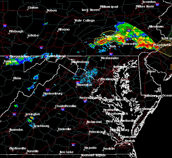 At 702 pm edt, severe thunderstorms were located along a line extending from near newmanstown to near elizabethtown to near boiling springs, moving southeast at 25 mph (radar indicated). Hazards include 60 mph wind gusts. Expect damage to roofs. siding. And trees. At 702 pm edt, severe thunderstorms were located along a line extending from near newmanstown to near elizabethtown to near boiling springs, moving southeast at 25 mph (radar indicated). Hazards include 60 mph wind gusts. Expect damage to roofs. siding. And trees.
|
| 7/23/2016 4:48 PM EDT |
 At 444 pm edt, a severe thunderstorm was located southwest of middletown, on the west side of the susquehanna river, moving southeast at 25 mph. this was the strongest storm in a cluster of severe storms that covered much of central and south central lancaster county (radar indicated). Hazards include 60 mph wind gusts and quarter size hail. Hail damage to vehicles is expected. expect wind damage to roofs, siding, and trees. Locations impacted include, elizabethtown, east petersburg, millersville, mount joy, willow street, columbia, lancaster, york, yorkana, wrightsville, wakefield, hallam, quarryville, smithville, bainbridge, leacock, windsor, maytown, yorklyn and paradise. At 444 pm edt, a severe thunderstorm was located southwest of middletown, on the west side of the susquehanna river, moving southeast at 25 mph. this was the strongest storm in a cluster of severe storms that covered much of central and south central lancaster county (radar indicated). Hazards include 60 mph wind gusts and quarter size hail. Hail damage to vehicles is expected. expect wind damage to roofs, siding, and trees. Locations impacted include, elizabethtown, east petersburg, millersville, mount joy, willow street, columbia, lancaster, york, yorkana, wrightsville, wakefield, hallam, quarryville, smithville, bainbridge, leacock, windsor, maytown, yorklyn and paradise.
|
| 7/23/2016 4:17 PM EDT |
 At 415 pm edt, a cluster severe thunderstorms were located just southwest of middletown, moving southeast at 25 mph (radar indicated). Hazards include 60 mph wind gusts and quarter size hail. Hail damage to vehicles is expected. Expect wind damage to roofs, siding, and trees. At 415 pm edt, a cluster severe thunderstorms were located just southwest of middletown, moving southeast at 25 mph (radar indicated). Hazards include 60 mph wind gusts and quarter size hail. Hail damage to vehicles is expected. Expect wind damage to roofs, siding, and trees.
|
| 7/1/2016 2:52 PM EDT |
 At 252 pm edt, a severe thunderstorm was located near quarryville, moving east at 20 mph (radar indicated). Hazards include 60 mph wind gusts and quarter size hail. Expect wind damage to roofs. siding. and trees. Hail damage to vehicles is possible. At 252 pm edt, a severe thunderstorm was located near quarryville, moving east at 20 mph (radar indicated). Hazards include 60 mph wind gusts and quarter size hail. Expect wind damage to roofs. siding. and trees. Hail damage to vehicles is possible.
|
| 6/5/2016 4:54 PM EDT |
 At 454 pm edt, severe thunderstorms were located along a line extending from brickerville to near paradise to near wakefield, moving east at 50 mph (radar indicated). Hazards include 60 mph wind gusts. Expect damage to roofs. siding. and trees. Locations impacted include, akron, new holland, ephrata, lititz, bareville, adamstown, brickerville, paradise, rothsville, gap, wakefield, strasburg, quarryville, leola, churchtown, reamstown, denver, leacock, terre hill and bowmansville. At 454 pm edt, severe thunderstorms were located along a line extending from brickerville to near paradise to near wakefield, moving east at 50 mph (radar indicated). Hazards include 60 mph wind gusts. Expect damage to roofs. siding. and trees. Locations impacted include, akron, new holland, ephrata, lititz, bareville, adamstown, brickerville, paradise, rothsville, gap, wakefield, strasburg, quarryville, leola, churchtown, reamstown, denver, leacock, terre hill and bowmansville.
|
| 6/5/2016 4:43 PM EDT |
 At 442 pm edt, severe thunderstorms were located along a line extending from manheim to willow street to holtwood, moving east at 50 mph (radar indicated). Hazards include 60 mph wind gusts. Expect damage to roofs. siding. And trees. At 442 pm edt, severe thunderstorms were located along a line extending from manheim to willow street to holtwood, moving east at 50 mph (radar indicated). Hazards include 60 mph wind gusts. Expect damage to roofs. siding. And trees.
|
| 6/5/2016 4:19 PM EDT |
 At 418 pm edt, severe thunderstorms were located along a line extending from near royalton to hallam to windsor to near new freedom, moving east at 50 mph (radar indicated). Hazards include 60 mph wind gusts. Expect damage to roofs. siding. And trees. At 418 pm edt, severe thunderstorms were located along a line extending from near royalton to hallam to windsor to near new freedom, moving east at 50 mph (radar indicated). Hazards include 60 mph wind gusts. Expect damage to roofs. siding. And trees.
|
| 2/24/2016 8:13 PM EST | The severe thunderstorm warning for southeastern lebanon, southeastern york and lancaster counties will expire at 815 pm est, the line of storms which prompted the warning have weakened below severe limits, and no longer poses an immediate threat to life or property. therefore the warning will be allowed to expire. however heavy rain is still possible with this area through 900 pm. |
| 2/24/2016 7:30 PM EST |
 At 728 pm est, doppler radar indicated a line of severe thunderstorms capable of producing damaging winds of 60 to 70 mph. these storms were located along a line extending from new boston-morea to near paradise to near bel air, and moving northeast at 60 mph. At 728 pm est, doppler radar indicated a line of severe thunderstorms capable of producing damaging winds of 60 to 70 mph. these storms were located along a line extending from new boston-morea to near paradise to near bel air, and moving northeast at 60 mph.
|
| 2/24/2016 7:21 PM EST |
 At 721 pm est, doppler radar indicated a severe thunderstorm capable of producing a tornado. this dangerous storm was located over quarryville, and moving northeast at 50 mph. At 721 pm est, doppler radar indicated a severe thunderstorm capable of producing a tornado. this dangerous storm was located over quarryville, and moving northeast at 50 mph.
|
| 2/24/2016 7:08 PM EST |
 At 707 pm est, doppler radar indicated a line of severe thunderstorms capable of producing damaging winds in excess of 60 mph. these storms were located along a line extending from girardville to lititz to near conowingo, moving northeast at 60 mph. locations impacted include, east petersburg, mount joy, ephrata, myerstown, lebanon, manheim, akron, cornwall, annville, lititz, new holland, millersville, willow street, columbia, lancaster, elizabethtown, palmyra, richland, quarryville and smithville. At 707 pm est, doppler radar indicated a line of severe thunderstorms capable of producing damaging winds in excess of 60 mph. these storms were located along a line extending from girardville to lititz to near conowingo, moving northeast at 60 mph. locations impacted include, east petersburg, mount joy, ephrata, myerstown, lebanon, manheim, akron, cornwall, annville, lititz, new holland, millersville, willow street, columbia, lancaster, elizabethtown, palmyra, richland, quarryville and smithville.
|
| 2/24/2016 6:10 PM EST |
 At 607 pm est, doppler radar indicated a line of severe thunderstorms capable of producing damaging winds around 60 mph. these storms were located along a line extending from mechanicsburg to near westminster to fairland, and moving northeast at 50 mph. At 607 pm est, doppler radar indicated a line of severe thunderstorms capable of producing damaging winds around 60 mph. these storms were located along a line extending from mechanicsburg to near westminster to fairland, and moving northeast at 50 mph.
|
| 10/28/2015 9:11 PM EDT |
 At 911 pm edt, doppler radar indicated a severe thunderstorm capable of producing damaging winds around 60 mph. this storm was located near stewartstown, and moving northeast at 60 mph. At 911 pm edt, doppler radar indicated a severe thunderstorm capable of producing damaging winds around 60 mph. this storm was located near stewartstown, and moving northeast at 60 mph.
|
| 10/9/2015 4:08 PM EDT |
 At 406 pm edt, doppler radar indicated a severe thunderstorm capable of producing damaging winds around 60 mph. this storm was located near manchester, and moving east at 35 mph. At 406 pm edt, doppler radar indicated a severe thunderstorm capable of producing damaging winds around 60 mph. this storm was located near manchester, and moving east at 35 mph.
|
| 7/9/2015 6:49 PM EDT |
 At 649 pm edt, doppler radar indicated a line of severe thunderstorms capable of producing damaging winds in excess of 60 mph. these storms were located along a line extending from near adamstown to near delta, moving east at 35 mph. locations impacted include, new holland, willow street, adamstown, bareville, churchtown, delta, gap, holtwood, leola, paradise, quarryville, smithville, strasburg, terre hill, wakefield, bird-in-hand, blue ball, bowmansville, buck and christiana. At 649 pm edt, doppler radar indicated a line of severe thunderstorms capable of producing damaging winds in excess of 60 mph. these storms were located along a line extending from near adamstown to near delta, moving east at 35 mph. locations impacted include, new holland, willow street, adamstown, bareville, churchtown, delta, gap, holtwood, leola, paradise, quarryville, smithville, strasburg, terre hill, wakefield, bird-in-hand, blue ball, bowmansville, buck and christiana.
|
| 7/9/2015 6:32 PM EDT |
 At 631 pm edt, doppler radar indicated a line of severe thunderstorms capable of producing damaging winds in excess of 60 mph. these storms were located along a line extending from near wernersville to near delta, moving east at 45 mph. locations impacted include, akron, east petersburg, ephrata, lancaster, lititz, millersville, new holland, willow street, adamstown, bareville, brickerville, churchtown, delta, denver, gap, holtwood, kleinfeltersville, leacock, leola and newmanstown. At 631 pm edt, doppler radar indicated a line of severe thunderstorms capable of producing damaging winds in excess of 60 mph. these storms were located along a line extending from near wernersville to near delta, moving east at 45 mph. locations impacted include, akron, east petersburg, ephrata, lancaster, lititz, millersville, new holland, willow street, adamstown, bareville, brickerville, churchtown, delta, denver, gap, holtwood, kleinfeltersville, leacock, leola and newmanstown.
|
| 7/9/2015 5:34 PM EDT |
 At 534 pm edt, doppler radar indicated a line of severe thunderstorms capable of producing damaging winds around 60 mph. these storms were located along a line extending from near marysville to near parkville, and moving east at 50 mph. At 534 pm edt, doppler radar indicated a line of severe thunderstorms capable of producing damaging winds around 60 mph. these storms were located along a line extending from near marysville to near parkville, and moving east at 50 mph.
|
| 6/30/2015 2:30 PM EDT | Trees down on scotland rd in lancaster county PA, 3.1 miles NE of Quarryville, PA |
| 6/30/2015 2:30 PM EDT |
 At 229 pm edt, doppler radar indicated a line of severe thunderstorms capable of producing destructive winds in excess of 70 mph. these storms were located along a line extending from near parkesburg to near wakefield, moving northeast at 20 mph. penny size hail may also accompany the damaging winds. locations impacted include, new holland, churchtown, gap, holtwood, paradise, quarryville, smithville, strasburg, wakefield, blue ball, buck, christiana, georgetown, goodville, gordonville, intercourse, kirkwood, little britain, peach bottom and rawlinsville. At 229 pm edt, doppler radar indicated a line of severe thunderstorms capable of producing destructive winds in excess of 70 mph. these storms were located along a line extending from near parkesburg to near wakefield, moving northeast at 20 mph. penny size hail may also accompany the damaging winds. locations impacted include, new holland, churchtown, gap, holtwood, paradise, quarryville, smithville, strasburg, wakefield, blue ball, buck, christiana, georgetown, goodville, gordonville, intercourse, kirkwood, little britain, peach bottom and rawlinsville.
|
| 6/30/2015 1:54 PM EDT |
 At 152 pm edt, doppler radar indicated a line of severe thunderstorms with a history of producing damaging winds in excess of 60 mph. these storms were located along a line extending from near new holland to near wakefield, and moving northeast at 30 mph. penny size hail may also accompany the damaging winds. At 152 pm edt, doppler radar indicated a line of severe thunderstorms with a history of producing damaging winds in excess of 60 mph. these storms were located along a line extending from near new holland to near wakefield, and moving northeast at 30 mph. penny size hail may also accompany the damaging winds.
|
| 6/30/2015 1:35 PM EDT |
 At 135 pm edt, doppler radar indicated a severe thunderstorm capable of producing destructive winds in excess of 70 mph. this storm was located near quarryville, moving northeast at 25 mph. nickel size hail may also accompany the damaging winds. locations impacted include, akron, lancaster, millersville, new holland, willow street, bareville, gap, holtwood, leacock, leola, paradise, quarryville, rothsville, safe harbor, shenks ferry, smithville, strasburg, wakefield, bird-in-hand and buck. At 135 pm edt, doppler radar indicated a severe thunderstorm capable of producing destructive winds in excess of 70 mph. this storm was located near quarryville, moving northeast at 25 mph. nickel size hail may also accompany the damaging winds. locations impacted include, akron, lancaster, millersville, new holland, willow street, bareville, gap, holtwood, leacock, leola, paradise, quarryville, rothsville, safe harbor, shenks ferry, smithville, strasburg, wakefield, bird-in-hand and buck.
|
| 6/30/2015 1:06 PM EDT |
 At 105 pm edt, doppler radar indicated a severe thunderstorm capable of producing damaging winds around 60 mph. this storm was located near delta, and moving northeast at 25 mph. nickel size hail may also accompany the damaging winds. At 105 pm edt, doppler radar indicated a severe thunderstorm capable of producing damaging winds around 60 mph. this storm was located near delta, and moving northeast at 25 mph. nickel size hail may also accompany the damaging winds.
|
| 6/27/2015 5:49 PM EDT |
 At 548 pm edt, doppler radar indicated a severe thunderstorm capable of producing damaging winds around 60 mph. this storm was located near shenks ferry, and moving northeast at 35 mph. * this severe thunderstorm will be near, safe harbor and shenks ferry around 550 pm edt. millersville, mountville and smithville around 600 pm edt. east petersburg, lancaster, lititz, willow street, bareville, leacock, leola, rothsville and strasburg around 610 pm edt. other locations impacted by this severe thunderstorm include airville, bird-in-hand, blue ball, buck, christiana, conestoga, farmersville, felton, georgetown and goodville. this includes the pennsylvania turnpike from mile markers 274 to 277. At 548 pm edt, doppler radar indicated a severe thunderstorm capable of producing damaging winds around 60 mph. this storm was located near shenks ferry, and moving northeast at 35 mph. * this severe thunderstorm will be near, safe harbor and shenks ferry around 550 pm edt. millersville, mountville and smithville around 600 pm edt. east petersburg, lancaster, lititz, willow street, bareville, leacock, leola, rothsville and strasburg around 610 pm edt. other locations impacted by this severe thunderstorm include airville, bird-in-hand, blue ball, buck, christiana, conestoga, farmersville, felton, georgetown and goodville. this includes the pennsylvania turnpike from mile markers 274 to 277.
|
| 6/23/2015 4:54 PM EDT |
 At 454 pm edt, doppler radar indicated a severe thunderstorm capable of producing quarter size hail and damaging winds around 60 mph. this storm was located over mountville, and moving east at 35 mph. At 454 pm edt, doppler radar indicated a severe thunderstorm capable of producing quarter size hail and damaging winds around 60 mph. this storm was located over mountville, and moving east at 35 mph.
|
| 6/20/2015 10:36 PM EDT |
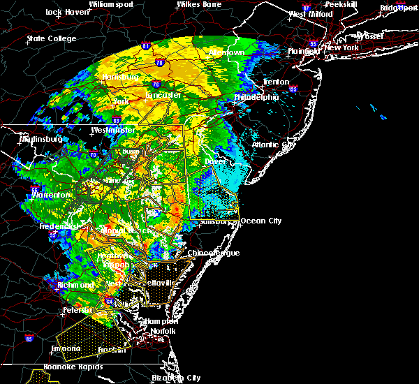 At 1036 pm edt, doppler radar indicated a line of severe thunderstorms capable of producing damaging winds in excess of 60 mph. these storms were located along a line extending from near quarryville to cochranville to near kemblesville, moving northeast at 30 mph. locations impacted include, gap, quarryville, buck, christiana, georgetown and kirkwood. At 1036 pm edt, doppler radar indicated a line of severe thunderstorms capable of producing damaging winds in excess of 60 mph. these storms were located along a line extending from near quarryville to cochranville to near kemblesville, moving northeast at 30 mph. locations impacted include, gap, quarryville, buck, christiana, georgetown and kirkwood.
|
| 6/20/2015 10:07 PM EDT |
 At 1007 pm edt, doppler radar indicated a line of severe thunderstorms capable of producing damaging winds around 60 mph. these storms were located along a line extending from near delta to near wakefield to near bay view, and moving northeast at 30 mph. At 1007 pm edt, doppler radar indicated a line of severe thunderstorms capable of producing damaging winds around 60 mph. these storms were located along a line extending from near delta to near wakefield to near bay view, and moving northeast at 30 mph.
|
| 6/8/2015 6:53 PM EDT | At 652 pm edt, doppler radar indicated a line of severe thunderstorms capable of producing damaging winds in excess of 60 mph. these storms were located along a line extending from near terre hill to near wrightsville to pennville, moving southeast at 20 mph. locations impacted include, akron, columbia, dallastown, east petersburg, ephrata, hanover, lancaster, lititz, millersville, new holland, parkville, red lion, spry, weigelstown, willow street, york, bareville, brogue, codorus and cross roads. |
| 6/8/2015 6:11 PM EDT | At 610 pm edt, doppler radar indicated a line of severe thunderstorms capable of producing damaging winds around 60 mph. these storms were located along a line extending from near campbelltown to maytown to near spring grove, and moving southeast at 35 mph. |
| 6/1/2015 3:56 PM EDT | At 356 pm edt, doppler radar indicated a severe thunderstorm capable of producing quarter size hail and damaging winds in excess of 60 mph. this storm was located over homeville, moving east at 20 mph. locations impacted include, gap, quarryville, wakefield, christiana, georgetown, kirkwood, little britain and peach bottom. |
| 6/1/2015 3:20 PM EDT | At 319 pm edt, doppler radar indicated a severe thunderstorm capable of producing quarter size hail and damaging winds around 60 mph. this storm was located over smithville, and moving east at 20 mph. |
| 5/16/2015 4:38 PM EDT | At 436 pm edt, doppler radar indicated a severe thunderstorm capable of producing penny sized hail. this storm was located over shenks ferry, and moving northeast at 5 mph. damaging winds up to 60 mph and frequent lightning may also occur. |
| 6/3/2012 6:50 PM EDT | Trees and wires down in lancaster county PA, 0.3 miles SW of Quarryville, PA |
Hail Maps for Quarryville, PA
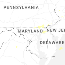


Connect with Interactive Hail Maps