

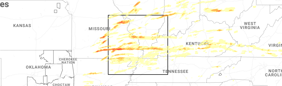
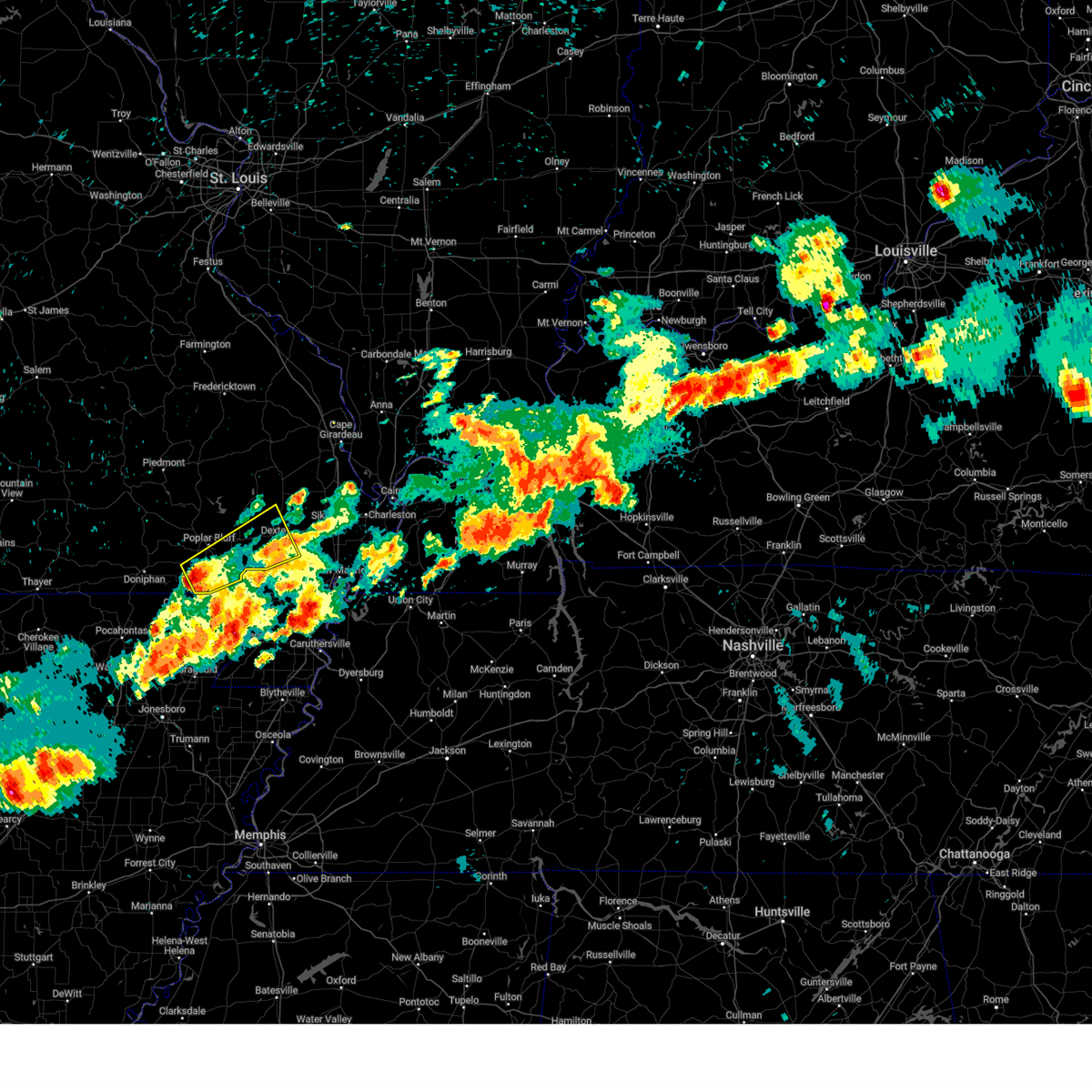
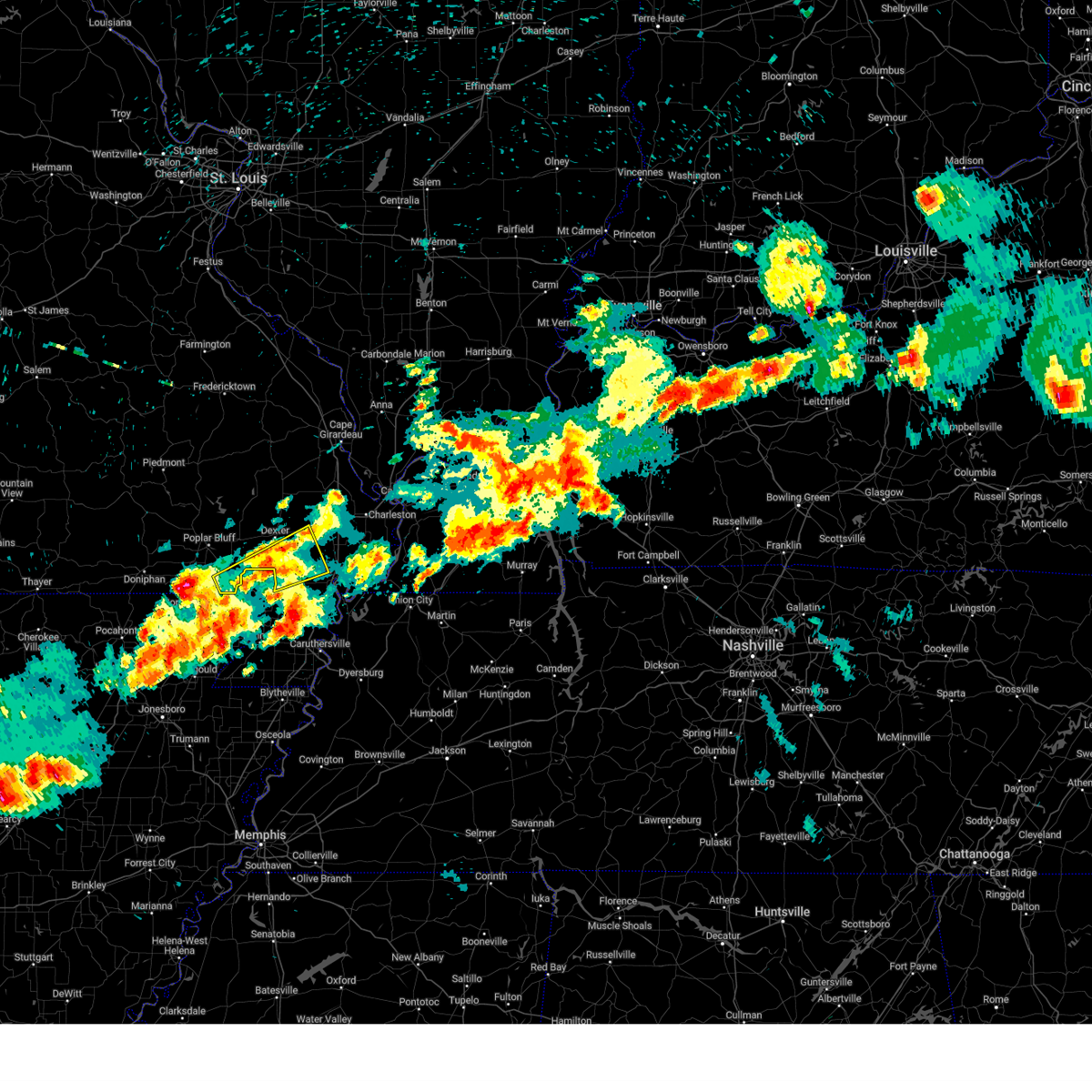
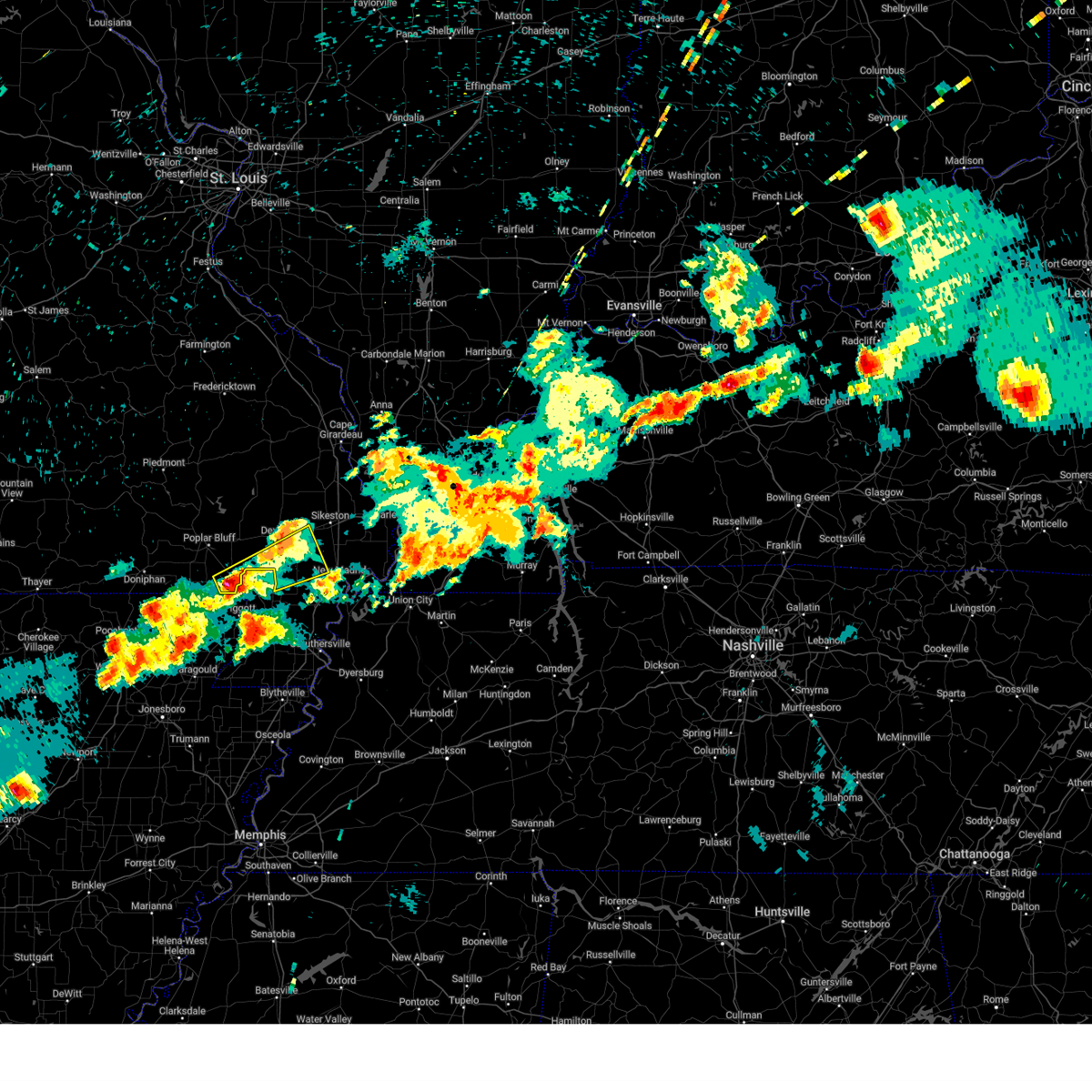
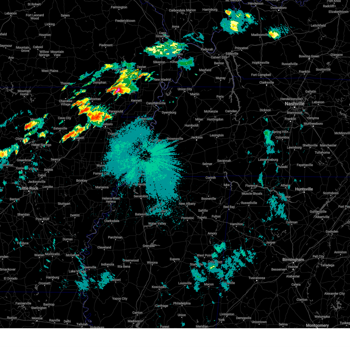
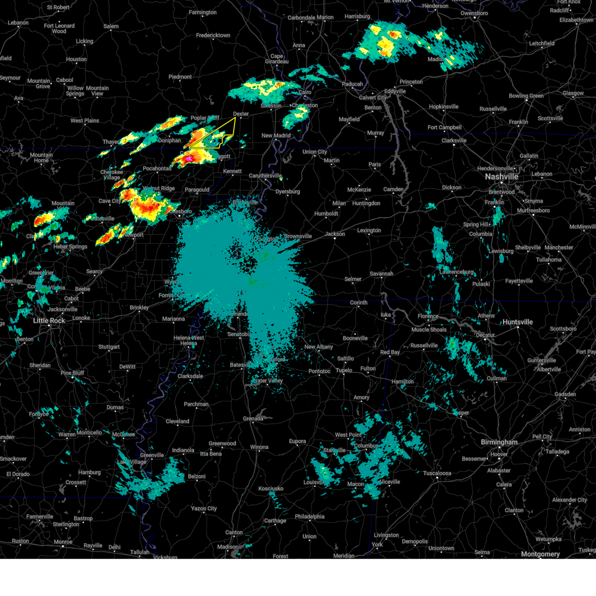
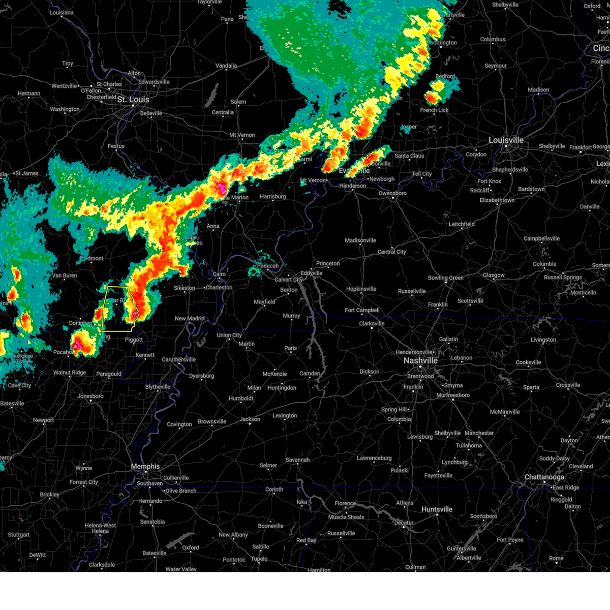
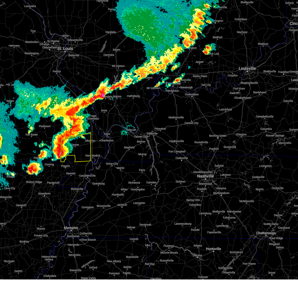
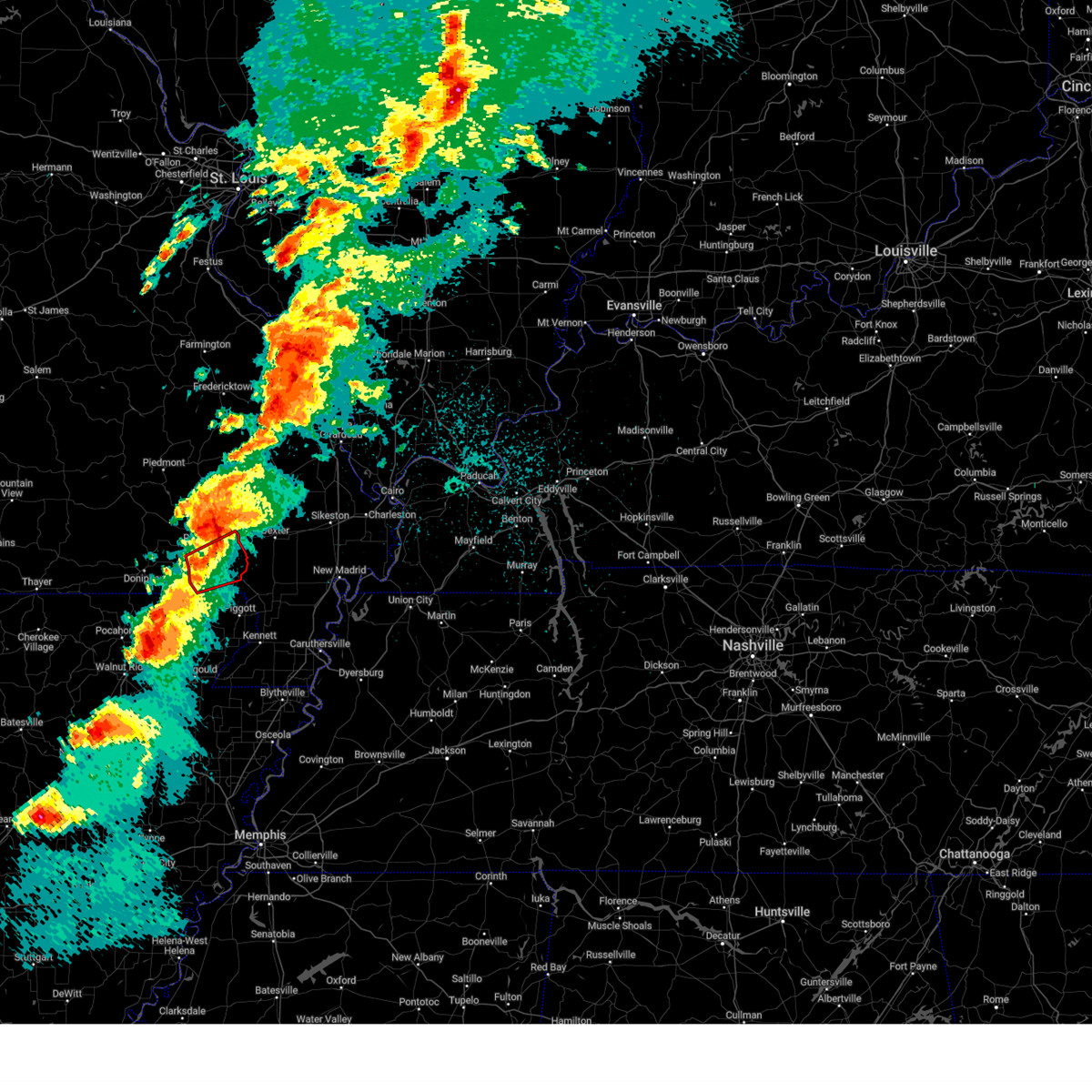
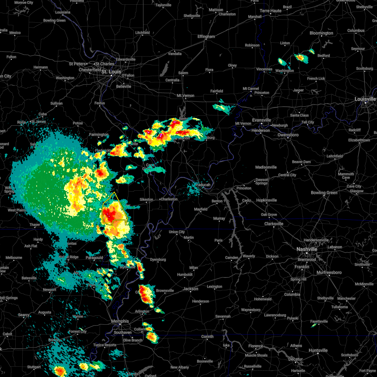
Hail Map for Qulin, MO
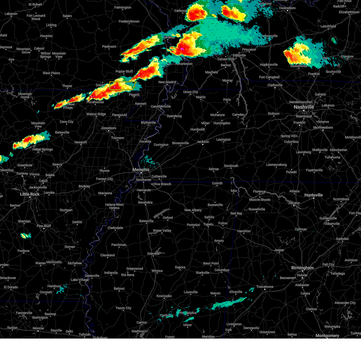
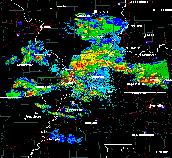
The Qulin, MO area has had 6 reports of on-the-ground hail by trained spotters, and has been under severe weather warnings 27 times during the past 12 months. Doppler radar has detected hail at or near Qulin, MO on 55 occasions, including 5 occasions during the past year.
| Name: | Qulin, MO |
| Where Located: | 62.4 miles SW of Cape Girardeau, MO |
| Map: | Google Map for Qulin, MO |
| Population: | 458 |
| Housing Units: | 244 |
| More Info: | Search Google for Qulin, MO |
2
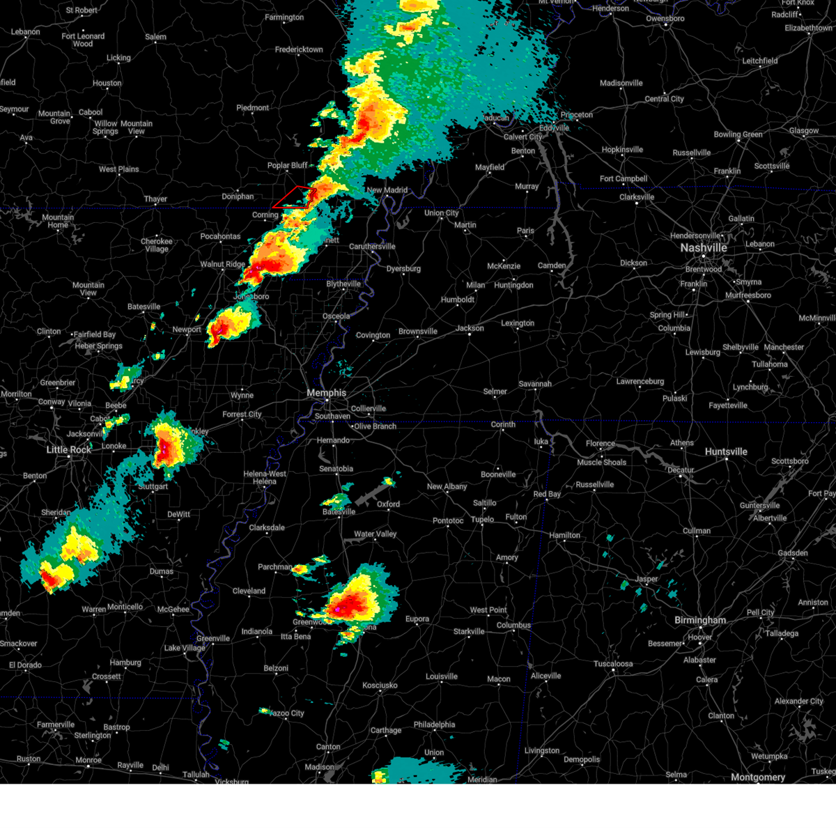
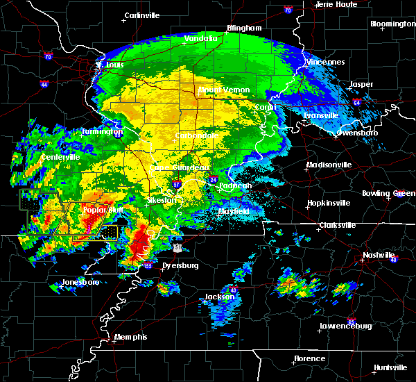
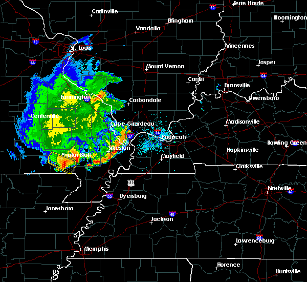
The Top Recent Hail Date for Qulin, MO is Friday, May 16, 2025 (11th out of 55)
Hail and Wind Damage Spotted near Qulin, MO
| Date / Time | Report Details |
|---|---|
| 5/16/2025 7:22 PM CDT | the severe thunderstorm warning has been cancelled and is no longer in effect |
| 5/16/2025 7:22 PM CDT | At 722 pm cdt, a severe thunderstorm was located near qulin, or near chalk bluff natural area, moving east at 45 mph (radar indicated). Hazards include ping pong ball size hail and 60 mph wind gusts. People and animals outdoors will be injured. expect hail damage to roofs, siding, windows, and vehicles. expect wind damage to roofs, siding, and trees. Locations impacted include, qulin. |
| 5/16/2025 7:18 PM CDT | 55 mph measured gust trees dow in butler county MO, 0.2 miles WSW of Qulin, MO |
| 5/16/2025 7:01 PM CDT | Trees dow in butler county MO, 0.7 miles NNW of Qulin, MO |
| 5/16/2025 6:58 PM CDT |
 Svrpah the national weather service in paducah has issued a * severe thunderstorm warning for, southeastern ripley county in southeastern missouri, southern butler county in southeastern missouri, * until 745 pm cdt. * at 657 pm cdt, a severe thunderstorm was located over naylor, or 8 miles north of corning, moving east at 45 mph (radar indicated). Hazards include ping pong ball size hail and 60 mph wind gusts. People and animals outdoors will be injured. expect hail damage to roofs, siding, windows, and vehicles. Expect wind damage to roofs, siding, and trees. Svrpah the national weather service in paducah has issued a * severe thunderstorm warning for, southeastern ripley county in southeastern missouri, southern butler county in southeastern missouri, * until 745 pm cdt. * at 657 pm cdt, a severe thunderstorm was located over naylor, or 8 miles north of corning, moving east at 45 mph (radar indicated). Hazards include ping pong ball size hail and 60 mph wind gusts. People and animals outdoors will be injured. expect hail damage to roofs, siding, windows, and vehicles. Expect wind damage to roofs, siding, and trees.
|
| 5/16/2025 6:51 PM CDT | At 651 pm cdt, a severe thunderstorm capable of producing a tornado was located near qulin, or 12 miles southeast of poplar bluff, moving east at 45 mph (radar indicated rotation). Hazards include tornado and golf ball size hail. Flying debris will be dangerous to those caught without shelter. mobile homes will be damaged or destroyed. damage to roofs, windows, and vehicles will occur. tree damage is likely. this dangerous storm will be near, fisk around 655 pm cdt. Dexter, bernie, and dudley around 700 pm cdt. |
| 5/16/2025 6:43 PM CDT |
 At 643 pm cdt, a severe thunderstorm capable of producing a tornado was located near harviell, or 7 miles southeast of poplar bluff, moving east at 45 mph (radar indicated rotation). Hazards include tornado and golf ball size hail. Flying debris will be dangerous to those caught without shelter. mobile homes will be damaged or destroyed. damage to roofs, windows, and vehicles will occur. tree damage is likely. this dangerous storm will be near, bernie around 700 pm cdt. Dexter around 705 pm cdt. At 643 pm cdt, a severe thunderstorm capable of producing a tornado was located near harviell, or 7 miles southeast of poplar bluff, moving east at 45 mph (radar indicated rotation). Hazards include tornado and golf ball size hail. Flying debris will be dangerous to those caught without shelter. mobile homes will be damaged or destroyed. damage to roofs, windows, and vehicles will occur. tree damage is likely. this dangerous storm will be near, bernie around 700 pm cdt. Dexter around 705 pm cdt.
|
| 5/16/2025 6:35 PM CDT | Torpah the national weather service in paducah has issued a * tornado warning for, western new madrid county in southeastern missouri, central butler county in southeastern missouri, southwestern stoddard county in southeastern missouri, * until 715 pm cdt. * at 635 pm cdt, a severe thunderstorm capable of producing a tornado was located over harviell, or near poplar bluff, moving east at 45 mph (radar indicated rotation). Hazards include tornado and golf ball size hail. Flying debris will be dangerous to those caught without shelter. mobile homes will be damaged or destroyed. damage to roofs, windows, and vehicles will occur. tree damage is likely. this dangerous storm will be near, poplar bluff around 640 pm cdt. fisk around 645 pm cdt. dudley around 655 pm cdt. Dexter and bernie around 700 pm cdt. |
| 5/16/2025 6:57 AM CDT |
 At 657 am cdt, a severe thunderstorm was located near qulin, or 9 miles southeast of poplar bluff, moving northeast at 40 mph (trained weather spotters). Hazards include golf ball size hail and 60 mph wind gusts. People and animals outdoors will be injured. expect hail damage to roofs, siding, windows, and vehicles. expect wind damage to roofs, siding, and trees. Locations impacted include, poplar bluff, dexter, bernie, bloomfield, essex, qulin, fisk, and dudley. At 657 am cdt, a severe thunderstorm was located near qulin, or 9 miles southeast of poplar bluff, moving northeast at 40 mph (trained weather spotters). Hazards include golf ball size hail and 60 mph wind gusts. People and animals outdoors will be injured. expect hail damage to roofs, siding, windows, and vehicles. expect wind damage to roofs, siding, and trees. Locations impacted include, poplar bluff, dexter, bernie, bloomfield, essex, qulin, fisk, and dudley.
|
| 5/16/2025 6:52 AM CDT |
 At 652 am cdt, a severe thunderstorm was located near harviell, or 10 miles south of poplar bluff, moving east at 45 mph (radar indicated). Hazards include ping pong ball size hail and 60 mph wind gusts. People and animals outdoors will be injured. expect hail damage to roofs, siding, windows, and vehicles. expect wind damage to roofs, siding, and trees. Locations impacted include, qulin. At 652 am cdt, a severe thunderstorm was located near harviell, or 10 miles south of poplar bluff, moving east at 45 mph (radar indicated). Hazards include ping pong ball size hail and 60 mph wind gusts. People and animals outdoors will be injured. expect hail damage to roofs, siding, windows, and vehicles. expect wind damage to roofs, siding, and trees. Locations impacted include, qulin.
|
| 5/16/2025 6:52 AM CDT |
 the severe thunderstorm warning has been cancelled and is no longer in effect the severe thunderstorm warning has been cancelled and is no longer in effect
|
| 5/16/2025 6:47 AM CDT |
 Svrpah the national weather service in paducah has issued a * severe thunderstorm warning for, southern butler county in southeastern missouri, southern stoddard county in southeastern missouri, * until 730 am cdt. * at 647 am cdt, a severe thunderstorm was located near neelyville, or 11 miles south of poplar bluff, moving northeast at 40 mph (radar indicated). Hazards include ping pong ball size hail and 60 mph wind gusts. People and animals outdoors will be injured. expect hail damage to roofs, siding, windows, and vehicles. Expect wind damage to roofs, siding, and trees. Svrpah the national weather service in paducah has issued a * severe thunderstorm warning for, southern butler county in southeastern missouri, southern stoddard county in southeastern missouri, * until 730 am cdt. * at 647 am cdt, a severe thunderstorm was located near neelyville, or 11 miles south of poplar bluff, moving northeast at 40 mph (radar indicated). Hazards include ping pong ball size hail and 60 mph wind gusts. People and animals outdoors will be injured. expect hail damage to roofs, siding, windows, and vehicles. Expect wind damage to roofs, siding, and trees.
|
| 5/16/2025 6:38 AM CDT |
 At 638 am cdt, a severe thunderstorm was located near bernie, moving northeast at 45 mph. a second severe storm was near neelyville (radar indicated). Hazards include 60 mph wind gusts and quarter size hail. Hail damage to vehicles is expected. expect wind damage to roofs, siding, and trees. Locations impacted include, bernie, parma, essex, qulin, risco, canalou, baker, catron, and penermon. At 638 am cdt, a severe thunderstorm was located near bernie, moving northeast at 45 mph. a second severe storm was near neelyville (radar indicated). Hazards include 60 mph wind gusts and quarter size hail. Hail damage to vehicles is expected. expect wind damage to roofs, siding, and trees. Locations impacted include, bernie, parma, essex, qulin, risco, canalou, baker, catron, and penermon.
|
| 5/16/2025 6:20 AM CDT |
 Svrpah the national weather service in paducah has issued a * severe thunderstorm warning for, northwestern new madrid county in southeastern missouri, southeastern butler county in southeastern missouri, southeastern stoddard county in southeastern missouri, * until 700 am cdt. * at 620 am cdt, a severe thunderstorm was located near chalk bluff natural area, moving northeast at 35 mph (radar indicated). Hazards include 60 mph wind gusts and quarter size hail. Hail damage to vehicles is expected. Expect wind damage to roofs, siding, and trees. Svrpah the national weather service in paducah has issued a * severe thunderstorm warning for, northwestern new madrid county in southeastern missouri, southeastern butler county in southeastern missouri, southeastern stoddard county in southeastern missouri, * until 700 am cdt. * at 620 am cdt, a severe thunderstorm was located near chalk bluff natural area, moving northeast at 35 mph (radar indicated). Hazards include 60 mph wind gusts and quarter size hail. Hail damage to vehicles is expected. Expect wind damage to roofs, siding, and trees.
|
| 5/16/2025 4:33 AM CDT |
 At 432 am cdt, a severe thunderstorm was located over mcdougal, or 9 miles east of corning, moving northeast at 50 mph (radar indicated). Hazards include golf ball size hail and 60 mph wind gusts. People and animals outdoors will be injured. expect hail damage to roofs, siding, windows, and vehicles. expect wind damage to roofs, siding, and trees. Locations impacted include, qulin. At 432 am cdt, a severe thunderstorm was located over mcdougal, or 9 miles east of corning, moving northeast at 50 mph (radar indicated). Hazards include golf ball size hail and 60 mph wind gusts. People and animals outdoors will be injured. expect hail damage to roofs, siding, windows, and vehicles. expect wind damage to roofs, siding, and trees. Locations impacted include, qulin.
|
| 5/16/2025 4:22 AM CDT |
 Svrpah the national weather service in paducah has issued a * severe thunderstorm warning for, southeastern butler county in southeastern missouri, southwestern stoddard county in southeastern missouri, * until 500 am cdt. * at 422 am cdt, a severe thunderstorm was located over corning, moving northeast at 50 mph (radar indicated). Hazards include 60 mph wind gusts and half dollar size hail. Hail damage to vehicles is expected. Expect wind damage to roofs, siding, and trees. Svrpah the national weather service in paducah has issued a * severe thunderstorm warning for, southeastern butler county in southeastern missouri, southwestern stoddard county in southeastern missouri, * until 500 am cdt. * at 422 am cdt, a severe thunderstorm was located over corning, moving northeast at 50 mph (radar indicated). Hazards include 60 mph wind gusts and half dollar size hail. Hail damage to vehicles is expected. Expect wind damage to roofs, siding, and trees.
|
| 4/4/2025 8:21 PM CDT | Svrpah the national weather service in paducah has issued a * severe thunderstorm warning for, southeastern bollinger county in southeastern missouri, southeastern wayne county in southeastern missouri, eastern butler county in southeastern missouri, stoddard county in southeastern missouri, * until 900 pm cdt. * at 820 pm cdt, severe thunderstorms were located along a line extending from near lake wappapello state park to 6 miles west of qulin, moving northeast at 50 mph (radar indicated). Hazards include 70 mph wind gusts and quarter size hail. Hail damage to vehicles is expected. expect considerable tree damage. Wind damage is also likely to mobile homes, roofs, and outbuildings. |
| 4/2/2025 6:24 PM CDT | Torpah the national weather service in paducah has issued a * tornado warning for, southeastern butler county in southeastern missouri, south central stoddard county in southeastern missouri, * until 715 pm cdt. * at 624 pm cdt, a severe thunderstorm capable of producing a tornado was located over corning, moving east at 50 mph (radar indicated rotation). Hazards include tornado. Flying debris will be dangerous to those caught without shelter. mobile homes will be damaged or destroyed. damage to roofs, windows, and vehicles will occur. tree damage is likely. this dangerous storm will be near, qulin around 645 pm cdt. Bernie around 700 pm cdt. |
| 3/30/2025 5:40 PM CDT |
 The storms which prompted the warning have moved out of the area. therefore, the warning will be allowed to expire. additional thunderstorms are developing to the west and small hail is possible with these new storms. a tornado watch remains in effect until 1100 pm cdt for southeastern missouri. The storms which prompted the warning have moved out of the area. therefore, the warning will be allowed to expire. additional thunderstorms are developing to the west and small hail is possible with these new storms. a tornado watch remains in effect until 1100 pm cdt for southeastern missouri.
|
| 3/30/2025 5:33 PM CDT | Quarter sized hail reported 0.2 miles WSW of Qulin, MO |
| 3/30/2025 5:27 PM CDT |
 Svrpah the national weather service in paducah has issued a * severe thunderstorm warning for, southwestern scott county in southeastern missouri, central new madrid county in southeastern missouri, eastern butler county in southeastern missouri, stoddard county in southeastern missouri, * until 615 pm cdt. * at 526 pm cdt, a severe thunderstorm was located over fisk, or 10 miles east of poplar bluff, moving east at 55 mph (radar indicated). Hazards include 70 mph wind gusts and quarter size hail. Hail damage to vehicles is expected. expect considerable tree damage. Wind damage is also likely to mobile homes, roofs, and outbuildings. Svrpah the national weather service in paducah has issued a * severe thunderstorm warning for, southwestern scott county in southeastern missouri, central new madrid county in southeastern missouri, eastern butler county in southeastern missouri, stoddard county in southeastern missouri, * until 615 pm cdt. * at 526 pm cdt, a severe thunderstorm was located over fisk, or 10 miles east of poplar bluff, moving east at 55 mph (radar indicated). Hazards include 70 mph wind gusts and quarter size hail. Hail damage to vehicles is expected. expect considerable tree damage. Wind damage is also likely to mobile homes, roofs, and outbuildings.
|
| 3/30/2025 5:22 PM CDT | the severe thunderstorm warning has been cancelled and is no longer in effect |
| 3/30/2025 5:22 PM CDT | At 522 pm cdt, severe thunderstorms were located along a line extending from 9 miles northeast of shook to 6 miles northwest of fisk to near harviell, moving east at 50 mph (radar indicated). Hazards include 70 mph wind gusts and half dollar size hail. Hail damage to vehicles is expected. expect considerable tree damage. wind damage is also likely to mobile homes, roofs, and outbuildings. Locations impacted include, harviell, hendrickson, qulin, poplar bluff, rombauer, neelyville, and fisk. |
| 3/30/2025 5:21 PM CDT | Torpah the national weather service in paducah has issued a * tornado warning for, northwestern new madrid county in southeastern missouri, southeastern butler county in southeastern missouri, southern stoddard county in southeastern missouri, * until 600 pm cdt. * at 520 pm cdt, a severe thunderstorm capable of producing a tornado was located near harviell, or 7 miles southeast of poplar bluff, moving east at 55 mph (radar indicated rotation). Hazards include tornado and quarter size hail. Flying debris will be dangerous to those caught without shelter. mobile homes will be damaged or destroyed. damage to roofs, windows, and vehicles will occur. tree damage is likely. this dangerous storm will be near, fisk and qulin around 525 pm cdt. dudley around 530 pm cdt. bernie and dexter around 535 pm cdt. essex around 545 pm cdt. Other locations impacted by this tornadic thunderstorm include catron, baker, and penermon. |
| 3/30/2025 4:55 PM CDT | Svrpah the national weather service in paducah has issued a * severe thunderstorm warning for, southeastern carter county in southeastern missouri, eastern ripley county in southeastern missouri, butler county in southeastern missouri, * until 545 pm cdt. * at 454 pm cdt, severe thunderstorms were located along a line extending from near williamsville to budapest to near doniphan, moving east at 50 mph (radar indicated). Hazards include 70 mph wind gusts and half dollar size hail. Hail damage to vehicles is expected. expect considerable tree damage. Wind damage is also likely to mobile homes, roofs, and outbuildings. |
| 3/15/2025 12:24 AM CDT |
 the tornado warning has been cancelled and is no longer in effect the tornado warning has been cancelled and is no longer in effect
|
| 3/14/2025 11:58 PM CDT | Torpah the national weather service in paducah has issued a * tornado warning for, southeastern butler county in southeastern missouri, * until 1245 am cdt. * at 1158 pm cdt, a severe thunderstorm capable of producing a tornado was located near corning, moving northeast at 55 mph (radar indicated rotation). Hazards include tornado. Flying debris will be dangerous to those caught without shelter. mobile homes will be damaged or destroyed. damage to roofs, windows, and vehicles will occur. tree damage is likely. This dangerous storm will be near, qulin around 1215 am cdt. |
| 3/14/2025 11:38 PM CDT |
 the tornado warning has been cancelled and is no longer in effect the tornado warning has been cancelled and is no longer in effect
|
| 3/14/2025 11:38 PM CDT |
 At 1138 pm cdt, a confirmed large and extremely dangerous tornado was located near poplar bluff, moving northeast at 55 mph. this is a particularly dangerous situation. take cover now! south of poplar bluff straight line winds up to 70 mph appear possible (radar confirmed tornado). Hazards include damaging tornado. You are in a life-threatening situation. flying debris may be deadly to those caught without shelter. mobile homes will be destroyed. considerable damage to homes, businesses, and vehicles is likely and complete destruction is possible. The tornado will be near, fisk around 1145 pm cdt. At 1138 pm cdt, a confirmed large and extremely dangerous tornado was located near poplar bluff, moving northeast at 55 mph. this is a particularly dangerous situation. take cover now! south of poplar bluff straight line winds up to 70 mph appear possible (radar confirmed tornado). Hazards include damaging tornado. You are in a life-threatening situation. flying debris may be deadly to those caught without shelter. mobile homes will be destroyed. considerable damage to homes, businesses, and vehicles is likely and complete destruction is possible. The tornado will be near, fisk around 1145 pm cdt.
|
| 3/14/2025 10:58 PM CDT | Torpah the national weather service in paducah has issued a * tornado warning for, southeastern ripley county in southeastern missouri, southern butler county in southeastern missouri, * until 1145 pm cdt. * at 1058 pm cdt, a confirmed large and extremely dangerous tornado was located near maynard, or 9 miles southwest of doniphan, moving northeast at 55 mph. this is a particularly dangerous situation. take cover now! (radar confirmed tornado). Hazards include damaging tornado. You are in a life-threatening situation. flying debris may be deadly to those caught without shelter. mobile homes will be destroyed. considerable damage to homes, businesses, and vehicles is likely and complete destruction is possible. the tornado will be near, oxly around 1105 pm cdt. naylor and fairdealing around 1110 pm cdt. neelyville around 1115 pm cdt. Harviell and poplar bluff around 1120 pm cdt. |
| 7/5/2024 2:27 AM CDT |
 The storms which prompted the warning have weakened below severe limits, and have exited the warned area. therefore, the warning will be allowed to expire. however, gusty winds are still possible with these thunderstorms. The storms which prompted the warning have weakened below severe limits, and have exited the warned area. therefore, the warning will be allowed to expire. however, gusty winds are still possible with these thunderstorms.
|
| 7/5/2024 2:15 AM CDT |
 At 214 am cdt, severe thunderstorms were located along a line extending from 7 miles northeast of shook to near fisk, moving east at 40 mph (radar indicated). Hazards include 60 mph wind gusts. Expect damage to roofs, siding, and trees. Locations impacted include, poplar bluff, greenville, lake wappapello state park, neelyville, qulin, fisk, harviell, hendrickson, wappapello, shook, and rombauer. At 214 am cdt, severe thunderstorms were located along a line extending from 7 miles northeast of shook to near fisk, moving east at 40 mph (radar indicated). Hazards include 60 mph wind gusts. Expect damage to roofs, siding, and trees. Locations impacted include, poplar bluff, greenville, lake wappapello state park, neelyville, qulin, fisk, harviell, hendrickson, wappapello, shook, and rombauer.
|
| 7/5/2024 1:51 AM CDT |
 Svrpah the national weather service in paducah has issued a * severe thunderstorm warning for, eastern ripley county in southeastern missouri, southeastern wayne county in southeastern missouri, butler county in southeastern missouri, * until 230 am cdt. * at 151 am cdt, severe thunderstorms were located along a line extending from near greenville to near fairdealing, moving east at 55 mph (radar indicated). Hazards include 60 mph wind gusts. expect damage to roofs, siding, and trees Svrpah the national weather service in paducah has issued a * severe thunderstorm warning for, eastern ripley county in southeastern missouri, southeastern wayne county in southeastern missouri, butler county in southeastern missouri, * until 230 am cdt. * at 151 am cdt, severe thunderstorms were located along a line extending from near greenville to near fairdealing, moving east at 55 mph (radar indicated). Hazards include 60 mph wind gusts. expect damage to roofs, siding, and trees
|
| 6/8/2024 11:51 PM CDT |
 the severe thunderstorm warning has been cancelled and is no longer in effect the severe thunderstorm warning has been cancelled and is no longer in effect
|
| 6/8/2024 11:51 PM CDT |
 At 1150 pm cdt, severe thunderstorms were located along a line extending from near dudley to near fisk to 7 miles east of poplar bluff, moving southeast at 35 mph (radar indicated). Hazards include 60 mph wind gusts and quarter size hail. Hail damage to vehicles is expected. expect wind damage to roofs, siding, and trees. Locations impacted include, poplar bluff, puxico, qulin, fisk, dudley, and rombauer. At 1150 pm cdt, severe thunderstorms were located along a line extending from near dudley to near fisk to 7 miles east of poplar bluff, moving southeast at 35 mph (radar indicated). Hazards include 60 mph wind gusts and quarter size hail. Hail damage to vehicles is expected. expect wind damage to roofs, siding, and trees. Locations impacted include, poplar bluff, puxico, qulin, fisk, dudley, and rombauer.
|
| 6/8/2024 11:33 PM CDT |
 Svrpah the national weather service in paducah has issued a * severe thunderstorm warning for, southeastern wayne county in southeastern missouri, butler county in southeastern missouri, western stoddard county in southeastern missouri, * until midnight cdt. * at 1132 pm cdt, severe thunderstorms were located along a line extending from shook to lake wappapello state park to near hendrickson. there were more severe storms close to the arkansas border around neelyville as well. the storms were moving southeast at 35 mph (radar indicated). Hazards include 60 mph wind gusts and quarter size hail. Hail damage to vehicles is expected. Expect wind damage to roofs, siding, and trees. Svrpah the national weather service in paducah has issued a * severe thunderstorm warning for, southeastern wayne county in southeastern missouri, butler county in southeastern missouri, western stoddard county in southeastern missouri, * until midnight cdt. * at 1132 pm cdt, severe thunderstorms were located along a line extending from shook to lake wappapello state park to near hendrickson. there were more severe storms close to the arkansas border around neelyville as well. the storms were moving southeast at 35 mph (radar indicated). Hazards include 60 mph wind gusts and quarter size hail. Hail damage to vehicles is expected. Expect wind damage to roofs, siding, and trees.
|
| 5/26/2024 8:19 PM CDT |
 Svrpah the national weather service in paducah has issued a * severe thunderstorm warning for, northwestern mississippi county in southeastern missouri, scott county in southeastern missouri, northwestern new madrid county in southeastern missouri, east central butler county in southeastern missouri, stoddard county in southeastern missouri, * until 915 pm cdt. * at 819 pm cdt, severe thunderstorms were located along a line extending from near chaffee to near harviell, moving southeast at 40 mph (radar indicated). Hazards include 70 mph wind gusts and quarter size hail. Hail damage to vehicles is expected. expect considerable tree damage. Wind damage is also likely to mobile homes, roofs, and outbuildings. Svrpah the national weather service in paducah has issued a * severe thunderstorm warning for, northwestern mississippi county in southeastern missouri, scott county in southeastern missouri, northwestern new madrid county in southeastern missouri, east central butler county in southeastern missouri, stoddard county in southeastern missouri, * until 915 pm cdt. * at 819 pm cdt, severe thunderstorms were located along a line extending from near chaffee to near harviell, moving southeast at 40 mph (radar indicated). Hazards include 70 mph wind gusts and quarter size hail. Hail damage to vehicles is expected. expect considerable tree damage. Wind damage is also likely to mobile homes, roofs, and outbuildings.
|
| 5/26/2024 6:48 AM CDT |
 At 647 am cdt, a severe thunderstorm capable of producing a tornado was located over poplar bluff, moving east at 70 mph (radar indicated rotation). Hazards include tornado and quarter size hail. Flying debris will be dangerous to those caught without shelter. mobile homes will be damaged or destroyed. damage to roofs, windows, and vehicles will occur. tree damage is likely. This dangerous storm will be near, fisk and dudley around 655 am cdt. At 647 am cdt, a severe thunderstorm capable of producing a tornado was located over poplar bluff, moving east at 70 mph (radar indicated rotation). Hazards include tornado and quarter size hail. Flying debris will be dangerous to those caught without shelter. mobile homes will be damaged or destroyed. damage to roofs, windows, and vehicles will occur. tree damage is likely. This dangerous storm will be near, fisk and dudley around 655 am cdt.
|
| 5/26/2024 6:48 AM CDT |
 the tornado warning has been cancelled and is no longer in effect the tornado warning has been cancelled and is no longer in effect
|
| 5/26/2024 6:33 AM CDT |
 Torpah the national weather service in paducah has issued a * tornado warning for, southeastern ripley county in southeastern missouri, butler county in southeastern missouri, southwestern stoddard county in southeastern missouri, * until 700 am cdt. * at 632 am cdt, a severe thunderstorm capable of producing a tornado was located over doniphan, moving east at 70 mph (radar indicated rotation). Hazards include tornado and quarter size hail. Flying debris will be dangerous to those caught without shelter. mobile homes will be damaged or destroyed. damage to roofs, windows, and vehicles will occur. tree damage is likely. This dangerous storm will be near, poplar bluff, naylor, neelyville, fairdealing, and harviell around 640 am cdt. Torpah the national weather service in paducah has issued a * tornado warning for, southeastern ripley county in southeastern missouri, butler county in southeastern missouri, southwestern stoddard county in southeastern missouri, * until 700 am cdt. * at 632 am cdt, a severe thunderstorm capable of producing a tornado was located over doniphan, moving east at 70 mph (radar indicated rotation). Hazards include tornado and quarter size hail. Flying debris will be dangerous to those caught without shelter. mobile homes will be damaged or destroyed. damage to roofs, windows, and vehicles will occur. tree damage is likely. This dangerous storm will be near, poplar bluff, naylor, neelyville, fairdealing, and harviell around 640 am cdt.
|
| 5/8/2024 10:55 PM CDT |
 the severe thunderstorm warning has been cancelled and is no longer in effect the severe thunderstorm warning has been cancelled and is no longer in effect
|
| 5/8/2024 10:31 PM CDT |
 Svrpah the national weather service in paducah has issued a * severe thunderstorm warning for, southeastern ripley county in southeastern missouri, butler county in southeastern missouri, * until 1115 pm cdt. * at 1031 pm cdt, a severe thunderstorm was located near doniphan, moving east at 55 mph (radar indicated). Hazards include 60 mph wind gusts and quarter size hail. Hail damage to vehicles is expected. Expect wind damage to roofs, siding, and trees. Svrpah the national weather service in paducah has issued a * severe thunderstorm warning for, southeastern ripley county in southeastern missouri, butler county in southeastern missouri, * until 1115 pm cdt. * at 1031 pm cdt, a severe thunderstorm was located near doniphan, moving east at 55 mph (radar indicated). Hazards include 60 mph wind gusts and quarter size hail. Hail damage to vehicles is expected. Expect wind damage to roofs, siding, and trees.
|
| 8/26/2023 2:40 PM CDT |
 The severe thunderstorm warning for eastern butler county will expire at 245 pm cdt, the storm which prompted the warning has weakened below severe limits, and no longer poses an immediate threat to life or property. therefore, the warning will be allowed to expire. The severe thunderstorm warning for eastern butler county will expire at 245 pm cdt, the storm which prompted the warning has weakened below severe limits, and no longer poses an immediate threat to life or property. therefore, the warning will be allowed to expire.
|
| 8/26/2023 2:30 PM CDT |
 At 230 pm cdt, a severe thunderstorm was located near poplar bluff, moving southeast at 15 mph (radar indicated). Hazards include 60 mph wind gusts and quarter size hail. Hail damage to vehicles is expected. expect wind damage to roofs, siding, and trees. locations impacted include, poplar bluff, qulin, fisk and rombauer. hail threat, radar indicated max hail size, 1. 00 in wind threat, radar indicated max wind gust, 60 mph. At 230 pm cdt, a severe thunderstorm was located near poplar bluff, moving southeast at 15 mph (radar indicated). Hazards include 60 mph wind gusts and quarter size hail. Hail damage to vehicles is expected. expect wind damage to roofs, siding, and trees. locations impacted include, poplar bluff, qulin, fisk and rombauer. hail threat, radar indicated max hail size, 1. 00 in wind threat, radar indicated max wind gust, 60 mph.
|
| 8/26/2023 2:12 PM CDT |
 At 212 pm cdt, a severe thunderstorm was located near poplar bluff, moving southeast at 15 mph (radar indicated). Hazards include 60 mph wind gusts and quarter size hail. Hail damage to vehicles is expected. Expect wind damage to roofs, siding, and trees. At 212 pm cdt, a severe thunderstorm was located near poplar bluff, moving southeast at 15 mph (radar indicated). Hazards include 60 mph wind gusts and quarter size hail. Hail damage to vehicles is expected. Expect wind damage to roofs, siding, and trees.
|
| 6/25/2023 7:20 PM CDT |
 At 720 pm cdt, a severe thunderstorm was located near qulin, or 9 miles southeast of poplar bluff, moving east at 35 mph (radar indicated). Hazards include 60 mph wind gusts and quarter size hail. Hail damage to vehicles is expected. Expect wind damage to roofs, siding, and trees. At 720 pm cdt, a severe thunderstorm was located near qulin, or 9 miles southeast of poplar bluff, moving east at 35 mph (radar indicated). Hazards include 60 mph wind gusts and quarter size hail. Hail damage to vehicles is expected. Expect wind damage to roofs, siding, and trees.
|
| 4/15/2023 8:20 PM CDT |
 At 819 pm cdt, severe thunderstorms were located along a line extending from near burfordville to near bloomfield to malden, moving east at 35 mph (radar indicated). Hazards include 60 mph wind gusts and penny size hail. Expect damage to roofs, siding, and trees. locations impacted include, dexter, bernie, bloomfield, marble hill, advance, bollinger mill state historic site, essex, qulin, bell city, dudley, millersville, leopold, burfordville, whitewater, zalma, allenville, penermon and glenallen. hail threat, radar indicated max hail size, 0. 75 in wind threat, radar indicated max wind gust, 60 mph. At 819 pm cdt, severe thunderstorms were located along a line extending from near burfordville to near bloomfield to malden, moving east at 35 mph (radar indicated). Hazards include 60 mph wind gusts and penny size hail. Expect damage to roofs, siding, and trees. locations impacted include, dexter, bernie, bloomfield, marble hill, advance, bollinger mill state historic site, essex, qulin, bell city, dudley, millersville, leopold, burfordville, whitewater, zalma, allenville, penermon and glenallen. hail threat, radar indicated max hail size, 0. 75 in wind threat, radar indicated max wind gust, 60 mph.
|
| 4/15/2023 8:08 PM CDT |
 At 808 pm cdt, severe thunderstorms were located along a line extending from near marble hill to near bloomfield to near campbell, moving east at 45 mph (radar indicated). Hazards include 60 mph wind gusts and penny size hail. Expect damage to roofs, siding, and trees. locations impacted include, dexter, bernie, bloomfield, marble hill, advance, bollinger mill state historic site, puxico, essex, qulin, bell city, fisk, dudley, millersville, leopold, burfordville, grassy, whitewater, zalma, allenville and penermon. hail threat, radar indicated max hail size, 0. 75 in wind threat, radar indicated max wind gust, 60 mph. At 808 pm cdt, severe thunderstorms were located along a line extending from near marble hill to near bloomfield to near campbell, moving east at 45 mph (radar indicated). Hazards include 60 mph wind gusts and penny size hail. Expect damage to roofs, siding, and trees. locations impacted include, dexter, bernie, bloomfield, marble hill, advance, bollinger mill state historic site, puxico, essex, qulin, bell city, fisk, dudley, millersville, leopold, burfordville, grassy, whitewater, zalma, allenville and penermon. hail threat, radar indicated max hail size, 0. 75 in wind threat, radar indicated max wind gust, 60 mph.
|
| 4/15/2023 7:53 PM CDT |
 At 752 pm cdt, severe thunderstorms were located over mainly rural areas of rombauer, puxico, and zalma, moving east at 40 mph (radar indicated). Hazards include 60 mph wind gusts and penny size hail. Expect damage to roofs, siding, and trees. locations impacted include, dexter, bernie, bloomfield, marble hill, advance, bollinger mill state historic site, puxico, essex, qulin, bell city, fisk, dudley, millersville, leopold, burfordville, grassy, whitewater, zalma, allenville and penermon. hail threat, radar indicated max hail size, 0. 75 in wind threat, radar indicated max wind gust, 60 mph. At 752 pm cdt, severe thunderstorms were located over mainly rural areas of rombauer, puxico, and zalma, moving east at 40 mph (radar indicated). Hazards include 60 mph wind gusts and penny size hail. Expect damage to roofs, siding, and trees. locations impacted include, dexter, bernie, bloomfield, marble hill, advance, bollinger mill state historic site, puxico, essex, qulin, bell city, fisk, dudley, millersville, leopold, burfordville, grassy, whitewater, zalma, allenville and penermon. hail threat, radar indicated max hail size, 0. 75 in wind threat, radar indicated max wind gust, 60 mph.
|
| 4/15/2023 7:39 PM CDT |
 At 739 pm cdt, severe thunderstorms were located from near greenville to just west of poplar bluff, moving east at 40 mph (radar indicated). Hazards include 60 mph wind gusts and penny size hail. expect damage to roofs, siding, and trees At 739 pm cdt, severe thunderstorms were located from near greenville to just west of poplar bluff, moving east at 40 mph (radar indicated). Hazards include 60 mph wind gusts and penny size hail. expect damage to roofs, siding, and trees
|
| 2/22/2023 1:37 PM CST |
 At 137 pm cst, severe thunderstorms were located along a line extending from near saco to naylor, moving east at 45 mph (radar indicated). Hazards include 60 mph wind gusts. Expect damage to roofs, siding, and trees. these severe storms will be near, lodi around 140 pm cst. other locations in the path of these severe thunderstorms include cascade, qulin and fisk. hail threat, radar indicated max hail size, <. 75 in wind threat, radar indicated max wind gust, 60 mph. At 137 pm cst, severe thunderstorms were located along a line extending from near saco to naylor, moving east at 45 mph (radar indicated). Hazards include 60 mph wind gusts. Expect damage to roofs, siding, and trees. these severe storms will be near, lodi around 140 pm cst. other locations in the path of these severe thunderstorms include cascade, qulin and fisk. hail threat, radar indicated max hail size, <. 75 in wind threat, radar indicated max wind gust, 60 mph.
|
| 2/22/2023 1:28 PM CST |
 At 127 pm cst, severe thunderstorms were located along a line extending from near sam a. baker state park to near success, moving east at 45 mph (radar indicated). Hazards include 60 mph wind gusts. Expect damage to roofs, siding, and trees. severe thunderstorms will be near, lodi around 135 pm cst. other locations in the path of these severe thunderstorms include cascade and qulin. hail threat, radar indicated max hail size, <. 75 in wind threat, radar indicated max wind gust, 60 mph. At 127 pm cst, severe thunderstorms were located along a line extending from near sam a. baker state park to near success, moving east at 45 mph (radar indicated). Hazards include 60 mph wind gusts. Expect damage to roofs, siding, and trees. severe thunderstorms will be near, lodi around 135 pm cst. other locations in the path of these severe thunderstorms include cascade and qulin. hail threat, radar indicated max hail size, <. 75 in wind threat, radar indicated max wind gust, 60 mph.
|
| 2/16/2023 12:19 AM CST |
 At 1219 am cst, a severe thunderstorm was located 7 miles northwest of qulin, or 7 miles southeast of poplar bluff, moving northeast at 50 mph (radar indicated). Hazards include 60 mph wind gusts and quarter size hail. Hail damage to vehicles is expected. expect wind damage to roofs, siding, and trees. locations impacted include, eastern poplar bluff, and fisk. hail threat, radar indicated max hail size, 1. 00 in wind threat, radar indicated max wind gust, 60 mph. At 1219 am cst, a severe thunderstorm was located 7 miles northwest of qulin, or 7 miles southeast of poplar bluff, moving northeast at 50 mph (radar indicated). Hazards include 60 mph wind gusts and quarter size hail. Hail damage to vehicles is expected. expect wind damage to roofs, siding, and trees. locations impacted include, eastern poplar bluff, and fisk. hail threat, radar indicated max hail size, 1. 00 in wind threat, radar indicated max wind gust, 60 mph.
|
| 2/16/2023 12:07 AM CST |
 At 1207 am cst, a severe thunderstorm was located near neelyville, or 10 miles west of chalk bluff natural area, moving northeast at 50 mph (radar indicated). Hazards include 60 mph wind gusts and quarter size hail. Hail damage to vehicles is expected. expect wind damage to roofs, siding, and trees. this severe thunderstorm will be near, qulin around 1215 am cst. other locations in the path of this severe thunderstorm include fisk. hail threat, radar indicated max hail size, 1. 00 in wind threat, radar indicated max wind gust, 60 mph. At 1207 am cst, a severe thunderstorm was located near neelyville, or 10 miles west of chalk bluff natural area, moving northeast at 50 mph (radar indicated). Hazards include 60 mph wind gusts and quarter size hail. Hail damage to vehicles is expected. expect wind damage to roofs, siding, and trees. this severe thunderstorm will be near, qulin around 1215 am cst. other locations in the path of this severe thunderstorm include fisk. hail threat, radar indicated max hail size, 1. 00 in wind threat, radar indicated max wind gust, 60 mph.
|
| 9/24/2022 6:28 PM CDT |
 At 628 pm cdt, a severe thunderstorm was located near qulin, or near chalk bluff natural area, moving southeast at 30 mph (radar indicated). Hazards include 60 mph wind gusts and half dollar size hail. Hail damage to vehicles is expected. Expect wind damage to roofs, siding, and trees. At 628 pm cdt, a severe thunderstorm was located near qulin, or near chalk bluff natural area, moving southeast at 30 mph (radar indicated). Hazards include 60 mph wind gusts and half dollar size hail. Hail damage to vehicles is expected. Expect wind damage to roofs, siding, and trees.
|
| 9/24/2022 6:13 PM CDT |
 At 612 pm cdt, a severe thunderstorm was located near qulin, or 10 miles south of poplar bluff, moving east at 30 mph (radar indicated). Hazards include ping pong ball size hail and 60 mph wind gusts. People and animals outdoors will be injured. expect hail damage to roofs, siding, windows, and vehicles. expect wind damage to roofs, siding, and trees. locations impacted include, qulin. hail threat, radar indicated max hail size, 1. 50 in wind threat, radar indicated max wind gust, 60 mph. At 612 pm cdt, a severe thunderstorm was located near qulin, or 10 miles south of poplar bluff, moving east at 30 mph (radar indicated). Hazards include ping pong ball size hail and 60 mph wind gusts. People and animals outdoors will be injured. expect hail damage to roofs, siding, windows, and vehicles. expect wind damage to roofs, siding, and trees. locations impacted include, qulin. hail threat, radar indicated max hail size, 1. 50 in wind threat, radar indicated max wind gust, 60 mph.
|
| 9/24/2022 6:05 PM CDT |
 At 604 pm cdt, a severe thunderstorm was located near harviell, or 8 miles south of poplar bluff, moving east at 30 mph (radar indicated). Hazards include 60 mph wind gusts and quarter size hail. Hail damage to vehicles is expected. expect wind damage to roofs, siding, and trees. locations impacted include, poplar bluff, neelyville, qulin and harviell. hail threat, radar indicated max hail size, 1. 00 in wind threat, radar indicated max wind gust, 60 mph. At 604 pm cdt, a severe thunderstorm was located near harviell, or 8 miles south of poplar bluff, moving east at 30 mph (radar indicated). Hazards include 60 mph wind gusts and quarter size hail. Hail damage to vehicles is expected. expect wind damage to roofs, siding, and trees. locations impacted include, poplar bluff, neelyville, qulin and harviell. hail threat, radar indicated max hail size, 1. 00 in wind threat, radar indicated max wind gust, 60 mph.
|
| 9/24/2022 5:56 PM CDT |
 At 556 pm cdt, a severe thunderstorm was located over harviell, or 8 miles southwest of poplar bluff, moving east at 30 mph (radar indicated). Hazards include 60 mph wind gusts and quarter size hail. Hail damage to vehicles is expected. Expect wind damage to roofs, siding, and trees. At 556 pm cdt, a severe thunderstorm was located over harviell, or 8 miles southwest of poplar bluff, moving east at 30 mph (radar indicated). Hazards include 60 mph wind gusts and quarter size hail. Hail damage to vehicles is expected. Expect wind damage to roofs, siding, and trees.
|
| 7/17/2022 8:05 PM CDT |
 At 803 pm cdt, severe thunderstorms were located along a line extending from 6 miles north of hendrickson to near poplar bluff to near success, moving east at 40 mph (radar indicated. these storms have had a history of producing wind damage in carter county and winds of nearly 55 mph along the leading edge of the storms). Hazards include 60 mph wind gusts and penny size hail. Expect damage to roofs, siding, and trees. locations impacted include, lake wappapello state park, neelyville, fisk and wappapello. hail threat, radar indicated max hail size, 0. 75 in wind threat, radar indicated max wind gust, 60 mph. At 803 pm cdt, severe thunderstorms were located along a line extending from 6 miles north of hendrickson to near poplar bluff to near success, moving east at 40 mph (radar indicated. these storms have had a history of producing wind damage in carter county and winds of nearly 55 mph along the leading edge of the storms). Hazards include 60 mph wind gusts and penny size hail. Expect damage to roofs, siding, and trees. locations impacted include, lake wappapello state park, neelyville, fisk and wappapello. hail threat, radar indicated max hail size, 0. 75 in wind threat, radar indicated max wind gust, 60 mph.
|
| 7/17/2022 7:33 PM CDT |
 At 732 pm cdt, severe thunderstorms were located along a line extending from 6 miles northeast of ellsinore to near milltown to 8 miles northwest of doniphan, moving east at 40 mph (radar indicated). Hazards include 60 mph wind gusts and penny size hail. Expect damage to roofs, siding, and trees. severe thunderstorms will be near, williamsville and milltown around 740 pm cdt. poplar bluff around 745 pm cdt. hendrickson, harviell and budapest around 750 pm cdt. other locations in the path of these severe thunderstorms include oxly, lake wappapello state park, naylor, fairdealing, wappapello, neelyville, qulin and fisk. hail threat, radar indicated max hail size, 0. 75 in wind threat, radar indicated max wind gust, 60 mph. At 732 pm cdt, severe thunderstorms were located along a line extending from 6 miles northeast of ellsinore to near milltown to 8 miles northwest of doniphan, moving east at 40 mph (radar indicated). Hazards include 60 mph wind gusts and penny size hail. Expect damage to roofs, siding, and trees. severe thunderstorms will be near, williamsville and milltown around 740 pm cdt. poplar bluff around 745 pm cdt. hendrickson, harviell and budapest around 750 pm cdt. other locations in the path of these severe thunderstorms include oxly, lake wappapello state park, naylor, fairdealing, wappapello, neelyville, qulin and fisk. hail threat, radar indicated max hail size, 0. 75 in wind threat, radar indicated max wind gust, 60 mph.
|
| 5/24/2022 10:53 PM CDT |
 At 1052 pm cdt, severe thunderstorms were located along a line extending from near hendrickson to near harviell to near glennonville to holcomb, moving north at 45 mph (radar indicated). Hazards include 60 mph wind gusts and penny size hail. Expect damage to roofs, siding, and trees. severe thunderstorms will be near, poplar bluff around 1100 pm cdt. fisk and dudley around 1110 pm cdt. other locations in the path of these severe thunderstorms include puxico and dexter. hail threat, radar indicated max hail size, 0. 75 in wind threat, radar indicated max wind gust, 60 mph. At 1052 pm cdt, severe thunderstorms were located along a line extending from near hendrickson to near harviell to near glennonville to holcomb, moving north at 45 mph (radar indicated). Hazards include 60 mph wind gusts and penny size hail. Expect damage to roofs, siding, and trees. severe thunderstorms will be near, poplar bluff around 1100 pm cdt. fisk and dudley around 1110 pm cdt. other locations in the path of these severe thunderstorms include puxico and dexter. hail threat, radar indicated max hail size, 0. 75 in wind threat, radar indicated max wind gust, 60 mph.
|
| 3/30/2022 3:05 PM CDT |
 At 305 pm cdt, severe thunderstorms were located along a line extending from near poplar bluff to 6 miles southwest of qulin, moving northeast at 45 mph (radar indicated). Hazards include 60 mph wind gusts. Expect damage to roofs, siding, and trees. Locations impacted include, poplar bluff, qulin, fisk and rombauer. At 305 pm cdt, severe thunderstorms were located along a line extending from near poplar bluff to 6 miles southwest of qulin, moving northeast at 45 mph (radar indicated). Hazards include 60 mph wind gusts. Expect damage to roofs, siding, and trees. Locations impacted include, poplar bluff, qulin, fisk and rombauer.
|
| 3/30/2022 2:47 PM CDT |
 At 247 pm cdt, severe thunderstorms were located along a line extending from near harviell to near corning, moving northeast at 55 mph (radar indicated). Hazards include 60 mph wind gusts. Expect damage to roofs, siding, and trees. Locations impacted include, harviell, milltown, poplar bluff, qulin and fisk. At 247 pm cdt, severe thunderstorms were located along a line extending from near harviell to near corning, moving northeast at 55 mph (radar indicated). Hazards include 60 mph wind gusts. Expect damage to roofs, siding, and trees. Locations impacted include, harviell, milltown, poplar bluff, qulin and fisk.
|
| 3/30/2022 2:29 PM CDT |
 At 229 pm cdt, severe thunderstorms were located along a line extending from near oxly to near peach orchard, moving northeast at 45 mph (radar indicated). Hazards include 60 mph wind gusts. Expect damage to roofs, siding, and trees. severe thunderstorms will be near, naylor and oxly around 235 pm cdt. fairdealing around 240 pm cdt. Other locations in the path of these severe thunderstorms include milltown, harviell, poplar bluff, neelyville and qulin. At 229 pm cdt, severe thunderstorms were located along a line extending from near oxly to near peach orchard, moving northeast at 45 mph (radar indicated). Hazards include 60 mph wind gusts. Expect damage to roofs, siding, and trees. severe thunderstorms will be near, naylor and oxly around 235 pm cdt. fairdealing around 240 pm cdt. Other locations in the path of these severe thunderstorms include milltown, harviell, poplar bluff, neelyville and qulin.
|
| 3/7/2022 12:59 AM CST |
 At 1259 am cst, severe thunderstorms were located along a line extending from 6 miles southeast of harviell to near corning, moving east at 55 mph (radar indicated). Hazards include 60 mph wind gusts. Expect damage to roofs, siding, and trees. locations impacted include, neelyville, qulin and fisk. hail threat, radar indicated max hail size, <. 75 in wind threat, radar indicated max wind gust, 60 mph. At 1259 am cst, severe thunderstorms were located along a line extending from 6 miles southeast of harviell to near corning, moving east at 55 mph (radar indicated). Hazards include 60 mph wind gusts. Expect damage to roofs, siding, and trees. locations impacted include, neelyville, qulin and fisk. hail threat, radar indicated max hail size, <. 75 in wind threat, radar indicated max wind gust, 60 mph.
|
| 3/7/2022 12:47 AM CST |
 At 1247 am cst, severe thunderstorms were located along a line extending from near naylor to datto, moving northeast at 55 mph (radar indicated). Hazards include 60 mph wind gusts. Expect damage to roofs, siding, and trees. locations impacted include, naylor, neelyville, harviell, fisk and qulin. hail threat, radar indicated max hail size, <. 75 in wind threat, radar indicated max wind gust, 60 mph. At 1247 am cst, severe thunderstorms were located along a line extending from near naylor to datto, moving northeast at 55 mph (radar indicated). Hazards include 60 mph wind gusts. Expect damage to roofs, siding, and trees. locations impacted include, naylor, neelyville, harviell, fisk and qulin. hail threat, radar indicated max hail size, <. 75 in wind threat, radar indicated max wind gust, 60 mph.
|
| 3/7/2022 12:28 AM CST |
 At 1227 am cst, a severe thunderstorm was located near success, or 9 miles south of doniphan, moving east at 45 mph (radar indicated). Hazards include 60 mph wind gusts. Expect damage to roofs, siding, and trees. this severe thunderstorm will be near, oxly around 1235 am cst. naylor around 1240 am cst. other locations in the path of this severe thunderstorm include neelyville, harviell and qulin. hail threat, radar indicated max hail size, <. 75 in wind threat, radar indicated max wind gust, 60 mph. At 1227 am cst, a severe thunderstorm was located near success, or 9 miles south of doniphan, moving east at 45 mph (radar indicated). Hazards include 60 mph wind gusts. Expect damage to roofs, siding, and trees. this severe thunderstorm will be near, oxly around 1235 am cst. naylor around 1240 am cst. other locations in the path of this severe thunderstorm include neelyville, harviell and qulin. hail threat, radar indicated max hail size, <. 75 in wind threat, radar indicated max wind gust, 60 mph.
|
| 2/22/2022 5:11 AM CST |
 At 510 am cst, severe thunderstorms were located along a line extending from near harviell to 6 miles north of lafe to near brookland, moving east at 70 mph (radar indicated). Hazards include 60 mph wind gusts. Expect damage to roofs, siding, and trees. locations impacted include, qulin and bernie. hail threat, radar indicated max hail size, <. 75 in wind threat, radar indicated max wind gust, 60 mph. At 510 am cst, severe thunderstorms were located along a line extending from near harviell to 6 miles north of lafe to near brookland, moving east at 70 mph (radar indicated). Hazards include 60 mph wind gusts. Expect damage to roofs, siding, and trees. locations impacted include, qulin and bernie. hail threat, radar indicated max hail size, <. 75 in wind threat, radar indicated max wind gust, 60 mph.
|
| 2/22/2022 4:58 AM CST |
 At 457 am cst, severe thunderstorms were located along a line extending from near oxly to near delaplaine to near egypt, moving east at 70 mph (radar indicated). Hazards include 60 mph wind gusts. Expect damage to roofs, siding, and trees. severe thunderstorms will be near, oxly around 500 am cst. naylor around 505 am cst. neelyville around 510 am cst. other locations in the path of these severe thunderstorms include qulin. hail threat, radar indicated max hail size, <. 75 in wind threat, radar indicated max wind gust, 60 mph. At 457 am cst, severe thunderstorms were located along a line extending from near oxly to near delaplaine to near egypt, moving east at 70 mph (radar indicated). Hazards include 60 mph wind gusts. Expect damage to roofs, siding, and trees. severe thunderstorms will be near, oxly around 500 am cst. naylor around 505 am cst. neelyville around 510 am cst. other locations in the path of these severe thunderstorms include qulin. hail threat, radar indicated max hail size, <. 75 in wind threat, radar indicated max wind gust, 60 mph.
|
| 8/8/2021 7:17 PM CDT | Corrects previous tstm wnd dmg report from 4 sw broseley. roof damaged at a home. trees and powerlines down along/near hwy 5 in butler county MO, 3.8 miles SE of Qulin, MO |
| 8/8/2021 7:14 PM CDT |
 At 714 pm cdt, a severe thunderstorm capable of producing a tornado was located near qulin, or 9 miles southeast of poplar bluff, moving east at 20 mph (radar indicated rotation). Hazards include tornado and quarter size hail. Flying debris will be dangerous to those caught without shelter. mobile homes will be damaged or destroyed. damage to roofs, windows, and vehicles will occur. tree damage is likely. This dangerous storm will be near, qulin around 725 pm cdt. At 714 pm cdt, a severe thunderstorm capable of producing a tornado was located near qulin, or 9 miles southeast of poplar bluff, moving east at 20 mph (radar indicated rotation). Hazards include tornado and quarter size hail. Flying debris will be dangerous to those caught without shelter. mobile homes will be damaged or destroyed. damage to roofs, windows, and vehicles will occur. tree damage is likely. This dangerous storm will be near, qulin around 725 pm cdt.
|
| 5/4/2021 2:41 AM CDT |
 At 224 am cdt, severe thunderstorms were located along a line extending from 7 miles north of fremont to budapest to near chalk bluff natural area, moving northeast at 40 mph (radar indicated). Hazards include 60 mph wind gusts and quarter size hail. Hail damage to vehicles is expected. expect wind damage to roofs, siding, and trees. Locations impacted include, poplar bluff, doniphan, piedmont, van buren, lake wappapello state park, naylor, neelyville, qulin, ellsinore, williamsville, fisk, hendrickson, hunter, brush arbor, harviell, budapest, milltown, oxly, fairdealing and fremont. At 224 am cdt, severe thunderstorms were located along a line extending from 7 miles north of fremont to budapest to near chalk bluff natural area, moving northeast at 40 mph (radar indicated). Hazards include 60 mph wind gusts and quarter size hail. Hail damage to vehicles is expected. expect wind damage to roofs, siding, and trees. Locations impacted include, poplar bluff, doniphan, piedmont, van buren, lake wappapello state park, naylor, neelyville, qulin, ellsinore, williamsville, fisk, hendrickson, hunter, brush arbor, harviell, budapest, milltown, oxly, fairdealing and fremont.
|
| 5/4/2021 2:24 AM CDT |
 At 224 am cdt, severe thunderstorms were located along a line extending from 7 miles north of fremont to budapest to near chalk bluff natural area, moving northeast at 40 mph (radar indicated). Hazards include 60 mph wind gusts and quarter size hail. Hail damage to vehicles is expected. expect wind damage to roofs, siding, and trees. Locations impacted include, poplar bluff, doniphan, piedmont, van buren, lake wappapello state park, naylor, neelyville, qulin, ellsinore, williamsville, fisk, hendrickson, hunter, brush arbor, harviell, budapest, milltown, oxly, fairdealing and fremont. At 224 am cdt, severe thunderstorms were located along a line extending from 7 miles north of fremont to budapest to near chalk bluff natural area, moving northeast at 40 mph (radar indicated). Hazards include 60 mph wind gusts and quarter size hail. Hail damage to vehicles is expected. expect wind damage to roofs, siding, and trees. Locations impacted include, poplar bluff, doniphan, piedmont, van buren, lake wappapello state park, naylor, neelyville, qulin, ellsinore, williamsville, fisk, hendrickson, hunter, brush arbor, harviell, budapest, milltown, oxly, fairdealing and fremont.
|
| 5/4/2021 1:43 AM CDT |
 At 142 am cdt, severe thunderstorms were located along a line extending from 10 miles north of alton to near dalton to near delaplaine, moving northeast at 45 mph (radar indicated). Hazards include 60 mph wind gusts and quarter size hail. Hail damage to vehicles is expected. Expect wind damage to roofs, siding, and trees. At 142 am cdt, severe thunderstorms were located along a line extending from 10 miles north of alton to near dalton to near delaplaine, moving northeast at 45 mph (radar indicated). Hazards include 60 mph wind gusts and quarter size hail. Hail damage to vehicles is expected. Expect wind damage to roofs, siding, and trees.
|
| 4/9/2021 5:18 PM CDT |
 At 517 pm cdt, severe thunderstorms were located along a line extending from 6 miles south of wappapello to 6 miles north of glennonville to near campbell to near kennett, moving northeast at 30 mph. at 507 pm, a report of quarter size hail was reported in qulin by broadcast media (trained weather spotters). Hazards include 60 mph wind gusts and quarter size hail. Hail damage to vehicles is expected. expect wind damage to roofs, siding, and trees. Locations impacted include, dexter, bernie, puxico, qulin, fisk, dudley and rombauer. At 517 pm cdt, severe thunderstorms were located along a line extending from 6 miles south of wappapello to 6 miles north of glennonville to near campbell to near kennett, moving northeast at 30 mph. at 507 pm, a report of quarter size hail was reported in qulin by broadcast media (trained weather spotters). Hazards include 60 mph wind gusts and quarter size hail. Hail damage to vehicles is expected. expect wind damage to roofs, siding, and trees. Locations impacted include, dexter, bernie, puxico, qulin, fisk, dudley and rombauer.
|
| 4/9/2021 5:13 PM CDT | Quarter sized hail reported 4.2 miles S of Qulin, MO, in community of broseley |
| 4/9/2021 5:07 PM CDT | Quarter sized hail reported 0.2 miles WSW of Qulin, MO |
| 4/9/2021 5:07 PM CDT | Golf Ball sized hail reported 0.2 miles WSW of Qulin, MO |
| 4/9/2021 4:49 PM CDT |
 At 448 pm cdt, severe thunderstorms were located along a line extending from near milltown to near qulin to piggott to senath, moving north at 60 mph. this storm has had a history of producing large hail in northeast arkansas (radar indicated). Hazards include ping pong ball size hail and 60 mph wind gusts. People and animals outdoors will be injured. expect hail damage to roofs, siding, windows, and vehicles. Expect wind damage to roofs, siding, and trees. At 448 pm cdt, severe thunderstorms were located along a line extending from near milltown to near qulin to piggott to senath, moving north at 60 mph. this storm has had a history of producing large hail in northeast arkansas (radar indicated). Hazards include ping pong ball size hail and 60 mph wind gusts. People and animals outdoors will be injured. expect hail damage to roofs, siding, windows, and vehicles. Expect wind damage to roofs, siding, and trees.
|
| 5/4/2020 5:05 PM CDT |
 At 504 pm cdt, severe thunderstorms were located along a line extending from fisk to near mcdougal, moving southeast at 60 mph (trained weather spotters. this line of storms has a history of producing damaging winds). Hazards include 60 mph wind gusts and quarter size hail. Hail damage to vehicles is expected. expect wind damage to roofs, siding, and trees. Locations impacted include, qulin, fisk and dudley. At 504 pm cdt, severe thunderstorms were located along a line extending from fisk to near mcdougal, moving southeast at 60 mph (trained weather spotters. this line of storms has a history of producing damaging winds). Hazards include 60 mph wind gusts and quarter size hail. Hail damage to vehicles is expected. expect wind damage to roofs, siding, and trees. Locations impacted include, qulin, fisk and dudley.
|
| 5/4/2020 5:00 PM CDT | Shop building destroyed 3 miles east of qulin... mo in butler count in butler county MO, 3.6 miles W of Qulin, MO |
| 5/4/2020 4:48 PM CDT |
 At 447 pm cdt, severe thunderstorms were located along a line extending from near hendrickson to near fairdealing, moving east at 55 mph (radar indicated). Hazards include 60 mph wind gusts and nickel size hail. Expect damage to roofs, siding, and trees. Locations impacted include, poplar bluff, naylor, neelyville, qulin, fisk, dudley, harviell, hendrickson, milltown, oxly, fairdealing and rombauer. At 447 pm cdt, severe thunderstorms were located along a line extending from near hendrickson to near fairdealing, moving east at 55 mph (radar indicated). Hazards include 60 mph wind gusts and nickel size hail. Expect damage to roofs, siding, and trees. Locations impacted include, poplar bluff, naylor, neelyville, qulin, fisk, dudley, harviell, hendrickson, milltown, oxly, fairdealing and rombauer.
|
| 5/4/2020 4:33 PM CDT |
 At 433 pm cdt, severe thunderstorms were located along a line extending from near brush arbor to near doniphan, moving east at 55 mph (radar indicated). Hazards include 60 mph wind gusts and penny size hail. expect damage to roofs, siding, and trees At 433 pm cdt, severe thunderstorms were located along a line extending from near brush arbor to near doniphan, moving east at 55 mph (radar indicated). Hazards include 60 mph wind gusts and penny size hail. expect damage to roofs, siding, and trees
|
| 5/3/2020 1:30 PM CDT | Trees down and roof damage. radar estimated tim in butler county MO, 0.2 miles WSW of Qulin, MO |
| 5/3/2020 1:28 PM CDT |
 At 127 pm cdt, severe thunderstorms were located along a line extending from shook to near wappapello to 6 miles south of fisk to near mcdougal, moving east at 60 mph (trained weather spotters). Hazards include 70 mph wind gusts and quarter size hail. Hail damage to vehicles is expected. expect considerable tree damage. wind damage is also likely to mobile homes, roofs, and outbuildings. Locations impacted include, poplar bluff, greenville, lake wappapello state park, puxico, qulin, fisk, dudley, hendrickson, wappapello, shook and rombauer. At 127 pm cdt, severe thunderstorms were located along a line extending from shook to near wappapello to 6 miles south of fisk to near mcdougal, moving east at 60 mph (trained weather spotters). Hazards include 70 mph wind gusts and quarter size hail. Hail damage to vehicles is expected. expect considerable tree damage. wind damage is also likely to mobile homes, roofs, and outbuildings. Locations impacted include, poplar bluff, greenville, lake wappapello state park, puxico, qulin, fisk, dudley, hendrickson, wappapello, shook and rombauer.
|
| 5/3/2020 1:16 PM CDT |
 At 115 pm cdt, severe thunderstorms were located along a line extending from near williamsville to near hendrickson to near harviell to near neelyville, moving east at 55 mph (trained weather spotters. many trees down now across carter and western butler county. if in poplar bluff, take cover). Hazards include 70 mph wind gusts and quarter size hail. Hail damage to vehicles is expected. expect considerable tree damage. wind damage is also likely to mobile homes, roofs, and outbuildings. Locations impacted include, poplar bluff, greenville, lake wappapello state park, puxico, neelyville, qulin, williamsville, fisk, dudley, hendrickson, wappapello, brush arbor, harviell, milltown, shook, mill spring and rombauer. At 115 pm cdt, severe thunderstorms were located along a line extending from near williamsville to near hendrickson to near harviell to near neelyville, moving east at 55 mph (trained weather spotters. many trees down now across carter and western butler county. if in poplar bluff, take cover). Hazards include 70 mph wind gusts and quarter size hail. Hail damage to vehicles is expected. expect considerable tree damage. wind damage is also likely to mobile homes, roofs, and outbuildings. Locations impacted include, poplar bluff, greenville, lake wappapello state park, puxico, neelyville, qulin, williamsville, fisk, dudley, hendrickson, wappapello, brush arbor, harviell, milltown, shook, mill spring and rombauer.
|
| 5/3/2020 1:09 PM CDT |
 At 109 pm cdt, severe thunderstorms were located along a line extending from 6 miles northwest of williamsville to near hendrickson to near harviell to near success, moving east at 55 mph (radar indicated. power outages have been reported from high winds across carter county, missouri). Hazards include 60 mph wind gusts and quarter size hail. Hail damage to vehicles is expected. expect wind damage to roofs, siding, and trees. Locations impacted include, poplar bluff, greenville, lake wappapello state park, puxico, neelyville, qulin, williamsville, fisk, dudley, hendrickson, wappapello, brush arbor, harviell, milltown, shook, mill spring and rombauer. At 109 pm cdt, severe thunderstorms were located along a line extending from 6 miles northwest of williamsville to near hendrickson to near harviell to near success, moving east at 55 mph (radar indicated. power outages have been reported from high winds across carter county, missouri). Hazards include 60 mph wind gusts and quarter size hail. Hail damage to vehicles is expected. expect wind damage to roofs, siding, and trees. Locations impacted include, poplar bluff, greenville, lake wappapello state park, puxico, neelyville, qulin, williamsville, fisk, dudley, hendrickson, wappapello, brush arbor, harviell, milltown, shook, mill spring and rombauer.
|
| 5/3/2020 12:48 PM CDT |
 At 1248 pm cdt, severe thunderstorms were located along a line extending from garwood to near hunter to 9 miles northwest of doniphan to 6 miles northwest of maynard, moving east at 50 mph (radar indicated). Hazards include 60 mph wind gusts and quarter size hail. Hail damage to vehicles is expected. Expect wind damage to roofs, siding, and trees. At 1248 pm cdt, severe thunderstorms were located along a line extending from garwood to near hunter to 9 miles northwest of doniphan to 6 miles northwest of maynard, moving east at 50 mph (radar indicated). Hazards include 60 mph wind gusts and quarter size hail. Hail damage to vehicles is expected. Expect wind damage to roofs, siding, and trees.
|
| 4/28/2020 10:41 PM CDT |
 At 1041 pm cdt, severe thunderstorms were located along a line extending from near shook to near poplar bluff to near naylor, moving east at 45 mph (radar indicated). Hazards include 60 mph wind gusts. expect damage to roofs, siding, and trees At 1041 pm cdt, severe thunderstorms were located along a line extending from near shook to near poplar bluff to near naylor, moving east at 45 mph (radar indicated). Hazards include 60 mph wind gusts. expect damage to roofs, siding, and trees
|
| 3/2/2020 9:51 PM CST |
 The tornado warning for southeastern butler county will expire at 1000 pm cst, the storm which prompted the warning has moved out of the area. therefore, the warning will be allowed to expire. a tornado watch remains in effect until 100 am cst for southeastern missouri. The tornado warning for southeastern butler county will expire at 1000 pm cst, the storm which prompted the warning has moved out of the area. therefore, the warning will be allowed to expire. a tornado watch remains in effect until 100 am cst for southeastern missouri.
|
| 3/2/2020 9:30 PM CST |
 At 929 pm cst, a severe thunderstorm was located near qulin, or 11 miles south of poplar bluff, moving east at 45 mph. a tornado warning is also in effect for southern butler county (radar indicated). Hazards include 60 mph wind gusts and quarter size hail. Hail damage to vehicles is expected. expect wind damage to roofs, siding, and trees. Locations impacted include, qulin. At 929 pm cst, a severe thunderstorm was located near qulin, or 11 miles south of poplar bluff, moving east at 45 mph. a tornado warning is also in effect for southern butler county (radar indicated). Hazards include 60 mph wind gusts and quarter size hail. Hail damage to vehicles is expected. expect wind damage to roofs, siding, and trees. Locations impacted include, qulin.
|
| 3/2/2020 9:26 PM CST |
 At 926 pm cst, a severe thunderstorm capable of producing a tornado was located near neelyville, or 12 miles northwest of chalk bluff natural area, moving east at 35 mph (radar indicated rotation). Hazards include tornado and quarter size hail. Flying debris will be dangerous to those caught without shelter. mobile homes will be damaged or destroyed. damage to roofs, windows, and vehicles will occur. tree damage is likely. This dangerous storm will be near, qulin around 940 pm cst. At 926 pm cst, a severe thunderstorm capable of producing a tornado was located near neelyville, or 12 miles northwest of chalk bluff natural area, moving east at 35 mph (radar indicated rotation). Hazards include tornado and quarter size hail. Flying debris will be dangerous to those caught without shelter. mobile homes will be damaged or destroyed. damage to roofs, windows, and vehicles will occur. tree damage is likely. This dangerous storm will be near, qulin around 940 pm cst.
|
| 3/2/2020 9:13 PM CST |
 At 913 pm cst, a severe thunderstorm capable of producing a tornado was located over naylor, or 11 miles north of corning, moving east at 25 mph (radar indicated rotation). Hazards include tornado and ping pong ball size hail. Flying debris will be dangerous to those caught without shelter. mobile homes will be damaged or destroyed. damage to roofs, windows, and vehicles will occur. tree damage is likely. this dangerous storm will be near, neelyville and harviell around 925 pm cst. Qulin around 1000 pm cst. At 913 pm cst, a severe thunderstorm capable of producing a tornado was located over naylor, or 11 miles north of corning, moving east at 25 mph (radar indicated rotation). Hazards include tornado and ping pong ball size hail. Flying debris will be dangerous to those caught without shelter. mobile homes will be damaged or destroyed. damage to roofs, windows, and vehicles will occur. tree damage is likely. this dangerous storm will be near, neelyville and harviell around 925 pm cst. Qulin around 1000 pm cst.
|
| 3/2/2020 9:11 PM CST |
 At 910 pm cst, a severe thunderstorm was located near neelyville, or 13 miles north of corning, moving east at 35 mph (trained weather spotters. at 9:08 pm ping pong ball size hail was reported in oxly, mo). Hazards include ping pong ball size hail and 60 mph wind gusts. People and animals outdoors will be injured. expect hail damage to roofs, siding, windows, and vehicles. expect wind damage to roofs, siding, and trees. Locations impacted include, naylor, neelyville, qulin, harviell and fairdealing. At 910 pm cst, a severe thunderstorm was located near neelyville, or 13 miles north of corning, moving east at 35 mph (trained weather spotters. at 9:08 pm ping pong ball size hail was reported in oxly, mo). Hazards include ping pong ball size hail and 60 mph wind gusts. People and animals outdoors will be injured. expect hail damage to roofs, siding, windows, and vehicles. expect wind damage to roofs, siding, and trees. Locations impacted include, naylor, neelyville, qulin, harviell and fairdealing.
|
| 3/2/2020 8:56 PM CST |
 At 856 pm cst, a severe thunderstorm was located over oxly, or 7 miles east of doniphan, moving east at 35 mph (radar indicated). Hazards include 60 mph wind gusts and quarter size hail. Hail damage to vehicles is expected. Expect wind damage to roofs, siding, and trees. At 856 pm cst, a severe thunderstorm was located over oxly, or 7 miles east of doniphan, moving east at 35 mph (radar indicated). Hazards include 60 mph wind gusts and quarter size hail. Hail damage to vehicles is expected. Expect wind damage to roofs, siding, and trees.
|
| 1/11/2020 12:59 AM CST |
 At 1259 am cst, a severe thunderstorm was located near poplar bluff, moving northeast at 55 mph (radar indicated). Hazards include 60 mph wind gusts. Expect damage to roofs, siding, and trees. Locations impacted include, poplar bluff, qulin, fisk and rombauer. At 1259 am cst, a severe thunderstorm was located near poplar bluff, moving northeast at 55 mph (radar indicated). Hazards include 60 mph wind gusts. Expect damage to roofs, siding, and trees. Locations impacted include, poplar bluff, qulin, fisk and rombauer.
|
| 1/11/2020 12:41 AM CST |
 At 1240 am cst, a severe thunderstorm was located near naylor, or 13 miles southwest of poplar bluff, moving northeast at 55 mph (radar indicated). Hazards include 60 mph wind gusts. expect damage to roofs, siding, and trees At 1240 am cst, a severe thunderstorm was located near naylor, or 13 miles southwest of poplar bluff, moving northeast at 55 mph (radar indicated). Hazards include 60 mph wind gusts. expect damage to roofs, siding, and trees
|
| 10/21/2019 3:37 AM CDT |
 At 336 am cdt, severe thunderstorms were located along a line extending from near williamsville to near doniphan, moving northeast at 70 mph (law enforcement. at 334 am, 60 mph winds were reported in doniphan). Hazards include 60 mph wind gusts. expect damage to roofs, siding, and trees At 336 am cdt, severe thunderstorms were located along a line extending from near williamsville to near doniphan, moving northeast at 70 mph (law enforcement. at 334 am, 60 mph winds were reported in doniphan). Hazards include 60 mph wind gusts. expect damage to roofs, siding, and trees
|
| 8/26/2019 5:58 PM CDT |
 At 557 pm cdt, a severe thunderstorm was located near qulin, or 10 miles southeast of poplar bluff, moving southeast at 45 mph (radar indicated). Hazards include 60 mph wind gusts and quarter size hail. Hail damage to vehicles is expected. Expect wind damage to roofs, siding, and trees. At 557 pm cdt, a severe thunderstorm was located near qulin, or 10 miles southeast of poplar bluff, moving southeast at 45 mph (radar indicated). Hazards include 60 mph wind gusts and quarter size hail. Hail damage to vehicles is expected. Expect wind damage to roofs, siding, and trees.
|
| 8/26/2019 5:37 PM CDT |
 At 537 pm cdt, a severe thunderstorm was located near milltown, or 7 miles west of poplar bluff, moving southeast at 50 mph (radar indicated). Hazards include 60 mph wind gusts and quarter size hail. Hail damage to vehicles is expected. Expect wind damage to roofs, siding, and trees. At 537 pm cdt, a severe thunderstorm was located near milltown, or 7 miles west of poplar bluff, moving southeast at 50 mph (radar indicated). Hazards include 60 mph wind gusts and quarter size hail. Hail damage to vehicles is expected. Expect wind damage to roofs, siding, and trees.
|
| 6/23/2019 2:19 PM CDT |
 At 218 pm cdt, a severe thunderstorm was located over milltown, or 10 miles west of poplar bluff, moving east at 35 mph (radar indicated. emergency management reported tree damage from these storms in carter county). Hazards include 60 mph wind gusts and penny size hail. Expect damage to roofs, siding, and trees. locations impacted include, poplar bluff, piedmont, greenville, sam a. Baker state park, lake wappapello state park, qulin, williamsville, fisk, hendrickson, wappapello, brush arbor, lodi, harviell, milltown, shook, cascade, mill spring and rombauer. At 218 pm cdt, a severe thunderstorm was located over milltown, or 10 miles west of poplar bluff, moving east at 35 mph (radar indicated. emergency management reported tree damage from these storms in carter county). Hazards include 60 mph wind gusts and penny size hail. Expect damage to roofs, siding, and trees. locations impacted include, poplar bluff, piedmont, greenville, sam a. Baker state park, lake wappapello state park, qulin, williamsville, fisk, hendrickson, wappapello, brush arbor, lodi, harviell, milltown, shook, cascade, mill spring and rombauer.
|
| 6/23/2019 2:12 PM CDT |
 At 212 pm cdt, a severe thunderstorm was located near budapest, or 14 miles west of poplar bluff, moving east at 35 mph (radar indicated). Hazards include 60 mph wind gusts and penny size hail. Expect damage to roofs, siding, and trees. locations impacted include, poplar bluff, piedmont, greenville, sam a. Baker state park, lake wappapello state park, qulin, ellsinore, williamsville, fisk, hendrickson, wappapello, brush arbor, lodi, harviell, budapest, milltown, oxly, fairdealing, shook and cascade. At 212 pm cdt, a severe thunderstorm was located near budapest, or 14 miles west of poplar bluff, moving east at 35 mph (radar indicated). Hazards include 60 mph wind gusts and penny size hail. Expect damage to roofs, siding, and trees. locations impacted include, poplar bluff, piedmont, greenville, sam a. Baker state park, lake wappapello state park, qulin, ellsinore, williamsville, fisk, hendrickson, wappapello, brush arbor, lodi, harviell, budapest, milltown, oxly, fairdealing, shook and cascade.
|
| 6/23/2019 1:57 PM CDT |
 At 156 pm cdt, a severe thunderstorm was located near hunter, or 12 miles north of doniphan, moving east at 35 mph (radar indicated). Hazards include 60 mph wind gusts. expect damage to roofs, siding, and trees At 156 pm cdt, a severe thunderstorm was located near hunter, or 12 miles north of doniphan, moving east at 35 mph (radar indicated). Hazards include 60 mph wind gusts. expect damage to roofs, siding, and trees
|
| 6/21/2019 4:58 PM CDT |
 At 454 pm cdt, severe thunderstorms were located along a line extending from near goreville to near charleston to parma to near fisk to near qulin, moving southeast at 50 mph (spotters and automated weather observation stations indicated winds of 60 to 70 mph and widespread wind damage over parts of southeast missouri into southwest illinois. flooding is also occurring due to the torrential rainfall). Hazards include 70 mph wind gusts and nickel size hail. Expect considerable tree damage. damage is likely to mobile homes, roofs, and outbuildings. Locations impacted include, cape girardeau, carbondale, poplar bluff, sikeston, dexter, scott city, anna, chaffee, cairo, bernie, bloomfield, jonesboro, oran, benton, trail of tears state park, lake wappapello state park, cobden, puxico, dongola and morley. At 454 pm cdt, severe thunderstorms were located along a line extending from near goreville to near charleston to parma to near fisk to near qulin, moving southeast at 50 mph (spotters and automated weather observation stations indicated winds of 60 to 70 mph and widespread wind damage over parts of southeast missouri into southwest illinois. flooding is also occurring due to the torrential rainfall). Hazards include 70 mph wind gusts and nickel size hail. Expect considerable tree damage. damage is likely to mobile homes, roofs, and outbuildings. Locations impacted include, cape girardeau, carbondale, poplar bluff, sikeston, dexter, scott city, anna, chaffee, cairo, bernie, bloomfield, jonesboro, oran, benton, trail of tears state park, lake wappapello state park, cobden, puxico, dongola and morley.
|
| 6/21/2019 4:27 PM CDT |
 At 427 pm cdt, severe thunderstorms were located along a line extending from near murphysboro to near chaffee to near dudley to near williamsville to milltown, moving southeast at 50 mph (radar indicated). Hazards include 60 mph wind gusts and quarter size hail. Hail damage to vehicles is expected. Expect wind damage to roofs, siding, and trees. At 427 pm cdt, severe thunderstorms were located along a line extending from near murphysboro to near chaffee to near dudley to near williamsville to milltown, moving southeast at 50 mph (radar indicated). Hazards include 60 mph wind gusts and quarter size hail. Hail damage to vehicles is expected. Expect wind damage to roofs, siding, and trees.
|
| 5/29/2019 6:38 PM CDT |
 At 637 pm cdt, severe thunderstorms were located along a line extending from wappapello to near glennonville, moving northeast at 35 mph (radar indicated). Hazards include 60 mph wind gusts. expect damage to roofs, siding, and trees At 637 pm cdt, severe thunderstorms were located along a line extending from wappapello to near glennonville, moving northeast at 35 mph (radar indicated). Hazards include 60 mph wind gusts. expect damage to roofs, siding, and trees
|
| 5/29/2019 6:30 PM CDT |
 At 630 pm cdt, severe thunderstorms were located along a line extending from poplar bluff to near chalk bluff natural area, moving east at 45 mph (radar indicated). Hazards include 60 mph wind gusts. Expect damage to roofs, siding, and trees. Locations impacted include, poplar bluff, neelyville and harviell. At 630 pm cdt, severe thunderstorms were located along a line extending from poplar bluff to near chalk bluff natural area, moving east at 45 mph (radar indicated). Hazards include 60 mph wind gusts. Expect damage to roofs, siding, and trees. Locations impacted include, poplar bluff, neelyville and harviell.
|
| 5/29/2019 6:11 PM CDT |
 At 610 pm cdt, severe thunderstorms were located along a line extending from near milltown to near neelyville, moving east at 45 mph. trees were reported down with this storm as it moved through doniphan around 555 pm cdt (emergency management). Hazards include 60 mph wind gusts. Expect damage to roofs, siding, and trees. Locations impacted include, poplar bluff, naylor, neelyville, harviell, budapest, milltown, oxly, fairdealing, brush arbor and grandin. At 610 pm cdt, severe thunderstorms were located along a line extending from near milltown to near neelyville, moving east at 45 mph. trees were reported down with this storm as it moved through doniphan around 555 pm cdt (emergency management). Hazards include 60 mph wind gusts. Expect damage to roofs, siding, and trees. Locations impacted include, poplar bluff, naylor, neelyville, harviell, budapest, milltown, oxly, fairdealing, brush arbor and grandin.
|
| 5/29/2019 5:52 PM CDT |
 At 551 pm cdt, severe thunderstorms were located along a line extending from 8 miles south of hunter to near success, moving east at 45 mph (radar indicated). Hazards include 60 mph wind gusts. expect damage to roofs, siding, and trees At 551 pm cdt, severe thunderstorms were located along a line extending from 8 miles south of hunter to near success, moving east at 45 mph (radar indicated). Hazards include 60 mph wind gusts. expect damage to roofs, siding, and trees
|
| 3/9/2019 11:00 AM CST | Trees uprooted along highway 51 near ar/mo border. time estimated from rada in butler county MO, 6.9 miles N of Qulin, MO |
| 2/7/2019 8:39 AM CST |
 At 836 am cst, a severe thunderstorm was located near harviell, or 11 miles south of poplar bluff, moving east at 50 mph (trained weather spotters. at 808 am, wind damage was reported at current river marina, and damage to trees was reported across the county). Hazards include 70 mph wind gusts. Expect considerable tree damage. damage is likely to mobile homes, roofs, and outbuildings. Locations impacted include, doniphan, naylor, neelyville, qulin, harviell, oxly, fairdealing and briar. At 836 am cst, a severe thunderstorm was located near harviell, or 11 miles south of poplar bluff, moving east at 50 mph (trained weather spotters. at 808 am, wind damage was reported at current river marina, and damage to trees was reported across the county). Hazards include 70 mph wind gusts. Expect considerable tree damage. damage is likely to mobile homes, roofs, and outbuildings. Locations impacted include, doniphan, naylor, neelyville, qulin, harviell, oxly, fairdealing and briar.
|
| 2/7/2019 8:04 AM CST |
 At 804 am cst, a severe thunderstorm was located near doniphan, moving east at 50 mph (radar indicated). Hazards include 60 mph wind gusts and quarter size hail. Hail damage to vehicles is expected. Expect wind damage to roofs, siding, and trees. At 804 am cst, a severe thunderstorm was located near doniphan, moving east at 50 mph (radar indicated). Hazards include 60 mph wind gusts and quarter size hail. Hail damage to vehicles is expected. Expect wind damage to roofs, siding, and trees.
|
| 7/20/2018 6:17 PM CDT |
 At 617 pm cdt, a severe thunderstorm was located near qulin, or 11 miles west of bernie, moving east at 40 mph (trained weather spotters). Hazards include 60 mph wind gusts and quarter size hail. Hail damage to vehicles is expected. expect wind damage to roofs, siding, and trees. Locations impacted include, qulin. At 617 pm cdt, a severe thunderstorm was located near qulin, or 11 miles west of bernie, moving east at 40 mph (trained weather spotters). Hazards include 60 mph wind gusts and quarter size hail. Hail damage to vehicles is expected. expect wind damage to roofs, siding, and trees. Locations impacted include, qulin.
|
| 7/20/2018 6:15 PM CDT | Quarter sized hail reported 4.9 miles S of Qulin, MO, quarter size hail. relayed through em. |
| 7/20/2018 6:05 PM CDT |
 At 605 pm cdt, a severe thunderstorm was located near poplar bluff, moving east at 40 mph (radar indicated). Hazards include 60 mph wind gusts and quarter size hail. Hail damage to vehicles is expected. Expect wind damage to roofs, siding, and trees. At 605 pm cdt, a severe thunderstorm was located near poplar bluff, moving east at 40 mph (radar indicated). Hazards include 60 mph wind gusts and quarter size hail. Hail damage to vehicles is expected. Expect wind damage to roofs, siding, and trees.
|
| 6/26/2018 7:15 PM CDT |
 At 713 pm cdt, severe thunderstorms were located along a line extending from near hay-wood city to essex to near qulin, moving southeast at 45 mph (radar indicated. 58 mph winds were reported at the airport in poplar bluff at 657 pm). Hazards include 60 mph wind gusts. expect damage to roofs, siding, and trees At 713 pm cdt, severe thunderstorms were located along a line extending from near hay-wood city to essex to near qulin, moving southeast at 45 mph (radar indicated. 58 mph winds were reported at the airport in poplar bluff at 657 pm). Hazards include 60 mph wind gusts. expect damage to roofs, siding, and trees
|
| 5/19/2018 2:25 PM CDT |
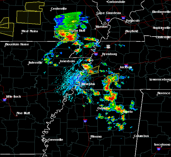 At 224 pm cdt, a severe thunderstorm was located near qulin, or 9 miles northwest of chalk bluff natural area, moving east at 25 mph (radar indicated). Hazards include 70 mph wind gusts and half dollar size hail. Hail damage to vehicles is expected. expect considerable tree damage. wind damage is also likely to mobile homes, roofs, and outbuildings. Locations impacted include, neelyville, qulin and harviell. At 224 pm cdt, a severe thunderstorm was located near qulin, or 9 miles northwest of chalk bluff natural area, moving east at 25 mph (radar indicated). Hazards include 70 mph wind gusts and half dollar size hail. Hail damage to vehicles is expected. expect considerable tree damage. wind damage is also likely to mobile homes, roofs, and outbuildings. Locations impacted include, neelyville, qulin and harviell.
|
| 5/19/2018 2:05 PM CDT |
 At 205 pm cdt, a severe thunderstorm was located near budapest, or 7 miles northeast of doniphan, moving east at 35 mph (radar indicated). Hazards include 60 mph wind gusts and penny size hail. expect damage to roofs, siding, and trees At 205 pm cdt, a severe thunderstorm was located near budapest, or 7 miles northeast of doniphan, moving east at 35 mph (radar indicated). Hazards include 60 mph wind gusts and penny size hail. expect damage to roofs, siding, and trees
|
| 4/3/2018 5:06 PM CDT |
 At 506 pm cdt, a severe thunderstorm capable of producing a tornado was located near poplar bluff, moving east at 40 mph (radar indicated rotation. spotters reported strong rotation with this storm). Hazards include tornado and golf ball size hail. Flying debris will be dangerous to those caught without shelter. mobile homes will be damaged or destroyed. damage to roofs, windows, and vehicles will occur. tree damage is likely. Locations impacted include, poplar bluff, qulin, fisk and rombauer. At 506 pm cdt, a severe thunderstorm capable of producing a tornado was located near poplar bluff, moving east at 40 mph (radar indicated rotation. spotters reported strong rotation with this storm). Hazards include tornado and golf ball size hail. Flying debris will be dangerous to those caught without shelter. mobile homes will be damaged or destroyed. damage to roofs, windows, and vehicles will occur. tree damage is likely. Locations impacted include, poplar bluff, qulin, fisk and rombauer.
|
| 4/3/2018 4:56 PM CDT |
 At 455 pm cdt, a severe thunderstorm capable of producing a tornado was located near harviell, or 8 miles southwest of poplar bluff, moving east at 40 mph (radar indicated rotation). Hazards include tornado and golf ball size hail. Flying debris will be dangerous to those caught without shelter. mobile homes will be damaged or destroyed. damage to roofs, windows, and vehicles will occur. tree damage is likely. this dangerous storm will be near, poplar bluff and harviell around 500 pm cdt. qulin and fisk around 515 pm cdt. Other locations impacted by this tornadic thunderstorm include rombauer. At 455 pm cdt, a severe thunderstorm capable of producing a tornado was located near harviell, or 8 miles southwest of poplar bluff, moving east at 40 mph (radar indicated rotation). Hazards include tornado and golf ball size hail. Flying debris will be dangerous to those caught without shelter. mobile homes will be damaged or destroyed. damage to roofs, windows, and vehicles will occur. tree damage is likely. this dangerous storm will be near, poplar bluff and harviell around 500 pm cdt. qulin and fisk around 515 pm cdt. Other locations impacted by this tornadic thunderstorm include rombauer.
|
| 4/3/2018 4:50 PM CDT |
 At 440 pm cdt, a severe thunderstorm capable of producing a tornado was located near budapest, or 9 miles northeast of doniphan, moving east at 55 mph (radar indicated rotation). Hazards include tornado and golf ball size hail. spotters reported a rotating wall cloud 3 miles northeast of doniphan. Flying debris will be dangerous to those caught without shelter. mobile homes will be damaged or destroyed. damage to roofs, windows, and vehicles will occur. Tree damage is likely. At 440 pm cdt, a severe thunderstorm capable of producing a tornado was located near budapest, or 9 miles northeast of doniphan, moving east at 55 mph (radar indicated rotation). Hazards include tornado and golf ball size hail. spotters reported a rotating wall cloud 3 miles northeast of doniphan. Flying debris will be dangerous to those caught without shelter. mobile homes will be damaged or destroyed. damage to roofs, windows, and vehicles will occur. Tree damage is likely.
|
| 4/3/2018 4:41 PM CDT |
 At 440 pm cdt, a severe thunderstorm capable of producing a tornado was located near budapest, or 9 miles northeast of doniphan, moving east at 55 mph (radar indicated rotation). Hazards include tornado and golf ball size hail. spotters reported a rotating wall cloud 3 miles northeast of doniphan. Flying debris will be dangerous to those caught without shelter. mobile homes will be damaged or destroyed. damage to roofs, windows, and vehicles will occur. Tree damage is likely. At 440 pm cdt, a severe thunderstorm capable of producing a tornado was located near budapest, or 9 miles northeast of doniphan, moving east at 55 mph (radar indicated rotation). Hazards include tornado and golf ball size hail. spotters reported a rotating wall cloud 3 miles northeast of doniphan. Flying debris will be dangerous to those caught without shelter. mobile homes will be damaged or destroyed. damage to roofs, windows, and vehicles will occur. Tree damage is likely.
|
| 2/24/2018 5:53 PM CST |
 The tornado warning for southeastern butler county will expire at 600 pm cst, the storm which prompted the warning has weakened below severe limits, and no longer appears capable of producing a tornado. therefore the warning will be allowed to expire. however heavy rain is still possible with this thunderstorm. a tornado watch remains in effect until 900 pm cst for southeastern missouri. The tornado warning for southeastern butler county will expire at 600 pm cst, the storm which prompted the warning has weakened below severe limits, and no longer appears capable of producing a tornado. therefore the warning will be allowed to expire. however heavy rain is still possible with this thunderstorm. a tornado watch remains in effect until 900 pm cst for southeastern missouri.
|
| 2/24/2018 5:31 PM CST |
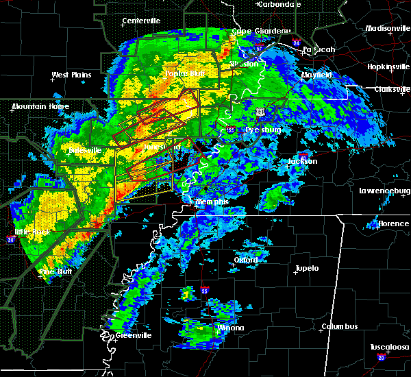 At 531 pm cst, a severe thunderstorm capable of producing a tornado was located near neelyville, or 8 miles northeast of corning, moving east at 60 mph (radar indicated rotation). Hazards include tornado. Flying debris will be dangerous to those caught without shelter. mobile homes will be damaged or destroyed. damage to roofs, windows, and vehicles will occur. Tree damage is likely. At 531 pm cst, a severe thunderstorm capable of producing a tornado was located near neelyville, or 8 miles northeast of corning, moving east at 60 mph (radar indicated rotation). Hazards include tornado. Flying debris will be dangerous to those caught without shelter. mobile homes will be damaged or destroyed. damage to roofs, windows, and vehicles will occur. Tree damage is likely.
|
| 11/18/2017 12:07 PM CST |
 At 1206 pm cst, severe thunderstorms were located along a line extending from poplar bluff to corning to near delaplaine, moving east at 40 mph (radar indicated). Hazards include 60 mph wind gusts and nickel size hail. expect damage to roofs, siding, and trees At 1206 pm cst, severe thunderstorms were located along a line extending from poplar bluff to corning to near delaplaine, moving east at 40 mph (radar indicated). Hazards include 60 mph wind gusts and nickel size hail. expect damage to roofs, siding, and trees
|
| 5/27/2017 5:33 AM CDT |
 At 532 am cdt, a severe thunderstorm was located near qulin, or near chalk bluff natural area, moving east at 50 mph (radar indicated). Hazards include 60 mph wind gusts and quarter size hail. Hail damage to vehicles is expected. expect wind damage to roofs, siding, and trees. Locations impacted include, poplar bluff, neelyville, qulin, fisk, harviell and milltown. At 532 am cdt, a severe thunderstorm was located near qulin, or near chalk bluff natural area, moving east at 50 mph (radar indicated). Hazards include 60 mph wind gusts and quarter size hail. Hail damage to vehicles is expected. expect wind damage to roofs, siding, and trees. Locations impacted include, poplar bluff, neelyville, qulin, fisk, harviell and milltown.
|
| 5/27/2017 5:11 AM CDT |
 At 510 am cdt, a severe thunderstorm was located over oxly, or 9 miles southeast of doniphan, moving east at 50 mph (radar indicated). Hazards include 60 mph wind gusts and quarter size hail. Hail damage to vehicles is expected. Expect wind damage to roofs, siding, and trees. At 510 am cdt, a severe thunderstorm was located over oxly, or 9 miles southeast of doniphan, moving east at 50 mph (radar indicated). Hazards include 60 mph wind gusts and quarter size hail. Hail damage to vehicles is expected. Expect wind damage to roofs, siding, and trees.
|
| 4/20/2017 4:48 PM CDT |
 At 447 pm cdt, a severe thunderstorm was located near budapest, or 8 miles northeast of doniphan, moving east at 25 mph (radar indicated). Hazards include 60 mph wind gusts and quarter size hail. Hail damage to vehicles is expected. Expect wind damage to roofs, siding, and trees. At 447 pm cdt, a severe thunderstorm was located near budapest, or 8 miles northeast of doniphan, moving east at 25 mph (radar indicated). Hazards include 60 mph wind gusts and quarter size hail. Hail damage to vehicles is expected. Expect wind damage to roofs, siding, and trees.
|
| 3/1/2017 4:05 AM CST |
 At 404 am cst, a severe thunderstorm was located near harviell, or near poplar bluff, moving east at 55 mph (radar indicated). Hazards include 60 mph wind gusts and quarter size hail. Hail damage to vehicles is expected. Expect wind damage to roofs, siding, and trees. At 404 am cst, a severe thunderstorm was located near harviell, or near poplar bluff, moving east at 55 mph (radar indicated). Hazards include 60 mph wind gusts and quarter size hail. Hail damage to vehicles is expected. Expect wind damage to roofs, siding, and trees.
|
| 7/8/2016 4:48 PM CDT |
 At 448 pm cdt, a severe thunderstorm was located over fairdealing, or 10 miles southwest of poplar bluff, moving east at 50 mph (radar indicated). Hazards include 60 mph wind gusts. Expect damage to roofs. siding. And trees. At 448 pm cdt, a severe thunderstorm was located over fairdealing, or 10 miles southwest of poplar bluff, moving east at 50 mph (radar indicated). Hazards include 60 mph wind gusts. Expect damage to roofs. siding. And trees.
|
| 7/8/2016 3:29 PM CDT |
 At 328 pm cdt, a severe thunderstorm was located over naylor, or 11 miles north of corning, moving east at 30 mph (radar indicated). Hazards include 60 mph wind gusts and quarter size hail. Hail damage to vehicles is expected. Expect wind damage to roofs, siding, and trees. At 328 pm cdt, a severe thunderstorm was located over naylor, or 11 miles north of corning, moving east at 30 mph (radar indicated). Hazards include 60 mph wind gusts and quarter size hail. Hail damage to vehicles is expected. Expect wind damage to roofs, siding, and trees.
|
| 7/6/2016 11:57 AM CDT |
 At 1157 am cdt, severe thunderstorms were located along a line extending from near williamsville to near success, moving east at 45 mph (law enforcement). Hazards include 60 mph wind gusts and penny size hail. Expect damage to roofs. siding. And trees. At 1157 am cdt, severe thunderstorms were located along a line extending from near williamsville to near success, moving east at 45 mph (law enforcement). Hazards include 60 mph wind gusts and penny size hail. Expect damage to roofs. siding. And trees.
|
| 5/9/2016 9:17 PM CDT |
 At 916 pm cdt, a severe thunderstorm was located near poplar bluff, moving northeast at 50 mph (radar indicated. spotters reported 50 mph winds on the west side of poplar bluff). Hazards include 60 mph wind gusts and penny size hail. Expect damage to roofs. siding. and trees. Locations impacted include, poplar bluff, qulin, fisk, hendrickson and rombauer. At 916 pm cdt, a severe thunderstorm was located near poplar bluff, moving northeast at 50 mph (radar indicated. spotters reported 50 mph winds on the west side of poplar bluff). Hazards include 60 mph wind gusts and penny size hail. Expect damage to roofs. siding. and trees. Locations impacted include, poplar bluff, qulin, fisk, hendrickson and rombauer.
|
| 5/9/2016 9:03 PM CDT |
 At 901 pm cdt, a severe thunderstorm was located near harviell, or 8 miles southwest of poplar bluff, moving northeast at 50 mph (radar indicated. spotters reported 45 mph wind gusts along the ripley/butler county line at 900 pm). Hazards include 60 mph wind gusts and penny size hail. Expect damage to roofs. siding. and trees. Locations impacted include, poplar bluff, neelyville, qulin, fisk, harviell, brush arbor, hendrickson, milltown and rombauer. At 901 pm cdt, a severe thunderstorm was located near harviell, or 8 miles southwest of poplar bluff, moving northeast at 50 mph (radar indicated. spotters reported 45 mph wind gusts along the ripley/butler county line at 900 pm). Hazards include 60 mph wind gusts and penny size hail. Expect damage to roofs. siding. and trees. Locations impacted include, poplar bluff, neelyville, qulin, fisk, harviell, brush arbor, hendrickson, milltown and rombauer.
|
| 5/9/2016 8:45 PM CDT |
 At 844 pm cdt, a severe thunderstorm was located near doniphan, moving northeast at 55 mph (radar indicated). Hazards include 60 mph wind gusts. Expect damage to roofs. siding. And trees. At 844 pm cdt, a severe thunderstorm was located near doniphan, moving northeast at 55 mph (radar indicated). Hazards include 60 mph wind gusts. Expect damage to roofs. siding. And trees.
|
| 12/23/2015 10:15 AM CST | At 1014 am cst, severe thunderstorms were located along a line extending from lodi to near greenville to near naylor, moving northeast at 80 mph. spotters reported 60 mph winds in naylor and trees were down near greenville (trained weather spotters). Hazards include 60 mph wind gusts and penny size hail. Expect damage to roofs. siding and trees. locations impacted include, poplar bluff, greenville, wappapello lake area, sam a baker state park, naylor, neelyville, qulin, williamsville, fisk, fairdealing, harviell, wappapello, hendrickson, lodi, milltown, shook, cascade and rombauer. A tornado watch remains in effect until 500 pm cst for southeastern missouri. |
| 12/23/2015 9:51 AM CST | At 951 am cst, severe thunderstorms were located along a line extending from near garwood to near hunter to 6 miles northwest of maynard, moving northeast at 70 mph (radar indicated). Hazards include 60 mph wind gusts and penny size hail. Expect damage to roofs. Siding and trees. |
| 4/9/2015 8:20 PM CDT | The national weather service in paducah has issued a * severe thunderstorm warning for. southeastern butler county in southeastern missouri. until 845 pm cdt * at 820 pm cdt. a severe thunderstorm was located near mcdougal. or 7 miles northeast of corning. Moving northeast at 50 mph. |
| 7/1/2014 5:23 PM CDT | Power lines dow in butler county MO, 0.2 miles WSW of Qulin, MO |
| 10/31/2013 7:40 PM CDT | Time estimated by radar. mobile home blown over in the community of brosele in butler county MO, 4.4 miles SSE of Qulin, MO |
| 10/31/2013 6:40 PM CDT | Time estimated by radar. mobile home blown over in the community of brosele in butler county MO, 4.4 miles SSE of Qulin, MO |
| 9/26/2012 4:27 PM CDT | Half Dollar sized hail reported 4.9 miles SSW of Qulin, MO, reported at intersection of highway aa and county road 629 in broseley. |
| 1/1/0001 12:00 AM | Much of the roof of an elementary school was blown off. a window was blown out of a store. a tree fell on a mobile home damaging the roof and a small steeple was blown in butler county MO, 0.2 miles WSW of Qulin, MO |
Hail Maps for Qulin, MO
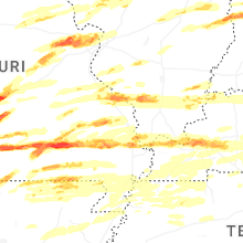


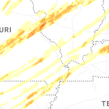


Connect with Interactive Hail Maps