

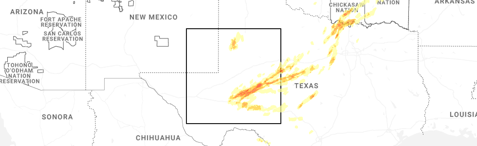
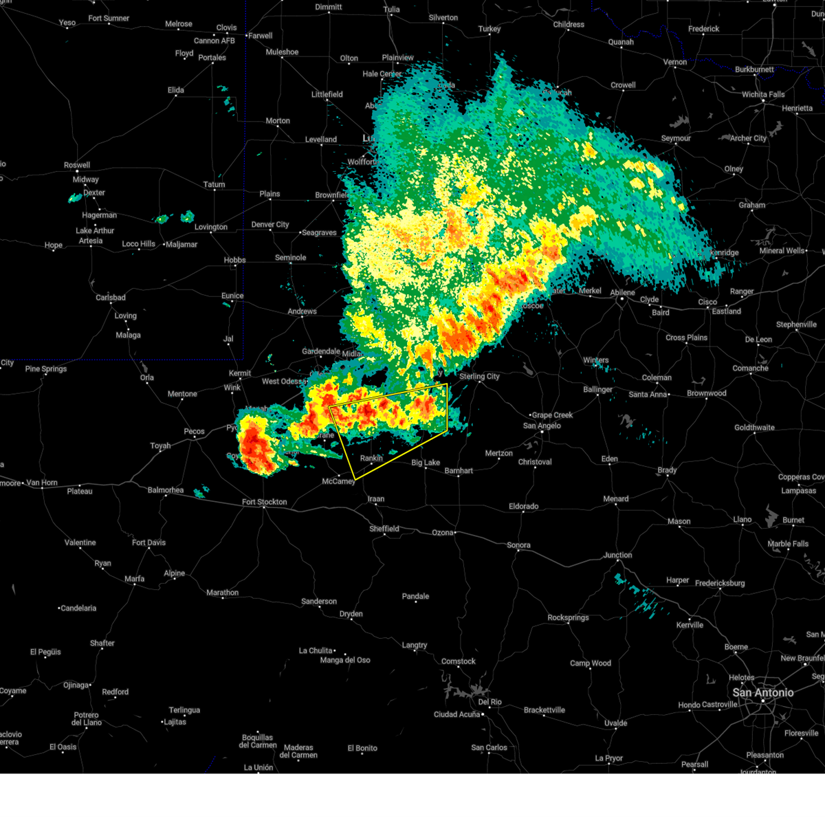
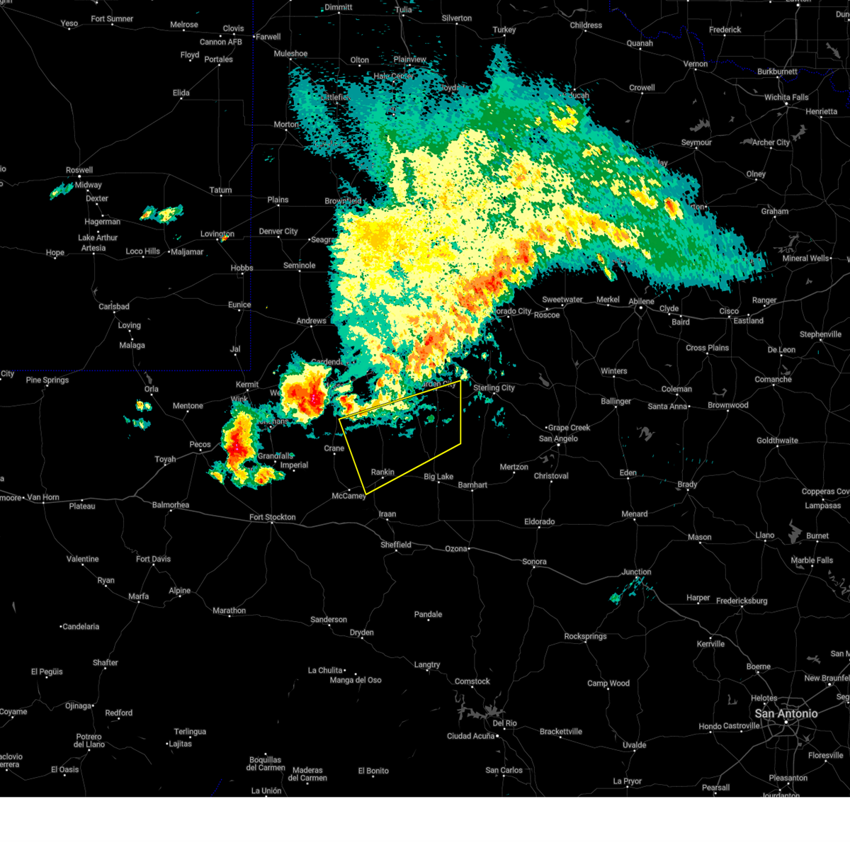
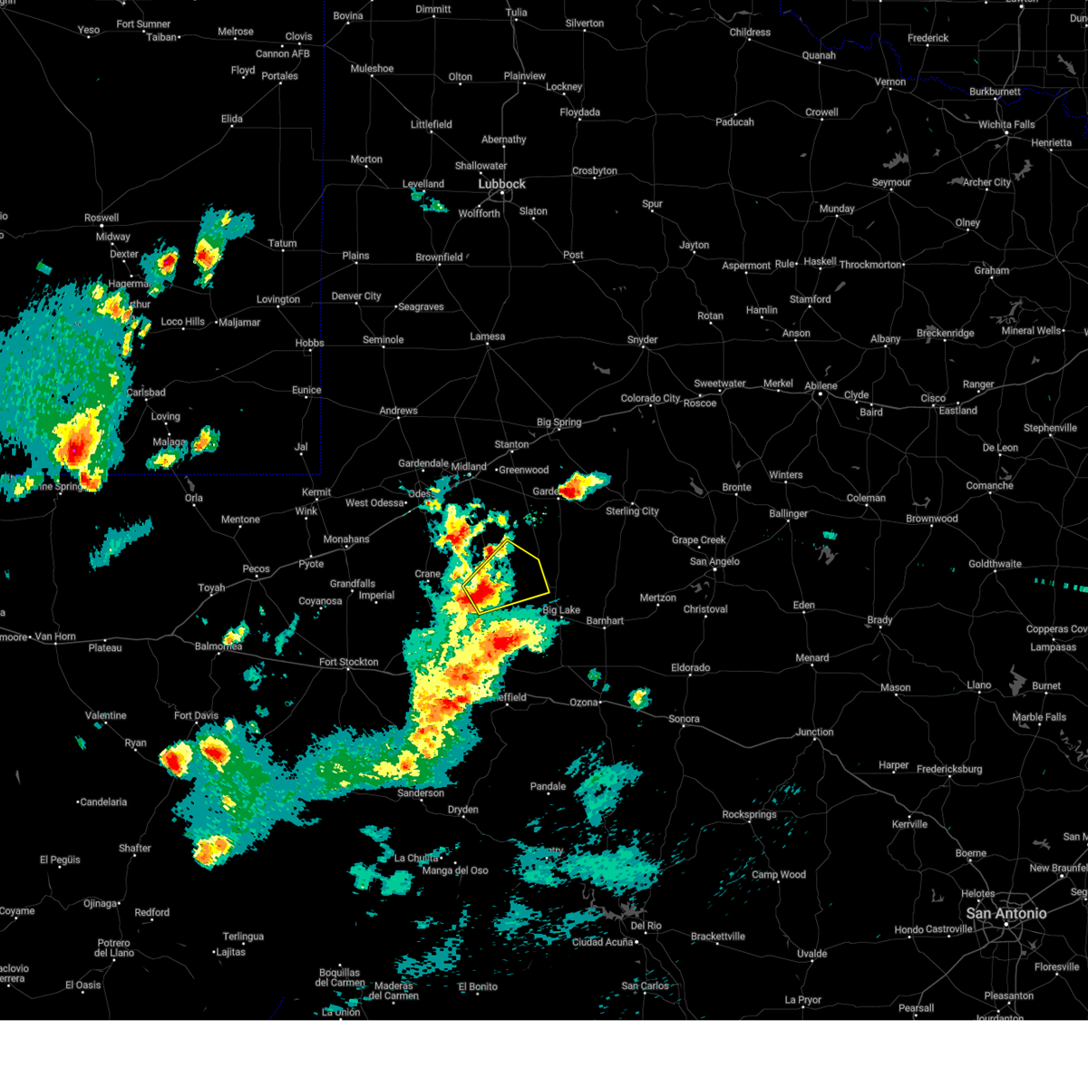
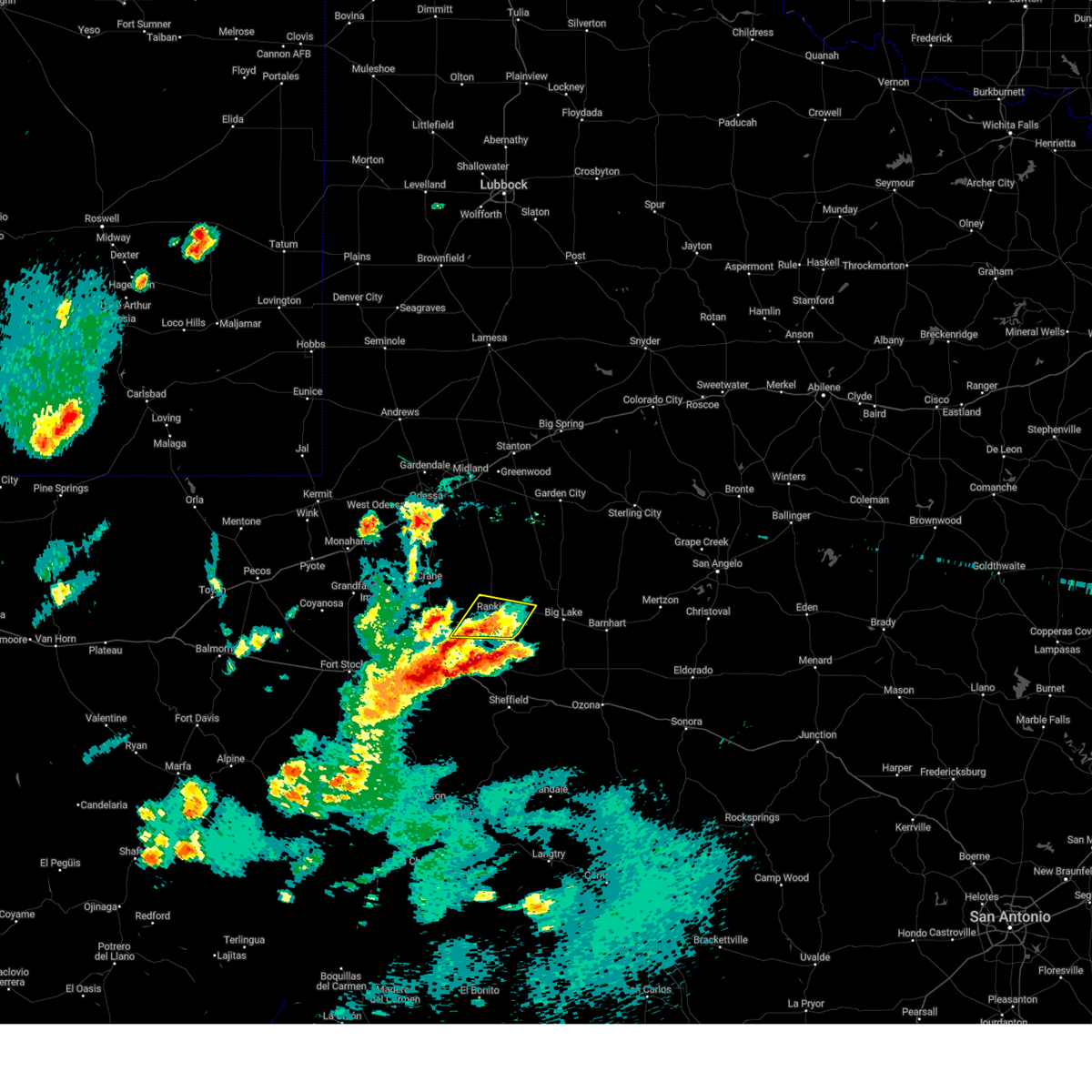
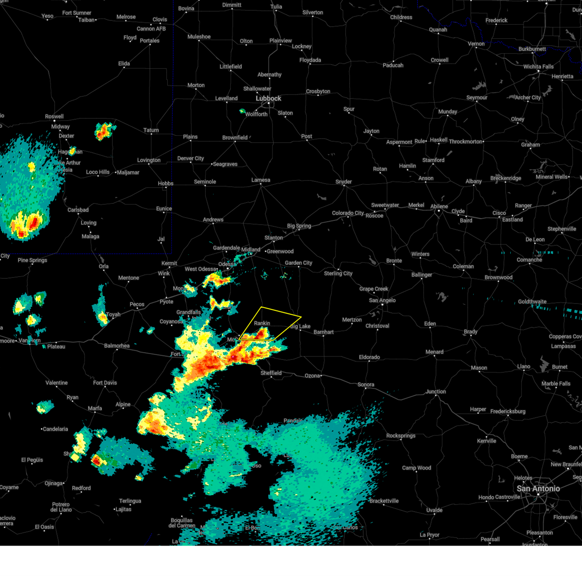
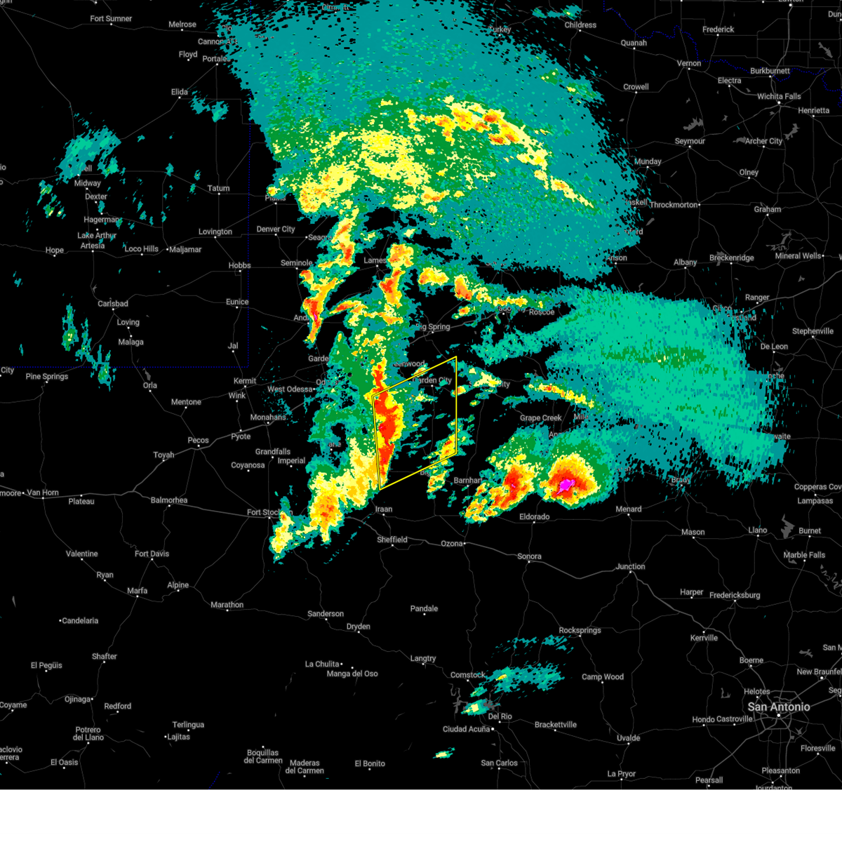
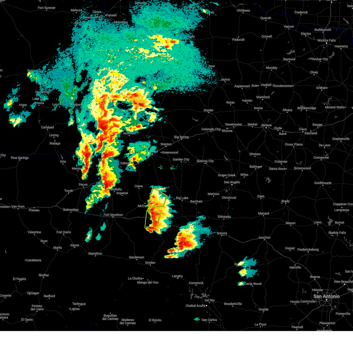
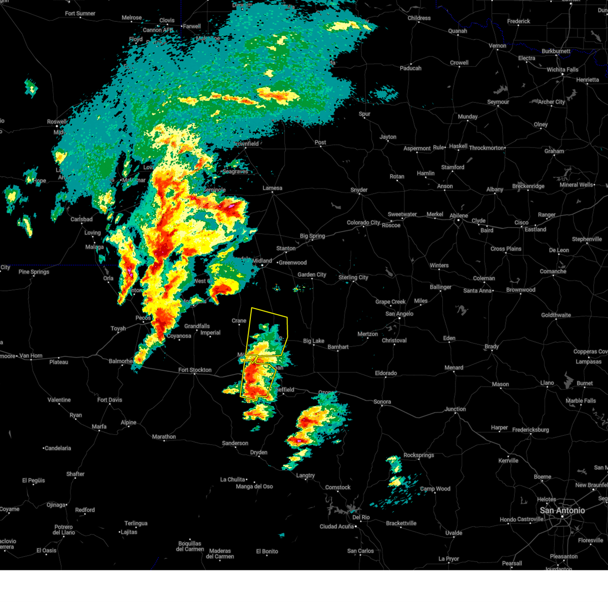
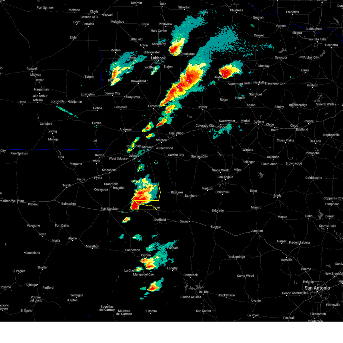
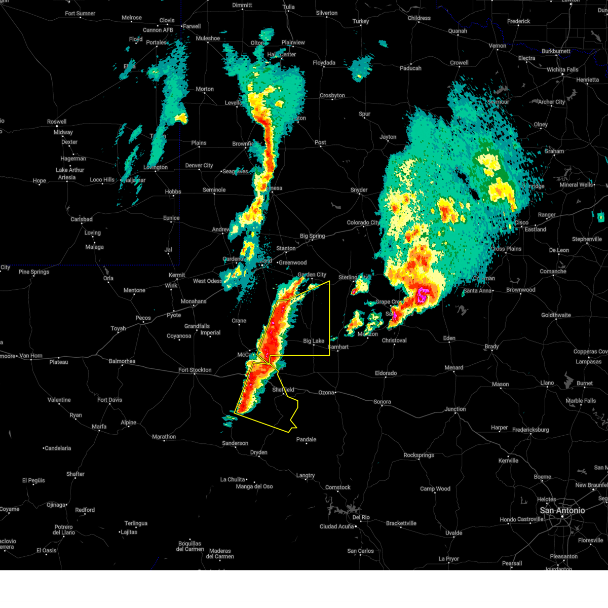
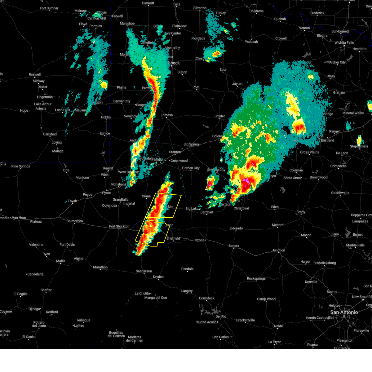
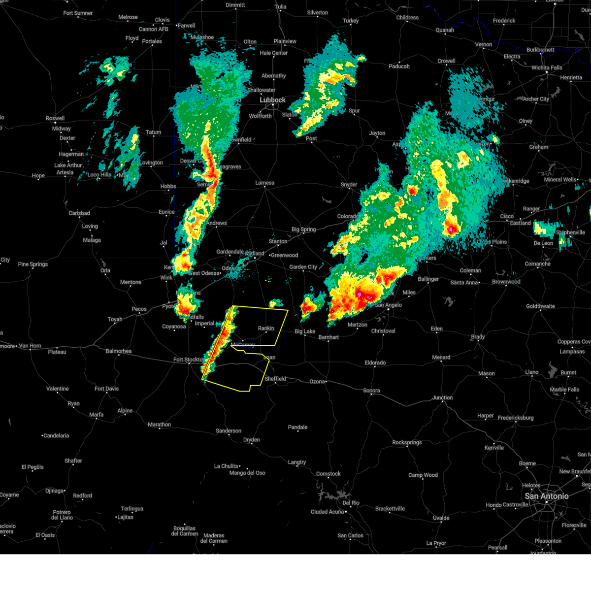
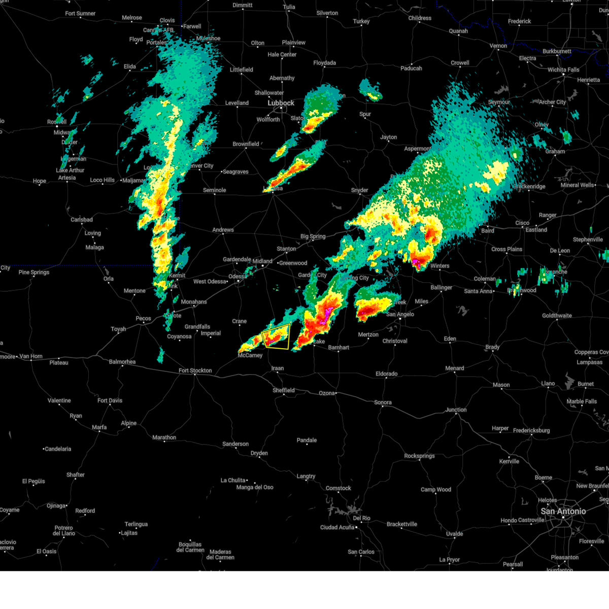
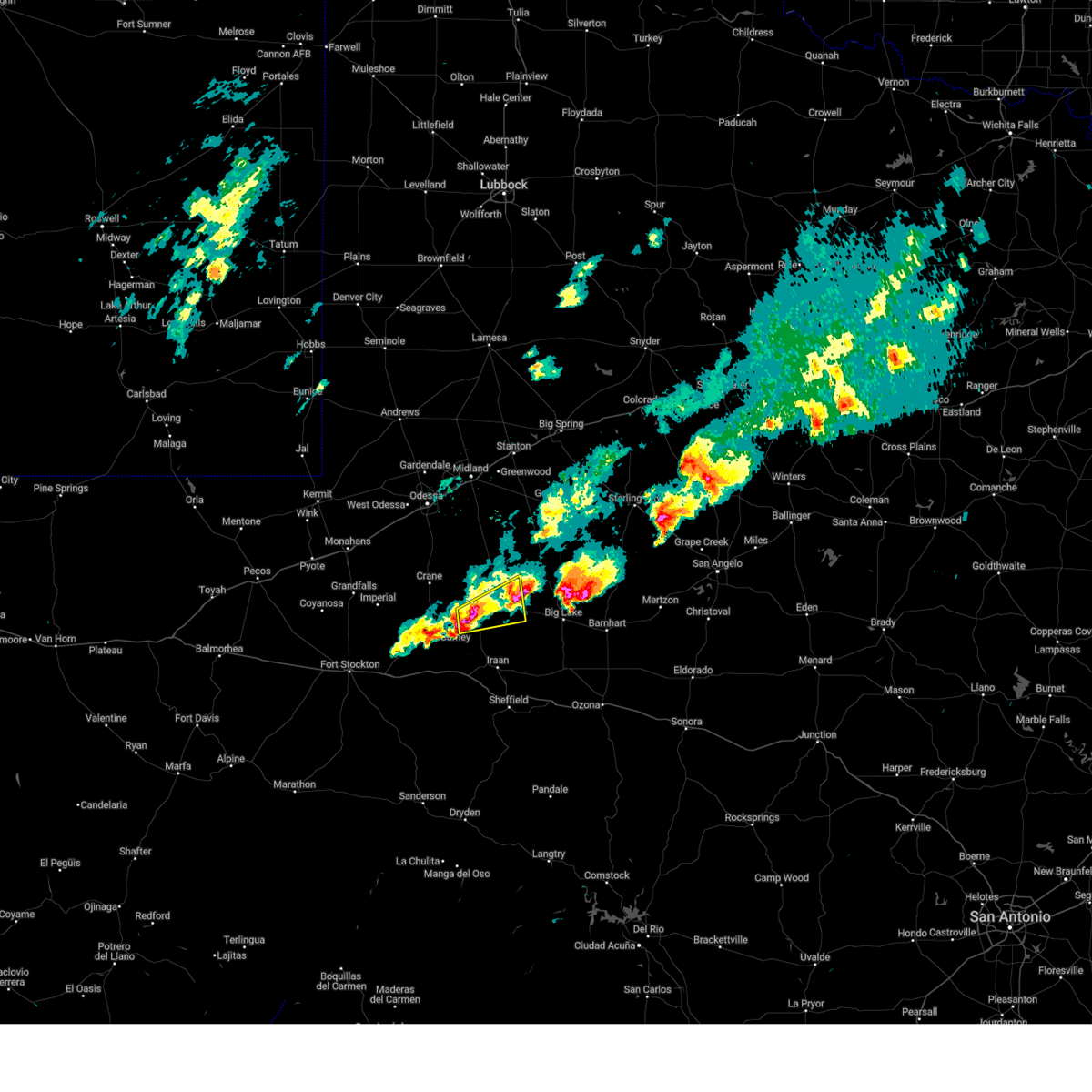
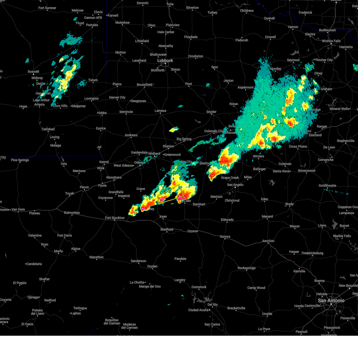
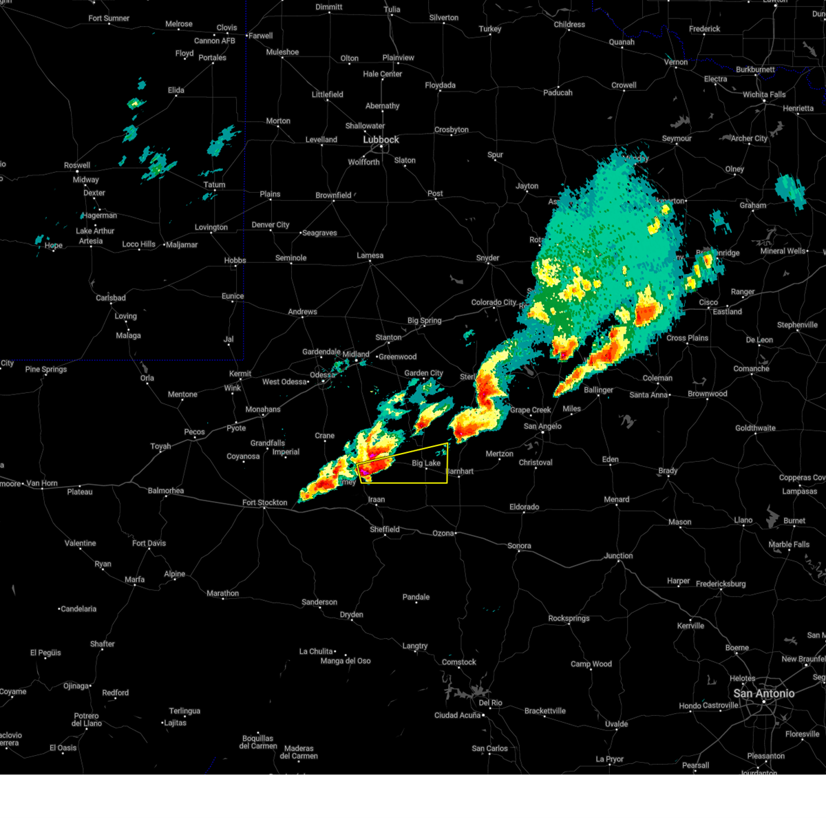
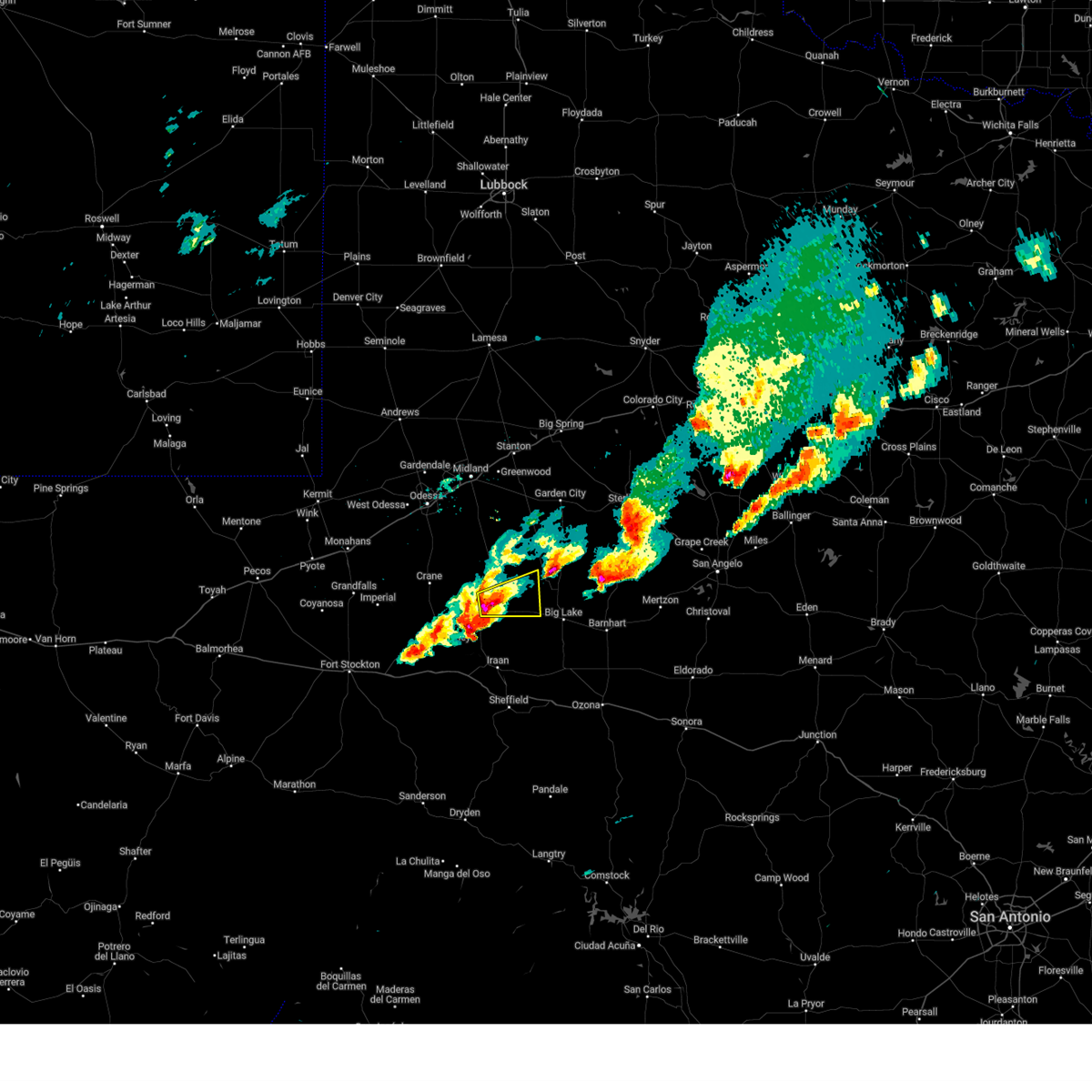
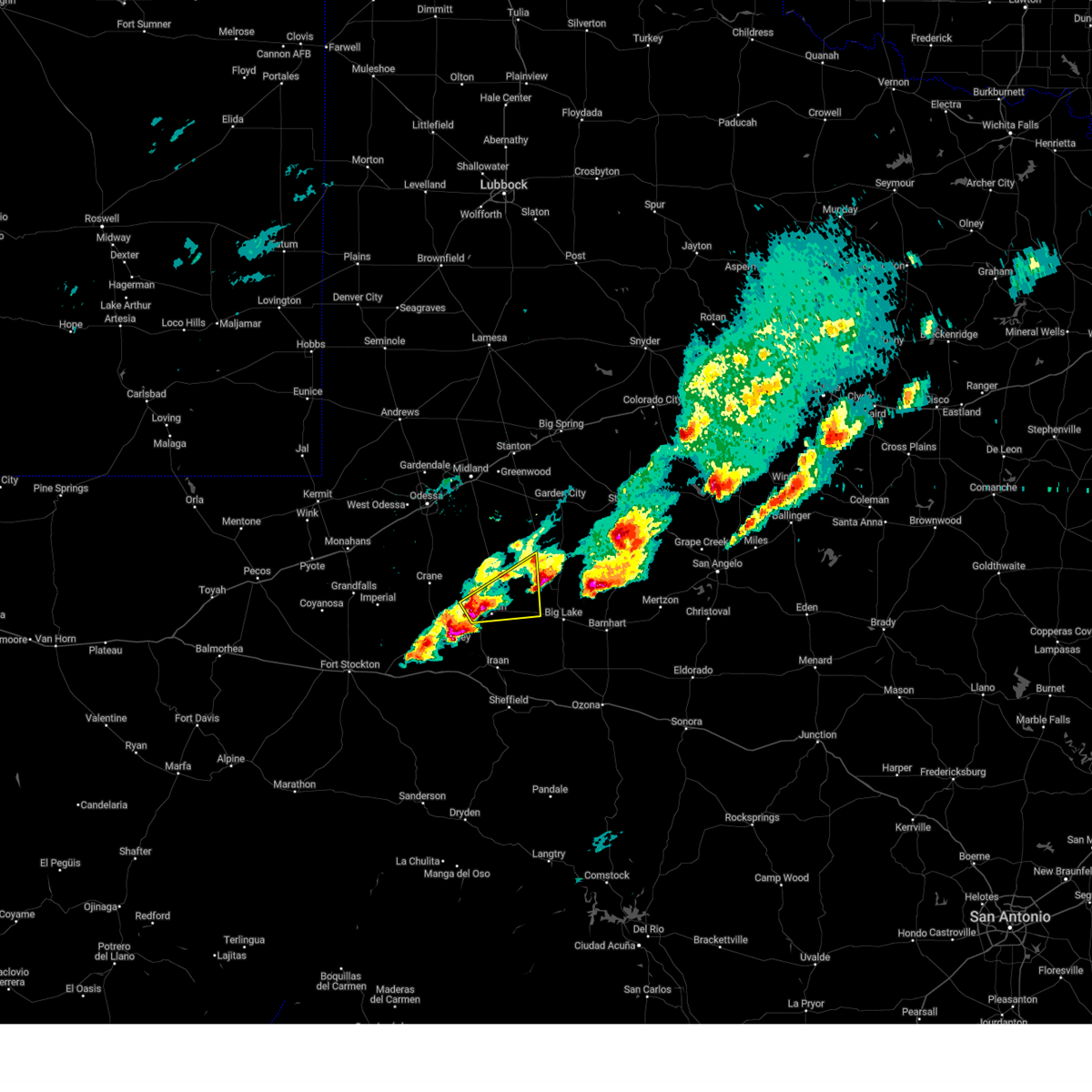
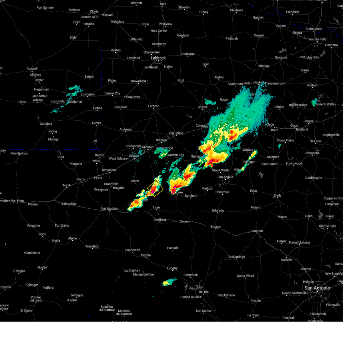
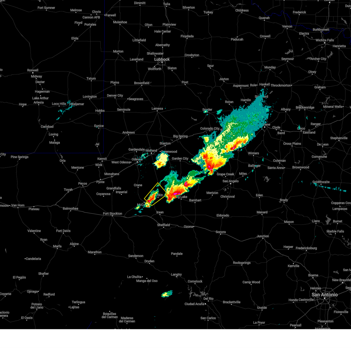
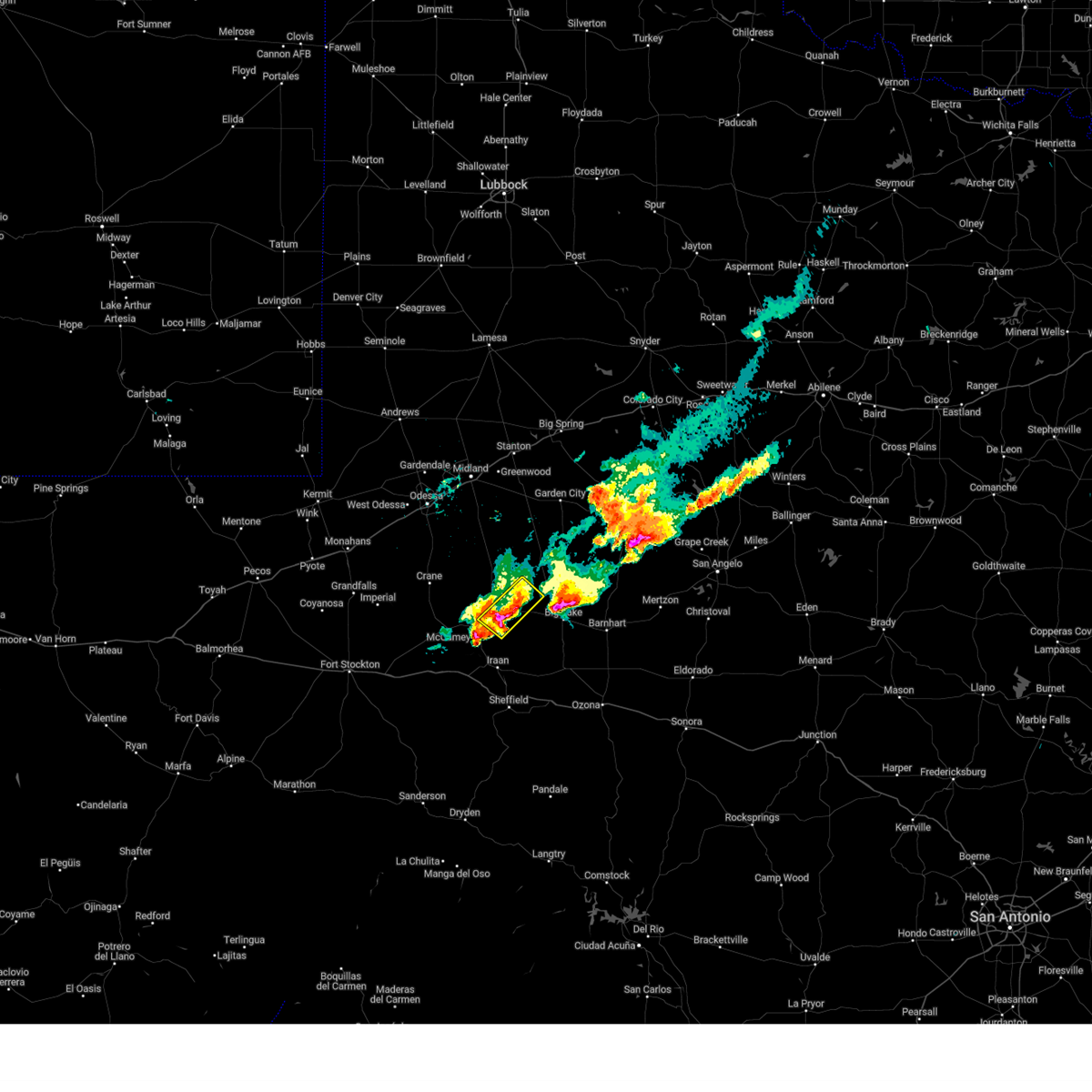
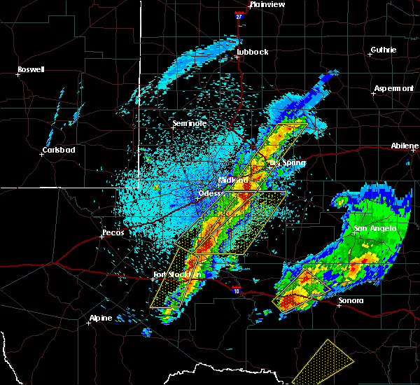
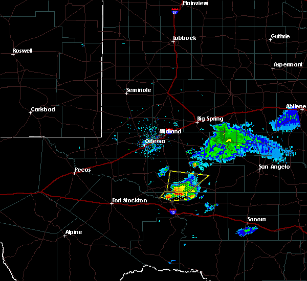
Hail Map for Rankin, TX
The Rankin, TX area has had 14 reports of on-the-ground hail by trained spotters, and has been under severe weather warnings 34 times during the past 12 months. Doppler radar has detected hail at or near Rankin, TX on 60 occasions, including 5 occasions during the past year.
| Name: | Rankin, TX |
| Where Located: | 50 miles SSE of Odessa, TX |
| Map: | Google Map for Rankin, TX |
| Population: | 778 |
| Housing Units: | 341 |
| More Info: | Search Google for Rankin, TX |
3
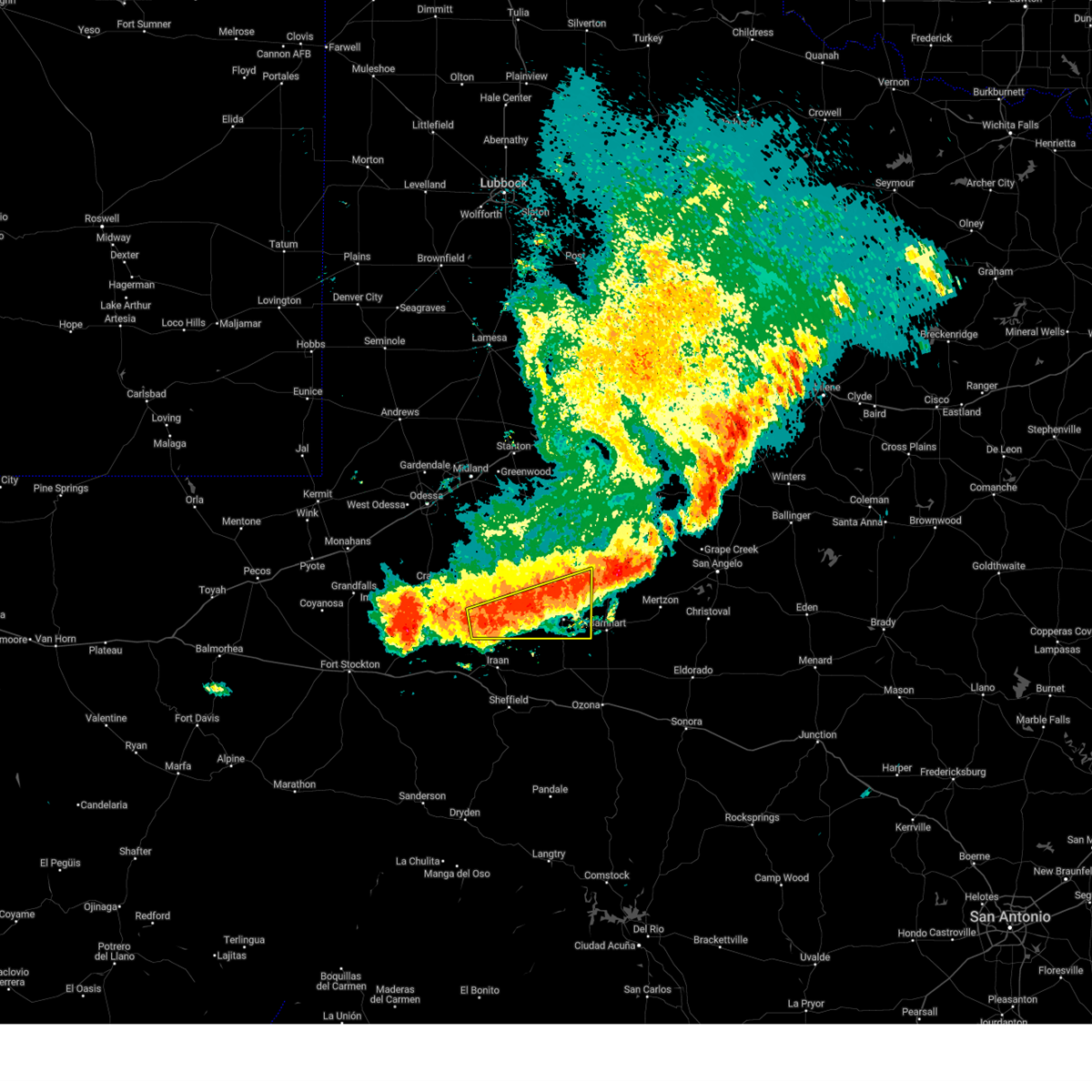
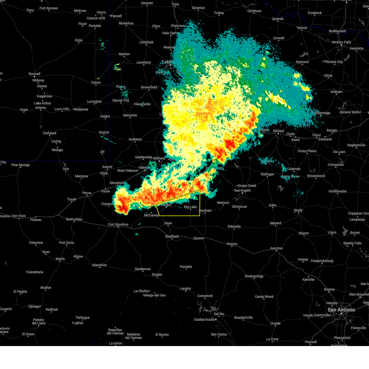
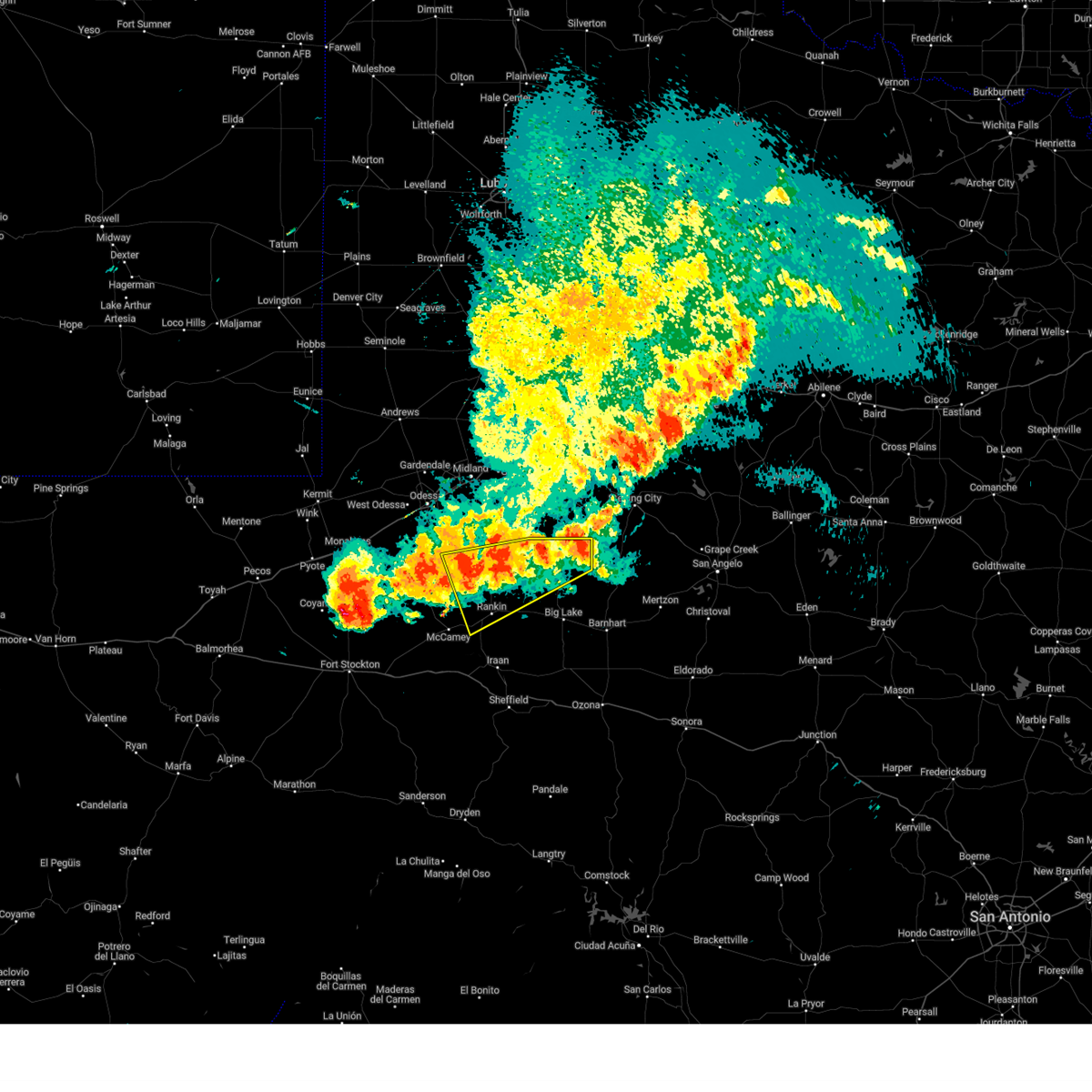
The Top Recent Hail Date for Rankin, TX is Saturday, April 19, 2025 (3rd out of 60)
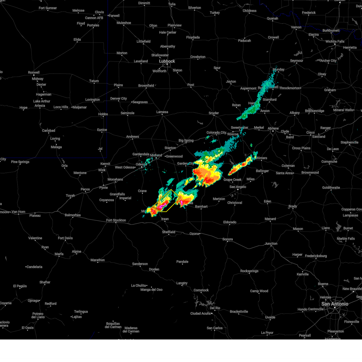
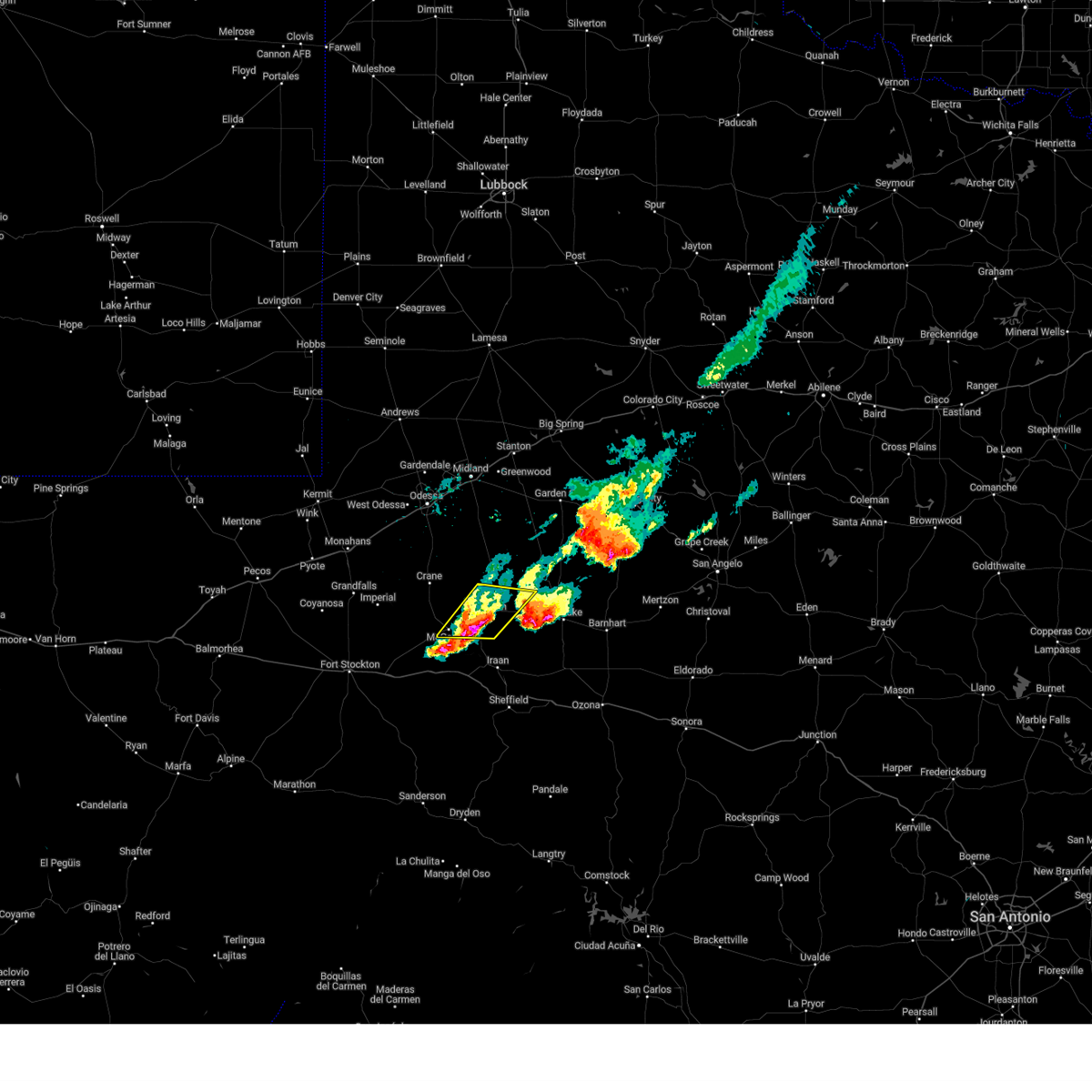
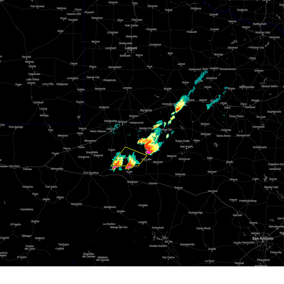
Hail and Wind Damage Spotted near Rankin, TX
| Date / Time | Report Details |
|---|---|
| 6/10/2025 4:25 AM CDT |
 At 425 am cdt, severe thunderstorms were located along a line extending from 15 miles north of barnhart to 7 miles south of rankin, moving southeast at 20 mph (radar indicated). Hazards include 60 mph wind gusts and penny size hail. Expect damage to roofs, siding, and trees. Locations impacted include, big lake, rankin, reagan county airport, and best. At 425 am cdt, severe thunderstorms were located along a line extending from 15 miles north of barnhart to 7 miles south of rankin, moving southeast at 20 mph (radar indicated). Hazards include 60 mph wind gusts and penny size hail. Expect damage to roofs, siding, and trees. Locations impacted include, big lake, rankin, reagan county airport, and best.
|
| 6/10/2025 4:01 AM CDT |
 Svrmaf the national weather service in midland has issued a * severe thunderstorm warning for, reagan county in western texas, southeastern upton county in western texas, * until 500 am cdt. * at 401 am cdt, severe thunderstorms were located along a line extending from 21 miles northeast of big lake to near rankin, moving southeast at 25 mph (radar indicated). Hazards include 60 mph wind gusts and penny size hail. expect damage to roofs, siding, and trees Svrmaf the national weather service in midland has issued a * severe thunderstorm warning for, reagan county in western texas, southeastern upton county in western texas, * until 500 am cdt. * at 401 am cdt, severe thunderstorms were located along a line extending from 21 miles northeast of big lake to near rankin, moving southeast at 25 mph (radar indicated). Hazards include 60 mph wind gusts and penny size hail. expect damage to roofs, siding, and trees
|
| 6/10/2025 3:50 AM CDT |
 the severe thunderstorm warning has been cancelled and is no longer in effect the severe thunderstorm warning has been cancelled and is no longer in effect
|
| 6/10/2025 3:50 AM CDT |
 At 350 am cdt, severe thunderstorms were located along a line extending from 25 miles southeast of garden city to 8 miles north of rankin, moving southeast at 30 mph (radar indicated). Hazards include 60 mph wind gusts and penny size hail. Expect damage to roofs, siding, and trees. Locations impacted include, rankin and stiles. At 350 am cdt, severe thunderstorms were located along a line extending from 25 miles southeast of garden city to 8 miles north of rankin, moving southeast at 30 mph (radar indicated). Hazards include 60 mph wind gusts and penny size hail. Expect damage to roofs, siding, and trees. Locations impacted include, rankin and stiles.
|
| 6/10/2025 3:34 AM CDT |
 At 333 am cdt, severe thunderstorms were located along a line extending from 15 miles south of garden city to 14 miles north of rankin, moving southeast at 20 mph (saint lawrence msonet reported a wind gust of 60 mph). Hazards include 60 mph wind gusts and penny size hail. Expect damage to roofs, siding, and trees. Locations impacted include, rankin, saint lawrence, stiles, and midkiff. At 333 am cdt, severe thunderstorms were located along a line extending from 15 miles south of garden city to 14 miles north of rankin, moving southeast at 20 mph (saint lawrence msonet reported a wind gust of 60 mph). Hazards include 60 mph wind gusts and penny size hail. Expect damage to roofs, siding, and trees. Locations impacted include, rankin, saint lawrence, stiles, and midkiff.
|
| 6/10/2025 3:08 AM CDT |
 Svrmaf the national weather service in midland has issued a * severe thunderstorm warning for, southern glasscock county in western texas, southeastern midland county in western texas, northern reagan county in western texas, upton county in western texas, * until 415 am cdt. * at 308 am cdt, severe thunderstorms were located along a line extending from 6 miles north of garden city to 20 miles northeast of crane, moving southeast at 30 mph (radar indicated). Hazards include 60 mph wind gusts and penny size hail. expect damage to roofs, siding, and trees Svrmaf the national weather service in midland has issued a * severe thunderstorm warning for, southern glasscock county in western texas, southeastern midland county in western texas, northern reagan county in western texas, upton county in western texas, * until 415 am cdt. * at 308 am cdt, severe thunderstorms were located along a line extending from 6 miles north of garden city to 20 miles northeast of crane, moving southeast at 30 mph (radar indicated). Hazards include 60 mph wind gusts and penny size hail. expect damage to roofs, siding, and trees
|
| 5/27/2025 8:39 PM CDT |
 Svrmaf the national weather service in midland has issued a * severe thunderstorm warning for, northwestern reagan county in western texas, eastern upton county in western texas, * until 915 pm cdt. * at 839 pm cdt, a severe thunderstorm was located 8 miles north of rankin, moving northeast at 20 mph (radar indicated). Hazards include 60 mph wind gusts and quarter size hail. Hail damage to vehicles is expected. Expect wind damage to roofs, siding, and trees. Svrmaf the national weather service in midland has issued a * severe thunderstorm warning for, northwestern reagan county in western texas, eastern upton county in western texas, * until 915 pm cdt. * at 839 pm cdt, a severe thunderstorm was located 8 miles north of rankin, moving northeast at 20 mph (radar indicated). Hazards include 60 mph wind gusts and quarter size hail. Hail damage to vehicles is expected. Expect wind damage to roofs, siding, and trees.
|
| 5/27/2025 7:45 PM CDT |
 At 744 pm cdt, a severe thunderstorm was located near rankin, moving northeast at 5 mph (radar indicated). Hazards include 60 mph wind gusts and quarter size hail. Hail damage to vehicles is expected. expect wind damage to roofs, siding, and trees. Locations impacted include, rankin. At 744 pm cdt, a severe thunderstorm was located near rankin, moving northeast at 5 mph (radar indicated). Hazards include 60 mph wind gusts and quarter size hail. Hail damage to vehicles is expected. expect wind damage to roofs, siding, and trees. Locations impacted include, rankin.
|
| 5/27/2025 7:27 PM CDT |
 Svrmaf the national weather service in midland has issued a * severe thunderstorm warning for, southwestern reagan county in western texas, southeastern upton county in western texas, * until 815 pm cdt. * at 726 pm cdt, a severe thunderstorm was located near rankin, moving northeast at 15 mph (radar indicated). Hazards include 60 mph wind gusts and quarter size hail. Hail damage to vehicles is expected. Expect wind damage to roofs, siding, and trees. Svrmaf the national weather service in midland has issued a * severe thunderstorm warning for, southwestern reagan county in western texas, southeastern upton county in western texas, * until 815 pm cdt. * at 726 pm cdt, a severe thunderstorm was located near rankin, moving northeast at 15 mph (radar indicated). Hazards include 60 mph wind gusts and quarter size hail. Hail damage to vehicles is expected. Expect wind damage to roofs, siding, and trees.
|
| 5/6/2025 2:47 AM CDT |
 Svrmaf the national weather service in midland has issued a * severe thunderstorm warning for, glasscock county in western texas, southeastern midland county in western texas, reagan county in western texas, eastern upton county in western texas, * until 345 am cdt. * at 247 am cdt, severe thunderstorms were located along a line extending from 17 miles south of greenwood to near rankin, moving east at 30 mph (radar indicated). Hazards include 60 mph wind gusts and quarter size hail. Hail damage to vehicles is expected. Expect wind damage to roofs, siding, and trees. Svrmaf the national weather service in midland has issued a * severe thunderstorm warning for, glasscock county in western texas, southeastern midland county in western texas, reagan county in western texas, eastern upton county in western texas, * until 345 am cdt. * at 247 am cdt, severe thunderstorms were located along a line extending from 17 miles south of greenwood to near rankin, moving east at 30 mph (radar indicated). Hazards include 60 mph wind gusts and quarter size hail. Hail damage to vehicles is expected. Expect wind damage to roofs, siding, and trees.
|
| 5/6/2025 12:36 AM CDT |
 At 1236 am cdt, a severe thunderstorm was located 10 miles southeast of mccamey, moving north at 50 mph (radar indicated). Hazards include 60 mph wind gusts and quarter size hail. Hail damage to vehicles is expected. expect wind damage to roofs, siding, and trees. locations impacted include, rankin. This includes interstate 10 between mile markers 302 and 316. At 1236 am cdt, a severe thunderstorm was located 10 miles southeast of mccamey, moving north at 50 mph (radar indicated). Hazards include 60 mph wind gusts and quarter size hail. Hail damage to vehicles is expected. expect wind damage to roofs, siding, and trees. locations impacted include, rankin. This includes interstate 10 between mile markers 302 and 316.
|
| 5/6/2025 12:08 AM CDT |
 Svrmaf the national weather service in midland has issued a * severe thunderstorm warning for, east central pecos county in southwestern texas, upton county in western texas, * until 115 am cdt. * at 1208 am cdt, a severe thunderstorm was located 22 miles west of sheffield, moving north at 50 mph (radar indicated). Hazards include 60 mph wind gusts and quarter size hail. Hail damage to vehicles is expected. Expect wind damage to roofs, siding, and trees. Svrmaf the national weather service in midland has issued a * severe thunderstorm warning for, east central pecos county in southwestern texas, upton county in western texas, * until 115 am cdt. * at 1208 am cdt, a severe thunderstorm was located 22 miles west of sheffield, moving north at 50 mph (radar indicated). Hazards include 60 mph wind gusts and quarter size hail. Hail damage to vehicles is expected. Expect wind damage to roofs, siding, and trees.
|
| 4/29/2025 3:55 PM CDT |
 Svrmaf the national weather service in midland has issued a * severe thunderstorm warning for, northeastern pecos county in southwestern texas, southeastern crane county in western texas, southern upton county in western texas, * until 500 pm cdt. * at 354 pm cdt, severe thunderstorms were located along a line extending from near mccamey to 19 miles southwest of rankin to 30 miles south of crane, moving east at 15 mph (radar indicated). Hazards include golf ball size hail and 70 mph wind gusts. People and animals outdoors will be injured. expect hail damage to roofs, siding, windows, and vehicles. expect considerable tree damage. Wind damage is also likely to mobile homes, roofs, and outbuildings. Svrmaf the national weather service in midland has issued a * severe thunderstorm warning for, northeastern pecos county in southwestern texas, southeastern crane county in western texas, southern upton county in western texas, * until 500 pm cdt. * at 354 pm cdt, severe thunderstorms were located along a line extending from near mccamey to 19 miles southwest of rankin to 30 miles south of crane, moving east at 15 mph (radar indicated). Hazards include golf ball size hail and 70 mph wind gusts. People and animals outdoors will be injured. expect hail damage to roofs, siding, windows, and vehicles. expect considerable tree damage. Wind damage is also likely to mobile homes, roofs, and outbuildings.
|
| 4/19/2025 10:11 PM CDT |
 Svrmaf the national weather service in midland has issued a * severe thunderstorm warning for, east central pecos county in southwestern texas, southeastern glasscock county in western texas, reagan county in western texas, eastern upton county in western texas, northeastern terrell county in southwestern texas, * until 1115 pm cdt. * at 1010 pm cdt, severe thunderstorms were located along a line extending from 20 miles southwest of garden city to 28 miles west of sheffield, moving northeast at 40 mph (radar indicated). Hazards include 60 mph wind gusts and quarter size hail. Hail damage to vehicles is expected. Expect wind damage to roofs, siding, and trees. Svrmaf the national weather service in midland has issued a * severe thunderstorm warning for, east central pecos county in southwestern texas, southeastern glasscock county in western texas, reagan county in western texas, eastern upton county in western texas, northeastern terrell county in southwestern texas, * until 1115 pm cdt. * at 1010 pm cdt, severe thunderstorms were located along a line extending from 20 miles southwest of garden city to 28 miles west of sheffield, moving northeast at 40 mph (radar indicated). Hazards include 60 mph wind gusts and quarter size hail. Hail damage to vehicles is expected. Expect wind damage to roofs, siding, and trees.
|
| 4/19/2025 9:50 PM CDT |
 At 950 pm cdt, severe thunderstorms were located along a line extending from 13 miles northwest of rankin to 28 miles south of mccamey, moving east at 30 mph (radar indicated). Hazards include 60 mph wind gusts and quarter size hail. Hail damage to vehicles is expected. expect wind damage to roofs, siding, and trees. locations impacted include, mccamey, upton county airport, bakersfield, rankin, king mountain, and iraan. This includes interstate 10 between mile markers 285 and 317. At 950 pm cdt, severe thunderstorms were located along a line extending from 13 miles northwest of rankin to 28 miles south of mccamey, moving east at 30 mph (radar indicated). Hazards include 60 mph wind gusts and quarter size hail. Hail damage to vehicles is expected. expect wind damage to roofs, siding, and trees. locations impacted include, mccamey, upton county airport, bakersfield, rankin, king mountain, and iraan. This includes interstate 10 between mile markers 285 and 317.
|
| 4/19/2025 9:17 PM CDT |
 Svrmaf the national weather service in midland has issued a * severe thunderstorm warning for, northeastern pecos county in southwestern texas, west central reagan county in western texas, southeastern crane county in western texas, upton county in western texas, * until 1015 pm cdt. * at 917 pm cdt, severe thunderstorms were located along a line extending from near crane to 16 miles southeast of fort stockton, moving east at 30 mph (radar indicated). Hazards include 60 mph wind gusts and quarter size hail. Hail damage to vehicles is expected. Expect wind damage to roofs, siding, and trees. Svrmaf the national weather service in midland has issued a * severe thunderstorm warning for, northeastern pecos county in southwestern texas, west central reagan county in western texas, southeastern crane county in western texas, upton county in western texas, * until 1015 pm cdt. * at 917 pm cdt, severe thunderstorms were located along a line extending from near crane to 16 miles southeast of fort stockton, moving east at 30 mph (radar indicated). Hazards include 60 mph wind gusts and quarter size hail. Hail damage to vehicles is expected. Expect wind damage to roofs, siding, and trees.
|
| 4/19/2025 8:17 PM CDT |
 At 817 pm cdt, a severe thunderstorm was located near rankin, moving east at 25 mph (radar indicated). Hazards include 60 mph wind gusts and quarter size hail. Hail damage to vehicles is expected. expect wind damage to roofs, siding, and trees. Locations impacted include, rankin. At 817 pm cdt, a severe thunderstorm was located near rankin, moving east at 25 mph (radar indicated). Hazards include 60 mph wind gusts and quarter size hail. Hail damage to vehicles is expected. expect wind damage to roofs, siding, and trees. Locations impacted include, rankin.
|
| 4/19/2025 8:17 PM CDT |
 the severe thunderstorm warning has been cancelled and is no longer in effect the severe thunderstorm warning has been cancelled and is no longer in effect
|
| 4/19/2025 8:00 PM CDT | Tea Cup sized hail reported 8.3 miles W of Rankin, TX, 3 inch hail reported 8 miles east of rankin. |
| 4/19/2025 7:56 PM CDT |
 Svrmaf the national weather service in midland has issued a * severe thunderstorm warning for, west central reagan county in western texas, southeastern crane county in western texas, southern upton county in western texas, * until 900 pm cdt. * at 756 pm cdt, a severe thunderstorm was located near mccamey, moving east at 25 mph (radar indicated). Hazards include 60 mph wind gusts and quarter size hail. Hail damage to vehicles is expected. Expect wind damage to roofs, siding, and trees. Svrmaf the national weather service in midland has issued a * severe thunderstorm warning for, west central reagan county in western texas, southeastern crane county in western texas, southern upton county in western texas, * until 900 pm cdt. * at 756 pm cdt, a severe thunderstorm was located near mccamey, moving east at 25 mph (radar indicated). Hazards include 60 mph wind gusts and quarter size hail. Hail damage to vehicles is expected. Expect wind damage to roofs, siding, and trees.
|
| 4/19/2025 7:33 PM CDT |
 At 733 pm cdt, a severe thunderstorm was located 7 miles northeast of rankin, moving northeast at 40 mph (radar indicated). Hazards include ping pong ball size hail and 60 mph wind gusts. People and animals outdoors will be injured. expect hail damage to roofs, siding, windows, and vehicles. expect wind damage to roofs, siding, and trees. Locations impacted include, rankin. At 733 pm cdt, a severe thunderstorm was located 7 miles northeast of rankin, moving northeast at 40 mph (radar indicated). Hazards include ping pong ball size hail and 60 mph wind gusts. People and animals outdoors will be injured. expect hail damage to roofs, siding, windows, and vehicles. expect wind damage to roofs, siding, and trees. Locations impacted include, rankin.
|
| 4/19/2025 7:19 PM CDT |
 At 719 pm cdt, a severe thunderstorm was located near rankin, moving northeast at 20 mph (radar indicated). Hazards include golf ball size hail and 70 mph wind gusts. People and animals outdoors will be injured. expect hail damage to roofs, siding, windows, and vehicles. expect considerable tree damage. wind damage is also likely to mobile homes, roofs, and outbuildings. Locations impacted include, rankin. At 719 pm cdt, a severe thunderstorm was located near rankin, moving northeast at 20 mph (radar indicated). Hazards include golf ball size hail and 70 mph wind gusts. People and animals outdoors will be injured. expect hail damage to roofs, siding, windows, and vehicles. expect considerable tree damage. wind damage is also likely to mobile homes, roofs, and outbuildings. Locations impacted include, rankin.
|
| 4/19/2025 7:07 PM CDT |
 Svrmaf the national weather service in midland has issued a * severe thunderstorm warning for, west central reagan county in western texas, southeastern upton county in western texas, * until 800 pm cdt. * at 707 pm cdt, a severe thunderstorm was located 7 miles west of rankin, moving northeast at 25 mph (radar indicated). Hazards include 60 mph wind gusts and half dollar size hail. Hail damage to vehicles is expected. Expect wind damage to roofs, siding, and trees. Svrmaf the national weather service in midland has issued a * severe thunderstorm warning for, west central reagan county in western texas, southeastern upton county in western texas, * until 800 pm cdt. * at 707 pm cdt, a severe thunderstorm was located 7 miles west of rankin, moving northeast at 25 mph (radar indicated). Hazards include 60 mph wind gusts and half dollar size hail. Hail damage to vehicles is expected. Expect wind damage to roofs, siding, and trees.
|
| 4/19/2025 6:51 PM CDT |
 At 651 pm cdt, a severe thunderstorm was located near rankin, moving northeast at 35 mph (radar indicated). Hazards include golf ball size hail and 70 mph wind gusts. People and animals outdoors will be injured. expect hail damage to roofs, siding, windows, and vehicles. expect considerable tree damage. wind damage is also likely to mobile homes, roofs, and outbuildings. Locations impacted include, stiles and rankin. At 651 pm cdt, a severe thunderstorm was located near rankin, moving northeast at 35 mph (radar indicated). Hazards include golf ball size hail and 70 mph wind gusts. People and animals outdoors will be injured. expect hail damage to roofs, siding, windows, and vehicles. expect considerable tree damage. wind damage is also likely to mobile homes, roofs, and outbuildings. Locations impacted include, stiles and rankin.
|
| 4/19/2025 6:50 PM CDT | Half Dollar sized hail reported 0.4 miles N of Rankin, TX, quarter to half-dollar size hail at the sheriffs office in rankin. |
| 4/19/2025 6:42 PM CDT |
 Svrmaf the national weather service in midland has issued a * severe thunderstorm warning for, west central reagan county in western texas, southeastern upton county in western texas, * until 730 pm cdt. * at 642 pm cdt, a severe thunderstorm was located over rankin, moving northeast at 40 mph (radar indicated). Hazards include 60 mph wind gusts and quarter size hail. Hail damage to vehicles is expected. Expect wind damage to roofs, siding, and trees. Svrmaf the national weather service in midland has issued a * severe thunderstorm warning for, west central reagan county in western texas, southeastern upton county in western texas, * until 730 pm cdt. * at 642 pm cdt, a severe thunderstorm was located over rankin, moving northeast at 40 mph (radar indicated). Hazards include 60 mph wind gusts and quarter size hail. Hail damage to vehicles is expected. Expect wind damage to roofs, siding, and trees.
|
| 4/19/2025 6:05 PM CDT |
 Svrmaf the national weather service in midland has issued a * severe thunderstorm warning for, southern reagan county in western texas, southeastern upton county in western texas, * until 700 pm cdt. * at 605 pm cdt, a severe thunderstorm was located near rankin, moving east at 40 mph (radar indicated). Hazards include ping pong ball size hail and 60 mph wind gusts. People and animals outdoors will be injured. expect hail damage to roofs, siding, windows, and vehicles. Expect wind damage to roofs, siding, and trees. Svrmaf the national weather service in midland has issued a * severe thunderstorm warning for, southern reagan county in western texas, southeastern upton county in western texas, * until 700 pm cdt. * at 605 pm cdt, a severe thunderstorm was located near rankin, moving east at 40 mph (radar indicated). Hazards include ping pong ball size hail and 60 mph wind gusts. People and animals outdoors will be injured. expect hail damage to roofs, siding, windows, and vehicles. Expect wind damage to roofs, siding, and trees.
|
| 4/19/2025 6:00 PM CDT |
 At 600 pm cdt, a severe thunderstorm was located near rankin, moving northeast at 25 mph (radar indicated). Hazards include ping pong ball size hail and 60 mph wind gusts. People and animals outdoors will be injured. expect hail damage to roofs, siding, windows, and vehicles. expect wind damage to roofs, siding, and trees. Locations impacted include, rankin and best. At 600 pm cdt, a severe thunderstorm was located near rankin, moving northeast at 25 mph (radar indicated). Hazards include ping pong ball size hail and 60 mph wind gusts. People and animals outdoors will be injured. expect hail damage to roofs, siding, windows, and vehicles. expect wind damage to roofs, siding, and trees. Locations impacted include, rankin and best.
|
| 4/19/2025 5:44 PM CDT |
 Svrmaf the national weather service in midland has issued a * severe thunderstorm warning for, western reagan county in western texas, southeastern upton county in western texas, * until 645 pm cdt. * at 544 pm cdt, a severe thunderstorm was located near rankin, moving northeast at 25 mph (radar indicated). Hazards include ping pong ball size hail and 60 mph wind gusts. People and animals outdoors will be injured. expect hail damage to roofs, siding, windows, and vehicles. Expect wind damage to roofs, siding, and trees. Svrmaf the national weather service in midland has issued a * severe thunderstorm warning for, western reagan county in western texas, southeastern upton county in western texas, * until 645 pm cdt. * at 544 pm cdt, a severe thunderstorm was located near rankin, moving northeast at 25 mph (radar indicated). Hazards include ping pong ball size hail and 60 mph wind gusts. People and animals outdoors will be injured. expect hail damage to roofs, siding, windows, and vehicles. Expect wind damage to roofs, siding, and trees.
|
| 4/19/2025 5:03 PM CDT |
 At 503 pm cdt, a severe thunderstorm was located near rankin, moving northeast at 25 mph (radar indicated). Hazards include 60 mph wind gusts and quarter size hail. Hail damage to vehicles is expected. expect wind damage to roofs, siding, and trees. Locations impacted include, rankin. At 503 pm cdt, a severe thunderstorm was located near rankin, moving northeast at 25 mph (radar indicated). Hazards include 60 mph wind gusts and quarter size hail. Hail damage to vehicles is expected. expect wind damage to roofs, siding, and trees. Locations impacted include, rankin.
|
| 4/19/2025 4:47 PM CDT |
 Svrmaf the national weather service in midland has issued a * severe thunderstorm warning for, southern upton county in western texas, * until 530 pm cdt. * at 447 pm cdt, a severe thunderstorm was located 8 miles west of rankin, moving northeast at 20 mph (radar indicated). Hazards include 60 mph wind gusts and half dollar size hail. Hail damage to vehicles is expected. Expect wind damage to roofs, siding, and trees. Svrmaf the national weather service in midland has issued a * severe thunderstorm warning for, southern upton county in western texas, * until 530 pm cdt. * at 447 pm cdt, a severe thunderstorm was located 8 miles west of rankin, moving northeast at 20 mph (radar indicated). Hazards include 60 mph wind gusts and half dollar size hail. Hail damage to vehicles is expected. Expect wind damage to roofs, siding, and trees.
|
| 4/19/2025 4:19 PM CDT |
 At 419 pm cdt, a severe thunderstorm was located 9 miles east of rankin, moving northeast at 25 mph (radar indicated). Hazards include 60 mph wind gusts and half dollar size hail. Hail damage to vehicles is expected. expect wind damage to roofs, siding, and trees. Locations impacted include, rankin. At 419 pm cdt, a severe thunderstorm was located 9 miles east of rankin, moving northeast at 25 mph (radar indicated). Hazards include 60 mph wind gusts and half dollar size hail. Hail damage to vehicles is expected. expect wind damage to roofs, siding, and trees. Locations impacted include, rankin.
|
| 4/19/2025 4:01 PM CDT |
 Svrmaf the national weather service in midland has issued a * severe thunderstorm warning for, west central reagan county in western texas, southeastern upton county in western texas, * until 445 pm cdt. * at 401 pm cdt, a severe thunderstorm was located over rankin, moving northeast at 25 mph (radar indicated). Hazards include 60 mph wind gusts and quarter size hail. Hail damage to vehicles is expected. Expect wind damage to roofs, siding, and trees. Svrmaf the national weather service in midland has issued a * severe thunderstorm warning for, west central reagan county in western texas, southeastern upton county in western texas, * until 445 pm cdt. * at 401 pm cdt, a severe thunderstorm was located over rankin, moving northeast at 25 mph (radar indicated). Hazards include 60 mph wind gusts and quarter size hail. Hail damage to vehicles is expected. Expect wind damage to roofs, siding, and trees.
|
| 4/19/2025 3:52 PM CDT |
 the severe thunderstorm warning has been cancelled and is no longer in effect the severe thunderstorm warning has been cancelled and is no longer in effect
|
| 4/19/2025 3:52 PM CDT |
 At 352 pm cdt, a severe thunderstorm was located over rankin, moving northeast at 35 mph (radar indicated). Hazards include 60 mph wind gusts and half dollar size hail. Hail damage to vehicles is expected. expect wind damage to roofs, siding, and trees. Locations impacted include, mccamey, rankin, and upton county airport. At 352 pm cdt, a severe thunderstorm was located over rankin, moving northeast at 35 mph (radar indicated). Hazards include 60 mph wind gusts and half dollar size hail. Hail damage to vehicles is expected. expect wind damage to roofs, siding, and trees. Locations impacted include, mccamey, rankin, and upton county airport.
|
| 4/19/2025 3:22 PM CDT |
 Svrmaf the national weather service in midland has issued a * severe thunderstorm warning for, southwestern reagan county in western texas, southeastern crane county in western texas, southern upton county in western texas, * until 400 pm cdt. * at 321 pm cdt, a severe thunderstorm was located near rankin, moving northeast at 35 mph (radar indicated). Hazards include golf ball size hail and 70 mph wind gusts. People and animals outdoors will be injured. expect hail damage to roofs, siding, windows, and vehicles. expect considerable tree damage. Wind damage is also likely to mobile homes, roofs, and outbuildings. Svrmaf the national weather service in midland has issued a * severe thunderstorm warning for, southwestern reagan county in western texas, southeastern crane county in western texas, southern upton county in western texas, * until 400 pm cdt. * at 321 pm cdt, a severe thunderstorm was located near rankin, moving northeast at 35 mph (radar indicated). Hazards include golf ball size hail and 70 mph wind gusts. People and animals outdoors will be injured. expect hail damage to roofs, siding, windows, and vehicles. expect considerable tree damage. Wind damage is also likely to mobile homes, roofs, and outbuildings.
|
| 6/10/2024 10:28 PM CDT |
 At 1027 pm cdt, a severe thunderstorm was located near rankin, moving southeast at 30 mph (radar indicated). Hazards include tennis ball size hail and 70 mph wind gusts. People and animals outdoors will be injured. expect hail damage to roofs, siding, windows, and vehicles. expect considerable tree damage. wind damage is also likely to mobile homes, roofs, and outbuildings. Locations impacted include, rankin. At 1027 pm cdt, a severe thunderstorm was located near rankin, moving southeast at 30 mph (radar indicated). Hazards include tennis ball size hail and 70 mph wind gusts. People and animals outdoors will be injured. expect hail damage to roofs, siding, windows, and vehicles. expect considerable tree damage. wind damage is also likely to mobile homes, roofs, and outbuildings. Locations impacted include, rankin.
|
| 6/10/2024 10:22 PM CDT |
 Svrmaf the national weather service in midland has issued a * severe thunderstorm warning for, southwestern reagan county in western texas, southeastern upton county in western texas, * until 1130 pm cdt. * at 1022 pm cdt, a severe thunderstorm was located 7 miles northeast of rankin, moving southeast at 30 mph (radar indicated). Hazards include two inch hail and 70 mph wind gusts. People and animals outdoors will be injured. expect hail damage to roofs, siding, windows, and vehicles. expect considerable tree damage. Wind damage is also likely to mobile homes, roofs, and outbuildings. Svrmaf the national weather service in midland has issued a * severe thunderstorm warning for, southwestern reagan county in western texas, southeastern upton county in western texas, * until 1130 pm cdt. * at 1022 pm cdt, a severe thunderstorm was located 7 miles northeast of rankin, moving southeast at 30 mph (radar indicated). Hazards include two inch hail and 70 mph wind gusts. People and animals outdoors will be injured. expect hail damage to roofs, siding, windows, and vehicles. expect considerable tree damage. Wind damage is also likely to mobile homes, roofs, and outbuildings.
|
| 6/10/2024 9:55 PM CDT |
 At 955 pm cdt, a severe thunderstorm was located 15 miles north of rankin, moving southeast at 25 mph (radar indicated). Hazards include two inch hail and 70 mph wind gusts. People and animals outdoors will be injured. expect hail damage to roofs, siding, windows, and vehicles. expect considerable tree damage. wind damage is also likely to mobile homes, roofs, and outbuildings. Locations impacted include, rankin. At 955 pm cdt, a severe thunderstorm was located 15 miles north of rankin, moving southeast at 25 mph (radar indicated). Hazards include two inch hail and 70 mph wind gusts. People and animals outdoors will be injured. expect hail damage to roofs, siding, windows, and vehicles. expect considerable tree damage. wind damage is also likely to mobile homes, roofs, and outbuildings. Locations impacted include, rankin.
|
| 6/10/2024 9:47 PM CDT |
 At 947 pm cdt, a severe thunderstorm was located 18 miles north of rankin, moving southeast at 25 mph (radar indicated). Hazards include golf ball size hail and 70 mph wind gusts. People and animals outdoors will be injured. expect hail damage to roofs, siding, windows, and vehicles. expect considerable tree damage. wind damage is also likely to mobile homes, roofs, and outbuildings. Locations impacted include, rankin. At 947 pm cdt, a severe thunderstorm was located 18 miles north of rankin, moving southeast at 25 mph (radar indicated). Hazards include golf ball size hail and 70 mph wind gusts. People and animals outdoors will be injured. expect hail damage to roofs, siding, windows, and vehicles. expect considerable tree damage. wind damage is also likely to mobile homes, roofs, and outbuildings. Locations impacted include, rankin.
|
| 6/10/2024 9:22 PM CDT |
 Svrmaf the national weather service in midland has issued a * severe thunderstorm warning for, central upton county in western texas, * until 1015 pm cdt. * at 922 pm cdt, a severe thunderstorm was located 18 miles northeast of crane, moving southeast at 25 mph (radar indicated). Hazards include ping pong ball size hail and 60 mph wind gusts. People and animals outdoors will be injured. expect hail damage to roofs, siding, windows, and vehicles. Expect wind damage to roofs, siding, and trees. Svrmaf the national weather service in midland has issued a * severe thunderstorm warning for, central upton county in western texas, * until 1015 pm cdt. * at 922 pm cdt, a severe thunderstorm was located 18 miles northeast of crane, moving southeast at 25 mph (radar indicated). Hazards include ping pong ball size hail and 60 mph wind gusts. People and animals outdoors will be injured. expect hail damage to roofs, siding, windows, and vehicles. Expect wind damage to roofs, siding, and trees.
|
| 6/9/2024 10:50 PM CDT |
 The storm which prompted the warning has weakened below severe limits, and no longer poses an immediate threat to life or property. therefore, the warning will be allowed to expire. however, gusty winds and heavy rain are still possible with this thunderstorm. The storm which prompted the warning has weakened below severe limits, and no longer poses an immediate threat to life or property. therefore, the warning will be allowed to expire. however, gusty winds and heavy rain are still possible with this thunderstorm.
|
| 6/9/2024 10:34 PM CDT |
 the severe thunderstorm warning has been cancelled and is no longer in effect the severe thunderstorm warning has been cancelled and is no longer in effect
|
| 6/9/2024 10:34 PM CDT |
 At 1034 pm cdt, a severe thunderstorm was located near mccamey, moving southeast at 20 mph (radar indicated). Hazards include 60 mph wind gusts and nickel size hail. Expect damage to roofs, siding, and trees. Locations impacted include, mccamey, rankin, and upton county airport. At 1034 pm cdt, a severe thunderstorm was located near mccamey, moving southeast at 20 mph (radar indicated). Hazards include 60 mph wind gusts and nickel size hail. Expect damage to roofs, siding, and trees. Locations impacted include, mccamey, rankin, and upton county airport.
|
| 6/9/2024 10:14 PM CDT |
 Svrmaf the national weather service in midland has issued a * severe thunderstorm warning for, east central crane county in western texas, southern upton county in western texas, * until 1100 pm cdt. * at 1014 pm cdt, a severe thunderstorm was located 8 miles north of mccamey, moving southeast at 20 mph (radar indicated). Hazards include 60 mph wind gusts and quarter size hail. Hail damage to vehicles is expected. Expect wind damage to roofs, siding, and trees. Svrmaf the national weather service in midland has issued a * severe thunderstorm warning for, east central crane county in western texas, southern upton county in western texas, * until 1100 pm cdt. * at 1014 pm cdt, a severe thunderstorm was located 8 miles north of mccamey, moving southeast at 20 mph (radar indicated). Hazards include 60 mph wind gusts and quarter size hail. Hail damage to vehicles is expected. Expect wind damage to roofs, siding, and trees.
|
| 5/30/2024 8:32 PM CDT |
 At 832 pm cdt, a severe thunderstorm was located 8 miles northeast of rankin, moving southeast at 25 mph (trained weather spotters). Hazards include golf ball size hail and 60 mph wind gusts. People and animals outdoors will be injured. expect hail damage to roofs, siding, windows, and vehicles. expect wind damage to roofs, siding, and trees. Locations impacted include, rankin and best. At 832 pm cdt, a severe thunderstorm was located 8 miles northeast of rankin, moving southeast at 25 mph (trained weather spotters). Hazards include golf ball size hail and 60 mph wind gusts. People and animals outdoors will be injured. expect hail damage to roofs, siding, windows, and vehicles. expect wind damage to roofs, siding, and trees. Locations impacted include, rankin and best.
|
| 5/30/2024 8:13 PM CDT |
 At 813 pm cdt, a severe thunderstorm was located 11 miles north of rankin, moving southeast at 25 mph. this is a destructive storm for rankin and texon (public). Hazards include baseball size hail and 60 mph wind gusts. People and animals outdoors will be severely injured. expect shattered windows, extensive damage to roofs, siding, and vehicles. Locations impacted include, rankin and best. At 813 pm cdt, a severe thunderstorm was located 11 miles north of rankin, moving southeast at 25 mph. this is a destructive storm for rankin and texon (public). Hazards include baseball size hail and 60 mph wind gusts. People and animals outdoors will be severely injured. expect shattered windows, extensive damage to roofs, siding, and vehicles. Locations impacted include, rankin and best.
|
| 5/30/2024 8:04 PM CDT | Tea Cup sized hail reported 14.8 miles SSE of Rankin, TX, report from mping: tea cup (3.00 in.). |
| 5/30/2024 7:56 PM CDT |
 Svrmaf the national weather service in midland has issued a * severe thunderstorm warning for, southwestern reagan county in western texas, southeastern upton county in western texas, * until 845 pm cdt. * at 756 pm cdt, a severe thunderstorm was located 11 miles north of rankin, moving southeast at 25 mph (public). Hazards include golf ball size hail and 60 mph wind gusts. People and animals outdoors will be injured. expect hail damage to roofs, siding, windows, and vehicles. Expect wind damage to roofs, siding, and trees. Svrmaf the national weather service in midland has issued a * severe thunderstorm warning for, southwestern reagan county in western texas, southeastern upton county in western texas, * until 845 pm cdt. * at 756 pm cdt, a severe thunderstorm was located 11 miles north of rankin, moving southeast at 25 mph (public). Hazards include golf ball size hail and 60 mph wind gusts. People and animals outdoors will be injured. expect hail damage to roofs, siding, windows, and vehicles. Expect wind damage to roofs, siding, and trees.
|
| 5/30/2024 7:42 PM CDT | Golf Ball sized hail reported 14.7 miles SSE of Rankin, TX, report from mping: golf ball (1.75 in.). |
| 5/16/2024 7:24 PM CDT |
 Svrmaf the national weather service in midland has issued a * severe thunderstorm warning for, southern glasscock county in western texas, southeastern midland county in western texas, reagan county in western texas, eastern upton county in western texas, * until 830 pm cdt. * at 723 pm cdt, severe thunderstorms were located along a line extending from near garden city to 12 miles west of reagan county airport, moving east at 60 mph (radar indicated). Hazards include 70 mph wind gusts and half dollar size hail. Hail damage to vehicles is expected. expect considerable tree damage. Wind damage is also likely to mobile homes, roofs, and outbuildings. Svrmaf the national weather service in midland has issued a * severe thunderstorm warning for, southern glasscock county in western texas, southeastern midland county in western texas, reagan county in western texas, eastern upton county in western texas, * until 830 pm cdt. * at 723 pm cdt, severe thunderstorms were located along a line extending from near garden city to 12 miles west of reagan county airport, moving east at 60 mph (radar indicated). Hazards include 70 mph wind gusts and half dollar size hail. Hail damage to vehicles is expected. expect considerable tree damage. Wind damage is also likely to mobile homes, roofs, and outbuildings.
|
| 5/16/2024 7:00 PM CDT |
 At 659 pm cdt, severe thunderstorms were located along a line extending from 8 miles southwest of garden city to near rankin, moving east at 40 mph (st. lawerence mesonet reported a gust of 66 mph). Hazards include 70 mph wind gusts and quarter size hail. Hail damage to vehicles is expected. expect considerable tree damage. wind damage is also likely to mobile homes, roofs, and outbuildings. Locations impacted include, rankin, garden city, saint lawrence, best, stiles, and midkiff. At 659 pm cdt, severe thunderstorms were located along a line extending from 8 miles southwest of garden city to near rankin, moving east at 40 mph (st. lawerence mesonet reported a gust of 66 mph). Hazards include 70 mph wind gusts and quarter size hail. Hail damage to vehicles is expected. expect considerable tree damage. wind damage is also likely to mobile homes, roofs, and outbuildings. Locations impacted include, rankin, garden city, saint lawrence, best, stiles, and midkiff.
|
| 5/16/2024 6:57 PM CDT | Half Dollar sized hail reported 0.7 miles NE of Rankin, TX, report from mping: half dollar (1.25 in.). |
| 5/16/2024 6:30 PM CDT |
 Svrmaf the national weather service in midland has issued a * severe thunderstorm warning for, southern glasscock county in western texas, southeastern midland county in western texas, reagan county in western texas, upton county in western texas, * until 730 pm cdt. * at 630 pm cdt, severe thunderstorms were located along a line extending from 13 miles south of greenwood to 9 miles north of mccamey, moving east at 30 mph (radar indicated). Hazards include 60 mph wind gusts and quarter size hail. Hail damage to vehicles is expected. Expect wind damage to roofs, siding, and trees. Svrmaf the national weather service in midland has issued a * severe thunderstorm warning for, southern glasscock county in western texas, southeastern midland county in western texas, reagan county in western texas, upton county in western texas, * until 730 pm cdt. * at 630 pm cdt, severe thunderstorms were located along a line extending from 13 miles south of greenwood to 9 miles north of mccamey, moving east at 30 mph (radar indicated). Hazards include 60 mph wind gusts and quarter size hail. Hail damage to vehicles is expected. Expect wind damage to roofs, siding, and trees.
|
| 4/27/2024 10:00 PM CDT |
 Svrmaf the national weather service in midland has issued a * severe thunderstorm warning for, glasscock county in western texas, southwestern mitchell county in western texas, reagan county in western texas, southeastern howard county in western texas, southeastern upton county in western texas, * until 1100 pm cdt. * at 1000 pm cdt, severe thunderstorms were located along a line extending from 11 miles southwest of lake colorado city state park to 12 miles south of garden city to 15 miles southeast of rankin, moving east at 20 mph (radar indicated). Hazards include 60 mph wind gusts and quarter size hail. Hail damage to vehicles is expected. Expect wind damage to roofs, siding, and trees. Svrmaf the national weather service in midland has issued a * severe thunderstorm warning for, glasscock county in western texas, southwestern mitchell county in western texas, reagan county in western texas, southeastern howard county in western texas, southeastern upton county in western texas, * until 1100 pm cdt. * at 1000 pm cdt, severe thunderstorms were located along a line extending from 11 miles southwest of lake colorado city state park to 12 miles south of garden city to 15 miles southeast of rankin, moving east at 20 mph (radar indicated). Hazards include 60 mph wind gusts and quarter size hail. Hail damage to vehicles is expected. Expect wind damage to roofs, siding, and trees.
|
| 4/27/2024 9:31 PM CDT |
 At 931 pm cdt, severe thunderstorms were located along a line extending from 9 miles northwest of garden city to 19 miles northwest of reagan county airport to 9 miles south of rankin, moving east at 50 mph (radar indicated). Hazards include 60 mph wind gusts and half dollar size hail. Hail damage to vehicles is expected. expect wind damage to roofs, siding, and trees. Locations impacted include, big lake, rankin, garden city, reagan county airport, stiles, midkiff, saint lawrence, and best. At 931 pm cdt, severe thunderstorms were located along a line extending from 9 miles northwest of garden city to 19 miles northwest of reagan county airport to 9 miles south of rankin, moving east at 50 mph (radar indicated). Hazards include 60 mph wind gusts and half dollar size hail. Hail damage to vehicles is expected. expect wind damage to roofs, siding, and trees. Locations impacted include, big lake, rankin, garden city, reagan county airport, stiles, midkiff, saint lawrence, and best.
|
| 4/27/2024 9:07 PM CDT |
 Svrmaf the national weather service in midland has issued a * severe thunderstorm warning for, glasscock county in western texas, southeastern midland county in western texas, reagan county in western texas, upton county in western texas, * until 1000 pm cdt. * at 907 pm cdt, severe thunderstorms were located along a line extending from 9 miles south of greenwood to 8 miles northwest of rankin to near mccamey, moving east at 50 mph (radar indicated). Hazards include 60 mph wind gusts and quarter size hail. Hail damage to vehicles is expected. Expect wind damage to roofs, siding, and trees. Svrmaf the national weather service in midland has issued a * severe thunderstorm warning for, glasscock county in western texas, southeastern midland county in western texas, reagan county in western texas, upton county in western texas, * until 1000 pm cdt. * at 907 pm cdt, severe thunderstorms were located along a line extending from 9 miles south of greenwood to 8 miles northwest of rankin to near mccamey, moving east at 50 mph (radar indicated). Hazards include 60 mph wind gusts and quarter size hail. Hail damage to vehicles is expected. Expect wind damage to roofs, siding, and trees.
|
| 6/23/2023 5:11 PM CDT |
 At 510 pm cdt, a severe thunderstorm was located near rankin, moving northeast at 15 mph (radar indicated). Hazards include 70 mph wind gusts and ping pong ball size hail. People and animals outdoors will be injured. expect hail damage to roofs, siding, windows, and vehicles. expect considerable tree damage. wind damage is also likely to mobile homes, roofs, and outbuildings. locations impacted include, rankin and best. thunderstorm damage threat, considerable hail threat, radar indicated max hail size, 1. 50 in wind threat, radar indicated max wind gust, 70 mph. At 510 pm cdt, a severe thunderstorm was located near rankin, moving northeast at 15 mph (radar indicated). Hazards include 70 mph wind gusts and ping pong ball size hail. People and animals outdoors will be injured. expect hail damage to roofs, siding, windows, and vehicles. expect considerable tree damage. wind damage is also likely to mobile homes, roofs, and outbuildings. locations impacted include, rankin and best. thunderstorm damage threat, considerable hail threat, radar indicated max hail size, 1. 50 in wind threat, radar indicated max wind gust, 70 mph.
|
| 6/23/2023 4:58 PM CDT |
 At 457 pm cdt, a severe thunderstorm was located northwest of rankin, moving north at 30 mph (radar indicated). Hazards include tennis ball size hail and 70 mph wind gusts. People and animals outdoors will be injured. expect hail damage to roofs, siding, windows, and vehicles. expect considerable tree damage. wind damage is also likely to mobile homes, roofs, and outbuildings. locations impacted include, rankin and best. thunderstorm damage threat, considerable hail threat, radar indicated max hail size, 2. 50 in wind threat, radar indicated max wind gust, 70 mph. At 457 pm cdt, a severe thunderstorm was located northwest of rankin, moving north at 30 mph (radar indicated). Hazards include tennis ball size hail and 70 mph wind gusts. People and animals outdoors will be injured. expect hail damage to roofs, siding, windows, and vehicles. expect considerable tree damage. wind damage is also likely to mobile homes, roofs, and outbuildings. locations impacted include, rankin and best. thunderstorm damage threat, considerable hail threat, radar indicated max hail size, 2. 50 in wind threat, radar indicated max wind gust, 70 mph.
|
| 6/23/2023 4:52 PM CDT |
 At 451 pm cdt, a severe thunderstorm was located near rankin, moving northeast at 15 mph. reports of golf ball sized hail are current with this thunderstorm (radar indicated). Hazards include golf ball size hail and 60 mph wind gusts. People and animals outdoors will be injured. expect hail damage to roofs, siding, windows, and vehicles. Expect wind damage to roofs, siding, and trees. At 451 pm cdt, a severe thunderstorm was located near rankin, moving northeast at 15 mph. reports of golf ball sized hail are current with this thunderstorm (radar indicated). Hazards include golf ball size hail and 60 mph wind gusts. People and animals outdoors will be injured. expect hail damage to roofs, siding, windows, and vehicles. Expect wind damage to roofs, siding, and trees.
|
| 10/16/2022 5:51 PM CDT |
 At 551 pm cdt, a severe thunderstorm was located 9 miles south of rankin, moving east at 25 mph (radar indicated). Hazards include two inch hail and 70 mph wind gusts. People and animals outdoors will be injured. expect hail damage to roofs, siding, windows, and vehicles. expect considerable tree damage. wind damage is also likely to mobile homes, roofs, and outbuildings. locations impacted include, rankin. thunderstorm damage threat, considerable hail threat, radar indicated max hail size, 2. 00 in wind threat, radar indicated max wind gust, 70 mph. At 551 pm cdt, a severe thunderstorm was located 9 miles south of rankin, moving east at 25 mph (radar indicated). Hazards include two inch hail and 70 mph wind gusts. People and animals outdoors will be injured. expect hail damage to roofs, siding, windows, and vehicles. expect considerable tree damage. wind damage is also likely to mobile homes, roofs, and outbuildings. locations impacted include, rankin. thunderstorm damage threat, considerable hail threat, radar indicated max hail size, 2. 00 in wind threat, radar indicated max wind gust, 70 mph.
|
| 10/16/2022 5:36 PM CDT |
 At 535 pm cdt, a severe thunderstorm was located near mccamey, moving east at 25 mph (radar indicated). Hazards include golf ball size hail and 60 mph wind gusts. People and animals outdoors will be injured. expect hail damage to roofs, siding, windows, and vehicles. expect wind damage to roofs, siding, and trees. locations impacted include, mccamey, rankin and upton county airport. thunderstorm damage threat, considerable hail threat, radar indicated max hail size, 1. 75 in wind threat, radar indicated max wind gust, 60 mph. At 535 pm cdt, a severe thunderstorm was located near mccamey, moving east at 25 mph (radar indicated). Hazards include golf ball size hail and 60 mph wind gusts. People and animals outdoors will be injured. expect hail damage to roofs, siding, windows, and vehicles. expect wind damage to roofs, siding, and trees. locations impacted include, mccamey, rankin and upton county airport. thunderstorm damage threat, considerable hail threat, radar indicated max hail size, 1. 75 in wind threat, radar indicated max wind gust, 60 mph.
|
| 10/16/2022 5:28 PM CDT |
 At 527 pm cdt, a severe thunderstorm was located over mccamey, moving east at 25 mph (radar indicated). Hazards include 60 mph wind gusts and penny size hail. expect damage to roofs, siding, and trees At 527 pm cdt, a severe thunderstorm was located over mccamey, moving east at 25 mph (radar indicated). Hazards include 60 mph wind gusts and penny size hail. expect damage to roofs, siding, and trees
|
| 6/3/2022 11:27 PM CDT |
 At 1127 pm cdt, severe thunderstorms were located along a line extending from 16 miles north of barnhart to 10 miles southeast of big lake to 19 miles southeast of rankin, moving east at 65 mph (radar indicated). Hazards include 60 mph wind gusts and nickel size hail. Expect damage to roofs, siding, and trees. locations impacted include, big lake, mccamey, rankin, reagan county airport, stiles, best and upton county airport. hail threat, radar indicated max hail size, 0. 88 in wind threat, radar indicated max wind gust, 60 mph. At 1127 pm cdt, severe thunderstorms were located along a line extending from 16 miles north of barnhart to 10 miles southeast of big lake to 19 miles southeast of rankin, moving east at 65 mph (radar indicated). Hazards include 60 mph wind gusts and nickel size hail. Expect damage to roofs, siding, and trees. locations impacted include, big lake, mccamey, rankin, reagan county airport, stiles, best and upton county airport. hail threat, radar indicated max hail size, 0. 88 in wind threat, radar indicated max wind gust, 60 mph.
|
| 6/3/2022 11:09 PM CDT |
 At 1108 pm cdt, severe thunderstorms were located along a line extending from 18 miles north of big lake to 10 miles west of reagan county airport to 10 miles southwest of rankin, moving east at 65 mph (radar indicated). Hazards include 70 mph wind gusts and quarter size hail. Hail damage to vehicles is expected. expect considerable tree damage. Wind damage is also likely to mobile homes, roofs, and outbuildings. At 1108 pm cdt, severe thunderstorms were located along a line extending from 18 miles north of big lake to 10 miles west of reagan county airport to 10 miles southwest of rankin, moving east at 65 mph (radar indicated). Hazards include 70 mph wind gusts and quarter size hail. Hail damage to vehicles is expected. expect considerable tree damage. Wind damage is also likely to mobile homes, roofs, and outbuildings.
|
| 6/3/2022 10:51 PM CDT |
 At 1050 pm cdt, severe thunderstorms were located along a line extending from 20 miles southwest of garden city to 7 miles north of rankin to 8 miles northwest of mccamey, moving east at 45 mph (west texas mesonet). Hazards include 70 mph wind gusts and quarter size hail. Hail damage to vehicles is expected. expect considerable tree damage. wind damage is also likely to mobile homes, roofs, and outbuildings. locations impacted include, crane, mccamey, rankin, stiles, midkiff, crane county airport, best, upton county airport, saint lawrence and king mountain. thunderstorm damage threat, considerable hail threat, radar indicated max hail size, 1. 00 in wind threat, radar indicated max wind gust, 70 mph. At 1050 pm cdt, severe thunderstorms were located along a line extending from 20 miles southwest of garden city to 7 miles north of rankin to 8 miles northwest of mccamey, moving east at 45 mph (west texas mesonet). Hazards include 70 mph wind gusts and quarter size hail. Hail damage to vehicles is expected. expect considerable tree damage. wind damage is also likely to mobile homes, roofs, and outbuildings. locations impacted include, crane, mccamey, rankin, stiles, midkiff, crane county airport, best, upton county airport, saint lawrence and king mountain. thunderstorm damage threat, considerable hail threat, radar indicated max hail size, 1. 00 in wind threat, radar indicated max wind gust, 70 mph.
|
| 6/3/2022 10:36 PM CDT |
 At 1035 pm cdt, severe thunderstorms were located along a line extending from 19 miles southwest of garden city to 13 miles north of rankin to near crane, moving southeast at 40 mph (west texas mesonet). Hazards include 70 mph wind gusts and nickel size hail. Expect considerable tree damage. Damage is likely to mobile homes, roofs, and outbuildings. At 1035 pm cdt, severe thunderstorms were located along a line extending from 19 miles southwest of garden city to 13 miles north of rankin to near crane, moving southeast at 40 mph (west texas mesonet). Hazards include 70 mph wind gusts and nickel size hail. Expect considerable tree damage. Damage is likely to mobile homes, roofs, and outbuildings.
|
| 2/16/2022 10:39 PM CST |
 At 1039 pm cst, severe thunderstorms were located along a line extending from near forsan to 16 miles south of garden city to 8 miles south of rankin, moving east at 45 mph (radar indicated). Hazards include 60 mph wind gusts and nickel size hail. Expect damage to roofs, siding, and trees. locations impacted include, big lake, mccamey, rankin, garden city, reagan county airport, stiles, midkiff, upton county airport, saint lawrence, best and spraberry. hail threat, radar indicated max hail size, 0. 88 in wind threat, radar indicated max wind gust, 60 mph. At 1039 pm cst, severe thunderstorms were located along a line extending from near forsan to 16 miles south of garden city to 8 miles south of rankin, moving east at 45 mph (radar indicated). Hazards include 60 mph wind gusts and nickel size hail. Expect damage to roofs, siding, and trees. locations impacted include, big lake, mccamey, rankin, garden city, reagan county airport, stiles, midkiff, upton county airport, saint lawrence, best and spraberry. hail threat, radar indicated max hail size, 0. 88 in wind threat, radar indicated max wind gust, 60 mph.
|
| 2/16/2022 10:17 PM CST |
 At 1017 pm cst, severe thunderstorms were located along a line extending from near lomax to near mccamey, moving east at 55 mph (radar indicated). Hazards include 60 mph wind gusts and nickel size hail. expect damage to roofs, siding, and trees At 1017 pm cst, severe thunderstorms were located along a line extending from near lomax to near mccamey, moving east at 55 mph (radar indicated). Hazards include 60 mph wind gusts and nickel size hail. expect damage to roofs, siding, and trees
|
| 5/28/2021 7:17 PM CDT |
 At 717 pm cdt, a severe thunderstorm was located near crane, moving east at 25 mph (radar indicated). Hazards include two inch hail and 70 mph wind gusts. People and animals outdoors will be injured. expect hail damage to roofs, siding, windows, and vehicles. expect considerable tree damage. Wind damage is also likely to mobile homes, roofs, and outbuildings. At 717 pm cdt, a severe thunderstorm was located near crane, moving east at 25 mph (radar indicated). Hazards include two inch hail and 70 mph wind gusts. People and animals outdoors will be injured. expect hail damage to roofs, siding, windows, and vehicles. expect considerable tree damage. Wind damage is also likely to mobile homes, roofs, and outbuildings.
|
| 5/24/2021 5:40 PM CDT |
 At 539 pm cdt, a severe thunderstorm was located over upton county airport, or over mccamey, moving northeast at 15 mph (radar indicated). Hazards include 60 mph wind gusts and half dollar size hail. Hail damage to vehicles is expected. expect wind damage to roofs, siding, and trees. this severe thunderstorm will be near, mccamey around 550 pm cdt. Other locations impacted by this severe thunderstorm include iraan municipal airport, king mountain and upton county airport. At 539 pm cdt, a severe thunderstorm was located over upton county airport, or over mccamey, moving northeast at 15 mph (radar indicated). Hazards include 60 mph wind gusts and half dollar size hail. Hail damage to vehicles is expected. expect wind damage to roofs, siding, and trees. this severe thunderstorm will be near, mccamey around 550 pm cdt. Other locations impacted by this severe thunderstorm include iraan municipal airport, king mountain and upton county airport.
|
| 5/18/2021 4:24 AM CDT |
 At 423 am cdt, a severe thunderstorm was located 18 miles north of big lake, moving east at 30 mph (radar indicated). Hazards include 60 mph wind gusts and quarter size hail. Hail damage to vehicles is expected. expect wind damage to roofs, siding, and trees. Locations impacted include, mccamey, rankin, stiles, midkiff, best, upton county airport, saint lawrence and king mountain. At 423 am cdt, a severe thunderstorm was located 18 miles north of big lake, moving east at 30 mph (radar indicated). Hazards include 60 mph wind gusts and quarter size hail. Hail damage to vehicles is expected. expect wind damage to roofs, siding, and trees. Locations impacted include, mccamey, rankin, stiles, midkiff, best, upton county airport, saint lawrence and king mountain.
|
| 5/18/2021 3:53 AM CDT |
 At 352 am cdt, a line of severe thunderstorms was located south of garden city extending back to crane, moving southeast at 25 mph (radar indicated). Hazards include 60 mph wind gusts and quarter size hail. Hail damage to vehicles is expected. Expect wind damage to roofs, siding, and trees. At 352 am cdt, a line of severe thunderstorms was located south of garden city extending back to crane, moving southeast at 25 mph (radar indicated). Hazards include 60 mph wind gusts and quarter size hail. Hail damage to vehicles is expected. Expect wind damage to roofs, siding, and trees.
|
| 5/16/2021 7:31 PM CDT |
 At 731 pm cdt, a severe thunderstorm was located over rankin, moving east at 15 mph (radar indicated). Hazards include 60 mph wind gusts and quarter size hail. Hail damage to vehicles is expected. expect wind damage to roofs, siding, and trees. Locations impacted include, rankin. At 731 pm cdt, a severe thunderstorm was located over rankin, moving east at 15 mph (radar indicated). Hazards include 60 mph wind gusts and quarter size hail. Hail damage to vehicles is expected. expect wind damage to roofs, siding, and trees. Locations impacted include, rankin.
|
| 5/16/2021 7:19 PM CDT |
 At 719 pm cdt, a severe thunderstorm was located near rankin, moving east at 15 mph (radar indicated). Hazards include 60 mph wind gusts and half dollar size hail. Hail damage to vehicles is expected. expect wind damage to roofs, siding, and trees. Locations impacted include, rankin. At 719 pm cdt, a severe thunderstorm was located near rankin, moving east at 15 mph (radar indicated). Hazards include 60 mph wind gusts and half dollar size hail. Hail damage to vehicles is expected. expect wind damage to roofs, siding, and trees. Locations impacted include, rankin.
|
| 5/16/2021 7:01 PM CDT |
 At 700 pm cdt, a severe thunderstorm was located 8 miles west of rankin, moving east at 10 mph (radar indicated). Hazards include 60 mph wind gusts and half dollar size hail. Hail damage to vehicles is expected. Expect wind damage to roofs, siding, and trees. At 700 pm cdt, a severe thunderstorm was located 8 miles west of rankin, moving east at 10 mph (radar indicated). Hazards include 60 mph wind gusts and half dollar size hail. Hail damage to vehicles is expected. Expect wind damage to roofs, siding, and trees.
|
| 3/13/2021 9:01 PM CDT |
 At 725 pm cst, a severe thunderstorm was located 10 miles south of rankin, moving northeast at 60 mph (radar indicated). Hazards include 60 mph wind gusts and quarter size hail. Hail damage to vehicles is expected. Expect wind damage to roofs, siding, and trees. At 725 pm cst, a severe thunderstorm was located 10 miles south of rankin, moving northeast at 60 mph (radar indicated). Hazards include 60 mph wind gusts and quarter size hail. Hail damage to vehicles is expected. Expect wind damage to roofs, siding, and trees.
|
| 3/13/2021 8:25 PM CDT |
 At 725 pm cst, a severe thunderstorm was located 10 miles south of rankin, moving northeast at 60 mph (radar indicated). Hazards include 60 mph wind gusts and quarter size hail. Hail damage to vehicles is expected. Expect wind damage to roofs, siding, and trees. At 725 pm cst, a severe thunderstorm was located 10 miles south of rankin, moving northeast at 60 mph (radar indicated). Hazards include 60 mph wind gusts and quarter size hail. Hail damage to vehicles is expected. Expect wind damage to roofs, siding, and trees.
|
| 3/13/2021 7:52 PM CDT |
 At 651 pm cst, a severe thunderstorm was located near mccamey, moving northeast at 65 mph (radar indicated). Hazards include 60 mph wind gusts and quarter size hail. Hail damage to vehicles is expected. expect wind damage to roofs, siding, and trees. locations impacted include, mccamey, rankin, upton county airport, bakersfield and girvin. This includes interstate 10 between mile markers 286 and 306. At 651 pm cst, a severe thunderstorm was located near mccamey, moving northeast at 65 mph (radar indicated). Hazards include 60 mph wind gusts and quarter size hail. Hail damage to vehicles is expected. expect wind damage to roofs, siding, and trees. locations impacted include, mccamey, rankin, upton county airport, bakersfield and girvin. This includes interstate 10 between mile markers 286 and 306.
|
| 3/13/2021 7:36 PM CDT |
 At 635 pm cst, a severe thunderstorm was located 21 miles southwest of mccamey, moving northeast at 60 mph (radar indicated). Hazards include 60 mph wind gusts and quarter size hail. Hail damage to vehicles is expected. Expect wind damage to roofs, siding, and trees. At 635 pm cst, a severe thunderstorm was located 21 miles southwest of mccamey, moving northeast at 60 mph (radar indicated). Hazards include 60 mph wind gusts and quarter size hail. Hail damage to vehicles is expected. Expect wind damage to roofs, siding, and trees.
|
| 3/13/2021 5:16 PM CST |
 At 516 pm cst, severe thunderstorms were located along a line extending from 23 miles southwest of garden city to 11 miles north of rankin to near mccamey, moving east at 30 mph (radar indicated). Hazards include 70 mph wind gusts and half dollar size hail. Hail damage to vehicles is expected. expect considerable tree damage. wind damage is also likely to mobile homes, roofs, and outbuildings. Locations impacted include, crane, mccamey, rankin, midkiff, crane county airport, upton county airport, saint lawrence and king mountain. At 516 pm cst, severe thunderstorms were located along a line extending from 23 miles southwest of garden city to 11 miles north of rankin to near mccamey, moving east at 30 mph (radar indicated). Hazards include 70 mph wind gusts and half dollar size hail. Hail damage to vehicles is expected. expect considerable tree damage. wind damage is also likely to mobile homes, roofs, and outbuildings. Locations impacted include, crane, mccamey, rankin, midkiff, crane county airport, upton county airport, saint lawrence and king mountain.
|
| 3/13/2021 4:56 PM CST |
 The national weather service in midland has issued a * severe thunderstorm warning for. north central pecos county in southwestern texas. southwestern glasscock county in western texas. southeastern midland county in western texas. Northwestern reagan county in western texas. The national weather service in midland has issued a * severe thunderstorm warning for. north central pecos county in southwestern texas. southwestern glasscock county in western texas. southeastern midland county in western texas. Northwestern reagan county in western texas.
|
| 4/12/2020 1:45 AM CDT |
 At 145 am cdt, severe thunderstorms were located along a line extending from 6 miles northeast of garden city to near rankin, moving east at 45 mph (radar indicated). Hazards include 60 mph wind gusts and quarter size hail. Hail damage to vehicles is expected. expect wind damage to roofs, siding, and trees. Locations impacted include, rankin, garden city, saint lawrence and midkiff. At 145 am cdt, severe thunderstorms were located along a line extending from 6 miles northeast of garden city to near rankin, moving east at 45 mph (radar indicated). Hazards include 60 mph wind gusts and quarter size hail. Hail damage to vehicles is expected. expect wind damage to roofs, siding, and trees. Locations impacted include, rankin, garden city, saint lawrence and midkiff.
|
| 4/12/2020 1:13 AM CDT |
 At 113 am cdt, severe thunderstorms were located along a line extending from 10 miles southeast of greenwood to 9 miles south of crane, moving east at 45 mph (radar indicated). Hazards include 60 mph wind gusts and quarter size hail. Hail damage to vehicles is expected. Expect wind damage to roofs, siding, and trees. At 113 am cdt, severe thunderstorms were located along a line extending from 10 miles southeast of greenwood to 9 miles south of crane, moving east at 45 mph (radar indicated). Hazards include 60 mph wind gusts and quarter size hail. Hail damage to vehicles is expected. Expect wind damage to roofs, siding, and trees.
|
| 4/10/2020 7:53 PM CDT |
 At 752 pm cdt, a severe thunderstorm was located near rankin, moving east at 20 mph (law enforcement). Hazards include golf ball size hail and 60 mph wind gusts. People and animals outdoors will be injured. expect hail damage to roofs, siding, windows, and vehicles. Expect wind damage to roofs, siding, and trees. At 752 pm cdt, a severe thunderstorm was located near rankin, moving east at 20 mph (law enforcement). Hazards include golf ball size hail and 60 mph wind gusts. People and animals outdoors will be injured. expect hail damage to roofs, siding, windows, and vehicles. Expect wind damage to roofs, siding, and trees.
|
| 4/10/2020 7:48 PM CDT |
 At 748 pm cdt, a severe thunderstorm was located 7 miles southwest of rankin, moving east at 20 mph (law enforcement). Hazards include golf ball size hail and 60 mph wind gusts. People and animals outdoors will be injured. expect hail damage to roofs, siding, windows, and vehicles. expect wind damage to roofs, siding, and trees. Locations impacted include, rankin. At 748 pm cdt, a severe thunderstorm was located 7 miles southwest of rankin, moving east at 20 mph (law enforcement). Hazards include golf ball size hail and 60 mph wind gusts. People and animals outdoors will be injured. expect hail damage to roofs, siding, windows, and vehicles. expect wind damage to roofs, siding, and trees. Locations impacted include, rankin.
|
| 4/10/2020 7:42 PM CDT | Golf Ball sized hail reported 5.2 miles NE of Rankin, TX |
| 4/10/2020 7:32 PM CDT |
 At 732 pm cdt, a severe thunderstorm was located 8 miles east of mccamey, moving east at 20 mph (radar indicated). Hazards include golf ball size hail and 60 mph wind gusts. People and animals outdoors will be injured. expect hail damage to roofs, siding, windows, and vehicles. expect wind damage to roofs, siding, and trees. Locations impacted include, rankin. At 732 pm cdt, a severe thunderstorm was located 8 miles east of mccamey, moving east at 20 mph (radar indicated). Hazards include golf ball size hail and 60 mph wind gusts. People and animals outdoors will be injured. expect hail damage to roofs, siding, windows, and vehicles. expect wind damage to roofs, siding, and trees. Locations impacted include, rankin.
|
| 4/10/2020 7:20 PM CDT | Golf Ball sized hail reported 5.2 miles NE of Rankin, TX, broken windshield on a patrole vehicle. |
| 4/10/2020 7:16 PM CDT |
 At 716 pm cdt, a severe thunderstorm was located near mccamey, moving east at 20 mph (radar indicated). Hazards include golf ball size hail and 60 mph wind gusts. People and animals outdoors will be injured. expect hail damage to roofs, siding, windows, and vehicles. expect wind damage to roofs, siding, and trees. Locations impacted include, mccamey, rankin and upton county airport. At 716 pm cdt, a severe thunderstorm was located near mccamey, moving east at 20 mph (radar indicated). Hazards include golf ball size hail and 60 mph wind gusts. People and animals outdoors will be injured. expect hail damage to roofs, siding, windows, and vehicles. expect wind damage to roofs, siding, and trees. Locations impacted include, mccamey, rankin and upton county airport.
|
| 4/10/2020 6:57 PM CDT |
 At 657 pm cdt, a severe thunderstorm was located near mccamey, moving east at 15 mph (radar indicated). Hazards include ping pong ball size hail and 60 mph wind gusts. People and animals outdoors will be injured. expect hail damage to roofs, siding, windows, and vehicles. Expect wind damage to roofs, siding, and trees. At 657 pm cdt, a severe thunderstorm was located near mccamey, moving east at 15 mph (radar indicated). Hazards include ping pong ball size hail and 60 mph wind gusts. People and animals outdoors will be injured. expect hail damage to roofs, siding, windows, and vehicles. Expect wind damage to roofs, siding, and trees.
|
| 3/18/2020 10:08 PM CDT |
 At 1008 pm cdt, a severe thunderstorm was located near rankin, moving northeast at 45 mph (radar indicated). Hazards include ping pong ball size hail and 60 mph wind gusts. People and animals outdoors will be injured. expect hail damage to roofs, siding, windows, and vehicles. Expect wind damage to roofs, siding, and trees. At 1008 pm cdt, a severe thunderstorm was located near rankin, moving northeast at 45 mph (radar indicated). Hazards include ping pong ball size hail and 60 mph wind gusts. People and animals outdoors will be injured. expect hail damage to roofs, siding, windows, and vehicles. Expect wind damage to roofs, siding, and trees.
|
| 5/30/2019 12:29 PM CDT |
 At 1228 pm cdt, a severe thunderstorm was located near rankin, moving northeast at 45 mph (radar indicated). Hazards include 60 mph wind gusts and quarter size hail. Hail damage to vehicles is expected. Expect wind damage to roofs, siding, and trees. At 1228 pm cdt, a severe thunderstorm was located near rankin, moving northeast at 45 mph (radar indicated). Hazards include 60 mph wind gusts and quarter size hail. Hail damage to vehicles is expected. Expect wind damage to roofs, siding, and trees.
|
| 5/30/2019 12:23 PM CDT |
 At 1223 pm cdt, a severe thunderstorm was located near rankin, moving east at 35 mph (radar indicated). Hazards include 60 mph wind gusts and quarter size hail. Hail damage to vehicles is expected. expect wind damage to roofs, siding, and trees. Locations impacted include, rankin. At 1223 pm cdt, a severe thunderstorm was located near rankin, moving east at 35 mph (radar indicated). Hazards include 60 mph wind gusts and quarter size hail. Hail damage to vehicles is expected. expect wind damage to roofs, siding, and trees. Locations impacted include, rankin.
|
| 5/30/2019 12:07 PM CDT |
 The national weather service in midland has issued a * severe thunderstorm warning for. west central reagan county in western texas. southern upton county in western texas. until 1245 pm cdt. At 1206 pm cdt, a severe thunderstorm was located near mccamey,. The national weather service in midland has issued a * severe thunderstorm warning for. west central reagan county in western texas. southern upton county in western texas. until 1245 pm cdt. At 1206 pm cdt, a severe thunderstorm was located near mccamey,.
|
| 5/25/2019 9:00 PM CDT |
 At 900 pm cdt, a severe thunderstorm was located 13 miles southeast of rankin, moving northeast at 30 mph (radar indicated). Hazards include 60 mph wind gusts and quarter size hail. Hail damage to vehicles is expected. expect wind damage to roofs, siding, and trees. Locations impacted include, rankin, reagan county airport and best. At 900 pm cdt, a severe thunderstorm was located 13 miles southeast of rankin, moving northeast at 30 mph (radar indicated). Hazards include 60 mph wind gusts and quarter size hail. Hail damage to vehicles is expected. expect wind damage to roofs, siding, and trees. Locations impacted include, rankin, reagan county airport and best.
|
| 5/25/2019 8:49 PM CDT |
 At 849 pm cdt, a severe thunderstorm was located 13 miles southeast of rankin, moving northeast at 30 mph (radar indicated). Hazards include ping pong ball size hail and 60 mph wind gusts. People and animals outdoors will be injured. expect hail damage to roofs, siding, windows, and vehicles. Expect wind damage to roofs, siding, and trees. At 849 pm cdt, a severe thunderstorm was located 13 miles southeast of rankin, moving northeast at 30 mph (radar indicated). Hazards include ping pong ball size hail and 60 mph wind gusts. People and animals outdoors will be injured. expect hail damage to roofs, siding, windows, and vehicles. Expect wind damage to roofs, siding, and trees.
|
| 5/25/2019 8:01 PM CDT |
 At 800 pm cdt, a severe thunderstorm was located 7 miles southeast of mccamey, moving east at 25 mph (radar indicated). Hazards include tennis ball size hail and 60 mph wind gusts. People and animals outdoors will be injured. expect hail damage to roofs, siding, windows, and vehicles. expect wind damage to roofs, siding, and trees. Locations impacted include, mccamey, rankin, iraan and upton county airport. At 800 pm cdt, a severe thunderstorm was located 7 miles southeast of mccamey, moving east at 25 mph (radar indicated). Hazards include tennis ball size hail and 60 mph wind gusts. People and animals outdoors will be injured. expect hail damage to roofs, siding, windows, and vehicles. expect wind damage to roofs, siding, and trees. Locations impacted include, mccamey, rankin, iraan and upton county airport.
|
| 5/25/2019 7:45 PM CDT |
 At 744 pm cdt, a severe thunderstorm was located near rankin, moving east at 25 mph. this storm has had a long history of large hail between golf ball to baseball size (radar indicated). Hazards include golf ball size hail and 60 mph wind gusts. People and animals outdoors will be injured. expect hail damage to roofs, siding, windows, and vehicles. Expect wind damage to roofs, siding, and trees. At 744 pm cdt, a severe thunderstorm was located near rankin, moving east at 25 mph. this storm has had a long history of large hail between golf ball to baseball size (radar indicated). Hazards include golf ball size hail and 60 mph wind gusts. People and animals outdoors will be injured. expect hail damage to roofs, siding, windows, and vehicles. Expect wind damage to roofs, siding, and trees.
|
| 5/25/2019 7:27 PM CDT |
 At 726 pm cdt, a severe thunderstorm was located 11 miles southwest of mccamey, moving east at 25 mph (radar indicated). Hazards include tennis ball size hail and 60 mph wind gusts. People and animals outdoors will be injured. expect hail damage to roofs, siding, windows, and vehicles. expect wind damage to roofs, siding, and trees. locations impacted include, mccamey, rankin, iraan, upton county airport, bakersfield and girvin. This includes interstate 10 near mile marker 279, and between mile markers 282 and 303. At 726 pm cdt, a severe thunderstorm was located 11 miles southwest of mccamey, moving east at 25 mph (radar indicated). Hazards include tennis ball size hail and 60 mph wind gusts. People and animals outdoors will be injured. expect hail damage to roofs, siding, windows, and vehicles. expect wind damage to roofs, siding, and trees. locations impacted include, mccamey, rankin, iraan, upton county airport, bakersfield and girvin. This includes interstate 10 near mile marker 279, and between mile markers 282 and 303.
|
| 5/25/2019 7:17 PM CDT |
 At 717 pm cdt, a severe thunderstorm was located 15 miles southwest of mccamey, moving east at 25 mph (radar indicated). Hazards include ping pong ball size hail and 60 mph wind gusts. People and animals outdoors will be injured. expect hail damage to roofs, siding, windows, and vehicles. Expect wind damage to roofs, siding, and trees. At 717 pm cdt, a severe thunderstorm was located 15 miles southwest of mccamey, moving east at 25 mph (radar indicated). Hazards include ping pong ball size hail and 60 mph wind gusts. People and animals outdoors will be injured. expect hail damage to roofs, siding, windows, and vehicles. Expect wind damage to roofs, siding, and trees.
|
| 5/25/2019 7:08 PM CDT |
 At 707 pm cdt, a severe thunderstorm was located 10 miles northeast of rankin, moving northeast at 35 mph. multiple reports of golf ball to two inch hail have been reported with this storm over mccamey (public). Hazards include two inch hail and 60 mph wind gusts. People and animals outdoors will be injured. expect hail damage to roofs, siding, windows, and vehicles. expect wind damage to roofs, siding, and trees. Locations impacted include, crane, mccamey, rankin, stiles, best, upton county airport, girvin and king mountain. At 707 pm cdt, a severe thunderstorm was located 10 miles northeast of rankin, moving northeast at 35 mph. multiple reports of golf ball to two inch hail have been reported with this storm over mccamey (public). Hazards include two inch hail and 60 mph wind gusts. People and animals outdoors will be injured. expect hail damage to roofs, siding, windows, and vehicles. expect wind damage to roofs, siding, and trees. Locations impacted include, crane, mccamey, rankin, stiles, best, upton county airport, girvin and king mountain.
|
| 5/25/2019 6:44 PM CDT |
 The national weather service in midland has issued a * severe thunderstorm warning for. north central pecos county in southwestern texas. western reagan county in western texas. southeastern crane county in western texas. Upton county in western texas. The national weather service in midland has issued a * severe thunderstorm warning for. north central pecos county in southwestern texas. western reagan county in western texas. southeastern crane county in western texas. Upton county in western texas.
|
| 5/20/2019 11:53 PM CDT |
 At 1153 pm cdt, severe thunderstorms were located along a line extending from 21 miles northeast of crane to 6 miles northwest of rankin to 11 miles east of mccamey, moving east at 60 mph (radar indicated). Hazards include ping pong ball size hail and 60 mph wind gusts. People and animals outdoors will be injured. expect hail damage to roofs, siding, windows, and vehicles. expect wind damage to roofs, siding, and trees. Locations impacted include, big lake, mccamey, rankin, reagan county airport, stiles, midkiff, best, saint lawrence and upton county airport. At 1153 pm cdt, severe thunderstorms were located along a line extending from 21 miles northeast of crane to 6 miles northwest of rankin to 11 miles east of mccamey, moving east at 60 mph (radar indicated). Hazards include ping pong ball size hail and 60 mph wind gusts. People and animals outdoors will be injured. expect hail damage to roofs, siding, windows, and vehicles. expect wind damage to roofs, siding, and trees. Locations impacted include, big lake, mccamey, rankin, reagan county airport, stiles, midkiff, best, saint lawrence and upton county airport.
|
| 5/20/2019 11:35 PM CDT |
 At 1135 pm cdt, a severe thunderstorm was located near mccamey, moving east at 55 mph (radar indicated). Hazards include ping pong ball size hail and 60 mph wind gusts. People and animals outdoors will be injured. expect hail damage to roofs, siding, windows, and vehicles. Expect wind damage to roofs, siding, and trees. At 1135 pm cdt, a severe thunderstorm was located near mccamey, moving east at 55 mph (radar indicated). Hazards include ping pong ball size hail and 60 mph wind gusts. People and animals outdoors will be injured. expect hail damage to roofs, siding, windows, and vehicles. Expect wind damage to roofs, siding, and trees.
|
| 5/17/2019 6:44 PM CDT |
 At 644 pm cdt, a severe thunderstorm was located near mccamey, moving northeast at 25 mph (radar indicated). Hazards include 60 mph wind gusts and half dollar size hail. Hail damage to vehicles is expected. Expect wind damage to roofs, siding, and trees. At 644 pm cdt, a severe thunderstorm was located near mccamey, moving northeast at 25 mph (radar indicated). Hazards include 60 mph wind gusts and half dollar size hail. Hail damage to vehicles is expected. Expect wind damage to roofs, siding, and trees.
|
| 5/7/2019 8:56 PM CDT |
 At 856 pm cdt, a severe thunderstorm was located 10 miles south of rankin, moving east at 20 mph (radar indicated). Hazards include golf ball size hail and 60 mph wind gusts. People and animals outdoors will be injured. expect hail damage to roofs, siding, windows, and vehicles. Expect wind damage to roofs, siding, and trees. At 856 pm cdt, a severe thunderstorm was located 10 miles south of rankin, moving east at 20 mph (radar indicated). Hazards include golf ball size hail and 60 mph wind gusts. People and animals outdoors will be injured. expect hail damage to roofs, siding, windows, and vehicles. Expect wind damage to roofs, siding, and trees.
|
| 4/23/2019 11:42 PM CDT |
 At 1141 pm cdt, a severe thunderstorm was located near rankin, moving east at 25 mph (radar indicated). Hazards include golf ball size hail. People and animals outdoors will be injured. expect damage to roofs, siding, windows, and vehicles. Locations impacted include, rankin, stiles and best. At 1141 pm cdt, a severe thunderstorm was located near rankin, moving east at 25 mph (radar indicated). Hazards include golf ball size hail. People and animals outdoors will be injured. expect damage to roofs, siding, windows, and vehicles. Locations impacted include, rankin, stiles and best.
|
| 4/23/2019 11:37 PM CDT |
 At 1137 pm cdt, a severe thunderstorm was located near rankin, moving east at 25 mph (radar indicated). Hazards include golf ball size hail. People and animals outdoors will be injured. expect damage to roofs, siding, windows, and vehicles. Locations impacted include, rankin, stiles and best. At 1137 pm cdt, a severe thunderstorm was located near rankin, moving east at 25 mph (radar indicated). Hazards include golf ball size hail. People and animals outdoors will be injured. expect damage to roofs, siding, windows, and vehicles. Locations impacted include, rankin, stiles and best.
|
| 4/23/2019 11:30 PM CDT | Quarter sized hail reported 0.3 miles S of Rankin, TX |
| 4/23/2019 11:08 PM CDT |
 At 1107 pm cdt, a severe thunderstorm was located near rankin, moving east at 35 mph (radar indicated). Hazards include golf ball size hail. People and animals outdoors will be injured. expect damage to roofs, siding, windows, and vehicles. Locations impacted include, rankin, stiles and best. At 1107 pm cdt, a severe thunderstorm was located near rankin, moving east at 35 mph (radar indicated). Hazards include golf ball size hail. People and animals outdoors will be injured. expect damage to roofs, siding, windows, and vehicles. Locations impacted include, rankin, stiles and best.
|
| 4/23/2019 10:54 PM CDT |
 At 1054 pm cdt, a severe thunderstorm was located near mccamey, moving east at 35 mph. this is a very dangerous storm (radar indicated). Hazards include baseball size hail. People and animals outdoors will be severely injured. Expect shattered windows, extensive damage to roofs, siding, and vehicles. At 1054 pm cdt, a severe thunderstorm was located near mccamey, moving east at 35 mph. this is a very dangerous storm (radar indicated). Hazards include baseball size hail. People and animals outdoors will be severely injured. Expect shattered windows, extensive damage to roofs, siding, and vehicles.
|
| 4/6/2019 2:48 AM CDT |
 At 244 am cdt, a line of severe thunderstorms were located from near midkiff southwest to mccamey to bakersfield. the line was moving to the northeast at 25 mph (radar indicated). Hazards include 60 mph wind gusts and quarter size hail. Hail damage to vehicles is expected. expect wind damage to roofs, siding, and trees. locations impacted include, crane, mccamey, rankin, sheffield, iraan, stiles, crane county airport, upton county airport, bakersfield, girvin, king mountain, iraan municipal airport and best. This includes interstate 10 between mile markers 272 and 327. At 244 am cdt, a line of severe thunderstorms were located from near midkiff southwest to mccamey to bakersfield. the line was moving to the northeast at 25 mph (radar indicated). Hazards include 60 mph wind gusts and quarter size hail. Hail damage to vehicles is expected. expect wind damage to roofs, siding, and trees. locations impacted include, crane, mccamey, rankin, sheffield, iraan, stiles, crane county airport, upton county airport, bakersfield, girvin, king mountain, iraan municipal airport and best. This includes interstate 10 between mile markers 272 and 327.
|
| 4/6/2019 2:11 AM CDT |
 At 208 am cdt, a line of severe thunderstorms were located from near crane southwest to mccamey to 15 miles southeast of fort stockton near highway 285. the storms were moving northeast at 35 mph while the line was moving northeast at 25 mph (radar indicated). Hazards include 60 mph wind gusts and quarter size hail. Hail damage to vehicles is expected. Expect wind damage to roofs, siding, and trees. At 208 am cdt, a line of severe thunderstorms were located from near crane southwest to mccamey to 15 miles southeast of fort stockton near highway 285. the storms were moving northeast at 35 mph while the line was moving northeast at 25 mph (radar indicated). Hazards include 60 mph wind gusts and quarter size hail. Hail damage to vehicles is expected. Expect wind damage to roofs, siding, and trees.
|
| 10/13/2018 3:16 AM CDT |
 At 316 am cdt, severe thunderstorms were located along a line extending from 24 miles northeast of crane to 8 miles north of rankin to 9 miles southeast of mccamey, moving east at 35 mph (radar indicated). Hazards include 60 mph wind gusts and quarter size hail. Hail damage to vehicles is expected. expect wind damage to roofs, siding, and trees. Locations impacted include, mccamey, rankin and upton county airport. At 316 am cdt, severe thunderstorms were located along a line extending from 24 miles northeast of crane to 8 miles north of rankin to 9 miles southeast of mccamey, moving east at 35 mph (radar indicated). Hazards include 60 mph wind gusts and quarter size hail. Hail damage to vehicles is expected. expect wind damage to roofs, siding, and trees. Locations impacted include, mccamey, rankin and upton county airport.
|
| 10/13/2018 2:58 AM CDT |
 At 258 am cdt, severe thunderstorms were located along a line extending from 14 miles northeast of crane to 8 miles south of mccamey, moving east at 40 mph (radar indicated). Hazards include 70 mph wind gusts and half dollar size hail. Hail damage to vehicles is expected. expect considerable tree damage. wind damage is also likely to mobile homes, roofs, and outbuildings. Locations impacted include, mccamey, rankin, upton county airport and king mountain. At 258 am cdt, severe thunderstorms were located along a line extending from 14 miles northeast of crane to 8 miles south of mccamey, moving east at 40 mph (radar indicated). Hazards include 70 mph wind gusts and half dollar size hail. Hail damage to vehicles is expected. expect considerable tree damage. wind damage is also likely to mobile homes, roofs, and outbuildings. Locations impacted include, mccamey, rankin, upton county airport and king mountain.
|
| 10/13/2018 2:26 AM CDT |
 At 224 am cdt, severe thunderstorms were located along a line extending from 12 miles west of crane to 16 miles west of mccamey to 19 miles east of fort stockton, moving east at 35 mph (radar indicated). Hazards include 70 mph wind gusts and half dollar size hail. Hail damage to vehicles is expected. expect considerable tree damage. Wind damage is also likely to mobile homes, roofs, and outbuildings. At 224 am cdt, severe thunderstorms were located along a line extending from 12 miles west of crane to 16 miles west of mccamey to 19 miles east of fort stockton, moving east at 35 mph (radar indicated). Hazards include 70 mph wind gusts and half dollar size hail. Hail damage to vehicles is expected. expect considerable tree damage. Wind damage is also likely to mobile homes, roofs, and outbuildings.
|
| 7/4/2017 8:17 PM CDT |
 At 814 pm cdt, a severe thunderstorm was located 5 miles west of rankin along highway 67, moving south at 10 mph (radar indicated). Hazards include 60 mph wind gusts and quarter size hail. Hail damage to vehicles is expected. expect wind damage to roofs, siding, and trees. Locations impacted include, highway 67 between rankin and mccamey, rankin, mccamey, girvin, upton county airport and king mountain. At 814 pm cdt, a severe thunderstorm was located 5 miles west of rankin along highway 67, moving south at 10 mph (radar indicated). Hazards include 60 mph wind gusts and quarter size hail. Hail damage to vehicles is expected. expect wind damage to roofs, siding, and trees. Locations impacted include, highway 67 between rankin and mccamey, rankin, mccamey, girvin, upton county airport and king mountain.
|
| 7/4/2017 7:57 PM CDT |
 At 757 pm cdt, a severe thunderstorm was located over rankin, moving south at 15 mph (radar indicated). Hazards include 60 mph wind gusts and quarter size hail. Hail damage to vehicles is expected. Expect wind damage to roofs, siding, and trees. At 757 pm cdt, a severe thunderstorm was located over rankin, moving south at 15 mph (radar indicated). Hazards include 60 mph wind gusts and quarter size hail. Hail damage to vehicles is expected. Expect wind damage to roofs, siding, and trees.
|
| 6/18/2017 7:06 PM CDT |
 At 705 pm cdt, a tornado producing storm was located near texon, or 9 miles east of rankin, moving west at 10 mph (radar confirmed tornado). Hazards include damaging tornado and half dollar size hail. Flying debris will be dangerous to those caught without shelter. mobile homes will be damaged or destroyed. damage to roofs, windows, and vehicles will occur. tree damage is likely. This tornadic storm will be near, rankin around 745 pm cdt. At 705 pm cdt, a tornado producing storm was located near texon, or 9 miles east of rankin, moving west at 10 mph (radar confirmed tornado). Hazards include damaging tornado and half dollar size hail. Flying debris will be dangerous to those caught without shelter. mobile homes will be damaged or destroyed. damage to roofs, windows, and vehicles will occur. tree damage is likely. This tornadic storm will be near, rankin around 745 pm cdt.
|
| 6/18/2017 7:00 PM CDT |
 The national weather service in midland has issued a * severe thunderstorm warning for. east central pecos county in southwestern texas. southwestern reagan county in western texas. southeastern upton county in western texas. Until 800 pm cdt. The national weather service in midland has issued a * severe thunderstorm warning for. east central pecos county in southwestern texas. southwestern reagan county in western texas. southeastern upton county in western texas. Until 800 pm cdt.
|
| 5/22/2017 10:46 PM CDT |
 At 1045 pm cdt, a severe thunderstorm was located near stiles, or 13 miles northwest of big lake, moving southeast at 45 mph (radar indicated). Hazards include 60 mph wind gusts and quarter size hail. Hail damage to vehicles is expected. Expect wind damage to roofs, siding, and trees. At 1045 pm cdt, a severe thunderstorm was located near stiles, or 13 miles northwest of big lake, moving southeast at 45 mph (radar indicated). Hazards include 60 mph wind gusts and quarter size hail. Hail damage to vehicles is expected. Expect wind damage to roofs, siding, and trees.
|
| 5/22/2017 10:30 PM CDT |
 At 1029 pm cdt, a severe thunderstorm was located over texon, or 13 miles west of big lake, moving southeast at 45 mph (radar indicated). Hazards include 60 mph wind gusts and quarter size hail. Hail damage to vehicles is expected. expect wind damage to roofs, siding, and trees. Locations impacted include, crane, big lake, mccamey, rankin, stiles, midkiff, texon, reagan county airport, best, crane county airport, upton county airport, king mountain and cordona lake. At 1029 pm cdt, a severe thunderstorm was located over texon, or 13 miles west of big lake, moving southeast at 45 mph (radar indicated). Hazards include 60 mph wind gusts and quarter size hail. Hail damage to vehicles is expected. expect wind damage to roofs, siding, and trees. Locations impacted include, crane, big lake, mccamey, rankin, stiles, midkiff, texon, reagan county airport, best, crane county airport, upton county airport, king mountain and cordona lake.
|
| 5/22/2017 9:58 PM CDT |
 At 957 pm cdt, a severe thunderstorm was located 14 miles west of midkiff, or 20 miles northeast of crane, moving southeast at 45 mph (radar indicated). Hazards include 60 mph wind gusts and quarter size hail. Hail damage to vehicles is expected. Expect wind damage to roofs, siding, and trees. At 957 pm cdt, a severe thunderstorm was located 14 miles west of midkiff, or 20 miles northeast of crane, moving southeast at 45 mph (radar indicated). Hazards include 60 mph wind gusts and quarter size hail. Hail damage to vehicles is expected. Expect wind damage to roofs, siding, and trees.
|
| 5/16/2017 10:59 PM CDT |
 At 1058 pm cdt, severe thunderstorms were located along a line extending from near girard to 7 miles north of stiles, moving northeast at 70 mph (trained weather spotters and nws employees). Hazards include golf ball size hail and 60 mph wind gusts. People and animals outdoors will be injured. expect hail damage to roofs, siding, windows, and vehicles. expect wind damage to roofs, siding, and trees. locations impacted include, snyder, colorado city, big lake, rankin, garden city, china grove, valley view, loraine, westbrook, bigby corner, lake colorado city, lake colorado city state park, inadale, best, saint lawrence, colorado city airport, lees, stiles, hermleigh and j b thomas reservoir. This includes interstate 20 between mile markers 198 and 228. At 1058 pm cdt, severe thunderstorms were located along a line extending from near girard to 7 miles north of stiles, moving northeast at 70 mph (trained weather spotters and nws employees). Hazards include golf ball size hail and 60 mph wind gusts. People and animals outdoors will be injured. expect hail damage to roofs, siding, windows, and vehicles. expect wind damage to roofs, siding, and trees. locations impacted include, snyder, colorado city, big lake, rankin, garden city, china grove, valley view, loraine, westbrook, bigby corner, lake colorado city, lake colorado city state park, inadale, best, saint lawrence, colorado city airport, lees, stiles, hermleigh and j b thomas reservoir. This includes interstate 20 between mile markers 198 and 228.
|
| 5/16/2017 10:30 PM CDT |
 At 1029 pm cdt, severe thunderstorms were located along a line extending from lake alan henry to near rankin, moving east at 50 mph (trained weather spotters and nws employees). Hazards include golf ball size hail and 60 mph wind gusts. People and animals outdoors will be injured. expect hail damage to roofs, siding, windows, and vehicles. Expect wind damage to roofs, siding, and trees. At 1029 pm cdt, severe thunderstorms were located along a line extending from lake alan henry to near rankin, moving east at 50 mph (trained weather spotters and nws employees). Hazards include golf ball size hail and 60 mph wind gusts. People and animals outdoors will be injured. expect hail damage to roofs, siding, windows, and vehicles. Expect wind damage to roofs, siding, and trees.
|
| 5/16/2017 10:02 PM CDT |
 At 1001 pm cdt, severe thunderstorms were located along a line extending from near j b thomas reservoir to 8 miles southwest of rankin, moving east at 75 mph (trained weather spotters and nws employees). Hazards include golf ball size hail. People and animals outdoors will be injured. expect damage to roofs, siding, windows, and vehicles. locations impacted include, big spring, colorado city, big lake, stanton, mccamey, rankin, greenwood, garden city, china grove, coahoma, valley view, loraine, westbrook, forsan, sand springs, lomax, bigby corner, lake colorado city, lake colorado city state park and inadale. This includes interstate 20 between mile markers 152 and 228. At 1001 pm cdt, severe thunderstorms were located along a line extending from near j b thomas reservoir to 8 miles southwest of rankin, moving east at 75 mph (trained weather spotters and nws employees). Hazards include golf ball size hail. People and animals outdoors will be injured. expect damage to roofs, siding, windows, and vehicles. locations impacted include, big spring, colorado city, big lake, stanton, mccamey, rankin, greenwood, garden city, china grove, coahoma, valley view, loraine, westbrook, forsan, sand springs, lomax, bigby corner, lake colorado city, lake colorado city state park and inadale. This includes interstate 20 between mile markers 152 and 228.
|
| 5/16/2017 9:39 PM CDT |
 At 937 pm cdt, severe thunderstorms were located along a line extending from near ackerly to 7 miles northwest of girvin, moving east at 50 mph (trained weather spotters and nws employees). Hazards include golf ball size hail. People and animals outdoors will be injured. Expect damage to roofs, siding, windows, and vehicles. At 937 pm cdt, severe thunderstorms were located along a line extending from near ackerly to 7 miles northwest of girvin, moving east at 50 mph (trained weather spotters and nws employees). Hazards include golf ball size hail. People and animals outdoors will be injured. Expect damage to roofs, siding, windows, and vehicles.
|
| 4/16/2017 8:33 PM CDT |
 At 833 pm cdt, severe thunderstorms were located along a line extending from near bigby corner to 9 miles southeast of big lake, moving east at 45 mph (radar indicated). Hazards include 60 mph wind gusts and quarter size hail. Hail damage to vehicles is expected. expect wind damage to roofs, siding, and trees. Locations impacted include, big lake, rankin, stiles, midkiff, texon, best, reagan county airport and north reagan fire station. At 833 pm cdt, severe thunderstorms were located along a line extending from near bigby corner to 9 miles southeast of big lake, moving east at 45 mph (radar indicated). Hazards include 60 mph wind gusts and quarter size hail. Hail damage to vehicles is expected. expect wind damage to roofs, siding, and trees. Locations impacted include, big lake, rankin, stiles, midkiff, texon, best, reagan county airport and north reagan fire station.
|
| 4/16/2017 8:18 PM CDT |
 At 817 pm cdt, severe thunderstorms were located along a line extending from near midkiff to 6 miles south of big lake, moving east at 30 mph (radar indicated). Hazards include 60 mph wind gusts and half dollar size hail. Hail damage to vehicles is expected. Expect wind damage to roofs, siding, and trees. At 817 pm cdt, severe thunderstorms were located along a line extending from near midkiff to 6 miles south of big lake, moving east at 30 mph (radar indicated). Hazards include 60 mph wind gusts and half dollar size hail. Hail damage to vehicles is expected. Expect wind damage to roofs, siding, and trees.
|
| 3/28/2017 7:48 PM CDT |
 At 748 pm cdt, a severe thunderstorm was located near rankin, moving east at 25 mph (radar indicated). Hazards include 60 mph wind gusts and quarter size hail. Hail damage to vehicles is expected. expect wind damage to roofs, siding, and trees. Locations impacted include, mccamey, rankin, midkiff and upton county airport. At 748 pm cdt, a severe thunderstorm was located near rankin, moving east at 25 mph (radar indicated). Hazards include 60 mph wind gusts and quarter size hail. Hail damage to vehicles is expected. expect wind damage to roofs, siding, and trees. Locations impacted include, mccamey, rankin, midkiff and upton county airport.
|
| 3/28/2017 7:05 PM CDT |
 At 705 pm cdt, a severe thunderstorm was located 7 miles north of mccamey, moving east at 25 mph (radar indicated). Hazards include ping pong ball size hail and 60 mph wind gusts. People and animals outdoors will be injured. expect hail damage to roofs, siding, windows, and vehicles. Expect wind damage to roofs, siding, and trees. At 705 pm cdt, a severe thunderstorm was located 7 miles north of mccamey, moving east at 25 mph (radar indicated). Hazards include ping pong ball size hail and 60 mph wind gusts. People and animals outdoors will be injured. expect hail damage to roofs, siding, windows, and vehicles. Expect wind damage to roofs, siding, and trees.
|
| 3/28/2017 3:09 PM CDT | Golf Ball sized hail reported 12 miles S of Rankin, TX |
| 3/28/2017 2:59 PM CDT |
 At 259 pm cdt, a severe thunderstorm was located 8 miles north of rankin, moving northeast at 35 mph (radar indicated). Hazards include 60 mph wind gusts and half dollar size hail. Hail damage to vehicles is expected. Expect wind damage to roofs, siding, and trees. At 259 pm cdt, a severe thunderstorm was located 8 miles north of rankin, moving northeast at 35 mph (radar indicated). Hazards include 60 mph wind gusts and half dollar size hail. Hail damage to vehicles is expected. Expect wind damage to roofs, siding, and trees.
|
| 3/28/2017 2:20 PM CDT |
 At 219 pm cdt, a severe thunderstorm was located near mccamey, moving northeast at 40 mph (radar indicated). Hazards include golf ball size hail and 60 mph wind gusts. People and animals outdoors will be injured. expect hail damage to roofs, siding, windows, and vehicles. expect wind damage to roofs, siding, and trees. Locations impacted include, crane, mccamey, rankin, girvin, crane county airport, upton county airport and king mountain. At 219 pm cdt, a severe thunderstorm was located near mccamey, moving northeast at 40 mph (radar indicated). Hazards include golf ball size hail and 60 mph wind gusts. People and animals outdoors will be injured. expect hail damage to roofs, siding, windows, and vehicles. expect wind damage to roofs, siding, and trees. Locations impacted include, crane, mccamey, rankin, girvin, crane county airport, upton county airport and king mountain.
|
| 3/28/2017 2:07 PM CDT |
 At 207 pm cdt, a severe thunderstorm was located over girvin, or 13 miles northwest of bakersfield, moving northeast at 25 mph (radar indicated). Hazards include 60 mph wind gusts and half dollar size hail. Hail damage to vehicles is expected. Expect wind damage to roofs, siding, and trees. At 207 pm cdt, a severe thunderstorm was located over girvin, or 13 miles northwest of bakersfield, moving northeast at 25 mph (radar indicated). Hazards include 60 mph wind gusts and half dollar size hail. Hail damage to vehicles is expected. Expect wind damage to roofs, siding, and trees.
|
| 1/1/2017 10:00 PM CST |
 At 1000 pm cst, severe thunderstorms were located along a line extending from near forsan to 7 miles southeast of rankin, moving east at 45 mph (radar indicated). Hazards include 60 mph wind gusts. Expect damage to roofs, siding, and trees. Locations impacted include, big lake, rankin, garden city, lees, stiles, midkiff, texon, bigby corner, best, saint lawrence, reagan county airport and north reagan fire station. At 1000 pm cst, severe thunderstorms were located along a line extending from near forsan to 7 miles southeast of rankin, moving east at 45 mph (radar indicated). Hazards include 60 mph wind gusts. Expect damage to roofs, siding, and trees. Locations impacted include, big lake, rankin, garden city, lees, stiles, midkiff, texon, bigby corner, best, saint lawrence, reagan county airport and north reagan fire station.
|
| 1/1/2017 9:41 PM CST |
 At 940 pm cst, severe thunderstorms were located along a line extending from near lomax to 7 miles east of mccamey, moving east at 40 mph (radar indicated). Hazards include 60 mph wind gusts. expect damage to roofs, siding, and trees At 940 pm cst, severe thunderstorms were located along a line extending from near lomax to 7 miles east of mccamey, moving east at 40 mph (radar indicated). Hazards include 60 mph wind gusts. expect damage to roofs, siding, and trees
|
| 1/1/2017 9:17 PM CST |
 At 916 pm cst, severe thunderstorms were located along a line extending from near midland to near crane, moving east at 40 mph (midland international airport asos). Hazards include 60 mph wind gusts. Expect damage to roofs, siding, and trees. locations impacted include, midland, crane, rankin, greenwood, cotton flat, midkiff, midland international air and space port, spraberry, crane county airport, warfield, midland airpark, skywest airport and king mountain. This includes interstate 20 between mile markers 123 and 148. At 916 pm cst, severe thunderstorms were located along a line extending from near midland to near crane, moving east at 40 mph (midland international airport asos). Hazards include 60 mph wind gusts. Expect damage to roofs, siding, and trees. locations impacted include, midland, crane, rankin, greenwood, cotton flat, midkiff, midland international air and space port, spraberry, crane county airport, warfield, midland airpark, skywest airport and king mountain. This includes interstate 20 between mile markers 123 and 148.
|
| 1/1/2017 8:59 PM CST |
 At 857 pm cst, severe thunderstorms were located along a line extending from 8 miles northwest of midland international air and space port to 9 miles west of crane, moving east at 40 mph (a 60 mph wind gust was reported at midland international airport). Hazards include 60 mph wind gusts. Expect damage to roofs, siding, and trees. locations impacted include, midland, odessa, crane, rankin, greenwood, west odessa, cotton flat, midkiff, midland international air and space port, penwell, spraberry, crane county airport, warfield, midland airpark, skywest airport, king mountain, mission dorado, odessa schelemeyer field, north cowden and tubbs corner. This includes interstate 20 between mile markers 101 and 149. At 857 pm cst, severe thunderstorms were located along a line extending from 8 miles northwest of midland international air and space port to 9 miles west of crane, moving east at 40 mph (a 60 mph wind gust was reported at midland international airport). Hazards include 60 mph wind gusts. Expect damage to roofs, siding, and trees. locations impacted include, midland, odessa, crane, rankin, greenwood, west odessa, cotton flat, midkiff, midland international air and space port, penwell, spraberry, crane county airport, warfield, midland airpark, skywest airport, king mountain, mission dorado, odessa schelemeyer field, north cowden and tubbs corner. This includes interstate 20 between mile markers 101 and 149.
|
| 1/1/2017 8:44 PM CST |
 At 844 pm cst, severe thunderstorms were located along a line extending from 8 miles east of goldsmith to 8 miles northeast of imperial, moving east at 40 mph (radar indicated). Hazards include 60 mph wind gusts. expect damage to roofs, siding, and trees At 844 pm cst, severe thunderstorms were located along a line extending from 8 miles east of goldsmith to 8 miles northeast of imperial, moving east at 40 mph (radar indicated). Hazards include 60 mph wind gusts. expect damage to roofs, siding, and trees
|
| 9/18/2016 1:06 AM CDT |
 At 106 am cdt, a severe thunderstorm was located 7 miles south of rankin, moving east at 25 mph (radar indicated). Hazards include 70 mph wind gusts and quarter size hail. Hail damage to vehicles is expected. expect considerable tree damage. wind damage is also likely to mobile homes, roofs, and outbuildings. Locations impacted include, rankin, texon and best. At 106 am cdt, a severe thunderstorm was located 7 miles south of rankin, moving east at 25 mph (radar indicated). Hazards include 70 mph wind gusts and quarter size hail. Hail damage to vehicles is expected. expect considerable tree damage. wind damage is also likely to mobile homes, roofs, and outbuildings. Locations impacted include, rankin, texon and best.
|
| 9/18/2016 12:45 AM CDT |
 At 1244 am cdt, a severe thunderstorm was located near rankin, moving east at 30 mph (radar indicated). Hazards include 70 mph wind gusts and quarter size hail. Hail damage to vehicles is expected. expect considerable tree damage. Wind damage is also likely to mobile homes, roofs, and outbuildings. At 1244 am cdt, a severe thunderstorm was located near rankin, moving east at 30 mph (radar indicated). Hazards include 70 mph wind gusts and quarter size hail. Hail damage to vehicles is expected. expect considerable tree damage. Wind damage is also likely to mobile homes, roofs, and outbuildings.
|
| 5/23/2016 4:09 PM CDT | The national weather service in midland has issued a * severe thunderstorm warning for. southeastern crane county in western texas. southern upton county in western texas. southwestern reagan county in western texas. Until 515 pm cdt. |
| 5/17/2016 3:38 PM CDT | Golf Ball sized hail reported 7.2 miles S of Rankin, TX |
| 5/17/2016 3:28 PM CDT | Tennis Ball sized hail reported 9.2 miles SW of Rankin, TX, broken windshield on car. |
| 5/17/2016 3:28 PM CDT |
 At 328 pm cdt, a severe thunderstorm was located near rankin, moving southeast at 25 mph (radar indicated). Hazards include two inch hail and 60 mph wind gusts. People and animals outdoors will be injured. expect hail damage to roofs, siding, windows, and vehicles. Expect wind damage to roofs, siding, and trees. At 328 pm cdt, a severe thunderstorm was located near rankin, moving southeast at 25 mph (radar indicated). Hazards include two inch hail and 60 mph wind gusts. People and animals outdoors will be injured. expect hail damage to roofs, siding, windows, and vehicles. Expect wind damage to roofs, siding, and trees.
|
| 5/17/2016 3:19 PM CDT | Golf Ball sized hail reported 7.2 miles S of Rankin, TX |
| 5/17/2016 3:12 PM CDT |
 At 310 pm cdt, a severe thunderstorm capable of producing a tornado was located 8 miles northwest of rankin, moving southeast at 25 mph (radar indicated rotation). Hazards include tornado and half dollar size hail. Flying debris will be dangerous to those caught without shelter. mobile homes will be damaged or destroyed. damage to roofs, windows, and vehicles will occur. tree damage is likely. This dangerous storm will be near, rankin around 330 pm cdt. At 310 pm cdt, a severe thunderstorm capable of producing a tornado was located 8 miles northwest of rankin, moving southeast at 25 mph (radar indicated rotation). Hazards include tornado and half dollar size hail. Flying debris will be dangerous to those caught without shelter. mobile homes will be damaged or destroyed. damage to roofs, windows, and vehicles will occur. tree damage is likely. This dangerous storm will be near, rankin around 330 pm cdt.
|
| 5/17/2016 2:59 PM CDT |
 At 259 pm cdt, a severe thunderstorm capable of producing a tornado was located 11 miles northeast of king mountain, or 13 miles northwest of rankin, moving southeast at 25 mph (radar indicated rotation). Hazards include tornado and half dollar size hail. Flying debris will be dangerous to those caught without shelter. mobile homes will be damaged or destroyed. damage to roofs, windows, and vehicles will occur. tree damage is likely. This dangerous storm will be near, rankin around 330 pm cdt. At 259 pm cdt, a severe thunderstorm capable of producing a tornado was located 11 miles northeast of king mountain, or 13 miles northwest of rankin, moving southeast at 25 mph (radar indicated rotation). Hazards include tornado and half dollar size hail. Flying debris will be dangerous to those caught without shelter. mobile homes will be damaged or destroyed. damage to roofs, windows, and vehicles will occur. tree damage is likely. This dangerous storm will be near, rankin around 330 pm cdt.
|
| 4/16/2016 8:47 PM CDT |
 At 847 pm cdt, a severe thunderstorm was located 8 miles southwest of texon, or 9 miles southeast of rankin, moving east at 20 mph (radar indicated). Hazards include ping pong ball size hail and 60 mph wind gusts. People and animals outdoors will be injured. expect hail damage to roofs, siding, windows, and vehicles. expect wind damage to roofs, siding, and trees. locations impacted include, big lake, mccamey, rankin, best, king mountain, stiles, texon, upton county airport and reagan county airport. A tornado watch remains in effect until midnight cdt for southwestern texas. At 847 pm cdt, a severe thunderstorm was located 8 miles southwest of texon, or 9 miles southeast of rankin, moving east at 20 mph (radar indicated). Hazards include ping pong ball size hail and 60 mph wind gusts. People and animals outdoors will be injured. expect hail damage to roofs, siding, windows, and vehicles. expect wind damage to roofs, siding, and trees. locations impacted include, big lake, mccamey, rankin, best, king mountain, stiles, texon, upton county airport and reagan county airport. A tornado watch remains in effect until midnight cdt for southwestern texas.
|
| 4/16/2016 8:27 PM CDT |
 At 826 pm cdt, a severe thunderstorm was located over rankin, moving east at 30 mph (radar indicated). Hazards include ping pong ball size hail and 60 mph wind gusts. People and animals outdoors will be injured. expect hail damage to roofs, siding, windows, and vehicles. Expect wind damage to roofs, siding, and trees. At 826 pm cdt, a severe thunderstorm was located over rankin, moving east at 30 mph (radar indicated). Hazards include ping pong ball size hail and 60 mph wind gusts. People and animals outdoors will be injured. expect hail damage to roofs, siding, windows, and vehicles. Expect wind damage to roofs, siding, and trees.
|
| 4/16/2016 8:03 PM CDT |
 At 803 pm cdt, a severe thunderstorm was located near rankin, moving east at 35 mph (radar indicated). Hazards include golf ball size hail and 70 mph wind gusts. People and animals outdoors will be injured. expect hail damage to roofs, siding, windows, and vehicles. expect considerable tree damage. wind damage is also likely to mobile homes, roofs, and outbuildings. locations impacted include, crane, mccamey, rankin, best, king mountain, texon and upton county airport. A tornado watch remains in effect until midnight cdt for southwestern texas. At 803 pm cdt, a severe thunderstorm was located near rankin, moving east at 35 mph (radar indicated). Hazards include golf ball size hail and 70 mph wind gusts. People and animals outdoors will be injured. expect hail damage to roofs, siding, windows, and vehicles. expect considerable tree damage. wind damage is also likely to mobile homes, roofs, and outbuildings. locations impacted include, crane, mccamey, rankin, best, king mountain, texon and upton county airport. A tornado watch remains in effect until midnight cdt for southwestern texas.
|
| 4/16/2016 7:39 PM CDT |
 At 739 pm cdt, a severe thunderstorm was located 7 miles northeast of mccamey, moving northeast at 35 mph (radar indicated). Hazards include golf ball size hail and 70 mph wind gusts. People and animals outdoors will be injured. expect hail damage to roofs, siding, windows, and vehicles. expect considerable tree damage. Wind damage is also likely to mobile homes, roofs, and outbuildings. At 739 pm cdt, a severe thunderstorm was located 7 miles northeast of mccamey, moving northeast at 35 mph (radar indicated). Hazards include golf ball size hail and 70 mph wind gusts. People and animals outdoors will be injured. expect hail damage to roofs, siding, windows, and vehicles. expect considerable tree damage. Wind damage is also likely to mobile homes, roofs, and outbuildings.
|
| 4/16/2016 7:14 PM CDT |
 At 714 pm cdt, a severe thunderstorm was located near mccamey, moving northeast at 30 mph (radar indicated). Hazards include golf ball size hail and 70 mph wind gusts. People and animals outdoors will be injured. expect hail damage to roofs, siding, windows, and vehicles. expect considerable tree damage. wind damage is also likely to mobile homes, roofs, and outbuildings. locations impacted include, mccamey, rankin, king mountain, girvin and upton county airport. A tornado watch remains in effect until midnight cdt for southwestern texas. At 714 pm cdt, a severe thunderstorm was located near mccamey, moving northeast at 30 mph (radar indicated). Hazards include golf ball size hail and 70 mph wind gusts. People and animals outdoors will be injured. expect hail damage to roofs, siding, windows, and vehicles. expect considerable tree damage. wind damage is also likely to mobile homes, roofs, and outbuildings. locations impacted include, mccamey, rankin, king mountain, girvin and upton county airport. A tornado watch remains in effect until midnight cdt for southwestern texas.
|
| 4/16/2016 7:02 PM CDT |
 At 701 pm cdt, a severe thunderstorm was located over girvin, or 10 miles southwest of mccamey, moving northeast at 20 mph (radar indicated). Hazards include 60 mph wind gusts and quarter size hail. Hail damage to vehicles is expected. Expect wind damage to roofs, siding, and trees. At 701 pm cdt, a severe thunderstorm was located over girvin, or 10 miles southwest of mccamey, moving northeast at 20 mph (radar indicated). Hazards include 60 mph wind gusts and quarter size hail. Hail damage to vehicles is expected. Expect wind damage to roofs, siding, and trees.
|
| 10/30/2015 3:43 PM CDT |
 At 343 pm cdt, a severe thunderstorm was located 10 miles east of king mountain, or 11 miles northwest of rankin, moving northeast at 35 mph (radar indicated). Hazards include 60 mph wind gusts and quarter size hail. Hail damage to vehicles is expected. Expect wind damage to roofs, siding and trees. At 343 pm cdt, a severe thunderstorm was located 10 miles east of king mountain, or 11 miles northwest of rankin, moving northeast at 35 mph (radar indicated). Hazards include 60 mph wind gusts and quarter size hail. Hail damage to vehicles is expected. Expect wind damage to roofs, siding and trees.
|
| 5/25/2015 8:06 AM CDT | At 801 am cdt, severe thunderstorms were located along a line extending from 6 miles southeast of lomax to 7 miles southwest of north reagan fire station to rankin, and moving east at 25 mph. this storm will impact fm 33 (radar indicated). Hazards include 60 mph wind gusts and quarter size hail. Hail damage to vehicles is expected. Expect wind damage to roofs, siding and trees. |
| 5/19/2015 12:15 AM CDT | At 1211 am cdt, a severe thunderstorm was located 5 miles east of mccamey, and moving east at 10 mph (law enforcement). Hazards include golf ball size hail and 70 mph wind gusts. People and animals outdoors will be injured. expect hail damage to roofs, siding, windows and vehicles. expect considerable tree damage. wind damage is also likely to mobile homes, roofs and outbuildings. locations impacted include, rankin. 1. 75in. |
| 5/18/2015 11:51 PM CDT | At 1149 pm cdt, a severe thunderstorm was located near mccamey, and moving east at 25 mph (law enforcement). Hazards include golf ball size hail was reported in mccamey at 1147 pm. People and animals outdoors will be injured. expect hail damage to roofs, siding, windows and vehicles. expect considerable tree damage. wind damage is also likely to mobile homes, roofs and outbuildings. locations impacted include, rankin. 1. 75in. |
| 5/18/2015 11:40 PM CDT | At 1136 pm cdt, a severe thunderstorm was located near mccamey, and moving east at 25 mph (radar indicated). Hazards include golf ball size hail and 70 mph wind gusts. People and animals outdoors will be injured. expect hail damage to roofs, siding, windows and vehicles. expect considerable tree damage. Wind damage is also likely to mobile homes, roofs and outbuildings. |
| 5/10/2015 1:02 AM CDT | At 100 am cdt, a severe thunderstorm was located 7 miles northeast of best, and moving northeast at 25 mph. this storm will impact sr 137 (radar indicated). Hazards include golf ball size hail and 60 mph wind gusts. People and animals outdoors will be injured. expect hail damage to roofs, siding, windows and vehicles. Expect wind damage to roofs, siding and trees. |
| 5/10/2015 12:47 AM CDT | At 1245 am cdt, a severe thunderstorm was located near best, and moving east at 15 mph. this storm will impact us 67 (radar indicated). Hazards include golf ball size hail and 60 mph wind gusts. People and animals outdoors will be injured. expect hail damage to roofs, siding, windows and vehicles. expect wind damage to roofs, siding and trees. locations impacted include, big lake, best, stiles, north reagan fire station and reagan county airport. 1. 75in. |
| 5/10/2015 12:00 AM CDT | At 1155 pm cdt, a severe thunderstorm was located 8 miles south of rankin, and moving northeast at 35 mph. this storm will impact us 67 (radar indicated). Hazards include golf ball size hail and 60 mph wind gusts. People and animals outdoors will be injured. expect hail damage to roofs, siding, windows and vehicles. Expect wind damage to roofs, siding and trees. |
| 5/6/2015 9:16 PM CDT | At 915 pm cdt, a severe thunderstorm was located 6 miles southwest of texon, and moving east at 20 mph (radar indicated). Hazards include golf ball size hail and 60 mph wind gusts. People and animals outdoors will be injured. expect hail damage to roofs, siding, windows and vehicles. expect wind damage to roofs, siding and trees. locations impacted include, texon, best and stiles. 1. 75in. |
| 5/6/2015 8:57 PM CDT | At 848 pm cdt, local law enforcement reported golf ball size hail 1 mile west of rankin along highway 67. at 855 pm cdt doppler radar indicated a severe thunderstorm was located 5 miles southeast of rankin, and moving east at 15 mph (law enforcement). Hazards include golf ball size hail. People and animals outdoors will be injured. expect damage to roofs, siding, windows and vehicles. locations impacted include, texon, best and stiles. 1. 75in. |
| 5/6/2015 8:50 PM CDT | Quarter sized hail reported 0.3 miles S of Rankin, TX |
| 5/6/2015 8:48 PM CDT | Golf Ball sized hail reported 1.2 miles ESE of Rankin, TX |
| 5/6/2015 8:45 PM CDT | At 843 pm cdt, a severe thunderstorm was located near rankin, and moving east at 20 mph (radar indicated). Hazards include golf ball size hail and 60 mph wind gusts. People and animals outdoors will be injured. expect hail damage to roofs, siding, windows and vehicles. Expect wind damage to roofs, siding and trees. |
| 5/6/2015 8:25 PM CDT | At 819 pm cdt, a severe thunderstorm capable of producing a tornado was located 8 miles southwest of rankin along highway 67, and moving east at 15 mph (radar indicated rotation). Hazards include tornado and baseball size hail. Flying debris will be dangerous to those caught without shelter. mobile homes will be damaged or destroyed. damage to roofs, windows and vehicles will occur. tree damage is likely. locations impacted include, rankin and adjacent highway 67 and highway 349 intersection. Radar indicated. |
| 5/6/2015 8:10 PM CDT | At 806 pm cdt, a severe thunderstorm capable of producing a tornado was located near mccamey, and moving east at 15 mph (radar indicated rotation). Hazards include tornado and baseball size hail. Flying debris will be dangerous to those caught without shelter. mobile homes will be damaged or destroyed. damage to roofs, windows and vehicles will occur. Tree damage is likely. |
| 5/6/2015 8:06 PM CDT | At 802 pm cdt, a severe thunderstorm was located near mccamey, and moving northeast at 20 mph. this is a very dangerous storm (radar indicated). Hazards include baseball size hail and 70 mph wind gusts. People and animals outdoors will be severely injured. expect shattered windows, extensive damage to roofs, siding and vehicles. locations impacted include, crane, rankin and crane county airport. Possible. |
| 5/6/2015 7:30 PM CDT | At 723 pm cdt, a severe thunderstorm was located 6 miles north of mccamey, and moving east at 15 mph. this is a very dangerous storm (radar indicated). Hazards include baseball size hail and 60 mph wind gusts. People and animals outdoors will be severely injured. Expect shattered windows, extensive damage to roofs, siding and vehicles. |
| 5/6/2015 6:58 PM CDT | At 656 pm cdt, a severe thunderstorm was located near king mountain or 15 miles west of rankin, and moving east at 20 mph. this is a very dangerous storm (radar indicated). Hazards include baseball size hail and 70 mph wind gusts. People and animals outdoors will be severely injured. expect shattered windows, extensive damage to roofs, siding and vehicles. locations impacted include, crane, king mountain and crane county airport. 2. 75in. |
| 5/6/2015 6:46 PM CDT | At 643 pm cdt, a severe thunderstorm was located near king mountain, and moving northeast at 25 mph (radar indicated). Hazards include golf ball size hail and 60 mph wind gusts. People and animals outdoors will be injured. expect hail damage to roofs, siding, windows and vehicles. Expect wind damage to roofs, siding and trees. |
Hail Maps for Rankin, TX
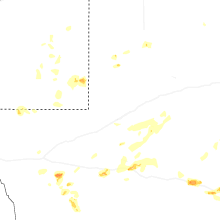
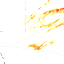
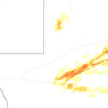
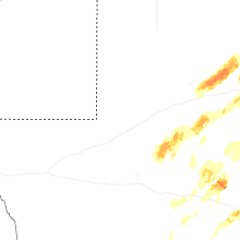
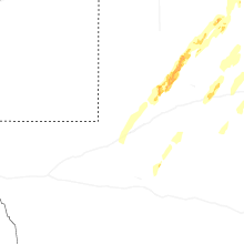


Connect with Interactive Hail Maps