

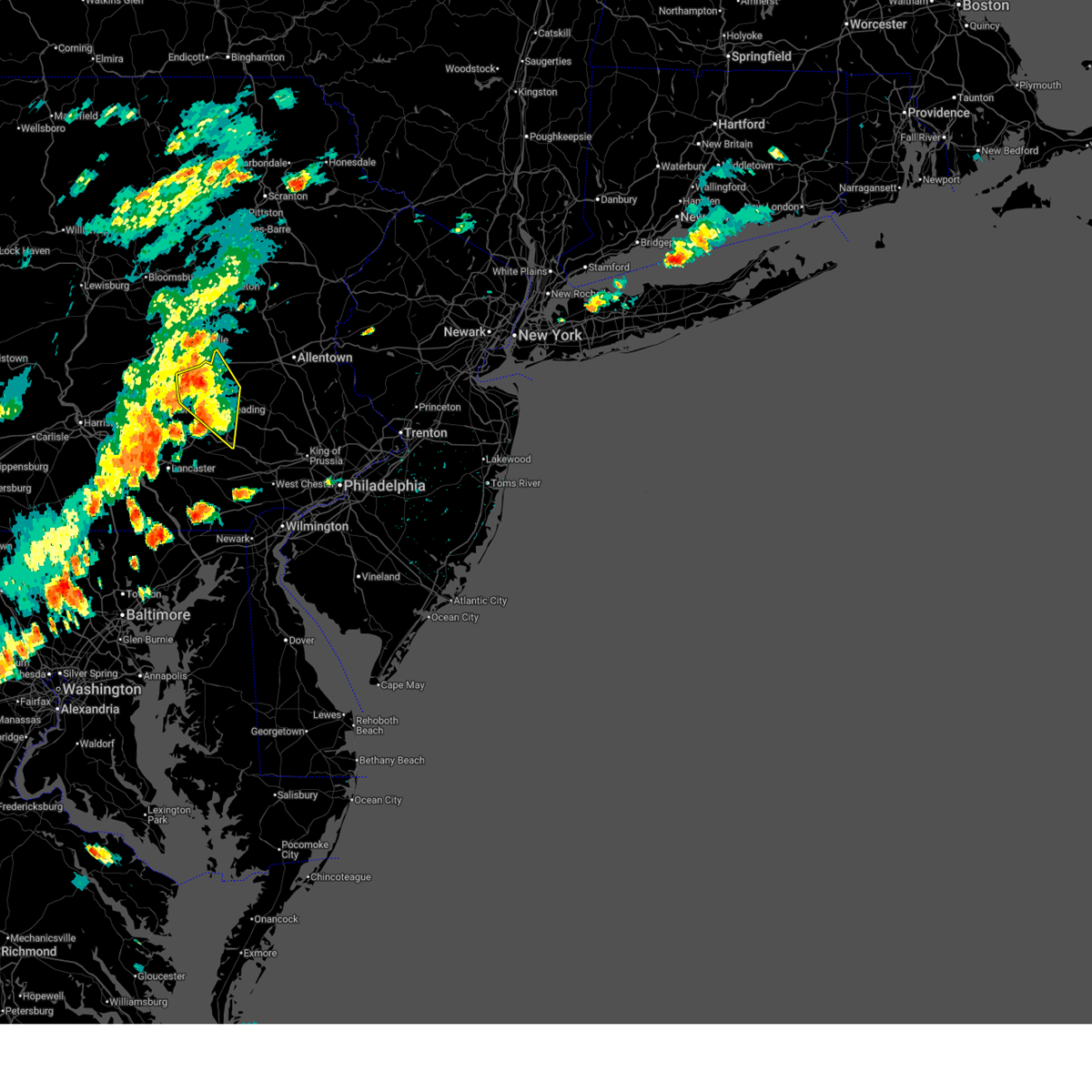
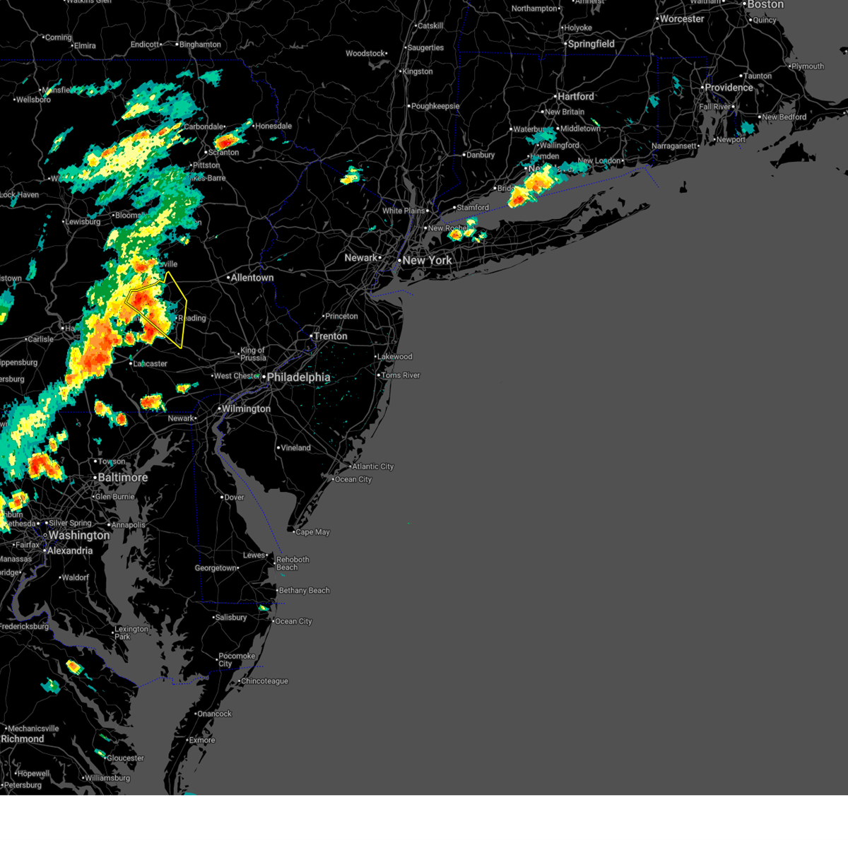
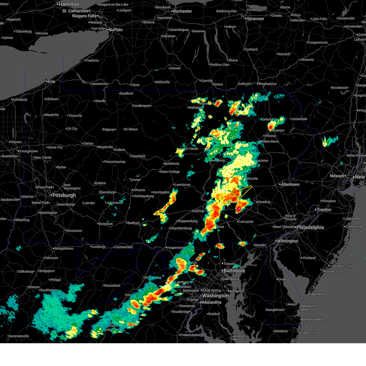
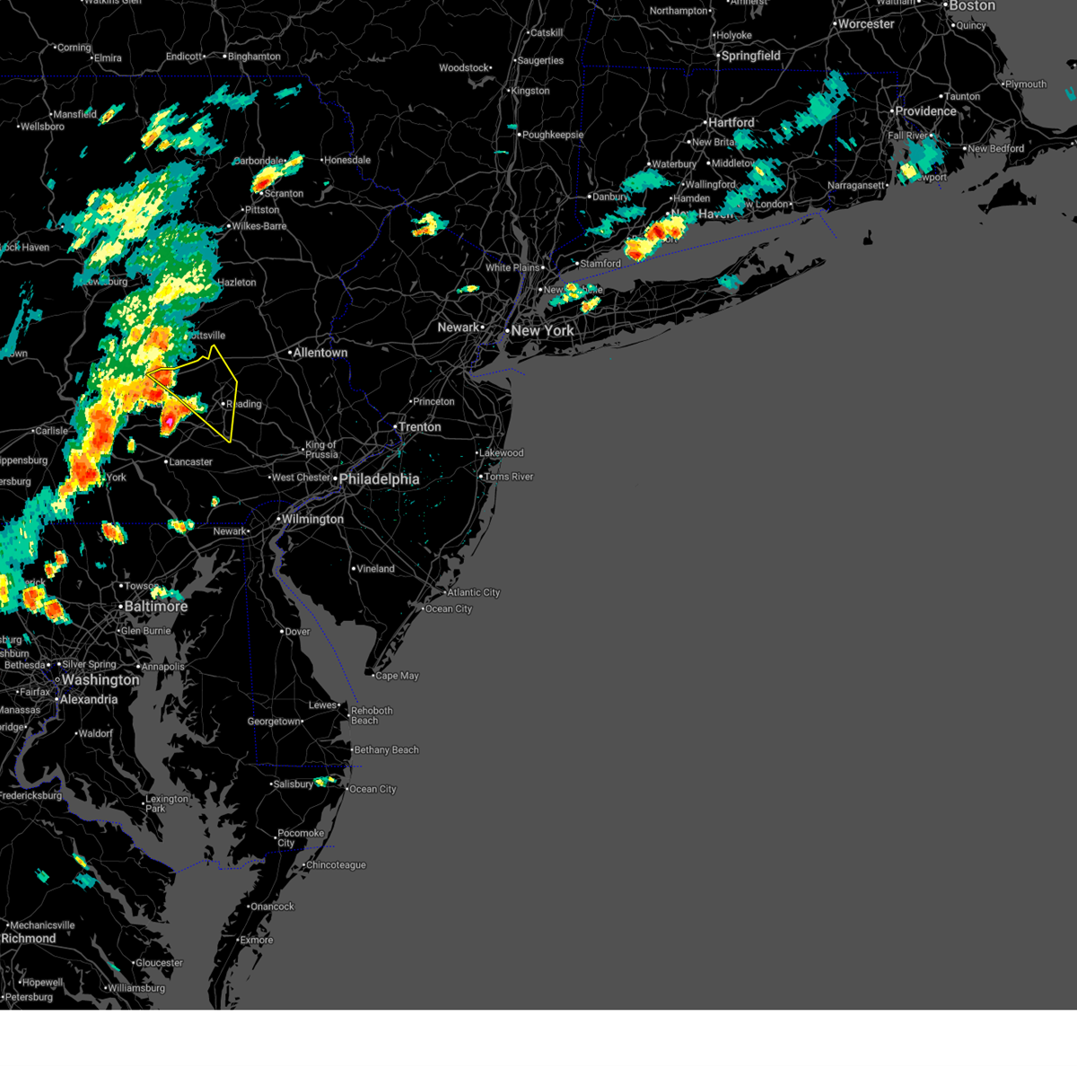
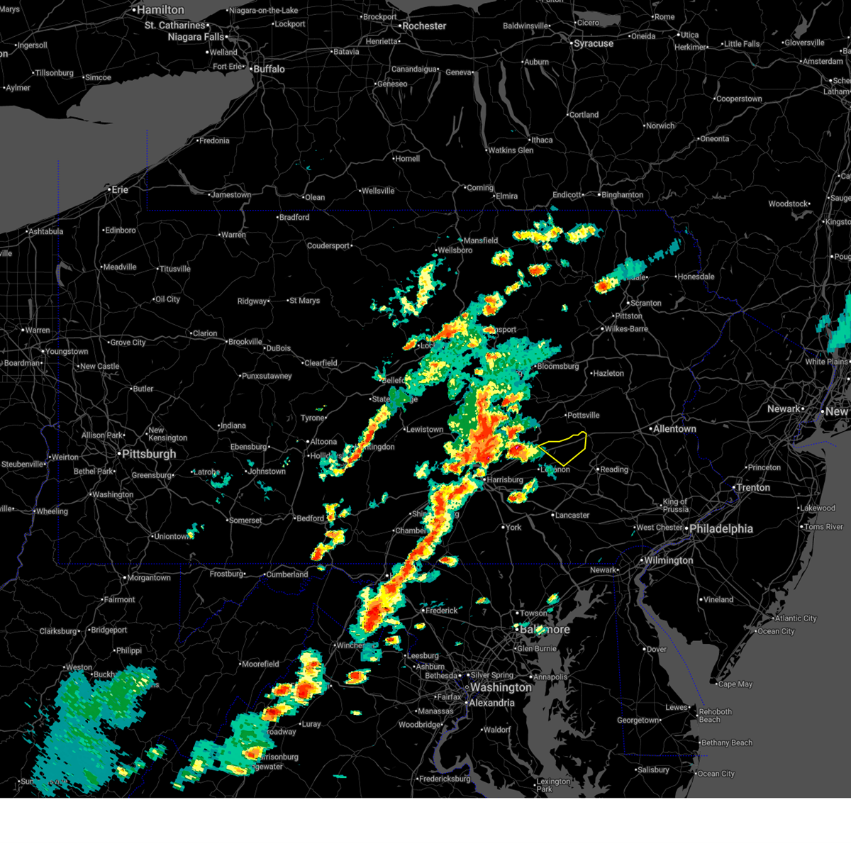
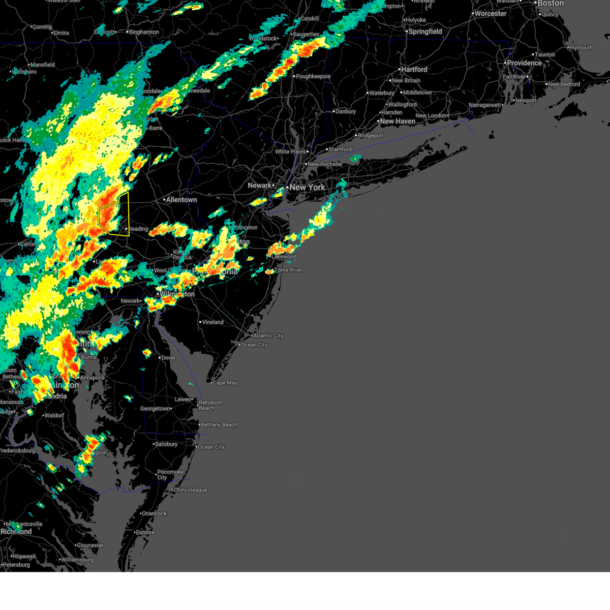
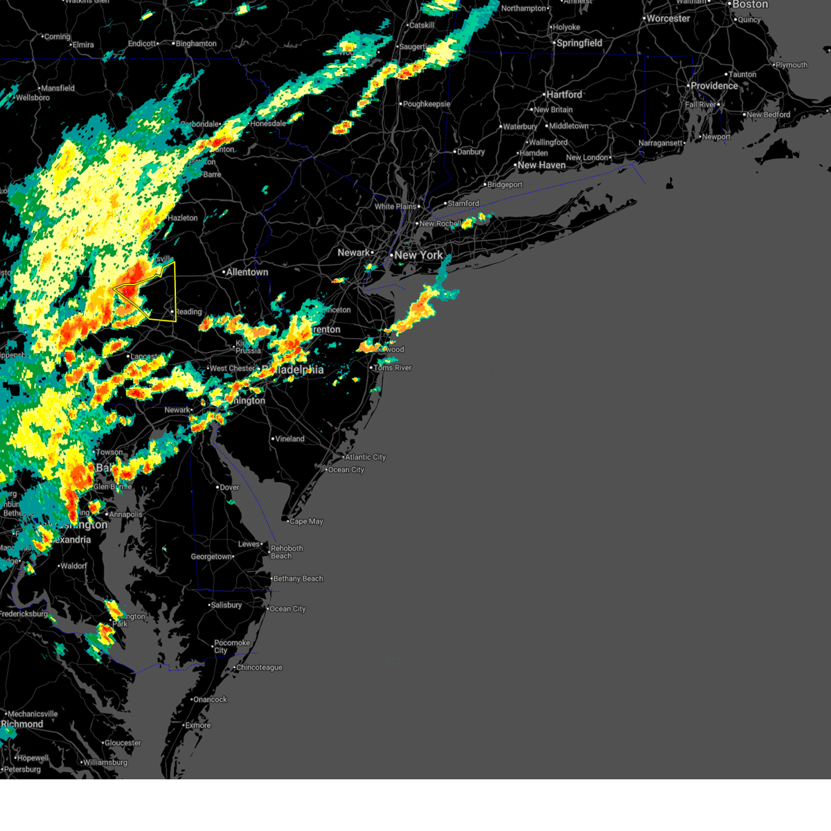
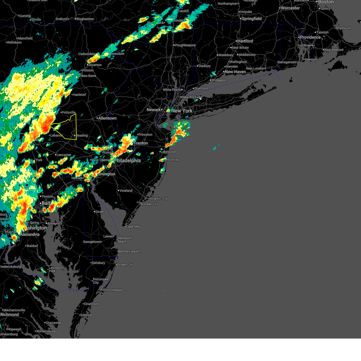
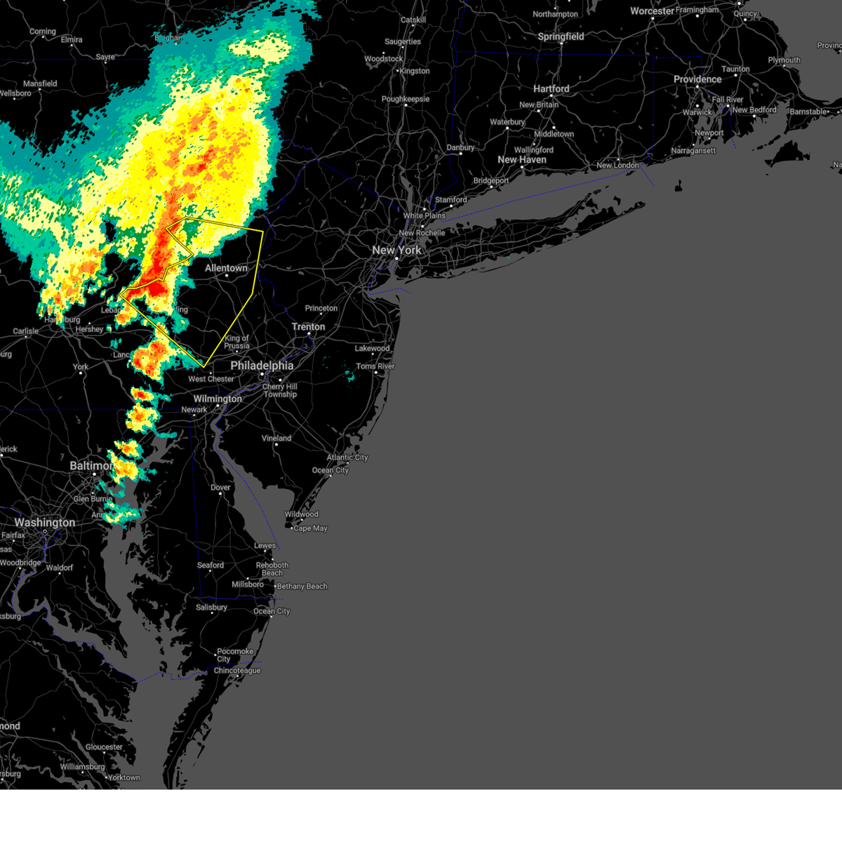
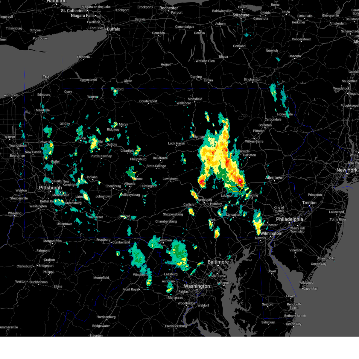
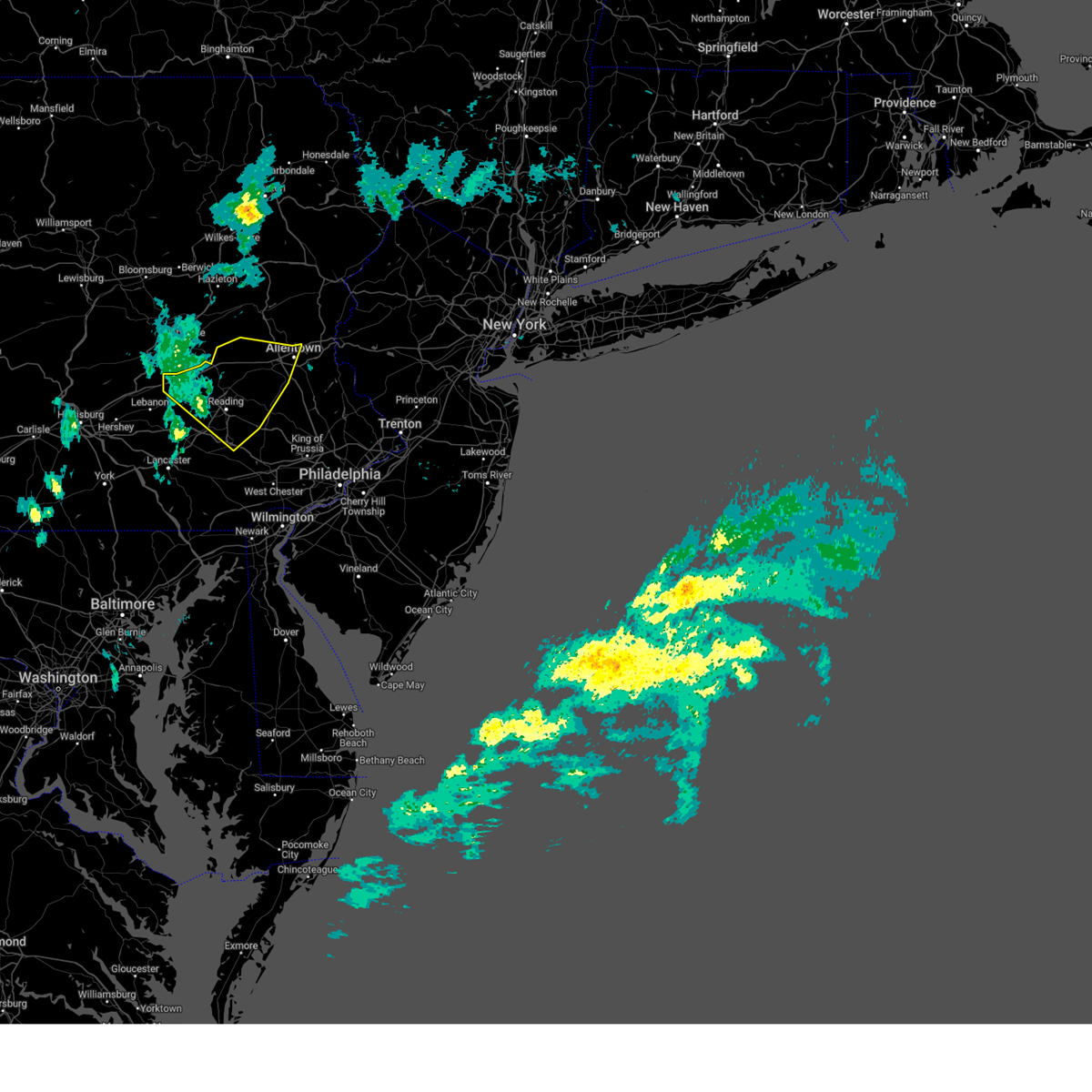
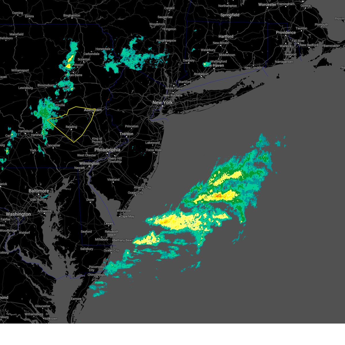
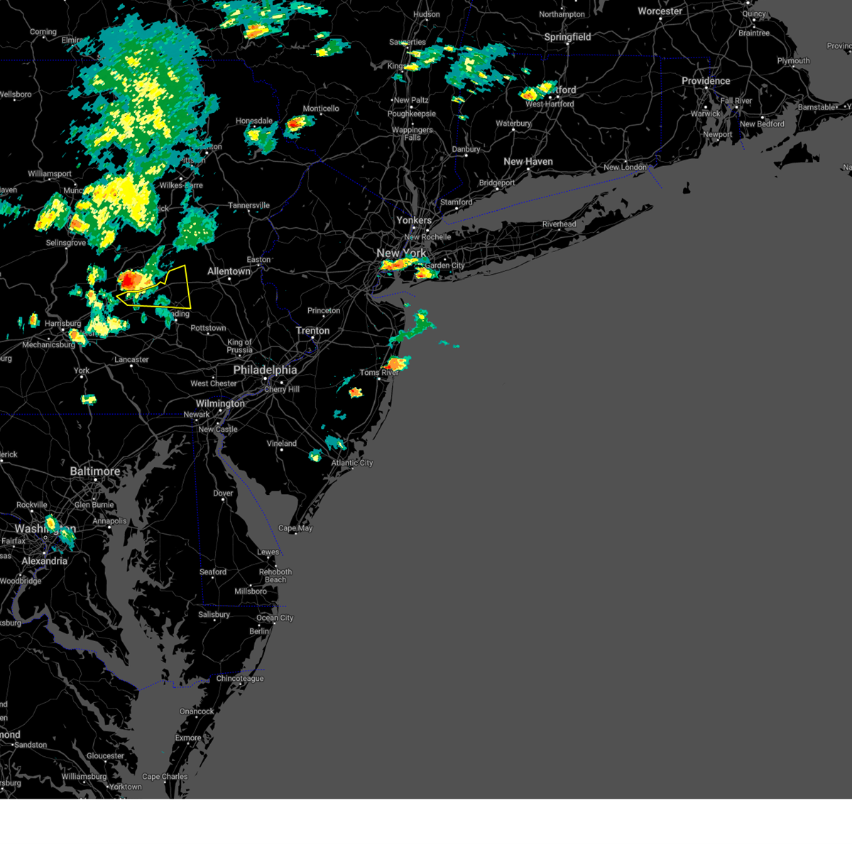
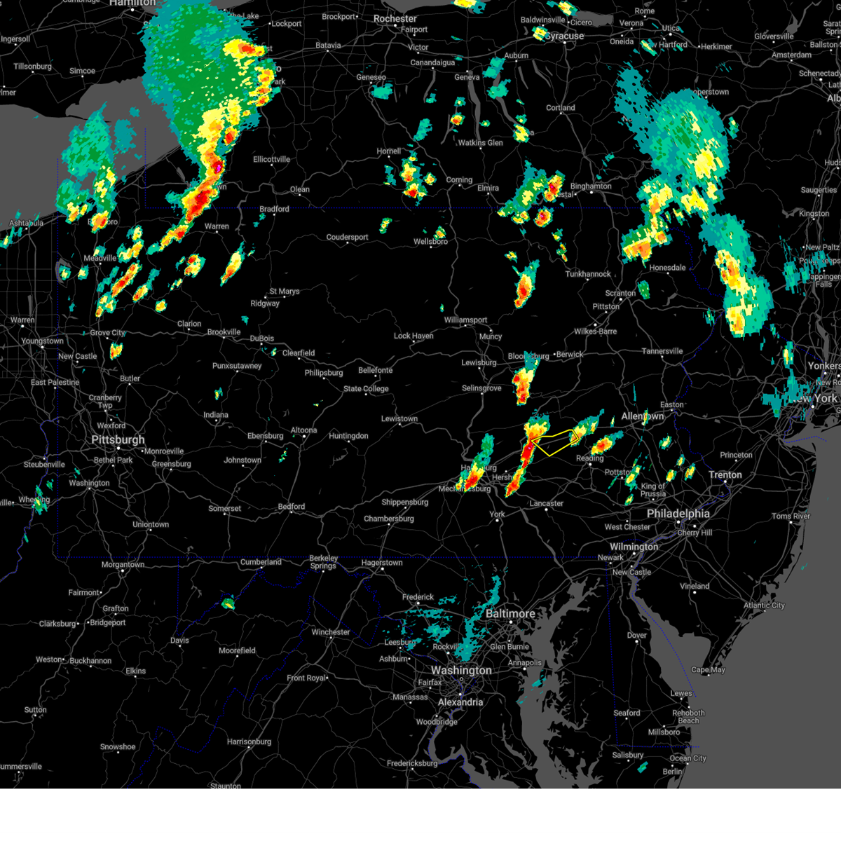
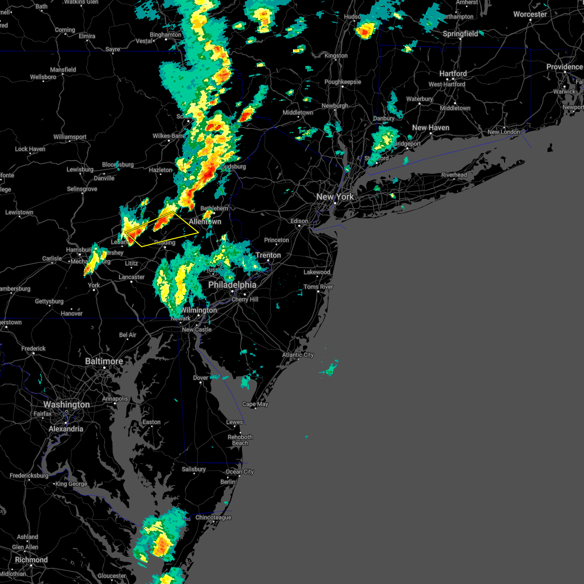
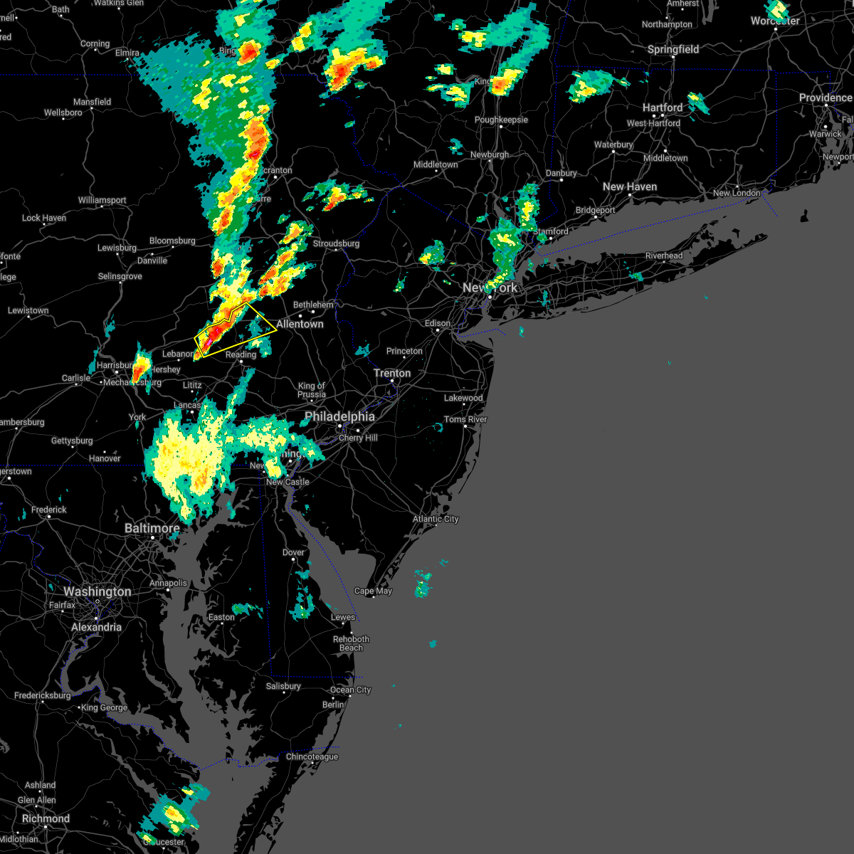
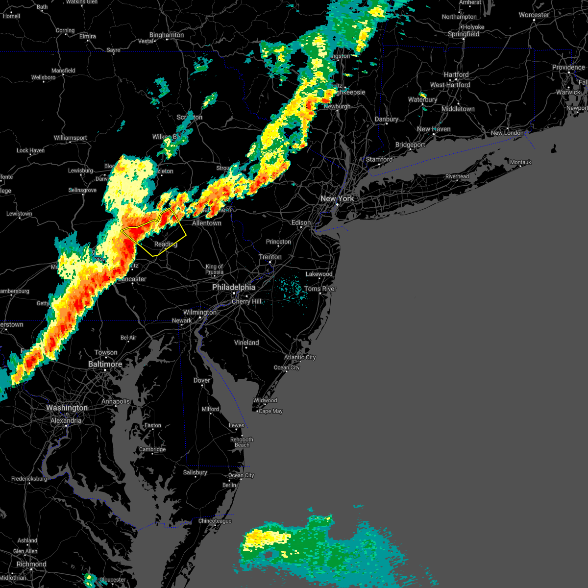
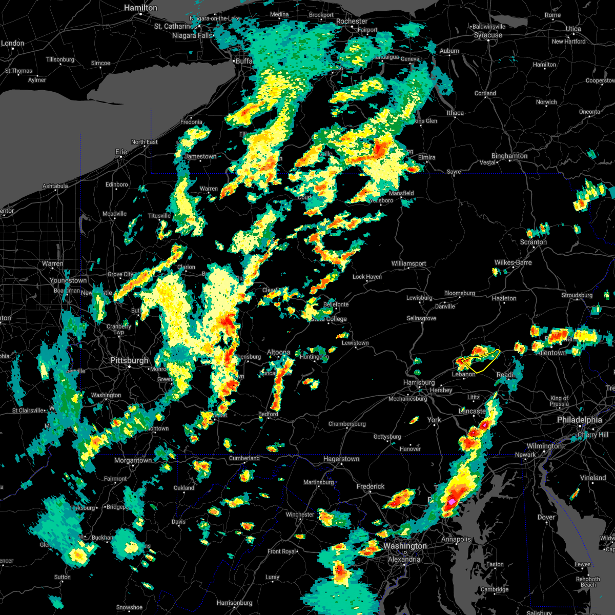
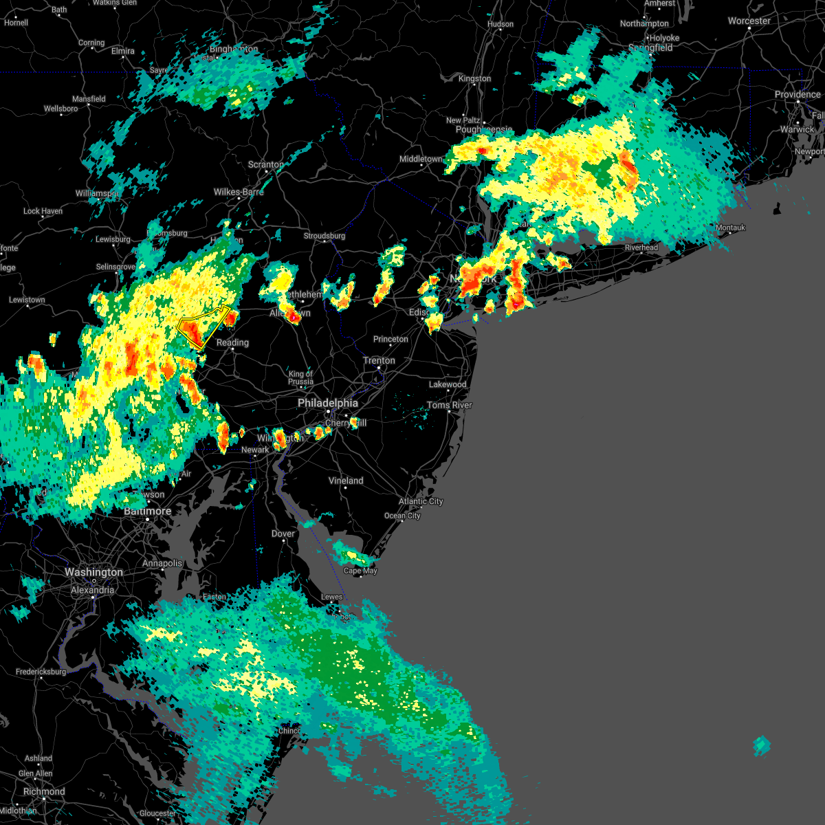
Hail Map for Rehrersburg, PA
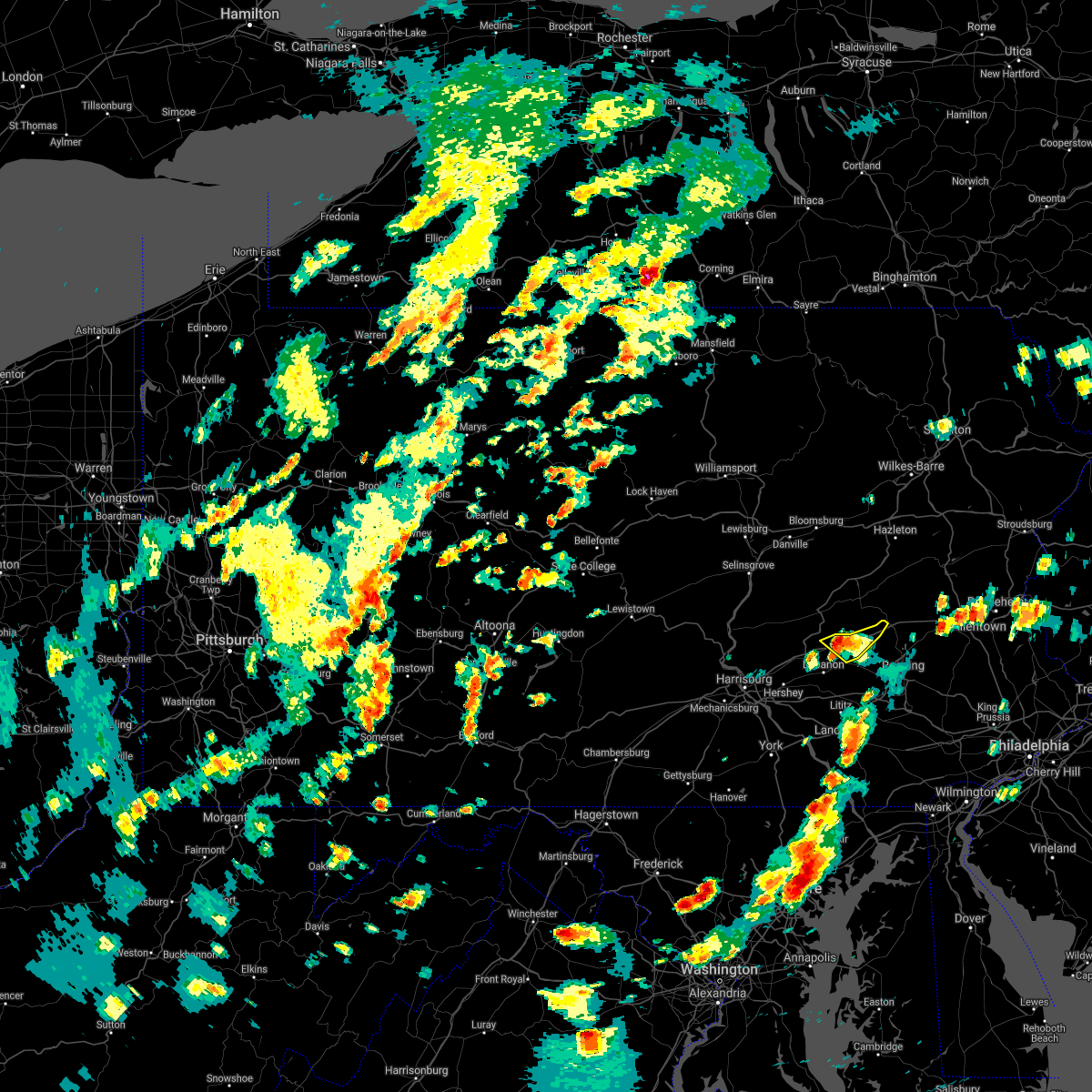
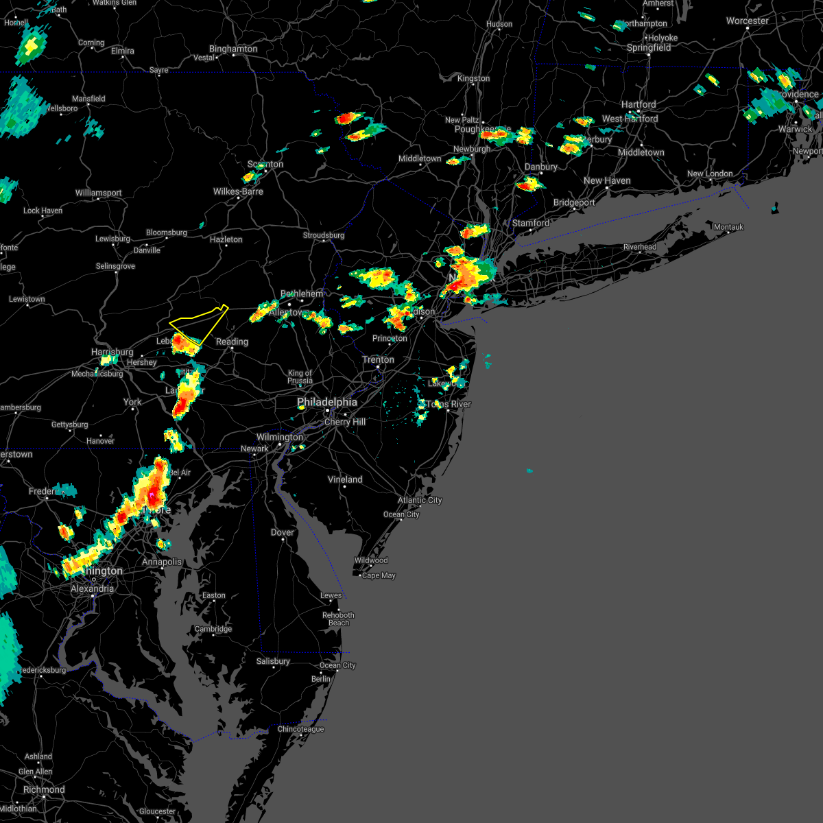
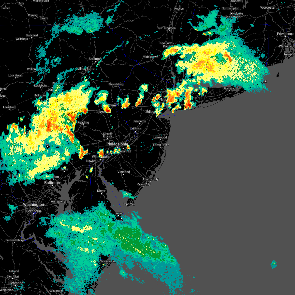
The Rehrersburg, PA area has had 0 reports of on-the-ground hail by trained spotters, and has been under severe weather warnings 24 times during the past 12 months. Doppler radar has detected hail at or near Rehrersburg, PA on 35 occasions, including 4 occasions during the past year.
| Name: | Rehrersburg, PA |
| Where Located: | 72.5 miles SSW of Scranton, PA |
| Map: | Google Map for Rehrersburg, PA |
| Population: | 319 |
| Housing Units: | 128 |
| More Info: | Search Google for Rehrersburg, PA |
2
The Top Recent Hail Date for Rehrersburg, PA is Tuesday, July 8, 2025 (6th out of 35)

Hail and Wind Damage Spotted near Rehrersburg, PA
| Date / Time | Report Details |
|---|---|
| 7/8/2025 4:27 PM EDT |
 The storms which prompted the warning have moved out of the area. therefore, the warning will be allowed to expire. however heavy rain is still possible with these thunderstorms. a severe thunderstorm watch remains in effect until 900 pm edt for eastern pennsylvania. remember, a severe thunderstorm warning still remains in effect for central berks county in eastern pennsylvania until 500 pm edt. The storms which prompted the warning have moved out of the area. therefore, the warning will be allowed to expire. however heavy rain is still possible with these thunderstorms. a severe thunderstorm watch remains in effect until 900 pm edt for eastern pennsylvania. remember, a severe thunderstorm warning still remains in effect for central berks county in eastern pennsylvania until 500 pm edt.
|
| 7/8/2025 4:16 PM EDT |
 At 414 pm edt, severe thunderstorms were located along a line extending from near schuylkill haven to adamstown, moving east at 25 mph (law enforcement. at 351 pm edt, wind damage was reported in myerstown, pa in lebanon county. at 403 pm edt, wind damage was reported 2 n of denver, pa in lancaster county). Hazards include 60 mph wind gusts and penny size hail. Damage to roofs, siding, trees, and power lines is possible. Locations impacted include, reading, wyomissing, hamburg, fleetwood, sinking spring, laureldale, womelsdorf, wernersville, robesonia, leesport, shoemakersville, bernville, strausstown, new morgan, spring ridge, fairview hgts, shillington, west reading, mount penn, and mohnton. At 414 pm edt, severe thunderstorms were located along a line extending from near schuylkill haven to adamstown, moving east at 25 mph (law enforcement. at 351 pm edt, wind damage was reported in myerstown, pa in lebanon county. at 403 pm edt, wind damage was reported 2 n of denver, pa in lancaster county). Hazards include 60 mph wind gusts and penny size hail. Damage to roofs, siding, trees, and power lines is possible. Locations impacted include, reading, wyomissing, hamburg, fleetwood, sinking spring, laureldale, womelsdorf, wernersville, robesonia, leesport, shoemakersville, bernville, strausstown, new morgan, spring ridge, fairview hgts, shillington, west reading, mount penn, and mohnton.
|
| 7/8/2025 4:05 PM EDT |
 At 405 pm edt, severe thunderstorms were located along a line extending from near friedensburg to denver, moving east at 25 mph (radar indicated. at 354 pm edt, wind damage was reported east of brickerville, pa in lancaster county). Hazards include 60 mph wind gusts and penny size hail. Damage to roofs, siding, trees, and power lines is possible. Locations impacted include, reading, wyomissing, hamburg, fleetwood, sinking spring, laureldale, womelsdorf, wernersville, robesonia, leesport, shoemakersville, bernville, strausstown, new morgan, spring ridge, fairview hgts, shillington, west reading, mount penn, and mohnton. At 405 pm edt, severe thunderstorms were located along a line extending from near friedensburg to denver, moving east at 25 mph (radar indicated. at 354 pm edt, wind damage was reported east of brickerville, pa in lancaster county). Hazards include 60 mph wind gusts and penny size hail. Damage to roofs, siding, trees, and power lines is possible. Locations impacted include, reading, wyomissing, hamburg, fleetwood, sinking spring, laureldale, womelsdorf, wernersville, robesonia, leesport, shoemakersville, bernville, strausstown, new morgan, spring ridge, fairview hgts, shillington, west reading, mount penn, and mohnton.
|
| 7/8/2025 3:46 PM EDT |
 A severe thunderstorm watch remains in effect until 900 pm edt for eastern pennsylvania. a severe thunderstorm warning still remains in effect for western and central berks county in eastern pennsylvania until 430 pm edt. A severe thunderstorm watch remains in effect until 900 pm edt for eastern pennsylvania. a severe thunderstorm warning still remains in effect for western and central berks county in eastern pennsylvania until 430 pm edt.
|
| 7/8/2025 3:44 PM EDT |
 Svrphi the national weather service in mount holly nj has issued a * severe thunderstorm warning for, central berks county in eastern pennsylvania, * until 430 pm edt. * at 344 pm edt, severe thunderstorms were located along a line extending from near pine grove to brickerville, moving east at 25 mph (radar indicated). Hazards include 60 mph wind gusts and penny size hail. damage to roofs, siding, trees, and power lines is possible Svrphi the national weather service in mount holly nj has issued a * severe thunderstorm warning for, central berks county in eastern pennsylvania, * until 430 pm edt. * at 344 pm edt, severe thunderstorms were located along a line extending from near pine grove to brickerville, moving east at 25 mph (radar indicated). Hazards include 60 mph wind gusts and penny size hail. damage to roofs, siding, trees, and power lines is possible
|
| 7/8/2025 3:35 PM EDT |
 At 334 pm edt, severe thunderstorms were located along a line extending from near friedensburg to near pine grove to near annville, moving east at 30 mph (radar indicated). Hazards include 60 mph wind gusts and penny size hail. Damage to roofs, siding, trees, and power lines is possible. Locations impacted include, strausstown. At 334 pm edt, severe thunderstorms were located along a line extending from near friedensburg to near pine grove to near annville, moving east at 30 mph (radar indicated). Hazards include 60 mph wind gusts and penny size hail. Damage to roofs, siding, trees, and power lines is possible. Locations impacted include, strausstown.
|
| 7/8/2025 3:23 PM EDT | At 322 pm edt, severe thunderstorms were located along a line extending from tremont to near fredericksburg to near skyline view, moving east at 30 mph (radar indicated). Hazards include 60 mph wind gusts and penny size hail. Damage to roofs, siding, trees, and power lines is possible. Locations impacted include, womelsdorf, bernville, and strausstown. |
| 7/8/2025 3:04 PM EDT |
 Svrphi the national weather service in mount holly nj has issued a * severe thunderstorm warning for, northwestern berks county in eastern pennsylvania, * until 345 pm edt. * at 303 pm edt, severe thunderstorms were located along a line extending from near tower city to near fort indiantown gap to near linglestown, moving east at 30 mph (radar indicated). Hazards include 60 mph wind gusts and penny size hail. damage to roofs, siding, trees, and power lines is possible Svrphi the national weather service in mount holly nj has issued a * severe thunderstorm warning for, northwestern berks county in eastern pennsylvania, * until 345 pm edt. * at 303 pm edt, severe thunderstorms were located along a line extending from near tower city to near fort indiantown gap to near linglestown, moving east at 30 mph (radar indicated). Hazards include 60 mph wind gusts and penny size hail. damage to roofs, siding, trees, and power lines is possible
|
| 7/1/2025 4:07 PM EDT |
 At 407 pm edt, severe thunderstorms were located along a line extending from near strausstown to newmanstown, moving east at 35 mph (radar indicated). Hazards include 60 mph wind gusts and quarter size hail. Minor damage to vehicles is possible. wind damage to roofs, siding, trees, and power lines is possible. Locations impacted include, reading, wyomissing, hamburg, sinking spring, laureldale, womelsdorf, wernersville, robesonia, leesport, shoemakersville, bernville, strausstown, spring ridge, fairview hgts, shillington, west reading, mount penn, mohnton, kenhorst, and centerport. At 407 pm edt, severe thunderstorms were located along a line extending from near strausstown to newmanstown, moving east at 35 mph (radar indicated). Hazards include 60 mph wind gusts and quarter size hail. Minor damage to vehicles is possible. wind damage to roofs, siding, trees, and power lines is possible. Locations impacted include, reading, wyomissing, hamburg, sinking spring, laureldale, womelsdorf, wernersville, robesonia, leesport, shoemakersville, bernville, strausstown, spring ridge, fairview hgts, shillington, west reading, mount penn, mohnton, kenhorst, and centerport.
|
| 7/1/2025 3:54 PM EDT |
 At 354 pm edt, a severe thunderstorm was located near myerstown, moving east at 30 mph (radar indicated). Hazards include 60 mph wind gusts and quarter size hail. Minor damage to vehicles is possible. wind damage to roofs, siding, trees, and power lines is possible. Locations impacted include, reading, wyomissing, hamburg, sinking spring, laureldale, womelsdorf, wernersville, robesonia, leesport, shoemakersville, bernville, strausstown, spring ridge, fairview hgts, shillington, west reading, mount penn, mohnton, kenhorst, and centerport. At 354 pm edt, a severe thunderstorm was located near myerstown, moving east at 30 mph (radar indicated). Hazards include 60 mph wind gusts and quarter size hail. Minor damage to vehicles is possible. wind damage to roofs, siding, trees, and power lines is possible. Locations impacted include, reading, wyomissing, hamburg, sinking spring, laureldale, womelsdorf, wernersville, robesonia, leesport, shoemakersville, bernville, strausstown, spring ridge, fairview hgts, shillington, west reading, mount penn, mohnton, kenhorst, and centerport.
|
| 7/1/2025 3:34 PM EDT |
 Svrphi the national weather service in mount holly nj has issued a * severe thunderstorm warning for, central berks county in eastern pennsylvania, * until 430 pm edt. * at 333 pm edt, a severe thunderstorm was located over lickdale, or 7 miles north of annville, moving east at 30 mph (radar indicated). Hazards include 60 mph wind gusts and quarter size hail. Minor damage to vehicles is possible. Wind damage to roofs, siding, trees, and power lines is possible. Svrphi the national weather service in mount holly nj has issued a * severe thunderstorm warning for, central berks county in eastern pennsylvania, * until 430 pm edt. * at 333 pm edt, a severe thunderstorm was located over lickdale, or 7 miles north of annville, moving east at 30 mph (radar indicated). Hazards include 60 mph wind gusts and quarter size hail. Minor damage to vehicles is possible. Wind damage to roofs, siding, trees, and power lines is possible.
|
| 6/25/2025 5:39 PM EDT | Svrphi the national weather service in mount holly nj has issued a * severe thunderstorm warning for, berks county in eastern pennsylvania, central lehigh county in eastern pennsylvania, * until 645 pm edt. * at 539 pm edt, severe thunderstorms were located along a line extending from near tuscarora to bernville, moving southeast at 25 mph (radar indicated). Hazards include 60 mph wind gusts and quarter size hail. Minor damage to vehicles is possible. Wind damage to roofs, siding, trees, and power lines is possible. |
| 5/16/2025 10:24 AM EDT |
 Svrphi the national weather service in mount holly nj has issued a * severe thunderstorm warning for, berks county in eastern pennsylvania, lehigh county in eastern pennsylvania, northwestern montgomery county in southeastern pennsylvania, carbon county in northeastern pennsylvania, northwestern bucks county in southeastern pennsylvania, north central chester county in southeastern pennsylvania, southwestern monroe county in northeastern pennsylvania, northampton county in eastern pennsylvania, * until 1130 am edt. * at 1024 am edt, severe thunderstorms were located along a line extending from near hazleton to near mckeansburg to near strausstown, moving east at 40 mph (radar indicated). Hazards include 60 mph wind gusts and quarter size hail. Minor damage to vehicles is possible. Wind damage to roofs, siding, trees, and power lines is possible. Svrphi the national weather service in mount holly nj has issued a * severe thunderstorm warning for, berks county in eastern pennsylvania, lehigh county in eastern pennsylvania, northwestern montgomery county in southeastern pennsylvania, carbon county in northeastern pennsylvania, northwestern bucks county in southeastern pennsylvania, north central chester county in southeastern pennsylvania, southwestern monroe county in northeastern pennsylvania, northampton county in eastern pennsylvania, * until 1130 am edt. * at 1024 am edt, severe thunderstorms were located along a line extending from near hazleton to near mckeansburg to near strausstown, moving east at 40 mph (radar indicated). Hazards include 60 mph wind gusts and quarter size hail. Minor damage to vehicles is possible. Wind damage to roofs, siding, trees, and power lines is possible.
|
| 5/6/2025 1:35 PM EDT |
 The storm which prompted the warning has moved out of the area. therefore, the warning will be allowed to expire. a severe thunderstorm watch remains in effect until 800 pm edt for eastern pennsylvania. to report severe weather, contact your nearest law enforcement agency. they will relay your report to the national weather service mount holly nj. The storm which prompted the warning has moved out of the area. therefore, the warning will be allowed to expire. a severe thunderstorm watch remains in effect until 800 pm edt for eastern pennsylvania. to report severe weather, contact your nearest law enforcement agency. they will relay your report to the national weather service mount holly nj.
|
| 5/6/2025 1:25 PM EDT | At 125 pm edt, a severe thunderstorm was located near strausstown, or 8 miles southwest of schuylkill haven, moving northeast at 35 mph (broadcast media). Hazards include ping pong ball size hail and 60 mph wind gusts. at 113 pm edt, quarter sized hail and minor damage to trees was reported in mount aetna. People and animals outdoors will be injured. expect hail damage to roofs, siding, windows, and vehicles. wind damage to roofs, siding, trees, and power lines is possible. locations impacted include, strausstown. This includes interstate 78 in pennsylvania between mile markers 12 and 23. |
| 5/6/2025 1:16 PM EDT | At 115 pm edt, a severe thunderstorm was located near strausstown, or near myerstown, moving northeast at 35 mph (broadcast media. at 113 pm edt, quarter sized hail and minor damage to trees was reported in mount aetna). Hazards include 60 mph wind gusts and quarter size hail. Minor damage to vehicles is possible. wind damage to roofs, siding, trees, and power lines is possible. locations impacted include, strausstown and womelsdorf. This includes interstate 78 in pennsylvania between mile markers 10 and 24. |
| 5/6/2025 1:08 PM EDT | Svrphi the national weather service in mount holly nj has issued a * severe thunderstorm warning for, northwestern berks county in eastern pennsylvania, * until 145 pm edt. * at 108 pm edt, a severe thunderstorm was located over myerstown, moving northeast at 35 mph (radar indicated). Hazards include 60 mph wind gusts and quarter size hail. Minor damage to vehicles is possible. Wind damage to roofs, siding, trees, and power lines is possible. |
| 4/29/2025 8:50 PM EDT | The storms which prompted the warning have weakened below severe limits, and no longer pose an immediate threat to life or property. therefore, the warning will be allowed to expire. |
| 4/29/2025 8:15 PM EDT | Svrphi the national weather service in mount holly nj has issued a * severe thunderstorm warning for, northern berks county in eastern pennsylvania, lehigh county in eastern pennsylvania, carbon county in northeastern pennsylvania, monroe county in northeastern pennsylvania, northwestern northampton county in eastern pennsylvania, * until 900 pm edt. * at 814 pm edt, severe thunderstorms were located along a line extending from sweet valley to near nuremburg to near pine grove, moving east at 70 mph (radar indicated). Hazards include 60 mph wind gusts. damage to roofs, siding, trees, and power lines is possible |
| 4/15/2025 3:46 PM EDT |
 At 344 pm edt, severe thunderstorms were located along a line extending from lenhartsville to reading to near terre hill, moving east at 55 mph (trained spotter. at 343 pm edt, a 62 mph wind gust was measured at the reading regional airport. several areas of wind damage have been reported across western berks county). Hazards include 60 mph wind gusts and penny size hail. Damage to roofs, siding, trees, and power lines is possible. locations impacted include, west lawn, boyertown, coffeetown, hokendauqua, new tripoli, emmaus, strausstown, new morgan, ancient oaks, catasauqua, leesport, mohnton, bechtelsville, shoemakersville, lenhartsville, fleetwood, mount penn, birdsboro, reiffton, and macungie. this includes the following highways, pennsylvania turnpike between mile markers 295 and 300. northeast extension between mile markers 50 and 63. interstate 78 in pennsylvania between mile markers 12 and 59. Interstate 176 in pennsylvania between mile markers 1 and 11. At 344 pm edt, severe thunderstorms were located along a line extending from lenhartsville to reading to near terre hill, moving east at 55 mph (trained spotter. at 343 pm edt, a 62 mph wind gust was measured at the reading regional airport. several areas of wind damage have been reported across western berks county). Hazards include 60 mph wind gusts and penny size hail. Damage to roofs, siding, trees, and power lines is possible. locations impacted include, west lawn, boyertown, coffeetown, hokendauqua, new tripoli, emmaus, strausstown, new morgan, ancient oaks, catasauqua, leesport, mohnton, bechtelsville, shoemakersville, lenhartsville, fleetwood, mount penn, birdsboro, reiffton, and macungie. this includes the following highways, pennsylvania turnpike between mile markers 295 and 300. northeast extension between mile markers 50 and 63. interstate 78 in pennsylvania between mile markers 12 and 59. Interstate 176 in pennsylvania between mile markers 1 and 11.
|
| 4/15/2025 3:27 PM EDT |
 At 325 pm edt, severe thunderstorms were located along a line extending from near schuylkill haven to near richland to mount gretna heights, moving east at 45 mph. a gust of 54 mph was recently measured at the muir army field in lebanon county pa (radar indicated). Hazards include 60 mph wind gusts and penny size hail. Damage to roofs, siding, trees, and power lines is possible. locations impacted include, west lawn, boyertown, coffeetown, hokendauqua, new tripoli, emmaus, strausstown, new morgan, ancient oaks, catasauqua, leesport, mohnton, bechtelsville, shoemakersville, lenhartsville, fleetwood, mount penn, birdsboro, reiffton, and macungie. this includes the following highways, pennsylvania turnpike between mile markers 295 and 300. northeast extension between mile markers 50 and 63. interstate 78 in pennsylvania near mile marker 8, and between mile markers 10 and 59. Interstate 176 in pennsylvania between mile markers 1 and 11. At 325 pm edt, severe thunderstorms were located along a line extending from near schuylkill haven to near richland to mount gretna heights, moving east at 45 mph. a gust of 54 mph was recently measured at the muir army field in lebanon county pa (radar indicated). Hazards include 60 mph wind gusts and penny size hail. Damage to roofs, siding, trees, and power lines is possible. locations impacted include, west lawn, boyertown, coffeetown, hokendauqua, new tripoli, emmaus, strausstown, new morgan, ancient oaks, catasauqua, leesport, mohnton, bechtelsville, shoemakersville, lenhartsville, fleetwood, mount penn, birdsboro, reiffton, and macungie. this includes the following highways, pennsylvania turnpike between mile markers 295 and 300. northeast extension between mile markers 50 and 63. interstate 78 in pennsylvania near mile marker 8, and between mile markers 10 and 59. Interstate 176 in pennsylvania between mile markers 1 and 11.
|
| 4/15/2025 3:07 PM EDT |
 Svrphi the national weather service in mount holly nj has issued a * severe thunderstorm warning for, berks county in eastern pennsylvania, central lehigh county in eastern pennsylvania, * until 400 pm edt. * at 307 pm edt, severe thunderstorms were located along a line extending from donaldson to lickdale to hummelstown, moving east at 50 mph (radar indicated). Hazards include 60 mph wind gusts and penny size hail. damage to roofs, siding, trees, and power lines is possible Svrphi the national weather service in mount holly nj has issued a * severe thunderstorm warning for, berks county in eastern pennsylvania, central lehigh county in eastern pennsylvania, * until 400 pm edt. * at 307 pm edt, severe thunderstorms were located along a line extending from donaldson to lickdale to hummelstown, moving east at 50 mph (radar indicated). Hazards include 60 mph wind gusts and penny size hail. damage to roofs, siding, trees, and power lines is possible
|
| 7/16/2024 4:16 PM EDT |
 At 416 pm edt, a severe thunderstorm was located over myerstown, moving east at 30 mph (radar indicated). Hazards include 60 mph wind gusts and penny size hail. Damage to roofs, siding, trees, and power lines is possible. locations impacted include, reading, wyomissing, birdsboro, hamburg, fleetwood, sinking spring, laureldale, womelsdorf, wernersville, robesonia, leesport, shoemakersville, bernville, strausstown, lenhartsville, spring ridge, fairview hgts, shillington, west reading, and mount penn. this includes the following highways, interstate 78 in pennsylvania between mile markers 11 and 40. Interstate 176 in pennsylvania between mile markers 9 and 11. At 416 pm edt, a severe thunderstorm was located over myerstown, moving east at 30 mph (radar indicated). Hazards include 60 mph wind gusts and penny size hail. Damage to roofs, siding, trees, and power lines is possible. locations impacted include, reading, wyomissing, birdsboro, hamburg, fleetwood, sinking spring, laureldale, womelsdorf, wernersville, robesonia, leesport, shoemakersville, bernville, strausstown, lenhartsville, spring ridge, fairview hgts, shillington, west reading, and mount penn. this includes the following highways, interstate 78 in pennsylvania between mile markers 11 and 40. Interstate 176 in pennsylvania between mile markers 9 and 11.
|
| 7/16/2024 4:03 PM EDT |
 Svrphi the national weather service in mount holly nj has issued a * severe thunderstorm warning for, berks county in eastern pennsylvania, * until 445 pm edt. * at 403 pm edt, a severe thunderstorm was located near myerstown, moving east at 40 mph (radar indicated). Hazards include 60 mph wind gusts and penny size hail. damage to roofs, siding, trees, and power lines is possible Svrphi the national weather service in mount holly nj has issued a * severe thunderstorm warning for, berks county in eastern pennsylvania, * until 445 pm edt. * at 403 pm edt, a severe thunderstorm was located near myerstown, moving east at 40 mph (radar indicated). Hazards include 60 mph wind gusts and penny size hail. damage to roofs, siding, trees, and power lines is possible
|
| 6/29/2024 6:56 PM EDT |
 The storms which prompted the warning have moved out of the area. therefore, the warning will be allowed to expire. a severe thunderstorm watch remains in effect until 1100 pm edt for eastern and northeastern pennsylvania. to report severe weather, contact your nearest law enforcement agency. they will relay your report to the national weather service mount holly nj. remember, a new severe thunderstorm warning remains in effect for northeastern berks county, lehigh county, and south central carbon county. refer to that bulletin for the updated information. The storms which prompted the warning have moved out of the area. therefore, the warning will be allowed to expire. a severe thunderstorm watch remains in effect until 1100 pm edt for eastern and northeastern pennsylvania. to report severe weather, contact your nearest law enforcement agency. they will relay your report to the national weather service mount holly nj. remember, a new severe thunderstorm warning remains in effect for northeastern berks county, lehigh county, and south central carbon county. refer to that bulletin for the updated information.
|
| 6/29/2024 6:38 PM EDT |
 At 638 pm edt, severe thunderstorms were located along a line extending from locust lake state park to near orwigsburg to near myerstown, moving east at 45 mph (radar indicated). Hazards include 60 mph wind gusts. Damage to roofs, siding, trees, and power lines is possible. locations impacted include, lehighton, kutztown, hamburg, leesport, shoemakersville, bernville, strausstown, lenhartsville, fairview hgts, new mahoning, wanamakers, new tripoli, jordan valley, summit hill, and centerport. This includes interstate 78 in pennsylvania between mile markers 10 and 49. At 638 pm edt, severe thunderstorms were located along a line extending from locust lake state park to near orwigsburg to near myerstown, moving east at 45 mph (radar indicated). Hazards include 60 mph wind gusts. Damage to roofs, siding, trees, and power lines is possible. locations impacted include, lehighton, kutztown, hamburg, leesport, shoemakersville, bernville, strausstown, lenhartsville, fairview hgts, new mahoning, wanamakers, new tripoli, jordan valley, summit hill, and centerport. This includes interstate 78 in pennsylvania between mile markers 10 and 49.
|
| 6/29/2024 6:09 PM EDT |
 Svrphi the national weather service in mount holly nj has issued a * severe thunderstorm warning for, northern berks county in eastern pennsylvania, northwestern lehigh county in eastern pennsylvania, southwestern carbon county in northeastern pennsylvania, * until 700 pm edt. * at 608 pm edt, severe thunderstorms were located along a line extending from near marshallton to near donaldson to near dehart dam, moving east at 45 mph (radar indicated). Hazards include 60 mph wind gusts. damage to roofs, siding, trees, and power lines is possible Svrphi the national weather service in mount holly nj has issued a * severe thunderstorm warning for, northern berks county in eastern pennsylvania, northwestern lehigh county in eastern pennsylvania, southwestern carbon county in northeastern pennsylvania, * until 700 pm edt. * at 608 pm edt, severe thunderstorms were located along a line extending from near marshallton to near donaldson to near dehart dam, moving east at 45 mph (radar indicated). Hazards include 60 mph wind gusts. damage to roofs, siding, trees, and power lines is possible
|
| 6/26/2024 6:14 PM EDT |
 Svrphi the national weather service in mount holly nj has issued a * severe thunderstorm warning for, berks county in eastern pennsylvania, lehigh county in eastern pennsylvania, carbon county in northeastern pennsylvania, western monroe county in northeastern pennsylvania, west central northampton county in eastern pennsylvania, * until 700 pm edt. * at 613 pm edt, severe thunderstorms were located along a line extending from near rohrsburg to renningers to brickerville, moving northeast at 50 mph (radar indicated). Hazards include 60 mph wind gusts. damage to roofs, siding, trees, and power lines is possible Svrphi the national weather service in mount holly nj has issued a * severe thunderstorm warning for, berks county in eastern pennsylvania, lehigh county in eastern pennsylvania, carbon county in northeastern pennsylvania, western monroe county in northeastern pennsylvania, west central northampton county in eastern pennsylvania, * until 700 pm edt. * at 613 pm edt, severe thunderstorms were located along a line extending from near rohrsburg to renningers to brickerville, moving northeast at 50 mph (radar indicated). Hazards include 60 mph wind gusts. damage to roofs, siding, trees, and power lines is possible
|
| 6/26/2024 5:58 PM EDT |
 At 558 pm edt, severe thunderstorms were located along a line extending from danville to fredericksburg to rheems, moving east at 40 mph (radar indicated). Hazards include 60 mph wind gusts. Damage to roofs, siding, trees, and power lines is possible. locations impacted include, womelsdorf, robesonia, bernville, and strausstown. This includes interstate 78 in pennsylvania between mile markers 10 and 27. At 558 pm edt, severe thunderstorms were located along a line extending from danville to fredericksburg to rheems, moving east at 40 mph (radar indicated). Hazards include 60 mph wind gusts. Damage to roofs, siding, trees, and power lines is possible. locations impacted include, womelsdorf, robesonia, bernville, and strausstown. This includes interstate 78 in pennsylvania between mile markers 10 and 27.
|
| 6/26/2024 5:35 PM EDT |
 Svrphi the national weather service in mount holly nj has issued a * severe thunderstorm warning for, northwestern berks county in eastern pennsylvania, * until 615 pm edt. * at 534 pm edt, severe thunderstorms were located along a line extending from near vicksburg to near linglestown to near dover, moving east at 40 mph (radar indicated). Hazards include 60 mph wind gusts. damage to roofs, siding, trees, and power lines is possible Svrphi the national weather service in mount holly nj has issued a * severe thunderstorm warning for, northwestern berks county in eastern pennsylvania, * until 615 pm edt. * at 534 pm edt, severe thunderstorms were located along a line extending from near vicksburg to near linglestown to near dover, moving east at 40 mph (radar indicated). Hazards include 60 mph wind gusts. damage to roofs, siding, trees, and power lines is possible
|
| 9/7/2023 4:47 PM EDT |
 At 447 pm edt, severe thunderstorms were located along a line extending from locust lake state park to strausstown to brickerville, moving east at 35 mph (radar indicated). Hazards include 60 mph wind gusts and quarter size hail. Minor damage to vehicles is possible. Wind damage to roofs, siding, trees, and power lines is possible. At 447 pm edt, severe thunderstorms were located along a line extending from locust lake state park to strausstown to brickerville, moving east at 35 mph (radar indicated). Hazards include 60 mph wind gusts and quarter size hail. Minor damage to vehicles is possible. Wind damage to roofs, siding, trees, and power lines is possible.
|
| 8/12/2023 11:47 PM EDT |
 At 1147 pm edt, severe thunderstorms were located along a line extending from near strausstown to near manheim, moving east at 40 mph (radar indicated). Hazards include 60 mph wind gusts and penny size hail. damage to roofs, siding, trees, and power lines is possible At 1147 pm edt, severe thunderstorms were located along a line extending from near strausstown to near manheim, moving east at 40 mph (radar indicated). Hazards include 60 mph wind gusts and penny size hail. damage to roofs, siding, trees, and power lines is possible
|
| 7/2/2023 5:08 PM EDT |
 At 508 pm edt, a severe thunderstorm was located near friedensburg, or 7 miles southwest of schuylkill haven, moving east at 25 mph (radar indicated). Hazards include 60 mph wind gusts and penny size hail. damage to roofs, siding, trees, and power lines is possible At 508 pm edt, a severe thunderstorm was located near friedensburg, or 7 miles southwest of schuylkill haven, moving east at 25 mph (radar indicated). Hazards include 60 mph wind gusts and penny size hail. damage to roofs, siding, trees, and power lines is possible
|
| 6/27/2023 3:07 PM EDT |
 At 307 pm edt, a severe thunderstorm was located over fredericksburg, or 7 miles north of lebanon, moving northeast at 30 mph (radar indicated). Hazards include 60 mph wind gusts and penny size hail. damage to roofs, siding, trees, and power lines is possible At 307 pm edt, a severe thunderstorm was located over fredericksburg, or 7 miles north of lebanon, moving northeast at 30 mph (radar indicated). Hazards include 60 mph wind gusts and penny size hail. damage to roofs, siding, trees, and power lines is possible
|
| 6/26/2023 2:31 PM EDT |
 At 231 pm edt, a severe thunderstorm was located near womelsdorf, or near myerstown, moving northeast at 15 mph (radar indicated). Hazards include 60 mph wind gusts and quarter size hail. Minor damage to vehicles is possible. wind damage to roofs, siding, trees, and power lines is possible. locations impacted include, hamburg and strausstown. this includes interstate 78 in pennsylvania between mile markers 18 and 31. hail threat, radar indicated max hail size, 1. 00 in wind threat, radar indicated max wind gust, 60 mph. At 231 pm edt, a severe thunderstorm was located near womelsdorf, or near myerstown, moving northeast at 15 mph (radar indicated). Hazards include 60 mph wind gusts and quarter size hail. Minor damage to vehicles is possible. wind damage to roofs, siding, trees, and power lines is possible. locations impacted include, hamburg and strausstown. this includes interstate 78 in pennsylvania between mile markers 18 and 31. hail threat, radar indicated max hail size, 1. 00 in wind threat, radar indicated max wind gust, 60 mph.
|
| 6/26/2023 2:04 PM EDT |
 At 204 pm edt, a severe thunderstorm was located near strausstown, or near myerstown, moving northeast at 25 mph (radar indicated). Hazards include 60 mph wind gusts and quarter size hail. Minor damage to vehicles is possible. Wind damage to roofs, siding, trees, and power lines is possible. At 204 pm edt, a severe thunderstorm was located near strausstown, or near myerstown, moving northeast at 25 mph (radar indicated). Hazards include 60 mph wind gusts and quarter size hail. Minor damage to vehicles is possible. Wind damage to roofs, siding, trees, and power lines is possible.
|
| 6/26/2023 1:13 PM EDT |
 At 113 pm edt, a severe thunderstorm was located over fredericksburg, or 9 miles northwest of myerstown, moving northeast at 25 mph (radar indicated). Hazards include 60 mph wind gusts and quarter size hail. Minor damage to vehicles is possible. Wind damage to roofs, siding, trees, and power lines is possible. At 113 pm edt, a severe thunderstorm was located over fredericksburg, or 9 miles northwest of myerstown, moving northeast at 25 mph (radar indicated). Hazards include 60 mph wind gusts and quarter size hail. Minor damage to vehicles is possible. Wind damage to roofs, siding, trees, and power lines is possible.
|
| 6/3/2023 6:21 PM EDT |
 At 621 pm edt, a severe thunderstorm was located over robesonia, or 9 miles west of reading, moving southwest at 30 mph (trained weather spotters). Hazards include 60 mph wind gusts and penny size hail. Damage to roofs, siding, trees, and power lines is possible. locations impacted include, reading, wyomissing, sinking spring, laureldale, womelsdorf, wernersville, robesonia, bernville, fairview hgts, spring ridge, shillington, west reading, mohnton, kenhorst, wyomissing hills, west lawn, whitfield and west wyomissing. hail threat, radar indicated max hail size, 0. 75 in wind threat, radar indicated max wind gust, 60 mph. At 621 pm edt, a severe thunderstorm was located over robesonia, or 9 miles west of reading, moving southwest at 30 mph (trained weather spotters). Hazards include 60 mph wind gusts and penny size hail. Damage to roofs, siding, trees, and power lines is possible. locations impacted include, reading, wyomissing, sinking spring, laureldale, womelsdorf, wernersville, robesonia, bernville, fairview hgts, spring ridge, shillington, west reading, mohnton, kenhorst, wyomissing hills, west lawn, whitfield and west wyomissing. hail threat, radar indicated max hail size, 0. 75 in wind threat, radar indicated max wind gust, 60 mph.
|
| 6/3/2023 6:05 PM EDT |
 At 605 pm edt, a severe thunderstorm was located over fairview hgts, or 9 miles northwest of reading, moving southwest at 25 mph (trained weather spotters). Hazards include 60 mph wind gusts and quarter size hail. Minor damage to vehicles is possible. Wind damage to roofs, siding, trees, and power lines is possible. At 605 pm edt, a severe thunderstorm was located over fairview hgts, or 9 miles northwest of reading, moving southwest at 25 mph (trained weather spotters). Hazards include 60 mph wind gusts and quarter size hail. Minor damage to vehicles is possible. Wind damage to roofs, siding, trees, and power lines is possible.
|
| 4/22/2023 4:16 PM EDT |
 At 416 pm edt, severe thunderstorms were located along a line extending from near myerstown to near quarryville, moving north at 50 mph (radar indicated). Hazards include 60 mph wind gusts and nickel size hail. damage to roofs, siding, trees, and power lines is possible At 416 pm edt, severe thunderstorms were located along a line extending from near myerstown to near quarryville, moving north at 50 mph (radar indicated). Hazards include 60 mph wind gusts and nickel size hail. damage to roofs, siding, trees, and power lines is possible
|
| 4/1/2023 5:27 PM EDT |
 At 527 pm edt, severe thunderstorms were located along a line extending from near tuscarora to myerstown, moving east at 50 mph (radar indicated). Hazards include 60 mph wind gusts and penny size hail. damage to roofs, siding, trees, and power lines is possible At 527 pm edt, severe thunderstorms were located along a line extending from near tuscarora to myerstown, moving east at 50 mph (radar indicated). Hazards include 60 mph wind gusts and penny size hail. damage to roofs, siding, trees, and power lines is possible
|
| 5/22/2022 4:28 PM EDT |
 At 428 pm edt, a severe thunderstorm was located over bernville, or 10 miles east of myerstown, moving east at 40 mph (radar indicated). Hazards include 60 mph wind gusts and penny size hail. Damage to roofs, siding, trees, and power lines is possible. locations impacted include, reading, wyomissing, birdsboro, kutztown, hamburg, fleetwood, sinking spring, laureldale, womelsdorf, wernersville, robesonia, leesport, shoemakersville, elverson, bernville, lyons, strausstown, lenhartsville, new morgan and spring ridge. this includes the following highways, pennsylvania turnpike between mile markers 296 and 300. interstate 78 in pennsylvania between mile markers 11 and 43. interstate 176 in pennsylvania between mile markers 1 and 11. hail threat, radar indicated max hail size, 0. 75 in wind threat, radar indicated max wind gust, 60 mph. At 428 pm edt, a severe thunderstorm was located over bernville, or 10 miles east of myerstown, moving east at 40 mph (radar indicated). Hazards include 60 mph wind gusts and penny size hail. Damage to roofs, siding, trees, and power lines is possible. locations impacted include, reading, wyomissing, birdsboro, kutztown, hamburg, fleetwood, sinking spring, laureldale, womelsdorf, wernersville, robesonia, leesport, shoemakersville, elverson, bernville, lyons, strausstown, lenhartsville, new morgan and spring ridge. this includes the following highways, pennsylvania turnpike between mile markers 296 and 300. interstate 78 in pennsylvania between mile markers 11 and 43. interstate 176 in pennsylvania between mile markers 1 and 11. hail threat, radar indicated max hail size, 0. 75 in wind threat, radar indicated max wind gust, 60 mph.
|
| 5/22/2022 4:08 PM EDT |
 At 408 pm edt, severe thunderstorms were located along a line extending from near fredericksburg to near avon to mount joy, moving east at 40 mph (radar indicated). Hazards include 60 mph wind gusts and penny size hail. damage to roofs, siding, trees, and power lines is possible At 408 pm edt, severe thunderstorms were located along a line extending from near fredericksburg to near avon to mount joy, moving east at 40 mph (radar indicated). Hazards include 60 mph wind gusts and penny size hail. damage to roofs, siding, trees, and power lines is possible
|
| 5/20/2022 2:47 PM EDT |
 At 246 pm edt, severe thunderstorms were located along a line extending from near strausstown to bernville to kleinfeltersville, moving northeast at 50 mph. another severe thunderstorm in the warned area was located over reading moving northeast at 40 mph (radar indicated). Hazards include 60 mph wind gusts and quarter size hail. Minor damage to vehicles is possible. wind damage to roofs, siding, trees, and power lines is possible. locations impacted include, reading, wyomissing, kutztown, hamburg, fleetwood, sinking spring, laureldale, womelsdorf, wernersville, robesonia, leesport, shoemakersville, bernville, lyons, strausstown, lenhartsville, spring ridge, fairview hgts, shillington and west reading. this includes the following highways, interstate 78 in pennsylvania between mile markers 14 and 42. interstate 176 in pennsylvania near mile marker 11. hail threat, radar indicated max hail size, 1. 00 in wind threat, radar indicated max wind gust, 60 mph. At 246 pm edt, severe thunderstorms were located along a line extending from near strausstown to bernville to kleinfeltersville, moving northeast at 50 mph. another severe thunderstorm in the warned area was located over reading moving northeast at 40 mph (radar indicated). Hazards include 60 mph wind gusts and quarter size hail. Minor damage to vehicles is possible. wind damage to roofs, siding, trees, and power lines is possible. locations impacted include, reading, wyomissing, kutztown, hamburg, fleetwood, sinking spring, laureldale, womelsdorf, wernersville, robesonia, leesport, shoemakersville, bernville, lyons, strausstown, lenhartsville, spring ridge, fairview hgts, shillington and west reading. this includes the following highways, interstate 78 in pennsylvania between mile markers 14 and 42. interstate 176 in pennsylvania near mile marker 11. hail threat, radar indicated max hail size, 1. 00 in wind threat, radar indicated max wind gust, 60 mph.
|
| 5/20/2022 2:30 PM EDT |
 At 230 pm edt, severe thunderstorms were located along a line extending from near fredericksburg to myerstown to timber hills, moving northeast at 50 mph (radar indicated). Hazards include 60 mph wind gusts and quarter size hail. Minor damage to vehicles is possible. Wind damage to roofs, siding, trees, and power lines is possible. At 230 pm edt, severe thunderstorms were located along a line extending from near fredericksburg to myerstown to timber hills, moving northeast at 50 mph (radar indicated). Hazards include 60 mph wind gusts and quarter size hail. Minor damage to vehicles is possible. Wind damage to roofs, siding, trees, and power lines is possible.
|
| 5/16/2022 2:28 PM EDT |
 At 228 pm edt, a severe thunderstorm was located near myerstown, moving northeast at 35 mph (radar indicated). Hazards include 60 mph wind gusts and quarter size hail. Minor damage to vehicles is possible. Wind damage to roofs, siding, trees, and power lines is possible. At 228 pm edt, a severe thunderstorm was located near myerstown, moving northeast at 35 mph (radar indicated). Hazards include 60 mph wind gusts and quarter size hail. Minor damage to vehicles is possible. Wind damage to roofs, siding, trees, and power lines is possible.
|
| 5/16/2022 1:42 PM EDT |
 At 141 pm edt, a severe thunderstorm was located near bernville, or 8 miles northeast of myerstown, moving northeast at 25 mph (radar indicated). Hazards include 60 mph wind gusts and quarter size hail. Minor damage to vehicles is possible. Wind damage to roofs, siding, trees, and power lines is possible. At 141 pm edt, a severe thunderstorm was located near bernville, or 8 miles northeast of myerstown, moving northeast at 25 mph (radar indicated). Hazards include 60 mph wind gusts and quarter size hail. Minor damage to vehicles is possible. Wind damage to roofs, siding, trees, and power lines is possible.
|
| 3/31/2022 7:54 PM EDT |
 At 754 pm edt, a severe thunderstorm was located over ancient oaks, or 7 miles southwest of allentown, moving east at 65 mph (radar indicated). Hazards include 60 mph wind gusts. Damage to roofs, siding, trees, and power lines is possible. locations impacted include, allentown, reading, lehighton, bethlehem, emmaus, wyomissing, northampton, palmerton, birdsboro, kutztown, jim thorpe, hamburg, slatington, fleetwood, sinking spring, laureldale, nesquehoning, womelsdorf, wernersville and walnutport. this includes the following highways, pennsylvania turnpike between mile markers 296 and 299. northeast extension between mile markers 49 and 83. interstate 78 in pennsylvania between mile markers 17 and 66. interstate 176 in pennsylvania between mile markers 1 and 11. hail threat, radar indicated max hail size, <. 75 in wind threat, radar indicated max wind gust, 60 mph. At 754 pm edt, a severe thunderstorm was located over ancient oaks, or 7 miles southwest of allentown, moving east at 65 mph (radar indicated). Hazards include 60 mph wind gusts. Damage to roofs, siding, trees, and power lines is possible. locations impacted include, allentown, reading, lehighton, bethlehem, emmaus, wyomissing, northampton, palmerton, birdsboro, kutztown, jim thorpe, hamburg, slatington, fleetwood, sinking spring, laureldale, nesquehoning, womelsdorf, wernersville and walnutport. this includes the following highways, pennsylvania turnpike between mile markers 296 and 299. northeast extension between mile markers 49 and 83. interstate 78 in pennsylvania between mile markers 17 and 66. interstate 176 in pennsylvania between mile markers 1 and 11. hail threat, radar indicated max hail size, <. 75 in wind threat, radar indicated max wind gust, 60 mph.
|
| 3/31/2022 7:27 PM EDT |
 At 726 pm edt, a severe thunderstorm was located over strausstown, or 10 miles northeast of myerstown, moving east at 65 mph (radar indicated). Hazards include 60 mph wind gusts. damage to roofs, siding, trees, and power lines is possible At 726 pm edt, a severe thunderstorm was located over strausstown, or 10 miles northeast of myerstown, moving east at 65 mph (radar indicated). Hazards include 60 mph wind gusts. damage to roofs, siding, trees, and power lines is possible
|
| 3/7/2022 7:52 PM EST |
 At 750 pm est, severe showers and embedded thunderstorms were located along a line extending from near prompton to near lehighton to near mount joy, moving east at 60 mph. this line has had a history of producing areas of wind damage (radar indicated). Hazards include 60 mph wind gusts. Damage to roofs, siding, trees, and power lines is possible. locations impacted include, allentown, reading, easton, lehighton, mount pocono, bethlehem, forks, emmaus, wyomissing, northampton, east stroudsburg, tobyhanna, wilson, hellertown, nazareth, palmerton, bangor, kutztown, jim thorpe and hamburg. this includes the following highways, northeast extension between mile markers 46 and 97. interstate 78 in pennsylvania near mile marker 8, and between mile markers 10 and 75. interstate 80 in pennsylvania between mile markers 278 and 314. interstate 380 in pennsylvania between mile markers 0 and 13. hail threat, radar indicated max hail size, <. 75 in wind threat, radar indicated max wind gust, 60 mph. At 750 pm est, severe showers and embedded thunderstorms were located along a line extending from near prompton to near lehighton to near mount joy, moving east at 60 mph. this line has had a history of producing areas of wind damage (radar indicated). Hazards include 60 mph wind gusts. Damage to roofs, siding, trees, and power lines is possible. locations impacted include, allentown, reading, easton, lehighton, mount pocono, bethlehem, forks, emmaus, wyomissing, northampton, east stroudsburg, tobyhanna, wilson, hellertown, nazareth, palmerton, bangor, kutztown, jim thorpe and hamburg. this includes the following highways, northeast extension between mile markers 46 and 97. interstate 78 in pennsylvania near mile marker 8, and between mile markers 10 and 75. interstate 80 in pennsylvania between mile markers 278 and 314. interstate 380 in pennsylvania between mile markers 0 and 13. hail threat, radar indicated max hail size, <. 75 in wind threat, radar indicated max wind gust, 60 mph.
|
| 3/7/2022 7:29 PM EST |
 At 727 pm est, severe showers and embedded thunderstorms were located along a line extending from near hop bottom to shenandoah to shiremanstown, moving east at 60 mph. this line has had a history of producing wind damage to the west (radar indicated). Hazards include 60 mph wind gusts. damage to roofs, siding, trees, and power lines is possible At 727 pm est, severe showers and embedded thunderstorms were located along a line extending from near hop bottom to shenandoah to shiremanstown, moving east at 60 mph. this line has had a history of producing wind damage to the west (radar indicated). Hazards include 60 mph wind gusts. damage to roofs, siding, trees, and power lines is possible
|
| 9/8/2021 10:26 PM EDT |
 At 1026 pm edt, severe thunderstorms were located along a line extending from near strausstown to womelsdorf, moving northeast at 40 mph (radar indicated). Hazards include 60 mph wind gusts and quarter size hail. Minor damage to vehicles is possible. wind damage to roofs, siding, trees, and power lines is possible. locations impacted include, reading, wyomissing, kutztown, hamburg, fleetwood, sinking spring, laureldale, womelsdorf, wernersville, robesonia, leesport, shoemakersville, bernville, lyons, strausstown, lenhartsville, spring ridge, fairview hgts, shillington and west reading. This includes interstate 78 in pennsylvania between mile markers 15 and 41. At 1026 pm edt, severe thunderstorms were located along a line extending from near strausstown to womelsdorf, moving northeast at 40 mph (radar indicated). Hazards include 60 mph wind gusts and quarter size hail. Minor damage to vehicles is possible. wind damage to roofs, siding, trees, and power lines is possible. locations impacted include, reading, wyomissing, kutztown, hamburg, fleetwood, sinking spring, laureldale, womelsdorf, wernersville, robesonia, leesport, shoemakersville, bernville, lyons, strausstown, lenhartsville, spring ridge, fairview hgts, shillington and west reading. This includes interstate 78 in pennsylvania between mile markers 15 and 41.
|
| 9/8/2021 10:11 PM EDT |
 At 1010 pm edt, severe thunderstorms were located along a line extending from near strausstown to near schaefferstown, moving northeast at 40 mph (radar indicated). Hazards include 60 mph wind gusts and quarter size hail. Minor damage to vehicles is possible. Wind damage to roofs, siding, trees, and power lines is possible. At 1010 pm edt, severe thunderstorms were located along a line extending from near strausstown to near schaefferstown, moving northeast at 40 mph (radar indicated). Hazards include 60 mph wind gusts and quarter size hail. Minor damage to vehicles is possible. Wind damage to roofs, siding, trees, and power lines is possible.
|
| 7/21/2021 1:51 PM EDT |
 At 150 pm edt, a severe thunderstorm was located over laureldale, or just north of reading, moving southeast at 20 mph (radar indicated). Hazards include 60 mph wind gusts and quarter size hail. Minor damage to vehicles is possible. wind damage to roofs, siding, trees, and power lines is possible. locations impacted include, reading, wyomissing, birdsboro, fleetwood, sinking spring, laureldale, womelsdorf, wernersville, robesonia, leesport, bally, bernville, bechtelsville, strausstown, new morgan, spring ridge, fairview hgts, shillington, west reading and boyertown. this includes the following highways, interstate 78 in pennsylvania between mile markers 12 and 22. Interstate 176 in pennsylvania between mile markers 5 and 11. At 150 pm edt, a severe thunderstorm was located over laureldale, or just north of reading, moving southeast at 20 mph (radar indicated). Hazards include 60 mph wind gusts and quarter size hail. Minor damage to vehicles is possible. wind damage to roofs, siding, trees, and power lines is possible. locations impacted include, reading, wyomissing, birdsboro, fleetwood, sinking spring, laureldale, womelsdorf, wernersville, robesonia, leesport, bally, bernville, bechtelsville, strausstown, new morgan, spring ridge, fairview hgts, shillington, west reading and boyertown. this includes the following highways, interstate 78 in pennsylvania between mile markers 12 and 22. Interstate 176 in pennsylvania between mile markers 5 and 11.
|
| 7/21/2021 1:27 PM EDT |
 At 126 pm edt, a severe thunderstorm was located over fairview hgts, or 9 miles northwest of reading, moving southeast at 20 mph (radar indicated). Hazards include 60 mph wind gusts and quarter size hail. Minor damage to vehicles is possible. Wind damage to roofs, siding, trees, and power lines is possible. At 126 pm edt, a severe thunderstorm was located over fairview hgts, or 9 miles northwest of reading, moving southeast at 20 mph (radar indicated). Hazards include 60 mph wind gusts and quarter size hail. Minor damage to vehicles is possible. Wind damage to roofs, siding, trees, and power lines is possible.
|
| 7/17/2021 3:10 PM EDT |
 The severe thunderstorm warning for northwestern berks county will expire at 315 pm edt, the storm which prompted the warning has moved out of the area. therefore, the warning will be allowed to expire. a severe thunderstorm watch remains in effect until 1100 pm edt for eastern pennsylvania. The severe thunderstorm warning for northwestern berks county will expire at 315 pm edt, the storm which prompted the warning has moved out of the area. therefore, the warning will be allowed to expire. a severe thunderstorm watch remains in effect until 1100 pm edt for eastern pennsylvania.
|
| 7/17/2021 2:50 PM EDT |
 At 250 pm edt, a severe thunderstorm was located near strausstown, or near myerstown, moving northeast at 25 mph (radar indicated). Hazards include 60 mph wind gusts and quarter size hail. Minor damage to vehicles is possible. wind damage to roofs, siding, trees, and power lines is possible. locations impacted include, strausstown. This includes interstate 78 in pennsylvania between mile markers 10 and 27. At 250 pm edt, a severe thunderstorm was located near strausstown, or near myerstown, moving northeast at 25 mph (radar indicated). Hazards include 60 mph wind gusts and quarter size hail. Minor damage to vehicles is possible. wind damage to roofs, siding, trees, and power lines is possible. locations impacted include, strausstown. This includes interstate 78 in pennsylvania between mile markers 10 and 27.
|
| 7/17/2021 2:36 PM EDT |
 At 235 pm edt, a severe thunderstorm was located over myerstown, moving northeast at 25 mph (radar indicated. downed trees were also reported with this storm in lebanon county). Hazards include 60 mph wind gusts and quarter size hail. Minor damage to vehicles is possible. Wind damage to roofs, siding, trees, and power lines is possible. At 235 pm edt, a severe thunderstorm was located over myerstown, moving northeast at 25 mph (radar indicated. downed trees were also reported with this storm in lebanon county). Hazards include 60 mph wind gusts and quarter size hail. Minor damage to vehicles is possible. Wind damage to roofs, siding, trees, and power lines is possible.
|
| 7/11/2021 10:21 PM EDT |
 At 1020 pm edt, a severe thunderstorm was located over quentin, or over cornwall, moving east at 25 mph (radar indicated). Hazards include 60 mph wind gusts and penny size hail. damage to roofs, siding, trees, and power lines is possible At 1020 pm edt, a severe thunderstorm was located over quentin, or over cornwall, moving east at 25 mph (radar indicated). Hazards include 60 mph wind gusts and penny size hail. damage to roofs, siding, trees, and power lines is possible
|
| 7/8/2021 5:18 PM EDT |
 At 518 pm edt, a severe thunderstorm was located over strausstown, or 10 miles south of schuylkill haven, moving northeast at 25 mph (radar indicated). Hazards include 60 mph wind gusts and quarter size hail. Minor damage to vehicles is possible. wind damage to roofs, siding, trees, and power lines is possible. locations impacted include, hamburg, bernville and strausstown. This includes interstate 78 in pennsylvania between mile markers 14 and 32. At 518 pm edt, a severe thunderstorm was located over strausstown, or 10 miles south of schuylkill haven, moving northeast at 25 mph (radar indicated). Hazards include 60 mph wind gusts and quarter size hail. Minor damage to vehicles is possible. wind damage to roofs, siding, trees, and power lines is possible. locations impacted include, hamburg, bernville and strausstown. This includes interstate 78 in pennsylvania between mile markers 14 and 32.
|
| 7/8/2021 5:06 PM EDT |
 At 506 pm edt, a severe thunderstorm was located near womelsdorf, or near myerstown, moving northeast at 25 mph (radar indicated). Hazards include 60 mph wind gusts and quarter size hail. Minor damage to vehicles is possible. wind damage to roofs, siding, trees, and power lines is possible. locations impacted include, hamburg, womelsdorf, bernville and strausstown. This includes interstate 78 in pennsylvania between mile markers 10 and 32. At 506 pm edt, a severe thunderstorm was located near womelsdorf, or near myerstown, moving northeast at 25 mph (radar indicated). Hazards include 60 mph wind gusts and quarter size hail. Minor damage to vehicles is possible. wind damage to roofs, siding, trees, and power lines is possible. locations impacted include, hamburg, womelsdorf, bernville and strausstown. This includes interstate 78 in pennsylvania between mile markers 10 and 32.
|
| 7/8/2021 4:51 PM EDT |
 At 451 pm edt, a severe thunderstorm was located over myerstown, moving northeast at 20 mph (radar indicated). Hazards include 60 mph wind gusts and quarter size hail. Minor damage to vehicles is possible. Wind damage to roofs, siding, trees, and power lines is possible. At 451 pm edt, a severe thunderstorm was located over myerstown, moving northeast at 20 mph (radar indicated). Hazards include 60 mph wind gusts and quarter size hail. Minor damage to vehicles is possible. Wind damage to roofs, siding, trees, and power lines is possible.
|
| 6/4/2021 2:27 PM EDT |
 At 227 pm edt, a severe thunderstorm was located over bernville, or 10 miles northeast of myerstown, moving east at 20 mph (radar indicated). Hazards include 60 mph wind gusts and quarter size hail. Minor damage to vehicles is possible. Wind damage to roofs, siding, trees, and power lines is possible. At 227 pm edt, a severe thunderstorm was located over bernville, or 10 miles northeast of myerstown, moving east at 20 mph (radar indicated). Hazards include 60 mph wind gusts and quarter size hail. Minor damage to vehicles is possible. Wind damage to roofs, siding, trees, and power lines is possible.
|
| 5/26/2021 6:52 PM EDT |
 At 651 pm edt, a severe thunderstorm was located over bernville, or 8 miles east of myerstown, moving east at 40 mph (radar indicated). Hazards include 60 mph wind gusts and quarter size hail. Minor damage to vehicles is possible. Wind damage to roofs, siding, trees, and power lines is possible. At 651 pm edt, a severe thunderstorm was located over bernville, or 8 miles east of myerstown, moving east at 40 mph (radar indicated). Hazards include 60 mph wind gusts and quarter size hail. Minor damage to vehicles is possible. Wind damage to roofs, siding, trees, and power lines is possible.
|
| 5/26/2021 4:10 PM EDT |
 At 409 pm edt, severe thunderstorms were located along a line extending from near hamburg to near myerstown, moving east at 30 mph (radar indicated). Hazards include 60 mph wind gusts. Damage to roofs, siding, trees, and power lines is possible. locations impacted include, hamburg, bernville, strausstown, fairview hgts and centerport. This includes interstate 78 in pennsylvania between mile markers 10 and 32. At 409 pm edt, severe thunderstorms were located along a line extending from near hamburg to near myerstown, moving east at 30 mph (radar indicated). Hazards include 60 mph wind gusts. Damage to roofs, siding, trees, and power lines is possible. locations impacted include, hamburg, bernville, strausstown, fairview hgts and centerport. This includes interstate 78 in pennsylvania between mile markers 10 and 32.
|
| 5/26/2021 3:39 PM EDT |
 At 338 pm edt, a severe thunderstorm was located over lickdale, or 9 miles north of lebanon, moving east at 25 mph (radar indicated). Hazards include 60 mph wind gusts and penny size hail. damage to roofs, siding, trees, and power lines is possible At 338 pm edt, a severe thunderstorm was located over lickdale, or 9 miles north of lebanon, moving east at 25 mph (radar indicated). Hazards include 60 mph wind gusts and penny size hail. damage to roofs, siding, trees, and power lines is possible
|
| 11/15/2020 6:29 PM EST |
 At 627 pm est, intense showers and some embedded severe thunderstorms were located along a line extending from near stoddartsville to near weatherly to near shoemakersville to reamstown to near shrewsbury, moving east at 50 mph. this line may contain little or no lightning. do not wait until you hear thunder before taking cover (radar indicated). Hazards include 60 mph wind gusts. Damage to roofs, siding, trees, and power lines is possible. locations impacted include, allentown, reading, easton, lehighton, mount pocono, bethlehem, forks, emmaus, wyomissing, northampton, east stroudsburg, tobyhanna, wilson, hellertown, nazareth, palmerton, bangor, birdsboro, kutztown and jim thorpe. this includes the following highways, pennsylvania turnpike between mile markers 296 and 299. northeast extension between mile markers 46 and 97. interstate 78 in pennsylvania between mile markers 10 and 72. interstate 80 in pennsylvania between mile markers 278 and 314. interstate 380 in pennsylvania between mile markers 0 and 13. Interstate 176 in pennsylvania between mile markers 1 and 11. At 627 pm est, intense showers and some embedded severe thunderstorms were located along a line extending from near stoddartsville to near weatherly to near shoemakersville to reamstown to near shrewsbury, moving east at 50 mph. this line may contain little or no lightning. do not wait until you hear thunder before taking cover (radar indicated). Hazards include 60 mph wind gusts. Damage to roofs, siding, trees, and power lines is possible. locations impacted include, allentown, reading, easton, lehighton, mount pocono, bethlehem, forks, emmaus, wyomissing, northampton, east stroudsburg, tobyhanna, wilson, hellertown, nazareth, palmerton, bangor, birdsboro, kutztown and jim thorpe. this includes the following highways, pennsylvania turnpike between mile markers 296 and 299. northeast extension between mile markers 46 and 97. interstate 78 in pennsylvania between mile markers 10 and 72. interstate 80 in pennsylvania between mile markers 278 and 314. interstate 380 in pennsylvania between mile markers 0 and 13. Interstate 176 in pennsylvania between mile markers 1 and 11.
|
| 11/15/2020 5:57 PM EST |
 At 555 pm est, intense showers and embedded severe thunderstorms were located along a line extending from pond hill to near lickdale to near lawn to near parkville, moving east at 45 mph. this line may contain little or no lightning. do not wait until you hear thunder before taking cover (radar indicated). Hazards include 60 mph wind gusts. damage to roofs, siding, trees, and power lines is possible At 555 pm est, intense showers and embedded severe thunderstorms were located along a line extending from pond hill to near lickdale to near lawn to near parkville, moving east at 45 mph. this line may contain little or no lightning. do not wait until you hear thunder before taking cover (radar indicated). Hazards include 60 mph wind gusts. damage to roofs, siding, trees, and power lines is possible
|
| 8/27/2020 7:51 PM EDT |
 At 751 pm edt, severe thunderstorms were located along a line extending from hometown to near friedensburg, moving east at 50 mph (radar indicated). Hazards include 60 mph wind gusts and penny size hail. damage to roofs, siding, trees, and power lines is possible At 751 pm edt, severe thunderstorms were located along a line extending from hometown to near friedensburg, moving east at 50 mph (radar indicated). Hazards include 60 mph wind gusts and penny size hail. damage to roofs, siding, trees, and power lines is possible
|
| 7/22/2020 4:03 PM EDT |
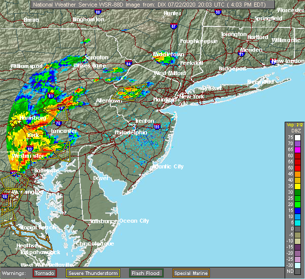 At 338 pm edt, a severe thunderstorm was located over fredericksburg, or near lebanon, moving east at 25 mph (radar indicated). Hazards include 60 mph wind gusts and nickel size hail. damage to roofs, siding, trees, and power lines is possible At 338 pm edt, a severe thunderstorm was located over fredericksburg, or near lebanon, moving east at 25 mph (radar indicated). Hazards include 60 mph wind gusts and nickel size hail. damage to roofs, siding, trees, and power lines is possible
|
| 7/22/2020 3:39 PM EDT |
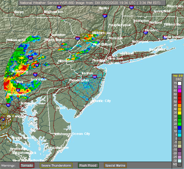 At 338 pm edt, a severe thunderstorm was located over fredericksburg, or near lebanon, moving east at 25 mph (radar indicated). Hazards include 60 mph wind gusts and nickel size hail. damage to roofs, siding, trees, and power lines is possible At 338 pm edt, a severe thunderstorm was located over fredericksburg, or near lebanon, moving east at 25 mph (radar indicated). Hazards include 60 mph wind gusts and nickel size hail. damage to roofs, siding, trees, and power lines is possible
|
| 7/3/2020 7:21 PM EDT |
 The severe thunderstorm warning for central berks county will expire at 730 pm edt, the storm which prompted the warning has weakened below severe limits, and no longer poses an immediate threat to life or property. therefore, the warning will be allowed to expire. however gusty winds are still possible with this thunderstorm. The severe thunderstorm warning for central berks county will expire at 730 pm edt, the storm which prompted the warning has weakened below severe limits, and no longer poses an immediate threat to life or property. therefore, the warning will be allowed to expire. however gusty winds are still possible with this thunderstorm.
|
| 7/3/2020 7:07 PM EDT |
 At 706 pm edt, a severe thunderstorm was located over robesonia, or 9 miles east of myerstown, moving southeast at 25 mph (radar indicated). Hazards include 60 mph wind gusts and penny size hail. Damage to roofs, siding, trees, and power lines is possible. law enforcement is reporting some trees and wires down in western berks county. locations impacted include, reading, wyomissing, sinking spring, laureldale, womelsdorf, wernersville, robesonia, bernville, strausstown, fairview hgts, spring ridge, shillington, west reading, mount penn, mohnton, kenhorst, st. lawrence, wyomissing hills, west lawn and lorane. this includes the following highways, interstate 78 in pennsylvania between mile markers 10 and 24. Interstate 176 in pennsylvania between mile markers 5 and 11. At 706 pm edt, a severe thunderstorm was located over robesonia, or 9 miles east of myerstown, moving southeast at 25 mph (radar indicated). Hazards include 60 mph wind gusts and penny size hail. Damage to roofs, siding, trees, and power lines is possible. law enforcement is reporting some trees and wires down in western berks county. locations impacted include, reading, wyomissing, sinking spring, laureldale, womelsdorf, wernersville, robesonia, bernville, strausstown, fairview hgts, spring ridge, shillington, west reading, mount penn, mohnton, kenhorst, st. lawrence, wyomissing hills, west lawn and lorane. this includes the following highways, interstate 78 in pennsylvania between mile markers 10 and 24. Interstate 176 in pennsylvania between mile markers 5 and 11.
|
| 7/3/2020 6:49 PM EDT |
 At 649 pm edt, a severe thunderstorm was located over strausstown, or 7 miles northeast of myerstown, moving southeast at 30 mph (radar indicated). Hazards include 60 mph wind gusts and penny size hail. damage to roofs, siding, trees, and power lines is possible At 649 pm edt, a severe thunderstorm was located over strausstown, or 7 miles northeast of myerstown, moving southeast at 30 mph (radar indicated). Hazards include 60 mph wind gusts and penny size hail. damage to roofs, siding, trees, and power lines is possible
|
| 6/4/2020 6:24 PM EDT |
 At 623 pm edt, a severe thunderstorm was located over bernville, or 11 miles northwest of reading, moving east at 30 mph (radar indicated. utility company reported downed wires near strausstown). Hazards include 60 mph wind gusts and quarter size hail. Minor damage to vehicles is possible. wind damage to roofs, siding, trees, and power lines is possible. locations impacted include, reading, wyomissing, hamburg, sinking spring, laureldale, womelsdorf, wernersville, robesonia, leesport, shoemakersville, bernville, strausstown, lenhartsville, spring ridge, fairview hgts, shillington, west reading, mount penn, mohnton and kenhorst. this includes the following highways, interstate 78 in pennsylvania between mile markers 13 and 37. Interstate 176 in pennsylvania between mile markers 7 and 11. At 623 pm edt, a severe thunderstorm was located over bernville, or 11 miles northwest of reading, moving east at 30 mph (radar indicated. utility company reported downed wires near strausstown). Hazards include 60 mph wind gusts and quarter size hail. Minor damage to vehicles is possible. wind damage to roofs, siding, trees, and power lines is possible. locations impacted include, reading, wyomissing, hamburg, sinking spring, laureldale, womelsdorf, wernersville, robesonia, leesport, shoemakersville, bernville, strausstown, lenhartsville, spring ridge, fairview hgts, shillington, west reading, mount penn, mohnton and kenhorst. this includes the following highways, interstate 78 in pennsylvania between mile markers 13 and 37. Interstate 176 in pennsylvania between mile markers 7 and 11.
|
| 6/4/2020 6:01 PM EDT |
 At 600 pm edt, a severe thunderstorm was located over myerstown, moving east at 30 mph. another potentially severe thunderstorm was located near strausstown (radar indicated). Hazards include 60 mph wind gusts and quarter size hail. Minor damage to vehicles is possible. wind damage to roofs, siding, trees, and power lines is possible. locations impacted include, reading, wyomissing, hamburg, sinking spring, laureldale, womelsdorf, wernersville, robesonia, leesport, shoemakersville, bernville, strausstown, lenhartsville, spring ridge, fairview hgts, shillington, west reading, mount penn, mohnton and kenhorst. this includes the following highways, interstate 78 in pennsylvania between mile markers 10 and 37. Interstate 176 in pennsylvania between mile markers 7 and 11. At 600 pm edt, a severe thunderstorm was located over myerstown, moving east at 30 mph. another potentially severe thunderstorm was located near strausstown (radar indicated). Hazards include 60 mph wind gusts and quarter size hail. Minor damage to vehicles is possible. wind damage to roofs, siding, trees, and power lines is possible. locations impacted include, reading, wyomissing, hamburg, sinking spring, laureldale, womelsdorf, wernersville, robesonia, leesport, shoemakersville, bernville, strausstown, lenhartsville, spring ridge, fairview hgts, shillington, west reading, mount penn, mohnton and kenhorst. this includes the following highways, interstate 78 in pennsylvania between mile markers 10 and 37. Interstate 176 in pennsylvania between mile markers 7 and 11.
|
| 6/4/2020 5:39 PM EDT |
 At 538 pm edt, a severe thunderstorm was located over harper tavern, or near annville, moving east at 30 mph (radar indicated). Hazards include 60 mph wind gusts and quarter size hail. Minor damage to vehicles is possible. Wind damage to roofs, siding, trees, and power lines is possible. At 538 pm edt, a severe thunderstorm was located over harper tavern, or near annville, moving east at 30 mph (radar indicated). Hazards include 60 mph wind gusts and quarter size hail. Minor damage to vehicles is possible. Wind damage to roofs, siding, trees, and power lines is possible.
|
| 6/3/2020 6:12 PM EDT |
 At 611 pm edt, a severe thunderstorm was located over womelsdorf, or near myerstown, moving southeast at 45 mph (radar indicated). Hazards include 70 mph wind gusts and quarter size hail. Minor damage to vehicles is possible. expect considerable tree damage. wind damage is also likely to mobile homes, roofs, and outbuildings. locations impacted include, reading, wyomissing, birdsboro, sinking spring, womelsdorf, wernersville, robesonia, bernville, strausstown, new morgan, spring ridge, shillington, west reading, mount penn, mohnton, kenhorst, st. lawrence, wyomissing hills, west lawn and lorane. this includes the following highways, interstate 78 in pennsylvania between mile markers 13 and 19. Interstate 176 in pennsylvania between mile markers 2 and 11. At 611 pm edt, a severe thunderstorm was located over womelsdorf, or near myerstown, moving southeast at 45 mph (radar indicated). Hazards include 70 mph wind gusts and quarter size hail. Minor damage to vehicles is possible. expect considerable tree damage. wind damage is also likely to mobile homes, roofs, and outbuildings. locations impacted include, reading, wyomissing, birdsboro, sinking spring, womelsdorf, wernersville, robesonia, bernville, strausstown, new morgan, spring ridge, shillington, west reading, mount penn, mohnton, kenhorst, st. lawrence, wyomissing hills, west lawn and lorane. this includes the following highways, interstate 78 in pennsylvania between mile markers 13 and 19. Interstate 176 in pennsylvania between mile markers 2 and 11.
|
| 6/3/2020 5:46 PM EDT |
 At 545 pm edt, a severe thunderstorm was located near fort indiantown gap, or 13 miles north of annville, moving southeast at 50 mph (radar indicated). Hazards include 70 mph wind gusts and quarter size hail. Minor damage to vehicles is possible. expect considerable tree damage. Wind damage is also likely to mobile homes, roofs, and outbuildings. At 545 pm edt, a severe thunderstorm was located near fort indiantown gap, or 13 miles north of annville, moving southeast at 50 mph (radar indicated). Hazards include 70 mph wind gusts and quarter size hail. Minor damage to vehicles is possible. expect considerable tree damage. Wind damage is also likely to mobile homes, roofs, and outbuildings.
|
| 6/3/2020 11:40 AM EDT |
 The severe thunderstorm warning for northwestern hunterdon, southwestern warren, berks, lehigh, northwestern montgomery, southern carbon, northwestern bucks and northampton counties will expire at 1145 am edt, the storms which prompted the warning have moved out of the area. therefore, the warning will be allowed to expire. a new warning has been issued for portions of the area. a severe thunderstorm watch remains in effect until 300 pm edt for northwestern new jersey, and eastern, southeastern and northeastern pennsylvania. The severe thunderstorm warning for northwestern hunterdon, southwestern warren, berks, lehigh, northwestern montgomery, southern carbon, northwestern bucks and northampton counties will expire at 1145 am edt, the storms which prompted the warning have moved out of the area. therefore, the warning will be allowed to expire. a new warning has been issued for portions of the area. a severe thunderstorm watch remains in effect until 300 pm edt for northwestern new jersey, and eastern, southeastern and northeastern pennsylvania.
|
| 6/3/2020 11:23 AM EDT |
 At 1122 am edt, severe thunderstorms were located along a line extending from jim thorpe to lenhartsville to near bernville, moving east at 75 mph (radar indicated). Hazards include 60 mph wind gusts and penny size hail. Damage to roofs, siding, trees, and power lines is possible. locations impacted include, allentown, reading, easton, lehighton, bethlehem, pottstown, forks, emmaus, wyomissing, northampton, quakertown, perkasie, wilson, souderton, bedminster, washington, hellertown, nazareth, palmerton and birdsboro. this includes the following highways, interstate 78 in new jersey between mile markers 0 and 12. interstate 78 in pennsylvania between mile markers 10 and 76. northeast extension between exits a44 and a56. Interstate 176 in pennsylvania between mile markers 10 and 11. At 1122 am edt, severe thunderstorms were located along a line extending from jim thorpe to lenhartsville to near bernville, moving east at 75 mph (radar indicated). Hazards include 60 mph wind gusts and penny size hail. Damage to roofs, siding, trees, and power lines is possible. locations impacted include, allentown, reading, easton, lehighton, bethlehem, pottstown, forks, emmaus, wyomissing, northampton, quakertown, perkasie, wilson, souderton, bedminster, washington, hellertown, nazareth, palmerton and birdsboro. this includes the following highways, interstate 78 in new jersey between mile markers 0 and 12. interstate 78 in pennsylvania between mile markers 10 and 76. northeast extension between exits a44 and a56. Interstate 176 in pennsylvania between mile markers 10 and 11.
|
| 6/3/2020 11:04 AM EDT |
 At 1103 am edt, severe thunderstorms were located along a line extending from nuremburg to near friedensburg to fort indiantown gap, moving east at 75 mph (radar indicated). Hazards include 60 mph wind gusts and penny size hail. damage to roofs, siding, trees, and power lines is possible At 1103 am edt, severe thunderstorms were located along a line extending from nuremburg to near friedensburg to fort indiantown gap, moving east at 75 mph (radar indicated). Hazards include 60 mph wind gusts and penny size hail. damage to roofs, siding, trees, and power lines is possible
|
| 5/29/2020 4:37 PM EDT |
 The severe thunderstorm warning for berks and western lehigh counties will expire at 445 pm edt, the storm which prompted the warning has weakened below severe limits, and no longer poses an immediate threat to life or property. therefore, the warning will be allowed to expire. however small hail, gusty winds and heavy rain are still possible with this thunderstorm. a severe thunderstorm watch remains in effect until 900 pm edt for eastern and southeastern pennsylvania. The severe thunderstorm warning for berks and western lehigh counties will expire at 445 pm edt, the storm which prompted the warning has weakened below severe limits, and no longer poses an immediate threat to life or property. therefore, the warning will be allowed to expire. however small hail, gusty winds and heavy rain are still possible with this thunderstorm. a severe thunderstorm watch remains in effect until 900 pm edt for eastern and southeastern pennsylvania.
|
| 5/29/2020 4:17 PM EDT |
 At 414 pm edt, a severe thunderstorm was located near shoemakersville, or 11 miles northwest of reading, moving east at 45 mph (trained weather spotter reports 60 mph wind gusts in bethel township, pennsylvania). Hazards include 60 mph wind gusts and quarter size hail. Minor damage to vehicles is possible. wind damage to roofs, siding, trees, and power lines is possible. locations impacted include, reading, wyomissing, kutztown, hamburg, fleetwood, sinking spring, laureldale, womelsdorf, wernersville, topton, robesonia, leesport, shoemakersville, bally, bernville, bechtelsville, lyons, strausstown, lenhartsville and spring ridge. this includes the following highways, interstate 78 in pennsylvania between mile markers 10 and 48. Interstate 176 in pennsylvania between mile markers 9 and 11. At 414 pm edt, a severe thunderstorm was located near shoemakersville, or 11 miles northwest of reading, moving east at 45 mph (trained weather spotter reports 60 mph wind gusts in bethel township, pennsylvania). Hazards include 60 mph wind gusts and quarter size hail. Minor damage to vehicles is possible. wind damage to roofs, siding, trees, and power lines is possible. locations impacted include, reading, wyomissing, kutztown, hamburg, fleetwood, sinking spring, laureldale, womelsdorf, wernersville, topton, robesonia, leesport, shoemakersville, bally, bernville, bechtelsville, lyons, strausstown, lenhartsville and spring ridge. this includes the following highways, interstate 78 in pennsylvania between mile markers 10 and 48. Interstate 176 in pennsylvania between mile markers 9 and 11.
|
| 5/29/2020 3:51 PM EDT |
 At 350 pm edt, a severe thunderstorm was located over myerstown, moving east at 45 mph (radar indicated). Hazards include 60 mph wind gusts and quarter size hail. Minor damage to vehicles is possible. Wind damage to roofs, siding, trees, and power lines is possible. At 350 pm edt, a severe thunderstorm was located over myerstown, moving east at 45 mph (radar indicated). Hazards include 60 mph wind gusts and quarter size hail. Minor damage to vehicles is possible. Wind damage to roofs, siding, trees, and power lines is possible.
|
| 10/31/2019 9:26 PM EDT |
 At 926 pm edt, severe thunderstorms were located along a line extending from near skytop to akron, moving northeast at 50 mph (radar indicated). Hazards include 60 mph wind gusts. Damage to roofs, siding, trees, and power lines is possible. locations impacted include, reading, lehighton, mount pocono, wyomissing, northampton, east stroudsburg, tobyhanna, palmerton, kutztown, jim thorpe, hamburg, slatington, fleetwood, sinking spring, laureldale, nesquehoning, womelsdorf, weatherly, wernersville and newmanstown. this includes the following highways, interstate 80 in pennsylvania between mile markers 277 and 310. Interstate 78 in pennsylvania between mile markers 10 and 53. At 926 pm edt, severe thunderstorms were located along a line extending from near skytop to akron, moving northeast at 50 mph (radar indicated). Hazards include 60 mph wind gusts. Damage to roofs, siding, trees, and power lines is possible. locations impacted include, reading, lehighton, mount pocono, wyomissing, northampton, east stroudsburg, tobyhanna, palmerton, kutztown, jim thorpe, hamburg, slatington, fleetwood, sinking spring, laureldale, nesquehoning, womelsdorf, weatherly, wernersville and newmanstown. this includes the following highways, interstate 80 in pennsylvania between mile markers 277 and 310. Interstate 78 in pennsylvania between mile markers 10 and 53.
|
| 10/31/2019 8:58 PM EDT |
 At 857 pm edt, severe thunderstorms were located along a line extending from albrightsville to windsor, moving northeast at 50 mph (radar indicated). Hazards include 60 mph wind gusts. damage to roofs, siding, trees, and power lines is possible At 857 pm edt, severe thunderstorms were located along a line extending from albrightsville to windsor, moving northeast at 50 mph (radar indicated). Hazards include 60 mph wind gusts. damage to roofs, siding, trees, and power lines is possible
|
| 10/31/2019 8:39 PM EDT |
 At 838 pm edt, severe thunderstorms were located along a line extending from near hometown to manchester, moving northeast at 50 mph (radar indicated). Hazards include 60 mph wind gusts. Damage to roofs, siding, trees, and power lines is possible. locations impacted include, lehighton, jim thorpe, hamburg, nesquehoning, womelsdorf, weatherly, newmanstown, bernville, strausstown, new mahoning, wanamakers, lake harmony, penn forest reservoir, albrightsville, christmans, meckesville, lansford, summit hill, beaver meadows and parryville. this includes the following highways, interstate 80 in pennsylvania between mile markers 277 and 285. Interstate 78 in pennsylvania between mile markers 10 and 35. At 838 pm edt, severe thunderstorms were located along a line extending from near hometown to manchester, moving northeast at 50 mph (radar indicated). Hazards include 60 mph wind gusts. Damage to roofs, siding, trees, and power lines is possible. locations impacted include, lehighton, jim thorpe, hamburg, nesquehoning, womelsdorf, weatherly, newmanstown, bernville, strausstown, new mahoning, wanamakers, lake harmony, penn forest reservoir, albrightsville, christmans, meckesville, lansford, summit hill, beaver meadows and parryville. this includes the following highways, interstate 80 in pennsylvania between mile markers 277 and 285. Interstate 78 in pennsylvania between mile markers 10 and 35.
|
| 10/31/2019 8:11 PM EDT |
 At 811 pm edt, severe thunderstorms were located along a line extending from branchdale to new oxford, moving northeast at 50 mph (radar indicated). Hazards include 60 mph wind gusts. damage to roofs, siding, trees, and power lines is possible At 811 pm edt, severe thunderstorms were located along a line extending from branchdale to new oxford, moving northeast at 50 mph (radar indicated). Hazards include 60 mph wind gusts. damage to roofs, siding, trees, and power lines is possible
|
| 8/7/2019 1:46 PM EDT |
 At 146 pm edt, a severe thunderstorm was located over fredericksburg, or 9 miles northwest of myerstown, moving northeast at 20 mph (radar indicated). Hazards include 60 mph wind gusts and penny size hail. damage to roofs, siding, trees, and power lines is possible At 146 pm edt, a severe thunderstorm was located over fredericksburg, or 9 miles northwest of myerstown, moving northeast at 20 mph (radar indicated). Hazards include 60 mph wind gusts and penny size hail. damage to roofs, siding, trees, and power lines is possible
|
| 7/22/2019 8:20 PM EDT |
 At 820 pm edt, a severe thunderstorm was located over womelsdorf, or near myerstown, moving east at 35 mph (radar indicated). Hazards include 60 mph wind gusts. damage to roofs, siding, trees, and power lines is possible At 820 pm edt, a severe thunderstorm was located over womelsdorf, or near myerstown, moving east at 35 mph (radar indicated). Hazards include 60 mph wind gusts. damage to roofs, siding, trees, and power lines is possible
|
| 7/21/2019 11:21 PM EDT |
 The severe thunderstorm warning for berks, northwestern montgomery and northeastern chester counties will expire at 1130 pm edt, the storms which prompted the warning are moving out of the area. therefore, the warning will be allowed to expire. to report severe weather, contact your nearest law enforcement agency. they will relay your report to the national weather service mount holly nj. The severe thunderstorm warning for berks, northwestern montgomery and northeastern chester counties will expire at 1130 pm edt, the storms which prompted the warning are moving out of the area. therefore, the warning will be allowed to expire. to report severe weather, contact your nearest law enforcement agency. they will relay your report to the national weather service mount holly nj.
|
| 7/21/2019 10:58 PM EDT |
 At 1058 pm edt, severe thunderstorms were located along a line extending from near strausstown to near laureldale to chester springs, moving northeast at 20 mph (radar indicated). Hazards include 60 mph wind gusts. Damage to roofs, siding, trees, and power lines is possible. Locations impacted include, reading, pottstown, phoenixville, wyomissing, souderton, birdsboro, collegeville, royersford, fleetwood, sinking spring, laureldale, trappe, womelsdorf, wernersville, newmanstown, robesonia, leesport, schwenksville, shoemakersville and bally. At 1058 pm edt, severe thunderstorms were located along a line extending from near strausstown to near laureldale to chester springs, moving northeast at 20 mph (radar indicated). Hazards include 60 mph wind gusts. Damage to roofs, siding, trees, and power lines is possible. Locations impacted include, reading, pottstown, phoenixville, wyomissing, souderton, birdsboro, collegeville, royersford, fleetwood, sinking spring, laureldale, trappe, womelsdorf, wernersville, newmanstown, robesonia, leesport, schwenksville, shoemakersville and bally.
|
| 7/21/2019 10:42 PM EDT |
 At 1042 pm edt, severe thunderstorms were located along a line extending from near strausstown to near lionville, moving northeast at 20 mph (radar indicated). Hazards include 60 mph wind gusts. damage to roofs, siding, trees, and power lines is possible At 1042 pm edt, severe thunderstorms were located along a line extending from near strausstown to near lionville, moving northeast at 20 mph (radar indicated). Hazards include 60 mph wind gusts. damage to roofs, siding, trees, and power lines is possible
|
| 7/17/2019 7:22 PM EDT |
 At 721 pm edt, severe thunderstorms were located along a line extending from strausstown to near elverson, moving northeast at 40 mph (radar indicated). Hazards include 60 mph wind gusts and penny size hail. Damage to roofs, siding, trees, and power lines is possible. Locations impacted include, reading, pottstown, wyomissing, birdsboro, kutztown, hamburg, fleetwood, sinking spring, laureldale, east greenville, womelsdorf, wernersville, newmanstown, topton, leesport, shoemakersville, elverson, bally, bernville and bechtelsville. At 721 pm edt, severe thunderstorms were located along a line extending from strausstown to near elverson, moving northeast at 40 mph (radar indicated). Hazards include 60 mph wind gusts and penny size hail. Damage to roofs, siding, trees, and power lines is possible. Locations impacted include, reading, pottstown, wyomissing, birdsboro, kutztown, hamburg, fleetwood, sinking spring, laureldale, east greenville, womelsdorf, wernersville, newmanstown, topton, leesport, shoemakersville, elverson, bally, bernville and bechtelsville.
|
| 7/17/2019 6:51 PM EDT |
 The national weather service in mount holly nj has issued a * severe thunderstorm warning for. berks county in eastern pennsylvania. northwestern montgomery county in southeastern pennsylvania. north central chester county in southeastern pennsylvania. Until 745 pm edt. The national weather service in mount holly nj has issued a * severe thunderstorm warning for. berks county in eastern pennsylvania. northwestern montgomery county in southeastern pennsylvania. north central chester county in southeastern pennsylvania. Until 745 pm edt.
|
| 7/6/2019 6:55 PM EDT |
 The severe thunderstorm warning for sussex, warren, berks, lehigh, southeastern carbon, monroe and northampton counties will expire at 700 pm edt, the storms which prompted the warning continue to move to the southeast. a new severe thunderstorm warning is in effect for these counties until 8:00 pm edt. to report severe weather, contact your nearest law enforcement agency. they will relay your report to the national weather service mount holly nj. The severe thunderstorm warning for sussex, warren, berks, lehigh, southeastern carbon, monroe and northampton counties will expire at 700 pm edt, the storms which prompted the warning continue to move to the southeast. a new severe thunderstorm warning is in effect for these counties until 8:00 pm edt. to report severe weather, contact your nearest law enforcement agency. they will relay your report to the national weather service mount holly nj.
|
| 7/6/2019 6:22 PM EDT |
 At 622 pm edt, severe thunderstorms were located along a line extending from near matamoras to beltzville state park to near palmyra, moving southeast at 30 mph (radar indicated). Hazards include 60 mph wind gusts. damage to roofs, siding, trees, and power lines is possible At 622 pm edt, severe thunderstorms were located along a line extending from near matamoras to beltzville state park to near palmyra, moving southeast at 30 mph (radar indicated). Hazards include 60 mph wind gusts. damage to roofs, siding, trees, and power lines is possible
|
| 7/2/2019 7:05 PM EDT |
 The severe thunderstorm warning for berks county will expire at 715 pm edt, the storm which prompted the warning has weakened below severe limits, and no longer poses an immediate threat to life or property. therefore, the warning will be allowed to expire. however, heavy rain is still possible with this thunderstorm. The severe thunderstorm warning for berks county will expire at 715 pm edt, the storm which prompted the warning has weakened below severe limits, and no longer poses an immediate threat to life or property. therefore, the warning will be allowed to expire. however, heavy rain is still possible with this thunderstorm.
|
| 7/2/2019 6:28 PM EDT |
 At 628 pm edt, a severe thunderstorm was located over bernville, or 10 miles east of myerstown, moving east at 20 mph (radar indicated). Hazards include 60 mph wind gusts. damage to roofs, siding, trees, and power lines is possible At 628 pm edt, a severe thunderstorm was located over bernville, or 10 miles east of myerstown, moving east at 20 mph (radar indicated). Hazards include 60 mph wind gusts. damage to roofs, siding, trees, and power lines is possible
|
| 6/29/2019 2:52 PM EDT |
 At 252 pm edt, severe thunderstorms were located along a line extending from grier city-park crest to orwigsburg to near bernville to schaefferstown, moving southeast at 25 mph (radar indicated). Hazards include 60 mph wind gusts and quarter size hail. Minor damage to vehicles is possible. wind damage to roofs, siding, trees, and power lines is possible. Locations impacted include, reading, wyomissing, hamburg, fleetwood, sinking spring, laureldale, womelsdorf, wernersville, newmanstown, leesport, shoemakersville, bernville, strausstown, lenhartsville, fairview hgts, spring ridge, centerport, wyomissing hills, west lawn and whitfield. At 252 pm edt, severe thunderstorms were located along a line extending from grier city-park crest to orwigsburg to near bernville to schaefferstown, moving southeast at 25 mph (radar indicated). Hazards include 60 mph wind gusts and quarter size hail. Minor damage to vehicles is possible. wind damage to roofs, siding, trees, and power lines is possible. Locations impacted include, reading, wyomissing, hamburg, fleetwood, sinking spring, laureldale, womelsdorf, wernersville, newmanstown, leesport, shoemakersville, bernville, strausstown, lenhartsville, fairview hgts, spring ridge, centerport, wyomissing hills, west lawn and whitfield.
|
| 6/29/2019 2:27 PM EDT |
 At 226 pm edt, severe thunderstorms were located along a line extending from mechanicsville to aristes to pine grove to fort indiantown gap, moving east at 30 mph (radar indicated). Hazards include 60 mph wind gusts and quarter size hail. Minor damage to vehicles is possible. Wind damage to roofs, siding, trees, and power lines is possible. At 226 pm edt, severe thunderstorms were located along a line extending from mechanicsville to aristes to pine grove to fort indiantown gap, moving east at 30 mph (radar indicated). Hazards include 60 mph wind gusts and quarter size hail. Minor damage to vehicles is possible. Wind damage to roofs, siding, trees, and power lines is possible.
|
| 5/29/2019 5:16 PM EDT |
 At 515 pm edt, severe thunderstorms were located along a line extending from allentown to near mountville, moving southeast at 55 mph (radar indicated). Hazards include 60 mph wind gusts and quarter size hail. Minor damage to vehicles is possible. wind damage to roofs, siding, trees, and power lines is possible. Locations impacted include, allentown, reading, bethlehem, pottstown, emmaus, wyomissing, northampton, birdsboro, kutztown, hamburg, slatington, fleetwood, sinking spring, laureldale, womelsdorf, wernersville, newmanstown, walnutport, topton and leesport. At 515 pm edt, severe thunderstorms were located along a line extending from allentown to near mountville, moving southeast at 55 mph (radar indicated). Hazards include 60 mph wind gusts and quarter size hail. Minor damage to vehicles is possible. wind damage to roofs, siding, trees, and power lines is possible. Locations impacted include, allentown, reading, bethlehem, pottstown, emmaus, wyomissing, northampton, birdsboro, kutztown, hamburg, slatington, fleetwood, sinking spring, laureldale, womelsdorf, wernersville, newmanstown, walnutport, topton and leesport.
|
| 5/29/2019 4:50 PM EDT |
 At 450 pm edt, severe thunderstorms were located along a line extending from near lehighton to near hummelstown, moving southeast at 50 mph (radar indicated). Hazards include 60 mph wind gusts and quarter size hail. Minor damage to vehicles is possible. Wind damage to roofs, siding, trees, and power lines is possible. At 450 pm edt, severe thunderstorms were located along a line extending from near lehighton to near hummelstown, moving southeast at 50 mph (radar indicated). Hazards include 60 mph wind gusts and quarter size hail. Minor damage to vehicles is possible. Wind damage to roofs, siding, trees, and power lines is possible.
|
| 5/29/2019 3:43 PM EDT |
 At 343 pm edt, a severe thunderstorm was located over richland, or over myerstown, moving east at 35 mph (radar indicated). Hazards include ping pong ball size hail and 60 mph wind gusts. People and animals outdoors will be injured. expect hail damage to roofs, siding, windows, and vehicles. Wind damage to roofs, siding, trees, and power lines is possible. At 343 pm edt, a severe thunderstorm was located over richland, or over myerstown, moving east at 35 mph (radar indicated). Hazards include ping pong ball size hail and 60 mph wind gusts. People and animals outdoors will be injured. expect hail damage to roofs, siding, windows, and vehicles. Wind damage to roofs, siding, trees, and power lines is possible.
|
| 5/28/2019 5:53 PM EDT |
 At 553 pm edt, a severe thunderstorm was located over strausstown, or 9 miles south of schuylkill haven, moving east at 35 mph (radar indicated). Hazards include 60 mph wind gusts and quarter size hail. Minor damage to vehicles is possible. wind damage to roofs, siding, trees, and power lines is possible. Locations impacted include, hamburg, womelsdorf, leesport, shoemakersville, bernville, strausstown, lenhartsville, fairview hgts and centerport. At 553 pm edt, a severe thunderstorm was located over strausstown, or 9 miles south of schuylkill haven, moving east at 35 mph (radar indicated). Hazards include 60 mph wind gusts and quarter size hail. Minor damage to vehicles is possible. wind damage to roofs, siding, trees, and power lines is possible. Locations impacted include, hamburg, womelsdorf, leesport, shoemakersville, bernville, strausstown, lenhartsville, fairview hgts and centerport.
|
| 5/28/2019 5:36 PM EDT |
 At 536 pm edt, a severe thunderstorm was located over pine grove, or 9 miles southwest of minersville, moving southeast at 30 mph (radar indicated). Hazards include 60 mph wind gusts and quarter size hail. Minor damage to vehicles is possible. Wind damage to roofs, siding, trees, and power lines is possible. At 536 pm edt, a severe thunderstorm was located over pine grove, or 9 miles southwest of minersville, moving southeast at 30 mph (radar indicated). Hazards include 60 mph wind gusts and quarter size hail. Minor damage to vehicles is possible. Wind damage to roofs, siding, trees, and power lines is possible.
|
| 5/28/2019 5:25 PM EDT |
 The severe thunderstorm warning for west central berks county will expire at 530 pm edt, the storm which prompted the warning is move out of the area. therefore, this warning will be allowed to expire. another severe thunderstorm warning however remains in effect to the southeast. a tornado watch remains in effect until 1000 pm edt for eastern pennsylvania. The severe thunderstorm warning for west central berks county will expire at 530 pm edt, the storm which prompted the warning is move out of the area. therefore, this warning will be allowed to expire. another severe thunderstorm warning however remains in effect to the southeast. a tornado watch remains in effect until 1000 pm edt for eastern pennsylvania.
|
| 5/28/2019 4:59 PM EDT |
 At 459 pm edt, a severe thunderstorm was located over womelsdorf, or 9 miles east of myerstown, moving southeast at 50 mph (radar indicated). Hazards include 70 mph wind gusts and half dollar size hail. Minor damage to vehicles is possible. expect considerable tree damage. wind damage is also likely to mobile homes, roofs, and outbuildings. Locations impacted include, laureldale, womelsdorf, wernersville, newmanstown, leesport, bernville, strausstown, fairview hgts and spring ridge. At 459 pm edt, a severe thunderstorm was located over womelsdorf, or 9 miles east of myerstown, moving southeast at 50 mph (radar indicated). Hazards include 70 mph wind gusts and half dollar size hail. Minor damage to vehicles is possible. expect considerable tree damage. wind damage is also likely to mobile homes, roofs, and outbuildings. Locations impacted include, laureldale, womelsdorf, wernersville, newmanstown, leesport, bernville, strausstown, fairview hgts and spring ridge.
|
| 5/28/2019 4:46 PM EDT |
 At 445 pm edt, a severe thunderstorm was located near strausstown, or 7 miles north of myerstown, moving southeast at 25 mph (radar indicated). Hazards include 70 mph wind gusts and half dollar size hail. Minor damage to vehicles is possible. expect considerable tree damage. wind damage is also likely to mobile homes, roofs, and outbuildings. Locations impacted include, laureldale, womelsdorf, wernersville, newmanstown, leesport, bernville, strausstown, fairview hgts, spring ridge and centerport. At 445 pm edt, a severe thunderstorm was located near strausstown, or 7 miles north of myerstown, moving southeast at 25 mph (radar indicated). Hazards include 70 mph wind gusts and half dollar size hail. Minor damage to vehicles is possible. expect considerable tree damage. wind damage is also likely to mobile homes, roofs, and outbuildings. Locations impacted include, laureldale, womelsdorf, wernersville, newmanstown, leesport, bernville, strausstown, fairview hgts, spring ridge and centerport.
|
| 5/28/2019 4:27 PM EDT |
 At 426 pm edt, a severe thunderstorm was located near pine grove, or 11 miles southwest of minersville, moving southeast at 25 mph (radar indicated. storm has a history of producing large hail). Hazards include 70 mph wind gusts and ping pong ball size hail. People and animals outdoors will be injured. expect hail damage to roofs, siding, windows, and vehicles. expect considerable tree damage. Wind damage is also likely to mobile homes, roofs, and outbuildings. At 426 pm edt, a severe thunderstorm was located near pine grove, or 11 miles southwest of minersville, moving southeast at 25 mph (radar indicated. storm has a history of producing large hail). Hazards include 70 mph wind gusts and ping pong ball size hail. People and animals outdoors will be injured. expect hail damage to roofs, siding, windows, and vehicles. expect considerable tree damage. Wind damage is also likely to mobile homes, roofs, and outbuildings.
|
| 5/19/2019 11:00 PM EDT |
 At 1100 pm edt, a severe thunderstorm was located over hamburg, or 10 miles east of schuylkill haven, moving east at 45 mph (radar indicated). Hazards include 60 mph wind gusts and quarter size hail. Minor damage to vehicles is possible. Wind damage to roofs, siding, trees, and power lines is possible. At 1100 pm edt, a severe thunderstorm was located over hamburg, or 10 miles east of schuylkill haven, moving east at 45 mph (radar indicated). Hazards include 60 mph wind gusts and quarter size hail. Minor damage to vehicles is possible. Wind damage to roofs, siding, trees, and power lines is possible.
|
| 5/19/2019 8:37 PM EDT |
 At 837 pm edt, severe thunderstorms were located along a line extending from near strausstown to near fleetwood to near reading, moving northeast at 25 mph (radar indicated). Hazards include 60 mph wind gusts and quarter size hail. Minor damage to vehicles is possible. Wind damage to roofs, siding, trees, and power lines is possible. At 837 pm edt, severe thunderstorms were located along a line extending from near strausstown to near fleetwood to near reading, moving northeast at 25 mph (radar indicated). Hazards include 60 mph wind gusts and quarter size hail. Minor damage to vehicles is possible. Wind damage to roofs, siding, trees, and power lines is possible.
|
| 4/26/2019 4:19 PM EDT |
 At 418 pm edt, a severe thunderstorm was located near gap, or near new holland, moving northeast at 45 mph (radar indicated). Hazards include 60 mph wind gusts. damage to roofs, siding, trees, and power lines is possible At 418 pm edt, a severe thunderstorm was located near gap, or near new holland, moving northeast at 45 mph (radar indicated). Hazards include 60 mph wind gusts. damage to roofs, siding, trees, and power lines is possible
|
| 8/17/2018 6:44 PM EDT |
 At 644 pm edt, severe thunderstorms were located along a line extending from near hamburg to near kleinfeltersville, moving northeast at 35 mph (radar indicated). Hazards include 60 mph wind gusts and quarter size hail. Minor damage to vehicles is possible. wind damage to roofs, siding, trees, and power lines is possible. these severe storms will be near, hamburg, robesonia and shoemakersville around 650 pm edt. bernville around 655 pm edt. lenhartsville around 700 pm edt. reading, wyomissing, kutztown, spring ridge and fairview hgts around 705 pm edt. laureldale, leesport and wanamakers around 710 pm edt. fleetwood, lyons, new tripoli, jordan valley, claussville and schnecksville around 715 pm edt. Other locations impacted by these severe thunderstorms include wyomissing hills, west lawn, alburtis, west reading, lorane, kenhorst, mount penn, reiffton, whitfield and centerport. At 644 pm edt, severe thunderstorms were located along a line extending from near hamburg to near kleinfeltersville, moving northeast at 35 mph (radar indicated). Hazards include 60 mph wind gusts and quarter size hail. Minor damage to vehicles is possible. wind damage to roofs, siding, trees, and power lines is possible. these severe storms will be near, hamburg, robesonia and shoemakersville around 650 pm edt. bernville around 655 pm edt. lenhartsville around 700 pm edt. reading, wyomissing, kutztown, spring ridge and fairview hgts around 705 pm edt. laureldale, leesport and wanamakers around 710 pm edt. fleetwood, lyons, new tripoli, jordan valley, claussville and schnecksville around 715 pm edt. Other locations impacted by these severe thunderstorms include wyomissing hills, west lawn, alburtis, west reading, lorane, kenhorst, mount penn, reiffton, whitfield and centerport.
|
| 8/17/2018 6:23 PM EDT |
 At 622 pm edt, severe thunderstorms were located along a line extending from strausstown to near wernersville, moving northeast at 35 mph (radar indicated). Hazards include 60 mph wind gusts. damage to roofs, siding, trees, and power lines is possible At 622 pm edt, severe thunderstorms were located along a line extending from strausstown to near wernersville, moving northeast at 35 mph (radar indicated). Hazards include 60 mph wind gusts. damage to roofs, siding, trees, and power lines is possible
|
| 6/18/2018 6:58 PM EDT |
 At 658 pm edt, severe thunderstorms were located along a line extending from near wanamakers to near myerstown, moving east at 35 mph (radar indicated). Hazards include 60 mph wind gusts. damage to roofs, siding, trees, and power lines is possible At 658 pm edt, severe thunderstorms were located along a line extending from near wanamakers to near myerstown, moving east at 35 mph (radar indicated). Hazards include 60 mph wind gusts. damage to roofs, siding, trees, and power lines is possible
|
| 5/15/2018 4:16 PM EDT |
 At 414 pm edt, a line of severe thunderstorms were located from near newton in sussex county new jersey southwest to near womelsdorf in berks county pennsylvania. the storms were moving east at 65 mph (radar indicated). Hazards include 70 mph wind gusts and quarter size hail. Minor damage to vehicles is possible. expect considerable tree damage. wind damage is also likely to mobile homes, roofs, and outbuildings. Locations impacted include, allentown, reading, easton, port jervis, newton, montague, bethlehem, dover, hopatcong, forks, emmaus, wyomissing, kinnelon, northampton, hackettstown, boonton, wilson, butler, wharton and washington. At 414 pm edt, a line of severe thunderstorms were located from near newton in sussex county new jersey southwest to near womelsdorf in berks county pennsylvania. the storms were moving east at 65 mph (radar indicated). Hazards include 70 mph wind gusts and quarter size hail. Minor damage to vehicles is possible. expect considerable tree damage. wind damage is also likely to mobile homes, roofs, and outbuildings. Locations impacted include, allentown, reading, easton, port jervis, newton, montague, bethlehem, dover, hopatcong, forks, emmaus, wyomissing, kinnelon, northampton, hackettstown, boonton, wilson, butler, wharton and washington.
|
| 5/15/2018 3:46 PM EDT |
 At 344 pm edt, an area of severe thunderstorms were moving east from the southern poconos and schuylkill county. th storms are moving east at around 65 mph (radar indicated). Hazards include 70 mph wind gusts and quarter size hail. Minor damage to vehicles is possible. expect considerable tree damage. Wind damage is also likely to mobile homes, roofs, and outbuildings. At 344 pm edt, an area of severe thunderstorms were moving east from the southern poconos and schuylkill county. th storms are moving east at around 65 mph (radar indicated). Hazards include 70 mph wind gusts and quarter size hail. Minor damage to vehicles is possible. expect considerable tree damage. Wind damage is also likely to mobile homes, roofs, and outbuildings.
|
| 9/5/2017 5:19 PM EDT |
 At 517 pm edt, severe thunderstorms were located along a line extending from claussville to near womelsdorf to near belvidere. storms are moving northeast along the line at around 30 mph (radar indicated). Hazards include 60 mph wind gusts and penny size hail. Expect damage to trees and power lines. Locations impacted include, allentown, reading, easton, lehighton, bethlehem, forks, wyomissing, northampton, wilson, nazareth, palmerton, bangor, kutztown, jim thorpe, hamburg, slatington, fleetwood, sinking spring, laureldale and pen argyl. At 517 pm edt, severe thunderstorms were located along a line extending from claussville to near womelsdorf to near belvidere. storms are moving northeast along the line at around 30 mph (radar indicated). Hazards include 60 mph wind gusts and penny size hail. Expect damage to trees and power lines. Locations impacted include, allentown, reading, easton, lehighton, bethlehem, forks, wyomissing, northampton, wilson, nazareth, palmerton, bangor, kutztown, jim thorpe, hamburg, slatington, fleetwood, sinking spring, laureldale and pen argyl.
|
| 9/5/2017 4:54 PM EDT |
 At 454 pm edt, severe thunderstorms were located along a line extending from near wernersville to near branchdale to near northampton, moving northeast at 30 mph (radar indicated). Hazards include 60 mph wind gusts and penny size hail. expect damage to trees and power lines At 454 pm edt, severe thunderstorms were located along a line extending from near wernersville to near branchdale to near northampton, moving northeast at 30 mph (radar indicated). Hazards include 60 mph wind gusts and penny size hail. expect damage to trees and power lines
|
| 9/5/2017 4:33 PM EDT |
 At 431 pm edt, severe thunderstorms were located along a line extending from near leesport to near claussville, moving northeast at 30 mph (radar and spotter indicated. at 405 pm, large hail to the size of quarters was reported in wernersville). Hazards include 60 mph wind gusts and penny size hail. Expect damage to trees and power lines. these severe storms will be near, claussville around 435 pm edt. ancient oaks around 440 pm edt. lenhartsville, coffeetown and schnecksville around 445 pm edt. allentown, emmaus, lyons and neffs around 450 pm edt. kutztown around 455 pm edt. bethlehem, northampton, bath, topton, steuben, beersville and lehigh university around 500 pm edt. Other locations impacted by these severe thunderstorms include wyomissing hills, chapman, west lawn, alburtis, coplay, fountain hill, fullerton, west reading, hokendauqua and bowmanstown. At 431 pm edt, severe thunderstorms were located along a line extending from near leesport to near claussville, moving northeast at 30 mph (radar and spotter indicated. at 405 pm, large hail to the size of quarters was reported in wernersville). Hazards include 60 mph wind gusts and penny size hail. Expect damage to trees and power lines. these severe storms will be near, claussville around 435 pm edt. ancient oaks around 440 pm edt. lenhartsville, coffeetown and schnecksville around 445 pm edt. allentown, emmaus, lyons and neffs around 450 pm edt. kutztown around 455 pm edt. bethlehem, northampton, bath, topton, steuben, beersville and lehigh university around 500 pm edt. Other locations impacted by these severe thunderstorms include wyomissing hills, chapman, west lawn, alburtis, coplay, fountain hill, fullerton, west reading, hokendauqua and bowmanstown.
|
| 9/5/2017 4:13 PM EDT |
 At 410 pm edt, a severe thunderstorm was located over wernersville, or 7 miles west of reading, moving northeast at 15 mph (radar indicated). Hazards include 60 mph wind gusts and nickel size hail. Expect damage to trees and power lines. this severe storm will be near, robesonia around 415 pm edt. spring ridge around 425 pm edt. wyomissing and fairview hgts around 430 pm edt. reading around 435 pm edt. laureldale and leesport around 440 pm edt. shoemakersville around 450 pm edt. kutztown, fleetwood and lyons around 500 pm edt. Other locations impacted by this severe thunderstorm include wyomissing hills, chapman, west lawn, alburtis, coplay, fountain hill, fullerton, west reading, hokendauqua and bowmanstown. At 410 pm edt, a severe thunderstorm was located over wernersville, or 7 miles west of reading, moving northeast at 15 mph (radar indicated). Hazards include 60 mph wind gusts and nickel size hail. Expect damage to trees and power lines. this severe storm will be near, robesonia around 415 pm edt. spring ridge around 425 pm edt. wyomissing and fairview hgts around 430 pm edt. reading around 435 pm edt. laureldale and leesport around 440 pm edt. shoemakersville around 450 pm edt. kutztown, fleetwood and lyons around 500 pm edt. Other locations impacted by this severe thunderstorm include wyomissing hills, chapman, west lawn, alburtis, coplay, fountain hill, fullerton, west reading, hokendauqua and bowmanstown.
|
| 9/5/2017 4:08 PM EDT |
 At 408 pm edt, a severe thunderstorm was located near wernersville, or 8 miles west of reading, moving northeast at 20 mph (radar indicated). Hazards include 60 mph wind gusts and penny size hail. expect damage to trees and power lines At 408 pm edt, a severe thunderstorm was located near wernersville, or 8 miles west of reading, moving northeast at 20 mph (radar indicated). Hazards include 60 mph wind gusts and penny size hail. expect damage to trees and power lines
|
| 8/22/2017 8:32 PM EDT |
 At 832 pm edt, severe thunderstorms were located along a line extending from near new mahoning to near bernville, moving east at 55 mph (radar indicated). Hazards include golf ball size hail and 70 mph wind gusts. People and animals outdoors will be injured. expect hail damage to roofs, siding, windows, and vehicles. expect considerable tree damage. wind damage is also likely to mobile homes, roofs, and outbuildings. Locations impacted include, allentown, reading, wyomissing, northampton, birdsboro, kutztown, hamburg, slatington, fleetwood, sinking spring, laureldale, womelsdorf, wernersville, newmanstown, walnutport, topton, leesport, shoemakersville, bernville and lyons. At 832 pm edt, severe thunderstorms were located along a line extending from near new mahoning to near bernville, moving east at 55 mph (radar indicated). Hazards include golf ball size hail and 70 mph wind gusts. People and animals outdoors will be injured. expect hail damage to roofs, siding, windows, and vehicles. expect considerable tree damage. wind damage is also likely to mobile homes, roofs, and outbuildings. Locations impacted include, allentown, reading, wyomissing, northampton, birdsboro, kutztown, hamburg, slatington, fleetwood, sinking spring, laureldale, womelsdorf, wernersville, newmanstown, walnutport, topton, leesport, shoemakersville, bernville and lyons.
|
| 8/22/2017 8:26 PM EDT |
 At 826 pm edt, severe thunderstorms were located along a line extending from near snyders to near womelsdorf, moving east at 55 mph (radar indicated. trees were also reported down in bethel). Hazards include 70 mph wind gusts and quarter size hail. Minor damage to vehicles is possible. expect considerable tree damage. wind damage is also likely to mobile homes, roofs, and outbuildings. Locations impacted include, allentown, reading, wyomissing, northampton, birdsboro, kutztown, hamburg, slatington, fleetwood, sinking spring, laureldale, womelsdorf, wernersville, newmanstown, walnutport, topton, leesport, shoemakersville, bernville and lyons. At 826 pm edt, severe thunderstorms were located along a line extending from near snyders to near womelsdorf, moving east at 55 mph (radar indicated. trees were also reported down in bethel). Hazards include 70 mph wind gusts and quarter size hail. Minor damage to vehicles is possible. expect considerable tree damage. wind damage is also likely to mobile homes, roofs, and outbuildings. Locations impacted include, allentown, reading, wyomissing, northampton, birdsboro, kutztown, hamburg, slatington, fleetwood, sinking spring, laureldale, womelsdorf, wernersville, newmanstown, walnutport, topton, leesport, shoemakersville, bernville and lyons.
|
| 8/22/2017 8:18 PM EDT |
 At 818 pm edt, severe thunderstorms were located along a line extending from near tamaqua to myerstown, moving east at 55 mph (radar indicated). Hazards include 60 mph wind gusts and quarter size hail. Minor damage to vehicles is possible. expect damage to trees and power lines. Locations impacted include, allentown, reading, wyomissing, northampton, birdsboro, kutztown, hamburg, slatington, fleetwood, sinking spring, laureldale, womelsdorf, wernersville, newmanstown, walnutport, topton, leesport, shoemakersville, bernville and lyons. At 818 pm edt, severe thunderstorms were located along a line extending from near tamaqua to myerstown, moving east at 55 mph (radar indicated). Hazards include 60 mph wind gusts and quarter size hail. Minor damage to vehicles is possible. expect damage to trees and power lines. Locations impacted include, allentown, reading, wyomissing, northampton, birdsboro, kutztown, hamburg, slatington, fleetwood, sinking spring, laureldale, womelsdorf, wernersville, newmanstown, walnutport, topton, leesport, shoemakersville, bernville and lyons.
|
| 8/22/2017 7:59 PM EDT |
 At 759 pm edt, severe thunderstorms were located along a line extending from girardville to near harper tavern, moving east at 55 mph (radar indicated). Hazards include 60 mph wind gusts and quarter size hail. Minor damage to vehicles is possible. Expect damage to trees and power lines. At 759 pm edt, severe thunderstorms were located along a line extending from girardville to near harper tavern, moving east at 55 mph (radar indicated). Hazards include 60 mph wind gusts and quarter size hail. Minor damage to vehicles is possible. Expect damage to trees and power lines.
|
| 8/19/2017 8:22 PM EDT |
 At 822 pm edt, severe thunderstorms were located along a line extending from schuylkill haven to near brickerville, moving east at 40 mph (radar indicated). Hazards include 60 mph wind gusts. Expect damage to trees and power lines. Locations impacted include, reading, wyomissing, birdsboro, kutztown, hamburg, fleetwood, sinking spring, laureldale, womelsdorf, wernersville, newmanstown, leesport, shoemakersville, elverson, bernville, lyons, strausstown, lenhartsville, new morgan and spring ridge. At 822 pm edt, severe thunderstorms were located along a line extending from schuylkill haven to near brickerville, moving east at 40 mph (radar indicated). Hazards include 60 mph wind gusts. Expect damage to trees and power lines. Locations impacted include, reading, wyomissing, birdsboro, kutztown, hamburg, fleetwood, sinking spring, laureldale, womelsdorf, wernersville, newmanstown, leesport, shoemakersville, elverson, bernville, lyons, strausstown, lenhartsville, new morgan and spring ridge.
|
| 8/19/2017 8:01 PM EDT |
 At 801 pm edt, a severe thunderstorm was located near lebanon, moving east at 40 mph (radar indicated). Hazards include 60 mph wind gusts. expect damage to trees and power lines At 801 pm edt, a severe thunderstorm was located near lebanon, moving east at 40 mph (radar indicated). Hazards include 60 mph wind gusts. expect damage to trees and power lines
|
| 8/18/2017 3:02 PM EDT |
 At 302 pm edt, a severe thunderstorm was located over shoemakersville, or 12 miles north of reading, moving east at 30 mph (radar indicated). Hazards include 60 mph wind gusts and nickel size hail. Expect damage to trees and power lines. Locations impacted include, kutztown, hamburg, fleetwood, laureldale, womelsdorf, newmanstown, topton, leesport, shoemakersville, bernville, lyons, strausstown, lenhartsville, fairview hgts, wanamakers, spring ridge and centerport. At 302 pm edt, a severe thunderstorm was located over shoemakersville, or 12 miles north of reading, moving east at 30 mph (radar indicated). Hazards include 60 mph wind gusts and nickel size hail. Expect damage to trees and power lines. Locations impacted include, kutztown, hamburg, fleetwood, laureldale, womelsdorf, newmanstown, topton, leesport, shoemakersville, bernville, lyons, strausstown, lenhartsville, fairview hgts, wanamakers, spring ridge and centerport.
|
| 8/18/2017 2:45 PM EDT |
 At 245 pm edt, a severe thunderstorm was located over bernville, or 12 miles south of schuylkill haven, moving east at 30 mph (radar indicated). Hazards include 60 mph wind gusts and quarter size hail. Minor damage to vehicles is possible. expect damage to trees and power lines. Locations impacted include, kutztown, hamburg, fleetwood, laureldale, womelsdorf, newmanstown, topton, leesport, shoemakersville, bernville, lyons, strausstown, lenhartsville, fairview hgts, wanamakers, spring ridge and centerport. At 245 pm edt, a severe thunderstorm was located over bernville, or 12 miles south of schuylkill haven, moving east at 30 mph (radar indicated). Hazards include 60 mph wind gusts and quarter size hail. Minor damage to vehicles is possible. expect damage to trees and power lines. Locations impacted include, kutztown, hamburg, fleetwood, laureldale, womelsdorf, newmanstown, topton, leesport, shoemakersville, bernville, lyons, strausstown, lenhartsville, fairview hgts, wanamakers, spring ridge and centerport.
|
| 8/18/2017 2:33 PM EDT |
 At 232 pm edt, a severe thunderstorm was located near womelsdorf, or near myerstown, moving east at 30 mph (radar indicated). Hazards include 60 mph wind gusts and penny size hail. expect damage to trees and power lines At 232 pm edt, a severe thunderstorm was located near womelsdorf, or near myerstown, moving east at 30 mph (radar indicated). Hazards include 60 mph wind gusts and penny size hail. expect damage to trees and power lines
|
| 8/5/2017 12:36 AM EDT |
 The severe thunderstorm warning for central berks county will expire at 1245 am edt, the storms which prompted the warning have weakened, and no longer pose an immediate threat to life or property. therefore the warning will be allowed to expire. however gusty winds and heavy rain are still possible with these thunderstorms. The severe thunderstorm warning for central berks county will expire at 1245 am edt, the storms which prompted the warning have weakened, and no longer pose an immediate threat to life or property. therefore the warning will be allowed to expire. however gusty winds and heavy rain are still possible with these thunderstorms.
|
| 8/5/2017 12:03 AM EDT |
 At 1202 am edt, severe thunderstorms were located along a line extending from near mckeansburg to shoemakersville to wernersville to near denver, moving northeast at 20 mph (radar indicated). Hazards include 60 mph wind gusts. Expect damage to trees and power lines. Locations impacted include, reading, wyomissing, kutztown, hamburg, fleetwood, sinking spring, laureldale, womelsdorf, wernersville, topton, leesport, shoemakersville, bernville, lyons, strausstown, lenhartsville, fairview hgts, spring ridge, west reading and centerport. At 1202 am edt, severe thunderstorms were located along a line extending from near mckeansburg to shoemakersville to wernersville to near denver, moving northeast at 20 mph (radar indicated). Hazards include 60 mph wind gusts. Expect damage to trees and power lines. Locations impacted include, reading, wyomissing, kutztown, hamburg, fleetwood, sinking spring, laureldale, womelsdorf, wernersville, topton, leesport, shoemakersville, bernville, lyons, strausstown, lenhartsville, fairview hgts, spring ridge, west reading and centerport.
|
| 8/4/2017 11:36 PM EDT |
 At 1135 pm edt, severe thunderstorms were located along a line extending from near fredericksburg to near avon to near cornwall to near manheim, moving northeast at 30 mph (radar indicated). Hazards include 60 mph wind gusts. expect damage to trees and power lines At 1135 pm edt, severe thunderstorms were located along a line extending from near fredericksburg to near avon to near cornwall to near manheim, moving northeast at 30 mph (radar indicated). Hazards include 60 mph wind gusts. expect damage to trees and power lines
|
| 7/17/2017 1:55 PM EDT |
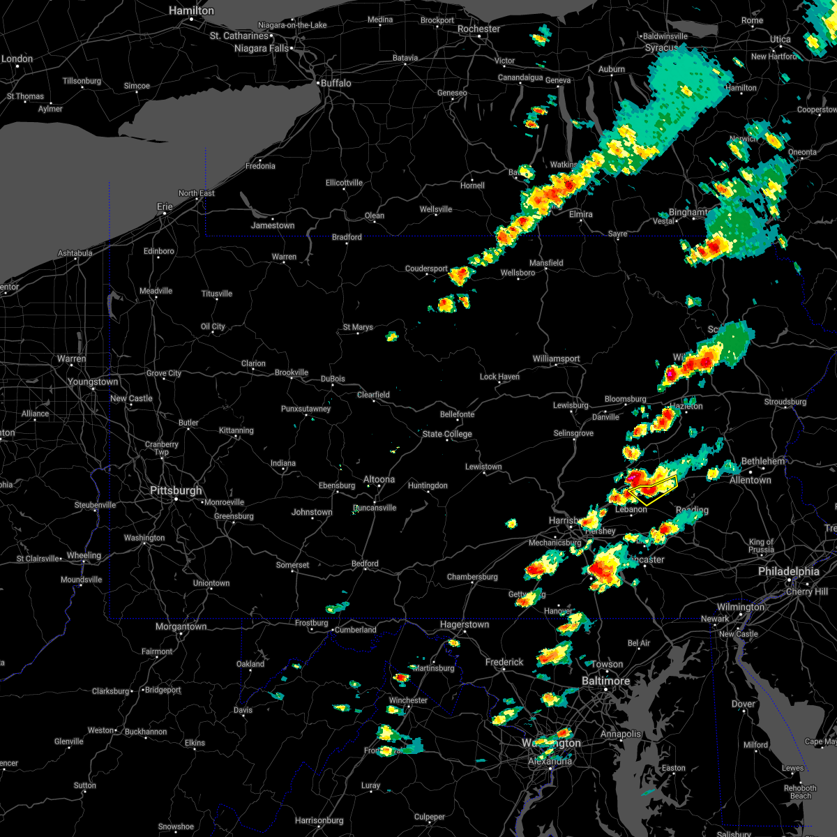 The severe thunderstorm warning for northwestern berks county will expire at 200 pm edt, the storm which prompted the warning has weakened below severe limits, and no longer poses an immediate threat to life or property. therefore the warning will be allowed to expire. however small hail, frequent lightning, and heavy rain are still possible with this thunderstorm. a flash flood warning remains in effect. The severe thunderstorm warning for northwestern berks county will expire at 200 pm edt, the storm which prompted the warning has weakened below severe limits, and no longer poses an immediate threat to life or property. therefore the warning will be allowed to expire. however small hail, frequent lightning, and heavy rain are still possible with this thunderstorm. a flash flood warning remains in effect.
|
| 7/17/2017 1:37 PM EDT |
 At 136 pm edt, a severe thunderstorm was located near strausstown, or 7 miles north of myerstown, and is nearly stationary (radar indicated). Hazards include 60 mph wind gusts and quarter size hail. Minor damage to vehicles is possible. expect damage to trees and power lines. Locations impacted include, strausstown. At 136 pm edt, a severe thunderstorm was located near strausstown, or 7 miles north of myerstown, and is nearly stationary (radar indicated). Hazards include 60 mph wind gusts and quarter size hail. Minor damage to vehicles is possible. expect damage to trees and power lines. Locations impacted include, strausstown.
|
| 7/17/2017 1:20 PM EDT |
 At 120 pm edt, a severe thunderstorm was located near pine grove, or 9 miles north of myerstown, moving northeast at 5 mph (radar indicated). Hazards include 60 mph wind gusts and quarter size hail. Minor damage to vehicles is possible. Expect damage to trees and power lines. At 120 pm edt, a severe thunderstorm was located near pine grove, or 9 miles north of myerstown, moving northeast at 5 mph (radar indicated). Hazards include 60 mph wind gusts and quarter size hail. Minor damage to vehicles is possible. Expect damage to trees and power lines.
|
| 7/13/2017 4:44 PM EDT |
 At 442 pm edt, a severe thunderstorm was located near myerstown, moving east at 30 mph (radar indicated). Hazards include 60 mph wind gusts. Expect damage to trees and power lines. this severe storm will be near, newmanstown and strausstown around 450 pm edt. womelsdorf around 455 pm edt. robesonia and bernville around 500 pm edt. wernersville around 505 pm edt. sinking spring and fairview hgts around 510 pm edt. leesport and spring ridge around 515 pm edt. Other locations impacted by this severe thunderstorm include whitfield, centerport and west wyomissing. At 442 pm edt, a severe thunderstorm was located near myerstown, moving east at 30 mph (radar indicated). Hazards include 60 mph wind gusts. Expect damage to trees and power lines. this severe storm will be near, newmanstown and strausstown around 450 pm edt. womelsdorf around 455 pm edt. robesonia and bernville around 500 pm edt. wernersville around 505 pm edt. sinking spring and fairview hgts around 510 pm edt. leesport and spring ridge around 515 pm edt. Other locations impacted by this severe thunderstorm include whitfield, centerport and west wyomissing.
|
| 7/13/2017 4:15 PM EDT |
 At 414 pm edt, a severe thunderstorm was located near lickdale, or 11 miles north of annville, moving east at 30 mph (radar indicated). Hazards include 60 mph wind gusts. Expect damage to trees and power lines. this severe thunderstorm will be near, newmanstown and strausstown around 450 pm edt. womelsdorf around 455 pm edt. robesonia and bernville around 500 pm edt. wernersville around 505 pm edt. sinking spring and fairview hgts around 510 pm edt. leesport and spring ridge around 515 pm edt. Other locations impacted by this severe thunderstorm include whitfield, centerport, west lawn and west wyomissing. At 414 pm edt, a severe thunderstorm was located near lickdale, or 11 miles north of annville, moving east at 30 mph (radar indicated). Hazards include 60 mph wind gusts. Expect damage to trees and power lines. this severe thunderstorm will be near, newmanstown and strausstown around 450 pm edt. womelsdorf around 455 pm edt. robesonia and bernville around 500 pm edt. wernersville around 505 pm edt. sinking spring and fairview hgts around 510 pm edt. leesport and spring ridge around 515 pm edt. Other locations impacted by this severe thunderstorm include whitfield, centerport, west lawn and west wyomissing.
|
| 7/1/2017 4:19 PM EDT |
 At 418 pm edt, a severe thunderstorm was located near claussville, or 10 miles west of allentown, moving east at 40 mph (radar indicated). Hazards include 60 mph wind gusts and quarter size hail. Minor damage to vehicles is possible. expect damage to trees and power lines. Locations impacted include, allentown, reading, bethlehem, emmaus, wyomissing, northampton, kutztown, hamburg, slatington, fleetwood, sinking spring, laureldale, womelsdorf, bath, wernersville, newmanstown, walnutport, topton, leesport and shoemakersville. At 418 pm edt, a severe thunderstorm was located near claussville, or 10 miles west of allentown, moving east at 40 mph (radar indicated). Hazards include 60 mph wind gusts and quarter size hail. Minor damage to vehicles is possible. expect damage to trees and power lines. Locations impacted include, allentown, reading, bethlehem, emmaus, wyomissing, northampton, kutztown, hamburg, slatington, fleetwood, sinking spring, laureldale, womelsdorf, bath, wernersville, newmanstown, walnutport, topton, leesport and shoemakersville.
|
| 7/1/2017 3:58 PM EDT |
 At 357 pm edt, a severe thunderstorm was located over shoemakersville, or 12 miles north of reading, moving northeast at 30 mph (radar indicated). Hazards include 60 mph wind gusts and quarter size hail. Minor damage to vehicles is possible. expect damage to trees and power lines. Locations impacted include, allentown, reading, bethlehem, emmaus, wyomissing, northampton, kutztown, hamburg, slatington, fleetwood, sinking spring, laureldale, womelsdorf, bath, wernersville, newmanstown, walnutport, topton, leesport and shoemakersville. At 357 pm edt, a severe thunderstorm was located over shoemakersville, or 12 miles north of reading, moving northeast at 30 mph (radar indicated). Hazards include 60 mph wind gusts and quarter size hail. Minor damage to vehicles is possible. expect damage to trees and power lines. Locations impacted include, allentown, reading, bethlehem, emmaus, wyomissing, northampton, kutztown, hamburg, slatington, fleetwood, sinking spring, laureldale, womelsdorf, bath, wernersville, newmanstown, walnutport, topton, leesport and shoemakersville.
|
| 7/1/2017 3:41 PM EDT |
 At 341 pm edt, a severe thunderstorm was located over fairview hgts, or 10 miles northwest of reading, moving east at 40 mph (radar indicated). Hazards include 60 mph wind gusts and nickel size hail. expect damage to trees and power lines At 341 pm edt, a severe thunderstorm was located over fairview hgts, or 10 miles northwest of reading, moving east at 40 mph (radar indicated). Hazards include 60 mph wind gusts and nickel size hail. expect damage to trees and power lines
|
| 6/19/2017 2:32 PM EDT |
 At 231 pm edt, severe thunderstorms were located along a line extending from near strausstown to near womelsdorf to near kleinfeltersville, moving east at 50 mph (radar indicated). Hazards include 60 mph wind gusts. Expect damage to trees and power lines. these severe storms will be near, robesonia around 235 pm edt. wernersville and bernville around 240 pm edt. hamburg and fairview hgts around 245 pm edt. leesport, shoemakersville and spring ridge around 250 pm edt. Other locations impacted by these severe thunderstorms include centerport. At 231 pm edt, severe thunderstorms were located along a line extending from near strausstown to near womelsdorf to near kleinfeltersville, moving east at 50 mph (radar indicated). Hazards include 60 mph wind gusts. Expect damage to trees and power lines. these severe storms will be near, robesonia around 235 pm edt. wernersville and bernville around 240 pm edt. hamburg and fairview hgts around 245 pm edt. leesport, shoemakersville and spring ridge around 250 pm edt. Other locations impacted by these severe thunderstorms include centerport.
|
| 6/19/2017 2:08 PM EDT |
 At 207 pm edt, severe thunderstorms were located along a line extending from near harper tavern to annville to lawn, moving northeast at 50 mph (radar indicated). Hazards include 60 mph wind gusts. Expect damage to trees and power lines. severe thunderstorms will be near, womelsdorf and newmanstown around 230 pm edt. wernersville, robesonia and strausstown around 235 pm edt. bernville around 240 pm edt. hamburg and fairview hgts around 245 pm edt. leesport and shoemakersville around 250 pm edt. Other locations impacted by these severe thunderstorms include centerport. At 207 pm edt, severe thunderstorms were located along a line extending from near harper tavern to annville to lawn, moving northeast at 50 mph (radar indicated). Hazards include 60 mph wind gusts. Expect damage to trees and power lines. severe thunderstorms will be near, womelsdorf and newmanstown around 230 pm edt. wernersville, robesonia and strausstown around 235 pm edt. bernville around 240 pm edt. hamburg and fairview hgts around 245 pm edt. leesport and shoemakersville around 250 pm edt. Other locations impacted by these severe thunderstorms include centerport.
|
| 3/1/2017 2:09 PM EST |
 At 209 pm est, severe thunderstorms were located along a line extending from strausstown to columbia, moving east at 60 mph (radar indicated). Hazards include 60 mph wind gusts. expect damage to roofs, siding, and trees At 209 pm est, severe thunderstorms were located along a line extending from strausstown to columbia, moving east at 60 mph (radar indicated). Hazards include 60 mph wind gusts. expect damage to roofs, siding, and trees
|
| 2/25/2017 3:06 PM EST |
 At 306 pm est, severe thunderstorms were located along a line extending from newmanstown to myerstown, moving northeast at 35 mph (radar indicated). Hazards include 60 mph wind gusts and quarter size hail. Hail damage to vehicles is expected. expect wind damage to roofs, siding, and trees. these severe storms will be near, womelsdorf and robesonia around 310 pm est. bernville around 320 pm est. strausstown and fairview hgts around 325 pm est. hamburg, leesport and shoemakersville around 330 pm est. Other locations impacted by these severe thunderstorms include centerport. At 306 pm est, severe thunderstorms were located along a line extending from newmanstown to myerstown, moving northeast at 35 mph (radar indicated). Hazards include 60 mph wind gusts and quarter size hail. Hail damage to vehicles is expected. expect wind damage to roofs, siding, and trees. these severe storms will be near, womelsdorf and robesonia around 310 pm est. bernville around 320 pm est. strausstown and fairview hgts around 325 pm est. hamburg, leesport and shoemakersville around 330 pm est. Other locations impacted by these severe thunderstorms include centerport.
|
| 2/25/2017 2:47 PM EST |
 At 246 pm est, severe thunderstorms were located along a line extending from near manheim to near lawn, moving northeast at 45 mph (radar indicated). Hazards include 60 mph wind gusts and quarter size hail. Hail damage to vehicles is expected. expect wind damage to roofs, siding, and trees. severe thunderstorms will be near, womelsdorf and newmanstown around 310 pm est. robesonia around 315 pm est. bernville around 320 pm est. strausstown and fairview hgts around 325 pm est. hamburg and shoemakersville around 330 pm est. Other locations impacted by these severe thunderstorms include centerport. At 246 pm est, severe thunderstorms were located along a line extending from near manheim to near lawn, moving northeast at 45 mph (radar indicated). Hazards include 60 mph wind gusts and quarter size hail. Hail damage to vehicles is expected. expect wind damage to roofs, siding, and trees. severe thunderstorms will be near, womelsdorf and newmanstown around 310 pm est. robesonia around 315 pm est. bernville around 320 pm est. strausstown and fairview hgts around 325 pm est. hamburg and shoemakersville around 330 pm est. Other locations impacted by these severe thunderstorms include centerport.
|
| 8/16/2016 4:23 PM EDT |
 At 422 pm edt, severe thunderstorms were located along a line extending from near lickdale to near lancaster, moving east at 45 mph (radar indicated). Hazards include 60 mph wind gusts. Expect damage to roofs. siding. And trees. At 422 pm edt, severe thunderstorms were located along a line extending from near lickdale to near lancaster, moving east at 45 mph (radar indicated). Hazards include 60 mph wind gusts. Expect damage to roofs. siding. And trees.
|
| 8/1/2016 9:44 PM EDT |
 At 944 pm edt, a severe thunderstorm was located over bernville, or 11 miles northwest of reading, moving east at 15 mph (radar indicated). Hazards include 60 mph wind gusts and quarter size hail. Hail damage to vehicles is expected. expect wind damage to roofs, siding, and trees. Locations impacted include, reading, wyomissing, hamburg, sinking spring, laureldale, womelsdorf, wernersville, leesport, shoemakersville, bernville, strausstown, spring ridge, fairview hgts, centerport, west lawn, west wyomissing, wyomissing hills and whitfield. At 944 pm edt, a severe thunderstorm was located over bernville, or 11 miles northwest of reading, moving east at 15 mph (radar indicated). Hazards include 60 mph wind gusts and quarter size hail. Hail damage to vehicles is expected. expect wind damage to roofs, siding, and trees. Locations impacted include, reading, wyomissing, hamburg, sinking spring, laureldale, womelsdorf, wernersville, leesport, shoemakersville, bernville, strausstown, spring ridge, fairview hgts, centerport, west lawn, west wyomissing, wyomissing hills and whitfield.
|
| 8/1/2016 9:12 PM EDT |
 At 911 pm edt, a severe thunderstorm was located over strausstown, or 9 miles northeast of myerstown, moving southeast at 10 mph (radar indicated). Hazards include 60 mph wind gusts and quarter size hail. Hail damage to vehicles is expected. Expect wind damage to roofs, siding, and trees. At 911 pm edt, a severe thunderstorm was located over strausstown, or 9 miles northeast of myerstown, moving southeast at 10 mph (radar indicated). Hazards include 60 mph wind gusts and quarter size hail. Hail damage to vehicles is expected. Expect wind damage to roofs, siding, and trees.
|
| 7/28/2016 3:28 PM EDT |
 At 328 pm edt, a severe thunderstorm was located over bernville, or 11 miles northwest of reading, moving southeast at 30 mph (radar indicated). Hazards include 60 mph wind gusts. Expect damage to roofs. siding. And trees. At 328 pm edt, a severe thunderstorm was located over bernville, or 11 miles northwest of reading, moving southeast at 30 mph (radar indicated). Hazards include 60 mph wind gusts. Expect damage to roofs. siding. And trees.
|
| 9/30/2015 1:49 AM EDT |
 At 148 am edt, doppler radar indicated a severe thunderstorm capable of producing damaging winds in excess of 60 mph. this storm was located over hamburg, or 9 miles southeast of schuylkill haven, moving north at 25 mph. locations impacted include, reading, wyomissing, birdsboro, kutztown, hamburg, fleetwood, sinking spring, laureldale, womelsdorf, wernersville, topton, leesport, shoemakersville, bally, bernville, bechtelsville, lyons, strausstown, lenhartsville and new morgan. At 148 am edt, doppler radar indicated a severe thunderstorm capable of producing damaging winds in excess of 60 mph. this storm was located over hamburg, or 9 miles southeast of schuylkill haven, moving north at 25 mph. locations impacted include, reading, wyomissing, birdsboro, kutztown, hamburg, fleetwood, sinking spring, laureldale, womelsdorf, wernersville, topton, leesport, shoemakersville, bally, bernville, bechtelsville, lyons, strausstown, lenhartsville and new morgan.
|
| 9/30/2015 1:20 AM EDT |
 At 119 am edt, doppler radar indicated a severe thunderstorm capable of producing damaging winds in excess of 60 mph. this storm was located near bernville, or 9 miles northwest of reading, and moving north at 25 mph. At 119 am edt, doppler radar indicated a severe thunderstorm capable of producing damaging winds in excess of 60 mph. this storm was located near bernville, or 9 miles northwest of reading, and moving north at 25 mph.
|
| 8/4/2015 1:31 AM EDT |
 At 131 am edt, doppler radar indicated a severe thunderstorm capable of producing quarter size hail and damaging winds in excess of 60 mph. this storm was located near pine grove, or 7 miles north of myerstown, and moving east at 20 mph. At 131 am edt, doppler radar indicated a severe thunderstorm capable of producing quarter size hail and damaging winds in excess of 60 mph. this storm was located near pine grove, or 7 miles north of myerstown, and moving east at 20 mph.
|
| 7/9/2015 6:35 PM EDT |
 At 634 pm edt, doppler radar indicated a severe thunderstorm capable of producing damaging winds in excess of 60 mph. this storm was located over ancient oaks, or near allentown, and moving east at 50 mph. At 634 pm edt, doppler radar indicated a severe thunderstorm capable of producing damaging winds in excess of 60 mph. this storm was located over ancient oaks, or near allentown, and moving east at 50 mph.
|
| 7/9/2015 6:20 PM EDT | Roof damage to five home in berks county PA, 0.4 miles WSW of Rehrersburg, PA |
| 6/30/2015 1:28 PM EDT |
 At 127 pm edt, doppler radar indicated a severe thunderstorm capable of producing damaging winds in excess of 60 mph. this storm was located near shoemakersville, or 11 miles southeast of schuylkill haven, moving northeast at 20 mph. locations impacted include, kutztown, hamburg, wernersville, leesport, shoemakersville, bernville, strausstown, lenhartsville, wanamakers, fairview hgts and centerport. At 127 pm edt, doppler radar indicated a severe thunderstorm capable of producing damaging winds in excess of 60 mph. this storm was located near shoemakersville, or 11 miles southeast of schuylkill haven, moving northeast at 20 mph. locations impacted include, kutztown, hamburg, wernersville, leesport, shoemakersville, bernville, strausstown, lenhartsville, wanamakers, fairview hgts and centerport.
|
| 6/30/2015 1:08 PM EDT |
 At 107 pm edt, doppler radar indicated a severe thunderstorm capable of producing damaging winds in excess of 60 mph. this storm was located over bernville, or 10 miles northeast of myerstown, and moving northeast at 20 mph. At 107 pm edt, doppler radar indicated a severe thunderstorm capable of producing damaging winds in excess of 60 mph. this storm was located over bernville, or 10 miles northeast of myerstown, and moving northeast at 20 mph.
|
| 6/8/2015 5:17 PM EDT | At 516 pm edt, doppler radar indicated a severe thunderstorm capable of producing half dollar size hail and destructive winds in excess of 70 mph. this storm was located over friedensburg, or near schuylkill haven, and moving east at 15 mph. |
| 5/31/2015 7:48 PM EDT | At 748 pm edt, doppler radar indicated a severe thunderstorm capable of producing damaging winds in excess of 60 mph. this storm was located over womelsdorf, or near myerstown, and moving northeast at 30 mph. storms in the lower susquehanna valley have had a history of producing damaging winds. |
| 5/31/2015 5:52 PM EDT | The severe thunderstorm warning for west central berks county will expire at 600 pm edt, the severe thunderstorm which prompted the warning has weakened and is moving out of the warned area. the warning will be allowed to expire at 6 pm. |
| 5/31/2015 5:23 PM EDT | At 522 pm edt, doppler radar indicated a severe thunderstorm capable of producing large hail up to ping pong ball size and damaging winds in excess of 60 mph. this storm was located near myerstown, and moving north at 15 mph. |
| 5/27/2015 2:45 PM EDT | Trees down in the rehrersburg area in berks county PA, 1.2 miles N of Rehrersburg, PA |
| 4/20/2015 9:03 PM EDT | At 903 pm edt, doppler radar indicated a severe thunderstorm capable of producing quarter size hail and damaging winds in excess of 60 mph. this storm was located over harper tavern, or 7 miles northwest of annville, and moving northeast at 30 mph. |
| 9/12/2013 4:40 PM EDT | One tree down in berks county PA, 1.2 miles N of Rehrersburg, PA |
| 9/7/2012 3:44 AM EDT | Wires down across deck road in tulpehocken tw in berks county PA, 1.2 miles N of Rehrersburg, PA |
| 8/9/2012 7:30 PM EDT | Trees and wires dow in berks county PA, 1.2 miles N of Rehrersburg, PA |
| 8/9/2012 7:10 PM EDT | Trees and wires down in western berks count in berks county PA, 1.2 miles N of Rehrersburg, PA |
| 1/1/0001 12:00 AM | Tree reported down in tulpehocke in berks county PA, 1.2 miles N of Rehrersburg, PA |
Hail Maps for Rehrersburg, PA
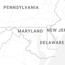
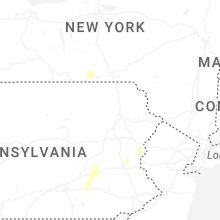


Connect with Interactive Hail Maps