

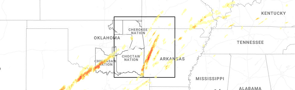
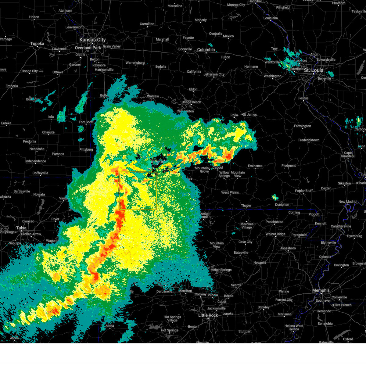
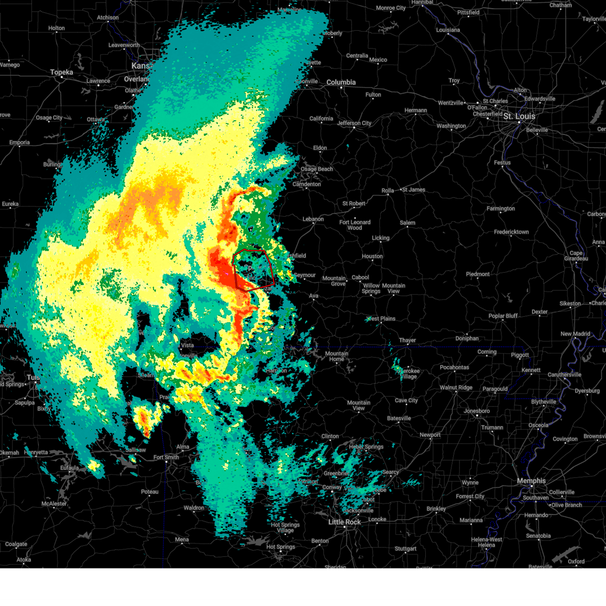
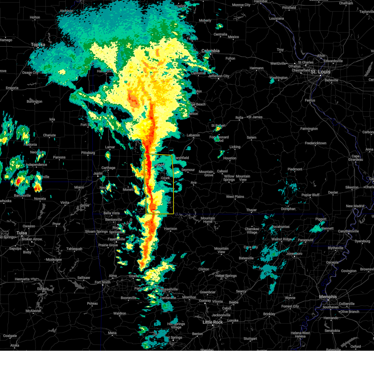
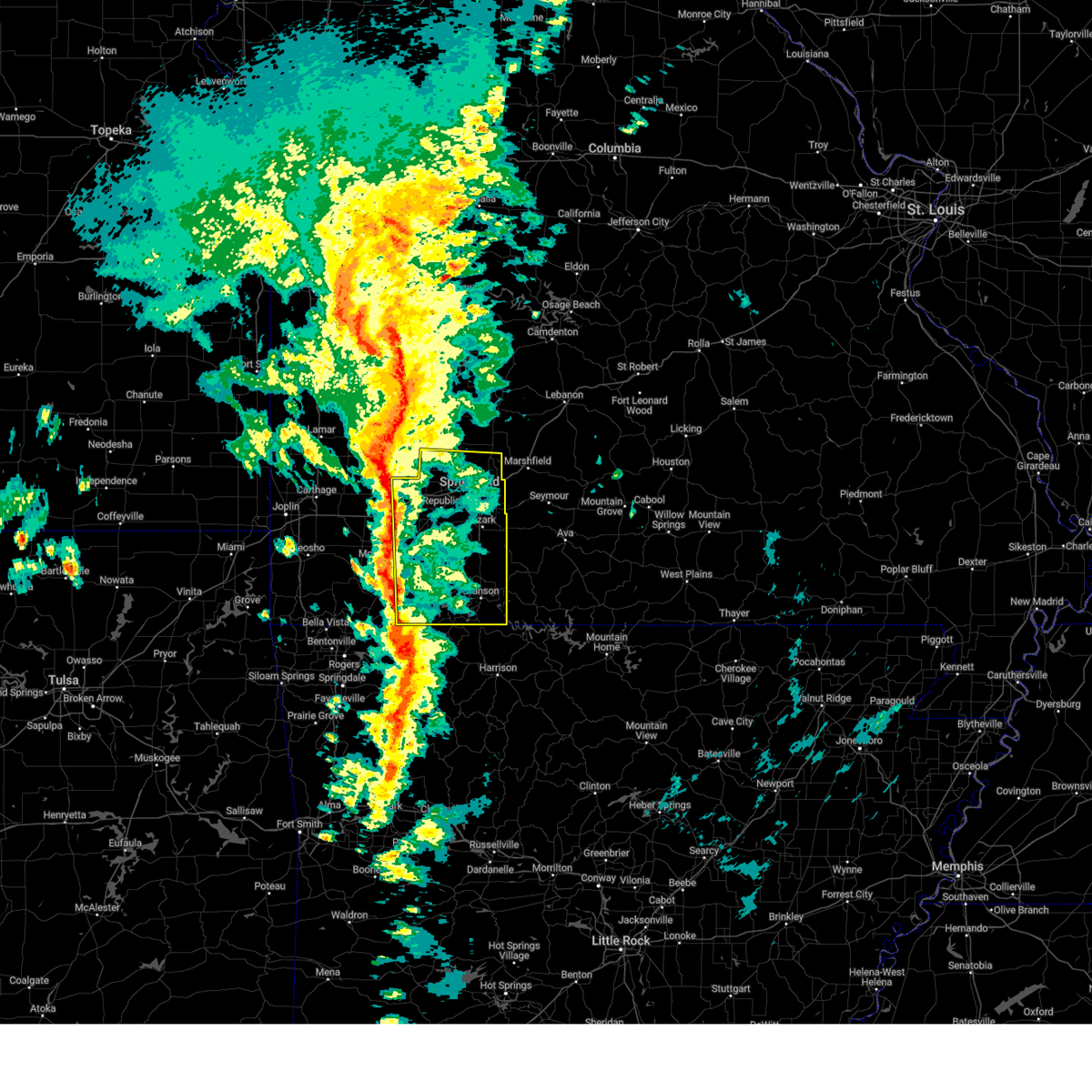
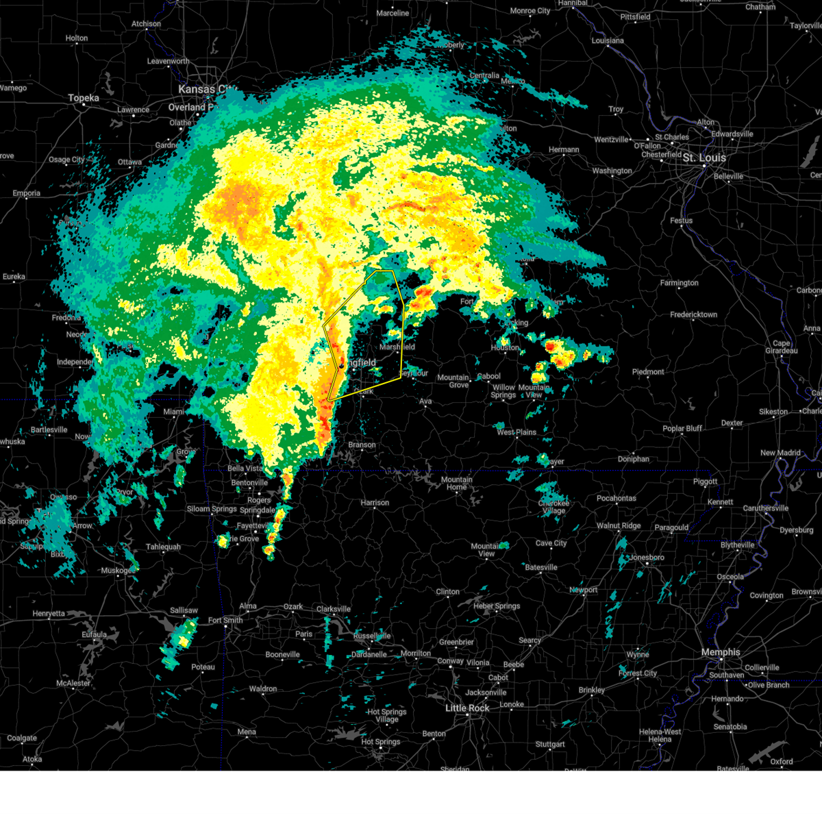
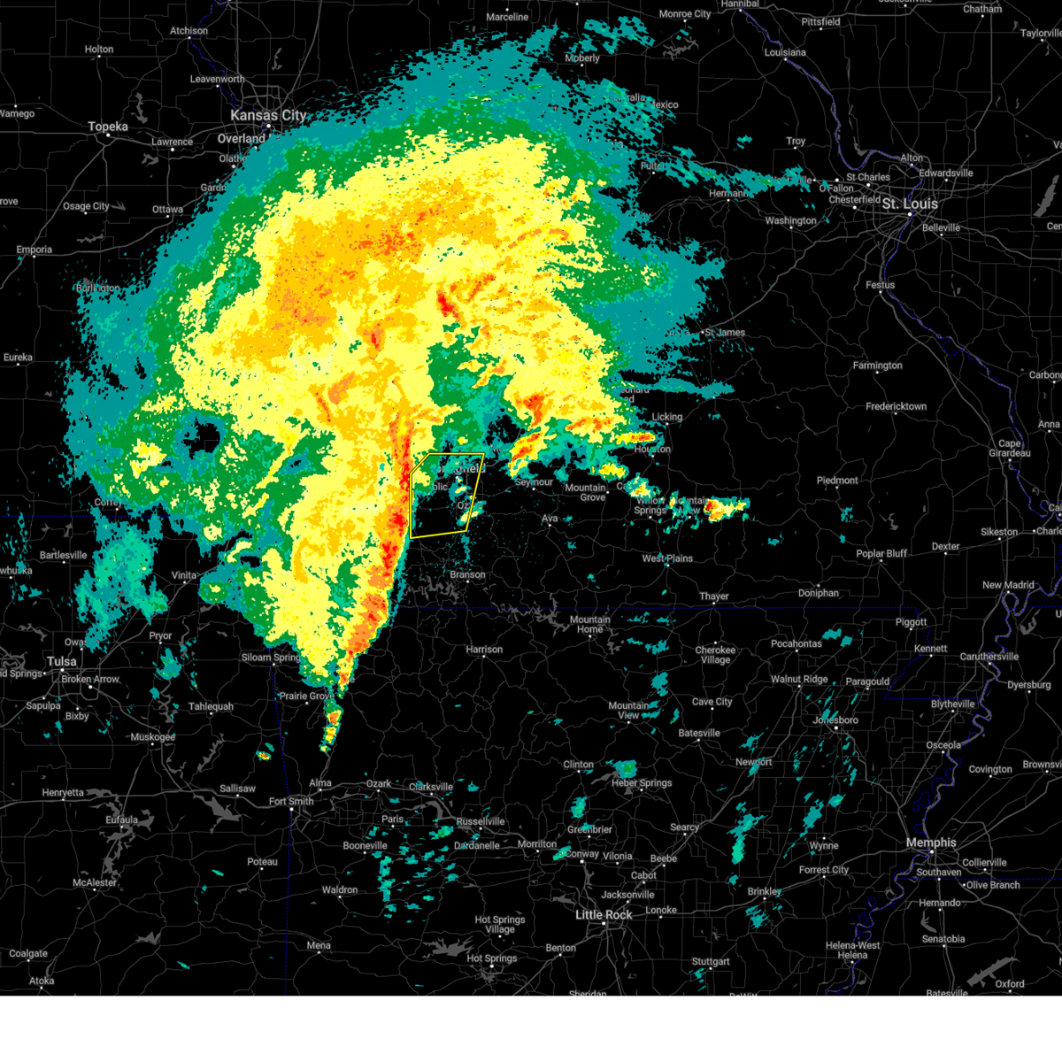
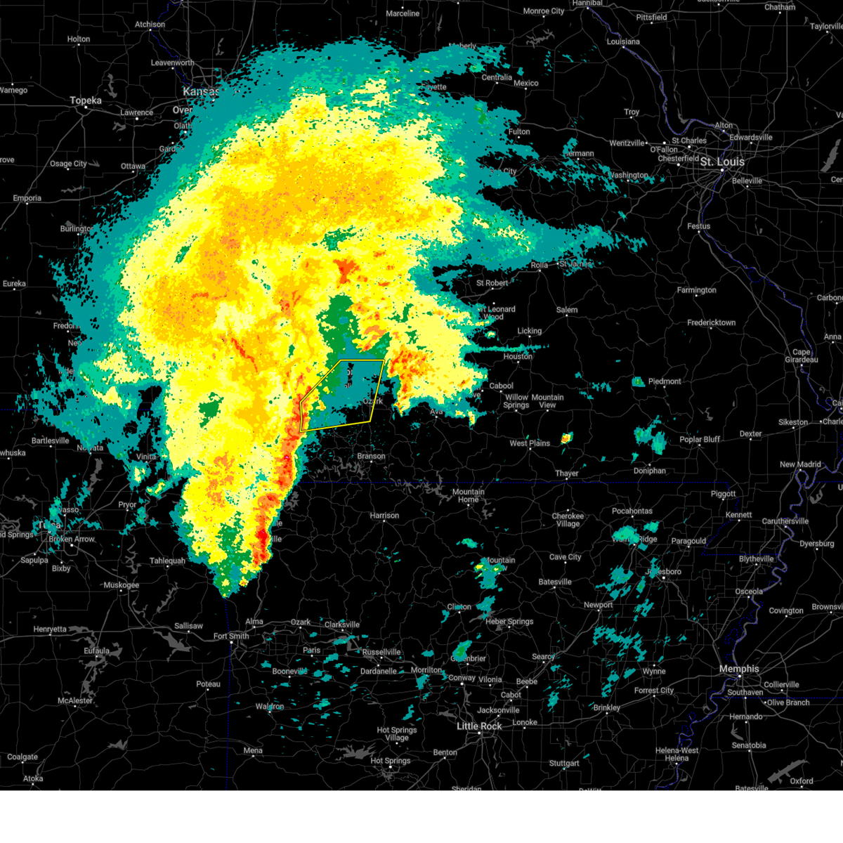
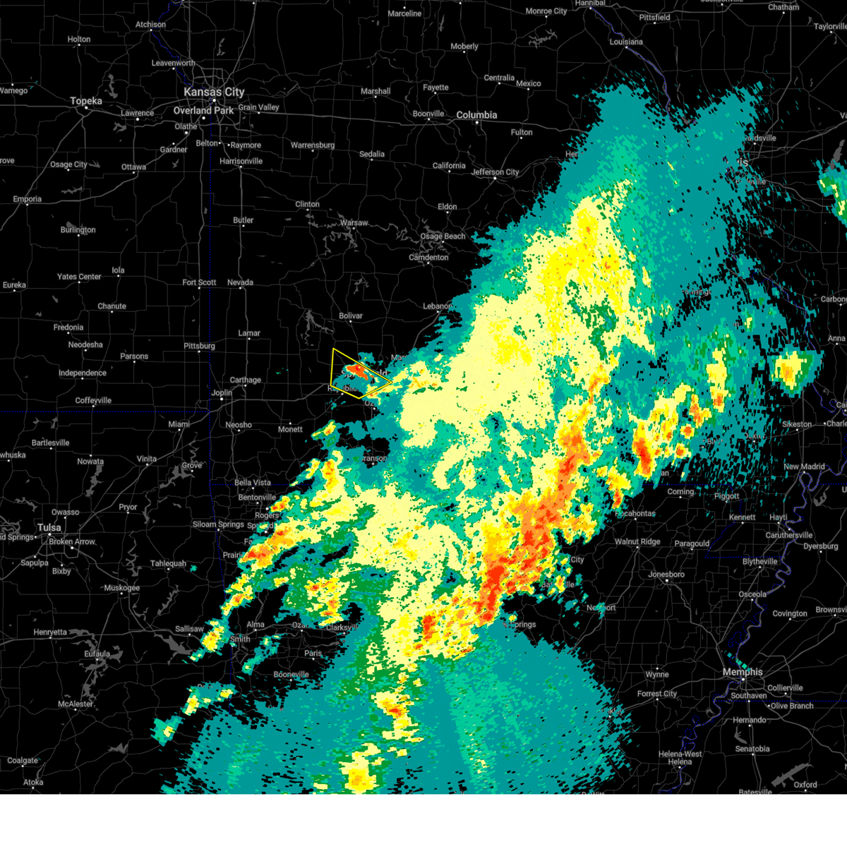
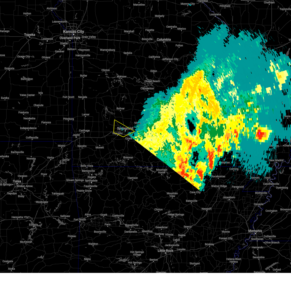
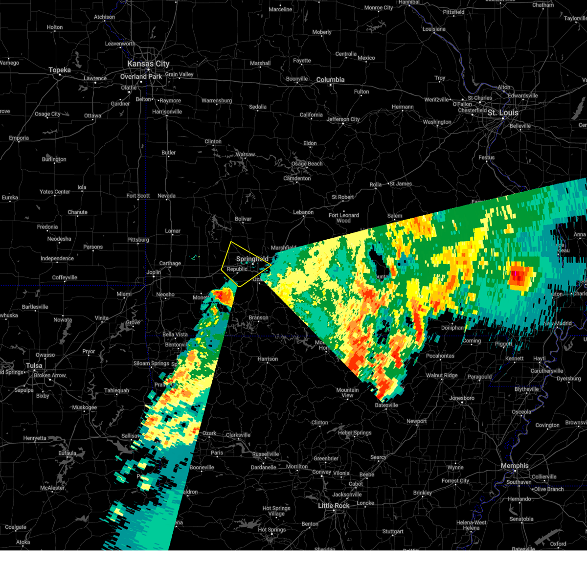
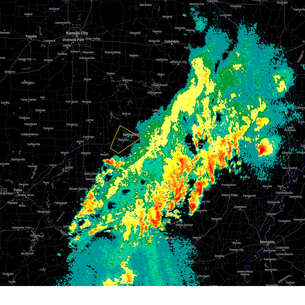
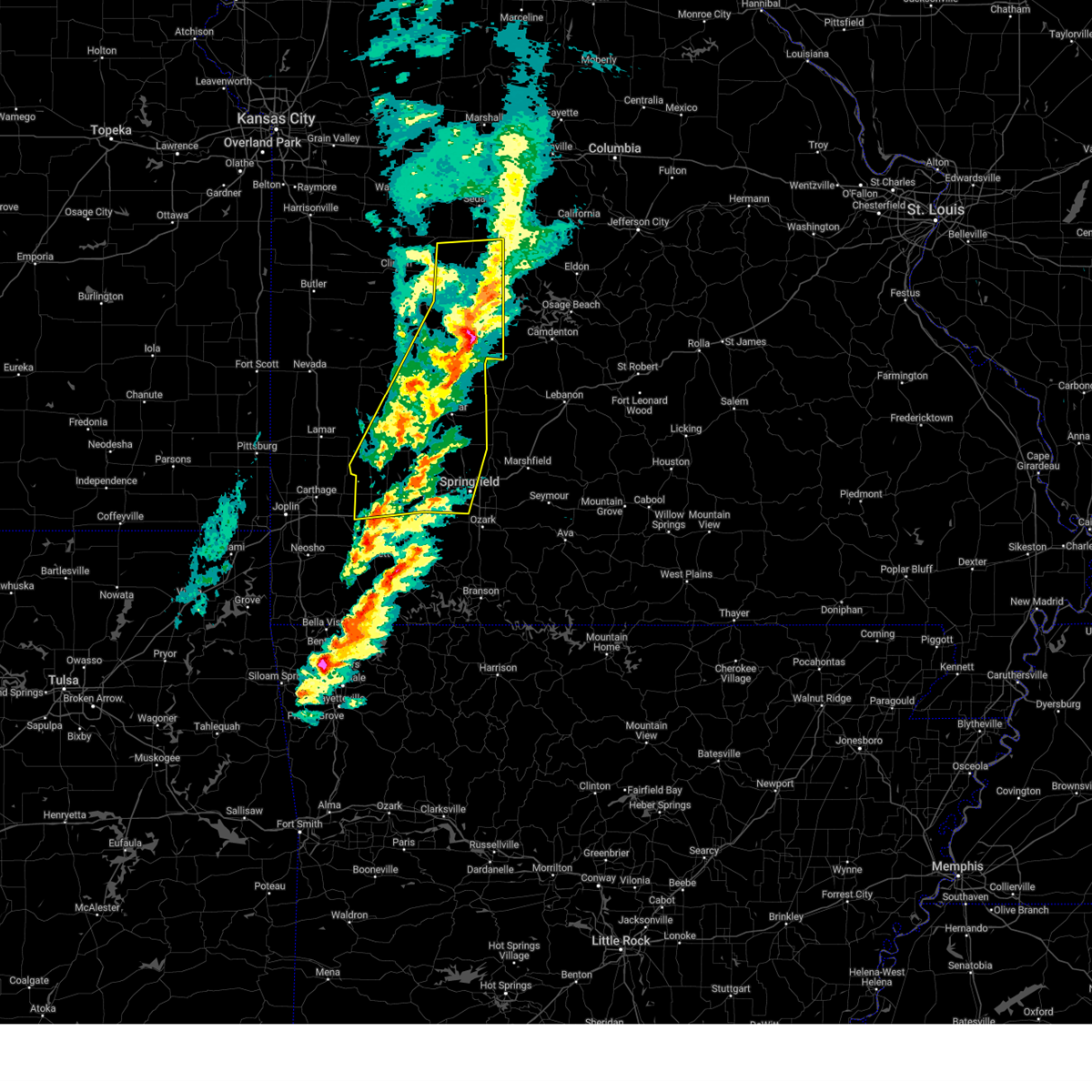
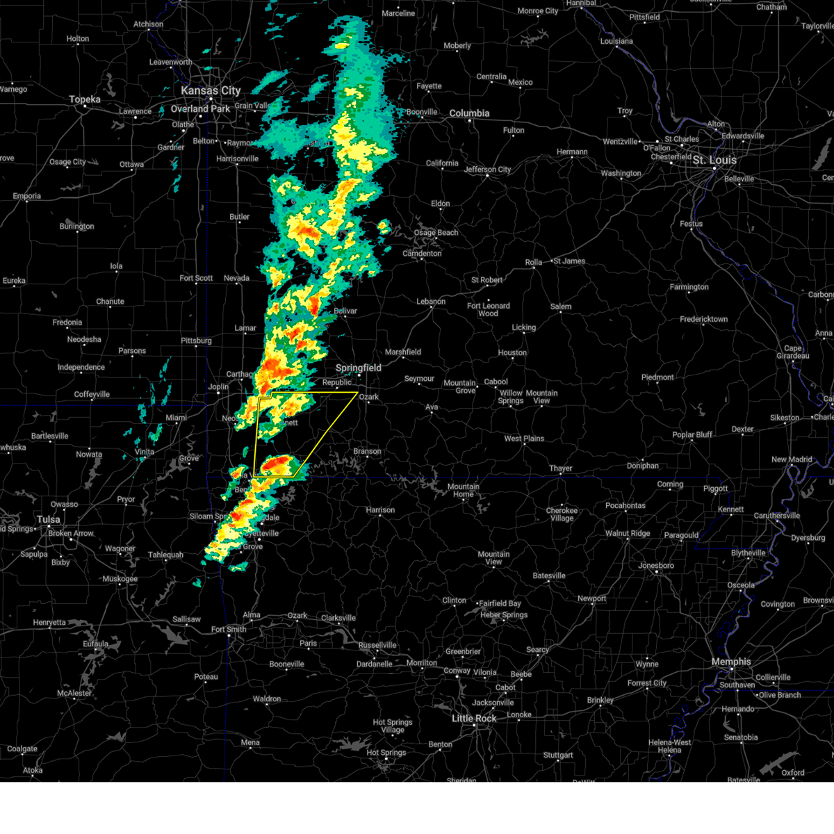
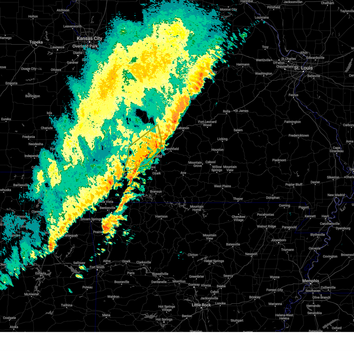
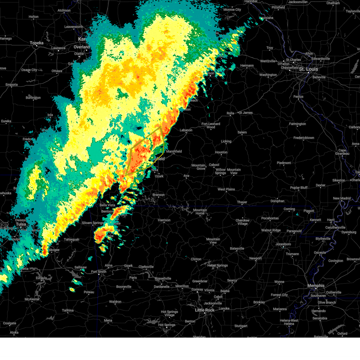
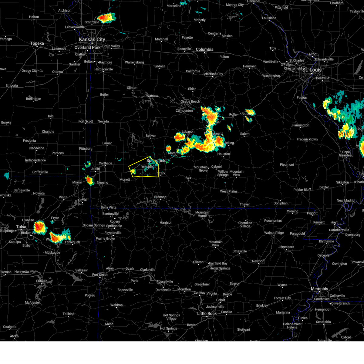
Hail Map for Republic, MO
The Republic, MO area has had 30 reports of on-the-ground hail by trained spotters, and has been under severe weather warnings 60 times during the past 12 months. Doppler radar has detected hail at or near Republic, MO on 99 occasions, including 6 occasions during the past year.
| Name: | Republic, MO |
| Where Located: | 10.2 miles WSW of Springfield, MO |
| Map: | Google Map for Republic, MO |
| Population: | 14751 |
| Housing Units: | 6139 |
| More Info: | Search Google for Republic, MO |
2
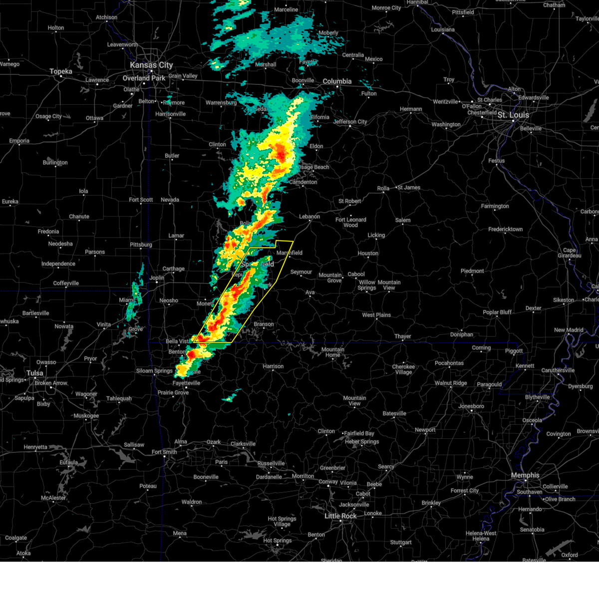
The Top Recent Hail Date for Republic, MO is Friday, April 4, 2025 (6th out of 99)
Hail and Wind Damage Spotted near Republic, MO
| Date / Time | Report Details |
|---|---|
| 6/29/2025 5:42 PM CDT | Large branch fell on house. time based on radar estimate in greene county MO, 2.7 miles NE of Republic, MO |
| 6/29/2025 4:42 PM CDT | Extensive tree damage on the north side of republic. estimated 40 percent of the city without power. time estimated from rada in greene county MO, 1.9 miles ENE of Republic, MO |
| 6/29/2025 4:42 PM CDT | Corrects time of previous tstm wnd dmg report from 1 sw republic. large branch fell on house. time based on radar estimate in greene county MO, 2.7 miles NE of Republic, MO |
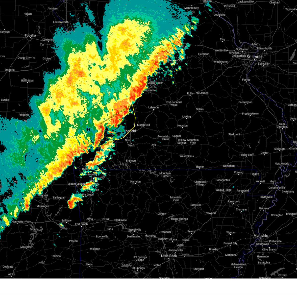
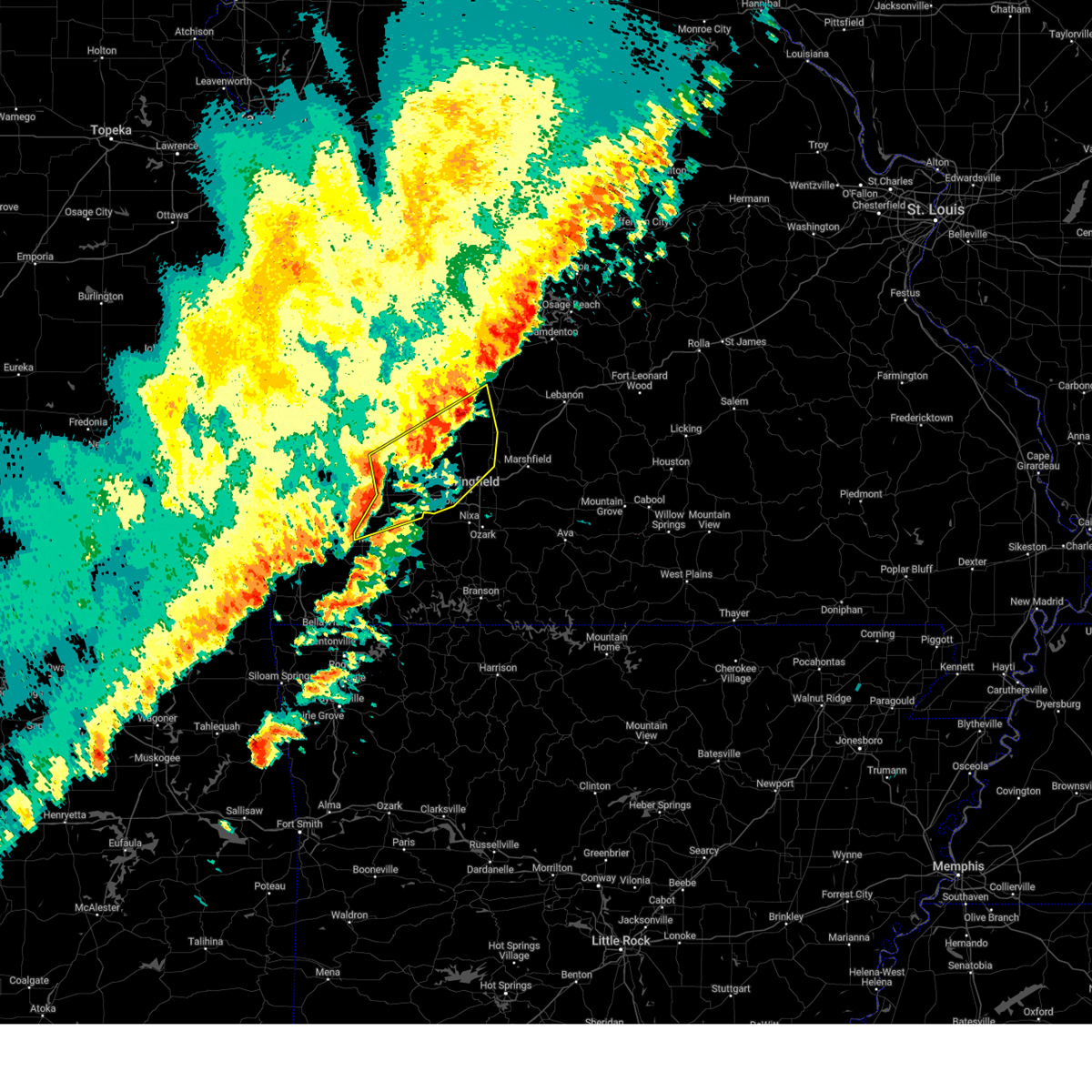
| 6/29/2025 4:41 PM CDT | At 439 pm cdt, severe thunderstorms were located along a line extending from near ash grove to republic to near marionville, moving southeast at 40 mph. these are destructive storms for green, northeast stone, and christian counties (law enforcement). Hazards include 80 mph wind gusts. Flying debris will be dangerous to those caught without shelter. mobile homes will be heavily damaged. expect considerable damage to roofs, windows, and vehicles. extensive tree damage and power outages are likely. locations impacted include, springfield, nixa, ozark, republic, battlefield, willard, strafford, clever, sparta, billings, highlandville, fremont hills, walnut grove, brookline, hurley, glidewell, turners, cave springs, linden, and sacville. This includes interstate 44 between mile markers 64 and 90. |
| 6/29/2025 4:25 PM CDT |
 Svrsgf the national weather service in springfield has issued a * severe thunderstorm warning for, christian county in southwestern missouri, northeastern stone county in southwestern missouri, greene county in southwestern missouri, * until 515 pm cdt. * at 424 pm cdt, severe thunderstorms were located along a line extending from near everton to 7 miles south of ash grove to mount vernon, moving southeast at 40 mph. these are destructive storms for 80 mph winds (law enforcement reports trees are down across highway 160 along the greene and dade county border). Hazards include 80 mph wind gusts. Flying debris will be dangerous to those caught without shelter. mobile homes will be heavily damaged. expect considerable damage to roofs, windows, and vehicles. Extensive tree damage and power outages are likely. Svrsgf the national weather service in springfield has issued a * severe thunderstorm warning for, christian county in southwestern missouri, northeastern stone county in southwestern missouri, greene county in southwestern missouri, * until 515 pm cdt. * at 424 pm cdt, severe thunderstorms were located along a line extending from near everton to 7 miles south of ash grove to mount vernon, moving southeast at 40 mph. these are destructive storms for 80 mph winds (law enforcement reports trees are down across highway 160 along the greene and dade county border). Hazards include 80 mph wind gusts. Flying debris will be dangerous to those caught without shelter. mobile homes will be heavily damaged. expect considerable damage to roofs, windows, and vehicles. Extensive tree damage and power outages are likely.
|
| 6/29/2025 4:14 PM CDT |
 At 412 pm cdt, severe thunderstorms were located along a line extending from near greenfield to near everton to 7 miles west of miller, moving southeast at 40 mph. these are destructive storms for 80 mph winds. reports of trees and power lines have been received from lockwood to greenfield (law enforcement). Hazards include 80 mph wind gusts and penny size hail. Flying debris will be dangerous to those caught without shelter. mobile homes will be heavily damaged. expect considerable damage to roofs, windows, and vehicles. extensive tree damage and power outages are likely. locations impacted include, republic, stockton lake, mount vernon, ash grove, greenfield, lockwood, miller, walnut grove, everton, dadeville, stotts city, halltown, la russell, south greenfield, arcola, chesapeake, red oak, bois d'arc, pennsboro, and neola. This includes interstate 44 between mile markers 44 and 67, and near mile marker 69. At 412 pm cdt, severe thunderstorms were located along a line extending from near greenfield to near everton to 7 miles west of miller, moving southeast at 40 mph. these are destructive storms for 80 mph winds. reports of trees and power lines have been received from lockwood to greenfield (law enforcement). Hazards include 80 mph wind gusts and penny size hail. Flying debris will be dangerous to those caught without shelter. mobile homes will be heavily damaged. expect considerable damage to roofs, windows, and vehicles. extensive tree damage and power outages are likely. locations impacted include, republic, stockton lake, mount vernon, ash grove, greenfield, lockwood, miller, walnut grove, everton, dadeville, stotts city, halltown, la russell, south greenfield, arcola, chesapeake, red oak, bois d'arc, pennsboro, and neola. This includes interstate 44 between mile markers 44 and 67, and near mile marker 69.
|
| 6/29/2025 4:00 PM CDT |
 Svrsgf the national weather service in springfield has issued a * severe thunderstorm warning for, northern lawrence county in southwestern missouri, western greene county in southwestern missouri, dade county in southwestern missouri, * until 445 pm cdt. * at 359 pm cdt, severe thunderstorms were located along a line extending from 8 miles northeast of lockwood to near greenfield to 9 miles south of golden city, moving southeast at 40 mph. these are destructive storms for 80 mph winds. these winds downed trees and power lines in the lockwood area (law enforcement). Hazards include 80 mph wind gusts and penny size hail. Flying debris will be dangerous to those caught without shelter. mobile homes will be heavily damaged. expect considerable damage to roofs, windows, and vehicles. Extensive tree damage and power outages are likely. Svrsgf the national weather service in springfield has issued a * severe thunderstorm warning for, northern lawrence county in southwestern missouri, western greene county in southwestern missouri, dade county in southwestern missouri, * until 445 pm cdt. * at 359 pm cdt, severe thunderstorms were located along a line extending from 8 miles northeast of lockwood to near greenfield to 9 miles south of golden city, moving southeast at 40 mph. these are destructive storms for 80 mph winds. these winds downed trees and power lines in the lockwood area (law enforcement). Hazards include 80 mph wind gusts and penny size hail. Flying debris will be dangerous to those caught without shelter. mobile homes will be heavily damaged. expect considerable damage to roofs, windows, and vehicles. Extensive tree damage and power outages are likely.
|
| 6/6/2025 7:41 AM CDT |
 Svrsgf the national weather service in springfield has issued a * severe thunderstorm warning for, western christian county in southwestern missouri, stone county in southwestern missouri, barry county in southwestern missouri, southern lawrence county in southwestern missouri, * until 830 am cdt. * at 741 am cdt, severe thunderstorms were located along a line extending from near pierce city to near purdy to near seligman, moving northeast at 40 mph (radar indicated). Hazards include 60 mph wind gusts. expect damage to roofs, siding, and trees Svrsgf the national weather service in springfield has issued a * severe thunderstorm warning for, western christian county in southwestern missouri, stone county in southwestern missouri, barry county in southwestern missouri, southern lawrence county in southwestern missouri, * until 830 am cdt. * at 741 am cdt, severe thunderstorms were located along a line extending from near pierce city to near purdy to near seligman, moving northeast at 40 mph (radar indicated). Hazards include 60 mph wind gusts. expect damage to roofs, siding, and trees
|
| 5/19/2025 8:27 PM CDT | At 826 pm cdt, severe thunderstorms were located along a line extending from battlefield to near indian point, moving east at 45 mph (radar indicated). Hazards include 60 mph wind gusts. Expect damage to roofs, siding, and trees. Locations impacted include, nixa, ozark, branson, lake taneycomo, table rock lake, bull shoals lake, table rock state park, shepherd of the hills state park, hollister, silver dollar city, kimberling city, forsyth, clever, merriam woods, sparta, kissee mills, billings, reeds spring, highlandville, and rockaway beach. |
| 5/19/2025 8:27 PM CDT | the severe thunderstorm warning has been cancelled and is no longer in effect |
| 5/19/2025 8:07 PM CDT |
 Svrsgf the national weather service in springfield has issued a * severe thunderstorm warning for, taney county in southwestern missouri, christian county in southwestern missouri, stone county in southwestern missouri, eastern barry county in southwestern missouri, * until 900 pm cdt. * at 806 pm cdt, severe thunderstorms were located along a line extending from near marionville to near grandview, moving east at 45 mph (radar indicated). Hazards include 60 mph wind gusts. expect damage to roofs, siding, and trees Svrsgf the national weather service in springfield has issued a * severe thunderstorm warning for, taney county in southwestern missouri, christian county in southwestern missouri, stone county in southwestern missouri, eastern barry county in southwestern missouri, * until 900 pm cdt. * at 806 pm cdt, severe thunderstorms were located along a line extending from near marionville to near grandview, moving east at 45 mph (radar indicated). Hazards include 60 mph wind gusts. expect damage to roofs, siding, and trees
|
| 5/19/2025 7:12 PM CDT | Svrsgf the national weather service in springfield has issued a * severe thunderstorm warning for, taney county in southwestern missouri, christian county in southwestern missouri, stone county in southwestern missouri, barry county in southwestern missouri, * until 815 pm cdt. * at 712 pm cdt, severe thunderstorms were located along a line extending from near battlefield to near osage, moving east at 45 mph (radar indicated). Hazards include 60 mph wind gusts. expect damage to roofs, siding, and trees |
| 5/19/2025 6:51 PM CDT | At 650 pm cdt, severe thunderstorms were located along a line extending from near walnut grove to republic, moving east at 40 mph (radar indicated). Hazards include 70 mph wind gusts. Expect considerable tree damage. damage is likely to mobile homes, roofs, and outbuildings. locations impacted include, springfield, republic, bolivar, stockton lake, battlefield, willard, strafford, ash grove, fair grove, walnut grove, pleasant hope, fair play, morrisville, brookline, aldrich, glidewell, turners, bois d'arc, cave springs, and eudora. This includes interstate 44 between mile markers 59 and 90. |
| 5/19/2025 6:40 PM CDT | Svrsgf the national weather service in springfield has issued a * severe thunderstorm warning for, southwestern polk county in southwestern missouri, greene county in southwestern missouri, * until 730 pm cdt. * at 640 pm cdt, severe thunderstorms were located along a line extending from near walnut grove to near billings, moving northeast at 65 mph (radar indicated). Hazards include 60 mph wind gusts. expect damage to roofs, siding, and trees |
| 5/19/2025 6:14 PM CDT | Svrsgf the national weather service in springfield has issued a * severe thunderstorm warning for, taney county in southwestern missouri, christian county in southwestern missouri, stone county in southwestern missouri, barry county in southwestern missouri, * until 715 pm cdt. * at 613 pm cdt, severe thunderstorms were located along a line extending from pierce city to near elkins, moving east at 65 mph (radar indicated). Hazards include 60 mph wind gusts and quarter size hail. Hail damage to vehicles is expected. Expect wind damage to roofs, siding, and trees. |
| 4/29/2025 10:05 AM CDT |
 The storms which prompted the warning have moved out of the area. therefore, the warning will be allowed to expire. a severe thunderstorm watch remains in effect until 300 pm cdt for southwestern missouri. The storms which prompted the warning have moved out of the area. therefore, the warning will be allowed to expire. a severe thunderstorm watch remains in effect until 300 pm cdt for southwestern missouri.
|
| 4/29/2025 9:29 AM CDT |
 Torsgf the national weather service in springfield has issued a * tornado warning for, webster county in southwestern missouri, north central christian county in southwestern missouri, greene county in southwestern missouri, * until 1015 am cdt. * at 929 am cdt, a severe thunderstorm capable of producing a tornado was located near willard, or 8 miles north of republic, moving east at 55 mph (radar indicated rotation). Hazards include tornado. Flying debris will be dangerous to those caught without shelter. mobile homes will be damaged or destroyed. damage to roofs, windows, and vehicles will occur. Tree damage is likely. Torsgf the national weather service in springfield has issued a * tornado warning for, webster county in southwestern missouri, north central christian county in southwestern missouri, greene county in southwestern missouri, * until 1015 am cdt. * at 929 am cdt, a severe thunderstorm capable of producing a tornado was located near willard, or 8 miles north of republic, moving east at 55 mph (radar indicated rotation). Hazards include tornado. Flying debris will be dangerous to those caught without shelter. mobile homes will be damaged or destroyed. damage to roofs, windows, and vehicles will occur. Tree damage is likely.
|
| 4/29/2025 9:27 AM CDT |
 At 926 am cdt, severe thunderstorms capable of producing tornadoes were located along a line extending from ash grove to near willard to republic, moving east at 55 mph (radar indicated rotation). Hazards include tornado. Flying debris will be dangerous to those caught without shelter. mobile homes will be damaged or destroyed. damage to roofs, windows, and vehicles will occur. tree damage is likely. locations impacted include, sacville, glidewell, ash grove, ebenezer, turners, bois d'arc, willard, republic, brookline, cave springs, billings, springfield, galloway, battlefield, clever, and nixa. This includes interstate 44 between mile markers 60 and 84. At 926 am cdt, severe thunderstorms capable of producing tornadoes were located along a line extending from ash grove to near willard to republic, moving east at 55 mph (radar indicated rotation). Hazards include tornado. Flying debris will be dangerous to those caught without shelter. mobile homes will be damaged or destroyed. damage to roofs, windows, and vehicles will occur. tree damage is likely. locations impacted include, sacville, glidewell, ash grove, ebenezer, turners, bois d'arc, willard, republic, brookline, cave springs, billings, springfield, galloway, battlefield, clever, and nixa. This includes interstate 44 between mile markers 60 and 84.
|
| 4/29/2025 9:27 AM CDT |
 the tornado warning has been cancelled and is no longer in effect the tornado warning has been cancelled and is no longer in effect
|
| 4/29/2025 9:19 AM CDT | Tree down across county line road covering west bound lane. time based on rada in greene county MO, 2.8 miles NE of Republic, MO |
| 4/29/2025 9:16 AM CDT | Tree covering road hwy p between clever and republi in christian county MO, 3.3 miles NNE of Republic, MO |
| 4/29/2025 9:13 AM CDT |
 Torsgf the national weather service in springfield has issued a * tornado warning for, northwestern christian county in southwestern missouri, eastern lawrence county in southwestern missouri, greene county in southwestern missouri, southeastern dade county in southwestern missouri, * until 945 am cdt. * at 913 am cdt, severe thunderstorms capable of producing a tornado were located along a line extending from near miller to 6 miles northeast of mount vernon to near marionville, moving east at 55 mph (radar indicated rotation). Hazards include tornado. Flying debris will be dangerous to those caught without shelter. mobile homes will be damaged or destroyed. damage to roofs, windows, and vehicles will occur. Tree damage is likely. Torsgf the national weather service in springfield has issued a * tornado warning for, northwestern christian county in southwestern missouri, eastern lawrence county in southwestern missouri, greene county in southwestern missouri, southeastern dade county in southwestern missouri, * until 945 am cdt. * at 913 am cdt, severe thunderstorms capable of producing a tornado were located along a line extending from near miller to 6 miles northeast of mount vernon to near marionville, moving east at 55 mph (radar indicated rotation). Hazards include tornado. Flying debris will be dangerous to those caught without shelter. mobile homes will be damaged or destroyed. damage to roofs, windows, and vehicles will occur. Tree damage is likely.
|
| 4/29/2025 9:09 AM CDT |
 Svrsgf the national weather service in springfield has issued a * severe thunderstorm warning for, taney county in southwestern missouri, christian county in southwestern missouri, southern polk county in southwestern missouri, stone county in southwestern missouri, greene county in southwestern missouri, * until 1015 am cdt. * at 909 am cdt, severe thunderstorms were located along a line extending from near lockwood to near mount vernon to marionville to near beaver, moving east at 55 mph (radar indicated). Hazards include 70 mph wind gusts and half dollar size hail. Hail damage to vehicles is expected. expect considerable tree damage. Wind damage is also likely to mobile homes, roofs, and outbuildings. Svrsgf the national weather service in springfield has issued a * severe thunderstorm warning for, taney county in southwestern missouri, christian county in southwestern missouri, southern polk county in southwestern missouri, stone county in southwestern missouri, greene county in southwestern missouri, * until 1015 am cdt. * at 909 am cdt, severe thunderstorms were located along a line extending from near lockwood to near mount vernon to marionville to near beaver, moving east at 55 mph (radar indicated). Hazards include 70 mph wind gusts and half dollar size hail. Hail damage to vehicles is expected. expect considerable tree damage. Wind damage is also likely to mobile homes, roofs, and outbuildings.
|
| 4/20/2025 3:59 PM CDT |
 At 358 pm cdt, severe thunderstorms were located along a line extending from morrisville to battlefield to near roberson hollow, moving northeast at 60 mph (springfield airport (sgf) asos reported a 59 mph wind gust at 353 pm cdt). Hazards include 70 mph wind gusts and quarter size hail. Hail damage to vehicles is expected. expect considerable tree damage. wind damage is also likely to mobile homes, roofs, and outbuildings. locations impacted include, glidewell, turners, fair grove, chestnutridge, silver dollar city, crane, spokane, rockaway beach, kirbyville, cave springs, billings, chadwick, hurley, blue eye, nixa, sparta, ebenezer, strafford, table rock, and selmore. This includes interstate 44 between mile markers 59 and 90. At 358 pm cdt, severe thunderstorms were located along a line extending from morrisville to battlefield to near roberson hollow, moving northeast at 60 mph (springfield airport (sgf) asos reported a 59 mph wind gust at 353 pm cdt). Hazards include 70 mph wind gusts and quarter size hail. Hail damage to vehicles is expected. expect considerable tree damage. wind damage is also likely to mobile homes, roofs, and outbuildings. locations impacted include, glidewell, turners, fair grove, chestnutridge, silver dollar city, crane, spokane, rockaway beach, kirbyville, cave springs, billings, chadwick, hurley, blue eye, nixa, sparta, ebenezer, strafford, table rock, and selmore. This includes interstate 44 between mile markers 59 and 90.
|
| 4/20/2025 3:47 PM CDT |
 At 346 pm cdt, severe thunderstorms were located along a line extending from near ash grove to near clever to near green forest, moving northeast at 60 mph (radar indicated). Hazards include 70 mph wind gusts and quarter size hail. Hail damage to vehicles is expected. expect considerable tree damage. wind damage is also likely to mobile homes, roofs, and outbuildings. locations impacted include, glidewell, turners, fair grove, chestnutridge, silver dollar city, crane, spokane, rockaway beach, kirbyville, cave springs, billings, chadwick, hurley, blue eye, nixa, sparta, ebenezer, strafford, table rock, and selmore. This includes interstate 44 between mile markers 59 and 90. At 346 pm cdt, severe thunderstorms were located along a line extending from near ash grove to near clever to near green forest, moving northeast at 60 mph (radar indicated). Hazards include 70 mph wind gusts and quarter size hail. Hail damage to vehicles is expected. expect considerable tree damage. wind damage is also likely to mobile homes, roofs, and outbuildings. locations impacted include, glidewell, turners, fair grove, chestnutridge, silver dollar city, crane, spokane, rockaway beach, kirbyville, cave springs, billings, chadwick, hurley, blue eye, nixa, sparta, ebenezer, strafford, table rock, and selmore. This includes interstate 44 between mile markers 59 and 90.
|
| 4/20/2025 3:47 PM CDT |
 the severe thunderstorm warning has been cancelled and is no longer in effect the severe thunderstorm warning has been cancelled and is no longer in effect
|
| 4/20/2025 3:25 PM CDT |
 Svrsgf the national weather service in springfield has issued a * severe thunderstorm warning for, western taney county in southwestern missouri, christian county in southwestern missouri, stone county in southwestern missouri, eastern barry county in southwestern missouri, eastern lawrence county in southwestern missouri, greene county in southwestern missouri, * until 430 pm cdt. * at 324 pm cdt, severe thunderstorms were located along a line extending from near everton to aurora to near eureka springs, moving northeast at 60 mph (radar indicated). Hazards include 70 mph wind gusts and quarter size hail. Hail damage to vehicles is expected. expect considerable tree damage. Wind damage is also likely to mobile homes, roofs, and outbuildings. Svrsgf the national weather service in springfield has issued a * severe thunderstorm warning for, western taney county in southwestern missouri, christian county in southwestern missouri, stone county in southwestern missouri, eastern barry county in southwestern missouri, eastern lawrence county in southwestern missouri, greene county in southwestern missouri, * until 430 pm cdt. * at 324 pm cdt, severe thunderstorms were located along a line extending from near everton to aurora to near eureka springs, moving northeast at 60 mph (radar indicated). Hazards include 70 mph wind gusts and quarter size hail. Hail damage to vehicles is expected. expect considerable tree damage. Wind damage is also likely to mobile homes, roofs, and outbuildings.
|
| 4/20/2025 4:32 AM CDT |
 Svrsgf the national weather service in springfield has issued a * severe thunderstorm warning for, western webster county in southwestern missouri, dallas county in southwestern missouri, northwestern christian county in southwestern missouri, southeastern polk county in southwestern missouri, greene county in southwestern missouri, * until 530 am cdt. * at 432 am cdt, severe thunderstorms were located along a line extending from near morrisville to near willard to near crane, moving northeast at 40 mph (radar indicated). Hazards include 60 mph wind gusts. expect damage to roofs, siding, and trees Svrsgf the national weather service in springfield has issued a * severe thunderstorm warning for, western webster county in southwestern missouri, dallas county in southwestern missouri, northwestern christian county in southwestern missouri, southeastern polk county in southwestern missouri, greene county in southwestern missouri, * until 530 am cdt. * at 432 am cdt, severe thunderstorms were located along a line extending from near morrisville to near willard to near crane, moving northeast at 40 mph (radar indicated). Hazards include 60 mph wind gusts. expect damage to roofs, siding, and trees
|
| 4/20/2025 4:17 AM CDT |
 the severe thunderstorm warning has been cancelled and is no longer in effect the severe thunderstorm warning has been cancelled and is no longer in effect
|
| 4/20/2025 4:17 AM CDT |
 At 416 am cdt, severe thunderstorms were located along a line extending from 6 miles south of ash grove to near republic to near crane, moving northeast at 40 mph (radar indicated). Hazards include 60 mph wind gusts. Expect damage to roofs, siding, and trees. locations impacted include, glidewell, nixa, fremont hills, highlandville, bois d'arc, selmore, crane, willard, republic, brookline, clever, billings, springfield, hurley, boaz, galloway, ozark, battlefield, ebenezer, and turners. This includes interstate 44 between mile markers 59 and 86. At 416 am cdt, severe thunderstorms were located along a line extending from 6 miles south of ash grove to near republic to near crane, moving northeast at 40 mph (radar indicated). Hazards include 60 mph wind gusts. Expect damage to roofs, siding, and trees. locations impacted include, glidewell, nixa, fremont hills, highlandville, bois d'arc, selmore, crane, willard, republic, brookline, clever, billings, springfield, hurley, boaz, galloway, ozark, battlefield, ebenezer, and turners. This includes interstate 44 between mile markers 59 and 86.
|
| 4/20/2025 3:49 AM CDT |
 Svrsgf the national weather service in springfield has issued a * severe thunderstorm warning for, northwestern christian county in southwestern missouri, northern stone county in southwestern missouri, northeastern barry county in southwestern missouri, southeastern lawrence county in southwestern missouri, southern greene county in southwestern missouri, * until 445 am cdt. * at 349 am cdt, severe thunderstorms were located along a line extending from 6 miles west of aurora to verona to near purdy, moving northeast at 40 mph (radar indicated). Hazards include 60 mph wind gusts. expect damage to roofs, siding, and trees Svrsgf the national weather service in springfield has issued a * severe thunderstorm warning for, northwestern christian county in southwestern missouri, northern stone county in southwestern missouri, northeastern barry county in southwestern missouri, southeastern lawrence county in southwestern missouri, southern greene county in southwestern missouri, * until 445 am cdt. * at 349 am cdt, severe thunderstorms were located along a line extending from 6 miles west of aurora to verona to near purdy, moving northeast at 40 mph (radar indicated). Hazards include 60 mph wind gusts. expect damage to roofs, siding, and trees
|
| 4/4/2025 7:53 PM CDT |
 The storm which prompted the warning has moved out of the area. therefore, the warning will be allowed to expire. a severe thunderstorm watch remains in effect until midnight cdt for southwestern missouri. The storm which prompted the warning has moved out of the area. therefore, the warning will be allowed to expire. a severe thunderstorm watch remains in effect until midnight cdt for southwestern missouri.
|
| 4/4/2025 7:38 PM CDT | Svrsgf the national weather service in springfield has issued a * severe thunderstorm warning for, northwestern webster county in southwestern missouri, dallas county in southwestern missouri, eastern polk county in southwestern missouri, southwestern laclede county in southwestern missouri, greene county in southwestern missouri, * until 830 pm cdt. * at 737 pm cdt, a severe thunderstorm was located near willard, or near springfield, moving northeast at 70 mph (trained spotter. at 735 pm, nws employees measured quarter sized hail northwest of springfield). Hazards include 60 mph wind gusts and half dollar size hail. Hail damage to vehicles is expected. Expect wind damage to roofs, siding, and trees. |
| 4/4/2025 7:32 PM CDT |
 the severe thunderstorm warning has been cancelled and is no longer in effect the severe thunderstorm warning has been cancelled and is no longer in effect
|
| 4/4/2025 7:32 PM CDT |
 At 732 pm cdt, a severe thunderstorm was located over battlefield, moving northeast at 55 mph (radar indicated). Hazards include 60 mph wind gusts and half dollar size hail. Hail damage to vehicles is expected. expect wind damage to roofs, siding, and trees. locations impacted include, glidewell, brookline, walnut grove, cave springs, turners, springfield, bois d'arc, galloway, willard, battlefield, ash grove, and republic. This includes interstate 44 between mile markers 61 and 68, and between mile markers 70 and 84. At 732 pm cdt, a severe thunderstorm was located over battlefield, moving northeast at 55 mph (radar indicated). Hazards include 60 mph wind gusts and half dollar size hail. Hail damage to vehicles is expected. expect wind damage to roofs, siding, and trees. locations impacted include, glidewell, brookline, walnut grove, cave springs, turners, springfield, bois d'arc, galloway, willard, battlefield, ash grove, and republic. This includes interstate 44 between mile markers 61 and 68, and between mile markers 70 and 84.
|
| 4/4/2025 7:26 PM CDT |
 the severe thunderstorm warning has been cancelled and is no longer in effect the severe thunderstorm warning has been cancelled and is no longer in effect
|
| 4/4/2025 7:26 PM CDT |
 At 726 pm cdt, a severe thunderstorm was located over republic, moving northeast at 55 mph (radar indicated). Hazards include 60 mph wind gusts and half dollar size hail. Hail damage to vehicles is expected. expect wind damage to roofs, siding, and trees. locations impacted include, glidewell, ash grove, walnut grove, turners, bois d'arc, willard, republic, halltown, brookline, clever, cave springs, billings, springfield, boaz, galloway, battlefield, and nixa. This includes interstate 44 between mile markers 56 and 84. At 726 pm cdt, a severe thunderstorm was located over republic, moving northeast at 55 mph (radar indicated). Hazards include 60 mph wind gusts and half dollar size hail. Hail damage to vehicles is expected. expect wind damage to roofs, siding, and trees. locations impacted include, glidewell, ash grove, walnut grove, turners, bois d'arc, willard, republic, halltown, brookline, clever, cave springs, billings, springfield, boaz, galloway, battlefield, and nixa. This includes interstate 44 between mile markers 56 and 84.
|
| 4/4/2025 7:23 PM CDT | Half Dollar sized hail reported 1.9 miles ENE of Republic, MO, half dollar size hail. |
| 4/4/2025 7:11 PM CDT |
 Svrsgf the national weather service in springfield has issued a * severe thunderstorm warning for, northwestern christian county in southwestern missouri, northwestern stone county in southwestern missouri, eastern lawrence county in southwestern missouri, greene county in southwestern missouri, * until 800 pm cdt. * at 711 pm cdt, a severe thunderstorm was located near crane, or near aurora, moving northeast at 55 mph (radar indicated). Hazards include 60 mph wind gusts and half dollar size hail. Hail damage to vehicles is expected. Expect wind damage to roofs, siding, and trees. Svrsgf the national weather service in springfield has issued a * severe thunderstorm warning for, northwestern christian county in southwestern missouri, northwestern stone county in southwestern missouri, eastern lawrence county in southwestern missouri, greene county in southwestern missouri, * until 800 pm cdt. * at 711 pm cdt, a severe thunderstorm was located near crane, or near aurora, moving northeast at 55 mph (radar indicated). Hazards include 60 mph wind gusts and half dollar size hail. Hail damage to vehicles is expected. Expect wind damage to roofs, siding, and trees.
|
| 4/2/2025 9:39 AM CDT | The storms which prompted the warning have weakened below severe limits, and no longer pose an immediate threat to life or property. therefore, the warning will be allowed to expire. however, gusty winds are still possible with these thunderstorms. a tornado watch remains in effect until noon cdt for southwestern missouri. |
| 4/2/2025 9:29 AM CDT | the severe thunderstorm warning has been cancelled and is no longer in effect |
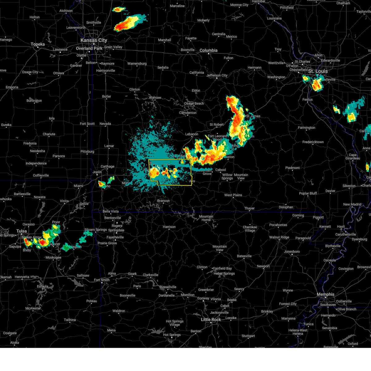
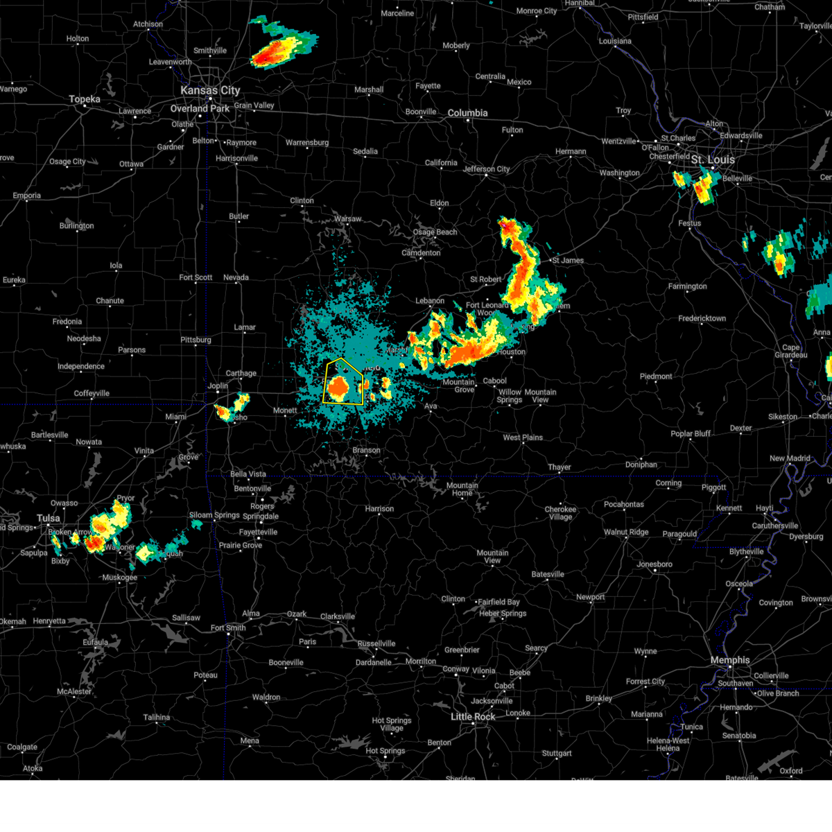
| 4/2/2025 9:29 AM CDT | At 928 am cdt, severe thunderstorms were located along a line extending from macks creek to crane, moving northeast at 80 mph (radar indicated). Hazards include 60 mph wind gusts and quarter size hail. Hail damage to vehicles is expected. expect wind damage to roofs, siding, and trees. locations impacted include, glidewell, roaring river state park, chestnutridge, emerald beach, silver dollar city, crane, monett, spokane, aurora, cave springs, billings, mount vernon, eudora, pleasant ridge, wheaton, pennsboro, chain-o-lakes, seligman, hurley, and freistatt. This includes interstate 44 between mile markers 37 and 84. |
| 4/2/2025 9:17 AM CDT | At 917 am cdt, severe thunderstorms were located along a line extending from near urbana to 6 miles east of purdy, moving northeast at 80 mph (radar indicated). Hazards include 60 mph wind gusts and quarter size hail. Hail damage to vehicles is expected. expect wind damage to roofs, siding, and trees. locations impacted include, glidewell, sarcoxie, chestnutridge, emerald beach, silver dollar city, crane, spokane, aurora, cave springs, pleasant ridge, chain-o-lakes, goodson, morrisville, madry, nixa, cassville, ebenezer, red oak, marionville, and stark city. this includes the following highways, interstate 44 between mile markers 29 and 84. Interstate 49 near mile marker 2. |
| 4/2/2025 9:17 AM CDT | the severe thunderstorm warning has been cancelled and is no longer in effect |
| 4/2/2025 8:45 AM CDT |
 Svrsgf the national weather service in springfield has issued a * severe thunderstorm warning for, southeastern barton county in southwestern missouri, newton county in southwestern missouri, cedar county in southwestern missouri, western christian county in southwestern missouri, polk county in southwestern missouri, stone county in southwestern missouri, mcdonald county in southwestern missouri, barry county in southwestern missouri, lawrence county in southwestern missouri, greene county in southwestern missouri, eastern jasper county in southwestern missouri, dade county in southwestern missouri, * until 945 am cdt. * at 844 am cdt, severe thunderstorms were located along a line extending from 8 miles southwest of stockton to near lanagan, moving northeast at 80 mph (radar indicated). Hazards include 60 mph wind gusts and quarter size hail. Hail damage to vehicles is expected. Expect wind damage to roofs, siding, and trees. Svrsgf the national weather service in springfield has issued a * severe thunderstorm warning for, southeastern barton county in southwestern missouri, newton county in southwestern missouri, cedar county in southwestern missouri, western christian county in southwestern missouri, polk county in southwestern missouri, stone county in southwestern missouri, mcdonald county in southwestern missouri, barry county in southwestern missouri, lawrence county in southwestern missouri, greene county in southwestern missouri, eastern jasper county in southwestern missouri, dade county in southwestern missouri, * until 945 am cdt. * at 844 am cdt, severe thunderstorms were located along a line extending from 8 miles southwest of stockton to near lanagan, moving northeast at 80 mph (radar indicated). Hazards include 60 mph wind gusts and quarter size hail. Hail damage to vehicles is expected. Expect wind damage to roofs, siding, and trees.
|
| 3/14/2025 5:40 PM CDT |
 Svrsgf the national weather service in springfield has issued a * severe thunderstorm warning for, northwestern webster county in southwestern missouri, western christian county in southwestern missouri, stone county in southwestern missouri, barry county in southwestern missouri, southeastern lawrence county in southwestern missouri, greene county in southwestern missouri, * until 645 pm cdt. * at 540 pm cdt, a severe thunderstorm was located 8 miles east of cassville, moving northeast at 65 mph (radar indicated). Hazards include 70 mph wind gusts and half dollar size hail. Hail damage to vehicles is expected. expect considerable tree damage. Wind damage is also likely to mobile homes, roofs, and outbuildings. Svrsgf the national weather service in springfield has issued a * severe thunderstorm warning for, northwestern webster county in southwestern missouri, western christian county in southwestern missouri, stone county in southwestern missouri, barry county in southwestern missouri, southeastern lawrence county in southwestern missouri, greene county in southwestern missouri, * until 645 pm cdt. * at 540 pm cdt, a severe thunderstorm was located 8 miles east of cassville, moving northeast at 65 mph (radar indicated). Hazards include 70 mph wind gusts and half dollar size hail. Hail damage to vehicles is expected. expect considerable tree damage. Wind damage is also likely to mobile homes, roofs, and outbuildings.
|
| 3/14/2025 5:23 PM CDT |
 At 521 pm cdt, a severe thunderstorm was located 9 miles east of purdy, or 10 miles south of aurora, moving northeast at 65 mph (radar indicated). Hazards include 70 mph wind gusts and quarter size hail. Hail damage to vehicles is expected. expect considerable tree damage. wind damage is also likely to mobile homes, roofs, and outbuildings. locations impacted include, roaring river state park, crane, monett, aurora, clever, billings, pleasant ridge, wheaton, seligman, hurley, freistatt, ridgley, purdy, madry, cassville, pierce city, marionville, wheelerville, exeter, and butterfield. This includes interstate 44 between mile markers 33 and 43. At 521 pm cdt, a severe thunderstorm was located 9 miles east of purdy, or 10 miles south of aurora, moving northeast at 65 mph (radar indicated). Hazards include 70 mph wind gusts and quarter size hail. Hail damage to vehicles is expected. expect considerable tree damage. wind damage is also likely to mobile homes, roofs, and outbuildings. locations impacted include, roaring river state park, crane, monett, aurora, clever, billings, pleasant ridge, wheaton, seligman, hurley, freistatt, ridgley, purdy, madry, cassville, pierce city, marionville, wheelerville, exeter, and butterfield. This includes interstate 44 between mile markers 33 and 43.
|
| 3/14/2025 5:23 PM CDT |
 the severe thunderstorm warning has been cancelled and is no longer in effect the severe thunderstorm warning has been cancelled and is no longer in effect
|
| 3/14/2025 5:14 PM CDT |
 the severe thunderstorm warning has been cancelled and is no longer in effect the severe thunderstorm warning has been cancelled and is no longer in effect
|
| 3/14/2025 5:14 PM CDT |
 At 513 pm cdt, a severe thunderstorm was located over wheatland, or near hermitage, moving northeast at 70 mph (radar indicated). Hazards include 70 mph wind gusts and quarter size hail. Hail damage to vehicles is expected. expect considerable tree damage. wind damage is also likely to mobile homes, roofs, and outbuildings. locations impacted include, vista, glidewell, flemington, palo pinto, pittsburg, truman state park, cane hill, fristoe, umber view heights, cave springs, mount vernon, eudora, racket, pennsboro, neola, goodson, morrisville, lincoln, nemo, and hastain. This includes interstate 44 between mile markers 33 and 79. At 513 pm cdt, a severe thunderstorm was located over wheatland, or near hermitage, moving northeast at 70 mph (radar indicated). Hazards include 70 mph wind gusts and quarter size hail. Hail damage to vehicles is expected. expect considerable tree damage. wind damage is also likely to mobile homes, roofs, and outbuildings. locations impacted include, vista, glidewell, flemington, palo pinto, pittsburg, truman state park, cane hill, fristoe, umber view heights, cave springs, mount vernon, eudora, racket, pennsboro, neola, goodson, morrisville, lincoln, nemo, and hastain. This includes interstate 44 between mile markers 33 and 79.
|
| 3/14/2025 4:43 PM CDT |
 Svrsgf the national weather service in springfield has issued a * severe thunderstorm warning for, hickory county in central missouri, cedar county in southwestern missouri, benton county in central missouri, polk county in southwestern missouri, lawrence county in southwestern missouri, greene county in southwestern missouri, st. clair county in west central missouri, eastern jasper county in southwestern missouri, dade county in southwestern missouri, * until 545 pm cdt. * at 442 pm cdt, a severe thunderstorm was located 9 miles north of greenfield, moving northeast at 70 mph (radar indicated). Hazards include 70 mph wind gusts and quarter size hail. Hail damage to vehicles is expected. expect considerable tree damage. Wind damage is also likely to mobile homes, roofs, and outbuildings. Svrsgf the national weather service in springfield has issued a * severe thunderstorm warning for, hickory county in central missouri, cedar county in southwestern missouri, benton county in central missouri, polk county in southwestern missouri, lawrence county in southwestern missouri, greene county in southwestern missouri, st. clair county in west central missouri, eastern jasper county in southwestern missouri, dade county in southwestern missouri, * until 545 pm cdt. * at 442 pm cdt, a severe thunderstorm was located 9 miles north of greenfield, moving northeast at 70 mph (radar indicated). Hazards include 70 mph wind gusts and quarter size hail. Hail damage to vehicles is expected. expect considerable tree damage. Wind damage is also likely to mobile homes, roofs, and outbuildings.
|
| 3/14/2025 4:38 PM CDT |
 Svrsgf the national weather service in springfield has issued a * severe thunderstorm warning for, eastern newton county in southwestern missouri, northwestern christian county in southwestern missouri, northwestern stone county in southwestern missouri, eastern mcdonald county in southwestern missouri, barry county in southwestern missouri, southern lawrence county in southwestern missouri, * until 545 pm cdt. * at 438 pm cdt, a severe thunderstorm was located near pea ridge, or 13 miles east of bella vista, moving northeast at 75 mph (radar indicated). Hazards include 70 mph wind gusts and quarter size hail. Hail damage to vehicles is expected. expect considerable tree damage. Wind damage is also likely to mobile homes, roofs, and outbuildings. Svrsgf the national weather service in springfield has issued a * severe thunderstorm warning for, eastern newton county in southwestern missouri, northwestern christian county in southwestern missouri, northwestern stone county in southwestern missouri, eastern mcdonald county in southwestern missouri, barry county in southwestern missouri, southern lawrence county in southwestern missouri, * until 545 pm cdt. * at 438 pm cdt, a severe thunderstorm was located near pea ridge, or 13 miles east of bella vista, moving northeast at 75 mph (radar indicated). Hazards include 70 mph wind gusts and quarter size hail. Hail damage to vehicles is expected. expect considerable tree damage. Wind damage is also likely to mobile homes, roofs, and outbuildings.
|
| 10/31/2024 12:37 AM CDT |
 The storms which prompted the warning have weakened below severe limits, and no longer pose an immediate threat to life or property. therefore, the warning will be allowed to expire. however, gusty winds are still possible with these thunderstorms. a severe thunderstorm watch remains in effect until 400 am cdt for southwestern missouri. The storms which prompted the warning have weakened below severe limits, and no longer pose an immediate threat to life or property. therefore, the warning will be allowed to expire. however, gusty winds are still possible with these thunderstorms. a severe thunderstorm watch remains in effect until 400 am cdt for southwestern missouri.
|
| 10/31/2024 12:17 AM CDT |
 At 1217 am cdt, severe thunderstorms were located along a line extending from 8 miles northwest of walnut grove to near ash grove to near mount vernon, moving east at 50 mph (radar indicated). Hazards include 60 mph wind gusts and quarter size hail. Hail damage to vehicles is expected. expect wind damage to roofs, siding, and trees. locations impacted include, northwestern springfield, republic, bolivar, stockton lake, willard, mount vernon, ash grove, fair grove, walnut grove, pleasant hope, morrisville, everton, brookline, dadeville, halfway, halltown, aldrich, hoberg, chesapeake, and glidewell. This includes interstate 44 between mile markers 44 and 79. At 1217 am cdt, severe thunderstorms were located along a line extending from 8 miles northwest of walnut grove to near ash grove to near mount vernon, moving east at 50 mph (radar indicated). Hazards include 60 mph wind gusts and quarter size hail. Hail damage to vehicles is expected. expect wind damage to roofs, siding, and trees. locations impacted include, northwestern springfield, republic, bolivar, stockton lake, willard, mount vernon, ash grove, fair grove, walnut grove, pleasant hope, morrisville, everton, brookline, dadeville, halfway, halltown, aldrich, hoberg, chesapeake, and glidewell. This includes interstate 44 between mile markers 44 and 79.
|
| 10/30/2024 11:59 PM CDT |
 At 1159 pm cdt, severe thunderstorms were located along a line extending from near greenfield to near miller to near pierce city, moving east at 50 mph (radar indicated). Hazards include 70 mph wind gusts and half dollar size hail. Hail damage to vehicles is expected. expect considerable tree damage. wind damage is also likely to mobile homes, roofs, and outbuildings. locations impacted include, northwestern springfield, republic, bolivar, stockton lake, willard, mount vernon, ash grove, fair grove, greenfield, lockwood, miller, walnut grove, pleasant hope, morrisville, everton, brookline, dadeville, stotts city, halfway, and halltown. This includes interstate 44 between mile markers 37 and 79. At 1159 pm cdt, severe thunderstorms were located along a line extending from near greenfield to near miller to near pierce city, moving east at 50 mph (radar indicated). Hazards include 70 mph wind gusts and half dollar size hail. Hail damage to vehicles is expected. expect considerable tree damage. wind damage is also likely to mobile homes, roofs, and outbuildings. locations impacted include, northwestern springfield, republic, bolivar, stockton lake, willard, mount vernon, ash grove, fair grove, greenfield, lockwood, miller, walnut grove, pleasant hope, morrisville, everton, brookline, dadeville, stotts city, halfway, and halltown. This includes interstate 44 between mile markers 37 and 79.
|
| 10/30/2024 11:57 PM CDT |
 Svrsgf the national weather service in springfield has issued a * severe thunderstorm warning for, southwestern dallas county in southwestern missouri, polk county in southwestern missouri, central lawrence county in southwestern missouri, greene county in southwestern missouri, southeastern dade county in southwestern missouri, * until 1245 am cdt. * at 1156 pm cdt, severe thunderstorms were located along a line extending from near greenfield to near miller to near pierce city, moving northeast at 50 mph (radar indicated). Hazards include 60 mph wind gusts and half dollar size hail. Hail damage to vehicles is expected. Expect wind damage to roofs, siding, and trees. Svrsgf the national weather service in springfield has issued a * severe thunderstorm warning for, southwestern dallas county in southwestern missouri, polk county in southwestern missouri, central lawrence county in southwestern missouri, greene county in southwestern missouri, southeastern dade county in southwestern missouri, * until 1245 am cdt. * at 1156 pm cdt, severe thunderstorms were located along a line extending from near greenfield to near miller to near pierce city, moving northeast at 50 mph (radar indicated). Hazards include 60 mph wind gusts and half dollar size hail. Hail damage to vehicles is expected. Expect wind damage to roofs, siding, and trees.
|
| 9/21/2024 6:28 PM CDT | At 627 pm cdt, a severe thunderstorm was located near clever, or near nixa, moving east at 15 mph (radar indicated). Hazards include 70 mph wind gusts and half dollar size hail. Hail damage to vehicles is expected. expect considerable tree damage. wind damage is also likely to mobile homes, roofs, and outbuildings. Locations impacted include, nixa, ozark, clever, fremont hills, and boaz. |
| 9/21/2024 6:25 PM CDT | Svrsgf the national weather service in springfield has issued a * severe thunderstorm warning for, northwestern christian county in southwestern missouri, northeastern stone county in southwestern missouri, * until 700 pm cdt. * at 624 pm cdt, a severe thunderstorm was located near clever, or near nixa, moving southeast at 10 mph (radar indicated). Hazards include 60 mph wind gusts and half dollar size hail. Hail damage to vehicles is expected. Expect wind damage to roofs, siding, and trees. |
| 8/15/2024 8:40 PM CDT |
 Svrsgf the national weather service in springfield has issued a * severe thunderstorm warning for, webster county in southwestern missouri, northwestern douglas county in southwestern missouri, northern christian county in southwestern missouri, southern greene county in southwestern missouri, * until 945 pm cdt. * at 839 pm cdt, a severe thunderstorm was located near battlefield, moving east at 35 mph (emergency management. multiple reports of 60 mph winds have come out of republic). Hazards include 60 mph wind gusts and quarter size hail. Hail damage to vehicles is expected. Expect wind damage to roofs, siding, and trees. Svrsgf the national weather service in springfield has issued a * severe thunderstorm warning for, webster county in southwestern missouri, northwestern douglas county in southwestern missouri, northern christian county in southwestern missouri, southern greene county in southwestern missouri, * until 945 pm cdt. * at 839 pm cdt, a severe thunderstorm was located near battlefield, moving east at 35 mph (emergency management. multiple reports of 60 mph winds have come out of republic). Hazards include 60 mph wind gusts and quarter size hail. Hail damage to vehicles is expected. Expect wind damage to roofs, siding, and trees.
|
| 8/15/2024 8:32 PM CDT |
 At 831 pm cdt, a severe thunderstorm was located over battlefield, moving east at 30 mph (radar indicated). Hazards include 60 mph wind gusts and quarter size hail. Hail damage to vehicles is expected. expect wind damage to roofs, siding, and trees. locations impacted include, springfield, nixa, republic, battlefield, willard, clever, billings, fremont hills, brookline, bois d'arc, and boaz. This includes interstate 44 between mile markers 61 and 75. At 831 pm cdt, a severe thunderstorm was located over battlefield, moving east at 30 mph (radar indicated). Hazards include 60 mph wind gusts and quarter size hail. Hail damage to vehicles is expected. expect wind damage to roofs, siding, and trees. locations impacted include, springfield, nixa, republic, battlefield, willard, clever, billings, fremont hills, brookline, bois d'arc, and boaz. This includes interstate 44 between mile markers 61 and 75.
|
| 8/15/2024 8:32 PM CDT |
 the severe thunderstorm warning has been cancelled and is no longer in effect the severe thunderstorm warning has been cancelled and is no longer in effect
|
| 8/15/2024 8:23 PM CDT | Multiple reports of 60 mph winds were reported in the republic... mo are in greene county MO, 1.4 miles NE of Republic, MO |
| 8/15/2024 8:22 PM CDT | Tree downe in greene county MO, 2.9 miles ENE of Republic, MO |
| 8/15/2024 7:58 PM CDT |
 Svrsgf the national weather service in springfield has issued a * severe thunderstorm warning for, northwestern christian county in southwestern missouri, eastern lawrence county in southwestern missouri, southwestern greene county in southwestern missouri, * until 845 pm cdt. * at 758 pm cdt, a severe thunderstorm was located near mount vernon, moving northeast at 25 mph (radar indicated). Hazards include 60 mph wind gusts and quarter size hail. Hail damage to vehicles is expected. Expect wind damage to roofs, siding, and trees. Svrsgf the national weather service in springfield has issued a * severe thunderstorm warning for, northwestern christian county in southwestern missouri, eastern lawrence county in southwestern missouri, southwestern greene county in southwestern missouri, * until 845 pm cdt. * at 758 pm cdt, a severe thunderstorm was located near mount vernon, moving northeast at 25 mph (radar indicated). Hazards include 60 mph wind gusts and quarter size hail. Hail damage to vehicles is expected. Expect wind damage to roofs, siding, and trees.
|
| 7/4/2024 9:39 PM CDT |
 At 938 pm cdt, severe thunderstorms were located along a line extending from near willard to springfield to 7 miles east of battlefield, moving east at 35 mph (emergency management. at 930 pm, emergency management reported wind damage). Hazards include 60 mph wind gusts and quarter size hail. Hail damage to vehicles is expected. expect wind damage to roofs, siding, and trees. locations impacted include, springfield, nixa, ozark, republic, battlefield, willard, strafford, clever, fremont hills, brookline, glidewell, ebenezer, turners, bois d'arc, cave springs, boaz, and galloway. This includes interstate 44 between mile markers 59 and 86. At 938 pm cdt, severe thunderstorms were located along a line extending from near willard to springfield to 7 miles east of battlefield, moving east at 35 mph (emergency management. at 930 pm, emergency management reported wind damage). Hazards include 60 mph wind gusts and quarter size hail. Hail damage to vehicles is expected. expect wind damage to roofs, siding, and trees. locations impacted include, springfield, nixa, ozark, republic, battlefield, willard, strafford, clever, fremont hills, brookline, glidewell, ebenezer, turners, bois d'arc, cave springs, boaz, and galloway. This includes interstate 44 between mile markers 59 and 86.
|
| 7/4/2024 9:20 PM CDT |
 Svrsgf the national weather service in springfield has issued a * severe thunderstorm warning for, northwestern christian county in southwestern missouri, greene county in southwestern missouri, * until 1000 pm cdt. * at 919 pm cdt, severe thunderstorms were located along a line extending from 6 miles northwest of billings to republic to near battlefield, moving northeast at 35 mph (radar indicated). Hazards include 60 mph wind gusts and quarter size hail. Hail damage to vehicles is expected. Expect wind damage to roofs, siding, and trees. Svrsgf the national weather service in springfield has issued a * severe thunderstorm warning for, northwestern christian county in southwestern missouri, greene county in southwestern missouri, * until 1000 pm cdt. * at 919 pm cdt, severe thunderstorms were located along a line extending from 6 miles northwest of billings to republic to near battlefield, moving northeast at 35 mph (radar indicated). Hazards include 60 mph wind gusts and quarter size hail. Hail damage to vehicles is expected. Expect wind damage to roofs, siding, and trees.
|
| 7/4/2024 9:09 PM CDT |
 At 909 pm cdt, severe thunderstorms were located along a line extending from near mount vernon to near marionville to near clever, moving northeast at 20 mph (emergency management). Hazards include 60 mph wind gusts and penny size hail. Expect damage to roofs, siding, and trees. Locations impacted include, nixa, aurora, marionville, clever, crane, billings, verona, hurley, chesapeake, and boaz. At 909 pm cdt, severe thunderstorms were located along a line extending from near mount vernon to near marionville to near clever, moving northeast at 20 mph (emergency management). Hazards include 60 mph wind gusts and penny size hail. Expect damage to roofs, siding, and trees. Locations impacted include, nixa, aurora, marionville, clever, crane, billings, verona, hurley, chesapeake, and boaz.
|
| 7/4/2024 8:44 PM CDT |
 Svrsgf the national weather service in springfield has issued a * severe thunderstorm warning for, northwestern christian county in southwestern missouri, northwestern stone county in southwestern missouri, northern barry county in southwestern missouri, southern lawrence county in southwestern missouri, * until 930 pm cdt. * at 843 pm cdt, severe thunderstorms were located along a line extending from near pierce city to aurora to crane, moving northeast at 20 mph (emergency management. at 842 pm, emergency management reported nickel-sized hail near purdy). Hazards include 60 mph wind gusts and quarter size hail. Hail damage to vehicles is expected. Expect wind damage to roofs, siding, and trees. Svrsgf the national weather service in springfield has issued a * severe thunderstorm warning for, northwestern christian county in southwestern missouri, northwestern stone county in southwestern missouri, northern barry county in southwestern missouri, southern lawrence county in southwestern missouri, * until 930 pm cdt. * at 843 pm cdt, severe thunderstorms were located along a line extending from near pierce city to aurora to crane, moving northeast at 20 mph (emergency management. at 842 pm, emergency management reported nickel-sized hail near purdy). Hazards include 60 mph wind gusts and quarter size hail. Hail damage to vehicles is expected. Expect wind damage to roofs, siding, and trees.
|
| 6/26/2024 5:56 AM CDT |
 The storms which prompted the warning have weakened below severe limits, and no longer pose an immediate threat to life or property. therefore, the warning will be allowed to expire. however, gusty winds are still possible with these thunderstorms. a severe thunderstorm watch remains in effect until 900 am cdt for southwestern missouri. a severe thunderstorm watch also remains in effect until 1100 am cdt for southwestern missouri. The storms which prompted the warning have weakened below severe limits, and no longer pose an immediate threat to life or property. therefore, the warning will be allowed to expire. however, gusty winds are still possible with these thunderstorms. a severe thunderstorm watch remains in effect until 900 am cdt for southwestern missouri. a severe thunderstorm watch also remains in effect until 1100 am cdt for southwestern missouri.
|
| 6/26/2024 5:36 AM CDT |
 At 535 am cdt, severe thunderstorms were located along a line extending from 7 miles west of conway to willard to 6 miles northeast of mount vernon, moving southeast at 50 mph (law enforcement. multiple trees were report downed in the walnut grove area). Hazards include 70 mph wind gusts. Expect considerable tree damage. damage is likely to mobile homes, roofs, and outbuildings. locations impacted include, springfield, nixa, ozark, republic, stockton lake, marshfield, battlefield, willard, buffalo, rogersville, strafford, seymour, ash grove, fair grove, greenfield, mansfield, billings, fremont hills, fordland, and walnut grove. This includes interstate 44 between mile markers 53 and 105. At 535 am cdt, severe thunderstorms were located along a line extending from 7 miles west of conway to willard to 6 miles northeast of mount vernon, moving southeast at 50 mph (law enforcement. multiple trees were report downed in the walnut grove area). Hazards include 70 mph wind gusts. Expect considerable tree damage. damage is likely to mobile homes, roofs, and outbuildings. locations impacted include, springfield, nixa, ozark, republic, stockton lake, marshfield, battlefield, willard, buffalo, rogersville, strafford, seymour, ash grove, fair grove, greenfield, mansfield, billings, fremont hills, fordland, and walnut grove. This includes interstate 44 between mile markers 53 and 105.
|
| 6/26/2024 5:11 AM CDT |
 Svrsgf the national weather service in springfield has issued a * severe thunderstorm warning for, webster county in southwestern missouri, southwestern dallas county in southwestern missouri, southwestern wright county in southwestern missouri, northern christian county in southwestern missouri, southern polk county in southwestern missouri, northeastern lawrence county in southwestern missouri, greene county in southwestern missouri, southeastern dade county in southwestern missouri, * until 600 am cdt. * at 511 am cdt, severe thunderstorms were located along a line extending from near buffalo to near walnut grove to near lockwood, moving southeast at 60 mph (radar indicated). Hazards include 60 mph wind gusts. expect damage to roofs, siding, and trees Svrsgf the national weather service in springfield has issued a * severe thunderstorm warning for, webster county in southwestern missouri, southwestern dallas county in southwestern missouri, southwestern wright county in southwestern missouri, northern christian county in southwestern missouri, southern polk county in southwestern missouri, northeastern lawrence county in southwestern missouri, greene county in southwestern missouri, southeastern dade county in southwestern missouri, * until 600 am cdt. * at 511 am cdt, severe thunderstorms were located along a line extending from near buffalo to near walnut grove to near lockwood, moving southeast at 60 mph (radar indicated). Hazards include 60 mph wind gusts. expect damage to roofs, siding, and trees
|
| 6/14/2024 2:39 AM CDT |
 The storms which prompted the warning have weakened below severe limits, and no longer pose an immediate threat to life or property. therefore, the warning will be allowed to expire. however, gusty winds and heavy rain are still possible with these thunderstorms. The storms which prompted the warning have weakened below severe limits, and no longer pose an immediate threat to life or property. therefore, the warning will be allowed to expire. however, gusty winds and heavy rain are still possible with these thunderstorms.
|
| 6/14/2024 2:06 AM CDT |
 Svrsgf the national weather service in springfield has issued a * severe thunderstorm warning for, northern christian county in southwestern missouri, greene county in southwestern missouri, * until 245 am cdt. * at 206 am cdt, severe thunderstorms were located along a line extending from near ash grove to springfield to strafford, moving south at 30 mph (radar indicated). Hazards include 60 mph wind gusts. expect damage to roofs, siding, and trees Svrsgf the national weather service in springfield has issued a * severe thunderstorm warning for, northern christian county in southwestern missouri, greene county in southwestern missouri, * until 245 am cdt. * at 206 am cdt, severe thunderstorms were located along a line extending from near ash grove to springfield to strafford, moving south at 30 mph (radar indicated). Hazards include 60 mph wind gusts. expect damage to roofs, siding, and trees
|
| 6/9/2024 5:33 AM CDT |
 Svrsgf the national weather service in springfield has issued a * severe thunderstorm warning for, southwestern webster county in southwestern missouri, christian county in southwestern missouri, southern polk county in southwestern missouri, northeastern lawrence county in southwestern missouri, greene county in southwestern missouri, * until 615 am cdt. * at 533 am cdt, severe thunderstorms were located along a line extending from near walnut grove to 9 miles northwest of billings, moving east at 55 mph (radar indicated). Hazards include 60 mph wind gusts. expect damage to roofs, siding, and trees Svrsgf the national weather service in springfield has issued a * severe thunderstorm warning for, southwestern webster county in southwestern missouri, christian county in southwestern missouri, southern polk county in southwestern missouri, northeastern lawrence county in southwestern missouri, greene county in southwestern missouri, * until 615 am cdt. * at 533 am cdt, severe thunderstorms were located along a line extending from near walnut grove to 9 miles northwest of billings, moving east at 55 mph (radar indicated). Hazards include 60 mph wind gusts. expect damage to roofs, siding, and trees
|
| 6/9/2024 1:10 AM CDT |
 The storm which prompted the warning has weakened below severe limits, and no longer poses an immediate threat to life or property. therefore, the warning will be allowed to expire. a severe thunderstorm watch remains in effect until 300 am cdt for southwestern missouri. The storm which prompted the warning has weakened below severe limits, and no longer poses an immediate threat to life or property. therefore, the warning will be allowed to expire. a severe thunderstorm watch remains in effect until 300 am cdt for southwestern missouri.
|
| 6/9/2024 12:53 AM CDT |
 At 1253 am cdt, a severe thunderstorm was located near marionville, or near aurora, moving southeast at 20 mph (radar indicated). Hazards include 60 mph wind gusts and quarter size hail. Hail damage to vehicles is expected. expect wind damage to roofs, siding, and trees. Locations impacted include, aurora, marionville, clever, crane, billings, hurley, chesapeake, and elsey. At 1253 am cdt, a severe thunderstorm was located near marionville, or near aurora, moving southeast at 20 mph (radar indicated). Hazards include 60 mph wind gusts and quarter size hail. Hail damage to vehicles is expected. expect wind damage to roofs, siding, and trees. Locations impacted include, aurora, marionville, clever, crane, billings, hurley, chesapeake, and elsey.
|
| 6/9/2024 12:38 AM CDT |
 At 1237 am cdt, a severe thunderstorm was located over mount vernon, moving southeast at 25 mph (radar indicated). Hazards include 60 mph wind gusts and quarter size hail. Hail damage to vehicles is expected. expect wind damage to roofs, siding, and trees. locations impacted include, aurora, mount vernon, marionville, clever, crane, billings, verona, hurley, hoberg, chesapeake, and elsey. This includes interstate 44 between mile markers 43 and 53. At 1237 am cdt, a severe thunderstorm was located over mount vernon, moving southeast at 25 mph (radar indicated). Hazards include 60 mph wind gusts and quarter size hail. Hail damage to vehicles is expected. expect wind damage to roofs, siding, and trees. locations impacted include, aurora, mount vernon, marionville, clever, crane, billings, verona, hurley, hoberg, chesapeake, and elsey. This includes interstate 44 between mile markers 43 and 53.
|
| 6/9/2024 12:27 AM CDT |
 Svrsgf the national weather service in springfield has issued a * severe thunderstorm warning for, northwestern christian county in southwestern missouri, northwestern stone county in southwestern missouri, lawrence county in southwestern missouri, * until 115 am cdt. * at 1227 am cdt, a severe thunderstorm was located over mount vernon, moving southeast at 25 mph (radar indicated). Hazards include 60 mph wind gusts and quarter size hail. Hail damage to vehicles is expected. Expect wind damage to roofs, siding, and trees. Svrsgf the national weather service in springfield has issued a * severe thunderstorm warning for, northwestern christian county in southwestern missouri, northwestern stone county in southwestern missouri, lawrence county in southwestern missouri, * until 115 am cdt. * at 1227 am cdt, a severe thunderstorm was located over mount vernon, moving southeast at 25 mph (radar indicated). Hazards include 60 mph wind gusts and quarter size hail. Hail damage to vehicles is expected. Expect wind damage to roofs, siding, and trees.
|
| 6/8/2024 9:29 PM CDT |
 Svrsgf the national weather service in springfield has issued a * severe thunderstorm warning for, southwestern greene county in southwestern missouri, * until 1000 pm cdt. * at 928 pm cdt, a severe thunderstorm was located over ash grove, or 14 miles northwest of republic, moving southeast at 25 mph (radar indicated). Hazards include 60 mph wind gusts and quarter size hail. Hail damage to vehicles is expected. Expect wind damage to roofs, siding, and trees. Svrsgf the national weather service in springfield has issued a * severe thunderstorm warning for, southwestern greene county in southwestern missouri, * until 1000 pm cdt. * at 928 pm cdt, a severe thunderstorm was located over ash grove, or 14 miles northwest of republic, moving southeast at 25 mph (radar indicated). Hazards include 60 mph wind gusts and quarter size hail. Hail damage to vehicles is expected. Expect wind damage to roofs, siding, and trees.
|
| 5/26/2024 7:08 PM CDT |
 At 707 pm cdt, a severe thunderstorm was located near nixa, moving east at 40 mph (public. numerous reports of half-dollar sized hail in republic). Hazards include golf ball size hail and 60 mph wind gusts. People and animals outdoors will be injured. expect hail damage to roofs, siding, windows, and vehicles. expect wind damage to roofs, siding, and trees. Locations impacted include, springfield, nixa, ozark, battlefield, rogersville, sparta, fremont hills, brookline, turners, linden, and galloway. At 707 pm cdt, a severe thunderstorm was located near nixa, moving east at 40 mph (public. numerous reports of half-dollar sized hail in republic). Hazards include golf ball size hail and 60 mph wind gusts. People and animals outdoors will be injured. expect hail damage to roofs, siding, windows, and vehicles. expect wind damage to roofs, siding, and trees. Locations impacted include, springfield, nixa, ozark, battlefield, rogersville, sparta, fremont hills, brookline, turners, linden, and galloway.
|
| 5/26/2024 7:07 PM CDT | Half Dollar sized hail reported 0.6 miles ENE of Republic, MO, report from mping: half dollar (1.25 in.). |
| 5/26/2024 7:00 PM CDT | Half Dollar sized hail reported 1.7 miles SW of Republic, MO, report from mping: half dollar (1.25 in.). |
| 5/26/2024 6:59 PM CDT | Quarter sized hail reported 1.7 miles SW of Republic, MO, report from mping: quarter (1.00 in.). |
| 5/26/2024 6:58 PM CDT | Half Dollar sized hail reported 1.9 miles NE of Republic, MO, report from mping: half dollar (1.25 in.). |
| 5/26/2024 6:58 PM CDT | Quarter sized hail reported 1.9 miles ENE of Republic, MO, quarter sized hail report from nws employee. |
| 5/26/2024 6:58 PM CDT |
 At 657 pm cdt, a severe thunderstorm was located over republic, moving east at 40 mph (trained weather spotters. at 656 pm, off-duty nws employee reported quarter sized hail one mile west of republic). Hazards include 60 mph wind gusts and half dollar size hail. Hail damage to vehicles is expected. expect wind damage to roofs, siding, and trees. locations impacted include, springfield, nixa, ozark, republic, battlefield, rogersville, sparta, billings, fremont hills, brookline, turners, linden, and galloway. This includes interstate 44 mile marker 65 and near mile marker 69. At 657 pm cdt, a severe thunderstorm was located over republic, moving east at 40 mph (trained weather spotters. at 656 pm, off-duty nws employee reported quarter sized hail one mile west of republic). Hazards include 60 mph wind gusts and half dollar size hail. Hail damage to vehicles is expected. expect wind damage to roofs, siding, and trees. locations impacted include, springfield, nixa, ozark, republic, battlefield, rogersville, sparta, billings, fremont hills, brookline, turners, linden, and galloway. This includes interstate 44 mile marker 65 and near mile marker 69.
|
| 5/26/2024 6:56 PM CDT | Quarter sized hail reported 2.4 miles ENE of Republic, MO, report from mping: quarter (1.00 in.). |
| 5/26/2024 6:56 PM CDT | Half Dollar sized hail reported 2.3 miles NE of Republic, MO, report from mping: half dollar (1.25 in.). |
| 5/26/2024 6:55 PM CDT |
 Svrsgf the national weather service in springfield has issued a * severe thunderstorm warning for, southwestern webster county in southwestern missouri, northern christian county in southwestern missouri, southern greene county in southwestern missouri, * until 745 pm cdt. * at 654 pm cdt, a severe thunderstorm was located over republic, moving east at 40 mph (radar indicated). Hazards include 60 mph wind gusts and quarter size hail. Hail damage to vehicles is expected. Expect wind damage to roofs, siding, and trees. Svrsgf the national weather service in springfield has issued a * severe thunderstorm warning for, southwestern webster county in southwestern missouri, northern christian county in southwestern missouri, southern greene county in southwestern missouri, * until 745 pm cdt. * at 654 pm cdt, a severe thunderstorm was located over republic, moving east at 40 mph (radar indicated). Hazards include 60 mph wind gusts and quarter size hail. Hail damage to vehicles is expected. Expect wind damage to roofs, siding, and trees.
|
| 5/26/2024 5:49 PM CDT |
 Svrsgf the national weather service in springfield has issued a * severe thunderstorm warning for, western webster county in southwestern missouri, northeastern greene county in southwestern missouri, * until 645 pm cdt. * at 548 pm cdt, a severe thunderstorm was located near willard, or near springfield, moving east at 35 mph (radar indicated). Hazards include golf ball size hail and 60 mph wind gusts. People and animals outdoors will be injured. expect hail damage to roofs, siding, windows, and vehicles. Expect wind damage to roofs, siding, and trees. Svrsgf the national weather service in springfield has issued a * severe thunderstorm warning for, western webster county in southwestern missouri, northeastern greene county in southwestern missouri, * until 645 pm cdt. * at 548 pm cdt, a severe thunderstorm was located near willard, or near springfield, moving east at 35 mph (radar indicated). Hazards include golf ball size hail and 60 mph wind gusts. People and animals outdoors will be injured. expect hail damage to roofs, siding, windows, and vehicles. Expect wind damage to roofs, siding, and trees.
|
| 5/26/2024 4:09 AM CDT |
 At 408 am cdt, severe thunderstorms were located along a line extending from near clever to reeds spring to 6 miles northeast of grandview, moving east at 60 mph (public). Hazards include two inch hail and 70 mph wind gusts. People and animals outdoors will be injured. expect hail damage to roofs, siding, windows, and vehicles. expect considerable tree damage. wind damage is also likely to mobile homes, roofs, and outbuildings. Locations impacted include, nixa, ozark, branson, lake taneycomo, table rock lake, bull shoals lake, roaring river state park, table rock state park, shepherd of the hills state park, hollister, silver dollar city, kimberling city, forsyth, clever, merriam woods, sparta, crane, shell knob, kissee mills, and billings. At 408 am cdt, severe thunderstorms were located along a line extending from near clever to reeds spring to 6 miles northeast of grandview, moving east at 60 mph (public). Hazards include two inch hail and 70 mph wind gusts. People and animals outdoors will be injured. expect hail damage to roofs, siding, windows, and vehicles. expect considerable tree damage. wind damage is also likely to mobile homes, roofs, and outbuildings. Locations impacted include, nixa, ozark, branson, lake taneycomo, table rock lake, bull shoals lake, roaring river state park, table rock state park, shepherd of the hills state park, hollister, silver dollar city, kimberling city, forsyth, clever, merriam woods, sparta, crane, shell knob, kissee mills, and billings.
|
| 5/26/2024 4:09 AM CDT |
 the severe thunderstorm warning has been cancelled and is no longer in effect the severe thunderstorm warning has been cancelled and is no longer in effect
|
| 5/26/2024 3:49 AM CDT |
 Svrsgf the national weather service in springfield has issued a * severe thunderstorm warning for, taney county in southwestern missouri, christian county in southwestern missouri, stone county in southwestern missouri, eastern barry county in southwestern missouri, southeastern lawrence county in southwestern missouri, * until 430 am cdt. * at 349 am cdt, severe thunderstorms were located along a line extending from near marionville to 9 miles west of galena to near beaver, moving east at 60 mph (radar indicated). Hazards include two inch hail and 70 mph wind gusts. People and animals outdoors will be injured. expect hail damage to roofs, siding, windows, and vehicles. expect considerable tree damage. Wind damage is also likely to mobile homes, roofs, and outbuildings. Svrsgf the national weather service in springfield has issued a * severe thunderstorm warning for, taney county in southwestern missouri, christian county in southwestern missouri, stone county in southwestern missouri, eastern barry county in southwestern missouri, southeastern lawrence county in southwestern missouri, * until 430 am cdt. * at 349 am cdt, severe thunderstorms were located along a line extending from near marionville to 9 miles west of galena to near beaver, moving east at 60 mph (radar indicated). Hazards include two inch hail and 70 mph wind gusts. People and animals outdoors will be injured. expect hail damage to roofs, siding, windows, and vehicles. expect considerable tree damage. Wind damage is also likely to mobile homes, roofs, and outbuildings.
|
| 5/24/2024 6:58 PM CDT |
 At 657 pm cdt, a severe thunderstorm was located near morrisville, or 11 miles south of bolivar, moving east at 25 mph (radar indicated). Hazards include 60 mph wind gusts and quarter size hail. Hail damage to vehicles is expected. expect wind damage to roofs, siding, and trees. locations impacted include, springfield, stockton lake, willard, strafford, ash grove, fair grove, walnut grove, pleasant hope, morrisville, everton, brookline, dadeville, south greenfield, aldrich, glidewell, turners, march, bois d'arc, cave springs, and eudora. This includes interstate 44 between mile markers 62 and 68, and between mile markers 70 and 87. At 657 pm cdt, a severe thunderstorm was located near morrisville, or 11 miles south of bolivar, moving east at 25 mph (radar indicated). Hazards include 60 mph wind gusts and quarter size hail. Hail damage to vehicles is expected. expect wind damage to roofs, siding, and trees. locations impacted include, springfield, stockton lake, willard, strafford, ash grove, fair grove, walnut grove, pleasant hope, morrisville, everton, brookline, dadeville, south greenfield, aldrich, glidewell, turners, march, bois d'arc, cave springs, and eudora. This includes interstate 44 between mile markers 62 and 68, and between mile markers 70 and 87.
|
| 5/24/2024 6:35 PM CDT |
 Svrsgf the national weather service in springfield has issued a * severe thunderstorm warning for, southwestern dallas county in southwestern missouri, southern polk county in southwestern missouri, northeastern lawrence county in southwestern missouri, greene county in southwestern missouri, southeastern dade county in southwestern missouri, * until 715 pm cdt. * at 635 pm cdt, a severe thunderstorm was located near walnut grove, or 12 miles southwest of bolivar, moving east at 25 mph (radar indicated). Hazards include 60 mph wind gusts and quarter size hail. Hail damage to vehicles is expected. Expect wind damage to roofs, siding, and trees. Svrsgf the national weather service in springfield has issued a * severe thunderstorm warning for, southwestern dallas county in southwestern missouri, southern polk county in southwestern missouri, northeastern lawrence county in southwestern missouri, greene county in southwestern missouri, southeastern dade county in southwestern missouri, * until 715 pm cdt. * at 635 pm cdt, a severe thunderstorm was located near walnut grove, or 12 miles southwest of bolivar, moving east at 25 mph (radar indicated). Hazards include 60 mph wind gusts and quarter size hail. Hail damage to vehicles is expected. Expect wind damage to roofs, siding, and trees.
|
| 5/8/2024 4:58 PM CDT |
 At 458 pm cdt, a severe thunderstorm capable of producing a tornado was located near marionville, or 8 miles east of aurora, moving east at 35 mph (radar indicated rotation). Hazards include tornado and golf ball size hail. Flying debris will be dangerous to those caught without shelter. mobile homes will be damaged or destroyed. damage to roofs, windows, and vehicles will occur. tree damage is likely. Locations impacted include, marionville, clever, crane, billings, and hurley. At 458 pm cdt, a severe thunderstorm capable of producing a tornado was located near marionville, or 8 miles east of aurora, moving east at 35 mph (radar indicated rotation). Hazards include tornado and golf ball size hail. Flying debris will be dangerous to those caught without shelter. mobile homes will be damaged or destroyed. damage to roofs, windows, and vehicles will occur. tree damage is likely. Locations impacted include, marionville, clever, crane, billings, and hurley.
|
| 5/8/2024 4:52 PM CDT |
 the tornado warning has been cancelled and is no longer in effect the tornado warning has been cancelled and is no longer in effect
|
| 5/8/2024 4:52 PM CDT |
 At 452 pm cdt, a confirmed tornado was located over marionville, or near aurora, moving east at 35 mph (emergency management confirmed tornado). Hazards include damaging tornado and golf ball size hail. Flying debris will be dangerous to those caught without shelter. mobile homes will be damaged or destroyed. damage to roofs, windows, and vehicles will occur. tree damage is likely. Locations impacted include, aurora, marionville, clever, crane, billings, and hurley. At 452 pm cdt, a confirmed tornado was located over marionville, or near aurora, moving east at 35 mph (emergency management confirmed tornado). Hazards include damaging tornado and golf ball size hail. Flying debris will be dangerous to those caught without shelter. mobile homes will be damaged or destroyed. damage to roofs, windows, and vehicles will occur. tree damage is likely. Locations impacted include, aurora, marionville, clever, crane, billings, and hurley.
|
| 5/8/2024 4:44 PM CDT |
 At 444 pm cdt, a confirmed large and extremely dangerous tornado was located over aurora, moving east at 30 mph. this is a particularly dangerous situation. take cover now! (emergency management confirmed tornado). Hazards include damaging tornado. You are in a life-threatening situation. flying debris may be deadly to those caught without shelter. mobile homes will be destroyed. considerable damage to homes, businesses, and vehicles is likely and complete destruction is possible. Locations impacted include, aurora, marionville, clever, crane, billings, verona, hurley, pleasant ridge, and madry. At 444 pm cdt, a confirmed large and extremely dangerous tornado was located over aurora, moving east at 30 mph. this is a particularly dangerous situation. take cover now! (emergency management confirmed tornado). Hazards include damaging tornado. You are in a life-threatening situation. flying debris may be deadly to those caught without shelter. mobile homes will be destroyed. considerable damage to homes, businesses, and vehicles is likely and complete destruction is possible. Locations impacted include, aurora, marionville, clever, crane, billings, verona, hurley, pleasant ridge, and madry.
|
| 5/8/2024 4:36 PM CDT |
 At 436 pm cdt, a confirmed tornado was located over verona, or near aurora, moving east at 35 mph (emergency management confirmed tornado). Hazards include damaging tornado and golf ball size hail. Flying debris will be dangerous to those caught without shelter. mobile homes will be damaged or destroyed. damage to roofs, windows, and vehicles will occur. tree damage is likely. Locations impacted include, aurora, marionville, clever, crane, billings, verona, hurley, pleasant ridge, and madry. At 436 pm cdt, a confirmed tornado was located over verona, or near aurora, moving east at 35 mph (emergency management confirmed tornado). Hazards include damaging tornado and golf ball size hail. Flying debris will be dangerous to those caught without shelter. mobile homes will be damaged or destroyed. damage to roofs, windows, and vehicles will occur. tree damage is likely. Locations impacted include, aurora, marionville, clever, crane, billings, verona, hurley, pleasant ridge, and madry.
|
| 5/8/2024 4:29 PM CDT |
 At 429 pm cdt, a confirmed tornado was located near verona, or near monett, moving east at 35 mph (emergency management confirmed tornado). Hazards include damaging tornado and golf ball size hail. Flying debris will be dangerous to those caught without shelter. mobile homes will be damaged or destroyed. damage to roofs, windows, and vehicles will occur. tree damage is likely. Locations impacted include, monett, aurora, marionville, clever, crane, billings, verona, hurley, freistatt, pleasant ridge, madry, and elsey. At 429 pm cdt, a confirmed tornado was located near verona, or near monett, moving east at 35 mph (emergency management confirmed tornado). Hazards include damaging tornado and golf ball size hail. Flying debris will be dangerous to those caught without shelter. mobile homes will be damaged or destroyed. damage to roofs, windows, and vehicles will occur. tree damage is likely. Locations impacted include, monett, aurora, marionville, clever, crane, billings, verona, hurley, freistatt, pleasant ridge, madry, and elsey.
|
| 5/8/2024 4:28 PM CDT |
 Torsgf the national weather service in springfield has issued a * tornado warning for, northwestern christian county in southwestern missouri, northwestern stone county in southwestern missouri, northeastern barry county in southwestern missouri, southern lawrence county in southwestern missouri, * until 515 pm cdt. * at 428 pm cdt, a severe thunderstorm capable of producing a tornado was located near monett, moving east at 35 mph (radar indicated rotation). Hazards include tornado and golf ball size hail. Flying debris will be dangerous to those caught without shelter. mobile homes will be damaged or destroyed. damage to roofs, windows, and vehicles will occur. Tree damage is likely. Torsgf the national weather service in springfield has issued a * tornado warning for, northwestern christian county in southwestern missouri, northwestern stone county in southwestern missouri, northeastern barry county in southwestern missouri, southern lawrence county in southwestern missouri, * until 515 pm cdt. * at 428 pm cdt, a severe thunderstorm capable of producing a tornado was located near monett, moving east at 35 mph (radar indicated rotation). Hazards include tornado and golf ball size hail. Flying debris will be dangerous to those caught without shelter. mobile homes will be damaged or destroyed. damage to roofs, windows, and vehicles will occur. Tree damage is likely.
|
| 5/7/2024 1:00 AM CDT |
 The storms which prompted the warning have moved out of the area. therefore, the warning has been allowed to expire. however, gusty winds and heavy rain are still possible with these thunderstorms. a tornado watch remains in effect until 400 am cdt for central, southwestern and west central missouri. The storms which prompted the warning have moved out of the area. therefore, the warning has been allowed to expire. however, gusty winds and heavy rain are still possible with these thunderstorms. a tornado watch remains in effect until 400 am cdt for central, southwestern and west central missouri.
|
| 5/7/2024 12:07 AM CDT |
 Svrsgf the national weather service in springfield has issued a * severe thunderstorm warning for, hickory county in central missouri, northwestern taney county in southwestern missouri, christian county in southwestern missouri, southwestern benton county in central missouri, polk county in southwestern missouri, stone county in southwestern missouri, greene county in southwestern missouri, eastern st. clair county in west central missouri, * until 100 am cdt. * at 1207 am cdt, severe thunderstorms were located along a line extending from near schell city to near lockwood to near wheaton, moving northeast at 60 mph (radar indicated). Hazards include 70 mph wind gusts and quarter size hail. Hail damage to vehicles is expected. expect considerable tree damage. Wind damage is also likely to mobile homes, roofs, and outbuildings. Svrsgf the national weather service in springfield has issued a * severe thunderstorm warning for, hickory county in central missouri, northwestern taney county in southwestern missouri, christian county in southwestern missouri, southwestern benton county in central missouri, polk county in southwestern missouri, stone county in southwestern missouri, greene county in southwestern missouri, eastern st. clair county in west central missouri, * until 100 am cdt. * at 1207 am cdt, severe thunderstorms were located along a line extending from near schell city to near lockwood to near wheaton, moving northeast at 60 mph (radar indicated). Hazards include 70 mph wind gusts and quarter size hail. Hail damage to vehicles is expected. expect considerable tree damage. Wind damage is also likely to mobile homes, roofs, and outbuildings.
|
| 4/1/2024 11:01 PM CDT |
 The storms which prompted the warning have moved out of the area. therefore, the warning has been allowed to expire. however, gusty winds are still possible with these thunderstorms. a tornado watch remains in effect until 300 am cdt for southwestern missouri. remember, a severe thunderstorm warning still remains in effect for greene and dallas county. remember, a tornado warning still remains in effect for greene and dallas county. The storms which prompted the warning have moved out of the area. therefore, the warning has been allowed to expire. however, gusty winds are still possible with these thunderstorms. a tornado watch remains in effect until 300 am cdt for southwestern missouri. remember, a severe thunderstorm warning still remains in effect for greene and dallas county. remember, a tornado warning still remains in effect for greene and dallas county.
|
| 4/1/2024 10:52 PM CDT |
 The storm which prompted the warning has weakened below severe limits, and no longer appears capable of producing a tornado. therefore, the warning will be allowed to expire. however, gusty winds are still possible with this thunderstorm. a tornado watch remains in effect until 300 am cdt for southwestern missouri. remember, a severe thunderstorm warning still remains in effect for greene county! remember, a tornado warning still remains in effect for greene county!. The storm which prompted the warning has weakened below severe limits, and no longer appears capable of producing a tornado. therefore, the warning will be allowed to expire. however, gusty winds are still possible with this thunderstorm. a tornado watch remains in effect until 300 am cdt for southwestern missouri. remember, a severe thunderstorm warning still remains in effect for greene county! remember, a tornado warning still remains in effect for greene county!.
|
| 4/1/2024 10:37 PM CDT |
 the severe thunderstorm warning has been cancelled and is no longer in effect the severe thunderstorm warning has been cancelled and is no longer in effect
|
| 4/1/2024 10:37 PM CDT |
 At 1036 pm cdt, severe thunderstorms were located along a line extending from near morrisville to 6 miles east of walnut grove to near republic, moving east at 55 mph. these are destructive storms for morrisville, pleasant hope, northern springfield and ebenezer (radar indicated). Hazards include 80 mph wind gusts and tennis ball size hail. Flying debris will be dangerous to those caught without shelter. mobile homes will be heavily damaged. expect considerable damage to roofs, windows, and vehicles. extensive tree damage and power outages are likely. Locations impacted include, springfield, republic, battlefield, strafford, willard, rogersville, ash grove, fair grove, walnut grove, pleasant hope, morrisville, brookline, halltown, aldrich, glidewell, turners, march, bois d'arc, cave springs, and eudora. At 1036 pm cdt, severe thunderstorms were located along a line extending from near morrisville to 6 miles east of walnut grove to near republic, moving east at 55 mph. these are destructive storms for morrisville, pleasant hope, northern springfield and ebenezer (radar indicated). Hazards include 80 mph wind gusts and tennis ball size hail. Flying debris will be dangerous to those caught without shelter. mobile homes will be heavily damaged. expect considerable damage to roofs, windows, and vehicles. extensive tree damage and power outages are likely. Locations impacted include, springfield, republic, battlefield, strafford, willard, rogersville, ash grove, fair grove, walnut grove, pleasant hope, morrisville, brookline, halltown, aldrich, glidewell, turners, march, bois d'arc, cave springs, and eudora.
|
| 4/1/2024 10:31 PM CDT |
 the tornado warning has been cancelled and is no longer in effect the tornado warning has been cancelled and is no longer in effect
|
| 4/1/2024 10:31 PM CDT |
 At 1031 pm cdt, a confirmed tornado was located near willard, or 8 miles north of republic, moving east at 50 mph (law enforcement confirmed tornado). Hazards include damaging tornado and tennis ball size hail. Flying debris will be dangerous to those caught without shelter. mobile homes will be damaged or destroyed. damage to roofs, windows, and vehicles will occur. tree damage is likely. locations impacted include, springfield, republic, battlefield, willard, brookline, glidewell, and bois d'arc. This includes interstate 44 between mile markers 59 and 68, and between mile markers 70 and 81. At 1031 pm cdt, a confirmed tornado was located near willard, or 8 miles north of republic, moving east at 50 mph (law enforcement confirmed tornado). Hazards include damaging tornado and tennis ball size hail. Flying debris will be dangerous to those caught without shelter. mobile homes will be damaged or destroyed. damage to roofs, windows, and vehicles will occur. tree damage is likely. locations impacted include, springfield, republic, battlefield, willard, brookline, glidewell, and bois d'arc. This includes interstate 44 between mile markers 59 and 68, and between mile markers 70 and 81.
|
| 4/1/2024 10:27 PM CDT |
 At 1027 pm cdt, a confirmed tornado was located near ash grove, or 10 miles northwest of republic, moving east at 50 mph (weather spotters confirmed tornado). Hazards include damaging tornado and tennis ball size hail. Flying debris will be dangerous to those caught without shelter. mobile homes will be damaged or destroyed. damage to roofs, windows, and vehicles will occur. tree damage is likely. locations impacted include, springfield, republic, battlefield, willard, brookline, halltown, glidewell, and bois d'arc. This includes interstate 44 between mile markers 57 and 68, and between mile markers 70 and 81. At 1027 pm cdt, a confirmed tornado was located near ash grove, or 10 miles northwest of republic, moving east at 50 mph (weather spotters confirmed tornado). Hazards include damaging tornado and tennis ball size hail. Flying debris will be dangerous to those caught without shelter. mobile homes will be damaged or destroyed. damage to roofs, windows, and vehicles will occur. tree damage is likely. locations impacted include, springfield, republic, battlefield, willard, brookline, halltown, glidewell, and bois d'arc. This includes interstate 44 between mile markers 57 and 68, and between mile markers 70 and 81.
|
| 4/1/2024 10:24 PM CDT |
 Torsgf the national weather service in springfield has issued a * tornado warning for, northeastern lawrence county in southwestern missouri, central greene county in southwestern missouri, * until 1100 pm cdt. * at 1024 pm cdt, a severe thunderstorm capable of producing a tornado was located near ash grove, or 11 miles northwest of republic, moving east at 50 mph (radar indicated rotation). Hazards include tornado and tennis ball size hail. Flying debris will be dangerous to those caught without shelter. mobile homes will be damaged or destroyed. damage to roofs, windows, and vehicles will occur. Tree damage is likely. Torsgf the national weather service in springfield has issued a * tornado warning for, northeastern lawrence county in southwestern missouri, central greene county in southwestern missouri, * until 1100 pm cdt. * at 1024 pm cdt, a severe thunderstorm capable of producing a tornado was located near ash grove, or 11 miles northwest of republic, moving east at 50 mph (radar indicated rotation). Hazards include tornado and tennis ball size hail. Flying debris will be dangerous to those caught without shelter. mobile homes will be damaged or destroyed. damage to roofs, windows, and vehicles will occur. Tree damage is likely.
|
| 4/1/2024 10:18 PM CDT |
 Svrsgf the national weather service in springfield has issued a * severe thunderstorm warning for, southwestern dallas county in southwestern missouri, southern polk county in southwestern missouri, northeastern lawrence county in southwestern missouri, greene county in southwestern missouri, eastern dade county in southwestern missouri, * until 1100 pm cdt. * at 1017 pm cdt, severe thunderstorms were located along a line extending from 10 miles southwest of fair play to near everton to near miller, moving east at 55 mph. these are destructive storms for ash grove, northern springfield and pleasant hope (radar indicated). Hazards include 80 mph wind gusts and golf ball size hail. Flying debris will be dangerous to those caught without shelter. mobile homes will be heavily damaged. expect considerable damage to roofs, windows, and vehicles. Extensive tree damage and power outages are likely. Svrsgf the national weather service in springfield has issued a * severe thunderstorm warning for, southwestern dallas county in southwestern missouri, southern polk county in southwestern missouri, northeastern lawrence county in southwestern missouri, greene county in southwestern missouri, eastern dade county in southwestern missouri, * until 1100 pm cdt. * at 1017 pm cdt, severe thunderstorms were located along a line extending from 10 miles southwest of fair play to near everton to near miller, moving east at 55 mph. these are destructive storms for ash grove, northern springfield and pleasant hope (radar indicated). Hazards include 80 mph wind gusts and golf ball size hail. Flying debris will be dangerous to those caught without shelter. mobile homes will be heavily damaged. expect considerable damage to roofs, windows, and vehicles. Extensive tree damage and power outages are likely.
|
| 3/14/2024 3:44 PM CDT |
 Svrsgf the national weather service in springfield has issued a * severe thunderstorm warning for, western taney county in southwestern missouri, central christian county in southwestern missouri, eastern stone county in southwestern missouri, southeastern greene county in southwestern missouri, * until 415 pm cdt. * at 344 pm cdt, severe thunderstorms were located along a line extending from near willard to highlandville to 6 miles north of urbanette, moving east at 30 mph (radar indicated). Hazards include 60 mph wind gusts and quarter size hail. Hail damage to vehicles is expected. Expect wind damage to roofs, siding, and trees. Svrsgf the national weather service in springfield has issued a * severe thunderstorm warning for, western taney county in southwestern missouri, central christian county in southwestern missouri, eastern stone county in southwestern missouri, southeastern greene county in southwestern missouri, * until 415 pm cdt. * at 344 pm cdt, severe thunderstorms were located along a line extending from near willard to highlandville to 6 miles north of urbanette, moving east at 30 mph (radar indicated). Hazards include 60 mph wind gusts and quarter size hail. Hail damage to vehicles is expected. Expect wind damage to roofs, siding, and trees.
|
| 3/14/2024 3:31 PM CDT |
 At 331 pm cdt, severe thunderstorms were located along a line extending from springfield to near highlandville to near kimberling city, moving east at 50 mph (radar indicated). Hazards include 70 mph wind gusts and quarter size hail. Hail damage to vehicles is expected. expect considerable tree damage. wind damage is also likely to mobile homes, roofs, and outbuildings. locations impacted include, springfield, nixa, ozark, republic, branson, table rock lake, lake taneycomo, roaring river state park, table rock state park, shepherd of the hills state park, aurora, battlefield, rogersville, silver dollar city, kimberling city, strafford, marionville, clever, crane, and fair grove. This includes interstate 44 between mile markers 64 and 90. At 331 pm cdt, severe thunderstorms were located along a line extending from springfield to near highlandville to near kimberling city, moving east at 50 mph (radar indicated). Hazards include 70 mph wind gusts and quarter size hail. Hail damage to vehicles is expected. expect considerable tree damage. wind damage is also likely to mobile homes, roofs, and outbuildings. locations impacted include, springfield, nixa, ozark, republic, branson, table rock lake, lake taneycomo, roaring river state park, table rock state park, shepherd of the hills state park, aurora, battlefield, rogersville, silver dollar city, kimberling city, strafford, marionville, clever, crane, and fair grove. This includes interstate 44 between mile markers 64 and 90.
|
| 3/14/2024 3:16 PM CDT |
 At 315 pm cdt, severe thunderstorms were located along a line extending from 8 miles northwest of republic to crane to 10 miles east of cassville, moving east at 50 mph (radar indicated). Hazards include 70 mph wind gusts and quarter size hail. Hail damage to vehicles is expected. expect considerable tree damage. wind damage is also likely to mobile homes, roofs, and outbuildings. locations impacted include, springfield, nixa, ozark, republic, branson, table rock lake, lake taneycomo, roaring river state park, table rock state park, shepherd of the hills state park, aurora, battlefield, rogersville, silver dollar city, kimberling city, strafford, marionville, clever, crane, and fair grove. This includes interstate 44 between mile markers 64 and 90. At 315 pm cdt, severe thunderstorms were located along a line extending from 8 miles northwest of republic to crane to 10 miles east of cassville, moving east at 50 mph (radar indicated). Hazards include 70 mph wind gusts and quarter size hail. Hail damage to vehicles is expected. expect considerable tree damage. wind damage is also likely to mobile homes, roofs, and outbuildings. locations impacted include, springfield, nixa, ozark, republic, branson, table rock lake, lake taneycomo, roaring river state park, table rock state park, shepherd of the hills state park, aurora, battlefield, rogersville, silver dollar city, kimberling city, strafford, marionville, clever, crane, and fair grove. This includes interstate 44 between mile markers 64 and 90.
|
| 3/14/2024 2:59 PM CDT |
 At 258 pm cdt, severe thunderstorms were located along a line extending from mount vernon to 7 miles south of verona to near seligman, moving east at 45 mph (radar indicated). Hazards include 60 mph wind gusts and half dollar size hail. Hail damage to vehicles is expected. expect wind damage to roofs, siding, and trees. locations impacted include, springfield, nixa, ozark, republic, branson, table rock lake, lake taneycomo, roaring river state park, table rock state park, shepherd of the hills state park, aurora, battlefield, willard, mount vernon, cassville, rogersville, silver dollar city, kimberling city, strafford, and marionville. This includes interstate 44 between mile markers 40 and 90. At 258 pm cdt, severe thunderstorms were located along a line extending from mount vernon to 7 miles south of verona to near seligman, moving east at 45 mph (radar indicated). Hazards include 60 mph wind gusts and half dollar size hail. Hail damage to vehicles is expected. expect wind damage to roofs, siding, and trees. locations impacted include, springfield, nixa, ozark, republic, branson, table rock lake, lake taneycomo, roaring river state park, table rock state park, shepherd of the hills state park, aurora, battlefield, willard, mount vernon, cassville, rogersville, silver dollar city, kimberling city, strafford, and marionville. This includes interstate 44 between mile markers 40 and 90.
|
| 3/14/2024 2:51 PM CDT |
 Svrsgf the national weather service in springfield has issued a * severe thunderstorm warning for, northwestern taney county in southwestern missouri, central christian county in southwestern missouri, stone county in southwestern missouri, eastern barry county in southwestern missouri, southeastern lawrence county in southwestern missouri, greene county in southwestern missouri, * until 345 pm cdt. * at 251 pm cdt, severe thunderstorms were located along a line extending from near mount vernon to near purdy to near seligman, moving east at 50 mph (radar indicated). Hazards include 60 mph wind gusts and half dollar size hail. Hail damage to vehicles is expected. Expect wind damage to roofs, siding, and trees. Svrsgf the national weather service in springfield has issued a * severe thunderstorm warning for, northwestern taney county in southwestern missouri, central christian county in southwestern missouri, stone county in southwestern missouri, eastern barry county in southwestern missouri, southeastern lawrence county in southwestern missouri, greene county in southwestern missouri, * until 345 pm cdt. * at 251 pm cdt, severe thunderstorms were located along a line extending from near mount vernon to near purdy to near seligman, moving east at 50 mph (radar indicated). Hazards include 60 mph wind gusts and half dollar size hail. Hail damage to vehicles is expected. Expect wind damage to roofs, siding, and trees.
|
| 1/12/2024 12:40 AM CST |
 The severe thunderstorm warning for taney and christian counties will expire at 1245 am cst, the storms which prompted the warning have moved out of the area. therefore, the warning will be allowed to expire. The severe thunderstorm warning for taney and christian counties will expire at 1245 am cst, the storms which prompted the warning have moved out of the area. therefore, the warning will be allowed to expire.
|
| 1/12/2024 12:12 AM CST |
 At 1212 am cst, severe thunderstorms were located along a line extending from clever to 6 miles south of highlandville to near hollister, moving northeast at 60 mph (radar indicated). Hazards include 60 mph wind gusts and quarter size hail. Hail damage to vehicles is expected. expect wind damage to roofs, siding, and trees. locations impacted include, nixa, ozark, branson, lake taneycomo, table rock lake, shepherd of the hills state park, table rock state park, hollister, forsyth, clever, merriam woods, sparta, kissee mills, billings, highlandville, rockaway beach, fremont hills, bull creek, taneyville, and table rock. hail threat, radar indicated max hail size, 1. 00 in wind threat, radar indicated max wind gust, 60 mph. At 1212 am cst, severe thunderstorms were located along a line extending from clever to 6 miles south of highlandville to near hollister, moving northeast at 60 mph (radar indicated). Hazards include 60 mph wind gusts and quarter size hail. Hail damage to vehicles is expected. expect wind damage to roofs, siding, and trees. locations impacted include, nixa, ozark, branson, lake taneycomo, table rock lake, shepherd of the hills state park, table rock state park, hollister, forsyth, clever, merriam woods, sparta, kissee mills, billings, highlandville, rockaway beach, fremont hills, bull creek, taneyville, and table rock. hail threat, radar indicated max hail size, 1. 00 in wind threat, radar indicated max wind gust, 60 mph.
|
| 1/11/2024 11:56 PM CST |
 At 1155 pm cst, severe thunderstorms were located along a line extending from aurora to near galena to 6 miles northeast of urbanette, moving northeast at 60 mph (radar indicated). Hazards include 60 mph wind gusts and quarter size hail. Hail damage to vehicles is expected. Expect wind damage to roofs, siding, and trees. At 1155 pm cst, severe thunderstorms were located along a line extending from aurora to near galena to 6 miles northeast of urbanette, moving northeast at 60 mph (radar indicated). Hazards include 60 mph wind gusts and quarter size hail. Hail damage to vehicles is expected. Expect wind damage to roofs, siding, and trees.
|
| 9/23/2023 9:41 PM CDT |
 At 940 pm cdt, severe thunderstorms were located along a line extending from near strafford to near rogersville to ozark to near clever, moving southeast at 20 mph (emergency management. this line of storms has a history of downing trees and power lines). Hazards include 60 mph wind gusts and quarter size hail. Hail damage to vehicles is expected. expect wind damage to roofs, siding, and trees. locations impacted include, springfield, nixa, ozark, republic, battlefield, rogersville, strafford, sparta, highlandville, fremont hills, fordland, brookline, diggins, oldfield, turners, elkhead, bruner, selmore, keltner and northview. this includes interstate 44 near mile marker 69, and between mile markers 79 and 96. hail threat, radar indicated max hail size, 1. 00 in wind threat, radar indicated max wind gust, 60 mph. At 940 pm cdt, severe thunderstorms were located along a line extending from near strafford to near rogersville to ozark to near clever, moving southeast at 20 mph (emergency management. this line of storms has a history of downing trees and power lines). Hazards include 60 mph wind gusts and quarter size hail. Hail damage to vehicles is expected. expect wind damage to roofs, siding, and trees. locations impacted include, springfield, nixa, ozark, republic, battlefield, rogersville, strafford, sparta, highlandville, fremont hills, fordland, brookline, diggins, oldfield, turners, elkhead, bruner, selmore, keltner and northview. this includes interstate 44 near mile marker 69, and between mile markers 79 and 96. hail threat, radar indicated max hail size, 1. 00 in wind threat, radar indicated max wind gust, 60 mph.
|
| 9/23/2023 9:08 PM CDT |
 At 907 pm cdt, severe thunderstorms were located along a line extending from near pleasant hope to near strafford to springfield to 7 miles northwest of republic, moving east at 30 mph (emergency management. this line of storms has a history of downing trees and power lines). Hazards include 60 mph wind gusts and quarter size hail. Hail damage to vehicles is expected. Expect wind damage to roofs, siding, and trees. At 907 pm cdt, severe thunderstorms were located along a line extending from near pleasant hope to near strafford to springfield to 7 miles northwest of republic, moving east at 30 mph (emergency management. this line of storms has a history of downing trees and power lines). Hazards include 60 mph wind gusts and quarter size hail. Hail damage to vehicles is expected. Expect wind damage to roofs, siding, and trees.
|
| 9/23/2023 8:38 PM CDT |
 At 837 pm cdt, severe thunderstorms were located along a line extending from 8 miles east of urbana to near pleasant hope to near ash grove, moving southeast at 30 mph (emergency management. 60 mph winds reported in walnut grove). Hazards include 70 mph wind gusts and quarter size hail. Hail damage to vehicles is expected. expect considerable tree damage. wind damage is also likely to mobile homes, roofs, and outbuildings. locations impacted include, springfield, republic, bennett spring state park, marshfield, battlefield, willard, buffalo, rogersville, strafford, ash grove, fair grove, conway, walnut grove, urbana, brookline, bennett springs, louisburg, windyville, elkland and glidewell. this includes interstate 44 between mile markers 59 and 111. thunderstorm damage threat, considerable hail threat, radar indicated max hail size, 1. 00 in wind threat, radar indicated max wind gust, 70 mph. At 837 pm cdt, severe thunderstorms were located along a line extending from 8 miles east of urbana to near pleasant hope to near ash grove, moving southeast at 30 mph (emergency management. 60 mph winds reported in walnut grove). Hazards include 70 mph wind gusts and quarter size hail. Hail damage to vehicles is expected. expect considerable tree damage. wind damage is also likely to mobile homes, roofs, and outbuildings. locations impacted include, springfield, republic, bennett spring state park, marshfield, battlefield, willard, buffalo, rogersville, strafford, ash grove, fair grove, conway, walnut grove, urbana, brookline, bennett springs, louisburg, windyville, elkland and glidewell. this includes interstate 44 between mile markers 59 and 111. thunderstorm damage threat, considerable hail threat, radar indicated max hail size, 1. 00 in wind threat, radar indicated max wind gust, 70 mph.
|
| 9/23/2023 8:31 PM CDT |
 At 831 pm cdt, severe thunderstorms were located along a line extending from 6 miles east of urbana to near morrisville to near ash grove, moving southeast at 30 mph (radar indicated). Hazards include 70 mph wind gusts and quarter size hail. Hail damage to vehicles is expected. expect considerable tree damage. wind damage is also likely to mobile homes, roofs, and outbuildings. locations impacted include, springfield, republic, bennett spring state park, marshfield, battlefield, willard, buffalo, rogersville, strafford, ash grove, fair grove, conway, walnut grove, urbana, brookline, bennett springs, louisburg, windyville, elkland and glidewell. this includes interstate 44 between mile markers 59 and 111. thunderstorm damage threat, considerable hail threat, radar indicated max hail size, 1. 00 in wind threat, radar indicated max wind gust, 70 mph. At 831 pm cdt, severe thunderstorms were located along a line extending from 6 miles east of urbana to near morrisville to near ash grove, moving southeast at 30 mph (radar indicated). Hazards include 70 mph wind gusts and quarter size hail. Hail damage to vehicles is expected. expect considerable tree damage. wind damage is also likely to mobile homes, roofs, and outbuildings. locations impacted include, springfield, republic, bennett spring state park, marshfield, battlefield, willard, buffalo, rogersville, strafford, ash grove, fair grove, conway, walnut grove, urbana, brookline, bennett springs, louisburg, windyville, elkland and glidewell. this includes interstate 44 between mile markers 59 and 111. thunderstorm damage threat, considerable hail threat, radar indicated max hail size, 1. 00 in wind threat, radar indicated max wind gust, 70 mph.
|
| 9/23/2023 8:17 PM CDT |
 At 816 pm cdt, severe thunderstorms were located along a line extending from near urbana to near morrisville to near everton, moving southeast at 25 mph (emergency management). Hazards include 60 mph wind gusts and quarter size hail. Hail damage to vehicles is expected. Expect wind damage to roofs, siding, and trees. At 816 pm cdt, severe thunderstorms were located along a line extending from near urbana to near morrisville to near everton, moving southeast at 25 mph (emergency management). Hazards include 60 mph wind gusts and quarter size hail. Hail damage to vehicles is expected. Expect wind damage to roofs, siding, and trees.
|
| 8/13/2023 9:40 PM CDT |
 At 939 pm cdt, a severe thunderstorm was located 8 miles east of purdy, or 10 miles south of aurora, moving east at 30 mph. this replaces the previous severe thunderstorm warnings expiring at 945 pm cdt (radar indicated). Hazards include 60 mph wind gusts and quarter size hail. Hail damage to vehicles is expected. Expect wind damage to roofs, siding, and trees. At 939 pm cdt, a severe thunderstorm was located 8 miles east of purdy, or 10 miles south of aurora, moving east at 30 mph. this replaces the previous severe thunderstorm warnings expiring at 945 pm cdt (radar indicated). Hazards include 60 mph wind gusts and quarter size hail. Hail damage to vehicles is expected. Expect wind damage to roofs, siding, and trees.
|
| 7/30/2023 11:33 PM CDT |
 At 1132 pm cdt, severe thunderstorms were located along a line extending from near nixa to 7 miles southwest of highlandville to 6 miles northwest of kimberling city to near seligman, moving southeast at 50 mph (emergency management). Hazards include 70 mph wind gusts. Expect considerable tree damage. damage is likely to mobile homes, roofs, and outbuildings. locations impacted include, nixa, ozark, branson, lake taneycomo, table rock lake, roaring river state park, table rock state park, shepherd of the hills state park, hollister, cassville, silver dollar city, kimberling city, forsyth, clever, merriam woods, sparta, crane, shell knob, purdy and billings. thunderstorm damage threat, considerable hail threat, radar indicated max hail size, <. 75 in wind threat, observed max wind gust, 70 mph. At 1132 pm cdt, severe thunderstorms were located along a line extending from near nixa to 7 miles southwest of highlandville to 6 miles northwest of kimberling city to near seligman, moving southeast at 50 mph (emergency management). Hazards include 70 mph wind gusts. Expect considerable tree damage. damage is likely to mobile homes, roofs, and outbuildings. locations impacted include, nixa, ozark, branson, lake taneycomo, table rock lake, roaring river state park, table rock state park, shepherd of the hills state park, hollister, cassville, silver dollar city, kimberling city, forsyth, clever, merriam woods, sparta, crane, shell knob, purdy and billings. thunderstorm damage threat, considerable hail threat, radar indicated max hail size, <. 75 in wind threat, observed max wind gust, 70 mph.
|
| 7/30/2023 11:25 PM CDT |
 At 1125 pm cdt, severe thunderstorms were located along a line extending from 7 miles south of buffalo to near fair grove to near nixa, moving southeast at 35 mph (radar indicated). Hazards include 60 mph wind gusts. expect damage to roofs, siding, and trees At 1125 pm cdt, severe thunderstorms were located along a line extending from 7 miles south of buffalo to near fair grove to near nixa, moving southeast at 35 mph (radar indicated). Hazards include 60 mph wind gusts. expect damage to roofs, siding, and trees
|
| 7/30/2023 11:10 PM CDT |
 At 1109 pm cdt, severe thunderstorms were located along a line extending from near billings to near aurora to near purdy, moving southeast at 50 mph. these are destructive storms for aurora cassville crane and surrounding areas (law enforcement). Hazards include 80 mph wind gusts. Flying debris will be dangerous to those caught without shelter. mobile homes will be heavily damaged. expect considerable damage to roofs, windows, and vehicles. Extensive tree damage and power outages are likely. At 1109 pm cdt, severe thunderstorms were located along a line extending from near billings to near aurora to near purdy, moving southeast at 50 mph. these are destructive storms for aurora cassville crane and surrounding areas (law enforcement). Hazards include 80 mph wind gusts. Flying debris will be dangerous to those caught without shelter. mobile homes will be heavily damaged. expect considerable damage to roofs, windows, and vehicles. Extensive tree damage and power outages are likely.
|
| 7/30/2023 10:57 PM CDT |
 At 1057 pm cdt, severe thunderstorms were located along a line extending from near everton to 8 miles northwest of billings to near mount vernon to diamond, moving east at 45 mph (emergency management). Hazards include 70 mph wind gusts. Expect considerable tree damage. Damage is likely to mobile homes, roofs, and outbuildings. At 1057 pm cdt, severe thunderstorms were located along a line extending from near everton to 8 miles northwest of billings to near mount vernon to diamond, moving east at 45 mph (emergency management). Hazards include 70 mph wind gusts. Expect considerable tree damage. Damage is likely to mobile homes, roofs, and outbuildings.
|
| 7/30/2023 10:36 PM CDT |
 At 1034 pm cdt, severe thunderstorms were located along a line extending from near urbana to near bolivar to 8 miles southwest of fair play, moving southeast at 45 mph (law enforcement). Hazards include 70 mph wind gusts. Expect considerable tree damage. damage is likely to mobile homes, roofs, and outbuildings. severe thunderstorms will be near, buffalo, pleasant hope and morrisville around 1050 pm cdt. willard and fair grove around 1100 pm cdt. springfield and conway around 1110 pm cdt. marshfield around 1115 pm cdt. strafford and niangua around 1120 pm cdt. rogersville, seymour, fordland and diggins around 1130 pm cdt. other locations impacted by these severe thunderstorms include stockton lake, polk, brookline, dadeville, halfway, louisburg, aldrich, windyville, elkland and glidewell. this includes interstate 44 between mile markers 59 and 111. thunderstorm damage threat, considerable hail threat, radar indicated max hail size, <. 75 in wind threat, observed max wind gust, 70 mph. At 1034 pm cdt, severe thunderstorms were located along a line extending from near urbana to near bolivar to 8 miles southwest of fair play, moving southeast at 45 mph (law enforcement). Hazards include 70 mph wind gusts. Expect considerable tree damage. damage is likely to mobile homes, roofs, and outbuildings. severe thunderstorms will be near, buffalo, pleasant hope and morrisville around 1050 pm cdt. willard and fair grove around 1100 pm cdt. springfield and conway around 1110 pm cdt. marshfield around 1115 pm cdt. strafford and niangua around 1120 pm cdt. rogersville, seymour, fordland and diggins around 1130 pm cdt. other locations impacted by these severe thunderstorms include stockton lake, polk, brookline, dadeville, halfway, louisburg, aldrich, windyville, elkland and glidewell. this includes interstate 44 between mile markers 59 and 111. thunderstorm damage threat, considerable hail threat, radar indicated max hail size, <. 75 in wind threat, observed max wind gust, 70 mph.
|
| 7/14/2023 8:24 PM CDT |
 At 824 pm cdt, severe thunderstorms were located along a line extending from near morrisville to springfield to 6 miles west of highlandville, moving east at 25 mph (trained weather spotters). Hazards include 60 mph wind gusts and penny size hail. expect damage to roofs, siding, and trees At 824 pm cdt, severe thunderstorms were located along a line extending from near morrisville to springfield to 6 miles west of highlandville, moving east at 25 mph (trained weather spotters). Hazards include 60 mph wind gusts and penny size hail. expect damage to roofs, siding, and trees
|
| 7/14/2023 8:12 PM CDT | Report from mping: 1-inch tree limbs broken; shingles blown off. time based on rada in greene county MO, 2.3 miles NE of Republic, MO |
| 7/14/2023 8:11 PM CDT |
 At 811 pm cdt, severe thunderstorms were located along a line extending from near fair play to near willard to near billings to galena to near kimberling city to near beaver, moving southeast at 40 mph (trained weather spotters). Hazards include 60 mph wind gusts and penny size hail. Expect damage to roofs, siding, and trees. locations impacted include, springfield, nixa, ozark, republic, branson, table rock lake, lake taneycomo, stockton lake, roaring river state park, table rock state park, shepherd of the hills state park, battlefield, willard, hollister, silver dollar city, kimberling city, strafford, clever, merriam woods and sparta. this includes interstate 44 between mile markers 59 and 90. hail threat, radar indicated max hail size, 0. 75 in wind threat, observed max wind gust, 60 mph. At 811 pm cdt, severe thunderstorms were located along a line extending from near fair play to near willard to near billings to galena to near kimberling city to near beaver, moving southeast at 40 mph (trained weather spotters). Hazards include 60 mph wind gusts and penny size hail. Expect damage to roofs, siding, and trees. locations impacted include, springfield, nixa, ozark, republic, branson, table rock lake, lake taneycomo, stockton lake, roaring river state park, table rock state park, shepherd of the hills state park, battlefield, willard, hollister, silver dollar city, kimberling city, strafford, clever, merriam woods and sparta. this includes interstate 44 between mile markers 59 and 90. hail threat, radar indicated max hail size, 0. 75 in wind threat, observed max wind gust, 60 mph.
|
| 7/14/2023 8:03 PM CDT |
 At 803 pm cdt, severe thunderstorms were located along a line extending from near stockton to near walnut grove to near billings to near galena to near kimberling city to near beaver, moving east at 45 mph (trained weather spotters). Hazards include 60 mph wind gusts and nickel size hail. Expect damage to roofs, siding, and trees. locations impacted include, springfield, nixa, ozark, republic, branson, table rock lake, lake taneycomo, stockton lake, roaring river state park, table rock state park, shepherd of the hills state park, aurora, battlefield, willard, hollister, cassville, silver dollar city, kimberling city, strafford and marionville. this includes interstate 44 between mile markers 53 and 90. hail threat, radar indicated max hail size, 0. 88 in wind threat, observed max wind gust, 60 mph. At 803 pm cdt, severe thunderstorms were located along a line extending from near stockton to near walnut grove to near billings to near galena to near kimberling city to near beaver, moving east at 45 mph (trained weather spotters). Hazards include 60 mph wind gusts and nickel size hail. Expect damage to roofs, siding, and trees. locations impacted include, springfield, nixa, ozark, republic, branson, table rock lake, lake taneycomo, stockton lake, roaring river state park, table rock state park, shepherd of the hills state park, aurora, battlefield, willard, hollister, cassville, silver dollar city, kimberling city, strafford and marionville. this includes interstate 44 between mile markers 53 and 90. hail threat, radar indicated max hail size, 0. 88 in wind threat, observed max wind gust, 60 mph.
|
| 7/14/2023 7:55 PM CDT |
 At 755 pm cdt, severe thunderstorms were located along a line extending from near stockton to near walnut grove to near marionville to 10 miles southwest of crane to near seligman, moving east at 40 mph (trained weather spotters). Hazards include 60 mph wind gusts and nickel size hail. Expect damage to roofs, siding, and trees. locations impacted include, springfield, nixa, ozark, republic, branson, bolivar, stockton lake, table rock lake, lake taneycomo, table rock state park, shepherd of the hills state park, roaring river state park, stockton state park, aurora, battlefield, willard, hollister, cassville, silver dollar city and kimberling city. this includes interstate 44 between mile markers 48 and 90. hail threat, radar indicated max hail size, 0. 88 in wind threat, observed max wind gust, 60 mph. At 755 pm cdt, severe thunderstorms were located along a line extending from near stockton to near walnut grove to near marionville to 10 miles southwest of crane to near seligman, moving east at 40 mph (trained weather spotters). Hazards include 60 mph wind gusts and nickel size hail. Expect damage to roofs, siding, and trees. locations impacted include, springfield, nixa, ozark, republic, branson, bolivar, stockton lake, table rock lake, lake taneycomo, table rock state park, shepherd of the hills state park, roaring river state park, stockton state park, aurora, battlefield, willard, hollister, cassville, silver dollar city and kimberling city. this includes interstate 44 between mile markers 48 and 90. hail threat, radar indicated max hail size, 0. 88 in wind threat, observed max wind gust, 60 mph.
|
| 7/14/2023 7:35 PM CDT |
 At 735 pm cdt, severe thunderstorms were located along a line extending from 7 miles south of el dorado springs to near greenfield to near mount vernon to near purdy to 7 miles northwest of washburn, moving southeast at 40 mph (trained weather spotters). Hazards include 70 mph wind gusts. Expect considerable tree damage. Damage is likely to mobile homes, roofs, and outbuildings. At 735 pm cdt, severe thunderstorms were located along a line extending from 7 miles south of el dorado springs to near greenfield to near mount vernon to near purdy to 7 miles northwest of washburn, moving southeast at 40 mph (trained weather spotters). Hazards include 70 mph wind gusts. Expect considerable tree damage. Damage is likely to mobile homes, roofs, and outbuildings.
|
| 7/13/2023 1:40 AM CDT |
 The severe thunderstorm warning for southern webster, southern wright and southern greene counties will expire at 145 am cdt, the storms which prompted the warning have weakened below severe limits, and no longer pose an immediate threat to life or property. therefore, the warning will be allowed to expire. however gusty winds are still possible with these thunderstorms. a severe thunderstorm watch remains in effect until 300 am cdt for south central and southwestern missouri. The severe thunderstorm warning for southern webster, southern wright and southern greene counties will expire at 145 am cdt, the storms which prompted the warning have weakened below severe limits, and no longer pose an immediate threat to life or property. therefore, the warning will be allowed to expire. however gusty winds are still possible with these thunderstorms. a severe thunderstorm watch remains in effect until 300 am cdt for south central and southwestern missouri.
|
| 7/13/2023 1:35 AM CDT |
 At 134 am cdt, severe thunderstorms were located along a line extending from near norwood to near seymour to near rogersville to near republic, moving southeast at 35 mph (radar indicated). Hazards include 60 mph wind gusts and penny size hail. Expect damage to roofs, siding, and trees. locations impacted include, springfield, republic, battlefield, willard, mountain grove, rogersville, seymour, ash grove, mansfield, fordland, norwood, hartville, brookline, diggins, turners, bois d`arc and galloway. This includes interstate 44 between mile markers 62 and 81. At 134 am cdt, severe thunderstorms were located along a line extending from near norwood to near seymour to near rogersville to near republic, moving southeast at 35 mph (radar indicated). Hazards include 60 mph wind gusts and penny size hail. Expect damage to roofs, siding, and trees. locations impacted include, springfield, republic, battlefield, willard, mountain grove, rogersville, seymour, ash grove, mansfield, fordland, norwood, hartville, brookline, diggins, turners, bois d`arc and galloway. This includes interstate 44 between mile markers 62 and 81.
|
| 7/13/2023 1:20 AM CDT |
 At 120 am cdt, severe thunderstorms were located along a line extending from near hartville to diggins to near rogersville to near ash grove, moving south at 35 mph (radar indicated). Hazards include 60 mph wind gusts and quarter size hail. Hail damage to vehicles is expected. expect wind damage to roofs, siding, and trees. locations impacted include, springfield, republic, marshfield, battlefield, willard, mountain grove, rogersville, strafford, seymour, ash grove, mansfield, fordland, norwood, hartville, duncan, brookline, diggins, glidewell, turners and bois d`arc. This includes interstate 44 between mile markers 62 and 100. At 120 am cdt, severe thunderstorms were located along a line extending from near hartville to diggins to near rogersville to near ash grove, moving south at 35 mph (radar indicated). Hazards include 60 mph wind gusts and quarter size hail. Hail damage to vehicles is expected. expect wind damage to roofs, siding, and trees. locations impacted include, springfield, republic, marshfield, battlefield, willard, mountain grove, rogersville, strafford, seymour, ash grove, mansfield, fordland, norwood, hartville, duncan, brookline, diggins, glidewell, turners and bois d`arc. This includes interstate 44 between mile markers 62 and 100.
|
| 7/13/2023 1:02 AM CDT |
 At 102 am cdt, severe thunderstorms were located along a line extending from 10 miles east of niangua to near marshfield to 6 miles west of strafford to near walnut grove, moving southeast at 20 mph (radar indicated). Hazards include 60 mph wind gusts and quarter size hail. Hail damage to vehicles is expected. Expect wind damage to roofs, siding, and trees. At 102 am cdt, severe thunderstorms were located along a line extending from 10 miles east of niangua to near marshfield to 6 miles west of strafford to near walnut grove, moving southeast at 20 mph (radar indicated). Hazards include 60 mph wind gusts and quarter size hail. Hail damage to vehicles is expected. Expect wind damage to roofs, siding, and trees.
|
| 6/24/2023 12:52 PM CDT |
 At 1252 pm cdt, a severe thunderstorm was located 7 miles northwest of republic, moving east at 30 mph (radar indicated). Hazards include quarter size hail. Damage to vehicles is expected. locations impacted include, springfield, republic, battlefield, willard, brookline, halltown, glidewell and bois d`arc. this includes interstate 44 between mile markers 57 and 79. hail threat, radar indicated max hail size, 1. 00 in wind threat, radar indicated max wind gust, <50 mph. At 1252 pm cdt, a severe thunderstorm was located 7 miles northwest of republic, moving east at 30 mph (radar indicated). Hazards include quarter size hail. Damage to vehicles is expected. locations impacted include, springfield, republic, battlefield, willard, brookline, halltown, glidewell and bois d`arc. this includes interstate 44 between mile markers 57 and 79. hail threat, radar indicated max hail size, 1. 00 in wind threat, radar indicated max wind gust, <50 mph.
|
| 6/24/2023 12:38 PM CDT |
 At 1238 pm cdt, a severe thunderstorm was located 8 miles east of miller, or 9 miles northeast of mount vernon, moving east at 30 mph (radar indicated). Hazards include quarter size hail. damage to vehicles is expected At 1238 pm cdt, a severe thunderstorm was located 8 miles east of miller, or 9 miles northeast of mount vernon, moving east at 30 mph (radar indicated). Hazards include quarter size hail. damage to vehicles is expected
|
| 6/18/2023 3:41 AM CDT |
 At 340 am cdt, severe thunderstorms were located along a line extending from 9 miles east of sheldon to near walnut grove to near battlefield, moving northeast at 45 mph (radar indicated). Hazards include 60 mph wind gusts. Expect damage to roofs, siding, and trees. severe thunderstorms will be near, walnut grove around 345 am cdt. springfield and morrisville around 355 am cdt. el dorado springs and fair play around 400 am cdt. bolivar and strafford around 405 am cdt. fair grove around 410 am cdt. conway around 430 am cdt. other locations impacted by these severe thunderstorms include stockton lake, pomme de terre lake, stockton state park, bennett spring state park, polk, brookline, dadeville, jerico springs, halfway and flemington. this includes interstate 44 between mile markers 63 and 90. hail threat, radar indicated max hail size, <. 75 in wind threat, radar indicated max wind gust, 60 mph. At 340 am cdt, severe thunderstorms were located along a line extending from 9 miles east of sheldon to near walnut grove to near battlefield, moving northeast at 45 mph (radar indicated). Hazards include 60 mph wind gusts. Expect damage to roofs, siding, and trees. severe thunderstorms will be near, walnut grove around 345 am cdt. springfield and morrisville around 355 am cdt. el dorado springs and fair play around 400 am cdt. bolivar and strafford around 405 am cdt. fair grove around 410 am cdt. conway around 430 am cdt. other locations impacted by these severe thunderstorms include stockton lake, pomme de terre lake, stockton state park, bennett spring state park, polk, brookline, dadeville, jerico springs, halfway and flemington. this includes interstate 44 between mile markers 63 and 90. hail threat, radar indicated max hail size, <. 75 in wind threat, radar indicated max wind gust, 60 mph.
|
| 6/18/2023 3:30 AM CDT |
 At 330 am cdt, severe thunderstorms were located along a line extending from near lamar to near everton to near republic, moving east at 40 mph (radar indicated). Hazards include 60 mph wind gusts. Expect damage to roofs, siding, and trees. these severe storms will be near, republic and everton around 335 am cdt. battlefield around 340 am cdt. ash grove and walnut grove around 345 am cdt. willard around 355 am cdt. greenfield around 405 am cdt. springfield and pleasant hope around 410 am cdt. fair grove around 420 am cdt. strafford around 425 am cdt. other locations impacted by these severe thunderstorms include stockton lake, brookline, dadeville, lamar heights, halltown, south greenfield, aldrich, irwin, arcola and chesapeake. this includes the following highways, interstate 44 between mile markers 50 and 90. interstate 49 between mile markers 60 and 76. hail threat, radar indicated max hail size, <. 75 in wind threat, radar indicated max wind gust, 60 mph. At 330 am cdt, severe thunderstorms were located along a line extending from near lamar to near everton to near republic, moving east at 40 mph (radar indicated). Hazards include 60 mph wind gusts. Expect damage to roofs, siding, and trees. these severe storms will be near, republic and everton around 335 am cdt. battlefield around 340 am cdt. ash grove and walnut grove around 345 am cdt. willard around 355 am cdt. greenfield around 405 am cdt. springfield and pleasant hope around 410 am cdt. fair grove around 420 am cdt. strafford around 425 am cdt. other locations impacted by these severe thunderstorms include stockton lake, brookline, dadeville, lamar heights, halltown, south greenfield, aldrich, irwin, arcola and chesapeake. this includes the following highways, interstate 44 between mile markers 50 and 90. interstate 49 between mile markers 60 and 76. hail threat, radar indicated max hail size, <. 75 in wind threat, radar indicated max wind gust, 60 mph.
|
| 6/18/2023 3:27 AM CDT |
 At 323 am cdt, severe thunderstorms were located along a line extending from near republic to 8 miles northwest of taneyville to 8 miles west of price place, moving northeast at 65 mph (radar indicated). Hazards include 60 mph wind gusts. Expect damage to roofs, siding, and trees. severe thunderstorms will be near, gainesville around 340 am cdt. ava around 345 am cdt. mansfield around 355 am cdt. marshfield, norwood and niangua around 400 am cdt. mountain grove around 410 am cdt. other locations impacted by these severe thunderstorms include bull shoals lake, norfork lake, bryant creek state park, fremont hills, dawson, duncan, theodosia, pontiac, wasola and sundown. this includes interstate 44 between mile markers 91 and 109. hail threat, radar indicated max hail size, <. 75 in wind threat, radar indicated max wind gust, 60 mph. At 323 am cdt, severe thunderstorms were located along a line extending from near republic to 8 miles northwest of taneyville to 8 miles west of price place, moving northeast at 65 mph (radar indicated). Hazards include 60 mph wind gusts. Expect damage to roofs, siding, and trees. severe thunderstorms will be near, gainesville around 340 am cdt. ava around 345 am cdt. mansfield around 355 am cdt. marshfield, norwood and niangua around 400 am cdt. mountain grove around 410 am cdt. other locations impacted by these severe thunderstorms include bull shoals lake, norfork lake, bryant creek state park, fremont hills, dawson, duncan, theodosia, pontiac, wasola and sundown. this includes interstate 44 between mile markers 91 and 109. hail threat, radar indicated max hail size, <. 75 in wind threat, radar indicated max wind gust, 60 mph.
|
| 6/18/2023 3:06 AM CDT |
 At 305 am cdt, severe thunderstorms were located along a line extending from near crane to near branson west to 7 miles northeast of omaha, moving northeast at 40 mph (trained weather spotters. this line of storms has a long history of producing wind damage). Hazards include 60 mph wind gusts. Expect damage to roofs, siding, and trees. these severe storms will be near, forsyth, merriam woods and rockaway beach around 310 am cdt. clever around 320 am cdt. taneyville around 325 am cdt. highlandville around 330 am cdt. nixa around 335 am cdt. ozark and sparta around 340 am cdt. other locations impacted by these severe thunderstorms include lake taneycomo, table rock lake, bull shoals lake, table rock state park, shepherd of the hills state park, shell knob, kissee mills, fremont hills, bull creek and mccord bend. hail threat, radar indicated max hail size, <. 75 in wind threat, observed max wind gust, 60 mph. At 305 am cdt, severe thunderstorms were located along a line extending from near crane to near branson west to 7 miles northeast of omaha, moving northeast at 40 mph (trained weather spotters. this line of storms has a long history of producing wind damage). Hazards include 60 mph wind gusts. Expect damage to roofs, siding, and trees. these severe storms will be near, forsyth, merriam woods and rockaway beach around 310 am cdt. clever around 320 am cdt. taneyville around 325 am cdt. highlandville around 330 am cdt. nixa around 335 am cdt. ozark and sparta around 340 am cdt. other locations impacted by these severe thunderstorms include lake taneycomo, table rock lake, bull shoals lake, table rock state park, shepherd of the hills state park, shell knob, kissee mills, fremont hills, bull creek and mccord bend. hail threat, radar indicated max hail size, <. 75 in wind threat, observed max wind gust, 60 mph.
|
| 6/18/2023 2:46 AM CDT |
 At 245 am cdt, severe thunderstorms were located along a line extending from near oronogo to 6 miles north of pierce city to 9 miles east of purdy, moving northeast at 45 mph (trained weather spotters. these storms have a long history of producing wind damage). Hazards include 70 mph wind gusts. Expect considerable tree damage. damage is likely to mobile homes, roofs, and outbuildings. severe thunderstorms will be near, carthage and mount vernon around 255 am cdt. aurora around 300 am cdt. marionville, jasper and miller around 305 am cdt. republic, lamar and everton around 320 am cdt. ash grove around 325 am cdt. battlefield around 330 am cdt. walnut grove around 335 am cdt. willard around 340 am cdt. other locations impacted by these severe thunderstorms include stockton lake, table rock lake, prairie state park, shell knob, airport drive, nashville, brookline, carytown, fidelity and dadeville. this includes the following highways, interstate 44 between mile markers 7 and 90. interstate 49 between mile markers 32 and 76. thunderstorm damage threat, considerable hail threat, radar indicated max hail size, <. 75 in wind threat, observed max wind gust, 70 mph. At 245 am cdt, severe thunderstorms were located along a line extending from near oronogo to 6 miles north of pierce city to 9 miles east of purdy, moving northeast at 45 mph (trained weather spotters. these storms have a long history of producing wind damage). Hazards include 70 mph wind gusts. Expect considerable tree damage. damage is likely to mobile homes, roofs, and outbuildings. severe thunderstorms will be near, carthage and mount vernon around 255 am cdt. aurora around 300 am cdt. marionville, jasper and miller around 305 am cdt. republic, lamar and everton around 320 am cdt. ash grove around 325 am cdt. battlefield around 330 am cdt. walnut grove around 335 am cdt. willard around 340 am cdt. other locations impacted by these severe thunderstorms include stockton lake, table rock lake, prairie state park, shell knob, airport drive, nashville, brookline, carytown, fidelity and dadeville. this includes the following highways, interstate 44 between mile markers 7 and 90. interstate 49 between mile markers 32 and 76. thunderstorm damage threat, considerable hail threat, radar indicated max hail size, <. 75 in wind threat, observed max wind gust, 70 mph.
|
| 6/18/2023 2:33 AM CDT |
 At 231 am cdt, severe thunderstorms were located along a line extending from near cassville to near eureka springs to near clifty, moving northeast at 60 mph (trained weather spotters. these storms have a long history of producing damaging winds). Hazards include 60 mph wind gusts. Expect damage to roofs, siding, and trees. severe thunderstorms will be near, kimberling city, crane and galena around 255 am cdt. silver dollar city, reeds spring and branson west around 300 am cdt. branson and indian point around 305 am cdt. nixa, highlandville and hollister around 310 am cdt. ozark, forsyth, merriam woods and rockaway beach around 315 am cdt. sparta and taneyville around 320 am cdt. other locations impacted by these severe thunderstorms include lake taneycomo, table rock lake, bull shoals lake, table rock state park, shepherd of the hills state park, shell knob, kissee mills, fremont hills, bull creek and mccord bend. hail threat, radar indicated max hail size, <. 75 in wind threat, observed max wind gust, 60 mph. At 231 am cdt, severe thunderstorms were located along a line extending from near cassville to near eureka springs to near clifty, moving northeast at 60 mph (trained weather spotters. these storms have a long history of producing damaging winds). Hazards include 60 mph wind gusts. Expect damage to roofs, siding, and trees. severe thunderstorms will be near, kimberling city, crane and galena around 255 am cdt. silver dollar city, reeds spring and branson west around 300 am cdt. branson and indian point around 305 am cdt. nixa, highlandville and hollister around 310 am cdt. ozark, forsyth, merriam woods and rockaway beach around 315 am cdt. sparta and taneyville around 320 am cdt. other locations impacted by these severe thunderstorms include lake taneycomo, table rock lake, bull shoals lake, table rock state park, shepherd of the hills state park, shell knob, kissee mills, fremont hills, bull creek and mccord bend. hail threat, radar indicated max hail size, <. 75 in wind threat, observed max wind gust, 60 mph.
|
| 5/9/2023 8:52 PM CDT |
 At 852 pm cdt, severe thunderstorms were located along a line extending from near fair grove to springfield to near nixa, moving east at 40 mph (radar indicated). Hazards include 60 mph wind gusts. Expect damage to roofs, siding, and trees. locations impacted include, springfield, nixa, ozark, republic, battlefield, willard, strafford, fremont hills, brookline, glidewell, ebenezer, bassville, turners and galloway. this includes interstate 44 near mile marker 69, and between mile markers 72 and 90. hail threat, radar indicated max hail size, <. 75 in wind threat, radar indicated max wind gust, 60 mph. At 852 pm cdt, severe thunderstorms were located along a line extending from near fair grove to springfield to near nixa, moving east at 40 mph (radar indicated). Hazards include 60 mph wind gusts. Expect damage to roofs, siding, and trees. locations impacted include, springfield, nixa, ozark, republic, battlefield, willard, strafford, fremont hills, brookline, glidewell, ebenezer, bassville, turners and galloway. this includes interstate 44 near mile marker 69, and between mile markers 72 and 90. hail threat, radar indicated max hail size, <. 75 in wind threat, radar indicated max wind gust, 60 mph.
|
| 5/9/2023 8:45 PM CDT |
 At 845 pm cdt, severe thunderstorms were located along a line extending from near pleasant hope to springfield to near clever, moving east at 40 mph (radar indicated). Hazards include 70 mph wind gusts. Expect considerable tree damage. damage is likely to mobile homes, roofs, and outbuildings. locations impacted include, springfield, nixa, ozark, republic, battlefield, willard, strafford, fremont hills, brookline, glidewell, ebenezer, bassville, turners and galloway. this includes interstate 44 near mile marker 69, and between mile markers 72 and 90. thunderstorm damage threat, considerable hail threat, radar indicated max hail size, <. 75 in wind threat, radar indicated max wind gust, 70 mph. At 845 pm cdt, severe thunderstorms were located along a line extending from near pleasant hope to springfield to near clever, moving east at 40 mph (radar indicated). Hazards include 70 mph wind gusts. Expect considerable tree damage. damage is likely to mobile homes, roofs, and outbuildings. locations impacted include, springfield, nixa, ozark, republic, battlefield, willard, strafford, fremont hills, brookline, glidewell, ebenezer, bassville, turners and galloway. this includes interstate 44 near mile marker 69, and between mile markers 72 and 90. thunderstorm damage threat, considerable hail threat, radar indicated max hail size, <. 75 in wind threat, radar indicated max wind gust, 70 mph.
|
| 5/9/2023 8:36 PM CDT |
 At 835 pm cdt, severe thunderstorms were located along a line extending from near morrisville to near battlefield to near marionville, moving east at 40 mph. springfield airport gusted to 78 mph at 0830 pm cdt. these are destructive storms for springfield metro (radar indicated). Hazards include 80 mph wind gusts. Flying debris will be dangerous to those caught without shelter. mobile homes will be heavily damaged. expect considerable damage to roofs, windows, and vehicles. extensive tree damage and power outages are likely. locations impacted include, springfield, nixa, ozark, republic, battlefield, willard, strafford, fremont hills, brookline, glidewell, ebenezer, bassville, turners and galloway. this includes interstate 44 near mile marker 69, and between mile markers 72 and 90. thunderstorm damage threat, destructive hail threat, radar indicated max hail size, <. 75 in wind threat, radar indicated max wind gust, 80 mph. At 835 pm cdt, severe thunderstorms were located along a line extending from near morrisville to near battlefield to near marionville, moving east at 40 mph. springfield airport gusted to 78 mph at 0830 pm cdt. these are destructive storms for springfield metro (radar indicated). Hazards include 80 mph wind gusts. Flying debris will be dangerous to those caught without shelter. mobile homes will be heavily damaged. expect considerable damage to roofs, windows, and vehicles. extensive tree damage and power outages are likely. locations impacted include, springfield, nixa, ozark, republic, battlefield, willard, strafford, fremont hills, brookline, glidewell, ebenezer, bassville, turners and galloway. this includes interstate 44 near mile marker 69, and between mile markers 72 and 90. thunderstorm damage threat, destructive hail threat, radar indicated max hail size, <. 75 in wind threat, radar indicated max wind gust, 80 mph.
|
| 5/9/2023 8:32 PM CDT |
 At 832 pm cdt, severe thunderstorms were located along a line extending from near morrisville to near battlefield to near marionville, moving east at 40 mph. these are destructive storms for springfield metro (radar indicated). Hazards include 80 mph wind gusts. Flying debris will be dangerous to those caught without shelter. mobile homes will be heavily damaged. expect considerable damage to roofs, windows, and vehicles. Extensive tree damage and power outages are likely. At 832 pm cdt, severe thunderstorms were located along a line extending from near morrisville to near battlefield to near marionville, moving east at 40 mph. these are destructive storms for springfield metro (radar indicated). Hazards include 80 mph wind gusts. Flying debris will be dangerous to those caught without shelter. mobile homes will be heavily damaged. expect considerable damage to roofs, windows, and vehicles. Extensive tree damage and power outages are likely.
|
| 5/9/2023 8:24 PM CDT | Quarter sized hail reported 2.9 miles ENE of Republic, MO |
| 5/9/2023 8:19 PM CDT | Golf Ball sized hail reported 6.1 miles E of Republic, MO, at least golf ball size hail with damage to vehicles. |
| 5/9/2023 8:15 PM CDT | Golf Ball sized hail reported 6.2 miles E of Republic, MO, picture of estimated golf ball size hail or slightly larger near highway 174 and farm road 43. |
| 5/9/2023 8:06 PM CDT |
 At 806 pm cdt, severe thunderstorms were located along a line extending from 8 miles north of bolivar to 7 miles south of ash grove to near monett, moving southeast at 35 mph (radar indicated). Hazards include 60 mph wind gusts and quarter size hail. Hail damage to vehicles is expected. Expect wind damage to roofs, siding, and trees. At 806 pm cdt, severe thunderstorms were located along a line extending from 8 miles north of bolivar to 7 miles south of ash grove to near monett, moving southeast at 35 mph (radar indicated). Hazards include 60 mph wind gusts and quarter size hail. Hail damage to vehicles is expected. Expect wind damage to roofs, siding, and trees.
|
| 5/9/2023 7:45 PM CDT | Half Dollar sized hail reported 5.6 miles E of Republic, MO, picture of hail 4 miles west of republic. |
| 5/9/2023 7:29 PM CDT |
 At 729 pm cdt, a severe thunderstorm was located near billings, or near republic, moving north at 20 mph (radar indicated). Hazards include 60 mph wind gusts and quarter size hail. Hail damage to vehicles is expected. Expect wind damage to roofs, siding, and trees. At 729 pm cdt, a severe thunderstorm was located near billings, or near republic, moving north at 20 mph (radar indicated). Hazards include 60 mph wind gusts and quarter size hail. Hail damage to vehicles is expected. Expect wind damage to roofs, siding, and trees.
|
| 5/9/2023 2:27 PM CDT |
 At 226 pm cdt, a severe thunderstorm was located near republic, moving north at 20 mph (radar indicated). Hazards include 60 mph wind gusts and quarter size hail. Hail damage to vehicles is expected. Expect wind damage to roofs, siding, and trees. At 226 pm cdt, a severe thunderstorm was located near republic, moving north at 20 mph (radar indicated). Hazards include 60 mph wind gusts and quarter size hail. Hail damage to vehicles is expected. Expect wind damage to roofs, siding, and trees.
|
| 4/20/2023 1:31 PM CDT |
 At 131 pm cdt, severe thunderstorms were located along a line extending from near fair grove to near springfield to near battlefield, moving northeast at 35 mph (trained weather spotters. a wind gust of 62 mph was recorded at the springfield airport with these storms). Hazards include 60 mph wind gusts and quarter size hail. Hail damage to vehicles is expected. expect wind damage to roofs, siding, and trees. these severe storms will be near, strafford around 145 pm cdt. fair grove around 150 pm cdt. conway around 200 pm cdt. marshfield around 225 pm cdt. other locations impacted by these severe thunderstorms include brookline, olive, elkland, bassville, turners, march, galloway, charity and northview. this includes interstate 44 between mile markers 76 and 111. hail threat, radar indicated max hail size, 1. 00 in wind threat, observed max wind gust, 60 mph. At 131 pm cdt, severe thunderstorms were located along a line extending from near fair grove to near springfield to near battlefield, moving northeast at 35 mph (trained weather spotters. a wind gust of 62 mph was recorded at the springfield airport with these storms). Hazards include 60 mph wind gusts and quarter size hail. Hail damage to vehicles is expected. expect wind damage to roofs, siding, and trees. these severe storms will be near, strafford around 145 pm cdt. fair grove around 150 pm cdt. conway around 200 pm cdt. marshfield around 225 pm cdt. other locations impacted by these severe thunderstorms include brookline, olive, elkland, bassville, turners, march, galloway, charity and northview. this includes interstate 44 between mile markers 76 and 111. hail threat, radar indicated max hail size, 1. 00 in wind threat, observed max wind gust, 60 mph.
|
| 4/20/2023 1:22 PM CDT |
 At 122 pm cdt, severe thunderstorms were located along a line extending from near fair grove to springfield to republic, moving northeast at 35 mph (trained weather spotters. a wind gust of 62 mph was recorded at the springfield airport with these storms). Hazards include 60 mph wind gusts and quarter size hail. Hail damage to vehicles is expected. expect wind damage to roofs, siding, and trees. these severe storms will be near, strafford and fair grove around 145 pm cdt. conway around 200 pm cdt. marshfield around 225 pm cdt. other locations impacted by these severe thunderstorms include brookline, olive, elkland, glidewell, ebenezer, bassville, turners, march, galloway and charity. this includes interstate 44 between mile markers 69 and 111. hail threat, radar indicated max hail size, 1. 00 in wind threat, observed max wind gust, 60 mph. At 122 pm cdt, severe thunderstorms were located along a line extending from near fair grove to springfield to republic, moving northeast at 35 mph (trained weather spotters. a wind gust of 62 mph was recorded at the springfield airport with these storms). Hazards include 60 mph wind gusts and quarter size hail. Hail damage to vehicles is expected. expect wind damage to roofs, siding, and trees. these severe storms will be near, strafford and fair grove around 145 pm cdt. conway around 200 pm cdt. marshfield around 225 pm cdt. other locations impacted by these severe thunderstorms include brookline, olive, elkland, glidewell, ebenezer, bassville, turners, march, galloway and charity. this includes interstate 44 between mile markers 69 and 111. hail threat, radar indicated max hail size, 1. 00 in wind threat, observed max wind gust, 60 mph.
|
| 4/20/2023 1:21 PM CDT |
 At 120 pm cdt, severe thunderstorms were located along a line extending from near pleasant hope to springfield to republic, moving northeast at 35 mph (trained weather spotters. a wind gust of 62 mph was recorded at the springfield airport with these storms). Hazards include 60 mph wind gusts and quarter size hail. Hail damage to vehicles is expected. expect wind damage to roofs, siding, and trees. these severe storms will be near, fair grove around 130 pm cdt. strafford around 145 pm cdt. conway around 200 pm cdt. marshfield around 225 pm cdt. other locations impacted by these severe thunderstorms include brookline, olive, elkland, glidewell, ebenezer, bassville, turners, march, galloway and charity. this includes interstate 44 between mile markers 69 and 111. hail threat, radar indicated max hail size, 1. 00 in wind threat, radar indicated max wind gust, 60 mph. At 120 pm cdt, severe thunderstorms were located along a line extending from near pleasant hope to springfield to republic, moving northeast at 35 mph (trained weather spotters. a wind gust of 62 mph was recorded at the springfield airport with these storms). Hazards include 60 mph wind gusts and quarter size hail. Hail damage to vehicles is expected. expect wind damage to roofs, siding, and trees. these severe storms will be near, fair grove around 130 pm cdt. strafford around 145 pm cdt. conway around 200 pm cdt. marshfield around 225 pm cdt. other locations impacted by these severe thunderstorms include brookline, olive, elkland, glidewell, ebenezer, bassville, turners, march, galloway and charity. this includes interstate 44 between mile markers 69 and 111. hail threat, radar indicated max hail size, 1. 00 in wind threat, radar indicated max wind gust, 60 mph.
|
| 4/20/2023 1:13 PM CDT |
 At 113 pm cdt, severe thunderstorms were located along a line extending from near pleasant hope to near willard to near republic, moving northeast at 35 mph (radar indicated). Hazards include 60 mph wind gusts and quarter size hail. Hail damage to vehicles is expected. expect wind damage to roofs, siding, and trees. severe thunderstorms will be near, fair grove around 125 pm cdt. springfield around 130 pm cdt. strafford around 140 pm cdt. conway around 155 pm cdt. marshfield around 215 pm cdt. other locations impacted by these severe thunderstorms include brookline, olive, elkland, glidewell, ebenezer, bassville, turners, march, galloway and charity. this includes interstate 44 between mile markers 68 and 111. hail threat, radar indicated max hail size, 1. 00 in wind threat, radar indicated max wind gust, 60 mph. At 113 pm cdt, severe thunderstorms were located along a line extending from near pleasant hope to near willard to near republic, moving northeast at 35 mph (radar indicated). Hazards include 60 mph wind gusts and quarter size hail. Hail damage to vehicles is expected. expect wind damage to roofs, siding, and trees. severe thunderstorms will be near, fair grove around 125 pm cdt. springfield around 130 pm cdt. strafford around 140 pm cdt. conway around 155 pm cdt. marshfield around 215 pm cdt. other locations impacted by these severe thunderstorms include brookline, olive, elkland, glidewell, ebenezer, bassville, turners, march, galloway and charity. this includes interstate 44 between mile markers 68 and 111. hail threat, radar indicated max hail size, 1. 00 in wind threat, radar indicated max wind gust, 60 mph.
|
| 4/15/2023 3:57 PM CDT |
 At 356 pm cdt, a severe thunderstorm was located near republic, moving northeast at 45 mph (radar indicated. at 354 pm, emergency management reported ping pong size hail 2 miles west of springfield). Hazards include ping pong ball size hail and 60 mph wind gusts. People and animals outdoors will be injured. expect hail damage to roofs, siding, windows, and vehicles. expect wind damage to roofs, siding, and trees. locations impacted include, springfield, battlefield, willard, brookline, glidewell, ebenezer and turners. this includes interstate 44 between mile markers 70 and 84. hail threat, observed max hail size, 1. 50 in wind threat, radar indicated max wind gust, 60 mph. At 356 pm cdt, a severe thunderstorm was located near republic, moving northeast at 45 mph (radar indicated. at 354 pm, emergency management reported ping pong size hail 2 miles west of springfield). Hazards include ping pong ball size hail and 60 mph wind gusts. People and animals outdoors will be injured. expect hail damage to roofs, siding, windows, and vehicles. expect wind damage to roofs, siding, and trees. locations impacted include, springfield, battlefield, willard, brookline, glidewell, ebenezer and turners. this includes interstate 44 between mile markers 70 and 84. hail threat, observed max hail size, 1. 50 in wind threat, radar indicated max wind gust, 60 mph.
|
| 4/15/2023 3:48 PM CDT | Golf Ball sized hail reported 1.1 miles E of Republic, MO, report from mping... golf ball... 1.75 in. |
| 4/15/2023 3:43 PM CDT | Tennis Ball sized hail reported 2.1 miles SE of Republic, MO |
| 4/15/2023 3:43 PM CDT |
 At 342 pm cdt, a severe thunderstorm was located near billings, or 8 miles west of republic, moving northeast at 45 mph (radar indicated. at 341 pm, a national weather service employee reported two inch hail). Hazards include two inch hail and 60 mph wind gusts. People and animals outdoors will be injured. expect hail damage to roofs, siding, windows, and vehicles. expect wind damage to roofs, siding, and trees. locations impacted include, springfield, nixa, republic, battlefield, willard, clever, billings, brookline, glidewell, ebenezer, turners and galloway. this includes interstate 44 between mile markers 61 and 84. thunderstorm damage threat, considerable hail threat, radar indicated max hail size, 2. 00 in wind threat, radar indicated max wind gust, 60 mph. At 342 pm cdt, a severe thunderstorm was located near billings, or 8 miles west of republic, moving northeast at 45 mph (radar indicated. at 341 pm, a national weather service employee reported two inch hail). Hazards include two inch hail and 60 mph wind gusts. People and animals outdoors will be injured. expect hail damage to roofs, siding, windows, and vehicles. expect wind damage to roofs, siding, and trees. locations impacted include, springfield, nixa, republic, battlefield, willard, clever, billings, brookline, glidewell, ebenezer, turners and galloway. this includes interstate 44 between mile markers 61 and 84. thunderstorm damage threat, considerable hail threat, radar indicated max hail size, 2. 00 in wind threat, radar indicated max wind gust, 60 mph.
|
| 4/15/2023 3:42 PM CDT | Hen Egg sized hail reported 2.9 miles ENE of Republic, MO, off duty nws employee. |
| 4/15/2023 3:28 PM CDT |
 At 327 pm cdt, a severe thunderstorm was located over verona, or near aurora, moving northeast at 45 mph (radar indicated). Hazards include 60 mph wind gusts and half dollar size hail. Hail damage to vehicles is expected. Expect wind damage to roofs, siding, and trees. At 327 pm cdt, a severe thunderstorm was located over verona, or near aurora, moving northeast at 45 mph (radar indicated). Hazards include 60 mph wind gusts and half dollar size hail. Hail damage to vehicles is expected. Expect wind damage to roofs, siding, and trees.
|
| 4/5/2023 5:40 AM CDT |
 At 539 am cdt, severe thunderstorms were located along a line extending from near morrisville to 7 miles southwest of fair grove to springfield, moving northeast at 65 mph (radar indicated). Hazards include 60 mph wind gusts and quarter size hail. Hail damage to vehicles is expected. expect wind damage to roofs, siding, and trees. locations impacted include, springfield, nixa, ozark, republic, battlefield, willard, rogersville, strafford, clever, ash grove, fair grove, billings, fremont hills, walnut grove, brookline, sacville, glidewell, ebenezer, bassville and turners. this includes interstate 44 between mile markers 60 and 91. hail threat, radar indicated max hail size, 1. 00 in wind threat, radar indicated max wind gust, 60 mph. At 539 am cdt, severe thunderstorms were located along a line extending from near morrisville to 7 miles southwest of fair grove to springfield, moving northeast at 65 mph (radar indicated). Hazards include 60 mph wind gusts and quarter size hail. Hail damage to vehicles is expected. expect wind damage to roofs, siding, and trees. locations impacted include, springfield, nixa, ozark, republic, battlefield, willard, rogersville, strafford, clever, ash grove, fair grove, billings, fremont hills, walnut grove, brookline, sacville, glidewell, ebenezer, bassville and turners. this includes interstate 44 between mile markers 60 and 91. hail threat, radar indicated max hail size, 1. 00 in wind threat, radar indicated max wind gust, 60 mph.
|
| 4/5/2023 5:30 AM CDT |
 At 530 am cdt, severe thunderstorms were located along a line extending from walnut grove to near willard to near clever, moving east at 65 mph (radar indicated). Hazards include 70 mph wind gusts and half dollar size hail. Hail damage to vehicles is expected. expect considerable tree damage. wind damage is also likely to mobile homes, roofs, and outbuildings. locations impacted include, springfield, nixa, ozark, republic, battlefield, willard, rogersville, strafford, clever, ash grove, fair grove, billings, fremont hills, walnut grove, brookline, sacville, glidewell, ebenezer, bassville and turners. this includes interstate 44 between mile markers 59 and 91. thunderstorm damage threat, considerable hail threat, radar indicated max hail size, 1. 25 in wind threat, radar indicated max wind gust, 70 mph. At 530 am cdt, severe thunderstorms were located along a line extending from walnut grove to near willard to near clever, moving east at 65 mph (radar indicated). Hazards include 70 mph wind gusts and half dollar size hail. Hail damage to vehicles is expected. expect considerable tree damage. wind damage is also likely to mobile homes, roofs, and outbuildings. locations impacted include, springfield, nixa, ozark, republic, battlefield, willard, rogersville, strafford, clever, ash grove, fair grove, billings, fremont hills, walnut grove, brookline, sacville, glidewell, ebenezer, bassville and turners. this includes interstate 44 between mile markers 59 and 91. thunderstorm damage threat, considerable hail threat, radar indicated max hail size, 1. 25 in wind threat, radar indicated max wind gust, 70 mph.
|
| 4/5/2023 5:25 AM CDT |
 At 525 am cdt, severe thunderstorms were located along a line extending from near walnut grove to near willard to clever, moving northeast at 60 mph (radar indicated). Hazards include 60 mph wind gusts and half dollar size hail. Hail damage to vehicles is expected. expect wind damage to roofs, siding, and trees. locations impacted include, springfield, nixa, ozark, republic, battlefield, willard, rogersville, strafford, clever, ash grove, fair grove, billings, fremont hills, walnut grove, brookline, sacville, glidewell, ebenezer, bassville and turners. this includes interstate 44 between mile markers 59 and 91. hail threat, radar indicated max hail size, 1. 25 in wind threat, radar indicated max wind gust, 60 mph. At 525 am cdt, severe thunderstorms were located along a line extending from near walnut grove to near willard to clever, moving northeast at 60 mph (radar indicated). Hazards include 60 mph wind gusts and half dollar size hail. Hail damage to vehicles is expected. expect wind damage to roofs, siding, and trees. locations impacted include, springfield, nixa, ozark, republic, battlefield, willard, rogersville, strafford, clever, ash grove, fair grove, billings, fremont hills, walnut grove, brookline, sacville, glidewell, ebenezer, bassville and turners. this includes interstate 44 between mile markers 59 and 91. hail threat, radar indicated max hail size, 1. 25 in wind threat, radar indicated max wind gust, 60 mph.
|
| 4/5/2023 5:14 AM CDT |
 At 514 am cdt, severe thunderstorms were located along a line extending from near miller to near mount vernon to near verona, moving northeast at 65 mph (radar indicated). Hazards include ping pong ball size hail and 60 mph wind gusts. People and animals outdoors will be injured. expect hail damage to roofs, siding, windows, and vehicles. Expect wind damage to roofs, siding, and trees. At 514 am cdt, severe thunderstorms were located along a line extending from near miller to near mount vernon to near verona, moving northeast at 65 mph (radar indicated). Hazards include ping pong ball size hail and 60 mph wind gusts. People and animals outdoors will be injured. expect hail damage to roofs, siding, windows, and vehicles. Expect wind damage to roofs, siding, and trees.
|
| 2/27/2023 1:58 AM CST |
 At 158 am cst, severe thunderstorms were located along a line extending from 7 miles southwest of willard to near republic to near clever, moving northeast at 55 mph (radar indicated). Hazards include 60 mph wind gusts. expect damage to roofs, siding, and trees At 158 am cst, severe thunderstorms were located along a line extending from 7 miles southwest of willard to near republic to near clever, moving northeast at 55 mph (radar indicated). Hazards include 60 mph wind gusts. expect damage to roofs, siding, and trees
|
| 8/29/2022 2:59 PM CDT |
 At 259 pm cdt, a severe thunderstorm was located near republic, moving northeast at 10 mph (radar indicated). Hazards include 60 mph wind gusts and penny size hail. expect damage to roofs, siding, and trees At 259 pm cdt, a severe thunderstorm was located near republic, moving northeast at 10 mph (radar indicated). Hazards include 60 mph wind gusts and penny size hail. expect damage to roofs, siding, and trees
|
| 8/8/2022 6:52 PM CDT |
 The severe thunderstorm warning for southern greene county will expire at 700 pm cdt, the storm which prompted the warning has weakened below severe limits, and has exited the warned area. therefore, the warning will be allowed to expire. however gusty winds and heavy rain are still possible with this thunderstorm. The severe thunderstorm warning for southern greene county will expire at 700 pm cdt, the storm which prompted the warning has weakened below severe limits, and has exited the warned area. therefore, the warning will be allowed to expire. however gusty winds and heavy rain are still possible with this thunderstorm.
|
| 8/8/2022 6:41 PM CDT |
 At 641 pm cdt, a severe thunderstorm was located near ozark, moving southeast at 15 mph (radar indicated). Hazards include 60 mph wind gusts and quarter size hail. Hail damage to vehicles is expected. expect wind damage to roofs, siding, and trees. locations impacted include, southern springfield, republic, battlefield, brookline, galloway, this includes interstate 44 near mile marker 69. hail threat, radar indicated max hail size, 1. 00 in wind threat, radar indicated max wind gust, 60 mph. At 641 pm cdt, a severe thunderstorm was located near ozark, moving southeast at 15 mph (radar indicated). Hazards include 60 mph wind gusts and quarter size hail. Hail damage to vehicles is expected. expect wind damage to roofs, siding, and trees. locations impacted include, southern springfield, republic, battlefield, brookline, galloway, this includes interstate 44 near mile marker 69. hail threat, radar indicated max hail size, 1. 00 in wind threat, radar indicated max wind gust, 60 mph.
|
| 8/8/2022 6:30 PM CDT | Report of large tree down at intersection of farm road 97 and 182 in republi in greene county MO, 1 miles NNW of Republic, MO |
| 8/8/2022 6:13 PM CDT |
 At 613 pm cdt, severe thunderstorms were located along a line extending from nixa to near marionville to near sarcoxie, moving southeast at 25 mph (radar indicated). Hazards include 60 mph wind gusts and nickel size hail. expect damage to roofs, siding, and trees At 613 pm cdt, severe thunderstorms were located along a line extending from nixa to near marionville to near sarcoxie, moving southeast at 25 mph (radar indicated). Hazards include 60 mph wind gusts and nickel size hail. expect damage to roofs, siding, and trees
|
| 8/8/2022 6:10 PM CDT |
 At 610 pm cdt, a severe thunderstorm was located near walnut grove, or 14 miles south of bolivar, moving southeast at 15 mph. additional severe storms were located over greene county (radar indicated). Hazards include 60 mph wind gusts and nickel size hail. expect damage to roofs, siding, and trees At 610 pm cdt, a severe thunderstorm was located near walnut grove, or 14 miles south of bolivar, moving southeast at 15 mph. additional severe storms were located over greene county (radar indicated). Hazards include 60 mph wind gusts and nickel size hail. expect damage to roofs, siding, and trees
|
| 8/8/2022 6:05 PM CDT | Public report of tree dow in greene county MO, 0.8 miles N of Republic, MO |
| 8/8/2022 5:33 PM CDT |
 At 533 pm cdt, a severe thunderstorm was located 7 miles north of republic, moving east at 15 mph (radar indicated). Hazards include 60 mph wind gusts and nickel size hail. expect damage to roofs, siding, and trees At 533 pm cdt, a severe thunderstorm was located 7 miles north of republic, moving east at 15 mph (radar indicated). Hazards include 60 mph wind gusts and nickel size hail. expect damage to roofs, siding, and trees
|
| 8/5/2022 5:21 PM CDT |
 The severe thunderstorm warning for north central christian and southeastern greene counties will expire at 530 pm cdt, the storm which prompted the warning has weakened below severe limits. therefore, the warning will be allowed to expire. however heavy rain is still possible with this thunderstorm and a flash flood warning is still in effect for portions of greene county. The severe thunderstorm warning for north central christian and southeastern greene counties will expire at 530 pm cdt, the storm which prompted the warning has weakened below severe limits. therefore, the warning will be allowed to expire. however heavy rain is still possible with this thunderstorm and a flash flood warning is still in effect for portions of greene county.
|
| 8/5/2022 4:36 PM CDT |
 At 435 pm cdt, a severe thunderstorm was located over springfield, moving southeast at 10 mph (radar indicated). Hazards include 60 mph wind gusts and penny size hail. expect damage to roofs, siding, and trees At 435 pm cdt, a severe thunderstorm was located over springfield, moving southeast at 10 mph (radar indicated). Hazards include 60 mph wind gusts and penny size hail. expect damage to roofs, siding, and trees
|
| 7/27/2022 4:54 PM CDT |
 The severe thunderstorm warning for northwestern christian and northern stone counties will expire at 500 pm cdt, the storm which prompted the warning has weakened below severe limits, and no longer poses an immediate threat to life or property. therefore, the warning will be allowed to expire. however heavy rain is still possible with this thunderstorm. The severe thunderstorm warning for northwestern christian and northern stone counties will expire at 500 pm cdt, the storm which prompted the warning has weakened below severe limits, and no longer poses an immediate threat to life or property. therefore, the warning will be allowed to expire. however heavy rain is still possible with this thunderstorm.
|
| 7/27/2022 4:08 PM CDT |
 At 408 pm cdt, a severe thunderstorm was located near billings, or 9 miles east of aurora, moving northeast at 20 mph (radar indicated). Hazards include 60 mph wind gusts and quarter size hail. Hail damage to vehicles is expected. Expect wind damage to roofs, siding, and trees. At 408 pm cdt, a severe thunderstorm was located near billings, or 9 miles east of aurora, moving northeast at 20 mph (radar indicated). Hazards include 60 mph wind gusts and quarter size hail. Hail damage to vehicles is expected. Expect wind damage to roofs, siding, and trees.
|
| 5/19/2022 1:28 PM CDT |
 At 128 pm cdt, severe thunderstorms were located along a line extending from near fair grove to near springfield to near billings, moving east at 25 mph (radar indicated). Hazards include 60 mph wind gusts and quarter size hail. Hail damage to vehicles is expected. expect wind damage to roofs, siding, and trees. locations impacted include, springfield, nixa, ozark, republic, battlefield, willard, rogersville, strafford, clever, fair grove, billings, fremont hills, pleasant hope, brookline, glidewell, ebenezer, bassville, brighton, turners, march, this includes interstate 44 between mile markers 59 and 91. hail threat, radar indicated max hail size, 1. 00 in wind threat, radar indicated max wind gust, 60 mph. At 128 pm cdt, severe thunderstorms were located along a line extending from near fair grove to near springfield to near billings, moving east at 25 mph (radar indicated). Hazards include 60 mph wind gusts and quarter size hail. Hail damage to vehicles is expected. expect wind damage to roofs, siding, and trees. locations impacted include, springfield, nixa, ozark, republic, battlefield, willard, rogersville, strafford, clever, fair grove, billings, fremont hills, pleasant hope, brookline, glidewell, ebenezer, bassville, brighton, turners, march, this includes interstate 44 between mile markers 59 and 91. hail threat, radar indicated max hail size, 1. 00 in wind threat, radar indicated max wind gust, 60 mph.
|
| 5/19/2022 12:56 PM CDT |
 At 1255 pm cdt, severe thunderstorms were located along a line extending from near morrisville to near ash grove to near mount vernon, moving east at 20 mph (radar indicated). Hazards include 60 mph wind gusts. expect damage to roofs, siding, and trees At 1255 pm cdt, severe thunderstorms were located along a line extending from near morrisville to near ash grove to near mount vernon, moving east at 20 mph (radar indicated). Hazards include 60 mph wind gusts. expect damage to roofs, siding, and trees
|
| 5/19/2022 7:11 AM CDT |
 At 710 am cdt, a severe thunderstorm was located near verona, or near aurora, moving northeast at 35 mph (radar indicated). Hazards include 60 mph wind gusts and quarter size hail. Hail damage to vehicles is expected. Expect wind damage to roofs, siding, and trees. At 710 am cdt, a severe thunderstorm was located near verona, or near aurora, moving northeast at 35 mph (radar indicated). Hazards include 60 mph wind gusts and quarter size hail. Hail damage to vehicles is expected. Expect wind damage to roofs, siding, and trees.
|
| 5/15/2022 11:47 AM CDT |
 At 1146 am cdt, severe thunderstorms were located along a line extending from near highlandville to 6 miles west of galena to cassville, moving southeast at 35 mph (trained weather spotters. at 1140 am quarter size hail was reported near purdy). Hazards include golf ball size hail and 70 mph wind gusts. People and animals outdoors will be injured. expect hail damage to roofs, siding, windows, and vehicles. expect considerable tree damage. wind damage is also likely to mobile homes, roofs, and outbuildings. locations impacted include, table rock lake, monett, aurora, marionville, clever, crane, purdy, billings, verona, butterfield, galena, mccord bend, hurley, wheelerville, jenkins, ponce de leon, mcdowell, pleasant ridge, boaz, madry, thunderstorm damage threat, considerable hail threat, observed max hail size, 1. 75 in wind threat, radar indicated max wind gust, 70 mph. At 1146 am cdt, severe thunderstorms were located along a line extending from near highlandville to 6 miles west of galena to cassville, moving southeast at 35 mph (trained weather spotters. at 1140 am quarter size hail was reported near purdy). Hazards include golf ball size hail and 70 mph wind gusts. People and animals outdoors will be injured. expect hail damage to roofs, siding, windows, and vehicles. expect considerable tree damage. wind damage is also likely to mobile homes, roofs, and outbuildings. locations impacted include, table rock lake, monett, aurora, marionville, clever, crane, purdy, billings, verona, butterfield, galena, mccord bend, hurley, wheelerville, jenkins, ponce de leon, mcdowell, pleasant ridge, boaz, madry, thunderstorm damage threat, considerable hail threat, observed max hail size, 1. 75 in wind threat, radar indicated max wind gust, 70 mph.
|
| 5/15/2022 11:39 AM CDT |
 At 1139 am cdt, severe thunderstorms were located along a line extending from near clever to near crane to near purdy, moving southeast at 35 mph (radar indicated). Hazards include golf ball size hail and 70 mph wind gusts. People and animals outdoors will be injured. expect hail damage to roofs, siding, windows, and vehicles. expect considerable tree damage. wind damage is also likely to mobile homes, roofs, and outbuildings. locations impacted include, table rock lake, monett, aurora, marionville, clever, crane, pierce city, purdy, billings, verona, butterfield, galena, mccord bend, pioneer, hurley, wheelerville, jenkins, ponce de leon, mcdowell, pleasant ridge, thunderstorm damage threat, considerable hail threat, radar indicated max hail size, 1. 75 in wind threat, radar indicated max wind gust, 70 mph. At 1139 am cdt, severe thunderstorms were located along a line extending from near clever to near crane to near purdy, moving southeast at 35 mph (radar indicated). Hazards include golf ball size hail and 70 mph wind gusts. People and animals outdoors will be injured. expect hail damage to roofs, siding, windows, and vehicles. expect considerable tree damage. wind damage is also likely to mobile homes, roofs, and outbuildings. locations impacted include, table rock lake, monett, aurora, marionville, clever, crane, pierce city, purdy, billings, verona, butterfield, galena, mccord bend, pioneer, hurley, wheelerville, jenkins, ponce de leon, mcdowell, pleasant ridge, thunderstorm damage threat, considerable hail threat, radar indicated max hail size, 1. 75 in wind threat, radar indicated max wind gust, 70 mph.
|
| 5/15/2022 11:29 AM CDT |
 At 1128 am cdt, severe thunderstorms were located along a line extending from near republic to near aurora to near fairview, moving southeast at 35 mph (trained weather spotters. at 1126 am wind driven quarter size hail was reported near aurora). Hazards include golf ball size hail and 70 mph wind gusts. People and animals outdoors will be injured. expect hail damage to roofs, siding, windows, and vehicles. expect considerable tree damage. wind damage is also likely to mobile homes, roofs, and outbuildings. locations impacted include, republic, table rock lake, monett, aurora, mount vernon, marionville, clever, crane, pierce city, purdy, billings, verona, butterfield, galena, fairview, mccord bend, pioneer, hurley, halltown, freistatt, this includes interstate 44 between mile markers 45 and 63, and near mile marker 69. thunderstorm damage threat, considerable hail threat, radar indicated max hail size, 1. 75 in wind threat, observed max wind gust, 70 mph. At 1128 am cdt, severe thunderstorms were located along a line extending from near republic to near aurora to near fairview, moving southeast at 35 mph (trained weather spotters. at 1126 am wind driven quarter size hail was reported near aurora). Hazards include golf ball size hail and 70 mph wind gusts. People and animals outdoors will be injured. expect hail damage to roofs, siding, windows, and vehicles. expect considerable tree damage. wind damage is also likely to mobile homes, roofs, and outbuildings. locations impacted include, republic, table rock lake, monett, aurora, mount vernon, marionville, clever, crane, pierce city, purdy, billings, verona, butterfield, galena, fairview, mccord bend, pioneer, hurley, halltown, freistatt, this includes interstate 44 between mile markers 45 and 63, and near mile marker 69. thunderstorm damage threat, considerable hail threat, radar indicated max hail size, 1. 75 in wind threat, observed max wind gust, 70 mph.
|
| 5/15/2022 11:06 AM CDT |
 At 1104 am cdt, severe thunderstorms were located along a line extending from near ash grove to near mount vernon to near sarcoxie, moving southeast at 40 mph (radar indicated. at 1055 am public reported large tree branches down between avilla and miller). Hazards include ping pong ball size hail and 60 mph wind gusts. People and animals outdoors will be injured. expect hail damage to roofs, siding, windows, and vehicles. expect wind damage to roofs, siding, and trees. locations impacted include, republic, table rock lake, monett, aurora, battlefield, mount vernon, marionville, clever, crane, pierce city, purdy, billings, verona, butterfield, galena, fairview, mccord bend, pioneer, hurley, halltown, this includes interstate 44 between mile markers 39 and 65, and near mile marker 69. hail threat, radar indicated max hail size, 1. 50 in wind threat, observed max wind gust, 60 mph. At 1104 am cdt, severe thunderstorms were located along a line extending from near ash grove to near mount vernon to near sarcoxie, moving southeast at 40 mph (radar indicated. at 1055 am public reported large tree branches down between avilla and miller). Hazards include ping pong ball size hail and 60 mph wind gusts. People and animals outdoors will be injured. expect hail damage to roofs, siding, windows, and vehicles. expect wind damage to roofs, siding, and trees. locations impacted include, republic, table rock lake, monett, aurora, battlefield, mount vernon, marionville, clever, crane, pierce city, purdy, billings, verona, butterfield, galena, fairview, mccord bend, pioneer, hurley, halltown, this includes interstate 44 between mile markers 39 and 65, and near mile marker 69. hail threat, radar indicated max hail size, 1. 50 in wind threat, observed max wind gust, 60 mph.
|
| 5/15/2022 10:55 AM CDT |
 At 1055 am cdt, severe thunderstorms were located along a line extending from near everton to 7 miles west of mount vernon to near carthage, moving southeast at 50 mph (radar indicated). Hazards include two inch hail and 60 mph wind gusts. People and animals outdoors will be injured. expect hail damage to roofs, siding, windows, and vehicles. Expect wind damage to roofs, siding, and trees. At 1055 am cdt, severe thunderstorms were located along a line extending from near everton to 7 miles west of mount vernon to near carthage, moving southeast at 50 mph (radar indicated). Hazards include two inch hail and 60 mph wind gusts. People and animals outdoors will be injured. expect hail damage to roofs, siding, windows, and vehicles. Expect wind damage to roofs, siding, and trees.
|
| 4/11/2022 2:52 AM CDT |
 The severe thunderstorm warning for taney, christian and stone counties will expire at 300 am cdt, the storms which prompted the warning have weakened below severe limits, and no longer pose an immediate threat to life or property. therefore, the warning will be allowed to expire. 40 to 50 mph winds will still be possible. a severe thunderstorm watch remains in effect until 400 am cdt for southwestern missouri. The severe thunderstorm warning for taney, christian and stone counties will expire at 300 am cdt, the storms which prompted the warning have weakened below severe limits, and no longer pose an immediate threat to life or property. therefore, the warning will be allowed to expire. 40 to 50 mph winds will still be possible. a severe thunderstorm watch remains in effect until 400 am cdt for southwestern missouri.
|
| 4/11/2022 2:18 AM CDT |
 At 217 am cdt, severe thunderstorms were located along a line extending from 6 miles northwest of marionville to near aurora to near cassville to gateway, moving east at 60 mph (radar indicated). Hazards include 60 mph wind gusts and nickel size hail. expect damage to roofs, siding, and trees At 217 am cdt, severe thunderstorms were located along a line extending from 6 miles northwest of marionville to near aurora to near cassville to gateway, moving east at 60 mph (radar indicated). Hazards include 60 mph wind gusts and nickel size hail. expect damage to roofs, siding, and trees
|
| 3/18/2022 5:12 AM CDT |
 The severe thunderstorm warning for western taney, western christian, northern stone and south central greene counties will expire at 515 am cdt, the storms which prompted the warning have moved east of the area, where a new severe thunderstorm warning was issued. therefore, this warning will be allowed to expire. The severe thunderstorm warning for western taney, western christian, northern stone and south central greene counties will expire at 515 am cdt, the storms which prompted the warning have moved east of the area, where a new severe thunderstorm warning was issued. therefore, this warning will be allowed to expire.
|
| 3/18/2022 5:08 AM CDT |
 At 508 am cdt, severe thunderstorms were located along a line extending from near battlefield to near highlandville to near merriam woods to 7 miles southeast of hollister, moving northeast at 35 mph (radar indicated). Hazards include 60 mph wind gusts and nickel size hail. expect damage to roofs, siding, and trees At 508 am cdt, severe thunderstorms were located along a line extending from near battlefield to near highlandville to near merriam woods to 7 miles southeast of hollister, moving northeast at 35 mph (radar indicated). Hazards include 60 mph wind gusts and nickel size hail. expect damage to roofs, siding, and trees
|
| 3/18/2022 5:03 AM CDT |
 At 503 am cdt, severe thunderstorms were located along a line extending from republic to near highlandville to near merriam woods to near hollister, moving northeast at 35 mph (radar indicated). Hazards include 60 mph wind gusts and nickel size hail. Expect damage to roofs, siding, and trees. locations impacted include, nixa, republic, branson, lake taneycomo, table rock lake, table rock state park, battlefield, hollister, silver dollar city, forsyth, clever, merriam woods, kissee mills, billings, highlandville, rockaway beach, bull creek, indian point, branson west, brookline, this includes interstate 44 near mile marker 69. hail threat, radar indicated max hail size, 0. 88 in wind threat, radar indicated max wind gust, 60 mph. At 503 am cdt, severe thunderstorms were located along a line extending from republic to near highlandville to near merriam woods to near hollister, moving northeast at 35 mph (radar indicated). Hazards include 60 mph wind gusts and nickel size hail. Expect damage to roofs, siding, and trees. locations impacted include, nixa, republic, branson, lake taneycomo, table rock lake, table rock state park, battlefield, hollister, silver dollar city, forsyth, clever, merriam woods, kissee mills, billings, highlandville, rockaway beach, bull creek, indian point, branson west, brookline, this includes interstate 44 near mile marker 69. hail threat, radar indicated max hail size, 0. 88 in wind threat, radar indicated max wind gust, 60 mph.
|
| 3/18/2022 4:50 AM CDT |
 At 448 am cdt, severe thunderstorms were located along a line extending from billings to near galena to indian point to 7 miles southeast of kimberling city, moving northeast at 35 mph (radar indicated). Hazards include 60 mph wind gusts and nickel size hail. Expect damage to roofs, siding, and trees. locations impacted include, nixa, republic, branson, lake taneycomo, table rock lake, table rock state park, battlefield, hollister, silver dollar city, kimberling city, forsyth, marionville, clever, merriam woods, crane, kissee mills, billings, reeds spring, highlandville, rockaway beach, this includes interstate 44 near mile marker 69. hail threat, radar indicated max hail size, 0. 88 in wind threat, radar indicated max wind gust, 60 mph. At 448 am cdt, severe thunderstorms were located along a line extending from billings to near galena to indian point to 7 miles southeast of kimberling city, moving northeast at 35 mph (radar indicated). Hazards include 60 mph wind gusts and nickel size hail. Expect damage to roofs, siding, and trees. locations impacted include, nixa, republic, branson, lake taneycomo, table rock lake, table rock state park, battlefield, hollister, silver dollar city, kimberling city, forsyth, marionville, clever, merriam woods, crane, kissee mills, billings, reeds spring, highlandville, rockaway beach, this includes interstate 44 near mile marker 69. hail threat, radar indicated max hail size, 0. 88 in wind threat, radar indicated max wind gust, 60 mph.
|
| 3/18/2022 4:38 AM CDT |
 At 438 am cdt, severe thunderstorms were located along a line extending from 6 miles west of billings to galena to near kimberling city, moving northeast at 35 mph (radar indicated). Hazards include 60 mph wind gusts and quarter size hail. Hail damage to vehicles is expected. expect wind damage to roofs, siding, and trees. locations impacted include, nixa, republic, branson, lake taneycomo, table rock lake, table rock state park, aurora, battlefield, hollister, silver dollar city, kimberling city, forsyth, marionville, clever, merriam woods, crane, shell knob, kissee mills, billings, reeds spring, this includes interstate 44 near mile marker 69. hail threat, radar indicated max hail size, 1. 00 in wind threat, radar indicated max wind gust, 60 mph. At 438 am cdt, severe thunderstorms were located along a line extending from 6 miles west of billings to galena to near kimberling city, moving northeast at 35 mph (radar indicated). Hazards include 60 mph wind gusts and quarter size hail. Hail damage to vehicles is expected. expect wind damage to roofs, siding, and trees. locations impacted include, nixa, republic, branson, lake taneycomo, table rock lake, table rock state park, aurora, battlefield, hollister, silver dollar city, kimberling city, forsyth, marionville, clever, merriam woods, crane, shell knob, kissee mills, billings, reeds spring, this includes interstate 44 near mile marker 69. hail threat, radar indicated max hail size, 1. 00 in wind threat, radar indicated max wind gust, 60 mph.
|
| 3/18/2022 4:29 AM CDT |
 At 429 am cdt, severe thunderstorms were located along a line extending from near aurora to near galena to 6 miles southwest of kimberling city, moving northeast at 35 mph (radar indicated). Hazards include 60 mph wind gusts and quarter size hail. Hail damage to vehicles is expected. Expect wind damage to roofs, siding, and trees. At 429 am cdt, severe thunderstorms were located along a line extending from near aurora to near galena to 6 miles southwest of kimberling city, moving northeast at 35 mph (radar indicated). Hazards include 60 mph wind gusts and quarter size hail. Hail damage to vehicles is expected. Expect wind damage to roofs, siding, and trees.
|
| 7/17/2021 6:16 PM CDT |
 At 616 pm cdt, a severe thunderstorm was located 6 miles southeast of ash grove, or 8 miles north of republic, moving east at 15 mph (radar indicated). Hazards include 60 mph wind gusts and quarter size hail. Hail damage to vehicles is expected. Expect wind damage to roofs, siding, and trees. At 616 pm cdt, a severe thunderstorm was located 6 miles southeast of ash grove, or 8 miles north of republic, moving east at 15 mph (radar indicated). Hazards include 60 mph wind gusts and quarter size hail. Hail damage to vehicles is expected. Expect wind damage to roofs, siding, and trees.
|
| 6/11/2021 7:41 PM CDT |
 At 741 pm cdt, severe thunderstorms were located along a line extending from 7 miles north of billings to 6 miles west of mansfield, moving south at 35 mph (radar indicated). Hazards include 70 mph wind gusts and quarter size hail. Hail damage to vehicles is expected. expect considerable tree damage. Wind damage is also likely to mobile homes, roofs, and outbuildings. At 741 pm cdt, severe thunderstorms were located along a line extending from 7 miles north of billings to 6 miles west of mansfield, moving south at 35 mph (radar indicated). Hazards include 70 mph wind gusts and quarter size hail. Hail damage to vehicles is expected. expect considerable tree damage. Wind damage is also likely to mobile homes, roofs, and outbuildings.
|
| 6/11/2021 7:04 PM CDT |
 At 703 pm cdt, severe thunderstorms were located along a line extending from near walnut grove to charity, moving south at 35 mph (radar indicated). Hazards include 70 mph wind gusts and half dollar size hail. Hail damage to vehicles is expected. expect considerable tree damage. Wind damage is also likely to mobile homes, roofs, and outbuildings. At 703 pm cdt, severe thunderstorms were located along a line extending from near walnut grove to charity, moving south at 35 mph (radar indicated). Hazards include 70 mph wind gusts and half dollar size hail. Hail damage to vehicles is expected. expect considerable tree damage. Wind damage is also likely to mobile homes, roofs, and outbuildings.
|
| 5/9/2021 3:41 AM CDT |
 At 341 am cdt, a severe thunderstorm was located over marionville, or near aurora, moving east at 50 mph (radar indicated). Hazards include 60 mph wind gusts and nickel size hail. Expect damage to roofs, siding, and trees. Locations impacted include, republic, aurora, mount vernon, marionville, clever, crane, billings, miller, verona, brookline, hurley, halltown, chesapeake, wheelerville, bois d`arc, jenkins, ponce de leon, boaz, madry, elsey, this includes interstate 44 between mile markers 44 and 69. At 341 am cdt, a severe thunderstorm was located over marionville, or near aurora, moving east at 50 mph (radar indicated). Hazards include 60 mph wind gusts and nickel size hail. Expect damage to roofs, siding, and trees. Locations impacted include, republic, aurora, mount vernon, marionville, clever, crane, billings, miller, verona, brookline, hurley, halltown, chesapeake, wheelerville, bois d`arc, jenkins, ponce de leon, boaz, madry, elsey, this includes interstate 44 between mile markers 44 and 69.
|
| 5/9/2021 3:23 AM CDT |
 At 323 am cdt, a severe thunderstorm was located near verona, or near mount vernon, moving east at 50 mph (radar indicated). Hazards include 60 mph wind gusts. expect damage to roofs, siding, and trees At 323 am cdt, a severe thunderstorm was located near verona, or near mount vernon, moving east at 50 mph (radar indicated). Hazards include 60 mph wind gusts. expect damage to roofs, siding, and trees
|
| 5/9/2021 3:22 AM CDT |
 At 321 am cdt, a severe thunderstorm was located near willard, or near springfield, moving east at 50 mph (radar indicated). Hazards include 60 mph wind gusts. expect damage to roofs, siding, and trees At 321 am cdt, a severe thunderstorm was located near willard, or near springfield, moving east at 50 mph (radar indicated). Hazards include 60 mph wind gusts. expect damage to roofs, siding, and trees
|
| 4/7/2021 2:23 PM CDT |
 At 223 pm cdt, severe thunderstorms were located along a line extending from near bolivar to near willard to near republic, moving northeast at 50 mph (radar indicated). Hazards include 60 mph wind gusts and quarter size hail. Hail damage to vehicles is expected. expect wind damage to roofs, siding, and trees. Locations impacted include, springfield, nixa, ozark, republic, battlefield, willard, rogersville, strafford, clever, sparta, fair grove, highlandville, fremont hills, brookline, glidewell, turners, cave springs, linden, sacville, ebenezer, this includes interstate 44 between mile markers 66 and 91. At 223 pm cdt, severe thunderstorms were located along a line extending from near bolivar to near willard to near republic, moving northeast at 50 mph (radar indicated). Hazards include 60 mph wind gusts and quarter size hail. Hail damage to vehicles is expected. expect wind damage to roofs, siding, and trees. Locations impacted include, springfield, nixa, ozark, republic, battlefield, willard, rogersville, strafford, clever, sparta, fair grove, highlandville, fremont hills, brookline, glidewell, turners, cave springs, linden, sacville, ebenezer, this includes interstate 44 between mile markers 66 and 91.
|
| 4/7/2021 2:07 PM CDT |
 At 206 pm cdt, severe thunderstorms were located along a line extending from near walnut grove to near republic to near crane, moving northeast at 50 mph (radar indicated). Hazards include 60 mph wind gusts and quarter size hail. Hail damage to vehicles is expected. Expect wind damage to roofs, siding, and trees. At 206 pm cdt, severe thunderstorms were located along a line extending from near walnut grove to near republic to near crane, moving northeast at 50 mph (radar indicated). Hazards include 60 mph wind gusts and quarter size hail. Hail damage to vehicles is expected. Expect wind damage to roofs, siding, and trees.
|
| 3/17/2021 7:06 PM CDT |
 At 706 pm cdt, severe thunderstorms were located along a line extending from springfield to 6 miles northwest of taneyville, moving northeast at 30 mph (radar indicated). Hazards include 60 mph wind gusts and quarter size hail. Hail damage to vehicles is expected. Expect wind damage to roofs, siding, and trees. At 706 pm cdt, severe thunderstorms were located along a line extending from springfield to 6 miles northwest of taneyville, moving northeast at 30 mph (radar indicated). Hazards include 60 mph wind gusts and quarter size hail. Hail damage to vehicles is expected. Expect wind damage to roofs, siding, and trees.
|
| 3/17/2021 6:25 PM CDT |
 At 625 pm cdt, a severe thunderstorm was located over crane, or 9 miles southeast of aurora, moving northeast at 30 mph (radar indicated). Hazards include 60 mph wind gusts and half dollar size hail. Hail damage to vehicles is expected. Expect wind damage to roofs, siding, and trees. At 625 pm cdt, a severe thunderstorm was located over crane, or 9 miles southeast of aurora, moving northeast at 30 mph (radar indicated). Hazards include 60 mph wind gusts and half dollar size hail. Hail damage to vehicles is expected. Expect wind damage to roofs, siding, and trees.
|
| 3/17/2021 6:22 PM CDT |
 At 622 pm cdt, severe thunderstorms were located along a line extending from miller to near mount vernon to near marionville, moving northeast at 25 mph (radar indicated). Hazards include 60 mph wind gusts and quarter size hail. Hail damage to vehicles is expected. expect wind damage to roofs, siding, and trees. Locations impacted include, republic, marionville, billings, miller, everton, halltown, chesapeake, this includes interstate 44 between mile markers 48 and 65. At 622 pm cdt, severe thunderstorms were located along a line extending from miller to near mount vernon to near marionville, moving northeast at 25 mph (radar indicated). Hazards include 60 mph wind gusts and quarter size hail. Hail damage to vehicles is expected. expect wind damage to roofs, siding, and trees. Locations impacted include, republic, marionville, billings, miller, everton, halltown, chesapeake, this includes interstate 44 between mile markers 48 and 65.
|
| 3/17/2021 6:10 PM CDT |
 At 609 pm cdt, severe thunderstorms were located along a line extending from near miller to mount vernon to near aurora, moving northeast at 25 mph (public reported half dollar size hail in mount vernon at 604 pm). Hazards include 60 mph wind gusts and half dollar size hail. Hail damage to vehicles is expected. expect wind damage to roofs, siding, and trees. Locations impacted include, republic, aurora, mount vernon, marionville, clever, billings, miller, verona, everton, stotts city, halltown, hoberg, chesapeake, pennsboro, this includes interstate 44 between mile markers 40 and 65. At 609 pm cdt, severe thunderstorms were located along a line extending from near miller to mount vernon to near aurora, moving northeast at 25 mph (public reported half dollar size hail in mount vernon at 604 pm). Hazards include 60 mph wind gusts and half dollar size hail. Hail damage to vehicles is expected. expect wind damage to roofs, siding, and trees. Locations impacted include, republic, aurora, mount vernon, marionville, clever, billings, miller, verona, everton, stotts city, halltown, hoberg, chesapeake, pennsboro, this includes interstate 44 between mile markers 40 and 65.
|
| 3/17/2021 6:01 PM CDT |
 The national weather service in springfield has issued a * severe thunderstorm warning for. northwestern christian county in southwestern missouri. lawrence county in southwestern missouri. southwestern greene county in southwestern missouri. Southeastern dade county in southwestern missouri. The national weather service in springfield has issued a * severe thunderstorm warning for. northwestern christian county in southwestern missouri. lawrence county in southwestern missouri. southwestern greene county in southwestern missouri. Southeastern dade county in southwestern missouri.
|
| 1/30/2021 4:51 PM CST |
 At 451 pm cst, a severe thunderstorm was located near battlefield, moving northeast at 45 mph (radar indicated). Hazards include quarter size hail. Damage to vehicles is expected. Locations impacted include, springfield, republic, battlefield, willard, strafford, brookline, glidewell, ebenezer, this includes interstate 44 between mile markers 64 and 87. At 451 pm cst, a severe thunderstorm was located near battlefield, moving northeast at 45 mph (radar indicated). Hazards include quarter size hail. Damage to vehicles is expected. Locations impacted include, springfield, republic, battlefield, willard, strafford, brookline, glidewell, ebenezer, this includes interstate 44 between mile markers 64 and 87.
|
| 1/30/2021 4:34 PM CST |
 At 434 pm cst, a severe thunderstorm was located near billings, or near republic, moving northeast at 40 mph (radar indicated). Hazards include quarter size hail. damage to vehicles is expected At 434 pm cst, a severe thunderstorm was located near billings, or near republic, moving northeast at 40 mph (radar indicated). Hazards include quarter size hail. damage to vehicles is expected
|
| 11/14/2020 7:48 PM CST |
 At 748 pm cst, severe thunderstorms were located along a line extending from near strafford to near crane, moving east at 60 mph (radar indicated). Hazards include 70 mph wind gusts and quarter size hail. Hail damage to vehicles is expected. expect considerable tree damage. wind damage is also likely to mobile homes, roofs, and outbuildings. Locations impacted include, springfield, nixa, ozark, republic, battlefield, strafford, clever, sparta, crane, fair grove, highlandville, fremont hills, galena, brookline, hurley, spokane, turners, chestnutridge, ponce de leon, linden, this includes interstate 44 near mile marker 69, and between mile markers 75 and 89. At 748 pm cst, severe thunderstorms were located along a line extending from near strafford to near crane, moving east at 60 mph (radar indicated). Hazards include 70 mph wind gusts and quarter size hail. Hail damage to vehicles is expected. expect considerable tree damage. wind damage is also likely to mobile homes, roofs, and outbuildings. Locations impacted include, springfield, nixa, ozark, republic, battlefield, strafford, clever, sparta, crane, fair grove, highlandville, fremont hills, galena, brookline, hurley, spokane, turners, chestnutridge, ponce de leon, linden, this includes interstate 44 near mile marker 69, and between mile markers 75 and 89.
|
| 11/14/2020 7:37 PM CST |
 At 737 pm cst, severe thunderstorms were located along a line extending from springfield to 6 miles southwest of crane, moving east at 60 mph (radar indicated). Hazards include 70 mph wind gusts and quarter size hail. Hail damage to vehicles is expected. expect considerable tree damage. wind damage is also likely to mobile homes, roofs, and outbuildings. Locations impacted include, springfield, nixa, ozark, republic, aurora, battlefield, willard, strafford, marionville, clever, sparta, crane, fair grove, billings, highlandville, fremont hills, verona, galena, brookline, hurley, this includes interstate 44 between mile markers 63 and 89. At 737 pm cst, severe thunderstorms were located along a line extending from springfield to 6 miles southwest of crane, moving east at 60 mph (radar indicated). Hazards include 70 mph wind gusts and quarter size hail. Hail damage to vehicles is expected. expect considerable tree damage. wind damage is also likely to mobile homes, roofs, and outbuildings. Locations impacted include, springfield, nixa, ozark, republic, aurora, battlefield, willard, strafford, marionville, clever, sparta, crane, fair grove, billings, highlandville, fremont hills, verona, galena, brookline, hurley, this includes interstate 44 between mile markers 63 and 89.
|
| 11/14/2020 7:23 PM CST |
 At 723 pm cst, severe thunderstorms were located along a line extending from near republic to near purdy, moving east at 60 mph (radar indicated). Hazards include 60 mph wind gusts and quarter size hail. Hail damage to vehicles is expected. Expect wind damage to roofs, siding, and trees. At 723 pm cst, severe thunderstorms were located along a line extending from near republic to near purdy, moving east at 60 mph (radar indicated). Hazards include 60 mph wind gusts and quarter size hail. Hail damage to vehicles is expected. Expect wind damage to roofs, siding, and trees.
|
| 11/14/2020 7:16 PM CST |
 At 716 pm cst, severe thunderstorms were located along a line extending from near pleasant hope to near verona, moving east at 30 mph (radar indicated). Hazards include 60 mph wind gusts and quarter size hail. Hail damage to vehicles is expected. expect wind damage to roofs, siding, and trees. Locations impacted include, northwestern springfield, monett, willard, ash grove, fair grove, pierce city, walnut grove, brookline, halltown, freistatt, chesapeake, sacville, glidewell, ebenezer, bassville, bois d`arc, cave springs, this includes interstate 44 between mile markers 48 and 68, and between mile markers 70 and 75. At 716 pm cst, severe thunderstorms were located along a line extending from near pleasant hope to near verona, moving east at 30 mph (radar indicated). Hazards include 60 mph wind gusts and quarter size hail. Hail damage to vehicles is expected. expect wind damage to roofs, siding, and trees. Locations impacted include, northwestern springfield, monett, willard, ash grove, fair grove, pierce city, walnut grove, brookline, halltown, freistatt, chesapeake, sacville, glidewell, ebenezer, bassville, bois d`arc, cave springs, this includes interstate 44 between mile markers 48 and 68, and between mile markers 70 and 75.
|
| 11/14/2020 6:49 PM CST |
 At 649 pm cst, a severe thunderstorm was located over everton, or 11 miles southeast of greenfield, moving east at 60 mph (radar indicated). Hazards include 60 mph wind gusts and quarter size hail. Hail damage to vehicles is expected. Expect wind damage to roofs, siding, and trees. At 649 pm cst, a severe thunderstorm was located over everton, or 11 miles southeast of greenfield, moving east at 60 mph (radar indicated). Hazards include 60 mph wind gusts and quarter size hail. Hail damage to vehicles is expected. Expect wind damage to roofs, siding, and trees.
|
| 8/29/2020 10:32 AM CDT |
 At 1031 am cdt, severe thunderstorms were located along a line extending from 7 miles north of walnut grove to near willard to springfield to near highlandville, moving southeast at 60 mph (radar indicated). Hazards include 60 mph wind gusts. expect damage to roofs, siding, and trees At 1031 am cdt, severe thunderstorms were located along a line extending from 7 miles north of walnut grove to near willard to springfield to near highlandville, moving southeast at 60 mph (radar indicated). Hazards include 60 mph wind gusts. expect damage to roofs, siding, and trees
|
| 6/4/2020 5:25 AM CDT |
 The severe thunderstorm warning for southeastern greene county will expire at 530 am cdt, the storms which prompted the warning have moved out of the area. therefore, the warning will be allowed to expire. a severe thunderstorm watch remains in effect until 800 am cdt for southwestern missouri. The severe thunderstorm warning for southeastern greene county will expire at 530 am cdt, the storms which prompted the warning have moved out of the area. therefore, the warning will be allowed to expire. a severe thunderstorm watch remains in effect until 800 am cdt for southwestern missouri.
|
| 6/4/2020 5:20 AM CDT |
 At 520 am cdt, severe thunderstorms were located along a line extending from 7 miles east of conway to near marshfield to near springfield, moving east at 60 mph (radar indicated). Hazards include 60 mph wind gusts. Expect damage to roofs, siding, and trees. Locations impacted include, southern springfield, republic, battlefield, rogersville, galloway, turners, this includes interstate 44 mile marker 69 and near mile marker 91. At 520 am cdt, severe thunderstorms were located along a line extending from 7 miles east of conway to near marshfield to near springfield, moving east at 60 mph (radar indicated). Hazards include 60 mph wind gusts. Expect damage to roofs, siding, and trees. Locations impacted include, southern springfield, republic, battlefield, rogersville, galloway, turners, this includes interstate 44 mile marker 69 and near mile marker 91.
|
| 6/4/2020 5:14 AM CDT |
 At 514 am cdt, severe thunderstorms were located along a line extending from near strafford to near crane, moving east at 70 mph (radar indicated). Hazards include 70 mph wind gusts. Expect considerable tree damage. damage is likely to mobile homes, roofs, and outbuildings. Locations impacted include, nixa, ozark, branson, table rock lake, clever, merriam woods, sparta, crane, billings, reeds spring, highlandville, fremont hills, bull creek, branson west, galena, mccord bend, hurley, spokane, oldfield, elkhead,. At 514 am cdt, severe thunderstorms were located along a line extending from near strafford to near crane, moving east at 70 mph (radar indicated). Hazards include 70 mph wind gusts. Expect considerable tree damage. damage is likely to mobile homes, roofs, and outbuildings. Locations impacted include, nixa, ozark, branson, table rock lake, clever, merriam woods, sparta, crane, billings, reeds spring, highlandville, fremont hills, bull creek, branson west, galena, mccord bend, hurley, spokane, oldfield, elkhead,.
|
| 6/4/2020 5:10 AM CDT |
 At 510 am cdt, severe thunderstorms were located along a line extending from near strafford to near crane, moving east at 70 mph (radar indicated). Hazards include 60 mph wind gusts. expect damage to roofs, siding, and trees At 510 am cdt, severe thunderstorms were located along a line extending from near strafford to near crane, moving east at 70 mph (radar indicated). Hazards include 60 mph wind gusts. expect damage to roofs, siding, and trees
|
| 6/4/2020 5:08 AM CDT |
 At 507 am cdt, severe thunderstorms were located along a line extending from near conway to near fair grove to 6 miles north of battlefield, moving east at 60 mph (at 5:04 am cdt, a 61 mph gust was measured by the sgf asos). Hazards include 60 mph wind gusts. Expect damage to roofs, siding, and trees. Locations impacted include, springfield, republic, battlefield, willard, rogersville, strafford, fair grove, brookline, glidewell, bassville, turners, galloway, this includes interstate 44 between mile markers 59 and 90. At 507 am cdt, severe thunderstorms were located along a line extending from near conway to near fair grove to 6 miles north of battlefield, moving east at 60 mph (at 5:04 am cdt, a 61 mph gust was measured by the sgf asos). Hazards include 60 mph wind gusts. Expect damage to roofs, siding, and trees. Locations impacted include, springfield, republic, battlefield, willard, rogersville, strafford, fair grove, brookline, glidewell, bassville, turners, galloway, this includes interstate 44 between mile markers 59 and 90.
|
| 6/4/2020 4:45 AM CDT |
 At 444 am cdt, severe thunderstorms were located along a line extending from 8 miles west of buffalo to morrisville to near everton, moving southeast at 60 mph (radar indicated). Hazards include 60 mph wind gusts. expect damage to roofs, siding, and trees At 444 am cdt, severe thunderstorms were located along a line extending from 8 miles west of buffalo to morrisville to near everton, moving southeast at 60 mph (radar indicated). Hazards include 60 mph wind gusts. expect damage to roofs, siding, and trees
|
| 5/26/2020 12:07 AM CDT |
 At 1207 am cdt, severe thunderstorms were located along a line extending from near republic to 6 miles southwest of seymour, moving north at 40 mph (radar indicated). Hazards include 60 mph wind gusts. expect damage to roofs, siding, and trees At 1207 am cdt, severe thunderstorms were located along a line extending from near republic to 6 miles southwest of seymour, moving north at 40 mph (radar indicated). Hazards include 60 mph wind gusts. expect damage to roofs, siding, and trees
|
| 5/22/2020 11:05 AM CDT |
 The severe thunderstorm warning for christian, western taney, stone and greene counties will expire at 1115 am cdt, the storms which prompted the warning have weakened below severe limits, and no longer pose an immediate threat to life or property. therefore, the warning will be allowed to expire. however small hail and gusty winds are still possible with these thunderstorms. The severe thunderstorm warning for christian, western taney, stone and greene counties will expire at 1115 am cdt, the storms which prompted the warning have weakened below severe limits, and no longer pose an immediate threat to life or property. therefore, the warning will be allowed to expire. however small hail and gusty winds are still possible with these thunderstorms.
|
| 5/22/2020 10:55 AM CDT |
 At 1055 am cdt, severe thunderstorms were located along a line extending from near willard to near highlandville to near roberson hollow, moving east at 40 mph (radar indicated). Hazards include 60 mph wind gusts and quarter size hail. Hail damage to vehicles is expected. expect wind damage to roofs, siding, and trees. Locations impacted include, springfield, nixa, ozark, republic, branson, lake taneycomo, table rock lake, table rock state park, battlefield, willard, hollister, rogersville, silver dollar city, kimberling city, strafford, forsyth, clever, merriam woods, sparta, fair grove, this includes interstate 44 between mile markers 64 and 90. At 1055 am cdt, severe thunderstorms were located along a line extending from near willard to near highlandville to near roberson hollow, moving east at 40 mph (radar indicated). Hazards include 60 mph wind gusts and quarter size hail. Hail damage to vehicles is expected. expect wind damage to roofs, siding, and trees. Locations impacted include, springfield, nixa, ozark, republic, branson, lake taneycomo, table rock lake, table rock state park, battlefield, willard, hollister, rogersville, silver dollar city, kimberling city, strafford, forsyth, clever, merriam woods, sparta, fair grove, this includes interstate 44 between mile markers 64 and 90.
|
| 5/22/2020 10:28 AM CDT |
 At 1028 am cdt, severe thunderstorms were located along a line extending from near greenfield to marionville to 6 miles northeast of beaver, moving east at 40 mph (radar indicated). Hazards include 60 mph wind gusts and quarter size hail. Hail damage to vehicles is expected. Expect wind damage to roofs, siding, and trees. At 1028 am cdt, severe thunderstorms were located along a line extending from near greenfield to marionville to 6 miles northeast of beaver, moving east at 40 mph (radar indicated). Hazards include 60 mph wind gusts and quarter size hail. Hail damage to vehicles is expected. Expect wind damage to roofs, siding, and trees.
|
| 5/3/2020 10:28 AM CDT |
 At 1025 am cdt, severe thunderstorms were located along a line from springfield through crane, moving southeast at 55 mph (radar indicated). Hazards include golf ball size hail and 70 mph wind gusts. People and animals outdoors will be injured. expect hail damage to roofs, siding, windows, and vehicles. expect considerable tree damage. wind damage is also likely to mobile homes, roofs, and outbuildings. Locations impacted include, springfield, nixa, ozark, republic, battlefield, willard, strafford, clever, sparta, crane, billings, highlandville, fremont hills, brookline, hurley, spokane, turners, bois d`arc, chestnutridge, ponce de leon, this includes interstate 44 between mile markers 59 and 90. At 1025 am cdt, severe thunderstorms were located along a line from springfield through crane, moving southeast at 55 mph (radar indicated). Hazards include golf ball size hail and 70 mph wind gusts. People and animals outdoors will be injured. expect hail damage to roofs, siding, windows, and vehicles. expect considerable tree damage. wind damage is also likely to mobile homes, roofs, and outbuildings. Locations impacted include, springfield, nixa, ozark, republic, battlefield, willard, strafford, clever, sparta, crane, billings, highlandville, fremont hills, brookline, hurley, spokane, turners, bois d`arc, chestnutridge, ponce de leon, this includes interstate 44 between mile markers 59 and 90.
|
| 5/3/2020 10:14 AM CDT |
 At 1013 am cdt, severe thunderstorms were located along a line extending from 9 miles northwest of billings to near marionville to near verona, moving southeast at 55 mph (radar indicated). Hazards include golf ball size hail and 70 mph wind gusts. People and animals outdoors will be injured. expect hail damage to roofs, siding, windows, and vehicles. expect considerable tree damage. Wind damage is also likely to mobile homes, roofs, and outbuildings. At 1013 am cdt, severe thunderstorms were located along a line extending from 9 miles northwest of billings to near marionville to near verona, moving southeast at 55 mph (radar indicated). Hazards include golf ball size hail and 70 mph wind gusts. People and animals outdoors will be injured. expect hail damage to roofs, siding, windows, and vehicles. expect considerable tree damage. Wind damage is also likely to mobile homes, roofs, and outbuildings.
|
| 4/28/2020 7:09 PM CDT |
 At 708 pm cdt, severe thunderstorms were located along a line extending from 6 miles east of greenfield to willard to clever to 7 miles southwest of galena, moving east at 60 mph (trained weather spotters. 60 mph winds were reported west of ash grove. 60 mph winds were reported bois d arc). Hazards include 70 mph wind gusts. Expect considerable tree damage. damage is likely to mobile homes, roofs, and outbuildings. Locations impacted include, springfield, nixa, ozark, republic, table rock lake, battlefield, willard, rogersville, strafford, clever, sparta, ash grove, crane, fair grove, greenfield, billings, lockwood, reeds spring, highlandville, fremont hills, this includes interstate 44 between mile markers 59 and 90. At 708 pm cdt, severe thunderstorms were located along a line extending from 6 miles east of greenfield to willard to clever to 7 miles southwest of galena, moving east at 60 mph (trained weather spotters. 60 mph winds were reported west of ash grove. 60 mph winds were reported bois d arc). Hazards include 70 mph wind gusts. Expect considerable tree damage. damage is likely to mobile homes, roofs, and outbuildings. Locations impacted include, springfield, nixa, ozark, republic, table rock lake, battlefield, willard, rogersville, strafford, clever, sparta, ash grove, crane, fair grove, greenfield, billings, lockwood, reeds spring, highlandville, fremont hills, this includes interstate 44 between mile markers 59 and 90.
|
| 4/28/2020 7:07 PM CDT | 5 inch tree down across farm road 87 and farm road 16 in greene county MO, 2.2 miles SSE of Republic, MO |
| 4/28/2020 7:05 PM CDT | Storm damage reported in greene county MO, 2.7 miles NE of Republic, MO |
| 4/28/2020 6:56 PM CDT |
 At 656 pm cdt, severe thunderstorms were located along a line extending from near golden city to near everton to near mount vernon to near purdy, moving east at 50 mph (radar indicated). Hazards include 70 mph wind gusts. Expect considerable tree damage. damage is likely to mobile homes, roofs, and outbuildings. Locations impacted include, springfield, nixa, ozark, republic, stockton lake, table rock lake, monett, aurora, battlefield, willard, mount vernon, rogersville, strafford, marionville, clever, sparta, ash grove, crane, fair grove, greenfield, this includes interstate 44 between mile markers 40 and 90. At 656 pm cdt, severe thunderstorms were located along a line extending from near golden city to near everton to near mount vernon to near purdy, moving east at 50 mph (radar indicated). Hazards include 70 mph wind gusts. Expect considerable tree damage. damage is likely to mobile homes, roofs, and outbuildings. Locations impacted include, springfield, nixa, ozark, republic, stockton lake, table rock lake, monett, aurora, battlefield, willard, mount vernon, rogersville, strafford, marionville, clever, sparta, ash grove, crane, fair grove, greenfield, this includes interstate 44 between mile markers 40 and 90.
|
| 4/28/2020 6:50 PM CDT |
 At 650 pm cdt, severe thunderstorms were located along a line extending from near golden city to near miller to near mount vernon to near purdy, moving east at 50 mph (radar indicated). Hazards include 60 mph wind gusts. expect damage to roofs, siding, and trees At 650 pm cdt, severe thunderstorms were located along a line extending from near golden city to near miller to near mount vernon to near purdy, moving east at 50 mph (radar indicated). Hazards include 60 mph wind gusts. expect damage to roofs, siding, and trees
|
| 4/24/2020 8:22 PM CDT |
 At 821 pm cdt, severe thunderstorms were located along a line extending from near everton to 7 miles east of miller to near mount vernon, moving east at 40 mph (radar indicated). Hazards include 60 mph wind gusts. Expect damage to roofs, siding, and trees. severe thunderstorms will be near, ash grove and walnut grove around 835 pm cdt. republic around 840 pm cdt. willard around 845 pm cdt. springfield around 905 pm cdt. fair grove around 910 pm cdt. strafford around 915 pm cdt. other locations impacted by these severe thunderstorms include brookline, sacville, glidewell, cave springs, ebenezer, bassville, turners and bois d`arc. This includes interstate 44 between mile markers 59 and 68, and between mile markers 70 and 89, and near mile marker 91. At 821 pm cdt, severe thunderstorms were located along a line extending from near everton to 7 miles east of miller to near mount vernon, moving east at 40 mph (radar indicated). Hazards include 60 mph wind gusts. Expect damage to roofs, siding, and trees. severe thunderstorms will be near, ash grove and walnut grove around 835 pm cdt. republic around 840 pm cdt. willard around 845 pm cdt. springfield around 905 pm cdt. fair grove around 910 pm cdt. strafford around 915 pm cdt. other locations impacted by these severe thunderstorms include brookline, sacville, glidewell, cave springs, ebenezer, bassville, turners and bois d`arc. This includes interstate 44 between mile markers 59 and 68, and between mile markers 70 and 89, and near mile marker 91.
|
| 3/27/2020 5:13 PM CDT |
 At 512 pm cdt, a severe thunderstorm was located near springfield, moving northeast at 60 mph (trained weather spotters. this storm has a history of producing quarter size hail). Hazards include 60 mph wind gusts and half dollar size hail. Hail damage to vehicles is expected. expect wind damage to roofs, siding, and trees. this severe storm will be near, strafford and fair grove around 530 pm cdt. other locations impacted by this severe thunderstorm include brookline, glidewell, ebenezer, bassville and turners. This includes interstate 44 between mile markers 67 and 68, and between mile markers 70 and 90. At 512 pm cdt, a severe thunderstorm was located near springfield, moving northeast at 60 mph (trained weather spotters. this storm has a history of producing quarter size hail). Hazards include 60 mph wind gusts and half dollar size hail. Hail damage to vehicles is expected. expect wind damage to roofs, siding, and trees. this severe storm will be near, strafford and fair grove around 530 pm cdt. other locations impacted by this severe thunderstorm include brookline, glidewell, ebenezer, bassville and turners. This includes interstate 44 between mile markers 67 and 68, and between mile markers 70 and 90.
|
| 3/27/2020 4:57 PM CDT |
 At 455 pm cdt, a severe thunderstorms were located from near wheaton through mount vernon and into south springfield, moving northeast at 60 mph (radar indicated). Hazards include 60 mph wind gusts and half dollar size hail. these storms have a history of producing large hail. Hail damage to vehicles is expected. Expect wind damage to roofs, siding, and trees. At 455 pm cdt, a severe thunderstorms were located from near wheaton through mount vernon and into south springfield, moving northeast at 60 mph (radar indicated). Hazards include 60 mph wind gusts and half dollar size hail. these storms have a history of producing large hail. Hail damage to vehicles is expected. Expect wind damage to roofs, siding, and trees.
|
| 3/27/2020 4:48 PM CDT | Golf Ball sized hail reported 2.3 miles NNE of Republic, MO, picture via social media of half dollar to golf ball sized hail southeast of republic off of farm road 194. |
| 3/27/2020 4:45 PM CDT | Quarter sized hail reported 1.9 miles NE of Republic, MO, report from mping. |
| 3/27/2020 4:42 PM CDT | Ping Pong Ball sized hail reported 1.9 miles NE of Republic, MO, nws employee reports dime to ping pong ball sized hail just southeast of republic. |
| 3/27/2020 4:41 PM CDT |
 At 439 pm cdt, a severe thunderstorm was located over billings, or near republic, moving northeast at 55 mph. other severe thunderstorms were located near freistatt and in far eastern greene county. these storms were also moving northeast around 55 mph (public). Hazards include 60 mph wind gusts and half dollar size hail. Hail damage to vehicles is expected. expect wind damage to roofs, siding, and trees. Locations impacted include, springfield, nixa, ozark, republic, monett, aurora, battlefield, willard, mount vernon, rogersville, strafford, marionville, clever, crane, fair grove, pierce city, purdy, billings, fremont hills, wheaton, this includes interstate 44 between mile markers 39 and 89, and near mile marker 91. At 439 pm cdt, a severe thunderstorm was located over billings, or near republic, moving northeast at 55 mph. other severe thunderstorms were located near freistatt and in far eastern greene county. these storms were also moving northeast around 55 mph (public). Hazards include 60 mph wind gusts and half dollar size hail. Hail damage to vehicles is expected. expect wind damage to roofs, siding, and trees. Locations impacted include, springfield, nixa, ozark, republic, monett, aurora, battlefield, willard, mount vernon, rogersville, strafford, marionville, clever, crane, fair grove, pierce city, purdy, billings, fremont hills, wheaton, this includes interstate 44 between mile markers 39 and 89, and near mile marker 91.
|
| 3/27/2020 4:17 PM CDT |
 At 416 pm cdt, a severe thunderstorm was located over monett, moving northeast at 55 mph. golf ball size hail has been reported with this storm (public). Hazards include golf ball size hail and 60 mph wind gusts. People and animals outdoors will be injured. expect hail damage to roofs, siding, windows, and vehicles. expect wind damage to roofs, siding, and trees. Locations impacted include, springfield, nixa, ozark, republic, monett, aurora, battlefield, willard, mount vernon, rogersville, strafford, marionville, clever, crane, fair grove, pierce city, purdy, billings, fremont hills, wheaton, this includes interstate 44 between mile markers 39 and 89, and near mile marker 91. At 416 pm cdt, a severe thunderstorm was located over monett, moving northeast at 55 mph. golf ball size hail has been reported with this storm (public). Hazards include golf ball size hail and 60 mph wind gusts. People and animals outdoors will be injured. expect hail damage to roofs, siding, windows, and vehicles. expect wind damage to roofs, siding, and trees. Locations impacted include, springfield, nixa, ozark, republic, monett, aurora, battlefield, willard, mount vernon, rogersville, strafford, marionville, clever, crane, fair grove, pierce city, purdy, billings, fremont hills, wheaton, this includes interstate 44 between mile markers 39 and 89, and near mile marker 91.
|
| 3/27/2020 4:10 PM CDT |
 At 409 pm cdt, a severe thunderstorm was located near purdy, or near monett, moving northeast at 55 mph. other severe storms were located near billings moving northeast (radar indicated). Hazards include golf ball size hail and 60 mph wind gusts. People and animals outdoors will be injured. expect hail damage to roofs, siding, windows, and vehicles. expect wind damage to roofs, siding, and trees. Locations impacted include, springfield, nixa, ozark, republic, monett, aurora, battlefield, willard, mount vernon, rogersville, strafford, marionville, clever, crane, fair grove, pierce city, purdy, billings, fremont hills, wheaton, this includes interstate 44 between mile markers 39 and 89, and near mile marker 91. At 409 pm cdt, a severe thunderstorm was located near purdy, or near monett, moving northeast at 55 mph. other severe storms were located near billings moving northeast (radar indicated). Hazards include golf ball size hail and 60 mph wind gusts. People and animals outdoors will be injured. expect hail damage to roofs, siding, windows, and vehicles. expect wind damage to roofs, siding, and trees. Locations impacted include, springfield, nixa, ozark, republic, monett, aurora, battlefield, willard, mount vernon, rogersville, strafford, marionville, clever, crane, fair grove, pierce city, purdy, billings, fremont hills, wheaton, this includes interstate 44 between mile markers 39 and 89, and near mile marker 91.
|
| 3/27/2020 4:02 PM CDT |
 At 401 pm cdt, a severe thunderstorm was located over marionville, or near aurora, moving northeast at 55 mph. another severe storm near fairview will enter the area from the southwest (radar indicated). Hazards include 60 mph wind gusts and half dollar size hail. Hail damage to vehicles is expected. Expect wind damage to roofs, siding, and trees. At 401 pm cdt, a severe thunderstorm was located over marionville, or near aurora, moving northeast at 55 mph. another severe storm near fairview will enter the area from the southwest (radar indicated). Hazards include 60 mph wind gusts and half dollar size hail. Hail damage to vehicles is expected. Expect wind damage to roofs, siding, and trees.
|
| 3/2/2020 12:05 AM CST |
 The severe thunderstorm warning for central greene county will expire at 1215 am cst, the storm which prompted the warning has weakened below severe limits, and no longer poses an immediate threat to life or property. therefore, the warning will be allowed to expire. however small hail is still possible with this thunderstorm. The severe thunderstorm warning for central greene county will expire at 1215 am cst, the storm which prompted the warning has weakened below severe limits, and no longer poses an immediate threat to life or property. therefore, the warning will be allowed to expire. however small hail is still possible with this thunderstorm.
|
| 3/1/2020 11:35 PM CST |
 At 1135 pm cst, a severe thunderstorm was located 7 miles north of republic, moving east at 15 mph (radar indicated). Hazards include 60 mph wind gusts and quarter size hail. Hail damage to vehicles is expected. expect wind damage to roofs, siding, and trees. Locations impacted include, springfield, willard, brookline, glidewell, bois d`arc, ebenezer, this includes interstate 44 between mile markers 62 and 68, and between mile markers 70 and 83. At 1135 pm cst, a severe thunderstorm was located 7 miles north of republic, moving east at 15 mph (radar indicated). Hazards include 60 mph wind gusts and quarter size hail. Hail damage to vehicles is expected. expect wind damage to roofs, siding, and trees. Locations impacted include, springfield, willard, brookline, glidewell, bois d`arc, ebenezer, this includes interstate 44 between mile markers 62 and 68, and between mile markers 70 and 83.
|
| 3/1/2020 11:15 PM CST |
 At 1115 pm cst, a severe thunderstorm was located 7 miles south of ash grove, or 8 miles northwest of republic, moving east at 15 mph (radar indicated). Hazards include 60 mph wind gusts and quarter size hail. Hail damage to vehicles is expected. expect wind damage to roofs, siding, and trees. Locations impacted include, springfield, republic, battlefield, willard, ash grove, brookline, halltown, glidewell, ebenezer, bois d`arc, galloway, this includes interstate 44 between mile markers 54 and 68, and between mile markers 70 and 83. At 1115 pm cst, a severe thunderstorm was located 7 miles south of ash grove, or 8 miles northwest of republic, moving east at 15 mph (radar indicated). Hazards include 60 mph wind gusts and quarter size hail. Hail damage to vehicles is expected. expect wind damage to roofs, siding, and trees. Locations impacted include, springfield, republic, battlefield, willard, ash grove, brookline, halltown, glidewell, ebenezer, bois d`arc, galloway, this includes interstate 44 between mile markers 54 and 68, and between mile markers 70 and 83.
|
| 1/10/2020 5:38 PM CST |
 At 538 pm cst, severe thunderstorms were located along a line extending from ozark to near branson west to near silver dollar city to near hollister to near roberson hollow, moving east at 35 mph (radar indicated). Hazards include 60 mph wind gusts. Expect damage to roofs, siding, and trees. Locations impacted include, nixa, ozark, branson, lake taneycomo, table rock lake, table rock state park, hollister, silver dollar city, kimberling city, forsyth, clever, merriam woods, sparta, crane, shell knob, billings, reeds spring, highlandville, rockaway beach, fremont hills,. At 538 pm cst, severe thunderstorms were located along a line extending from ozark to near branson west to near silver dollar city to near hollister to near roberson hollow, moving east at 35 mph (radar indicated). Hazards include 60 mph wind gusts. Expect damage to roofs, siding, and trees. Locations impacted include, nixa, ozark, branson, lake taneycomo, table rock lake, table rock state park, hollister, silver dollar city, kimberling city, forsyth, clever, merriam woods, sparta, crane, shell knob, billings, reeds spring, highlandville, rockaway beach, fremont hills,.
|
| 1/10/2020 5:35 PM CST |
 At 534 pm cst, severe thunderstorms were located along a line extending from near willard to near battlefield to near clever, moving east at 40 mph (emergency management reported quarter-zise hail on the south side of springfield). Hazards include 60 mph wind gusts and quarter size hail. Hail damage to vehicles is expected. expect wind damage to roofs, siding, and trees. Locations impacted include, springfield, nixa, republic, battlefield, willard, strafford, clever, fair grove, brookline, glidewell, ebenezer, bassville, boaz, galloway, this includes interstate 44 between mile markers 64 and 87. At 534 pm cst, severe thunderstorms were located along a line extending from near willard to near battlefield to near clever, moving east at 40 mph (emergency management reported quarter-zise hail on the south side of springfield). Hazards include 60 mph wind gusts and quarter size hail. Hail damage to vehicles is expected. expect wind damage to roofs, siding, and trees. Locations impacted include, springfield, nixa, republic, battlefield, willard, strafford, clever, fair grove, brookline, glidewell, ebenezer, bassville, boaz, galloway, this includes interstate 44 between mile markers 64 and 87.
|
| 1/10/2020 5:22 PM CST |
 At 521 pm cst, severe thunderstorms were located along a line extending from near republic to near clever to 6 miles east of crane, moving northeast at 40 mph (radar indicated). Hazards include 60 mph wind gusts. expect damage to roofs, siding, and trees At 521 pm cst, severe thunderstorms were located along a line extending from near republic to near clever to 6 miles east of crane, moving northeast at 40 mph (radar indicated). Hazards include 60 mph wind gusts. expect damage to roofs, siding, and trees
|
| 1/10/2020 4:54 PM CST |
 At 453 pm cst, severe thunderstorms were located along a line extending from near marionville to 12 miles southwest of crane to 8 miles east of cassville to 13 miles east of exeter to near beaver, moving east at 35 mph (radar indicated). Hazards include 60 mph wind gusts. expect damage to roofs, siding, and trees At 453 pm cst, severe thunderstorms were located along a line extending from near marionville to 12 miles southwest of crane to 8 miles east of cassville to 13 miles east of exeter to near beaver, moving east at 35 mph (radar indicated). Hazards include 60 mph wind gusts. expect damage to roofs, siding, and trees
|
| 11/26/2019 7:08 PM CST |
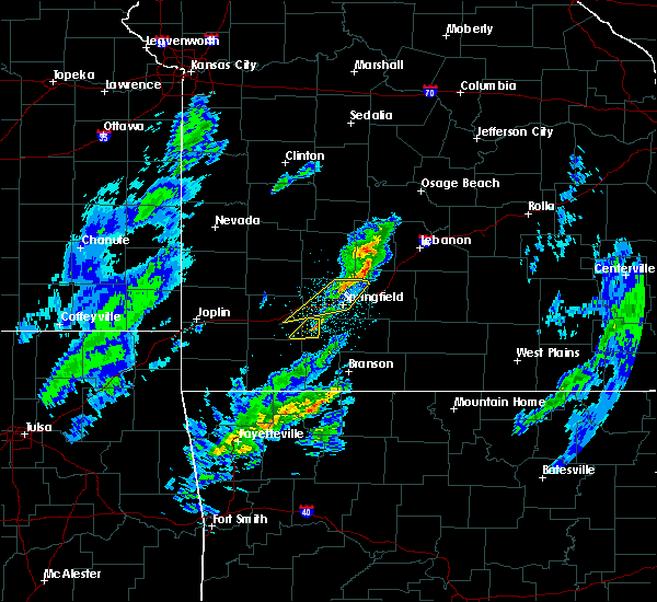 The severe thunderstorm warning for northwestern christian, northwestern stone and southeastern lawrence counties will expire at 715 pm cst, the storm which prompted the warning has weakened below severe limits, and no longer poses an immediate threat to life or property. therefore, the warning will be allowed to expire. however gusty winds are still possible with this thunderstorm. a tornado watch remains in effect until midnight cst for southwestern missouri. The severe thunderstorm warning for northwestern christian, northwestern stone and southeastern lawrence counties will expire at 715 pm cst, the storm which prompted the warning has weakened below severe limits, and no longer poses an immediate threat to life or property. therefore, the warning will be allowed to expire. however gusty winds are still possible with this thunderstorm. a tornado watch remains in effect until midnight cst for southwestern missouri.
|
| 11/26/2019 6:54 PM CST |
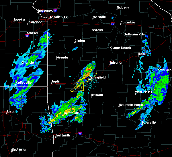 At 654 pm cst, a severe thunderstorm was located near marionville, or near aurora, moving northeast at 55 mph (radar indicated). Hazards include 60 mph wind gusts and penny size hail. Expect damage to roofs, siding, and trees. Locations impacted include, aurora, marionville, billings,. At 654 pm cst, a severe thunderstorm was located near marionville, or near aurora, moving northeast at 55 mph (radar indicated). Hazards include 60 mph wind gusts and penny size hail. Expect damage to roofs, siding, and trees. Locations impacted include, aurora, marionville, billings,.
|
| 11/26/2019 6:48 PM CST |
 At 647 pm cst, severe thunderstorms were located along a line extending from near pleasant hope to near republic to 6 miles southeast of mount vernon, moving northeast at 60 mph (trained weather spotters). Hazards include 60 mph wind gusts. expect damage to roofs, siding, and trees At 647 pm cst, severe thunderstorms were located along a line extending from near pleasant hope to near republic to 6 miles southeast of mount vernon, moving northeast at 60 mph (trained weather spotters). Hazards include 60 mph wind gusts. expect damage to roofs, siding, and trees
|
| 11/26/2019 6:41 PM CST |
 At 641 pm cst, a severe thunderstorm was located near purdy, or near monett, moving northeast at 50 mph (radar indicated). Hazards include 60 mph wind gusts and quarter size hail. Hail damage to vehicles is expected. Expect wind damage to roofs, siding, and trees. At 641 pm cst, a severe thunderstorm was located near purdy, or near monett, moving northeast at 50 mph (radar indicated). Hazards include 60 mph wind gusts and quarter size hail. Hail damage to vehicles is expected. Expect wind damage to roofs, siding, and trees.
|
| 10/21/2019 1:05 AM CDT |
 At 105 am cdt, a confirmed tornado was located over battlefield, moving northeast at 45 mph (radar confirmed tornado). Hazards include damaging tornado. Flying debris will be dangerous to those caught without shelter. mobile homes will be damaged or destroyed. damage to roofs, windows, and vehicles will occur. tree damage is likely. Locations impacted include, springfield, nixa, ozark, republic, battlefield, rogersville, strafford, fremont hills, fordland, brookline, turners, northview, galloway, this includes interstate 44 between mile markers 69 and 71, and between mile markers 76 and 97. At 105 am cdt, a confirmed tornado was located over battlefield, moving northeast at 45 mph (radar confirmed tornado). Hazards include damaging tornado. Flying debris will be dangerous to those caught without shelter. mobile homes will be damaged or destroyed. damage to roofs, windows, and vehicles will occur. tree damage is likely. Locations impacted include, springfield, nixa, ozark, republic, battlefield, rogersville, strafford, fremont hills, fordland, brookline, turners, northview, galloway, this includes interstate 44 between mile markers 69 and 71, and between mile markers 76 and 97.
|
| 10/21/2019 12:59 AM CDT |
 At 1259 am cdt, a severe thunderstorm capable of producing a tornado was located near battlefield, moving northeast at 45 mph (radar indicated rotation). Hazards include tornado. Flying debris will be dangerous to those caught without shelter. mobile homes will be damaged or destroyed. damage to roofs, windows, and vehicles will occur. Tree damage is likely. At 1259 am cdt, a severe thunderstorm capable of producing a tornado was located near battlefield, moving northeast at 45 mph (radar indicated rotation). Hazards include tornado. Flying debris will be dangerous to those caught without shelter. mobile homes will be damaged or destroyed. damage to roofs, windows, and vehicles will occur. Tree damage is likely.
|
| 10/21/2019 12:34 AM CDT |
 At 1234 am cdt, a severe thunderstorm was located near mount vernon, moving northeast at 55 mph (radar indicated). Hazards include 60 mph wind gusts and quarter size hail. Hail damage to vehicles is expected. Expect wind damage to roofs, siding, and trees. At 1234 am cdt, a severe thunderstorm was located near mount vernon, moving northeast at 55 mph (radar indicated). Hazards include 60 mph wind gusts and quarter size hail. Hail damage to vehicles is expected. Expect wind damage to roofs, siding, and trees.
|
| 8/26/2019 3:17 PM CDT |
 At 317 pm cdt, a severe thunderstorm was located over clever, or near republic, moving southeast at 35 mph (radar indicated). Hazards include 60 mph wind gusts and quarter size hail. Hail damage to vehicles is expected. expect wind damage to roofs, siding, and trees. Locations impacted include, nixa, clever, crane, billings, hurley, boaz,. At 317 pm cdt, a severe thunderstorm was located over clever, or near republic, moving southeast at 35 mph (radar indicated). Hazards include 60 mph wind gusts and quarter size hail. Hail damage to vehicles is expected. expect wind damage to roofs, siding, and trees. Locations impacted include, nixa, clever, crane, billings, hurley, boaz,.
|
| 8/26/2019 3:13 PM CDT |
 The national weather service in springfield has issued a * severe thunderstorm warning for. western christian county in southwestern missouri. northwestern taney county in southwestern missouri. stone county in southwestern missouri. Southeastern lawrence county in southwestern missouri. The national weather service in springfield has issued a * severe thunderstorm warning for. western christian county in southwestern missouri. northwestern taney county in southwestern missouri. stone county in southwestern missouri. Southeastern lawrence county in southwestern missouri.
|
| 8/26/2019 2:57 PM CDT |
 The national weather service in springfield has issued a * severe thunderstorm warning for. northwestern christian county in southwestern missouri. northwestern stone county in southwestern missouri. southeastern lawrence county in southwestern missouri. Southwestern greene county in southwestern missouri. The national weather service in springfield has issued a * severe thunderstorm warning for. northwestern christian county in southwestern missouri. northwestern stone county in southwestern missouri. southeastern lawrence county in southwestern missouri. Southwestern greene county in southwestern missouri.
|
| 8/26/2019 2:43 PM CDT |
 A severe thunderstorm warning remains in effect until 315 pm cdt for northwestern christian. northeastern lawrence. greene and southeastern dade counties. at 243 pm cdt, a severe thunderstorm was located near ash grove, or 8 miles northwest of republic, moving southeast at 35 mph. hazard. 60 mph wind gusts and quarter size hail. A severe thunderstorm warning remains in effect until 315 pm cdt for northwestern christian. northeastern lawrence. greene and southeastern dade counties. at 243 pm cdt, a severe thunderstorm was located near ash grove, or 8 miles northwest of republic, moving southeast at 35 mph. hazard. 60 mph wind gusts and quarter size hail.
|
| 8/26/2019 2:37 PM CDT |
 At 237 pm cdt, a severe thunderstorm was located near ash grove, or 11 miles northwest of republic, moving southeast at 35 mph (radar indicated). Hazards include 60 mph wind gusts and quarter size hail. Hail damage to vehicles is expected. expect wind damage to roofs, siding, and trees. Locations impacted include, springfield, nixa, republic, stockton lake, battlefield, willard, clever, ash grove, billings, walnut grove, everton, brookline, dadeville, halltown, sacville, glidewell, turners, bois d`arc, cave springs, eudora, this includes interstate 44 between mile markers 57 and 82. At 237 pm cdt, a severe thunderstorm was located near ash grove, or 11 miles northwest of republic, moving southeast at 35 mph (radar indicated). Hazards include 60 mph wind gusts and quarter size hail. Hail damage to vehicles is expected. expect wind damage to roofs, siding, and trees. Locations impacted include, springfield, nixa, republic, stockton lake, battlefield, willard, clever, ash grove, billings, walnut grove, everton, brookline, dadeville, halltown, sacville, glidewell, turners, bois d`arc, cave springs, eudora, this includes interstate 44 between mile markers 57 and 82.
|
| 8/26/2019 2:12 PM CDT |
 At 211 pm cdt, a severe thunderstorm was located near greenfield, moving southeast at 35 mph (radar indicated). Hazards include 60 mph wind gusts and quarter size hail. Hail damage to vehicles is expected. Expect wind damage to roofs, siding, and trees. At 211 pm cdt, a severe thunderstorm was located near greenfield, moving southeast at 35 mph (radar indicated). Hazards include 60 mph wind gusts and quarter size hail. Hail damage to vehicles is expected. Expect wind damage to roofs, siding, and trees.
|
| 6/21/2019 2:54 PM CDT |
 At 252 pm cdt, a severe thunderstorm was located near strafford, moving east at 35 mph (emergency management). Hazards include 60 mph wind gusts and quarter size hail. emergency management and the public have reported quarter size hail and damage to tree limbs with this storm. Hail damage to vehicles is expected. expect wind damage to roofs, siding, and trees. Locations impacted include, springfield, republic, marshfield, battlefield, willard, rogersville, strafford, seymour, fair grove, fordland, conway, niangua, duncan, brookline, diggins, elkland, glidewell, turners, march, rader, this includes interstate 44 between mile markers 69 and 111. At 252 pm cdt, a severe thunderstorm was located near strafford, moving east at 35 mph (emergency management). Hazards include 60 mph wind gusts and quarter size hail. emergency management and the public have reported quarter size hail and damage to tree limbs with this storm. Hail damage to vehicles is expected. expect wind damage to roofs, siding, and trees. Locations impacted include, springfield, republic, marshfield, battlefield, willard, rogersville, strafford, seymour, fair grove, fordland, conway, niangua, duncan, brookline, diggins, elkland, glidewell, turners, march, rader, this includes interstate 44 between mile markers 69 and 111.
|
| 6/21/2019 2:38 PM CDT |
 At 237 pm cdt, a severe thunderstorm was located over marshfield, moving east at 25 mph. additional severe thunderstorms were developing over central greene county and also moving east around 25 mph (radar indicated). Hazards include 60 mph wind gusts and quarter size hail. Hail damage to vehicles is expected. Expect wind damage to roofs, siding, and trees. At 237 pm cdt, a severe thunderstorm was located over marshfield, moving east at 25 mph. additional severe thunderstorms were developing over central greene county and also moving east around 25 mph (radar indicated). Hazards include 60 mph wind gusts and quarter size hail. Hail damage to vehicles is expected. Expect wind damage to roofs, siding, and trees.
|
| 6/4/2019 4:03 PM CDT |
 At 402 pm cdt, a severe thunderstorm was located over republic, moving northeast at 20 mph (radar indicated). Hazards include 60 mph wind gusts and quarter size hail. Hail damage to vehicles is expected. Expect wind damage to roofs, siding, and trees. At 402 pm cdt, a severe thunderstorm was located over republic, moving northeast at 20 mph (radar indicated). Hazards include 60 mph wind gusts and quarter size hail. Hail damage to vehicles is expected. Expect wind damage to roofs, siding, and trees.
|
| 5/23/2019 3:22 AM CDT |
 At 322 am cdt, a severe thunderstorm was located over fair grove, or 7 miles northwest of strafford, moving northeast at 40 mph (radar indicated). Hazards include 60 mph wind gusts and quarter size hail. Hail damage to vehicles is expected. expect wind damage to roofs, siding, and trees. Locations impacted include, springfield, republic, battlefield, willard, rogersville, strafford, ash grove, fair grove, walnut grove, pleasant hope, brookline, sacville, glidewell, ebenezer, bassville, brighton, turners, march, bois d`arc, olive, this includes interstate 44 between mile markers 59 and 89. At 322 am cdt, a severe thunderstorm was located over fair grove, or 7 miles northwest of strafford, moving northeast at 40 mph (radar indicated). Hazards include 60 mph wind gusts and quarter size hail. Hail damage to vehicles is expected. expect wind damage to roofs, siding, and trees. Locations impacted include, springfield, republic, battlefield, willard, rogersville, strafford, ash grove, fair grove, walnut grove, pleasant hope, brookline, sacville, glidewell, ebenezer, bassville, brighton, turners, march, bois d`arc, olive, this includes interstate 44 between mile markers 59 and 89.
|
| 5/23/2019 2:52 AM CDT |
 At 252 am cdt, a severe thunderstorm was located near willard, or 9 miles north of republic, moving northeast at 40 mph (radar indicated). Hazards include 60 mph wind gusts and quarter size hail. Hail damage to vehicles is expected. Expect wind damage to roofs, siding, and trees. At 252 am cdt, a severe thunderstorm was located near willard, or 9 miles north of republic, moving northeast at 40 mph (radar indicated). Hazards include 60 mph wind gusts and quarter size hail. Hail damage to vehicles is expected. Expect wind damage to roofs, siding, and trees.
|
| 5/21/2019 12:49 PM CDT | 12 inch diameter tree down and 10 inch diameter tree uprooted on orr s in greene county MO, 2.5 miles SW of Republic, MO |
| 5/20/2019 10:52 PM CDT |
 The severe thunderstorm warning for northwestern christian, southern polk and greene counties will expire at 1100 pm cdt, the storms which prompted the warning have moved out of the area. therefore, the warning will be allowed to expire. however gusty winds and heavy rain are still possible with these thunderstorms. a tornado watch remains in effect until 100 am cdt for southwestern missouri. The severe thunderstorm warning for northwestern christian, southern polk and greene counties will expire at 1100 pm cdt, the storms which prompted the warning have moved out of the area. therefore, the warning will be allowed to expire. however gusty winds and heavy rain are still possible with these thunderstorms. a tornado watch remains in effect until 100 am cdt for southwestern missouri.
|
| 5/20/2019 10:21 PM CDT |
 At 1020 pm cdt, severe thunderstorms were located along a line extending from near morrisville to near willard to near billings, moving east at 50 mph (trained weather spotters. trees down and minor structural damage reported in bois d arc). Hazards include 70 mph wind gusts and nickel size hail. Expect considerable tree damage. damage is likely to mobile homes, roofs, and outbuildings. Locations impacted include, springfield, nixa, ozark, republic, battlefield, willard, strafford, clever, sparta, ash grove, fair grove, billings, fremont hills, walnut grove, pleasant hope, brookline, glidewell, turners, bois d`arc, cave springs, this includes interstate 44 between mile markers 59 and 86. At 1020 pm cdt, severe thunderstorms were located along a line extending from near morrisville to near willard to near billings, moving east at 50 mph (trained weather spotters. trees down and minor structural damage reported in bois d arc). Hazards include 70 mph wind gusts and nickel size hail. Expect considerable tree damage. damage is likely to mobile homes, roofs, and outbuildings. Locations impacted include, springfield, nixa, ozark, republic, battlefield, willard, strafford, clever, sparta, ash grove, fair grove, billings, fremont hills, walnut grove, pleasant hope, brookline, glidewell, turners, bois d`arc, cave springs, this includes interstate 44 between mile markers 59 and 86.
|
| 5/20/2019 10:09 PM CDT |
 At 1009 pm cdt, severe thunderstorms were located along a line extending from near walnut grove to near ash grove to 7 miles northwest of billings, moving northeast at 60 mph (radar indicated). Hazards include 60 mph wind gusts and quarter size hail. Hail damage to vehicles is expected. Expect wind damage to roofs, siding, and trees. At 1009 pm cdt, severe thunderstorms were located along a line extending from near walnut grove to near ash grove to 7 miles northwest of billings, moving northeast at 60 mph (radar indicated). Hazards include 60 mph wind gusts and quarter size hail. Hail damage to vehicles is expected. Expect wind damage to roofs, siding, and trees.
|
| 5/19/2019 2:22 AM CDT |
 At 222 am cdt, severe thunderstorms were located along a line extending from near willard to near battlefield to near republic, moving northeast at 55 mph (radar indicated). Hazards include 60 mph wind gusts. expect damage to roofs, siding, and trees At 222 am cdt, severe thunderstorms were located along a line extending from near willard to near battlefield to near republic, moving northeast at 55 mph (radar indicated). Hazards include 60 mph wind gusts. expect damage to roofs, siding, and trees
|
| 5/18/2019 3:35 PM CDT |
 At 334 pm cdt, severe thunderstorms were located along a line extending from clever to 6 miles west of highlandville to silver dollar city, moving northeast at 55 mph (radar indicated). Hazards include 60 mph wind gusts and quarter size hail. Hail damage to vehicles is expected. expect wind damage to roofs, siding, and trees. Locations impacted include, nixa, branson, lake taneycomo, bull shoals lake, table rock lake, table rock state park, hollister, silver dollar city, forsyth, clever, merriam woods, crane, kissee mills, billings, reeds spring, highlandville, rockaway beach, bull creek, indian point, branson west,. At 334 pm cdt, severe thunderstorms were located along a line extending from clever to 6 miles west of highlandville to silver dollar city, moving northeast at 55 mph (radar indicated). Hazards include 60 mph wind gusts and quarter size hail. Hail damage to vehicles is expected. expect wind damage to roofs, siding, and trees. Locations impacted include, nixa, branson, lake taneycomo, bull shoals lake, table rock lake, table rock state park, hollister, silver dollar city, forsyth, clever, merriam woods, crane, kissee mills, billings, reeds spring, highlandville, rockaway beach, bull creek, indian point, branson west,.
|
| 5/18/2019 3:31 PM CDT |
 At 313 pm cdt, severe thunderstorms were located along a line extending from near marionville to 11 miles southwest of galena to 7 miles south of kimberling city, moving northeast at 55 mph (radar indicated). Hazards include 60 mph wind gusts and quarter size hail. Hail damage to vehicles is expected. expect wind damage to roofs, siding, and trees. Locations impacted include, nixa, branson, lake taneycomo, table rock lake, bull shoals lake, table rock state park, hollister, silver dollar city, kimberling city, forsyth, clever, merriam woods, crane, shell knob, kissee mills, billings, reeds spring, highlandville, rockaway beach, bull creek,. At 313 pm cdt, severe thunderstorms were located along a line extending from near marionville to 11 miles southwest of galena to 7 miles south of kimberling city, moving northeast at 55 mph (radar indicated). Hazards include 60 mph wind gusts and quarter size hail. Hail damage to vehicles is expected. expect wind damage to roofs, siding, and trees. Locations impacted include, nixa, branson, lake taneycomo, table rock lake, bull shoals lake, table rock state park, hollister, silver dollar city, kimberling city, forsyth, clever, merriam woods, crane, shell knob, kissee mills, billings, reeds spring, highlandville, rockaway beach, bull creek,.
|
| 5/18/2019 3:18 PM CDT |
 At 318 pm cdt, severe thunderstorms were located along a line extending from near stockton to 8 miles southwest of fair play to near walnut grove to near ash grove to billings, moving northeast at 45 mph (radar indicated). Hazards include 60 mph wind gusts and quarter size hail. Hail damage to vehicles is expected. Expect wind damage to roofs, siding, and trees. At 318 pm cdt, severe thunderstorms were located along a line extending from near stockton to 8 miles southwest of fair play to near walnut grove to near ash grove to billings, moving northeast at 45 mph (radar indicated). Hazards include 60 mph wind gusts and quarter size hail. Hail damage to vehicles is expected. Expect wind damage to roofs, siding, and trees.
|
| 5/18/2019 3:14 PM CDT |
 At 313 pm cdt, severe thunderstorms were located along a line extending from near marionville to 11 miles southwest of galena to 7 miles south of kimberling city, moving northeast at 55 mph (radar indicated). Hazards include 60 mph wind gusts and quarter size hail. Hail damage to vehicles is expected. expect wind damage to roofs, siding, and trees. Locations impacted include, nixa, branson, lake taneycomo, table rock lake, bull shoals lake, table rock state park, hollister, silver dollar city, kimberling city, forsyth, clever, merriam woods, crane, shell knob, kissee mills, billings, reeds spring, highlandville, rockaway beach, bull creek,. At 313 pm cdt, severe thunderstorms were located along a line extending from near marionville to 11 miles southwest of galena to 7 miles south of kimberling city, moving northeast at 55 mph (radar indicated). Hazards include 60 mph wind gusts and quarter size hail. Hail damage to vehicles is expected. expect wind damage to roofs, siding, and trees. Locations impacted include, nixa, branson, lake taneycomo, table rock lake, bull shoals lake, table rock state park, hollister, silver dollar city, kimberling city, forsyth, clever, merriam woods, crane, shell knob, kissee mills, billings, reeds spring, highlandville, rockaway beach, bull creek,.
|
| 5/18/2019 2:54 PM CDT |
 At 253 pm cdt, severe thunderstorms were located along a line extending from near cassville to beaver to near eureka springs, moving northeast at 55 mph (radar indicated). Hazards include 60 mph wind gusts and half dollar size hail. Hail damage to vehicles is expected. Expect wind damage to roofs, siding, and trees. At 253 pm cdt, severe thunderstorms were located along a line extending from near cassville to beaver to near eureka springs, moving northeast at 55 mph (radar indicated). Hazards include 60 mph wind gusts and half dollar size hail. Hail damage to vehicles is expected. Expect wind damage to roofs, siding, and trees.
|
| 2/23/2019 8:33 AM CST |
 At 832 am cst, a severe thunderstorm was located 3 miles northwest of billings, or 6 miles west of republic, moving northeast at 55 mph (radar indicated). Hazards include quarter size hail. damage to vehicles is expected At 832 am cst, a severe thunderstorm was located 3 miles northwest of billings, or 6 miles west of republic, moving northeast at 55 mph (radar indicated). Hazards include quarter size hail. damage to vehicles is expected
|
| 2/6/2019 11:55 PM CST |
 The severe thunderstorm warning for northwestern christian, stone, northern barry, lawrence and southwestern greene counties will expire at midnight cst, the storms which prompted the warning have moved out of the area. therefore, the warning will be allowed to expire. The severe thunderstorm warning for northwestern christian, stone, northern barry, lawrence and southwestern greene counties will expire at midnight cst, the storms which prompted the warning have moved out of the area. therefore, the warning will be allowed to expire.
|
| 2/6/2019 11:49 PM CST |
 At 1148 pm cst, a severe thunderstorm capable of producing a tornado was located near springfield, moving northeast at 70 mph (radar indicated rotation). Hazards include tornado and quarter size hail. Flying debris will be dangerous to those caught without shelter. mobile homes will be damaged or destroyed. damage to roofs, windows, and vehicles will occur. tree damage is likely. Locations impacted include, springfield, battlefield, strafford, fair grove, brookline, glidewell, ebenezer, bassville, turners, galloway, this includes interstate 44 between mile markers 70 and 90. At 1148 pm cst, a severe thunderstorm capable of producing a tornado was located near springfield, moving northeast at 70 mph (radar indicated rotation). Hazards include tornado and quarter size hail. Flying debris will be dangerous to those caught without shelter. mobile homes will be damaged or destroyed. damage to roofs, windows, and vehicles will occur. tree damage is likely. Locations impacted include, springfield, battlefield, strafford, fair grove, brookline, glidewell, ebenezer, bassville, turners, galloway, this includes interstate 44 between mile markers 70 and 90.
|
| 2/6/2019 11:22 PM CST |
 At 1121 pm cst, a severe thunderstorm capable of producing a tornado was located near aurora, moving northeast at 85 mph (radar indicated rotation). Hazards include tornado and quarter size hail. Flying debris will be dangerous to those caught without shelter. mobile homes will be damaged or destroyed. damage to roofs, windows, and vehicles will occur. Tree damage is likely. At 1121 pm cst, a severe thunderstorm capable of producing a tornado was located near aurora, moving northeast at 85 mph (radar indicated rotation). Hazards include tornado and quarter size hail. Flying debris will be dangerous to those caught without shelter. mobile homes will be damaged or destroyed. damage to roofs, windows, and vehicles will occur. Tree damage is likely.
|
| 2/6/2019 11:11 PM CST |
 At 1111 pm cst, a severe thunderstorm capable of producing a tornado was located over monett, moving northeast at 85 mph (radar indicated rotation). Hazards include tornado. Flying debris will be dangerous to those caught without shelter. mobile homes will be damaged or destroyed. damage to roofs, windows, and vehicles will occur. Tree damage is likely. At 1111 pm cst, a severe thunderstorm capable of producing a tornado was located over monett, moving northeast at 85 mph (radar indicated rotation). Hazards include tornado. Flying debris will be dangerous to those caught without shelter. mobile homes will be damaged or destroyed. damage to roofs, windows, and vehicles will occur. Tree damage is likely.
|
| 2/6/2019 10:59 PM CST |
 At 1059 pm cst, severe thunderstorms were located along a line extending from near diamond to 8 miles south of wheaton, moving northeast at 60 mph (radar indicated). Hazards include 60 mph wind gusts and nickel size hail. expect damage to roofs, siding, and trees At 1059 pm cst, severe thunderstorms were located along a line extending from near diamond to 8 miles south of wheaton, moving northeast at 60 mph (radar indicated). Hazards include 60 mph wind gusts and nickel size hail. expect damage to roofs, siding, and trees
|
| 2/6/2019 10:26 PM CST |
 At 1025 pm cst, a severe thunderstorm was located near battlefield, moving northeast at 55 mph. quarter size hail has been reported in republic (public). Hazards include quarter size hail. Damage to vehicles is expected. Locations impacted include, springfield, republic, battlefield, willard, fair grove, pleasant hope, morrisville, brookline, sacville, glidewell, ebenezer, bassville, brighton, olive, cave springs, galloway, this includes interstate 44 between mile markers 65 and 68, and between mile markers 70 and 84. At 1025 pm cst, a severe thunderstorm was located near battlefield, moving northeast at 55 mph. quarter size hail has been reported in republic (public). Hazards include quarter size hail. Damage to vehicles is expected. Locations impacted include, springfield, republic, battlefield, willard, fair grove, pleasant hope, morrisville, brookline, sacville, glidewell, ebenezer, bassville, brighton, olive, cave springs, galloway, this includes interstate 44 between mile markers 65 and 68, and between mile markers 70 and 84.
|
| 2/6/2019 10:20 PM CST | Quarter sized hail reported 1.9 miles NE of Republic, MO, a delayed report of quarter size hail just southeast of republic. |
| 2/6/2019 10:19 PM CST | Quarter sized hail reported 1 miles NNW of Republic, MO, public report of quarter size hail just east of republic... mo. |
| 2/6/2019 10:16 PM CST |
 At 1016 pm cst, a severe thunderstorm was located over republic, moving northeast at 55 mph (radar indicated). Hazards include quarter size hail. damage to vehicles is expected At 1016 pm cst, a severe thunderstorm was located over republic, moving northeast at 55 mph (radar indicated). Hazards include quarter size hail. damage to vehicles is expected
|
| 12/1/2018 1:16 AM CST | Emd republic: 74 mph wind at 701 us 60 in republic. numerous 2 to 3 inch limmbs down with some large diameter trees in 400 block of n mai in greene county MO, 0.6 miles ENE of Republic, MO |
| 12/1/2018 12:53 AM CST | Corrects previous tstm wnd gst report from 1 ne republic. emd republic: 74 mph wind at 701 us 60 in republic. numerous 2 to 3 inch limmbs down with some large diameter in greene county MO, 0.6 miles ENE of Republic, MO |
| 12/1/2018 12:53 AM CST |
 The tornado warning for northwestern christian, northwestern stone and southeastern lawrence counties will expire at 100 am cst, the storm which prompted the warning has moved out of the area. therefore, the warning will be allowed to expire. a tornado watch remains in effect until 500 am cst for southwestern missouri. The tornado warning for northwestern christian, northwestern stone and southeastern lawrence counties will expire at 100 am cst, the storm which prompted the warning has moved out of the area. therefore, the warning will be allowed to expire. a tornado watch remains in effect until 500 am cst for southwestern missouri.
|
| 12/1/2018 12:52 AM CST | Shingles missing from nearby house roo in greene county MO, 2.9 miles ENE of Republic, MO |
| 12/1/2018 12:52 AM CST |
 At 1252 am cst, a severe thunderstorm capable of producing a tornado was located over republic, moving northeast at 35 mph (radar indicated rotation). Hazards include tornado and quarter size hail. Flying debris will be dangerous to those caught without shelter. mobile homes will be damaged or destroyed. damage to roofs, windows, and vehicles will occur. tree damage is likely. Locations impacted include, springfield, nixa, republic, battlefield, brookline, galloway, this includes interstate 44 between mile markers 63 and 79. At 1252 am cst, a severe thunderstorm capable of producing a tornado was located over republic, moving northeast at 35 mph (radar indicated rotation). Hazards include tornado and quarter size hail. Flying debris will be dangerous to those caught without shelter. mobile homes will be damaged or destroyed. damage to roofs, windows, and vehicles will occur. tree damage is likely. Locations impacted include, springfield, nixa, republic, battlefield, brookline, galloway, this includes interstate 44 between mile markers 63 and 79.
|
| 12/1/2018 12:51 AM CST | Roof damage to meeks building supply company. time estimated via rada in greene county MO, 0.6 miles ENE of Republic, MO |
| 12/1/2018 12:50 AM CST | Large tree down at first baptist church partially blocking roa in greene county MO, 1.9 miles ENE of Republic, MO |
| 12/1/2018 12:50 AM CST | Roof damage to home. time estimated via rada in greene county MO, 0.6 miles S of Republic, MO |
| 12/1/2018 12:50 AM CST | Trees down and shingles off roof in greene county MO, 2.9 miles ENE of Republic, MO |
| 12/1/2018 12:47 AM CST |
 At 1247 am cst, a severe thunderstorm capable of producing a tornado was located over billings, or over republic, moving northeast at 55 mph (radar indicated rotation). Hazards include tornado and quarter size hail. Flying debris will be dangerous to those caught without shelter. mobile homes will be damaged or destroyed. damage to roofs, windows, and vehicles will occur. Tree damage is likely. At 1247 am cst, a severe thunderstorm capable of producing a tornado was located over billings, or over republic, moving northeast at 55 mph (radar indicated rotation). Hazards include tornado and quarter size hail. Flying debris will be dangerous to those caught without shelter. mobile homes will be damaged or destroyed. damage to roofs, windows, and vehicles will occur. Tree damage is likely.
|
| 12/1/2018 12:36 AM CST |
 At 1236 am cst, severe thunderstorms were located along a line extending from 7 miles northwest of miller to near roberson hollow, moving northeast at 55 mph (radar indicated). Hazards include 70 mph wind gusts. Expect considerable tree damage. Damage is likely to mobile homes, roofs, and outbuildings. At 1236 am cst, severe thunderstorms were located along a line extending from 7 miles northwest of miller to near roberson hollow, moving northeast at 55 mph (radar indicated). Hazards include 70 mph wind gusts. Expect considerable tree damage. Damage is likely to mobile homes, roofs, and outbuildings.
|
| 12/1/2018 12:34 AM CST |
 At 1234 am cst, a severe thunderstorm capable of producing a tornado was located over aurora, moving northeast at 55 mph (radar indicated rotation). Hazards include tornado and quarter size hail. Flying debris will be dangerous to those caught without shelter. mobile homes will be damaged or destroyed. damage to roofs, windows, and vehicles will occur. Tree damage is likely. At 1234 am cst, a severe thunderstorm capable of producing a tornado was located over aurora, moving northeast at 55 mph (radar indicated rotation). Hazards include tornado and quarter size hail. Flying debris will be dangerous to those caught without shelter. mobile homes will be damaged or destroyed. damage to roofs, windows, and vehicles will occur. Tree damage is likely.
|
| 12/1/2018 12:25 AM CST |
 At 1224 am cst, severe thunderstorms were located along a line extending from 11 miles south of golden city to green forest, moving northeast at 55 mph (radar indicated). Hazards include 70 mph wind gusts and quarter size hail. Hail damage to vehicles is expected. expect considerable tree damage. wind damage is also likely to mobile homes, roofs, and outbuildings. locations impacted include, table rock lake, monett, aurora, mount vernon, silver dollar city, kimberling city, marionville, clever, crane, shell knob, sarcoxie, pierce city, billings, reeds spring, miller, verona, indian point, branson west, galena, mccord bend, this includes interstate 44 between mile markers 28 and 58. A tornado watch remains in effect until 500 am cst for southwestern missouri. At 1224 am cst, severe thunderstorms were located along a line extending from 11 miles south of golden city to green forest, moving northeast at 55 mph (radar indicated). Hazards include 70 mph wind gusts and quarter size hail. Hail damage to vehicles is expected. expect considerable tree damage. wind damage is also likely to mobile homes, roofs, and outbuildings. locations impacted include, table rock lake, monett, aurora, mount vernon, silver dollar city, kimberling city, marionville, clever, crane, shell knob, sarcoxie, pierce city, billings, reeds spring, miller, verona, indian point, branson west, galena, mccord bend, this includes interstate 44 between mile markers 28 and 58. A tornado watch remains in effect until 500 am cst for southwestern missouri.
|
| 12/1/2018 12:17 AM CST |
 At 1216 am cst, severe thunderstorms were located along a line extending from 6 miles east of carthage to near berryville, moving northeast at 55 mph (radar indicated). Hazards include 70 mph wind gusts and quarter size hail. Hail damage to vehicles is expected. expect considerable tree damage. wind damage is also likely to mobile homes, roofs, and outbuildings. locations impacted include, carthage, table rock lake, roaring river state park, monett, aurora, mount vernon, cassville, silver dollar city, kimberling city, marionville, clever, crane, shell knob, sarcoxie, pierce city, purdy, billings, reeds spring, exeter, miller, this includes the following highways, interstate 44 between mile markers 20 and 58. interstate 49 near mile marker 39. A tornado watch remains in effect until 500 am cst for southwestern missouri. At 1216 am cst, severe thunderstorms were located along a line extending from 6 miles east of carthage to near berryville, moving northeast at 55 mph (radar indicated). Hazards include 70 mph wind gusts and quarter size hail. Hail damage to vehicles is expected. expect considerable tree damage. wind damage is also likely to mobile homes, roofs, and outbuildings. locations impacted include, carthage, table rock lake, roaring river state park, monett, aurora, mount vernon, cassville, silver dollar city, kimberling city, marionville, clever, crane, shell knob, sarcoxie, pierce city, purdy, billings, reeds spring, exeter, miller, this includes the following highways, interstate 44 between mile markers 20 and 58. interstate 49 near mile marker 39. A tornado watch remains in effect until 500 am cst for southwestern missouri.
|
| 12/1/2018 12:04 AM CST |
 At 1203 am cst, severe thunderstorms were located along a line extending from near duenweg to near forum, moving northeast at 55 mph (radar indicated). Hazards include 70 mph wind gusts and quarter size hail. Hail damage to vehicles is expected. expect considerable tree damage. Wind damage is also likely to mobile homes, roofs, and outbuildings. At 1203 am cst, severe thunderstorms were located along a line extending from near duenweg to near forum, moving northeast at 55 mph (radar indicated). Hazards include 70 mph wind gusts and quarter size hail. Hail damage to vehicles is expected. expect considerable tree damage. Wind damage is also likely to mobile homes, roofs, and outbuildings.
|
| 8/30/2018 10:49 AM CDT |
 At 1048 am cdt, a severe thunderstorm was located over northwestern springfield, moving northeast at 25 mph (radar indicated). Hazards include quarter size hail. damage to vehicles is expected At 1048 am cdt, a severe thunderstorm was located over northwestern springfield, moving northeast at 25 mph (radar indicated). Hazards include quarter size hail. damage to vehicles is expected
|
| 8/19/2018 7:52 PM CDT |
 At 752 pm cdt, severe thunderstorms were located along a line extending from 7 miles south of urbana to 6 miles southeast of fair grove to 6 miles southeast of clever, moving east at 35 mph (trained weather spotters). Hazards include 60 mph wind gusts. Expect damage to roofs, siding, and trees. locations impacted include, springfield, nixa, ozark, republic, marshfield, battlefield, buffalo, rogersville, strafford, clever, sparta, fair grove, highlandville, fremont hills, fordland, niangua, brookline, hurley, louisburg, elkland, this includes interstate 44 near mile marker 69, and between mile markers 71 and 109. A tornado watch remains in effect until 900 pm cdt for southwestern missouri. At 752 pm cdt, severe thunderstorms were located along a line extending from 7 miles south of urbana to 6 miles southeast of fair grove to 6 miles southeast of clever, moving east at 35 mph (trained weather spotters). Hazards include 60 mph wind gusts. Expect damage to roofs, siding, and trees. locations impacted include, springfield, nixa, ozark, republic, marshfield, battlefield, buffalo, rogersville, strafford, clever, sparta, fair grove, highlandville, fremont hills, fordland, niangua, brookline, hurley, louisburg, elkland, this includes interstate 44 near mile marker 69, and between mile markers 71 and 109. A tornado watch remains in effect until 900 pm cdt for southwestern missouri.
|
| 8/19/2018 7:31 PM CDT |
 At 731 pm cdt, severe thunderstorms were located along a line extending from 7 miles north of bolivar to 7 miles southwest of fair grove to near marionville, moving east at 10 mph (radar indicated). Hazards include 60 mph wind gusts. expect damage to roofs, siding, and trees At 731 pm cdt, severe thunderstorms were located along a line extending from 7 miles north of bolivar to 7 miles southwest of fair grove to near marionville, moving east at 10 mph (radar indicated). Hazards include 60 mph wind gusts. expect damage to roofs, siding, and trees
|
| 8/19/2018 7:25 PM CDT |
 At 725 pm cdt, severe thunderstorms were located along a line extending from near wheatland to near bolivar to 7 miles north of springfield to near crane, moving east at 30 mph (radar indicated). Hazards include 60 mph wind gusts. Expect damage to roofs, siding, and trees. locations impacted include, springfield, nixa, ozark, republic, bolivar, pomme de terre lake, stockton lake, battlefield, willard, rogersville, strafford, clever, sparta, ash grove, crane, fair grove, humansville, billings, highlandville, fremont hills, this includes interstate 44 between mile markers 59 and 90. A tornado watch remains in effect until 900 pm cdt for central and southwestern missouri. At 725 pm cdt, severe thunderstorms were located along a line extending from near wheatland to near bolivar to 7 miles north of springfield to near crane, moving east at 30 mph (radar indicated). Hazards include 60 mph wind gusts. Expect damage to roofs, siding, and trees. locations impacted include, springfield, nixa, ozark, republic, bolivar, pomme de terre lake, stockton lake, battlefield, willard, rogersville, strafford, clever, sparta, ash grove, crane, fair grove, humansville, billings, highlandville, fremont hills, this includes interstate 44 between mile markers 59 and 90. A tornado watch remains in effect until 900 pm cdt for central and southwestern missouri.
|
| 8/19/2018 7:23 PM CDT | Spotter reported an estimated 60mph wind gust and a large tree down blocking a roadway. time estimated from rada in greene county MO, 2.9 miles ENE of Republic, MO |
| 8/19/2018 7:21 PM CDT | Spotter reports downed power lines at the intersection of south illinois ave and melody lane southwest of republic. spotter also sees several large tree branches... and in greene county MO, 3.1 miles NE of Republic, MO |
| 8/19/2018 7:03 PM CDT | Multiple tree limbs down with minor damage to outbuildings. time estimated by rada in greene county MO, 3.7 miles ENE of Republic, MO |
| 8/19/2018 6:40 PM CDT |
 At 640 pm cdt, severe thunderstorms were located along a line extending from 6 miles west of fair play to 9 miles east of miller to near purdy, moving northeast at 45 mph (radar indicated). Hazards include 60 mph wind gusts. expect damage to roofs, siding, and trees At 640 pm cdt, severe thunderstorms were located along a line extending from 6 miles west of fair play to 9 miles east of miller to near purdy, moving northeast at 45 mph (radar indicated). Hazards include 60 mph wind gusts. expect damage to roofs, siding, and trees
|
| 8/16/2018 8:28 PM CDT |
 At 827 pm cdt, severe thunderstorms were located along a line extending from near morrisville to near nixa, moving east at 25 mph. this extends the previous warning (radar indicated). Hazards include 60 mph wind gusts and quarter size hail. Hail damage to vehicles is expected. Expect wind damage to roofs, siding, and trees. At 827 pm cdt, severe thunderstorms were located along a line extending from near morrisville to near nixa, moving east at 25 mph. this extends the previous warning (radar indicated). Hazards include 60 mph wind gusts and quarter size hail. Hail damage to vehicles is expected. Expect wind damage to roofs, siding, and trees.
|
| 8/16/2018 8:17 PM CDT |
 At 817 pm cdt, severe thunderstorms were located along a line extending from walnut grove to battlefield, moving east at 20 mph (radar indicated). Hazards include 60 mph wind gusts and quarter size hail. Hail damage to vehicles is expected. expect wind damage to roofs, siding, and trees. Locations impacted include, springfield, republic, battlefield, willard, strafford, ash grove, fair grove, walnut grove, brookline, sacville, glidewell, ebenezer, bassville, turners, bois d`arc, cave springs, galloway, this includes interstate 44 between mile markers 59 and 90. At 817 pm cdt, severe thunderstorms were located along a line extending from walnut grove to battlefield, moving east at 20 mph (radar indicated). Hazards include 60 mph wind gusts and quarter size hail. Hail damage to vehicles is expected. expect wind damage to roofs, siding, and trees. Locations impacted include, springfield, republic, battlefield, willard, strafford, ash grove, fair grove, walnut grove, brookline, sacville, glidewell, ebenezer, bassville, turners, bois d`arc, cave springs, galloway, this includes interstate 44 between mile markers 59 and 90.
|
| 8/16/2018 8:08 PM CDT |
 The national weather service in springfield has issued a * severe thunderstorm warning for. northwestern christian county in southwestern missouri. until 900 pm cdt. At 808 pm cdt, a severe thunderstorm was located over clever, or near republic, moving east at 25 mph. The national weather service in springfield has issued a * severe thunderstorm warning for. northwestern christian county in southwestern missouri. until 900 pm cdt. At 808 pm cdt, a severe thunderstorm was located over clever, or near republic, moving east at 25 mph.
|
| 8/16/2018 7:52 PM CDT |
 At 751 pm cdt, severe thunderstorms were located along a line extending from near ash grove to near republic to billings, moving east at 30 mph (radar indicated). Hazards include 60 mph wind gusts and quarter size hail. Hail damage to vehicles is expected. Expect wind damage to roofs, siding, and trees. At 751 pm cdt, severe thunderstorms were located along a line extending from near ash grove to near republic to billings, moving east at 30 mph (radar indicated). Hazards include 60 mph wind gusts and quarter size hail. Hail damage to vehicles is expected. Expect wind damage to roofs, siding, and trees.
|
| 8/10/2018 8:42 PM CDT |
 At 841 pm cdt, a severe thunderstorm was located near billings, moving south at 10 mph. the storm has diminished in intensity and the warning may be cancelled early if this trend continues (radar indicated). Hazards include 60 mph wind gusts and penny size hail. Expect damage to roofs, siding, and trees. Locations impacted include, clever, billings,. At 841 pm cdt, a severe thunderstorm was located near billings, moving south at 10 mph. the storm has diminished in intensity and the warning may be cancelled early if this trend continues (radar indicated). Hazards include 60 mph wind gusts and penny size hail. Expect damage to roofs, siding, and trees. Locations impacted include, clever, billings,.
|
| 8/10/2018 8:24 PM CDT |
 At 824 pm cdt, a severe thunderstorm was located over republic, moving south at 10 mph (radar indicated). Hazards include 60 mph wind gusts and nickel size hail. expect damage to roofs, siding, and trees At 824 pm cdt, a severe thunderstorm was located over republic, moving south at 10 mph (radar indicated). Hazards include 60 mph wind gusts and nickel size hail. expect damage to roofs, siding, and trees
|
| 8/10/2018 7:33 PM CDT |
 At 733 pm cdt, a severe thunderstorm was located over southern springfield, moving southeast at 25 mph (radar indicated). Hazards include 60 mph wind gusts and quarter size hail. Hail damage to vehicles is expected. Expect wind damage to roofs, siding, and trees. At 733 pm cdt, a severe thunderstorm was located over southern springfield, moving southeast at 25 mph (radar indicated). Hazards include 60 mph wind gusts and quarter size hail. Hail damage to vehicles is expected. Expect wind damage to roofs, siding, and trees.
|
| 8/10/2018 7:21 PM CDT |
 At 705 pm cdt, a severe thunderstorm was located over southeastern springfield, moving southeast at 25 mph (radar indicated). Hazards include 60 mph wind gusts and quarter size hail. Hail damage to vehicles is expected. Expect wind damage to roofs, siding, and trees. At 705 pm cdt, a severe thunderstorm was located over southeastern springfield, moving southeast at 25 mph (radar indicated). Hazards include 60 mph wind gusts and quarter size hail. Hail damage to vehicles is expected. Expect wind damage to roofs, siding, and trees.
|
| 8/10/2018 7:06 PM CDT |
 At 705 pm cdt, a severe thunderstorm was located over southeastern springfield, moving southeast at 25 mph (radar indicated). Hazards include 60 mph wind gusts and quarter size hail. Hail damage to vehicles is expected. Expect wind damage to roofs, siding, and trees. At 705 pm cdt, a severe thunderstorm was located over southeastern springfield, moving southeast at 25 mph (radar indicated). Hazards include 60 mph wind gusts and quarter size hail. Hail damage to vehicles is expected. Expect wind damage to roofs, siding, and trees.
|
| 7/19/2018 6:23 PM CDT | Est 65-70 mph wind gusts on south side of republic near miller and lynn; few trees down and minor shingle damage to couple of home in greene county MO, 1.6 miles NNE of Republic, MO |
| 7/19/2018 6:22 PM CDT | 68 mph gust... hampton and harrison... republic... mo - measure in greene county MO, 1.9 miles ENE of Republic, MO |
| 7/19/2018 6:15 PM CDT |
 At 615 pm cdt, severe thunderstorms were located along a line extending from 7 miles south of pleasant hope to 6 miles west of springfield to near billings, moving southeast at 65 mph (radar indicated). Hazards include 70 mph wind gusts. Expect considerable tree damage. damage is likely to mobile homes, roofs, and outbuildings. Locations impacted include, springfield, nixa, ozark, republic, aurora, battlefield, rogersville, strafford, marionville, clever, sparta, crane, purdy, billings, highlandville, fremont hills, fordland, brookline, hurley, spokane, this includes interstate 44 between mile markers 69 and 96. At 615 pm cdt, severe thunderstorms were located along a line extending from 7 miles south of pleasant hope to 6 miles west of springfield to near billings, moving southeast at 65 mph (radar indicated). Hazards include 70 mph wind gusts. Expect considerable tree damage. damage is likely to mobile homes, roofs, and outbuildings. Locations impacted include, springfield, nixa, ozark, republic, aurora, battlefield, rogersville, strafford, marionville, clever, sparta, crane, purdy, billings, highlandville, fremont hills, fordland, brookline, hurley, spokane, this includes interstate 44 between mile markers 69 and 96.
|
| 7/19/2018 6:07 PM CDT |
 At 606 pm cdt, severe thunderstorms were located along a line extending from morrisville to near ash grove to 6 miles southeast of miller, moving southeast at 65 mph (radar indicated). Hazards include 60 mph wind gusts. expect damage to roofs, siding, and trees At 606 pm cdt, severe thunderstorms were located along a line extending from morrisville to near ash grove to 6 miles southeast of miller, moving southeast at 65 mph (radar indicated). Hazards include 60 mph wind gusts. expect damage to roofs, siding, and trees
|
| 7/19/2018 5:45 PM CDT |
 At 545 pm cdt, severe thunderstorms were located along a line extending from near stockton to near jasper, moving southeast at 55 mph (radar indicated). Hazards include 60 mph wind gusts. Expect damage to roofs, siding, and trees. severe thunderstorms will be near, carthage around 550 pm cdt. fair play around 555 pm cdt. sarcoxie around 605 pm cdt. walnut grove around 610 pm cdt. ash grove and pierce city around 615 pm cdt. willard around 620 pm cdt. other locations impacted by these severe thunderstorms include stockton lake, stockton state park, brookline, carytown, fidelity, dadeville, stotts city, pioneer, halltown and freistatt. this includes the following highways, interstate 44 between mile markers 19 and 68. Interstate 49 between mile markers 36 and 56. At 545 pm cdt, severe thunderstorms were located along a line extending from near stockton to near jasper, moving southeast at 55 mph (radar indicated). Hazards include 60 mph wind gusts. Expect damage to roofs, siding, and trees. severe thunderstorms will be near, carthage around 550 pm cdt. fair play around 555 pm cdt. sarcoxie around 605 pm cdt. walnut grove around 610 pm cdt. ash grove and pierce city around 615 pm cdt. willard around 620 pm cdt. other locations impacted by these severe thunderstorms include stockton lake, stockton state park, brookline, carytown, fidelity, dadeville, stotts city, pioneer, halltown and freistatt. this includes the following highways, interstate 44 between mile markers 19 and 68. Interstate 49 between mile markers 36 and 56.
|
| 7/19/2018 4:51 PM CDT |
 The severe thunderstorm warning for western greene and southeastern dade counties will expire at 500 pm cdt, the storm which prompted the warning has weakened below severe limits, and no longer poses an immediate threat to life or property. therefore, the warning will be allowed to expire. however heavy rain is still possible with this thunderstorm. a severe thunderstorm watch remains in effect until 900 pm cdt for southwestern missouri. The severe thunderstorm warning for western greene and southeastern dade counties will expire at 500 pm cdt, the storm which prompted the warning has weakened below severe limits, and no longer poses an immediate threat to life or property. therefore, the warning will be allowed to expire. however heavy rain is still possible with this thunderstorm. a severe thunderstorm watch remains in effect until 900 pm cdt for southwestern missouri.
|
| 7/19/2018 4:46 PM CDT |
 At 446 pm cdt, a severe thunderstorm was located over ash grove, or 15 miles north of republic, moving south at 30 mph (radar indicated). Hazards include 60 mph wind gusts and penny size hail. Expect damage to roofs, siding, and trees. Locations impacted include, northwestern springfield, republic, willard, ash grove, walnut grove, brookline, sacville, glidewell, cave springs, bois d`arc, this includes interstate 44 between mile markers 59 and 68, and between mile markers 70 and 77. At 446 pm cdt, a severe thunderstorm was located over ash grove, or 15 miles north of republic, moving south at 30 mph (radar indicated). Hazards include 60 mph wind gusts and penny size hail. Expect damage to roofs, siding, and trees. Locations impacted include, northwestern springfield, republic, willard, ash grove, walnut grove, brookline, sacville, glidewell, cave springs, bois d`arc, this includes interstate 44 between mile markers 59 and 68, and between mile markers 70 and 77.
|
| 7/19/2018 4:38 PM CDT |
 At 437 pm cdt, severe thunderstorms were located along a line extending from near morrisville to near walnut grove to near greenfield, moving south at 30 mph (radar indicated). Hazards include 60 mph wind gusts and quarter size hail. Hail damage to vehicles is expected. expect wind damage to roofs, siding, and trees. Locations impacted include, northwestern springfield, republic, stockton lake, willard, ash grove, walnut grove, everton, brookline, dadeville, halltown, sacville, glidewell, bois d`arc, cave springs, eudora, pennsboro, this includes interstate 44 between mile markers 51 and 68, and between mile markers 70 and 77. At 437 pm cdt, severe thunderstorms were located along a line extending from near morrisville to near walnut grove to near greenfield, moving south at 30 mph (radar indicated). Hazards include 60 mph wind gusts and quarter size hail. Hail damage to vehicles is expected. expect wind damage to roofs, siding, and trees. Locations impacted include, northwestern springfield, republic, stockton lake, willard, ash grove, walnut grove, everton, brookline, dadeville, halltown, sacville, glidewell, bois d`arc, cave springs, eudora, pennsboro, this includes interstate 44 between mile markers 51 and 68, and between mile markers 70 and 77.
|
| 7/19/2018 4:24 PM CDT |
 At 424 pm cdt, severe thunderstorms were located along a line extending from 6 miles northwest of morrisville to 6 miles east of greenfield, moving south at 35 mph (radar indicated). Hazards include 70 mph wind gusts and quarter size hail. Hail damage to vehicles is expected. expect considerable tree damage. wind damage is also likely to mobile homes, roofs, and outbuildings. Locations impacted include, northwestern springfield, republic, stockton lake, willard, ash grove, greenfield, walnut grove, morrisville, everton, brookline, dadeville, halltown, south greenfield, aldrich, sacville, glidewell, ebenezer, bois d`arc, cave springs, eudora, this includes interstate 44 between mile markers 51 and 68, and between mile markers 70 and 77. At 424 pm cdt, severe thunderstorms were located along a line extending from 6 miles northwest of morrisville to 6 miles east of greenfield, moving south at 35 mph (radar indicated). Hazards include 70 mph wind gusts and quarter size hail. Hail damage to vehicles is expected. expect considerable tree damage. wind damage is also likely to mobile homes, roofs, and outbuildings. Locations impacted include, northwestern springfield, republic, stockton lake, willard, ash grove, greenfield, walnut grove, morrisville, everton, brookline, dadeville, halltown, south greenfield, aldrich, sacville, glidewell, ebenezer, bois d`arc, cave springs, eudora, this includes interstate 44 between mile markers 51 and 68, and between mile markers 70 and 77.
|
| 7/19/2018 4:18 PM CDT |
 At 418 pm cdt, severe thunderstorms were located along a line extending from near bolivar to 6 miles northeast of greenfield, moving south at 35 mph (radar indicated). Hazards include 70 mph wind gusts and quarter size hail. Hail damage to vehicles is expected. expect considerable tree damage. wind damage is also likely to mobile homes, roofs, and outbuildings. Locations impacted include, northern springfield, republic, bolivar, stockton lake, willard, ash grove, fair grove, greenfield, walnut grove, pleasant hope, morrisville, everton, brookline, dadeville, halltown, south greenfield, aldrich, glidewell, bois d`arc, cave springs, this includes interstate 44 between mile markers 51 and 68, and between mile markers 70 and 83. At 418 pm cdt, severe thunderstorms were located along a line extending from near bolivar to 6 miles northeast of greenfield, moving south at 35 mph (radar indicated). Hazards include 70 mph wind gusts and quarter size hail. Hail damage to vehicles is expected. expect considerable tree damage. wind damage is also likely to mobile homes, roofs, and outbuildings. Locations impacted include, northern springfield, republic, bolivar, stockton lake, willard, ash grove, fair grove, greenfield, walnut grove, pleasant hope, morrisville, everton, brookline, dadeville, halltown, south greenfield, aldrich, glidewell, bois d`arc, cave springs, this includes interstate 44 between mile markers 51 and 68, and between mile markers 70 and 83.
|
| 7/19/2018 4:00 PM CDT |
 The national weather service in springfield has issued a * severe thunderstorm warning for. southern polk county in southwestern missouri. northeastern lawrence county in southwestern missouri. greene county in southwestern missouri. Eastern dade county in southwestern missouri. The national weather service in springfield has issued a * severe thunderstorm warning for. southern polk county in southwestern missouri. northeastern lawrence county in southwestern missouri. greene county in southwestern missouri. Eastern dade county in southwestern missouri.
|
| 6/26/2018 5:50 PM CDT | Delayed report...pictures of snapped trees in republic on social medi in greene county MO, 1.4 miles NE of Republic, MO |
| 6/26/2018 4:57 PM CDT |
 At 456 pm cdt, severe thunderstorms were located along a line extending from bolivar to near willard to near marionville to near purdy, moving east at 25 mph (radar indicated). Hazards include 70 mph wind gusts and penny size hail. Expect considerable tree damage. damage is likely to mobile homes, roofs, and outbuildings. Locations impacted include, springfield, nixa, ozark, republic, table rock lake, roaring river state park, monett, aurora, battlefield, willard, cassville, strafford, marionville, clever, ash grove, crane, fair grove, shell knob, purdy, billings, this includes interstate 44 between mile markers 58 and 90. At 456 pm cdt, severe thunderstorms were located along a line extending from bolivar to near willard to near marionville to near purdy, moving east at 25 mph (radar indicated). Hazards include 70 mph wind gusts and penny size hail. Expect considerable tree damage. damage is likely to mobile homes, roofs, and outbuildings. Locations impacted include, springfield, nixa, ozark, republic, table rock lake, roaring river state park, monett, aurora, battlefield, willard, cassville, strafford, marionville, clever, ash grove, crane, fair grove, shell knob, purdy, billings, this includes interstate 44 between mile markers 58 and 90.
|
| 6/26/2018 4:40 PM CDT |
 At 440 pm cdt, severe thunderstorms were located along a line extending from near fair play to near willard to near aurora to wheaton, moving east at 25 mph (radar indicated). Hazards include 60 mph wind gusts and penny size hail. expect damage to roofs, siding, and trees At 440 pm cdt, severe thunderstorms were located along a line extending from near fair play to near willard to near aurora to wheaton, moving east at 25 mph (radar indicated). Hazards include 60 mph wind gusts and penny size hail. expect damage to roofs, siding, and trees
|
| 6/26/2018 3:25 AM CDT |
 At 325 am cdt, a severe thunderstorm was located near strafford, moving east at 35 mph (radar indicated). Hazards include quarter size hail. damage to vehicles is expected At 325 am cdt, a severe thunderstorm was located near strafford, moving east at 35 mph (radar indicated). Hazards include quarter size hail. damage to vehicles is expected
|
| 6/14/2018 8:57 PM CDT |
 At 856 pm cdt, a severe thunderstorm was located over northern springfield, moving north at 20 mph (trained weather spotters). Hazards include golf ball size hail and 60 mph wind gusts. People and animals outdoors will be injured. expect hail damage to roofs, siding, windows, and vehicles. expect wind damage to roofs, siding, and trees. locations impacted include, springfield, battlefield, willard, strafford, fair grove, brookline, glidewell, ebenezer, bassville, turners, galloway, this includes interstate 44 between mile markers 71 and 87. Trees have been reported down in springfield along with golf ball hail. At 856 pm cdt, a severe thunderstorm was located over northern springfield, moving north at 20 mph (trained weather spotters). Hazards include golf ball size hail and 60 mph wind gusts. People and animals outdoors will be injured. expect hail damage to roofs, siding, windows, and vehicles. expect wind damage to roofs, siding, and trees. locations impacted include, springfield, battlefield, willard, strafford, fair grove, brookline, glidewell, ebenezer, bassville, turners, galloway, this includes interstate 44 between mile markers 71 and 87. Trees have been reported down in springfield along with golf ball hail.
|
| 6/14/2018 8:53 PM CDT |
 At 852 pm cdt, a severe thunderstorm was located over southwestern springfield, moving north at 20 mph. golf ball size hail was reported with this storm in springfield (trained weather spotters). Hazards include golf ball size hail and 60 mph wind gusts. People and animals outdoors will be injured. expect hail damage to roofs, siding, windows, and vehicles. expect wind damage to roofs, siding, and trees. Locations impacted include, springfield, nixa, ozark, republic, battlefield, willard, strafford, fair grove, fremont hills, brookline, glidewell, ebenezer, bassville, turners, galloway, this includes interstate 44 between mile markers 69 and 88. At 852 pm cdt, a severe thunderstorm was located over southwestern springfield, moving north at 20 mph. golf ball size hail was reported with this storm in springfield (trained weather spotters). Hazards include golf ball size hail and 60 mph wind gusts. People and animals outdoors will be injured. expect hail damage to roofs, siding, windows, and vehicles. expect wind damage to roofs, siding, and trees. Locations impacted include, springfield, nixa, ozark, republic, battlefield, willard, strafford, fair grove, fremont hills, brookline, glidewell, ebenezer, bassville, turners, galloway, this includes interstate 44 between mile markers 69 and 88.
|
| 6/14/2018 8:46 PM CDT |
 At 846 pm cdt, a severe thunderstorm was located near battlefield, moving north at 20 mph (radar indicated). Hazards include 60 mph wind gusts and quarter size hail. Hail damage to vehicles is expected. Expect wind damage to roofs, siding, and trees. At 846 pm cdt, a severe thunderstorm was located near battlefield, moving north at 20 mph (radar indicated). Hazards include 60 mph wind gusts and quarter size hail. Hail damage to vehicles is expected. Expect wind damage to roofs, siding, and trees.
|
| 6/14/2018 8:21 PM CDT |
 At 821 pm cdt, a severe thunderstorm was located near nixa, moving northeast at 10 mph (radar indicated). Hazards include 60 mph wind gusts and quarter size hail. Hail damage to vehicles is expected. Expect wind damage to roofs, siding, and trees. At 821 pm cdt, a severe thunderstorm was located near nixa, moving northeast at 10 mph (radar indicated). Hazards include 60 mph wind gusts and quarter size hail. Hail damage to vehicles is expected. Expect wind damage to roofs, siding, and trees.
|
| 5/28/2018 5:12 PM CDT |
 At 512 pm cdt, a severe thunderstorm was located over republic, moving west at 25 mph (radar indicated). Hazards include 60 mph wind gusts and quarter size hail. Hail damage to vehicles is expected. Expect wind damage to roofs, siding, and trees. At 512 pm cdt, a severe thunderstorm was located over republic, moving west at 25 mph (radar indicated). Hazards include 60 mph wind gusts and quarter size hail. Hail damage to vehicles is expected. Expect wind damage to roofs, siding, and trees.
|
| 5/16/2018 8:27 PM CDT |
 At 812 pm cdt, a severe thunderstorm was located over billings, or near republic, moving west at 5 mph (radar indicated). Hazards include 60 mph wind gusts and quarter size hail. Hail damage to vehicles is expected. expect wind damage to roofs, siding, and trees. Locations impacted include, republic, clever, billings, brookline, this includes interstate 44 near mile marker 69. At 812 pm cdt, a severe thunderstorm was located over billings, or near republic, moving west at 5 mph (radar indicated). Hazards include 60 mph wind gusts and quarter size hail. Hail damage to vehicles is expected. expect wind damage to roofs, siding, and trees. Locations impacted include, republic, clever, billings, brookline, this includes interstate 44 near mile marker 69.
|
| 5/16/2018 8:13 PM CDT |
 At 812 pm cdt, a severe thunderstorm was located over billings, or near republic, moving west at 5 mph (radar indicated). Hazards include 60 mph wind gusts and quarter size hail. Hail damage to vehicles is expected. expect wind damage to roofs, siding, and trees. Locations impacted include, republic, clever, billings, brookline, this includes interstate 44 near mile marker 69. At 812 pm cdt, a severe thunderstorm was located over billings, or near republic, moving west at 5 mph (radar indicated). Hazards include 60 mph wind gusts and quarter size hail. Hail damage to vehicles is expected. expect wind damage to roofs, siding, and trees. Locations impacted include, republic, clever, billings, brookline, this includes interstate 44 near mile marker 69.
|
| 5/16/2018 7:57 PM CDT | Quarter sized hail reported 2.8 miles NE of Republic, MO, video and pictures from social media indicated nickel to quarter size hail on south side of republic. |
| 5/16/2018 7:52 PM CDT |
 At 751 pm cdt, a severe thunderstorm was located over republic, and is nearly stationary (radar indicated). Hazards include 60 mph wind gusts and quarter size hail. Hail damage to vehicles is expected. Expect wind damage to roofs, siding, and trees. At 751 pm cdt, a severe thunderstorm was located over republic, and is nearly stationary (radar indicated). Hazards include 60 mph wind gusts and quarter size hail. Hail damage to vehicles is expected. Expect wind damage to roofs, siding, and trees.
|
| 5/16/2018 7:32 PM CDT |
 At 731 pm cdt, a severe thunderstorm was located near clever, or near battlefield, moving southwest at 5 mph (radar indicated). Hazards include 60 mph wind gusts and quarter size hail. Hail damage to vehicles is expected. expect wind damage to roofs, siding, and trees. Locations impacted include, nixa, ozark, clever, highlandville, fremont hills, hurley, boaz,. At 731 pm cdt, a severe thunderstorm was located near clever, or near battlefield, moving southwest at 5 mph (radar indicated). Hazards include 60 mph wind gusts and quarter size hail. Hail damage to vehicles is expected. expect wind damage to roofs, siding, and trees. Locations impacted include, nixa, ozark, clever, highlandville, fremont hills, hurley, boaz,.
|
| 5/16/2018 7:14 PM CDT |
 At 714 pm cdt, a severe thunderstorm was located near nixa, and is nearly stationary (radar indicated). Hazards include 60 mph wind gusts and quarter size hail. Hail damage to vehicles is expected. Expect wind damage to roofs, siding, and trees. At 714 pm cdt, a severe thunderstorm was located near nixa, and is nearly stationary (radar indicated). Hazards include 60 mph wind gusts and quarter size hail. Hail damage to vehicles is expected. Expect wind damage to roofs, siding, and trees.
|
| 5/16/2018 6:39 PM CDT |
 The national weather service in springfield has issued a * severe thunderstorm warning for. north central christian county in southwestern missouri. south central greene county in southwestern missouri. Until 730 pm cdt * at 638 pm cdt, a severe thunderstorm was located near battlefield,. The national weather service in springfield has issued a * severe thunderstorm warning for. north central christian county in southwestern missouri. south central greene county in southwestern missouri. Until 730 pm cdt * at 638 pm cdt, a severe thunderstorm was located near battlefield,.
|
| 12/4/2017 6:03 PM CST |
 At 603 pm cst, a severe thunderstorm was located near willard, or near springfield, moving east at 40 mph (radar indicated). Hazards include 60 mph wind gusts. expect damage to roofs, siding, and trees At 603 pm cst, a severe thunderstorm was located near willard, or near springfield, moving east at 40 mph (radar indicated). Hazards include 60 mph wind gusts. expect damage to roofs, siding, and trees
|
| 8/20/2017 8:51 PM CDT |
 At 851 pm cdt, a severe thunderstorm was located over northwestern springfield, moving southeast at 10 mph (radar indicated). Hazards include 60 mph wind gusts. Expect damage to roofs, siding, and trees. Locations impacted include, springfield, republic, willard, brookline, this includes interstate 44 between mile markers 65 and 68, and between mile markers 70 and 82. At 851 pm cdt, a severe thunderstorm was located over northwestern springfield, moving southeast at 10 mph (radar indicated). Hazards include 60 mph wind gusts. Expect damage to roofs, siding, and trees. Locations impacted include, springfield, republic, willard, brookline, this includes interstate 44 between mile markers 65 and 68, and between mile markers 70 and 82.
|
| 8/20/2017 8:37 PM CDT |
 At 837 pm cdt, a severe thunderstorm was located over northwestern springfield, moving southeast at 10 mph (radar indicated). Hazards include 60 mph wind gusts. expect damage to roofs, siding, and trees At 837 pm cdt, a severe thunderstorm was located over northwestern springfield, moving southeast at 10 mph (radar indicated). Hazards include 60 mph wind gusts. expect damage to roofs, siding, and trees
|
| 8/5/2017 12:11 PM CDT |
 At 1211 pm cdt, severe thunderstorms were located along a line extending from near morrisville to 6 miles southwest of pleasant hope to willard to 6 miles north of republic, moving east at 45 mph (radar indicated). Hazards include 60 mph wind gusts. Expect damage to roofs, siding, and trees. Locations impacted include, springfield, bolivar, willard, rogersville, strafford, ash grove, fair grove, pleasant hope, morrisville, brookline, halfway, sacville, glidewell, ebenezer, bassville, brighton, turners, bois d`arc, cave springs, this includes interstate 44 between mile markers 59 and 68, and between mile markers 70 and 90. At 1211 pm cdt, severe thunderstorms were located along a line extending from near morrisville to 6 miles southwest of pleasant hope to willard to 6 miles north of republic, moving east at 45 mph (radar indicated). Hazards include 60 mph wind gusts. Expect damage to roofs, siding, and trees. Locations impacted include, springfield, bolivar, willard, rogersville, strafford, ash grove, fair grove, pleasant hope, morrisville, brookline, halfway, sacville, glidewell, ebenezer, bassville, brighton, turners, bois d`arc, cave springs, this includes interstate 44 between mile markers 59 and 68, and between mile markers 70 and 90.
|
| 8/5/2017 11:52 AM CDT |
 At 1152 am cdt, severe thunderstorms were located along a line extending from near fair play to near walnut grove to near ash grove to near everton, moving east at 40 mph (radar indicated). Hazards include 60 mph wind gusts. expect damage to roofs, siding, and trees At 1152 am cdt, severe thunderstorms were located along a line extending from near fair play to near walnut grove to near ash grove to near everton, moving east at 40 mph (radar indicated). Hazards include 60 mph wind gusts. expect damage to roofs, siding, and trees
|
| 6/30/2017 12:37 AM CDT |
 At 536 am cdt, severe thunderstorms were located along a line extending from 11 miles east of urbana to 6 miles southeast of buffalo to 6 miles northeast of fair grove to strafford to springfield, moving east at 45 mph (radar indicated). Hazards include 60 mph wind gusts. Expect damage to roofs, siding, and trees. Locations impacted include, springfield, republic, bennett spring state park, marshfield, battlefield, willard, buffalo, rogersville, strafford, fair grove, conway, pleasant hope, brookline, halfway, louisburg, windyville, elkland, glidewell, turners, march, this includes interstate 44 between mile markers 69 and 109. At 536 am cdt, severe thunderstorms were located along a line extending from 11 miles east of urbana to 6 miles southeast of buffalo to 6 miles northeast of fair grove to strafford to springfield, moving east at 45 mph (radar indicated). Hazards include 60 mph wind gusts. Expect damage to roofs, siding, and trees. Locations impacted include, springfield, republic, bennett spring state park, marshfield, battlefield, willard, buffalo, rogersville, strafford, fair grove, conway, pleasant hope, brookline, halfway, louisburg, windyville, elkland, glidewell, turners, march, this includes interstate 44 between mile markers 69 and 109.
|
| 6/30/2017 12:26 AM CDT |
 At 526 am cdt, severe thunderstorms were located along a line extending from 6 miles southeast of urbana to 6 miles south of buffalo to near pleasant hope to springfield to battlefield, moving east at 50 mph (radar indicated). Hazards include 60 mph wind gusts. Expect damage to roofs, siding, and trees. Locations impacted include, springfield, nixa, ozark, republic, bolivar, pomme de terre lake, bennett spring state park, marshfield, battlefield, willard, buffalo, rogersville, strafford, clever, fair grove, billings, fremont hills, conway, polk, pleasant hope, this includes interstate 44 between mile markers 61 and 109. At 526 am cdt, severe thunderstorms were located along a line extending from 6 miles southeast of urbana to 6 miles south of buffalo to near pleasant hope to springfield to battlefield, moving east at 50 mph (radar indicated). Hazards include 60 mph wind gusts. Expect damage to roofs, siding, and trees. Locations impacted include, springfield, nixa, ozark, republic, bolivar, pomme de terre lake, bennett spring state park, marshfield, battlefield, willard, buffalo, rogersville, strafford, clever, fair grove, billings, fremont hills, conway, polk, pleasant hope, this includes interstate 44 between mile markers 61 and 109.
|
| 6/30/2017 12:10 AM CDT |
 At 510 am cdt, severe thunderstorms were located along a line extending from near bolivar to willard to near billings, moving east at 45 mph (radar indicated). Hazards include 60 mph wind gusts. Expect damage to roofs, siding, and trees. Locations impacted include, springfield, nixa, ozark, republic, bolivar, pomme de terre lake, stockton lake, bennett spring state park, aurora, marshfield, battlefield, willard, buffalo, rogersville, strafford, marionville, clever, ash grove, fair grove, humansville, this includes interstate 44 between mile markers 53 and 109. At 510 am cdt, severe thunderstorms were located along a line extending from near bolivar to willard to near billings, moving east at 45 mph (radar indicated). Hazards include 60 mph wind gusts. Expect damage to roofs, siding, and trees. Locations impacted include, springfield, nixa, ozark, republic, bolivar, pomme de terre lake, stockton lake, bennett spring state park, aurora, marshfield, battlefield, willard, buffalo, rogersville, strafford, marionville, clever, ash grove, fair grove, humansville, this includes interstate 44 between mile markers 53 and 109.
|
| 6/30/2017 12:07 AM CDT |
 At 507 am cdt, severe thunderstorms were located along a line extending from near bolivar to near willard to near billings, moving east at 45 mph (radar indicated). Hazards include 60 mph wind gusts. expect damage to roofs, siding, and trees At 507 am cdt, severe thunderstorms were located along a line extending from near bolivar to near willard to near billings, moving east at 45 mph (radar indicated). Hazards include 60 mph wind gusts. expect damage to roofs, siding, and trees
|
| 6/23/2017 12:25 PM CDT |
 At 1224 pm cdt, severe thunderstorms were located along a line extending from near strafford to near springfield to near republic, moving southeast at 30 mph (trained weather spotters. springfield nws office recorded 59 mph wind gust). Hazards include 60 mph wind gusts. Expect damage to roofs, siding, and trees. Locations impacted include, springfield, nixa, ozark, republic, battlefield, rogersville, strafford, clever, sparta, fair grove, highlandville, fremont hills, fordland, brookline, glidewell, bassville, turners, selmore, christian center, linden, this includes interstate 44 between mile markers 66 and 93. At 1224 pm cdt, severe thunderstorms were located along a line extending from near strafford to near springfield to near republic, moving southeast at 30 mph (trained weather spotters. springfield nws office recorded 59 mph wind gust). Hazards include 60 mph wind gusts. Expect damage to roofs, siding, and trees. Locations impacted include, springfield, nixa, ozark, republic, battlefield, rogersville, strafford, clever, sparta, fair grove, highlandville, fremont hills, fordland, brookline, glidewell, bassville, turners, selmore, christian center, linden, this includes interstate 44 between mile markers 66 and 93.
|
| 6/23/2017 12:19 PM CDT |
 At 1219 pm cdt, severe thunderstorms were located along a line extending from near fair grove to near springfield to near republic, moving southeast at 30 mph (radar indicated). Hazards include 60 mph wind gusts. expect damage to roofs, siding, and trees At 1219 pm cdt, severe thunderstorms were located along a line extending from near fair grove to near springfield to near republic, moving southeast at 30 mph (radar indicated). Hazards include 60 mph wind gusts. expect damage to roofs, siding, and trees
|
| 6/1/2017 7:14 PM CDT |
 At 714 pm cdt, a severe thunderstorm was located near springfield, moving northwest at 10 mph (radar indicated). Hazards include 60 mph wind gusts and quarter size hail. Hail damage to vehicles is expected. Expect wind damage to roofs, siding, and trees. At 714 pm cdt, a severe thunderstorm was located near springfield, moving northwest at 10 mph (radar indicated). Hazards include 60 mph wind gusts and quarter size hail. Hail damage to vehicles is expected. Expect wind damage to roofs, siding, and trees.
|
| 5/27/2017 7:07 PM CDT |
 At 706 pm cdt, a severe thunderstorm was located near sparta, or 11 miles east of ozark, moving east at 50 mph (trained weather spotters). Hazards include 60 mph wind gusts and half dollar size hail. Hail damage to vehicles is expected. expect wind damage to roofs, siding, and trees. Locations impacted include, nixa, ozark, monett, aurora, marionville, clever, sparta, pierce city, billings, highlandville, fremont hills, verona, hurley, selmore, christian center, linden, boaz, a tornado watch remains in effect until 200 am cdt for southwestern missouri. At 706 pm cdt, a severe thunderstorm was located near sparta, or 11 miles east of ozark, moving east at 50 mph (trained weather spotters). Hazards include 60 mph wind gusts and half dollar size hail. Hail damage to vehicles is expected. expect wind damage to roofs, siding, and trees. Locations impacted include, nixa, ozark, monett, aurora, marionville, clever, sparta, pierce city, billings, highlandville, fremont hills, verona, hurley, selmore, christian center, linden, boaz, a tornado watch remains in effect until 200 am cdt for southwestern missouri.
|
| 5/27/2017 6:46 PM CDT | Second wind gust measured 63 mph. power still out in south republic. low lying areas starting to flood. many branches dow in greene county MO, 2.3 miles NE of Republic, MO |
| 5/27/2017 6:46 PM CDT |
 At 645 pm cdt, a severe thunderstorm was located over nixa, moving east at 35 mph (trained weather spotters. these storms have downed trees across the warned area). Hazards include 60 mph wind gusts and half dollar size hail. Hail damage to vehicles is expected. expect wind damage to roofs, siding, and trees. locations impacted include, springfield, nixa, ozark, republic, monett, aurora, battlefield, mount vernon, rogersville, strafford, marionville, clever, sparta, pierce city, billings, highlandville, fremont hills, miller, verona, brookline, this includes interstate 44 between mile markers 38 and 90. A tornado watch remains in effect until 700 pm cdt for southwestern missouri. At 645 pm cdt, a severe thunderstorm was located over nixa, moving east at 35 mph (trained weather spotters. these storms have downed trees across the warned area). Hazards include 60 mph wind gusts and half dollar size hail. Hail damage to vehicles is expected. expect wind damage to roofs, siding, and trees. locations impacted include, springfield, nixa, ozark, republic, monett, aurora, battlefield, mount vernon, rogersville, strafford, marionville, clever, sparta, pierce city, billings, highlandville, fremont hills, miller, verona, brookline, this includes interstate 44 between mile markers 38 and 90. A tornado watch remains in effect until 700 pm cdt for southwestern missouri.
|
| 5/27/2017 6:29 PM CDT | Spotter is 1 miles s of republic... mo (greene county) [37.109/-93.481] -- measured 69 mph wind. 3-4 inch branches broken. power is out in southwest republi in greene county MO, 2.3 miles NE of Republic, MO |
| 5/27/2017 6:26 PM CDT |
 At 626 pm cdt, a severe thunderstorm was located over battlefield, moving east at 50 mph (trained weather spotters). Hazards include 60 mph wind gusts and half dollar size hail. Hail damage to vehicles is expected. expect wind damage to roofs, siding, and trees. locations impacted include, springfield, nixa, ozark, republic, monett, aurora, battlefield, mount vernon, rogersville, strafford, marionville, clever, sparta, pierce city, billings, highlandville, fremont hills, miller, verona, brookline, this includes interstate 44 between mile markers 38 and 90. A tornado watch remains in effect until 700 pm cdt for southwestern missouri. At 626 pm cdt, a severe thunderstorm was located over battlefield, moving east at 50 mph (trained weather spotters). Hazards include 60 mph wind gusts and half dollar size hail. Hail damage to vehicles is expected. expect wind damage to roofs, siding, and trees. locations impacted include, springfield, nixa, ozark, republic, monett, aurora, battlefield, mount vernon, rogersville, strafford, marionville, clever, sparta, pierce city, billings, highlandville, fremont hills, miller, verona, brookline, this includes interstate 44 between mile markers 38 and 90. A tornado watch remains in effect until 700 pm cdt for southwestern missouri.
|
| 5/27/2017 6:14 PM CDT |
 At 614 pm cdt, a severe thunderstorm was located near billings, or near republic, moving east at 50 mph (radar indicated). Hazards include 60 mph wind gusts and half dollar size hail. Hail damage to vehicles is expected. Expect wind damage to roofs, siding, and trees. At 614 pm cdt, a severe thunderstorm was located near billings, or near republic, moving east at 50 mph (radar indicated). Hazards include 60 mph wind gusts and half dollar size hail. Hail damage to vehicles is expected. Expect wind damage to roofs, siding, and trees.
|
| 5/27/2017 5:55 PM CDT |
 At 555 pm cdt, a severe thunderstorm was located near willard, or 10 miles north of republic, moving east at 35 mph (radar indicated). Hazards include 60 mph wind gusts and quarter size hail. Hail damage to vehicles is expected. Expect wind damage to roofs, siding, and trees. At 555 pm cdt, a severe thunderstorm was located near willard, or 10 miles north of republic, moving east at 35 mph (radar indicated). Hazards include 60 mph wind gusts and quarter size hail. Hail damage to vehicles is expected. Expect wind damage to roofs, siding, and trees.
|
| 5/27/2017 2:44 PM CDT |
 At 243 pm cdt, severe thunderstorms were located along a line extending from 10 miles northwest of lebanon to near battlefield, moving east at 40 mph (public. tree damage was reported with these storms in the pleasant hope area along the polk and greene county line). Hazards include 60 mph wind gusts and half dollar size hail. Hail damage to vehicles is expected. expect wind damage to roofs, siding, and trees. locations impacted include, springfield, republic, lebanon, bennett spring state park, marshfield, battlefield, willard, buffalo, rogersville, strafford, seymour, morgan, fair grove, fordland, conway, pleasant hope, niangua, brookline, diggins, phillipsburg, this includes interstate 44 between mile markers 64 and 140. A tornado watch remains in effect until 700 pm cdt for central and southwestern missouri. At 243 pm cdt, severe thunderstorms were located along a line extending from 10 miles northwest of lebanon to near battlefield, moving east at 40 mph (public. tree damage was reported with these storms in the pleasant hope area along the polk and greene county line). Hazards include 60 mph wind gusts and half dollar size hail. Hail damage to vehicles is expected. expect wind damage to roofs, siding, and trees. locations impacted include, springfield, republic, lebanon, bennett spring state park, marshfield, battlefield, willard, buffalo, rogersville, strafford, seymour, morgan, fair grove, fordland, conway, pleasant hope, niangua, brookline, diggins, phillipsburg, this includes interstate 44 between mile markers 64 and 140. A tornado watch remains in effect until 700 pm cdt for central and southwestern missouri.
|
| 5/27/2017 2:33 PM CDT |
 At 232 pm cdt, severe thunderstorms were located along a line extending from 11 miles northeast of buffalo to near republic, moving east at 40 mph (radar indicated). Hazards include 60 mph wind gusts and half dollar size hail. Hail damage to vehicles is expected. Expect wind damage to roofs, siding, and trees. At 232 pm cdt, severe thunderstorms were located along a line extending from 11 miles northeast of buffalo to near republic, moving east at 40 mph (radar indicated). Hazards include 60 mph wind gusts and half dollar size hail. Hail damage to vehicles is expected. Expect wind damage to roofs, siding, and trees.
|
| 5/19/2017 4:24 PM CDT | Half Dollar sized hail reported 1.9 miles ENE of Republic, MO, quarter to half dollar sized hail per picture posted on social media. |
| 5/19/2017 4:11 PM CDT |
 At 411 pm cdt, severe thunderstorms were located along a line extending from 7 miles south of ash grove to 6 miles north of grandview, moving northeast at 45 mph (radar indicated). Hazards include 60 mph wind gusts. expect damage to roofs, siding, and trees At 411 pm cdt, severe thunderstorms were located along a line extending from 7 miles south of ash grove to 6 miles north of grandview, moving northeast at 45 mph (radar indicated). Hazards include 60 mph wind gusts. expect damage to roofs, siding, and trees
|
| 5/19/2017 1:16 AM CDT |
 At 115 am cdt, severe thunderstorms capable of producing both tornadoes and extensive straight line wind damage were located along a line extending from 8 miles southwest of crane to 7 miles south of kimberling city, moving northeast at 40 mph (radar indicated rotation). Hazards include tornado. Flying debris will be dangerous to those caught without shelter. mobile homes will be damaged or destroyed. damage to roofs, windows, and vehicles will occur. Tree damage is likely. At 115 am cdt, severe thunderstorms capable of producing both tornadoes and extensive straight line wind damage were located along a line extending from 8 miles southwest of crane to 7 miles south of kimberling city, moving northeast at 40 mph (radar indicated rotation). Hazards include tornado. Flying debris will be dangerous to those caught without shelter. mobile homes will be damaged or destroyed. damage to roofs, windows, and vehicles will occur. Tree damage is likely.
|
| 5/11/2017 4:44 PM CDT | Quarter sized hail reported 4 miles NNE of Republic, MO |
| 5/11/2017 4:30 PM CDT |
 At 430 pm cdt, a severe thunderstorm capable of producing a tornado was located over marionville, or 7 miles northeast of aurora, moving east at 30 mph (radar indicated rotation). Hazards include tornado and half dollar size hail. Flying debris will be dangerous to those caught without shelter. mobile homes will be damaged or destroyed. damage to roofs, windows, and vehicles will occur. Tree damage is likely. At 430 pm cdt, a severe thunderstorm capable of producing a tornado was located over marionville, or 7 miles northeast of aurora, moving east at 30 mph (radar indicated rotation). Hazards include tornado and half dollar size hail. Flying debris will be dangerous to those caught without shelter. mobile homes will be damaged or destroyed. damage to roofs, windows, and vehicles will occur. Tree damage is likely.
|
| 5/11/2017 4:27 PM CDT |
 At 426 pm cdt, severe thunderstorms were located along a line extending from marionville to near crane, moving northeast at 35 mph (radar indicated). Hazards include 60 mph wind gusts and quarter size hail. Hail damage to vehicles is expected. Expect wind damage to roofs, siding, and trees. At 426 pm cdt, severe thunderstorms were located along a line extending from marionville to near crane, moving northeast at 35 mph (radar indicated). Hazards include 60 mph wind gusts and quarter size hail. Hail damage to vehicles is expected. Expect wind damage to roofs, siding, and trees.
|
| 5/11/2017 4:11 PM CDT |
 At 410 pm cdt, a severe thunderstorm capable of producing a tornado was located over aurora, moving northeast at 25 mph (radar indicated rotation). Hazards include tornado and golf ball size hail. Flying debris will be dangerous to those caught without shelter. mobile homes will be damaged or destroyed. damage to roofs, windows, and vehicles will occur. Tree damage is likely. At 410 pm cdt, a severe thunderstorm capable of producing a tornado was located over aurora, moving northeast at 25 mph (radar indicated rotation). Hazards include tornado and golf ball size hail. Flying debris will be dangerous to those caught without shelter. mobile homes will be damaged or destroyed. damage to roofs, windows, and vehicles will occur. Tree damage is likely.
|
| 5/11/2017 11:38 AM CDT |
 The severe thunderstorm warning for northwestern christian, northern stone, northeastern barry and southeastern lawrence counties will expire at 1145 am cdt, the storm which prompted the warning has weakened below severe limits, and no longer poses an immediate threat to life or property. therefore the warning will be allowed to expire. however small hail is still possible with this thunderstorm. The severe thunderstorm warning for northwestern christian, northern stone, northeastern barry and southeastern lawrence counties will expire at 1145 am cdt, the storm which prompted the warning has weakened below severe limits, and no longer poses an immediate threat to life or property. therefore the warning will be allowed to expire. however small hail is still possible with this thunderstorm.
|
| 5/11/2017 11:21 AM CDT |
 At 1120 am cdt, a severe thunderstorm was located near crane, or near aurora, moving northeast at 30 mph. public reported quarter sized hail covering the ground in northeastern barry county (public). Hazards include 60 mph wind gusts and quarter size hail. Hail damage to vehicles is expected. expect wind damage to roofs, siding, and trees. Locations impacted include, nixa, monett, aurora, marionville, clever, crane, billings, verona, hurley, wheelerville, mcdowell, pleasant ridge, boaz, madry, elsey,. At 1120 am cdt, a severe thunderstorm was located near crane, or near aurora, moving northeast at 30 mph. public reported quarter sized hail covering the ground in northeastern barry county (public). Hazards include 60 mph wind gusts and quarter size hail. Hail damage to vehicles is expected. expect wind damage to roofs, siding, and trees. Locations impacted include, nixa, monett, aurora, marionville, clever, crane, billings, verona, hurley, wheelerville, mcdowell, pleasant ridge, boaz, madry, elsey,.
|
| 5/11/2017 11:06 AM CDT |
 At 1106 am cdt, a severe thunderstorm was located near verona, or 7 miles south of aurora, moving northeast at 30 mph (radar indicated). Hazards include 60 mph wind gusts and quarter size hail. Hail damage to vehicles is expected. Expect wind damage to roofs, siding, and trees. At 1106 am cdt, a severe thunderstorm was located near verona, or 7 miles south of aurora, moving northeast at 30 mph (radar indicated). Hazards include 60 mph wind gusts and quarter size hail. Hail damage to vehicles is expected. Expect wind damage to roofs, siding, and trees.
|
| 4/4/2017 8:10 PM CDT |
 At 810 pm cdt, severe thunderstorms were located along a line extending from walnut grove to 6 miles south of willard to near marionville, moving northeast at 50 mph (radar indicated). Hazards include 60 mph wind gusts and quarter size hail. Hail damage to vehicles is expected. expect wind damage to roofs, siding, and trees. Locations impacted include, springfield, nixa, ozark, republic, battlefield, willard, rogersville, strafford, clever, ash grove, fair grove, billings, fremont hills, walnut grove, brookline, glidewell, turners, bois d`arc, cave springs, linden, this includes interstate 44 between mile markers 59 and 90. At 810 pm cdt, severe thunderstorms were located along a line extending from walnut grove to 6 miles south of willard to near marionville, moving northeast at 50 mph (radar indicated). Hazards include 60 mph wind gusts and quarter size hail. Hail damage to vehicles is expected. expect wind damage to roofs, siding, and trees. Locations impacted include, springfield, nixa, ozark, republic, battlefield, willard, rogersville, strafford, clever, ash grove, fair grove, billings, fremont hills, walnut grove, brookline, glidewell, turners, bois d`arc, cave springs, linden, this includes interstate 44 between mile markers 59 and 90.
|
| 4/4/2017 7:42 PM CDT |
 At 742 pm cdt, severe thunderstorms were located along a line extending from 6 miles north of miller to mount vernon to verona, moving northeast at 45 mph (radar indicated). Hazards include 60 mph wind gusts and quarter size hail. Hail damage to vehicles is expected. Expect wind damage to roofs, siding, and trees. At 742 pm cdt, severe thunderstorms were located along a line extending from 6 miles north of miller to mount vernon to verona, moving northeast at 45 mph (radar indicated). Hazards include 60 mph wind gusts and quarter size hail. Hail damage to vehicles is expected. Expect wind damage to roofs, siding, and trees.
|
| 3/21/2017 10:30 AM CDT |
 At 1029 am cdt, a severe thunderstorm was located 1 mile north of marionville, moving east at 30 mph (radar indicated). Hazards include quarter size hail. damage to vehicles is expected At 1029 am cdt, a severe thunderstorm was located 1 mile north of marionville, moving east at 30 mph (radar indicated). Hazards include quarter size hail. damage to vehicles is expected
|
| 3/6/2017 11:02 PM CST |
 At 1102 pm cst, severe thunderstorms were located along a line extending from 7 miles north of conway to springfield, moving east at 55 mph (public. numerous reports of wind damage, trees down, and power outages have been reported with these storms). Hazards include 70 mph wind gusts and quarter size hail. Hail damage to vehicles is expected. expect considerable tree damage. Wind damage is also likely to mobile homes, roofs, and outbuildings. At 1102 pm cst, severe thunderstorms were located along a line extending from 7 miles north of conway to springfield, moving east at 55 mph (public. numerous reports of wind damage, trees down, and power outages have been reported with these storms). Hazards include 70 mph wind gusts and quarter size hail. Hail damage to vehicles is expected. expect considerable tree damage. Wind damage is also likely to mobile homes, roofs, and outbuildings.
|
| 3/6/2017 10:46 PM CST |
 At 1045 pm cst, severe thunderstorms were located along a line extending from buffalo to near willard, moving east at 65 mph (law enforcement. the springfield airport just measured a 65 mph wind gusts with these storms. numerous reports of wind damage to structures and trees down with these storms). Hazards include 70 mph wind gusts and quarter size hail. Hail damage to vehicles is expected. expect considerable tree damage. wind damage is also likely to mobile homes, roofs, and outbuildings. locations impacted include, springfield, nixa, ozark, republic, lebanon, bolivar, bennett spring state park, marshfield, battlefield, willard, buffalo, strafford, clever, ash grove, fair grove, billings, fremont hills, conway, polk, pleasant hope, this includes interstate 44 between mile markers 53 and 142. A tornado watch remains in effect until 300 am cst for central and southwestern missouri. At 1045 pm cst, severe thunderstorms were located along a line extending from buffalo to near willard, moving east at 65 mph (law enforcement. the springfield airport just measured a 65 mph wind gusts with these storms. numerous reports of wind damage to structures and trees down with these storms). Hazards include 70 mph wind gusts and quarter size hail. Hail damage to vehicles is expected. expect considerable tree damage. wind damage is also likely to mobile homes, roofs, and outbuildings. locations impacted include, springfield, nixa, ozark, republic, lebanon, bolivar, bennett spring state park, marshfield, battlefield, willard, buffalo, strafford, clever, ash grove, fair grove, billings, fremont hills, conway, polk, pleasant hope, this includes interstate 44 between mile markers 53 and 142. A tornado watch remains in effect until 300 am cst for central and southwestern missouri.
|
| 3/6/2017 10:19 PM CST |
 At 1019 pm cst, severe thunderstorms were located along a line extending from humansville to 6 miles south of greenfield, moving east at 60 mph (radar indicated). Hazards include 70 mph wind gusts and quarter size hail. Hail damage to vehicles is expected. expect considerable tree damage. Wind damage is also likely to mobile homes, roofs, and outbuildings. At 1019 pm cst, severe thunderstorms were located along a line extending from humansville to 6 miles south of greenfield, moving east at 60 mph (radar indicated). Hazards include 70 mph wind gusts and quarter size hail. Hail damage to vehicles is expected. expect considerable tree damage. Wind damage is also likely to mobile homes, roofs, and outbuildings.
|
| 3/1/2017 1:55 AM CST |
 The severe thunderstorm warning for greene county will expire at 200 am cst, the storms which prompted the warning have moved out of the area. therefore the warning will be allowed to expire. a tornado watch remains in effect until 400 am cst for southwestern missouri. to report severe weather, contact your nearest law enforcement agency. they will relay your report to the national weather service springfield. The severe thunderstorm warning for greene county will expire at 200 am cst, the storms which prompted the warning have moved out of the area. therefore the warning will be allowed to expire. a tornado watch remains in effect until 400 am cst for southwestern missouri. to report severe weather, contact your nearest law enforcement agency. they will relay your report to the national weather service springfield.
|
| 3/1/2017 1:08 AM CST |
 At 108 am cst, a severe thunderstorm was located over marionville, or near aurora, moving east at 65 mph (radar indicated). Hazards include 60 mph wind gusts and quarter size hail. Hail damage to vehicles is expected. expect wind damage to roofs, siding, and trees. this severe thunderstorm will be near, billings around 115 am cst. clever around 120 am cst. nixa around 130 am cst. ozark around 135 am cst. other locations impacted by this severe thunderstorm include fremont hills, boaz and linden. A tornado watch remains in effect until 400 am cst for southwestern missouri. At 108 am cst, a severe thunderstorm was located over marionville, or near aurora, moving east at 65 mph (radar indicated). Hazards include 60 mph wind gusts and quarter size hail. Hail damage to vehicles is expected. expect wind damage to roofs, siding, and trees. this severe thunderstorm will be near, billings around 115 am cst. clever around 120 am cst. nixa around 130 am cst. ozark around 135 am cst. other locations impacted by this severe thunderstorm include fremont hills, boaz and linden. A tornado watch remains in effect until 400 am cst for southwestern missouri.
|
| 3/1/2017 12:54 AM CST |
 At 1253 am cst, severe thunderstorms were located along a line extending from near ash grove to near pierce city, moving east at 70 mph (radar indicated). Hazards include 60 mph wind gusts and quarter size hail. Hail damage to vehicles is expected. expect wind damage to roofs, siding, and trees. severe thunderstorms will be near, ash grove and walnut grove around 100 am cst. willard around 105 am cst. republic and fair grove around 120 am cst. battlefield around 125 am cst. rogersville around 140 am cst. other locations impacted by these severe thunderstorms include brookline, sacville, glidewell, cave springs, ebenezer, bassville, turners, bois d`arc and galloway. this includes interstate 44 between mile markers 59 and 89, and near mile marker 91. A tornado watch remains in effect until 400 am cst for southwestern missouri. At 1253 am cst, severe thunderstorms were located along a line extending from near ash grove to near pierce city, moving east at 70 mph (radar indicated). Hazards include 60 mph wind gusts and quarter size hail. Hail damage to vehicles is expected. expect wind damage to roofs, siding, and trees. severe thunderstorms will be near, ash grove and walnut grove around 100 am cst. willard around 105 am cst. republic and fair grove around 120 am cst. battlefield around 125 am cst. rogersville around 140 am cst. other locations impacted by these severe thunderstorms include brookline, sacville, glidewell, cave springs, ebenezer, bassville, turners, bois d`arc and galloway. this includes interstate 44 between mile markers 59 and 89, and near mile marker 91. A tornado watch remains in effect until 400 am cst for southwestern missouri.
|
| 2/28/2017 4:05 PM CST |
 At 404 pm cst, a severe thunderstorm was located over highlandville, moving northeast at 65 mph (trained weather spotters). Hazards include 60 mph wind gusts and quarter size hail. Hail damage to vehicles is expected. expect wind damage to roofs, siding, and trees. locations impacted include, springfield, nixa, ozark, battlefield, rogersville, strafford, sparta, highlandville, fremont hills, spokane, oldfield, turners, selmore, christian center, chadwick, linden, boaz, galloway, this includes interstate 44 between mile markers 83 and 90. A tornado watch remains in effect until 900 pm cst for southwestern missouri. At 404 pm cst, a severe thunderstorm was located over highlandville, moving northeast at 65 mph (trained weather spotters). Hazards include 60 mph wind gusts and quarter size hail. Hail damage to vehicles is expected. expect wind damage to roofs, siding, and trees. locations impacted include, springfield, nixa, ozark, battlefield, rogersville, strafford, sparta, highlandville, fremont hills, spokane, oldfield, turners, selmore, christian center, chadwick, linden, boaz, galloway, this includes interstate 44 between mile markers 83 and 90. A tornado watch remains in effect until 900 pm cst for southwestern missouri.
|
| 2/28/2017 3:40 PM CST |
 At 340 pm cst, a severe thunderstorm was located near crane, or 12 miles west of highlandville, moving northeast at 60 mph (radar indicated). Hazards include 60 mph wind gusts and half dollar size hail. Hail damage to vehicles is expected. Expect wind damage to roofs, siding, and trees. At 340 pm cst, a severe thunderstorm was located near crane, or 12 miles west of highlandville, moving northeast at 60 mph (radar indicated). Hazards include 60 mph wind gusts and half dollar size hail. Hail damage to vehicles is expected. Expect wind damage to roofs, siding, and trees.
|
| 9/9/2016 6:42 PM CDT |
 At 641 pm cdt, a severe thunderstorm was located near billings, or near republic, moving east at 30 mph (radar indicated). Hazards include 60 mph wind gusts and quarter size hail. Hail damage to vehicles is expected. Expect wind damage to roofs, siding, and trees. At 641 pm cdt, a severe thunderstorm was located near billings, or near republic, moving east at 30 mph (radar indicated). Hazards include 60 mph wind gusts and quarter size hail. Hail damage to vehicles is expected. Expect wind damage to roofs, siding, and trees.
|
| 9/9/2016 6:27 PM CDT |
 At 627 pm cdt, a severe thunderstorm was located near mount vernon, moving northeast at 25 mph (radar indicated). Hazards include 60 mph wind gusts and quarter size hail. Hail damage to vehicles is expected. Expect wind damage to roofs, siding, and trees. At 627 pm cdt, a severe thunderstorm was located near mount vernon, moving northeast at 25 mph (radar indicated). Hazards include 60 mph wind gusts and quarter size hail. Hail damage to vehicles is expected. Expect wind damage to roofs, siding, and trees.
|
| 7/8/2016 1:42 AM CDT | The severe thunderstorm warning for greene and polk counties will expire at 145 am cdt, the storms which prompted the warning have weakened below severe limits, and have exited the warned area. therefore the warning will be allowed to expire. however gusty winds and heavy rain are still possible with these thunderstorms. to report severe weather, contact your nearest law enforcement agency. they will relay your report to the national weather service springfield. |
| 7/8/2016 1:14 AM CDT |
 At 113 am cdt, severe thunderstorms were located along a line extending from near billings to near verona to near neosho, moving southeast at 50 mph (trained weather spotters. these storms have a long history of downing trees and powerlines across western missouri). Hazards include 60 mph wind gusts. Expect damage to roofs. siding. and trees. Locations impacted include, nixa, ozark, branson, lake taneycomo, table rock lake, table rock state park, big sugar creek state park, roaring river state park, hollister, cassville, silver dollar city, kimberling city, forsyth, clever, anderson, noel, merriam woods, sparta, dodge, crane,. At 113 am cdt, severe thunderstorms were located along a line extending from near billings to near verona to near neosho, moving southeast at 50 mph (trained weather spotters. these storms have a long history of downing trees and powerlines across western missouri). Hazards include 60 mph wind gusts. Expect damage to roofs. siding. and trees. Locations impacted include, nixa, ozark, branson, lake taneycomo, table rock lake, table rock state park, big sugar creek state park, roaring river state park, hollister, cassville, silver dollar city, kimberling city, forsyth, clever, anderson, noel, merriam woods, sparta, dodge, crane,.
|
| 7/8/2016 1:09 AM CDT |
 At 108 am cdt, severe thunderstorms were located along a line extending from 7 miles northwest of bolivar to walnut grove to near mount vernon, moving east at 40 mph (trained weather spotters. these storms have a long history of downing trees and powerlines across western missouri). Hazards include 60 mph wind gusts. Expect damage to roofs. siding. and trees. Locations impacted include, springfield, republic, bolivar, pomme de terre lake, stockton lake, battlefield, willard, strafford, ash grove, fair grove, humansville, walnut grove, polk, pleasant hope, fair play, morrisville, brookline, halfway, flemington, aldrich, this includes interstate 44 between mile markers 59 and 90. At 108 am cdt, severe thunderstorms were located along a line extending from 7 miles northwest of bolivar to walnut grove to near mount vernon, moving east at 40 mph (trained weather spotters. these storms have a long history of downing trees and powerlines across western missouri). Hazards include 60 mph wind gusts. Expect damage to roofs. siding. and trees. Locations impacted include, springfield, republic, bolivar, pomme de terre lake, stockton lake, battlefield, willard, strafford, ash grove, fair grove, humansville, walnut grove, polk, pleasant hope, fair play, morrisville, brookline, halfway, flemington, aldrich, this includes interstate 44 between mile markers 59 and 90.
|
| 7/8/2016 1:00 AM CDT | 3-4 inch diameter branches off of a healthy tree. time estimated based on rada in greene county MO, 1.9 miles NE of Republic, MO |
| 7/8/2016 12:58 AM CDT |
 At 1257 am cdt, severe thunderstorms were located along a line extending from near miller to near pierce city to near shoal creek drive, moving southeast at 50 mph (emergency management. these storms have a long history of producing wind damage across western missouri). Hazards include 60 mph wind gusts and nickel size hail. Expect damage to roofs. siding. And trees. At 1257 am cdt, severe thunderstorms were located along a line extending from near miller to near pierce city to near shoal creek drive, moving southeast at 50 mph (emergency management. these storms have a long history of producing wind damage across western missouri). Hazards include 60 mph wind gusts and nickel size hail. Expect damage to roofs. siding. And trees.
|
| 7/8/2016 12:41 AM CDT |
 At 1240 am cdt, severe thunderstorms were located along a line extending from near stockton to 8 miles north of greenfield to near lockwood, moving east at 35 mph (emergency management. these storms have a long history of downing trees and powerlines across western missouri). Hazards include 60 mph wind gusts and nickel size hail. Expect damage to roofs. siding. And trees. At 1240 am cdt, severe thunderstorms were located along a line extending from near stockton to 8 miles north of greenfield to near lockwood, moving east at 35 mph (emergency management. these storms have a long history of downing trees and powerlines across western missouri). Hazards include 60 mph wind gusts and nickel size hail. Expect damage to roofs. siding. And trees.
|
| 6/30/2016 7:44 PM CDT |
 At 744 pm cdt, severe thunderstorms were located along a line extending from near ava to near clever, moving southeast at 40 mph (radar indicated). Hazards include 60 mph wind gusts and penny size hail. Expect damage to roofs. siding. and trees. Locations impacted include, southeastern springfield, nixa, ozark, republic, battlefield, rogersville, ava, clever, seymour, sparta, billings, highlandville, fremont hills, hurley, spokane, galloway, boaz, chestnutridge, garrison, bruner, this includes interstate 44 near mile marker 69. At 744 pm cdt, severe thunderstorms were located along a line extending from near ava to near clever, moving southeast at 40 mph (radar indicated). Hazards include 60 mph wind gusts and penny size hail. Expect damage to roofs. siding. and trees. Locations impacted include, southeastern springfield, nixa, ozark, republic, battlefield, rogersville, ava, clever, seymour, sparta, billings, highlandville, fremont hills, hurley, spokane, galloway, boaz, chestnutridge, garrison, bruner, this includes interstate 44 near mile marker 69.
|
| 6/30/2016 7:23 PM CDT |
 At 723 pm cdt, severe thunderstorms were located along a line extending from near fordland to 6 miles east of mount vernon, moving south at 20 mph (radar indicated). Hazards include 60 mph wind gusts and quarter size hail. Hail damage to vehicles is expected. Expect wind damage to roofs, siding, and trees. At 723 pm cdt, severe thunderstorms were located along a line extending from near fordland to 6 miles east of mount vernon, moving south at 20 mph (radar indicated). Hazards include 60 mph wind gusts and quarter size hail. Hail damage to vehicles is expected. Expect wind damage to roofs, siding, and trees.
|
| 6/29/2016 5:13 PM CDT |
 At 513 pm cdt, a severe thunderstorm was located near battlefield, moving east at 10 mph (radar indicated). Hazards include 60 mph wind gusts. Expect damage to roofs. siding. and trees. Locations impacted include, southern springfield, nixa, republic, battlefield, fremont hills, this includes interstate 44 near mile marker 69. At 513 pm cdt, a severe thunderstorm was located near battlefield, moving east at 10 mph (radar indicated). Hazards include 60 mph wind gusts. Expect damage to roofs. siding. and trees. Locations impacted include, southern springfield, nixa, republic, battlefield, fremont hills, this includes interstate 44 near mile marker 69.
|
| 6/29/2016 4:55 PM CDT |
 At 455 pm cdt, a severe thunderstorm was located over republic, moving east at 15 mph (radar indicated). Hazards include 60 mph wind gusts. Expect damage to roofs. siding. And trees. At 455 pm cdt, a severe thunderstorm was located over republic, moving east at 15 mph (radar indicated). Hazards include 60 mph wind gusts. Expect damage to roofs. siding. And trees.
|
| 4/27/2016 1:45 AM CDT | Tree down in republic off p highway in greene county MO, 1.9 miles ENE of Republic, MO |
| 4/27/2016 1:30 AM CDT |
 At 129 am cdt, severe thunderstorms were located along a line extending from 9 miles west of humansville to 7 miles northeast of beaver, moving east at 40 mph (radar indicated). Hazards include 60 mph wind gusts and penny size hail. Expect damage to roofs. siding. And trees. At 129 am cdt, severe thunderstorms were located along a line extending from 9 miles west of humansville to 7 miles northeast of beaver, moving east at 40 mph (radar indicated). Hazards include 60 mph wind gusts and penny size hail. Expect damage to roofs. siding. And trees.
|
| 3/13/2016 5:05 PM CDT |
 At 503 pm cdt, a severe thunderstorm had entered southern sections of springfield, moving north at 20 mph. dime size hail has been reported with this storm at campbell and plainview road (radar indicated). Hazards include quarter size hail. Damage to vehicles is expected. Locations impacted include, springfield, republic, battlefield, brookline, this includes interstate 44 between mile markers 70 and 73. At 503 pm cdt, a severe thunderstorm had entered southern sections of springfield, moving north at 20 mph. dime size hail has been reported with this storm at campbell and plainview road (radar indicated). Hazards include quarter size hail. Damage to vehicles is expected. Locations impacted include, springfield, republic, battlefield, brookline, this includes interstate 44 between mile markers 70 and 73.
|
| 3/13/2016 4:54 PM CDT |
 At 453 pm cdt, a severe thunderstorm was located over battlefield, moving north at 20 mph (radar indicated). Hazards include quarter size hail. damage to vehicles is expected At 453 pm cdt, a severe thunderstorm was located over battlefield, moving north at 20 mph (radar indicated). Hazards include quarter size hail. damage to vehicles is expected
|
| 8/23/2015 5:00 AM CDT |
 At 459 am cdt, severe thunderstorms were located along a line extending from 7 miles west of lanagan to near exeter to near clever, moving southeast at 40 mph (radar indicated). Hazards include 60 mph wind gusts. Expect damage to roofs. Siding and trees. At 459 am cdt, severe thunderstorms were located along a line extending from 7 miles west of lanagan to near exeter to near clever, moving southeast at 40 mph (radar indicated). Hazards include 60 mph wind gusts. Expect damage to roofs. Siding and trees.
|
| 8/23/2015 4:22 AM CDT |
 At 422 am cdt, severe thunderstorms were located along a line extending from 6 miles west of commerce to near diamond to near mount vernon to near morrisville to 6 miles northeast of bolivar, moving southeast at 45 mph (radar indicated). Hazards include 60 mph wind gusts. Expect damage to roofs. Siding and trees. At 422 am cdt, severe thunderstorms were located along a line extending from 6 miles west of commerce to near diamond to near mount vernon to near morrisville to 6 miles northeast of bolivar, moving southeast at 45 mph (radar indicated). Hazards include 60 mph wind gusts. Expect damage to roofs. Siding and trees.
|
| 8/23/2015 3:48 AM CDT |
 At 348 am cdt, severe thunderstorms were located along a line extending from humansville to near lockwood to 8 miles south of mindenmines to near altamont, moving southeast at 40 mph (radar indicated). Hazards include 60 mph wind gusts. Expect damage to roofs. Siding and trees. At 348 am cdt, severe thunderstorms were located along a line extending from humansville to near lockwood to 8 miles south of mindenmines to near altamont, moving southeast at 40 mph (radar indicated). Hazards include 60 mph wind gusts. Expect damage to roofs. Siding and trees.
|
| 8/18/2015 10:27 PM CDT |
 At 1026 pm cdt, severe thunderstorms were located along a line extending from near battlefield to near crane, moving east at 30 mph (radar indicated). Hazards include 60 mph wind gusts. Expect damage to roofs. siding and trees. Locations impacted include, springfield, nixa, ozark, republic, battlefield, rogersville, strafford, clever, sparta, billings, highlandville, fremont hills, brookline, hurley, galloway, linden, selmore, boaz, christian center, turners, this includes interstate 44 between mile markers 59 and 85, and near mile marker 91. At 1026 pm cdt, severe thunderstorms were located along a line extending from near battlefield to near crane, moving east at 30 mph (radar indicated). Hazards include 60 mph wind gusts. Expect damage to roofs. siding and trees. Locations impacted include, springfield, nixa, ozark, republic, battlefield, rogersville, strafford, clever, sparta, billings, highlandville, fremont hills, brookline, hurley, galloway, linden, selmore, boaz, christian center, turners, this includes interstate 44 between mile markers 59 and 85, and near mile marker 91.
|
| 8/18/2015 10:07 PM CDT |
 At 1006 pm cdt, a severe thunderstorm was located near billings, or 8 miles northeast of aurora, moving east at 25 mph (radar indicated). Hazards include 60 mph wind gusts. Expect damage to roofs. Siding and trees. At 1006 pm cdt, a severe thunderstorm was located near billings, or 8 miles northeast of aurora, moving east at 25 mph (radar indicated). Hazards include 60 mph wind gusts. Expect damage to roofs. Siding and trees.
|
| 8/8/2015 10:11 AM CDT |
 At 1010 am cdt, severe thunderstorms were located along a line extending from near fair grove to near springfield to near clever to near verona, moving southeast at 35 mph (trained weather spotters). Hazards include 60 mph wind gusts. Expect damage to roofs. siding and trees. Locations impacted include, springfield, nixa, ozark, republic, aurora, battlefield, rogersville, strafford, marionville, clever, sparta, crane, fair grove, billings, highlandville, fremont hills, fordland, verona, galena, brookline, this includes interstate 44 near mile marker 69, and between mile markers 81 and 96. At 1010 am cdt, severe thunderstorms were located along a line extending from near fair grove to near springfield to near clever to near verona, moving southeast at 35 mph (trained weather spotters). Hazards include 60 mph wind gusts. Expect damage to roofs. siding and trees. Locations impacted include, springfield, nixa, ozark, republic, aurora, battlefield, rogersville, strafford, marionville, clever, sparta, crane, fair grove, billings, highlandville, fremont hills, fordland, verona, galena, brookline, this includes interstate 44 near mile marker 69, and between mile markers 81 and 96.
|
| 8/8/2015 9:59 AM CDT |
 At 958 am cdt, severe thunderstorms were located along a line extending from near morrisville to willard to near republic, moving east at 35 mph (radar indicated). Hazards include 60 mph wind gusts. Expect damage to roofs. Siding and trees. At 958 am cdt, severe thunderstorms were located along a line extending from near morrisville to willard to near republic, moving east at 35 mph (radar indicated). Hazards include 60 mph wind gusts. Expect damage to roofs. Siding and trees.
|
| 8/8/2015 9:51 AM CDT |
 At 950 am cdt, severe thunderstorms were located along a line extending from near morrisville to 7 miles southwest of pleasant hope to near willard to near mount vernon, moving southeast at 35 mph (radar indicated). Hazards include 60 mph wind gusts. Expect damage to roofs. Siding and trees. At 950 am cdt, severe thunderstorms were located along a line extending from near morrisville to 7 miles southwest of pleasant hope to near willard to near mount vernon, moving southeast at 35 mph (radar indicated). Hazards include 60 mph wind gusts. Expect damage to roofs. Siding and trees.
|
| 8/8/2015 9:39 AM CDT |
 At 939 am cdt, severe thunderstorms were located along a line extending from near fair play to near willard to near ash grove, moving southeast at 40 mph (radar indicated). Hazards include 60 mph wind gusts. Expect damage to roofs. siding and trees. locations impacted include, northwestern springfield, bolivar, stockton lake, willard, ash grove, walnut grove, pleasant hope, fair play, morrisville, brookline, halfway, aldrich, bois d`arc, brighton, eudora, dunnegan, ebenezer, sacville, cave springs, glidewell, this includes interstate 44 between mile markers 61 and 63, between mile markers 65 and 68, and between mile markers 70 and 80. These storms have a history of producing 50 mph wind gusts near walnut grove. At 939 am cdt, severe thunderstorms were located along a line extending from near fair play to near willard to near ash grove, moving southeast at 40 mph (radar indicated). Hazards include 60 mph wind gusts. Expect damage to roofs. siding and trees. locations impacted include, northwestern springfield, bolivar, stockton lake, willard, ash grove, walnut grove, pleasant hope, fair play, morrisville, brookline, halfway, aldrich, bois d`arc, brighton, eudora, dunnegan, ebenezer, sacville, cave springs, glidewell, this includes interstate 44 between mile markers 61 and 63, between mile markers 65 and 68, and between mile markers 70 and 80. These storms have a history of producing 50 mph wind gusts near walnut grove.
|
| 8/8/2015 9:12 AM CDT |
 At 911 am cdt, severe thunderstorms were located along a line extending from near humansville to near fair play to 9 miles north of everton to greenfield, moving southeast at 45 mph (radar indicated). Hazards include 60 mph wind gusts. Expect damage to roofs. Siding and trees. At 911 am cdt, severe thunderstorms were located along a line extending from near humansville to near fair play to 9 miles north of everton to greenfield, moving southeast at 45 mph (radar indicated). Hazards include 60 mph wind gusts. Expect damage to roofs. Siding and trees.
|
| 7/24/2015 8:58 PM CDT | The severe thunderstorm warning for western wright, webster and greene counties will expire at 900 pm cdt, the line of storms which prompted the warning has moved out of the warned area. however, heavy rain is still possible with these thunderstorms. a severe thunderstorm watch remains in effect until midnight cdt saturday morning for southwest missouri. |
| 7/24/2015 8:42 PM CDT |
 At 839 pm cdt, severe thunderstorms were located along a line extending from rogersville to ava, and moving southwest at 35 mph (radar indicated). Hazards include 60 mph wind gusts. Expect damage to roofs. Siding and trees. At 839 pm cdt, severe thunderstorms were located along a line extending from rogersville to ava, and moving southwest at 35 mph (radar indicated). Hazards include 60 mph wind gusts. Expect damage to roofs. Siding and trees.
|
| 7/24/2015 7:59 PM CDT |
 At 757 pm cdt, severe thunderstorms were located along a line extending from 20 miles north of fair grove to 10 miles northwest of niangua to 16 miles northeast of niangua, and moving south at 40 mph (emergency management. these storms have a history of producing wind damage in the lebanon area). Hazards include 70 mph wind gusts and nickel size hail. Expect considerable tree damage. Damage is likely to mobile homes, roofs and outbuildings. At 757 pm cdt, severe thunderstorms were located along a line extending from 20 miles north of fair grove to 10 miles northwest of niangua to 16 miles northeast of niangua, and moving south at 40 mph (emergency management. these storms have a history of producing wind damage in the lebanon area). Hazards include 70 mph wind gusts and nickel size hail. Expect considerable tree damage. Damage is likely to mobile homes, roofs and outbuildings.
|
| 7/14/2015 11:08 AM CDT |
 At 1105 am cdt, severe thunderstorms were located along a line extending from 6 miles north of pleasant hope to willard, and moving southeast at 35 mph (radar indicated). Hazards include 60 mph wind gusts and nickel size hail. Expect damage to roofs. Siding and trees. At 1105 am cdt, severe thunderstorms were located along a line extending from 6 miles north of pleasant hope to willard, and moving southeast at 35 mph (radar indicated). Hazards include 60 mph wind gusts and nickel size hail. Expect damage to roofs. Siding and trees.
|
| 6/13/2015 3:53 PM CDT |
 The severe thunderstorm warning for western greene county will expire at 400 pm cdt, the storm which prompted the warning has weakened and is moving out of the warned area. however, gusty winds to 40 mph are still possible with this thunderstorm. The severe thunderstorm warning for western greene county will expire at 400 pm cdt, the storm which prompted the warning has weakened and is moving out of the warned area. however, gusty winds to 40 mph are still possible with this thunderstorm.
|
| 6/13/2015 3:38 PM CDT |
 At 336 pm cdt, a severe thunderstorm was located near willard, and moving northeast at 45 mph (radar indicated). Hazards include 60 mph wind gusts. Expect damage to roofs. siding and trees. locations impacted include, bois d`arc, cave springs, extreme northwestern springfield, sacville, walnut grove and willard. Interstate 44 between mile markers 62 and 72 will also be impacted by the severe thunderstorm. At 336 pm cdt, a severe thunderstorm was located near willard, and moving northeast at 45 mph (radar indicated). Hazards include 60 mph wind gusts. Expect damage to roofs. siding and trees. locations impacted include, bois d`arc, cave springs, extreme northwestern springfield, sacville, walnut grove and willard. Interstate 44 between mile markers 62 and 72 will also be impacted by the severe thunderstorm.
|
| 6/13/2015 3:19 PM CDT |
 At 317 pm cdt, a severe thunderstorm was located near billings, and moving northeast at 45 mph (radar indicated). Hazards include 60 mph wind gusts. Expect damage to roofs. Siding and trees. At 317 pm cdt, a severe thunderstorm was located near billings, and moving northeast at 45 mph (radar indicated). Hazards include 60 mph wind gusts. Expect damage to roofs. Siding and trees.
|
| 5/29/2015 6:26 PM CDT | At 623 pm cdt, severe thunderstorms were located along a line extending from willard to extreme northwestern springfield to republic, and moving northeast at 30 mph (emergency management. 70mph winds reported one mile east of bois darc). Hazards include 70 mph wind gusts. Expect considerable tree damage. damage is likely to mobile homes, roofs and outbuildings. locations impacted include, ash grove, bois d`arc, cave springs, ebenezer, glidewell, republic, sacville, springfield, walnut grove and willard. interstate 44 between mile markers 62 and 84 will also be impacted by severe thunderstorms. A tornado watch remains in effect until 700 pm cdt friday evening for southwest missouri. |
| 5/29/2015 6:13 PM CDT | At 609 pm cdt, a severe squall line capable of producing tornadoes that may not be visible due to heavy rain was located near republic, and moving northeast at 25 mph (radar indicated rotation). Hazards include tornado. Flying debris will be dangerous to those caught without shelter. mobile homes will be damaged or destroyed. damage to roofs, windows and vehicles will occur. Tree damage is likely. |
| 5/29/2015 5:42 PM CDT | At 540 pm cdt, severe thunderstorms were located along a line extending from 10 miles northwest of billings to 6 miles northwest of billings to marionville, and moving northeast at 30 mph (radar indicated). Hazards include 60 mph wind gusts and penny size hail. Expect damage to roofs. Siding and trees. |
| 5/17/2015 2:22 AM CDT | At 220 am cdt, severe thunderstorms were located along a line extending from 11 miles north of pleasant hope to 7 miles northeast of willard to northeastern springfield to 8 miles southwest of highlandville, and moving northeast at 60 mph (radar indicated). Hazards include 60 mph wind gusts. Expect damage to roofs. siding and trees. locations impacted include, battlefield, clever, fair grove, highlandville, marshfield, morrisville, nixa, ozark, pleasant hope, republic, rogersville, sparta, springfield, strafford and willard. interstate 44 between mile markers 66 and 109 will also be impacted by severe thunderstorms. in addition, a tornado warning is in effect for central greene county through 245 am cdt. a tornado watch remains in effect until 500 am cdt sunday morning for southwestern missouri. a severe thunderstorm watch also remains in effect until 700 am cdt sunday morning for southern missouri. Possible. |
| 5/17/2015 2:10 AM CDT | At 209 am cdt, a severe thunderstorm capable of producing a tornado was located 7 miles southwest of willard, and moving northeast at 30 mph (radar indicated rotation). Hazards include tornado. Flying debris will be dangerous to those caught without shelter. mobile homes will be damaged or destroyed. damage to roofs, windows and vehicles will occur. Tree damage is likely. |
| 5/17/2015 2:08 AM CDT | At 203 am cdt, severe thunderstorms were located along a line extending from walnut grove to ash grove to republic to 10 miles southwest of galena, and moving northeast at 60 mph (emergency management. several reports of tree and power line damage with these storms). Hazards include 60 mph wind gusts. Expect damage to roofs. Siding and trees. |
| 5/17/2015 2:04 AM CDT | Trees down. one powerline reported dow in greene county MO, 4.1 miles ESE of Republic, MO |
| 5/17/2015 1:49 AM CDT | At 147 am cdt, a severe thunderstorm capable of producing a tornado was located near mount vernon, and moving northeast at 65 mph (radar indicated rotation). Hazards include tornado. Flying debris will be dangerous to those caught without shelter. mobile homes will be damaged or destroyed. damage to roofs, windows and vehicles will occur. Tree damage is likely. |
| 5/17/2015 1:44 AM CDT | At 142 am cdt, severe thunderstorms were located along a line extending from miller to verona to cassville to seligman, and moving east at 60 mph (trained weather spotters. tree damage has been reported with these storms in the monett area). Hazards include 60 mph wind gusts. Expect damage to roofs. Siding and trees. |
| 4/21/2015 7:26 PM CDT | At 724 pm cdt, a severe thunderstorm was located near battlefield, and moving southeast at 40 mph (radar indicated). Hazards include 60 mph wind gusts and quarter size hail. Hail damage to vehicles is expected. expect wind damage to roofs, siding and trees. locations impacted include, battlefield, fremont hills, galloway, linden, nixa, ozark, republic, rogersville, selmore and southern springfield. 1. 00in. |
| 4/21/2015 7:22 PM CDT | Quarter sized hail reported 1.9 miles ENE of Republic, MO, ema reports quarter sized hail. |
| 4/21/2015 7:10 PM CDT | At 707 pm cdt, a severe thunderstorm was located 6 miles northwest of republic, and moving east at 45 mph (radar indicated). Hazards include 60 mph wind gusts and quarter size hail. Hail damage to vehicles is expected. Expect wind damage to roofs, siding and trees. |
| 4/3/2015 4:12 AM CDT | A severe thunderstorm warning remains in effect for northwestern taney. northern stone and christian counties until 430 am cdt. at 411 am cdt. a severe thunderstorm was located 6 miles north of reeds spring. and moving east at 50 mph. hazard. 60 mph wind gusts and half dollar size hail. source. Radar indicated. |
| 4/3/2015 4:02 AM CDT | A severe thunderstorm warning remains in effect for southeastern lawrence. northwestern taney. northern stone. northeastern barry and christian counties until 430 am cdt. at 358 am cdt. a severe thunderstorm was located near crane. and moving east at 50 mph. hazard. 60 mph wind gusts and half dollar size hail. |
| 4/3/2015 3:43 AM CDT | The national weather service in springfield has issued a * severe thunderstorm warning for. northeastern barry county in southwest missouri. christian county in southwest missouri. southeastern lawrence county in southwest missouri. Northern stone county in southwest missouri. |
| 4/2/2015 10:12 PM CDT | A severe thunderstorm warning remains in effect for northern greene county until 1045 pm cdt. at 1011 pm cdt. a severe thunderstorm was located near ash grove. and moving east at 25 mph. hazard. quarter size hail. source. Radar indicated. |
| 4/2/2015 9:58 PM CDT | The national weather service in springfield has issued a * severe thunderstorm warning for. southeastern dade county in southwest missouri. northern greene county in southwest missouri. northeastern lawrence county in southwest missouri. Until 1045 pm cdt. |
| 4/1/2015 3:40 PM CDT | A severe thunderstorm warning remains in effect for northwestern stone and northwestern christian counties until 430 pm cdt. at 337 pm cdt. a severe thunderstorm was located near crane. and moving northeast at 30 mph. hazard. quarter size hail. source. Public. |
| 4/1/2015 3:23 PM CDT | The national weather service in springfield has issued a * severe thunderstorm warning for. northeastern barry county in southwest missouri. northwestern christian county in southwest missouri. southeastern lawrence county in southwest missouri. Northwestern stone county in southwest missouri. |
| 3/25/2015 5:22 PM CDT | The severe thunderstorm warning for southeastern lawrence. northern stone. northeastern barry. southern greene and western christian counties will expire at 530 pm cdt. the line of storms which prompted the warning has weakened and moved out of the warned area. A severe thunderstorm watch remains in effect until 1000 pm cdt. |
| 3/25/2015 5:14 PM CDT | A severe thunderstorm warning remains in effect for southeastern lawrence. northern stone. northeastern barry. southern greene and western christian counties until 530 pm cdt. at 511 pm cdt. severe thunderstorms were located along a line extending from battlefield to galena. and moving east at 75 mph. hazard. Quarter size hail. |
| 3/25/2015 4:45 PM CDT | The national weather service in springfield has issued a * severe thunderstorm warning for. northern barry county in southwest missouri. western christian county in southwest missouri. southeastern dade county in southwest missouri. Greene county in southwest missouri. |
| 3/25/2015 12:48 PM CDT | A severe thunderstorm warning remains in effect for western greene county until 115 pm cdt. at 1245 pm cdt. a severe thunderstorm was located 6 miles north of republic. and moving northeast at 35 mph. hazard. quarter size hail. Law enforcement reported quarter size hail just to the northwest of republic with this storm. |
| 3/25/2015 11:45 AM CST | Quarter sized hail reported 3.1 miles SSE of Republic, MO, relayed report from county spotter. |
| 3/25/2015 11:45 AM CST | Golf Ball sized hail reported 5.4 miles S of Republic, MO, relayed spotter report. |
| 3/25/2015 12:28 PM CDT | The national weather service in springfield has issued a * severe thunderstorm warning for. greene county in southwest missouri. northeastern lawrence county in southwest missouri. until 115 pm cdt * at 1225 pm cdt. A severe thunderstorm was located 11 miles west of. |
| 3/24/2015 5:58 PM CDT | A severe thunderstorm warning remains in effect for greene county until 645 pm cdt. at 554 pm cdt. a severe thunderstorm was located 6 miles southwest of willard. and moving east at 50 mph. hazard. quarter size hail. source. Radar indicated. |
| 3/24/2015 5:44 PM CDT | The national weather service in springfield has issued a * severe thunderstorm warning for. christian county in southwest missouri. northern stone county in southwest missouri. northern taney county in southwest missouri. Until 645 pm cdt. |
| 3/24/2015 5:38 PM CDT | The national weather service in springfield has issued a * severe thunderstorm warning for. southeastern dade county in southwest missouri. greene county in southwest missouri. until 645 pm cdt * at 536 pm cdt. A severe thunderstorm was located 14 miles. |
| 7/8/2014 2:18 AM CDT | Power out in republi in greene county MO, 2.2 miles E of Republic, MO |
| 6/28/2013 1:55 AM CDT | Tree snapped in yard. dime sized hail also reporte in greene county MO, 1.9 miles ENE of Republic, MO |
| 6/28/2013 1:54 AM CDT | Storm damage reported in greene county MO, 2.2 miles E of Republic, MO |
| 6/28/2013 1:50 AM CDT | Quarter sized hail reported 1.9 miles ENE of Republic, MO |
| 6/28/2013 1:48 AM CDT | Tree down on house at grant and web stree in greene county MO, 1.9 miles ENE of Republic, MO |
| 6/28/2013 1:45 AM CDT | Power reported out in south republi in greene county MO, 1.9 miles ENE of Republic, MO |
| 10/17/2012 2:25 PM CDT | Large limb down on highway n just south of i-44 in the road way. winds were estimated from spotters at 65 mp in greene county MO, 4.4 miles SSE of Republic, MO |
| 10/13/2012 8:47 PM CDT | Gusts on the west side of republi in greene county MO, 1.9 miles ENE of Republic, MO |
| 10/12/2012 4:43 AM CDT | Quarter sized hail reported 1.9 miles ENE of Republic, MO |
| 8/8/2012 3:45 PM CDT | Storm damage reported in greene county MO, 1.9 miles ENE of Republic, MO |
| 8/8/2012 3:22 PM CDT | Three inch diameter tree limbs were blown dow in greene county MO, 2.3 miles NE of Republic, MO |
| 8/5/2012 12:24 AM CDT | Storm damage reported in greene county MO, 1.9 miles ENE of Republic, MO |
| 8/4/2012 9:06 PM CDT | Storm damage reported in greene county MO, 1.9 miles ENE of Republic, MO |
| 6/11/2012 9:50 AM CDT | Quarter sized hail reported 1.9 miles ENE of Republic, MO |
| 5/1/2012 3:18 AM CDT | Storm damage reported in greene county MO, 2.9 miles ENE of Republic, MO |
| 1/1/0001 12:00 AM | Reported by off duty nws meteorologist in greene county MO, 1.9 miles ENE of Republic, MO |
| 1/1/0001 12:00 AM | Storm damage reported in greene county MO, 1 miles NE of Republic, MO |
| 1/1/0001 12:00 AM | Storm damage reported in greene county MO, 2.3 miles NE of Republic, MO |
| 1/1/0001 12:00 AM | Quarter sized hail reported 2.3 miles NE of Republic, MO |
| 1/1/0001 12:00 AM | Estimated winds of 50 mph blew over a few outbuildings at a local busines in greene county MO, 1.9 miles ENE of Republic, MO |
Hail Maps for Republic, MO


Connect with Interactive Hail Maps