

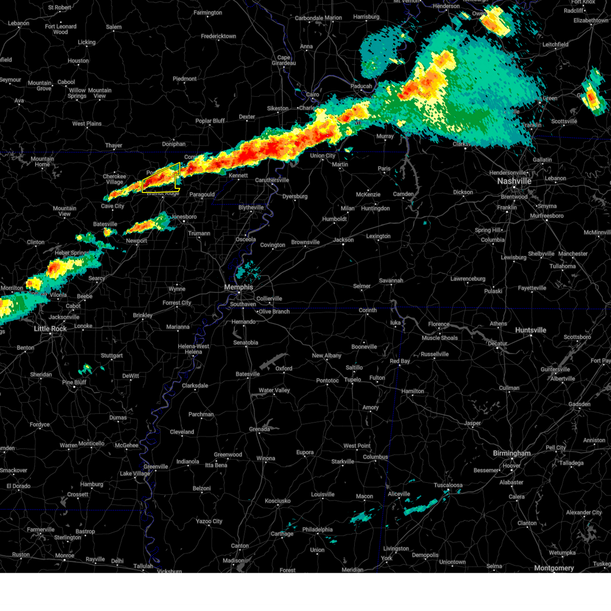
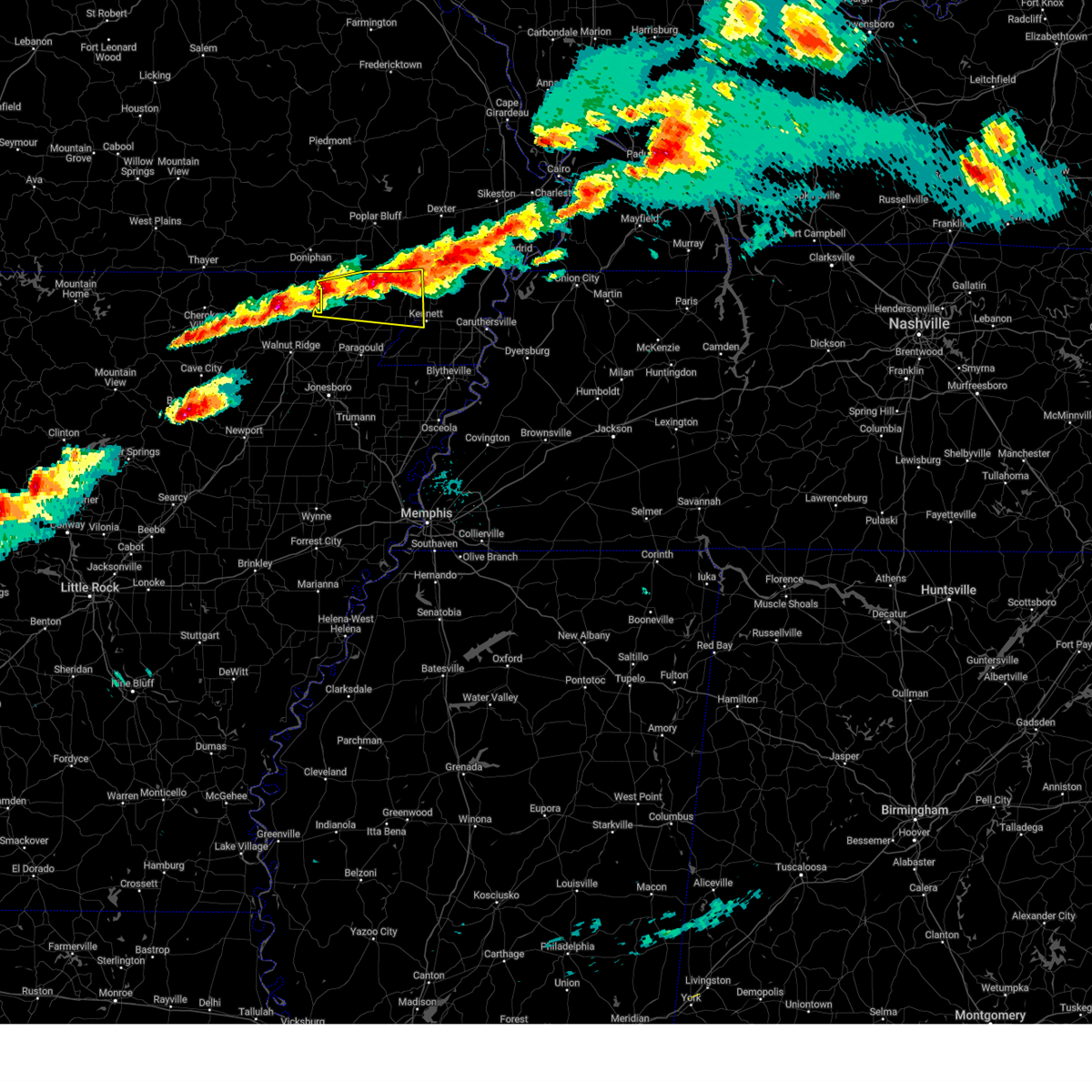
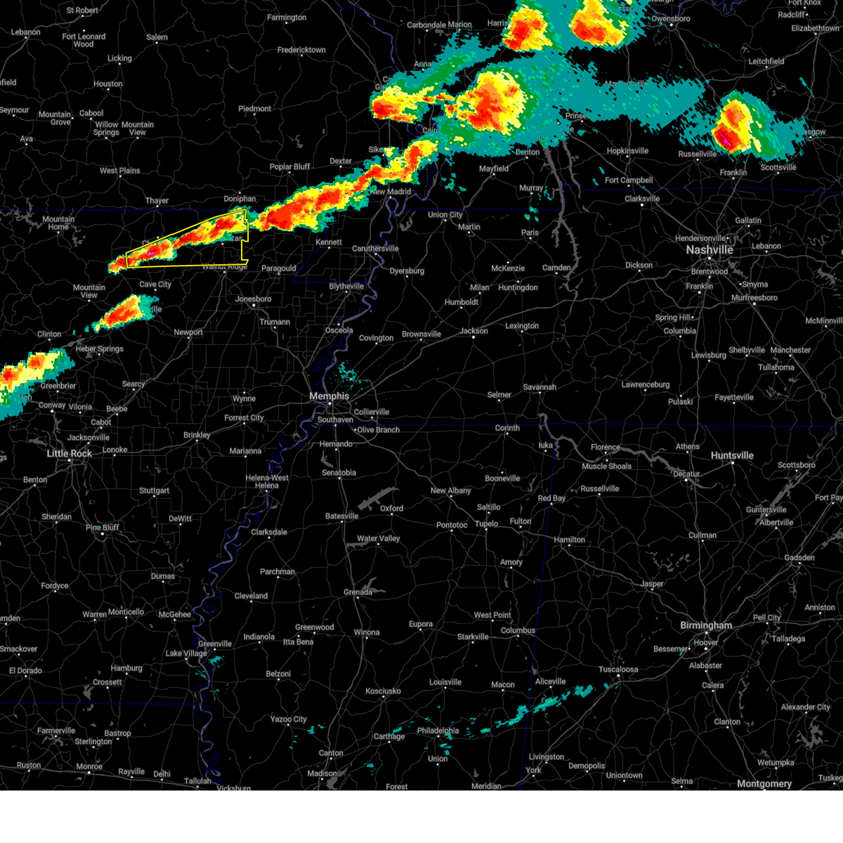
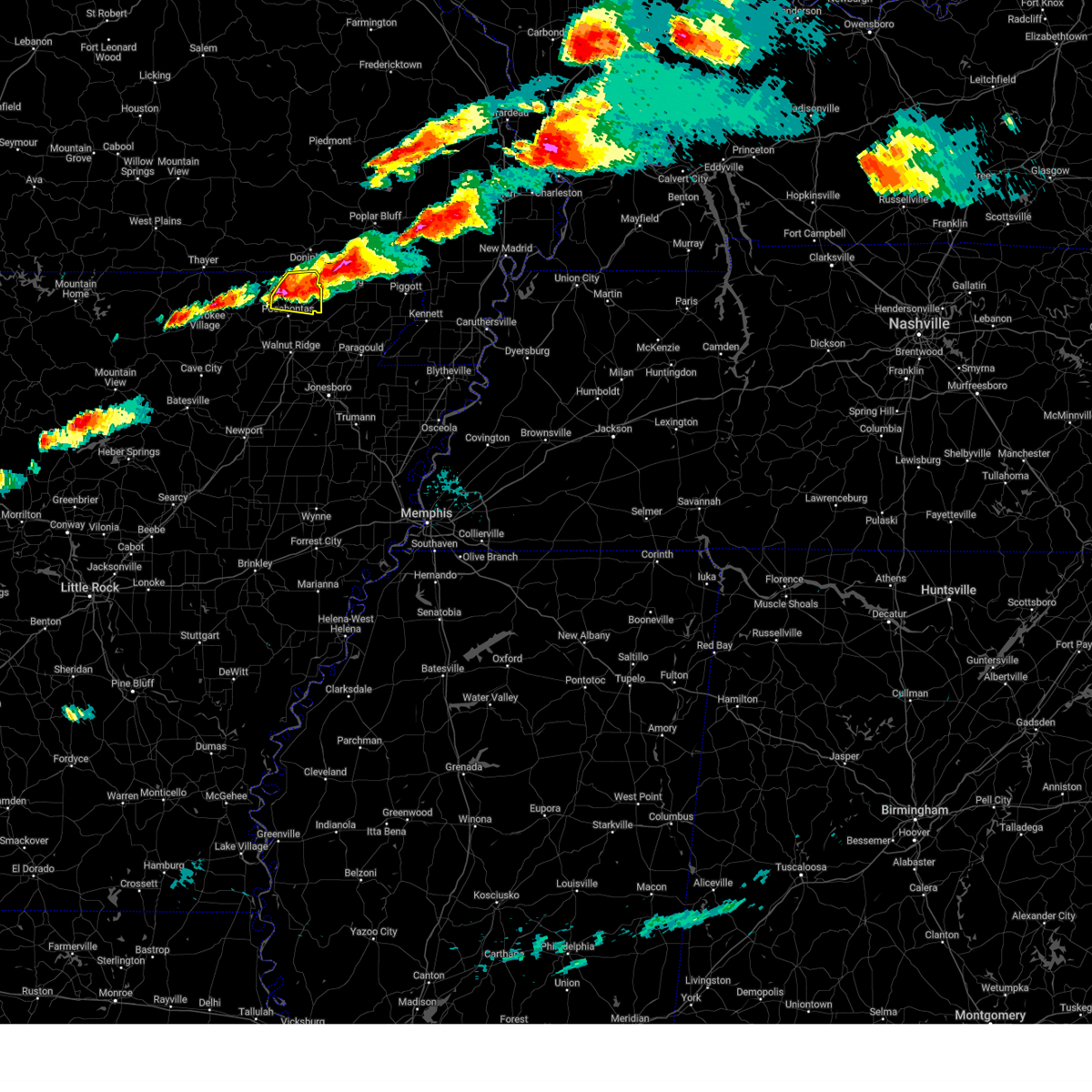
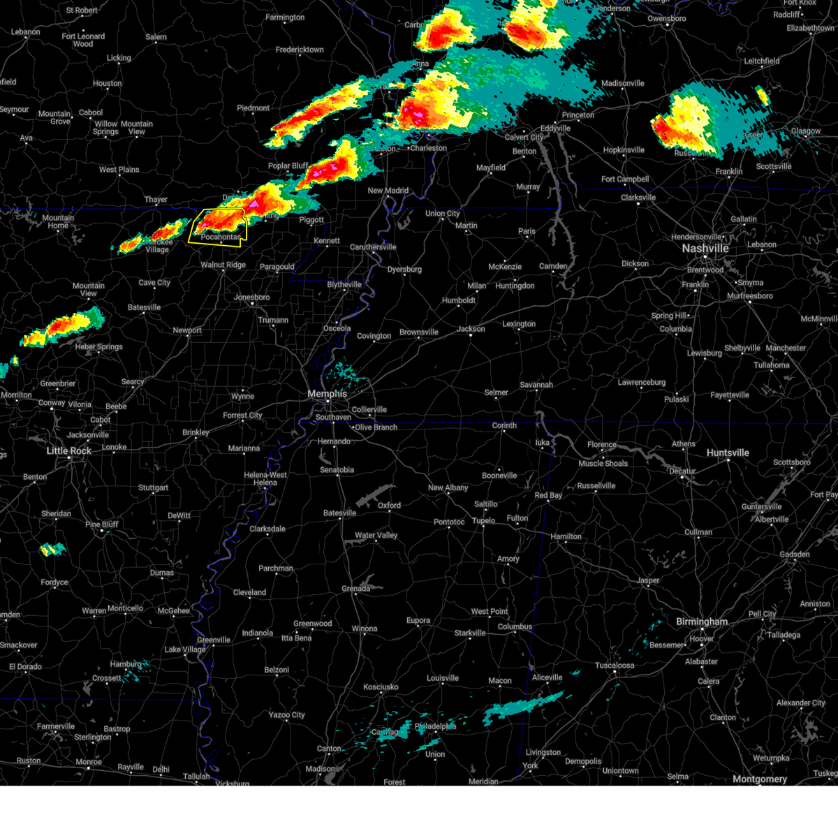
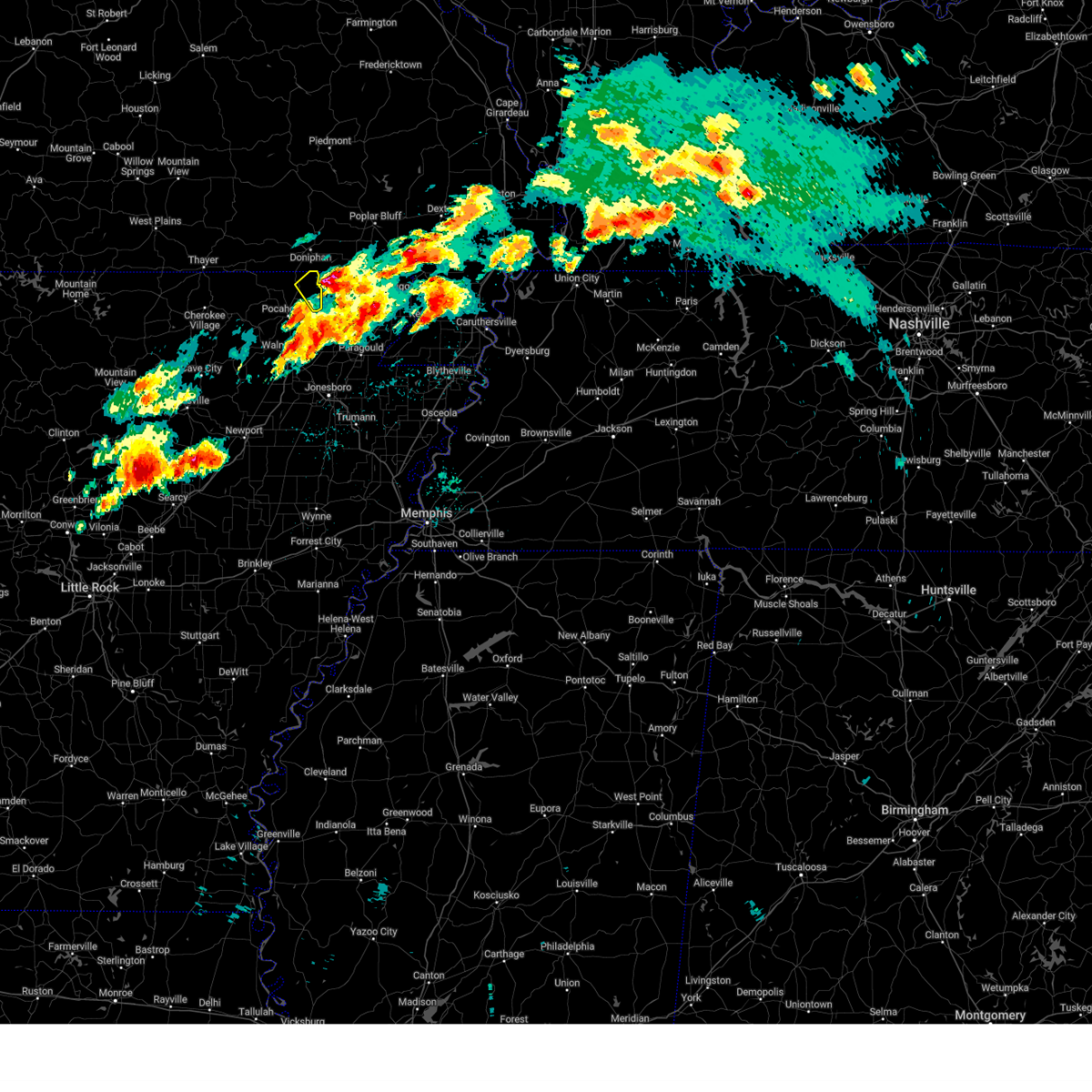
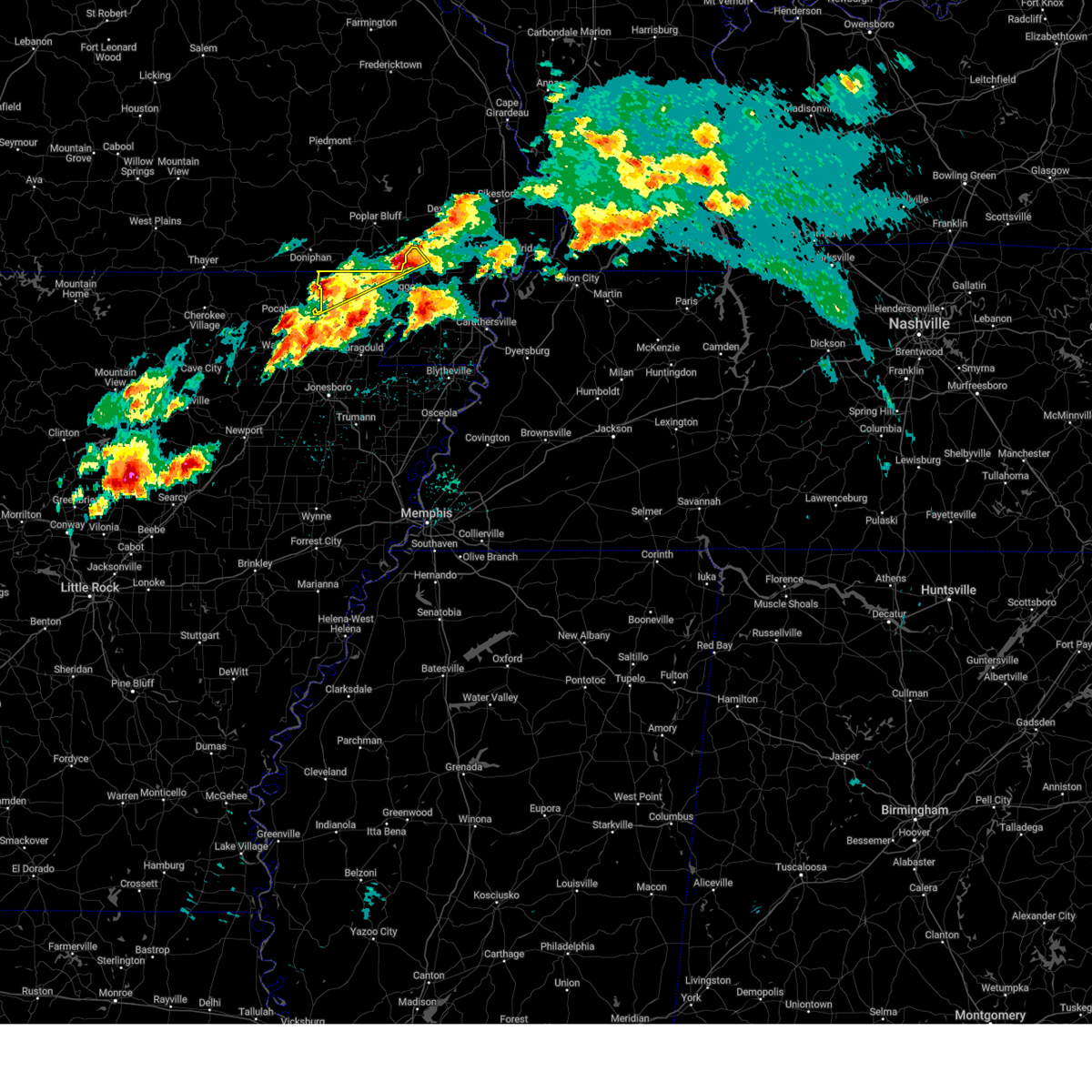
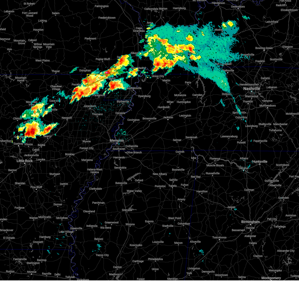
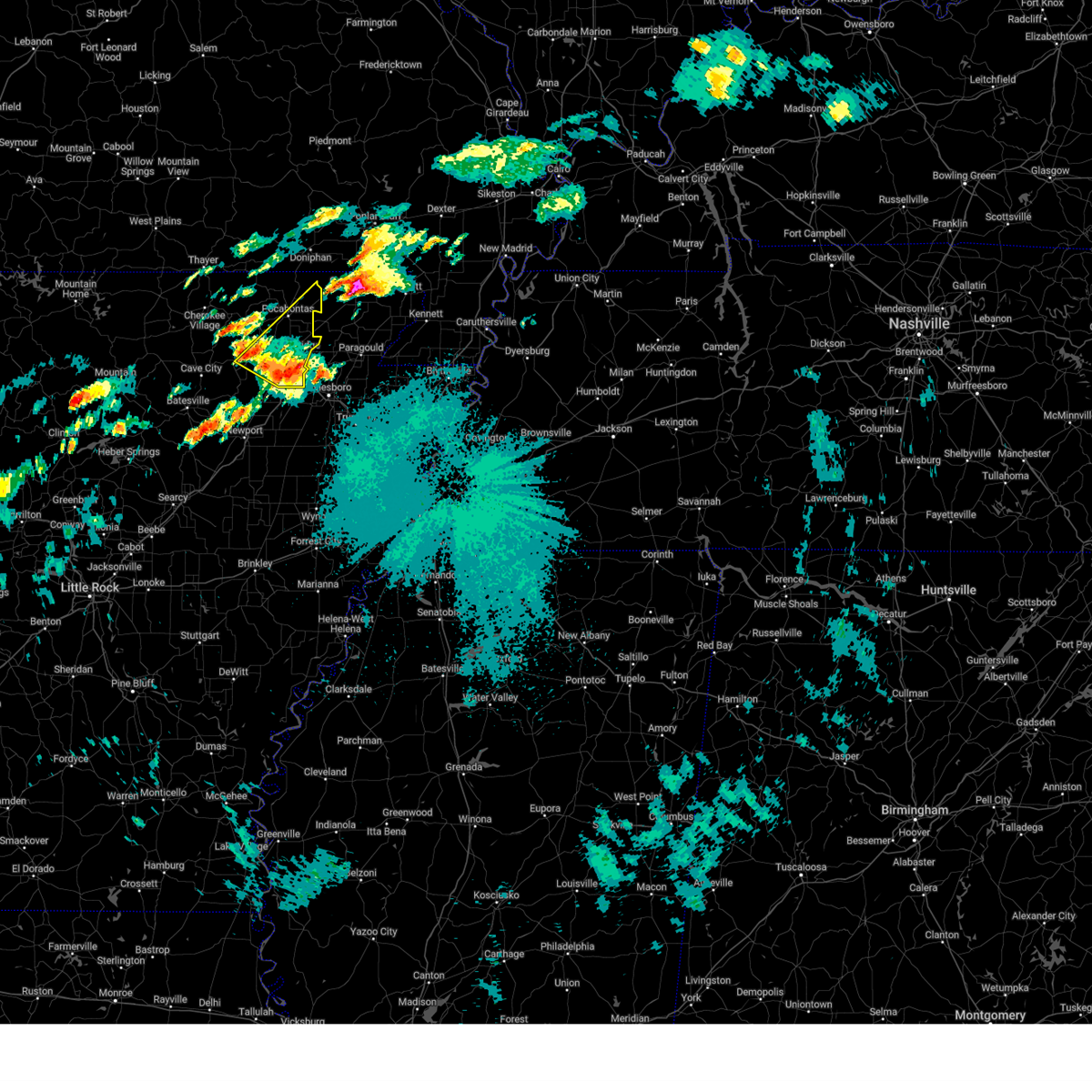
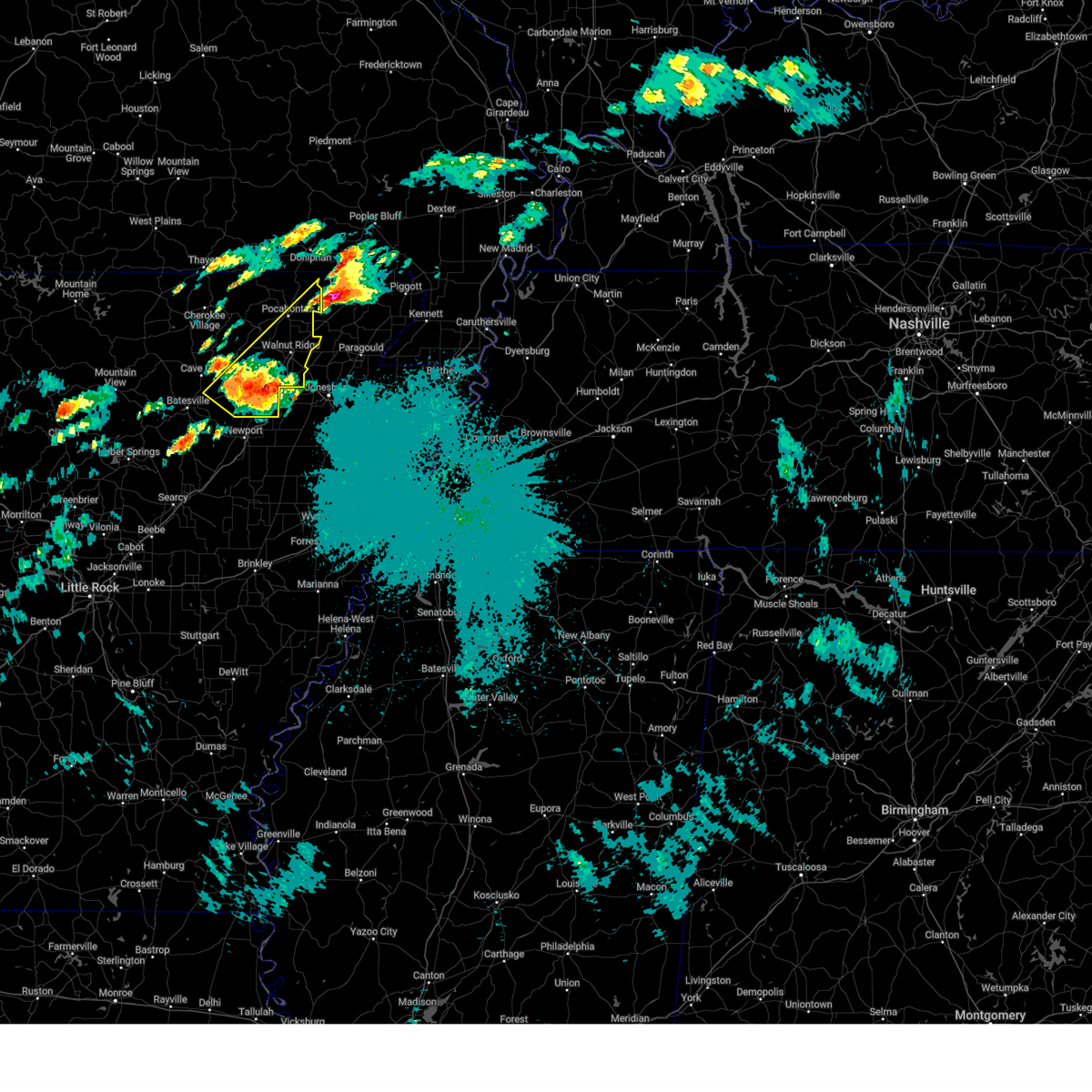
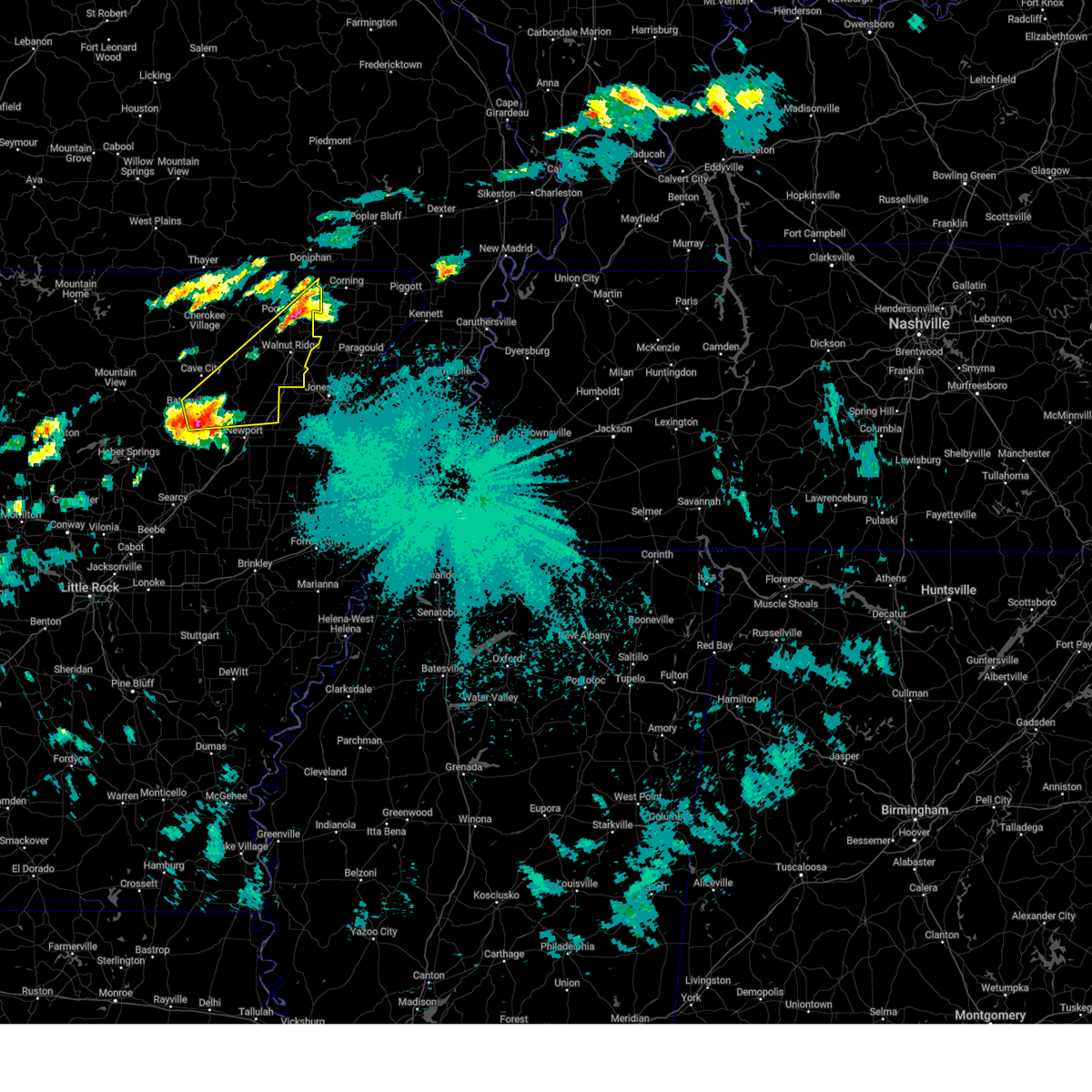
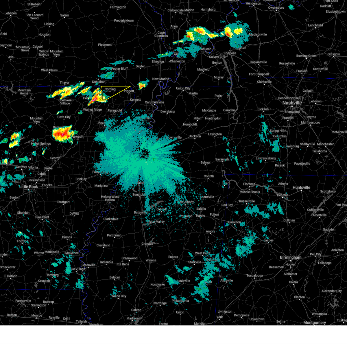
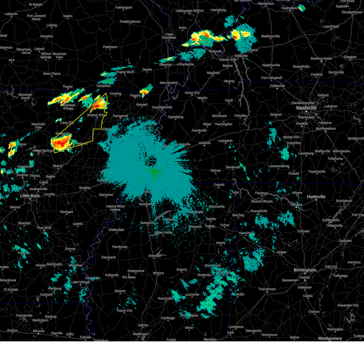
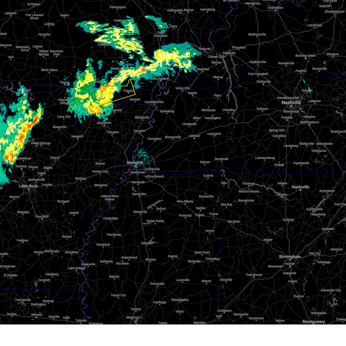
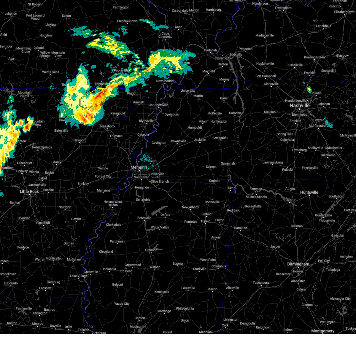
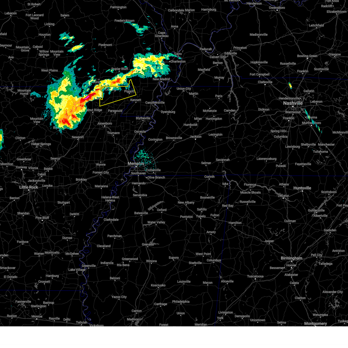
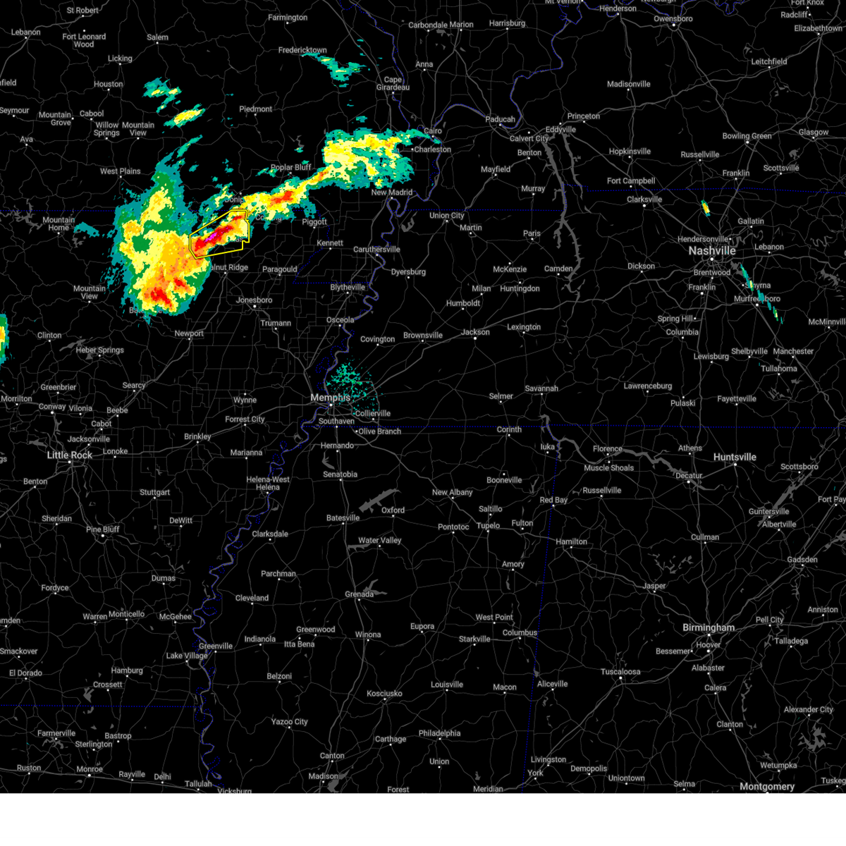
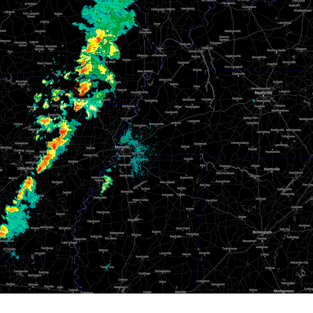
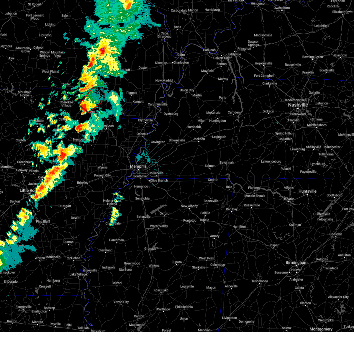
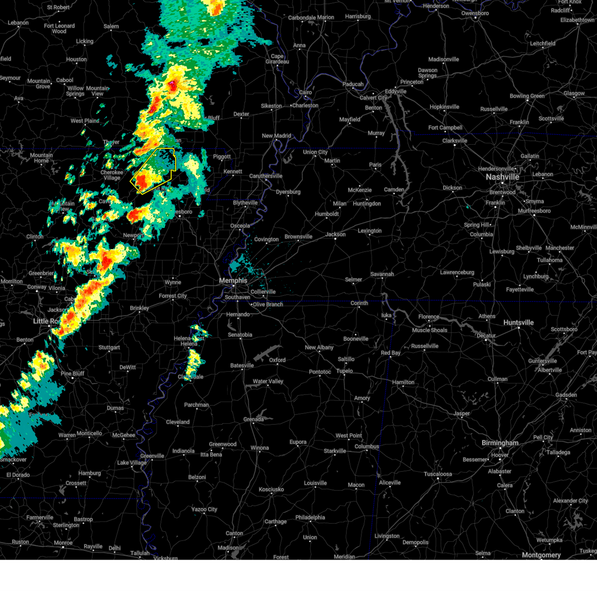
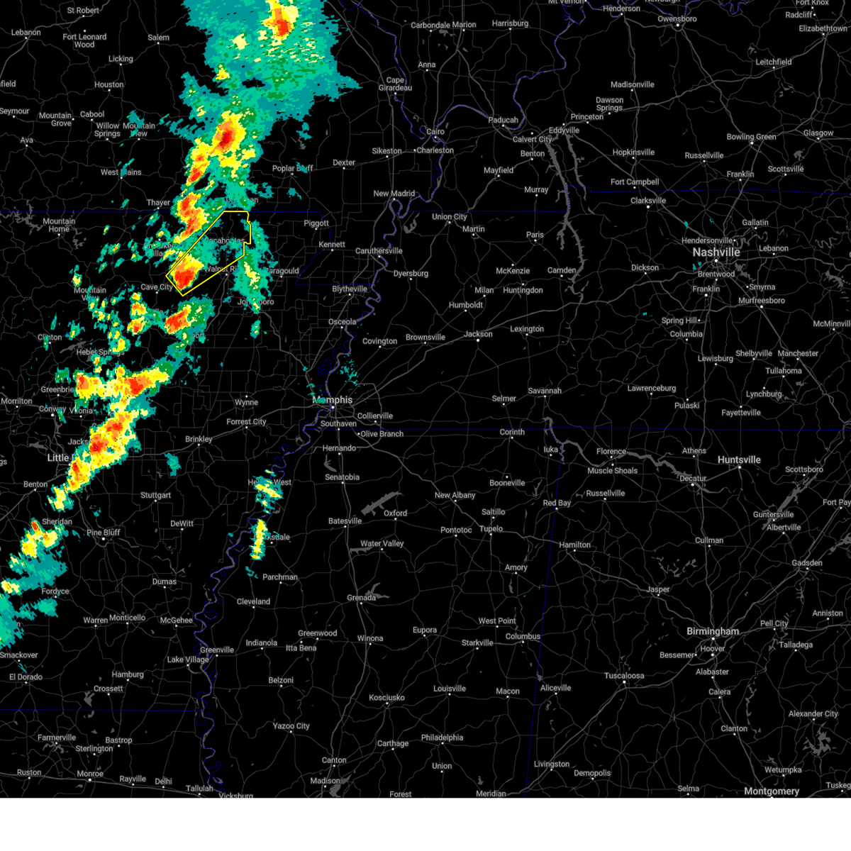
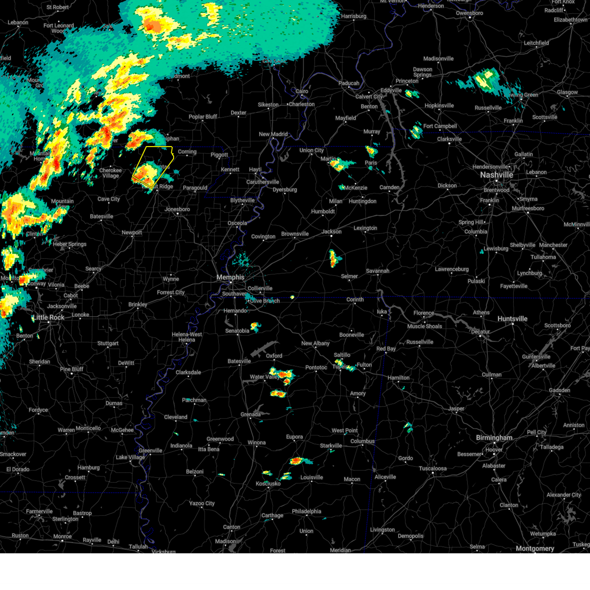
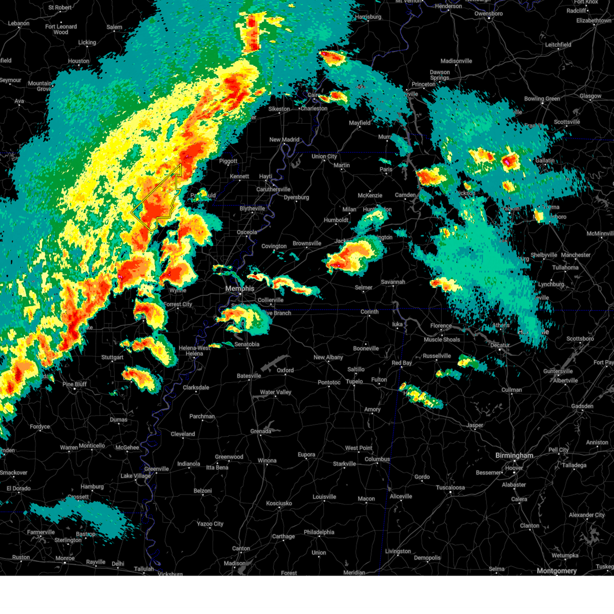
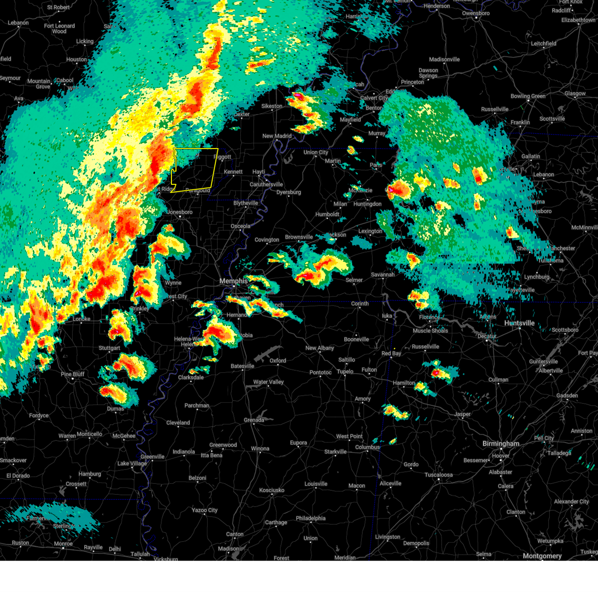
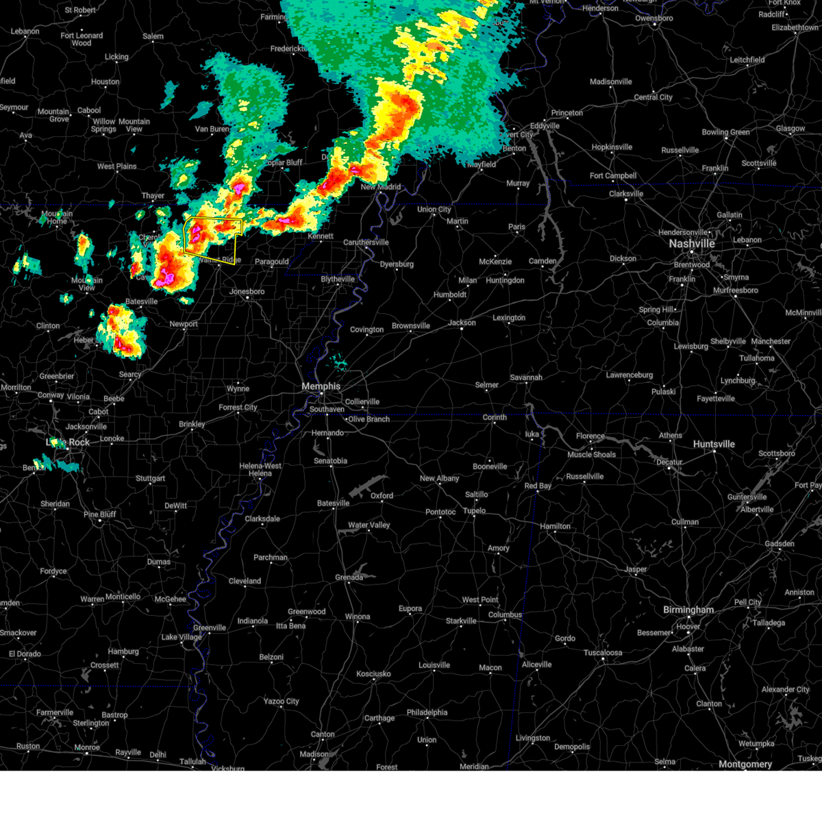
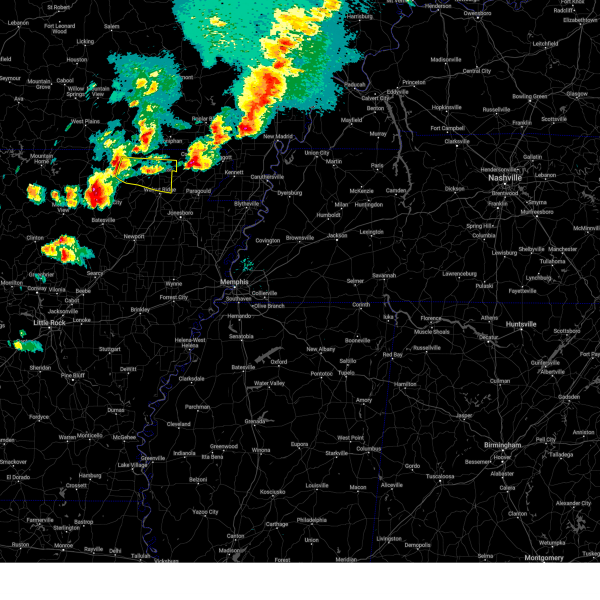
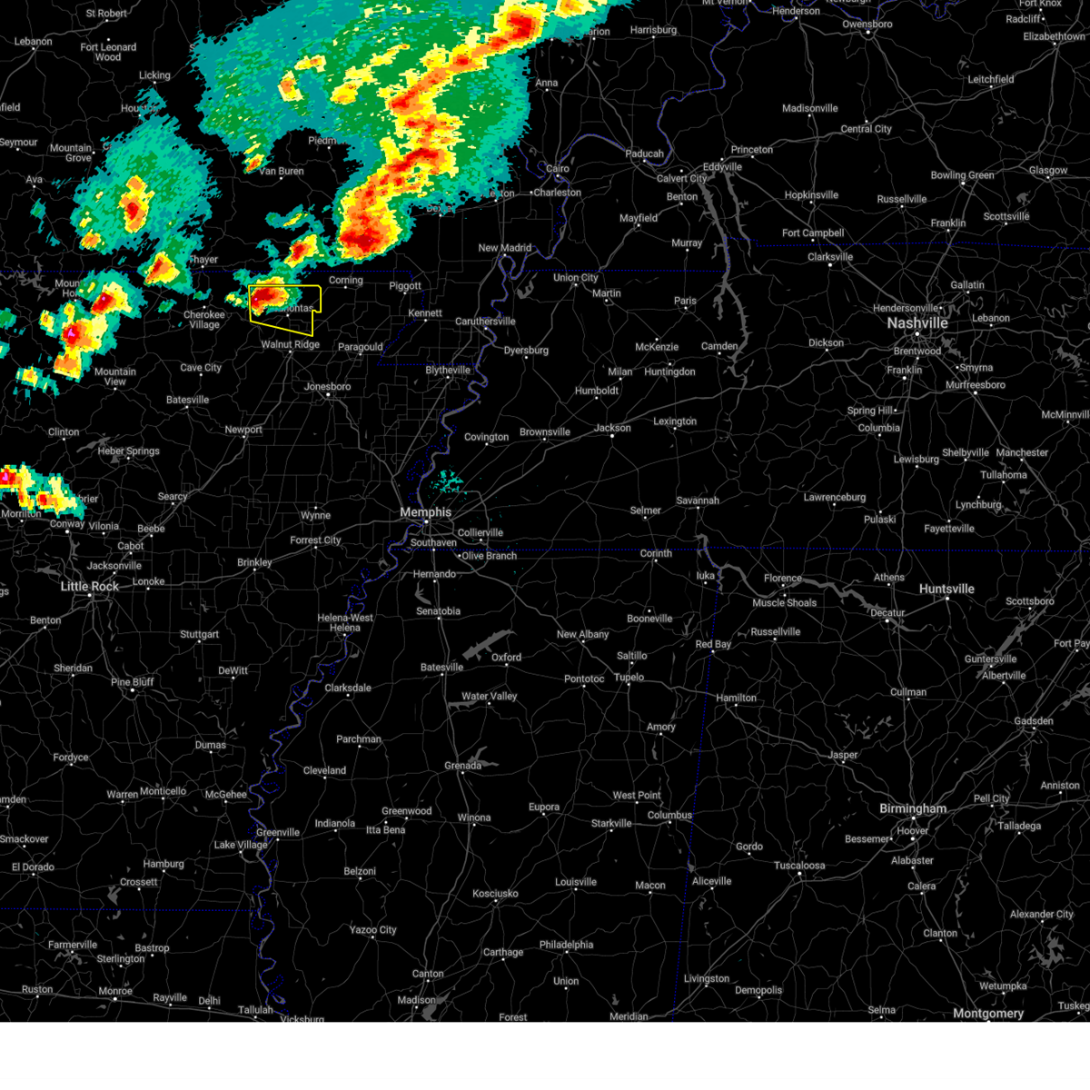
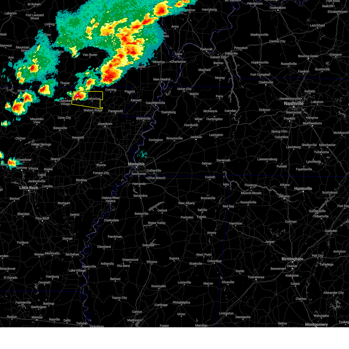
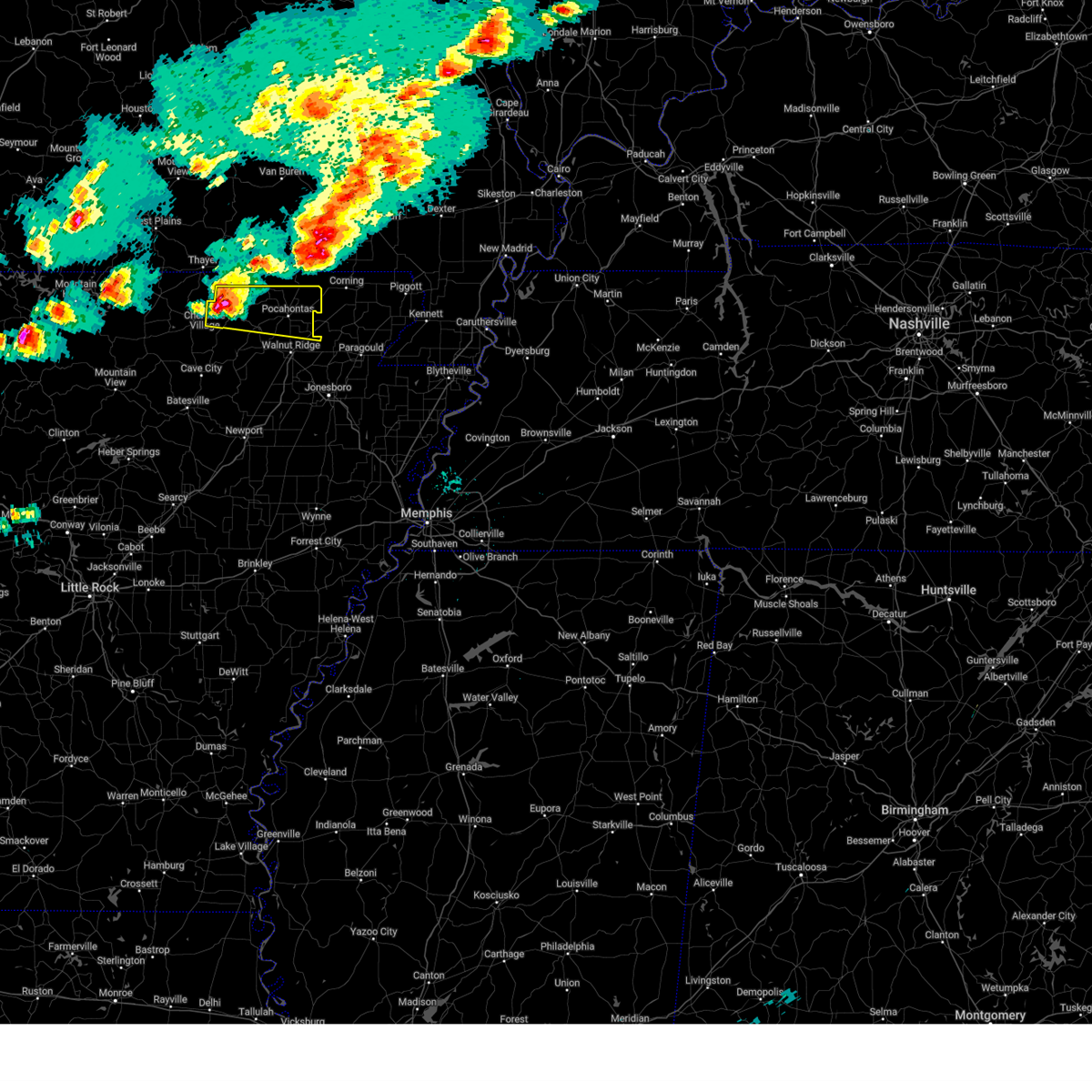
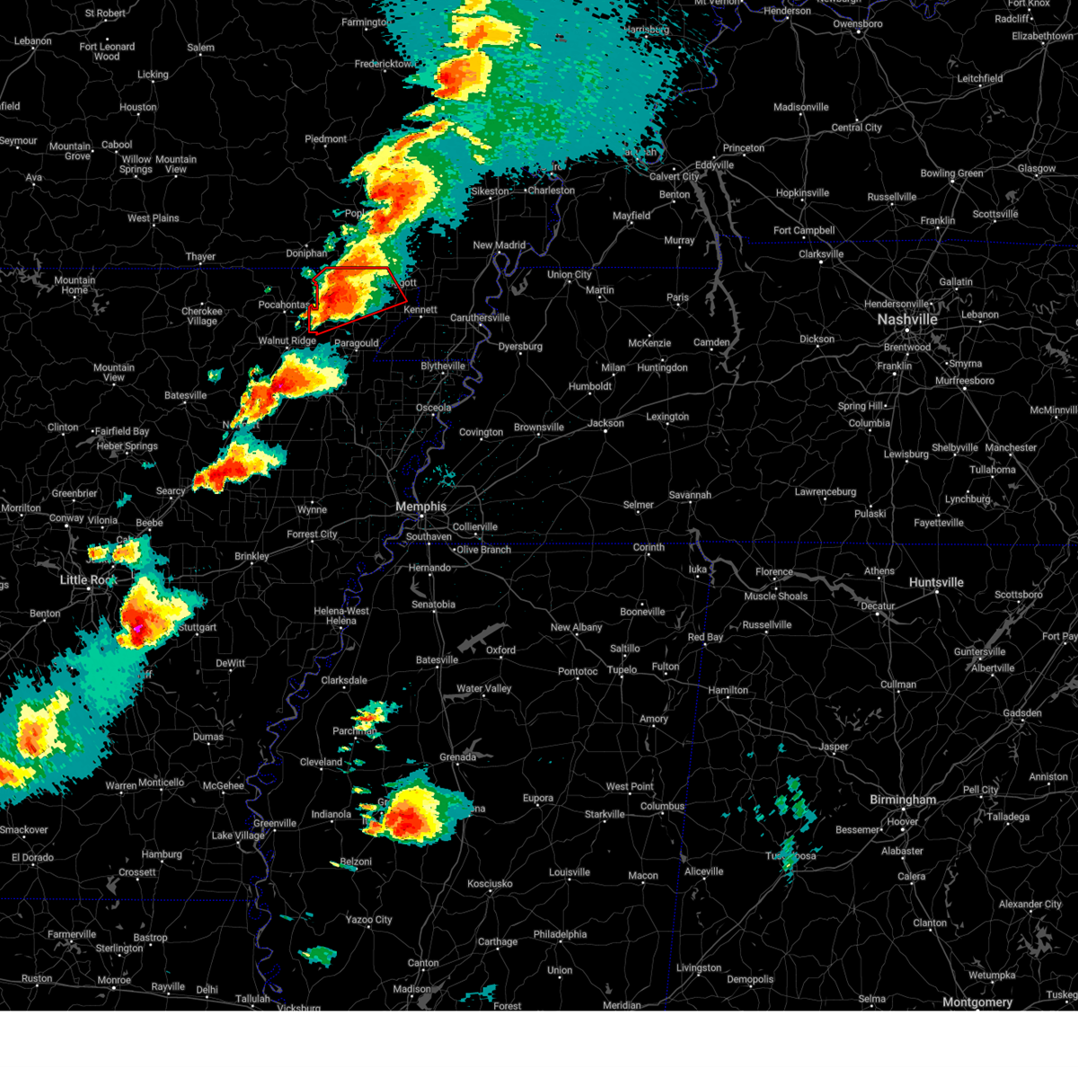
Hail Map for Reyno, AR
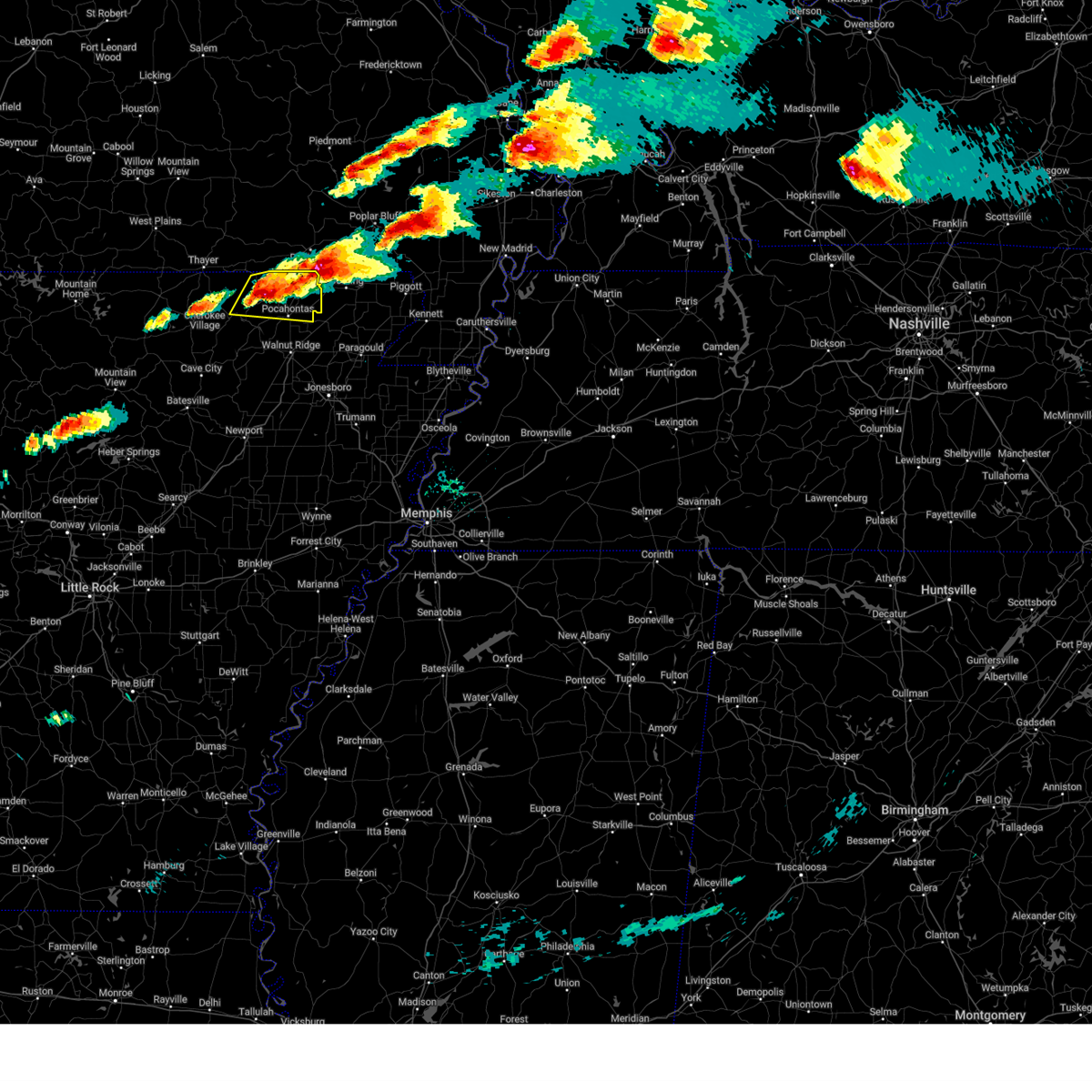
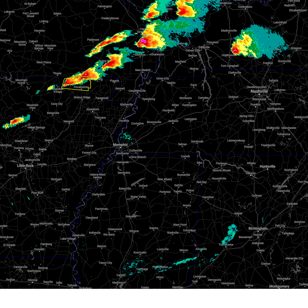
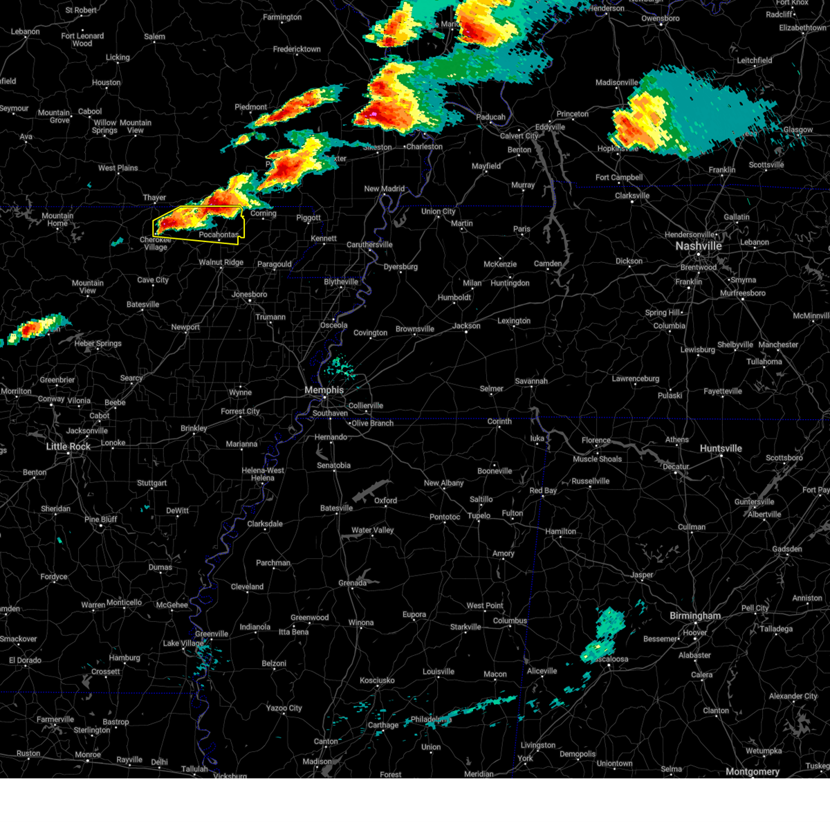
The Reyno, AR area has had 1 report of on-the-ground hail by trained spotters, and has been under severe weather warnings 92 times during the past 12 months. Doppler radar has detected hail at or near Reyno, AR on 48 occasions, including 5 occasions during the past year.
| Name: | Reyno, AR |
| Where Located: | 92.5 miles NNW of Memphis, TN |
| Map: | Google Map for Reyno, AR |
| Population: | 456 |
| Housing Units: | 217 |
| More Info: | Search Google for Reyno, AR |
5
The Top Recent Hail Date for Reyno, AR is Sunday, March 30, 2025 (1st out of 48)

Hail and Wind Damage Spotted near Reyno, AR
| Date / Time | Report Details |
|---|---|
| 5/16/2025 8:25 PM CDT | Svrmeg the national weather service in memphis has issued a * severe thunderstorm warning for, northern greene county in eastern arkansas, clay county in eastern arkansas, northeastern dunklin county in southeastern missouri, * until 915 pm cdt. * at 825 pm cdt, a severe thunderstorm was located near knobel, or near corning, moving east at 50 mph (radar indicated). Hazards include golf ball size hail and 60 mph wind gusts. People and animals outdoors will be injured. expect hail damage to roofs, siding, windows, and vehicles. Expect wind damage to roofs, siding, and trees. |
| 5/16/2025 8:23 PM CDT | Svrlzk the national weather service in little rock has issued a * severe thunderstorm warning for, southeastern randolph county in eastern arkansas, northeastern lawrence county in eastern arkansas, * until 915 pm cdt. * at 823 pm cdt, a severe thunderstorm was located near imboden, or near black rock, moving east at 45 mph (radar indicated). Hazards include ping pong ball size hail and 60 mph wind gusts. People and animals outdoors will be injured. expect hail damage to roofs, siding, windows, and vehicles. Expect wind damage to roofs, siding, and trees. |
| 5/16/2025 8:19 PM CDT |
 the severe thunderstorm warning has been cancelled and is no longer in effect the severe thunderstorm warning has been cancelled and is no longer in effect
|
| 5/16/2025 8:19 PM CDT |
 At 819 pm cdt, a severe thunderstorm was located over imboden, or near black rock, moving east at 45 mph (radar indicated). Hazards include golf ball size hail and 60 mph wind gusts. People and animals outdoors will be injured. expect hail damage to roofs, siding, windows, and vehicles. expect wind damage to roofs, siding, and trees. Locations impacted include, college city, pocahontas, whiskerville, o'kean, giles spur, shannon, birdell, engelberg, fender, elnora, reyno, sharum, manson, davidsonville historic state pa, lesterville, imboden, biggers, black rock, walnut ridge,. At 819 pm cdt, a severe thunderstorm was located over imboden, or near black rock, moving east at 45 mph (radar indicated). Hazards include golf ball size hail and 60 mph wind gusts. People and animals outdoors will be injured. expect hail damage to roofs, siding, windows, and vehicles. expect wind damage to roofs, siding, and trees. Locations impacted include, college city, pocahontas, whiskerville, o'kean, giles spur, shannon, birdell, engelberg, fender, elnora, reyno, sharum, manson, davidsonville historic state pa, lesterville, imboden, biggers, black rock, walnut ridge,.
|
| 5/16/2025 8:08 PM CDT | At 808 pm cdt, a severe thunderstorm was located near ravenden, or 10 miles northwest of black rock, moving east at 50 mph (radar indicated). Hazards include golf ball size hail and 60 mph wind gusts. People and animals outdoors will be injured. expect hail damage to roofs, siding, windows, and vehicles. expect wind damage to roofs, siding, and trees. Locations impacted include, pocahontas, whiskerville, o'kean, giles spur, shannon, birdell, engelberg, annieville, elnora, sitka, imboden, biggers, center, college city, ravenden, stokes, fender, reyno, sharum, manson,. |
| 5/16/2025 8:03 PM CDT | At 803 pm cdt, a severe thunderstorm was located near corning, moving east at 45 mph (radar indicated). Hazards include ping pong ball size hail and 60 mph wind gusts. People and animals outdoors will be injured. expect hail damage to roofs, siding, windows, and vehicles. expect wind damage to roofs, siding, and trees. locations impacted include, knobel, mcdougal, stonewall, chalk bluff natural area, tipperary, rector, hickoria, brookings, chalk bluff battlefield park, pollard, leonard, twin oaks, peach orchard, datto, nimmons, saint francis, heelstring, bell city, pratt, and st. Francis. |
| 5/16/2025 8:00 PM CDT | At 800 pm cdt, a severe thunderstorm was located 8 miles southwest of ravenden, or 12 miles southeast of cherokee village, moving east at 55 mph (radar indicated). Hazards include golf ball size hail and 60 mph wind gusts. People and animals outdoors will be injured. expect hail damage to roofs, siding, windows, and vehicles. expect wind damage to roofs, siding, and trees. Locations impacted include, pocahontas, whiskerville, o'kean, giles spur, shannon, birdell, engelberg, annieville, elnora, sitka, imboden, biggers, center, college city, attica, ravenden, stokes, williford, fender, reyno,. |
| 5/16/2025 7:52 PM CDT | the severe thunderstorm warning has been cancelled and is no longer in effect |
| 5/16/2025 7:52 PM CDT | At 751 pm cdt, a severe thunderstorm was located over attica, or near pocahontas, moving east at 55 mph (radar indicated). Hazards include golf ball size hail and 60 mph wind gusts. People and animals outdoors will be injured. expect hail damage to roofs, siding, windows, and vehicles. expect wind damage to roofs, siding, and trees. Locations impacted include, pocahontas, whiskerville, o'kean, giles spur, ingram, shannon, birdell, engelberg, annieville, elnora, ravenden springs, sitka, imboden, biggers, center, college city, attica, ravenden, elkins park, stokes,. |
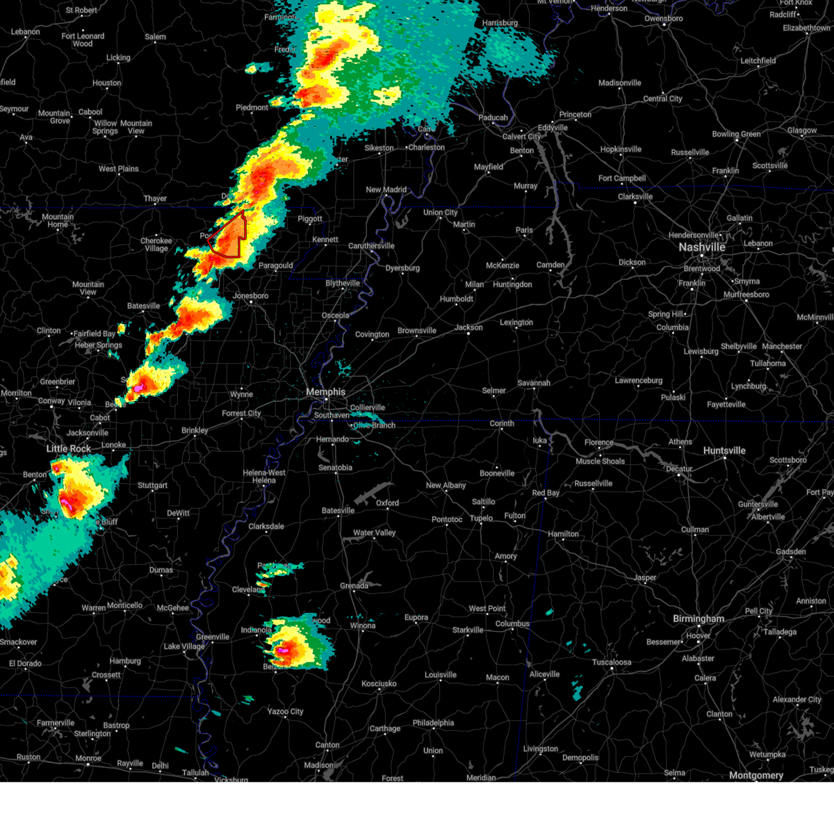
| 5/16/2025 7:45 PM CDT | Tennis Ball sized hail reported 0.2 miles ENE of Reyno, AR, verified with a picture on social media. |
| 5/16/2025 7:45 PM CDT |
 Svrmeg the national weather service in memphis has issued a * severe thunderstorm warning for, north central greene county in eastern arkansas, clay county in eastern arkansas, central dunklin county in southeastern missouri, * until 830 pm cdt. * at 744 pm cdt, a severe thunderstorm was located over reyno, or 10 miles west of corning, moving east at 45 mph (radar indicated). Hazards include 60 mph wind gusts and half dollar size hail. Hail damage to vehicles is expected. Expect wind damage to roofs, siding, and trees. Svrmeg the national weather service in memphis has issued a * severe thunderstorm warning for, north central greene county in eastern arkansas, clay county in eastern arkansas, central dunklin county in southeastern missouri, * until 830 pm cdt. * at 744 pm cdt, a severe thunderstorm was located over reyno, or 10 miles west of corning, moving east at 45 mph (radar indicated). Hazards include 60 mph wind gusts and half dollar size hail. Hail damage to vehicles is expected. Expect wind damage to roofs, siding, and trees.
|
| 5/16/2025 7:42 PM CDT | At 741 pm cdt, a severe thunderstorm was located near ravenden springs, or 9 miles west of pocahontas, moving east at 45 mph (radar indicated). Hazards include ping pong ball size hail and 60 mph wind gusts. People and animals outdoors will be injured. expect hail damage to roofs, siding, windows, and vehicles. expect wind damage to roofs, siding, and trees. Locations impacted include, pocahontas, whiskerville, o'kean, maynard, giles spur, ingram, shannon, birdell, engelberg, annieville, elnora, ravenden springs, sitka, imboden, biggers, center, college city, attica, ravenden, elkins park,. |
| 5/16/2025 7:42 PM CDT | the severe thunderstorm warning has been cancelled and is no longer in effect |
| 5/16/2025 7:39 PM CDT | The storm which prompted the warning has moved out of the area. therefore, the warning will be allowed to expire. a tornado watch remains in effect until 200 am cdt for eastern arkansas, and southeastern missouri. remember, a tornado warning still remains in effect for portions of clay county in arkansas. |
| 5/16/2025 7:32 PM CDT |
 At 732 pm cdt, a severe thunderstorm was located over pollard, or over chalk bluff natural area, moving east at 45 mph (public). Hazards include golf ball size hail and 60 mph wind gusts. People and animals outdoors will be injured. expect hail damage to roofs, siding, windows, and vehicles. expect wind damage to roofs, siding, and trees. locations impacted include, mcdougal, valley ridge, glennonville, chalk bluff natural area, tipperary, hickoria, success, chalk bluff battlefield park, pollard, twin oaks, townley, palatka, datto, nimmons, saint francis, heelstring, st. Francis, campbell, morris state park, and wilhelmina. At 732 pm cdt, a severe thunderstorm was located over pollard, or over chalk bluff natural area, moving east at 45 mph (public). Hazards include golf ball size hail and 60 mph wind gusts. People and animals outdoors will be injured. expect hail damage to roofs, siding, windows, and vehicles. expect wind damage to roofs, siding, and trees. locations impacted include, mcdougal, valley ridge, glennonville, chalk bluff natural area, tipperary, hickoria, success, chalk bluff battlefield park, pollard, twin oaks, townley, palatka, datto, nimmons, saint francis, heelstring, st. Francis, campbell, morris state park, and wilhelmina.
|
| 5/16/2025 7:30 PM CDT |
 At 730 pm cdt, severe thunderstorms were located along a line extending from near ballard to near ravenden to near attica, moving east at 45 mph (radar indicated). Hazards include ping pong ball size hail and 60 mph wind gusts. People and animals outdoors will be injured. expect hail damage to roofs, siding, windows, and vehicles. expect wind damage to roofs, siding, and trees. Locations impacted include, franklin, pocahontas, whiskerville, o'kean, maynard, giles spur, middlebrook, ingram, shannon, birdell, ballard, engelberg, annieville, elnora, ravenden springs, ash flat, sitka, imboden, biggers, center,. At 730 pm cdt, severe thunderstorms were located along a line extending from near ballard to near ravenden to near attica, moving east at 45 mph (radar indicated). Hazards include ping pong ball size hail and 60 mph wind gusts. People and animals outdoors will be injured. expect hail damage to roofs, siding, windows, and vehicles. expect wind damage to roofs, siding, and trees. Locations impacted include, franklin, pocahontas, whiskerville, o'kean, maynard, giles spur, middlebrook, ingram, shannon, birdell, ballard, engelberg, annieville, elnora, ravenden springs, ash flat, sitka, imboden, biggers, center,.
|
| 5/16/2025 7:24 PM CDT | Svrlzk the national weather service in little rock has issued a * severe thunderstorm warning for, randolph county in eastern arkansas, northeastern izard county in north central arkansas, southeastern fulton county in north central arkansas, northern lawrence county in eastern arkansas, central sharp county in north central arkansas, * until 830 pm cdt. * at 723 pm cdt, severe thunderstorms were located along a line extending from myron to near hardy to near dalton, moving east at 45 mph (radar indicated). Hazards include ping pong ball size hail and 60 mph wind gusts. People and animals outdoors will be injured. expect hail damage to roofs, siding, windows, and vehicles. Expect wind damage to roofs, siding, and trees. |
| 5/16/2025 7:24 PM CDT | The storm which prompted the warning has moved out of the area. therefore, the warning will be allowed to expire. a tornado watch remains in effect until 800 pm cdt for eastern arkansas. a tornado watch also remains in effect until 200 am cdt for eastern arkansas. |
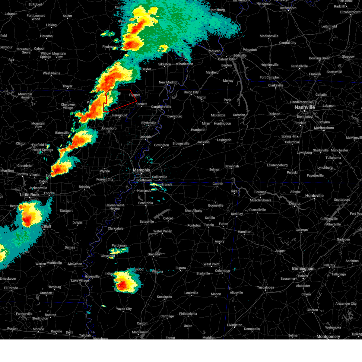
| 5/16/2025 7:16 PM CDT | At 716 pm cdt, a severe thunderstorm capable of producing a tornado was located over reyno, or 10 miles west of corning, moving east at 50 mph (radar indicated rotation). Hazards include tornado and ping pong ball size hail. Flying debris will be dangerous to those caught without shelter. mobile homes will be damaged or destroyed. damage to roofs, windows, and vehicles will occur. tree damage is likely. Locations impacted include, reyno, biggers,. |
| 5/16/2025 7:14 PM CDT | Tormeg the national weather service in memphis has issued a * tornado warning for, north central greene county in eastern arkansas, clay county in eastern arkansas, * until 800 pm cdt. * at 714 pm cdt, a severe thunderstorm capable of producing a tornado was located over reyno, or 11 miles west of corning, moving east at 50 mph (radar indicated rotation). Hazards include tornado and golf ball size hail. Flying debris will be dangerous to those caught without shelter. mobile homes will be damaged or destroyed. damage to roofs, windows, and vehicles will occur. Tree damage is likely. |
| 5/16/2025 7:11 PM CDT | Torlzk the national weather service in little rock has issued a * tornado warning for, northeastern randolph county in eastern arkansas, * until 730 pm cdt. * at 711 pm cdt, a severe thunderstorm capable of producing a tornado was located over biggers, or 10 miles northeast of pocahontas, moving east at 50 mph (radar indicated rotation). Hazards include tornado. Flying debris will be dangerous to those caught without shelter. mobile homes will be damaged or destroyed. damage to roofs, windows, and vehicles will occur. Tree damage is likely. |
| 5/16/2025 7:05 PM CDT |
 At 705 pm cdt, a severe thunderstorm was located near corning, moving east at 45 mph (radar indicated). Hazards include golf ball size hail and 60 mph wind gusts. People and animals outdoors will be injured. expect hail damage to roofs, siding, windows, and vehicles. expect wind damage to roofs, siding, and trees. locations impacted include, mcdougal, valley ridge, glennonville, chalk bluff natural area, tipperary, hickoria, success, chalk bluff battlefield park, pollard, twin oaks, townley, palatka, datto, nimmons, saint francis, heelstring, st. Francis, campbell, morris state park, and wilhelmina. At 705 pm cdt, a severe thunderstorm was located near corning, moving east at 45 mph (radar indicated). Hazards include golf ball size hail and 60 mph wind gusts. People and animals outdoors will be injured. expect hail damage to roofs, siding, windows, and vehicles. expect wind damage to roofs, siding, and trees. locations impacted include, mcdougal, valley ridge, glennonville, chalk bluff natural area, tipperary, hickoria, success, chalk bluff battlefield park, pollard, twin oaks, townley, palatka, datto, nimmons, saint francis, heelstring, st. Francis, campbell, morris state park, and wilhelmina.
|
| 5/16/2025 7:02 PM CDT |
 At 702 pm cdt, a severe thunderstorm was located near attica, or 9 miles north of pocahontas, moving east at 45 mph (radar indicated). Hazards include golf ball size hail and 60 mph wind gusts. People and animals outdoors will be injured. expect hail damage to roofs, siding, windows, and vehicles. expect wind damage to roofs, siding, and trees. Locations impacted include, attica, maynard, elkins park, brakebill, middlebrook, ingram, engelberg, stokes, reyno, biggers, brockett, pitman, pocahontas,. At 702 pm cdt, a severe thunderstorm was located near attica, or 9 miles north of pocahontas, moving east at 45 mph (radar indicated). Hazards include golf ball size hail and 60 mph wind gusts. People and animals outdoors will be injured. expect hail damage to roofs, siding, windows, and vehicles. expect wind damage to roofs, siding, and trees. Locations impacted include, attica, maynard, elkins park, brakebill, middlebrook, ingram, engelberg, stokes, reyno, biggers, brockett, pitman, pocahontas,.
|
| 5/16/2025 6:57 PM CDT |
 At 657 pm cdt, a severe thunderstorm was located near attica, or 9 miles northwest of pocahontas, moving east at 35 mph (radar indicated). Hazards include golf ball size hail and 60 mph wind gusts. People and animals outdoors will be injured. expect hail damage to roofs, siding, windows, and vehicles. expect wind damage to roofs, siding, and trees. Locations impacted include, pocahontas, attica, maynard, elkins park, brakebill, middlebrook, ingram, engelberg, hamil, stokes, reyno, biggers, brockett, pitman,. At 657 pm cdt, a severe thunderstorm was located near attica, or 9 miles northwest of pocahontas, moving east at 35 mph (radar indicated). Hazards include golf ball size hail and 60 mph wind gusts. People and animals outdoors will be injured. expect hail damage to roofs, siding, windows, and vehicles. expect wind damage to roofs, siding, and trees. Locations impacted include, pocahontas, attica, maynard, elkins park, brakebill, middlebrook, ingram, engelberg, hamil, stokes, reyno, biggers, brockett, pitman,.
|
| 5/16/2025 6:52 PM CDT |
 At 651 pm cdt, a severe thunderstorm was located near dalton, or 10 miles northwest of pocahontas, moving east at 60 mph (radar indicated). Hazards include golf ball size hail and 60 mph wind gusts. People and animals outdoors will be injured. expect hail damage to roofs, siding, windows, and vehicles. expect wind damage to roofs, siding, and trees. Locations impacted include, pocahontas, attica, maynard, elkins park, brakebill, middlebrook, warm springs, ingram, engelberg, hamil, stokes, reyno, ravenden springs, dalton, biggers, brockett, pitman,. At 651 pm cdt, a severe thunderstorm was located near dalton, or 10 miles northwest of pocahontas, moving east at 60 mph (radar indicated). Hazards include golf ball size hail and 60 mph wind gusts. People and animals outdoors will be injured. expect hail damage to roofs, siding, windows, and vehicles. expect wind damage to roofs, siding, and trees. Locations impacted include, pocahontas, attica, maynard, elkins park, brakebill, middlebrook, warm springs, ingram, engelberg, hamil, stokes, reyno, ravenden springs, dalton, biggers, brockett, pitman,.
|
| 5/16/2025 6:52 PM CDT |
 the severe thunderstorm warning has been cancelled and is no longer in effect the severe thunderstorm warning has been cancelled and is no longer in effect
|
| 5/16/2025 6:47 PM CDT |
 At 647 pm cdt, a severe thunderstorm was located near dalton, or 16 miles northwest of pocahontas, moving east at 45 mph (radar indicated). Hazards include ping pong ball size hail and 60 mph wind gusts. People and animals outdoors will be injured. expect hail damage to roofs, siding, windows, and vehicles. expect wind damage to roofs, siding, and trees. Locations impacted include, pocahontas, attica, maynard, elkins park, brakebill, middlebrook, warm springs, ingram, eleven point, engelberg, hamil, stokes, reyno, ravenden springs, dalton, elm store, biggers, brockett, pitman,. At 647 pm cdt, a severe thunderstorm was located near dalton, or 16 miles northwest of pocahontas, moving east at 45 mph (radar indicated). Hazards include ping pong ball size hail and 60 mph wind gusts. People and animals outdoors will be injured. expect hail damage to roofs, siding, windows, and vehicles. expect wind damage to roofs, siding, and trees. Locations impacted include, pocahontas, attica, maynard, elkins park, brakebill, middlebrook, warm springs, ingram, eleven point, engelberg, hamil, stokes, reyno, ravenden springs, dalton, elm store, biggers, brockett, pitman,.
|
| 5/16/2025 6:46 PM CDT |
 At 645 pm cdt, a severe thunderstorm was located near maynard, or 11 miles south of doniphan, moving east at 45 mph (radar indicated). Hazards include two inch hail and 60 mph wind gusts. People and animals outdoors will be injured. expect hail damage to roofs, siding, windows, and vehicles. expect wind damage to roofs, siding, and trees. locations impacted include, mcdougal, valley ridge, glennonville, chalk bluff natural area, tipperary, hickoria, success, chalk bluff battlefield park, pollard, twin oaks, townley, palatka, datto, nimmons, saint francis, heelstring, st. Francis, campbell, morris state park, and wilhelmina. At 645 pm cdt, a severe thunderstorm was located near maynard, or 11 miles south of doniphan, moving east at 45 mph (radar indicated). Hazards include two inch hail and 60 mph wind gusts. People and animals outdoors will be injured. expect hail damage to roofs, siding, windows, and vehicles. expect wind damage to roofs, siding, and trees. locations impacted include, mcdougal, valley ridge, glennonville, chalk bluff natural area, tipperary, hickoria, success, chalk bluff battlefield park, pollard, twin oaks, townley, palatka, datto, nimmons, saint francis, heelstring, st. Francis, campbell, morris state park, and wilhelmina.
|
| 5/16/2025 6:41 PM CDT |
 Svrmeg the national weather service in memphis has issued a * severe thunderstorm warning for, clay county in eastern arkansas, northeastern dunklin county in southeastern missouri, * until 745 pm cdt. * at 640 pm cdt, a severe thunderstorm was located near maynard, or 12 miles southwest of doniphan, moving east at 45 mph (radar indicated). Hazards include 60 mph wind gusts and half dollar size hail. Hail damage to vehicles is expected. Expect wind damage to roofs, siding, and trees. Svrmeg the national weather service in memphis has issued a * severe thunderstorm warning for, clay county in eastern arkansas, northeastern dunklin county in southeastern missouri, * until 745 pm cdt. * at 640 pm cdt, a severe thunderstorm was located near maynard, or 12 miles southwest of doniphan, moving east at 45 mph (radar indicated). Hazards include 60 mph wind gusts and half dollar size hail. Hail damage to vehicles is expected. Expect wind damage to roofs, siding, and trees.
|
| 5/16/2025 6:39 PM CDT |
 the severe thunderstorm warning has been cancelled and is no longer in effect the severe thunderstorm warning has been cancelled and is no longer in effect
|
| 5/16/2025 6:39 PM CDT |
 At 639 pm cdt, a severe thunderstorm was located 7 miles northwest of ravenden springs, or 13 miles southeast of mammoth spring, moving east at 40 mph (radar indicated). Hazards include ping pong ball size hail and 60 mph wind gusts. People and animals outdoors will be injured. expect hail damage to roofs, siding, windows, and vehicles. expect wind damage to roofs, siding, and trees. Locations impacted include, pocahontas, attica, maynard, elkins park, brakebill, middlebrook, warm springs, ingram, eleven point, armstrong, ozark acres, engelberg, hamil, stokes, reyno, ravenden springs, dalton, elm store, biggers, brockett,. At 639 pm cdt, a severe thunderstorm was located 7 miles northwest of ravenden springs, or 13 miles southeast of mammoth spring, moving east at 40 mph (radar indicated). Hazards include ping pong ball size hail and 60 mph wind gusts. People and animals outdoors will be injured. expect hail damage to roofs, siding, windows, and vehicles. expect wind damage to roofs, siding, and trees. Locations impacted include, pocahontas, attica, maynard, elkins park, brakebill, middlebrook, warm springs, ingram, eleven point, armstrong, ozark acres, engelberg, hamil, stokes, reyno, ravenden springs, dalton, elm store, biggers, brockett,.
|
| 5/16/2025 6:32 PM CDT |
 Svrlzk the national weather service in little rock has issued a * severe thunderstorm warning for, randolph county in eastern arkansas, east central fulton county in north central arkansas, northeastern sharp county in north central arkansas, * until 715 pm cdt. * at 632 pm cdt, a severe thunderstorm was located 7 miles northwest of maynard, or 14 miles southwest of doniphan, moving east at 40 mph (radar indicated). Hazards include ping pong ball size hail and 60 mph wind gusts. People and animals outdoors will be injured. expect hail damage to roofs, siding, windows, and vehicles. Expect wind damage to roofs, siding, and trees. Svrlzk the national weather service in little rock has issued a * severe thunderstorm warning for, randolph county in eastern arkansas, east central fulton county in north central arkansas, northeastern sharp county in north central arkansas, * until 715 pm cdt. * at 632 pm cdt, a severe thunderstorm was located 7 miles northwest of maynard, or 14 miles southwest of doniphan, moving east at 40 mph (radar indicated). Hazards include ping pong ball size hail and 60 mph wind gusts. People and animals outdoors will be injured. expect hail damage to roofs, siding, windows, and vehicles. Expect wind damage to roofs, siding, and trees.
|
| 5/16/2025 6:28 AM CDT |
 the severe thunderstorm warning has been cancelled and is no longer in effect the severe thunderstorm warning has been cancelled and is no longer in effect
|
| 5/16/2025 6:27 AM CDT |
 At 627 am cdt, a severe thunderstorm was located near success, or near corning, moving northeast at 50 mph (radar indicated). Hazards include two inch hail and 60 mph wind gusts. People and animals outdoors will be injured. expect hail damage to roofs, siding, windows, and vehicles. expect wind damage to roofs, siding, and trees. Locations impacted include, mcdougal, heelstring, valley ridge, wilhelmina, glennonville, twin oaks, chalk bluff natural area, palatka, datto, success, corning, and reyno. At 627 am cdt, a severe thunderstorm was located near success, or near corning, moving northeast at 50 mph (radar indicated). Hazards include two inch hail and 60 mph wind gusts. People and animals outdoors will be injured. expect hail damage to roofs, siding, windows, and vehicles. expect wind damage to roofs, siding, and trees. Locations impacted include, mcdougal, heelstring, valley ridge, wilhelmina, glennonville, twin oaks, chalk bluff natural area, palatka, datto, success, corning, and reyno.
|
| 5/16/2025 6:21 AM CDT |
 Svrmeg the national weather service in memphis has issued a * severe thunderstorm warning for, northwestern clay county in eastern arkansas, north central dunklin county in southeastern missouri, * until 645 am cdt. * at 620 am cdt, a severe thunderstorm was located over reyno, or 10 miles west of corning, moving northeast at 50 mph (radar indicated). Hazards include ping pong ball size hail and 60 mph wind gusts. People and animals outdoors will be injured. expect hail damage to roofs, siding, windows, and vehicles. Expect wind damage to roofs, siding, and trees. Svrmeg the national weather service in memphis has issued a * severe thunderstorm warning for, northwestern clay county in eastern arkansas, north central dunklin county in southeastern missouri, * until 645 am cdt. * at 620 am cdt, a severe thunderstorm was located over reyno, or 10 miles west of corning, moving northeast at 50 mph (radar indicated). Hazards include ping pong ball size hail and 60 mph wind gusts. People and animals outdoors will be injured. expect hail damage to roofs, siding, windows, and vehicles. Expect wind damage to roofs, siding, and trees.
|
| 5/16/2025 6:19 AM CDT |
 Svrlzk the national weather service in little rock has issued a * severe thunderstorm warning for, northeastern randolph county in eastern arkansas, * until 645 am cdt. * at 618 am cdt, a severe thunderstorm was located near reyno, or 11 miles west of corning, moving northeast at 45 mph (radar indicated). Hazards include 60 mph wind gusts and quarter size hail. Hail damage to vehicles is expected. Expect wind damage to roofs, siding, and trees. Svrlzk the national weather service in little rock has issued a * severe thunderstorm warning for, northeastern randolph county in eastern arkansas, * until 645 am cdt. * at 618 am cdt, a severe thunderstorm was located near reyno, or 11 miles west of corning, moving northeast at 45 mph (radar indicated). Hazards include 60 mph wind gusts and quarter size hail. Hail damage to vehicles is expected. Expect wind damage to roofs, siding, and trees.
|
| 5/16/2025 4:30 AM CDT |
 the severe thunderstorm warning has been cancelled and is no longer in effect the severe thunderstorm warning has been cancelled and is no longer in effect
|
| 5/16/2025 4:30 AM CDT |
 At 429 am cdt, a severe thunderstorm was located near minturn, or near hoxie, moving northeast at 55 mph (radar indicated). Hazards include 60 mph wind gusts and quarter size hail. Hail damage to vehicles is expected. expect wind damage to roofs, siding, and trees. Locations impacted include, walnut ridge, pocahontas, whiskerville, o'kean, lynn, giles spur, shannon, black rock, engelberg, dicus, elnora, powhatan historic state park, biggers, minturn, college city, lake charles state park, hoxie, portia, eaton, lauratown,. At 429 am cdt, a severe thunderstorm was located near minturn, or near hoxie, moving northeast at 55 mph (radar indicated). Hazards include 60 mph wind gusts and quarter size hail. Hail damage to vehicles is expected. expect wind damage to roofs, siding, and trees. Locations impacted include, walnut ridge, pocahontas, whiskerville, o'kean, lynn, giles spur, shannon, black rock, engelberg, dicus, elnora, powhatan historic state park, biggers, minturn, college city, lake charles state park, hoxie, portia, eaton, lauratown,.
|
| 5/16/2025 4:16 AM CDT |
 At 416 am cdt, a severe thunderstorm was located over alicia, or 13 miles south of lake charles state park, moving northeast at 65 mph (radar indicated). Hazards include 60 mph wind gusts and quarter size hail. Hail damage to vehicles is expected. expect wind damage to roofs, siding, and trees. Locations impacted include, walnut ridge, charlotte, strangers home, pocahontas, whiskerville, o'kean, lynn, giles spur, shannon, black rock, engelberg, dicus, elnora, strawberry, powhatan historic state park, kenyon, elgin, biggers, minturn, cord,. At 416 am cdt, a severe thunderstorm was located over alicia, or 13 miles south of lake charles state park, moving northeast at 65 mph (radar indicated). Hazards include 60 mph wind gusts and quarter size hail. Hail damage to vehicles is expected. expect wind damage to roofs, siding, and trees. Locations impacted include, walnut ridge, charlotte, strangers home, pocahontas, whiskerville, o'kean, lynn, giles spur, shannon, black rock, engelberg, dicus, elnora, strawberry, powhatan historic state park, kenyon, elgin, biggers, minturn, cord,.
|
| 5/16/2025 4:04 AM CDT |
 At 403 am cdt, a severe thunderstorm was located over newark, or 9 miles east of batesville, moving northeast at 60 mph. another severe thunderstorm was located just northeast of pocahontas, also moving northeast at 60 mph (radar indicated). Hazards include 60 mph wind gusts and quarter size hail. Hail damage to vehicles is expected. expect wind damage to roofs, siding, and trees. Locations impacted include, charlotte, strangers home, whiskerville, salado, smithville, lynn, shannon, moorefield, black rock, dicus, elnora, strawberry, biggers, minturn, cord, aetna, college city, lake charles state park, gainesboro, tuckerman,. At 403 am cdt, a severe thunderstorm was located over newark, or 9 miles east of batesville, moving northeast at 60 mph. another severe thunderstorm was located just northeast of pocahontas, also moving northeast at 60 mph (radar indicated). Hazards include 60 mph wind gusts and quarter size hail. Hail damage to vehicles is expected. expect wind damage to roofs, siding, and trees. Locations impacted include, charlotte, strangers home, whiskerville, salado, smithville, lynn, shannon, moorefield, black rock, dicus, elnora, strawberry, biggers, minturn, cord, aetna, college city, lake charles state park, gainesboro, tuckerman,.
|
| 5/16/2025 4:04 AM CDT |
 the severe thunderstorm warning has been cancelled and is no longer in effect the severe thunderstorm warning has been cancelled and is no longer in effect
|
| 5/16/2025 3:59 AM CDT |
 Svrmeg the national weather service in memphis has issued a * severe thunderstorm warning for, northwestern clay county in eastern arkansas, * until 445 am cdt. * at 358 am cdt, a severe thunderstorm was located near pocahontas, moving northeast at 50 mph (radar indicated). Hazards include 60 mph wind gusts and quarter size hail. Hail damage to vehicles is expected. Expect wind damage to roofs, siding, and trees. Svrmeg the national weather service in memphis has issued a * severe thunderstorm warning for, northwestern clay county in eastern arkansas, * until 445 am cdt. * at 358 am cdt, a severe thunderstorm was located near pocahontas, moving northeast at 50 mph (radar indicated). Hazards include 60 mph wind gusts and quarter size hail. Hail damage to vehicles is expected. Expect wind damage to roofs, siding, and trees.
|
| 5/16/2025 3:54 AM CDT |
 Svrlzk the national weather service in little rock has issued a * severe thunderstorm warning for, independence county in north central arkansas, southeastern randolph county in eastern arkansas, northeastern jackson county in eastern arkansas, northeastern cleburne county in north central arkansas, north central white county in central arkansas, lawrence county in eastern arkansas, southeastern sharp county in north central arkansas, * until 445 am cdt. * at 354 am cdt, a severe thunderstorm was located over southside in independence county, or near batesville, moving northeast at 55 mph (radar indicated). Hazards include 60 mph wind gusts and quarter size hail. Hail damage to vehicles is expected. Expect wind damage to roofs, siding, and trees. Svrlzk the national weather service in little rock has issued a * severe thunderstorm warning for, independence county in north central arkansas, southeastern randolph county in eastern arkansas, northeastern jackson county in eastern arkansas, northeastern cleburne county in north central arkansas, north central white county in central arkansas, lawrence county in eastern arkansas, southeastern sharp county in north central arkansas, * until 445 am cdt. * at 354 am cdt, a severe thunderstorm was located over southside in independence county, or near batesville, moving northeast at 55 mph (radar indicated). Hazards include 60 mph wind gusts and quarter size hail. Hail damage to vehicles is expected. Expect wind damage to roofs, siding, and trees.
|
| 5/15/2025 3:20 PM CDT |
 the severe thunderstorm warning has been cancelled and is no longer in effect the severe thunderstorm warning has been cancelled and is no longer in effect
|
| 5/15/2025 3:11 PM CDT |
 the severe thunderstorm warning has been cancelled and is no longer in effect the severe thunderstorm warning has been cancelled and is no longer in effect
|
| 5/15/2025 3:00 PM CDT |
 Svrmeg the national weather service in memphis has issued a * severe thunderstorm warning for, northwestern greene county in eastern arkansas, clay county in eastern arkansas, north central dunklin county in southeastern missouri, * until 345 pm cdt. * at 259 pm cdt, a severe thunderstorm was located over attica, or near pocahontas, moving northeast at 60 mph (radar indicated). Hazards include 60 mph wind gusts and quarter size hail. Hail damage to vehicles is expected. Expect wind damage to roofs, siding, and trees. Svrmeg the national weather service in memphis has issued a * severe thunderstorm warning for, northwestern greene county in eastern arkansas, clay county in eastern arkansas, north central dunklin county in southeastern missouri, * until 345 pm cdt. * at 259 pm cdt, a severe thunderstorm was located over attica, or near pocahontas, moving northeast at 60 mph (radar indicated). Hazards include 60 mph wind gusts and quarter size hail. Hail damage to vehicles is expected. Expect wind damage to roofs, siding, and trees.
|
| 5/15/2025 2:55 PM CDT |
 Svrlzk the national weather service in little rock has issued a * severe thunderstorm warning for, randolph county in eastern arkansas, north central lawrence county in eastern arkansas, * until 345 pm cdt. * at 254 pm cdt, a severe thunderstorm was located near imboden, or 7 miles west of pocahontas, moving northeast at 50 mph (radar indicated). Hazards include 60 mph wind gusts and quarter size hail. Hail damage to vehicles is expected. Expect wind damage to roofs, siding, and trees. Svrlzk the national weather service in little rock has issued a * severe thunderstorm warning for, randolph county in eastern arkansas, north central lawrence county in eastern arkansas, * until 345 pm cdt. * at 254 pm cdt, a severe thunderstorm was located near imboden, or 7 miles west of pocahontas, moving northeast at 50 mph (radar indicated). Hazards include 60 mph wind gusts and quarter size hail. Hail damage to vehicles is expected. Expect wind damage to roofs, siding, and trees.
|
| 4/20/2025 8:35 PM CDT | the tornado warning has been cancelled and is no longer in effect |
| 4/20/2025 8:26 PM CDT | At 826 pm cdt, a severe thunderstorm capable of producing a tornado was located over biggers, or 8 miles east of pocahontas, moving east at 45 mph (radar indicated rotation). Hazards include tornado. Flying debris will be dangerous to those caught without shelter. mobile homes will be damaged or destroyed. damage to roofs, windows, and vehicles will occur. tree damage is likely. Locations impacted include, engelberg, stokes, reyno, maynard, elkins park, biggers, brockett, pitman,. |
| 4/20/2025 8:12 PM CDT |
 the tornado warning has been cancelled and is no longer in effect the tornado warning has been cancelled and is no longer in effect
|
| 4/20/2025 8:12 PM CDT |
 At 811 pm cdt, a severe thunderstorm capable of producing a tornado was located near pocahontas, moving northeast at 35 mph (radar indicated rotation). Hazards include tornado. Flying debris will be dangerous to those caught without shelter. mobile homes will be damaged or destroyed. damage to roofs, windows, and vehicles will occur. tree damage is likely. Locations impacted include, pocahontas, attica, maynard, elkins park, brakebill, middlebrook, ingram, shannon, birdell, engelberg, hamil, stokes, reyno, sharum, manson, biggers, brockett, pitman,. At 811 pm cdt, a severe thunderstorm capable of producing a tornado was located near pocahontas, moving northeast at 35 mph (radar indicated rotation). Hazards include tornado. Flying debris will be dangerous to those caught without shelter. mobile homes will be damaged or destroyed. damage to roofs, windows, and vehicles will occur. tree damage is likely. Locations impacted include, pocahontas, attica, maynard, elkins park, brakebill, middlebrook, ingram, shannon, birdell, engelberg, hamil, stokes, reyno, sharum, manson, biggers, brockett, pitman,.
|
| 4/20/2025 8:03 PM CDT |
 Torlzk the national weather service in little rock has issued a * tornado warning for, randolph county in eastern arkansas, north central lawrence county in eastern arkansas, * until 845 pm cdt. * at 802 pm cdt, a severe thunderstorm capable of producing a tornado was located near imboden, or near black rock, moving northeast at 35 mph (radar indicated rotation). Hazards include tornado. Flying debris will be dangerous to those caught without shelter. mobile homes will be damaged or destroyed. damage to roofs, windows, and vehicles will occur. Tree damage is likely. Torlzk the national weather service in little rock has issued a * tornado warning for, randolph county in eastern arkansas, north central lawrence county in eastern arkansas, * until 845 pm cdt. * at 802 pm cdt, a severe thunderstorm capable of producing a tornado was located near imboden, or near black rock, moving northeast at 35 mph (radar indicated rotation). Hazards include tornado. Flying debris will be dangerous to those caught without shelter. mobile homes will be damaged or destroyed. damage to roofs, windows, and vehicles will occur. Tree damage is likely.
|
| 4/20/2025 7:56 PM CDT |
 the severe thunderstorm warning has been cancelled and is no longer in effect the severe thunderstorm warning has been cancelled and is no longer in effect
|
| 4/20/2025 7:56 PM CDT |
 At 755 pm cdt, a severe thunderstorm was located near imboden, or near black rock, moving northeast at 50 mph (radar indicated). Hazards include 60 mph wind gusts and quarter size hail. Hail damage to vehicles is expected. expect wind damage to roofs, siding, and trees. Locations impacted include, pocahontas, maynard, middlebrook, ingram, shannon, black rock, birdell, engelberg, annieville, elnora, powhatan historic state park, imboden, biggers, attica, lake charles state park, ravenden, elkins park, brakebill, hamil, stokes,. At 755 pm cdt, a severe thunderstorm was located near imboden, or near black rock, moving northeast at 50 mph (radar indicated). Hazards include 60 mph wind gusts and quarter size hail. Hail damage to vehicles is expected. expect wind damage to roofs, siding, and trees. Locations impacted include, pocahontas, maynard, middlebrook, ingram, shannon, black rock, birdell, engelberg, annieville, elnora, powhatan historic state park, imboden, biggers, attica, lake charles state park, ravenden, elkins park, brakebill, hamil, stokes,.
|
| 4/20/2025 7:40 PM CDT |
 Svrlzk the national weather service in little rock has issued a * severe thunderstorm warning for, randolph county in eastern arkansas, northwestern lawrence county in eastern arkansas, southeastern sharp county in north central arkansas, * until 830 pm cdt. * at 739 pm cdt, a severe thunderstorm was located near lynn, or 10 miles west of lake charles state park, moving northeast at 50 mph (radar indicated). Hazards include 60 mph wind gusts and quarter size hail. Hail damage to vehicles is expected. Expect wind damage to roofs, siding, and trees. Svrlzk the national weather service in little rock has issued a * severe thunderstorm warning for, randolph county in eastern arkansas, northwestern lawrence county in eastern arkansas, southeastern sharp county in north central arkansas, * until 830 pm cdt. * at 739 pm cdt, a severe thunderstorm was located near lynn, or 10 miles west of lake charles state park, moving northeast at 50 mph (radar indicated). Hazards include 60 mph wind gusts and quarter size hail. Hail damage to vehicles is expected. Expect wind damage to roofs, siding, and trees.
|
| 4/5/2025 1:09 PM CDT |
 At 109 pm cdt, severe thunderstorms were located along a line extending from o'kean to near caraway to near new home, moving northeast at 80 mph. these are destructive storms for truman (radar indicated). Hazards include 90 mph wind gusts and half dollar size hail. You are in a life-threatening situation. flying debris may be deadly to those caught without shelter. mobile homes will be heavily damaged or destroyed. homes and businesses will have substantial roof and window damage. expect extensive tree damage and power outages. Locations impacted include, three forks, payneway, paulding, apt, stonewall, new castle, success, mounds, alto, judd hill, beech grove, gill, needham, bunney, lake poinsett state park, hawkins, milligan ridge, buck donic, village creek state park, and julius. At 109 pm cdt, severe thunderstorms were located along a line extending from o'kean to near caraway to near new home, moving northeast at 80 mph. these are destructive storms for truman (radar indicated). Hazards include 90 mph wind gusts and half dollar size hail. You are in a life-threatening situation. flying debris may be deadly to those caught without shelter. mobile homes will be heavily damaged or destroyed. homes and businesses will have substantial roof and window damage. expect extensive tree damage and power outages. Locations impacted include, three forks, payneway, paulding, apt, stonewall, new castle, success, mounds, alto, judd hill, beech grove, gill, needham, bunney, lake poinsett state park, hawkins, milligan ridge, buck donic, village creek state park, and julius.
|
| 4/5/2025 1:04 PM CDT |
 At 104 pm cdt, severe thunderstorms were located along a line extending from near o'kean to near lepanto to near new home, moving northeast at 65 mph. this storm system is moving over areas already impacted earlier in the week (radar indicated). Hazards include 70 mph wind gusts and quarter size hail. Hail damage to vehicles is expected. expect considerable tree damage. wind damage is also likely to mobile homes, roofs, and outbuildings. Locations impacted include, three forks, payneway, paulding, apt, stonewall, new castle, success, mounds, alto, judd hill, beech grove, gill, needham, bunney, lake poinsett state park, hawkins, milligan ridge, buck donic, dryden, and village creek state park. At 104 pm cdt, severe thunderstorms were located along a line extending from near o'kean to near lepanto to near new home, moving northeast at 65 mph. this storm system is moving over areas already impacted earlier in the week (radar indicated). Hazards include 70 mph wind gusts and quarter size hail. Hail damage to vehicles is expected. expect considerable tree damage. wind damage is also likely to mobile homes, roofs, and outbuildings. Locations impacted include, three forks, payneway, paulding, apt, stonewall, new castle, success, mounds, alto, judd hill, beech grove, gill, needham, bunney, lake poinsett state park, hawkins, milligan ridge, buck donic, dryden, and village creek state park.
|
| 4/5/2025 12:39 PM CDT |
 At 1239 pm cdt, severe thunderstorms were located along a line extending from near strawberry to near cherry valley to near new salem, moving northeast at 70 mph. this storm system is moving over areas already impacted earlier in the week (radar indicated). Hazards include 70 mph wind gusts and quarter size hail. Hail damage to vehicles is expected. expect considerable tree damage. wind damage is also likely to mobile homes, roofs, and outbuildings. Locations impacted include, three forks, payneway, paulding, apt, stonewall, new castle, success, mounds, alto, judd hill, beech grove, gill, needham, bunney, lake poinsett state park, hawkins, milligan ridge, buck donic, dryden, and village creek state park. At 1239 pm cdt, severe thunderstorms were located along a line extending from near strawberry to near cherry valley to near new salem, moving northeast at 70 mph. this storm system is moving over areas already impacted earlier in the week (radar indicated). Hazards include 70 mph wind gusts and quarter size hail. Hail damage to vehicles is expected. expect considerable tree damage. wind damage is also likely to mobile homes, roofs, and outbuildings. Locations impacted include, three forks, payneway, paulding, apt, stonewall, new castle, success, mounds, alto, judd hill, beech grove, gill, needham, bunney, lake poinsett state park, hawkins, milligan ridge, buck donic, dryden, and village creek state park.
|
| 4/5/2025 12:31 PM CDT |
 Svrmeg the national weather service in memphis has issued a * severe thunderstorm warning for, greene county in eastern arkansas, northwestern lee county in eastern arkansas, craighead county in eastern arkansas, st. francis county in eastern arkansas, poinsett county in eastern arkansas, western mississippi county in eastern arkansas, crittenden county in eastern arkansas, western clay county in eastern arkansas, cross county in eastern arkansas, southwestern dunklin county in southeastern missouri, * until 130 pm cdt. * at 1230 pm cdt, severe thunderstorms were located along a line extending from 7 miles south of strawberry to near hickory ridge to near alfrey, moving northeast at 65 mph. this storm system is moving over areas already impacted earlier in the week (radar indicated). Hazards include 70 mph wind gusts and quarter size hail. Hail damage to vehicles is expected. expect considerable tree damage. Wind damage is also likely to mobile homes, roofs, and outbuildings. Svrmeg the national weather service in memphis has issued a * severe thunderstorm warning for, greene county in eastern arkansas, northwestern lee county in eastern arkansas, craighead county in eastern arkansas, st. francis county in eastern arkansas, poinsett county in eastern arkansas, western mississippi county in eastern arkansas, crittenden county in eastern arkansas, western clay county in eastern arkansas, cross county in eastern arkansas, southwestern dunklin county in southeastern missouri, * until 130 pm cdt. * at 1230 pm cdt, severe thunderstorms were located along a line extending from 7 miles south of strawberry to near hickory ridge to near alfrey, moving northeast at 65 mph. this storm system is moving over areas already impacted earlier in the week (radar indicated). Hazards include 70 mph wind gusts and quarter size hail. Hail damage to vehicles is expected. expect considerable tree damage. Wind damage is also likely to mobile homes, roofs, and outbuildings.
|
| 4/4/2025 5:19 PM CDT |
 the severe thunderstorm warning has been cancelled and is no longer in effect the severe thunderstorm warning has been cancelled and is no longer in effect
|
| 4/4/2025 5:19 PM CDT |
 At 519 pm cdt, a severe thunderstorm was located near maynard, or 11 miles north of pocahontas, moving northeast at 60 mph (radar indicated). Hazards include 60 mph wind gusts. Expect damage to roofs, siding, and trees. Locations impacted include, pocahontas, attica, maynard, elkins park, brakebill, middlebrook, warm springs, ingram, engelberg, hamil, stokes, biggers, brockett, pitman, reyno,. At 519 pm cdt, a severe thunderstorm was located near maynard, or 11 miles north of pocahontas, moving northeast at 60 mph (radar indicated). Hazards include 60 mph wind gusts. Expect damage to roofs, siding, and trees. Locations impacted include, pocahontas, attica, maynard, elkins park, brakebill, middlebrook, warm springs, ingram, engelberg, hamil, stokes, biggers, brockett, pitman, reyno,.
|
| 4/4/2025 5:04 PM CDT |
 Svrlzk the national weather service in little rock has issued a * severe thunderstorm warning for, randolph county in eastern arkansas, north central lawrence county in eastern arkansas, * until 545 pm cdt. * at 503 pm cdt, a severe thunderstorm was located near imboden, or 7 miles west of pocahontas, moving northeast at 60 mph (radar indicated). Hazards include 60 mph wind gusts. expect damage to roofs, siding, and trees Svrlzk the national weather service in little rock has issued a * severe thunderstorm warning for, randolph county in eastern arkansas, north central lawrence county in eastern arkansas, * until 545 pm cdt. * at 503 pm cdt, a severe thunderstorm was located near imboden, or 7 miles west of pocahontas, moving northeast at 60 mph (radar indicated). Hazards include 60 mph wind gusts. expect damage to roofs, siding, and trees
|
| 4/2/2025 6:50 PM CDT | The storm which prompted the warning has moved out of the area. therefore, the warning will be allowed to expire. a tornado watch remains in effect until midnight cdt for eastern and north central arkansas. |
| 4/2/2025 6:49 PM CDT | Svrmeg the national weather service in memphis has issued a * severe thunderstorm warning for, northern greene county in eastern arkansas, clay county in eastern arkansas, northeastern dunklin county in southeastern missouri, * until 745 pm cdt. * at 649 pm cdt, a severe thunderstorm was located near rector, moving northeast at 50 mph (radar indicated). Hazards include 60 mph wind gusts and quarter size hail. Hail damage to vehicles is expected. Expect wind damage to roofs, siding, and trees. |
| 4/2/2025 6:31 PM CDT | At 631 pm cdt, severe thunderstorms were located along a line extending from near harviell to 6 miles southwest of mcdougal to evening star, moving northeast at 50 mph (radar indicated). Hazards include 60 mph wind gusts and quarter size hail. Hail damage to vehicles is expected. expect wind damage to roofs, siding, and trees. Locations impacted include, knobel, mcdougal, stonewall, heubner, marmaduke, evening star, delaplaine, tipperary, hickoria, success, case, brookings, halliday, pollard, twin oaks, palatka, peach orchard, datto, faulknerville, and noxburn. |
| 4/2/2025 6:21 PM CDT |
 Svrlzk the national weather service in little rock has issued a * severe thunderstorm warning for, northeastern independence county in north central arkansas, southeastern randolph county in eastern arkansas, northeastern jackson county in eastern arkansas, lawrence county in eastern arkansas, * until 700 pm cdt. * at 620 pm cdt, a severe thunderstorm was located over alicia, or 13 miles south of lake charles state park, moving northeast at 55 mph (radar indicated). Hazards include 60 mph wind gusts and quarter size hail. Hail damage to vehicles is expected. Expect wind damage to roofs, siding, and trees. Svrlzk the national weather service in little rock has issued a * severe thunderstorm warning for, northeastern independence county in north central arkansas, southeastern randolph county in eastern arkansas, northeastern jackson county in eastern arkansas, lawrence county in eastern arkansas, * until 700 pm cdt. * at 620 pm cdt, a severe thunderstorm was located over alicia, or 13 miles south of lake charles state park, moving northeast at 55 mph (radar indicated). Hazards include 60 mph wind gusts and quarter size hail. Hail damage to vehicles is expected. Expect wind damage to roofs, siding, and trees.
|
| 4/2/2025 6:10 PM CDT | Tormeg the national weather service in memphis has issued a * tornado warning for, northwestern greene county in eastern arkansas, clay county in eastern arkansas, northeastern dunklin county in southeastern missouri, * until 715 pm cdt. * at 610 pm cdt, a severe thunderstorm capable of producing a tornado was located over reyno, or 11 miles southwest of corning, moving northeast at 50 mph (radar indicated rotation). Hazards include tornado. Flying debris will be dangerous to those caught without shelter. mobile homes will be damaged or destroyed. damage to roofs, windows, and vehicles will occur. Tree damage is likely. |
| 4/2/2025 5:56 PM CDT |
 Svrmeg the national weather service in memphis has issued a * severe thunderstorm warning for, northern greene county in eastern arkansas, clay county in eastern arkansas, * until 700 pm cdt. * at 555 pm cdt, severe thunderstorms were located along a line extending from near doniphan to portia, moving northeast at 45 mph (radar indicated). Hazards include 60 mph wind gusts and quarter size hail. Hail damage to vehicles is expected. Expect wind damage to roofs, siding, and trees. Svrmeg the national weather service in memphis has issued a * severe thunderstorm warning for, northern greene county in eastern arkansas, clay county in eastern arkansas, * until 700 pm cdt. * at 555 pm cdt, severe thunderstorms were located along a line extending from near doniphan to portia, moving northeast at 45 mph (radar indicated). Hazards include 60 mph wind gusts and quarter size hail. Hail damage to vehicles is expected. Expect wind damage to roofs, siding, and trees.
|
| 4/2/2025 5:38 PM CDT | Svrlzk the national weather service in little rock has issued a * severe thunderstorm warning for, randolph county in eastern arkansas, lawrence county in eastern arkansas, eastern sharp county in north central arkansas, * until 630 pm cdt. * at 538 pm cdt, severe thunderstorms were located along a line extending from near ravenden springs to near annieville to near lynn, moving east at 45 mph (radar indicated). Hazards include 60 mph wind gusts. expect damage to roofs, siding, and trees |
| 3/30/2025 6:44 PM CDT | At 644 pm cdt, a severe thunderstorm was located over peach orchard, or 10 miles southwest of corning, moving east at 55 mph (radar indicated). Hazards include golf ball size hail and 60 mph wind gusts. People and animals outdoors will be injured. expect hail damage to roofs, siding, windows, and vehicles. expect wind damage to roofs, siding, and trees. Locations impacted include, knobel, mcdougal, heelstring, pratt, stonewall, heubner, marmaduke, evening star, delaplaine, tipperary, rector, hickoria, case, lafe, brookings, knob, crockett, leonard, twin oaks, and peach orchard. |
| 3/30/2025 6:29 PM CDT | At 629 pm cdt, a severe thunderstorm was located near pocahontas, moving east at 55 mph (radar indicated). Hazards include 60 mph wind gusts and quarter size hail. Hail damage to vehicles is expected. expect wind damage to roofs, siding, and trees. Locations impacted include, pocahontas, attica, o'kean, giles spur, shannon, engelberg, stokes, fender, elnora, reyno, manson, davidsonville historic state pa, lesterville, biggers, brockett,. |
| 3/30/2025 6:29 PM CDT | the severe thunderstorm warning has been cancelled and is no longer in effect |
| 3/30/2025 6:26 PM CDT | Svrmeg the national weather service in memphis has issued a * severe thunderstorm warning for, northern greene county in eastern arkansas, clay county in eastern arkansas, * until 715 pm cdt. * at 626 pm cdt, a severe thunderstorm was located over pocahontas, moving east at 55 mph (radar indicated). Hazards include two inch hail and 60 mph wind gusts. People and animals outdoors will be injured. expect hail damage to roofs, siding, windows, and vehicles. Expect wind damage to roofs, siding, and trees. |
| 3/30/2025 6:14 PM CDT |
 At 614 pm cdt, a severe thunderstorm was located near ravenden springs, or 10 miles west of pocahontas, moving east at 55 mph (radar indicated). Hazards include 60 mph wind gusts and quarter size hail. Hail damage to vehicles is expected. expect wind damage to roofs, siding, and trees. Locations impacted include, college city, pocahontas, attica, ravenden, o'kean, giles spur, ingram, shannon, birdell, engelberg, hamil, stokes, fender, elnora, reyno, ravenden springs, sharum, manson, davidsonville historic state pa, lesterville,. At 614 pm cdt, a severe thunderstorm was located near ravenden springs, or 10 miles west of pocahontas, moving east at 55 mph (radar indicated). Hazards include 60 mph wind gusts and quarter size hail. Hail damage to vehicles is expected. expect wind damage to roofs, siding, and trees. Locations impacted include, college city, pocahontas, attica, ravenden, o'kean, giles spur, ingram, shannon, birdell, engelberg, hamil, stokes, fender, elnora, reyno, ravenden springs, sharum, manson, davidsonville historic state pa, lesterville,.
|
| 3/30/2025 6:04 PM CDT |
 Svrlzk the national weather service in little rock has issued a * severe thunderstorm warning for, randolph county in eastern arkansas, northern lawrence county in eastern arkansas, northeastern sharp county in north central arkansas, * until 645 pm cdt. * at 603 pm cdt, a severe thunderstorm was located near ravenden springs, or 12 miles east of cherokee village, moving east at 55 mph (radar indicated). Hazards include 60 mph wind gusts and quarter size hail. Hail damage to vehicles is expected. Expect wind damage to roofs, siding, and trees. Svrlzk the national weather service in little rock has issued a * severe thunderstorm warning for, randolph county in eastern arkansas, northern lawrence county in eastern arkansas, northeastern sharp county in north central arkansas, * until 645 pm cdt. * at 603 pm cdt, a severe thunderstorm was located near ravenden springs, or 12 miles east of cherokee village, moving east at 55 mph (radar indicated). Hazards include 60 mph wind gusts and quarter size hail. Hail damage to vehicles is expected. Expect wind damage to roofs, siding, and trees.
|
| 3/30/2025 5:55 PM CDT | The severe thunderstorm warning will be allowed to expire at 600 pm cdt. a tornado warning still remains in effect for clay county until 630 pm cdt a tornado watch remains in effect until 1100 pm cdt for eastern arkansas, and southeastern missouri. |
| 3/30/2025 5:46 PM CDT |
 At 545 pm cdt, a severe thunderstorm was located near knobel, or near corning, moving east at 55 mph (radar indicated). Hazards include golf ball size hail and 60 mph wind gusts. People and animals outdoors will be injured. expect hail damage to roofs, siding, windows, and vehicles. expect wind damage to roofs, siding, and trees. Locations impacted include, knobel, mcdougal, valley ridge, stonewall, glennonville, delaplaine, chalk bluff natural area, tipperary, hickoria, success, brookings, chalk bluff battlefield park, baird, pollard, mcguires, twin oaks, townley, palatka, peach orchard, and datto. At 545 pm cdt, a severe thunderstorm was located near knobel, or near corning, moving east at 55 mph (radar indicated). Hazards include golf ball size hail and 60 mph wind gusts. People and animals outdoors will be injured. expect hail damage to roofs, siding, windows, and vehicles. expect wind damage to roofs, siding, and trees. Locations impacted include, knobel, mcdougal, valley ridge, stonewall, glennonville, delaplaine, chalk bluff natural area, tipperary, hickoria, success, brookings, chalk bluff battlefield park, baird, pollard, mcguires, twin oaks, townley, palatka, peach orchard, and datto.
|
| 3/30/2025 5:39 PM CDT |
 Tormeg the national weather service in memphis has issued a * tornado warning for, clay county in eastern arkansas, * until 630 pm cdt. * at 539 pm cdt, a severe thunderstorm capable of producing a tornado was located over biggers, or 11 miles northeast of pocahontas, moving east at 55 mph (radar indicated rotation). Hazards include tornado and golf ball size hail. Flying debris will be dangerous to those caught without shelter. mobile homes will be damaged or destroyed. damage to roofs, windows, and vehicles will occur. Tree damage is likely. Tormeg the national weather service in memphis has issued a * tornado warning for, clay county in eastern arkansas, * until 630 pm cdt. * at 539 pm cdt, a severe thunderstorm capable of producing a tornado was located over biggers, or 11 miles northeast of pocahontas, moving east at 55 mph (radar indicated rotation). Hazards include tornado and golf ball size hail. Flying debris will be dangerous to those caught without shelter. mobile homes will be damaged or destroyed. damage to roofs, windows, and vehicles will occur. Tree damage is likely.
|
| 3/30/2025 5:37 PM CDT | Tormeg the national weather service in memphis has issued a * tornado warning for, clay county in eastern arkansas, * until 630 pm cdt. * at 537 pm cdt, a severe thunderstorm capable of producing a tornado was located over biggers, or 10 miles northeast of pocahontas, moving east at 55 mph (radar indicated rotation). Hazards include tornado. Flying debris will be dangerous to those caught without shelter. mobile homes will be damaged or destroyed. damage to roofs, windows, and vehicles will occur. Tree damage is likely. |
| 3/30/2025 5:29 PM CDT |
 At 529 pm cdt, a severe thunderstorm was located over pocahontas, moving east at 45 mph (radar indicated). Hazards include ping pong ball size hail and 60 mph wind gusts. People and animals outdoors will be injured. expect hail damage to roofs, siding, windows, and vehicles. expect wind damage to roofs, siding, and trees. Locations impacted include, engelberg, hamil, stokes, pocahontas, reyno, attica, elkins park, ingram, biggers, brockett, maynard,. At 529 pm cdt, a severe thunderstorm was located over pocahontas, moving east at 45 mph (radar indicated). Hazards include ping pong ball size hail and 60 mph wind gusts. People and animals outdoors will be injured. expect hail damage to roofs, siding, windows, and vehicles. expect wind damage to roofs, siding, and trees. Locations impacted include, engelberg, hamil, stokes, pocahontas, reyno, attica, elkins park, ingram, biggers, brockett, maynard,.
|
| 3/30/2025 5:20 PM CDT | Svrmeg the national weather service in memphis has issued a * severe thunderstorm warning for, northwestern greene county in eastern arkansas, clay county in eastern arkansas, northeastern dunklin county in southeastern missouri, * until 600 pm cdt. * at 520 pm cdt, a severe thunderstorm was located near attica, or 9 miles northwest of pocahontas, moving east at 55 mph (radar indicated). Hazards include golf ball size hail and 60 mph wind gusts. People and animals outdoors will be injured. expect hail damage to roofs, siding, windows, and vehicles. Expect wind damage to roofs, siding, and trees. |
| 3/30/2025 5:18 PM CDT |
 At 518 pm cdt, a severe thunderstorm was located near ravenden springs, or 8 miles west of pocahontas, moving east at 50 mph (radar indicated). Hazards include golf ball size hail and 60 mph wind gusts. People and animals outdoors will be injured. expect hail damage to roofs, siding, windows, and vehicles. expect wind damage to roofs, siding, and trees. Locations impacted include, pocahontas, attica, o'kean, elkins park, ingram, shannon, birdell, engelberg, hamil, stokes, fender, reyno, ravenden springs, sharum, manson, dalton, biggers, brockett, maynard,. At 518 pm cdt, a severe thunderstorm was located near ravenden springs, or 8 miles west of pocahontas, moving east at 50 mph (radar indicated). Hazards include golf ball size hail and 60 mph wind gusts. People and animals outdoors will be injured. expect hail damage to roofs, siding, windows, and vehicles. expect wind damage to roofs, siding, and trees. Locations impacted include, pocahontas, attica, o'kean, elkins park, ingram, shannon, birdell, engelberg, hamil, stokes, fender, reyno, ravenden springs, sharum, manson, dalton, biggers, brockett, maynard,.
|
| 3/30/2025 5:18 PM CDT |
 the severe thunderstorm warning has been cancelled and is no longer in effect the severe thunderstorm warning has been cancelled and is no longer in effect
|
| 3/30/2025 5:06 PM CDT |
 At 506 pm cdt, a severe thunderstorm was located near ravenden, or 15 miles east of cherokee village, moving east at 45 mph (radar indicated). Hazards include golf ball size hail and 60 mph wind gusts. People and animals outdoors will be injured. expect hail damage to roofs, siding, windows, and vehicles. expect wind damage to roofs, siding, and trees. Locations impacted include, pocahontas, o'kean, ingram, shannon, birdell, armstrong, engelberg, elnora, ravenden springs, dalton, imboden, biggers, attica, ravenden, elkins park, eleven point, hamil, stokes, williford, fender,. At 506 pm cdt, a severe thunderstorm was located near ravenden, or 15 miles east of cherokee village, moving east at 45 mph (radar indicated). Hazards include golf ball size hail and 60 mph wind gusts. People and animals outdoors will be injured. expect hail damage to roofs, siding, windows, and vehicles. expect wind damage to roofs, siding, and trees. Locations impacted include, pocahontas, o'kean, ingram, shannon, birdell, armstrong, engelberg, elnora, ravenden springs, dalton, imboden, biggers, attica, ravenden, elkins park, eleven point, hamil, stokes, williford, fender,.
|
| 3/30/2025 4:57 PM CDT |
 Svrlzk the national weather service in little rock has issued a * severe thunderstorm warning for, randolph county in eastern arkansas, northern lawrence county in eastern arkansas, northeastern sharp county in north central arkansas, * until 545 pm cdt. * at 457 pm cdt, a severe thunderstorm was located near hardy, or 7 miles east of cherokee village, moving east at 45 mph (radar indicated). Hazards include ping pong ball size hail and 60 mph wind gusts. People and animals outdoors will be injured. expect hail damage to roofs, siding, windows, and vehicles. Expect wind damage to roofs, siding, and trees. Svrlzk the national weather service in little rock has issued a * severe thunderstorm warning for, randolph county in eastern arkansas, northern lawrence county in eastern arkansas, northeastern sharp county in north central arkansas, * until 545 pm cdt. * at 457 pm cdt, a severe thunderstorm was located near hardy, or 7 miles east of cherokee village, moving east at 45 mph (radar indicated). Hazards include ping pong ball size hail and 60 mph wind gusts. People and animals outdoors will be injured. expect hail damage to roofs, siding, windows, and vehicles. Expect wind damage to roofs, siding, and trees.
|
| 3/14/2025 11:46 PM CDT |
 the tornado warning has been cancelled and is no longer in effect the tornado warning has been cancelled and is no longer in effect
|
| 3/14/2025 11:46 PM CDT |
 At 1145 pm cdt, a severe thunderstorm capable of producing a tornado was located over delaplaine, or 13 miles southwest of corning, moving northeast at 55 mph. another severe thunderstorm capable of producing a tornado was located 5 miles southeast of success, also moving northeast at 55 mph (radar indicated rotation). Hazards include tornado and half dollar size hail. Flying debris will be dangerous to those caught without shelter. mobile homes will be damaged or destroyed. damage to roofs, windows, and vehicles will occur. tree damage is likely. Locations impacted include, knobel, mcdougal, stonewall, evening star, delaplaine, tipperary, hickoria, success, case, brookings, pollard, twin oaks, palatka, peach orchard, datto, heelstring, pratt, piggott, knob, and crockett. At 1145 pm cdt, a severe thunderstorm capable of producing a tornado was located over delaplaine, or 13 miles southwest of corning, moving northeast at 55 mph. another severe thunderstorm capable of producing a tornado was located 5 miles southeast of success, also moving northeast at 55 mph (radar indicated rotation). Hazards include tornado and half dollar size hail. Flying debris will be dangerous to those caught without shelter. mobile homes will be damaged or destroyed. damage to roofs, windows, and vehicles will occur. tree damage is likely. Locations impacted include, knobel, mcdougal, stonewall, evening star, delaplaine, tipperary, hickoria, success, case, brookings, pollard, twin oaks, palatka, peach orchard, datto, heelstring, pratt, piggott, knob, and crockett.
|
| 3/14/2025 11:34 PM CDT | At 1134 pm cdt, a confirmed large and extremely dangerous tornado was located over reyno, or 11 miles west of corning, moving northeast at 60 mph. this is a particularly dangerous situation. take cover now! (radar confirmed tornado). Hazards include damaging tornado. You are in a life-threatening situation. flying debris may be deadly to those caught without shelter. mobile homes will be destroyed. considerable damage to homes, businesses, and vehicles is likely and complete destruction is possible. Locations impacted include, knobel, mcdougal, stonewall, evening star, delaplaine, tipperary, hickoria, success, case, brookings, pollard, twin oaks, palatka, peach orchard, datto, heelstring, pratt, piggott, knob, and crockett. |
| 3/14/2025 11:26 PM CDT |
 At 1125 pm cdt, a confirmed large and extremely dangerous tornado was located near pocahontas, moving northeast at 60 mph. this is a particularly dangerous situation. take cover now! (radar confirmed tornado). Hazards include damaging tornado. You are in a life-threatening situation. flying debris may be deadly to those caught without shelter. mobile homes will be destroyed. considerable damage to homes, businesses, and vehicles is likely and complete destruction is possible. Locations impacted include, engelberg, stokes, pocahontas, fender, elnora, reyno, manson, o'kean, lesterville, biggers, shannon, brockett,. At 1125 pm cdt, a confirmed large and extremely dangerous tornado was located near pocahontas, moving northeast at 60 mph. this is a particularly dangerous situation. take cover now! (radar confirmed tornado). Hazards include damaging tornado. You are in a life-threatening situation. flying debris may be deadly to those caught without shelter. mobile homes will be destroyed. considerable damage to homes, businesses, and vehicles is likely and complete destruction is possible. Locations impacted include, engelberg, stokes, pocahontas, fender, elnora, reyno, manson, o'kean, lesterville, biggers, shannon, brockett,.
|
| 3/14/2025 11:26 PM CDT |
 the tornado warning has been cancelled and is no longer in effect the tornado warning has been cancelled and is no longer in effect
|
| 3/14/2025 11:18 PM CDT |
 Tormeg the national weather service in memphis has issued a * tornado warning for, northwestern greene county in eastern arkansas, clay county in eastern arkansas, * until midnight cdt. * at 1118 pm cdt, a confirmed large and extremely dangerous tornado was located near college city, or near pocahontas, moving northeast at 55 mph. this is a particularly dangerous situation. take cover now! (radar confirmed tornado). Hazards include damaging tornado. You are in a life-threatening situation. flying debris may be deadly to those caught without shelter. mobile homes will be destroyed. Considerable damage to homes, businesses, and vehicles is likely and complete destruction is possible. Tormeg the national weather service in memphis has issued a * tornado warning for, northwestern greene county in eastern arkansas, clay county in eastern arkansas, * until midnight cdt. * at 1118 pm cdt, a confirmed large and extremely dangerous tornado was located near college city, or near pocahontas, moving northeast at 55 mph. this is a particularly dangerous situation. take cover now! (radar confirmed tornado). Hazards include damaging tornado. You are in a life-threatening situation. flying debris may be deadly to those caught without shelter. mobile homes will be destroyed. Considerable damage to homes, businesses, and vehicles is likely and complete destruction is possible.
|
| 3/14/2025 11:18 PM CDT |
 At 1118 pm cdt, a confirmed large and extremely dangerous tornado was located near pocahontas, moving northeast at 55 mph. this is a particularly dangerous situation. take cover now! (radar confirmed tornado). Hazards include damaging tornado. You are in a life-threatening situation. flying debris may be deadly to those caught without shelter. mobile homes will be destroyed. considerable damage to homes, businesses, and vehicles is likely and complete destruction is possible. Locations impacted include, college city, pocahontas, lake charles state park, o'kean, giles spur, portia, shannon, black rock, birdell, engelberg, stokes, fender, elnora, reyno, sharum, manson, davidsonville historic state pa, powhatan historic state park, lesterville, powhatan,. At 1118 pm cdt, a confirmed large and extremely dangerous tornado was located near pocahontas, moving northeast at 55 mph. this is a particularly dangerous situation. take cover now! (radar confirmed tornado). Hazards include damaging tornado. You are in a life-threatening situation. flying debris may be deadly to those caught without shelter. mobile homes will be destroyed. considerable damage to homes, businesses, and vehicles is likely and complete destruction is possible. Locations impacted include, college city, pocahontas, lake charles state park, o'kean, giles spur, portia, shannon, black rock, birdell, engelberg, stokes, fender, elnora, reyno, sharum, manson, davidsonville historic state pa, powhatan historic state park, lesterville, powhatan,.
|
| 3/14/2025 11:10 PM CDT | Torlzk the national weather service in little rock has issued a * tornado warning for, southeastern randolph county in eastern arkansas, central lawrence county in eastern arkansas, * until midnight cdt. * at 1110 pm cdt, a confirmed large and extremely dangerous tornado was located over black rock, moving northeast at 45 mph. this is a particularly dangerous situation. take cover now! (radar confirmed tornado). Hazards include damaging tornado. You are in a life-threatening situation. flying debris may be deadly to those caught without shelter. mobile homes will be destroyed. Considerable damage to homes, businesses, and vehicles is likely and complete destruction is possible. |
| 6/8/2024 11:14 PM CDT |
 Svrmeg the national weather service in memphis has issued a * severe thunderstorm warning for, northwestern greene county in eastern arkansas, clay county in eastern arkansas, * until midnight cdt. * at 1114 pm cdt, a severe thunderstorm was located over success, or 8 miles northwest of corning, moving southeast at 35 mph (radar indicated). Hazards include 60 mph wind gusts and penny size hail. expect damage to roofs, siding, and trees Svrmeg the national weather service in memphis has issued a * severe thunderstorm warning for, northwestern greene county in eastern arkansas, clay county in eastern arkansas, * until midnight cdt. * at 1114 pm cdt, a severe thunderstorm was located over success, or 8 miles northwest of corning, moving southeast at 35 mph (radar indicated). Hazards include 60 mph wind gusts and penny size hail. expect damage to roofs, siding, and trees
|
| 5/26/2024 10:15 PM CDT |
 the severe thunderstorm warning has been cancelled and is no longer in effect the severe thunderstorm warning has been cancelled and is no longer in effect
|
| 5/26/2024 10:13 PM CDT |
 At 1013 pm cdt, severe thunderstorms were located along a line extending from glennonville to near biggers, moving southeast at 25 mph (radar indicated). Hazards include golf ball size hail and 60 mph wind gusts. People and animals outdoors will be injured. expect hail damage to roofs, siding, windows, and vehicles. expect wind damage to roofs, siding, and trees. locations impacted include, piggott, corning, campbell, rector, chalk bluff natural area, malden, clarkton, holcomb, lafe, reyno, knobel, st. Francis, pollard, greenway, o'kean, mcdougal, success, peach orchard, delaplaine, and datto. At 1013 pm cdt, severe thunderstorms were located along a line extending from glennonville to near biggers, moving southeast at 25 mph (radar indicated). Hazards include golf ball size hail and 60 mph wind gusts. People and animals outdoors will be injured. expect hail damage to roofs, siding, windows, and vehicles. expect wind damage to roofs, siding, and trees. locations impacted include, piggott, corning, campbell, rector, chalk bluff natural area, malden, clarkton, holcomb, lafe, reyno, knobel, st. Francis, pollard, greenway, o'kean, mcdougal, success, peach orchard, delaplaine, and datto.
|
| 5/26/2024 10:09 PM CDT |
 At 1009 pm cdt, severe thunderstorms were located along a line extending from glennonville to near biggers, moving southeast at 25 mph (radar indicated). Hazards include 60 mph wind gusts and half dollar size hail. Hail damage to vehicles is expected. expect wind damage to roofs, siding, and trees. locations impacted include, piggott, corning, campbell, rector, chalk bluff natural area, malden, clarkton, holcomb, lafe, reyno, knobel, st. Francis, pollard, greenway, o'kean, mcdougal, success, peach orchard, delaplaine, and datto. At 1009 pm cdt, severe thunderstorms were located along a line extending from glennonville to near biggers, moving southeast at 25 mph (radar indicated). Hazards include 60 mph wind gusts and half dollar size hail. Hail damage to vehicles is expected. expect wind damage to roofs, siding, and trees. locations impacted include, piggott, corning, campbell, rector, chalk bluff natural area, malden, clarkton, holcomb, lafe, reyno, knobel, st. Francis, pollard, greenway, o'kean, mcdougal, success, peach orchard, delaplaine, and datto.
|
| 5/26/2024 9:59 PM CDT |
 Svrlzk the national weather service in little rock has issued a * severe thunderstorm warning for, northeastern randolph county in eastern arkansas, * until 1030 pm cdt. * at 959 pm cdt, severe thunderstorms were located along a line extending from success to biggers, moving east at 25 mph (radar indicated). Hazards include 60 mph wind gusts and quarter size hail. Hail damage to vehicles is expected. Expect wind damage to roofs, siding, and trees. Svrlzk the national weather service in little rock has issued a * severe thunderstorm warning for, northeastern randolph county in eastern arkansas, * until 1030 pm cdt. * at 959 pm cdt, severe thunderstorms were located along a line extending from success to biggers, moving east at 25 mph (radar indicated). Hazards include 60 mph wind gusts and quarter size hail. Hail damage to vehicles is expected. Expect wind damage to roofs, siding, and trees.
|
| 5/26/2024 9:52 PM CDT |
 Svrmeg the national weather service in memphis has issued a * severe thunderstorm warning for, northwestern greene county in eastern arkansas, clay county in eastern arkansas, northeastern dunklin county in southeastern missouri, * until 1045 pm cdt. * at 952 pm cdt, severe thunderstorms were located along a line extending from near qulin to near attica, moving southeast at 25 mph (radar indicated). Hazards include 60 mph wind gusts and quarter size hail. Hail damage to vehicles is expected. Expect wind damage to roofs, siding, and trees. Svrmeg the national weather service in memphis has issued a * severe thunderstorm warning for, northwestern greene county in eastern arkansas, clay county in eastern arkansas, northeastern dunklin county in southeastern missouri, * until 1045 pm cdt. * at 952 pm cdt, severe thunderstorms were located along a line extending from near qulin to near attica, moving southeast at 25 mph (radar indicated). Hazards include 60 mph wind gusts and quarter size hail. Hail damage to vehicles is expected. Expect wind damage to roofs, siding, and trees.
|
| 5/26/2024 9:52 PM CDT |
 At 952 pm cdt, severe thunderstorms were located along a line extending from near harviell to near attica, moving east at 45 mph (radar indicated). Hazards include 60 mph wind gusts and quarter size hail. Hail damage to vehicles is expected. expect wind damage to roofs, siding, and trees. Locations impacted include, reyno, maynard, biggers, attica, engelberg, stokes, elkins park, brockett, pitman,. At 952 pm cdt, severe thunderstorms were located along a line extending from near harviell to near attica, moving east at 45 mph (radar indicated). Hazards include 60 mph wind gusts and quarter size hail. Hail damage to vehicles is expected. expect wind damage to roofs, siding, and trees. Locations impacted include, reyno, maynard, biggers, attica, engelberg, stokes, elkins park, brockett, pitman,.
|
| 5/26/2024 9:27 PM CDT |
 Svrlzk the national weather service in little rock has issued a * severe thunderstorm warning for, northeastern randolph county in eastern arkansas, * until 1000 pm cdt. * at 927 pm cdt, severe thunderstorms were located along a line extending from near fairdealing to near attica, moving east at 45 mph (radar indicated). Hazards include 60 mph wind gusts and quarter size hail. Hail damage to vehicles is expected. Expect wind damage to roofs, siding, and trees. Svrlzk the national weather service in little rock has issued a * severe thunderstorm warning for, northeastern randolph county in eastern arkansas, * until 1000 pm cdt. * at 927 pm cdt, severe thunderstorms were located along a line extending from near fairdealing to near attica, moving east at 45 mph (radar indicated). Hazards include 60 mph wind gusts and quarter size hail. Hail damage to vehicles is expected. Expect wind damage to roofs, siding, and trees.
|
| 5/26/2024 9:18 PM CDT |
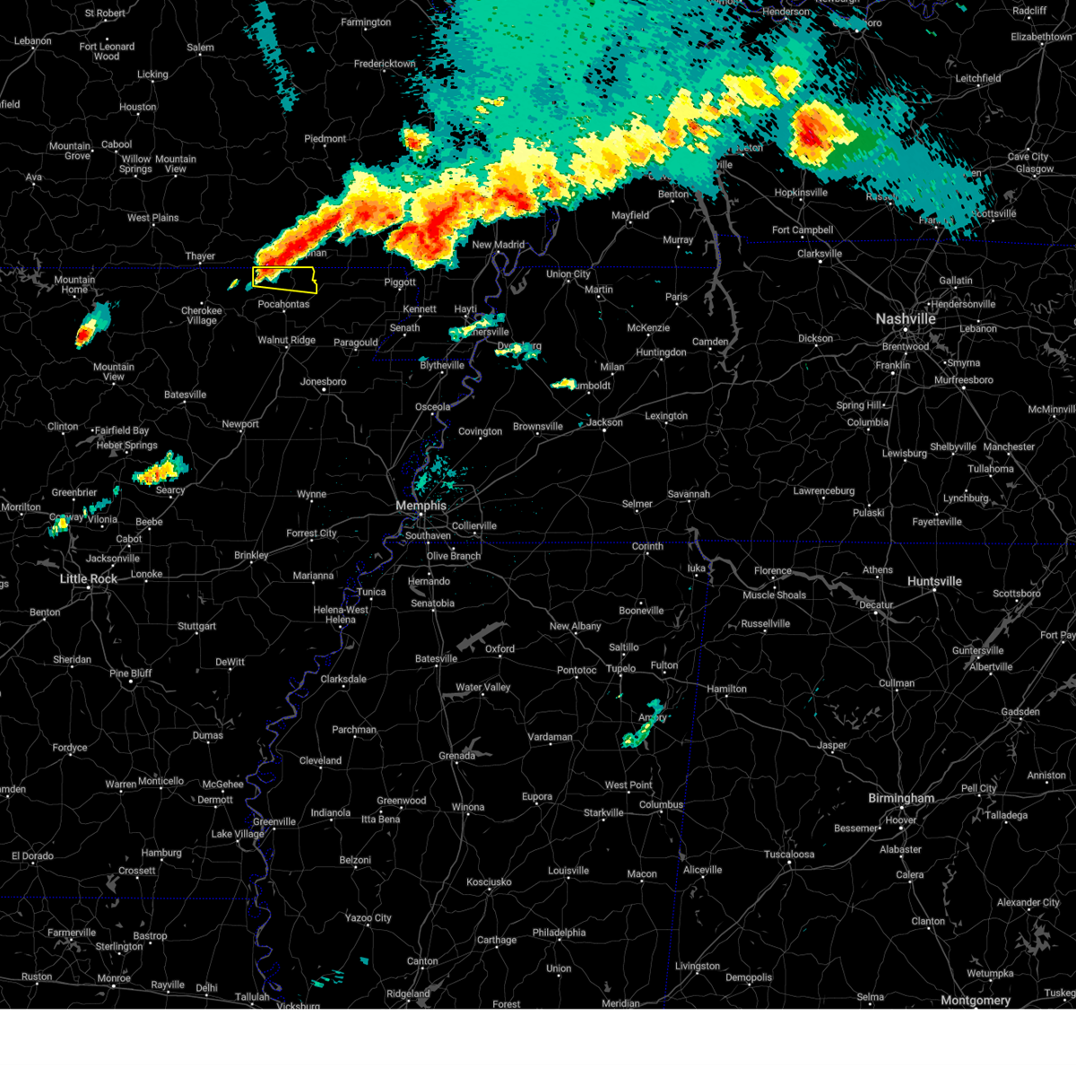 the severe thunderstorm warning has been cancelled and is no longer in effect the severe thunderstorm warning has been cancelled and is no longer in effect
|
| 5/26/2024 9:18 PM CDT |
 At 918 pm cdt, a severe thunderstorm was located near dalton, or 15 miles northwest of pocahontas, moving east at 45 mph (radar indicated). Hazards include 60 mph wind gusts and half dollar size hail. Hail damage to vehicles is expected. expect wind damage to roofs, siding, and trees. Locations impacted include, reyno, maynard, dalton, hamil, elkins park, brakebill, middlebrook, warm springs, ingram, pitman,. At 918 pm cdt, a severe thunderstorm was located near dalton, or 15 miles northwest of pocahontas, moving east at 45 mph (radar indicated). Hazards include 60 mph wind gusts and half dollar size hail. Hail damage to vehicles is expected. expect wind damage to roofs, siding, and trees. Locations impacted include, reyno, maynard, dalton, hamil, elkins park, brakebill, middlebrook, warm springs, ingram, pitman,.
|
| 5/26/2024 9:01 PM CDT |
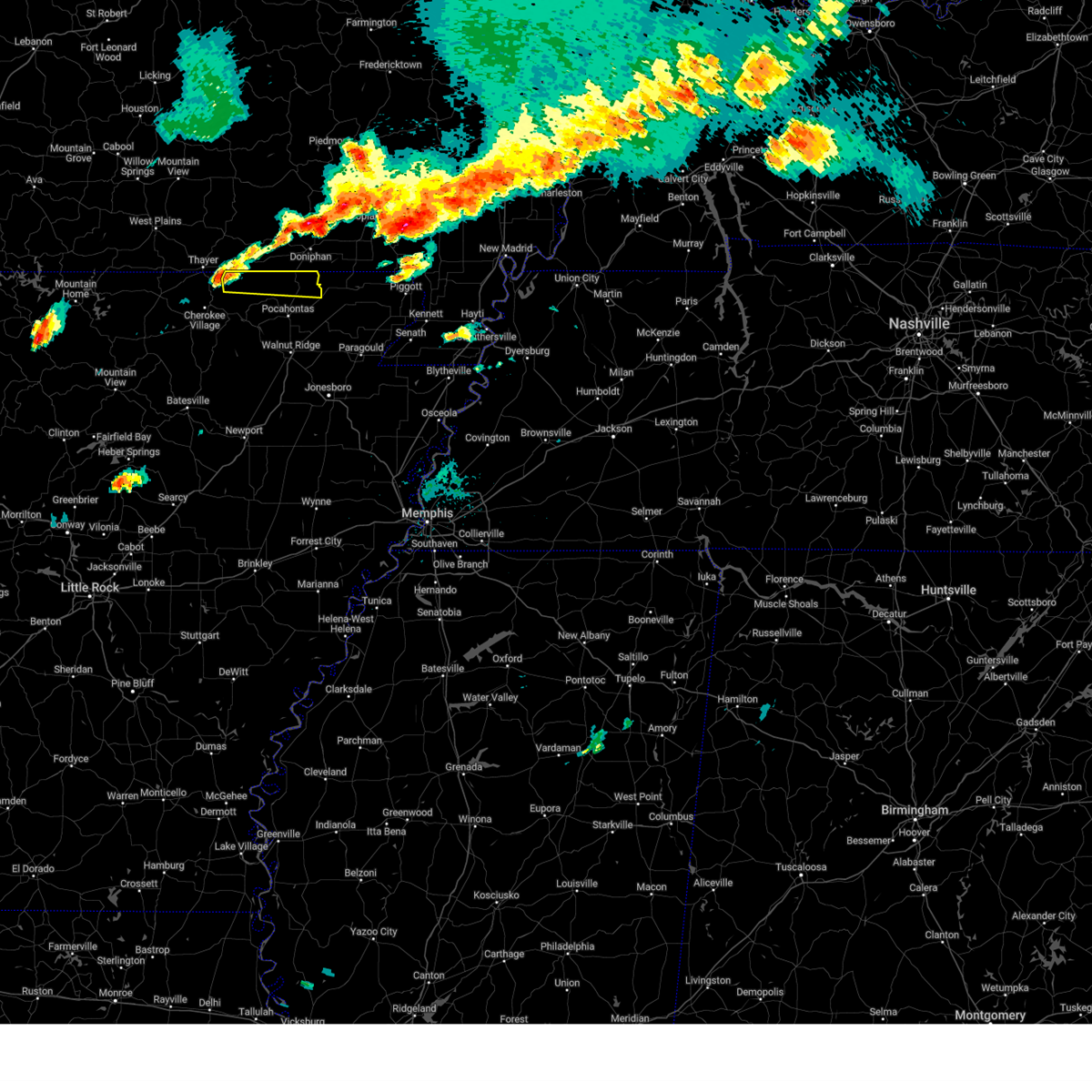 Svrlzk the national weather service in little rock has issued a * severe thunderstorm warning for, northern randolph county in eastern arkansas, northeastern sharp county in north central arkansas, * until 930 pm cdt. * at 901 pm cdt, a severe thunderstorm was located 7 miles west of dalton, or 15 miles east of mammoth spring, moving east at 65 mph (radar indicated). Hazards include 60 mph wind gusts and half dollar size hail. Hail damage to vehicles is expected. Expect wind damage to roofs, siding, and trees. Svrlzk the national weather service in little rock has issued a * severe thunderstorm warning for, northern randolph county in eastern arkansas, northeastern sharp county in north central arkansas, * until 930 pm cdt. * at 901 pm cdt, a severe thunderstorm was located 7 miles west of dalton, or 15 miles east of mammoth spring, moving east at 65 mph (radar indicated). Hazards include 60 mph wind gusts and half dollar size hail. Hail damage to vehicles is expected. Expect wind damage to roofs, siding, and trees.
|
| 5/26/2024 7:09 AM CDT |
 The storm which prompted the warning has moved out of the area. therefore, the warning will be allowed to expire. a tornado watch remains in effect until 1000 am cdt for eastern arkansas. The storm which prompted the warning has moved out of the area. therefore, the warning will be allowed to expire. a tornado watch remains in effect until 1000 am cdt for eastern arkansas.
|
| 5/26/2024 6:56 AM CDT |
 the severe thunderstorm warning has been cancelled and is no longer in effect the severe thunderstorm warning has been cancelled and is no longer in effect
|
| 5/26/2024 6:56 AM CDT |
 At 656 am cdt, a severe thunderstorm was located over pocahontas, moving east at 55 mph (radar indicated). Hazards include 60 mph wind gusts and quarter size hail. Hail damage to vehicles is expected. expect wind damage to roofs, siding, and trees. Locations impacted include, reyno, biggers, o'kean, engelberg,. At 656 am cdt, a severe thunderstorm was located over pocahontas, moving east at 55 mph (radar indicated). Hazards include 60 mph wind gusts and quarter size hail. Hail damage to vehicles is expected. expect wind damage to roofs, siding, and trees. Locations impacted include, reyno, biggers, o'kean, engelberg,.
|
| 5/26/2024 6:51 AM CDT |
 At 650 am cdt, a severe thunderstorm capable of producing a tornado was located over knobel, or near corning, moving east at 50 mph (radar indicated rotation). Hazards include tornado and quarter size hail. Flying debris will be dangerous to those caught without shelter. mobile homes will be damaged or destroyed. damage to roofs, windows, and vehicles will occur. tree damage is likely. locations impacted include, piggott, corning, campbell, chalk bluff natural area, holcomb, reyno, knobel, st. Francis, pollard, greenway, mcdougal, peach orchard, datto, saint francis, crockett, nimmons, tipperary, hickoria, lorine, and brookings. At 650 am cdt, a severe thunderstorm capable of producing a tornado was located over knobel, or near corning, moving east at 50 mph (radar indicated rotation). Hazards include tornado and quarter size hail. Flying debris will be dangerous to those caught without shelter. mobile homes will be damaged or destroyed. damage to roofs, windows, and vehicles will occur. tree damage is likely. locations impacted include, piggott, corning, campbell, chalk bluff natural area, holcomb, reyno, knobel, st. Francis, pollard, greenway, mcdougal, peach orchard, datto, saint francis, crockett, nimmons, tipperary, hickoria, lorine, and brookings.
|
| 5/26/2024 6:51 AM CDT |
 the tornado warning has been cancelled and is no longer in effect the tornado warning has been cancelled and is no longer in effect
|
| 5/26/2024 6:42 AM CDT |
 Svrlzk the national weather service in little rock has issued a * severe thunderstorm warning for, southeastern randolph county in eastern arkansas, northern lawrence county in eastern arkansas, * until 715 am cdt. * at 641 am cdt, a severe thunderstorm was located over imboden, or 9 miles north of black rock, moving east at 55 mph (radar indicated). Hazards include 60 mph wind gusts and quarter size hail. Hail damage to vehicles is expected. Expect wind damage to roofs, siding, and trees. Svrlzk the national weather service in little rock has issued a * severe thunderstorm warning for, southeastern randolph county in eastern arkansas, northern lawrence county in eastern arkansas, * until 715 am cdt. * at 641 am cdt, a severe thunderstorm was located over imboden, or 9 miles north of black rock, moving east at 55 mph (radar indicated). Hazards include 60 mph wind gusts and quarter size hail. Hail damage to vehicles is expected. Expect wind damage to roofs, siding, and trees.
|
| 5/26/2024 6:39 AM CDT |
 Tormeg the national weather service in memphis has issued a * tornado warning for, northwestern greene county in eastern arkansas, clay county in eastern arkansas, northeastern dunklin county in southeastern missouri, * until 730 am cdt. * at 639 am cdt, a severe thunderstorm capable of producing a tornado was located over biggers, or 10 miles east of pocahontas, moving east at 30 mph (radar indicated rotation). Hazards include tornado and quarter size hail. Flying debris will be dangerous to those caught without shelter. mobile homes will be damaged or destroyed. damage to roofs, windows, and vehicles will occur. Tree damage is likely. Tormeg the national weather service in memphis has issued a * tornado warning for, northwestern greene county in eastern arkansas, clay county in eastern arkansas, northeastern dunklin county in southeastern missouri, * until 730 am cdt. * at 639 am cdt, a severe thunderstorm capable of producing a tornado was located over biggers, or 10 miles east of pocahontas, moving east at 30 mph (radar indicated rotation). Hazards include tornado and quarter size hail. Flying debris will be dangerous to those caught without shelter. mobile homes will be damaged or destroyed. damage to roofs, windows, and vehicles will occur. Tree damage is likely.
|
| 5/26/2024 6:36 AM CDT |
 At 635 am cdt, severe thunderstorms were located along a line extending from success to biggers to near pocahontas to near black rock, moving east at 60 mph (radar indicated). Hazards include 60 mph wind gusts and quarter size hail. Hail damage to vehicles is expected. expect wind damage to roofs, siding, and trees. Locations impacted include, pocahontas, walnut ridge, hoxie, black rock, lake charles state park, imboden, ravenden, reyno, college city, portia, biggers, o'kean, ravenden springs, annieville, williford, powhatan, whiskerville, giles spur, shannon, birdell,. At 635 am cdt, severe thunderstorms were located along a line extending from success to biggers to near pocahontas to near black rock, moving east at 60 mph (radar indicated). Hazards include 60 mph wind gusts and quarter size hail. Hail damage to vehicles is expected. expect wind damage to roofs, siding, and trees. Locations impacted include, pocahontas, walnut ridge, hoxie, black rock, lake charles state park, imboden, ravenden, reyno, college city, portia, biggers, o'kean, ravenden springs, annieville, williford, powhatan, whiskerville, giles spur, shannon, birdell,.
|
| 5/26/2024 6:34 AM CDT |
 At 634 am cdt, a severe thunderstorm capable of producing a tornado was located near biggers, or near pocahontas, moving east at 45 mph (radar indicated rotation). Hazards include tornado and quarter size hail. Flying debris will be dangerous to those caught without shelter. mobile homes will be damaged or destroyed. damage to roofs, windows, and vehicles will occur. tree damage is likely. Locations impacted include, pocahontas, reyno, biggers, o'kean, whiskerville, giles spur, shannon, engelberg, stokes, fender, elnora, manson, lesterville, brockett,. At 634 am cdt, a severe thunderstorm capable of producing a tornado was located near biggers, or near pocahontas, moving east at 45 mph (radar indicated rotation). Hazards include tornado and quarter size hail. Flying debris will be dangerous to those caught without shelter. mobile homes will be damaged or destroyed. damage to roofs, windows, and vehicles will occur. tree damage is likely. Locations impacted include, pocahontas, reyno, biggers, o'kean, whiskerville, giles spur, shannon, engelberg, stokes, fender, elnora, manson, lesterville, brockett,.
|
| 5/26/2024 6:34 AM CDT |
 the tornado warning has been cancelled and is no longer in effect the tornado warning has been cancelled and is no longer in effect
|
| 5/26/2024 6:31 AM CDT |
 At 631 am cdt, severe thunderstorms were located along a line extending from near success to near college city to near cave city, moving east at 35 mph (radar indicated). Hazards include 60 mph wind gusts and quarter size hail. Hail damage to vehicles is expected. expect wind damage to roofs, siding, and trees. locations impacted include, paragould, piggott, corning, rector, marmaduke, crowleys ridge state park, lake frierson state park, oak grove heights, lafe, reyno, knobel, st. Francis, pollard, greenway, o'kean, mcdougal, success, peach orchard, delaplaine, and datto. At 631 am cdt, severe thunderstorms were located along a line extending from near success to near college city to near cave city, moving east at 35 mph (radar indicated). Hazards include 60 mph wind gusts and quarter size hail. Hail damage to vehicles is expected. expect wind damage to roofs, siding, and trees. locations impacted include, paragould, piggott, corning, rector, marmaduke, crowleys ridge state park, lake frierson state park, oak grove heights, lafe, reyno, knobel, st. Francis, pollard, greenway, o'kean, mcdougal, success, peach orchard, delaplaine, and datto.
|
| 5/26/2024 6:18 AM CDT |
 the severe thunderstorm warning has been cancelled and is no longer in effect the severe thunderstorm warning has been cancelled and is no longer in effect
|
| 5/26/2024 6:18 AM CDT |
 Svrmeg the national weather service in memphis has issued a * severe thunderstorm warning for, greene county in eastern arkansas, clay county in eastern arkansas, * until 700 am cdt. * at 617 am cdt, severe thunderstorms were located along a line extending from near maynard to imboden to sidney, moving east at 35 mph (radar indicated). Hazards include 70 mph wind gusts and half dollar size hail. Hail damage to vehicles is expected. expect considerable tree damage. Wind damage is also likely to mobile homes, roofs, and outbuildings. Svrmeg the national weather service in memphis has issued a * severe thunderstorm warning for, greene county in eastern arkansas, clay county in eastern arkansas, * until 700 am cdt. * at 617 am cdt, severe thunderstorms were located along a line extending from near maynard to imboden to sidney, moving east at 35 mph (radar indicated). Hazards include 70 mph wind gusts and half dollar size hail. Hail damage to vehicles is expected. expect considerable tree damage. Wind damage is also likely to mobile homes, roofs, and outbuildings.
|
| 5/26/2024 6:18 AM CDT |
 At 617 am cdt, severe thunderstorms were located along a line extending from 6 miles northeast of dalton to near attica to near imboden to 7 miles west of annieville, moving east at 60 mph. these are destructive storms for pocahontas (radar indicated). Hazards include 80 mph wind gusts and quarter size hail. Flying debris will be dangerous to those caught without shelter. mobile homes will be heavily damaged. expect considerable damage to roofs, windows, and vehicles. extensive tree damage and power outages are likely. Locations impacted include, pocahontas, walnut ridge, hoxie, black rock, lake charles state park, imboden, ravenden, reyno, college city, portia, maynard, biggers, o'kean, ravenden springs, annieville, dalton, attica, williford, powhatan, whiskerville,. At 617 am cdt, severe thunderstorms were located along a line extending from 6 miles northeast of dalton to near attica to near imboden to 7 miles west of annieville, moving east at 60 mph. these are destructive storms for pocahontas (radar indicated). Hazards include 80 mph wind gusts and quarter size hail. Flying debris will be dangerous to those caught without shelter. mobile homes will be heavily damaged. expect considerable damage to roofs, windows, and vehicles. extensive tree damage and power outages are likely. Locations impacted include, pocahontas, walnut ridge, hoxie, black rock, lake charles state park, imboden, ravenden, reyno, college city, portia, maynard, biggers, o'kean, ravenden springs, annieville, dalton, attica, williford, powhatan, whiskerville,.
|
| 5/26/2024 6:16 AM CDT |
 Torlzk the national weather service in little rock has issued a * tornado warning for, central randolph county in eastern arkansas, northern lawrence county in eastern arkansas, east central sharp county in north central arkansas, * until 645 am cdt. * at 615 am cdt, a severe thunderstorm capable of producing a tornado was located near ravenden springs, or 10 miles northwest of pocahontas, moving east at 70 mph (radar indicated rotation). Hazards include tornado. Flying debris will be dangerous to those caught without shelter. mobile homes will be damaged or destroyed. damage to roofs, windows, and vehicles will occur. Tree damage is likely. Torlzk the national weather service in little rock has issued a * tornado warning for, central randolph county in eastern arkansas, northern lawrence county in eastern arkansas, east central sharp county in north central arkansas, * until 645 am cdt. * at 615 am cdt, a severe thunderstorm capable of producing a tornado was located near ravenden springs, or 10 miles northwest of pocahontas, moving east at 70 mph (radar indicated rotation). Hazards include tornado. Flying debris will be dangerous to those caught without shelter. mobile homes will be damaged or destroyed. damage to roofs, windows, and vehicles will occur. Tree damage is likely.
|
| 5/26/2024 5:49 AM CDT |
 Svrlzk the national weather service in little rock has issued a * severe thunderstorm warning for, randolph county in eastern arkansas, northeastern izard county in north central arkansas, eastern fulton county in north central arkansas, central lawrence county in eastern arkansas, central sharp county in north central arkansas, * until 645 am cdt. * at 549 am cdt, severe thunderstorms were located along a line extending from near mammoth spring state park to cherokee village to ballard to near franklin, moving east at 60 mph (radar indicated). Hazards include 60 mph wind gusts and quarter size hail. Hail damage to vehicles is expected. Expect wind damage to roofs, siding, and trees. Svrlzk the national weather service in little rock has issued a * severe thunderstorm warning for, randolph county in eastern arkansas, northeastern izard county in north central arkansas, eastern fulton county in north central arkansas, central lawrence county in eastern arkansas, central sharp county in north central arkansas, * until 645 am cdt. * at 549 am cdt, severe thunderstorms were located along a line extending from near mammoth spring state park to cherokee village to ballard to near franklin, moving east at 60 mph (radar indicated). Hazards include 60 mph wind gusts and quarter size hail. Hail damage to vehicles is expected. Expect wind damage to roofs, siding, and trees.
|
| 5/25/2024 2:24 AM CDT |
 The storm which prompted the warning has weakened below severe limits, and no longer poses an immediate threat to life or property. therefore, the warning will be allowed to expire. however, small hail and gusty winds are still possible with this thunderstorm. The storm which prompted the warning has weakened below severe limits, and no longer poses an immediate threat to life or property. therefore, the warning will be allowed to expire. however, small hail and gusty winds are still possible with this thunderstorm.
|
| 5/25/2024 1:59 AM CDT |
 At 159 am cdt, a severe thunderstorm was located over corning, moving southeast at 35 mph (radar indicated). Hazards include 60 mph wind gusts and quarter size hail. Hail damage to vehicles is expected. expect wind damage to roofs, siding, and trees. locations impacted include, piggott, corning, rector, marmaduke, chalk bluff natural area, oak grove heights, lafe, reyno, knobel, st. Francis, pollard, greenway, o'kean, mcdougal, success, peach orchard, delaplaine, datto, evening star, and beech grove. At 159 am cdt, a severe thunderstorm was located over corning, moving southeast at 35 mph (radar indicated). Hazards include 60 mph wind gusts and quarter size hail. Hail damage to vehicles is expected. expect wind damage to roofs, siding, and trees. locations impacted include, piggott, corning, rector, marmaduke, chalk bluff natural area, oak grove heights, lafe, reyno, knobel, st. Francis, pollard, greenway, o'kean, mcdougal, success, peach orchard, delaplaine, datto, evening star, and beech grove.
|
| 5/25/2024 1:38 AM CDT |
 Svrmeg the national weather service in memphis has issued a * severe thunderstorm warning for, northern greene county in eastern arkansas, clay county in eastern arkansas, northeastern dunklin county in southeastern missouri, * until 230 am cdt. * at 138 am cdt, a severe thunderstorm was located near success, or 7 miles southeast of doniphan, moving southeast at 30 mph (radar indicated). Hazards include 60 mph wind gusts and quarter size hail. Hail damage to vehicles is expected. Expect wind damage to roofs, siding, and trees. Svrmeg the national weather service in memphis has issued a * severe thunderstorm warning for, northern greene county in eastern arkansas, clay county in eastern arkansas, northeastern dunklin county in southeastern missouri, * until 230 am cdt. * at 138 am cdt, a severe thunderstorm was located near success, or 7 miles southeast of doniphan, moving southeast at 30 mph (radar indicated). Hazards include 60 mph wind gusts and quarter size hail. Hail damage to vehicles is expected. Expect wind damage to roofs, siding, and trees.
|
| 3/14/2024 6:49 PM CDT |
 At 648 pm cdt, severe thunderstorms were located along a line extending from 6 miles south of gatewood to near ravenden springs to near annieville, moving east at 45 mph (radar indicated). Hazards include 60 mph wind gusts and penny size hail. Expect damage to roofs, siding, and trees. Locations impacted include, pocahontas, walnut ridge, black rock, imboden, ravenden, reyno, college city, portia, maynard, biggers, o'kean, ravenden springs, annieville, dalton, attica, smithville, williford, powhatan, whiskerville, giles spur,. At 648 pm cdt, severe thunderstorms were located along a line extending from 6 miles south of gatewood to near ravenden springs to near annieville, moving east at 45 mph (radar indicated). Hazards include 60 mph wind gusts and penny size hail. Expect damage to roofs, siding, and trees. Locations impacted include, pocahontas, walnut ridge, black rock, imboden, ravenden, reyno, college city, portia, maynard, biggers, o'kean, ravenden springs, annieville, dalton, attica, smithville, williford, powhatan, whiskerville, giles spur,.
|
| 3/14/2024 6:49 PM CDT |
 the severe thunderstorm warning has been cancelled and is no longer in effect the severe thunderstorm warning has been cancelled and is no longer in effect
|
| 3/14/2024 6:23 PM CDT |
 Svrlzk the national weather service in little rock has issued a * severe thunderstorm warning for, randolph county in eastern arkansas, eastern fulton county in north central arkansas, northern lawrence county in eastern arkansas, sharp county in north central arkansas, * until 715 pm cdt. * at 622 pm cdt, severe thunderstorms were located along a line extending from mammoth spring to hardy to near myron, moving east at 45 mph (radar indicated). Hazards include 60 mph wind gusts and penny size hail. expect damage to roofs, siding, and trees Svrlzk the national weather service in little rock has issued a * severe thunderstorm warning for, randolph county in eastern arkansas, eastern fulton county in north central arkansas, northern lawrence county in eastern arkansas, sharp county in north central arkansas, * until 715 pm cdt. * at 622 pm cdt, severe thunderstorms were located along a line extending from mammoth spring to hardy to near myron, moving east at 45 mph (radar indicated). Hazards include 60 mph wind gusts and penny size hail. expect damage to roofs, siding, and trees
|
| 8/9/2023 9:07 PM CDT |
 At 906 pm cdt, a severe thunderstorm was located near annieville, or near lake charles state park, moving southeast at 55 mph (radar indicated). Hazards include 70 mph wind gusts and quarter size hail. Hail damage to vehicles is possible. expect considerable tree damage. Wind damage is also likely to mobile homes, roofs, and outbuildings. At 906 pm cdt, a severe thunderstorm was located near annieville, or near lake charles state park, moving southeast at 55 mph (radar indicated). Hazards include 70 mph wind gusts and quarter size hail. Hail damage to vehicles is possible. expect considerable tree damage. Wind damage is also likely to mobile homes, roofs, and outbuildings.
|
| 7/6/2023 8:26 PM CDT |
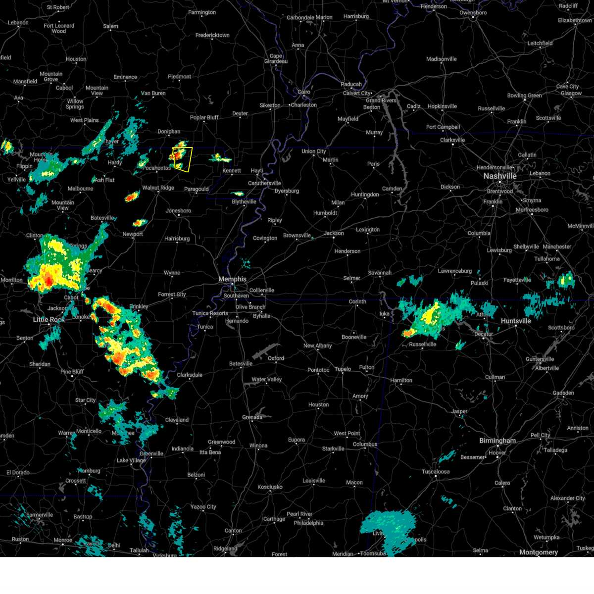 At 826 pm cdt, a severe thunderstorm was located over datto, or 9 miles west of corning, moving east at 5 mph (radar indicated). Hazards include 60 mph wind gusts and quarter size hail. Hail damage to vehicles is expected. Expect wind damage to roofs, siding, and trees. At 826 pm cdt, a severe thunderstorm was located over datto, or 9 miles west of corning, moving east at 5 mph (radar indicated). Hazards include 60 mph wind gusts and quarter size hail. Hail damage to vehicles is expected. Expect wind damage to roofs, siding, and trees.
|
| 7/5/2023 3:28 PM CDT |
 At 328 pm cdt, a severe thunderstorm was located near black rock, moving east at 20 mph (radar indicated). Hazards include 60 mph wind gusts and penny size hail. expect damage to roofs, siding, and trees At 328 pm cdt, a severe thunderstorm was located near black rock, moving east at 20 mph (radar indicated). Hazards include 60 mph wind gusts and penny size hail. expect damage to roofs, siding, and trees
|
| 7/4/2023 6:34 PM CDT |
 At 633 pm cdt, severe thunderstorms were located along a line extending from near maynard to attica to near ravenden springs, moving southeast at 20 mph (radar indicated). Hazards include 60 mph wind gusts and nickel size hail. Expect damage to roofs, siding, and trees. locations impacted include, pocahontas, reyno, maynard, biggers, ravenden springs, attica, dalton, elkins park, ingram, shannon, eleven point, birdell, hamil, stokes, engelerg, sharum, brockett, hail threat, radar indicated max hail size, 0. 88 in wind threat, radar indicated max wind gust, 60 mph. At 633 pm cdt, severe thunderstorms were located along a line extending from near maynard to attica to near ravenden springs, moving southeast at 20 mph (radar indicated). Hazards include 60 mph wind gusts and nickel size hail. Expect damage to roofs, siding, and trees. locations impacted include, pocahontas, reyno, maynard, biggers, ravenden springs, attica, dalton, elkins park, ingram, shannon, eleven point, birdell, hamil, stokes, engelerg, sharum, brockett, hail threat, radar indicated max hail size, 0. 88 in wind threat, radar indicated max wind gust, 60 mph.
|
| 7/4/2023 6:08 PM CDT |
 At 607 pm cdt, severe thunderstorms were located along a line extending from 3 miles northwest of maynard to dalton to 3 miles northwest of ravenden springs, moving southeast at 25 mph (radar indicated). Hazards include 60 mph wind gusts and nickel size hail. Expect damage to roofs, siding, and trees. locations impacted include, pocahontas, reyno, maynard, biggers, ravenden springs, attica, dalton, elkins park, brakebill, middlebrook, warm springs, ingram, shannon, eleven point, birdell, hamil, stokes, engelerg, sharum, brockett, hail threat, radar indicated max hail size, 0. 88 in wind threat, radar indicated max wind gust, 60 mph. At 607 pm cdt, severe thunderstorms were located along a line extending from 3 miles northwest of maynard to dalton to 3 miles northwest of ravenden springs, moving southeast at 25 mph (radar indicated). Hazards include 60 mph wind gusts and nickel size hail. Expect damage to roofs, siding, and trees. locations impacted include, pocahontas, reyno, maynard, biggers, ravenden springs, attica, dalton, elkins park, brakebill, middlebrook, warm springs, ingram, shannon, eleven point, birdell, hamil, stokes, engelerg, sharum, brockett, hail threat, radar indicated max hail size, 0. 88 in wind threat, radar indicated max wind gust, 60 mph.
|
| 7/4/2023 5:54 PM CDT |
 At 553 pm cdt, severe thunderstorms were located along a line extending from 6 miles northwest of maynard to near dalton to 10 miles east of mammoth spring, moving southeast at 25 mph (radar indicated). Hazards include 60 mph wind gusts and nickel size hail. expect damage to roofs, siding, and trees At 553 pm cdt, severe thunderstorms were located along a line extending from 6 miles northwest of maynard to near dalton to 10 miles east of mammoth spring, moving southeast at 25 mph (radar indicated). Hazards include 60 mph wind gusts and nickel size hail. expect damage to roofs, siding, and trees
|
| 7/1/2023 1:28 PM CDT |
 At 127 pm cdt, a severe thunderstorm was located over biggers, or 10 miles northeast of pocahontas, moving northeast at 30 mph (radar indicated). Hazards include 60 mph wind gusts and quarter size hail. Hail damage to vehicles is expected. expect wind damage to roofs, siding, and trees. locations impacted include, pocahontas, reyno, biggers, stokes, brockett, engelerg, hail threat, radar indicated max hail size, 1. 00 in wind threat, radar indicated max wind gust, 60 mph. At 127 pm cdt, a severe thunderstorm was located over biggers, or 10 miles northeast of pocahontas, moving northeast at 30 mph (radar indicated). Hazards include 60 mph wind gusts and quarter size hail. Hail damage to vehicles is expected. expect wind damage to roofs, siding, and trees. locations impacted include, pocahontas, reyno, biggers, stokes, brockett, engelerg, hail threat, radar indicated max hail size, 1. 00 in wind threat, radar indicated max wind gust, 60 mph.
|
| 7/1/2023 1:18 PM CDT |
 At 118 pm cdt, a severe thunderstorm was located near pocahontas, moving east at 25 mph (radar indicated). Hazards include 60 mph wind gusts and quarter size hail. Hail damage to vehicles is expected. expect wind damage to roofs, siding, and trees. locations impacted include, pocahontas, reyno, maynard, biggers, stokes, engelerg, brockett, hail threat, radar indicated max hail size, 1. 00 in wind threat, radar indicated max wind gust, 60 mph. At 118 pm cdt, a severe thunderstorm was located near pocahontas, moving east at 25 mph (radar indicated). Hazards include 60 mph wind gusts and quarter size hail. Hail damage to vehicles is expected. expect wind damage to roofs, siding, and trees. locations impacted include, pocahontas, reyno, maynard, biggers, stokes, engelerg, brockett, hail threat, radar indicated max hail size, 1. 00 in wind threat, radar indicated max wind gust, 60 mph.
|
| 7/1/2023 1:05 PM CDT |
 At 105 pm cdt, a severe thunderstorm was located over pocahontas, moving east at 25 mph (radar indicated). Hazards include 60 mph wind gusts and quarter size hail. Hail damage to vehicles is expected. Expect wind damage to roofs, siding, and trees. At 105 pm cdt, a severe thunderstorm was located over pocahontas, moving east at 25 mph (radar indicated). Hazards include 60 mph wind gusts and quarter size hail. Hail damage to vehicles is expected. Expect wind damage to roofs, siding, and trees.
|
| 6/14/2023 8:09 PM CDT |
 At 809 pm cdt, a severe thunderstorm was located near success, or near corning, moving east at 20 mph (radar indicated). Hazards include 60 mph wind gusts and quarter size hail. Hail damage to vehicles is expected. expect wind damage to roofs, siding, and trees. locations impacted include, piggott, corning, rector, chalk bluff natural area, reyno, knobel, st. francis, pollard, greenway, mcdougal, success, datto, saint francis, crockett, nimmons, tipperary, hickoria, twin oaks, palatka and heelstring. hail threat, radar indicated max hail size, 1. 00 in wind threat, radar indicated max wind gust, 60 mph. At 809 pm cdt, a severe thunderstorm was located near success, or near corning, moving east at 20 mph (radar indicated). Hazards include 60 mph wind gusts and quarter size hail. Hail damage to vehicles is expected. expect wind damage to roofs, siding, and trees. locations impacted include, piggott, corning, rector, chalk bluff natural area, reyno, knobel, st. francis, pollard, greenway, mcdougal, success, datto, saint francis, crockett, nimmons, tipperary, hickoria, twin oaks, palatka and heelstring. hail threat, radar indicated max hail size, 1. 00 in wind threat, radar indicated max wind gust, 60 mph.
|
| 6/14/2023 7:48 PM CDT |
 At 748 pm cdt, a severe thunderstorm was located near success, or 9 miles south of doniphan, moving east at 15 mph (radar indicated). Hazards include 60 mph wind gusts and quarter size hail. Hail damage to vehicles is expected. Expect wind damage to roofs, siding, and trees. At 748 pm cdt, a severe thunderstorm was located near success, or 9 miles south of doniphan, moving east at 15 mph (radar indicated). Hazards include 60 mph wind gusts and quarter size hail. Hail damage to vehicles is expected. Expect wind damage to roofs, siding, and trees.
|
| 4/5/2023 11:06 AM CDT |
 At 1106 am cdt, a severe thunderstorm was located near pocahontas, moving northeast at 55 mph (radar indicated). Hazards include 60 mph wind gusts. Expect damage to roofs, siding, and trees. locations impacted include, pocahontas, walnut ridge, black rock, lake charles state park, reyno, college city, portia, maynard, biggers, o`kean, attica, powhatan, whiskerville, giles spur, middlebrook, ingram, shannon, birdell, dicus, elnora, hail threat, radar indicated max hail size, <. 75 in wind threat, radar indicated max wind gust, 60 mph. At 1106 am cdt, a severe thunderstorm was located near pocahontas, moving northeast at 55 mph (radar indicated). Hazards include 60 mph wind gusts. Expect damage to roofs, siding, and trees. locations impacted include, pocahontas, walnut ridge, black rock, lake charles state park, reyno, college city, portia, maynard, biggers, o`kean, attica, powhatan, whiskerville, giles spur, middlebrook, ingram, shannon, birdell, dicus, elnora, hail threat, radar indicated max hail size, <. 75 in wind threat, radar indicated max wind gust, 60 mph.
|
| 4/5/2023 10:53 AM CDT |
 At 1052 am cdt, a severe thunderstorm was located over black rock, moving east at 55 mph (radar indicated). Hazards include 60 mph wind gusts. expect damage to roofs, siding, and trees At 1052 am cdt, a severe thunderstorm was located over black rock, moving east at 55 mph (radar indicated). Hazards include 60 mph wind gusts. expect damage to roofs, siding, and trees
|
| 4/5/2023 3:21 AM CDT |
 The severe thunderstorm warning for northeastern randolph county will expire at 330 am cdt, the storm which prompted the warning has weakened below severe limits, and no longer poses an immediate threat to life or property. therefore, the warning will be allowed to expire. a tornado watch remains in effect until 900 am cdt for eastern arkansas. The severe thunderstorm warning for northeastern randolph county will expire at 330 am cdt, the storm which prompted the warning has weakened below severe limits, and no longer poses an immediate threat to life or property. therefore, the warning will be allowed to expire. a tornado watch remains in effect until 900 am cdt for eastern arkansas.
|
| 4/5/2023 3:03 AM CDT |
 At 303 am cdt, a severe thunderstorm was located over maynard, or 9 miles north of pocahontas, moving northeast at 65 mph (broadcast media). Hazards include 60 mph wind gusts and quarter size hail. Hail damage to vehicles is expected. expect wind damage to roofs, siding, and trees. locations impacted include, pocahontas, reyno, maynard, biggers, attica, elkins park, brakebill, middlebrook, ingram, hamil, stokes, engelerg, brockett, pitman, hail threat, radar indicated max hail size, 1. 00 in wind threat, radar indicated max wind gust, 60 mph. At 303 am cdt, a severe thunderstorm was located over maynard, or 9 miles north of pocahontas, moving northeast at 65 mph (broadcast media). Hazards include 60 mph wind gusts and quarter size hail. Hail damage to vehicles is expected. expect wind damage to roofs, siding, and trees. locations impacted include, pocahontas, reyno, maynard, biggers, attica, elkins park, brakebill, middlebrook, ingram, hamil, stokes, engelerg, brockett, pitman, hail threat, radar indicated max hail size, 1. 00 in wind threat, radar indicated max wind gust, 60 mph.
|
| 4/5/2023 2:45 AM CDT |
 At 245 am cdt, a severe thunderstorm was located over imboden, or near black rock, moving northeast at 65 mph (radar indicated). Hazards include 60 mph wind gusts and half dollar size hail. Hail damage to vehicles is expected. Expect wind damage to roofs, siding, and trees. At 245 am cdt, a severe thunderstorm was located over imboden, or near black rock, moving northeast at 65 mph (radar indicated). Hazards include 60 mph wind gusts and half dollar size hail. Hail damage to vehicles is expected. Expect wind damage to roofs, siding, and trees.
|
| 2/16/2023 4:39 AM CST |
 At 438 am cst, a severe thunderstorm was located near stella, or 9 miles east of melbourne, moving northeast at 50 mph (radar indicated). Hazards include 60 mph wind gusts and quarter size hail. Hail damage to vehicles is expected. Expect wind damage to roofs, siding, and trees. At 438 am cst, a severe thunderstorm was located near stella, or 9 miles east of melbourne, moving northeast at 50 mph (radar indicated). Hazards include 60 mph wind gusts and quarter size hail. Hail damage to vehicles is expected. Expect wind damage to roofs, siding, and trees.
|
| 10/12/2022 11:23 AM CDT |
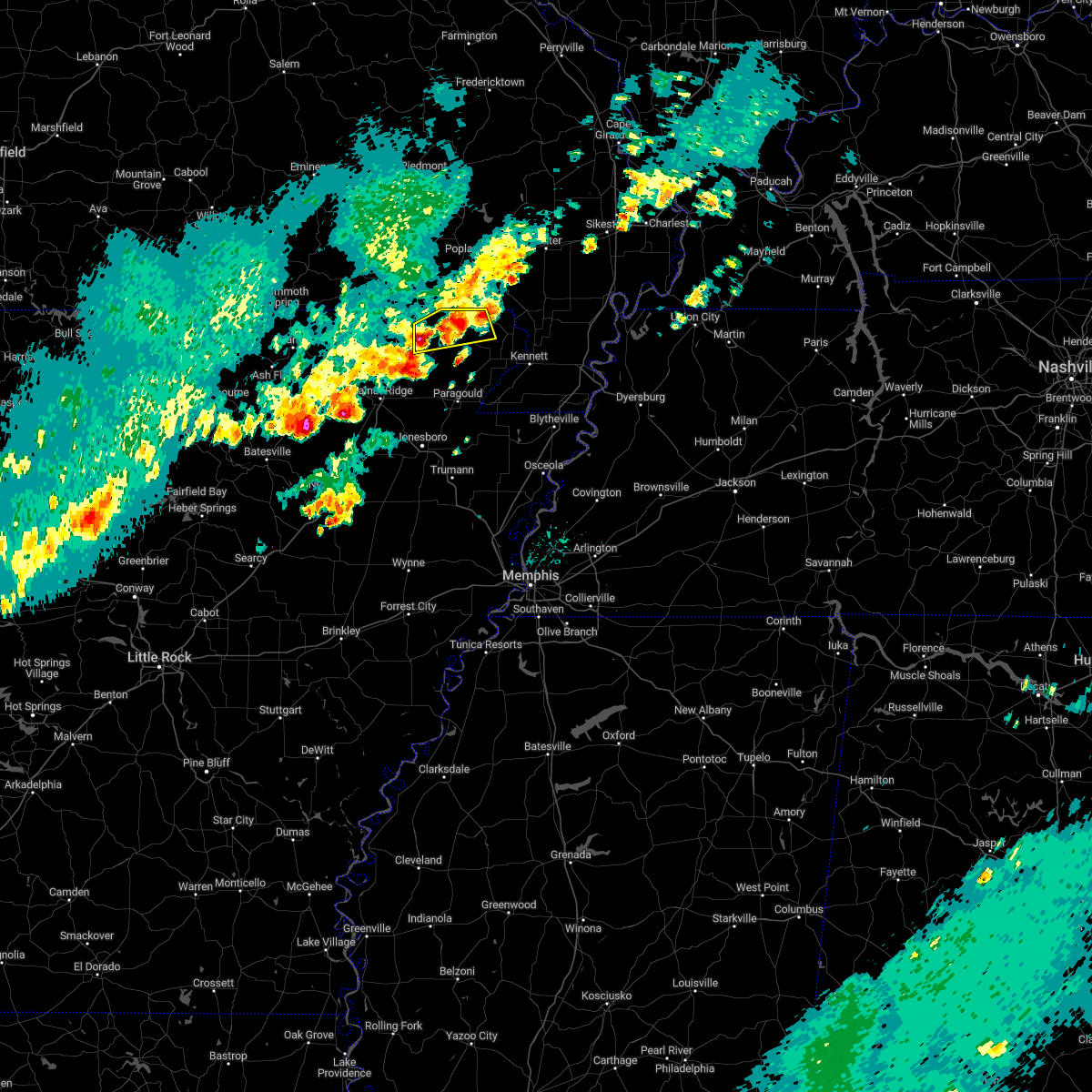 At 1122 am cdt, a severe thunderstorm was located near datto, or near corning, moving northeast at 40 mph (radar indicated). Hazards include 60 mph wind gusts and quarter size hail. Hail damage to vehicles is expected. Expect wind damage to roofs, siding, and trees. At 1122 am cdt, a severe thunderstorm was located near datto, or near corning, moving northeast at 40 mph (radar indicated). Hazards include 60 mph wind gusts and quarter size hail. Hail damage to vehicles is expected. Expect wind damage to roofs, siding, and trees.
|
| 9/24/2022 7:51 PM CDT |
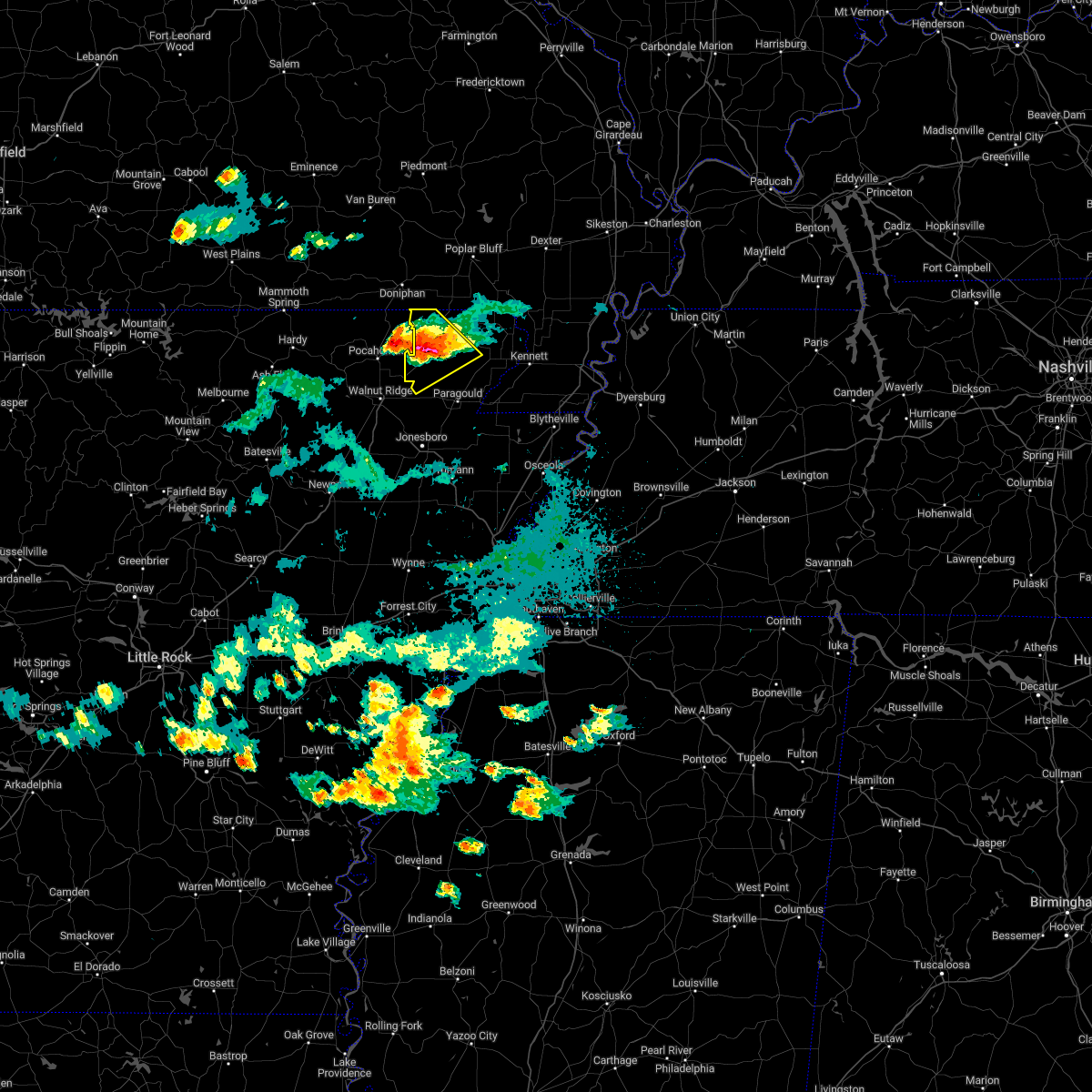 At 751 pm cdt, a severe thunderstorm was located over peach orchard, or 9 miles southwest of corning, moving southeast at 30 mph (radar indicated). Hazards include 60 mph wind gusts and half dollar size hail. Hail damage to vehicles is expected. expect wind damage to roofs, siding, and trees. locations impacted include, corning, lafe, reyno, knobel, o`kean, success, peach orchard, delaplaine, datto, evening star, beech grove, heelstring, stonewall, tipperary, case, brookings, knob, twin oaks, palatka and faulknerville. hail threat, radar indicated max hail size, 1. 25 in wind threat, radar indicated max wind gust, 60 mph. At 751 pm cdt, a severe thunderstorm was located over peach orchard, or 9 miles southwest of corning, moving southeast at 30 mph (radar indicated). Hazards include 60 mph wind gusts and half dollar size hail. Hail damage to vehicles is expected. expect wind damage to roofs, siding, and trees. locations impacted include, corning, lafe, reyno, knobel, o`kean, success, peach orchard, delaplaine, datto, evening star, beech grove, heelstring, stonewall, tipperary, case, brookings, knob, twin oaks, palatka and faulknerville. hail threat, radar indicated max hail size, 1. 25 in wind threat, radar indicated max wind gust, 60 mph.
|
| 9/24/2022 7:33 PM CDT |
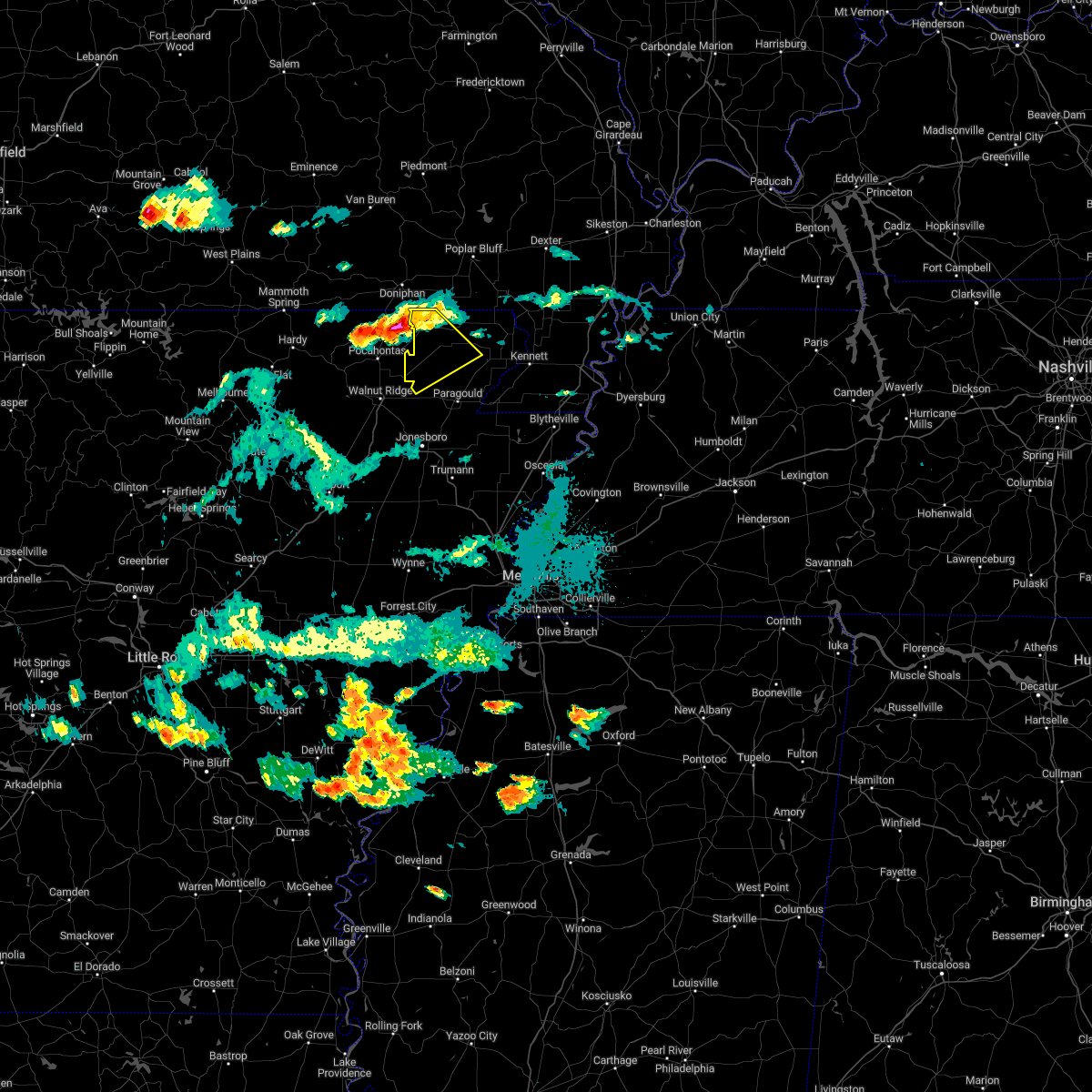 At 733 pm cdt, a severe thunderstorm was located near reyno, or 11 miles west of corning, moving southeast at 30 mph (radar indicated). Hazards include 60 mph wind gusts and half dollar size hail. Hail damage to vehicles is expected. Expect wind damage to roofs, siding, and trees. At 733 pm cdt, a severe thunderstorm was located near reyno, or 11 miles west of corning, moving southeast at 30 mph (radar indicated). Hazards include 60 mph wind gusts and half dollar size hail. Hail damage to vehicles is expected. Expect wind damage to roofs, siding, and trees.
|
| 9/24/2022 7:28 PM CDT |
 At 728 pm cdt, a severe thunderstorm was located over maynard, or 11 miles northeast of pocahontas, moving southeast at 30 mph (radar indicated). Hazards include golf ball size hail and 60 mph wind gusts. People and animals outdoors will be injured. expect hail damage to roofs, siding, windows, and vehicles. expect wind damage to roofs, siding, and trees. locations impacted include, reyno, maynard, biggers, o`kean, stokes, engelerg, elkins park, brakebill, middlebrook, ingram, brockett, pitman, thunderstorm damage threat, considerable hail threat, radar indicated max hail size, 1. 75 in wind threat, radar indicated max wind gust, 60 mph. At 728 pm cdt, a severe thunderstorm was located over maynard, or 11 miles northeast of pocahontas, moving southeast at 30 mph (radar indicated). Hazards include golf ball size hail and 60 mph wind gusts. People and animals outdoors will be injured. expect hail damage to roofs, siding, windows, and vehicles. expect wind damage to roofs, siding, and trees. locations impacted include, reyno, maynard, biggers, o`kean, stokes, engelerg, elkins park, brakebill, middlebrook, ingram, brockett, pitman, thunderstorm damage threat, considerable hail threat, radar indicated max hail size, 1. 75 in wind threat, radar indicated max wind gust, 60 mph.
|
| 9/24/2022 7:22 PM CDT |
 At 722 pm cdt, a severe thunderstorm was located over maynard, or 12 miles north of pocahontas, moving southeast at 30 mph (radar indicated). Hazards include ping pong ball size hail and 60 mph wind gusts. People and animals outdoors will be injured. expect hail damage to roofs, siding, windows, and vehicles. expect wind damage to roofs, siding, and trees. locations impacted include, reyno, maynard, biggers, o`kean, elkins park, brakebill, middlebrook, warm springs, ingram, stokes, engelerg, brockett, pitman, hail threat, radar indicated max hail size, 1. 50 in wind threat, radar indicated max wind gust, 60 mph. At 722 pm cdt, a severe thunderstorm was located over maynard, or 12 miles north of pocahontas, moving southeast at 30 mph (radar indicated). Hazards include ping pong ball size hail and 60 mph wind gusts. People and animals outdoors will be injured. expect hail damage to roofs, siding, windows, and vehicles. expect wind damage to roofs, siding, and trees. locations impacted include, reyno, maynard, biggers, o`kean, elkins park, brakebill, middlebrook, warm springs, ingram, stokes, engelerg, brockett, pitman, hail threat, radar indicated max hail size, 1. 50 in wind threat, radar indicated max wind gust, 60 mph.
|
| 9/24/2022 7:15 PM CDT |
 At 715 pm cdt, a severe thunderstorm was located near maynard, or 12 miles southwest of doniphan, moving southeast at 30 mph (radar indicated). Hazards include 60 mph wind gusts and quarter size hail. Hail damage to vehicles is expected. Expect wind damage to roofs, siding, and trees. At 715 pm cdt, a severe thunderstorm was located near maynard, or 12 miles southwest of doniphan, moving southeast at 30 mph (radar indicated). Hazards include 60 mph wind gusts and quarter size hail. Hail damage to vehicles is expected. Expect wind damage to roofs, siding, and trees.
|
| 7/17/2022 8:28 PM CDT |
 At 827 pm cdt, a severe thunderstorm was located over success, or near corning, moving southeast at 30 mph (radar indicated). Hazards include 60 mph wind gusts. expect damage to roofs, siding, and trees At 827 pm cdt, a severe thunderstorm was located over success, or near corning, moving southeast at 30 mph (radar indicated). Hazards include 60 mph wind gusts. expect damage to roofs, siding, and trees
|
| 7/17/2022 7:57 PM CDT |
 At 757 pm cdt, severe thunderstorms were located along a line extending from fairdealing to 7 miles northwest of maynard to 9 miles east of mammoth spring, moving southeast at 35 mph (radar indicated). Hazards include 60 mph wind gusts and penny size hail. expect damage to roofs, siding, and trees At 757 pm cdt, severe thunderstorms were located along a line extending from fairdealing to 7 miles northwest of maynard to 9 miles east of mammoth spring, moving southeast at 35 mph (radar indicated). Hazards include 60 mph wind gusts and penny size hail. expect damage to roofs, siding, and trees
|
| 5/21/2022 6:30 PM CDT |
 At 629 pm cdt, severe thunderstorms were located along a line extending from 6 miles north of maynard to near beech grove to egypt, moving east at 70 mph (radar indicated). Hazards include 60 mph wind gusts and quarter size hail. Hail damage to vehicles is expected. Expect wind damage to roofs, siding, and trees. At 629 pm cdt, severe thunderstorms were located along a line extending from 6 miles north of maynard to near beech grove to egypt, moving east at 70 mph (radar indicated). Hazards include 60 mph wind gusts and quarter size hail. Hail damage to vehicles is expected. Expect wind damage to roofs, siding, and trees.
|
| 5/21/2022 6:23 PM CDT |
 At 622 pm cdt, severe thunderstorms were located along a line extending from near maynard to near o`kean to near swifton, moving east at 55 mph (radar indicated). Hazards include 60 mph wind gusts and quarter size hail. Hail damage to vehicles is expected. expect wind damage to roofs, siding, and trees. locations impacted include, jonesboro, paragould, corning, bono, brookland, marmaduke, crowleys ridge state park, lake frierson state park, oak grove heights, lafe, reyno, cash, knobel, o`kean, success, peach orchard, delaplaine, egypt, datto and evening star. hail threat, radar indicated max hail size, 1. 00 in wind threat, radar indicated max wind gust, 60 mph. At 622 pm cdt, severe thunderstorms were located along a line extending from near maynard to near o`kean to near swifton, moving east at 55 mph (radar indicated). Hazards include 60 mph wind gusts and quarter size hail. Hail damage to vehicles is expected. expect wind damage to roofs, siding, and trees. locations impacted include, jonesboro, paragould, corning, bono, brookland, marmaduke, crowleys ridge state park, lake frierson state park, oak grove heights, lafe, reyno, cash, knobel, o`kean, success, peach orchard, delaplaine, egypt, datto and evening star. hail threat, radar indicated max hail size, 1. 00 in wind threat, radar indicated max wind gust, 60 mph.
|
| 5/21/2022 6:02 PM CDT |
 At 602 pm cdt, severe thunderstorms were located along a line extending from 10 miles west of dalton to near black rock to 7 miles northeast of moorefield, moving east at 45 mph (radar indicated). Hazards include 60 mph wind gusts and quarter size hail. Hail damage to vehicles is expected. Expect wind damage to roofs, siding, and trees. At 602 pm cdt, severe thunderstorms were located along a line extending from 10 miles west of dalton to near black rock to 7 miles northeast of moorefield, moving east at 45 mph (radar indicated). Hazards include 60 mph wind gusts and quarter size hail. Hail damage to vehicles is expected. Expect wind damage to roofs, siding, and trees.
|
| 5/21/2022 5:44 PM CDT |
 At 544 pm cdt, severe thunderstorms were located along a line extending from near thayer to 8 miles southeast of highland in sharp county to near cave city, moving east at 45 mph (radar indicated). Hazards include 70 mph wind gusts and quarter size hail. Hail damage to vehicles is expected. expect considerable tree damage. Wind damage is also likely to mobile homes, roofs, and outbuildings. At 544 pm cdt, severe thunderstorms were located along a line extending from near thayer to 8 miles southeast of highland in sharp county to near cave city, moving east at 45 mph (radar indicated). Hazards include 70 mph wind gusts and quarter size hail. Hail damage to vehicles is expected. expect considerable tree damage. Wind damage is also likely to mobile homes, roofs, and outbuildings.
|
| 5/21/2022 2:29 PM CDT |
 At 229 pm cdt, a severe thunderstorm was located over college city, or near walnut ridge, moving northeast at 30 mph (radar indicated). Hazards include 60 mph wind gusts and quarter size hail. Hail damage to vehicles is expected. Expect wind damage to roofs, siding, and trees. At 229 pm cdt, a severe thunderstorm was located over college city, or near walnut ridge, moving northeast at 30 mph (radar indicated). Hazards include 60 mph wind gusts and quarter size hail. Hail damage to vehicles is expected. Expect wind damage to roofs, siding, and trees.
|
| 3/30/2022 2:28 PM CDT |
 At 228 pm cdt, severe thunderstorms were located along a line extending from near oxly to near walcott, moving northeast at 60 mph (radar indicated). Hazards include 60 mph wind gusts. expect damage to roofs, siding, and trees At 228 pm cdt, severe thunderstorms were located along a line extending from near oxly to near walcott, moving northeast at 60 mph (radar indicated). Hazards include 60 mph wind gusts. expect damage to roofs, siding, and trees
|
| 3/7/2022 12:48 AM CST |
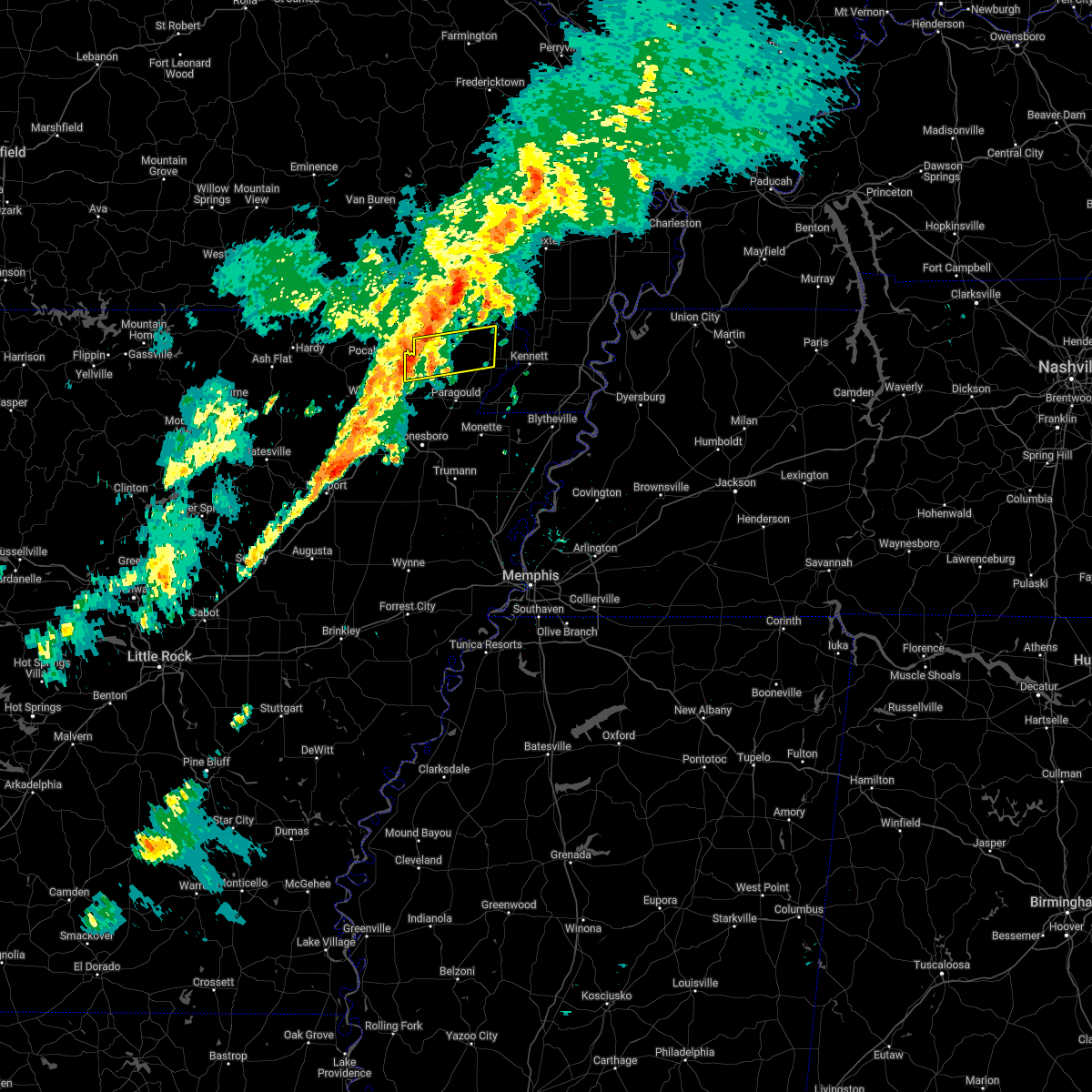 At 1248 am cst, a severe thunderstorm was located over delaplaine, or 12 miles east of pocahontas, moving east at 50 mph (radar indicated). Hazards include 60 mph wind gusts. expect damage to roofs, siding, and trees At 1248 am cst, a severe thunderstorm was located over delaplaine, or 12 miles east of pocahontas, moving east at 50 mph (radar indicated). Hazards include 60 mph wind gusts. expect damage to roofs, siding, and trees
|
| 3/7/2022 12:41 AM CST |
 At 1241 am cst, a severe thunderstorm was located near corning, moving east at 35 mph (radar indicated). Hazards include 60 mph wind gusts. Expect damage to roofs, siding, and trees. Locations impacted include, corning, reyno, pollard, mcdougal, success, datto, twin oaks and palatka. At 1241 am cst, a severe thunderstorm was located near corning, moving east at 35 mph (radar indicated). Hazards include 60 mph wind gusts. Expect damage to roofs, siding, and trees. Locations impacted include, corning, reyno, pollard, mcdougal, success, datto, twin oaks and palatka.
|
| 3/7/2022 12:23 AM CST |
 At 1222 am cst, a severe thunderstorm was located near maynard, or 12 miles south of doniphan, moving east at 40 mph (radar indicated). Hazards include 60 mph wind gusts. expect damage to roofs, siding, and trees At 1222 am cst, a severe thunderstorm was located near maynard, or 12 miles south of doniphan, moving east at 40 mph (radar indicated). Hazards include 60 mph wind gusts. expect damage to roofs, siding, and trees
|
| 3/6/2022 8:13 PM CST |
 At 812 pm cst, a severe thunderstorm capable of producing a tornado was located over ravenden springs, or 12 miles west of pocahontas, moving northeast at 45 mph (weather spotters reported a funnel cloud). Hazards include tornado and half dollar size hail. Flying debris will be dangerous to those caught without shelter. mobile homes will be damaged or destroyed. damage to roofs, windows, and vehicles will occur. tree damage is likely. Locations impacted include, pocahontas, reyno, maynard, biggers, ravenden springs, attica, dalton, elkins park, brakebill, middlebrook, warm springs, ingram, birdell, hamil, stokes, engelerg, brockett, pitman,. At 812 pm cst, a severe thunderstorm capable of producing a tornado was located over ravenden springs, or 12 miles west of pocahontas, moving northeast at 45 mph (weather spotters reported a funnel cloud). Hazards include tornado and half dollar size hail. Flying debris will be dangerous to those caught without shelter. mobile homes will be damaged or destroyed. damage to roofs, windows, and vehicles will occur. tree damage is likely. Locations impacted include, pocahontas, reyno, maynard, biggers, ravenden springs, attica, dalton, elkins park, brakebill, middlebrook, warm springs, ingram, birdell, hamil, stokes, engelerg, brockett, pitman,.
|
| 3/6/2022 7:59 PM CST |
 At 758 pm cst, a severe thunderstorm capable of producing a tornado was located near ravenden, or 12 miles east of cherokee village, moving northeast at 45 mph (radar indicated rotation). Hazards include tornado and ping pong ball size hail. Flying debris will be dangerous to those caught without shelter. mobile homes will be damaged or destroyed. damage to roofs, windows, and vehicles will occur. Tree damage is likely. At 758 pm cst, a severe thunderstorm capable of producing a tornado was located near ravenden, or 12 miles east of cherokee village, moving northeast at 45 mph (radar indicated rotation). Hazards include tornado and ping pong ball size hail. Flying debris will be dangerous to those caught without shelter. mobile homes will be damaged or destroyed. damage to roofs, windows, and vehicles will occur. Tree damage is likely.
|
| 3/6/2022 5:56 PM CST |
 At 555 pm cst, a confirmed tornado was located near birdell, moving northeast at 50 mph (weather spotters confirmed tornado). Hazards include damaging tornado. Flying debris will be dangerous to those caught without shelter. mobile homes will be damaged or destroyed. damage to roofs, windows, and vehicles will occur. tree damage is likely. Locations impacted include, pocahontas, reyno, maynard, biggers, o`kean, attica, elkins park, brakebill, middlebrook, ingram, shannon, birdell, hamil, stokes, fender, elnora, engelerg, sharum, manson, lesterville,. At 555 pm cst, a confirmed tornado was located near birdell, moving northeast at 50 mph (weather spotters confirmed tornado). Hazards include damaging tornado. Flying debris will be dangerous to those caught without shelter. mobile homes will be damaged or destroyed. damage to roofs, windows, and vehicles will occur. tree damage is likely. Locations impacted include, pocahontas, reyno, maynard, biggers, o`kean, attica, elkins park, brakebill, middlebrook, ingram, shannon, birdell, hamil, stokes, fender, elnora, engelerg, sharum, manson, lesterville,.
|
| 3/6/2022 5:37 PM CST |
 At 536 pm cst, a confirmed tornado was located over lake charles state park, moving northeast at 60 mph (weather spotters confirmed tornado). Hazards include damaging tornado. Flying debris will be dangerous to those caught without shelter. mobile homes will be damaged or destroyed. damage to roofs, windows, and vehicles will occur. tree damage is likely. Locations impacted include, pocahontas, walnut ridge, hoxie, black rock, lake charles state park, imboden, reyno, college city, portia, maynard, biggers, lynn, o`kean, annieville, attica, smithville, powhatan, middlebrook, ingram, shannon,. At 536 pm cst, a confirmed tornado was located over lake charles state park, moving northeast at 60 mph (weather spotters confirmed tornado). Hazards include damaging tornado. Flying debris will be dangerous to those caught without shelter. mobile homes will be damaged or destroyed. damage to roofs, windows, and vehicles will occur. tree damage is likely. Locations impacted include, pocahontas, walnut ridge, hoxie, black rock, lake charles state park, imboden, reyno, college city, portia, maynard, biggers, lynn, o`kean, annieville, attica, smithville, powhatan, middlebrook, ingram, shannon,.
|
| 3/6/2022 5:30 PM CST |
 At 529 pm cst, a severe thunderstorm capable of producing a tornado was located over lynn, or near lake charles state park, moving northeast at 55 mph (weather spotters reported funnel cloud). Hazards include tornado. Flying debris will be dangerous to those caught without shelter. mobile homes will be damaged or destroyed. damage to roofs, windows, and vehicles will occur. Tree damage is likely. At 529 pm cst, a severe thunderstorm capable of producing a tornado was located over lynn, or near lake charles state park, moving northeast at 55 mph (weather spotters reported funnel cloud). Hazards include tornado. Flying debris will be dangerous to those caught without shelter. mobile homes will be damaged or destroyed. damage to roofs, windows, and vehicles will occur. Tree damage is likely.
|
| 2/22/2022 4:46 AM CST |
 At 445 am cst, severe thunderstorms were located along a line extending from 6 miles north of maynard to near tuckerman, moving east at 60 mph (radar indicated). Hazards include 60 mph wind gusts and penny size hail. expect damage to roofs, siding, and trees At 445 am cst, severe thunderstorms were located along a line extending from 6 miles north of maynard to near tuckerman, moving east at 60 mph (radar indicated). Hazards include 60 mph wind gusts and penny size hail. expect damage to roofs, siding, and trees
|
| 10/25/2021 12:26 AM CDT |
 The severe thunderstorm warning for southeastern randolph county will expire at 1230 am cdt, the storms which prompted the warning have moved out of the area. therefore, the warning will be allowed to expire. however gusty winds are still possible with these thunderstorms. a tornado watch remains in effect until 400 am cdt for eastern arkansas. The severe thunderstorm warning for southeastern randolph county will expire at 1230 am cdt, the storms which prompted the warning have moved out of the area. therefore, the warning will be allowed to expire. however gusty winds are still possible with these thunderstorms. a tornado watch remains in effect until 400 am cdt for eastern arkansas.
|
| 10/25/2021 12:18 AM CDT |
 At 1217 am cdt, severe thunderstorms were located along a line extending from near corning to near black rock, moving east at 40 mph (radar indicated). Hazards include 60 mph wind gusts. Expect damage to roofs, siding, and trees. locations impacted include, pocahontas, reyno, biggers, o`kean, stokes, engelerg, brockett, hail threat, radar indicated max hail size, <. 75 in wind threat, radar indicated max wind gust, 60 mph. At 1217 am cdt, severe thunderstorms were located along a line extending from near corning to near black rock, moving east at 40 mph (radar indicated). Hazards include 60 mph wind gusts. Expect damage to roofs, siding, and trees. locations impacted include, pocahontas, reyno, biggers, o`kean, stokes, engelerg, brockett, hail threat, radar indicated max hail size, <. 75 in wind threat, radar indicated max wind gust, 60 mph.
|
| 10/24/2021 11:50 PM CDT |
 At 1150 pm cdt, severe thunderstorms were located along a line extending from near maynard to 7 miles southwest of ravenden, moving east at 40 mph (radar indicated). Hazards include 60 mph wind gusts and quarter size hail. Hail damage to vehicles is expected. Expect wind damage to roofs, siding, and trees. At 1150 pm cdt, severe thunderstorms were located along a line extending from near maynard to 7 miles southwest of ravenden, moving east at 40 mph (radar indicated). Hazards include 60 mph wind gusts and quarter size hail. Hail damage to vehicles is expected. Expect wind damage to roofs, siding, and trees.
|
| 5/6/2021 1:03 PM CDT |
 At 103 pm cdt, a severe thunderstorm was located near dalton, or 15 miles east of mammoth spring, moving southeast at 40 mph (radar indicated). Hazards include 60 mph wind gusts and quarter size hail. Hail damage to vehicles is expected. Expect wind damage to roofs, siding, and trees. At 103 pm cdt, a severe thunderstorm was located near dalton, or 15 miles east of mammoth spring, moving southeast at 40 mph (radar indicated). Hazards include 60 mph wind gusts and quarter size hail. Hail damage to vehicles is expected. Expect wind damage to roofs, siding, and trees.
|
| 5/4/2021 2:08 AM CDT |
 At 208 am cdt, a severe thunderstorm was located 7 miles southwest of mcdougal, or 8 miles southeast of corning, moving northeast at 30 mph (radar indicated). Hazards include 60 mph wind gusts and quarter size hail. Hail damage to vehicles is expected. Expect wind damage to roofs, siding, and trees. At 208 am cdt, a severe thunderstorm was located 7 miles southwest of mcdougal, or 8 miles southeast of corning, moving northeast at 30 mph (radar indicated). Hazards include 60 mph wind gusts and quarter size hail. Hail damage to vehicles is expected. Expect wind damage to roofs, siding, and trees.
|
| 5/4/2021 1:47 AM CDT |
 At 146 am cdt, a severe thunderstorm was located over knobel, or near corning, moving northeast at 25 mph (radar indicated. at 120 am nickel sized hail was reported near peach orchard). Hazards include 60 mph wind gusts and quarter size hail. Hail damage to vehicles is expected. expect wind damage to roofs, siding, and trees. Locations impacted include, corning, reyno, knobel, o`kean, mcdougal, success, peach orchard, delaplaine, datto, evening star, beech grove, heelstring, stonewall, tipperary, hickoria, case, brookings, twin oaks and palatka. At 146 am cdt, a severe thunderstorm was located over knobel, or near corning, moving northeast at 25 mph (radar indicated. at 120 am nickel sized hail was reported near peach orchard). Hazards include 60 mph wind gusts and quarter size hail. Hail damage to vehicles is expected. expect wind damage to roofs, siding, and trees. Locations impacted include, corning, reyno, knobel, o`kean, mcdougal, success, peach orchard, delaplaine, datto, evening star, beech grove, heelstring, stonewall, tipperary, hickoria, case, brookings, twin oaks and palatka.
|
| 5/4/2021 1:46 AM CDT |
 At 146 am cdt, severe thunderstorms were located along a line extending from near gatewood to near pocahontas to near minturn, moving east at 45 mph (radar indicated). Hazards include 60 mph wind gusts and quarter size hail. Hail damage to vehicles is expected. expect wind damage to roofs, siding, and trees. Locations impacted include, pocahontas, walnut ridge, hoxie, black rock, lake charles state park, imboden, reyno, college city, portia, maynard, biggers, lynn, o`kean, ravenden springs, annieville, dalton, attica, powhatan, whiskerville, giles spur, this includes us highway 67 between mile markers 120 and 121. At 146 am cdt, severe thunderstorms were located along a line extending from near gatewood to near pocahontas to near minturn, moving east at 45 mph (radar indicated). Hazards include 60 mph wind gusts and quarter size hail. Hail damage to vehicles is expected. expect wind damage to roofs, siding, and trees. Locations impacted include, pocahontas, walnut ridge, hoxie, black rock, lake charles state park, imboden, reyno, college city, portia, maynard, biggers, lynn, o`kean, ravenden springs, annieville, dalton, attica, powhatan, whiskerville, giles spur, this includes us highway 67 between mile markers 120 and 121.
|
| 5/4/2021 1:32 AM CDT |
 At 132 am cdt, severe thunderstorms were located along a line extending from 10 miles northwest of dalton to near ravenden to lynn, moving east at 45 mph (radar indicated). Hazards include 60 mph wind gusts and quarter size hail. Hail damage to vehicles is expected. Expect wind damage to roofs, siding, and trees. At 132 am cdt, severe thunderstorms were located along a line extending from 10 miles northwest of dalton to near ravenden to lynn, moving east at 45 mph (radar indicated). Hazards include 60 mph wind gusts and quarter size hail. Hail damage to vehicles is expected. Expect wind damage to roofs, siding, and trees.
|
| 5/4/2021 1:30 AM CDT |
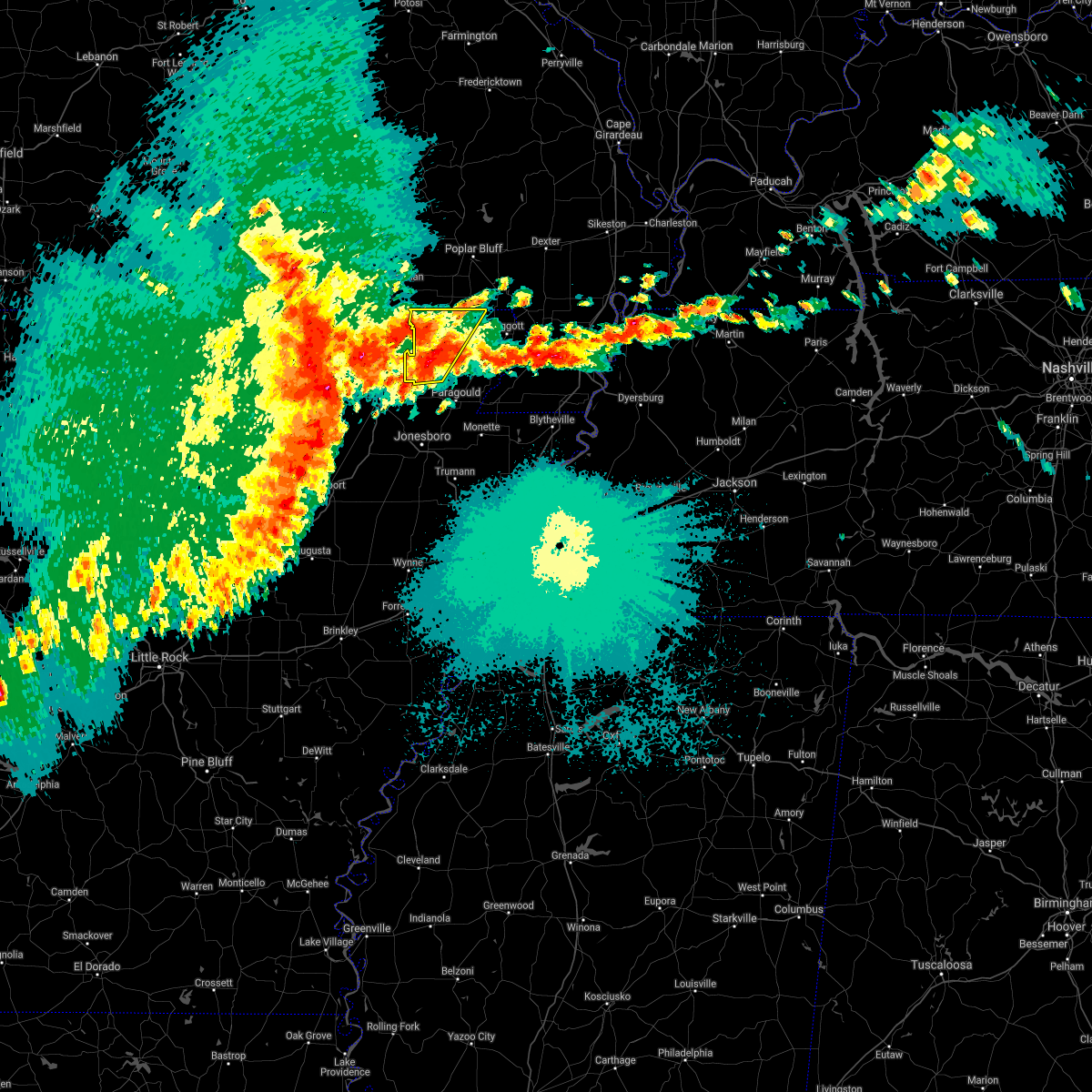 At 130 am cdt, a severe thunderstorm was located over peach orchard, or 9 miles south of corning, moving northeast at 45 mph (radar indicated). Hazards include 60 mph wind gusts and quarter size hail. Hail damage to vehicles is expected. Expect wind damage to roofs, siding, and trees. At 130 am cdt, a severe thunderstorm was located over peach orchard, or 9 miles south of corning, moving northeast at 45 mph (radar indicated). Hazards include 60 mph wind gusts and quarter size hail. Hail damage to vehicles is expected. Expect wind damage to roofs, siding, and trees.
|
| 5/4/2021 12:59 AM CDT |
 At 1258 am cdt, a severe thunderstorm was located over walnut ridge, moving northeast at 30 mph. this storm has had a history of penny sized hail (radar indicated). Hazards include 60 mph wind gusts and quarter size hail. Hail damage to vehicles is expected. Expect wind damage to roofs, siding, and trees. At 1258 am cdt, a severe thunderstorm was located over walnut ridge, moving northeast at 30 mph. this storm has had a history of penny sized hail (radar indicated). Hazards include 60 mph wind gusts and quarter size hail. Hail damage to vehicles is expected. Expect wind damage to roofs, siding, and trees.
|
| 5/4/2021 12:38 AM CDT |
 At 1237 am cdt, a severe thunderstorm was located over evening star, or 10 miles north of crowleys ridge state park, moving northeast at 25 mph (radar indicated). Hazards include 60 mph wind gusts and half dollar size hail. Hail damage to vehicles is expected. Expect wind damage to roofs, siding, and trees. At 1237 am cdt, a severe thunderstorm was located over evening star, or 10 miles north of crowleys ridge state park, moving northeast at 25 mph (radar indicated). Hazards include 60 mph wind gusts and half dollar size hail. Hail damage to vehicles is expected. Expect wind damage to roofs, siding, and trees.
|
| 4/7/2021 3:55 PM CDT |
 At 355 pm cdt, a severe thunderstorm was located over attica, or near pocahontas, moving northeast at 55 mph (radar indicated). Hazards include 60 mph wind gusts and quarter size hail. Hail damage to vehicles is expected. expect wind damage to roofs, siding, and trees. Locations impacted include, pocahontas, reyno, maynard, biggers, attica, elkins park, ingram, shannon, birdell, stokes, engelerg, sharum, brockett, pitman,. At 355 pm cdt, a severe thunderstorm was located over attica, or near pocahontas, moving northeast at 55 mph (radar indicated). Hazards include 60 mph wind gusts and quarter size hail. Hail damage to vehicles is expected. expect wind damage to roofs, siding, and trees. Locations impacted include, pocahontas, reyno, maynard, biggers, attica, elkins park, ingram, shannon, birdell, stokes, engelerg, sharum, brockett, pitman,.
|
| 4/7/2021 3:45 PM CDT |
 At 344 pm cdt, a severe thunderstorm was located over imboden, or 7 miles north of black rock, moving northeast at 50 mph (radar indicated). Hazards include 60 mph wind gusts and quarter size hail. Hail damage to vehicles is expected. expect wind damage to roofs, siding, and trees. Locations impacted include, pocahontas, black rock, imboden, reyno, maynard, biggers, attica, elkins park, ingram, shannon, birdell, stokes, elnora, engelerg, sharum, manson, brockett, pitman, davidsonville historic state pa,. At 344 pm cdt, a severe thunderstorm was located over imboden, or 7 miles north of black rock, moving northeast at 50 mph (radar indicated). Hazards include 60 mph wind gusts and quarter size hail. Hail damage to vehicles is expected. expect wind damage to roofs, siding, and trees. Locations impacted include, pocahontas, black rock, imboden, reyno, maynard, biggers, attica, elkins park, ingram, shannon, birdell, stokes, elnora, engelerg, sharum, manson, brockett, pitman, davidsonville historic state pa,.
|
| 4/7/2021 3:35 PM CDT |
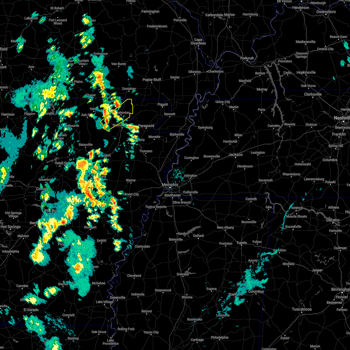 At 335 pm cdt, a severe thunderstorm was located over annieville, or near lake charles state park, moving northeast at 55 mph (radar indicated). Hazards include 60 mph wind gusts and quarter size hail. Hail damage to vehicles is expected. Expect wind damage to roofs, siding, and trees. At 335 pm cdt, a severe thunderstorm was located over annieville, or near lake charles state park, moving northeast at 55 mph (radar indicated). Hazards include 60 mph wind gusts and quarter size hail. Hail damage to vehicles is expected. Expect wind damage to roofs, siding, and trees.
|
| 3/27/2021 7:57 PM CDT |
 At 757 pm cdt, a severe thunderstorm was located near minturn, or 8 miles south of hoxie, moving northeast at 45 mph (radar indicated). Hazards include 60 mph wind gusts and quarter size hail. Hail damage to vehicles is expected. Expect wind damage to roofs, siding, and trees. At 757 pm cdt, a severe thunderstorm was located near minturn, or 8 miles south of hoxie, moving northeast at 45 mph (radar indicated). Hazards include 60 mph wind gusts and quarter size hail. Hail damage to vehicles is expected. Expect wind damage to roofs, siding, and trees.
|
| 11/15/2020 12:29 AM CST |
 At 1229 am cst, a severe thunderstorm was located over imboden, or 7 miles north of black rock, moving east at 45 mph (radar indicated). Hazards include 60 mph wind gusts and penny size hail. expect damage to roofs, siding, and trees At 1229 am cst, a severe thunderstorm was located over imboden, or 7 miles north of black rock, moving east at 45 mph (radar indicated). Hazards include 60 mph wind gusts and penny size hail. expect damage to roofs, siding, and trees
|
| 8/27/2020 10:04 PM CDT |
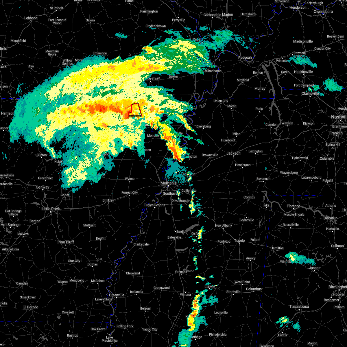 At 1003 pm cdt, doppler radar indicated a severe thunderstorm producing a tornado was located near biggers, or 8 miles east of pocahontas, moving northwest at 40 mph (radar indicated rotation). Hazards include tornado. Flying debris will be dangerous to those caught without shelter. mobile homes will be damaged or destroyed. damage to roofs, windows, and vehicles will occur. tree damage is likely. Locations impacted include, corning, reyno, knobel, peach orchard, delaplaine, datto, heelstring, brookings and twin oaks. At 1003 pm cdt, doppler radar indicated a severe thunderstorm producing a tornado was located near biggers, or 8 miles east of pocahontas, moving northwest at 40 mph (radar indicated rotation). Hazards include tornado. Flying debris will be dangerous to those caught without shelter. mobile homes will be damaged or destroyed. damage to roofs, windows, and vehicles will occur. tree damage is likely. Locations impacted include, corning, reyno, knobel, peach orchard, delaplaine, datto, heelstring, brookings and twin oaks.
|
| 8/27/2020 9:49 PM CDT |
 At 949 pm cdt, doppler radar indicated a severe thunderstorm producing a tornado was located over evening star, or 9 miles north of crowleys ridge state park, moving northwest at 40 mph (radar indicated rotation). Hazards include tornado. Flying debris will be dangerous to those caught without shelter. mobile homes will be damaged or destroyed. damage to roofs, windows, and vehicles will occur. Tree damage is likely. At 949 pm cdt, doppler radar indicated a severe thunderstorm producing a tornado was located over evening star, or 9 miles north of crowleys ridge state park, moving northwest at 40 mph (radar indicated rotation). Hazards include tornado. Flying debris will be dangerous to those caught without shelter. mobile homes will be damaged or destroyed. damage to roofs, windows, and vehicles will occur. Tree damage is likely.
|
| 5/3/2020 1:27 PM CDT |
 At 127 pm cdt, a severe thunderstorm was located near pollard, or near piggott, moving east at 55 mph (radar indicated). Hazards include 70 mph wind gusts and half dollar size hail. Hail damage to vehicles is expected. expect considerable tree damage. wind damage is also likely to mobile homes, roofs, and outbuildings. Locations impacted include, piggott, corning, rector, chalk bluff natural area, lafe, reyno, knobel, pollard, greenway, mcdougal, success, peach orchard, delaplaine, datto, crockett, stonewall, heubner, tipperary, hickoria and brookings. At 127 pm cdt, a severe thunderstorm was located near pollard, or near piggott, moving east at 55 mph (radar indicated). Hazards include 70 mph wind gusts and half dollar size hail. Hail damage to vehicles is expected. expect considerable tree damage. wind damage is also likely to mobile homes, roofs, and outbuildings. Locations impacted include, piggott, corning, rector, chalk bluff natural area, lafe, reyno, knobel, pollard, greenway, mcdougal, success, peach orchard, delaplaine, datto, crockett, stonewall, heubner, tipperary, hickoria and brookings.
|
| 5/3/2020 1:14 PM CDT |
 At 113 pm cdt, a severe thunderstorm was located over corning, moving east at 50 mph (radar indicated). Hazards include 70 mph wind gusts and half dollar size hail. Hail damage to vehicles is expected. expect considerable tree damage. wind damage is also likely to mobile homes, roofs, and outbuildings. Locations impacted include, piggott, corning, rector, chalk bluff natural area, lafe, reyno, knobel, pollard, greenway, mcdougal, success, peach orchard, delaplaine, datto, crockett, stonewall, heubner, tipperary, hickoria and brookings. At 113 pm cdt, a severe thunderstorm was located over corning, moving east at 50 mph (radar indicated). Hazards include 70 mph wind gusts and half dollar size hail. Hail damage to vehicles is expected. expect considerable tree damage. wind damage is also likely to mobile homes, roofs, and outbuildings. Locations impacted include, piggott, corning, rector, chalk bluff natural area, lafe, reyno, knobel, pollard, greenway, mcdougal, success, peach orchard, delaplaine, datto, crockett, stonewall, heubner, tipperary, hickoria and brookings.
|
| 5/3/2020 1:11 PM CDT |
 At 111 pm cdt, a severe thunderstorm was located over datto, or 7 miles southwest of corning, moving east at 45 mph (radar indicated). Hazards include 60 mph wind gusts and quarter size hail. Hail damage to vehicles is expected. expect wind damage to roofs, siding, and trees. Locations impacted include, reyno, maynard, biggers, attica, stokes, engelerg, elkins park, brockett, pitman,. At 111 pm cdt, a severe thunderstorm was located over datto, or 7 miles southwest of corning, moving east at 45 mph (radar indicated). Hazards include 60 mph wind gusts and quarter size hail. Hail damage to vehicles is expected. expect wind damage to roofs, siding, and trees. Locations impacted include, reyno, maynard, biggers, attica, stokes, engelerg, elkins park, brockett, pitman,.
|
| 5/3/2020 12:59 PM CDT |
 At 1259 pm cdt, a severe thunderstorm was located over datto, or 9 miles west of corning, moving east at 55 mph (radar indicated). Hazards include 70 mph wind gusts and ping pong ball size hail. People and animals outdoors will be injured. expect hail damage to roofs, siding, windows, and vehicles. expect considerable tree damage. Wind damage is also likely to mobile homes, roofs, and outbuildings. At 1259 pm cdt, a severe thunderstorm was located over datto, or 9 miles west of corning, moving east at 55 mph (radar indicated). Hazards include 70 mph wind gusts and ping pong ball size hail. People and animals outdoors will be injured. expect hail damage to roofs, siding, windows, and vehicles. expect considerable tree damage. Wind damage is also likely to mobile homes, roofs, and outbuildings.
|
| 5/3/2020 12:58 PM CDT |
 At 1257 pm cdt, a severe thunderstorm was located over maynard, or 12 miles northeast of pocahontas, moving east at 50 mph (radar indicated). Hazards include 60 mph wind gusts and quarter size hail. Hail damage to vehicles is expected. Expect wind damage to roofs, siding, and trees. At 1257 pm cdt, a severe thunderstorm was located over maynard, or 12 miles northeast of pocahontas, moving east at 50 mph (radar indicated). Hazards include 60 mph wind gusts and quarter size hail. Hail damage to vehicles is expected. Expect wind damage to roofs, siding, and trees.
|
| 4/8/2020 9:36 PM CDT |
 The severe thunderstorm warning for northeastern randolph county will expire at 945 pm cdt, the storm which prompted the warning has weakened below severe limits, and no longer poses an immediate threat to life or property. therefore, the warning will be allowed to expire. however hail, gusty winds and heavy rain are still possible with this thunderstorm. a tornado watch remains in effect until midnight cdt for eastern arkansas. The severe thunderstorm warning for northeastern randolph county will expire at 945 pm cdt, the storm which prompted the warning has weakened below severe limits, and no longer poses an immediate threat to life or property. therefore, the warning will be allowed to expire. however hail, gusty winds and heavy rain are still possible with this thunderstorm. a tornado watch remains in effect until midnight cdt for eastern arkansas.
|
| 4/8/2020 9:30 PM CDT |
 At 930 pm cdt, a severe thunderstorm was located near maynard, or 9 miles northeast of pocahontas, moving east at 40 mph (radar indicated). Hazards include 60 mph wind gusts and quarter size hail. Hail damage to vehicles is expected. expect wind damage to roofs, siding, and trees. Locations impacted include, reyno, maynard, biggers, stokes, engelerg, elkins park, middlebrook, brockett,. At 930 pm cdt, a severe thunderstorm was located near maynard, or 9 miles northeast of pocahontas, moving east at 40 mph (radar indicated). Hazards include 60 mph wind gusts and quarter size hail. Hail damage to vehicles is expected. expect wind damage to roofs, siding, and trees. Locations impacted include, reyno, maynard, biggers, stokes, engelerg, elkins park, middlebrook, brockett,.
|
| 4/8/2020 9:20 PM CDT |
 At 920 pm cdt, a severe thunderstorm was located over maynard, or 10 miles north of pocahontas, moving east at 40 mph (radar indicated). Hazards include 60 mph wind gusts and quarter size hail. Hail damage to vehicles is expected. expect wind damage to roofs, siding, and trees. Locations impacted include, reyno, maynard, biggers, hamil, stokes, engelerg, elkins park, brakebill, middlebrook, ingram, brockett, pitman,. At 920 pm cdt, a severe thunderstorm was located over maynard, or 10 miles north of pocahontas, moving east at 40 mph (radar indicated). Hazards include 60 mph wind gusts and quarter size hail. Hail damage to vehicles is expected. expect wind damage to roofs, siding, and trees. Locations impacted include, reyno, maynard, biggers, hamil, stokes, engelerg, elkins park, brakebill, middlebrook, ingram, brockett, pitman,.
|
| 4/8/2020 9:10 PM CDT |
 At 909 pm cdt, a severe thunderstorm was located near attica, or 12 miles north of pocahontas, moving east at 40 mph (radar indicated). Hazards include 60 mph wind gusts and quarter size hail. Hail damage to vehicles is expected. Expect wind damage to roofs, siding, and trees. At 909 pm cdt, a severe thunderstorm was located near attica, or 12 miles north of pocahontas, moving east at 40 mph (radar indicated). Hazards include 60 mph wind gusts and quarter size hail. Hail damage to vehicles is expected. Expect wind damage to roofs, siding, and trees.
|
| 3/24/2020 10:59 AM CDT |
 At 1058 am cdt, a severe thunderstorm was located near lafe, or 9 miles northwest of marmaduke, moving east at 60 mph (radar indicated). Hazards include 60 mph wind gusts and quarter size hail. Hail damage to vehicles is expected. Expect wind damage to roofs, siding, and trees. At 1058 am cdt, a severe thunderstorm was located near lafe, or 9 miles northwest of marmaduke, moving east at 60 mph (radar indicated). Hazards include 60 mph wind gusts and quarter size hail. Hail damage to vehicles is expected. Expect wind damage to roofs, siding, and trees.
|
| 3/24/2020 10:34 AM CDT |
 At 1034 am cdt, a severe thunderstorm was located over biggers, or 8 miles east of pocahontas, moving east at 65 mph (radar indicated). Hazards include 60 mph wind gusts and quarter size hail. Hail damage to vehicles is expected. Expect wind damage to roofs, siding, and trees. At 1034 am cdt, a severe thunderstorm was located over biggers, or 8 miles east of pocahontas, moving east at 65 mph (radar indicated). Hazards include 60 mph wind gusts and quarter size hail. Hail damage to vehicles is expected. Expect wind damage to roofs, siding, and trees.
|
| 3/24/2020 10:32 AM CDT |
 At 1032 am cdt, severe thunderstorms were located along a line extending from near maynard to near portia, moving east at 55 mph (radar indicated). Hazards include 60 mph wind gusts and quarter size hail. Hail damage to vehicles is expected. expect wind damage to roofs, siding, and trees. Locations impacted include, pocahontas, walnut ridge, hoxie, black rock, imboden, reyno, college city, portia, maynard, biggers, o`kean, annieville, attica, whiskerville, giles spur, middlebrook, ingram, shannon, birdell, dicus, this includes us highway 67 near mile marker 121. At 1032 am cdt, severe thunderstorms were located along a line extending from near maynard to near portia, moving east at 55 mph (radar indicated). Hazards include 60 mph wind gusts and quarter size hail. Hail damage to vehicles is expected. expect wind damage to roofs, siding, and trees. Locations impacted include, pocahontas, walnut ridge, hoxie, black rock, imboden, reyno, college city, portia, maynard, biggers, o`kean, annieville, attica, whiskerville, giles spur, middlebrook, ingram, shannon, birdell, dicus, this includes us highway 67 near mile marker 121.
|
| 3/24/2020 10:14 AM CDT |
 At 1013 am cdt, severe thunderstorms were located along a line extending from near dalton to near ravenden, moving east at 45 mph (law enforcement). Hazards include 60 mph wind gusts and half dollar size hail. Hail damage to vehicles is expected. Expect wind damage to roofs, siding, and trees. At 1013 am cdt, severe thunderstorms were located along a line extending from near dalton to near ravenden, moving east at 45 mph (law enforcement). Hazards include 60 mph wind gusts and half dollar size hail. Hail damage to vehicles is expected. Expect wind damage to roofs, siding, and trees.
|
| 1/11/2020 12:28 AM CST |
 The severe thunderstorm warning for southeastern independence, randolph, northeastern jackson and southeastern lawrence counties will expire at 1230 am cst, the storms which prompted the warning have weakened below severe limits, and no longer pose an immediate threat to life or property. therefore, the warning will be allowed to expire. however gusty winds and heavy rain are still possible with these thunderstorms. a tornado watch remains in effect until 600 am cst for eastern and north central arkansas. The severe thunderstorm warning for southeastern independence, randolph, northeastern jackson and southeastern lawrence counties will expire at 1230 am cst, the storms which prompted the warning have weakened below severe limits, and no longer pose an immediate threat to life or property. therefore, the warning will be allowed to expire. however gusty winds and heavy rain are still possible with these thunderstorms. a tornado watch remains in effect until 600 am cst for eastern and north central arkansas.
|
| 1/11/2020 12:23 AM CST |
 At 1223 am cst, severe thunderstorms were located along a line extending from near oxly to near alicia, moving east at 25 mph (radar indicated). Hazards include 70 mph wind gusts. Expect considerable tree damage. damage is likely to mobile homes, roofs, and outbuildings. Locations impacted include, jonesboro, paragould, corning, bono, brookland, crowleys ridge state park, lake frierson state park, oak grove heights, lafe, reyno, cash, knobel, o`kean, mcdougal, success, peach orchard, delaplaine, egypt, datto and evening star. At 1223 am cst, severe thunderstorms were located along a line extending from near oxly to near alicia, moving east at 25 mph (radar indicated). Hazards include 70 mph wind gusts. Expect considerable tree damage. damage is likely to mobile homes, roofs, and outbuildings. Locations impacted include, jonesboro, paragould, corning, bono, brookland, crowleys ridge state park, lake frierson state park, oak grove heights, lafe, reyno, cash, knobel, o`kean, mcdougal, success, peach orchard, delaplaine, egypt, datto and evening star.
|
| 1/11/2020 12:21 AM CST |
 At 1221 am cst, severe thunderstorms were located along a line extending from near maynard to near o`kean to minturn to diaz, moving east at 55 mph (radar indicated). Hazards include 60 mph wind gusts. Expect damage to roofs, siding, and trees. Locations impacted include, newport, pocahontas, walnut ridge, hoxie, black rock, lake charles state park, tuckerman, diaz, swifton, reyno, college city, portia, maynard, grubbs, biggers, oil trough, jacksonport, o`kean, alicia, minturn, this includes us highway 67 between mile markers 85 and 101, and between mile markers 109 and 121. At 1221 am cst, severe thunderstorms were located along a line extending from near maynard to near o`kean to minturn to diaz, moving east at 55 mph (radar indicated). Hazards include 60 mph wind gusts. Expect damage to roofs, siding, and trees. Locations impacted include, newport, pocahontas, walnut ridge, hoxie, black rock, lake charles state park, tuckerman, diaz, swifton, reyno, college city, portia, maynard, grubbs, biggers, oil trough, jacksonport, o`kean, alicia, minturn, this includes us highway 67 between mile markers 85 and 101, and between mile markers 109 and 121.
|
| 1/11/2020 12:00 AM CST |
 At 1200 am cst, severe thunderstorms were located along a line extending from near doniphan to near swifton, moving east at 25 mph (radar indicated). Hazards include 60 mph wind gusts. expect damage to roofs, siding, and trees At 1200 am cst, severe thunderstorms were located along a line extending from near doniphan to near swifton, moving east at 25 mph (radar indicated). Hazards include 60 mph wind gusts. expect damage to roofs, siding, and trees
|
| 1/10/2020 11:30 PM CST |
 At 1130 pm cst, severe thunderstorms were located along a line extending from 11 miles northwest of dalton to near ravenden to near strawberry to near southside in independence county, moving east at 25 mph (radar indicated). Hazards include 60 mph wind gusts. expect damage to roofs, siding, and trees At 1130 pm cst, severe thunderstorms were located along a line extending from 11 miles northwest of dalton to near ravenden to near strawberry to near southside in independence county, moving east at 25 mph (radar indicated). Hazards include 60 mph wind gusts. expect damage to roofs, siding, and trees
|
| 8/27/2019 1:55 AM CDT |
 At 155 am cdt, severe thunderstorms were located along a line extending from near pocahontas to 8 miles north of cave city to lacrosse, moving southeast at 50 mph (radar indicated). Hazards include 60 mph wind gusts. expect damage to roofs, siding, and trees At 155 am cdt, severe thunderstorms were located along a line extending from near pocahontas to 8 miles north of cave city to lacrosse, moving southeast at 50 mph (radar indicated). Hazards include 60 mph wind gusts. expect damage to roofs, siding, and trees
|
| 8/18/2019 3:42 PM CDT |
 At 322 pm cdt, a severe thunderstorm was located near attica, or near pocahontas, moving east at 20 mph (radar indicated). Hazards include 60 mph wind gusts and quarter size hail. Hail damage to vehicles is expected. expect wind damage to roofs, siding, and trees. Locations impacted include, pocahontas, reyno, maynard, biggers, attica, elkins park, brakebill, middlebrook, ingram, birdell, stokes, engelerg, brockett, hamil,. At 322 pm cdt, a severe thunderstorm was located near attica, or near pocahontas, moving east at 20 mph (radar indicated). Hazards include 60 mph wind gusts and quarter size hail. Hail damage to vehicles is expected. expect wind damage to roofs, siding, and trees. Locations impacted include, pocahontas, reyno, maynard, biggers, attica, elkins park, brakebill, middlebrook, ingram, birdell, stokes, engelerg, brockett, hamil,.
|
| 8/18/2019 3:22 PM CDT |
 At 322 pm cdt, a severe thunderstorm was located near attica, or near pocahontas, moving east at 20 mph (radar indicated). Hazards include 60 mph wind gusts and quarter size hail. Hail damage to vehicles is expected. expect wind damage to roofs, siding, and trees. Locations impacted include, pocahontas, reyno, maynard, biggers, attica, elkins park, brakebill, middlebrook, ingram, birdell, stokes, engelerg, brockett, hamil,. At 322 pm cdt, a severe thunderstorm was located near attica, or near pocahontas, moving east at 20 mph (radar indicated). Hazards include 60 mph wind gusts and quarter size hail. Hail damage to vehicles is expected. expect wind damage to roofs, siding, and trees. Locations impacted include, pocahontas, reyno, maynard, biggers, attica, elkins park, brakebill, middlebrook, ingram, birdell, stokes, engelerg, brockett, hamil,.
|
| 8/18/2019 3:09 PM CDT |
 The national weather service in little rock has issued a * severe thunderstorm warning for. northeastern randolph county in eastern arkansas. until 400 pm cdt. At 309 pm cdt, a severe thunderstorm was located over attica, or near pocahontas, moving east at 20 mph. The national weather service in little rock has issued a * severe thunderstorm warning for. northeastern randolph county in eastern arkansas. until 400 pm cdt. At 309 pm cdt, a severe thunderstorm was located over attica, or near pocahontas, moving east at 20 mph.
|
| 7/5/2019 3:36 PM CDT |
 The severe thunderstorm warning for northeastern randolph county will expire at 345 pm cdt, the storm which prompted the warning has weakened below severe limits, and no longer poses an immediate threat to life or property. therefore, the warning will be allowed to expire. however gusty winds are still possible with this thunderstorm. to report severe weather, contact your nearest law enforcement agency. they will relay your report to the national weather service little rock. The severe thunderstorm warning for northeastern randolph county will expire at 345 pm cdt, the storm which prompted the warning has weakened below severe limits, and no longer poses an immediate threat to life or property. therefore, the warning will be allowed to expire. however gusty winds are still possible with this thunderstorm. to report severe weather, contact your nearest law enforcement agency. they will relay your report to the national weather service little rock.
|
| 7/5/2019 3:22 PM CDT |
 At 322 pm cdt, a severe thunderstorm was located over attica, or 7 miles north of pocahontas, moving east at 30 mph (radar indicated). Hazards include 60 mph wind gusts and penny size hail. Expect damage to roofs, siding, and trees. Locations impacted include, pocahontas, reyno, maynard, biggers, attica, elkins park, brakebill, middlebrook, warm springs, ingram, hamil, stokes, engelerg, elm store, brockett, pitman,. At 322 pm cdt, a severe thunderstorm was located over attica, or 7 miles north of pocahontas, moving east at 30 mph (radar indicated). Hazards include 60 mph wind gusts and penny size hail. Expect damage to roofs, siding, and trees. Locations impacted include, pocahontas, reyno, maynard, biggers, attica, elkins park, brakebill, middlebrook, warm springs, ingram, hamil, stokes, engelerg, elm store, brockett, pitman,.
|
| 7/5/2019 3:03 PM CDT |
 At 303 pm cdt, a severe thunderstorm was located over dalton, or 12 miles northwest of pocahontas, moving northeast at 35 mph (radar indicated). Hazards include 60 mph wind gusts and penny size hail. expect damage to roofs, siding, and trees At 303 pm cdt, a severe thunderstorm was located over dalton, or 12 miles northwest of pocahontas, moving northeast at 35 mph (radar indicated). Hazards include 60 mph wind gusts and penny size hail. expect damage to roofs, siding, and trees
|
| 6/26/2019 5:45 PM CDT |
 At 526 pm cdt, a severe thunderstorm was located over biggers, or 10 miles east of pocahontas, moving east at 30 mph (radar indicated). Hazards include 60 mph wind gusts. expect damage to roofs, siding, and trees At 526 pm cdt, a severe thunderstorm was located over biggers, or 10 miles east of pocahontas, moving east at 30 mph (radar indicated). Hazards include 60 mph wind gusts. expect damage to roofs, siding, and trees
|
| 6/26/2019 5:26 PM CDT |
 At 526 pm cdt, a severe thunderstorm was located over biggers, or 10 miles east of pocahontas, moving east at 30 mph (radar indicated). Hazards include 60 mph wind gusts. expect damage to roofs, siding, and trees At 526 pm cdt, a severe thunderstorm was located over biggers, or 10 miles east of pocahontas, moving east at 30 mph (radar indicated). Hazards include 60 mph wind gusts. expect damage to roofs, siding, and trees
|
| 6/26/2019 5:22 PM CDT |
 At 521 pm cdt, severe thunderstorms were located along a line extending from near maynard to pocahontas to near black rock, moving northeast at 20 mph (radar indicated). Hazards include 60 mph wind gusts and quarter size hail. Hail damage to vehicles is expected. Expect wind damage to roofs, siding, and trees. At 521 pm cdt, severe thunderstorms were located along a line extending from near maynard to pocahontas to near black rock, moving northeast at 20 mph (radar indicated). Hazards include 60 mph wind gusts and quarter size hail. Hail damage to vehicles is expected. Expect wind damage to roofs, siding, and trees.
|
| 6/23/2019 2:47 PM CDT |
 At 247 pm cdt, severe thunderstorms were located along a line extending from near corning to near crowleys ridge state park, moving east at 50 mph (radar indicated). Hazards include 60 mph wind gusts. Expect damage to roofs, siding, and trees. Locations impacted include, paragould, piggott, corning, rector, marmaduke, chalk bluff natural area, crowleys ridge state park, lake frierson state park, oak grove heights, cardwell, arbyrd, lafe, reyno, knobel, pollard, greenway, o`kean, mcdougal, success and peach orchard. At 247 pm cdt, severe thunderstorms were located along a line extending from near corning to near crowleys ridge state park, moving east at 50 mph (radar indicated). Hazards include 60 mph wind gusts. Expect damage to roofs, siding, and trees. Locations impacted include, paragould, piggott, corning, rector, marmaduke, chalk bluff natural area, crowleys ridge state park, lake frierson state park, oak grove heights, cardwell, arbyrd, lafe, reyno, knobel, pollard, greenway, o`kean, mcdougal, success and peach orchard.
|
| 6/23/2019 2:31 PM CDT |
 The national weather service in memphis has issued a * severe thunderstorm warning for. greene county in eastern arkansas. clay county in eastern arkansas. western dunklin county in southeastern missouri. Until 315 pm cdt. The national weather service in memphis has issued a * severe thunderstorm warning for. greene county in eastern arkansas. clay county in eastern arkansas. western dunklin county in southeastern missouri. Until 315 pm cdt.
|
| 6/23/2019 2:31 PM CDT |
 At 230 pm cdt, severe thunderstorms were located along a line extending from near success to near fontaine, moving east at 45 mph (radar indicated. at 227 pm cdt, a wind gust of 63 mph was measured in walnut ridge). Hazards include 60 mph wind gusts. expect damage to roofs, siding, and trees At 230 pm cdt, severe thunderstorms were located along a line extending from near success to near fontaine, moving east at 45 mph (radar indicated. at 227 pm cdt, a wind gust of 63 mph was measured in walnut ridge). Hazards include 60 mph wind gusts. expect damage to roofs, siding, and trees
|
| 6/23/2019 2:29 PM CDT |
 At 228 pm cdt, severe thunderstorms were located along a line extending from near maynard to near pocahontas to near minturn, moving east at 35 mph (radar indicated). Hazards include 60 mph wind gusts. Expect damage to roofs, siding, and trees. Locations impacted include, pocahontas, reyno, maynard, biggers, attica, elkins park, brakebill, middlebrook, ingram, hamil, stokes, engelerg, brockett, pitman, warm springs,. At 228 pm cdt, severe thunderstorms were located along a line extending from near maynard to near pocahontas to near minturn, moving east at 35 mph (radar indicated). Hazards include 60 mph wind gusts. Expect damage to roofs, siding, and trees. Locations impacted include, pocahontas, reyno, maynard, biggers, attica, elkins park, brakebill, middlebrook, ingram, hamil, stokes, engelerg, brockett, pitman, warm springs,.
|
| 6/23/2019 2:02 PM CDT |
 At 202 pm cdt, severe thunderstorms were located along a line extending from near gatewood to near ravenden springs, moving east at 30 mph (radar indicated). Hazards include 60 mph wind gusts. expect damage to roofs, siding, and trees At 202 pm cdt, severe thunderstorms were located along a line extending from near gatewood to near ravenden springs, moving east at 30 mph (radar indicated). Hazards include 60 mph wind gusts. expect damage to roofs, siding, and trees
|
| 6/21/2019 5:46 PM CDT |
 At 544 pm cdt, severe thunderstorms were located along a line extending from near tiptonville to near o`kean, moving southeast at 25 mph (radar indicated, measured at kennett missouri airport). Hazards include 60 mph wind gusts. expect damage to roofs, siding, and trees At 544 pm cdt, severe thunderstorms were located along a line extending from near tiptonville to near o`kean, moving southeast at 25 mph (radar indicated, measured at kennett missouri airport). Hazards include 60 mph wind gusts. expect damage to roofs, siding, and trees
|
| 6/21/2019 5:46 PM CDT |
 The national weather service in memphis has issued a * severe thunderstorm warning for. greene county in eastern arkansas. central craighead county in eastern arkansas. northwestern mississippi county in eastern arkansas. Clay county in eastern arkansas. The national weather service in memphis has issued a * severe thunderstorm warning for. greene county in eastern arkansas. central craighead county in eastern arkansas. northwestern mississippi county in eastern arkansas. Clay county in eastern arkansas.
|
| 6/21/2019 5:25 PM CDT |
 At 525 pm cdt, a severe thunderstorm was located over mcdougal, or 8 miles west of chalk bluff natural area, moving southeast at 5 mph (radar indicated). Hazards include 60 mph wind gusts and nickel size hail. Expect damage to roofs, siding, and trees. locations impacted include, kennett, malden, piggott, corning, portageville, hayti, campbell, rector, marmaduke, chalk bluff natural area, tiptonville, oak grove heights, holcomb, hayti heights, lafe, reyno, wardell, knobel, st. Francis and pollard. At 525 pm cdt, a severe thunderstorm was located over mcdougal, or 8 miles west of chalk bluff natural area, moving southeast at 5 mph (radar indicated). Hazards include 60 mph wind gusts and nickel size hail. Expect damage to roofs, siding, and trees. locations impacted include, kennett, malden, piggott, corning, portageville, hayti, campbell, rector, marmaduke, chalk bluff natural area, tiptonville, oak grove heights, holcomb, hayti heights, lafe, reyno, wardell, knobel, st. Francis and pollard.
|
| 6/21/2019 5:25 PM CDT |
 At 456 pm cdt, severe thunderstorms were located along a line extending from near bernie to near success, moving southeast at 30 mph (radar indicated). Hazards include 60 mph wind gusts. expect damage to roofs, siding, and trees At 456 pm cdt, severe thunderstorms were located along a line extending from near bernie to near success, moving southeast at 30 mph (radar indicated). Hazards include 60 mph wind gusts. expect damage to roofs, siding, and trees
|
| 6/21/2019 5:25 PM CDT |
 At 525 pm cdt, a severe thunderstorm was located over mcdougal, or 8 miles west of chalk bluff natural area, moving southeast at 5 mph (radar indicated). Hazards include 60 mph wind gusts and nickel size hail. Expect damage to roofs, siding, and trees. locations impacted include, kennett, malden, piggott, corning, portageville, hayti, campbell, rector, marmaduke, chalk bluff natural area, tiptonville, oak grove heights, holcomb, hayti heights, lafe, reyno, wardell, knobel, st. Francis and pollard. At 525 pm cdt, a severe thunderstorm was located over mcdougal, or 8 miles west of chalk bluff natural area, moving southeast at 5 mph (radar indicated). Hazards include 60 mph wind gusts and nickel size hail. Expect damage to roofs, siding, and trees. locations impacted include, kennett, malden, piggott, corning, portageville, hayti, campbell, rector, marmaduke, chalk bluff natural area, tiptonville, oak grove heights, holcomb, hayti heights, lafe, reyno, wardell, knobel, st. Francis and pollard.
|
| 6/21/2019 4:56 PM CDT |
 At 456 pm cdt, severe thunderstorms were located along a line extending from near bernie to near success, moving southeast at 30 mph (radar indicated). Hazards include 60 mph wind gusts. expect damage to roofs, siding, and trees At 456 pm cdt, severe thunderstorms were located along a line extending from near bernie to near success, moving southeast at 30 mph (radar indicated). Hazards include 60 mph wind gusts. expect damage to roofs, siding, and trees
|
| 5/21/2019 12:56 PM CDT |
 The national weather service in little rock has issued a * severe thunderstorm warning for. randolph county in eastern arkansas. western lawrence county in eastern arkansas. until 645 pm cdt. At 555 pm cdt, a severe thunderstorm was located just southeast of. The national weather service in little rock has issued a * severe thunderstorm warning for. randolph county in eastern arkansas. western lawrence county in eastern arkansas. until 645 pm cdt. At 555 pm cdt, a severe thunderstorm was located just southeast of.
|
| 3/9/2019 10:13 AM CST |
 At 1013 am cst, a severe thunderstorm was located near alicia, or 8 miles south of lake charles state park, moving northeast at 70 mph (radar indicated). Hazards include 60 mph wind gusts. expect damage to roofs, siding, and trees At 1013 am cst, a severe thunderstorm was located near alicia, or 8 miles south of lake charles state park, moving northeast at 70 mph (radar indicated). Hazards include 60 mph wind gusts. expect damage to roofs, siding, and trees
|
| 12/1/2018 2:19 AM CST |
 At 217 am cst, severe thunderstorms were located along a line extending from 8 miles northwest of dalton to near ravenden springs to annieville to 8 miles southwest of strawberry, moving east at 50 mph (radar indicated). Hazards include 70 mph wind gusts. Expect considerable tree damage. damage is likely to mobile homes, roofs, and outbuildings. locations impacted include, pocahontas, walnut ridge, hoxie, black rock, lake charles state park, swifton, imboden, ravenden, reyno, college city, portia, maynard, biggers, strawberry, lynn, o`kean, moorefield, alicia, ravenden springs, minturn, this includes us highway 67 between mile markers 109 and 121. A tornado watch remains in effect until 800 am cst for eastern and north central arkansas. At 217 am cst, severe thunderstorms were located along a line extending from 8 miles northwest of dalton to near ravenden springs to annieville to 8 miles southwest of strawberry, moving east at 50 mph (radar indicated). Hazards include 70 mph wind gusts. Expect considerable tree damage. damage is likely to mobile homes, roofs, and outbuildings. locations impacted include, pocahontas, walnut ridge, hoxie, black rock, lake charles state park, swifton, imboden, ravenden, reyno, college city, portia, maynard, biggers, strawberry, lynn, o`kean, moorefield, alicia, ravenden springs, minturn, this includes us highway 67 between mile markers 109 and 121. A tornado watch remains in effect until 800 am cst for eastern and north central arkansas.
|
| 12/1/2018 2:07 AM CST |
 At 207 am cst, severe thunderstorms were located along a line extending from near mammoth spring to 7 miles southeast of hardy to 7 miles west of annieville to near moorefield, moving northeast at 65 mph (radar indicated). Hazards include 60 mph wind gusts. expect damage to roofs, siding, and trees At 207 am cst, severe thunderstorms were located along a line extending from near mammoth spring to 7 miles southeast of hardy to 7 miles west of annieville to near moorefield, moving northeast at 65 mph (radar indicated). Hazards include 60 mph wind gusts. expect damage to roofs, siding, and trees
|
| 6/28/2018 10:54 PM CDT |
 At 1054 pm cdt, a severe thunderstorm was located over lafe, or near marmaduke, moving southwest at 50 mph (radar indicated). Hazards include 60 mph wind gusts and quarter size hail. Hail damage to vehicles is expected. Expect wind damage to roofs, siding, and trees. At 1054 pm cdt, a severe thunderstorm was located over lafe, or near marmaduke, moving southwest at 50 mph (radar indicated). Hazards include 60 mph wind gusts and quarter size hail. Hail damage to vehicles is expected. Expect wind damage to roofs, siding, and trees.
|
| 5/31/2018 11:15 PM CDT |
 At 1115 pm cdt, severe thunderstorms were located along a line extending from near dalton to near myron, moving east at 35 mph (radar indicated). Hazards include 60 mph wind gusts and quarter size hail. Hail damage to vehicles is expected. Expect wind damage to roofs, siding, and trees. At 1115 pm cdt, severe thunderstorms were located along a line extending from near dalton to near myron, moving east at 35 mph (radar indicated). Hazards include 60 mph wind gusts and quarter size hail. Hail damage to vehicles is expected. Expect wind damage to roofs, siding, and trees.
|
| 5/31/2018 11:05 PM CDT |
 At 1104 pm cdt, severe thunderstorms were located along a line extending from near peach orchard to lake charles state park, moving southeast at 25 mph (radar indicated). Hazards include 60 mph wind gusts. expect damage to roofs, siding, and trees At 1104 pm cdt, severe thunderstorms were located along a line extending from near peach orchard to lake charles state park, moving southeast at 25 mph (radar indicated). Hazards include 60 mph wind gusts. expect damage to roofs, siding, and trees
|
| 5/20/2018 12:44 PM CDT |
 At 1244 pm cdt, a severe thunderstorm was located near lynn, or 7 miles west of lake charles state park, moving east at 10 mph (radar indicated). Hazards include 60 mph wind gusts and quarter size hail. Hail damage to vehicles is expected. Expect wind damage to roofs, siding, and trees. At 1244 pm cdt, a severe thunderstorm was located near lynn, or 7 miles west of lake charles state park, moving east at 10 mph (radar indicated). Hazards include 60 mph wind gusts and quarter size hail. Hail damage to vehicles is expected. Expect wind damage to roofs, siding, and trees.
|
| 3/26/2018 6:02 AM CDT |
 At 602 am cdt, a severe thunderstorm was located near biggers, or 10 miles east of pocahontas, moving east at 20 mph (trained weather spotters). Hazards include quarter size hail. Damage to vehicles is expected. Locations impacted include, corning, reyno, maynard, biggers, knobel, success, peach orchard, delaplaine, datto, heelstring, elkins park, brakebill, middlebrook, brookings, engelerg, twin oaks, palatka and pitman. At 602 am cdt, a severe thunderstorm was located near biggers, or 10 miles east of pocahontas, moving east at 20 mph (trained weather spotters). Hazards include quarter size hail. Damage to vehicles is expected. Locations impacted include, corning, reyno, maynard, biggers, knobel, success, peach orchard, delaplaine, datto, heelstring, elkins park, brakebill, middlebrook, brookings, engelerg, twin oaks, palatka and pitman.
|
| 3/26/2018 5:37 AM CDT |
 At 537 am cdt, a severe thunderstorm was located near pocahontas, moving east northeast at 35 mph (trained weather spotters). Hazards include half dollar size hail. damage to vehicles is expected At 537 am cdt, a severe thunderstorm was located near pocahontas, moving east northeast at 35 mph (trained weather spotters). Hazards include half dollar size hail. damage to vehicles is expected
|
| 3/26/2018 5:32 AM CDT |
 At 532 am cdt, a severe thunderstorm was located over knobel, or near corning, moving east at 45 mph (radar indicated). Hazards include quarter size hail. Damage to vehicles is expected. Locations impacted include, pocahontas, reyno, biggers, o`kean, shannon, case, stokes, fender, elnora, engelerg, manson, lesterville and brockett. At 532 am cdt, a severe thunderstorm was located over knobel, or near corning, moving east at 45 mph (radar indicated). Hazards include quarter size hail. Damage to vehicles is expected. Locations impacted include, pocahontas, reyno, biggers, o`kean, shannon, case, stokes, fender, elnora, engelerg, manson, lesterville and brockett.
|
| 3/26/2018 5:15 AM CDT |
 At 515 am cdt, a severe thunderstorm was located near biggers, or near pocahontas, moving east at 45 mph (radar indicated). Hazards include half dollar size hail. Damage to vehicles is expected. Locations impacted include, pocahontas, reyno, biggers, o`kean, shannon, case, birdell, stokes, fender, elnora, engelerg, sharum, manson, lesterville and brockett. At 515 am cdt, a severe thunderstorm was located near biggers, or near pocahontas, moving east at 45 mph (radar indicated). Hazards include half dollar size hail. Damage to vehicles is expected. Locations impacted include, pocahontas, reyno, biggers, o`kean, shannon, case, birdell, stokes, fender, elnora, engelerg, sharum, manson, lesterville and brockett.
|
| 3/26/2018 5:01 AM CDT |
 At 501 am cdt, a severe thunderstorm was located near pocahontas, moving east at 45 mph (radar indicated). Hazards include half dollar size hail. Damage to vehicles is expected. Locations impacted include, pocahontas, black rock, imboden, reyno, college city, biggers, o`kean, shannon, case, birdell, stokes, fender, elnora, engelerg, sharum, manson, lesterville and brockett. At 501 am cdt, a severe thunderstorm was located near pocahontas, moving east at 45 mph (radar indicated). Hazards include half dollar size hail. Damage to vehicles is expected. Locations impacted include, pocahontas, black rock, imboden, reyno, college city, biggers, o`kean, shannon, case, birdell, stokes, fender, elnora, engelerg, sharum, manson, lesterville and brockett.
|
| 3/26/2018 4:56 AM CDT |
 At 456 am cdt, a severe thunderstorm was located near imboden, or 7 miles north of black rock, moving east at 45 mph (radar indicated). Hazards include ping pong ball size hail. People and animals outdoors will be injured. expect damage to roofs, siding, windows, and vehicles. Locations impacted include, pocahontas, black rock, imboden, reyno, college city, biggers, o`kean, shannon, case, birdell, stokes, fender, elnora, engelerg, sharum, manson, lesterville and brockett. At 456 am cdt, a severe thunderstorm was located near imboden, or 7 miles north of black rock, moving east at 45 mph (radar indicated). Hazards include ping pong ball size hail. People and animals outdoors will be injured. expect damage to roofs, siding, windows, and vehicles. Locations impacted include, pocahontas, black rock, imboden, reyno, college city, biggers, o`kean, shannon, case, birdell, stokes, fender, elnora, engelerg, sharum, manson, lesterville and brockett.
|
| 3/26/2018 4:53 AM CDT |
 At 453 am cdt, a severe thunderstorm was located over imboden, or 7 miles north of black rock, moving east northeast at 45 mph (radar indicated). Hazards include golf ball size hail. People and animals outdoors will be injured. Expect damage to roofs, siding, windows, and vehicles. At 453 am cdt, a severe thunderstorm was located over imboden, or 7 miles north of black rock, moving east northeast at 45 mph (radar indicated). Hazards include golf ball size hail. People and animals outdoors will be injured. Expect damage to roofs, siding, windows, and vehicles.
|
| 2/24/2018 5:19 PM CST |
 At 518 pm cst, a severe thunderstorm producing a tornado was located near corning, moving northeast at 65 mph (radar indicated rotation). Hazards include tornado. Flying debris will be dangerous to those caught without shelter. mobile homes will be damaged or destroyed. damage to roofs, windows, and vehicles will occur. tree damage is likely. Locations impacted include, corning, chalk bluff natural area, reyno, mcdougal, success, datto, heelstring, twin oaks and palatka. At 518 pm cst, a severe thunderstorm producing a tornado was located near corning, moving northeast at 65 mph (radar indicated rotation). Hazards include tornado. Flying debris will be dangerous to those caught without shelter. mobile homes will be damaged or destroyed. damage to roofs, windows, and vehicles will occur. tree damage is likely. Locations impacted include, corning, chalk bluff natural area, reyno, mcdougal, success, datto, heelstring, twin oaks and palatka.
|
| 2/24/2018 5:06 PM CST |
 At 505 pm cst, a severe thunderstorm producing a tornado was located over biggers, or 10 miles northeast of pocahontas, moving northeast at 65 mph (radar indicated rotation). Hazards include tornado. Flying debris will be dangerous to those caught without shelter. mobile homes will be damaged or destroyed. damage to roofs, windows, and vehicles will occur. tree damage is likely. this dangerous storm will be near, datto around 510 pm cst. corning and success around 515 pm cst. mcdougal around 525 pm cst. Other locations impacted by this tornadic thunderstorm include elkins park, twin oaks, heelstring, palatka and engelerg. At 505 pm cst, a severe thunderstorm producing a tornado was located over biggers, or 10 miles northeast of pocahontas, moving northeast at 65 mph (radar indicated rotation). Hazards include tornado. Flying debris will be dangerous to those caught without shelter. mobile homes will be damaged or destroyed. damage to roofs, windows, and vehicles will occur. tree damage is likely. this dangerous storm will be near, datto around 510 pm cst. corning and success around 515 pm cst. mcdougal around 525 pm cst. Other locations impacted by this tornadic thunderstorm include elkins park, twin oaks, heelstring, palatka and engelerg.
|
| 2/24/2018 4:51 PM CST |
 At 451 pm cst, a severe thunderstorm was located over pocahontas, moving northeast at 55 mph (radar indicated). Hazards include 60 mph wind gusts. expect damage to roofs, siding, and trees At 451 pm cst, a severe thunderstorm was located over pocahontas, moving northeast at 55 mph (radar indicated). Hazards include 60 mph wind gusts. expect damage to roofs, siding, and trees
|
| 6/23/2017 3:34 PM CDT |
 At 334 pm cdt, a severe thunderstorm was located near dalton, or 13 miles northwest of pocahontas, moving east at 25 mph (radar indicated). Hazards include 60 mph wind gusts. expect damage to roofs, siding, and trees At 334 pm cdt, a severe thunderstorm was located near dalton, or 13 miles northwest of pocahontas, moving east at 25 mph (radar indicated). Hazards include 60 mph wind gusts. expect damage to roofs, siding, and trees
|
| 5/27/2017 9:25 PM CDT |
 At 925 pm cdt, severe thunderstorms were located along a line extending from mcdougal to near walcott to near strawberry, moving east at 60 mph (radar indicated). Hazards include 70 mph wind gusts. Expect considerable tree damage. damage is likely to mobile homes, roofs, and outbuildings. locations impacted include, jonesboro, paragould, kennett, pocahontas, walnut ridge, piggott, corning, hoxie, bono, lake city, leachville, campbell, rector, senath, brookland, monette, marmaduke, black rock, lake charles state park and chalk bluff natural area. A tornado watch remains in effect until 200 am cdt for eastern arkansas, and southeastern missouri. At 925 pm cdt, severe thunderstorms were located along a line extending from mcdougal to near walcott to near strawberry, moving east at 60 mph (radar indicated). Hazards include 70 mph wind gusts. Expect considerable tree damage. damage is likely to mobile homes, roofs, and outbuildings. locations impacted include, jonesboro, paragould, kennett, pocahontas, walnut ridge, piggott, corning, hoxie, bono, lake city, leachville, campbell, rector, senath, brookland, monette, marmaduke, black rock, lake charles state park and chalk bluff natural area. A tornado watch remains in effect until 200 am cdt for eastern arkansas, and southeastern missouri.
|
| 5/27/2017 9:06 PM CDT |
 At 906 pm cdt, severe thunderstorms were located along a line extending from near doniphan to near pocahontas to near sidney, moving southeast at 60 mph (radar indicated). Hazards include 70 mph wind gusts. Expect considerable tree damage. Damage is likely to mobile homes, roofs, and outbuildings. At 906 pm cdt, severe thunderstorms were located along a line extending from near doniphan to near pocahontas to near sidney, moving southeast at 60 mph (radar indicated). Hazards include 70 mph wind gusts. Expect considerable tree damage. Damage is likely to mobile homes, roofs, and outbuildings.
|
| 5/27/2017 8:49 PM CDT |
 At 847 pm cdt, severe thunderstorms were located along a line extending from 7 miles southeast of handy to 7 miles southeast of hardy to near oxford, moving southeast at 65 mph. trees were blown down and quarter size hail were reported near thayer, mo with these thunderstorms (emergency management). Hazards include 70 mph wind gusts and quarter size hail. Hail damage to vehicles is expected. expect considerable tree damage. wind damage is also likely to mobile homes, roofs, and outbuildings. locations impacted include, pocahontas, walnut ridge, corning, hoxie, black rock, lake charles state park, imboden, ravenden, reyno, college city, portia, maynard, biggers, strawberry, lynn, o`kean, success, peach orchard, ravenden springs and delaplaine. A tornado watch remains in effect until 200 am cdt for eastern arkansas. At 847 pm cdt, severe thunderstorms were located along a line extending from 7 miles southeast of handy to 7 miles southeast of hardy to near oxford, moving southeast at 65 mph. trees were blown down and quarter size hail were reported near thayer, mo with these thunderstorms (emergency management). Hazards include 70 mph wind gusts and quarter size hail. Hail damage to vehicles is expected. expect considerable tree damage. wind damage is also likely to mobile homes, roofs, and outbuildings. locations impacted include, pocahontas, walnut ridge, corning, hoxie, black rock, lake charles state park, imboden, ravenden, reyno, college city, portia, maynard, biggers, strawberry, lynn, o`kean, success, peach orchard, ravenden springs and delaplaine. A tornado watch remains in effect until 200 am cdt for eastern arkansas.
|
| 5/27/2017 8:24 PM CDT |
 At 824 pm cdt, severe thunderstorms were located along a line extending from 9 miles northeast of alton to near mammoth spring to viola, moving southeast at 65 mph (radar indicated). Hazards include 70 mph wind gusts and quarter size hail. Hail damage to vehicles is expected. expect considerable tree damage. Wind damage is also likely to mobile homes, roofs, and outbuildings. At 824 pm cdt, severe thunderstorms were located along a line extending from 9 miles northeast of alton to near mammoth spring to viola, moving southeast at 65 mph (radar indicated). Hazards include 70 mph wind gusts and quarter size hail. Hail damage to vehicles is expected. expect considerable tree damage. Wind damage is also likely to mobile homes, roofs, and outbuildings.
|
| 5/27/2017 5:25 AM CDT |
 At 525 am cdt, severe thunderstorms were located along a line extending from near neelyville to 6 miles east of knobel to near evening star, moving east at 55 mph (radar indicated). Hazards include 60 mph wind gusts and quarter size hail. Hail damage to vehicles is expected. Expect wind damage to roofs, siding, and trees. At 525 am cdt, severe thunderstorms were located along a line extending from near neelyville to 6 miles east of knobel to near evening star, moving east at 55 mph (radar indicated). Hazards include 60 mph wind gusts and quarter size hail. Hail damage to vehicles is expected. Expect wind damage to roofs, siding, and trees.
|
| 5/27/2017 5:14 AM CDT |
 At 514 am cdt, severe thunderstorms were located along a line extending from near doniphan to peach orchard to near hoxie, moving east at 45 mph (radar indicated). Hazards include 60 mph wind gusts and quarter size hail. Hail damage to vehicles is expected. expect wind damage to roofs, siding, and trees. Locations impacted include, pocahontas, walnut ridge, corning, lafe, reyno, college city, maynard, biggers, knobel, o`kean, success, peach orchard, delaplaine, datto, evening star, beech grove, attica, whiskerville, stonewall and giles spur. At 514 am cdt, severe thunderstorms were located along a line extending from near doniphan to peach orchard to near hoxie, moving east at 45 mph (radar indicated). Hazards include 60 mph wind gusts and quarter size hail. Hail damage to vehicles is expected. expect wind damage to roofs, siding, and trees. Locations impacted include, pocahontas, walnut ridge, corning, lafe, reyno, college city, maynard, biggers, knobel, o`kean, success, peach orchard, delaplaine, datto, evening star, beech grove, attica, whiskerville, stonewall and giles spur.
|
| 5/27/2017 4:47 AM CDT |
 At 446 am cdt, severe thunderstorms were located along a line extending from near gatewood to near attica to 6 miles northwest of lynn, moving east at 45 mph (radar indicated). Hazards include 60 mph wind gusts and quarter size hail. Hail damage to vehicles is expected. Expect wind damage to roofs, siding, and trees. At 446 am cdt, severe thunderstorms were located along a line extending from near gatewood to near attica to 6 miles northwest of lynn, moving east at 45 mph (radar indicated). Hazards include 60 mph wind gusts and quarter size hail. Hail damage to vehicles is expected. Expect wind damage to roofs, siding, and trees.
|
| 5/19/2017 6:58 PM CDT |
 The severe thunderstorm warning for northeastern randolph and western clay counties will expire at 700 pm cdt. the storm which prompted the warning has weakened below severe limits, and has exited the warned area. Therefore, the warning will be allowed to expire. The severe thunderstorm warning for northeastern randolph and western clay counties will expire at 700 pm cdt. the storm which prompted the warning has weakened below severe limits, and has exited the warned area. Therefore, the warning will be allowed to expire.
|
| 5/19/2017 6:40 PM CDT |
 At 639 pm cdt, a severe thunderstorm was located over attica, or near pocahontas, moving north at 30 mph (radar indicated). Hazards include 60 mph wind gusts and quarter size hail. Hail damage to vehicles is expected. expect wind damage to roofs, siding, and trees. Locations impacted include, pocahontas, corning, reyno, maynard, biggers, knobel, success, peach orchard, datto, attica, heelstring, elkins park, brakebill, middlebrook, warm springs, ingram, brookings, hamil, stokes and engelerg. At 639 pm cdt, a severe thunderstorm was located over attica, or near pocahontas, moving north at 30 mph (radar indicated). Hazards include 60 mph wind gusts and quarter size hail. Hail damage to vehicles is expected. expect wind damage to roofs, siding, and trees. Locations impacted include, pocahontas, corning, reyno, maynard, biggers, knobel, success, peach orchard, datto, attica, heelstring, elkins park, brakebill, middlebrook, warm springs, ingram, brookings, hamil, stokes and engelerg.
|
| 5/19/2017 6:22 PM CDT |
 At 622 pm cdt, a severe thunderstorm was located near delaplaine, or 10 miles east of pocahontas, moving north at 35 mph (radar indicated). Hazards include 60 mph wind gusts and quarter size hail. Hail damage to vehicles is expected. Expect wind damage to roofs, siding, and trees. At 622 pm cdt, a severe thunderstorm was located near delaplaine, or 10 miles east of pocahontas, moving north at 35 mph (radar indicated). Hazards include 60 mph wind gusts and quarter size hail. Hail damage to vehicles is expected. Expect wind damage to roofs, siding, and trees.
|
| 5/19/2017 5:48 PM CDT |
 At 548 pm cdt, a severe thunderstorm was located near college city, or 7 miles northeast of walnut ridge, moving northeast at 10 mph (radar indicated). Hazards include ping pong ball size hail and 60 mph wind gusts. People and animals outdoors will be injured. expect hail damage to roofs, siding, windows, and vehicles. expect wind damage to roofs, siding, and trees. Locations impacted include, pocahontas, walnut ridge, reyno, college city, biggers, o`kean, delaplaine, attica, heelstring, whiskerville, giles spur, shannon, case, brookings, stokes, fender, elnora, engelerg, manson and lesterville. At 548 pm cdt, a severe thunderstorm was located near college city, or 7 miles northeast of walnut ridge, moving northeast at 10 mph (radar indicated). Hazards include ping pong ball size hail and 60 mph wind gusts. People and animals outdoors will be injured. expect hail damage to roofs, siding, windows, and vehicles. expect wind damage to roofs, siding, and trees. Locations impacted include, pocahontas, walnut ridge, reyno, college city, biggers, o`kean, delaplaine, attica, heelstring, whiskerville, giles spur, shannon, case, brookings, stokes, fender, elnora, engelerg, manson and lesterville.
|
| 5/19/2017 5:40 PM CDT |
 At 540 pm cdt, a severe thunderstorm was located over college city, or near walnut ridge, moving northeast at 20 mph (radar indicated). Hazards include 60 mph wind gusts and half dollar size hail. Hail damage to vehicles is expected. Expect wind damage to roofs, siding, and trees. At 540 pm cdt, a severe thunderstorm was located over college city, or near walnut ridge, moving northeast at 20 mph (radar indicated). Hazards include 60 mph wind gusts and half dollar size hail. Hail damage to vehicles is expected. Expect wind damage to roofs, siding, and trees.
|
| 4/30/2017 1:50 AM CDT |
 The severe thunderstorm warning for northwestern greene, eastern randolph and western clay counties will expire at 200 am cdt, the storm which prompted the warning has moved out of the area. therefore the warning will be allowed to expire. a severe thunderstorm watch remains in effect until 700 am cdt for eastern arkansas. The severe thunderstorm warning for northwestern greene, eastern randolph and western clay counties will expire at 200 am cdt, the storm which prompted the warning has moved out of the area. therefore the warning will be allowed to expire. a severe thunderstorm watch remains in effect until 700 am cdt for eastern arkansas.
|
| 4/30/2017 1:25 AM CDT |
 At 124 am cdt, severe thunderstorms were located along a line extending from 8 miles west of budapest to near biggers, moving northeast at 55 mph (radar indicated). Hazards include 60 mph wind gusts and quarter size hail. Hail damage to vehicles is expected. expect wind damage to roofs, siding, and trees. locations impacted include, jonesboro, paragould, piggott, corning, bono, marmaduke, chalk bluff natural area, crowleys ridge state park, lake frierson state park, oak grove heights, lafe, reyno, maynard, biggers, cash, knobel, st. Francis, pollard, o`kean and mcdougal. At 124 am cdt, severe thunderstorms were located along a line extending from 8 miles west of budapest to near biggers, moving northeast at 55 mph (radar indicated). Hazards include 60 mph wind gusts and quarter size hail. Hail damage to vehicles is expected. expect wind damage to roofs, siding, and trees. locations impacted include, jonesboro, paragould, piggott, corning, bono, marmaduke, chalk bluff natural area, crowleys ridge state park, lake frierson state park, oak grove heights, lafe, reyno, maynard, biggers, cash, knobel, st. Francis, pollard, o`kean and mcdougal.
|
| 4/30/2017 1:09 AM CDT |
 At 108 am cdt, a severe thunderstorm was located near o`kean, or 7 miles southeast of pocahontas, moving northeast at 50 mph (radar indicated). Hazards include 60 mph wind gusts. expect damage to roofs, siding, and trees At 108 am cdt, a severe thunderstorm was located near o`kean, or 7 miles southeast of pocahontas, moving northeast at 50 mph (radar indicated). Hazards include 60 mph wind gusts. expect damage to roofs, siding, and trees
|
| 4/30/2017 12:52 AM CDT |
 At 1252 am cdt, severe thunderstorms were located along a line extending from near attica to near minturn, moving northeast at 55 mph (radar indicated). Hazards include 60 mph wind gusts and quarter size hail. Hail damage to vehicles is expected. Expect wind damage to roofs, siding, and trees. At 1252 am cdt, severe thunderstorms were located along a line extending from near attica to near minturn, moving northeast at 55 mph (radar indicated). Hazards include 60 mph wind gusts and quarter size hail. Hail damage to vehicles is expected. Expect wind damage to roofs, siding, and trees.
|
| 4/30/2017 12:41 AM CDT |
 At 1241 am cdt, a severe thunderstorm was located over hoxie, moving northeast at 40 mph (radar indicated). Hazards include 60 mph wind gusts and quarter size hail. Hail damage to vehicles is expected. expect wind damage to roofs, siding, and trees. Locations impacted include, pocahontas, walnut ridge, corning, hoxie, black rock, lake charles state park, reyno, college city, portia, maynard, biggers, knobel, o`kean, success, peach orchard, alicia, delaplaine, minturn, datto and evening star. At 1241 am cdt, a severe thunderstorm was located over hoxie, moving northeast at 40 mph (radar indicated). Hazards include 60 mph wind gusts and quarter size hail. Hail damage to vehicles is expected. expect wind damage to roofs, siding, and trees. Locations impacted include, pocahontas, walnut ridge, corning, hoxie, black rock, lake charles state park, reyno, college city, portia, maynard, biggers, knobel, o`kean, success, peach orchard, alicia, delaplaine, minturn, datto and evening star.
|
| 4/30/2017 12:24 AM CDT |
 At 1223 am cdt, a severe thunderstorm was located near alicia, or 7 miles south of lake charles state park, moving northeast at 45 mph (radar indicated). Hazards include 60 mph wind gusts and quarter size hail. Hail damage to vehicles is expected. Expect wind damage to roofs, siding, and trees. At 1223 am cdt, a severe thunderstorm was located near alicia, or 7 miles south of lake charles state park, moving northeast at 45 mph (radar indicated). Hazards include 60 mph wind gusts and quarter size hail. Hail damage to vehicles is expected. Expect wind damage to roofs, siding, and trees.
|
| 3/9/2017 8:10 PM CST |
 At 810 pm cst, severe thunderstorms were located along a line extending from near wardell to 6 miles south of mcdougal to near maynard, moving southeast at 40 mph (radar indicated). Hazards include 60 mph wind gusts and quarter size hail. Hail damage to vehicles is expected. Expect wind damage to roofs, siding, and trees. At 810 pm cst, severe thunderstorms were located along a line extending from near wardell to 6 miles south of mcdougal to near maynard, moving southeast at 40 mph (radar indicated). Hazards include 60 mph wind gusts and quarter size hail. Hail damage to vehicles is expected. Expect wind damage to roofs, siding, and trees.
|
| 3/7/2017 2:37 AM CST |
 At 237 am cst, a severe thunderstorm was located near maynard, or 12 miles north of pocahontas, moving east at 50 mph (radar indicated). Hazards include 60 mph wind gusts and quarter size hail. Hail damage to vehicles is expected. expect wind damage to roofs, siding, and trees. locations impacted include, maynard, attica, stokes, elkins park, brakebill, middlebrook, warm springs, ingram, pitman and hamil. A tornado watch remains in effect until 500 am cst for eastern arkansas. At 237 am cst, a severe thunderstorm was located near maynard, or 12 miles north of pocahontas, moving east at 50 mph (radar indicated). Hazards include 60 mph wind gusts and quarter size hail. Hail damage to vehicles is expected. expect wind damage to roofs, siding, and trees. locations impacted include, maynard, attica, stokes, elkins park, brakebill, middlebrook, warm springs, ingram, pitman and hamil. A tornado watch remains in effect until 500 am cst for eastern arkansas.
|
| 3/7/2017 2:19 AM CST |
 At 218 am cst, a severe thunderstorm was located near annieville, or 9 miles northwest of lake charles state park, moving northeast at 50 mph (radar indicated). Hazards include 60 mph wind gusts and quarter size hail. Hail damage to vehicles is expected. Expect wind damage to roofs, siding, and trees. At 218 am cst, a severe thunderstorm was located near annieville, or 9 miles northwest of lake charles state park, moving northeast at 50 mph (radar indicated). Hazards include 60 mph wind gusts and quarter size hail. Hail damage to vehicles is expected. Expect wind damage to roofs, siding, and trees.
|
| 3/7/2017 2:11 AM CST |
 At 210 am cst, a severe thunderstorm was located 9 miles northwest of ravenden springs, or 13 miles southeast of thayer, moving northeast at 50 mph (radar indicated). Hazards include 60 mph wind gusts and quarter size hail. Hail damage to vehicles is expected. Expect wind damage to roofs, siding, and trees. At 210 am cst, a severe thunderstorm was located 9 miles northwest of ravenden springs, or 13 miles southeast of thayer, moving northeast at 50 mph (radar indicated). Hazards include 60 mph wind gusts and quarter size hail. Hail damage to vehicles is expected. Expect wind damage to roofs, siding, and trees.
|
| 3/1/2017 3:46 AM CST |
 At 345 am cst, severe thunderstorms were located along a line extending from near success to near evening star to near bono, moving east at 75 mph (radar indicated). Hazards include 75 mph wind gusts. Expect considerable tree damage. damage is likely to mobile homes, roofs, and outbuildings. thie line of severe thunderstorms produced a 76 mph gust at walnut ridge at 335 am cst. locations impacted include, paragould, piggott, corning, rector, marmaduke, chalk bluff natural area, crowleys ridge state park, lake frierson state park, oak grove heights, lafe, reyno, knobel, pollard, greenway, mcdougal, success, peach orchard, delaplaine, datto and evening star. A tornado watch remains in effect until 800 am cst for eastern arkansas, and southeastern missouri. At 345 am cst, severe thunderstorms were located along a line extending from near success to near evening star to near bono, moving east at 75 mph (radar indicated). Hazards include 75 mph wind gusts. Expect considerable tree damage. damage is likely to mobile homes, roofs, and outbuildings. thie line of severe thunderstorms produced a 76 mph gust at walnut ridge at 335 am cst. locations impacted include, paragould, piggott, corning, rector, marmaduke, chalk bluff natural area, crowleys ridge state park, lake frierson state park, oak grove heights, lafe, reyno, knobel, pollard, greenway, mcdougal, success, peach orchard, delaplaine, datto and evening star. A tornado watch remains in effect until 800 am cst for eastern arkansas, and southeastern missouri.
|
| 3/1/2017 3:41 AM CST |
 At 340 am cst, severe thunderstorms were located along a line extending from 6 miles north of maynard to near o`kean to near bono, moving east at 70 mph (radar indicated). Hazards include 75 mph wind gusts. Expect considerable tree damage. damage is likely to mobile homes, roofs, and outbuildings. thie line of severe thunderstorms produced a 76 mph gust at walnut ridge at 335 am cst. locations impacted include, paragould, piggott, corning, rector, marmaduke, chalk bluff natural area, crowleys ridge state park, lake frierson state park, oak grove heights, lafe, reyno, knobel, pollard, greenway, mcdougal, success, peach orchard, delaplaine, datto and evening star. A tornado watch remains in effect until 800 am cst for eastern arkansas, and southeastern missouri. At 340 am cst, severe thunderstorms were located along a line extending from 6 miles north of maynard to near o`kean to near bono, moving east at 70 mph (radar indicated). Hazards include 75 mph wind gusts. Expect considerable tree damage. damage is likely to mobile homes, roofs, and outbuildings. thie line of severe thunderstorms produced a 76 mph gust at walnut ridge at 335 am cst. locations impacted include, paragould, piggott, corning, rector, marmaduke, chalk bluff natural area, crowleys ridge state park, lake frierson state park, oak grove heights, lafe, reyno, knobel, pollard, greenway, mcdougal, success, peach orchard, delaplaine, datto and evening star. A tornado watch remains in effect until 800 am cst for eastern arkansas, and southeastern missouri.
|
| 3/1/2017 3:30 AM CST |
 At 330 am cst, severe thunderstorms were located along a line extending from near gatewood to near college city to 6 miles north of grubbs, moving east at 70 mph (radar indicated). Hazards include 60 mph wind gusts. Expect damage to roofs, siding, and trees. locations impacted include, pocahontas, walnut ridge, hoxie, black rock, lake charles state park, imboden, ravenden, reyno, college city, portia, maynard, biggers, lynn, o`kean, alicia, ravenden springs, minturn, annieville, dalton and attica. A tornado watch remains in effect until 800 am cst for eastern arkansas. At 330 am cst, severe thunderstorms were located along a line extending from near gatewood to near college city to 6 miles north of grubbs, moving east at 70 mph (radar indicated). Hazards include 60 mph wind gusts. Expect damage to roofs, siding, and trees. locations impacted include, pocahontas, walnut ridge, hoxie, black rock, lake charles state park, imboden, ravenden, reyno, college city, portia, maynard, biggers, lynn, o`kean, alicia, ravenden springs, minturn, annieville, dalton and attica. A tornado watch remains in effect until 800 am cst for eastern arkansas.
|
| 3/1/2017 3:28 AM CST |
 At 328 am cst, severe thunderstorms were located along a line extending from near dalton to 6 miles northwest of college city to near alicia, moving east at 70 mph (radar indicated). Hazards include 60 mph wind gusts. expect damage to roofs, siding, and trees At 328 am cst, severe thunderstorms were located along a line extending from near dalton to 6 miles northwest of college city to near alicia, moving east at 70 mph (radar indicated). Hazards include 60 mph wind gusts. expect damage to roofs, siding, and trees
|
| 3/1/2017 3:06 AM CST |
 At 306 am cst, severe thunderstorms were located along a line extending from near mammoth spring state park to 6 miles southeast of pleasant plains, moving east at 70 mph (radar indicated). Hazards include 60 mph wind gusts. expect damage to roofs, siding, and trees At 306 am cst, severe thunderstorms were located along a line extending from near mammoth spring state park to 6 miles southeast of pleasant plains, moving east at 70 mph (radar indicated). Hazards include 60 mph wind gusts. expect damage to roofs, siding, and trees
|
| 7/6/2016 11:46 AM CDT |
 At 1146 am cdt, a severe thunderstorm was located near attica, or 7 miles northwest of pocahontas, moving east at 35 mph (radar indicated). Hazards include 60 mph wind gusts and penny size hail. Expect damage to roofs. siding. And trees. At 1146 am cdt, a severe thunderstorm was located near attica, or 7 miles northwest of pocahontas, moving east at 35 mph (radar indicated). Hazards include 60 mph wind gusts and penny size hail. Expect damage to roofs. siding. And trees.
|
| 4/30/2016 10:36 PM CDT |
 At 1034 pm cdt, a severe thunderstorm was located near pocahontas, moving northeast at 40 mph (radar indicated). Hazards include 60 mph wind gusts and quarter size hail. Hail damage to vehicles is expected. expect wind damage to roofs, siding, and trees. reports of pea to marble sized hail have been received from this storm. Locations impacted include, pocahontas, reyno, maynard, biggers, attica, elkins park, hamil, middlebrook, brockett, ingram, stokes, brakebill, pitman, engelerg and warm springs. At 1034 pm cdt, a severe thunderstorm was located near pocahontas, moving northeast at 40 mph (radar indicated). Hazards include 60 mph wind gusts and quarter size hail. Hail damage to vehicles is expected. expect wind damage to roofs, siding, and trees. reports of pea to marble sized hail have been received from this storm. Locations impacted include, pocahontas, reyno, maynard, biggers, attica, elkins park, hamil, middlebrook, brockett, ingram, stokes, brakebill, pitman, engelerg and warm springs.
|
| 4/30/2016 10:13 PM CDT |
 At 1012 pm cdt, a severe thunderstorm was located near imboden, or 8 miles west of pocahontas, moving east at 45 mph (radar indicated). Hazards include 60 mph wind gusts and half dollar size hail. Hail damage to vehicles is expected. Expect wind damage to roofs, siding, and trees. At 1012 pm cdt, a severe thunderstorm was located near imboden, or 8 miles west of pocahontas, moving east at 45 mph (radar indicated). Hazards include 60 mph wind gusts and half dollar size hail. Hail damage to vehicles is expected. Expect wind damage to roofs, siding, and trees.
|
| 4/30/2016 10:02 PM CDT |
 At 1000 pm cdt, a severe thunderstorm was located near dalton, or 11 miles northwest of pocahontas, moving northeast at 50 mph (radar indicated). Hazards include 60 mph wind gusts and quarter size hail. Hail damage to vehicles is expected. expect wind damage to roofs, siding, and trees. Locations impacted include, pocahontas, walnut ridge, black rock, imboden, ravenden, reyno, college city, portia, maynard, biggers, o`kean, ravenden springs, annieville, dalton, attica, smithville, powhatan, giles spur, elkins park and elm store. At 1000 pm cdt, a severe thunderstorm was located near dalton, or 11 miles northwest of pocahontas, moving northeast at 50 mph (radar indicated). Hazards include 60 mph wind gusts and quarter size hail. Hail damage to vehicles is expected. expect wind damage to roofs, siding, and trees. Locations impacted include, pocahontas, walnut ridge, black rock, imboden, ravenden, reyno, college city, portia, maynard, biggers, o`kean, ravenden springs, annieville, dalton, attica, smithville, powhatan, giles spur, elkins park and elm store.
|
| 4/30/2016 9:32 PM CDT |
 At 931 pm cdt, a severe thunderstorm was located near highland in sharp county, or near cherokee village, moving northeast at 40 mph (radar indicated). Hazards include 60 mph wind gusts and half dollar size hail. Hail damage to vehicles is expected. Expect wind damage to roofs, siding, and trees. At 931 pm cdt, a severe thunderstorm was located near highland in sharp county, or near cherokee village, moving northeast at 40 mph (radar indicated). Hazards include 60 mph wind gusts and half dollar size hail. Hail damage to vehicles is expected. Expect wind damage to roofs, siding, and trees.
|
| 12/23/2015 10:17 AM CST | At 1017 am cst, a severe thunderstorm was located near qulin, or 7 miles southeast of poplar bluff, moving northeast at 70 mph (law enforcement). Hazards include 70 mph wind gusts. Expect considerable tree damage. damage is likely to mobile homes, roofs and outbuildings. locations impacted include, walnut ridge, corning, hoxie, reyno, college city, biggers, knobel, o`kean, mcdougal, success, peach orchard, delaplaine, datto, evening star, giles spur, whiskerville, brookings, heelstring, case and tipperary. A tornado watch remains in effect until 500 pm cst for eastern arkansas. |
| 12/23/2015 10:03 AM CST | At 1001 am cst, a severe thunderstorm was located over naylor, or 8 miles north of corning, moving northeast at 70 mph (law enforcement. trees were reported down in ravenden and imboden around 930 am). Hazards include 70 mph wind gusts. Expect considerable tree damage. damage is likely to mobile homes, roofs and outbuildings. locations impacted include, pocahontas, walnut ridge, corning, hoxie, reyno, college city, maynard, biggers, knobel, o`kean, mcdougal, success, peach orchard, delaplaine, datto, evening star, attica, giles spur, elkins park and whiskerville. A tornado watch remains in effect until 500 pm cst for eastern arkansas. |
| 12/23/2015 9:56 AM CST | At 955 am cst, a severe thunderstorm was located over success, or 8 miles northwest of corning, moving northeast at 70 mph (radar indicated). Hazards include 70 mph wind gusts. Expect considerable tree damage. damage is likely to mobile homes, roofs and outbuildings. this severe thunderstorm will remain over mainly rural areas of eastern randolph, northwestern greene, western clay and east central lawrence counties, including the following locations, giles spur, elkins park, dicus, middlebrook, brockett, elnora, ingram, whiskerville, stokes and lesterville. A tornado watch remains in effect until 500 pm cst for eastern arkansas. |
| 12/23/2015 9:41 AM CST | The national weather service in memphis has issued a * severe thunderstorm warning for. eastern randolph county in eastern arkansas. northwestern greene county in eastern arkansas. western clay county in eastern arkansas. East central lawrence county in eastern arkansas. |
| 7/14/2015 2:48 PM CDT |
 At 247 pm cdt, a severe thunderstorm was located near brookland, moving southeast at 60 mph (trained weather spotters. walnut ridge airport reports 66 mph). Hazards include 70 mph wind gusts and quarter size hail. Hail damage to vehicles is expected. expect considerable tree damage. wind damage is also likely to mobile homes, roofs and outbuildings. Locations impacted include, jonesboro, paragould, pocahontas, walnut ridge, hoxie, bono, lake city, bay, brookland, monette, black rock, lake charles state park, lake frierson state park, crowleys ridge state park, oak grove heights, weiner, lafe, reyno, college city and portia. At 247 pm cdt, a severe thunderstorm was located near brookland, moving southeast at 60 mph (trained weather spotters. walnut ridge airport reports 66 mph). Hazards include 70 mph wind gusts and quarter size hail. Hail damage to vehicles is expected. expect considerable tree damage. wind damage is also likely to mobile homes, roofs and outbuildings. Locations impacted include, jonesboro, paragould, pocahontas, walnut ridge, hoxie, bono, lake city, bay, brookland, monette, black rock, lake charles state park, lake frierson state park, crowleys ridge state park, oak grove heights, weiner, lafe, reyno, college city and portia.
|
| 7/14/2015 2:28 PM CDT |
 At 227 pm cdt, a severe thunderstorm was located near fontaine, or near walnut ridge, moving southeast at 60 mph (trained weather spotters). Hazards include 70 mph wind gusts and quarter size hail. Hail damage to vehicles is expected. expect considerable tree damage. wind damage is also likely to mobile homes, roofs and outbuildings. Locations impacted include, jonesboro, paragould, pocahontas, walnut ridge, hoxie, bono, lake city, bay, brookland, monette, black rock, lake charles state park, lake frierson state park, crowleys ridge state park, oak grove heights, weiner, imboden, ravenden, lafe and reyno. At 227 pm cdt, a severe thunderstorm was located near fontaine, or near walnut ridge, moving southeast at 60 mph (trained weather spotters). Hazards include 70 mph wind gusts and quarter size hail. Hail damage to vehicles is expected. expect considerable tree damage. wind damage is also likely to mobile homes, roofs and outbuildings. Locations impacted include, jonesboro, paragould, pocahontas, walnut ridge, hoxie, bono, lake city, bay, brookland, monette, black rock, lake charles state park, lake frierson state park, crowleys ridge state park, oak grove heights, weiner, imboden, ravenden, lafe and reyno.
|
| 7/14/2015 2:17 PM CDT |
 At 216 pm cdt, a severe thunderstorm was located near college city, or near pocahontas, moving southeast at 60 mph (trained weather spotters). Hazards include 60 mph wind gusts and quarter size hail. Hail damage to vehicles is expected. Expect wind damage to roofs, siding and trees. At 216 pm cdt, a severe thunderstorm was located near college city, or near pocahontas, moving southeast at 60 mph (trained weather spotters). Hazards include 60 mph wind gusts and quarter size hail. Hail damage to vehicles is expected. Expect wind damage to roofs, siding and trees.
|
| 7/8/2015 9:09 PM CDT |
 The severe thunderstorm warning for eastern randolph, northwestern greene, northwestern clay and southeastern lawrence counties will expire at 915 pm cdt, the storm which prompted the warning has weakened below severe limits and exited the warned area. therefore the warning will be allowed to expire. The severe thunderstorm warning for eastern randolph, northwestern greene, northwestern clay and southeastern lawrence counties will expire at 915 pm cdt, the storm which prompted the warning has weakened below severe limits and exited the warned area. therefore the warning will be allowed to expire.
|
| 7/8/2015 8:53 PM CDT |
 At 853 pm cdt, a severe thunderstorm was located 9 miles northeast of success, or 10 miles north of corning, and is nearly stationary (radar indicated). Hazards include 60 mph wind gusts. Expect damage to roofs. siding and trees. Locations impacted include, pocahontas, walnut ridge, corning, hoxie, reyno, college city, biggers, knobel, o`kean, success, peach orchard, alicia, delaplaine, minturn, datto, sedgwick, giles spur, strangers home, calvin and whiskerville. At 853 pm cdt, a severe thunderstorm was located 9 miles northeast of success, or 10 miles north of corning, and is nearly stationary (radar indicated). Hazards include 60 mph wind gusts. Expect damage to roofs. siding and trees. Locations impacted include, pocahontas, walnut ridge, corning, hoxie, reyno, college city, biggers, knobel, o`kean, success, peach orchard, alicia, delaplaine, minturn, datto, sedgwick, giles spur, strangers home, calvin and whiskerville.
|
| 7/8/2015 8:18 PM CDT |
 At 818 pm cdt, a severe thunderstorm was located over attica, or near pocahontas, moving northeast at 50 mph (radar indicated). Hazards include 60 mph wind gusts and penny size hail. Expect damage to roofs. Siding and trees. At 818 pm cdt, a severe thunderstorm was located over attica, or near pocahontas, moving northeast at 50 mph (radar indicated). Hazards include 60 mph wind gusts and penny size hail. Expect damage to roofs. Siding and trees.
|
| 6/5/2015 5:00 PM CDT | At 500 pm cdt, a severe thunderstorm was located near attica, or 9 miles north of pocahontas, moving southeast at 20 mph (radar indicated). Hazards include 60 mph wind gusts and quarter size hail. Hail damage to vehicles is expected. expect wind damage to roofs, siding and trees. Locations impacted include, pocahontas, reyno, maynard, biggers, o`kean, dalton, attica, elkins park, middlebrook, hamil, brockett, elnora, ingram, stokes, lesterville, shannon, brakebill, engelerg, warm springs and fender. |
| 6/5/2015 4:38 PM CDT | At 438 pm cdt, a severe thunderstorm was located near dalton, or 16 miles northwest of pocahontas, moving southeast at 15 mph (radar indicated). Hazards include 60 mph wind gusts and quarter size hail. Hail damage to vehicles is expected. Expect wind damage to roofs, siding and trees. |
| 5/24/2015 7:25 PM CDT | At 724 pm cdt, a severe thunderstorm was located over knobel, or near corning, moving northeast at 40 mph (radar indicated). Hazards include 60 mph wind gusts and nickel size hail. Expect damage to roofs. Siding and trees. |
| 5/24/2015 7:12 PM CDT | At 711 pm cdt, a severe thunderstorm was located over biggers, or 9 miles east of pocahontas, moving northeast at 45 mph (radar indicated). Hazards include 60 mph wind gusts and quarter size hail. Hail damage to vehicles is expected. expect wind damage to roofs, siding and trees. locations impacted include, pocahontas, corning, reyno, maynard, biggers, o`kean, success, peach orchard, delaplaine, datto, elkins park, stokes, brookings, heelstring, case, engelerg, brockett, elnora, palatka and lesterville. A tornado watch remains in effect until 1000 pm cdt for eastern arkansas. |
| 5/24/2015 6:50 PM CDT | At 650 pm cdt, a severe thunderstorm was located over college city, or near walnut ridge, moving northeast at 35 mph (radar indicated). Hazards include 60 mph wind gusts and quarter size hail. Hail damage to vehicles is expected. expect wind damage to roofs, siding and trees. locations impacted include, pocahontas, walnut ridge, corning, hoxie, reyno, college city, portia, maynard, biggers, o`kean, success, peach orchard, delaplaine, datto, giles spur, elkins park, whiskerville, stokes, brookings and heelstring. A tornado watch remains in effect until 1000 pm cdt for eastern arkansas. |
| 5/24/2015 6:40 PM CDT | At 640 pm cdt, a severe thunderstorm was located over walnut ridge, moving northeast at 35 mph (radar indicated). Hazards include 60 mph wind gusts and penny size hail. Expect damage to roofs. Siding and trees. |
| 4/19/2015 7:50 PM CDT | A severe thunderstorm warning remains in effect until 800 pm cdt for eastern randolph county. at 749 pm cdt. a severe thunderstorm was located near knobel. or 7 miles southeast of corning. and is nearly stationary. hazard. 60 mph wind gusts and quarter size hail. source. Radar indicated. |
| 4/19/2015 7:18 PM CDT | At 718 pm cdt, a severe thunderstorm was located over imboden, or near black rock, moving northeast at 55 mph (radar indicated). Hazards include 60 mph wind gusts and quarter size hail. Hail damage to vehicles is expected. Expect wind damage to roofs, siding and trees. |
| 3/25/2015 9:53 PM CDT | The severe thunderstorm warning for randolph county will expire at 1000 pm cdt. the storm which prompted the warning has weakened below severe limits. and no longer poses an immediate threat to life or property. therefore the warning will be allowed to expire. However heavy rain is still possible with this thunderstorm. |
| 3/25/2015 9:28 PM CDT | A severe thunderstorm warning remains in effect until 1000 pm cdt for randolph county. at 928 pm cdt. doppler radar indicated a severe thunderstorm producing quarter size hail and damaging winds in excess of 60 mph. this storm was located 8 miles south of alton. or 8 miles east of thayer. Moving east at 25 mph. |
| 3/25/2015 8:57 PM CDT | The national weather service in memphis has issued a * severe thunderstorm warning for. randolph county in eastern arkansas. until 1000 pm cdt * at 857 pm cdt. Doppler radar indicated a severe thunderstorm producing large hail up to ping pong ball size and damaging winds. |
Hail Maps for Reyno, AR

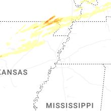


Connect with Interactive Hail Maps