

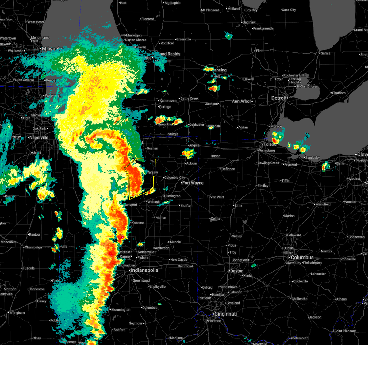
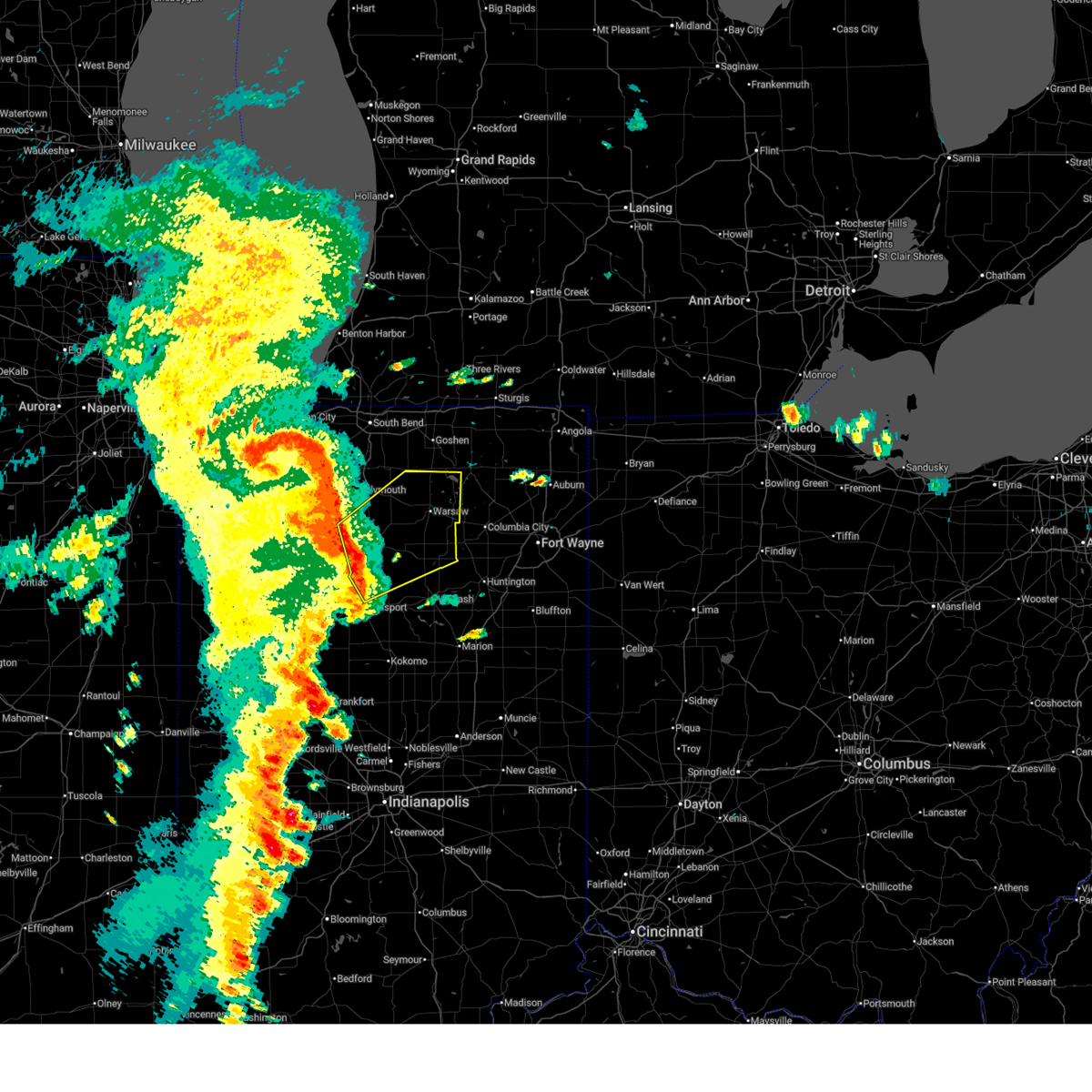
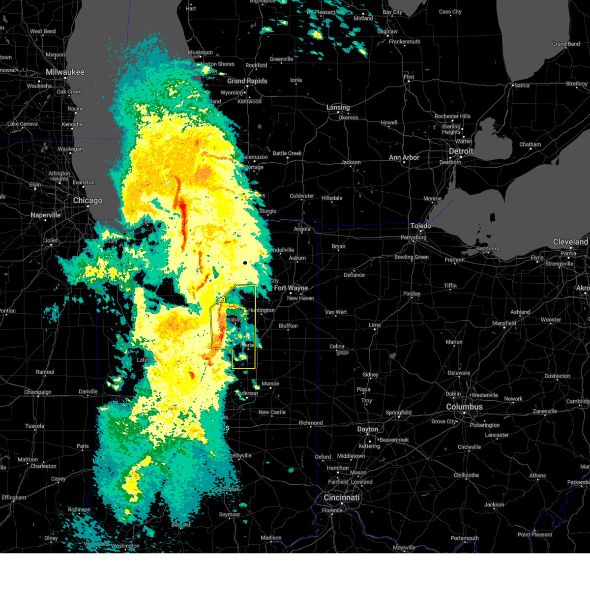
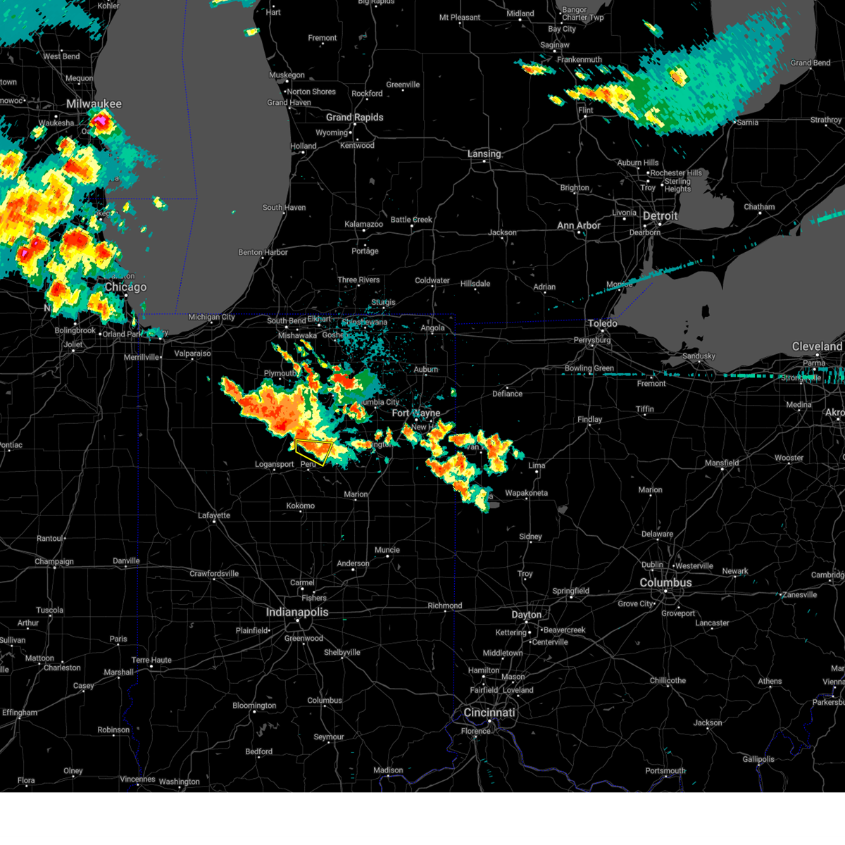
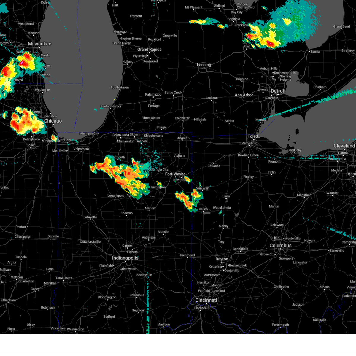
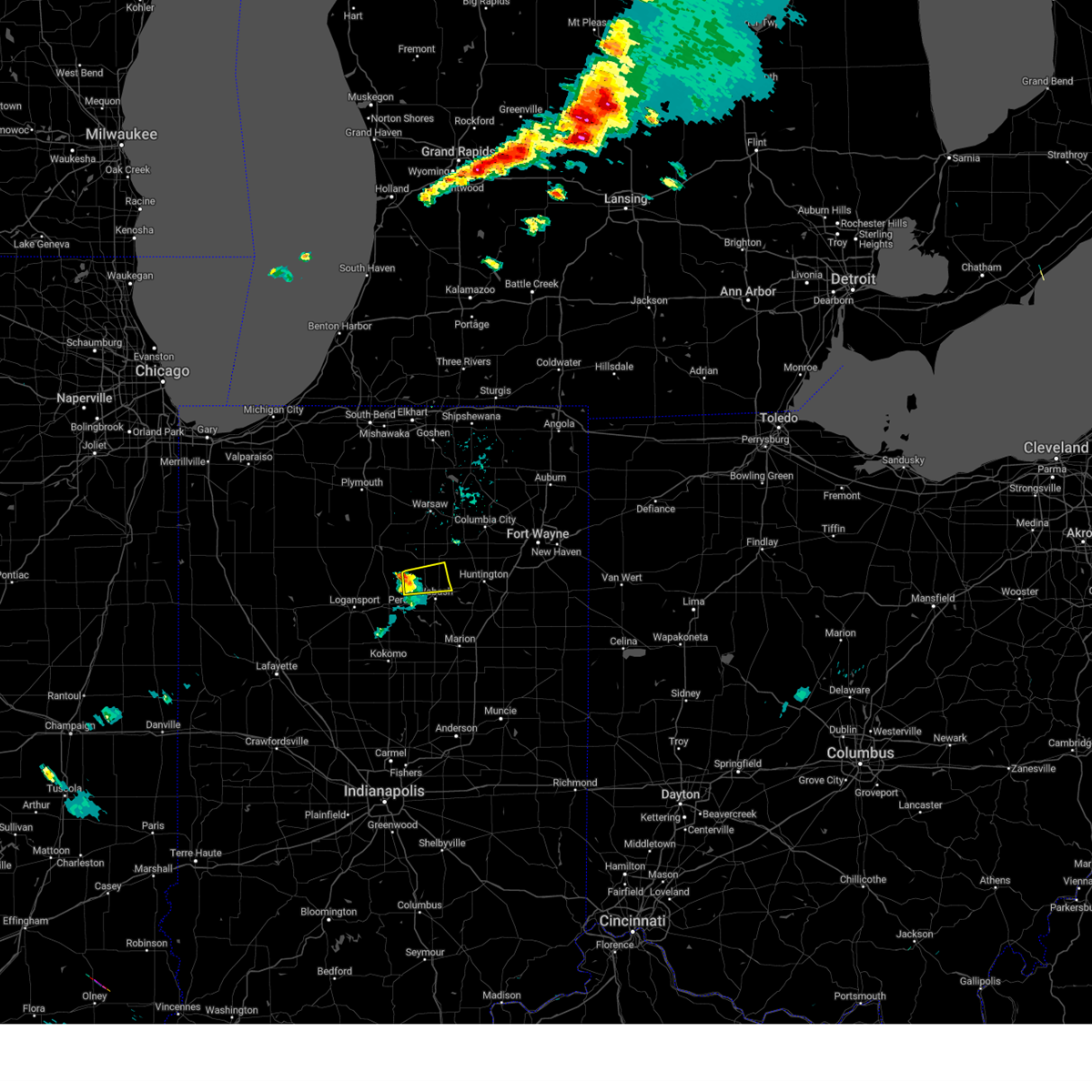
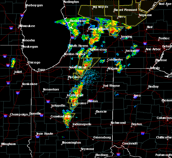
Hail Map for Roann, IN
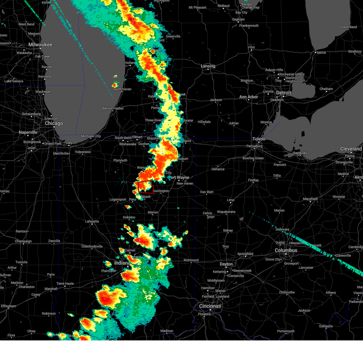
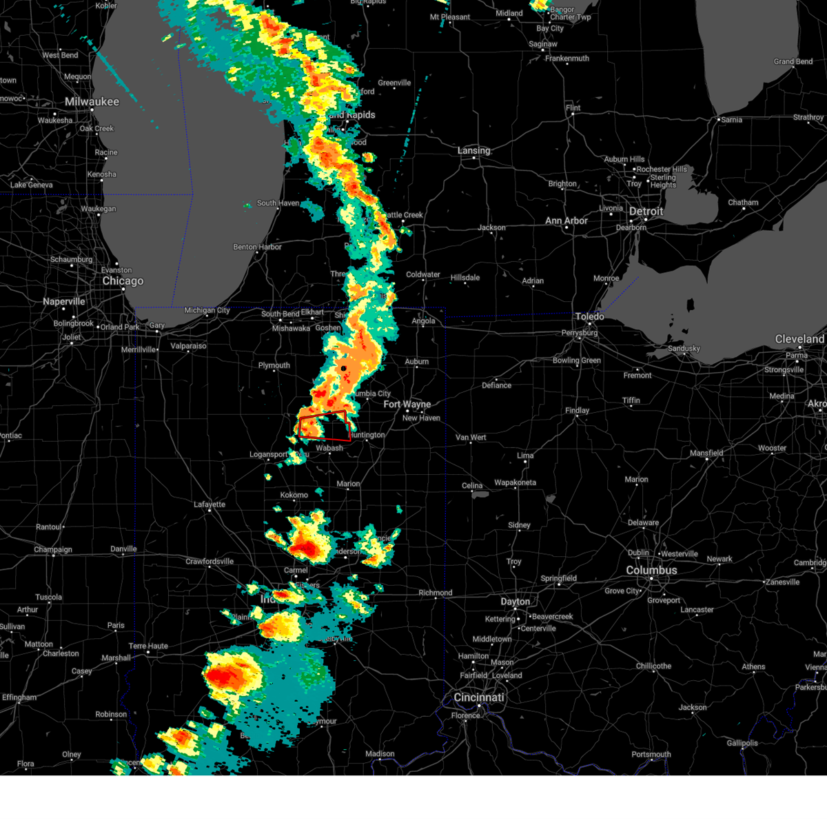
The Roann, IN area has had 0 reports of on-the-ground hail by trained spotters, and has been under severe weather warnings 16 times during the past 12 months. Doppler radar has detected hail at or near Roann, IN on 40 occasions.
| Name: | Roann, IN |
| Where Located: | 44.6 miles WSW of Fort Wayne, IN |
| Map: | Google Map for Roann, IN |
| Population: | 479 |
| Housing Units: | 208 |
| More Info: | Search Google for Roann, IN |
1
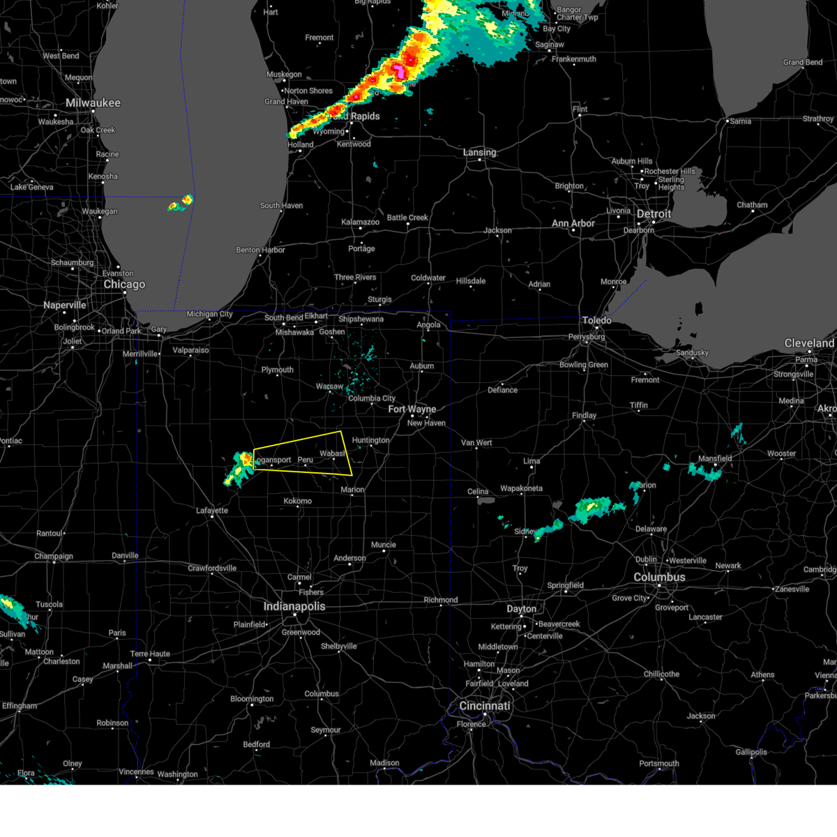
The Top Recent Hail Date for Roann, IN is Tuesday, May 7, 2024 (14th out of 40)

Hail and Wind Damage Spotted near Roann, IN
| Date / Time | Report Details |
|---|---|
| 6/18/2025 4:22 PM EDT |
 Svriwx the national weather service in northern indiana has issued a * severe thunderstorm warning for, western wabash county in north central indiana, southeastern cass county in north central indiana, miami county in north central indiana, * until 500 pm edt. * at 422 pm edt, a severe thunderstorm was located over walton, or near grissom afb, moving northeast at 60 mph (radar indicated). Hazards include 60 mph wind gusts. expect damage to roofs, siding, and trees Svriwx the national weather service in northern indiana has issued a * severe thunderstorm warning for, western wabash county in north central indiana, southeastern cass county in north central indiana, miami county in north central indiana, * until 500 pm edt. * at 422 pm edt, a severe thunderstorm was located over walton, or near grissom afb, moving northeast at 60 mph (radar indicated). Hazards include 60 mph wind gusts. expect damage to roofs, siding, and trees
|
| 6/18/2025 4:20 PM EDT |
 the severe thunderstorm warning has been cancelled and is no longer in effect the severe thunderstorm warning has been cancelled and is no longer in effect
|
| 6/18/2025 4:20 PM EDT |
 At 420 pm edt, severe thunderstorms were located along a line extending from near bourbon to near warsaw to near akron, moving northeast at 70 mph (radar indicated). Hazards include 70 mph wind gusts. Expect considerable tree damage. damage is likely to mobile homes, roofs, and outbuildings. Locations impacted include, warsaw, nappanee, rochester, north manchester, winona lake, syracuse, bourbon, milford, akron, north webster, pierceton, mentone, tippecanoe, silver lake, etna green, leesburg, denver, roann, claypool, and macy. At 420 pm edt, severe thunderstorms were located along a line extending from near bourbon to near warsaw to near akron, moving northeast at 70 mph (radar indicated). Hazards include 70 mph wind gusts. Expect considerable tree damage. damage is likely to mobile homes, roofs, and outbuildings. Locations impacted include, warsaw, nappanee, rochester, north manchester, winona lake, syracuse, bourbon, milford, akron, north webster, pierceton, mentone, tippecanoe, silver lake, etna green, leesburg, denver, roann, claypool, and macy.
|
| 6/18/2025 4:01 PM EDT |
 Svriwx the national weather service in northern indiana has issued a * severe thunderstorm warning for, northern wabash county in north central indiana, fulton county in north central indiana, kosciusko county in north central indiana, northeastern cass county in north central indiana, northwestern miami county in north central indiana, southern marshall county in north central indiana, * until 445 pm edt. * at 401 pm edt, severe thunderstorms were located along a line extending from near culver to rochester to near mexico, moving northeast at 70 mph (radar indicated). Hazards include 70 mph wind gusts. Expect considerable tree damage. Damage is likely to mobile homes, roofs, and outbuildings. Svriwx the national weather service in northern indiana has issued a * severe thunderstorm warning for, northern wabash county in north central indiana, fulton county in north central indiana, kosciusko county in north central indiana, northeastern cass county in north central indiana, northwestern miami county in north central indiana, southern marshall county in north central indiana, * until 445 pm edt. * at 401 pm edt, severe thunderstorms were located along a line extending from near culver to rochester to near mexico, moving northeast at 70 mph (radar indicated). Hazards include 70 mph wind gusts. Expect considerable tree damage. Damage is likely to mobile homes, roofs, and outbuildings.
|
| 5/16/2025 8:08 PM EDT | The storms which prompted the warning have moved out of the area. therefore, the warning will be allowed to expire. however, gusty winds are still possible with these thunderstorms. a severe thunderstorm watch remains in effect until midnight edt for north central and northeastern indiana. to report severe weather, contact your nearest law enforcement agency. they will relay your report to the national weather service northern indiana. |
| 5/16/2025 7:58 PM EDT |
 the severe thunderstorm warning has been cancelled and is no longer in effect the severe thunderstorm warning has been cancelled and is no longer in effect
|
| 5/16/2025 7:58 PM EDT |
 At 757 pm edt, the back edge of showers and embedded thunderstorms producing strong winds was located along a line extending from near akron to near van buren, moving east at 65 mph (radar indicated). Hazards include 60 mph wind gusts. Expect damage to roofs, siding, and trees. Locations impacted include, wabash, north manchester, la fontaine, roann, lagro, ijamsville, richvalley, liberty mills, servia, lincolnville, urbana, treaty, speicherville, laketon, and somerset. At 757 pm edt, the back edge of showers and embedded thunderstorms producing strong winds was located along a line extending from near akron to near van buren, moving east at 65 mph (radar indicated). Hazards include 60 mph wind gusts. Expect damage to roofs, siding, and trees. Locations impacted include, wabash, north manchester, la fontaine, roann, lagro, ijamsville, richvalley, liberty mills, servia, lincolnville, urbana, treaty, speicherville, laketon, and somerset.
|
| 5/16/2025 7:35 PM EDT | At 735 pm edt, showers and embedded thunderstorms with strong winds were located along a line extending from rochester to near marion, moving northeast at 50 mph (radar indicated). Hazards include 60 mph wind gusts. Expect damage to roofs, siding, and trees. Locations impacted include, wabash, rochester, north manchester, akron, la fontaine, roann, lagro, fulton, macy, richvalley, nyena lake, liberty mills, tiosa, lake manitou, talma, somerset, ijamsville, stockdale, servia, and athens. |
| 5/16/2025 7:35 PM EDT | the severe thunderstorm warning has been cancelled and is no longer in effect |
| 5/16/2025 7:10 PM EDT |
 Svriwx the national weather service in northern indiana has issued a * severe thunderstorm warning for, wabash county in north central indiana, fulton county in north central indiana, eastern pulaski county in northwestern indiana, northwestern miami county in north central indiana, * until 815 pm edt. * at 709 pm edt, severe thunderstorms were located along a line extending from 6 miles northwest of rochester to near marion, moving northeast at 65 mph (radar indicated). Hazards include 60 mph wind gusts. expect damage to roofs, siding, and trees Svriwx the national weather service in northern indiana has issued a * severe thunderstorm warning for, wabash county in north central indiana, fulton county in north central indiana, eastern pulaski county in northwestern indiana, northwestern miami county in north central indiana, * until 815 pm edt. * at 709 pm edt, severe thunderstorms were located along a line extending from 6 miles northwest of rochester to near marion, moving northeast at 65 mph (radar indicated). Hazards include 60 mph wind gusts. expect damage to roofs, siding, and trees
|
| 3/30/2025 4:50 PM EDT | the severe thunderstorm warning has been cancelled and is no longer in effect |
| 3/30/2025 4:50 PM EDT | At 450 pm edt, severe thunderstorms were located along a line extending from near nappanee to near peru, moving northeast at 65 mph (radar indicated). Hazards include 70 mph wind gusts and nickel size hail. Expect considerable tree damage. damage is likely to mobile homes, roofs, and outbuildings. locations impacted include, mcnatts, honeyville, atwood, la fontaine, macy, tri-lakes, locke, syracuse, bippus, luther, nead, bowerstown, little chapman lake, warsaw, james lake, goose lake, knapp lake, jalapa, new paris, and loon lake. This includes interstate 69 in indiana between mile markers 266 and 293. |
| 3/30/2025 4:33 PM EDT |
 Svriwx the national weather service in northern indiana has issued a * severe thunderstorm warning for, southern elkhart county in north central indiana, wabash county in north central indiana, noble county in northeastern indiana, northern grant county in central indiana, whitley county in northeastern indiana, huntington county in northeastern indiana, kosciusko county in north central indiana, cass county in north central indiana, southwestern lagrange county in northeastern indiana, fulton county in north central indiana, western wells county in northeastern indiana, miami county in north central indiana, marshall county in north central indiana, * until 530 pm edt. * at 433 pm edt, severe thunderstorms were located along a line extending from plymouth to near walton, moving northeast at 65 mph (radar indicated). Hazards include 70 mph wind gusts and nickel size hail. Expect considerable tree damage. Damage is likely to mobile homes, roofs, and outbuildings. Svriwx the national weather service in northern indiana has issued a * severe thunderstorm warning for, southern elkhart county in north central indiana, wabash county in north central indiana, noble county in northeastern indiana, northern grant county in central indiana, whitley county in northeastern indiana, huntington county in northeastern indiana, kosciusko county in north central indiana, cass county in north central indiana, southwestern lagrange county in northeastern indiana, fulton county in north central indiana, western wells county in northeastern indiana, miami county in north central indiana, marshall county in north central indiana, * until 530 pm edt. * at 433 pm edt, severe thunderstorms were located along a line extending from plymouth to near walton, moving northeast at 65 mph (radar indicated). Hazards include 70 mph wind gusts and nickel size hail. Expect considerable tree damage. Damage is likely to mobile homes, roofs, and outbuildings.
|
| 3/15/2025 4:11 AM EDT | The storms which prompted the warning have weakened below severe limits, and no longer pose an immediate threat to life or property. therefore, the warning will be allowed to expire. however, gusty winds are still possible with these thunderstorms. a severe thunderstorm watch remains in effect until 900 am edt for central, north central and northeastern indiana. to report severe weather, contact your nearest law enforcement agency. they will relay your report to the national weather service northern indiana. |
| 3/15/2025 4:00 AM EDT | At 400 am edt, severe thunderstorms were located along a line extending from 6 miles east of akron to wabash to 8 miles northeast of kokomo, moving northeast at 55 mph (radar indicated). Hazards include 60 mph wind gusts. Expect damage to roofs, siding, and trees. Locations impacted include, richvalley, gas city, wabash, amboy, collamer, liberty mills, north manchester, la fontaine, mier, herbst, wawpecong, roann, point isabel, jonesboro, banquo, peoria, roseburg, bippus, swayzee, and luther. |
| 3/15/2025 3:48 AM EDT |
 Svriwx the national weather service in northern indiana has issued a * severe thunderstorm warning for, wabash county in north central indiana, grant county in central indiana, southwestern whitley county in northeastern indiana, western huntington county in northeastern indiana, southeastern kosciusko county in north central indiana, miami county in north central indiana, * until 415 am edt. * at 348 am edt, severe thunderstorms were located along a line extending from 8 miles south of akron to near peru to near kokomo, moving northeast at 60 mph (radar indicated). Hazards include 60 mph wind gusts. expect damage to roofs, siding, and trees Svriwx the national weather service in northern indiana has issued a * severe thunderstorm warning for, wabash county in north central indiana, grant county in central indiana, southwestern whitley county in northeastern indiana, western huntington county in northeastern indiana, southeastern kosciusko county in north central indiana, miami county in north central indiana, * until 415 am edt. * at 348 am edt, severe thunderstorms were located along a line extending from 8 miles south of akron to near peru to near kokomo, moving northeast at 60 mph (radar indicated). Hazards include 60 mph wind gusts. expect damage to roofs, siding, and trees
|
| 7/16/2024 12:19 AM EDT |
 Svriwx the national weather service in northern indiana has issued a * severe thunderstorm warning for, northern wabash county in north central indiana, southern whitley county in northeastern indiana, northern huntington county in northeastern indiana, * until 115 am edt. * at 1219 am edt, severe thunderstorms were located along a line extending from near akron to near mexico, moving east at 40 mph (radar indicated). Hazards include 70 mph wind gusts. Expect considerable tree damage. Damage is likely to mobile homes, roofs, and outbuildings. Svriwx the national weather service in northern indiana has issued a * severe thunderstorm warning for, northern wabash county in north central indiana, southern whitley county in northeastern indiana, northern huntington county in northeastern indiana, * until 115 am edt. * at 1219 am edt, severe thunderstorms were located along a line extending from near akron to near mexico, moving east at 40 mph (radar indicated). Hazards include 70 mph wind gusts. Expect considerable tree damage. Damage is likely to mobile homes, roofs, and outbuildings.
|
| 7/14/2024 12:12 PM EDT | Large tree limbs down including a ten inch in diameter branch near adams and church roads. time estimated from rada in wabash county IN, 0.2 miles WNW of Roann, IN |
| 5/7/2024 6:04 PM EDT |
 Svriwx the national weather service in northern indiana has issued a * severe thunderstorm warning for, wabash county in north central indiana, southern whitley county in northeastern indiana, northern huntington county in northeastern indiana, southeastern kosciusko county in north central indiana, north central miami county in north central indiana, * until 630 pm edt. * at 604 pm edt, severe thunderstorms were located along a line extending from 9 miles northeast of mexico to 6 miles northeast of wabash to near huntington, moving northeast at 50 mph (radar indicated). Hazards include 60 mph wind gusts and quarter size hail. Hail damage to vehicles is expected. Expect wind damage to roofs, siding, and trees. Svriwx the national weather service in northern indiana has issued a * severe thunderstorm warning for, wabash county in north central indiana, southern whitley county in northeastern indiana, northern huntington county in northeastern indiana, southeastern kosciusko county in north central indiana, north central miami county in north central indiana, * until 630 pm edt. * at 604 pm edt, severe thunderstorms were located along a line extending from 9 miles northeast of mexico to 6 miles northeast of wabash to near huntington, moving northeast at 50 mph (radar indicated). Hazards include 60 mph wind gusts and quarter size hail. Hail damage to vehicles is expected. Expect wind damage to roofs, siding, and trees.
|
| 7/29/2023 2:20 AM EDT |
 At 220 am edt, severe thunderstorms were located along a line extending from near mentone to 6 miles west of mexico, moving east at 45 mph (radar indicated). Hazards include 60 mph wind gusts. Expect damage to roofs, siding, and trees. locations impacted include, wabash, north manchester, akron, mexico, silver lake, erie, denver, roann, claypool, sidney, chili, ijamsville, richvalley, stockdale, deedsville, packerton, laketon, gilead, and disko. hail threat, radar indicated max hail size, <. 75 in wind threat, radar indicated max wind gust, 60 mph. At 220 am edt, severe thunderstorms were located along a line extending from near mentone to 6 miles west of mexico, moving east at 45 mph (radar indicated). Hazards include 60 mph wind gusts. Expect damage to roofs, siding, and trees. locations impacted include, wabash, north manchester, akron, mexico, silver lake, erie, denver, roann, claypool, sidney, chili, ijamsville, richvalley, stockdale, deedsville, packerton, laketon, gilead, and disko. hail threat, radar indicated max hail size, <. 75 in wind threat, radar indicated max wind gust, 60 mph.
|
| 7/29/2023 1:51 AM EDT |
 At 151 am edt, severe thunderstorms were located along a line extending from near culver to near royal center, moving east at 45 mph (radar indicated). Hazards include 60 mph wind gusts. expect damage to roofs, siding, and trees At 151 am edt, severe thunderstorms were located along a line extending from near culver to near royal center, moving east at 45 mph (radar indicated). Hazards include 60 mph wind gusts. expect damage to roofs, siding, and trees
|
| 7/28/2023 9:57 PM EDT |
 The severe thunderstorm warning for west central wabash and northwestern miami counties will expire at 1000 pm edt, the severe thunderstorm which prompted the warning has weakened. therefore, the warning will be allowed to expire. a new severe thunderstorm warning was issued northwestern miami county until 1030 pm edt for additional strong to severe storms. stay alert for further development. The severe thunderstorm warning for west central wabash and northwestern miami counties will expire at 1000 pm edt, the severe thunderstorm which prompted the warning has weakened. therefore, the warning will be allowed to expire. a new severe thunderstorm warning was issued northwestern miami county until 1030 pm edt for additional strong to severe storms. stay alert for further development.
|
| 7/28/2023 9:23 PM EDT |
 At 923 pm edt, a severe thunderstorm was located near mexico, or 10 miles north of peru, moving east at 25 mph (radar indicated). Hazards include 60 mph wind gusts and quarter size hail. Hail damage to vehicles is expected. expect wind damage to roofs, siding, and trees. This severe thunderstorm will remain over mainly rural areas of west central wabash and northwestern miami counties, including the following locations, erie, chili, stockdale, deedsville, denver, and roann. At 923 pm edt, a severe thunderstorm was located near mexico, or 10 miles north of peru, moving east at 25 mph (radar indicated). Hazards include 60 mph wind gusts and quarter size hail. Hail damage to vehicles is expected. expect wind damage to roofs, siding, and trees. This severe thunderstorm will remain over mainly rural areas of west central wabash and northwestern miami counties, including the following locations, erie, chili, stockdale, deedsville, denver, and roann.
|
| 7/20/2023 1:36 PM EDT |
 At 135 pm edt, a severe thunderstorm was located near peru, moving east at 40 mph (radar indicated). Hazards include ping pong ball size hail and 60 mph wind gusts. People and animals outdoors will be injured. expect hail damage to roofs, siding, windows, and vehicles. expect wind damage to roofs, siding, and trees. locations impacted include, roann, lagro, chili, ijamsville, stockdale, speicherville, and urbana. hail threat, radar indicated max hail size, 1. 50 in wind threat, radar indicated max wind gust, 60 mph. At 135 pm edt, a severe thunderstorm was located near peru, moving east at 40 mph (radar indicated). Hazards include ping pong ball size hail and 60 mph wind gusts. People and animals outdoors will be injured. expect hail damage to roofs, siding, windows, and vehicles. expect wind damage to roofs, siding, and trees. locations impacted include, roann, lagro, chili, ijamsville, stockdale, speicherville, and urbana. hail threat, radar indicated max hail size, 1. 50 in wind threat, radar indicated max wind gust, 60 mph.
|
| 7/20/2023 1:03 PM EDT |
 At 103 pm edt, a severe thunderstorm was located near logansport, moving east at 40 mph (radar indicated). Hazards include ping pong ball size hail and 60 mph wind gusts. People and animals outdoors will be injured. expect hail damage to roofs, siding, windows, and vehicles. Expect wind damage to roofs, siding, and trees. At 103 pm edt, a severe thunderstorm was located near logansport, moving east at 40 mph (radar indicated). Hazards include ping pong ball size hail and 60 mph wind gusts. People and animals outdoors will be injured. expect hail damage to roofs, siding, windows, and vehicles. Expect wind damage to roofs, siding, and trees.
|
| 6/25/2023 4:16 PM EDT |
 At 415 pm edt, a severe thunderstorm capable of producing a tornado was located near akron, or 8 miles west of north manchester, moving east at 30 mph (radar indicated rotation). Hazards include tornado and quarter size hail. Flying debris will be dangerous to those caught without shelter. mobile homes will be damaged or destroyed. damage to roofs, windows, and vehicles will occur. tree damage is likely. Locations impacted include, north manchester, roann, ijamsville, laketon, liberty mills, disko and urbana. At 415 pm edt, a severe thunderstorm capable of producing a tornado was located near akron, or 8 miles west of north manchester, moving east at 30 mph (radar indicated rotation). Hazards include tornado and quarter size hail. Flying debris will be dangerous to those caught without shelter. mobile homes will be damaged or destroyed. damage to roofs, windows, and vehicles will occur. tree damage is likely. Locations impacted include, north manchester, roann, ijamsville, laketon, liberty mills, disko and urbana.
|
| 6/25/2023 4:03 PM EDT |
 At 403 pm edt, a severe thunderstorm capable of producing a tornado was located near akron, or 10 miles southeast of rochester, moving east at 30 mph (radar indicated rotation). Hazards include tornado and quarter size hail. Flying debris will be dangerous to those caught without shelter. mobile homes will be damaged or destroyed. damage to roofs, windows, and vehicles will occur. Tree damage is likely. At 403 pm edt, a severe thunderstorm capable of producing a tornado was located near akron, or 10 miles southeast of rochester, moving east at 30 mph (radar indicated rotation). Hazards include tornado and quarter size hail. Flying debris will be dangerous to those caught without shelter. mobile homes will be damaged or destroyed. damage to roofs, windows, and vehicles will occur. Tree damage is likely.
|
| 3/6/2022 2:43 AM EST |
 At 243 am est, severe thunderstorms were located along a line extending from near winona lake to 6 miles northwest of wabash to 6 miles northeast of kokomo, moving east at 65 mph (radar indicated). Hazards include 60 mph wind gusts. expect damage to roofs, siding, and trees At 243 am est, severe thunderstorms were located along a line extending from near winona lake to 6 miles northwest of wabash to 6 miles northeast of kokomo, moving east at 65 mph (radar indicated). Hazards include 60 mph wind gusts. expect damage to roofs, siding, and trees
|
| 9/14/2021 6:48 PM EDT | Trees and powerlines down. time estimated by rada in miami county IN, 2.1 miles SSE of Roann, IN |
| 8/11/2021 1:42 PM EDT |
 At 142 pm edt, severe thunderstorms were located along a line extending from near rome city to churubusco to near wabash, moving east at 50 mph (radar indicated). Hazards include 60 mph wind gusts and penny size hail. Expect damage to roofs, siding, and trees. locations impacted include, fort wayne, huntington, peru, wabash, kendallville, columbia city, garrett, north manchester, ligonier, tri-lakes, huntertown, avilla, albion, churubusco, south whitley, rome city, andrews, north webster, pierceton and aboite. this includes interstate 69 in indiana between mile markers 300 and 312, and between mile markers 315 and 326. hail threat, radar indicated max hail size, 0. 75 in wind threat, radar indicated max wind gust, 60 mph. At 142 pm edt, severe thunderstorms were located along a line extending from near rome city to churubusco to near wabash, moving east at 50 mph (radar indicated). Hazards include 60 mph wind gusts and penny size hail. Expect damage to roofs, siding, and trees. locations impacted include, fort wayne, huntington, peru, wabash, kendallville, columbia city, garrett, north manchester, ligonier, tri-lakes, huntertown, avilla, albion, churubusco, south whitley, rome city, andrews, north webster, pierceton and aboite. this includes interstate 69 in indiana between mile markers 300 and 312, and between mile markers 315 and 326. hail threat, radar indicated max hail size, 0. 75 in wind threat, radar indicated max wind gust, 60 mph.
|
| 8/11/2021 1:18 PM EDT |
 At 118 pm edt, severe thunderstorms were located along a line extending from near north manchester to 7 miles southeast of akron to near mexico, moving east at 55 mph (radar indicated). Hazards include 60 mph wind gusts and penny size hail. Expect damage to roofs, siding, and trees. locations impacted include, peru, rochester, north manchester, akron, mentone, mexico, denver, roann, claypool, fulton, macy, burket, nyena lake, deedsville, beaver dam lake, hoover, sevastopol, beaver dam, lake manitou and chili. hail threat, radar indicated max hail size, 0. 75 in wind threat, radar indicated max wind gust, 60 mph. At 118 pm edt, severe thunderstorms were located along a line extending from near north manchester to 7 miles southeast of akron to near mexico, moving east at 55 mph (radar indicated). Hazards include 60 mph wind gusts and penny size hail. Expect damage to roofs, siding, and trees. locations impacted include, peru, rochester, north manchester, akron, mentone, mexico, denver, roann, claypool, fulton, macy, burket, nyena lake, deedsville, beaver dam lake, hoover, sevastopol, beaver dam, lake manitou and chili. hail threat, radar indicated max hail size, 0. 75 in wind threat, radar indicated max wind gust, 60 mph.
|
| 8/11/2021 1:17 PM EDT |
 At 116 pm edt, severe thunderstorms were located along a line extending from near new paris to pierceton to near mexico, moving east at 50 mph (radar indicated). Hazards include 60 mph wind gusts and penny size hail. expect damage to roofs, siding, and trees At 116 pm edt, severe thunderstorms were located along a line extending from near new paris to pierceton to near mexico, moving east at 50 mph (radar indicated). Hazards include 60 mph wind gusts and penny size hail. expect damage to roofs, siding, and trees
|
| 8/11/2021 12:54 PM EDT |
 At 1253 pm edt, severe thunderstorms were located along a line extending from 6 miles south of argos to near rochester to near royal center, moving east at 45 mph (radar indicated). Hazards include 60 mph wind gusts and penny size hail. expect damage to roofs, siding, and trees At 1253 pm edt, severe thunderstorms were located along a line extending from 6 miles south of argos to near rochester to near royal center, moving east at 45 mph (radar indicated). Hazards include 60 mph wind gusts and penny size hail. expect damage to roofs, siding, and trees
|
| 8/10/2020 6:48 PM EDT |
 At 648 pm edt, severe thunderstorms were located along a line extending from 7 miles northwest of north manchester to 6 miles northeast of mexico, moving east at 45 mph (radar indicated). Hazards include 60 mph wind gusts. Expect damage to roofs, siding, and trees. severe thunderstorms will be near, north manchester around 655 pm edt. wabash around 700 pm edt. south whitley around 705 pm edt. andrews around 720 pm edt. huntington around 725 pm edt. This includes interstate 69 in indiana near mile marker 284. At 648 pm edt, severe thunderstorms were located along a line extending from 7 miles northwest of north manchester to 6 miles northeast of mexico, moving east at 45 mph (radar indicated). Hazards include 60 mph wind gusts. Expect damage to roofs, siding, and trees. severe thunderstorms will be near, north manchester around 655 pm edt. wabash around 700 pm edt. south whitley around 705 pm edt. andrews around 720 pm edt. huntington around 725 pm edt. This includes interstate 69 in indiana near mile marker 284.
|
| 7/19/2020 2:12 PM EDT |
 At 212 pm edt, severe thunderstorms were located along a line extending from north manchester to 6 miles north of la fontaine to near windfall city, moving east at 60 mph (radar indicated). Hazards include 60 mph wind gusts. Expect damage to roofs, siding, and trees. Locations impacted include, fort wayne, marion, huntington, new haven, wabash, bluffton, hartford city, north manchester, gas city, berne, upland, ossian, fairmount, dunkirk, montpelier, jonesboro, redkey, geneva, sweetser and andrews. At 212 pm edt, severe thunderstorms were located along a line extending from north manchester to 6 miles north of la fontaine to near windfall city, moving east at 60 mph (radar indicated). Hazards include 60 mph wind gusts. Expect damage to roofs, siding, and trees. Locations impacted include, fort wayne, marion, huntington, new haven, wabash, bluffton, hartford city, north manchester, gas city, berne, upland, ossian, fairmount, dunkirk, montpelier, jonesboro, redkey, geneva, sweetser and andrews.
|
| 7/19/2020 1:58 PM EDT |
 At 158 pm edt, severe thunderstorms were located along a line extending from near akron to near wabash to 6 miles west of windfall city, moving east at 60 mph (radar indicated). Hazards include 60 mph wind gusts. expect damage to roofs, siding, and trees At 158 pm edt, severe thunderstorms were located along a line extending from near akron to near wabash to 6 miles west of windfall city, moving east at 60 mph (radar indicated). Hazards include 60 mph wind gusts. expect damage to roofs, siding, and trees
|
| 6/10/2020 1:42 PM EDT | Hog barn destroye in wabash county IN, 2.6 miles SW of Roann, IN |
| 6/10/2020 1:16 PM EDT |
 At 116 pm edt, a severe thunderstorm was located over bunker hill, or near grissom afb, moving north at 45 mph (radar indicated). Hazards include 70 mph wind gusts and quarter size hail. Hail damage to vehicles is expected. expect considerable tree damage. Wind damage is also likely to mobile homes, roofs, and outbuildings. At 116 pm edt, a severe thunderstorm was located over bunker hill, or near grissom afb, moving north at 45 mph (radar indicated). Hazards include 70 mph wind gusts and quarter size hail. Hail damage to vehicles is expected. expect considerable tree damage. Wind damage is also likely to mobile homes, roofs, and outbuildings.
|
| 6/10/2020 1:03 PM EDT |
 At 103 pm edt, a severe thunderstorm was located over peru, moving north at 55 mph. another severe thunderstorm was located over kokomo, also moving north at 55 mph (radar indicated). Hazards include 70 mph wind gusts and quarter size hail. Hail damage to vehicles is expected. expect considerable tree damage. wind damage is also likely to mobile homes, roofs, and outbuildings. Locations impacted include, peru, grissom afb, akron, walton, bunker hill, mexico, lincoln, wells, galveston, miami, erie, denver, roann, macy, onward, bennetts switch, deedsville, hoover, nead and chili. At 103 pm edt, a severe thunderstorm was located over peru, moving north at 55 mph. another severe thunderstorm was located over kokomo, also moving north at 55 mph (radar indicated). Hazards include 70 mph wind gusts and quarter size hail. Hail damage to vehicles is expected. expect considerable tree damage. wind damage is also likely to mobile homes, roofs, and outbuildings. Locations impacted include, peru, grissom afb, akron, walton, bunker hill, mexico, lincoln, wells, galveston, miami, erie, denver, roann, macy, onward, bennetts switch, deedsville, hoover, nead and chili.
|
| 6/10/2020 12:49 PM EDT |
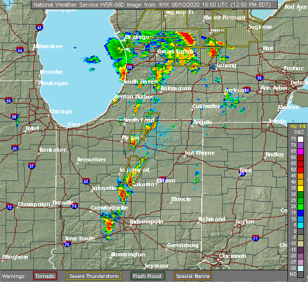 At 1249 pm edt, a severe thunderstorm was located over grissom afb, moving north at 60 mph (radar indicated). Hazards include 70 mph wind gusts and quarter size hail. Hail damage to vehicles is expected. expect considerable tree damage. Wind damage is also likely to mobile homes, roofs, and outbuildings. At 1249 pm edt, a severe thunderstorm was located over grissom afb, moving north at 60 mph (radar indicated). Hazards include 70 mph wind gusts and quarter size hail. Hail damage to vehicles is expected. expect considerable tree damage. Wind damage is also likely to mobile homes, roofs, and outbuildings.
|
| 5/27/2019 7:54 PM EDT |
 At 753 pm edt, a large and extremely dangerous tornado was located near rochester, moving east at 35 mph. this is a particularly dangerous situation. take cover now! (radar indicated rotation). Hazards include damaging tornado. You are in a life-threatening situation. flying debris may be deadly to those caught without shelter. mobile homes will be destroyed. considerable damage to homes, businesses, and vehicles is likely and complete destruction is possible. This tornadic thunderstorm will remain over mainly rural areas of northwestern wabash, east central fulton and north central miami counties, including the following locations, ijamsville, gilead, disko, laketon, stockdale and roann. At 753 pm edt, a large and extremely dangerous tornado was located near rochester, moving east at 35 mph. this is a particularly dangerous situation. take cover now! (radar indicated rotation). Hazards include damaging tornado. You are in a life-threatening situation. flying debris may be deadly to those caught without shelter. mobile homes will be destroyed. considerable damage to homes, businesses, and vehicles is likely and complete destruction is possible. This tornadic thunderstorm will remain over mainly rural areas of northwestern wabash, east central fulton and north central miami counties, including the following locations, ijamsville, gilead, disko, laketon, stockdale and roann.
|
| 5/27/2019 7:49 PM EDT |
 At 749 pm edt, a severe thunderstorm capable of producing a tornado was located near rochester, moving east at 35 mph (radar indicated rotation). Hazards include tornado. Flying debris will be dangerous to those caught without shelter. mobile homes will be damaged or destroyed. damage to roofs, windows, and vehicles will occur. tree damage is likely. this dangerous storm will be near, akron around 805 pm edt. Other locations impacted by this tornadic thunderstorm include ijamsville, stockdale, roann, laketon, nyena lake, gilead, disko and macy. At 749 pm edt, a severe thunderstorm capable of producing a tornado was located near rochester, moving east at 35 mph (radar indicated rotation). Hazards include tornado. Flying debris will be dangerous to those caught without shelter. mobile homes will be damaged or destroyed. damage to roofs, windows, and vehicles will occur. tree damage is likely. this dangerous storm will be near, akron around 805 pm edt. Other locations impacted by this tornadic thunderstorm include ijamsville, stockdale, roann, laketon, nyena lake, gilead, disko and macy.
|
| 5/27/2019 7:38 PM EDT |
 At 738 pm edt, a severe thunderstorm capable of producing a tornado was located over peru, moving northeast at 30 mph (radar indicated rotation). Hazards include tornado and quarter size hail. Flying debris will be dangerous to those caught without shelter. mobile homes will be damaged or destroyed. damage to roofs, windows, and vehicles will occur. tree damage is likely. this dangerous storm will be near, wabash around 755 pm edt. Other locations impacted by this tornadic thunderstorm include chili, stockdale, richvalley, roann, peoria, erie, denver, wells, nead and urbana. At 738 pm edt, a severe thunderstorm capable of producing a tornado was located over peru, moving northeast at 30 mph (radar indicated rotation). Hazards include tornado and quarter size hail. Flying debris will be dangerous to those caught without shelter. mobile homes will be damaged or destroyed. damage to roofs, windows, and vehicles will occur. tree damage is likely. this dangerous storm will be near, wabash around 755 pm edt. Other locations impacted by this tornadic thunderstorm include chili, stockdale, richvalley, roann, peoria, erie, denver, wells, nead and urbana.
|
| 5/23/2019 4:56 AM EDT |
 At 456 am edt, severe thunderstorms were located along a line extending from near albion to near south whitley to 6 miles west of swayzee, moving east at 45 mph (radar indicated). Hazards include 70 mph wind gusts. Expect considerable tree damage. damage is likely to mobile homes, roofs, and outbuildings. locations impacted include, marion, huntington, warsaw, peru, wabash, columbia city, north manchester, winona lake, tri-lakes, grissom afb, south whitley, sweetser, andrews, pierceton, swayzee, bunker hill, la fontaine, sims, etna and miami. This is a dangerous line of storms with a history of producing wind gusts of 60 to 70 mph. At 456 am edt, severe thunderstorms were located along a line extending from near albion to near south whitley to 6 miles west of swayzee, moving east at 45 mph (radar indicated). Hazards include 70 mph wind gusts. Expect considerable tree damage. damage is likely to mobile homes, roofs, and outbuildings. locations impacted include, marion, huntington, warsaw, peru, wabash, columbia city, north manchester, winona lake, tri-lakes, grissom afb, south whitley, sweetser, andrews, pierceton, swayzee, bunker hill, la fontaine, sims, etna and miami. This is a dangerous line of storms with a history of producing wind gusts of 60 to 70 mph.
|
| 5/23/2019 4:37 AM EDT |
 At 436 am edt, severe thunderstorms were located along a line extending from near warsaw to 6 miles northwest of north manchester to 11 miles east of frankfort, moving east at 65 mph (radar indicated). Hazards include 60 mph wind gusts. Expect damage to roofs, siding, and trees. Locations impacted include, marion, logansport, huntington, warsaw, peru, wabash, columbia city, rochester, north manchester, winona lake, tri-lakes, grissom afb, south whitley, sweetser, akron, andrews, walton, pierceton, mentone and swayzee. At 436 am edt, severe thunderstorms were located along a line extending from near warsaw to 6 miles northwest of north manchester to 11 miles east of frankfort, moving east at 65 mph (radar indicated). Hazards include 60 mph wind gusts. Expect damage to roofs, siding, and trees. Locations impacted include, marion, logansport, huntington, warsaw, peru, wabash, columbia city, rochester, north manchester, winona lake, tri-lakes, grissom afb, south whitley, sweetser, akron, andrews, walton, pierceton, mentone and swayzee.
|
| 5/23/2019 4:09 AM EDT |
 At 407 am edt, severe thunderstorms were located along a line extending from near culver to 9 miles northeast of royal center to 8 miles north of crawfordsville, moving east at 65 mph (radar indicated). Hazards include 70 mph wind gusts. Expect considerable tree damage. Damage is likely to mobile homes, roofs, and outbuildings. At 407 am edt, severe thunderstorms were located along a line extending from near culver to 9 miles northeast of royal center to 8 miles north of crawfordsville, moving east at 65 mph (radar indicated). Hazards include 70 mph wind gusts. Expect considerable tree damage. Damage is likely to mobile homes, roofs, and outbuildings.
|
| 5/19/2019 5:36 PM EDT |
 At 535 pm edt, severe thunderstorms were located along a line extending from near akron to 7 miles east of mexico to 6 miles northwest of kokomo, moving northeast at 55 mph. sporadic reports of tree damage as well as wind gusts as high as 57 mph have been recorded in logansport, denver and walton (radar indicated). Hazards include 60 mph wind gusts and penny size hail. expect damage to roofs, siding, and trees At 535 pm edt, severe thunderstorms were located along a line extending from near akron to 7 miles east of mexico to 6 miles northwest of kokomo, moving northeast at 55 mph. sporadic reports of tree damage as well as wind gusts as high as 57 mph have been recorded in logansport, denver and walton (radar indicated). Hazards include 60 mph wind gusts and penny size hail. expect damage to roofs, siding, and trees
|
| 6/19/2018 4:41 PM EDT |
 At 441 pm edt, a severe thunderstorm was located near akron, or 7 miles west of north manchester, moving east at 40 mph (radar indicated). Hazards include 60 mph wind gusts and quarter size hail. Hail damage to vehicles is expected. Expect wind damage to roofs, siding, and trees. At 441 pm edt, a severe thunderstorm was located near akron, or 7 miles west of north manchester, moving east at 40 mph (radar indicated). Hazards include 60 mph wind gusts and quarter size hail. Hail damage to vehicles is expected. Expect wind damage to roofs, siding, and trees.
|
| 5/31/2018 9:36 PM EDT |
 At 935 pm edt, severe thunderstorms were located along a line extending from 9 miles east of akron to north manchester to near wabash, moving east at 35 mph (radar indicated). Hazards include 60 mph wind gusts and nickel size hail. Expect damage to roofs, siding, and trees. Locations impacted include, huntington, wabash, north manchester, south whitley, lagro, liberty mills, urbana, tunker, speicherville, laketon, bippus and luther. At 935 pm edt, severe thunderstorms were located along a line extending from 9 miles east of akron to north manchester to near wabash, moving east at 35 mph (radar indicated). Hazards include 60 mph wind gusts and nickel size hail. Expect damage to roofs, siding, and trees. Locations impacted include, huntington, wabash, north manchester, south whitley, lagro, liberty mills, urbana, tunker, speicherville, laketon, bippus and luther.
|
| 5/31/2018 9:20 PM EDT |
 At 920 pm edt, severe thunderstorms were located along a line extending from near akron to 9 miles southwest of north manchester to 6 miles east of mexico, moving east at 35 mph (radar indicated). Hazards include 60 mph wind gusts and nickel size hail. expect damage to roofs, siding, and trees At 920 pm edt, severe thunderstorms were located along a line extending from near akron to 9 miles southwest of north manchester to 6 miles east of mexico, moving east at 35 mph (radar indicated). Hazards include 60 mph wind gusts and nickel size hail. expect damage to roofs, siding, and trees
|
| 7/10/2017 8:31 PM EDT |
 At 830 pm edt, a severe thunderstorm capable of producing a tornado was located 7 miles northwest of wabash, moving east at 20 mph (radar indicated rotation). Hazards include tornado. Flying debris will be dangerous to those caught without shelter. mobile homes will be damaged or destroyed. damage to roofs, windows, and vehicles will occur. tree damage is likely. this dangerous storm will be near, wabash around 845 pm edt. Other locations impacted by this tornadic thunderstorm include servia, speicherville, lagro, urbana and roann. At 830 pm edt, a severe thunderstorm capable of producing a tornado was located 7 miles northwest of wabash, moving east at 20 mph (radar indicated rotation). Hazards include tornado. Flying debris will be dangerous to those caught without shelter. mobile homes will be damaged or destroyed. damage to roofs, windows, and vehicles will occur. tree damage is likely. this dangerous storm will be near, wabash around 845 pm edt. Other locations impacted by this tornadic thunderstorm include servia, speicherville, lagro, urbana and roann.
|
| 11/18/2016 5:56 PM EST |
 The severe thunderstorm warning for miami, wabash and eastern cass counties will expire at 600 pm est, the storms which prompted the warning have weakened below severe limits, and no longer pose an immediate threat to life or property. therefore, the warning will be allowed to expire. The severe thunderstorm warning for miami, wabash and eastern cass counties will expire at 600 pm est, the storms which prompted the warning have weakened below severe limits, and no longer pose an immediate threat to life or property. therefore, the warning will be allowed to expire.
|
| 11/18/2016 5:24 PM EST |
 At 524 pm est, severe thunderstorms were located along a line extending from 10 miles northwest of mexico to 6 miles southwest of walton, moving northeast at 70 mph (radar indicated). Hazards include 60 mph wind gusts. Expect damage to roofs. siding. and trees. severe thunderstorms will be near, bunker hill around 535 pm est. peru and mexico around 540 pm est. wabash around 550 pm est. Other locations impacted by these severe thunderstorms include peoria, somerset, anoka, lagro, servia, new waverly, onward, urbana, lincoln and erie. At 524 pm est, severe thunderstorms were located along a line extending from 10 miles northwest of mexico to 6 miles southwest of walton, moving northeast at 70 mph (radar indicated). Hazards include 60 mph wind gusts. Expect damage to roofs. siding. and trees. severe thunderstorms will be near, bunker hill around 535 pm est. peru and mexico around 540 pm est. wabash around 550 pm est. Other locations impacted by these severe thunderstorms include peoria, somerset, anoka, lagro, servia, new waverly, onward, urbana, lincoln and erie.
|
| 3/27/2016 5:56 PM EDT |
 At 556 pm edt, a severe thunderstorm was located near marion, moving northeast at 45 mph (radar indicated). Hazards include quarter size hail. damage to vehicles is expected At 556 pm edt, a severe thunderstorm was located near marion, moving northeast at 45 mph (radar indicated). Hazards include quarter size hail. damage to vehicles is expected
|
| 9/18/2015 11:07 PM EDT |
 At 1107 pm edt, a severe thunderstorm was located near mexico, or near peru, moving east at 40 mph (radar indicated). Hazards include 60 mph wind gusts. Expect damage to roofs. siding and trees. this severe thunderstorm will be near, mexico around 1115 pm edt. peru around 1120 pm edt. wabash around 1135 pm edt. la fontaine around 1145 pm edt. Other locations impacted by this severe thunderstorm include peoria, richvalley, somerset, lincolnville, lagro, servia, chili, nead, speicherville and urbana. At 1107 pm edt, a severe thunderstorm was located near mexico, or near peru, moving east at 40 mph (radar indicated). Hazards include 60 mph wind gusts. Expect damage to roofs. siding and trees. this severe thunderstorm will be near, mexico around 1115 pm edt. peru around 1120 pm edt. wabash around 1135 pm edt. la fontaine around 1145 pm edt. Other locations impacted by this severe thunderstorm include peoria, richvalley, somerset, lincolnville, lagro, servia, chili, nead, speicherville and urbana.
|
| 7/13/2015 9:48 PM EDT |
 At 947 pm edt, a severe thunderstorm was located over akron, or 7 miles east of rochester, and is nearly stationary (radar indicated). Hazards include 60 mph wind gusts and quarter size hail. Hail damage to vehicles is expected. expect wind damage to roofs, siding and trees. locations impacted include, north manchester, akron, mentone, roann, claypool, macy, burket, sidney, disko, sevastopol, laketon, gilead, beaver dam lake, packerton, athens, ijamsville, beaver dam and liberty mills. A tornado watch remains in effect until 300 am edt for north central indiana. At 947 pm edt, a severe thunderstorm was located over akron, or 7 miles east of rochester, and is nearly stationary (radar indicated). Hazards include 60 mph wind gusts and quarter size hail. Hail damage to vehicles is expected. expect wind damage to roofs, siding and trees. locations impacted include, north manchester, akron, mentone, roann, claypool, macy, burket, sidney, disko, sevastopol, laketon, gilead, beaver dam lake, packerton, athens, ijamsville, beaver dam and liberty mills. A tornado watch remains in effect until 300 am edt for north central indiana.
|
| 5/27/2015 1:15 PM EDT | At 112 pm edt, severe thunderstorms were located along a line extending from pierceton to north manchester to 6 miles south of akron, and moving east at 35 mph (radar indicated). Hazards include quarter size hail and 60 mph wind gusts. Hail damage to vehicles is expected. expect wind damage to roofs, siding and trees. severe thunderstorms will be near, tri-lakes and north manchester around 125 pm edt. columbia city around 130 pm edt. Other locations in the warning include lorane, larwill, liberty mills, laketon, ijamsville, collamer and tunker. |
| 5/27/2015 12:54 PM EDT | At 1252 pm edt, severe thunderstorms were located along a line extending from 5 miles southwest of warsaw to akron to 7 miles north of mexico, and moving east at 35 mph (radar indicated). Hazards include quarter size hail and 60 mph wind gusts. Hail damage to vehicles is expected. Expect wind damage to roofs, siding and trees. |
| 5/27/2015 12:54 PM EDT | At 1252 pm edt, severe thunderstorms were located along a line extending from 5 miles southwest of warsaw to akron to 7 miles north of mexico, and moving east at 35 mph (radar indicated). Hazards include quarter size hail and 60 mph wind gusts. Hail damage to vehicles is expected. Expect wind damage to roofs, siding and trees. |
| 6/12/2013 11:00 PM EDT | Damage along e 600 n east of paw paw pike. large walnut tree uprooted. roof off house. hog barn partially destoye in miami county IN, 4.9 miles NNE of Roann, IN |
| 7/1/2012 3:50 PM EDT | Reports of trees down southeast of gilead. time estimated from rada in miami county IN, 4.3 miles SE of Roann, IN |
| 1/1/0001 12:00 AM | Trees down...time estimated from radar in wabash county IN, 1 miles ESE of Roann, IN |
| 1/1/0001 12:00 AM | Trees down...time estimated from radar in miami county IN, 2.1 miles ENE of Roann, IN |
| 1/1/0001 12:00 AM | Trees down in the roann area...time estimated from radar in wabash county IN, 0.2 miles WNW of Roann, IN |
| 1/1/0001 12:00 AM | Grain bins blown over in wabash county IN, 0.2 miles WNW of Roann, IN |
| 1/1/0001 12:00 AM | Tree down across sr 16...estimated time by rada in miami county IN, 4 miles E of Roann, IN |
Hail Maps for Roann, IN


Connect with Interactive Hail Maps