

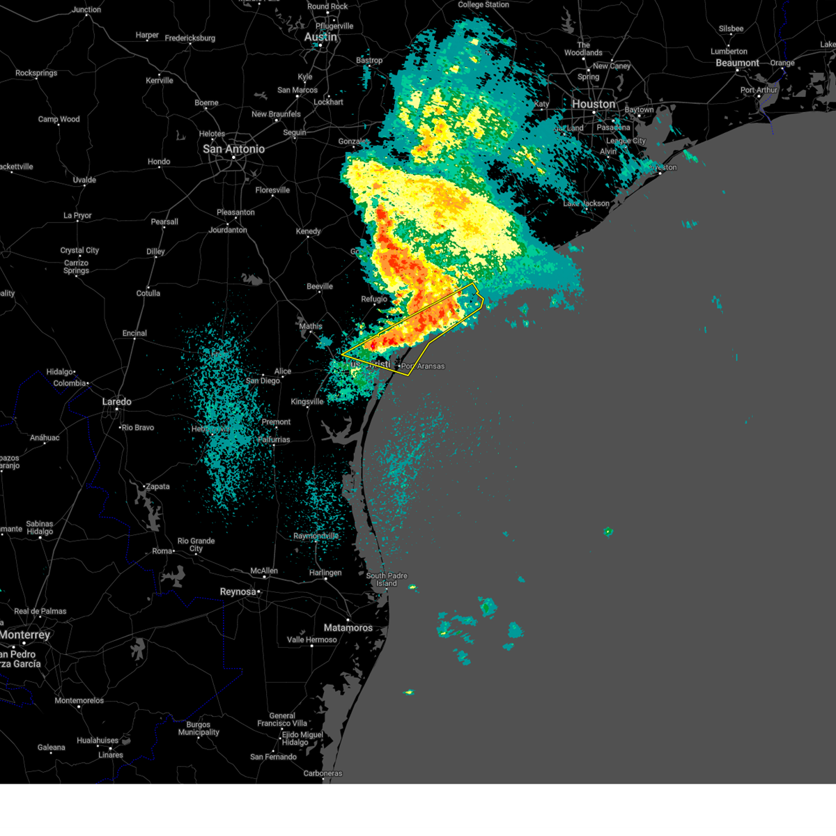
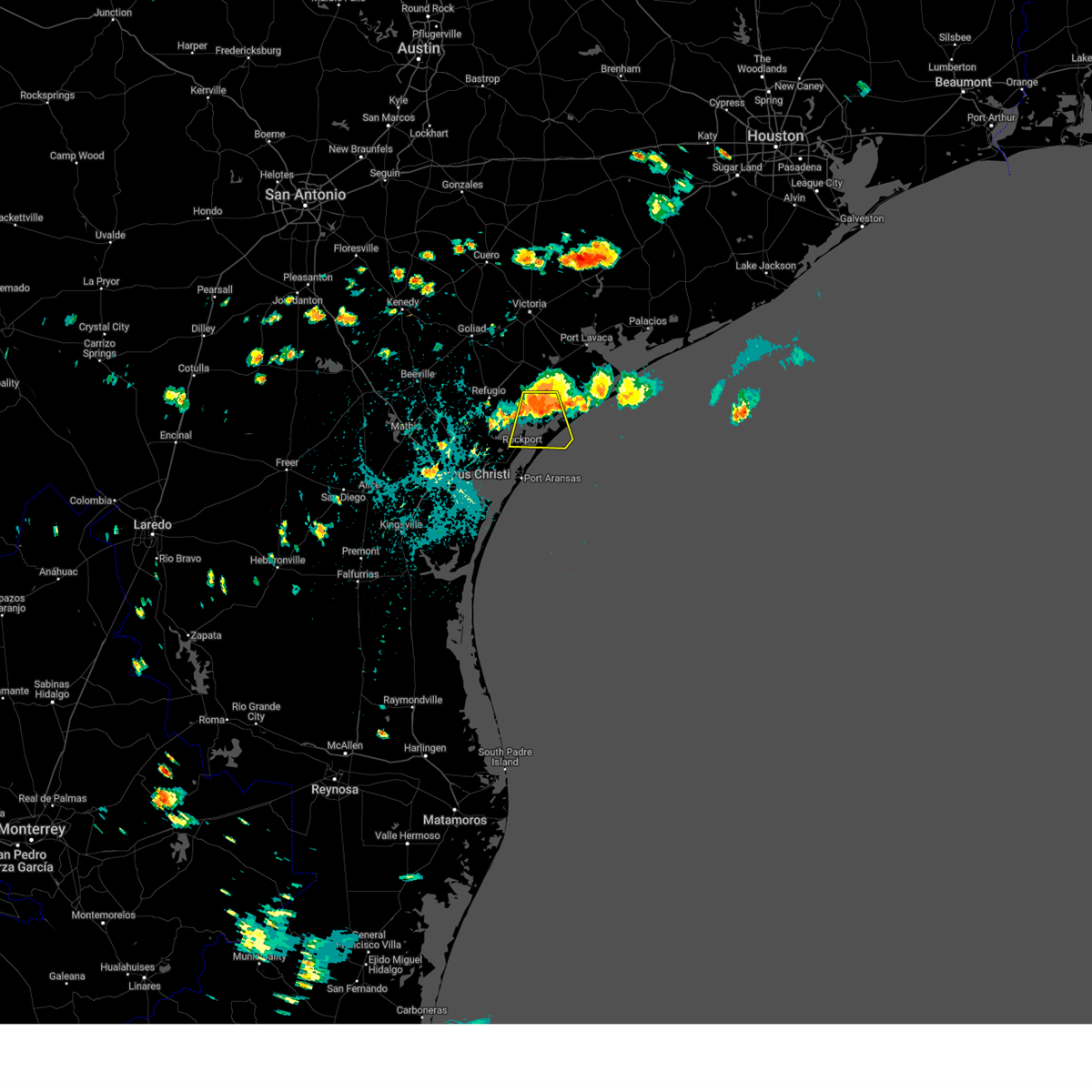
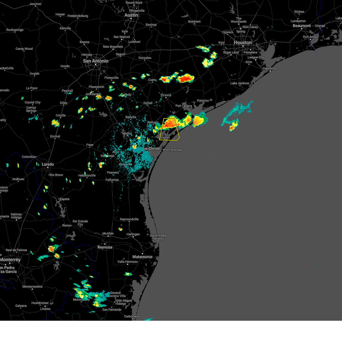
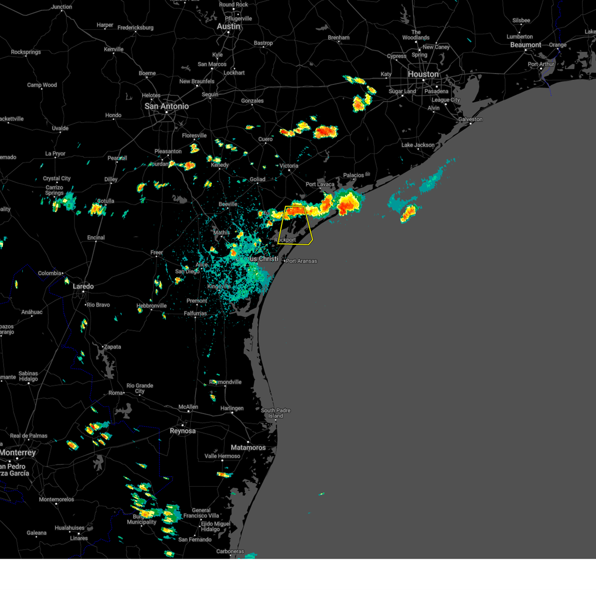
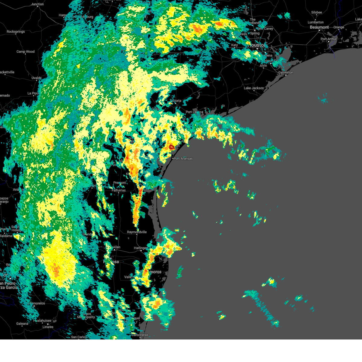
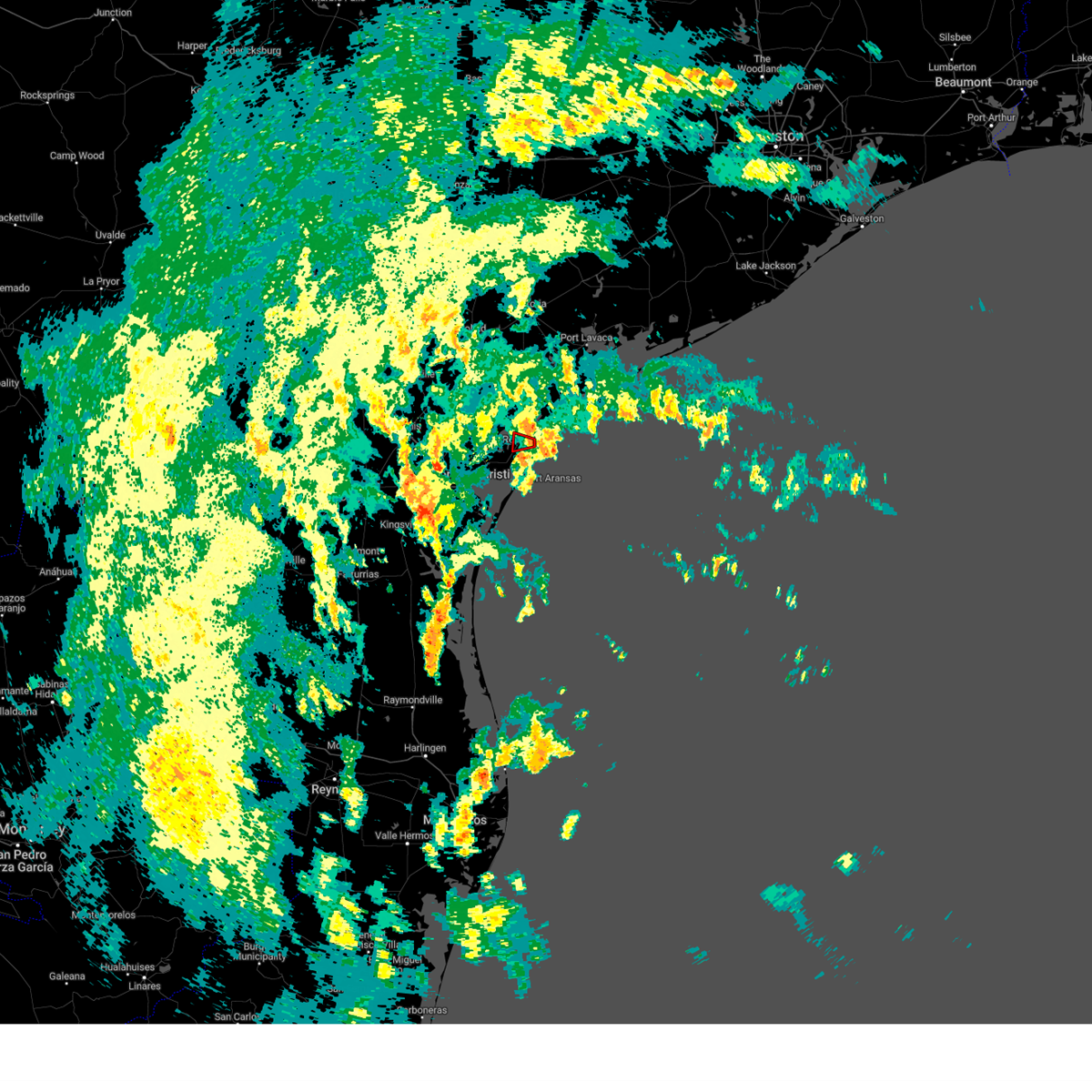
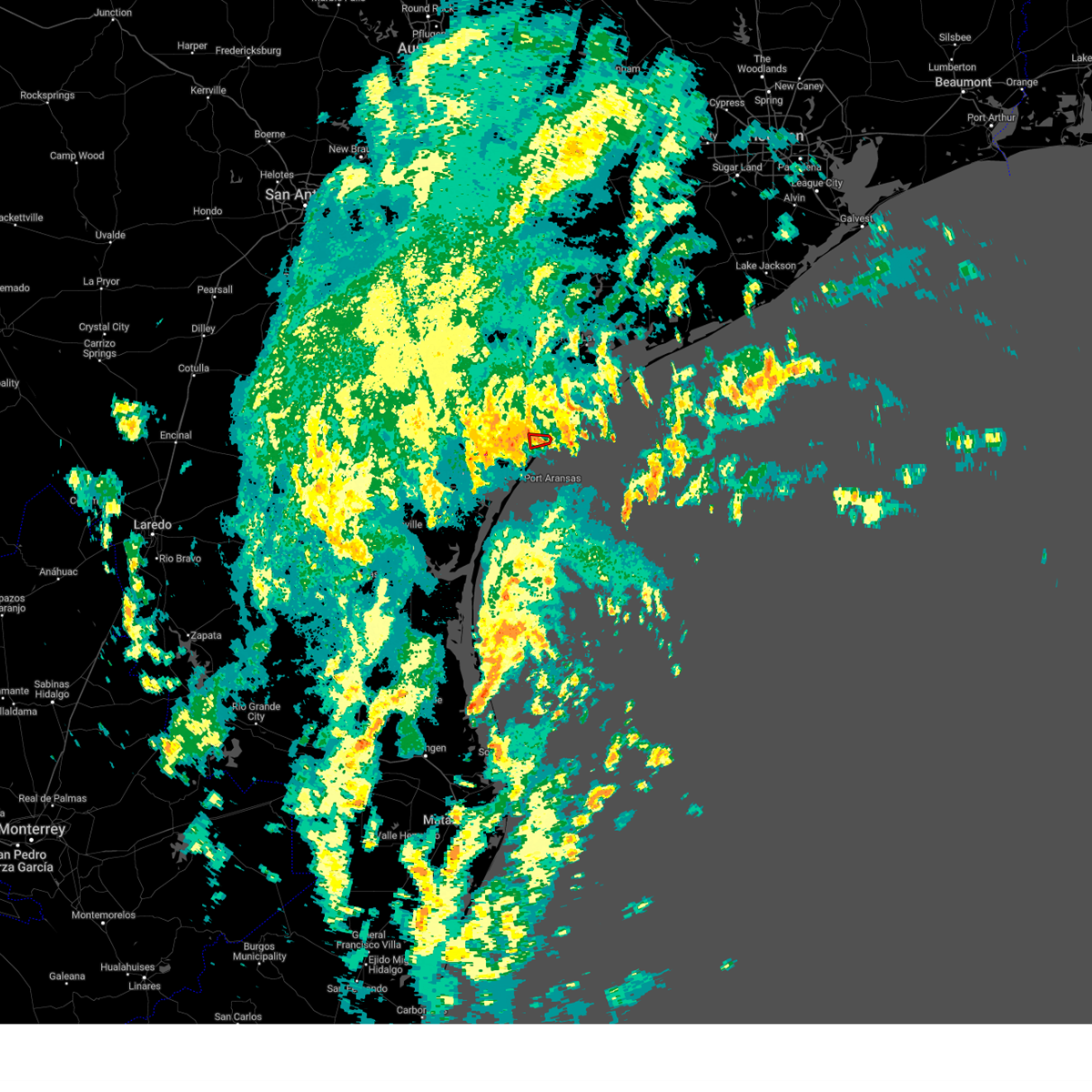
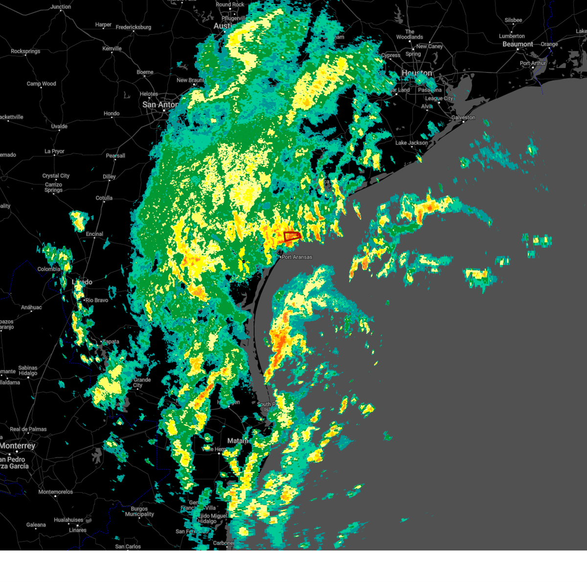
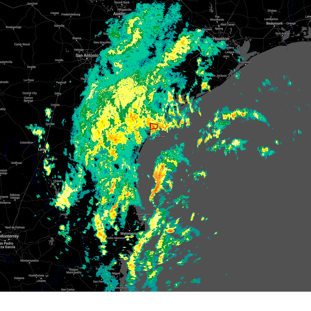
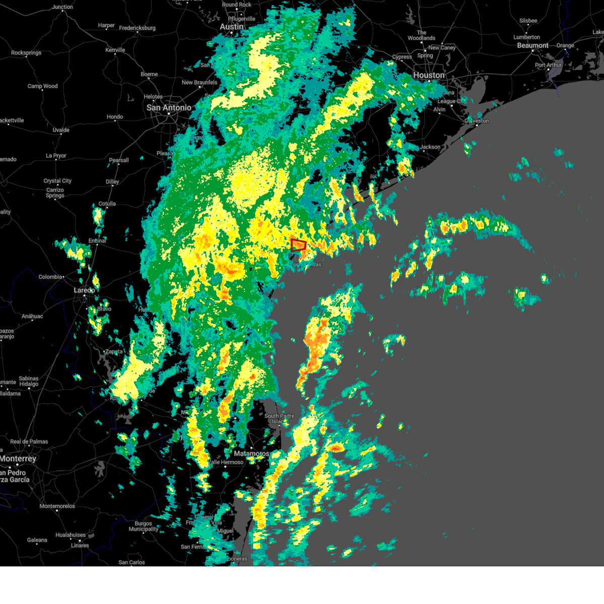
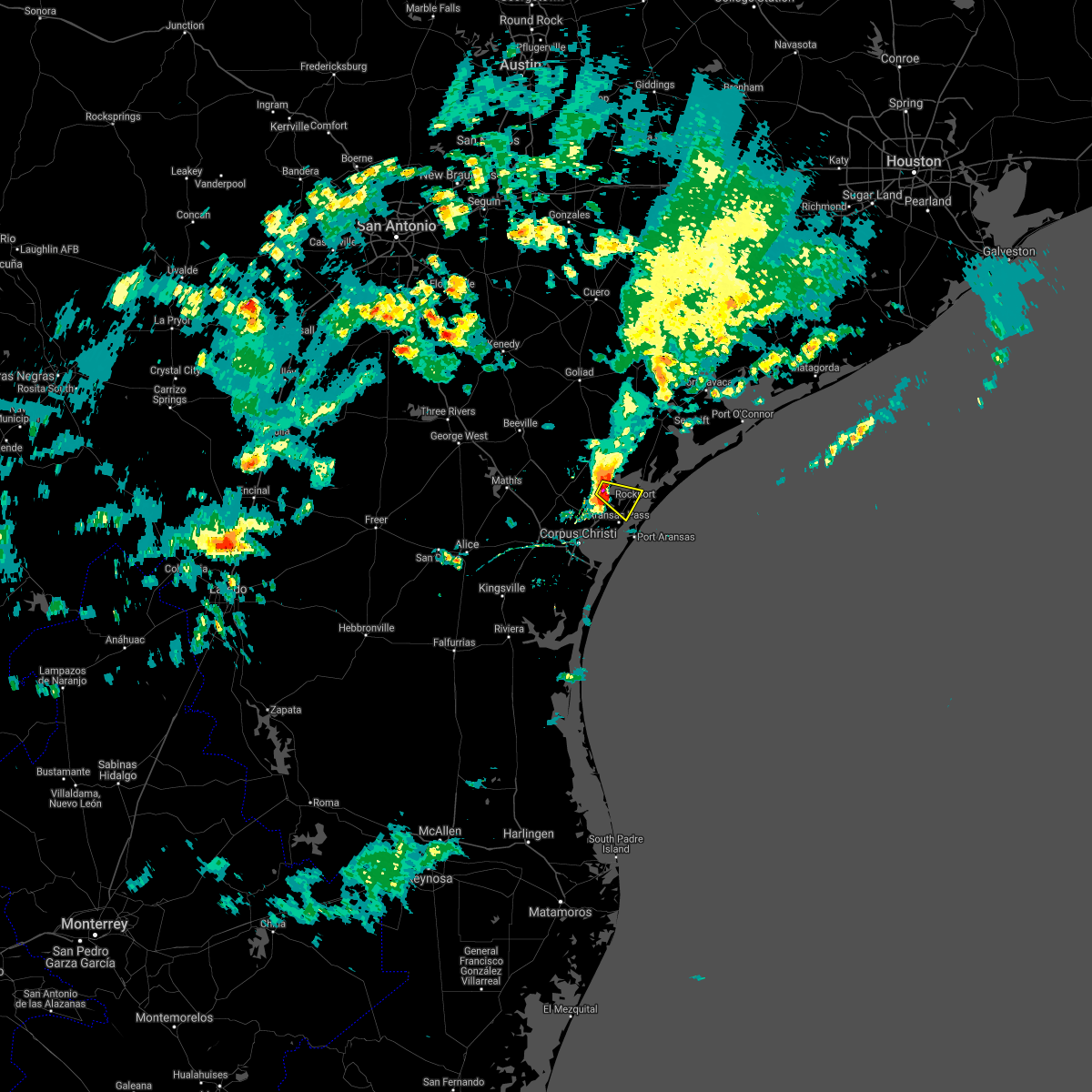
Hail Map for Rockport, TX
The Rockport, TX area has had 5 reports of on-the-ground hail by trained spotters, and has been under severe weather warnings 7 times during the past 12 months. Doppler radar has detected hail at or near Rockport, TX on 29 occasions, including 1 occasion during the past year.
| Name: | Rockport, TX |
| Where Located: | 26.6 miles NE of Corpus Christi, TX |
| Map: | Google Map for Rockport, TX |
| Population: | 8766 |
| Housing Units: | 5921 |
| More Info: | Search Google for Rockport, TX |
0
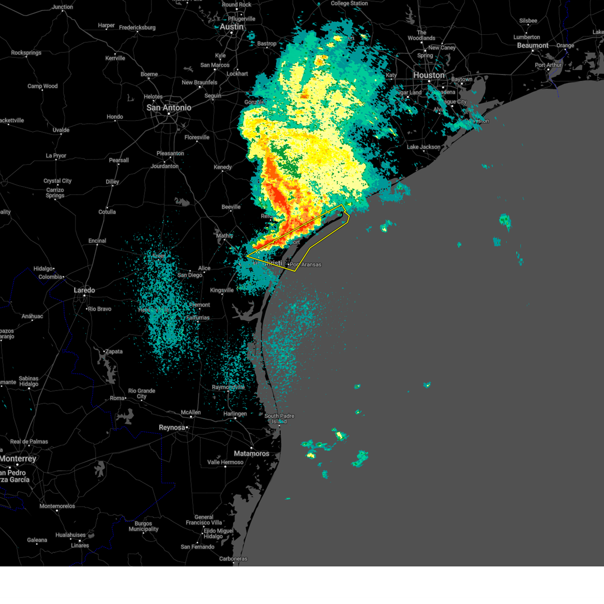
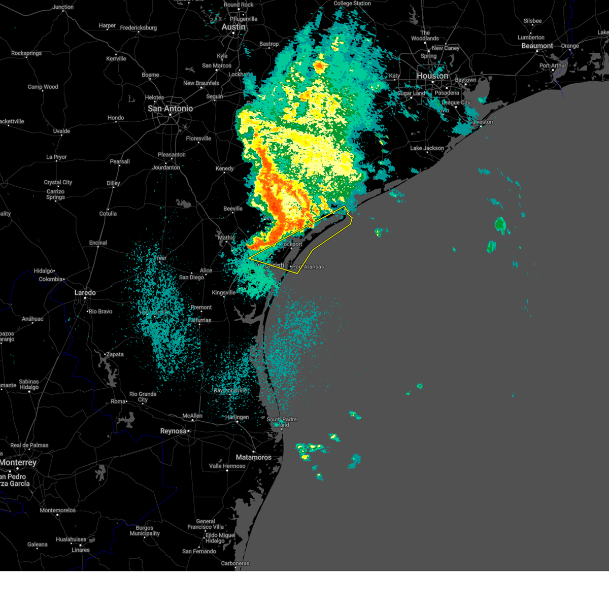
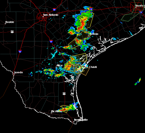
The Top Recent Hail Date for Rockport, TX is Wednesday, April 23, 2025 (22nd out of 29)

Hail and Wind Damage Spotted near Rockport, TX
| Date / Time | Report Details |
|---|---|
| 4/23/2025 7:52 AM CDT |
 The storms which prompted the warning have weakened below severe limits, and no longer pose an immediate threat to life or property. therefore, the warning will be allowed to expire. however, small hail is still possible with these thunderstorms. The storms which prompted the warning have weakened below severe limits, and no longer pose an immediate threat to life or property. therefore, the warning will be allowed to expire. however, small hail is still possible with these thunderstorms.
|
| 4/23/2025 7:42 AM CDT |
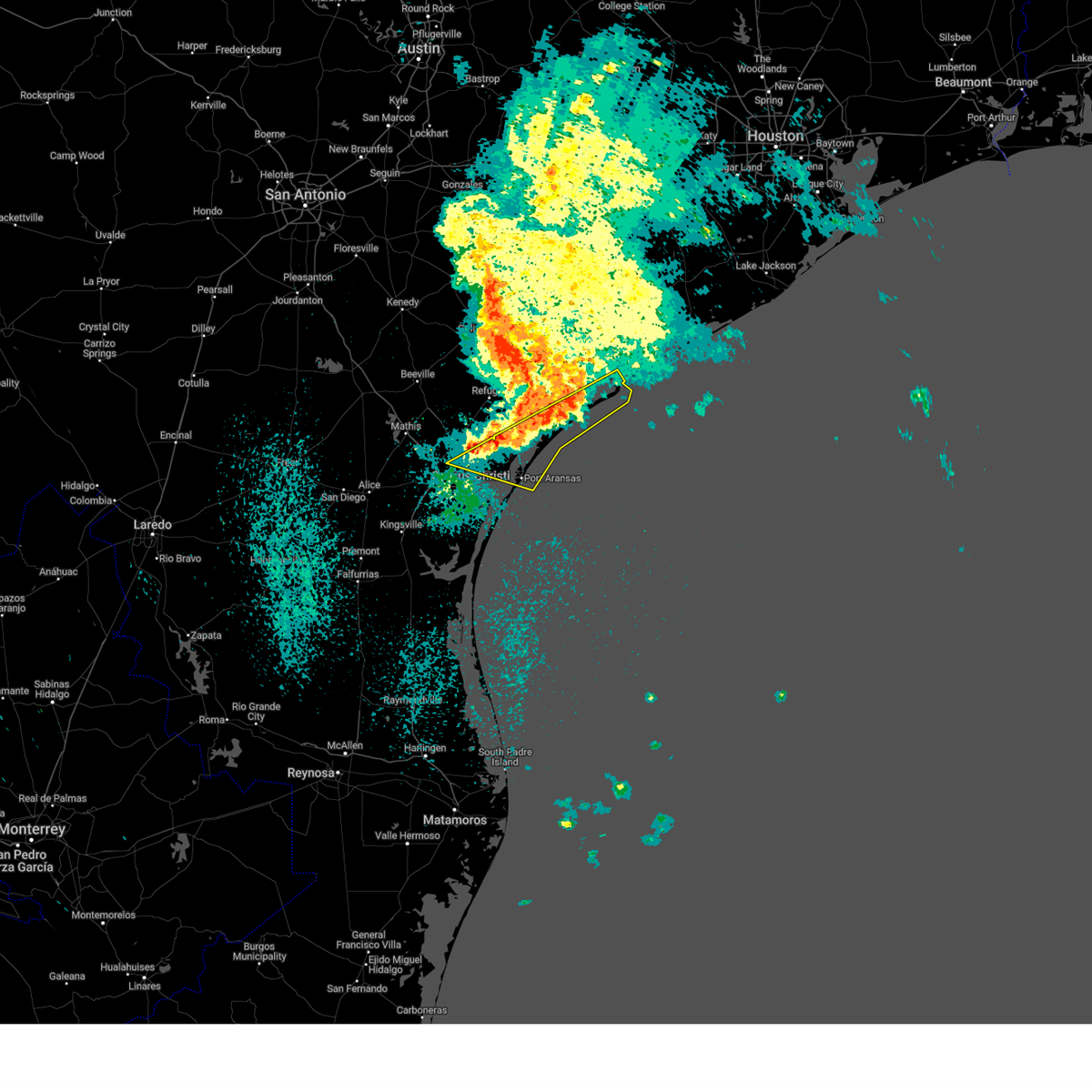 At 741 am cdt, severe thunderstorms were located along a line extending from 12 miles east of port oconnor to near gregory, and are nearly stationary (radar indicated). Hazards include 60 mph wind gusts and nickel size hail. Expect damage to roofs, siding, and trees. locations impacted include, fulton, palm harbor, portland, ingleside, key allegro, taft southwest, port oconnor, gregory, copano village, lamar, port aransas, ingleside on the bay, rockport, holiday beach, taft, aransas pass, matagorda island state park, and bayside. This includes us highway 181 between mile markers 630 and 642. At 741 am cdt, severe thunderstorms were located along a line extending from 12 miles east of port oconnor to near gregory, and are nearly stationary (radar indicated). Hazards include 60 mph wind gusts and nickel size hail. Expect damage to roofs, siding, and trees. locations impacted include, fulton, palm harbor, portland, ingleside, key allegro, taft southwest, port oconnor, gregory, copano village, lamar, port aransas, ingleside on the bay, rockport, holiday beach, taft, aransas pass, matagorda island state park, and bayside. This includes us highway 181 between mile markers 630 and 642.
|
| 4/23/2025 7:35 AM CDT |
 At 735 am cdt, severe thunderstorms were located along a line extending from near port oconnor to near taft, and are nearly stationary (trained weather spotters). Hazards include tennis ball size hail and 60 mph wind gusts. People and animals outdoors will be injured. expect hail damage to roofs, siding, windows, and vehicles. expect wind damage to roofs, siding, and trees. locations impacted include, fulton, palm harbor, portland, ingleside, key allegro, taft southwest, port oconnor, gregory, copano village, lamar, port aransas, ingleside on the bay, rockport, holiday beach, taft, aransas pass, matagorda island state park, and bayside. This includes us highway 181 between mile markers 630 and 642. At 735 am cdt, severe thunderstorms were located along a line extending from near port oconnor to near taft, and are nearly stationary (trained weather spotters). Hazards include tennis ball size hail and 60 mph wind gusts. People and animals outdoors will be injured. expect hail damage to roofs, siding, windows, and vehicles. expect wind damage to roofs, siding, and trees. locations impacted include, fulton, palm harbor, portland, ingleside, key allegro, taft southwest, port oconnor, gregory, copano village, lamar, port aransas, ingleside on the bay, rockport, holiday beach, taft, aransas pass, matagorda island state park, and bayside. This includes us highway 181 between mile markers 630 and 642.
|
| 4/23/2025 7:19 AM CDT |
 Svrcrp the national weather service in corpus christi has issued a * severe thunderstorm warning for, aransas county in south central texas, southern calhoun county in south texas, eastern nueces county in south central texas, southeastern san patricio county in south central texas, * until 800 am cdt. * at 719 am cdt, severe thunderstorms were located along a line extending from port oconnor to near taft, moving east at 40 mph (trained weather spotters). Hazards include tennis ball size hail and 60 mph wind gusts. People and animals outdoors will be injured. expect hail damage to roofs, siding, windows, and vehicles. Expect wind damage to roofs, siding, and trees. Svrcrp the national weather service in corpus christi has issued a * severe thunderstorm warning for, aransas county in south central texas, southern calhoun county in south texas, eastern nueces county in south central texas, southeastern san patricio county in south central texas, * until 800 am cdt. * at 719 am cdt, severe thunderstorms were located along a line extending from port oconnor to near taft, moving east at 40 mph (trained weather spotters). Hazards include tennis ball size hail and 60 mph wind gusts. People and animals outdoors will be injured. expect hail damage to roofs, siding, windows, and vehicles. Expect wind damage to roofs, siding, and trees.
|
| 9/25/2024 4:37 PM CDT |
 At 436 pm cdt, a severe thunderstorm was located near holiday beach, or 12 miles northeast of rockport, moving south at 20 mph (radar indicated). Hazards include 60 mph wind gusts. Expect damage to roofs, siding, and trees. Locations impacted include, rockport, lamar, holiday beach, key allegro, copano village, and fulton. At 436 pm cdt, a severe thunderstorm was located near holiday beach, or 12 miles northeast of rockport, moving south at 20 mph (radar indicated). Hazards include 60 mph wind gusts. Expect damage to roofs, siding, and trees. Locations impacted include, rockport, lamar, holiday beach, key allegro, copano village, and fulton.
|
| 9/25/2024 4:29 PM CDT |
 At 429 pm cdt, a severe thunderstorm was located near holiday beach, or 14 miles northeast of rockport, moving south at 20 mph (radar indicated). Hazards include 60 mph wind gusts. Expect damage to roofs, siding, and trees. Locations impacted include, rockport, lamar, key allegro, holiday beach, aransas national wildlife refuge, copano village, fulton, and austwell. At 429 pm cdt, a severe thunderstorm was located near holiday beach, or 14 miles northeast of rockport, moving south at 20 mph (radar indicated). Hazards include 60 mph wind gusts. Expect damage to roofs, siding, and trees. Locations impacted include, rockport, lamar, key allegro, holiday beach, aransas national wildlife refuge, copano village, fulton, and austwell.
|
| 9/25/2024 4:14 PM CDT |
 Svrcrp the national weather service in corpus christi has issued a * severe thunderstorm warning for, aransas county in south central texas, southwestern calhoun county in south texas, southeastern refugio county in south central texas, * until 500 pm cdt. * at 414 pm cdt, a severe thunderstorm was located 9 miles west of aransas national wildlife refuge, or 16 miles southwest of seadrift, moving south at 20 mph (radar indicated). Hazards include 60 mph wind gusts and quarter size hail. Hail damage to vehicles is expected. Expect wind damage to roofs, siding, and trees. Svrcrp the national weather service in corpus christi has issued a * severe thunderstorm warning for, aransas county in south central texas, southwestern calhoun county in south texas, southeastern refugio county in south central texas, * until 500 pm cdt. * at 414 pm cdt, a severe thunderstorm was located 9 miles west of aransas national wildlife refuge, or 16 miles southwest of seadrift, moving south at 20 mph (radar indicated). Hazards include 60 mph wind gusts and quarter size hail. Hail damage to vehicles is expected. Expect wind damage to roofs, siding, and trees.
|
| 6/19/2024 6:53 PM CDT |
 The storm which prompted the warning has weakened below severe limits, and has exited the warned area. therefore, the warning will be allowed to expire. The storm which prompted the warning has weakened below severe limits, and has exited the warned area. therefore, the warning will be allowed to expire.
|
| 6/19/2024 6:50 PM CDT |
 At 649 pm cdt, a severe thunderstorm capable of producing a tornado was located over rockport, moving west at 30 mph (radar indicated rotation). Hazards include tornado. Flying debris will be dangerous to those caught without shelter. mobile homes will be damaged or destroyed. damage to roofs, windows, and vehicles will occur. tree damage is likely. This tornadic thunderstorm will remain over mainly rural areas of southwestern aransas county. At 649 pm cdt, a severe thunderstorm capable of producing a tornado was located over rockport, moving west at 30 mph (radar indicated rotation). Hazards include tornado. Flying debris will be dangerous to those caught without shelter. mobile homes will be damaged or destroyed. damage to roofs, windows, and vehicles will occur. tree damage is likely. This tornadic thunderstorm will remain over mainly rural areas of southwestern aransas county.
|
| 6/19/2024 6:39 PM CDT |
 Torcrp the national weather service in corpus christi has issued a * tornado warning for, southwestern aransas county in south central texas, * until 700 pm cdt. * at 639 pm cdt, a severe thunderstorm capable of producing a tornado was located over key allegro, or near rockport, moving west at 30 mph (radar indicated rotation). Hazards include tornado. Flying debris will be dangerous to those caught without shelter. mobile homes will be damaged or destroyed. damage to roofs, windows, and vehicles will occur. tree damage is likely. this dangerous storm will be near, rockport, key allegro, and copano village around 645 pm cdt. Other locations impacted by this tornadic thunderstorm include fulton. Torcrp the national weather service in corpus christi has issued a * tornado warning for, southwestern aransas county in south central texas, * until 700 pm cdt. * at 639 pm cdt, a severe thunderstorm capable of producing a tornado was located over key allegro, or near rockport, moving west at 30 mph (radar indicated rotation). Hazards include tornado. Flying debris will be dangerous to those caught without shelter. mobile homes will be damaged or destroyed. damage to roofs, windows, and vehicles will occur. tree damage is likely. this dangerous storm will be near, rockport, key allegro, and copano village around 645 pm cdt. Other locations impacted by this tornadic thunderstorm include fulton.
|
| 6/19/2024 1:11 PM CDT |
 the tornado warning has been cancelled and is no longer in effect the tornado warning has been cancelled and is no longer in effect
|
| 6/19/2024 1:06 PM CDT |
 At 106 pm cdt, a severe thunderstorm capable of producing a tornado was located 7 miles east of key allegro, or 8 miles east of rockport, moving west at 25 mph (radar indicated rotation). Hazards include tornado. Flying debris will be dangerous to those caught without shelter. mobile homes will be damaged or destroyed. damage to roofs, windows, and vehicles will occur. tree damage is likely. This tornadic thunderstorm will remain over mainly rural areas of east central aransas county. At 106 pm cdt, a severe thunderstorm capable of producing a tornado was located 7 miles east of key allegro, or 8 miles east of rockport, moving west at 25 mph (radar indicated rotation). Hazards include tornado. Flying debris will be dangerous to those caught without shelter. mobile homes will be damaged or destroyed. damage to roofs, windows, and vehicles will occur. tree damage is likely. This tornadic thunderstorm will remain over mainly rural areas of east central aransas county.
|
| 6/19/2024 12:53 PM CDT |
 Torcrp the national weather service in corpus christi has issued a * tornado warning for, east central aransas county in south central texas, * until 130 pm cdt. * at 1253 pm cdt, a severe thunderstorm capable of producing a tornado was located 10 miles southeast of lamar, or 12 miles east of rockport, moving west at 30 mph (radar indicated rotation). Hazards include tornado. Flying debris will be dangerous to those caught without shelter. mobile homes will be damaged or destroyed. damage to roofs, windows, and vehicles will occur. tree damage is likely. This tornadic thunderstorm will remain over mainly rural areas of east central aransas county. Torcrp the national weather service in corpus christi has issued a * tornado warning for, east central aransas county in south central texas, * until 130 pm cdt. * at 1253 pm cdt, a severe thunderstorm capable of producing a tornado was located 10 miles southeast of lamar, or 12 miles east of rockport, moving west at 30 mph (radar indicated rotation). Hazards include tornado. Flying debris will be dangerous to those caught without shelter. mobile homes will be damaged or destroyed. damage to roofs, windows, and vehicles will occur. tree damage is likely. This tornadic thunderstorm will remain over mainly rural areas of east central aransas county.
|
| 6/19/2024 12:32 PM CDT |
 the tornado warning has been cancelled and is no longer in effect the tornado warning has been cancelled and is no longer in effect
|
| 6/19/2024 12:25 PM CDT |
 At 1224 pm cdt, a severe thunderstorm capable of producing a tornado was located near key allegro, or near rockport, moving west at 25 mph (radar indicated rotation). Hazards include tornado. Flying debris will be dangerous to those caught without shelter. mobile homes will be damaged or destroyed. damage to roofs, windows, and vehicles will occur. tree damage is likely. This tornadic thunderstorm will remain over mainly rural areas of east central aransas county. At 1224 pm cdt, a severe thunderstorm capable of producing a tornado was located near key allegro, or near rockport, moving west at 25 mph (radar indicated rotation). Hazards include tornado. Flying debris will be dangerous to those caught without shelter. mobile homes will be damaged or destroyed. damage to roofs, windows, and vehicles will occur. tree damage is likely. This tornadic thunderstorm will remain over mainly rural areas of east central aransas county.
|
| 6/19/2024 12:12 PM CDT |
 Torcrp the national weather service in corpus christi has issued a * tornado warning for, east central aransas county in south central texas, * until 1245 pm cdt. * at 1211 pm cdt, a severe thunderstorm capable of producing a tornado was located 8 miles east of key allegro, or 10 miles east of rockport, moving west at 25 mph (radar indicated rotation). Hazards include tornado. Flying debris will be dangerous to those caught without shelter. mobile homes will be damaged or destroyed. damage to roofs, windows, and vehicles will occur. tree damage is likely. This tornadic thunderstorm will remain over mainly rural areas of east central aransas county. Torcrp the national weather service in corpus christi has issued a * tornado warning for, east central aransas county in south central texas, * until 1245 pm cdt. * at 1211 pm cdt, a severe thunderstorm capable of producing a tornado was located 8 miles east of key allegro, or 10 miles east of rockport, moving west at 25 mph (radar indicated rotation). Hazards include tornado. Flying debris will be dangerous to those caught without shelter. mobile homes will be damaged or destroyed. damage to roofs, windows, and vehicles will occur. tree damage is likely. This tornadic thunderstorm will remain over mainly rural areas of east central aransas county.
|
| 6/19/2024 12:01 PM CDT |
 At 1200 pm cdt, a severe thunderstorm capable of producing a tornado was located near key allegro, or 8 miles east of rockport, moving west at 30 mph (radar indicated rotation). Hazards include tornado. Flying debris will be dangerous to those caught without shelter. mobile homes will be damaged or destroyed. damage to roofs, windows, and vehicles will occur. tree damage is likely. This tornadic thunderstorm will remain over mainly rural areas of east central aransas county. At 1200 pm cdt, a severe thunderstorm capable of producing a tornado was located near key allegro, or 8 miles east of rockport, moving west at 30 mph (radar indicated rotation). Hazards include tornado. Flying debris will be dangerous to those caught without shelter. mobile homes will be damaged or destroyed. damage to roofs, windows, and vehicles will occur. tree damage is likely. This tornadic thunderstorm will remain over mainly rural areas of east central aransas county.
|
| 6/19/2024 12:01 PM CDT |
 the tornado warning has been cancelled and is no longer in effect the tornado warning has been cancelled and is no longer in effect
|
| 6/19/2024 11:43 AM CDT |
 Torcrp the national weather service in corpus christi has issued a * tornado warning for, east central aransas county in south central texas, southern calhoun county in south texas, * until 1215 pm cdt. * at 1143 am cdt, a severe thunderstorm capable of producing a tornado was located 13 miles east of lamar, or 16 miles east of rockport, moving west at 30 mph (radar indicated rotation). Hazards include tornado. Flying debris will be dangerous to those caught without shelter. mobile homes will be damaged or destroyed. damage to roofs, windows, and vehicles will occur. tree damage is likely. This tornadic thunderstorm will remain over mainly rural areas of east central aransas and southern calhoun counties. Torcrp the national weather service in corpus christi has issued a * tornado warning for, east central aransas county in south central texas, southern calhoun county in south texas, * until 1215 pm cdt. * at 1143 am cdt, a severe thunderstorm capable of producing a tornado was located 13 miles east of lamar, or 16 miles east of rockport, moving west at 30 mph (radar indicated rotation). Hazards include tornado. Flying debris will be dangerous to those caught without shelter. mobile homes will be damaged or destroyed. damage to roofs, windows, and vehicles will occur. tree damage is likely. This tornadic thunderstorm will remain over mainly rural areas of east central aransas and southern calhoun counties.
|
| 5/29/2024 2:18 AM CDT |
 the severe thunderstorm warning has been cancelled and is no longer in effect the severe thunderstorm warning has been cancelled and is no longer in effect
|
| 5/29/2024 2:03 AM CDT |
 Svrcrp the national weather service in corpus christi has issued a * severe thunderstorm warning for, aransas county in south central texas, southeastern san patricio county in south central texas, south central refugio county in south central texas, * until 245 am cdt. * at 202 am cdt, a severe thunderstorm was located near ingleside, or near portland, moving northeast at 30 mph (radar indicated). Hazards include 60 mph wind gusts. expect damage to roofs, siding, and trees Svrcrp the national weather service in corpus christi has issued a * severe thunderstorm warning for, aransas county in south central texas, southeastern san patricio county in south central texas, south central refugio county in south central texas, * until 245 am cdt. * at 202 am cdt, a severe thunderstorm was located near ingleside, or near portland, moving northeast at 30 mph (radar indicated). Hazards include 60 mph wind gusts. expect damage to roofs, siding, and trees
|
| 4/10/2024 1:48 AM CDT |
 Svrcrp the national weather service in corpus christi has issued a * severe thunderstorm warning for, southern aransas county in south central texas, southeastern nueces county in south central texas, southeastern san patricio county in south central texas, eastern kleberg county in south central texas, * until 215 am cdt. * at 147 am cdt, severe thunderstorms were located along a line extending from near bayside to 7 miles northeast of riviera beach, moving east at 55 mph (radar indicated). Hazards include 60 mph wind gusts. expect damage to roofs, siding, and trees Svrcrp the national weather service in corpus christi has issued a * severe thunderstorm warning for, southern aransas county in south central texas, southeastern nueces county in south central texas, southeastern san patricio county in south central texas, eastern kleberg county in south central texas, * until 215 am cdt. * at 147 am cdt, severe thunderstorms were located along a line extending from near bayside to 7 miles northeast of riviera beach, moving east at 55 mph (radar indicated). Hazards include 60 mph wind gusts. expect damage to roofs, siding, and trees
|
| 3/17/2024 4:09 AM CDT |
 The storms which prompted the warning have weakened below severe limits, and no longer pose an immediate threat to life or property. therefore, the warning will be allowed to expire. however, gusty winds are still possible with these thunderstorms. The storms which prompted the warning have weakened below severe limits, and no longer pose an immediate threat to life or property. therefore, the warning will be allowed to expire. however, gusty winds are still possible with these thunderstorms.
|
| 3/17/2024 3:31 AM CDT |
 Svrcrp the national weather service in corpus christi has issued a * severe thunderstorm warning for, southern calhoun county in south texas, aransas county in south central texas, east central refugio county in south central texas, * until 415 am cdt. * at 331 am cdt, severe thunderstorms were located along a line extending from near holiday beach to 7 miles northeast of lamar to near key allegro, moving east at 35 mph (radar indicated). Hazards include 60 mph wind gusts and penny size hail. expect damage to roofs, siding, and trees Svrcrp the national weather service in corpus christi has issued a * severe thunderstorm warning for, southern calhoun county in south texas, aransas county in south central texas, east central refugio county in south central texas, * until 415 am cdt. * at 331 am cdt, severe thunderstorms were located along a line extending from near holiday beach to 7 miles northeast of lamar to near key allegro, moving east at 35 mph (radar indicated). Hazards include 60 mph wind gusts and penny size hail. expect damage to roofs, siding, and trees
|
| 4/27/2023 10:46 AM CDT |
 At 1046 am cdt, a severe thunderstorm was located over palm harbor, or near rockport, moving northeast at 35 mph (radar indicated). Hazards include 60 mph wind gusts and half dollar size hail. Hail damage to vehicles is expected. Expect wind damage to roofs, siding, and trees. At 1046 am cdt, a severe thunderstorm was located over palm harbor, or near rockport, moving northeast at 35 mph (radar indicated). Hazards include 60 mph wind gusts and half dollar size hail. Hail damage to vehicles is expected. Expect wind damage to roofs, siding, and trees.
|
| 4/23/2023 10:55 AM CDT |
 At 1055 am cdt, severe thunderstorms were located along a line extending from near key allegro to near port aransas to near south texas botanical gardens, moving east at 45 mph (trained weather spotters). Hazards include 60 mph wind gusts and half dollar size hail. Hail damage to vehicles is expected. expect wind damage to roofs, siding, and trees. locations impacted include, corpus christi, kingsville, portland, robstown, rockport, port aransas, driscoll, corpus christi international airport, ingleside, aransas pass, bishop, gregory, ingleside on the bay, flour bluff, palm harbor, corpus christi north beach, kings crossing subdivision, padre balli park, bay area medical center and spohn hospital south. this includes the following highways, interstate 37 between mile markers 1 and 15. us highway 181 between mile markers 636 and 648. us highway 77 between mile markers 672 and 694. hail threat, radar indicated max hail size, 1. 25 in wind threat, observed max wind gust, 60 mph. At 1055 am cdt, severe thunderstorms were located along a line extending from near key allegro to near port aransas to near south texas botanical gardens, moving east at 45 mph (trained weather spotters). Hazards include 60 mph wind gusts and half dollar size hail. Hail damage to vehicles is expected. expect wind damage to roofs, siding, and trees. locations impacted include, corpus christi, kingsville, portland, robstown, rockport, port aransas, driscoll, corpus christi international airport, ingleside, aransas pass, bishop, gregory, ingleside on the bay, flour bluff, palm harbor, corpus christi north beach, kings crossing subdivision, padre balli park, bay area medical center and spohn hospital south. this includes the following highways, interstate 37 between mile markers 1 and 15. us highway 181 between mile markers 636 and 648. us highway 77 between mile markers 672 and 694. hail threat, radar indicated max hail size, 1. 25 in wind threat, observed max wind gust, 60 mph.
|
| 4/23/2023 10:33 AM CDT |
 At 1033 am cdt, severe thunderstorms were located along a line extending from near bayside to near ingleside on the bay to 7 miles southeast of driscoll, moving east at 45 mph (radar indicated). Hazards include 60 mph wind gusts and half dollar size hail. Hail damage to vehicles is expected. Expect wind damage to roofs, siding, and trees. At 1033 am cdt, severe thunderstorms were located along a line extending from near bayside to near ingleside on the bay to 7 miles southeast of driscoll, moving east at 45 mph (radar indicated). Hazards include 60 mph wind gusts and half dollar size hail. Hail damage to vehicles is expected. Expect wind damage to roofs, siding, and trees.
|
| 5/25/2022 2:55 AM CDT |
 The severe thunderstorm warning for aransas, calhoun, southeastern victoria, southeastern goliad and refugio counties will expire at 300 am cdt, the storms which prompted the warning have weakened below severe limits, and no longer pose an immediate threat to life or property. therefore, the warning will be allowed to expire. however heavy rain is still possible with these thunderstorms. a severe thunderstorm watch remains in effect until 500 am cdt for south central and south texas. to report severe weather, contact your nearest law enforcement agency. they will relay your report to the national weather service corpus christi. The severe thunderstorm warning for aransas, calhoun, southeastern victoria, southeastern goliad and refugio counties will expire at 300 am cdt, the storms which prompted the warning have weakened below severe limits, and no longer pose an immediate threat to life or property. therefore, the warning will be allowed to expire. however heavy rain is still possible with these thunderstorms. a severe thunderstorm watch remains in effect until 500 am cdt for south central and south texas. to report severe weather, contact your nearest law enforcement agency. they will relay your report to the national weather service corpus christi.
|
| 5/25/2022 1:56 AM CDT |
 At 155 am cdt, severe thunderstorms were located along a line extending from near inez to near bloomington to near quintana, moving southeast at 45 mph (radar indicated). Hazards include 70 mph wind gusts and penny size hail. Expect considerable tree damage. Damage is likely to mobile homes, roofs, and outbuildings. At 155 am cdt, severe thunderstorms were located along a line extending from near inez to near bloomington to near quintana, moving southeast at 45 mph (radar indicated). Hazards include 70 mph wind gusts and penny size hail. Expect considerable tree damage. Damage is likely to mobile homes, roofs, and outbuildings.
|
| 11/3/2021 6:52 PM CDT |
 At 651 pm cdt, a severe thunderstorm was located near rockport, moving southeast at 20 mph (radar indicated). Hazards include 60 mph wind gusts and quarter size hail. Hail damage to vehicles is expected. expect wind damage to roofs, siding, and trees. locations impacted include, rockport, palm harbor and key allegro. hail threat, radar indicated max hail size, 1. 00 in wind threat, radar indicated max wind gust, 60 mph. At 651 pm cdt, a severe thunderstorm was located near rockport, moving southeast at 20 mph (radar indicated). Hazards include 60 mph wind gusts and quarter size hail. Hail damage to vehicles is expected. expect wind damage to roofs, siding, and trees. locations impacted include, rockport, palm harbor and key allegro. hail threat, radar indicated max hail size, 1. 00 in wind threat, radar indicated max wind gust, 60 mph.
|
| 11/3/2021 6:34 PM CDT |
 At 634 pm cdt, a severe thunderstorm was located over bayside, or 9 miles west of rockport, moving southeast at 25 mph (radar indicated). Hazards include 60 mph wind gusts and quarter size hail. Hail damage to vehicles is expected. expect wind damage to roofs, siding, and trees. locations impacted include, rockport, bayside, palm harbor, copano village and fulton. hail threat, radar indicated max hail size, 1. 00 in wind threat, radar indicated max wind gust, 60 mph. At 634 pm cdt, a severe thunderstorm was located over bayside, or 9 miles west of rockport, moving southeast at 25 mph (radar indicated). Hazards include 60 mph wind gusts and quarter size hail. Hail damage to vehicles is expected. expect wind damage to roofs, siding, and trees. locations impacted include, rockport, bayside, palm harbor, copano village and fulton. hail threat, radar indicated max hail size, 1. 00 in wind threat, radar indicated max wind gust, 60 mph.
|
| 11/3/2021 6:22 PM CDT |
 At 622 pm cdt, a severe thunderstorm was located near bayside, or 9 miles south of woodsboro, moving southeast at 20 mph (radar indicated). Hazards include 60 mph wind gusts and quarter size hail. Hail damage to vehicles is expected. Expect wind damage to roofs, siding, and trees. At 622 pm cdt, a severe thunderstorm was located near bayside, or 9 miles south of woodsboro, moving southeast at 20 mph (radar indicated). Hazards include 60 mph wind gusts and quarter size hail. Hail damage to vehicles is expected. Expect wind damage to roofs, siding, and trees.
|
| 5/28/2020 8:14 PM CDT |
 At 814 pm cdt, a severe thunderstorm was located over bayside, or 10 miles southeast of woodsboro, moving southwest at 25 mph (radar indicated). Hazards include 60 mph wind gusts and quarter size hail. Hail damage to vehicles is expected. expect wind damage to roofs, siding, and trees. Locations impacted include, rockport, sinton, taft, refugio, woodsboro, lamar, ingleside, aransas pass, bayside, quintana, palm harbor, key allegro, copano village, bonnie view, holiday beach, tivoli, aransas national wildlife refuge, fulton and austwell. At 814 pm cdt, a severe thunderstorm was located over bayside, or 10 miles southeast of woodsboro, moving southwest at 25 mph (radar indicated). Hazards include 60 mph wind gusts and quarter size hail. Hail damage to vehicles is expected. expect wind damage to roofs, siding, and trees. Locations impacted include, rockport, sinton, taft, refugio, woodsboro, lamar, ingleside, aransas pass, bayside, quintana, palm harbor, key allegro, copano village, bonnie view, holiday beach, tivoli, aransas national wildlife refuge, fulton and austwell.
|
| 5/28/2020 7:57 PM CDT |
 At 756 pm cdt, a severe thunderstorm was located near bayside, or 8 miles northwest of rockport, moving south at 25 mph (radar indicated). Hazards include 60 mph wind gusts and quarter size hail. Hail damage to vehicles is expected. Expect wind damage to roofs, siding, and trees. At 756 pm cdt, a severe thunderstorm was located near bayside, or 8 miles northwest of rockport, moving south at 25 mph (radar indicated). Hazards include 60 mph wind gusts and quarter size hail. Hail damage to vehicles is expected. Expect wind damage to roofs, siding, and trees.
|
| 5/16/2020 1:37 AM CDT |
 At 137 am cdt, severe thunderstorms were located along a line extending from 6 miles southwest of woodsboro to near kingsville, moving east at 45 mph (radar indicated). Hazards include 60 mph wind gusts and penny size hail. expect damage to roofs, siding, and trees At 137 am cdt, severe thunderstorms were located along a line extending from 6 miles southwest of woodsboro to near kingsville, moving east at 45 mph (radar indicated). Hazards include 60 mph wind gusts and penny size hail. expect damage to roofs, siding, and trees
|
| 4/29/2020 8:02 AM CDT | Storm damage reported in aransas county TX, 3.7 miles SSW of Rockport, TX |
| 6/17/2019 3:56 AM CDT |
 At 355 am cdt, severe thunderstorms were located along a line extending from near aransas national wildlife refuge to near bayside, moving southeast at 35 mph (radar indicated). Hazards include 60 mph wind gusts. Expect damage to roofs, siding, and trees. Locations impacted include, rockport, lamar, aransas pass, bayside, palm harbor, key allegro, holiday beach, copano village and fulton. At 355 am cdt, severe thunderstorms were located along a line extending from near aransas national wildlife refuge to near bayside, moving southeast at 35 mph (radar indicated). Hazards include 60 mph wind gusts. Expect damage to roofs, siding, and trees. Locations impacted include, rockport, lamar, aransas pass, bayside, palm harbor, key allegro, holiday beach, copano village and fulton.
|
| 6/17/2019 3:34 AM CDT |
 At 333 am cdt, severe thunderstorms were located along a line extending from 7 miles southwest of tivoli to near woodsboro, moving southeast at 45 mph (radar indicated). Hazards include 60 mph wind gusts. expect damage to roofs, siding, and trees At 333 am cdt, severe thunderstorms were located along a line extending from 7 miles southwest of tivoli to near woodsboro, moving southeast at 45 mph (radar indicated). Hazards include 60 mph wind gusts. expect damage to roofs, siding, and trees
|
| 6/6/2019 7:36 PM CDT |
 The severe thunderstorm warning for northern aransas and central refugio counties will expire at 745 pm cdt, the storm which prompted the warning has weakened below severe limits, and no longer poses an immediate threat to life or property. therefore, the warning will be allowed to expire. a severe thunderstorm watch remains in effect until 1000 pm cdt for south central texas. The severe thunderstorm warning for northern aransas and central refugio counties will expire at 745 pm cdt, the storm which prompted the warning has weakened below severe limits, and no longer poses an immediate threat to life or property. therefore, the warning will be allowed to expire. a severe thunderstorm watch remains in effect until 1000 pm cdt for south central texas.
|
| 6/6/2019 7:18 PM CDT |
 At 717 pm cdt, a severe thunderstorm was located near refugio, moving southeast at 30 mph (radar indicated). Hazards include 60 mph wind gusts and quarter size hail. Hail damage to vehicles is expected. expect wind damage to roofs, siding, and trees. Locations impacted include, rockport, refugio, woodsboro, lamar, bayside, quintana, palm harbor, key allegro, bonnie view, holiday beach, copano village and fulton. At 717 pm cdt, a severe thunderstorm was located near refugio, moving southeast at 30 mph (radar indicated). Hazards include 60 mph wind gusts and quarter size hail. Hail damage to vehicles is expected. expect wind damage to roofs, siding, and trees. Locations impacted include, rockport, refugio, woodsboro, lamar, bayside, quintana, palm harbor, key allegro, bonnie view, holiday beach, copano village and fulton.
|
| 6/6/2019 6:57 PM CDT |
 The national weather service in corpus christi has issued a * severe thunderstorm warning for. northern aransas county in south central texas. south central goliad county in south central texas. central refugio county in south central texas. East central bee county in south central texas. The national weather service in corpus christi has issued a * severe thunderstorm warning for. northern aransas county in south central texas. south central goliad county in south central texas. central refugio county in south central texas. East central bee county in south central texas.
|
| 5/10/2019 3:42 AM CDT |
 At 341 am cdt, a severe thunderstorm was located near aransas national wildlife refuge, or 14 miles southwest of seadrift, moving northeast at 25 mph (radar indicated). Hazards include quarter size hail. Damage to vehicles is expected. Locations impacted include, rockport, lamar, palm harbor, key allegro, holiday beach, copano village and fulton. At 341 am cdt, a severe thunderstorm was located near aransas national wildlife refuge, or 14 miles southwest of seadrift, moving northeast at 25 mph (radar indicated). Hazards include quarter size hail. Damage to vehicles is expected. Locations impacted include, rockport, lamar, palm harbor, key allegro, holiday beach, copano village and fulton.
|
| 5/10/2019 3:12 AM CDT |
 At 311 am cdt, a severe thunderstorm was located over lamar, or near rockport, moving northeast at 25 mph (radar indicated). Hazards include quarter size hail. damage to vehicles is expected At 311 am cdt, a severe thunderstorm was located over lamar, or near rockport, moving northeast at 25 mph (radar indicated). Hazards include quarter size hail. damage to vehicles is expected
|
| 5/10/2019 12:11 AM CDT |
 At 1210 am cdt, severe thunderstorms were located along a line extending from near ganado to 23 miles south of matagorda island state park, moving east at 35 mph (radar indicated). Hazards include 60 mph wind gusts and penny size hail. Expect damage to roofs, siding, and trees. Locations impacted include, port lavaca, rockport, seadrift, port oconnor, lamar, point comfort, alamo beach, key allegro, indianola, magnolia beach, olivia, aransas national wildlife refuge, matagorda island state park and fulton. At 1210 am cdt, severe thunderstorms were located along a line extending from near ganado to 23 miles south of matagorda island state park, moving east at 35 mph (radar indicated). Hazards include 60 mph wind gusts and penny size hail. Expect damage to roofs, siding, and trees. Locations impacted include, port lavaca, rockport, seadrift, port oconnor, lamar, point comfort, alamo beach, key allegro, indianola, magnolia beach, olivia, aransas national wildlife refuge, matagorda island state park and fulton.
|
| 5/9/2019 11:41 PM CDT |
 At 1140 pm cdt, severe thunderstorms were located along a line extending from 8 miles northeast of salem to 18 miles east of key allegro, moving east at 35 mph (radar indicated). Hazards include 60 mph wind gusts and penny size hail. expect damage to roofs, siding, and trees At 1140 pm cdt, severe thunderstorms were located along a line extending from 8 miles northeast of salem to 18 miles east of key allegro, moving east at 35 mph (radar indicated). Hazards include 60 mph wind gusts and penny size hail. expect damage to roofs, siding, and trees
|
| 5/9/2019 11:25 PM CDT | Quarter sized hail reported 0.8 miles E of Rockport, TX |
| 5/9/2019 11:21 PM CDT |
 At 1121 pm cdt, a severe thunderstorm was located over rockport, moving north at 20 mph (radar indicated). Hazards include 60 mph wind gusts and quarter size hail. Hail damage to vehicles is expected. Expect wind damage to roofs, siding, and trees. At 1121 pm cdt, a severe thunderstorm was located over rockport, moving north at 20 mph (radar indicated). Hazards include 60 mph wind gusts and quarter size hail. Hail damage to vehicles is expected. Expect wind damage to roofs, siding, and trees.
|
| 5/3/2019 10:21 AM CDT |
 The severe thunderstorm warning for aransas, southwestern calhoun, eastern san patricio and southeastern refugio counties will expire at 1030 am cdt, the storm which prompted the warning has weakened below severe limits, and has exited the warned area. therefore, the warning will be allowed to expire. however gusty winds are still possible with this thunderstorm. a severe thunderstorm watch remains in effect until 100 pm cdt for south central texas. to report severe weather, contact your nearest law enforcement agency. they will relay your report to the national weather service corpus christi. The severe thunderstorm warning for aransas, southwestern calhoun, eastern san patricio and southeastern refugio counties will expire at 1030 am cdt, the storm which prompted the warning has weakened below severe limits, and has exited the warned area. therefore, the warning will be allowed to expire. however gusty winds are still possible with this thunderstorm. a severe thunderstorm watch remains in effect until 100 pm cdt for south central texas. to report severe weather, contact your nearest law enforcement agency. they will relay your report to the national weather service corpus christi.
|
| 5/3/2019 9:39 AM CDT |
 At 939 am cdt, a severe thunderstorm was located over bayside, or 9 miles west of rockport, moving northeast at 30 mph (radar indicated). Hazards include 60 mph wind gusts. expect damage to roofs, siding, and trees At 939 am cdt, a severe thunderstorm was located over bayside, or 9 miles west of rockport, moving northeast at 30 mph (radar indicated). Hazards include 60 mph wind gusts. expect damage to roofs, siding, and trees
|
| 4/7/2019 8:15 AM CDT |
 At 814 am cdt, severe thunderstorms were located along a line extending from 6 miles southeast of charco to near refugio to near taft to near naval air station cabaniss field, moving east at 40 mph (radar indicated). Hazards include 60 mph wind gusts and penny size hail. expect damage to roofs, siding, and trees At 814 am cdt, severe thunderstorms were located along a line extending from 6 miles southeast of charco to near refugio to near taft to near naval air station cabaniss field, moving east at 40 mph (radar indicated). Hazards include 60 mph wind gusts and penny size hail. expect damage to roofs, siding, and trees
|
| 4/14/2018 2:51 AM CDT |
 At 251 am cdt, severe thunderstorms were located along a line extending from 7 miles south of schicke point to near key allegro, moving east at 35 mph (radar indicated). Hazards include 60 mph wind gusts. Expect damage to roofs, siding, and trees. Locations impacted include, rockport, seadrift, port oconnor, lamar, bayside, alamo beach, key allegro, indianola, magnolia beach, copano village, holiday beach, aransas national wildlife refuge, matagorda island state park, fulton and austwell. At 251 am cdt, severe thunderstorms were located along a line extending from 7 miles south of schicke point to near key allegro, moving east at 35 mph (radar indicated). Hazards include 60 mph wind gusts. Expect damage to roofs, siding, and trees. Locations impacted include, rockport, seadrift, port oconnor, lamar, bayside, alamo beach, key allegro, indianola, magnolia beach, copano village, holiday beach, aransas national wildlife refuge, matagorda island state park, fulton and austwell.
|
| 4/14/2018 2:50 AM CDT |
 At 250 am cdt, severe thunderstorms were located along a line extending from near port aransas to 11 miles northeast of riviera beach, moving southeast at 45 mph (radar indicated). Hazards include 60 mph wind gusts. Expect damage to roofs, siding, and trees. Locations impacted include, corpus christi, portland, rockport, port aransas, corpus christi international airport, ingleside, aransas pass, gregory, ingleside on the bay, bayside, flour bluff, palm harbor, christus spohn hospital south, corpus christi north beach, padre balli park, bay area medical center, padre isles country club, corpus christi del mar east campus, clarkwood and texas a&m university corpus christi. At 250 am cdt, severe thunderstorms were located along a line extending from near port aransas to 11 miles northeast of riviera beach, moving southeast at 45 mph (radar indicated). Hazards include 60 mph wind gusts. Expect damage to roofs, siding, and trees. Locations impacted include, corpus christi, portland, rockport, port aransas, corpus christi international airport, ingleside, aransas pass, gregory, ingleside on the bay, bayside, flour bluff, palm harbor, christus spohn hospital south, corpus christi north beach, padre balli park, bay area medical center, padre isles country club, corpus christi del mar east campus, clarkwood and texas a&m university corpus christi.
|
| 4/14/2018 2:32 AM CDT |
 At 232 am cdt, severe thunderstorms were located along a line extending from near magnolia beach to near copano village, moving east at 35 mph (radar indicated). Hazards include 60 mph wind gusts. expect damage to roofs, siding, and trees At 232 am cdt, severe thunderstorms were located along a line extending from near magnolia beach to near copano village, moving east at 35 mph (radar indicated). Hazards include 60 mph wind gusts. expect damage to roofs, siding, and trees
|
| 4/14/2018 2:29 AM CDT |
 At 226 am cdt, severe thunderstorms were located along a line extending from near bayside to near driscoll, moving southeast at 45 mph (radar indicated). Hazards include 60 mph wind gusts. expect damage to roofs, siding, and trees At 226 am cdt, severe thunderstorms were located along a line extending from near bayside to near driscoll, moving southeast at 45 mph (radar indicated). Hazards include 60 mph wind gusts. expect damage to roofs, siding, and trees
|
| 4/14/2018 2:14 AM CDT |
 At 213 am cdt, severe thunderstorms were located along a line extending from point comfort to 9 miles west of blanconia to near san patricio, moving southeast at 50 mph (radar indicated). Hazards include 60 mph wind gusts. Expect damage to roofs, siding, and trees. locations impacted include, portland, port lavaca, rockport, sinton, mathis, taft, refugio, woodsboro, seadrift, skidmore, lamar, ingleside, aransas pass, gregory, st. Paul, point comfort, lake city, bayside, quintana and palm harbor. At 213 am cdt, severe thunderstorms were located along a line extending from point comfort to 9 miles west of blanconia to near san patricio, moving southeast at 50 mph (radar indicated). Hazards include 60 mph wind gusts. Expect damage to roofs, siding, and trees. locations impacted include, portland, port lavaca, rockport, sinton, mathis, taft, refugio, woodsboro, seadrift, skidmore, lamar, ingleside, aransas pass, gregory, st. Paul, point comfort, lake city, bayside, quintana and palm harbor.
|
| 4/14/2018 2:07 AM CDT |
 At 207 am cdt, severe thunderstorms were located along a line extending from near point comfort to 7 miles south of berclair to san patricio, moving southeast at 50 mph (radar indicated). Hazards include 60 mph wind gusts. Expect damage to roofs, siding, and trees. Locations impacted include, victoria, portland, beeville, port lavaca, rockport, sinton, mathis, taft, refugio, goliad, woodsboro, seadrift, mcfaddin, port oconnor, skidmore, guadalupe, lamar, fannin, ingleside and aransas pass. At 207 am cdt, severe thunderstorms were located along a line extending from near point comfort to 7 miles south of berclair to san patricio, moving southeast at 50 mph (radar indicated). Hazards include 60 mph wind gusts. Expect damage to roofs, siding, and trees. Locations impacted include, victoria, portland, beeville, port lavaca, rockport, sinton, mathis, taft, refugio, goliad, woodsboro, seadrift, mcfaddin, port oconnor, skidmore, guadalupe, lamar, fannin, ingleside and aransas pass.
|
| 4/14/2018 1:45 AM CDT |
 At 144 am cdt, severe thunderstorms were located along a line extending from near inez to pettus to near mount lucas, moving southeast at 50 mph (radar indicated). Hazards include 60 mph wind gusts and penny size hail. expect damage to roofs, siding, and trees At 144 am cdt, severe thunderstorms were located along a line extending from near inez to pettus to near mount lucas, moving southeast at 50 mph (radar indicated). Hazards include 60 mph wind gusts and penny size hail. expect damage to roofs, siding, and trees
|
| 3/29/2018 1:41 AM CDT |
 The severe thunderstorm warning for aransas, southeastern nueces, eastern san patricio, eastern refugio and northeastern kleberg counties will expire at 145 am cdt, the severe portion of the storms which prompted the warning are pushing offshore.therefore the warning will be allowed to expire. however small hail, gusty winds and heavy rain are still possible with the remaining thunderstorms. a severe thunderstorm watch remains in effect until 300 am cdt for south central and south texas. to report severe weather, contact your nearest law enforcement agency. they will relay your report to the national weather service corpus christi. The severe thunderstorm warning for aransas, southeastern nueces, eastern san patricio, eastern refugio and northeastern kleberg counties will expire at 145 am cdt, the severe portion of the storms which prompted the warning are pushing offshore.therefore the warning will be allowed to expire. however small hail, gusty winds and heavy rain are still possible with the remaining thunderstorms. a severe thunderstorm watch remains in effect until 300 am cdt for south central and south texas. to report severe weather, contact your nearest law enforcement agency. they will relay your report to the national weather service corpus christi.
|
| 3/29/2018 1:41 AM CDT |
 The tornado warning for southwestern aransas and east central san patricio counties will expire at 145 am cdt, the storm which prompted the warning has weakened below severe limits, and has exited the warned area. therefore, the warning will be allowed to expire. a severe thunderstorm watch remains in effect until 300 am cdt for south central texas. The tornado warning for southwestern aransas and east central san patricio counties will expire at 145 am cdt, the storm which prompted the warning has weakened below severe limits, and has exited the warned area. therefore, the warning will be allowed to expire. a severe thunderstorm watch remains in effect until 300 am cdt for south central texas.
|
| 3/29/2018 1:19 AM CDT |
 At 118 am cdt, severe thunderstorms were located along a line extending from near wood hi to near bayside to 7 miles south of clarkwood, moving east at 45 mph (radar indicated). Hazards include 60 mph wind gusts and penny size hail. Expect damage to roofs, siding, and trees. Locations impacted include, corpus christi, portland, robstown, rockport, port aransas, taft, corpus christi international airport, lamar, ingleside, aransas pass, gregory, ingleside on the bay, bayside, flour bluff, palm harbor, christus spohn hospital south, corpus christi north beach, padre balli park, bay area medical center and padre isles country club. At 118 am cdt, severe thunderstorms were located along a line extending from near wood hi to near bayside to 7 miles south of clarkwood, moving east at 45 mph (radar indicated). Hazards include 60 mph wind gusts and penny size hail. Expect damage to roofs, siding, and trees. Locations impacted include, corpus christi, portland, robstown, rockport, port aransas, taft, corpus christi international airport, lamar, ingleside, aransas pass, gregory, ingleside on the bay, bayside, flour bluff, palm harbor, christus spohn hospital south, corpus christi north beach, padre balli park, bay area medical center and padre isles country club.
|
| 3/29/2018 1:17 AM CDT |
 At 116 am cdt, a severe thunderstorm capable of producing a tornado was located near aransas pass, or 9 miles southwest of rockport, moving east at 40 mph (radar indicated rotation). Hazards include tornado. Flying debris will be dangerous to those caught without shelter. mobile homes will be damaged or destroyed. damage to roofs, windows, and vehicles will occur. tree damage is likely. this dangerous storm will be near, aransas pass around 120 am cdt. palm harbor around 125 am cdt. Port aransas around 135 am cdt. At 116 am cdt, a severe thunderstorm capable of producing a tornado was located near aransas pass, or 9 miles southwest of rockport, moving east at 40 mph (radar indicated rotation). Hazards include tornado. Flying debris will be dangerous to those caught without shelter. mobile homes will be damaged or destroyed. damage to roofs, windows, and vehicles will occur. tree damage is likely. this dangerous storm will be near, aransas pass around 120 am cdt. palm harbor around 125 am cdt. Port aransas around 135 am cdt.
|
| 3/29/2018 12:56 AM CDT |
 At 1255 am cdt, severe thunderstorms were located along a line extending from near oak village to near sinton to near driscoll, moving east at 45 mph (radar indicated). Hazards include 70 mph wind gusts and penny size hail. Expect considerable tree damage. Damage is likely to mobile homes, roofs, and outbuildings. At 1255 am cdt, severe thunderstorms were located along a line extending from near oak village to near sinton to near driscoll, moving east at 45 mph (radar indicated). Hazards include 70 mph wind gusts and penny size hail. Expect considerable tree damage. Damage is likely to mobile homes, roofs, and outbuildings.
|
| 6/5/2017 7:33 PM CDT |
 At 731 pm cdt, a severe thunderstorm was located 7 miles northeast of bonnie view, or 8 miles southeast of refugio, moving south at 30 mph (law enforcement reported report quarter size hail near refugio). Hazards include 60 mph wind gusts and quarter size hail. Hail damage to vehicles is expected. expect wind damage to roofs, siding, and trees. Locations impacted include, portland, rockport, refugio, woodsboro, ingleside, aransas pass, bayside, quintana, palm harbor, bonnie view, copano village and fulton. At 731 pm cdt, a severe thunderstorm was located 7 miles northeast of bonnie view, or 8 miles southeast of refugio, moving south at 30 mph (law enforcement reported report quarter size hail near refugio). Hazards include 60 mph wind gusts and quarter size hail. Hail damage to vehicles is expected. expect wind damage to roofs, siding, and trees. Locations impacted include, portland, rockport, refugio, woodsboro, ingleside, aransas pass, bayside, quintana, palm harbor, bonnie view, copano village and fulton.
|
| 6/5/2017 7:30 PM CDT | Golf Ball sized hail reported 7.6 miles SSW of Rockport, TX, golf ball size hail reported at lamar... tx. |
| 6/5/2017 7:23 PM CDT |
 At 722 pm cdt, a severe thunderstorm was located over lamar, or near rockport, moving south at 20 mph. this storm still has the potential for large hail and damaging winds (radar indicated). Hazards include 60 mph wind gusts and quarter size hail. Hail damage to vehicles is expected. expect wind damage to roofs, siding, and trees. Locations impacted include, rockport, lamar, holiday beach, key allegro, copano village and fulton. At 722 pm cdt, a severe thunderstorm was located over lamar, or near rockport, moving south at 20 mph. this storm still has the potential for large hail and damaging winds (radar indicated). Hazards include 60 mph wind gusts and quarter size hail. Hail damage to vehicles is expected. expect wind damage to roofs, siding, and trees. Locations impacted include, rockport, lamar, holiday beach, key allegro, copano village and fulton.
|
| 6/5/2017 7:22 PM CDT |
 At 722 pm cdt, a severe thunderstorm was located near refugio, moving south at 30 mph (radar indicated). Hazards include 60 mph wind gusts and half dollar size hail. Hail damage to vehicles is expected. Expect wind damage to roofs, siding, and trees. At 722 pm cdt, a severe thunderstorm was located near refugio, moving south at 30 mph (radar indicated). Hazards include 60 mph wind gusts and half dollar size hail. Hail damage to vehicles is expected. Expect wind damage to roofs, siding, and trees.
|
| 6/5/2017 7:00 PM CDT |
 At 700 pm cdt, a severe thunderstorm was located over holiday beach, or 11 miles north of rockport, moving south at 25 mph (radar indicated). Hazards include 60 mph wind gusts and quarter size hail. Hail damage to vehicles is expected. Expect wind damage to roofs, siding, and trees. At 700 pm cdt, a severe thunderstorm was located over holiday beach, or 11 miles north of rockport, moving south at 25 mph (radar indicated). Hazards include 60 mph wind gusts and quarter size hail. Hail damage to vehicles is expected. Expect wind damage to roofs, siding, and trees.
|
| 6/4/2017 10:26 PM CDT |
 The severe thunderstorm warning for central aransas and south central refugio counties will expire at 1030 pm cdt. the storm which prompted the warning has weakened below severe limits, and no longer poses an immediate threat to life or property. Therefore the warning will be allowed to expire. The severe thunderstorm warning for central aransas and south central refugio counties will expire at 1030 pm cdt. the storm which prompted the warning has weakened below severe limits, and no longer poses an immediate threat to life or property. Therefore the warning will be allowed to expire.
|
| 6/4/2017 10:14 PM CDT |
 A severe thunderstorm warning remains in effect until 1030 pm cdt for south central aransas county. at 1013 pm cdt, a severe thunderstorm was located over aransas pass, or 7 miles northwest of port aransas, moving south at 25 mph. hazard. 60 mph wind gusts and quarter size hail. source. Radar indicated. A severe thunderstorm warning remains in effect until 1030 pm cdt for south central aransas county. at 1013 pm cdt, a severe thunderstorm was located over aransas pass, or 7 miles northwest of port aransas, moving south at 25 mph. hazard. 60 mph wind gusts and quarter size hail. source. Radar indicated.
|
| 6/4/2017 10:06 PM CDT | Several people trapped in an overturned mobile home or trailer. injuries unknown in aransas county TX, 2.2 miles SSW of Rockport, TX |
| 6/4/2017 10:06 PM CDT | Several people trapped in an overturned mobile home or trailer. injuries unknown in aransas county TX, 4.4 miles NE of Rockport, TX |
| 6/4/2017 9:52 PM CDT |
 At 952 pm cdt, a severe thunderstorm was located near copano village, or near rockport, moving south at 25 mph (radar indicated). Hazards include 60 mph wind gusts and quarter size hail. Hail damage to vehicles is expected. Expect wind damage to roofs, siding, and trees. At 952 pm cdt, a severe thunderstorm was located near copano village, or near rockport, moving south at 25 mph (radar indicated). Hazards include 60 mph wind gusts and quarter size hail. Hail damage to vehicles is expected. Expect wind damage to roofs, siding, and trees.
|
| 6/4/2017 9:46 PM CDT |
 At 946 pm cdt, a severe thunderstorm was located over holiday beach, or 9 miles north of rockport, moving east at 20 mph (radar indicated). Hazards include 60 mph wind gusts and half dollar size hail. Hail damage to vehicles is expected. expect wind damage to roofs, siding, and trees. Locations impacted include, rockport, lamar, bayside, key allegro, holiday beach, copano village and fulton. At 946 pm cdt, a severe thunderstorm was located over holiday beach, or 9 miles north of rockport, moving east at 20 mph (radar indicated). Hazards include 60 mph wind gusts and half dollar size hail. Hail damage to vehicles is expected. expect wind damage to roofs, siding, and trees. Locations impacted include, rockport, lamar, bayside, key allegro, holiday beach, copano village and fulton.
|
| 6/4/2017 9:28 PM CDT |
 At 928 pm cdt, a severe thunderstorm was located near gregory, or near taft, moving east at 30 mph (radar indicated). Hazards include 60 mph wind gusts and quarter size hail. Hail damage to vehicles is expected. expect wind damage to roofs, siding, and trees. Locations impacted include, portland, rockport, sinton, taft, ingleside, aransas pass, gregory, ingleside on the bay, palm harbor and taft southwest. At 928 pm cdt, a severe thunderstorm was located near gregory, or near taft, moving east at 30 mph (radar indicated). Hazards include 60 mph wind gusts and quarter size hail. Hail damage to vehicles is expected. expect wind damage to roofs, siding, and trees. Locations impacted include, portland, rockport, sinton, taft, ingleside, aransas pass, gregory, ingleside on the bay, palm harbor and taft southwest.
|
| 6/4/2017 9:26 PM CDT |
 At 926 pm cdt, a severe thunderstorm was located 8 miles northeast of bayside, or 10 miles southeast of refugio, moving east at 20 mph (radar indicated). Hazards include 60 mph wind gusts and half dollar size hail. Hail damage to vehicles is expected. Expect wind damage to roofs, siding, and trees. At 926 pm cdt, a severe thunderstorm was located 8 miles northeast of bayside, or 10 miles southeast of refugio, moving east at 20 mph (radar indicated). Hazards include 60 mph wind gusts and half dollar size hail. Hail damage to vehicles is expected. Expect wind damage to roofs, siding, and trees.
|
| 6/4/2017 9:12 PM CDT |
 At 912 pm cdt, a severe thunderstorm was located near sinton, moving east at 30 mph (radar indicated). Hazards include 60 mph wind gusts and quarter size hail. Hail damage to vehicles is expected. Expect wind damage to roofs, siding, and trees. At 912 pm cdt, a severe thunderstorm was located near sinton, moving east at 30 mph (radar indicated). Hazards include 60 mph wind gusts and quarter size hail. Hail damage to vehicles is expected. Expect wind damage to roofs, siding, and trees.
|
| 6/4/2017 6:24 PM CDT |
 At 624 pm cdt, a severe thunderstorm was located over sinton, moving east at 25 mph (radar indicated). Hazards include 60 mph wind gusts and quarter size hail. Hail damage to vehicles is expected. Expect wind damage to roofs, siding, and trees. At 624 pm cdt, a severe thunderstorm was located over sinton, moving east at 25 mph (radar indicated). Hazards include 60 mph wind gusts and quarter size hail. Hail damage to vehicles is expected. Expect wind damage to roofs, siding, and trees.
|
| 5/23/2017 8:30 PM CDT | Rockport nos measured thunderstorm gust of 51 kts in gmz235 county TX, 1.8 miles NW of Rockport, TX |
| 5/23/2017 8:22 PM CDT | Ping Pong Ball sized hail reported 0.2 miles ENE of Rockport, TX, ping pong ball size hail near sparks colony drive. |
| 5/23/2017 8:22 PM CDT |
 At 821 pm cdt, the leading edge of a severe thunderstorm was approaching aransas pass and port aransas, moving southeast at 50 mph (radar indicated). Hazards include two inch hail and 70 mph wind gusts. People and animals outdoors will be injured. expect hail damage to roofs, siding, windows, and vehicles. expect considerable tree damage. wind damage is also likely to mobile homes, roofs, and outbuildings. Locations impacted include, portland, rockport, sinton, port aransas, taft, ingleside, aransas pass, gregory, ingleside on the bay, bayside, palm harbor, corpus christi north beach, key allegro and taft southwest. At 821 pm cdt, the leading edge of a severe thunderstorm was approaching aransas pass and port aransas, moving southeast at 50 mph (radar indicated). Hazards include two inch hail and 70 mph wind gusts. People and animals outdoors will be injured. expect hail damage to roofs, siding, windows, and vehicles. expect considerable tree damage. wind damage is also likely to mobile homes, roofs, and outbuildings. Locations impacted include, portland, rockport, sinton, port aransas, taft, ingleside, aransas pass, gregory, ingleside on the bay, bayside, palm harbor, corpus christi north beach, key allegro and taft southwest.
|
| 5/23/2017 8:06 PM CDT |
 At 805 pm cdt, a severe thunderstorm was located over gregory, or near portland, moving southeast at 55 mph (radar indicated). Hazards include 70 mph wind gusts and quarter size hail. Hail damage to vehicles is expected. expect considerable tree damage. wind damage is also likely to mobile homes, roofs, and outbuildings. locations impacted include, portland, rockport, sinton, port aransas, taft, woodsboro, ingleside, aransas pass, gregory, st. Paul, ingleside on the bay, bayside, palm harbor, corpus christi north beach, west sinton, bonnie view and taft southwest. At 805 pm cdt, a severe thunderstorm was located over gregory, or near portland, moving southeast at 55 mph (radar indicated). Hazards include 70 mph wind gusts and quarter size hail. Hail damage to vehicles is expected. expect considerable tree damage. wind damage is also likely to mobile homes, roofs, and outbuildings. locations impacted include, portland, rockport, sinton, port aransas, taft, woodsboro, ingleside, aransas pass, gregory, st. Paul, ingleside on the bay, bayside, palm harbor, corpus christi north beach, west sinton, bonnie view and taft southwest.
|
| 5/23/2017 7:48 PM CDT |
 At 747 pm cdt, a severe thunderstorm was located near st. paul, or near sinton, moving southeast at 55 mph. this is a very dangerous storm (radar indicated). Hazards include 80 mph wind gusts and golf ball size hail. Flying debris will be dangerous to those caught without shelter. mobile homes will be heavily damaged. expect considerable damage to roofs, windows, and vehicles. Extensive tree damage and power outages are likely. At 747 pm cdt, a severe thunderstorm was located near st. paul, or near sinton, moving southeast at 55 mph. this is a very dangerous storm (radar indicated). Hazards include 80 mph wind gusts and golf ball size hail. Flying debris will be dangerous to those caught without shelter. mobile homes will be heavily damaged. expect considerable damage to roofs, windows, and vehicles. Extensive tree damage and power outages are likely.
|
| 4/30/2017 12:16 AM CDT |
 At 1215 am cdt, a severe thunderstorm was located near holiday beach, or 10 miles north of rockport, moving east at 30 mph (law enforcement). Hazards include 60 mph wind gusts and quarter size hail. Hail damage to vehicles is expected. expect wind damage to roofs, siding, and trees. Locations impacted include, rockport, refugio, woodsboro, lamar, bayside, quintana, key allegro, holiday beach, copano village and fulton. At 1215 am cdt, a severe thunderstorm was located near holiday beach, or 10 miles north of rockport, moving east at 30 mph (law enforcement). Hazards include 60 mph wind gusts and quarter size hail. Hail damage to vehicles is expected. expect wind damage to roofs, siding, and trees. Locations impacted include, rockport, refugio, woodsboro, lamar, bayside, quintana, key allegro, holiday beach, copano village and fulton.
|
| 4/30/2017 12:04 AM CDT |
 At 1201 am cdt, a severe thunderstorm was located near bonnie view, or near woodsboro, moving east at 30 mph. refugio county sheriffs office reported golf ball sized in the town woodsboro (law enforcement). Hazards include golf ball size hail and 60 mph wind gusts. People and animals outdoors will be injured. expect hail damage to roofs, siding, windows, and vehicles. expect wind damage to roofs, siding, and trees. Locations impacted include, rockport, refugio, woodsboro, lamar, aransas pass, bayside, quintana, palm harbor, key allegro, copano village, bonnie view, holiday beach and fulton. At 1201 am cdt, a severe thunderstorm was located near bonnie view, or near woodsboro, moving east at 30 mph. refugio county sheriffs office reported golf ball sized in the town woodsboro (law enforcement). Hazards include golf ball size hail and 60 mph wind gusts. People and animals outdoors will be injured. expect hail damage to roofs, siding, windows, and vehicles. expect wind damage to roofs, siding, and trees. Locations impacted include, rockport, refugio, woodsboro, lamar, aransas pass, bayside, quintana, palm harbor, key allegro, copano village, bonnie view, holiday beach and fulton.
|
| 4/29/2017 11:53 PM CDT |
 At 1152 pm cdt, a severe thunderstorm was located over woodsboro, moving east at 30 mph (radar indicated). Hazards include 60 mph wind gusts and half dollar size hail. Hail damage to vehicles is expected. Expect wind damage to roofs, siding, and trees. At 1152 pm cdt, a severe thunderstorm was located over woodsboro, moving east at 30 mph (radar indicated). Hazards include 60 mph wind gusts and half dollar size hail. Hail damage to vehicles is expected. Expect wind damage to roofs, siding, and trees.
|
| 6/2/2016 5:57 PM CDT | Screened in porch along bayside of the house was ripped off and flipped onto the hous in aransas county TX, 4.8 miles SSW of Rockport, TX |
| 6/2/2016 5:55 PM CDT |
 The severe thunderstorm warning for west central aransas, northeastern san patricio and south central refugio counties will expire at 600 pm cdt, the storm which prompted the warning has weakened below severe limits, and no longer pose an immediate threat to life or property. therefore the warning will be allowed to expire. however heavy rain is still possible with this thunderstorm. The severe thunderstorm warning for west central aransas, northeastern san patricio and south central refugio counties will expire at 600 pm cdt, the storm which prompted the warning has weakened below severe limits, and no longer pose an immediate threat to life or property. therefore the warning will be allowed to expire. however heavy rain is still possible with this thunderstorm.
|
| 6/2/2016 5:35 PM CDT |
 At 535 pm cdt, a severe thunderstorm was located over bayside, or 8 miles southeast of woodsboro, moving northeast at 15 mph (radar indicated). Hazards include 60 mph wind gusts and nickel size hail. Expect damage to roofs. siding. and trees. Locations impacted include, rockport, bayside, bonnie view and copano village. At 535 pm cdt, a severe thunderstorm was located over bayside, or 8 miles southeast of woodsboro, moving northeast at 15 mph (radar indicated). Hazards include 60 mph wind gusts and nickel size hail. Expect damage to roofs. siding. and trees. Locations impacted include, rockport, bayside, bonnie view and copano village.
|
| 6/2/2016 5:21 PM CDT |
 At 519 pm cdt, a severe thunderstorm was located near bayside, or 9 miles northeast of taft, moving northeast at 15 mph (radar indicated). Hazards include 60 mph wind gusts and nickel size hail. Expect damage to roofs. siding. And trees. At 519 pm cdt, a severe thunderstorm was located near bayside, or 9 miles northeast of taft, moving northeast at 15 mph (radar indicated). Hazards include 60 mph wind gusts and nickel size hail. Expect damage to roofs. siding. And trees.
|
| 3/19/2016 1:51 AM CDT |
 At 149 am cdt, strong to severe thunderstorm was over much of the area. most of the wind gusts in aransas county have been less than 50 mph. if conditions continue, then the warning will be allowed to expire at 2 am (radar indicated). Hazards include 50 to 60 mph wind gusts. Expect damage to roofs. siding. and trees. Locations impacted include, rockport, lamar, ingleside, aransas pass, gregory, key allegro, palm harbor, aransas nwr, copano village, ingleside--aransas pass, holiday beach and fulton. At 149 am cdt, strong to severe thunderstorm was over much of the area. most of the wind gusts in aransas county have been less than 50 mph. if conditions continue, then the warning will be allowed to expire at 2 am (radar indicated). Hazards include 50 to 60 mph wind gusts. Expect damage to roofs. siding. and trees. Locations impacted include, rockport, lamar, ingleside, aransas pass, gregory, key allegro, palm harbor, aransas nwr, copano village, ingleside--aransas pass, holiday beach and fulton.
|
| 3/19/2016 1:25 AM CDT |
 At 124 am cdt, severe thunderstorms were located along a line extending from near corpus christi north beach to near padre balli park, moving east at 45 mph (radar indicated). Hazards include 70 mph wind gusts. Expect considerable tree damage. Damage is likely to mobile homes, roofs, and outbuildings. At 124 am cdt, severe thunderstorms were located along a line extending from near corpus christi north beach to near padre balli park, moving east at 45 mph (radar indicated). Hazards include 70 mph wind gusts. Expect considerable tree damage. Damage is likely to mobile homes, roofs, and outbuildings.
|
| 3/19/2016 1:10 AM CDT |
 At 109 am cdt, a severe thunderstorm was located near gregory, or 8 miles northeast of portland, moving northeast at 35 mph. these storms have a history of producing winds of 60 to 70 mph (radar indicated). Hazards include 60 to 70 mph wind gusts. Expect damage to roofs. siding. And trees. At 109 am cdt, a severe thunderstorm was located near gregory, or 8 miles northeast of portland, moving northeast at 35 mph. these storms have a history of producing winds of 60 to 70 mph (radar indicated). Hazards include 60 to 70 mph wind gusts. Expect damage to roofs. siding. And trees.
|
| 3/19/2016 12:58 AM CDT |
 At 1257 am cdt, severe thunderstorms were located along a line extending from near papalote to downtown corpus christi, moving east at 40 mph. wind gusts in excess of 60 mph has been reported with these storms (radar indicated). Hazards include 60 mph wind gusts and penny size hail. Expect damage to roofs. siding. and trees. locations impacted include, rockport, sinton, mathis, taft, lamar, aransas pass, gregory, st. Paul, bayside, palm harbor, copano village, west sinton, holiday beach, key allegro, tynan, ingleside--aransas pass, fulton, lakeside, taft southwest and lake corpus christi. At 1257 am cdt, severe thunderstorms were located along a line extending from near papalote to downtown corpus christi, moving east at 40 mph. wind gusts in excess of 60 mph has been reported with these storms (radar indicated). Hazards include 60 mph wind gusts and penny size hail. Expect damage to roofs. siding. and trees. locations impacted include, rockport, sinton, mathis, taft, lamar, aransas pass, gregory, st. Paul, bayside, palm harbor, copano village, west sinton, holiday beach, key allegro, tynan, ingleside--aransas pass, fulton, lakeside, taft southwest and lake corpus christi.
|
| 3/19/2016 12:27 AM CDT |
 At 1227 am cdt, severe thunderstorms were located along a line extending from near bluntzer to near robstown, moving east at 55 mph (radar indicated). Hazards include 60 mph wind gusts and penny size hail. Expect damage to roofs. siding. And trees. At 1227 am cdt, severe thunderstorms were located along a line extending from near bluntzer to near robstown, moving east at 55 mph (radar indicated). Hazards include 60 mph wind gusts and penny size hail. Expect damage to roofs. siding. And trees.
|
| 3/9/2016 8:18 AM CST | Roof damage to home along rattlesnake point r in aransas county TX, 0.8 miles E of Rockport, TX |
| 3/9/2016 8:13 AM CST |
 At 812 am cst, a severe thunderstorm was located near bayside, or 8 miles west of rockport, moving northeast at 40 mph (radar indicated). Hazards include 70 mph wind gusts. Expect considerable tree damage. damage is likely to mobile homes, roofs, and outbuildings. Locations impacted include, rockport, refugio, lamar, aransas pass, bayside, key allegro, palm harbor, copano village, bonnie view, holiday beach, ingleside--aransas pass and fulton. At 812 am cst, a severe thunderstorm was located near bayside, or 8 miles west of rockport, moving northeast at 40 mph (radar indicated). Hazards include 70 mph wind gusts. Expect considerable tree damage. damage is likely to mobile homes, roofs, and outbuildings. Locations impacted include, rockport, refugio, lamar, aransas pass, bayside, key allegro, palm harbor, copano village, bonnie view, holiday beach, ingleside--aransas pass and fulton.
|
| 3/9/2016 7:58 AM CST |
 At 758 am cst, a severe thunderstorm was located over gregory, or near portland, moving northeast at 40 mph (radar indicated). Hazards include 60 mph wind gusts and penny size hail. Expect damage to roofs. siding. And trees. At 758 am cst, a severe thunderstorm was located over gregory, or near portland, moving northeast at 40 mph (radar indicated). Hazards include 60 mph wind gusts and penny size hail. Expect damage to roofs. siding. And trees.
|
| 10/24/2015 4:01 PM CDT |
 At 401 pm cdt, a severe thunderstorm capable of producing a tornado was located over aransas pass, or 8 miles northwest of port aransas, moving northeast at 25 mph (radar indicated rotation). Hazards include tornado. Flying debris will be dangerous to those caught without shelter. mobile homes will be damaged or destroyed. damage to roofs, windows and vehicles will occur. tree damage is likely. Locations impacted include, rockport, ingleside, aransas pass, ingleside on the bay, ingleside--aransas pass and palm harbor. At 401 pm cdt, a severe thunderstorm capable of producing a tornado was located over aransas pass, or 8 miles northwest of port aransas, moving northeast at 25 mph (radar indicated rotation). Hazards include tornado. Flying debris will be dangerous to those caught without shelter. mobile homes will be damaged or destroyed. damage to roofs, windows and vehicles will occur. tree damage is likely. Locations impacted include, rockport, ingleside, aransas pass, ingleside on the bay, ingleside--aransas pass and palm harbor.
|
| 10/24/2015 3:44 PM CDT |
 At 344 pm cdt, a severe thunderstorm capable of producing a tornado was located over ingleside on the bay, moving northeast at 25 mph (radar indicated rotation). Hazards include tornado. Flying debris will be dangerous to those caught without shelter. mobile homes will be damaged or destroyed. damage to roofs, windows and vehicles will occur. Tree damage is likely. At 344 pm cdt, a severe thunderstorm capable of producing a tornado was located over ingleside on the bay, moving northeast at 25 mph (radar indicated rotation). Hazards include tornado. Flying debris will be dangerous to those caught without shelter. mobile homes will be damaged or destroyed. damage to roofs, windows and vehicles will occur. Tree damage is likely.
|
| 6/17/2015 2:07 PM CDT |
 At 205 pm cdt, doppler radar indicated a severe thunderstorm capable of producing a tornado. this dangerous storm was located over palm harbor, or 6 miles southwest of rockport, moving north at 15 mph. locations impacted include, rockport, palm harbor, copano village. At 205 pm cdt, doppler radar indicated a severe thunderstorm capable of producing a tornado. this dangerous storm was located over palm harbor, or 6 miles southwest of rockport, moving north at 15 mph. locations impacted include, rockport, palm harbor, copano village.
|
| 6/17/2015 1:39 PM CDT |
 At 137 pm cdt, doppler radar indicated a severe thunderstorm capable of producing a tornado. this dangerous storm was located over palm harbor, or about 10 miles southwest of rockport, and moving north at 15 mph. At 137 pm cdt, doppler radar indicated a severe thunderstorm capable of producing a tornado. this dangerous storm was located over palm harbor, or about 10 miles southwest of rockport, and moving north at 15 mph.
|
| 5/24/2015 2:28 AM CDT | At 227 am cdt, doppler radar indicated a line of severe thunderstorms capable of producing destructive winds in excess of 70 mph. these storms were located along a line extending from 7 miles northwest of quintana to 7 miles north of holiday beach to near port aransas, and moving northeast at 50 mph. |
| 5/24/2015 2:17 AM CDT | At 216 am cdt, doppler radar indicated a line of severe thunderstorms producing destructive winds in excess of 70 mph. these storms were located along a line extending from near blanconia to 6 miles northwest of holiday beach to palm harbor, moving northeast at 50 mph. locations impacted include, rockport, refugio, woodsboro, lamar, ingleside, aransas pass, ingleside on the bay, bayside, quintana, palm harbor, copano village, ingleside--aransas pass, holiday beach, key allegro, tivoli, bonnie view and fulton. |
| 5/24/2015 1:57 AM CDT | At 156 am cdt, doppler radar indicated a line of severe thunderstorms capable of producing destructive winds in excess of 70 mph. these storms were located along a line extending from 6 miles northeast of st. paul to near gregory to near mustang island state park, moving northeast at 40 mph. this line of storms produced damage in corpus christi and gregory. locations impacted include, rockport, taft, refugio, woodsboro, lamar, ingleside, aransas pass, gregory, ingleside on the bay, bayside, quintana, palm harbor, copano village, ingleside--aransas pass, holiday beach, key allegro, tivoli, bonnie view and fulton. |
| 5/24/2015 1:49 AM CDT | At 148 am cdt, doppler radar indicated a line of severe thunderstorms capable of producing damaging winds in excess of 60 mph. these storms were located along a line extending from near st. paul to gregory to near flour bluff, and moving northeast at 40 mph. |
| 5/21/2015 5:08 PM CDT | The tornado warning for southwestern aransas county will expire at 515 pm cdt, the storm which prompted the warning is no longer capable of producing a tornado. therefore the warning will be allowed to expire. however heavy rain is still possible with this thunderstorm. a funnel cloud report and a report of a possible tornado was received with this storm earlier near highways 35 and 188. to report severe weather, contact your nearest law enforcement agency. they will relay your report to the national weather service corpus christi. |
| 5/21/2015 4:50 PM CDT | At 449 pm cdt, doppler radar indicated a severe thunderstorm capable of producing a tornado. this dangerous storm was located near palm harbor, or near rockport, and moving southwest at 5 mph. |
| 5/15/2015 1:51 PM CDT | At 150 pm cdt, doppler radar indicated a severe thunderstorm capable of producing a tornado. this dangerous storm was located near rockport, and moving northeast at 30 mph. |
| 5/15/2015 1:29 PM CDT | At 129 pm cdt, doppler radar indicated a severe thunderstorm capable of producing a tornado. this dangerous storm was located near ingleside on the bay, or 7 miles southwest of port aransas, and moving northeast at 20 mph. |
| 5/15/2015 12:33 PM CDT | At 1233 pm cdt, doppler radar indicated a line of severe thunderstorms capable of producing destructive winds in excess of 70 mph. these storms were located along a line extending from near st. paul to 13 miles southeast of driscoll, and moving east at 45 mph. |
| 4/17/2015 11:04 PM CDT | A tornado warning remains in effect until 1115 pm cdt for central aransas county. at 1103 pm cdt. doppler radar indicated a severe thunderstorm capable of producing a tornado. this dangerous storm was located 2 miles east of key allegro. Moving east at 30 mph. |
| 4/17/2015 10:52 PM CDT | The national weather service in corpus christi has issued a * tornado warning for. aransas county in south central texas. until 1115 pm cdt * at 1051 pm cdt. doppler radar indicated a severe thunderstorm capable of producing a tornado. This dangerous storm was located. |
| 4/17/2015 10:50 PM CDT | Power poles down in aransas county TX, 5.3 miles NE of Rockport, TX |
| 4/17/2015 10:43 PM CDT | At 1042 pm cdt, doppler radar indicated a severe thunderstorm capable of producing quarter size hail and damaging winds in excess of 60 mph. this storm was located over rockport, and moving northeast at 40 mph. |
| 4/17/2015 10:12 PM CDT | At 1011 pm cdt, doppler radar indicated a line of severe thunderstorms capable of producing quarter size hail and damaging winds in excess of 60 mph. these storms were located along a line extending from near bayside to near naval air station cabaniss field, and moving east at 15 mph. |
| 4/14/2015 7:08 AM CDT | The national weather service in corpus christi has issued a * severe thunderstorm warning for. southeastern nueces county in south central texas. southeastern san patricio county in south central texas. southwestern aransas county in south central texas. Until 730 am cdt. |
| 4/14/2015 6:57 AM CDT | The national weather service in corpus christi has issued a * severe thunderstorm warning for. central aransas county in south central texas. until 730 am cdt * at 656 am cdt. doppler radar indicated a severe thunderstorm capable of producing quarter size hail. This storm was located over. |
| 4/14/2015 5:59 AM CDT | The national weather service in corpus christi has issued a * severe thunderstorm warning for. northeastern san patricio county in south central texas. northwestern aransas county in south central texas. southwestern refugio county in south central texas. South central bee county in south central texas. |
| 4/12/2015 11:51 PM CDT | The national weather service in corpus christi has issued a * severe thunderstorm warning for. central nueces county in south central texas. san patricio county in south central texas. southwestern aransas county in south central texas. Northeastern jim wells county in south central texas. |
| 5/15/2012 2:30 PM CDT | Golf Ball sized hail reported 2.9 miles N of Rockport, TX |
| 5/15/2012 2:22 PM CDT | Quarter sized hail reported 5.3 miles NE of Rockport, TX |
| 1/1/0001 12:00 AM | Roof damage to one home in rockport. a few trees were uprooted as well. winds estimated at 75 mp in aransas county TX, 1 miles W of Rockport, TX |
| 1/1/0001 12:00 AM | Roof damage to several homes and trees uprooted along a two mile path from live oak elementary to the intersection of nopal and austi in aransas county TX, 1 miles W of Rockport, TX |
Hail Maps for Rockport, TX


Connect with Interactive Hail Maps