

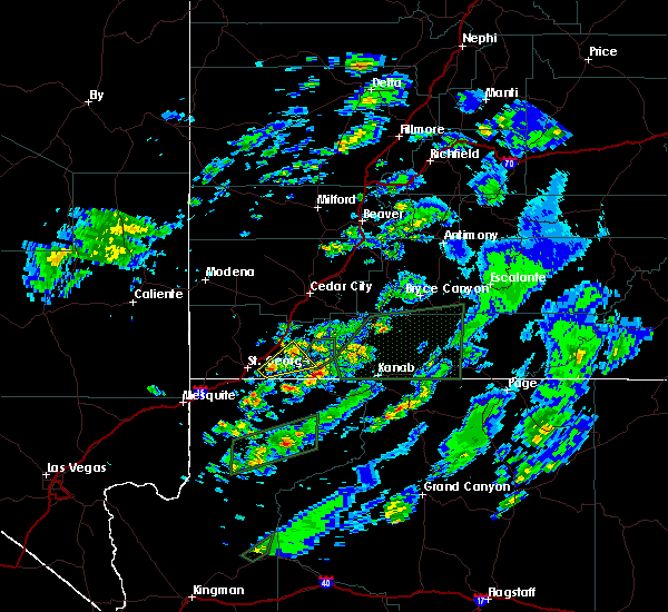
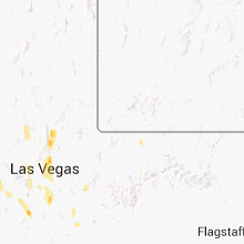
Hail Map for Rockville, UT
The Rockville, UT area has had 0 reports of on-the-ground hail by trained spotters, and has been under severe weather warnings 2 times during the past 12 months. Doppler radar has detected hail at or near Rockville, UT on 24 occasions, including 3 occasions during the past year.
| Name: | Rockville, UT |
| Where Located: | 29.6 miles E of Saint George, UT |
| Map: | Google Map for Rockville, UT |
| Population: | 245 |
| Housing Units: | 171 |
| More Info: | Search Google for Rockville, UT |
1
The Top Recent Hail Date for Rockville, UT is Monday, August 12, 2024 (4th out of 24)

Hail and Wind Damage Spotted near Rockville, UT
| Date / Time | Report Details |
|---|---|
| 8/17/2024 12:13 PM MDT |
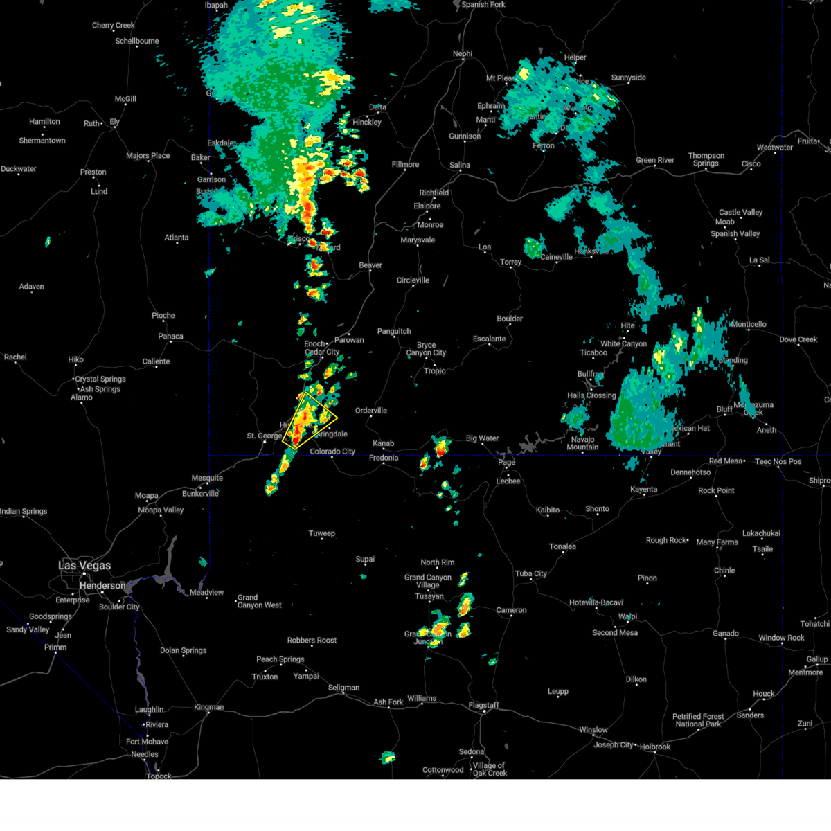 At 1212 pm mdt, a severe thunderstorm was located over la verkin, or 12 miles southwest of zion national park, moving northeast at 25 mph (radar indicated). Hazards include 60 mph wind gusts and quarter size hail. Hail damage to vehicles is expected. expect wind damage to roofs, siding, and trees. Locations impacted include, zion national park, hurricane, la verkin, sand hollow state park, toquerville, virgin, and rockville. At 1212 pm mdt, a severe thunderstorm was located over la verkin, or 12 miles southwest of zion national park, moving northeast at 25 mph (radar indicated). Hazards include 60 mph wind gusts and quarter size hail. Hail damage to vehicles is expected. expect wind damage to roofs, siding, and trees. Locations impacted include, zion national park, hurricane, la verkin, sand hollow state park, toquerville, virgin, and rockville.
|
| 8/17/2024 11:58 AM MDT |
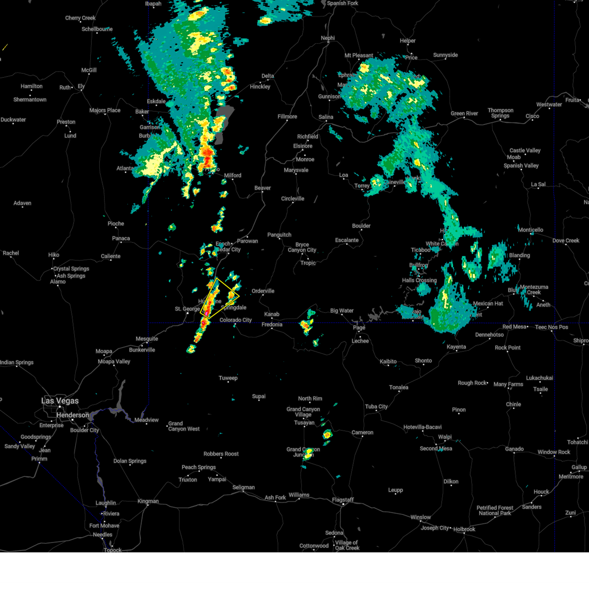 Svrslc the national weather service in salt lake city has issued a * severe thunderstorm warning for, southeastern washington county in southwestern utah, * until 1230 pm mdt. * at 1158 am mdt, a severe thunderstorm was located near hurricane, or 18 miles southwest of zion national park, moving northeast at 25 mph (radar indicated). Hazards include 60 mph wind gusts and quarter size hail. Hail damage to vehicles is expected. Expect wind damage to roofs, siding, and trees. Svrslc the national weather service in salt lake city has issued a * severe thunderstorm warning for, southeastern washington county in southwestern utah, * until 1230 pm mdt. * at 1158 am mdt, a severe thunderstorm was located near hurricane, or 18 miles southwest of zion national park, moving northeast at 25 mph (radar indicated). Hazards include 60 mph wind gusts and quarter size hail. Hail damage to vehicles is expected. Expect wind damage to roofs, siding, and trees.
|
| 7/26/2021 2:01 PM MDT |
 The severe thunderstorm warning for southeastern washington county has expired, the storm which prompted the warning has weakened below severe limits, and no longer poses an immediate threat to life or property. therefore, the warning has been allowed to expire. however gusty winds are still possible with this thunderstorm. a significant weather advisory has been issued for this same storm and is valid through 245 pm. The severe thunderstorm warning for southeastern washington county has expired, the storm which prompted the warning has weakened below severe limits, and no longer poses an immediate threat to life or property. therefore, the warning has been allowed to expire. however gusty winds are still possible with this thunderstorm. a significant weather advisory has been issued for this same storm and is valid through 245 pm.
|
| 7/26/2021 1:51 PM MDT |
 At 150 pm mdt, a severe thunderstorm was located near apple valley, or 11 miles southwest of zion national park, moving west at 10 mph (radar indicated). Hazards include 60 mph wind gusts and half dollar size hail. Hail damage to vehicles is expected. expect wind damage to roofs, siding, and trees. Locations impacted include, zion national park, hurricane, la verkin, apple valley, toquerville, virgin, springdale and rockville. At 150 pm mdt, a severe thunderstorm was located near apple valley, or 11 miles southwest of zion national park, moving west at 10 mph (radar indicated). Hazards include 60 mph wind gusts and half dollar size hail. Hail damage to vehicles is expected. expect wind damage to roofs, siding, and trees. Locations impacted include, zion national park, hurricane, la verkin, apple valley, toquerville, virgin, springdale and rockville.
|
| 7/26/2021 1:37 PM MDT |
 At 136 pm mdt, a severe thunderstorm was located near apple valley, or 9 miles southwest of zion national park, moving west at 10 mph (radar indicated). Hazards include 60 mph wind gusts and half dollar size hail. Hail damage to vehicles is expected. Expect wind damage to roofs, siding, and trees. At 136 pm mdt, a severe thunderstorm was located near apple valley, or 9 miles southwest of zion national park, moving west at 10 mph (radar indicated). Hazards include 60 mph wind gusts and half dollar size hail. Hail damage to vehicles is expected. Expect wind damage to roofs, siding, and trees.
|
| 8/10/2016 4:50 PM MDT |
 The severe thunderstorm warning for southeastern washington county will expire at 500 pm mdt, the storm which prompted the warning has weakened below severe limits, and no longer poses an immediate threat to life or property. therefore the warning will be allowed to expire. The severe thunderstorm warning for southeastern washington county will expire at 500 pm mdt, the storm which prompted the warning has weakened below severe limits, and no longer poses an immediate threat to life or property. therefore the warning will be allowed to expire.
|
| 8/10/2016 4:37 PM MDT |
 At 437 pm mdt, doppler radar indicated a severe thunderstorm capable of producing quarter size hail. this storm was located near hurricane, or 12 miles east of st george, and moving northeast at 30 mph. At 437 pm mdt, doppler radar indicated a severe thunderstorm capable of producing quarter size hail. this storm was located near hurricane, or 12 miles east of st george, and moving northeast at 30 mph.
|
| 8/10/2016 3:07 PM MDT |
 At 306 pm mdt, doppler radar indicated a severe thunderstorm capable of producing quarter size hail and strong gusty winds. this storm was located near la verkin, or 19 miles northwest of colorado city, and moving northeast at 30 mph. At 306 pm mdt, doppler radar indicated a severe thunderstorm capable of producing quarter size hail and strong gusty winds. this storm was located near la verkin, or 19 miles northwest of colorado city, and moving northeast at 30 mph.
|
| 8/10/2016 2:03 PM MDT |
 At 200 pm mdt, doppler radar indicated a severe thunderstorm capable of producing large damaging hail up to golf ball size and strong gusty winds. this storm was located over zion national park, or 16 miles north of colorado city, moving northeast at 25 mph. this storm produced golf ball size hail in the community of springdale. locations impacted include, zion national park, springdale and rockville. At 200 pm mdt, doppler radar indicated a severe thunderstorm capable of producing large damaging hail up to golf ball size and strong gusty winds. this storm was located over zion national park, or 16 miles north of colorado city, moving northeast at 25 mph. this storm produced golf ball size hail in the community of springdale. locations impacted include, zion national park, springdale and rockville.
|
| 8/10/2016 1:45 PM MDT |
 At 144 pm mdt, doppler radar indicated a severe thunderstorm capable of producing quarter size hail and strong gusty winds. this storm was located 10 miles southwest of zion national park, or 11 miles northwest of colorado city, and moving northeast at 25 mph. At 144 pm mdt, doppler radar indicated a severe thunderstorm capable of producing quarter size hail and strong gusty winds. this storm was located 10 miles southwest of zion national park, or 11 miles northwest of colorado city, and moving northeast at 25 mph.
|
Hail Maps for Rockville, UT


Connect with Interactive Hail Maps