

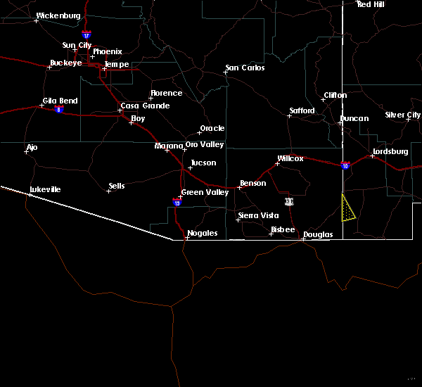
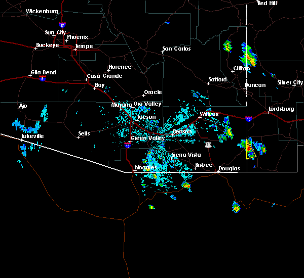
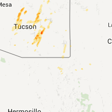
Hail Map for Rodeo, NM
The Rodeo, NM area has had 0 reports of on-the-ground hail by trained spotters, and has been under severe weather warnings 0 times during the past 12 months. Doppler radar has detected hail at or near Rodeo, NM on 12 occasions.
| Name: | Rodeo, NM |
| Where Located: | 46 miles NE of Douglas, AZ |
| Map: | Google Map for Rodeo, NM |
| Population: | 101 |
| Housing Units: | 80 |
| More Info: | Search Google for Rodeo, NM |
0
The Top Recent Hail Date for Rodeo, NM is Monday, July 1, 2024 (12th out of 12)

Hail and Wind Damage Spotted near Rodeo, NM
| Date / Time | Report Details |
|---|---|
| 7/11/2021 10:20 PM MDT | Mesonet station acdm chiricahua desert museu in hidalgo county NM, 2 miles SSW of Rodeo, NM |
| 6/6/2018 3:43 PM MDT |
 At 339 pm mdt, a severe thunderstorm was located near road forks, or 20 miles southwest of lordsburg, moving northeast at 35 mph (radar indicated). Hazards include 60 mph wind gusts and quarter size hail. Hail damage to vehicles is expected. expect wind damage to roofs, siding, and trees. The strong winds may produce blowing dust causing dangerous driving conditions from visibility less than a half mile. At 339 pm mdt, a severe thunderstorm was located near road forks, or 20 miles southwest of lordsburg, moving northeast at 35 mph (radar indicated). Hazards include 60 mph wind gusts and quarter size hail. Hail damage to vehicles is expected. expect wind damage to roofs, siding, and trees. The strong winds may produce blowing dust causing dangerous driving conditions from visibility less than a half mile.
|
| 7/19/2017 7:16 PM MDT |
 At 713 pm mdt, severe thunderstorm winds were producing wind damage amd widespread blowing dust across the area (trained weather spotters). Hazards include 60 mph wind gusts. Expect damage to roofs, siding, and trees. Blowing dust will lower the visibility to under a quarter mile over a few locations. At 713 pm mdt, severe thunderstorm winds were producing wind damage amd widespread blowing dust across the area (trained weather spotters). Hazards include 60 mph wind gusts. Expect damage to roofs, siding, and trees. Blowing dust will lower the visibility to under a quarter mile over a few locations.
|
| 7/19/2017 6:18 PM MDT |
 At 614 pm mdt, severe thunderstorms were moving to the west across the area at 40 mph (radar indicated). Hazards include 60 mph wind gusts and quarter size hail. Hail damage to vehicles is expected. expect wind damage to roofs, siding, and trees. Blowing dust may lower the visibility to less than a mile. At 614 pm mdt, severe thunderstorms were moving to the west across the area at 40 mph (radar indicated). Hazards include 60 mph wind gusts and quarter size hail. Hail damage to vehicles is expected. expect wind damage to roofs, siding, and trees. Blowing dust may lower the visibility to less than a mile.
|
| 7/12/2015 1:18 PM MDT |
 At 118 pm mdt, a severe thunderstorm was located near rodeo, moving north at 10 mph (radar indicated). Hazards include 60 mph wind gusts and quarter size hail. Hail damage to vehicles is expected. expect wind damage to roofs, siding and trees. Locations impacted include, rodeo. At 118 pm mdt, a severe thunderstorm was located near rodeo, moving north at 10 mph (radar indicated). Hazards include 60 mph wind gusts and quarter size hail. Hail damage to vehicles is expected. expect wind damage to roofs, siding and trees. Locations impacted include, rodeo.
|
| 7/12/2015 1:06 PM MDT |
 At 106 pm mdt, a severe thunderstorm was located 7 miles south of rodeo, and is moving northwest at 10 mph (radar indicated). Hazards include 60 mph wind gusts and quarter size hail. Hail damage to vehicles is expected. Expect wind damage to roofs, siding and trees. At 106 pm mdt, a severe thunderstorm was located 7 miles south of rodeo, and is moving northwest at 10 mph (radar indicated). Hazards include 60 mph wind gusts and quarter size hail. Hail damage to vehicles is expected. Expect wind damage to roofs, siding and trees.
|
| 7/7/2015 1:18 PM MDT |
 At 117 pm mdt, a severe thunderstorm was located over rodeo, moving east at 10 mph (radar indicated). Hazards include 60 mph wind gusts and quarter size hail. Hail damage to vehicles is expected. Expect wind damage to roofs, siding and trees. At 117 pm mdt, a severe thunderstorm was located over rodeo, moving east at 10 mph (radar indicated). Hazards include 60 mph wind gusts and quarter size hail. Hail damage to vehicles is expected. Expect wind damage to roofs, siding and trees.
|
Hail Maps for Rodeo, NM


Connect with Interactive Hail Maps