

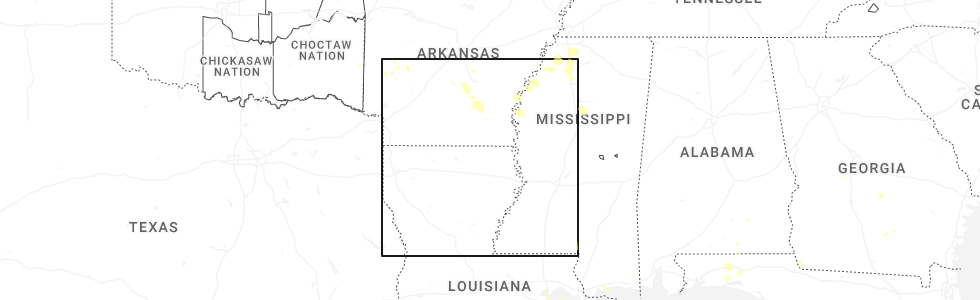
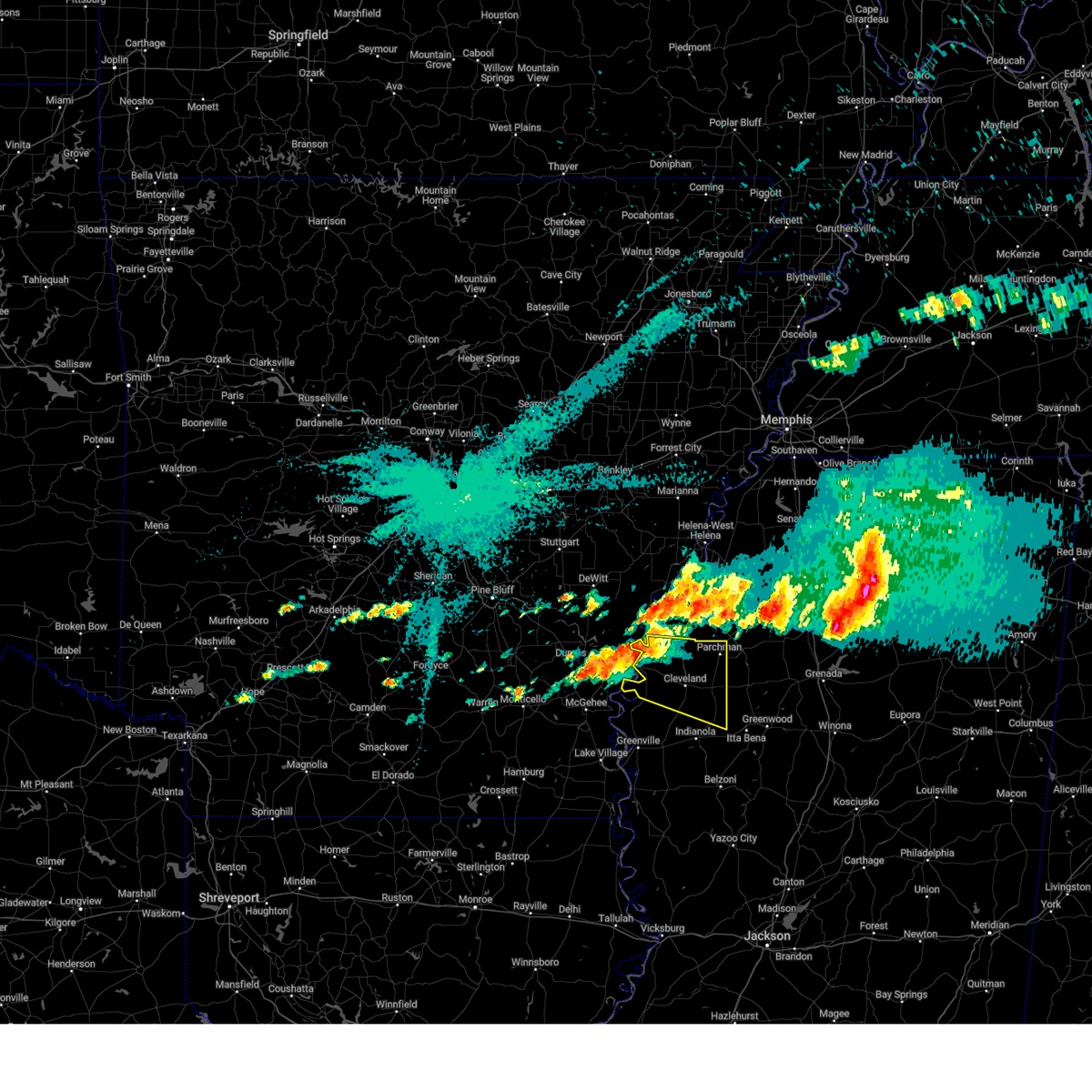
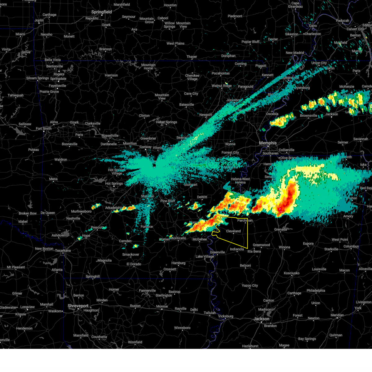
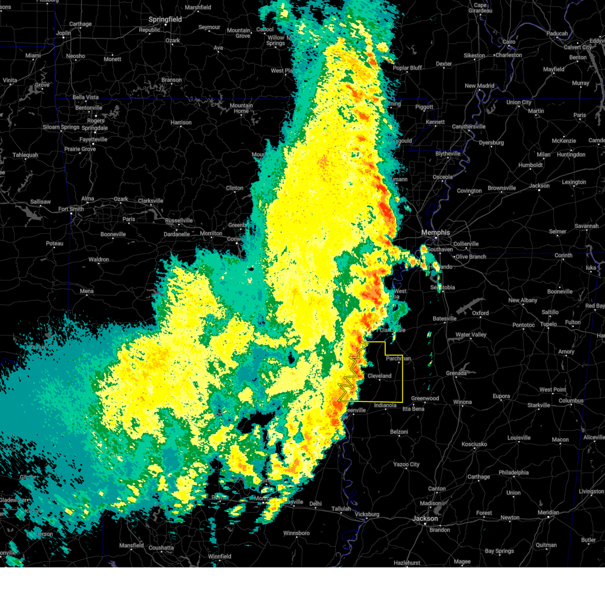
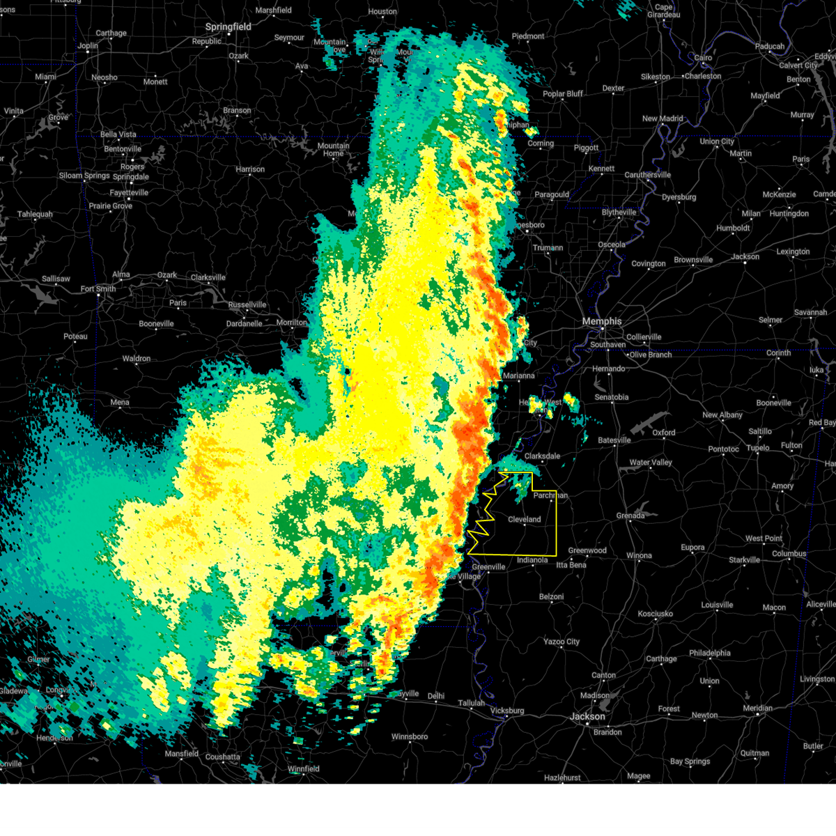
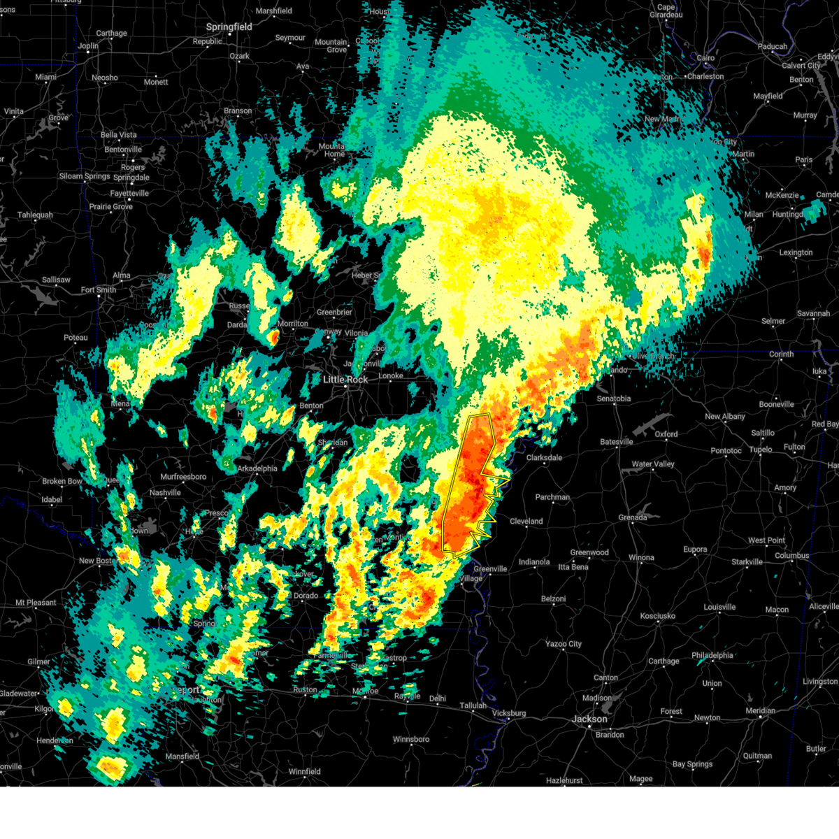
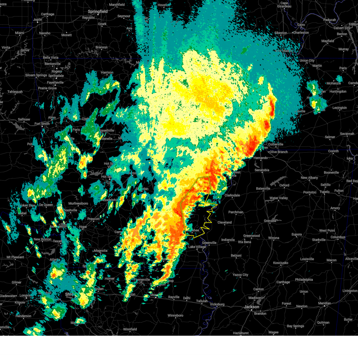
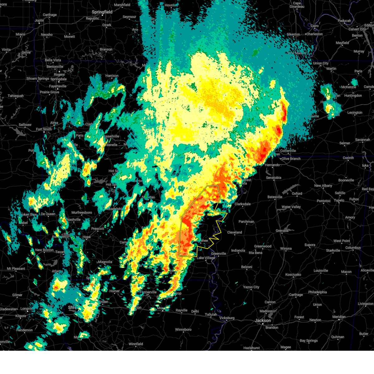
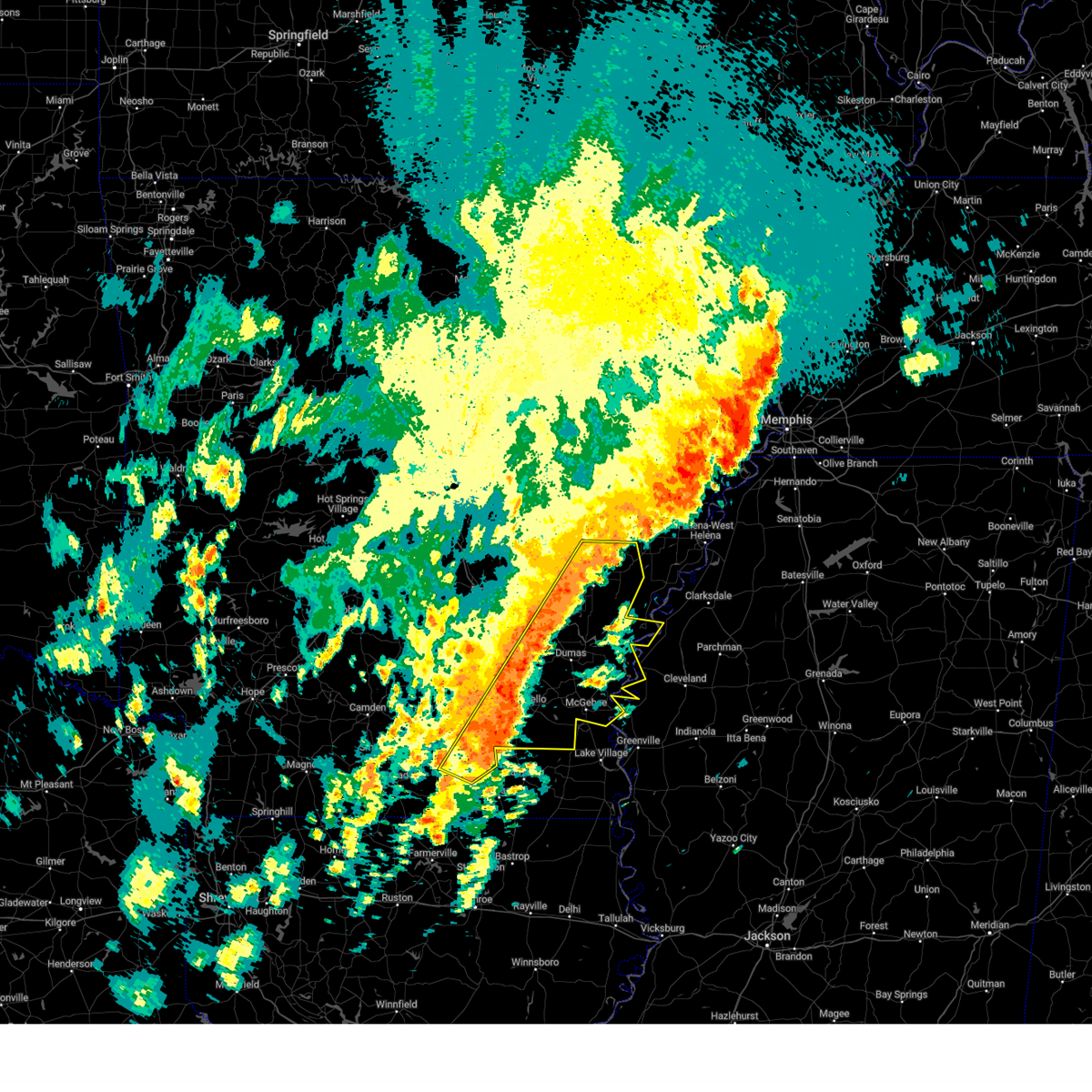
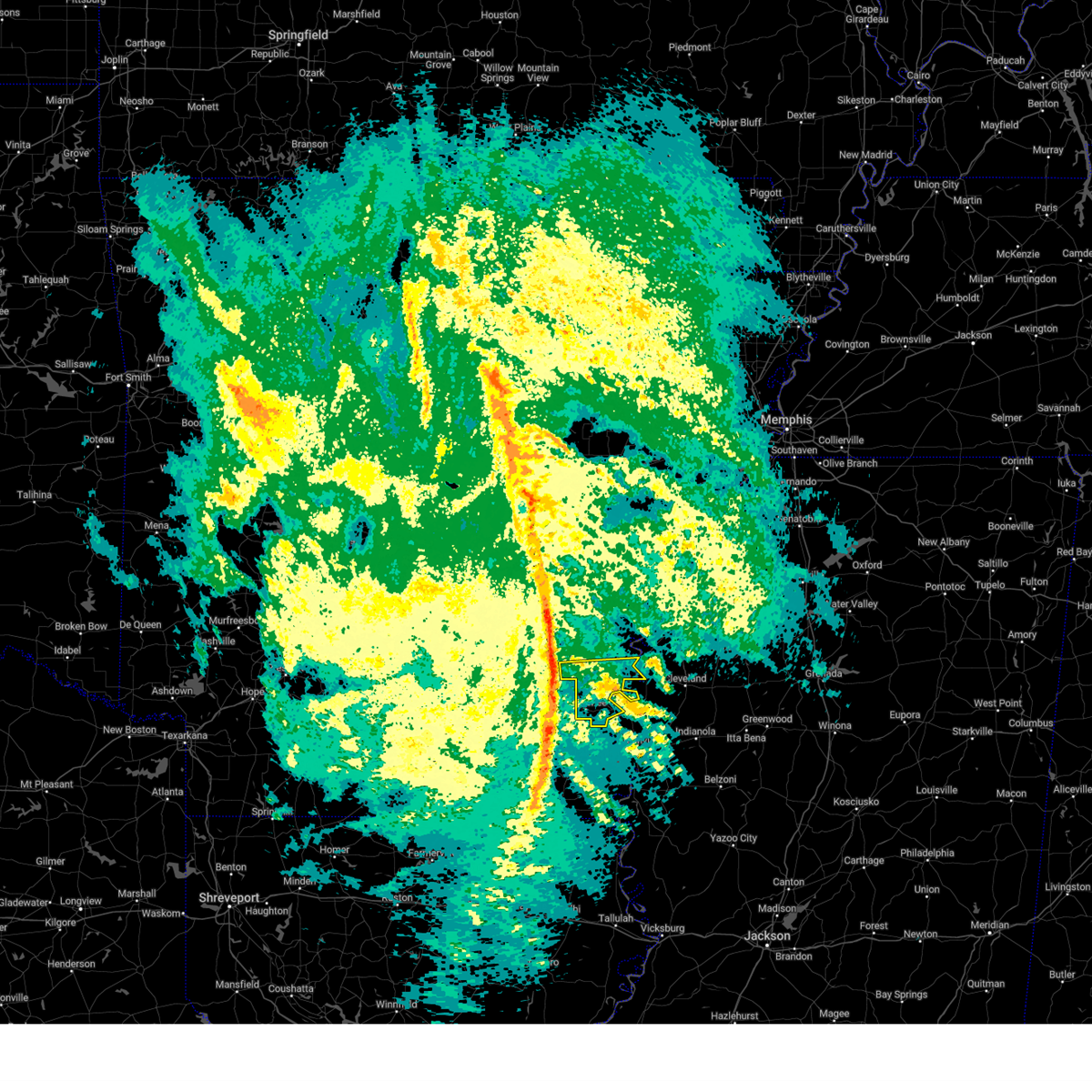
Hail Map for Rosedale, MS
The Rosedale, MS area has had 0 reports of on-the-ground hail by trained spotters, and has been under severe weather warnings 55 times during the past 12 months. Doppler radar has detected hail at or near Rosedale, MS on 57 occasions, including 5 occasions during the past year.
| Name: | Rosedale, MS |
| Where Located: | 89.8 miles NE of Bastrop, LA |
| Map: | Google Map for Rosedale, MS |
| Population: | 1873 |
| Housing Units: | 697 |
| More Info: | Search Google for Rosedale, MS |
3
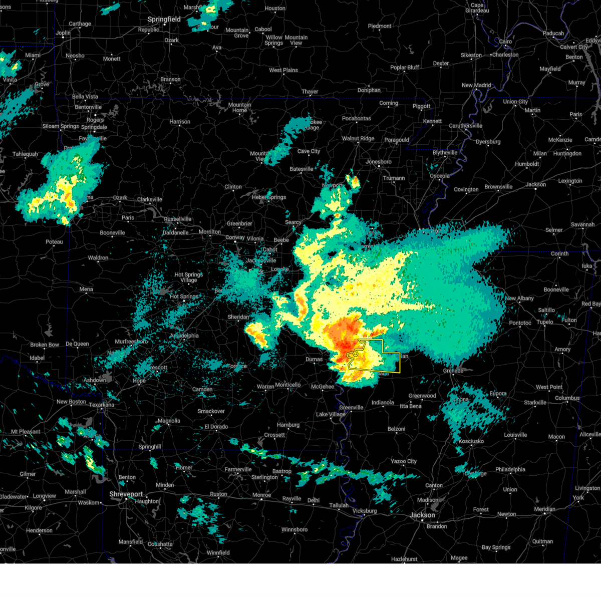
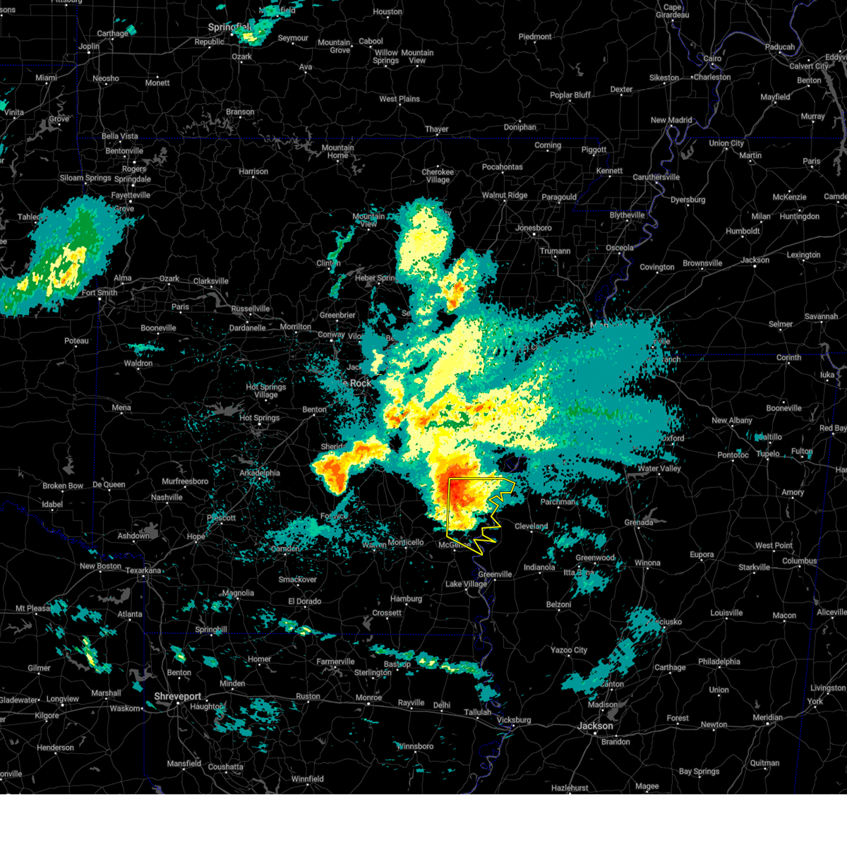
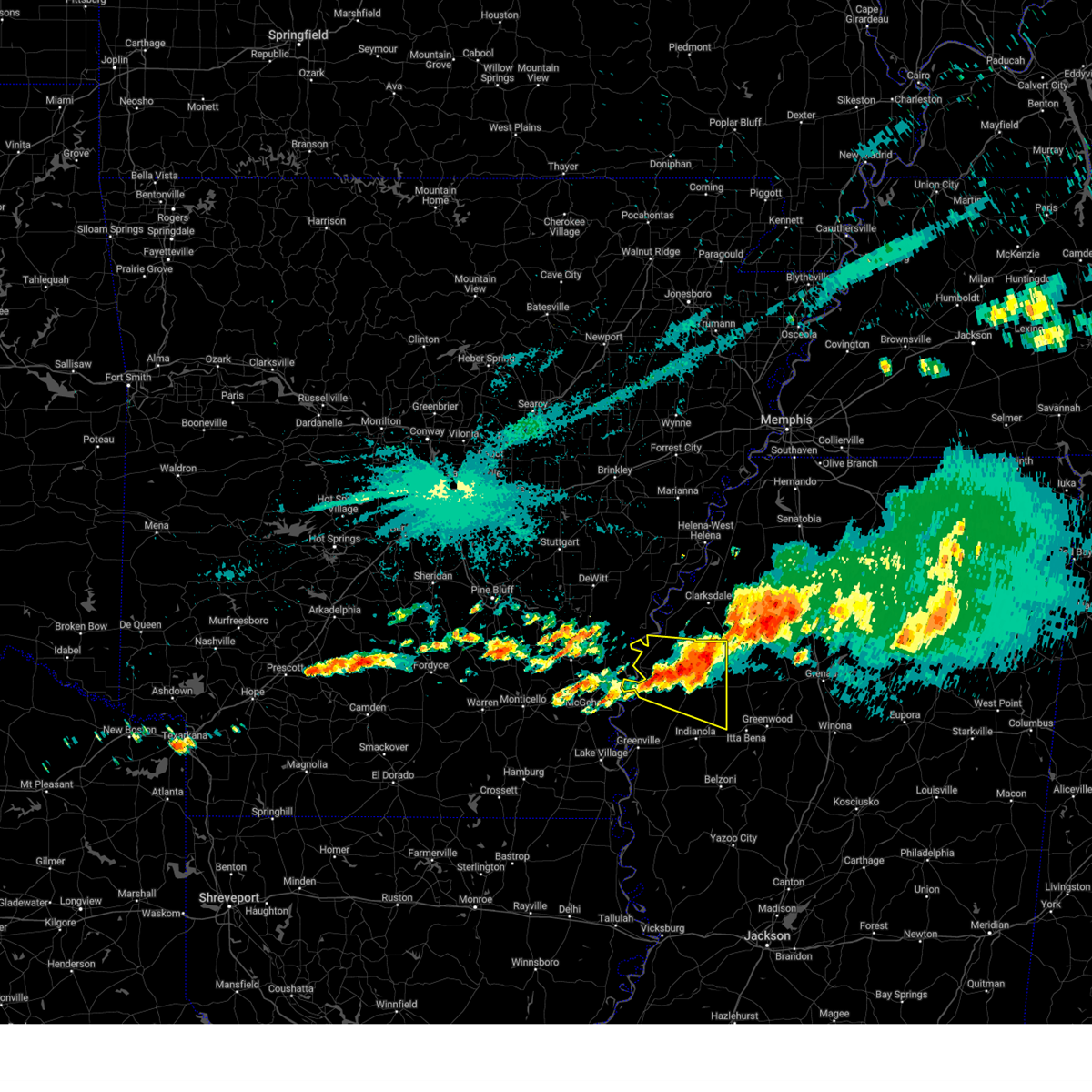
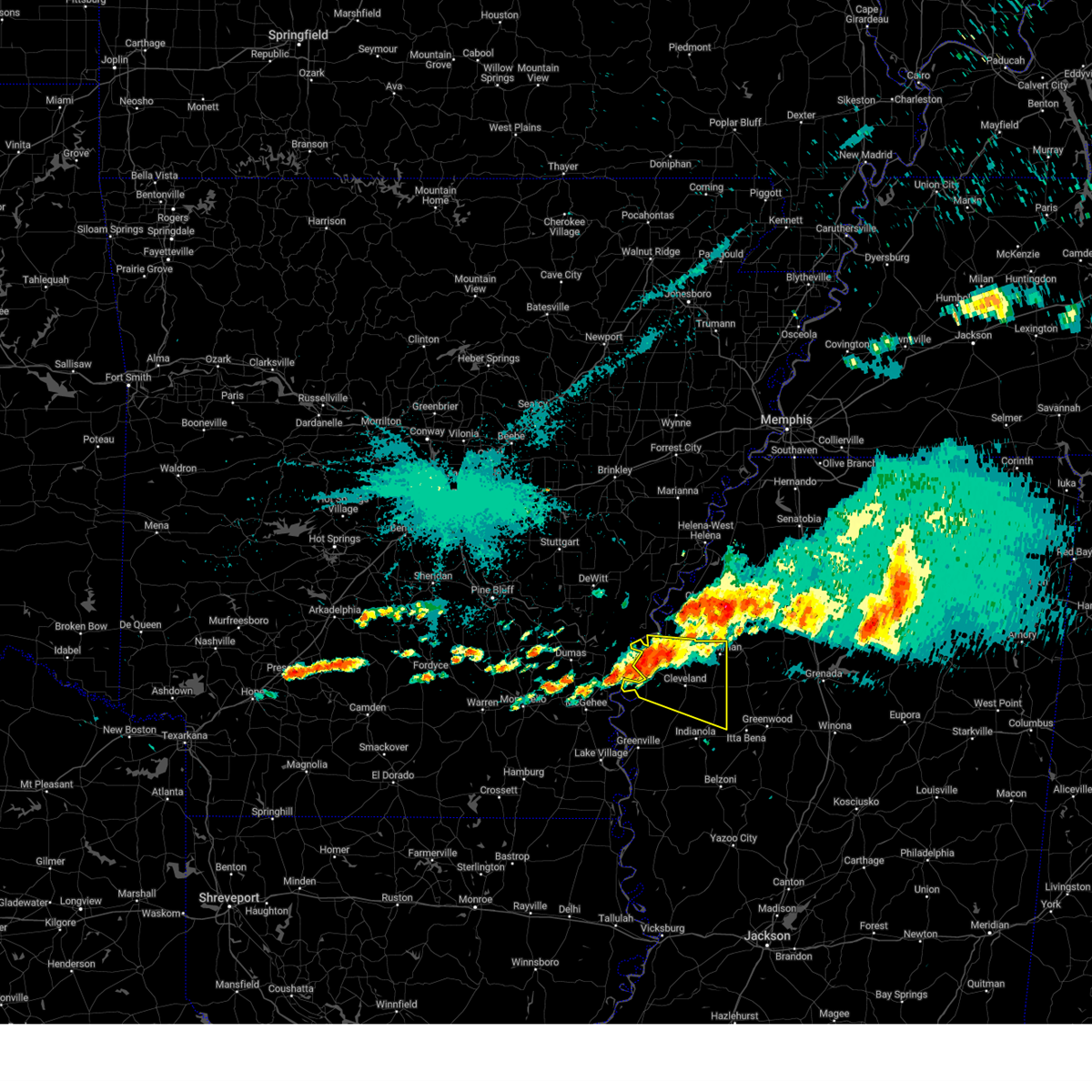
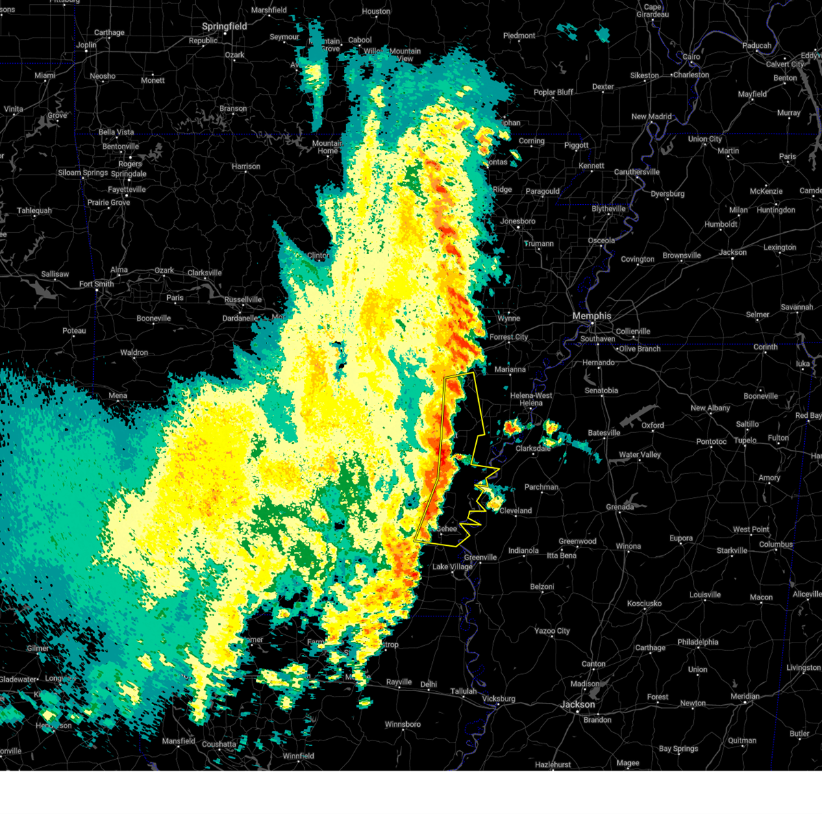
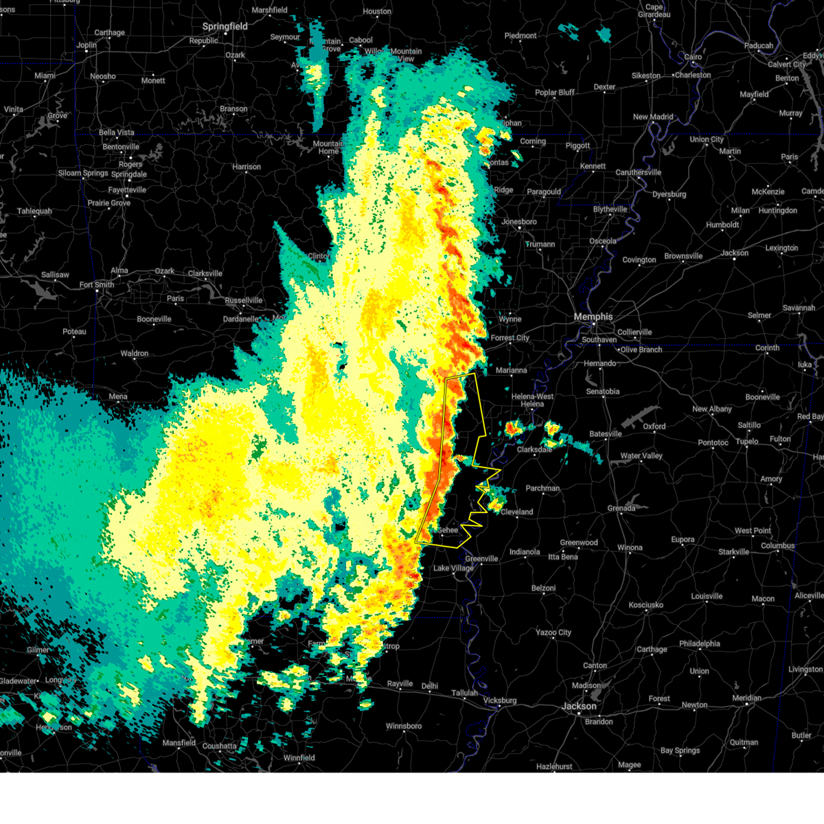
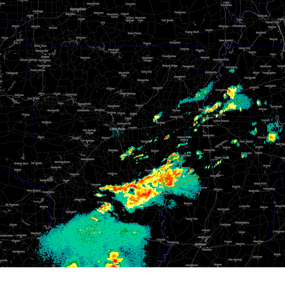
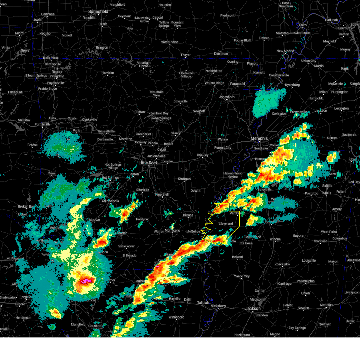
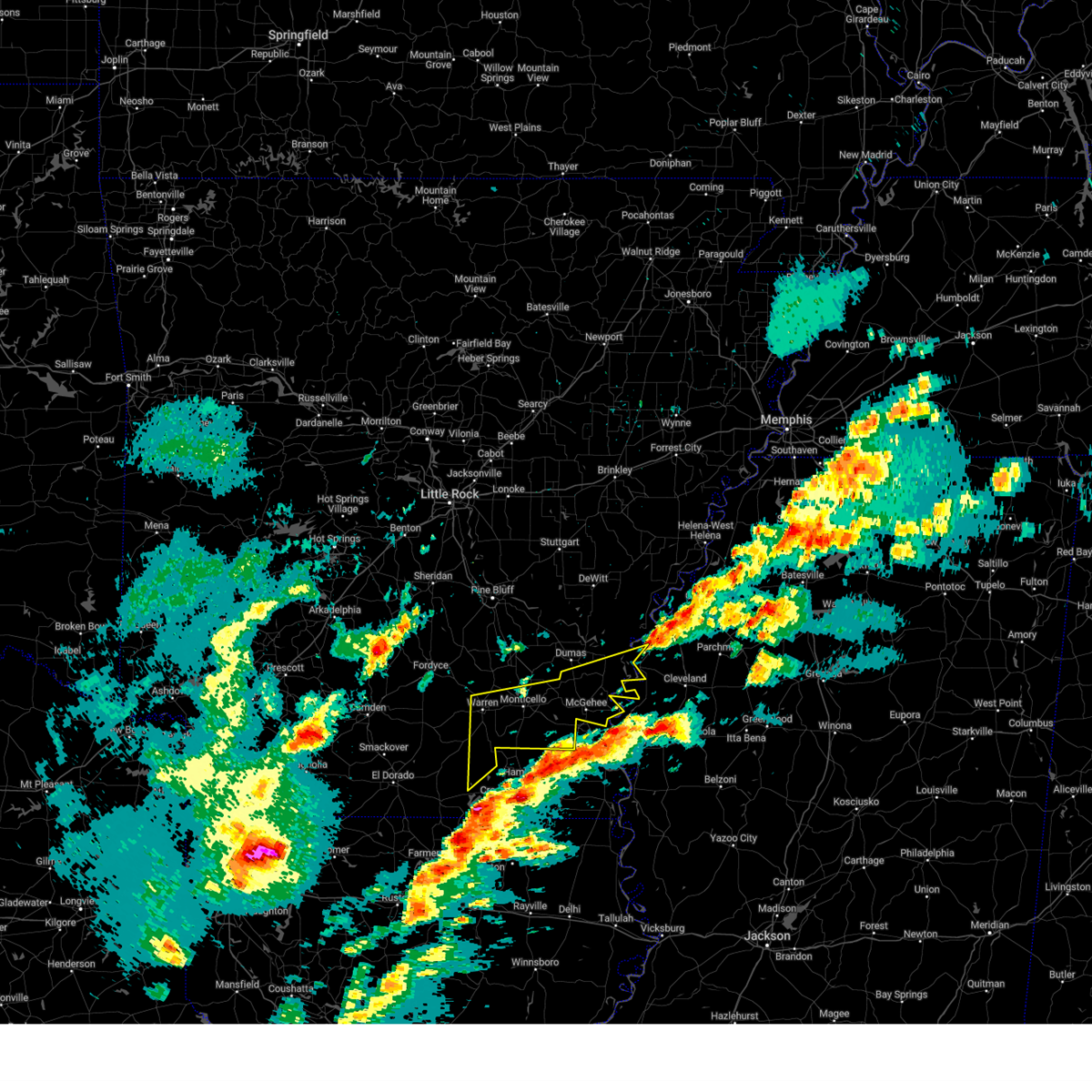
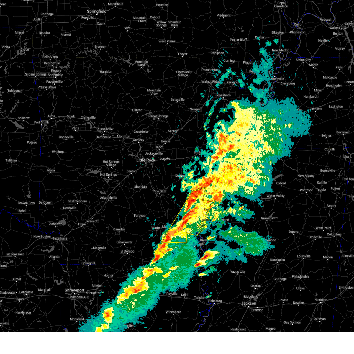
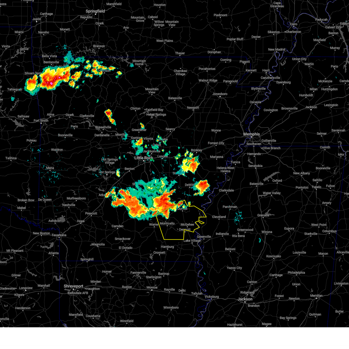
The Top Recent Hail Date for Rosedale, MS is Thursday, June 19, 2025 (4th out of 57)
Hail and Wind Damage Spotted near Rosedale, MS
| Date / Time | Report Details |
|---|---|
| 6/19/2025 12:21 PM CDT |
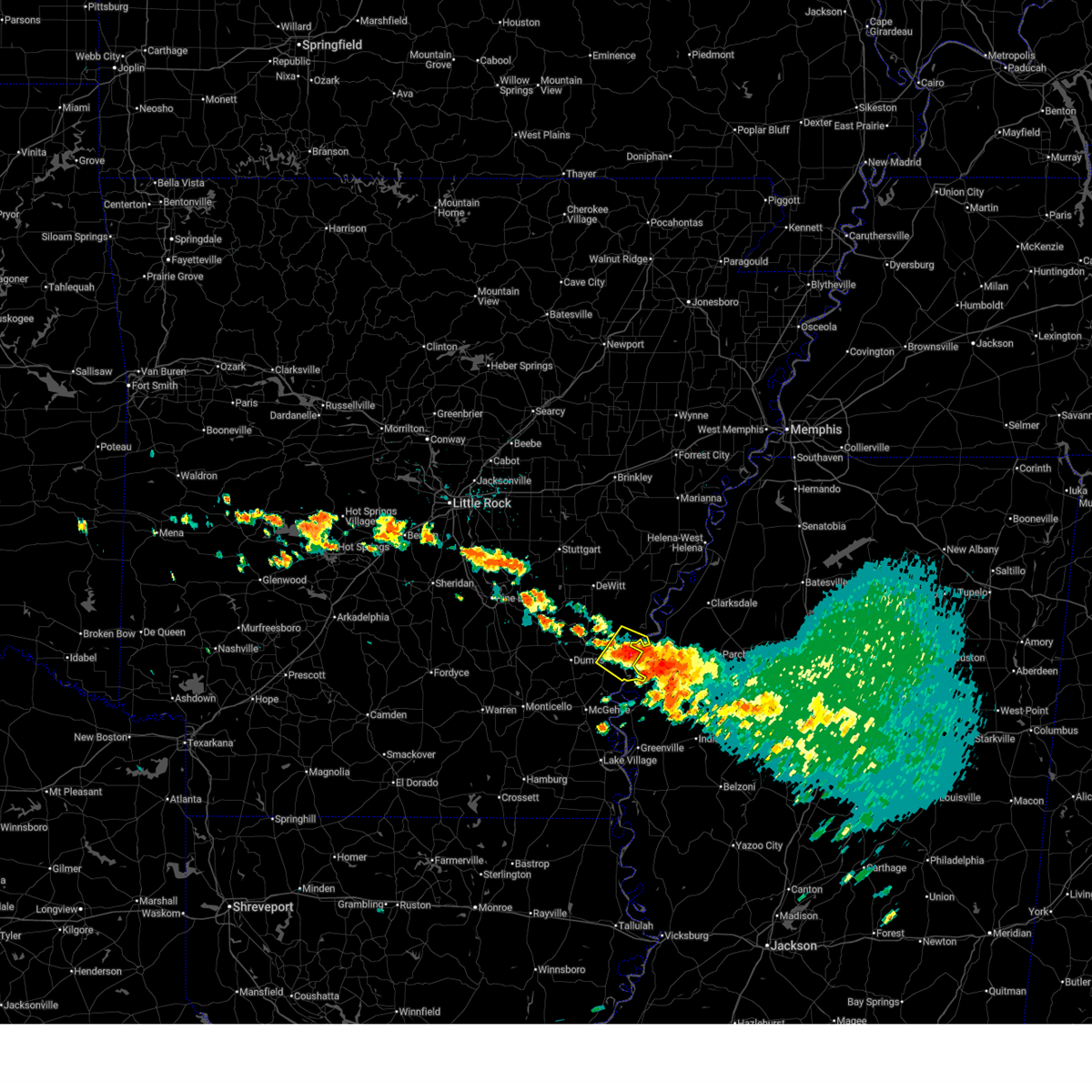 Svrlzk the national weather service in little rock has issued a * severe thunderstorm warning for, central desha county in southeastern arkansas, southern arkansas county in southeastern arkansas, * until 100 pm cdt. * at 1221 pm cdt, a severe thunderstorm was located near rosedale, moving southeast at 20 mph (radar indicated). Hazards include 60 mph wind gusts and quarter size hail. Hail damage to vehicles is expected. Expect wind damage to roofs, siding, and trees. Svrlzk the national weather service in little rock has issued a * severe thunderstorm warning for, central desha county in southeastern arkansas, southern arkansas county in southeastern arkansas, * until 100 pm cdt. * at 1221 pm cdt, a severe thunderstorm was located near rosedale, moving southeast at 20 mph (radar indicated). Hazards include 60 mph wind gusts and quarter size hail. Hail damage to vehicles is expected. Expect wind damage to roofs, siding, and trees.
|
| 6/19/2025 12:12 PM CDT |
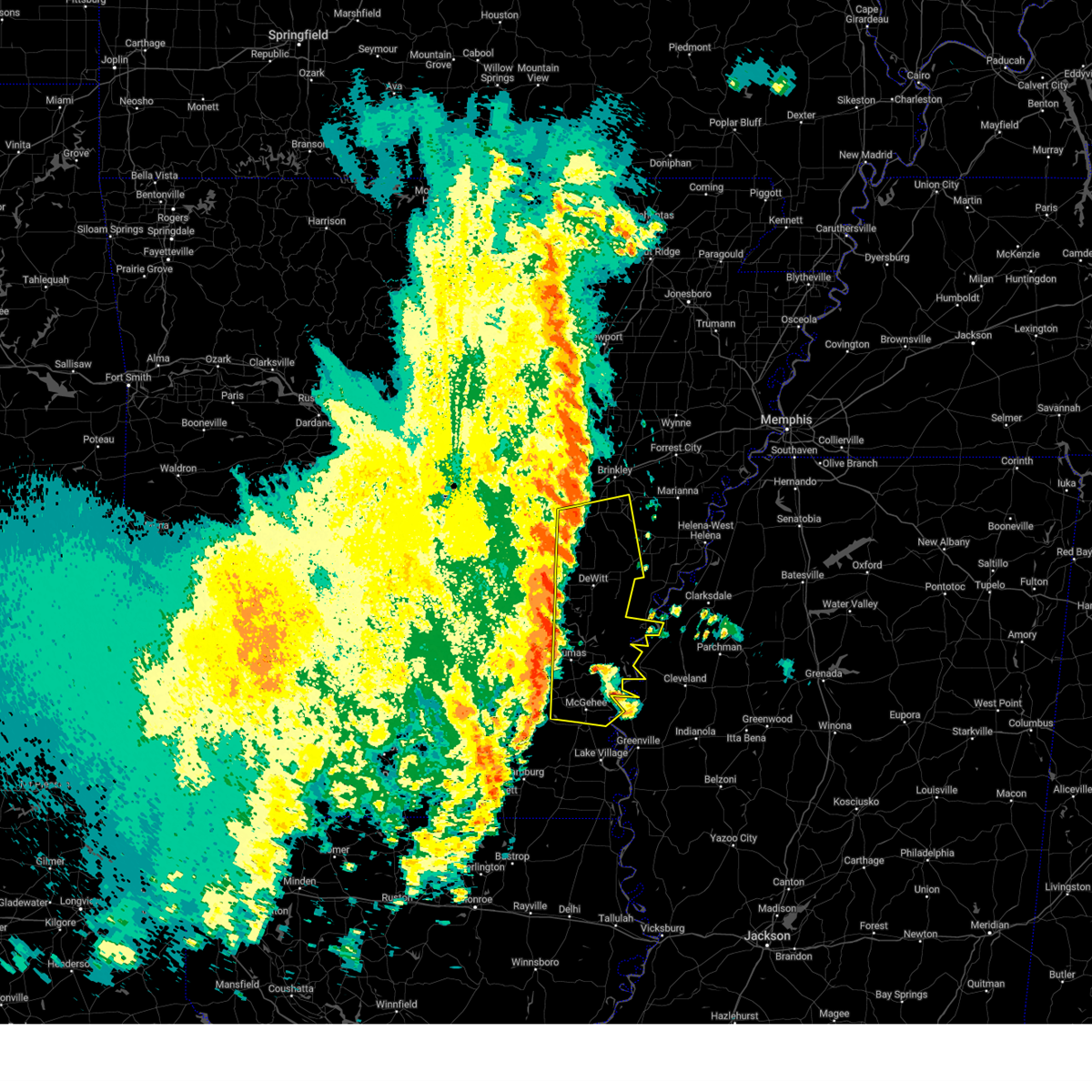
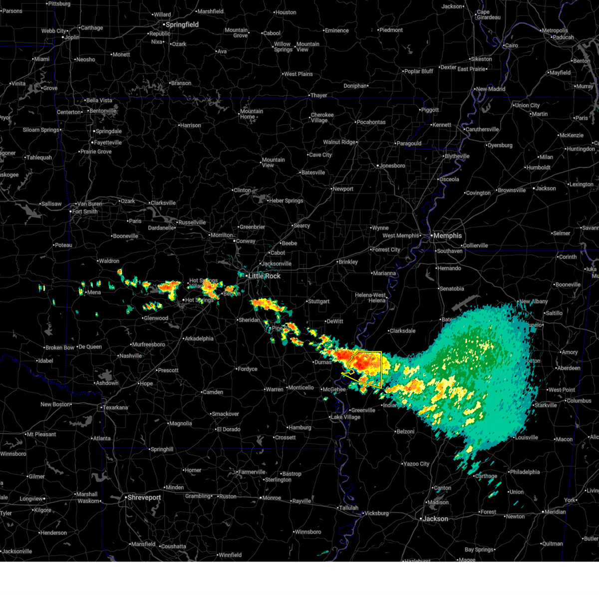 At 1212 pm cdt, a severe thunderstorm was located near drew, or 8 miles north of ruleville, moving east at 25 mph (radar indicated). Hazards include 60 mph wind gusts and quarter size hail. Hail damage to vehicles is expected. expect wind damage to roofs, siding, and trees. This severe thunderstorm will remain over mainly rural areas of southeastern bolivar county. At 1212 pm cdt, a severe thunderstorm was located near drew, or 8 miles north of ruleville, moving east at 25 mph (radar indicated). Hazards include 60 mph wind gusts and quarter size hail. Hail damage to vehicles is expected. expect wind damage to roofs, siding, and trees. This severe thunderstorm will remain over mainly rural areas of southeastern bolivar county.
|
| 6/19/2025 12:12 PM CDT |
 the severe thunderstorm warning has been cancelled and is no longer in effect the severe thunderstorm warning has been cancelled and is no longer in effect
|
| 6/19/2025 11:26 AM CDT |
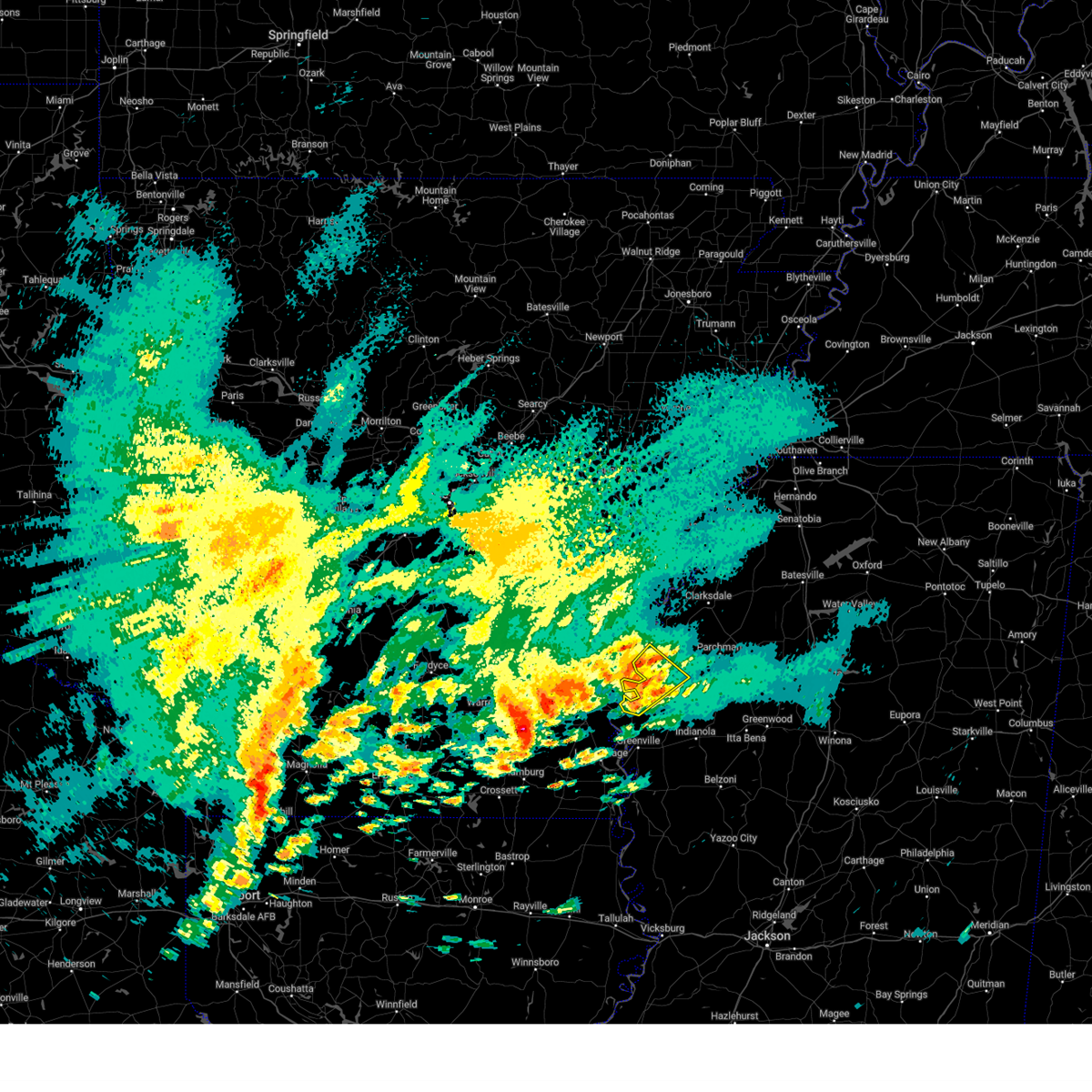
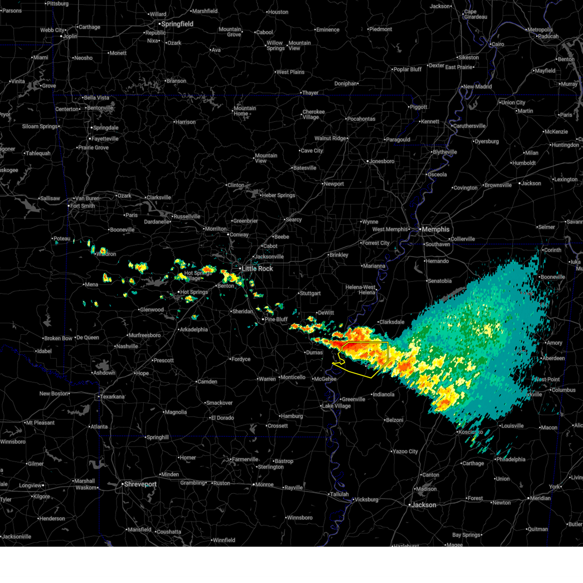 Svrjan the national weather service in jackson has issued a * severe thunderstorm warning for, northeastern sunflower county in northwestern mississippi, southeastern bolivar county in northwestern mississippi, * until 1245 pm cdt. * at 1126 am cdt, a severe thunderstorm was located near gunnison, or 7 miles west of shelby, moving east at 25 mph (radar indicated). Hazards include 60 mph wind gusts and quarter size hail. Hail damage to vehicles is expected. expect wind damage to roofs, siding, and trees. this severe thunderstorm will be near, shelby, mound bayou, and winstonville around 1130 am cdt. merigold around 1135 am cdt. cleveland around 1140 am cdt. renova around 1150 am cdt. drew around 1205 pm cdt. Ruleville and parchman around 1210 pm cdt. Svrjan the national weather service in jackson has issued a * severe thunderstorm warning for, northeastern sunflower county in northwestern mississippi, southeastern bolivar county in northwestern mississippi, * until 1245 pm cdt. * at 1126 am cdt, a severe thunderstorm was located near gunnison, or 7 miles west of shelby, moving east at 25 mph (radar indicated). Hazards include 60 mph wind gusts and quarter size hail. Hail damage to vehicles is expected. expect wind damage to roofs, siding, and trees. this severe thunderstorm will be near, shelby, mound bayou, and winstonville around 1130 am cdt. merigold around 1135 am cdt. cleveland around 1140 am cdt. renova around 1150 am cdt. drew around 1205 pm cdt. Ruleville and parchman around 1210 pm cdt.
|
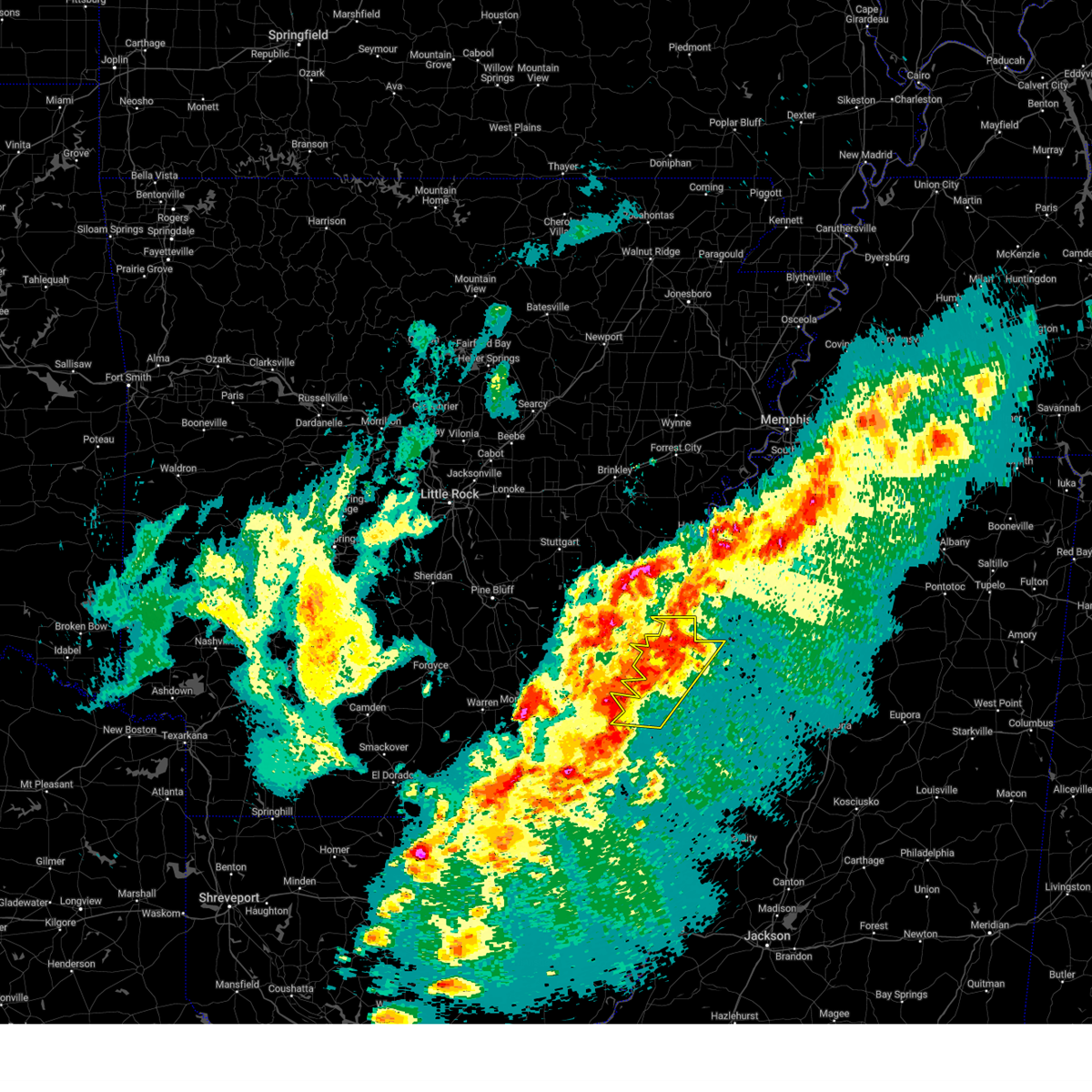
| 5/25/2025 6:30 PM CDT | At 630 pm cdt, severe thunderstorms were located along a line extending from near pleasant grove to near vance to near gunnison, moving southeast at 50 mph (radar indicated. at 624 pm, a 50 mph wind gust was measured near shelby). Hazards include 60 mph wind gusts and nickel size hail. Expect damage to roofs, siding, and trees. Locations impacted include, cleveland, shelby, rosedale, drew, mound bayou, renova, gunnison, merigold, duncan, beulah, pace, alligator, winstonville, deeson, parchman, and rome. |
| 5/25/2025 6:29 PM CDT | At 629 pm cdt, severe thunderstorms were located along a line extending from near rosedale to near kelso to near tillar, moving south at 30 mph (radar indicated). Hazards include 60 mph wind gusts. Expect damage to roofs, siding, and trees. Locations impacted include, yancopin, rohwer, watson, omega, lucca landing, morgan point recreation area, yukon, pea ridge, reed, tillar, trusten holder wma, pickens in desha county, winchester, kelso, dumas,. |
| 5/25/2025 6:29 PM CDT | the severe thunderstorm warning has been cancelled and is no longer in effect |
| 5/25/2025 6:00 PM CDT | Svrjan the national weather service in jackson has issued a * severe thunderstorm warning for, northeastern sunflower county in northwestern mississippi, northern bolivar county in northwestern mississippi, * until 715 pm cdt. * at 600 pm cdt, severe thunderstorms were located along a line extending from near dundee to near sherard to near merrisach lake, moving east at 40 mph (radar indicated). Hazards include 60 mph wind gusts and nickel size hail. expect damage to roofs, siding, and trees |
| 5/25/2025 5:57 PM CDT | Svrlzk the national weather service in little rock has issued a * severe thunderstorm warning for, desha county in southeastern arkansas, northeastern drew county in southeastern arkansas, southeastern jefferson county in southeastern arkansas, eastern lincoln county in southeastern arkansas, southeastern arkansas county in southeastern arkansas, * until 645 pm cdt. * at 556 pm cdt, severe thunderstorms were located along a line extending from 6 miles southwest of white river national wildlife refuge to near gillett to near woodville, moving southeast at 30 mph. this line of storms has a history of producing 50 to 60 mph wind gusts most recently near de witt and gillett (radar indicated). Hazards include 60 mph wind gusts. expect damage to roofs, siding, and trees |
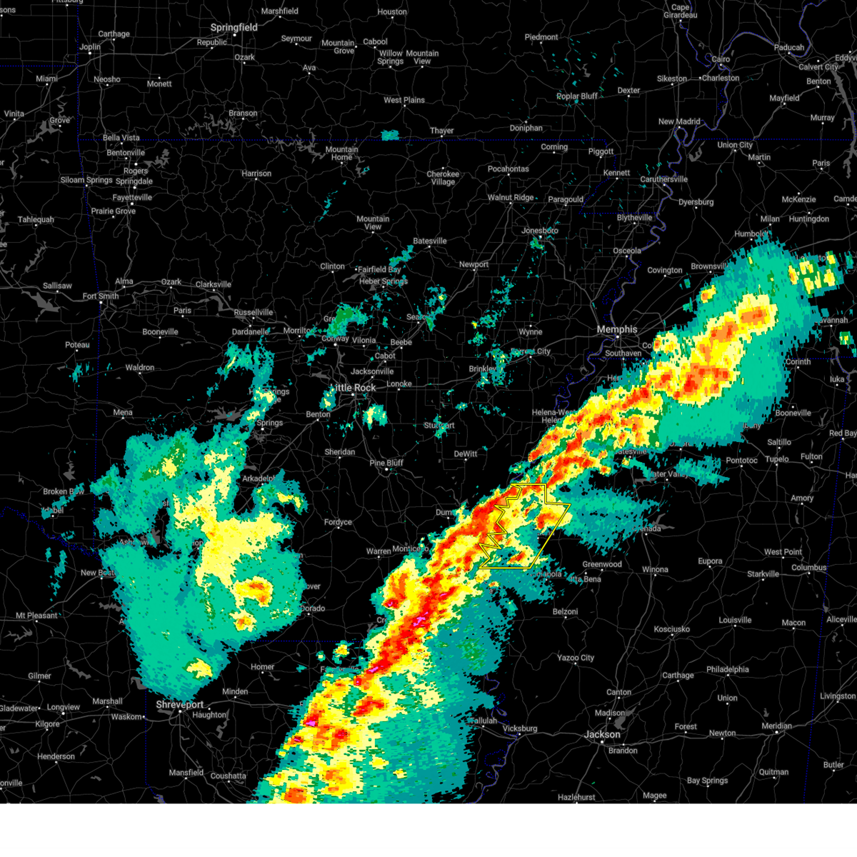
| 5/18/2025 1:30 AM CDT |
 Svrjan the national weather service in jackson has issued a * severe thunderstorm warning for, northeastern sunflower county in northwestern mississippi, northeastern bolivar county in northwestern mississippi, * until 215 am cdt. * at 130 am cdt, severe thunderstorms were located along a line extending from near deeson to near rosedale, moving east at 50 mph (radar indicated). Hazards include 60 mph wind gusts and quarter size hail. Hail damage to vehicles is expected. expect wind damage to roofs, siding, and trees. severe thunderstorms will be near, gunnison and deeson around 135 am cdt. shelby, duncan, and alligator around 140 am cdt. winstonville around 145 am cdt. Rome around 205 am cdt. Svrjan the national weather service in jackson has issued a * severe thunderstorm warning for, northeastern sunflower county in northwestern mississippi, northeastern bolivar county in northwestern mississippi, * until 215 am cdt. * at 130 am cdt, severe thunderstorms were located along a line extending from near deeson to near rosedale, moving east at 50 mph (radar indicated). Hazards include 60 mph wind gusts and quarter size hail. Hail damage to vehicles is expected. expect wind damage to roofs, siding, and trees. severe thunderstorms will be near, gunnison and deeson around 135 am cdt. shelby, duncan, and alligator around 140 am cdt. winstonville around 145 am cdt. Rome around 205 am cdt.
|
| 5/18/2025 1:29 AM CDT |
 the severe thunderstorm warning has been cancelled and is no longer in effect the severe thunderstorm warning has been cancelled and is no longer in effect
|
| 5/18/2025 1:29 AM CDT |
 At 129 am cdt, a severe thunderstorm was located 8 miles east of trusten holder wma, or 11 miles south of white river national wildlife refuge, moving east at 45 mph (radar indicated). Hazards include 60 mph wind gusts and nickel size hail. Expect damage to roofs, siding, and trees. Locations impacted include, yancopin,. At 129 am cdt, a severe thunderstorm was located 8 miles east of trusten holder wma, or 11 miles south of white river national wildlife refuge, moving east at 45 mph (radar indicated). Hazards include 60 mph wind gusts and nickel size hail. Expect damage to roofs, siding, and trees. Locations impacted include, yancopin,.
|
| 5/18/2025 1:07 AM CDT |
 Svrlzk the national weather service in little rock has issued a * severe thunderstorm warning for, desha county in southeastern arkansas, southeastern arkansas county in southeastern arkansas, * until 145 am cdt. * at 106 am cdt, severe thunderstorms were located along a line extending from trusten holder wma to near omega, moving east at 55 mph (radar indicated). Hazards include 60 mph wind gusts and quarter size hail. Hail damage to vehicles is expected. Expect wind damage to roofs, siding, and trees. Svrlzk the national weather service in little rock has issued a * severe thunderstorm warning for, desha county in southeastern arkansas, southeastern arkansas county in southeastern arkansas, * until 145 am cdt. * at 106 am cdt, severe thunderstorms were located along a line extending from trusten holder wma to near omega, moving east at 55 mph (radar indicated). Hazards include 60 mph wind gusts and quarter size hail. Hail damage to vehicles is expected. Expect wind damage to roofs, siding, and trees.
|
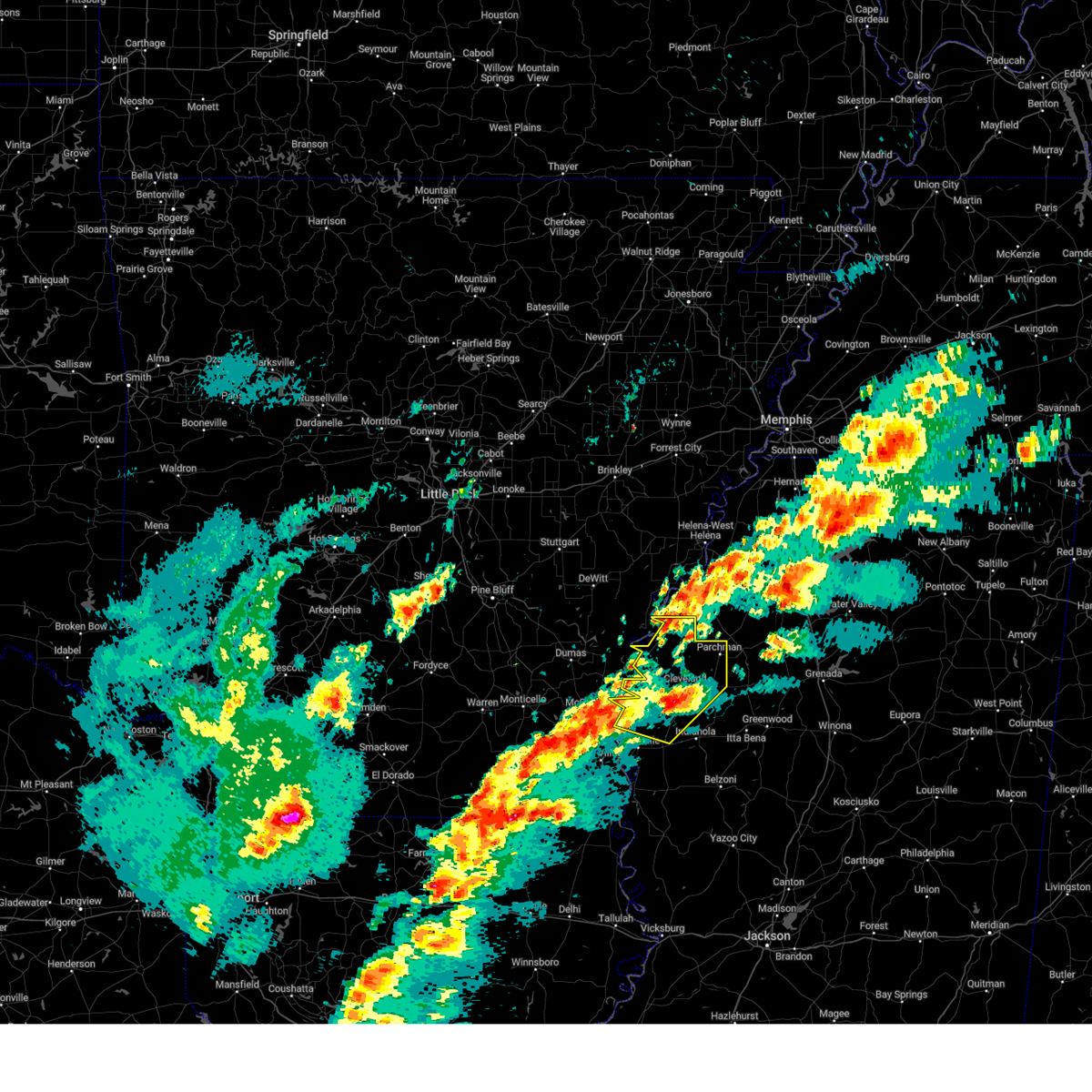
| 5/17/2025 1:49 AM CDT |
 At 147 am cdt, a severe thunderstorm was located near parchman, or 9 miles north of ruleville, moving east at 45 mph (radar indicated). Hazards include 60 mph wind gusts and quarter size hail. Hail damage to vehicles is expected. expect wind damage to roofs, siding, and trees. This severe storm will be near, drew, parchman, and rome around 150 am cdt. At 147 am cdt, a severe thunderstorm was located near parchman, or 9 miles north of ruleville, moving east at 45 mph (radar indicated). Hazards include 60 mph wind gusts and quarter size hail. Hail damage to vehicles is expected. expect wind damage to roofs, siding, and trees. This severe storm will be near, drew, parchman, and rome around 150 am cdt.
|
| 5/17/2025 1:33 AM CDT |
 At 132 am cdt, a severe thunderstorm was located over mound bayou, or near shelby, moving east at 45 mph (radar indicated). Hazards include 60 mph wind gusts and half dollar size hail. Hail damage to vehicles is expected. expect wind damage to roofs, siding, and trees. this severe storm will be near, drew and parchman around 140 am cdt. Rome around 145 am cdt. At 132 am cdt, a severe thunderstorm was located over mound bayou, or near shelby, moving east at 45 mph (radar indicated). Hazards include 60 mph wind gusts and half dollar size hail. Hail damage to vehicles is expected. expect wind damage to roofs, siding, and trees. this severe storm will be near, drew and parchman around 140 am cdt. Rome around 145 am cdt.
|
| 5/17/2025 1:17 AM CDT |
 At 117 am cdt, a severe thunderstorm was located over gunnison, or near rosedale, moving east at 45 mph (radar indicated). Hazards include 60 mph wind gusts and quarter size hail. Hail damage to vehicles is expected. expect wind damage to roofs, siding, and trees. this severe storm will be near, shelby, mound bayou, merigold, pace, and winstonville around 125 am cdt. cleveland and renova around 130 am cdt. drew and parchman around 140 am cdt. Rome around 145 am cdt. At 117 am cdt, a severe thunderstorm was located over gunnison, or near rosedale, moving east at 45 mph (radar indicated). Hazards include 60 mph wind gusts and quarter size hail. Hail damage to vehicles is expected. expect wind damage to roofs, siding, and trees. this severe storm will be near, shelby, mound bayou, merigold, pace, and winstonville around 125 am cdt. cleveland and renova around 130 am cdt. drew and parchman around 140 am cdt. Rome around 145 am cdt.
|
| 5/17/2025 1:05 AM CDT |
 Svrjan the national weather service in jackson has issued a * severe thunderstorm warning for, northern sunflower county in northwestern mississippi, bolivar county in northwestern mississippi, * until 200 am cdt. * at 104 am cdt, a severe thunderstorm was located near yancopin, or 7 miles northwest of rosedale, moving east at 45 mph (radar indicated). Hazards include 60 mph wind gusts and half dollar size hail. Hail damage to vehicles is expected. expect wind damage to roofs, siding, and trees. this severe thunderstorm will be near, rosedale and gunnison around 110 am cdt. beulah around 115 am cdt. pace and winstonville around 120 am cdt. shelby, mound bayou, and merigold around 125 am cdt. cleveland and renova around 130 am cdt. drew and parchman around 140 am cdt. ruleville around 145 am cdt. Rome around 150 am cdt. Svrjan the national weather service in jackson has issued a * severe thunderstorm warning for, northern sunflower county in northwestern mississippi, bolivar county in northwestern mississippi, * until 200 am cdt. * at 104 am cdt, a severe thunderstorm was located near yancopin, or 7 miles northwest of rosedale, moving east at 45 mph (radar indicated). Hazards include 60 mph wind gusts and half dollar size hail. Hail damage to vehicles is expected. expect wind damage to roofs, siding, and trees. this severe thunderstorm will be near, rosedale and gunnison around 110 am cdt. beulah around 115 am cdt. pace and winstonville around 120 am cdt. shelby, mound bayou, and merigold around 125 am cdt. cleveland and renova around 130 am cdt. drew and parchman around 140 am cdt. ruleville around 145 am cdt. Rome around 150 am cdt.
|
| 4/30/2025 8:53 PM CDT |
 At 852 pm cdt, severe thunderstorms were located along a line extending from 7 miles east of crumrod to pace, moving east at 40 mph (radar indicated). Hazards include 60 mph wind gusts. Expect damage to roofs, siding, and trees. these severe storms will be near, mound bayou, winstonville, duncan, merigold, shelby, cleveland, alligator, and renova around 900 pm cdt. boyle around 905 pm cdt. ruleville around 910 pm cdt. Parchman, rome, and drew around 915 pm cdt. At 852 pm cdt, severe thunderstorms were located along a line extending from 7 miles east of crumrod to pace, moving east at 40 mph (radar indicated). Hazards include 60 mph wind gusts. Expect damage to roofs, siding, and trees. these severe storms will be near, mound bayou, winstonville, duncan, merigold, shelby, cleveland, alligator, and renova around 900 pm cdt. boyle around 905 pm cdt. ruleville around 910 pm cdt. Parchman, rome, and drew around 915 pm cdt.
|
| 4/30/2025 8:17 PM CDT |
 Svrjan the national weather service in jackson has issued a * severe thunderstorm warning for, northern sunflower county in northwestern mississippi, bolivar county in northwestern mississippi, * until 915 pm cdt. * at 817 pm cdt, severe thunderstorms were located along a line extending from near st. charles to lucca landing, moving east at 60 mph (radar indicated). Hazards include 60 mph wind gusts. Expect damage to roofs, siding, and trees. severe thunderstorms will be near, rosedale around 820 pm cdt. beulah and gunnison around 825 pm cdt. deeson and pace around 830 pm cdt. shelby and cleveland around 835 pm cdt. mound bayou, winstonville, duncan, merigold, boyle, alligator, and renova around 840 pm cdt. ruleville and drew around 850 pm cdt. Parchman, doddsville, and rome around 855 pm cdt. Svrjan the national weather service in jackson has issued a * severe thunderstorm warning for, northern sunflower county in northwestern mississippi, bolivar county in northwestern mississippi, * until 915 pm cdt. * at 817 pm cdt, severe thunderstorms were located along a line extending from near st. charles to lucca landing, moving east at 60 mph (radar indicated). Hazards include 60 mph wind gusts. Expect damage to roofs, siding, and trees. severe thunderstorms will be near, rosedale around 820 pm cdt. beulah and gunnison around 825 pm cdt. deeson and pace around 830 pm cdt. shelby and cleveland around 835 pm cdt. mound bayou, winstonville, duncan, merigold, boyle, alligator, and renova around 840 pm cdt. ruleville and drew around 850 pm cdt. Parchman, doddsville, and rome around 855 pm cdt.
|
| 4/30/2025 8:01 PM CDT |
 the severe thunderstorm warning has been cancelled and is no longer in effect the severe thunderstorm warning has been cancelled and is no longer in effect
|
| 4/30/2025 8:01 PM CDT |
 At 801 pm cdt, severe thunderstorms were located along a line extending from near garret grove to near rohwer, moving east at 40 mph (radar indicated). Hazards include 60 mph wind gusts. Expect damage to roofs, siding, and trees. Locations impacted include, yancopin, de luce, aberdeen, gillett, casscoe, watson, tichnor, omega, blackton, lucca landing, morgan point recreation area, masonville, yukon, pea ridge, mcgehee, reed, holly grove, tillar, weber, merrisach lake,. At 801 pm cdt, severe thunderstorms were located along a line extending from near garret grove to near rohwer, moving east at 40 mph (radar indicated). Hazards include 60 mph wind gusts. Expect damage to roofs, siding, and trees. Locations impacted include, yancopin, de luce, aberdeen, gillett, casscoe, watson, tichnor, omega, blackton, lucca landing, morgan point recreation area, masonville, yukon, pea ridge, mcgehee, reed, holly grove, tillar, weber, merrisach lake,.
|
| 4/30/2025 7:28 PM CDT |
 Svrlzk the national weather service in little rock has issued a * severe thunderstorm warning for, southeastern prairie county in central arkansas, desha county in southeastern arkansas, monroe county in eastern arkansas, northeastern drew county in southeastern arkansas, southeastern jefferson county in southeastern arkansas, eastern lincoln county in southeastern arkansas, arkansas county in southeastern arkansas, * until 830 pm cdt. * at 728 pm cdt, severe thunderstorms were located along a line extending from near peppers landing to 8 miles east of monticello, moving east at 40 mph (radar indicated). Hazards include 60 mph wind gusts. expect damage to roofs, siding, and trees Svrlzk the national weather service in little rock has issued a * severe thunderstorm warning for, southeastern prairie county in central arkansas, desha county in southeastern arkansas, monroe county in eastern arkansas, northeastern drew county in southeastern arkansas, southeastern jefferson county in southeastern arkansas, eastern lincoln county in southeastern arkansas, arkansas county in southeastern arkansas, * until 830 pm cdt. * at 728 pm cdt, severe thunderstorms were located along a line extending from near peppers landing to 8 miles east of monticello, moving east at 40 mph (radar indicated). Hazards include 60 mph wind gusts. expect damage to roofs, siding, and trees
|
| 4/5/2025 3:17 PM CDT |
 At 317 pm cdt, severe thunderstorms were located along a line extending from arkansas city to 6 miles west of lamont to near lake village, moving northeast at 45 mph (radar indicated). Hazards include 60 mph wind gusts and quarter size hail. Hail damage to vehicles is expected. expect wind damage to roofs, siding, and trees. these severe storms will be near, lamont and scott around 325 pm cdt. benoit around 330 pm cdt. beulah around 335 pm cdt. rosedale around 340 pm cdt. pace around 345 pm cdt. cleveland around 355 pm cdt. mound bayou, winstonville, merigold, shelby, and renova around 400 pm cdt. Boyle around 405 pm cdt. At 317 pm cdt, severe thunderstorms were located along a line extending from arkansas city to 6 miles west of lamont to near lake village, moving northeast at 45 mph (radar indicated). Hazards include 60 mph wind gusts and quarter size hail. Hail damage to vehicles is expected. expect wind damage to roofs, siding, and trees. these severe storms will be near, lamont and scott around 325 pm cdt. benoit around 330 pm cdt. beulah around 335 pm cdt. rosedale around 340 pm cdt. pace around 345 pm cdt. cleveland around 355 pm cdt. mound bayou, winstonville, merigold, shelby, and renova around 400 pm cdt. Boyle around 405 pm cdt.
|
| 4/5/2025 2:58 PM CDT | The storms which prompted the warning have moved out of the area. therefore, the warning will be allowed to expire. however small hail, gusty winds and heavy rain are still possible with these thunderstorms. a tornado watch remains in effect until 700 pm cdt for eastern and southeastern arkansas. |
| 4/5/2025 2:46 PM CDT |
 the severe thunderstorm warning has been cancelled and is no longer in effect the severe thunderstorm warning has been cancelled and is no longer in effect
|
| 4/5/2025 2:46 PM CDT |
 At 245 pm cdt, severe thunderstorms were located along a line extending from 6 miles south of watkins corner to gunnison to near scott, moving east at 50 mph (radar indicated). Hazards include 60 mph wind gusts and quarter size hail. Hail damage to vehicles is expected. expect wind damage to roofs, siding, and trees. Locations impacted include, yancopin, de luce, watson, tichnor, lucca landing, morgan point recreation area, masonville, pea ridge, mcgehee, reed, weber, merrisach lake, kelso, cross roads in monroe county, pendleton, ethel, rohwer, halley, crocketts bluff, ragtown,. At 245 pm cdt, severe thunderstorms were located along a line extending from 6 miles south of watkins corner to gunnison to near scott, moving east at 50 mph (radar indicated). Hazards include 60 mph wind gusts and quarter size hail. Hail damage to vehicles is expected. expect wind damage to roofs, siding, and trees. Locations impacted include, yancopin, de luce, watson, tichnor, lucca landing, morgan point recreation area, masonville, pea ridge, mcgehee, reed, weber, merrisach lake, kelso, cross roads in monroe county, pendleton, ethel, rohwer, halley, crocketts bluff, ragtown,.
|
| 4/5/2025 2:30 PM CDT | Svrjan the national weather service in jackson has issued a * severe thunderstorm warning for, bolivar county in northwestern mississippi, * until 400 pm cdt. * at 229 pm cdt, severe thunderstorms were located along a line extending from near yancopin to near mcgehee, moving northeast at 40 mph (radar indicated). Hazards include 60 mph wind gusts and quarter size hail. Hail damage to vehicles is expected. expect wind damage to roofs, siding, and trees. severe thunderstorms will be near, rosedale around 240 pm cdt. beulah around 245 pm cdt. benoit around 250 pm cdt. pace around 300 pm cdt. winstonville and shelby around 305 pm cdt. mound bayou around 310 pm cdt. Merigold, cleveland, and renova around 315 pm cdt. |
| 4/5/2025 2:26 PM CDT |
 At 225 pm cdt, severe thunderstorms were located along a line extending from 7 miles south of watkins corner to 6 miles west of white river national wildlife refuge to near arkansas city, moving northeast at 50 mph (radar indicated). Hazards include 60 mph wind gusts and quarter size hail. Hail damage to vehicles is expected. expect wind damage to roofs, siding, and trees. Locations impacted include, yancopin, de luce, gillett, watson, tichnor, lucca landing, morgan point recreation area, masonville, pea ridge, mcgehee, reed, weber, merrisach lake, kelso, cross roads in monroe county, pendleton, ethel, rohwer, halley, crocketts bluff,. At 225 pm cdt, severe thunderstorms were located along a line extending from 7 miles south of watkins corner to 6 miles west of white river national wildlife refuge to near arkansas city, moving northeast at 50 mph (radar indicated). Hazards include 60 mph wind gusts and quarter size hail. Hail damage to vehicles is expected. expect wind damage to roofs, siding, and trees. Locations impacted include, yancopin, de luce, gillett, watson, tichnor, lucca landing, morgan point recreation area, masonville, pea ridge, mcgehee, reed, weber, merrisach lake, kelso, cross roads in monroe county, pendleton, ethel, rohwer, halley, crocketts bluff,.
|
| 4/5/2025 2:26 PM CDT |
 the severe thunderstorm warning has been cancelled and is no longer in effect the severe thunderstorm warning has been cancelled and is no longer in effect
|
| 4/5/2025 2:10 PM CDT |
 Svrlzk the national weather service in little rock has issued a * severe thunderstorm warning for, desha county in southeastern arkansas, southeastern monroe county in eastern arkansas, northeastern drew county in southeastern arkansas, southeastern jefferson county in southeastern arkansas, eastern lincoln county in southeastern arkansas, arkansas county in southeastern arkansas, * until 300 pm cdt. * at 209 pm cdt, severe thunderstorms were located along a line extending from near st. charles to near gillett to near mcgehee, moving northeast at 50 mph (radar indicated). Hazards include 60 mph wind gusts and quarter size hail. Hail damage to vehicles is expected. Expect wind damage to roofs, siding, and trees. Svrlzk the national weather service in little rock has issued a * severe thunderstorm warning for, desha county in southeastern arkansas, southeastern monroe county in eastern arkansas, northeastern drew county in southeastern arkansas, southeastern jefferson county in southeastern arkansas, eastern lincoln county in southeastern arkansas, arkansas county in southeastern arkansas, * until 300 pm cdt. * at 209 pm cdt, severe thunderstorms were located along a line extending from near st. charles to near gillett to near mcgehee, moving northeast at 50 mph (radar indicated). Hazards include 60 mph wind gusts and quarter size hail. Hail damage to vehicles is expected. Expect wind damage to roofs, siding, and trees.
|
| 4/5/2025 2:05 PM CDT |
 At 205 pm cdt, severe thunderstorms were located along a line extending from near watkins corner to 6 miles northwest of pea ridge to 8 miles southwest of dermott, moving northeast at 50 mph (radar indicated). Hazards include 60 mph wind gusts and quarter size hail. Hail damage to vehicles is expected. expect wind damage to roofs, siding, and trees. Locations impacted include, de luce, florence, tyro, watson, tichnor, reedville, selma, lucca landing, morgan point recreation area, pea ridge, mcgehee, reed, tillar, little bayou meto park, weber, baxter, halley, fresno, collins, douglas,. At 205 pm cdt, severe thunderstorms were located along a line extending from near watkins corner to 6 miles northwest of pea ridge to 8 miles southwest of dermott, moving northeast at 50 mph (radar indicated). Hazards include 60 mph wind gusts and quarter size hail. Hail damage to vehicles is expected. expect wind damage to roofs, siding, and trees. Locations impacted include, de luce, florence, tyro, watson, tichnor, reedville, selma, lucca landing, morgan point recreation area, pea ridge, mcgehee, reed, tillar, little bayou meto park, weber, baxter, halley, fresno, collins, douglas,.
|
| 4/5/2025 1:47 PM CDT | the severe thunderstorm warning has been cancelled and is no longer in effect |
| 4/5/2025 1:47 PM CDT | At 147 pm cdt, severe thunderstorms were located along a line extending from near st. charles to near mills to near ladelle, moving east at 45 mph (radar indicated). Hazards include 60 mph wind gusts and quarter size hail. Hail damage to vehicles is expected. expect wind damage to roofs, siding, and trees. Locations impacted include, de luce, florence, tyro, watson, wilmar, tichnor, reedville, selma, plantersville, lucca landing, morgan point recreation area, pea ridge, mcgehee, reed, tillar, little bayou meto park, weber, star city, relfs bluff, baxter,. |
| 4/5/2025 1:28 PM CDT |
 Svrlzk the national weather service in little rock has issued a * severe thunderstorm warning for, bradley county in southeastern arkansas, southeastern cleveland county in southeastern arkansas, desha county in southeastern arkansas, southeastern monroe county in eastern arkansas, drew county in southeastern arkansas, southeastern jefferson county in southeastern arkansas, lincoln county in southeastern arkansas, arkansas county in southeastern arkansas, * until 215 pm cdt. * at 128 pm cdt, severe thunderstorms were located along a line extending from near st. charles to near mills to 6 miles west of old milo, moving northeast at 50 mph (radar indicated). Hazards include 60 mph wind gusts and nickel size hail. expect damage to roofs, siding, and trees Svrlzk the national weather service in little rock has issued a * severe thunderstorm warning for, bradley county in southeastern arkansas, southeastern cleveland county in southeastern arkansas, desha county in southeastern arkansas, southeastern monroe county in eastern arkansas, drew county in southeastern arkansas, southeastern jefferson county in southeastern arkansas, lincoln county in southeastern arkansas, arkansas county in southeastern arkansas, * until 215 pm cdt. * at 128 pm cdt, severe thunderstorms were located along a line extending from near st. charles to near mills to 6 miles west of old milo, moving northeast at 50 mph (radar indicated). Hazards include 60 mph wind gusts and nickel size hail. expect damage to roofs, siding, and trees
|
| 3/31/2025 2:26 AM CDT |
 Svrjan the national weather service in jackson has issued a * severe thunderstorm warning for, northern sunflower county in northwestern mississippi, northwestern leflore county in north central mississippi, bolivar county in northwestern mississippi, * until 330 am cdt. * at 226 am cdt, a severe thunderstorm was located near benoit, or 12 miles southwest of cleveland, moving northeast at 45 mph (radar indicated). Hazards include 60 mph wind gusts and quarter size hail. Hail damage to vehicles is expected. expect wind damage to roofs, siding, and trees. this severe thunderstorm will be near, pace, boyle, and cleveland around 230 am cdt. renova around 235 am cdt. merigold around 240 am cdt. mound bayou around 245 am cdt. ruleville and drew around 250 am cdt. parchman around 255 am cdt. Rome around 300 am cdt. Svrjan the national weather service in jackson has issued a * severe thunderstorm warning for, northern sunflower county in northwestern mississippi, northwestern leflore county in north central mississippi, bolivar county in northwestern mississippi, * until 330 am cdt. * at 226 am cdt, a severe thunderstorm was located near benoit, or 12 miles southwest of cleveland, moving northeast at 45 mph (radar indicated). Hazards include 60 mph wind gusts and quarter size hail. Hail damage to vehicles is expected. expect wind damage to roofs, siding, and trees. this severe thunderstorm will be near, pace, boyle, and cleveland around 230 am cdt. renova around 235 am cdt. merigold around 240 am cdt. mound bayou around 245 am cdt. ruleville and drew around 250 am cdt. parchman around 255 am cdt. Rome around 300 am cdt.
|
| 3/15/2025 7:57 AM CDT |
 Svrjan the national weather service in jackson has issued a * severe thunderstorm warning for, north central sunflower county in northwestern mississippi, north central washington county in northwestern mississippi, bolivar county in northwestern mississippi, * until 845 am cdt. * at 757 am cdt, a severe thunderstorm was located over scott, or 13 miles north of greenville, moving northeast at 55 mph (radar indicated). Hazards include 60 mph wind gusts and quarter size hail. Hail damage to vehicles is expected. expect wind damage to roofs, siding, and trees. this severe thunderstorm will be near, scott and benoit around 800 am cdt. beulah around 805 am cdt. pace around 810 am cdt. cleveland and renova around 815 am cdt. mound bayou, winstonville, and merigold around 820 am cdt. shelby around 825 am cdt. Duncan around 835 am cdt. Svrjan the national weather service in jackson has issued a * severe thunderstorm warning for, north central sunflower county in northwestern mississippi, north central washington county in northwestern mississippi, bolivar county in northwestern mississippi, * until 845 am cdt. * at 757 am cdt, a severe thunderstorm was located over scott, or 13 miles north of greenville, moving northeast at 55 mph (radar indicated). Hazards include 60 mph wind gusts and quarter size hail. Hail damage to vehicles is expected. expect wind damage to roofs, siding, and trees. this severe thunderstorm will be near, scott and benoit around 800 am cdt. beulah around 805 am cdt. pace around 810 am cdt. cleveland and renova around 815 am cdt. mound bayou, winstonville, and merigold around 820 am cdt. shelby around 825 am cdt. Duncan around 835 am cdt.
|
| 3/15/2025 7:14 AM CDT |
 Svrjan the national weather service in jackson has issued a * severe thunderstorm warning for, northern sunflower county in northwestern mississippi, bolivar county in northwestern mississippi, * until 800 am cdt. * at 712 am cdt, a severe thunderstorm was located over merigold, or 7 miles north of cleveland, moving northeast at 40 mph (radar indicated). Hazards include 60 mph wind gusts and quarter size hail. Hail damage to vehicles is expected. expect wind damage to roofs, siding, and trees. this severe thunderstorm will be near, mound bayou, winstonville, and shelby around 715 am cdt. parchman around 720 am cdt. Rome around 725 am cdt. Svrjan the national weather service in jackson has issued a * severe thunderstorm warning for, northern sunflower county in northwestern mississippi, bolivar county in northwestern mississippi, * until 800 am cdt. * at 712 am cdt, a severe thunderstorm was located over merigold, or 7 miles north of cleveland, moving northeast at 40 mph (radar indicated). Hazards include 60 mph wind gusts and quarter size hail. Hail damage to vehicles is expected. expect wind damage to roofs, siding, and trees. this severe thunderstorm will be near, mound bayou, winstonville, and shelby around 715 am cdt. parchman around 720 am cdt. Rome around 725 am cdt.
|
| 3/15/2025 7:07 AM CDT |
 the severe thunderstorm warning has been cancelled and is no longer in effect the severe thunderstorm warning has been cancelled and is no longer in effect
|
| 3/15/2025 7:07 AM CDT |
 At 706 am cdt, a severe thunderstorm was located over renova, or near cleveland, moving northeast at 30 mph (radar indicated). Hazards include 60 mph wind gusts and quarter size hail. Hail damage to vehicles is expected. expect wind damage to roofs, siding, and trees. this severe storm will be near, mound bayou, winstonville, and merigold around 710 am cdt. parchman around 720 am cdt. Rome around 725 am cdt. At 706 am cdt, a severe thunderstorm was located over renova, or near cleveland, moving northeast at 30 mph (radar indicated). Hazards include 60 mph wind gusts and quarter size hail. Hail damage to vehicles is expected. expect wind damage to roofs, siding, and trees. this severe storm will be near, mound bayou, winstonville, and merigold around 710 am cdt. parchman around 720 am cdt. Rome around 725 am cdt.
|
| 3/15/2025 6:36 AM CDT |
 At 636 am cdt, a severe thunderstorm was located near shaw, or 11 miles southwest of cleveland, moving northeast at 40 mph (radar indicated). Hazards include 60 mph wind gusts and quarter size hail. Hail damage to vehicles is expected. expect wind damage to roofs, siding, and trees. this severe storm will be near, shaw, boyle, and cleveland around 640 am cdt. renova around 645 am cdt. merigold around 650 am cdt. mound bayou around 655 am cdt. drew around 700 am cdt. winstonville around 705 am cdt. Parchman and rome around 710 am cdt. At 636 am cdt, a severe thunderstorm was located near shaw, or 11 miles southwest of cleveland, moving northeast at 40 mph (radar indicated). Hazards include 60 mph wind gusts and quarter size hail. Hail damage to vehicles is expected. expect wind damage to roofs, siding, and trees. this severe storm will be near, shaw, boyle, and cleveland around 640 am cdt. renova around 645 am cdt. merigold around 650 am cdt. mound bayou around 655 am cdt. drew around 700 am cdt. winstonville around 705 am cdt. Parchman and rome around 710 am cdt.
|
| 3/15/2025 6:21 AM CDT |
 Svrjan the national weather service in jackson has issued a * severe thunderstorm warning for, northern sunflower county in northwestern mississippi, north central washington county in northwestern mississippi, bolivar county in northwestern mississippi, * until 715 am cdt. * at 621 am cdt, a severe thunderstorm was located 8 miles northeast of metcalfe, or 8 miles north of leland, moving northeast at 40 mph (radar indicated). Hazards include 60 mph wind gusts and quarter size hail. Hail damage to vehicles is expected. expect wind damage to roofs, siding, and trees. this severe thunderstorm will be near, shaw around 625 am cdt. cleveland around 630 am cdt. boyle around 635 am cdt. renova around 640 am cdt. pace and merigold around 645 am cdt. mound bayou around 650 am cdt. winstonville around 655 am cdt. Drew around 700 am cdt. Svrjan the national weather service in jackson has issued a * severe thunderstorm warning for, northern sunflower county in northwestern mississippi, north central washington county in northwestern mississippi, bolivar county in northwestern mississippi, * until 715 am cdt. * at 621 am cdt, a severe thunderstorm was located 8 miles northeast of metcalfe, or 8 miles north of leland, moving northeast at 40 mph (radar indicated). Hazards include 60 mph wind gusts and quarter size hail. Hail damage to vehicles is expected. expect wind damage to roofs, siding, and trees. this severe thunderstorm will be near, shaw around 625 am cdt. cleveland around 630 am cdt. boyle around 635 am cdt. renova around 640 am cdt. pace and merigold around 645 am cdt. mound bayou around 650 am cdt. winstonville around 655 am cdt. Drew around 700 am cdt.
|
| 3/15/2025 6:18 AM CDT |
 Svrlzk the national weather service in little rock has issued a * severe thunderstorm warning for, eastern bradley county in southeastern arkansas, southern desha county in southeastern arkansas, drew county in southeastern arkansas, * until 715 am cdt. * at 617 am cdt, severe thunderstorms were located along a line extending from near mcmillan corner to near berlin, moving north at 35 mph (radar indicated). Hazards include 60 mph wind gusts and quarter size hail. Hail damage to vehicles is expected. Expect wind damage to roofs, siding, and trees. Svrlzk the national weather service in little rock has issued a * severe thunderstorm warning for, eastern bradley county in southeastern arkansas, southern desha county in southeastern arkansas, drew county in southeastern arkansas, * until 715 am cdt. * at 617 am cdt, severe thunderstorms were located along a line extending from near mcmillan corner to near berlin, moving north at 35 mph (radar indicated). Hazards include 60 mph wind gusts and quarter size hail. Hail damage to vehicles is expected. Expect wind damage to roofs, siding, and trees.
|
| 3/4/2025 12:39 PM CST |
 Svrjan the national weather service in jackson has issued a * severe thunderstorm warning for, washington county in northwestern mississippi, issaquena county in west central mississippi, sharkey county in west central mississippi, bolivar county in northwestern mississippi, * until 200 pm cst. * at 1239 pm cst, severe thunderstorms were located along a line extending from near crumrod to near lake village to near eudora to holly ridge, moving east at 30 mph (radar indicated). Hazards include 60 mph wind gusts. Expect damage to roofs, siding, and trees. severe thunderstorms will be near, rosedale, beulah, gunnison, lamont, scott, benoit, winterville, and greenville around 1245 pm cst. wayside, metcalfe, and avon around 1250 pm cst. deeson and glen allan around 1255 pm cst. pace and leland around 100 pm cst. arcola, mayersville, duncan, grace, and shelby around 105 pm cst. mound bayou, estill, hollandale, winstonville, shaw, merigold, cleveland, and alligator around 110 pm cst. panther burn, holly ridge, nitta yuma, boyle, tribbett, fitler, and renova around 115 pm cst. Anguilla, rolling fork, darlove, and delta city around 120 pm cst. Svrjan the national weather service in jackson has issued a * severe thunderstorm warning for, washington county in northwestern mississippi, issaquena county in west central mississippi, sharkey county in west central mississippi, bolivar county in northwestern mississippi, * until 200 pm cst. * at 1239 pm cst, severe thunderstorms were located along a line extending from near crumrod to near lake village to near eudora to holly ridge, moving east at 30 mph (radar indicated). Hazards include 60 mph wind gusts. Expect damage to roofs, siding, and trees. severe thunderstorms will be near, rosedale, beulah, gunnison, lamont, scott, benoit, winterville, and greenville around 1245 pm cst. wayside, metcalfe, and avon around 1250 pm cst. deeson and glen allan around 1255 pm cst. pace and leland around 100 pm cst. arcola, mayersville, duncan, grace, and shelby around 105 pm cst. mound bayou, estill, hollandale, winstonville, shaw, merigold, cleveland, and alligator around 110 pm cst. panther burn, holly ridge, nitta yuma, boyle, tribbett, fitler, and renova around 115 pm cst. Anguilla, rolling fork, darlove, and delta city around 120 pm cst.
|
| 3/4/2025 12:23 PM CST |
 At 1222 pm cst, severe thunderstorms were located along a line extending from 3 miles southwest of watson to near mcgehee to near mcmillan corner, moving east at 45 mph (radar indicated). Hazards include 60 mph wind gusts and penny size hail. Expect damage to roofs, siding, and trees. Locations impacted include, lucca landing, mcarthur, rohwer, jersey point, halley, arkansas city, kelso, mcgehee,. At 1222 pm cst, severe thunderstorms were located along a line extending from 3 miles southwest of watson to near mcgehee to near mcmillan corner, moving east at 45 mph (radar indicated). Hazards include 60 mph wind gusts and penny size hail. Expect damage to roofs, siding, and trees. Locations impacted include, lucca landing, mcarthur, rohwer, jersey point, halley, arkansas city, kelso, mcgehee,.
|
| 3/4/2025 12:00 PM CST |
 Svrlzk the national weather service in little rock has issued a * severe thunderstorm warning for, southern desha county in southeastern arkansas, * until 100 pm cst. * at 1158 am cst, severe thunderstorms were located along a line extending from 5 miles northwest of winchester to 8 miles northwest of dermott to 8 miles west of jerome, moving east at 45 mph (radar indicated). Hazards include 60 mph wind gusts and penny size hail. expect damage to roofs, siding, and trees Svrlzk the national weather service in little rock has issued a * severe thunderstorm warning for, southern desha county in southeastern arkansas, * until 100 pm cst. * at 1158 am cst, severe thunderstorms were located along a line extending from 5 miles northwest of winchester to 8 miles northwest of dermott to 8 miles west of jerome, moving east at 45 mph (radar indicated). Hazards include 60 mph wind gusts and penny size hail. expect damage to roofs, siding, and trees
|
| 2/15/2025 7:11 PM CST |
 the tornado warning has been cancelled and is no longer in effect the tornado warning has been cancelled and is no longer in effect
|
| 2/15/2025 7:01 PM CST | Torlzk the national weather service in little rock has issued a * tornado warning for, desha county in southeastern arkansas, northeastern drew county in southeastern arkansas, southeastern lincoln county in southeastern arkansas, southeastern arkansas county in southeastern arkansas, * until 745 pm cst. * at 700 pm cst, a severe thunderstorm capable of producing a tornado was located over omega, or near dumas, moving northeast at 60 mph. a second tornado is possible near tillar, moving northeast at 60 mph (radar indicated rotation). Hazards include tornado. Flying debris will be dangerous to those caught without shelter. mobile homes will be damaged or destroyed. damage to roofs, windows, and vehicles will occur. Tree damage is likely. |
| 1/5/2025 3:14 PM CST |
 Svrjan the national weather service in jackson has issued a * severe thunderstorm warning for, bolivar county in northwestern mississippi, * until 400 pm cst. * at 313 pm cst, a severe thunderstorm was located over jersey point, or 10 miles southeast of rohwer, moving northeast at 60 mph (radar indicated). Hazards include 60 mph wind gusts and penny size hail. Expect damage to roofs, siding, and trees. this severe thunderstorm will be near, beulah and benoit around 320 pm cst. pace around 325 pm cst. cleveland around 330 pm cst. mound bayou, winstonville, merigold, and renova around 335 pm cst. Shelby around 340 pm cst. Svrjan the national weather service in jackson has issued a * severe thunderstorm warning for, bolivar county in northwestern mississippi, * until 400 pm cst. * at 313 pm cst, a severe thunderstorm was located over jersey point, or 10 miles southeast of rohwer, moving northeast at 60 mph (radar indicated). Hazards include 60 mph wind gusts and penny size hail. Expect damage to roofs, siding, and trees. this severe thunderstorm will be near, beulah and benoit around 320 pm cst. pace around 325 pm cst. cleveland around 330 pm cst. mound bayou, winstonville, merigold, and renova around 335 pm cst. Shelby around 340 pm cst.
|
| 1/5/2025 2:50 PM CST |
 At 249 pm cst, severe thunderstorms were located along a line extending from near elaine to 7 miles west of mcmillan corner, moving east at 55 mph (radar indicated). Hazards include 60 mph wind gusts and quarter size hail. Hail damage to vehicles is expected. expect wind damage to roofs, siding, and trees. Locations impacted include, dermott, rosedale, rohwer, arkansas city, tillar, watson, winchester, yancopin, lucca landing, mcgehee, trusten holder wma, kelso, reed, jerome, baxter, ethel, halley, masonville, yukon, collins,. At 249 pm cst, severe thunderstorms were located along a line extending from near elaine to 7 miles west of mcmillan corner, moving east at 55 mph (radar indicated). Hazards include 60 mph wind gusts and quarter size hail. Hail damage to vehicles is expected. expect wind damage to roofs, siding, and trees. Locations impacted include, dermott, rosedale, rohwer, arkansas city, tillar, watson, winchester, yancopin, lucca landing, mcgehee, trusten holder wma, kelso, reed, jerome, baxter, ethel, halley, masonville, yukon, collins,.
|
| 1/5/2025 2:50 PM CST |
 the severe thunderstorm warning has been cancelled and is no longer in effect the severe thunderstorm warning has been cancelled and is no longer in effect
|
| 1/5/2025 2:27 PM CST |
 Svrlzk the national weather service in little rock has issued a * severe thunderstorm warning for, desha county in southeastern arkansas, drew county in southeastern arkansas, southeastern jefferson county in southeastern arkansas, southeastern lincoln county in southeastern arkansas, southeastern arkansas county in southeastern arkansas, * until 330 pm cst. * at 226 pm cst, severe thunderstorms were located along a line extending from near douglas to near monticello, moving east at 55 mph (radar indicated). Hazards include 60 mph wind gusts and quarter size hail. Hail damage to vehicles is expected. Expect wind damage to roofs, siding, and trees. Svrlzk the national weather service in little rock has issued a * severe thunderstorm warning for, desha county in southeastern arkansas, drew county in southeastern arkansas, southeastern jefferson county in southeastern arkansas, southeastern lincoln county in southeastern arkansas, southeastern arkansas county in southeastern arkansas, * until 330 pm cst. * at 226 pm cst, severe thunderstorms were located along a line extending from near douglas to near monticello, moving east at 55 mph (radar indicated). Hazards include 60 mph wind gusts and quarter size hail. Hail damage to vehicles is expected. Expect wind damage to roofs, siding, and trees.
|
| 12/28/2024 11:25 AM CST |
 At 1125 am cst, a severe thunderstorm was located over beulah, or 7 miles southeast of rosedale, moving northeast at 40 mph (radar indicated). Hazards include 60 mph wind gusts and quarter size hail. Hail damage to vehicles is expected. expect wind damage to roofs, siding, and trees. this severe storm will be near, rosedale and pace around 1130 am cst. cleveland around 1135 am cst. Renova around 1140 am cst. At 1125 am cst, a severe thunderstorm was located over beulah, or 7 miles southeast of rosedale, moving northeast at 40 mph (radar indicated). Hazards include 60 mph wind gusts and quarter size hail. Hail damage to vehicles is expected. expect wind damage to roofs, siding, and trees. this severe storm will be near, rosedale and pace around 1130 am cst. cleveland around 1135 am cst. Renova around 1140 am cst.
|
| 12/28/2024 10:55 AM CST |
 Svrjan the national weather service in jackson has issued a * severe thunderstorm warning for, southern bolivar county in northwestern mississippi, * until noon cst. * at 1055 am cst, a severe thunderstorm was located over arkansas city, or 12 miles east of dermott, moving northeast at 40 mph (radar indicated). Hazards include two inch hail and 60 mph wind gusts. People and animals outdoors will be injured. expect hail damage to roofs, siding, windows, and vehicles. expect wind damage to roofs, siding, and trees. this severe thunderstorm will be near, scott around 1100 am cst. benoit around 1105 am cst. beulah around 1115 am cst. pace around 1125 am cst. Cleveland and renova around 1135 am cst. Svrjan the national weather service in jackson has issued a * severe thunderstorm warning for, southern bolivar county in northwestern mississippi, * until noon cst. * at 1055 am cst, a severe thunderstorm was located over arkansas city, or 12 miles east of dermott, moving northeast at 40 mph (radar indicated). Hazards include two inch hail and 60 mph wind gusts. People and animals outdoors will be injured. expect hail damage to roofs, siding, windows, and vehicles. expect wind damage to roofs, siding, and trees. this severe thunderstorm will be near, scott around 1100 am cst. benoit around 1105 am cst. beulah around 1115 am cst. pace around 1125 am cst. Cleveland and renova around 1135 am cst.
|
| 8/18/2024 7:00 PM CDT | A tree was snapped and a chicken coop was damaged in rosedal in bolivar county MS, 0.4 miles WNW of Rosedale, MS |
| 8/18/2024 6:54 PM CDT |
 Svrjan the national weather service in jackson has issued a * severe thunderstorm warning for, northern sunflower county in northwestern mississippi, bolivar county in northwestern mississippi, * until 745 pm cdt. * at 654 pm cdt, a severe thunderstorm was located over shelby, moving southeast at 45 mph (radar indicated). Hazards include 60 mph wind gusts and nickel size hail. expect damage to roofs, siding, and trees Svrjan the national weather service in jackson has issued a * severe thunderstorm warning for, northern sunflower county in northwestern mississippi, bolivar county in northwestern mississippi, * until 745 pm cdt. * at 654 pm cdt, a severe thunderstorm was located over shelby, moving southeast at 45 mph (radar indicated). Hazards include 60 mph wind gusts and nickel size hail. expect damage to roofs, siding, and trees
|
| 8/18/2024 6:31 PM CDT |
 Svrlzk the national weather service in little rock has issued a * severe thunderstorm warning for, southeastern cleveland county in southeastern arkansas, desha county in southeastern arkansas, drew county in southeastern arkansas, southern lincoln county in southeastern arkansas, * until 730 pm cdt. * at 631 pm cdt, severe thunderstorms were located along a line extending from near mitchellville to 6 miles southeast of cane creek state park, moving southeast at 20 mph (radar indicated). Hazards include 60 mph wind gusts and quarter size hail. Hail damage to vehicles is expected. Expect wind damage to roofs, siding, and trees. Svrlzk the national weather service in little rock has issued a * severe thunderstorm warning for, southeastern cleveland county in southeastern arkansas, desha county in southeastern arkansas, drew county in southeastern arkansas, southern lincoln county in southeastern arkansas, * until 730 pm cdt. * at 631 pm cdt, severe thunderstorms were located along a line extending from near mitchellville to 6 miles southeast of cane creek state park, moving southeast at 20 mph (radar indicated). Hazards include 60 mph wind gusts and quarter size hail. Hail damage to vehicles is expected. Expect wind damage to roofs, siding, and trees.
|
| 6/26/2024 2:25 PM CDT |
 Svrjan the national weather service in jackson has issued a * severe thunderstorm warning for, northern sunflower county in northwestern mississippi, bolivar county in northwestern mississippi, * until 315 pm cdt. * at 224 pm cdt, severe thunderstorms were located along a line extending from near webb to 6 miles southeast of benoit, moving east at 30 mph (radar indicated). Hazards include 60 mph wind gusts. Expect damage to roofs, siding, and trees. severe thunderstorms will be near, cleveland, ruleville, shaw, drew, and boyle around 230 pm cdt. Doddsville around 245 pm cdt. Svrjan the national weather service in jackson has issued a * severe thunderstorm warning for, northern sunflower county in northwestern mississippi, bolivar county in northwestern mississippi, * until 315 pm cdt. * at 224 pm cdt, severe thunderstorms were located along a line extending from near webb to 6 miles southeast of benoit, moving east at 30 mph (radar indicated). Hazards include 60 mph wind gusts. Expect damage to roofs, siding, and trees. severe thunderstorms will be near, cleveland, ruleville, shaw, drew, and boyle around 230 pm cdt. Doddsville around 245 pm cdt.
|
| 6/26/2024 2:09 PM CDT |
 At 209 pm cdt, severe thunderstorms were located along a line extending from near parchman to near benoit, moving east at 25 mph (radar indicated). Hazards include 60 mph wind gusts. Expect damage to roofs, siding, and trees. these severe storms will be near, cleveland, ruleville, drew, and boyle around 215 pm cdt. shaw around 220 pm cdt. doddsville around 230 pm cdt. blaine around 240 pm cdt. Sunflower around 250 pm cdt. At 209 pm cdt, severe thunderstorms were located along a line extending from near parchman to near benoit, moving east at 25 mph (radar indicated). Hazards include 60 mph wind gusts. Expect damage to roofs, siding, and trees. these severe storms will be near, cleveland, ruleville, drew, and boyle around 215 pm cdt. shaw around 220 pm cdt. doddsville around 230 pm cdt. blaine around 240 pm cdt. Sunflower around 250 pm cdt.
|
| 6/26/2024 1:38 PM CDT |
 At 138 pm cdt, severe thunderstorms were located along a line extending from near alligator to near beulah to near arkansas city, moving east at 25 mph (radar indicated). Hazards include 60 mph wind gusts. Expect damage to roofs, siding, and trees. these severe storms will be near, shelby, mound bayou, benoit, pace, winstonville, scott, and lamont around 145 pm cdt. merigold around 150 pm cdt. cleveland and renova around 155 pm cdt. boyle, parchman, and rome around 205 pm cdt. shaw and drew around 215 pm cdt. ruleville around 225 pm cdt. Doddsville around 240 pm cdt. At 138 pm cdt, severe thunderstorms were located along a line extending from near alligator to near beulah to near arkansas city, moving east at 25 mph (radar indicated). Hazards include 60 mph wind gusts. Expect damage to roofs, siding, and trees. these severe storms will be near, shelby, mound bayou, benoit, pace, winstonville, scott, and lamont around 145 pm cdt. merigold around 150 pm cdt. cleveland and renova around 155 pm cdt. boyle, parchman, and rome around 205 pm cdt. shaw and drew around 215 pm cdt. ruleville around 225 pm cdt. Doddsville around 240 pm cdt.
|
| 6/26/2024 1:04 PM CDT |
 Svrjan the national weather service in jackson has issued a * severe thunderstorm warning for, northern sunflower county in northwestern mississippi, bolivar county in northwestern mississippi, * until 230 pm cdt. * at 103 pm cdt, severe thunderstorms were located along a line extending from near sherard to lucca landing, moving east at 25 mph (radar indicated). Hazards include 60 mph wind gusts. Expect damage to roofs, siding, and trees. severe thunderstorms will be near, rosedale, gunnison, alligator, and deeson around 110 pm cdt. duncan and beulah around 115 pm cdt. shelby around 125 pm cdt. pace around 130 pm cdt. mound bayou around 140 pm cdt. merigold around 145 pm cdt. cleveland around 150 pm cdt. Boyle and rome around 200 pm cdt. Svrjan the national weather service in jackson has issued a * severe thunderstorm warning for, northern sunflower county in northwestern mississippi, bolivar county in northwestern mississippi, * until 230 pm cdt. * at 103 pm cdt, severe thunderstorms were located along a line extending from near sherard to lucca landing, moving east at 25 mph (radar indicated). Hazards include 60 mph wind gusts. Expect damage to roofs, siding, and trees. severe thunderstorms will be near, rosedale, gunnison, alligator, and deeson around 110 pm cdt. duncan and beulah around 115 pm cdt. shelby around 125 pm cdt. pace around 130 pm cdt. mound bayou around 140 pm cdt. merigold around 145 pm cdt. cleveland around 150 pm cdt. Boyle and rome around 200 pm cdt.
|
| 6/3/2024 7:28 PM CDT |
 the severe thunderstorm warning has been cancelled and is no longer in effect the severe thunderstorm warning has been cancelled and is no longer in effect
|
| 6/3/2024 7:20 PM CDT |
 At 719 pm cdt, severe thunderstorms were located along a line extending from near stuttgart to near douglas to near monticello to 8 miles southeast of ingalls, moving east at 35 mph (radar indicated). Hazards include 60 mph wind gusts. Expect damage to roofs, siding, and trees. Locations impacted include, monticello, pea ridge, dumas, dermott, rosedale, rohwer, gould, gillett, wilmar, grady, arkansas city, mitchellville, tillar, watson, winchester, ingalls, plantersville, lucca landing, mcgehee, little bayou meto park,. At 719 pm cdt, severe thunderstorms were located along a line extending from near stuttgart to near douglas to near monticello to 8 miles southeast of ingalls, moving east at 35 mph (radar indicated). Hazards include 60 mph wind gusts. Expect damage to roofs, siding, and trees. Locations impacted include, monticello, pea ridge, dumas, dermott, rosedale, rohwer, gould, gillett, wilmar, grady, arkansas city, mitchellville, tillar, watson, winchester, ingalls, plantersville, lucca landing, mcgehee, little bayou meto park,.
|
| 6/3/2024 7:20 PM CDT |
 the severe thunderstorm warning has been cancelled and is no longer in effect the severe thunderstorm warning has been cancelled and is no longer in effect
|
| 6/3/2024 7:11 PM CDT |
 Svrlzk the national weather service in little rock has issued a * severe thunderstorm warning for, southeastern bradley county in southeastern arkansas, desha county in southeastern arkansas, southeastern monroe county in eastern arkansas, drew county in southeastern arkansas, southeastern jefferson county in southeastern arkansas, central lincoln county in southeastern arkansas, arkansas county in southeastern arkansas, * until 800 pm cdt. * at 711 pm cdt, severe thunderstorms were located along a line extending from near stuttgart to douglas to near monticello to 6 miles south of ingalls, moving east at 35 mph (radar indicated). Hazards include 60 mph wind gusts. expect damage to roofs, siding, and trees Svrlzk the national weather service in little rock has issued a * severe thunderstorm warning for, southeastern bradley county in southeastern arkansas, desha county in southeastern arkansas, southeastern monroe county in eastern arkansas, drew county in southeastern arkansas, southeastern jefferson county in southeastern arkansas, central lincoln county in southeastern arkansas, arkansas county in southeastern arkansas, * until 800 pm cdt. * at 711 pm cdt, severe thunderstorms were located along a line extending from near stuttgart to douglas to near monticello to 6 miles south of ingalls, moving east at 35 mph (radar indicated). Hazards include 60 mph wind gusts. expect damage to roofs, siding, and trees
|
| 5/27/2024 1:52 AM CDT |
 At 152 am cdt, severe thunderstorms were located along a line extending from near rosedale to 6 miles northwest of snyder, moving east at 40 mph (radar indicated). Hazards include 60 mph wind gusts and quarter size hail. Hail damage to vehicles is expected. expect wind damage to roofs, siding, and trees. Locations impacted include, pea ridge, dermott, rohwer, arkansas city, tillar, watson, winchester, lucca landing, mcgehee, kelso, ladelle, prairie grove, reed, jerome, baxter, enon, masonville, collins, mcarthur, valley,. At 152 am cdt, severe thunderstorms were located along a line extending from near rosedale to 6 miles northwest of snyder, moving east at 40 mph (radar indicated). Hazards include 60 mph wind gusts and quarter size hail. Hail damage to vehicles is expected. expect wind damage to roofs, siding, and trees. Locations impacted include, pea ridge, dermott, rohwer, arkansas city, tillar, watson, winchester, lucca landing, mcgehee, kelso, ladelle, prairie grove, reed, jerome, baxter, enon, masonville, collins, mcarthur, valley,.
|
| 5/27/2024 1:52 AM CDT |
 the severe thunderstorm warning has been cancelled and is no longer in effect the severe thunderstorm warning has been cancelled and is no longer in effect
|
| 5/27/2024 1:50 AM CDT |
 Svrjan the national weather service in jackson has issued a * severe thunderstorm warning for, northern chicot county in southeastern arkansas, ashley county in southeastern arkansas, northwestern washington county in northwestern mississippi, central bolivar county in northwestern mississippi, * until 230 am cdt. * at 149 am cdt, severe thunderstorms were located along a line extending from near yancopin to dermott to old milo, moving southeast at 40 mph (radar indicated). Hazards include 60 mph wind gusts and quarter size hail. Hail damage to vehicles is expected. expect wind damage to roofs, siding, and trees. severe thunderstorms will be near, hamburg, dermott, rosedale, and snyder around 155 am cdt. beulah around 200 am cdt. montrose and mcmillan corner around 205 am cdt. lake village, benoit, portland, scott, and lamont around 210 am cdt. pace, winterville, and berlin around 215 am cdt. Other locations impacted by these severe thunderstorms include halley. Svrjan the national weather service in jackson has issued a * severe thunderstorm warning for, northern chicot county in southeastern arkansas, ashley county in southeastern arkansas, northwestern washington county in northwestern mississippi, central bolivar county in northwestern mississippi, * until 230 am cdt. * at 149 am cdt, severe thunderstorms were located along a line extending from near yancopin to dermott to old milo, moving southeast at 40 mph (radar indicated). Hazards include 60 mph wind gusts and quarter size hail. Hail damage to vehicles is expected. expect wind damage to roofs, siding, and trees. severe thunderstorms will be near, hamburg, dermott, rosedale, and snyder around 155 am cdt. beulah around 200 am cdt. montrose and mcmillan corner around 205 am cdt. lake village, benoit, portland, scott, and lamont around 210 am cdt. pace, winterville, and berlin around 215 am cdt. Other locations impacted by these severe thunderstorms include halley.
|
| 5/27/2024 1:23 AM CDT |
 Svrlzk the national weather service in little rock has issued a * severe thunderstorm warning for, east central bradley county in southeastern arkansas, desha county in southeastern arkansas, drew county in southeastern arkansas, southeastern lincoln county in southeastern arkansas, * until 215 am cdt. * at 123 am cdt, severe thunderstorms were located along a line extending from near pea ridge to 9 miles southwest of green hill, moving southeast at 60 mph (radar indicated). Hazards include 60 mph wind gusts and quarter size hail. Hail damage to vehicles is expected. Expect wind damage to roofs, siding, and trees. Svrlzk the national weather service in little rock has issued a * severe thunderstorm warning for, east central bradley county in southeastern arkansas, desha county in southeastern arkansas, drew county in southeastern arkansas, southeastern lincoln county in southeastern arkansas, * until 215 am cdt. * at 123 am cdt, severe thunderstorms were located along a line extending from near pea ridge to 9 miles southwest of green hill, moving southeast at 60 mph (radar indicated). Hazards include 60 mph wind gusts and quarter size hail. Hail damage to vehicles is expected. Expect wind damage to roofs, siding, and trees.
|
| 5/24/2024 9:41 PM CDT |
 The storm which prompted the warning has weakened below severe limits, and no longer poses an immediate threat to life or property. therefore, the warning will be allowed to expire. a severe thunderstorm watch remains in effect until 1100 pm cdt for northwestern mississippi. The storm which prompted the warning has weakened below severe limits, and no longer poses an immediate threat to life or property. therefore, the warning will be allowed to expire. a severe thunderstorm watch remains in effect until 1100 pm cdt for northwestern mississippi.
|
| 5/24/2024 8:45 PM CDT |
 Svrjan the national weather service in jackson has issued a * severe thunderstorm warning for, northeastern bolivar county in northwestern mississippi, * until 945 pm cdt. * at 845 pm cdt, a severe thunderstorm was located over crumrod, or near white river national wildlife refuge, moving southeast at 30 mph (radar indicated). Hazards include 60 mph wind gusts and half dollar size hail. Hail damage to vehicles is expected. expect wind damage to roofs, siding, and trees. this severe thunderstorm will be near, deeson around 855 pm cdt. duncan around 905 pm cdt. shelby and gunnison around 910 pm cdt. winstonville around 915 pm cdt. mound bayou around 920 pm cdt. Merigold around 925 pm cdt. Svrjan the national weather service in jackson has issued a * severe thunderstorm warning for, northeastern bolivar county in northwestern mississippi, * until 945 pm cdt. * at 845 pm cdt, a severe thunderstorm was located over crumrod, or near white river national wildlife refuge, moving southeast at 30 mph (radar indicated). Hazards include 60 mph wind gusts and half dollar size hail. Hail damage to vehicles is expected. expect wind damage to roofs, siding, and trees. this severe thunderstorm will be near, deeson around 855 pm cdt. duncan around 905 pm cdt. shelby and gunnison around 910 pm cdt. winstonville around 915 pm cdt. mound bayou around 920 pm cdt. Merigold around 925 pm cdt.
|
| 1/12/2024 6:27 AM CST |
 At 627 am cst, severe thunderstorms were located along a line extending from near arkansas city to near portland, moving east at 75 mph (radar indicated). Hazards include 60 mph wind gusts. Expect damage to roofs, siding, and trees. severe thunderstorms will be near, greenville, lake village, metcalfe, benoit, winterville, scott, and lamont around 635 am cst. cleveland, leland, shaw, and boyle around 645 am cst. ruleville, holly ridge, and tribbett around 655 am cst. indianola, drew, doddsville, and blaine around 700 am cst. sunflower around 705 am cst. moorhead around 710 am cst. other locations impacted by these severe thunderstorms include halley. hail threat, radar indicated max hail size, <. 75 in wind threat, radar indicated max wind gust, 60 mph. At 627 am cst, severe thunderstorms were located along a line extending from near arkansas city to near portland, moving east at 75 mph (radar indicated). Hazards include 60 mph wind gusts. Expect damage to roofs, siding, and trees. severe thunderstorms will be near, greenville, lake village, metcalfe, benoit, winterville, scott, and lamont around 635 am cst. cleveland, leland, shaw, and boyle around 645 am cst. ruleville, holly ridge, and tribbett around 655 am cst. indianola, drew, doddsville, and blaine around 700 am cst. sunflower around 705 am cst. moorhead around 710 am cst. other locations impacted by these severe thunderstorms include halley. hail threat, radar indicated max hail size, <. 75 in wind threat, radar indicated max wind gust, 60 mph.
|
| 1/12/2024 6:27 AM CST |
 The national weather service in jackson has issued a * severe thunderstorm warning for. chicot county in southeastern arkansas. sunflower county in northwestern mississippi. washington county in northwestern mississippi. Bolivar county in northwestern mississippi. The national weather service in jackson has issued a * severe thunderstorm warning for. chicot county in southeastern arkansas. sunflower county in northwestern mississippi. washington county in northwestern mississippi. Bolivar county in northwestern mississippi.
|
| 1/12/2024 6:06 AM CST |
 At 606 am cst, severe thunderstorms were located along a line extending from near st. charles to 7 miles northwest of dermott, moving northeast at 65 mph (radar indicated). Hazards include 70 mph wind gusts and quarter size hail. Hail damage to vehicles is expected. expect considerable tree damage. Wind damage is also likely to mobile homes, roofs, and outbuildings. At 606 am cst, severe thunderstorms were located along a line extending from near st. charles to 7 miles northwest of dermott, moving northeast at 65 mph (radar indicated). Hazards include 70 mph wind gusts and quarter size hail. Hail damage to vehicles is expected. expect considerable tree damage. Wind damage is also likely to mobile homes, roofs, and outbuildings.
|
| 1/12/2024 6:05 AM CST |
 At 605 am cst, a severe thunderstorm was located near pace, or 8 miles southwest of shelby, moving northeast at 65 mph (radar indicated). Hazards include 60 mph wind gusts. Expect damage to roofs, siding, and trees. this severe storm will be near, cleveland, shelby, mound bayou, merigold, and winstonville around 610 am cst. duncan around 615 am cst. rome around 620 am cst. hail threat, radar indicated max hail size, <. 75 in wind threat, radar indicated max wind gust, 60 mph. At 605 am cst, a severe thunderstorm was located near pace, or 8 miles southwest of shelby, moving northeast at 65 mph (radar indicated). Hazards include 60 mph wind gusts. Expect damage to roofs, siding, and trees. this severe storm will be near, cleveland, shelby, mound bayou, merigold, and winstonville around 610 am cst. duncan around 615 am cst. rome around 620 am cst. hail threat, radar indicated max hail size, <. 75 in wind threat, radar indicated max wind gust, 60 mph.
|
| 1/12/2024 5:51 AM CST |
 At 551 am cst, a severe thunderstorm was located near benoit, or 10 miles south of rosedale, moving northeast at 65 mph (radar indicated). Hazards include 60 mph wind gusts. Expect damage to roofs, siding, and trees. this severe storm will be near, beulah and pace around 555 am cst. cleveland, mound bayou, renova, merigold, and winstonville around 600 am cst. shelby around 605 am cst. duncan around 610 am cst. rome around 620 am cst. hail threat, radar indicated max hail size, <. 75 in wind threat, radar indicated max wind gust, 60 mph. At 551 am cst, a severe thunderstorm was located near benoit, or 10 miles south of rosedale, moving northeast at 65 mph (radar indicated). Hazards include 60 mph wind gusts. Expect damage to roofs, siding, and trees. this severe storm will be near, beulah and pace around 555 am cst. cleveland, mound bayou, renova, merigold, and winstonville around 600 am cst. shelby around 605 am cst. duncan around 610 am cst. rome around 620 am cst. hail threat, radar indicated max hail size, <. 75 in wind threat, radar indicated max wind gust, 60 mph.
|
| 1/12/2024 5:31 AM CST |
 The national weather service in jackson has issued a * severe thunderstorm warning for. northern chicot county in southeastern arkansas. northeastern sunflower county in northwestern mississippi. northwestern washington county in northwestern mississippi. Bolivar county in northwestern mississippi. The national weather service in jackson has issued a * severe thunderstorm warning for. northern chicot county in southeastern arkansas. northeastern sunflower county in northwestern mississippi. northwestern washington county in northwestern mississippi. Bolivar county in northwestern mississippi.
|
| 1/12/2024 5:31 AM CST |
 At 530 am cst, a severe thunderstorm was located 7 miles north of mcmillan corner, or 8 miles east of dermott, moving northeast at 70 mph (radar indicated). Hazards include 60 mph wind gusts and nickel size hail. Expect damage to roofs, siding, and trees. this severe thunderstorm will be near, scott and lamont around 535 am cst. benoit around 540 am cst. beulah around 550 am cst. pace around 555 am cst. cleveland, mound bayou, renova, merigold, and winstonville around 600 am cst. shelby around 605 am cst. duncan around 610 am cst. rome around 620 am cst. hail threat, radar indicated max hail size, 0. 88 in wind threat, radar indicated max wind gust, 60 mph. At 530 am cst, a severe thunderstorm was located 7 miles north of mcmillan corner, or 8 miles east of dermott, moving northeast at 70 mph (radar indicated). Hazards include 60 mph wind gusts and nickel size hail. Expect damage to roofs, siding, and trees. this severe thunderstorm will be near, scott and lamont around 535 am cst. benoit around 540 am cst. beulah around 550 am cst. pace around 555 am cst. cleveland, mound bayou, renova, merigold, and winstonville around 600 am cst. shelby around 605 am cst. duncan around 610 am cst. rome around 620 am cst. hail threat, radar indicated max hail size, 0. 88 in wind threat, radar indicated max wind gust, 60 mph.
|
| 9/6/2023 4:30 PM CDT |
 At 430 pm cdt, a severe thunderstorm was located near kelso, or 7 miles northeast of rohwer, moving southeast at 15 mph (radar indicated). Hazards include 60 mph wind gusts and quarter size hail. Hail damage to vehicles is expected. Expect wind damage to roofs, siding, and trees. At 430 pm cdt, a severe thunderstorm was located near kelso, or 7 miles northeast of rohwer, moving southeast at 15 mph (radar indicated). Hazards include 60 mph wind gusts and quarter size hail. Hail damage to vehicles is expected. Expect wind damage to roofs, siding, and trees.
|
| 7/3/2023 5:36 PM CDT |
 At 536 pm cdt, a severe thunderstorm was located over gunnison, or 7 miles northeast of rosedale, moving northeast at 15 mph (radar indicated). Hazards include 60 mph wind gusts and quarter size hail. Hail damage to vehicles is expected. expect wind damage to roofs, siding, and trees. this severe thunderstorm will be near, gunnison around 540 pm cdt. shelby and deeson around 605 pm cdt. duncan and alligator around 615 pm cdt. hail threat, radar indicated max hail size, 1. 00 in wind threat, radar indicated max wind gust, 60 mph. At 536 pm cdt, a severe thunderstorm was located over gunnison, or 7 miles northeast of rosedale, moving northeast at 15 mph (radar indicated). Hazards include 60 mph wind gusts and quarter size hail. Hail damage to vehicles is expected. expect wind damage to roofs, siding, and trees. this severe thunderstorm will be near, gunnison around 540 pm cdt. shelby and deeson around 605 pm cdt. duncan and alligator around 615 pm cdt. hail threat, radar indicated max hail size, 1. 00 in wind threat, radar indicated max wind gust, 60 mph.
|
| 6/25/2023 8:58 PM CDT |
 At 857 pm cdt, severe thunderstorms were located along a line extending from near beulah to near mcmillan corner to fountain hill, moving southeast at 50 mph (radar indicated). Hazards include 60 mph wind gusts and penny size hail. Expect damage to roofs, siding, and trees. these severe storms will be near, lake village and mcmillan corner around 905 pm cdt. cleveland, boyle and chicot junction around 915 pm cdt. shaw, avon, berlin and wayside around 920 pm cdt. parkdale around 925 pm cdt. wilmot and holly ridge around 930 pm cdt. glen allan around 935 pm cdt. other locations impacted by these severe thunderstorms include blanchton and halley. hail threat, radar indicated max hail size, 0. 75 in wind threat, radar indicated max wind gust, 60 mph. At 857 pm cdt, severe thunderstorms were located along a line extending from near beulah to near mcmillan corner to fountain hill, moving southeast at 50 mph (radar indicated). Hazards include 60 mph wind gusts and penny size hail. Expect damage to roofs, siding, and trees. these severe storms will be near, lake village and mcmillan corner around 905 pm cdt. cleveland, boyle and chicot junction around 915 pm cdt. shaw, avon, berlin and wayside around 920 pm cdt. parkdale around 925 pm cdt. wilmot and holly ridge around 930 pm cdt. glen allan around 935 pm cdt. other locations impacted by these severe thunderstorms include blanchton and halley. hail threat, radar indicated max hail size, 0. 75 in wind threat, radar indicated max wind gust, 60 mph.
|
| 6/25/2023 8:39 PM CDT |
 At 838 pm cdt, severe thunderstorms were located along a line extending from near trusten holder to near mcgehee to 6 miles southeast of warren, moving southeast at 45 mph (radar indicated). Hazards include 60 mph wind gusts and penny size hail. Expect damage to roofs, siding, and trees. severe thunderstorms will be near, dermott around 845 pm cdt. gunnison around 850 pm cdt. beulah, fountain hill and old milo around 900 pm cdt. pace and mcmillan corner around 905 pm cdt. hamburg and lake village around 910 pm cdt. cleveland and boyle around 915 pm cdt. berlin and chicot junction around 920 pm cdt. shaw and avon around 925 pm cdt. other locations impacted by these severe thunderstorms include blanchton and halley. hail threat, radar indicated max hail size, 0. 75 in wind threat, radar indicated max wind gust, 60 mph. At 838 pm cdt, severe thunderstorms were located along a line extending from near trusten holder to near mcgehee to 6 miles southeast of warren, moving southeast at 45 mph (radar indicated). Hazards include 60 mph wind gusts and penny size hail. Expect damage to roofs, siding, and trees. severe thunderstorms will be near, dermott around 845 pm cdt. gunnison around 850 pm cdt. beulah, fountain hill and old milo around 900 pm cdt. pace and mcmillan corner around 905 pm cdt. hamburg and lake village around 910 pm cdt. cleveland and boyle around 915 pm cdt. berlin and chicot junction around 920 pm cdt. shaw and avon around 925 pm cdt. other locations impacted by these severe thunderstorms include blanchton and halley. hail threat, radar indicated max hail size, 0. 75 in wind threat, radar indicated max wind gust, 60 mph.
|
| 6/25/2023 7:23 PM CDT |
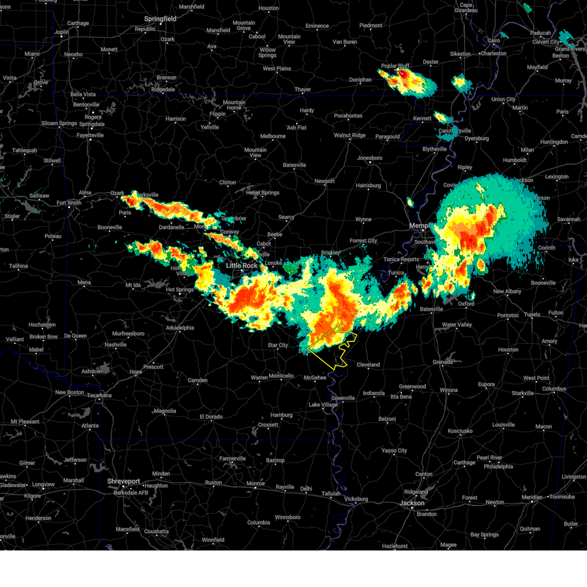 At 723 pm cdt, severe thunderstorms were located along a line extending from crumrod to 9 miles northwest of gunnison to trusten holder wma to 6 miles northwest of watson, moving southeast at 50 mph (radar indicated). Hazards include 60 mph wind gusts and nickel size hail. expect damage to roofs, siding, and trees At 723 pm cdt, severe thunderstorms were located along a line extending from crumrod to 9 miles northwest of gunnison to trusten holder wma to 6 miles northwest of watson, moving southeast at 50 mph (radar indicated). Hazards include 60 mph wind gusts and nickel size hail. expect damage to roofs, siding, and trees
|
| 6/25/2023 7:12 PM CDT |
 At 711 pm cdt, severe thunderstorms were located along a line extending from 6 miles southwest of watkins corner to 9 miles north of merrisach lake to near gillett, moving southeast at 55 mph (radar indicated). Hazards include 70 mph wind gusts and penny size hail. Expect considerable tree damage. damage is likely to mobile homes, roofs, and outbuildings. locations impacted include, dumas, gould, gillett, holly grove, mitchellville, almyra, st. Charles, watson, yancopin, omega, little bayou meto park, mills, merrisach lake, kelso, langford, palmer, douglas, trusten holder wma, de witt, blackton,. At 711 pm cdt, severe thunderstorms were located along a line extending from 6 miles southwest of watkins corner to 9 miles north of merrisach lake to near gillett, moving southeast at 55 mph (radar indicated). Hazards include 70 mph wind gusts and penny size hail. Expect considerable tree damage. damage is likely to mobile homes, roofs, and outbuildings. locations impacted include, dumas, gould, gillett, holly grove, mitchellville, almyra, st. Charles, watson, yancopin, omega, little bayou meto park, mills, merrisach lake, kelso, langford, palmer, douglas, trusten holder wma, de witt, blackton,.
|
| 6/25/2023 7:05 PM CDT |
 At 705 pm cdt, severe thunderstorms were located along a line extending from near st. charles to 7 miles southeast of de witt to near gillett, moving southeast at 45 mph (radar indicated). Hazards include 70 mph wind gusts and penny size hail. Expect considerable tree damage. damage is likely to mobile homes, roofs, and outbuildings. locations impacted include, dumas, rosedale, rohwer, gould, gillett, holly grove, arkansas city, mitchellville, almyra, st. Charles, tillar, watson, winchester, lucca landing, mcgehee, little bayou meto park, douglas, trusten holder wma, yancopin, omega,. At 705 pm cdt, severe thunderstorms were located along a line extending from near st. charles to 7 miles southeast of de witt to near gillett, moving southeast at 45 mph (radar indicated). Hazards include 70 mph wind gusts and penny size hail. Expect considerable tree damage. damage is likely to mobile homes, roofs, and outbuildings. locations impacted include, dumas, rosedale, rohwer, gould, gillett, holly grove, arkansas city, mitchellville, almyra, st. Charles, tillar, watson, winchester, lucca landing, mcgehee, little bayou meto park, douglas, trusten holder wma, yancopin, omega,.
|
| 6/25/2023 6:49 PM CDT |
 At 648 pm cdt, severe thunderstorms were located along a line extending from near roe to 7 miles southwest of almyra to richardson, moving east at 55 mph (radar indicated). Hazards include 70 mph wind gusts and penny size hail. Expect considerable tree damage. damage is likely to mobile homes, roofs, and outbuildings. locations impacted include, stuttgart, dumas, rosedale, clarendon, rohwer, altheimer, gould, gillett, holly grove, humphrey, grady, arkansas city, mitchellville, almyra, st. Charles, tillar, watson, ulm, winchester, roe,. At 648 pm cdt, severe thunderstorms were located along a line extending from near roe to 7 miles southwest of almyra to richardson, moving east at 55 mph (radar indicated). Hazards include 70 mph wind gusts and penny size hail. Expect considerable tree damage. damage is likely to mobile homes, roofs, and outbuildings. locations impacted include, stuttgart, dumas, rosedale, clarendon, rohwer, altheimer, gould, gillett, holly grove, humphrey, grady, arkansas city, mitchellville, almyra, st. Charles, tillar, watson, ulm, winchester, roe,.
|
| 6/25/2023 6:42 PM CDT |
 At 642 pm cdt, severe thunderstorms were located along a line extending from near roe to 7 miles southwest of almyra to richardson, moving southeast at 55 mph (radar indicated). Hazards include 70 mph wind gusts and penny size hail. Expect considerable tree damage. Damage is likely to mobile homes, roofs, and outbuildings. At 642 pm cdt, severe thunderstorms were located along a line extending from near roe to 7 miles southwest of almyra to richardson, moving southeast at 55 mph (radar indicated). Hazards include 70 mph wind gusts and penny size hail. Expect considerable tree damage. Damage is likely to mobile homes, roofs, and outbuildings.
|
| 6/16/2023 7:57 PM CDT |
 At 757 pm cdt, a severe thunderstorm was located near pace, or near cleveland, moving southeast at 35 mph (radar indicated). Hazards include golf ball size hail and 60 mph wind gusts. People and animals outdoors will be injured. expect hail damage to roofs, siding, windows, and vehicles. expect wind damage to roofs, siding, and trees. this severe storm will be near, mound bayou and merigold around 800 pm cdt. renova around 805 pm cdt. cleveland and boyle around 810 pm cdt. thunderstorm damage threat, considerable hail threat, radar indicated max hail size, 1. 75 in wind threat, radar indicated max wind gust, 60 mph. At 757 pm cdt, a severe thunderstorm was located near pace, or near cleveland, moving southeast at 35 mph (radar indicated). Hazards include golf ball size hail and 60 mph wind gusts. People and animals outdoors will be injured. expect hail damage to roofs, siding, windows, and vehicles. expect wind damage to roofs, siding, and trees. this severe storm will be near, mound bayou and merigold around 800 pm cdt. renova around 805 pm cdt. cleveland and boyle around 810 pm cdt. thunderstorm damage threat, considerable hail threat, radar indicated max hail size, 1. 75 in wind threat, radar indicated max wind gust, 60 mph.
|
| 6/16/2023 7:35 PM CDT |
 At 734 pm cdt, a severe thunderstorm was located over gunnison, or near rosedale, moving east at 30 mph (trained weather spotters. at 710 pm cdt, golf ball size hail was reported near tichnor, arkansas). Hazards include golf ball size hail and 60 mph wind gusts. People and animals outdoors will be injured. expect hail damage to roofs, siding, windows, and vehicles. expect wind damage to roofs, siding, and trees. this severe storm will be near, pace around 755 pm cdt. winstonville around 800 pm cdt. mound bayou and merigold around 805 pm cdt. renova around 810 pm cdt. thunderstorm damage threat, considerable hail threat, radar indicated max hail size, 1. 75 in wind threat, radar indicated max wind gust, 60 mph. At 734 pm cdt, a severe thunderstorm was located over gunnison, or near rosedale, moving east at 30 mph (trained weather spotters. at 710 pm cdt, golf ball size hail was reported near tichnor, arkansas). Hazards include golf ball size hail and 60 mph wind gusts. People and animals outdoors will be injured. expect hail damage to roofs, siding, windows, and vehicles. expect wind damage to roofs, siding, and trees. this severe storm will be near, pace around 755 pm cdt. winstonville around 800 pm cdt. mound bayou and merigold around 805 pm cdt. renova around 810 pm cdt. thunderstorm damage threat, considerable hail threat, radar indicated max hail size, 1. 75 in wind threat, radar indicated max wind gust, 60 mph.
|
| 6/16/2023 7:26 PM CDT |
 At 726 pm cdt, a severe thunderstorm was located near rosedale, moving southeast at 30 mph (radar indicated). Hazards include 60 mph wind gusts and half dollar size hail. Hail damage to vehicles is expected. expect wind damage to roofs, siding, and trees. this severe thunderstorm will be near, rosedale around 735 pm cdt. gunnison around 740 pm cdt. beulah around 745 pm cdt. pace and winstonville around 800 pm cdt. mound bayou around 805 pm cdt. renova and merigold around 810 pm cdt. cleveland and boyle around 815 pm cdt. hail threat, radar indicated max hail size, 1. 25 in wind threat, radar indicated max wind gust, 60 mph. At 726 pm cdt, a severe thunderstorm was located near rosedale, moving southeast at 30 mph (radar indicated). Hazards include 60 mph wind gusts and half dollar size hail. Hail damage to vehicles is expected. expect wind damage to roofs, siding, and trees. this severe thunderstorm will be near, rosedale around 735 pm cdt. gunnison around 740 pm cdt. beulah around 745 pm cdt. pace and winstonville around 800 pm cdt. mound bayou around 805 pm cdt. renova and merigold around 810 pm cdt. cleveland and boyle around 815 pm cdt. hail threat, radar indicated max hail size, 1. 25 in wind threat, radar indicated max wind gust, 60 mph.
|
| 6/16/2023 7:15 PM CDT |
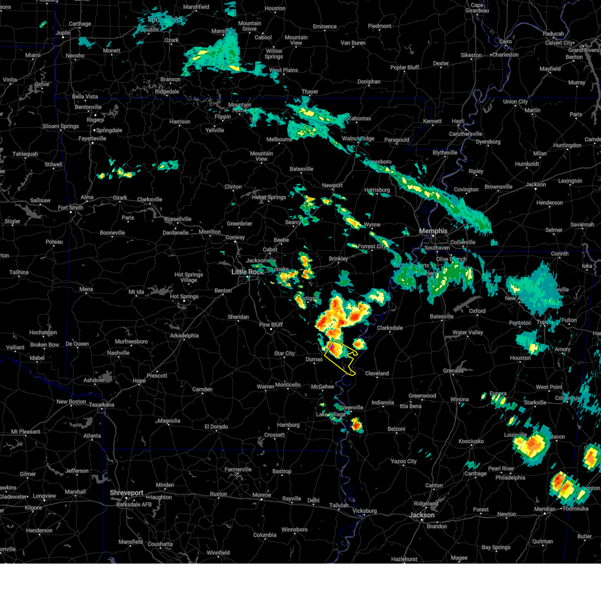 At 715 pm cdt, a severe thunderstorm was located over trusten holder wma, or 13 miles northwest of rosedale, moving southeast at 40 mph (radar indicated). Hazards include 60 mph wind gusts and quarter size hail. Hail damage to vehicles is expected. expect wind damage to roofs, siding, and trees. locations impacted include, watson, merrisach lake, trusten holder wma, yancopin, morgan point recreation area, hail threat, radar indicated max hail size, 1. 00 in wind threat, radar indicated max wind gust, 60 mph. At 715 pm cdt, a severe thunderstorm was located over trusten holder wma, or 13 miles northwest of rosedale, moving southeast at 40 mph (radar indicated). Hazards include 60 mph wind gusts and quarter size hail. Hail damage to vehicles is expected. expect wind damage to roofs, siding, and trees. locations impacted include, watson, merrisach lake, trusten holder wma, yancopin, morgan point recreation area, hail threat, radar indicated max hail size, 1. 00 in wind threat, radar indicated max wind gust, 60 mph.
|
| 6/16/2023 7:05 PM CDT |
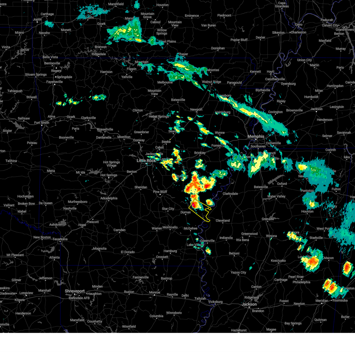 At 704 pm cdt, a severe thunderstorm was located over merrisach lake, or 15 miles northeast of dumas, moving southeast at 40 mph (radar indicated). Hazards include 60 mph wind gusts and quarter size hail. Hail damage to vehicles is expected. Expect wind damage to roofs, siding, and trees. At 704 pm cdt, a severe thunderstorm was located over merrisach lake, or 15 miles northeast of dumas, moving southeast at 40 mph (radar indicated). Hazards include 60 mph wind gusts and quarter size hail. Hail damage to vehicles is expected. Expect wind damage to roofs, siding, and trees.
|
| 6/14/2023 7:34 PM CDT |
 At 734 pm cdt, a severe thunderstorm was located over trusten holder wma, or 14 miles southwest of white river national wildlife refuge, moving east at 40 mph (radar indicated). Hazards include 60 mph wind gusts and quarter size hail. Hail damage to vehicles is expected. expect wind damage to roofs, siding, and trees. locations impacted include, gillett, watson, yancopin, merrisach lake, trusten holder wma, arkansas post, morgan point recreation area, pendleton, weber, tichnor, hail threat, radar indicated max hail size, 1. 00 in wind threat, radar indicated max wind gust, 60 mph. At 734 pm cdt, a severe thunderstorm was located over trusten holder wma, or 14 miles southwest of white river national wildlife refuge, moving east at 40 mph (radar indicated). Hazards include 60 mph wind gusts and quarter size hail. Hail damage to vehicles is expected. expect wind damage to roofs, siding, and trees. locations impacted include, gillett, watson, yancopin, merrisach lake, trusten holder wma, arkansas post, morgan point recreation area, pendleton, weber, tichnor, hail threat, radar indicated max hail size, 1. 00 in wind threat, radar indicated max wind gust, 60 mph.
|
| 6/14/2023 7:10 PM CDT |
 At 710 pm cdt, a severe thunderstorm was located near douglas, or 14 miles north of dumas, moving southeast at 35 mph (radar indicated). Hazards include 60 mph wind gusts and quarter size hail. Hail damage to vehicles is expected. Expect wind damage to roofs, siding, and trees. At 710 pm cdt, a severe thunderstorm was located near douglas, or 14 miles north of dumas, moving southeast at 35 mph (radar indicated). Hazards include 60 mph wind gusts and quarter size hail. Hail damage to vehicles is expected. Expect wind damage to roofs, siding, and trees.
|
| 6/11/2023 8:59 PM CDT |
 At 859 pm cdt, a severe thunderstorm was located 8 miles east of trusten holder wma, or 11 miles south of white river national wildlife refuge, moving southeast at 30 mph (radar indicated). Hazards include 60 mph wind gusts and quarter size hail. Hail damage to vehicles is expected. expect wind damage to roofs, siding, and trees. this severe thunderstorm will be near, gunnison around 915 pm cdt. rosedale around 920 pm cdt. beulah around 930 pm cdt. mound bayou and pace around 940 pm cdt. hail threat, radar indicated max hail size, 1. 00 in wind threat, radar indicated max wind gust, 60 mph. At 859 pm cdt, a severe thunderstorm was located 8 miles east of trusten holder wma, or 11 miles south of white river national wildlife refuge, moving southeast at 30 mph (radar indicated). Hazards include 60 mph wind gusts and quarter size hail. Hail damage to vehicles is expected. expect wind damage to roofs, siding, and trees. this severe thunderstorm will be near, gunnison around 915 pm cdt. rosedale around 920 pm cdt. beulah around 930 pm cdt. mound bayou and pace around 940 pm cdt. hail threat, radar indicated max hail size, 1. 00 in wind threat, radar indicated max wind gust, 60 mph.
|
| 6/11/2023 8:19 PM CDT |
 At 819 pm cdt, a severe thunderstorm was located over pace, or 9 miles northwest of cleveland, moving southeast at 45 mph (radar indicated). Hazards include ping pong ball size hail and 60 mph wind gusts. People and animals outdoors will be injured. expect hail damage to roofs, siding, windows, and vehicles. expect wind damage to roofs, siding, and trees. this severe storm will be near, renova around 830 pm cdt. cleveland and boyle around 835 pm cdt. shaw around 840 pm cdt. hail threat, radar indicated max hail size, 1. 50 in wind threat, radar indicated max wind gust, 60 mph. At 819 pm cdt, a severe thunderstorm was located over pace, or 9 miles northwest of cleveland, moving southeast at 45 mph (radar indicated). Hazards include ping pong ball size hail and 60 mph wind gusts. People and animals outdoors will be injured. expect hail damage to roofs, siding, windows, and vehicles. expect wind damage to roofs, siding, and trees. this severe storm will be near, renova around 830 pm cdt. cleveland and boyle around 835 pm cdt. shaw around 840 pm cdt. hail threat, radar indicated max hail size, 1. 50 in wind threat, radar indicated max wind gust, 60 mph.
|
| 6/11/2023 8:02 PM CDT |
 At 802 pm cdt, a severe thunderstorm was located near gunnison, or 7 miles north of rosedale, moving southeast at 45 mph (radar indicated). Hazards include 60 mph wind gusts and half dollar size hail. Hail damage to vehicles is expected. expect wind damage to roofs, siding, and trees. this severe thunderstorm will be near, gunnison around 805 pm cdt. rosedale around 810 pm cdt. beulah around 815 pm cdt. pace around 820 pm cdt. merigold around 825 pm cdt. renova around 830 pm cdt. cleveland and boyle around 835 pm cdt. shaw around 840 pm cdt. hail threat, radar indicated max hail size, 1. 25 in wind threat, radar indicated max wind gust, 60 mph. At 802 pm cdt, a severe thunderstorm was located near gunnison, or 7 miles north of rosedale, moving southeast at 45 mph (radar indicated). Hazards include 60 mph wind gusts and half dollar size hail. Hail damage to vehicles is expected. expect wind damage to roofs, siding, and trees. this severe thunderstorm will be near, gunnison around 805 pm cdt. rosedale around 810 pm cdt. beulah around 815 pm cdt. pace around 820 pm cdt. merigold around 825 pm cdt. renova around 830 pm cdt. cleveland and boyle around 835 pm cdt. shaw around 840 pm cdt. hail threat, radar indicated max hail size, 1. 25 in wind threat, radar indicated max wind gust, 60 mph.
|
| 6/11/2023 7:24 PM CDT |
 At 724 pm cdt, a severe thunderstorm was located over benoit, or 14 miles north of greenville, moving southeast at 30 mph (radar indicated). Hazards include 60 mph wind gusts and quarter size hail. Hail damage to vehicles is expected. expect wind damage to roofs, siding, and trees. this severe thunderstorm will remain over mainly rural areas of north central washington and southwestern bolivar counties. hail threat, radar indicated max hail size, 1. 00 in wind threat, radar indicated max wind gust, 60 mph. At 724 pm cdt, a severe thunderstorm was located over benoit, or 14 miles north of greenville, moving southeast at 30 mph (radar indicated). Hazards include 60 mph wind gusts and quarter size hail. Hail damage to vehicles is expected. expect wind damage to roofs, siding, and trees. this severe thunderstorm will remain over mainly rural areas of north central washington and southwestern bolivar counties. hail threat, radar indicated max hail size, 1. 00 in wind threat, radar indicated max wind gust, 60 mph.
|
| 6/11/2023 6:52 PM CDT |
 At 652 pm cdt, a severe thunderstorm was located near kelso, or near rohwer, moving southeast at 30 mph (radar indicated). Hazards include golf ball size hail and 70 mph wind gusts. People and animals outdoors will be injured. expect hail damage to roofs, siding, windows, and vehicles. expect considerable tree damage. wind damage is also likely to mobile homes, roofs, and outbuildings. this severe thunderstorm will be near, benoit around 720 pm cdt. scott around 725 pm cdt. Lamont around 730 pm cdt. At 652 pm cdt, a severe thunderstorm was located near kelso, or near rohwer, moving southeast at 30 mph (radar indicated). Hazards include golf ball size hail and 70 mph wind gusts. People and animals outdoors will be injured. expect hail damage to roofs, siding, windows, and vehicles. expect considerable tree damage. wind damage is also likely to mobile homes, roofs, and outbuildings. this severe thunderstorm will be near, benoit around 720 pm cdt. scott around 725 pm cdt. Lamont around 730 pm cdt.
|
| 4/15/2023 9:38 PM CDT |
 At 937 pm cdt, severe thunderstorms were located along a line extending from 6 miles southeast of de witt to merrisach lake to near gould, moving east at 50 mph (radar indicated). Hazards include 60 mph wind gusts and quarter size hail. Hail damage to vehicles is expected. expect wind damage to roofs, siding, and trees. locations impacted include, dumas, gould, gillett, mitchellville, watson, yancopin, mills, merrisach lake, trusten holder wma, de witt, douglas, arkansas post, garrett bridge, pendleton, ethel, de luce, rose hill, tichnor, reedville, morgan point recreation area, hail threat, radar indicated max hail size, 1. 00 in wind threat, radar indicated max wind gust, 60 mph. At 937 pm cdt, severe thunderstorms were located along a line extending from 6 miles southeast of de witt to merrisach lake to near gould, moving east at 50 mph (radar indicated). Hazards include 60 mph wind gusts and quarter size hail. Hail damage to vehicles is expected. expect wind damage to roofs, siding, and trees. locations impacted include, dumas, gould, gillett, mitchellville, watson, yancopin, mills, merrisach lake, trusten holder wma, de witt, douglas, arkansas post, garrett bridge, pendleton, ethel, de luce, rose hill, tichnor, reedville, morgan point recreation area, hail threat, radar indicated max hail size, 1. 00 in wind threat, radar indicated max wind gust, 60 mph.
|
| 4/15/2023 9:25 PM CDT |
 At 925 pm cdt, severe thunderstorms were located along a line extending from 6 miles northwest of gillett to near douglas to near cane creek state park, moving east at 50 mph (radar indicated). Hazards include 60 mph wind gusts and quarter size hail. Hail damage to vehicles is expected. Expect wind damage to roofs, siding, and trees. At 925 pm cdt, severe thunderstorms were located along a line extending from 6 miles northwest of gillett to near douglas to near cane creek state park, moving east at 50 mph (radar indicated). Hazards include 60 mph wind gusts and quarter size hail. Hail damage to vehicles is expected. Expect wind damage to roofs, siding, and trees.
|
| 3/24/2023 7:14 PM CDT |
 At 714 pm cdt, a severe thunderstorm capable of producing a tornado was located over scott, or 12 miles north of greenville, moving northeast at 75 mph (radar indicated rotation). Hazards include tornado and quarter size hail. Flying debris will be dangerous to those caught without shelter. mobile homes will be damaged or destroyed. damage to roofs, windows, and vehicles will occur. tree damage is likely. this dangerous storm will be near, cleveland and boyle around 730 pm cdt. mound bayou and renova around 735 pm cdt. Other locations impacted by this tornadic thunderstorm include winstonville, beulah, pace, duncan and merigold. At 714 pm cdt, a severe thunderstorm capable of producing a tornado was located over scott, or 12 miles north of greenville, moving northeast at 75 mph (radar indicated rotation). Hazards include tornado and quarter size hail. Flying debris will be dangerous to those caught without shelter. mobile homes will be damaged or destroyed. damage to roofs, windows, and vehicles will occur. tree damage is likely. this dangerous storm will be near, cleveland and boyle around 730 pm cdt. mound bayou and renova around 735 pm cdt. Other locations impacted by this tornadic thunderstorm include winstonville, beulah, pace, duncan and merigold.
|
| 3/24/2023 6:59 PM CDT |
 At 659 pm cdt, a severe thunderstorm capable of producing a tornado was located over jersey point, or 13 miles southeast of rohwer, moving northeast at 50 mph (radar indicated rotation). Hazards include tornado and quarter size hail. Flying debris will be dangerous to those caught without shelter. mobile homes will be damaged or destroyed. damage to roofs, windows, and vehicles will occur. tree damage is likely. this dangerous storm will be near, benoit around 705 pm cdt. renova around 725 pm cdt. mound bayou around 730 pm cdt. shelby around 735 pm cdt. Other locations impacted by this tornadic thunderstorm include winstonville, beulah, pace, duncan and merigold. At 659 pm cdt, a severe thunderstorm capable of producing a tornado was located over jersey point, or 13 miles southeast of rohwer, moving northeast at 50 mph (radar indicated rotation). Hazards include tornado and quarter size hail. Flying debris will be dangerous to those caught without shelter. mobile homes will be damaged or destroyed. damage to roofs, windows, and vehicles will occur. tree damage is likely. this dangerous storm will be near, benoit around 705 pm cdt. renova around 725 pm cdt. mound bayou around 730 pm cdt. shelby around 735 pm cdt. Other locations impacted by this tornadic thunderstorm include winstonville, beulah, pace, duncan and merigold.
|
| 3/24/2023 6:44 PM CDT |
 At 644 pm cdt, a severe thunderstorm was located over arkansas city, or 11 miles south of rohwer, moving northeast at 70 mph (radar indicated). Hazards include 60 mph wind gusts and penny size hail. Expect damage to roofs, siding, and trees. this severe thunderstorm will be near, scott around 650 pm cdt. benoit around 655 pm cdt. rosedale around 700 pm cdt. shelby and mound bayou around 715 pm cdt. other locations impacted by this severe thunderstorm include winstonville, beulah, pace, duncan and merigold. hail threat, radar indicated max hail size, 0. 75 in wind threat, radar indicated max wind gust, 60 mph. At 644 pm cdt, a severe thunderstorm was located over arkansas city, or 11 miles south of rohwer, moving northeast at 70 mph (radar indicated). Hazards include 60 mph wind gusts and penny size hail. Expect damage to roofs, siding, and trees. this severe thunderstorm will be near, scott around 650 pm cdt. benoit around 655 pm cdt. rosedale around 700 pm cdt. shelby and mound bayou around 715 pm cdt. other locations impacted by this severe thunderstorm include winstonville, beulah, pace, duncan and merigold. hail threat, radar indicated max hail size, 0. 75 in wind threat, radar indicated max wind gust, 60 mph.
|
| 3/12/2023 1:32 AM CDT |
 At 1231 am cst, severe thunderstorms were located along a line extending from near deeson to 7 miles northwest of shaw to winterville, moving east at 40 mph (radar indicated). Hazards include 60 mph wind gusts and nickel size hail. Expect damage to roofs, siding, and trees. severe thunderstorms will be near, shaw around 1240 am cst. cleveland and boyle around 1245 am cst. ruleville and holly ridge around 1255 am cst. parchman around 100 am cst. indianola, sunflower, blaine and rome around 105 am cst. moorhead around 115 am cst. other locations impacted by these severe thunderstorms include alligator, beulah, pace, doddsville, winstonville, duncan and merigold. hail threat, radar indicated max hail size, 0. 88 in wind threat, radar indicated max wind gust, 60 mph. At 1231 am cst, severe thunderstorms were located along a line extending from near deeson to 7 miles northwest of shaw to winterville, moving east at 40 mph (radar indicated). Hazards include 60 mph wind gusts and nickel size hail. Expect damage to roofs, siding, and trees. severe thunderstorms will be near, shaw around 1240 am cst. cleveland and boyle around 1245 am cst. ruleville and holly ridge around 1255 am cst. parchman around 100 am cst. indianola, sunflower, blaine and rome around 105 am cst. moorhead around 115 am cst. other locations impacted by these severe thunderstorms include alligator, beulah, pace, doddsville, winstonville, duncan and merigold. hail threat, radar indicated max hail size, 0. 88 in wind threat, radar indicated max wind gust, 60 mph.
|
| 3/12/2023 1:20 AM CDT |
 At 1219 am cst, severe thunderstorms were located along a line extending from 6 miles east of trusten holder wma to jersey point to 7 miles north of mcmillan corner to 10 miles north of snyder, moving east at 55 mph (radar indicated). Hazards include 60 mph wind gusts and quarter size hail. Hail damage to vehicles is expected. expect wind damage to roofs, siding, and trees. locations impacted include, monticello, dumas, dermott, rosedale, rohwer, arkansas city, tillar, watson, winchester, yancopin, omega, lucca landing, mcgehee, merrisach lake, kelso, ladelle, trusten holder wma, prairie grove, reed, jerome, hail threat, radar indicated max hail size, 1. 00 in wind threat, radar indicated max wind gust, 60 mph. At 1219 am cst, severe thunderstorms were located along a line extending from 6 miles east of trusten holder wma to jersey point to 7 miles north of mcmillan corner to 10 miles north of snyder, moving east at 55 mph (radar indicated). Hazards include 60 mph wind gusts and quarter size hail. Hail damage to vehicles is expected. expect wind damage to roofs, siding, and trees. locations impacted include, monticello, dumas, dermott, rosedale, rohwer, arkansas city, tillar, watson, winchester, yancopin, omega, lucca landing, mcgehee, merrisach lake, kelso, ladelle, trusten holder wma, prairie grove, reed, jerome, hail threat, radar indicated max hail size, 1. 00 in wind threat, radar indicated max wind gust, 60 mph.
|
| 3/12/2023 1:04 AM CDT |
 At 1204 am cst, severe thunderstorms were located along a line extending from merrisach lake to near rohwer to near dermott to ladelle, moving east at 55 mph (radar indicated). Hazards include 60 mph wind gusts and quarter size hail. Hail damage to vehicles is expected. expect wind damage to roofs, siding, and trees. locations impacted include, monticello, warren, dumas, dermott, rosedale, hampton, rohwer, gould, hermitage, gillett, wilmar, arkansas city, mitchellville, harrell, tillar, watson, winchester, ingalls, lucca landing, hampton municipal airport, hail threat, radar indicated max hail size, 1. 00 in wind threat, radar indicated max wind gust, 60 mph. At 1204 am cst, severe thunderstorms were located along a line extending from merrisach lake to near rohwer to near dermott to ladelle, moving east at 55 mph (radar indicated). Hazards include 60 mph wind gusts and quarter size hail. Hail damage to vehicles is expected. expect wind damage to roofs, siding, and trees. locations impacted include, monticello, warren, dumas, dermott, rosedale, hampton, rohwer, gould, hermitage, gillett, wilmar, arkansas city, mitchellville, harrell, tillar, watson, winchester, ingalls, lucca landing, hampton municipal airport, hail threat, radar indicated max hail size, 1. 00 in wind threat, radar indicated max wind gust, 60 mph.
|
| 3/12/2023 12:49 AM CDT |
 At 1148 pm cst, severe thunderstorms were located along a line extending from douglas to near winchester to near monticello to 7 miles east of hermitage, moving east at 55 mph (radar indicated). Hazards include 60 mph wind gusts and quarter size hail. Hail damage to vehicles is expected. expect wind damage to roofs, siding, and trees. locations impacted include, camden, monticello, warren, dumas, dermott, rosedale, hampton, rohwer, gould, hermitage, gillett, wilmar, grady, arkansas city, mitchellville, harrell, tillar, watson, winchester, ingalls, hail threat, radar indicated max hail size, 1. 00 in wind threat, radar indicated max wind gust, 60 mph. At 1148 pm cst, severe thunderstorms were located along a line extending from douglas to near winchester to near monticello to 7 miles east of hermitage, moving east at 55 mph (radar indicated). Hazards include 60 mph wind gusts and quarter size hail. Hail damage to vehicles is expected. expect wind damage to roofs, siding, and trees. locations impacted include, camden, monticello, warren, dumas, dermott, rosedale, hampton, rohwer, gould, hermitage, gillett, wilmar, grady, arkansas city, mitchellville, harrell, tillar, watson, winchester, ingalls, hail threat, radar indicated max hail size, 1. 00 in wind threat, radar indicated max wind gust, 60 mph.
|
| 3/12/2023 12:25 AM CDT |
 At 1125 pm cst, severe thunderstorms were located along a line extending from cottondale to near star city to near warren to 6 miles north of harrell, moving east at 55 mph (radar indicated). Hazards include 60 mph wind gusts and quarter size hail. Hail damage to vehicles is expected. Expect wind damage to roofs, siding, and trees. At 1125 pm cst, severe thunderstorms were located along a line extending from cottondale to near star city to near warren to 6 miles north of harrell, moving east at 55 mph (radar indicated). Hazards include 60 mph wind gusts and quarter size hail. Hail damage to vehicles is expected. Expect wind damage to roofs, siding, and trees.
|
| 3/1/2023 9:18 PM CST |
 At 917 pm cst, a severe thunderstorm was located near watson, or 8 miles west of rosedale, moving east at 40 mph (radar indicated). Hazards include 70 mph wind gusts and ping pong ball size hail. People and animals outdoors will be injured. expect hail damage to roofs, siding, windows, and vehicles. expect considerable tree damage. wind damage is also likely to mobile homes, roofs, and outbuildings. this severe thunderstorm will be near, rosedale around 930 pm cst. gunnison around 935 pm cst. cleveland, mound bayou and renova around 955 pm cst. ruleville and drew around 1010 pm cst. Other locations impacted by this severe thunderstorm include alligator, winstonville, beulah, pace, duncan and merigold. At 917 pm cst, a severe thunderstorm was located near watson, or 8 miles west of rosedale, moving east at 40 mph (radar indicated). Hazards include 70 mph wind gusts and ping pong ball size hail. People and animals outdoors will be injured. expect hail damage to roofs, siding, windows, and vehicles. expect considerable tree damage. wind damage is also likely to mobile homes, roofs, and outbuildings. this severe thunderstorm will be near, rosedale around 930 pm cst. gunnison around 935 pm cst. cleveland, mound bayou and renova around 955 pm cst. ruleville and drew around 1010 pm cst. Other locations impacted by this severe thunderstorm include alligator, winstonville, beulah, pace, duncan and merigold.
|
| 3/1/2023 9:03 PM CST |
 At 903 pm cst, a severe thunderstorm capable of producing a tornado was located near watson, or 8 miles east of dumas, moving east at 45 mph (radar indicated rotation). Hazards include tornado and ping pong ball size hail. Flying debris will be dangerous to those caught without shelter. mobile homes will be damaged or destroyed. damage to roofs, windows, and vehicles will occur. tree damage is likely. Locations impacted include, dumas, rohwer, watson, yancopin, trusten holder wma, omega, kelso, morgan point recreation area, pendleton, pickens in desha county,. At 903 pm cst, a severe thunderstorm capable of producing a tornado was located near watson, or 8 miles east of dumas, moving east at 45 mph (radar indicated rotation). Hazards include tornado and ping pong ball size hail. Flying debris will be dangerous to those caught without shelter. mobile homes will be damaged or destroyed. damage to roofs, windows, and vehicles will occur. tree damage is likely. Locations impacted include, dumas, rohwer, watson, yancopin, trusten holder wma, omega, kelso, morgan point recreation area, pendleton, pickens in desha county,.
|
| 3/1/2023 8:50 PM CST |
 At 849 pm cst, a severe thunderstorm capable of producing a tornado was located over mills, or near dumas, moving east at 50 mph (radar indicated rotation). Hazards include tornado and hail up to two inches in diameter. Flying debris will be dangerous to those caught without shelter. mobile homes will be damaged or destroyed. damage to roofs, windows, and vehicles will occur. Tree damage is likely. At 849 pm cst, a severe thunderstorm capable of producing a tornado was located over mills, or near dumas, moving east at 50 mph (radar indicated rotation). Hazards include tornado and hail up to two inches in diameter. Flying debris will be dangerous to those caught without shelter. mobile homes will be damaged or destroyed. damage to roofs, windows, and vehicles will occur. Tree damage is likely.
|
| 1/3/2023 12:58 AM CST |
 At 1258 am cst, severe thunderstorms were located along a line extending from 6 miles south of de witt to near merrisach lake to near dumas, moving northeast at 60 mph (radar indicated). Hazards include 60 mph wind gusts. Expect damage to roofs, siding, and trees. locations impacted include, dumas, gillett, mitchellville, watson, yancopin, omega, mills, merrisach lake, trusten holder wma, kelso, arkansas post, garrett bridge, pendleton, gourd, tichnor, reedville, morgan point recreation area, yukon, weber, pickens in desha county, hail threat, radar indicated max hail size, <. 75 in wind threat, radar indicated max wind gust, 60 mph. At 1258 am cst, severe thunderstorms were located along a line extending from 6 miles south of de witt to near merrisach lake to near dumas, moving northeast at 60 mph (radar indicated). Hazards include 60 mph wind gusts. Expect damage to roofs, siding, and trees. locations impacted include, dumas, gillett, mitchellville, watson, yancopin, omega, mills, merrisach lake, trusten holder wma, kelso, arkansas post, garrett bridge, pendleton, gourd, tichnor, reedville, morgan point recreation area, yukon, weber, pickens in desha county, hail threat, radar indicated max hail size, <. 75 in wind threat, radar indicated max wind gust, 60 mph.
|
| 1/3/2023 12:45 AM CST |
 At 1244 am cst, severe thunderstorms were located along a line extending from near douglas to near mitchellville to 8 miles southwest of winchester, moving northeast at 55 mph (radar indicated). Hazards include 60 mph wind gusts. Expect damage to roofs, siding, and trees. locations impacted include, dumas, rohwer, gould, gillett, mitchellville, tillar, watson, winchester, yancopin, omega, lucca landing, mills, merrisach lake, kelso, douglas, trusten holder wma, reed, arkansas post, garrett bridge, gourd, hail threat, radar indicated max hail size, <. 75 in wind threat, radar indicated max wind gust, 60 mph. At 1244 am cst, severe thunderstorms were located along a line extending from near douglas to near mitchellville to 8 miles southwest of winchester, moving northeast at 55 mph (radar indicated). Hazards include 60 mph wind gusts. Expect damage to roofs, siding, and trees. locations impacted include, dumas, rohwer, gould, gillett, mitchellville, tillar, watson, winchester, yancopin, omega, lucca landing, mills, merrisach lake, kelso, douglas, trusten holder wma, reed, arkansas post, garrett bridge, gourd, hail threat, radar indicated max hail size, <. 75 in wind threat, radar indicated max wind gust, 60 mph.
|
| 1/3/2023 12:31 AM CST |
 At 1230 am cst, severe thunderstorms were located along a line extending from near gould to 6 miles south of mills to near monticello, moving northeast at 60 mph (radar indicated). Hazards include 60 mph wind gusts. expect damage to roofs, siding, and trees At 1230 am cst, severe thunderstorms were located along a line extending from near gould to 6 miles south of mills to near monticello, moving northeast at 60 mph (radar indicated). Hazards include 60 mph wind gusts. expect damage to roofs, siding, and trees
|
| 1/2/2023 11:05 PM CST |
 At 1105 pm cst, a severe thunderstorm was located near gunnison, or 7 miles north of rosedale, moving northeast at 50 mph (radar indicated). Hazards include 60 mph wind gusts. Expect damage to roofs, siding, and trees. locations impacted include, gunnison, deeson and alligator. hail threat, radar indicated max hail size, <. 75 in wind threat, radar indicated max wind gust, 60 mph. At 1105 pm cst, a severe thunderstorm was located near gunnison, or 7 miles north of rosedale, moving northeast at 50 mph (radar indicated). Hazards include 60 mph wind gusts. Expect damage to roofs, siding, and trees. locations impacted include, gunnison, deeson and alligator. hail threat, radar indicated max hail size, <. 75 in wind threat, radar indicated max wind gust, 60 mph.
|
| 1/2/2023 11:04 PM CST |
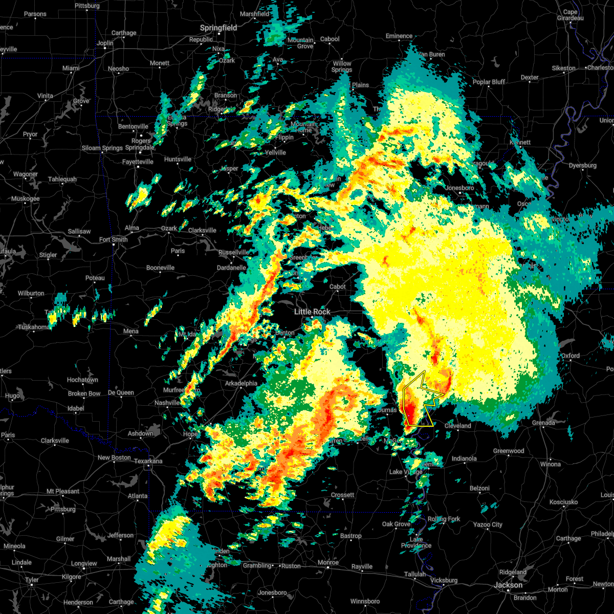 At 1103 pm cst, severe thunderstorms were located along a line extending from 6 miles east of merrisach lake to near trusten holder wma to 6 miles west of rosedale, moving northeast at 60 mph (radar indicated). Hazards include 60 mph wind gusts and quarter size hail. Hail damage to vehicles is expected. expect wind damage to roofs, siding, and trees. locations impacted include, rosedale, watson, yancopin, merrisach lake, trusten holder wma, morgan point recreation area, weber, tichnor, hail threat, radar indicated max hail size, 1. 00 in wind threat, radar indicated max wind gust, 60 mph. At 1103 pm cst, severe thunderstorms were located along a line extending from 6 miles east of merrisach lake to near trusten holder wma to 6 miles west of rosedale, moving northeast at 60 mph (radar indicated). Hazards include 60 mph wind gusts and quarter size hail. Hail damage to vehicles is expected. expect wind damage to roofs, siding, and trees. locations impacted include, rosedale, watson, yancopin, merrisach lake, trusten holder wma, morgan point recreation area, weber, tichnor, hail threat, radar indicated max hail size, 1. 00 in wind threat, radar indicated max wind gust, 60 mph.
|
| 1/2/2023 10:56 PM CST |
 At 1056 pm cst, a severe thunderstorm was located near yancopin, or 7 miles northwest of rosedale, moving northeast at 55 mph (radar indicated). Hazards include 60 mph wind gusts. Expect damage to roofs, siding, and trees. locations impacted include, shelby, rosedale, mound bayou, gunnison, deeson, merigold, duncan, alligator and winstonville. hail threat, radar indicated max hail size, <. 75 in wind threat, radar indicated max wind gust, 60 mph. At 1056 pm cst, a severe thunderstorm was located near yancopin, or 7 miles northwest of rosedale, moving northeast at 55 mph (radar indicated). Hazards include 60 mph wind gusts. Expect damage to roofs, siding, and trees. locations impacted include, shelby, rosedale, mound bayou, gunnison, deeson, merigold, duncan, alligator and winstonville. hail threat, radar indicated max hail size, <. 75 in wind threat, radar indicated max wind gust, 60 mph.
|
| 1/2/2023 10:46 PM CST |
 At 1045 pm cst, severe thunderstorms were located along a line extending from 7 miles northeast of mitchellville to kelso to mcgehee, moving northeast at 50 mph (radar indicated). Hazards include 60 mph wind gusts and quarter size hail. Hail damage to vehicles is expected. expect wind damage to roofs, siding, and trees. locations impacted include, dumas, rosedale, rohwer, arkansas city, mitchellville, tillar, watson, winchester, yancopin, omega, lucca landing, mcgehee, merrisach lake, kelso, trusten holder wma, reed, arkansas post, tichnor, reedville, morgan point recreation area, hail threat, radar indicated max hail size, 1. 00 in wind threat, radar indicated max wind gust, 60 mph. At 1045 pm cst, severe thunderstorms were located along a line extending from 7 miles northeast of mitchellville to kelso to mcgehee, moving northeast at 50 mph (radar indicated). Hazards include 60 mph wind gusts and quarter size hail. Hail damage to vehicles is expected. expect wind damage to roofs, siding, and trees. locations impacted include, dumas, rosedale, rohwer, arkansas city, mitchellville, tillar, watson, winchester, yancopin, omega, lucca landing, mcgehee, merrisach lake, kelso, trusten holder wma, reed, arkansas post, tichnor, reedville, morgan point recreation area, hail threat, radar indicated max hail size, 1. 00 in wind threat, radar indicated max wind gust, 60 mph.
|
| 1/2/2023 10:29 PM CST |
 At 1029 pm cst, severe thunderstorms were located along a line extending from near dumas to tillar to 6 miles west of dermott, moving northeast at 50 mph (radar indicated). Hazards include 60 mph wind gusts and quarter size hail. Hail damage to vehicles is expected. Expect wind damage to roofs, siding, and trees. At 1029 pm cst, severe thunderstorms were located along a line extending from near dumas to tillar to 6 miles west of dermott, moving northeast at 50 mph (radar indicated). Hazards include 60 mph wind gusts and quarter size hail. Hail damage to vehicles is expected. Expect wind damage to roofs, siding, and trees.
|
| 1/2/2023 10:24 PM CST |
 At 1024 pm cst, a severe thunderstorm was located over trusten holder wma, or 10 miles east of pea ridge, moving northeast at 50 mph (radar indicated). Hazards include 60 mph wind gusts. Expect damage to roofs, siding, and trees. this severe thunderstorm will be near, gunnison around 1035 pm cst. deeson around 1045 pm cst. other locations impacted by this severe thunderstorm include alligator, winstonville, duncan and merigold. hail threat, radar indicated max hail size, <. 75 in wind threat, radar indicated max wind gust, 60 mph. At 1024 pm cst, a severe thunderstorm was located over trusten holder wma, or 10 miles east of pea ridge, moving northeast at 50 mph (radar indicated). Hazards include 60 mph wind gusts. Expect damage to roofs, siding, and trees. this severe thunderstorm will be near, gunnison around 1035 pm cst. deeson around 1045 pm cst. other locations impacted by this severe thunderstorm include alligator, winstonville, duncan and merigold. hail threat, radar indicated max hail size, <. 75 in wind threat, radar indicated max wind gust, 60 mph.
|
| 1/2/2023 10:07 PM CST |
 At 1007 pm cst, severe thunderstorms were located along a line extending from near douglas to 6 miles west of watson to near mcgehee, moving northeast at 60 mph (radar indicated). Hazards include 60 mph wind gusts and penny size hail. Expect damage to roofs, siding, and trees. locations impacted include, monticello, dumas, dermott, star city, rohwer, gould, arkansas city, mitchellville, tillar, watson, winchester, lucca landing, mcgehee, trusten holder wma, yancopin, omega, cane creek state park, mills, merrisach lake, kelso, hail threat, radar indicated max hail size, 0. 75 in wind threat, radar indicated max wind gust, 60 mph. At 1007 pm cst, severe thunderstorms were located along a line extending from near douglas to 6 miles west of watson to near mcgehee, moving northeast at 60 mph (radar indicated). Hazards include 60 mph wind gusts and penny size hail. Expect damage to roofs, siding, and trees. locations impacted include, monticello, dumas, dermott, star city, rohwer, gould, arkansas city, mitchellville, tillar, watson, winchester, lucca landing, mcgehee, trusten holder wma, yancopin, omega, cane creek state park, mills, merrisach lake, kelso, hail threat, radar indicated max hail size, 0. 75 in wind threat, radar indicated max wind gust, 60 mph.
|
| 1/2/2023 9:42 PM CST |
 At 941 pm cst, severe thunderstorms were located along a line extending from near cane creek state park to 6 miles southeast of monticello to fountain hill, moving east at 55 mph (radar indicated). Hazards include 60 mph wind gusts and penny size hail. expect damage to roofs, siding, and trees At 941 pm cst, severe thunderstorms were located along a line extending from near cane creek state park to 6 miles southeast of monticello to fountain hill, moving east at 55 mph (radar indicated). Hazards include 60 mph wind gusts and penny size hail. expect damage to roofs, siding, and trees
|
| 11/29/2022 5:56 PM CST |
 At 556 pm cst, a severe thunderstorm was located over scott, or 14 miles southeast of rohwer, moving east at 50 mph (radar indicated). Hazards include 60 mph wind gusts and half dollar size hail. Hail damage to vehicles is expected. expect wind damage to roofs, siding, and trees. this severe thunderstorm will be near, benoit around 600 pm cst. cleveland and boyle around 620 pm cst. renova around 625 pm cst. ruleville around 635 pm cst. drew around 640 pm cst. parchman around 645 pm cst. other locations impacted by this severe thunderstorm include winstonville, beulah, pace and merigold. hail threat, radar indicated max hail size, 1. 25 in wind threat, radar indicated max wind gust, 60 mph. At 556 pm cst, a severe thunderstorm was located over scott, or 14 miles southeast of rohwer, moving east at 50 mph (radar indicated). Hazards include 60 mph wind gusts and half dollar size hail. Hail damage to vehicles is expected. expect wind damage to roofs, siding, and trees. this severe thunderstorm will be near, benoit around 600 pm cst. cleveland and boyle around 620 pm cst. renova around 625 pm cst. ruleville around 635 pm cst. drew around 640 pm cst. parchman around 645 pm cst. other locations impacted by this severe thunderstorm include winstonville, beulah, pace and merigold. hail threat, radar indicated max hail size, 1. 25 in wind threat, radar indicated max wind gust, 60 mph.
|
| 11/5/2022 1:41 AM CDT | At 140 am cdt, a severe thunderstorm was located 7 miles northwest of rosedale, moving east at 45 mph (radar indicated). Hazards include 60 mph wind gusts. Expect damage to roofs, siding, and trees. this severe thunderstorm will be near, gunnison around 150 am cdt. deeson around 200 am cdt. shelby around 205 am cdt. other locations impacted by this severe thunderstorm include alligator, winstonville, beulah, pace, duncan and merigold. hail threat, radar indicated max hail size, <. 75 in wind threat, radar indicated max wind gust, 60 mph. |
| 10/12/2022 9:46 PM CDT |
 At 945 pm cdt, a severe thunderstorm was located near trusten holder wma, or 12 miles northwest of rosedale, moving southeast at 35 mph (radar indicated). Hazards include 60 mph wind gusts and penny size hail. Expect damage to roofs, siding, and trees. this severe thunderstorm will be near, rosedale and gunnison around 1005 pm cdt. mound bayou around 1025 pm cdt. renova around 1030 pm cdt. cleveland and boyle around 1035 pm cdt. other locations impacted by this severe thunderstorm include alligator, winstonville, beulah, pace, duncan and merigold. hail threat, radar indicated max hail size, 0. 75 in wind threat, radar indicated max wind gust, 60 mph. At 945 pm cdt, a severe thunderstorm was located near trusten holder wma, or 12 miles northwest of rosedale, moving southeast at 35 mph (radar indicated). Hazards include 60 mph wind gusts and penny size hail. Expect damage to roofs, siding, and trees. this severe thunderstorm will be near, rosedale and gunnison around 1005 pm cdt. mound bayou around 1025 pm cdt. renova around 1030 pm cdt. cleveland and boyle around 1035 pm cdt. other locations impacted by this severe thunderstorm include alligator, winstonville, beulah, pace, duncan and merigold. hail threat, radar indicated max hail size, 0. 75 in wind threat, radar indicated max wind gust, 60 mph.
|
| 6/8/2022 3:46 PM CDT |
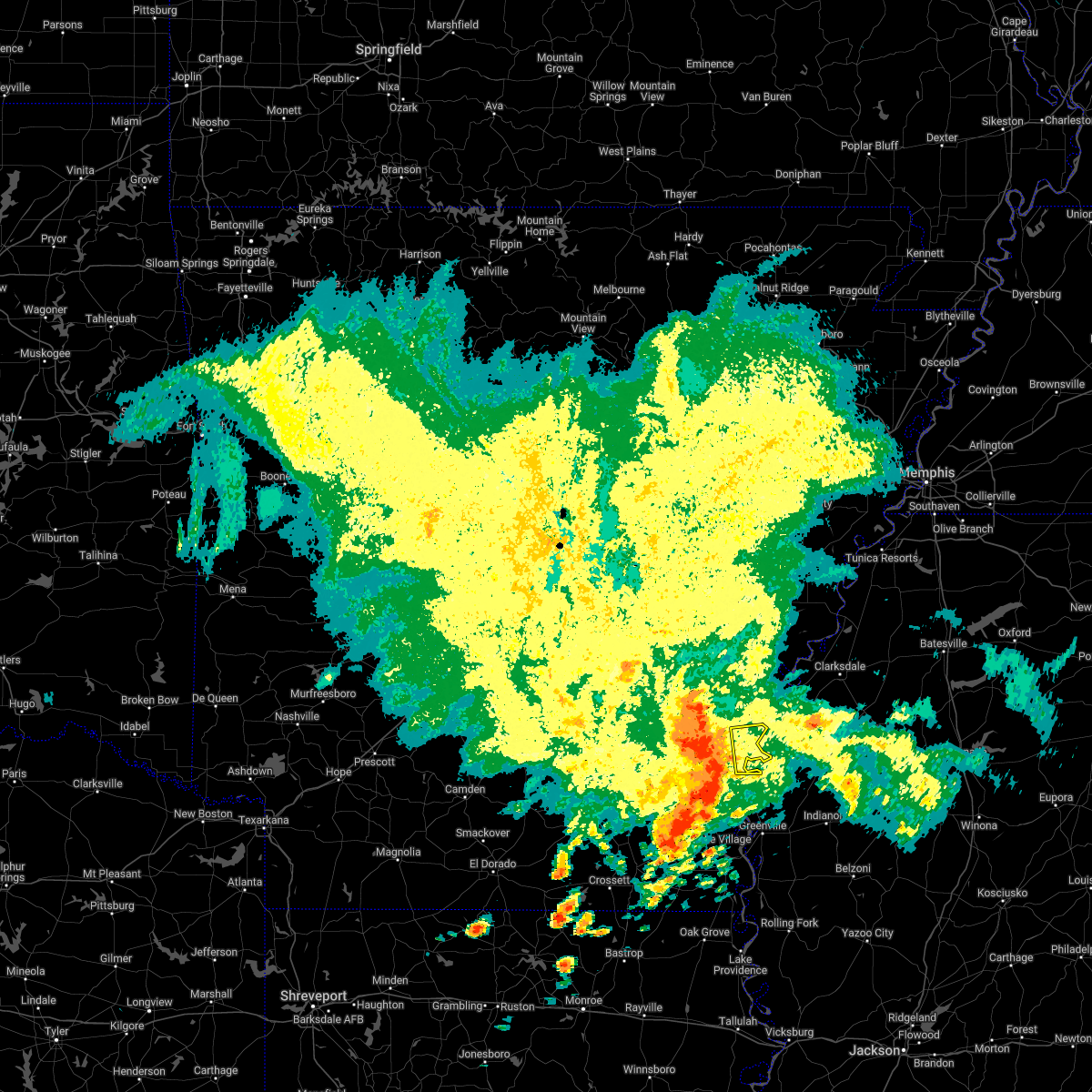 At 346 pm cdt, a severe thunderstorm was located near rosedale, moving east at 65 mph (radar indicated). Hazards include 60 mph wind gusts. Expect damage to roofs, siding, and trees. this severe thunderstorm will remain over mainly rural areas of central desha county. hail threat, radar indicated max hail size, <. 75 in wind threat, radar indicated max wind gust, 60 mph. At 346 pm cdt, a severe thunderstorm was located near rosedale, moving east at 65 mph (radar indicated). Hazards include 60 mph wind gusts. Expect damage to roofs, siding, and trees. this severe thunderstorm will remain over mainly rural areas of central desha county. hail threat, radar indicated max hail size, <. 75 in wind threat, radar indicated max wind gust, 60 mph.
|
| 5/15/2022 6:37 PM CDT |
 At 637 pm cdt, severe thunderstorms were located along a line extending from near parchman to near boyle to near lamont, moving southeast at 40 mph (radar indicated). Hazards include 60 mph wind gusts. Expect damage to roofs, siding, and trees. these severe storms will be near, parchman and boyle around 640 pm cdt. shaw and drew around 645 pm cdt. other locations impacted by these severe thunderstorms include alligator, winstonville, beulah, pace, duncan and merigold. hail threat, radar indicated max hail size, <. 75 in wind threat, radar indicated max wind gust, 60 mph. At 637 pm cdt, severe thunderstorms were located along a line extending from near parchman to near boyle to near lamont, moving southeast at 40 mph (radar indicated). Hazards include 60 mph wind gusts. Expect damage to roofs, siding, and trees. these severe storms will be near, parchman and boyle around 640 pm cdt. shaw and drew around 645 pm cdt. other locations impacted by these severe thunderstorms include alligator, winstonville, beulah, pace, duncan and merigold. hail threat, radar indicated max hail size, <. 75 in wind threat, radar indicated max wind gust, 60 mph.
|
| 5/15/2022 6:09 PM CDT |
 At 609 pm cdt, severe thunderstorms were located along a line extending from yancopin to winchester to near warren, moving southeast at 45 mph (radar indicated). Hazards include 60 mph wind gusts and penny size hail. expect damage to roofs, siding, and trees At 609 pm cdt, severe thunderstorms were located along a line extending from yancopin to winchester to near warren, moving southeast at 45 mph (radar indicated). Hazards include 60 mph wind gusts and penny size hail. expect damage to roofs, siding, and trees
|
| 5/15/2022 5:50 PM CDT |
 At 549 pm cdt, severe thunderstorms were located along a line extending from near white river national wildlife refuge to near mitchellville to near mt elba, moving southeast at 45 mph (radar indicated). Hazards include 60 mph wind gusts. Expect damage to roofs, siding, and trees. severe thunderstorms will be near, gunnison and deeson around 610 pm cdt. shelby around 620 pm cdt. mound bayou around 625 pm cdt. scott, renova and benoit around 635 pm cdt. cleveland, drew, boyle and lamont around 640 pm cdt. ruleville around 645 pm cdt. other locations impacted by these severe thunderstorms include alligator, winstonville, beulah, pace, duncan and merigold. hail threat, radar indicated max hail size, <. 75 in wind threat, radar indicated max wind gust, 60 mph. At 549 pm cdt, severe thunderstorms were located along a line extending from near white river national wildlife refuge to near mitchellville to near mt elba, moving southeast at 45 mph (radar indicated). Hazards include 60 mph wind gusts. Expect damage to roofs, siding, and trees. severe thunderstorms will be near, gunnison and deeson around 610 pm cdt. shelby around 620 pm cdt. mound bayou around 625 pm cdt. scott, renova and benoit around 635 pm cdt. cleveland, drew, boyle and lamont around 640 pm cdt. ruleville around 645 pm cdt. other locations impacted by these severe thunderstorms include alligator, winstonville, beulah, pace, duncan and merigold. hail threat, radar indicated max hail size, <. 75 in wind threat, radar indicated max wind gust, 60 mph.
|
| 5/5/2022 12:43 PM CDT |
 At 1243 pm cdt, severe thunderstorms were located along a line extending from 7 miles southeast of humphrey to 7 miles northwest of feenyville, moving east at 50 mph (radar indicated). Hazards include 60 mph wind gusts and penny size hail. Expect damage to roofs, siding, and trees. locations impacted include, white river national wildlife r, gould, gillett, grady, watson, yancopin, cottondale, whitefield, linwood, little bayou meto park, madding, merrisach lake, woodville, langford, douglas, richardson, trusten holder wma, de witt, arkansas post, tarry, hail threat, radar indicated max hail size, 0. 75 in wind threat, radar indicated max wind gust, 60 mph. At 1243 pm cdt, severe thunderstorms were located along a line extending from 7 miles southeast of humphrey to 7 miles northwest of feenyville, moving east at 50 mph (radar indicated). Hazards include 60 mph wind gusts and penny size hail. Expect damage to roofs, siding, and trees. locations impacted include, white river national wildlife r, gould, gillett, grady, watson, yancopin, cottondale, whitefield, linwood, little bayou meto park, madding, merrisach lake, woodville, langford, douglas, richardson, trusten holder wma, de witt, arkansas post, tarry, hail threat, radar indicated max hail size, 0. 75 in wind threat, radar indicated max wind gust, 60 mph.
|
| 5/5/2022 12:07 PM CDT |
 At 1207 pm cdt, severe thunderstorms were located along a line extending from near warbritton to near lamont, moving east at 55 mph (radar indicated). Hazards include 60 mph wind gusts and penny size hail. expect damage to roofs, siding, and trees At 1207 pm cdt, severe thunderstorms were located along a line extending from near warbritton to near lamont, moving east at 55 mph (radar indicated). Hazards include 60 mph wind gusts and penny size hail. expect damage to roofs, siding, and trees
|
| 4/13/2022 5:30 PM CDT |
 At 530 pm cdt, severe thunderstorms were located along a line extending from near gunnison to 7 miles northeast of montrose, moving east at 35 mph (radar indicated). Hazards include 60 mph wind gusts. Expect damage to roofs, siding, and trees. severe thunderstorms will be near, gunnison and deeson around 535 pm cdt. lake village and shelby around 545 pm cdt. mound bayou around 550 pm cdt. winterville around 610 pm cdt. greenville and metcalfe around 615 pm cdt. leland around 625 pm cdt. tribbett around 635 pm cdt. other locations impacted by these severe thunderstorms include arcola, alligator, beulah, pace, winstonville, duncan, merigold and halley. hail threat, radar indicated max hail size, <. 75 in wind threat, radar indicated max wind gust, 60 mph. At 530 pm cdt, severe thunderstorms were located along a line extending from near gunnison to 7 miles northeast of montrose, moving east at 35 mph (radar indicated). Hazards include 60 mph wind gusts. Expect damage to roofs, siding, and trees. severe thunderstorms will be near, gunnison and deeson around 535 pm cdt. lake village and shelby around 545 pm cdt. mound bayou around 550 pm cdt. winterville around 610 pm cdt. greenville and metcalfe around 615 pm cdt. leland around 625 pm cdt. tribbett around 635 pm cdt. other locations impacted by these severe thunderstorms include arcola, alligator, beulah, pace, winstonville, duncan, merigold and halley. hail threat, radar indicated max hail size, <. 75 in wind threat, radar indicated max wind gust, 60 mph.
|
| 4/13/2022 5:14 PM CDT |
 At 511 pm cdt, severe thunderstorms were located along a line extending from yancopin to near tillar to 6 miles northwest of snyder, moving east at 55 mph (radar indicated). Hazards include 60 mph wind gusts and penny size hail. Expect damage to roofs, siding, and trees. Locations impacted include, dumas, dermott, rohwer, arkansas city, tillar, watson, winchester, yancopin, omega, lucca landing, mcgehee, merrisach lake, kelso, trusten holder wma, prairie grove, reed, jerome, baxter, arkansas post, enon,. At 511 pm cdt, severe thunderstorms were located along a line extending from yancopin to near tillar to 6 miles northwest of snyder, moving east at 55 mph (radar indicated). Hazards include 60 mph wind gusts and penny size hail. Expect damage to roofs, siding, and trees. Locations impacted include, dumas, dermott, rohwer, arkansas city, tillar, watson, winchester, yancopin, omega, lucca landing, mcgehee, merrisach lake, kelso, trusten holder wma, prairie grove, reed, jerome, baxter, arkansas post, enon,.
|
| 4/13/2022 4:55 PM CDT |
 At 454 pm cdt, scattered strong to severe thunderstorms were located along a line extending from 8 miles southwest of mills to 10 miles east of monticello to near fountain hill, moving east at 60 mph (radar indicated). Hazards include 60 mph wind gusts and penny size hail. expect damage to roofs, siding, and trees At 454 pm cdt, scattered strong to severe thunderstorms were located along a line extending from 8 miles southwest of mills to 10 miles east of monticello to near fountain hill, moving east at 60 mph (radar indicated). Hazards include 60 mph wind gusts and penny size hail. expect damage to roofs, siding, and trees
|
| 3/30/2022 3:07 PM CDT |
 At 307 pm cdt, severe thunderstorms were located along a line extending from near watkins corner to near gunnison to near leland, moving northeast at 65 mph (radar indicated). Hazards include 60 mph wind gusts. Expect damage to roofs, siding, and trees. these severe storms will be near, boyle around 325 pm cdt. cleveland and renova around 330 pm cdt. Other locations impacted by these severe thunderstorms include alligator, winstonville, beulah, duncan, pace and merigold. At 307 pm cdt, severe thunderstorms were located along a line extending from near watkins corner to near gunnison to near leland, moving northeast at 65 mph (radar indicated). Hazards include 60 mph wind gusts. Expect damage to roofs, siding, and trees. these severe storms will be near, boyle around 325 pm cdt. cleveland and renova around 330 pm cdt. Other locations impacted by these severe thunderstorms include alligator, winstonville, beulah, duncan, pace and merigold.
|
| 3/30/2022 3:04 PM CDT | Trees and powerlines down in rosedal in bolivar county MS, 0.4 miles WNW of Rosedale, MS |
| 3/30/2022 2:31 PM CDT |
 At 230 pm cdt, severe thunderstorms were located along a line extending from 7 miles southwest of merrisach lake to 6 miles north of mcmillan corner to near millikin, moving northeast at 65 mph (radar indicated). Hazards include 60 mph wind gusts. Expect damage to roofs, siding, and trees. severe thunderstorms will be near, scott around 245 pm cdt. benoit around 250 pm cdt. greenville, leland, metcalfe and gunnison around 305 pm cdt. shelby around 310 pm cdt. deeson around 315 pm cdt. shaw around 320 pm cdt. cleveland, renova and boyle around 330 pm cdt. other locations impacted by these severe thunderstorms include alligator, winstonville, beulah, duncan, pace and merigold. hail threat, radar indicated max hail size, <. 75 in wind threat, radar indicated max wind gust, 60 mph. At 230 pm cdt, severe thunderstorms were located along a line extending from 7 miles southwest of merrisach lake to 6 miles north of mcmillan corner to near millikin, moving northeast at 65 mph (radar indicated). Hazards include 60 mph wind gusts. Expect damage to roofs, siding, and trees. severe thunderstorms will be near, scott around 245 pm cdt. benoit around 250 pm cdt. greenville, leland, metcalfe and gunnison around 305 pm cdt. shelby around 310 pm cdt. deeson around 315 pm cdt. shaw around 320 pm cdt. cleveland, renova and boyle around 330 pm cdt. other locations impacted by these severe thunderstorms include alligator, winstonville, beulah, duncan, pace and merigold. hail threat, radar indicated max hail size, <. 75 in wind threat, radar indicated max wind gust, 60 mph.
|
| 12/29/2021 4:02 PM CST |
 At 401 pm cst, a severe thunderstorm was located 8 miles west of renova, or 9 miles northwest of cleveland, moving east at 45 mph (radar indicated). Hazards include 60 mph wind gusts and quarter size hail. Hail damage to vehicles is expected. expect wind damage to roofs, siding, and trees. this severe storm will be near, renova around 410 pm cst. shelby and mound bayou around 415 pm cst. drew around 425 pm cst. parchman around 430 pm cst. rome around 435 pm cst. other locations impacted by this severe thunderstorm include winstonville, beulah, pace and merigold. hail threat, radar indicated max hail size, 1. 00 in wind threat, radar indicated max wind gust, 60 mph. At 401 pm cst, a severe thunderstorm was located 8 miles west of renova, or 9 miles northwest of cleveland, moving east at 45 mph (radar indicated). Hazards include 60 mph wind gusts and quarter size hail. Hail damage to vehicles is expected. expect wind damage to roofs, siding, and trees. this severe storm will be near, renova around 410 pm cst. shelby and mound bayou around 415 pm cst. drew around 425 pm cst. parchman around 430 pm cst. rome around 435 pm cst. other locations impacted by this severe thunderstorm include winstonville, beulah, pace and merigold. hail threat, radar indicated max hail size, 1. 00 in wind threat, radar indicated max wind gust, 60 mph.
|
| 12/29/2021 3:39 PM CST |
 At 338 pm cst, a severe thunderstorm was located near jersey point, or 8 miles southeast of rohwer, moving east at 45 mph (radar indicated). Hazards include 60 mph wind gusts and quarter size hail. Hail damage to vehicles is expected. expect wind damage to roofs, siding, and trees. this severe thunderstorm will be near, benoit around 345 pm cst. rosedale around 350 pm cst. renova around 410 pm cst. shelby and mound bayou around 415 pm cst. drew around 425 pm cst. parchman around 430 pm cst. rome around 435 pm cst. other locations impacted by this severe thunderstorm include winstonville, beulah, pace and merigold. hail threat, radar indicated max hail size, 1. 00 in wind threat, radar indicated max wind gust, 60 mph. At 338 pm cst, a severe thunderstorm was located near jersey point, or 8 miles southeast of rohwer, moving east at 45 mph (radar indicated). Hazards include 60 mph wind gusts and quarter size hail. Hail damage to vehicles is expected. expect wind damage to roofs, siding, and trees. this severe thunderstorm will be near, benoit around 345 pm cst. rosedale around 350 pm cst. renova around 410 pm cst. shelby and mound bayou around 415 pm cst. drew around 425 pm cst. parchman around 430 pm cst. rome around 435 pm cst. other locations impacted by this severe thunderstorm include winstonville, beulah, pace and merigold. hail threat, radar indicated max hail size, 1. 00 in wind threat, radar indicated max wind gust, 60 mph.
|
| 6/8/2021 3:42 PM CDT |
 The severe thunderstorm warning for central desha county will expire at 345 pm cdt, the storms which prompted the warning have moved out of the area. therefore, the warning will be allowed to expire. however gusty winds and heavy rain are still possible with these thunderstorms. a severe thunderstorm watch remains in effect until 700 pm cdt for southeastern arkansas. The severe thunderstorm warning for central desha county will expire at 345 pm cdt, the storms which prompted the warning have moved out of the area. therefore, the warning will be allowed to expire. however gusty winds and heavy rain are still possible with these thunderstorms. a severe thunderstorm watch remains in effect until 700 pm cdt for southeastern arkansas.
|
| 6/8/2021 3:37 PM CDT |
 At 336 pm cdt, severe thunderstorms were located along a line extending from deeson to near jersey point, moving northeast at 45 mph (radar indicated). Hazards include 60 mph wind gusts and quarter size hail. Hail damage to vehicles is expected. expect wind damage to roofs, siding, and trees. these severe storms will be near, deeson around 340 pm cdt. rosedale around 355 pm cdt. mound bayou around 415 pm cdt. shelby around 420 pm cdt. Other locations impacted by these severe thunderstorms include alligator, winstonville, beulah, duncan, pace and merigold. At 336 pm cdt, severe thunderstorms were located along a line extending from deeson to near jersey point, moving northeast at 45 mph (radar indicated). Hazards include 60 mph wind gusts and quarter size hail. Hail damage to vehicles is expected. expect wind damage to roofs, siding, and trees. these severe storms will be near, deeson around 340 pm cdt. rosedale around 355 pm cdt. mound bayou around 415 pm cdt. shelby around 420 pm cdt. Other locations impacted by these severe thunderstorms include alligator, winstonville, beulah, duncan, pace and merigold.
|
| 6/8/2021 3:27 PM CDT |
 At 326 pm cdt, severe thunderstorms were located along a line extending from 7 miles northeast of trusten holder wma to near gunnison to rosedale to near jersey point, moving northeast at 45 mph (radar indicated). Hazards include 60 mph wind gusts and nickel size hail. Expect damage to roofs, siding, and trees. Locations impacted include, rohwer, arkansas city, lucca landing, halley,. At 326 pm cdt, severe thunderstorms were located along a line extending from 7 miles northeast of trusten holder wma to near gunnison to rosedale to near jersey point, moving northeast at 45 mph (radar indicated). Hazards include 60 mph wind gusts and nickel size hail. Expect damage to roofs, siding, and trees. Locations impacted include, rohwer, arkansas city, lucca landing, halley,.
|
| 6/8/2021 3:16 PM CDT |
 At 315 pm cdt, severe thunderstorms were located along a line extending from trusten holder wma to near yancopin to 6 miles southwest of rosedale to near arkansas city, moving northeast at 45 mph (radar indicated). Hazards include 60 mph wind gusts and quarter size hail. Hail damage to vehicles is expected. Expect wind damage to roofs, siding, and trees. At 315 pm cdt, severe thunderstorms were located along a line extending from trusten holder wma to near yancopin to 6 miles southwest of rosedale to near arkansas city, moving northeast at 45 mph (radar indicated). Hazards include 60 mph wind gusts and quarter size hail. Hail damage to vehicles is expected. Expect wind damage to roofs, siding, and trees.
|
| 6/8/2021 3:12 PM CDT |
 At 312 pm cdt, a severe thunderstorm was located over arkansas city, or 10 miles south of rohwer, moving northeast at 40 mph (radar indicated). Hazards include 60 mph wind gusts and quarter size hail. Hail damage to vehicles is expected. expect wind damage to roofs, siding, and trees. this severe thunderstorm will be near, scott around 320 pm cdt. benoit around 330 pm cdt. rosedale around 340 pm cdt. renova around 355 pm cdt. mound bayou around 400 pm cdt. shelby around 405 pm cdt. Other locations impacted by this severe thunderstorm include alligator, winstonville, beulah, duncan, pace and merigold. At 312 pm cdt, a severe thunderstorm was located over arkansas city, or 10 miles south of rohwer, moving northeast at 40 mph (radar indicated). Hazards include 60 mph wind gusts and quarter size hail. Hail damage to vehicles is expected. expect wind damage to roofs, siding, and trees. this severe thunderstorm will be near, scott around 320 pm cdt. benoit around 330 pm cdt. rosedale around 340 pm cdt. renova around 355 pm cdt. mound bayou around 400 pm cdt. shelby around 405 pm cdt. Other locations impacted by this severe thunderstorm include alligator, winstonville, beulah, duncan, pace and merigold.
|
| 6/7/2021 6:28 PM CDT |
 At 628 pm cdt, severe thunderstorms were located along a line extending from near england to near humphrey to near douglas to near gillett to 6 miles northwest of gunnison, moving northeast at 45 mph (radar indicated). Hazards include 60 mph wind gusts. Expect damage to roofs, siding, and trees. locations impacted include, stuttgart, clarendon, hazen, de valls bluff, england, altheimer, gould, gillett, holly grove, humphrey, grady, fredonia, humnoke, almyra, st. Charles, watson, ulm, roe, little bayou meto park, woodville, this includes interstate 40 between mile markers 192 and 200. At 628 pm cdt, severe thunderstorms were located along a line extending from near england to near humphrey to near douglas to near gillett to 6 miles northwest of gunnison, moving northeast at 45 mph (radar indicated). Hazards include 60 mph wind gusts. Expect damage to roofs, siding, and trees. locations impacted include, stuttgart, clarendon, hazen, de valls bluff, england, altheimer, gould, gillett, holly grove, humphrey, grady, fredonia, humnoke, almyra, st. Charles, watson, ulm, roe, little bayou meto park, woodville, this includes interstate 40 between mile markers 192 and 200.
|
| 6/7/2021 6:23 PM CDT |
 At 623 pm cdt, severe thunderstorms were located along a line extending from near tillar to 8 miles southeast of parkdale to near darnell, moving northeast at 50 mph (radar indicated). Hazards include 60 mph wind gusts and penny size hail. Expect damage to roofs, siding, and trees. severe thunderstorms will be near, eudora around 635 pm cdt. chicot junction around 640 pm cdt. lake providence and shelburn around 650 pm cdt. avon and wayside around 655 pm cdt. hollandale around 700 pm cdt. gunnison and estill around 705 pm cdt. rolling fork, tribbett, grace and darlove around 710 pm cdt. shelby, mound bayou, anguilla and deeson around 715 pm cdt. Other locations impacted by these severe thunderstorms include mayersville, arcola, alligator, beulah, pace, cary, halley, winstonville, duncan and merigold. At 623 pm cdt, severe thunderstorms were located along a line extending from near tillar to 8 miles southeast of parkdale to near darnell, moving northeast at 50 mph (radar indicated). Hazards include 60 mph wind gusts and penny size hail. Expect damage to roofs, siding, and trees. severe thunderstorms will be near, eudora around 635 pm cdt. chicot junction around 640 pm cdt. lake providence and shelburn around 650 pm cdt. avon and wayside around 655 pm cdt. hollandale around 700 pm cdt. gunnison and estill around 705 pm cdt. rolling fork, tribbett, grace and darlove around 710 pm cdt. shelby, mound bayou, anguilla and deeson around 715 pm cdt. Other locations impacted by these severe thunderstorms include mayersville, arcola, alligator, beulah, pace, cary, halley, winstonville, duncan and merigold.
|
| 6/7/2021 6:07 PM CDT |
 At 607 pm cdt, severe thunderstorms were located along a line extending from hensley island to near madding to near cane creek state park to near gould to 6 miles north of jersey point, moving northeast at 50 mph (radar indicated). Hazards include 60 mph wind gusts. expect damage to roofs, siding, and trees At 607 pm cdt, severe thunderstorms were located along a line extending from hensley island to near madding to near cane creek state park to near gould to 6 miles north of jersey point, moving northeast at 50 mph (radar indicated). Hazards include 60 mph wind gusts. expect damage to roofs, siding, and trees
|
| 5/4/2021 12:43 PM CDT |
 At 1243 pm cdt, a severe thunderstorm was located near mcmillan corner, or 9 miles north of lake village, moving east at 35 mph (radar indicated). Hazards include 70 mph wind gusts and quarter size hail. Hail damage to vehicles is expected. expect considerable tree damage. wind damage is also likely to mobile homes, roofs, and outbuildings. this severe storm will be near, greenville, scott, metcalfe, winterville and lamont around 105 pm cdt. benoit around 115 pm cdt. shaw around 135 pm cdt. cleveland and boyle around 140 pm cdt. other locations impacted by this severe thunderstorm include winstonville, beulah, pace and merigold. A tornado watch remains in effect until 600 pm cdt for southeastern arkansas, and northwestern mississippi. At 1243 pm cdt, a severe thunderstorm was located near mcmillan corner, or 9 miles north of lake village, moving east at 35 mph (radar indicated). Hazards include 70 mph wind gusts and quarter size hail. Hail damage to vehicles is expected. expect considerable tree damage. wind damage is also likely to mobile homes, roofs, and outbuildings. this severe storm will be near, greenville, scott, metcalfe, winterville and lamont around 105 pm cdt. benoit around 115 pm cdt. shaw around 135 pm cdt. cleveland and boyle around 140 pm cdt. other locations impacted by this severe thunderstorm include winstonville, beulah, pace and merigold. A tornado watch remains in effect until 600 pm cdt for southeastern arkansas, and northwestern mississippi.
|
| 5/4/2021 12:43 PM CDT |
 At 1218 pm cdt, a severe thunderstorm was located 7 miles east of dermott, moving northeast at 35 mph (radar indicated). Hazards include 60 mph wind gusts and quarter size hail. Hail damage to vehicles is expected. expect wind damage to roofs, siding, and trees. this severe thunderstorm will be near, lamont and winterville around 1240 pm cdt. scott around 1245 pm cdt. benoit around 1255 pm cdt. cleveland and boyle around 120 pm cdt. renova around 125 pm cdt. other locations impacted by this severe thunderstorm include winstonville, beulah, pace and merigold. A tornado watch remains in effect until 600 pm cdt for southeastern arkansas, and northwestern mississippi. At 1218 pm cdt, a severe thunderstorm was located 7 miles east of dermott, moving northeast at 35 mph (radar indicated). Hazards include 60 mph wind gusts and quarter size hail. Hail damage to vehicles is expected. expect wind damage to roofs, siding, and trees. this severe thunderstorm will be near, lamont and winterville around 1240 pm cdt. scott around 1245 pm cdt. benoit around 1255 pm cdt. cleveland and boyle around 120 pm cdt. renova around 125 pm cdt. other locations impacted by this severe thunderstorm include winstonville, beulah, pace and merigold. A tornado watch remains in effect until 600 pm cdt for southeastern arkansas, and northwestern mississippi.
|
| 5/4/2021 12:18 PM CDT |
 At 1218 pm cdt, a severe thunderstorm was located 7 miles east of dermott, moving northeast at 35 mph (radar indicated). Hazards include 60 mph wind gusts and quarter size hail. Hail damage to vehicles is expected. expect wind damage to roofs, siding, and trees. this severe thunderstorm will be near, lamont and winterville around 1240 pm cdt. scott around 1245 pm cdt. benoit around 1255 pm cdt. cleveland and boyle around 120 pm cdt. renova around 125 pm cdt. other locations impacted by this severe thunderstorm include winstonville, beulah, pace and merigold. A tornado watch remains in effect until 600 pm cdt for southeastern arkansas, and northwestern mississippi. At 1218 pm cdt, a severe thunderstorm was located 7 miles east of dermott, moving northeast at 35 mph (radar indicated). Hazards include 60 mph wind gusts and quarter size hail. Hail damage to vehicles is expected. expect wind damage to roofs, siding, and trees. this severe thunderstorm will be near, lamont and winterville around 1240 pm cdt. scott around 1245 pm cdt. benoit around 1255 pm cdt. cleveland and boyle around 120 pm cdt. renova around 125 pm cdt. other locations impacted by this severe thunderstorm include winstonville, beulah, pace and merigold. A tornado watch remains in effect until 600 pm cdt for southeastern arkansas, and northwestern mississippi.
|
| 4/9/2021 5:57 PM CDT |
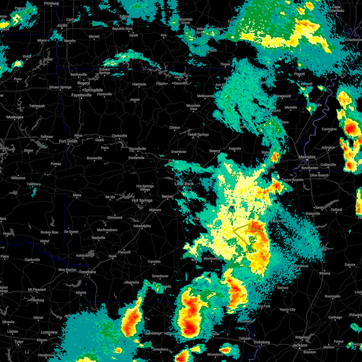 At 541 pm cdt, severe thunderstorms were located along a line extending from 7 miles northeast of merrisach lake to 8 miles south of crumrod to near gunnison, moving northeast at 40 mph (radar indicated). Hazards include 60 mph wind gusts and quarter size hail. Hail damage to vehicles is expected. expect wind damage to roofs, siding, and trees. Locations impacted include, merrisach lake, trusten holder wma, weber, tichnor,. At 541 pm cdt, severe thunderstorms were located along a line extending from 7 miles northeast of merrisach lake to 8 miles south of crumrod to near gunnison, moving northeast at 40 mph (radar indicated). Hazards include 60 mph wind gusts and quarter size hail. Hail damage to vehicles is expected. expect wind damage to roofs, siding, and trees. Locations impacted include, merrisach lake, trusten holder wma, weber, tichnor,.
|
| 4/9/2021 5:42 PM CDT |
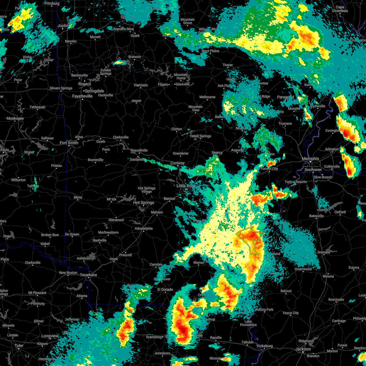 At 541 pm cdt, severe thunderstorms were located along a line extending from 7 miles northeast of merrisach lake to 8 miles south of crumrod to near gunnison, moving northeast at 40 mph (radar indicated). Hazards include 60 mph wind gusts and quarter size hail. Hail damage to vehicles is expected. expect wind damage to roofs, siding, and trees. Locations impacted include, merrisach lake, trusten holder wma, weber, tichnor,. At 541 pm cdt, severe thunderstorms were located along a line extending from 7 miles northeast of merrisach lake to 8 miles south of crumrod to near gunnison, moving northeast at 40 mph (radar indicated). Hazards include 60 mph wind gusts and quarter size hail. Hail damage to vehicles is expected. expect wind damage to roofs, siding, and trees. Locations impacted include, merrisach lake, trusten holder wma, weber, tichnor,.
|
| 4/9/2021 5:22 PM CDT |
 At 522 pm cdt, severe thunderstorms were located along a line extending from near merrisach lake to near rosedale to near lamont, moving east at 40 mph (radar indicated). Hazards include 60 mph wind gusts and quarter size hail. Hail damage to vehicles is expected. expect wind damage to roofs, siding, and trees. Locations impacted include, dumas, rohwer, gould, arkansas city, mitchellville, watson, yancopin, omega, lucca landing, mcgehee, mills, merrisach lake, kelso, trusten holder wma, douglas, arkansas post, tichnor, reedville, masonville, morgan point recreation area,. At 522 pm cdt, severe thunderstorms were located along a line extending from near merrisach lake to near rosedale to near lamont, moving east at 40 mph (radar indicated). Hazards include 60 mph wind gusts and quarter size hail. Hail damage to vehicles is expected. expect wind damage to roofs, siding, and trees. Locations impacted include, dumas, rohwer, gould, arkansas city, mitchellville, watson, yancopin, omega, lucca landing, mcgehee, mills, merrisach lake, kelso, trusten holder wma, douglas, arkansas post, tichnor, reedville, masonville, morgan point recreation area,.
|
| 4/9/2021 4:55 PM CDT |
 At 454 pm cdt, severe thunderstorms were located along a line extending from near mills to near omega to 6 miles southwest of dermott, moving east at 45 mph (radar indicated). Hazards include 60 mph wind gusts and penny size hail. Expect damage to roofs, siding, and trees. severe thunderstorms will be near, rosedale around 520 pm cdt. scott, gunnison, lamont and winterville around 530 pm cdt. greenville, metcalfe and benoit around 535 pm cdt. shelby and mound bayou around 545 pm cdt. shaw and deeson around 550 pm cdt. parchman around 600 pm cdt. rome around 605 pm cdt. ruleville, sunflower and blaine around 610 pm cdt. Other locations impacted by these severe thunderstorms include alligator, beulah, pace, doddsville, winstonville, duncan, merigold and halley. At 454 pm cdt, severe thunderstorms were located along a line extending from near mills to near omega to 6 miles southwest of dermott, moving east at 45 mph (radar indicated). Hazards include 60 mph wind gusts and penny size hail. Expect damage to roofs, siding, and trees. severe thunderstorms will be near, rosedale around 520 pm cdt. scott, gunnison, lamont and winterville around 530 pm cdt. greenville, metcalfe and benoit around 535 pm cdt. shelby and mound bayou around 545 pm cdt. shaw and deeson around 550 pm cdt. parchman around 600 pm cdt. rome around 605 pm cdt. ruleville, sunflower and blaine around 610 pm cdt. Other locations impacted by these severe thunderstorms include alligator, beulah, pace, doddsville, winstonville, duncan, merigold and halley.
|
| 4/9/2021 4:53 PM CDT |
 At 453 pm cdt, severe thunderstorms were located along a line extending from near mills to near winchester to near dermott, moving east at 40 mph (radar indicated). Hazards include 60 mph wind gusts and quarter size hail. Hail damage to vehicles is expected. Expect wind damage to roofs, siding, and trees. At 453 pm cdt, severe thunderstorms were located along a line extending from near mills to near winchester to near dermott, moving east at 40 mph (radar indicated). Hazards include 60 mph wind gusts and quarter size hail. Hail damage to vehicles is expected. Expect wind damage to roofs, siding, and trees.
|
| 3/27/2021 11:31 PM CDT |
 At 1131 pm cdt, a severe thunderstorm capable of producing a tornado was located near rosedale, moving east at 55 mph (radar indicated rotation). Hazards include tornado and half dollar size hail. Flying debris will be dangerous to those caught without shelter. mobile homes will be damaged or destroyed. damage to roofs, windows, and vehicles will occur. tree damage is likely. this dangerous storm will be near, shelby, mound bayou and renova around 1145 pm cdt. drew around 1155 pm cdt. parchman and rome around 1200 am cdt. Other locations impacted by this tornadic thunderstorm include winstonville, beulah, pace and merigold. At 1131 pm cdt, a severe thunderstorm capable of producing a tornado was located near rosedale, moving east at 55 mph (radar indicated rotation). Hazards include tornado and half dollar size hail. Flying debris will be dangerous to those caught without shelter. mobile homes will be damaged or destroyed. damage to roofs, windows, and vehicles will occur. tree damage is likely. this dangerous storm will be near, shelby, mound bayou and renova around 1145 pm cdt. drew around 1155 pm cdt. parchman and rome around 1200 am cdt. Other locations impacted by this tornadic thunderstorm include winstonville, beulah, pace and merigold.
|
| 3/17/2021 5:05 PM CDT |
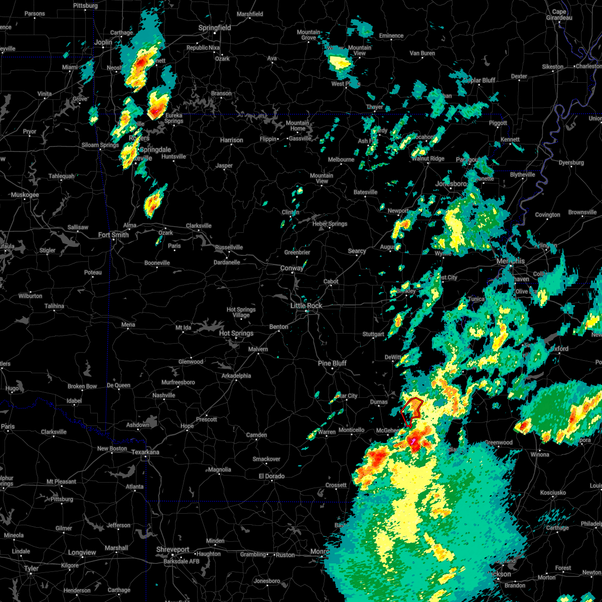 The tornado warning for central desha county will expire at 515 pm cdt, the storm which prompted the warning has weakened below severe limits, and no longer appears capable of producing a tornado. therefore, the warning will be allowed to expire. however gusty winds and heavy rain are still possible with this thunderstorm. The tornado warning for central desha county will expire at 515 pm cdt, the storm which prompted the warning has weakened below severe limits, and no longer appears capable of producing a tornado. therefore, the warning will be allowed to expire. however gusty winds and heavy rain are still possible with this thunderstorm.
|
| 3/17/2021 5:00 PM CDT |
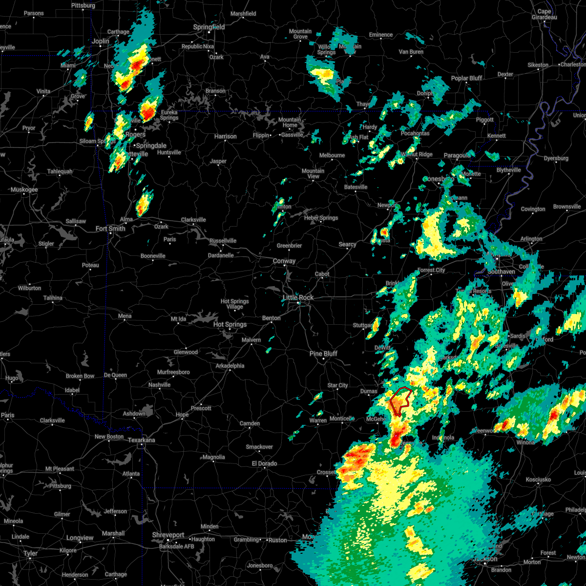 At 500 pm cdt, a severe thunderstorm capable of producing a tornado was located near kelso, or 7 miles east of rohwer, moving northeast at 45 mph (radar indicated rotation). Hazards include tornado and quarter size hail. Flying debris will be dangerous to those caught without shelter. mobile homes will be damaged or destroyed. damage to roofs, windows, and vehicles will occur. tree damage is likely. This tornadic thunderstorm will remain over mainly rural areas of central desha county. At 500 pm cdt, a severe thunderstorm capable of producing a tornado was located near kelso, or 7 miles east of rohwer, moving northeast at 45 mph (radar indicated rotation). Hazards include tornado and quarter size hail. Flying debris will be dangerous to those caught without shelter. mobile homes will be damaged or destroyed. damage to roofs, windows, and vehicles will occur. tree damage is likely. This tornadic thunderstorm will remain over mainly rural areas of central desha county.
|
| 3/17/2021 4:49 PM CDT |
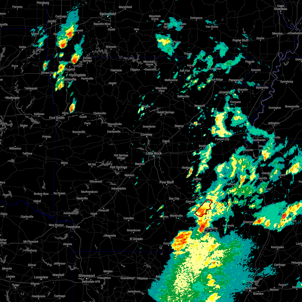 At 447 pm cdt, a severe thunderstorm capable of producing a tornado was located near lucca landing, or near rohwer, moving northeast at 45 mph (radar indicated rotation. storm spotters reported a brief tornado near mcgehee, but currently there are no reports of an ongoing tornado. radar continues to show some rotation associated with this storm). Hazards include tornado and quarter size hail. Flying debris will be dangerous to those caught without shelter. mobile homes will be damaged or destroyed. damage to roofs, windows, and vehicles will occur. tree damage is likely. Locations impacted include, rohwer, lucca landing, kelso, mcarthur,. At 447 pm cdt, a severe thunderstorm capable of producing a tornado was located near lucca landing, or near rohwer, moving northeast at 45 mph (radar indicated rotation. storm spotters reported a brief tornado near mcgehee, but currently there are no reports of an ongoing tornado. radar continues to show some rotation associated with this storm). Hazards include tornado and quarter size hail. Flying debris will be dangerous to those caught without shelter. mobile homes will be damaged or destroyed. damage to roofs, windows, and vehicles will occur. tree damage is likely. Locations impacted include, rohwer, lucca landing, kelso, mcarthur,.
|
| 3/17/2021 4:39 PM CDT |
 At 438 pm cdt, a confirmed tornado was located over mcgehee, or 7 miles northeast of dermott, moving northeast at 40 mph (weather spotters confirmed tornado. this tornado is headed directly into the city of mcgehee, if you are in or near this town, take cover immediately!). Hazards include damaging tornado and quarter size hail. Flying debris will be dangerous to those caught without shelter. mobile homes will be damaged or destroyed. damage to roofs, windows, and vehicles will occur. tree damage is likely. Locations impacted include, rohwer, tillar, lucca landing, mcgehee, kelso, masonville, mcarthur,. At 438 pm cdt, a confirmed tornado was located over mcgehee, or 7 miles northeast of dermott, moving northeast at 40 mph (weather spotters confirmed tornado. this tornado is headed directly into the city of mcgehee, if you are in or near this town, take cover immediately!). Hazards include damaging tornado and quarter size hail. Flying debris will be dangerous to those caught without shelter. mobile homes will be damaged or destroyed. damage to roofs, windows, and vehicles will occur. tree damage is likely. Locations impacted include, rohwer, tillar, lucca landing, mcgehee, kelso, masonville, mcarthur,.
|
| 3/17/2021 4:30 PM CDT |
 At 430 pm cdt, a severe thunderstorm capable of producing a tornado was located near mcgehee, or near dermott, moving northeast at 45 mph (radar indicated rotation. storm spotters have reported a persistent rotating wall cloud with this storm). Hazards include tornado and quarter size hail. Flying debris will be dangerous to those caught without shelter. mobile homes will be damaged or destroyed. damage to roofs, windows, and vehicles will occur. Tree damage is likely. At 430 pm cdt, a severe thunderstorm capable of producing a tornado was located near mcgehee, or near dermott, moving northeast at 45 mph (radar indicated rotation. storm spotters have reported a persistent rotating wall cloud with this storm). Hazards include tornado and quarter size hail. Flying debris will be dangerous to those caught without shelter. mobile homes will be damaged or destroyed. damage to roofs, windows, and vehicles will occur. Tree damage is likely.
|
| 3/17/2021 6:28 AM CDT |
 At 627 am cdt, a severe thunderstorm capable of producing a tornado was located near gunnison, or 8 miles west of shelby, moving east at 40 mph (radar indicated rotation). Hazards include tornado and quarter size hail. Flying debris will be dangerous to those caught without shelter. mobile homes will be damaged or destroyed. damage to roofs, windows, and vehicles will occur. tree damage is likely. this dangerous storm will be near, deeson around 630 am cdt. shelby around 640 am cdt. Other locations impacted by this tornadic thunderstorm include winstonville, duncan and alligator. At 627 am cdt, a severe thunderstorm capable of producing a tornado was located near gunnison, or 8 miles west of shelby, moving east at 40 mph (radar indicated rotation). Hazards include tornado and quarter size hail. Flying debris will be dangerous to those caught without shelter. mobile homes will be damaged or destroyed. damage to roofs, windows, and vehicles will occur. tree damage is likely. this dangerous storm will be near, deeson around 630 am cdt. shelby around 640 am cdt. Other locations impacted by this tornadic thunderstorm include winstonville, duncan and alligator.
|
| 3/17/2021 6:05 AM CDT |
 At 605 am cdt, a severe thunderstorm capable of producing a tornado was located near trusten holder wma, or 9 miles northwest of rosedale, moving east at 40 mph (radar indicated rotation). Hazards include tornado and quarter size hail. Flying debris will be dangerous to those caught without shelter. mobile homes will be damaged or destroyed. damage to roofs, windows, and vehicles will occur. tree damage is likely. this dangerous storm will be near, gunnison around 620 am cdt. deeson around 630 am cdt. shelby around 635 am cdt. Other locations impacted by this tornadic thunderstorm include winstonville, duncan and alligator. At 605 am cdt, a severe thunderstorm capable of producing a tornado was located near trusten holder wma, or 9 miles northwest of rosedale, moving east at 40 mph (radar indicated rotation). Hazards include tornado and quarter size hail. Flying debris will be dangerous to those caught without shelter. mobile homes will be damaged or destroyed. damage to roofs, windows, and vehicles will occur. tree damage is likely. this dangerous storm will be near, gunnison around 620 am cdt. deeson around 630 am cdt. shelby around 635 am cdt. Other locations impacted by this tornadic thunderstorm include winstonville, duncan and alligator.
|
| 6/5/2020 4:34 PM CDT |
 At 434 pm cdt, severe thunderstorms were located along a line extending from benoit to swiftown, moving southwest at 45 mph (radar indicated). Hazards include 60 mph wind gusts and quarter size hail. Hail damage to vehicles is expected. expect wind damage to roofs, siding, and trees. severe thunderstorms will be near, belzoni, lamont and winterville around 445 pm cdt. greenville and metcalfe around 450 pm cdt. Other locations impacted by these severe thunderstorms include beulah, silver city and arcola. At 434 pm cdt, severe thunderstorms were located along a line extending from benoit to swiftown, moving southwest at 45 mph (radar indicated). Hazards include 60 mph wind gusts and quarter size hail. Hail damage to vehicles is expected. expect wind damage to roofs, siding, and trees. severe thunderstorms will be near, belzoni, lamont and winterville around 445 pm cdt. greenville and metcalfe around 450 pm cdt. Other locations impacted by these severe thunderstorms include beulah, silver city and arcola.
|
| 6/5/2020 4:25 PM CDT |
 At 425 pm cdt, severe thunderstorms were located along a line extending from 6 miles west of mound bayou to blaine, moving south at 30 mph (radar indicated). Hazards include 60 mph wind gusts and quarter size hail. Hail damage to vehicles is expected. expect wind damage to roofs, siding, and trees. these severe storms will be near, blaine around 430 pm cdt. sunflower around 435 pm cdt. shaw around 455 pm cdt. Other locations impacted by these severe thunderstorms include doddsville, winstonville, beulah, pace and merigold. At 425 pm cdt, severe thunderstorms were located along a line extending from 6 miles west of mound bayou to blaine, moving south at 30 mph (radar indicated). Hazards include 60 mph wind gusts and quarter size hail. Hail damage to vehicles is expected. expect wind damage to roofs, siding, and trees. these severe storms will be near, blaine around 430 pm cdt. sunflower around 435 pm cdt. shaw around 455 pm cdt. Other locations impacted by these severe thunderstorms include doddsville, winstonville, beulah, pace and merigold.
|
| 6/5/2020 4:14 PM CDT |
 At 414 pm cdt, severe thunderstorms were located along a line extending from near shelby to near ruleville, moving south at 30 mph (radar indicated). Hazards include 60 mph wind gusts and quarter size hail. Hail damage to vehicles is expected. expect wind damage to roofs, siding, and trees. these severe storms will be near, ruleville around 420 pm cdt. blaine around 425 pm cdt. sunflower and renova around 430 pm cdt. shaw around 455 pm cdt. Other locations impacted by these severe thunderstorms include doddsville, winstonville, beulah, pace and merigold. At 414 pm cdt, severe thunderstorms were located along a line extending from near shelby to near ruleville, moving south at 30 mph (radar indicated). Hazards include 60 mph wind gusts and quarter size hail. Hail damage to vehicles is expected. expect wind damage to roofs, siding, and trees. these severe storms will be near, ruleville around 420 pm cdt. blaine around 425 pm cdt. sunflower and renova around 430 pm cdt. shaw around 455 pm cdt. Other locations impacted by these severe thunderstorms include doddsville, winstonville, beulah, pace and merigold.
|
| 6/5/2020 3:47 PM CDT |
 At 347 pm cdt, severe thunderstorms were located along a line extending from 6 miles southwest of sherard to near parchman, moving south at 35 mph (radar indicated). Hazards include 70 mph wind gusts and quarter size hail. Hail damage to vehicles is expected. expect considerable tree damage. wind damage is also likely to mobile homes, roofs, and outbuildings. these severe storms will be near, parchman around 350 pm cdt. drew around 355 pm cdt. deeson around 400 pm cdt. ruleville and shelby around 405 pm cdt. mound bayou and gunnison around 415 pm cdt. blaine around 420 pm cdt. sunflower around 425 pm cdt. Other locations impacted by these severe thunderstorms include alligator, beulah, pace, doddsville, winstonville, duncan and merigold. At 347 pm cdt, severe thunderstorms were located along a line extending from 6 miles southwest of sherard to near parchman, moving south at 35 mph (radar indicated). Hazards include 70 mph wind gusts and quarter size hail. Hail damage to vehicles is expected. expect considerable tree damage. wind damage is also likely to mobile homes, roofs, and outbuildings. these severe storms will be near, parchman around 350 pm cdt. drew around 355 pm cdt. deeson around 400 pm cdt. ruleville and shelby around 405 pm cdt. mound bayou and gunnison around 415 pm cdt. blaine around 420 pm cdt. sunflower around 425 pm cdt. Other locations impacted by these severe thunderstorms include alligator, beulah, pace, doddsville, winstonville, duncan and merigold.
|
| 6/5/2020 3:27 PM CDT |
 At 327 pm cdt, a severe thunderstorm was located over tutwiler, or near parchman, moving south at 35 mph (radar indicated). Hazards include 60 mph wind gusts and quarter size hail. Hail damage to vehicles is expected. expect wind damage to roofs, siding, and trees. this severe thunderstorm will be near, rome around 330 pm cdt. parchman around 335 pm cdt. drew around 350 pm cdt. ruleville around 400 pm cdt. blaine around 415 pm cdt. sunflower around 425 pm cdt. Other locations impacted by this severe thunderstorm include alligator, beulah, pace, doddsville, winstonville, duncan and merigold. At 327 pm cdt, a severe thunderstorm was located over tutwiler, or near parchman, moving south at 35 mph (radar indicated). Hazards include 60 mph wind gusts and quarter size hail. Hail damage to vehicles is expected. expect wind damage to roofs, siding, and trees. this severe thunderstorm will be near, rome around 330 pm cdt. parchman around 335 pm cdt. drew around 350 pm cdt. ruleville around 400 pm cdt. blaine around 415 pm cdt. sunflower around 425 pm cdt. Other locations impacted by this severe thunderstorm include alligator, beulah, pace, doddsville, winstonville, duncan and merigold.
|
| 4/29/2020 12:57 AM CDT |
 At 1256 am cdt, severe thunderstorms were located along a line extending from near deeson to near yancopin to 7 miles southeast of cane creek state park to brandon to near weeks to near moro bay, moving east at 60 mph (radar indicated). Hazards include 60 mph wind gusts and quarter size hail. Hail damage to vehicles is expected. Expect wind damage to roofs, siding, and trees. At 1256 am cdt, severe thunderstorms were located along a line extending from near deeson to near yancopin to 7 miles southeast of cane creek state park to brandon to near weeks to near moro bay, moving east at 60 mph (radar indicated). Hazards include 60 mph wind gusts and quarter size hail. Hail damage to vehicles is expected. Expect wind damage to roofs, siding, and trees.
|
| 4/29/2020 12:30 AM CDT |
 At 1230 am cdt, severe thunderstorms were located along a line extending from near watkins corner to near merrisach lake to near cane creek state park, moving southeast at 60 mph (radar indicated). Hazards include 60 mph wind gusts and penny size hail. Expect damage to roofs, siding, and trees. locations impacted include, dumas, rosedale, rohwer, gould, gillett, grady, arkansas city, mitchellville, st. Charles, tillar, watson, winchester, whitefield, lucca landing, little bayou meto park, woodville, douglas, trusten holder wma, nebo, yancopin,. At 1230 am cdt, severe thunderstorms were located along a line extending from near watkins corner to near merrisach lake to near cane creek state park, moving southeast at 60 mph (radar indicated). Hazards include 60 mph wind gusts and penny size hail. Expect damage to roofs, siding, and trees. locations impacted include, dumas, rosedale, rohwer, gould, gillett, grady, arkansas city, mitchellville, st. Charles, tillar, watson, winchester, whitefield, lucca landing, little bayou meto park, woodville, douglas, trusten holder wma, nebo, yancopin,.
|
| 4/29/2020 12:12 AM CDT |
 At 1212 am cdt, severe thunderstorms were located along a line extending from near holly grove to near de witt to near cottondale, moving east at 55 mph (radar indicated). Hazards include 60 mph wind gusts and penny size hail. expect damage to roofs, siding, and trees At 1212 am cdt, severe thunderstorms were located along a line extending from near holly grove to near de witt to near cottondale, moving east at 55 mph (radar indicated). Hazards include 60 mph wind gusts and penny size hail. expect damage to roofs, siding, and trees
|
| 4/25/2020 2:32 AM CDT |
 At 232 am cdt, a severe thunderstorm was located over lucca landing, or over rohwer, moving east at 40 mph (radar indicated). Hazards include 60 mph wind gusts and nickel size hail. Expect damage to roofs, siding, and trees. Locations impacted include, rohwer, arkansas city, lucca landing, mcgehee, jersey point, kelso, masonville, mcarthur, halley,. At 232 am cdt, a severe thunderstorm was located over lucca landing, or over rohwer, moving east at 40 mph (radar indicated). Hazards include 60 mph wind gusts and nickel size hail. Expect damage to roofs, siding, and trees. Locations impacted include, rohwer, arkansas city, lucca landing, mcgehee, jersey point, kelso, masonville, mcarthur, halley,.
|
| 4/25/2020 2:27 AM CDT |
 At 227 am cdt, a severe thunderstorm was located near rohwer, moving east at 40 mph (radar indicated). Hazards include 60 mph wind gusts and nickel size hail. expect damage to roofs, siding, and trees At 227 am cdt, a severe thunderstorm was located near rohwer, moving east at 40 mph (radar indicated). Hazards include 60 mph wind gusts and nickel size hail. expect damage to roofs, siding, and trees
|
| 4/12/2020 9:24 PM CDT |
 The severe thunderstorm warning for northeastern desha, southern monroe and eastern arkansas counties will expire at 930 pm cdt, the storms which prompted the warning have moved out of the area. therefore, the warning will be allowed to expire. a severe thunderstorm watch remains in effect until 1100 pm cdt for eastern and southeastern arkansas. to report severe weather, contact your nearest law enforcement agency. they will relay your report to the national weather service little rock. The severe thunderstorm warning for northeastern desha, southern monroe and eastern arkansas counties will expire at 930 pm cdt, the storms which prompted the warning have moved out of the area. therefore, the warning will be allowed to expire. a severe thunderstorm watch remains in effect until 1100 pm cdt for eastern and southeastern arkansas. to report severe weather, contact your nearest law enforcement agency. they will relay your report to the national weather service little rock.
|
| 4/12/2020 9:19 PM CDT |
 At 918 pm cdt, severe thunderstorms were located along a line extending from near holly grove to near watkins corner to near elaine to near crumrod to near gunnison to 6 miles north of benoit, moving east at 65 mph (radar indicated). Hazards include 70 mph wind gusts and quarter size hail. Hail damage to vehicles is expected. expect considerable tree damage. wind damage is also likely to mobile homes, roofs, and outbuildings. locations impacted include, holly grove, st. Charles, palmer, trusten holder wma, blackton, aberdeen, ethel, crocketts bluff, ragtown, indian bay, pine city, weber, lawrenceville, duncan, cross roads in monroe county, louisiana purchase state park,. At 918 pm cdt, severe thunderstorms were located along a line extending from near holly grove to near watkins corner to near elaine to near crumrod to near gunnison to 6 miles north of benoit, moving east at 65 mph (radar indicated). Hazards include 70 mph wind gusts and quarter size hail. Hail damage to vehicles is expected. expect considerable tree damage. wind damage is also likely to mobile homes, roofs, and outbuildings. locations impacted include, holly grove, st. Charles, palmer, trusten holder wma, blackton, aberdeen, ethel, crocketts bluff, ragtown, indian bay, pine city, weber, lawrenceville, duncan, cross roads in monroe county, louisiana purchase state park,.
|
| 4/12/2020 9:17 PM CDT |
 At 917 pm cdt, severe thunderstorms were located along a line extending from near deeson to near benoit, moving east at 70 mph (radar indicated). Hazards include 70 mph wind gusts and quarter size hail. Hail damage to vehicles is expected. expect considerable tree damage. wind damage is also likely to mobile homes, roofs, and outbuildings. these severe storms will be near, deeson around 920 pm cdt. shaw around 925 pm cdt. cleveland, renova and boyle around 930 pm cdt. Other locations impacted by these severe thunderstorms include alligator, winstonville, beulah, duncan, pace and merigold. At 917 pm cdt, severe thunderstorms were located along a line extending from near deeson to near benoit, moving east at 70 mph (radar indicated). Hazards include 70 mph wind gusts and quarter size hail. Hail damage to vehicles is expected. expect considerable tree damage. wind damage is also likely to mobile homes, roofs, and outbuildings. these severe storms will be near, deeson around 920 pm cdt. shaw around 925 pm cdt. cleveland, renova and boyle around 930 pm cdt. Other locations impacted by these severe thunderstorms include alligator, winstonville, beulah, duncan, pace and merigold.
|
| 4/12/2020 9:10 PM CDT | Trees and power lines dow in bolivar county MS, 0.4 miles WNW of Rosedale, MS |
| 4/12/2020 9:04 PM CDT |
 At 904 pm cdt, severe thunderstorms were located along a line extending from roe to 6 miles west of st. charles to 7 miles northwest of white river national wildlife refuge to 8 miles northeast of trusten holder wma to near yancopin to lucca landing, moving east at 70 mph (radar indicated). Hazards include 70 mph wind gusts and quarter size hail. Hail damage to vehicles is expected. expect considerable tree damage. wind damage is also likely to mobile homes, roofs, and outbuildings. locations impacted include, stuttgart, rohwer, gillett, holly grove, almyra, st. Charles, tillar, watson, ulm, winchester, roe, yancopin, omega, merrisach lake, kelso, palmer, stuttgart municipal airport, trusten holder wma, de witt, blackton,. At 904 pm cdt, severe thunderstorms were located along a line extending from roe to 6 miles west of st. charles to 7 miles northwest of white river national wildlife refuge to 8 miles northeast of trusten holder wma to near yancopin to lucca landing, moving east at 70 mph (radar indicated). Hazards include 70 mph wind gusts and quarter size hail. Hail damage to vehicles is expected. expect considerable tree damage. wind damage is also likely to mobile homes, roofs, and outbuildings. locations impacted include, stuttgart, rohwer, gillett, holly grove, almyra, st. Charles, tillar, watson, ulm, winchester, roe, yancopin, omega, merrisach lake, kelso, palmer, stuttgart municipal airport, trusten holder wma, de witt, blackton,.
|
| 4/12/2020 8:51 PM CDT |
 At 850 pm cdt, severe thunderstorms were located along a line extending from near parkers corner to 7 miles south of stuttgart to 8 miles northeast of langford to near gillett to near dumas to near tillar, moving east at 75 mph (radar indicated). Hazards include 70 mph wind gusts and quarter size hail. Hail damage to vehicles is expected. expect considerable tree damage. wind damage is also likely to mobile homes, roofs, and outbuildings. locations impacted include, stuttgart, dumas, rohwer, gould, gillett, holly grove, humphrey, grady, mitchellville, humnoke, almyra, st. Charles, tillar, watson, ulm, winchester, roe, little bayou meto park, woodville, douglas,. At 850 pm cdt, severe thunderstorms were located along a line extending from near parkers corner to 7 miles south of stuttgart to 8 miles northeast of langford to near gillett to near dumas to near tillar, moving east at 75 mph (radar indicated). Hazards include 70 mph wind gusts and quarter size hail. Hail damage to vehicles is expected. expect considerable tree damage. wind damage is also likely to mobile homes, roofs, and outbuildings. locations impacted include, stuttgart, dumas, rohwer, gould, gillett, holly grove, humphrey, grady, mitchellville, humnoke, almyra, st. Charles, tillar, watson, ulm, winchester, roe, little bayou meto park, woodville, douglas,.
|
| 4/12/2020 8:46 PM CDT |
 At 846 pm cdt, severe thunderstorms were located along a line extending from 6 miles northeast of mitchellville to 9 miles north of snyder, moving east at 50 mph (radar indicated). Hazards include 70 mph wind gusts and quarter size hail. Hail damage to vehicles is expected. expect considerable tree damage. wind damage is also likely to mobile homes, roofs, and outbuildings. severe thunderstorms will be near, gunnison around 920 pm cdt. deeson around 930 pm cdt. shelby around 935 pm cdt. Other locations impacted by these severe thunderstorms include alligator, winstonville, beulah, duncan, pace and merigold. At 846 pm cdt, severe thunderstorms were located along a line extending from 6 miles northeast of mitchellville to 9 miles north of snyder, moving east at 50 mph (radar indicated). Hazards include 70 mph wind gusts and quarter size hail. Hail damage to vehicles is expected. expect considerable tree damage. wind damage is also likely to mobile homes, roofs, and outbuildings. severe thunderstorms will be near, gunnison around 920 pm cdt. deeson around 930 pm cdt. shelby around 935 pm cdt. Other locations impacted by these severe thunderstorms include alligator, winstonville, beulah, duncan, pace and merigold.
|
| 4/12/2020 8:28 PM CDT |
 At 827 pm cdt, severe thunderstorms were located along a line extending from estes to 7 miles northwest of altheimer to near cottondale to near feenyville to 6 miles east of herbine to near warren, moving east at 65 mph (radar indicated). Hazards include 70 mph wind gusts and quarter size hail. Hail damage to vehicles is expected. expect considerable tree damage. Wind damage is also likely to mobile homes, roofs, and outbuildings. At 827 pm cdt, severe thunderstorms were located along a line extending from estes to 7 miles northwest of altheimer to near cottondale to near feenyville to 6 miles east of herbine to near warren, moving east at 65 mph (radar indicated). Hazards include 70 mph wind gusts and quarter size hail. Hail damage to vehicles is expected. expect considerable tree damage. Wind damage is also likely to mobile homes, roofs, and outbuildings.
|
| 4/12/2020 7:36 AM CDT |
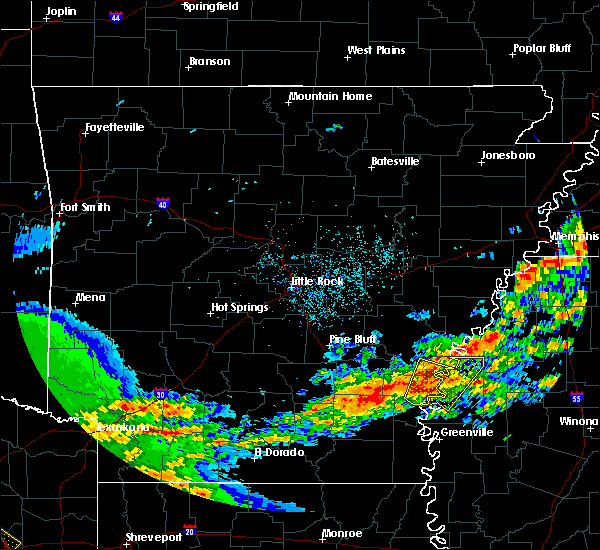 At 736 am cdt, a severe thunderstorm was located near yancopin, or 8 miles northwest of rosedale, moving northeast at 50 mph (radar indicated). Hazards include 60 mph wind gusts and quarter size hail. Hail damage to vehicles is expected. expect wind damage to roofs, siding, and trees. Locations impacted include, watson, yancopin, trusten holder wma, kelso,. At 736 am cdt, a severe thunderstorm was located near yancopin, or 8 miles northwest of rosedale, moving northeast at 50 mph (radar indicated). Hazards include 60 mph wind gusts and quarter size hail. Hail damage to vehicles is expected. expect wind damage to roofs, siding, and trees. Locations impacted include, watson, yancopin, trusten holder wma, kelso,.
|
| 4/12/2020 7:22 AM CDT |
 At 721 am cdt, a severe thunderstorm was located near kelso, or near rohwer, moving northeast at 45 mph (radar indicated). Hazards include quarter size hail. Damage to vehicles is expected. this severe thunderstorm will be near, rosedale around 730 am cdt. Other locations impacted by this severe thunderstorm include alligator, beulah, duncan and pace. At 721 am cdt, a severe thunderstorm was located near kelso, or near rohwer, moving northeast at 45 mph (radar indicated). Hazards include quarter size hail. Damage to vehicles is expected. this severe thunderstorm will be near, rosedale around 730 am cdt. Other locations impacted by this severe thunderstorm include alligator, beulah, duncan and pace.
|
| 4/12/2020 7:20 AM CDT |
 At 720 am cdt, a severe thunderstorm was located over kelso, or near rohwer, moving northeast at 50 mph (radar indicated). Hazards include 60 mph wind gusts and quarter size hail. Hail damage to vehicles is expected. Expect wind damage to roofs, siding, and trees. At 720 am cdt, a severe thunderstorm was located over kelso, or near rohwer, moving northeast at 50 mph (radar indicated). Hazards include 60 mph wind gusts and quarter size hail. Hail damage to vehicles is expected. Expect wind damage to roofs, siding, and trees.
|
| 3/28/2020 8:51 PM CDT |
 At 851 pm cdt, a severe thunderstorm was located over lucca landing, or near rohwer, moving northeast at 70 mph (radar indicated). Hazards include 70 mph wind gusts and quarter size hail. Hail damage to vehicles is expected. expect considerable tree damage. wind damage is also likely to mobile homes, roofs, and outbuildings. Locations impacted include, rohwer, arkansas city, lucca landing, mcgehee, kelso, mcarthur, halley,. At 851 pm cdt, a severe thunderstorm was located over lucca landing, or near rohwer, moving northeast at 70 mph (radar indicated). Hazards include 70 mph wind gusts and quarter size hail. Hail damage to vehicles is expected. expect considerable tree damage. wind damage is also likely to mobile homes, roofs, and outbuildings. Locations impacted include, rohwer, arkansas city, lucca landing, mcgehee, kelso, mcarthur, halley,.
|
| 3/28/2020 8:31 PM CDT |
 At 830 pm cdt, a severe thunderstorm was located near lucca landing, or 7 miles south of rohwer, moving northeast at 55 mph (radar indicated). Hazards include 60 mph wind gusts and quarter size hail. Hail damage to vehicles is expected. Expect wind damage to roofs, siding, and trees. At 830 pm cdt, a severe thunderstorm was located near lucca landing, or 7 miles south of rohwer, moving northeast at 55 mph (radar indicated). Hazards include 60 mph wind gusts and quarter size hail. Hail damage to vehicles is expected. Expect wind damage to roofs, siding, and trees.
|
| 3/28/2020 7:01 PM CDT |
 At 701 pm cdt, severe thunderstorms were located along a line extending from near sherard to near deeson to near jersey point, moving northeast at 50 mph (radar indicated). Hazards include 60 mph wind gusts and quarter size hail. Hail damage to vehicles is expected. expect wind damage to roofs, siding, and trees. severe thunderstorms will be near, shelby and deeson around 705 pm cdt. renova around 730 pm cdt. mound bayou around 735 pm cdt. parchman and rome around 745 pm cdt. other locations impacted by these severe thunderstorms include alligator, winstonville, beulah, duncan, pace and merigold. A tornado watch remains in effect until 200 am cdt for north central and northwestern mississippi. At 701 pm cdt, severe thunderstorms were located along a line extending from near sherard to near deeson to near jersey point, moving northeast at 50 mph (radar indicated). Hazards include 60 mph wind gusts and quarter size hail. Hail damage to vehicles is expected. expect wind damage to roofs, siding, and trees. severe thunderstorms will be near, shelby and deeson around 705 pm cdt. renova around 730 pm cdt. mound bayou around 735 pm cdt. parchman and rome around 745 pm cdt. other locations impacted by these severe thunderstorms include alligator, winstonville, beulah, duncan, pace and merigold. A tornado watch remains in effect until 200 am cdt for north central and northwestern mississippi.
|
| 1/11/2020 3:59 AM CST |
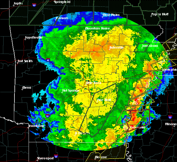 At 359 am cst, severe thunderstorms were located along a line extending from near crumrod to rosedale to mcmillan corner, moving east at 25 mph (radar indicated). Hazards include 60 mph wind gusts and quarter size hail. Hail damage to vehicles is expected. expect wind damage to roofs, siding, and trees. These severe thunderstorms will remain over mainly rural areas of northeastern desha county. At 359 am cst, severe thunderstorms were located along a line extending from near crumrod to rosedale to mcmillan corner, moving east at 25 mph (radar indicated). Hazards include 60 mph wind gusts and quarter size hail. Hail damage to vehicles is expected. expect wind damage to roofs, siding, and trees. These severe thunderstorms will remain over mainly rural areas of northeastern desha county.
|
| 1/11/2020 3:57 AM CST |
 At 357 am cst, a severe thunderstorm capable of producing a tornado was located 8 miles west of cleveland, moving northeast at 80 mph (radar indicated rotation). Hazards include tornado. Flying debris will be dangerous to those caught without shelter. mobile homes will be damaged or destroyed. damage to roofs, windows, and vehicles will occur. tree damage is likely. this dangerous storm will be near, cleveland around 400 am cst. shelby, mound bayou and renova around 405 am cst. parchman and rome around 415 am cst. Other locations impacted by this tornadic thunderstorm include doddsville, winstonville, beulah, pace and merigold. At 357 am cst, a severe thunderstorm capable of producing a tornado was located 8 miles west of cleveland, moving northeast at 80 mph (radar indicated rotation). Hazards include tornado. Flying debris will be dangerous to those caught without shelter. mobile homes will be damaged or destroyed. damage to roofs, windows, and vehicles will occur. tree damage is likely. this dangerous storm will be near, cleveland around 400 am cst. shelby, mound bayou and renova around 405 am cst. parchman and rome around 415 am cst. Other locations impacted by this tornadic thunderstorm include doddsville, winstonville, beulah, pace and merigold.
|
| 1/11/2020 3:32 AM CST |
 At 332 am cst, a severe thunderstorm capable of producing a tornado was located near mcmillan corner, or 9 miles east of dermott, moving northeast at 80 mph (radar indicated rotation). Hazards include tornado. Flying debris will be dangerous to those caught without shelter. mobile homes will be damaged or destroyed. damage to roofs, windows, and vehicles will occur. tree damage is likely. this dangerous storm will be near, lamont and winterville around 340 am cst. scott and benoit around 345 am cst. cleveland, renova and boyle around 400 am cst. mound bayou around 405 am cst. drew around 410 am cst. parchman and rome around 415 am cst. Other locations impacted by this tornadic thunderstorm include doddsville, winstonville, beulah, pace and merigold. At 332 am cst, a severe thunderstorm capable of producing a tornado was located near mcmillan corner, or 9 miles east of dermott, moving northeast at 80 mph (radar indicated rotation). Hazards include tornado. Flying debris will be dangerous to those caught without shelter. mobile homes will be damaged or destroyed. damage to roofs, windows, and vehicles will occur. tree damage is likely. this dangerous storm will be near, lamont and winterville around 340 am cst. scott and benoit around 345 am cst. cleveland, renova and boyle around 400 am cst. mound bayou around 405 am cst. drew around 410 am cst. parchman and rome around 415 am cst. Other locations impacted by this tornadic thunderstorm include doddsville, winstonville, beulah, pace and merigold.
|
| 1/11/2020 3:30 AM CST |
 At 330 am cst, severe thunderstorms were located along a line extending from near white river national wildlife refuge to near watson to 7 miles north of montrose, moving east at 30 mph (radar indicated). Hazards include 60 mph wind gusts and quarter size hail. Hail damage to vehicles is expected. Expect wind damage to roofs, siding, and trees. At 330 am cst, severe thunderstorms were located along a line extending from near white river national wildlife refuge to near watson to 7 miles north of montrose, moving east at 30 mph (radar indicated). Hazards include 60 mph wind gusts and quarter size hail. Hail damage to vehicles is expected. Expect wind damage to roofs, siding, and trees.
|
| 1/11/2020 3:23 AM CST |
 At 323 am cst, severe thunderstorms were located along a line extending from 6 miles east of trusten holder wma to 6 miles northeast of lucca landing to near dermott to near snyder, moving east at 45 mph (radar indicated). Hazards include 60 mph wind gusts. Expect damage to roofs, siding, and trees. Locations impacted include, dumas, dermott, rohwer, arkansas city, mitchellville, tillar, watson, winchester, omega, lucca landing, mcgehee, kelso, prairie grove, reed, jerome, baxter, enon, selma, masonville, yukon,. At 323 am cst, severe thunderstorms were located along a line extending from 6 miles east of trusten holder wma to 6 miles northeast of lucca landing to near dermott to near snyder, moving east at 45 mph (radar indicated). Hazards include 60 mph wind gusts. Expect damage to roofs, siding, and trees. Locations impacted include, dumas, dermott, rohwer, arkansas city, mitchellville, tillar, watson, winchester, omega, lucca landing, mcgehee, kelso, prairie grove, reed, jerome, baxter, enon, selma, masonville, yukon,.
|
| 1/11/2020 2:31 AM CST |
 At 231 am cst, severe thunderstorms were located along a line extending from cane creek state park to plantersville to 7 miles south of warren to moro bay, moving east at 50 mph (radar indicated). Hazards include 60 mph wind gusts. expect damage to roofs, siding, and trees At 231 am cst, severe thunderstorms were located along a line extending from cane creek state park to plantersville to 7 miles south of warren to moro bay, moving east at 50 mph (radar indicated). Hazards include 60 mph wind gusts. expect damage to roofs, siding, and trees
|
| 11/30/2019 4:51 PM CST |
 The severe thunderstorm warning for northeastern sunflower and bolivar counties will expire at 500 pm cst, the severe thunderstorm which prompted the warning has weakened. therefore, the warning will be allowed to expire. a tornado watch remains in effect until 700 pm cst for southeastern arkansas. a tornado watch also remains in effect until 1100 pm cst for northwestern mississippi. The severe thunderstorm warning for northeastern sunflower and bolivar counties will expire at 500 pm cst, the severe thunderstorm which prompted the warning has weakened. therefore, the warning will be allowed to expire. a tornado watch remains in effect until 700 pm cst for southeastern arkansas. a tornado watch also remains in effect until 1100 pm cst for northwestern mississippi.
|
| 11/30/2019 4:41 PM CST |
 At 440 pm cst, a severe thunderstorm was located over arkansas city, or 13 miles southeast of rohwer, moving northeast at 60 mph (radar indicated). Hazards include 60 mph wind gusts and quarter size hail. Hail damage to vehicles is expected. expect wind damage to roofs, siding, and trees. this severe storm will be near, scott around 445 pm cst. benoit around 450 pm cst. cleveland and renova around 510 pm cst. other locations impacted by this severe thunderstorm include alligator, winstonville, beulah, duncan, pace and merigold. a tornado watch remains in effect until 700 pm cst for southeastern arkansas. A tornado watch also remains in effect until 1100 pm cst for northwestern mississippi. At 440 pm cst, a severe thunderstorm was located over arkansas city, or 13 miles southeast of rohwer, moving northeast at 60 mph (radar indicated). Hazards include 60 mph wind gusts and quarter size hail. Hail damage to vehicles is expected. expect wind damage to roofs, siding, and trees. this severe storm will be near, scott around 445 pm cst. benoit around 450 pm cst. cleveland and renova around 510 pm cst. other locations impacted by this severe thunderstorm include alligator, winstonville, beulah, duncan, pace and merigold. a tornado watch remains in effect until 700 pm cst for southeastern arkansas. A tornado watch also remains in effect until 1100 pm cst for northwestern mississippi.
|
| 11/30/2019 4:14 PM CST |
 At 414 pm cst, a severe thunderstorm was located over lucca landing, or near rohwer, moving northeast at 65 mph (radar indicated). Hazards include 60 mph wind gusts and quarter size hail. Hail damage to vehicles is expected. expect wind damage to roofs, siding, and trees. this severe thunderstorm will be near, rosedale around 425 pm cst. gunnison around 435 pm cst. shelby, mound bayou and deeson around 440 pm cst. other locations impacted by this severe thunderstorm include alligator, winstonville, beulah, duncan, pace and merigold. a tornado watch remains in effect until 700 pm cst for southeastern arkansas. A tornado watch also remains in effect until 1100 pm cst for northwestern mississippi. At 414 pm cst, a severe thunderstorm was located over lucca landing, or near rohwer, moving northeast at 65 mph (radar indicated). Hazards include 60 mph wind gusts and quarter size hail. Hail damage to vehicles is expected. expect wind damage to roofs, siding, and trees. this severe thunderstorm will be near, rosedale around 425 pm cst. gunnison around 435 pm cst. shelby, mound bayou and deeson around 440 pm cst. other locations impacted by this severe thunderstorm include alligator, winstonville, beulah, duncan, pace and merigold. a tornado watch remains in effect until 700 pm cst for southeastern arkansas. A tornado watch also remains in effect until 1100 pm cst for northwestern mississippi.
|
| 11/30/2019 3:59 PM CST |
 At 358 pm cst, a severe thunderstorm was located over mcgehee, or 9 miles north of dermott, moving northeast at 55 mph (radar indicated). Hazards include 60 mph wind gusts and penny size hail. expect damage to roofs, siding, and trees At 358 pm cst, a severe thunderstorm was located over mcgehee, or 9 miles north of dermott, moving northeast at 55 mph (radar indicated). Hazards include 60 mph wind gusts and penny size hail. expect damage to roofs, siding, and trees
|
| 10/21/2019 6:32 AM CDT |
 At 632 am cdt, severe thunderstorms were located along a line extending from rosedale to west crossett, moving east at 45 mph (radar indicated). Hazards include 60 mph wind gusts. Expect damage to roofs, siding, and trees. Locations impacted include, monticello, dumas, dermott, rohwer, arkansas city, mitchellville, tillar, watson, winchester, yancopin, omega, lucca landing, mcgehee, kelso, ladelle, green hill, prairie grove, reed, jerome, baxter,. At 632 am cdt, severe thunderstorms were located along a line extending from rosedale to west crossett, moving east at 45 mph (radar indicated). Hazards include 60 mph wind gusts. Expect damage to roofs, siding, and trees. Locations impacted include, monticello, dumas, dermott, rohwer, arkansas city, mitchellville, tillar, watson, winchester, yancopin, omega, lucca landing, mcgehee, kelso, ladelle, green hill, prairie grove, reed, jerome, baxter,.
|
| 10/21/2019 6:22 AM CDT |
 At 621 am cdt, severe thunderstorms were located along a line extending from near gunnison to near old milo, moving east at 45 mph (radar indicated). Hazards include 60 mph wind gusts. Expect damage to roofs, siding, and trees. Locations impacted include, monticello, dumas, dermott, rohwer, wilmar, arkansas city, mitchellville, tillar, watson, winchester, yancopin, omega, lucca landing, mcgehee, kelso, ladelle, green hill, prairie grove, reed, jerome,. At 621 am cdt, severe thunderstorms were located along a line extending from near gunnison to near old milo, moving east at 45 mph (radar indicated). Hazards include 60 mph wind gusts. Expect damage to roofs, siding, and trees. Locations impacted include, monticello, dumas, dermott, rohwer, wilmar, arkansas city, mitchellville, tillar, watson, winchester, yancopin, omega, lucca landing, mcgehee, kelso, ladelle, green hill, prairie grove, reed, jerome,.
|
| 10/21/2019 5:55 AM CDT |
 At 554 am cdt, severe thunderstorms were located along a line extending from near douglas to near hilo, moving east at 50 mph (radar indicated). Hazards include 60 mph wind gusts. expect damage to roofs, siding, and trees At 554 am cdt, severe thunderstorms were located along a line extending from near douglas to near hilo, moving east at 50 mph (radar indicated). Hazards include 60 mph wind gusts. expect damage to roofs, siding, and trees
|
| 6/19/2019 10:32 PM CDT |
 At 1031 pm cdt, severe thunderstorms were located along a line extending from 6 miles southeast of gunnison to 8 miles northeast of metcalfe, moving east at 60 mph (radar indicated). Hazards include 70 mph wind gusts and quarter size hail. Hail damage to vehicles is expected. expect considerable tree damage. wind damage is also likely to mobile homes, roofs, and outbuildings. these severe storms will be near, shelby around 1035 pm cdt. shaw, mound bayou, renova and holly ridge around 1040 pm cdt. indianola around 1045 pm cdt. drew, parchman and sunflower around 1050 pm cdt. moorhead around 1055 pm cdt. Other locations impacted by these severe thunderstorms include alligator, beulah, pace, doddsville, winstonville, duncan and merigold. At 1031 pm cdt, severe thunderstorms were located along a line extending from 6 miles southeast of gunnison to 8 miles northeast of metcalfe, moving east at 60 mph (radar indicated). Hazards include 70 mph wind gusts and quarter size hail. Hail damage to vehicles is expected. expect considerable tree damage. wind damage is also likely to mobile homes, roofs, and outbuildings. these severe storms will be near, shelby around 1035 pm cdt. shaw, mound bayou, renova and holly ridge around 1040 pm cdt. indianola around 1045 pm cdt. drew, parchman and sunflower around 1050 pm cdt. moorhead around 1055 pm cdt. Other locations impacted by these severe thunderstorms include alligator, beulah, pace, doddsville, winstonville, duncan and merigold.
|
| 6/19/2019 10:21 PM CDT |
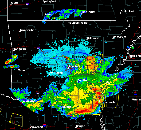 At 1021 pm cdt, severe thunderstorms were located along a line extending from 6 miles northwest of rosedale to near arkansas city, moving east at 45 mph (radar indicated). Hazards include 60 mph wind gusts and quarter size hail. Hail damage to vehicles is expected. expect wind damage to roofs, siding, and trees. these severe storms will be near, rosedale, scott and lamont around 1025 pm cdt. benoit and winterville around 1030 pm cdt. gunnison around 1035 pm cdt. deeson around 1040 pm cdt. shelby around 1045 pm cdt. shaw and mound bayou around 1050 pm cdt. indianola around 1100 pm cdt. drew around 1105 pm cdt. Other locations impacted by these severe thunderstorms include alligator, beulah, pace, doddsville, winstonville, duncan and merigold. At 1021 pm cdt, severe thunderstorms were located along a line extending from 6 miles northwest of rosedale to near arkansas city, moving east at 45 mph (radar indicated). Hazards include 60 mph wind gusts and quarter size hail. Hail damage to vehicles is expected. expect wind damage to roofs, siding, and trees. these severe storms will be near, rosedale, scott and lamont around 1025 pm cdt. benoit and winterville around 1030 pm cdt. gunnison around 1035 pm cdt. deeson around 1040 pm cdt. shelby around 1045 pm cdt. shaw and mound bayou around 1050 pm cdt. indianola around 1100 pm cdt. drew around 1105 pm cdt. Other locations impacted by these severe thunderstorms include alligator, beulah, pace, doddsville, winstonville, duncan and merigold.
|
| 6/19/2019 10:10 PM CDT |
 At 1010 pm cdt, severe thunderstorms were located along a line extending from yancopin to near arkansas city, moving east at 45 mph (radar indicated). Hazards include 60 mph wind gusts and quarter size hail. Hail damage to vehicles is expected. expect wind damage to roofs, siding, and trees. severe thunderstorms will be near, rosedale, scott, lamont and winterville around 1025 pm cdt. benoit and gunnison around 1030 pm cdt. deeson around 1040 pm cdt. shelby around 1045 pm cdt. shaw, mound bayou and holly ridge around 1050 pm cdt. indianola around 1100 pm cdt. drew and parchman around 1105 pm cdt. moorhead, sunflower, blaine and rome around 1110 pm cdt. Other locations impacted by these severe thunderstorms include alligator, beulah, pace, doddsville, winstonville, duncan and merigold. At 1010 pm cdt, severe thunderstorms were located along a line extending from yancopin to near arkansas city, moving east at 45 mph (radar indicated). Hazards include 60 mph wind gusts and quarter size hail. Hail damage to vehicles is expected. expect wind damage to roofs, siding, and trees. severe thunderstorms will be near, rosedale, scott, lamont and winterville around 1025 pm cdt. benoit and gunnison around 1030 pm cdt. deeson around 1040 pm cdt. shelby around 1045 pm cdt. shaw, mound bayou and holly ridge around 1050 pm cdt. indianola around 1100 pm cdt. drew and parchman around 1105 pm cdt. moorhead, sunflower, blaine and rome around 1110 pm cdt. Other locations impacted by these severe thunderstorms include alligator, beulah, pace, doddsville, winstonville, duncan and merigold.
|
| 6/17/2019 4:29 PM CDT |
 At 428 pm cdt, severe thunderstorms were located along a line extending from near ruleville to near benoit, moving northwest at 30 mph (radar indicated). Hazards include 60 mph wind gusts and quarter size hail. Hail damage to vehicles is expected. expect wind damage to roofs, siding, and trees. severe thunderstorms will be near, benoit around 435 pm cdt. parchman around 450 pm cdt. mound bayou around 455 pm cdt. rosedale around 500 pm cdt. shelby around 505 pm cdt. gunnison around 510 pm cdt. Other locations impacted by these severe thunderstorms include alligator, beulah, pace, doddsville, winstonville, duncan and merigold. At 428 pm cdt, severe thunderstorms were located along a line extending from near ruleville to near benoit, moving northwest at 30 mph (radar indicated). Hazards include 60 mph wind gusts and quarter size hail. Hail damage to vehicles is expected. expect wind damage to roofs, siding, and trees. severe thunderstorms will be near, benoit around 435 pm cdt. parchman around 450 pm cdt. mound bayou around 455 pm cdt. rosedale around 500 pm cdt. shelby around 505 pm cdt. gunnison around 510 pm cdt. Other locations impacted by these severe thunderstorms include alligator, beulah, pace, doddsville, winstonville, duncan and merigold.
|
| 5/19/2019 7:34 PM CDT |
 At 734 pm cdt, a severe thunderstorm was located near gunnison, or near rosedale, moving southeast at 10 mph (radar indicated). Hazards include 60 mph wind gusts and quarter size hail. Hail damage to vehicles is expected. expect wind damage to roofs, siding, and trees. Locations impacted include, rosedale, gunnison, deeson, beulah and pace. At 734 pm cdt, a severe thunderstorm was located near gunnison, or near rosedale, moving southeast at 10 mph (radar indicated). Hazards include 60 mph wind gusts and quarter size hail. Hail damage to vehicles is expected. expect wind damage to roofs, siding, and trees. Locations impacted include, rosedale, gunnison, deeson, beulah and pace.
|
| 5/19/2019 6:58 PM CDT |
 At 658 pm cdt, a severe thunderstorm was located near gunnison, or 9 miles north of rosedale, moving east at 15 mph (radar indicated). Hazards include 60 mph wind gusts and quarter size hail. Hail damage to vehicles is expected. expect wind damage to roofs, siding, and trees. this severe thunderstorm will be near, gunnison around 720 pm cdt. deeson around 730 pm cdt. Other locations impacted by this severe thunderstorm include beulah and pace. At 658 pm cdt, a severe thunderstorm was located near gunnison, or 9 miles north of rosedale, moving east at 15 mph (radar indicated). Hazards include 60 mph wind gusts and quarter size hail. Hail damage to vehicles is expected. expect wind damage to roofs, siding, and trees. this severe thunderstorm will be near, gunnison around 720 pm cdt. deeson around 730 pm cdt. Other locations impacted by this severe thunderstorm include beulah and pace.
|
| 4/7/2019 9:36 AM CDT |
 At 936 am cdt, a severe thunderstorm was located over trusten holder wma, or 15 miles northwest of rosedale, moving northeast at 50 mph (radar indicated). Hazards include 60 mph wind gusts and nickel size hail. Expect damage to roofs, siding, and trees. Locations impacted include, dumas, rosedale, rohwer, gillett, arkansas city, mitchellville, tillar, watson, winchester, yancopin, omega, lucca landing, mcgehee, merrisach lake, kelso, trusten holder wma, reed, baxter, arkansas post, de luce,. At 936 am cdt, a severe thunderstorm was located over trusten holder wma, or 15 miles northwest of rosedale, moving northeast at 50 mph (radar indicated). Hazards include 60 mph wind gusts and nickel size hail. Expect damage to roofs, siding, and trees. Locations impacted include, dumas, rosedale, rohwer, gillett, arkansas city, mitchellville, tillar, watson, winchester, yancopin, omega, lucca landing, mcgehee, merrisach lake, kelso, trusten holder wma, reed, baxter, arkansas post, de luce,.
|
| 4/7/2019 9:12 AM CDT |
 At 911 am cdt, a severe thunderstorm was located over omega, or near dumas, moving northeast at 50 mph (radar indicated). Hazards include 60 mph wind gusts and quarter size hail. Hail damage to vehicles is expected. Expect wind damage to roofs, siding, and trees. At 911 am cdt, a severe thunderstorm was located over omega, or near dumas, moving northeast at 50 mph (radar indicated). Hazards include 60 mph wind gusts and quarter size hail. Hail damage to vehicles is expected. Expect wind damage to roofs, siding, and trees.
|
| 4/7/2019 9:07 AM CDT |
 At 906 am cdt, a severe thunderstorm was located over dumas, moving northeast at 50 mph (radar indicated). Hazards include 60 mph wind gusts and quarter size hail. Hail damage to vehicles is expected. expect wind damage to roofs, siding, and trees. Locations impacted include, monticello, dumas, dermott, rohwer, gould, gillett, arkansas city, mitchellville, tillar, watson, winchester, plantersville, lucca landing, mcgehee, douglas, trusten holder wma, yancopin, omega, cane creek state park, mills,. At 906 am cdt, a severe thunderstorm was located over dumas, moving northeast at 50 mph (radar indicated). Hazards include 60 mph wind gusts and quarter size hail. Hail damage to vehicles is expected. expect wind damage to roofs, siding, and trees. Locations impacted include, monticello, dumas, dermott, rohwer, gould, gillett, arkansas city, mitchellville, tillar, watson, winchester, plantersville, lucca landing, mcgehee, douglas, trusten holder wma, yancopin, omega, cane creek state park, mills,.
|
| 4/7/2019 8:37 AM CDT |
 At 837 am cdt, a severe thunderstorm was located 8 miles east of monticello, moving northeast at 55 mph (radar indicated). Hazards include 60 mph wind gusts and quarter size hail. Hail damage to vehicles is expected. Expect wind damage to roofs, siding, and trees. At 837 am cdt, a severe thunderstorm was located 8 miles east of monticello, moving northeast at 55 mph (radar indicated). Hazards include 60 mph wind gusts and quarter size hail. Hail damage to vehicles is expected. Expect wind damage to roofs, siding, and trees.
|
| 4/7/2019 6:40 AM CDT |
 At 640 am cdt, severe thunderstorms were located along a line extending from near shelby to renova to near shaw, moving northeast at 50 mph (radar indicated). Hazards include 60 mph wind gusts and half dollar size hail. Hail damage to vehicles is expected. expect wind damage to roofs, siding, and trees. these severe storms will be near, shelby and mound bayou around 645 am cdt. Other locations impacted by these severe thunderstorms include winstonville, beulah, pace and merigold. At 640 am cdt, severe thunderstorms were located along a line extending from near shelby to renova to near shaw, moving northeast at 50 mph (radar indicated). Hazards include 60 mph wind gusts and half dollar size hail. Hail damage to vehicles is expected. expect wind damage to roofs, siding, and trees. these severe storms will be near, shelby and mound bayou around 645 am cdt. Other locations impacted by these severe thunderstorms include winstonville, beulah, pace and merigold.
|
| 4/7/2019 6:27 AM CDT |
 At 627 am cdt, severe thunderstorms were located along a line extending from near gunnison to 7 miles northeast of benoit to near lamont, moving northeast at 50 mph (radar indicated). Hazards include 70 mph wind gusts and half dollar size hail. Hail damage to vehicles is expected. expect considerable tree damage. wind damage is also likely to mobile homes, roofs, and outbuildings. these severe storms will be near, gunnison around 630 am cdt. renova around 640 am cdt. shelby, shaw and mound bayou around 645 am cdt. boyle around 650 am cdt. cleveland around 655 am cdt. Other locations impacted by these severe thunderstorms include winstonville, beulah, pace and merigold. At 627 am cdt, severe thunderstorms were located along a line extending from near gunnison to 7 miles northeast of benoit to near lamont, moving northeast at 50 mph (radar indicated). Hazards include 70 mph wind gusts and half dollar size hail. Hail damage to vehicles is expected. expect considerable tree damage. wind damage is also likely to mobile homes, roofs, and outbuildings. these severe storms will be near, gunnison around 630 am cdt. renova around 640 am cdt. shelby, shaw and mound bayou around 645 am cdt. boyle around 650 am cdt. cleveland around 655 am cdt. Other locations impacted by these severe thunderstorms include winstonville, beulah, pace and merigold.
|
| 4/7/2019 6:09 AM CDT |
 At 608 am cdt, severe thunderstorms were located along a line extending from near watson to near jersey point to 8 miles northeast of mcmillan corner, moving northeast at 50 mph (radar indicated). Hazards include 60 mph wind gusts and half dollar size hail. Hail damage to vehicles is expected. expect wind damage to roofs, siding, and trees. severe thunderstorms will be near, rosedale around 625 am cdt. benoit around 630 am cdt. gunnison around 635 am cdt. shaw around 640 am cdt. shelby and mound bayou around 645 am cdt. cleveland, renova and boyle around 650 am cdt. Other locations impacted by these severe thunderstorms include winstonville, beulah, pace and merigold. At 608 am cdt, severe thunderstorms were located along a line extending from near watson to near jersey point to 8 miles northeast of mcmillan corner, moving northeast at 50 mph (radar indicated). Hazards include 60 mph wind gusts and half dollar size hail. Hail damage to vehicles is expected. expect wind damage to roofs, siding, and trees. severe thunderstorms will be near, rosedale around 625 am cdt. benoit around 630 am cdt. gunnison around 635 am cdt. shaw around 640 am cdt. shelby and mound bayou around 645 am cdt. cleveland, renova and boyle around 650 am cdt. Other locations impacted by these severe thunderstorms include winstonville, beulah, pace and merigold.
|
| 3/13/2019 8:25 PM CDT | Trees and power lines downed across bolivar count in bolivar county MS, 0.4 miles WNW of Rosedale, MS |
| 3/13/2019 8:17 PM CDT |
 At 816 pm cdt, a severe thunderstorm was located near mcgehee, or near dermott, moving northeast at 75 mph (radar indicated). Hazards include 60 mph wind gusts and quarter size hail. Hail damage to vehicles is expected. expect wind damage to roofs, siding, and trees. this severe storm will be near, rosedale around 835 pm cdt. Other locations impacted by this severe thunderstorm include beulah. At 816 pm cdt, a severe thunderstorm was located near mcgehee, or near dermott, moving northeast at 75 mph (radar indicated). Hazards include 60 mph wind gusts and quarter size hail. Hail damage to vehicles is expected. expect wind damage to roofs, siding, and trees. this severe storm will be near, rosedale around 835 pm cdt. Other locations impacted by this severe thunderstorm include beulah.
|
| 3/13/2019 7:52 PM CDT |
 At 752 pm cdt, a severe thunderstorm was located near hamburg, moving northeast at 75 mph (radar indicated). Hazards include 60 mph wind gusts and quarter size hail. Hail damage to vehicles is expected. expect wind damage to roofs, siding, and trees. this severe thunderstorm will be near, dermott around 810 pm cdt. rosedale around 840 pm cdt. Other locations impacted by this severe thunderstorm include beulah and halley. At 752 pm cdt, a severe thunderstorm was located near hamburg, moving northeast at 75 mph (radar indicated). Hazards include 60 mph wind gusts and quarter size hail. Hail damage to vehicles is expected. expect wind damage to roofs, siding, and trees. this severe thunderstorm will be near, dermott around 810 pm cdt. rosedale around 840 pm cdt. Other locations impacted by this severe thunderstorm include beulah and halley.
|
| 7/21/2018 4:45 AM CDT |
 At 444 am cdt, severe thunderstorms were located along a line extending from blaine to near shaw, moving southeast at 45 mph (radar indicated). Hazards include 60 mph wind gusts. Expect damage to roofs, siding, and trees. These severe thunderstorms will remain over mainly rural areas of northeastern sunflower and southern bolivar counties, including the following locations, beulah, pace and merigold. At 444 am cdt, severe thunderstorms were located along a line extending from blaine to near shaw, moving southeast at 45 mph (radar indicated). Hazards include 60 mph wind gusts. Expect damage to roofs, siding, and trees. These severe thunderstorms will remain over mainly rural areas of northeastern sunflower and southern bolivar counties, including the following locations, beulah, pace and merigold.
|
| 7/21/2018 4:36 AM CDT |
 At 436 am cdt, severe thunderstorms were located along a line extending from drew to boyle, moving southeast at 45 mph (radar indicated). Hazards include 60 mph wind gusts. Expect damage to roofs, siding, and trees. these severe storms will be near, ruleville around 440 am cdt. Other locations impacted by these severe thunderstorms include winstonville, beulah, pace and merigold. At 436 am cdt, severe thunderstorms were located along a line extending from drew to boyle, moving southeast at 45 mph (radar indicated). Hazards include 60 mph wind gusts. Expect damage to roofs, siding, and trees. these severe storms will be near, ruleville around 440 am cdt. Other locations impacted by these severe thunderstorms include winstonville, beulah, pace and merigold.
|
| 7/21/2018 4:29 AM CDT |
 At 429 am cdt, severe thunderstorms were located along a line extending from near ruleville to 6 miles north of benoit, moving southeast at 50 mph (radar indicated). Hazards include 60 mph wind gusts. Expect damage to roofs, siding, and trees. these severe storms will be near, ruleville and drew around 435 am cdt. Other locations impacted by these severe thunderstorms include winstonville, beulah, duncan, pace and merigold. At 429 am cdt, severe thunderstorms were located along a line extending from near ruleville to 6 miles north of benoit, moving southeast at 50 mph (radar indicated). Hazards include 60 mph wind gusts. Expect damage to roofs, siding, and trees. these severe storms will be near, ruleville and drew around 435 am cdt. Other locations impacted by these severe thunderstorms include winstonville, beulah, duncan, pace and merigold.
|
| 7/21/2018 4:16 AM CDT |
 At 416 am cdt, a severe thunderstorm was located near deeson, or near shelby, moving southeast at 50 mph (radar indicated). Hazards include 60 mph wind gusts. Expect damage to roofs, siding, and trees. this severe storm will be near, shelby around 420 am cdt. mound bayou around 425 am cdt. cleveland and renova around 435 am cdt. drew and boyle around 440 am cdt. ruleville around 445 am cdt. Other locations impacted by this severe thunderstorm include alligator, winstonville, beulah, duncan, pace and merigold. At 416 am cdt, a severe thunderstorm was located near deeson, or near shelby, moving southeast at 50 mph (radar indicated). Hazards include 60 mph wind gusts. Expect damage to roofs, siding, and trees. this severe storm will be near, shelby around 420 am cdt. mound bayou around 425 am cdt. cleveland and renova around 435 am cdt. drew and boyle around 440 am cdt. ruleville around 445 am cdt. Other locations impacted by this severe thunderstorm include alligator, winstonville, beulah, duncan, pace and merigold.
|
| 7/21/2018 4:01 AM CDT |
 At 400 am cdt, a severe thunderstorm was located near crumrod, or near white river national wildlife refuge, moving southeast at 45 mph (radar indicated). Hazards include 60 mph wind gusts and penny size hail. Expect damage to roofs, siding, and trees. this severe thunderstorm will be near, deeson around 415 am cdt. gunnison around 420 am cdt. shelby around 425 am cdt. mound bayou around 430 am cdt. renova around 440 am cdt. cleveland and boyle around 445 am cdt. ruleville around 450 am cdt. Other locations impacted by this severe thunderstorm include alligator, winstonville, beulah, duncan, pace and merigold. At 400 am cdt, a severe thunderstorm was located near crumrod, or near white river national wildlife refuge, moving southeast at 45 mph (radar indicated). Hazards include 60 mph wind gusts and penny size hail. Expect damage to roofs, siding, and trees. this severe thunderstorm will be near, deeson around 415 am cdt. gunnison around 420 am cdt. shelby around 425 am cdt. mound bayou around 430 am cdt. renova around 440 am cdt. cleveland and boyle around 445 am cdt. ruleville around 450 am cdt. Other locations impacted by this severe thunderstorm include alligator, winstonville, beulah, duncan, pace and merigold.
|
| 7/19/2018 9:58 PM CDT |
 At 957 pm cdt, a severe thunderstorm was located near shelby, moving south at 25 mph (radar indicated). Hazards include 60 mph wind gusts and quarter size hail. Hail damage to vehicles is expected. expect wind damage to roofs, siding, and trees. this severe thunderstorm will be near, mound bayou around 1015 pm cdt. renova around 1030 pm cdt. cleveland and boyle around 1045 pm cdt. Other locations impacted by this severe thunderstorm include winstonville, beulah, pace and merigold. At 957 pm cdt, a severe thunderstorm was located near shelby, moving south at 25 mph (radar indicated). Hazards include 60 mph wind gusts and quarter size hail. Hail damage to vehicles is expected. expect wind damage to roofs, siding, and trees. this severe thunderstorm will be near, mound bayou around 1015 pm cdt. renova around 1030 pm cdt. cleveland and boyle around 1045 pm cdt. Other locations impacted by this severe thunderstorm include winstonville, beulah, pace and merigold.
|
| 7/6/2018 5:49 PM CDT |
 At 549 pm cdt, severe thunderstorms were located along a line extending from cleveland to near rosedale, moving southwest at 20 mph (radar indicated). Hazards include 60 mph wind gusts. Expect damage to roofs, siding, and trees. these severe storms will be near, rosedale around 600 pm cdt. shaw around 620 pm cdt. benoit around 630 pm cdt. Other locations impacted by these severe thunderstorms include beulah and pace. At 549 pm cdt, severe thunderstorms were located along a line extending from cleveland to near rosedale, moving southwest at 20 mph (radar indicated). Hazards include 60 mph wind gusts. Expect damage to roofs, siding, and trees. these severe storms will be near, rosedale around 600 pm cdt. shaw around 620 pm cdt. benoit around 630 pm cdt. Other locations impacted by these severe thunderstorms include beulah and pace.
|
| 7/6/2018 5:25 PM CDT |
 At 524 pm cdt, a severe thunderstorm was located near gunnison, or 8 miles southwest of shelby, moving southwest at 30 mph (radar indicated). Hazards include 60 mph wind gusts. Expect damage to roofs, siding, and trees. this severe thunderstorm will be near, rosedale around 540 pm cdt. benoit around 600 pm cdt. scott around 610 pm cdt. Other locations impacted by this severe thunderstorm include winstonville, beulah, pace and merigold. At 524 pm cdt, a severe thunderstorm was located near gunnison, or 8 miles southwest of shelby, moving southwest at 30 mph (radar indicated). Hazards include 60 mph wind gusts. Expect damage to roofs, siding, and trees. this severe thunderstorm will be near, rosedale around 540 pm cdt. benoit around 600 pm cdt. scott around 610 pm cdt. Other locations impacted by this severe thunderstorm include winstonville, beulah, pace and merigold.
|
| 6/3/2018 1:50 AM CDT | Tree downed on a house in rosedal in bolivar county MS, 0.7 miles SW of Rosedale, MS |
| 4/14/2018 3:47 AM CDT |
 At 347 am cdt, a severe thunderstorm capable of producing a tornado was located over lucca landing, or 7 miles southeast of rohwer, moving northeast at 55 mph (radar indicated rotation). Hazards include tornado. Flying debris will be dangerous to those caught without shelter. mobile homes will be damaged or destroyed. damage to roofs, windows, and vehicles will occur. tree damage is likely. Locations impacted include, rohwer, arkansas city, lucca landing, jersey point, kelso, mcarthur,. At 347 am cdt, a severe thunderstorm capable of producing a tornado was located over lucca landing, or 7 miles southeast of rohwer, moving northeast at 55 mph (radar indicated rotation). Hazards include tornado. Flying debris will be dangerous to those caught without shelter. mobile homes will be damaged or destroyed. damage to roofs, windows, and vehicles will occur. tree damage is likely. Locations impacted include, rohwer, arkansas city, lucca landing, jersey point, kelso, mcarthur,.
|
| 4/14/2018 3:45 AM CDT |
 At 345 am cdt, a severe thunderstorm capable of producing a tornado was located over arkansas city, or 9 miles south of rohwer, moving northeast at 40 mph (radar indicated rotation). Hazards include tornado. Flying debris will be dangerous to those caught without shelter. mobile homes will be damaged or destroyed. damage to roofs, windows, and vehicles will occur. tree damage is likely. this dangerous storm will be near, scott and jersey point around 355 am cdt. benoit around 400 am cdt. rosedale around 410 am cdt. renova around 425 am cdt. mound bayou around 430 am cdt. shelby around 435 am cdt. Other locations impacted by this tornadic thunderstorm include winstonville, beulah, duncan, pace and merigold. At 345 am cdt, a severe thunderstorm capable of producing a tornado was located over arkansas city, or 9 miles south of rohwer, moving northeast at 40 mph (radar indicated rotation). Hazards include tornado. Flying debris will be dangerous to those caught without shelter. mobile homes will be damaged or destroyed. damage to roofs, windows, and vehicles will occur. tree damage is likely. this dangerous storm will be near, scott and jersey point around 355 am cdt. benoit around 400 am cdt. rosedale around 410 am cdt. renova around 425 am cdt. mound bayou around 430 am cdt. shelby around 435 am cdt. Other locations impacted by this tornadic thunderstorm include winstonville, beulah, duncan, pace and merigold.
|
| 4/14/2018 3:32 AM CDT |
 At 332 am cdt, a severe thunderstorm capable of producing a tornado was located over mcgehee, or near dermott, moving northeast at 55 mph (radar indicated rotation). Hazards include tornado. Flying debris will be dangerous to those caught without shelter. mobile homes will be damaged or destroyed. damage to roofs, windows, and vehicles will occur. Tree damage is likely. At 332 am cdt, a severe thunderstorm capable of producing a tornado was located over mcgehee, or near dermott, moving northeast at 55 mph (radar indicated rotation). Hazards include tornado. Flying debris will be dangerous to those caught without shelter. mobile homes will be damaged or destroyed. damage to roofs, windows, and vehicles will occur. Tree damage is likely.
|
| 4/3/2018 6:38 PM CDT |
 At 637 pm cdt, severe thunderstorms were located along a line extending from near white river national wildlife refuge to near trusten holder wma to near rohwer, moving east at 45 mph (radar indicated). Hazards include 60 mph wind gusts and quarter size hail. Hail damage to vehicles is expected. Expect wind damage to roofs, siding, and trees. At 637 pm cdt, severe thunderstorms were located along a line extending from near white river national wildlife refuge to near trusten holder wma to near rohwer, moving east at 45 mph (radar indicated). Hazards include 60 mph wind gusts and quarter size hail. Hail damage to vehicles is expected. Expect wind damage to roofs, siding, and trees.
|
| 3/10/2018 10:18 PM CDT |
 At 859 pm cst, a severe thunderstorm was located near tillar, or 11 miles south of dumas, moving east at 30 mph (radar indicated). Hazards include quarter size hail. damage to vehicles is expected At 859 pm cst, a severe thunderstorm was located near tillar, or 11 miles south of dumas, moving east at 30 mph (radar indicated). Hazards include quarter size hail. damage to vehicles is expected
|
| 3/10/2018 9:59 PM CDT |
 At 859 pm cst, a severe thunderstorm was located near tillar, or 11 miles south of dumas, moving east at 30 mph (radar indicated). Hazards include quarter size hail. damage to vehicles is expected At 859 pm cst, a severe thunderstorm was located near tillar, or 11 miles south of dumas, moving east at 30 mph (radar indicated). Hazards include quarter size hail. damage to vehicles is expected
|
| 3/5/2018 4:27 PM CST |
 At 427 pm cst, a severe thunderstorm was located near mound bayou, or 7 miles southwest of shelby, moving east at 35 mph (radar indicated). Hazards include 60 mph wind gusts and quarter size hail. Hail damage to vehicles is expected. expect wind damage to roofs, siding, and trees. this severe thunderstorm will be near, shelby around 430 pm cst. mound bayou around 435 pm cst. renova around 440 pm cst. ruleville, drew and parchman around 455 pm cst. Other locations impacted by this severe thunderstorm include doddsville, winstonville, beulah, pace and merigold. At 427 pm cst, a severe thunderstorm was located near mound bayou, or 7 miles southwest of shelby, moving east at 35 mph (radar indicated). Hazards include 60 mph wind gusts and quarter size hail. Hail damage to vehicles is expected. expect wind damage to roofs, siding, and trees. this severe thunderstorm will be near, shelby around 430 pm cst. mound bayou around 435 pm cst. renova around 440 pm cst. ruleville, drew and parchman around 455 pm cst. Other locations impacted by this severe thunderstorm include doddsville, winstonville, beulah, pace and merigold.
|
| 2/24/2018 6:52 PM CST |
 At 651 pm cst, severe thunderstorms were located along a line extending from white river national wildlife refuge to near yancopin to winchester, moving east at 40 mph (radar indicated). Hazards include 60 mph wind gusts. Expect damage to roofs, siding, and trees. Locations impacted include, dumas, rohwer, mitchellville, tillar, watson, winchester, yancopin, omega, lucca landing, trusten holder wma, merrisach lake, kelso, reed, arkansas post, pendleton, ethel, florence, tichnor, reedville, selma, a tornado watch remains in effect until 700 pm cst for southeastern arkansas. At 651 pm cst, severe thunderstorms were located along a line extending from white river national wildlife refuge to near yancopin to winchester, moving east at 40 mph (radar indicated). Hazards include 60 mph wind gusts. Expect damage to roofs, siding, and trees. Locations impacted include, dumas, rohwer, mitchellville, tillar, watson, winchester, yancopin, omega, lucca landing, trusten holder wma, merrisach lake, kelso, reed, arkansas post, pendleton, ethel, florence, tichnor, reedville, selma, a tornado watch remains in effect until 700 pm cst for southeastern arkansas.
|
| 2/24/2018 6:37 PM CST |
 At 637 pm cst, severe thunderstorms were located along a line extending from near st. charles to 6 miles west of white river national wildlife refuge to 7 miles northeast of mitchellville to 6 miles west of omega, moving east at 40 mph (radar indicated). Hazards include 60 mph wind gusts. expect damage to roofs, siding, and trees At 637 pm cst, severe thunderstorms were located along a line extending from near st. charles to 6 miles west of white river national wildlife refuge to 7 miles northeast of mitchellville to 6 miles west of omega, moving east at 40 mph (radar indicated). Hazards include 60 mph wind gusts. expect damage to roofs, siding, and trees
|
| 1/22/2018 3:36 AM CST |
 At 335 am cst, a severe thunderstorm was located over tillar, or 11 miles north of dermott, moving northeast at 50 mph (radar indicated). Hazards include 60 mph wind gusts and penny size hail. expect damage to roofs, siding, and trees At 335 am cst, a severe thunderstorm was located over tillar, or 11 miles north of dermott, moving northeast at 50 mph (radar indicated). Hazards include 60 mph wind gusts and penny size hail. expect damage to roofs, siding, and trees
|
| 11/3/2017 5:48 PM CDT |
 At 548 pm cdt, a severe thunderstorm was located 8 miles northeast of shelby, moving northeast at 10 mph (radar indicated). Hazards include golf ball size hail and 60 mph wind gusts. People and animals outdoors will be injured. expect hail damage to roofs, siding, windows, and vehicles. expect wind damage to roofs, siding, and trees. This severe thunderstorm will remain over mainly rural areas of north central sunflower and northeastern bolivar counties, including the following locations: alligator, winstonville, duncan and pace. At 548 pm cdt, a severe thunderstorm was located 8 miles northeast of shelby, moving northeast at 10 mph (radar indicated). Hazards include golf ball size hail and 60 mph wind gusts. People and animals outdoors will be injured. expect hail damage to roofs, siding, windows, and vehicles. expect wind damage to roofs, siding, and trees. This severe thunderstorm will remain over mainly rural areas of north central sunflower and northeastern bolivar counties, including the following locations: alligator, winstonville, duncan and pace.
|
| 11/3/2017 5:39 PM CDT |
 At 539 pm cdt, a severe thunderstorm was located near gunnison, or 7 miles east of rosedale, moving northeast at 20 mph (radar indicated). Hazards include 60 mph wind gusts and half dollar size hail. Hail damage to vehicles is expected. expect wind damage to roofs, siding, and trees. this severe thunderstorm will be near, mound bayou around 600 pm cdt. shelby and deeson around 605 pm cdt. Other locations impacted by this severe thunderstorm include alligator, winstonville, duncan and pace. At 539 pm cdt, a severe thunderstorm was located near gunnison, or 7 miles east of rosedale, moving northeast at 20 mph (radar indicated). Hazards include 60 mph wind gusts and half dollar size hail. Hail damage to vehicles is expected. expect wind damage to roofs, siding, and trees. this severe thunderstorm will be near, mound bayou around 600 pm cdt. shelby and deeson around 605 pm cdt. Other locations impacted by this severe thunderstorm include alligator, winstonville, duncan and pace.
|
| 6/16/2017 5:44 PM CDT |
 At 543 pm cdt, severe thunderstorms were located along a line extending from near rosedale to near boyle, moving south at 15 mph (radar indicated). Hazards include 60 mph wind gusts and quarter size hail. Hail damage to vehicles is expected. expect wind damage to roofs, siding, and trees. severe thunderstorms will be near, boyle around 550 pm cdt. shaw around 615 pm cdt. jersey point around 630 pm cdt. benoit around 635 pm cdt. scott around 645 pm cdt. Other locations impacted by these severe thunderstorms include beulah and pace. At 543 pm cdt, severe thunderstorms were located along a line extending from near rosedale to near boyle, moving south at 15 mph (radar indicated). Hazards include 60 mph wind gusts and quarter size hail. Hail damage to vehicles is expected. expect wind damage to roofs, siding, and trees. severe thunderstorms will be near, boyle around 550 pm cdt. shaw around 615 pm cdt. jersey point around 630 pm cdt. benoit around 635 pm cdt. scott around 645 pm cdt. Other locations impacted by these severe thunderstorms include beulah and pace.
|
| 4/2/2017 5:24 PM CDT |
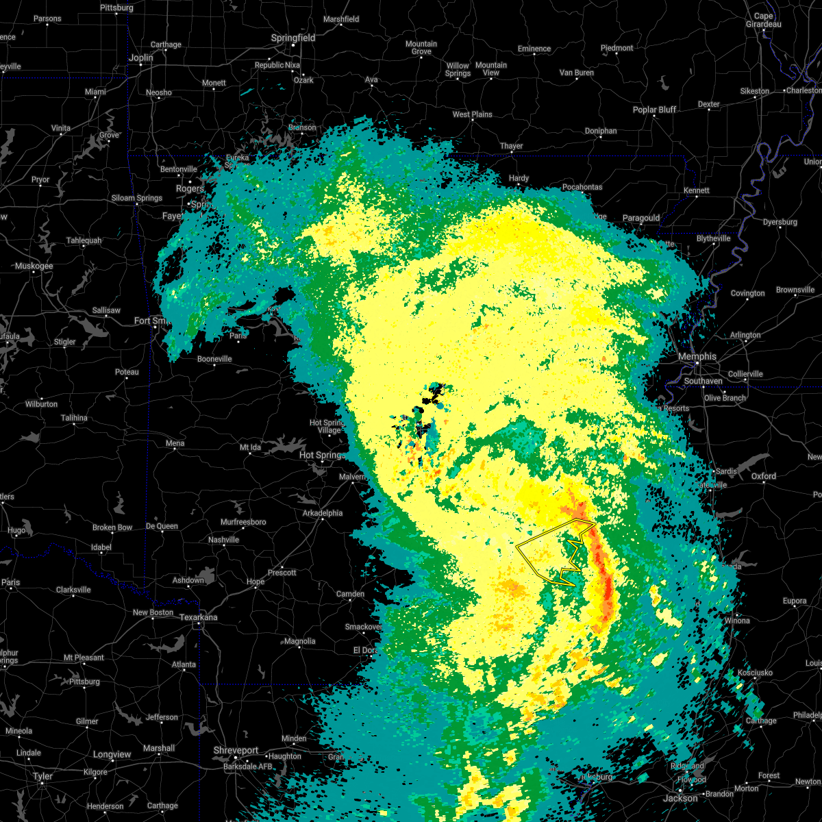 The severe thunderstorm warning for central desha and south central arkansas counties will expire at 530 pm cdt, the storms which prompted the warning have moved out of the area. therefore the warning will be allowed to expire. The severe thunderstorm warning for central desha and south central arkansas counties will expire at 530 pm cdt, the storms which prompted the warning have moved out of the area. therefore the warning will be allowed to expire.
|
| 4/2/2017 5:20 PM CDT |
 At 519 pm cdt, severe thunderstorms were located along a line extending from near gunnison to near shaw to near estill, moving northeast at 80 mph (radar indicated). Hazards include 70 mph wind gusts. Expect considerable tree damage. damage is likely to mobile homes, roofs, and outbuildings. these severe storms will be near, cleveland, shelby, mound bayou and boyle around 525 pm cdt. other locations impacted by these severe thunderstorms include arcola, winstonville, beulah, pace and merigold. A tornado watch remains in effect until 900 pm cdt for southeastern arkansas, and northwestern mississippi. At 519 pm cdt, severe thunderstorms were located along a line extending from near gunnison to near shaw to near estill, moving northeast at 80 mph (radar indicated). Hazards include 70 mph wind gusts. Expect considerable tree damage. damage is likely to mobile homes, roofs, and outbuildings. these severe storms will be near, cleveland, shelby, mound bayou and boyle around 525 pm cdt. other locations impacted by these severe thunderstorms include arcola, winstonville, beulah, pace and merigold. A tornado watch remains in effect until 900 pm cdt for southeastern arkansas, and northwestern mississippi.
|
| 4/2/2017 5:09 PM CDT |
 At 508 pm cdt, severe thunderstorms were located along a line extending from near watson to jersey point to near greenville, moving northeast at 80 mph (radar indicated). Hazards include 60 mph wind gusts and quarter size hail. Hail damage to vehicles is expected. expect wind damage to roofs, siding, and trees. Locations impacted include, rohwer, watson, lucca landing, yancopin, trusten holder wma, kelso, morgan point recreation area, pendleton,. At 508 pm cdt, severe thunderstorms were located along a line extending from near watson to jersey point to near greenville, moving northeast at 80 mph (radar indicated). Hazards include 60 mph wind gusts and quarter size hail. Hail damage to vehicles is expected. expect wind damage to roofs, siding, and trees. Locations impacted include, rohwer, watson, lucca landing, yancopin, trusten holder wma, kelso, morgan point recreation area, pendleton,.
|
| 4/2/2017 4:51 PM CDT |
 At 450 pm cdt, severe thunderstorms were located along a line extending from 9 miles northeast of monticello to near dermott to 8 miles west of eudora, moving east at 65 mph (radar indicated). Hazards include 60 mph wind gusts and quarter size hail. Hail damage to vehicles is expected. expect wind damage to roofs, siding, and trees. Locations impacted include, monticello, dumas, dermott, rohwer, arkansas city, mitchellville, tillar, watson, winchester, yancopin, omega, plantersville, lucca landing, mcgehee, kelso, trusten holder wma, reed, jerome, baxter, garrett bridge,. At 450 pm cdt, severe thunderstorms were located along a line extending from 9 miles northeast of monticello to near dermott to 8 miles west of eudora, moving east at 65 mph (radar indicated). Hazards include 60 mph wind gusts and quarter size hail. Hail damage to vehicles is expected. expect wind damage to roofs, siding, and trees. Locations impacted include, monticello, dumas, dermott, rohwer, arkansas city, mitchellville, tillar, watson, winchester, yancopin, omega, plantersville, lucca landing, mcgehee, kelso, trusten holder wma, reed, jerome, baxter, garrett bridge,.
|
| 4/2/2017 4:41 PM CDT |
 At 441 pm cdt, severe thunderstorms were located along a line extending from 9 miles west of dermott to portland to 6 miles southeast of jones, moving northeast at 80 mph (radar indicated). Hazards include 70 mph wind gusts. Expect considerable tree damage. damage is likely to mobile homes, roofs, and outbuildings. severe thunderstorms will be near, dermott around 445 pm cdt. lake village, mcmillan corner and chicot junction around 450 pm cdt. gassoway and millikin around 455 pm cdt. eudora around 500 pm cdt. greenville, metcalfe, winterville, lamont and glen allan around 505 pm cdt. leland, rosedale, avon and wayside around 510 pm cdt. hollandale and estill around 515 pm cdt. shaw, mound bayou and tribbett around 520 pm cdt. other locations impacted by these severe thunderstorms include mayersville, arcola, beulah, pace, kilbourne, winstonville, merigold and halley. A tornado watch remains in effect until 900 pm cdt for southeastern arkansas, northeastern louisiana, and northwestern and west central mississippi. At 441 pm cdt, severe thunderstorms were located along a line extending from 9 miles west of dermott to portland to 6 miles southeast of jones, moving northeast at 80 mph (radar indicated). Hazards include 70 mph wind gusts. Expect considerable tree damage. damage is likely to mobile homes, roofs, and outbuildings. severe thunderstorms will be near, dermott around 445 pm cdt. lake village, mcmillan corner and chicot junction around 450 pm cdt. gassoway and millikin around 455 pm cdt. eudora around 500 pm cdt. greenville, metcalfe, winterville, lamont and glen allan around 505 pm cdt. leland, rosedale, avon and wayside around 510 pm cdt. hollandale and estill around 515 pm cdt. shaw, mound bayou and tribbett around 520 pm cdt. other locations impacted by these severe thunderstorms include mayersville, arcola, beulah, pace, kilbourne, winstonville, merigold and halley. A tornado watch remains in effect until 900 pm cdt for southeastern arkansas, northeastern louisiana, and northwestern and west central mississippi.
|
| 4/2/2017 4:28 PM CDT |
 At 428 pm cdt, severe thunderstorms were located along a line extending from warren to near fountain hill to near berlin, moving east at 65 mph (radar indicated). Hazards include 60 mph wind gusts and quarter size hail. Hail damage to vehicles is expected. Expect wind damage to roofs, siding, and trees. At 428 pm cdt, severe thunderstorms were located along a line extending from warren to near fountain hill to near berlin, moving east at 65 mph (radar indicated). Hazards include 60 mph wind gusts and quarter size hail. Hail damage to vehicles is expected. Expect wind damage to roofs, siding, and trees.
|
| 3/25/2017 2:41 AM CDT |
 At 241 am cdt, severe thunderstorms were located along a line extending from near rosedale to near leland to near avon, moving northeast at 50 mph (radar indicated). Hazards include 60 mph wind gusts and quarter size hail. Hail damage to vehicles is expected. expect wind damage to roofs, siding, and trees. severe thunderstorms will be near, rosedale around 245 am cdt. holly ridge and darlove around 250 am cdt. shaw around 300 am cdt. shelby around 305 am cdt. indianola around 310 am cdt. ruleville and sunflower around 320 am cdt. drew and blaine around 325 am cdt. Other locations impacted by these severe thunderstorms include arcola, doddsville, winstonville, beulah, pace and merigold. At 241 am cdt, severe thunderstorms were located along a line extending from near rosedale to near leland to near avon, moving northeast at 50 mph (radar indicated). Hazards include 60 mph wind gusts and quarter size hail. Hail damage to vehicles is expected. expect wind damage to roofs, siding, and trees. severe thunderstorms will be near, rosedale around 245 am cdt. holly ridge and darlove around 250 am cdt. shaw around 300 am cdt. shelby around 305 am cdt. indianola around 310 am cdt. ruleville and sunflower around 320 am cdt. drew and blaine around 325 am cdt. Other locations impacted by these severe thunderstorms include arcola, doddsville, winstonville, beulah, pace and merigold.
|
| 8/6/2016 2:42 PM CDT | The severe thunderstorm warning for north central washington and southern bolivar counties will expire at 245 pm cdt. the storm which prompted the warning has moved out of the area. therefore the warning will be allowed to expire. However gusty winds are still possible with this thunderstorm. |
| 8/6/2016 2:07 PM CDT |
 At 207 pm cdt, a severe thunderstorm was located over lucca landing, or near rohwer, moving southeast at 45 mph (radar indicated). Hazards include 60 mph wind gusts and quarter size hail. Hail damage to vehicles is expected. expect wind damage to roofs, siding, and trees. this severe thunderstorm will be near, jersey point around 215 pm cdt. scott around 220 pm cdt. benoit around 225 pm cdt. shaw around 245 pm cdt. Other locations impacted by this severe thunderstorm include pace and beulah. At 207 pm cdt, a severe thunderstorm was located over lucca landing, or near rohwer, moving southeast at 45 mph (radar indicated). Hazards include 60 mph wind gusts and quarter size hail. Hail damage to vehicles is expected. expect wind damage to roofs, siding, and trees. this severe thunderstorm will be near, jersey point around 215 pm cdt. scott around 220 pm cdt. benoit around 225 pm cdt. shaw around 245 pm cdt. Other locations impacted by this severe thunderstorm include pace and beulah.
|
| 7/14/2016 8:42 PM CDT |
 At 842 pm cdt, severe thunderstorms were located along a line extending from near deeson to 6 miles northeast of glen allan, moving east at 30 mph (radar indicated). Hazards include 70 mph wind gusts and quarter size hail. Hail damage to vehicles is expected. expect considerable tree damage. wind damage is also likely to mobile homes, roofs, and outbuildings. severe thunderstorms will be near, gunnison and deeson around 845 pm cdt. shelby around 855 pm cdt. estill around 900 pm cdt. darlove around 910 pm cdt. murphy around 915 pm cdt. isola around 930 pm cdt. belzoni around 940 pm cdt. Other locations impacted by these severe thunderstorms include pace, duncan, alligator, winstonville, louise, arcola, merigold, doddsville, beulah and silver city. At 842 pm cdt, severe thunderstorms were located along a line extending from near deeson to 6 miles northeast of glen allan, moving east at 30 mph (radar indicated). Hazards include 70 mph wind gusts and quarter size hail. Hail damage to vehicles is expected. expect considerable tree damage. wind damage is also likely to mobile homes, roofs, and outbuildings. severe thunderstorms will be near, gunnison and deeson around 845 pm cdt. shelby around 855 pm cdt. estill around 900 pm cdt. darlove around 910 pm cdt. murphy around 915 pm cdt. isola around 930 pm cdt. belzoni around 940 pm cdt. Other locations impacted by these severe thunderstorms include pace, duncan, alligator, winstonville, louise, arcola, merigold, doddsville, beulah and silver city.
|
| 7/14/2016 7:13 PM CDT |
 At 713 pm cdt, severe thunderstorms were located along a line extending from 7 miles southeast of humphrey to near green hill, moving east at 50 mph (radar indicated). Hazards include 60 mph wind gusts. Expect damage to roofs. siding. And trees. At 713 pm cdt, severe thunderstorms were located along a line extending from 7 miles southeast of humphrey to near green hill, moving east at 50 mph (radar indicated). Hazards include 60 mph wind gusts. Expect damage to roofs. siding. And trees.
|
| 6/17/2016 5:18 PM CDT |
 At 517 pm cdt, severe thunderstorms were located along a line extending from near trusten holder w m a to mound bayou to near rome, moving southeast at 25 mph (radar indicated). Hazards include 60 mph wind gusts and quarter size hail. Hail damage to vehicles is expected. expect wind damage to roofs, siding, and trees. severe thunderstorms will be near, shelby and mound bayou around 520 pm cdt. rome around 530 pm cdt. parchman and renova around 535 pm cdt. gunnison around 545 pm cdt. cleveland, drew and boyle around 550 pm cdt. rosedale around 555 pm cdt. ruleville around 600 pm cdt. blaine around 620 pm cdt. Other locations impacted by these severe thunderstorms include pace, duncan, alligator, winstonville, merigold, doddsville and beulah. At 517 pm cdt, severe thunderstorms were located along a line extending from near trusten holder w m a to mound bayou to near rome, moving southeast at 25 mph (radar indicated). Hazards include 60 mph wind gusts and quarter size hail. Hail damage to vehicles is expected. expect wind damage to roofs, siding, and trees. severe thunderstorms will be near, shelby and mound bayou around 520 pm cdt. rome around 530 pm cdt. parchman and renova around 535 pm cdt. gunnison around 545 pm cdt. cleveland, drew and boyle around 550 pm cdt. rosedale around 555 pm cdt. ruleville around 600 pm cdt. blaine around 620 pm cdt. Other locations impacted by these severe thunderstorms include pace, duncan, alligator, winstonville, merigold, doddsville and beulah.
|
| 4/11/2016 1:27 PM CDT |
 At 126 pm cdt, severe thunderstorms were located along a line extending from white river national wildlife refuge to near tillar, moving southeast at 60 mph (radar indicated). Hazards include 70 mph wind gusts and penny size hail. Expect damage to roofs. siding. And trees. At 126 pm cdt, severe thunderstorms were located along a line extending from white river national wildlife refuge to near tillar, moving southeast at 60 mph (radar indicated). Hazards include 70 mph wind gusts and penny size hail. Expect damage to roofs. siding. And trees.
|
| 3/30/2016 11:33 PM CDT |
 At 1133 pm cdt, a severe thunderstorm capable of producing a tornado was located near arkansas city, or 13 miles southeast of rohwer, moving northeast at 60 mph (radar indicated rotation). Hazards include tornado. Flying debris will be dangerous to those caught without shelter. mobile homes will be damaged or destroyed. damage to roofs, windows and vehicles will occur. tree damage is likely. this dangerous storm will be near, benoit around 1140 pm cdt. Other locations impacted by this tornadic thunderstorm include beulah. At 1133 pm cdt, a severe thunderstorm capable of producing a tornado was located near arkansas city, or 13 miles southeast of rohwer, moving northeast at 60 mph (radar indicated rotation). Hazards include tornado. Flying debris will be dangerous to those caught without shelter. mobile homes will be damaged or destroyed. damage to roofs, windows and vehicles will occur. tree damage is likely. this dangerous storm will be near, benoit around 1140 pm cdt. Other locations impacted by this tornadic thunderstorm include beulah.
|
| 3/30/2016 11:19 PM CDT |
 At 1119 pm cdt, a severe thunderstorm capable of producing a tornado was located near dermott, moving northeast at 55 mph (radar indicated rotation). Hazards include tornado. Flying debris will be dangerous to those caught without shelter. mobile homes will be damaged or destroyed. damage to roofs, windows and vehicles will occur. tree damage is likely. this dangerous storm will be near, lamont around 1135 pm cdt. scott and jersey point around 1140 pm cdt. benoit around 1145 pm cdt. Other locations impacted by this tornadic thunderstorm include beulah. At 1119 pm cdt, a severe thunderstorm capable of producing a tornado was located near dermott, moving northeast at 55 mph (radar indicated rotation). Hazards include tornado. Flying debris will be dangerous to those caught without shelter. mobile homes will be damaged or destroyed. damage to roofs, windows and vehicles will occur. tree damage is likely. this dangerous storm will be near, lamont around 1135 pm cdt. scott and jersey point around 1140 pm cdt. benoit around 1145 pm cdt. Other locations impacted by this tornadic thunderstorm include beulah.
|
| 3/30/2016 11:08 PM CDT |
 At 1107 pm cdt, a severe thunderstorm capable of producing a tornado was located 7 miles southwest of dermott, moving northeast at 60 mph (radar indicated rotation). Hazards include tornado. Flying debris will be dangerous to those caught without shelter. mobile homes will be damaged or destroyed. damage to roofs, windows and vehicles will occur. tree damage is likely. this dangerous storm will be near, scott, jersey point and lamont around 1135 pm cdt. benoit around 1140 pm cdt. Other locations impacted by this tornadic thunderstorm include beulah. At 1107 pm cdt, a severe thunderstorm capable of producing a tornado was located 7 miles southwest of dermott, moving northeast at 60 mph (radar indicated rotation). Hazards include tornado. Flying debris will be dangerous to those caught without shelter. mobile homes will be damaged or destroyed. damage to roofs, windows and vehicles will occur. tree damage is likely. this dangerous storm will be near, scott, jersey point and lamont around 1135 pm cdt. benoit around 1140 pm cdt. Other locations impacted by this tornadic thunderstorm include beulah.
|
| 3/13/2016 10:02 PM CDT |
 At 1002 pm cdt, a severe thunderstorm capable of producing a tornado was located 7 miles west of boyle, or 7 miles west of cleveland, moving northeast at 55 mph (radar indicated rotation). Hazards include tornado and quarter size hail. Flying debris will be dangerous to those caught without shelter. mobile homes will be damaged or destroyed. damage to roofs, windows and vehicles will occur. tree damage is likely. this dangerous storm will be near, cleveland, renova and boyle around 1010 pm cdt. mound bayou around 1015 pm cdt. Other locations impacted by this tornadic thunderstorm include merigold, beulah, pace, duncan, alligator and winstonville. At 1002 pm cdt, a severe thunderstorm capable of producing a tornado was located 7 miles west of boyle, or 7 miles west of cleveland, moving northeast at 55 mph (radar indicated rotation). Hazards include tornado and quarter size hail. Flying debris will be dangerous to those caught without shelter. mobile homes will be damaged or destroyed. damage to roofs, windows and vehicles will occur. tree damage is likely. this dangerous storm will be near, cleveland, renova and boyle around 1010 pm cdt. mound bayou around 1015 pm cdt. Other locations impacted by this tornadic thunderstorm include merigold, beulah, pace, duncan, alligator and winstonville.
|
| 3/13/2016 9:32 PM CDT |
 At 932 pm cdt, a severe thunderstorm capable of producing a tornado was located over arkansas city, or 9 miles southeast of rohwer, moving northeast at 60 mph (radar indicated rotation). Hazards include tornado and quarter size hail. Flying debris will be dangerous to those caught without shelter. mobile homes will be damaged or destroyed. damage to roofs, windows and vehicles will occur. tree damage is likely. this dangerous storm will be near, scott and jersey point around 940 pm cdt. benoit around 945 pm cdt. rosedale around 950 pm cdt. shelby, mound bayou and renova around 1005 pm cdt. Other locations impacted by this tornadic thunderstorm include merigold, beulah, pace, duncan, alligator and winstonville. At 932 pm cdt, a severe thunderstorm capable of producing a tornado was located over arkansas city, or 9 miles southeast of rohwer, moving northeast at 60 mph (radar indicated rotation). Hazards include tornado and quarter size hail. Flying debris will be dangerous to those caught without shelter. mobile homes will be damaged or destroyed. damage to roofs, windows and vehicles will occur. tree damage is likely. this dangerous storm will be near, scott and jersey point around 940 pm cdt. benoit around 945 pm cdt. rosedale around 950 pm cdt. shelby, mound bayou and renova around 1005 pm cdt. Other locations impacted by this tornadic thunderstorm include merigold, beulah, pace, duncan, alligator and winstonville.
|
| 12/25/2015 12:55 AM CST |
 At 1255 am cst, a severe thunderstorm was located near rosedale, moving northeast at 35 mph (radar indicated). Hazards include 60 mph wind gusts and quarter size hail. Hail damage to vehicles is expected. expect wind damage to roofs, siding and trees. this severe thunderstorm will be near, gunnison around 105 am cst. deeson around 120 am cst. Other locations impacted by this severe thunderstorm include duncan and alligator. At 1255 am cst, a severe thunderstorm was located near rosedale, moving northeast at 35 mph (radar indicated). Hazards include 60 mph wind gusts and quarter size hail. Hail damage to vehicles is expected. expect wind damage to roofs, siding and trees. this severe thunderstorm will be near, gunnison around 105 am cst. deeson around 120 am cst. Other locations impacted by this severe thunderstorm include duncan and alligator.
|
| 12/25/2015 12:46 AM CST |
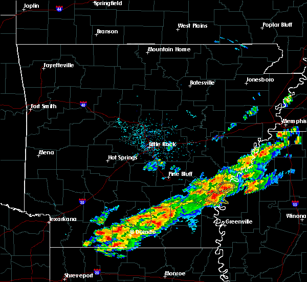 At 1246 am cst, severe thunderstorms were located along a line extending from 7 miles northwest of gunnison to near yancopin, moving northeast at 45 mph (radar indicated). Hazards include 60 mph wind gusts and quarter size hail. Hail damage to vehicles is expected. Expect wind damage to roofs, siding, and trees. At 1246 am cst, severe thunderstorms were located along a line extending from 7 miles northwest of gunnison to near yancopin, moving northeast at 45 mph (radar indicated). Hazards include 60 mph wind gusts and quarter size hail. Hail damage to vehicles is expected. Expect wind damage to roofs, siding, and trees.
|
| 12/23/2015 3:52 PM CST | At 351 pm cst, a severe thunderstorm capable of producing a tornado was located over arkansas city, or 11 miles south of rohwer, moving northeast at 55 mph (radar indicated rotation). Hazards include tornado. Flying debris will be dangerous to those caught without shelter. mobile homes will be damaged or destroyed. damage to roofs, windows and vehicles will occur. tree damage is likely. this dangerous storm will be near, scott around 400 pm cst. benoit around 405 pm cst. rosedale around 415 pm cst. Other locations impacted by this tornadic thunderstorm include beulah. |
| 12/23/2015 3:27 PM CST | At 326 pm cst, a severe thunderstorm capable of producing a tornado was located 9 miles north of montrose, or 9 miles southwest of dermott, moving northeast at 55 mph (radar indicated rotation). Hazards include tornado. Flying debris will be dangerous to those caught without shelter. mobile homes will be damaged or destroyed. damage to roofs, windows and vehicles will occur. tree damage is likely. this dangerous storm will be near, dermott around 335 pm cst. scott and jersey point around 400 pm cst. benoit around 405 pm cst. Other locations impacted by this tornadic thunderstorm include beulah. |
| 12/23/2015 3:27 PM CST | At 326 pm cst, a severe thunderstorm capable of producing a tornado was located 9 miles north of montrose, or 9 miles southwest of dermott, moving northeast at 55 mph (radar indicated rotation). Hazards include tornado. Flying debris will be dangerous to those caught without shelter. mobile homes will be damaged or destroyed. damage to roofs, windows and vehicles will occur. tree damage is likely. this dangerous storm will be near, dermott around 335 pm cst. scott and jersey point around 400 pm cst. benoit around 405 pm cst. Other locations impacted by this tornadic thunderstorm include beulah. |
| 11/17/2015 4:55 PM CST |
 At 454 pm cst, severe thunderstorms were located along a line extending from near crumrod to near deeson to near rosedale, moving northeast at 30 mph (radar indicated). Hazards include 60 mph wind gusts. Expect damage to roofs. siding and trees. these severe storms will be near, shelby around 515 pm cst. other locations impacted by these severe thunderstorms include beulah, duncan, alligator and winstonville. A tornado watch remains in effect until 800 pm cst for northwestern mississippi. At 454 pm cst, severe thunderstorms were located along a line extending from near crumrod to near deeson to near rosedale, moving northeast at 30 mph (radar indicated). Hazards include 60 mph wind gusts. Expect damage to roofs. siding and trees. these severe storms will be near, shelby around 515 pm cst. other locations impacted by these severe thunderstorms include beulah, duncan, alligator and winstonville. A tornado watch remains in effect until 800 pm cst for northwestern mississippi.
|
| 11/17/2015 4:42 PM CST | Power lines down ne of rosedal in bolivar county MS, 4.2 miles SW of Rosedale, MS |
| 11/17/2015 4:36 PM CST |
 At 435 pm cst, severe thunderstorms were located along a line extending from near crumrod to rosedale, moving east at 55 mph (radar indicated). Hazards include 60 mph wind gusts. Expect damage to roofs. siding and trees. these severe storms will be near, gunnison around 440 pm cst. deeson around 450 pm cst. shelby and mound bayou around 455 pm cst. other locations impacted by these severe thunderstorms include beulah, duncan, alligator and winstonville. A tornado watch remains in effect until 800 pm cst for northwestern mississippi. At 435 pm cst, severe thunderstorms were located along a line extending from near crumrod to rosedale, moving east at 55 mph (radar indicated). Hazards include 60 mph wind gusts. Expect damage to roofs. siding and trees. these severe storms will be near, gunnison around 440 pm cst. deeson around 450 pm cst. shelby and mound bayou around 455 pm cst. other locations impacted by these severe thunderstorms include beulah, duncan, alligator and winstonville. A tornado watch remains in effect until 800 pm cst for northwestern mississippi.
|
| 11/17/2015 4:35 PM CST |
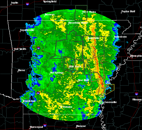 At 434 pm cst, severe thunderstorms were located along a line extending from near st. charles to 7 miles northeast of trusten holder wma to near jersey point, moving northeast at 45 mph (radar indicated). Hazards include 70 mph wind gusts. Expect considerable tree damage. damage is likely to mobile homes, roofs and outbuildings. locations impacted include, st. charles, trusten holder wma, lucca landing, weber, ethel, de luce and indian bay. A tornado watch remains in effect until 600 pm cst for southeastern arkansas. At 434 pm cst, severe thunderstorms were located along a line extending from near st. charles to 7 miles northeast of trusten holder wma to near jersey point, moving northeast at 45 mph (radar indicated). Hazards include 70 mph wind gusts. Expect considerable tree damage. damage is likely to mobile homes, roofs and outbuildings. locations impacted include, st. charles, trusten holder wma, lucca landing, weber, ethel, de luce and indian bay. A tornado watch remains in effect until 600 pm cst for southeastern arkansas.
|
| 11/17/2015 4:18 PM CST |
 At 418 pm cst, severe thunderstorms were located along a line extending from yancopin to near lucca landing, moving northeast at 55 mph (radar indicated). Hazards include 60 mph wind gusts. Expect damage to roofs. siding and trees. severe thunderstorms will be near, rosedale around 435 pm cst. gunnison around 445 pm cst. deeson around 450 pm cst. other locations impacted by these severe thunderstorms include beulah, pace, duncan, alligator and winstonville. A tornado watch remains in effect until 800 pm cst for southeastern arkansas and northwestern mississippi. At 418 pm cst, severe thunderstorms were located along a line extending from yancopin to near lucca landing, moving northeast at 55 mph (radar indicated). Hazards include 60 mph wind gusts. Expect damage to roofs. siding and trees. severe thunderstorms will be near, rosedale around 435 pm cst. gunnison around 445 pm cst. deeson around 450 pm cst. other locations impacted by these severe thunderstorms include beulah, pace, duncan, alligator and winstonville. A tornado watch remains in effect until 800 pm cst for southeastern arkansas and northwestern mississippi.
|
| 11/17/2015 3:57 PM CST |
 At 357 pm cst, severe thunderstorms were located along a line extending from 6 miles west of de witt to near omega to 6 miles west of mcmillan corner, moving northeast at 45 mph (radar indicated). Hazards include 70 mph wind gusts. Expect considerable tree damage. Damage is likely to mobile homes, roofs and outbuildings. At 357 pm cst, severe thunderstorms were located along a line extending from 6 miles west of de witt to near omega to 6 miles west of mcmillan corner, moving northeast at 45 mph (radar indicated). Hazards include 70 mph wind gusts. Expect considerable tree damage. Damage is likely to mobile homes, roofs and outbuildings.
|
| 8/5/2015 4:15 PM CDT | Report of power pole blown down in rosedale. time estimated on rada in bolivar county MS, 0.4 miles WNW of Rosedale, MS |
| 6/30/2015 4:35 AM CDT |
 At 433 am cdt, severe thunderstorms were located along a line extending from morgan pt rec area to 5 miles northwest of kelso to 5 miles west of rohwer to 8 miles southwest of tillar, and moving southeast at 40 mph (radar indicated). Hazards include 60 mph wind gusts and quarter size hail. Hail damage to vehicles is expected. Expect wind damage to roofs, siding and trees. At 433 am cdt, severe thunderstorms were located along a line extending from morgan pt rec area to 5 miles northwest of kelso to 5 miles west of rohwer to 8 miles southwest of tillar, and moving southeast at 40 mph (radar indicated). Hazards include 60 mph wind gusts and quarter size hail. Hail damage to vehicles is expected. Expect wind damage to roofs, siding and trees.
|
| 6/30/2015 4:17 AM CDT |
 At 414 am cdt, severe thunderstorms were located along a line extending from 6 miles north of back gate to dumas to omega to 9 miles northeast of monticello, and moving southeast at 40 mph (radar indicated). Hazards include 60 mph wind gusts and quarter size hail. Hail damage to vehicles is expected. Expect wind damage to roofs, siding and trees. At 414 am cdt, severe thunderstorms were located along a line extending from 6 miles north of back gate to dumas to omega to 9 miles northeast of monticello, and moving southeast at 40 mph (radar indicated). Hazards include 60 mph wind gusts and quarter size hail. Hail damage to vehicles is expected. Expect wind damage to roofs, siding and trees.
|
| 5/24/2015 6:06 PM CDT | At 604 pm cdt, severe thunderstorms were located along a line extending from st. charles to gunnison, and moving northeast at 50 mph (radar indicated). Hazards include 60 mph wind gusts. Expect damage to roofs. Siding and trees. |
| 5/24/2015 6:04 PM CDT | At 603 pm cdt, severe thunderstorms were located along a line extending from near rosedale to near holly ridge, moving northeast at 50 mph (radar indicated). Hazards include 60 mph wind gusts. Expect damage to roofs. siding and trees. these severe storms will be near, cleveland, boyle and gunnison around 615 pm cdt. other locations impacted by these severe thunderstorms include merigold, doddsville, pace, duncan, alligator and winstonville. A tornado watch remains in effect until 800 pm cdt for northwestern mississippi. |
| 5/24/2015 5:48 PM CDT | At 547 pm cdt, severe thunderstorms were located along a line extending from near rosedale to near sunflower, moving northeast at 40 mph (radar indicated). Hazards include 60 mph wind gusts. Expect damage to roofs. siding and trees. these severe storms will be near, gunnison around 555 pm cdt. ruleville and deeson around 605 pm cdt. drew around 610 pm cdt. parchman around 615 pm cdt. other locations impacted by these severe thunderstorms include pace, duncan, alligator, winstonville, merigold, doddsville and beulah. A tornado watch remains in effect until 800 pm cdt for northwestern mississippi. |
| 5/24/2015 5:26 PM CDT | At 524 pm cdt, severe thunderstorms were located along a line extending from 5 miles west of gillett to arkansas city, and moving northeast at 45 mph (radar indicated). Hazards include 60 mph wind gusts. Expect damage to roofs. Siding and trees. |
| 5/24/2015 5:23 PM CDT | At 522 pm cdt, severe thunderstorms were located along a line extending from near arkansas city to near tribbett, moving north at 45 mph (radar indicated). Hazards include 60 mph wind gusts. Expect damage to roofs. siding and trees. severe thunderstorms will be near, jersey point around 530 pm cdt. rosedale around 540 pm cdt. shaw and sunflower around 545 pm cdt. gunnison and blaine around 550 pm cdt. cleveland and boyle around 555 pm cdt. ruleville around 600 pm cdt. drew around 605 pm cdt. parchman and rome around 615 pm cdt. other locations impacted by these severe thunderstorms include pace, duncan, alligator, winstonville, merigold, doddsville and beulah. A tornado watch remains in effect until 800 pm cdt for southeastern arkansas and northwestern mississippi. |
| 5/16/2015 4:25 PM CDT | At 423 pm cdt, a severe thunderstorm was located 7 miles west of rosedale, and moving north at 30 mph (radar indicated). Hazards include 60 mph wind gusts and penny size hail. Expect damage to roofs. Siding and trees. |
| 5/16/2015 4:13 PM CDT | At 409 pm cdt, a severe thunderstorm was located near lucca landing, and moving north at 25 mph (radar indicated). Hazards include 60 mph wind gusts and quarter size hail. Hail damage to vehicles is expected. Expect wind damage to roofs, siding and trees. |
| 4/24/2015 10:55 PM CDT | The severe thunderstorm warning for lincoln, southeastern jefferson, drew, desha, southeastern cleveland, northern bradley and southeastern arkansas counties will expire at 1100 pm cdt, the line of storms which prompted the warning has weakened below severe limits, and no longer poses an immediate threat to life or property. additional strong thunderstorms are still possible, and a tornado watch remains in effect until 2 am cdt. |
| 4/24/2015 10:05 PM CDT | At 1003 pm cdt, severe thunderstorms were located along a line extending from grady to star city to lanark, and moving east at 50 mph (radar indicated). Hazards include 60 mph wind gusts. Expect damage to roofs. Siding and trees. |
| 4/3/2015 5:28 PM CDT | A severe thunderstorm warning remains in effect until 600 pm cdt for northern bolivar county. at 528 pm cdt. a severe thunderstorm was located just west of shelby. moving east at 50 mph. hazard. two inch hail and 60 mph wind gusts. source. Radar indicated. |
| 4/3/2015 5:13 PM CDT | The national weather service in jackson has issued a * severe thunderstorm warning for. northern bolivar county in northwestern mississippi. until 600 pm cdt * at 513 pm cdt. a severe thunderstorm was located near gunnison. or 8 miles north of rosedale. Moving east at 30 mph. |
| 3/31/2015 3:44 PM CDT | A severe thunderstorm warning remains in effect until 430 pm cdt for southern bolivar county. at 343 pm cdt. a severe thunderstorm was located near benoit. or 9 miles south of rosedale. moving southeast at 30 mph. this is a very dangerous storm. hazard. Baseball size hail and 70 mph wind gusts. |
| 3/31/2015 3:39 PM CDT | A tornado warning remains in effect for east central desha county until 345 pm cdt. at 337 pm cdt. national weather service doppler radar continued to indicate a severe thunderstorm capable of producing a tornado. this dangerous storm was located 6 miles northeast of lucca landing. moving southeast at 30 mph. in addition to the tornado. This storm. |
| 3/31/2015 3:32 PM CDT | A severe thunderstorm warning remains in effect until 430 pm cdt for southern bolivar county. at 330 pm cdt. a severe thunderstorm was located near rosedale. moving southeast at 35 mph. this is a very dangerous storm. hazard. Baseball size hail and 70 mph wind gusts. |
| 3/31/2015 3:26 PM CDT | A tornado warning remains in effect for central desha county until 345 pm cdt. at 324 pm cdt. national weather service doppler radar continued to indicate a severe thunderstorm capable of producing a tornado. this dangerous storm was located 6 miles southeast of watson. or 8 miles northeast of rohwer. moving southeast at 35 mph. In addition to the. |
| 3/31/2015 3:22 PM CDT | A severe thunderstorm warning remains in effect until 430 pm cdt for southern bolivar county. at 321 pm cdt. a severe thunderstorm was located near rosedale. moving southeast at 35 mph. this is a very dangerous storm. hazard. Baseball size hail and 60 mph wind gusts. |
| 3/31/2015 3:13 PM CDT | A tornado warning remains in effect for desha and south central arkansas counties until 345 pm cdt. at 311 pm cdt. national weather service doppler radar continued to indicate a severe thunderstorm capable of producing a tornado. this dangerous storm was located 2 miles northwest of watson. or 11 miles north of rohwer. moving southeast at 30 mph. In addition to the. |
| 3/31/2015 3:09 PM CDT | The national weather service in jackson has issued a * severe thunderstorm warning for. southern bolivar county in northwestern mississippi. until 430 pm cdt * at 309 pm cdt. a severe thunderstorm was located over yancopin. or 9 miles northwest of rosedale. Moving southeast at 35 mph. |
| 3/31/2015 2:59 PM CDT | The national weather service in little rock has issued a * tornado warning for. desha county in southeast arkansas. south central arkansas county in southeast arkansas. until 345 pm cdt * at 256 pm cdt. National weather service doppler radar indicated a. |
| 3/31/2013 4:46 AM CDT | Power outage was reported for two house in bolivar county MS, 0.4 miles WNW of Rosedale, MS |
| 1/1/0001 12:00 AM | A utility pole was downed along hwy 1 north of rosedale in bolivar county MS, 1.1 miles WSW of Rosedale, MS |
| 1/1/0001 12:00 AM | Multiple trees downed in rosedale...including one that fell on a house...and one blocking a roa in bolivar county MS, 0.4 miles WNW of Rosedale, MS |
| 1/1/0001 12:00 AM | A few power lines dow in bolivar county MS, 0.4 miles WNW of Rosedale, MS |
Hail Maps for Rosedale, MS
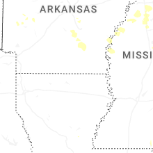
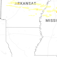
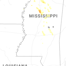


Connect with Interactive Hail Maps