

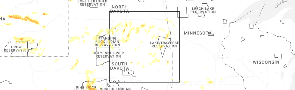
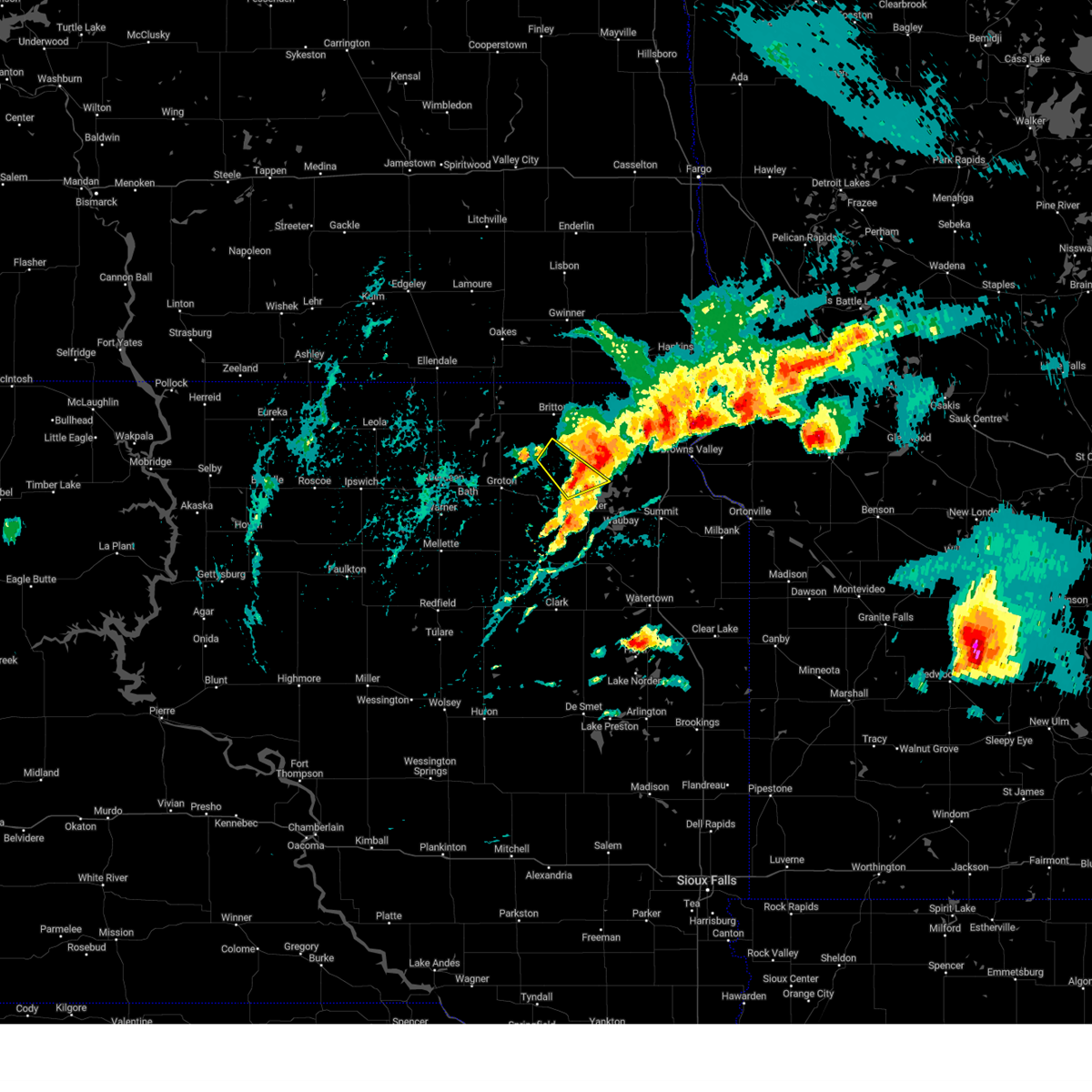
Hail Map for Roslyn, SD
The Roslyn, SD area has had 3 reports of on-the-ground hail by trained spotters, and has been under severe weather warnings 9 times during the past 12 months. Doppler radar has detected hail at or near Roslyn, SD on 38 occasions, including 2 occasions during the past year.
| Name: | Roslyn, SD |
| Where Located: | 48.5 miles E of Aberdeen, SD |
| Map: | Google Map for Roslyn, SD |
| Population: | 183 |
| Housing Units: | 105 |
| More Info: | Search Google for Roslyn, SD |
0
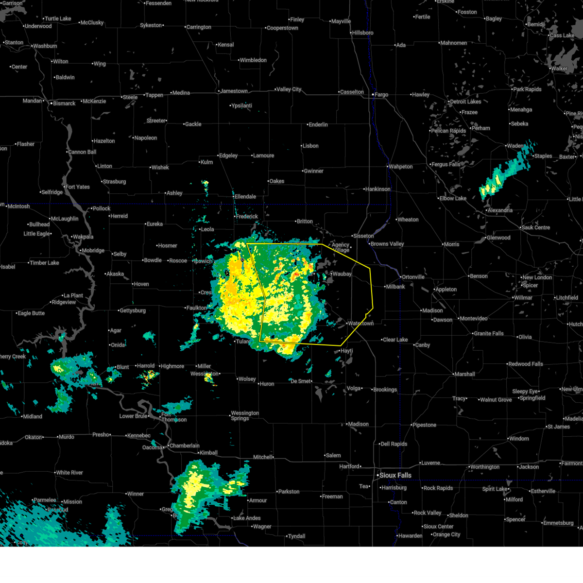
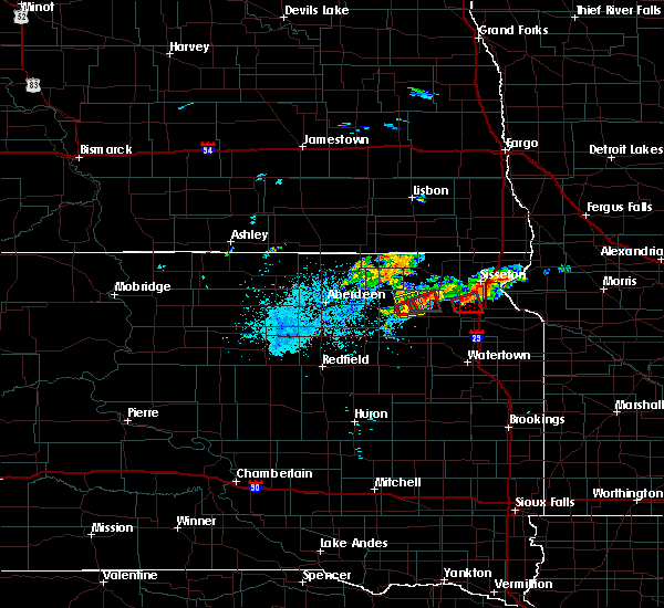
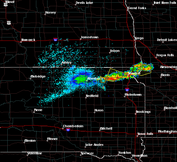
The Top Recent Hail Date for Roslyn, SD is Sunday, June 15, 2025 (38th out of 38)
Hail and Wind Damage Spotted near Roslyn, SD
| Date / Time | Report Details |
|---|---|
| 6/29/2025 10:15 PM CDT |
 the severe thunderstorm warning has been cancelled and is no longer in effect the severe thunderstorm warning has been cancelled and is no longer in effect
|
| 6/29/2025 9:52 PM CDT |
 At 951 pm cdt, severe thunderstorms were located along a line extending from putney to near bristol to near bradley to fordham colony, moving east at 50 mph (radar indicated). Hazards include 60 mph wind gusts. Expect damage to roofs, siding, and trees. Locations impacted include, groton, clark, bristol, pierpont, hillcrest colony, andover, bradley, garden city, butler, lily, webster, wallace, antelope lake, henry, naples, long lake, grass lake, waubay lake, medicine lake, florence, minnewasta lake, bitter lake, rush lake, tinkertown, watertown, waubay, goose lake, roslyn, hazel, lake kampeska, blue dog lake, waubay wildlife rec area, memorial park camping site, enemy swim housing, rauville, ortley, grenville, enemy swim lake, campbell slough, pelican lake, sandy shore rec area, dakota sioux casino, kellerton church, opitz lake, thomas, summit, waverly, rudebusch corner and pickerel lake rec area. At 951 pm cdt, severe thunderstorms were located along a line extending from putney to near bristol to near bradley to fordham colony, moving east at 50 mph (radar indicated). Hazards include 60 mph wind gusts. Expect damage to roofs, siding, and trees. Locations impacted include, groton, clark, bristol, pierpont, hillcrest colony, andover, bradley, garden city, butler, lily, webster, wallace, antelope lake, henry, naples, long lake, grass lake, waubay lake, medicine lake, florence, minnewasta lake, bitter lake, rush lake, tinkertown, watertown, waubay, goose lake, roslyn, hazel, lake kampeska, blue dog lake, waubay wildlife rec area, memorial park camping site, enemy swim housing, rauville, ortley, grenville, enemy swim lake, campbell slough, pelican lake, sandy shore rec area, dakota sioux casino, kellerton church, opitz lake, thomas, summit, waverly, rudebusch corner and pickerel lake rec area.
|
| 6/29/2025 9:30 PM CDT |
 Svrabr the national weather service in aberdeen has issued a * severe thunderstorm warning for, southwestern roberts county in northeastern south dakota, southwestern marshall county in northeastern south dakota, day county in northeastern south dakota, southern brown county in northeastern south dakota, northwestern hamlin county in northeastern south dakota, western grant county in northeastern south dakota, clark county in northeastern south dakota, spink county in northeastern south dakota, codington county in northeastern south dakota, * until 1030 pm cdt. * at 929 pm cdt, severe thunderstorms were located along a line extending from near richmond lake rec area to near groton to turton to near glendale colony, moving east at 50 mph (radar indicated). Hazards include 60 mph wind gusts. Expect damage to roofs, siding, and trees. severe thunderstorms will be near, aberdeen, groton, doland, glendale colony, bath, putney, andover, raymond, crandall, and tacoma park around 935 pm cdt. crocker around 940 pm cdt. bristol, pierpont, hillside colony, clark colony, butler, and lily around 945 pm cdt. Other locations in the path of these severe thunderstorms include clark, hillcrest colony, bradley, fordham colony, swan lake, holmquist, webster, wallace, garden city, grass lake, antelope lake, waubay lake, silver lake, florence, henry, roslyn, long lake, minnewasta lake, bitter lake, rush lake, medicine lake, waubay, enemy swim housing, grenville, naples, enemy swim lake, campbell slough, blue dog lake and waubay wildlife rec area. Svrabr the national weather service in aberdeen has issued a * severe thunderstorm warning for, southwestern roberts county in northeastern south dakota, southwestern marshall county in northeastern south dakota, day county in northeastern south dakota, southern brown county in northeastern south dakota, northwestern hamlin county in northeastern south dakota, western grant county in northeastern south dakota, clark county in northeastern south dakota, spink county in northeastern south dakota, codington county in northeastern south dakota, * until 1030 pm cdt. * at 929 pm cdt, severe thunderstorms were located along a line extending from near richmond lake rec area to near groton to turton to near glendale colony, moving east at 50 mph (radar indicated). Hazards include 60 mph wind gusts. Expect damage to roofs, siding, and trees. severe thunderstorms will be near, aberdeen, groton, doland, glendale colony, bath, putney, andover, raymond, crandall, and tacoma park around 935 pm cdt. crocker around 940 pm cdt. bristol, pierpont, hillside colony, clark colony, butler, and lily around 945 pm cdt. Other locations in the path of these severe thunderstorms include clark, hillcrest colony, bradley, fordham colony, swan lake, holmquist, webster, wallace, garden city, grass lake, antelope lake, waubay lake, silver lake, florence, henry, roslyn, long lake, minnewasta lake, bitter lake, rush lake, medicine lake, waubay, enemy swim housing, grenville, naples, enemy swim lake, campbell slough, blue dog lake and waubay wildlife rec area.
|
| 7/31/2024 5:19 PM CDT |
 the severe thunderstorm warning has been cancelled and is no longer in effect the severe thunderstorm warning has been cancelled and is no longer in effect
|
| 7/31/2024 4:57 PM CDT | At 457 pm cdt, a severe thunderstorm was located near pierpont, or 7 miles southeast of langford, moving northeast at 25 mph (radar indicated). Hazards include 60 mph wind gusts and quarter size hail. Hail damage to vehicles is expected. expect wind damage to roofs, siding, and trees. Locations impacted include, langford and roslyn. |
| 7/31/2024 4:46 PM CDT | At 446 pm cdt, a severe thunderstorm was located over pierpont, or near langford, moving northeast at 30 mph (radar indicated). Hazards include golf ball size hail and 60 mph wind gusts. People and animals outdoors will be injured. expect hail damage to roofs, siding, windows, and vehicles. expect wind damage to roofs, siding, and trees. Locations impacted include, langford. |
| 7/31/2024 4:28 PM CDT | Svrabr the national weather service in aberdeen has issued a * severe thunderstorm warning for, northern day county in northeastern south dakota, south central marshall county in northeastern south dakota, * until 530 pm cdt. * at 428 pm cdt, a severe thunderstorm was located near pierpont, or 8 miles northwest of bristol, moving northeast at 15 mph (radar indicated). Hazards include 60 mph wind gusts and half dollar size hail. Hail damage to vehicles is expected. expect wind damage to roofs, siding, and trees. This severe thunderstorm will be near, pierpont around 435 pm cdt. |
| 7/31/2024 11:34 AM CDT |
 At 1134 am cdt, severe thunderstorms were located along a line extending from near pierpont to holmquist to swan lake, moving northeast at 30 mph (radar indicated). Hazards include 70 mph wind gusts and nickel size hail. Expect considerable tree damage. damage is likely to mobile homes, roofs, and outbuildings. Locations impacted include, webster, waubay lake, antelope lake, roslyn, rush lake, bitter lake, opitz lake, minnewasta lake, waubay, grenville, blue dog lake and waubay wildlife rec area. At 1134 am cdt, severe thunderstorms were located along a line extending from near pierpont to holmquist to swan lake, moving northeast at 30 mph (radar indicated). Hazards include 70 mph wind gusts and nickel size hail. Expect considerable tree damage. damage is likely to mobile homes, roofs, and outbuildings. Locations impacted include, webster, waubay lake, antelope lake, roslyn, rush lake, bitter lake, opitz lake, minnewasta lake, waubay, grenville, blue dog lake and waubay wildlife rec area.
|
| 7/31/2024 11:18 AM CDT |
 Svrabr the national weather service in aberdeen has issued a * severe thunderstorm warning for, day county in northeastern south dakota, northeastern clark county in northeastern south dakota, northwestern codington county in northeastern south dakota, * until noon cdt. * at 1118 am cdt, severe thunderstorms were located along a line extending from near andover to butler to near bradley, moving northeast at 30 mph (radar indicated). Hazards include 60 mph wind gusts and quarter size hail. Hail damage to vehicles is expected. expect wind damage to roofs, siding, and trees. severe thunderstorms will be near, bristol, pierpont, swan lake, and holmquist around 1125 am cdt. webster and antelope lake around 1130 am cdt. waubay lake around 1135 am cdt. Other locations in the path of these severe thunderstorms include bitter lake and roslyn. Svrabr the national weather service in aberdeen has issued a * severe thunderstorm warning for, day county in northeastern south dakota, northeastern clark county in northeastern south dakota, northwestern codington county in northeastern south dakota, * until noon cdt. * at 1118 am cdt, severe thunderstorms were located along a line extending from near andover to butler to near bradley, moving northeast at 30 mph (radar indicated). Hazards include 60 mph wind gusts and quarter size hail. Hail damage to vehicles is expected. expect wind damage to roofs, siding, and trees. severe thunderstorms will be near, bristol, pierpont, swan lake, and holmquist around 1125 am cdt. webster and antelope lake around 1130 am cdt. waubay lake around 1135 am cdt. Other locations in the path of these severe thunderstorms include bitter lake and roslyn.
|
| 6/2/2024 8:44 PM CDT |
 Svrabr the national weather service in aberdeen has issued a * severe thunderstorm warning for, northeastern day county in northeastern south dakota, southeastern marshall county in northeastern south dakota, * until 930 pm cdt. * at 844 pm cdt, a severe thunderstorm was located near opitz lake, or 11 miles east of langford, moving east at 25 mph (radar indicated). Hazards include golf ball size hail and 60 mph wind gusts. People and animals outdoors will be injured. expect hail damage to roofs, siding, windows, and vehicles. expect wind damage to roofs, siding, and trees. this severe thunderstorm will be near, roslyn, eden, opitz lake, cattail lake, and fort sisseton state park around 850 pm cdt. piyas lake around 855 pm cdt. buffalo lakes around 900 pm cdt. Other locations in the path of this severe thunderstorm include pickerel lake rec area. Svrabr the national weather service in aberdeen has issued a * severe thunderstorm warning for, northeastern day county in northeastern south dakota, southeastern marshall county in northeastern south dakota, * until 930 pm cdt. * at 844 pm cdt, a severe thunderstorm was located near opitz lake, or 11 miles east of langford, moving east at 25 mph (radar indicated). Hazards include golf ball size hail and 60 mph wind gusts. People and animals outdoors will be injured. expect hail damage to roofs, siding, windows, and vehicles. expect wind damage to roofs, siding, and trees. this severe thunderstorm will be near, roslyn, eden, opitz lake, cattail lake, and fort sisseton state park around 850 pm cdt. piyas lake around 855 pm cdt. buffalo lakes around 900 pm cdt. Other locations in the path of this severe thunderstorm include pickerel lake rec area.
|
| 8/10/2023 7:08 PM CDT |
 The severe thunderstorm warning for central day and north central clark counties will expire at 715 pm cdt, the storms which prompted the warning have moved out of the area. therefore, the warning will be allowed to expire. a severe thunderstorm watch remains in effect until 1100 pm cdt for northeastern south dakota. The severe thunderstorm warning for central day and north central clark counties will expire at 715 pm cdt, the storms which prompted the warning have moved out of the area. therefore, the warning will be allowed to expire. a severe thunderstorm watch remains in effect until 1100 pm cdt for northeastern south dakota.
|
| 8/10/2023 6:28 PM CDT |
 At 628 pm cdt, severe thunderstorms were located along a line extending from 7 miles east of pierpont to near crocker, moving northeast at 30 mph (radar indicated). Hazards include 60 mph wind gusts and nickel size hail. Expect damage to roofs, siding, and trees. severe thunderstorms will be near, roslyn around 645 pm cdt. other locations in the path of these severe thunderstorms include holmquist, webster, antelope lake, grenville, minnewasta lake, waubay lake and rush lake. hail threat, radar indicated max hail size, 0. 88 in wind threat, radar indicated max wind gust, 60 mph. At 628 pm cdt, severe thunderstorms were located along a line extending from 7 miles east of pierpont to near crocker, moving northeast at 30 mph (radar indicated). Hazards include 60 mph wind gusts and nickel size hail. Expect damage to roofs, siding, and trees. severe thunderstorms will be near, roslyn around 645 pm cdt. other locations in the path of these severe thunderstorms include holmquist, webster, antelope lake, grenville, minnewasta lake, waubay lake and rush lake. hail threat, radar indicated max hail size, 0. 88 in wind threat, radar indicated max wind gust, 60 mph.
|
| 4/19/2023 2:49 AM CDT |
 At 248 am cdt, severe thunderstorms were located along a line extending from britton to 6 miles west of opitz lake to near antelope lake, moving east at 50 mph (radar indicated). Hazards include 60 mph wind gusts. Expect damage to roofs, siding, and trees. severe thunderstorms will be near, roslyn, opitz lake and fort sisseton state park around 255 am cdt. eden, rush lake, cattail lake, minnewasta lake and roy lake rec area around 300 am cdt. waubay, lake city, blue dog lake, piyas lake, waubay lake, waubay wildlife rec area and bitter lake around 305 am cdt. other locations in the path of these severe thunderstorms include enemy swim housing, ortley, buffalo lakes, red iron housing, clear lake rec area, hillhead, campbell slough, enemy swim lake, pickerel lake rec area, veblen, long hollow housing, rudebusch corner, veblen flats housing, sica hollow state park, finley heights housing, sisseton, claire city, dakota connection & casino, peever and peever flats housing. hail threat, radar indicated max hail size, <. 75 in wind threat, radar indicated max wind gust, 60 mph. At 248 am cdt, severe thunderstorms were located along a line extending from britton to 6 miles west of opitz lake to near antelope lake, moving east at 50 mph (radar indicated). Hazards include 60 mph wind gusts. Expect damage to roofs, siding, and trees. severe thunderstorms will be near, roslyn, opitz lake and fort sisseton state park around 255 am cdt. eden, rush lake, cattail lake, minnewasta lake and roy lake rec area around 300 am cdt. waubay, lake city, blue dog lake, piyas lake, waubay lake, waubay wildlife rec area and bitter lake around 305 am cdt. other locations in the path of these severe thunderstorms include enemy swim housing, ortley, buffalo lakes, red iron housing, clear lake rec area, hillhead, campbell slough, enemy swim lake, pickerel lake rec area, veblen, long hollow housing, rudebusch corner, veblen flats housing, sica hollow state park, finley heights housing, sisseton, claire city, dakota connection & casino, peever and peever flats housing. hail threat, radar indicated max hail size, <. 75 in wind threat, radar indicated max wind gust, 60 mph.
|
| 6/20/2022 9:56 PM CDT |
 At 956 pm cdt, severe thunderstorms were located along a line extending from near webster to garden city to near bryant, moving east at 50 mph (radar indicated). Hazards include 60 mph wind gusts. Expect damage to roofs, siding, and trees. severe thunderstorms will be near, webster, henry and roslyn around 1000 pm cdt. wallace, grenville, waubay lake, minnewasta lake, long lake, rush lake and tinkertown around 1005 pm cdt. waubay, florence, enemy swim housing, campbell slough, medicine lake, waubay wildlife rec area, enemy swim lake, pickerel lake rec area, blue dog lake and hamlin education center around 1010 pm cdt. lake norden, hayti, ortley, memorial park camping site, sandy shore rec area and lake kampeska around 1015 pm cdt. other locations in the path of these severe thunderstorms include watertown, rauville, dakota sioux casino, rudebusch corner, lake albert, watertown city park, stone bridge, finley heights housing, lake poinsett, waverly, dempster, claremont colony, estelline, south shore, troy and poinsett colony. hail threat, radar indicated max hail size, <. 75 in wind threat, radar indicated max wind gust, 60 mph. At 956 pm cdt, severe thunderstorms were located along a line extending from near webster to garden city to near bryant, moving east at 50 mph (radar indicated). Hazards include 60 mph wind gusts. Expect damage to roofs, siding, and trees. severe thunderstorms will be near, webster, henry and roslyn around 1000 pm cdt. wallace, grenville, waubay lake, minnewasta lake, long lake, rush lake and tinkertown around 1005 pm cdt. waubay, florence, enemy swim housing, campbell slough, medicine lake, waubay wildlife rec area, enemy swim lake, pickerel lake rec area, blue dog lake and hamlin education center around 1010 pm cdt. lake norden, hayti, ortley, memorial park camping site, sandy shore rec area and lake kampeska around 1015 pm cdt. other locations in the path of these severe thunderstorms include watertown, rauville, dakota sioux casino, rudebusch corner, lake albert, watertown city park, stone bridge, finley heights housing, lake poinsett, waverly, dempster, claremont colony, estelline, south shore, troy and poinsett colony. hail threat, radar indicated max hail size, <. 75 in wind threat, radar indicated max wind gust, 60 mph.
|
| 5/30/2022 2:55 AM CDT |
 The severe thunderstorm warning for northeastern day county will expire at 300 am cdt, the storm which prompted the warning has weakened below severe limits, and no longer poses an immediate threat to life or property. therefore, the warning will be allowed to expire. however small hail and gusty winds are still possible with this thunderstorm. a severe thunderstorm watch remains in effect until 800 am cdt for northeastern south dakota. The severe thunderstorm warning for northeastern day county will expire at 300 am cdt, the storm which prompted the warning has weakened below severe limits, and no longer poses an immediate threat to life or property. therefore, the warning will be allowed to expire. however small hail and gusty winds are still possible with this thunderstorm. a severe thunderstorm watch remains in effect until 800 am cdt for northeastern south dakota.
|
| 5/30/2022 2:49 AM CDT |
 At 249 am cdt, a severe thunderstorm was located over pickerel lake rec area, or 14 miles northeast of webster, moving north at 30 mph (trained weather spotters). Hazards include 60 mph wind gusts and quarter size hail. Hail damage to vehicles is expected. expect wind damage to roofs, siding, and trees. locations impacted include, webster, waubay, roslyn, grenville, enemy swim housing, waubay lake, minnewasta lake, blue dog lake, waubay wildlife rec area, enemy swim lake, antelope lake, campbell slough, rush lake, pickerel lake rec area, opitz lake, bitter lake, piyas lake and western lake traverse reservation. hail threat, radar indicated max hail size, 1. 00 in wind threat, radar indicated max wind gust, 60 mph. At 249 am cdt, a severe thunderstorm was located over pickerel lake rec area, or 14 miles northeast of webster, moving north at 30 mph (trained weather spotters). Hazards include 60 mph wind gusts and quarter size hail. Hail damage to vehicles is expected. expect wind damage to roofs, siding, and trees. locations impacted include, webster, waubay, roslyn, grenville, enemy swim housing, waubay lake, minnewasta lake, blue dog lake, waubay wildlife rec area, enemy swim lake, antelope lake, campbell slough, rush lake, pickerel lake rec area, opitz lake, bitter lake, piyas lake and western lake traverse reservation. hail threat, radar indicated max hail size, 1. 00 in wind threat, radar indicated max wind gust, 60 mph.
|
| 5/30/2022 2:35 AM CDT |
 At 234 am cdt, a severe thunderstorm was located over webster, moving north at 45 mph (trained weather spotters). Hazards include 60 mph wind gusts. Expect damage to roofs, siding, and trees. locations impacted include, roslyn and opitz lake. hail threat, radar indicated max hail size, <. 75 in wind threat, radar indicated max wind gust, 60 mph. At 234 am cdt, a severe thunderstorm was located over webster, moving north at 45 mph (trained weather spotters). Hazards include 60 mph wind gusts. Expect damage to roofs, siding, and trees. locations impacted include, roslyn and opitz lake. hail threat, radar indicated max hail size, <. 75 in wind threat, radar indicated max wind gust, 60 mph.
|
| 5/30/2022 2:15 AM CDT | At 215 am cdt, a severe thunderstorm was located near swan lake, or 12 miles south of webster, moving north at 45 mph (trained weather spotters). Hazards include 60 mph wind gusts. Expect damage to roofs, siding, and trees. this severe thunderstorm will be near, antelope lake around 225 am cdt. webster around 235 am cdt. other locations in the path of this severe thunderstorm include roslyn and opitz lake. hail threat, radar indicated max hail size, <. 75 in wind threat, radar indicated max wind gust, 60 mph. |
| 5/12/2022 6:37 PM CDT |
 The severe thunderstorm warning for northwestern deuel, southwestern roberts, day, southeastern brown, northern hamlin, grant, northern clark, northeastern spink and codington counties will expire at 645 pm cdt, the storms which prompted the warning have moved out of the area. therefore, the warning will be allowed to expire. a tornado watch remains in effect until 1000 pm cdt for northeastern south dakota. remember, severe thunderstorm and tornado warnings remains in effect for portions of brown, day, grant, and roberts counties. The severe thunderstorm warning for northwestern deuel, southwestern roberts, day, southeastern brown, northern hamlin, grant, northern clark, northeastern spink and codington counties will expire at 645 pm cdt, the storms which prompted the warning have moved out of the area. therefore, the warning will be allowed to expire. a tornado watch remains in effect until 1000 pm cdt for northeastern south dakota. remember, severe thunderstorm and tornado warnings remains in effect for portions of brown, day, grant, and roberts counties.
|
| 5/12/2022 6:29 PM CDT |
 At 629 pm cdt, severe thunderstorms capable of producing both tornadoes and extensive straight line wind damage were located along a line extending from near andover to near pierpont to 8 miles northeast of bristol to near roslyn to near waubay lake to near blue dog lake, moving north at 50 mph (radar indicated rotation). Hazards include tornado. Flying debris will be dangerous to those caught without shelter. mobile homes will be damaged or destroyed. damage to roofs, windows, and vehicles will occur. tree damage is likely. these dangerous storms will be near, langford and opitz lake around 640 pm cdt. eden, piyas lake, cattail lake and fort sisseton state park around 645 pm cdt. Other locations in the path of these tornadic storms include roy lake rec area, buffalo lakes, lake city, amherst, red iron housing, clear lake rec area, britton, sica hollow state park and hillhead. At 629 pm cdt, severe thunderstorms capable of producing both tornadoes and extensive straight line wind damage were located along a line extending from near andover to near pierpont to 8 miles northeast of bristol to near roslyn to near waubay lake to near blue dog lake, moving north at 50 mph (radar indicated rotation). Hazards include tornado. Flying debris will be dangerous to those caught without shelter. mobile homes will be damaged or destroyed. damage to roofs, windows, and vehicles will occur. tree damage is likely. these dangerous storms will be near, langford and opitz lake around 640 pm cdt. eden, piyas lake, cattail lake and fort sisseton state park around 645 pm cdt. Other locations in the path of these tornadic storms include roy lake rec area, buffalo lakes, lake city, amherst, red iron housing, clear lake rec area, britton, sica hollow state park and hillhead.
|
| 5/12/2022 6:28 PM CDT |
 At 628 pm cdt, severe thunderstorms were located along a line extending from near putney to rudebusch corner, moving north at 65 mph (trained weather spotters). Hazards include 70 mph wind gusts and penny size hail. Expect considerable tree damage. damage is likely to mobile homes, roofs, and outbuildings. severe thunderstorms will be near, houghton and buffalo lakes around 640 pm cdt. sand lake wildlife refuge around 645 pm cdt. Other locations in the path of these severe thunderstorms include hecla and sica hollow state park. At 628 pm cdt, severe thunderstorms were located along a line extending from near putney to rudebusch corner, moving north at 65 mph (trained weather spotters). Hazards include 70 mph wind gusts and penny size hail. Expect considerable tree damage. damage is likely to mobile homes, roofs, and outbuildings. severe thunderstorms will be near, houghton and buffalo lakes around 640 pm cdt. sand lake wildlife refuge around 645 pm cdt. Other locations in the path of these severe thunderstorms include hecla and sica hollow state park.
|
| 5/12/2022 5:51 PM CDT |
 At 548 pm cdt, severe thunderstorms were located along a line extending from near camrose colony to clark to near hayti, moving north at 50 mph. these are destructive storms for codington, clark, day, grant counties (trained weather spotters. 70 to 80 mph winds were reported near lake poinsett). Hazards include 80 mph wind gusts and quarter size hail. Flying debris will be dangerous to those caught without shelter. mobile homes will be heavily damaged. expect considerable damage to roofs, windows, and vehicles. extensive tree damage and power outages are likely. severe thunderstorms will be near, garden city and hillcrest colony around 555 pm cdt. brentford and goose lake around 600 pm cdt. conde, bradley, pelican lake, lake kampeska, sandy shore rec area, memorial park camping site and crocker around 605 pm cdt. Other locations in the path of these severe thunderstorms include watertown, wallace, verdon, lily, swan lake, watertown city park, rauville, butler, dakota sioux casino, waverly, ferney, antelope lake, webster, groton, south shore, andover and rush lake. At 548 pm cdt, severe thunderstorms were located along a line extending from near camrose colony to clark to near hayti, moving north at 50 mph. these are destructive storms for codington, clark, day, grant counties (trained weather spotters. 70 to 80 mph winds were reported near lake poinsett). Hazards include 80 mph wind gusts and quarter size hail. Flying debris will be dangerous to those caught without shelter. mobile homes will be heavily damaged. expect considerable damage to roofs, windows, and vehicles. extensive tree damage and power outages are likely. severe thunderstorms will be near, garden city and hillcrest colony around 555 pm cdt. brentford and goose lake around 600 pm cdt. conde, bradley, pelican lake, lake kampeska, sandy shore rec area, memorial park camping site and crocker around 605 pm cdt. Other locations in the path of these severe thunderstorms include watertown, wallace, verdon, lily, swan lake, watertown city park, rauville, butler, dakota sioux casino, waverly, ferney, antelope lake, webster, groton, south shore, andover and rush lake.
|
| 5/9/2022 4:28 AM CDT |
 At 428 am cdt, a severe thunderstorm was located over minnewasta lake, or 9 miles northeast of webster, moving north at 55 mph (radar indicated). Hazards include 60 mph wind gusts and half dollar size hail. Hail damage to vehicles is expected. expect wind damage to roofs, siding, and trees. this severe thunderstorm will be near, pickerel lake rec area around 435 am cdt. eden and piyas lake around 440 am cdt. buffalo lakes around 445 am cdt. other locations in the path of this severe thunderstorm include long hollow housing, red iron housing, clear lake rec area, sica hollow state park, veblen and claire city. hail threat, radar indicated max hail size, 1. 25 in wind threat, radar indicated max wind gust, 60 mph. At 428 am cdt, a severe thunderstorm was located over minnewasta lake, or 9 miles northeast of webster, moving north at 55 mph (radar indicated). Hazards include 60 mph wind gusts and half dollar size hail. Hail damage to vehicles is expected. expect wind damage to roofs, siding, and trees. this severe thunderstorm will be near, pickerel lake rec area around 435 am cdt. eden and piyas lake around 440 am cdt. buffalo lakes around 445 am cdt. other locations in the path of this severe thunderstorm include long hollow housing, red iron housing, clear lake rec area, sica hollow state park, veblen and claire city. hail threat, radar indicated max hail size, 1. 25 in wind threat, radar indicated max wind gust, 60 mph.
|
| 10/9/2021 5:58 PM CDT |
 At 558 pm cdt, severe thunderstorms were located along a line extending from 7 miles east of ludden to near enemy swim lake to near bryant, moving east at 30 mph (radar indicated). Hazards include 60 mph wind gusts and penny size hail. Expect damage to roofs, siding, and trees. Locations impacted include, rudebusch corner, enemy swim lake, pickerel lake rec area, campbell slough, enemy swim housing, finley heights housing, lake norden, agency village, hayti and lake albert. At 558 pm cdt, severe thunderstorms were located along a line extending from 7 miles east of ludden to near enemy swim lake to near bryant, moving east at 30 mph (radar indicated). Hazards include 60 mph wind gusts and penny size hail. Expect damage to roofs, siding, and trees. Locations impacted include, rudebusch corner, enemy swim lake, pickerel lake rec area, campbell slough, enemy swim housing, finley heights housing, lake norden, agency village, hayti and lake albert.
|
| 10/9/2021 5:35 PM CDT | Trees down in roslyn. estimated 60 to 70 mph wind in day county SD, 0.2 miles SSW of Roslyn, SD |
| 10/9/2021 5:18 PM CDT |
 At 518 pm cdt, severe thunderstorms were located along a line extending from 8 miles northeast of frederick to 6 miles northwest of webster to 8 miles southeast of carpenter, moving east at 30 mph (radar indicated). Hazards include 60 mph wind gusts and penny size hail. Expect damage to roofs, siding, and trees. severe thunderstorms will be near, webster around 525 pm cdt. roslyn around 530 pm cdt. willow lake around 535 pm cdt. Other locations in the path of these severe thunderstorms include grenville, waubay lake, minnewasta lake, rush lake, waubay, waubay wildlife rec area, blue dog lake, bryant, enemy swim lake, campbell slough, enemy swim housing, pickerel lake rec area, rudebusch corner, hamlin education center and kellerton church. At 518 pm cdt, severe thunderstorms were located along a line extending from 8 miles northeast of frederick to 6 miles northwest of webster to 8 miles southeast of carpenter, moving east at 30 mph (radar indicated). Hazards include 60 mph wind gusts and penny size hail. Expect damage to roofs, siding, and trees. severe thunderstorms will be near, webster around 525 pm cdt. roslyn around 530 pm cdt. willow lake around 535 pm cdt. Other locations in the path of these severe thunderstorms include grenville, waubay lake, minnewasta lake, rush lake, waubay, waubay wildlife rec area, blue dog lake, bryant, enemy swim lake, campbell slough, enemy swim housing, pickerel lake rec area, rudebusch corner, hamlin education center and kellerton church.
|
| 10/9/2021 5:16 PM CDT |
 At 516 pm cdt, a severe thunderstorm capable of producing a tornado was located near pierpont, or 13 miles northwest of webster, moving northeast at 35 mph (radar indicated rotation). Hazards include tornado. Flying debris will be dangerous to those caught without shelter. mobile homes will be damaged or destroyed. damage to roofs, windows, and vehicles will occur. tree damage is likely. this dangerous storm will be near, roslyn around 530 pm cdt. opitz lake and fort sisseton state park around 535 pm cdt. Other locations in the path of this tornadic thunderstorm include eden, cattail lake, lake city, clear lake rec area, piyas lake, roy lake rec area and buffalo lakes. At 516 pm cdt, a severe thunderstorm capable of producing a tornado was located near pierpont, or 13 miles northwest of webster, moving northeast at 35 mph (radar indicated rotation). Hazards include tornado. Flying debris will be dangerous to those caught without shelter. mobile homes will be damaged or destroyed. damage to roofs, windows, and vehicles will occur. tree damage is likely. this dangerous storm will be near, roslyn around 530 pm cdt. opitz lake and fort sisseton state park around 535 pm cdt. Other locations in the path of this tornadic thunderstorm include eden, cattail lake, lake city, clear lake rec area, piyas lake, roy lake rec area and buffalo lakes.
|
| 8/26/2021 8:40 AM CDT |
 At 840 am cdt, severe thunderstorms were located along a line extending from 6 miles northeast of veblen flats housing to near buffalo lakes to near bristol, moving east at 35 mph (radar indicated). Hazards include 60 mph wind gusts and quarter size hail. Hail damage to vehicles is expected. expect wind damage to roofs, siding, and trees. locations impacted include, buffalo lakes, piyas lake, red iron housing, claire city, sica hollow state park, long hollow housing, agency village, sisseton, new effington, grenville, minnewasta lake, peever, victor, blue dog lake, dakota connection & casino, waubay lake, rush lake, waubay wildlife rec area, waubay, campbell slough, enemy swim housing, enemy swim lake, peever flats housing, pickerel lake rec area, rosholt and lake traverse housing units. hail threat, radar indicated max hail size, 1. 00 in wind threat, radar indicated max wind gust, 60 mph. At 840 am cdt, severe thunderstorms were located along a line extending from 6 miles northeast of veblen flats housing to near buffalo lakes to near bristol, moving east at 35 mph (radar indicated). Hazards include 60 mph wind gusts and quarter size hail. Hail damage to vehicles is expected. expect wind damage to roofs, siding, and trees. locations impacted include, buffalo lakes, piyas lake, red iron housing, claire city, sica hollow state park, long hollow housing, agency village, sisseton, new effington, grenville, minnewasta lake, peever, victor, blue dog lake, dakota connection & casino, waubay lake, rush lake, waubay wildlife rec area, waubay, campbell slough, enemy swim housing, enemy swim lake, peever flats housing, pickerel lake rec area, rosholt and lake traverse housing units. hail threat, radar indicated max hail size, 1. 00 in wind threat, radar indicated max wind gust, 60 mph.
|
| 8/26/2021 8:18 AM CDT |
 At 818 am cdt, severe thunderstorms were located along a line extending from 7 miles north of veblen flats housing to cattail lake to near andover, moving east at 45 mph (radar indicated). Hazards include 60 mph wind gusts. Expect damage to roofs, siding, and trees. severe thunderstorms will be near, eden, lake city, roy lake rec area and veblen flats housing around 825 am cdt. clear lake rec area, red iron housing and piyas lake around 830 am cdt. buffalo lakes and sica hollow state park around 835 am cdt. other locations in the path of these severe thunderstorms include webster, roslyn, long hollow housing, agency village, sisseton, grenville, waubay lake, minnewasta lake, rush lake, waubay, enemy swim housing, campbell slough, waubay wildlife rec area, dakota connection & casino, pickerel lake rec area, blue dog lake, ortley, lake traverse housing units and enemy swim lake. hail threat, radar indicated max hail size, <. 75 in wind threat, radar indicated max wind gust, 60 mph. At 818 am cdt, severe thunderstorms were located along a line extending from 7 miles north of veblen flats housing to cattail lake to near andover, moving east at 45 mph (radar indicated). Hazards include 60 mph wind gusts. Expect damage to roofs, siding, and trees. severe thunderstorms will be near, eden, lake city, roy lake rec area and veblen flats housing around 825 am cdt. clear lake rec area, red iron housing and piyas lake around 830 am cdt. buffalo lakes and sica hollow state park around 835 am cdt. other locations in the path of these severe thunderstorms include webster, roslyn, long hollow housing, agency village, sisseton, grenville, waubay lake, minnewasta lake, rush lake, waubay, enemy swim housing, campbell slough, waubay wildlife rec area, dakota connection & casino, pickerel lake rec area, blue dog lake, ortley, lake traverse housing units and enemy swim lake. hail threat, radar indicated max hail size, <. 75 in wind threat, radar indicated max wind gust, 60 mph.
|
| 8/24/2021 1:54 AM CDT |
 The severe thunderstorm warning for northern day and marshall counties will expire at 200 am cdt, the storm which prompted the warning has weakened below severe limits, and no longer poses an immediate threat to life or property. therefore, the warning will be allowed to expire. however gusty winds are still possible with this thunderstorm. a severe thunderstorm watch remains in effect until 300 am cdt for northeastern south dakota. The severe thunderstorm warning for northern day and marshall counties will expire at 200 am cdt, the storm which prompted the warning has weakened below severe limits, and no longer poses an immediate threat to life or property. therefore, the warning will be allowed to expire. however gusty winds are still possible with this thunderstorm. a severe thunderstorm watch remains in effect until 300 am cdt for northeastern south dakota.
|
| 8/24/2021 1:30 AM CDT |
 At 130 am cdt, a severe thunderstorm was located near fort sisseton state park, or 10 miles southeast of britton, moving east at 45 mph (radar indicated). Hazards include 60 mph wind gusts. Expect damage to roofs, siding, and trees. locations impacted include, roy lake rec area, eden, lake city, hillhead, red iron housing, clear lake rec area, sica hollow state park and buffalo lakes. hail threat, radar indicated max hail size, <. 75 in wind threat, radar indicated max wind gust, 60 mph. At 130 am cdt, a severe thunderstorm was located near fort sisseton state park, or 10 miles southeast of britton, moving east at 45 mph (radar indicated). Hazards include 60 mph wind gusts. Expect damage to roofs, siding, and trees. locations impacted include, roy lake rec area, eden, lake city, hillhead, red iron housing, clear lake rec area, sica hollow state park and buffalo lakes. hail threat, radar indicated max hail size, <. 75 in wind threat, radar indicated max wind gust, 60 mph.
|
| 8/24/2021 12:56 AM CDT |
 At 1255 am cdt, a severe thunderstorm was located near claremont, or 15 miles west of britton, moving east at 45 mph (radar indicated). Hazards include 70 mph wind gusts. Expect considerable tree damage. damage is likely to mobile homes, roofs, and outbuildings. this severe thunderstorm will be near, amherst around 105 am cdt. britton around 115 am cdt. other locations in the path of this severe thunderstorm include cattail lake, fort sisseton state park, eden, lake city, roy lake rec area, hillhead, red iron housing, clear lake rec area, sica hollow state park and buffalo lakes. thunderstorm damage threat, considerable hail threat, radar indicated max hail size, <. 75 in wind threat, radar indicated max wind gust, 70 mph. At 1255 am cdt, a severe thunderstorm was located near claremont, or 15 miles west of britton, moving east at 45 mph (radar indicated). Hazards include 70 mph wind gusts. Expect considerable tree damage. damage is likely to mobile homes, roofs, and outbuildings. this severe thunderstorm will be near, amherst around 105 am cdt. britton around 115 am cdt. other locations in the path of this severe thunderstorm include cattail lake, fort sisseton state park, eden, lake city, roy lake rec area, hillhead, red iron housing, clear lake rec area, sica hollow state park and buffalo lakes. thunderstorm damage threat, considerable hail threat, radar indicated max hail size, <. 75 in wind threat, radar indicated max wind gust, 70 mph.
|
| 6/11/2021 5:02 AM CDT |
 At 501 am cdt, severe thunderstorms were located along a line extending from near claire city to near florence, moving east at 60 mph (radar indicated). Hazards include 60 mph wind gusts and quarter size hail. Hail damage to vehicles is expected. expect wind damage to roofs, siding, and trees. severe thunderstorms will be near, new effington around 505 am cdt. victor around 510 am cdt. rosholt around 515 am cdt. south shore, waverly, whiterock colony and mud lake landing around 520 am cdt. Other locations in the path of these severe thunderstorms include wheaton, stockholm, troy, strandburg, twin brooks, immanuel church, la bolt, tintah, charlesville, revillo and albee. At 501 am cdt, severe thunderstorms were located along a line extending from near claire city to near florence, moving east at 60 mph (radar indicated). Hazards include 60 mph wind gusts and quarter size hail. Hail damage to vehicles is expected. expect wind damage to roofs, siding, and trees. severe thunderstorms will be near, new effington around 505 am cdt. victor around 510 am cdt. rosholt around 515 am cdt. south shore, waverly, whiterock colony and mud lake landing around 520 am cdt. Other locations in the path of these severe thunderstorms include wheaton, stockholm, troy, strandburg, twin brooks, immanuel church, la bolt, tintah, charlesville, revillo and albee.
|
| 6/11/2021 4:16 AM CDT |
 At 415 am cdt, severe thunderstorms were located along a line extending from near kidder to near frankfort, moving east at 60 mph (radar indicated). Hazards include 60 mph wind gusts. Expect damage to roofs, siding, and trees. severe thunderstorms will be near, veblen flats housing and hillhead around 430 am cdt. veblen around 435 am cdt. Other locations in the path of these severe thunderstorms include claire city, new effington, garden city, victor, long lake and medicine lake. At 415 am cdt, severe thunderstorms were located along a line extending from near kidder to near frankfort, moving east at 60 mph (radar indicated). Hazards include 60 mph wind gusts. Expect damage to roofs, siding, and trees. severe thunderstorms will be near, veblen flats housing and hillhead around 430 am cdt. veblen around 435 am cdt. Other locations in the path of these severe thunderstorms include claire city, new effington, garden city, victor, long lake and medicine lake.
|
| 8/24/2020 2:16 AM CDT |
 At 215 am cdt, a severe thunderstorm was located near roslyn, or 12 miles northwest of webster, moving east at 20 mph (radar indicated). Hazards include 60 mph wind gusts and quarter size hail. Hail damage to vehicles is expected. Expect wind damage to roofs, siding, and trees. At 215 am cdt, a severe thunderstorm was located near roslyn, or 12 miles northwest of webster, moving east at 20 mph (radar indicated). Hazards include 60 mph wind gusts and quarter size hail. Hail damage to vehicles is expected. Expect wind damage to roofs, siding, and trees.
|
| 8/12/2020 4:57 AM CDT |
 The severe thunderstorm warning for northwestern roberts, northeastern day and eastern marshall counties will expire at 500 am cdt, the storms which prompted the warning have weakened below severe limits, and no longer pose an immediate threat to life or property. therefore, the warning will be allowed to expire. however gusty winds are still possible with these thunderstorms. to report severe weather, contact your nearest law enforcement agency. they will relay your report to the national weather service aberdeen. The severe thunderstorm warning for northwestern roberts, northeastern day and eastern marshall counties will expire at 500 am cdt, the storms which prompted the warning have weakened below severe limits, and no longer pose an immediate threat to life or property. therefore, the warning will be allowed to expire. however gusty winds are still possible with these thunderstorms. to report severe weather, contact your nearest law enforcement agency. they will relay your report to the national weather service aberdeen.
|
| 8/12/2020 4:40 AM CDT |
 At 440 am cdt, severe thunderstorms were located along a line extending from veblen to near long hollow housing to near agency village, moving east at 45 mph (radar indicated). Hazards include 60 mph wind gusts. Expect damage to roofs, siding, and trees. Locations impacted include, sisseton, veblen, roslyn, peever, eden, claire city, grenville, lake city, finley heights housing, buffalo lakes, rudebusch corner, clear lake rec area, piyas lake, waubay wildlife rec area, enemy swim lake, fort sisseton state park, dakota connection & casino, campbell slough, red iron housing and pickerel lake rec area. At 440 am cdt, severe thunderstorms were located along a line extending from veblen to near long hollow housing to near agency village, moving east at 45 mph (radar indicated). Hazards include 60 mph wind gusts. Expect damage to roofs, siding, and trees. Locations impacted include, sisseton, veblen, roslyn, peever, eden, claire city, grenville, lake city, finley heights housing, buffalo lakes, rudebusch corner, clear lake rec area, piyas lake, waubay wildlife rec area, enemy swim lake, fort sisseton state park, dakota connection & casino, campbell slough, red iron housing and pickerel lake rec area.
|
| 8/12/2020 4:08 AM CDT |
 At 408 am cdt, severe thunderstorms were located along a line extending from near britton to near fort sisseton state park to near waubay lake, moving east at 40 mph (radar indicated). Hazards include 60 mph wind gusts and nickel size hail. expect damage to roofs, siding, and trees At 408 am cdt, severe thunderstorms were located along a line extending from near britton to near fort sisseton state park to near waubay lake, moving east at 40 mph (radar indicated). Hazards include 60 mph wind gusts and nickel size hail. expect damage to roofs, siding, and trees
|
| 7/18/2020 12:07 AM CDT |
 The severe thunderstorm warning for southwestern roberts, northeastern day and southeastern marshall counties will expire at 1215 am cdt, the storm which prompted the warning has weakened below severe limits, and no longer poses an immediate threat to life or property. therefore, the warning will be allowed to expire. however gusty winds and heavy rain are still possible with this thunderstorm. a severe thunderstorm watch remains in effect until 100 am cdt for northeastern south dakota. The severe thunderstorm warning for southwestern roberts, northeastern day and southeastern marshall counties will expire at 1215 am cdt, the storm which prompted the warning has weakened below severe limits, and no longer poses an immediate threat to life or property. therefore, the warning will be allowed to expire. however gusty winds and heavy rain are still possible with this thunderstorm. a severe thunderstorm watch remains in effect until 100 am cdt for northeastern south dakota.
|
| 7/17/2020 11:41 PM CDT |
 At 1140 pm cdt, a severe thunderstorm was located over piyas lake, or 16 miles west of sisseton, moving northeast at 10 mph (radar indicated). Hazards include 60 mph wind gusts and quarter size hail. Hail damage to vehicles is expected. Expect wind damage to roofs, siding, and trees. At 1140 pm cdt, a severe thunderstorm was located over piyas lake, or 16 miles west of sisseton, moving northeast at 10 mph (radar indicated). Hazards include 60 mph wind gusts and quarter size hail. Hail damage to vehicles is expected. Expect wind damage to roofs, siding, and trees.
|
| 6/20/2020 7:12 PM CDT |
 At 712 pm cdt, a severe thunderstorm was located over opitz lake, or 15 miles north of webster, moving east at 30 mph (radar indicated). Hazards include 60 mph wind gusts and quarter size hail. Hail damage to vehicles is expected. expect wind damage to roofs, siding, and trees. Locations impacted include, langford, roslyn, pierpont, fort sisseton state park, roy lake rec area, cattail lake, opitz lake and waubay lake. At 712 pm cdt, a severe thunderstorm was located over opitz lake, or 15 miles north of webster, moving east at 30 mph (radar indicated). Hazards include 60 mph wind gusts and quarter size hail. Hail damage to vehicles is expected. expect wind damage to roofs, siding, and trees. Locations impacted include, langford, roslyn, pierpont, fort sisseton state park, roy lake rec area, cattail lake, opitz lake and waubay lake.
|
| 6/20/2020 6:57 PM CDT |
 At 657 pm cdt, a severe thunderstorm was located 7 miles east of langford, or 15 miles south of britton, moving east at 30 mph (radar indicated). Hazards include 60 mph wind gusts and quarter size hail. Hail damage to vehicles is expected. expect wind damage to roofs, siding, and trees. Locations impacted include, langford, roslyn, pierpont, fort sisseton state park, roy lake rec area, cattail lake, opitz lake and waubay lake. At 657 pm cdt, a severe thunderstorm was located 7 miles east of langford, or 15 miles south of britton, moving east at 30 mph (radar indicated). Hazards include 60 mph wind gusts and quarter size hail. Hail damage to vehicles is expected. expect wind damage to roofs, siding, and trees. Locations impacted include, langford, roslyn, pierpont, fort sisseton state park, roy lake rec area, cattail lake, opitz lake and waubay lake.
|
| 6/20/2020 6:41 PM CDT |
 At 641 pm cdt, a severe thunderstorm was located over langford, or 14 miles northeast of groton, moving east at 30 mph (radar indicated). Hazards include 60 mph wind gusts and quarter size hail. Hail damage to vehicles is expected. Expect wind damage to roofs, siding, and trees. At 641 pm cdt, a severe thunderstorm was located over langford, or 14 miles northeast of groton, moving east at 30 mph (radar indicated). Hazards include 60 mph wind gusts and quarter size hail. Hail damage to vehicles is expected. Expect wind damage to roofs, siding, and trees.
|
| 6/4/2020 7:45 PM CDT |
 At 745 pm cdt, severe thunderstorms were located along a line extending from near roslyn to butler, moving east at 50 mph. these are very dangerous storms (radar indicated). Hazards include 90 mph wind gusts. You are in a life-threatening situation. flying debris may be deadly to those caught without shelter. mobile homes will be heavily damaged or destroyed. homes and businesses will have substantial roof and window damage. expect extensive tree damage and power outages. Locations impacted include, bristol, roslyn, butler and lily. At 745 pm cdt, severe thunderstorms were located along a line extending from near roslyn to butler, moving east at 50 mph. these are very dangerous storms (radar indicated). Hazards include 90 mph wind gusts. You are in a life-threatening situation. flying debris may be deadly to those caught without shelter. mobile homes will be heavily damaged or destroyed. homes and businesses will have substantial roof and window damage. expect extensive tree damage and power outages. Locations impacted include, bristol, roslyn, butler and lily.
|
| 6/4/2020 7:30 PM CDT |
 At 730 pm cdt, severe thunderstorms were located along a line extending from pierpont to near verdon, moving east at 50 mph. these are very dangerous storms (radar indicated). Hazards include 90 mph wind gusts. You are in a life-threatening situation. flying debris may be deadly to those caught without shelter. mobile homes will be heavily damaged or destroyed. homes and businesses will have substantial roof and window damage. expect extensive tree damage and power outages. Locations impacted include, groton, bristol, roslyn, pierpont, andover, stratford, butler, lily and ferney. At 730 pm cdt, severe thunderstorms were located along a line extending from pierpont to near verdon, moving east at 50 mph. these are very dangerous storms (radar indicated). Hazards include 90 mph wind gusts. You are in a life-threatening situation. flying debris may be deadly to those caught without shelter. mobile homes will be heavily damaged or destroyed. homes and businesses will have substantial roof and window damage. expect extensive tree damage and power outages. Locations impacted include, groton, bristol, roslyn, pierpont, andover, stratford, butler, lily and ferney.
|
| 6/4/2020 7:14 PM CDT |
 At 713 pm cdt, severe thunderstorms were located along a line extending from near groton to near stratford, moving east at 50 mph. these are very dangerous storms (radar indicated. at 7pm 80 mph winds were reported in aberdeen). Hazards include 80 mph wind gusts. Flying debris will be dangerous to those caught without shelter. mobile homes will be heavily damaged. expect considerable damage to roofs, windows, and vehicles. Extensive tree damage and power outages are likely. At 713 pm cdt, severe thunderstorms were located along a line extending from near groton to near stratford, moving east at 50 mph. these are very dangerous storms (radar indicated. at 7pm 80 mph winds were reported in aberdeen). Hazards include 80 mph wind gusts. Flying debris will be dangerous to those caught without shelter. mobile homes will be heavily damaged. expect considerable damage to roofs, windows, and vehicles. Extensive tree damage and power outages are likely.
|
| 9/9/2019 8:28 PM CDT |
 At 827 pm cdt, a severe thunderstorm capable of producing a tornado was located over roslyn, or 10 miles north of webster, moving northeast at 25 mph (radar indicated rotation). Hazards include tornado. Flying debris will be dangerous to those caught without shelter. mobile homes will be damaged or destroyed. damage to roofs, windows, and vehicles will occur. tree damage is likely. This dangerous storm will be near, opitz lake around 840 pm cdt. At 827 pm cdt, a severe thunderstorm capable of producing a tornado was located over roslyn, or 10 miles north of webster, moving northeast at 25 mph (radar indicated rotation). Hazards include tornado. Flying debris will be dangerous to those caught without shelter. mobile homes will be damaged or destroyed. damage to roofs, windows, and vehicles will occur. tree damage is likely. This dangerous storm will be near, opitz lake around 840 pm cdt.
|
| 9/9/2019 8:19 PM CDT |
 The national weather service in aberdeen has issued a * tornado warning for. north central day county in northeastern south dakota. until 845 pm cdt. At 817 pm cdt, a confirmed tornado was located 8 miles southwest of roslyn, or 9 miles northwest of webster, moving east at 20 mph. The national weather service in aberdeen has issued a * tornado warning for. north central day county in northeastern south dakota. until 845 pm cdt. At 817 pm cdt, a confirmed tornado was located 8 miles southwest of roslyn, or 9 miles northwest of webster, moving east at 20 mph.
|
| 8/15/2019 5:26 PM CDT |
 At 526 pm cdt, severe thunderstorms were located along a line extending from grenville to near swan lake, moving east at 35 mph (radar indicated). Hazards include 60 mph wind gusts and quarter size hail. Hail damage to vehicles is expected. expect wind damage to roofs, siding, and trees. Locations impacted include, webster, waubay, florence, roslyn, wallace, bradley, grenville, butler, lily, enemy swim housing, grass lake, waubay lake, minnewasta lake, swan lake, blue dog lake, waubay wildlife rec area, enemy swim lake, antelope lake, campbell slough and rush lake. At 526 pm cdt, severe thunderstorms were located along a line extending from grenville to near swan lake, moving east at 35 mph (radar indicated). Hazards include 60 mph wind gusts and quarter size hail. Hail damage to vehicles is expected. expect wind damage to roofs, siding, and trees. Locations impacted include, webster, waubay, florence, roslyn, wallace, bradley, grenville, butler, lily, enemy swim housing, grass lake, waubay lake, minnewasta lake, swan lake, blue dog lake, waubay wildlife rec area, enemy swim lake, antelope lake, campbell slough and rush lake.
|
| 8/15/2019 5:12 PM CDT |
 The national weather service in aberdeen has issued a * severe thunderstorm warning for. day county in northeastern south dakota. southeastern marshall county in northeastern south dakota. northeastern clark county in northeastern south dakota. Northwestern codington county in northeastern south dakota. The national weather service in aberdeen has issued a * severe thunderstorm warning for. day county in northeastern south dakota. southeastern marshall county in northeastern south dakota. northeastern clark county in northeastern south dakota. Northwestern codington county in northeastern south dakota.
|
| 7/19/2019 9:55 AM CDT |
 The severe thunderstorm warning for southwestern roberts, northeastern day and southeastern marshall counties will expire at 1000 am cdt, the storm which prompted the warning has weakened below severe limits, and no longer poses an immediate threat to life or property. therefore, the warning will be allowed to expire. however heavy rain is still possible with this thunderstorm. The severe thunderstorm warning for southwestern roberts, northeastern day and southeastern marshall counties will expire at 1000 am cdt, the storm which prompted the warning has weakened below severe limits, and no longer poses an immediate threat to life or property. therefore, the warning will be allowed to expire. however heavy rain is still possible with this thunderstorm.
|
| 7/19/2019 9:46 AM CDT |
 At 945 am cdt, a severe thunderstorm was located over clear lake rec area, or 16 miles west of sisseton, moving east at 50 mph (radar indicated). Hazards include 70 mph wind gusts and nickel size hail. Expect considerable tree damage. damage is likely to mobile homes, roofs, and outbuildings. Locations impacted include, sisseton, roslyn, eden, grenville, lake city, finley heights housing, agency village, buffalo lakes, sica hollow state park, cattail lake, clear lake rec area, piyas lake, waubay wildlife rec area, enemy swim lake, fort sisseton state park, red iron housing, roy lake rec area, pickerel lake rec area, long hollow housing and opitz lake. At 945 am cdt, a severe thunderstorm was located over clear lake rec area, or 16 miles west of sisseton, moving east at 50 mph (radar indicated). Hazards include 70 mph wind gusts and nickel size hail. Expect considerable tree damage. damage is likely to mobile homes, roofs, and outbuildings. Locations impacted include, sisseton, roslyn, eden, grenville, lake city, finley heights housing, agency village, buffalo lakes, sica hollow state park, cattail lake, clear lake rec area, piyas lake, waubay wildlife rec area, enemy swim lake, fort sisseton state park, red iron housing, roy lake rec area, pickerel lake rec area, long hollow housing and opitz lake.
|
| 7/19/2019 9:34 AM CDT |
 At 932 am cdt, a severe thunderstorm was located near fort sisseton state park, or 13 miles southeast of britton, moving east at 50 mph. this storm has had a history of downing power lines and large tree limbs (radar indicated). Hazards include 70 mph wind gusts and nickel size hail. Expect considerable tree damage. damage is likely to mobile homes, roofs, and outbuildings. Locations impacted include, sisseton, veblen, langford, roslyn, eden, grenville, lake city, finley heights housing, buffalo lakes, clear lake rec area, piyas lake, waubay wildlife rec area, enemy swim lake, fort sisseton state park, red iron housing, pickerel lake rec area, long hollow housing, opitz lake, agency village and enemy swim housing. At 932 am cdt, a severe thunderstorm was located near fort sisseton state park, or 13 miles southeast of britton, moving east at 50 mph. this storm has had a history of downing power lines and large tree limbs (radar indicated). Hazards include 70 mph wind gusts and nickel size hail. Expect considerable tree damage. damage is likely to mobile homes, roofs, and outbuildings. Locations impacted include, sisseton, veblen, langford, roslyn, eden, grenville, lake city, finley heights housing, buffalo lakes, clear lake rec area, piyas lake, waubay wildlife rec area, enemy swim lake, fort sisseton state park, red iron housing, pickerel lake rec area, long hollow housing, opitz lake, agency village and enemy swim housing.
|
| 7/19/2019 9:24 AM CDT |
 At 922 am cdt, a severe thunderstorm was located near langford, or 14 miles south of britton, moving east at 50 mph. this storm has a history of downing power lines and large tree branches (radar indicated). Hazards include 70 mph wind gusts and nickel size hail. Expect considerable tree damage. Damage is likely to mobile homes, roofs, and outbuildings. At 922 am cdt, a severe thunderstorm was located near langford, or 14 miles south of britton, moving east at 50 mph. this storm has a history of downing power lines and large tree branches (radar indicated). Hazards include 70 mph wind gusts and nickel size hail. Expect considerable tree damage. Damage is likely to mobile homes, roofs, and outbuildings.
|
| 7/19/2019 9:14 AM CDT |
 At 913 am cdt, a severe thunderstorm was located near langford, or 12 miles northeast of groton, moving east at 55 mph. downed tree branches and power lines have been reported (radar indicated). Hazards include 70 mph wind gusts and quarter size hail. Hail damage to vehicles is expected. expect considerable tree damage. wind damage is also likely to mobile homes, roofs, and outbuildings. Locations impacted include, webster, groton, bristol, langford, roslyn, pierpont, claremont, putney, andover and waubay lake. At 913 am cdt, a severe thunderstorm was located near langford, or 12 miles northeast of groton, moving east at 55 mph. downed tree branches and power lines have been reported (radar indicated). Hazards include 70 mph wind gusts and quarter size hail. Hail damage to vehicles is expected. expect considerable tree damage. wind damage is also likely to mobile homes, roofs, and outbuildings. Locations impacted include, webster, groton, bristol, langford, roslyn, pierpont, claremont, putney, andover and waubay lake.
|
| 7/19/2019 9:04 AM CDT |
 At 902 am cdt, a severe thunderstorm was located near groton, moving east at 45 mph. large branches, power lines, and billboards have been damaged. this is a very dangerous storm (radar indicated). Hazards include 80 mph wind gusts and quarter size hail. Flying debris will be dangerous to those caught without shelter. mobile homes will be heavily damaged. expect considerable damage to roofs, windows, and vehicles. extensive tree damage and power outages are likely. Locations impacted include, webster, groton, bath, bristol, langford, roslyn, columbia, pierpont, claremont, putney, andover, ferney and waubay lake. At 902 am cdt, a severe thunderstorm was located near groton, moving east at 45 mph. large branches, power lines, and billboards have been damaged. this is a very dangerous storm (radar indicated). Hazards include 80 mph wind gusts and quarter size hail. Flying debris will be dangerous to those caught without shelter. mobile homes will be heavily damaged. expect considerable damage to roofs, windows, and vehicles. extensive tree damage and power outages are likely. Locations impacted include, webster, groton, bath, bristol, langford, roslyn, columbia, pierpont, claremont, putney, andover, ferney and waubay lake.
|
| 7/19/2019 8:48 AM CDT |
 At 848 am cdt, a severe thunderstorm was located over bath, or near aberdeen, moving east at 55 mph (radar indicated). Hazards include 70 mph wind gusts and quarter size hail. Hail damage to vehicles is expected. expect considerable tree damage. Wind damage is also likely to mobile homes, roofs, and outbuildings. At 848 am cdt, a severe thunderstorm was located over bath, or near aberdeen, moving east at 55 mph (radar indicated). Hazards include 70 mph wind gusts and quarter size hail. Hail damage to vehicles is expected. expect considerable tree damage. Wind damage is also likely to mobile homes, roofs, and outbuildings.
|
| 7/8/2018 10:30 PM CDT | Estimated 50-60 mph wind gust. very heavy rai in day county SD, 0.2 miles SSW of Roslyn, SD |
| 7/8/2018 10:21 PM CDT |
 At 1021 pm cdt, a severe thunderstorm was located near roslyn, or 14 miles north of webster, moving southeast at 25 mph (radar indicated). Hazards include 60 mph wind gusts and nickel size hail. Expect damage to roofs, siding, and trees. Locations impacted include, waubay, roslyn, eden, grenville, enemy swim housing, waubay lake, buffalo lakes, minnewasta lake, cattail lake, blue dog lake, piyas lake, waubay wildlife rec area, enemy swim lake, campbell slough, pickerel lake rec area, opitz lake and fort sisseton state park. At 1021 pm cdt, a severe thunderstorm was located near roslyn, or 14 miles north of webster, moving southeast at 25 mph (radar indicated). Hazards include 60 mph wind gusts and nickel size hail. Expect damage to roofs, siding, and trees. Locations impacted include, waubay, roslyn, eden, grenville, enemy swim housing, waubay lake, buffalo lakes, minnewasta lake, cattail lake, blue dog lake, piyas lake, waubay wildlife rec area, enemy swim lake, campbell slough, pickerel lake rec area, opitz lake and fort sisseton state park.
|
| 7/8/2018 9:55 PM CDT |
 At 955 pm cdt, a severe thunderstorm was located near langford, or 13 miles south of britton, moving east at 30 mph (radar indicated). Hazards include 60 mph wind gusts and half dollar size hail. Hail damage to vehicles is expected. Expect wind damage to roofs, siding, and trees. At 955 pm cdt, a severe thunderstorm was located near langford, or 13 miles south of britton, moving east at 30 mph (radar indicated). Hazards include 60 mph wind gusts and half dollar size hail. Hail damage to vehicles is expected. Expect wind damage to roofs, siding, and trees.
|
| 7/8/2018 9:11 PM CDT | Corrects previous tstm wnd gst report from roslyn. estimated 50-60 mph wind gusts. over an inch of rain estimated so far as well - water over street in day county SD, 0.2 miles SSW of Roslyn, SD |
| 7/8/2018 9:11 PM CDT |
 The severe thunderstorm warning for northern day and southeastern marshall counties will expire at 915 pm cdt, the storm which prompted the warning has weakened below severe limits, and no longer poses an immediate threat to life or property. therefore, the warning will be allowed to expire. however gusty winds are still possible with this thunderstorm. a severe thunderstorm watch remains in effect until 1100 pm cdt for northeastern south dakota. The severe thunderstorm warning for northern day and southeastern marshall counties will expire at 915 pm cdt, the storm which prompted the warning has weakened below severe limits, and no longer poses an immediate threat to life or property. therefore, the warning will be allowed to expire. however gusty winds are still possible with this thunderstorm. a severe thunderstorm watch remains in effect until 1100 pm cdt for northeastern south dakota.
|
| 7/8/2018 8:52 PM CDT |
 At 852 pm cdt, a severe thunderstorm was located near roslyn, or 12 miles north of webster, moving southeast at 30 mph (public). Hazards include 60 mph wind gusts and penny size hail. expect damage to roofs, siding, and trees At 852 pm cdt, a severe thunderstorm was located near roslyn, or 12 miles north of webster, moving southeast at 30 mph (public). Hazards include 60 mph wind gusts and penny size hail. expect damage to roofs, siding, and trees
|
| 6/6/2018 2:12 AM CDT |
 The severe thunderstorm warning for southwestern roberts, eastern day, southeastern marshall and northwestern grant counties will expire at 215 am cdt, the storm which prompted the warning has moved out of the area. therefore, the warning will be allowed to expire. a severe thunderstorm watch remains in effect until 300 am cdt for northeastern south dakota. The severe thunderstorm warning for southwestern roberts, eastern day, southeastern marshall and northwestern grant counties will expire at 215 am cdt, the storm which prompted the warning has moved out of the area. therefore, the warning will be allowed to expire. a severe thunderstorm watch remains in effect until 300 am cdt for northeastern south dakota.
|
| 6/6/2018 1:40 AM CDT |
 At 138 am cdt, a severe thunderstorm was located near rush lake, or near webster, moving east at 50 mph (trained weather spotters. at 135 am cdt...a 63 mph wind gust was reported at webster). Hazards include 60 mph wind gusts. Expect damage to roofs, siding, and trees. Locations impacted include, webster, waubay, summit, roslyn, ortley, grenville, marvin, finley heights housing, enemy swim housing, waubay lake, buffalo lakes, minnewasta lake, rudebusch corner, blue dog lake, piyas lake, waubay wildlife rec area, enemy swim lake, antelope lake, campbell slough and rush lake. At 138 am cdt, a severe thunderstorm was located near rush lake, or near webster, moving east at 50 mph (trained weather spotters. at 135 am cdt...a 63 mph wind gust was reported at webster). Hazards include 60 mph wind gusts. Expect damage to roofs, siding, and trees. Locations impacted include, webster, waubay, summit, roslyn, ortley, grenville, marvin, finley heights housing, enemy swim housing, waubay lake, buffalo lakes, minnewasta lake, rudebusch corner, blue dog lake, piyas lake, waubay wildlife rec area, enemy swim lake, antelope lake, campbell slough and rush lake.
|
| 6/6/2018 1:24 AM CDT |
 At 124 am cdt, a severe thunderstorm was located near bristol, or 7 miles west of webster, moving east at 50 mph (radar indicated). Hazards include 70 mph wind gusts. Expect considerable tree damage. Damage is likely to mobile homes, roofs, and outbuildings. At 124 am cdt, a severe thunderstorm was located near bristol, or 7 miles west of webster, moving east at 50 mph (radar indicated). Hazards include 70 mph wind gusts. Expect considerable tree damage. Damage is likely to mobile homes, roofs, and outbuildings.
|
| 9/22/2017 1:45 AM CDT |
 At 144 am cdt, a severe thunderstorm was located 8 miles west of roslyn, or 14 miles northwest of webster, moving northeast at 25 mph (radar indicated). Hazards include 60 mph wind gusts and quarter size hail. Hail damage to vehicles is expected. Expect wind damage to roofs, siding, and trees. At 144 am cdt, a severe thunderstorm was located 8 miles west of roslyn, or 14 miles northwest of webster, moving northeast at 25 mph (radar indicated). Hazards include 60 mph wind gusts and quarter size hail. Hail damage to vehicles is expected. Expect wind damage to roofs, siding, and trees.
|
| 9/22/2017 1:31 AM CDT |
 At 129 am cdt, a severe thunderstorm was located 7 miles east of pierpont, or 11 miles northwest of webster, moving northeast at 30 mph. another severe thunderstorm was near roslyn (radar indicated). Hazards include ping pong ball size hail and 60 mph wind gusts. People and animals outdoors will be injured. expect hail damage to roofs, siding, windows, and vehicles. expect wind damage to roofs, siding, and trees. Locations impacted include, roslyn, pierpont, andover, grenville, fort sisseton state park, cattail lake, pickerel lake rec area, opitz lake, waubay lake and piyas lake. At 129 am cdt, a severe thunderstorm was located 7 miles east of pierpont, or 11 miles northwest of webster, moving northeast at 30 mph. another severe thunderstorm was near roslyn (radar indicated). Hazards include ping pong ball size hail and 60 mph wind gusts. People and animals outdoors will be injured. expect hail damage to roofs, siding, windows, and vehicles. expect wind damage to roofs, siding, and trees. Locations impacted include, roslyn, pierpont, andover, grenville, fort sisseton state park, cattail lake, pickerel lake rec area, opitz lake, waubay lake and piyas lake.
|
| 9/22/2017 1:07 AM CDT |
 At 106 am cdt, a severe thunderstorm was located over bristol, or 11 miles west of webster, moving northeast at 35 mph (radar indicated). Hazards include half dollar size hail. Damage to vehicles is expected. Locations impacted include, webster, bristol, roslyn, pierpont, andover, grenville, butler, waubay lake, cattail lake, fort sisseton state park, pickerel lake rec area, opitz lake and piyas lake. At 106 am cdt, a severe thunderstorm was located over bristol, or 11 miles west of webster, moving northeast at 35 mph (radar indicated). Hazards include half dollar size hail. Damage to vehicles is expected. Locations impacted include, webster, bristol, roslyn, pierpont, andover, grenville, butler, waubay lake, cattail lake, fort sisseton state park, pickerel lake rec area, opitz lake and piyas lake.
|
| 9/22/2017 12:48 AM CDT |
 At 1248 am cdt, a severe thunderstorm was located near crandall, or 19 miles southeast of groton, moving northeast at 40 mph (radar indicated). Hazards include ping pong ball size hail. People and animals outdoors will be injured. Expect damage to roofs, siding, windows, and vehicles. At 1248 am cdt, a severe thunderstorm was located near crandall, or 19 miles southeast of groton, moving northeast at 40 mph (radar indicated). Hazards include ping pong ball size hail. People and animals outdoors will be injured. Expect damage to roofs, siding, windows, and vehicles.
|
| 8/9/2017 5:47 PM CDT | Quarter sized hail reported 0.2 miles SSW of Roslyn, SD, mostly dime sized hail with a few up to quarter size. |
| 6/18/2017 7:40 PM CDT |
 At 739 pm cdt, a severe thunderstorm was located over piyas lake, or 17 miles west of sisseton, moving southeast at 40 mph (radar indicated). Hazards include quarter size hail. damage to vehicles is expected At 739 pm cdt, a severe thunderstorm was located over piyas lake, or 17 miles west of sisseton, moving southeast at 40 mph (radar indicated). Hazards include quarter size hail. damage to vehicles is expected
|
| 6/13/2017 8:10 PM CDT |
 The severe thunderstorm warning for southwestern roberts, northeastern day, southeastern marshall, northwestern grant and northeastern codington counties will expire at 815 pm cdt, the storms which prompted the warning have moved out of the area. therefore the warning will be allowed to expire. however gusty winds are still possible with these thunderstorms. a tornado watch remains in effect until 1000 pm cdt for northeastern south dakota. The severe thunderstorm warning for southwestern roberts, northeastern day, southeastern marshall, northwestern grant and northeastern codington counties will expire at 815 pm cdt, the storms which prompted the warning have moved out of the area. therefore the warning will be allowed to expire. however gusty winds are still possible with these thunderstorms. a tornado watch remains in effect until 1000 pm cdt for northeastern south dakota.
|
| 6/13/2017 7:56 PM CDT |
 At 756 pm cdt, severe thunderstorms were located along a line extending from fort sisseton state park to finley heights housing to twin brooks, moving northeast at 55 mph (radar indicated). Hazards include 70 mph wind gusts and penny size hail. Expect considerable tree damage. damage is likely to mobile homes, roofs, and outbuildings. locations impacted include, waubay, summit, rauville, south shore, roslyn, eden, twin brooks, ortley, grenville, marvin, finley heights housing, rudebusch corner, blue dog lake, piyas lake, waubay wildlife rec area, enemy swim lake, campbell slough, pickerel lake rec area, opitz lake and enemy swim housing. A tornado watch remains in effect until 1000 pm cdt for northeastern south dakota. At 756 pm cdt, severe thunderstorms were located along a line extending from fort sisseton state park to finley heights housing to twin brooks, moving northeast at 55 mph (radar indicated). Hazards include 70 mph wind gusts and penny size hail. Expect considerable tree damage. damage is likely to mobile homes, roofs, and outbuildings. locations impacted include, waubay, summit, rauville, south shore, roslyn, eden, twin brooks, ortley, grenville, marvin, finley heights housing, rudebusch corner, blue dog lake, piyas lake, waubay wildlife rec area, enemy swim lake, campbell slough, pickerel lake rec area, opitz lake and enemy swim housing. A tornado watch remains in effect until 1000 pm cdt for northeastern south dakota.
|
| 6/13/2017 7:45 PM CDT |
 At 744 pm cdt, severe thunderstorms capable of producing both tornadoes and extensive straight line wind damage were located along a line extending from near opitz lake to campbell slough, moving northeast at 55 mph (radar indicated rotation). Hazards include tornado. Flying debris will be dangerous to those caught without shelter. mobile homes will be damaged or destroyed. damage to roofs, windows, and vehicles will occur. Tree damage is likely. At 744 pm cdt, severe thunderstorms capable of producing both tornadoes and extensive straight line wind damage were located along a line extending from near opitz lake to campbell slough, moving northeast at 55 mph (radar indicated rotation). Hazards include tornado. Flying debris will be dangerous to those caught without shelter. mobile homes will be damaged or destroyed. damage to roofs, windows, and vehicles will occur. Tree damage is likely.
|
| 6/13/2017 7:42 PM CDT |
 At 741 pm cdt, severe thunderstorms were located along a line extending from 7 miles northeast of pierpont to near ortley to near waverly, moving northeast at 55 mph (radar indicated). Hazards include 70 mph wind gusts and penny size hail. Expect considerable tree damage. damage is likely to mobile homes, roofs, and outbuildings. locations impacted include, watertown, webster, waubay, florence, summit, rauville, south shore, roslyn, eden, twin brooks, ortley, grenville, marvin, medicine lake, finley heights housing, grass lake, lake kampeska, rudebusch corner, blue dog lake and piyas lake. A tornado watch remains in effect until 1000 pm cdt for northeastern south dakota. At 741 pm cdt, severe thunderstorms were located along a line extending from 7 miles northeast of pierpont to near ortley to near waverly, moving northeast at 55 mph (radar indicated). Hazards include 70 mph wind gusts and penny size hail. Expect considerable tree damage. damage is likely to mobile homes, roofs, and outbuildings. locations impacted include, watertown, webster, waubay, florence, summit, rauville, south shore, roslyn, eden, twin brooks, ortley, grenville, marvin, medicine lake, finley heights housing, grass lake, lake kampeska, rudebusch corner, blue dog lake and piyas lake. A tornado watch remains in effect until 1000 pm cdt for northeastern south dakota.
|
| 6/13/2017 7:30 PM CDT |
 At 729 pm cdt, severe thunderstorms were located along a line extending from near andover to near bitter lake to watertown city park, moving northeast at 60 mph (radar indicated). Hazards include 70 mph wind gusts and penny size hail. Expect considerable tree damage. damage is likely to mobile homes, roofs, and outbuildings. locations impacted include, watertown, webster, waubay, florence, bristol, summit, rauville, south shore, roslyn, andover, eden, wallace, bradley, twin brooks, ortley, grenville, marvin, butler, lily and medicine lake. A tornado watch remains in effect until 1000 pm cdt for northeastern south dakota. At 729 pm cdt, severe thunderstorms were located along a line extending from near andover to near bitter lake to watertown city park, moving northeast at 60 mph (radar indicated). Hazards include 70 mph wind gusts and penny size hail. Expect considerable tree damage. damage is likely to mobile homes, roofs, and outbuildings. locations impacted include, watertown, webster, waubay, florence, bristol, summit, rauville, south shore, roslyn, andover, eden, wallace, bradley, twin brooks, ortley, grenville, marvin, butler, lily and medicine lake. A tornado watch remains in effect until 1000 pm cdt for northeastern south dakota.
|
| 6/13/2017 7:10 PM CDT |
 At 710 pm cdt, severe thunderstorms were located along a line extending from near conde to near hillcrest colony to near naples, moving northeast at 55 mph (radar indicated). Hazards include 70 mph wind gusts and quarter size hail. Hail damage to vehicles is expected. expect considerable tree damage. wind damage is also likely to mobile homes, roofs, and outbuildings. severe thunderstorms will be near, henry and bradley around 715 pm cdt. wallace, tinkertown, swan lake, long lake and goose lake around 720 pm cdt. butler, memorial park camping site, sandy shore rec area, lake kampeska, medicine lake, grass lake and pelican lake around 725 pm cdt. watertown, florence, bristol, andover, watertown city park and antelope lake around 730 pm cdt. rauville, bitter lake and dakota sioux casino around 735 pm cdt. waubay, blue dog lake and rush lake around 740 pm cdt. south shore, ortley, campbell slough and enemy swim housing around 745 pm cdt. summit, roslyn, grenville, rudebusch corner and enemy swim lake around 750 pm cdt. A tornado watch remains in effect until 1000 pm cdt for northeastern south dakota. At 710 pm cdt, severe thunderstorms were located along a line extending from near conde to near hillcrest colony to near naples, moving northeast at 55 mph (radar indicated). Hazards include 70 mph wind gusts and quarter size hail. Hail damage to vehicles is expected. expect considerable tree damage. wind damage is also likely to mobile homes, roofs, and outbuildings. severe thunderstorms will be near, henry and bradley around 715 pm cdt. wallace, tinkertown, swan lake, long lake and goose lake around 720 pm cdt. butler, memorial park camping site, sandy shore rec area, lake kampeska, medicine lake, grass lake and pelican lake around 725 pm cdt. watertown, florence, bristol, andover, watertown city park and antelope lake around 730 pm cdt. rauville, bitter lake and dakota sioux casino around 735 pm cdt. waubay, blue dog lake and rush lake around 740 pm cdt. south shore, ortley, campbell slough and enemy swim housing around 745 pm cdt. summit, roslyn, grenville, rudebusch corner and enemy swim lake around 750 pm cdt. A tornado watch remains in effect until 1000 pm cdt for northeastern south dakota.
|
| 8/28/2016 3:07 AM CDT |
 At 306 am cdt, a severe thunderstorm was located near webster, moving northeast at 30 mph (radar indicated). Hazards include golf ball size hail and 60 mph wind gusts. People and animals outdoors will be injured. expect hail damage to roofs, siding, windows, and vehicles. expect wind damage to roofs, siding, and trees. this severe storm will be near, roslyn, minnewasta lake and rush lake around 315 am cdt. Waubay, grenville, waubay lake, waubay wildlife rec area and blue dog lake around 320 am cdt. At 306 am cdt, a severe thunderstorm was located near webster, moving northeast at 30 mph (radar indicated). Hazards include golf ball size hail and 60 mph wind gusts. People and animals outdoors will be injured. expect hail damage to roofs, siding, windows, and vehicles. expect wind damage to roofs, siding, and trees. this severe storm will be near, roslyn, minnewasta lake and rush lake around 315 am cdt. Waubay, grenville, waubay lake, waubay wildlife rec area and blue dog lake around 320 am cdt.
|
| 8/28/2016 2:53 AM CDT |
 At 253 am cdt, a severe thunderstorm was located near webster, moving northeast at 30 mph (radar indicated). Hazards include half dollar size hail. Damage to vehicles is expected. this severe storm will be near, webster around 300 am cdt. antelope lake around 305 am cdt. roslyn, minnewasta lake and rush lake around 315 am cdt. waubay, grenville, waubay lake and blue dog lake around 320 am cdt. Waubay wildlife rec area around 325 am cdt. At 253 am cdt, a severe thunderstorm was located near webster, moving northeast at 30 mph (radar indicated). Hazards include half dollar size hail. Damage to vehicles is expected. this severe storm will be near, webster around 300 am cdt. antelope lake around 305 am cdt. roslyn, minnewasta lake and rush lake around 315 am cdt. waubay, grenville, waubay lake and blue dog lake around 320 am cdt. Waubay wildlife rec area around 325 am cdt.
|
| 8/28/2016 2:49 AM CDT |
 At 248 am cdt, a severe thunderstorm was located near bristol, or 7 miles west of webster, moving northeast at 30 mph (radar indicated). Hazards include quarter size hail. Damage to vehicles is expected. this severe thunderstorm will be near, webster around 300 am cdt. antelope lake around 305 am cdt. roslyn, minnewasta lake and rush lake around 315 am cdt. waubay, grenville, waubay lake and blue dog lake around 320 am cdt. Waubay wildlife rec area around 325 am cdt. At 248 am cdt, a severe thunderstorm was located near bristol, or 7 miles west of webster, moving northeast at 30 mph (radar indicated). Hazards include quarter size hail. Damage to vehicles is expected. this severe thunderstorm will be near, webster around 300 am cdt. antelope lake around 305 am cdt. roslyn, minnewasta lake and rush lake around 315 am cdt. waubay, grenville, waubay lake and blue dog lake around 320 am cdt. Waubay wildlife rec area around 325 am cdt.
|
| 8/10/2016 4:27 PM CDT |
 At 427 pm cdt, a severe thunderstorm was located near webster, moving northeast at 20 mph (radar indicated). Hazards include 60 mph wind gusts and quarter size hail. Hail damage to vehicles is expected. expect wind damage to roofs, siding, and trees. this severe thunderstorm will be near, roslyn and grenville around 445 pm cdt. opitz lake around 500 pm cdt. Eden, piyas lake and cattail lake around 510 pm cdt. At 427 pm cdt, a severe thunderstorm was located near webster, moving northeast at 20 mph (radar indicated). Hazards include 60 mph wind gusts and quarter size hail. Hail damage to vehicles is expected. expect wind damage to roofs, siding, and trees. this severe thunderstorm will be near, roslyn and grenville around 445 pm cdt. opitz lake around 500 pm cdt. Eden, piyas lake and cattail lake around 510 pm cdt.
|
| 8/10/2016 2:36 AM CDT |
 At 235 am cdt, severe thunderstorms were located along a line extending from near rutland to near fort sisseton state park to near brentford, moving east at 60 mph (radar indicated). Hazards include 70 mph wind gusts and quarter size hail. Hail damage to vehicles is expected. expect considerable tree damage. wind damage is also likely to mobile homes, roofs, and outbuildings. a brief tornado on the leading edge of the line of storms is possible in the hillhead roy lake area. these severe storms will be near, cattail lake, fort sisseton state park, roy lake rec area and opitz lake around 240 am cdt. eden and lake city around 245 am cdt. clear lake rec area, buffalo lakes, red iron housing, piyas lake and sica hollow state park around 250 am cdt. long hollow housing around 255 am cdt. Sisseton, butler, lily and agency village around 300 am cdt. At 235 am cdt, severe thunderstorms were located along a line extending from near rutland to near fort sisseton state park to near brentford, moving east at 60 mph (radar indicated). Hazards include 70 mph wind gusts and quarter size hail. Hail damage to vehicles is expected. expect considerable tree damage. wind damage is also likely to mobile homes, roofs, and outbuildings. a brief tornado on the leading edge of the line of storms is possible in the hillhead roy lake area. these severe storms will be near, cattail lake, fort sisseton state park, roy lake rec area and opitz lake around 240 am cdt. eden and lake city around 245 am cdt. clear lake rec area, buffalo lakes, red iron housing, piyas lake and sica hollow state park around 250 am cdt. long hollow housing around 255 am cdt. Sisseton, butler, lily and agency village around 300 am cdt.
|
| 8/10/2016 2:18 AM CDT |
 At 218 am cdt, severe thunderstorms were located along a line extending from 7 miles east of ludden to near claremont to 6 miles east of mansfield, moving east at 50 mph (radar indicated). Hazards include 70 mph wind gusts and quarter size hail. Hail damage to vehicles is expected. expect considerable tree damage. wind damage is also likely to mobile homes, roofs, and outbuildings. severe thunderstorms will be near, amherst around 225 am cdt. langford around 230 am cdt. verdon and ferney around 235 am cdt. fort sisseton state park around 245 am cdt. eden, cattail lake, opitz lake and roy lake rec area around 250 am cdt. bristol, lake city, clear lake rec area and red iron housing around 255 am cdt. butler, lily, buffalo lakes, piyas lake and sica hollow state park around 300 am cdt. Long hollow housing around 305 am cdt. At 218 am cdt, severe thunderstorms were located along a line extending from 7 miles east of ludden to near claremont to 6 miles east of mansfield, moving east at 50 mph (radar indicated). Hazards include 70 mph wind gusts and quarter size hail. Hail damage to vehicles is expected. expect considerable tree damage. wind damage is also likely to mobile homes, roofs, and outbuildings. severe thunderstorms will be near, amherst around 225 am cdt. langford around 230 am cdt. verdon and ferney around 235 am cdt. fort sisseton state park around 245 am cdt. eden, cattail lake, opitz lake and roy lake rec area around 250 am cdt. bristol, lake city, clear lake rec area and red iron housing around 255 am cdt. butler, lily, buffalo lakes, piyas lake and sica hollow state park around 300 am cdt. Long hollow housing around 305 am cdt.
|
| 7/16/2016 4:45 PM CDT |
 At 445 pm cdt, a severe thunderstorm was located over waubay wildlife rec area, or 12 miles northeast of webster, moving east at 45 mph (trained weather spotters). Hazards include 70 mph wind gusts and quarter size hail. Hail damage to vehicles is expected. expect considerable tree damage. wind damage is also likely to mobile homes, roofs, and outbuildings. This severe storm will be near, rudebusch corner around 455 pm cdt. At 445 pm cdt, a severe thunderstorm was located over waubay wildlife rec area, or 12 miles northeast of webster, moving east at 45 mph (trained weather spotters). Hazards include 70 mph wind gusts and quarter size hail. Hail damage to vehicles is expected. expect considerable tree damage. wind damage is also likely to mobile homes, roofs, and outbuildings. This severe storm will be near, rudebusch corner around 455 pm cdt.
|
| 7/16/2016 4:34 PM CDT |
 At 434 pm cdt, a severe thunderstorm was located near roslyn, or 7 miles north of webster, moving east at 45 mph (trained weather spotters). Hazards include 77 mph wind gusts and quarter size hail. Hail damage to vehicles is expected. expect considerable tree damage. wind damage is also likely to mobile homes, roofs, and outbuildings. this severe storm will be near, grenville and minnewasta lake around 440 pm cdt. waubay, waubay wildlife rec area, waubay lake and blue dog lake around 445 pm cdt. enemy swim lake, pickerel lake rec area, campbell slough and enemy swim housing around 450 pm cdt. Rudebusch corner around 455 pm cdt. At 434 pm cdt, a severe thunderstorm was located near roslyn, or 7 miles north of webster, moving east at 45 mph (trained weather spotters). Hazards include 77 mph wind gusts and quarter size hail. Hail damage to vehicles is expected. expect considerable tree damage. wind damage is also likely to mobile homes, roofs, and outbuildings. this severe storm will be near, grenville and minnewasta lake around 440 pm cdt. waubay, waubay wildlife rec area, waubay lake and blue dog lake around 445 pm cdt. enemy swim lake, pickerel lake rec area, campbell slough and enemy swim housing around 450 pm cdt. Rudebusch corner around 455 pm cdt.
|
| 7/16/2016 4:28 PM CDT |
 At 428 pm cdt, a severe thunderstorm was located 7 miles southwest of roslyn, or 7 miles northwest of webster, moving east at 45 mph (trained weather spotters). Hazards include 60 mph wind gusts and quarter size hail. Hail damage to vehicles is expected. expect wind damage to roofs, siding, and trees. this severe storm will be near, roslyn around 435 pm cdt. grenville and minnewasta lake around 440 pm cdt. waubay, waubay wildlife rec area, waubay lake and blue dog lake around 445 pm cdt. enemy swim lake, campbell slough, pickerel lake rec area and enemy swim housing around 450 pm cdt. Rudebusch corner around 455 pm cdt. At 428 pm cdt, a severe thunderstorm was located 7 miles southwest of roslyn, or 7 miles northwest of webster, moving east at 45 mph (trained weather spotters). Hazards include 60 mph wind gusts and quarter size hail. Hail damage to vehicles is expected. expect wind damage to roofs, siding, and trees. this severe storm will be near, roslyn around 435 pm cdt. grenville and minnewasta lake around 440 pm cdt. waubay, waubay wildlife rec area, waubay lake and blue dog lake around 445 pm cdt. enemy swim lake, campbell slough, pickerel lake rec area and enemy swim housing around 450 pm cdt. Rudebusch corner around 455 pm cdt.
|
| 7/16/2016 4:15 PM CDT |
 At 414 pm cdt, a severe thunderstorm was located near andover, or 13 miles east of groton, moving east at 45 mph (radar indicated). Hazards include 60 mph wind gusts. Expect damage to roofs. siding. and trees. this severe thunderstorm will be near, webster and roslyn around 435 pm cdt. grenville, waubay wildlife rec area, waubay lake and minnewasta lake around 445 pm cdt. waubay, enemy swim lake, enemy swim housing, campbell slough, pickerel lake rec area and blue dog lake around 450 pm cdt. Rudebusch corner around 455 pm cdt. At 414 pm cdt, a severe thunderstorm was located near andover, or 13 miles east of groton, moving east at 45 mph (radar indicated). Hazards include 60 mph wind gusts. Expect damage to roofs. siding. and trees. this severe thunderstorm will be near, webster and roslyn around 435 pm cdt. grenville, waubay wildlife rec area, waubay lake and minnewasta lake around 445 pm cdt. waubay, enemy swim lake, enemy swim housing, campbell slough, pickerel lake rec area and blue dog lake around 450 pm cdt. Rudebusch corner around 455 pm cdt.
|
| 6/14/2016 2:45 PM CDT |
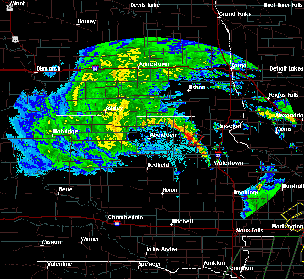 At 244 pm cdt, a confirmed tornado was located 6 miles west of webster, moving northeast at 25 mph (weather spotters confirmed tornado). Hazards include damaging tornado. Flying debris will be dangerous to those caught without shelter. mobile homes will be damaged or destroyed. damage to roofs, windows, and vehicles will occur. tree damage is likely. The tornado will be near, roslyn around 300 pm cdt. At 244 pm cdt, a confirmed tornado was located 6 miles west of webster, moving northeast at 25 mph (weather spotters confirmed tornado). Hazards include damaging tornado. Flying debris will be dangerous to those caught without shelter. mobile homes will be damaged or destroyed. damage to roofs, windows, and vehicles will occur. tree damage is likely. The tornado will be near, roslyn around 300 pm cdt.
|
| 7/17/2015 8:05 PM CDT |
 At 804 pm cdt, a severe thunderstorm was located over ortley, or 13 miles east of webster, moving east at 30 mph (law enforcement. 90 mph winds were reported in waubay at 750 pm cdt). Hazards include golf ball size hail and 70 mph wind gusts. People and animals outdoors will be injured. expect hail damage to roofs, siding, windows and vehicles. expect considerable tree damage. wind damage is also likely to mobile homes, roofs and outbuildings. This severe storm will be near, rudebusch corner around 810 pm cdt. At 804 pm cdt, a severe thunderstorm was located over ortley, or 13 miles east of webster, moving east at 30 mph (law enforcement. 90 mph winds were reported in waubay at 750 pm cdt). Hazards include golf ball size hail and 70 mph wind gusts. People and animals outdoors will be injured. expect hail damage to roofs, siding, windows and vehicles. expect considerable tree damage. wind damage is also likely to mobile homes, roofs and outbuildings. This severe storm will be near, rudebusch corner around 810 pm cdt.
|
| 7/17/2015 7:28 PM CDT |
 At 727 pm cdt, a severe thunderstorm was located near webster, moving east at 30 mph (radar indicated). Hazards include two inch hail and 70 mph wind gusts. People and animals outdoors will be injured. expect hail damage to roofs, siding, windows and vehicles. expect considerable tree damage. wind damage is also likely to mobile homes, roofs and outbuildings. this severe thunderstorm will be near, webster around 740 pm cdt. antelope lake around 745 pm cdt. grenville and minnewasta lake around 750 pm cdt. rush lake, waubay lake and waubay wildlife rec area around 755 pm cdt. waubay, blue dog lake, campbell slough, enemy swim housing, bitter lake and enemy swim lake around 800 pm cdt. Ortley and rudebusch corner around 810 pm cdt. At 727 pm cdt, a severe thunderstorm was located near webster, moving east at 30 mph (radar indicated). Hazards include two inch hail and 70 mph wind gusts. People and animals outdoors will be injured. expect hail damage to roofs, siding, windows and vehicles. expect considerable tree damage. wind damage is also likely to mobile homes, roofs and outbuildings. this severe thunderstorm will be near, webster around 740 pm cdt. antelope lake around 745 pm cdt. grenville and minnewasta lake around 750 pm cdt. rush lake, waubay lake and waubay wildlife rec area around 755 pm cdt. waubay, blue dog lake, campbell slough, enemy swim housing, bitter lake and enemy swim lake around 800 pm cdt. Ortley and rudebusch corner around 810 pm cdt.
|
| 7/17/2015 7:25 PM CDT |
 At 724 pm cdt, a confirmed tornado was located over opitz lake, or 17 miles north of webster, moving east at 30 mph (public confirmed tornado). Hazards include damaging tornado and quarter size hail. Flying debris will be dangerous to those caught without shelter. mobile homes will be damaged or destroyed. damage to roofs, windows and vehicles will occur. tree damage is likely. the tornado will be near, eden around 735 pm cdt. grenville around 740 pm cdt. piyas lake around 745 pm cdt. buffalo lakes, pickerel lake rec area and enemy swim lake around 750 pm cdt. sisseton and agency village around 805 pm cdt. Finley heights housing around 810 pm cdt. At 724 pm cdt, a confirmed tornado was located over opitz lake, or 17 miles north of webster, moving east at 30 mph (public confirmed tornado). Hazards include damaging tornado and quarter size hail. Flying debris will be dangerous to those caught without shelter. mobile homes will be damaged or destroyed. damage to roofs, windows and vehicles will occur. tree damage is likely. the tornado will be near, eden around 735 pm cdt. grenville around 740 pm cdt. piyas lake around 745 pm cdt. buffalo lakes, pickerel lake rec area and enemy swim lake around 750 pm cdt. sisseton and agency village around 805 pm cdt. Finley heights housing around 810 pm cdt.
|
| 7/17/2015 7:02 PM CDT |
 At 702 pm cdt, severe thunderstorms were located along a line extending from 6 miles east of kidder to near fort sisseton state park to lily, moving east at 50 mph (radar indicated). Hazards include 70 mph wind gusts and quarter size hail. Hail damage to vehicles is expected. expect considerable tree damage. wind damage is also likely to mobile homes, roofs and outbuildings. severe thunderstorms will be near, fort sisseton state park and cattail lake around 705 pm cdt. eden, lake city, opitz lake and roy lake rec area around 710 pm cdt. hillhead, clear lake rec area and red iron housing around 715 pm cdt. veblen, veblen flats housing, piyas lake and buffalo lakes around 720 pm cdt. Long hollow housing around 725 pm cdt. At 702 pm cdt, severe thunderstorms were located along a line extending from 6 miles east of kidder to near fort sisseton state park to lily, moving east at 50 mph (radar indicated). Hazards include 70 mph wind gusts and quarter size hail. Hail damage to vehicles is expected. expect considerable tree damage. wind damage is also likely to mobile homes, roofs and outbuildings. severe thunderstorms will be near, fort sisseton state park and cattail lake around 705 pm cdt. eden, lake city, opitz lake and roy lake rec area around 710 pm cdt. hillhead, clear lake rec area and red iron housing around 715 pm cdt. veblen, veblen flats housing, piyas lake and buffalo lakes around 720 pm cdt. Long hollow housing around 725 pm cdt.
|
| 5/10/2015 4:24 PM CDT | The severe thunderstorm warning for northeastern day county will expire at 430 pm cdt, the severe thunderstorm which prompted the warning has weakened. therefore the warning will be allowed to expire. |
| 5/10/2015 4:18 PM CDT | Quarter sized hail reported 0.2 miles SSW of Roslyn, SD |
| 5/10/2015 4:17 PM CDT | At 415 pm cdt, a severe thunderstorm was located near roslyn, or 7 miles north of webster, moving north at 45 mph (trained weather spotters. at 4 pm cdt...golf ball sized hail was reported approximately 9 miles southeast of webster. a few were as large as tennis ball. the intersection of 152nd street and 437th avenue was completely white, covered with hail). Hazards include golf ball size hail. People and animals outdoors will be injured. expect damage to roofs, siding, windows and vehicles. this severe storm will be near, roslyn around 420 pm cdt. 1. 75in. |
| 5/10/2015 4:03 PM CDT | At 402 pm cdt, a severe thunderstorm was located over antelope lake, or near webster, moving north at 45 mph (trained weather spotters. at 4 pm cdt...half dollar sized hail was reported approximately 7 miles southeast of webster). Hazards include half dollar size hail. Damage to vehicles is expected. this severe storm will be near, webster, minnewasta lake and waubay lake around 410 pm cdt. roslyn and grenville around 420 pm cdt. 1. 25in. |
| 5/10/2015 4:00 PM CDT | At 359 pm cdt, a severe thunderstorm was located over antelope lake, or near webster, moving north at 45 mph (radar indicated). Hazards include ping pong ball size hail. People and animals outdoors will be injured. expect damage to roofs, siding, windows and vehicles. this severe storm will be near, rush lake around 405 pm cdt. webster, minnewasta lake and waubay lake around 410 pm cdt. roslyn and grenville around 420 pm cdt. 1. 50in. |
| 5/10/2015 3:44 PM CDT | At 343 pm cdt, a severe thunderstorm was located over grass lake, or 16 miles south of webster, moving north at 45 mph (radar indicated). Hazards include ping pong ball size hail. People and animals outdoors will be injured. expect damage to roofs, siding, windows and vehicles. this severe thunderstorm will be near, antelope lake around 400 pm cdt. webster and rush lake around 405 pm cdt. minnewasta lake and waubay lake around 410 pm cdt. roslyn and grenville around 420 pm cdt. 1. 50in. |
| 5/10/2015 3:44 PM CDT | At 344 pm cdt, a severe thunderstorm was located over grass lake, or 16 miles south of webster, moving north at 45 mph (radar indicated). Hazards include ping pong ball size hail. People and animals outdoors will be injured. expect damage to roofs, siding, windows and vehicles. this severe thunderstorm will be near, antelope lake around 400 pm cdt. rush lake around 405 pm cdt. webster, minnewasta lake and waubay lake around 410 pm cdt. roslyn and grenville around 420 pm cdt. 1. 50in. |
| 8/31/2013 3:15 PM CDT | Quarter sized hail reported 5 miles S of Roslyn, SD, roslyn fire department reported quarter sized hail on hwy 25 north of roslyn |
| 1/1/0001 12:00 AM | 20-25 ft linden tree broken 10 ft from g in day county SD, 0.2 miles SSW of Roslyn, SD |
| 1/1/0001 12:00 AM | Many large trees down. highway 25 impassible due to trees down on highwa in day county SD, 0.2 miles SSW of Roslyn, SD |
| 1/1/0001 12:00 AM | Numerous trees and large branches are down. cars and homes are damaged. an elevator is leaning over. semi truck was tipped over. power lines are in day county SD, 0.2 miles SSW of Roslyn, SD |
| 1/1/0001 12:00 AM | Storm damage reported in day county SD, 0.2 miles SSW of Roslyn, SD |
Hail Maps for Roslyn, SD


Connect with Interactive Hail Maps