

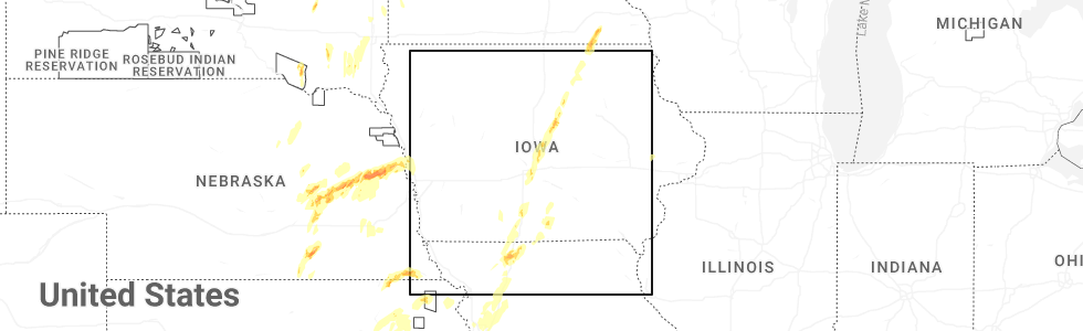
Hail Map for Russell, IA
The Russell, IA area has had 1 report of on-the-ground hail by trained spotters, and has been under severe weather warnings 14 times during the past 12 months. Doppler radar has detected hail at or near Russell, IA on 62 occasions, including 1 occasion during the past year.
| Name: | Russell, IA |
| Where Located: | 47.2 miles SSE of Des Moines, IA |
| Map: | Google Map for Russell, IA |
| Population: | 554 |
| Housing Units: | 250 |
| More Info: | Search Google for Russell, IA |
0
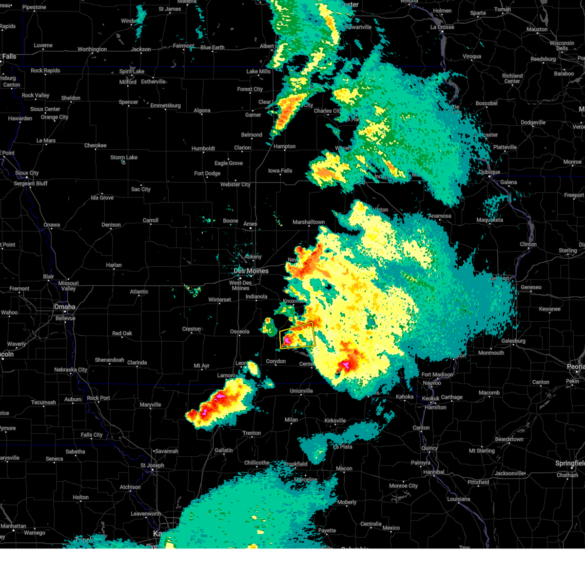
The Top Recent Hail Date for Russell, IA is Monday, May 19, 2025 (60th out of 62)
Hail and Wind Damage Spotted near Russell, IA
| Date / Time | Report Details |
|---|---|
| 7/31/2024 8:59 PM CDT |
 The storms which prompted the warning have weakened below severe limits, and no longer pose an immediate threat to life or property. therefore, the warning will be allowed to expire. a severe thunderstorm watch remains in effect until 100 am cdt for south central and southeastern iowa. The storms which prompted the warning have weakened below severe limits, and no longer pose an immediate threat to life or property. therefore, the warning will be allowed to expire. a severe thunderstorm watch remains in effect until 100 am cdt for south central and southeastern iowa.
|
| 7/31/2024 8:47 PM CDT |
 the severe thunderstorm warning has been cancelled and is no longer in effect the severe thunderstorm warning has been cancelled and is no longer in effect
|
| 7/31/2024 8:47 PM CDT |
 At 845 pm cdt, severe thunderstorms were located along a line extending from 4 miles east of melcher-dallas to 6 miles east of millerton to near south lineville, moving east at 50 mph (radar indicated). Hazards include 60 mph wind gusts. Expect damage to roofs, siding, and trees. locations impacted include, oskaloosa, centerville, osceola, chariton, albia, leon, corydon, lamoni, melcher-dallas, eddyville, lake sundown, rathbun lake, seymour, moravia, moulton, russell, lovilia, allerton, humeston, and beacon. This includes interstate 35 between mile markers 1 and 30. At 845 pm cdt, severe thunderstorms were located along a line extending from 4 miles east of melcher-dallas to 6 miles east of millerton to near south lineville, moving east at 50 mph (radar indicated). Hazards include 60 mph wind gusts. Expect damage to roofs, siding, and trees. locations impacted include, oskaloosa, centerville, osceola, chariton, albia, leon, corydon, lamoni, melcher-dallas, eddyville, lake sundown, rathbun lake, seymour, moravia, moulton, russell, lovilia, allerton, humeston, and beacon. This includes interstate 35 between mile markers 1 and 30.
|
| 7/31/2024 8:21 PM CDT |
 Svrdmx the national weather service in des moines has issued a * severe thunderstorm warning for, monroe county in south central iowa, lucas county in south central iowa, decatur county in south central iowa, southeastern madison county in south central iowa, southern marion county in south central iowa, wayne county in south central iowa, southwestern mahaska county in south central iowa, southeastern ringgold county in south central iowa, appanoose county in south central iowa, clarke county in south central iowa, southern warren county in south central iowa, * until 900 pm cdt. * at 821 pm cdt, severe thunderstorms were located along a line extending from near otter creek county park to humeston to near nine eagles state park, moving east at 70 mph (radar indicated). Hazards include 60 mph wind gusts. lamoni airport gusted to 59 mph. expect damage to roofs, siding, and trees Svrdmx the national weather service in des moines has issued a * severe thunderstorm warning for, monroe county in south central iowa, lucas county in south central iowa, decatur county in south central iowa, southeastern madison county in south central iowa, southern marion county in south central iowa, wayne county in south central iowa, southwestern mahaska county in south central iowa, southeastern ringgold county in south central iowa, appanoose county in south central iowa, clarke county in south central iowa, southern warren county in south central iowa, * until 900 pm cdt. * at 821 pm cdt, severe thunderstorms were located along a line extending from near otter creek county park to humeston to near nine eagles state park, moving east at 70 mph (radar indicated). Hazards include 60 mph wind gusts. lamoni airport gusted to 59 mph. expect damage to roofs, siding, and trees
|
| 7/30/2024 10:47 AM CDT |
 At 1047 am cdt, severe thunderstorms were located along a line extending from 4 miles east of new sharon to near beacon to russell, moving east at 35 mph (radar indicated). Hazards include 60 mph wind gusts. Expect damage to roofs, siding, and trees. Locations impacted include, ottumwa, oskaloosa, centerville, chariton, albia, bloomfield, new sharon, eddyville, ottumwa industrial airport, lake sundown, rathbun lake, eldon, fremont, moravia, agency, moulton, russell, lovilia, beacon, and university park. At 1047 am cdt, severe thunderstorms were located along a line extending from 4 miles east of new sharon to near beacon to russell, moving east at 35 mph (radar indicated). Hazards include 60 mph wind gusts. Expect damage to roofs, siding, and trees. Locations impacted include, ottumwa, oskaloosa, centerville, chariton, albia, bloomfield, new sharon, eddyville, ottumwa industrial airport, lake sundown, rathbun lake, eldon, fremont, moravia, agency, moulton, russell, lovilia, beacon, and university park.
|
| 7/30/2024 10:47 AM CDT |
 the severe thunderstorm warning has been cancelled and is no longer in effect the severe thunderstorm warning has been cancelled and is no longer in effect
|
| 7/30/2024 10:12 AM CDT |
 Svrdmx the national weather service in des moines has issued a * severe thunderstorm warning for, monroe county in south central iowa, southeastern lucas county in south central iowa, southern poweshiek county in central iowa, southeastern marion county in south central iowa, davis county in southeastern iowa, wapello county in southeastern iowa, northeastern wayne county in south central iowa, mahaska county in south central iowa, appanoose county in south central iowa, * until 1130 am cdt. * at 1012 am cdt, severe thunderstorms were located along a line extending from near reasnor to 4 miles east of knoxville to 5 miles north of lucas, moving southeast at 60 mph (radar indicated). Hazards include 60 mph wind gusts and quarter size hail. Hail damage to vehicles is expected. Expect wind damage to roofs, siding, and trees. Svrdmx the national weather service in des moines has issued a * severe thunderstorm warning for, monroe county in south central iowa, southeastern lucas county in south central iowa, southern poweshiek county in central iowa, southeastern marion county in south central iowa, davis county in southeastern iowa, wapello county in southeastern iowa, northeastern wayne county in south central iowa, mahaska county in south central iowa, appanoose county in south central iowa, * until 1130 am cdt. * at 1012 am cdt, severe thunderstorms were located along a line extending from near reasnor to 4 miles east of knoxville to 5 miles north of lucas, moving southeast at 60 mph (radar indicated). Hazards include 60 mph wind gusts and quarter size hail. Hail damage to vehicles is expected. Expect wind damage to roofs, siding, and trees.
|
| 7/30/2024 4:09 AM CDT | At 408 am cdt, severe thunderstorms were located along a line extending from eddyville to near blakesburg to near moulton to 6 miles northwest of livonia to lemons, moving southeast at 50 mph (public report. at 359 am, a wind gust of 62 mph was measured from a personal weather station in mystic). Hazards include 60 mph wind gusts. Expect damage to roofs, siding, and trees. these severe storms will be near, ottumwa, ottumwa industrial airport, drakesville, kirkville, chillicothe and lake wapello state park around 415 am cdt. bloomfield and bloomfield municipal airport around 420 am cdt. Other locations in the path of these severe thunderstorms include floris, agency, pulaski and eldon. |
| 7/30/2024 4:02 AM CDT | the severe thunderstorm warning has been cancelled and is no longer in effect |
| 7/30/2024 4:02 AM CDT | At 401 am cdt, severe thunderstorms were located along a line extending from 4 miles southwest of beacon to near blakesburg to udell to near cincinnati to 7 miles east of lucerne, moving southeast at 50 mph (automated systems. at 335 am, a measured wind gust of 66 mph was reported at the chariton airport). Hazards include 70 mph wind gusts. Expect considerable tree damage. damage is likely to mobile homes, roofs, and outbuildings. these severe storms will be near, eddyville, lake sundown, moulton, blakesburg, exline, unionville, udell and sharon bluffs state park around 405 am cdt. Other locations in the path of these severe thunderstorms include kirkville, chillicothe, ottumwa, ottumwa industrial airport, drakesville, bloomfield and bloomfield municipal airport. |
| 7/30/2024 3:45 AM CDT | At 344 am cdt, severe thunderstorms were located along a line extending from near pella to near hamilton to 5 miles north of honey creek state park to plano to 5 miles south of allerton, moving southeast at 50 mph (automated systems. at 335 am, a measured wind gust of 66 mph was reported at the chariton airport). Hazards include 70 mph wind gusts. Expect considerable tree damage. damage is likely to mobile homes, roofs, and outbuildings. these severe storms will be near, centerville, albia, rathbun lake, seymour, moravia, mystic, bussey and cincinnati around 350 am cdt. eddyville, lake sundown, beacon, exline, unionville, udell and sharon bluffs state park around 355 am cdt. moulton and blakesburg around 400 am cdt. Other locations in the path of these severe thunderstorms include chillicothe, lake wapello state park, ottumwa, drakesville, kirkville, bloomfield, ottumwa industrial airport, bloomfield municipal airport and floris. |
| 7/30/2024 3:40 AM CDT | Svrdmx the national weather service in des moines has issued a * severe thunderstorm warning for, lucas county in south central iowa, monroe county in south central iowa, marion county in south central iowa, davis county in southeastern iowa, wapello county in southeastern iowa, wayne county in south central iowa, southwestern mahaska county in south central iowa, appanoose county in south central iowa, southeastern warren county in south central iowa, * until 445 am cdt. * at 339 am cdt, severe thunderstorms were located along a line extending from pella municipal airport to hamilton to near melrose to 4 miles north of promise city to near allerton, moving southeast at 50 mph (radar indicated). Hazards include 60 mph wind gusts. Expect damage to roofs, siding, and trees. severe thunderstorms will be near, pella, albia, rathbun lake, seymour, moravia, lovilia, mystic and bussey around 345 am cdt. centerville, cincinnati, albia municipal airport and centerville municipal airport around 350 am cdt. eddyville, lake sundown, beacon, exline, unionville, udell and sharon bluffs state park around 355 am cdt. Other locations in the path of these severe thunderstorms include blakesburg, moulton, chillicothe, lake wapello state park, drakesville, kirkville, ottumwa, bloomfield, ottumwa industrial airport and bloomfield municipal airport. |
| 7/30/2024 3:27 AM CDT | At 327 am cdt, severe thunderstorms were located along a line extending from near monroe to near knoxville raceway to near melcher-dallas to near lucas, moving southeast at 40 mph (radar indicated). Hazards include 60 mph wind gusts. Expect damage to roofs, siding, and trees. Locations impacted include, knoxville, chariton, monroe, melcher-dallas, lake red rock, knoxville raceway, williamson, reasnor, pella, russell, pella municipal airport, harvey, marysville, lovilia, bussey, hamilton, melrose and leighton. |
| 7/30/2024 3:05 AM CDT | Svrdmx the national weather service in des moines has issued a * severe thunderstorm warning for, lucas county in south central iowa, western monroe county in south central iowa, southeastern polk county in central iowa, marion county in south central iowa, western mahaska county in south central iowa, southern jasper county in central iowa, northeastern clarke county in south central iowa, warren county in south central iowa, * until 345 am cdt. * at 304 am cdt, severe thunderstorms were located along a line extending from near valeria to runnells to near milo to 5 miles east of new virginia, moving southeast at 40 mph (radar indicated). Hazards include 60 mph wind gusts. Expect damage to roofs, siding, and trees. severe thunderstorms will be near, colfax, pleasantville, prairie city, milo, lacona, swan, sandyville and prairie city krohn airport around 310 am cdt. monroe, melcher-dallas, lake red rock and lucas around 315 am cdt. knoxville, knoxville raceway, reasnor, elk rock state park, chariton municipal airport and knoxville municipal airport around 320 am cdt. Other locations in the path of these severe thunderstorms include chariton, williamson, pella, red haw lake state park, russell and pella municipal airport. |
| 7/10/2024 2:33 PM CDT |
 At 233 pm cdt, a severe thunderstorm was located over promise city, or 7 miles east of corydon, moving southeast at 30 mph (radar indicated). Hazards include 60 mph wind gusts and quarter size hail. Hail damage to vehicles is expected. expect wind damage to roofs, siding, and trees. Locations impacted include, corydon, rathbun lake, seymour, russell, allerton, promise city, plano, millerton, and honey creek state park. At 233 pm cdt, a severe thunderstorm was located over promise city, or 7 miles east of corydon, moving southeast at 30 mph (radar indicated). Hazards include 60 mph wind gusts and quarter size hail. Hail damage to vehicles is expected. expect wind damage to roofs, siding, and trees. Locations impacted include, corydon, rathbun lake, seymour, russell, allerton, promise city, plano, millerton, and honey creek state park.
|
| 7/10/2024 2:10 PM CDT |
 Svrdmx the national weather service in des moines has issued a * severe thunderstorm warning for, southwestern monroe county in south central iowa, southeastern lucas county in south central iowa, wayne county in south central iowa, northwestern appanoose county in south central iowa, * until 300 pm cdt. * at 210 pm cdt, a severe thunderstorm was located near millerton, or 8 miles north of corydon, moving southeast at 30 mph (radar indicated). Hazards include 60 mph wind gusts and quarter size hail. Hail damage to vehicles is expected. Expect wind damage to roofs, siding, and trees. Svrdmx the national weather service in des moines has issued a * severe thunderstorm warning for, southwestern monroe county in south central iowa, southeastern lucas county in south central iowa, wayne county in south central iowa, northwestern appanoose county in south central iowa, * until 300 pm cdt. * at 210 pm cdt, a severe thunderstorm was located near millerton, or 8 miles north of corydon, moving southeast at 30 mph (radar indicated). Hazards include 60 mph wind gusts and quarter size hail. Hail damage to vehicles is expected. Expect wind damage to roofs, siding, and trees.
|
| 7/2/2024 4:25 PM CDT |
 the severe thunderstorm warning has been cancelled and is no longer in effect the severe thunderstorm warning has been cancelled and is no longer in effect
|
| 7/2/2024 4:25 PM CDT |
 At 424 pm cdt, a severe thunderstorm was located over melrose, or 12 miles east of chariton, moving northeast at 45 mph (radar indicated). Hazards include 60 mph wind gusts and quarter size hail. Hail damage to vehicles is expected. expect wind damage to roofs, siding, and trees. Locations impacted include, russell and melrose. At 424 pm cdt, a severe thunderstorm was located over melrose, or 12 miles east of chariton, moving northeast at 45 mph (radar indicated). Hazards include 60 mph wind gusts and quarter size hail. Hail damage to vehicles is expected. expect wind damage to roofs, siding, and trees. Locations impacted include, russell and melrose.
|
| 7/2/2024 4:09 PM CDT |
 Svrdmx the national weather service in des moines has issued a * severe thunderstorm warning for, western monroe county in south central iowa, southeastern lucas county in south central iowa, northeastern wayne county in south central iowa, * until 500 pm cdt. * at 409 pm cdt, a severe thunderstorm was located near millerton, or 7 miles south of chariton, moving northeast at 40 mph (radar indicated). Hazards include 60 mph wind gusts and quarter size hail. Hail damage to vehicles is expected. Expect wind damage to roofs, siding, and trees. Svrdmx the national weather service in des moines has issued a * severe thunderstorm warning for, western monroe county in south central iowa, southeastern lucas county in south central iowa, northeastern wayne county in south central iowa, * until 500 pm cdt. * at 409 pm cdt, a severe thunderstorm was located near millerton, or 7 miles south of chariton, moving northeast at 40 mph (radar indicated). Hazards include 60 mph wind gusts and quarter size hail. Hail damage to vehicles is expected. Expect wind damage to roofs, siding, and trees.
|
| 6/25/2024 7:45 PM CDT |
 Svrdmx the national weather service in des moines has issued a * severe thunderstorm warning for, southwestern monroe county in south central iowa, southern lucas county in south central iowa, wayne county in south central iowa, northwestern appanoose county in south central iowa, * until 830 pm cdt. * at 745 pm cdt, a severe thunderstorm was located near millerton, or 8 miles northeast of corydon, moving south at 20 mph (radar indicated). Hazards include 60 mph wind gusts and half dollar size hail. Hail damage to vehicles is expected. Expect wind damage to roofs, siding, and trees. Svrdmx the national weather service in des moines has issued a * severe thunderstorm warning for, southwestern monroe county in south central iowa, southern lucas county in south central iowa, wayne county in south central iowa, northwestern appanoose county in south central iowa, * until 830 pm cdt. * at 745 pm cdt, a severe thunderstorm was located near millerton, or 8 miles northeast of corydon, moving south at 20 mph (radar indicated). Hazards include 60 mph wind gusts and half dollar size hail. Hail damage to vehicles is expected. Expect wind damage to roofs, siding, and trees.
|
| 6/25/2024 7:07 PM CDT |
 Svrdmx the national weather service in des moines has issued a * severe thunderstorm warning for, eastern lucas county in south central iowa, * until 745 pm cdt. * at 707 pm cdt, a severe thunderstorm was located near red haw lake state park, or near chariton, moving east at 15 mph (broadcast media). Hazards include ping pong ball size hail and 60 mph wind gusts. People and animals outdoors will be injured. expect hail damage to roofs, siding, windows, and vehicles. Expect wind damage to roofs, siding, and trees. Svrdmx the national weather service in des moines has issued a * severe thunderstorm warning for, eastern lucas county in south central iowa, * until 745 pm cdt. * at 707 pm cdt, a severe thunderstorm was located near red haw lake state park, or near chariton, moving east at 15 mph (broadcast media). Hazards include ping pong ball size hail and 60 mph wind gusts. People and animals outdoors will be injured. expect hail damage to roofs, siding, windows, and vehicles. Expect wind damage to roofs, siding, and trees.
|
| 5/24/2024 5:31 AM CDT |
 Svrdmx the national weather service in des moines has issued a * severe thunderstorm warning for, eastern lucas county in south central iowa, poweshiek county in central iowa, monroe county in south central iowa, marion county in south central iowa, wapello county in southeastern iowa, mahaska county in south central iowa, southern jasper county in central iowa, * until 630 am cdt. * at 530 am cdt, severe thunderstorms were located along a line extending from near reasnor to pella to near bussey to 5 miles north of melrose, moving east at 45 mph (radar indicated). Hazards include 70 mph wind gusts and quarter size hail. Hail damage to vehicles is expected. expect considerable tree damage. Wind damage is also likely to mobile homes, roofs, and outbuildings. Svrdmx the national weather service in des moines has issued a * severe thunderstorm warning for, eastern lucas county in south central iowa, poweshiek county in central iowa, monroe county in south central iowa, marion county in south central iowa, wapello county in southeastern iowa, mahaska county in south central iowa, southern jasper county in central iowa, * until 630 am cdt. * at 530 am cdt, severe thunderstorms were located along a line extending from near reasnor to pella to near bussey to 5 miles north of melrose, moving east at 45 mph (radar indicated). Hazards include 70 mph wind gusts and quarter size hail. Hail damage to vehicles is expected. expect considerable tree damage. Wind damage is also likely to mobile homes, roofs, and outbuildings.
|
| 5/24/2024 4:31 AM CDT |
 the severe thunderstorm warning has been cancelled and is no longer in effect the severe thunderstorm warning has been cancelled and is no longer in effect
|
| 5/24/2024 4:31 AM CDT |
 At 431 am cdt, a severe thunderstorm was located 5 miles northwest of melrose, or 11 miles east of chariton, moving northeast at 35 mph (radar indicated). Hazards include golf ball size hail and 60 mph wind gusts. People and animals outdoors will be injured. expect hail damage to roofs, siding, windows, and vehicles. expect wind damage to roofs, siding, and trees. this severe storm will be near, lovilia, hamilton, and marysville around 445 am cdt. bussey around 450 am cdt. Other locations impacted by this severe thunderstorm include marysville, bussey, russell, williamson, melrose, red haw lake state park, albia municipal airport, hamilton, lovilia, and harvey. At 431 am cdt, a severe thunderstorm was located 5 miles northwest of melrose, or 11 miles east of chariton, moving northeast at 35 mph (radar indicated). Hazards include golf ball size hail and 60 mph wind gusts. People and animals outdoors will be injured. expect hail damage to roofs, siding, windows, and vehicles. expect wind damage to roofs, siding, and trees. this severe storm will be near, lovilia, hamilton, and marysville around 445 am cdt. bussey around 450 am cdt. Other locations impacted by this severe thunderstorm include marysville, bussey, russell, williamson, melrose, red haw lake state park, albia municipal airport, hamilton, lovilia, and harvey.
|
| 5/24/2024 4:20 AM CDT |
 The storm which prompted the warning has weakened below severe limits, and no longer appears capable of producing a tornado. therefore, the warning will be allowed to expire. a severe thunderstorm watch remains in effect until 1000 am cdt for south central iowa. to report severe weather, contact your nearest law enforcement agency. they will relay your report to the national weather service des moines . remember, a severe thunderstorm warning still remains in effect. The storm which prompted the warning has weakened below severe limits, and no longer appears capable of producing a tornado. therefore, the warning will be allowed to expire. a severe thunderstorm watch remains in effect until 1000 am cdt for south central iowa. to report severe weather, contact your nearest law enforcement agency. they will relay your report to the national weather service des moines . remember, a severe thunderstorm warning still remains in effect.
|
| 5/24/2024 4:10 AM CDT |
 Svrdmx the national weather service in des moines has issued a * severe thunderstorm warning for, lucas county in south central iowa, monroe county in south central iowa, southeastern marion county in south central iowa, northeastern wayne county in south central iowa, * until 500 am cdt. * at 410 am cdt, a severe thunderstorm was located near red haw lake state park, or near chariton, moving northeast at 40 mph (radar indicated). Hazards include golf ball size hail and 60 mph wind gusts. People and animals outdoors will be injured. expect hail damage to roofs, siding, windows, and vehicles. expect wind damage to roofs, siding, and trees. this severe thunderstorm will be near, chariton, russell, and red haw lake state park around 415 am cdt. lovilia and hamilton around 440 am cdt. bussey and marysville around 445 am cdt. Other locations impacted by this severe thunderstorm include bussey, melrose, red haw lake state park, derby, albia municipal airport, millerton, marysville, russell, williamson, and hamilton. Svrdmx the national weather service in des moines has issued a * severe thunderstorm warning for, lucas county in south central iowa, monroe county in south central iowa, southeastern marion county in south central iowa, northeastern wayne county in south central iowa, * until 500 am cdt. * at 410 am cdt, a severe thunderstorm was located near red haw lake state park, or near chariton, moving northeast at 40 mph (radar indicated). Hazards include golf ball size hail and 60 mph wind gusts. People and animals outdoors will be injured. expect hail damage to roofs, siding, windows, and vehicles. expect wind damage to roofs, siding, and trees. this severe thunderstorm will be near, chariton, russell, and red haw lake state park around 415 am cdt. lovilia and hamilton around 440 am cdt. bussey and marysville around 445 am cdt. Other locations impacted by this severe thunderstorm include bussey, melrose, red haw lake state park, derby, albia municipal airport, millerton, marysville, russell, williamson, and hamilton.
|
| 5/24/2024 4:08 AM CDT |
 At 408 am cdt, a severe thunderstorm was located near chariton municipal airport, or 5 miles southwest of chariton, moving northeast at 30 mph (radar indicated). Hazards include golf ball size hail and 60 mph wind gusts. People and animals outdoors will be injured. expect hail damage to roofs, siding, windows, and vehicles. expect wind damage to roofs, siding, and trees. Locations impacted include, chariton, russell, lucas, derby, millerton, red haw lake state park, and chariton municipal airport. At 408 am cdt, a severe thunderstorm was located near chariton municipal airport, or 5 miles southwest of chariton, moving northeast at 30 mph (radar indicated). Hazards include golf ball size hail and 60 mph wind gusts. People and animals outdoors will be injured. expect hail damage to roofs, siding, windows, and vehicles. expect wind damage to roofs, siding, and trees. Locations impacted include, chariton, russell, lucas, derby, millerton, red haw lake state park, and chariton municipal airport.
|
| 5/24/2024 4:08 AM CDT |
 the severe thunderstorm warning has been cancelled and is no longer in effect the severe thunderstorm warning has been cancelled and is no longer in effect
|
| 5/24/2024 4:04 AM CDT |
 At 404 am cdt, a severe thunderstorm capable of producing a tornado was located near humeston, or 7 miles northwest of corydon, moving northeast at 30 mph (radar indicated rotation). Hazards include tornado and two inch hail. Flying debris will be dangerous to those caught without shelter. mobile homes will be damaged or destroyed. damage to roofs, windows, and vehicles will occur. tree damage is likely. this dangerous storm will be near, millerton around 410 am cdt. Other locations impacted by this tornadic thunderstorm include millerton, russell, melrose, red haw lake state park, and humeston. At 404 am cdt, a severe thunderstorm capable of producing a tornado was located near humeston, or 7 miles northwest of corydon, moving northeast at 30 mph (radar indicated rotation). Hazards include tornado and two inch hail. Flying debris will be dangerous to those caught without shelter. mobile homes will be damaged or destroyed. damage to roofs, windows, and vehicles will occur. tree damage is likely. this dangerous storm will be near, millerton around 410 am cdt. Other locations impacted by this tornadic thunderstorm include millerton, russell, melrose, red haw lake state park, and humeston.
|
| 5/24/2024 4:00 AM CDT |
 Tordmx the national weather service in des moines has issued a * tornado warning for, southeastern lucas county in south central iowa, southwestern monroe county in south central iowa, northern wayne county in south central iowa, * until 430 am cdt. * at 359 am cdt, a severe thunderstorm capable of producing a tornado was located near humeston, or 7 miles northwest of corydon, moving northeast at 40 mph (radar indicated rotation). Hazards include tornado and quarter size hail. Flying debris will be dangerous to those caught without shelter. mobile homes will be damaged or destroyed. damage to roofs, windows, and vehicles will occur. tree damage is likely. this dangerous storm will be near, millerton around 405 am cdt. rathbun lake and russell around 420 am cdt. Other locations impacted by this tornadic thunderstorm include millerton, russell, melrose, red haw lake state park, and humeston. Tordmx the national weather service in des moines has issued a * tornado warning for, southeastern lucas county in south central iowa, southwestern monroe county in south central iowa, northern wayne county in south central iowa, * until 430 am cdt. * at 359 am cdt, a severe thunderstorm capable of producing a tornado was located near humeston, or 7 miles northwest of corydon, moving northeast at 40 mph (radar indicated rotation). Hazards include tornado and quarter size hail. Flying debris will be dangerous to those caught without shelter. mobile homes will be damaged or destroyed. damage to roofs, windows, and vehicles will occur. tree damage is likely. this dangerous storm will be near, millerton around 405 am cdt. rathbun lake and russell around 420 am cdt. Other locations impacted by this tornadic thunderstorm include millerton, russell, melrose, red haw lake state park, and humeston.
|
| 5/24/2024 3:26 AM CDT |
 Svrdmx the national weather service in des moines has issued a * severe thunderstorm warning for, southwestern lucas county in south central iowa, eastern decatur county in south central iowa, northwestern wayne county in south central iowa, southeastern clarke county in south central iowa, * until 415 am cdt. * at 326 am cdt, a severe thunderstorm was located near leon, moving northeast at 30 mph (radar indicated). Hazards include ping pong ball size hail. People and animals outdoors will be injured. Expect damage to roofs, siding, windows, and vehicles. Svrdmx the national weather service in des moines has issued a * severe thunderstorm warning for, southwestern lucas county in south central iowa, eastern decatur county in south central iowa, northwestern wayne county in south central iowa, southeastern clarke county in south central iowa, * until 415 am cdt. * at 326 am cdt, a severe thunderstorm was located near leon, moving northeast at 30 mph (radar indicated). Hazards include ping pong ball size hail. People and animals outdoors will be injured. Expect damage to roofs, siding, windows, and vehicles.
|
| 5/21/2024 5:06 PM CDT |
 At 506 pm cdt, a severe thunderstorm capable of producing a tornado was located over allerton, or near corydon, moving northeast at 55 mph (radar indicated rotation). Hazards include tornado and quarter size hail. Flying debris will be dangerous to those caught without shelter. mobile homes will be damaged or destroyed. damage to roofs, windows, and vehicles will occur. tree damage is likely. this dangerous storm will be near, corydon around 510 pm cdt. millerton around 515 pm cdt. rathbun lake around 520 pm cdt. melrose around 530 pm cdt. Other locations impacted by this tornadic thunderstorm include russell, melrose, red haw lake state park, honey creek state park, millerton, allerton, promise city, clio, plano, and seymour. At 506 pm cdt, a severe thunderstorm capable of producing a tornado was located over allerton, or near corydon, moving northeast at 55 mph (radar indicated rotation). Hazards include tornado and quarter size hail. Flying debris will be dangerous to those caught without shelter. mobile homes will be damaged or destroyed. damage to roofs, windows, and vehicles will occur. tree damage is likely. this dangerous storm will be near, corydon around 510 pm cdt. millerton around 515 pm cdt. rathbun lake around 520 pm cdt. melrose around 530 pm cdt. Other locations impacted by this tornadic thunderstorm include russell, melrose, red haw lake state park, honey creek state park, millerton, allerton, promise city, clio, plano, and seymour.
|
| 5/21/2024 4:53 PM CDT |
 Tordmx the national weather service in des moines has issued a * tornado warning for, southeastern lucas county in south central iowa, southwestern monroe county in south central iowa, wayne county in south central iowa, northwestern appanoose county in south central iowa, * until 545 pm cdt. * at 453 pm cdt, a severe thunderstorm capable of producing a tornado was located over south lineville, or 16 miles southwest of corydon, moving northeast at 55 mph (radar indicated rotation). Hazards include tornado and quarter size hail. Flying debris will be dangerous to those caught without shelter. mobile homes will be damaged or destroyed. damage to roofs, windows, and vehicles will occur. tree damage is likely. this dangerous storm will be near, allerton and clio around 500 pm cdt. corydon around 505 pm cdt. millerton around 515 pm cdt. rathbun lake around 520 pm cdt. melrose around 530 pm cdt. Other locations impacted by this tornadic thunderstorm include russell, melrose, red haw lake state park, honey creek state park, millerton, allerton, promise city, lineville, clio, and plano. Tordmx the national weather service in des moines has issued a * tornado warning for, southeastern lucas county in south central iowa, southwestern monroe county in south central iowa, wayne county in south central iowa, northwestern appanoose county in south central iowa, * until 545 pm cdt. * at 453 pm cdt, a severe thunderstorm capable of producing a tornado was located over south lineville, or 16 miles southwest of corydon, moving northeast at 55 mph (radar indicated rotation). Hazards include tornado and quarter size hail. Flying debris will be dangerous to those caught without shelter. mobile homes will be damaged or destroyed. damage to roofs, windows, and vehicles will occur. tree damage is likely. this dangerous storm will be near, allerton and clio around 500 pm cdt. corydon around 505 pm cdt. millerton around 515 pm cdt. rathbun lake around 520 pm cdt. melrose around 530 pm cdt. Other locations impacted by this tornadic thunderstorm include russell, melrose, red haw lake state park, honey creek state park, millerton, allerton, promise city, lineville, clio, and plano.
|
| 5/20/2024 1:36 AM CDT |
 Svrdmx the national weather service in des moines has issued a * severe thunderstorm warning for, lucas county in south central iowa, monroe county in south central iowa, marion county in south central iowa, eastern wayne county in south central iowa, appanoose county in south central iowa, northeastern clarke county in south central iowa, eastern warren county in south central iowa, * until 230 am cdt. * at 136 am cdt, severe thunderstorms were located along a line extending from 6 miles south of otter creek county park to red haw lake state park to near cincinnati, moving northeast at 30 mph (radar indicated). Hazards include 60 mph wind gusts and penny size hail. expect damage to roofs, siding, and trees Svrdmx the national weather service in des moines has issued a * severe thunderstorm warning for, lucas county in south central iowa, monroe county in south central iowa, marion county in south central iowa, eastern wayne county in south central iowa, appanoose county in south central iowa, northeastern clarke county in south central iowa, eastern warren county in south central iowa, * until 230 am cdt. * at 136 am cdt, severe thunderstorms were located along a line extending from 6 miles south of otter creek county park to red haw lake state park to near cincinnati, moving northeast at 30 mph (radar indicated). Hazards include 60 mph wind gusts and penny size hail. expect damage to roofs, siding, and trees
|
| 5/7/2024 1:26 AM CDT |
 Svrdmx the national weather service in des moines has issued a * severe thunderstorm warning for, lucas county in south central iowa, western poweshiek county in central iowa, monroe county in south central iowa, southeastern polk county in central iowa, davis county in southeastern iowa, marion county in south central iowa, wapello county in southeastern iowa, wayne county in south central iowa, mahaska county in south central iowa, appanoose county in south central iowa, jasper county in central iowa, eastern warren county in south central iowa, * until 230 am cdt. * at 126 am cdt, severe thunderstorms were located along a line extending from near runnells to 5 miles northeast of russell to 5 miles south of seymour, moving east at 50 mph (radar indicated). Hazards include 60 mph wind gusts and penny size hail. expect damage to roofs, siding, and trees Svrdmx the national weather service in des moines has issued a * severe thunderstorm warning for, lucas county in south central iowa, western poweshiek county in central iowa, monroe county in south central iowa, southeastern polk county in central iowa, davis county in southeastern iowa, marion county in south central iowa, wapello county in southeastern iowa, wayne county in south central iowa, mahaska county in south central iowa, appanoose county in south central iowa, jasper county in central iowa, eastern warren county in south central iowa, * until 230 am cdt. * at 126 am cdt, severe thunderstorms were located along a line extending from near runnells to 5 miles northeast of russell to 5 miles south of seymour, moving east at 50 mph (radar indicated). Hazards include 60 mph wind gusts and penny size hail. expect damage to roofs, siding, and trees
|
| 4/30/2024 8:24 PM CDT |
 At 824 pm cdt, a severe thunderstorm was located over melrose, or 12 miles east of chariton, moving east at 50 mph (radar indicated). Hazards include golf ball size hail and 60 mph wind gusts. People and animals outdoors will be injured. expect hail damage to roofs, siding, windows, and vehicles. expect wind damage to roofs, siding, and trees. Locations impacted include, russell, lovilia, and melrose. At 824 pm cdt, a severe thunderstorm was located over melrose, or 12 miles east of chariton, moving east at 50 mph (radar indicated). Hazards include golf ball size hail and 60 mph wind gusts. People and animals outdoors will be injured. expect hail damage to roofs, siding, windows, and vehicles. expect wind damage to roofs, siding, and trees. Locations impacted include, russell, lovilia, and melrose.
|
| 4/30/2024 8:19 PM CDT |
 At 819 pm cdt, a severe thunderstorm was located over russell, or 8 miles east of chariton, moving east at 50 mph (radar indicated). Hazards include 60 mph wind gusts and quarter size hail. Hail damage to vehicles is expected. expect wind damage to roofs, siding, and trees. Locations impacted include, russell, lovilia, melrose, and red haw lake state park. At 819 pm cdt, a severe thunderstorm was located over russell, or 8 miles east of chariton, moving east at 50 mph (radar indicated). Hazards include 60 mph wind gusts and quarter size hail. Hail damage to vehicles is expected. expect wind damage to roofs, siding, and trees. Locations impacted include, russell, lovilia, melrose, and red haw lake state park.
|
| 4/30/2024 8:03 PM CDT |
 Svrdmx the national weather service in des moines has issued a * severe thunderstorm warning for, southern lucas county in south central iowa, western monroe county in south central iowa, * until 845 pm cdt. * at 803 pm cdt, a severe thunderstorm was located near derby, or 7 miles west of chariton, moving east at 50 mph (radar indicated). Hazards include 60 mph wind gusts and quarter size hail. Hail damage to vehicles is expected. Expect wind damage to roofs, siding, and trees. Svrdmx the national weather service in des moines has issued a * severe thunderstorm warning for, southern lucas county in south central iowa, western monroe county in south central iowa, * until 845 pm cdt. * at 803 pm cdt, a severe thunderstorm was located near derby, or 7 miles west of chariton, moving east at 50 mph (radar indicated). Hazards include 60 mph wind gusts and quarter size hail. Hail damage to vehicles is expected. Expect wind damage to roofs, siding, and trees.
|
| 4/30/2024 7:49 PM CDT |
 the severe thunderstorm warning has been cancelled and is no longer in effect the severe thunderstorm warning has been cancelled and is no longer in effect
|
| 4/30/2024 7:24 PM CDT |
 Tordmx the national weather service in des moines has issued a * tornado warning for, southeastern lucas county in south central iowa, southwestern monroe county in south central iowa, northeastern wayne county in south central iowa, northwestern appanoose county in south central iowa, * until 815 pm cdt. * at 724 pm cdt, a confirmed tornado was located near millerton, or 9 miles northeast of corydon, moving east at 30 mph (emergency management confirmed tornado). Hazards include damaging tornado and quarter size hail. Flying debris will be dangerous to those caught without shelter. mobile homes will be damaged or destroyed. damage to roofs, windows, and vehicles will occur. tree damage is likely. the tornado will be near, rathbun lake around 730 pm cdt. melrose around 740 pm cdt. Other locations impacted by this tornadic thunderstorm include rathbun, russell, melrose, mystic, honey creek state park, millerton, promise city, plano, and moravia. Tordmx the national weather service in des moines has issued a * tornado warning for, southeastern lucas county in south central iowa, southwestern monroe county in south central iowa, northeastern wayne county in south central iowa, northwestern appanoose county in south central iowa, * until 815 pm cdt. * at 724 pm cdt, a confirmed tornado was located near millerton, or 9 miles northeast of corydon, moving east at 30 mph (emergency management confirmed tornado). Hazards include damaging tornado and quarter size hail. Flying debris will be dangerous to those caught without shelter. mobile homes will be damaged or destroyed. damage to roofs, windows, and vehicles will occur. tree damage is likely. the tornado will be near, rathbun lake around 730 pm cdt. melrose around 740 pm cdt. Other locations impacted by this tornadic thunderstorm include rathbun, russell, melrose, mystic, honey creek state park, millerton, promise city, plano, and moravia.
|
| 4/30/2024 7:11 PM CDT |
 Svrdmx the national weather service in des moines has issued a * severe thunderstorm warning for, southern lucas county in south central iowa, southwestern monroe county in south central iowa, northern wayne county in south central iowa, northwestern appanoose county in south central iowa, * until 800 pm cdt. * at 710 pm cdt, a severe thunderstorm was located over millerton, or near corydon, moving east at 35 mph (radar indicated). Hazards include ping pong ball size hail and 60 mph wind gusts. People and animals outdoors will be injured. expect hail damage to roofs, siding, windows, and vehicles. Expect wind damage to roofs, siding, and trees. Svrdmx the national weather service in des moines has issued a * severe thunderstorm warning for, southern lucas county in south central iowa, southwestern monroe county in south central iowa, northern wayne county in south central iowa, northwestern appanoose county in south central iowa, * until 800 pm cdt. * at 710 pm cdt, a severe thunderstorm was located over millerton, or near corydon, moving east at 35 mph (radar indicated). Hazards include ping pong ball size hail and 60 mph wind gusts. People and animals outdoors will be injured. expect hail damage to roofs, siding, windows, and vehicles. Expect wind damage to roofs, siding, and trees.
|
| 4/30/2024 6:57 PM CDT |
 At 656 pm cdt, a severe thunderstorm was located over le roy, or 13 miles northeast of leon, moving east at 35 mph (trained weather spotters reported quarter sized hail near garden grove in northeast decatur county). Hazards include ping pong ball size hail and 60 mph wind gusts. People and animals outdoors will be injured. expect hail damage to roofs, siding, windows, and vehicles. expect wind damage to roofs, siding, and trees. locations impacted include, osceola, chariton, russell, humeston, van wert, lucas, garden grove, woodburn, williamson, weldon, derby, millerton, le roy, red haw lake state park, and chariton municipal airport. This includes interstate 35 between mile markers 21 and 34. At 656 pm cdt, a severe thunderstorm was located over le roy, or 13 miles northeast of leon, moving east at 35 mph (trained weather spotters reported quarter sized hail near garden grove in northeast decatur county). Hazards include ping pong ball size hail and 60 mph wind gusts. People and animals outdoors will be injured. expect hail damage to roofs, siding, windows, and vehicles. expect wind damage to roofs, siding, and trees. locations impacted include, osceola, chariton, russell, humeston, van wert, lucas, garden grove, woodburn, williamson, weldon, derby, millerton, le roy, red haw lake state park, and chariton municipal airport. This includes interstate 35 between mile markers 21 and 34.
|
| 4/30/2024 6:26 PM CDT |
 Svrdmx the national weather service in des moines has issued a * severe thunderstorm warning for, southern lucas county in south central iowa, northern decatur county in south central iowa, northern wayne county in south central iowa, southern clarke county in south central iowa, * until 730 pm cdt. * at 625 pm cdt, a severe thunderstorm was located near grand river, or 7 miles northwest of leon, moving east at 35 mph (radar indicated). Hazards include ping pong ball size hail and 60 mph wind gusts. People and animals outdoors will be injured. expect hail damage to roofs, siding, windows, and vehicles. Expect wind damage to roofs, siding, and trees. Svrdmx the national weather service in des moines has issued a * severe thunderstorm warning for, southern lucas county in south central iowa, northern decatur county in south central iowa, northern wayne county in south central iowa, southern clarke county in south central iowa, * until 730 pm cdt. * at 625 pm cdt, a severe thunderstorm was located near grand river, or 7 miles northwest of leon, moving east at 35 mph (radar indicated). Hazards include ping pong ball size hail and 60 mph wind gusts. People and animals outdoors will be injured. expect hail damage to roofs, siding, windows, and vehicles. Expect wind damage to roofs, siding, and trees.
|
| 4/27/2024 5:53 PM CDT |
 Svrdmx the national weather service in des moines has issued a * severe thunderstorm warning for, eastern lucas county in south central iowa, monroe county in south central iowa, western davis county in southeastern iowa, southern marion county in south central iowa, western wapello county in southeastern iowa, eastern wayne county in south central iowa, western mahaska county in south central iowa, appanoose county in south central iowa, * until 645 pm cdt. * at 553 pm cdt, severe thunderstorms were located along a line extending from near melcher-dallas to near melrose to 4 miles southeast of seymour, moving northeast at 45 mph (radar indicated). Hazards include 60 mph wind gusts. expect damage to roofs, siding, and trees Svrdmx the national weather service in des moines has issued a * severe thunderstorm warning for, eastern lucas county in south central iowa, monroe county in south central iowa, western davis county in southeastern iowa, southern marion county in south central iowa, western wapello county in southeastern iowa, eastern wayne county in south central iowa, western mahaska county in south central iowa, appanoose county in south central iowa, * until 645 pm cdt. * at 553 pm cdt, severe thunderstorms were located along a line extending from near melcher-dallas to near melrose to 4 miles southeast of seymour, moving northeast at 45 mph (radar indicated). Hazards include 60 mph wind gusts. expect damage to roofs, siding, and trees
|
| 4/16/2024 1:02 PM CDT |
 Svrdmx the national weather service in des moines has issued a * severe thunderstorm warning for, eastern lucas county in south central iowa, western monroe county in south central iowa, marion county in south central iowa, northeastern wayne county in south central iowa, southwestern mahaska county in south central iowa, south central jasper county in central iowa, * until 200 pm cdt. * at 102 pm cdt, a severe thunderstorm was located near russell, or 7 miles east of chariton, moving northeast at 55 mph (radar indicated). Hazards include 60 mph wind gusts and nickel size hail. expect damage to roofs, siding, and trees Svrdmx the national weather service in des moines has issued a * severe thunderstorm warning for, eastern lucas county in south central iowa, western monroe county in south central iowa, marion county in south central iowa, northeastern wayne county in south central iowa, southwestern mahaska county in south central iowa, south central jasper county in central iowa, * until 200 pm cdt. * at 102 pm cdt, a severe thunderstorm was located near russell, or 7 miles east of chariton, moving northeast at 55 mph (radar indicated). Hazards include 60 mph wind gusts and nickel size hail. expect damage to roofs, siding, and trees
|
| 7/12/2023 8:30 AM CDT |
 At 829 am cdt, severe thunderstorms were located along a line extending from near russell to near clio to near ridgeway, moving east at 60 mph (radar indicated). Hazards include 60 mph wind gusts and nickel size hail. Expect damage to roofs, siding, and trees. locations impacted include, rathbun lake, russell, melrose, honey creek state park and rathbun. hail threat, radar indicated max hail size, 0. 88 in wind threat, radar indicated max wind gust, 60 mph. At 829 am cdt, severe thunderstorms were located along a line extending from near russell to near clio to near ridgeway, moving east at 60 mph (radar indicated). Hazards include 60 mph wind gusts and nickel size hail. Expect damage to roofs, siding, and trees. locations impacted include, rathbun lake, russell, melrose, honey creek state park and rathbun. hail threat, radar indicated max hail size, 0. 88 in wind threat, radar indicated max wind gust, 60 mph.
|
| 7/12/2023 7:59 AM CDT |
 At 759 am cdt, severe thunderstorms were located along a line extending from near osceola to near decatur city to irena, moving east at 60 mph (radar indicated). Hazards include 60 mph wind gusts and nickel size hail. Expect damage to roofs, siding, and trees. severe thunderstorms will be near, leon, woodburn, decatur city and weldon around 805 am cdt. davis city, le roy and nine eagles state park around 810 am cdt. humeston and derby around 815 am cdt. other locations in the path of these severe thunderstorms include allerton, lineville, clio, millerton, rathbun lake, promise city, plano, mystic, numa, rathbun and honey creek state park. this includes interstate 35 between mile markers 1 and 33. hail threat, radar indicated max hail size, 0. 88 in wind threat, radar indicated max wind gust, 60 mph. At 759 am cdt, severe thunderstorms were located along a line extending from near osceola to near decatur city to irena, moving east at 60 mph (radar indicated). Hazards include 60 mph wind gusts and nickel size hail. Expect damage to roofs, siding, and trees. severe thunderstorms will be near, leon, woodburn, decatur city and weldon around 805 am cdt. davis city, le roy and nine eagles state park around 810 am cdt. humeston and derby around 815 am cdt. other locations in the path of these severe thunderstorms include allerton, lineville, clio, millerton, rathbun lake, promise city, plano, mystic, numa, rathbun and honey creek state park. this includes interstate 35 between mile markers 1 and 33. hail threat, radar indicated max hail size, 0. 88 in wind threat, radar indicated max wind gust, 60 mph.
|
| 6/30/2023 7:43 AM CDT |
 At 742 am cdt, severe thunderstorms were located along a line extending from east peru to 5 miles southeast of leon, moving east at 50 mph (law enforcement). Hazards include 60 mph wind gusts and quarter size hail. Hail damage to vehicles is expected. expect wind damage to roofs, siding, and trees. locations impacted include, clio, allerton, corydon, millerton, seymour, promise city, rathbun lake and plano. this includes interstate 35 between mile markers 16 and 32. hail threat, radar indicated max hail size, 1. 00 in wind threat, observed max wind gust, 60 mph. At 742 am cdt, severe thunderstorms were located along a line extending from east peru to 5 miles southeast of leon, moving east at 50 mph (law enforcement). Hazards include 60 mph wind gusts and quarter size hail. Hail damage to vehicles is expected. expect wind damage to roofs, siding, and trees. locations impacted include, clio, allerton, corydon, millerton, seymour, promise city, rathbun lake and plano. this includes interstate 35 between mile markers 16 and 32. hail threat, radar indicated max hail size, 1. 00 in wind threat, observed max wind gust, 60 mph.
|
| 6/30/2023 7:25 AM CDT |
 At 724 am cdt, severe thunderstorms were located along a line extending from macksburg to lamoni, moving east at 50 mph (law enforcement). Hazards include 70 mph wind gusts and quarter size hail. Hail damage to vehicles is expected. expect considerable tree damage. wind damage is also likely to mobile homes, roofs, and outbuildings. these severe storms will be near, davis city around 730 am cdt. other locations in the path of these severe thunderstorms include leon, decatur city, pleasanton, nine eagles state park, east peru, truro, st. charles, st. marys, clio, allerton, indianola, corydon, lake ahquabi state park and otter creek county park. this includes interstate 35 between mile markers 1 and 52. thunderstorm damage threat, considerable hail threat, radar indicated max hail size, 1. 00 in wind threat, observed max wind gust, 70 mph. At 724 am cdt, severe thunderstorms were located along a line extending from macksburg to lamoni, moving east at 50 mph (law enforcement). Hazards include 70 mph wind gusts and quarter size hail. Hail damage to vehicles is expected. expect considerable tree damage. wind damage is also likely to mobile homes, roofs, and outbuildings. these severe storms will be near, davis city around 730 am cdt. other locations in the path of these severe thunderstorms include leon, decatur city, pleasanton, nine eagles state park, east peru, truro, st. charles, st. marys, clio, allerton, indianola, corydon, lake ahquabi state park and otter creek county park. this includes interstate 35 between mile markers 1 and 52. thunderstorm damage threat, considerable hail threat, radar indicated max hail size, 1. 00 in wind threat, observed max wind gust, 70 mph.
|
| 6/30/2023 7:10 AM CDT |
 At 709 am cdt, severe thunderstorms were located along a line extending from macksburg to lamoni, moving east at 50 mph (law enforcement). Hazards include 70 mph wind gusts and quarter size hail. Hail damage to vehicles is expected. expect considerable tree damage. wind damage is also likely to mobile homes, roofs, and outbuildings. these severe storms will be near, davis city around 715 am cdt. leon, decatur city, pleasanton and nine eagles state park around 720 am cdt. other locations in the path of these severe thunderstorms include east peru, truro, avenue of the saints event center, st. charles, bevington, st. marys, clio, allerton, indianola, corydon, lake ahquabi state park and otter creek county park. this includes interstate 35 between mile markers 1 and 56. thunderstorm damage threat, considerable hail threat, radar indicated max hail size, 1. 00 in wind threat, observed max wind gust, 70 mph. At 709 am cdt, severe thunderstorms were located along a line extending from macksburg to lamoni, moving east at 50 mph (law enforcement). Hazards include 70 mph wind gusts and quarter size hail. Hail damage to vehicles is expected. expect considerable tree damage. wind damage is also likely to mobile homes, roofs, and outbuildings. these severe storms will be near, davis city around 715 am cdt. leon, decatur city, pleasanton and nine eagles state park around 720 am cdt. other locations in the path of these severe thunderstorms include east peru, truro, avenue of the saints event center, st. charles, bevington, st. marys, clio, allerton, indianola, corydon, lake ahquabi state park and otter creek county park. this includes interstate 35 between mile markers 1 and 56. thunderstorm damage threat, considerable hail threat, radar indicated max hail size, 1. 00 in wind threat, observed max wind gust, 70 mph.
|
| 6/30/2023 7:04 AM CDT |
 At 703 am cdt, severe thunderstorms were located along a line extending from near macksburg to near lamoni, moving east at 50 mph (law enforcement). Hazards include 60 mph wind gusts and quarter size hail. Hail damage to vehicles is expected. expect wind damage to roofs, siding, and trees. severe thunderstorms will be near, lamoni municipal airport around 710 am cdt. lorimor, davis city, decatur city and nine eagles state park around 715 am cdt. leon and pleasanton around 720 am cdt. other locations in the path of these severe thunderstorms include truro, east peru, avenue of the saints event center, st. charles, new virginia, st. marys, bevington, clio, allerton and lake ahquabi state park. this includes interstate 35 between mile markers 1 and 56. hail threat, radar indicated max hail size, 1. 00 in wind threat, observed max wind gust, 60 mph. At 703 am cdt, severe thunderstorms were located along a line extending from near macksburg to near lamoni, moving east at 50 mph (law enforcement). Hazards include 60 mph wind gusts and quarter size hail. Hail damage to vehicles is expected. expect wind damage to roofs, siding, and trees. severe thunderstorms will be near, lamoni municipal airport around 710 am cdt. lorimor, davis city, decatur city and nine eagles state park around 715 am cdt. leon and pleasanton around 720 am cdt. other locations in the path of these severe thunderstorms include truro, east peru, avenue of the saints event center, st. charles, new virginia, st. marys, bevington, clio, allerton and lake ahquabi state park. this includes interstate 35 between mile markers 1 and 56. hail threat, radar indicated max hail size, 1. 00 in wind threat, observed max wind gust, 60 mph.
|
| 3/31/2023 4:10 PM CDT | Delayed report. wind damage to outbuildin in lucas county IA, 3.4 miles WSW of Russell, IA |
| 11/4/2022 8:01 AM CDT |
 At 800 am cdt, a severe thunderstorm was located near chariton municipal airport, or 5 miles southwest of chariton, moving northeast at 55 mph (radar indicated). Hazards include 60 mph wind gusts and quarter size hail. Hail damage to vehicles is expected. expect wind damage to roofs, siding, and trees. this severe thunderstorm will be near, chariton and red haw lake state park around 805 am cdt. russell and williamson around 810 am cdt. other locations in the path of this severe thunderstorm include lovilia, hamilton, marysville, bussey, harvey and pella municipal airport. hail threat, radar indicated max hail size, 1. 00 in wind threat, radar indicated max wind gust, 60 mph. At 800 am cdt, a severe thunderstorm was located near chariton municipal airport, or 5 miles southwest of chariton, moving northeast at 55 mph (radar indicated). Hazards include 60 mph wind gusts and quarter size hail. Hail damage to vehicles is expected. expect wind damage to roofs, siding, and trees. this severe thunderstorm will be near, chariton and red haw lake state park around 805 am cdt. russell and williamson around 810 am cdt. other locations in the path of this severe thunderstorm include lovilia, hamilton, marysville, bussey, harvey and pella municipal airport. hail threat, radar indicated max hail size, 1. 00 in wind threat, radar indicated max wind gust, 60 mph.
|
| 6/6/2022 2:18 PM CDT |
 At 218 pm cdt, severe thunderstorms were located along a line extending from near knoxville to 10 miles southeast of melcher-dallas to 13 miles northwest of corydon, moving east at 40 mph (radar indicated). Hazards include 60 mph wind gusts. Expect damage to roofs, siding, and trees. locations impacted include, knoxville, chariton, corydon, melcher-dallas, knoxville raceway, rathbun lake, russell, lovilia, allerton, humeston, bussey, harvey, lucas, williamson, hamilton, derby, melrose, marysville, millerton and le roy. hail threat, radar indicated max hail size, <. 75 in wind threat, radar indicated max wind gust, 60 mph. At 218 pm cdt, severe thunderstorms were located along a line extending from near knoxville to 10 miles southeast of melcher-dallas to 13 miles northwest of corydon, moving east at 40 mph (radar indicated). Hazards include 60 mph wind gusts. Expect damage to roofs, siding, and trees. locations impacted include, knoxville, chariton, corydon, melcher-dallas, knoxville raceway, rathbun lake, russell, lovilia, allerton, humeston, bussey, harvey, lucas, williamson, hamilton, derby, melrose, marysville, millerton and le roy. hail threat, radar indicated max hail size, <. 75 in wind threat, radar indicated max wind gust, 60 mph.
|
| 6/6/2022 2:05 PM CDT |
 At 205 pm cdt, severe thunderstorms were located along a line extending from near pleasantville to near melcher-dallas to 11 miles southeast of osceola, moving southeast at 35 mph (radar indicated). Hazards include 60 mph wind gusts. Expect damage to roofs, siding, and trees. locations impacted include, melcher-dallas, williamson, knoxville, knoxville raceway, derby, knoxville municipal airport, lovilia, harvey, corydon, allerton, marysville, millerton, bussey and hamilton. hail threat, radar indicated max hail size, <. 75 in wind threat, radar indicated max wind gust, 60 mph. At 205 pm cdt, severe thunderstorms were located along a line extending from near pleasantville to near melcher-dallas to 11 miles southeast of osceola, moving southeast at 35 mph (radar indicated). Hazards include 60 mph wind gusts. Expect damage to roofs, siding, and trees. locations impacted include, melcher-dallas, williamson, knoxville, knoxville raceway, derby, knoxville municipal airport, lovilia, harvey, corydon, allerton, marysville, millerton, bussey and hamilton. hail threat, radar indicated max hail size, <. 75 in wind threat, radar indicated max wind gust, 60 mph.
|
| 6/6/2022 1:46 PM CDT |
 At 145 pm cdt, severe thunderstorms were located along a line extending from near indianola to 8 miles west of melcher-dallas to 6 miles southwest of osceola, moving southeast at 35 mph (radar indicated). Hazards include 60 mph wind gusts. Expect damage to roofs, siding, and trees. severe thunderstorms will be near, milo, lacona and sandyville around 150 pm cdt. pleasantville, melcher-dallas and williamson around 200 pm cdt. garden grove around 205 pm cdt. other locations in the path of these severe thunderstorms include le roy, knoxville, knoxville raceway, humeston, derby, knoxville municipal airport, lovilia, corydon, allerton, bussey, harvey, hamilton, marysville and millerton. this includes interstate 35 between mile markers 27 and 35. hail threat, radar indicated max hail size, <. 75 in wind threat, radar indicated max wind gust, 60 mph. At 145 pm cdt, severe thunderstorms were located along a line extending from near indianola to 8 miles west of melcher-dallas to 6 miles southwest of osceola, moving southeast at 35 mph (radar indicated). Hazards include 60 mph wind gusts. Expect damage to roofs, siding, and trees. severe thunderstorms will be near, milo, lacona and sandyville around 150 pm cdt. pleasantville, melcher-dallas and williamson around 200 pm cdt. garden grove around 205 pm cdt. other locations in the path of these severe thunderstorms include le roy, knoxville, knoxville raceway, humeston, derby, knoxville municipal airport, lovilia, corydon, allerton, bussey, harvey, hamilton, marysville and millerton. this includes interstate 35 between mile markers 27 and 35. hail threat, radar indicated max hail size, <. 75 in wind threat, radar indicated max wind gust, 60 mph.
|
| 5/31/2022 2:29 AM CDT |
 At 229 am cdt, a severe thunderstorm was located 9 miles northeast of chariton, moving northeast at 55 mph (radar indicated). Hazards include 60 mph wind gusts and nickel size hail. Expect damage to roofs, siding, and trees. this severe thunderstorm will be near, lovilia, bussey, hamilton and marysville around 245 am cdt. hail threat, radar indicated max hail size, 0. 88 in wind threat, radar indicated max wind gust, 60 mph. At 229 am cdt, a severe thunderstorm was located 9 miles northeast of chariton, moving northeast at 55 mph (radar indicated). Hazards include 60 mph wind gusts and nickel size hail. Expect damage to roofs, siding, and trees. this severe thunderstorm will be near, lovilia, bussey, hamilton and marysville around 245 am cdt. hail threat, radar indicated max hail size, 0. 88 in wind threat, radar indicated max wind gust, 60 mph.
|
| 5/31/2022 2:09 AM CDT |
 At 209 am cdt, a severe thunderstorm was located near chariton, moving northeast at 55 mph (radar indicated). Hazards include 60 mph wind gusts and quarter size hail. Hail damage to vehicles is expected. expect wind damage to roofs, siding, and trees. locations impacted include, williamson. hail threat, radar indicated max hail size, 1. 00 in wind threat, radar indicated max wind gust, 60 mph. At 209 am cdt, a severe thunderstorm was located near chariton, moving northeast at 55 mph (radar indicated). Hazards include 60 mph wind gusts and quarter size hail. Hail damage to vehicles is expected. expect wind damage to roofs, siding, and trees. locations impacted include, williamson. hail threat, radar indicated max hail size, 1. 00 in wind threat, radar indicated max wind gust, 60 mph.
|
| 5/31/2022 1:57 AM CDT |
 At 157 am cdt, a severe thunderstorm was located 12 miles southwest of chariton, moving northeast at 45 mph (radar indicated). Hazards include 60 mph wind gusts and quarter size hail. Hail damage to vehicles is expected. expect wind damage to roofs, siding, and trees. this severe thunderstorm will be near, derby around 200 am cdt. lucas around 205 am cdt. chariton municipal airport around 210 am cdt. chariton and red haw lake state park around 215 am cdt. other locations in the path of this severe thunderstorm include russell and williamson. hail threat, radar indicated max hail size, 1. 00 in wind threat, radar indicated max wind gust, 60 mph. At 157 am cdt, a severe thunderstorm was located 12 miles southwest of chariton, moving northeast at 45 mph (radar indicated). Hazards include 60 mph wind gusts and quarter size hail. Hail damage to vehicles is expected. expect wind damage to roofs, siding, and trees. this severe thunderstorm will be near, derby around 200 am cdt. lucas around 205 am cdt. chariton municipal airport around 210 am cdt. chariton and red haw lake state park around 215 am cdt. other locations in the path of this severe thunderstorm include russell and williamson. hail threat, radar indicated max hail size, 1. 00 in wind threat, radar indicated max wind gust, 60 mph.
|
| 3/5/2022 5:48 PM CST |
 At 548 pm cst, a confirmed large and extremely dangerous tornado was located near chariton, moving northeast at 40 mph. this is a particularly dangerous situation. take cover now! (radar confirmed tornado). Hazards include damaging tornado. You are in a life-threatening situation. flying debris may be deadly to those caught without shelter. mobile homes will be destroyed. considerable damage to homes, businesses, and vehicles is likely and complete destruction is possible. Locations impacted include, chariton, russell, williamson and red haw lake state park. At 548 pm cst, a confirmed large and extremely dangerous tornado was located near chariton, moving northeast at 40 mph. this is a particularly dangerous situation. take cover now! (radar confirmed tornado). Hazards include damaging tornado. You are in a life-threatening situation. flying debris may be deadly to those caught without shelter. mobile homes will be destroyed. considerable damage to homes, businesses, and vehicles is likely and complete destruction is possible. Locations impacted include, chariton, russell, williamson and red haw lake state park.
|
| 3/5/2022 5:33 PM CST |
 At 533 pm cst, a confirmed large and extremely dangerous tornado was located 8 miles southwest of chariton, moving northeast at 45 mph. this is a particularly dangerous situation. take cover now! (radar confirmed tornado). Hazards include damaging tornado. You are in a life-threatening situation. flying debris may be deadly to those caught without shelter. mobile homes will be destroyed. considerable damage to homes, businesses, and vehicles is likely and complete destruction is possible. Locations impacted include, chariton, russell, williamson, derby, red haw lake state park and chariton municipal airport. At 533 pm cst, a confirmed large and extremely dangerous tornado was located 8 miles southwest of chariton, moving northeast at 45 mph. this is a particularly dangerous situation. take cover now! (radar confirmed tornado). Hazards include damaging tornado. You are in a life-threatening situation. flying debris may be deadly to those caught without shelter. mobile homes will be destroyed. considerable damage to homes, businesses, and vehicles is likely and complete destruction is possible. Locations impacted include, chariton, russell, williamson, derby, red haw lake state park and chariton municipal airport.
|
| 3/5/2022 5:23 PM CST |
 At 522 pm cst, a confirmed large and extremely dangerous tornado was located 13 miles northwest of corydon, moving northeast at 45 mph. this is a particularly dangerous situation. take cover now! (radar confirmed tornado). Hazards include damaging tornado. You are in a life-threatening situation. flying debris may be deadly to those caught without shelter. mobile homes will be destroyed. Considerable damage to homes, businesses, and vehicles is likely and complete destruction is possible. At 522 pm cst, a confirmed large and extremely dangerous tornado was located 13 miles northwest of corydon, moving northeast at 45 mph. this is a particularly dangerous situation. take cover now! (radar confirmed tornado). Hazards include damaging tornado. You are in a life-threatening situation. flying debris may be deadly to those caught without shelter. mobile homes will be destroyed. Considerable damage to homes, businesses, and vehicles is likely and complete destruction is possible.
|
| 12/15/2021 7:09 PM CST |
 At 708 pm cst, severe thunderstorms were located along a line extending from near grinnell to 11 miles west of unionville, moving east at 65 mph (radar indicated). Hazards include 70 mph wind gusts. Expect considerable tree damage. Damage is likely to mobile homes, roofs, and outbuildings. At 708 pm cst, severe thunderstorms were located along a line extending from near grinnell to 11 miles west of unionville, moving east at 65 mph (radar indicated). Hazards include 70 mph wind gusts. Expect considerable tree damage. Damage is likely to mobile homes, roofs, and outbuildings.
|
| 12/15/2021 6:49 PM CST |
 At 649 pm cst, severe thunderstorms were located along a line extending from melcher-dallas to 12 miles south of corydon, moving east at 50 mph (radar indicated). Hazards include 60 mph wind gusts. Expect damage to roofs, siding, and trees. Locations impacted include, chariton, corydon, rathbun lake, seymour, russell, allerton, humeston, lineville, lucas, garden grove, woodburn, williamson, derby, melrose, promise city, clio, plano, marysville, pleasanton and millerton. At 649 pm cst, severe thunderstorms were located along a line extending from melcher-dallas to 12 miles south of corydon, moving east at 50 mph (radar indicated). Hazards include 60 mph wind gusts. Expect damage to roofs, siding, and trees. Locations impacted include, chariton, corydon, rathbun lake, seymour, russell, allerton, humeston, lineville, lucas, garden grove, woodburn, williamson, derby, melrose, promise city, clio, plano, marysville, pleasanton and millerton.
|
| 12/15/2021 6:13 PM CST |
 At 613 pm cst, severe thunderstorms were located along a line extending from near new virginia to 7 miles southeast of lamoni, moving east at 50 mph (radar indicated). Hazards include 60 mph wind gusts. Expect damage to roofs, siding, and trees. these severe thunderstorms will remain over mainly rural areas of western monroe, lucas, decatur, southwestern marion, wayne, western appanoose, clarke and southern warren counties, including the following locations, melrose, red haw lake state park, pleasanton, promise city, clio, williamson, nine eagles state park, decatur city, humeston and lineville. This includes interstate 35 between mile markers 4 and 44. At 613 pm cst, severe thunderstorms were located along a line extending from near new virginia to 7 miles southeast of lamoni, moving east at 50 mph (radar indicated). Hazards include 60 mph wind gusts. Expect damage to roofs, siding, and trees. these severe thunderstorms will remain over mainly rural areas of western monroe, lucas, decatur, southwestern marion, wayne, western appanoose, clarke and southern warren counties, including the following locations, melrose, red haw lake state park, pleasanton, promise city, clio, williamson, nine eagles state park, decatur city, humeston and lineville. This includes interstate 35 between mile markers 4 and 44.
|
| 6/22/2021 6:52 PM CDT |
 At 652 pm cdt, a severe thunderstorm was located 8 miles southwest of melcher-dallas, or 10 miles north of chariton, moving southeast at 35 mph (radar indicated). Hazards include ping pong ball size hail and 60 mph wind gusts. People and animals outdoors will be injured. expect hail damage to roofs, siding, windows, and vehicles. expect wind damage to roofs, siding, and trees. Locations impacted include, chariton, melcher-dallas, russell, lacona, williamson, red haw lake state park and chariton municipal airport. At 652 pm cdt, a severe thunderstorm was located 8 miles southwest of melcher-dallas, or 10 miles north of chariton, moving southeast at 35 mph (radar indicated). Hazards include ping pong ball size hail and 60 mph wind gusts. People and animals outdoors will be injured. expect hail damage to roofs, siding, windows, and vehicles. expect wind damage to roofs, siding, and trees. Locations impacted include, chariton, melcher-dallas, russell, lacona, williamson, red haw lake state park and chariton municipal airport.
|
| 6/22/2021 6:30 PM CDT |
 At 629 pm cdt, a severe thunderstorm was located 9 miles southeast of indianola, moving southeast at 45 mph (radar indicated). Hazards include ping pong ball size hail and 60 mph wind gusts. People and animals outdoors will be injured. expect hail damage to roofs, siding, windows, and vehicles. Expect wind damage to roofs, siding, and trees. At 629 pm cdt, a severe thunderstorm was located 9 miles southeast of indianola, moving southeast at 45 mph (radar indicated). Hazards include ping pong ball size hail and 60 mph wind gusts. People and animals outdoors will be injured. expect hail damage to roofs, siding, windows, and vehicles. Expect wind damage to roofs, siding, and trees.
|
| 6/19/2021 12:44 AM CDT |
 At 1244 am cdt, a severe thunderstorm was located 9 miles southeast of melcher-dallas, or 11 miles northeast of chariton, moving southeast at 40 mph (radar indicated). Hazards include 60 mph wind gusts and penny size hail. expect damage to roofs, siding, and trees At 1244 am cdt, a severe thunderstorm was located 9 miles southeast of melcher-dallas, or 11 miles northeast of chariton, moving southeast at 40 mph (radar indicated). Hazards include 60 mph wind gusts and penny size hail. expect damage to roofs, siding, and trees
|
| 6/18/2021 11:55 PM CDT |
 At 1155 pm cdt, a severe thunderstorm was located 8 miles north of corydon, moving southeast at 30 mph (radar indicated). Hazards include ping pong ball size hail and 60 mph wind gusts. People and animals outdoors will be injured. expect hail damage to roofs, siding, windows, and vehicles. expect wind damage to roofs, siding, and trees. this severe thunderstorm will be near, rathbun lake around 1210 am cdt. Other locations in the path of this severe thunderstorm include centerville. At 1155 pm cdt, a severe thunderstorm was located 8 miles north of corydon, moving southeast at 30 mph (radar indicated). Hazards include ping pong ball size hail and 60 mph wind gusts. People and animals outdoors will be injured. expect hail damage to roofs, siding, windows, and vehicles. expect wind damage to roofs, siding, and trees. this severe thunderstorm will be near, rathbun lake around 1210 am cdt. Other locations in the path of this severe thunderstorm include centerville.
|
| 6/18/2021 11:38 PM CDT |
 At 1138 pm cdt, a severe thunderstorm was located 9 miles southwest of chariton, moving southeast at 30 mph (radar indicated). Hazards include ping pong ball size hail and 60 mph wind gusts. People and animals outdoors will be injured. expect hail damage to roofs, siding, windows, and vehicles. expect wind damage to roofs, siding, and trees. Locations impacted include, chariton, corydon, russell, allerton, humeston, lucas, derby, millerton, red haw lake state park and chariton municipal airport. At 1138 pm cdt, a severe thunderstorm was located 9 miles southwest of chariton, moving southeast at 30 mph (radar indicated). Hazards include ping pong ball size hail and 60 mph wind gusts. People and animals outdoors will be injured. expect hail damage to roofs, siding, windows, and vehicles. expect wind damage to roofs, siding, and trees. Locations impacted include, chariton, corydon, russell, allerton, humeston, lucas, derby, millerton, red haw lake state park and chariton municipal airport.
|
| 6/18/2021 11:25 PM CDT |
 At 1125 pm cdt, a severe thunderstorm was located 11 miles east of osceola, moving southeast at 30 mph (radar indicated). Hazards include ping pong ball size hail and 60 mph wind gusts. People and animals outdoors will be injured. expect hail damage to roofs, siding, windows, and vehicles. Expect wind damage to roofs, siding, and trees. At 1125 pm cdt, a severe thunderstorm was located 11 miles east of osceola, moving southeast at 30 mph (radar indicated). Hazards include ping pong ball size hail and 60 mph wind gusts. People and animals outdoors will be injured. expect hail damage to roofs, siding, windows, and vehicles. Expect wind damage to roofs, siding, and trees.
|
| 6/18/2021 11:10 PM CDT |
 At 1110 pm cdt, a severe thunderstorm was located 9 miles northwest of rathbun lake, or 10 miles southeast of chariton, moving southeast at 30 mph (radar indicated). Hazards include golf ball size hail and 60 mph wind gusts. People and animals outdoors will be injured. expect hail damage to roofs, siding, windows, and vehicles. expect wind damage to roofs, siding, and trees. this severe thunderstorm will be near, rathbun lake around 1115 pm cdt. Other locations in the path of this severe thunderstorm include centerville and lake sundown. At 1110 pm cdt, a severe thunderstorm was located 9 miles northwest of rathbun lake, or 10 miles southeast of chariton, moving southeast at 30 mph (radar indicated). Hazards include golf ball size hail and 60 mph wind gusts. People and animals outdoors will be injured. expect hail damage to roofs, siding, windows, and vehicles. expect wind damage to roofs, siding, and trees. this severe thunderstorm will be near, rathbun lake around 1115 pm cdt. Other locations in the path of this severe thunderstorm include centerville and lake sundown.
|
| 6/18/2021 11:07 PM CDT | Tennis Ball sized hail reported 6.4 miles N of Russell, IA, mostly quarter to golf ball sized hail with sporadic tennis ball sized hail. via social media/broadcast media. time estimated from radar. |
| 6/18/2021 10:59 PM CDT |
 At 1059 pm cdt, a severe thunderstorm was located over chariton, moving east at 30 mph (radar indicated). Hazards include golf ball size hail and 60 mph wind gusts. People and animals outdoors will be injured. expect hail damage to roofs, siding, windows, and vehicles. expect wind damage to roofs, siding, and trees. Locations impacted include, rathbun lake. At 1059 pm cdt, a severe thunderstorm was located over chariton, moving east at 30 mph (radar indicated). Hazards include golf ball size hail and 60 mph wind gusts. People and animals outdoors will be injured. expect hail damage to roofs, siding, windows, and vehicles. expect wind damage to roofs, siding, and trees. Locations impacted include, rathbun lake.
|
| 6/18/2021 10:39 PM CDT |
 At 1038 pm cdt, a severe thunderstorm was located 9 miles northwest of chariton, moving east at 30 mph (radar indicated). Hazards include golf ball size hail and 60 mph wind gusts. People and animals outdoors will be injured. expect hail damage to roofs, siding, windows, and vehicles. expect wind damage to roofs, siding, and trees. This severe thunderstorm will be near, chariton around 1055 pm cdt. At 1038 pm cdt, a severe thunderstorm was located 9 miles northwest of chariton, moving east at 30 mph (radar indicated). Hazards include golf ball size hail and 60 mph wind gusts. People and animals outdoors will be injured. expect hail damage to roofs, siding, windows, and vehicles. expect wind damage to roofs, siding, and trees. This severe thunderstorm will be near, chariton around 1055 pm cdt.
|
| 8/10/2020 11:28 AM CDT |
 At 1128 am cdt, severe thunderstorms were located along a line extending from 6 miles southwest of monroe to 6 miles south of melcher-dallas to 11 miles northwest of corydon, moving east at 50 mph (radar indicated). Hazards include 60 mph wind gusts. expect damage to roofs, siding, and trees At 1128 am cdt, severe thunderstorms were located along a line extending from 6 miles southwest of monroe to 6 miles south of melcher-dallas to 11 miles northwest of corydon, moving east at 50 mph (radar indicated). Hazards include 60 mph wind gusts. expect damage to roofs, siding, and trees
|
| 8/10/2020 11:12 AM CDT |
 At 1112 am cdt, severe thunderstorms were located along a line extending from 6 miles northwest of pleasantville to near leon, moving east at 50 mph (radar indicated). Hazards include 70 mph wind gusts. Expect considerable tree damage. damage is likely to mobile homes, roofs, and outbuildings. locations impacted include, west des moines, indianola, norwalk, knoxville, osceola, chariton, pleasantville, melcher-dallas, lakeside casino, knoxville raceway, avenue of the saints event center, lake red rock, milo, hartford, murray, st. charles, russell, new virginia, truro and martensdale. This includes interstate 35 between mile markers 25 and 66. At 1112 am cdt, severe thunderstorms were located along a line extending from 6 miles northwest of pleasantville to near leon, moving east at 50 mph (radar indicated). Hazards include 70 mph wind gusts. Expect considerable tree damage. damage is likely to mobile homes, roofs, and outbuildings. locations impacted include, west des moines, indianola, norwalk, knoxville, osceola, chariton, pleasantville, melcher-dallas, lakeside casino, knoxville raceway, avenue of the saints event center, lake red rock, milo, hartford, murray, st. charles, russell, new virginia, truro and martensdale. This includes interstate 35 between mile markers 25 and 66.
|
| 8/10/2020 10:51 AM CDT |
 At 1050 am cdt, severe thunderstorms were located along a line extending from norwalk to near sun valley lake, moving east at 50 mph (radar indicated). Hazards include 60 mph wind gusts. expect damage to roofs, siding, and trees At 1050 am cdt, severe thunderstorms were located along a line extending from norwalk to near sun valley lake, moving east at 50 mph (radar indicated). Hazards include 60 mph wind gusts. expect damage to roofs, siding, and trees
|
| 6/5/2020 5:40 AM CDT |
 At 539 am cdt, a severe thunderstorm was located 12 miles northwest of albia, moving southeast at 50 mph (radar indicated). Hazards include 60 mph wind gusts and quarter size hail. Hail damage to vehicles is expected. Expect wind damage to roofs, siding, and trees. At 539 am cdt, a severe thunderstorm was located 12 miles northwest of albia, moving southeast at 50 mph (radar indicated). Hazards include 60 mph wind gusts and quarter size hail. Hail damage to vehicles is expected. Expect wind damage to roofs, siding, and trees.
|
| 5/25/2020 6:05 PM CDT |
 At 605 pm cdt, a severe thunderstorm was located 8 miles west of chariton, moving north at 40 mph (radar indicated). Hazards include 60 mph wind gusts and penny size hail. Expect damage to roofs, siding, and trees. Locations impacted include, chariton, russell, lucas, williamson, derby, red haw lake state park and chariton municipal airport. At 605 pm cdt, a severe thunderstorm was located 8 miles west of chariton, moving north at 40 mph (radar indicated). Hazards include 60 mph wind gusts and penny size hail. Expect damage to roofs, siding, and trees. Locations impacted include, chariton, russell, lucas, williamson, derby, red haw lake state park and chariton municipal airport.
|
| 5/25/2020 5:47 PM CDT |
 At 547 pm cdt, a severe thunderstorm was located 10 miles southwest of chariton, moving north at 40 mph (radar indicated). Hazards include 60 mph wind gusts and penny size hail. Expect damage to roofs, siding, and trees. Locations impacted include, chariton, corydon, russell, humeston, lucas, woodburn, williamson, derby, millerton, le roy, red haw lake state park and chariton municipal airport. At 547 pm cdt, a severe thunderstorm was located 10 miles southwest of chariton, moving north at 40 mph (radar indicated). Hazards include 60 mph wind gusts and penny size hail. Expect damage to roofs, siding, and trees. Locations impacted include, chariton, corydon, russell, humeston, lucas, woodburn, williamson, derby, millerton, le roy, red haw lake state park and chariton municipal airport.
|
| 5/25/2020 5:31 PM CDT |
 At 531 pm cdt, a severe thunderstorm was located 7 miles west of corydon, moving north at 40 mph (radar indicated). Hazards include 60 mph wind gusts and penny size hail. expect damage to roofs, siding, and trees At 531 pm cdt, a severe thunderstorm was located 7 miles west of corydon, moving north at 40 mph (radar indicated). Hazards include 60 mph wind gusts and penny size hail. expect damage to roofs, siding, and trees
|
| 8/20/2019 6:36 AM CDT |
 At 636 am cdt, the leading edge of severe thunderstorms was located along a line extending from near keswick to 7 miles southwest of delta to near albia to 9 miles south of chariton, moving east at 65 mph (radar indicated). Hazards include 60 mph wind gusts. Expect damage to roofs, siding, and trees. locations impacted include, oskaloosa, pella, grinnell, knoxville, osceola, chariton, albia, montezuma, brooklyn, new sharon, melcher-dallas, eddyville, knoxville raceway, rock creek lake, lakeside casino, lake red rock, victor, sully, murray and fremont. this includes the following highways, interstate 35 between mile markers 30 and 42. Interstate 80 between mile markers 172 and 204. At 636 am cdt, the leading edge of severe thunderstorms was located along a line extending from near keswick to 7 miles southwest of delta to near albia to 9 miles south of chariton, moving east at 65 mph (radar indicated). Hazards include 60 mph wind gusts. Expect damage to roofs, siding, and trees. locations impacted include, oskaloosa, pella, grinnell, knoxville, osceola, chariton, albia, montezuma, brooklyn, new sharon, melcher-dallas, eddyville, knoxville raceway, rock creek lake, lakeside casino, lake red rock, victor, sully, murray and fremont. this includes the following highways, interstate 35 between mile markers 30 and 42. Interstate 80 between mile markers 172 and 204.
|
| 8/20/2019 6:04 AM CDT |
 At 604 am cdt, a confirmed tornado was located near melcher-dallas, or 12 miles north of chariton, moving southeast at 60 mph (radar confirmed tornado). Hazards include damaging tornado. Flying debris will be dangerous to those caught without shelter. mobile homes will be damaged or destroyed. damage to roofs, windows, and vehicles will occur. tree damage is likely. This tornadic thunderstorm will remain over mainly rural areas of eastern lucas, southwestern marion and southeastern warren counties, including the following locations, lacona, russell and williamson. At 604 am cdt, a confirmed tornado was located near melcher-dallas, or 12 miles north of chariton, moving southeast at 60 mph (radar confirmed tornado). Hazards include damaging tornado. Flying debris will be dangerous to those caught without shelter. mobile homes will be damaged or destroyed. damage to roofs, windows, and vehicles will occur. tree damage is likely. This tornadic thunderstorm will remain over mainly rural areas of eastern lucas, southwestern marion and southeastern warren counties, including the following locations, lacona, russell and williamson.
|
| 8/20/2019 5:59 AM CDT |
 The national weather service in des moines has issued a * tornado warning for. eastern lucas county in south central iowa. southwestern marion county in south central iowa. southeastern warren county in south central iowa. Until 615 am cdt. The national weather service in des moines has issued a * tornado warning for. eastern lucas county in south central iowa. southwestern marion county in south central iowa. southeastern warren county in south central iowa. Until 615 am cdt.
|
| 8/20/2019 5:55 AM CDT |
 The national weather service in des moines has issued a * severe thunderstorm warning for. monroe county in south central iowa. poweshiek county in central iowa. lucas county in south central iowa. Marion county in south central iowa. The national weather service in des moines has issued a * severe thunderstorm warning for. monroe county in south central iowa. poweshiek county in central iowa. lucas county in south central iowa. Marion county in south central iowa.
|
| 7/20/2019 7:52 PM CDT |
 At 752 pm cdt, a severe thunderstorm was located near chariton, moving southeast at 35 mph (radar indicated). Hazards include 60 mph wind gusts and penny size hail. Expect damage to roofs, siding, and trees. Locations impacted include, chariton, russell, lucas, woodburn, williamson, derby, red haw lake state park and chariton municipal airport. At 752 pm cdt, a severe thunderstorm was located near chariton, moving southeast at 35 mph (radar indicated). Hazards include 60 mph wind gusts and penny size hail. Expect damage to roofs, siding, and trees. Locations impacted include, chariton, russell, lucas, woodburn, williamson, derby, red haw lake state park and chariton municipal airport.
|
| 7/20/2019 7:24 PM CDT |
 At 723 pm cdt, a severe thunderstorm was located near indianola, moving southeast at 35 mph (radar indicated). Hazards include 60 mph wind gusts and quarter size hail. Hail damage to vehicles is expected. Expect wind damage to roofs, siding, and trees. At 723 pm cdt, a severe thunderstorm was located near indianola, moving southeast at 35 mph (radar indicated). Hazards include 60 mph wind gusts and quarter size hail. Hail damage to vehicles is expected. Expect wind damage to roofs, siding, and trees.
|
| 7/20/2019 6:21 PM CDT |
 At 620 pm cdt, severe thunderstorms were located along a line extending from new sharon to 11 miles southeast of melcher-dallas to 6 miles northwest of chariton, moving southeast at 35 mph. a 68 mph wind was reported at the knowxville airport at 615 pm cdt (mesonet wind reports). Hazards include 70 mph wind gusts and quarter size hail. Hail damage to vehicles is expected. expect considerable tree damage. wind damage is also likely to mobile homes, roofs, and outbuildings. Locations impacted include, oskaloosa, pella, knoxville, chariton, new sharon, eddyville, lake red rock, knoxville raceway, sully, fremont, russell, lovilia, beacon, university park, bussey, lynnville, lacona, harvey, lucas and rose hill. At 620 pm cdt, severe thunderstorms were located along a line extending from new sharon to 11 miles southeast of melcher-dallas to 6 miles northwest of chariton, moving southeast at 35 mph. a 68 mph wind was reported at the knowxville airport at 615 pm cdt (mesonet wind reports). Hazards include 70 mph wind gusts and quarter size hail. Hail damage to vehicles is expected. expect considerable tree damage. wind damage is also likely to mobile homes, roofs, and outbuildings. Locations impacted include, oskaloosa, pella, knoxville, chariton, new sharon, eddyville, lake red rock, knoxville raceway, sully, fremont, russell, lovilia, beacon, university park, bussey, lynnville, lacona, harvey, lucas and rose hill.
|
| 7/20/2019 5:58 PM CDT |
 At 558 pm cdt, severe thunderstorms were located along a line extending from 11 miles southeast of iowa speedway to near melcher-dallas to 11 miles south of indianola, moving southeast at 35 mph (radar indicated). Hazards include 60 mph wind gusts and quarter size hail. Hail damage to vehicles is expected. Expect wind damage to roofs, siding, and trees. At 558 pm cdt, severe thunderstorms were located along a line extending from 11 miles southeast of iowa speedway to near melcher-dallas to 11 miles south of indianola, moving southeast at 35 mph (radar indicated). Hazards include 60 mph wind gusts and quarter size hail. Hail damage to vehicles is expected. Expect wind damage to roofs, siding, and trees.
|
| 7/17/2019 1:25 PM CDT |
 The severe thunderstorm warning for southern lucas, northeastern decatur, northwestern wayne and southeastern clarke counties will expire at 130 pm cdt, the storm which prompted the warning has weakened below severe limits, and has exited much of the warned area. therefore, the warning will be allowed to expire. a severe thunderstorm watch remains in effect until 700 pm cdt for south central iowa. The severe thunderstorm warning for southern lucas, northeastern decatur, northwestern wayne and southeastern clarke counties will expire at 130 pm cdt, the storm which prompted the warning has weakened below severe limits, and has exited much of the warned area. therefore, the warning will be allowed to expire. a severe thunderstorm watch remains in effect until 700 pm cdt for south central iowa.
|
| 7/17/2019 1:05 PM CDT |
 At 105 pm cdt, a severe thunderstorm was located 11 miles southeast of osceola, moving southeast at 30 mph (radar indicated). Hazards include 60 mph wind gusts and quarter size hail. Hail damage to vehicles is expected. expect wind damage to roofs, siding, and trees. Locations impacted include, chariton, russell, humeston, lucas, garden grove, woodburn, derby, le roy, red haw lake state park and chariton municipal airport. At 105 pm cdt, a severe thunderstorm was located 11 miles southeast of osceola, moving southeast at 30 mph (radar indicated). Hazards include 60 mph wind gusts and quarter size hail. Hail damage to vehicles is expected. expect wind damage to roofs, siding, and trees. Locations impacted include, chariton, russell, humeston, lucas, garden grove, woodburn, derby, le roy, red haw lake state park and chariton municipal airport.
|
| 7/17/2019 12:39 PM CDT |
 At 1239 pm cdt, a severe thunderstorm was located over lakeside casino, or over osceola, moving southeast at 35 mph (radar indicated). Hazards include 60 mph wind gusts and quarter size hail. Hail damage to vehicles is expected. Expect wind damage to roofs, siding, and trees. At 1239 pm cdt, a severe thunderstorm was located over lakeside casino, or over osceola, moving southeast at 35 mph (radar indicated). Hazards include 60 mph wind gusts and quarter size hail. Hail damage to vehicles is expected. Expect wind damage to roofs, siding, and trees.
|
| 6/28/2019 11:26 AM CDT |
 At 1126 am cdt, severe thunderstorms were located along a line extending from rathbun lake to 6 miles north of corydon, moving south at 30 mph (radar indicated). Hazards include 60 mph wind gusts and quarter size hail. Hail damage to vehicles is expected. expect wind damage to roofs, siding, and trees. Locations impacted include, centerville, corydon, rathbun lake, seymour, russell, allerton, mystic, melrose, promise city, numa, rathbun, plano, millerton, red haw lake state park, honey creek state park and centerville municipal airport. At 1126 am cdt, severe thunderstorms were located along a line extending from rathbun lake to 6 miles north of corydon, moving south at 30 mph (radar indicated). Hazards include 60 mph wind gusts and quarter size hail. Hail damage to vehicles is expected. expect wind damage to roofs, siding, and trees. Locations impacted include, centerville, corydon, rathbun lake, seymour, russell, allerton, mystic, melrose, promise city, numa, rathbun, plano, millerton, red haw lake state park, honey creek state park and centerville municipal airport.
|
| 6/28/2019 11:07 AM CDT |
 At 1107 am cdt, severe thunderstorms were located along a line extending from 7 miles north of rathbun lake to near chariton, moving south at 30 mph (radar indicated). Hazards include 60 mph wind gusts and quarter size hail. Hail damage to vehicles is expected. Expect wind damage to roofs, siding, and trees. At 1107 am cdt, severe thunderstorms were located along a line extending from 7 miles north of rathbun lake to near chariton, moving south at 30 mph (radar indicated). Hazards include 60 mph wind gusts and quarter size hail. Hail damage to vehicles is expected. Expect wind damage to roofs, siding, and trees.
|
| 6/25/2019 9:31 PM CDT |
 At 930 pm cdt, a severe thunderstorm was located near chariton, moving east at 30 mph (radar indicated). Hazards include quarter size hail. Damage to vehicles is expected. Locations impacted include, chariton, rathbun lake, russell, lucas, derby, red haw lake state park and chariton municipal airport. At 930 pm cdt, a severe thunderstorm was located near chariton, moving east at 30 mph (radar indicated). Hazards include quarter size hail. Damage to vehicles is expected. Locations impacted include, chariton, rathbun lake, russell, lucas, derby, red haw lake state park and chariton municipal airport.
|
| 6/25/2019 9:10 PM CDT |
 At 910 pm cdt, a severe thunderstorm was located 11 miles west of chariton, moving east at 25 mph (radar indicated). Hazards include quarter size hail. Damage to vehicles is expected. locations impacted include, osceola, chariton, lakeside casino, rathbun lake, russell, lucas, woodburn, derby, red haw lake state park and chariton municipal airport. This includes interstate 35 between mile markers 34 and 42. At 910 pm cdt, a severe thunderstorm was located 11 miles west of chariton, moving east at 25 mph (radar indicated). Hazards include quarter size hail. Damage to vehicles is expected. locations impacted include, osceola, chariton, lakeside casino, rathbun lake, russell, lucas, woodburn, derby, red haw lake state park and chariton municipal airport. This includes interstate 35 between mile markers 34 and 42.
|
| 6/25/2019 8:55 PM CDT |
 At 855 pm cdt, a severe thunderstorm was located near osceola, moving east at 30 mph (radar indicated). Hazards include quarter size hail. damage to vehicles is expected At 855 pm cdt, a severe thunderstorm was located near osceola, moving east at 30 mph (radar indicated). Hazards include quarter size hail. damage to vehicles is expected
|
| 6/25/2019 5:53 PM CDT |
 At 553 pm cdt, severe thunderstorms were located along a line extending from near albia to 9 miles west of rathbun lake, moving east at 35 mph (radar indicated). Hazards include 60 mph wind gusts and quarter size hail. Hail damage to vehicles is expected. expect wind damage to roofs, siding, and trees. Locations impacted include, rathbun lake, moravia, russell, mystic, blakesburg, melrose, rathbun, albia municipal airport and honey creek state park. At 553 pm cdt, severe thunderstorms were located along a line extending from near albia to 9 miles west of rathbun lake, moving east at 35 mph (radar indicated). Hazards include 60 mph wind gusts and quarter size hail. Hail damage to vehicles is expected. expect wind damage to roofs, siding, and trees. Locations impacted include, rathbun lake, moravia, russell, mystic, blakesburg, melrose, rathbun, albia municipal airport and honey creek state park.
|
| 6/25/2019 5:40 PM CDT |
 At 539 pm cdt, severe thunderstorms were located along a line extending from 8 miles west of albia to 8 miles north of corydon, moving east at 30 mph (radar indicated). Hazards include 60 mph wind gusts and quarter size hail. Hail damage to vehicles is expected. Expect wind damage to roofs, siding, and trees. At 539 pm cdt, severe thunderstorms were located along a line extending from 8 miles west of albia to 8 miles north of corydon, moving east at 30 mph (radar indicated). Hazards include 60 mph wind gusts and quarter size hail. Hail damage to vehicles is expected. Expect wind damage to roofs, siding, and trees.
|
| 5/28/2019 10:22 AM CDT |
 The severe thunderstorm warning for eastern lucas county will expire at 1030 am cdt, the storm which prompted the warning has moved out of the area. therefore, the warning will be allowed to expire. a severe thunderstorm watch remains in effect until 1100 am cdt for south central iowa. The severe thunderstorm warning for eastern lucas county will expire at 1030 am cdt, the storm which prompted the warning has moved out of the area. therefore, the warning will be allowed to expire. a severe thunderstorm watch remains in effect until 1100 am cdt for south central iowa.
|
| 5/28/2019 10:05 AM CDT |
 At 1005 am cdt, a severe thunderstorm was located over chariton, moving east at 45 mph (radar indicated). Hazards include 60 mph wind gusts and quarter size hail. Hail damage to vehicles is expected. expect wind damage to roofs, siding, and trees. Locations impacted include, chariton, russell, williamson, red haw lake state park and chariton municipal airport. At 1005 am cdt, a severe thunderstorm was located over chariton, moving east at 45 mph (radar indicated). Hazards include 60 mph wind gusts and quarter size hail. Hail damage to vehicles is expected. expect wind damage to roofs, siding, and trees. Locations impacted include, chariton, russell, williamson, red haw lake state park and chariton municipal airport.
|
| 5/28/2019 9:50 AM CDT |
 At 950 am cdt, a severe thunderstorm was located 9 miles west of chariton, moving east at 45 mph (radar indicated). Hazards include 60 mph wind gusts and quarter size hail. Hail damage to vehicles is expected. expect wind damage to roofs, siding, and trees. Locations impacted include, chariton, russell, lucas, woodburn, williamson, derby, red haw lake state park and chariton municipal airport. At 950 am cdt, a severe thunderstorm was located 9 miles west of chariton, moving east at 45 mph (radar indicated). Hazards include 60 mph wind gusts and quarter size hail. Hail damage to vehicles is expected. expect wind damage to roofs, siding, and trees. Locations impacted include, chariton, russell, lucas, woodburn, williamson, derby, red haw lake state park and chariton municipal airport.
|
| 5/28/2019 9:40 AM CDT |
 At 940 am cdt, a severe thunderstorm was located 8 miles southeast of osceola, moving east at 45 mph (radar indicated). Hazards include 60 mph wind gusts and quarter size hail. Hail damage to vehicles is expected. Expect wind damage to roofs, siding, and trees. At 940 am cdt, a severe thunderstorm was located 8 miles southeast of osceola, moving east at 45 mph (radar indicated). Hazards include 60 mph wind gusts and quarter size hail. Hail damage to vehicles is expected. Expect wind damage to roofs, siding, and trees.
|
| 5/25/2019 7:43 PM CDT |
 At 743 pm cdt, a severe thunderstorm was located 7 miles northwest of rathbun lake, or 12 miles southeast of chariton, moving east at 45 mph (radar indicated). Hazards include 60 mph wind gusts and quarter size hail. Hail damage to vehicles is expected. expect wind damage to roofs, siding, and trees. Locations impacted include, albia, lake sundown, rathbun lake, moravia, russell, melrose, rathbun, udell, albia municipal airport and honey creek state park. At 743 pm cdt, a severe thunderstorm was located 7 miles northwest of rathbun lake, or 12 miles southeast of chariton, moving east at 45 mph (radar indicated). Hazards include 60 mph wind gusts and quarter size hail. Hail damage to vehicles is expected. expect wind damage to roofs, siding, and trees. Locations impacted include, albia, lake sundown, rathbun lake, moravia, russell, melrose, rathbun, udell, albia municipal airport and honey creek state park.
|
| 5/25/2019 7:32 PM CDT |
 At 732 pm cdt, a severe thunderstorm was located near chariton, moving east at 45 mph (radar indicated). Hazards include quarter size hail. Damage to vehicles is expected. Locations impacted include, chariton, albia, lake sundown, rathbun lake, moravia, russell, melrose, rathbun, udell, red haw lake state park, albia municipal airport and honey creek state park. At 732 pm cdt, a severe thunderstorm was located near chariton, moving east at 45 mph (radar indicated). Hazards include quarter size hail. Damage to vehicles is expected. Locations impacted include, chariton, albia, lake sundown, rathbun lake, moravia, russell, melrose, rathbun, udell, red haw lake state park, albia municipal airport and honey creek state park.
|
| 5/25/2019 7:21 PM CDT |
 At 721 pm cdt, a severe thunderstorm was located near chariton, moving east at 50 mph (radar indicated). Hazards include half dollar size hail. damage to vehicles is expected At 721 pm cdt, a severe thunderstorm was located near chariton, moving east at 50 mph (radar indicated). Hazards include half dollar size hail. damage to vehicles is expected
|
| 8/28/2018 5:09 PM CDT |
 At 509 pm cdt, a severe thunderstorm was located 8 miles east of chariton, moving east at 45 mph (radar indicated). Hazards include 60 mph wind gusts and penny size hail. Expect damage to roofs, siding, and trees. Locations impacted include, chariton, albia, russell, lovilia, bussey, lucas, williamson, hamilton, derby, melrose, marysville, red haw lake state park, albia municipal airport and chariton municipal airport. At 509 pm cdt, a severe thunderstorm was located 8 miles east of chariton, moving east at 45 mph (radar indicated). Hazards include 60 mph wind gusts and penny size hail. Expect damage to roofs, siding, and trees. Locations impacted include, chariton, albia, russell, lovilia, bussey, lucas, williamson, hamilton, derby, melrose, marysville, red haw lake state park, albia municipal airport and chariton municipal airport.
|
| 8/28/2018 4:50 PM CDT |
 At 450 pm cdt, a severe thunderstorm was located 7 miles southwest of chariton, moving east at 45 mph (radar indicated). Hazards include 60 mph wind gusts and penny size hail. expect damage to roofs, siding, and trees At 450 pm cdt, a severe thunderstorm was located 7 miles southwest of chariton, moving east at 45 mph (radar indicated). Hazards include 60 mph wind gusts and penny size hail. expect damage to roofs, siding, and trees
|
| 6/28/2018 1:17 PM CDT |
 At 116 pm cdt, severe thunderstorms were located along a line extending from near oskaloosa to 10 miles east of albia to lake sundown, moving east at 55 mph. these are very dangerous storms (trained weather spotters. numerous reports of tree damage and outbuilding damage have occurred with these storms). Hazards include 80 mph wind gusts and nickel size hail. Flying debris will be dangerous to those caught without shelter. mobile homes will be heavily damaged. expect considerable damage to roofs, windows, and vehicles. extensive tree damage and power outages are likely. Locations impacted include, oskaloosa, pella, centerville, albia, new sharon, eddyville, lake sundown, rathbun lake, lake red rock, moravia, moulton, russell, lovilia, beacon, university park, mystic, bussey, harvey, leighton and hamilton. At 116 pm cdt, severe thunderstorms were located along a line extending from near oskaloosa to 10 miles east of albia to lake sundown, moving east at 55 mph. these are very dangerous storms (trained weather spotters. numerous reports of tree damage and outbuilding damage have occurred with these storms). Hazards include 80 mph wind gusts and nickel size hail. Flying debris will be dangerous to those caught without shelter. mobile homes will be heavily damaged. expect considerable damage to roofs, windows, and vehicles. extensive tree damage and power outages are likely. Locations impacted include, oskaloosa, pella, centerville, albia, new sharon, eddyville, lake sundown, rathbun lake, lake red rock, moravia, moulton, russell, lovilia, beacon, university park, mystic, bussey, harvey, leighton and hamilton.
|
| 6/28/2018 12:54 PM CDT |
 At 1252 pm cdt, severe thunderstorms were located along a line extending from near pella to 8 miles west of albia to 6 miles northwest of rathbun lake, moving east at 60 mph. these are very dangerous storms (trained weather spotters. numerous reports of wind damage have been reported with these storms. radar indicates winds speeds of 80 to 85 mph possible). Hazards include 80 mph wind gusts and nickel size hail. Flying debris will be dangerous to those caught without shelter. mobile homes will be heavily damaged. expect considerable damage to roofs, windows, and vehicles. extensive tree damage and power outages are likely. Locations impacted include, oskaloosa, pella, knoxville, centerville, chariton, albia, pleasantville, new sharon, melcher-dallas, eddyville, lake sundown, rathbun lake, knoxville raceway, lake red rock, moravia, moulton, russell, lovilia, beacon and university park. At 1252 pm cdt, severe thunderstorms were located along a line extending from near pella to 8 miles west of albia to 6 miles northwest of rathbun lake, moving east at 60 mph. these are very dangerous storms (trained weather spotters. numerous reports of wind damage have been reported with these storms. radar indicates winds speeds of 80 to 85 mph possible). Hazards include 80 mph wind gusts and nickel size hail. Flying debris will be dangerous to those caught without shelter. mobile homes will be heavily damaged. expect considerable damage to roofs, windows, and vehicles. extensive tree damage and power outages are likely. Locations impacted include, oskaloosa, pella, knoxville, centerville, chariton, albia, pleasantville, new sharon, melcher-dallas, eddyville, lake sundown, rathbun lake, knoxville raceway, lake red rock, moravia, moulton, russell, lovilia, beacon and university park.
|
| 6/28/2018 12:50 PM CDT |
 At 1250 pm cdt, severe thunderstorms were located along a line extending from near chariton to near corydon to 6 miles northwest of mercer, moving southeast at 50 mph. these are very dangerous storms (trained weather spotters. these storms have a history of widespread wind damage). Hazards include 80 mph wind gusts and nickel size hail. Flying debris will be dangerous to those caught without shelter. mobile homes will be heavily damaged. expect considerable damage to roofs, windows, and vehicles. extensive tree damage and power outages are likely. Locations impacted include, chariton, corydon, rathbun lake, seymour, russell, allerton, humeston, lineville, lucas, garden grove, woodburn, derby, promise city, clio, pleasanton, millerton, south lineville, le roy, red haw lake state park and chariton municipal airport. At 1250 pm cdt, severe thunderstorms were located along a line extending from near chariton to near corydon to 6 miles northwest of mercer, moving southeast at 50 mph. these are very dangerous storms (trained weather spotters. these storms have a history of widespread wind damage). Hazards include 80 mph wind gusts and nickel size hail. Flying debris will be dangerous to those caught without shelter. mobile homes will be heavily damaged. expect considerable damage to roofs, windows, and vehicles. extensive tree damage and power outages are likely. Locations impacted include, chariton, corydon, rathbun lake, seymour, russell, allerton, humeston, lineville, lucas, garden grove, woodburn, derby, promise city, clio, pleasanton, millerton, south lineville, le roy, red haw lake state park and chariton municipal airport.
|
| 6/28/2018 12:38 PM CDT |
 At 1238 pm cdt, severe thunderstorms were located along a line extending from near pleasantville to 8 miles south of melcher-dallas to near chariton, moving east at 60 mph. these are very dangerous storms (trained weather spotters. these storms are producing widespread wind damage). Hazards include 80 mph wind gusts and nickel size hail. Flying debris will be dangerous to those caught without shelter. mobile homes will be heavily damaged. expect considerable damage to roofs, windows, and vehicles. Extensive tree damage and power outages are likely. At 1238 pm cdt, severe thunderstorms were located along a line extending from near pleasantville to 8 miles south of melcher-dallas to near chariton, moving east at 60 mph. these are very dangerous storms (trained weather spotters. these storms are producing widespread wind damage). Hazards include 80 mph wind gusts and nickel size hail. Flying debris will be dangerous to those caught without shelter. mobile homes will be heavily damaged. expect considerable damage to roofs, windows, and vehicles. Extensive tree damage and power outages are likely.
|
| 6/28/2018 12:31 PM CDT |
 At 1230 pm cdt, severe thunderstorms were located along a line extending from 9 miles southwest of melcher-dallas to 7 miles west of chariton to near leon, moving east at 55 mph. these are very dangerous storms (trained weather spotters. a measured gust of 68 mph was reported in indianola at 1215pm. stronger winds to 80 mph are possible). Hazards include 80 mph wind gusts and nickel size hail. Flying debris will be dangerous to those caught without shelter. mobile homes will be heavily damaged. expect considerable damage to roofs, windows, and vehicles. extensive tree damage and power outages are likely. locations impacted include, osceola, chariton, leon, corydon, lamoni, lakeside casino, rathbun lake, seymour, russell, allerton, humeston, new virginia, van wert, lineville, lucas, garden grove, davis city, woodburn, decatur city and weldon. This includes interstate 35 between mile markers 1 and 51. At 1230 pm cdt, severe thunderstorms were located along a line extending from 9 miles southwest of melcher-dallas to 7 miles west of chariton to near leon, moving east at 55 mph. these are very dangerous storms (trained weather spotters. a measured gust of 68 mph was reported in indianola at 1215pm. stronger winds to 80 mph are possible). Hazards include 80 mph wind gusts and nickel size hail. Flying debris will be dangerous to those caught without shelter. mobile homes will be heavily damaged. expect considerable damage to roofs, windows, and vehicles. extensive tree damage and power outages are likely. locations impacted include, osceola, chariton, leon, corydon, lamoni, lakeside casino, rathbun lake, seymour, russell, allerton, humeston, new virginia, van wert, lineville, lucas, garden grove, davis city, woodburn, decatur city and weldon. This includes interstate 35 between mile markers 1 and 51.
|
| 6/28/2018 12:18 PM CDT |
 At 1217 pm cdt, severe thunderstorms were located along a line extending from 10 miles northeast of lakeside casino to 8 miles southeast of osceola to near lamoni, moving southeast at 50 mph (trained weather spotters. these storms have a history of producing widespread wind damage). Hazards include 70 mph wind gusts and nickel size hail. Expect considerable tree damage. damage is likely to mobile homes, roofs, and outbuildings. locations impacted include, osceola, chariton, leon, corydon, lamoni, lakeside casino, rathbun lake, murray, seymour, russell, allerton, humeston, new virginia, kellerton, grand river, van wert, lineville, lucas, garden grove and davis city. This includes interstate 35 between mile markers 1 and 51. At 1217 pm cdt, severe thunderstorms were located along a line extending from 10 miles northeast of lakeside casino to 8 miles southeast of osceola to near lamoni, moving southeast at 50 mph (trained weather spotters. these storms have a history of producing widespread wind damage). Hazards include 70 mph wind gusts and nickel size hail. Expect considerable tree damage. damage is likely to mobile homes, roofs, and outbuildings. locations impacted include, osceola, chariton, leon, corydon, lamoni, lakeside casino, rathbun lake, murray, seymour, russell, allerton, humeston, new virginia, kellerton, grand river, van wert, lineville, lucas, garden grove and davis city. This includes interstate 35 between mile markers 1 and 51.
|
| 6/28/2018 12:04 PM CDT |
 At 1202 pm cdt, severe thunderstorms were located along a line extending from 8 miles north of lakeside casino to 8 miles southwest of osceola to 7 miles east of mount ayr, moving southeast at 55 mph (trained weather spotters. these storms have produced widespread 60 to 70 mph wind gusts with widespread wind damage). Hazards include 70 mph wind gusts and nickel size hail. Expect considerable tree damage. Damage is likely to mobile homes, roofs, and outbuildings. At 1202 pm cdt, severe thunderstorms were located along a line extending from 8 miles north of lakeside casino to 8 miles southwest of osceola to 7 miles east of mount ayr, moving southeast at 55 mph (trained weather spotters. these storms have produced widespread 60 to 70 mph wind gusts with widespread wind damage). Hazards include 70 mph wind gusts and nickel size hail. Expect considerable tree damage. Damage is likely to mobile homes, roofs, and outbuildings.
|
| 6/6/2018 8:07 PM CDT |
 At 757 pm cdt, a severe thunderstorm was located over albia, moving south at 25 mph (radar indicated). Hazards include 60 mph wind gusts and penny size hail. Expect damage to roofs, siding, and trees. Locations impacted include, oskaloosa, chariton, albia, melcher-dallas, eddyville, ottumwa industrial airport, fremont, russell, lovilia, university park, bussey, blakesburg, rose hill, kirkville, williamson, hamilton, melrose, chillicothe, keomah village and marysville. At 757 pm cdt, a severe thunderstorm was located over albia, moving south at 25 mph (radar indicated). Hazards include 60 mph wind gusts and penny size hail. Expect damage to roofs, siding, and trees. Locations impacted include, oskaloosa, chariton, albia, melcher-dallas, eddyville, ottumwa industrial airport, fremont, russell, lovilia, university park, bussey, blakesburg, rose hill, kirkville, williamson, hamilton, melrose, chillicothe, keomah village and marysville.
|
| 6/6/2018 7:57 PM CDT |
 At 757 pm cdt, a severe thunderstorm was located over albia, moving south at 25 mph (radar indicated). Hazards include 60 mph wind gusts and penny size hail. Expect damage to roofs, siding, and trees. Locations impacted include, oskaloosa, chariton, albia, melcher-dallas, eddyville, ottumwa industrial airport, fremont, russell, lovilia, university park, bussey, blakesburg, rose hill, kirkville, williamson, hamilton, melrose, chillicothe, keomah village and marysville. At 757 pm cdt, a severe thunderstorm was located over albia, moving south at 25 mph (radar indicated). Hazards include 60 mph wind gusts and penny size hail. Expect damage to roofs, siding, and trees. Locations impacted include, oskaloosa, chariton, albia, melcher-dallas, eddyville, ottumwa industrial airport, fremont, russell, lovilia, university park, bussey, blakesburg, rose hill, kirkville, williamson, hamilton, melrose, chillicothe, keomah village and marysville.
|
| 6/6/2018 7:15 PM CDT |
 At 714 pm cdt, a severe thunderstorm was located 9 miles southeast of pella, moving south at 25 mph (radar indicated). Hazards include 60 mph wind gusts and nickel size hail. expect damage to roofs, siding, and trees At 714 pm cdt, a severe thunderstorm was located 9 miles southeast of pella, moving south at 25 mph (radar indicated). Hazards include 60 mph wind gusts and nickel size hail. expect damage to roofs, siding, and trees
|
| 5/14/2018 9:50 PM CDT |
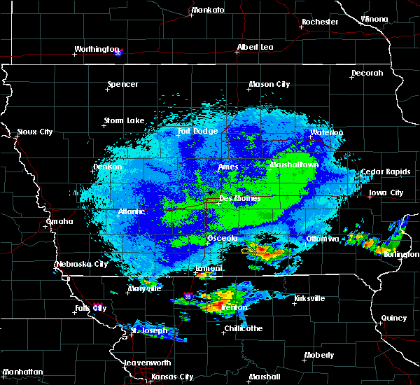 The severe thunderstorm warning for southeastern lucas county will expire at 1000 pm cdt, the storm which prompted the warning has weakened below severe limits, and has exited the warned area. therefore, the warning will be allowed to expire. The severe thunderstorm warning for southeastern lucas county will expire at 1000 pm cdt, the storm which prompted the warning has weakened below severe limits, and has exited the warned area. therefore, the warning will be allowed to expire.
|
| 5/14/2018 9:42 PM CDT |
 At 942 pm cdt, a severe thunderstorm was located 8 miles southeast of chariton, moving east at 20 mph (radar indicated). Hazards include quarter size hail. Damage to vehicles is expected. This severe thunderstorm will remain over mainly rural areas of southeastern lucas county. At 942 pm cdt, a severe thunderstorm was located 8 miles southeast of chariton, moving east at 20 mph (radar indicated). Hazards include quarter size hail. Damage to vehicles is expected. This severe thunderstorm will remain over mainly rural areas of southeastern lucas county.
|
| 5/14/2018 9:28 PM CDT |
 At 927 pm cdt, a severe thunderstorm was located near chariton, moving northeast at 15 mph (radar indicated). Hazards include quarter size hail. Damage to vehicles is expected. Locations impacted include, russell and red haw lake state park. At 927 pm cdt, a severe thunderstorm was located near chariton, moving northeast at 15 mph (radar indicated). Hazards include quarter size hail. Damage to vehicles is expected. Locations impacted include, russell and red haw lake state park.
|
| 5/14/2018 9:13 PM CDT |
 At 912 pm cdt, a severe thunderstorm was located 7 miles south of chariton, moving northeast at 15 mph (radar indicated). Hazards include half dollar size hail. damage to vehicles is expected At 912 pm cdt, a severe thunderstorm was located 7 miles south of chariton, moving northeast at 15 mph (radar indicated). Hazards include half dollar size hail. damage to vehicles is expected
|
| 6/15/2017 8:58 PM CDT |
 The national weather service in des moines has issued a * severe thunderstorm warning for. northwestern monroe county in south central iowa. northeastern lucas county in south central iowa. south central marion county in south central iowa. Until 945 pm cdt. The national weather service in des moines has issued a * severe thunderstorm warning for. northwestern monroe county in south central iowa. northeastern lucas county in south central iowa. south central marion county in south central iowa. Until 945 pm cdt.
|
| 5/17/2017 4:27 PM CDT |
 At 427 pm cdt, severe thunderstorms were located along a line extending from near carlisle to near knoxville to near lake sundown, moving northeast at 65 mph (radar indicated). Hazards include 60 mph wind gusts and nickel size hail. expect damage to roofs, siding, and trees At 427 pm cdt, severe thunderstorms were located along a line extending from near carlisle to near knoxville to near lake sundown, moving northeast at 65 mph (radar indicated). Hazards include 60 mph wind gusts and nickel size hail. expect damage to roofs, siding, and trees
|
| 5/17/2017 4:05 PM CDT |
 At 404 pm cdt, severe thunderstorms were located along a line extending from 8 miles southwest of indianola to 7 miles southeast of corydon, moving northeast at 65 mph (radar indicated). Hazards include 60 mph wind gusts. Expect damage to roofs, siding, and trees. locations impacted include, indianola, chariton, corydon, milo, hartford, russell, allerton, humeston, new virginia, lacona, lucas, garden grove, woodburn, williamson, derby, promise city, ackworth, clio, swan and sandyville. this includes interstate 35 between mile markers 41 and 45. A tornado watch remains in effect until 700 pm cdt for south central and central iowa. At 404 pm cdt, severe thunderstorms were located along a line extending from 8 miles southwest of indianola to 7 miles southeast of corydon, moving northeast at 65 mph (radar indicated). Hazards include 60 mph wind gusts. Expect damage to roofs, siding, and trees. locations impacted include, indianola, chariton, corydon, milo, hartford, russell, allerton, humeston, new virginia, lacona, lucas, garden grove, woodburn, williamson, derby, promise city, ackworth, clio, swan and sandyville. this includes interstate 35 between mile markers 41 and 45. A tornado watch remains in effect until 700 pm cdt for south central and central iowa.
|
| 5/17/2017 3:47 PM CDT |
 At 347 pm cdt, a severe thunderstorm was located 8 miles south of osceola, moving northeast at 65 mph (radar indicated). Hazards include 60 mph wind gusts. expect damage to roofs, siding, and trees At 347 pm cdt, a severe thunderstorm was located 8 miles south of osceola, moving northeast at 65 mph (radar indicated). Hazards include 60 mph wind gusts. expect damage to roofs, siding, and trees
|
| 5/10/2017 1:39 PM CDT |
 At 139 pm cdt, a severe thunderstorm was located 13 miles east of chariton, moving east at 55 mph (radar indicated). Hazards include quarter size hail. Damage to vehicles is expected. Locations impacted include, chariton, russell, lovilia, williamson, melrose and red haw lake state park. At 139 pm cdt, a severe thunderstorm was located 13 miles east of chariton, moving east at 55 mph (radar indicated). Hazards include quarter size hail. Damage to vehicles is expected. Locations impacted include, chariton, russell, lovilia, williamson, melrose and red haw lake state park.
|
| 5/10/2017 1:17 PM CDT |
 At 117 pm cdt, a severe thunderstorm was located near chariton, moving east at 40 mph (radar indicated). Hazards include ping pong ball size hail and 60 mph wind gusts. People and animals outdoors will be injured. expect hail damage to roofs, siding, windows, and vehicles. Expect wind damage to roofs, siding, and trees. At 117 pm cdt, a severe thunderstorm was located near chariton, moving east at 40 mph (radar indicated). Hazards include ping pong ball size hail and 60 mph wind gusts. People and animals outdoors will be injured. expect hail damage to roofs, siding, windows, and vehicles. Expect wind damage to roofs, siding, and trees.
|
| 3/6/2017 8:09 PM CST |
 The severe thunderstorm warning for western monroe, lucas and eastern clarke counties will expire at 815 pm cst, the storms which prompted the warning have moved out of the area. therefore the warning will be allowed to expire. however gusty winds are still possible with these thunderstorms. a tornado watch remains in effect until 1000 pm cst for south central iowa. remember, a severe thunderstorm warning still remains in effect for eastern portions of lucas county. The severe thunderstorm warning for western monroe, lucas and eastern clarke counties will expire at 815 pm cst, the storms which prompted the warning have moved out of the area. therefore the warning will be allowed to expire. however gusty winds are still possible with these thunderstorms. a tornado watch remains in effect until 1000 pm cst for south central iowa. remember, a severe thunderstorm warning still remains in effect for eastern portions of lucas county.
|
| 3/6/2017 8:08 PM CST |
 At 807 pm cst, severe thunderstorms were located along a line extending from 12 miles northwest of albia to 11 miles south of corydon, moving east at 50 mph (trained weather spotters. these storms have a history of producing winds in excess of 60 mph). Hazards include 60 mph wind gusts and quarter size hail. Hail damage to vehicles is expected. Expect wind damage to roofs, siding, and trees. At 807 pm cst, severe thunderstorms were located along a line extending from 12 miles northwest of albia to 11 miles south of corydon, moving east at 50 mph (trained weather spotters. these storms have a history of producing winds in excess of 60 mph). Hazards include 60 mph wind gusts and quarter size hail. Hail damage to vehicles is expected. Expect wind damage to roofs, siding, and trees.
|
| 3/6/2017 7:21 PM CST |
 At 721 pm cst, severe thunderstorms were located along a line extending from 13 miles northwest of chariton to 8 miles south of osceola, moving east at 45 mph (radar indicated). Hazards include 60 mph wind gusts and quarter size hail. Hail damage to vehicles is expected. Expect wind damage to roofs, siding, and trees. At 721 pm cst, severe thunderstorms were located along a line extending from 13 miles northwest of chariton to 8 miles south of osceola, moving east at 45 mph (radar indicated). Hazards include 60 mph wind gusts and quarter size hail. Hail damage to vehicles is expected. Expect wind damage to roofs, siding, and trees.
|
| 9/19/2016 6:07 PM CDT |
 At 606 pm cdt, a severe thunderstorm was located 10 miles west of rathbun lake, or 10 miles northeast of corydon, moving southeast at 20 mph (radar indicated). Hazards include 60 mph wind gusts and quarter size hail. Hail damage to vehicles is expected. expect wind damage to roofs, siding, and trees. locations impacted include, corydon, rathbun lake, mystic, promise city, plano and millerton. A tornado watch remains in effect until 1000 pm cdt for south central iowa. At 606 pm cdt, a severe thunderstorm was located 10 miles west of rathbun lake, or 10 miles northeast of corydon, moving southeast at 20 mph (radar indicated). Hazards include 60 mph wind gusts and quarter size hail. Hail damage to vehicles is expected. expect wind damage to roofs, siding, and trees. locations impacted include, corydon, rathbun lake, mystic, promise city, plano and millerton. A tornado watch remains in effect until 1000 pm cdt for south central iowa.
|
| 9/19/2016 5:42 PM CDT |
 At 542 pm cdt, a severe thunderstorm was located near chariton, moving southeast at 20 mph (radar indicated). Hazards include 60 mph wind gusts and quarter size hail. Hail damage to vehicles is expected. Expect wind damage to roofs, siding, and trees. At 542 pm cdt, a severe thunderstorm was located near chariton, moving southeast at 20 mph (radar indicated). Hazards include 60 mph wind gusts and quarter size hail. Hail damage to vehicles is expected. Expect wind damage to roofs, siding, and trees.
|
| 9/19/2016 5:25 PM CDT |
 At 524 pm cdt, a severe thunderstorm was located 7 miles east of chariton, moving southeast at 30 mph (radar indicated). Hazards include 60 mph wind gusts and quarter size hail. Hail damage to vehicles is expected. expect wind damage to roofs, siding, and trees. locations impacted include, chariton, russell, williamson, melrose, chariton municipal airport and red haw lake state park. A tornado watch remains in effect until 1000 pm cdt for south central iowa. At 524 pm cdt, a severe thunderstorm was located 7 miles east of chariton, moving southeast at 30 mph (radar indicated). Hazards include 60 mph wind gusts and quarter size hail. Hail damage to vehicles is expected. expect wind damage to roofs, siding, and trees. locations impacted include, chariton, russell, williamson, melrose, chariton municipal airport and red haw lake state park. A tornado watch remains in effect until 1000 pm cdt for south central iowa.
|
| 9/19/2016 5:06 PM CDT |
 At 506 pm cdt, a severe thunderstorm was located near chariton, moving southeast at 25 mph (radar indicated). Hazards include 60 mph wind gusts and quarter size hail. Hail damage to vehicles is expected. Expect wind damage to roofs, siding, and trees. At 506 pm cdt, a severe thunderstorm was located near chariton, moving southeast at 25 mph (radar indicated). Hazards include 60 mph wind gusts and quarter size hail. Hail damage to vehicles is expected. Expect wind damage to roofs, siding, and trees.
|
| 8/11/2016 10:21 PM CDT |
 At 1021 pm cdt, severe thunderstorms were located along a line extending from 7 miles north of pella to 14 miles southeast of knoxville to 10 miles west of albia to near corydon, moving east at 35 mph (radar indicated). Hazards include 60 mph wind gusts. Expect damage to roofs. siding. and trees. Locations impacted include, pella, knoxville, chariton, monroe, melcher-dallas, knoxville raceway, lake red rock, rathbun lake, russell, lovilia, bussey, harvey, lucas, leighton, williamson, hamilton, derby, melrose, marysville and millerton. At 1021 pm cdt, severe thunderstorms were located along a line extending from 7 miles north of pella to 14 miles southeast of knoxville to 10 miles west of albia to near corydon, moving east at 35 mph (radar indicated). Hazards include 60 mph wind gusts. Expect damage to roofs. siding. and trees. Locations impacted include, pella, knoxville, chariton, monroe, melcher-dallas, knoxville raceway, lake red rock, rathbun lake, russell, lovilia, bussey, harvey, lucas, leighton, williamson, hamilton, derby, melrose, marysville and millerton.
|
| 8/11/2016 9:59 PM CDT |
 At 958 pm cdt, severe thunderstorms were located along a line extending from monroe to near melcher-dallas to 6 miles north of chariton to 10 miles northwest of corydon, moving east at 35 mph (radar indicated). Hazards include 60 mph wind gusts. Expect damage to roofs. siding. And trees. At 958 pm cdt, severe thunderstorms were located along a line extending from monroe to near melcher-dallas to 6 miles north of chariton to 10 miles northwest of corydon, moving east at 35 mph (radar indicated). Hazards include 60 mph wind gusts. Expect damage to roofs. siding. And trees.
|
| 7/19/2016 2:42 PM CDT |
 At 241 pm cdt, severe thunderstorms were located along a line extending from near rathbun lake to 11 miles southeast of corydon to 8 miles northeast of mercer, moving southeast at 40 mph (radar indicated. at 220pm...60 mph winds were reported near chariton). Hazards include 70 mph wind gusts. Expect considerable tree damage. damage is likely to mobile homes, roofs, and outbuildings. Locations impacted include, centerville, chariton, leon, corydon, rathbun lake, seymour, russell, allerton, humeston, mystic, cincinnati, lineville, garden grove, davis city, exline, derby, promise city, numa, clio and plano. At 241 pm cdt, severe thunderstorms were located along a line extending from near rathbun lake to 11 miles southeast of corydon to 8 miles northeast of mercer, moving southeast at 40 mph (radar indicated. at 220pm...60 mph winds were reported near chariton). Hazards include 70 mph wind gusts. Expect considerable tree damage. damage is likely to mobile homes, roofs, and outbuildings. Locations impacted include, centerville, chariton, leon, corydon, rathbun lake, seymour, russell, allerton, humeston, mystic, cincinnati, lineville, garden grove, davis city, exline, derby, promise city, numa, clio and plano.
|
| 7/19/2016 2:23 PM CDT |
 At 222 pm cdt, severe thunderstorms were located along a line extending from near chariton to near corydon to near leon, moving southeast at 40 mph (radar indicated). Hazards include 70 mph wind gusts and quarter size hail. Hail damage to vehicles is expected. expect considerable tree damage. wind damage is also likely to mobile homes, roofs, and outbuildings. Locations impacted include, centerville, chariton, leon, corydon, rathbun lake, seymour, russell, allerton, humeston, mystic, cincinnati, van wert, lineville, lucas, garden grove, davis city, decatur city, exline, williamson and weldon. At 222 pm cdt, severe thunderstorms were located along a line extending from near chariton to near corydon to near leon, moving southeast at 40 mph (radar indicated). Hazards include 70 mph wind gusts and quarter size hail. Hail damage to vehicles is expected. expect considerable tree damage. wind damage is also likely to mobile homes, roofs, and outbuildings. Locations impacted include, centerville, chariton, leon, corydon, rathbun lake, seymour, russell, allerton, humeston, mystic, cincinnati, van wert, lineville, lucas, garden grove, davis city, decatur city, exline, williamson and weldon.
|
| 7/19/2016 2:20 PM CDT | Trained spotter reported grain bin damage... including one rolled up against another... completely removed fence posts... and tree damage. time radar estimate in lucas county IA, 6.8 miles SSW of Russell, IA |
| 7/19/2016 2:20 PM CDT | Trained spotter reported damaged brick and concrete silos... barn damage... roof damage... and tree damage on farmstead. time radar estimated. in lucas county IA, 6.2 miles SSW of Russell, IA |
| 7/19/2016 2:20 PM CDT |
 At 220 pm cdt, severe thunderstorms were located along a line extending from 7 miles east of chariton to corydon to near leon, moving southeast at 50 mph (radar indicated). Hazards include 70 mph wind gusts and quarter size hail. Hail damage to vehicles is expected. expect considerable tree damage. wind damage is also likely to mobile homes, roofs, and outbuildings. Locations impacted include, osceola, chariton, leon, lamoni, sun valley lake, lakeside casino, milo, russell, humeston, lacona, grand river, van wert, lucas, garden grove, davis city, woodburn, decatur city, williamson, weldon and derby. At 220 pm cdt, severe thunderstorms were located along a line extending from 7 miles east of chariton to corydon to near leon, moving southeast at 50 mph (radar indicated). Hazards include 70 mph wind gusts and quarter size hail. Hail damage to vehicles is expected. expect considerable tree damage. wind damage is also likely to mobile homes, roofs, and outbuildings. Locations impacted include, osceola, chariton, leon, lamoni, sun valley lake, lakeside casino, milo, russell, humeston, lacona, grand river, van wert, lucas, garden grove, davis city, woodburn, decatur city, williamson, weldon and derby.
|
| 7/19/2016 2:11 PM CDT |
 At 211 pm cdt, severe thunderstorms were located along a line extending from near chariton to 10 miles northwest of corydon to near leon, moving southeast at 40 mph (radar indicated). Hazards include 60 mph wind gusts and penny size hail. Expect damage to roofs. siding. And trees. At 211 pm cdt, severe thunderstorms were located along a line extending from near chariton to 10 miles northwest of corydon to near leon, moving southeast at 40 mph (radar indicated). Hazards include 60 mph wind gusts and penny size hail. Expect damage to roofs. siding. And trees.
|
| 7/19/2016 2:03 PM CDT |
 At 202 pm cdt, severe thunderstorms were located along a line extending from 9 miles northwest of chariton to 14 miles southeast of osceola to near sun valley lake, moving southeast at 25 mph (public. at 155pm...60 mph winds and penny sized hail was reported about 9 miles southeast of new virginia). Hazards include 60 mph wind gusts and penny size hail. Expect damage to roofs. siding. and trees. Locations impacted include, osceola, chariton, leon, lamoni, sun valley lake, lakeside casino, milo, russell, humeston, lacona, grand river, van wert, lucas, garden grove, davis city, woodburn, decatur city, williamson, weldon and derby. At 202 pm cdt, severe thunderstorms were located along a line extending from 9 miles northwest of chariton to 14 miles southeast of osceola to near sun valley lake, moving southeast at 25 mph (public. at 155pm...60 mph winds and penny sized hail was reported about 9 miles southeast of new virginia). Hazards include 60 mph wind gusts and penny size hail. Expect damage to roofs. siding. and trees. Locations impacted include, osceola, chariton, leon, lamoni, sun valley lake, lakeside casino, milo, russell, humeston, lacona, grand river, van wert, lucas, garden grove, davis city, woodburn, decatur city, williamson, weldon and derby.
|
| 7/19/2016 1:48 PM CDT |
 At 148 pm cdt, severe thunderstorms were located along a line extending from 12 miles south of indianola to near osceola to sun valley lake, moving southeast at 35 mph (radar indicated). Hazards include 60 mph wind gusts and quarter size hail. Hail damage to vehicles is expected. Expect wind damage to roofs, siding, and trees. At 148 pm cdt, severe thunderstorms were located along a line extending from 12 miles south of indianola to near osceola to sun valley lake, moving southeast at 35 mph (radar indicated). Hazards include 60 mph wind gusts and quarter size hail. Hail damage to vehicles is expected. Expect wind damage to roofs, siding, and trees.
|
| 11/11/2015 3:23 PM CST |
 At 323 pm cst, a severe thunderstorm was located 6 miles west of melcher-dallas, or 13 miles southeast of indianola, moving northeast at 50 mph (radar indicated). Hazards include 60 mph wind gusts. Expect damage to roofs. siding and trees. locations impacted include, chariton, milo, russell, lacona, lucas, williamson, lake ahquabi state park, chariton municipal airport, red haw lake state park and otter creek county park. A tornado watch remains in effect until 600 pm cst for south central iowa. At 323 pm cst, a severe thunderstorm was located 6 miles west of melcher-dallas, or 13 miles southeast of indianola, moving northeast at 50 mph (radar indicated). Hazards include 60 mph wind gusts. Expect damage to roofs. siding and trees. locations impacted include, chariton, milo, russell, lacona, lucas, williamson, lake ahquabi state park, chariton municipal airport, red haw lake state park and otter creek county park. A tornado watch remains in effect until 600 pm cst for south central iowa.
|
| 11/11/2015 3:18 PM CST |
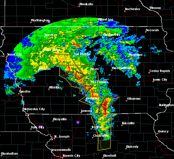 At 318 pm cst, a severe thunderstorm capable of producing a tornado was located 7 miles west of rathbun lake, or 11 miles northeast of corydon, moving northeast at 50 mph (radar indicated rotation). Hazards include tornado. Flying debris will be dangerous to those caught without shelter. mobile homes will be damaged or destroyed. damage to roofs, windows and vehicles will occur. tree damage is likely. this dangerous storm will be near, rathbun lake around 325 pm cst. albia around 345 pm cst. Other locations impacted by this tornadic thunderstorm include russell, lovilia, melrose and honey creek state park. At 318 pm cst, a severe thunderstorm capable of producing a tornado was located 7 miles west of rathbun lake, or 11 miles northeast of corydon, moving northeast at 50 mph (radar indicated rotation). Hazards include tornado. Flying debris will be dangerous to those caught without shelter. mobile homes will be damaged or destroyed. damage to roofs, windows and vehicles will occur. tree damage is likely. this dangerous storm will be near, rathbun lake around 325 pm cst. albia around 345 pm cst. Other locations impacted by this tornadic thunderstorm include russell, lovilia, melrose and honey creek state park.
|
| 11/11/2015 2:55 PM CST |
 At 255 pm cst, a severe thunderstorm was located over osceola, moving northeast at 50 mph (radar indicated). Hazards include 60 mph wind gusts. Expect damage to roofs. Siding and trees. At 255 pm cst, a severe thunderstorm was located over osceola, moving northeast at 50 mph (radar indicated). Hazards include 60 mph wind gusts. Expect damage to roofs. Siding and trees.
|
| 8/2/2015 7:26 PM CDT |
 The severe thunderstorm warning for lucas and northeastern clarke counties will expire at 730 pm cdt, the storms which prompted the warning have weakened below severe limits, and no longer pose an immediate threat to life or property. therefore the warning will be allowed to expire. a severe thunderstorm watch remains in effect until 1100 pm cdt for south central iowa. The severe thunderstorm warning for lucas and northeastern clarke counties will expire at 730 pm cdt, the storms which prompted the warning have weakened below severe limits, and no longer pose an immediate threat to life or property. therefore the warning will be allowed to expire. a severe thunderstorm watch remains in effect until 1100 pm cdt for south central iowa.
|
| 8/2/2015 7:19 PM CDT |
 At 719 pm cdt, severe thunderstorms were located along a line extending from 7 miles west of rathbun lake to 3 miles north of corydon to 12 miles east of leon, moving south at 25 mph (radar indicated). Hazards include 60 mph wind gusts and quarter size hail. Hail damage to vehicles is expected. Expect wind damage to roofs, siding and trees. At 719 pm cdt, severe thunderstorms were located along a line extending from 7 miles west of rathbun lake to 3 miles north of corydon to 12 miles east of leon, moving south at 25 mph (radar indicated). Hazards include 60 mph wind gusts and quarter size hail. Hail damage to vehicles is expected. Expect wind damage to roofs, siding and trees.
|
| 8/2/2015 7:15 PM CDT |
 At 715 pm cdt, severe thunderstorms were located along a line extending from 6 miles northwest of rathbun lake to 6 miles south of chariton to 13 miles east of osceola, moving southeast at 60 mph (radar indicated). Hazards include 60 mph wind gusts and quarter size hail. Hail damage to vehicles is expected. expect wind damage to roofs, siding and trees. Locations impacted include, chariton, russell, lucas, williamson, derby, chariton municipal airport and red haw lake state park. At 715 pm cdt, severe thunderstorms were located along a line extending from 6 miles northwest of rathbun lake to 6 miles south of chariton to 13 miles east of osceola, moving southeast at 60 mph (radar indicated). Hazards include 60 mph wind gusts and quarter size hail. Hail damage to vehicles is expected. expect wind damage to roofs, siding and trees. Locations impacted include, chariton, russell, lucas, williamson, derby, chariton municipal airport and red haw lake state park.
|
| 8/2/2015 6:41 PM CDT |
 At 641 pm cdt, severe thunderstorms were located along a line extending from 7 miles southwest of melcher-dallas to 13 miles northeast of osceola to 7 miles south of avenue of the saints event center, moving southeast at 25 mph (radar indicated). Hazards include 60 mph wind gusts and quarter size hail. Hail damage to vehicles is expected. Expect wind damage to roofs, siding and trees. At 641 pm cdt, severe thunderstorms were located along a line extending from 7 miles southwest of melcher-dallas to 13 miles northeast of osceola to 7 miles south of avenue of the saints event center, moving southeast at 25 mph (radar indicated). Hazards include 60 mph wind gusts and quarter size hail. Hail damage to vehicles is expected. Expect wind damage to roofs, siding and trees.
|
| 7/28/2015 10:17 PM CDT |
 At 1017 pm cdt, a severe thunderstorm was located 11 miles northwest of lancaster, moving southeast at 35 mph (radar indicated). Hazards include 60 mph wind gusts. Expect damage to roofs. siding and trees. Locations impacted include, centerville, albia, lake sundown, rathbun lake, seymour, moravia, moulton, russell, mystic, cincinnati, exline, melrose, promise city, unionville, numa, rathbun, plano, udell, millerton and centerville municipal airport. At 1017 pm cdt, a severe thunderstorm was located 11 miles northwest of lancaster, moving southeast at 35 mph (radar indicated). Hazards include 60 mph wind gusts. Expect damage to roofs. siding and trees. Locations impacted include, centerville, albia, lake sundown, rathbun lake, seymour, moravia, moulton, russell, mystic, cincinnati, exline, melrose, promise city, unionville, numa, rathbun, plano, udell, millerton and centerville municipal airport.
|
| 7/28/2015 9:36 PM CDT |
 At 936 pm cdt, a severe thunderstorm was located near rathbun lake, or 11 miles southwest of albia, moving southeast at 30 mph (radar indicated). Hazards include 60 mph wind gusts. Expect damage to roofs. siding and trees. Locations impacted include, chariton, rathbun lake, lake sundown, moravia, russell, lucas, williamson, melrose, millerton, red haw lake state park, honey creek state park and chariton municipal airport. At 936 pm cdt, a severe thunderstorm was located near rathbun lake, or 11 miles southwest of albia, moving southeast at 30 mph (radar indicated). Hazards include 60 mph wind gusts. Expect damage to roofs. siding and trees. Locations impacted include, chariton, rathbun lake, lake sundown, moravia, russell, lucas, williamson, melrose, millerton, red haw lake state park, honey creek state park and chariton municipal airport.
|
| 7/28/2015 9:35 PM CDT |
 At 935 pm cdt, a severe thunderstorm was located near rathbun lake, or 12 miles southwest of albia, moving southeast at 35 mph (radar indicated). Hazards include 60 mph wind gusts. Expect damage to roofs. Siding and trees. At 935 pm cdt, a severe thunderstorm was located near rathbun lake, or 12 miles southwest of albia, moving southeast at 35 mph (radar indicated). Hazards include 60 mph wind gusts. Expect damage to roofs. Siding and trees.
|
| 7/28/2015 9:04 PM CDT |
 At 903 pm cdt, a severe thunderstorm was located 7 miles northeast of chariton, moving southeast at 40 mph (radar indicated). Hazards include 70 mph wind gusts. Expect considerable tree damage. Damage is likely to mobile homes, roofs and outbuildings. At 903 pm cdt, a severe thunderstorm was located 7 miles northeast of chariton, moving southeast at 40 mph (radar indicated). Hazards include 70 mph wind gusts. Expect considerable tree damage. Damage is likely to mobile homes, roofs and outbuildings.
|
| 7/27/2015 2:41 PM CDT |
 At 240 pm cdt, a severe thunderstorm was located near rathbun lake, or 12 miles northwest of centerville, moving east at 15 mph (radar indicated). Hazards include 60 mph wind gusts and nickel size hail. Expect damage to roofs. siding and trees. Locations impacted include, rathbun lake, russell, melrose and honey creek state park. At 240 pm cdt, a severe thunderstorm was located near rathbun lake, or 12 miles northwest of centerville, moving east at 15 mph (radar indicated). Hazards include 60 mph wind gusts and nickel size hail. Expect damage to roofs. siding and trees. Locations impacted include, rathbun lake, russell, melrose and honey creek state park.
|
| 7/27/2015 2:12 PM CDT |
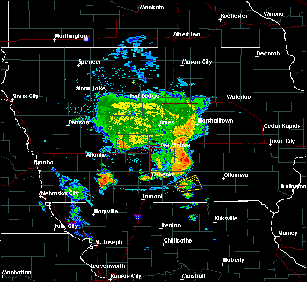 At 212 pm cdt, a severe thunderstorm was located 10 miles southeast of chariton, moving east at 15 mph (radar indicated). Hazards include 60 mph wind gusts and quarter size hail. Hail damage to vehicles is expected. Expect wind damage to roofs, siding and trees. At 212 pm cdt, a severe thunderstorm was located 10 miles southeast of chariton, moving east at 15 mph (radar indicated). Hazards include 60 mph wind gusts and quarter size hail. Hail damage to vehicles is expected. Expect wind damage to roofs, siding and trees.
|
| 6/24/2015 9:39 PM CDT |
 At 939 pm cdt, severe thunderstorms were located along a line extending from 13 miles northwest of albia to 8 miles southeast of chariton to 8 miles north of leon, moving southeast at 35 mph (radar indicated). Hazards include 70 mph wind gusts and quarter size hail. Hail damage to vehicles is expected. expect considerable tree damage. wind damage is also likely to mobile homes, roofs and outbuildings. locations impacted include, knoxville, osceola, chariton, melcher-dallas, knoxville raceway, lake red rock, russell, harvey, lucas, woodburn, williamson, hamilton, derby, melrose, marysville, chariton municipal airport, red haw lake state park and knoxville municipal airport. this includes interstate 35 between mile markers 25 and 31. A tornado watch remains in effect until 200 am cdt for south central iowa. At 939 pm cdt, severe thunderstorms were located along a line extending from 13 miles northwest of albia to 8 miles southeast of chariton to 8 miles north of leon, moving southeast at 35 mph (radar indicated). Hazards include 70 mph wind gusts and quarter size hail. Hail damage to vehicles is expected. expect considerable tree damage. wind damage is also likely to mobile homes, roofs and outbuildings. locations impacted include, knoxville, osceola, chariton, melcher-dallas, knoxville raceway, lake red rock, russell, harvey, lucas, woodburn, williamson, hamilton, derby, melrose, marysville, chariton municipal airport, red haw lake state park and knoxville municipal airport. this includes interstate 35 between mile markers 25 and 31. A tornado watch remains in effect until 200 am cdt for south central iowa.
|
| 6/24/2015 9:24 PM CDT |
 At 924 pm cdt, severe thunderstorms were located along a line extending from 4 miles east of melcher-dallas to 4 miles northwest of chariton to 6 miles southwest of osceola, moving southeast at 35 mph (radar indicated). Hazards include 60 mph wind gusts and quarter size hail. Hail damage to vehicles is expected. expect wind damage to roofs, siding and trees. locations impacted include, knoxville, osceola, chariton, pleasantville, melcher-dallas, knoxville raceway, lakeside casino, lake red rock, murray, russell, lacona, harvey, lucas, woodburn, williamson, hamilton, derby, melrose, marysville and chariton municipal airport. this includes interstate 35 between mile markers 25 and 39. A tornado watch remains in effect until 200 am cdt for south central iowa. At 924 pm cdt, severe thunderstorms were located along a line extending from 4 miles east of melcher-dallas to 4 miles northwest of chariton to 6 miles southwest of osceola, moving southeast at 35 mph (radar indicated). Hazards include 60 mph wind gusts and quarter size hail. Hail damage to vehicles is expected. expect wind damage to roofs, siding and trees. locations impacted include, knoxville, osceola, chariton, pleasantville, melcher-dallas, knoxville raceway, lakeside casino, lake red rock, murray, russell, lacona, harvey, lucas, woodburn, williamson, hamilton, derby, melrose, marysville and chariton municipal airport. this includes interstate 35 between mile markers 25 and 39. A tornado watch remains in effect until 200 am cdt for south central iowa.
|
| 6/24/2015 9:10 PM CDT |
 At 909 pm cdt, severe thunderstorms were located along a line extending from 4 miles northwest of melcher-dallas to 12 miles northwest of chariton to 9 miles west of lakeside casino, moving southeast at 35 mph (radar indicated). Hazards include 60 mph wind gusts and quarter size hail. Hail damage to vehicles is expected. Expect wind damage to roofs, siding and trees. At 909 pm cdt, severe thunderstorms were located along a line extending from 4 miles northwest of melcher-dallas to 12 miles northwest of chariton to 9 miles west of lakeside casino, moving southeast at 35 mph (radar indicated). Hazards include 60 mph wind gusts and quarter size hail. Hail damage to vehicles is expected. Expect wind damage to roofs, siding and trees.
|
| 6/20/2015 6:02 PM CDT |
 At 602 pm cdt, severe thunderstorms were located along a line extending from 4 miles west of eddyville to 11 miles northwest of rathbun lake, moving southeast at 35 mph (radar indicated). Hazards include 60 mph wind gusts and quarter size hail. Hail damage to vehicles is expected. expect wind damage to roofs, siding and trees. locations impacted include, albia, eddyville, ottumwa industrial airport, russell, lovilia, bussey, blakesburg, kirkville, hamilton, melrose, chillicothe, marysville and albia municipal airport. A tornado watch remains in effect until 1100 pm cdt for southeastern iowa. At 602 pm cdt, severe thunderstorms were located along a line extending from 4 miles west of eddyville to 11 miles northwest of rathbun lake, moving southeast at 35 mph (radar indicated). Hazards include 60 mph wind gusts and quarter size hail. Hail damage to vehicles is expected. expect wind damage to roofs, siding and trees. locations impacted include, albia, eddyville, ottumwa industrial airport, russell, lovilia, bussey, blakesburg, kirkville, hamilton, melrose, chillicothe, marysville and albia municipal airport. A tornado watch remains in effect until 1100 pm cdt for southeastern iowa.
|
| 6/20/2015 5:45 PM CDT |
 At 544 pm cdt, severe thunderstorms were located along a line extending from 12 miles southeast of knoxville to 6 miles east of chariton, moving southeast at 30 mph (radar indicated). Hazards include ping pong ball size hail. People and animals outdoors will be injured. Expect damage to roofs, siding, windows and vehicles. At 544 pm cdt, severe thunderstorms were located along a line extending from 12 miles southeast of knoxville to 6 miles east of chariton, moving southeast at 30 mph (radar indicated). Hazards include ping pong ball size hail. People and animals outdoors will be injured. Expect damage to roofs, siding, windows and vehicles.
|
| 5/4/2015 8:32 PM CDT | At 831 pm cdt, a severe thunderstorm was located 5 miles west of corydon, moving northeast at 40 mph (radar indicated). Hazards include 60 mph wind gusts and quarter size hail. Hail damage to vehicles is expected. expect wind damage to roofs, siding and trees. locations impacted include, corydon, rathbun lake, russell, allerton, humeston, promise city, clio, plano, millerton and red haw lake state park. 1. 00in. |
| 5/4/2015 8:08 PM CDT | At 808 pm cdt, a severe thunderstorm was located 11 miles east of leon, moving northeast at 40 mph (radar indicated). Hazards include 60 mph wind gusts and quarter size hail. Hail damage to vehicles is expected. Expect wind damage to roofs, siding and trees. |
| 4/9/2015 2:06 PM CDT | A severe thunderstorm warning remains in effect until 215 pm cdt for north central wayne and southeastern lucas counties. at 206 pm cdt. a severe thunderstorm was located 9 miles southeast of chariton. moving northeast at 45 mph. hazard. 60 mph wind gusts and half dollar size hail. source. Radar indicated. |
| 4/9/2015 1:58 PM CDT | A severe thunderstorm warning remains in effect until 215 pm cdt for north central wayne and southeastern lucas counties. at 158 pm cdt. a severe thunderstorm was located 7 miles south of chariton. moving northeast at 35 mph. hazard. 60 mph wind gusts and quarter size hail. source. Radar indicated. |
| 4/9/2015 1:45 PM CDT | The national weather service in des moines has issued a * severe thunderstorm warning for. northwestern wayne county in south central iowa. southeastern lucas county in south central iowa. until 215 pm cdt * at 145 pm cdt. A severe thunderstorm was located 8 miles northwest. |
| 1/1/0001 12:00 AM | Estimated peak gust at 60 mph...corn bent over from wind. radar estimated tim in lucas county IA, 0.2 miles N of Russell, IA |
| 1/1/0001 12:00 AM | Small limbs down. measured 3.00 inches of rain within an hour perio in lucas county IA, 1.9 miles S of Russell, IA |
| 1/1/0001 12:00 AM | Awning of camper torn off...some siding taken off house. power ou in lucas county IA, 1.6 miles SW of Russell, IA |
Hail Maps for Russell, IA


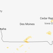


Connect with Interactive Hail Maps