

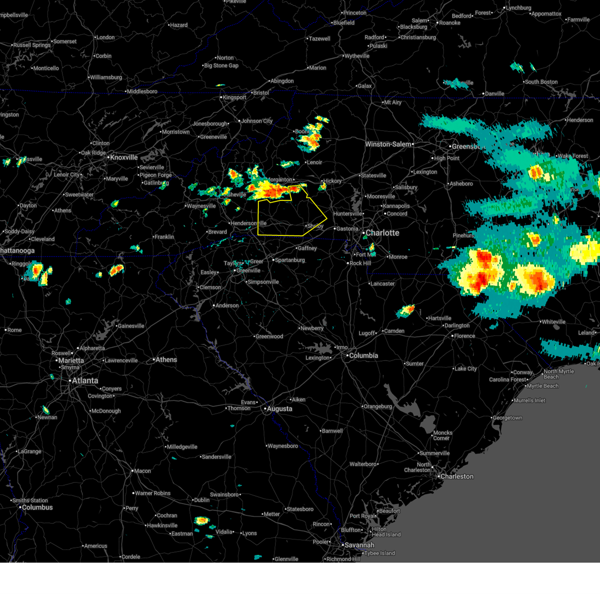
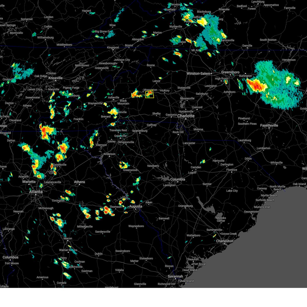
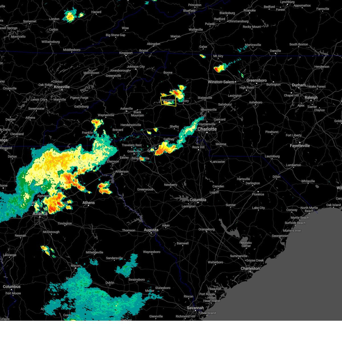
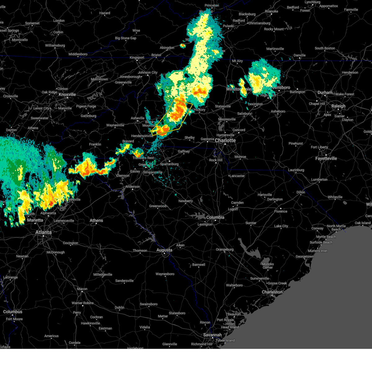
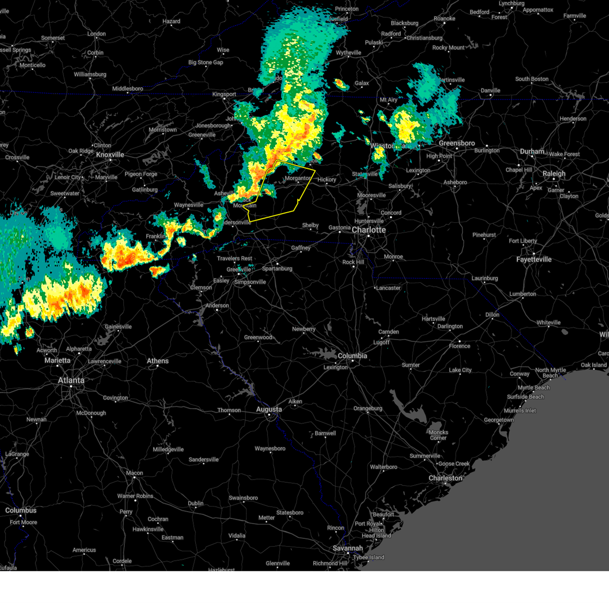
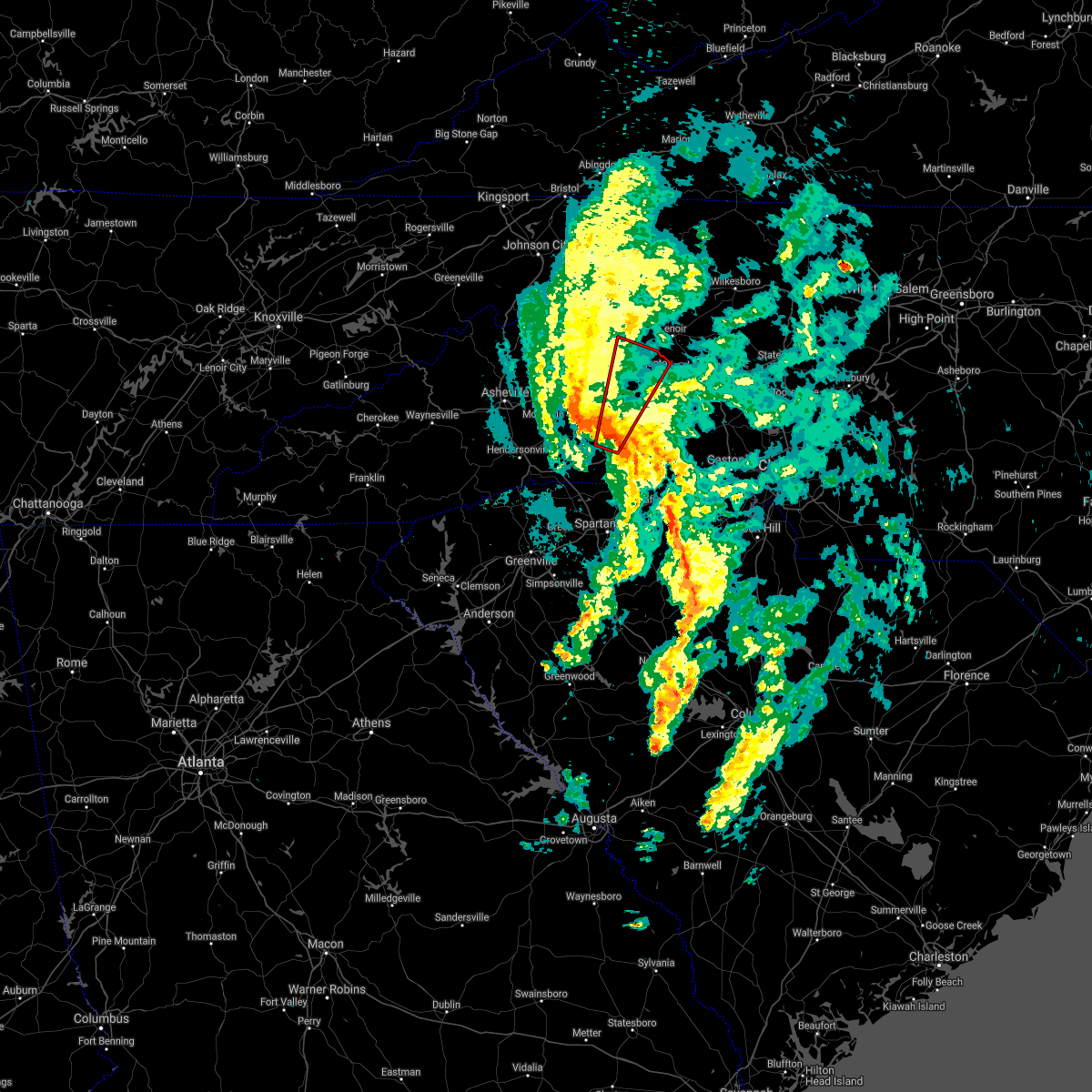
Hail Map for Salem, NC
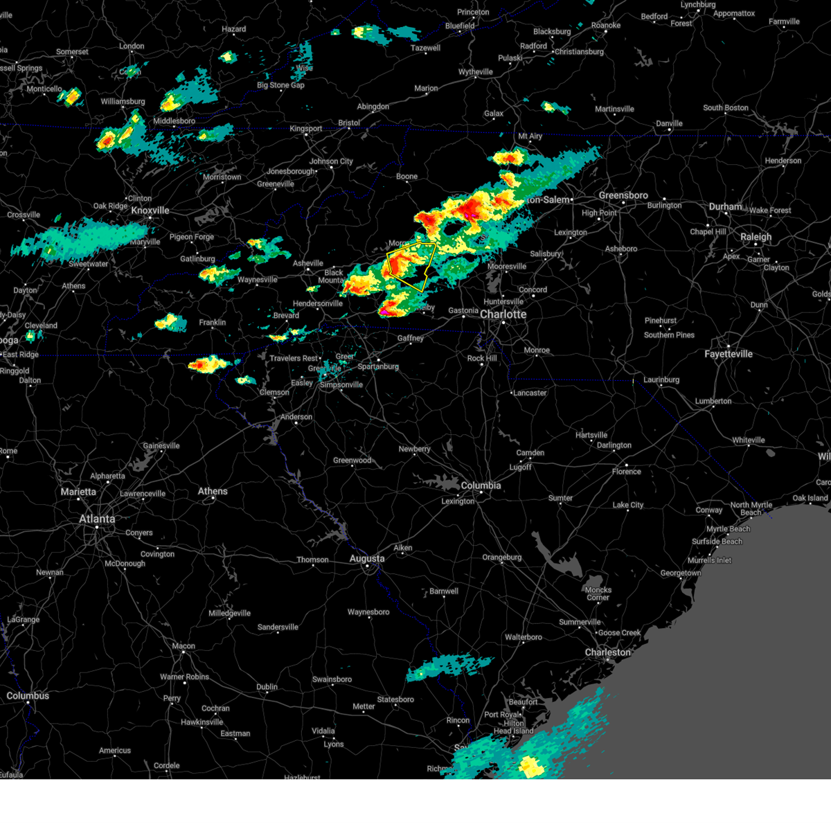
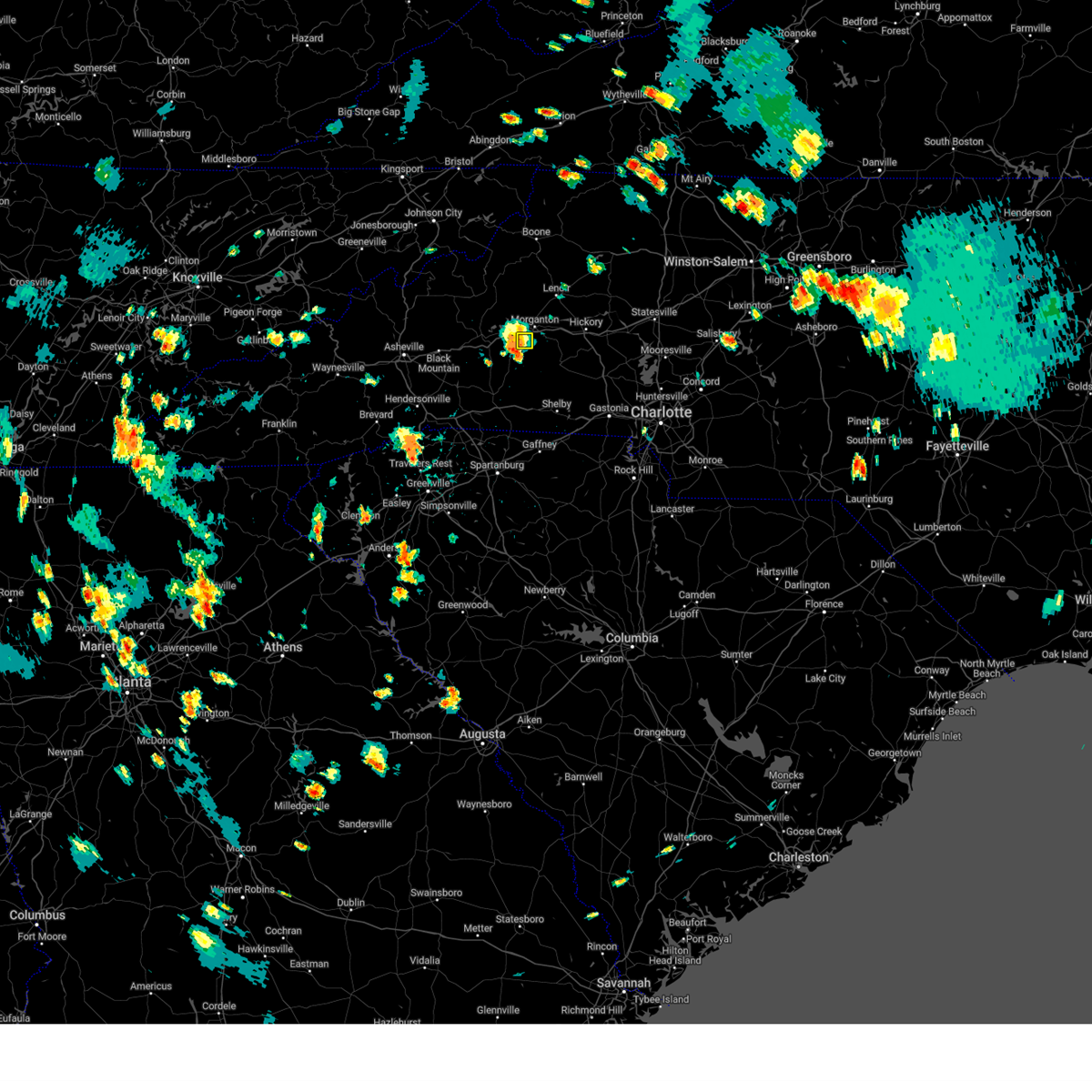
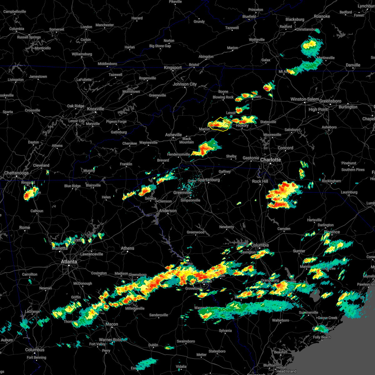
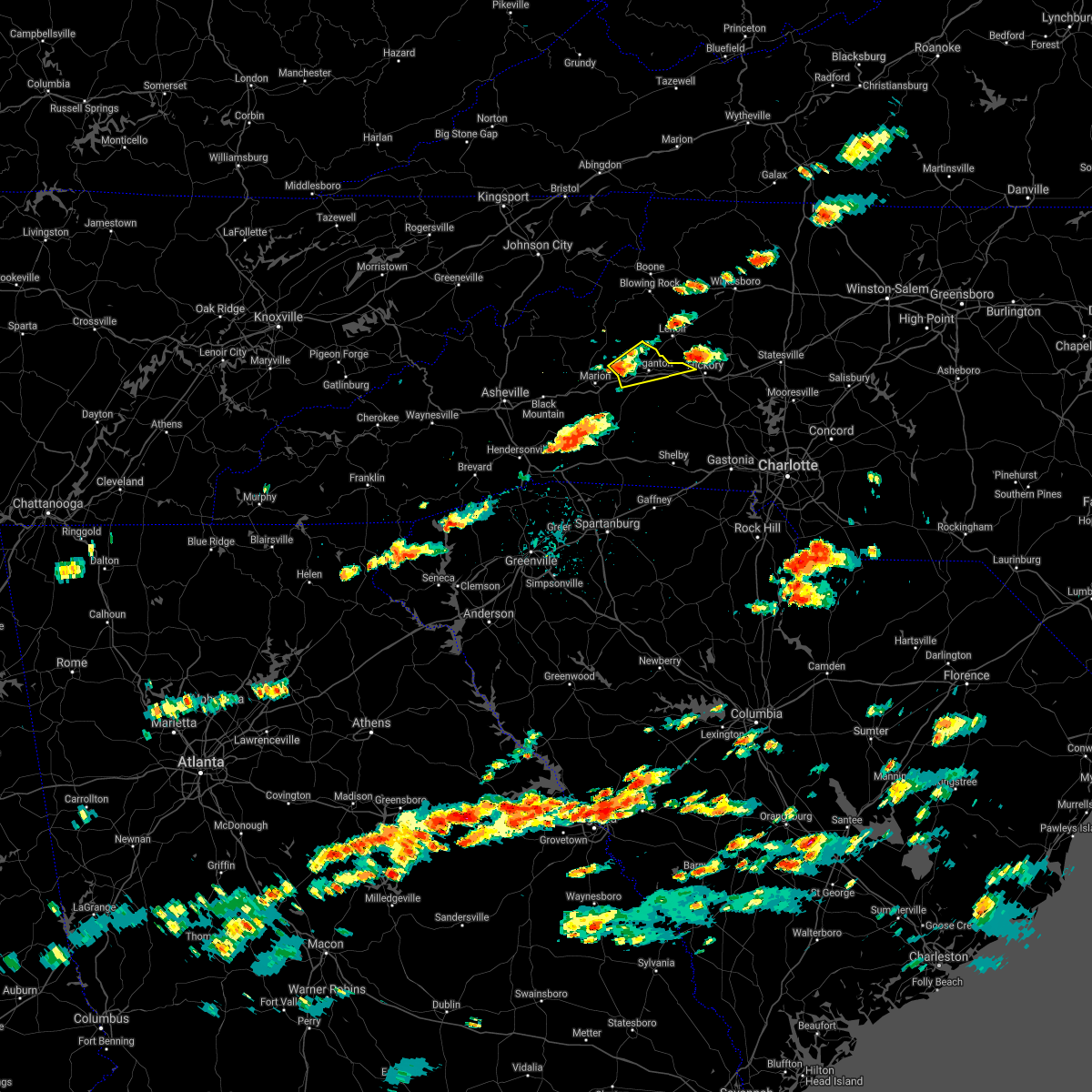
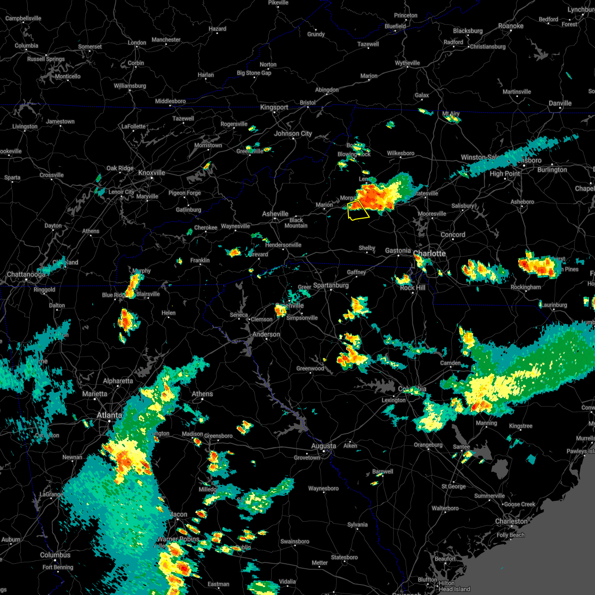
The Salem, NC area has had 0 reports of on-the-ground hail by trained spotters, and has been under severe weather warnings 25 times during the past 12 months. Doppler radar has detected hail at or near Salem, NC on 37 occasions, including 3 occasions during the past year.
| Name: | Salem, NC |
| Where Located: | 58.7 miles NW of Charlotte, NC |
| Map: | Google Map for Salem, NC |
| Population: | 2218 |
| Housing Units: | 1036 |
| More Info: | Search Google for Salem, NC |
4
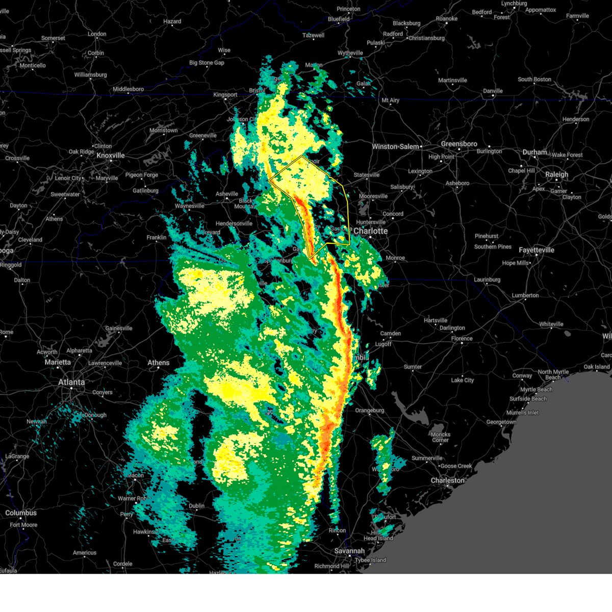
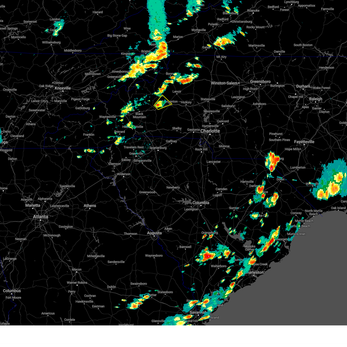
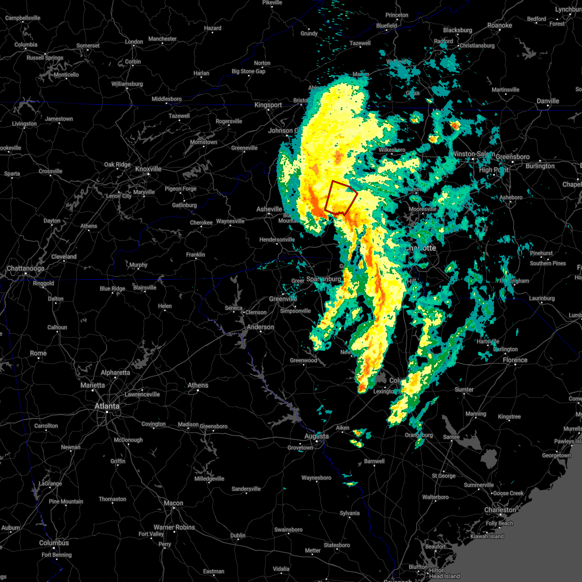
The Top Recent Hail Date for Salem, NC is Thursday, May 8, 2025 (7th out of 37)

Hail and Wind Damage Spotted near Salem, NC
| Date / Time | Report Details |
|---|---|
| 6/25/2025 4:31 PM EDT |
 Svrgsp the national weather service in greenville-spartanburg has issued a * severe thunderstorm warning for, rutherford county in western north carolina, eastern polk county in western north carolina, western lincoln county in the piedmont of north carolina, cleveland county in the piedmont of north carolina, northwestern gaston county in the piedmont of north carolina, south central burke county in western north carolina, * until 545 pm edt. * at 431 pm edt, severe thunderstorms were located along a line extending from 6 miles south of marion to 6 miles south of morganton, moving southeast at 15 mph (radar indicated). Hazards include 60 mph wind gusts and nickel size hail. expect damage to trees and power lines Svrgsp the national weather service in greenville-spartanburg has issued a * severe thunderstorm warning for, rutherford county in western north carolina, eastern polk county in western north carolina, western lincoln county in the piedmont of north carolina, cleveland county in the piedmont of north carolina, northwestern gaston county in the piedmont of north carolina, south central burke county in western north carolina, * until 545 pm edt. * at 431 pm edt, severe thunderstorms were located along a line extending from 6 miles south of marion to 6 miles south of morganton, moving southeast at 15 mph (radar indicated). Hazards include 60 mph wind gusts and nickel size hail. expect damage to trees and power lines
|
| 6/17/2025 10:36 PM EDT | The storms which prompted the warning have weakened below severe limits, and no longer pose an immediate threat to life or property. therefore, the warning will be allowed to expire. however, gusty winds are still possible with these thunderstorms. |
| 6/17/2025 10:24 PM EDT |
 the severe thunderstorm warning has been cancelled and is no longer in effect the severe thunderstorm warning has been cancelled and is no longer in effect
|
| 6/17/2025 10:24 PM EDT |
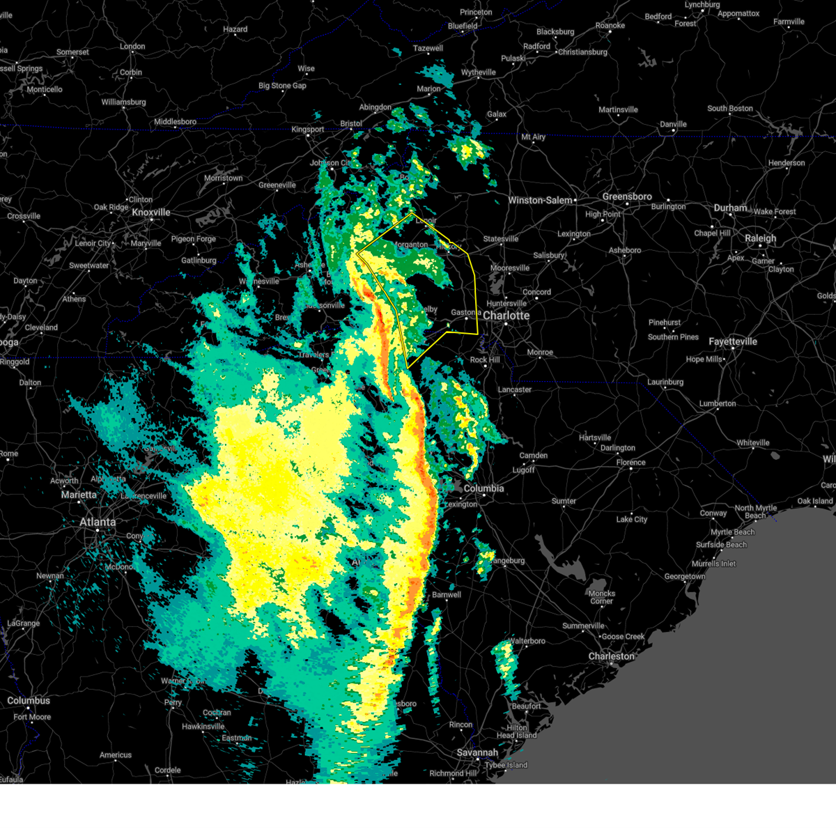
 At 1024 pm edt, severe thunderstorms were located along a line extending from 7 miles east of morganton to 6 miles southwest of newton to 8 miles southwest of gastonia to near chester, moving northeast at 45 mph (radar indicated). Hazards include 60 mph wind gusts. Expect damage to trees and power lines. locations impacted include, gastonia, rock hill, hickory, morganton, newton, lincolnton, york, chester, mt holly, and st. Stephens. At 1024 pm edt, severe thunderstorms were located along a line extending from 7 miles east of morganton to 6 miles southwest of newton to 8 miles southwest of gastonia to near chester, moving northeast at 45 mph (radar indicated). Hazards include 60 mph wind gusts. Expect damage to trees and power lines. locations impacted include, gastonia, rock hill, hickory, morganton, newton, lincolnton, york, chester, mt holly, and st. Stephens.
|
| 6/17/2025 10:18 PM EDT |
 At 1018 pm edt, severe thunderstorms were located along a line extending from 4 miles southeast of morganton to 9 miles northwest of lincolnton to 9 miles northwest of york to 5 miles west of chester, moving east at 50 mph (radar indicated). Hazards include 60 mph wind gusts. Expect damage to trees and power lines. Locations impacted include, gastonia, rock hill, hickory, shelby, morganton, newton, gaffney, lincolnton, union, and york. At 1018 pm edt, severe thunderstorms were located along a line extending from 4 miles southeast of morganton to 9 miles northwest of lincolnton to 9 miles northwest of york to 5 miles west of chester, moving east at 50 mph (radar indicated). Hazards include 60 mph wind gusts. Expect damage to trees and power lines. Locations impacted include, gastonia, rock hill, hickory, shelby, morganton, newton, gaffney, lincolnton, union, and york.
|
| 6/17/2025 10:02 PM EDT | the severe thunderstorm warning has been cancelled and is no longer in effect |
| 6/17/2025 10:02 PM EDT | At 1002 pm edt, severe thunderstorms were located along a line extending from 9 miles southwest of morganton to 14 miles north of shelby to 11 miles east of gaffney to 11 miles southeast of union, moving east at 50 mph (radar indicated). Hazards include 60 mph wind gusts. Expect damage to trees and power lines. Locations impacted include, gastonia, rock hill, hickory, shelby, morganton, newton, gaffney, lincolnton, union, and york. |
| 6/17/2025 9:43 PM EDT |
 Svrgsp the national weather service in greenville-spartanburg has issued a * severe thunderstorm warning for, catawba county in the piedmont of north carolina, rutherford county in western north carolina, lincoln county in the piedmont of north carolina, gaston county in the piedmont of north carolina, southeastern mcdowell county in western north carolina, cleveland county in the piedmont of north carolina, southern burke county in western north carolina, southeastern laurens county in upstate south carolina, union county in upstate south carolina, chester county in upstate south carolina, york county in upstate south carolina, eastern spartanburg county in upstate south carolina, cherokee county in upstate south carolina, * until 1045 pm edt. * at 943 pm edt, severe thunderstorms were located along a line extending from 10 miles north of rutherfordton to 10 miles east of forest city to 9 miles south of gaffney to 13 miles south of union, moving northeast at 50 mph (radar indicated). Hazards include 60 mph wind gusts. expect damage to trees and power lines Svrgsp the national weather service in greenville-spartanburg has issued a * severe thunderstorm warning for, catawba county in the piedmont of north carolina, rutherford county in western north carolina, lincoln county in the piedmont of north carolina, gaston county in the piedmont of north carolina, southeastern mcdowell county in western north carolina, cleveland county in the piedmont of north carolina, southern burke county in western north carolina, southeastern laurens county in upstate south carolina, union county in upstate south carolina, chester county in upstate south carolina, york county in upstate south carolina, eastern spartanburg county in upstate south carolina, cherokee county in upstate south carolina, * until 1045 pm edt. * at 943 pm edt, severe thunderstorms were located along a line extending from 10 miles north of rutherfordton to 10 miles east of forest city to 9 miles south of gaffney to 13 miles south of union, moving northeast at 50 mph (radar indicated). Hazards include 60 mph wind gusts. expect damage to trees and power lines
|
| 5/8/2025 5:36 PM EDT |
 the severe thunderstorm warning has been cancelled and is no longer in effect the severe thunderstorm warning has been cancelled and is no longer in effect
|
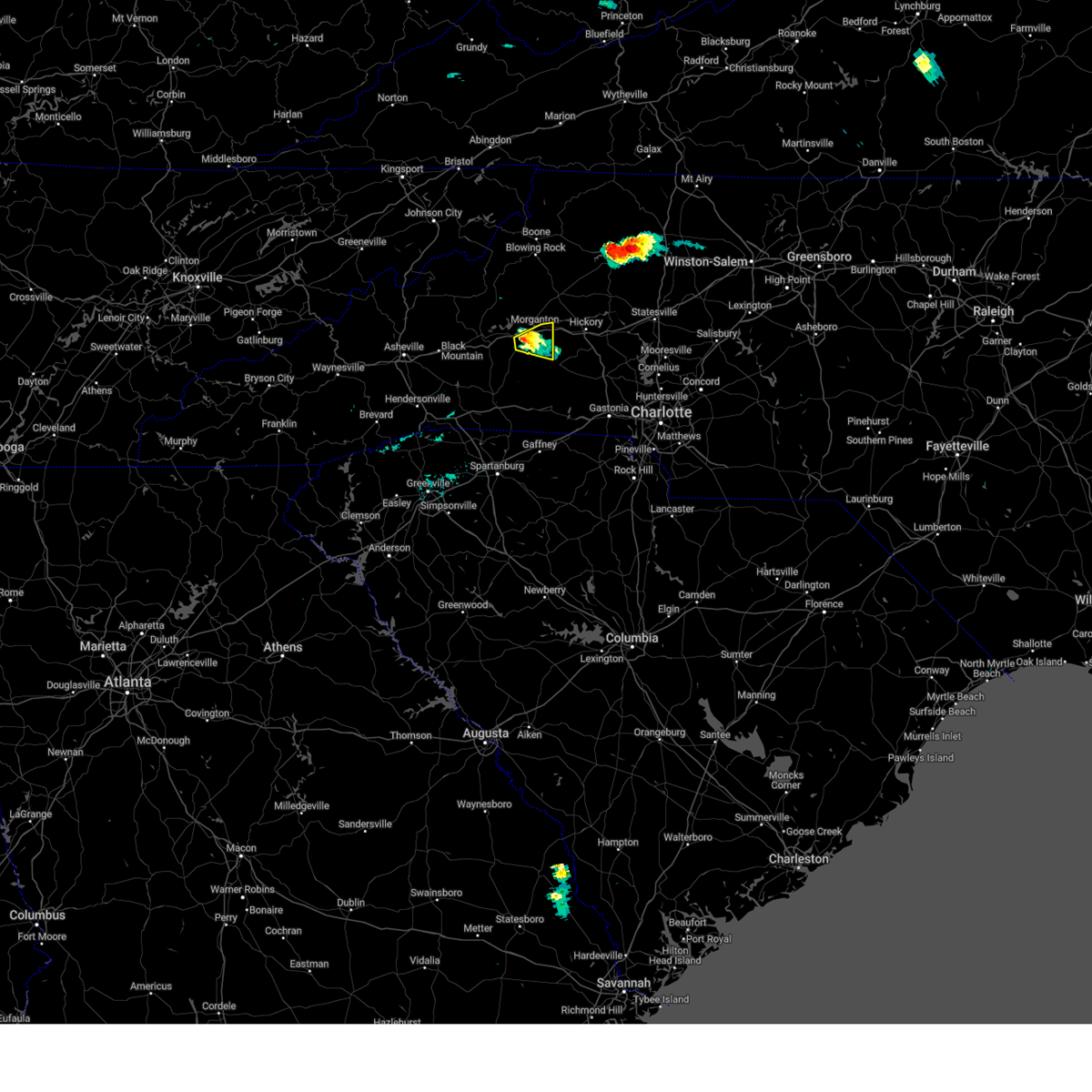
| 5/8/2025 5:36 PM EDT |
 At 535 pm edt, a severe thunderstorm was located 7 miles southwest of morganton, or 6 miles south of glen alpine, moving east at 20 mph (radar indicated). Hazards include 60 mph wind gusts and penny size hail. Expect damage to trees and power lines. Locations impacted include, morganton, lake rhodhiss, rhodhiss, icard, valdese, glen alpine, pleasant grove, connelly springs, drexel, and south mountains state park. At 535 pm edt, a severe thunderstorm was located 7 miles southwest of morganton, or 6 miles south of glen alpine, moving east at 20 mph (radar indicated). Hazards include 60 mph wind gusts and penny size hail. Expect damage to trees and power lines. Locations impacted include, morganton, lake rhodhiss, rhodhiss, icard, valdese, glen alpine, pleasant grove, connelly springs, drexel, and south mountains state park.
|
| 5/8/2025 4:55 PM EDT |
 At 454 pm edt, a severe thunderstorm was located 6 miles east of marion, or near lake james state park, moving east at 25 mph (radar indicated). Hazards include 60 mph wind gusts and half dollar size hail. Minor hail damage to vehicles is expected. expect wind damage to trees and power lines. Locations impacted include, nebo, lake james state park, morganton, lake rhodhiss, pleasant gardens, glenwood, rhodhiss, icard, valdese, and glen alpine. At 454 pm edt, a severe thunderstorm was located 6 miles east of marion, or near lake james state park, moving east at 25 mph (radar indicated). Hazards include 60 mph wind gusts and half dollar size hail. Minor hail damage to vehicles is expected. expect wind damage to trees and power lines. Locations impacted include, nebo, lake james state park, morganton, lake rhodhiss, pleasant gardens, glenwood, rhodhiss, icard, valdese, and glen alpine.
|
| 5/8/2025 4:39 PM EDT |
 Svrgsp the national weather service in greenville-spartanburg has issued a * severe thunderstorm warning for, southeastern mcdowell county in western north carolina, northeastern rutherford county in western north carolina, northwestern cleveland county in the piedmont of north carolina, southern burke county in western north carolina, * until 600 pm edt. * at 439 pm edt, multiple severe thunderstorm were located over the north carolina foothills, one near marion, and another near morganton, both moving east at 25 mph (radar indicated). Hazards include ping pong ball size hail and 60 mph wind gusts. People and animals outdoors will be injured. expect hail damage to roofs, siding, windows, and vehicles. Expect wind damage to trees and power lines. Svrgsp the national weather service in greenville-spartanburg has issued a * severe thunderstorm warning for, southeastern mcdowell county in western north carolina, northeastern rutherford county in western north carolina, northwestern cleveland county in the piedmont of north carolina, southern burke county in western north carolina, * until 600 pm edt. * at 439 pm edt, multiple severe thunderstorm were located over the north carolina foothills, one near marion, and another near morganton, both moving east at 25 mph (radar indicated). Hazards include ping pong ball size hail and 60 mph wind gusts. People and animals outdoors will be injured. expect hail damage to roofs, siding, windows, and vehicles. Expect wind damage to trees and power lines.
|
| 12/29/2024 8:53 AM EST |
 At 853 am est, severe thunderstorms were located along a line extending from 8 miles northwest of morganton to 15 miles southwest of hickory to 4 miles northeast of shelby to 9 miles northeast of gaffney, moving northeast at 55 mph (radar indicated). Hazards include 60 mph wind gusts. Expect damage to trees and power lines. locations impacted include, gastonia, hickory, shelby, lenoir, morganton, newton, lincolnton, kings mountain, st. Stephens, and conover. At 853 am est, severe thunderstorms were located along a line extending from 8 miles northwest of morganton to 15 miles southwest of hickory to 4 miles northeast of shelby to 9 miles northeast of gaffney, moving northeast at 55 mph (radar indicated). Hazards include 60 mph wind gusts. Expect damage to trees and power lines. locations impacted include, gastonia, hickory, shelby, lenoir, morganton, newton, lincolnton, kings mountain, st. Stephens, and conover.
|
| 12/29/2024 8:25 AM EST |
 Svrgsp the national weather service in greenville-spartanburg has issued a * severe thunderstorm warning for, western catawba county in the piedmont of north carolina, southeastern mcdowell county in western north carolina, eastern rutherford county in western north carolina, lincoln county in the piedmont of north carolina, southern caldwell county in western north carolina, cleveland county in the piedmont of north carolina, gaston county in the piedmont of north carolina, burke county in western north carolina, eastern cherokee county in upstate south carolina, * until 945 am est. * at 824 am est, severe thunderstorms were located along a line extending from 10 miles southwest of marion to near forest city to 9 miles west of gaffney to 8 miles southeast of spartanburg, moving northeast at 55 mph (radar indicated). Hazards include 60 mph wind gusts. expect damage to trees and power lines Svrgsp the national weather service in greenville-spartanburg has issued a * severe thunderstorm warning for, western catawba county in the piedmont of north carolina, southeastern mcdowell county in western north carolina, eastern rutherford county in western north carolina, lincoln county in the piedmont of north carolina, southern caldwell county in western north carolina, cleveland county in the piedmont of north carolina, gaston county in the piedmont of north carolina, burke county in western north carolina, eastern cherokee county in upstate south carolina, * until 945 am est. * at 824 am est, severe thunderstorms were located along a line extending from 10 miles southwest of marion to near forest city to 9 miles west of gaffney to 8 miles southeast of spartanburg, moving northeast at 55 mph (radar indicated). Hazards include 60 mph wind gusts. expect damage to trees and power lines
|
| 8/30/2024 4:23 PM EDT |
 the severe thunderstorm warning has been cancelled and is no longer in effect the severe thunderstorm warning has been cancelled and is no longer in effect
|
| 8/30/2024 4:01 PM EDT |
 At 401 pm edt, a severe thunderstorm was located 4 miles south of morganton, and is nearly stationary (radar indicated). Hazards include 60 mph wind gusts. Expect damage to trees and power lines. Locations impacted include, south mountains state park. At 401 pm edt, a severe thunderstorm was located 4 miles south of morganton, and is nearly stationary (radar indicated). Hazards include 60 mph wind gusts. Expect damage to trees and power lines. Locations impacted include, south mountains state park.
|
| 8/30/2024 3:38 PM EDT |
 Svrgsp the national weather service in greenville-spartanburg has issued a * severe thunderstorm warning for, south central burke county in western north carolina, * until 445 pm edt. * at 338 pm edt, a severe thunderstorm was located near morganton, and is nearly stationary (radar indicated). Hazards include 60 mph wind gusts and penny size hail. expect damage to trees and power lines Svrgsp the national weather service in greenville-spartanburg has issued a * severe thunderstorm warning for, south central burke county in western north carolina, * until 445 pm edt. * at 338 pm edt, a severe thunderstorm was located near morganton, and is nearly stationary (radar indicated). Hazards include 60 mph wind gusts and penny size hail. expect damage to trees and power lines
|
| 8/17/2024 6:53 PM EDT |
 The storm which prompted the warning has weakened below severe limits, and no longer poses an immediate threat to life or property. therefore, the warning will be allowed to expire. to report severe weather to the national weather service greenville-spartanburg, call toll free, 1, 800, 2 6 7, 8 1 0 1, or post on our facebook page, or tweet it using hashtag nwsgsp. your message should describe the event and the specific location where it occurred. The storm which prompted the warning has weakened below severe limits, and no longer poses an immediate threat to life or property. therefore, the warning will be allowed to expire. to report severe weather to the national weather service greenville-spartanburg, call toll free, 1, 800, 2 6 7, 8 1 0 1, or post on our facebook page, or tweet it using hashtag nwsgsp. your message should describe the event and the specific location where it occurred.
|
| 8/17/2024 6:22 PM EDT | Svrgsp the national weather service in greenville-spartanburg has issued a * severe thunderstorm warning for, south central caldwell county in western north carolina, central burke county in western north carolina, * until 700 pm edt. * at 622 pm edt, a severe thunderstorm was located near morganton, moving east at 15 mph (radar indicated). Hazards include 60 mph wind gusts and quarter size hail. Minor hail damage to vehicles is expected. Expect wind damage to trees and power lines. |
| 8/16/2024 8:25 PM EDT |
 the severe thunderstorm warning has been cancelled and is no longer in effect the severe thunderstorm warning has been cancelled and is no longer in effect
|
| 8/16/2024 8:25 PM EDT |
 At 825 pm edt, severe thunderstorms were located along a line extending from 4 miles north of morganton to 12 miles northeast of rutherfordton to 16 miles southwest of marion, moving southeast at 30 mph (radar indicated). Hazards include 60 mph wind gusts and penny size hail. Expect damage to trees and power lines. Locations impacted include, morganton, marion, valdese, gamewell, cajah's mountain, drexel, glen alpine, lake lure, chimney rock village, and lake james state park. At 825 pm edt, severe thunderstorms were located along a line extending from 4 miles north of morganton to 12 miles northeast of rutherfordton to 16 miles southwest of marion, moving southeast at 30 mph (radar indicated). Hazards include 60 mph wind gusts and penny size hail. Expect damage to trees and power lines. Locations impacted include, morganton, marion, valdese, gamewell, cajah's mountain, drexel, glen alpine, lake lure, chimney rock village, and lake james state park.
|
| 8/16/2024 7:43 PM EDT |
 Svrgsp the national weather service in greenville-spartanburg has issued a * severe thunderstorm warning for, mcdowell county in western north carolina, northern rutherford county in western north carolina, north central polk county in western north carolina, southwestern caldwell county in western north carolina, southeastern buncombe county in western north carolina, burke county in western north carolina, * until 845 pm edt. * at 743 pm edt, severe thunderstorms were located along a line extending from 6 miles east of spruce pine to 8 miles southwest of marion to 6 miles east of downtown asheville, moving southeast at 30 mph (radar indicated). Hazards include 60 mph wind gusts and penny size hail. expect damage to trees and power lines Svrgsp the national weather service in greenville-spartanburg has issued a * severe thunderstorm warning for, mcdowell county in western north carolina, northern rutherford county in western north carolina, north central polk county in western north carolina, southwestern caldwell county in western north carolina, southeastern buncombe county in western north carolina, burke county in western north carolina, * until 845 pm edt. * at 743 pm edt, severe thunderstorms were located along a line extending from 6 miles east of spruce pine to 8 miles southwest of marion to 6 miles east of downtown asheville, moving southeast at 30 mph (radar indicated). Hazards include 60 mph wind gusts and penny size hail. expect damage to trees and power lines
|
| 8/2/2024 1:44 PM EDT |
 Svrgsp the national weather service in greenville-spartanburg has issued a * severe thunderstorm warning for, east central mcdowell county in western north carolina, west central burke county in western north carolina, * until 245 pm edt. * at 143 pm edt, a severe thunderstorm was located 5 miles northeast of marion, or near lake james state park, moving northeast at 10 mph (radar indicated). Hazards include 60 mph wind gusts. expect damage to trees and power lines Svrgsp the national weather service in greenville-spartanburg has issued a * severe thunderstorm warning for, east central mcdowell county in western north carolina, west central burke county in western north carolina, * until 245 pm edt. * at 143 pm edt, a severe thunderstorm was located 5 miles northeast of marion, or near lake james state park, moving northeast at 10 mph (radar indicated). Hazards include 60 mph wind gusts. expect damage to trees and power lines
|
| 7/5/2024 5:27 PM EDT |
 The storm which prompted the warning has weakened below severe limits, and has exited the warned area. therefore, the warning will be allowed to expire. however, gusty winds and heavy rain are still possible with this thunderstorm. The storm which prompted the warning has weakened below severe limits, and has exited the warned area. therefore, the warning will be allowed to expire. however, gusty winds and heavy rain are still possible with this thunderstorm.
|
| 7/5/2024 4:47 PM EDT |
 Svrgsp the national weather service in greenville-spartanburg has issued a * severe thunderstorm warning for, southeastern caldwell county in western north carolina, burke county in western north carolina, * until 530 pm edt. * at 447 pm edt, a severe thunderstorm was located 6 miles southwest of morganton, or 4 miles south of glen alpine, moving northeast at 25 mph (radar indicated). Hazards include 60 mph wind gusts and nickel size hail. expect damage to trees and power lines Svrgsp the national weather service in greenville-spartanburg has issued a * severe thunderstorm warning for, southeastern caldwell county in western north carolina, burke county in western north carolina, * until 530 pm edt. * at 447 pm edt, a severe thunderstorm was located 6 miles southwest of morganton, or 4 miles south of glen alpine, moving northeast at 25 mph (radar indicated). Hazards include 60 mph wind gusts and nickel size hail. expect damage to trees and power lines
|
| 6/30/2024 4:30 PM EDT |
 Svrgsp the national weather service in greenville-spartanburg has issued a * severe thunderstorm warning for, southeastern burke county in western north carolina, * until 530 pm edt. * at 430 pm edt, a severe thunderstorm was located near morganton, moving southeast at 15 mph (radar indicated). Hazards include 60 mph wind gusts and penny size hail. expect damage to trees and power lines Svrgsp the national weather service in greenville-spartanburg has issued a * severe thunderstorm warning for, southeastern burke county in western north carolina, * until 530 pm edt. * at 430 pm edt, a severe thunderstorm was located near morganton, moving southeast at 15 mph (radar indicated). Hazards include 60 mph wind gusts and penny size hail. expect damage to trees and power lines
|
| 5/26/2024 8:26 PM EDT |
 the severe thunderstorm warning has been cancelled and is no longer in effect the severe thunderstorm warning has been cancelled and is no longer in effect
|
| 5/26/2024 8:26 PM EDT |
 At 825 pm edt, severe thunderstorms were located along a line extending from 3 miles south of morganton to 8 miles west of rutherfordton, moving southeast at 35 mph (radar indicated). Hazards include 60 mph wind gusts and quarter size hail. Minor hail damage to vehicles is expected. expect wind damage to trees and power lines. Locations impacted include, hickory, morganton, newton, forest city, marion, rutherfordton, conover, longview, valdese, and spindale. At 825 pm edt, severe thunderstorms were located along a line extending from 3 miles south of morganton to 8 miles west of rutherfordton, moving southeast at 35 mph (radar indicated). Hazards include 60 mph wind gusts and quarter size hail. Minor hail damage to vehicles is expected. expect wind damage to trees and power lines. Locations impacted include, hickory, morganton, newton, forest city, marion, rutherfordton, conover, longview, valdese, and spindale.
|
| 5/26/2024 8:00 PM EDT |
 Svrgsp the national weather service in greenville-spartanburg has issued a * severe thunderstorm warning for, southwestern catawba county in the piedmont of north carolina, mcdowell county in western north carolina, rutherford county in western north carolina, northeastern polk county in western north carolina, western lincoln county in the piedmont of north carolina, southwestern caldwell county in western north carolina, east central buncombe county in western north carolina, western cleveland county in the piedmont of north carolina, burke county in western north carolina, * until 900 pm edt. * at 759 pm edt, severe thunderstorms were located along a line extending from 9 miles northwest of morganton to 16 miles east of downtown asheville, moving southeast at 35 mph (radar indicated). Hazards include 60 mph wind gusts and quarter size hail. Minor hail damage to vehicles is expected. Expect wind damage to trees and power lines. Svrgsp the national weather service in greenville-spartanburg has issued a * severe thunderstorm warning for, southwestern catawba county in the piedmont of north carolina, mcdowell county in western north carolina, rutherford county in western north carolina, northeastern polk county in western north carolina, western lincoln county in the piedmont of north carolina, southwestern caldwell county in western north carolina, east central buncombe county in western north carolina, western cleveland county in the piedmont of north carolina, burke county in western north carolina, * until 900 pm edt. * at 759 pm edt, severe thunderstorms were located along a line extending from 9 miles northwest of morganton to 16 miles east of downtown asheville, moving southeast at 35 mph (radar indicated). Hazards include 60 mph wind gusts and quarter size hail. Minor hail damage to vehicles is expected. Expect wind damage to trees and power lines.
|
| 5/15/2024 3:27 PM EDT |
 the severe thunderstorm warning has been cancelled and is no longer in effect the severe thunderstorm warning has been cancelled and is no longer in effect
|
| 5/15/2024 3:27 PM EDT |
 At 326 pm edt, severe thunderstorms were located along a line extending from near hickory to 8 miles southeast of morganton to 9 miles southeast of marion, moving southeast at 15 mph (radar indicated). Hazards include 60 mph wind gusts and quarter size hail. Minor hail damage to vehicles is expected. expect wind damage to trees and power lines. locations impacted include, hickory, newton, st. Stephens, conover, longview, icard, hildebran, claremont, casar, and hickory regional airport. At 326 pm edt, severe thunderstorms were located along a line extending from near hickory to 8 miles southeast of morganton to 9 miles southeast of marion, moving southeast at 15 mph (radar indicated). Hazards include 60 mph wind gusts and quarter size hail. Minor hail damage to vehicles is expected. expect wind damage to trees and power lines. locations impacted include, hickory, newton, st. Stephens, conover, longview, icard, hildebran, claremont, casar, and hickory regional airport.
|
| 5/15/2024 2:59 PM EDT |
 Svrgsp the national weather service in greenville-spartanburg has issued a * severe thunderstorm warning for, central catawba county in the piedmont of north carolina, southeastern mcdowell county in western north carolina, northeastern rutherford county in western north carolina, northwestern lincoln county in the piedmont of north carolina, southeastern caldwell county in western north carolina, northwestern cleveland county in the piedmont of north carolina, burke county in western north carolina, * until 345 pm edt. * at 258 pm edt, severe thunderstorms were located along a line extending from 6 miles northwest of hickory to near morganton to 4 miles east of marion, moving southeast at 15 mph (radar indicated). Hazards include 60 mph wind gusts and quarter size hail. Minor hail damage to vehicles is expected. Expect wind damage to trees and power lines. Svrgsp the national weather service in greenville-spartanburg has issued a * severe thunderstorm warning for, central catawba county in the piedmont of north carolina, southeastern mcdowell county in western north carolina, northeastern rutherford county in western north carolina, northwestern lincoln county in the piedmont of north carolina, southeastern caldwell county in western north carolina, northwestern cleveland county in the piedmont of north carolina, burke county in western north carolina, * until 345 pm edt. * at 258 pm edt, severe thunderstorms were located along a line extending from 6 miles northwest of hickory to near morganton to 4 miles east of marion, moving southeast at 15 mph (radar indicated). Hazards include 60 mph wind gusts and quarter size hail. Minor hail damage to vehicles is expected. Expect wind damage to trees and power lines.
|
| 5/8/2024 2:26 PM EDT |
 Svrgsp the national weather service in greenville-spartanburg has issued a * severe thunderstorm warning for, southwestern catawba county in the piedmont of north carolina, northeastern rutherford county in western north carolina, western lincoln county in the piedmont of north carolina, cleveland county in the piedmont of north carolina, northwestern gaston county in the piedmont of north carolina, southeastern burke county in western north carolina, * until 345 pm edt. * at 226 pm edt, severe thunderstorms were located along a line extending from 5 miles northwest of morganton to 12 miles north of forest city to 6 miles west of rutherfordton, moving east at 35 mph (radar indicated). Hazards include 70 mph wind gusts and quarter size hail. Minor hail damage to vehicles is expected. expect considerable tree damage. Wind damage is also likely to mobile homes, roofs, and outbuildings. Svrgsp the national weather service in greenville-spartanburg has issued a * severe thunderstorm warning for, southwestern catawba county in the piedmont of north carolina, northeastern rutherford county in western north carolina, western lincoln county in the piedmont of north carolina, cleveland county in the piedmont of north carolina, northwestern gaston county in the piedmont of north carolina, southeastern burke county in western north carolina, * until 345 pm edt. * at 226 pm edt, severe thunderstorms were located along a line extending from 5 miles northwest of morganton to 12 miles north of forest city to 6 miles west of rutherfordton, moving east at 35 mph (radar indicated). Hazards include 70 mph wind gusts and quarter size hail. Minor hail damage to vehicles is expected. expect considerable tree damage. Wind damage is also likely to mobile homes, roofs, and outbuildings.
|
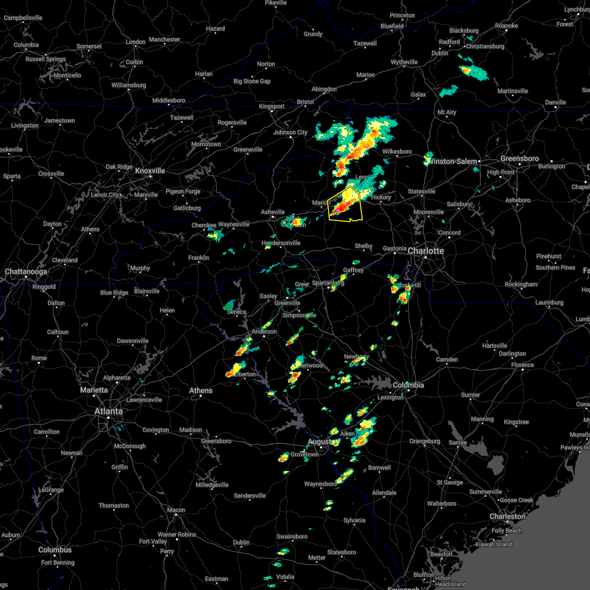
| 8/7/2023 4:24 PM EDT |
 At 424 pm edt, severe thunderstorms were located along a line extending from 5 miles southwest of taylorsville to 6 miles south of hickory to 15 miles southeast of morganton, moving east at 45 mph (radar indicated). Hazards include 70 mph wind gusts. Expect considerable tree damage. damage is likely to mobile homes, roofs, and outbuildings. locations impacted include, hickory, lenoir, morganton, taylorsville, st. stephens, conover, longview, sawmills, granite falls and valdese. thunderstorm damage threat, considerable hail threat, radar indicated max hail size, <. 75 in wind threat, radar indicated max wind gust, 70 mph. At 424 pm edt, severe thunderstorms were located along a line extending from 5 miles southwest of taylorsville to 6 miles south of hickory to 15 miles southeast of morganton, moving east at 45 mph (radar indicated). Hazards include 70 mph wind gusts. Expect considerable tree damage. damage is likely to mobile homes, roofs, and outbuildings. locations impacted include, hickory, lenoir, morganton, taylorsville, st. stephens, conover, longview, sawmills, granite falls and valdese. thunderstorm damage threat, considerable hail threat, radar indicated max hail size, <. 75 in wind threat, radar indicated max wind gust, 70 mph.
|
| 8/7/2023 4:04 PM EDT |
 At 404 pm edt, severe thunderstorms were located along a line extending from 4 miles northwest of lenoir to near morganton to 7 miles southeast of marion, moving east at 45 mph (radar indicated). Hazards include 70 mph wind gusts. Expect considerable tree damage. Damage is likely to mobile homes, roofs, and outbuildings. At 404 pm edt, severe thunderstorms were located along a line extending from 4 miles northwest of lenoir to near morganton to 7 miles southeast of marion, moving east at 45 mph (radar indicated). Hazards include 70 mph wind gusts. Expect considerable tree damage. Damage is likely to mobile homes, roofs, and outbuildings.
|
| 7/29/2023 6:50 PM EDT |
 At 650 pm edt, severe thunderstorms were located along a line extending from near lenoir to near marion, moving east at 30 mph (radar indicated). Hazards include 60 mph wind gusts and nickel size hail. expect damage to trees and power lines At 650 pm edt, severe thunderstorms were located along a line extending from near lenoir to near marion, moving east at 30 mph (radar indicated). Hazards include 60 mph wind gusts and nickel size hail. expect damage to trees and power lines
|
| 6/26/2023 5:20 PM EDT |
 At 519 pm edt, a severe thunderstorm was located 5 miles southwest of morganton, or 4 miles southeast of glen alpine, moving east at 20 mph (radar indicated). Hazards include 60 mph wind gusts and penny size hail. Expect damage to trees and power lines. locations impacted include, drexel, south mountains state park, pleasant grove, valdese and morganton. hail threat, radar indicated max hail size, 0. 75 in wind threat, radar indicated max wind gust, 60 mph. At 519 pm edt, a severe thunderstorm was located 5 miles southwest of morganton, or 4 miles southeast of glen alpine, moving east at 20 mph (radar indicated). Hazards include 60 mph wind gusts and penny size hail. Expect damage to trees and power lines. locations impacted include, drexel, south mountains state park, pleasant grove, valdese and morganton. hail threat, radar indicated max hail size, 0. 75 in wind threat, radar indicated max wind gust, 60 mph.
|
| 6/26/2023 5:01 PM EDT |
 At 500 pm edt, a severe thunderstorm was located 9 miles east of marion, or 5 miles southeast of lake james state park, moving east at 20 mph (radar indicated). Hazards include 60 mph wind gusts and quarter size hail. Minor hail damage to vehicles is expected. Expect wind damage to trees and power lines. At 500 pm edt, a severe thunderstorm was located 9 miles east of marion, or 5 miles southeast of lake james state park, moving east at 20 mph (radar indicated). Hazards include 60 mph wind gusts and quarter size hail. Minor hail damage to vehicles is expected. Expect wind damage to trees and power lines.
|
| 1/12/2023 4:37 PM EST |
 At 437 pm est, a severe thunderstorm was located 4 miles east of morganton, or near drexel, moving northeast at 55 mph (radar indicated). Hazards include 60 mph wind gusts and quarter size hail. Minor hail damage to vehicles is expected. Expect wind damage to trees and power lines. At 437 pm est, a severe thunderstorm was located 4 miles east of morganton, or near drexel, moving northeast at 55 mph (radar indicated). Hazards include 60 mph wind gusts and quarter size hail. Minor hail damage to vehicles is expected. Expect wind damage to trees and power lines.
|
| 8/15/2022 3:53 PM EDT |
 At 352 pm edt, severe thunderstorms were located along a line extending from 10 miles southwest of hickory to 6 miles southwest of morganton to 8 miles south of marion, moving southeast at 20 mph (radar indicated). Hazards include 60 mph wind gusts and quarter size hail. Minor hail damage to vehicles is expected. expect wind damage to trees and power lines. Locations impacted include, valdese, spindale, maiden, icard, hildebran, connelly springs, rutherford college, belwood, bostic and casar. At 352 pm edt, severe thunderstorms were located along a line extending from 10 miles southwest of hickory to 6 miles southwest of morganton to 8 miles south of marion, moving southeast at 20 mph (radar indicated). Hazards include 60 mph wind gusts and quarter size hail. Minor hail damage to vehicles is expected. expect wind damage to trees and power lines. Locations impacted include, valdese, spindale, maiden, icard, hildebran, connelly springs, rutherford college, belwood, bostic and casar.
|
| 8/15/2022 3:36 PM EDT |
 At 336 pm edt, severe thunderstorms were located along a line extending from 11 miles west of hickory to 6 miles west of morganton to 5 miles south of marion, moving southeast at 20 mph (radar indicated). Hazards include 60 mph wind gusts and quarter size hail. Minor hail damage to vehicles is expected. Expect wind damage to trees and power lines. At 336 pm edt, severe thunderstorms were located along a line extending from 11 miles west of hickory to 6 miles west of morganton to 5 miles south of marion, moving southeast at 20 mph (radar indicated). Hazards include 60 mph wind gusts and quarter size hail. Minor hail damage to vehicles is expected. Expect wind damage to trees and power lines.
|
| 7/25/2022 3:45 PM EDT |
 At 344 pm edt, severe thunderstorms were located along a line extending from 9 miles south of lenoir to 10 miles southeast of morganton to 20 miles northeast of forest city, moving southeast at 25 mph (radar indicated). Hazards include 60 mph wind gusts and penny size hail. Expect damage to trees and power lines. locations impacted include, hickory, morganton, st. stephens, longview, valdese, icard, drexel, hildebran, connelly springs and rutherford college. hail threat, radar indicated max hail size, 0. 75 in wind threat, radar indicated max wind gust, 60 mph. At 344 pm edt, severe thunderstorms were located along a line extending from 9 miles south of lenoir to 10 miles southeast of morganton to 20 miles northeast of forest city, moving southeast at 25 mph (radar indicated). Hazards include 60 mph wind gusts and penny size hail. Expect damage to trees and power lines. locations impacted include, hickory, morganton, st. stephens, longview, valdese, icard, drexel, hildebran, connelly springs and rutherford college. hail threat, radar indicated max hail size, 0. 75 in wind threat, radar indicated max wind gust, 60 mph.
|
| 7/25/2022 3:29 PM EDT |
 At 329 pm edt, a severe thunderstorm was located near morganton, moving east at 25 mph (radar indicated). Hazards include 60 mph wind gusts and penny size hail. expect damage to trees and power lines At 329 pm edt, a severe thunderstorm was located near morganton, moving east at 25 mph (radar indicated). Hazards include 60 mph wind gusts and penny size hail. expect damage to trees and power lines
|
| 7/23/2022 10:56 PM EDT |
 The severe thunderstorm warning for southeastern mcdowell and southwestern burke counties will expire at 1100 pm edt, the storm which prompted the warning has weakened below severe limits, and no longer poses an immediate threat to life or property. therefore, the warning will be allowed to expire. however, gusty winds and heavy rain are still possible with this thunderstorm. The severe thunderstorm warning for southeastern mcdowell and southwestern burke counties will expire at 1100 pm edt, the storm which prompted the warning has weakened below severe limits, and no longer poses an immediate threat to life or property. therefore, the warning will be allowed to expire. however, gusty winds and heavy rain are still possible with this thunderstorm.
|
| 7/23/2022 10:35 PM EDT |
 At 1035 pm edt, a severe thunderstorm was located 5 miles northeast of marion, or near lake james state park, moving south at 5 mph (radar indicated). Hazards include 60 mph wind gusts and quarter size hail. Minor hail damage to vehicles is expected. expect wind damage to trees and power lines. locations impacted include, glen alpine, lake james state park, lake james, nebo, dysartsville, marion, oak hill, glenwood, morganton and south mountains state park. hail threat, radar indicated max hail size, 1. 00 in wind threat, radar indicated max wind gust, 60 mph. At 1035 pm edt, a severe thunderstorm was located 5 miles northeast of marion, or near lake james state park, moving south at 5 mph (radar indicated). Hazards include 60 mph wind gusts and quarter size hail. Minor hail damage to vehicles is expected. expect wind damage to trees and power lines. locations impacted include, glen alpine, lake james state park, lake james, nebo, dysartsville, marion, oak hill, glenwood, morganton and south mountains state park. hail threat, radar indicated max hail size, 1. 00 in wind threat, radar indicated max wind gust, 60 mph.
|
| 7/23/2022 10:17 PM EDT |
 At 1017 pm edt, a severe thunderstorm was located 7 miles northeast of marion, or over lake james, moving southeast at 5 mph (radar indicated). Hazards include 60 mph wind gusts and quarter size hail. Minor hail damage to vehicles is expected. Expect wind damage to trees and power lines. At 1017 pm edt, a severe thunderstorm was located 7 miles northeast of marion, or over lake james, moving southeast at 5 mph (radar indicated). Hazards include 60 mph wind gusts and quarter size hail. Minor hail damage to vehicles is expected. Expect wind damage to trees and power lines.
|
| 7/20/2022 4:38 PM EDT |
 At 436 pm edt, severe thunderstorms were located along a line extending from 7 miles southwest of morganton to 8 miles north of forest city to 6 miles north of columbus, moving east at 30 mph (radar indicated). Hazards include 60 mph wind gusts and quarter size hail. Minor hail damage to vehicles is expected. expect wind damage to trees and power lines. locations impacted include, forest city, rutherfordton, spindale, polkville, ellenboro, lattimore, mooresboro, bostic, casar and kingstown. hail threat, radar indicated max hail size, 1. 00 in wind threat, radar indicated max wind gust, 60 mph. At 436 pm edt, severe thunderstorms were located along a line extending from 7 miles southwest of morganton to 8 miles north of forest city to 6 miles north of columbus, moving east at 30 mph (radar indicated). Hazards include 60 mph wind gusts and quarter size hail. Minor hail damage to vehicles is expected. expect wind damage to trees and power lines. locations impacted include, forest city, rutherfordton, spindale, polkville, ellenboro, lattimore, mooresboro, bostic, casar and kingstown. hail threat, radar indicated max hail size, 1. 00 in wind threat, radar indicated max wind gust, 60 mph.
|
| 7/20/2022 4:15 PM EDT |
 At 414 pm edt, severe thunderstorms were located along a line extending from 3 miles east of marion to 10 miles north of rutherfordton to 9 miles northeast of hendersonville, moving east at 20 mph (radar indicated). Hazards include 60 mph wind gusts and quarter size hail. Minor hail damage to vehicles is expected. Expect wind damage to trees and power lines. At 414 pm edt, severe thunderstorms were located along a line extending from 3 miles east of marion to 10 miles north of rutherfordton to 9 miles northeast of hendersonville, moving east at 20 mph (radar indicated). Hazards include 60 mph wind gusts and quarter size hail. Minor hail damage to vehicles is expected. Expect wind damage to trees and power lines.
|
| 7/19/2022 6:24 PM EDT |
 At 624 pm edt, a severe thunderstorm was located 7 miles southwest of marion, or 7 miles southeast of old fort, moving east at 15 mph (radar indicated). Hazards include 60 mph wind gusts and quarter size hail. Minor hail damage to vehicles is expected. Expect wind damage to trees and power lines. At 624 pm edt, a severe thunderstorm was located 7 miles southwest of marion, or 7 miles southeast of old fort, moving east at 15 mph (radar indicated). Hazards include 60 mph wind gusts and quarter size hail. Minor hail damage to vehicles is expected. Expect wind damage to trees and power lines.
|
| 6/14/2022 7:28 AM EDT |
 At 726 am edt, severe thunderstorms were located along a line extending from 8 miles northwest of burnsville to 13 miles southwest of hickory to near downtown concord, moving south at 20 mph (radar indicated). Hazards include 60 mph wind gusts and quarter size hail. Minor hail damage to vehicles is expected. expect wind damage to trees and power lines. locations impacted include, charlotte, huntersville, kannapolis, concord, morganton, lincolnton, marion, spruce pine, and burnsville. hail threat, radar indicated max hail size, 1. 00 in wind threat, radar indicated max wind gust, 60 mph. At 726 am edt, severe thunderstorms were located along a line extending from 8 miles northwest of burnsville to 13 miles southwest of hickory to near downtown concord, moving south at 20 mph (radar indicated). Hazards include 60 mph wind gusts and quarter size hail. Minor hail damage to vehicles is expected. expect wind damage to trees and power lines. locations impacted include, charlotte, huntersville, kannapolis, concord, morganton, lincolnton, marion, spruce pine, and burnsville. hail threat, radar indicated max hail size, 1. 00 in wind threat, radar indicated max wind gust, 60 mph.
|
| 6/14/2022 6:55 AM EDT |
 At 655 am edt, severe thunderstorms were located along a line extending from 6 miles southeast of erwin to 12 miles north of morganton to 4 miles southwest of kannapolis, moving south at 25 mph (radar indicated). Hazards include 60 mph wind gusts. expect damage to trees and power lines At 655 am edt, severe thunderstorms were located along a line extending from 6 miles southeast of erwin to 12 miles north of morganton to 4 miles southwest of kannapolis, moving south at 25 mph (radar indicated). Hazards include 60 mph wind gusts. expect damage to trees and power lines
|
| 6/14/2022 6:37 AM EDT |
 At 637 am edt, severe thunderstorms were located along a line extending from 8 miles southeast of taylorsville to 7 miles west of lenoir to near newland to 9 miles north of burnsville, moving south at 30 mph (radar indicated). Hazards include 60 mph wind gusts. Expect damage to trees and power lines. locations impacted include, hickory, lenoir, morganton, spruce pine, taylorsville, burnsville, newland, st. stephens, longview and sawmills. hail threat, radar indicated max hail size, <. 75 in wind threat, radar indicated max wind gust, 60 mph. At 637 am edt, severe thunderstorms were located along a line extending from 8 miles southeast of taylorsville to 7 miles west of lenoir to near newland to 9 miles north of burnsville, moving south at 30 mph (radar indicated). Hazards include 60 mph wind gusts. Expect damage to trees and power lines. locations impacted include, hickory, lenoir, morganton, spruce pine, taylorsville, burnsville, newland, st. stephens, longview and sawmills. hail threat, radar indicated max hail size, <. 75 in wind threat, radar indicated max wind gust, 60 mph.
|
| 6/14/2022 6:09 AM EDT |
 At 608 am edt, severe thunderstorms were located along a line extending from 3 miles southeast of traphill to 9 miles southeast of deep gap to 3 miles southwest of beech mountain to 4 miles north of elizabethton, moving south at 35 mph (radar indicated). Hazards include 60 mph wind gusts. expect damage to trees and power lines At 608 am edt, severe thunderstorms were located along a line extending from 3 miles southeast of traphill to 9 miles southeast of deep gap to 3 miles southwest of beech mountain to 4 miles north of elizabethton, moving south at 35 mph (radar indicated). Hazards include 60 mph wind gusts. expect damage to trees and power lines
|
| 6/13/2022 8:57 PM EDT |
 At 857 pm edt, a severe thunderstorm was located 7 miles northeast of marion, or over lake james, moving east at 20 mph (radar indicated). Hazards include 60 mph wind gusts and quarter size hail. Minor hail damage to vehicles is expected. Expect wind damage to trees and power lines. At 857 pm edt, a severe thunderstorm was located 7 miles northeast of marion, or over lake james, moving east at 20 mph (radar indicated). Hazards include 60 mph wind gusts and quarter size hail. Minor hail damage to vehicles is expected. Expect wind damage to trees and power lines.
|
| 6/2/2022 6:41 PM EDT |
 At 641 pm edt, a severe thunderstorm was located near morganton, or near drexel, moving east at 15 mph (radar indicated). Hazards include quarter size hail. Minor damage to vehicles is expected. locations impacted include, lenoir, morganton, sawmills, valdese, gamewell, hudson, icard, cajah`s mountain, drexel and connelly springs. hail threat, radar indicated max hail size, 1. 00 in wind threat, radar indicated max wind gust, <50 mph. At 641 pm edt, a severe thunderstorm was located near morganton, or near drexel, moving east at 15 mph (radar indicated). Hazards include quarter size hail. Minor damage to vehicles is expected. locations impacted include, lenoir, morganton, sawmills, valdese, gamewell, hudson, icard, cajah`s mountain, drexel and connelly springs. hail threat, radar indicated max hail size, 1. 00 in wind threat, radar indicated max wind gust, <50 mph.
|
| 6/2/2022 6:21 PM EDT |
 At 620 pm edt, a severe thunderstorm was located near morganton, moving east at 15 mph (radar indicated). Hazards include 60 mph wind gusts and quarter size hail. Minor hail damage to vehicles is expected. Expect wind damage to trees and power lines. At 620 pm edt, a severe thunderstorm was located near morganton, moving east at 15 mph (radar indicated). Hazards include 60 mph wind gusts and quarter size hail. Minor hail damage to vehicles is expected. Expect wind damage to trees and power lines.
|
| 5/6/2022 7:36 PM EDT |
 The severe thunderstorm warning for east central mcdowell, caldwell and western burke counties will expire at 745 pm edt, the storms which prompted the warning have weakened below severe limits, and no longer pose an immediate threat to life or property. therefore, the warning will be allowed to expire. however gusty winds are still possible with these thunderstorms. a tornado watch remains in effect until 800 pm edt for western north carolina. to report severe weather to the national weather service greenville-spartanburg, call toll free, 1, 800, 2 6 7, 8 1 0 1, or post on our facebook page, or tweet it using hashtag nwsgsp. your message should describe the event and the specific location where it occurred. The severe thunderstorm warning for east central mcdowell, caldwell and western burke counties will expire at 745 pm edt, the storms which prompted the warning have weakened below severe limits, and no longer pose an immediate threat to life or property. therefore, the warning will be allowed to expire. however gusty winds are still possible with these thunderstorms. a tornado watch remains in effect until 800 pm edt for western north carolina. to report severe weather to the national weather service greenville-spartanburg, call toll free, 1, 800, 2 6 7, 8 1 0 1, or post on our facebook page, or tweet it using hashtag nwsgsp. your message should describe the event and the specific location where it occurred.
|
| 5/6/2022 7:24 PM EDT |
 At 724 pm edt, severe thunderstorms were located along a line extending from near deep gap to 7 miles east of marion, moving east at 30 mph (radar indicated). Hazards include 60 mph wind gusts. Expect damage to trees and power lines. locations impacted include, lenoir, morganton, marion, gamewell, blowing rock in caldwell county, glen alpine, lake james state park, table rock, lake james and nebo. hail threat, radar indicated max hail size, <. 75 in wind threat, radar indicated max wind gust, 60 mph. At 724 pm edt, severe thunderstorms were located along a line extending from near deep gap to 7 miles east of marion, moving east at 30 mph (radar indicated). Hazards include 60 mph wind gusts. Expect damage to trees and power lines. locations impacted include, lenoir, morganton, marion, gamewell, blowing rock in caldwell county, glen alpine, lake james state park, table rock, lake james and nebo. hail threat, radar indicated max hail size, <. 75 in wind threat, radar indicated max wind gust, 60 mph.
|
| 5/6/2022 6:55 PM EDT |
 At 655 pm edt, severe thunderstorms were located along a line extending from near sugar grove to 8 miles west of marion, moving east at 30 mph (radar indicated). Hazards include 60 mph wind gusts. expect damage to trees and power lines At 655 pm edt, severe thunderstorms were located along a line extending from near sugar grove to 8 miles west of marion, moving east at 30 mph (radar indicated). Hazards include 60 mph wind gusts. expect damage to trees and power lines
|
| 5/6/2022 1:41 PM EDT |
 The severe thunderstorm warning for northeastern rutherford, western lincoln, central cleveland and south central burke counties will expire at 145 pm edt, the storm which prompted the warning has weakened below severe limits, and no longer poses an immediate threat to life or property. therefore, the warning will be allowed to expire. however, gusty winds and heavy rain are still possible with this thunderstorm. a tornado watch remains in effect until 800 pm edt for western and the piedmont of north carolina. The severe thunderstorm warning for northeastern rutherford, western lincoln, central cleveland and south central burke counties will expire at 145 pm edt, the storm which prompted the warning has weakened below severe limits, and no longer poses an immediate threat to life or property. therefore, the warning will be allowed to expire. however, gusty winds and heavy rain are still possible with this thunderstorm. a tornado watch remains in effect until 800 pm edt for western and the piedmont of north carolina.
|
| 5/6/2022 1:17 PM EDT |
 At 117 pm edt, a severe thunderstorm was located 8 miles northwest of shelby, or near kingstown, moving northeast at 35 mph (radar indicated). Hazards include 60 mph wind gusts and quarter size hail. Minor hail damage to vehicles is expected. expect wind damage to trees and power lines. locations impacted include, belwood, lawndale, fallston, polkville, ellenboro, lattimore, mooresboro, casar, kingstown and south mountains state park. hail threat, radar indicated max hail size, 1. 00 in wind threat, radar indicated max wind gust, 60 mph. At 117 pm edt, a severe thunderstorm was located 8 miles northwest of shelby, or near kingstown, moving northeast at 35 mph (radar indicated). Hazards include 60 mph wind gusts and quarter size hail. Minor hail damage to vehicles is expected. expect wind damage to trees and power lines. locations impacted include, belwood, lawndale, fallston, polkville, ellenboro, lattimore, mooresboro, casar, kingstown and south mountains state park. hail threat, radar indicated max hail size, 1. 00 in wind threat, radar indicated max wind gust, 60 mph.
|
| 5/6/2022 1:02 PM EDT |
 At 102 pm edt, a severe thunderstorm was located 9 miles west of shelby, or near boiling springs nc, moving northeast at 50 mph (radar indicated). Hazards include 60 mph wind gusts and quarter size hail. Minor hail damage to vehicles is expected. Expect wind damage to trees and power lines. At 102 pm edt, a severe thunderstorm was located 9 miles west of shelby, or near boiling springs nc, moving northeast at 50 mph (radar indicated). Hazards include 60 mph wind gusts and quarter size hail. Minor hail damage to vehicles is expected. Expect wind damage to trees and power lines.
|
| 5/1/2022 2:44 PM EDT |
 At 243 pm edt, a severe thunderstorm was located 6 miles southwest of morganton, or 4 miles south of glen alpine, moving east at 10 mph (radar indicated). Hazards include 60 mph wind gusts and quarter size hail. Minor hail damage to vehicles is expected. Expect wind damage to trees and power lines. At 243 pm edt, a severe thunderstorm was located 6 miles southwest of morganton, or 4 miles south of glen alpine, moving east at 10 mph (radar indicated). Hazards include 60 mph wind gusts and quarter size hail. Minor hail damage to vehicles is expected. Expect wind damage to trees and power lines.
|
| 5/1/2022 2:32 PM EDT |
 At 231 pm edt, a severe thunderstorm was located 4 miles southwest of morganton, or near glen alpine, moving east at 15 mph (radar indicated). Hazards include 60 mph wind gusts and quarter size hail. Minor hail damage to vehicles is expected. expect wind damage to trees and power lines. locations impacted include, morganton, drexel, glen alpine, lake james state park, south mountains state park, lake james, nebo, pleasant grove, oak hill and dysartsville. hail threat, observed max hail size, 1. 00 in wind threat, radar indicated max wind gust, 60 mph. At 231 pm edt, a severe thunderstorm was located 4 miles southwest of morganton, or near glen alpine, moving east at 15 mph (radar indicated). Hazards include 60 mph wind gusts and quarter size hail. Minor hail damage to vehicles is expected. expect wind damage to trees and power lines. locations impacted include, morganton, drexel, glen alpine, lake james state park, south mountains state park, lake james, nebo, pleasant grove, oak hill and dysartsville. hail threat, observed max hail size, 1. 00 in wind threat, radar indicated max wind gust, 60 mph.
|
| 5/1/2022 1:57 PM EDT |
 The severe thunderstorm warning for southeastern mcdowell and southwestern burke counties will expire at 200 pm edt, the storm which prompted the warning has moved out of the area. therefore, the warning will be allowed to expire. however small hail and heavy rain are still possible with this thunderstorm. a severe thunderstorm watch remains in effect until 900 pm edt for western north carolina. The severe thunderstorm warning for southeastern mcdowell and southwestern burke counties will expire at 200 pm edt, the storm which prompted the warning has moved out of the area. therefore, the warning will be allowed to expire. however small hail and heavy rain are still possible with this thunderstorm. a severe thunderstorm watch remains in effect until 900 pm edt for western north carolina.
|
| 5/1/2022 1:56 PM EDT |
 At 155 pm edt, a severe thunderstorm was located 6 miles east of marion, or near lake james state park, moving east at 15 mph (radar indicated). Hazards include 60 mph wind gusts and quarter size hail. Minor hail damage to vehicles is expected. Expect wind damage to trees and power lines. At 155 pm edt, a severe thunderstorm was located 6 miles east of marion, or near lake james state park, moving east at 15 mph (radar indicated). Hazards include 60 mph wind gusts and quarter size hail. Minor hail damage to vehicles is expected. Expect wind damage to trees and power lines.
|
| 5/1/2022 1:22 PM EDT |
 At 121 pm edt, a severe thunderstorm was located near marion, moving east at 15 mph (radar indicated). Hazards include 60 mph wind gusts and quarter size hail. Minor hail damage to vehicles is expected. Expect wind damage to trees and power lines. At 121 pm edt, a severe thunderstorm was located near marion, moving east at 15 mph (radar indicated). Hazards include 60 mph wind gusts and quarter size hail. Minor hail damage to vehicles is expected. Expect wind damage to trees and power lines.
|
| 3/23/2022 11:04 PM EDT |
 At 1104 pm edt, a severe thunderstorm capable of producing a tornado was located 6 miles southeast of morganton, or 5 miles north of south mountains state park, moving northeast at 45 mph (radar indicated rotation). Hazards include tornado. Flying debris will be dangerous to those caught without shelter. mobile homes will be damaged or destroyed. damage to roofs, windows, and vehicles will occur. tree damage is likely. this dangerous storm will be near, drexel, connelly springs and valdese around 1110 pm edt. lenoir, lake rhodhiss, rhodhiss, granite falls and icard around 1120 pm edt. st. stephens around 1130 pm edt. lake hickory around 1140 pm edt. Other locations impacted by this dangerous thunderstorm include northlakes and pleasant grove. At 1104 pm edt, a severe thunderstorm capable of producing a tornado was located 6 miles southeast of morganton, or 5 miles north of south mountains state park, moving northeast at 45 mph (radar indicated rotation). Hazards include tornado. Flying debris will be dangerous to those caught without shelter. mobile homes will be damaged or destroyed. damage to roofs, windows, and vehicles will occur. tree damage is likely. this dangerous storm will be near, drexel, connelly springs and valdese around 1110 pm edt. lenoir, lake rhodhiss, rhodhiss, granite falls and icard around 1120 pm edt. st. stephens around 1130 pm edt. lake hickory around 1140 pm edt. Other locations impacted by this dangerous thunderstorm include northlakes and pleasant grove.
|
| 3/23/2022 10:55 PM EDT |
 The tornado warning for southeastern mcdowell, southern caldwell and central burke counties will expire at 1100 pm edt, the storm which prompted the warning has weakened below severe limits, and has exited the warned area. therefore, the warning will be allowed to expire. a tornado watch remains in effect until midnight edt for western north carolina. The tornado warning for southeastern mcdowell, southern caldwell and central burke counties will expire at 1100 pm edt, the storm which prompted the warning has weakened below severe limits, and has exited the warned area. therefore, the warning will be allowed to expire. a tornado watch remains in effect until midnight edt for western north carolina.
|
| 3/23/2022 10:10 PM EDT |
 At 1010 pm edt, a severe thunderstorm capable of producing a tornado was located 9 miles east of marion, or 7 miles southeast of lake james state park, moving northeast at 35 mph (radar indicated rotation). Hazards include tornado. Flying debris will be dangerous to those caught without shelter. mobile homes will be damaged or destroyed. damage to roofs, windows, and vehicles will occur. tree damage is likely. this dangerous storm will be near, glen alpine and south mountains state park around 1020 pm edt. morganton around 1030 pm edt. valdese, drexel, rutherford college and connelly springs around 1040 pm edt. lenoir, cajah`s mountain, gamewell, sawmills and hudson around 1050 pm edt. Other locations impacted by this dangerous thunderstorm include collettsville, oak hill and dysartsville. At 1010 pm edt, a severe thunderstorm capable of producing a tornado was located 9 miles east of marion, or 7 miles southeast of lake james state park, moving northeast at 35 mph (radar indicated rotation). Hazards include tornado. Flying debris will be dangerous to those caught without shelter. mobile homes will be damaged or destroyed. damage to roofs, windows, and vehicles will occur. tree damage is likely. this dangerous storm will be near, glen alpine and south mountains state park around 1020 pm edt. morganton around 1030 pm edt. valdese, drexel, rutherford college and connelly springs around 1040 pm edt. lenoir, cajah`s mountain, gamewell, sawmills and hudson around 1050 pm edt. Other locations impacted by this dangerous thunderstorm include collettsville, oak hill and dysartsville.
|
| 9/8/2021 2:37 PM EDT |
 The severe thunderstorm warning for central burke county will expire at 245 pm edt, the storm which prompted the warning has weakened below severe limits, and no longer poses an immediate threat to life or property. therefore, the warning will be allowed to expire. however small hail is still possible with this thunderstorm. The severe thunderstorm warning for central burke county will expire at 245 pm edt, the storm which prompted the warning has weakened below severe limits, and no longer poses an immediate threat to life or property. therefore, the warning will be allowed to expire. however small hail is still possible with this thunderstorm.
|
| 9/8/2021 2:25 PM EDT |
 At 225 pm edt, a severe thunderstorm was located 5 miles west of morganton, or near glen alpine, moving east at 15 mph (radar indicated). Hazards include 60 mph wind gusts and quarter size hail. Minor hail damage to vehicles is expected. expect wind damage to trees and power lines. locations impacted include, morganton, drexel, glen alpine, table rock, oak hill, lake james, lake james state park and lake rhodhiss. hail threat, radar indicated max hail size, 1. 00 in wind threat, radar indicated max wind gust, 60 mph. At 225 pm edt, a severe thunderstorm was located 5 miles west of morganton, or near glen alpine, moving east at 15 mph (radar indicated). Hazards include 60 mph wind gusts and quarter size hail. Minor hail damage to vehicles is expected. expect wind damage to trees and power lines. locations impacted include, morganton, drexel, glen alpine, table rock, oak hill, lake james, lake james state park and lake rhodhiss. hail threat, radar indicated max hail size, 1. 00 in wind threat, radar indicated max wind gust, 60 mph.
|
| 9/8/2021 2:03 PM EDT |
 At 203 pm edt, a severe thunderstorm was located 8 miles west of morganton, or near lake james, moving east at 10 mph (radar indicated). Hazards include 60 mph wind gusts and quarter size hail. Minor hail damage to vehicles is expected. Expect wind damage to trees and power lines. At 203 pm edt, a severe thunderstorm was located 8 miles west of morganton, or near lake james, moving east at 10 mph (radar indicated). Hazards include 60 mph wind gusts and quarter size hail. Minor hail damage to vehicles is expected. Expect wind damage to trees and power lines.
|
| 8/31/2021 5:41 PM EDT |
 At 540 pm edt, severe thunderstorms were located along a line extending from 9 miles southwest of spruce pine to 9 miles east of morganton, moving north at 50 mph (radar indicated). Hazards include 60 mph wind gusts. expect damage to trees and power lines At 540 pm edt, severe thunderstorms were located along a line extending from 9 miles southwest of spruce pine to 9 miles east of morganton, moving north at 50 mph (radar indicated). Hazards include 60 mph wind gusts. expect damage to trees and power lines
|
| 8/31/2021 5:36 PM EDT |
 At 535 pm edt, severe thunderstorms were located along a line extending from near marion to 9 miles south of morganton, moving north at 50 mph (radar indicated). Hazards include 60 mph wind gusts. Expect damage to trees and power lines. locations impacted include, morganton, marion, valdese, drexel, glen alpine, lake james state park, lake rhodhiss, table rock, south mountains state park and lake james. hail threat, radar indicated max hail size, <. 75 in wind threat, radar indicated max wind gust, 60 mph. At 535 pm edt, severe thunderstorms were located along a line extending from near marion to 9 miles south of morganton, moving north at 50 mph (radar indicated). Hazards include 60 mph wind gusts. Expect damage to trees and power lines. locations impacted include, morganton, marion, valdese, drexel, glen alpine, lake james state park, lake rhodhiss, table rock, south mountains state park and lake james. hail threat, radar indicated max hail size, <. 75 in wind threat, radar indicated max wind gust, 60 mph.
|
| 8/31/2021 5:22 PM EDT |
 At 522 pm edt, severe thunderstorms were located along a line extending from 7 miles southwest of marion to 13 miles northeast of forest city, moving north at 40 mph (radar indicated). Hazards include 60 mph wind gusts. Expect damage to trees and power lines. locations impacted include, morganton, marion, valdese, drexel, glen alpine, lake rhodhiss, lake james state park, table rock, south mountains state park and lake james. hail threat, radar indicated max hail size, <. 75 in wind threat, radar indicated max wind gust, 60 mph. At 522 pm edt, severe thunderstorms were located along a line extending from 7 miles southwest of marion to 13 miles northeast of forest city, moving north at 40 mph (radar indicated). Hazards include 60 mph wind gusts. Expect damage to trees and power lines. locations impacted include, morganton, marion, valdese, drexel, glen alpine, lake rhodhiss, lake james state park, table rock, south mountains state park and lake james. hail threat, radar indicated max hail size, <. 75 in wind threat, radar indicated max wind gust, 60 mph.
|
| 8/31/2021 5:06 PM EDT |
 At 506 pm edt, severe thunderstorms were located along a line extending from 12 miles west of rutherfordton to near forest city, moving north at 45 mph (radar indicated). Hazards include 60 mph wind gusts. expect damage to trees and power lines At 506 pm edt, severe thunderstorms were located along a line extending from 12 miles west of rutherfordton to near forest city, moving north at 45 mph (radar indicated). Hazards include 60 mph wind gusts. expect damage to trees and power lines
|
| 8/26/2021 5:20 PM EDT |
 The severe thunderstorm warning for central burke county will expire at 530 pm edt, the storm which prompted the warning has weakened below severe limits, and no longer poses an immediate threat to life or property. therefore, the warning will be allowed to expire. to report severe weather to the national weather service greenville-spartanburg, call toll free, 1, 800, 2 6 7, 8 1 0 1, or post on our facebook page, or tweet it using hashtag nwsgsp. your message should describe the event and the specific location where it occurred. The severe thunderstorm warning for central burke county will expire at 530 pm edt, the storm which prompted the warning has weakened below severe limits, and no longer poses an immediate threat to life or property. therefore, the warning will be allowed to expire. to report severe weather to the national weather service greenville-spartanburg, call toll free, 1, 800, 2 6 7, 8 1 0 1, or post on our facebook page, or tweet it using hashtag nwsgsp. your message should describe the event and the specific location where it occurred.
|
| 8/26/2021 4:39 PM EDT |
 At 439 pm edt, a severe thunderstorm was located near morganton, moving north at 10 mph (radar indicated). Hazards include 60 mph wind gusts and quarter size hail. Minor hail damage to vehicles is expected. Expect wind damage to trees and power lines. At 439 pm edt, a severe thunderstorm was located near morganton, moving north at 10 mph (radar indicated). Hazards include 60 mph wind gusts and quarter size hail. Minor hail damage to vehicles is expected. Expect wind damage to trees and power lines.
|
| 8/14/2021 5:09 PM EDT |
 The severe thunderstorm warning for southwestern caldwell and central burke counties will expire at 515 pm edt, the storm which prompted the warning has weakened below severe limits, and no longer poses an immediate threat to life or property. therefore, the warning will be allowed to expire. however, gusty winds and heavy rain are still possible with this thunderstorm. The severe thunderstorm warning for southwestern caldwell and central burke counties will expire at 515 pm edt, the storm which prompted the warning has weakened below severe limits, and no longer poses an immediate threat to life or property. therefore, the warning will be allowed to expire. however, gusty winds and heavy rain are still possible with this thunderstorm.
|
| 8/14/2021 4:57 PM EDT |
 At 457 pm edt, a severe thunderstorm was located 5 miles south of lenoir, or near cajah`s mountain, and is nearly stationary (radar indicated). Hazards include 60 mph wind gusts and quarter size hail. Minor hail damage to vehicles is expected. expect wind damage to trees and power lines. locations impacted include, morganton, sawmills, valdese, gamewell, hudson, icard, cajah`s mountain, drexel, connelly springs and rutherford college. hail threat, radar indicated max hail size, 1. 00 in wind threat, radar indicated max wind gust, 60 mph. At 457 pm edt, a severe thunderstorm was located 5 miles south of lenoir, or near cajah`s mountain, and is nearly stationary (radar indicated). Hazards include 60 mph wind gusts and quarter size hail. Minor hail damage to vehicles is expected. expect wind damage to trees and power lines. locations impacted include, morganton, sawmills, valdese, gamewell, hudson, icard, cajah`s mountain, drexel, connelly springs and rutherford college. hail threat, radar indicated max hail size, 1. 00 in wind threat, radar indicated max wind gust, 60 mph.
|
| 8/14/2021 4:25 PM EDT |
 At 424 pm edt, a severe thunderstorm was located near morganton, moving east at 5 mph (radar indicated). Hazards include 60 mph wind gusts and quarter size hail. Minor hail damage to vehicles is expected. Expect wind damage to trees and power lines. At 424 pm edt, a severe thunderstorm was located near morganton, moving east at 5 mph (radar indicated). Hazards include 60 mph wind gusts and quarter size hail. Minor hail damage to vehicles is expected. Expect wind damage to trees and power lines.
|
| 8/11/2021 3:38 PM EDT |
 The severe thunderstorm warning for western catawba and southeastern burke counties will expire at 345 pm edt, the storm which prompted the warning has weakened below severe limits, and no longer poses an immediate threat to life or property. therefore, the warning will be allowed to expire. however heavy rain and lightning are still possible with this thunderstorm. The severe thunderstorm warning for western catawba and southeastern burke counties will expire at 345 pm edt, the storm which prompted the warning has weakened below severe limits, and no longer poses an immediate threat to life or property. therefore, the warning will be allowed to expire. however heavy rain and lightning are still possible with this thunderstorm.
|
| 8/11/2021 3:01 PM EDT |
 At 300 pm edt, a severe thunderstorm was located near morganton, or near drexel, moving east at 10 mph (radar indicated). Hazards include 60 mph wind gusts and penny size hail. expect damage to trees and power lines At 300 pm edt, a severe thunderstorm was located near morganton, or near drexel, moving east at 10 mph (radar indicated). Hazards include 60 mph wind gusts and penny size hail. expect damage to trees and power lines
|
| 7/27/2021 7:14 PM EDT |
 At 714 pm edt, a severe thunderstorm was located 4 miles southeast of morganton, moving south at 10 mph (radar indicated). Hazards include 60 mph wind gusts and quarter size hail. Minor hail damage to vehicles is expected. expect wind damage to trees and power lines. Locations impacted include, morganton, south mountains state park and pleasant grove. At 714 pm edt, a severe thunderstorm was located 4 miles southeast of morganton, moving south at 10 mph (radar indicated). Hazards include 60 mph wind gusts and quarter size hail. Minor hail damage to vehicles is expected. expect wind damage to trees and power lines. Locations impacted include, morganton, south mountains state park and pleasant grove.
|
| 7/27/2021 7:00 PM EDT |
 At 700 pm edt, a severe thunderstorm was located near morganton, moving south at 15 mph (radar indicated). Hazards include 60 mph wind gusts and quarter size hail. Minor hail damage to vehicles is expected. Expect wind damage to trees and power lines. At 700 pm edt, a severe thunderstorm was located near morganton, moving south at 15 mph (radar indicated). Hazards include 60 mph wind gusts and quarter size hail. Minor hail damage to vehicles is expected. Expect wind damage to trees and power lines.
|
| 4/10/2021 8:04 PM EDT |
 At 803 pm edt, a severe thunderstorm capable of producing a tornado was located 6 miles southwest of morganton, or 4 miles south of glen alpine, moving northeast at 40 mph (radar indicated rotation). Hazards include tornado. Flying debris will be dangerous to those caught without shelter. mobile homes will be damaged or destroyed. damage to roofs, windows, and vehicles will occur. tree damage is likely. this dangerous storm will be near, morganton around 810 pm edt. table rock and drexel around 820 pm edt. Other locations impacted by this dangerous storm include oak hill. At 803 pm edt, a severe thunderstorm capable of producing a tornado was located 6 miles southwest of morganton, or 4 miles south of glen alpine, moving northeast at 40 mph (radar indicated rotation). Hazards include tornado. Flying debris will be dangerous to those caught without shelter. mobile homes will be damaged or destroyed. damage to roofs, windows, and vehicles will occur. tree damage is likely. this dangerous storm will be near, morganton around 810 pm edt. table rock and drexel around 820 pm edt. Other locations impacted by this dangerous storm include oak hill.
|
| 4/10/2021 7:37 PM EDT |
 At 736 pm edt, a severe thunderstorm capable of producing a tornado was located 7 miles northeast of rutherfordton, or 7 miles north of spindale, moving north at 45 mph (radar indicated rotation). Hazards include tornado. Flying debris will be dangerous to those caught without shelter. mobile homes will be damaged or destroyed. damage to roofs, windows, and vehicles will occur. tree damage is likely. this dangerous storm will be near, morganton, glen alpine, salem, lake james state park and lake james around 800 pm edt. table rock around 810 pm edt. Other locations impacted by this dangerous thunderstorm include sunshine, oak hill, dysartsville and union mills. At 736 pm edt, a severe thunderstorm capable of producing a tornado was located 7 miles northeast of rutherfordton, or 7 miles north of spindale, moving north at 45 mph (radar indicated rotation). Hazards include tornado. Flying debris will be dangerous to those caught without shelter. mobile homes will be damaged or destroyed. damage to roofs, windows, and vehicles will occur. tree damage is likely. this dangerous storm will be near, morganton, glen alpine, salem, lake james state park and lake james around 800 pm edt. table rock around 810 pm edt. Other locations impacted by this dangerous thunderstorm include sunshine, oak hill, dysartsville and union mills.
|
| 3/27/2021 2:41 PM EDT |
 At 241 pm edt, a severe thunderstorm was located 6 miles south of taylorsville, or 4 miles northeast of bethlehem, moving east at 50 mph (radar indicated). Hazards include 60 mph wind gusts and quarter size hail. Minor hail damage to vehicles is expected. expect wind damage to trees and power lines. Locations impacted include, morganton, sawmills, granite falls, valdese, gamewell, hudson, icard, cajah`s mountain, drexel and hildebran. At 241 pm edt, a severe thunderstorm was located 6 miles south of taylorsville, or 4 miles northeast of bethlehem, moving east at 50 mph (radar indicated). Hazards include 60 mph wind gusts and quarter size hail. Minor hail damage to vehicles is expected. expect wind damage to trees and power lines. Locations impacted include, morganton, sawmills, granite falls, valdese, gamewell, hudson, icard, cajah`s mountain, drexel and hildebran.
|
| 3/27/2021 1:53 PM EDT |
 At 153 pm edt, a severe thunderstorm was located 9 miles southeast of spruce pine, or 6 miles north of lake james, moving east at 40 mph (radar indicated). Hazards include 60 mph wind gusts and quarter size hail. Minor hail damage to vehicles is expected. Expect wind damage to trees and power lines. At 153 pm edt, a severe thunderstorm was located 9 miles southeast of spruce pine, or 6 miles north of lake james, moving east at 40 mph (radar indicated). Hazards include 60 mph wind gusts and quarter size hail. Minor hail damage to vehicles is expected. Expect wind damage to trees and power lines.
|
| 7/31/2020 8:10 PM EDT |
 At 810 pm edt, a severe thunderstorm was located 8 miles north of marion, or 6 miles northwest of lake james, moving northeast at 30 mph (radar indicated). Hazards include 60 mph wind gusts and penny size hail. Expect damage to trees and power lines. locations impacted include, morganton, marion, spruce pine, glen alpine, bakersville, linville falls, b. r. parkway-craggy to little switzerland, lake james state park, b. r. Parkway-little switzerland to linville and table rock. At 810 pm edt, a severe thunderstorm was located 8 miles north of marion, or 6 miles northwest of lake james, moving northeast at 30 mph (radar indicated). Hazards include 60 mph wind gusts and penny size hail. Expect damage to trees and power lines. locations impacted include, morganton, marion, spruce pine, glen alpine, bakersville, linville falls, b. r. parkway-craggy to little switzerland, lake james state park, b. r. Parkway-little switzerland to linville and table rock.
|
| 7/31/2020 7:37 PM EDT |
 At 737 pm edt, a severe thunderstorm was located 9 miles west of marion, or near old fort, moving northeast at 30 mph (radar indicated). Hazards include 60 mph wind gusts and quarter size hail. Minor hail damage to vehicles is expected. Expect wind damage to trees and power lines. At 737 pm edt, a severe thunderstorm was located 9 miles west of marion, or near old fort, moving northeast at 30 mph (radar indicated). Hazards include 60 mph wind gusts and quarter size hail. Minor hail damage to vehicles is expected. Expect wind damage to trees and power lines.
|
| 7/21/2020 5:18 PM EDT |
 At 456 pm edt, a severe thunderstorm was located near morganton, or near drexel, moving east at 15 mph (radar indicated). Hazards include 60 mph wind gusts and quarter size hail. Minor hail damage to vehicles is expected. Expect wind damage to trees and power lines. At 456 pm edt, a severe thunderstorm was located near morganton, or near drexel, moving east at 15 mph (radar indicated). Hazards include 60 mph wind gusts and quarter size hail. Minor hail damage to vehicles is expected. Expect wind damage to trees and power lines.
|
| 7/21/2020 4:56 PM EDT |
 At 456 pm edt, a severe thunderstorm was located near morganton, or near drexel, moving east at 15 mph (radar indicated). Hazards include 60 mph wind gusts and quarter size hail. Minor hail damage to vehicles is expected. Expect wind damage to trees and power lines. At 456 pm edt, a severe thunderstorm was located near morganton, or near drexel, moving east at 15 mph (radar indicated). Hazards include 60 mph wind gusts and quarter size hail. Minor hail damage to vehicles is expected. Expect wind damage to trees and power lines.
|
| 7/10/2020 6:12 PM EDT |
 The severe thunderstorm warning for southeastern burke county will expire at 615 pm edt, the storm which prompted the warning has weakened below severe limits, and no longer poses an immediate threat to life or property. therefore the warning will be allowed to expire. however small hail, gusty winds and heavy rain are still possible with this thunderstorm. The severe thunderstorm warning for southeastern burke county will expire at 615 pm edt, the storm which prompted the warning has weakened below severe limits, and no longer poses an immediate threat to life or property. therefore the warning will be allowed to expire. however small hail, gusty winds and heavy rain are still possible with this thunderstorm.
|
| 7/10/2020 5:59 PM EDT |
 A severe thunderstorm warning remains in effect until 615 pm edt for southeastern burke county. at 559 pm edt, a severe thunderstorm was located near morganton, moving southeast at 10 mph. hazard. 60 mph wind gusts and quarter size hail. source. Radar indicated. A severe thunderstorm warning remains in effect until 615 pm edt for southeastern burke county. at 559 pm edt, a severe thunderstorm was located near morganton, moving southeast at 10 mph. hazard. 60 mph wind gusts and quarter size hail. source. Radar indicated.
|
| 7/10/2020 5:47 PM EDT |
 At 546 pm edt, a severe thunderstorm was located near morganton, moving southeast at 10 mph (radar indicated). Hazards include 60 mph wind gusts and quarter size hail. Minor hail damage to vehicles is expected. Expect wind damage to trees and power lines. At 546 pm edt, a severe thunderstorm was located near morganton, moving southeast at 10 mph (radar indicated). Hazards include 60 mph wind gusts and quarter size hail. Minor hail damage to vehicles is expected. Expect wind damage to trees and power lines.
|
| 6/21/2020 8:55 PM EDT |
 At 855 pm edt, severe thunderstorms were located along a line extending from 7 miles southeast of spruce pine to 5 miles southwest of morganton, moving northeast at 15 mph (radar indicated). Hazards include 60 mph wind gusts and quarter size hail. Minor hail damage to vehicles is expected. expect wind damage to trees and power lines. Locations impacted include, lenoir, morganton, sawmills, granite falls, valdese, gamewell, hudson, cajah`s mountain, drexel and connelly springs. At 855 pm edt, severe thunderstorms were located along a line extending from 7 miles southeast of spruce pine to 5 miles southwest of morganton, moving northeast at 15 mph (radar indicated). Hazards include 60 mph wind gusts and quarter size hail. Minor hail damage to vehicles is expected. expect wind damage to trees and power lines. Locations impacted include, lenoir, morganton, sawmills, granite falls, valdese, gamewell, hudson, cajah`s mountain, drexel and connelly springs.
|
| 6/21/2020 8:25 PM EDT |
 At 825 pm edt, severe thunderstorms were located along a line extending from 4 miles north of marion to 10 miles southwest of morganton, moving northeast at 30 mph (radar indicated). Hazards include 60 mph wind gusts and quarter size hail. Minor hail damage to vehicles is expected. Expect wind damage to trees and power lines. At 825 pm edt, severe thunderstorms were located along a line extending from 4 miles north of marion to 10 miles southwest of morganton, moving northeast at 30 mph (radar indicated). Hazards include 60 mph wind gusts and quarter size hail. Minor hail damage to vehicles is expected. Expect wind damage to trees and power lines.
|
| 4/13/2020 3:23 AM EDT |
 At 321 am edt, heavy rain with embedded thunderstorms were located across the north carolina foothills, from 4 miles northwest of laurel springs to 8 miles southeast of forest city, moving northeast at 60 mph. additional thundrestorms will move through the area early this morning. scattered damaging wind gusts will occur with these storms (radar indicated). Hazards include 60 mph wind gusts. expect damage to trees and power lines At 321 am edt, heavy rain with embedded thunderstorms were located across the north carolina foothills, from 4 miles northwest of laurel springs to 8 miles southeast of forest city, moving northeast at 60 mph. additional thundrestorms will move through the area early this morning. scattered damaging wind gusts will occur with these storms (radar indicated). Hazards include 60 mph wind gusts. expect damage to trees and power lines
|
| 1/11/2020 8:22 PM EST |
 At 822 pm est, severe thunderstorms were located along a line extending from near blowing rock to 8 miles southwest of morganton to 10 miles east of columbus, moving northeast at 50 mph (radar indicated). Hazards include 60 mph wind gusts. expect damage to trees and power lines At 822 pm est, severe thunderstorms were located along a line extending from near blowing rock to 8 miles southwest of morganton to 10 miles east of columbus, moving northeast at 50 mph (radar indicated). Hazards include 60 mph wind gusts. expect damage to trees and power lines
|
| 10/31/2019 4:37 PM EDT |
 At 437 pm edt, rain showers capable of producing damaging winds were located along a line extending from 6 miles southwest of lenoir to 11 miles south of morganton, moving northeast at 45 mph (radar indicated). Hazards include 60 mph wind gusts. Expect damage to trees and power lines. locations impacted include, lenoir, sawmills, granite falls, valdese, gamewell, hudson, icard, cajah`s mountain, drexel and hildebran. A tornado watch remains in effect until 1100 pm edt for western and the piedmont of north carolina. At 437 pm edt, rain showers capable of producing damaging winds were located along a line extending from 6 miles southwest of lenoir to 11 miles south of morganton, moving northeast at 45 mph (radar indicated). Hazards include 60 mph wind gusts. Expect damage to trees and power lines. locations impacted include, lenoir, sawmills, granite falls, valdese, gamewell, hudson, icard, cajah`s mountain, drexel and hildebran. A tornado watch remains in effect until 1100 pm edt for western and the piedmont of north carolina.
|
| 10/31/2019 4:04 PM EDT |
 At 403 pm edt, rain showers capable of producing damaging winds were located along a line extending from 7 miles east of marion to 7 miles northwest of rutherfordton, moving northeast at 45 mph (radar indicated). Hazards include 60 mph wind gusts. expect damage to trees and power lines At 403 pm edt, rain showers capable of producing damaging winds were located along a line extending from 7 miles east of marion to 7 miles northwest of rutherfordton, moving northeast at 45 mph (radar indicated). Hazards include 60 mph wind gusts. expect damage to trees and power lines
|
| 9/29/2019 5:35 PM EDT |
 At 535 pm edt, a severe thunderstorm was located near morganton, and is nearly stationary (radar indicated). Hazards include 60 mph wind gusts and nickel size hail. expect damage to trees and power lines At 535 pm edt, a severe thunderstorm was located near morganton, and is nearly stationary (radar indicated). Hazards include 60 mph wind gusts and nickel size hail. expect damage to trees and power lines
|
| 8/22/2019 2:45 PM EDT |
 At 245 pm edt, severe thunderstorms were located along a line extending from 6 miles southeast of lenoir to 15 miles south of morganton to near forest city, moving east at 15 mph (radar indicated). Hazards include 60 mph wind gusts and quarter size hail. Minor hail damage to vehicles is expected. Expect wind damage to trees and power lines. At 245 pm edt, severe thunderstorms were located along a line extending from 6 miles southeast of lenoir to 15 miles south of morganton to near forest city, moving east at 15 mph (radar indicated). Hazards include 60 mph wind gusts and quarter size hail. Minor hail damage to vehicles is expected. Expect wind damage to trees and power lines.
|
| 8/22/2019 2:34 PM EDT |
 At 233 pm edt, severe thunderstorms were located along a line extending from 4 miles northeast of morganton to 12 miles southeast of marion to 11 miles north of forest city to 9 miles northwest of rutherfordton, moving east at 15 mph (radar indicated). Hazards include 60 mph wind gusts and quarter size hail. Minor hail damage to vehicles is expected. expect wind damage to trees and power lines. Locations impacted include, morganton, marion, valdese, drexel, glen alpine, lake lure, old fort, chimney rock village, lake james state park and chimney rock state park. At 233 pm edt, severe thunderstorms were located along a line extending from 4 miles northeast of morganton to 12 miles southeast of marion to 11 miles north of forest city to 9 miles northwest of rutherfordton, moving east at 15 mph (radar indicated). Hazards include 60 mph wind gusts and quarter size hail. Minor hail damage to vehicles is expected. expect wind damage to trees and power lines. Locations impacted include, morganton, marion, valdese, drexel, glen alpine, lake lure, old fort, chimney rock village, lake james state park and chimney rock state park.
|
| 8/22/2019 2:18 PM EDT |
 At 156 pm edt, severe thunderstorms were located along a line extending from 12 miles east of spruce pine to 8 miles east of marion to 15 miles northwest of rutherfordton to near hendersonville, moving east at 10 mph (radar indicated). Hazards include 60 mph wind gusts and quarter size hail. Minor hail damage to vehicles is expected. Expect wind damage to trees and power lines. At 156 pm edt, severe thunderstorms were located along a line extending from 12 miles east of spruce pine to 8 miles east of marion to 15 miles northwest of rutherfordton to near hendersonville, moving east at 10 mph (radar indicated). Hazards include 60 mph wind gusts and quarter size hail. Minor hail damage to vehicles is expected. Expect wind damage to trees and power lines.
|
| 8/22/2019 1:56 PM EDT |
 At 156 pm edt, severe thunderstorms were located along a line extending from 12 miles east of spruce pine to 8 miles east of marion to 15 miles northwest of rutherfordton to near hendersonville, moving east at 10 mph (radar indicated). Hazards include 60 mph wind gusts and quarter size hail. Minor hail damage to vehicles is expected. Expect wind damage to trees and power lines. At 156 pm edt, severe thunderstorms were located along a line extending from 12 miles east of spruce pine to 8 miles east of marion to 15 miles northwest of rutherfordton to near hendersonville, moving east at 10 mph (radar indicated). Hazards include 60 mph wind gusts and quarter size hail. Minor hail damage to vehicles is expected. Expect wind damage to trees and power lines.
|
| 8/21/2019 3:25 PM EDT |
 At 325 pm edt, a severe thunderstorm was located 11 miles north of rutherfordton, moving northeast at 20 mph (radar indicated). Hazards include 60 mph wind gusts and quarter size hail. Minor hail damage to vehicles is expected. Expect wind damage to trees and power lines. At 325 pm edt, a severe thunderstorm was located 11 miles north of rutherfordton, moving northeast at 20 mph (radar indicated). Hazards include 60 mph wind gusts and quarter size hail. Minor hail damage to vehicles is expected. Expect wind damage to trees and power lines.
|
| 7/11/2019 3:19 PM EDT |
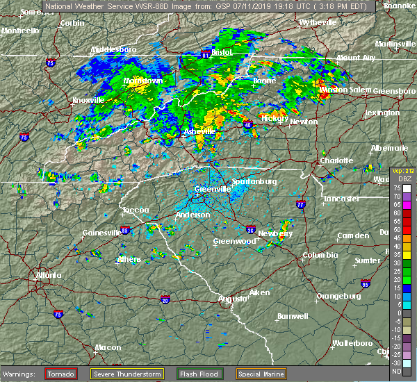 At 319 pm edt, a severe thunderstorm was located near morganton, moving northeast at 15 mph (radar indicated). Hazards include 60 mph wind gusts and quarter size hail. Minor hail damage to vehicles is expected. Expect wind damage to trees and power lines. At 319 pm edt, a severe thunderstorm was located near morganton, moving northeast at 15 mph (radar indicated). Hazards include 60 mph wind gusts and quarter size hail. Minor hail damage to vehicles is expected. Expect wind damage to trees and power lines.
|
| 5/4/2019 3:54 PM EDT |
 At 354 pm edt, a severe thunderstorm was located 8 miles south of morganton, or near south mountains state park, moving east at 20 mph (radar indicated). Hazards include 60 mph wind gusts and half dollar size hail. Minor hail damage to vehicles is expected. Expect wind damage to trees and power lines. At 354 pm edt, a severe thunderstorm was located 8 miles south of morganton, or near south mountains state park, moving east at 20 mph (radar indicated). Hazards include 60 mph wind gusts and half dollar size hail. Minor hail damage to vehicles is expected. Expect wind damage to trees and power lines.
|
| 4/14/2019 10:21 PM EDT |
 At 1021 pm edt, a severe thunderstorm was located 8 miles south of morganton, or over south mountains state park, moving northeast at 55 mph (radar indicated). Hazards include 70 mph wind gusts. Expect considerable tree damage. Damage is likely to mobile homes, roofs, and outbuildings. At 1021 pm edt, a severe thunderstorm was located 8 miles south of morganton, or over south mountains state park, moving northeast at 55 mph (radar indicated). Hazards include 70 mph wind gusts. Expect considerable tree damage. Damage is likely to mobile homes, roofs, and outbuildings.
|
| 4/14/2019 4:05 PM EDT |
 The severe thunderstorm warning for eastern mcdowell, northeastern rutherford, southwestern caldwell, northwestern cleveland and burke counties will expire at 415 pm edt, the storm which prompted the warning has moved out of the area. therefore the warning will be allowed to expire. however gusty winds are still possible with this thunderstorm. a tornado watch remains in effect until 800 pm edt for western and the piedmont of north carolina. The severe thunderstorm warning for eastern mcdowell, northeastern rutherford, southwestern caldwell, northwestern cleveland and burke counties will expire at 415 pm edt, the storm which prompted the warning has moved out of the area. therefore the warning will be allowed to expire. however gusty winds are still possible with this thunderstorm. a tornado watch remains in effect until 800 pm edt for western and the piedmont of north carolina.
|
| 4/14/2019 3:52 PM EDT |
 At 352 pm edt, a severe thunderstorm was located 6 miles north of morganton, or 5 miles east of table rock, moving northeast at 50 mph (radar indicated). Hazards include 60 mph wind gusts. Expect damage to trees and power lines. locations impacted include, morganton, drexel, glen alpine, table rock, south mountains state park, collettsville, pleasant grove, oak hill, dysartsville and sunshine. A tornado watch remains in effect until 800 pm edt for western and the piedmont of north carolina. At 352 pm edt, a severe thunderstorm was located 6 miles north of morganton, or 5 miles east of table rock, moving northeast at 50 mph (radar indicated). Hazards include 60 mph wind gusts. Expect damage to trees and power lines. locations impacted include, morganton, drexel, glen alpine, table rock, south mountains state park, collettsville, pleasant grove, oak hill, dysartsville and sunshine. A tornado watch remains in effect until 800 pm edt for western and the piedmont of north carolina.
|
| 4/14/2019 3:49 PM EDT |
 At 349 pm edt, a severe thunderstorm capable of producing a tornado was located 4 miles south of morganton, or 4 miles southeast of glen alpine, moving northeast at 50 mph (radar indicated rotation). Hazards include tornado. Flying debris will be dangerous to those caught without shelter. mobile homes will be damaged or destroyed. damage to roofs, windows, and vehicles will occur. tree damage is likely. this dangerous storm will be near, glen alpine around 350 pm edt. morganton, drexel, valdese, rutherford college and connelly springs around 400 pm edt. Other locations impacted by this dangerous storm include oak hill. At 349 pm edt, a severe thunderstorm capable of producing a tornado was located 4 miles south of morganton, or 4 miles southeast of glen alpine, moving northeast at 50 mph (radar indicated rotation). Hazards include tornado. Flying debris will be dangerous to those caught without shelter. mobile homes will be damaged or destroyed. damage to roofs, windows, and vehicles will occur. tree damage is likely. this dangerous storm will be near, glen alpine around 350 pm edt. morganton, drexel, valdese, rutherford college and connelly springs around 400 pm edt. Other locations impacted by this dangerous storm include oak hill.
|
| 4/14/2019 3:33 PM EDT |
 At 333 pm edt, a severe thunderstorm capable of producing a tornado was located 11 miles northeast of rutherfordton, or 10 miles north of bostic, moving northeast at 45 mph (radar indicated rotation). Hazards include tornado. Flying debris will be dangerous to those caught without shelter. mobile homes will be damaged or destroyed. damage to roofs, windows, and vehicles will occur. tree damage is likely. this dangerous storm will be near, salem, south mountains state park and glen alpine around 350 pm edt. morganton, drexel, valdese, rutherford college and connelly springs around 400 pm edt. Other locations impacted by this dangerous thunderstorm include sunshine, thermal city, oak hill, dysartsville and union mills. At 333 pm edt, a severe thunderstorm capable of producing a tornado was located 11 miles northeast of rutherfordton, or 10 miles north of bostic, moving northeast at 45 mph (radar indicated rotation). Hazards include tornado. Flying debris will be dangerous to those caught without shelter. mobile homes will be damaged or destroyed. damage to roofs, windows, and vehicles will occur. tree damage is likely. this dangerous storm will be near, salem, south mountains state park and glen alpine around 350 pm edt. morganton, drexel, valdese, rutherford college and connelly springs around 400 pm edt. Other locations impacted by this dangerous thunderstorm include sunshine, thermal city, oak hill, dysartsville and union mills.
|
| 4/14/2019 3:31 PM EDT |
 At 331 pm edt, a severe thunderstorm was located 8 miles southeast of marion, moving northeast at 45 mph (radar indicated). Hazards include 60 mph wind gusts. expect damage to trees and power lines At 331 pm edt, a severe thunderstorm was located 8 miles southeast of marion, moving northeast at 45 mph (radar indicated). Hazards include 60 mph wind gusts. expect damage to trees and power lines
|
| 4/13/2019 3:09 PM EDT |
 At 309 pm edt, a severe thunderstorm capable of producing a tornado was located over morganton, moving east at 25 mph (radar indicated rotation). Hazards include tornado and half dollar size hail. Flying debris will be dangerous to those caught without shelter. mobile homes will be damaged or destroyed. damage to roofs, windows, and vehicles will occur. tree damage is likely. this dangerous storm will be near, drexel around 320 pm edt. valdese and rutherford college around 330 pm edt. Connelly springs, icard, lake rhodhiss and sawmills around 340 pm edt. At 309 pm edt, a severe thunderstorm capable of producing a tornado was located over morganton, moving east at 25 mph (radar indicated rotation). Hazards include tornado and half dollar size hail. Flying debris will be dangerous to those caught without shelter. mobile homes will be damaged or destroyed. damage to roofs, windows, and vehicles will occur. tree damage is likely. this dangerous storm will be near, drexel around 320 pm edt. valdese and rutherford college around 330 pm edt. Connelly springs, icard, lake rhodhiss and sawmills around 340 pm edt.
|
| 4/13/2019 3:02 PM EDT |
 At 302 pm edt, a severe thunderstorm was located near morganton, moving east at 25 mph (radar indicated). Hazards include 70 mph wind gusts and ping pong ball size hail. People and animals outdoors will be injured. expect hail damage to roofs, siding, windows, and vehicles. expect considerable tree damage. wind damage is also likely to mobile homes, roofs, and outbuildings. Locations impacted include, morganton, valdese, gamewell, cajah`s mountain, drexel, connelly springs, rutherford college, glen alpine, lake rhodhiss and oak hill. At 302 pm edt, a severe thunderstorm was located near morganton, moving east at 25 mph (radar indicated). Hazards include 70 mph wind gusts and ping pong ball size hail. People and animals outdoors will be injured. expect hail damage to roofs, siding, windows, and vehicles. expect considerable tree damage. wind damage is also likely to mobile homes, roofs, and outbuildings. Locations impacted include, morganton, valdese, gamewell, cajah`s mountain, drexel, connelly springs, rutherford college, glen alpine, lake rhodhiss and oak hill.
|
| 4/13/2019 2:53 PM EDT |
 At 253 pm edt, a severe thunderstorm was located 5 miles west of morganton, or near glen alpine, moving east at 25 mph (radar indicated). Hazards include 70 mph wind gusts and ping pong ball size hail. People and animals outdoors will be injured. expect hail damage to roofs, siding, windows, and vehicles. expect considerable tree damage. wind damage is also likely to mobile homes, roofs, and outbuildings. Locations impacted include, morganton, valdese, gamewell, icard, cajah`s mountain, drexel, connelly springs, rutherford college, glen alpine and lake rhodhiss. At 253 pm edt, a severe thunderstorm was located 5 miles west of morganton, or near glen alpine, moving east at 25 mph (radar indicated). Hazards include 70 mph wind gusts and ping pong ball size hail. People and animals outdoors will be injured. expect hail damage to roofs, siding, windows, and vehicles. expect considerable tree damage. wind damage is also likely to mobile homes, roofs, and outbuildings. Locations impacted include, morganton, valdese, gamewell, icard, cajah`s mountain, drexel, connelly springs, rutherford college, glen alpine and lake rhodhiss.
|
| 4/13/2019 2:43 PM EDT |
 At 243 pm edt, a severe thunderstorm was located 8 miles west of morganton, or near lake james state park, moving east at 25 mph (radar indicated). Hazards include 60 mph wind gusts and quarter size hail. Minor hail damage to vehicles is expected. Expect wind damage to trees and power lines. At 243 pm edt, a severe thunderstorm was located 8 miles west of morganton, or near lake james state park, moving east at 25 mph (radar indicated). Hazards include 60 mph wind gusts and quarter size hail. Minor hail damage to vehicles is expected. Expect wind damage to trees and power lines.
|
| 9/27/2018 8:18 PM EDT |
 At 816 pm edt, severe thunderstorms were located along a line extending from near rutherfordton to 5 miles southeast of forest city and across cherokee county south carolina, moving northeast at 50 mph (law enforcement has reported damage along this line of thunderstorms). Hazards include 60 mph wind gusts and penny size hail. Expect damage to trees and power lines. Locations impacted include, gastonia, shelby, lincolnton, forest city, rutherfordton, kings mountain, cherryville, bessemer city, south gastonia and longview. At 816 pm edt, severe thunderstorms were located along a line extending from near rutherfordton to 5 miles southeast of forest city and across cherokee county south carolina, moving northeast at 50 mph (law enforcement has reported damage along this line of thunderstorms). Hazards include 60 mph wind gusts and penny size hail. Expect damage to trees and power lines. Locations impacted include, gastonia, shelby, lincolnton, forest city, rutherfordton, kings mountain, cherryville, bessemer city, south gastonia and longview.
|
| 9/27/2018 7:51 PM EDT |
 At 749 pm edt, severe thunderstorms were located along a line extending from 12 miles southwest of columbus to near inman to spartanburg to near pauline, moving northeast at 55 mph (law enforcement). Hazards include 60 mph wind gusts and penny size hail. expect damage to trees and power lines At 749 pm edt, severe thunderstorms were located along a line extending from 12 miles southwest of columbus to near inman to spartanburg to near pauline, moving northeast at 55 mph (law enforcement). Hazards include 60 mph wind gusts and penny size hail. expect damage to trees and power lines
|
| 9/2/2018 5:03 PM EDT |
 At 503 pm edt, a severe thunderstorm was located near morganton, or near glen alpine, moving southwest at 10 mph (radar indicated). Hazards include 60 mph wind gusts and quarter size hail. Minor hail damage to vehicles is expected. expect wind damage to trees and power lines. Locations impacted include, morganton, glen alpine, oak hill, lake james, lake james state park and south mountains state park. At 503 pm edt, a severe thunderstorm was located near morganton, or near glen alpine, moving southwest at 10 mph (radar indicated). Hazards include 60 mph wind gusts and quarter size hail. Minor hail damage to vehicles is expected. expect wind damage to trees and power lines. Locations impacted include, morganton, glen alpine, oak hill, lake james, lake james state park and south mountains state park.
|
| 9/2/2018 4:46 PM EDT |
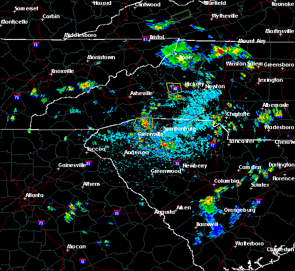 At 446 pm edt, a severe thunderstorm was located near morganton, and is nearly stationary (radar indicated). Hazards include 60 mph wind gusts and quarter size hail. Minor hail damage to vehicles is expected. Expect wind damage to trees and power lines. At 446 pm edt, a severe thunderstorm was located near morganton, and is nearly stationary (radar indicated). Hazards include 60 mph wind gusts and quarter size hail. Minor hail damage to vehicles is expected. Expect wind damage to trees and power lines.
|
| 9/1/2018 9:09 PM EDT |
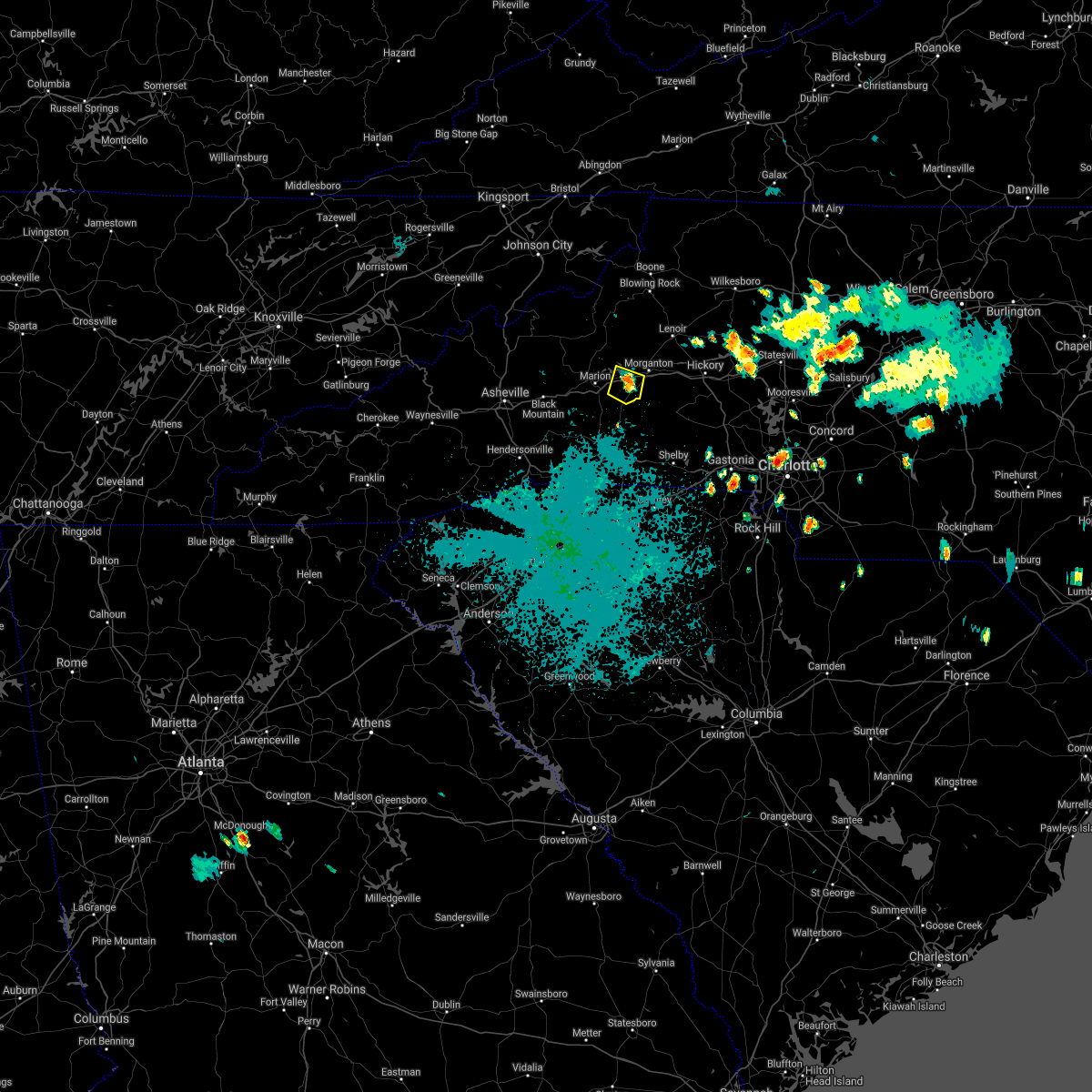 At 909 pm edt, a severe thunderstorm was located 7 miles southwest of morganton, or near glen alpine, and is nearly stationary (radar indicated). Hazards include 60 mph wind gusts and quarter size hail. Minor hail damage to vehicles is expected. expect wind damage to trees and power lines. Locations impacted include, glen alpine, dysartsville, lake james state park, lake james, morganton and south mountains state park. At 909 pm edt, a severe thunderstorm was located 7 miles southwest of morganton, or near glen alpine, and is nearly stationary (radar indicated). Hazards include 60 mph wind gusts and quarter size hail. Minor hail damage to vehicles is expected. expect wind damage to trees and power lines. Locations impacted include, glen alpine, dysartsville, lake james state park, lake james, morganton and south mountains state park.
|
| 9/1/2018 8:55 PM EDT |
 At 854 pm edt, a severe thunderstorm was located 7 miles southwest of morganton, or 4 miles south of glen alpine, and is nearly stationary (radar indicated). Hazards include 60 mph wind gusts and quarter size hail. Minor hail damage to vehicles is expected. Expect wind damage to trees and power lines. At 854 pm edt, a severe thunderstorm was located 7 miles southwest of morganton, or 4 miles south of glen alpine, and is nearly stationary (radar indicated). Hazards include 60 mph wind gusts and quarter size hail. Minor hail damage to vehicles is expected. Expect wind damage to trees and power lines.
|
| 8/8/2018 4:53 PM EDT |
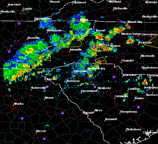 At 453 pm edt, a severe thunderstorm was located 5 miles southwest of morganton, or 4 miles southeast of glen alpine, moving east at 20 mph (radar indicated). Hazards include 60 mph wind gusts and nickel size hail. Expect damage to trees and power lines. Locations impacted include, morganton, glen alpine and south mountains state park. At 453 pm edt, a severe thunderstorm was located 5 miles southwest of morganton, or 4 miles southeast of glen alpine, moving east at 20 mph (radar indicated). Hazards include 60 mph wind gusts and nickel size hail. Expect damage to trees and power lines. Locations impacted include, morganton, glen alpine and south mountains state park.
|
| 8/8/2018 4:29 PM EDT |
 At 429 pm edt, a severe thunderstorm was located 7 miles east of marion, or 4 miles southeast of lake james state park, moving east at 10 mph (radar indicated). Hazards include 60 mph wind gusts and half dollar size hail. Minor hail damage to vehicles is expected. Expect wind damage to trees and power lines. At 429 pm edt, a severe thunderstorm was located 7 miles east of marion, or 4 miles southeast of lake james state park, moving east at 10 mph (radar indicated). Hazards include 60 mph wind gusts and half dollar size hail. Minor hail damage to vehicles is expected. Expect wind damage to trees and power lines.
|
| 7/21/2018 5:54 PM EDT |
 At 554 pm edt, a severe thunderstorm was located near morganton, or near glen alpine, moving east at 30 mph (radar indicated). Hazards include 60 mph wind gusts and quarter size hail. Minor hail damage to vehicles is expected. Expect wind damage to trees and power lines. At 554 pm edt, a severe thunderstorm was located near morganton, or near glen alpine, moving east at 30 mph (radar indicated). Hazards include 60 mph wind gusts and quarter size hail. Minor hail damage to vehicles is expected. Expect wind damage to trees and power lines.
|
| 6/25/2018 5:22 PM EDT |
 At 521 pm edt, severe thunderstorms were located along a line extending from 7 miles northeast of taylorsville to 5 miles north of forest city, moving east at 30 mph (radar indicated). Hazards include 60 mph wind gusts and quarter size hail. Minor hail damage to vehicles is expected. Expect wind damage to trees and power lines. At 521 pm edt, severe thunderstorms were located along a line extending from 7 miles northeast of taylorsville to 5 miles north of forest city, moving east at 30 mph (radar indicated). Hazards include 60 mph wind gusts and quarter size hail. Minor hail damage to vehicles is expected. Expect wind damage to trees and power lines.
|
| 6/25/2018 4:59 PM EDT |
 At 459 pm edt, severe thunderstorms were located along a line extending from 3 miles northwest of north wilkesboro to 6 miles east of morganton to 6 miles south of marion, moving east at 45 mph (radar indicated). Hazards include 60 mph wind gusts and quarter size hail. Minor hail damage to vehicles is expected. expect wind damage to trees and power lines. Locations impacted include, lenoir, morganton, marion, sawmills, granite falls, valdese, gamewell, hudson, icard and cajah`s mountain. At 459 pm edt, severe thunderstorms were located along a line extending from 3 miles northwest of north wilkesboro to 6 miles east of morganton to 6 miles south of marion, moving east at 45 mph (radar indicated). Hazards include 60 mph wind gusts and quarter size hail. Minor hail damage to vehicles is expected. expect wind damage to trees and power lines. Locations impacted include, lenoir, morganton, marion, sawmills, granite falls, valdese, gamewell, hudson, icard and cajah`s mountain.
|
| 6/25/2018 4:38 PM EDT |
 At 437 pm edt, severe thunderstorms were located along a line extending from 5 miles southeast of deep gap to 8 miles east of marion to 15 miles east of downtown asheville, moving east at 45 mph (radar indicated). Hazards include 60 mph wind gusts and quarter size hail. Minor hail damage to vehicles is expected. Expect wind damage to trees and power lines. At 437 pm edt, severe thunderstorms were located along a line extending from 5 miles southeast of deep gap to 8 miles east of marion to 15 miles east of downtown asheville, moving east at 45 mph (radar indicated). Hazards include 60 mph wind gusts and quarter size hail. Minor hail damage to vehicles is expected. Expect wind damage to trees and power lines.
|
| 6/3/2018 7:02 PM EDT |
 At 701 pm edt, a severe thunderstorm was located 13 miles south of morganton, or near south mountains state park, moving southeast at 25 mph. another severe thunderstorm was located near cooksville, also moving southeast at 25 mph (radar indicated). Hazards include ping pong ball size hail and 60 mph wind gusts. People and animals outdoors will be injured. expect hail damage to roofs, siding, windows, and vehicles. expect wind damage to trees and power lines. Locations impacted include, hickory, newton, conover, longview, valdese, icard, drexel, hildebran, connelly springs and rutherford college. At 701 pm edt, a severe thunderstorm was located 13 miles south of morganton, or near south mountains state park, moving southeast at 25 mph. another severe thunderstorm was located near cooksville, also moving southeast at 25 mph (radar indicated). Hazards include ping pong ball size hail and 60 mph wind gusts. People and animals outdoors will be injured. expect hail damage to roofs, siding, windows, and vehicles. expect wind damage to trees and power lines. Locations impacted include, hickory, newton, conover, longview, valdese, icard, drexel, hildebran, connelly springs and rutherford college.
|
| 6/3/2018 6:43 PM EDT |
 At 642 pm edt, a severe thunderstorm was located 8 miles south of morganton, or near south mountains state park, moving southeast at 30 mph. another severe thunderstorm was located 2 miles south of valdese, also moving southeast at 30 mph (radar indicated). Hazards include ping pong ball size hail and 60 mph wind gusts. People and animals outdoors will be injured. expect hail damage to roofs, siding, windows, and vehicles. Expect wind damage to trees and power lines. At 642 pm edt, a severe thunderstorm was located 8 miles south of morganton, or near south mountains state park, moving southeast at 30 mph. another severe thunderstorm was located 2 miles south of valdese, also moving southeast at 30 mph (radar indicated). Hazards include ping pong ball size hail and 60 mph wind gusts. People and animals outdoors will be injured. expect hail damage to roofs, siding, windows, and vehicles. Expect wind damage to trees and power lines.
|
| 6/3/2018 6:28 PM EDT |
 At 627 pm edt, a severe thunderstorm was located near morganton, moving southeast at 40 mph (radar indicated). Hazards include 60 mph wind gusts and quarter size hail. Minor hail damage to vehicles is expected. expect wind damage to trees and power lines. Locations impacted include, morganton, valdese, icard, drexel, hildebran, connelly springs, rutherford college, glen alpine, lake rhodhiss and table rock. At 627 pm edt, a severe thunderstorm was located near morganton, moving southeast at 40 mph (radar indicated). Hazards include 60 mph wind gusts and quarter size hail. Minor hail damage to vehicles is expected. expect wind damage to trees and power lines. Locations impacted include, morganton, valdese, icard, drexel, hildebran, connelly springs, rutherford college, glen alpine, lake rhodhiss and table rock.
|
| 6/3/2018 6:12 PM EDT |
 At 612 pm edt, a severe thunderstorm was located 12 miles southeast of spruce pine, or 4 miles west of table rock, moving southeast at 40 mph (radar indicated). Hazards include 60 mph wind gusts and quarter size hail. Minor hail damage to vehicles is expected. Expect wind damage to trees and power lines. At 612 pm edt, a severe thunderstorm was located 12 miles southeast of spruce pine, or 4 miles west of table rock, moving southeast at 40 mph (radar indicated). Hazards include 60 mph wind gusts and quarter size hail. Minor hail damage to vehicles is expected. Expect wind damage to trees and power lines.
|
| 4/15/2018 1:13 PM EDT |
 At 113 pm edt, severe thunderstorms were located along a line extending from 5 miles east of morganton to 12 miles southwest of hickory to 13 miles north of shelby, moving northeast at 40 mph (radar indicated). Hazards include 60 mph wind gusts and quarter size hail. Minor hail damage to vehicles is expected. Expect wind damage to trees and power lines. At 113 pm edt, severe thunderstorms were located along a line extending from 5 miles east of morganton to 12 miles southwest of hickory to 13 miles north of shelby, moving northeast at 40 mph (radar indicated). Hazards include 60 mph wind gusts and quarter size hail. Minor hail damage to vehicles is expected. Expect wind damage to trees and power lines.
|
| 4/15/2018 12:59 PM EDT |
 At 1246 pm edt, severe thunderstorms were located along a line extending from 10 miles northeast of forest city to 6 miles southwest of shelby, moving northeast at 55 mph (radar indicated). Hazards include 60 mph wind gusts and quarter size hail. Minor hail damage to vehicles is expected. Expect wind damage to trees and power lines. At 1246 pm edt, severe thunderstorms were located along a line extending from 10 miles northeast of forest city to 6 miles southwest of shelby, moving northeast at 55 mph (radar indicated). Hazards include 60 mph wind gusts and quarter size hail. Minor hail damage to vehicles is expected. Expect wind damage to trees and power lines.
|
| 4/15/2018 12:47 PM EDT |
 At 1246 pm edt, severe thunderstorms were located along a line extending from 10 miles northeast of forest city to 6 miles southwest of shelby, moving northeast at 55 mph (radar indicated). Hazards include 60 mph wind gusts and quarter size hail. Minor hail damage to vehicles is expected. Expect wind damage to trees and power lines. At 1246 pm edt, severe thunderstorms were located along a line extending from 10 miles northeast of forest city to 6 miles southwest of shelby, moving northeast at 55 mph (radar indicated). Hazards include 60 mph wind gusts and quarter size hail. Minor hail damage to vehicles is expected. Expect wind damage to trees and power lines.
|
| 4/15/2018 12:39 PM EDT |
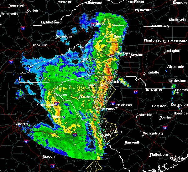 The severe thunderstorm warning for northeastern mcdowell, western caldwell, southeastern avery and northwestern burke counties will expire at 1245 pm edt, the storm which prompted the warning has weakened below severe limits, and no longer poses an immediate threat to life or property. therefore the warning will be allowed to expire. however gusty winds and heavy rain are still possible with this thunderstorm. a tornado watch remains in effect until 700 pm edt for western north carolina. The severe thunderstorm warning for northeastern mcdowell, western caldwell, southeastern avery and northwestern burke counties will expire at 1245 pm edt, the storm which prompted the warning has weakened below severe limits, and no longer poses an immediate threat to life or property. therefore the warning will be allowed to expire. however gusty winds and heavy rain are still possible with this thunderstorm. a tornado watch remains in effect until 700 pm edt for western north carolina.
|
| 4/15/2018 12:25 PM EDT |
 At 1224 pm edt, a severe thunderstorm was located near deep gap, or near rutherwood, moving northeast at 50 mph (radar indicated). Hazards include 60 mph wind gusts and penny size hail. Expect damage to trees and power lines. locations impacted include, morganton, gamewell, blowing rock in caldwell county, glen alpine, table rock, edgemont, collettsville, ashford, patterson and jonas ridge. A tornado watch remains in effect until 700 pm edt for western north carolina. At 1224 pm edt, a severe thunderstorm was located near deep gap, or near rutherwood, moving northeast at 50 mph (radar indicated). Hazards include 60 mph wind gusts and penny size hail. Expect damage to trees and power lines. locations impacted include, morganton, gamewell, blowing rock in caldwell county, glen alpine, table rock, edgemont, collettsville, ashford, patterson and jonas ridge. A tornado watch remains in effect until 700 pm edt for western north carolina.
|
| 4/15/2018 12:00 PM EDT |
 At 1159 am edt, a severe thunderstorm was located 10 miles northwest of morganton, or near table rock, moving northeast at 45 mph (radar indicated). Hazards include 60 mph wind gusts and penny size hail. expect damage to trees and power lines At 1159 am edt, a severe thunderstorm was located 10 miles northwest of morganton, or near table rock, moving northeast at 45 mph (radar indicated). Hazards include 60 mph wind gusts and penny size hail. expect damage to trees and power lines
|
| 10/23/2017 4:14 PM EDT |
 At 414 pm edt, a severe thunderstorm capable of producing a tornado was located 15 miles southeast of morganton, or 4 miles northeast of casar, moving northeast at 80 mph (radar indicated rotation). Hazards include tornado. Flying debris will be dangerous to those caught without shelter. mobile homes will be damaged or destroyed. damage to roofs, windows, and vehicles will occur. tree damage is likely. This dangerous storm will remain over mainly rural areas of southwestern catawba, western lincoln, northwestern cleveland and southeastern burke counties, including the following locations: cooksville, vale and pleasant grove. At 414 pm edt, a severe thunderstorm capable of producing a tornado was located 15 miles southeast of morganton, or 4 miles northeast of casar, moving northeast at 80 mph (radar indicated rotation). Hazards include tornado. Flying debris will be dangerous to those caught without shelter. mobile homes will be damaged or destroyed. damage to roofs, windows, and vehicles will occur. tree damage is likely. This dangerous storm will remain over mainly rural areas of southwestern catawba, western lincoln, northwestern cleveland and southeastern burke counties, including the following locations: cooksville, vale and pleasant grove.
|
| 10/23/2017 3:59 PM EDT |
 At 359 pm edt, a severe thunderstorm capable of producing a tornado was located 9 miles northwest of shelby, or near polkville, moving northeast at 45 mph (radar indicated rotation). Hazards include tornado. Flying debris will be dangerous to those caught without shelter. mobile homes will be damaged or destroyed. damage to roofs, windows, and vehicles will occur. tree damage is likely. this dangerous storm will be near, polkville and lawndale around 400 pm edt. casar, belwood and fallston around 410 pm edt. Other locations impacted by this dangerous thunderstorm include cooksville, sunshine, pleasant grove and vale. At 359 pm edt, a severe thunderstorm capable of producing a tornado was located 9 miles northwest of shelby, or near polkville, moving northeast at 45 mph (radar indicated rotation). Hazards include tornado. Flying debris will be dangerous to those caught without shelter. mobile homes will be damaged or destroyed. damage to roofs, windows, and vehicles will occur. tree damage is likely. this dangerous storm will be near, polkville and lawndale around 400 pm edt. casar, belwood and fallston around 410 pm edt. Other locations impacted by this dangerous thunderstorm include cooksville, sunshine, pleasant grove and vale.
|
| 9/1/2017 6:59 PM EDT |
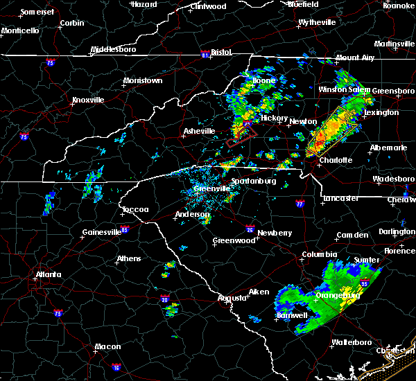 At 659 pm edt, a severe thunderstorm capable of producing a tornado was located 12 miles southwest of morganton, or 8 miles west of south mountains state park, moving northeast at 30 mph (radar indicated rotation). Hazards include tornado. Expect damage to mobile homes, roofs, and vehicles. This dangerous storm will be near, south mountains state park and salem around 710 pm edt. At 659 pm edt, a severe thunderstorm capable of producing a tornado was located 12 miles southwest of morganton, or 8 miles west of south mountains state park, moving northeast at 30 mph (radar indicated rotation). Hazards include tornado. Expect damage to mobile homes, roofs, and vehicles. This dangerous storm will be near, south mountains state park and salem around 710 pm edt.
|
| 9/1/2017 6:43 PM EDT |
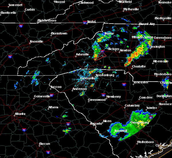 At 643 pm edt, a severe thunderstorm capable of producing a tornado was located 10 miles north of rutherfordton, or 9 miles north of spindale, moving northeast at 30 mph (radar indicated rotation). Hazards include tornado. Expect damage to mobile homes, roofs, and vehicles. this dangerous storm will be near, south mountains state park and salem around 710 pm edt. Other locations impacted by this dangerous thunderstorm include union mills. At 643 pm edt, a severe thunderstorm capable of producing a tornado was located 10 miles north of rutherfordton, or 9 miles north of spindale, moving northeast at 30 mph (radar indicated rotation). Hazards include tornado. Expect damage to mobile homes, roofs, and vehicles. this dangerous storm will be near, south mountains state park and salem around 710 pm edt. Other locations impacted by this dangerous thunderstorm include union mills.
|
| 7/23/2017 1:51 PM EDT |
 At 151 pm edt, severe thunderstorms were located along a line extending from 5 miles west of hickory to 3 miles south of marion, moving east at 35 mph (radar indicated). Hazards include 60 mph wind gusts and quarter size hail. Minor hail damage to vehicles is expected. expect wind damage to trees and power lines. Locations impacted include, hickory, morganton, newton, marion, conover, longview, sawmills, granite falls, valdese and icard. At 151 pm edt, severe thunderstorms were located along a line extending from 5 miles west of hickory to 3 miles south of marion, moving east at 35 mph (radar indicated). Hazards include 60 mph wind gusts and quarter size hail. Minor hail damage to vehicles is expected. expect wind damage to trees and power lines. Locations impacted include, hickory, morganton, newton, marion, conover, longview, sawmills, granite falls, valdese and icard.
|
| 7/23/2017 1:27 PM EDT |
 At 126 pm edt, a cluster of locally severe thunderstorms was oriented along a line extending from 6 miles south of lenoir to 9 miles west of marion, moving east at 35 mph (radar indicated). Hazards include 60 mph wind gusts and quarter size hail. Minor hail damage to vehicles is expected. Expect wind damage to trees and power lines. At 126 pm edt, a cluster of locally severe thunderstorms was oriented along a line extending from 6 miles south of lenoir to 9 miles west of marion, moving east at 35 mph (radar indicated). Hazards include 60 mph wind gusts and quarter size hail. Minor hail damage to vehicles is expected. Expect wind damage to trees and power lines.
|
| 7/17/2017 7:20 PM EDT |
 The severe thunderstorm warning for southeastern caldwell and burke counties will expire at 730 pm edt, the storm which prompted the warning has weakened below severe limits, and no longer poses an immediate threat to life or property. therefore the warning will be allowed to expire. The severe thunderstorm warning for southeastern caldwell and burke counties will expire at 730 pm edt, the storm which prompted the warning has weakened below severe limits, and no longer poses an immediate threat to life or property. therefore the warning will be allowed to expire.
|
| 7/17/2017 6:43 PM EDT |
 At 643 pm edt, a severe thunderstorm was located 9 miles east of morganton, or over rutherford college, moving west at 15 mph (radar indicated). Hazards include 60 mph wind gusts and quarter size hail. Minor hail damage to vehicles is expected. Expect wind damage to trees and power lines. At 643 pm edt, a severe thunderstorm was located 9 miles east of morganton, or over rutherford college, moving west at 15 mph (radar indicated). Hazards include 60 mph wind gusts and quarter size hail. Minor hail damage to vehicles is expected. Expect wind damage to trees and power lines.
|
| 7/15/2017 3:40 PM EDT |
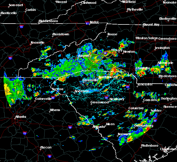 At 340 pm edt, a severe thunderstorm was located 4 miles south of morganton, moving southeast at 10 mph (radar indicated). Hazards include 60 mph wind gusts. Expect damage to trees and power lines. Locations impacted include, morganton, valdese, icard, drexel, connelly springs, rutherford college, glen alpine, lake rhodhiss, south mountains state park and pleasant grove. At 340 pm edt, a severe thunderstorm was located 4 miles south of morganton, moving southeast at 10 mph (radar indicated). Hazards include 60 mph wind gusts. Expect damage to trees and power lines. Locations impacted include, morganton, valdese, icard, drexel, connelly springs, rutherford college, glen alpine, lake rhodhiss, south mountains state park and pleasant grove.
|
| 7/15/2017 3:22 PM EDT |
 At 322 pm edt, a severe thunderstorm was located near morganton, or near glen alpine, moving southeast at 10 mph (radar indicated). Hazards include 60 mph wind gusts and quarter size hail. Minor hail damage to vehicles is expected. Expect wind damage to trees and power lines. At 322 pm edt, a severe thunderstorm was located near morganton, or near glen alpine, moving southeast at 10 mph (radar indicated). Hazards include 60 mph wind gusts and quarter size hail. Minor hail damage to vehicles is expected. Expect wind damage to trees and power lines.
|
| 7/14/2017 5:44 PM EDT |
 At 544 pm edt, a severe thunderstorm was located 6 miles south of morganton, or near south mountains state park, moving southeast at 20 mph (radar indicated). Hazards include 60 mph wind gusts. Expect damage to trees and power lines. Locations impacted include, morganton, valdese, icard, drexel, hildebran, connelly springs, rutherford college, lake rhodhiss, hickory regional airport and glenwood. At 544 pm edt, a severe thunderstorm was located 6 miles south of morganton, or near south mountains state park, moving southeast at 20 mph (radar indicated). Hazards include 60 mph wind gusts. Expect damage to trees and power lines. Locations impacted include, morganton, valdese, icard, drexel, hildebran, connelly springs, rutherford college, lake rhodhiss, hickory regional airport and glenwood.
|
| 7/14/2017 5:33 PM EDT |
 At 532 pm edt, a severe thunderstorm was located 7 miles northeast of morganton, or near gamewell, moving east at 10 mph (radar indicated). Hazards include 60 mph wind gusts. Expect damage to trees and power lines. Locations impacted include, lenoir, morganton, sawmills, granite falls, valdese, gamewell, hudson, icard, cajah`s mountain and drexel. At 532 pm edt, a severe thunderstorm was located 7 miles northeast of morganton, or near gamewell, moving east at 10 mph (radar indicated). Hazards include 60 mph wind gusts. Expect damage to trees and power lines. Locations impacted include, lenoir, morganton, sawmills, granite falls, valdese, gamewell, hudson, icard, cajah`s mountain and drexel.
|
| 7/14/2017 5:15 PM EDT |
 At 514 pm edt, a severe thunderstorm was located 8 miles northwest of morganton, or near table rock, moving east at 10 mph. other strong thunderstorms in the warned area may become severe at any time, including near gamewell and near marion (radar indicated). Hazards include 60 mph wind gusts and quarter size hail. Minor hail damage to vehicles is expected. Expect wind damage to trees and power lines. At 514 pm edt, a severe thunderstorm was located 8 miles northwest of morganton, or near table rock, moving east at 10 mph. other strong thunderstorms in the warned area may become severe at any time, including near gamewell and near marion (radar indicated). Hazards include 60 mph wind gusts and quarter size hail. Minor hail damage to vehicles is expected. Expect wind damage to trees and power lines.
|
| 5/28/2017 1:31 AM EDT |
 At 130 am edt, severe thunderstorms were located along a line extending from 5 miles southwest of wilbar to 15 miles south of morganton, moving east at 35 mph (radar indicated). Hazards include 60 mph wind gusts and penny size hail. Expect damage to trees and power lines. Locations impacted include, lenoir, sawmills, granite falls, valdese, gamewell, hudson, icard, cajah`s mountain, drexel and hildebran. At 130 am edt, severe thunderstorms were located along a line extending from 5 miles southwest of wilbar to 15 miles south of morganton, moving east at 35 mph (radar indicated). Hazards include 60 mph wind gusts and penny size hail. Expect damage to trees and power lines. Locations impacted include, lenoir, sawmills, granite falls, valdese, gamewell, hudson, icard, cajah`s mountain, drexel and hildebran.
|
| 5/28/2017 12:55 AM EDT |
 At 1255 am edt, severe thunderstorms were located along a line extending from near sugar grove to 8 miles southwest of marion, moving east at 40 mph (radar indicated). Hazards include 60 mph wind gusts and penny size hail. expect damage to trees and power lines At 1255 am edt, severe thunderstorms were located along a line extending from near sugar grove to 8 miles southwest of marion, moving east at 40 mph (radar indicated). Hazards include 60 mph wind gusts and penny size hail. expect damage to trees and power lines
|
| 5/24/2017 4:44 PM EDT |
 At 444 pm edt, a severe thunderstorm capable of producing a tornado was located 9 miles east of marion, or 5 miles southwest of glen alpine, moving northeast at 15 mph (radar indicated rotation). Hazards include tornado. Flying debris will be dangerous to those caught without shelter. mobile homes will be damaged or destroyed. damage to roofs, windows, and vehicles will occur. tree damage is likely. This dangerous storm will be near, morganton and glen alpine around 500 pm edt. At 444 pm edt, a severe thunderstorm capable of producing a tornado was located 9 miles east of marion, or 5 miles southwest of glen alpine, moving northeast at 15 mph (radar indicated rotation). Hazards include tornado. Flying debris will be dangerous to those caught without shelter. mobile homes will be damaged or destroyed. damage to roofs, windows, and vehicles will occur. tree damage is likely. This dangerous storm will be near, morganton and glen alpine around 500 pm edt.
|
| 5/24/2017 4:23 PM EDT |
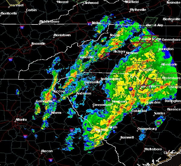 At 423 pm edt, a severe thunderstorm capable of producing a tornado was located 7 miles southeast of marion, moving northeast at 15 mph (radar indicated rotation). Hazards include tornado. Flying debris will be dangerous to those caught without shelter. mobile homes will be damaged or destroyed. damage to roofs, windows, and vehicles will occur. tree damage is likely. this dangerous storm will be near, morganton, glen alpine and salem around 500 pm edt. Other locations impacted by this dangerous thunderstorm include dysartsville. At 423 pm edt, a severe thunderstorm capable of producing a tornado was located 7 miles southeast of marion, moving northeast at 15 mph (radar indicated rotation). Hazards include tornado. Flying debris will be dangerous to those caught without shelter. mobile homes will be damaged or destroyed. damage to roofs, windows, and vehicles will occur. tree damage is likely. this dangerous storm will be near, morganton, glen alpine and salem around 500 pm edt. Other locations impacted by this dangerous thunderstorm include dysartsville.
|
| 5/5/2017 3:07 AM EDT |
 The severe thunderstorm warning for central burke county will expire at 315 am edt, the storm which prompted the warning has weakened below severe limits, and has exited the warned area. therefore the warning will be allowed to expire. The severe thunderstorm warning for central burke county will expire at 315 am edt, the storm which prompted the warning has weakened below severe limits, and has exited the warned area. therefore the warning will be allowed to expire.
|
| 5/5/2017 2:46 AM EDT |
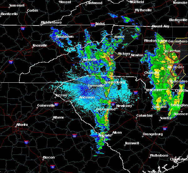 At 246 am edt, a severe thunderstorm was located 5 miles southwest of morganton, or near glen alpine, moving northeast at 55 mph (radar indicated). Hazards include 60 mph wind gusts. Expect damage to trees and power lines. Locations impacted include, morganton, valdese, drexel, connelly springs, rutherford college, glen alpine, lake rhodhiss, oak hill, table rock and south mountains state park. At 246 am edt, a severe thunderstorm was located 5 miles southwest of morganton, or near glen alpine, moving northeast at 55 mph (radar indicated). Hazards include 60 mph wind gusts. Expect damage to trees and power lines. Locations impacted include, morganton, valdese, drexel, connelly springs, rutherford college, glen alpine, lake rhodhiss, oak hill, table rock and south mountains state park.
|
| 5/5/2017 2:33 AM EDT |
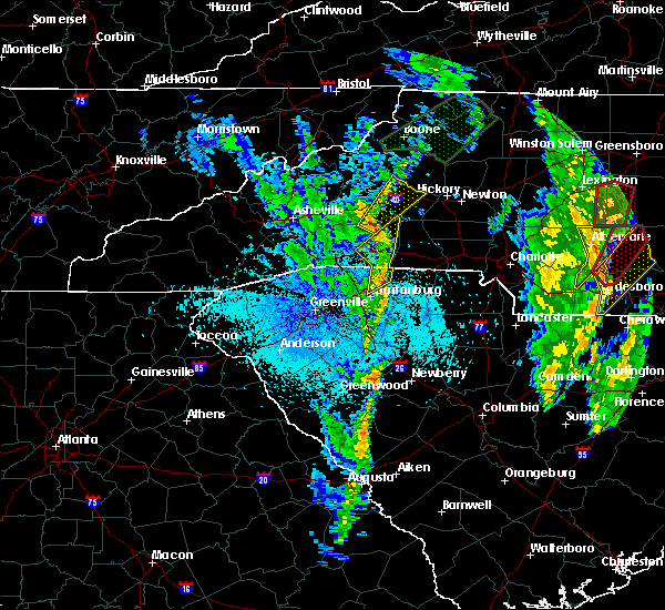 At 233 am edt, a severe thunderstorm was located 12 miles southeast of marion, or 12 miles north of bostic, moving northeast at 45 mph (radar indicated). Hazards include 60 mph wind gusts. expect damage to trees and power lines At 233 am edt, a severe thunderstorm was located 12 miles southeast of marion, or 12 miles north of bostic, moving northeast at 45 mph (radar indicated). Hazards include 60 mph wind gusts. expect damage to trees and power lines
|
| 4/6/2017 12:30 AM EDT |
 At 1230 am edt, severe thunderstorms were located along a line extending from 5 miles west of morganton to 13 miles northeast of rutherfordton to 5 miles southwest of forest city, moving northeast at 70 mph (radar indicated). Hazards include 60 mph wind gusts and quarter size hail. Hail damage to vehicles is expected. Expect wind damage to roofs, siding, and trees. At 1230 am edt, severe thunderstorms were located along a line extending from 5 miles west of morganton to 13 miles northeast of rutherfordton to 5 miles southwest of forest city, moving northeast at 70 mph (radar indicated). Hazards include 60 mph wind gusts and quarter size hail. Hail damage to vehicles is expected. Expect wind damage to roofs, siding, and trees.
|
| 3/1/2017 4:51 PM EST |
 At 451 pm est, a severe thunderstorm capable of producing a tornado was located 7 miles southeast of morganton, or 4 miles southwest of valdese, moving east at 50 mph (radar indicated rotation). Hazards include tornado and quarter size hail. Flying debris will be dangerous to those caught without shelter. mobile homes will be damaged or destroyed. damage to roofs, windows and vehicles will occur. tree damage is likely. this dangerous storm will be near, icard and rhodhiss around 500 pm est. hickory, mountain view, hickory regional airport, longview and hildebran around 510 pm est. Other locations impacted by this dangerous storm include propst and pleasant grove. At 451 pm est, a severe thunderstorm capable of producing a tornado was located 7 miles southeast of morganton, or 4 miles southwest of valdese, moving east at 50 mph (radar indicated rotation). Hazards include tornado and quarter size hail. Flying debris will be dangerous to those caught without shelter. mobile homes will be damaged or destroyed. damage to roofs, windows and vehicles will occur. tree damage is likely. this dangerous storm will be near, icard and rhodhiss around 500 pm est. hickory, mountain view, hickory regional airport, longview and hildebran around 510 pm est. Other locations impacted by this dangerous storm include propst and pleasant grove.
|
| 3/1/2017 4:42 PM EST |
 At 442 pm est, a severe thunderstorm was located near morganton, moving east at 50 mph (radar indicated). Hazards include 60 mph wind gusts and quarter size hail. Hail damage to vehicles is expected. expect wind damage to roofs, siding and trees. Locations impacted include, hickory, morganton, longview, sawmills, granite falls, valdese, hudson, icard, drexel and hildebran. At 442 pm est, a severe thunderstorm was located near morganton, moving east at 50 mph (radar indicated). Hazards include 60 mph wind gusts and quarter size hail. Hail damage to vehicles is expected. expect wind damage to roofs, siding and trees. Locations impacted include, hickory, morganton, longview, sawmills, granite falls, valdese, hudson, icard, drexel and hildebran.
|
| 3/1/2017 4:40 PM EST |
 At 440 pm est, a severe thunderstorm capable of producing a tornado was located 6 miles southwest of morganton, or 5 miles south of glen alpine, moving east at 45 mph (radar indicated rotation). Hazards include tornado. Flying debris will be dangerous to those caught without shelter. mobile homes will be damaged or destroyed. damage to roofs, windows and vehicles will occur. tree damage is likely. this dangerous storm will be near, drexel around 450 pm est. connelly springs, rutherford college, valdese and lake rhodhiss around 500 pm est. hickory, hildebran, mountain view, longview and hickory regional airport around 510 pm est. Other locations impacted by this dangerous thunderstorm include propst and pleasant grove. At 440 pm est, a severe thunderstorm capable of producing a tornado was located 6 miles southwest of morganton, or 5 miles south of glen alpine, moving east at 45 mph (radar indicated rotation). Hazards include tornado. Flying debris will be dangerous to those caught without shelter. mobile homes will be damaged or destroyed. damage to roofs, windows and vehicles will occur. tree damage is likely. this dangerous storm will be near, drexel around 450 pm est. connelly springs, rutherford college, valdese and lake rhodhiss around 500 pm est. hickory, hildebran, mountain view, longview and hickory regional airport around 510 pm est. Other locations impacted by this dangerous thunderstorm include propst and pleasant grove.
|
| 3/1/2017 4:34 PM EST |
 At 433 pm est, a severe thunderstorm was located 8 miles east of marion, or 5 miles southeast of lake james state park, moving east at 50 mph (radar indicated). Hazards include 60 mph wind gusts and nickel size hail. Expect damage to roofs. Siding and trees. At 433 pm est, a severe thunderstorm was located 8 miles east of marion, or 5 miles southeast of lake james state park, moving east at 50 mph (radar indicated). Hazards include 60 mph wind gusts and nickel size hail. Expect damage to roofs. Siding and trees.
|
| 11/30/2016 5:26 PM EST |
 At 526 pm est, severe thunderstorms were located along a line extending from 8 miles east of taylorsville to 14 miles north of shelby to 8 miles southeast of forest city to 5 miles south of union to 8 miles west of newberry, moving northeast at 55 mph (radar indicated). Hazards include 60 mph wind gusts. Expect damage to roofs. Siding and trees. At 526 pm est, severe thunderstorms were located along a line extending from 8 miles east of taylorsville to 14 miles north of shelby to 8 miles southeast of forest city to 5 miles south of union to 8 miles west of newberry, moving northeast at 55 mph (radar indicated). Hazards include 60 mph wind gusts. Expect damage to roofs. Siding and trees.
|
| 7/8/2016 7:52 PM EDT |
 The severe thunderstorm warning for caldwell, burke, eastern mitchell, northwestern catawba, southern yancey, avery, central mcdowell and alexander counties will expire at 800 pm edt, the storms which prompted the warning have weakened below severe limits, and have exited the warned area. therefore the warning will be allowed to expire. however gusty winds are still possible with these thunderstorms. a severe thunderstorm watch remains in effect until midnight edt for the piedmont of and western north carolina. The severe thunderstorm warning for caldwell, burke, eastern mitchell, northwestern catawba, southern yancey, avery, central mcdowell and alexander counties will expire at 800 pm edt, the storms which prompted the warning have weakened below severe limits, and have exited the warned area. therefore the warning will be allowed to expire. however gusty winds are still possible with these thunderstorms. a severe thunderstorm watch remains in effect until midnight edt for the piedmont of and western north carolina.
|
| 7/8/2016 7:18 PM EDT |
 At 718 pm edt, severe thunderstorms were located along a line extending from 5 miles north of beech mountain to 6 miles north of spruce pine to 3 miles west of burnsville, moving east at 55 mph (radar indicated). Hazards include 70 mph wind gusts. Expect considerable tree damage. Damage is likely to mobile homes, roofs and outbuildings. At 718 pm edt, severe thunderstorms were located along a line extending from 5 miles north of beech mountain to 6 miles north of spruce pine to 3 miles west of burnsville, moving east at 55 mph (radar indicated). Hazards include 70 mph wind gusts. Expect considerable tree damage. Damage is likely to mobile homes, roofs and outbuildings.
|
| 7/5/2016 2:28 PM EDT |
 At 228 pm edt, severe thunderstorms were located along a line extending from 9 miles west of morganton to 5 miles northwest of rutherfordton, moving east at 40 mph (emergency management). Hazards include 60 mph wind gusts and nickel size hail. Expect damage to roofs. Siding and trees. At 228 pm edt, severe thunderstorms were located along a line extending from 9 miles west of morganton to 5 miles northwest of rutherfordton, moving east at 40 mph (emergency management). Hazards include 60 mph wind gusts and nickel size hail. Expect damage to roofs. Siding and trees.
|
| 6/29/2016 3:03 PM EDT |
 At 302 pm edt, a severe thunderstorm was located 4 miles southwest of morganton, or near glen alpine, moving east at 15 mph (radar indicated). Hazards include 60 mph wind gusts and half dollar size hail. Hail damage to vehicles is expected. Expect wind damage to roofs, siding and trees. At 302 pm edt, a severe thunderstorm was located 4 miles southwest of morganton, or near glen alpine, moving east at 15 mph (radar indicated). Hazards include 60 mph wind gusts and half dollar size hail. Hail damage to vehicles is expected. Expect wind damage to roofs, siding and trees.
|
| 5/2/2016 3:41 PM EDT |
 At 341 pm edt, a severe thunderstorm was located 6 miles southwest of morganton, or near glen alpine, moving east at 30 mph (radar indicated). Hazards include 60 mph wind gusts and quarter size hail. Hail damage to vehicles is expected. expect wind damage to roofs, siding and trees. Locations impacted include, morganton, glen alpine, oak hill, lake james, lake james state park and south mountains state park. At 341 pm edt, a severe thunderstorm was located 6 miles southwest of morganton, or near glen alpine, moving east at 30 mph (radar indicated). Hazards include 60 mph wind gusts and quarter size hail. Hail damage to vehicles is expected. expect wind damage to roofs, siding and trees. Locations impacted include, morganton, glen alpine, oak hill, lake james, lake james state park and south mountains state park.
|
| 5/2/2016 3:11 PM EDT |
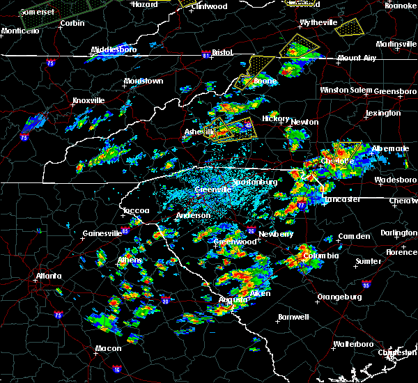 At 310 pm edt, a severe thunderstorm was located 5 miles south of marion, moving east at 20 mph (radar indicated. this storm has a history of producing large hail up to the size of golf balls. take shelter now!). Hazards include 60 mph wind gusts and quarter size hail. Hail damage to vehicles is expected. Expect wind damage to roofs, siding and trees. At 310 pm edt, a severe thunderstorm was located 5 miles south of marion, moving east at 20 mph (radar indicated. this storm has a history of producing large hail up to the size of golf balls. take shelter now!). Hazards include 60 mph wind gusts and quarter size hail. Hail damage to vehicles is expected. Expect wind damage to roofs, siding and trees.
|
| 8/14/2015 5:36 PM EDT |
 At 536 pm edt, doppler radar indicated a severe thunderstorm capable of producing damaging winds in excess of 60 mph. this storm was located near morganton, or near glen alpine, moving southwest at 10 mph. locations impacted include, morganton and glen alpine. At 536 pm edt, doppler radar indicated a severe thunderstorm capable of producing damaging winds in excess of 60 mph. this storm was located near morganton, or near glen alpine, moving southwest at 10 mph. locations impacted include, morganton and glen alpine.
|
| 8/14/2015 5:00 PM EDT |
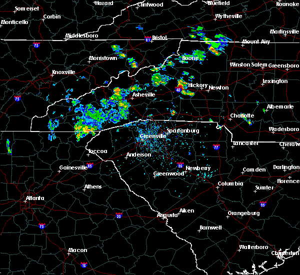 At 500 pm edt, doppler radar indicated a severe thunderstorm capable of producing damaging winds in excess of 60 mph. this storm was located near morganton, and moving southwest at 10 mph. nickel size hail may also accompany the damaging winds. * locations in the warning include, morganton, glen alpine, oak hill, lake james, lake james state park and south mountains state park. At 500 pm edt, doppler radar indicated a severe thunderstorm capable of producing damaging winds in excess of 60 mph. this storm was located near morganton, and moving southwest at 10 mph. nickel size hail may also accompany the damaging winds. * locations in the warning include, morganton, glen alpine, oak hill, lake james, lake james state park and south mountains state park.
|
| 7/13/2015 8:36 PM EDT |
 The severe thunderstorm warning for southeastern caldwell, burke, northeastern rutherford, western catawba, northwestern iredell, southern mcdowell and alexander counties will expire at 845 pm edt, the line of storms which prompted the warning have moved out of the area. therefore the warning will be allowed to expire. The severe thunderstorm warning for southeastern caldwell, burke, northeastern rutherford, western catawba, northwestern iredell, southern mcdowell and alexander counties will expire at 845 pm edt, the line of storms which prompted the warning have moved out of the area. therefore the warning will be allowed to expire.
|
| 7/13/2015 8:06 PM EDT |
 At 805 pm edt, doppler radar indicated a line of showers and thunderstorms with a history of producing damaging winds in excess of 60 mph. these storms were located along a line extending from 5 miles north of north wilkesboro to 5 miles north of morganton to 9 miles west of downtown asheville, and moving southeast at 25 mph. At 805 pm edt, doppler radar indicated a line of showers and thunderstorms with a history of producing damaging winds in excess of 60 mph. these storms were located along a line extending from 5 miles north of north wilkesboro to 5 miles north of morganton to 9 miles west of downtown asheville, and moving southeast at 25 mph.
|
| 6/18/2015 4:32 PM EDT | At 432 pm edt, doppler radar indicated a severe thunderstorm capable of producing quarter size hail and damaging winds in excess of 60 mph. this storm was located 8 miles southwest of morganton, or 6 miles west of south mountains state park, moving east at 15 mph. locations impacted include, morganton, glen alpine, south mountains state park, pleasant grove, drexel and valdese. |
| 6/18/2015 4:24 PM EDT | At 424 pm edt, doppler radar indicated a severe thunderstorm capable of producing quarter size hail and damaging winds in excess of 60 mph. this storm was located 7 miles southwest of morganton, or 5 miles south of glen alpine, moving east at 15 mph. locations impacted include, morganton, valdese, drexel, rutherford college, glen alpine, lake rhodhiss, lake james, south mountains state park, lake james state park and dysartsville. |
| 6/18/2015 4:00 PM EDT | At 400 pm edt, doppler radar indicated a severe thunderstorm capable of producing large damaging hail up to golf ball size and damaging winds in excess of 60 mph. this storm was located 9 miles southwest of morganton, or 4 miles southeast of lake james state park, and moving east at 15 mph. |
| 6/17/2015 3:45 PM EDT |
 At 345 pm edt, doppler radar indicated a severe thunderstorm capable of producing damaging winds in excess of 60 mph. this storm was located 4 miles west of morganton, or near glen alpine, moving east at 15 mph. penny size hail may also accompany the damaging winds. locations impacted include, morganton, valdese, drexel, connelly springs, rutherford college, glen alpine, lake james, south mountains state park, lake james state park and table rock. At 345 pm edt, doppler radar indicated a severe thunderstorm capable of producing damaging winds in excess of 60 mph. this storm was located 4 miles west of morganton, or near glen alpine, moving east at 15 mph. penny size hail may also accompany the damaging winds. locations impacted include, morganton, valdese, drexel, connelly springs, rutherford college, glen alpine, lake james, south mountains state park, lake james state park and table rock.
|
| 6/17/2015 3:32 PM EDT |
 At 332 pm edt, doppler radar indicated a severe thunderstorm capable of producing damaging winds in excess of 60 mph. this storm was located 8 miles west of morganton, or near lake james, and moving southeast at 15 mph. penny size hail may also accompany the damaging winds. At 332 pm edt, doppler radar indicated a severe thunderstorm capable of producing damaging winds in excess of 60 mph. this storm was located 8 miles west of morganton, or near lake james, and moving southeast at 15 mph. penny size hail may also accompany the damaging winds.
|
| 10/14/2014 10:04 PM EDT | Trees blown down on duckworth circl in burke county NC, 2.7 miles NE of Salem, NC |
| 6/11/2014 3:12 PM EDT | Trees down along salem road and collingwood driv in burke county NC, 0 miles SSE of Salem, NC |
| 6/11/2014 3:07 PM EDT | Trees down along highway 6 in burke county NC, 3.9 miles NE of Salem, NC |
| 5/28/2014 7:10 PM EDT | One tree down on hwy 64 near propst r in burke county NC, 0.6 miles E of Salem, NC |
| 6/24/2013 4:13 PM EDT | Report of one tree dow in burke county NC, 1.3 miles N of Salem, NC |
| 1/1/0001 12:00 AM | Trees down on powerline in burke county NC, 1.1 miles E of Salem, NC |
Hail Maps for Salem, NC


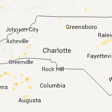


Connect with Interactive Hail Maps