

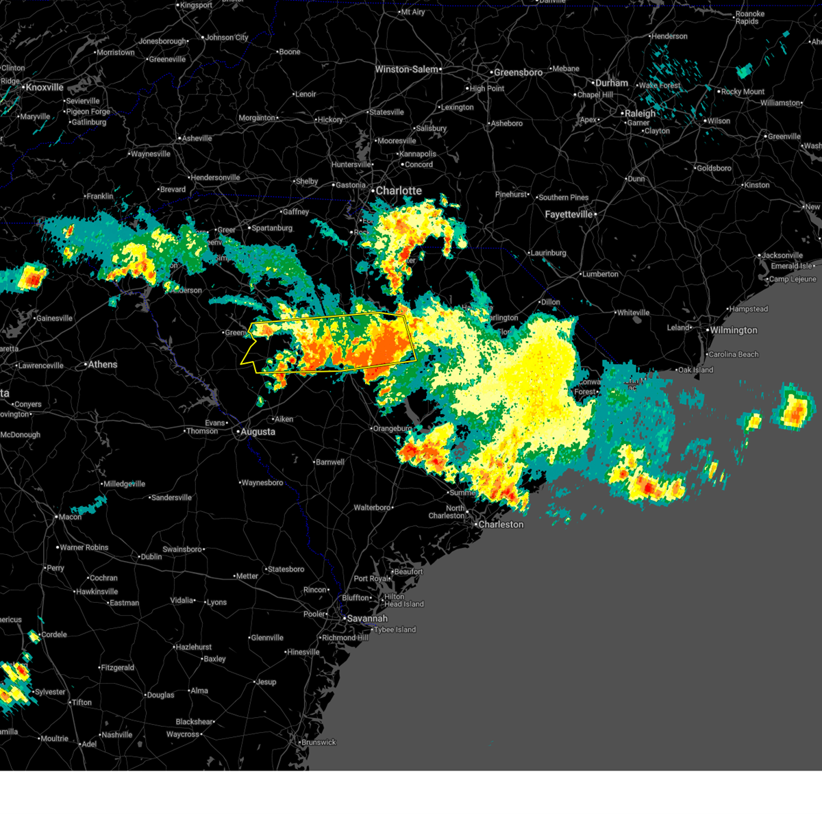
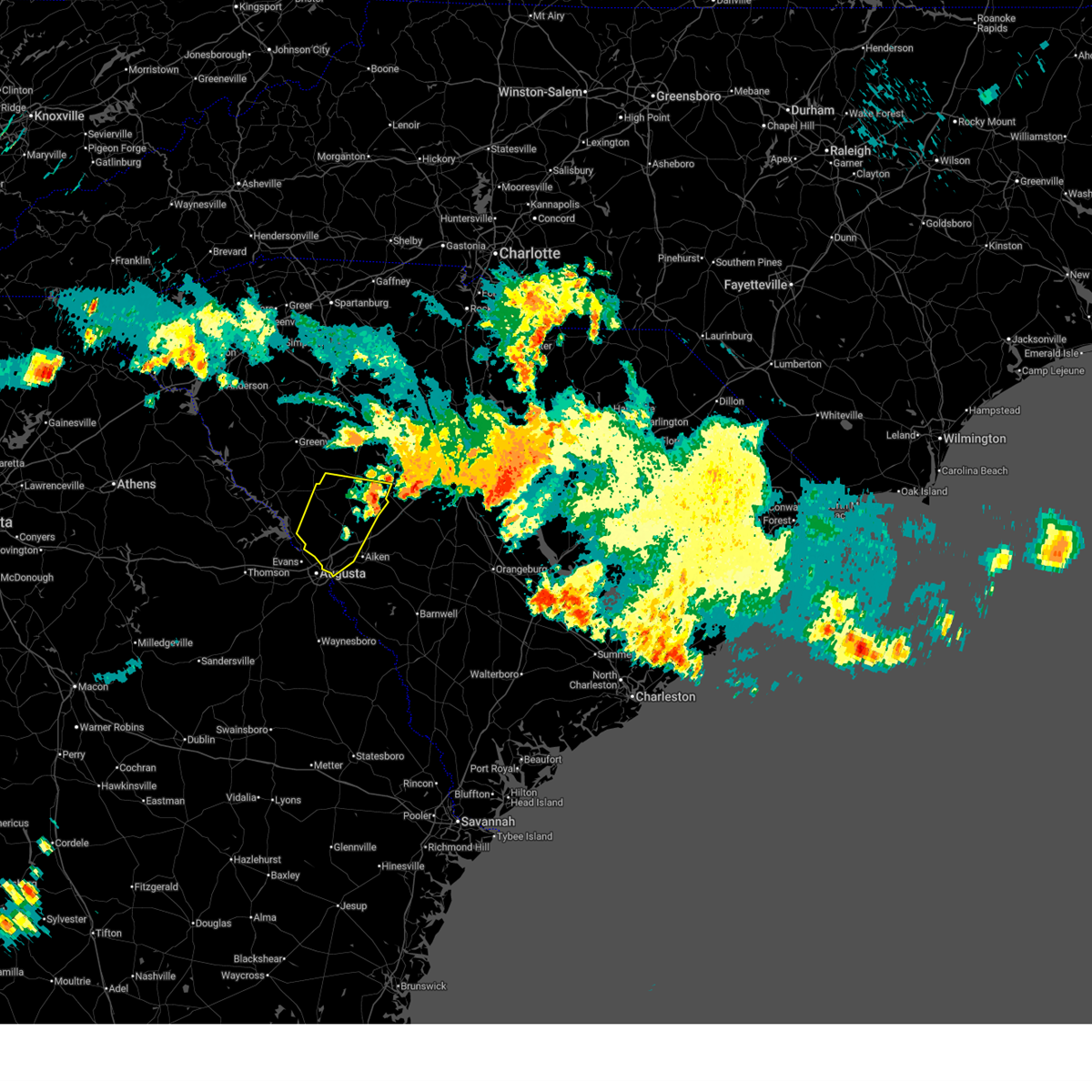
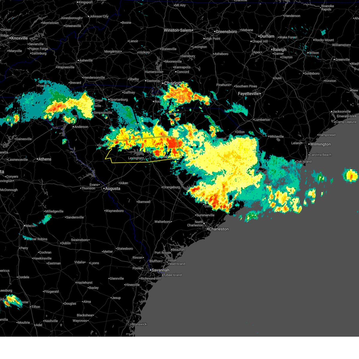
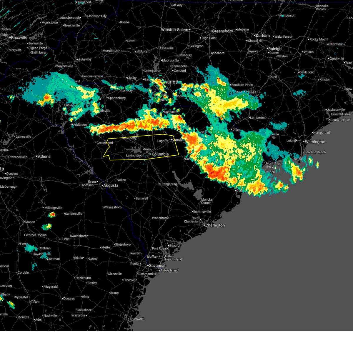
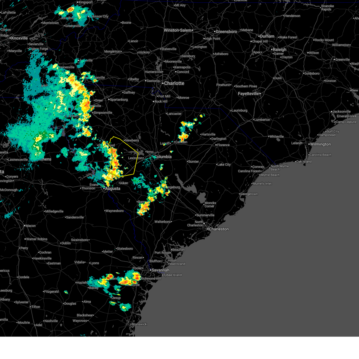
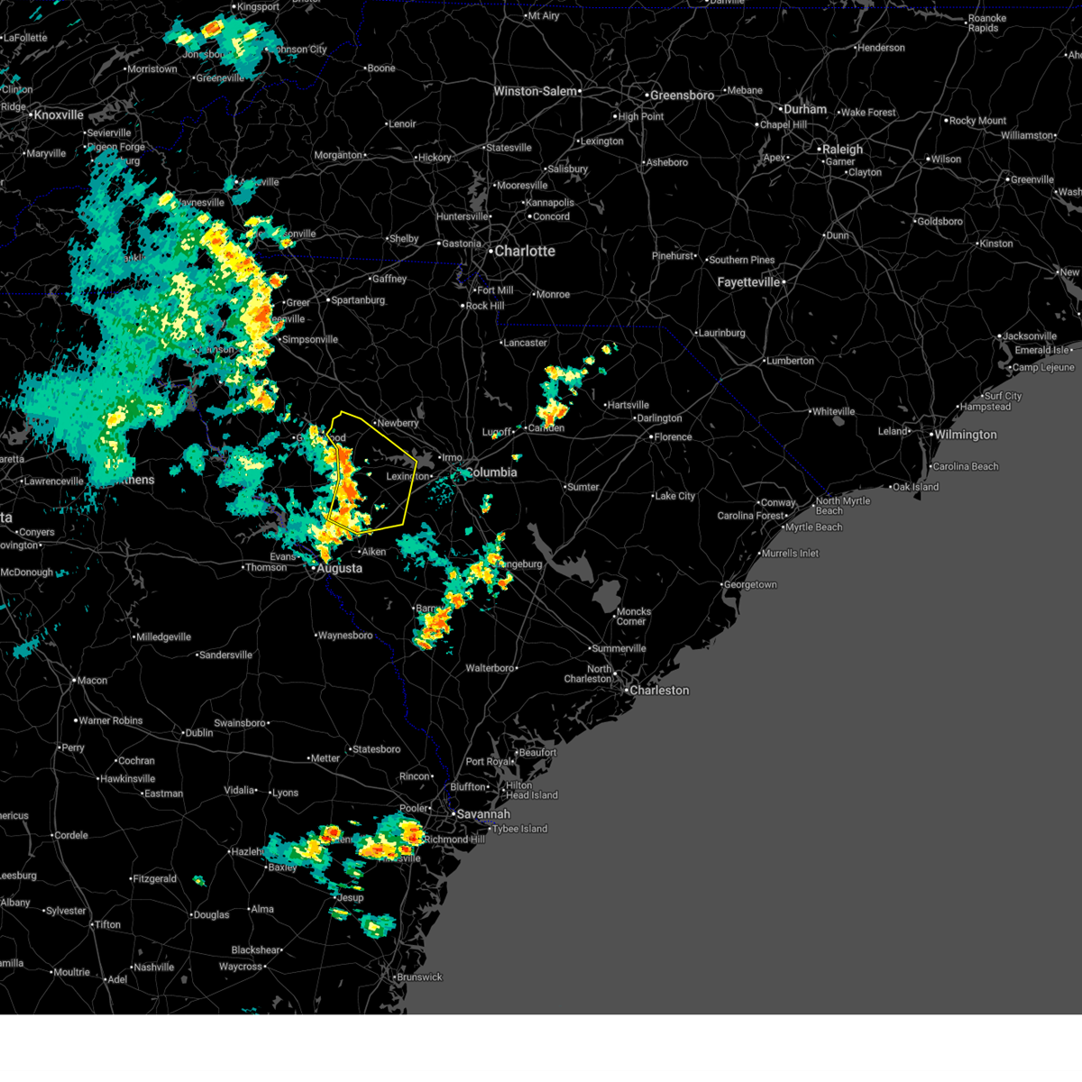
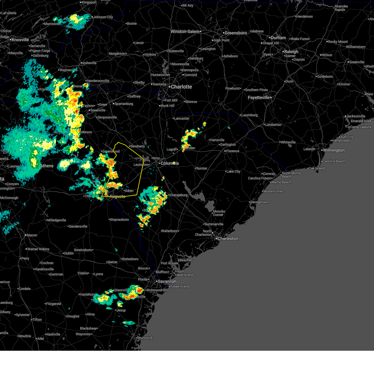
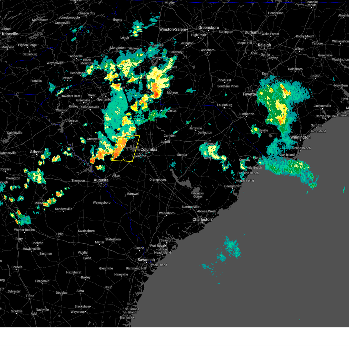
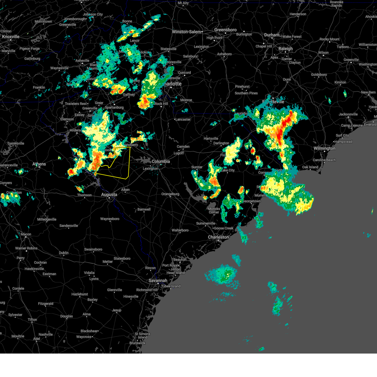
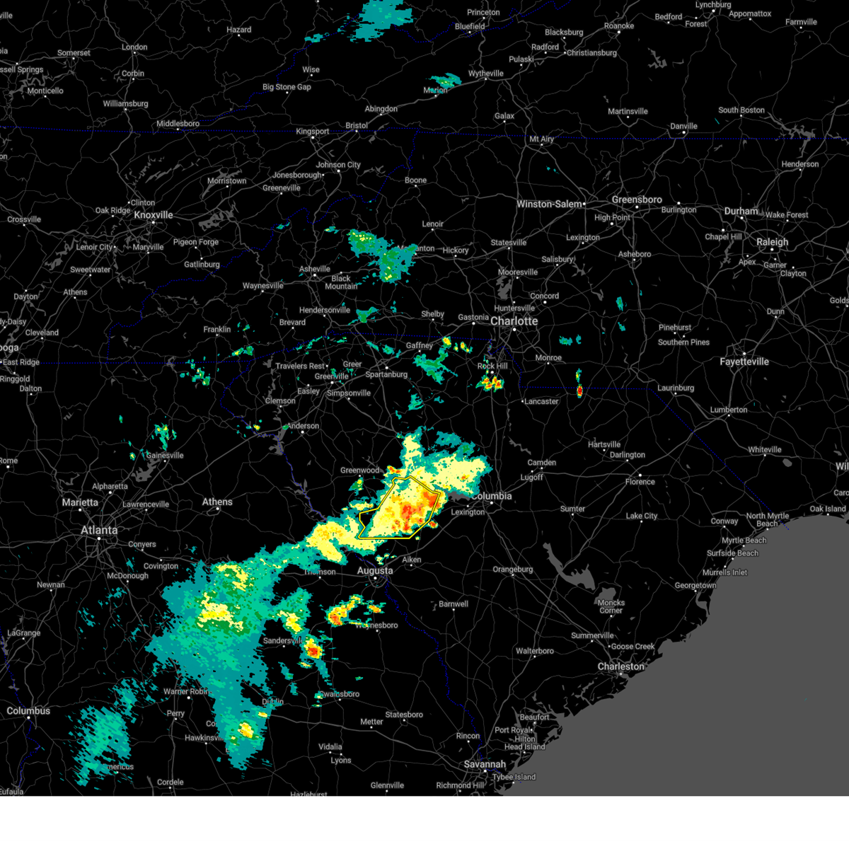
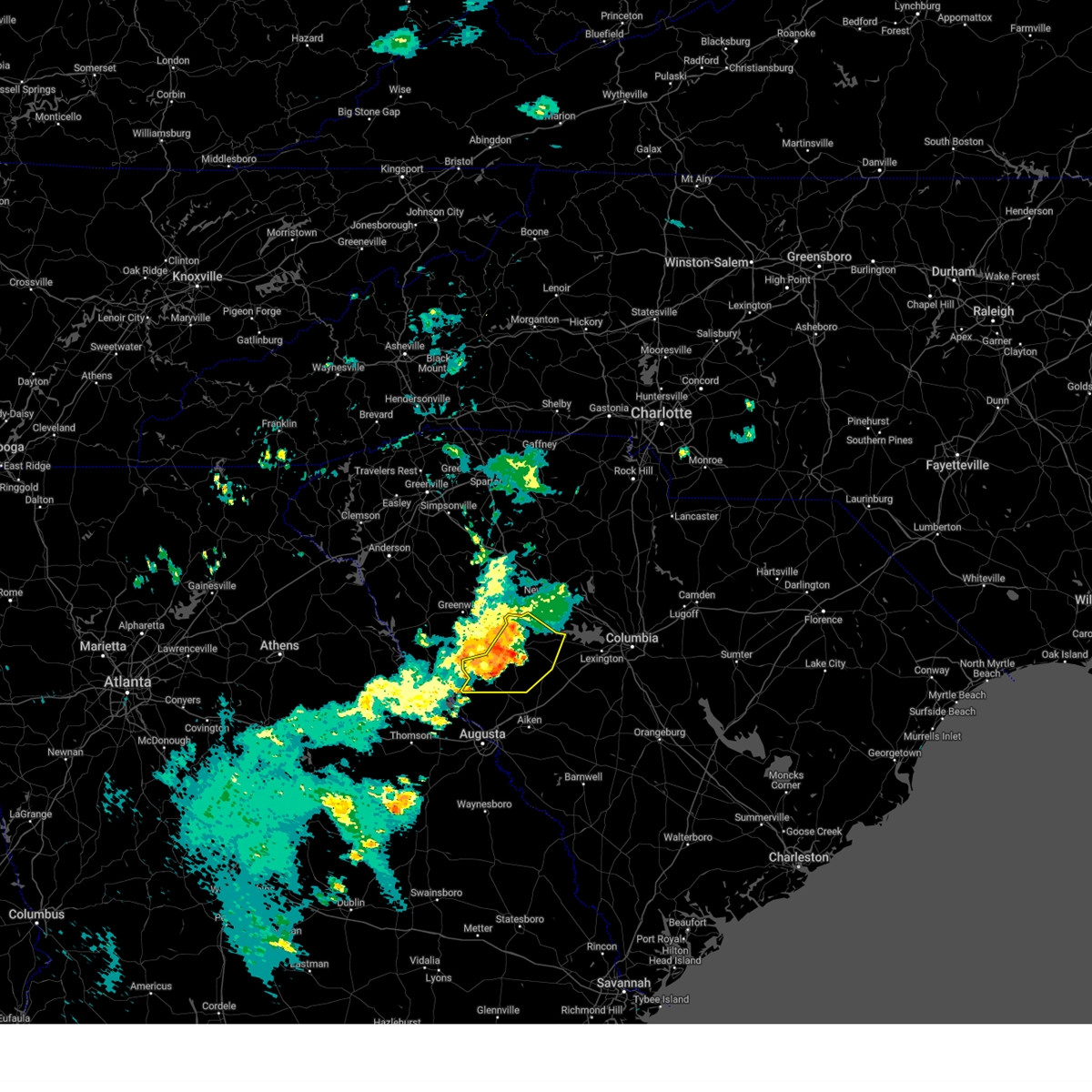
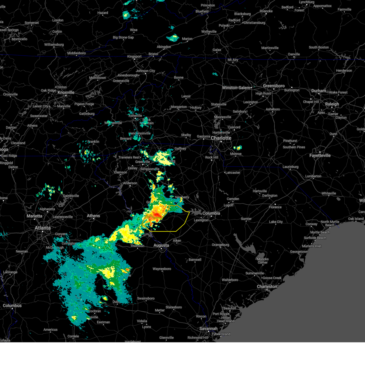
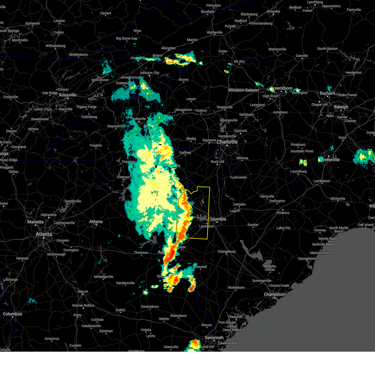
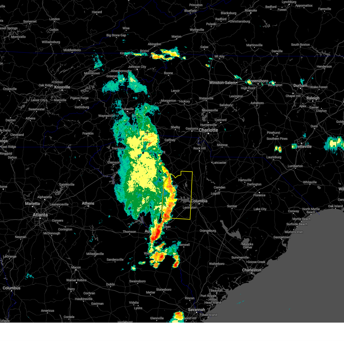
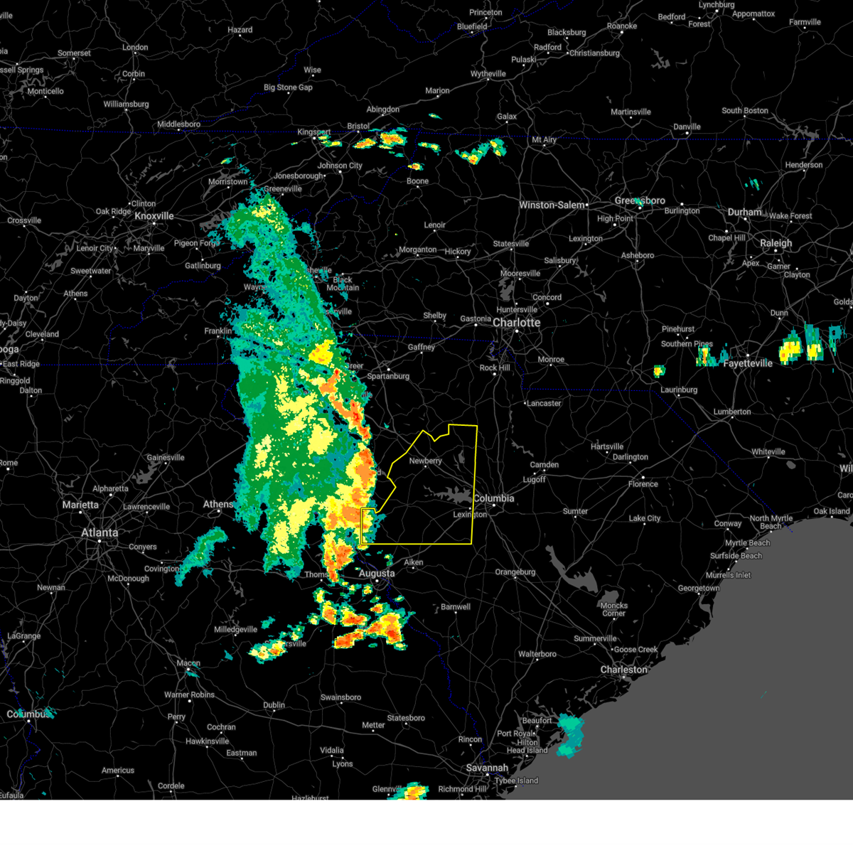
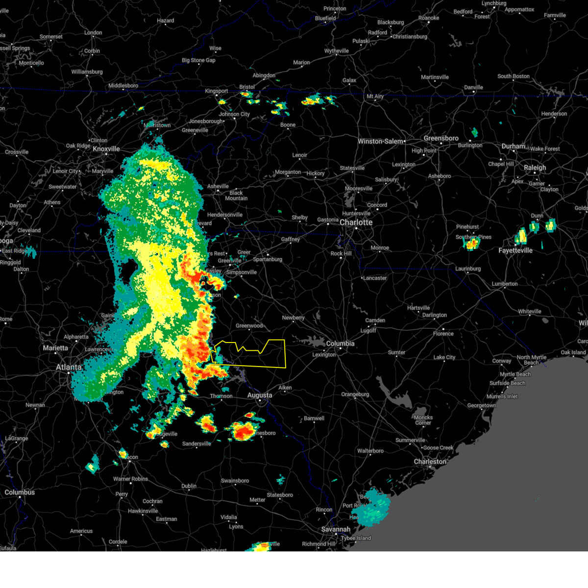
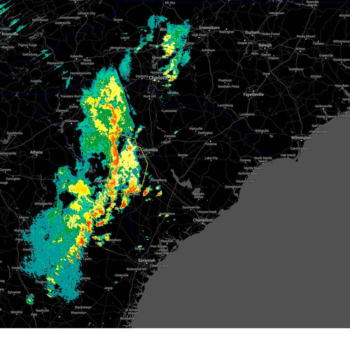
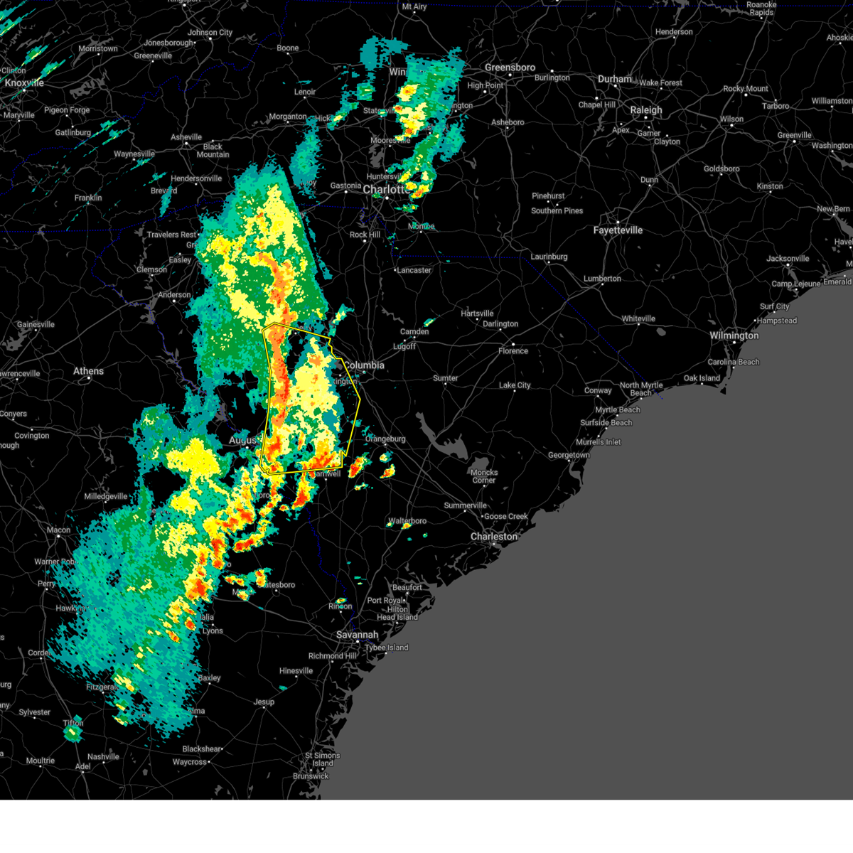
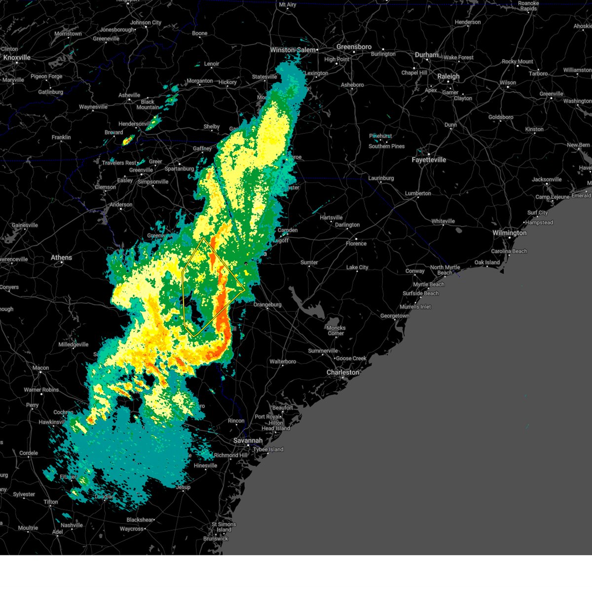
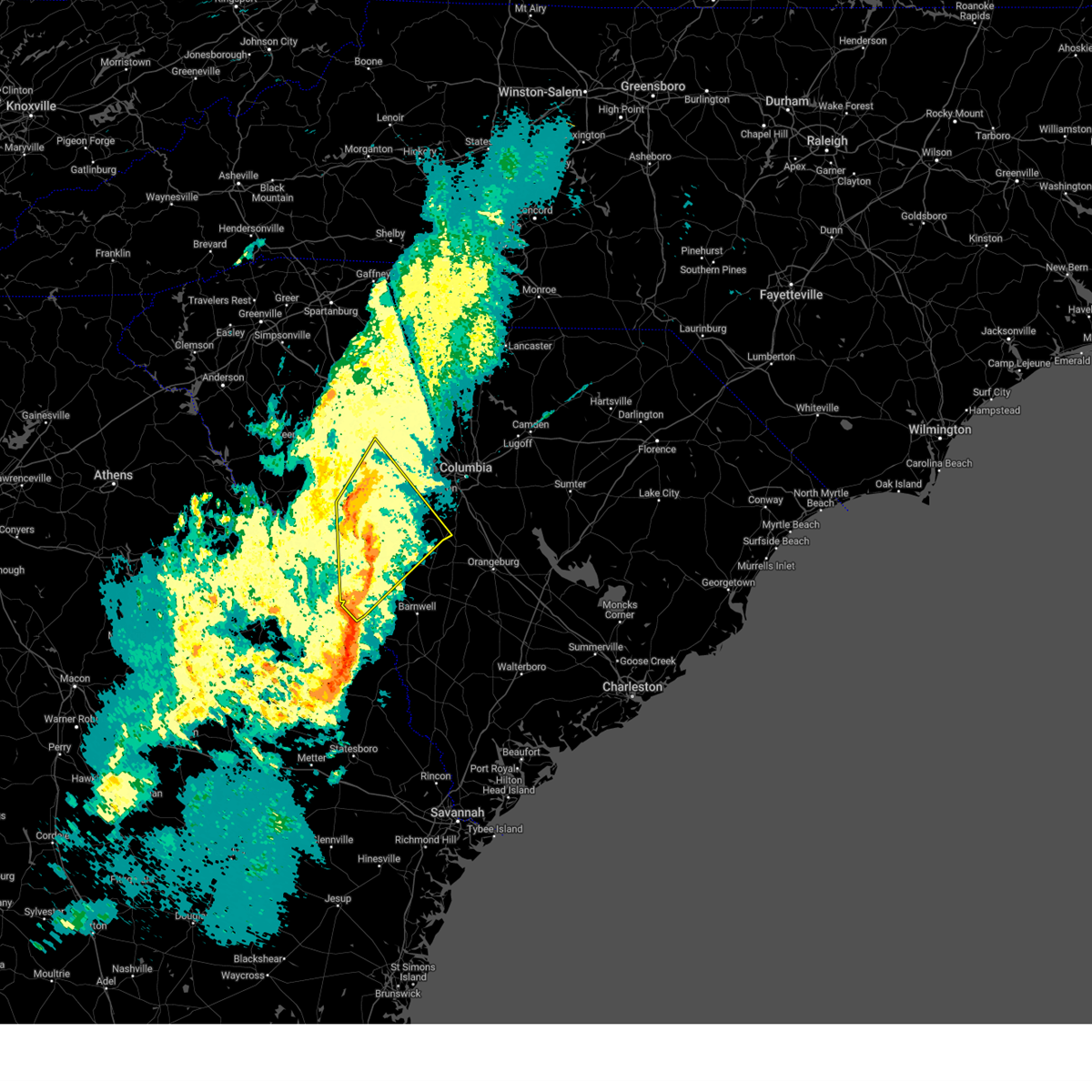
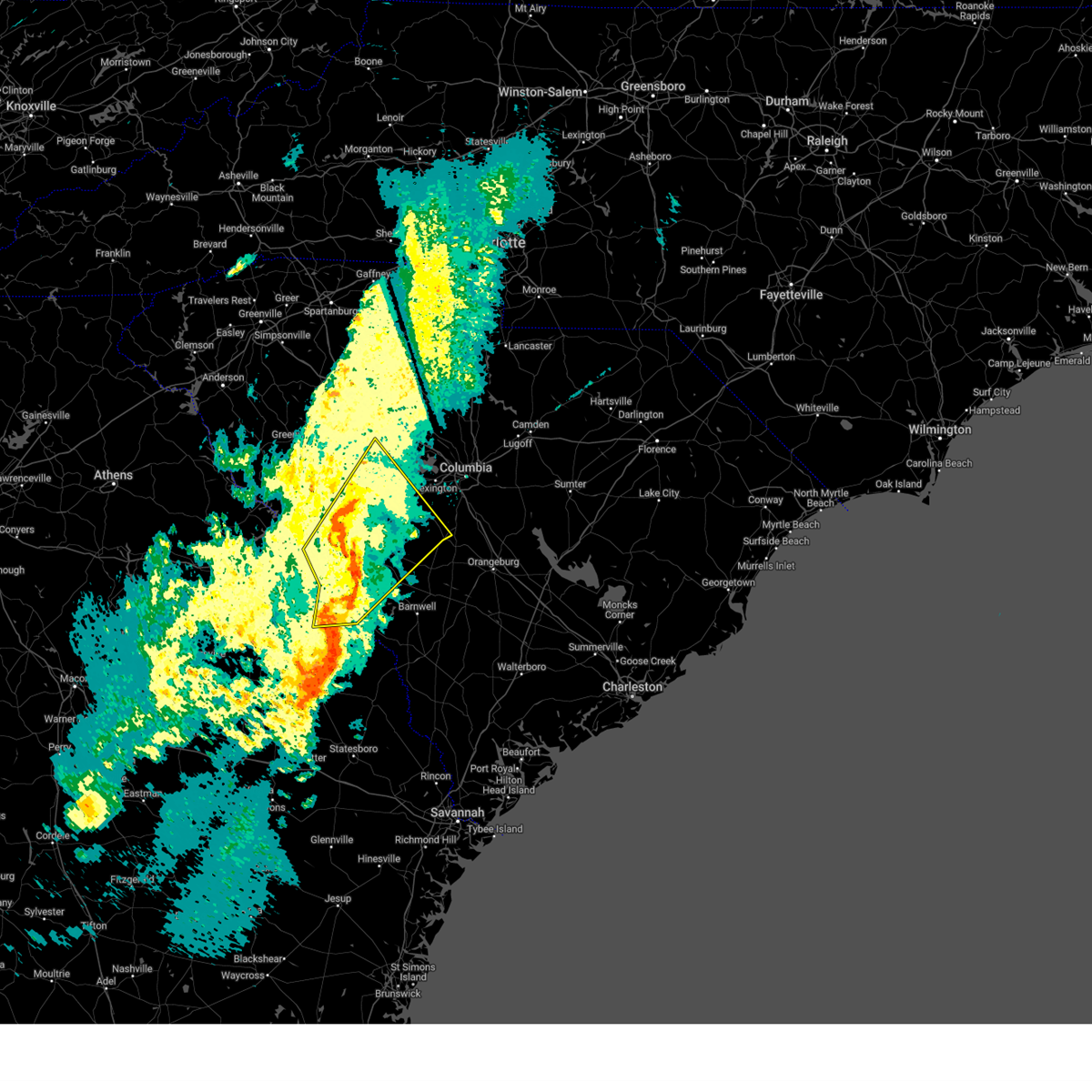
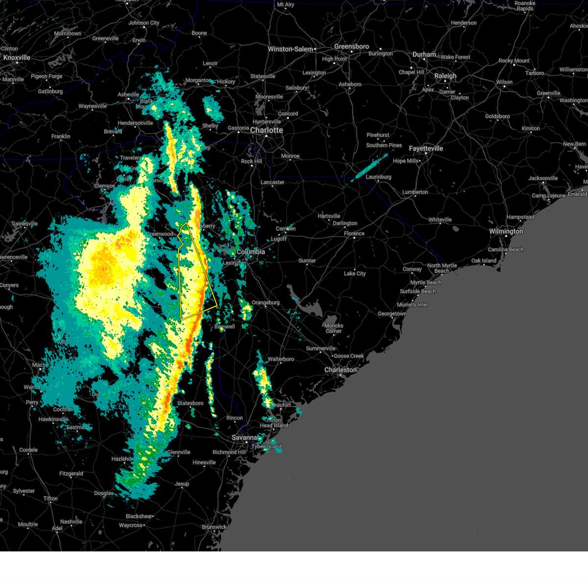
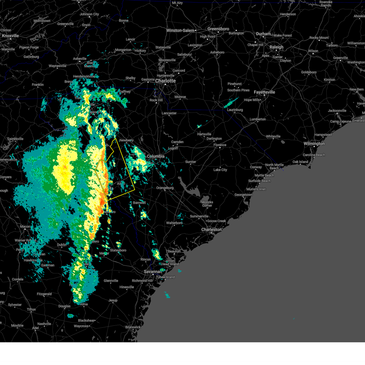
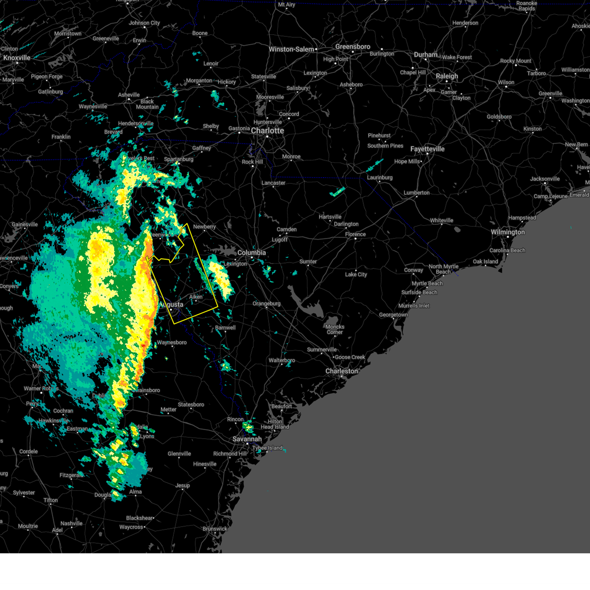
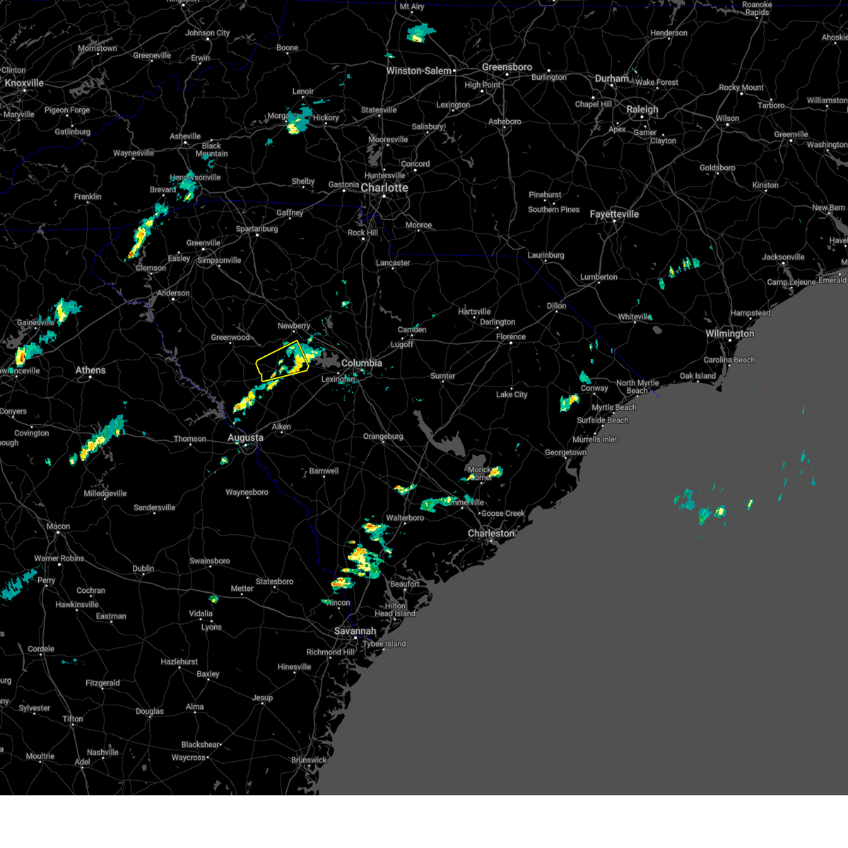
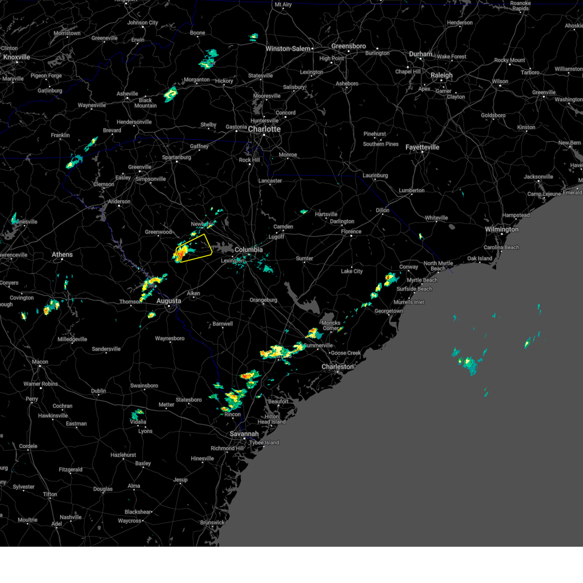
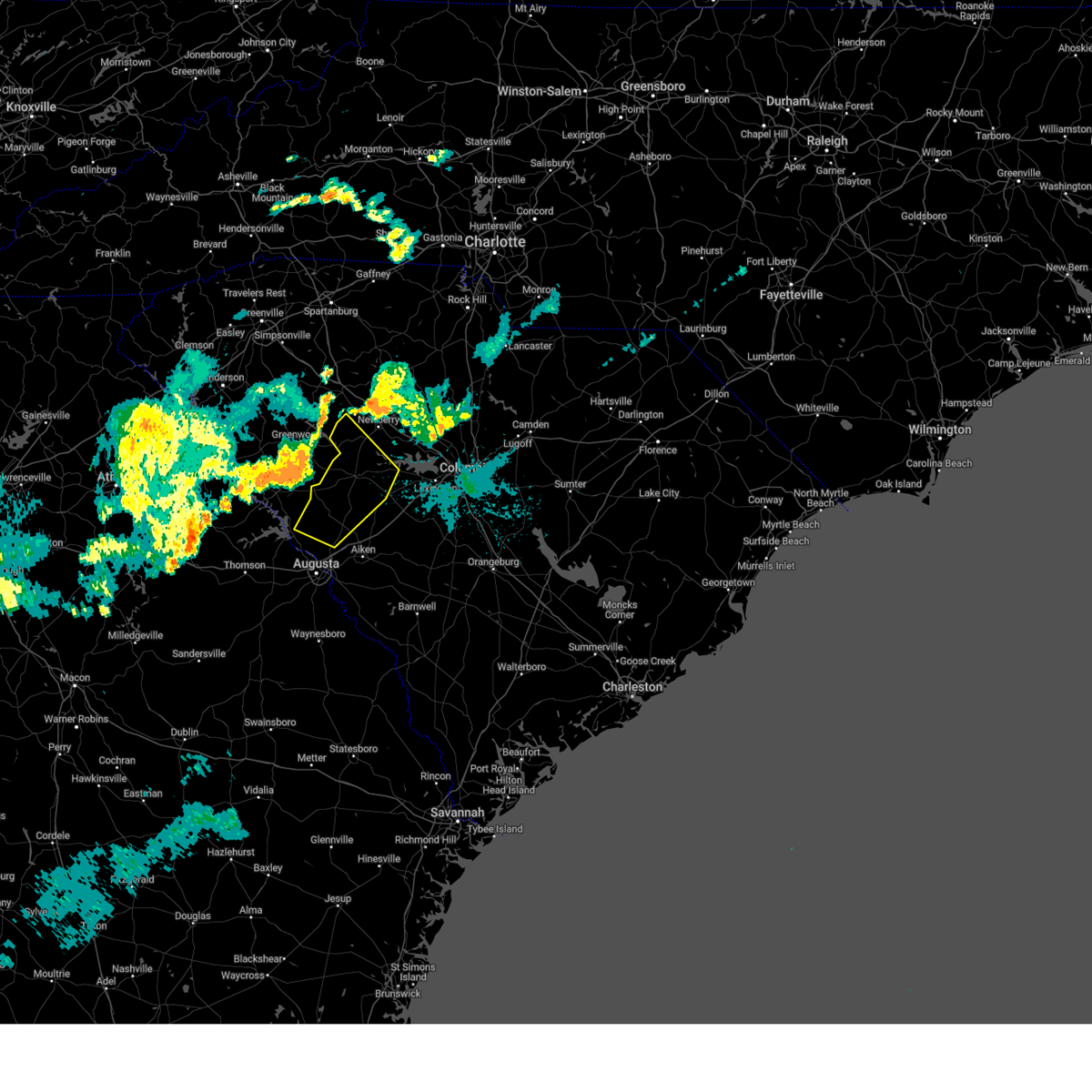
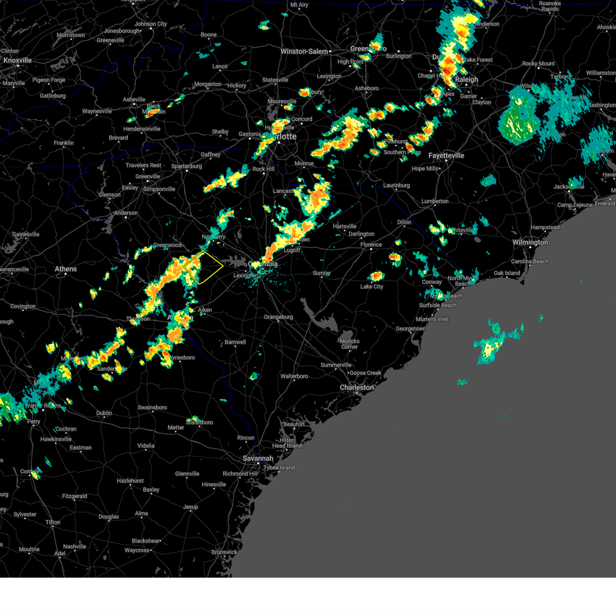
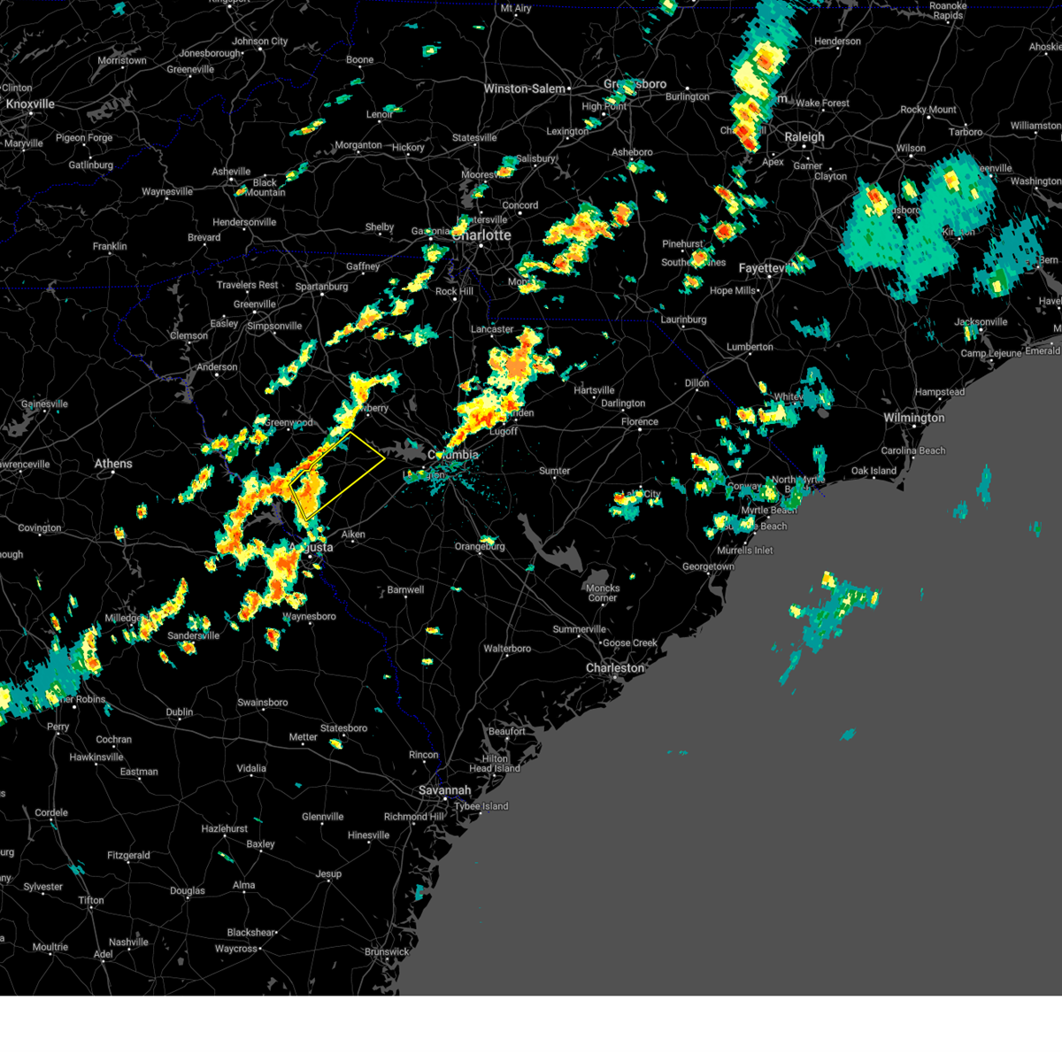
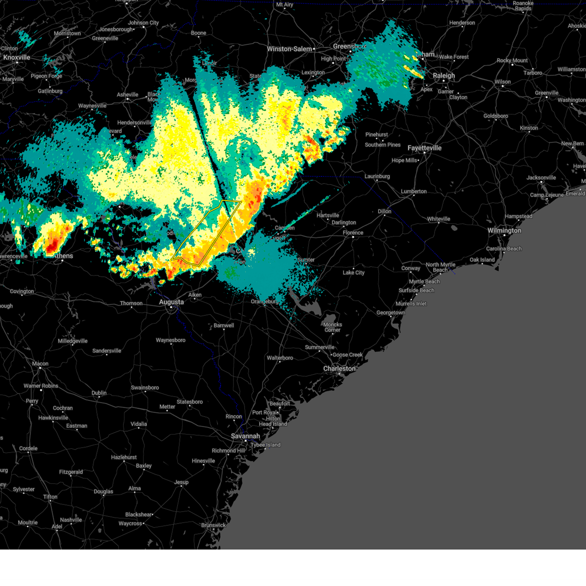
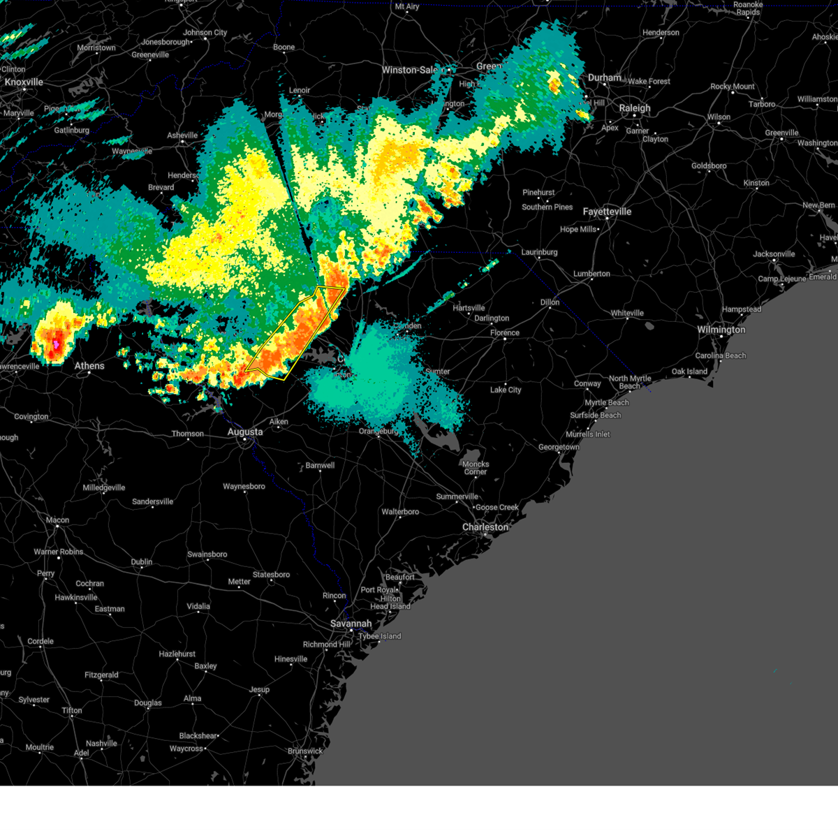
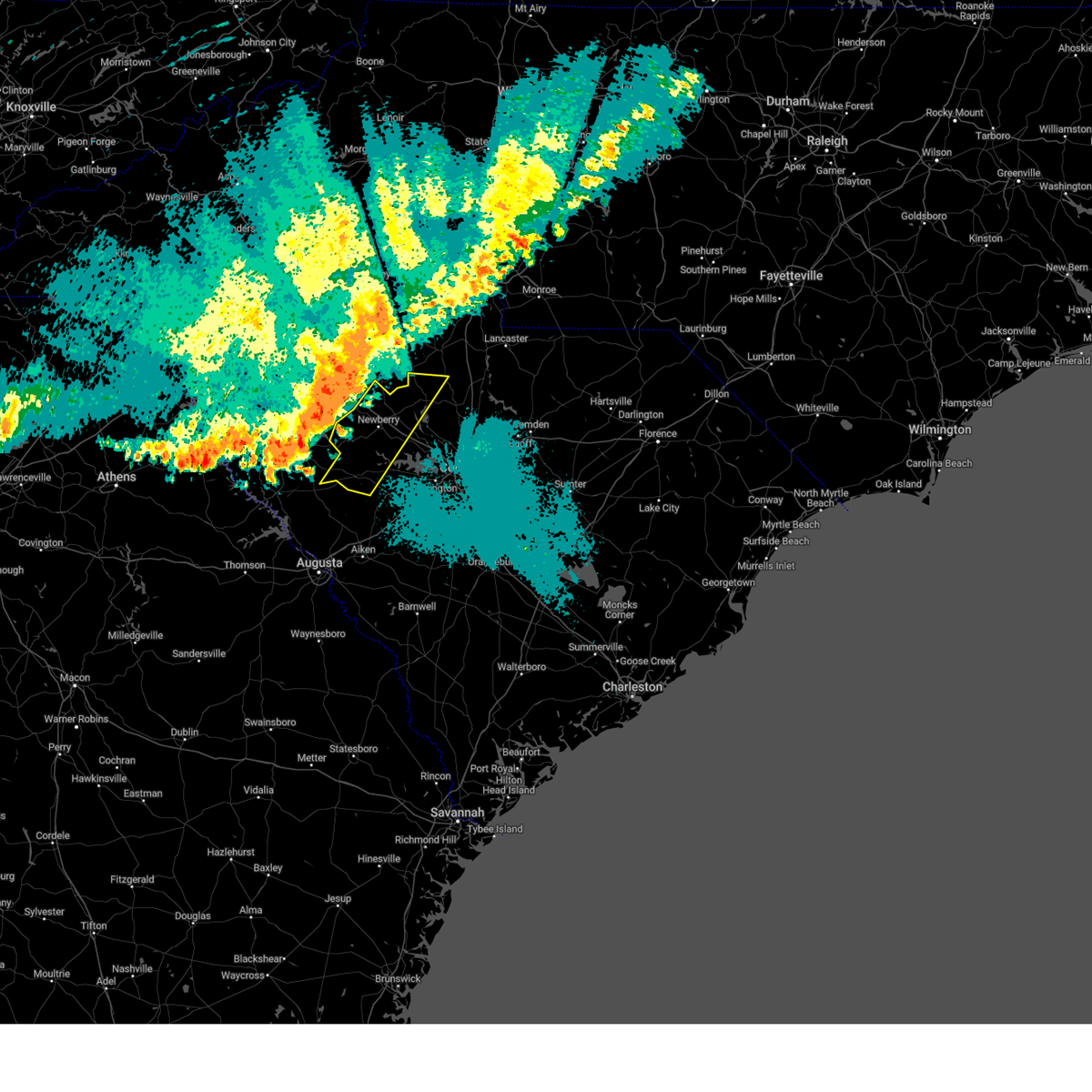
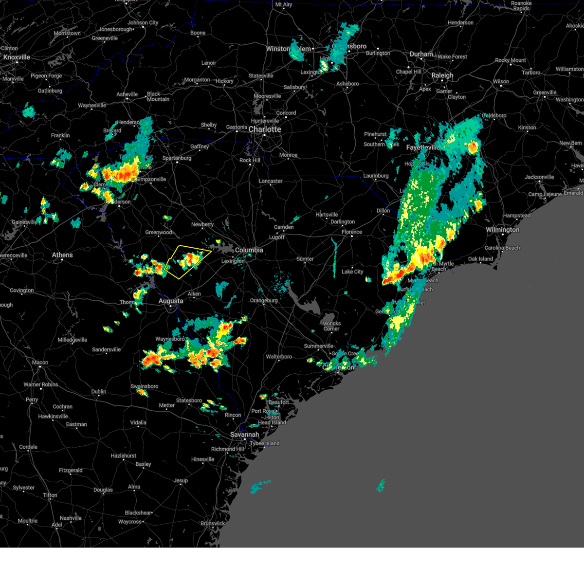
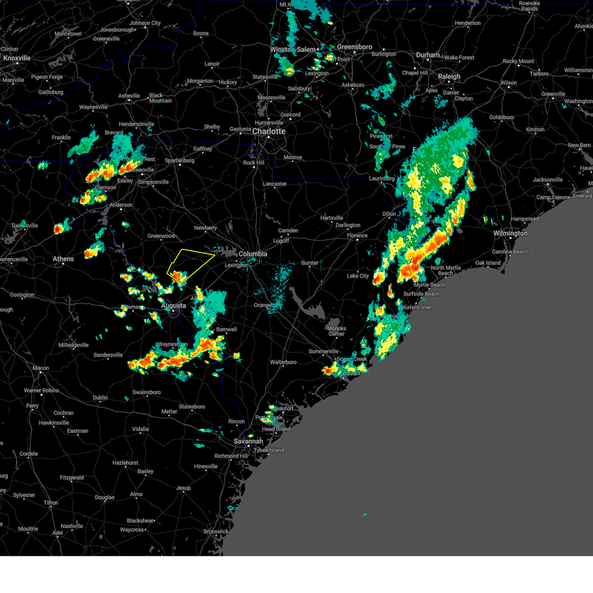
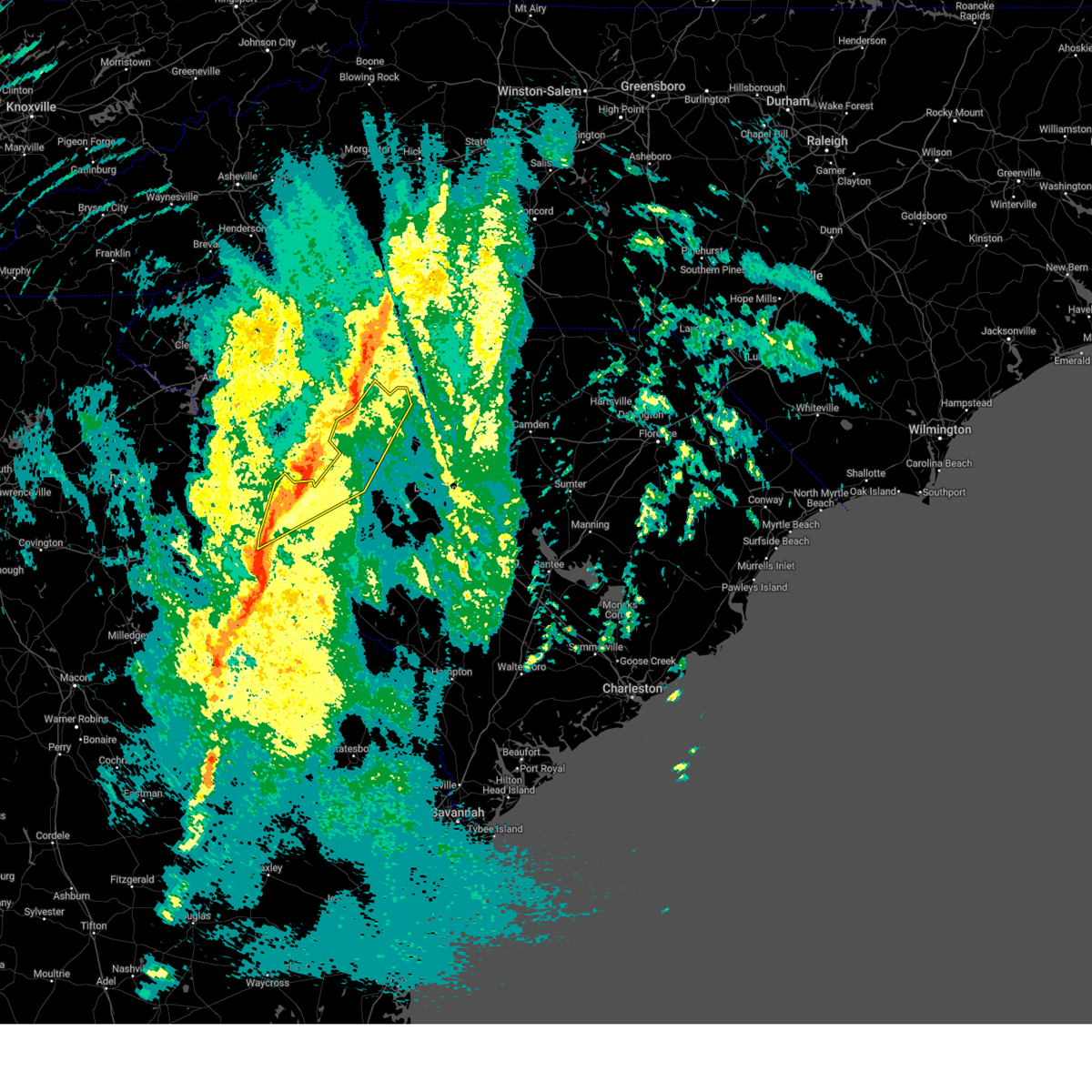
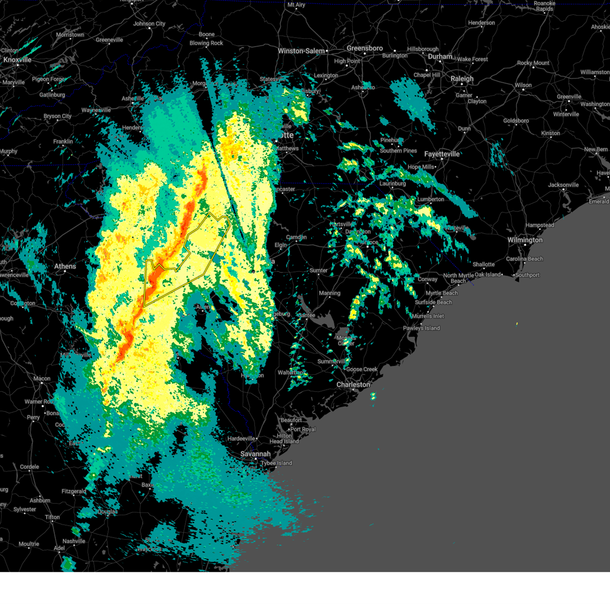
Hail Map for Saluda, SC
The Saluda, SC area has had 7 reports of on-the-ground hail by trained spotters, and has been under severe weather warnings 45 times during the past 12 months. Doppler radar has detected hail at or near Saluda, SC on 36 occasions.
| Name: | Saluda, SC |
| Where Located: | 37.9 miles NNE of Augusta, GA |
| Map: | Google Map for Saluda, SC |
| Population: | 3565 |
| Housing Units: | 1359 |
| More Info: | Search Google for Saluda, SC |
5
The Top Recent Hail Date for Saluda, SC is Wednesday, April 5, 2017 (1st out of 36)

Hail and Wind Damage Spotted near Saluda, SC
| Date / Time | Report Details |
|---|---|
| 6/25/2025 9:00 PM EDT |
 The storms which prompted the warning have moved out of the area. therefore, the warning has been allowed to expire. however, heavy rain is still possible with these thunderstorms. a severe thunderstorm watch remains in effect until midnight edt for central south carolina. The storms which prompted the warning have moved out of the area. therefore, the warning has been allowed to expire. however, heavy rain is still possible with these thunderstorms. a severe thunderstorm watch remains in effect until midnight edt for central south carolina.
|
| 6/25/2025 8:54 PM EDT |
 Svrcae the national weather service in columbia has issued a * severe thunderstorm warning for, edgefield county in central south carolina, southern saluda county in central south carolina, northwestern aiken county in central south carolina, * until 1000 pm edt. * at 853 pm edt, a severe thunderstorm was located over ridge spring, or 9 miles southwest of batesburg-leesville, moving southwest at 15 mph (radar indicated). Hazards include 60 mph wind gusts and quarter size hail. Hail damage to vehicles is expected. Expect wind damage to trees and powerlines. Svrcae the national weather service in columbia has issued a * severe thunderstorm warning for, edgefield county in central south carolina, southern saluda county in central south carolina, northwestern aiken county in central south carolina, * until 1000 pm edt. * at 853 pm edt, a severe thunderstorm was located over ridge spring, or 9 miles southwest of batesburg-leesville, moving southwest at 15 mph (radar indicated). Hazards include 60 mph wind gusts and quarter size hail. Hail damage to vehicles is expected. Expect wind damage to trees and powerlines.
|
| 6/25/2025 8:33 PM EDT |
 At 833 pm edt, severe thunderstorms were located along a line extending from near elgin to 9 miles southwest of prosperity, moving southeast at 20 mph (radar indicated). Hazards include 60 mph wind gusts and half dollar size hail. Hail damage to vehicles is expected. expect wind damage to trees and powerlines. locations impacted include, columbia, sumter, lexington, west columbia, cayce, irmo, forest acres, newberry, camden, batesburg-leesville, springdale, dentsville, oak grove, st. andrews, vc summer nuclear station, highway 6 at lake murray dam, red bank, saluda, south congaree, and pine ridge. this includes the following highways, interstate 126 between mile markers 0 and 3. interstate 20 in south carolina between mile markers 49 and 100. interstate 26 between mile markers 77 and 116. Interstate 77 between mile markers 0 and 35. At 833 pm edt, severe thunderstorms were located along a line extending from near elgin to 9 miles southwest of prosperity, moving southeast at 20 mph (radar indicated). Hazards include 60 mph wind gusts and half dollar size hail. Hail damage to vehicles is expected. expect wind damage to trees and powerlines. locations impacted include, columbia, sumter, lexington, west columbia, cayce, irmo, forest acres, newberry, camden, batesburg-leesville, springdale, dentsville, oak grove, st. andrews, vc summer nuclear station, highway 6 at lake murray dam, red bank, saluda, south congaree, and pine ridge. this includes the following highways, interstate 126 between mile markers 0 and 3. interstate 20 in south carolina between mile markers 49 and 100. interstate 26 between mile markers 77 and 116. Interstate 77 between mile markers 0 and 35.
|
| 6/25/2025 7:56 PM EDT |
 Svrcae the national weather service in columbia has issued a * severe thunderstorm warning for, southern fairfield county in central south carolina, southern newberry county in central south carolina, northern lexington county in central south carolina, northwestern sumter county in central south carolina, saluda county in central south carolina, richland county in central south carolina, southwestern kershaw county in central south carolina, * until 900 pm edt. * at 756 pm edt, severe thunderstorms were located along a line extending from 6 miles south of longtown to 7 miles southwest of newberry college, moving southeast at 20 mph (radar indicated). Hazards include 60 mph wind gusts and quarter size hail. Hail damage to vehicles is expected. Expect wind damage to trees and powerlines. Svrcae the national weather service in columbia has issued a * severe thunderstorm warning for, southern fairfield county in central south carolina, southern newberry county in central south carolina, northern lexington county in central south carolina, northwestern sumter county in central south carolina, saluda county in central south carolina, richland county in central south carolina, southwestern kershaw county in central south carolina, * until 900 pm edt. * at 756 pm edt, severe thunderstorms were located along a line extending from 6 miles south of longtown to 7 miles southwest of newberry college, moving southeast at 20 mph (radar indicated). Hazards include 60 mph wind gusts and quarter size hail. Hail damage to vehicles is expected. Expect wind damage to trees and powerlines.
|
| 6/17/2025 9:04 PM EDT |
 At 904 pm edt, severe thunderstorms were located along a line extending from 9 miles east of lake greenwood state park to 6 miles west of batesburg-leesville to near aiken municipal airport, moving northeast at 35 mph (radar indicated). Hazards include 60 mph wind gusts. Expect damage to trees and powerlines. locations impacted include, batesburg-leesville, edgefield, saluda, johnston, ridge spring, saluda county airport, edgefield county airport, dreher island state park, gilbert, summit, monetta, trenton, silverstreet, ward, cedar grove fire station, strom thurmond high school, south shore marina, oswald park, saluda co sheriff's office, and murray. This includes interstate 20 in south carolina between mile markers 24 and 43. At 904 pm edt, severe thunderstorms were located along a line extending from 9 miles east of lake greenwood state park to 6 miles west of batesburg-leesville to near aiken municipal airport, moving northeast at 35 mph (radar indicated). Hazards include 60 mph wind gusts. Expect damage to trees and powerlines. locations impacted include, batesburg-leesville, edgefield, saluda, johnston, ridge spring, saluda county airport, edgefield county airport, dreher island state park, gilbert, summit, monetta, trenton, silverstreet, ward, cedar grove fire station, strom thurmond high school, south shore marina, oswald park, saluda co sheriff's office, and murray. This includes interstate 20 in south carolina between mile markers 24 and 43.
|
| 6/17/2025 9:04 PM EDT |
 the severe thunderstorm warning has been cancelled and is no longer in effect the severe thunderstorm warning has been cancelled and is no longer in effect
|
| 6/17/2025 8:39 PM EDT |
 Svrcae the national weather service in columbia has issued a * severe thunderstorm warning for, east central columbia county in east central georgia, northeastern richmond county in east central georgia, southwestern newberry county in central south carolina, edgefield county in central south carolina, western lexington county in central south carolina, saluda county in central south carolina, central aiken county in central south carolina, * until 915 pm edt. * at 839 pm edt, multiple strong to severe thunderstorms were located along a line extending from near ninety six historic site to johnston to near graniteville, moving northeast at 35 mph (radar indicated). Hazards include 60 mph wind gusts. expect damage to trees and powerlines Svrcae the national weather service in columbia has issued a * severe thunderstorm warning for, east central columbia county in east central georgia, northeastern richmond county in east central georgia, southwestern newberry county in central south carolina, edgefield county in central south carolina, western lexington county in central south carolina, saluda county in central south carolina, central aiken county in central south carolina, * until 915 pm edt. * at 839 pm edt, multiple strong to severe thunderstorms were located along a line extending from near ninety six historic site to johnston to near graniteville, moving northeast at 35 mph (radar indicated). Hazards include 60 mph wind gusts. expect damage to trees and powerlines
|
| 6/9/2025 8:33 PM EDT |
 the severe thunderstorm warning has been cancelled and is no longer in effect the severe thunderstorm warning has been cancelled and is no longer in effect
|
| 6/9/2025 8:33 PM EDT |
 At 833 pm edt, severe thunderstorms were located along a line extending from near newberry to near saluda county airport, moving east at 35 mph (radar indicated). Hazards include 60 mph wind gusts. Expect damage to trees and powerlines. locations impacted include, batesburg-leesville, saluda, prosperity, ridge spring, jenkinsville, saluda county airport, dreher island state park, chapin, gilbert, summit, little mountain, monetta, pomaria, silverstreet, ward, peak, cedar grove fire station, south shore marina, oswald park, and saluda co sheriff's office. this includes the following highways, interstate 20 in south carolina between mile markers 42 and 45. Interstate 26 between mile markers 79 and 94. At 833 pm edt, severe thunderstorms were located along a line extending from near newberry to near saluda county airport, moving east at 35 mph (radar indicated). Hazards include 60 mph wind gusts. Expect damage to trees and powerlines. locations impacted include, batesburg-leesville, saluda, prosperity, ridge spring, jenkinsville, saluda county airport, dreher island state park, chapin, gilbert, summit, little mountain, monetta, pomaria, silverstreet, ward, peak, cedar grove fire station, south shore marina, oswald park, and saluda co sheriff's office. this includes the following highways, interstate 20 in south carolina between mile markers 42 and 45. Interstate 26 between mile markers 79 and 94.
|
| 6/9/2025 8:21 PM EDT | Saluda county dispatch reported trees down on powerlines in the 4000 block of newberry highway north of saluda. time estimated by rada in saluda county SC, 3.4 miles S of Saluda, SC |
| 6/9/2025 8:18 PM EDT | Saluda county dispatch reported trees down at the ridge rd and caldwell rd. time estimated by rada in saluda county SC, 10.9 miles SW of Saluda, SC |
| 6/9/2025 8:14 PM EDT | Svrcae the national weather service in columbia has issued a * severe thunderstorm warning for, southwestern fairfield county in central south carolina, southern newberry county in central south carolina, north central edgefield county in central south carolina, northwestern lexington county in central south carolina, saluda county in central south carolina, northwestern richland county in central south carolina, * until 900 pm edt. * at 814 pm edt, severe thunderstorms were located along a line extending from 9 miles east of lake greenwood state park to 6 miles northwest of johnston, moving east at 35 mph (radar indicated). Hazards include 60 mph wind gusts. expect damage to trees and powerlines |
| 6/9/2025 8:03 PM EDT | At 803 pm edt, severe thunderstorms were located along a line extending from greenwood state park to 9 miles north of edgefield, moving east at 45 mph (radar indicated). Hazards include 60 mph wind gusts. Expect damage to trees and powerlines. Locations impacted include, newberry, saluda, johnston, ridge spring, saluda county airport, silverstreet, ward, saluda co sheriff's office, good hope, pleasant lane, northside fire station main, hollywood elementary school, emory, chappells, chappells fire station, scurry airport, hickory grove, vaughnville, and saluda high school. |
| 6/9/2025 7:43 PM EDT |
 Svrcae the national weather service in columbia has issued a * severe thunderstorm warning for, southwestern newberry county in central south carolina, northern edgefield county in central south carolina, saluda county in central south carolina, northeastern mccormick county in central south carolina, * until 815 pm edt. * at 742 pm edt, severe thunderstorms were located along a line extending from greenwood to near mccormick county airport, moving east at 45 mph (radar indicated). Hazards include 60 mph wind gusts. expect damage to trees and powerlines Svrcae the national weather service in columbia has issued a * severe thunderstorm warning for, southwestern newberry county in central south carolina, northern edgefield county in central south carolina, saluda county in central south carolina, northeastern mccormick county in central south carolina, * until 815 pm edt. * at 742 pm edt, severe thunderstorms were located along a line extending from greenwood to near mccormick county airport, moving east at 45 mph (radar indicated). Hazards include 60 mph wind gusts. expect damage to trees and powerlines
|
| 6/8/2025 10:11 AM EDT |
 The storm which prompted the warning has weakened below severe limits, and no longer poses an immediate threat to life or property. therefore, the warning will be allowed to expire. however, gusty winds are still possible with this thunderstorm. The storm which prompted the warning has weakened below severe limits, and no longer poses an immediate threat to life or property. therefore, the warning will be allowed to expire. however, gusty winds are still possible with this thunderstorm.
|
| 6/8/2025 9:49 AM EDT |
 At 949 am edt, a severe thunderstorm was located near saluda, or 11 miles northwest of batesburg-leesville, moving east at 55 mph (radar indicated). Hazards include 60 mph wind gusts and quarter size hail. Hail damage to vehicles is expected. expect wind damage to trees and powerlines. Locations impacted include, batesburg-leesville, edgefield, saluda, johnston, ridge spring, saluda county airport, monetta, trenton, ward, strom thurmond high school, saluda co sheriff's office, good hope, northside fire station main, hollywood elementary school, emory, cleora, delmar, edgefield federal correction institution, harmony, and pleasant lane. At 949 am edt, a severe thunderstorm was located near saluda, or 11 miles northwest of batesburg-leesville, moving east at 55 mph (radar indicated). Hazards include 60 mph wind gusts and quarter size hail. Hail damage to vehicles is expected. expect wind damage to trees and powerlines. Locations impacted include, batesburg-leesville, edgefield, saluda, johnston, ridge spring, saluda county airport, monetta, trenton, ward, strom thurmond high school, saluda co sheriff's office, good hope, northside fire station main, hollywood elementary school, emory, cleora, delmar, edgefield federal correction institution, harmony, and pleasant lane.
|
| 6/8/2025 9:49 AM EDT |
 the severe thunderstorm warning has been cancelled and is no longer in effect the severe thunderstorm warning has been cancelled and is no longer in effect
|
| 6/8/2025 9:28 AM EDT |
 Svrcae the national weather service in columbia has issued a * severe thunderstorm warning for, northern edgefield county in central south carolina, saluda county in central south carolina, central mccormick county in central south carolina, * until 1015 am edt. * at 928 am edt, a severe thunderstorm was located 10 miles south of ninety six historic site, or 14 miles southeast of greenwood, moving east at 55 mph (radar indicated). Hazards include 60 mph wind gusts and quarter size hail. Hail damage to vehicles is expected. Expect wind damage to trees and powerlines. Svrcae the national weather service in columbia has issued a * severe thunderstorm warning for, northern edgefield county in central south carolina, saluda county in central south carolina, central mccormick county in central south carolina, * until 1015 am edt. * at 928 am edt, a severe thunderstorm was located 10 miles south of ninety six historic site, or 14 miles southeast of greenwood, moving east at 55 mph (radar indicated). Hazards include 60 mph wind gusts and quarter size hail. Hail damage to vehicles is expected. Expect wind damage to trees and powerlines.
|
| 6/7/2025 8:43 PM EDT |
 At 842 pm edt, severe thunderstorms were located along a line extending from near carlisle to near batesburg-leesville, moving east at 60 mph (trained weather spotters reported power flashes in newberry). Hazards include 70 mph wind gusts. Expect considerable tree damage. damage is likely to mobile homes, roofs, and outbuildings. locations impacted include, lexington, irmo, newberry, batesburg-leesville, vc summer nuclear station, highway 6 at lake murray dam, red bank, saluda, johnston, whitmire, prosperity, ridge spring, jenkinsville, monticello, dreher island state park, saluda county airport, newberry college, newberry county airport, ballentine, and blair. this includes the following highways, interstate 20 in south carolina between mile markers 32 and 55. Interstate 26 between mile markers 62 and 98. At 842 pm edt, severe thunderstorms were located along a line extending from near carlisle to near batesburg-leesville, moving east at 60 mph (trained weather spotters reported power flashes in newberry). Hazards include 70 mph wind gusts. Expect considerable tree damage. damage is likely to mobile homes, roofs, and outbuildings. locations impacted include, lexington, irmo, newberry, batesburg-leesville, vc summer nuclear station, highway 6 at lake murray dam, red bank, saluda, johnston, whitmire, prosperity, ridge spring, jenkinsville, monticello, dreher island state park, saluda county airport, newberry college, newberry county airport, ballentine, and blair. this includes the following highways, interstate 20 in south carolina between mile markers 32 and 55. Interstate 26 between mile markers 62 and 98.
|
| 6/7/2025 8:43 PM EDT |
 the severe thunderstorm warning has been cancelled and is no longer in effect the severe thunderstorm warning has been cancelled and is no longer in effect
|
| 6/7/2025 8:22 PM EDT | Public reports widespread trees and powerlines down across saluda county. time estimated based on rada in saluda county SC, 0.1 miles NNE of Saluda, SC |
| 6/7/2025 8:09 PM EDT |
 Svrcae the national weather service in columbia has issued a * severe thunderstorm warning for, western fairfield county in central south carolina, newberry county in central south carolina, edgefield county in central south carolina, western lexington county in central south carolina, saluda county in central south carolina, north central aiken county in central south carolina, east central mccormick county in central south carolina, northwestern richland county in central south carolina, * until 900 pm edt. * at 808 pm edt, severe thunderstorms were located along a line extending from near laurens to 8 miles northeast of hamilton branch state park, moving east at 60 mph (radar indicated). Hazards include 60 mph wind gusts. expect damage to trees and powerlines Svrcae the national weather service in columbia has issued a * severe thunderstorm warning for, western fairfield county in central south carolina, newberry county in central south carolina, edgefield county in central south carolina, western lexington county in central south carolina, saluda county in central south carolina, north central aiken county in central south carolina, east central mccormick county in central south carolina, northwestern richland county in central south carolina, * until 900 pm edt. * at 808 pm edt, severe thunderstorms were located along a line extending from near laurens to 8 miles northeast of hamilton branch state park, moving east at 60 mph (radar indicated). Hazards include 60 mph wind gusts. expect damage to trees and powerlines
|
| 6/7/2025 7:38 PM EDT |
 Svrcae the national weather service in columbia has issued a * severe thunderstorm warning for, northwestern lincoln county in east central georgia, northern edgefield county in central south carolina, southwestern saluda county in central south carolina, mccormick county in central south carolina, * until 830 pm edt. * at 738 pm edt, a severe thunderstorm was located near bobby brown state park, or 17 miles northeast of washington, moving east at 60 mph (radar indicated). Hazards include 60 mph wind gusts. expect damage to trees and powerlines Svrcae the national weather service in columbia has issued a * severe thunderstorm warning for, northwestern lincoln county in east central georgia, northern edgefield county in central south carolina, southwestern saluda county in central south carolina, mccormick county in central south carolina, * until 830 pm edt. * at 738 pm edt, a severe thunderstorm was located near bobby brown state park, or 17 miles northeast of washington, moving east at 60 mph (radar indicated). Hazards include 60 mph wind gusts. expect damage to trees and powerlines
|
| 5/30/2025 3:34 PM EDT |
 Svrcae the national weather service in columbia has issued a * severe thunderstorm warning for, mcduffie county in east central georgia, columbia county in east central georgia, richmond county in east central georgia, southeastern newberry county in central south carolina, central edgefield county in central south carolina, lexington county in central south carolina, eastern saluda county in central south carolina, aiken county in central south carolina, southeastern mccormick county in central south carolina, central richland county in central south carolina, * until 415 pm edt. * at 333 pm edt, severe thunderstorms were located along a line extending from 7 miles north of batesburg-leesville to 9 miles northwest of belvedere to thomson-mcduffie county airport, moving east at 35 mph (radar indicated). Hazards include 60 mph wind gusts. expect damage to trees and powerlines Svrcae the national weather service in columbia has issued a * severe thunderstorm warning for, mcduffie county in east central georgia, columbia county in east central georgia, richmond county in east central georgia, southeastern newberry county in central south carolina, central edgefield county in central south carolina, lexington county in central south carolina, eastern saluda county in central south carolina, aiken county in central south carolina, southeastern mccormick county in central south carolina, central richland county in central south carolina, * until 415 pm edt. * at 333 pm edt, severe thunderstorms were located along a line extending from 7 miles north of batesburg-leesville to 9 miles northwest of belvedere to thomson-mcduffie county airport, moving east at 35 mph (radar indicated). Hazards include 60 mph wind gusts. expect damage to trees and powerlines
|
| 5/2/2025 6:20 PM EDT | At 620 pm edt, a severe thunderstorm was located over johnston, or 17 miles west of batesburg-leesville, moving northeast at 15 mph (radar indicated). Hazards include 70 mph wind gusts and quarter size hail. Hail damage to vehicles is expected. expect considerable tree damage. wind damage is also likely to mobile homes, roofs, and outbuildings. Locations impacted include, edgefield, saluda, johnston, ridge spring, saluda county airport, edgefield county airport, monetta, trenton, ward, strom thurmond high school, saluda co sheriff's office, harmony, emory, edgefield federal correction institution, and saluda high school. |
| 5/2/2025 5:59 PM EDT | Svrcae the national weather service in columbia has issued a * severe thunderstorm warning for, central edgefield county in central south carolina, southeastern saluda county in central south carolina, north central aiken county in central south carolina, * until 645 pm edt. * at 559 pm edt, a severe thunderstorm was located near edgefield, or 18 miles north of belvedere, moving northeast at 25 mph. at 5:26pm, penny size hail was observed in edgefield (radar indicated). Hazards include 70 mph wind gusts and ping pong ball size hail. People and animals outdoors will be injured. expect hail damage to roofs, siding, windows, and vehicles. expect considerable tree damage. Wind damage is also likely to mobile homes, roofs, and outbuildings. |
| 5/2/2025 5:37 PM EDT | Svrcae the national weather service in columbia has issued a * severe thunderstorm warning for, central edgefield county in central south carolina, south central saluda county in central south carolina, north central aiken county in central south carolina, * until 600 pm edt. * at 536 pm edt, a severe thunderstorm was located over edgefield, or 17 miles north of belvedere, moving northeast at 30 mph (radar indicated). Hazards include 60 mph wind gusts and quarter size hail. Hail damage to vehicles is expected. Expect wind damage to trees and powerlines. |
| 3/31/2025 4:07 PM EDT |
 At 406 pm edt, severe thunderstorms were located along a line extending from near saluda to near aiken municipal airport to near jackson, moving east at 45 mph (radar indicated). Hazards include 60 mph wind gusts. Expect damage to trees and powerlines. locations impacted include, little mountain, cedar grove fire station, savannah river site badge office, summit, batesburg-leesville, johnston, camp kinard, edgefield county airport, new holland, samaria fire station, saluda, stoney hill, harmony, hopeland gardens, prosperity, burnettown, dreher island state park, williston, lake murray shores, and circle fire station. this includes the following highways, interstate 20 in south carolina between mile markers 10 and 59. Interstate 26 between mile markers 77 and 91. At 406 pm edt, severe thunderstorms were located along a line extending from near saluda to near aiken municipal airport to near jackson, moving east at 45 mph (radar indicated). Hazards include 60 mph wind gusts. Expect damage to trees and powerlines. locations impacted include, little mountain, cedar grove fire station, savannah river site badge office, summit, batesburg-leesville, johnston, camp kinard, edgefield county airport, new holland, samaria fire station, saluda, stoney hill, harmony, hopeland gardens, prosperity, burnettown, dreher island state park, williston, lake murray shores, and circle fire station. this includes the following highways, interstate 20 in south carolina between mile markers 10 and 59. Interstate 26 between mile markers 77 and 91.
|
| 3/31/2025 4:07 PM EDT |
 the severe thunderstorm warning has been cancelled and is no longer in effect the severe thunderstorm warning has been cancelled and is no longer in effect
|
| 3/31/2025 3:52 PM EDT |
 the tornado warning has been cancelled and is no longer in effect the tornado warning has been cancelled and is no longer in effect
|
| 3/31/2025 3:52 PM EDT |
 At 351 pm edt, a severe thunderstorm capable of producing a tornado was located 8 miles northwest of saluda county airport, or 19 miles southeast of greenwood, moving east at 45 mph (radar indicated rotation). Hazards include tornado. Flying debris will be dangerous to those caught without shelter. mobile homes will be damaged or destroyed. damage to roofs, windows, and vehicles will occur. tree damage is likely. Locations impacted include, emory, saluda co sheriff's office, scurry airport, good hope, hickory grove, pleasant lane, northside fire station main, saluda, saluda high school, and hollywood elementary school. At 351 pm edt, a severe thunderstorm capable of producing a tornado was located 8 miles northwest of saluda county airport, or 19 miles southeast of greenwood, moving east at 45 mph (radar indicated rotation). Hazards include tornado. Flying debris will be dangerous to those caught without shelter. mobile homes will be damaged or destroyed. damage to roofs, windows, and vehicles will occur. tree damage is likely. Locations impacted include, emory, saluda co sheriff's office, scurry airport, good hope, hickory grove, pleasant lane, northside fire station main, saluda, saluda high school, and hollywood elementary school.
|
| 3/31/2025 3:45 PM EDT |
 Svrcae the national weather service in columbia has issued a * severe thunderstorm warning for, central richmond county in east central georgia, southern newberry county in central south carolina, edgefield county in central south carolina, northeastern barnwell county in central south carolina, lexington county in central south carolina, saluda county in central south carolina, aiken county in central south carolina, northwestern orangeburg county in central south carolina, * until 445 pm edt. * at 345 pm edt, severe thunderstorms were located along a line extending from 8 miles south of ninety six historic site to near edgefield to near south augusta, moving east at 45 mph (radar indicated). Hazards include 60 mph wind gusts. expect damage to trees and powerlines Svrcae the national weather service in columbia has issued a * severe thunderstorm warning for, central richmond county in east central georgia, southern newberry county in central south carolina, edgefield county in central south carolina, northeastern barnwell county in central south carolina, lexington county in central south carolina, saluda county in central south carolina, aiken county in central south carolina, northwestern orangeburg county in central south carolina, * until 445 pm edt. * at 345 pm edt, severe thunderstorms were located along a line extending from 8 miles south of ninety six historic site to near edgefield to near south augusta, moving east at 45 mph (radar indicated). Hazards include 60 mph wind gusts. expect damage to trees and powerlines
|
| 3/31/2025 3:37 PM EDT |
 Torcae the national weather service in columbia has issued a * tornado warning for, northwestern edgefield county in central south carolina, central saluda county in central south carolina, northeastern mccormick county in central south carolina, * until 400 pm edt. * at 336 pm edt, a severe thunderstorm capable of producing a tornado was located 7 miles east of mccormick county airport, or 18 miles south of greenwood, moving east at 45 mph (radar indicated rotation). Hazards include tornado. Flying debris will be dangerous to those caught without shelter. mobile homes will be damaged or destroyed. damage to roofs, windows, and vehicles will occur. tree damage is likely. This tornadic thunderstorm will remain over mainly rural areas of northwestern edgefield, central saluda and northeastern mccormick counties, including the following locations, emory, saluda co sheriff's office, scurry airport, good hope, hickory grove, pleasant lane, northside fire station main, saluda high school, and hollywood elementary school. Torcae the national weather service in columbia has issued a * tornado warning for, northwestern edgefield county in central south carolina, central saluda county in central south carolina, northeastern mccormick county in central south carolina, * until 400 pm edt. * at 336 pm edt, a severe thunderstorm capable of producing a tornado was located 7 miles east of mccormick county airport, or 18 miles south of greenwood, moving east at 45 mph (radar indicated rotation). Hazards include tornado. Flying debris will be dangerous to those caught without shelter. mobile homes will be damaged or destroyed. damage to roofs, windows, and vehicles will occur. tree damage is likely. This tornadic thunderstorm will remain over mainly rural areas of northwestern edgefield, central saluda and northeastern mccormick counties, including the following locations, emory, saluda co sheriff's office, scurry airport, good hope, hickory grove, pleasant lane, northside fire station main, saluda high school, and hollywood elementary school.
|
| 3/16/2025 7:26 AM EDT |
 The storm which prompted the warning has moved out of the area. therefore, the warning will be allowed to expire. a tornado watch remains in effect until 1000 am edt for east central georgia, and central south carolina. a tornado watch also remains in effect until 200 pm edt for central south carolina. remember, a severe thunderstorm warning still remains in effect for lexington and aiken counties until 830am. The storm which prompted the warning has moved out of the area. therefore, the warning will be allowed to expire. a tornado watch remains in effect until 1000 am edt for east central georgia, and central south carolina. a tornado watch also remains in effect until 200 pm edt for central south carolina. remember, a severe thunderstorm warning still remains in effect for lexington and aiken counties until 830am.
|
| 3/16/2025 6:58 AM EDT |
 At 658 am edt, a severe thunderstorm was located near aiken municipal airport, or 10 miles northeast of aiken, moving northeast at 50 mph (radar indicated). Hazards include 60 mph wind gusts. Expect damage to trees and powerlines. locations impacted include, cedar grove fire station, saluda co sheriff's office, salley, savannah river site badge office, summit, jackson, batesburg-leesville, johnston, aiken mall, camp kinard, perry, edgefield county airport, vaucluse, new holland, samaria fire station, saluda, cedar pond campground, perry airport, harmony, and hopeland gardens. This includes interstate 20 in south carolina between mile markers 9 and 47. At 658 am edt, a severe thunderstorm was located near aiken municipal airport, or 10 miles northeast of aiken, moving northeast at 50 mph (radar indicated). Hazards include 60 mph wind gusts. Expect damage to trees and powerlines. locations impacted include, cedar grove fire station, saluda co sheriff's office, salley, savannah river site badge office, summit, jackson, batesburg-leesville, johnston, aiken mall, camp kinard, perry, edgefield county airport, vaucluse, new holland, samaria fire station, saluda, cedar pond campground, perry airport, harmony, and hopeland gardens. This includes interstate 20 in south carolina between mile markers 9 and 47.
|
| 3/16/2025 6:58 AM EDT |
 the severe thunderstorm warning has been cancelled and is no longer in effect the severe thunderstorm warning has been cancelled and is no longer in effect
|
| 3/16/2025 6:42 AM EDT |
 Svrcae the national weather service in columbia has issued a * severe thunderstorm warning for, east central columbia county in east central georgia, north central burke county in east central georgia, eastern richmond county in east central georgia, south central newberry county in central south carolina, central edgefield county in central south carolina, southwestern lexington county in central south carolina, saluda county in central south carolina, aiken county in central south carolina, * until 730 am edt. * at 641 am edt, a severe thunderstorm was located over aiken, moving northeast at 55 mph (radar indicated). Hazards include 60 mph wind gusts. expect damage to trees and powerlines Svrcae the national weather service in columbia has issued a * severe thunderstorm warning for, east central columbia county in east central georgia, north central burke county in east central georgia, eastern richmond county in east central georgia, south central newberry county in central south carolina, central edgefield county in central south carolina, southwestern lexington county in central south carolina, saluda county in central south carolina, aiken county in central south carolina, * until 730 am edt. * at 641 am edt, a severe thunderstorm was located over aiken, moving northeast at 55 mph (radar indicated). Hazards include 60 mph wind gusts. expect damage to trees and powerlines
|
| 2/16/2025 6:36 AM EST |
 Svrcae the national weather service in columbia has issued a * severe thunderstorm warning for, columbia county in east central georgia, burke county in east central georgia, southeastern mcduffie county in east central georgia, southeastern lincoln county in east central georgia, richmond county in east central georgia, fairfield county in central south carolina, newberry county in central south carolina, western lexington county in central south carolina, saluda county in central south carolina, aiken county in central south carolina, southeastern mccormick county in central south carolina, edgefield county in central south carolina, northwestern richland county in central south carolina, * until 730 am est. * at 635 am est, severe thunderstorms were located along a line extending from near clinton to near thomson-mcduffie county airport, moving east at 65 mph (radar indicated). Hazards include 60 mph wind gusts. expect damage to trees and powerlines Svrcae the national weather service in columbia has issued a * severe thunderstorm warning for, columbia county in east central georgia, burke county in east central georgia, southeastern mcduffie county in east central georgia, southeastern lincoln county in east central georgia, richmond county in east central georgia, fairfield county in central south carolina, newberry county in central south carolina, western lexington county in central south carolina, saluda county in central south carolina, aiken county in central south carolina, southeastern mccormick county in central south carolina, edgefield county in central south carolina, northwestern richland county in central south carolina, * until 730 am est. * at 635 am est, severe thunderstorms were located along a line extending from near clinton to near thomson-mcduffie county airport, moving east at 65 mph (radar indicated). Hazards include 60 mph wind gusts. expect damage to trees and powerlines
|
| 12/29/2024 8:12 AM EST |
 At 811 am est, severe thunderstorms were located along a line extending from 6 miles northwest of saluda to near clearwater, moving east at 35 mph (radar indicated). Hazards include 60 mph wind gusts. Expect damage to trees and powerlines. locations impacted include, aiken, north augusta, aiken mall, clearwater, edgefield, saluda, johnston, new ellenton, ridge spring, usc aiken, saluda county airport, edgefield county airport, aiken municipal airport, citizens park, gloverville, aiken state park, graniteville, burnettown, monetta, and trenton. This includes interstate 20 in south carolina between mile markers 7 and 30. At 811 am est, severe thunderstorms were located along a line extending from 6 miles northwest of saluda to near clearwater, moving east at 35 mph (radar indicated). Hazards include 60 mph wind gusts. Expect damage to trees and powerlines. locations impacted include, aiken, north augusta, aiken mall, clearwater, edgefield, saluda, johnston, new ellenton, ridge spring, usc aiken, saluda county airport, edgefield county airport, aiken municipal airport, citizens park, gloverville, aiken state park, graniteville, burnettown, monetta, and trenton. This includes interstate 20 in south carolina between mile markers 7 and 30.
|
| 12/29/2024 8:12 AM EST |
 the severe thunderstorm warning has been cancelled and is no longer in effect the severe thunderstorm warning has been cancelled and is no longer in effect
|
| 12/29/2024 7:49 AM EST |
 At 748 am est, severe thunderstorms were located along a line extending from 10 miles south of ninety six historic site to south augusta, moving east at 35 mph (radar indicated). Hazards include 60 mph wind gusts. Expect damage to trees and powerlines. locations impacted include, aiken, north augusta, aiken mall, augusta, clearwater, belvedere, martinez, edgefield, saluda, johnston, new ellenton, ridge spring, glendale, edgefield county airport, midtown, summerville, daniel field, citizens park, augusta regional airport, and augusta national golf club. this includes the following highways, interstate 20 in georgia between mile markers 197 and 201. interstate 20 in south carolina between mile markers 0 and 30. interstate 520 in georgia between mile markers 8 and 15. Interstate 520 in south carolina between mile markers 16 and 23. At 748 am est, severe thunderstorms were located along a line extending from 10 miles south of ninety six historic site to south augusta, moving east at 35 mph (radar indicated). Hazards include 60 mph wind gusts. Expect damage to trees and powerlines. locations impacted include, aiken, north augusta, aiken mall, augusta, clearwater, belvedere, martinez, edgefield, saluda, johnston, new ellenton, ridge spring, glendale, edgefield county airport, midtown, summerville, daniel field, citizens park, augusta regional airport, and augusta national golf club. this includes the following highways, interstate 20 in georgia between mile markers 197 and 201. interstate 20 in south carolina between mile markers 0 and 30. interstate 520 in georgia between mile markers 8 and 15. Interstate 520 in south carolina between mile markers 16 and 23.
|
| 12/29/2024 7:29 AM EST |
 Svrcae the national weather service in columbia has issued a * severe thunderstorm warning for, east central columbia county in east central georgia, northeastern richmond county in east central georgia, southwestern newberry county in central south carolina, edgefield county in central south carolina, saluda county in central south carolina, northwestern aiken county in central south carolina, eastern mccormick county in central south carolina, * until 830 am est. * at 729 am est, severe thunderstorms were located along a line extending from near mccormick county airport to 6 miles southeast of harlem, moving east at 35 mph (radar indicated). Hazards include 60 mph wind gusts. expect damage to trees and powerlines Svrcae the national weather service in columbia has issued a * severe thunderstorm warning for, east central columbia county in east central georgia, northeastern richmond county in east central georgia, southwestern newberry county in central south carolina, edgefield county in central south carolina, saluda county in central south carolina, northwestern aiken county in central south carolina, eastern mccormick county in central south carolina, * until 830 am est. * at 729 am est, severe thunderstorms were located along a line extending from near mccormick county airport to 6 miles southeast of harlem, moving east at 35 mph (radar indicated). Hazards include 60 mph wind gusts. expect damage to trees and powerlines
|
| 12/18/2024 5:24 PM EST |
 The storm which prompted the warning has weakened below severe limits, and no longer poses an immediate threat to life or property. therefore, the warning will be allowed to expire. The storm which prompted the warning has weakened below severe limits, and no longer poses an immediate threat to life or property. therefore, the warning will be allowed to expire.
|
| 12/18/2024 5:13 PM EST | Golf Ball sized hail reported 7.1 miles WSW of Saluda, SC, saluda county sheriff reported hail up to golf ball sized near the intersection of mt willing rd and columbia hwy. |
| 12/18/2024 4:58 PM EST | Quarter sized hail reported 0.1 miles NNE of Saluda, SC, social media photo relayed from the public of up to quarter sized hail in downtown saluda... sc. location of report is approximate. time estimated from radar. |
| 12/18/2024 4:50 PM EST |
 Svrcae the national weather service in columbia has issued a * severe thunderstorm warning for, south central newberry county in central south carolina, central saluda county in central south carolina, * until 530 pm est. * at 450 pm est, a severe thunderstorm was located near saluda, or 18 miles west of batesburg-leesville, moving east at 20 mph (radar indicated). Hazards include 60 mph wind gusts and quarter size hail. Hail damage to vehicles is expected. Expect wind damage to trees and powerlines. Svrcae the national weather service in columbia has issued a * severe thunderstorm warning for, south central newberry county in central south carolina, central saluda county in central south carolina, * until 530 pm est. * at 450 pm est, a severe thunderstorm was located near saluda, or 18 miles west of batesburg-leesville, moving east at 20 mph (radar indicated). Hazards include 60 mph wind gusts and quarter size hail. Hail damage to vehicles is expected. Expect wind damage to trees and powerlines.
|
| 8/17/2024 9:01 PM EDT |
 Svrcae the national weather service in columbia has issued a * severe thunderstorm warning for, southwestern newberry county in central south carolina, edgefield county in central south carolina, saluda county in central south carolina, * until 1000 pm edt. * at 900 pm edt, a severe thunderstorm was located 11 miles south of ninety six historic site, or 14 miles south of greenwood, moving southeast at 35 mph (radar indicated). Hazards include 60 mph wind gusts. expect damage to trees and powerlines Svrcae the national weather service in columbia has issued a * severe thunderstorm warning for, southwestern newberry county in central south carolina, edgefield county in central south carolina, saluda county in central south carolina, * until 1000 pm edt. * at 900 pm edt, a severe thunderstorm was located 11 miles south of ninety six historic site, or 14 miles south of greenwood, moving southeast at 35 mph (radar indicated). Hazards include 60 mph wind gusts. expect damage to trees and powerlines
|
| 8/3/2024 3:37 PM EDT |
 At 337 pm edt, a severe thunderstorm was located near saluda, or 15 miles northwest of batesburg-leesville, moving east at 35 mph (radar indicated). Hazards include 60 mph wind gusts and penny size hail. Expect damage to trees and powerlines. Locations impacted include, saluda, saluda county airport, hollywood elementary school, emory, saluda co sheriff's office, scurry airport, good hope, circle fire station, hickory grove, delmar, and saluda high school. At 337 pm edt, a severe thunderstorm was located near saluda, or 15 miles northwest of batesburg-leesville, moving east at 35 mph (radar indicated). Hazards include 60 mph wind gusts and penny size hail. Expect damage to trees and powerlines. Locations impacted include, saluda, saluda county airport, hollywood elementary school, emory, saluda co sheriff's office, scurry airport, good hope, circle fire station, hickory grove, delmar, and saluda high school.
|
| 8/3/2024 3:37 PM EDT |
 the severe thunderstorm warning has been cancelled and is no longer in effect the severe thunderstorm warning has been cancelled and is no longer in effect
|
| 8/3/2024 3:11 PM EDT |
 Svrcae the national weather service in columbia has issued a * severe thunderstorm warning for, northwestern edgefield county in central south carolina, saluda county in central south carolina, * until 400 pm edt. * at 310 pm edt, a severe thunderstorm was located near edgefield, or 20 miles north of belvedere, moving northeast at 40 mph (radar indicated). Hazards include 60 mph wind gusts and penny size hail. expect damage to trees and powerlines Svrcae the national weather service in columbia has issued a * severe thunderstorm warning for, northwestern edgefield county in central south carolina, saluda county in central south carolina, * until 400 pm edt. * at 310 pm edt, a severe thunderstorm was located near edgefield, or 20 miles north of belvedere, moving northeast at 40 mph (radar indicated). Hazards include 60 mph wind gusts and penny size hail. expect damage to trees and powerlines
|
| 5/9/2024 10:37 AM EDT |
 The storms which prompted the warning have moved out of the area. therefore, the warning will be allowed to expire. a tornado watch remains in effect until 100 pm edt for east central georgia, and central south carolina. to report severe weather, contact your nearest law enforcement agency. they will relay your report to the national weather service columbia. The storms which prompted the warning have moved out of the area. therefore, the warning will be allowed to expire. a tornado watch remains in effect until 100 pm edt for east central georgia, and central south carolina. to report severe weather, contact your nearest law enforcement agency. they will relay your report to the national weather service columbia.
|
| 5/9/2024 10:36 AM EDT |
 The storms which prompted the warning have moved out of the area. therefore, the warning will be allowed to expire. a tornado watch remains in effect until 100 pm edt for east central georgia, and central south carolina. to report severe weather, contact your nearest law enforcement agency. they will relay your report to the national weather service columbia. The storms which prompted the warning have moved out of the area. therefore, the warning will be allowed to expire. a tornado watch remains in effect until 100 pm edt for east central georgia, and central south carolina. to report severe weather, contact your nearest law enforcement agency. they will relay your report to the national weather service columbia.
|
| 5/9/2024 10:21 AM EDT |
 At 1021 am edt, severe thunderstorms were located along a line extending from 7 miles northwest of batesburg-leesville to 8 miles south of edgefield, moving east at 50 mph (radar indicated). Hazards include 60 mph wind gusts and penny size hail. Expect damage to trees and powerlines. locations impacted include, batesburg-leesville, edgefield, saluda, johnston, ridge spring, clarks hill recreation area, saluda county airport, edgefield county airport, j. Strom thurmond dam, monetta, trenton, ward, strom thurmond high school, saluda co sheriff's office, poverty hill, scott's landing, hollywood elementary school, emory, colliers, and delmar. At 1021 am edt, severe thunderstorms were located along a line extending from 7 miles northwest of batesburg-leesville to 8 miles south of edgefield, moving east at 50 mph (radar indicated). Hazards include 60 mph wind gusts and penny size hail. Expect damage to trees and powerlines. locations impacted include, batesburg-leesville, edgefield, saluda, johnston, ridge spring, clarks hill recreation area, saluda county airport, edgefield county airport, j. Strom thurmond dam, monetta, trenton, ward, strom thurmond high school, saluda co sheriff's office, poverty hill, scott's landing, hollywood elementary school, emory, colliers, and delmar.
|
| 5/9/2024 10:02 AM EDT |
 At 1002 am edt, severe thunderstorms were located along a line extending from near saluda to near clarks hill recreation area, moving east at 45 mph (radar indicated). Hazards include 60 mph wind gusts and penny size hail. Expect damage to trees and powerlines. Locations impacted include, batesburg-leesville, edgefield, saluda, johnston, ridge spring, clarks hill recreation area, saluda county airport, edgefield county airport, hamilton branch state park, monetta, trenton, parksville, ward, strom thurmond high school, saluda co sheriff's office, good hope, modoc, poverty hill, scott's landing, and northside fire station main. At 1002 am edt, severe thunderstorms were located along a line extending from near saluda to near clarks hill recreation area, moving east at 45 mph (radar indicated). Hazards include 60 mph wind gusts and penny size hail. Expect damage to trees and powerlines. Locations impacted include, batesburg-leesville, edgefield, saluda, johnston, ridge spring, clarks hill recreation area, saluda county airport, edgefield county airport, hamilton branch state park, monetta, trenton, parksville, ward, strom thurmond high school, saluda co sheriff's office, good hope, modoc, poverty hill, scott's landing, and northside fire station main.
|
| 5/9/2024 9:45 AM EDT |
 Svrcae the national weather service in columbia has issued a * severe thunderstorm warning for, edgefield county in central south carolina, saluda county in central south carolina, eastern mccormick county in central south carolina, * until 1045 am edt. * at 945 am edt, severe thunderstorms were located along a line extending from near ninety six historic site to 6 miles south of elijah clark state park, moving east at 50 mph (radar indicated). Hazards include 60 mph wind gusts and penny size hail. expect damage to trees and powerlines Svrcae the national weather service in columbia has issued a * severe thunderstorm warning for, edgefield county in central south carolina, saluda county in central south carolina, eastern mccormick county in central south carolina, * until 1045 am edt. * at 945 am edt, severe thunderstorms were located along a line extending from near ninety six historic site to 6 miles south of elijah clark state park, moving east at 50 mph (radar indicated). Hazards include 60 mph wind gusts and penny size hail. expect damage to trees and powerlines
|
| 5/9/2024 3:33 AM EDT |
 the severe thunderstorm warning has been cancelled and is no longer in effect the severe thunderstorm warning has been cancelled and is no longer in effect
|
| 5/9/2024 3:20 AM EDT |
 At 320 am edt, severe thunderstorms were located along a line extending from 6 miles north of carlisle to near newberry county airport to 7 miles south of ninety six historic site, moving east at 25 mph (radar indicated). Hazards include 70 mph wind gusts. Expect considerable tree damage. damage is likely to mobile homes, roofs, and outbuildings. locations impacted include, newberry, saluda, prosperity, newberry county airport, blair, saluda county airport, newberry college, pomaria, silverstreet, stoney hill, newberry county detention center, saluda co sheriff's office, us- 176 and sc-34 crossroads, good hope, henderson island, mid- carolina high school, wyses ferry, hollywood elementary school, emory, and maybington fire station. This includes interstate 26 between mile markers 70 and 85. At 320 am edt, severe thunderstorms were located along a line extending from 6 miles north of carlisle to near newberry county airport to 7 miles south of ninety six historic site, moving east at 25 mph (radar indicated). Hazards include 70 mph wind gusts. Expect considerable tree damage. damage is likely to mobile homes, roofs, and outbuildings. locations impacted include, newberry, saluda, prosperity, newberry county airport, blair, saluda county airport, newberry college, pomaria, silverstreet, stoney hill, newberry county detention center, saluda co sheriff's office, us- 176 and sc-34 crossroads, good hope, henderson island, mid- carolina high school, wyses ferry, hollywood elementary school, emory, and maybington fire station. This includes interstate 26 between mile markers 70 and 85.
|
| 5/9/2024 2:54 AM EDT | Saluda county dispatch reported a tree down along greenwood highway. time estimated by rada in saluda county SC, 5.8 miles ESE of Saluda, SC |
| 5/9/2024 2:40 AM EDT |
 Svrcae the national weather service in columbia has issued a * severe thunderstorm warning for, northwestern fairfield county in central south carolina, newberry county in central south carolina, saluda county in central south carolina, * until 345 am edt. * at 239 am edt, severe thunderstorms were located along a line extending from near buffalo to near cross hill to near troy, moving east at 25 mph (radar indicated). Hazards include 70 mph wind gusts and penny size hail. Expect considerable tree damage. Damage is likely to mobile homes, roofs, and outbuildings. Svrcae the national weather service in columbia has issued a * severe thunderstorm warning for, northwestern fairfield county in central south carolina, newberry county in central south carolina, saluda county in central south carolina, * until 345 am edt. * at 239 am edt, severe thunderstorms were located along a line extending from near buffalo to near cross hill to near troy, moving east at 25 mph (radar indicated). Hazards include 70 mph wind gusts and penny size hail. Expect considerable tree damage. Damage is likely to mobile homes, roofs, and outbuildings.
|
| 5/6/2024 5:07 PM EDT |
 The storm which prompted the warning has weakened below severe limits, and no longer poses an immediate threat to life or property. therefore, the warning will be allowed to expire. The storm which prompted the warning has weakened below severe limits, and no longer poses an immediate threat to life or property. therefore, the warning will be allowed to expire.
|
| 5/6/2024 4:31 PM EDT |
 Svrcae the national weather service in columbia has issued a * severe thunderstorm warning for, northern edgefield county in central south carolina, central saluda county in central south carolina, * until 515 pm edt. * at 431 pm edt, a severe thunderstorm was located near edgefield, or 22 miles north of belvedere, moving northeast at 35 mph (radar indicated). Hazards include 60 mph wind gusts and quarter size hail. Hail damage to vehicles is expected. Expect wind damage to trees and powerlines. Svrcae the national weather service in columbia has issued a * severe thunderstorm warning for, northern edgefield county in central south carolina, central saluda county in central south carolina, * until 515 pm edt. * at 431 pm edt, a severe thunderstorm was located near edgefield, or 22 miles north of belvedere, moving northeast at 35 mph (radar indicated). Hazards include 60 mph wind gusts and quarter size hail. Hail damage to vehicles is expected. Expect wind damage to trees and powerlines.
|
| 4/19/2024 9:37 AM EDT |
 Svrcae the national weather service in columbia has issued a * severe thunderstorm warning for, east central edgefield county in central south carolina, lexington county in central south carolina, southeastern saluda county in central south carolina, northeastern aiken county in central south carolina, northwestern richland county in central south carolina, * until 1030 am edt. * at 937 am edt, severe thunderstorms were located along a line extending from 6 miles northeast of saluda to ridge spring to near aiken municipal airport, moving east at 35 mph (radar indicated). Hazards include 60 mph wind gusts and penny size hail. expect damage to trees and powerlines Svrcae the national weather service in columbia has issued a * severe thunderstorm warning for, east central edgefield county in central south carolina, lexington county in central south carolina, southeastern saluda county in central south carolina, northeastern aiken county in central south carolina, northwestern richland county in central south carolina, * until 1030 am edt. * at 937 am edt, severe thunderstorms were located along a line extending from 6 miles northeast of saluda to ridge spring to near aiken municipal airport, moving east at 35 mph (radar indicated). Hazards include 60 mph wind gusts and penny size hail. expect damage to trees and powerlines
|
| 4/3/2024 5:06 AM EDT |
 The storm which prompted the warning has weakened below severe limits, and no longer poses an immediate threat to life or property. therefore, the warning will be allowed to expire. a tornado watch remains in effect until 800 am edt for central south carolina. The storm which prompted the warning has weakened below severe limits, and no longer poses an immediate threat to life or property. therefore, the warning will be allowed to expire. a tornado watch remains in effect until 800 am edt for central south carolina.
|
| 4/3/2024 4:34 AM EDT |
 At 434 am edt, a severe thunderstorm was located 9 miles north of edgefield, or 21 miles southeast of greenwood, moving east at 40 mph (radar indicated). Hazards include 60 mph wind gusts. Expect damage to trees and powerlines. Locations impacted include, batesburg-leesville, edgefield, saluda, johnston, ridge spring, saluda county airport, edgefield county airport, monetta, trenton, ward, strom thurmond high school, saluda co sheriff's office, good hope, northside fire station main, hollywood elementary school, emory, cleora, colliers, edgefield federal correction institution, and lick fork campground. At 434 am edt, a severe thunderstorm was located 9 miles north of edgefield, or 21 miles southeast of greenwood, moving east at 40 mph (radar indicated). Hazards include 60 mph wind gusts. Expect damage to trees and powerlines. Locations impacted include, batesburg-leesville, edgefield, saluda, johnston, ridge spring, saluda county airport, edgefield county airport, monetta, trenton, ward, strom thurmond high school, saluda co sheriff's office, good hope, northside fire station main, hollywood elementary school, emory, cleora, colliers, edgefield federal correction institution, and lick fork campground.
|
| 4/3/2024 4:34 AM EDT |
 the severe thunderstorm warning has been cancelled and is no longer in effect the severe thunderstorm warning has been cancelled and is no longer in effect
|
| 4/3/2024 4:25 AM EDT |
 Svrcae the national weather service in columbia has issued a * severe thunderstorm warning for, edgefield county in central south carolina, saluda county in central south carolina, eastern mccormick county in central south carolina, * until 515 am edt. * at 425 am edt, a severe thunderstorm was located 12 miles northwest of edgefield, or 18 miles southeast of greenwood, moving northeast at 55 mph (radar indicated). Hazards include 60 mph wind gusts. expect damage to trees and powerlines Svrcae the national weather service in columbia has issued a * severe thunderstorm warning for, edgefield county in central south carolina, saluda county in central south carolina, eastern mccormick county in central south carolina, * until 515 am edt. * at 425 am edt, a severe thunderstorm was located 12 miles northwest of edgefield, or 18 miles southeast of greenwood, moving northeast at 55 mph (radar indicated). Hazards include 60 mph wind gusts. expect damage to trees and powerlines
|
| 2/28/2024 5:48 PM EST | At 548 pm est, severe thunderstorms were located along a line extending from near prosperity to 6 miles northwest of wrightsboro, moving east at 35 mph (radar indicated). Hazards include 60 mph wind gusts. Expect damage to trees and powerlines. locations impacted include, north augusta, grovetown, evans, thomson, batesburg-leesville, martinez, edgefield, saluda, harlem, johnston, ridge spring, clarks hill recreation area, edgefield county airport, mistletoe state park, wrightsboro, village plaza shopping center, j. strom thurmond dam, thomson-mcduffie county airport, appling, and riverwood. this includes the following highways, interstate 20 in georgia between mile markers 166 and 201. Interstate 20 in south carolina near mile marker 0. |
| 2/28/2024 4:59 PM EST | At 459 pm est, severe thunderstorms were located along a line extending from near cokesbury to near maxeys, moving east at 35 mph (radar indicated). Hazards include 60 mph wind gusts. Expect damage to trees and powerlines. locations impacted include, north augusta, grovetown, evans, thomson, batesburg-leesville, martinez, edgefield, saluda, mccormick, harlem, johnston, lincolnton, ridge spring, clarks hill recreation area, edgefield county airport, elijah clark state park, mistletoe state park, wrightsboro, village plaza shopping center, and j. strom thurmond dam. this includes the following highways, interstate 20 in georgia between mile markers 166 and 201. Interstate 20 in south carolina near mile marker 0. |
| 2/28/2024 4:54 PM EST | Svrcae the national weather service in columbia has issued a * severe thunderstorm warning for, mcduffie county in east central georgia, columbia county in east central georgia, lincoln county in east central georgia, edgefield county in central south carolina, saluda county in central south carolina, mccormick county in central south carolina, * until 615 pm est. * at 452 pm est, severe thunderstorms were located along a line extending from near cokesbury to near maxeys, moving east at 35 mph (radar indicated). Hazards include 60 mph wind gusts. expect damage to trees and powerlines |
| 1/28/2024 8:23 PM EST | A nws survey team discovered a downed tree blocking tostie creek rd. and a second downed tree in an adjacent field. time estimated by rada in saluda county SC, 11.5 miles SSW of Saluda, SC |
| 1/9/2024 1:08 PM EST |
 At 107 pm est, severe thunderstorms were located along a line extending from near chester state park to johnston, moving northeast at 50 mph (emergency management). Hazards include 70 mph wind gusts. Expect considerable tree damage. Damage is likely to mobile homes, roofs, and outbuildings. At 107 pm est, severe thunderstorms were located along a line extending from near chester state park to johnston, moving northeast at 50 mph (emergency management). Hazards include 70 mph wind gusts. Expect considerable tree damage. Damage is likely to mobile homes, roofs, and outbuildings.
|
| 1/9/2024 12:26 PM EST |
 At 1226 pm est, severe thunderstorms were located along a line extending from near rose hill state park to near hamilton branch state park, moving east at 50 mph (emergency management). Hazards include 70 mph wind gusts. Expect considerable tree damage. damage is likely to mobile homes, roofs, and outbuildings. locations impacted include, newberry, saluda, mccormick, whitmire, prosperity, saluda county airport, newberry college, mistletoe state park, mccormick county airport, newberry county airport, hamilton branch state park, silverstreet, parksville, plum branch, saluda co sheriff`s office, us-176 and sc- 34 crossroads, good hope, modoc, northside fire station main, and belfast wildlife management area. This includes interstate 26 between mile markers 62 and 79. At 1226 pm est, severe thunderstorms were located along a line extending from near rose hill state park to near hamilton branch state park, moving east at 50 mph (emergency management). Hazards include 70 mph wind gusts. Expect considerable tree damage. damage is likely to mobile homes, roofs, and outbuildings. locations impacted include, newberry, saluda, mccormick, whitmire, prosperity, saluda county airport, newberry college, mistletoe state park, mccormick county airport, newberry county airport, hamilton branch state park, silverstreet, parksville, plum branch, saluda co sheriff`s office, us-176 and sc- 34 crossroads, good hope, modoc, northside fire station main, and belfast wildlife management area. This includes interstate 26 between mile markers 62 and 79.
|
| 1/9/2024 12:14 PM EST |
 At 1214 pm est, severe thunderstorms were located along a line extending from 7 miles north of clinton to near mistletoe state park, moving northeast at 50 mph (radar indicated). Hazards include 70 mph wind gusts. Expect considerable tree damage. Damage is likely to mobile homes, roofs, and outbuildings. At 1214 pm est, severe thunderstorms were located along a line extending from 7 miles north of clinton to near mistletoe state park, moving northeast at 50 mph (radar indicated). Hazards include 70 mph wind gusts. Expect considerable tree damage. Damage is likely to mobile homes, roofs, and outbuildings.
|
| 9/7/2023 5:22 PM EDT | Saluda county dispatch reported trees down at hollywood rd and prince hill rd. time estimated based on rada in saluda county SC, 9 miles S of Saluda, SC |
| 9/7/2023 5:09 PM EDT | Saluda county dispatch reported trees down on fletcher rd. time estimated based on rada in saluda county SC, 5.3 miles WSW of Saluda, SC |
| 9/7/2023 5:08 PM EDT | Saluda county dispatch reported trees down along brushy fork rd. time estimated based on rada in saluda county SC, 8 miles SSW of Saluda, SC |
| 9/7/2023 5:05 PM EDT | Saluda county dispatch reported trees down at the intersection of rock hill rd and mine creek rd. time estimated based on rada in saluda county SC, 1.8 miles NW of Saluda, SC |
| 9/7/2023 4:46 PM EDT | Tree down near pine pleasant church on old cherokee trail... between old saluda rd and kempson bridge rd. time estimate in saluda county SC, 10.1 miles SW of Saluda, SC |
| 9/7/2023 4:44 PM EDT |
 At 444 pm edt, severe thunderstorms were located along a line extending from 6 miles northeast of hamilton branch state park to usc aiken, moving northeast at 25 mph (radar indicated). Hazards include 60 mph wind gusts and half dollar size hail. Hail damage to vehicles is expected. expect wind damage to trees and powerlines. locations impacted include, batesburg-leesville, edgefield, saluda, johnston, ridge spring, saluda county airport, edgefield county airport, graniteville, gilbert, summit, monetta, trenton, ward, strom thurmond high school, saluda co sheriff`s office, good hope, northside fire station main, camp kinard, emory, and cleora. this includes interstate 20 in south carolina between mile markers 9 and 22. hail threat, radar indicated max hail size, 1. 25 in wind threat, radar indicated max wind gust, 60 mph. At 444 pm edt, severe thunderstorms were located along a line extending from 6 miles northeast of hamilton branch state park to usc aiken, moving northeast at 25 mph (radar indicated). Hazards include 60 mph wind gusts and half dollar size hail. Hail damage to vehicles is expected. expect wind damage to trees and powerlines. locations impacted include, batesburg-leesville, edgefield, saluda, johnston, ridge spring, saluda county airport, edgefield county airport, graniteville, gilbert, summit, monetta, trenton, ward, strom thurmond high school, saluda co sheriff`s office, good hope, northside fire station main, camp kinard, emory, and cleora. this includes interstate 20 in south carolina between mile markers 9 and 22. hail threat, radar indicated max hail size, 1. 25 in wind threat, radar indicated max wind gust, 60 mph.
|
| 9/7/2023 4:40 PM EDT |
 At 440 pm edt, severe thunderstorms were located along a line extending from near hamilton branch state park to graniteville, moving northeast at 25 mph (radar indicated). Hazards include 60 mph wind gusts and quarter size hail. Hail damage to vehicles is expected. Expect wind damage to trees and powerlines. At 440 pm edt, severe thunderstorms were located along a line extending from near hamilton branch state park to graniteville, moving northeast at 25 mph (radar indicated). Hazards include 60 mph wind gusts and quarter size hail. Hail damage to vehicles is expected. Expect wind damage to trees and powerlines.
|
| 8/15/2023 3:51 PM EDT | Saluda co dispatch reported numerous trees down over a widespread area... generally in and near old town rd and hollywood rd. time estimate in saluda county SC, 9.6 miles S of Saluda, SC |
| 8/15/2023 3:45 PM EDT | Emergency manager reported several trees down over the county from near the fruit hill community to the town of saluda. time estimate in saluda county SC, 6.3 miles NE of Saluda, SC |
| 8/15/2023 3:44 PM EDT |
 At 344 pm edt, a severe thunderstorm was located over saluda, or 15 miles west of batesburg-leesville, moving east at 30 mph (radar indicated). Hazards include 70 mph wind gusts. Expect considerable tree damage. damage is likely to mobile homes, roofs, and outbuildings. locations impacted include, batesburg-leesville, saluda, saluda county airport, hollywood elementary school, emory, saluda co sheriff`s office, scurry airport, good hope, hickory grove, wyses ferry, and saluda high school. thunderstorm damage threat, considerable hail threat, radar indicated max hail size, <. 75 in wind threat, radar indicated max wind gust, 70 mph. At 344 pm edt, a severe thunderstorm was located over saluda, or 15 miles west of batesburg-leesville, moving east at 30 mph (radar indicated). Hazards include 70 mph wind gusts. Expect considerable tree damage. damage is likely to mobile homes, roofs, and outbuildings. locations impacted include, batesburg-leesville, saluda, saluda county airport, hollywood elementary school, emory, saluda co sheriff`s office, scurry airport, good hope, hickory grove, wyses ferry, and saluda high school. thunderstorm damage threat, considerable hail threat, radar indicated max hail size, <. 75 in wind threat, radar indicated max wind gust, 70 mph.
|
| 8/15/2023 3:31 PM EDT |
 At 330 pm edt, a severe thunderstorm was located near saluda county airport, or 21 miles west of batesburg-leesville, moving east at 35 mph (radar indicated). Hazards include 60 mph wind gusts. expect damage to trees and powerlines At 330 pm edt, a severe thunderstorm was located near saluda county airport, or 21 miles west of batesburg-leesville, moving east at 35 mph (radar indicated). Hazards include 60 mph wind gusts. expect damage to trees and powerlines
|
| 8/7/2023 6:29 PM EDT |
 At 628 pm edt, severe thunderstorms were located along a line extending from monticello to near saluda, moving southeast at 45 mph (law enforcement. multiple trees down across newberry county including trees down on i-26). Hazards include 70 mph wind gusts and nickel size hail. Expect considerable tree damage. damage is likely to mobile homes, roofs, and outbuildings. locations impacted include, newberry, batesburg- leesville, vc summer nuclear station, saluda, prosperity, ridge spring, jenkinsville, saluda county airport, monticello, dreher island state park, blair, little mountain, monetta, pomaria, silverstreet, ward, peak, lebanon fire station, saluda co sheriff`s office, and us-176 and sc-34 crossroads. this includes the following highways, interstate 26 between mile markers 75 and 89. interstate 77 near mile marker 51. thunderstorm damage threat, considerable hail threat, radar indicated max hail size, 0. 88 in wind threat, observed max wind gust, 70 mph. At 628 pm edt, severe thunderstorms were located along a line extending from monticello to near saluda, moving southeast at 45 mph (law enforcement. multiple trees down across newberry county including trees down on i-26). Hazards include 70 mph wind gusts and nickel size hail. Expect considerable tree damage. damage is likely to mobile homes, roofs, and outbuildings. locations impacted include, newberry, batesburg- leesville, vc summer nuclear station, saluda, prosperity, ridge spring, jenkinsville, saluda county airport, monticello, dreher island state park, blair, little mountain, monetta, pomaria, silverstreet, ward, peak, lebanon fire station, saluda co sheriff`s office, and us-176 and sc-34 crossroads. this includes the following highways, interstate 26 between mile markers 75 and 89. interstate 77 near mile marker 51. thunderstorm damage threat, considerable hail threat, radar indicated max hail size, 0. 88 in wind threat, observed max wind gust, 70 mph.
|
| 8/7/2023 6:17 PM EDT | Power lines down on columbia highway between ivory key and long roa in saluda county SC, 3.6 miles WSW of Saluda, SC |
| 8/7/2023 5:59 PM EDT |
 At 559 pm edt, severe thunderstorms were located along a line extending from near whitmire to near ninety six historic site, moving southeast at 45 mph (radar indicated). Hazards include 70 mph wind gusts and nickel size hail. Expect considerable tree damage. Damage is likely to mobile homes, roofs, and outbuildings. At 559 pm edt, severe thunderstorms were located along a line extending from near whitmire to near ninety six historic site, moving southeast at 45 mph (radar indicated). Hazards include 70 mph wind gusts and nickel size hail. Expect considerable tree damage. Damage is likely to mobile homes, roofs, and outbuildings.
|
| 6/26/2023 11:56 PM EDT |
 At 1154 pm edt, a cluster of severe thunderstorms was located between mccormick and batesburg-leesville, moving east at 30 mph (radar indicated). Hazards include 60 mph wind gusts and quarter size hail. Hail damage to vehicles is expected. Expect wind damage to trees and powerlines. At 1154 pm edt, a cluster of severe thunderstorms was located between mccormick and batesburg-leesville, moving east at 30 mph (radar indicated). Hazards include 60 mph wind gusts and quarter size hail. Hail damage to vehicles is expected. Expect wind damage to trees and powerlines.
|
| 6/26/2023 11:33 PM EDT | Sheriff office reported tree blocking greenwood hwy and firetower r in saluda county SC, 1.3 miles ESE of Saluda, SC |
| 6/26/2023 11:19 PM EDT |
 At 1119 pm edt, a severe thunderstorm was located over saluda, or 14 miles west of batesburg-leesville, moving east at 30 mph (radar indicated). Hazards include 60 mph wind gusts and quarter size hail. Hail damage to vehicles is expected. Expect wind damage to trees and powerlines. At 1119 pm edt, a severe thunderstorm was located over saluda, or 14 miles west of batesburg-leesville, moving east at 30 mph (radar indicated). Hazards include 60 mph wind gusts and quarter size hail. Hail damage to vehicles is expected. Expect wind damage to trees and powerlines.
|
| 1/12/2023 7:14 PM EST |
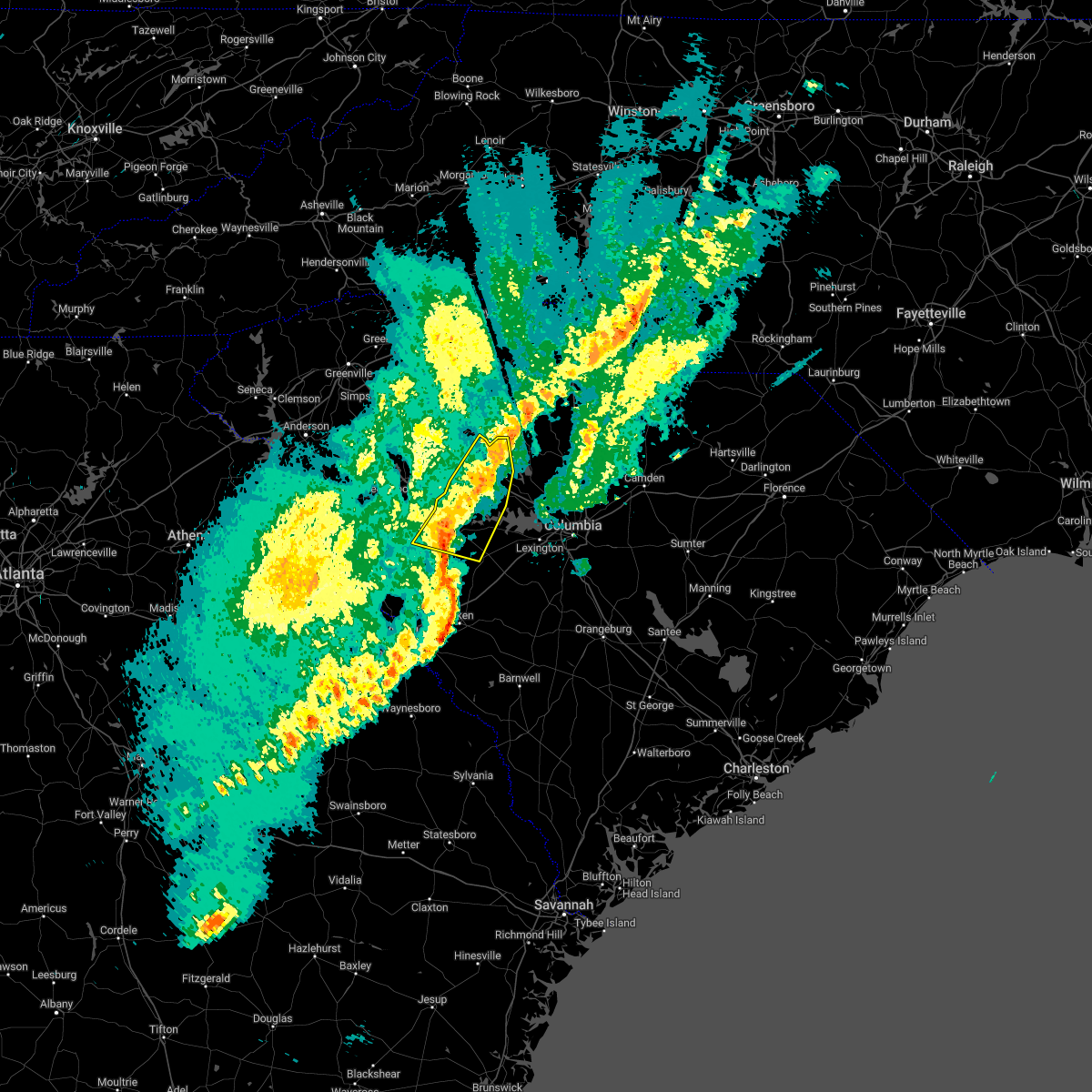 At 714 pm est, severe thunderstorms were located along a line extending from near newberry to saluda county airport, moving east at 35 mph (radar indicated). Hazards include 60 mph wind gusts. Expect damage to trees and powerlines. locations impacted include, newberry, saluda, prosperity, saluda county airport, newberry college, newberry county airport, pomaria, silverstreet, saluda co sheriff`s office, us-176 and sc- 34 crossroads, good hope, hollywood elementary school, emory, delmar, enoree ranger district office, stoney hill, newberry county detention center, fairview fire station, mid- carolina high school and wyses ferry. this includes interstate 26 between mile markers 66 and 84. hail threat, radar indicated max hail size, <. 75 in wind threat, radar indicated max wind gust, 60 mph. At 714 pm est, severe thunderstorms were located along a line extending from near newberry to saluda county airport, moving east at 35 mph (radar indicated). Hazards include 60 mph wind gusts. Expect damage to trees and powerlines. locations impacted include, newberry, saluda, prosperity, saluda county airport, newberry college, newberry county airport, pomaria, silverstreet, saluda co sheriff`s office, us-176 and sc- 34 crossroads, good hope, hollywood elementary school, emory, delmar, enoree ranger district office, stoney hill, newberry county detention center, fairview fire station, mid- carolina high school and wyses ferry. this includes interstate 26 between mile markers 66 and 84. hail threat, radar indicated max hail size, <. 75 in wind threat, radar indicated max wind gust, 60 mph.
|
| 1/12/2023 6:45 PM EST |
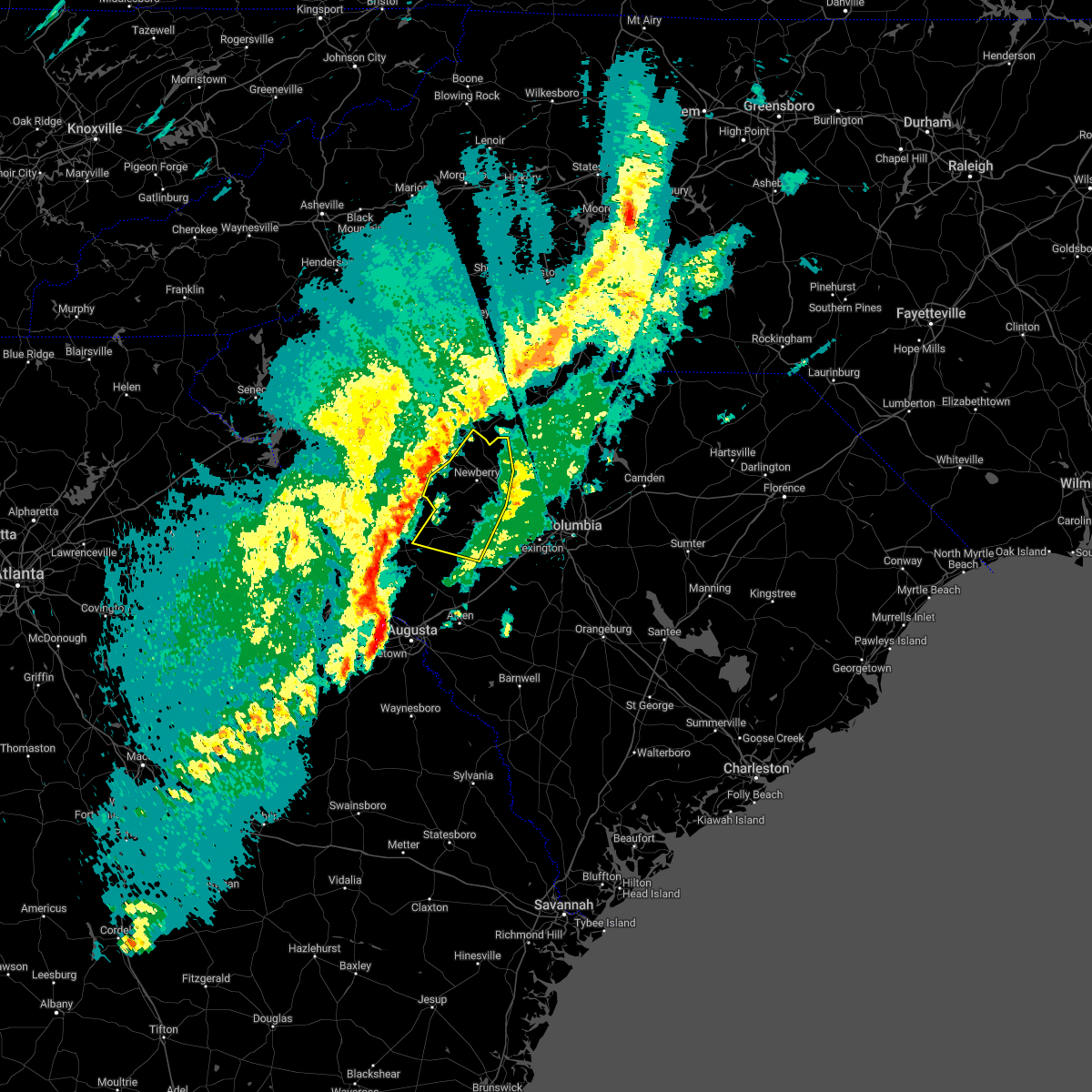 At 644 pm est, severe thunderstorms were located along a line extending from near joanna to 10 miles south of ninety six historic site, moving east at 35 mph (radar indicated). Hazards include 70 mph wind gusts. Expect considerable tree damage. Damage is likely to mobile homes, roofs, and outbuildings. At 644 pm est, severe thunderstorms were located along a line extending from near joanna to 10 miles south of ninety six historic site, moving east at 35 mph (radar indicated). Hazards include 70 mph wind gusts. Expect considerable tree damage. Damage is likely to mobile homes, roofs, and outbuildings.
|
| 1/12/2023 5:37 PM EST |
 At 536 pm est, a severe thunderstorm capable of producing a tornado was located near edgefield, or 20 miles north of belvedere, moving northeast at 40 mph (radar indicated rotation). Hazards include tornado. Flying debris will be dangerous to those caught without shelter. mobile homes will be damaged or destroyed. damage to roofs, windows, and vehicles will occur. tree damage is likely. this dangerous storm will be near, edgefield around 540 pm est. johnston around 550 pm est. saluda county airport around 600 pm est. saluda around 605 pm est. Other locations impacted by this tornadic thunderstorm include hollywood elementary school, emory, cleora, saluda co sheriff`s office, scurry airport, good hope, circle fire station, hickory grove, pleasant lane and northside fire station main. At 536 pm est, a severe thunderstorm capable of producing a tornado was located near edgefield, or 20 miles north of belvedere, moving northeast at 40 mph (radar indicated rotation). Hazards include tornado. Flying debris will be dangerous to those caught without shelter. mobile homes will be damaged or destroyed. damage to roofs, windows, and vehicles will occur. tree damage is likely. this dangerous storm will be near, edgefield around 540 pm est. johnston around 550 pm est. saluda county airport around 600 pm est. saluda around 605 pm est. Other locations impacted by this tornadic thunderstorm include hollywood elementary school, emory, cleora, saluda co sheriff`s office, scurry airport, good hope, circle fire station, hickory grove, pleasant lane and northside fire station main.
|
| 1/12/2023 5:33 PM EST |
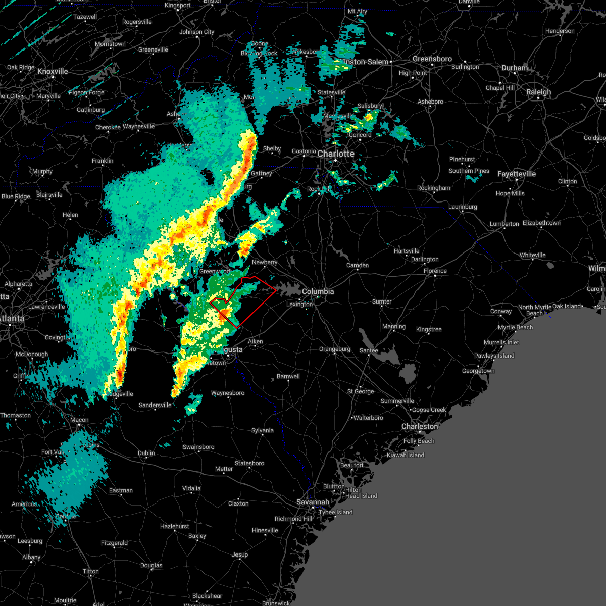 At 532 pm est, a severe thunderstorm capable of producing a tornado was located 7 miles west of edgefield, or 19 miles north of belvedere, moving northeast at 40 mph (radar indicated rotation). Hazards include tornado. Flying debris will be dangerous to those caught without shelter. mobile homes will be damaged or destroyed. damage to roofs, windows, and vehicles will occur. tree damage is likely. this dangerous storm will be near, edgefield around 540 pm est. johnston around 550 pm est. saluda county airport around 600 pm est. saluda around 605 pm est. Other locations impacted by this tornadic thunderstorm include strom thurmond high school, saluda co sheriff`s office, good hope, harmony, pleasant lane, northside fire station main, wyses ferry, hollywood elementary school, emory and cleora. At 532 pm est, a severe thunderstorm capable of producing a tornado was located 7 miles west of edgefield, or 19 miles north of belvedere, moving northeast at 40 mph (radar indicated rotation). Hazards include tornado. Flying debris will be dangerous to those caught without shelter. mobile homes will be damaged or destroyed. damage to roofs, windows, and vehicles will occur. tree damage is likely. this dangerous storm will be near, edgefield around 540 pm est. johnston around 550 pm est. saluda county airport around 600 pm est. saluda around 605 pm est. Other locations impacted by this tornadic thunderstorm include strom thurmond high school, saluda co sheriff`s office, good hope, harmony, pleasant lane, northside fire station main, wyses ferry, hollywood elementary school, emory and cleora.
|
| 1/4/2023 10:12 AM EST |
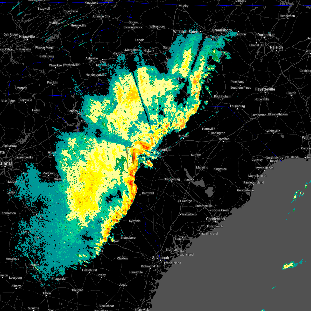 At 1012 am est, a severe thunderstorm was located near saluda county airport, or 11 miles west of batesburg-leesville, moving east at 25 mph (radar indicated). Hazards include 60 mph wind gusts. Expect damage to trees and powerlines. locations impacted include, saluda, johnston, ridge spring, saluda county airport, ward, emory, saluda co sheriff`s office, scurry airport, hickory grove and saluda high school. hail threat, radar indicated max hail size, <. 75 in wind threat, radar indicated max wind gust, 60 mph. At 1012 am est, a severe thunderstorm was located near saluda county airport, or 11 miles west of batesburg-leesville, moving east at 25 mph (radar indicated). Hazards include 60 mph wind gusts. Expect damage to trees and powerlines. locations impacted include, saluda, johnston, ridge spring, saluda county airport, ward, emory, saluda co sheriff`s office, scurry airport, hickory grove and saluda high school. hail threat, radar indicated max hail size, <. 75 in wind threat, radar indicated max wind gust, 60 mph.
|
| 1/4/2023 9:41 AM EST |
 At 941 am est, a severe thunderstorm was located 7 miles north of edgefield, or 23 miles southeast of greenwood, moving east at 25 mph (radar indicated). Hazards include 60 mph wind gusts. expect damage to trees and powerlines At 941 am est, a severe thunderstorm was located 7 miles north of edgefield, or 23 miles southeast of greenwood, moving east at 25 mph (radar indicated). Hazards include 60 mph wind gusts. expect damage to trees and powerlines
|
| 5/23/2022 11:30 AM EDT |
 At 1130 am edt, a severe thunderstorm was located near ridge spring, or near batesburg-leesville, moving northeast at 40 mph (radar indicated). Hazards include 60 mph wind gusts and penny size hail. expect damage to trees and powerlines At 1130 am edt, a severe thunderstorm was located near ridge spring, or near batesburg-leesville, moving northeast at 40 mph (radar indicated). Hazards include 60 mph wind gusts and penny size hail. expect damage to trees and powerlines
|
| 5/23/2022 11:03 AM EDT |
 At 1102 am edt, a severe thunderstorm was located near edgefield county airport, or 9 miles northeast of belvedere, moving northeast at 35 mph (radar indicated). Hazards include 60 mph wind gusts and penny size hail. expect damage to trees and powerlines At 1102 am edt, a severe thunderstorm was located near edgefield county airport, or 9 miles northeast of belvedere, moving northeast at 35 mph (radar indicated). Hazards include 60 mph wind gusts and penny size hail. expect damage to trees and powerlines
|
| 5/6/2022 5:43 PM EDT |
 The severe thunderstorm warning for northeastern edgefield, southwestern lexington, northeastern aiken and saluda counties will expire at 545 pm edt, the storms which prompted the warning have moved out of the area. therefore, the warning will be allowed to expire. a severe thunderstorm watch remains in effect until 1000 pm edt for central south carolina. The severe thunderstorm warning for northeastern edgefield, southwestern lexington, northeastern aiken and saluda counties will expire at 545 pm edt, the storms which prompted the warning have moved out of the area. therefore, the warning will be allowed to expire. a severe thunderstorm watch remains in effect until 1000 pm edt for central south carolina.
|
| 5/6/2022 5:33 PM EDT |
 At 533 pm edt, severe thunderstorms were located along a line extending from near batesburg-leesville to 6 miles southwest of gaston, moving northeast at 70 mph (radar indicated). Hazards include 70 mph wind gusts and half dollar size hail. Hail damage to vehicles is expected. expect considerable tree damage. wind damage is also likely to mobile homes, roofs, and outbuildings. locations impacted include, batesburg-leesville, edgefield, saluda, johnston, ridge spring, saluda county airport, aiken state park, wagener, pelion, monetta, ward, strom thurmond high school, saluda co sheriff`s office, good hope, northside fire station main, thor, emory, camp kinard, new holland and samaria fire station. this includes interstate 20 in south carolina between mile markers 22 and 44. thunderstorm damage threat, considerable hail threat, observed max hail size, 1. 25 in wind threat, observed max wind gust, 70 mph. At 533 pm edt, severe thunderstorms were located along a line extending from near batesburg-leesville to 6 miles southwest of gaston, moving northeast at 70 mph (radar indicated). Hazards include 70 mph wind gusts and half dollar size hail. Hail damage to vehicles is expected. expect considerable tree damage. wind damage is also likely to mobile homes, roofs, and outbuildings. locations impacted include, batesburg-leesville, edgefield, saluda, johnston, ridge spring, saluda county airport, aiken state park, wagener, pelion, monetta, ward, strom thurmond high school, saluda co sheriff`s office, good hope, northside fire station main, thor, emory, camp kinard, new holland and samaria fire station. this includes interstate 20 in south carolina between mile markers 22 and 44. thunderstorm damage threat, considerable hail threat, observed max hail size, 1. 25 in wind threat, observed max wind gust, 70 mph.
|
| 5/6/2022 5:32 PM EDT | Sheriff dispatch reported lots of hail and numerous trees down across the count in saluda county SC, 3.1 miles NW of Saluda, SC |
| 5/6/2022 5:31 PM EDT | Quarter sized hail reported 0.1 miles NNE of Saluda, SC, sheriff dispatch reported quarter size hail near the town of saluda. |
| 5/6/2022 5:10 PM EDT |
 At 509 pm edt, severe thunderstorms were located along a line extending from johnston to near aiken state park, moving northeast at 70 mph (radar indicated). Hazards include 70 mph wind gusts and half dollar size hail. Hail damage to vehicles is expected. expect considerable tree damage. Wind damage is also likely to mobile homes, roofs, and outbuildings. At 509 pm edt, severe thunderstorms were located along a line extending from johnston to near aiken state park, moving northeast at 70 mph (radar indicated). Hazards include 70 mph wind gusts and half dollar size hail. Hail damage to vehicles is expected. expect considerable tree damage. Wind damage is also likely to mobile homes, roofs, and outbuildings.
|
| 5/3/2022 3:41 PM EDT |
 At 340 pm edt, severe thunderstorms were located along a line extending from newberry college to near saluda county airport, moving east at 20 mph (radar indicated). Hazards include 60 mph wind gusts and quarter size hail. Hail damage to vehicles is expected. Expect wind damage to trees and powerlines. At 340 pm edt, severe thunderstorms were located along a line extending from newberry college to near saluda county airport, moving east at 20 mph (radar indicated). Hazards include 60 mph wind gusts and quarter size hail. Hail damage to vehicles is expected. Expect wind damage to trees and powerlines.
|
| 4/6/2022 7:03 PM EDT |
 At 703 pm edt, a severe thunderstorm was located 8 miles northwest of edgefield, or 21 miles north of evans, moving east at 40 mph (radar indicated). Hazards include 60 mph wind gusts. expect damage to trees and powerlines At 703 pm edt, a severe thunderstorm was located 8 miles northwest of edgefield, or 21 miles north of evans, moving east at 40 mph (radar indicated). Hazards include 60 mph wind gusts. expect damage to trees and powerlines
|
| 4/6/2022 7:03 PM EDT |
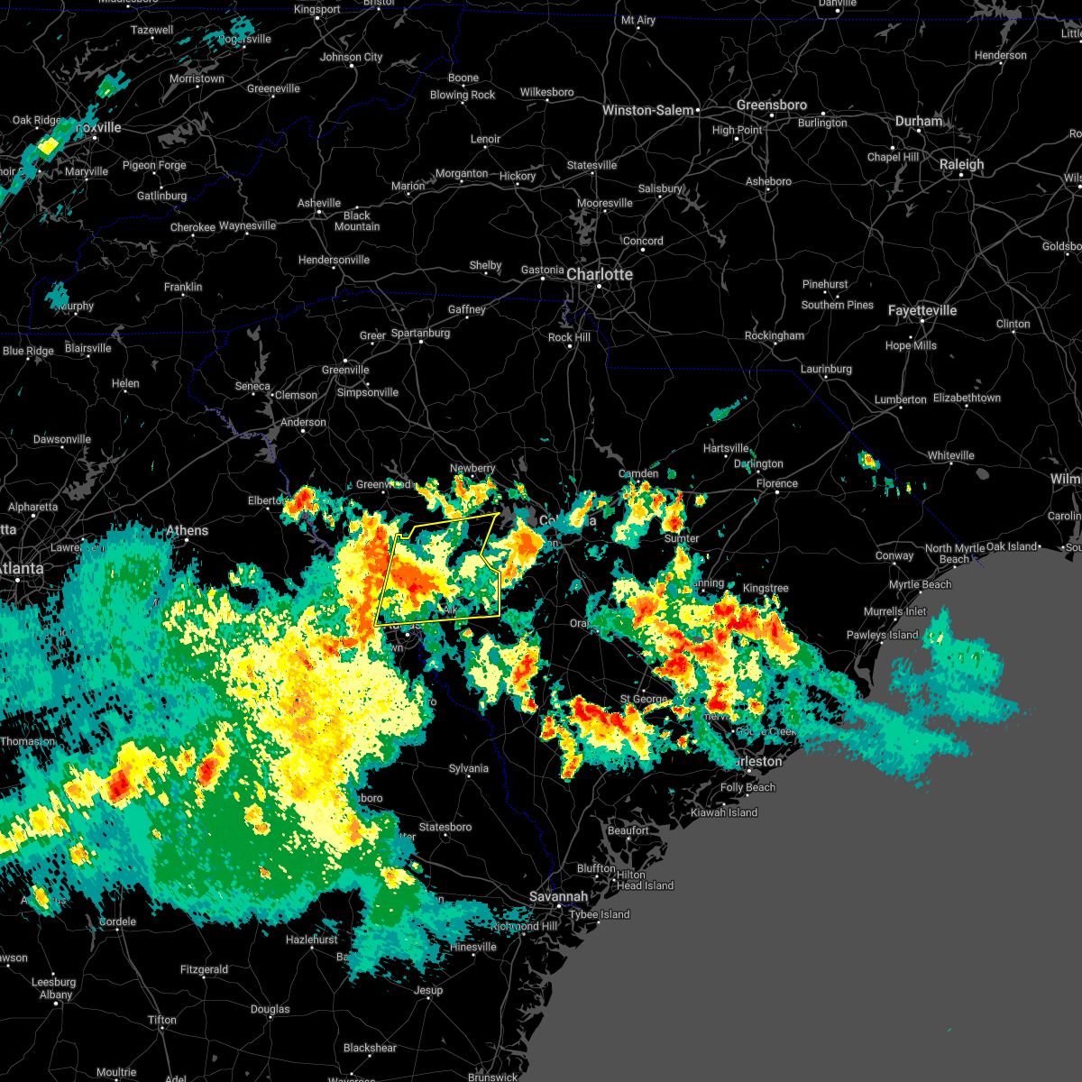 At 703 pm edt, a severe thunderstorm was located 8 miles northwest of edgefield, or 21 miles north of evans, moving east at 40 mph (radar indicated). Hazards include 60 mph wind gusts. expect damage to trees and powerlines At 703 pm edt, a severe thunderstorm was located 8 miles northwest of edgefield, or 21 miles north of evans, moving east at 40 mph (radar indicated). Hazards include 60 mph wind gusts. expect damage to trees and powerlines
|
| 4/5/2022 5:15 PM EDT |
 At 514 pm edt, severe thunderstorms were located along a line extending from 10 miles southwest of ninety six historic site to near appling, moving northeast at 50 mph (radar indicated). Hazards include 60 mph wind gusts. expect damage to trees and powerlines At 514 pm edt, severe thunderstorms were located along a line extending from 10 miles southwest of ninety six historic site to near appling, moving northeast at 50 mph (radar indicated). Hazards include 60 mph wind gusts. expect damage to trees and powerlines
|
| 8/31/2021 3:15 PM EDT |
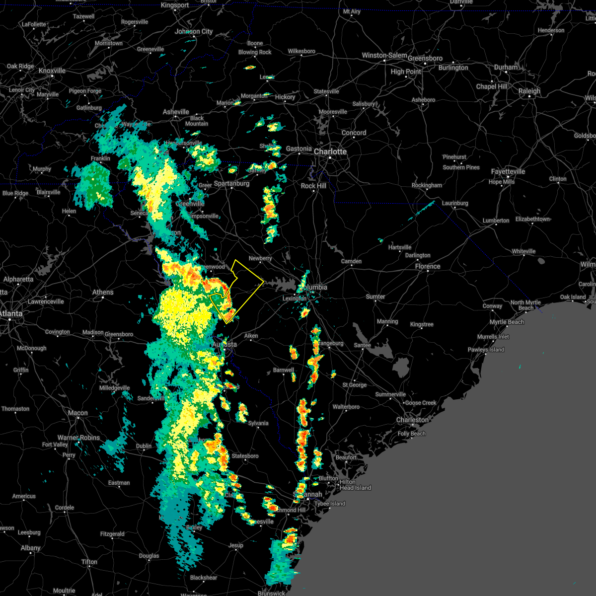 At 314 pm edt, severe thunderstorms were located along a line extending from near greenwood to 10 miles west of saluda county airport to edgefield, moving northeast at 45 mph (radar indicated). Hazards include 60 mph wind gusts. Expect damage to roofs, siding, and trees. locations impacted include, edgefield, saluda, saluda county airport, saluda co sheriff`s office, good hope, pleasant lane, northside fire station main, hollywood elementary school, emory, chappells, chappells fire station, cleora, scurry airport, hickory grove, vaughnville and saluda high school. hail threat, radar indicated max hail size, <. 75 in wind threat, radar indicated max wind gust, 60 mph. At 314 pm edt, severe thunderstorms were located along a line extending from near greenwood to 10 miles west of saluda county airport to edgefield, moving northeast at 45 mph (radar indicated). Hazards include 60 mph wind gusts. Expect damage to roofs, siding, and trees. locations impacted include, edgefield, saluda, saluda county airport, saluda co sheriff`s office, good hope, pleasant lane, northside fire station main, hollywood elementary school, emory, chappells, chappells fire station, cleora, scurry airport, hickory grove, vaughnville and saluda high school. hail threat, radar indicated max hail size, <. 75 in wind threat, radar indicated max wind gust, 60 mph.
|
| 8/31/2021 2:59 PM EDT |
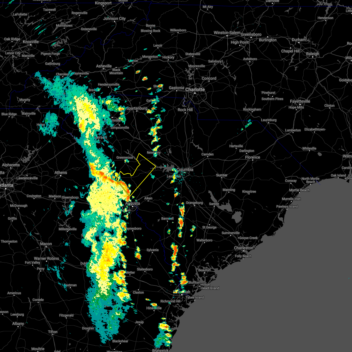 At 259 pm edt, a severe thunderstorm was located 10 miles northwest of edgefield, or 20 miles south of greenwood, moving northeast at 45 mph (radar indicated). Hazards include 60 mph wind gusts. expect damage to roofs, siding, and trees At 259 pm edt, a severe thunderstorm was located 10 miles northwest of edgefield, or 20 miles south of greenwood, moving northeast at 45 mph (radar indicated). Hazards include 60 mph wind gusts. expect damage to roofs, siding, and trees
|
| 7/18/2021 9:09 PM EDT |
 At 906 pm edt, severe thunderstorms were located along a line extending from ridge spring to 11 miles north of blackville, moving northeast at 30 mph (radar indicated). Hazards include 60 mph wind gusts. Expect damage to roofs, siding, and trees. locations impacted include, aiken, lexington, batesburg-leesville, red bank, edgefield, saluda, johnston, gaston, ridge spring, edgefield county airport, saluda county airport, aiken municipal airport, aiken state park, swansea, wagener, north, pelion, gilbert, summit and salley. This includes interstate 20 in south carolina between mile markers 14 and 54. At 906 pm edt, severe thunderstorms were located along a line extending from ridge spring to 11 miles north of blackville, moving northeast at 30 mph (radar indicated). Hazards include 60 mph wind gusts. Expect damage to roofs, siding, and trees. locations impacted include, aiken, lexington, batesburg-leesville, red bank, edgefield, saluda, johnston, gaston, ridge spring, edgefield county airport, saluda county airport, aiken municipal airport, aiken state park, swansea, wagener, north, pelion, gilbert, summit and salley. This includes interstate 20 in south carolina between mile markers 14 and 54.
|
| 7/18/2021 8:31 PM EDT |
 At 831 pm edt, severe thunderstorms were located along a line extending from near graniteville to near barnwell, moving northeast at 40 mph (radar indicated). Hazards include 60 mph wind gusts. expect damage to roofs, siding, and trees At 831 pm edt, severe thunderstorms were located along a line extending from near graniteville to near barnwell, moving northeast at 40 mph (radar indicated). Hazards include 60 mph wind gusts. expect damage to roofs, siding, and trees
|
| 5/4/2021 4:38 PM EDT |
 At 437 pm edt, severe thunderstorms were located along a line extending from near saluda county airport to near wrightsboro, moving east at 20 mph (radar indicated). Hazards include 60 mph wind gusts and penny size hail. expect damage to roofs, siding, and trees At 437 pm edt, severe thunderstorms were located along a line extending from near saluda county airport to near wrightsboro, moving east at 20 mph (radar indicated). Hazards include 60 mph wind gusts and penny size hail. expect damage to roofs, siding, and trees
|
| 5/4/2021 4:27 PM EDT |
 At 427 pm edt, severe thunderstorms were located along a line extending from 7 miles southeast of blackstock to 8 miles southwest of newberry college, moving east at 35 mph (radar indicated). Hazards include 60 mph wind gusts and penny size hail. Expect damage to roofs, siding, and trees. locations impacted include, newberry, vc summer nuclear station, saluda, prosperity, newberry college, blackstock, monticello, newberry county airport, blair, pomaria, silverstreet, lebanon fire station, us-176 and sc- 34 crossroads, good hope, henderson island, belfast wildlife management area, mitford, hollywood elementary school, chappells fire station and white oak. this includes the following highways, interstate 26 between mile markers 65 and 84. Interstate 77 between mile markers 47 and 50. At 427 pm edt, severe thunderstorms were located along a line extending from 7 miles southeast of blackstock to 8 miles southwest of newberry college, moving east at 35 mph (radar indicated). Hazards include 60 mph wind gusts and penny size hail. Expect damage to roofs, siding, and trees. locations impacted include, newberry, vc summer nuclear station, saluda, prosperity, newberry college, blackstock, monticello, newberry county airport, blair, pomaria, silverstreet, lebanon fire station, us-176 and sc- 34 crossroads, good hope, henderson island, belfast wildlife management area, mitford, hollywood elementary school, chappells fire station and white oak. this includes the following highways, interstate 26 between mile markers 65 and 84. Interstate 77 between mile markers 47 and 50.
|
| 5/4/2021 4:00 PM EDT |
 At 359 pm edt, severe thunderstorms were located along a line extending from 6 miles north of blair to near lake greenwood state park, moving northeast at 30 mph (radar indicated). Hazards include 60 mph wind gusts and quarter size hail. Hail damage to vehicles is expected. Expect wind damage to roofs, siding, and trees. At 359 pm edt, severe thunderstorms were located along a line extending from 6 miles north of blair to near lake greenwood state park, moving northeast at 30 mph (radar indicated). Hazards include 60 mph wind gusts and quarter size hail. Hail damage to vehicles is expected. Expect wind damage to roofs, siding, and trees.
|
| 5/4/2021 3:45 PM EDT |
 At 345 pm edt, a severe thunderstorm was located near saluda, or 9 miles northwest of batesburg-leesville, moving northeast at 35 mph (radar indicated). Hazards include 60 mph wind gusts and quarter size hail. Hail damage to vehicles is expected. Expect wind damage to roofs, siding, and trees. At 345 pm edt, a severe thunderstorm was located near saluda, or 9 miles northwest of batesburg-leesville, moving northeast at 35 mph (radar indicated). Hazards include 60 mph wind gusts and quarter size hail. Hail damage to vehicles is expected. Expect wind damage to roofs, siding, and trees.
|
| 5/3/2021 3:50 PM EDT | Golf Ball sized hail reported 0.1 miles NNE of Saluda, SC, saluda co emergency manager reports golf ball size hail at saluda county courthouse at 3:50pm. time estimated from radar. |
| 5/3/2021 3:24 PM EDT |
 At 323 pm edt, a severe thunderstorm was located 7 miles southeast of abbeville, moving east at 35 mph (radar indicated). Hazards include 60 mph wind gusts and half dollar size hail. Hail damage to vehicles is expected. Expect wind damage to roofs, siding, and trees. At 323 pm edt, a severe thunderstorm was located 7 miles southeast of abbeville, moving east at 35 mph (radar indicated). Hazards include 60 mph wind gusts and half dollar size hail. Hail damage to vehicles is expected. Expect wind damage to roofs, siding, and trees.
|
| 3/31/2021 5:55 PM EDT |
 The severe thunderstorm warning for central edgefield, northwestern aiken and saluda counties will expire at 600 pm edt, the storms which prompted the warning have moved out of the area. therefore, the warning will be allowed to expire. to report severe weather, contact your nearest law enforcement agency. they will relay your report to the national weather service columbia. remember, a tornado warning still remains in effect for northeastern aiken county through 615 pm. The severe thunderstorm warning for central edgefield, northwestern aiken and saluda counties will expire at 600 pm edt, the storms which prompted the warning have moved out of the area. therefore, the warning will be allowed to expire. to report severe weather, contact your nearest law enforcement agency. they will relay your report to the national weather service columbia. remember, a tornado warning still remains in effect for northeastern aiken county through 615 pm.
|
| 3/31/2021 5:31 PM EDT |
 At 531 pm edt, severe thunderstorms were located along a line extending from near saluda to near johnston to near belvedere, moving northeast at 35 mph (radar indicated). Hazards include 60 mph wind gusts and half dollar size hail. Hail damage to vehicles is expected. expect wind damage to roofs, siding, and trees. locations impacted include, north augusta, batesburg-leesville, edgefield, saluda, johnston, ridge spring, saluda county airport, edgefield county airport, monetta, trenton, ward, strom thurmond high school, saluda co sheriff`s office, good hope, poverty hill, northside fire station main, hollywood elementary school, emory, vaucluse and edgefield federal correction institution. This includes interstate 20 in south carolina between mile markers 7 and 20. At 531 pm edt, severe thunderstorms were located along a line extending from near saluda to near johnston to near belvedere, moving northeast at 35 mph (radar indicated). Hazards include 60 mph wind gusts and half dollar size hail. Hail damage to vehicles is expected. expect wind damage to roofs, siding, and trees. locations impacted include, north augusta, batesburg-leesville, edgefield, saluda, johnston, ridge spring, saluda county airport, edgefield county airport, monetta, trenton, ward, strom thurmond high school, saluda co sheriff`s office, good hope, poverty hill, northside fire station main, hollywood elementary school, emory, vaucluse and edgefield federal correction institution. This includes interstate 20 in south carolina between mile markers 7 and 20.
|
| 3/31/2021 5:19 PM EDT |
 At 518 pm edt, severe thunderstorms were located along a line extending from 8 miles west of saluda county airport to near edgefield to near augusta national golf club, moving northeast at 35 mph (radar indicated). Hazards include 60 mph wind gusts and quarter size hail. Hail damage to vehicles is expected. Expect wind damage to roofs, siding, and trees. At 518 pm edt, severe thunderstorms were located along a line extending from 8 miles west of saluda county airport to near edgefield to near augusta national golf club, moving northeast at 35 mph (radar indicated). Hazards include 60 mph wind gusts and quarter size hail. Hail damage to vehicles is expected. Expect wind damage to roofs, siding, and trees.
|
| 6/29/2020 9:08 PM EDT |
 At 908 pm edt, severe thunderstorms were located along a line extending from newberry to 7 miles west of saluda, moving southeast at 25 mph (radar indicated). Hazards include 60 mph wind gusts. Expect damage to roofs, siding, and trees. locations impacted include, newberry, saluda, prosperity, newberry county airport, saluda county airport, newberry college, little mountain, pomaria, silverstreet, stoney hill, newberry county detention center, saluda co sheriff`s office, good hope, fairview fire station, mid-carolina high school, wyses ferry, hollywood elementary school, emory, scurry airport and circle fire station. This includes interstate 26 between mile markers 69 and 89. At 908 pm edt, severe thunderstorms were located along a line extending from newberry to 7 miles west of saluda, moving southeast at 25 mph (radar indicated). Hazards include 60 mph wind gusts. Expect damage to roofs, siding, and trees. locations impacted include, newberry, saluda, prosperity, newberry county airport, saluda county airport, newberry college, little mountain, pomaria, silverstreet, stoney hill, newberry county detention center, saluda co sheriff`s office, good hope, fairview fire station, mid-carolina high school, wyses ferry, hollywood elementary school, emory, scurry airport and circle fire station. This includes interstate 26 between mile markers 69 and 89.
|
| 6/29/2020 8:41 PM EDT |
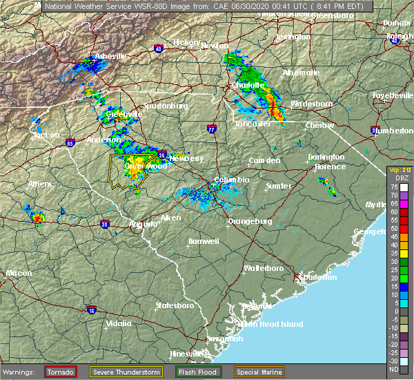 At 840 pm edt, severe thunderstorms were located along a line extending from near joanna to near greenwood, moving southeast at 20 mph (radar indicated). Hazards include 60 mph wind gusts. expect damage to roofs, siding, and trees At 840 pm edt, severe thunderstorms were located along a line extending from near joanna to near greenwood, moving southeast at 20 mph (radar indicated). Hazards include 60 mph wind gusts. expect damage to roofs, siding, and trees
|
| 6/5/2020 3:15 PM EDT |
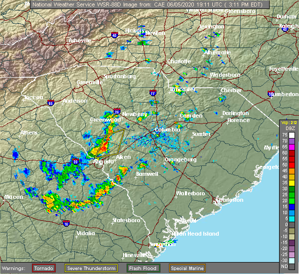 At 314 pm edt, severe thunderstorms were located along a line extending from near saluda county airport to 7 miles north of belvedere, moving northeast at 30 mph (radar indicated). Hazards include 60 mph wind gusts and quarter size hail. Hail damage to vehicles is expected. Expect wind damage to roofs, siding, and trees. At 314 pm edt, severe thunderstorms were located along a line extending from near saluda county airport to 7 miles north of belvedere, moving northeast at 30 mph (radar indicated). Hazards include 60 mph wind gusts and quarter size hail. Hail damage to vehicles is expected. Expect wind damage to roofs, siding, and trees.
|
| 5/29/2020 7:12 PM EDT | Powerline dow in saluda county SC, 5.5 miles S of Saluda, SC |
| 5/29/2020 7:08 PM EDT | Tree dow in saluda county SC, 0.1 miles NNE of Saluda, SC |
| 5/29/2020 7:08 PM EDT |
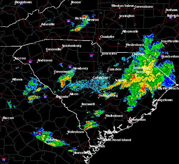 At 707 pm edt, a severe thunderstorm was located 8 miles east of saluda, or 10 miles northwest of batesburg-leesville, moving east at 25 mph (radar indicated). Hazards include 60 mph wind gusts and penny size hail. locally heavy rainfall also possible. expect damage to roofs, siding, and trees At 707 pm edt, a severe thunderstorm was located 8 miles east of saluda, or 10 miles northwest of batesburg-leesville, moving east at 25 mph (radar indicated). Hazards include 60 mph wind gusts and penny size hail. locally heavy rainfall also possible. expect damage to roofs, siding, and trees
|
| 5/22/2020 5:11 PM EDT |
 At 511 pm edt, severe thunderstorms were located along a line extending from near monticello to near dreher island state park to saluda county airport, moving east at 35 mph (radar indicated). Hazards include 60 mph wind gusts and quarter size hail. Hail damage to vehicles is expected. expect wind damage to roofs, siding, and trees. locations impacted include, columbia, lexington, irmo, winnsboro, vc summer nuclear station, highway 6 at lake murray dam, st. andrews, saluda, prosperity, jenkinsville, harbison state forest, dreher island state park, fairfield county airport, longtown, ballentine, blythewood, chapin, ridgeway, little mountain and pomaria. this includes the following highways, interstate 26 between mile markers 81 and 104. Interstate 77 between mile markers 25 and 37. At 511 pm edt, severe thunderstorms were located along a line extending from near monticello to near dreher island state park to saluda county airport, moving east at 35 mph (radar indicated). Hazards include 60 mph wind gusts and quarter size hail. Hail damage to vehicles is expected. expect wind damage to roofs, siding, and trees. locations impacted include, columbia, lexington, irmo, winnsboro, vc summer nuclear station, highway 6 at lake murray dam, st. andrews, saluda, prosperity, jenkinsville, harbison state forest, dreher island state park, fairfield county airport, longtown, ballentine, blythewood, chapin, ridgeway, little mountain and pomaria. this includes the following highways, interstate 26 between mile markers 81 and 104. Interstate 77 between mile markers 25 and 37.
|
| 5/22/2020 5:00 PM EDT |
 At 459 pm edt, severe thunderstorms were located along a line extending from 6 miles west of vc summer nuclear station to 8 miles west of saluda county airport, moving east at 40 mph (radar indicated). Hazards include 60 mph wind gusts and quarter size hail. Hail damage to vehicles is expected. expect wind damage to roofs, siding, and trees. locations impacted include, columbia, lexington, irmo, newberry, winnsboro, vc summer nuclear station, highway 6 at lake murray dam, st. andrews, saluda, prosperity, jenkinsville, harbison state forest, dreher island state park, fairfield county airport, longtown, ballentine, blythewood, chapin, ridgeway and little mountain. this includes the following highways, interstate 26 between mile markers 76 and 104. Interstate 77 between mile markers 25 and 38. At 459 pm edt, severe thunderstorms were located along a line extending from 6 miles west of vc summer nuclear station to 8 miles west of saluda county airport, moving east at 40 mph (radar indicated). Hazards include 60 mph wind gusts and quarter size hail. Hail damage to vehicles is expected. expect wind damage to roofs, siding, and trees. locations impacted include, columbia, lexington, irmo, newberry, winnsboro, vc summer nuclear station, highway 6 at lake murray dam, st. andrews, saluda, prosperity, jenkinsville, harbison state forest, dreher island state park, fairfield county airport, longtown, ballentine, blythewood, chapin, ridgeway and little mountain. this includes the following highways, interstate 26 between mile markers 76 and 104. Interstate 77 between mile markers 25 and 38.
|
| 5/22/2020 4:57 PM EDT |
 At 457 pm edt, severe thunderstorms were located along a line extending from 6 miles west of vc summer nuclear station to 8 miles west of saluda county airport, moving east at 40 mph (radar indicated). Hazards include 60 mph wind gusts and quarter size hail. Hail damage to vehicles is expected. expect wind damage to roofs, siding, and trees. locations impacted include, columbia, lexington, irmo, newberry, winnsboro, vc summer nuclear station, highway 6 at lake murray dam, st. andrews, saluda, mccormick, prosperity, jenkinsville, harbison state forest, dreher island state park, fairfield county airport, longtown, ballentine, blythewood, chapin and ridgeway. this includes the following highways, interstate 26 between mile markers 76 and 104. Interstate 77 between mile markers 25 and 38. At 457 pm edt, severe thunderstorms were located along a line extending from 6 miles west of vc summer nuclear station to 8 miles west of saluda county airport, moving east at 40 mph (radar indicated). Hazards include 60 mph wind gusts and quarter size hail. Hail damage to vehicles is expected. expect wind damage to roofs, siding, and trees. locations impacted include, columbia, lexington, irmo, newberry, winnsboro, vc summer nuclear station, highway 6 at lake murray dam, st. andrews, saluda, mccormick, prosperity, jenkinsville, harbison state forest, dreher island state park, fairfield county airport, longtown, ballentine, blythewood, chapin and ridgeway. this includes the following highways, interstate 26 between mile markers 76 and 104. Interstate 77 between mile markers 25 and 38.
|
| 5/22/2020 4:36 PM EDT |
 At 435 pm edt, severe thunderstorms were located along a line extending from newberry county airport to near mccormick county airport, moving east at 40 mph (radar indicated). Hazards include 60 mph wind gusts and quarter size hail. Hail damage to vehicles is expected. Expect wind damage to roofs, siding, and trees. At 435 pm edt, severe thunderstorms were located along a line extending from newberry county airport to near mccormick county airport, moving east at 40 mph (radar indicated). Hazards include 60 mph wind gusts and quarter size hail. Hail damage to vehicles is expected. Expect wind damage to roofs, siding, and trees.
|
| 4/13/2020 5:10 AM EDT |
 The severe thunderstorm warning for northeastern columbia, lincoln, southwestern newberry, edgefield, saluda and mccormick counties will expire at 515 am edt, the storms which prompted the warning have moved out of the warned area. therefore, the warning will be allowed to expire. a tornado watch remains in effect until 1100 am edt for east central georgia, and central south carolina. The severe thunderstorm warning for northeastern columbia, lincoln, southwestern newberry, edgefield, saluda and mccormick counties will expire at 515 am edt, the storms which prompted the warning have moved out of the warned area. therefore, the warning will be allowed to expire. a tornado watch remains in effect until 1100 am edt for east central georgia, and central south carolina.
|
| 4/13/2020 4:29 AM EDT |
 At 429 am edt, severe thunderstorms were located along a line extending from 6 miles west of troy to near thomson, moving northeast at 75 mph (radar indicated). Hazards include 70 mph wind gusts and penny size hail. Expect considerable tree damage. Damage is likely to mobile homes, roofs, and outbuildings. At 429 am edt, severe thunderstorms were located along a line extending from 6 miles west of troy to near thomson, moving northeast at 75 mph (radar indicated). Hazards include 70 mph wind gusts and penny size hail. Expect considerable tree damage. Damage is likely to mobile homes, roofs, and outbuildings.
|
| 3/24/2020 1:40 PM EDT |
 The severe thunderstorm warning for central saluda county will expire at 145 pm edt, the storm which prompted the warning has weakened below severe limits, and no longer poses an immediate threat to life or property. therefore, the warning will be allowed to expire. The severe thunderstorm warning for central saluda county will expire at 145 pm edt, the storm which prompted the warning has weakened below severe limits, and no longer poses an immediate threat to life or property. therefore, the warning will be allowed to expire.
|
| 3/24/2020 1:30 PM EDT |
 At 129 pm edt, a severe thunderstorm was located near saluda county airport, or 17 miles west of batesburg-leesville, moving east at 45 mph (radar indicated). Hazards include quarter size hail. Damage to vehicles is expected. this severe storm will be near, saluda around 135 pm edt. Other locations impacted by this severe thunderstorm include hollywood elementary school, emory, saluda co sheriff`s office, scurry airport, ward, good hope, hickory grove, saluda high school and monetta. At 129 pm edt, a severe thunderstorm was located near saluda county airport, or 17 miles west of batesburg-leesville, moving east at 45 mph (radar indicated). Hazards include quarter size hail. Damage to vehicles is expected. this severe storm will be near, saluda around 135 pm edt. Other locations impacted by this severe thunderstorm include hollywood elementary school, emory, saluda co sheriff`s office, scurry airport, ward, good hope, hickory grove, saluda high school and monetta.
|
| 3/24/2020 1:06 PM EDT |
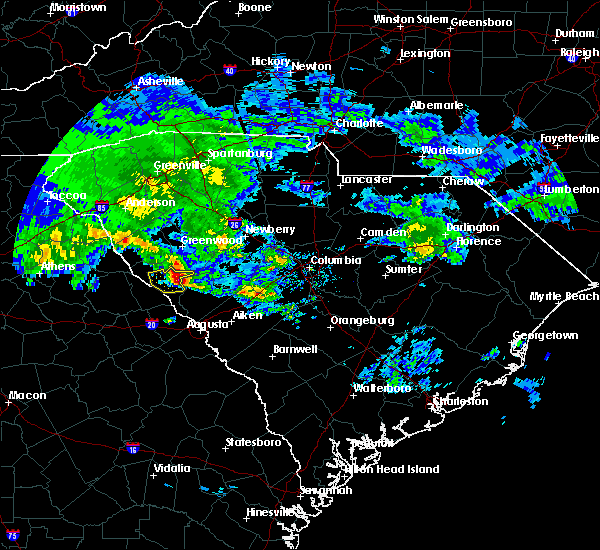 At 106 pm edt, a severe thunderstorm was located 7 miles east of mccormick county airport, moving east at 45 mph (radar indicated). Hazards include quarter size hail. damage to vehicles is expected At 106 pm edt, a severe thunderstorm was located 7 miles east of mccormick county airport, moving east at 45 mph (radar indicated). Hazards include quarter size hail. damage to vehicles is expected
|
| 3/24/2020 10:56 AM EDT |
 At 1055 am edt, a severe thunderstorm was located near saluda, moving east at 40 mph (radar indicated). Hazards include 60 mph wind gusts and quarter size hail. Hail damage to vehicles is expected. expect wind damage to roofs, siding, and trees. locations impacted include, saluda, prosperity, saluda county airport, dreher island state park, little mountain, pomaria, silverstreet, peak, good hope, emory, delmar, stoney hill, fairview fire station, wyses ferry and chappells. This includes interstate 26 between mile markers 79 and 89. At 1055 am edt, a severe thunderstorm was located near saluda, moving east at 40 mph (radar indicated). Hazards include 60 mph wind gusts and quarter size hail. Hail damage to vehicles is expected. expect wind damage to roofs, siding, and trees. locations impacted include, saluda, prosperity, saluda county airport, dreher island state park, little mountain, pomaria, silverstreet, peak, good hope, emory, delmar, stoney hill, fairview fire station, wyses ferry and chappells. This includes interstate 26 between mile markers 79 and 89.
|
| 3/24/2020 10:50 AM EDT |
 At 1049 am edt, a severe thunderstorm was located 8 miles southeast of ninety six historic site, or 16 miles southeast of greenwood, moving east at 40 mph (radar indicated). Hazards include 60 mph wind gusts and quarter size hail. Hail damage to vehicles is expected. Expect wind damage to roofs, siding, and trees. At 1049 am edt, a severe thunderstorm was located 8 miles southeast of ninety six historic site, or 16 miles southeast of greenwood, moving east at 40 mph (radar indicated). Hazards include 60 mph wind gusts and quarter size hail. Hail damage to vehicles is expected. Expect wind damage to roofs, siding, and trees.
|
| 2/6/2020 3:23 PM EST |
 A severe thunderstorm warning remains in effect until 345 pm est for central edgefield. western lexington. northern aiken and southeastern saluda counties. At 323 pm est, severe thunderstorms were located along a line extending from near monticello to near lexington to 7 miles southeast of batesburg-leesville, moving northeast at 70 mph. A severe thunderstorm warning remains in effect until 345 pm est for central edgefield. western lexington. northern aiken and southeastern saluda counties. At 323 pm est, severe thunderstorms were located along a line extending from near monticello to near lexington to 7 miles southeast of batesburg-leesville, moving northeast at 70 mph.
|
| 2/6/2020 2:59 PM EST |
 At 259 pm est, severe thunderstorms were located along a line extending from 8 miles southwest of prosperity to near ridge spring to near usc aiken, moving northeast at 70 mph (radar indicated). Hazards include 60 mph wind gusts. expect damage to roofs, siding, and trees At 259 pm est, severe thunderstorms were located along a line extending from 8 miles southwest of prosperity to near ridge spring to near usc aiken, moving northeast at 70 mph (radar indicated). Hazards include 60 mph wind gusts. expect damage to roofs, siding, and trees
|
| 2/6/2020 2:32 PM EST |
 At 232 pm est, severe thunderstorms were located along a line extending from 8 miles southwest of newberry college to near hamilton branch state park, moving northeast at 45 mph (radar indicated). Hazards include 60 mph wind gusts. expect damage to roofs, siding, and trees At 232 pm est, severe thunderstorms were located along a line extending from 8 miles southwest of newberry college to near hamilton branch state park, moving northeast at 45 mph (radar indicated). Hazards include 60 mph wind gusts. expect damage to roofs, siding, and trees
|
| 1/11/2020 9:17 PM EST |
 At 916 pm est, severe thunderstorms were located along a line extending from near newberry county airport to near saluda to 7 miles east of clarks hill recreation area, moving northeast at 65 mph (law enforcement reported numerous trees and power lines down in mccormick county). Hazards include 70 mph wind gusts. Expect considerable tree damage. damage is likely to mobile homes, roofs, and outbuildings. locations impacted include, edgefield, saluda, johnston, ridge spring, appling, clarks hill recreation area, saluda county airport, edgefield county airport, j. Strom thurmond dam, riverwood, monetta, trenton, silverstreet, ward, strom thurmond high school, saluda co sheriff`s office, modoc, scott`s landing, hollywood elementary school and emory. At 916 pm est, severe thunderstorms were located along a line extending from near newberry county airport to near saluda to 7 miles east of clarks hill recreation area, moving northeast at 65 mph (law enforcement reported numerous trees and power lines down in mccormick county). Hazards include 70 mph wind gusts. Expect considerable tree damage. damage is likely to mobile homes, roofs, and outbuildings. locations impacted include, edgefield, saluda, johnston, ridge spring, appling, clarks hill recreation area, saluda county airport, edgefield county airport, j. Strom thurmond dam, riverwood, monetta, trenton, silverstreet, ward, strom thurmond high school, saluda co sheriff`s office, modoc, scott`s landing, hollywood elementary school and emory.
|
| 1/11/2020 8:51 PM EST |
 At 850 pm est, severe thunderstorms were located along a line extending from 11 miles south of ninety six historic site to near hamilton branch state park to near appling, moving east at 45 mph (radar indicated). Hazards include 70 mph wind gusts. Expect considerable tree damage. Damage is likely to mobile homes, roofs, and outbuildings. At 850 pm est, severe thunderstorms were located along a line extending from 11 miles south of ninety six historic site to near hamilton branch state park to near appling, moving east at 45 mph (radar indicated). Hazards include 70 mph wind gusts. Expect considerable tree damage. Damage is likely to mobile homes, roofs, and outbuildings.
|
| 10/31/2019 5:08 PM EDT |
 At 508 pm edt, severe thunderstorms were located along a line extending from 9 miles northeast of saluda to near edgefield, moving east at 35 mph (radar indicated). Hazards include 60 mph wind gusts. Expect damage to roofs, siding, and trees. Locations impacted include, batesburg-leesville, edgefield, saluda, johnston, ridge spring, saluda county airport, monetta, ward, strom thurmond high school, saluda co sheriff`s office, good hope, northside fire station main, hollywood elementary school, emory, cleora, delmar, edgefield federal correction institution, harmony, pleasant lane and wyses ferry. At 508 pm edt, severe thunderstorms were located along a line extending from 9 miles northeast of saluda to near edgefield, moving east at 35 mph (radar indicated). Hazards include 60 mph wind gusts. Expect damage to roofs, siding, and trees. Locations impacted include, batesburg-leesville, edgefield, saluda, johnston, ridge spring, saluda county airport, monetta, ward, strom thurmond high school, saluda co sheriff`s office, good hope, northside fire station main, hollywood elementary school, emory, cleora, delmar, edgefield federal correction institution, harmony, pleasant lane and wyses ferry.
|
| 10/31/2019 4:38 PM EDT |
 At 438 pm edt, a severe thunderstorm was located near edgefield, or 21 miles north of belvedere, moving northeast at 50 mph (radar indicated). Hazards include 60 mph wind gusts. expect damage to roofs, siding, and trees At 438 pm edt, a severe thunderstorm was located near edgefield, or 21 miles north of belvedere, moving northeast at 50 mph (radar indicated). Hazards include 60 mph wind gusts. expect damage to roofs, siding, and trees
|
| 9/13/2019 6:17 PM EDT |
 At 531 pm edt, likely severe thunderstorms extended from the columbia area northwestward through parts of newberry county. movement was southwest near 15 mph (radar indicated). Hazards include 60 mph wind gusts and quarter size hail. Hail damage to vehicles is expected. Expect wind damage to roofs, siding, and trees. At 531 pm edt, likely severe thunderstorms extended from the columbia area northwestward through parts of newberry county. movement was southwest near 15 mph (radar indicated). Hazards include 60 mph wind gusts and quarter size hail. Hail damage to vehicles is expected. Expect wind damage to roofs, siding, and trees.
|
| 9/13/2019 6:03 PM EDT | Sc hwy patrol reported tree down at bonham rd. time estimated based on rada in saluda county SC, 3.3 miles ENE of Saluda, SC |
| 9/13/2019 5:31 PM EDT |
 The national weather service in columbia has issued a * severe thunderstorm warning for. southwestern newberry county in central south carolina. northwestern lexington county in central south carolina. north central aiken county in central south carolina. Saluda county in central south carolina. The national weather service in columbia has issued a * severe thunderstorm warning for. southwestern newberry county in central south carolina. northwestern lexington county in central south carolina. north central aiken county in central south carolina. Saluda county in central south carolina.
|
| 8/17/2019 9:23 PM EDT |
 At 920 pm edt, a severe thunderstorm was located over prosperity, or 7 miles southeast of newberry, moving southeast at 20 mph (radar indicated. there are reports of trees down and hail across northern newberry county and in the city of newberry. the storm is also producing locally heavy rainfall with amounts from 1 to 2 inches in less than one hour). Hazards include 60 mph wind gusts and penny size hail. Expect damage to roofs, siding, and trees. locations impacted include, newberry, saluda, prosperity, saluda county airport, newberry college, newberry county airport, dreher island state park, chapin, little mountain, pomaria, silverstreet, ward, cedar grove fire station, south shore marina, oswald park, saluda co sheriff`s office, putnam`s landing, rocky point recreation area, belfast wildlife management area and hollywood elementary school. This includes interstate 26 between mile markers 69 and 88. At 920 pm edt, a severe thunderstorm was located over prosperity, or 7 miles southeast of newberry, moving southeast at 20 mph (radar indicated. there are reports of trees down and hail across northern newberry county and in the city of newberry. the storm is also producing locally heavy rainfall with amounts from 1 to 2 inches in less than one hour). Hazards include 60 mph wind gusts and penny size hail. Expect damage to roofs, siding, and trees. locations impacted include, newberry, saluda, prosperity, saluda county airport, newberry college, newberry county airport, dreher island state park, chapin, little mountain, pomaria, silverstreet, ward, cedar grove fire station, south shore marina, oswald park, saluda co sheriff`s office, putnam`s landing, rocky point recreation area, belfast wildlife management area and hollywood elementary school. This includes interstate 26 between mile markers 69 and 88.
|
| 8/17/2019 8:59 PM EDT |
 The national weather service in columbia has issued a * severe thunderstorm warning for. newberry county in central south carolina. northeastern edgefield county in central south carolina. northwestern lexington county in central south carolina. Saluda county in central south carolina. The national weather service in columbia has issued a * severe thunderstorm warning for. newberry county in central south carolina. northeastern edgefield county in central south carolina. northwestern lexington county in central south carolina. Saluda county in central south carolina.
|
| 8/17/2019 8:59 PM EDT |
 At 858 pm edt, a severe thunderstorm was located over newberry, moving southeast at 20 mph (radar indicated. this storm has a history of producing strong damaging winds across northern newberry county). Hazards include 60 mph wind gusts and penny size hail. expect damage to roofs, siding, and trees At 858 pm edt, a severe thunderstorm was located over newberry, moving southeast at 20 mph (radar indicated. this storm has a history of producing strong damaging winds across northern newberry county). Hazards include 60 mph wind gusts and penny size hail. expect damage to roofs, siding, and trees
|
| 7/19/2019 8:01 PM EDT |
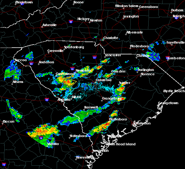 At 759 pm edt, thunderstorms covered much of saluda county. a likely severe thunderstorm was located in the saluda area of the county. movement was north near 15 mph (radar indicated). Hazards include 60 mph wind gusts and penny size hail. Expect damage to roofs, siding, and trees. Locations impacted include, saluda, saluda county airport, emory, scurry airport, good hope, hickory grove and saluda high school. At 759 pm edt, thunderstorms covered much of saluda county. a likely severe thunderstorm was located in the saluda area of the county. movement was north near 15 mph (radar indicated). Hazards include 60 mph wind gusts and penny size hail. Expect damage to roofs, siding, and trees. Locations impacted include, saluda, saluda county airport, emory, scurry airport, good hope, hickory grove and saluda high school.
|
| 7/19/2019 7:54 PM EDT | Schp reported tree in roadway forrest hills road and ridge spring highway. time estimated by rada in saluda county SC, 3.1 miles NW of Saluda, SC |
| 7/19/2019 7:45 PM EDT |
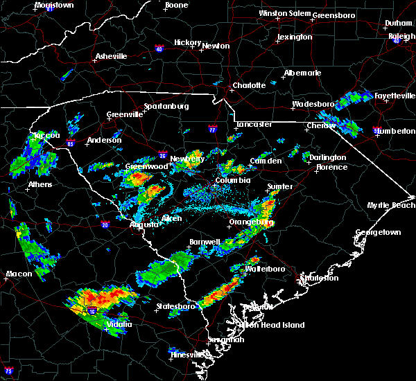 At 744 pm edt, a severe thunderstorm was located over saluda, moving north at 20 mph (radar indicated). Hazards include 60 mph wind gusts and penny size hail. expect damage to roofs, siding, and trees At 744 pm edt, a severe thunderstorm was located over saluda, moving north at 20 mph (radar indicated). Hazards include 60 mph wind gusts and penny size hail. expect damage to roofs, siding, and trees
|
| 7/18/2019 4:02 PM EDT |
 The national weather service in columbia has issued a * severe thunderstorm warning for. northeastern columbia county in east central georgia. southeastern lincoln county in east central georgia. northeastern richmond county in east central georgia. Edgefield county in central south carolina. The national weather service in columbia has issued a * severe thunderstorm warning for. northeastern columbia county in east central georgia. southeastern lincoln county in east central georgia. northeastern richmond county in east central georgia. Edgefield county in central south carolina.
|
| 7/18/2019 4:02 PM EDT |
 At 402 pm edt, severe thunderstorms were located along a line extending from 9 miles southwest of ninety six historic site to near j. strom thurmond dam, moving east at 25 mph (radar indicated). Hazards include 70 mph wind gusts. Expect considerable tree damage. Damage is likely to mobile homes, roofs, and outbuildings. At 402 pm edt, severe thunderstorms were located along a line extending from 9 miles southwest of ninety six historic site to near j. strom thurmond dam, moving east at 25 mph (radar indicated). Hazards include 70 mph wind gusts. Expect considerable tree damage. Damage is likely to mobile homes, roofs, and outbuildings.
|
| 6/22/2019 4:08 AM EDT |
 The severe thunderstorm warning for newberry, northern edgefield and saluda counties will expire at 415 am edt, the storms which prompted the warning have moved out of the area. therefore, the warning will be allowed to expire. to report severe weather, contact your nearest law enforcement agency. they will relay your report to the national weather service columbia. The severe thunderstorm warning for newberry, northern edgefield and saluda counties will expire at 415 am edt, the storms which prompted the warning have moved out of the area. therefore, the warning will be allowed to expire. to report severe weather, contact your nearest law enforcement agency. they will relay your report to the national weather service columbia.
|
| 6/22/2019 3:35 AM EDT |
 At 334 am edt, severe thunderstorms were located along a line extending from near newberry county airport to near edgefield county airport, moving southeast at 60 mph (radar indicated). Hazards include 60 mph wind gusts and penny size hail. Expect damage to roofs, siding, and trees. Locations impacted include, newberry, batesburg-leesville, edgefield, saluda, johnston, whitmire, prosperity, ridge spring, edgefield county airport, dreher island state park, saluda county airport, newberry college, newberry county airport, blair, little mountain, monetta, trenton, pomaria, silverstreet and ward. At 334 am edt, severe thunderstorms were located along a line extending from near newberry county airport to near edgefield county airport, moving southeast at 60 mph (radar indicated). Hazards include 60 mph wind gusts and penny size hail. Expect damage to roofs, siding, and trees. Locations impacted include, newberry, batesburg-leesville, edgefield, saluda, johnston, whitmire, prosperity, ridge spring, edgefield county airport, dreher island state park, saluda county airport, newberry college, newberry county airport, blair, little mountain, monetta, trenton, pomaria, silverstreet and ward.
|
| 6/22/2019 3:14 AM EDT |
 At 313 am edt, severe thunderstorms were located along a line extending from near laurens to 8 miles east of mccormick county airport, moving east at 40 mph (radar indicated). Hazards include 60 mph wind gusts and penny size hail. expect damage to roofs, siding, and trees At 313 am edt, severe thunderstorms were located along a line extending from near laurens to 8 miles east of mccormick county airport, moving east at 40 mph (radar indicated). Hazards include 60 mph wind gusts and penny size hail. expect damage to roofs, siding, and trees
|
| 6/20/2019 3:33 PM EDT |
 At 333 pm edt, a severe thunderstorm was located 9 miles south of ninety six historic site, or 15 miles southeast of greenwood, moving east at 55 mph (radar indicated). Hazards include 70 mph wind gusts and quarter size hail. Hail damage to vehicles is expected. expect considerable tree damage. Wind damage is also likely to mobile homes, roofs, and outbuildings. At 333 pm edt, a severe thunderstorm was located 9 miles south of ninety six historic site, or 15 miles southeast of greenwood, moving east at 55 mph (radar indicated). Hazards include 70 mph wind gusts and quarter size hail. Hail damage to vehicles is expected. expect considerable tree damage. Wind damage is also likely to mobile homes, roofs, and outbuildings.
|
| 4/19/2019 1:29 PM EDT |
 At 129 pm edt, severe thunderstorms were located along a line extending from 9 miles southwest of newberry college to near edgefield, moving northeast at 55 mph (radar indicated). Hazards include 60 mph wind gusts. expect damage to roofs, siding, and trees At 129 pm edt, severe thunderstorms were located along a line extending from 9 miles southwest of newberry college to near edgefield, moving northeast at 55 mph (radar indicated). Hazards include 60 mph wind gusts. expect damage to roofs, siding, and trees
|
| 4/19/2019 1:13 PM EDT |
 At 113 pm edt, severe thunderstorms were located along a line extending from near waterloo to near edgefield, moving north at 40 mph (radar indicated). Hazards include 60 mph wind gusts. Expect damage to roofs, siding, and trees. Locations impacted include, edgefield, saluda, johnston, saluda county airport, edgefield county airport, trenton, ward, lick fork campground, strom thurmond high school, saluda co sheriff`s office, good hope, harmony, murphys estates, pleasant lane, mt vintage, northside fire station main, hollywood elementary school, emory, scurry airport and hickory grove. At 113 pm edt, severe thunderstorms were located along a line extending from near waterloo to near edgefield, moving north at 40 mph (radar indicated). Hazards include 60 mph wind gusts. Expect damage to roofs, siding, and trees. Locations impacted include, edgefield, saluda, johnston, saluda county airport, edgefield county airport, trenton, ward, lick fork campground, strom thurmond high school, saluda co sheriff`s office, good hope, harmony, murphys estates, pleasant lane, mt vintage, northside fire station main, hollywood elementary school, emory, scurry airport and hickory grove.
|
| 4/19/2019 1:00 PM EDT |
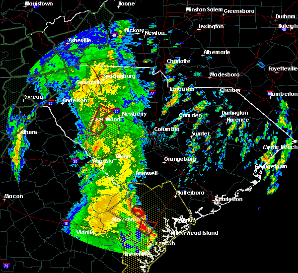 At 1259 pm edt, severe thunderstorms were located along a line extending from near lake greenwood to 8 miles east of clarks hill recreation area, moving north at 40 mph (radar indicated). Hazards include 60 mph wind gusts. Expect damage to roofs, siding, and trees. Locations impacted include, edgefield, saluda, johnston, saluda county airport, edgefield county airport, hamilton branch state park, trenton, parksville, ward, strom thurmond high school, saluda co sheriff`s office, good hope, northside fire station main, hollywood elementary school, emory, cleora, colliers, edgefield federal correction institution, lick fork campground and harmony. At 1259 pm edt, severe thunderstorms were located along a line extending from near lake greenwood to 8 miles east of clarks hill recreation area, moving north at 40 mph (radar indicated). Hazards include 60 mph wind gusts. Expect damage to roofs, siding, and trees. Locations impacted include, edgefield, saluda, johnston, saluda county airport, edgefield county airport, hamilton branch state park, trenton, parksville, ward, strom thurmond high school, saluda co sheriff`s office, good hope, northside fire station main, hollywood elementary school, emory, cleora, colliers, edgefield federal correction institution, lick fork campground and harmony.
|
| 4/19/2019 12:35 PM EDT |
 At 1235 pm edt, severe thunderstorms were located along a line extending from 9 miles southwest of ninety six historic site to augusta mall, moving north at 40 mph (radar indicated). Hazards include 60 mph wind gusts. expect damage to roofs, siding, and trees At 1235 pm edt, severe thunderstorms were located along a line extending from 9 miles southwest of ninety six historic site to augusta mall, moving north at 40 mph (radar indicated). Hazards include 60 mph wind gusts. expect damage to roofs, siding, and trees
|
| 12/28/2018 1:05 PM EST | Saluda county emergency manager reported tree damage to a home on hollywood road. a few trees were also down across roadways near this are in saluda county SC, 7.9 miles SSW of Saluda, SC |
| 12/28/2018 1:00 PM EST | A hardwood tree uprooted just west of prince hill road. estimated winds 70 to 80 mp in saluda county SC, 7.6 miles S of Saluda, SC |
| 12/28/2018 1:00 PM EST | A hardwood tree uprooted just west of prince hill road. estimated winds 70 to 80 mp in saluda county SC, 7.6 miles S of Saluda, SC |
| 12/28/2018 1:00 PM EST | A hardwood tree uprooted just west of prince hill road. estimated winds 70 to 80 mp in saluda county SC, 7.6 miles S of Saluda, SC |
| 12/28/2018 12:57 PM EST | Saluda county emergency manager reported damage to a home on shiloh road near saluda... sc. pictures show a metal building structure has been moved off the foundatio in saluda county SC, 6.2 miles S of Saluda, SC |
| 12/28/2018 12:57 PM EST |
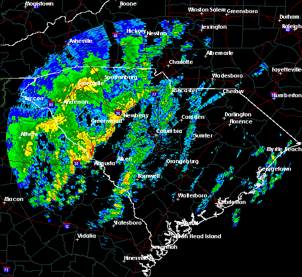 At 1256 pm est, a severe thunderstorm was located near saluda, or 14 miles southwest of newberry, moving east at 50 mph (radar indicated). Hazards include 60 mph wind gusts. expect damage to roofs, siding, and trees At 1256 pm est, a severe thunderstorm was located near saluda, or 14 miles southwest of newberry, moving east at 50 mph (radar indicated). Hazards include 60 mph wind gusts. expect damage to roofs, siding, and trees
|
| 12/28/2018 12:55 PM EST | 70 ft metal sheet building lifting off the ground and overturned 50 feet northeast from original location. estimated winds 70-80 mp in saluda county SC, 6.2 miles S of Saluda, SC |
| 12/28/2018 12:54 PM EST | Several pine trees and a few cedar trees snapped and uprooted on two adjacent properties. trees all fell in a northeast direction. estimated winds 70-80 mp in saluda county SC, 6.2 miles S of Saluda, SC |
| 9/26/2018 8:24 PM EDT |
 At 823 pm edt, a severe thunderstorm was located 7 miles north of edgefield, or 22 miles west of batesburg, moving east at 20 mph (radar indicated). Hazards include 60 mph wind gusts. Expect damage to roofs, siding, and trees. Locations impacted include, saluda, johnston, ridge spring, monetta and ward. At 823 pm edt, a severe thunderstorm was located 7 miles north of edgefield, or 22 miles west of batesburg, moving east at 20 mph (radar indicated). Hazards include 60 mph wind gusts. Expect damage to roofs, siding, and trees. Locations impacted include, saluda, johnston, ridge spring, monetta and ward.
|
| 9/26/2018 8:01 PM EDT |
 At 800 pm edt, a severe thunderstorm was located 9 miles northwest of edgefield, or 23 miles north of martinez, moving east at 20 mph (radar indicated). Hazards include 60 mph wind gusts. expect damage to roofs, siding, and trees At 800 pm edt, a severe thunderstorm was located 9 miles northwest of edgefield, or 23 miles north of martinez, moving east at 20 mph (radar indicated). Hazards include 60 mph wind gusts. expect damage to roofs, siding, and trees
|
| 8/9/2018 7:43 PM EDT |
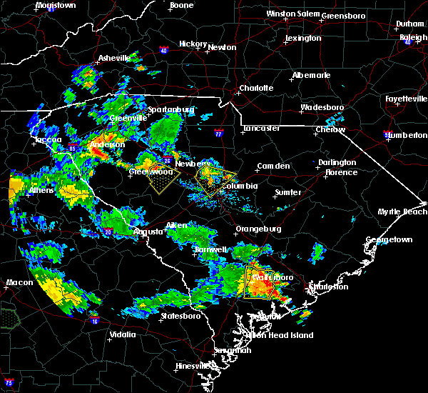 At 742 pm edt, a severe thunderstorm was located 7 miles east of cross hill, or 13 miles west of newberry, moving southeast at 25 mph (radar indicated). Hazards include 60 mph wind gusts. expect damage to roofs, siding, and trees At 742 pm edt, a severe thunderstorm was located 7 miles east of cross hill, or 13 miles west of newberry, moving southeast at 25 mph (radar indicated). Hazards include 60 mph wind gusts. expect damage to roofs, siding, and trees
|
| 8/1/2018 4:59 PM EDT |
 At 459 pm edt, a severe thunderstorm was located 8 miles north of saluda, or 16 miles southwest of newberry, moving northeast at 20 mph (radar indicated). Hazards include 60 mph wind gusts and penny size hail. expect damage to roofs, siding, and trees At 459 pm edt, a severe thunderstorm was located 8 miles north of saluda, or 16 miles southwest of newberry, moving northeast at 20 mph (radar indicated). Hazards include 60 mph wind gusts and penny size hail. expect damage to roofs, siding, and trees
|
| 8/1/2018 4:36 PM EDT |
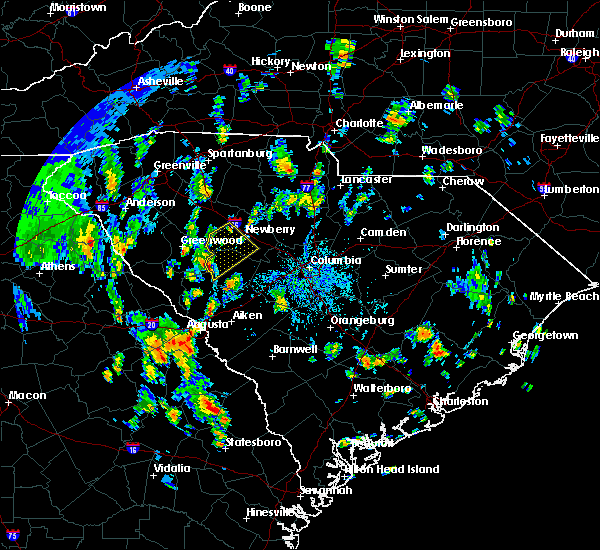 At 436 pm edt, a severe thunderstorm was located 8 miles west of saluda, or 22 miles west of batesburg, moving northeast at 20 mph (radar indicated). Hazards include 60 mph wind gusts and penny size hail. expect damage to roofs, siding, and trees At 436 pm edt, a severe thunderstorm was located 8 miles west of saluda, or 22 miles west of batesburg, moving northeast at 20 mph (radar indicated). Hazards include 60 mph wind gusts and penny size hail. expect damage to roofs, siding, and trees
|
| 7/12/2018 2:21 PM EDT |
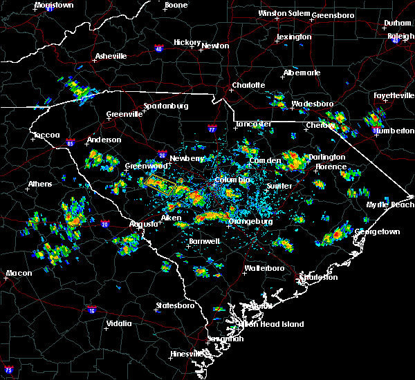 At 220 pm edt, a likely severe thunderstorm was just northwest of saluda, moving southeast at 15 mph (radar indicated). Hazards include 60 mph wind gusts. Expect damage to roofs, siding, and trees. Locations impacted include, saluda. At 220 pm edt, a likely severe thunderstorm was just northwest of saluda, moving southeast at 15 mph (radar indicated). Hazards include 60 mph wind gusts. Expect damage to roofs, siding, and trees. Locations impacted include, saluda.
|
| 7/12/2018 2:18 PM EDT |
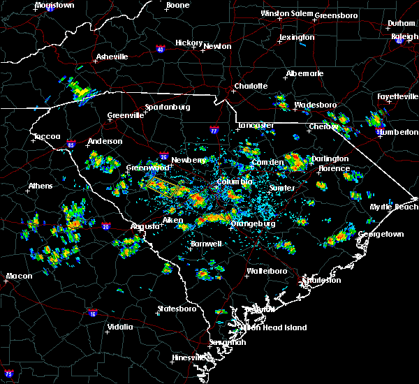 At 217 pm edt, a severe thunderstorm was located near saluda, moving southeast at 15 mph (radar indicated). Hazards include 60 mph wind gusts. expect damage to roofs, siding, and trees At 217 pm edt, a severe thunderstorm was located near saluda, moving southeast at 15 mph (radar indicated). Hazards include 60 mph wind gusts. expect damage to roofs, siding, and trees
|
| 6/25/2018 8:37 PM EDT |
 The severe thunderstorm warning for fairfield, newberry, northwestern lexington, saluda and northwestern richland counties will expire at 845 pm edt, the storm which prompted the warning has moved out of the area. therefore, the warning will be allowed to expire. a severe thunderstorm watch remains in effect until 1000 pm edt for central south carolina. to report severe weather, contact your nearest law enforcement agency. they will relay your report to the national weather service columbia. remember, a severe thunderstorm warning still remains in effect for lexington and richland counties. The severe thunderstorm warning for fairfield, newberry, northwestern lexington, saluda and northwestern richland counties will expire at 845 pm edt, the storm which prompted the warning has moved out of the area. therefore, the warning will be allowed to expire. a severe thunderstorm watch remains in effect until 1000 pm edt for central south carolina. to report severe weather, contact your nearest law enforcement agency. they will relay your report to the national weather service columbia. remember, a severe thunderstorm warning still remains in effect for lexington and richland counties.
|
| 6/25/2018 7:39 PM EDT |
 At 739 pm edt, a severe thunderstorm was located near prosperity, or 10 miles southeast of newberry, moving east at 10 mph (radar indicated). Hazards include 60 mph wind gusts and quarter size hail. Hail damage to vehicles is expected. Expect wind damage to roofs, siding, and trees. At 739 pm edt, a severe thunderstorm was located near prosperity, or 10 miles southeast of newberry, moving east at 10 mph (radar indicated). Hazards include 60 mph wind gusts and quarter size hail. Hail damage to vehicles is expected. Expect wind damage to roofs, siding, and trees.
|
| 6/22/2018 8:49 PM EDT |
 At 848 pm edt, a severe thunderstorm was located 8 miles northeast of troy, or 35 miles southwest of newberry, moving northeast at 35 mph (radar indicated). Hazards include 60 mph wind gusts and penny size hail. expect damage to roofs, siding, and trees At 848 pm edt, a severe thunderstorm was located 8 miles northeast of troy, or 35 miles southwest of newberry, moving northeast at 35 mph (radar indicated). Hazards include 60 mph wind gusts and penny size hail. expect damage to roofs, siding, and trees
|
| 6/10/2018 9:12 PM EDT |
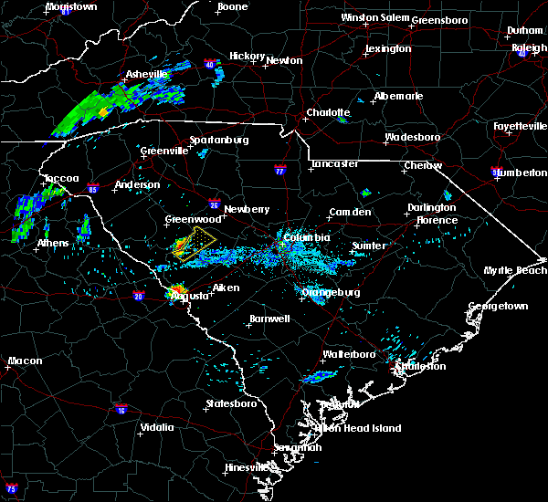 At 911 pm edt, a severe thunderstorm was located 11 miles south of ninety six historic site, or 26 miles west of batesburg, moving northeast at 15 mph (radar indicated). Hazards include 60 mph wind gusts and nickel size hail. expect damage to roofs, siding, and trees At 911 pm edt, a severe thunderstorm was located 11 miles south of ninety six historic site, or 26 miles west of batesburg, moving northeast at 15 mph (radar indicated). Hazards include 60 mph wind gusts and nickel size hail. expect damage to roofs, siding, and trees
|
| 6/3/2018 10:14 PM EDT |
 At 1014 pm edt, severe thunderstorms were located along a line extending from near saluda to edgefield, moving southeast at 25 mph (radar indicated). Hazards include 60 mph wind gusts and penny size hail. expect damage to roofs, siding, and trees At 1014 pm edt, severe thunderstorms were located along a line extending from near saluda to edgefield, moving southeast at 25 mph (radar indicated). Hazards include 60 mph wind gusts and penny size hail. expect damage to roofs, siding, and trees
|
| 6/1/2018 7:10 PM EDT | Tree in roadway on boyd branch road. reported by sc highway patro in saluda county SC, 4 miles W of Saluda, SC |
| 6/1/2018 6:46 PM EDT |
 At 645 pm edt, a severe thunderstorm was located near greenwood state park, or 17 miles west of newberry, moving east at 35 mph (radar indicated). Hazards include 60 mph wind gusts. expect damage to roofs, siding, and trees At 645 pm edt, a severe thunderstorm was located near greenwood state park, or 17 miles west of newberry, moving east at 35 mph (radar indicated). Hazards include 60 mph wind gusts. expect damage to roofs, siding, and trees
|
| 4/15/2018 1:42 PM EDT |
 At 141 pm edt, severe thunderstorms were located along a line extending from 6 miles northwest of ridge spring to 14 miles east of aiken to near williston, moving northeast at 55 mph (law enforcement reported damaging wind gusts and downed trees with this line of storms). Hazards include 70 mph wind gusts. Expect considerable tree damage. Damage is likely to mobile homes, roofs, and outbuildings. At 141 pm edt, severe thunderstorms were located along a line extending from 6 miles northwest of ridge spring to 14 miles east of aiken to near williston, moving northeast at 55 mph (law enforcement reported damaging wind gusts and downed trees with this line of storms). Hazards include 70 mph wind gusts. Expect considerable tree damage. Damage is likely to mobile homes, roofs, and outbuildings.
|
| 7/28/2017 3:41 PM EDT |
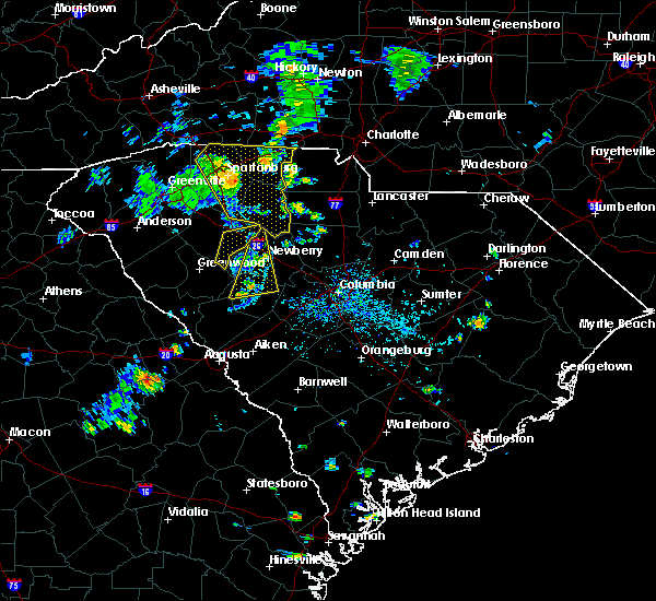 At 341 pm edt, a severe thunderstorm was located near prosperity, or near newberry, moving east at 35 mph (radar indicated). Hazards include 60 mph wind gusts. Expect damage to roofs, siding, and trees. Locations impacted include, newberry, saluda and silverstreet. At 341 pm edt, a severe thunderstorm was located near prosperity, or near newberry, moving east at 35 mph (radar indicated). Hazards include 60 mph wind gusts. Expect damage to roofs, siding, and trees. Locations impacted include, newberry, saluda and silverstreet.
|
| 7/28/2017 3:11 PM EDT |
 At 311 pm edt, a severe thunderstorm was located near greenwood state park, or 17 miles west of newberry, moving east at 25 mph (radar indicated). Hazards include 60 mph wind gusts. expect damage to roofs, siding, and trees At 311 pm edt, a severe thunderstorm was located near greenwood state park, or 17 miles west of newberry, moving east at 25 mph (radar indicated). Hazards include 60 mph wind gusts. expect damage to roofs, siding, and trees
|
| 7/23/2017 7:04 PM EDT | Sc highway patrol reported trees down at duncan road and ridge spring highwa in saluda county SC, 4.9 miles NW of Saluda, SC |
| 7/23/2017 6:57 PM EDT |
 At 657 pm edt, a severe thunderstorm was located over saluda, or 16 miles northwest of batesburg, moving south at 5 mph (radar indicated). Hazards include 60 mph wind gusts and quarter size hail. Hail damage to vehicles is expected. expect wind damage to roofs, siding, and trees. Locations impacted include, edgefield, saluda, johnston, ridge spring, monetta, trenton and ward. At 657 pm edt, a severe thunderstorm was located over saluda, or 16 miles northwest of batesburg, moving south at 5 mph (radar indicated). Hazards include 60 mph wind gusts and quarter size hail. Hail damage to vehicles is expected. expect wind damage to roofs, siding, and trees. Locations impacted include, edgefield, saluda, johnston, ridge spring, monetta, trenton and ward.
|
| 7/23/2017 6:24 PM EDT |
 At 622 pm edt, a severe thunderstorm was located near saluda, or 17 miles northwest of batesburg, and moving south at 10 mph (radar indicated). Hazards include 60 mph wind gusts and quarter size hail. Minor hail damage to vehicles is expected. Expect wind damage to roofs, siding, and trees. At 622 pm edt, a severe thunderstorm was located near saluda, or 17 miles northwest of batesburg, and moving south at 10 mph (radar indicated). Hazards include 60 mph wind gusts and quarter size hail. Minor hail damage to vehicles is expected. Expect wind damage to roofs, siding, and trees.
|
| 7/23/2017 6:19 PM EDT | Sc highway patrol reported trees down at brushy fork road at ebbie long roa in saluda county SC, 8.7 miles SSW of Saluda, SC |
| 7/7/2017 2:33 PM EDT |
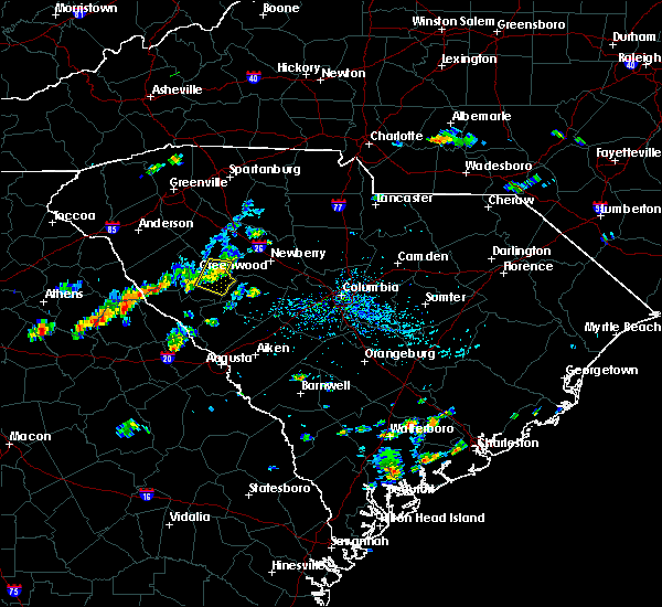 At 232 pm edt, a severe thunderstorm was located over near greenwood state park, or 20 miles west of newberry, moving east at 30 mph (radar indicated). Hazards include 60 mph wind gusts. expect damage to roofs, siding, and trees At 232 pm edt, a severe thunderstorm was located over near greenwood state park, or 20 miles west of newberry, moving east at 30 mph (radar indicated). Hazards include 60 mph wind gusts. expect damage to roofs, siding, and trees
|
| 7/6/2017 6:51 PM EDT |
 The severe thunderstorm warning for northern edgefield and southern saluda counties will expire at 700 pm edt, the storms which prompted the warning have moved out of the area. therefore the warning will be allowed to expire. to report severe weather, contact your nearest law enforcement agency. they will relay your report to the national weather service columbia. The severe thunderstorm warning for northern edgefield and southern saluda counties will expire at 700 pm edt, the storms which prompted the warning have moved out of the area. therefore the warning will be allowed to expire. to report severe weather, contact your nearest law enforcement agency. they will relay your report to the national weather service columbia.
|
| 7/6/2017 6:26 PM EDT |
 At 626 pm edt, severe thunderstorms were located along a line extending from saluda to near edgefield, moving east at 35 mph (radar indicated). Hazards include 60 mph wind gusts. Expect damage to roofs, siding, and trees. Locations impacted include, edgefield, saluda, johnston, ridge spring, monetta, trenton and ward. At 626 pm edt, severe thunderstorms were located along a line extending from saluda to near edgefield, moving east at 35 mph (radar indicated). Hazards include 60 mph wind gusts. Expect damage to roofs, siding, and trees. Locations impacted include, edgefield, saluda, johnston, ridge spring, monetta, trenton and ward.
|
| 7/6/2017 5:53 PM EDT |
 At 552 pm edt, severe thunderstorms were located along a line extending from 12 miles south of ninety six historic site to 8 miles south of mccormick, moving east at 15 mph (radar indicated). Hazards include 60 mph wind gusts and quarter size hail. Hail damage to vehicles is expected. Expect wind damage to roofs, siding, and trees. At 552 pm edt, severe thunderstorms were located along a line extending from 12 miles south of ninety six historic site to 8 miles south of mccormick, moving east at 15 mph (radar indicated). Hazards include 60 mph wind gusts and quarter size hail. Hail damage to vehicles is expected. Expect wind damage to roofs, siding, and trees.
|
| 7/6/2017 5:45 PM EDT |
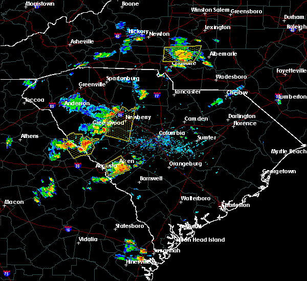 At 545 pm edt, a severe thunderstorm was located near joanna, or 11 miles west of newberry, moving east at 25 mph (radar indicated). Hazards include 70 mph wind gusts. Expect considerable tree damage. Damage is likely to mobile homes, roofs, and outbuildings. At 545 pm edt, a severe thunderstorm was located near joanna, or 11 miles west of newberry, moving east at 25 mph (radar indicated). Hazards include 70 mph wind gusts. Expect considerable tree damage. Damage is likely to mobile homes, roofs, and outbuildings.
|
| 7/1/2017 9:49 PM EDT |
 At 948 pm edt, a severe thunderstorm was located near saluda, or 15 miles west of batesburg, moving east at 25 mph (radar indicated). Hazards include 60 mph wind gusts. Expect damage to roofs, siding, and trees. Locations impacted include, saluda, ridge spring, monetta and ward. At 948 pm edt, a severe thunderstorm was located near saluda, or 15 miles west of batesburg, moving east at 25 mph (radar indicated). Hazards include 60 mph wind gusts. Expect damage to roofs, siding, and trees. Locations impacted include, saluda, ridge spring, monetta and ward.
|
| 7/1/2017 9:35 PM EDT |
 At 935 pm edt, a severe thunderstorm was located 8 miles northwest of johnston, or 20 miles west of batesburg, moving east at 25 mph (radar indicated). Hazards include 60 mph wind gusts. expect damage to roofs, siding, and trees At 935 pm edt, a severe thunderstorm was located 8 miles northwest of johnston, or 20 miles west of batesburg, moving east at 25 mph (radar indicated). Hazards include 60 mph wind gusts. expect damage to roofs, siding, and trees
|
| 5/29/2017 6:20 PM EDT |
 At 620 pm edt, a severe thunderstorm was located near edgefield, or 22 miles north of belvedere, moving east at 35 mph (radar indicated). Hazards include two inch hail and 70 mph wind gusts. People and animals outdoors will be injured. expect hail damage to roofs, siding, windows, and vehicles. expect considerable tree damage. wind damage is also likely to mobile homes, roofs, and outbuildings. Locations impacted include, lexington, batesburg, red bank, batesburg-leesville, saluda, johnston, ridge spring, leesville, gilbert, summit, little mountain, monetta and ward. At 620 pm edt, a severe thunderstorm was located near edgefield, or 22 miles north of belvedere, moving east at 35 mph (radar indicated). Hazards include two inch hail and 70 mph wind gusts. People and animals outdoors will be injured. expect hail damage to roofs, siding, windows, and vehicles. expect considerable tree damage. wind damage is also likely to mobile homes, roofs, and outbuildings. Locations impacted include, lexington, batesburg, red bank, batesburg-leesville, saluda, johnston, ridge spring, leesville, gilbert, summit, little mountain, monetta and ward.
|
| 5/29/2017 6:15 PM EDT |
 At 615 pm edt, a severe thunderstorm was located near edgefield, or 21 miles north of belvedere, moving east at 35 mph (radar indicated). Hazards include 70 mph wind gusts and half dollar size hail. Hail damage to vehicles is expected. expect considerable tree damage. Wind damage is also likely to mobile homes, roofs, and outbuildings. At 615 pm edt, a severe thunderstorm was located near edgefield, or 21 miles north of belvedere, moving east at 35 mph (radar indicated). Hazards include 70 mph wind gusts and half dollar size hail. Hail damage to vehicles is expected. expect considerable tree damage. Wind damage is also likely to mobile homes, roofs, and outbuildings.
|
| 5/24/2017 3:14 PM EDT |
 The national weather service in columbia has issued a * severe thunderstorm warning for. southwestern fairfield county in central south carolina. southeastern newberry county in central south carolina. northwestern lexington county in central south carolina. Eastern saluda county in central south carolina. The national weather service in columbia has issued a * severe thunderstorm warning for. southwestern fairfield county in central south carolina. southeastern newberry county in central south carolina. northwestern lexington county in central south carolina. Eastern saluda county in central south carolina.
|
| 5/24/2017 3:14 PM EDT |
 At 314 pm edt, a severe thunderstorm was located 9 miles east of saluda, or 9 miles northwest of batesburg, moving northeast at 35 mph (radar indicated). Hazards include 60 mph wind gusts. expect damage to roofs, siding, and trees At 314 pm edt, a severe thunderstorm was located 9 miles east of saluda, or 9 miles northwest of batesburg, moving northeast at 35 mph (radar indicated). Hazards include 60 mph wind gusts. expect damage to roofs, siding, and trees
|
| 5/24/2017 3:14 PM EDT |
 The national weather service in columbia has issued a * severe thunderstorm warning for. southwestern fairfield county in central south carolina. southeastern newberry county in central south carolina. northwestern lexington county in central south carolina. Eastern saluda county in central south carolina. The national weather service in columbia has issued a * severe thunderstorm warning for. southwestern fairfield county in central south carolina. southeastern newberry county in central south carolina. northwestern lexington county in central south carolina. Eastern saluda county in central south carolina.
|
| 5/24/2017 2:52 PM EDT | 60 mph winds estimated west of salud in saluda county SC, 3.6 miles ENE of Saluda, SC |
| 5/24/2017 2:49 PM EDT | Multiple trees down on medical park roa in saluda county SC, 2.7 miles SSE of Saluda, SC |
| 5/24/2017 2:47 PM EDT | Tree on house at 511 johnston highwa in saluda county SC, 0.8 miles N of Saluda, SC |
| 5/24/2017 2:44 PM EDT |
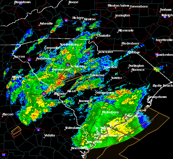 At 243 pm edt, a confirmed tornado was located over saluda, or 16 miles northwest of batesburg, moving northeast at 50 mph (radar confirmed tornado). Hazards include damaging tornado. Flying debris will be dangerous to those caught without shelter. mobile homes will be damaged or destroyed. damage to roofs, windows, and vehicles will occur. tree damage is likely. This tornadic thunderstorm will remain over mainly rural areas of central saluda county. At 243 pm edt, a confirmed tornado was located over saluda, or 16 miles northwest of batesburg, moving northeast at 50 mph (radar confirmed tornado). Hazards include damaging tornado. Flying debris will be dangerous to those caught without shelter. mobile homes will be damaged or destroyed. damage to roofs, windows, and vehicles will occur. tree damage is likely. This tornadic thunderstorm will remain over mainly rural areas of central saluda county.
|
| 5/24/2017 2:33 PM EDT |
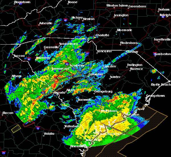 At 232 pm edt, a severe thunderstorm capable of producing a tornado was located 9 miles west of saluda, or 22 miles west of batesburg, moving northeast at 50 mph (radar indicated rotation). Hazards include tornado. Flying debris will be dangerous to those caught without shelter. mobile homes will be damaged or destroyed. damage to roofs, windows, and vehicles will occur. tree damage is likely. This dangerous storm will be near, saluda around 250 pm edt. At 232 pm edt, a severe thunderstorm capable of producing a tornado was located 9 miles west of saluda, or 22 miles west of batesburg, moving northeast at 50 mph (radar indicated rotation). Hazards include tornado. Flying debris will be dangerous to those caught without shelter. mobile homes will be damaged or destroyed. damage to roofs, windows, and vehicles will occur. tree damage is likely. This dangerous storm will be near, saluda around 250 pm edt.
|
| 5/24/2017 2:30 PM EDT |
 At 229 pm edt, a severe thunderstorm was located 9 miles northwest of johnston, or 21 miles west of batesburg, moving northeast at 50 mph (radar indicated). Hazards include 70 mph wind gusts. Expect considerable tree damage. Damage is likely to mobile homes, roofs, and outbuildings. At 229 pm edt, a severe thunderstorm was located 9 miles northwest of johnston, or 21 miles west of batesburg, moving northeast at 50 mph (radar indicated). Hazards include 70 mph wind gusts. Expect considerable tree damage. Damage is likely to mobile homes, roofs, and outbuildings.
|
| 5/22/2017 2:50 PM EDT | Report of a tree down on butler road... a power line down on long road... and a tree limb down on a power line on newberry highway near church road. time estimated base in saluda county SC, 2.7 miles S of Saluda, SC |
| 4/5/2017 3:07 PM EDT |
 At 307 pm edt, severe thunderstorms were located along a line extending from 6 miles east of saluda to aiken, moving east at 40 mph (radar indicated). Hazards include 70 mph wind gusts and quarter size hail. Hail damage to vehicles is expected. expect considerable tree damage. wind damage is also likely to mobile homes, roofs, and outbuildings. locations impacted include, north augusta, belvedere, clearwater, saluda, johnston, ridge spring, monetta, trenton, ward and murphys estates. A tornado watch remains in effect until 800 pm edt for east central georgia, and central south carolina. At 307 pm edt, severe thunderstorms were located along a line extending from 6 miles east of saluda to aiken, moving east at 40 mph (radar indicated). Hazards include 70 mph wind gusts and quarter size hail. Hail damage to vehicles is expected. expect considerable tree damage. wind damage is also likely to mobile homes, roofs, and outbuildings. locations impacted include, north augusta, belvedere, clearwater, saluda, johnston, ridge spring, monetta, trenton, ward and murphys estates. A tornado watch remains in effect until 800 pm edt for east central georgia, and central south carolina.
|
| 4/5/2017 2:39 PM EDT |
 At 239 pm edt, severe thunderstorms were located along a line extending from 9 miles south of ninety six historic site to near martinez, moving east at 40 mph (radar indicated). Hazards include 70 mph wind gusts and quarter size hail. Hail damage to vehicles is expected. expect considerable tree damage. Wind damage is also likely to mobile homes, roofs, and outbuildings. At 239 pm edt, severe thunderstorms were located along a line extending from 9 miles south of ninety six historic site to near martinez, moving east at 40 mph (radar indicated). Hazards include 70 mph wind gusts and quarter size hail. Hail damage to vehicles is expected. expect considerable tree damage. Wind damage is also likely to mobile homes, roofs, and outbuildings.
|
| 4/5/2017 1:17 PM EDT |
 At 117 pm edt, a severe thunderstorm capable of producing a tornado was located near johnston, or 15 miles west of batesburg, moving east at 55 mph (radar indicated rotation). Hazards include tornado and hail up to two inches in diameter. Flying debris will be dangerous to those caught without shelter. mobile homes will be damaged or destroyed. damage to roofs, windows, and vehicles will occur. Tree damage is likely. At 117 pm edt, a severe thunderstorm capable of producing a tornado was located near johnston, or 15 miles west of batesburg, moving east at 55 mph (radar indicated rotation). Hazards include tornado and hail up to two inches in diameter. Flying debris will be dangerous to those caught without shelter. mobile homes will be damaged or destroyed. damage to roofs, windows, and vehicles will occur. Tree damage is likely.
|
| 4/5/2017 1:13 PM EDT |
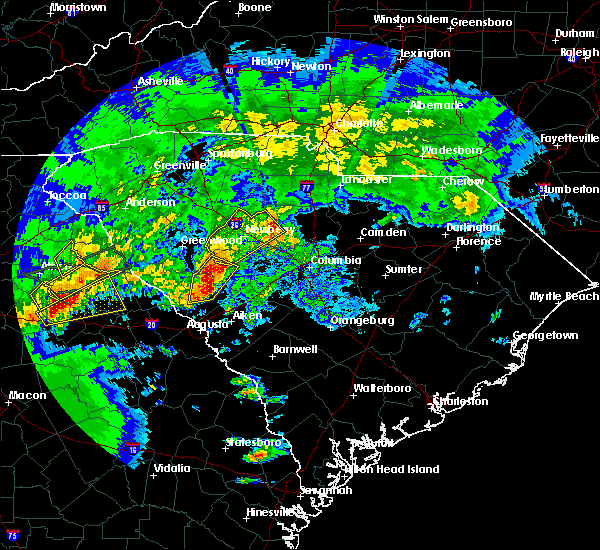 At 113 pm edt, a severe thunderstorm was located 7 miles northwest of johnston, or 20 miles west of batesburg, moving east at 55 mph (radar indicated). Hazards include two inch hail and 70 mph wind gusts. People and animals outdoors will be injured. expect hail damage to roofs, siding, windows, and vehicles. expect considerable tree damage. wind damage is also likely to mobile homes, roofs, and outbuildings. locations impacted include, edgefield, saluda and johnston. A tornado watch remains in effect until 800 pm edt for central south carolina. At 113 pm edt, a severe thunderstorm was located 7 miles northwest of johnston, or 20 miles west of batesburg, moving east at 55 mph (radar indicated). Hazards include two inch hail and 70 mph wind gusts. People and animals outdoors will be injured. expect hail damage to roofs, siding, windows, and vehicles. expect considerable tree damage. wind damage is also likely to mobile homes, roofs, and outbuildings. locations impacted include, edgefield, saluda and johnston. A tornado watch remains in effect until 800 pm edt for central south carolina.
|
| 4/5/2017 12:58 PM EDT |
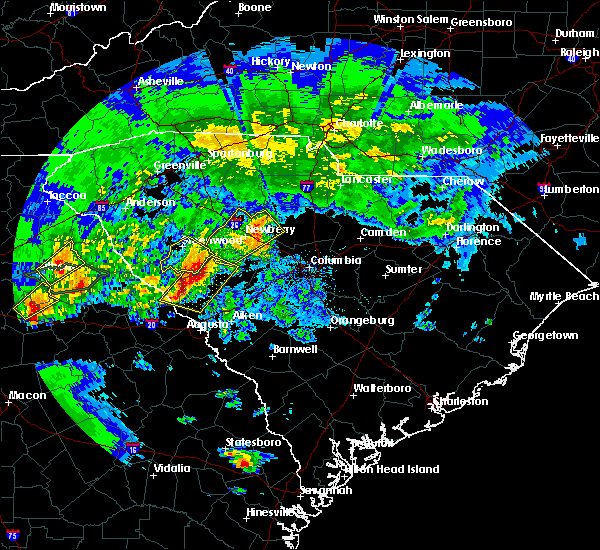 At 1258 pm edt, severe thunderstorms were located along a line extending from 7 miles southeast of ninety six historic site to 9 miles west of edgefield, moving east at 35 mph (radar indicated). Hazards include golf ball size hail and 70 mph wind gusts. People and animals outdoors will be injured. expect hail damage to roofs, siding, windows, and vehicles. expect considerable tree damage. Wind damage is also likely to mobile homes, roofs, and outbuildings. At 1258 pm edt, severe thunderstorms were located along a line extending from 7 miles southeast of ninety six historic site to 9 miles west of edgefield, moving east at 35 mph (radar indicated). Hazards include golf ball size hail and 70 mph wind gusts. People and animals outdoors will be injured. expect hail damage to roofs, siding, windows, and vehicles. expect considerable tree damage. Wind damage is also likely to mobile homes, roofs, and outbuildings.
|
| 4/3/2017 3:56 PM EDT |
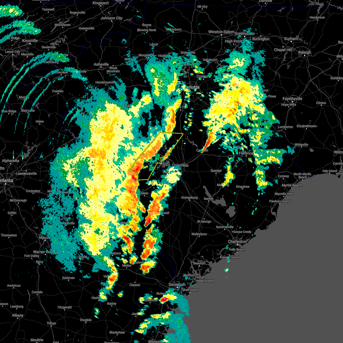 At 355 pm edt, severe thunderstorms were located along a line extending from chester to near saluda, moving east at 50 mph (radar indicated). Hazards include 70 mph wind gusts and quarter size hail. Hail damage to vehicles is expected. expect considerable tree damage. wind damage is also likely to mobile homes, roofs, and outbuildings. locations impacted include, newberry, saluda, johnston, prosperity, ridge spring, blackstock, little mountain, pomaria, silverstreet, ward and peak. A tornado watch remains in effect until 900 pm edt for central south carolina. At 355 pm edt, severe thunderstorms were located along a line extending from chester to near saluda, moving east at 50 mph (radar indicated). Hazards include 70 mph wind gusts and quarter size hail. Hail damage to vehicles is expected. expect considerable tree damage. wind damage is also likely to mobile homes, roofs, and outbuildings. locations impacted include, newberry, saluda, johnston, prosperity, ridge spring, blackstock, little mountain, pomaria, silverstreet, ward and peak. A tornado watch remains in effect until 900 pm edt for central south carolina.
|
| 4/3/2017 3:22 PM EDT |
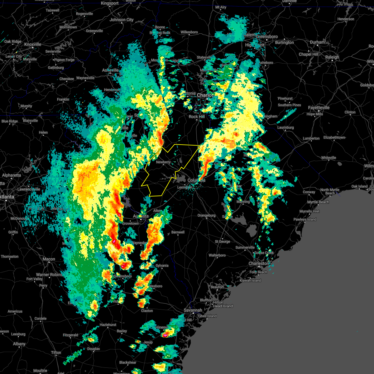 At 321 pm edt, severe thunderstorms were located along a line extending from near rose hill state park to near mccormick, moving east at 50 mph (radar indicated). Hazards include 60 mph wind gusts and quarter size hail. Hail damage to vehicles is expected. expect wind damage to roofs, siding, and trees. locations impacted include, newberry, saluda, johnston, whitmire, prosperity, ridge spring, blackstock, little mountain, pomaria, silverstreet, ward, peak and chappells. A tornado watch remains in effect until 900 pm edt for central south carolina. At 321 pm edt, severe thunderstorms were located along a line extending from near rose hill state park to near mccormick, moving east at 50 mph (radar indicated). Hazards include 60 mph wind gusts and quarter size hail. Hail damage to vehicles is expected. expect wind damage to roofs, siding, and trees. locations impacted include, newberry, saluda, johnston, whitmire, prosperity, ridge spring, blackstock, little mountain, pomaria, silverstreet, ward, peak and chappells. A tornado watch remains in effect until 900 pm edt for central south carolina.
|
| 4/3/2017 3:17 PM EDT |
 At 317 pm edt, severe thunderstorms were located along a line extending from near rose hill state park to near mccormick, moving east at 50 mph (radar indicated). Hazards include 60 mph wind gusts and quarter size hail. Hail damage to vehicles is expected. Expect wind damage to roofs, siding, and trees. At 317 pm edt, severe thunderstorms were located along a line extending from near rose hill state park to near mccormick, moving east at 50 mph (radar indicated). Hazards include 60 mph wind gusts and quarter size hail. Hail damage to vehicles is expected. Expect wind damage to roofs, siding, and trees.
|
| 3/21/2017 9:37 PM EDT | Sc highway patrol reported trees down at the intersection of denny highway and hollywood r in saluda county SC, 8.4 miles SW of Saluda, SC |
| 3/21/2017 9:32 PM EDT |
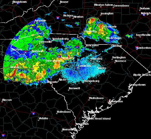 At 931 pm edt, severe thunderstorms were located along a line extending from near carlisle to 6 miles northeast of prosperity to 6 miles north of saluda, moving east at 50 mph (radar indicated). Hazards include 70 mph wind gusts and penny size hail. Expect considerable tree damage. damage is likely to mobile homes, roofs, and outbuildings. Locations impacted include, newberry, saluda, prosperity, little mountain, pomaria, silverstreet and peak. At 931 pm edt, severe thunderstorms were located along a line extending from near carlisle to 6 miles northeast of prosperity to 6 miles north of saluda, moving east at 50 mph (radar indicated). Hazards include 70 mph wind gusts and penny size hail. Expect considerable tree damage. damage is likely to mobile homes, roofs, and outbuildings. Locations impacted include, newberry, saluda, prosperity, little mountain, pomaria, silverstreet and peak.
|
| 3/21/2017 9:16 PM EDT |
 At 915 pm edt, severe thunderstorms were located along a line extending from near rose hill state park to near newberry to 7 miles southeast of ninety six historic site, moving east at 50 mph (radar indicated). Hazards include 60 mph wind gusts and nickel size hail. Expect damage to roofs, siding, and trees. Locations impacted include, newberry, saluda, whitmire, prosperity, little mountain, pomaria, silverstreet, peak and chappells. At 915 pm edt, severe thunderstorms were located along a line extending from near rose hill state park to near newberry to 7 miles southeast of ninety six historic site, moving east at 50 mph (radar indicated). Hazards include 60 mph wind gusts and nickel size hail. Expect damage to roofs, siding, and trees. Locations impacted include, newberry, saluda, whitmire, prosperity, little mountain, pomaria, silverstreet, peak and chappells.
|
| 3/21/2017 9:01 PM EDT |
 At 900 pm edt, severe thunderstorms were located along a line extending from near clinton to near greenwood state park to 8 miles east of troy, moving east at 50 mph (radar indicated). Hazards include 60 mph wind gusts and penny size hail. expect damage to roofs, siding, and trees At 900 pm edt, severe thunderstorms were located along a line extending from near clinton to near greenwood state park to 8 miles east of troy, moving east at 50 mph (radar indicated). Hazards include 60 mph wind gusts and penny size hail. expect damage to roofs, siding, and trees
|
| 11/30/2016 6:10 PM EST |
 The severe thunderstorm warning for saluda and northern edgefield counties will expire at 615 pm est, the storm which prompted the warning has weakened below severe limits, and no longer pose an immediate threat to life or property. therefore the warning will be allowed to expire. a severe thunderstorm watch remains in effect until 800 pm est for central south carolina. The severe thunderstorm warning for saluda and northern edgefield counties will expire at 615 pm est, the storm which prompted the warning has weakened below severe limits, and no longer pose an immediate threat to life or property. therefore the warning will be allowed to expire. a severe thunderstorm watch remains in effect until 800 pm est for central south carolina.
|
| 11/30/2016 5:50 PM EST |
 At 549 pm est, a severe thunderstorm was located 11 miles northwest of edgefield, or 27 miles north of belvedere, moving east at 45 mph (radar indicated). Hazards include 60 mph wind gusts. Expect damage to roofs. siding. and trees. Locations impacted include, saluda, johnston, ridge spring, monetta and ward. At 549 pm est, a severe thunderstorm was located 11 miles northwest of edgefield, or 27 miles north of belvedere, moving east at 45 mph (radar indicated). Hazards include 60 mph wind gusts. Expect damage to roofs. siding. and trees. Locations impacted include, saluda, johnston, ridge spring, monetta and ward.
|
| 11/30/2016 5:36 PM EST |
 At 535 pm est, a severe thunderstorm was located near mccormick, or 25 miles north of evans, moving east-northeast at 40 mph (radar indicated). Hazards include 60 mph wind gusts. Expect damage to roofs. siding. And trees. At 535 pm est, a severe thunderstorm was located near mccormick, or 25 miles north of evans, moving east-northeast at 40 mph (radar indicated). Hazards include 60 mph wind gusts. Expect damage to roofs. siding. And trees.
|
| 7/18/2016 6:35 PM EDT | Trees and limbs on roadway hwy 17 in saluda county SC, 6.4 miles ESE of Saluda, SC |
| 7/18/2016 6:16 PM EDT |
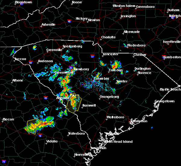 At 615 pm edt, a severe thunderstorm was located 9 miles north of saluda, or 14 miles southwest of newberry, moving south at 10 mph (radar indicated). Hazards include 60 mph wind gusts. Expect damage to roofs. siding. And trees. At 615 pm edt, a severe thunderstorm was located 9 miles north of saluda, or 14 miles southwest of newberry, moving south at 10 mph (radar indicated). Hazards include 60 mph wind gusts. Expect damage to roofs. siding. And trees.
|
| 7/7/2016 10:10 PM EDT |
 At 1008 pm edt, severe thunderstorms were located along a line extending from whitmire to near lake greenwood, moving southeast at 35 mph (radar indicated). Hazards include 60 mph wind gusts. Expect damage to roofs. siding. and trees. severe thunderstorms will be near, whitmire around 1015 pm edt. saluda around 1050 pm edt. Other locations impacted by these severe thunderstorms include chappells, pomaria, silverstreet, kinards and little mountain. At 1008 pm edt, severe thunderstorms were located along a line extending from whitmire to near lake greenwood, moving southeast at 35 mph (radar indicated). Hazards include 60 mph wind gusts. Expect damage to roofs. siding. and trees. severe thunderstorms will be near, whitmire around 1015 pm edt. saluda around 1050 pm edt. Other locations impacted by these severe thunderstorms include chappells, pomaria, silverstreet, kinards and little mountain.
|
| 7/6/2016 2:40 PM EDT |
 At 239 pm edt, thunderstorms were covering much of southwest saluda county. movement was eastward near 35 mph. some of the storms likely contained wind gusts or 40 to 60 mph (radar indicated). Hazards include 60 mph wind gusts. Expect damage to roofs. siding. And trees. At 239 pm edt, thunderstorms were covering much of southwest saluda county. movement was eastward near 35 mph. some of the storms likely contained wind gusts or 40 to 60 mph (radar indicated). Hazards include 60 mph wind gusts. Expect damage to roofs. siding. And trees.
|
| 7/6/2016 2:04 PM EDT |
 At 202 pm edt, a likely severe thunderstorm was located just east of saluda, or 10 miles northwest of batesburg, moving east at 25 mph (radar indicated). Hazards include 60 mph wind gusts. Expect damage to roofs. siding. and trees. Locations impacted include, saluda and monetta. At 202 pm edt, a likely severe thunderstorm was located just east of saluda, or 10 miles northwest of batesburg, moving east at 25 mph (radar indicated). Hazards include 60 mph wind gusts. Expect damage to roofs. siding. and trees. Locations impacted include, saluda and monetta.
|
| 7/6/2016 1:57 PM EDT | Saluda dispatch reported a tree fell on a residence and destroyed the home on graham street in salud in saluda county SC, 0.8 miles SW of Saluda, SC |
| 7/6/2016 1:53 PM EDT | Saluda dispatch reported trees on power lines on hwy 178 near salud in saluda county SC, 1.3 miles ESE of Saluda, SC |
| 7/6/2016 1:48 PM EDT |
 At 148 pm edt, a severe thunderstorm was located over saluda, or 15 miles northwest of batesburg, moving east at 25 mph (radar indicated). Hazards include 60 mph wind gusts. Expect damage to roofs. siding. And trees. At 148 pm edt, a severe thunderstorm was located over saluda, or 15 miles northwest of batesburg, moving east at 25 mph (radar indicated). Hazards include 60 mph wind gusts. Expect damage to roofs. siding. And trees.
|
| 3/31/2016 5:55 PM EDT |
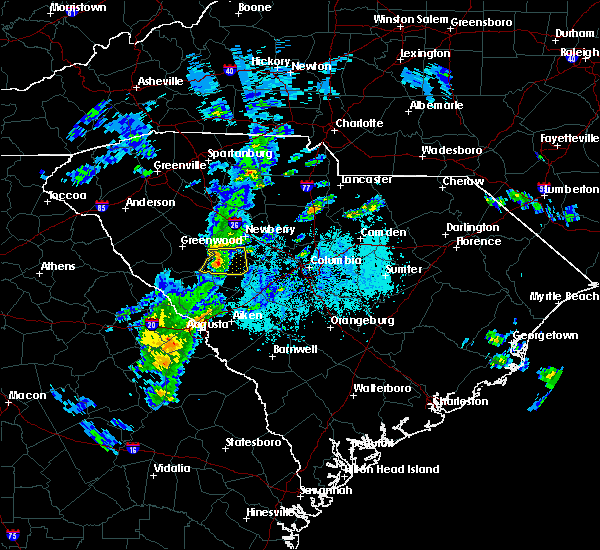 At 552 pm edt, doppler radar indicated a severe thunderstorm capable of producing damaging winds near 60 mph. the storm may also contain large hail. the storm was west of saluda moving east-northeast near 40 mph. the highway 178 area northwest of saluda, and state roads 702 and 39 northwest of saluda are most threatened by this storm. At 552 pm edt, doppler radar indicated a severe thunderstorm capable of producing damaging winds near 60 mph. the storm may also contain large hail. the storm was west of saluda moving east-northeast near 40 mph. the highway 178 area northwest of saluda, and state roads 702 and 39 northwest of saluda are most threatened by this storm.
|
| 3/31/2016 5:46 PM EDT |
 At 544 pm edt, doppler radar indicated a likely severe thunderstorm with wind gusts 40 to 60 mph and hail one-half to one inch in diameter near the edgefield and saluda county line near just west of owdoms. movement was east near 35 mph. At 544 pm edt, doppler radar indicated a likely severe thunderstorm with wind gusts 40 to 60 mph and hail one-half to one inch in diameter near the edgefield and saluda county line near just west of owdoms. movement was east near 35 mph.
|
| 2/3/2016 1:25 PM EST |
 At 124 pm est, doppler radar indicated a severe thunderstorm capable of producing damaging winds in excess of 60 mph. this storm was located over ridge spring, or 9 miles southwest of batesburg, and moving east-northeast at 45 mph. At 124 pm est, doppler radar indicated a severe thunderstorm capable of producing damaging winds in excess of 60 mph. this storm was located over ridge spring, or 9 miles southwest of batesburg, and moving east-northeast at 45 mph.
|
| 12/24/2015 4:45 PM EST |
 At 445 pm est, doppler radar indicated a severe thunderstorm capable of producing destructive winds in excess of 70 mph. this storm was located near edgefield, or 13 miles north of belvedere, and moving east at 50 mph. At 445 pm est, doppler radar indicated a severe thunderstorm capable of producing destructive winds in excess of 70 mph. this storm was located near edgefield, or 13 miles north of belvedere, and moving east at 50 mph.
|
| 9/4/2015 10:49 PM EDT |
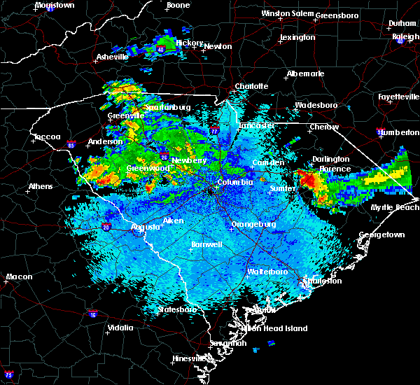 At 1049 pm edt, doppler radar indicated a severe thunderstorm capable of producing damaging winds in excess of 60 mph. this storm was located near saluda, or 18 miles west of batesburg, and moving south at 5 mph. At 1049 pm edt, doppler radar indicated a severe thunderstorm capable of producing damaging winds in excess of 60 mph. this storm was located near saluda, or 18 miles west of batesburg, and moving south at 5 mph.
|
| 8/6/2015 5:12 PM EDT |
 At 511 pm edt, doppler radar indicated a line of severe thunderstorms capable of producing damaging winds in excess of 60 mph. these storms were located along a line extending from near whitmire to 10 miles south of ninety six historic site, and moving east at 25 mph. At 511 pm edt, doppler radar indicated a line of severe thunderstorms capable of producing damaging winds in excess of 60 mph. these storms were located along a line extending from near whitmire to 10 miles south of ninety six historic site, and moving east at 25 mph.
|
| 8/6/2015 4:50 PM EDT |
 At 449 pm edt, doppler radar indicated an area of severe thunderstorms over the csra capable of producing damaging winds in excess of 60 mph. these storms were moving east at 30 mph. At 449 pm edt, doppler radar indicated an area of severe thunderstorms over the csra capable of producing damaging winds in excess of 60 mph. these storms were moving east at 30 mph.
|
| 7/18/2015 6:07 PM EDT |
 At 606 pm edt, doppler radar indicated a line of severe thunderstorms capable of producing damaging winds in excess of 60 mph. these storms were located along a line extending from 11 miles northwest of irmo to 9 miles northeast of greenwood state park, and moving south at 15 mph. penny size hail may also accompany the damaging winds. At 606 pm edt, doppler radar indicated a line of severe thunderstorms capable of producing damaging winds in excess of 60 mph. these storms were located along a line extending from 11 miles northwest of irmo to 9 miles northeast of greenwood state park, and moving south at 15 mph. penny size hail may also accompany the damaging winds.
|
| 7/2/2015 3:52 PM EDT |
 At 351 pm edt, doppler radar indicated a line of severe thunderstorms capable of producing damaging winds in excess of 60 mph. these storms were located along a line extending from near batesburg to 11 miles east of mccormick to 8 miles south of lincolnton, and moving east at 45 mph. At 351 pm edt, doppler radar indicated a line of severe thunderstorms capable of producing damaging winds in excess of 60 mph. these storms were located along a line extending from near batesburg to 11 miles east of mccormick to 8 miles south of lincolnton, and moving east at 45 mph.
|
| 6/20/2015 6:07 PM EDT |
 At 606 pm edt, doppler radar indicated a severe thunderstorm capable of producing quarter size hail and damaging winds in excess of 60 mph. this storm was located near saluda, or 13 miles west of batesburg, and moving east at 35 mph. At 606 pm edt, doppler radar indicated a severe thunderstorm capable of producing quarter size hail and damaging winds in excess of 60 mph. this storm was located near saluda, or 13 miles west of batesburg, and moving east at 35 mph.
|
| 5/26/2015 5:20 PM EDT | At 518 pm edt, doppler radar indicated a line of severe thunderstorms capable of producing quarter size hail and damaging winds in excess of 60 mph. these storms were located along a line extending from 10 miles southeast of leesville to near johnston, and moving north at 30 mph. at 518 pm, the strongest storm was in northern aiken county north of interstate 20 but south of monetta and ridge spring. |
| 5/26/2015 4:42 PM EDT | Saluda county dispatch reported multiple trees down on shiloh road near yarborough roa in saluda county SC, 5.6 miles SSE of Saluda, SC |
| 4/19/2015 4:46 PM EDT | At 444 pm edt, national weather service doppler radar indicated a line of severe thunderstorms capable of producing damaging winds in excess of 60 mph. these storms were located along a line extending from 9 miles north of saluda to 14 miles south of red bank, or along a line extending from 14 miles southwest of newberry to 14 miles south of red bank, and moving northeast at 45 mph. * some communities in the warning area include five points, fort jackson, woodfields, west columbia, st. andrews, springdale, south congaree, saluda, red bank, prosperity, pine ridge, oak grove, newberry, lexington, leesville, irmo, forest acres, dentsville, columbia, cayce, batesburg and arcadia lakes report large hail, damaging winds or flooding to your county sheriff, or use www.facebook.com/nwscolumbia and email [email protected] to relay severe weather reports. |
| 4/19/2015 4:24 PM EDT | The national weather service in columbia has issued a * tornado warning for. Eastern edgefield county in central south carolina western lexington county in central south carolina saluda county in central south carolina * until 500 pm edt. |
| 4/19/2015 4:19 PM EDT | this alert has expired |
| 9/3/2014 3:25 PM EDT | Saluda dispatch reported trees down on rock hill rd. time estimated by rada in saluda county SC, 2.2 miles NW of Saluda, SC |
| 9/3/2014 3:02 PM EDT | Saluda dispatch reported powerlines down on denny hwy at bethany schoolhouse r in saluda county SC, 8 miles SW of Saluda, SC |
| 6/11/2014 12:42 AM EDT | Saluda dispatch reported trees down on hwy 178 at white acre r in saluda county SC, 5.8 miles ESE of Saluda, SC |
| 6/11/2014 12:38 AM EDT | Saluda dispatch reported a tree fell on a vehicle on hwy 178 at mt. willing rd. no injuries were reporte in saluda county SC, 5.2 miles W of Saluda, SC |
| 6/11/2014 12:25 AM EDT | Saluda dispatch reported trees down in saluda near hwy 19 in saluda county SC, 0.6 miles S of Saluda, SC |
| 6/6/2014 7:50 PM EDT | South carolina highway patrol reports trees down near the intersection of hwy. 121 and daniel avenue. tstm wnd dmg duration 2 minutes in saluda county SC, 4.6 miles NNE of Saluda, SC |
| 5/25/2014 7:00 PM EDT | Trees in roadway on hwy 178 in saluda county SC, 4.9 miles ESE of Saluda, SC |
| 6/18/2013 5:26 PM EDT | Trees down at hickory grove rd and andrew coleman rd in hickory grov in saluda county SC, 6.5 miles SSW of Saluda, SC |
| 1/30/2013 8:20 PM EST | Trees down on roads in saluda in ridge spring area in saluda county SC, 0.1 miles NNE of Saluda, SC |
| 1/30/2013 7:55 PM EST | Several trees down along highway 121 in oldtown area in saluda county SC, 0.1 miles NNE of Saluda, SC |
| 8/9/2012 8:18 PM EDT | Saluda county dispatch reported trees down on mariachi in saluda county SC, 0.1 miles NNE of Saluda, SC |
| 7/5/2012 8:48 PM EDT | Trees down at hickory grove road and hollywood road in saluda county SC, 4.8 miles SW of Saluda, SC |
| 7/3/2012 6:30 PM EDT | Wis tv reported trees down one of which was a 3-foot diameter oak. unfinished barn-garage blown down on car. small hai in saluda county SC, 6 miles WSW of Saluda, SC |
| 7/3/2012 6:20 PM EDT | Trees down at us 378 and dailey creek road. report relayed from sc do in saluda county SC, 5.1 miles W of Saluda, SC |
| 7/1/2012 4:55 PM EDT | Quarter sized hail reported 5.6 miles ESE of Saluda, SC, public reported quarter size hail northwest of saluda near hwy 702. |
| 7/1/2012 4:40 PM EDT | Quarter sized hail reported 4.2 miles NNE of Saluda, SC, quarter size hail. |
| 1/1/0001 12:00 AM | Dispatch reported trees down countywid in saluda county SC, 0.1 miles NNE of Saluda, SC |
| 1/1/0001 12:00 AM | Trees down on firetower rd and us hwy 178. time estimate in saluda county SC, 1.3 miles ESE of Saluda, SC |
| 1/1/0001 12:00 AM | Sheriff dispatch reported trees down at greenwood hwy atnd larkin rice roa in saluda county SC, 6.4 miles ESE of Saluda, SC |
| 1/1/0001 12:00 AM | Multiple trees down reported county wid in saluda county SC, 0.1 miles NNE of Saluda, SC |
| 1/1/0001 12:00 AM | Quarter sized hail reported 2.3 miles E of Saluda, SC, hail fell for 20 to 25 minutes. ranged from 0.75 to 1.00 inch in size. heavy rain and gusty wind also observed 2 miles west of the town of saluda on highway 178. |
| 1/1/0001 12:00 AM | Saluda county sheriff reported numerous trees down across the count in saluda county SC, 0.1 miles NNE of Saluda, SC |
| 1/1/0001 12:00 AM | Trees down in saluda county SC, 5.1 miles W of Saluda, SC |
| 1/1/0001 12:00 AM | Trees down in saluda county SC, 4.9 miles N of Saluda, SC |
| 1/1/0001 12:00 AM | Trees down in saluda county SC, 7.9 miles SE of Saluda, SC |
Hail Maps for Saluda, SC


Connect with Interactive Hail Maps