

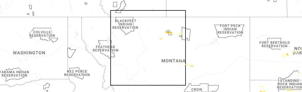
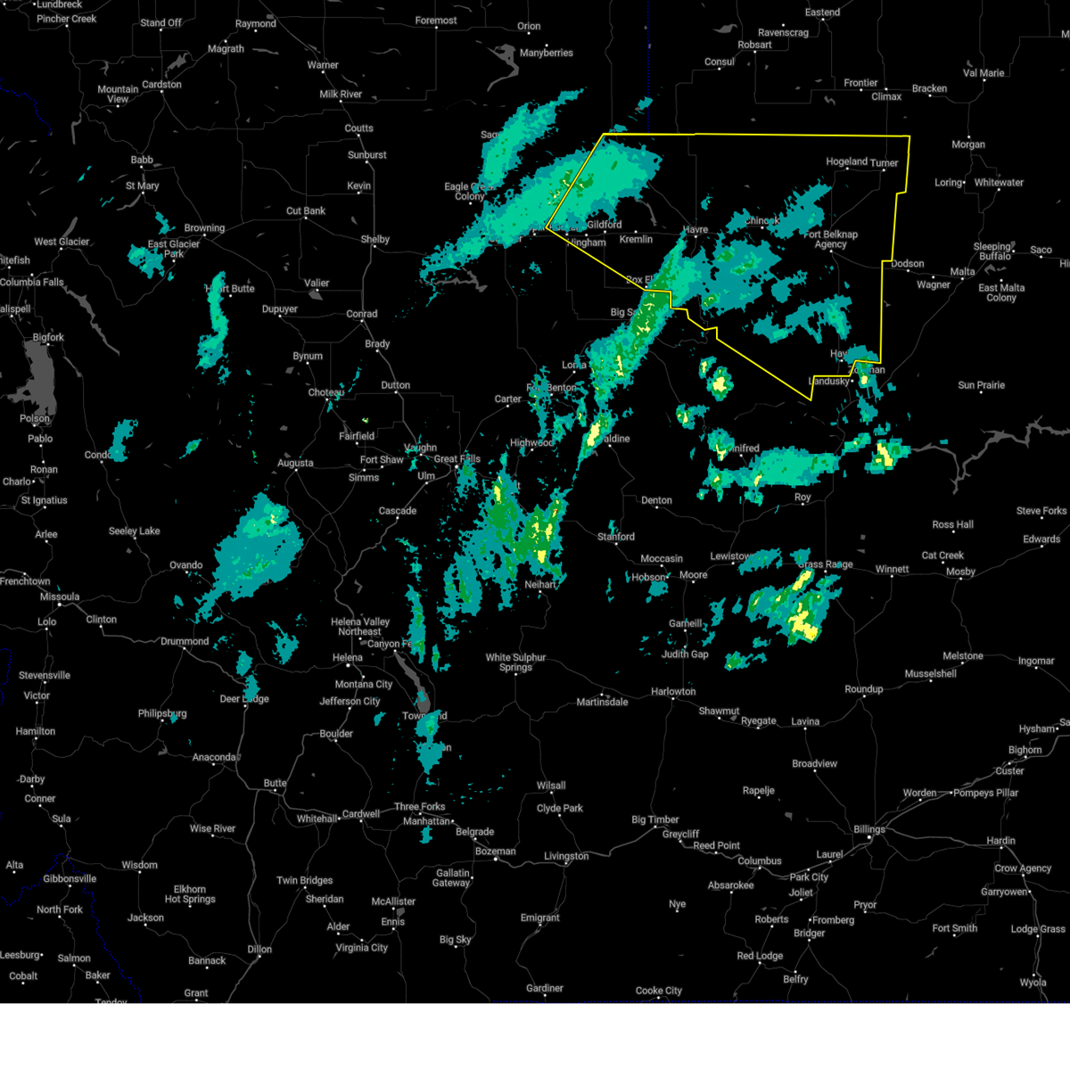
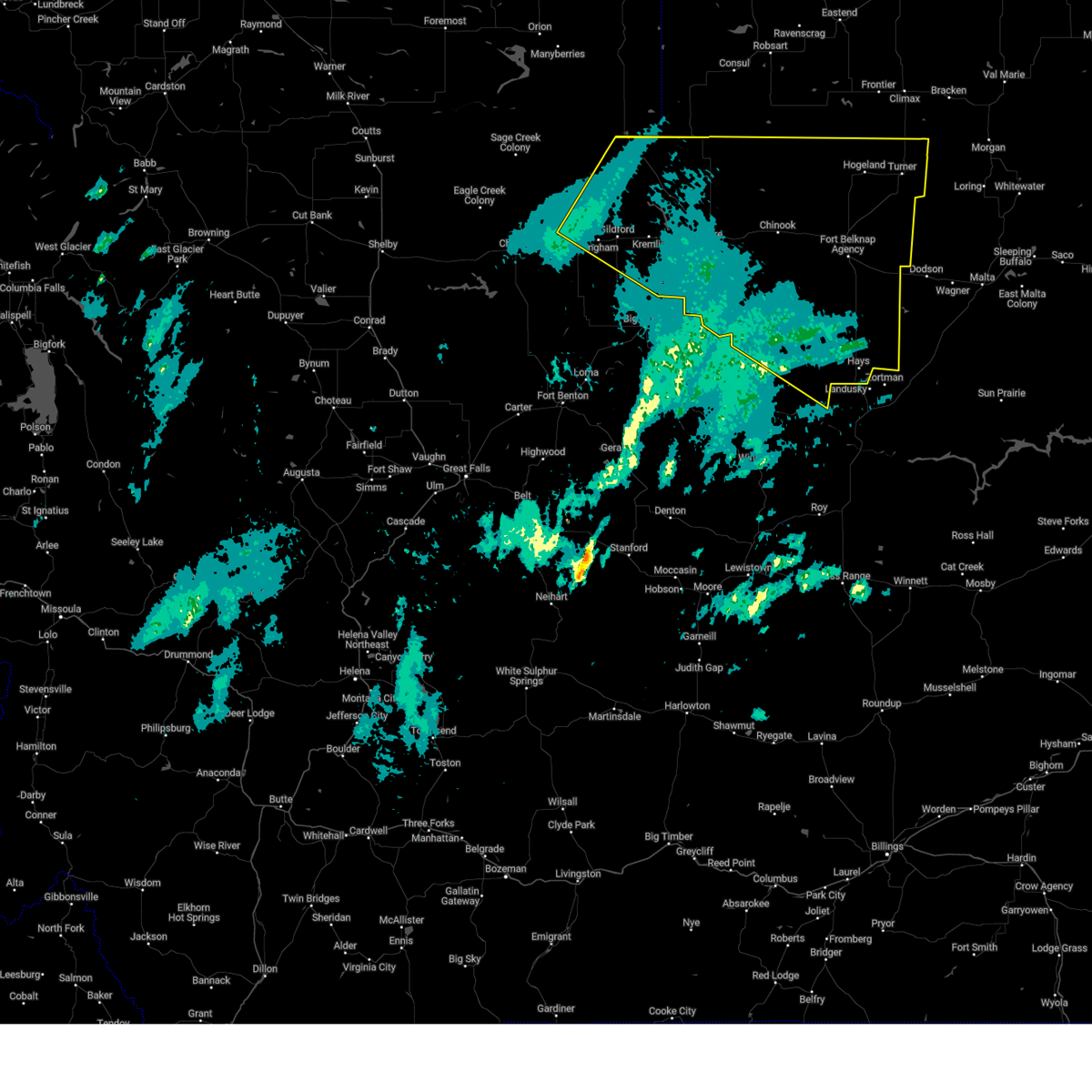
Hail Map for Sangrey, MT
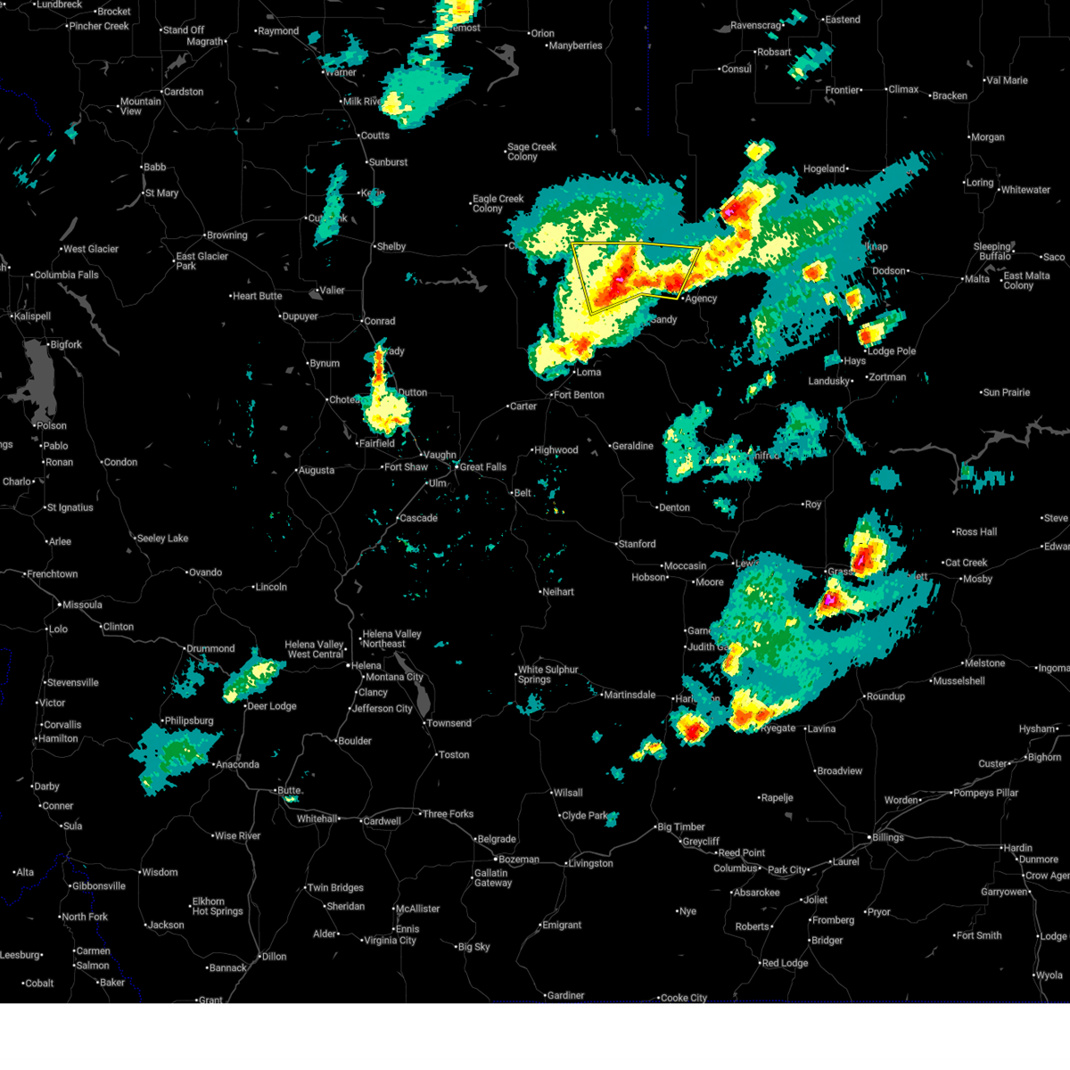
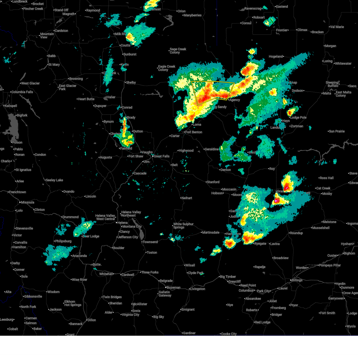
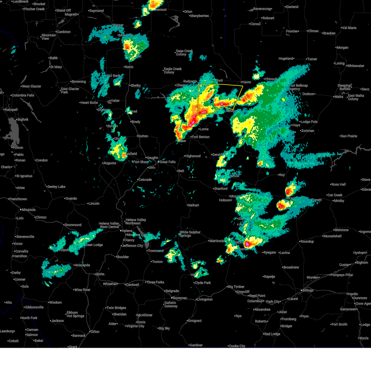
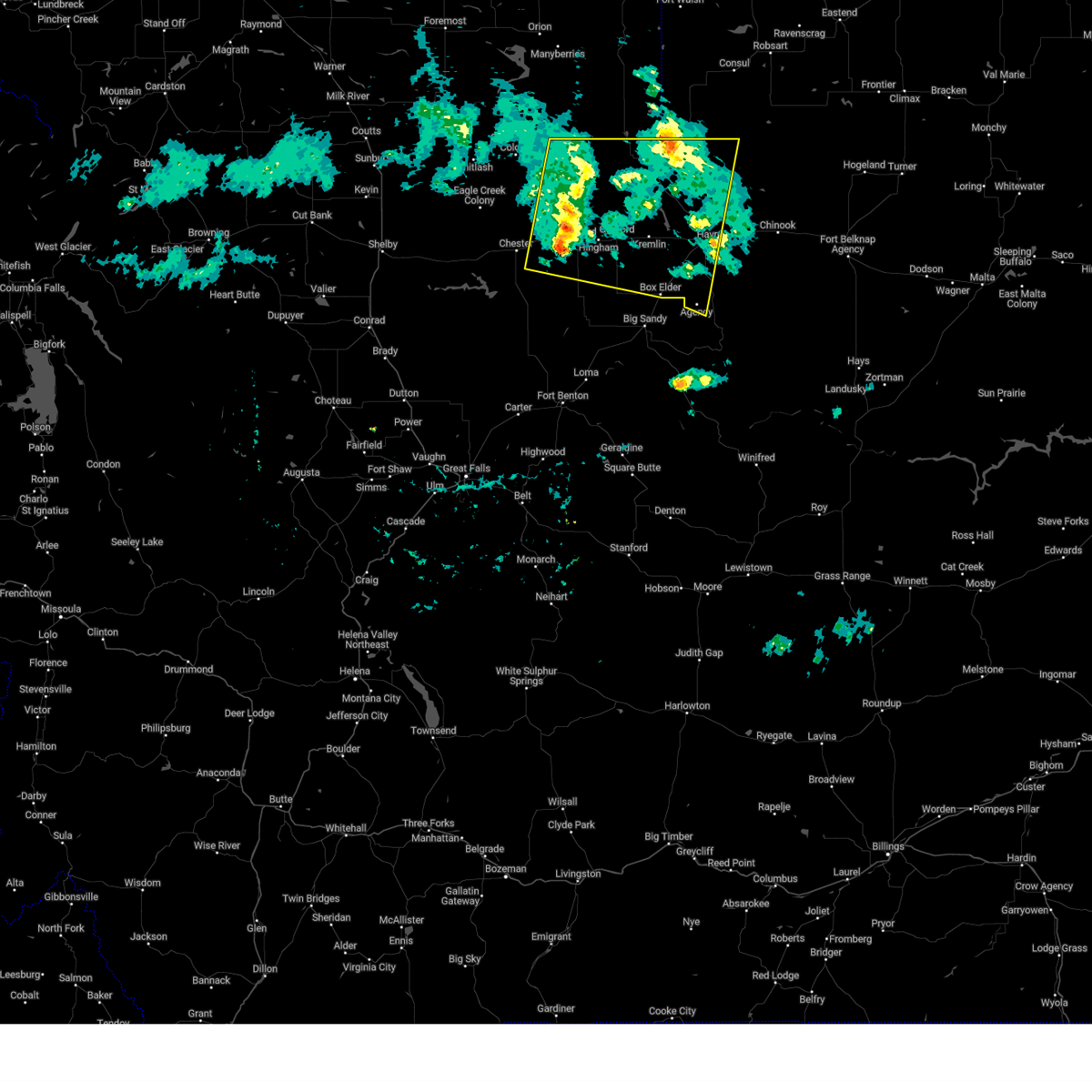
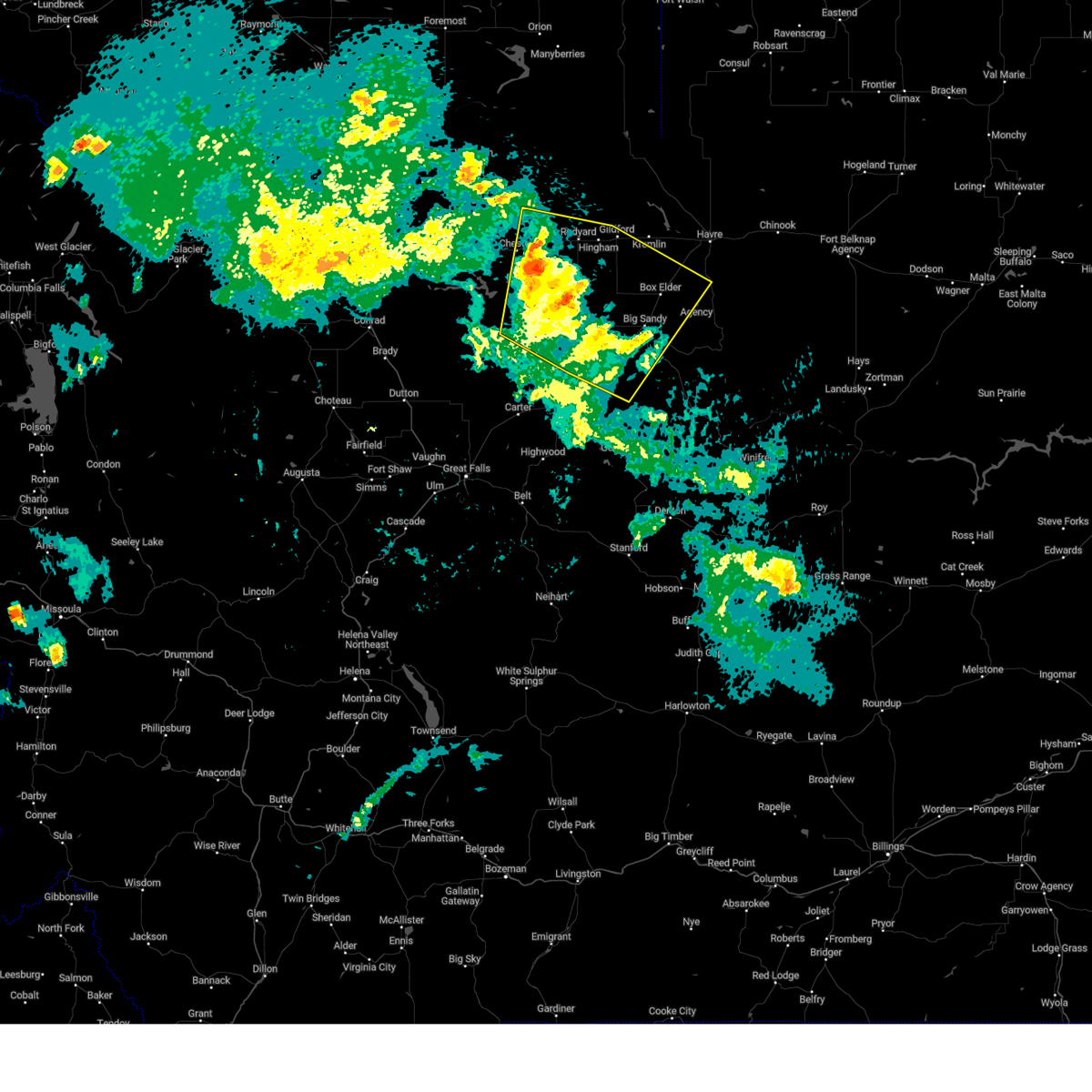
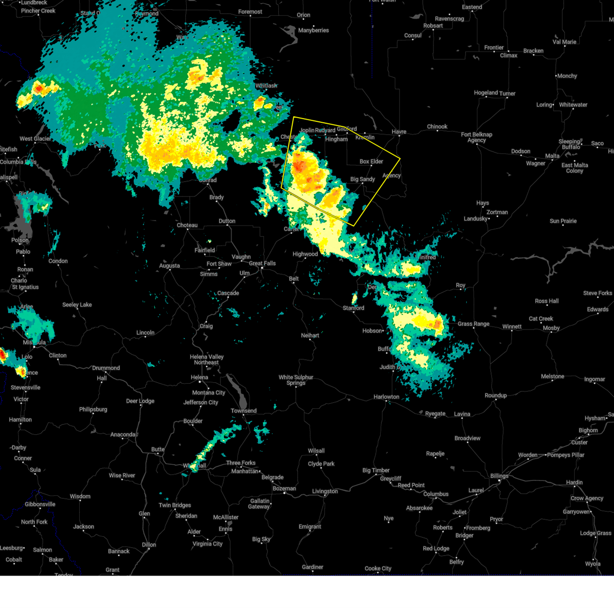
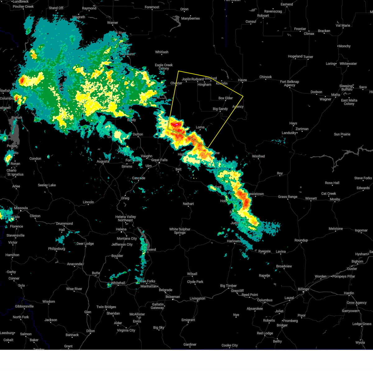
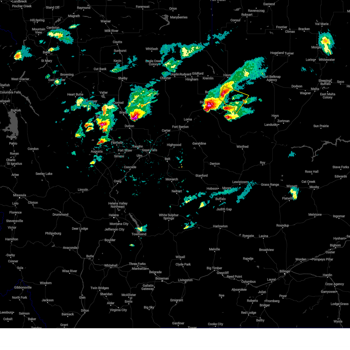
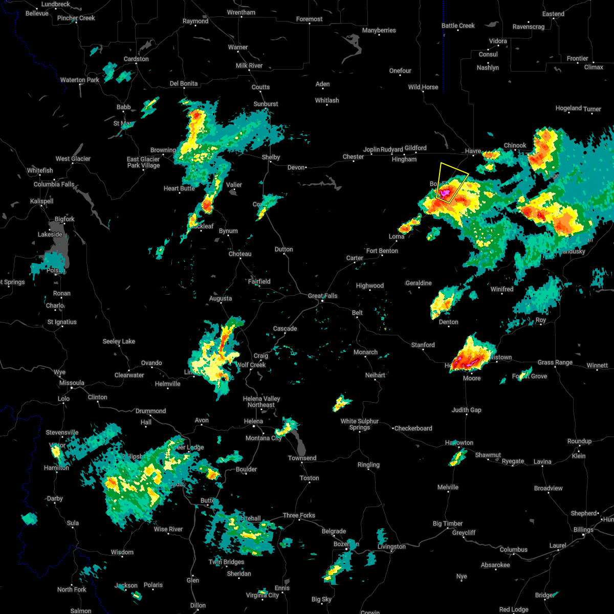
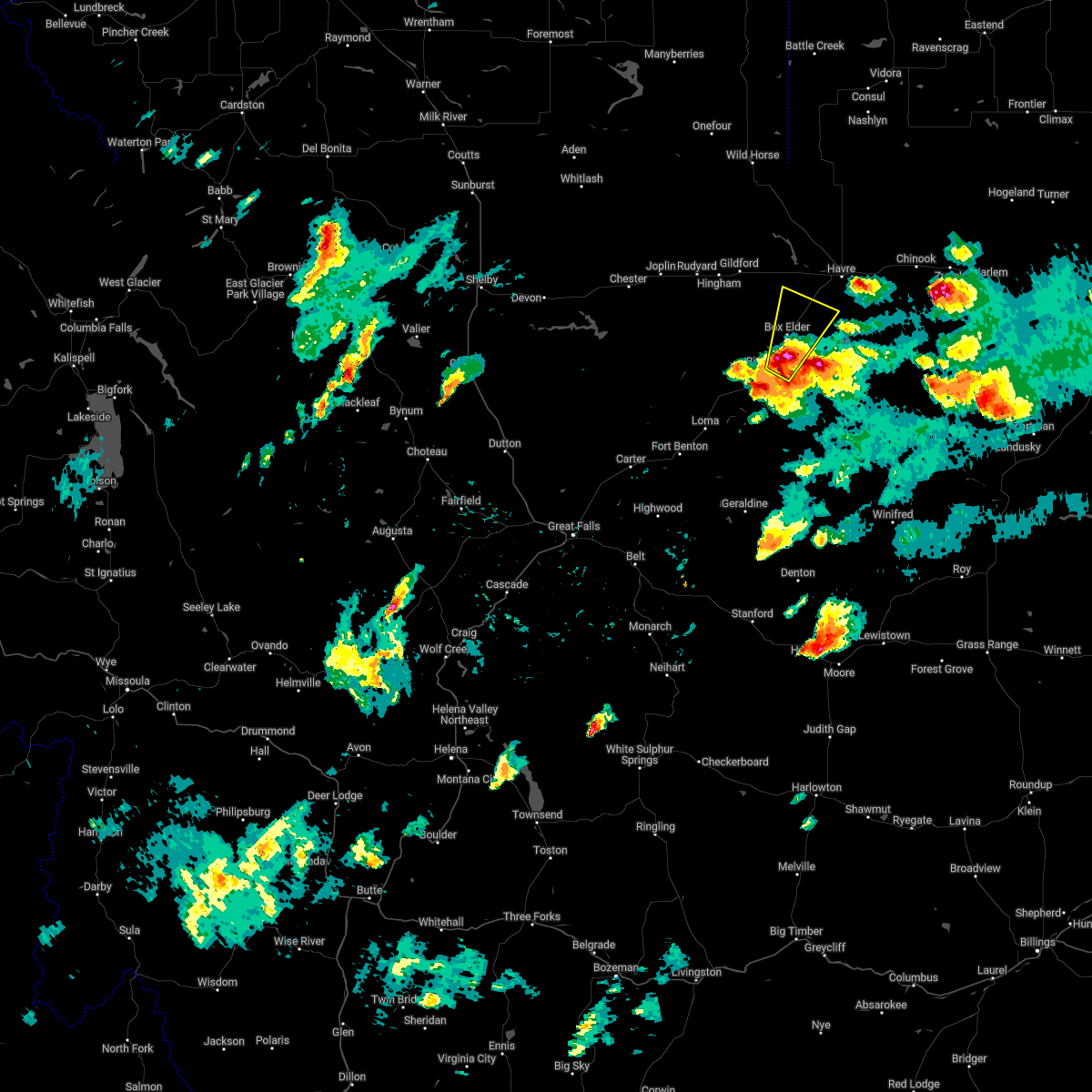
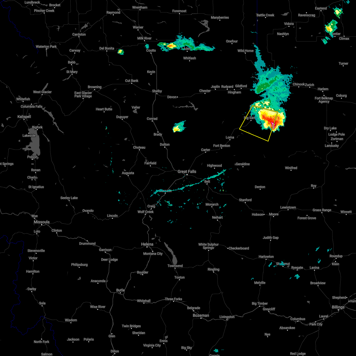
The Sangrey, MT area has had 0 reports of on-the-ground hail by trained spotters, and has been under severe weather warnings 26 times during the past 12 months. Doppler radar has detected hail at or near Sangrey, MT on 23 occasions, including 2 occasions during the past year.
| Name: | Sangrey, MT |
| Where Located: | 19.6 miles SSW of Havre, MT |
| Map: | Google Map for Sangrey, MT |
| Population: | 306 |
| Housing Units: | 78 |
| More Info: | Search Google for Sangrey, MT |
4
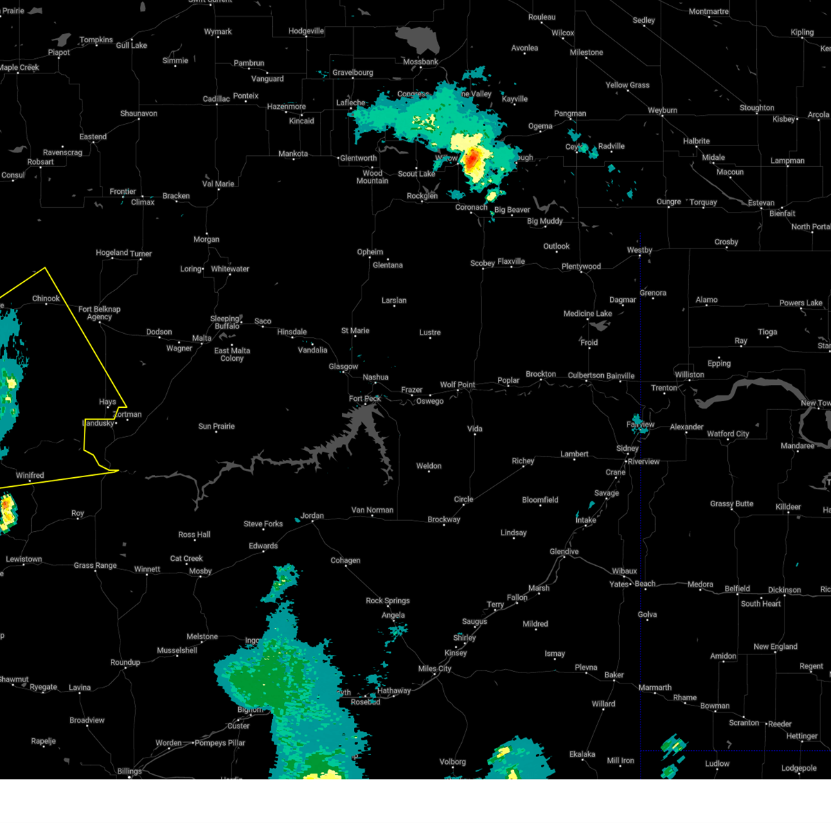
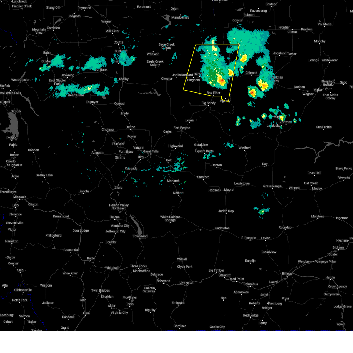
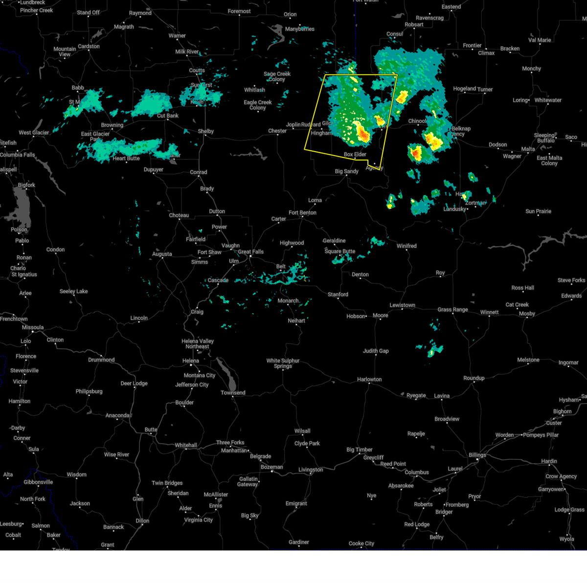
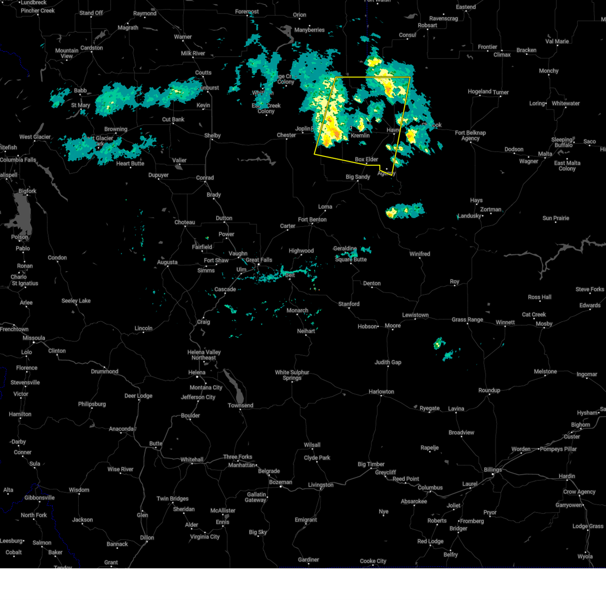
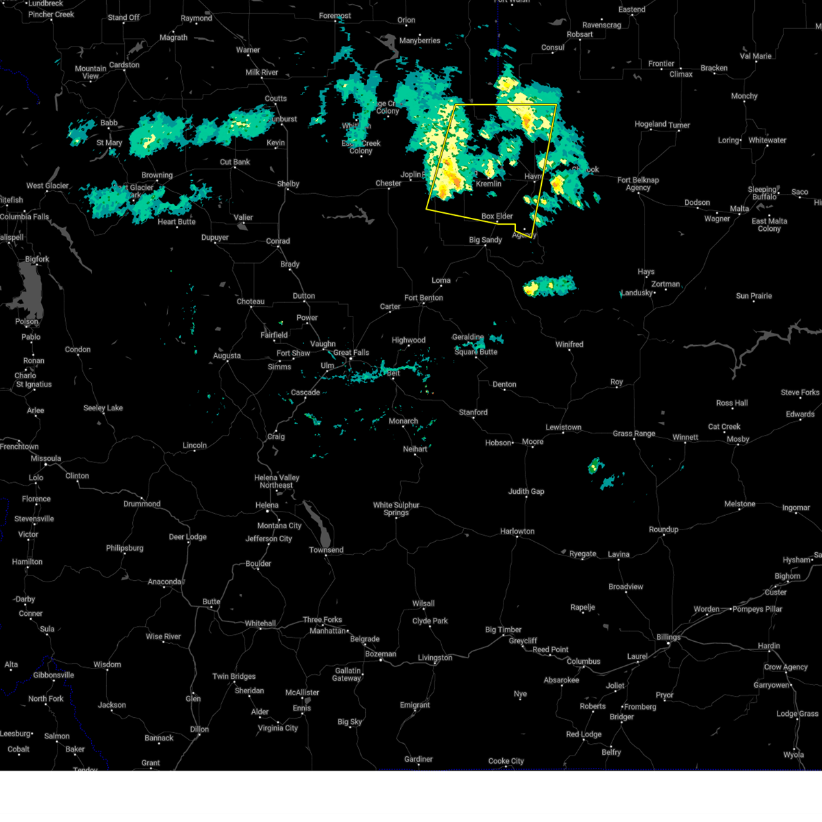
The Top Recent Hail Date for Sangrey, MT is Monday, July 14, 2025 (3rd out of 23)
Hail and Wind Damage Spotted near Sangrey, MT
| Date / Time | Report Details |
|---|---|
| 6/13/2025 3:59 PM MDT |
 the severe thunderstorm warning has been cancelled and is no longer in effect the severe thunderstorm warning has been cancelled and is no longer in effect
|
| 6/13/2025 3:52 PM MDT |
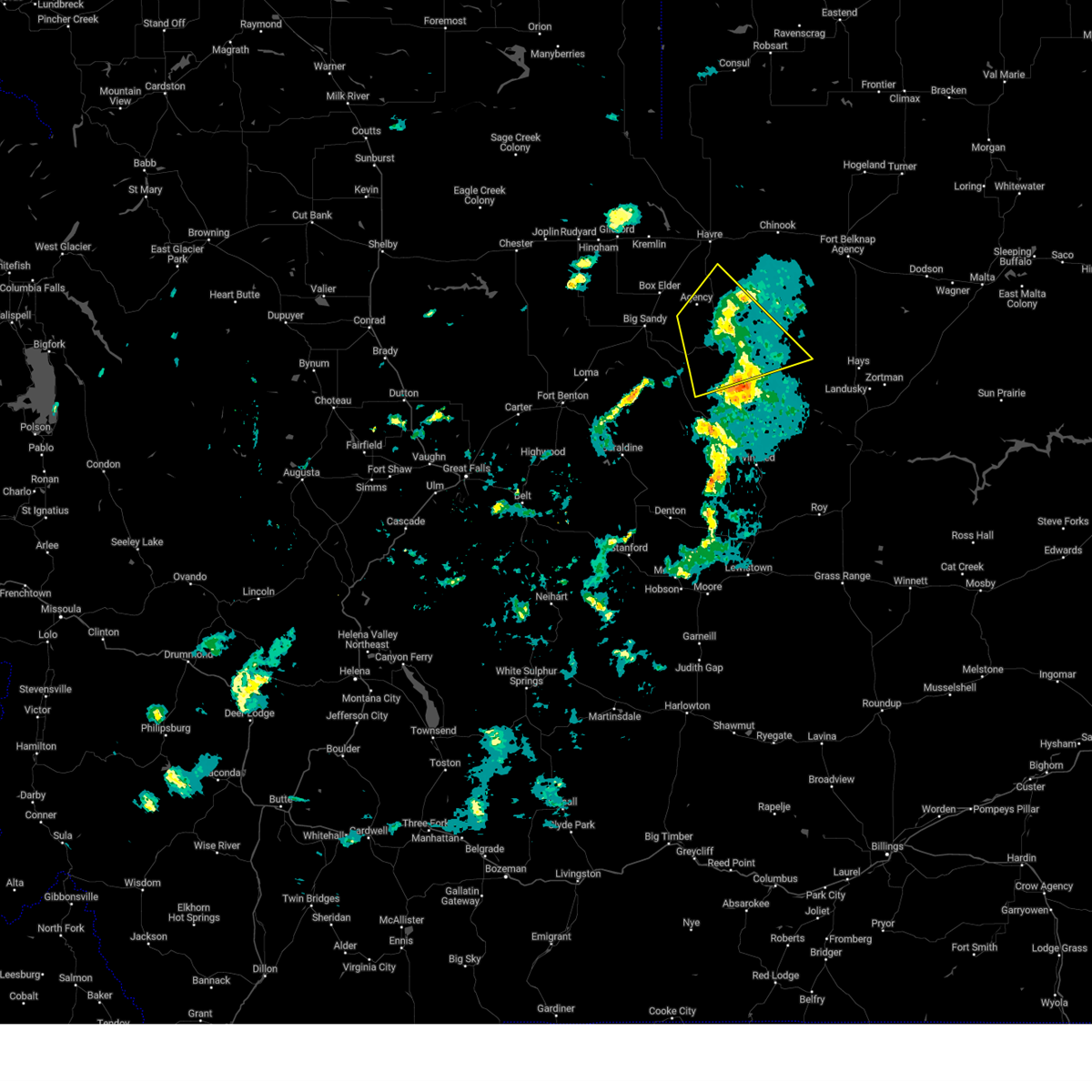
 At 352 pm mdt, severe thunderstorms were located along a line extending from 12 miles west of big sandy to near box elder, moving north at 25 mph (radar indicated). Hazards include quarter size hail. Damage to vehicles is expected. Locations impacted include, box elder, azure, sangrey, boneau, and laredo. At 352 pm mdt, severe thunderstorms were located along a line extending from 12 miles west of big sandy to near box elder, moving north at 25 mph (radar indicated). Hazards include quarter size hail. Damage to vehicles is expected. Locations impacted include, box elder, azure, sangrey, boneau, and laredo.
|
| 6/13/2025 3:40 PM MDT |
 Svrtfx the national weather service in great falls has issued a * severe thunderstorm warning for, southern hill county in north central montana, north central chouteau county in north central montana, * until 415 pm mdt. * at 339 pm mdt, severe thunderstorms were located along a line extending from 26 miles northeast of fort benton to 8 miles northwest of big sandy to near box elder, moving north at 25 mph (radar indicated). Hazards include quarter size hail. damage to vehicles is expected Svrtfx the national weather service in great falls has issued a * severe thunderstorm warning for, southern hill county in north central montana, north central chouteau county in north central montana, * until 415 pm mdt. * at 339 pm mdt, severe thunderstorms were located along a line extending from 26 miles northeast of fort benton to 8 miles northwest of big sandy to near box elder, moving north at 25 mph (radar indicated). Hazards include quarter size hail. damage to vehicles is expected
|
| 5/12/2025 4:40 PM MDT |
 the severe thunderstorm warning has been cancelled and is no longer in effect the severe thunderstorm warning has been cancelled and is no longer in effect
|
| 5/12/2025 4:06 PM MDT |
 Svrtfx the national weather service in great falls has issued a * severe thunderstorm warning for, blaine county in north central montana, hill county in north central montana, * until 500 pm mdt. * at 403 pm mdt, severe thunderstorm winds were moving through portions of hill and blaine county (radar indicated). Hazards include 60 mph wind gusts. expect damage to roofs, siding, and trees Svrtfx the national weather service in great falls has issued a * severe thunderstorm warning for, blaine county in north central montana, hill county in north central montana, * until 500 pm mdt. * at 403 pm mdt, severe thunderstorm winds were moving through portions of hill and blaine county (radar indicated). Hazards include 60 mph wind gusts. expect damage to roofs, siding, and trees
|
| 5/11/2025 5:58 PM MDT |
 The storms which prompted the warning have moved out of the area. therefore, the warning will be allowed to expire. remember, a severe thunderstorm warning still remains in effect for eastern chouteau, northern fergus, southeast hill, and southwest blaine counties. The storms which prompted the warning have moved out of the area. therefore, the warning will be allowed to expire. remember, a severe thunderstorm warning still remains in effect for eastern chouteau, northern fergus, southeast hill, and southwest blaine counties.
|
| 5/11/2025 5:56 PM MDT |
 Svrtfx the national weather service in great falls has issued a * severe thunderstorm warning for, northern fergus county in central montana, blaine county in north central montana, southeastern hill county in north central montana, northeastern chouteau county in north central montana, * until 730 pm mdt. * at 554 pm mdt, severe thunderstorms were located along a line extending from 19 miles northwest of chinook to 21 miles northeast of roy, moving northeast at 30 mph (radar indicated). Hazards include 60 mph wind gusts. expect damage to roofs, siding, and trees Svrtfx the national weather service in great falls has issued a * severe thunderstorm warning for, northern fergus county in central montana, blaine county in north central montana, southeastern hill county in north central montana, northeastern chouteau county in north central montana, * until 730 pm mdt. * at 554 pm mdt, severe thunderstorms were located along a line extending from 19 miles northwest of chinook to 21 miles northeast of roy, moving northeast at 30 mph (radar indicated). Hazards include 60 mph wind gusts. expect damage to roofs, siding, and trees
|
| 5/11/2025 5:15 PM MDT |
 At 512 pm mdt, severe thunderstorms were located along a line extending from azure to 10 miles northeast of winifred, moving east at 40 mph (11 sse big sandy, montana mesonet station big sandy se reported a 59 mph wind gust). Hazards include 60 mph wind gusts. Expect damage to roofs, siding, and trees. locations impacted include, azure, parker school, beaver creek, agency, st. Pierre, rocky boy, lohman, big sandy, cleveland, laredo, hays, havre, chinook, sangrey, kenilworth, boneau, winifred, box elder, lloyd, and judith landing. At 512 pm mdt, severe thunderstorms were located along a line extending from azure to 10 miles northeast of winifred, moving east at 40 mph (11 sse big sandy, montana mesonet station big sandy se reported a 59 mph wind gust). Hazards include 60 mph wind gusts. Expect damage to roofs, siding, and trees. locations impacted include, azure, parker school, beaver creek, agency, st. Pierre, rocky boy, lohman, big sandy, cleveland, laredo, hays, havre, chinook, sangrey, kenilworth, boneau, winifred, box elder, lloyd, and judith landing.
|
| 5/11/2025 4:27 PM MDT |
 Svrtfx the national weather service in great falls has issued a * severe thunderstorm warning for, northwestern fergus county in central montana, southwestern blaine county in north central montana, southeastern hill county in north central montana, eastern chouteau county in north central montana, * until 600 pm mdt. * at 427 pm mdt, severe thunderstorms were located along a line extending from 14 miles west of big sandy to 16 miles northeast of denton, moving east at 40 mph (radar indicated). Hazards include 60 mph wind gusts. expect damage to roofs, siding, and trees Svrtfx the national weather service in great falls has issued a * severe thunderstorm warning for, northwestern fergus county in central montana, southwestern blaine county in north central montana, southeastern hill county in north central montana, eastern chouteau county in north central montana, * until 600 pm mdt. * at 427 pm mdt, severe thunderstorms were located along a line extending from 14 miles west of big sandy to 16 miles northeast of denton, moving east at 40 mph (radar indicated). Hazards include 60 mph wind gusts. expect damage to roofs, siding, and trees
|
| 5/10/2025 5:34 PM MDT |
 At 534 pm mdt, a severe thunderstorm was located 9 miles southeast of parker school, or 25 miles east of big sandy, moving northeast at 40 mph (radar indicated). Hazards include 60 mph wind gusts. Expect damage to roofs, siding, and trees. locations impacted include, parker school, agency, sangrey, st. Pierre, rocky boy, and azure. At 534 pm mdt, a severe thunderstorm was located 9 miles southeast of parker school, or 25 miles east of big sandy, moving northeast at 40 mph (radar indicated). Hazards include 60 mph wind gusts. Expect damage to roofs, siding, and trees. locations impacted include, parker school, agency, sangrey, st. Pierre, rocky boy, and azure.
|
| 5/10/2025 5:07 PM MDT |
 Svrtfx the national weather service in great falls has issued a * severe thunderstorm warning for, southwestern blaine county in north central montana, southeastern hill county in north central montana, northeastern chouteau county in north central montana, * until 615 pm mdt. * at 507 pm mdt, a severe thunderstorm was located 16 miles southeast of big sandy, moving northeast at 35 mph (radar indicated). Hazards include 60 mph wind gusts. expect damage to roofs, siding, and trees Svrtfx the national weather service in great falls has issued a * severe thunderstorm warning for, southwestern blaine county in north central montana, southeastern hill county in north central montana, northeastern chouteau county in north central montana, * until 615 pm mdt. * at 507 pm mdt, a severe thunderstorm was located 16 miles southeast of big sandy, moving northeast at 35 mph (radar indicated). Hazards include 60 mph wind gusts. expect damage to roofs, siding, and trees
|
| 9/20/2024 4:01 PM MDT |
 Svrtfx the national weather service in great falls has issued a * severe thunderstorm warning for, hill county in north central montana, * until 430 pm mdt. * at 401 pm mdt, severe thunderstorms were located along a line extending from 13 miles northwest of beaver creek to 9 miles north of box elder, moving east at 40 mph (havre airport reported a 70 mph wind gust). Hazards include 70 mph wind gusts. Expect considerable tree damage. Damage is likely to mobile homes, roofs, and outbuildings. Svrtfx the national weather service in great falls has issued a * severe thunderstorm warning for, hill county in north central montana, * until 430 pm mdt. * at 401 pm mdt, severe thunderstorms were located along a line extending from 13 miles northwest of beaver creek to 9 miles north of box elder, moving east at 40 mph (havre airport reported a 70 mph wind gust). Hazards include 70 mph wind gusts. Expect considerable tree damage. Damage is likely to mobile homes, roofs, and outbuildings.
|
| 9/20/2024 3:58 PM MDT |
 The storms which prompted the warning have weakened below severe limits, and no longer pose an immediate threat to life or property. therefore, the warning will be allowed to expire. however, gusty winds are still possible with these thunderstorms. The storms which prompted the warning have weakened below severe limits, and no longer pose an immediate threat to life or property. therefore, the warning will be allowed to expire. however, gusty winds are still possible with these thunderstorms.
|
| 9/20/2024 3:24 PM MDT |
 the severe thunderstorm warning has been cancelled and is no longer in effect the severe thunderstorm warning has been cancelled and is no longer in effect
|
| 9/20/2024 3:24 PM MDT |
 At 324 pm mdt, severe thunderstorms were located along a line extending from 18 miles north of gildford to 7 miles east of inverness, moving east at 40 mph (radar indicated). Hazards include 60 mph wind gusts. Expect damage to roofs, siding, and trees. locations impacted include, havre, azure, parker school, beaver creek, agency, gildford, sangrey, box elder, st. Pierre, boneau, hingham, rudyard, rocky boy, laredo, kremlin, and simpson. At 324 pm mdt, severe thunderstorms were located along a line extending from 18 miles north of gildford to 7 miles east of inverness, moving east at 40 mph (radar indicated). Hazards include 60 mph wind gusts. Expect damage to roofs, siding, and trees. locations impacted include, havre, azure, parker school, beaver creek, agency, gildford, sangrey, box elder, st. Pierre, boneau, hingham, rudyard, rocky boy, laredo, kremlin, and simpson.
|
| 9/20/2024 3:07 PM MDT |
 Svrtfx the national weather service in great falls has issued a * severe thunderstorm warning for, east central liberty county in north central montana, hill county in north central montana, * until 400 pm mdt. * at 306 pm mdt, severe thunderstorms were located along a line extending from 21 miles north of inverness to near joplin, moving east at 40 mph (radar and automated wind sensor reports of 60 mph wind gusts). Hazards include 60 mph wind gusts. expect damage to roofs, siding, and trees Svrtfx the national weather service in great falls has issued a * severe thunderstorm warning for, east central liberty county in north central montana, hill county in north central montana, * until 400 pm mdt. * at 306 pm mdt, severe thunderstorms were located along a line extending from 21 miles north of inverness to near joplin, moving east at 40 mph (radar and automated wind sensor reports of 60 mph wind gusts). Hazards include 60 mph wind gusts. expect damage to roofs, siding, and trees
|
| 8/23/2024 7:09 PM MDT |
 The storms which prompted the warning have weakened below severe limits, and no longer pose an immediate threat to life or property. therefore, the warning will be allowed to expire. however, gusty winds around 55 mph are still possible with these thunderstorms. a severe thunderstorm watch remains in effect until 900 pm mdt for north central montana. The storms which prompted the warning have weakened below severe limits, and no longer pose an immediate threat to life or property. therefore, the warning will be allowed to expire. however, gusty winds around 55 mph are still possible with these thunderstorms. a severe thunderstorm watch remains in effect until 900 pm mdt for north central montana.
|
| 8/23/2024 6:47 PM MDT |
 the severe thunderstorm warning has been cancelled and is no longer in effect the severe thunderstorm warning has been cancelled and is no longer in effect
|
| 8/23/2024 6:47 PM MDT |
 At 647 pm mdt, severe thunderstorms were located along a line extending from 36 miles north of kiowa to 23 miles east of sunburst to 9 miles northwest of beaver creek, moving north at 85 mph (radar indicated). Hazards include 70 mph wind gusts. Expect considerable tree damage. damage is likely to mobile homes, roofs, and outbuildings. locations impacted include, havre, shelby, cut bank, chinook, chester, sunburst, kevin, parker school, beaver creek, lothair, joplin, azure, inverness, agency, st. Pierre, gildford, sangrey, boneau, box elder, and north browning. At 647 pm mdt, severe thunderstorms were located along a line extending from 36 miles north of kiowa to 23 miles east of sunburst to 9 miles northwest of beaver creek, moving north at 85 mph (radar indicated). Hazards include 70 mph wind gusts. Expect considerable tree damage. damage is likely to mobile homes, roofs, and outbuildings. locations impacted include, havre, shelby, cut bank, chinook, chester, sunburst, kevin, parker school, beaver creek, lothair, joplin, azure, inverness, agency, st. Pierre, gildford, sangrey, boneau, box elder, and north browning.
|
| 8/23/2024 6:13 PM MDT |
 Svrtfx the national weather service in great falls has issued a * severe thunderstorm warning for, northeastern pondera county in north central montana, liberty county in north central montana, glacier county in north central montana, toole county in north central montana, northwestern blaine county in north central montana, hill county in north central montana, northern chouteau county in north central montana, * until 715 pm mdt. * at 612 pm mdt, severe thunderstorms were located along a line extending from 11 miles southwest of east glacier park village to 10 miles north of the knees to 17 miles southeast of big sandy, moving north at 85 mph. these are destructive storms for browning, box elder, and havre (radar indicated). Hazards include 80 mph wind gusts. Flying debris will be dangerous to those caught without shelter. mobile homes will be heavily damaged. expect considerable damage to roofs, windows, and vehicles. Extensive tree damage and power outages are likely. Svrtfx the national weather service in great falls has issued a * severe thunderstorm warning for, northeastern pondera county in north central montana, liberty county in north central montana, glacier county in north central montana, toole county in north central montana, northwestern blaine county in north central montana, hill county in north central montana, northern chouteau county in north central montana, * until 715 pm mdt. * at 612 pm mdt, severe thunderstorms were located along a line extending from 11 miles southwest of east glacier park village to 10 miles north of the knees to 17 miles southeast of big sandy, moving north at 85 mph. these are destructive storms for browning, box elder, and havre (radar indicated). Hazards include 80 mph wind gusts. Flying debris will be dangerous to those caught without shelter. mobile homes will be heavily damaged. expect considerable damage to roofs, windows, and vehicles. Extensive tree damage and power outages are likely.
|
| 8/23/2024 6:11 PM MDT |
 Svrtfx the national weather service in great falls has issued a * severe thunderstorm warning for, northeastern pondera county in north central montana, liberty county in north central montana, glacier county in north central montana, toole county in north central montana, northwestern blaine county in north central montana, hill county in north central montana, northern chouteau county in north central montana, * until 715 pm mdt. * at 610 pm mdt, severe thunderstorms were located along a line extending from 11 miles southwest of east glacier park village to 9 miles north of the knees to 19 miles southeast of big sandy, moving north at 85 mph. these are destructive storms for browning, box elder, and havre (radar indicated). Hazards include 80 mph wind gusts. Flying debris will be dangerous to those caught without shelter. mobile homes will be heavily damaged. expect considerable damage to roofs, windows, and vehicles. Extensive tree damage and power outages are likely. Svrtfx the national weather service in great falls has issued a * severe thunderstorm warning for, northeastern pondera county in north central montana, liberty county in north central montana, glacier county in north central montana, toole county in north central montana, northwestern blaine county in north central montana, hill county in north central montana, northern chouteau county in north central montana, * until 715 pm mdt. * at 610 pm mdt, severe thunderstorms were located along a line extending from 11 miles southwest of east glacier park village to 9 miles north of the knees to 19 miles southeast of big sandy, moving north at 85 mph. these are destructive storms for browning, box elder, and havre (radar indicated). Hazards include 80 mph wind gusts. Flying debris will be dangerous to those caught without shelter. mobile homes will be heavily damaged. expect considerable damage to roofs, windows, and vehicles. Extensive tree damage and power outages are likely.
|
| 8/19/2024 9:10 PM MDT |
 At 909 pm mdt, severe thunderstorms were located along a line extending from 34 miles east of sunburst to near gildford to 6 miles north of azure to 25 miles southeast of parker school, moving east at 65 mph (automated weather observation system). Hazards include 70 mph wind gusts. Expect considerable tree damage. damage is likely to mobile homes, roofs, and outbuildings. locations impacted include, havre, chinook, chester, big sandy, harlem, parker school, beaver creek, hays, joplin, azure, inverness, agency, st. Pierre, gildford, sangrey, boneau, fort belknap, box elder, hingham, and rudyard. At 909 pm mdt, severe thunderstorms were located along a line extending from 34 miles east of sunburst to near gildford to 6 miles north of azure to 25 miles southeast of parker school, moving east at 65 mph (automated weather observation system). Hazards include 70 mph wind gusts. Expect considerable tree damage. damage is likely to mobile homes, roofs, and outbuildings. locations impacted include, havre, chinook, chester, big sandy, harlem, parker school, beaver creek, hays, joplin, azure, inverness, agency, st. Pierre, gildford, sangrey, boneau, fort belknap, box elder, hingham, and rudyard.
|
| 8/19/2024 9:00 PM MDT |
 The storms which prompted the warning have moved out of the area. therefore, the warning has been allowed to expire. however, gusty winds are still possible with these thunderstorms. a severe thunderstorm watch remains in effect until 1000 pm mdt for north central montana. remember, a severe thunderstorm warning still remains in effect for northern liberty county, northeastern toole county, blaine county, hill county, and northeastern chouteau county until 10pm. The storms which prompted the warning have moved out of the area. therefore, the warning has been allowed to expire. however, gusty winds are still possible with these thunderstorms. a severe thunderstorm watch remains in effect until 1000 pm mdt for north central montana. remember, a severe thunderstorm warning still remains in effect for northern liberty county, northeastern toole county, blaine county, hill county, and northeastern chouteau county until 10pm.
|
| 8/19/2024 8:56 PM MDT |
 Svrtfx the national weather service in great falls has issued a * severe thunderstorm warning for, northern liberty county in north central montana, northeastern toole county in north central montana, blaine county in north central montana, hill county in north central montana, northeastern chouteau county in north central montana, * until 1000 pm mdt. * at 855 pm mdt, severe thunderstorms were located along a line extending from 25 miles east of sunburst to near inverness to near box elder to 19 miles southeast of parker school, moving east at 65 mph (radar indicated). Hazards include 60 mph wind gusts. expect damage to roofs, siding, and trees Svrtfx the national weather service in great falls has issued a * severe thunderstorm warning for, northern liberty county in north central montana, northeastern toole county in north central montana, blaine county in north central montana, hill county in north central montana, northeastern chouteau county in north central montana, * until 1000 pm mdt. * at 855 pm mdt, severe thunderstorms were located along a line extending from 25 miles east of sunburst to near inverness to near box elder to 19 miles southeast of parker school, moving east at 65 mph (radar indicated). Hazards include 60 mph wind gusts. expect damage to roofs, siding, and trees
|
| 8/19/2024 8:45 PM MDT |
 At 844 pm mdt, severe thunderstorms were located along a line extending from 6 miles southeast of chester to 14 miles southwest of gildford to near box elder, moving north at 45 mph (radar indicated). Hazards include 60 mph wind gusts. Expect damage to roofs, siding, and trees. locations impacted include, chester, big sandy, azure, inverness, st. Pierre, gildford, joplin, sangrey, boneau, box elder, agency, hingham, rudyard, laredo, loma, kenilworth, virgelle, and rocky boy. At 844 pm mdt, severe thunderstorms were located along a line extending from 6 miles southeast of chester to 14 miles southwest of gildford to near box elder, moving north at 45 mph (radar indicated). Hazards include 60 mph wind gusts. Expect damage to roofs, siding, and trees. locations impacted include, chester, big sandy, azure, inverness, st. Pierre, gildford, joplin, sangrey, boneau, box elder, agency, hingham, rudyard, laredo, loma, kenilworth, virgelle, and rocky boy.
|
| 8/19/2024 8:09 PM MDT |
 Svrtfx the national weather service in great falls has issued a * severe thunderstorm warning for, southeastern liberty county in north central montana, southern hill county in north central montana, northern chouteau county in north central montana, * until 900 pm mdt. * at 808 pm mdt, severe thunderstorms were located along a line extending from 12 miles east of the knees to 14 miles north of fort benton to 20 miles north of geraldine, moving north at 45 mph (radar indicated). Hazards include 60 mph wind gusts. expect damage to roofs, siding, and trees Svrtfx the national weather service in great falls has issued a * severe thunderstorm warning for, southeastern liberty county in north central montana, southern hill county in north central montana, northern chouteau county in north central montana, * until 900 pm mdt. * at 808 pm mdt, severe thunderstorms were located along a line extending from 12 miles east of the knees to 14 miles north of fort benton to 20 miles north of geraldine, moving north at 45 mph (radar indicated). Hazards include 60 mph wind gusts. expect damage to roofs, siding, and trees
|
| 6/21/2024 4:10 PM MDT |
 Svrtfx the national weather service in great falls has issued a * severe thunderstorm warning for, west central blaine county in north central montana, southeastern hill county in north central montana, * until 500 pm mdt. * at 410 pm mdt, a severe thunderstorm was located over azure, or 16 miles south of havre, moving southeast at 25 mph (radar indicated). Hazards include 60 mph wind gusts and half dollar size hail. Hail damage to vehicles is expected. Expect wind damage to roofs, siding, and trees. Svrtfx the national weather service in great falls has issued a * severe thunderstorm warning for, west central blaine county in north central montana, southeastern hill county in north central montana, * until 500 pm mdt. * at 410 pm mdt, a severe thunderstorm was located over azure, or 16 miles south of havre, moving southeast at 25 mph (radar indicated). Hazards include 60 mph wind gusts and half dollar size hail. Hail damage to vehicles is expected. Expect wind damage to roofs, siding, and trees.
|
| 9/4/2022 3:31 AM MDT |
 At 330 am mdt, severe thunderstorms were located along a line extending from 30 miles northeast of gildford to 6 miles northeast of azure to 19 miles south of parker school, moving east at 35 mph (radar indicated). Hazards include 60 mph wind gusts. Expect damage to roofs, siding, and trees. locations impacted include, havre, chinook, azure, parker school, beaver creek, agency, st. pierre, sangrey, box elder, boneau, rocky boy, lohman, cleveland, laredo, lloyd, kremlin and simpson. hail threat, radar indicated max hail size, <. 75 in wind threat, radar indicated max wind gust, 60 mph. At 330 am mdt, severe thunderstorms were located along a line extending from 30 miles northeast of gildford to 6 miles northeast of azure to 19 miles south of parker school, moving east at 35 mph (radar indicated). Hazards include 60 mph wind gusts. Expect damage to roofs, siding, and trees. locations impacted include, havre, chinook, azure, parker school, beaver creek, agency, st. pierre, sangrey, box elder, boneau, rocky boy, lohman, cleveland, laredo, lloyd, kremlin and simpson. hail threat, radar indicated max hail size, <. 75 in wind threat, radar indicated max wind gust, 60 mph.
|
| 9/4/2022 3:13 AM MDT |
 At 312 am mdt, severe thunderstorms were located along a line extending from 27 miles north of gildford to near box elder to 16 miles southeast of big sandy, moving east at 35 mph (radar indicated). Hazards include 60 mph wind gusts. Expect damage to roofs, siding, and trees. locations impacted include, havre, chinook, big sandy, azure, parker school, beaver creek, agency, st. pierre, gildford, sangrey, boneau, box elder, hingham, rocky boy, lohman, cleveland, laredo, lloyd, kremlin and simpson. hail threat, radar indicated max hail size, <. 75 in wind threat, radar indicated max wind gust, 60 mph. At 312 am mdt, severe thunderstorms were located along a line extending from 27 miles north of gildford to near box elder to 16 miles southeast of big sandy, moving east at 35 mph (radar indicated). Hazards include 60 mph wind gusts. Expect damage to roofs, siding, and trees. locations impacted include, havre, chinook, big sandy, azure, parker school, beaver creek, agency, st. pierre, gildford, sangrey, boneau, box elder, hingham, rocky boy, lohman, cleveland, laredo, lloyd, kremlin and simpson. hail threat, radar indicated max hail size, <. 75 in wind threat, radar indicated max wind gust, 60 mph.
|
| 9/4/2022 2:55 AM MDT |
 The severe thunderstorm warning for hill and northeastern chouteau counties will expire at 300 am mdt, this warning will be allowed to expire and will be replaced. with another warning. gusty winds are still expected with these thunderstorms. The severe thunderstorm warning for hill and northeastern chouteau counties will expire at 300 am mdt, this warning will be allowed to expire and will be replaced. with another warning. gusty winds are still expected with these thunderstorms.
|
| 9/4/2022 2:53 AM MDT |
 At 253 am mdt, severe thunderstorms were located along a line extending from 29 miles north of inverness to 11 miles west of box elder to 14 miles south of big sandy, moving east at 35 mph (radar indicated). Hazards include 60 mph wind gusts. expect damage to roofs, siding, and trees At 253 am mdt, severe thunderstorms were located along a line extending from 29 miles north of inverness to 11 miles west of box elder to 14 miles south of big sandy, moving east at 35 mph (radar indicated). Hazards include 60 mph wind gusts. expect damage to roofs, siding, and trees
|
| 9/4/2022 2:45 AM MDT |
 At 244 am mdt, severe thunderstorms were located along a line extending from 28 miles north of inverness to 13 miles south of gildford to near big sandy, moving east at 35 mph (radar indicated). Hazards include 60 mph wind gusts. Expect damage to roofs, siding, and trees. locations impacted include, big sandy, azure, beaver creek, inverness, st. pierre, gildford, sangrey, boneau, box elder, agency, hingham, rudyard, rocky boy, laredo, kenilworth, kremlin and simpson. hail threat, radar indicated max hail size, <. 75 in wind threat, radar indicated max wind gust, 60 mph. At 244 am mdt, severe thunderstorms were located along a line extending from 28 miles north of inverness to 13 miles south of gildford to near big sandy, moving east at 35 mph (radar indicated). Hazards include 60 mph wind gusts. Expect damage to roofs, siding, and trees. locations impacted include, big sandy, azure, beaver creek, inverness, st. pierre, gildford, sangrey, boneau, box elder, agency, hingham, rudyard, rocky boy, laredo, kenilworth, kremlin and simpson. hail threat, radar indicated max hail size, <. 75 in wind threat, radar indicated max wind gust, 60 mph.
|
| 9/4/2022 2:38 AM MDT |
 At 238 am mdt, severe thunderstorms were located along a line extending from 28 miles north of inverness to 13 miles south of gildford to 7 miles west of big sandy, moving east at 30 mph (radar indicated). Hazards include 60 mph wind gusts. Expect damage to roofs, siding, and trees. locations impacted include, big sandy, azure, beaver creek, inverness, st. pierre, gildford, joplin, sangrey, boneau, box elder, agency, hingham, rudyard, rocky boy, laredo, kenilworth, kremlin and simpson. hail threat, radar indicated max hail size, <. 75 in wind threat, radar indicated max wind gust, 60 mph. At 238 am mdt, severe thunderstorms were located along a line extending from 28 miles north of inverness to 13 miles south of gildford to 7 miles west of big sandy, moving east at 30 mph (radar indicated). Hazards include 60 mph wind gusts. Expect damage to roofs, siding, and trees. locations impacted include, big sandy, azure, beaver creek, inverness, st. pierre, gildford, joplin, sangrey, boneau, box elder, agency, hingham, rudyard, rocky boy, laredo, kenilworth, kremlin and simpson. hail threat, radar indicated max hail size, <. 75 in wind threat, radar indicated max wind gust, 60 mph.
|
| 9/4/2022 2:26 AM MDT |
 At 226 am mdt, severe thunderstorms were located along a line extending from 29 miles north of joplin to 13 miles southeast of inverness to 15 miles west of big sandy, moving east at 35 mph (radar indicated). Hazards include 70 mph wind gusts. Expect considerable tree damage. damage is likely to mobile homes, roofs, and outbuildings. locations impacted include, big sandy, azure, beaver creek, inverness, st. pierre, gildford, joplin, sangrey, boneau, box elder, agency, hingham, rudyard, rocky boy, laredo, kenilworth, kremlin and simpson. thunderstorm damage threat, considerable hail threat, radar indicated max hail size, <. 75 in wind threat, radar indicated max wind gust, 70 mph. At 226 am mdt, severe thunderstorms were located along a line extending from 29 miles north of joplin to 13 miles southeast of inverness to 15 miles west of big sandy, moving east at 35 mph (radar indicated). Hazards include 70 mph wind gusts. Expect considerable tree damage. damage is likely to mobile homes, roofs, and outbuildings. locations impacted include, big sandy, azure, beaver creek, inverness, st. pierre, gildford, joplin, sangrey, boneau, box elder, agency, hingham, rudyard, rocky boy, laredo, kenilworth, kremlin and simpson. thunderstorm damage threat, considerable hail threat, radar indicated max hail size, <. 75 in wind threat, radar indicated max wind gust, 70 mph.
|
| 9/4/2022 2:14 AM MDT |
 At 214 am mdt, severe thunderstorms were located along a line extending from 31 miles north of joplin to 11 miles south of inverness to 7 miles southeast of fort benton, moving east at 25 mph. these are destructive storms for inverness (radar indicated). Hazards include 80 mph wind gusts. Flying debris will be dangerous to those caught without shelter. mobile homes will be heavily damaged. expect considerable damage to roofs, windows, and vehicles. extensive tree damage and power outages are likely. locations impacted include, chester, big sandy, azure, beaver creek, inverness, st. pierre, gildford, joplin, sangrey, boneau, box elder, agency, hingham, rudyard, rocky boy, laredo, kenilworth, kremlin and simpson. thunderstorm damage threat, destructive hail threat, radar indicated max hail size, <. 75 in wind threat, radar indicated max wind gust, 80 mph. At 214 am mdt, severe thunderstorms were located along a line extending from 31 miles north of joplin to 11 miles south of inverness to 7 miles southeast of fort benton, moving east at 25 mph. these are destructive storms for inverness (radar indicated). Hazards include 80 mph wind gusts. Flying debris will be dangerous to those caught without shelter. mobile homes will be heavily damaged. expect considerable damage to roofs, windows, and vehicles. extensive tree damage and power outages are likely. locations impacted include, chester, big sandy, azure, beaver creek, inverness, st. pierre, gildford, joplin, sangrey, boneau, box elder, agency, hingham, rudyard, rocky boy, laredo, kenilworth, kremlin and simpson. thunderstorm damage threat, destructive hail threat, radar indicated max hail size, <. 75 in wind threat, radar indicated max wind gust, 80 mph.
|
| 9/4/2022 2:02 AM MDT |
 At 201 am mdt, severe thunderstorms were located along a line extending from 33 miles northwest of joplin to 10 miles southeast of chester to near fort benton, moving east at 25 mph (radar indicated). Hazards include 60 mph wind gusts. expect damage to roofs, siding, and trees At 201 am mdt, severe thunderstorms were located along a line extending from 33 miles northwest of joplin to 10 miles southeast of chester to near fort benton, moving east at 25 mph (radar indicated). Hazards include 60 mph wind gusts. expect damage to roofs, siding, and trees
|
| 8/12/2022 8:18 PM MDT |
 At 817 pm mdt, severe thunderstorms were located along a line extending from 23 miles northwest of beaver creek to 9 miles east of gildford, moving southeast at 40 mph (radar indicated). Hazards include 70 mph wind gusts. Expect considerable tree damage. damage is likely to mobile homes, roofs, and outbuildings. locations impacted include, havre, azure, beaver creek, gildford, sangrey, agency, boneau, parker school, kremlin, laredo and simpson. thunderstorm damage threat, considerable hail threat, radar indicated max hail size, <. 75 in wind threat, radar indicated max wind gust, 70 mph. At 817 pm mdt, severe thunderstorms were located along a line extending from 23 miles northwest of beaver creek to 9 miles east of gildford, moving southeast at 40 mph (radar indicated). Hazards include 70 mph wind gusts. Expect considerable tree damage. damage is likely to mobile homes, roofs, and outbuildings. locations impacted include, havre, azure, beaver creek, gildford, sangrey, agency, boneau, parker school, kremlin, laredo and simpson. thunderstorm damage threat, considerable hail threat, radar indicated max hail size, <. 75 in wind threat, radar indicated max wind gust, 70 mph.
|
| 8/12/2022 8:05 PM MDT |
 At 804 pm mdt, severe thunderstorms were located along a line extending from 31 miles northwest of beaver creek to 6 miles north of gildford, moving southeast at 35 mph (radar indicated). Hazards include 70 mph wind gusts. Expect considerable tree damage. damage is likely to mobile homes, roofs, and outbuildings. locations impacted include, havre, azure, beaver creek, gildford, sangrey, agency, boneau, parker school, hingham, kremlin, laredo and simpson. thunderstorm damage threat, considerable hail threat, radar indicated max hail size, <. 75 in wind threat, radar indicated max wind gust, 70 mph. At 804 pm mdt, severe thunderstorms were located along a line extending from 31 miles northwest of beaver creek to 6 miles north of gildford, moving southeast at 35 mph (radar indicated). Hazards include 70 mph wind gusts. Expect considerable tree damage. damage is likely to mobile homes, roofs, and outbuildings. locations impacted include, havre, azure, beaver creek, gildford, sangrey, agency, boneau, parker school, hingham, kremlin, laredo and simpson. thunderstorm damage threat, considerable hail threat, radar indicated max hail size, <. 75 in wind threat, radar indicated max wind gust, 70 mph.
|
| 8/12/2022 7:45 PM MDT |
 At 744 pm mdt, severe thunderstorms were located along a line extending from 33 miles north of inverness to 15 miles northwest of gildford, moving southeast at 40 mph (radar indicated). Hazards include 70 mph wind gusts. Expect considerable tree damage. damage is likely to mobile homes, roofs, and outbuildings. locations impacted include, havre, azure, beaver creek, gildford, sangrey, boneau, agency, parker school, hingham, rudyard, laredo, kremlin and simpson. thunderstorm damage threat, considerable hail threat, radar indicated max hail size, <. 75 in wind threat, radar indicated max wind gust, 70 mph. At 744 pm mdt, severe thunderstorms were located along a line extending from 33 miles north of inverness to 15 miles northwest of gildford, moving southeast at 40 mph (radar indicated). Hazards include 70 mph wind gusts. Expect considerable tree damage. damage is likely to mobile homes, roofs, and outbuildings. locations impacted include, havre, azure, beaver creek, gildford, sangrey, boneau, agency, parker school, hingham, rudyard, laredo, kremlin and simpson. thunderstorm damage threat, considerable hail threat, radar indicated max hail size, <. 75 in wind threat, radar indicated max wind gust, 70 mph.
|
| 8/12/2022 7:36 PM MDT |
 At 736 pm mdt, severe thunderstorms were located along a line extending from 34 miles north of gildford to 16 miles north of inverness, moving east southeast at 35 mph (radar indicated). Hazards include 60 mph wind gusts. expect damage to roofs, siding, and trees At 736 pm mdt, severe thunderstorms were located along a line extending from 34 miles north of gildford to 16 miles north of inverness, moving east southeast at 35 mph (radar indicated). Hazards include 60 mph wind gusts. expect damage to roofs, siding, and trees
|
| 7/15/2022 2:12 PM MDT |
 At 212 pm mdt, a severe thunderstorm was located 14 miles south of big sandy, moving northeast at 35 mph (radar indicated). Hazards include 60 mph wind gusts and penny size hail. expect damage to roofs, siding, and trees At 212 pm mdt, a severe thunderstorm was located 14 miles south of big sandy, moving northeast at 35 mph (radar indicated). Hazards include 60 mph wind gusts and penny size hail. expect damage to roofs, siding, and trees
|
| 7/15/2022 1:48 PM MDT |
 At 147 pm mdt, severe thunderstorms were located along a line extending from 13 miles northeast of fort benton to 7 miles east of geraldine, moving northeast at 45 mph (radar indicated). Hazards include 60 mph wind gusts and penny size hail. Expect damage to roofs, siding, and trees. locations impacted include, big sandy, geraldine, boneau, st. pierre, parker school, loma, square butte, iliad and virgelle. hail threat, radar indicated max hail size, 0. 75 in wind threat, radar indicated max wind gust, 60 mph. At 147 pm mdt, severe thunderstorms were located along a line extending from 13 miles northeast of fort benton to 7 miles east of geraldine, moving northeast at 45 mph (radar indicated). Hazards include 60 mph wind gusts and penny size hail. Expect damage to roofs, siding, and trees. locations impacted include, big sandy, geraldine, boneau, st. pierre, parker school, loma, square butte, iliad and virgelle. hail threat, radar indicated max hail size, 0. 75 in wind threat, radar indicated max wind gust, 60 mph.
|
| 7/15/2022 1:12 PM MDT |
 At 111 pm mdt, severe thunderstorms were located along a line extending from 6 miles northeast of highwood to near geyser, moving northeast at 45 mph (radar indicated). Hazards include 60 mph wind gusts and penny size hail. expect damage to roofs, siding, and trees At 111 pm mdt, severe thunderstorms were located along a line extending from 6 miles northeast of highwood to near geyser, moving northeast at 45 mph (radar indicated). Hazards include 60 mph wind gusts and penny size hail. expect damage to roofs, siding, and trees
|
| 7/9/2022 7:24 PM MDT |
 At 723 pm mdt, severe thunderstorms were located along a line extending from 29 miles north of havre to 8 miles southwest of chinook to 15 miles south of parker school, moving east at 50 mph (radar indicated). Hazards include 70 mph wind gusts. Expect considerable tree damage. damage is likely to mobile homes, roofs, and outbuildings. this storm produce wind gusts near 65 mph as it went through the city of havre. locations impacted include, havre, chinook, harlem, parker school, beaver creek, agency, fort belknap, turner, azure, sangrey, st. pierre, rocky boy, lohman, lodge pole, cleveland, zurich, lloyd and hogeland. thunderstorm damage threat, considerable hail threat, radar indicated max hail size, <. 75 in wind threat, radar indicated max wind gust, 70 mph. At 723 pm mdt, severe thunderstorms were located along a line extending from 29 miles north of havre to 8 miles southwest of chinook to 15 miles south of parker school, moving east at 50 mph (radar indicated). Hazards include 70 mph wind gusts. Expect considerable tree damage. damage is likely to mobile homes, roofs, and outbuildings. this storm produce wind gusts near 65 mph as it went through the city of havre. locations impacted include, havre, chinook, harlem, parker school, beaver creek, agency, fort belknap, turner, azure, sangrey, st. pierre, rocky boy, lohman, lodge pole, cleveland, zurich, lloyd and hogeland. thunderstorm damage threat, considerable hail threat, radar indicated max hail size, <. 75 in wind threat, radar indicated max wind gust, 70 mph.
|
| 7/9/2022 7:22 PM MDT |
 The severe thunderstorm warning for eastern hill and north central chouteau counties will expire at 730 pm mdt, the storms which prompted the warning have moved out of the area. therefore, the warning will be allowed to expire. a severe thunderstorm watch remains in effect until 1000 pm mdt for north central montana. The severe thunderstorm warning for eastern hill and north central chouteau counties will expire at 730 pm mdt, the storms which prompted the warning have moved out of the area. therefore, the warning will be allowed to expire. a severe thunderstorm watch remains in effect until 1000 pm mdt for north central montana.
|
| 7/9/2022 7:02 PM MDT |
 At 701 pm mdt, severe thunderstorms were located along a line extending from 21 miles northwest of havre to near beaver creek to near box elder, moving east at 55 mph (radar indicated). Hazards include 60 mph wind gusts and penny size hail. Expect damage to roofs, siding, and trees. locations impacted include, havre, azure, parker school, beaver creek, agency, sangrey, st. pierre, boneau, box elder, rocky boy, kremlin and laredo. hail threat, radar indicated max hail size, 0. 75 in wind threat, radar indicated max wind gust, 60 mph. At 701 pm mdt, severe thunderstorms were located along a line extending from 21 miles northwest of havre to near beaver creek to near box elder, moving east at 55 mph (radar indicated). Hazards include 60 mph wind gusts and penny size hail. Expect damage to roofs, siding, and trees. locations impacted include, havre, azure, parker school, beaver creek, agency, sangrey, st. pierre, boneau, box elder, rocky boy, kremlin and laredo. hail threat, radar indicated max hail size, 0. 75 in wind threat, radar indicated max wind gust, 60 mph.
|
| 7/9/2022 6:58 PM MDT |
 At 658 pm mdt, a severe thunderstorm was located over havre, moving east at 55 mph (radar indicated). Hazards include 60 mph wind gusts and penny size hail. expect damage to roofs, siding, and trees At 658 pm mdt, a severe thunderstorm was located over havre, moving east at 55 mph (radar indicated). Hazards include 60 mph wind gusts and penny size hail. expect damage to roofs, siding, and trees
|
| 7/9/2022 6:55 PM MDT |
 At 654 pm mdt, severe thunderstorms were located along a line extending from 18 miles northeast of gildford to 9 miles west of beaver creek to near box elder, moving east at 45 mph (radar indicated). Hazards include 60 mph wind gusts and penny size hail. Expect damage to roofs, siding, and trees. locations impacted include, havre, azure, parker school, beaver creek, agency, st. pierre, gildford, sangrey, boneau, box elder, rocky boy, laredo and kremlin. hail threat, radar indicated max hail size, 0. 75 in wind threat, radar indicated max wind gust, 60 mph. At 654 pm mdt, severe thunderstorms were located along a line extending from 18 miles northeast of gildford to 9 miles west of beaver creek to near box elder, moving east at 45 mph (radar indicated). Hazards include 60 mph wind gusts and penny size hail. Expect damage to roofs, siding, and trees. locations impacted include, havre, azure, parker school, beaver creek, agency, st. pierre, gildford, sangrey, boneau, box elder, rocky boy, laredo and kremlin. hail threat, radar indicated max hail size, 0. 75 in wind threat, radar indicated max wind gust, 60 mph.
|
| 7/9/2022 6:46 PM MDT |
 At 645 pm mdt, severe thunderstorms were located along a line extending from 20 miles northwest of beaver creek to 11 miles southeast of gildford to 8 miles west of box elder, moving east at 40 mph (radar indicated). Hazards include 70 mph wind gusts and penny size hail. Expect considerable tree damage. damage is likely to mobile homes, roofs, and outbuildings. locations impacted include, havre, azure, parker school, beaver creek, agency, st. pierre, gildford, sangrey, boneau, box elder, hingham, rocky boy, laredo and kremlin. thunderstorm damage threat, considerable hail threat, radar indicated max hail size, 0. 75 in wind threat, radar indicated max wind gust, 70 mph. At 645 pm mdt, severe thunderstorms were located along a line extending from 20 miles northwest of beaver creek to 11 miles southeast of gildford to 8 miles west of box elder, moving east at 40 mph (radar indicated). Hazards include 70 mph wind gusts and penny size hail. Expect considerable tree damage. damage is likely to mobile homes, roofs, and outbuildings. locations impacted include, havre, azure, parker school, beaver creek, agency, st. pierre, gildford, sangrey, boneau, box elder, hingham, rocky boy, laredo and kremlin. thunderstorm damage threat, considerable hail threat, radar indicated max hail size, 0. 75 in wind threat, radar indicated max wind gust, 70 mph.
|
| 7/9/2022 6:35 PM MDT |
 At 635 pm mdt, severe thunderstorms were located along a line extending from 23 miles northwest of beaver creek to 8 miles southeast of gildford to 12 miles northwest of big sandy, moving east at 40 mph (radar indicated). Hazards include 70 mph wind gusts and penny size hail. Expect considerable tree damage. Damage is likely to mobile homes, roofs, and outbuildings. At 635 pm mdt, severe thunderstorms were located along a line extending from 23 miles northwest of beaver creek to 8 miles southeast of gildford to 12 miles northwest of big sandy, moving east at 40 mph (radar indicated). Hazards include 70 mph wind gusts and penny size hail. Expect considerable tree damage. Damage is likely to mobile homes, roofs, and outbuildings.
|
| 7/8/2022 8:24 PM MDT |
 At 824 pm mdt, severe thunderstorms were located along a line extending from 9 miles east of gildford to near st. pierre, moving northeast at 45 mph. these are destructive storms for rocky boy, box elder, and havre (radar indicated). Hazards include 80 mph wind gusts and two inch hail. Flying debris will be dangerous to those caught without shelter. mobile homes will be heavily damaged. expect considerable damage to roofs, windows, and vehicles. extensive tree damage and power outages are likely. locations impacted include, havre, azure, parker school, beaver creek, agency, st. Pierre, sangrey, boneau, box elder, rocky boy, laredo, lloyd and kremlin. At 824 pm mdt, severe thunderstorms were located along a line extending from 9 miles east of gildford to near st. pierre, moving northeast at 45 mph. these are destructive storms for rocky boy, box elder, and havre (radar indicated). Hazards include 80 mph wind gusts and two inch hail. Flying debris will be dangerous to those caught without shelter. mobile homes will be heavily damaged. expect considerable damage to roofs, windows, and vehicles. extensive tree damage and power outages are likely. locations impacted include, havre, azure, parker school, beaver creek, agency, st. Pierre, sangrey, boneau, box elder, rocky boy, laredo, lloyd and kremlin.
|
| 7/8/2022 8:10 PM MDT |
 At 809 pm mdt, severe thunderstorms were located along a line extending from 6 miles southeast of gildford to 7 miles east of big sandy, moving northeast at 45 mph. these are destructive storms for big sandy, rocky boy, box elder, and havre (radar indicated). Hazards include 80 mph wind gusts and two inch hail. Flying debris will be dangerous to those caught without shelter. mobile homes will be heavily damaged. expect considerable damage to roofs, windows, and vehicles. extensive tree damage and power outages are likely. locations impacted include, havre, big sandy, azure, parker school, beaver creek, agency, st. Pierre, sangrey, boneau, box elder, rocky boy, laredo, lloyd and kremlin. At 809 pm mdt, severe thunderstorms were located along a line extending from 6 miles southeast of gildford to 7 miles east of big sandy, moving northeast at 45 mph. these are destructive storms for big sandy, rocky boy, box elder, and havre (radar indicated). Hazards include 80 mph wind gusts and two inch hail. Flying debris will be dangerous to those caught without shelter. mobile homes will be heavily damaged. expect considerable damage to roofs, windows, and vehicles. extensive tree damage and power outages are likely. locations impacted include, havre, big sandy, azure, parker school, beaver creek, agency, st. Pierre, sangrey, boneau, box elder, rocky boy, laredo, lloyd and kremlin.
|
| 7/8/2022 7:59 PM MDT |
 At 758 pm mdt, severe thunderstorms were located along a line extending from 9 miles southwest of gildford to 6 miles southwest of big sandy, moving east at 45 mph. these are destructive storms for big sandy, rocky boy, and box elder (radar indicated). Hazards include 80 mph wind gusts and two inch hail. Flying debris will be dangerous to those caught without shelter. mobile homes will be heavily damaged. expect considerable damage to roofs, windows, and vehicles. extensive tree damage and power outages are likely. locations impacted include, havre, big sandy, azure, parker school, beaver creek, agency, st. Pierre, gildford, sangrey, boneau, box elder, hingham, rocky boy, laredo, lloyd, kremlin and virgelle. At 758 pm mdt, severe thunderstorms were located along a line extending from 9 miles southwest of gildford to 6 miles southwest of big sandy, moving east at 45 mph. these are destructive storms for big sandy, rocky boy, and box elder (radar indicated). Hazards include 80 mph wind gusts and two inch hail. Flying debris will be dangerous to those caught without shelter. mobile homes will be heavily damaged. expect considerable damage to roofs, windows, and vehicles. extensive tree damage and power outages are likely. locations impacted include, havre, big sandy, azure, parker school, beaver creek, agency, st. Pierre, gildford, sangrey, boneau, box elder, hingham, rocky boy, laredo, lloyd, kremlin and virgelle.
|
| 7/8/2022 7:54 PM MDT |
 At 753 pm mdt, severe thunderstorms were located along a line extending from 10 miles southwest of gildford to 6 miles southwest of big sandy, moving northeast at 45 mph (radar indicated). Hazards include two inch hail and 70 mph wind gusts. People and animals outdoors will be injured. expect hail damage to roofs, siding, windows, and vehicles. expect considerable tree damage. Wind damage is also likely to mobile homes, roofs, and outbuildings. At 753 pm mdt, severe thunderstorms were located along a line extending from 10 miles southwest of gildford to 6 miles southwest of big sandy, moving northeast at 45 mph (radar indicated). Hazards include two inch hail and 70 mph wind gusts. People and animals outdoors will be injured. expect hail damage to roofs, siding, windows, and vehicles. expect considerable tree damage. Wind damage is also likely to mobile homes, roofs, and outbuildings.
|
| 7/6/2022 4:40 PM MDT |
 At 440 pm mdt, a severe thunderstorm was located over box elder, or 10 miles northeast of big sandy, moving northeast at 20 mph (radar indicated). Hazards include ping pong ball size hail. People and animals outdoors will be injured. expect damage to roofs, siding, windows, and vehicles. locations impacted include, box elder, boneau, azure and laredo. hail threat, radar indicated max hail size, 1. 50 in wind threat, radar indicated max wind gust, <50 mph. At 440 pm mdt, a severe thunderstorm was located over box elder, or 10 miles northeast of big sandy, moving northeast at 20 mph (radar indicated). Hazards include ping pong ball size hail. People and animals outdoors will be injured. expect damage to roofs, siding, windows, and vehicles. locations impacted include, box elder, boneau, azure and laredo. hail threat, radar indicated max hail size, 1. 50 in wind threat, radar indicated max wind gust, <50 mph.
|
| 7/6/2022 4:27 PM MDT |
 At 427 pm mdt, a severe thunderstorm was located near big sandy, moving northeast at 20 mph (radar indicated). Hazards include quarter size hail. damage to vehicles is expected At 427 pm mdt, a severe thunderstorm was located near big sandy, moving northeast at 20 mph (radar indicated). Hazards include quarter size hail. damage to vehicles is expected
|
| 7/6/2022 4:21 PM MDT |
 At 421 pm mdt, a severe thunderstorm was located over st. pierre, or 13 miles east of big sandy, moving northeast at 25 mph (radar indicated). Hazards include quarter size hail. damage to vehicles is expected At 421 pm mdt, a severe thunderstorm was located over st. pierre, or 13 miles east of big sandy, moving northeast at 25 mph (radar indicated). Hazards include quarter size hail. damage to vehicles is expected
|
| 7/11/2021 5:55 PM MDT |
 At 554 pm mdt, severe thunderstorms were located along a line extending from 25 miles north of chinook to 15 miles southeast of parker school, moving east at 50 mph (radar indicated). Hazards include 60 mph wind gusts. much of the severe wind gusts are occurring with only light to moderate rainfall. expect damage to roofs, siding, and trees At 554 pm mdt, severe thunderstorms were located along a line extending from 25 miles north of chinook to 15 miles southeast of parker school, moving east at 50 mph (radar indicated). Hazards include 60 mph wind gusts. much of the severe wind gusts are occurring with only light to moderate rainfall. expect damage to roofs, siding, and trees
|
| 7/11/2021 5:47 PM MDT |
 At 546 pm mdt, a severe thunderstorm was located 10 miles south of parker school, or 17 miles east of big sandy, moving east at 50 mph (radar indicated). Hazards include 60 mph wind gusts and penny size hail. although the heaviest part of the storm is moving east of the warning, strong wind gusts around 60 mph may still occur. Expect damage to roofs, siding, and trees. locations impacted include, big sandy, azure, parker school, agency, sangrey, st. Pierre, boneau, box elder and rocky boy. At 546 pm mdt, a severe thunderstorm was located 10 miles south of parker school, or 17 miles east of big sandy, moving east at 50 mph (radar indicated). Hazards include 60 mph wind gusts and penny size hail. although the heaviest part of the storm is moving east of the warning, strong wind gusts around 60 mph may still occur. Expect damage to roofs, siding, and trees. locations impacted include, big sandy, azure, parker school, agency, sangrey, st. Pierre, boneau, box elder and rocky boy.
|
| 7/11/2021 5:27 PM MDT |
 At 526 pm mdt, a severe thunderstorm was located over big sandy, moving east at 50 mph (radar indicated). Hazards include 60 mph wind gusts and nickel size hail. severe wind gusts may occur well after the heaviest rain and hail end. Expect damage to roofs, siding, and trees. locations impacted include, big sandy, azure, parker school, agency, sangrey, st. Pierre, boneau, box elder, rocky boy and kenilworth. At 526 pm mdt, a severe thunderstorm was located over big sandy, moving east at 50 mph (radar indicated). Hazards include 60 mph wind gusts and nickel size hail. severe wind gusts may occur well after the heaviest rain and hail end. Expect damage to roofs, siding, and trees. locations impacted include, big sandy, azure, parker school, agency, sangrey, st. Pierre, boneau, box elder, rocky boy and kenilworth.
|
| 7/11/2021 5:11 PM MDT |
 At 511 pm mdt, a severe thunderstorm was located 10 miles west of big sandy, moving east at 50 mph (radar indicated). Hazards include 60 mph wind gusts and nickel size hail. expect damage to roofs, siding, and trees At 511 pm mdt, a severe thunderstorm was located 10 miles west of big sandy, moving east at 50 mph (radar indicated). Hazards include 60 mph wind gusts and nickel size hail. expect damage to roofs, siding, and trees
|
| 6/9/2021 9:04 PM MDT |
 At 903 pm mdt, a severe thunderstorm was located 9 miles south of big sandy, moving northeast at 40 mph (radar indicated). Hazards include ping pong ball size hail and 60 mph wind gusts. People and animals outdoors will be injured. expect hail damage to roofs, siding, windows, and vehicles. Expect wind damage to roofs, siding, and trees. At 903 pm mdt, a severe thunderstorm was located 9 miles south of big sandy, moving northeast at 40 mph (radar indicated). Hazards include ping pong ball size hail and 60 mph wind gusts. People and animals outdoors will be injured. expect hail damage to roofs, siding, windows, and vehicles. Expect wind damage to roofs, siding, and trees.
|
| 7/7/2020 3:27 PM MDT |
 The severe thunderstorm warning for west central blaine and southeastern hill counties will expire at 330 pm mdt, the storm which prompted the warning has weakened below severe limits, and no longer poses an immediate threat to life or property. therefore, the warning will be allowed to expire. however small hail, gusty winds and heavy rain are still possible with this thunderstorm. a severe thunderstorm watch remains in effect until 900 pm mdt for north central montana. to report severe weather, contact your nearest law enforcement agency. they will relay your report to the national weather service great falls. The severe thunderstorm warning for west central blaine and southeastern hill counties will expire at 330 pm mdt, the storm which prompted the warning has weakened below severe limits, and no longer poses an immediate threat to life or property. therefore, the warning will be allowed to expire. however small hail, gusty winds and heavy rain are still possible with this thunderstorm. a severe thunderstorm watch remains in effect until 900 pm mdt for north central montana. to report severe weather, contact your nearest law enforcement agency. they will relay your report to the national weather service great falls.
|
| 7/7/2020 3:16 PM MDT |
 At 314 pm mdt, a severe thunderstorm was located 7 miles south of havre, moving northeast at 45 mph (radar indicated). Hazards include 60 mph wind gusts and quarter size hail. Hail damage to vehicles is expected. expect wind damage to roofs, siding, and trees. locations impacted include, havre, azure, parker school, beaver creek, agency, sangrey, st. Pierre, box elder, boneau, rocky boy, lloyd and laredo. At 314 pm mdt, a severe thunderstorm was located 7 miles south of havre, moving northeast at 45 mph (radar indicated). Hazards include 60 mph wind gusts and quarter size hail. Hail damage to vehicles is expected. expect wind damage to roofs, siding, and trees. locations impacted include, havre, azure, parker school, beaver creek, agency, sangrey, st. Pierre, box elder, boneau, rocky boy, lloyd and laredo.
|
| 7/7/2020 2:31 PM MDT |
 At 230 pm mdt, a severe thunderstorm was located 9 miles south of big sandy, moving northeast at 45 mph (radar indicated). Hazards include two inch hail and 60 mph wind gusts. People and animals outdoors will be injured. expect hail damage to roofs, siding, windows, and vehicles. Expect wind damage to roofs, siding, and trees. At 230 pm mdt, a severe thunderstorm was located 9 miles south of big sandy, moving northeast at 45 mph (radar indicated). Hazards include two inch hail and 60 mph wind gusts. People and animals outdoors will be injured. expect hail damage to roofs, siding, windows, and vehicles. Expect wind damage to roofs, siding, and trees.
|
| 7/14/2019 6:10 PM MDT |
 The severe thunderstorm warning for southeastern hill and northeastern chouteau counties will expire at 615 pm mdt, the storm which prompted the warning has moved out of the original warned area. The severe thunderstorm warning for southeastern hill and northeastern chouteau counties will expire at 615 pm mdt, the storm which prompted the warning has moved out of the original warned area.
|
| 7/14/2019 5:55 PM MDT |
 At 536 pm mdt, a severe thunderstorm was located 11 miles west of box elder, or 13 miles northwest of big sandy, moving east at 50 mph (radar indicated). Hazards include 60 mph wind gusts and quarter size hail. Hail damage to vehicles is expected. Expect wind damage to roofs, siding, and trees. At 536 pm mdt, a severe thunderstorm was located 11 miles west of box elder, or 13 miles northwest of big sandy, moving east at 50 mph (radar indicated). Hazards include 60 mph wind gusts and quarter size hail. Hail damage to vehicles is expected. Expect wind damage to roofs, siding, and trees.
|
| 7/14/2019 5:36 PM MDT |
 At 536 pm mdt, a severe thunderstorm was located 11 miles west of box elder, or 13 miles northwest of big sandy, moving east at 50 mph (radar indicated). Hazards include 60 mph wind gusts and quarter size hail. Hail damage to vehicles is expected. Expect wind damage to roofs, siding, and trees. At 536 pm mdt, a severe thunderstorm was located 11 miles west of box elder, or 13 miles northwest of big sandy, moving east at 50 mph (radar indicated). Hazards include 60 mph wind gusts and quarter size hail. Hail damage to vehicles is expected. Expect wind damage to roofs, siding, and trees.
|
| 7/1/2019 4:02 PM MDT |
 At 401 pm mdt, severe thunderstorms were located along a line extending from 6 miles northeast of parker school to 22 miles south of st. pierre, moving east at 40 mph (radar indicated). Hazards include 60 mph wind gusts and quarter size hail. Hail damage to vehicles is expected. expect wind damage to roofs, siding, and trees. locations impacted include, azure, parker school, agency, sangrey, st. Pierre, boneau, rocky boy, lloyd, cleveland and iliad. At 401 pm mdt, severe thunderstorms were located along a line extending from 6 miles northeast of parker school to 22 miles south of st. pierre, moving east at 40 mph (radar indicated). Hazards include 60 mph wind gusts and quarter size hail. Hail damage to vehicles is expected. expect wind damage to roofs, siding, and trees. locations impacted include, azure, parker school, agency, sangrey, st. Pierre, boneau, rocky boy, lloyd, cleveland and iliad.
|
| 7/1/2019 3:45 PM MDT |
 The national weather service in great falls has issued a * severe thunderstorm warning for. southwestern blaine county in north central montana. southeastern hill county in north central montana. northeastern chouteau county in north central montana. Until 445 pm mdt. The national weather service in great falls has issued a * severe thunderstorm warning for. southwestern blaine county in north central montana. southeastern hill county in north central montana. northeastern chouteau county in north central montana. Until 445 pm mdt.
|
| 6/27/2019 6:05 PM MDT |
 At 605 pm mdt, severe thunderstorms were located along a line extending from near big sandy to 6 miles south of parker school to 25 miles southeast of agency to 8 miles west of winifred, moving east at 50 mph (radar indicated). Hazards include 70 mph wind gusts and half dollar size hail. Hail damage to vehicles is expected. expect considerable tree damage. wind damage is also likely to mobile homes, roofs, and outbuildings. locations impacted include, big sandy, winifred, azure, parker school, agency, st. Pierre, sangrey, boneau, box elder, rocky boy, cleveland, laredo, lloyd, judith landing and iliad. At 605 pm mdt, severe thunderstorms were located along a line extending from near big sandy to 6 miles south of parker school to 25 miles southeast of agency to 8 miles west of winifred, moving east at 50 mph (radar indicated). Hazards include 70 mph wind gusts and half dollar size hail. Hail damage to vehicles is expected. expect considerable tree damage. wind damage is also likely to mobile homes, roofs, and outbuildings. locations impacted include, big sandy, winifred, azure, parker school, agency, st. Pierre, sangrey, boneau, box elder, rocky boy, cleveland, laredo, lloyd, judith landing and iliad.
|
| 6/27/2019 5:58 PM MDT |
 At 540 pm mdt, severe thunderstorms were located along a line extending from 23 miles southwest of box elder to 8 miles southeast of big sandy to 20 miles south of parker school to 20 miles northwest of winifred to 12 miles north of denton, moving east at 50 mph (radar indicated). Hazards include 70 mph wind gusts and quarter size hail. Hail damage to vehicles is expected. expect considerable tree damage. Wind damage is also likely to mobile homes, roofs, and outbuildings. At 540 pm mdt, severe thunderstorms were located along a line extending from 23 miles southwest of box elder to 8 miles southeast of big sandy to 20 miles south of parker school to 20 miles northwest of winifred to 12 miles north of denton, moving east at 50 mph (radar indicated). Hazards include 70 mph wind gusts and quarter size hail. Hail damage to vehicles is expected. expect considerable tree damage. Wind damage is also likely to mobile homes, roofs, and outbuildings.
|
| 6/27/2019 5:40 PM MDT |
 The national weather service in great falls has issued a * severe thunderstorm warning for. northwestern fergus county in central montana. southwestern blaine county in north central montana. southeastern hill county in north central montana. Eastern chouteau county in north central montana. The national weather service in great falls has issued a * severe thunderstorm warning for. northwestern fergus county in central montana. southwestern blaine county in north central montana. southeastern hill county in north central montana. Eastern chouteau county in north central montana.
|
| 6/8/2017 10:56 PM MDT |
 The severe thunderstorm warning for eastern hill county will expire at 1100 pm mdt, the storms which prompted the warning have weakened below severe limits, and no longer pose an immediate threat to life or property. therefore the warning will be allowed to expire. however gusty winds, frequent lightning, and heavy rain are still possible with these thunderstorms. The severe thunderstorm warning for eastern hill county will expire at 1100 pm mdt, the storms which prompted the warning have weakened below severe limits, and no longer pose an immediate threat to life or property. therefore the warning will be allowed to expire. however gusty winds, frequent lightning, and heavy rain are still possible with these thunderstorms.
|
| 6/8/2017 10:41 PM MDT |
 At 1040 pm mdt, severe thunderstorms were located along a line extending from 31 miles north of gildford to near beaver creek, moving northeast at 45 mph (radar indicated and trained weather spotters have reported strong winds). Hazards include 60 mph wind gusts and penny size hail. Expect damage to roofs, siding, and trees. locations impacted include, havre, azure, parker school, beaver creek, agency, sangrey, st. Pierre, boneau, rocky boy, kremlin, laredo and simpson. At 1040 pm mdt, severe thunderstorms were located along a line extending from 31 miles north of gildford to near beaver creek, moving northeast at 45 mph (radar indicated and trained weather spotters have reported strong winds). Hazards include 60 mph wind gusts and penny size hail. Expect damage to roofs, siding, and trees. locations impacted include, havre, azure, parker school, beaver creek, agency, sangrey, st. Pierre, boneau, rocky boy, kremlin, laredo and simpson.
|
| 6/8/2017 10:30 PM MDT |
 At 1030 pm mdt, severe thunderstorms were located along a line extending from 26 miles north of gildford to 7 miles northeast of box elder, moving northeast at 45 mph (radar indicated). Hazards include 60 mph wind gusts and quarter size hail. Hail damage to vehicles is expected. Expect wind damage to roofs, siding, and trees. At 1030 pm mdt, severe thunderstorms were located along a line extending from 26 miles north of gildford to 7 miles northeast of box elder, moving northeast at 45 mph (radar indicated). Hazards include 60 mph wind gusts and quarter size hail. Hail damage to vehicles is expected. Expect wind damage to roofs, siding, and trees.
|
| 6/1/2017 7:43 PM MDT |
 The severe thunderstorm warning for central hill and northeastern chouteau counties will expire at 745 pm mdt. the storm which prompted the warning has weakened below severe limits, and no longer poses an immediate threat to life or property. therefore the warning will be allowed to expire. However gusty winds up to 50 mph and heavy rain are still possible with this. The severe thunderstorm warning for central hill and northeastern chouteau counties will expire at 745 pm mdt. the storm which prompted the warning has weakened below severe limits, and no longer poses an immediate threat to life or property. therefore the warning will be allowed to expire. However gusty winds up to 50 mph and heavy rain are still possible with this.
|
| 6/1/2017 6:58 PM MDT |
 At 656 pm mdt, a severe thunderstorm was located near big sandy, moving northeast at 40 mph (this storm has a history of producing winds in excess of 60 mph). Hazards include 60 mph wind gusts and quarter size hail. Hail damage to vehicles is expected. expect wind damage to roofs, siding, and trees. this severe thunderstorm will be near, box elder around 705 pm mdt. beaver creek around 730 pm mdt. havre around 735 pm mdt. Other locations impacted by this severe thunderstorm include kremlin, hingham, rocky boy, kenilworth and laredo. At 656 pm mdt, a severe thunderstorm was located near big sandy, moving northeast at 40 mph (this storm has a history of producing winds in excess of 60 mph). Hazards include 60 mph wind gusts and quarter size hail. Hail damage to vehicles is expected. expect wind damage to roofs, siding, and trees. this severe thunderstorm will be near, box elder around 705 pm mdt. beaver creek around 730 pm mdt. havre around 735 pm mdt. Other locations impacted by this severe thunderstorm include kremlin, hingham, rocky boy, kenilworth and laredo.
|
| 7/26/2016 6:40 PM MDT |
 At 640 pm mdt, severe thunderstorms were located along a line extending from 26 miles northwest of havre to 9 miles west of beaver creek, moving southeast at 30 mph (radar indicated). Hazards include 60 mph wind gusts and half dollar size hail. Hail damage to vehicles is expected. Expect wind damage to roofs, siding, and trees. At 640 pm mdt, severe thunderstorms were located along a line extending from 26 miles northwest of havre to 9 miles west of beaver creek, moving southeast at 30 mph (radar indicated). Hazards include 60 mph wind gusts and half dollar size hail. Hail damage to vehicles is expected. Expect wind damage to roofs, siding, and trees.
|
| 6/9/2016 2:17 PM MDT |
 At 217 pm mdt, a severe thunderstorm was located 8 miles east of havre, moving northeast at 40 mph (radar indicated). Hazards include 60 mph wind gusts and quarter size hail. Hail damage to vehicles is expected. Expect wind damage to roofs, siding, and trees. At 217 pm mdt, a severe thunderstorm was located 8 miles east of havre, moving northeast at 40 mph (radar indicated). Hazards include 60 mph wind gusts and quarter size hail. Hail damage to vehicles is expected. Expect wind damage to roofs, siding, and trees.
|
| 7/5/2015 12:10 AM MDT |
 The tornado warning for southeastern hill, west central blaine and northeastern chouteau counties will expire at 1215 am mdt, the tornado warning that was previously in effect has been reissued for central blaine county and is in effect until 1230 am mdt. please refer to that bulletin for the latest severe weather information. a severe thunderstorm watch remains in effect until 500 am mdt for north central montana. The tornado warning for southeastern hill, west central blaine and northeastern chouteau counties will expire at 1215 am mdt, the tornado warning that was previously in effect has been reissued for central blaine county and is in effect until 1230 am mdt. please refer to that bulletin for the latest severe weather information. a severe thunderstorm watch remains in effect until 500 am mdt for north central montana.
|
| 7/4/2015 11:58 PM MDT |
 At 1158 pm mdt, a severe thunderstorm capable of producing a tornado was located 14 miles south of chinook, moving east at 45 mph (radar indicated rotation). Hazards include tornado and baseball size hail. Flying debris will be dangerous to those caught without shelter. mobile homes will be damaged or destroyed. damage to roofs, windows and vehicles will occur. tree damage is likely. locations impacted include, havre, west havre, saddle butte, azure, beaver creek, st. Pierre, parker school, herron, sangrey, agency, havre north, boneau, rocky boy and lloyd. At 1158 pm mdt, a severe thunderstorm capable of producing a tornado was located 14 miles south of chinook, moving east at 45 mph (radar indicated rotation). Hazards include tornado and baseball size hail. Flying debris will be dangerous to those caught without shelter. mobile homes will be damaged or destroyed. damage to roofs, windows and vehicles will occur. tree damage is likely. locations impacted include, havre, west havre, saddle butte, azure, beaver creek, st. Pierre, parker school, herron, sangrey, agency, havre north, boneau, rocky boy and lloyd.
|
| 7/4/2015 11:40 PM MDT |
 At 1139 pm mdt, a confirmed tornado was located 9 miles southeast of saddle butte, or 11 miles south of havre, moving east at 45 mph (weather spotters confirmed tornado). Hazards include damaging tornado and baseball size hail. Flying debris will be dangerous to those caught without shelter. mobile homes will be damaged or destroyed. damage to roofs, windows and vehicles will occur. tree damage is likely. This tornadic thunderstorm will remain over mainly rural areas of southeastern hill, west central blaine and northeastern chouteau counties, including the following locations, lloyd and rocky boy. At 1139 pm mdt, a confirmed tornado was located 9 miles southeast of saddle butte, or 11 miles south of havre, moving east at 45 mph (weather spotters confirmed tornado). Hazards include damaging tornado and baseball size hail. Flying debris will be dangerous to those caught without shelter. mobile homes will be damaged or destroyed. damage to roofs, windows and vehicles will occur. tree damage is likely. This tornadic thunderstorm will remain over mainly rural areas of southeastern hill, west central blaine and northeastern chouteau counties, including the following locations, lloyd and rocky boy.
|
| 7/4/2015 11:29 PM MDT |
 At 1129 pm mdt, a severe thunderstorm was located 22 miles south of wagner, or 22 miles south of malta, and is nearly stationary (radar indicated). Hazards include golf ball size hail and 70 mph wind gusts. People and animals outdoors will be injured. expect hail damage to roofs, siding, windows and vehicles. expect considerable tree damage. wind damage is also likely to mobile homes, roofs and outbuildings. locations impacted include, havre, boneau, west havre, saddle butte, havre north, box elder, azure, beaver creek, st. Pierre, parker school, herron, sangrey, agency, rocky boy and kremlin. At 1129 pm mdt, a severe thunderstorm was located 22 miles south of wagner, or 22 miles south of malta, and is nearly stationary (radar indicated). Hazards include golf ball size hail and 70 mph wind gusts. People and animals outdoors will be injured. expect hail damage to roofs, siding, windows and vehicles. expect considerable tree damage. wind damage is also likely to mobile homes, roofs and outbuildings. locations impacted include, havre, boneau, west havre, saddle butte, havre north, box elder, azure, beaver creek, st. Pierre, parker school, herron, sangrey, agency, rocky boy and kremlin.
|
| 7/4/2015 11:12 PM MDT |
 At 1112 pm mdt, a severe thunderstorm was located near box elder, or 14 miles northeast of big sandy, moving east at 50 mph (radar indicated). Hazards include golf ball size hail and 70 mph wind gusts. People and animals outdoors will be injured. expect hail damage to roofs, siding, windows and vehicles. expect considerable tree damage. wind damage is also likely to mobile homes, roofs and outbuildings. locations impacted include, havre, boneau, west havre, saddle butte, havre north, box elder, gildford, azure, beaver creek, st. Pierre, parker school, herron, sangrey, agency, hingham, rocky boy and kremlin. At 1112 pm mdt, a severe thunderstorm was located near box elder, or 14 miles northeast of big sandy, moving east at 50 mph (radar indicated). Hazards include golf ball size hail and 70 mph wind gusts. People and animals outdoors will be injured. expect hail damage to roofs, siding, windows and vehicles. expect considerable tree damage. wind damage is also likely to mobile homes, roofs and outbuildings. locations impacted include, havre, boneau, west havre, saddle butte, havre north, box elder, gildford, azure, beaver creek, st. Pierre, parker school, herron, sangrey, agency, hingham, rocky boy and kremlin.
|
| 7/4/2015 11:01 PM MDT |
 At 1101 pm mdt, a severe thunderstorm was located 11 miles south of gildford, or 17 miles north of big sandy, moving east at 50 mph (radar indicated). Hazards include golf ball size hail and 70 mph wind gusts. People and animals outdoors will be injured. expect hail damage to roofs, siding, windows and vehicles. expect considerable tree damage. Wind damage is also likely to mobile homes, roofs and outbuildings. At 1101 pm mdt, a severe thunderstorm was located 11 miles south of gildford, or 17 miles north of big sandy, moving east at 50 mph (radar indicated). Hazards include golf ball size hail and 70 mph wind gusts. People and animals outdoors will be injured. expect hail damage to roofs, siding, windows and vehicles. expect considerable tree damage. Wind damage is also likely to mobile homes, roofs and outbuildings.
|
| 7/4/2015 10:24 PM MDT |
 The severe thunderstorm warning for eastern hill and southern blaine counties will expire at 1030 pm mdt, the storm which prompted the warning has moved out of the area. therefore the warning will be allowed to expire. a severe thunderstorm watch remains in effect until 500 am mdt for north central montana. The severe thunderstorm warning for eastern hill and southern blaine counties will expire at 1030 pm mdt, the storm which prompted the warning has moved out of the area. therefore the warning will be allowed to expire. a severe thunderstorm watch remains in effect until 500 am mdt for north central montana.
|
| 7/4/2015 10:04 PM MDT |
 At 1002 pm mdt, a severe thunderstorm was located 11 miles southeast of saddle butte, or 13 miles southeast of havre, moving southeast at 50 mph (trained weather spotters). Hazards include golf ball to soft ball size hail and 70 mph wind gusts. People and animals outdoors will be injured. expect hail damage to roofs, siding, windows and vehicles. expect considerable tree damage. wind damage is also likely to mobile homes, roofs and outbuildings. locations impacted include, havre, chinook, harlem, fort belknap agency, west havre, saddle butte, havre north, azure, beaver creek, fort belknap, st. Pierre, parker school, herron, sangrey, agency, boneau, rocky boy, kremlin, lloyd and zurich. At 1002 pm mdt, a severe thunderstorm was located 11 miles southeast of saddle butte, or 13 miles southeast of havre, moving southeast at 50 mph (trained weather spotters). Hazards include golf ball to soft ball size hail and 70 mph wind gusts. People and animals outdoors will be injured. expect hail damage to roofs, siding, windows and vehicles. expect considerable tree damage. wind damage is also likely to mobile homes, roofs and outbuildings. locations impacted include, havre, chinook, harlem, fort belknap agency, west havre, saddle butte, havre north, azure, beaver creek, fort belknap, st. Pierre, parker school, herron, sangrey, agency, boneau, rocky boy, kremlin, lloyd and zurich.
|
| 7/4/2015 9:50 PM MDT |
 At 949 pm mdt, a severe thunderstorm was located over west havre, or over havre, moving southeast at 45 mph (radar indicated). Hazards include 70 mph wind gusts and quarter size hail. Hail damage to vehicles is expected. expect considerable tree damage. Wind damage is also likely to mobile homes, roofs and outbuildings. At 949 pm mdt, a severe thunderstorm was located over west havre, or over havre, moving southeast at 45 mph (radar indicated). Hazards include 70 mph wind gusts and quarter size hail. Hail damage to vehicles is expected. expect considerable tree damage. Wind damage is also likely to mobile homes, roofs and outbuildings.
|
Hail Maps for Sangrey, MT
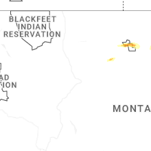
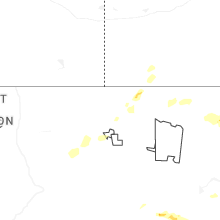


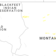


Connect with Interactive Hail Maps