

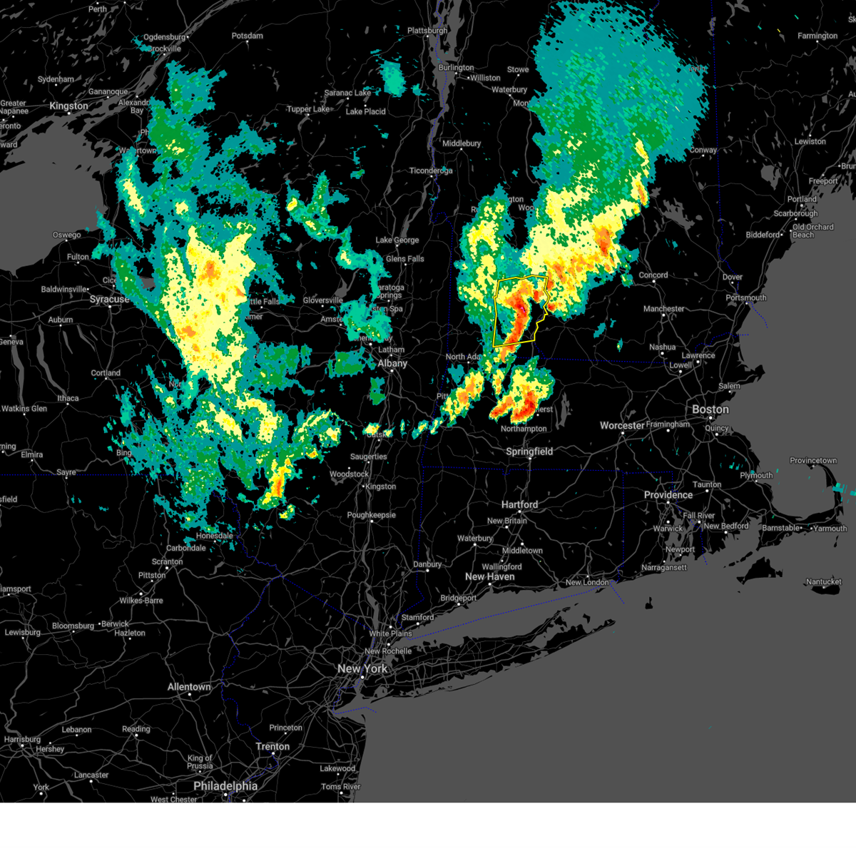
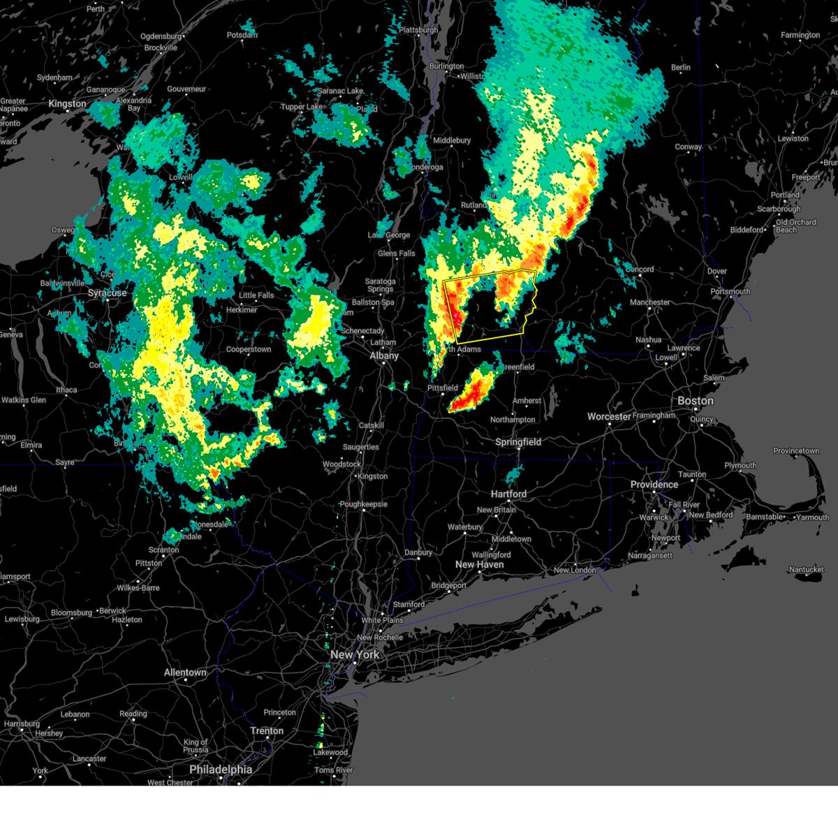
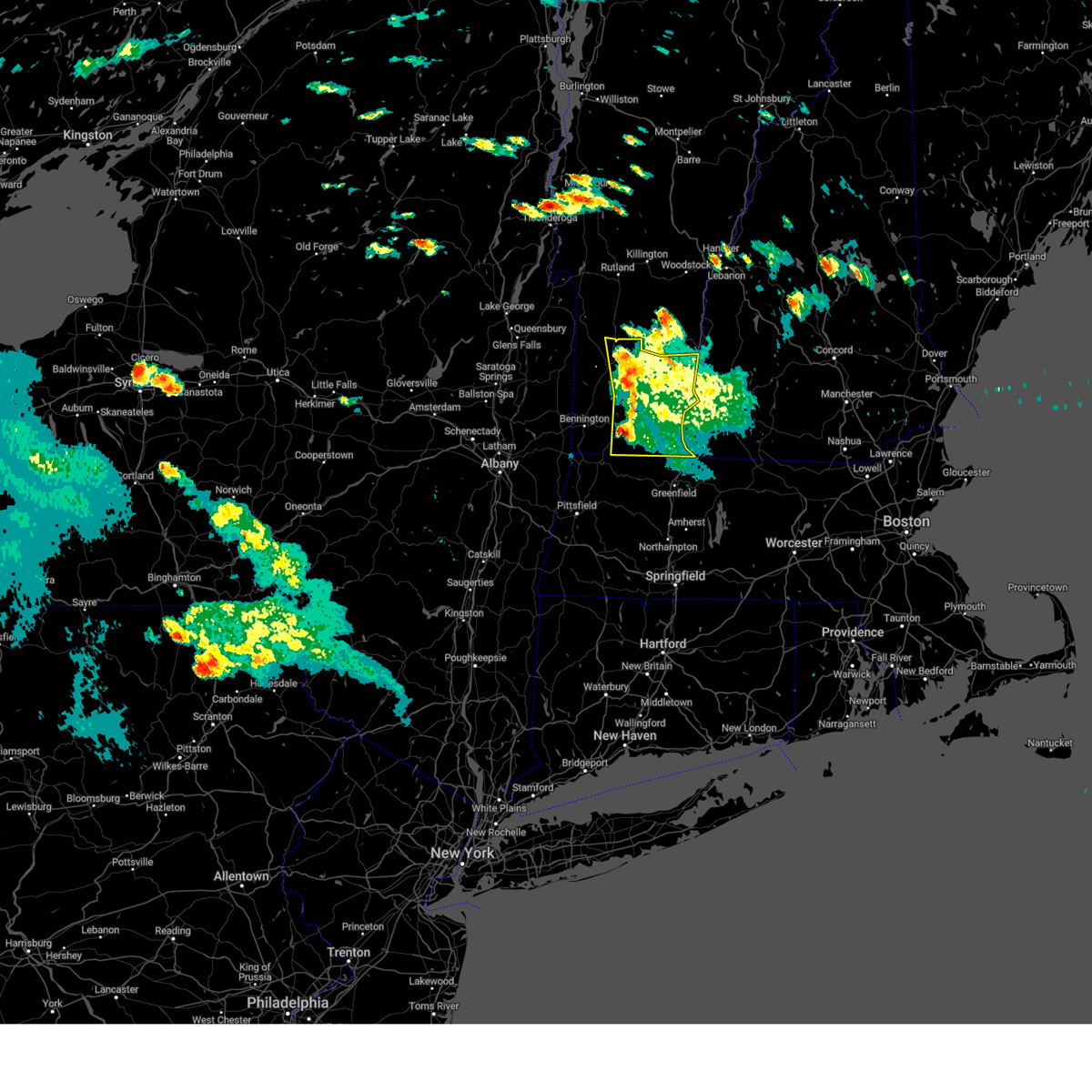
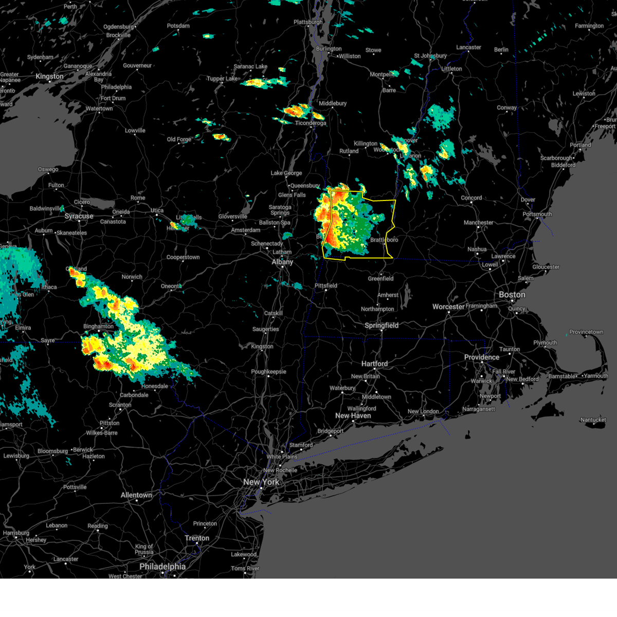
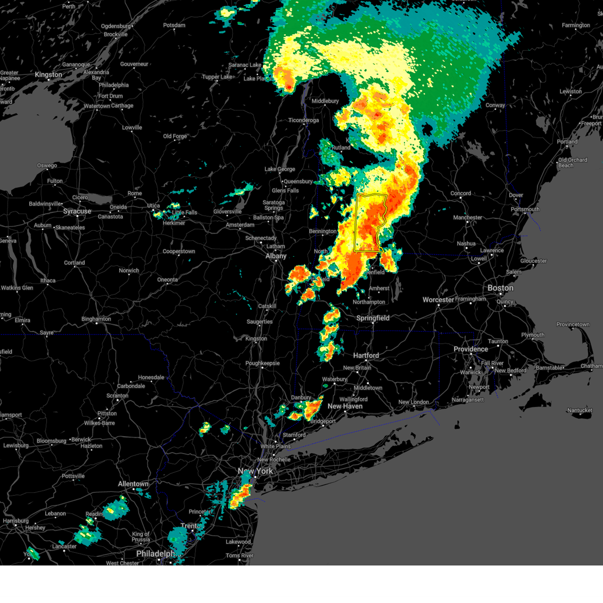
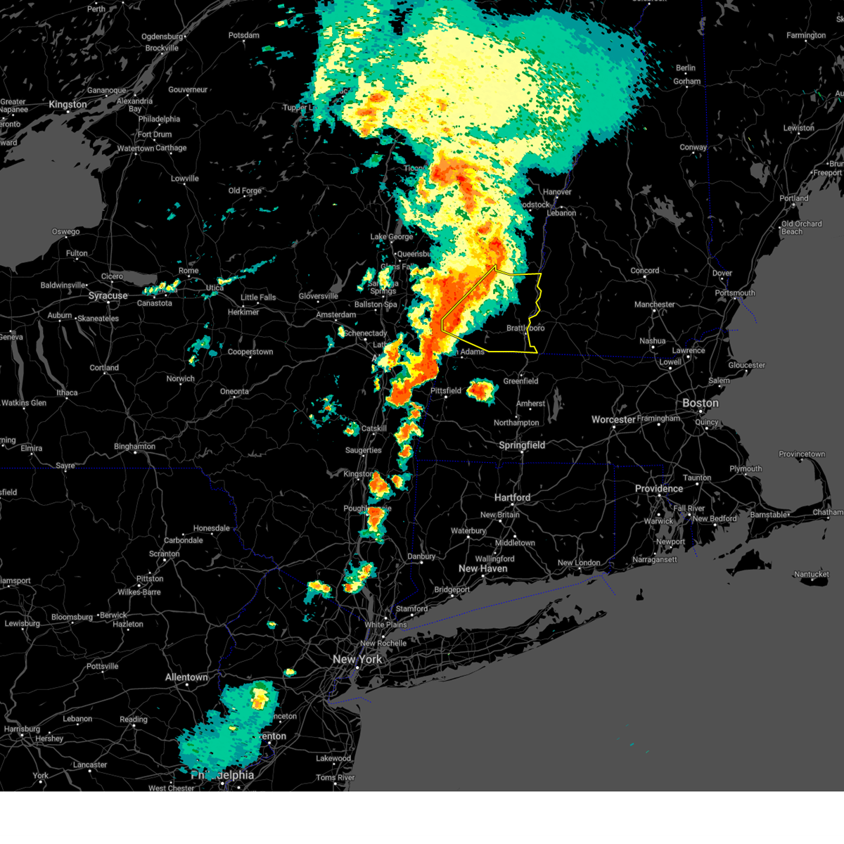
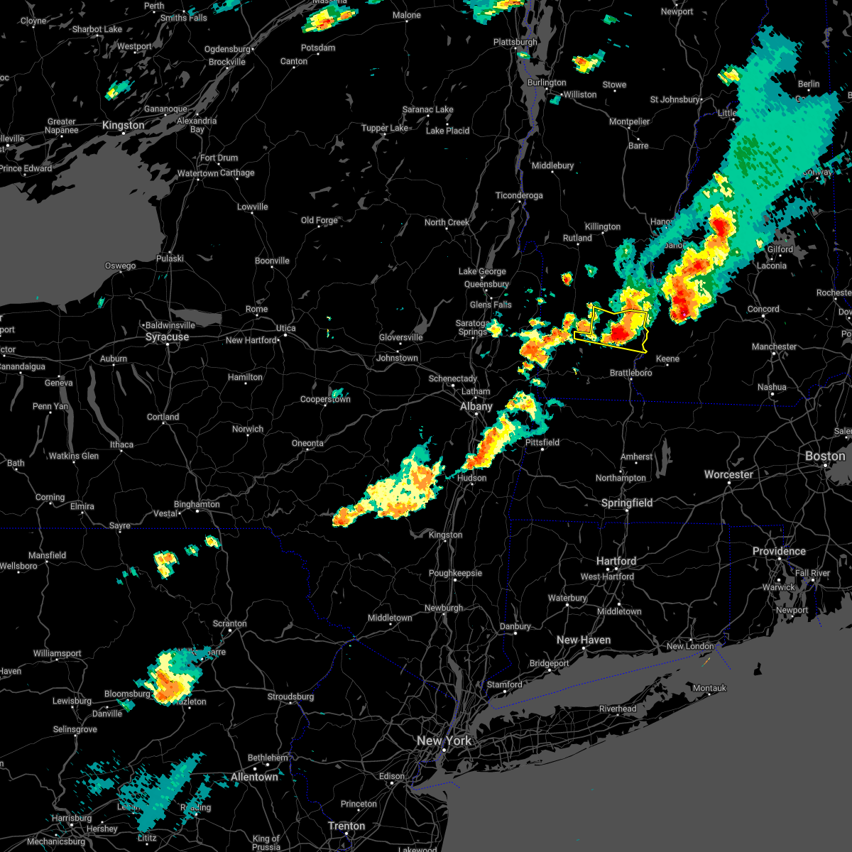
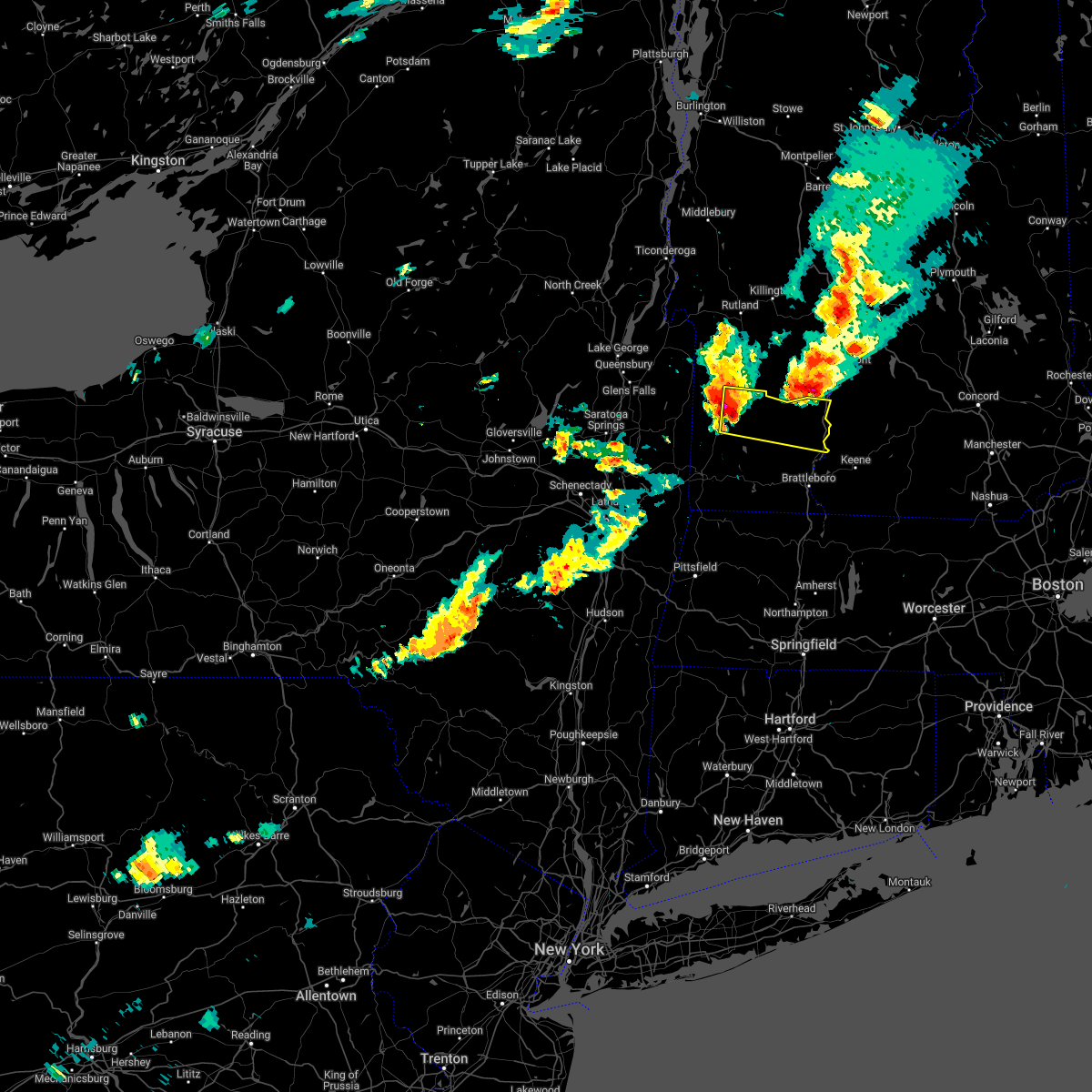
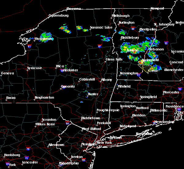
Hail Map for Saxtons River, VT
The Saxtons River, VT area has had 0 reports of on-the-ground hail by trained spotters, and has been under severe weather warnings 8 times during the past 12 months. Doppler radar has detected hail at or near Saxtons River, VT on 13 occasions, including 1 occasion during the past year.
| Name: | Saxtons River, VT |
| Where Located: | 75.9 miles ENE of Schenectady, NY |
| Map: | Google Map for Saxtons River, VT |
| Population: | 565 |
| Housing Units: | 241 |
| More Info: | Search Google for Saxtons River, VT |
0
The Top Recent Hail Date for Saxtons River, VT is Monday, August 5, 2024 (13th out of 13)

Hail and Wind Damage Spotted near Saxtons River, VT
| Date / Time | Report Details |
|---|---|
| 5/17/2025 7:15 PM EDT |
 the severe thunderstorm warning has been cancelled and is no longer in effect the severe thunderstorm warning has been cancelled and is no longer in effect
|
| 5/17/2025 7:15 PM EDT |
 At 715 pm edt, severe thunderstorms were located along a line extending from 6 miles northeast of west wardsboro to newfane to near heath, moving east at 45 mph (radar indicated). Hazards include 60 mph wind gusts and quarter size hail. Hail damage to vehicles is expected. expect wind damage to roofs, siding, and trees. Locations impacted include, wardsboro center, westminster, goose city, east putney, brockways mills, grafton, newfane, south windham, williamsville, east dover, dummerston center, east jamaica, bartonsville, thompsonburg, cambridgeport, harmonyville, bellows falls, wilmington, north windham, and pikes falls. At 715 pm edt, severe thunderstorms were located along a line extending from 6 miles northeast of west wardsboro to newfane to near heath, moving east at 45 mph (radar indicated). Hazards include 60 mph wind gusts and quarter size hail. Hail damage to vehicles is expected. expect wind damage to roofs, siding, and trees. Locations impacted include, wardsboro center, westminster, goose city, east putney, brockways mills, grafton, newfane, south windham, williamsville, east dover, dummerston center, east jamaica, bartonsville, thompsonburg, cambridgeport, harmonyville, bellows falls, wilmington, north windham, and pikes falls.
|
| 5/17/2025 6:42 PM EDT |
 Svraly the national weather service in albany has issued a * severe thunderstorm warning for, central bennington county in southern vermont, windham county in southern vermont, * until 730 pm edt. * at 642 pm edt, a severe thunderstorm was located 7 miles southeast of shaftsbury, or 8 miles southeast of arlington, moving east at 45 mph (radar indicated). Hazards include 60 mph wind gusts and quarter size hail. Hail damage to vehicles is expected. Expect wind damage to roofs, siding, and trees. Svraly the national weather service in albany has issued a * severe thunderstorm warning for, central bennington county in southern vermont, windham county in southern vermont, * until 730 pm edt. * at 642 pm edt, a severe thunderstorm was located 7 miles southeast of shaftsbury, or 8 miles southeast of arlington, moving east at 45 mph (radar indicated). Hazards include 60 mph wind gusts and quarter size hail. Hail damage to vehicles is expected. Expect wind damage to roofs, siding, and trees.
|
| 8/5/2024 6:35 PM EDT |
 the severe thunderstorm warning has been cancelled and is no longer in effect the severe thunderstorm warning has been cancelled and is no longer in effect
|
| 8/5/2024 6:35 PM EDT |
 At 634 pm edt, severe thunderstorms were located along a line extending from weston to west wardsboro to readsboro, moving east at 30 mph (radar indicated). Hazards include 60 mph wind gusts and penny size hail. Expect damage to roofs, siding, and trees. Locations impacted include, brattleboro, londonderry, townshend, stratton, monroe, putney, vernon, wilmington, readsboro, saxtons river, newfane, guilford center, west wardsboro, manchester center, hinsdale, westmoreland, chesterfield, windham, rockingham, and guilford. At 634 pm edt, severe thunderstorms were located along a line extending from weston to west wardsboro to readsboro, moving east at 30 mph (radar indicated). Hazards include 60 mph wind gusts and penny size hail. Expect damage to roofs, siding, and trees. Locations impacted include, brattleboro, londonderry, townshend, stratton, monroe, putney, vernon, wilmington, readsboro, saxtons river, newfane, guilford center, west wardsboro, manchester center, hinsdale, westmoreland, chesterfield, windham, rockingham, and guilford.
|
| 8/5/2024 6:13 PM EDT |
 Svraly the national weather service in albany has issued a * severe thunderstorm warning for, north central berkshire county in western massachusetts, bennington county in southern vermont, windham county in southern vermont, * until 715 pm edt. * at 613 pm edt, severe thunderstorms were located along a line extending from near danby to near arlington to pownal, moving east at 30 mph (radar indicated). Hazards include 60 mph wind gusts and penny size hail. expect damage to roofs, siding, and trees Svraly the national weather service in albany has issued a * severe thunderstorm warning for, north central berkshire county in western massachusetts, bennington county in southern vermont, windham county in southern vermont, * until 715 pm edt. * at 613 pm edt, severe thunderstorms were located along a line extending from near danby to near arlington to pownal, moving east at 30 mph (radar indicated). Hazards include 60 mph wind gusts and penny size hail. expect damage to roofs, siding, and trees
|
| 7/16/2024 6:58 PM EDT |
 Svraly the national weather service in albany has issued a * severe thunderstorm warning for, windham county in southern vermont, * until 715 pm edt. * at 657 pm edt, severe thunderstorms were located along a line extending from near saxtons river to near bernardston, moving east at 50 mph (radar indicated). Hazards include 70 mph wind gusts. Expect considerable tree damage. Damage is likely to mobile homes, roofs, and outbuildings. Svraly the national weather service in albany has issued a * severe thunderstorm warning for, windham county in southern vermont, * until 715 pm edt. * at 657 pm edt, severe thunderstorms were located along a line extending from near saxtons river to near bernardston, moving east at 50 mph (radar indicated). Hazards include 70 mph wind gusts. Expect considerable tree damage. Damage is likely to mobile homes, roofs, and outbuildings.
|
| 7/16/2024 6:15 PM EDT |
 Svraly the national weather service in albany has issued a * severe thunderstorm warning for, central bennington county in southern vermont, windham county in southern vermont, * until 700 pm edt. * at 615 pm edt, severe thunderstorms were located along a line extending from near londonderry to near bennington, moving east at 45 mph (radar indicated). Hazards include 70 mph wind gusts. Expect considerable tree damage. Damage is likely to mobile homes, roofs, and outbuildings. Svraly the national weather service in albany has issued a * severe thunderstorm warning for, central bennington county in southern vermont, windham county in southern vermont, * until 700 pm edt. * at 615 pm edt, severe thunderstorms were located along a line extending from near londonderry to near bennington, moving east at 45 mph (radar indicated). Hazards include 70 mph wind gusts. Expect considerable tree damage. Damage is likely to mobile homes, roofs, and outbuildings.
|
| 7/13/2023 8:14 PM EDT |
 At 814 pm edt, severe thunderstorms were located along a line extending from near springfield to near heath, moving east at 40 mph (radar indicated). Hazards include 60 mph wind gusts. Expect damage to roofs, siding, and trees. locations impacted include, brattleboro, bellows falls, townshend, putney, vernon, wilmington, readsboro, saxtons river, westminster, newfane, guilford center, west wardsboro, windham, rockingham, guilford, whitingham, dover, marlboro, jamaica and wardsboro. hail threat, radar indicated max hail size, <. 75 in wind threat, radar indicated max wind gust, 60 mph. At 814 pm edt, severe thunderstorms were located along a line extending from near springfield to near heath, moving east at 40 mph (radar indicated). Hazards include 60 mph wind gusts. Expect damage to roofs, siding, and trees. locations impacted include, brattleboro, bellows falls, townshend, putney, vernon, wilmington, readsboro, saxtons river, westminster, newfane, guilford center, west wardsboro, windham, rockingham, guilford, whitingham, dover, marlboro, jamaica and wardsboro. hail threat, radar indicated max hail size, <. 75 in wind threat, radar indicated max wind gust, 60 mph.
|
| 7/13/2023 7:44 PM EDT |
 At 744 pm edt, severe thunderstorms were located along a line extending from weston to near pownal, moving east at 40 mph (radar indicated). Hazards include 60 mph wind gusts and penny size hail. expect damage to roofs, siding, and trees At 744 pm edt, severe thunderstorms were located along a line extending from weston to near pownal, moving east at 40 mph (radar indicated). Hazards include 60 mph wind gusts and penny size hail. expect damage to roofs, siding, and trees
|
| 8/26/2022 1:38 PM EDT | At 135 pm edt, a severe thunderstorm was located over mainly rural areas of northern windham county, moving east at 40 mph (radar indicated). Hazards include 60 mph wind gusts and quarter size hail. Hail damage to vehicles is expected. Expect wind damage to roofs, siding, and trees. |
| 8/4/2022 6:33 PM EDT |
 At 633 pm edt, a severe thunderstorm was located near west wardsboro, or near stratton, moving east at 20 mph (radar indicated). Hazards include 60 mph wind gusts. expect damage to roofs, siding, and trees At 633 pm edt, a severe thunderstorm was located near west wardsboro, or near stratton, moving east at 20 mph (radar indicated). Hazards include 60 mph wind gusts. expect damage to roofs, siding, and trees
|
| 7/12/2022 4:19 PM EDT |
 At 419 pm edt, a severe thunderstorm was located near townshend, moving east at 35 mph (radar indicated). Hazards include 60 mph wind gusts and quarter size hail. Hail damage to vehicles is expected. expect wind damage to roofs, siding, and trees. locations impacted include, bellows falls, londonderry, townshend, saxtons river, westminster, windham, rockingham, jamaica, grafton, brookline, athens, north westminster, brockways mills, rawsonville, south windham, east jamaica, bartonsville, thompsonburg, cambridgeport and harmonyville. hail threat, radar indicated max hail size, 1. 00 in wind threat, radar indicated max wind gust, 60 mph. At 419 pm edt, a severe thunderstorm was located near townshend, moving east at 35 mph (radar indicated). Hazards include 60 mph wind gusts and quarter size hail. Hail damage to vehicles is expected. expect wind damage to roofs, siding, and trees. locations impacted include, bellows falls, londonderry, townshend, saxtons river, westminster, windham, rockingham, jamaica, grafton, brookline, athens, north westminster, brockways mills, rawsonville, south windham, east jamaica, bartonsville, thompsonburg, cambridgeport and harmonyville. hail threat, radar indicated max hail size, 1. 00 in wind threat, radar indicated max wind gust, 60 mph.
|
| 7/12/2022 3:46 PM EDT |
 At 345 pm edt, a severe thunderstorm was located near manchester center, or near manchester, moving east at 50 mph (radar indicated). Hazards include 60 mph wind gusts and quarter size hail. Hail damage to vehicles is expected. Expect wind damage to roofs, siding, and trees. At 345 pm edt, a severe thunderstorm was located near manchester center, or near manchester, moving east at 50 mph (radar indicated). Hazards include 60 mph wind gusts and quarter size hail. Hail damage to vehicles is expected. Expect wind damage to roofs, siding, and trees.
|
| 5/16/2022 5:49 PM EDT |
 At 549 pm edt, severe thunderstorms were located along a line extending from near mt. tabor to near townshend to near guilford center, moving east at 40 mph (radar indicated). Hazards include 60 mph wind gusts. Expect damage to roofs, siding, and trees. locations impacted include, brattleboro, bellows falls, londonderry, townshend, manchester, stratton, putney, vernon, dorset, wilmington, readsboro, saxtons river, westminster, newfane, guilford center, manchester center, west wardsboro, hinsdale, westmoreland and walpole. hail threat, radar indicated max hail size, <. 75 in wind threat, radar indicated max wind gust, 60 mph. At 549 pm edt, severe thunderstorms were located along a line extending from near mt. tabor to near townshend to near guilford center, moving east at 40 mph (radar indicated). Hazards include 60 mph wind gusts. Expect damage to roofs, siding, and trees. locations impacted include, brattleboro, bellows falls, londonderry, townshend, manchester, stratton, putney, vernon, dorset, wilmington, readsboro, saxtons river, westminster, newfane, guilford center, manchester center, west wardsboro, hinsdale, westmoreland and walpole. hail threat, radar indicated max hail size, <. 75 in wind threat, radar indicated max wind gust, 60 mph.
|
| 5/16/2022 5:10 PM EDT |
 At 510 pm edt, severe thunderstorms were located along a line extending from near whitehall to north adams, moving northeast at 45 mph (radar indicated). Hazards include 60 mph wind gusts. expect damage to roofs, siding, and trees At 510 pm edt, severe thunderstorms were located along a line extending from near whitehall to north adams, moving northeast at 45 mph (radar indicated). Hazards include 60 mph wind gusts. expect damage to roofs, siding, and trees
|
| 3/7/2022 9:10 PM EST |
 The severe thunderstorm warning for eastern bennington and windham counties will expire at 915 pm est, the storm which prompted the warning has moved out of the area. therefore, the warning will be allowed to expire. however gusty winds are still expected for the next few hours. The severe thunderstorm warning for eastern bennington and windham counties will expire at 915 pm est, the storm which prompted the warning has moved out of the area. therefore, the warning will be allowed to expire. however gusty winds are still expected for the next few hours.
|
| 3/7/2022 8:43 PM EST |
 At 843 pm est, a severe thunderstorm was located over west wardsboro, or over stratton, moving east at 55 mph (radar indicated). Hazards include 60 mph wind gusts. expect damage to roofs, siding, and trees At 843 pm est, a severe thunderstorm was located over west wardsboro, or over stratton, moving east at 55 mph (radar indicated). Hazards include 60 mph wind gusts. expect damage to roofs, siding, and trees
|
| 7/20/2021 10:43 PM EDT |
 The severe thunderstorm warning for southeastern bennington and windham counties will expire at 1045 pm edt, the storms which prompted the warning have moved out of the area. therefore, the warning will be allowed to expire. a severe thunderstorm watch remains in effect until 1100 pm edt for southern vermont. The severe thunderstorm warning for southeastern bennington and windham counties will expire at 1045 pm edt, the storms which prompted the warning have moved out of the area. therefore, the warning will be allowed to expire. a severe thunderstorm watch remains in effect until 1100 pm edt for southern vermont.
|
| 7/20/2021 10:00 PM EDT |
 At 1000 pm edt, severe thunderstorms were located along a line extending from near chester to near monroe, moving east at 25 mph (radar indicated). Hazards include 60 mph wind gusts. expect damage to roofs, siding, and trees At 1000 pm edt, severe thunderstorms were located along a line extending from near chester to near monroe, moving east at 25 mph (radar indicated). Hazards include 60 mph wind gusts. expect damage to roofs, siding, and trees
|
| 7/20/2021 9:56 PM EDT |
 At 954 pm edt, severe thunderstorms were located along a line extending from near andover to monroe, moving east at 40 mph (radar indicated). Hazards include 60 mph wind gusts. Expect damage to roofs, siding, and trees. Locations impacted include, bennington, londonderry, townshend, stratton, pownal, wilmington, stamford, readsboro, saxtons river, newfane, west wardsboro, windham, rockingham, whitingham, dover, marlboro, jamaica, wardsboro, grafton and brookline. At 954 pm edt, severe thunderstorms were located along a line extending from near andover to monroe, moving east at 40 mph (radar indicated). Hazards include 60 mph wind gusts. Expect damage to roofs, siding, and trees. Locations impacted include, bennington, londonderry, townshend, stratton, pownal, wilmington, stamford, readsboro, saxtons river, newfane, west wardsboro, windham, rockingham, whitingham, dover, marlboro, jamaica, wardsboro, grafton and brookline.
|
| 7/20/2021 9:24 PM EDT |
 At 923 pm edt, severe thunderstorms were located along a line extending from dorset to near grafton, moving east at 45 mph (radar indicated). Hazards include 60 mph wind gusts. expect damage to roofs, siding, and trees At 923 pm edt, severe thunderstorms were located along a line extending from dorset to near grafton, moving east at 45 mph (radar indicated). Hazards include 60 mph wind gusts. expect damage to roofs, siding, and trees
|
| 6/30/2021 3:49 PM EDT |
 At 348 pm edt, severe thunderstorms were located along a line extending from near londonderry to near west wardsboro to stamford, moving east at 45 mph (radar indicated). Hazards include 60 mph wind gusts. expect damage to roofs, siding, and trees At 348 pm edt, severe thunderstorms were located along a line extending from near londonderry to near west wardsboro to stamford, moving east at 45 mph (radar indicated). Hazards include 60 mph wind gusts. expect damage to roofs, siding, and trees
|
| 5/26/2021 5:25 PM EDT |
 At 524 pm edt, a line of showers and thunderstorms were located along a line extending from springfield to near putney to buckland, moving east at 40 mph (radar indicated). Hazards include 60 mph wind gusts. Expect damage to roofs, siding, and trees. Locations impacted include, brattleboro, townshend, putney, vernon, saxtons river, newfane, guilford center, windham, rockingham, guilford, marlboro, halifax, grafton, brookline, athens, north westminster, jacksonville, east putney, brockways mills and south windham. At 524 pm edt, a line of showers and thunderstorms were located along a line extending from springfield to near putney to buckland, moving east at 40 mph (radar indicated). Hazards include 60 mph wind gusts. Expect damage to roofs, siding, and trees. Locations impacted include, brattleboro, townshend, putney, vernon, saxtons river, newfane, guilford center, windham, rockingham, guilford, marlboro, halifax, grafton, brookline, athens, north westminster, jacksonville, east putney, brockways mills and south windham.
|
| 5/26/2021 5:20 PM EDT | Tree down on herring hill rd in windham county VT, 5.2 miles ENE of Saxtons River, VT |
| 5/26/2021 4:57 PM EDT |
 At 457 pm edt, a line of showers and thunderstorms were located along a line extending from weston to near wilmington to adams, moving east at 45 mph (radar indicated). Hazards include 60 mph wind gusts. expect damage to roofs, siding, and trees At 457 pm edt, a line of showers and thunderstorms were located along a line extending from weston to near wilmington to adams, moving east at 45 mph (radar indicated). Hazards include 60 mph wind gusts. expect damage to roofs, siding, and trees
|
| 10/7/2020 4:09 PM EDT |
 At 408 pm edt, a severe thunderstorm was located near pownal, or near bennington, moving east at 70 mph. this is a very dangerous storm (radar indicated). Hazards include 80 mph wind gusts and nickel size hail. Flying debris will be dangerous to those caught without shelter. mobile homes will be heavily damaged. expect considerable damage to roofs, windows, and vehicles. extensive tree damage and power outages are likely. Locations impacted include, albany, troy, pittsfield, bennington, kingston, east greenbush, cohoes, north adams, brattleboro, watervliet, rensselaer, colonie, great barrington, new paltz, hudson, ellenville, catskill, saugerties, hoosick falls and bellows falls. At 408 pm edt, a severe thunderstorm was located near pownal, or near bennington, moving east at 70 mph. this is a very dangerous storm (radar indicated). Hazards include 80 mph wind gusts and nickel size hail. Flying debris will be dangerous to those caught without shelter. mobile homes will be heavily damaged. expect considerable damage to roofs, windows, and vehicles. extensive tree damage and power outages are likely. Locations impacted include, albany, troy, pittsfield, bennington, kingston, east greenbush, cohoes, north adams, brattleboro, watervliet, rensselaer, colonie, great barrington, new paltz, hudson, ellenville, catskill, saugerties, hoosick falls and bellows falls.
|
| 10/7/2020 3:56 PM EDT |
 At 356 pm edt, severe thunderstorms were located along a line extending from near pawlet to center brunswick to near davenport, moving southeast at 80 mph (radar indicated). Hazards include 70 mph wind gusts. Expect considerable tree damage. Damage is likely to mobile homes, roofs, and outbuildings. At 356 pm edt, severe thunderstorms were located along a line extending from near pawlet to center brunswick to near davenport, moving southeast at 80 mph (radar indicated). Hazards include 70 mph wind gusts. Expect considerable tree damage. Damage is likely to mobile homes, roofs, and outbuildings.
|
| 10/7/2020 3:48 PM EDT |
 At 347 pm edt, severe thunderstorms were located along a line extending from near dorset to 7 miles southwest of cambridge to middleburgh, moving east at 60 mph (radar indicated). Hazards include 70 mph wind gusts. Expect considerable tree damage. damage is likely to mobile homes, roofs, and outbuildings. Locations impacted include, albany, schenectady, troy, bennington, clifton park, rotterdam, saratoga springs, amsterdam, east greenbush, cohoes, north adams, watervliet, rensselaer, colonie, scotia, hudson falls, mechanicville, cobleskill, hoosick falls and bellows falls. At 347 pm edt, severe thunderstorms were located along a line extending from near dorset to 7 miles southwest of cambridge to middleburgh, moving east at 60 mph (radar indicated). Hazards include 70 mph wind gusts. Expect considerable tree damage. damage is likely to mobile homes, roofs, and outbuildings. Locations impacted include, albany, schenectady, troy, bennington, clifton park, rotterdam, saratoga springs, amsterdam, east greenbush, cohoes, north adams, watervliet, rensselaer, colonie, scotia, hudson falls, mechanicville, cobleskill, hoosick falls and bellows falls.
|
| 10/7/2020 3:43 PM EDT |
 At 342 pm edt, severe thunderstorms were located along a line extending from near dorset to 6 miles northeast of mechanicville to near middleburgh, moving east southeast at 60 mph (radar indicated). Hazards include 60 mph wind gusts. Expect damage to roofs, siding, and trees. Locations impacted include, albany, schenectady, troy, bennington, clifton park, rotterdam, saratoga springs, amsterdam, east greenbush, cohoes, north adams, watervliet, rensselaer, colonie, scotia, hudson falls, mechanicville, cobleskill, hoosick falls and bellows falls. At 342 pm edt, severe thunderstorms were located along a line extending from near dorset to 6 miles northeast of mechanicville to near middleburgh, moving east southeast at 60 mph (radar indicated). Hazards include 60 mph wind gusts. Expect damage to roofs, siding, and trees. Locations impacted include, albany, schenectady, troy, bennington, clifton park, rotterdam, saratoga springs, amsterdam, east greenbush, cohoes, north adams, watervliet, rensselaer, colonie, scotia, hudson falls, mechanicville, cobleskill, hoosick falls and bellows falls.
|
| 10/7/2020 3:21 PM EDT |
 At 320 pm edt, severe thunderstorms were located along a line extending from near lake george village to near broadalbin to cooperstown, moving east at 60 mph (radar indicated). Hazards include 70 mph wind gusts. Expect considerable tree damage. Damage is likely to mobile homes, roofs, and outbuildings. At 320 pm edt, severe thunderstorms were located along a line extending from near lake george village to near broadalbin to cooperstown, moving east at 60 mph (radar indicated). Hazards include 70 mph wind gusts. Expect considerable tree damage. Damage is likely to mobile homes, roofs, and outbuildings.
|
| 7/5/2020 7:19 PM EDT |
 At 719 pm edt, a severe thunderstorm was located near charlestown, or near bellows falls, moving southeast at 30 mph (radar indicated). Hazards include 60 mph wind gusts and quarter size hail. Hail damage to vehicles is expected. Expect wind damage to roofs, siding, and trees. At 719 pm edt, a severe thunderstorm was located near charlestown, or near bellows falls, moving southeast at 30 mph (radar indicated). Hazards include 60 mph wind gusts and quarter size hail. Hail damage to vehicles is expected. Expect wind damage to roofs, siding, and trees.
|
| 5/15/2020 7:39 PM EDT |
 At 713 pm edt, severe thunderstorms were located along a line extending from near saxtons river to near newfane to near heath, moving east at 60 mph (radar indicated). Hazards include 70 mph wind gusts and penny size hail. Expect considerable tree damage. Damage is likely to mobile homes, roofs, and outbuildings. At 713 pm edt, severe thunderstorms were located along a line extending from near saxtons river to near newfane to near heath, moving east at 60 mph (radar indicated). Hazards include 70 mph wind gusts and penny size hail. Expect considerable tree damage. Damage is likely to mobile homes, roofs, and outbuildings.
|
| 5/15/2020 7:13 PM EDT |
 At 713 pm edt, severe thunderstorms were located along a line extending from near saxtons river to near newfane to near heath, moving east at 60 mph (radar indicated). Hazards include 70 mph wind gusts and penny size hail. Expect considerable tree damage. Damage is likely to mobile homes, roofs, and outbuildings. At 713 pm edt, severe thunderstorms were located along a line extending from near saxtons river to near newfane to near heath, moving east at 60 mph (radar indicated). Hazards include 70 mph wind gusts and penny size hail. Expect considerable tree damage. Damage is likely to mobile homes, roofs, and outbuildings.
|
| 5/15/2020 6:56 PM EDT |
 At 656 pm edt, severe thunderstorms were located along a line extending from near londonderry to near west wardsboro to near stamford, moving east at 55 mph (radar indicated). Hazards include 70 mph wind gusts and penny size hail. Expect considerable tree damage. damage is likely to mobile homes, roofs, and outbuildings. Locations impacted include, bennington, brattleboro, londonderry, townshend, stratton, pownal, putney, vernon, wilmington, stamford, readsboro, saxtons river, westminster, newfane, guilford center, west wardsboro, hinsdale, windham, rockingham and guilford. At 656 pm edt, severe thunderstorms were located along a line extending from near londonderry to near west wardsboro to near stamford, moving east at 55 mph (radar indicated). Hazards include 70 mph wind gusts and penny size hail. Expect considerable tree damage. damage is likely to mobile homes, roofs, and outbuildings. Locations impacted include, bennington, brattleboro, londonderry, townshend, stratton, pownal, putney, vernon, wilmington, stamford, readsboro, saxtons river, westminster, newfane, guilford center, west wardsboro, hinsdale, windham, rockingham and guilford.
|
| 5/15/2020 6:26 PM EDT |
 At 625 pm edt, severe thunderstorms were located along a line extending from 6 miles northeast of salem to near shaftsbury to near mechanicville, moving east at 65 mph (radar indicated). Hazards include 70 mph wind gusts and quarter size hail. Hail damage to vehicles is expected. expect considerable tree damage. Wind damage is also likely to mobile homes, roofs, and outbuildings. At 625 pm edt, severe thunderstorms were located along a line extending from 6 miles northeast of salem to near shaftsbury to near mechanicville, moving east at 65 mph (radar indicated). Hazards include 70 mph wind gusts and quarter size hail. Hail damage to vehicles is expected. expect considerable tree damage. Wind damage is also likely to mobile homes, roofs, and outbuildings.
|
| 6/26/2019 8:29 PM EDT |
 At 829 pm edt, severe thunderstorms were located along a line extending from near stratton to near readsboro to adams, moving east at 30 mph (radar indicated). Hazards include 60 mph wind gusts and quarter size hail. Hail damage to vehicles is expected. expect wind damage to roofs, siding, and trees. these severe storms will be near, wilmington and west wardsboro around 835 pm edt. townshend, newfane and guilford center around 855 pm edt. brattleboro, putney, vernon and hinsdale around 900 pm edt. Other locations impacted by these severe thunderstorms include goose city, north hancock, readsboro falls, grafton, cheshire harbor, south windham, guilford, zylonite, cambridgeport and harmonyville. At 829 pm edt, severe thunderstorms were located along a line extending from near stratton to near readsboro to adams, moving east at 30 mph (radar indicated). Hazards include 60 mph wind gusts and quarter size hail. Hail damage to vehicles is expected. expect wind damage to roofs, siding, and trees. these severe storms will be near, wilmington and west wardsboro around 835 pm edt. townshend, newfane and guilford center around 855 pm edt. brattleboro, putney, vernon and hinsdale around 900 pm edt. Other locations impacted by these severe thunderstorms include goose city, north hancock, readsboro falls, grafton, cheshire harbor, south windham, guilford, zylonite, cambridgeport and harmonyville.
|
| 6/26/2019 8:29 PM EDT |
 A severe thunderstorm warning remains in effect until 900 pm edt for northeastern berkshire. east central rensselaer. southeastern bennington and windham counties. At 829 pm edt, severe thunderstorms were located along a line extending from near stratton to near readsboro to adams, moving east at 30 mph. A severe thunderstorm warning remains in effect until 900 pm edt for northeastern berkshire. east central rensselaer. southeastern bennington and windham counties. At 829 pm edt, severe thunderstorms were located along a line extending from near stratton to near readsboro to adams, moving east at 30 mph.
|
| 6/26/2019 8:29 PM EDT |
 At 829 pm edt, severe thunderstorms were located along a line extending from near stratton to near readsboro to adams, moving east at 30 mph (radar indicated). Hazards include 60 mph wind gusts and quarter size hail. Hail damage to vehicles is expected. expect wind damage to roofs, siding, and trees. these severe storms will be near, wilmington and west wardsboro around 835 pm edt. townshend, newfane and guilford center around 855 pm edt. brattleboro, putney, vernon and hinsdale around 900 pm edt. Other locations impacted by these severe thunderstorms include goose city, north hancock, readsboro falls, grafton, cheshire harbor, south windham, guilford, zylonite, cambridgeport and harmonyville. At 829 pm edt, severe thunderstorms were located along a line extending from near stratton to near readsboro to adams, moving east at 30 mph (radar indicated). Hazards include 60 mph wind gusts and quarter size hail. Hail damage to vehicles is expected. expect wind damage to roofs, siding, and trees. these severe storms will be near, wilmington and west wardsboro around 835 pm edt. townshend, newfane and guilford center around 855 pm edt. brattleboro, putney, vernon and hinsdale around 900 pm edt. Other locations impacted by these severe thunderstorms include goose city, north hancock, readsboro falls, grafton, cheshire harbor, south windham, guilford, zylonite, cambridgeport and harmonyville.
|
| 6/26/2019 7:52 PM EDT |
 At 752 pm edt, severe thunderstorms were located along a line extending from near shaftsbury to pownal to near berlin, moving east at 30 mph (radar indicated). Hazards include 60 mph wind gusts and quarter size hail. Hail damage to vehicles is expected. expect wind damage to roofs, siding, and trees. severe thunderstorms will be near, bennington, arlington and shaftsbury around 800 pm edt. stamford around 805 pm edt. new ashford around 810 pm edt. north adams, monroe and readsboro around 820 pm edt. stratton, adams and wilmington around 825 pm edt. west wardsboro around 830 pm edt. florida around 835 pm edt. townshend around 845 pm edt. Other locations impacted by these severe thunderstorms include goose city, chiselville, north hancock, readsboro falls, grafton, cheshire harbor, south shaftsbury, south windham, guilford and zylonite. At 752 pm edt, severe thunderstorms were located along a line extending from near shaftsbury to pownal to near berlin, moving east at 30 mph (radar indicated). Hazards include 60 mph wind gusts and quarter size hail. Hail damage to vehicles is expected. expect wind damage to roofs, siding, and trees. severe thunderstorms will be near, bennington, arlington and shaftsbury around 800 pm edt. stamford around 805 pm edt. new ashford around 810 pm edt. north adams, monroe and readsboro around 820 pm edt. stratton, adams and wilmington around 825 pm edt. west wardsboro around 830 pm edt. florida around 835 pm edt. townshend around 845 pm edt. Other locations impacted by these severe thunderstorms include goose city, chiselville, north hancock, readsboro falls, grafton, cheshire harbor, south shaftsbury, south windham, guilford and zylonite.
|
| 7/28/2018 3:09 PM EDT |
 The national weather service in albany has issued a * severe thunderstorm warning for. east central windham county in southern vermont. until 330 pm edt. At 309 pm edt, a severe thunderstorm was located over westminster, or near bellows falls, moving northeast at 20 mph. The national weather service in albany has issued a * severe thunderstorm warning for. east central windham county in southern vermont. until 330 pm edt. At 309 pm edt, a severe thunderstorm was located over westminster, or near bellows falls, moving northeast at 20 mph.
|
| 7/17/2018 6:46 AM EDT |
 At 646 am edt, a severe thunderstorm was located over stratton, moving east at 35 mph (radar indicated). Hazards include 60 mph wind gusts. Expect damage to roofs, siding, and trees. this severe thunderstorm will be near, townshend and newfane around 700 am edt. saxtons river around 715 am edt. bellows falls and westminster around 720 am edt. Other locations impacted by this severe thunderstorm include wardsboro center, goose city, east putney, grafton, south windham, east dover, east jamaica, cambridgeport, rockingham and harmonyville. At 646 am edt, a severe thunderstorm was located over stratton, moving east at 35 mph (radar indicated). Hazards include 60 mph wind gusts. Expect damage to roofs, siding, and trees. this severe thunderstorm will be near, townshend and newfane around 700 am edt. saxtons river around 715 am edt. bellows falls and westminster around 720 am edt. Other locations impacted by this severe thunderstorm include wardsboro center, goose city, east putney, grafton, south windham, east dover, east jamaica, cambridgeport, rockingham and harmonyville.
|
| 6/18/2018 4:55 PM EDT |
 The national weather service in albany has issued a * severe thunderstorm warning for. eastern windham county in southern vermont. until 600 pm edt. At 454 pm edt, severe thunderstorms were located along a line extending from andover to putney to near buckland, moving east at. The national weather service in albany has issued a * severe thunderstorm warning for. eastern windham county in southern vermont. until 600 pm edt. At 454 pm edt, severe thunderstorms were located along a line extending from andover to putney to near buckland, moving east at.
|
| 5/4/2018 9:17 PM EDT |
 At 916 pm edt, severe thunderstorms were located along a line extending from weathersfield to putney to 6 miles northwest of colrain, moving east at 50 mph (radar indicated). Hazards include 70 mph wind gusts. Expect considerable tree damage. damage is likely to mobile homes, roofs, and outbuildings. these severe storms will be near, westminster around 920 pm edt. brattleboro and westmoreland around 925 pm edt. Vernon and hinsdale around 930 pm edt. At 916 pm edt, severe thunderstorms were located along a line extending from weathersfield to putney to 6 miles northwest of colrain, moving east at 50 mph (radar indicated). Hazards include 70 mph wind gusts. Expect considerable tree damage. damage is likely to mobile homes, roofs, and outbuildings. these severe storms will be near, westminster around 920 pm edt. brattleboro and westmoreland around 925 pm edt. Vernon and hinsdale around 930 pm edt.
|
| 5/4/2018 8:52 PM EDT |
 At 851 pm edt, severe thunderstorms were located along a line extending from near mount holly to stratton to near bennington, moving east at 60 mph (radar indicated). Hazards include 70 mph wind gusts. Expect considerable tree damage. damage is likely to mobile homes, roofs, and outbuildings. these severe storms will be near, west wardsboro around 855 pm edt. townshend, wilmington and newfane around 905 pm edt. putney around 910 pm edt. westminster around 915 pm edt. brattleboro, westmoreland and guilford center around 920 pm edt. Vernon and hinsdale around 925 pm edt. At 851 pm edt, severe thunderstorms were located along a line extending from near mount holly to stratton to near bennington, moving east at 60 mph (radar indicated). Hazards include 70 mph wind gusts. Expect considerable tree damage. damage is likely to mobile homes, roofs, and outbuildings. these severe storms will be near, west wardsboro around 855 pm edt. townshend, wilmington and newfane around 905 pm edt. putney around 910 pm edt. westminster around 915 pm edt. brattleboro, westmoreland and guilford center around 920 pm edt. Vernon and hinsdale around 925 pm edt.
|
| 5/4/2018 8:28 PM EDT |
 At 827 pm edt, severe thunderstorms were located along a line extending from near granville to near cambridge to near waterford, moving east at 55 mph (radar indicated). Hazards include 70 mph wind gusts. Expect considerable tree damage. damage is likely to mobile homes, roofs, and outbuildings. severe thunderstorms will be near, granville and wells around 830 pm edt. shaftsbury and pawlet around 835 pm edt. hoosick falls and arlington around 840 pm edt. bennington, stratton and pownal around 850 pm edt. west wardsboro around 855 pm edt. townshend, readsboro and newfane around 905 pm edt. wilmington around 910 pm edt. putney, saxtons river and westminster around 915 pm edt. A tornado watch remains in effect until 1000 pm edt for east central new york. At 827 pm edt, severe thunderstorms were located along a line extending from near granville to near cambridge to near waterford, moving east at 55 mph (radar indicated). Hazards include 70 mph wind gusts. Expect considerable tree damage. damage is likely to mobile homes, roofs, and outbuildings. severe thunderstorms will be near, granville and wells around 830 pm edt. shaftsbury and pawlet around 835 pm edt. hoosick falls and arlington around 840 pm edt. bennington, stratton and pownal around 850 pm edt. west wardsboro around 855 pm edt. townshend, readsboro and newfane around 905 pm edt. wilmington around 910 pm edt. putney, saxtons river and westminster around 915 pm edt. A tornado watch remains in effect until 1000 pm edt for east central new york.
|
| 9/5/2017 7:49 PM EDT |
 At 749 pm edt, severe thunderstorms were located along a line extending from near claremont to newfane, moving east at 35 mph (radar indicated). Hazards include 60 mph wind gusts. Expect damage to trees, and power lines. Locations impacted include, bellows falls, putney, westmoreland, saxtons river, westminster, rockingham, brookline, athens, north westminster, east putney, westminster west, east putney station, hadley field, putney station, cambridgeport, westminster station and dummerston center. At 749 pm edt, severe thunderstorms were located along a line extending from near claremont to newfane, moving east at 35 mph (radar indicated). Hazards include 60 mph wind gusts. Expect damage to trees, and power lines. Locations impacted include, bellows falls, putney, westmoreland, saxtons river, westminster, rockingham, brookline, athens, north westminster, east putney, westminster west, east putney station, hadley field, putney station, cambridgeport, westminster station and dummerston center.
|
| 9/5/2017 7:48 PM EDT |
 At 748 pm edt, severe thunderstorms were located along a line extending from near newport to near putney, moving east at 85 mph (radar indicated). Hazards include 60 mph wind gusts. Expect damage to trees, and power lines. These severe thunderstorms will remain over mainly rural areas of northeastern windham county, including the following locations: brookline, east putney station, hadley field, north westminster, east putney, putney station, cambridgeport, rockingham, athens and westminster west. At 748 pm edt, severe thunderstorms were located along a line extending from near newport to near putney, moving east at 85 mph (radar indicated). Hazards include 60 mph wind gusts. Expect damage to trees, and power lines. These severe thunderstorms will remain over mainly rural areas of northeastern windham county, including the following locations: brookline, east putney station, hadley field, north westminster, east putney, putney station, cambridgeport, rockingham, athens and westminster west.
|
| 9/5/2017 7:39 PM EDT |
 At 738 pm edt, severe thunderstorms were located along a line extending from wilgus state park to near newfane, moving northeast at 40 mph (radar indicated). Hazards include 60 mph wind gusts. Expect damage to trees, and power lines. these severe storms will be near, putney around 755 pm edt. bellows falls, saxtons river and westminster around 800 pm edt. Other locations impacted by these severe thunderstorms include wardsboro center, goose city, east putney, brockways mills, readsboro falls, grafton, south windham, williamsville, whitingham and east dover. At 738 pm edt, severe thunderstorms were located along a line extending from wilgus state park to near newfane, moving northeast at 40 mph (radar indicated). Hazards include 60 mph wind gusts. Expect damage to trees, and power lines. these severe storms will be near, putney around 755 pm edt. bellows falls, saxtons river and westminster around 800 pm edt. Other locations impacted by these severe thunderstorms include wardsboro center, goose city, east putney, brockways mills, readsboro falls, grafton, south windham, williamsville, whitingham and east dover.
|
| 9/5/2017 7:18 PM EDT |
 At 718 pm edt, severe thunderstorms were located along a line extending from near chester-chester depot to 6 miles west of wilmington, moving northeast at 40 mph (radar indicated). Hazards include 60 mph wind gusts and penny size hail. Expect damage to trees, and power lines. these severe storms will be near, newfane around 745 pm edt. townshend around 750 pm edt. putney around 755 pm edt. bellows falls, saxtons river and westminster around 800 pm edt. Other locations impacted by these severe thunderstorms include wardsboro center, goose city, east putney, brockways mills, readsboro falls, grafton, south windham, williamsville, whitingham and east dover. At 718 pm edt, severe thunderstorms were located along a line extending from near chester-chester depot to 6 miles west of wilmington, moving northeast at 40 mph (radar indicated). Hazards include 60 mph wind gusts and penny size hail. Expect damage to trees, and power lines. these severe storms will be near, newfane around 745 pm edt. townshend around 750 pm edt. putney around 755 pm edt. bellows falls, saxtons river and westminster around 800 pm edt. Other locations impacted by these severe thunderstorms include wardsboro center, goose city, east putney, brockways mills, readsboro falls, grafton, south windham, williamsville, whitingham and east dover.
|
| 9/5/2017 6:54 PM EDT |
 At 654 pm edt, severe thunderstorms were located along a line extending from londonderry to near pownal, moving northeast at 40 mph (radar indicated). Hazards include 60 mph wind gusts and penny size hail. Expect damage to trees, and power lines. severe thunderstorms will be near, londonderry around 700 pm edt. wilmington around 720 pm edt. stratton around 725 pm edt. west wardsboro around 730 pm edt. newfane around 740 pm edt. townshend around 745 pm edt. putney around 750 pm edt. Bellows falls, saxtons river and westminster around 800 pm edt. At 654 pm edt, severe thunderstorms were located along a line extending from londonderry to near pownal, moving northeast at 40 mph (radar indicated). Hazards include 60 mph wind gusts and penny size hail. Expect damage to trees, and power lines. severe thunderstorms will be near, londonderry around 700 pm edt. wilmington around 720 pm edt. stratton around 725 pm edt. west wardsboro around 730 pm edt. newfane around 740 pm edt. townshend around 745 pm edt. putney around 750 pm edt. Bellows falls, saxtons river and westminster around 800 pm edt.
|
| 8/22/2017 10:09 PM EDT |
 At 1008 pm edt, a severe thunderstorm was located near townshend, moving east at 25 mph (radar indicated). Hazards include 60 mph wind gusts and penny size hail. Expect damage to trees, and power lines. This severe thunderstorm will remain over mainly rural areas of eastern windham county, including the following locations: north vernon, south newfane, east dummerston, east putney, brockways mills, grafton, fairview village, williamsville, dummerston center and putney station. At 1008 pm edt, a severe thunderstorm was located near townshend, moving east at 25 mph (radar indicated). Hazards include 60 mph wind gusts and penny size hail. Expect damage to trees, and power lines. This severe thunderstorm will remain over mainly rural areas of eastern windham county, including the following locations: north vernon, south newfane, east dummerston, east putney, brockways mills, grafton, fairview village, williamsville, dummerston center and putney station.
|
| 8/22/2017 9:20 PM EDT |
 At 920 pm edt, a severe thunderstorm was located 7 miles northwest of wilmington, or 9 miles east of bennington, moving east at 25 mph (radar indicated). Hazards include 60 mph wind gusts and penny size hail. Expect damage to trees, and power lines. this severe thunderstorm will be near, wilmington around 930 pm edt. stratton around 935 pm edt. west wardsboro around 945 pm edt. newfane around 1000 pm edt. townshend around 1005 pm edt. putney, saxtons river and westminster around 1015 pm edt. Other locations impacted by this severe thunderstorm include wardsboro center, goose city, east putney, brockways mills, readsboro falls, grafton, south windham, williamsville, whitingham and east dover. At 920 pm edt, a severe thunderstorm was located 7 miles northwest of wilmington, or 9 miles east of bennington, moving east at 25 mph (radar indicated). Hazards include 60 mph wind gusts and penny size hail. Expect damage to trees, and power lines. this severe thunderstorm will be near, wilmington around 930 pm edt. stratton around 935 pm edt. west wardsboro around 945 pm edt. newfane around 1000 pm edt. townshend around 1005 pm edt. putney, saxtons river and westminster around 1015 pm edt. Other locations impacted by this severe thunderstorm include wardsboro center, goose city, east putney, brockways mills, readsboro falls, grafton, south windham, williamsville, whitingham and east dover.
|
| 7/1/2017 7:04 PM EDT |
 At 704 pm edt, severe thunderstorms were located along a line extending from near cavendish to townshend to near readsboro, moving east at 40 mph (radar indicated). Hazards include 60 mph wind gusts. Expect damage to trees, and power lines. Locations impacted include, brattleboro, londonderry, townshend, stratton, hinsdale, chesterfield, putney, vernon, wilmington, westmoreland, saxtons river, westminster, newfane, guilford center, west wardsboro, windham, rockingham, guilford, dover and marlboro. At 704 pm edt, severe thunderstorms were located along a line extending from near cavendish to townshend to near readsboro, moving east at 40 mph (radar indicated). Hazards include 60 mph wind gusts. Expect damage to trees, and power lines. Locations impacted include, brattleboro, londonderry, townshend, stratton, hinsdale, chesterfield, putney, vernon, wilmington, westmoreland, saxtons river, westminster, newfane, guilford center, west wardsboro, windham, rockingham, guilford, dover and marlboro.
|
| 7/1/2017 6:46 PM EDT |
 At 646 pm edt, severe thunderstorms were located along a line extending from near belmont to near stratton to near bennington, moving east at 40 mph (radar indicated). Hazards include 60 mph wind gusts. Expect damage to trees, and power lines. Locations impacted include, bennington, brattleboro, arlington, londonderry, townshend, manchester, stratton, hinsdale, chesterfield, shaftsbury, putney, vernon, dorset, wilmington, westmoreland, saxtons river, westminster, newfane, guilford center and manchester center. At 646 pm edt, severe thunderstorms were located along a line extending from near belmont to near stratton to near bennington, moving east at 40 mph (radar indicated). Hazards include 60 mph wind gusts. Expect damage to trees, and power lines. Locations impacted include, bennington, brattleboro, arlington, londonderry, townshend, manchester, stratton, hinsdale, chesterfield, shaftsbury, putney, vernon, dorset, wilmington, westmoreland, saxtons river, westminster, newfane, guilford center and manchester center.
|
| 7/1/2017 6:24 PM EDT |
 At 624 pm edt, severe thunderstorms were located along a line extending from near middletown springs to arlington to near hoosick falls, moving east at 40 mph (radar indicated). Hazards include 60 mph wind gusts. Expect damage to trees, and power lines. severe thunderstorms will be near, manchester and manchester center around 630 pm edt. bennington and stratton around 645 pm edt. west wardsboro around 650 pm edt. townshend around 700 pm edt. wilmington and newfane around 705 pm edt. putney and westminster around 715 pm edt. chesterfield, westmoreland and guilford center around 725 pm edt. brattleboro and vernon around 730 pm edt. Other locations impacted by these severe thunderstorms include goose city, chiselville, readsboro falls, grafton, south shaftsbury, south windham, guilford, hoosick, hidden valley and bromley village. At 624 pm edt, severe thunderstorms were located along a line extending from near middletown springs to arlington to near hoosick falls, moving east at 40 mph (radar indicated). Hazards include 60 mph wind gusts. Expect damage to trees, and power lines. severe thunderstorms will be near, manchester and manchester center around 630 pm edt. bennington and stratton around 645 pm edt. west wardsboro around 650 pm edt. townshend around 700 pm edt. wilmington and newfane around 705 pm edt. putney and westminster around 715 pm edt. chesterfield, westmoreland and guilford center around 725 pm edt. brattleboro and vernon around 730 pm edt. Other locations impacted by these severe thunderstorms include goose city, chiselville, readsboro falls, grafton, south shaftsbury, south windham, guilford, hoosick, hidden valley and bromley village.
|
| 6/19/2017 4:59 PM EDT |
 At 458 pm edt, severe thunderstorms were located along a line extending from townshend to near leyden, moving northeast at 40 mph (radar indicated). Hazards include 60 mph wind gusts. Expect damage to trees, and power lines. severe thunderstorms will be near, putney around 505 pm edt. hinsdale, saxtons river and westminster around 515 pm edt. bellows falls and westmoreland around 520 pm edt. chesterfield around 525 pm edt. Other locations impacted by these severe thunderstorms include wardsboro center, north vernon, south newfane, goose city, east dummerston, east putney, fairview village, williamsville, east dover and four corners. At 458 pm edt, severe thunderstorms were located along a line extending from townshend to near leyden, moving northeast at 40 mph (radar indicated). Hazards include 60 mph wind gusts. Expect damage to trees, and power lines. severe thunderstorms will be near, putney around 505 pm edt. hinsdale, saxtons river and westminster around 515 pm edt. bellows falls and westmoreland around 520 pm edt. chesterfield around 525 pm edt. Other locations impacted by these severe thunderstorms include wardsboro center, north vernon, south newfane, goose city, east dummerston, east putney, fairview village, williamsville, east dover and four corners.
|
| 6/19/2017 4:51 PM EDT |
 At 450 pm edt, severe thunderstorms were located along a line extending from near chester to near westminster to near colrain, moving east at 40 mph (radar indicated). Hazards include 60 mph wind gusts. Expect damage to trees, and power lines. these severe storms will be near, putney, saxtons river and westminster around 455 pm edt. brattleboro, vernon and westmoreland around 500 pm edt. Other locations impacted by these severe thunderstorms include wardsboro center, goose city, east putney, brockways mills, grafton, south windham, williamsville, whitingham, east dover and dummerston center. At 450 pm edt, severe thunderstorms were located along a line extending from near chester to near westminster to near colrain, moving east at 40 mph (radar indicated). Hazards include 60 mph wind gusts. Expect damage to trees, and power lines. these severe storms will be near, putney, saxtons river and westminster around 455 pm edt. brattleboro, vernon and westmoreland around 500 pm edt. Other locations impacted by these severe thunderstorms include wardsboro center, goose city, east putney, brockways mills, grafton, south windham, williamsville, whitingham, east dover and dummerston center.
|
| 6/19/2017 4:29 PM EDT |
 At 429 pm edt, severe thunderstorms were located along a line extending from near weston to near west wardsboro to stamford, moving east at 40 mph (radar indicated). Hazards include 60 mph wind gusts. Expect damage to trees, and power lines. these severe storms will be near, londonderry around 435 pm edt. townshend and newfane around 440 pm edt. putney and saxtons river around 450 pm edt. westminster around 455 pm edt. vernon, westmoreland and guilford center around 500 pm edt. Other locations impacted by these severe thunderstorms include wardsboro center, goose city, east putney, brockways mills, readsboro falls, grafton, south windham, williamsville, whitingham and east dover. At 429 pm edt, severe thunderstorms were located along a line extending from near weston to near west wardsboro to stamford, moving east at 40 mph (radar indicated). Hazards include 60 mph wind gusts. Expect damage to trees, and power lines. these severe storms will be near, londonderry around 435 pm edt. townshend and newfane around 440 pm edt. putney and saxtons river around 450 pm edt. westminster around 455 pm edt. vernon, westmoreland and guilford center around 500 pm edt. Other locations impacted by these severe thunderstorms include wardsboro center, goose city, east putney, brockways mills, readsboro falls, grafton, south windham, williamsville, whitingham and east dover.
|
| 6/19/2017 4:05 PM EDT |
 At 405 pm edt, severe thunderstorms were located along a line extending from near dorset to arlington to near grafton, moving east at 40 mph (radar indicated). Hazards include 60 mph wind gusts. Expect damage to trees, and power lines. severe thunderstorms will be near, manchester, dorset and manchester center around 410 pm edt. stratton around 420 pm edt. londonderry and west wardsboro around 425 pm edt. stamford around 430 pm edt. readsboro around 435 pm edt. townshend and newfane around 440 pm edt. wilmington around 445 pm edt. putney and saxtons river around 450 pm edt. Other locations impacted by these severe thunderstorms include goose city, chiselville, readsboro falls, grafton, south shaftsbury, south windham, guilford, hoosick, hidden valley and bromley village. At 405 pm edt, severe thunderstorms were located along a line extending from near dorset to arlington to near grafton, moving east at 40 mph (radar indicated). Hazards include 60 mph wind gusts. Expect damage to trees, and power lines. severe thunderstorms will be near, manchester, dorset and manchester center around 410 pm edt. stratton around 420 pm edt. londonderry and west wardsboro around 425 pm edt. stamford around 430 pm edt. readsboro around 435 pm edt. townshend and newfane around 440 pm edt. wilmington around 445 pm edt. putney and saxtons river around 450 pm edt. Other locations impacted by these severe thunderstorms include goose city, chiselville, readsboro falls, grafton, south shaftsbury, south windham, guilford, hoosick, hidden valley and bromley village.
|
| 6/19/2017 3:12 PM EDT |
 At 311 pm edt, a severe thunderstorm was located over newfane, or near townshend, moving northeast at 35 mph (radar indicated). Hazards include 60 mph wind gusts and penny size hail. Expect damage to trees, and power lines. Locations impacted include, brattleboro, bellows falls, townshend, charlestown, hinsdale, chesterfield, putney, vernon, westmoreland, leyden, saxtons river, westminster, newfane, guilford center, rockingham, guilford, dover, marlboro, brookline and athens. At 311 pm edt, a severe thunderstorm was located over newfane, or near townshend, moving northeast at 35 mph (radar indicated). Hazards include 60 mph wind gusts and penny size hail. Expect damage to trees, and power lines. Locations impacted include, brattleboro, bellows falls, townshend, charlestown, hinsdale, chesterfield, putney, vernon, westmoreland, leyden, saxtons river, westminster, newfane, guilford center, rockingham, guilford, dover, marlboro, brookline and athens.
|
| 6/19/2017 2:46 PM EDT |
 At 246 pm edt, a severe thunderstorm was located near newfane, or near brattleboro, moving northeast at 40 mph (radar indicated). Hazards include 60 mph wind gusts and penny size hail. Expect damage to trees, and power lines. this severe thunderstorm will be near, townshend and putney around 255 pm edt. westmoreland and westminster around 305 pm edt. bellows falls and saxtons river around 310 pm edt. Other locations impacted by this severe thunderstorm include north vernon, south newfane, goose city, east dummerston, east putney, brockways mills, fairview village, williamsville, east dover and dummerston center. At 246 pm edt, a severe thunderstorm was located near newfane, or near brattleboro, moving northeast at 40 mph (radar indicated). Hazards include 60 mph wind gusts and penny size hail. Expect damage to trees, and power lines. this severe thunderstorm will be near, townshend and putney around 255 pm edt. westmoreland and westminster around 305 pm edt. bellows falls and saxtons river around 310 pm edt. Other locations impacted by this severe thunderstorm include north vernon, south newfane, goose city, east dummerston, east putney, brockways mills, fairview village, williamsville, east dover and dummerston center.
|
| 6/13/2017 4:46 PM EDT |
 At 446 pm edt, a severe thunderstorm was located near west wardsboro, or near townshend, moving east at 40 mph (radar indicated). Hazards include 60 mph wind gusts and quarter size hail. Minor damage to vehicles is possible. expect wind damage to trees, and power lines. this severe storm will be near, townshend around 455 pm edt. saxtons river around 505 pm edt. bellows falls and westminster around 510 pm edt. Other locations impacted by this severe thunderstorm include pikes falls, wardsboro, wardsboro center, simpsonville, podunk, north westminster, goose city, east putney, west townshend and south wardsboro. At 446 pm edt, a severe thunderstorm was located near west wardsboro, or near townshend, moving east at 40 mph (radar indicated). Hazards include 60 mph wind gusts and quarter size hail. Minor damage to vehicles is possible. expect wind damage to trees, and power lines. this severe storm will be near, townshend around 455 pm edt. saxtons river around 505 pm edt. bellows falls and westminster around 510 pm edt. Other locations impacted by this severe thunderstorm include pikes falls, wardsboro, wardsboro center, simpsonville, podunk, north westminster, goose city, east putney, west townshend and south wardsboro.
|
| 6/13/2017 4:19 PM EDT |
 At 419 pm edt, a severe thunderstorm was located over arlington, moving east at 40 mph (radar indicated). Hazards include 60 mph wind gusts and quarter size hail. Minor damage to vehicles is possible. expect wind damage to trees, and power lines. this severe thunderstorm will be near, manchester center around 425 pm edt. stratton around 435 pm edt. west wardsboro around 440 pm edt. townshend around 455 pm edt. saxtons river around 505 pm edt. bellows falls and westminster around 510 pm edt. Other locations impacted by this severe thunderstorm include wardsboro center, goose city, east putney, brockways mills, chiselville, grafton, south windham, east jamaica, hidden valley and cambridgeport. At 419 pm edt, a severe thunderstorm was located over arlington, moving east at 40 mph (radar indicated). Hazards include 60 mph wind gusts and quarter size hail. Minor damage to vehicles is possible. expect wind damage to trees, and power lines. this severe thunderstorm will be near, manchester center around 425 pm edt. stratton around 435 pm edt. west wardsboro around 440 pm edt. townshend around 455 pm edt. saxtons river around 505 pm edt. bellows falls and westminster around 510 pm edt. Other locations impacted by this severe thunderstorm include wardsboro center, goose city, east putney, brockways mills, chiselville, grafton, south windham, east jamaica, hidden valley and cambridgeport.
|
| 5/18/2017 8:58 PM EDT |
 At 857 pm edt, severe thunderstorms were located along a line extending from near chester to near westminster to near heath, moving east at 40 mph (radar indicated). Hazards include 60 mph wind gusts and quarter size hail. Hail damage to vehicles is expected. expect wind damage to roofs, siding, and trees. these severe storms will be near, bellows falls, westmoreland, saxtons river and westminster around 905 pm edt. brattleboro and hinsdale around 915 pm edt. Other locations impacted by these severe thunderstorms include wardsboro center, goose city, east putney, brockways mills, grafton, south windham, williamsville, whitingham, east dover and dummerston center. At 857 pm edt, severe thunderstorms were located along a line extending from near chester to near westminster to near heath, moving east at 40 mph (radar indicated). Hazards include 60 mph wind gusts and quarter size hail. Hail damage to vehicles is expected. expect wind damage to roofs, siding, and trees. these severe storms will be near, bellows falls, westmoreland, saxtons river and westminster around 905 pm edt. brattleboro and hinsdale around 915 pm edt. Other locations impacted by these severe thunderstorms include wardsboro center, goose city, east putney, brockways mills, grafton, south windham, williamsville, whitingham, east dover and dummerston center.
|
| 5/18/2017 8:43 PM EDT |
 At 843 pm edt, severe thunderstorms were located along a line extending from near andover to near wilmington to near north adams, moving east at 45 mph (radar indicated). Hazards include 60 mph wind gusts and quarter size hail. Hail damage to vehicles is expected. expect wind damage to roofs, siding, and trees. these severe storms will be near, newfane around 855 pm edt. brattleboro around 900 pm edt. putney around 905 pm edt. charlestown and hinsdale around 910 pm edt. vernon and guilford center around 915 pm edt. Other locations impacted by these severe thunderstorms include goose city, readsboro falls, grafton, south windham, guilford, bromley village, cambridgeport, harmonyville, woodford state park and white oaks. At 843 pm edt, severe thunderstorms were located along a line extending from near andover to near wilmington to near north adams, moving east at 45 mph (radar indicated). Hazards include 60 mph wind gusts and quarter size hail. Hail damage to vehicles is expected. expect wind damage to roofs, siding, and trees. these severe storms will be near, newfane around 855 pm edt. brattleboro around 900 pm edt. putney around 905 pm edt. charlestown and hinsdale around 910 pm edt. vernon and guilford center around 915 pm edt. Other locations impacted by these severe thunderstorms include goose city, readsboro falls, grafton, south windham, guilford, bromley village, cambridgeport, harmonyville, woodford state park and white oaks.
|
| 5/18/2017 8:10 PM EDT |
 At 809 pm edt, severe thunderstorms were located along a line extending from near salem to near grafton to wynantskill, moving east at 50 mph (radar indicated). Hazards include 60 mph wind gusts and quarter size hail. Hail damage to vehicles is expected. expect wind damage to roofs, siding, and trees. severe thunderstorms will be near, salem around 815 pm edt. hoosick falls around 820 pm edt. dorset and berlin around 825 pm edt. bennington, manchester and manchester center around 830 pm edt. williamstown and pownal around 835 pm edt. north adams around 840 pm edt. londonderry, wilmington, stamford and florida around 845 pm edt. monroe and readsboro around 850 pm edt. Other locations impacted by these severe thunderstorms include goose city, chiselville, readsboro falls, south shaftsbury, south windham, middle falls, bromley village, east kansas, white oaks and north westminster. At 809 pm edt, severe thunderstorms were located along a line extending from near salem to near grafton to wynantskill, moving east at 50 mph (radar indicated). Hazards include 60 mph wind gusts and quarter size hail. Hail damage to vehicles is expected. expect wind damage to roofs, siding, and trees. severe thunderstorms will be near, salem around 815 pm edt. hoosick falls around 820 pm edt. dorset and berlin around 825 pm edt. bennington, manchester and manchester center around 830 pm edt. williamstown and pownal around 835 pm edt. north adams around 840 pm edt. londonderry, wilmington, stamford and florida around 845 pm edt. monroe and readsboro around 850 pm edt. Other locations impacted by these severe thunderstorms include goose city, chiselville, readsboro falls, south shaftsbury, south windham, middle falls, bromley village, east kansas, white oaks and north westminster.
|
| 8/13/2016 8:05 PM EDT |
 At 805 pm edt, a severe thunderstorm was located near townshend, moving east at 45 mph (radar indicated). Hazards include 60 mph wind gusts and quarter size hail. Hail damage to vehicles is expected. expect wind damage to roofs, siding, and trees. this severe thunderstorm will be near, bellows falls, saxtons river and westminster around 815 pm edt. Other locations impacted by this severe thunderstorm include bartonsville, south newfane, dummerston center, north westminster, windham, athens, goose city, lawrence four corners, dover and williamsville. At 805 pm edt, a severe thunderstorm was located near townshend, moving east at 45 mph (radar indicated). Hazards include 60 mph wind gusts and quarter size hail. Hail damage to vehicles is expected. expect wind damage to roofs, siding, and trees. this severe thunderstorm will be near, bellows falls, saxtons river and westminster around 815 pm edt. Other locations impacted by this severe thunderstorm include bartonsville, south newfane, dummerston center, north westminster, windham, athens, goose city, lawrence four corners, dover and williamsville.
|
| 7/23/2016 6:10 PM EDT |
 At 609 pm edt, severe thunderstorms were located along a line extending from near salem to near arlington to near west wardsboro to near putney to near westminster, moving southeast at 50 mph (radar indicated). Hazards include 60 mph wind gusts and quarter size hail. Hail damage to vehicles is expected. Expect wind damage to roofs, siding, and trees. At 609 pm edt, severe thunderstorms were located along a line extending from near salem to near arlington to near west wardsboro to near putney to near westminster, moving southeast at 50 mph (radar indicated). Hazards include 60 mph wind gusts and quarter size hail. Hail damage to vehicles is expected. Expect wind damage to roofs, siding, and trees.
|
| 7/23/2016 5:22 PM EDT |
 At 521 pm edt, severe thunderstorms were located along a line extending from near hartford to pawlet to mount tabor to near charlestown, moving southeast at 40 mph (radar indicated). Hazards include 60 mph wind gusts and quarter size hail. Hail damage to vehicles is expected. Expect wind damage to roofs, siding, and trees. At 521 pm edt, severe thunderstorms were located along a line extending from near hartford to pawlet to mount tabor to near charlestown, moving southeast at 40 mph (radar indicated). Hazards include 60 mph wind gusts and quarter size hail. Hail damage to vehicles is expected. Expect wind damage to roofs, siding, and trees.
|
| 7/18/2016 1:43 PM EDT |
 At 143 pm edt, a severe thunderstorm was located near stamford, or near bennington, moving east at 55 mph (radar indicated). Hazards include 60 mph wind gusts. Expect damage to roofs. siding. and trees. this severe thunderstorm will be near, wilmington around 155 pm edt. brattleboro and newfane around 210 pm edt. hinsdale and putney around 215 pm edt. chesterfield and westminster around 220 pm edt. westmoreland around 225 pm edt. Other locations impacted by this severe thunderstorm include somerset, medburyville, dummerston center, north westminster, peru town center, woodford, rawsonville, halifax, west dover and williamsville. At 143 pm edt, a severe thunderstorm was located near stamford, or near bennington, moving east at 55 mph (radar indicated). Hazards include 60 mph wind gusts. Expect damage to roofs. siding. and trees. this severe thunderstorm will be near, wilmington around 155 pm edt. brattleboro and newfane around 210 pm edt. hinsdale and putney around 215 pm edt. chesterfield and westminster around 220 pm edt. westmoreland around 225 pm edt. Other locations impacted by this severe thunderstorm include somerset, medburyville, dummerston center, north westminster, peru town center, woodford, rawsonville, halifax, west dover and williamsville.
|
| 6/21/2016 2:51 AM EDT |
 The severe thunderstorm warning for central windham county will expire at 300 am edt, the storm which prompted the warning has moved out of the area. therefore, the warning will be allowed to expire. The severe thunderstorm warning for central windham county will expire at 300 am edt, the storm which prompted the warning has moved out of the area. therefore, the warning will be allowed to expire.
|
| 6/21/2016 2:34 AM EDT |
 At 231 am edt, a severe thunderstorm was located near newfane, or near brattleboro, moving east at 55 mph (radar indicated). Hazards include 60 mph wind gusts. Expect damage to roofs. siding. and trees. Locations impacted include, brattleboro, bellows falls, townshend, hinsdale, chesterfield, putney, westmoreland, saxtons river, westminster, newfane, dover, marlboro, jamaica, wardsboro, brookline, athens, north westminster, west jamaica, south newfane and dummerston center. At 231 am edt, a severe thunderstorm was located near newfane, or near brattleboro, moving east at 55 mph (radar indicated). Hazards include 60 mph wind gusts. Expect damage to roofs. siding. and trees. Locations impacted include, brattleboro, bellows falls, townshend, hinsdale, chesterfield, putney, westmoreland, saxtons river, westminster, newfane, dover, marlboro, jamaica, wardsboro, brookline, athens, north westminster, west jamaica, south newfane and dummerston center.
|
| 6/21/2016 2:10 AM EDT |
 At 209 am edt, a severe thunderstorm was located 7 miles northwest of wilmington, or 8 miles southwest of stratton, moving east at 65 mph (a trained weather spotter in bennington reported a measured 61 mph wind gust at 200 am). Hazards include 60 mph wind gusts and penny size hail. Expect damage to roofs. siding. And trees. At 209 am edt, a severe thunderstorm was located 7 miles northwest of wilmington, or 8 miles southwest of stratton, moving east at 65 mph (a trained weather spotter in bennington reported a measured 61 mph wind gust at 200 am). Hazards include 60 mph wind gusts and penny size hail. Expect damage to roofs. siding. And trees.
|
| 6/9/2015 4:20 PM EDT |
 At 419 pm edt, severe thunderstorms were located along a line extending from hartland four corners to westmoreland, moving northeast at 60 mph (radar indicated). Hazards include 60 mph wind gusts and quarter size hail. Hail damage to vehicles is expected. expect wind damage to roofs, siding and trees. These severe thunderstorms will remain over mainly rural areas of northeastern berkshire, eastern bennington and windham counties, including the following locations, somerset, medburyville, dummerston center, peru town center, rawsonville, halifax, west dover, williamsville, west dummerston and baker field. At 419 pm edt, severe thunderstorms were located along a line extending from hartland four corners to westmoreland, moving northeast at 60 mph (radar indicated). Hazards include 60 mph wind gusts and quarter size hail. Hail damage to vehicles is expected. expect wind damage to roofs, siding and trees. These severe thunderstorms will remain over mainly rural areas of northeastern berkshire, eastern bennington and windham counties, including the following locations, somerset, medburyville, dummerston center, peru town center, rawsonville, halifax, west dover, williamsville, west dummerston and baker field.
|
| 6/9/2015 3:28 PM EDT |
 At 328 pm edt, severe thunderstorms were located along a line extending from near salem to near new ashford, moving northeast at 60 mph (radar indicated). Hazards include 60 mph wind gusts and quarter size hail. Hail damage to vehicles is expected. expect wind damage to roofs, siding and trees. severe thunderstorms will be near, manchester and manchester center around 340 pm edt. stamford around 345 pm edt. londonderry, monroe, charlemont, readsboro and rowe around 350 pm edt. wilmington and heath around 355 pm edt. colrain around 400 pm edt. guilford center around 405 pm edt. brattleboro, hinsdale and newfane around 410 pm edt. putney around 415 pm edt. Other locations impacted by these severe thunderstorms include medburyville, dummerston center, peru town center, rawsonville, halifax, paper mill village, lanesborough, manchester depot, maple grove and wardsboro center. At 328 pm edt, severe thunderstorms were located along a line extending from near salem to near new ashford, moving northeast at 60 mph (radar indicated). Hazards include 60 mph wind gusts and quarter size hail. Hail damage to vehicles is expected. expect wind damage to roofs, siding and trees. severe thunderstorms will be near, manchester and manchester center around 340 pm edt. stamford around 345 pm edt. londonderry, monroe, charlemont, readsboro and rowe around 350 pm edt. wilmington and heath around 355 pm edt. colrain around 400 pm edt. guilford center around 405 pm edt. brattleboro, hinsdale and newfane around 410 pm edt. putney around 415 pm edt. Other locations impacted by these severe thunderstorms include medburyville, dummerston center, peru town center, rawsonville, halifax, paper mill village, lanesborough, manchester depot, maple grove and wardsboro center.
|
| 1/1/0001 12:00 AM | Trees down in windham county VT, 5.6 miles ESE of Saxtons River, VT |
Hail Maps for Saxtons River, VT


Connect with Interactive Hail Maps