

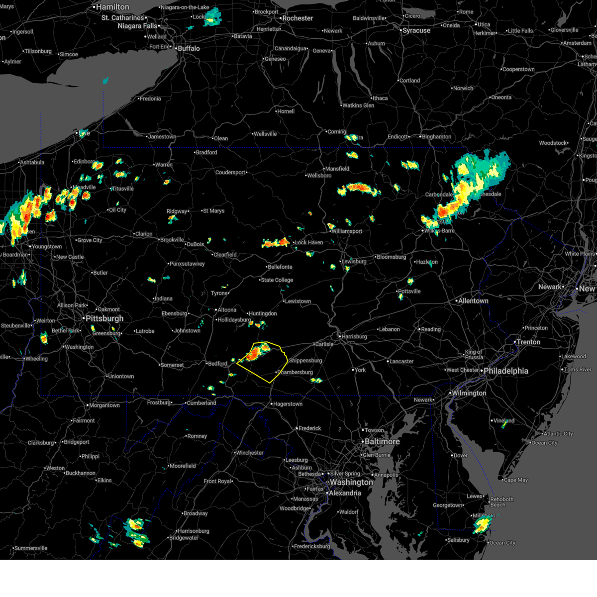
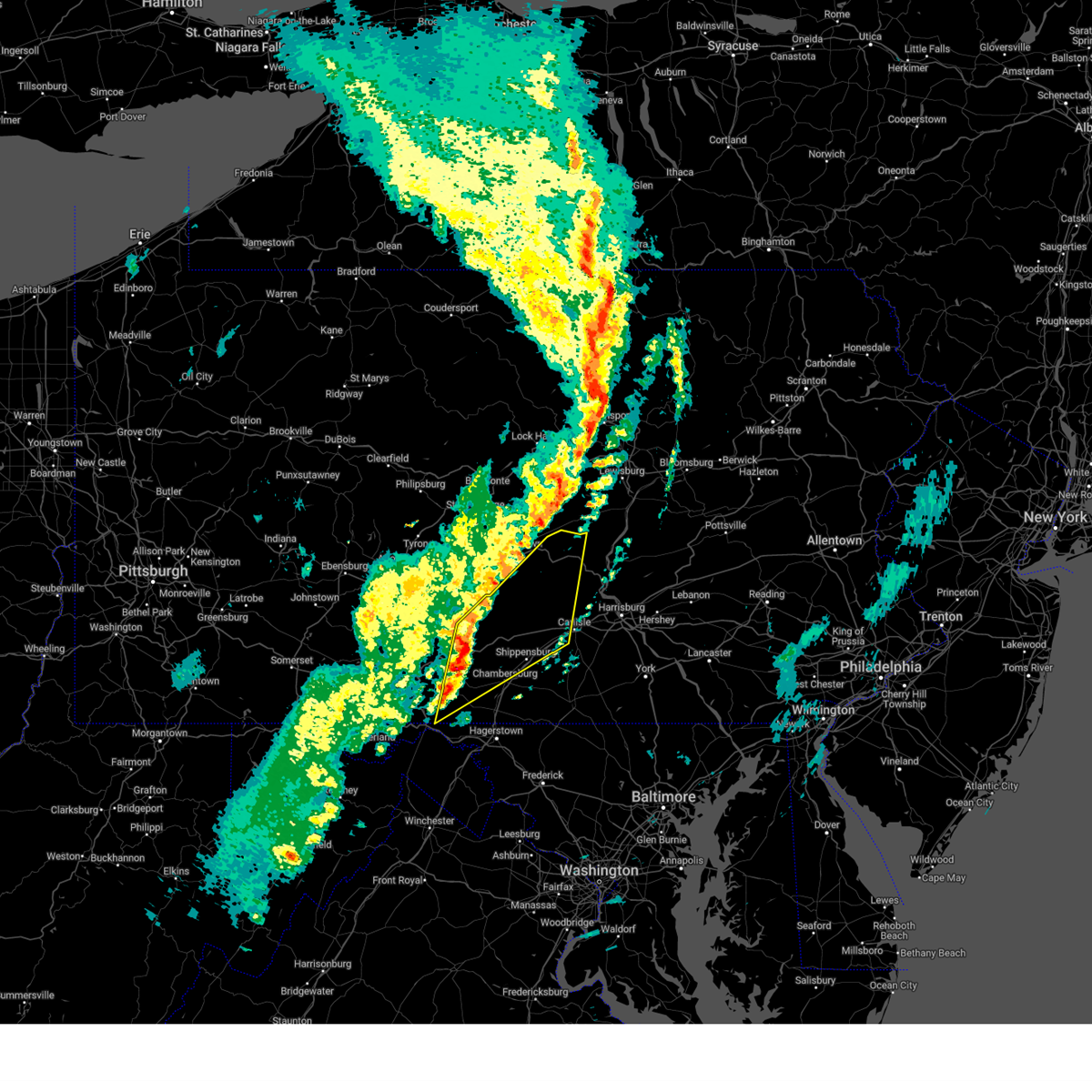
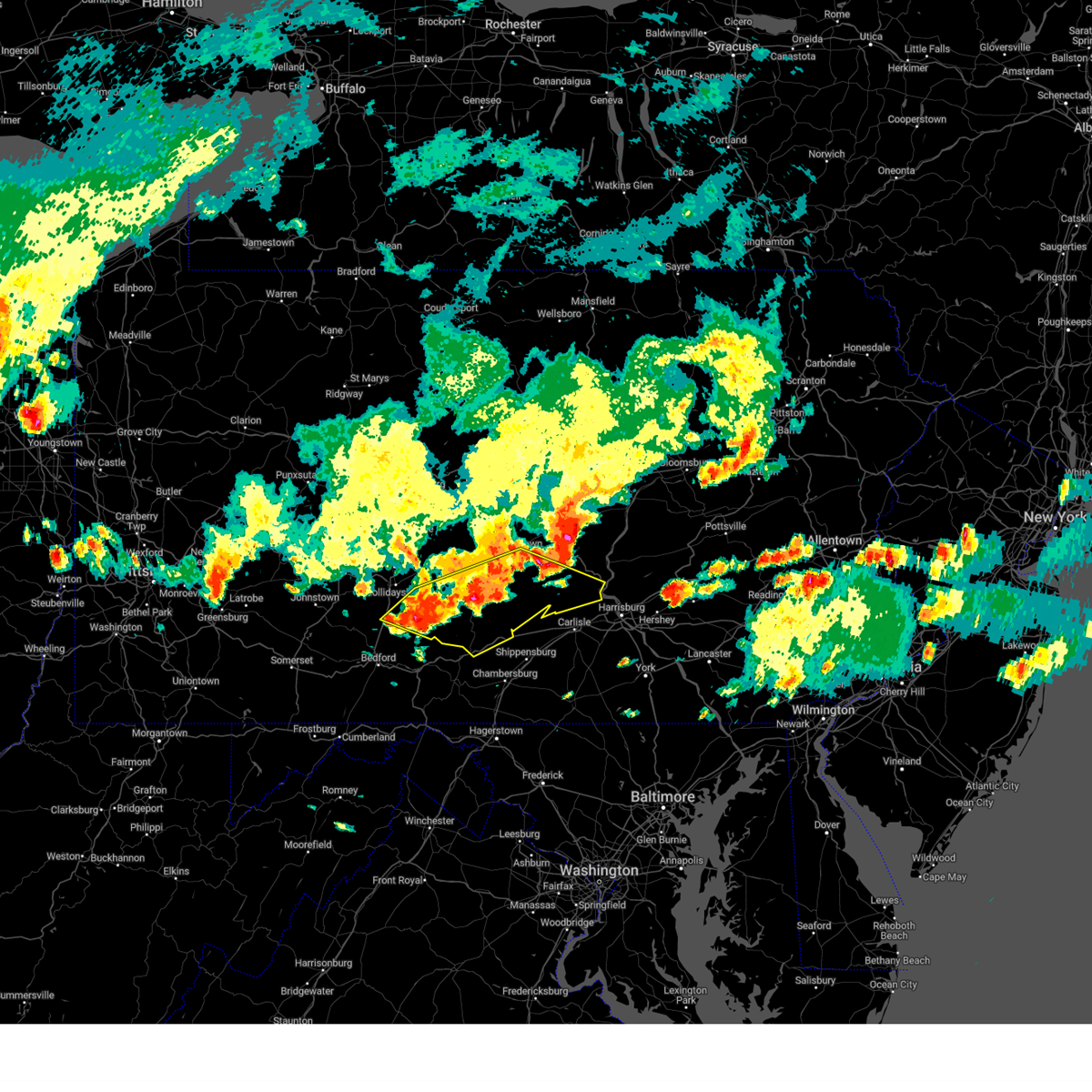
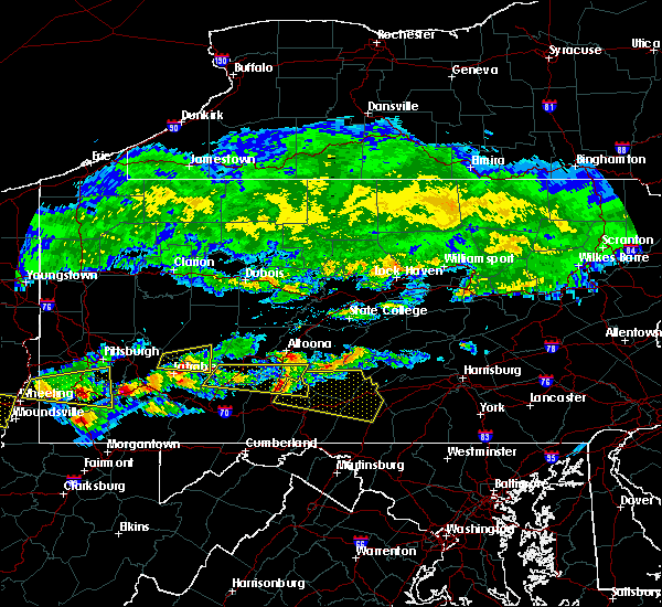
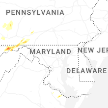
Hail Map for Shade Gap, PA
The Shade Gap, PA area has had 0 reports of on-the-ground hail by trained spotters, and has been under severe weather warnings 7 times during the past 12 months. Doppler radar has detected hail at or near Shade Gap, PA on 32 occasions, including 3 occasions during the past year.
| Name: | Shade Gap, PA |
| Where Located: | 42.3 miles S of State College, PA |
| Map: | Google Map for Shade Gap, PA |
| Population: | 105 |
| Housing Units: | 48 |
| More Info: | Search Google for Shade Gap, PA |
0
The Top Recent Hail Date for Shade Gap, PA is Monday, June 9, 2025 (15th out of 32)

Hail and Wind Damage Spotted near Shade Gap, PA
| Date / Time | Report Details |
|---|---|
| 6/26/2025 2:04 PM EDT |
 Svrctp the national weather service in state college pa has issued a * severe thunderstorm warning for, central franklin county in south central pennsylvania, northeastern fulton county in south central pennsylvania, southeastern huntingdon county in central pennsylvania, * until 300 pm edt. * at 204 pm edt, severe thunderstorms were located along a line extending from willow hill to fannettsburg to fort littleton, moving southeast at 20 mph (radar indicated). Hazards include 60 mph wind gusts and penny size hail. expect damage to roofs, siding, and trees Svrctp the national weather service in state college pa has issued a * severe thunderstorm warning for, central franklin county in south central pennsylvania, northeastern fulton county in south central pennsylvania, southeastern huntingdon county in central pennsylvania, * until 300 pm edt. * at 204 pm edt, severe thunderstorms were located along a line extending from willow hill to fannettsburg to fort littleton, moving southeast at 20 mph (radar indicated). Hazards include 60 mph wind gusts and penny size hail. expect damage to roofs, siding, and trees
|
| 6/9/2025 9:05 PM EDT |
 Svrctp the national weather service in state college pa has issued a * severe thunderstorm warning for, northeastern bedford county in south central pennsylvania, north central franklin county in south central pennsylvania, northeastern fulton county in south central pennsylvania, southern huntingdon county in central pennsylvania, * until 945 pm edt. * at 905 pm edt, a severe thunderstorm was located over wells tannery, moving northeast at 25 mph (radar indicated). Hazards include 60 mph wind gusts and quarter size hail. Hail damage to vehicles is expected. Expect wind damage to roofs, siding, and trees. Svrctp the national weather service in state college pa has issued a * severe thunderstorm warning for, northeastern bedford county in south central pennsylvania, north central franklin county in south central pennsylvania, northeastern fulton county in south central pennsylvania, southern huntingdon county in central pennsylvania, * until 945 pm edt. * at 905 pm edt, a severe thunderstorm was located over wells tannery, moving northeast at 25 mph (radar indicated). Hazards include 60 mph wind gusts and quarter size hail. Hail damage to vehicles is expected. Expect wind damage to roofs, siding, and trees.
|
| 5/1/2025 8:30 PM EDT |
 Svrctp the national weather service in state college pa has issued a * severe thunderstorm warning for, northwestern cumberland county in south central pennsylvania, northeastern franklin county in south central pennsylvania, southeastern huntingdon county in central pennsylvania, southwestern juniata county in central pennsylvania, southwestern perry county in south central pennsylvania, * until 915 pm edt. * at 830 pm edt, a severe thunderstorm was located over willow hill, moving northeast at 35 mph (radar indicated). Hazards include 60 mph wind gusts and half dollar size hail. Hail damage to vehicles is expected. expect wind damage to roofs, siding, and trees. this severe thunderstorm will be near, doylesburg and big spring state park around 840 pm edt. perulack around 850 pm edt. honey grove and east waterford around 900 pm edt. other locations impacted by this severe thunderstorm include blain, shade gap, and new germantown. radar has indicated rotation within this severe thunderstorm. although a tornado is not immediately likely, tornadoes can develop quickly during severe thunderstorms. This includes the pennsylvania turnpike from mile markers 186 to 204. Svrctp the national weather service in state college pa has issued a * severe thunderstorm warning for, northwestern cumberland county in south central pennsylvania, northeastern franklin county in south central pennsylvania, southeastern huntingdon county in central pennsylvania, southwestern juniata county in central pennsylvania, southwestern perry county in south central pennsylvania, * until 915 pm edt. * at 830 pm edt, a severe thunderstorm was located over willow hill, moving northeast at 35 mph (radar indicated). Hazards include 60 mph wind gusts and half dollar size hail. Hail damage to vehicles is expected. expect wind damage to roofs, siding, and trees. this severe thunderstorm will be near, doylesburg and big spring state park around 840 pm edt. perulack around 850 pm edt. honey grove and east waterford around 900 pm edt. other locations impacted by this severe thunderstorm include blain, shade gap, and new germantown. radar has indicated rotation within this severe thunderstorm. although a tornado is not immediately likely, tornadoes can develop quickly during severe thunderstorms. This includes the pennsylvania turnpike from mile markers 186 to 204.
|
| 4/29/2025 6:33 PM EDT |
 Svrctp the national weather service in state college pa has issued a * severe thunderstorm warning for, huntingdon county in central pennsylvania, * until 715 pm edt. * at 632 pm edt, severe thunderstorms were located along a line extending from osceola mills to sinking valley to roaring spring, moving east at 65 mph (radar indicated). Hazards include 60 mph wind gusts. expect damage to roofs, siding, and trees Svrctp the national weather service in state college pa has issued a * severe thunderstorm warning for, huntingdon county in central pennsylvania, * until 715 pm edt. * at 632 pm edt, severe thunderstorms were located along a line extending from osceola mills to sinking valley to roaring spring, moving east at 65 mph (radar indicated). Hazards include 60 mph wind gusts. expect damage to roofs, siding, and trees
|
| 3/16/2025 3:58 PM EDT |
 Svrctp the national weather service in state college pa has issued a * severe thunderstorm warning for, northwestern cumberland county in south central pennsylvania, central franklin county in south central pennsylvania, eastern fulton county in south central pennsylvania, southeastern huntingdon county in central pennsylvania, juniata county in central pennsylvania, perry county in south central pennsylvania, * until 500 pm edt. * at 358 pm edt, severe thunderstorms were located along a line extending from rockhill furnace to big cove tannery, moving northeast at 50 mph (radar indicated). Hazards include 60 mph wind gusts and penny size hail. expect damage to roofs, siding, and trees Svrctp the national weather service in state college pa has issued a * severe thunderstorm warning for, northwestern cumberland county in south central pennsylvania, central franklin county in south central pennsylvania, eastern fulton county in south central pennsylvania, southeastern huntingdon county in central pennsylvania, juniata county in central pennsylvania, perry county in south central pennsylvania, * until 500 pm edt. * at 358 pm edt, severe thunderstorms were located along a line extending from rockhill furnace to big cove tannery, moving northeast at 50 mph (radar indicated). Hazards include 60 mph wind gusts and penny size hail. expect damage to roofs, siding, and trees
|
| 8/6/2024 5:32 PM EDT |
 Svrctp the national weather service in state college pa has issued a * severe thunderstorm warning for, cumberland county in south central pennsylvania, southern dauphin county in south central pennsylvania, central franklin county in south central pennsylvania, northeastern fulton county in south central pennsylvania, southeastern huntingdon county in central pennsylvania, southwestern juniata county in central pennsylvania, perry county in south central pennsylvania, * until 615 pm edt. * at 531 pm edt, severe thunderstorms were located along a line extending from duncannon to sideling hill rest area, moving east at 35 mph (radar indicated). Hazards include 60 mph wind gusts and quarter size hail. Hail damage to vehicles is expected. Expect wind damage to roofs, siding, and trees. Svrctp the national weather service in state college pa has issued a * severe thunderstorm warning for, cumberland county in south central pennsylvania, southern dauphin county in south central pennsylvania, central franklin county in south central pennsylvania, northeastern fulton county in south central pennsylvania, southeastern huntingdon county in central pennsylvania, southwestern juniata county in central pennsylvania, perry county in south central pennsylvania, * until 615 pm edt. * at 531 pm edt, severe thunderstorms were located along a line extending from duncannon to sideling hill rest area, moving east at 35 mph (radar indicated). Hazards include 60 mph wind gusts and quarter size hail. Hail damage to vehicles is expected. Expect wind damage to roofs, siding, and trees.
|
| 8/6/2024 4:52 PM EDT |
 Svrctp the national weather service in state college pa has issued a * severe thunderstorm warning for, northeastern bedford county in south central pennsylvania, southeastern blair county in central pennsylvania, north central franklin county in south central pennsylvania, huntingdon county in central pennsylvania, southwestern juniata county in central pennsylvania, southwestern mifflin county in central pennsylvania, perry county in south central pennsylvania, * until 530 pm edt. * at 452 pm edt, severe thunderstorms were located along a line extending from mexico to blacklog to mount union to dudley, moving southeast at 20 mph (radar indicated). Hazards include 60 mph wind gusts and quarter size hail. Hail damage to vehicles is expected. Expect wind damage to roofs, siding, and trees. Svrctp the national weather service in state college pa has issued a * severe thunderstorm warning for, northeastern bedford county in south central pennsylvania, southeastern blair county in central pennsylvania, north central franklin county in south central pennsylvania, huntingdon county in central pennsylvania, southwestern juniata county in central pennsylvania, southwestern mifflin county in central pennsylvania, perry county in south central pennsylvania, * until 530 pm edt. * at 452 pm edt, severe thunderstorms were located along a line extending from mexico to blacklog to mount union to dudley, moving southeast at 20 mph (radar indicated). Hazards include 60 mph wind gusts and quarter size hail. Hail damage to vehicles is expected. Expect wind damage to roofs, siding, and trees.
|
| 6/29/2024 5:40 PM EDT |
 Svrctp the national weather service in state college pa has issued a * severe thunderstorm warning for, northwestern cumberland county in south central pennsylvania, northeastern franklin county in south central pennsylvania, southeastern huntingdon county in central pennsylvania, southwestern perry county in south central pennsylvania, * until 630 pm edt. * at 538 pm edt, a severe thunderstorm was located over willow hill, moving east at 40 mph (radar indicated). Hazards include 60 mph wind gusts. expect damage to roofs, siding, and trees Svrctp the national weather service in state college pa has issued a * severe thunderstorm warning for, northwestern cumberland county in south central pennsylvania, northeastern franklin county in south central pennsylvania, southeastern huntingdon county in central pennsylvania, southwestern perry county in south central pennsylvania, * until 630 pm edt. * at 538 pm edt, a severe thunderstorm was located over willow hill, moving east at 40 mph (radar indicated). Hazards include 60 mph wind gusts. expect damage to roofs, siding, and trees
|
| 6/26/2024 10:20 PM EDT |
 the severe thunderstorm warning has been cancelled and is no longer in effect the severe thunderstorm warning has been cancelled and is no longer in effect
|
| 6/26/2024 10:20 PM EDT |
 At 1019 pm edt, severe thunderstorms were located along a line extending from mexico to honey grove to fannettsburg, moving east at 40 mph (radar indicated). Hazards include 60 mph wind gusts. Expect damage to roofs, siding, and trees. locations impacted include, lewistown, shippensburg, burnham, newport, highland park, newville, honey grove, new bloomfield, yeagertown, mcalisterville, spruce hill, and strodes mills. This includes the pennsylvania turnpike from mile markers 166 to 216. At 1019 pm edt, severe thunderstorms were located along a line extending from mexico to honey grove to fannettsburg, moving east at 40 mph (radar indicated). Hazards include 60 mph wind gusts. Expect damage to roofs, siding, and trees. locations impacted include, lewistown, shippensburg, burnham, newport, highland park, newville, honey grove, new bloomfield, yeagertown, mcalisterville, spruce hill, and strodes mills. This includes the pennsylvania turnpike from mile markers 166 to 216.
|
| 6/26/2024 9:52 PM EDT |
 Svrctp the national weather service in state college pa has issued a * severe thunderstorm warning for, east central bedford county in south central pennsylvania, northwestern cumberland county in south central pennsylvania, central franklin county in south central pennsylvania, northeastern fulton county in south central pennsylvania, southeastern huntingdon county in central pennsylvania, juniata county in central pennsylvania, mifflin county in central pennsylvania, perry county in south central pennsylvania, * until 1030 pm edt. * at 951 pm edt, severe thunderstorms were located along a line extending from belleville to mount union to wells tannery, moving east at 40 mph (radar indicated). Hazards include 60 mph wind gusts. expect damage to roofs, siding, and trees Svrctp the national weather service in state college pa has issued a * severe thunderstorm warning for, east central bedford county in south central pennsylvania, northwestern cumberland county in south central pennsylvania, central franklin county in south central pennsylvania, northeastern fulton county in south central pennsylvania, southeastern huntingdon county in central pennsylvania, juniata county in central pennsylvania, mifflin county in central pennsylvania, perry county in south central pennsylvania, * until 1030 pm edt. * at 951 pm edt, severe thunderstorms were located along a line extending from belleville to mount union to wells tannery, moving east at 40 mph (radar indicated). Hazards include 60 mph wind gusts. expect damage to roofs, siding, and trees
|
| 9/7/2023 12:21 PM EDT |
 At 1221 pm edt, a severe thunderstorm was located over breezewood, moving northeast at 35 mph (radar indicated). Hazards include 60 mph wind gusts. expect damage to roofs, siding, and trees At 1221 pm edt, a severe thunderstorm was located over breezewood, moving northeast at 35 mph (radar indicated). Hazards include 60 mph wind gusts. expect damage to roofs, siding, and trees
|
| 8/7/2023 2:04 PM EDT |
 At 204 pm edt, a severe thunderstorm was located over st. thomas, moving north at 40 mph (radar indicated). Hazards include 60 mph wind gusts and half dollar size hail. Hail damage to vehicles is expected. Expect wind damage to roofs, siding, and trees. At 204 pm edt, a severe thunderstorm was located over st. thomas, moving north at 40 mph (radar indicated). Hazards include 60 mph wind gusts and half dollar size hail. Hail damage to vehicles is expected. Expect wind damage to roofs, siding, and trees.
|
| 7/21/2023 12:49 AM EDT |
 At 1248 am edt, severe thunderstorms were located along a line extending from hometown to klingerstown to shermansdale to colonel denning state park to near fannettsburg, moving east at 40 mph (radar indicated). Hazards include 60 mph wind gusts and penny size hail. Expect damage to roofs, siding, and trees. locations impacted include, newport, honey grove, new bloomfield, spruce hill, port trevorton, rockhill furnace, east waterford, loysville, ickesburg, meiserville, perulack and big spring state park. hail threat, radar indicated max hail size, 0. 75 in wind threat, radar indicated max wind gust, 60 mph. At 1248 am edt, severe thunderstorms were located along a line extending from hometown to klingerstown to shermansdale to colonel denning state park to near fannettsburg, moving east at 40 mph (radar indicated). Hazards include 60 mph wind gusts and penny size hail. Expect damage to roofs, siding, and trees. locations impacted include, newport, honey grove, new bloomfield, spruce hill, port trevorton, rockhill furnace, east waterford, loysville, ickesburg, meiserville, perulack and big spring state park. hail threat, radar indicated max hail size, 0. 75 in wind threat, radar indicated max wind gust, 60 mph.
|
| 7/20/2023 11:46 PM EDT |
 At 1145 pm edt, severe thunderstorms were located along a line extending from sunbury to alfarata to raystown dam to shy beaver to near buffalo mills, moving east at 40 mph (radar indicated). Hazards include 60 mph wind gusts and penny size hail. expect damage to roofs, siding, and trees At 1145 pm edt, severe thunderstorms were located along a line extending from sunbury to alfarata to raystown dam to shy beaver to near buffalo mills, moving east at 40 mph (radar indicated). Hazards include 60 mph wind gusts and penny size hail. expect damage to roofs, siding, and trees
|
| 7/23/2022 6:26 PM EDT |
 At 625 pm edt, a severe thunderstorm was located over big spring state park, moving east at 45 mph (radar indicated). Hazards include 60 mph wind gusts and nickel size hail. expect damage to roofs, siding, and trees At 625 pm edt, a severe thunderstorm was located over big spring state park, moving east at 45 mph (radar indicated). Hazards include 60 mph wind gusts and nickel size hail. expect damage to roofs, siding, and trees
|
| 5/20/2022 12:09 PM EDT |
 At 1208 pm edt, severe thunderstorms were located along a line extending from near wells tannery to everett to clearville to near lake gordon, moving east at 50 mph (radar indicated). Hazards include 70 mph wind gusts. Expect considerable tree damage. Damage is likely to mobile homes, roofs, and outbuildings. At 1208 pm edt, severe thunderstorms were located along a line extending from near wells tannery to everett to clearville to near lake gordon, moving east at 50 mph (radar indicated). Hazards include 70 mph wind gusts. Expect considerable tree damage. Damage is likely to mobile homes, roofs, and outbuildings.
|
| 3/31/2022 4:06 PM EDT |
 At 404 pm edt, severe thunderstorms were located along a line extending from mount union to waterfall to fort littleton to mcconnellsburg to needmore to warfordsburg, moving northeast at 80 mph. the strongest winds in the line of storms will be from fort littleton to willow hill (radar indicated). Hazards include 70 mph wind gusts. Expect considerable tree damage. damage is likely to mobile homes, roofs, and outbuildings. locations impacted include, mcconnellsburg, breezewood, warfordsburg, mount union, clearville, everett, harrisonville, fort loudon, big cove tannery, crystal springs, waterfall and rockhill furnace. this includes the following interstates, interstate 70 from mile markers 147 to 170. the pennsylvania turnpike from mile markers 155 to 200. thunderstorm damage threat, considerable hail threat, radar indicated max hail size, <. 75 in wind threat, radar indicated max wind gust, 70 mph. At 404 pm edt, severe thunderstorms were located along a line extending from mount union to waterfall to fort littleton to mcconnellsburg to needmore to warfordsburg, moving northeast at 80 mph. the strongest winds in the line of storms will be from fort littleton to willow hill (radar indicated). Hazards include 70 mph wind gusts. Expect considerable tree damage. damage is likely to mobile homes, roofs, and outbuildings. locations impacted include, mcconnellsburg, breezewood, warfordsburg, mount union, clearville, everett, harrisonville, fort loudon, big cove tannery, crystal springs, waterfall and rockhill furnace. this includes the following interstates, interstate 70 from mile markers 147 to 170. the pennsylvania turnpike from mile markers 155 to 200. thunderstorm damage threat, considerable hail threat, radar indicated max hail size, <. 75 in wind threat, radar indicated max wind gust, 70 mph.
|
| 3/31/2022 3:48 PM EDT |
 At 348 pm edt, severe thunderstorms were located along a line extending from valley-hi to crystal springs to locust grove to inglesmith to near barnes gap, moving northeast at 50 mph (radar indicated). Hazards include 60 mph wind gusts. expect damage to roofs, siding, and trees At 348 pm edt, severe thunderstorms were located along a line extending from valley-hi to crystal springs to locust grove to inglesmith to near barnes gap, moving northeast at 50 mph (radar indicated). Hazards include 60 mph wind gusts. expect damage to roofs, siding, and trees
|
| 3/7/2022 6:26 PM EST |
 At 625 pm est, severe thunderstorms were located along a line extending from near rockhill furnace to warfordsburg, moving east at 55 mph (radar indicated). Hazards include 60 mph wind gusts. expect damage to roofs, siding, and trees At 625 pm est, severe thunderstorms were located along a line extending from near rockhill furnace to warfordsburg, moving east at 55 mph (radar indicated). Hazards include 60 mph wind gusts. expect damage to roofs, siding, and trees
|
| 8/13/2021 2:12 PM EDT |
 At 211 pm edt, severe thunderstorms were located along a line extending from near spruce hill to near claylick, moving east at 25 mph (radar indicated). Hazards include 60 mph wind gusts and penny size hail. expect damage to roofs, siding, and trees At 211 pm edt, severe thunderstorms were located along a line extending from near spruce hill to near claylick, moving east at 25 mph (radar indicated). Hazards include 60 mph wind gusts and penny size hail. expect damage to roofs, siding, and trees
|
| 7/11/2021 7:58 PM EDT |
 The national weather service in state college pa has issued a * severe thunderstorm warning for. southeastern bedford county in south central pennsylvania. southeastern huntingdon county in central pennsylvania. franklin county in south central pennsylvania. Central mifflin county in central pennsylvania. The national weather service in state college pa has issued a * severe thunderstorm warning for. southeastern bedford county in south central pennsylvania. southeastern huntingdon county in central pennsylvania. franklin county in south central pennsylvania. Central mifflin county in central pennsylvania.
|
| 7/11/2021 6:57 PM EDT |
 At 655 pm edt, severe thunderstorms were located along a line extending from near julian to near huntingdon to near trough creek state park to near everett to near lake gordon, moving east at 40 mph (radar indicated). Hazards include 70 mph wind gusts. Expect considerable tree damage. Damage is likely to mobile homes, roofs, and outbuildings. At 655 pm edt, severe thunderstorms were located along a line extending from near julian to near huntingdon to near trough creek state park to near everett to near lake gordon, moving east at 40 mph (radar indicated). Hazards include 70 mph wind gusts. Expect considerable tree damage. Damage is likely to mobile homes, roofs, and outbuildings.
|
| 8/28/2020 2:09 PM EDT |
 At 209 pm edt, severe thunderstorms were located along a line extending from near colonel denning state park to near upper strasburg to near saluvia, moving east at 45 mph (radar indicated). Hazards include 60 mph wind gusts and penny size hail. Expect damage to trees, roofs, and siding. locations impacted include, chambersburg, shippensburg, breezewood, guilford, st. thomas, fayetteville, everett, mercersburg, scotland, mcconnellsburg, harrisonville, fort loudon, crystal springs, waterfall, wells tannery, fort littleton, valley-hi, willow hill, fannettsburg and saluvia. this includes the following interstates, interstate 70 from mile markers 147 to 152. the pennsylvania turnpike from mile markers 153 to 201. Interstate 81 from mile markers 12 to 25. At 209 pm edt, severe thunderstorms were located along a line extending from near colonel denning state park to near upper strasburg to near saluvia, moving east at 45 mph (radar indicated). Hazards include 60 mph wind gusts and penny size hail. Expect damage to trees, roofs, and siding. locations impacted include, chambersburg, shippensburg, breezewood, guilford, st. thomas, fayetteville, everett, mercersburg, scotland, mcconnellsburg, harrisonville, fort loudon, crystal springs, waterfall, wells tannery, fort littleton, valley-hi, willow hill, fannettsburg and saluvia. this includes the following interstates, interstate 70 from mile markers 147 to 152. the pennsylvania turnpike from mile markers 153 to 201. Interstate 81 from mile markers 12 to 25.
|
| 8/28/2020 1:29 PM EDT |
 At 127 pm edt, severe thunderstorms were located along a line extending from near huntingdon to dudley to near ogletown, moving east at 45 mph (radar indicated). Hazards include 60 mph wind gusts and penny size hail. expect damage to trees, roofs, and siding At 127 pm edt, severe thunderstorms were located along a line extending from near huntingdon to dudley to near ogletown, moving east at 45 mph (radar indicated). Hazards include 60 mph wind gusts and penny size hail. expect damage to trees, roofs, and siding
|
| 8/27/2020 7:31 PM EDT | Tree on wire in franklin county PA, 8.5 miles NNW of Shade Gap, PA |
| 8/27/2020 7:29 PM EDT |
 At 728 pm edt, severe thunderstorms were located along a line extending from near big spring state park to near fort littleton to breezewood, moving southeast at 55 mph (radar indicated). Hazards include 60 mph wind gusts and quarter size hail. Hail damage to vehicles is expected. Expect wind damage to trees, roofs, and siding. At 728 pm edt, severe thunderstorms were located along a line extending from near big spring state park to near fort littleton to breezewood, moving southeast at 55 mph (radar indicated). Hazards include 60 mph wind gusts and quarter size hail. Hail damage to vehicles is expected. Expect wind damage to trees, roofs, and siding.
|
| 6/25/2020 8:28 PM EDT |
 At 825 pm edt, a severe thunderstorm was located just southeast of dudley, moving southeast at 30 mph. this storm has a history of damaging winds (radar indicated). Hazards include 60 mph wind gusts and quarter size hail. Hail damage to vehicles is expected. expect wind damage to trees, roofs, and siding. locations impacted include, new enterprise, waterfall, wells tannery, fort littleton, dudley, shy beaver, willow hill, sideling hill rest area, fannettsburg, saxton, broad top city, three springs, saltillo, woodbury, defiance, hopewell, coalmont and shade gap. This includes the pennsylvania turnpike from mile markers 171 to 195. At 825 pm edt, a severe thunderstorm was located just southeast of dudley, moving southeast at 30 mph. this storm has a history of damaging winds (radar indicated). Hazards include 60 mph wind gusts and quarter size hail. Hail damage to vehicles is expected. expect wind damage to trees, roofs, and siding. locations impacted include, new enterprise, waterfall, wells tannery, fort littleton, dudley, shy beaver, willow hill, sideling hill rest area, fannettsburg, saxton, broad top city, three springs, saltillo, woodbury, defiance, hopewell, coalmont and shade gap. This includes the pennsylvania turnpike from mile markers 171 to 195.
|
| 6/25/2020 8:10 PM EDT |
 At 809 pm edt, a severe thunderstorm was located near dudley, moving southeast at 30 mph (radar indicated). Hazards include 60 mph wind gusts and quarter size hail. Hail damage to vehicles is expected. Expect wind damage to trees, roofs, and siding. At 809 pm edt, a severe thunderstorm was located near dudley, moving southeast at 30 mph (radar indicated). Hazards include 60 mph wind gusts and quarter size hail. Hail damage to vehicles is expected. Expect wind damage to trees, roofs, and siding.
|
| 6/4/2020 6:38 PM EDT | Trees down across hill roa in franklin county PA, 7 miles NW of Shade Gap, PA |
| 6/4/2020 3:54 PM EDT |
 The severe thunderstorm warning for southern huntingdon, north central franklin and northeastern fulton counties will expire at 400 pm edt, the storm which prompted the warning has weakened below severe limits, and no longer poses an immediate threat to life or property. therefore, the warning will be allowed to expire. a severe thunderstorm watch remains in effect until 1000 pm edt for south central and central pennsylvania. The severe thunderstorm warning for southern huntingdon, north central franklin and northeastern fulton counties will expire at 400 pm edt, the storm which prompted the warning has weakened below severe limits, and no longer poses an immediate threat to life or property. therefore, the warning will be allowed to expire. a severe thunderstorm watch remains in effect until 1000 pm edt for south central and central pennsylvania.
|
| 6/4/2020 3:11 PM EDT |
 At 310 pm edt, a severe thunderstorm was located over saluvia, moving northeast at 25 mph (radar indicated). Hazards include 70 mph wind gusts and quarter size hail. Hail damage to vehicles is expected. expect considerable tree damage. Wind damage is also likely to mobile homes, roofs, and outbuildings. At 310 pm edt, a severe thunderstorm was located over saluvia, moving northeast at 25 mph (radar indicated). Hazards include 70 mph wind gusts and quarter size hail. Hail damage to vehicles is expected. expect considerable tree damage. Wind damage is also likely to mobile homes, roofs, and outbuildings.
|
| 4/8/2020 2:26 AM EDT |
 At 226 am edt, severe thunderstorms were located along a line extending from 6 miles northwest of doylesburg to 6 miles west of bedford, moving east at 75 mph (radar indicated). Hazards include 60 mph wind gusts and quarter size hail. Hail damage to vehicles is expected. Expect wind damage to trees, roofs, and siding. At 226 am edt, severe thunderstorms were located along a line extending from 6 miles northwest of doylesburg to 6 miles west of bedford, moving east at 75 mph (radar indicated). Hazards include 60 mph wind gusts and quarter size hail. Hail damage to vehicles is expected. Expect wind damage to trees, roofs, and siding.
|
| 8/15/2019 8:01 PM EDT |
 At 801 pm edt, severe thunderstorms were located along a line extending from rockhill furnace to near waterfall, moving east at 25 mph (radar indicated). Hazards include 60 mph wind gusts and half dollar size hail. Hail damage to vehicles is expected. expect wind damage to trees, roofs, and siding. locations impacted include, waterfall, rockhill furnace, three springs, orbisonia, saltillo, shirleysburg and shade gap. This includes the pennsylvania turnpike near mile marker 186. At 801 pm edt, severe thunderstorms were located along a line extending from rockhill furnace to near waterfall, moving east at 25 mph (radar indicated). Hazards include 60 mph wind gusts and half dollar size hail. Hail damage to vehicles is expected. expect wind damage to trees, roofs, and siding. locations impacted include, waterfall, rockhill furnace, three springs, orbisonia, saltillo, shirleysburg and shade gap. This includes the pennsylvania turnpike near mile marker 186.
|
| 8/15/2019 7:18 PM EDT |
 At 718 pm edt, a severe thunderstorm was located near dudley, moving east at 25 mph (radar indicated). Hazards include 60 mph wind gusts and half dollar size hail. Hail damage to vehicles is expected. Expect wind damage to trees, roofs, and siding. At 718 pm edt, a severe thunderstorm was located near dudley, moving east at 25 mph (radar indicated). Hazards include 60 mph wind gusts and half dollar size hail. Hail damage to vehicles is expected. Expect wind damage to trees, roofs, and siding.
|
| 7/17/2019 2:00 PM EDT |
 At 159 pm edt, a severe thunderstorm was located over valley-hi, moving east northeast at 30 mph (radar indicated). Hazards include 60 mph wind gusts. Expect damage to trees, roofs, and siding. this severe thunderstorm will be near, wells tannery around 200 pm edt. sideling hill rest area, waterfall and saluvia around 210 pm edt. fort littleton around 220 pm edt. other locations impacted by this severe thunderstorm include shade gap. this includes the following interstates, interstate 70 near mile marker 147. The pennsylvania turnpike from mile markers 163 to 186. At 159 pm edt, a severe thunderstorm was located over valley-hi, moving east northeast at 30 mph (radar indicated). Hazards include 60 mph wind gusts. Expect damage to trees, roofs, and siding. this severe thunderstorm will be near, wells tannery around 200 pm edt. sideling hill rest area, waterfall and saluvia around 210 pm edt. fort littleton around 220 pm edt. other locations impacted by this severe thunderstorm include shade gap. this includes the following interstates, interstate 70 near mile marker 147. The pennsylvania turnpike from mile markers 163 to 186.
|
| 7/6/2019 5:54 PM EDT |
 At 554 pm edt, severe thunderstorms were located along a line extending from near doylesburg to wells tannery, moving southeast at 30 mph (radar indicated). Hazards include 60 mph wind gusts and quarter size hail. Hail damage to vehicles is expected. Expect wind damage to trees, roofs, and siding. At 554 pm edt, severe thunderstorms were located along a line extending from near doylesburg to wells tannery, moving southeast at 30 mph (radar indicated). Hazards include 60 mph wind gusts and quarter size hail. Hail damage to vehicles is expected. Expect wind damage to trees, roofs, and siding.
|
| 7/2/2019 4:23 PM EDT |
 At 423 pm edt, a severe thunderstorm was located near trough creek state park, moving southeast at 20 mph (radar indicated). Hazards include 60 mph wind gusts. expect damage to trees, roofs, and siding At 423 pm edt, a severe thunderstorm was located near trough creek state park, moving southeast at 20 mph (radar indicated). Hazards include 60 mph wind gusts. expect damage to trees, roofs, and siding
|
| 6/29/2019 1:22 PM EDT |
 At 120 pm edt, a severe thunderstorm was located near rockhill furnace, moving southeast at 45 mph. this storm was part of a band of storms that extended to the west and south (radar indicated). Hazards include 60 mph wind gusts and quarter size hail. Hail damage to vehicles is expected. expect wind damage to trees, roofs, and siding. locations impacted include, chambersburg, shippensburg, guilford, mount union, scotland, newville, rockhill furnace, roxbury, big spring state park, doylesburg, upper strasburg, trough creek state park, willow hill, fannettsburg, three springs, mapleton, orbisonia, saltillo, kistler and orrstown. this includes the following interstates, the pennsylvania turnpike from mile markers 184 to 215. Interstate 81 from mile markers 13 to 29. At 120 pm edt, a severe thunderstorm was located near rockhill furnace, moving southeast at 45 mph. this storm was part of a band of storms that extended to the west and south (radar indicated). Hazards include 60 mph wind gusts and quarter size hail. Hail damage to vehicles is expected. expect wind damage to trees, roofs, and siding. locations impacted include, chambersburg, shippensburg, guilford, mount union, scotland, newville, rockhill furnace, roxbury, big spring state park, doylesburg, upper strasburg, trough creek state park, willow hill, fannettsburg, three springs, mapleton, orbisonia, saltillo, kistler and orrstown. this includes the following interstates, the pennsylvania turnpike from mile markers 184 to 215. Interstate 81 from mile markers 13 to 29.
|
| 6/29/2019 12:59 PM EDT |
 At 1258 pm edt, a severe thunderstorm was located near trough creek state park, moving southeast at 35 mph (radar indicated). Hazards include 60 mph wind gusts and quarter size hail. Hail damage to vehicles is expected. Expect wind damage to trees, roofs, and siding. At 1258 pm edt, a severe thunderstorm was located near trough creek state park, moving southeast at 35 mph (radar indicated). Hazards include 60 mph wind gusts and quarter size hail. Hail damage to vehicles is expected. Expect wind damage to trees, roofs, and siding.
|
| 5/29/2019 4:45 PM EDT | Barn collapse and damage to multiple pine tree in fulton county PA, 7.2 miles NNE of Shade Gap, PA |
| 5/29/2019 4:30 PM EDT |
 At 429 pm edt, a severe thunderstorm was located over waterfall, moving east at 60 mph (radar indicated). Hazards include ping pong ball size hail and 60 mph wind gusts. People and animals outdoors will be injured. expect hail damage to roofs, siding, windows, and vehicles. Expect wind damage to trees, roofs, and siding. At 429 pm edt, a severe thunderstorm was located over waterfall, moving east at 60 mph (radar indicated). Hazards include ping pong ball size hail and 60 mph wind gusts. People and animals outdoors will be injured. expect hail damage to roofs, siding, windows, and vehicles. Expect wind damage to trees, roofs, and siding.
|
| 5/28/2019 6:40 PM EDT |
 At 639 pm edt, a severe thunderstorm was located over doylesburg, moving east at 50 mph (radar indicated). Hazards include 60 mph wind gusts and quarter size hail. Hail damage to vehicles is expected. expect wind damage to trees, roofs, and siding. locations impacted include, shippensburg, upper strasburg, roxbury, willow hill, doylesburg, fannettsburg, orrstown and shade gap. this includes the following interstates, the pennsylvania turnpike from mile markers 185 to 201. Interstate 81 near mile marker 25. At 639 pm edt, a severe thunderstorm was located over doylesburg, moving east at 50 mph (radar indicated). Hazards include 60 mph wind gusts and quarter size hail. Hail damage to vehicles is expected. expect wind damage to trees, roofs, and siding. locations impacted include, shippensburg, upper strasburg, roxbury, willow hill, doylesburg, fannettsburg, orrstown and shade gap. this includes the following interstates, the pennsylvania turnpike from mile markers 185 to 201. Interstate 81 near mile marker 25.
|
| 5/28/2019 6:28 PM EDT |
 At 628 pm edt, a severe thunderstorm was located over rockhill furnace, moving east at 50 mph (radar indicated). Hazards include 60 mph wind gusts and quarter size hail. Hail damage to vehicles is expected. Expect wind damage to trees, roofs, and siding. At 628 pm edt, a severe thunderstorm was located over rockhill furnace, moving east at 50 mph (radar indicated). Hazards include 60 mph wind gusts and quarter size hail. Hail damage to vehicles is expected. Expect wind damage to trees, roofs, and siding.
|
| 5/19/2019 5:45 PM EDT |
 At 544 pm edt, severe thunderstorms were located along a line extending from near rockhill furnace to near willow hill to near upper strasburg to near st. thomas, moving northeast at 50 mph (radar indicated). Hazards include 60 mph wind gusts. Expect damage to trees, roofs, and siding. severe thunderstorms will be near, doylesburg, big spring state park and mount union around 550 pm edt. shippensburg, blacklog, east waterford and perulack around 600 pm edt. colonel denning state park, loysville, newville, honey grove, walnut, bloserville, spruce hill and juniata terrace around 610 pm edt. other locations impacted by these severe thunderstorms include orrstown, liverpool, port royal, wagner, landisburg, blain, shade gap, thompsontown, longfellow and east salem. This includes the pennsylvania turnpike from mile markers 190 to 220. At 544 pm edt, severe thunderstorms were located along a line extending from near rockhill furnace to near willow hill to near upper strasburg to near st. thomas, moving northeast at 50 mph (radar indicated). Hazards include 60 mph wind gusts. Expect damage to trees, roofs, and siding. severe thunderstorms will be near, doylesburg, big spring state park and mount union around 550 pm edt. shippensburg, blacklog, east waterford and perulack around 600 pm edt. colonel denning state park, loysville, newville, honey grove, walnut, bloserville, spruce hill and juniata terrace around 610 pm edt. other locations impacted by these severe thunderstorms include orrstown, liverpool, port royal, wagner, landisburg, blain, shade gap, thompsontown, longfellow and east salem. This includes the pennsylvania turnpike from mile markers 190 to 220.
|
| 4/19/2019 7:25 PM EDT |
 At 724 pm edt, a severe thunderstorm capable of producing a tornado was located near rockhill furnace, moving northeast at 50 mph (radar indicated rotation). Hazards include tornado. Flying debris will be dangerous to those caught without shelter. mobile homes will be damaged or destroyed. damage to roofs, windows, and vehicles will occur. tree damage is likely. this tornadic thunderstorm will remain over mainly rural areas of southeastern huntingdon county, including the following locations, shade gap. This includes the pennsylvania turnpike from mile markers 185 to 186. At 724 pm edt, a severe thunderstorm capable of producing a tornado was located near rockhill furnace, moving northeast at 50 mph (radar indicated rotation). Hazards include tornado. Flying debris will be dangerous to those caught without shelter. mobile homes will be damaged or destroyed. damage to roofs, windows, and vehicles will occur. tree damage is likely. this tornadic thunderstorm will remain over mainly rural areas of southeastern huntingdon county, including the following locations, shade gap. This includes the pennsylvania turnpike from mile markers 185 to 186.
|
| 4/19/2019 7:21 PM EDT | Numerous trees reported down on covered bridge roa in huntingdon county PA, 1 miles SE of Shade Gap, PA |
| 4/19/2019 7:12 PM EDT |
 At 712 pm edt, a severe thunderstorm was located over fort littleton, moving northeast at 50 mph (radar indicated). Hazards include 60 mph wind gusts. expect damage to roofs, siding, and trees At 712 pm edt, a severe thunderstorm was located over fort littleton, moving northeast at 50 mph (radar indicated). Hazards include 60 mph wind gusts. expect damage to roofs, siding, and trees
|
| 4/14/2019 11:41 PM EDT |
 At 1140 pm edt, severe thunderstorms were located along a line extending from near mount union to near fannettsburg to 6 miles east of hancock, moving east at 50 mph (radar indicated). Hazards include 60 mph wind gusts and penny size hail. expect damage to roofs, siding, and trees At 1140 pm edt, severe thunderstorms were located along a line extending from near mount union to near fannettsburg to 6 miles east of hancock, moving east at 50 mph (radar indicated). Hazards include 60 mph wind gusts and penny size hail. expect damage to roofs, siding, and trees
|
| 4/14/2019 11:28 PM EDT |
 At 1128 pm edt, severe thunderstorms were located along a line extending from near julian to near rockhill furnace to near needmore, moving northeast at 55 mph (radar indicated). Hazards include 60 mph wind gusts and penny size hail. Expect damage to roofs, siding, and trees. locations impacted include, state college, huntingdon, bellefonte, park forest village, boalsburg, warfordsburg, mount union, stormstown, lemont, houserville, mercersburg, pine grove mills, mcconnellsburg, harrisonville, milesburg, fort loudon, ramblewood, big cove tannery, port matilda and allensville. for those driving on interstate 80, this includes areas between the snow shoe and milesburg exits, specifically from mile markers 149 to 157. this includes the following interstates, interstate 70 from mile markers 162 to 170. the pennsylvania turnpike from mile markers 167 to 190. interstate 99 from mile markers 58 to 79. A tornado watch remains in effect until 300 am edt for central and south central pennsylvania. At 1128 pm edt, severe thunderstorms were located along a line extending from near julian to near rockhill furnace to near needmore, moving northeast at 55 mph (radar indicated). Hazards include 60 mph wind gusts and penny size hail. Expect damage to roofs, siding, and trees. locations impacted include, state college, huntingdon, bellefonte, park forest village, boalsburg, warfordsburg, mount union, stormstown, lemont, houserville, mercersburg, pine grove mills, mcconnellsburg, harrisonville, milesburg, fort loudon, ramblewood, big cove tannery, port matilda and allensville. for those driving on interstate 80, this includes areas between the snow shoe and milesburg exits, specifically from mile markers 149 to 157. this includes the following interstates, interstate 70 from mile markers 162 to 170. the pennsylvania turnpike from mile markers 167 to 190. interstate 99 from mile markers 58 to 79. A tornado watch remains in effect until 300 am edt for central and south central pennsylvania.
|
| 4/14/2019 10:58 PM EDT |
 At 1058 pm edt, severe thunderstorms were located along a line extending from near blandburg to near everett to 6 miles west of inglesmith, moving northeast at 55 mph (radar indicated). Hazards include 60 mph wind gusts and penny size hail. expect damage to roofs, siding, and trees At 1058 pm edt, severe thunderstorms were located along a line extending from near blandburg to near everett to 6 miles west of inglesmith, moving northeast at 55 mph (radar indicated). Hazards include 60 mph wind gusts and penny size hail. expect damage to roofs, siding, and trees
|
| 10/2/2018 4:19 PM EDT |
 At 418 pm edt, a severe thunderstorm was located near rockhill furnace, moving east at 20 mph (radar indicated). Hazards include 60 mph wind gusts and quarter size hail. Hail damage to vehicles is expected. Expect wind damage to roofs, siding, and trees. At 418 pm edt, a severe thunderstorm was located near rockhill furnace, moving east at 20 mph (radar indicated). Hazards include 60 mph wind gusts and quarter size hail. Hail damage to vehicles is expected. Expect wind damage to roofs, siding, and trees.
|
| 8/21/2018 4:38 PM EDT |
 At 436 pm edt, severe thunderstorms were located along a line extending from saluvia to near warfordsburg, moving northeast at 30 mph (radar indicated). Hazards include 70 mph wind gusts. Expect considerable tree damage. damage is likely to mobile homes, roofs, and outbuildings. locations impacted include, warfordsburg, mercersburg, mcconnellsburg, harrisonville, fort loudon, big cove tannery, fort littleton, needmore, valley-hi, saluvia, claylick, sideling hill rest area, shade gap and whitetail ski area. this includes the following interstates, interstate 70 from mile markers 165 to 170. The pennsylvania turnpike from mile markers 166 to 186. At 436 pm edt, severe thunderstorms were located along a line extending from saluvia to near warfordsburg, moving northeast at 30 mph (radar indicated). Hazards include 70 mph wind gusts. Expect considerable tree damage. damage is likely to mobile homes, roofs, and outbuildings. locations impacted include, warfordsburg, mercersburg, mcconnellsburg, harrisonville, fort loudon, big cove tannery, fort littleton, needmore, valley-hi, saluvia, claylick, sideling hill rest area, shade gap and whitetail ski area. this includes the following interstates, interstate 70 from mile markers 165 to 170. The pennsylvania turnpike from mile markers 166 to 186.
|
| 8/21/2018 4:15 PM EDT |
 At 414 pm edt, severe thunderstorms were located along a line extending from near everett to barnes gap, moving northeast at 30 mph (radar indicated). Hazards include 60 mph wind gusts. expect damage to roofs, siding, and trees At 414 pm edt, severe thunderstorms were located along a line extending from near everett to barnes gap, moving northeast at 30 mph (radar indicated). Hazards include 60 mph wind gusts. expect damage to roofs, siding, and trees
|
| 5/12/2018 4:45 PM EDT |
 At 443 pm edt, a severe thunderstorm was located over fort littleton, moving east southeast at 45 mph (radar indicated). Hazards include 60 mph wind gusts and penny size hail. Expect damage to trees and power lines. Locations impacted include, chambersburg, saluvia, waterfall, roxbury, wells tannery, upper strasburg, harrisonville, willow hill, fort littleton and sideling hill rest area. At 443 pm edt, a severe thunderstorm was located over fort littleton, moving east southeast at 45 mph (radar indicated). Hazards include 60 mph wind gusts and penny size hail. Expect damage to trees and power lines. Locations impacted include, chambersburg, saluvia, waterfall, roxbury, wells tannery, upper strasburg, harrisonville, willow hill, fort littleton and sideling hill rest area.
|
| 5/12/2018 4:12 PM EDT |
 At 411 pm edt, a severe thunderstorm was located near new enterprise, moving east at 50 mph (radar indicated). Hazards include 60 mph wind gusts and quarter size hail. Hail damage to vehicles is possible. Expect wind damage to trees and power lines. At 411 pm edt, a severe thunderstorm was located near new enterprise, moving east at 50 mph (radar indicated). Hazards include 60 mph wind gusts and quarter size hail. Hail damage to vehicles is possible. Expect wind damage to trees and power lines.
|
| 8/19/2017 6:44 PM EDT |
 At 642 pm edt, severe thunderstorms were located along a line extending from rebersburg to near reeds gap state park to juniata terrace to near rockhill furnace to near waterfall, moving east at 45 mph (radar indicated). Hazards include 60 mph wind gusts and penny size hail. Expect damage to trees and power lines. these severe storms will affect, rebersburg, aaronsburg, millheim, madisonburg, poe valley state park coburn and woodward. Other locations impacted by these severe thunderstorms include saltillo, cassville, shade gap, mapleton, mccall dam state park, mill creek, kistler, shirleysburg, coalmont and orbisonia. At 642 pm edt, severe thunderstorms were located along a line extending from rebersburg to near reeds gap state park to juniata terrace to near rockhill furnace to near waterfall, moving east at 45 mph (radar indicated). Hazards include 60 mph wind gusts and penny size hail. Expect damage to trees and power lines. these severe storms will affect, rebersburg, aaronsburg, millheim, madisonburg, poe valley state park coburn and woodward. Other locations impacted by these severe thunderstorms include saltillo, cassville, shade gap, mapleton, mccall dam state park, mill creek, kistler, shirleysburg, coalmont and orbisonia.
|
| 8/19/2017 6:10 PM EDT |
 At 529 pm edt, severe thunderstorms were located along a line extending from plymptonville to near blandburg to sankertown to westmont, moving east at 45 mph (radar indicated). Hazards include 60 mph wind gusts and penny size hail. Expect damage to trees and power lines. severe thunderstorms will be near, blandburg around 530 pm edt. tyrone, hollidaysburg, duncansville, lakemont, bald eagle, birmingham, horseshoe curve, tipton and sinking valley around 540 pm edt. franklinville, royer, warriors mark, canoe creek state park, spruce creek, black moshannon state park, roaring spring, pine glen and north philipsburg around 550 pm edt. rock springs, snow shoe, clarence, whipple dam state park, moshannon, ski gap, entriken, williamsburg, trough creek state park and ramblewood around 600 pm edt. other locations impacted by these severe thunderstorms include saltillo, shade gap, mapleton, mcconnellstown, shirleysburg, howard, petersburg, east freedom, alexandria and orbisonia. for those driving on interstate 80, this includes areas between the kylertown and lamar exits, specifically from mile markers 139 to 171. this includes the following interstates, the pennsylvania turnpike from mile markers 184 to 186. Interstate 99 from mile markers 15 to 85. At 529 pm edt, severe thunderstorms were located along a line extending from plymptonville to near blandburg to sankertown to westmont, moving east at 45 mph (radar indicated). Hazards include 60 mph wind gusts and penny size hail. Expect damage to trees and power lines. severe thunderstorms will be near, blandburg around 530 pm edt. tyrone, hollidaysburg, duncansville, lakemont, bald eagle, birmingham, horseshoe curve, tipton and sinking valley around 540 pm edt. franklinville, royer, warriors mark, canoe creek state park, spruce creek, black moshannon state park, roaring spring, pine glen and north philipsburg around 550 pm edt. rock springs, snow shoe, clarence, whipple dam state park, moshannon, ski gap, entriken, williamsburg, trough creek state park and ramblewood around 600 pm edt. other locations impacted by these severe thunderstorms include saltillo, shade gap, mapleton, mcconnellstown, shirleysburg, howard, petersburg, east freedom, alexandria and orbisonia. for those driving on interstate 80, this includes areas between the kylertown and lamar exits, specifically from mile markers 139 to 171. this includes the following interstates, the pennsylvania turnpike from mile markers 184 to 186. Interstate 99 from mile markers 15 to 85.
|
| 8/19/2017 5:29 PM EDT |
 At 529 pm edt, severe thunderstorms were located along a line extending from plymptonville to near blandburg to sankertown to westmont, moving east at 45 mph (radar indicated). Hazards include 60 mph wind gusts and penny size hail. Expect damage to trees and power lines. severe thunderstorms will be near, blandburg around 530 pm edt. tyrone, hollidaysburg, duncansville, lakemont, bald eagle, birmingham, horseshoe curve, tipton and sinking valley around 540 pm edt. franklinville, royer, warriors mark, canoe creek state park, spruce creek, black moshannon state park, roaring spring, pine glen and north philipsburg around 550 pm edt. rock springs, snow shoe, clarence, whipple dam state park, moshannon, ski gap, entriken, williamsburg, trough creek state park and ramblewood around 600 pm edt. other locations impacted by these severe thunderstorms include saltillo, shade gap, mapleton, mcconnellstown, shirleysburg, howard, petersburg, east freedom, alexandria and orbisonia. for those driving on interstate 80, this includes areas between the kylertown and lamar exits, specifically from mile markers 139 to 171. this includes the following interstates, the pennsylvania turnpike from mile markers 184 to 186. Interstate 99 from mile markers 15 to 85. At 529 pm edt, severe thunderstorms were located along a line extending from plymptonville to near blandburg to sankertown to westmont, moving east at 45 mph (radar indicated). Hazards include 60 mph wind gusts and penny size hail. Expect damage to trees and power lines. severe thunderstorms will be near, blandburg around 530 pm edt. tyrone, hollidaysburg, duncansville, lakemont, bald eagle, birmingham, horseshoe curve, tipton and sinking valley around 540 pm edt. franklinville, royer, warriors mark, canoe creek state park, spruce creek, black moshannon state park, roaring spring, pine glen and north philipsburg around 550 pm edt. rock springs, snow shoe, clarence, whipple dam state park, moshannon, ski gap, entriken, williamsburg, trough creek state park and ramblewood around 600 pm edt. other locations impacted by these severe thunderstorms include saltillo, shade gap, mapleton, mcconnellstown, shirleysburg, howard, petersburg, east freedom, alexandria and orbisonia. for those driving on interstate 80, this includes areas between the kylertown and lamar exits, specifically from mile markers 139 to 171. this includes the following interstates, the pennsylvania turnpike from mile markers 184 to 186. Interstate 99 from mile markers 15 to 85.
|
| 8/4/2017 6:18 PM EDT |
 At 617 pm edt, severe thunderstorms were located along a line extending from fort littleton to hancock, moving east at 25 mph (radar indicated). Hazards include 60 mph wind gusts and quarter size hail. Hail damage to vehicles is possible. Expect wind damage to trees and power lines. At 617 pm edt, severe thunderstorms were located along a line extending from fort littleton to hancock, moving east at 25 mph (radar indicated). Hazards include 60 mph wind gusts and quarter size hail. Hail damage to vehicles is possible. Expect wind damage to trees and power lines.
|
| 5/30/2017 3:13 PM EDT |
 At 313 pm edt, severe thunderstorms were located along a line extending from near mount union to rockhill furnace to near fannettsburg to mcconnellsburg to near clearville, moving east at 45 mph (radar indicated). Hazards include 70 mph wind gusts and quarter size hail. Hail damage to vehicles is possible. expect considerable tree damage. Wind damage is also likely to mobile homes, roofs, and outbuildings. At 313 pm edt, severe thunderstorms were located along a line extending from near mount union to rockhill furnace to near fannettsburg to mcconnellsburg to near clearville, moving east at 45 mph (radar indicated). Hazards include 70 mph wind gusts and quarter size hail. Hail damage to vehicles is possible. expect considerable tree damage. Wind damage is also likely to mobile homes, roofs, and outbuildings.
|
| 5/30/2017 2:43 PM EDT |
 At 242 pm edt, severe thunderstorms were located along a line extending from near new enterprise to near breezewood to 8 miles northeast of lake gordon, moving east at 40 mph (radar indicated). Hazards include 70 mph wind gusts and nickel size hail. Expect considerable tree damage. Damage is likely to mobile homes, roofs, and outbuildings. At 242 pm edt, severe thunderstorms were located along a line extending from near new enterprise to near breezewood to 8 miles northeast of lake gordon, moving east at 40 mph (radar indicated). Hazards include 70 mph wind gusts and nickel size hail. Expect considerable tree damage. Damage is likely to mobile homes, roofs, and outbuildings.
|
| 5/30/2017 2:13 PM EDT |
 At 213 pm edt, severe thunderstorms were located along a line extending from near trough creek state park to near dudley, moving east at 25 mph (radar indicated). Hazards include 60 mph wind gusts and quarter size hail. Hail damage to vehicles is possible. Expect wind damage to trees and power lines. At 213 pm edt, severe thunderstorms were located along a line extending from near trough creek state park to near dudley, moving east at 25 mph (radar indicated). Hazards include 60 mph wind gusts and quarter size hail. Hail damage to vehicles is possible. Expect wind damage to trees and power lines.
|
| 5/1/2017 9:06 PM EDT |
 At 906 pm edt, a severe thunderstorm capable of producing a tornado was located over doylesburg, moving northeast at 45 mph (radar indicated rotation). Hazards include tornado. Flying debris will be dangerous to those caught without shelter. mobile homes will be damaged or destroyed. damage to roofs, windows, and vehicles will occur. tree damage is likely. This tornadic thunderstorm will remain over mainly rural areas of southeastern huntingdon and north central franklin counties, including the following locations: shade gap. At 906 pm edt, a severe thunderstorm capable of producing a tornado was located over doylesburg, moving northeast at 45 mph (radar indicated rotation). Hazards include tornado. Flying debris will be dangerous to those caught without shelter. mobile homes will be damaged or destroyed. damage to roofs, windows, and vehicles will occur. tree damage is likely. This tornadic thunderstorm will remain over mainly rural areas of southeastern huntingdon and north central franklin counties, including the following locations: shade gap.
|
| 5/1/2017 9:05 PM EDT | Trees down on wires in franklin county PA, 9.2 miles WSW of Shade Gap, PA |
| 5/1/2017 8:47 PM EDT |
 At 847 pm edt, a severe thunderstorm capable of producing a tornado was located near fort littleton, moving northeast at 55 mph (radar indicated rotation). Hazards include tornado. Flying debris will be dangerous to those caught without shelter. mobile homes will be damaged or destroyed. damage to roofs, windows, and vehicles will occur. tree damage is likely. this dangerous storm will be near, fannettsburg and willow hill around 850 pm edt. doylesburg and roxbury around 900 pm edt. other locations impacted by this tornadic thunderstorm include shade gap. This includes the pennsylvania turnpike from mile markers 179 to 201. At 847 pm edt, a severe thunderstorm capable of producing a tornado was located near fort littleton, moving northeast at 55 mph (radar indicated rotation). Hazards include tornado. Flying debris will be dangerous to those caught without shelter. mobile homes will be damaged or destroyed. damage to roofs, windows, and vehicles will occur. tree damage is likely. this dangerous storm will be near, fannettsburg and willow hill around 850 pm edt. doylesburg and roxbury around 900 pm edt. other locations impacted by this tornadic thunderstorm include shade gap. This includes the pennsylvania turnpike from mile markers 179 to 201.
|
| 5/1/2017 8:45 PM EDT |
 At 844 pm edt, severe thunderstorms were located along a line extending from near rockhill furnace to near needmore, moving northeast at 45 mph (radar indicated). Hazards include 70 mph wind gusts. Expect considerable tree damage. damage is likely to mobile homes, roofs, and outbuildings. locations impacted include, waterfall, roxbury, rockhill furnace, doylesburg, upper strasburg, harrisonville, willow hill, fort littleton, sideling hill rest area and fannettsburg. A tornado watch remains in effect until 1000 pm edt for south central and central pennsylvania. At 844 pm edt, severe thunderstorms were located along a line extending from near rockhill furnace to near needmore, moving northeast at 45 mph (radar indicated). Hazards include 70 mph wind gusts. Expect considerable tree damage. damage is likely to mobile homes, roofs, and outbuildings. locations impacted include, waterfall, roxbury, rockhill furnace, doylesburg, upper strasburg, harrisonville, willow hill, fort littleton, sideling hill rest area and fannettsburg. A tornado watch remains in effect until 1000 pm edt for south central and central pennsylvania.
|
| 5/1/2017 8:29 PM EDT |
 At 828 pm edt, severe thunderstorms were located along a line extending from near waterfall to locust grove, moving northeast at 45 mph (radar indicated). Hazards include 60 mph wind gusts. expect damage to roofs, siding, and trees At 828 pm edt, severe thunderstorms were located along a line extending from near waterfall to locust grove, moving northeast at 45 mph (radar indicated). Hazards include 60 mph wind gusts. expect damage to roofs, siding, and trees
|
| 5/1/2017 6:06 PM EDT |
 At 606 pm edt, severe thunderstorms were located along a line extending from port matilda to near bedford, moving east at 35 mph (radar indicated). Hazards include 60 mph wind gusts. expect damage to roofs, siding, and trees At 606 pm edt, severe thunderstorms were located along a line extending from port matilda to near bedford, moving east at 35 mph (radar indicated). Hazards include 60 mph wind gusts. expect damage to roofs, siding, and trees
|
| 3/1/2017 12:06 PM EST |
 At 1205 pm est, a severe thunderstorm was located near new enterprise, moving east at 60 mph (radar indicated). Hazards include 60 mph wind gusts. Expect damage to roofs, siding, and trees. this severe thunderstorm will be near, coaldale, dudley and wells tannery around 1210 pm est. waterfall around 1220 pm est. rockhill furnace around 1230 pm est. Other locations impacted by this severe thunderstorm include saltillo, cassville, hopewell, shade gap, kistler, coalmont, shirleysburg, woodbury, saxton and defiance. At 1205 pm est, a severe thunderstorm was located near new enterprise, moving east at 60 mph (radar indicated). Hazards include 60 mph wind gusts. Expect damage to roofs, siding, and trees. this severe thunderstorm will be near, coaldale, dudley and wells tannery around 1210 pm est. waterfall around 1220 pm est. rockhill furnace around 1230 pm est. Other locations impacted by this severe thunderstorm include saltillo, cassville, hopewell, shade gap, kistler, coalmont, shirleysburg, woodbury, saxton and defiance.
|
| 2/12/2017 8:59 PM EST |
 At 857 pm est, severe thunderstorms were located along a line extending from near williamsburg to near ursina, moving southeast at 45 mph (radar indicated). Hazards include 60 mph wind gusts. expect downed tree limbs, causing isolated damage to roofs and siding At 857 pm est, severe thunderstorms were located along a line extending from near williamsburg to near ursina, moving southeast at 45 mph (radar indicated). Hazards include 60 mph wind gusts. expect downed tree limbs, causing isolated damage to roofs and siding
|
| 10/30/2016 3:29 PM EDT |
 At 328 pm edt, severe thunderstorms were located along a line extending from near mexico to near fort littleton to near clearville to near lake gordon, moving east at 50 mph (radar indicated). Hazards include 60 mph wind gusts. Expect damage to roofs. siding. and trees. severe thunderstorms will be near, fort littleton, ickesburg and spruce hill around 330 pm edt. fannettsburg, locust grove, willow hill, new bloomfield and crystal springs around 340 pm edt. chambersburg, needmore, upper strasburg, big cove tannery, duncannon, barnes gap, inglesmith and roxbury around 350 pm edt. shippensburg, harrisburg, mercersburg, scotland, claylick, fayetteville, guilford, marysville, warfordsburg and rockville around 400 pm edt. other locations impacted by these severe thunderstorms include york springs, idaville, blain, rainsburg, shirleysburg, wellsville, new germantown, franklintown, bendersville and dauphin. this includes the following interstates, interstate 70 from mile markers 147 to 170. the pennsylvania turnpike from mile markers 151 to 258. interstate 81 from mile markers 1 to 79. interstate 83 from mile markers 22 to 50. Interstate 283 from mile markers 0 to 2. At 328 pm edt, severe thunderstorms were located along a line extending from near mexico to near fort littleton to near clearville to near lake gordon, moving east at 50 mph (radar indicated). Hazards include 60 mph wind gusts. Expect damage to roofs. siding. and trees. severe thunderstorms will be near, fort littleton, ickesburg and spruce hill around 330 pm edt. fannettsburg, locust grove, willow hill, new bloomfield and crystal springs around 340 pm edt. chambersburg, needmore, upper strasburg, big cove tannery, duncannon, barnes gap, inglesmith and roxbury around 350 pm edt. shippensburg, harrisburg, mercersburg, scotland, claylick, fayetteville, guilford, marysville, warfordsburg and rockville around 400 pm edt. other locations impacted by these severe thunderstorms include york springs, idaville, blain, rainsburg, shirleysburg, wellsville, new germantown, franklintown, bendersville and dauphin. this includes the following interstates, interstate 70 from mile markers 147 to 170. the pennsylvania turnpike from mile markers 151 to 258. interstate 81 from mile markers 1 to 79. interstate 83 from mile markers 22 to 50. Interstate 283 from mile markers 0 to 2.
|
| 7/30/2016 2:35 PM EDT |
 At 234 pm edt, a severe thunderstorm was located near rockhill furnace, moving east at 20 mph (radar indicated). Hazards include 60 mph wind gusts. Expect damage to roofs. siding. And trees. At 234 pm edt, a severe thunderstorm was located near rockhill furnace, moving east at 20 mph (radar indicated). Hazards include 60 mph wind gusts. Expect damage to roofs. siding. And trees.
|
| 7/25/2016 5:15 PM EDT |
 At 515 pm edt, severe thunderstorms were located along a line extending from near mcalevys fort to near trough creek state park, moving east at 40 mph (radar indicated). Hazards include 60 mph wind gusts. Expect damage to roofs. siding. and trees. Locations impacted include, huntingdon, mcalevys fort, trough creek state park, whipple dam state park, shy beaver, dudley, raystown dam, entriken, rockhill furnace, mount union, mcconnellstown, orbisonia, petersburg, three springs, marklesburg, broad top city, saltillo, shade gap, shirleysburg and kistler. At 515 pm edt, severe thunderstorms were located along a line extending from near mcalevys fort to near trough creek state park, moving east at 40 mph (radar indicated). Hazards include 60 mph wind gusts. Expect damage to roofs. siding. and trees. Locations impacted include, huntingdon, mcalevys fort, trough creek state park, whipple dam state park, shy beaver, dudley, raystown dam, entriken, rockhill furnace, mount union, mcconnellstown, orbisonia, petersburg, three springs, marklesburg, broad top city, saltillo, shade gap, shirleysburg and kistler.
|
| 7/25/2016 4:29 PM EDT |
 At 428 pm edt, severe thunderstorms were located along a line extending from bald eagle to near lilly, moving southeast at 30 mph (radar indicated). Hazards include 60 mph wind gusts and quarter size hail. Hail damage to vehicles is expected. Expect wind damage to roofs, siding, and trees. At 428 pm edt, severe thunderstorms were located along a line extending from bald eagle to near lilly, moving southeast at 30 mph (radar indicated). Hazards include 60 mph wind gusts and quarter size hail. Hail damage to vehicles is expected. Expect wind damage to roofs, siding, and trees.
|
| 6/23/2015 3:56 PM EDT |
 At 350 pm edt, doppler radar indicated a severe thunderstorm capable of producing quarter size hail and damaging winds in excess of 60 mph. this storm was located near doylesburg. this storm was nearly stationary. locations impacted include, shippensburg, big spring state park, doylesburg, dudley, rockhill furnace, roxbury, upper strasburg, waterfall, willow hill, blain, broad top city, coalmont, new germantown, orbisonia, orrstown, saltillo, shade gap, shirleysburg, three springs and shippensburg university. people attending creation fest should move to safe shelter immediately!. At 350 pm edt, doppler radar indicated a severe thunderstorm capable of producing quarter size hail and damaging winds in excess of 60 mph. this storm was located near doylesburg. this storm was nearly stationary. locations impacted include, shippensburg, big spring state park, doylesburg, dudley, rockhill furnace, roxbury, upper strasburg, waterfall, willow hill, blain, broad top city, coalmont, new germantown, orbisonia, orrstown, saltillo, shade gap, shirleysburg, three springs and shippensburg university. people attending creation fest should move to safe shelter immediately!.
|
| 6/23/2015 3:08 PM EDT |
 At 308 pm edt, doppler radar indicated a severe thunderstorm capable of producing quarter size hail and damaging winds around 60 mph. this storm was located near dudley, and moving east at 30 mph. At 308 pm edt, doppler radar indicated a severe thunderstorm capable of producing quarter size hail and damaging winds around 60 mph. this storm was located near dudley, and moving east at 30 mph.
|
| 5/31/2015 3:48 PM EDT | At 347 pm edt, doppler radar indicated a severe thunderstorm capable of producing quarter size hail and damaging winds in excess of 60 mph. this storm was located near fort littleton, moving northeast at 25 mph. locations impacted include, fort littleton, rockhill furnace, orbisonia, saltillo, shade gap, shirleysburg and three springs. |
| 5/31/2015 3:12 PM EDT | At 312 pm edt, doppler radar indicated a severe thunderstorm capable of producing quarter size hail and damaging winds around 60 mph. this storm was located near big cove tannery, and moving north at 25 mph. |
| 4/20/2015 7:32 PM EDT | At 732 pm edt, doppler radar indicated a severe thunderstorm capable of producing quarter size hail and damaging winds around 60 mph. this storm was located near warfordsburg, and moving northeast at 40 mph. |
| 6/25/2013 8:34 PM EDT | Trees down and a shed destroye in franklin county PA, 5.8 miles WNW of Shade Gap, PA |
| 6/29/2012 7:57 PM EDT | Trees reproted down across road in tell townshi in huntingdon county PA, 3 miles SSW of Shade Gap, PA |
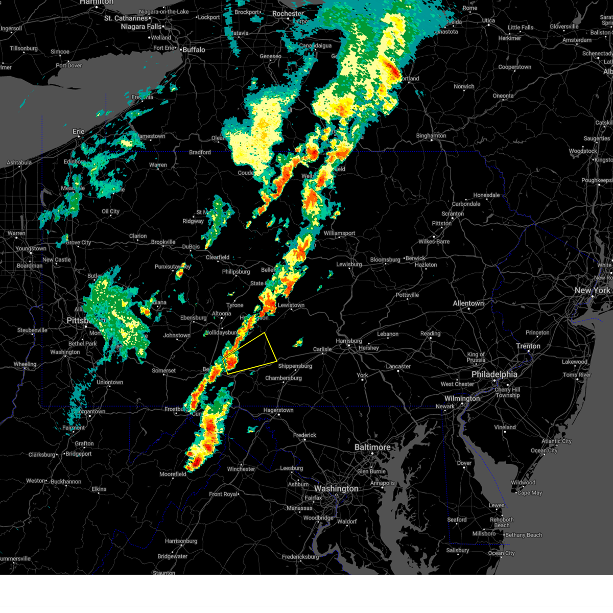
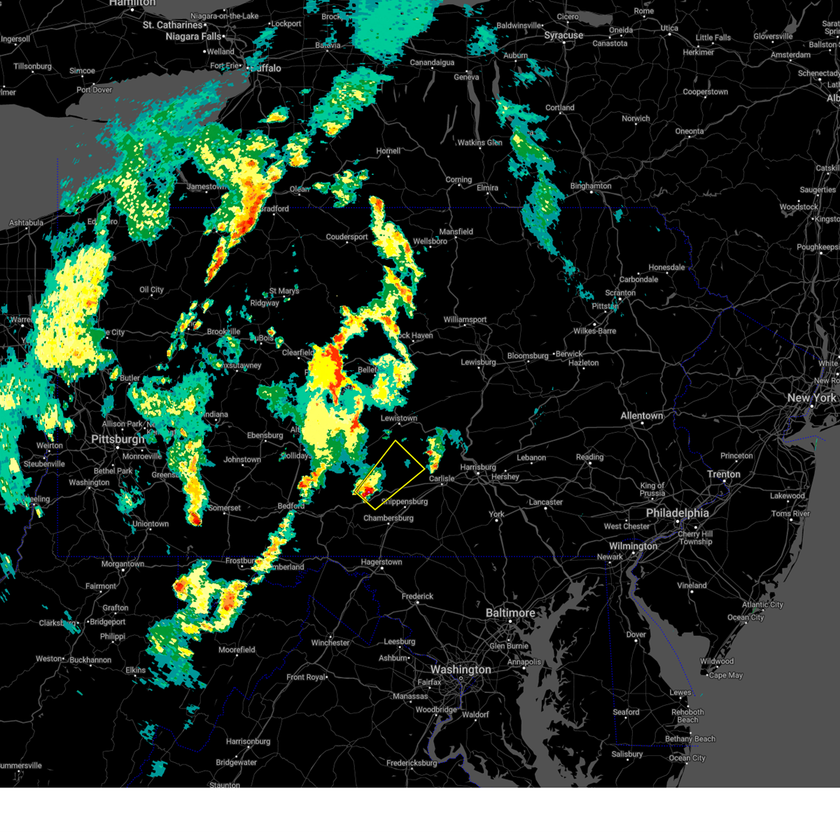
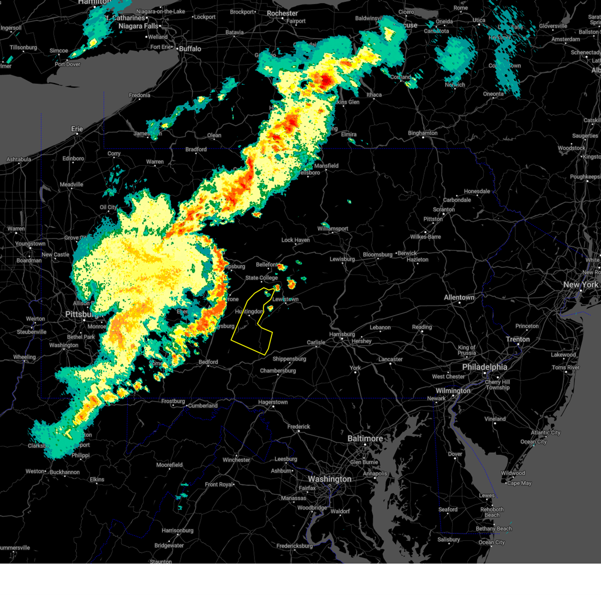
Hail Maps for Shade Gap, PA


Connect with Interactive Hail Maps