

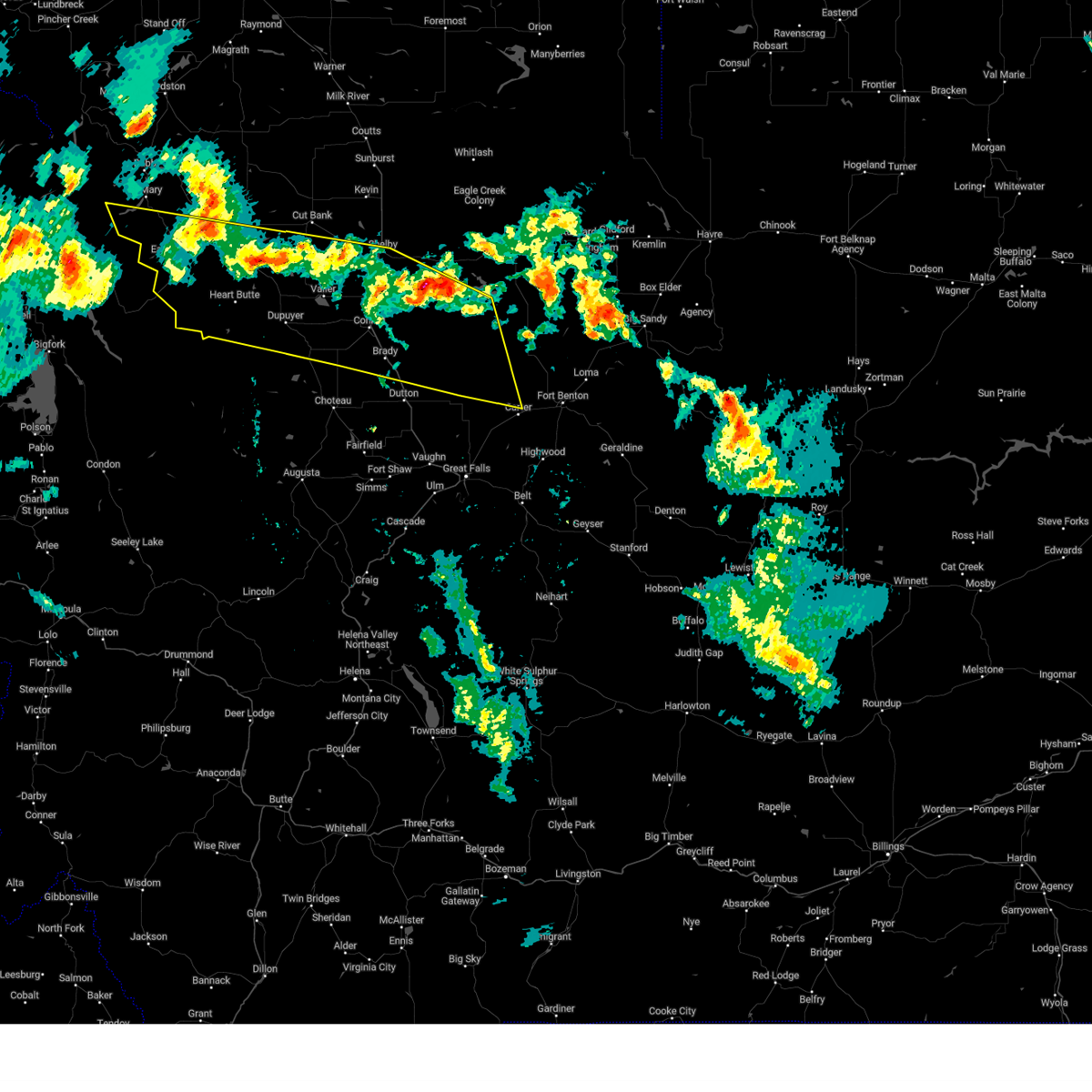
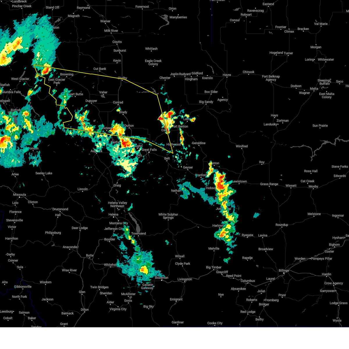
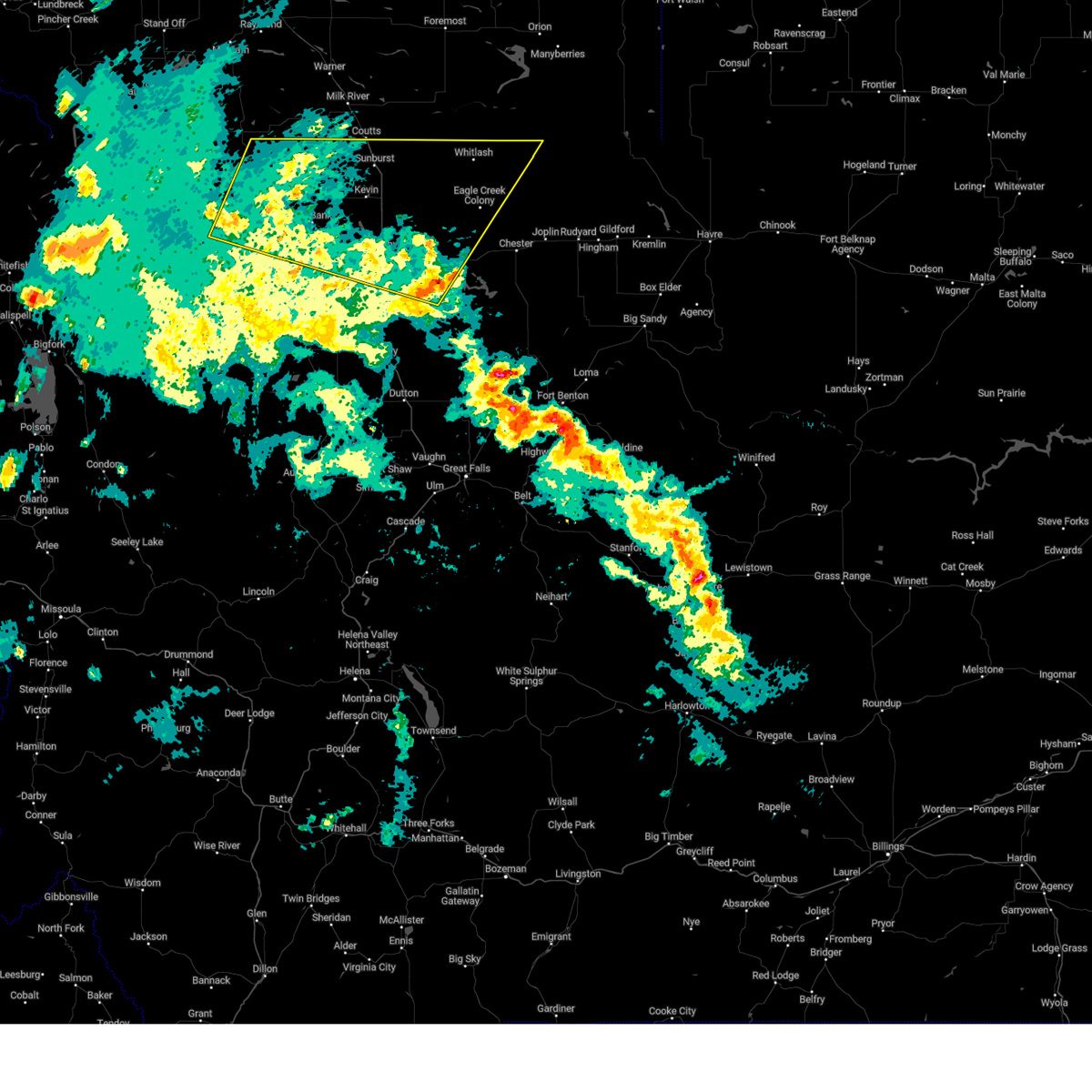
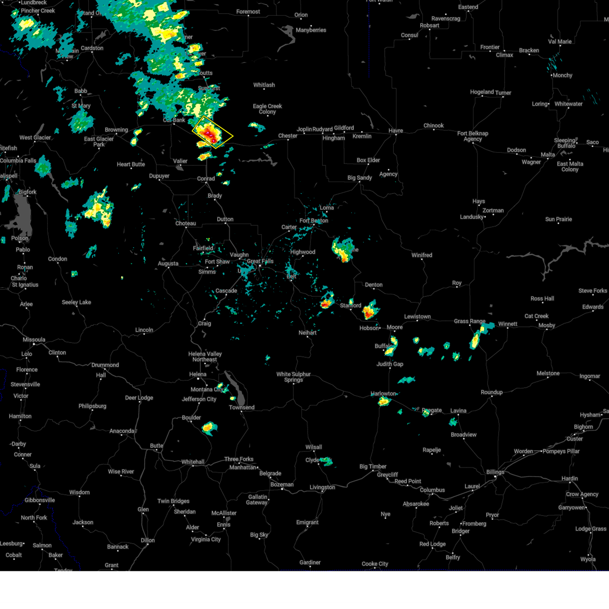
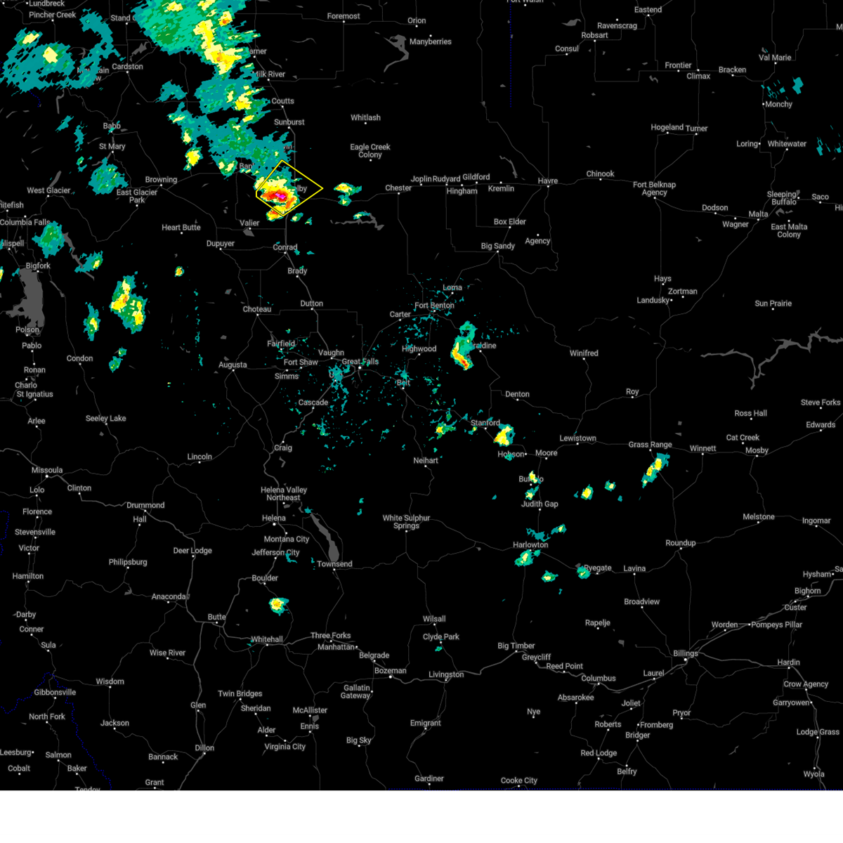
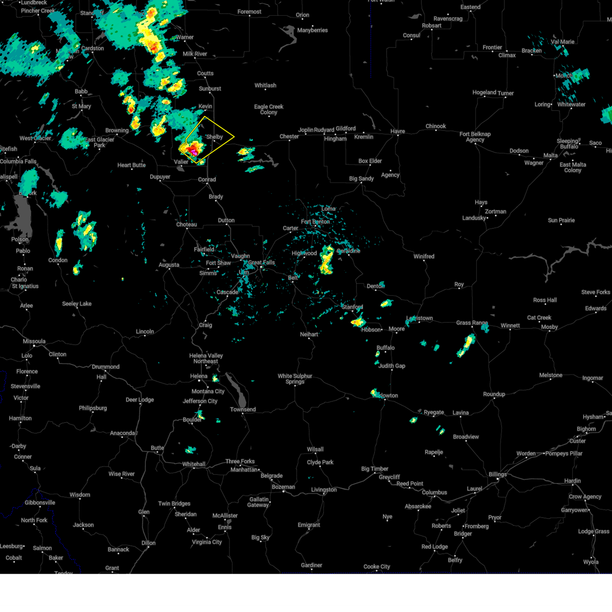
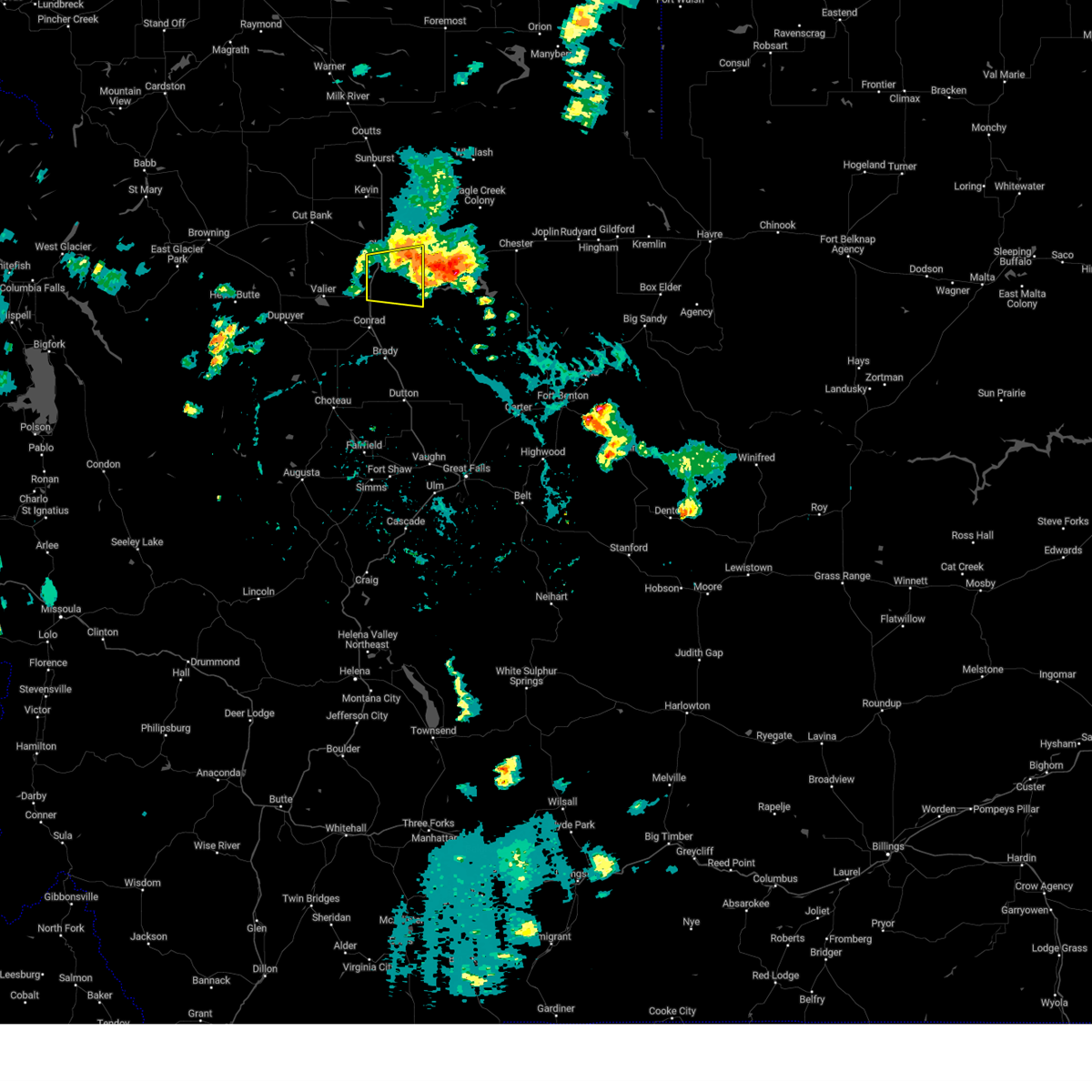
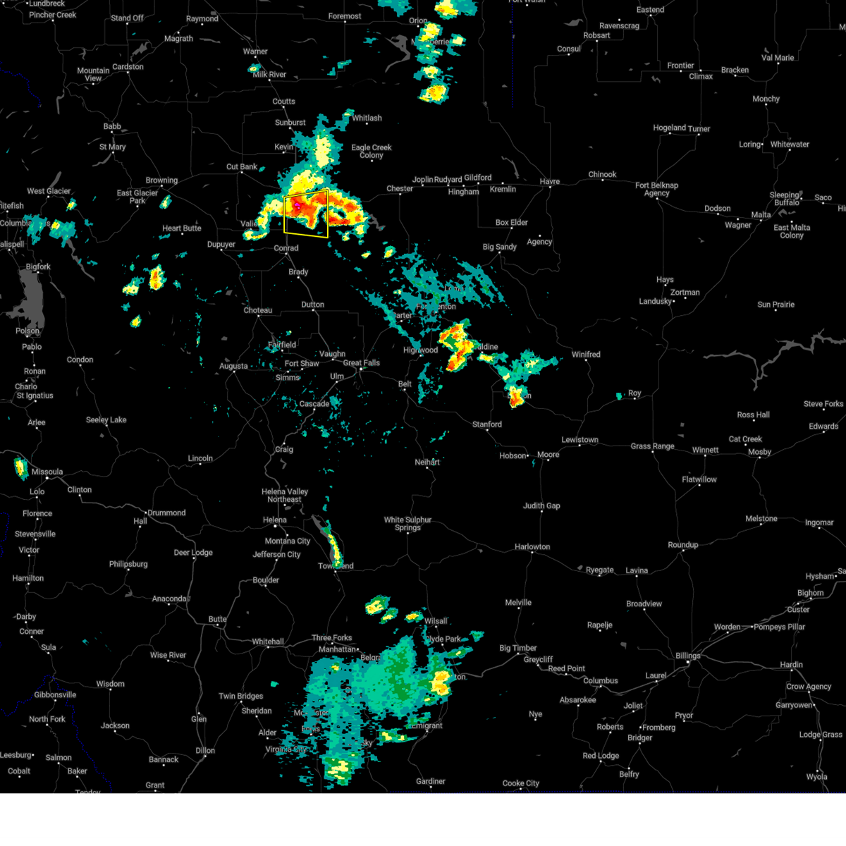
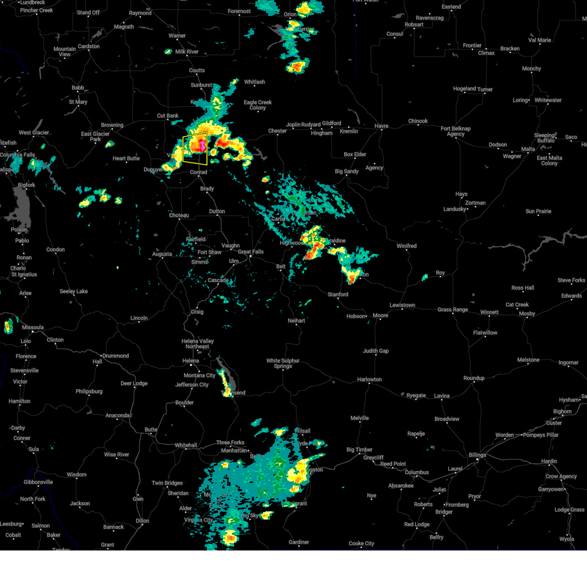
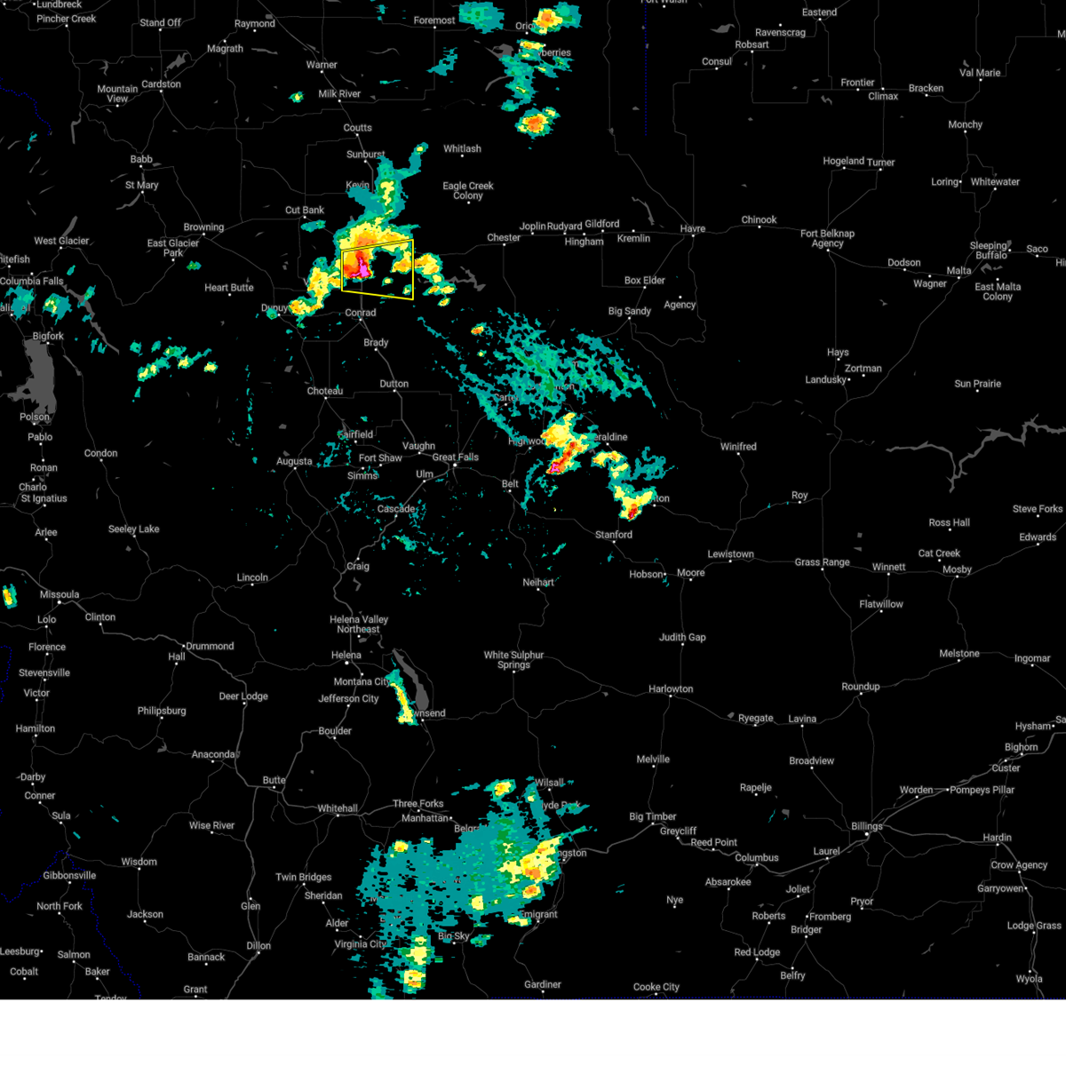
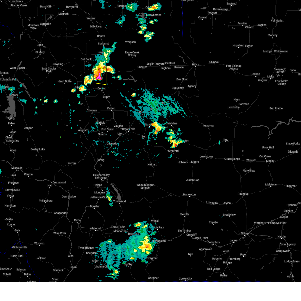
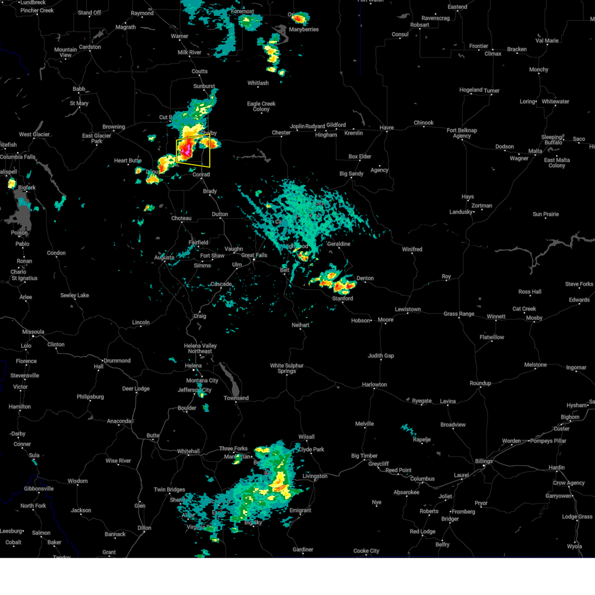
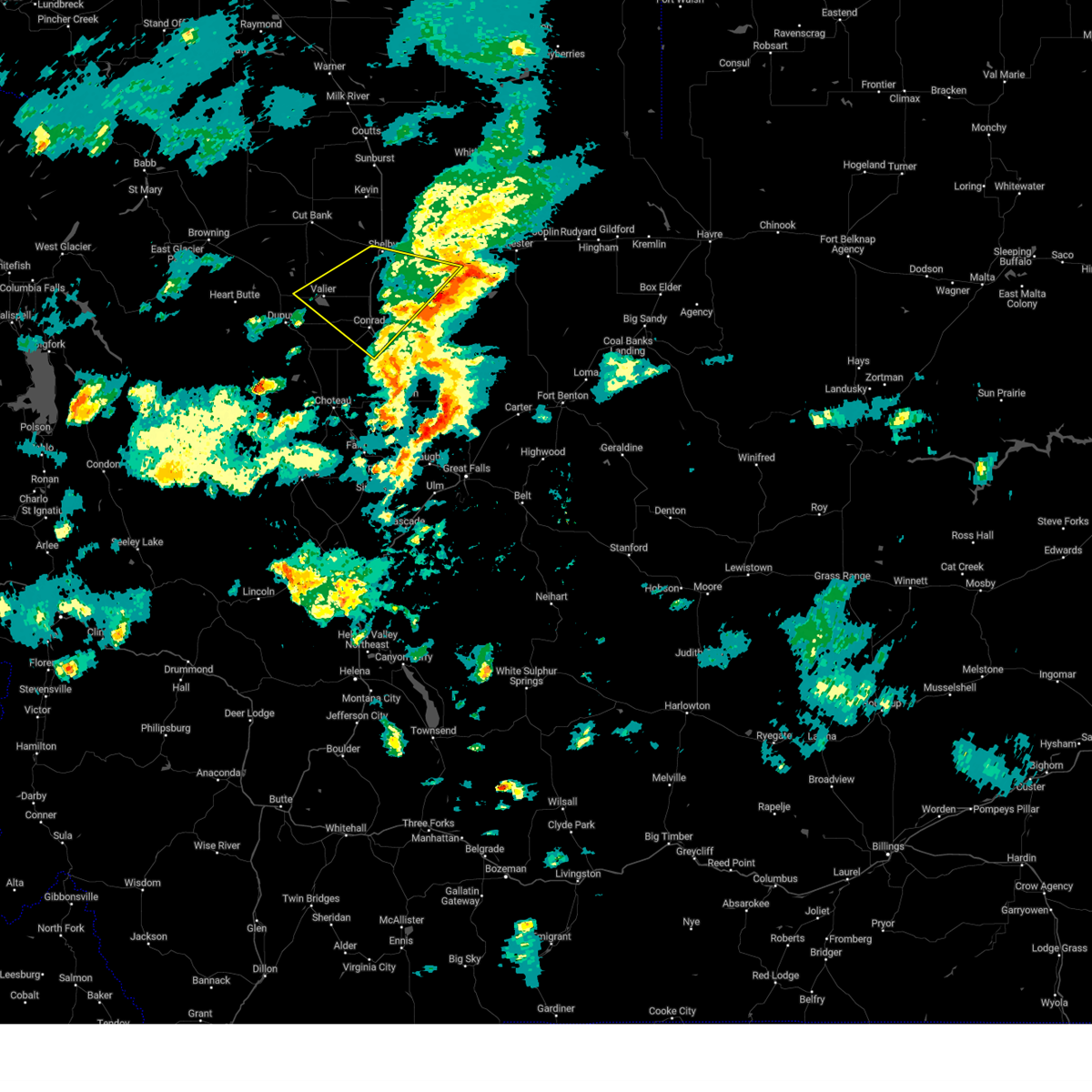
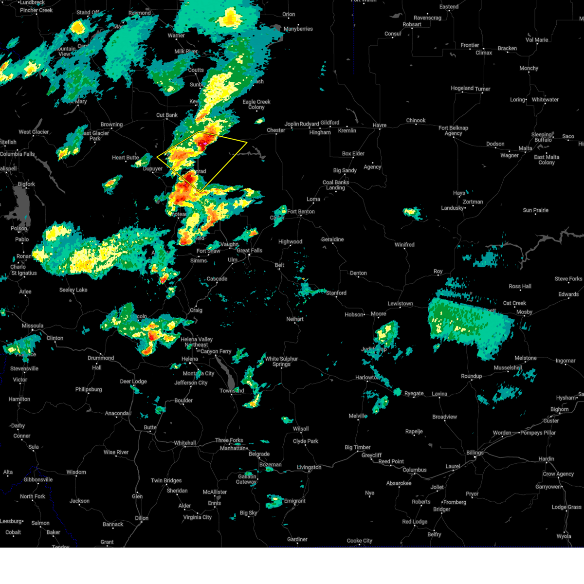
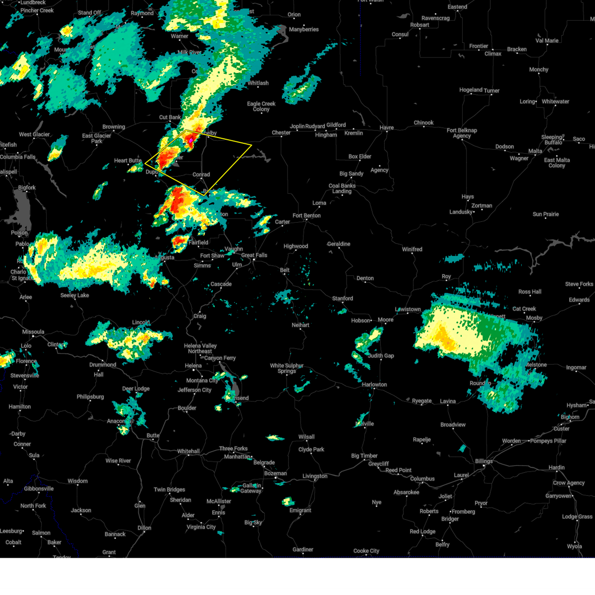
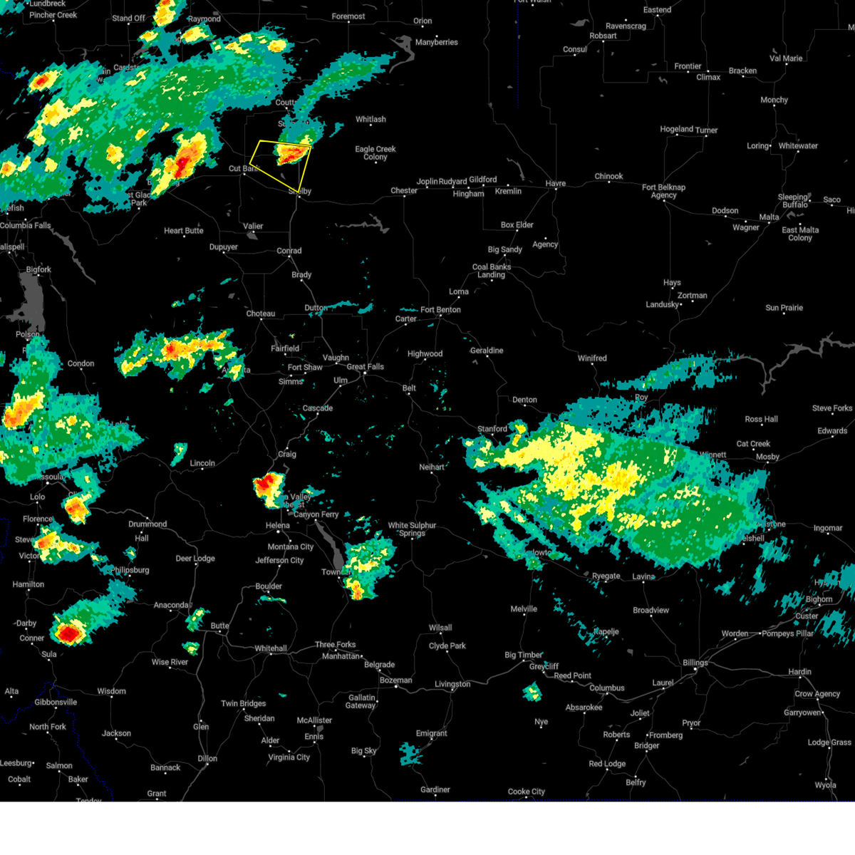
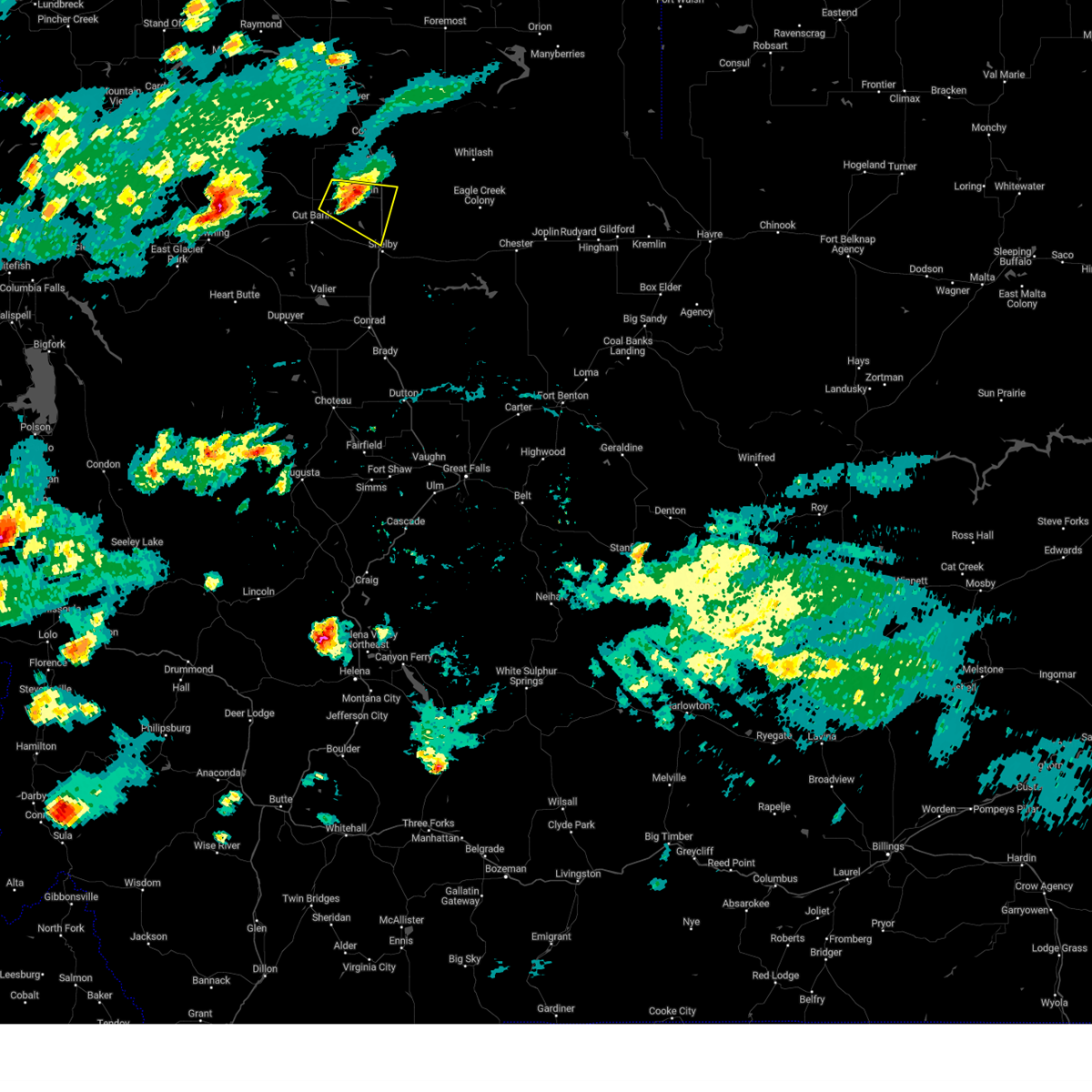
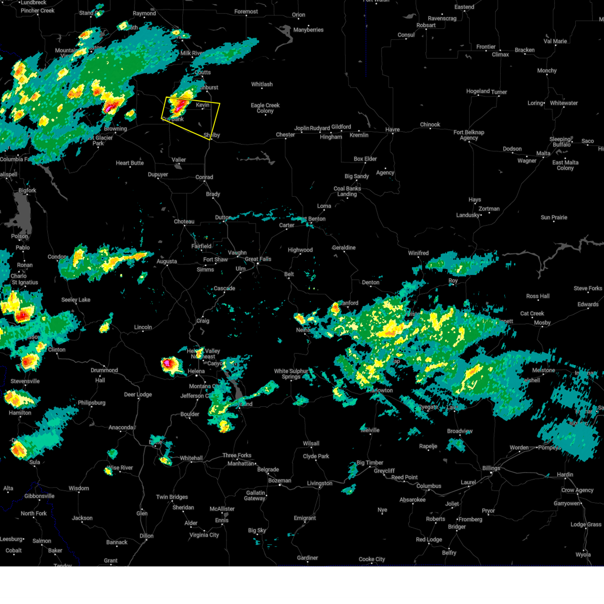
Hail Map for Shelby, MT
The Shelby, MT area has had 9 reports of on-the-ground hail by trained spotters, and has been under severe weather warnings 33 times during the past 12 months. Doppler radar has detected hail at or near Shelby, MT on 18 occasions, including 3 occasions during the past year.
| Name: | Shelby, MT |
| Where Located: | 73 miles NNW of Great Falls, MT |
| Map: | Google Map for Shelby, MT |
| Population: | 3376 |
| Housing Units: | 1371 |
| More Info: | Search Google for Shelby, MT |
3
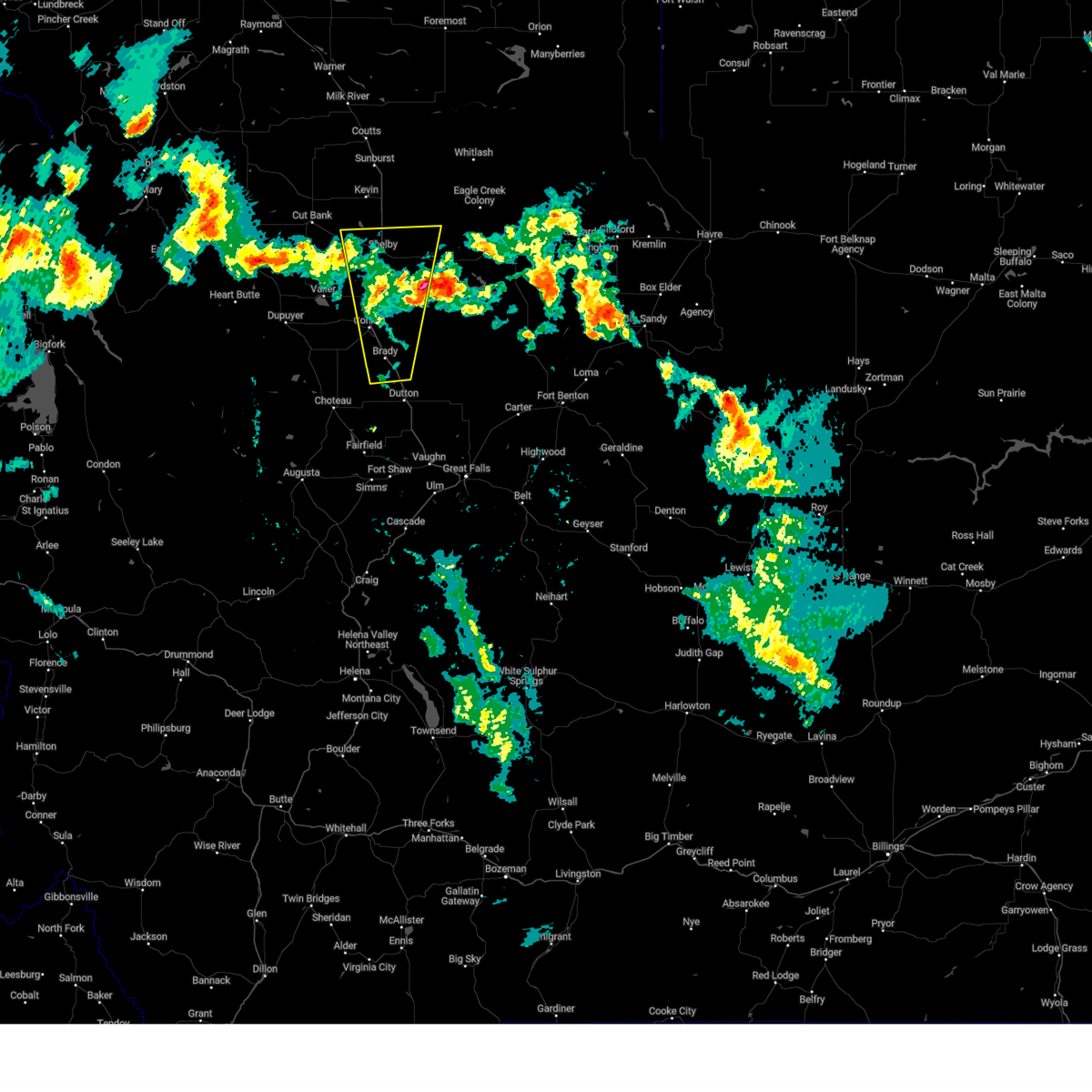
The Top Recent Hail Date for Shelby, MT is Friday, August 16, 2024 (2nd out of 18)

Hail and Wind Damage Spotted near Shelby, MT
| Date / Time | Report Details |
|---|---|
| 8/23/2024 7:09 PM MDT |
 The storms which prompted the warning have weakened below severe limits, and no longer pose an immediate threat to life or property. therefore, the warning will be allowed to expire. however, gusty winds around 55 mph are still possible with these thunderstorms. a severe thunderstorm watch remains in effect until 900 pm mdt for north central montana. The storms which prompted the warning have weakened below severe limits, and no longer pose an immediate threat to life or property. therefore, the warning will be allowed to expire. however, gusty winds around 55 mph are still possible with these thunderstorms. a severe thunderstorm watch remains in effect until 900 pm mdt for north central montana.
|
| 8/23/2024 6:47 PM MDT |
 the severe thunderstorm warning has been cancelled and is no longer in effect the severe thunderstorm warning has been cancelled and is no longer in effect
|
| 8/23/2024 6:47 PM MDT |
 At 647 pm mdt, severe thunderstorms were located along a line extending from 36 miles north of kiowa to 23 miles east of sunburst to 9 miles northwest of beaver creek, moving north at 85 mph (radar indicated). Hazards include 70 mph wind gusts. Expect considerable tree damage. damage is likely to mobile homes, roofs, and outbuildings. locations impacted include, havre, shelby, cut bank, chinook, chester, sunburst, kevin, parker school, beaver creek, lothair, joplin, azure, inverness, agency, st. Pierre, gildford, sangrey, boneau, box elder, and north browning. At 647 pm mdt, severe thunderstorms were located along a line extending from 36 miles north of kiowa to 23 miles east of sunburst to 9 miles northwest of beaver creek, moving north at 85 mph (radar indicated). Hazards include 70 mph wind gusts. Expect considerable tree damage. damage is likely to mobile homes, roofs, and outbuildings. locations impacted include, havre, shelby, cut bank, chinook, chester, sunburst, kevin, parker school, beaver creek, lothair, joplin, azure, inverness, agency, st. Pierre, gildford, sangrey, boneau, box elder, and north browning.
|
| 8/23/2024 6:28 PM MDT |
 The storms which prompted the warning have moved out of the area. therefore, the warning will be allowed to expire. however, gusty winds are still possible with these thunderstorms. a severe thunderstorm watch remains in effect until 900 pm mdt for north central montana. remember, a severe thunderstorm warning still remains in effect for glacier, liberty, and toole counties until 715 pm. The storms which prompted the warning have moved out of the area. therefore, the warning will be allowed to expire. however, gusty winds are still possible with these thunderstorms. a severe thunderstorm watch remains in effect until 900 pm mdt for north central montana. remember, a severe thunderstorm warning still remains in effect for glacier, liberty, and toole counties until 715 pm.
|
| 8/23/2024 6:25 PM MDT |
 The storm which prompted the warning has moved out of the area. therefore, the warning will be allowed to expire. however, gusty winds are still possible with this thunderstorm. a severe thunderstorm watch remains in effect until 900 pm mdt for north central montana. remember, a severe thunderstorm warning still remains in effect for northeastern pondera and toole counties until 715pm. The storm which prompted the warning has moved out of the area. therefore, the warning will be allowed to expire. however, gusty winds are still possible with this thunderstorm. a severe thunderstorm watch remains in effect until 900 pm mdt for north central montana. remember, a severe thunderstorm warning still remains in effect for northeastern pondera and toole counties until 715pm.
|
| 8/23/2024 6:13 PM MDT |
 Svrtfx the national weather service in great falls has issued a * severe thunderstorm warning for, northeastern pondera county in north central montana, liberty county in north central montana, glacier county in north central montana, toole county in north central montana, northwestern blaine county in north central montana, hill county in north central montana, northern chouteau county in north central montana, * until 715 pm mdt. * at 612 pm mdt, severe thunderstorms were located along a line extending from 11 miles southwest of east glacier park village to 10 miles north of the knees to 17 miles southeast of big sandy, moving north at 85 mph. these are destructive storms for browning, box elder, and havre (radar indicated). Hazards include 80 mph wind gusts. Flying debris will be dangerous to those caught without shelter. mobile homes will be heavily damaged. expect considerable damage to roofs, windows, and vehicles. Extensive tree damage and power outages are likely. Svrtfx the national weather service in great falls has issued a * severe thunderstorm warning for, northeastern pondera county in north central montana, liberty county in north central montana, glacier county in north central montana, toole county in north central montana, northwestern blaine county in north central montana, hill county in north central montana, northern chouteau county in north central montana, * until 715 pm mdt. * at 612 pm mdt, severe thunderstorms were located along a line extending from 11 miles southwest of east glacier park village to 10 miles north of the knees to 17 miles southeast of big sandy, moving north at 85 mph. these are destructive storms for browning, box elder, and havre (radar indicated). Hazards include 80 mph wind gusts. Flying debris will be dangerous to those caught without shelter. mobile homes will be heavily damaged. expect considerable damage to roofs, windows, and vehicles. Extensive tree damage and power outages are likely.
|
| 8/23/2024 6:11 PM MDT |
 Svrtfx the national weather service in great falls has issued a * severe thunderstorm warning for, northeastern pondera county in north central montana, liberty county in north central montana, glacier county in north central montana, toole county in north central montana, northwestern blaine county in north central montana, hill county in north central montana, northern chouteau county in north central montana, * until 715 pm mdt. * at 610 pm mdt, severe thunderstorms were located along a line extending from 11 miles southwest of east glacier park village to 9 miles north of the knees to 19 miles southeast of big sandy, moving north at 85 mph. these are destructive storms for browning, box elder, and havre (radar indicated). Hazards include 80 mph wind gusts. Flying debris will be dangerous to those caught without shelter. mobile homes will be heavily damaged. expect considerable damage to roofs, windows, and vehicles. Extensive tree damage and power outages are likely. Svrtfx the national weather service in great falls has issued a * severe thunderstorm warning for, northeastern pondera county in north central montana, liberty county in north central montana, glacier county in north central montana, toole county in north central montana, northwestern blaine county in north central montana, hill county in north central montana, northern chouteau county in north central montana, * until 715 pm mdt. * at 610 pm mdt, severe thunderstorms were located along a line extending from 11 miles southwest of east glacier park village to 9 miles north of the knees to 19 miles southeast of big sandy, moving north at 85 mph. these are destructive storms for browning, box elder, and havre (radar indicated). Hazards include 80 mph wind gusts. Flying debris will be dangerous to those caught without shelter. mobile homes will be heavily damaged. expect considerable damage to roofs, windows, and vehicles. Extensive tree damage and power outages are likely.
|
| 8/23/2024 6:04 PM MDT |
 At 602 pm mdt, severe thunderstorms were located along a line extending from 14 miles south of east glacier park village to 10 miles west of the knees to 17 miles west of fort benton, moving north at 40 mph. these are destructive storms for conrad, valier, brady, dupuyer, and browning (radar indicated). Hazards include 80 mph wind gusts. Flying debris will be dangerous to those caught without shelter. mobile homes will be heavily damaged. expect considerable damage to roofs, windows, and vehicles. extensive tree damage and power outages are likely. Locations impacted include, shelby, conrad, browning, valier, east glacier park village, north browning, kiowa, brady, the knees, south browning, east glacier park, heart butte, dupuyer, marias pass, ledger, starr school, and pendroy. At 602 pm mdt, severe thunderstorms were located along a line extending from 14 miles south of east glacier park village to 10 miles west of the knees to 17 miles west of fort benton, moving north at 40 mph. these are destructive storms for conrad, valier, brady, dupuyer, and browning (radar indicated). Hazards include 80 mph wind gusts. Flying debris will be dangerous to those caught without shelter. mobile homes will be heavily damaged. expect considerable damage to roofs, windows, and vehicles. extensive tree damage and power outages are likely. Locations impacted include, shelby, conrad, browning, valier, east glacier park village, north browning, kiowa, brady, the knees, south browning, east glacier park, heart butte, dupuyer, marias pass, ledger, starr school, and pendroy.
|
| 8/23/2024 6:00 PM MDT |
 At 600 pm mdt, severe thunderstorms were located along a line extending from 13 miles south of east glacier park village to 11 miles west of the knees to 17 miles west of fort benton, moving north at 40 mph (radar indicated). Hazards include 70 mph wind gusts. Expect considerable tree damage. damage is likely to mobile homes, roofs, and outbuildings. Locations impacted include, shelby, conrad, browning, valier, east glacier park village, north browning, kiowa, brady, the knees, south browning, east glacier park, heart butte, dupuyer, marias pass, ledger, starr school, and pendroy. At 600 pm mdt, severe thunderstorms were located along a line extending from 13 miles south of east glacier park village to 11 miles west of the knees to 17 miles west of fort benton, moving north at 40 mph (radar indicated). Hazards include 70 mph wind gusts. Expect considerable tree damage. damage is likely to mobile homes, roofs, and outbuildings. Locations impacted include, shelby, conrad, browning, valier, east glacier park village, north browning, kiowa, brady, the knees, south browning, east glacier park, heart butte, dupuyer, marias pass, ledger, starr school, and pendroy.
|
| 8/23/2024 6:00 PM MDT |
 the severe thunderstorm warning has been cancelled and is no longer in effect the severe thunderstorm warning has been cancelled and is no longer in effect
|
| 8/23/2024 5:54 PM MDT |
 Svrtfx the national weather service in great falls has issued a * severe thunderstorm warning for, eastern pondera county in north central montana, southern toole county in north central montana, northeastern teton county in north central montana, * until 630 pm mdt. * at 554 pm mdt, a severe thunderstorm was located over brady, or 9 miles southeast of conrad, moving north at 55 mph. this is a destructive storm for brady and conrad (radar indicated). Hazards include 80 mph wind gusts. Flying debris will be dangerous to those caught without shelter. mobile homes will be heavily damaged. expect considerable damage to roofs, windows, and vehicles. Extensive tree damage and power outages are likely. Svrtfx the national weather service in great falls has issued a * severe thunderstorm warning for, eastern pondera county in north central montana, southern toole county in north central montana, northeastern teton county in north central montana, * until 630 pm mdt. * at 554 pm mdt, a severe thunderstorm was located over brady, or 9 miles southeast of conrad, moving north at 55 mph. this is a destructive storm for brady and conrad (radar indicated). Hazards include 80 mph wind gusts. Flying debris will be dangerous to those caught without shelter. mobile homes will be heavily damaged. expect considerable damage to roofs, windows, and vehicles. Extensive tree damage and power outages are likely.
|
| 8/23/2024 5:52 PM MDT |
 Svrtfx the national weather service in great falls has issued a * severe thunderstorm warning for, eastern pondera county in north central montana, southern toole county in north central montana, northeastern teton county in north central montana, * until 630 pm mdt. * at 552 pm mdt, a severe thunderstorm was located over brady, or 12 miles southeast of conrad, moving north at 55 mph. this is a destructive storm for brady and conrad (radar indicated). Hazards include 80 mph wind gusts. Flying debris will be dangerous to those caught without shelter. mobile homes will be heavily damaged. expect considerable damage to roofs, windows, and vehicles. Extensive tree damage and power outages are likely. Svrtfx the national weather service in great falls has issued a * severe thunderstorm warning for, eastern pondera county in north central montana, southern toole county in north central montana, northeastern teton county in north central montana, * until 630 pm mdt. * at 552 pm mdt, a severe thunderstorm was located over brady, or 12 miles southeast of conrad, moving north at 55 mph. this is a destructive storm for brady and conrad (radar indicated). Hazards include 80 mph wind gusts. Flying debris will be dangerous to those caught without shelter. mobile homes will be heavily damaged. expect considerable damage to roofs, windows, and vehicles. Extensive tree damage and power outages are likely.
|
| 8/23/2024 5:27 PM MDT |
 Svrtfx the national weather service in great falls has issued a * severe thunderstorm warning for, northwestern lewis and clark county in west central montana, pondera county in north central montana, southwestern liberty county in north central montana, southern glacier county in north central montana, southern toole county in north central montana, teton county in north central montana, southwestern chouteau county in north central montana, northeastern cascade county in central montana, * until 630 pm mdt. * at 526 pm mdt, severe thunderstorms were located along a line extending from 28 miles southwest of heart butte to 11 miles east of power to 9 miles west of highwood, moving north at 40 mph (radar indicated). Hazards include 70 mph wind gusts. Expect considerable tree damage. Damage is likely to mobile homes, roofs, and outbuildings. Svrtfx the national weather service in great falls has issued a * severe thunderstorm warning for, northwestern lewis and clark county in west central montana, pondera county in north central montana, southwestern liberty county in north central montana, southern glacier county in north central montana, southern toole county in north central montana, teton county in north central montana, southwestern chouteau county in north central montana, northeastern cascade county in central montana, * until 630 pm mdt. * at 526 pm mdt, severe thunderstorms were located along a line extending from 28 miles southwest of heart butte to 11 miles east of power to 9 miles west of highwood, moving north at 40 mph (radar indicated). Hazards include 70 mph wind gusts. Expect considerable tree damage. Damage is likely to mobile homes, roofs, and outbuildings.
|
| 8/19/2024 8:02 PM MDT |
 At 801 pm mdt, severe thunderstorms were located along a line extending from 6 miles northeast of north browning to 17 miles southwest of lothair, and are nearly stationary (automated weather sensors. a wind gust to 61 mph was reported at ethridge, and the cut bank airport reported a wind gust to 57 mph). Hazards include 60 mph wind gusts. Expect damage to roofs, siding, and trees. Locations impacted include, shelby, cut bank, sunburst, kevin, north browning, sweet grass, ethridge, oilmont, galata, santa rita, whitlash, ferdig, devon, and dunkirk. At 801 pm mdt, severe thunderstorms were located along a line extending from 6 miles northeast of north browning to 17 miles southwest of lothair, and are nearly stationary (automated weather sensors. a wind gust to 61 mph was reported at ethridge, and the cut bank airport reported a wind gust to 57 mph). Hazards include 60 mph wind gusts. Expect damage to roofs, siding, and trees. Locations impacted include, shelby, cut bank, sunburst, kevin, north browning, sweet grass, ethridge, oilmont, galata, santa rita, whitlash, ferdig, devon, and dunkirk.
|
| 8/19/2024 7:55 PM MDT | Mesonet station gw1987 ethridge three s in toole county MT, 10.3 miles ESE of Shelby, MT |
| 8/19/2024 7:54 PM MDT |
 Svrtfx the national weather service in great falls has issued a * severe thunderstorm warning for, northeastern pondera county in north central montana, northwestern liberty county in north central montana, northeastern glacier county in north central montana, toole county in north central montana, * until 900 pm mdt. * at 753 pm mdt, severe thunderstorms were located along a line extending from 6 miles northeast of north browning to 17 miles southeast of shelby, moving northeast at 50 mph (automated weather sensors). Hazards include 60 mph wind gusts. expect damage to roofs, siding, and trees Svrtfx the national weather service in great falls has issued a * severe thunderstorm warning for, northeastern pondera county in north central montana, northwestern liberty county in north central montana, northeastern glacier county in north central montana, toole county in north central montana, * until 900 pm mdt. * at 753 pm mdt, severe thunderstorms were located along a line extending from 6 miles northeast of north browning to 17 miles southeast of shelby, moving northeast at 50 mph (automated weather sensors). Hazards include 60 mph wind gusts. expect damage to roofs, siding, and trees
|
| 8/16/2024 3:46 PM MDT |
 At 346 pm mdt, a severe thunderstorm was located near shelby, moving northeast at 20 mph (radar indicated). Hazards include 60 mph wind gusts and quarter size hail. Hail damage to vehicles is expected. expect wind damage to roofs, siding, and trees. Locations impacted include, shelby. At 346 pm mdt, a severe thunderstorm was located near shelby, moving northeast at 20 mph (radar indicated). Hazards include 60 mph wind gusts and quarter size hail. Hail damage to vehicles is expected. expect wind damage to roofs, siding, and trees. Locations impacted include, shelby.
|
| 8/16/2024 3:46 PM MDT |
 the severe thunderstorm warning has been cancelled and is no longer in effect the severe thunderstorm warning has been cancelled and is no longer in effect
|
| 8/16/2024 3:32 PM MDT |
 At 331 pm mdt, a severe thunderstorm was located 7 miles west of shelby, moving northeast at 25 mph (radar indicated). Hazards include ping pong ball size hail and 60 mph wind gusts. People and animals outdoors will be injured. expect hail and wind damage to roofs, siding, windows, and vehicles. Locations impacted include, shelby and ethridge. At 331 pm mdt, a severe thunderstorm was located 7 miles west of shelby, moving northeast at 25 mph (radar indicated). Hazards include ping pong ball size hail and 60 mph wind gusts. People and animals outdoors will be injured. expect hail and wind damage to roofs, siding, windows, and vehicles. Locations impacted include, shelby and ethridge.
|
| 8/16/2024 3:15 PM MDT |
 Svrtfx the national weather service in great falls has issued a * severe thunderstorm warning for, north central pondera county in north central montana, southwestern toole county in north central montana, * until 400 pm mdt. * at 314 pm mdt, a severe thunderstorm was located 12 miles northeast of valier, or 12 miles west of shelby, moving northeast at 20 mph (radar indicated). Hazards include ping pong ball size hail and 60 mph wind gusts. People and animals outdoors will be injured. expect hail damage to roofs, siding, windows, and vehicles. Expect wind damage to roofs, siding, and trees. Svrtfx the national weather service in great falls has issued a * severe thunderstorm warning for, north central pondera county in north central montana, southwestern toole county in north central montana, * until 400 pm mdt. * at 314 pm mdt, a severe thunderstorm was located 12 miles northeast of valier, or 12 miles west of shelby, moving northeast at 20 mph (radar indicated). Hazards include ping pong ball size hail and 60 mph wind gusts. People and animals outdoors will be injured. expect hail damage to roofs, siding, windows, and vehicles. Expect wind damage to roofs, siding, and trees.
|
| 8/12/2024 4:14 PM MDT |
 The storm which prompted the warning has weakened below severe limits, and has exited the warned area. therefore, the warning will be allowed to expire. however, small hail, gusty winds and heavy rain are still possible with this thunderstorm. The storm which prompted the warning has weakened below severe limits, and has exited the warned area. therefore, the warning will be allowed to expire. however, small hail, gusty winds and heavy rain are still possible with this thunderstorm.
|
| 8/12/2024 3:58 PM MDT |
 At 357 pm mdt, a severe thunderstorm was located 7 miles south of shelby, moving east at 20 mph (radar indicated). Hazards include 60 mph wind gusts and quarter size hail. Hail damage to vehicles is expected. expect wind damage to roofs, siding, and trees. Locations impacted include, shelby and dunkirk. At 357 pm mdt, a severe thunderstorm was located 7 miles south of shelby, moving east at 20 mph (radar indicated). Hazards include 60 mph wind gusts and quarter size hail. Hail damage to vehicles is expected. expect wind damage to roofs, siding, and trees. Locations impacted include, shelby and dunkirk.
|
| 8/12/2024 3:46 PM MDT |
 This severe thunderstorm warning will be allowed to expire, but another severe thunderstorm warning has been issued for this same storm. This severe thunderstorm warning will be allowed to expire, but another severe thunderstorm warning has been issued for this same storm.
|
| 8/12/2024 3:44 PM MDT |
 Svrtfx the national weather service in great falls has issued a * severe thunderstorm warning for, northeastern pondera county in north central montana, southwestern toole county in north central montana, * until 415 pm mdt. * at 344 pm mdt, a severe thunderstorm was located 9 miles southwest of shelby, moving east at 20 mph (radar indicated). Hazards include 60 mph wind gusts and quarter size hail. Hail damage to vehicles is expected. Expect wind damage to roofs, siding, and trees. Svrtfx the national weather service in great falls has issued a * severe thunderstorm warning for, northeastern pondera county in north central montana, southwestern toole county in north central montana, * until 415 pm mdt. * at 344 pm mdt, a severe thunderstorm was located 9 miles southwest of shelby, moving east at 20 mph (radar indicated). Hazards include 60 mph wind gusts and quarter size hail. Hail damage to vehicles is expected. Expect wind damage to roofs, siding, and trees.
|
| 8/12/2024 3:36 PM MDT |
 the severe thunderstorm warning has been cancelled and is no longer in effect the severe thunderstorm warning has been cancelled and is no longer in effect
|
| 8/12/2024 3:36 PM MDT |
 At 336 pm mdt, a severe thunderstorm was located 11 miles southwest of shelby, moving east at 15 mph (radar indicated). Hazards include 60 mph wind gusts and quarter size hail. Hail damage to vehicles is expected. expect wind damage to roofs, siding, and trees. Locations impacted include, shelby. At 336 pm mdt, a severe thunderstorm was located 11 miles southwest of shelby, moving east at 15 mph (radar indicated). Hazards include 60 mph wind gusts and quarter size hail. Hail damage to vehicles is expected. expect wind damage to roofs, siding, and trees. Locations impacted include, shelby.
|
| 8/12/2024 3:20 PM MDT |
 Svrtfx the national weather service in great falls has issued a * severe thunderstorm warning for, northeastern pondera county in north central montana, southeastern glacier county in north central montana, southwestern toole county in north central montana, * until 345 pm mdt. * at 320 pm mdt, a severe thunderstorm was located 8 miles northeast of valier, or 15 miles southwest of shelby, moving east at 15 mph (radar indicated). Hazards include 60 mph wind gusts and quarter size hail. Hail damage to vehicles is expected. Expect wind damage to roofs, siding, and trees. Svrtfx the national weather service in great falls has issued a * severe thunderstorm warning for, northeastern pondera county in north central montana, southeastern glacier county in north central montana, southwestern toole county in north central montana, * until 345 pm mdt. * at 320 pm mdt, a severe thunderstorm was located 8 miles northeast of valier, or 15 miles southwest of shelby, moving east at 15 mph (radar indicated). Hazards include 60 mph wind gusts and quarter size hail. Hail damage to vehicles is expected. Expect wind damage to roofs, siding, and trees.
|
| 8/6/2024 8:36 PM MDT |
 The storms which prompted the warning have moved out of the area. therefore, the warning has been allowed to expire. however, gusty winds are still possible with these thunderstorms. a severe thunderstorm watch remains in effect until midnight mdt for north central montana. The storms which prompted the warning have moved out of the area. therefore, the warning has been allowed to expire. however, gusty winds are still possible with these thunderstorms. a severe thunderstorm watch remains in effect until midnight mdt for north central montana.
|
| 8/6/2024 8:01 PM MDT |
 the severe thunderstorm warning has been cancelled and is no longer in effect the severe thunderstorm warning has been cancelled and is no longer in effect
|
| 8/6/2024 8:01 PM MDT |
 At 801 pm mdt, severe thunderstorms were located along a line extending from 7 miles southwest of shelby to near valier, moving east at 35 mph (radar indicated). Hazards include quarter size hail. Damage to vehicles is expected. Locations impacted include, shelby, conrad, valier, dunkirk, and ledger. At 801 pm mdt, severe thunderstorms were located along a line extending from 7 miles southwest of shelby to near valier, moving east at 35 mph (radar indicated). Hazards include quarter size hail. Damage to vehicles is expected. Locations impacted include, shelby, conrad, valier, dunkirk, and ledger.
|
| 8/6/2024 7:43 PM MDT |
 Svrtfx the national weather service in great falls has issued a * severe thunderstorm warning for, eastern pondera county in north central montana, southeastern glacier county in north central montana, southern toole county in north central montana, northeastern teton county in north central montana, * until 830 pm mdt. * at 743 pm mdt, severe thunderstorms were located along a line extending from 13 miles west of shelby to 9 miles west of valier, moving east at 35 mph (radar indicated). Hazards include half dollar size hail. damage to vehicles is expected Svrtfx the national weather service in great falls has issued a * severe thunderstorm warning for, eastern pondera county in north central montana, southeastern glacier county in north central montana, southern toole county in north central montana, northeastern teton county in north central montana, * until 830 pm mdt. * at 743 pm mdt, severe thunderstorms were located along a line extending from 13 miles west of shelby to 9 miles west of valier, moving east at 35 mph (radar indicated). Hazards include half dollar size hail. damage to vehicles is expected
|
| 8/6/2024 6:31 PM MDT |
 The storm which prompted the warning has weakened below severe limits, and no longer poses an immediate threat to life or property. therefore, the warning has been allowed to expire. however, small hail is still possible with this thunderstorm. a severe thunderstorm watch remains in effect until midnight mdt for north central montana. The storm which prompted the warning has weakened below severe limits, and no longer poses an immediate threat to life or property. therefore, the warning has been allowed to expire. however, small hail is still possible with this thunderstorm. a severe thunderstorm watch remains in effect until midnight mdt for north central montana.
|
| 8/6/2024 6:20 PM MDT |
 At 620 pm mdt, a severe thunderstorm was located 8 miles west of kevin, or 10 miles northeast of cut bank, moving east at 35 mph (radar indicated). Hazards include quarter size hail. Damage to vehicles is expected. Locations impacted include, kevin, oilmont, and ferdig. At 620 pm mdt, a severe thunderstorm was located 8 miles west of kevin, or 10 miles northeast of cut bank, moving east at 35 mph (radar indicated). Hazards include quarter size hail. Damage to vehicles is expected. Locations impacted include, kevin, oilmont, and ferdig.
|
| 8/6/2024 6:05 PM MDT |
 Svrtfx the national weather service in great falls has issued a * severe thunderstorm warning for, east central glacier county in north central montana, west central toole county in north central montana, * until 630 pm mdt. * at 605 pm mdt, a severe thunderstorm was located 7 miles north of cut bank, moving east at 35 mph (radar indicated). Hazards include quarter size hail. damage to vehicles is expected Svrtfx the national weather service in great falls has issued a * severe thunderstorm warning for, east central glacier county in north central montana, west central toole county in north central montana, * until 630 pm mdt. * at 605 pm mdt, a severe thunderstorm was located 7 miles north of cut bank, moving east at 35 mph (radar indicated). Hazards include quarter size hail. damage to vehicles is expected
|
| 9/3/2022 11:37 PM MDT |
 The severe thunderstorm warning for central pondera, eastern glacier and toole counties will expire at 1145 pm mdt, the storms which prompted the warning have weakened below severe limits, and no longer pose an immediate threat to life or property. therefore, the warning will be allowed to expire. however gusty winds are still possible with these thunderstorms. The severe thunderstorm warning for central pondera, eastern glacier and toole counties will expire at 1145 pm mdt, the storms which prompted the warning have weakened below severe limits, and no longer pose an immediate threat to life or property. therefore, the warning will be allowed to expire. however gusty winds are still possible with these thunderstorms.
|
| 9/3/2022 11:07 PM MDT |
 At 1107 pm mdt, severe thunderstorms were located along a line extending from 30 miles north of cut bank to 6 miles southeast of valier, moving northeast at 40 mph (radar indicated). Hazards include 60 mph wind gusts. Expect damage to roofs, siding, and trees. locations impacted include, shelby, cut bank, conrad, valier, sunburst, kevin, sweet grass, dupuyer, ethridge, oilmont, ledger, galata, santa rita, ferdig, devon and dunkirk. hail threat, radar indicated max hail size, <. 75 in wind threat, radar indicated max wind gust, 60 mph. At 1107 pm mdt, severe thunderstorms were located along a line extending from 30 miles north of cut bank to 6 miles southeast of valier, moving northeast at 40 mph (radar indicated). Hazards include 60 mph wind gusts. Expect damage to roofs, siding, and trees. locations impacted include, shelby, cut bank, conrad, valier, sunburst, kevin, sweet grass, dupuyer, ethridge, oilmont, ledger, galata, santa rita, ferdig, devon and dunkirk. hail threat, radar indicated max hail size, <. 75 in wind threat, radar indicated max wind gust, 60 mph.
|
| 9/3/2022 10:48 PM MDT |
 At 1047 pm mdt, severe thunderstorms were located along a line extending from 30 miles northwest of cut bank to 7 miles south of valier, moving northeast at 40 mph (radar indicated). Hazards include 60 mph wind gusts. expect damage to roofs, siding, and trees At 1047 pm mdt, severe thunderstorms were located along a line extending from 30 miles northwest of cut bank to 7 miles south of valier, moving northeast at 40 mph (radar indicated). Hazards include 60 mph wind gusts. expect damage to roofs, siding, and trees
|
| 9/3/2022 10:38 PM MDT |
 The severe thunderstorm warning for pondera, eastern glacier, toole and central teton counties will expire at 1045 pm mdt, the storms which prompted the warning have moved out of the area. therefore, the warning will be allowed to expire. however gusty winds are still possible with these thunderstorms. The severe thunderstorm warning for pondera, eastern glacier, toole and central teton counties will expire at 1045 pm mdt, the storms which prompted the warning have moved out of the area. therefore, the warning will be allowed to expire. however gusty winds are still possible with these thunderstorms.
|
| 9/3/2022 10:09 PM MDT |
 At 1008 pm mdt, severe thunderstorms were located along a line extending from 31 miles northwest of cut bank to 7 miles north of valier to near fairfield, moving east at 35 mph (radar indicated). Hazards include 60 mph wind gusts. Expect damage to roofs, siding, and trees. locations impacted include, shelby, cut bank, conrad, choteau, valier, sunburst, dutton, kevin, brady, power, ethridge, oilmont, ledger, collins, bynum, santa rita, pendroy, ferdig, devon and dunkirk. a peak wind gust of 68 mph occurred at the cut bank airport with this storm. hail threat, radar indicated max hail size, <. 75 in wind threat, radar indicated max wind gust, 60 mph. At 1008 pm mdt, severe thunderstorms were located along a line extending from 31 miles northwest of cut bank to 7 miles north of valier to near fairfield, moving east at 35 mph (radar indicated). Hazards include 60 mph wind gusts. Expect damage to roofs, siding, and trees. locations impacted include, shelby, cut bank, conrad, choteau, valier, sunburst, dutton, kevin, brady, power, ethridge, oilmont, ledger, collins, bynum, santa rita, pendroy, ferdig, devon and dunkirk. a peak wind gust of 68 mph occurred at the cut bank airport with this storm. hail threat, radar indicated max hail size, <. 75 in wind threat, radar indicated max wind gust, 60 mph.
|
| 9/3/2022 9:48 PM MDT |
 At 947 pm mdt, severe thunderstorms were located along a line extending from 28 miles north of north browning to 13 miles northwest of valier to 11 miles south of choteau, moving east at 35 mph (radar indicated). Hazards include 60 mph wind gusts. expect damage to roofs, siding, and trees At 947 pm mdt, severe thunderstorms were located along a line extending from 28 miles north of north browning to 13 miles northwest of valier to 11 miles south of choteau, moving east at 35 mph (radar indicated). Hazards include 60 mph wind gusts. expect damage to roofs, siding, and trees
|
| 7/18/2022 12:42 PM MDT |
 The severe thunderstorm warning for northeastern pondera, west central liberty and southeastern toole counties will expire at 1245 pm mdt, the storm which prompted the warning has moved out of the area. therefore, the warning will be allowed to expire. however small hail and gusty winds are still possible with this thunderstorm. a severe thunderstorm watch remains in effect until 800 pm mdt for north central montana. The severe thunderstorm warning for northeastern pondera, west central liberty and southeastern toole counties will expire at 1245 pm mdt, the storm which prompted the warning has moved out of the area. therefore, the warning will be allowed to expire. however small hail and gusty winds are still possible with this thunderstorm. a severe thunderstorm watch remains in effect until 800 pm mdt for north central montana.
|
| 7/18/2022 12:41 PM MDT |
 At 1240 pm mdt, severe thunderstorms were located along a line extending from 10 miles southeast of shelby to 6 miles southwest of kevin, moving northeast at 35 mph (radar indicated). Hazards include 60 mph wind gusts and half dollar size hail. Hail damage to vehicles is expected. Expect wind damage to roofs, siding, and trees. At 1240 pm mdt, severe thunderstorms were located along a line extending from 10 miles southeast of shelby to 6 miles southwest of kevin, moving northeast at 35 mph (radar indicated). Hazards include 60 mph wind gusts and half dollar size hail. Hail damage to vehicles is expected. Expect wind damage to roofs, siding, and trees.
|
| 7/18/2022 12:07 PM MDT |
 At 1207 pm mdt, a severe thunderstorm was located 9 miles north of conrad, moving northeast at 45 mph (radar indicated). Hazards include 60 mph wind gusts and half dollar size hail. Hail damage to vehicles is expected. Expect wind damage to roofs, siding, and trees. At 1207 pm mdt, a severe thunderstorm was located 9 miles north of conrad, moving northeast at 45 mph (radar indicated). Hazards include 60 mph wind gusts and half dollar size hail. Hail damage to vehicles is expected. Expect wind damage to roofs, siding, and trees.
|
| 7/8/2022 4:54 PM MDT |
 At 454 pm mdt, a severe thunderstorm was located near conrad, moving northeast at 35 mph (radar indicated). Hazards include 60 mph wind gusts and half dollar size hail. Hail damage to vehicles is expected. Expect wind damage to roofs, siding, and trees. At 454 pm mdt, a severe thunderstorm was located near conrad, moving northeast at 35 mph (radar indicated). Hazards include 60 mph wind gusts and half dollar size hail. Hail damage to vehicles is expected. Expect wind damage to roofs, siding, and trees.
|
| 7/7/2022 4:40 PM MDT |
 The severe thunderstorm warning for central toole county will expire at 445 pm mdt, the storm which prompted the warning has been replaced with a new severe thunderstorm warning for eastern toole county. a severe thunderstorm watch remains in effect until 900 pm mdt for north central montana. The severe thunderstorm warning for central toole county will expire at 445 pm mdt, the storm which prompted the warning has been replaced with a new severe thunderstorm warning for eastern toole county. a severe thunderstorm watch remains in effect until 900 pm mdt for north central montana.
|
| 7/7/2022 4:30 PM MDT | Golf Ball sized hail reported 6 miles SW of Shelby, MT, near welker farms... just ne of shelby. golf ball-sized hail. damaged crops. |
| 7/7/2022 4:05 PM MDT |
 At 405 pm mdt, a severe thunderstorm was located near shelby, moving northeast at 15 mph (radar indicated). Hazards include 60 mph wind gusts and half dollar size hail. Hail damage to vehicles is expected. expect wind damage to roofs, siding, and trees. locations impacted include, shelby, oilmont and ferdig. hail threat, radar indicated max hail size, 1. 25 in wind threat, radar indicated max wind gust, 60 mph. At 405 pm mdt, a severe thunderstorm was located near shelby, moving northeast at 15 mph (radar indicated). Hazards include 60 mph wind gusts and half dollar size hail. Hail damage to vehicles is expected. expect wind damage to roofs, siding, and trees. locations impacted include, shelby, oilmont and ferdig. hail threat, radar indicated max hail size, 1. 25 in wind threat, radar indicated max wind gust, 60 mph.
|
| 7/7/2022 3:46 PM MDT |
 At 346 pm mdt, a severe thunderstorm was located near shelby, moving northeast at 10 mph (radar indicated). Hazards include 60 mph wind gusts and half dollar size hail. Hail damage to vehicles is expected. Expect wind damage to roofs, siding, and trees. At 346 pm mdt, a severe thunderstorm was located near shelby, moving northeast at 10 mph (radar indicated). Hazards include 60 mph wind gusts and half dollar size hail. Hail damage to vehicles is expected. Expect wind damage to roofs, siding, and trees.
|
| 7/6/2022 6:30 PM MDT | Quarter sized hail reported 19.7 miles NW of Shelby, MT, reported 1 inch hail over a 30 minute period. |
| 7/2/2022 9:22 PM MDT |
 At 922 pm mdt, a severe thunderstorm was located near shelby, moving east at 25 mph (radar indicated). Hazards include 60 mph wind gusts and quarter size hail. Hail damage to vehicles is expected. expect wind damage to roofs, siding, and trees. locations impacted include, shelby, devon, dunkirk and galata. hail threat, radar indicated max hail size, 1. 00 in wind threat, radar indicated max wind gust, 60 mph. At 922 pm mdt, a severe thunderstorm was located near shelby, moving east at 25 mph (radar indicated). Hazards include 60 mph wind gusts and quarter size hail. Hail damage to vehicles is expected. expect wind damage to roofs, siding, and trees. locations impacted include, shelby, devon, dunkirk and galata. hail threat, radar indicated max hail size, 1. 00 in wind threat, radar indicated max wind gust, 60 mph.
|
| 7/2/2022 9:14 PM MDT |
 At 914 pm mdt, a severe thunderstorm was located near shelby, moving east at 25 mph (radar indicated). Hazards include 60 mph wind gusts and quarter size hail. Hail damage to vehicles is expected. Expect wind damage to roofs, siding, and trees. At 914 pm mdt, a severe thunderstorm was located near shelby, moving east at 25 mph (radar indicated). Hazards include 60 mph wind gusts and quarter size hail. Hail damage to vehicles is expected. Expect wind damage to roofs, siding, and trees.
|
| 7/2/2022 9:06 PM MDT |
 At 905 pm mdt, a severe thunderstorm was located near shelby, moving east at 20 mph (radar indicated). Hazards include 60 mph wind gusts and quarter size hail. Hail damage to vehicles is expected. expect wind damage to roofs, siding, and trees. locations impacted include, shelby. hail threat, radar indicated max hail size, 1. 00 in wind threat, radar indicated max wind gust, 60 mph. At 905 pm mdt, a severe thunderstorm was located near shelby, moving east at 20 mph (radar indicated). Hazards include 60 mph wind gusts and quarter size hail. Hail damage to vehicles is expected. expect wind damage to roofs, siding, and trees. locations impacted include, shelby. hail threat, radar indicated max hail size, 1. 00 in wind threat, radar indicated max wind gust, 60 mph.
|
| 7/2/2022 8:58 PM MDT |
 At 858 pm mdt, a severe thunderstorm was located 9 miles northwest of shelby, moving east at 20 mph (radar indicated). Hazards include 60 mph wind gusts and quarter size hail. Hail damage to vehicles is expected. expect wind damage to roofs, siding, and trees. locations impacted include, shelby. hail threat, radar indicated max hail size, 1. 00 in wind threat, radar indicated max wind gust, 60 mph. At 858 pm mdt, a severe thunderstorm was located 9 miles northwest of shelby, moving east at 20 mph (radar indicated). Hazards include 60 mph wind gusts and quarter size hail. Hail damage to vehicles is expected. expect wind damage to roofs, siding, and trees. locations impacted include, shelby. hail threat, radar indicated max hail size, 1. 00 in wind threat, radar indicated max wind gust, 60 mph.
|
| 7/2/2022 8:43 PM MDT |
 At 842 pm mdt, a severe thunderstorm was located 10 miles southwest of kevin, or 10 miles east of cut bank, moving east at 20 mph (radar indicated). Hazards include 60 mph wind gusts and quarter size hail. Hail damage to vehicles is expected. expect wind damage to roofs, siding, and trees. locations impacted include, shelby and ethridge. hail threat, radar indicated max hail size, 1. 00 in wind threat, radar indicated max wind gust, 60 mph. At 842 pm mdt, a severe thunderstorm was located 10 miles southwest of kevin, or 10 miles east of cut bank, moving east at 20 mph (radar indicated). Hazards include 60 mph wind gusts and quarter size hail. Hail damage to vehicles is expected. expect wind damage to roofs, siding, and trees. locations impacted include, shelby and ethridge. hail threat, radar indicated max hail size, 1. 00 in wind threat, radar indicated max wind gust, 60 mph.
|
| 7/2/2022 8:29 PM MDT |
 At 829 pm mdt, a severe thunderstorm was located near cut bank, moving east at 20 mph (radar indicated). Hazards include 60 mph wind gusts and quarter size hail. Hail damage to vehicles is expected. Expect wind damage to roofs, siding, and trees. At 829 pm mdt, a severe thunderstorm was located near cut bank, moving east at 20 mph (radar indicated). Hazards include 60 mph wind gusts and quarter size hail. Hail damage to vehicles is expected. Expect wind damage to roofs, siding, and trees.
|
| 6/28/2022 10:00 PM MDT | Mesonet station gw0664 shelby airpor in toole county MT, 3.1 miles S of Shelby, MT |
| 7/21/2021 5:09 PM MDT |
 At 508 pm mdt, a severe thunderstorm was located over conrad, moving northeast at 35 mph. a second severe thunderstorm was located over southern toole county, also moving northeast at 35 mph (radar indicated). Hazards include 70 mph wind gusts and quarter size hail. Hail damage to vehicles is expected. expect considerable tree damage. wind damage is also likely to mobile homes, roofs, and outbuildings. Locations impacted include, conrad, lothair, devon, galata and ledger. At 508 pm mdt, a severe thunderstorm was located over conrad, moving northeast at 35 mph. a second severe thunderstorm was located over southern toole county, also moving northeast at 35 mph (radar indicated). Hazards include 70 mph wind gusts and quarter size hail. Hail damage to vehicles is expected. expect considerable tree damage. wind damage is also likely to mobile homes, roofs, and outbuildings. Locations impacted include, conrad, lothair, devon, galata and ledger.
|
| 7/21/2021 5:01 PM MDT |
 At 500 pm mdt, a severe thunderstorm was located over conrad, moving east at 30 mph. a second severe thunderstorm was located across mainly rural areas of southern toole county, moving northeast at 30 mph (radar indicated). Hazards include 70 mph wind gusts and quarter size hail. Hail damage to vehicles is expected. expect considerable tree damage. wind damage is also likely to mobile homes, roofs, and outbuildings. Locations impacted include, conrad, lothair, devon, galata and ledger. At 500 pm mdt, a severe thunderstorm was located over conrad, moving east at 30 mph. a second severe thunderstorm was located across mainly rural areas of southern toole county, moving northeast at 30 mph (radar indicated). Hazards include 70 mph wind gusts and quarter size hail. Hail damage to vehicles is expected. expect considerable tree damage. wind damage is also likely to mobile homes, roofs, and outbuildings. Locations impacted include, conrad, lothair, devon, galata and ledger.
|
| 7/21/2021 4:45 PM MDT |
 At 444 pm mdt, a severe thunderstorm was located 10 miles south of valier, or 11 miles west of conrad, moving northeast at 35 mph. a second severe thunderstorm was located east of ledger, also moving northeast at 35 mph (radar indicated). Hazards include 70 mph wind gusts and quarter size hail. Hail damage to vehicles is expected. expect considerable tree damage. Wind damage is also likely to mobile homes, roofs, and outbuildings. At 444 pm mdt, a severe thunderstorm was located 10 miles south of valier, or 11 miles west of conrad, moving northeast at 35 mph. a second severe thunderstorm was located east of ledger, also moving northeast at 35 mph (radar indicated). Hazards include 70 mph wind gusts and quarter size hail. Hail damage to vehicles is expected. expect considerable tree damage. Wind damage is also likely to mobile homes, roofs, and outbuildings.
|
| 7/11/2021 4:20 PM MDT |
 At 419 pm mdt, a severe thunderstorm was located near lothair, or 16 miles southwest of chester, moving east at 55 mph (radar indicated). Hazards include 60 mph wind gusts and quarter size hail. severe wind gusts may occur well to the south and southwest of the main storm. Hail damage to vehicles is expected. expect wind damage to roofs, siding, and trees. Locations impacted include, shelby, devon, dunkirk and galata. At 419 pm mdt, a severe thunderstorm was located near lothair, or 16 miles southwest of chester, moving east at 55 mph (radar indicated). Hazards include 60 mph wind gusts and quarter size hail. severe wind gusts may occur well to the south and southwest of the main storm. Hail damage to vehicles is expected. expect wind damage to roofs, siding, and trees. Locations impacted include, shelby, devon, dunkirk and galata.
|
| 7/11/2021 4:00 PM MDT | Measured at toole county airport... via ambient weathe in toole county MT, 3.1 miles S of Shelby, MT |
| 7/11/2021 4:00 PM MDT |
 At 358 pm mdt, a severe thunderstorm was located 9 miles east of shelby, moving southeast at 55 mph (radar indicated). Hazards include 60 mph wind gusts and half dollar size hail. severe wind gusts may still occur well after the storm has passed. Hail damage to vehicles is expected. expect wind damage to roofs, siding, and trees. Locations impacted include, shelby, kevin, devon, ethridge, dunkirk and galata. At 358 pm mdt, a severe thunderstorm was located 9 miles east of shelby, moving southeast at 55 mph (radar indicated). Hazards include 60 mph wind gusts and half dollar size hail. severe wind gusts may still occur well after the storm has passed. Hail damage to vehicles is expected. expect wind damage to roofs, siding, and trees. Locations impacted include, shelby, kevin, devon, ethridge, dunkirk and galata.
|
| 7/11/2021 3:40 PM MDT |
 At 339 pm mdt, a severe thunderstorm was located 8 miles south of kevin, or 9 miles northwest of shelby, moving southeast at 55 mph (radar indicated). Hazards include golf ball size hail and 60 mph wind gusts. People and animals outdoors will be injured. expect hail damage to roofs, siding, windows, and vehicles. Expect wind damage to roofs, siding, and trees. At 339 pm mdt, a severe thunderstorm was located 8 miles south of kevin, or 9 miles northwest of shelby, moving southeast at 55 mph (radar indicated). Hazards include golf ball size hail and 60 mph wind gusts. People and animals outdoors will be injured. expect hail damage to roofs, siding, windows, and vehicles. Expect wind damage to roofs, siding, and trees.
|
| 7/11/2021 3:35 PM MDT |
 At 334 pm mdt, a severe thunderstorm was located 8 miles southwest of kevin, or 11 miles east of cut bank, moving southeast at 45 mph (radar indicated. a 60 mph wind gust was also recently measured at the cut bank airport). Hazards include golf ball size hail and 60 mph wind gusts. People and animals outdoors will be injured. expect hail damage to roofs, siding, windows, and vehicles. expect wind damage to roofs, siding, and trees. Locations impacted include, shelby, kevin, ethridge and oilmont. At 334 pm mdt, a severe thunderstorm was located 8 miles southwest of kevin, or 11 miles east of cut bank, moving southeast at 45 mph (radar indicated. a 60 mph wind gust was also recently measured at the cut bank airport). Hazards include golf ball size hail and 60 mph wind gusts. People and animals outdoors will be injured. expect hail damage to roofs, siding, windows, and vehicles. expect wind damage to roofs, siding, and trees. Locations impacted include, shelby, kevin, ethridge and oilmont.
|
| 7/11/2021 3:24 PM MDT |
 At 323 pm mdt, a severe thunderstorm was located near cut bank, moving southeast at 45 mph (radar indicated). Hazards include ping pong ball size hail and 60 mph wind gusts. People and animals outdoors will be injured. expect hail damage to roofs, siding, windows, and vehicles. expect wind damage to roofs, siding, and trees. Locations impacted include, shelby, kevin, ethridge, oilmont and santa rita. At 323 pm mdt, a severe thunderstorm was located near cut bank, moving southeast at 45 mph (radar indicated). Hazards include ping pong ball size hail and 60 mph wind gusts. People and animals outdoors will be injured. expect hail damage to roofs, siding, windows, and vehicles. expect wind damage to roofs, siding, and trees. Locations impacted include, shelby, kevin, ethridge, oilmont and santa rita.
|
| 7/11/2021 3:03 PM MDT |
 At 302 pm mdt, a severe thunderstorm was located 16 miles northwest of cut bank, moving southeast at 45 mph (radar indicated). Hazards include 70 mph wind gusts and ping pong ball size hail. People and animals outdoors will be injured. expect hail damage to roofs, siding, windows, and vehicles. expect considerable tree damage. Wind damage is also likely to mobile homes, roofs, and outbuildings. At 302 pm mdt, a severe thunderstorm was located 16 miles northwest of cut bank, moving southeast at 45 mph (radar indicated). Hazards include 70 mph wind gusts and ping pong ball size hail. People and animals outdoors will be injured. expect hail damage to roofs, siding, windows, and vehicles. expect considerable tree damage. Wind damage is also likely to mobile homes, roofs, and outbuildings.
|
| 7/5/2021 11:07 PM MDT |
 The severe thunderstorm warning for northeastern glacier and northern toole counties will expire at 1115 pm mdt, the storm which prompted the warning has weakened below severe limits, and no longer poses an immediate threat to life or property. therefore, the warning will be allowed to expire. however gusty winds, accumulating small hail, and heavy rain are still possible with this thunderstorm. The severe thunderstorm warning for northeastern glacier and northern toole counties will expire at 1115 pm mdt, the storm which prompted the warning has weakened below severe limits, and no longer poses an immediate threat to life or property. therefore, the warning will be allowed to expire. however gusty winds, accumulating small hail, and heavy rain are still possible with this thunderstorm.
|
| 7/5/2021 11:02 PM MDT |
 At 1102 pm mdt, a severe thunderstorm was located near kevin, or 20 miles north of shelby, moving southeast at 35 mph (radar indicated). Hazards include 60 mph wind gusts and quarter size hail. Hail damage to vehicles is expected. expect wind damage to roofs, siding, and trees. Locations impacted include, shelby, sunburst, kevin, sweet grass, ethridge, oilmont and ferdig. At 1102 pm mdt, a severe thunderstorm was located near kevin, or 20 miles north of shelby, moving southeast at 35 mph (radar indicated). Hazards include 60 mph wind gusts and quarter size hail. Hail damage to vehicles is expected. expect wind damage to roofs, siding, and trees. Locations impacted include, shelby, sunburst, kevin, sweet grass, ethridge, oilmont and ferdig.
|
| 7/5/2021 10:25 PM MDT |
 At 1024 pm mdt, a severe thunderstorm was located 16 miles west of sunburst, or 20 miles north of cut bank, moving southeast at 35 mph (radar indicated). Hazards include 70 mph wind gusts and quarter size hail. Hail damage to vehicles is expected. expect considerable tree damage. Wind damage is also likely to mobile homes, roofs, and outbuildings. At 1024 pm mdt, a severe thunderstorm was located 16 miles west of sunburst, or 20 miles north of cut bank, moving southeast at 35 mph (radar indicated). Hazards include 70 mph wind gusts and quarter size hail. Hail damage to vehicles is expected. expect considerable tree damage. Wind damage is also likely to mobile homes, roofs, and outbuildings.
|
| 6/18/2019 7:35 PM MDT |
 At 735 pm mdt, a severe thunderstorm was located 8 miles north of shelby, moving east at 10 mph (radar indicated). Hazards include 60 mph wind gusts and quarter size hail. Hail damage to vehicles is expected. Expect wind damage to roofs, siding, and trees. At 735 pm mdt, a severe thunderstorm was located 8 miles north of shelby, moving east at 10 mph (radar indicated). Hazards include 60 mph wind gusts and quarter size hail. Hail damage to vehicles is expected. Expect wind damage to roofs, siding, and trees.
|
| 6/18/2019 1:11 PM MDT |
 At 106 pm mdt, a severe thunderstorm was located 7 miles northwest of shelby, moving southeast at 30 mph (radar indicated). Hazards include 60 mph wind gusts and quarter size hail. Hail damage to vehicles is expected. expect wind damage to roofs, siding, and trees. Locations impacted include, shelby and dunkirk. At 106 pm mdt, a severe thunderstorm was located 7 miles northwest of shelby, moving southeast at 30 mph (radar indicated). Hazards include 60 mph wind gusts and quarter size hail. Hail damage to vehicles is expected. expect wind damage to roofs, siding, and trees. Locations impacted include, shelby and dunkirk.
|
| 6/18/2019 1:06 PM MDT |
 At 106 pm mdt, a severe thunderstorm was located 7 miles northwest of shelby, moving southeast at 30 mph (radar indicated). Hazards include 60 mph wind gusts and quarter size hail. Hail damage to vehicles is expected. expect wind damage to roofs, siding, and trees. Locations impacted include, shelby and dunkirk. At 106 pm mdt, a severe thunderstorm was located 7 miles northwest of shelby, moving southeast at 30 mph (radar indicated). Hazards include 60 mph wind gusts and quarter size hail. Hail damage to vehicles is expected. expect wind damage to roofs, siding, and trees. Locations impacted include, shelby and dunkirk.
|
| 6/18/2019 12:49 PM MDT |
 At 1249 pm mdt, a severe thunderstorm was located 8 miles west of kevin, or 10 miles northeast of cut bank, moving southeast at 25 mph (radar indicated). Hazards include 60 mph wind gusts and quarter size hail. Hail damage to vehicles is expected. Expect wind damage to roofs, siding, and trees. At 1249 pm mdt, a severe thunderstorm was located 8 miles west of kevin, or 10 miles northeast of cut bank, moving southeast at 25 mph (radar indicated). Hazards include 60 mph wind gusts and quarter size hail. Hail damage to vehicles is expected. Expect wind damage to roofs, siding, and trees.
|
| 6/8/2017 8:08 PM MDT | Reports of blown over vehicles... 2 semis and 1 camper... on i-15 north of shelby in toole county MT, 5.2 miles S of Shelby, MT |
| 6/8/2017 8:00 PM MDT | Mesonet station kngmt... 6 nw devo in toole county MT, 14.6 miles WSW of Shelby, MT |
| 6/8/2017 7:49 PM MDT | Double semi-trailer blown over at mm358 interstate 15 north of shelby in toole county MT, 5.2 miles S of Shelby, MT |
| 6/8/2017 7:40 PM MDT | Severe wind gust blew sheet metal around pol in toole county MT, 1.1 miles SSW of Shelby, MT |
| 6/8/2017 7:15 PM MDT | Quarter sized hail reported 15.8 miles SE of Shelby, MT, web report of quarter to nickel sized hail south on ethridge... near potter road. |
| 6/8/2017 6:41 PM MDT |
 At 641 pm mdt, a severe thunderstorm was located 7 miles southeast of valier, or 8 miles northwest of conrad, moving north at 15 mph (radar indicated). Hazards include golf ball size hail and 60 mph wind gusts. People and animals outdoors will be injured. expect hail damage to roofs, siding, windows, and vehicles. expect wind damage to roofs, siding, and trees. Locations impacted include, shelby, conrad and valier. At 641 pm mdt, a severe thunderstorm was located 7 miles southeast of valier, or 8 miles northwest of conrad, moving north at 15 mph (radar indicated). Hazards include golf ball size hail and 60 mph wind gusts. People and animals outdoors will be injured. expect hail damage to roofs, siding, windows, and vehicles. expect wind damage to roofs, siding, and trees. Locations impacted include, shelby, conrad and valier.
|
| 6/8/2017 6:37 PM MDT |
 At 637 pm mdt, a severe thunderstorm was located 8 miles southeast of valier, or 8 miles northwest of conrad, moving north at 15 mph (radar indicated). Hazards include 60 mph wind gusts and quarter size hail. Hail damage to vehicles is expected. Expect wind damage to roofs, siding, and trees. At 637 pm mdt, a severe thunderstorm was located 8 miles southeast of valier, or 8 miles northwest of conrad, moving north at 15 mph (radar indicated). Hazards include 60 mph wind gusts and quarter size hail. Hail damage to vehicles is expected. Expect wind damage to roofs, siding, and trees.
|
| 4/7/2017 3:00 PM MDT | Storm damage reported in toole county MT, 14.6 miles WSW of Shelby, MT |
| 8/14/2015 7:30 PM MDT | 67 mph wind gust at crooked coulee mesonet sit in toole county MT, 14.6 miles WSW of Shelby, MT |
| 8/29/2013 7:29 PM MDT | Storm damage reported in toole county MT, 1.8 miles S of Shelby, MT |
| 8/5/2013 3:35 PM MDT | Golf Ball sized hail reported 15.3 miles SE of Shelby, MT, golf ball sized hail. crop damage. |
| 8/5/2013 2:40 PM MDT | Quarter sized hail reported 20.9 miles NW of Shelby, MT |
| 8/5/2013 1:40 PM MDT | Quarter sized hail reported 13.5 miles E of Shelby, MT, quarter sized hail reported near the glacier wind farm. |
| 7/6/2013 12:00 AM MDT | 67 mph wind gust near crooked coulee in toole county MT, 14.6 miles WSW of Shelby, MT |
| 6/18/2013 7:49 PM MDT | Quarter sized hail reported 1.1 miles SSW of Shelby, MT, heavy rain with mostly pea size hail. a few stones were up to quarter size. |
| 8/14/2012 7:20 PM MDT | Estimated wind gusts to 60 mph in the field in toole county MT, 17.9 miles W of Shelby, MT |
| 7/28/2012 2:01 PM MDT | Golf Ball sized hail reported 19.7 miles NW of Shelby, MT, golf ball 1.75 hail at start of thunderstorm...reduced to 0.25 inch as storm moved away. no significant wind |
| 7/28/2012 2:00 PM MDT | Ping Pong Ball sized hail reported 21.1 miles NW of Shelby, MT, hail up to 1.5 inches. no significant wind. |
| 1/1/0001 12:00 AM | Winds briefly gusted to 61 mph as thunderstorms passed through. crooked coulee sit in toole county MT, 14.6 miles WSW of Shelby, MT |
Hail Maps for Shelby, MT


Connect with Interactive Hail Maps