

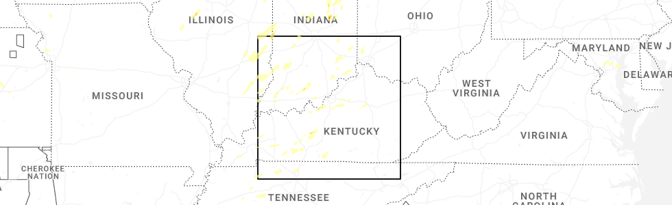
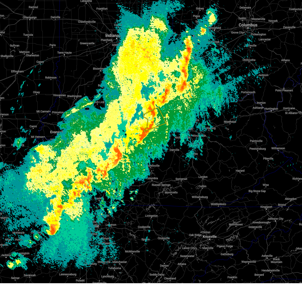
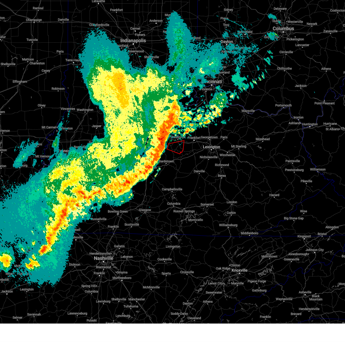
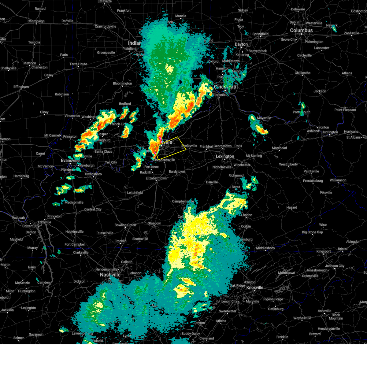
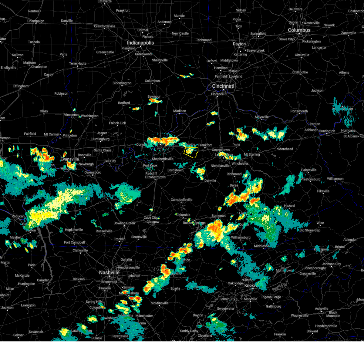
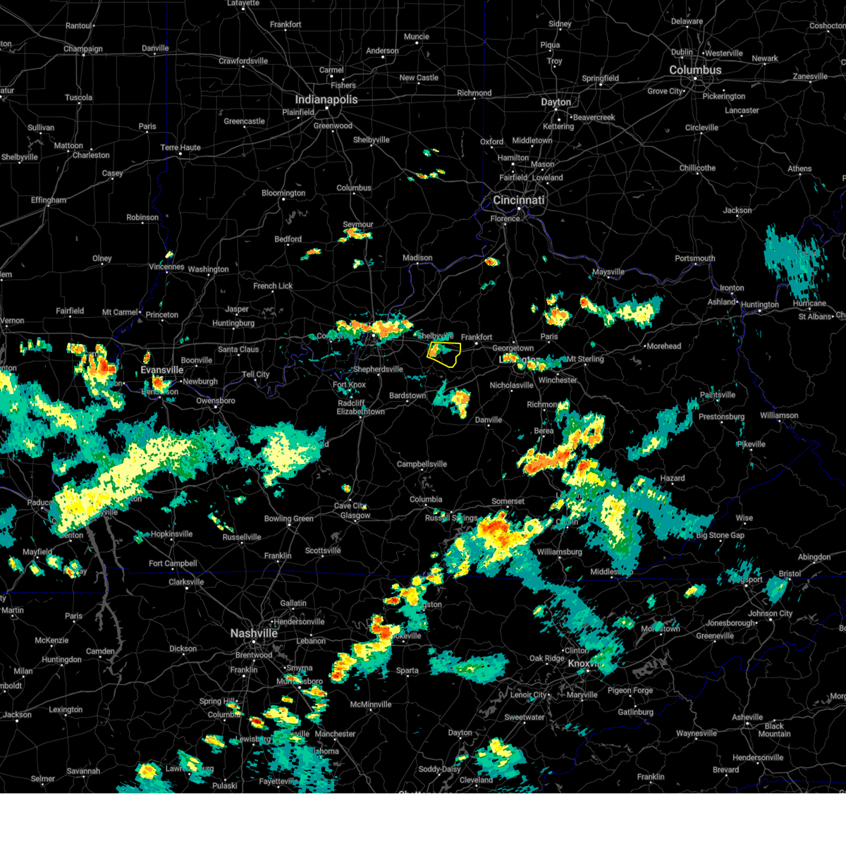
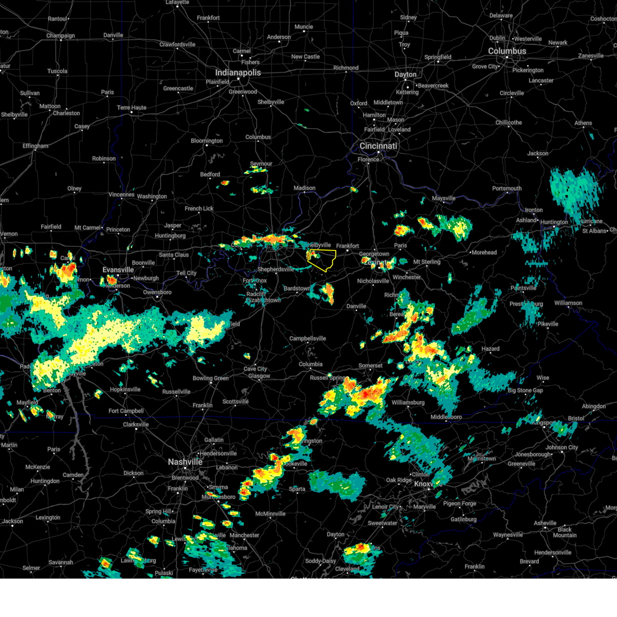
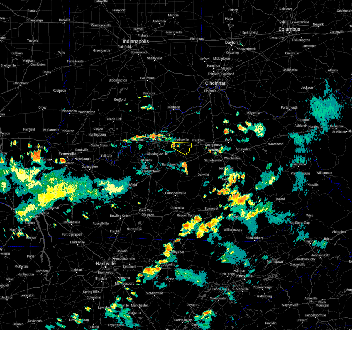
Hail Map for Shelbyville, KY
The Shelbyville, KY area has had 13 reports of on-the-ground hail by trained spotters, and has been under severe weather warnings 32 times during the past 12 months. Doppler radar has detected hail at or near Shelbyville, KY on 56 occasions, including 1 occasion during the past year.
| Name: | Shelbyville, KY |
| Where Located: | 30.7 miles ENE of Louisville, KY |
| Map: | Google Map for Shelbyville, KY |
| Population: | 14045 |
| Housing Units: | 5781 |
| More Info: | Search Google for Shelbyville, KY |
1
The Top Recent Hail Date for Shelbyville, KY is Wednesday, June 18, 2025 (18th out of 56)
Hail and Wind Damage Spotted near Shelbyville, KY
| Date / Time | Report Details |
|---|---|
| 6/18/2025 8:43 PM EDT | The storm which prompted the warning has weakened below severe limits, and no longer poses an immediate threat to life or property. therefore, the warning will be allowed to expire. however, gusty winds and heavy rain are still possible with this thunderstorm. a severe thunderstorm watch remains in effect until 100 am edt for central kentucky. to report severe weather, contact your nearest law enforcement agency. they will relay your report to the national weather service louisville. |
| 6/18/2025 8:19 PM EDT | Svrlmk the national weather service in louisville has issued a * severe thunderstorm warning for, spencer county in central kentucky, central shelby county in central kentucky, northwestern woodford county in central kentucky, north central anderson county in central kentucky, franklin county in central kentucky, * until 845 pm edt. * at 818 pm edt, a severe thunderstorm was located near taylorsville, moving east at 45 mph. another severe thunderstorm was located along the shelby and franklin county line, moving east at 45 mph (radar indicated). Hazards include 60 mph wind gusts. expect damage to roofs, siding, and trees |
| 5/16/2025 10:19 PM EDT |
 Svrlmk the national weather service in louisville has issued a * severe thunderstorm warning for, east central clark county in south central indiana, oldham county in central kentucky, shelby county in central kentucky, northern nelson county in central kentucky, anderson county in central kentucky, henry county in central kentucky, northeastern jefferson county in central kentucky, eastern bullitt county in central kentucky, franklin county in central kentucky, spencer county in central kentucky, northwestern woodford county in central kentucky, southern trimble county in central kentucky, northeastern washington county in central kentucky, * until 1100 pm edt. * at 1018 pm edt, severe thunderstorms were located along a line extending from near prospect to 7 miles southeast of fern creek to 8 miles south of shepherdsville, moving east at 60 mph (radar indicated). Hazards include 70 mph wind gusts and penny size hail. Expect considerable tree damage. Damage is likely to mobile homes, roofs, and outbuildings. Svrlmk the national weather service in louisville has issued a * severe thunderstorm warning for, east central clark county in south central indiana, oldham county in central kentucky, shelby county in central kentucky, northern nelson county in central kentucky, anderson county in central kentucky, henry county in central kentucky, northeastern jefferson county in central kentucky, eastern bullitt county in central kentucky, franklin county in central kentucky, spencer county in central kentucky, northwestern woodford county in central kentucky, southern trimble county in central kentucky, northeastern washington county in central kentucky, * until 1100 pm edt. * at 1018 pm edt, severe thunderstorms were located along a line extending from near prospect to 7 miles southeast of fern creek to 8 miles south of shepherdsville, moving east at 60 mph (radar indicated). Hazards include 70 mph wind gusts and penny size hail. Expect considerable tree damage. Damage is likely to mobile homes, roofs, and outbuildings.
|
| 5/16/2025 8:12 PM EDT |
 Svrlmk the national weather service in louisville has issued a * severe thunderstorm warning for, spencer county in central kentucky, southern shelby county in central kentucky, north central nelson county in central kentucky, northern woodford county in central kentucky, southern scott county in central kentucky, northern anderson county in central kentucky, central bullitt county in central kentucky, franklin county in central kentucky, * until 845 pm edt. * at 812 pm edt, severe thunderstorms were located along a line extending from near pioneer village to taylorsville to near frankfort, moving east at 55 mph (radar indicated). Hazards include 60 mph wind gusts and half dollar size hail. Hail damage to vehicles is expected. Expect wind damage to roofs, siding, and trees. Svrlmk the national weather service in louisville has issued a * severe thunderstorm warning for, spencer county in central kentucky, southern shelby county in central kentucky, north central nelson county in central kentucky, northern woodford county in central kentucky, southern scott county in central kentucky, northern anderson county in central kentucky, central bullitt county in central kentucky, franklin county in central kentucky, * until 845 pm edt. * at 812 pm edt, severe thunderstorms were located along a line extending from near pioneer village to taylorsville to near frankfort, moving east at 55 mph (radar indicated). Hazards include 60 mph wind gusts and half dollar size hail. Hail damage to vehicles is expected. Expect wind damage to roofs, siding, and trees.
|
| 5/16/2025 7:47 PM EDT | Svrlmk the national weather service in louisville has issued a * severe thunderstorm warning for, southeastern harrison county in south central indiana, spencer county in central kentucky, western shelby county in central kentucky, north central nelson county in central kentucky, central jefferson county in central kentucky, bullitt county in central kentucky, north central hardin county in central kentucky, * until 815 pm edt. * at 747 pm edt, a severe thunderstorm was located over south park view, moving east at 60 mph (radar indicated). Hazards include 60 mph wind gusts and quarter size hail. Hail damage to vehicles is expected. Expect wind damage to roofs, siding, and trees. |
| 4/3/2025 1:00 AM EDT |
 The storm which prompted the warning has moved out of the area. therefore, the warning has been allowed to expire. a tornado watch remains in effect until 700 am edt for central kentucky. The storm which prompted the warning has moved out of the area. therefore, the warning has been allowed to expire. a tornado watch remains in effect until 700 am edt for central kentucky.
|
| 4/3/2025 12:49 AM EDT |
 At 1249 am edt, a severe thunderstorm was located 7 miles north of shelbyville, moving northeast at 65 mph (radar indicated). Hazards include 70 mph wind gusts and penny size hail. Expect considerable tree damage. damage is likely to mobile homes, roofs, and outbuildings. Locations impacted include, shelbyville, la grange, coldstream, new castle, crestwood, eminence, simpsonville, orchard grass hills, pewee valley, and pleasureville. At 1249 am edt, a severe thunderstorm was located 7 miles north of shelbyville, moving northeast at 65 mph (radar indicated). Hazards include 70 mph wind gusts and penny size hail. Expect considerable tree damage. damage is likely to mobile homes, roofs, and outbuildings. Locations impacted include, shelbyville, la grange, coldstream, new castle, crestwood, eminence, simpsonville, orchard grass hills, pewee valley, and pleasureville.
|
| 4/3/2025 12:49 AM EDT |
 the severe thunderstorm warning has been cancelled and is no longer in effect the severe thunderstorm warning has been cancelled and is no longer in effect
|
| 4/3/2025 12:40 AM EDT |
 At 1240 am edt, a severe thunderstorm was located 7 miles northwest of shelbyville, moving northeast at 70 mph (radar indicated). Hazards include 70 mph wind gusts and penny size hail. Expect considerable tree damage. damage is likely to mobile homes, roofs, and outbuildings. Locations impacted include, jeffersontown, shelbyville, la grange, middletown, douglass hills, anchorage, worthington hills, coldstream, new castle, and woodland hills. At 1240 am edt, a severe thunderstorm was located 7 miles northwest of shelbyville, moving northeast at 70 mph (radar indicated). Hazards include 70 mph wind gusts and penny size hail. Expect considerable tree damage. damage is likely to mobile homes, roofs, and outbuildings. Locations impacted include, jeffersontown, shelbyville, la grange, middletown, douglass hills, anchorage, worthington hills, coldstream, new castle, and woodland hills.
|
| 4/3/2025 12:38 AM EDT | At 1238 am edt, a confirmed tornado was located 7 miles east of middletown, moving northeast at 70 mph (radar confirmed tornado). Hazards include damaging tornado. Flying debris will be dangerous to those caught without shelter. mobile homes will be damaged or destroyed. damage to roofs, windows, and vehicles will occur. tree damage is likely. This tornadic thunderstorm will remain over mainly rural areas of southeastern oldham, northern shelby, southwestern henry and northeastern jefferson counties, including the following locations, smithfield, mulberry, simpsonville, chestnut grove, montclair, cropper, eminence, pleasureville, conner, and todds point. |
| 4/3/2025 12:36 AM EDT | At 1236 am edt, a confirmed tornado was located near middletown, moving northeast at 70 mph (radar confirmed tornado). Hazards include damaging tornado. Flying debris will be dangerous to those caught without shelter. mobile homes will be damaged or destroyed. damage to roofs, windows, and vehicles will occur. tree damage is likely. This tornadic thunderstorm will remain over mainly rural areas of southeastern oldham, northern shelby, southwestern henry and east central jefferson counties, including the following locations, l s park, mulberry, simpsonville, chestnut grove, fisherville, montclair, floydsburg, ballardsville, pleasureville, and old christianburg. |
| 4/3/2025 12:34 AM EDT |
 At 1234 am edt, a severe thunderstorm capable of producing a tornado was located over middletown, moving northeast at 70 mph (radar indicated rotation). Hazards include tornado. Flying debris will be dangerous to those caught without shelter. mobile homes will be damaged or destroyed. damage to roofs, windows, and vehicles will occur. tree damage is likely. This tornadic thunderstorm will remain over mainly rural areas of southeastern oldham, northern shelby, southwestern henry and east central jefferson counties, including the following locations, l s park, mulberry, simpsonville, chestnut grove, fisherville, montclair, floydsburg, ballardsville, pleasureville, and old christianburg. At 1234 am edt, a severe thunderstorm capable of producing a tornado was located over middletown, moving northeast at 70 mph (radar indicated rotation). Hazards include tornado. Flying debris will be dangerous to those caught without shelter. mobile homes will be damaged or destroyed. damage to roofs, windows, and vehicles will occur. tree damage is likely. This tornadic thunderstorm will remain over mainly rural areas of southeastern oldham, northern shelby, southwestern henry and east central jefferson counties, including the following locations, l s park, mulberry, simpsonville, chestnut grove, fisherville, montclair, floydsburg, ballardsville, pleasureville, and old christianburg.
|
| 4/3/2025 12:28 AM EDT |
 Torlmk the national weather service in louisville has issued a * tornado warning for, southeastern oldham county in central kentucky, northern shelby county in central kentucky, southwestern henry county in central kentucky, east central jefferson county in central kentucky, * until 100 am edt. * at 1228 am edt, a severe thunderstorm capable of producing a tornado was located over buechel, moving northeast at 70 mph (radar indicated rotation). Hazards include tornado. Flying debris will be dangerous to those caught without shelter. mobile homes will be damaged or destroyed. damage to roofs, windows, and vehicles will occur. tree damage is likely. this dangerous storm will be near, middletown, douglass hills, anchorage, and woodland hills around 1235 am edt. Other locations impacted by this tornadic thunderstorm include l s park, mulberry, forest hills, simpsonville, chestnut grove, fisherville, montclair, floydsburg, ballardsville, and pleasureville. Torlmk the national weather service in louisville has issued a * tornado warning for, southeastern oldham county in central kentucky, northern shelby county in central kentucky, southwestern henry county in central kentucky, east central jefferson county in central kentucky, * until 100 am edt. * at 1228 am edt, a severe thunderstorm capable of producing a tornado was located over buechel, moving northeast at 70 mph (radar indicated rotation). Hazards include tornado. Flying debris will be dangerous to those caught without shelter. mobile homes will be damaged or destroyed. damage to roofs, windows, and vehicles will occur. tree damage is likely. this dangerous storm will be near, middletown, douglass hills, anchorage, and woodland hills around 1235 am edt. Other locations impacted by this tornadic thunderstorm include l s park, mulberry, forest hills, simpsonville, chestnut grove, fisherville, montclair, floydsburg, ballardsville, and pleasureville.
|
| 4/3/2025 12:26 AM EDT | Svrlmk the national weather service in louisville has issued a * severe thunderstorm warning for, southeastern oldham county in central kentucky, northwestern spencer county in central kentucky, shelby county in central kentucky, southwestern henry county in central kentucky, jefferson county in central kentucky, northeastern bullitt county in central kentucky, southwestern franklin county in central kentucky, * until 100 am edt. * at 1226 am edt, a severe thunderstorm was located over buechel, moving northeast at 70 mph (radar indicated). Hazards include 70 mph wind gusts and penny size hail. Expect considerable tree damage. Damage is likely to mobile homes, roofs, and outbuildings. |
| 3/30/2025 10:24 PM EDT |
 Svrlmk the national weather service in louisville has issued a * severe thunderstorm warning for, northeastern shelby county in central kentucky, northern woodford county in central kentucky, scott county in central kentucky, northeastern anderson county in central kentucky, eastern henry county in central kentucky, franklin county in central kentucky, * until 1100 pm edt. * at 1024 pm edt, severe thunderstorms were located along a line extending from 8 miles west of owenton to near shelbyville, moving east at 65 mph (radar indicated). Hazards include 60 mph wind gusts and penny size hail. expect damage to roofs, siding, and trees Svrlmk the national weather service in louisville has issued a * severe thunderstorm warning for, northeastern shelby county in central kentucky, northern woodford county in central kentucky, scott county in central kentucky, northeastern anderson county in central kentucky, eastern henry county in central kentucky, franklin county in central kentucky, * until 1100 pm edt. * at 1024 pm edt, severe thunderstorms were located along a line extending from 8 miles west of owenton to near shelbyville, moving east at 65 mph (radar indicated). Hazards include 60 mph wind gusts and penny size hail. expect damage to roofs, siding, and trees
|
| 3/30/2025 10:11 PM EDT |
 At 1011 pm edt, a severe squall line capable of producing both tornadoes and extensive straight line wind damage was located along a line extending from 9 miles east of fern creek to near taylorsville, moving east at 55 mph (radar indicated rotation). Hazards include tornado. Flying debris will be dangerous to those caught without shelter. mobile homes will be damaged or destroyed. damage to roofs, windows, and vehicles will occur. tree damage is likely. these dangerous storms will be near, taylorsville around 1015 pm edt. Other locations impacted by these tornadic storms include yoder, southville, rivals, elk creek, wilsonville, olive branch, veech, hooper, hemp ridge, and finchville. At 1011 pm edt, a severe squall line capable of producing both tornadoes and extensive straight line wind damage was located along a line extending from 9 miles east of fern creek to near taylorsville, moving east at 55 mph (radar indicated rotation). Hazards include tornado. Flying debris will be dangerous to those caught without shelter. mobile homes will be damaged or destroyed. damage to roofs, windows, and vehicles will occur. tree damage is likely. these dangerous storms will be near, taylorsville around 1015 pm edt. Other locations impacted by these tornadic storms include yoder, southville, rivals, elk creek, wilsonville, olive branch, veech, hooper, hemp ridge, and finchville.
|
| 3/30/2025 10:11 PM EDT |
 the tornado warning has been cancelled and is no longer in effect the tornado warning has been cancelled and is no longer in effect
|
| 3/30/2025 10:04 PM EDT | Torlmk the national weather service in louisville has issued a * tornado warning for, spencer county in central kentucky, southwestern shelby county in central kentucky, east central jefferson county in central kentucky, northeastern bullitt county in central kentucky, * until 1030 pm edt. * at 1004 pm edt, severe thunderstorms capable of producing both tornadoes and extensive straight line wind damage were located along a line extending from near fern creek to 6 miles southeast of spring mill, moving east at 55 mph (radar indicated rotation). Hazards include tornado. Flying debris will be dangerous to those caught without shelter. mobile homes will be damaged or destroyed. damage to roofs, windows, and vehicles will occur. tree damage is likely. these dangerous storms will be near, taylorsville around 1010 pm edt. Other locations impacted by these tornadic storms include l s park, yoder, fisherville, waterford, southville, rivals, joyes, elk creek, wilsonville, and olive branch. |
| 3/19/2025 11:17 PM EDT |
 The storm which prompted the warning has weakened below severe limits, and no longer poses an immediate threat to life or property. therefore, the warning has been allowed to expire. a tornado watch remains in effect until midnight edt for central kentucky. to report severe weather, contact your nearest law enforcement agency. they will relay your report to the national weather service louisville. The storm which prompted the warning has weakened below severe limits, and no longer poses an immediate threat to life or property. therefore, the warning has been allowed to expire. a tornado watch remains in effect until midnight edt for central kentucky. to report severe weather, contact your nearest law enforcement agency. they will relay your report to the national weather service louisville.
|
| 3/19/2025 10:55 PM EDT |
 At 1055 pm edt, a severe thunderstorm was located near spring mill, moving northeast at 55 mph (radar indicated). Hazards include 60 mph wind gusts and penny size hail. Expect damage to roofs, siding, and trees. Locations impacted include, shelbyville, pioneer village, hollow creek, spring mill, highview, fern creek, okolona, mount washington, hillview, and simpsonville. At 1055 pm edt, a severe thunderstorm was located near spring mill, moving northeast at 55 mph (radar indicated). Hazards include 60 mph wind gusts and penny size hail. Expect damage to roofs, siding, and trees. Locations impacted include, shelbyville, pioneer village, hollow creek, spring mill, highview, fern creek, okolona, mount washington, hillview, and simpsonville.
|
| 3/19/2025 10:47 PM EDT |
 Svrlmk the national weather service in louisville has issued a * severe thunderstorm warning for, northern spencer county in central kentucky, central shelby county in central kentucky, southeastern jefferson county in central kentucky, northeastern bullitt county in central kentucky, * until 1115 pm edt. * at 1047 pm edt, a severe thunderstorm was located over pioneer village, moving northeast at 55 mph (radar indicated). Hazards include 60 mph wind gusts and penny size hail. expect damage to roofs, siding, and trees Svrlmk the national weather service in louisville has issued a * severe thunderstorm warning for, northern spencer county in central kentucky, central shelby county in central kentucky, southeastern jefferson county in central kentucky, northeastern bullitt county in central kentucky, * until 1115 pm edt. * at 1047 pm edt, a severe thunderstorm was located over pioneer village, moving northeast at 55 mph (radar indicated). Hazards include 60 mph wind gusts and penny size hail. expect damage to roofs, siding, and trees
|
| 3/15/2025 8:00 AM EDT | The storm which prompted the warning has moved out of the area. therefore, the warning has been allowed to expire. a tornado watch remains in effect until 1000 am edt for central kentucky. remember, a severe thunderstorm warning still remains in effect for portions of oldham and shelby counties until 830 am. |
| 3/15/2025 7:52 AM EDT | At 750 am edt, doppler radar indicated a severe thunderstorm located near middletown, moving east at 50 mph (observed 69 mph wind gust and quarter to ping pong ball hail). Hazards include 70 mph wind gusts and ping pong ball size hail. People and animals outdoors will be injured. expect hail damage to roofs, siding, windows, and vehicles. expect considerable tree damage. wind damage is also likely to mobile homes, roofs, and outbuildings. Locations impacted include, jeffersontown, lyndon, middletown, douglass hills, anchorage, worthington hills, coldstream, rolling hills, langdon place, and blue ridge manor. |
| 3/15/2025 7:52 AM EDT | the severe thunderstorm warning has been cancelled and is no longer in effect |
| 3/15/2025 7:38 AM EDT |
 At 737 am edt, a severe thunderstorm was located over west buechel, moving northeast at 60 mph (muhammad ali international airport reported 69 mph wind gusts). Hazards include 70 mph wind gusts and quarter size hail. Hail damage to vehicles is expected. expect considerable tree damage. wind damage is also likely to mobile homes, roofs, and outbuildings. locations impacted include, louisville, jeffersonville, jeffersontown, st. Matthews, shively, lyndon, middletown, douglass hills, prospect, and hurstbourne. At 737 am edt, a severe thunderstorm was located over west buechel, moving northeast at 60 mph (muhammad ali international airport reported 69 mph wind gusts). Hazards include 70 mph wind gusts and quarter size hail. Hail damage to vehicles is expected. expect considerable tree damage. wind damage is also likely to mobile homes, roofs, and outbuildings. locations impacted include, louisville, jeffersonville, jeffersontown, st. Matthews, shively, lyndon, middletown, douglass hills, prospect, and hurstbourne.
|
| 3/15/2025 7:38 AM EDT |
 the severe thunderstorm warning has been cancelled and is no longer in effect the severe thunderstorm warning has been cancelled and is no longer in effect
|
| 3/15/2025 7:25 AM EDT |
 Svrlmk the national weather service in louisville has issued a * severe thunderstorm warning for, south central clark county in south central indiana, south central floyd county in south central indiana, southwestern oldham county in central kentucky, northwestern shelby county in central kentucky, jefferson county in central kentucky, northwestern bullitt county in central kentucky, * until 800 am edt. * at 725 am edt, a severe thunderstorm was located over pleasure ridge park, moving northeast at 60 mph (radar indicated). Hazards include 60 mph wind gusts and quarter size hail. Hail damage to vehicles is expected. Expect wind damage to roofs, siding, and trees. Svrlmk the national weather service in louisville has issued a * severe thunderstorm warning for, south central clark county in south central indiana, south central floyd county in south central indiana, southwestern oldham county in central kentucky, northwestern shelby county in central kentucky, jefferson county in central kentucky, northwestern bullitt county in central kentucky, * until 800 am edt. * at 725 am edt, a severe thunderstorm was located over pleasure ridge park, moving northeast at 60 mph (radar indicated). Hazards include 60 mph wind gusts and quarter size hail. Hail damage to vehicles is expected. Expect wind damage to roofs, siding, and trees.
|
| 9/27/2024 1:46 PM EDT | Report from mping: trees uprooted or snappe in shelby county KY, 5.4 miles W of Shelbyville, KY |
| 8/31/2024 6:59 PM EDT |
 the severe thunderstorm warning has been cancelled and is no longer in effect the severe thunderstorm warning has been cancelled and is no longer in effect
|
| 8/31/2024 6:50 PM EDT |
 the severe thunderstorm warning has been cancelled and is no longer in effect the severe thunderstorm warning has been cancelled and is no longer in effect
|
| 8/31/2024 6:50 PM EDT |
 At 650 pm edt, a severe thunderstorm was located near shelbyville, moving east at 20 mph (radar indicated). Hazards include 60 mph wind gusts. Expect damage to roofs, siding, and trees. Locations impacted include, shelbyville, graefenburg, southville, harrisonville, hooper, waddy, peytona, clay village, hemp ridge, and junte. At 650 pm edt, a severe thunderstorm was located near shelbyville, moving east at 20 mph (radar indicated). Hazards include 60 mph wind gusts. Expect damage to roofs, siding, and trees. Locations impacted include, shelbyville, graefenburg, southville, harrisonville, hooper, waddy, peytona, clay village, hemp ridge, and junte.
|
| 8/31/2024 6:41 PM EDT |
 At 640 pm edt, a severe thunderstorm was located near shelbyville, moving east at 20 mph (kentucky mesonet. at 630 pm edt, a 56 mph wind gust was observed at a shelby county mesonet site). Hazards include 60 mph wind gusts and penny size hail. Expect damage to roofs, siding, and trees. Locations impacted include, shelbyville, southville, rivals, olive branch, veech, graefenburg, harrisonville, hooper, waddy, and peytona. At 640 pm edt, a severe thunderstorm was located near shelbyville, moving east at 20 mph (kentucky mesonet. at 630 pm edt, a 56 mph wind gust was observed at a shelby county mesonet site). Hazards include 60 mph wind gusts and penny size hail. Expect damage to roofs, siding, and trees. Locations impacted include, shelbyville, southville, rivals, olive branch, veech, graefenburg, harrisonville, hooper, waddy, and peytona.
|
| 8/31/2024 6:29 PM EDT |
 Svrlmk the national weather service in louisville has issued a * severe thunderstorm warning for, northeastern spencer county in central kentucky, southern shelby county in central kentucky, * until 715 pm edt. * at 629 pm edt, a severe thunderstorm was located near shelbyville, moving east at 20 mph (radar indicated). Hazards include 60 mph wind gusts and penny size hail. expect damage to roofs, siding, and trees Svrlmk the national weather service in louisville has issued a * severe thunderstorm warning for, northeastern spencer county in central kentucky, southern shelby county in central kentucky, * until 715 pm edt. * at 629 pm edt, a severe thunderstorm was located near shelbyville, moving east at 20 mph (radar indicated). Hazards include 60 mph wind gusts and penny size hail. expect damage to roofs, siding, and trees
|
| 5/26/2024 11:57 PM EDT |
 The storms which prompted the warning have weakened below severe limits, and no longer pose an immediate threat to life or property. therefore, the warning will be allowed to expire. however, gusty winds are still possible with these thunderstorms. a tornado watch remains in effect until 200 am edt for central kentucky. a tornado watch also remains in effect until 600 am edt for central kentucky. The storms which prompted the warning have weakened below severe limits, and no longer pose an immediate threat to life or property. therefore, the warning will be allowed to expire. however, gusty winds are still possible with these thunderstorms. a tornado watch remains in effect until 200 am edt for central kentucky. a tornado watch also remains in effect until 600 am edt for central kentucky.
|
| 5/26/2024 11:42 PM EDT |
 At 1142 pm edt, severe thunderstorms were located along a line extending from near la grange to 8 miles east of pioneer village, moving east at 70 mph (radar indicated). Hazards include 60 mph wind gusts and penny size hail. Expect damage to roofs, siding, and trees. Locations impacted include, jeffersontown, shelbyville, lyndon, la grange, middletown, douglass hills, hurstbourne, anchorage, hurstbourne acres, and worthington hills. At 1142 pm edt, severe thunderstorms were located along a line extending from near la grange to 8 miles east of pioneer village, moving east at 70 mph (radar indicated). Hazards include 60 mph wind gusts and penny size hail. Expect damage to roofs, siding, and trees. Locations impacted include, jeffersontown, shelbyville, lyndon, la grange, middletown, douglass hills, hurstbourne, anchorage, hurstbourne acres, and worthington hills.
|
| 5/26/2024 11:42 PM EDT |
 the severe thunderstorm warning has been cancelled and is no longer in effect the severe thunderstorm warning has been cancelled and is no longer in effect
|
| 5/26/2024 11:24 PM EDT |
 the severe thunderstorm warning has been cancelled and is no longer in effect the severe thunderstorm warning has been cancelled and is no longer in effect
|
| 5/26/2024 11:24 PM EDT |
 At 1124 pm edt, severe thunderstorms were located along a line extending from jeffersonville to 6 miles southwest of shepherdsville, moving east at 70 mph (radar indicated). Hazards include 60 mph wind gusts and penny size hail. Expect damage to roofs, siding, and trees. locations impacted include, louisville, jeffersonville, new albany, jeffersontown, st. Matthews, shively, shelbyville, shepherdsville, lyndon, and la grange. At 1124 pm edt, severe thunderstorms were located along a line extending from jeffersonville to 6 miles southwest of shepherdsville, moving east at 70 mph (radar indicated). Hazards include 60 mph wind gusts and penny size hail. Expect damage to roofs, siding, and trees. locations impacted include, louisville, jeffersonville, new albany, jeffersontown, st. Matthews, shively, shelbyville, shepherdsville, lyndon, and la grange.
|
| 5/26/2024 11:09 PM EDT |
 Svrlmk the national weather service in louisville has issued a * severe thunderstorm warning for, southeastern harrison county in south central indiana, south central clark county in south central indiana, southeastern floyd county in south central indiana, oldham county in central kentucky, spencer county in central kentucky, western shelby county in central kentucky, northeastern nelson county in central kentucky, southeastern meade county in central kentucky, jefferson county in central kentucky, bullitt county in central kentucky, northeastern hardin county in central kentucky, * until midnight edt. * at 1109 pm edt, severe thunderstorms were located along a line extending from 7 miles east of corydon to 9 miles southeast of brandenburg, moving east at 70 mph (radar indicated). Hazards include 60 mph wind gusts and penny size hail. expect damage to roofs, siding, and trees Svrlmk the national weather service in louisville has issued a * severe thunderstorm warning for, southeastern harrison county in south central indiana, south central clark county in south central indiana, southeastern floyd county in south central indiana, oldham county in central kentucky, spencer county in central kentucky, western shelby county in central kentucky, northeastern nelson county in central kentucky, southeastern meade county in central kentucky, jefferson county in central kentucky, bullitt county in central kentucky, northeastern hardin county in central kentucky, * until midnight edt. * at 1109 pm edt, severe thunderstorms were located along a line extending from 7 miles east of corydon to 9 miles southeast of brandenburg, moving east at 70 mph (radar indicated). Hazards include 60 mph wind gusts and penny size hail. expect damage to roofs, siding, and trees
|
| 5/26/2024 12:25 PM EDT | Multiple trees down in a yard off route 60 and scott station roa in shelby county KY, 2.9 miles ESE of Shelbyville, KY |
| 5/26/2024 12:14 PM EDT |
 At 1213 pm edt, a severe thunderstorm was located near taylorsville, moving east at 60 mph (radar indicated). Hazards include 75 mph wind gusts. Expect considerable tree damage. damage is likely to mobile homes, roofs, and outbuildings. locations impacted include, louisville, jeffersontown, st. Matthews, shelbyville, bardstown, lyndon, middletown, lebanon, douglass hills, and hurstbourne. At 1213 pm edt, a severe thunderstorm was located near taylorsville, moving east at 60 mph (radar indicated). Hazards include 75 mph wind gusts. Expect considerable tree damage. damage is likely to mobile homes, roofs, and outbuildings. locations impacted include, louisville, jeffersontown, st. Matthews, shelbyville, bardstown, lyndon, middletown, lebanon, douglass hills, and hurstbourne.
|
| 5/26/2024 12:14 PM EDT |
 the severe thunderstorm warning has been cancelled and is no longer in effect the severe thunderstorm warning has been cancelled and is no longer in effect
|
| 5/26/2024 12:06 PM EDT |
 At 1205 pm edt/1105 am cdt/, a severe thunderstorm was located near fern creek, moving northeast at 65 mph. this is a destructive storm for louisville metro area (radar indicated). Hazards include 80 mph wind gusts. Flying debris will be dangerous to those caught without shelter. mobile homes will be heavily damaged. expect considerable damage to roofs, windows, and vehicles. extensive tree damage and power outages are likely. locations impacted include, louisville, jeffersontown, st. Matthews, shively, shelbyville, bardstown, shepherdsville, lyndon, middletown, and lebanon. At 1205 pm edt/1105 am cdt/, a severe thunderstorm was located near fern creek, moving northeast at 65 mph. this is a destructive storm for louisville metro area (radar indicated). Hazards include 80 mph wind gusts. Flying debris will be dangerous to those caught without shelter. mobile homes will be heavily damaged. expect considerable damage to roofs, windows, and vehicles. extensive tree damage and power outages are likely. locations impacted include, louisville, jeffersontown, st. Matthews, shively, shelbyville, bardstown, shepherdsville, lyndon, middletown, and lebanon.
|
| 5/26/2024 11:58 AM EDT |
 Svrlmk the national weather service in louisville has issued a * severe thunderstorm warning for, southeastern floyd county in south central indiana, shelby county in central kentucky, nelson county in central kentucky, western anderson county in central kentucky, eastern larue county in central kentucky, marion county in central kentucky, northern taylor county in central kentucky, jefferson county in central kentucky, bullitt county in central kentucky, north central casey county in central kentucky, northwestern franklin county in central kentucky, spencer county in central kentucky, southwestern mercer county in central kentucky, northern green county in central kentucky, washington county in central kentucky, west central boyle county in central kentucky, * until 1230 pm edt/1130 am cdt/. * at 1157 am edt/1057 am cdt/, a severe thunderstorm was located over pioneer village, moving northeast at 65 mph (radar indicated). Hazards include 70 mph wind gusts. Expect considerable tree damage. Damage is likely to mobile homes, roofs, and outbuildings. Svrlmk the national weather service in louisville has issued a * severe thunderstorm warning for, southeastern floyd county in south central indiana, shelby county in central kentucky, nelson county in central kentucky, western anderson county in central kentucky, eastern larue county in central kentucky, marion county in central kentucky, northern taylor county in central kentucky, jefferson county in central kentucky, bullitt county in central kentucky, north central casey county in central kentucky, northwestern franklin county in central kentucky, spencer county in central kentucky, southwestern mercer county in central kentucky, northern green county in central kentucky, washington county in central kentucky, west central boyle county in central kentucky, * until 1230 pm edt/1130 am cdt/. * at 1157 am edt/1057 am cdt/, a severe thunderstorm was located over pioneer village, moving northeast at 65 mph (radar indicated). Hazards include 70 mph wind gusts. Expect considerable tree damage. Damage is likely to mobile homes, roofs, and outbuildings.
|
| 4/19/2024 12:55 AM EDT | Measured at the ky mesonet station cro in shelby county KY, 6.4 miles SSW of Shelbyville, KY |
| 3/30/2024 11:20 PM EDT |
 the severe thunderstorm warning has been cancelled and is no longer in effect the severe thunderstorm warning has been cancelled and is no longer in effect
|
| 3/30/2024 11:20 PM EDT |
 At 1120 pm edt, a severe thunderstorm was located near shelbyville, moving east at 45 mph (radar indicated). Hazards include 60 mph wind gusts and quarter size hail. Hail damage to vehicles is expected. expect wind damage to roofs, siding, and trees. Locations impacted include, shelbyville, bryant, southville, benson, avenstoke, veachland, graefenburg, bridgeport, hatton, and harrisonville. At 1120 pm edt, a severe thunderstorm was located near shelbyville, moving east at 45 mph (radar indicated). Hazards include 60 mph wind gusts and quarter size hail. Hail damage to vehicles is expected. expect wind damage to roofs, siding, and trees. Locations impacted include, shelbyville, bryant, southville, benson, avenstoke, veachland, graefenburg, bridgeport, hatton, and harrisonville.
|
| 3/30/2024 11:13 PM EDT |
 the severe thunderstorm warning has been cancelled and is no longer in effect the severe thunderstorm warning has been cancelled and is no longer in effect
|
| 3/30/2024 11:13 PM EDT |
 At 1112 pm edt, a severe thunderstorm was located near shelbyville, moving east at 45 mph (radar indicated). Hazards include 60 mph wind gusts and quarter size hail. Hail damage to vehicles is expected. expect wind damage to roofs, siding, and trees. Locations impacted include, shelbyville, simpsonville, montclair, avenstoke, bridgeport, hatton, harrisonville, hooper, middletown heights, and peytona. At 1112 pm edt, a severe thunderstorm was located near shelbyville, moving east at 45 mph (radar indicated). Hazards include 60 mph wind gusts and quarter size hail. Hail damage to vehicles is expected. expect wind damage to roofs, siding, and trees. Locations impacted include, shelbyville, simpsonville, montclair, avenstoke, bridgeport, hatton, harrisonville, hooper, middletown heights, and peytona.
|
| 3/30/2024 11:08 PM EDT |
 Svrlmk the national weather service in louisville has issued a * severe thunderstorm warning for, northern spencer county in central kentucky, central shelby county in central kentucky, north central anderson county in central kentucky, east central jefferson county in central kentucky, southwestern franklin county in central kentucky, * until 1145 pm edt. * at 1107 pm edt, a severe thunderstorm was located 7 miles southwest of shelbyville, moving east at 45 mph (radar indicated). Hazards include 60 mph wind gusts and quarter size hail. Hail damage to vehicles is expected. Expect wind damage to roofs, siding, and trees. Svrlmk the national weather service in louisville has issued a * severe thunderstorm warning for, northern spencer county in central kentucky, central shelby county in central kentucky, north central anderson county in central kentucky, east central jefferson county in central kentucky, southwestern franklin county in central kentucky, * until 1145 pm edt. * at 1107 pm edt, a severe thunderstorm was located 7 miles southwest of shelbyville, moving east at 45 mph (radar indicated). Hazards include 60 mph wind gusts and quarter size hail. Hail damage to vehicles is expected. Expect wind damage to roofs, siding, and trees.
|
| 3/6/2024 10:06 AM EST |
 Torlmk the national weather service in louisville has issued a * this is a test message. tornado warning for, meade county in central kentucky, larue county in central kentucky, jessamine county in central kentucky, nicholas county in central kentucky, adair county in south central kentucky, bourbon county in central kentucky, warren county in south central kentucky, cumberland county in south central kentucky, henry county in central kentucky, russell county in south central kentucky, taylor county in central kentucky, jefferson county in central kentucky, hardin county in central kentucky, spencer county in central kentucky, scott county in central kentucky, hancock county in central kentucky, trimble county in central kentucky, monroe county in south central kentucky, metcalfe county in south central kentucky, shelby county in central kentucky, logan county in south central kentucky, nelson county in central kentucky, anderson county in central kentucky, clark county in central kentucky, marion county in central kentucky, simpson county in south central kentucky, grayson county in central kentucky, casey county in central kentucky, franklin county in central kentucky, edmonson county in south central kentucky, lincoln county in central kentucky, woodford county in central kentucky, butler county in south central kentucky, madison county in central kentucky, barren county in south central kentucky, ohio county in central kentucky, oldham county in central kentucky, garrard county in central kentucky, hart county in central kentucky, bullitt county in central kentucky, harrison county in central kentucky, mercer county in central kentucky, clinton county in south central kentucky, green county in central kentucky, allen county in south central kentucky, washington county in central kentucky, boyle county in central kentucky, breckinridge county in central kentucky, fayette county in central kentucky, * this is a test message. until 1030 am est/930 am cst/. * this is a test message. Torlmk the national weather service in louisville has issued a * this is a test message. tornado warning for, meade county in central kentucky, larue county in central kentucky, jessamine county in central kentucky, nicholas county in central kentucky, adair county in south central kentucky, bourbon county in central kentucky, warren county in south central kentucky, cumberland county in south central kentucky, henry county in central kentucky, russell county in south central kentucky, taylor county in central kentucky, jefferson county in central kentucky, hardin county in central kentucky, spencer county in central kentucky, scott county in central kentucky, hancock county in central kentucky, trimble county in central kentucky, monroe county in south central kentucky, metcalfe county in south central kentucky, shelby county in central kentucky, logan county in south central kentucky, nelson county in central kentucky, anderson county in central kentucky, clark county in central kentucky, marion county in central kentucky, simpson county in south central kentucky, grayson county in central kentucky, casey county in central kentucky, franklin county in central kentucky, edmonson county in south central kentucky, lincoln county in central kentucky, woodford county in central kentucky, butler county in south central kentucky, madison county in central kentucky, barren county in south central kentucky, ohio county in central kentucky, oldham county in central kentucky, garrard county in central kentucky, hart county in central kentucky, bullitt county in central kentucky, harrison county in central kentucky, mercer county in central kentucky, clinton county in south central kentucky, green county in central kentucky, allen county in south central kentucky, washington county in central kentucky, boyle county in central kentucky, breckinridge county in central kentucky, fayette county in central kentucky, * this is a test message. until 1030 am est/930 am cst/. * this is a test message.
|
| 12/9/2023 5:25 PM EST |
 At 525 pm est, a severe thunderstorm capable of producing a tornado was located 7 miles southeast of shelbyville, moving northeast at 45 mph (radar indicated rotation). Hazards include tornado. Flying debris will be dangerous to those caught without shelter. mobile homes will be damaged or destroyed. damage to roofs, windows, and vehicles will occur. tree damage is likely. this dangerous storm will be near, frankfort around 535 pm est. Other locations impacted by this tornadic thunderstorm include slickway, avenstoke, harvieland, bridgeport, hatton, harrisonville, hooper, peytona, swallowfield and clay village. At 525 pm est, a severe thunderstorm capable of producing a tornado was located 7 miles southeast of shelbyville, moving northeast at 45 mph (radar indicated rotation). Hazards include tornado. Flying debris will be dangerous to those caught without shelter. mobile homes will be damaged or destroyed. damage to roofs, windows, and vehicles will occur. tree damage is likely. this dangerous storm will be near, frankfort around 535 pm est. Other locations impacted by this tornadic thunderstorm include slickway, avenstoke, harvieland, bridgeport, hatton, harrisonville, hooper, peytona, swallowfield and clay village.
|
| 8/25/2023 6:40 PM EDT | Ky mesonet site wadd measured 83 mph wind gus in shelby county KY, 9.6 miles NNW of Shelbyville, KY |
| 7/18/2023 2:15 AM EDT |
 At 215 am edt, a severe thunderstorm was located near shelbyville, moving east at 35 mph (radar indicated). Hazards include 60 mph wind gusts and quarter size hail. Hail damage to vehicles is expected. Expect wind damage to roofs, siding, and trees. At 215 am edt, a severe thunderstorm was located near shelbyville, moving east at 35 mph (radar indicated). Hazards include 60 mph wind gusts and quarter size hail. Hail damage to vehicles is expected. Expect wind damage to roofs, siding, and trees.
|
| 7/17/2023 2:31 AM EDT |
 At 230 am edt, a severe thunderstorm was located near new castle, moving east at 25 mph (radar indicated). Hazards include 60 mph wind gusts and quarter size hail. Hail damage to vehicles is expected. Expect wind damage to roofs, siding, and trees. At 230 am edt, a severe thunderstorm was located near new castle, moving east at 25 mph (radar indicated). Hazards include 60 mph wind gusts and quarter size hail. Hail damage to vehicles is expected. Expect wind damage to roofs, siding, and trees.
|
| 7/17/2023 2:14 AM EDT |
 At 214 am edt, a severe thunderstorm was located over la grange, moving east at 25 mph (radar indicated). Hazards include 60 mph wind gusts and quarter size hail. Hail damage to vehicles is expected. Expect wind damage to roofs, siding, and trees. At 214 am edt, a severe thunderstorm was located over la grange, moving east at 25 mph (radar indicated). Hazards include 60 mph wind gusts and quarter size hail. Hail damage to vehicles is expected. Expect wind damage to roofs, siding, and trees.
|
| 7/2/2023 6:55 PM EDT |
 The severe thunderstorm warning for north central spencer and shelby counties will expire at 700 pm edt, the storm which prompted the warning has weakened below severe limits, and no longer poses an immediate threat to life or property. therefore, the warning will be allowed to expire. a severe thunderstorm watch remains in effect until 900 pm edt for central kentucky. The severe thunderstorm warning for north central spencer and shelby counties will expire at 700 pm edt, the storm which prompted the warning has weakened below severe limits, and no longer poses an immediate threat to life or property. therefore, the warning will be allowed to expire. a severe thunderstorm watch remains in effect until 900 pm edt for central kentucky.
|
| 7/2/2023 6:33 PM EDT |
 At 631 pm edt, a severe thunderstorm was located near shelbyville, moving east at 45 mph (radar indicated). Hazards include 60 mph wind gusts. Expect damage to roofs, siding, and trees. locations impacted include, shelbyville, simpsonville, montclair, old christianburg, hatton, hooper, middletown heights, peytona, clay village and finchville. hail threat, radar indicated max hail size, <. 75 in wind threat, radar indicated max wind gust, 60 mph. At 631 pm edt, a severe thunderstorm was located near shelbyville, moving east at 45 mph (radar indicated). Hazards include 60 mph wind gusts. Expect damage to roofs, siding, and trees. locations impacted include, shelbyville, simpsonville, montclair, old christianburg, hatton, hooper, middletown heights, peytona, clay village and finchville. hail threat, radar indicated max hail size, <. 75 in wind threat, radar indicated max wind gust, 60 mph.
|
| 7/2/2023 6:23 PM EDT |
 At 622 pm edt, a severe thunderstorm was located near shelbyville, moving east at 45 mph (radar indicated). Hazards include 60 mph wind gusts. Expect damage to roofs, siding, and trees. locations impacted include, shelbyville, simpsonville, montclair, elmburg, old christianburg, hatton, hooper, middletown heights, peytona and clay village. hail threat, radar indicated max hail size, <. 75 in wind threat, radar indicated max wind gust, 60 mph. At 622 pm edt, a severe thunderstorm was located near shelbyville, moving east at 45 mph (radar indicated). Hazards include 60 mph wind gusts. Expect damage to roofs, siding, and trees. locations impacted include, shelbyville, simpsonville, montclair, elmburg, old christianburg, hatton, hooper, middletown heights, peytona and clay village. hail threat, radar indicated max hail size, <. 75 in wind threat, radar indicated max wind gust, 60 mph.
|
| 7/2/2023 6:15 PM EDT |
 At 615 pm edt, a severe thunderstorm was located 7 miles southeast of middletown, moving east at 45 mph (radar indicated). Hazards include 60 mph wind gusts. Expect damage to roofs, siding, and trees. locations impacted include, jeffersontown, shelbyville, middletown, douglass hills, anchorage, woodland hills, simpsonville, montclair, elmburg and old christianburg. hail threat, radar indicated max hail size, <. 75 in wind threat, radar indicated max wind gust, 60 mph. At 615 pm edt, a severe thunderstorm was located 7 miles southeast of middletown, moving east at 45 mph (radar indicated). Hazards include 60 mph wind gusts. Expect damage to roofs, siding, and trees. locations impacted include, jeffersontown, shelbyville, middletown, douglass hills, anchorage, woodland hills, simpsonville, montclair, elmburg and old christianburg. hail threat, radar indicated max hail size, <. 75 in wind threat, radar indicated max wind gust, 60 mph.
|
| 7/2/2023 6:07 PM EDT |
 At 607 pm edt, a severe thunderstorm was located near jeffersontown, moving east at 45 mph (radar indicated). Hazards include 60 mph wind gusts. expect damage to roofs, siding, and trees At 607 pm edt, a severe thunderstorm was located near jeffersontown, moving east at 45 mph (radar indicated). Hazards include 60 mph wind gusts. expect damage to roofs, siding, and trees
|
| 6/25/2023 9:01 PM EDT | Trees dow in shelby county KY, 6.1 miles NE of Shelbyville, KY |
| 6/25/2023 8:51 PM EDT |
 At 851 pm edt, a severe thunderstorm was located over shelbyville, moving southeast at 40 mph (radar indicated). Hazards include 60 mph wind gusts and quarter size hail. Hail damage to vehicles is expected. Expect wind damage to roofs, siding, and trees. At 851 pm edt, a severe thunderstorm was located over shelbyville, moving southeast at 40 mph (radar indicated). Hazards include 60 mph wind gusts and quarter size hail. Hail damage to vehicles is expected. Expect wind damage to roofs, siding, and trees.
|
| 6/25/2023 8:21 PM EDT |
 At 821 pm edt, a severe thunderstorm was located over creekside, moving east at 55 mph (radar indicated). Hazards include golf ball size hail and 60 mph wind gusts. People and animals outdoors will be injured. expect hail damage to roofs, siding, windows, and vehicles. Expect wind damage to roofs, siding, and trees. At 821 pm edt, a severe thunderstorm was located over creekside, moving east at 55 mph (radar indicated). Hazards include golf ball size hail and 60 mph wind gusts. People and animals outdoors will be injured. expect hail damage to roofs, siding, windows, and vehicles. Expect wind damage to roofs, siding, and trees.
|
| 6/25/2023 8:14 PM EDT |
 At 814 pm edt, a severe thunderstorm was located near prospect, moving east at 40 mph (radar indicated). Hazards include 60 mph wind gusts and half dollar size hail. Hail damage to vehicles is expected. Expect wind damage to roofs, siding, and trees. At 814 pm edt, a severe thunderstorm was located near prospect, moving east at 40 mph (radar indicated). Hazards include 60 mph wind gusts and half dollar size hail. Hail damage to vehicles is expected. Expect wind damage to roofs, siding, and trees.
|
| 5/9/2023 4:31 AM EDT |
 At 430 am edt, severe thunderstorms were located along a line extending from 11 miles south of new castle to near shelbyville to 9 miles northeast of taylorsville, moving east at 40 mph (radar indicated). Hazards include 60 mph wind gusts and quarter size hail. Hail damage to vehicles is expected. expect wind damage to roofs, siding, and trees. locations impacted include, shelbyville, mulberry, southville, olive branch, veachland, harrisonville, hooper, middletown heights, bagdad, and waddy. nickel sized hail has been reported with these storms. hail threat, radar indicated max hail size, 1. 00 in wind threat, radar indicated max wind gust, 60 mph. At 430 am edt, severe thunderstorms were located along a line extending from 11 miles south of new castle to near shelbyville to 9 miles northeast of taylorsville, moving east at 40 mph (radar indicated). Hazards include 60 mph wind gusts and quarter size hail. Hail damage to vehicles is expected. expect wind damage to roofs, siding, and trees. locations impacted include, shelbyville, mulberry, southville, olive branch, veachland, harrisonville, hooper, middletown heights, bagdad, and waddy. nickel sized hail has been reported with these storms. hail threat, radar indicated max hail size, 1. 00 in wind threat, radar indicated max wind gust, 60 mph.
|
| 5/9/2023 4:18 AM EDT |
 At 417 am edt, severe thunderstorms were located along a line extending from 9 miles east of middletown to 6 miles southwest of shelbyville to near taylorsville, moving east at 40 mph (radar indicated. this storm has had a history of producing large hail). Hazards include 60 mph wind gusts and quarter size hail. Hail damage to vehicles is expected. Expect wind damage to roofs, siding, and trees. At 417 am edt, severe thunderstorms were located along a line extending from 9 miles east of middletown to 6 miles southwest of shelbyville to near taylorsville, moving east at 40 mph (radar indicated. this storm has had a history of producing large hail). Hazards include 60 mph wind gusts and quarter size hail. Hail damage to vehicles is expected. Expect wind damage to roofs, siding, and trees.
|
| 5/7/2023 9:31 AM EDT | Reports of multiple buildings with damage... including a macro plastics building that has lost a roof. the valero gas station in the area has lost its sign and a gas pu in shelby county KY, 1.8 miles ENE of Shelbyville, KY |
| 5/7/2023 9:29 AM EDT |
 At 929 am edt, a severe thunderstorm was located near shelbyville, moving southeast at 55 mph (radar indicated). Hazards include 60 mph wind gusts. expect damage to roofs, siding, and trees At 929 am edt, a severe thunderstorm was located near shelbyville, moving southeast at 55 mph (radar indicated). Hazards include 60 mph wind gusts. expect damage to roofs, siding, and trees
|
| 5/7/2023 9:26 AM EDT | Damage to a gas station with some of the sign damage noted downwind on pearce industrial rd. also significant roof damage at the black and decker plant off of harry lon in shelby county KY, 2.4 miles ENE of Shelbyville, KY |
| 4/30/2023 4:27 PM EDT |
 At 426 pm edt, a severe thunderstorm was located just northwest of crestwood, moving east at 35 mph (radar indicated). Hazards include 60 mph wind gusts and quarter size hail. Hail damage to vehicles is expected. Expect wind damage to roofs, siding, and trees. At 426 pm edt, a severe thunderstorm was located just northwest of crestwood, moving east at 35 mph (radar indicated). Hazards include 60 mph wind gusts and quarter size hail. Hail damage to vehicles is expected. Expect wind damage to roofs, siding, and trees.
|
| 4/5/2023 5:43 PM EDT |
 The severe thunderstorm warning for central shelby, southeastern trimble and western henry counties will expire at 545 pm edt, the storms which prompted the warning have moved out of the area. therefore, the warning will be allowed to expire. however gusty winds and heavy rain are still possible with these thunderstorms. a severe thunderstorm watch remains in effect until 1000 pm edt for central kentucky. The severe thunderstorm warning for central shelby, southeastern trimble and western henry counties will expire at 545 pm edt, the storms which prompted the warning have moved out of the area. therefore, the warning will be allowed to expire. however gusty winds and heavy rain are still possible with these thunderstorms. a severe thunderstorm watch remains in effect until 1000 pm edt for central kentucky.
|
| 4/5/2023 5:40 PM EDT | Report of a tree down around hempridge church r in shelby county KY, 7.2 miles NW of Shelbyville, KY |
| 4/5/2023 5:39 PM EDT |
 At 539 pm edt, severe thunderstorms were located along a line extending from near carrollton to near new castle to 7 miles south of shelbyville, moving northeast at 70 mph (radar indicated). Hazards include 60 mph wind gusts. Expect damage to roofs, siding, and trees. Locations impacted include, shelbyville, new castle, bedford, pendleton, eminence, campbellsburg, smithfield, mulberry, southville and sulphur. At 539 pm edt, severe thunderstorms were located along a line extending from near carrollton to near new castle to 7 miles south of shelbyville, moving northeast at 70 mph (radar indicated). Hazards include 60 mph wind gusts. Expect damage to roofs, siding, and trees. Locations impacted include, shelbyville, new castle, bedford, pendleton, eminence, campbellsburg, smithfield, mulberry, southville and sulphur.
|
| 4/5/2023 5:30 PM EDT |
 At 528 pm edt, severe thunderstorms were located along a line extending from near bedford to 8 miles south of la grange to taylorsville, moving northeast at 70 mph (radar indicated). Hazards include 70 mph wind gusts. Expect considerable tree damage. damage is likely to mobile homes, roofs, and outbuildings. Locations impacted include, shelbyville, la grange, new castle, taylorsville, bedford, pendleton, eminence, simpsonville, campbellsburg and bethlehem. At 528 pm edt, severe thunderstorms were located along a line extending from near bedford to 8 miles south of la grange to taylorsville, moving northeast at 70 mph (radar indicated). Hazards include 70 mph wind gusts. Expect considerable tree damage. damage is likely to mobile homes, roofs, and outbuildings. Locations impacted include, shelbyville, la grange, new castle, taylorsville, bedford, pendleton, eminence, simpsonville, campbellsburg and bethlehem.
|
| 4/5/2023 5:22 PM EDT |
 At 522 pm edt, severe thunderstorms were located along a line extending from 8 miles northwest of la grange to near middletown to 6 miles west of taylorsville, moving northeast at 70 mph. these are destructive storms for eastern louisville and eastern suburbs (radar indicated). Hazards include 80 mph wind gusts. Flying debris will be dangerous to those caught without shelter. mobile homes will be heavily damaged. expect considerable damage to roofs, windows, and vehicles. extensive tree damage and power outages are likely. Locations impacted include, jeffersontown, shelbyville, lyndon, la grange, middletown, douglass hills, anchorage, worthington hills, coldstream and new castle. At 522 pm edt, severe thunderstorms were located along a line extending from 8 miles northwest of la grange to near middletown to 6 miles west of taylorsville, moving northeast at 70 mph. these are destructive storms for eastern louisville and eastern suburbs (radar indicated). Hazards include 80 mph wind gusts. Flying debris will be dangerous to those caught without shelter. mobile homes will be heavily damaged. expect considerable damage to roofs, windows, and vehicles. extensive tree damage and power outages are likely. Locations impacted include, jeffersontown, shelbyville, lyndon, la grange, middletown, douglass hills, anchorage, worthington hills, coldstream and new castle.
|
| 4/5/2023 5:08 PM EDT |
 At 507 pm edt, severe thunderstorms were located along a line extending from 8 miles north of jeffersonville to minor lane heights to 6 miles south of shepherdsville, moving northeast at 70 mph. these are destructive storms for the louisville metro (radar indicated). Hazards include 80 mph wind gusts. Flying debris will be dangerous to those caught without shelter. mobile homes will be heavily damaged. expect considerable damage to roofs, windows, and vehicles. extensive tree damage and power outages are likely. At 504 pm edt, louisville airport reported a gust to 78 mph!. At 507 pm edt, severe thunderstorms were located along a line extending from 8 miles north of jeffersonville to minor lane heights to 6 miles south of shepherdsville, moving northeast at 70 mph. these are destructive storms for the louisville metro (radar indicated). Hazards include 80 mph wind gusts. Flying debris will be dangerous to those caught without shelter. mobile homes will be heavily damaged. expect considerable damage to roofs, windows, and vehicles. extensive tree damage and power outages are likely. At 504 pm edt, louisville airport reported a gust to 78 mph!.
|
| 3/3/2023 4:13 PM EST | Storm damage reported in shelby county KY, 6.4 miles SSW of Shelbyville, KY |
| 11/29/2022 9:09 PM EST |
 The severe thunderstorm warning for northeastern spencer, shelby and northwestern franklin counties will expire at 915 pm est, the storm which prompted the warning has weakened below severe limits, and no longer poses an immediate threat to life or property. therefore, the warning will be allowed to expire. The severe thunderstorm warning for northeastern spencer, shelby and northwestern franklin counties will expire at 915 pm est, the storm which prompted the warning has weakened below severe limits, and no longer poses an immediate threat to life or property. therefore, the warning will be allowed to expire.
|
| 11/29/2022 8:57 PM EST |
 At 857 pm est, a severe thunderstorm was located 8 miles southeast of shelbyville, moving northeast at 55 mph (radar indicated). Hazards include quarter size hail. Damage to vehicles is expected. locations impacted include, shelbyville, pleasureville, elmburg, old christianburg, hatton, hooper, middletown heights, peytona, clay village and little mount. hail threat, radar indicated max hail size, 1. 00 in wind threat, radar indicated max wind gust, <50 mph. At 857 pm est, a severe thunderstorm was located 8 miles southeast of shelbyville, moving northeast at 55 mph (radar indicated). Hazards include quarter size hail. Damage to vehicles is expected. locations impacted include, shelbyville, pleasureville, elmburg, old christianburg, hatton, hooper, middletown heights, peytona, clay village and little mount. hail threat, radar indicated max hail size, 1. 00 in wind threat, radar indicated max wind gust, <50 mph.
|
| 11/29/2022 8:55 PM EST | Quarter sized hail reported 8.9 miles WNW of Shelbyville, KY, quarter size hail reported by emergency management. |
| 11/29/2022 8:43 PM EST |
 At 843 pm est, a severe thunderstorm was located over taylorsville, moving northeast at 60 mph (radar indicated). Hazards include quarter size hail. Damage to vehicles is expected. this severe thunderstorm will remain over mainly rural areas of spencer, shelby, northern nelson and northwestern franklin counties, including the following locations, wakefield, yoder, montclair, waterford, elmburg, old christianburg, hatton, hooper, middletown heights and peytona. hail threat, radar indicated max hail size, 1. 00 in wind threat, radar indicated max wind gust, <50 mph. At 843 pm est, a severe thunderstorm was located over taylorsville, moving northeast at 60 mph (radar indicated). Hazards include quarter size hail. Damage to vehicles is expected. this severe thunderstorm will remain over mainly rural areas of spencer, shelby, northern nelson and northwestern franklin counties, including the following locations, wakefield, yoder, montclair, waterford, elmburg, old christianburg, hatton, hooper, middletown heights and peytona. hail threat, radar indicated max hail size, 1. 00 in wind threat, radar indicated max wind gust, <50 mph.
|
| 7/6/2022 4:13 PM EDT |
 At 412 pm edt, severe thunderstorms were located along a line extending from 9 miles northeast of frankfort to 6 miles south of shelbyville, moving east at 35 mph (law enforcement). Hazards include 60 mph wind gusts. law enforcement has reported numerous trees down with this line as it passed through shelby county. expect damage to roofs, siding, and trees At 412 pm edt, severe thunderstorms were located along a line extending from 9 miles northeast of frankfort to 6 miles south of shelbyville, moving east at 35 mph (law enforcement). Hazards include 60 mph wind gusts. law enforcement has reported numerous trees down with this line as it passed through shelby county. expect damage to roofs, siding, and trees
|
| 7/6/2022 4:10 PM EDT | Trees down at the intersection of benson pike and elmburg road. time estimated from rada in shelby county KY, 8.7 miles W of Shelbyville, KY |
| 7/6/2022 4:08 PM EDT | Trees down at the intersection of harley-thompson road and benson pike. time estimated from rada in shelby county KY, 7.6 miles W of Shelbyville, KY |
| 7/6/2022 4:06 PM EDT |
 At 406 pm edt, a severe thunderstorm was located 10 miles northwest of frankfort, moving east at 25 mph (radar indicated). Hazards include 60 mph wind gusts. Expect damage to roofs, siding, and trees. locations impacted include, frankfort, shelbyville, eminence, pleasureville, north pleasureville, elmburg, harvieland, old christianburg, hatton and defoe. hail threat, radar indicated max hail size, <. 75 in wind threat, radar indicated max wind gust, 60 mph. At 406 pm edt, a severe thunderstorm was located 10 miles northwest of frankfort, moving east at 25 mph (radar indicated). Hazards include 60 mph wind gusts. Expect damage to roofs, siding, and trees. locations impacted include, frankfort, shelbyville, eminence, pleasureville, north pleasureville, elmburg, harvieland, old christianburg, hatton and defoe. hail threat, radar indicated max hail size, <. 75 in wind threat, radar indicated max wind gust, 60 mph.
|
| 7/6/2022 4:02 PM EDT | Power poles blown down at the intersection of beechwood avenue and plainview avenue in shelbyville. time estimated from rada in shelby county KY, 0.1 miles E of Shelbyville, KY |
| 7/6/2022 3:48 PM EDT |
 At 348 pm edt, a severe thunderstorm was located 7 miles north of shelbyville, moving east at 35 mph (radar indicated). Hazards include 60 mph wind gusts and penny size hail. expect damage to roofs, siding, and trees At 348 pm edt, a severe thunderstorm was located 7 miles north of shelbyville, moving east at 35 mph (radar indicated). Hazards include 60 mph wind gusts and penny size hail. expect damage to roofs, siding, and trees
|
| 6/22/2022 5:30 PM EDT | Trees down on back creek r in shelby county KY, 11.2 miles NNW of Shelbyville, KY |
| 6/22/2022 5:17 PM EDT | Trees down at cropper rd and eminence pik in shelby county KY, 2.1 miles SW of Shelbyville, KY |
| 6/22/2022 5:15 PM EDT | Trees down on fox run r in shelby county KY, 4.8 miles S of Shelbyville, KY |
| 6/22/2022 5:08 PM EDT |
 The severe thunderstorm warning for eastern oldham, northwestern shelby, southeastern trimble, southwestern henry and east central jefferson counties will expire at 515 pm edt, the storms which prompted the warning have weakened. a severe thunderstorm watch remains in effect until 800 pm edt for central kentucky. The severe thunderstorm warning for eastern oldham, northwestern shelby, southeastern trimble, southwestern henry and east central jefferson counties will expire at 515 pm edt, the storms which prompted the warning have weakened. a severe thunderstorm watch remains in effect until 800 pm edt for central kentucky.
|
| 6/22/2022 4:59 PM EDT |
 At 459 pm edt, severe thunderstorms were located along a line extending from near middletown to pioneer village to near shepherdsville, moving east at 25 mph (radar indicated). Hazards include 60 mph wind gusts and penny size hail. expect damage to roofs, siding, and trees At 459 pm edt, severe thunderstorms were located along a line extending from near middletown to pioneer village to near shepherdsville, moving east at 25 mph (radar indicated). Hazards include 60 mph wind gusts and penny size hail. expect damage to roofs, siding, and trees
|
| 6/22/2022 4:46 PM EDT |
 At 445 pm edt, severe thunderstorms were from near bedford to la grange to near middletown, moving southeast at 15 mph (radar indicated). Hazards include 60 mph wind gusts and nickel size hail. expect damage to roofs, siding, and trees At 445 pm edt, severe thunderstorms were from near bedford to la grange to near middletown, moving southeast at 15 mph (radar indicated). Hazards include 60 mph wind gusts and nickel size hail. expect damage to roofs, siding, and trees
|
| 6/17/2022 11:12 AM EDT |
 At 1112 am edt, a severe thunderstorm was located 7 miles northeast of shelbyville, moving east at 40 mph (radar indicated). Hazards include 60 mph wind gusts and penny size hail. expect damage to roofs, siding, and trees At 1112 am edt, a severe thunderstorm was located 7 miles northeast of shelbyville, moving east at 40 mph (radar indicated). Hazards include 60 mph wind gusts and penny size hail. expect damage to roofs, siding, and trees
|
| 6/6/2022 3:03 PM EDT |
 At 303 pm edt, a severe thunderstorm was located east of finchville, moving north at 30 mph (radar indicated). Hazards include 60 mph wind gusts and quarter size hail. Hail damage to vehicles is expected. expect wind damage to roofs, siding, and trees. this severe thunderstorm will be near, shelbyville around 315 pm edt. hail threat, radar indicated max hail size, 1. 00 in wind threat, radar indicated max wind gust, 60 mph. At 303 pm edt, a severe thunderstorm was located east of finchville, moving north at 30 mph (radar indicated). Hazards include 60 mph wind gusts and quarter size hail. Hail damage to vehicles is expected. expect wind damage to roofs, siding, and trees. this severe thunderstorm will be near, shelbyville around 315 pm edt. hail threat, radar indicated max hail size, 1. 00 in wind threat, radar indicated max wind gust, 60 mph.
|
| 6/6/2022 2:56 PM EDT |
 At 256 pm edt, a severe thunderstorm was located west of eminence, moving northeast at 25 mph (radar indicated). Hazards include 60 mph wind gusts and quarter size hail. Hail damage to vehicles is expected. expect wind damage to roofs, siding, and trees. this severe thunderstorm will be near, new castle around 315 pm edt. hail threat, radar indicated max hail size, 1. 00 in wind threat, radar indicated max wind gust, 60 mph. At 256 pm edt, a severe thunderstorm was located west of eminence, moving northeast at 25 mph (radar indicated). Hazards include 60 mph wind gusts and quarter size hail. Hail damage to vehicles is expected. expect wind damage to roofs, siding, and trees. this severe thunderstorm will be near, new castle around 315 pm edt. hail threat, radar indicated max hail size, 1. 00 in wind threat, radar indicated max wind gust, 60 mph.
|
| 6/6/2022 2:46 PM EDT |
 At 246 pm edt, a severe thunderstorm was located 7 miles west of shelbyville, moving northeast at 25 mph (radar indicated). Hazards include 60 mph wind gusts and quarter size hail. Hail damage to vehicles is expected. expect wind damage to roofs, siding, and trees. locations impacted include, shelbyville, simpsonville, l s park, montclair, joyes, middletown heights, finchville, conner, todds point and veachland. hail threat, radar indicated max hail size, 1. 00 in wind threat, radar indicated max wind gust, 60 mph. At 246 pm edt, a severe thunderstorm was located 7 miles west of shelbyville, moving northeast at 25 mph (radar indicated). Hazards include 60 mph wind gusts and quarter size hail. Hail damage to vehicles is expected. expect wind damage to roofs, siding, and trees. locations impacted include, shelbyville, simpsonville, l s park, montclair, joyes, middletown heights, finchville, conner, todds point and veachland. hail threat, radar indicated max hail size, 1. 00 in wind threat, radar indicated max wind gust, 60 mph.
|
| 6/6/2022 2:36 PM EDT |
 At 236 pm edt, a severe thunderstorm was located 8 miles southeast of middletown, moving northeast at 25 mph (radar indicated). Hazards include 60 mph wind gusts and quarter size hail. Hail damage to vehicles is expected. Expect wind damage to roofs, siding, and trees. At 236 pm edt, a severe thunderstorm was located 8 miles southeast of middletown, moving northeast at 25 mph (radar indicated). Hazards include 60 mph wind gusts and quarter size hail. Hail damage to vehicles is expected. Expect wind damage to roofs, siding, and trees.
|
| 5/21/2022 4:36 PM EDT |
 At 435 pm edt, a severe thunderstorm was located near shelbyville, moving northeast at 25 mph (radar indicated). Hazards include 60 mph wind gusts and quarter size hail. Hail damage to vehicles is expected. Expect wind damage to roofs, siding, and trees. At 435 pm edt, a severe thunderstorm was located near shelbyville, moving northeast at 25 mph (radar indicated). Hazards include 60 mph wind gusts and quarter size hail. Hail damage to vehicles is expected. Expect wind damage to roofs, siding, and trees.
|
| 5/19/2022 10:12 PM EDT | Ping Pong Ball sized hail reported 6.6 miles SSE of Shelbyville, KY |
| 5/19/2022 10:03 PM EDT |
 At 1003 pm edt, a severe thunderstorm was located near shelbyville, moving northeast at 30 mph (radar indicated). Hazards include 60 mph wind gusts and half dollar size hail. Hail damage to vehicles is expected. Expect wind damage to roofs, siding, and trees. At 1003 pm edt, a severe thunderstorm was located near shelbyville, moving northeast at 30 mph (radar indicated). Hazards include 60 mph wind gusts and half dollar size hail. Hail damage to vehicles is expected. Expect wind damage to roofs, siding, and trees.
|
| 5/3/2022 3:41 PM EDT |
 At 341 pm edt, a severe thunderstorm was located near shelbyville, moving northeast at 30 mph (radar indicated). Hazards include 60 mph wind gusts and penny size hail. Expect damage to roofs, siding, and trees. This severe thunderstorm will remain over mainly rural areas of eastern shelby and northwestern franklin counties, including the following locations, bryant, mulberry, southville, benson, elmburg, harvieland, veachland, flag fork, old christianburg and graefenburg. At 341 pm edt, a severe thunderstorm was located near shelbyville, moving northeast at 30 mph (radar indicated). Hazards include 60 mph wind gusts and penny size hail. Expect damage to roofs, siding, and trees. This severe thunderstorm will remain over mainly rural areas of eastern shelby and northwestern franklin counties, including the following locations, bryant, mulberry, southville, benson, elmburg, harvieland, veachland, flag fork, old christianburg and graefenburg.
|
| 4/13/2022 9:24 PM EDT |
 The severe thunderstorm warning for central spencer, southeastern oldham, shelby, northeastern nelson, mercer, western woodford, west central scott, anderson, henry, washington, northwestern boyle and franklin counties will expire at 930 pm edt, the storms which prompted the warning have moved out of the area. therefore, the warning will be allowed to expire. The severe thunderstorm warning for central spencer, southeastern oldham, shelby, northeastern nelson, mercer, western woodford, west central scott, anderson, henry, washington, northwestern boyle and franklin counties will expire at 930 pm edt, the storms which prompted the warning have moved out of the area. therefore, the warning will be allowed to expire.
|
| 4/13/2022 8:55 PM EDT | Trees down and debris on buzzard roost road between i-64 and us 6 in shelby county KY, 7.8 miles WNW of Shelbyville, KY |
| 4/13/2022 8:51 PM EDT |
 At 851 pm edt, severe thunderstorms were located along a line extending from near la grange to 6 miles northwest of springfield, moving northeast at 65 mph (radar indicated). Hazards include 70 mph wind gusts and quarter size hail. Hail damage to vehicles is expected. expect considerable tree damage. wind damage is also likely to mobile homes, roofs, and outbuildings. severe thunderstorms will be near, new castle around 900 pm edt. Other locations in the path of these severe thunderstorms include harrodsburg and versailles. At 851 pm edt, severe thunderstorms were located along a line extending from near la grange to 6 miles northwest of springfield, moving northeast at 65 mph (radar indicated). Hazards include 70 mph wind gusts and quarter size hail. Hail damage to vehicles is expected. expect considerable tree damage. wind damage is also likely to mobile homes, roofs, and outbuildings. severe thunderstorms will be near, new castle around 900 pm edt. Other locations in the path of these severe thunderstorms include harrodsburg and versailles.
|
| 4/13/2022 8:45 PM EDT | Law enforcement reports large tree blown over on top of a hous in shelby county KY, 1.6 miles W of Shelbyville, KY |
| 4/13/2022 8:41 PM EDT |
 At 841 pm edt, a tornado producing storm was located near shelbyville, moving northeast at 60 mph (radar confirmed tornado). Hazards include damaging tornado and quarter size hail. Flying debris will be dangerous to those caught without shelter. mobile homes will be damaged or destroyed. damage to roofs, windows, and vehicles will occur. tree damage is likely. This tornadic storm will be near, shelbyville around 850 pm edt. At 841 pm edt, a tornado producing storm was located near shelbyville, moving northeast at 60 mph (radar confirmed tornado). Hazards include damaging tornado and quarter size hail. Flying debris will be dangerous to those caught without shelter. mobile homes will be damaged or destroyed. damage to roofs, windows, and vehicles will occur. tree damage is likely. This tornadic storm will be near, shelbyville around 850 pm edt.
|
| 4/13/2022 8:32 PM EDT |
 At 832 pm edt, a severe thunderstorm capable of producing a tornado was located near taylorsville, moving east at 65 mph (radar indicated rotation). Hazards include tornado and quarter size hail. Flying debris will be dangerous to those caught without shelter. mobile homes will be damaged or destroyed. damage to roofs, windows, and vehicles will occur. tree damage is likely. this dangerous storm will be near, shelbyville around 845 pm edt. Other locations in the path of this tornadic thunderstorm include frankfort. At 832 pm edt, a severe thunderstorm capable of producing a tornado was located near taylorsville, moving east at 65 mph (radar indicated rotation). Hazards include tornado and quarter size hail. Flying debris will be dangerous to those caught without shelter. mobile homes will be damaged or destroyed. damage to roofs, windows, and vehicles will occur. tree damage is likely. this dangerous storm will be near, shelbyville around 845 pm edt. Other locations in the path of this tornadic thunderstorm include frankfort.
|
| 4/13/2022 8:31 PM EDT |
 At 830 pm edt, a confirmed tornado was located near jeffersontown, moving northeast at 55 mph (radar confirmed tornado). Hazards include damaging tornado and half dollar size hail. Flying debris will be dangerous to those caught without shelter. mobile homes will be damaged or destroyed. damage to roofs, windows, and vehicles will occur. tree damage is likely. This tornadic thunderstorm will remain over mainly rural areas of south central oldham, west central shelby and east central jefferson counties, including the following locations, l s park, simpsonville, fisherville, montclair, joyes, conner and routt. At 830 pm edt, a confirmed tornado was located near jeffersontown, moving northeast at 55 mph (radar confirmed tornado). Hazards include damaging tornado and half dollar size hail. Flying debris will be dangerous to those caught without shelter. mobile homes will be damaged or destroyed. damage to roofs, windows, and vehicles will occur. tree damage is likely. This tornadic thunderstorm will remain over mainly rural areas of south central oldham, west central shelby and east central jefferson counties, including the following locations, l s park, simpsonville, fisherville, montclair, joyes, conner and routt.
|
| 4/13/2022 8:27 PM EDT |
 At 827 pm edt, a severe thunderstorm capable of producing a tornado was located over fern creek, moving northeast at 55 mph (radar indicated rotation). Hazards include tornado. Flying debris will be dangerous to those caught without shelter. mobile homes will be damaged or destroyed. damage to roofs, windows, and vehicles will occur. tree damage is likely. this dangerous storm will be near, douglass hills around 830 pm edt. Middletown and woodland hills around 835 pm edt. At 827 pm edt, a severe thunderstorm capable of producing a tornado was located over fern creek, moving northeast at 55 mph (radar indicated rotation). Hazards include tornado. Flying debris will be dangerous to those caught without shelter. mobile homes will be damaged or destroyed. damage to roofs, windows, and vehicles will occur. tree damage is likely. this dangerous storm will be near, douglass hills around 830 pm edt. Middletown and woodland hills around 835 pm edt.
|
| 3/19/2022 12:25 AM EDT |
 The severe thunderstorm warning for northeastern shelby, southeastern henry and west central franklin counties will expire at 1230 am edt, the storm which prompted the warning has weakened below severe limits, and no longer poses an immediate threat to life or property. therefore, the warning will be allowed to expire. to report severe weather, contact your nearest law enforcement agency. they will relay your report to the national weather service louisville. The severe thunderstorm warning for northeastern shelby, southeastern henry and west central franklin counties will expire at 1230 am edt, the storm which prompted the warning has weakened below severe limits, and no longer poses an immediate threat to life or property. therefore, the warning will be allowed to expire. to report severe weather, contact your nearest law enforcement agency. they will relay your report to the national weather service louisville.
|
| 3/19/2022 12:13 AM EDT |
 At 1213 am edt, a severe thunderstorm was located 7 miles east of shelbyville, moving northeast at 40 mph (radar indicated). Hazards include 60 mph wind gusts. Expect damage to roofs, siding, and trees. This severe thunderstorm will remain over mainly rural areas of northeastern shelby, southeastern henry and west central franklin counties, including the following locations, bryant, mulberry, benson, elmburg, veachland, old christianburg, hatton, kennebec, defoe and cropper. At 1213 am edt, a severe thunderstorm was located 7 miles east of shelbyville, moving northeast at 40 mph (radar indicated). Hazards include 60 mph wind gusts. Expect damage to roofs, siding, and trees. This severe thunderstorm will remain over mainly rural areas of northeastern shelby, southeastern henry and west central franklin counties, including the following locations, bryant, mulberry, benson, elmburg, veachland, old christianburg, hatton, kennebec, defoe and cropper.
|
| 3/18/2022 11:56 PM EDT |
 At 1156 pm edt, a severe thunderstorm was located near shelbyville, moving northeast at 40 mph (radar indicated). Hazards include 60 mph wind gusts. Expect damage to roofs, siding, and trees. This severe thunderstorm will be near, shelbyville around 1205 am edt. At 1156 pm edt, a severe thunderstorm was located near shelbyville, moving northeast at 40 mph (radar indicated). Hazards include 60 mph wind gusts. Expect damage to roofs, siding, and trees. This severe thunderstorm will be near, shelbyville around 1205 am edt.
|
| 8/25/2021 3:36 PM EDT | Suspected microburst damage along dover road. one outdoor pavilion demolished. multiple larger branches down and one tree uprooted. one larger building with 14 foot ove in shelby county KY, 7.1 miles SSE of Shelbyville, KY |
| 3/25/2021 7:38 PM EDT |
 At 737 pm edt, a severe thunderstorm was located near taylorsville, moving northeast at 75 mph (radar indicated). Hazards include 60 mph wind gusts and quarter size hail. Hail damage to vehicles is expected. Expect wind damage to roofs, siding, and trees. At 737 pm edt, a severe thunderstorm was located near taylorsville, moving northeast at 75 mph (radar indicated). Hazards include 60 mph wind gusts and quarter size hail. Hail damage to vehicles is expected. Expect wind damage to roofs, siding, and trees.
|
| 7/11/2020 8:44 PM EDT | Dispatch reports trees down near harrington mill r in shelby county KY, 1.5 miles SSE of Shelbyville, KY |
| 7/11/2020 8:31 PM EDT |
 At 830 pm edt, a severe thunderstorm was located over la grange, moving southeast at 45 mph (radar indicated). Hazards include 60 mph wind gusts and penny size hail. expect damage to roofs, siding, and trees At 830 pm edt, a severe thunderstorm was located over la grange, moving southeast at 45 mph (radar indicated). Hazards include 60 mph wind gusts and penny size hail. expect damage to roofs, siding, and trees
|
| 5/23/2020 7:10 PM EDT | Couple of trees dow in shelby county KY, 0.1 miles E of Shelbyville, KY |
| 5/23/2020 7:08 PM EDT |
 At 708 pm edt, a severe thunderstorm was located near shelbyville, moving east at 30 mph (radar indicated). Hazards include 60 mph wind gusts. expect damage to roofs, siding, and trees At 708 pm edt, a severe thunderstorm was located near shelbyville, moving east at 30 mph (radar indicated). Hazards include 60 mph wind gusts. expect damage to roofs, siding, and trees
|
| 4/8/2020 11:06 PM EDT |
 At 1106 pm edt, severe thunderstorms were located along a line extending from shelbyville to 8 miles southeast of fern creek to near shepherdsville, moving southeast at 50 mph (radar indicated). Hazards include 60 mph wind gusts. expect damage to roofs, siding, and trees At 1106 pm edt, severe thunderstorms were located along a line extending from shelbyville to 8 miles southeast of fern creek to near shepherdsville, moving southeast at 50 mph (radar indicated). Hazards include 60 mph wind gusts. expect damage to roofs, siding, and trees
|
| 1/11/2020 11:35 AM EST |
 At 1134 am est, a severe thunderstorm was located near shelbyville, moving northeast at 65 mph (radar indicated). Hazards include 60 mph wind gusts. Expect damage to roofs, siding, and trees. Locations impacted include, hooper, mulberry, clay village, old christianburg, cropper and bagdad. At 1134 am est, a severe thunderstorm was located near shelbyville, moving northeast at 65 mph (radar indicated). Hazards include 60 mph wind gusts. Expect damage to roofs, siding, and trees. Locations impacted include, hooper, mulberry, clay village, old christianburg, cropper and bagdad.
|
| 1/11/2020 11:22 AM EST |
 At 1122 am est, a severe thunderstorm was located near taylorsville, moving northeast at 60 mph (radar indicated). Hazards include 60 mph wind gusts. expect damage to roofs, siding, and trees At 1122 am est, a severe thunderstorm was located near taylorsville, moving northeast at 60 mph (radar indicated). Hazards include 60 mph wind gusts. expect damage to roofs, siding, and trees
|
| 8/20/2019 4:58 PM EDT | Trees down on hwy 1005 near bagdad and hwy 395 near wadd in shelby county KY, 9.4 miles WNW of Shelbyville, KY |
| 7/2/2019 10:23 PM EDT |
 The severe thunderstorm warning for central shelby county will expire at 1030 pm edt, the storms which prompted the warning have weakened. however gusty winds and heavy rain are still possible with these thunderstorms. a flood advisory remains in effect for much of shelby county until 100 am edt. The severe thunderstorm warning for central shelby county will expire at 1030 pm edt, the storms which prompted the warning have weakened. however gusty winds and heavy rain are still possible with these thunderstorms. a flood advisory remains in effect for much of shelby county until 100 am edt.
|
| 7/2/2019 10:15 PM EDT |
 At 1013 pm edt, severe thunderstorms were located from west of shelbyville to south of shelbyville, moving northeast at 15 mph (radar indicated). Hazards include 60 mph wind gusts. Expect damage to roofs, siding, and trees. locations impacted include, shelbyville, mulberry, joyes, veachland, old christianburg, hatton, cropper, hooper, middletown heights, and bagdad. Very heavy rain is also occurring, and a flood advisory remains in effect until 100 am edt. At 1013 pm edt, severe thunderstorms were located from west of shelbyville to south of shelbyville, moving northeast at 15 mph (radar indicated). Hazards include 60 mph wind gusts. Expect damage to roofs, siding, and trees. locations impacted include, shelbyville, mulberry, joyes, veachland, old christianburg, hatton, cropper, hooper, middletown heights, and bagdad. Very heavy rain is also occurring, and a flood advisory remains in effect until 100 am edt.
|
| 7/2/2019 9:53 PM EDT |
 At 953 pm edt, a severe thunderstorm was located over shelbyville, moving northeast at 30 mph (radar indicated). Hazards include 60 mph wind gusts. expect damage to roofs, siding, and trees At 953 pm edt, a severe thunderstorm was located over shelbyville, moving northeast at 30 mph (radar indicated). Hazards include 60 mph wind gusts. expect damage to roofs, siding, and trees
|
| 7/2/2019 9:21 PM EDT |
 At 921 pm edt, a severe thunderstorm was located near shelbyville, moving northeast at 5 mph (radar indicated). Hazards include 60 mph wind gusts and penny size hail. Expect damage to roofs, siding, and trees. Locations impacted include, shelbyville and chestnut grove. At 921 pm edt, a severe thunderstorm was located near shelbyville, moving northeast at 5 mph (radar indicated). Hazards include 60 mph wind gusts and penny size hail. Expect damage to roofs, siding, and trees. Locations impacted include, shelbyville and chestnut grove.
|
| 7/2/2019 9:19 PM EDT | Trees down on la grange road just north of fox run roa in shelby county KY, 5 miles SSE of Shelbyville, KY |
| 7/2/2019 9:11 PM EDT |
 At 911 pm edt, a severe thunderstorm was located near shelbyville, and is moving northeast around 5 mph (radar indicated). Hazards include 70 mph wind gusts and half dollar size hail. Hail damage to vehicles is expected. expect considerable tree damage. wind damage is also likely to mobile homes, roofs, and outbuildings. Locations impacted include, shelbyville, todds point and chestnut grove. At 911 pm edt, a severe thunderstorm was located near shelbyville, and is moving northeast around 5 mph (radar indicated). Hazards include 70 mph wind gusts and half dollar size hail. Hail damage to vehicles is expected. expect considerable tree damage. wind damage is also likely to mobile homes, roofs, and outbuildings. Locations impacted include, shelbyville, todds point and chestnut grove.
|
| 7/2/2019 8:59 PM EDT |
 At 858 pm edt, a severe thunderstorm was located near shelbyville, and is moving northeast at 5mph (radar indicated). Hazards include 60 mph wind gusts and quarter size hail. Hail damage to vehicles is expected. Expect wind damage to roofs, siding, and trees. At 858 pm edt, a severe thunderstorm was located near shelbyville, and is moving northeast at 5mph (radar indicated). Hazards include 60 mph wind gusts and quarter size hail. Hail damage to vehicles is expected. Expect wind damage to roofs, siding, and trees.
|
| 6/23/2019 5:44 PM EDT |
 At 543 pm edt, severe thunderstorms were located along a line extending from 6 miles southwest of kentucky speedway to 7 miles northwest of frankfort to 11 miles southeast of shelbyville, moving east at 45 mph (radar indicated). Hazards include 60 mph wind gusts. Expect damage to roofs, siding, and trees. Locations impacted include, frankfort, shelbyville, new castle, eminence, pleasureville, campbellsburg, farmdale, harvieland, elmville and old christianburg. At 543 pm edt, severe thunderstorms were located along a line extending from 6 miles southwest of kentucky speedway to 7 miles northwest of frankfort to 11 miles southeast of shelbyville, moving east at 45 mph (radar indicated). Hazards include 60 mph wind gusts. Expect damage to roofs, siding, and trees. Locations impacted include, frankfort, shelbyville, new castle, eminence, pleasureville, campbellsburg, farmdale, harvieland, elmville and old christianburg.
|
| 6/23/2019 5:24 PM EDT |
 At 524 pm edt, severe thunderstorms were located along a line extending from near bedford to near shelbyville to taylorsville, moving east at 45 mph (radar indicated). Hazards include 60 mph wind gusts. expect damage to roofs, siding, and trees At 524 pm edt, severe thunderstorms were located along a line extending from near bedford to near shelbyville to taylorsville, moving east at 45 mph (radar indicated). Hazards include 60 mph wind gusts. expect damage to roofs, siding, and trees
|
| 6/23/2019 5:12 PM EDT |
 At 512 pm edt, severe thunderstorms were located along a line extending from near bedford to 6 miles west of shelbyville to 7 miles southeast of fern creek, moving east at 45 mph (radar indicated). Hazards include 60 mph wind gusts. Expect damage to roofs, siding, and trees. Locations impacted include, jeffersontown, shelbyville, la grange, middletown, douglass hills, anchorage, worthington hills, coldstream, new castle and taylorsville. At 512 pm edt, severe thunderstorms were located along a line extending from near bedford to 6 miles west of shelbyville to 7 miles southeast of fern creek, moving east at 45 mph (radar indicated). Hazards include 60 mph wind gusts. Expect damage to roofs, siding, and trees. Locations impacted include, jeffersontown, shelbyville, la grange, middletown, douglass hills, anchorage, worthington hills, coldstream, new castle and taylorsville.
|
| 6/23/2019 4:58 PM EDT |
 At 458 pm edt, severe thunderstorms were located along a line extending from 11 miles northwest of la grange to near jeffersontown to near pioneer village, moving east at 45 mph (radar indicated). Hazards include 60 mph wind gusts. expect damage to roofs, siding, and trees At 458 pm edt, severe thunderstorms were located along a line extending from 11 miles northwest of la grange to near jeffersontown to near pioneer village, moving east at 45 mph (radar indicated). Hazards include 60 mph wind gusts. expect damage to roofs, siding, and trees
|
| 5/23/2019 5:42 PM EDT |
 At 541 pm edt, a severe thunderstorm was located east of shelbyville, moving east at 30 mph (radar indicated). Hazards include 60 mph wind gusts and penny size hail. Expect damage to roofs, siding, and trees. Locations impacted include, shelbyville, mulberry, hooper, bagdad, peytona, clay village, and old christianburg. At 541 pm edt, a severe thunderstorm was located east of shelbyville, moving east at 30 mph (radar indicated). Hazards include 60 mph wind gusts and penny size hail. Expect damage to roofs, siding, and trees. Locations impacted include, shelbyville, mulberry, hooper, bagdad, peytona, clay village, and old christianburg.
|
| 5/23/2019 5:31 PM EDT |
 At 531 pm edt, a severe thunderstorm was located over shelbyville, moving east at 25 mph (radar indicated). Hazards include 60 mph wind gusts and half dollar size hail. Hail damage to vehicles is expected. Expect wind damage to roofs, siding, and trees. At 531 pm edt, a severe thunderstorm was located over shelbyville, moving east at 25 mph (radar indicated). Hazards include 60 mph wind gusts and half dollar size hail. Hail damage to vehicles is expected. Expect wind damage to roofs, siding, and trees.
|
| 5/16/2019 9:09 PM EDT |
 At 909 pm edt, severe thunderstorms were located along a line extending from near coldstream to anchorage to riverwood, moving southeast at 30 mph (radar indicated). Hazards include 60 mph wind gusts and quarter size hail. Hail damage to vehicles is expected. Expect wind damage to roofs, siding, and trees. At 909 pm edt, severe thunderstorms were located along a line extending from near coldstream to anchorage to riverwood, moving southeast at 30 mph (radar indicated). Hazards include 60 mph wind gusts and quarter size hail. Hail damage to vehicles is expected. Expect wind damage to roofs, siding, and trees.
|
| 4/25/2019 7:22 PM EDT |
 At 722 pm edt, a severe thunderstorm was located near shelbyville, moving northeast at 45 to 50 mph (radar indicated). Hazards include 60 mph wind gusts. expect damage to roofs, siding, and trees At 722 pm edt, a severe thunderstorm was located near shelbyville, moving northeast at 45 to 50 mph (radar indicated). Hazards include 60 mph wind gusts. expect damage to roofs, siding, and trees
|
| 3/14/2019 7:52 PM EDT |
 At 752 pm edt, a severe thunderstorm was located 7 miles east of shelbyville, moving northeast at 60 mph (radar indicated). Hazards include 60 mph wind gusts and quarter size hail. Hail damage to vehicles is expected. Expect wind damage to roofs, siding, and trees. At 752 pm edt, a severe thunderstorm was located 7 miles east of shelbyville, moving northeast at 60 mph (radar indicated). Hazards include 60 mph wind gusts and quarter size hail. Hail damage to vehicles is expected. Expect wind damage to roofs, siding, and trees.
|
| 9/8/2018 9:21 PM EDT |
 At 921 pm edt, severe thunderstorms were located along a line extending from 10 miles south of la grange to near shelbyville to taylorsville, moving east at 30 mph (radar indicated). Hazards include 60 mph wind gusts. Expect damage to roofs, siding, and trees. locations impacted include, shelbyville, taylorsville, simpsonville, yoder, montclair, rivals, joyes, elk creek, wilsonville and olive branch. A tornado watch remains in effect until 1100 pm edt for central kentucky. At 921 pm edt, severe thunderstorms were located along a line extending from 10 miles south of la grange to near shelbyville to taylorsville, moving east at 30 mph (radar indicated). Hazards include 60 mph wind gusts. Expect damage to roofs, siding, and trees. locations impacted include, shelbyville, taylorsville, simpsonville, yoder, montclair, rivals, joyes, elk creek, wilsonville and olive branch. A tornado watch remains in effect until 1100 pm edt for central kentucky.
|
| 9/8/2018 9:02 PM EDT |
 At 902 pm edt, severe thunderstorms were located along a line extending from near coldstream to 6 miles southeast of middletown to 8 miles west of taylorsville, moving east at 30 mph (radar indicated). Hazards include 60 mph wind gusts. expect damage to roofs, siding, and trees At 902 pm edt, severe thunderstorms were located along a line extending from near coldstream to 6 miles southeast of middletown to 8 miles west of taylorsville, moving east at 30 mph (radar indicated). Hazards include 60 mph wind gusts. expect damage to roofs, siding, and trees
|
| 7/20/2018 9:50 PM EDT |
 At 950 pm edt, severe thunderstorms were located along a line extending from 8 miles east of taylorsville to 7 miles north of bardstown, moving east at 40 mph (radar indicated). Hazards include 60 mph wind gusts. expect damage to roofs, siding, and trees At 950 pm edt, severe thunderstorms were located along a line extending from 8 miles east of taylorsville to 7 miles north of bardstown, moving east at 40 mph (radar indicated). Hazards include 60 mph wind gusts. expect damage to roofs, siding, and trees
|
| 7/20/2018 9:46 PM EDT |
 At 946 pm edt, severe thunderstorms were located along a line extending from near coldstream to near shelbyville, moving east at 45 mph (radar indicated). Hazards include 60 mph wind gusts and quarter size hail. Hail damage to vehicles is expected. Expect wind damage to roofs, siding, and trees. At 946 pm edt, severe thunderstorms were located along a line extending from near coldstream to near shelbyville, moving east at 45 mph (radar indicated). Hazards include 60 mph wind gusts and quarter size hail. Hail damage to vehicles is expected. Expect wind damage to roofs, siding, and trees.
|
| 7/20/2018 8:03 PM EDT |
 At 803 pm edt, a severe thunderstorm was located near coldstream, moving southeast at 45 mph (radar indicated). Hazards include 60 mph wind gusts and quarter size hail. Hail damage to vehicles is expected. Expect wind damage to roofs, siding, and trees. At 803 pm edt, a severe thunderstorm was located near coldstream, moving southeast at 45 mph (radar indicated). Hazards include 60 mph wind gusts and quarter size hail. Hail damage to vehicles is expected. Expect wind damage to roofs, siding, and trees.
|
| 7/20/2018 7:55 PM EDT |
 At 755 pm edt, a severe thunderstorm was located near coldstream, moving east at 40 mph (radar indicated). Hazards include ping pong ball size hail and 60 mph wind gusts. People and animals outdoors will be injured. expect hail damage to roofs, siding, windows, and vehicles. Expect wind damage to roofs, siding, and trees. At 755 pm edt, a severe thunderstorm was located near coldstream, moving east at 40 mph (radar indicated). Hazards include ping pong ball size hail and 60 mph wind gusts. People and animals outdoors will be injured. expect hail damage to roofs, siding, windows, and vehicles. Expect wind damage to roofs, siding, and trees.
|
| 7/20/2018 3:27 PM EDT |
 At 327 pm edt, a severe thunderstorm was located near taylorsville, moving east at 30 mph (radar indicated). Hazards include 70 mph wind gusts and ping pong ball size hail. People and animals outdoors will be injured. expect hail damage to roofs, siding, windows, and vehicles. expect considerable tree damage. wind damage is also likely to mobile homes, roofs, and outbuildings. locations impacted include, shelbyville, taylorsville, simpsonville, l s park, yoder, montclair, rivals, joyes, elk creek and wilsonville. A tornado watch remains in effect until 900 pm edt for central kentucky. At 327 pm edt, a severe thunderstorm was located near taylorsville, moving east at 30 mph (radar indicated). Hazards include 70 mph wind gusts and ping pong ball size hail. People and animals outdoors will be injured. expect hail damage to roofs, siding, windows, and vehicles. expect considerable tree damage. wind damage is also likely to mobile homes, roofs, and outbuildings. locations impacted include, shelbyville, taylorsville, simpsonville, l s park, yoder, montclair, rivals, joyes, elk creek and wilsonville. A tornado watch remains in effect until 900 pm edt for central kentucky.
|
| 7/20/2018 3:18 PM EDT | Power lines dow in shelby county KY, 0.7 miles S of Shelbyville, KY |
| 7/20/2018 3:09 PM EDT |
 At 309 pm edt, a severe thunderstorm was located near highview, moving east at 30 mph (radar indicated). Hazards include 60 mph wind gusts and quarter size hail. Hail damage to vehicles is expected. Expect wind damage to roofs, siding, and trees. At 309 pm edt, a severe thunderstorm was located near highview, moving east at 30 mph (radar indicated). Hazards include 60 mph wind gusts and quarter size hail. Hail damage to vehicles is expected. Expect wind damage to roofs, siding, and trees.
|
| 6/26/2018 2:09 PM EDT |
 The severe thunderstorm warning for east central clark, spencer, oldham, western shelby, north central nelson, east central jefferson and northeastern bullitt counties will expire at 215 pm edt, the storms which prompted the warning have moved out of the area. therefore the warning will be allowed to expire. a severe thunderstorm watch remains in effect until 400 pm edt for south central indiana, and central kentucky. report severe weather to local law enforcement, post your report to the national weather service louisville facebook page, or tweet your report using hashtag l, m, k, spotter. The severe thunderstorm warning for east central clark, spencer, oldham, western shelby, north central nelson, east central jefferson and northeastern bullitt counties will expire at 215 pm edt, the storms which prompted the warning have moved out of the area. therefore the warning will be allowed to expire. a severe thunderstorm watch remains in effect until 400 pm edt for south central indiana, and central kentucky. report severe weather to local law enforcement, post your report to the national weather service louisville facebook page, or tweet your report using hashtag l, m, k, spotter.
|
| 6/26/2018 1:58 PM EDT |
 The national weather service in louisville has issued a * severe thunderstorm warning for. eastern spencer county in central kentucky. shelby county in central kentucky. northern anderson county in central kentucky. Southeastern trimble county in central kentucky. The national weather service in louisville has issued a * severe thunderstorm warning for. eastern spencer county in central kentucky. shelby county in central kentucky. northern anderson county in central kentucky. Southeastern trimble county in central kentucky.
|
| 6/26/2018 1:54 PM EDT |
 At 154 pm edt, severe thunderstorms were located along a line extending from 6 miles northwest of la grange to 7 miles east of middletown to 6 miles south of taylorsville, moving east at 25 mph (radar indicated). Hazards include 70 mph wind gusts. Expect considerable tree damage. damage is likely to mobile homes, roofs, and outbuildings. Locations impacted include, shelbyville, la grange, taylorsville, mount washington, crestwood, simpsonville, pewee valley, owen, yoder and montclair. At 154 pm edt, severe thunderstorms were located along a line extending from 6 miles northwest of la grange to 7 miles east of middletown to 6 miles south of taylorsville, moving east at 25 mph (radar indicated). Hazards include 70 mph wind gusts. Expect considerable tree damage. damage is likely to mobile homes, roofs, and outbuildings. Locations impacted include, shelbyville, la grange, taylorsville, mount washington, crestwood, simpsonville, pewee valley, owen, yoder and montclair.
|
| 6/26/2018 1:34 PM EDT |
 At 134 pm edt, severe thunderstorms were located along a line extending from 9 miles northwest of prospect to woodland hills to 7 miles northwest of bardstown, moving east at 25 mph (radar indicated). Hazards include 60 mph wind gusts. expect damage to roofs, siding, and trees At 134 pm edt, severe thunderstorms were located along a line extending from 9 miles northwest of prospect to woodland hills to 7 miles northwest of bardstown, moving east at 25 mph (radar indicated). Hazards include 60 mph wind gusts. expect damage to roofs, siding, and trees
|
| 5/31/2018 3:07 PM EDT |
 At 305 pm edt, severe thunderstorms were located along a line extending from 6 miles northeast of taylorsville to 10 miles west of lebanon, moving southeast at 45 mph (radar indicated). Hazards include 70 mph wind gusts. Expect considerable tree damage. damage is likely to mobile homes, roofs, and outbuildings. locations impacted include, jeffersontown, shelbyville, bardstown, shepherdsville, lyndon, middletown, douglass hills, hurstbourne, springfield and anchorage. wind damage has been reported from these storms as they passed through jefferson and bullitt counties. The strongest winds at 305 pm were east of taylorsville lake in spencer county. At 305 pm edt, severe thunderstorms were located along a line extending from 6 miles northeast of taylorsville to 10 miles west of lebanon, moving southeast at 45 mph (radar indicated). Hazards include 70 mph wind gusts. Expect considerable tree damage. damage is likely to mobile homes, roofs, and outbuildings. locations impacted include, jeffersontown, shelbyville, bardstown, shepherdsville, lyndon, middletown, douglass hills, hurstbourne, springfield and anchorage. wind damage has been reported from these storms as they passed through jefferson and bullitt counties. The strongest winds at 305 pm were east of taylorsville lake in spencer county.
|
| 5/31/2018 2:55 PM EDT |
 At 252 pm edt, severe thunderstorms were located along a line extending from near bedford to 8 miles east of coldstream, moving northeast at 55 mph (radar indicated). Hazards include 70 mph wind gusts. Expect considerable tree damage. Damage is likely to mobile homes, roofs, and outbuildings. At 252 pm edt, severe thunderstorms were located along a line extending from near bedford to 8 miles east of coldstream, moving northeast at 55 mph (radar indicated). Hazards include 70 mph wind gusts. Expect considerable tree damage. Damage is likely to mobile homes, roofs, and outbuildings.
|
| 5/31/2018 2:44 PM EDT |
 At 243 pm edt, severe thunderstorms were located along a line extending from woodland hills to 10 miles east of elizabethtown, moving southeast at 45 mph (radar indicated). Hazards include 70 mph wind gusts. Expect considerable tree damage. Damage is likely to mobile homes, roofs, and outbuildings. At 243 pm edt, severe thunderstorms were located along a line extending from woodland hills to 10 miles east of elizabethtown, moving southeast at 45 mph (radar indicated). Hazards include 70 mph wind gusts. Expect considerable tree damage. Damage is likely to mobile homes, roofs, and outbuildings.
|
| 2/24/2018 11:24 PM EST |
 At 1123 pm est, severe thunderstorms were located along a line extending from 6 miles southeast of new castle to 8 miles north of bardstown, moving east at 40 mph (radar indicated). Hazards include 60 mph wind gusts. expect damage to roofs, siding, and trees At 1123 pm est, severe thunderstorms were located along a line extending from 6 miles southeast of new castle to 8 miles north of bardstown, moving east at 40 mph (radar indicated). Hazards include 60 mph wind gusts. expect damage to roofs, siding, and trees
|
| 2/24/2018 11:13 PM EST |
 At 1112 pm est, severe thunderstorms were located along a line extending from 6 miles east of middletown to 10 miles south of shepherdsville, moving east at 55 mph (radar indicated). Hazards include 60 mph wind gusts. Expect damage to roofs, siding, and trees. Locations impacted include, jeffersontown, shelbyville, shepherdsville, middletown, douglass hills, pioneer village, hollow creek, woodland hills, spring mill and highview. At 1112 pm est, severe thunderstorms were located along a line extending from 6 miles east of middletown to 10 miles south of shepherdsville, moving east at 55 mph (radar indicated). Hazards include 60 mph wind gusts. Expect damage to roofs, siding, and trees. Locations impacted include, jeffersontown, shelbyville, shepherdsville, middletown, douglass hills, pioneer village, hollow creek, woodland hills, spring mill and highview.
|
| 2/24/2018 10:44 PM EST |
 At 1043 pm est, severe thunderstorms were located along a line extending from st. dennis to 14 miles east of hardinsburg, moving east at 55 mph (radar indicated). Hazards include 60 mph wind gusts. expect damage to roofs, siding, and trees At 1043 pm est, severe thunderstorms were located along a line extending from st. dennis to 14 miles east of hardinsburg, moving east at 55 mph (radar indicated). Hazards include 60 mph wind gusts. expect damage to roofs, siding, and trees
|
| 7/23/2017 3:17 AM EDT |
 At 317 am edt, severe thunderstorms were located along a line extending from 10 miles west of owenton to 8 miles east of taylorsville, moving east at 25 mph (radar indicated). Hazards include 60 mph wind gusts. expect damage to roofs, siding, and trees At 317 am edt, severe thunderstorms were located along a line extending from 10 miles west of owenton to 8 miles east of taylorsville, moving east at 25 mph (radar indicated). Hazards include 60 mph wind gusts. expect damage to roofs, siding, and trees
|
| 5/20/2017 8:10 PM EDT |
 The severe thunderstorm warning for east central spencer, eastern shelby, northern anderson and western franklin counties will expire at 815 pm edt, the storm which prompted the warning has weakened below severe limits, and no longer poses an immediate threat to life or property. therefore the warning will be allowed to expire. however heavy rain is still possible with this thunderstorm. a severe thunderstorm watch remains in effect until 1100 pm edt for central kentucky. report severe weather to local law enforcement, post your report to the national weather service louisville facebook page, or tweet your report using hashtag l, m, k, spotter. The severe thunderstorm warning for east central spencer, eastern shelby, northern anderson and western franklin counties will expire at 815 pm edt, the storm which prompted the warning has weakened below severe limits, and no longer poses an immediate threat to life or property. therefore the warning will be allowed to expire. however heavy rain is still possible with this thunderstorm. a severe thunderstorm watch remains in effect until 1100 pm edt for central kentucky. report severe weather to local law enforcement, post your report to the national weather service louisville facebook page, or tweet your report using hashtag l, m, k, spotter.
|
| 5/20/2017 7:59 PM EDT |
 At 759 pm edt, a severe thunderstorm was located 9 miles southwest of frankfort, moving east at 35 mph (radar indicated). Hazards include 60 mph wind gusts. Expect damage to roofs, siding, and trees. Locations impacted include, frankfort, shelbyville, lawrenceburg, wayside, anderson city, glensboro, farmdale, avenstoke, old christianburg and bridgeport. At 759 pm edt, a severe thunderstorm was located 9 miles southwest of frankfort, moving east at 35 mph (radar indicated). Hazards include 60 mph wind gusts. Expect damage to roofs, siding, and trees. Locations impacted include, frankfort, shelbyville, lawrenceburg, wayside, anderson city, glensboro, farmdale, avenstoke, old christianburg and bridgeport.
|
| 5/20/2017 7:44 PM EDT |
 At 744 pm edt, a severe thunderstorm was located 8 miles south of shelbyville, moving east at 35 mph (radar indicated). Hazards include 60 mph wind gusts. Expect damage to roofs, siding, and trees. Locations impacted include, frankfort, shelbyville, lawrenceburg, wayside, anderson city, glensboro, farmdale, avenstoke, old christianburg and bridgeport. At 744 pm edt, a severe thunderstorm was located 8 miles south of shelbyville, moving east at 35 mph (radar indicated). Hazards include 60 mph wind gusts. Expect damage to roofs, siding, and trees. Locations impacted include, frankfort, shelbyville, lawrenceburg, wayside, anderson city, glensboro, farmdale, avenstoke, old christianburg and bridgeport.
|
| 5/20/2017 7:31 PM EDT |
 At 731 pm edt, a severe thunderstorm was located over taylorsville, moving east at 35 mph (radar indicated). Hazards include 60 mph wind gusts. expect damage to roofs, siding, and trees At 731 pm edt, a severe thunderstorm was located over taylorsville, moving east at 35 mph (radar indicated). Hazards include 60 mph wind gusts. expect damage to roofs, siding, and trees
|
| 4/30/2017 6:41 PM EDT |
 At 640 pm edt, severe thunderstorms were located along a line extending from near taylorsville to 10 miles north of springfield to near lebanon, moving northeast at 45 mph (law enforcement reported a tree blown down in bardstown as these storms pushed through). Hazards include 60 mph wind gusts. expect damage to roofs, siding, and trees At 640 pm edt, severe thunderstorms were located along a line extending from near taylorsville to 10 miles north of springfield to near lebanon, moving northeast at 45 mph (law enforcement reported a tree blown down in bardstown as these storms pushed through). Hazards include 60 mph wind gusts. expect damage to roofs, siding, and trees
|
| 4/16/2017 3:00 PM EDT |
 At 259 pm edt, severe thunderstorms were located along a line extending from 8 miles northeast of shelbyville to near taylorsville, moving east at 35 mph (radar indicated). Hazards include 60 mph wind gusts. expect damage to roofs, siding, and trees At 259 pm edt, severe thunderstorms were located along a line extending from 8 miles northeast of shelbyville to near taylorsville, moving east at 35 mph (radar indicated). Hazards include 60 mph wind gusts. expect damage to roofs, siding, and trees
|
| 4/5/2017 6:09 PM EDT |
 The severe thunderstorm warning for central shelby and southeastern henry counties will expire at 615 pm edt, the storms which prompted the warning have weakened below severe limits, and have exited the warned area, save for a portion of eastern henry county. therefore the warning will be allowed to expire. another warning also is out for southern shelby county as a separate storm moves into the region. a tornado watch remains in effect until 1000 pm edt for central kentucky. report severe weather to local law enforcement, post your report to the national weather service louisville facebook page, or tweet your report using hashtag l, m, k, spotter. The severe thunderstorm warning for central shelby and southeastern henry counties will expire at 615 pm edt, the storms which prompted the warning have weakened below severe limits, and have exited the warned area, save for a portion of eastern henry county. therefore the warning will be allowed to expire. another warning also is out for southern shelby county as a separate storm moves into the region. a tornado watch remains in effect until 1000 pm edt for central kentucky. report severe weather to local law enforcement, post your report to the national weather service louisville facebook page, or tweet your report using hashtag l, m, k, spotter.
|
| 4/5/2017 6:03 PM EDT |
 At 602 pm edt, a severe thunderstorm was located near taylorsville, moving northeast at 55 mph (trained weather spotters. at 557 pm edt, golf ball size hail was reported in bardstown). Hazards include golf ball size hail and 70 mph wind gusts. People and animals outdoors will be injured. expect hail damage to roofs, siding, windows, and vehicles. expect considerable tree damage. wind damage is also likely to mobile homes, roofs, and outbuildings. locations impacted include, shelbyville, bardstown, taylorsville, bloomfield, wakefield, yoder, highgrove, waterford, wayside and anderson city. A tornado watch remains in effect until 1000 pm edt for central kentucky. At 602 pm edt, a severe thunderstorm was located near taylorsville, moving northeast at 55 mph (trained weather spotters. at 557 pm edt, golf ball size hail was reported in bardstown). Hazards include golf ball size hail and 70 mph wind gusts. People and animals outdoors will be injured. expect hail damage to roofs, siding, windows, and vehicles. expect considerable tree damage. wind damage is also likely to mobile homes, roofs, and outbuildings. locations impacted include, shelbyville, bardstown, taylorsville, bloomfield, wakefield, yoder, highgrove, waterford, wayside and anderson city. A tornado watch remains in effect until 1000 pm edt for central kentucky.
|
| 4/5/2017 5:55 PM EDT |
 At 555 pm edt, severe thunderstorms were located along a line extending from 8 miles south of new castle to near shelbyville, moving northeast at 40 mph (radar indicated). Hazards include two inch hail and 70 mph wind gusts. People and animals outdoors will be injured. expect hail damage to roofs, siding, windows, and vehicles. expect considerable tree damage. wind damage is also likely to mobile homes, roofs, and outbuildings. locations impacted include, shelbyville, eminence, pleasureville, mulberry, north pleasureville, southville, joyes, bethlehem, slabtown and elmburg. A tornado watch remains in effect until 1000 pm edt for central kentucky. At 555 pm edt, severe thunderstorms were located along a line extending from 8 miles south of new castle to near shelbyville, moving northeast at 40 mph (radar indicated). Hazards include two inch hail and 70 mph wind gusts. People and animals outdoors will be injured. expect hail damage to roofs, siding, windows, and vehicles. expect considerable tree damage. wind damage is also likely to mobile homes, roofs, and outbuildings. locations impacted include, shelbyville, eminence, pleasureville, mulberry, north pleasureville, southville, joyes, bethlehem, slabtown and elmburg. A tornado watch remains in effect until 1000 pm edt for central kentucky.
|
| 4/5/2017 5:52 PM EDT |
 At 552 pm edt, a severe thunderstorm was located 3 miles west of bardstown, moving northeast at 55 mph (radar indicated). Hazards include golf ball size hail and 70 mph wind gusts. People and animals outdoors will be injured. expect hail damage to roofs, siding, windows, and vehicles. expect considerable tree damage. Wind damage is also likely to mobile homes, roofs, and outbuildings. At 552 pm edt, a severe thunderstorm was located 3 miles west of bardstown, moving northeast at 55 mph (radar indicated). Hazards include golf ball size hail and 70 mph wind gusts. People and animals outdoors will be injured. expect hail damage to roofs, siding, windows, and vehicles. expect considerable tree damage. Wind damage is also likely to mobile homes, roofs, and outbuildings.
|
| 4/5/2017 5:48 PM EDT |
 At 548 pm edt, severe thunderstorms were located along a line extending from near shelbyville to 7 miles north of taylorsville, moving northeast at 40 mph (radar indicated). Hazards include two inch hail and 70 mph wind gusts. People and animals outdoors will be injured. expect hail damage to roofs, siding, windows, and vehicles. expect considerable tree damage. wind damage is also likely to mobile homes, roofs, and outbuildings. locations impacted include, shelbyville, eminence, simpsonville, pleasureville, yoder, north pleasureville, montclair, elmburg, old christianburg and crenshaw. A tornado watch remains in effect until 1000 pm edt for central kentucky. At 548 pm edt, severe thunderstorms were located along a line extending from near shelbyville to 7 miles north of taylorsville, moving northeast at 40 mph (radar indicated). Hazards include two inch hail and 70 mph wind gusts. People and animals outdoors will be injured. expect hail damage to roofs, siding, windows, and vehicles. expect considerable tree damage. wind damage is also likely to mobile homes, roofs, and outbuildings. locations impacted include, shelbyville, eminence, simpsonville, pleasureville, yoder, north pleasureville, montclair, elmburg, old christianburg and crenshaw. A tornado watch remains in effect until 1000 pm edt for central kentucky.
|
| 4/5/2017 5:39 PM EDT |
 At 539 pm edt, severe thunderstorms were located along a line extending from near shelbyville to 6 miles northwest of taylorsville, moving northeast at 40 mph (radar indicated). Hazards include 60 mph wind gusts and quarter size hail. Hail damage to vehicles is expected. Expect wind damage to roofs, siding, and trees. At 539 pm edt, severe thunderstorms were located along a line extending from near shelbyville to 6 miles northwest of taylorsville, moving northeast at 40 mph (radar indicated). Hazards include 60 mph wind gusts and quarter size hail. Hail damage to vehicles is expected. Expect wind damage to roofs, siding, and trees.
|
| 4/5/2017 5:24 PM EDT |
 At 524 pm edt, severe thunderstorms were located along a line extending from 7 miles west of shelbyville to 7 miles east of shepherdsville, moving north at 30 mph (radar indicated). Hazards include 70 mph wind gusts and ping pong ball size hail. People and animals outdoors will be injured. expect hail damage to roofs, siding, windows, and vehicles. expect considerable tree damage. Wind damage is also likely to mobile homes, roofs, and outbuildings. At 524 pm edt, severe thunderstorms were located along a line extending from 7 miles west of shelbyville to 7 miles east of shepherdsville, moving north at 30 mph (radar indicated). Hazards include 70 mph wind gusts and ping pong ball size hail. People and animals outdoors will be injured. expect hail damage to roofs, siding, windows, and vehicles. expect considerable tree damage. Wind damage is also likely to mobile homes, roofs, and outbuildings.
|
| 3/27/2017 6:16 PM EDT | Quarter sized hail reported 9.9 miles WNW of Shelbyville, KY, dime to quarter size hail. hail covered the ground. time estimated by radar. |
| 3/27/2017 5:00 PM EDT |
 At 459 pm edt, a severe thunderstorm was located 9 miles southeast of pioneer village, moving northeast at 55 mph (radar indicated). Hazards include quarter size hail. damage to vehicles is expected At 459 pm edt, a severe thunderstorm was located 9 miles southeast of pioneer village, moving northeast at 55 mph (radar indicated). Hazards include quarter size hail. damage to vehicles is expected
|
| 3/1/2017 7:14 AM EST |
 At 713 am est, severe thunderstorms were located along a line extending from near shelbyville to 7 miles east of elizabethtown, moving southeast at 45 mph (radar indicated). Hazards include 60 mph wind gusts. Expect damage to roofs, siding, and trees. locations impacted include, shelbyville, bardstown, shepherdsville, taylorsville, radcliff, mount washington, vine grove, simpsonville, lebanon junction and new haven. a tornado watch remains in effect until 900 am est for central kentucky. A tornado watch also remains in effect until 1100 am est for central kentucky. At 713 am est, severe thunderstorms were located along a line extending from near shelbyville to 7 miles east of elizabethtown, moving southeast at 45 mph (radar indicated). Hazards include 60 mph wind gusts. Expect damage to roofs, siding, and trees. locations impacted include, shelbyville, bardstown, shepherdsville, taylorsville, radcliff, mount washington, vine grove, simpsonville, lebanon junction and new haven. a tornado watch remains in effect until 900 am est for central kentucky. A tornado watch also remains in effect until 1100 am est for central kentucky.
|
| 3/1/2017 6:46 AM EST |
 At 646 am est, severe thunderstorms were located along a line extending from creekside to 10 miles south of brandenburg, moving southeast at 50 mph (radar indicated). Hazards include 60 mph wind gusts and quarter size hail. Hail damage to vehicles is expected. Expect wind damage to roofs, siding, and trees. At 646 am est, severe thunderstorms were located along a line extending from creekside to 10 miles south of brandenburg, moving southeast at 50 mph (radar indicated). Hazards include 60 mph wind gusts and quarter size hail. Hail damage to vehicles is expected. Expect wind damage to roofs, siding, and trees.
|
| 3/1/2017 6:41 AM EST |
 At 641 am est, severe thunderstorms were located along a line extending from 6 miles southeast of carrollton to 8 miles northwest of shelbyville, moving southeast at 55 mph (radar indicated). Hazards include 60 mph wind gusts and quarter size hail. Hail damage to vehicles is expected. Expect wind damage to roofs, siding, and trees. At 641 am est, severe thunderstorms were located along a line extending from 6 miles southeast of carrollton to 8 miles northwest of shelbyville, moving southeast at 55 mph (radar indicated). Hazards include 60 mph wind gusts and quarter size hail. Hail damage to vehicles is expected. Expect wind damage to roofs, siding, and trees.
|
| 3/1/2017 3:10 AM EST |
 At 310 am est, severe thunderstorms were located along a line extending from near la grange to near shelbyville to 6 miles southwest of taylorsville, moving east at 70 mph (radar indicated). Hazards include 60 mph wind gusts. expect damage to roofs, siding, and trees At 310 am est, severe thunderstorms were located along a line extending from near la grange to near shelbyville to 6 miles southwest of taylorsville, moving east at 70 mph (radar indicated). Hazards include 60 mph wind gusts. expect damage to roofs, siding, and trees
|
| 7/13/2016 10:53 PM EDT | Trees down along mt. eden road in the area of hooper station and mcmakin-mcmulle in shelby county KY, 2.3 miles NNW of Shelbyville, KY |
| 7/6/2016 2:41 PM EDT |
 At 235 pm edt, a severe thunderstorm was located southeast of shelbyville, moving east at 45 mph (radar indicated). Hazards include 60 mph wind gusts. Expect damage to roofs. siding. And trees. At 235 pm edt, a severe thunderstorm was located southeast of shelbyville, moving east at 45 mph (radar indicated). Hazards include 60 mph wind gusts. Expect damage to roofs. siding. And trees.
|
| 7/6/2016 2:35 PM EDT |
 At 235 pm edt, a severe thunderstorm was located near shelbyville, moving east at 45 mph (radar indicated). Hazards include 60 mph wind gusts. Expect damage to roofs. siding. And trees. At 235 pm edt, a severe thunderstorm was located near shelbyville, moving east at 45 mph (radar indicated). Hazards include 60 mph wind gusts. Expect damage to roofs. siding. And trees.
|
| 6/23/2016 5:55 PM EDT |
 The severe thunderstorm warning for spencer, northeastern nelson, southern shelby and southwestern anderson counties will expire at 600 pm edt, the storms which prompted the warning have weakened below severe limits, and no longer pose an immediate threat to life or property. therefore the warning will be allowed to expire. however gusty winds are still possible with these thunderstorms. a severe thunderstorm watch remains in effect until 1100 pm edt for central kentucky. The severe thunderstorm warning for spencer, northeastern nelson, southern shelby and southwestern anderson counties will expire at 600 pm edt, the storms which prompted the warning have weakened below severe limits, and no longer pose an immediate threat to life or property. therefore the warning will be allowed to expire. however gusty winds are still possible with these thunderstorms. a severe thunderstorm watch remains in effect until 1100 pm edt for central kentucky.
|
| 6/23/2016 5:37 PM EDT |
 At 537 pm edt, severe thunderstorms were located along a line extending from 7 miles south of shelbyville to near taylorsville to 10 miles north of bardstown, moving east at 50 mph (radar indicated). Hazards include 60 mph wind gusts. Expect damage to roofs. siding. And trees. At 537 pm edt, severe thunderstorms were located along a line extending from 7 miles south of shelbyville to near taylorsville to 10 miles north of bardstown, moving east at 50 mph (radar indicated). Hazards include 60 mph wind gusts. Expect damage to roofs. siding. And trees.
|
| 5/10/2016 7:49 PM EDT |
 At 749 pm edt, a severe thunderstorm was located near shelbyville, moving east at 40 mph (radar indicated). Hazards include 60 mph wind gusts and quarter size hail. Hail damage to vehicles is expected. expect wind damage to roofs, siding, and trees. Locations impacted include, shelbyville, la grange, crestwood, eminence, simpsonville, pewee valley, smithfield, chestnut grove, montclair and joyes. At 749 pm edt, a severe thunderstorm was located near shelbyville, moving east at 40 mph (radar indicated). Hazards include 60 mph wind gusts and quarter size hail. Hail damage to vehicles is expected. expect wind damage to roofs, siding, and trees. Locations impacted include, shelbyville, la grange, crestwood, eminence, simpsonville, pewee valley, smithfield, chestnut grove, montclair and joyes.
|
| 5/10/2016 7:37 PM EDT |
 At 736 pm edt, a severe thunderstorm was located near coldstream, moving east at 40 mph (radar indicated). Hazards include 60 mph wind gusts and quarter size hail. Hail damage to vehicles is expected. expect wind damage to roofs, siding, and trees. locations impacted include, jeffersontown, shelbyville, lyndon, la grange, middletown, douglass hills, hurstbourne, anchorage, hurstbourne acres and st. Regis park. At 736 pm edt, a severe thunderstorm was located near coldstream, moving east at 40 mph (radar indicated). Hazards include 60 mph wind gusts and quarter size hail. Hail damage to vehicles is expected. expect wind damage to roofs, siding, and trees. locations impacted include, jeffersontown, shelbyville, lyndon, la grange, middletown, douglass hills, hurstbourne, anchorage, hurstbourne acres and st. Regis park.
|
| 5/10/2016 7:24 PM EDT |
 At 724 pm edt, a severe thunderstorm was located over moorland, moving east at 40 mph (radar indicated). Hazards include 60 mph wind gusts and quarter size hail. Hail damage to vehicles is expected. Expect wind damage to roofs, siding, and trees. At 724 pm edt, a severe thunderstorm was located over moorland, moving east at 40 mph (radar indicated). Hazards include 60 mph wind gusts and quarter size hail. Hail damage to vehicles is expected. Expect wind damage to roofs, siding, and trees.
|
| 5/7/2016 9:14 PM EDT |
 At 914 pm edt, a severe thunderstorm was located near taylorsville, moving east at 55 mph (radar indicated). Hazards include 60 mph wind gusts and quarter size hail. Hail damage to vehicles is expected. expect wind damage to roofs, siding, and trees. locations impacted include, louisville, jeffersonville, new albany, jeffersontown, st. Matthews, shively, shelbyville, shepherdsville, lyndon and middletown. At 914 pm edt, a severe thunderstorm was located near taylorsville, moving east at 55 mph (radar indicated). Hazards include 60 mph wind gusts and quarter size hail. Hail damage to vehicles is expected. expect wind damage to roofs, siding, and trees. locations impacted include, louisville, jeffersonville, new albany, jeffersontown, st. Matthews, shively, shelbyville, shepherdsville, lyndon and middletown.
|
| 5/7/2016 8:59 PM EDT |
 At 858 pm edt, a severe thunderstorm was located over okolona, moving east at 55 mph (radar indicated). Hazards include 60 mph wind gusts and quarter size hail. Hail damage to vehicles is expected. Expect wind damage to roofs, siding, and trees. At 858 pm edt, a severe thunderstorm was located over okolona, moving east at 55 mph (radar indicated). Hazards include 60 mph wind gusts and quarter size hail. Hail damage to vehicles is expected. Expect wind damage to roofs, siding, and trees.
|
| 5/7/2016 5:39 PM EDT |
 At 538 pm edt, severe thunderstorms were located along a line extending from near shelbyville to 6 miles east of pioneer village, moving southeast at 40 mph (radar indicated). Hazards include 60 mph wind gusts and quarter size hail. Hail damage to vehicles is expected. expect wind damage to roofs, siding, and trees. locations impacted include, shelbyville, lawrenceburg, taylorsville, mount washington, bloomfield, lenore, harrisonville, drydock, klondyke and fox creek. those attending outdoor events in the path of these storms should prepare for imminent dangerous weather conditions. Seek shelter now!. At 538 pm edt, severe thunderstorms were located along a line extending from near shelbyville to 6 miles east of pioneer village, moving southeast at 40 mph (radar indicated). Hazards include 60 mph wind gusts and quarter size hail. Hail damage to vehicles is expected. expect wind damage to roofs, siding, and trees. locations impacted include, shelbyville, lawrenceburg, taylorsville, mount washington, bloomfield, lenore, harrisonville, drydock, klondyke and fox creek. those attending outdoor events in the path of these storms should prepare for imminent dangerous weather conditions. Seek shelter now!.
|
| 5/7/2016 5:29 PM EDT |
 At 528 pm edt, severe thunderstorms were located along a line extending from near shelbyville to near highview, moving southeast at 40 mph (radar indicated). Hazards include 60 mph wind gusts and quarter size hail. Hail damage to vehicles is expected. Expect wind damage to roofs, siding, and trees. At 528 pm edt, severe thunderstorms were located along a line extending from near shelbyville to near highview, moving southeast at 40 mph (radar indicated). Hazards include 60 mph wind gusts and quarter size hail. Hail damage to vehicles is expected. Expect wind damage to roofs, siding, and trees.
|
| 5/7/2016 5:23 PM EDT |
 At 522 pm edt, severe thunderstorms were located along a line extending from near shelbyville to fern creek, moving southeast at 50 mph (radar indicated). Hazards include 60 mph wind gusts and quarter size hail. Hail damage to vehicles is expected. expect wind damage to roofs, siding, and trees. locations impacted include, frankfort, jeffersontown, shelbyville, middletown, watterson park, hollow creek, taylorsville, fern creek, buechel and newburg. those attending outdoor events in the path of these storms should prepare for imminent dangerous weather conditions. Seek shelter now!. At 522 pm edt, severe thunderstorms were located along a line extending from near shelbyville to fern creek, moving southeast at 50 mph (radar indicated). Hazards include 60 mph wind gusts and quarter size hail. Hail damage to vehicles is expected. expect wind damage to roofs, siding, and trees. locations impacted include, frankfort, jeffersontown, shelbyville, middletown, watterson park, hollow creek, taylorsville, fern creek, buechel and newburg. those attending outdoor events in the path of these storms should prepare for imminent dangerous weather conditions. Seek shelter now!.
|
| 5/7/2016 5:13 PM EDT |
 At 513 pm edt, severe thunderstorms were located along a line extending from 7 miles south of la grange to strathmoor manor, moving southeast at 50 mph (radar indicated). Hazards include 60 mph wind gusts and quarter size hail. Hail damage to vehicles is expected. expect wind damage to roofs, siding, and trees. locations impacted include, louisville, frankfort, jeffersontown, st. matthews, shelbyville, lyndon, middletown, douglass hills, hurstbourne and graymoor-devondale. those attending outdoor events in the path of these storms should prepare for imminent dangerous weather conditions. Seek shelter now!. At 513 pm edt, severe thunderstorms were located along a line extending from 7 miles south of la grange to strathmoor manor, moving southeast at 50 mph (radar indicated). Hazards include 60 mph wind gusts and quarter size hail. Hail damage to vehicles is expected. expect wind damage to roofs, siding, and trees. locations impacted include, louisville, frankfort, jeffersontown, st. matthews, shelbyville, lyndon, middletown, douglass hills, hurstbourne and graymoor-devondale. those attending outdoor events in the path of these storms should prepare for imminent dangerous weather conditions. Seek shelter now!.
|
| 5/7/2016 5:05 PM EDT |
 At 505 pm edt, severe thunderstorms were located along a line extending from near coldstream to rolling fields, moving southeast at 50 mph (radar indicated). Hazards include 60 mph wind gusts and quarter size hail. Hail damage to vehicles is expected. Expect wind damage to roofs, siding, and trees. At 505 pm edt, severe thunderstorms were located along a line extending from near coldstream to rolling fields, moving southeast at 50 mph (radar indicated). Hazards include 60 mph wind gusts and quarter size hail. Hail damage to vehicles is expected. Expect wind damage to roofs, siding, and trees.
|
| 5/1/2016 4:15 PM EDT |
 At 414 pm edt, a severe thunderstorm was located near shelbyville, moving east at 55 mph (radar indicated). Hazards include 60 mph wind gusts and quarter size hail. Hail damage to vehicles is expected. expect wind damage to roofs, siding, and trees. Locations impacted include, frankfort, shelbyville, simpsonville, middletown heights, bryant, hatton, chestnut grove, conner, montclair and clay village. At 414 pm edt, a severe thunderstorm was located near shelbyville, moving east at 55 mph (radar indicated). Hazards include 60 mph wind gusts and quarter size hail. Hail damage to vehicles is expected. expect wind damage to roofs, siding, and trees. Locations impacted include, frankfort, shelbyville, simpsonville, middletown heights, bryant, hatton, chestnut grove, conner, montclair and clay village.
|
| 5/1/2016 4:00 PM EDT |
 At 359 pm edt, a severe thunderstorm was located over middletown, moving east at 35 mph (radar indicated). Hazards include 60 mph wind gusts and quarter size hail. Hail damage to vehicles is expected. Expect wind damage to roofs, siding, and trees. At 359 pm edt, a severe thunderstorm was located over middletown, moving east at 35 mph (radar indicated). Hazards include 60 mph wind gusts and quarter size hail. Hail damage to vehicles is expected. Expect wind damage to roofs, siding, and trees.
|
| 4/26/2016 9:54 PM EDT |
 At 954 pm edt, severe thunderstorms were located along a line extending from 7 miles northeast of new castle to 13 miles northwest of frankfort to 9 miles southeast of shelbyville, moving east at 55 mph (trained weather spotters). Hazards include 60 mph wind gusts and quarter size hail. Hail damage to vehicles is expected. expect wind damage to roofs, siding, and trees. Locations impacted include, shelbyville, new castle, eminence, pleasureville, elmburg, hatton, chestnut grove, franklinton, fallis and peytona. At 954 pm edt, severe thunderstorms were located along a line extending from 7 miles northeast of new castle to 13 miles northwest of frankfort to 9 miles southeast of shelbyville, moving east at 55 mph (trained weather spotters). Hazards include 60 mph wind gusts and quarter size hail. Hail damage to vehicles is expected. expect wind damage to roofs, siding, and trees. Locations impacted include, shelbyville, new castle, eminence, pleasureville, elmburg, hatton, chestnut grove, franklinton, fallis and peytona.
|
| 4/26/2016 9:47 PM EDT |
 At 946 pm edt, severe thunderstorms were located along a line extending from near new castle to 14 miles southeast of la grange to 7 miles south of shelbyville, moving east at 55 mph. a private weather station measured a 61 mph gust at 936 pm in ballardsville (trained weather spotters). Hazards include 60 mph wind gusts and quarter size hail. Hail damage to vehicles is expected. expect wind damage to roofs, siding, and trees. Locations impacted include, shelbyville, la grange, new castle, pendleton, crestwood, eminence, simpsonville, pewee valley, pleasureville and smithfield. At 946 pm edt, severe thunderstorms were located along a line extending from near new castle to 14 miles southeast of la grange to 7 miles south of shelbyville, moving east at 55 mph. a private weather station measured a 61 mph gust at 936 pm in ballardsville (trained weather spotters). Hazards include 60 mph wind gusts and quarter size hail. Hail damage to vehicles is expected. expect wind damage to roofs, siding, and trees. Locations impacted include, shelbyville, la grange, new castle, pendleton, crestwood, eminence, simpsonville, pewee valley, pleasureville and smithfield.
|
| 4/26/2016 9:28 PM EDT |
 At 927 pm edt, severe thunderstorms were located along a line extending from near la grange to 8 miles northwest of shelbyville to near taylorsville, moving east at 55 mph. there have been reports of power outages and trees down in goshen and lagrange (trained weather spotters). Hazards include 60 mph wind gusts and quarter size hail. Hail damage to vehicles is expected. Expect wind damage to roofs, siding, and trees. At 927 pm edt, severe thunderstorms were located along a line extending from near la grange to 8 miles northwest of shelbyville to near taylorsville, moving east at 55 mph. there have been reports of power outages and trees down in goshen and lagrange (trained weather spotters). Hazards include 60 mph wind gusts and quarter size hail. Hail damage to vehicles is expected. Expect wind damage to roofs, siding, and trees.
|
| 4/26/2016 6:20 PM EDT | Quarter sized hail reported 1.7 miles NW of Shelbyville, KY, mostly nickel sized... but several flat quarter sized. short duration. |
| 3/31/2016 5:06 PM EDT |
 At 506 pm edt, a severe thunderstorm was located 8 miles east of new castle, moving east at 55 mph (radar indicated). Hazards include 60 mph wind gusts. Expect damage to roofs. siding. and trees. Locations impacted include, new castle, eminence, pleasureville, elmburg, defoe, orville, gest, franklinton, old christianburg and fallis. At 506 pm edt, a severe thunderstorm was located 8 miles east of new castle, moving east at 55 mph (radar indicated). Hazards include 60 mph wind gusts. Expect damage to roofs. siding. and trees. Locations impacted include, new castle, eminence, pleasureville, elmburg, defoe, orville, gest, franklinton, old christianburg and fallis.
|
| 3/31/2016 4:58 PM EDT | Flag pole down in far northeastern spencer count in spencer county KY, 13.1 miles NNW of Shelbyville, KY |
| 3/31/2016 4:56 PM EDT |
 At 454 pm edt, a severe thunderstorm was located near shelbyville, moving east at 60 mph (radar indicated). Hazards include 70 mph wind gusts. Expect considerable tree damage. damage is likely to mobile homes, roofs, and outbuildings. Locations impacted include, shelbyville, taylorsville, hooper, olive branch, little mount, southville, normandy, veech, mount eden and rivals. At 454 pm edt, a severe thunderstorm was located near shelbyville, moving east at 60 mph (radar indicated). Hazards include 70 mph wind gusts. Expect considerable tree damage. damage is likely to mobile homes, roofs, and outbuildings. Locations impacted include, shelbyville, taylorsville, hooper, olive branch, little mount, southville, normandy, veech, mount eden and rivals.
|
| 3/31/2016 4:52 PM EDT |
 At 452 pm edt, a severe thunderstorm capable of producing a tornado was located over shelbyville, moving northeast at 70 mph (radar indicated rotation). Hazards include tornado. Flying debris will be dangerous to those caught without shelter. mobile homes will be damaged or destroyed. damage to roofs, windows, and vehicles will occur. tree damage is likely. Locations impacted include, shelbyville, simpsonville, middletown heights, cropper, hooper, bagdad, old christianburg, montclair, veachland and clay village. At 452 pm edt, a severe thunderstorm capable of producing a tornado was located over shelbyville, moving northeast at 70 mph (radar indicated rotation). Hazards include tornado. Flying debris will be dangerous to those caught without shelter. mobile homes will be damaged or destroyed. damage to roofs, windows, and vehicles will occur. tree damage is likely. Locations impacted include, shelbyville, simpsonville, middletown heights, cropper, hooper, bagdad, old christianburg, montclair, veachland and clay village.
|
| 3/31/2016 4:46 PM EDT |
 At 446 pm edt, a severe thunderstorm was located 7 miles south of la grange, moving east at 55 mph (radar indicated). Hazards include 60 mph wind gusts. Expect damage to roofs. siding. And trees. At 446 pm edt, a severe thunderstorm was located 7 miles south of la grange, moving east at 55 mph (radar indicated). Hazards include 60 mph wind gusts. Expect damage to roofs. siding. And trees.
|
| 3/31/2016 4:43 PM EDT |
 At 443 pm edt, a severe thunderstorm capable of producing a tornado was located 7 miles northwest of taylorsville, moving northeast at 70 mph (radar indicated rotation). Hazards include tornado. Flying debris will be dangerous to those caught without shelter. mobile homes will be damaged or destroyed. damage to roofs, windows, and vehicles will occur. Tree damage is likely. At 443 pm edt, a severe thunderstorm capable of producing a tornado was located 7 miles northwest of taylorsville, moving northeast at 70 mph (radar indicated rotation). Hazards include tornado. Flying debris will be dangerous to those caught without shelter. mobile homes will be damaged or destroyed. damage to roofs, windows, and vehicles will occur. Tree damage is likely.
|
| 3/31/2016 4:38 PM EDT |
 At 438 pm edt, a severe thunderstorm was located 7 miles northwest of taylorsville, moving northeast at 60 mph (radar indicated). Hazards include 70 mph wind gusts. Expect considerable tree damage. damage is likely to mobile homes, roofs, and outbuildings. Locations impacted include, shelbyville, taylorsville, fern creek, mount washington, waterford, solitude, mount eden, rivals, crenshaw and elk creek. At 438 pm edt, a severe thunderstorm was located 7 miles northwest of taylorsville, moving northeast at 60 mph (radar indicated). Hazards include 70 mph wind gusts. Expect considerable tree damage. damage is likely to mobile homes, roofs, and outbuildings. Locations impacted include, shelbyville, taylorsville, fern creek, mount washington, waterford, solitude, mount eden, rivals, crenshaw and elk creek.
|
| 3/31/2016 4:34 PM EDT |
 At 434 pm edt, a severe thunderstorm was located over middletown, moving east at 65 mph (radar indicated). Hazards include 60 mph wind gusts. Expect damage to roofs. siding. and trees. locations impacted include, louisville, jeffersonville, jeffersontown, st. Matthews, lyndon, middletown, douglass hills, prospect, hurstbourne and graymoor-devondale. At 434 pm edt, a severe thunderstorm was located over middletown, moving east at 65 mph (radar indicated). Hazards include 60 mph wind gusts. Expect damage to roofs. siding. and trees. locations impacted include, louisville, jeffersonville, jeffersontown, st. Matthews, lyndon, middletown, douglass hills, prospect, hurstbourne and graymoor-devondale.
|
| 3/31/2016 4:28 PM EDT |
 At 428 pm edt, a severe thunderstorm was located near pioneer village, moving east at 60 mph (radar indicated). Hazards include 60 mph wind gusts. Expect damage to roofs. siding. And trees. At 428 pm edt, a severe thunderstorm was located near pioneer village, moving east at 60 mph (radar indicated). Hazards include 60 mph wind gusts. Expect damage to roofs. siding. And trees.
|
| 3/31/2016 4:11 PM EDT |
 At 410 pm edt, a severe thunderstorm was located near valley station, moving east at 60 mph (radar indicated). Hazards include 70 mph wind gusts. Expect considerable tree damage. Damage is likely to mobile homes, roofs, and outbuildings. At 410 pm edt, a severe thunderstorm was located near valley station, moving east at 60 mph (radar indicated). Hazards include 70 mph wind gusts. Expect considerable tree damage. Damage is likely to mobile homes, roofs, and outbuildings.
|
| 12/23/2015 8:18 PM EST | At 818 pm est, a severe thunderstorm was located 7 miles south of shelbyville, moving northeast at 55 mph (radar indicated). Hazards include 70 mph wind gusts and quarter size hail. Hail damage to vehicles is expected. expect considerable tree damage. wind damage is also likely to mobile homes, roofs and outbuildings. locations impacted include, shelbyville, lawrenceburg, taylorsville, bloomfield, elmburg, hatton, harrisonville, drydock, klondyke, fox creek, van buren, avenstoke, rivals, joyes, peytona, yoder, chaplin, wayside, graefenburg and hooper. A tornado watch remains in effect until 900 pm est for central kentucky. |
| 12/23/2015 8:07 PM EST | At 807 pm est, a severe thunderstorm was located over taylorsville, moving northeast at 60 mph (radar indicated). Hazards include 70 mph wind gusts and quarter size hail. Hail damage to vehicles is expected. expect considerable tree damage. wind damage is also likely to mobile homes, roofs and outbuildings. locations impacted include, shelbyville, bardstown, lawrenceburg, taylorsville, bloomfield, elmburg, hatton, drydock, klondyke, fox creek, waterford, samuels field airport, crenshaw, joyes, peytona, chaplin, wilsonville, hooper, olive branch and little mount. A tornado watch remains in effect until 900 pm est for central kentucky. |
| 12/23/2015 8:07 PM EST | At 807 pm est, a severe thunderstorm was located over taylorsville, moving northeast at 60 mph (radar indicated). Hazards include 70 mph wind gusts and quarter size hail. Hail damage to vehicles is expected. expect considerable tree damage. wind damage is also likely to mobile homes, roofs and outbuildings. locations impacted include, shelbyville, bardstown, lawrenceburg, taylorsville, bloomfield, elmburg, hatton, drydock, klondyke, fox creek, waterford, samuels field airport, crenshaw, joyes, peytona, chaplin, wilsonville, hooper, olive branch and little mount. A tornado watch remains in effect until 900 pm est for central kentucky. |
| 12/23/2015 7:58 PM EST | At 758 pm est, a severe thunderstorm was located 8 miles northwest of bardstown, moving northeast at 55 mph (radar indicated). Hazards include 60 mph wind gusts and quarter size hail. Hail damage to vehicles is expected. Expect wind damage to roofs, siding and trees. |
| 12/23/2015 7:58 PM EST | At 758 pm est, a severe thunderstorm was located 8 miles northwest of bardstown, moving northeast at 55 mph (radar indicated). Hazards include 60 mph wind gusts and quarter size hail. Hail damage to vehicles is expected. Expect wind damage to roofs, siding and trees. |
| 12/23/2015 7:17 PM EST | At 717 pm est, a severe thunderstorm was located near shepherdsville, moving east at 65 mph (radar indicated). Hazards include 60 mph wind gusts. Expect damage to roofs. Siding and trees. |
| 8/4/2015 8:19 PM EDT |
 At 818 pm edt, a severe thunderstorm was located west of elk creek, moving east at 40 mph (radar indicated). Hazards include 70 mph wind gusts. Expect considerable tree damage. Damage is likely to mobile homes, roofs and outbuildings. At 818 pm edt, a severe thunderstorm was located west of elk creek, moving east at 40 mph (radar indicated). Hazards include 70 mph wind gusts. Expect considerable tree damage. Damage is likely to mobile homes, roofs and outbuildings.
|
| 7/29/2015 6:45 PM EDT |
 At 644 pm edt, a severe thunderstorm was located 5 miles southeast of shelbyville, and moving southeast at 25 mph (radar indicated). Hazards include 60 mph wind gusts. Expect damage to roofs. siding and trees. Locations impacted include, frankfort, fairfield, southville, hemp ridge, polsgrove, wakefield, peytona, hatton, ottusville, swallowfield, waddy, bryant, bloomfield, mount eden, harvieland, benson, graefenburg, junte, harrisonville and peaks mill. At 644 pm edt, a severe thunderstorm was located 5 miles southeast of shelbyville, and moving southeast at 25 mph (radar indicated). Hazards include 60 mph wind gusts. Expect damage to roofs. siding and trees. Locations impacted include, frankfort, fairfield, southville, hemp ridge, polsgrove, wakefield, peytona, hatton, ottusville, swallowfield, waddy, bryant, bloomfield, mount eden, harvieland, benson, graefenburg, junte, harrisonville and peaks mill.
|
| 7/29/2015 6:19 PM EDT |
 At 618 pm edt, a severe thunderstorm was located 8 miles west of shelbyville, and moving southeast at 25 mph (radar indicated). Hazards include 60 mph wind gusts. Expect damage to roofs. Siding and trees. At 618 pm edt, a severe thunderstorm was located 8 miles west of shelbyville, and moving southeast at 25 mph (radar indicated). Hazards include 60 mph wind gusts. Expect damage to roofs. Siding and trees.
|
| 7/17/2015 11:06 PM EDT | At 1104 pm edt, a severe thunderstorm was located 7 miles east of shelbyville, and moving southeast at 45 mph (radar indicated). Hazards include 60 mph wind gusts. Expect damage to roofs. siding and trees. Locations impacted include, frankfort, flag fork, waddy, hatton, polsgrove, ottusville, graefenburg, bryant, benson, harvieland, bridgeport, kennebec, broadville manor, capital city airport, indian hills and elsinore. |
| 7/17/2015 10:45 PM EDT |
 At 1043 pm edt, a severe thunderstorm was located 8 miles south of la grange, and moving southeast at 45 mph (radar indicated). Hazards include 60 mph wind gusts. Expect damage to roofs. Siding and trees. At 1043 pm edt, a severe thunderstorm was located 8 miles south of la grange, and moving southeast at 45 mph (radar indicated). Hazards include 60 mph wind gusts. Expect damage to roofs. Siding and trees.
|
| 7/14/2015 4:49 AM EDT |
 At 447 am edt, severe thunderstorms were located along a line extending from shelbyville to 7 miles east of middletown to st. matthews, and moving south at 40 to 50 mph (radar indicated). Hazards include 60 mph wind gusts. Expect damage to roofs. Siding and trees. At 447 am edt, severe thunderstorms were located along a line extending from shelbyville to 7 miles east of middletown to st. matthews, and moving south at 40 to 50 mph (radar indicated). Hazards include 60 mph wind gusts. Expect damage to roofs. Siding and trees.
|
| 7/14/2015 4:35 AM EDT |
 At 433 am edt, a severe thunderstorm was located near prospect, and moving southeast at 50 mph (radar indicated). Hazards include 60 mph wind gusts. Expect damage to roofs. Siding and trees. At 433 am edt, a severe thunderstorm was located near prospect, and moving southeast at 50 mph (radar indicated). Hazards include 60 mph wind gusts. Expect damage to roofs. Siding and trees.
|
| 7/14/2015 4:20 AM EDT |
 At 418 am edt, a severe thunderstorm was located 6 miles north of la grange, and moving southeast at 50 mph (radar indicated). Hazards include 60 mph wind gusts. Expect damage to roofs. Siding and trees. At 418 am edt, a severe thunderstorm was located 6 miles north of la grange, and moving southeast at 50 mph (radar indicated). Hazards include 60 mph wind gusts. Expect damage to roofs. Siding and trees.
|
| 7/14/2015 3:13 AM EDT |
 At 310 am edt, severe thunderstorms were located along a line extending from shelbyville to 7 miles north of taylorsville, and moving southeast at 45 mph (radar indicated). Hazards include 60 mph wind gusts and quarter size hail. Hail damage to vehicles is expected. Expect wind damage to roofs, siding and trees. At 310 am edt, severe thunderstorms were located along a line extending from shelbyville to 7 miles north of taylorsville, and moving southeast at 45 mph (radar indicated). Hazards include 60 mph wind gusts and quarter size hail. Hail damage to vehicles is expected. Expect wind damage to roofs, siding and trees.
|
| 7/14/2015 3:04 AM EDT | Tree down in the 5300 block of zaring mill road. road crews are on scen in shelby county KY, 2.2 miles NNE of Shelbyville, KY |
| 7/13/2015 2:51 PM EDT |
 At 249 pm edt, severe thunderstorms were located along a line extending from 7 miles west of georgetown to 6 miles southwest of shelbyville to shively, and moving southeast at 45 mph (radar indicated). Hazards include 60 mph wind gusts. Expect damage to roofs. Siding and trees. At 249 pm edt, severe thunderstorms were located along a line extending from 7 miles west of georgetown to 6 miles southwest of shelbyville to shively, and moving southeast at 45 mph (radar indicated). Hazards include 60 mph wind gusts. Expect damage to roofs. Siding and trees.
|
| 7/13/2015 2:49 PM EDT | Trees down countywid in shelby county KY, 0.9 miles SE of Shelbyville, KY |
| 7/13/2015 2:35 PM EDT |
 At 233 pm edt, severe thunderstorms were located along a line extending from 11 miles northwest of georgetown to 10 miles north of frankfort, and moving south at 50 mph (radar indicated). Hazards include 60 mph wind gusts. Expect damage to roofs. Siding and trees. At 233 pm edt, severe thunderstorms were located along a line extending from 11 miles northwest of georgetown to 10 miles north of frankfort, and moving south at 50 mph (radar indicated). Hazards include 60 mph wind gusts. Expect damage to roofs. Siding and trees.
|
| 7/13/2015 2:13 PM EDT |
 At 212 pm edt, severe thunderstorms were located along a line extending from 7 miles east of bedford to 6 miles northwest of prospect to 8 miles south of salem, and moving southeast at 40 mph (radar indicated). Hazards include 60 mph wind gusts. Expect damage to roofs. Siding and trees. At 212 pm edt, severe thunderstorms were located along a line extending from 7 miles east of bedford to 6 miles northwest of prospect to 8 miles south of salem, and moving southeast at 40 mph (radar indicated). Hazards include 60 mph wind gusts. Expect damage to roofs. Siding and trees.
|
| 7/10/2015 11:35 AM EDT |
 At 1132 am edt, a severe thunderstorm capable of producing a tornado was located near shelbyville, and moving east at 40 mph (radar indicated rotation). Hazards include tornado. Flying debris will be dangerous to those caught without shelter. mobile homes will be damaged or destroyed. damage to roofs, windows and vehicles will occur. Locations impacted include, hooper, hemp ridge, mulberry, clay village, waddy, peytona, old christianburg, hatton, bagdad, graefenburg and jacksonville. At 1132 am edt, a severe thunderstorm capable of producing a tornado was located near shelbyville, and moving east at 40 mph (radar indicated rotation). Hazards include tornado. Flying debris will be dangerous to those caught without shelter. mobile homes will be damaged or destroyed. damage to roofs, windows and vehicles will occur. Locations impacted include, hooper, hemp ridge, mulberry, clay village, waddy, peytona, old christianburg, hatton, bagdad, graefenburg and jacksonville.
|
| 7/10/2015 11:26 AM EDT |
 At 1124 am edt, a severe thunderstorm capable of producing a tornado was located 5 miles southwest of shelbyville, and moving east at 40 mph (radar indicated rotation). Hazards include tornado. Flying debris will be dangerous to those caught without shelter. mobile homes will be damaged or destroyed. damage to roofs, windows and vehicles will occur. This dangerous storm will affect mainly rural areas of shelby and southwestern franklin counties, including the following locations, veachland, hooper, clay village, hemp ridge, waddy, peytona, bagdad, graefenburg and hatton. At 1124 am edt, a severe thunderstorm capable of producing a tornado was located 5 miles southwest of shelbyville, and moving east at 40 mph (radar indicated rotation). Hazards include tornado. Flying debris will be dangerous to those caught without shelter. mobile homes will be damaged or destroyed. damage to roofs, windows and vehicles will occur. This dangerous storm will affect mainly rural areas of shelby and southwestern franklin counties, including the following locations, veachland, hooper, clay village, hemp ridge, waddy, peytona, bagdad, graefenburg and hatton.
|
| 7/10/2015 11:21 AM EDT |
 At 1118 am edt, severe thunderstorms were located along a line extending from 8 miles east of middletown to taylorsville to 12 miles south of bardstown to 8 miles east of hodgenville, and moving east at 30 mph (radar indicated). Hazards include 60 mph wind gusts. Expect damage to roofs. siding and trees. Locations impacted include, little mount, olive branch and joyes. At 1118 am edt, severe thunderstorms were located along a line extending from 8 miles east of middletown to taylorsville to 12 miles south of bardstown to 8 miles east of hodgenville, and moving east at 30 mph (radar indicated). Hazards include 60 mph wind gusts. Expect damage to roofs. siding and trees. Locations impacted include, little mount, olive branch and joyes.
|
| 7/10/2015 11:17 AM EDT |
 At 1114 am edt, a severe thunderstorm capable of producing a tornado was located 6 miles northwest of taylorsville, and moving east at 40 mph (radar indicated rotation). Hazards include tornado. Flying debris will be dangerous to those caught without shelter. mobile homes will be damaged or destroyed. damage to roofs, windows and vehicles will occur. this dangerous storm will be near, shelbyville around 1130 am edt. Other locations in the warning include joyes, olive branch, middletown heights, southville, veachland, hooper, clay village, hemp ridge, mulberry and waddy. At 1114 am edt, a severe thunderstorm capable of producing a tornado was located 6 miles northwest of taylorsville, and moving east at 40 mph (radar indicated rotation). Hazards include tornado. Flying debris will be dangerous to those caught without shelter. mobile homes will be damaged or destroyed. damage to roofs, windows and vehicles will occur. this dangerous storm will be near, shelbyville around 1130 am edt. Other locations in the warning include joyes, olive branch, middletown heights, southville, veachland, hooper, clay village, hemp ridge, mulberry and waddy.
|
| 7/10/2015 11:08 AM EDT |
 At 1104 am edt, severe thunderstorms were located along a line extending from 6 miles east of middletown to 6 miles east of fern creek to 9 miles west of taylorsville to bardstown to hodgenville, and moving east at 30 mph (radar indicated). Hazards include 60 mph wind gusts. Expect damage to roofs. siding and trees. Locations impacted include, bardstown, taylorsville, coxs creek, lyons, samuels field airport, withrow, wilsonville, new haven, waterford, blue gap, culvertown, balltown, east bardstown, fairfield, elk creek, finchville, joyes, greenbrier, veech and normandy. At 1104 am edt, severe thunderstorms were located along a line extending from 6 miles east of middletown to 6 miles east of fern creek to 9 miles west of taylorsville to bardstown to hodgenville, and moving east at 30 mph (radar indicated). Hazards include 60 mph wind gusts. Expect damage to roofs. siding and trees. Locations impacted include, bardstown, taylorsville, coxs creek, lyons, samuels field airport, withrow, wilsonville, new haven, waterford, blue gap, culvertown, balltown, east bardstown, fairfield, elk creek, finchville, joyes, greenbrier, veech and normandy.
|
| 7/10/2015 11:03 AM EDT |
 At 1101 am edt, severe thunderstorms were located along a line extending from middletown to fern creek to 9 miles southeast of fern creek to 5 miles northwest of bardstown to 7 miles west of bardstown to 7 miles northeast of hodgenville to hodgenville, and moving east at 30 mph (radar indicated). Hazards include 70 mph wind gusts. Expect considerable tree damage. damage is likely to mobile homes, roofs and outbuildings. Locations impacted include, bardstown, taylorsville, highgrove, hunters, bourbon springs, lyons, coxs creek, samuels field airport, whitfield, withrow, routt, crenshaw, l s park, blue gap, culvertown, new haven, balltown, athertonville, waterford and east bardstown. At 1101 am edt, severe thunderstorms were located along a line extending from middletown to fern creek to 9 miles southeast of fern creek to 5 miles northwest of bardstown to 7 miles west of bardstown to 7 miles northeast of hodgenville to hodgenville, and moving east at 30 mph (radar indicated). Hazards include 70 mph wind gusts. Expect considerable tree damage. damage is likely to mobile homes, roofs and outbuildings. Locations impacted include, bardstown, taylorsville, highgrove, hunters, bourbon springs, lyons, coxs creek, samuels field airport, whitfield, withrow, routt, crenshaw, l s park, blue gap, culvertown, new haven, balltown, athertonville, waterford and east bardstown.
|
| 7/10/2015 10:52 AM EDT |
 At 1049 am edt, severe thunderstorms were located along a line extending from jeffersontown to shepherdsville to 9 miles northeast of elizabethtown to elizabethtown to 13 miles east of leitchfield, and moving east at 30 mph (radar indicated). Hazards include 60 mph wind gusts. Expect damage to roofs. siding and trees. Locations impacted include, taylorsville, bardstown, thixton, belmont, bardstown junction, younger creek, fisherville, clermont, roanoke, cedar grove, mount washington, routt, scuffletown, boston, ridgetop, l s park, hobbs, whitfield, brownington and nelsonville. At 1049 am edt, severe thunderstorms were located along a line extending from jeffersontown to shepherdsville to 9 miles northeast of elizabethtown to elizabethtown to 13 miles east of leitchfield, and moving east at 30 mph (radar indicated). Hazards include 60 mph wind gusts. Expect damage to roofs. siding and trees. Locations impacted include, taylorsville, bardstown, thixton, belmont, bardstown junction, younger creek, fisherville, clermont, roanoke, cedar grove, mount washington, routt, scuffletown, boston, ridgetop, l s park, hobbs, whitfield, brownington and nelsonville.
|
| 7/10/2015 10:50 AM EDT |
 At 1043 am edt, severe thunderstorms were located along a line extending from lyndon to shepherdsville to 11 miles southwest of shepherdsville to elizabethtown to 12 miles northeast of leitchfield, and moving east at 30 mph (radar indicated). Hazards include 60 mph wind gusts. Expect damage to roofs. Siding and trees. At 1043 am edt, severe thunderstorms were located along a line extending from lyndon to shepherdsville to 11 miles southwest of shepherdsville to elizabethtown to 12 miles northeast of leitchfield, and moving east at 30 mph (radar indicated). Hazards include 60 mph wind gusts. Expect damage to roofs. Siding and trees.
|
| 7/10/2015 10:49 AM EDT |
 At 1043 am edt, severe thunderstorms were located along a line extending from lyndon to shepherdsville to 11 miles southwest of shepherdsville to elizabethtown to 12 miles northeast of leitchfield, and moving east at 30 mph (radar indicated). Hazards include 60 mph wind gusts. Expect damage to roofs. Siding and trees. At 1043 am edt, severe thunderstorms were located along a line extending from lyndon to shepherdsville to 11 miles southwest of shepherdsville to elizabethtown to 12 miles northeast of leitchfield, and moving east at 30 mph (radar indicated). Hazards include 60 mph wind gusts. Expect damage to roofs. Siding and trees.
|
| 6/30/2015 8:24 PM EDT |
 At 820 pm edt, a severe thunderstorm was located 6 miles west of shelbyville, and moving southeast at 25 mph (radar indicated). Hazards include 60 mph wind gusts and quarter size hail. Hail damage to vehicles is expected. expect wind damage to roofs, siding and trees. Locations impacted include, finchville, elk creek, veech, normandy, rivals, olive branch, southville and little mount. At 820 pm edt, a severe thunderstorm was located 6 miles west of shelbyville, and moving southeast at 25 mph (radar indicated). Hazards include 60 mph wind gusts and quarter size hail. Hail damage to vehicles is expected. expect wind damage to roofs, siding and trees. Locations impacted include, finchville, elk creek, veech, normandy, rivals, olive branch, southville and little mount.
|
| 6/30/2015 8:07 PM EDT |
 At 805 pm edt, a severe thunderstorm was located 6 miles east of middletown, and moving southeast at 25 mph (radar indicated). Hazards include 60 mph wind gusts and quarter size hail. Hail damage to vehicles is expected. Expect wind damage to roofs, siding and trees. At 805 pm edt, a severe thunderstorm was located 6 miles east of middletown, and moving southeast at 25 mph (radar indicated). Hazards include 60 mph wind gusts and quarter size hail. Hail damage to vehicles is expected. Expect wind damage to roofs, siding and trees.
|
| 6/26/2015 6:16 PM EDT | At 614 pm edt, a severe thunderstorm was located near shelbyville, and moving northeast at 40 mph (radar indicated). Hazards include 70 mph wind gusts. Expect considerable tree damage. damage is likely to mobile homes, roofs and outbuildings. Locations impacted include, waddy and graefenburg. |
| 6/26/2015 6:09 PM EDT | At 606 pm edt, a severe thunderstorm was located near shelbyville, and moving northeast at 40 mph. this is a very dangerous storm (radar indicated). Hazards include 80 mph wind gusts. Flying debris will be dangerous to those caught without shelter. mobile homes will be heavily damaged. expect considerable damage to roofs, windows and vehicles. Extensive tree damage and power outages are likely. |
| 6/26/2015 6:05 PM EDT | At 603 pm edt, a severe thunderstorm was located near shelbyville, and moving northeast at 40 mph. this is a very dangerous storm (radar indicated). Hazards include 80 mph wind gusts. Flying debris will be dangerous to those caught without shelter. mobile homes will be heavily damaged. expect considerable damage to roofs, windows and vehicles. extensive tree damage and power outages are likely. Locations impacted include, southville, junte, hooper, hemp ridge, waddy and harrisonville. |
| 6/26/2015 6:02 PM EDT | Many trees down in shelby county. some roads blocked. tree on house with people trappe in shelby county KY, 0.1 miles E of Shelbyville, KY |
| 6/26/2015 6:02 PM EDT | State road 53 has trees down everywhere in shelbyvill in shelby county KY, 1.7 miles WNW of Shelbyville, KY |
| 6/26/2015 6:00 PM EDT | At 558 pm edt, a severe thunderstorm was located 7 miles southwest of shelbyville, and moving northeast at 40 mph. this has a history of producing damaging winds (radar indicated). Hazards include 70 mph wind gusts. Expect considerable tree damage. Damage is likely to mobile homes, roofs and outbuildings. |
| 6/26/2015 5:41 PM EDT | At 540 pm edt, a severe thunderstorm was located 9 miles west of taylorsville, and moving northeast at 40 mph (radar indicated). Hazards include 60 mph wind gusts. Expect damage to roofs. Siding and trees. |
| 4/25/2015 8:20 PM EDT | At 819 pm edt, a severe thunderstorm was located near shelbyville, and moving east at 45 mph (radar indicated). Hazards include ping pong ball size hail and 60 mph wind gusts. People and animals outdoors will be injured. expect hail damage to roofs, siding, windows and vehicles. expect wind damage to roofs, siding and trees. locations impacted include, mulberry, southville, hooper, old christianburg, clay village, hemp ridge, bagdad, junte, peytona, waddy, jacksonville and harrisonville. 1. 50in. |
| 4/25/2015 8:09 PM EDT | At 805 pm edt, a severe thunderstorm was located 7 miles west of shelbyville, and moving east at 30 mph. one inch diameter hail was just reported in simpsonville kentucky with this storm (radar indicated). Hazards include 60 mph wind gusts and half dollar size hail. Hail damage to vehicles is expected. expect wind damage to roofs, siding and trees. locations impacted include, shelbyville, joyes, chestnut grove, olive branch, middletown heights, veachland, southville, hooper, mulberry, cropper, hemp ridge, clay village, old christianburg, elmburg, junte, bagdad, waddy, peytona, jacksonville and harrisonville. 1. 25in. |
| 4/25/2015 8:07 PM EDT | Quarter sized hail reported 1.9 miles ESE of Shelbyville, KY |
| 4/25/2015 7:57 PM EDT | At 755 pm edt, a severe thunderstorm was located near middletown, and moving east at 30 mph (radar indicated). Hazards include 60 mph wind gusts and quarter size hail. Hail damage to vehicles is expected. Expect wind damage to roofs, siding and trees. |
| 4/10/2015 3:38 AM EDT | The national weather service in louisville has issued a * severe thunderstorm warning for. northwestern franklin county in east central kentucky. southeastern henry county in north central kentucky. northeastern shelby county in north central kentucky. Until 410 am edt. |
| 4/8/2015 5:46 PM EDT | Quarter sized hail reported 10.2 miles WNW of Shelbyville, KY |
| 4/2/2015 3:20 PM EST | Quarter sized hail reported 0.7 miles S of Shelbyville, KY |
| 4/2/2015 4:19 PM EDT | A severe thunderstorm warning remains in effect for shelby and east central jefferson counties until 450 pm edt. at 418 pm edt. severe thunderstorms were located along a line extending from 6 miles south of new castle to shelbyville. and moving east at 50 mph. hazard. 60 mph wind gusts and half dollar size hail. |
| 4/2/2015 4:17 PM EDT | A severe thunderstorm warning remains in effect for shelby. southeastern oldham and east central jefferson counties until 450 pm edt. at 415 pm edt. severe thunderstorms were located along a line extending from 7 miles south of new castle to shelbyville. And moving east at 50 mph. |
| 4/2/2015 4:17 PM EDT | A severe thunderstorm warning remains in effect for shelby. southeastern oldham and east central jefferson counties until 450 pm edt. at 415 pm edt. severe thunderstorms were located along a line extending from 7 miles south of new castle to shelbyville. And moving east at 50 mph. |
| 4/2/2015 3:59 PM EDT | The national weather service in louisville has issued a * severe thunderstorm warning for. northeastern jefferson county in north central kentucky. southeastern oldham county in north central kentucky. shelby county in north central kentucky. Until 450 pm edt. |
| 7/27/2014 11:25 AM EDT | Hen Egg sized hail reported 11.8 miles NNW of Shelbyville, KY |
| 5/21/2014 8:33 PM EDT | Trees and traffic lights down near shelbyvill in shelby county KY, 0.7 miles S of Shelbyville, KY |
| 5/21/2014 8:25 PM EDT | Damage from shelbyville to the jefferson county line. many roads blocke in shelby county KY, 0.7 miles S of Shelbyville, KY |
| 4/29/2014 5:26 PM EDT | Broadcast media relayed report of damage to sky lights on home in shelbyville in shelby county KY, 0.7 miles S of Shelbyville, KY |
| 4/29/2014 5:20 PM EDT | Picture on facebook of tree down in downtown shelbyville in shelby county KY, 0.7 miles S of Shelbyville, KY |
| 8/31/2013 3:50 PM EDT | Three trees dow in shelby county KY, 2.7 miles N of Shelbyville, KY |
| 8/31/2013 3:35 PM EDT | One tree dow in shelby county KY, 5 miles NE of Shelbyville, KY |
| 6/13/2013 10:00 AM EDT | Trees down in shelby county KY, 4.8 miles S of Shelbyville, KY |
| 7/27/2012 9:44 PM EDT | Trees down at 4400 waddy road in shelby county KY, 9.1 miles WNW of Shelbyville, KY |
| 7/26/2012 11:10 PM EDT | Trees down along grafenburg road in shelby county KY, 10.2 miles WNW of Shelbyville, KY |
| 7/26/2012 11:01 PM EDT | Dispatch reports trees down near the intersection of hempridge and frankfort roads in shelby county KY, 4.3 miles W of Shelbyville, KY |
| 7/19/2012 7:11 PM EDT | 7 large trees down near hemp ridge roa in shelby county KY, 4.5 miles WNW of Shelbyville, KY |
| 7/19/2012 6:50 PM EDT | A few trees dow in shelby county KY, 0.7 miles S of Shelbyville, KY |
| 7/1/2012 9:11 PM EDT | Winds estimated of at least 50 mph downed power lines east of shelbyville. these winds developed along a gust front that surged well ahead of its parent thunderstor in shelby county KY, 3.8 miles W of Shelbyville, KY |
| 7/1/2012 9:11 PM EDT | Downed power lines blocking hwy 60 at clay village in shelby county KY, 8.1 miles W of Shelbyville, KY |
| 3/2/2012 5:04 PM EST | Golf Ball sized hail reported 10.2 miles WNW of Shelbyville, KY |
| 3/2/2012 5:02 PM EST | Quarter sized hail reported 10.2 miles WNW of Shelbyville, KY |
| 3/2/2012 5:00 PM EST | Quarter sized hail reported 10.2 miles WNW of Shelbyville, KY |
| 3/2/2012 4:56 PM EST | Half Dollar sized hail reported 0.7 miles S of Shelbyville, KY |
| 1/1/0001 12:00 AM | Storm damage reported in shelby county KY, 0.7 miles S of Shelbyville, KY |
| 1/1/0001 12:00 AM | Large branches brought a power lne down...blocking a roadway in shelby county KY, 0.7 miles S of Shelbyville, KY |
| 1/1/0001 12:00 AM | Storm damage reported in shelby county KY, 2.7 miles WSW of Shelbyville, KY |
| 1/1/0001 12:00 AM | At wal mart in shelby county KY, 0.7 miles S of Shelbyville, KY |
| 1/1/0001 12:00 AM | Spotter reports young tree broken off about halfway up the tree in shelby county KY, 0.7 miles S of Shelbyville, KY |
| 1/1/0001 12:00 AM | Power lines reported down near taylorsville and logan station rds... webbmont circle... and henry clay and 2nd streets in shelby county KY, 0.7 miles S of Shelbyville, KY |
| 1/1/0001 12:00 AM | Gusts to 60 mph at hooper station road four miles southeast of shelbyvill in shelby county KY, 3.8 miles WNW of Shelbyville, KY |
| 1/1/0001 12:00 AM | Power outage also in shelby county KY, 3.3 miles NW of Shelbyville, KY |
| 1/1/0001 12:00 AM | Trees down in shelby county KY, 1.4 miles S of Shelbyville, KY |
| 1/1/0001 12:00 AM | Trees and power lines blown down...and a barn was blown down along mt. eden roa in shelby county KY, 10.2 miles NNW of Shelbyville, KY |
| 1/1/0001 12:00 AM | Spotter reported fire responding to power lines down causing arc fires in trees on 400 block of mccormack roa in shelby county KY, 8.6 miles WNW of Shelbyville, KY |
| 1/1/0001 12:00 AM | Trees down along mill roa in spencer county KY, 11.2 miles N of Shelbyville, KY |
| 1/1/0001 12:00 AM | Spotter reported that fire crews are responding to a barn demolished in the 4400 block of mt. eden roa in shelby county KY, 10.8 miles NNW of Shelbyville, KY |
| 1/1/0001 12:00 AM | A well built tobacco barn was destroyed at the 4 mile marker on ky 179 in spencer county KY, 9.6 miles N of Shelbyville, KY |
| 1/1/0001 12:00 AM | Quarter sized hail reported 7.6 miles N of Shelbyville, KY |
| 1/1/0001 12:00 AM | Trees down in shelby county KY, 10.2 miles WNW of Shelbyville, KY |
| 1/1/0001 12:00 AM | Some trees down across the count in shelby county KY, 0.7 miles S of Shelbyville, KY |
Hail Maps for Shelbyville, KY
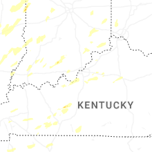


Connect with Interactive Hail Maps