

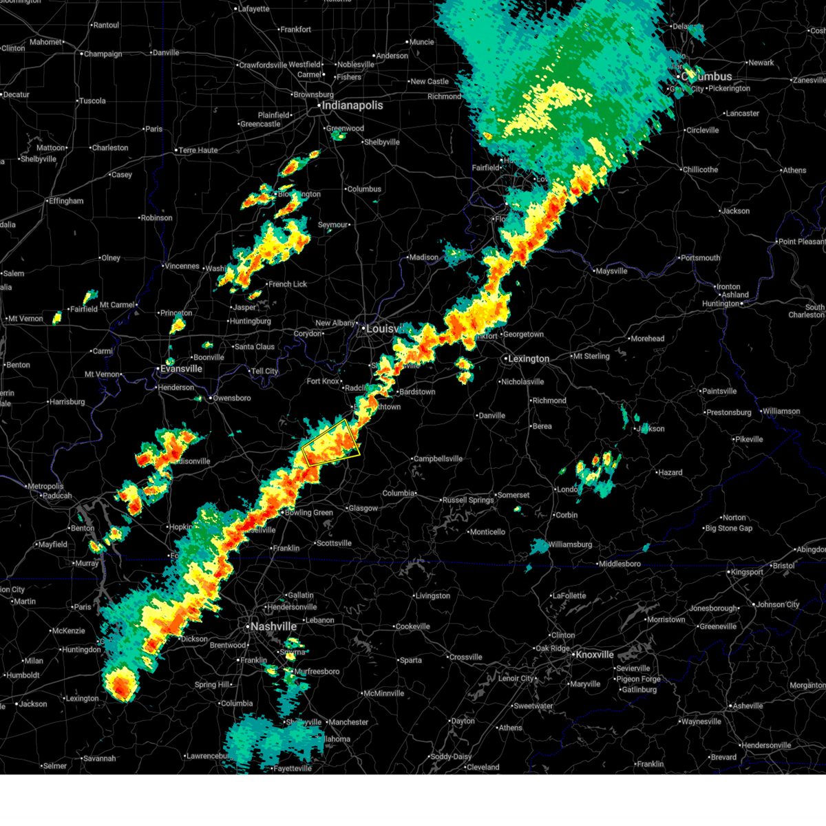
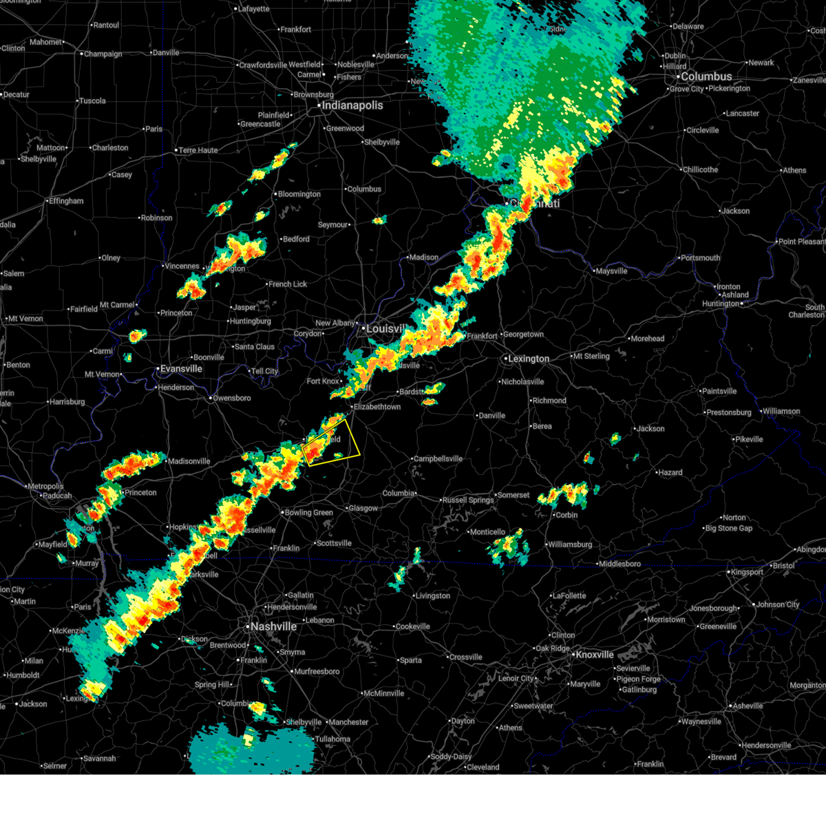
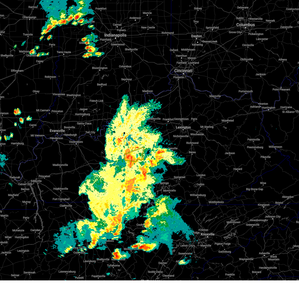
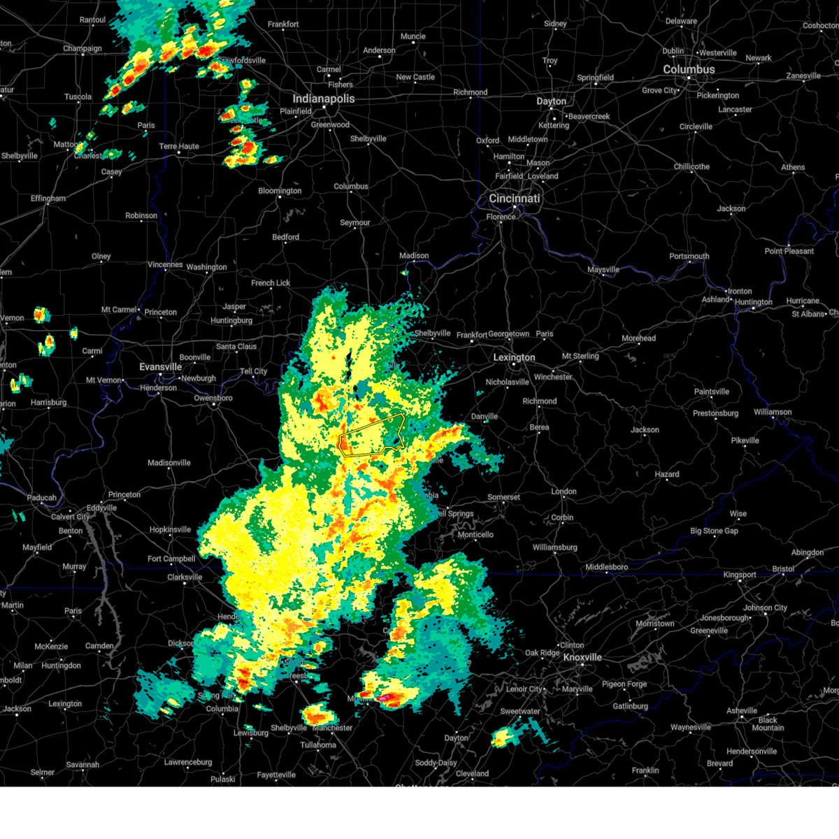
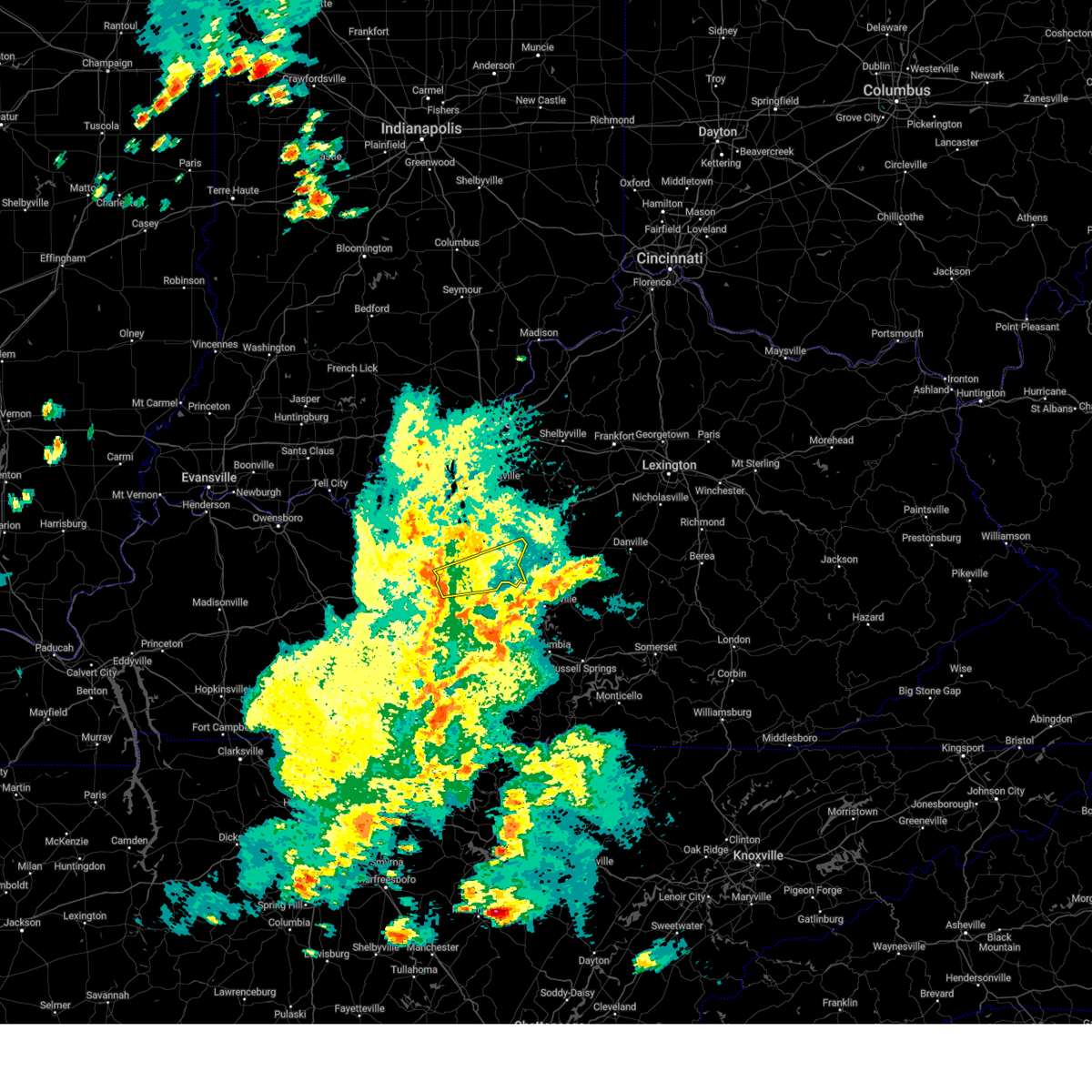
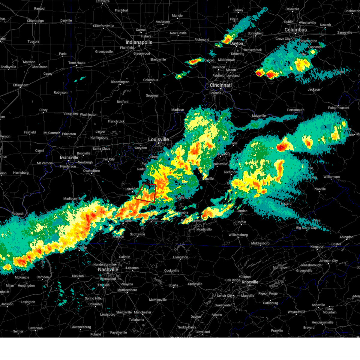
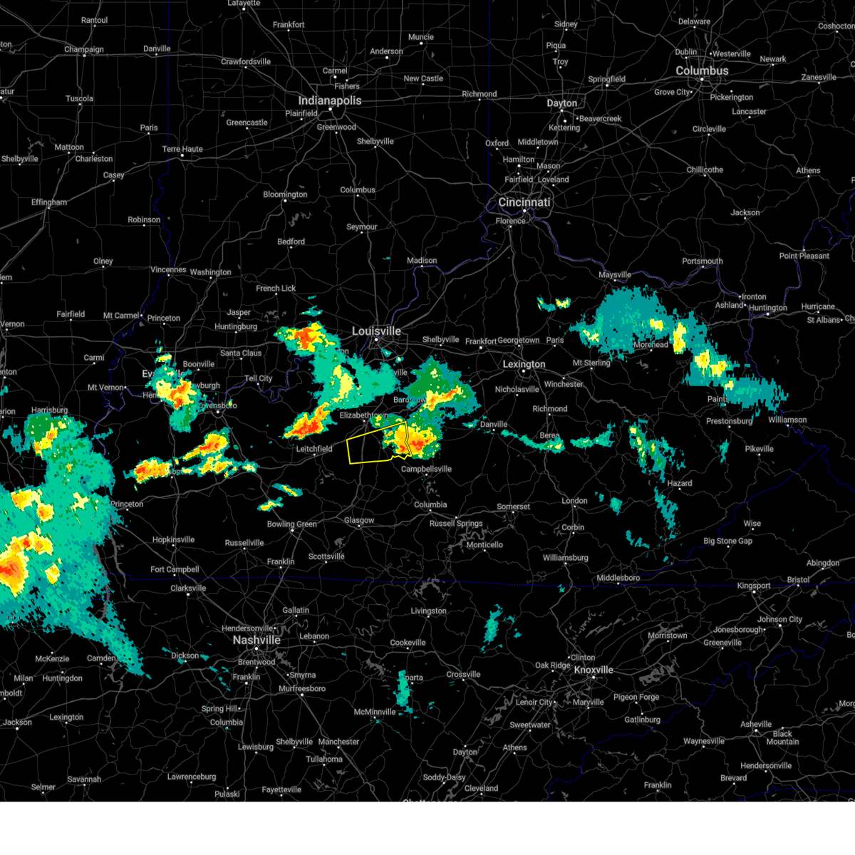
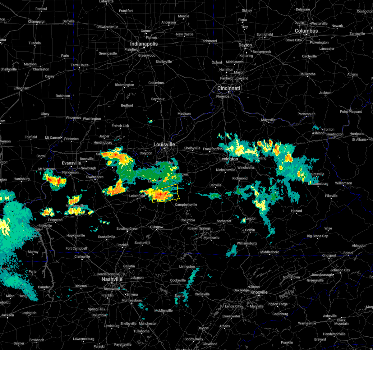
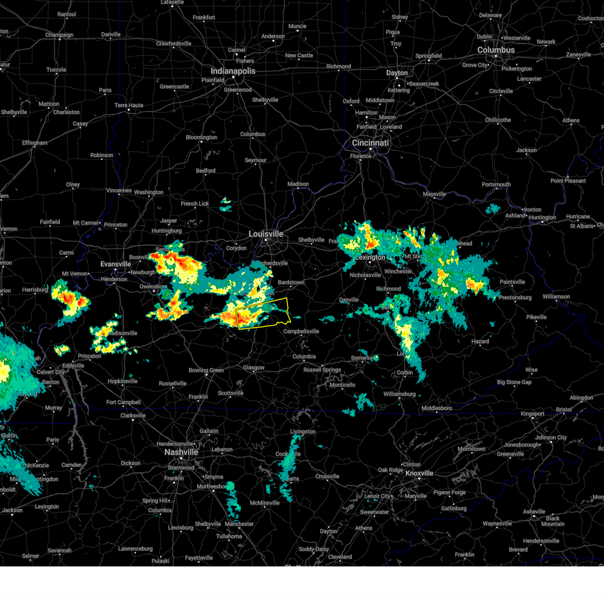
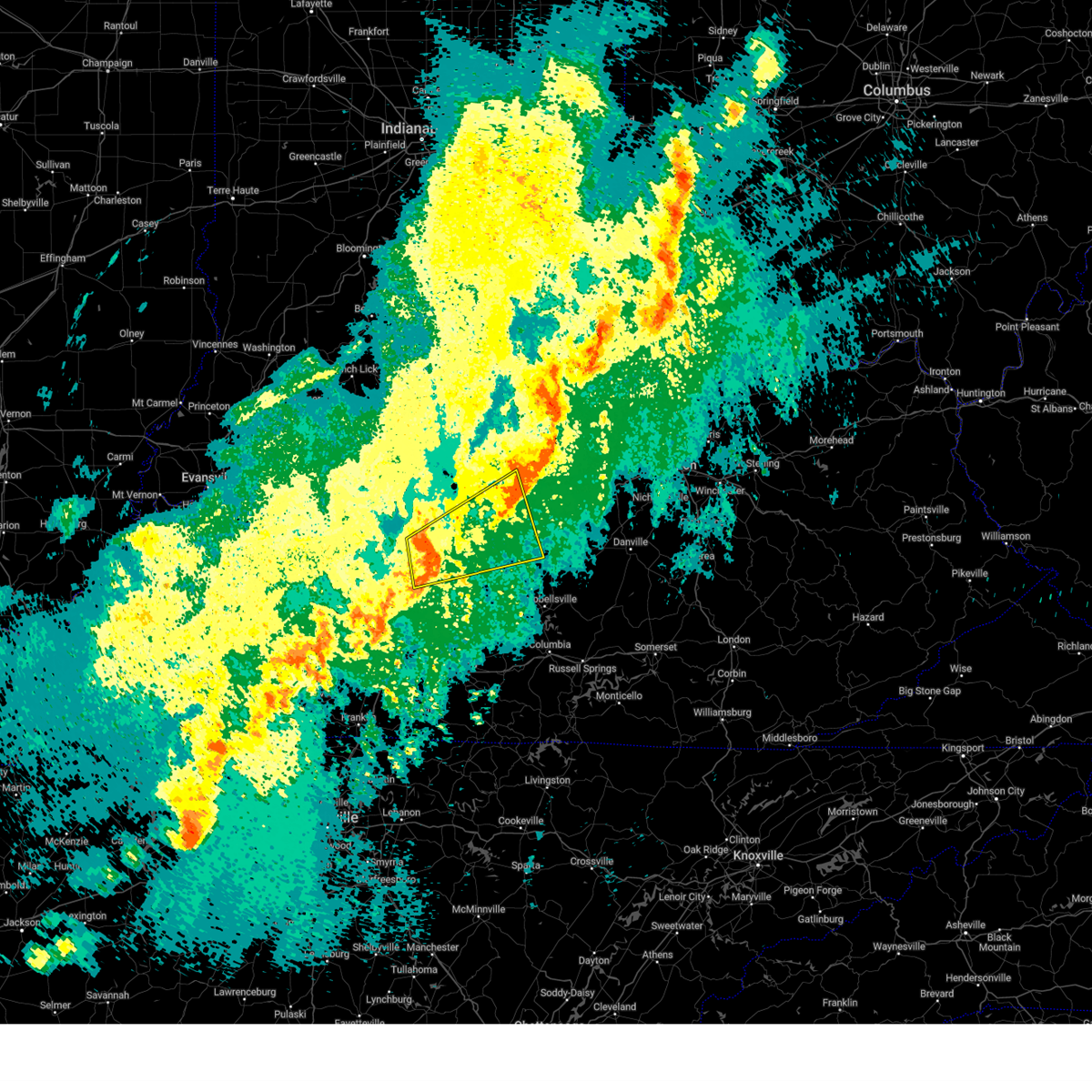
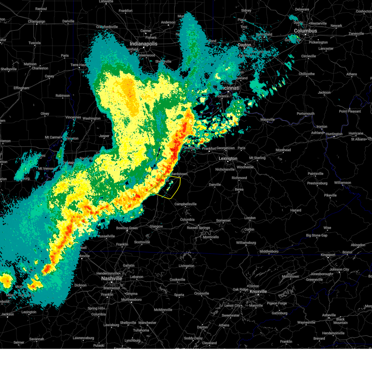
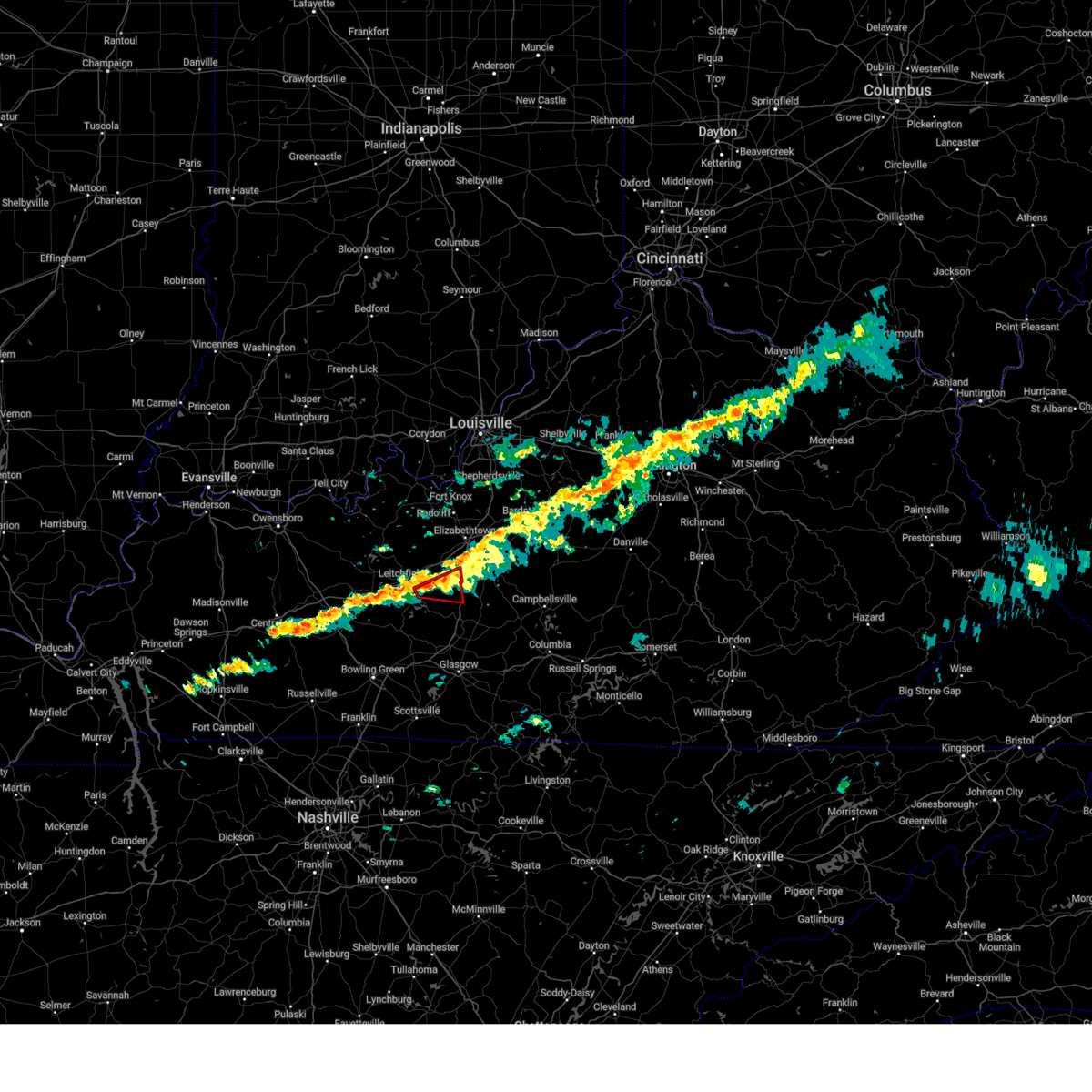
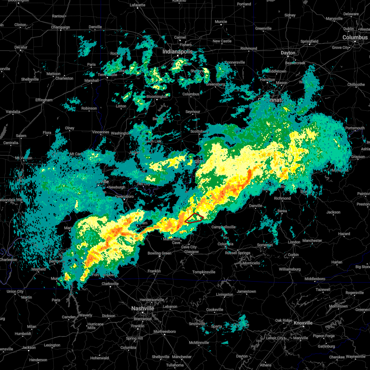
Hail Map for Sonora, KY
The Sonora, KY area has had 0 reports of on-the-ground hail by trained spotters, and has been under severe weather warnings 24 times during the past 12 months. Doppler radar has detected hail at or near Sonora, KY on 55 occasions, including 2 occasions during the past year.
| Name: | Sonora, KY |
| Where Located: | 33.1 miles SSW of Louisville, KY |
| Map: | Google Map for Sonora, KY |
| Population: | 513 |
| Housing Units: | 227 |
| More Info: | Search Google for Sonora, KY |
0
The Top Recent Hail Date for Sonora, KY is Tuesday, September 24, 2024 (53rd out of 55)

Hail and Wind Damage Spotted near Sonora, KY
| Date / Time | Report Details |
|---|---|
| 6/18/2025 7:28 PM CDT |
 The storm which prompted the warning has weakened below severe limits, and no longer poses an immediate threat to life or property. therefore, the warning will be allowed to expire. however, gusty winds and heavy rain are still possible with this thunderstorm. a tornado watch remains in effect until 900 pm edt/800 pm cdt/ for central kentucky. a severe thunderstorm watch remains in effect until 100 am edt/midnight cdt/ for south central and central kentucky. to report severe weather, contact your nearest law enforcement agency. they will relay your report to the national weather service louisville. The storm which prompted the warning has weakened below severe limits, and no longer poses an immediate threat to life or property. therefore, the warning will be allowed to expire. however, gusty winds and heavy rain are still possible with this thunderstorm. a tornado watch remains in effect until 900 pm edt/800 pm cdt/ for central kentucky. a severe thunderstorm watch remains in effect until 100 am edt/midnight cdt/ for south central and central kentucky. to report severe weather, contact your nearest law enforcement agency. they will relay your report to the national weather service louisville.
|
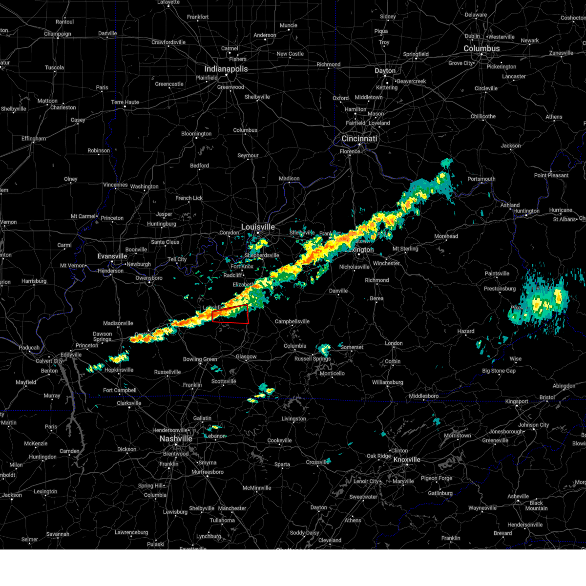
| 6/18/2025 7:07 PM CDT | At 807 pm edt/707 pm cdt/, a severe thunderstorm was located 10 miles southeast of leitchfield, moving northeast at 30 mph (radar indicated). Hazards include 60 mph wind gusts and nickel size hail. Expect damage to roofs, siding, and trees. Locations impacted include, upton, sonora, bonnieville, rock creek, seven corners, wabash, lines mill, broad ford, peonia, and flint hill. |
| 6/18/2025 6:55 PM CDT |
 Svrlmk the national weather service in louisville has issued a * severe thunderstorm warning for, southwestern larue county in central kentucky, northwestern hart county in central kentucky, southeastern grayson county in central kentucky, south central hardin county in central kentucky, northeastern edmonson county in south central kentucky, * until 830 pm edt/730 pm cdt/. * at 754 pm edt/654 pm cdt/, a severe thunderstorm was located 8 miles southeast of leitchfield, moving northeast at 30 mph (radar indicated). Hazards include 60 mph wind gusts and quarter size hail. Hail damage to vehicles is expected. Expect wind damage to roofs, siding, and trees. Svrlmk the national weather service in louisville has issued a * severe thunderstorm warning for, southwestern larue county in central kentucky, northwestern hart county in central kentucky, southeastern grayson county in central kentucky, south central hardin county in central kentucky, northeastern edmonson county in south central kentucky, * until 830 pm edt/730 pm cdt/. * at 754 pm edt/654 pm cdt/, a severe thunderstorm was located 8 miles southeast of leitchfield, moving northeast at 30 mph (radar indicated). Hazards include 60 mph wind gusts and quarter size hail. Hail damage to vehicles is expected. Expect wind damage to roofs, siding, and trees.
|
| 5/20/2025 7:55 PM EDT |
 the severe thunderstorm warning has been cancelled and is no longer in effect the severe thunderstorm warning has been cancelled and is no longer in effect
|
| 5/20/2025 7:55 PM EDT |
 At 755 pm edt, a severe thunderstorm was located near hodgenville, or 14 miles southeast of elizabethtown, moving east at 45 mph (radar indicated). Hazards include 60 mph wind gusts. Expect damage to roofs, siding, and trees. Locations impacted include, hodgenville, new haven, upton, sonora, gethsemane, talley, athertonville, boundary oak, attilla, howardstown, stiles, maxine, gleanings, badger, magnolia, nolin, mathers mill, leafdale, tanner, and new hope. At 755 pm edt, a severe thunderstorm was located near hodgenville, or 14 miles southeast of elizabethtown, moving east at 45 mph (radar indicated). Hazards include 60 mph wind gusts. Expect damage to roofs, siding, and trees. Locations impacted include, hodgenville, new haven, upton, sonora, gethsemane, talley, athertonville, boundary oak, attilla, howardstown, stiles, maxine, gleanings, badger, magnolia, nolin, mathers mill, leafdale, tanner, and new hope.
|
| 5/20/2025 7:43 PM EDT |
 At 743 pm edt/643 pm cdt/, a severe thunderstorm was located 10 miles southwest of hodgenville, or 15 miles south of elizabethtown, moving east at 45 mph (radar indicated). Hazards include 60 mph wind gusts. Expect damage to roofs, siding, and trees. Locations impacted include, hodgenville, new haven, upton, sonora, boundary oak, seven corners, howardstown, flint hill, vento, tanner, new hope, mount sherman, tonieville, gethsemane, talley, athertonville, attilla, stiles, maxine, and gleanings. At 743 pm edt/643 pm cdt/, a severe thunderstorm was located 10 miles southwest of hodgenville, or 15 miles south of elizabethtown, moving east at 45 mph (radar indicated). Hazards include 60 mph wind gusts. Expect damage to roofs, siding, and trees. Locations impacted include, hodgenville, new haven, upton, sonora, boundary oak, seven corners, howardstown, flint hill, vento, tanner, new hope, mount sherman, tonieville, gethsemane, talley, athertonville, attilla, stiles, maxine, and gleanings.
|
| 5/20/2025 7:38 PM EDT |
 Svrlmk the national weather service in louisville has issued a * severe thunderstorm warning for, south central nelson county in central kentucky, larue county in central kentucky, north central hart county in central kentucky, southeastern hardin county in central kentucky, * until 830 pm edt/730 pm cdt/. * at 738 pm edt/638 pm cdt/, a severe thunderstorm was located 13 miles north of munfordville, or 16 miles south of elizabethtown, moving east at 45 mph (radar indicated). Hazards include 60 mph wind gusts. expect damage to roofs, siding, and trees Svrlmk the national weather service in louisville has issued a * severe thunderstorm warning for, south central nelson county in central kentucky, larue county in central kentucky, north central hart county in central kentucky, southeastern hardin county in central kentucky, * until 830 pm edt/730 pm cdt/. * at 738 pm edt/638 pm cdt/, a severe thunderstorm was located 13 miles north of munfordville, or 16 miles south of elizabethtown, moving east at 45 mph (radar indicated). Hazards include 60 mph wind gusts. expect damage to roofs, siding, and trees
|
| 5/16/2025 10:45 PM EDT |
 The storm which prompted the warning has weakened below severe limits, and has exited the warned area. therefore, the warning has been allowed to expire. a tornado watch remains in effect until 1100 pm edt/1000 pm cdt/ for central kentucky. a tornado watch also remains in effect until 300 am edt/200 am cdt/ for central kentucky. to report severe weather, contact your nearest law enforcement agency. they will relay your report to the national weather service louisville. The storm which prompted the warning has weakened below severe limits, and has exited the warned area. therefore, the warning has been allowed to expire. a tornado watch remains in effect until 1100 pm edt/1000 pm cdt/ for central kentucky. a tornado watch also remains in effect until 300 am edt/200 am cdt/ for central kentucky. to report severe weather, contact your nearest law enforcement agency. they will relay your report to the national weather service louisville.
|
| 5/16/2025 10:30 PM EDT | At 1029 pm edt/929 pm cdt/, a severe thunderstorm capable of producing a tornado was located 12 miles east of leitchfield, moving east at 60 mph (radar indicated rotation). Hazards include tornado. Flying debris will be dangerous to those caught without shelter. mobile homes will be damaged or destroyed. damage to roofs, windows, and vehicles will occur. tree damage is likely. This tornadic thunderstorm will remain over mainly rural areas of southwestern larue, northwestern hart, southeastern grayson and south central hardin counties, including the following locations, rock creek, seven corners, wabash, eastview, bonnieville, lines mill, broad ford, flint hill, pearman, and snap. |
| 5/16/2025 10:30 PM EDT | the tornado warning has been cancelled and is no longer in effect |
| 5/16/2025 9:12 PM CDT | Torlmk the national weather service in louisville has issued a * tornado warning for, southwestern larue county in central kentucky, northwestern hart county in central kentucky, grayson county in central kentucky, south central breckinridge county in central kentucky, southwestern hardin county in central kentucky, * until 1045 pm edt/945 pm cdt/. * at 1012 pm edt/912 pm cdt/, a severe thunderstorm capable of producing a tornado was located near leitchfield, moving east at 60 mph (radar indicated rotation). Hazards include tornado. Flying debris will be dangerous to those caught without shelter. mobile homes will be damaged or destroyed. damage to roofs, windows, and vehicles will occur. tree damage is likely. this dangerous storm will be near, leitchfield around 920 pm cdt. Other locations impacted by this tornadic thunderstorm include rock creek, saint paul, eastview, caneyville, broad ford, peonia, black rock, tar hill, duff, and lacon. |
| 5/16/2025 10:09 PM EDT | Svrlmk the national weather service in louisville has issued a * severe thunderstorm warning for, southwestern nelson county in central kentucky, southeastern meade county in central kentucky, larue county in central kentucky, northwestern hart county in central kentucky, southeastern grayson county in central kentucky, southwestern bullitt county in central kentucky, hardin county in central kentucky, * until 1100 pm edt/1000 pm cdt/. * at 1009 pm edt/909 pm cdt/, severe thunderstorms were located along a line extending from 11 miles northwest of elizabethtown to 17 miles east of hardinsburg to 13 miles west of leitchfield, moving southeast at 40 mph (radar indicated). Hazards include 70 mph wind gusts. Expect considerable tree damage. Damage is likely to mobile homes, roofs, and outbuildings. |
| 5/16/2025 6:57 AM EDT |
 The storm which prompted the warning has moved out of the area. therefore, the warning will be allowed to expire. a severe thunderstorm watch remains in effect until 1000 am edt/900 am cdt/ for central kentucky. remember, a severe thunderstorm warning still remains in effect for portions of larue and nelson county until 715 am edt. The storm which prompted the warning has moved out of the area. therefore, the warning will be allowed to expire. a severe thunderstorm watch remains in effect until 1000 am edt/900 am cdt/ for central kentucky. remember, a severe thunderstorm warning still remains in effect for portions of larue and nelson county until 715 am edt.
|
| 5/16/2025 6:40 AM EDT |
 At 639 am edt/539 am cdt/, a severe thunderstorm was located near hodgenville, moving east at 75 mph (emergency management). Hazards include 60 mph wind gusts and quarter size hail. Hail damage to vehicles is expected. expect wind damage to roofs, siding, and trees. Locations impacted include, hodgenville, new haven, upton, sonora, lyons, boundary oak, seven corners, howardstown, flint hill, and glendale. At 639 am edt/539 am cdt/, a severe thunderstorm was located near hodgenville, moving east at 75 mph (emergency management). Hazards include 60 mph wind gusts and quarter size hail. Hail damage to vehicles is expected. expect wind damage to roofs, siding, and trees. Locations impacted include, hodgenville, new haven, upton, sonora, lyons, boundary oak, seven corners, howardstown, flint hill, and glendale.
|
| 5/16/2025 6:40 AM EDT |
 the severe thunderstorm warning has been cancelled and is no longer in effect the severe thunderstorm warning has been cancelled and is no longer in effect
|
| 5/16/2025 6:29 AM EDT |
 Svrlmk the national weather service in louisville has issued a * severe thunderstorm warning for, south central nelson county in central kentucky, larue county in central kentucky, north central hart county in central kentucky, east central grayson county in central kentucky, southeastern hardin county in central kentucky, * until 700 am edt/600 am cdt/. * at 629 am edt/529 am cdt/, a severe thunderstorm was located 13 miles east of leitchfield, moving east at 75 mph (emergency management reported quarter size hail in leitchfield). Hazards include quarter size hail. damage to vehicles is expected Svrlmk the national weather service in louisville has issued a * severe thunderstorm warning for, south central nelson county in central kentucky, larue county in central kentucky, north central hart county in central kentucky, east central grayson county in central kentucky, southeastern hardin county in central kentucky, * until 700 am edt/600 am cdt/. * at 629 am edt/529 am cdt/, a severe thunderstorm was located 13 miles east of leitchfield, moving east at 75 mph (emergency management reported quarter size hail in leitchfield). Hazards include quarter size hail. damage to vehicles is expected
|
| 4/3/2025 1:27 AM EDT | The storm which prompted the warning has moved out of the area. therefore, the warning will be allowed to expire. however, heavy rain is still possible with this thunderstorm. a tornado watch remains in effect until 200 am edt/100 am cdt/ for central kentucky. a tornado watch also remains in effect until 700 am edt/600 am cdt/ for central kentucky. |
| 4/3/2025 12:47 AM EDT |
 Svrlmk the national weather service in louisville has issued a * severe thunderstorm warning for, nelson county in central kentucky, central larue county in central kentucky, northwestern marion county in central kentucky, northeastern grayson county in central kentucky, southeastern bullitt county in central kentucky, southeastern breckinridge county in central kentucky, hardin county in central kentucky, * until 130 am edt/1230 am cdt/. * at 1247 am edt/1147 pm cdt/, a severe thunderstorm was located over leitchfield, moving northeast at 75 mph (radar indicated). Hazards include 60 mph wind gusts and penny size hail. expect damage to roofs, siding, and trees Svrlmk the national weather service in louisville has issued a * severe thunderstorm warning for, nelson county in central kentucky, central larue county in central kentucky, northwestern marion county in central kentucky, northeastern grayson county in central kentucky, southeastern bullitt county in central kentucky, southeastern breckinridge county in central kentucky, hardin county in central kentucky, * until 130 am edt/1230 am cdt/. * at 1247 am edt/1147 pm cdt/, a severe thunderstorm was located over leitchfield, moving northeast at 75 mph (radar indicated). Hazards include 60 mph wind gusts and penny size hail. expect damage to roofs, siding, and trees
|
| 3/30/2025 10:06 PM EDT |
 Svrlmk the national weather service in louisville has issued a * severe thunderstorm warning for, southwestern nelson county in central kentucky, larue county in central kentucky, southeastern hardin county in central kentucky, * until 1030 pm edt. * at 1006 pm edt, severe thunderstorms were located along a line extending from 15 miles southwest of shepherdsville to near elizabethtown to 13 miles northeast of leitchfield, moving east at 45 mph (radar indicated). Hazards include 60 mph wind gusts and penny size hail. expect damage to roofs, siding, and trees Svrlmk the national weather service in louisville has issued a * severe thunderstorm warning for, southwestern nelson county in central kentucky, larue county in central kentucky, southeastern hardin county in central kentucky, * until 1030 pm edt. * at 1006 pm edt, severe thunderstorms were located along a line extending from 15 miles southwest of shepherdsville to near elizabethtown to 13 miles northeast of leitchfield, moving east at 45 mph (radar indicated). Hazards include 60 mph wind gusts and penny size hail. expect damage to roofs, siding, and trees
|
| 2/6/2025 5:39 AM EST |
 At 539 am est/439 am cst/, a severe thunderstorm capable of producing a tornado was located 8 miles southeast of leitchfield, moving east at 55 mph (radar indicated rotation). Hazards include tornado and quarter size hail. Flying debris will be dangerous to those caught without shelter. mobile homes will be damaged or destroyed. damage to roofs, windows, and vehicles will occur. tree damage is likely. Locations impacted include, upton, sonora, bonnieville, spike, spurrier, rock creek, seven corners, broad ford, flint hill, and snap. At 539 am est/439 am cst/, a severe thunderstorm capable of producing a tornado was located 8 miles southeast of leitchfield, moving east at 55 mph (radar indicated rotation). Hazards include tornado and quarter size hail. Flying debris will be dangerous to those caught without shelter. mobile homes will be damaged or destroyed. damage to roofs, windows, and vehicles will occur. tree damage is likely. Locations impacted include, upton, sonora, bonnieville, spike, spurrier, rock creek, seven corners, broad ford, flint hill, and snap.
|
| 2/6/2025 5:28 AM EST |
 Torlmk the national weather service in louisville has issued a * tornado warning for, northwestern hart county in central kentucky, southeastern grayson county in central kentucky, south central hardin county in central kentucky, * until 600 am est/500 am cst/. * at 528 am est/428 am cst/, a severe thunderstorm capable of producing a tornado was located near leitchfield, moving east at 55 mph (radar indicated rotation). Hazards include tornado and quarter size hail. Flying debris will be dangerous to those caught without shelter. mobile homes will be damaged or destroyed. damage to roofs, windows, and vehicles will occur. tree damage is likely. This tornadic thunderstorm will remain over mainly rural areas of northwestern hart, southeastern grayson and south central hardin counties, including the following locations, rock creek, seven corners, bonnieville, broad ford, peonia, flint hill, pearman, snap, clarkson, and royal. Torlmk the national weather service in louisville has issued a * tornado warning for, northwestern hart county in central kentucky, southeastern grayson county in central kentucky, south central hardin county in central kentucky, * until 600 am est/500 am cst/. * at 528 am est/428 am cst/, a severe thunderstorm capable of producing a tornado was located near leitchfield, moving east at 55 mph (radar indicated rotation). Hazards include tornado and quarter size hail. Flying debris will be dangerous to those caught without shelter. mobile homes will be damaged or destroyed. damage to roofs, windows, and vehicles will occur. tree damage is likely. This tornadic thunderstorm will remain over mainly rural areas of northwestern hart, southeastern grayson and south central hardin counties, including the following locations, rock creek, seven corners, bonnieville, broad ford, peonia, flint hill, pearman, snap, clarkson, and royal.
|
| 9/24/2024 2:04 PM CDT |
 Svrlmk the national weather service in louisville has issued a * severe thunderstorm warning for, southwestern larue county in central kentucky, northern hart county in central kentucky, southeastern hardin county in central kentucky, * until 330 pm edt/230 pm cdt/. * at 304 pm edt/204 pm cdt/, a severe thunderstorm was located near munfordville, moving northeast at 35 mph (radar indicated). Hazards include 60 mph wind gusts and quarter size hail. Hail damage to vehicles is expected. Expect wind damage to roofs, siding, and trees. Svrlmk the national weather service in louisville has issued a * severe thunderstorm warning for, southwestern larue county in central kentucky, northern hart county in central kentucky, southeastern hardin county in central kentucky, * until 330 pm edt/230 pm cdt/. * at 304 pm edt/204 pm cdt/, a severe thunderstorm was located near munfordville, moving northeast at 35 mph (radar indicated). Hazards include 60 mph wind gusts and quarter size hail. Hail damage to vehicles is expected. Expect wind damage to roofs, siding, and trees.
|
| 7/30/2024 2:09 PM EDT |
 Svrlmk the national weather service in louisville has issued a * severe thunderstorm warning for, southwestern nelson county in central kentucky, northwestern green county in central kentucky, larue county in central kentucky, western marion county in central kentucky, northeastern hart county in central kentucky, northwestern taylor county in central kentucky, southern washington county in central kentucky, southwestern bullitt county in central kentucky, eastern hardin county in central kentucky, * until 300 pm edt/200 pm cdt/. * at 209 pm edt/109 pm cdt/, a severe thunderstorm was located over elizabethtown, moving east at 25 mph (radar indicated). Hazards include 60 mph wind gusts. expect damage to roofs, siding, and trees Svrlmk the national weather service in louisville has issued a * severe thunderstorm warning for, southwestern nelson county in central kentucky, northwestern green county in central kentucky, larue county in central kentucky, western marion county in central kentucky, northeastern hart county in central kentucky, northwestern taylor county in central kentucky, southern washington county in central kentucky, southwestern bullitt county in central kentucky, eastern hardin county in central kentucky, * until 300 pm edt/200 pm cdt/. * at 209 pm edt/109 pm cdt/, a severe thunderstorm was located over elizabethtown, moving east at 25 mph (radar indicated). Hazards include 60 mph wind gusts. expect damage to roofs, siding, and trees
|
| 7/30/2024 2:04 PM EDT | Trees down in the 3000 block of s long grov in hardin county KY, 4.8 miles S of Sonora, KY |
| 7/30/2024 12:49 PM CDT |
 Svrlmk the national weather service in louisville has issued a * severe thunderstorm warning for, southwestern larue county in central kentucky, northwestern hart county in central kentucky, grayson county in central kentucky, southern hardin county in central kentucky, northeastern edmonson county in south central kentucky, * until 215 pm edt/115 pm cdt/. * at 149 pm edt/1249 pm cdt/, severe thunderstorms were located along a line extending from 9 miles west of elizabethtown to near leitchfield to 20 miles northwest of brownsville, moving southeast at 50 mph (radar indicated). Hazards include 60 mph wind gusts and quarter size hail. Hail damage to vehicles is expected. Expect wind damage to roofs, siding, and trees. Svrlmk the national weather service in louisville has issued a * severe thunderstorm warning for, southwestern larue county in central kentucky, northwestern hart county in central kentucky, grayson county in central kentucky, southern hardin county in central kentucky, northeastern edmonson county in south central kentucky, * until 215 pm edt/115 pm cdt/. * at 149 pm edt/1249 pm cdt/, severe thunderstorms were located along a line extending from 9 miles west of elizabethtown to near leitchfield to 20 miles northwest of brownsville, moving southeast at 50 mph (radar indicated). Hazards include 60 mph wind gusts and quarter size hail. Hail damage to vehicles is expected. Expect wind damage to roofs, siding, and trees.
|
| 5/26/2024 11:51 AM EDT |
 At 1150 am edt/1050 am cdt/, a severe thunderstorm was located 10 miles north of hodgenville, moving east at 55 mph (radar indicated). Hazards include 70 mph wind gusts. Expect considerable tree damage. damage is likely to mobile homes, roofs, and outbuildings. Locations impacted include, elizabethtown, bardstown, hodgenville, radcliff, vine grove, lebanon junction, new haven, upton, sonora, and boundary oak. At 1150 am edt/1050 am cdt/, a severe thunderstorm was located 10 miles north of hodgenville, moving east at 55 mph (radar indicated). Hazards include 70 mph wind gusts. Expect considerable tree damage. damage is likely to mobile homes, roofs, and outbuildings. Locations impacted include, elizabethtown, bardstown, hodgenville, radcliff, vine grove, lebanon junction, new haven, upton, sonora, and boundary oak.
|
| 5/26/2024 11:51 AM EDT |
 the severe thunderstorm warning has been cancelled and is no longer in effect the severe thunderstorm warning has been cancelled and is no longer in effect
|
| 5/26/2024 11:34 AM EDT |
 At 1133 am edt/1033 am cdt/, a severe thunderstorm was located 12 miles west of elizabethtown, moving northeast at 50 mph (radar indicated). Hazards include 70 mph wind gusts. Expect considerable tree damage. damage is likely to mobile homes, roofs, and outbuildings. Locations impacted include, elizabethtown, bardstown, hodgenville, radcliff, vine grove, lebanon junction, irvington, new haven, upton, and sonora. At 1133 am edt/1033 am cdt/, a severe thunderstorm was located 12 miles west of elizabethtown, moving northeast at 50 mph (radar indicated). Hazards include 70 mph wind gusts. Expect considerable tree damage. damage is likely to mobile homes, roofs, and outbuildings. Locations impacted include, elizabethtown, bardstown, hodgenville, radcliff, vine grove, lebanon junction, irvington, new haven, upton, and sonora.
|
| 5/26/2024 11:24 AM EDT |
 Svrlmk the national weather service in louisville has issued a * severe thunderstorm warning for, nelson county in central kentucky, southeastern meade county in central kentucky, northwestern green county in central kentucky, larue county in central kentucky, northwestern marion county in central kentucky, northwestern hart county in central kentucky, eastern grayson county in central kentucky, west central washington county in central kentucky, southwestern bullitt county in central kentucky, southeastern breckinridge county in central kentucky, hardin county in central kentucky, * until noon edt/1100 am cdt/. * at 1124 am edt/1024 am cdt/, a severe thunderstorm was located 14 miles south of brandenburg, moving east at 50 mph (radar indicated). Hazards include 60 mph wind gusts. expect damage to roofs, siding, and trees Svrlmk the national weather service in louisville has issued a * severe thunderstorm warning for, nelson county in central kentucky, southeastern meade county in central kentucky, northwestern green county in central kentucky, larue county in central kentucky, northwestern marion county in central kentucky, northwestern hart county in central kentucky, eastern grayson county in central kentucky, west central washington county in central kentucky, southwestern bullitt county in central kentucky, southeastern breckinridge county in central kentucky, hardin county in central kentucky, * until noon edt/1100 am cdt/. * at 1124 am edt/1024 am cdt/, a severe thunderstorm was located 14 miles south of brandenburg, moving east at 50 mph (radar indicated). Hazards include 60 mph wind gusts. expect damage to roofs, siding, and trees
|
| 3/15/2024 12:34 AM EDT |
 the severe thunderstorm warning has been cancelled and is no longer in effect the severe thunderstorm warning has been cancelled and is no longer in effect
|
| 3/15/2024 12:15 AM EDT |
 At 1215 am edt/1115 pm cdt/, severe thunderstorms were located along a line extending from near shepherdsville to 10 miles west of hodgenville, moving east at 55 mph (radar indicated). Hazards include 60 mph wind gusts. Expect damage to roofs, siding, and trees. Locations impacted include, elizabethtown, radcliff, lebanon junction, sonora, bardstown junction, hobbs, eastview, scuffletown, belmont, and hansbrough. At 1215 am edt/1115 pm cdt/, severe thunderstorms were located along a line extending from near shepherdsville to 10 miles west of hodgenville, moving east at 55 mph (radar indicated). Hazards include 60 mph wind gusts. Expect damage to roofs, siding, and trees. Locations impacted include, elizabethtown, radcliff, lebanon junction, sonora, bardstown junction, hobbs, eastview, scuffletown, belmont, and hansbrough.
|
| 3/15/2024 12:14 AM EDT |
 Svrlmk the national weather service in louisville has issued a * severe thunderstorm warning for, spencer county in central kentucky, nelson county in central kentucky, larue county in central kentucky, central bullitt county in central kentucky, southeastern hardin county in central kentucky, * until 1245 am edt. * at 1214 am edt, severe thunderstorms were located along a line extending from 8 miles southeast of fern creek to 13 miles north of munfordville, moving east at 45 mph (radar indicated). Hazards include 60 mph wind gusts. expect damage to roofs, siding, and trees Svrlmk the national weather service in louisville has issued a * severe thunderstorm warning for, spencer county in central kentucky, nelson county in central kentucky, larue county in central kentucky, central bullitt county in central kentucky, southeastern hardin county in central kentucky, * until 1245 am edt. * at 1214 am edt, severe thunderstorms were located along a line extending from 8 miles southeast of fern creek to 13 miles north of munfordville, moving east at 45 mph (radar indicated). Hazards include 60 mph wind gusts. expect damage to roofs, siding, and trees
|
| 3/15/2024 12:05 AM EDT |
 Svrlmk the national weather service in louisville has issued a * severe thunderstorm warning for, western nelson county in central kentucky, northeastern grayson county in central kentucky, southwestern bullitt county in central kentucky, hardin county in central kentucky, * until 1230 am edt/1130 pm cdt/. * at 1205 am edt/1105 pm cdt/, severe thunderstorms were located along a line extending from near shepherdsville to 12 miles east of leitchfield, moving east at 55 mph (radar indicated). Hazards include 60 mph wind gusts. expect damage to roofs, siding, and trees Svrlmk the national weather service in louisville has issued a * severe thunderstorm warning for, western nelson county in central kentucky, northeastern grayson county in central kentucky, southwestern bullitt county in central kentucky, hardin county in central kentucky, * until 1230 am edt/1130 pm cdt/. * at 1205 am edt/1105 pm cdt/, severe thunderstorms were located along a line extending from near shepherdsville to 12 miles east of leitchfield, moving east at 55 mph (radar indicated). Hazards include 60 mph wind gusts. expect damage to roofs, siding, and trees
|
| 3/6/2024 10:06 AM EST |
 Torlmk the national weather service in louisville has issued a * this is a test message. tornado warning for, meade county in central kentucky, larue county in central kentucky, jessamine county in central kentucky, nicholas county in central kentucky, adair county in south central kentucky, bourbon county in central kentucky, warren county in south central kentucky, cumberland county in south central kentucky, henry county in central kentucky, russell county in south central kentucky, taylor county in central kentucky, jefferson county in central kentucky, hardin county in central kentucky, spencer county in central kentucky, scott county in central kentucky, hancock county in central kentucky, trimble county in central kentucky, monroe county in south central kentucky, metcalfe county in south central kentucky, shelby county in central kentucky, logan county in south central kentucky, nelson county in central kentucky, anderson county in central kentucky, clark county in central kentucky, marion county in central kentucky, simpson county in south central kentucky, grayson county in central kentucky, casey county in central kentucky, franklin county in central kentucky, edmonson county in south central kentucky, lincoln county in central kentucky, woodford county in central kentucky, butler county in south central kentucky, madison county in central kentucky, barren county in south central kentucky, ohio county in central kentucky, oldham county in central kentucky, garrard county in central kentucky, hart county in central kentucky, bullitt county in central kentucky, harrison county in central kentucky, mercer county in central kentucky, clinton county in south central kentucky, green county in central kentucky, allen county in south central kentucky, washington county in central kentucky, boyle county in central kentucky, breckinridge county in central kentucky, fayette county in central kentucky, * this is a test message. until 1030 am est/930 am cst/. * this is a test message. Torlmk the national weather service in louisville has issued a * this is a test message. tornado warning for, meade county in central kentucky, larue county in central kentucky, jessamine county in central kentucky, nicholas county in central kentucky, adair county in south central kentucky, bourbon county in central kentucky, warren county in south central kentucky, cumberland county in south central kentucky, henry county in central kentucky, russell county in south central kentucky, taylor county in central kentucky, jefferson county in central kentucky, hardin county in central kentucky, spencer county in central kentucky, scott county in central kentucky, hancock county in central kentucky, trimble county in central kentucky, monroe county in south central kentucky, metcalfe county in south central kentucky, shelby county in central kentucky, logan county in south central kentucky, nelson county in central kentucky, anderson county in central kentucky, clark county in central kentucky, marion county in central kentucky, simpson county in south central kentucky, grayson county in central kentucky, casey county in central kentucky, franklin county in central kentucky, edmonson county in south central kentucky, lincoln county in central kentucky, woodford county in central kentucky, butler county in south central kentucky, madison county in central kentucky, barren county in south central kentucky, ohio county in central kentucky, oldham county in central kentucky, garrard county in central kentucky, hart county in central kentucky, bullitt county in central kentucky, harrison county in central kentucky, mercer county in central kentucky, clinton county in south central kentucky, green county in central kentucky, allen county in south central kentucky, washington county in central kentucky, boyle county in central kentucky, breckinridge county in central kentucky, fayette county in central kentucky, * this is a test message. until 1030 am est/930 am cst/. * this is a test message.
|
| 2/28/2024 6:17 AM EST |
 Svrlmk the national weather service in louisville has issued a * severe thunderstorm warning for, southwestern nelson county in central kentucky, northwestern green county in central kentucky, larue county in central kentucky, northwestern marion county in central kentucky, hart county in central kentucky, northwestern taylor county in central kentucky, southeastern grayson county in central kentucky, southeastern hardin county in central kentucky, northern edmonson county in south central kentucky, * until 645 am est/545 am cst/. * at 616 am est/516 am cst/, severe thunderstorms were located along a line extending from 10 miles northeast of hodgenville to 9 miles north of brownsville, moving east at 40 mph (radar indicated). Hazards include 60 mph wind gusts. expect damage to roofs, siding, and trees Svrlmk the national weather service in louisville has issued a * severe thunderstorm warning for, southwestern nelson county in central kentucky, northwestern green county in central kentucky, larue county in central kentucky, northwestern marion county in central kentucky, hart county in central kentucky, northwestern taylor county in central kentucky, southeastern grayson county in central kentucky, southeastern hardin county in central kentucky, northern edmonson county in south central kentucky, * until 645 am est/545 am cst/. * at 616 am est/516 am cst/, severe thunderstorms were located along a line extending from 10 miles northeast of hodgenville to 9 miles north of brownsville, moving east at 40 mph (radar indicated). Hazards include 60 mph wind gusts. expect damage to roofs, siding, and trees
|
| 6/25/2023 10:17 PM CDT |
 At 1117 pm edt/1017 pm cdt/, a severe thunderstorm was located 9 miles northeast of brownsville, moving southeast at 40 mph (radar indicated). Hazards include 70 mph wind gusts and ping pong ball size hail. People and animals outdoors will be injured. expect hail damage to roofs, siding, windows, and vehicles. expect considerable tree damage. wind damage is also likely to mobile homes, roofs, and outbuildings. Locations impacted include, leitchfield, munfordville, horse cave, clarkson, upton, sonora, bonnieville, rock creek, saint paul and cub run. At 1117 pm edt/1017 pm cdt/, a severe thunderstorm was located 9 miles northeast of brownsville, moving southeast at 40 mph (radar indicated). Hazards include 70 mph wind gusts and ping pong ball size hail. People and animals outdoors will be injured. expect hail damage to roofs, siding, windows, and vehicles. expect considerable tree damage. wind damage is also likely to mobile homes, roofs, and outbuildings. Locations impacted include, leitchfield, munfordville, horse cave, clarkson, upton, sonora, bonnieville, rock creek, saint paul and cub run.
|
| 6/25/2023 10:07 PM CDT |
 At 1106 pm edt/1006 pm cdt/, a severe thunderstorm was located 8 miles southeast of leitchfield, moving southeast at 40 mph (radar indicated). Hazards include 70 mph wind gusts and ping pong ball size hail. People and animals outdoors will be injured. expect hail damage to roofs, siding, windows, and vehicles. expect considerable tree damage. Wind damage is also likely to mobile homes, roofs, and outbuildings. At 1106 pm edt/1006 pm cdt/, a severe thunderstorm was located 8 miles southeast of leitchfield, moving southeast at 40 mph (radar indicated). Hazards include 70 mph wind gusts and ping pong ball size hail. People and animals outdoors will be injured. expect hail damage to roofs, siding, windows, and vehicles. expect considerable tree damage. Wind damage is also likely to mobile homes, roofs, and outbuildings.
|
| 6/25/2023 10:30 PM EDT |
 At 1029 pm edt, a severe thunderstorm was located near elizabethtown, moving southeast at 35 mph (radar indicated). Hazards include 60 mph wind gusts and quarter size hail. Hail damage to vehicles is expected. Expect wind damage to roofs, siding, and trees. At 1029 pm edt, a severe thunderstorm was located near elizabethtown, moving southeast at 35 mph (radar indicated). Hazards include 60 mph wind gusts and quarter size hail. Hail damage to vehicles is expected. Expect wind damage to roofs, siding, and trees.
|
| 4/5/2023 3:57 PM CDT |
 At 457 pm edt/357 pm cdt/, severe thunderstorms were located along a line extending from 13 miles east of leitchfield to near portland, moving east at 45 mph (radar indicated). Hazards include 60 mph wind gusts. expect damage to roofs, siding, and trees At 457 pm edt/357 pm cdt/, severe thunderstorms were located along a line extending from 13 miles east of leitchfield to near portland, moving east at 45 mph (radar indicated). Hazards include 60 mph wind gusts. expect damage to roofs, siding, and trees
|
| 3/3/2023 1:42 PM EST |
 The severe thunderstorm warning for southwestern larue, hart, southeastern grayson, eastern hardin and north central barren counties will expire at 145 pm est/1245 pm cst/, the storms which prompted the warning have weakened below severe limits, and no longer pose an immediate threat to life or property. therefore, the warning will be allowed to expire. however gusty winds and heavy rain are still possible with these thunderstorms. a tornado watch remains in effect until 500 pm est/400 pm cst/ for south central and central kentucky. to report severe weather, contact your nearest law enforcement agency. they will relay your report to the national weather service louisville. The severe thunderstorm warning for southwestern larue, hart, southeastern grayson, eastern hardin and north central barren counties will expire at 145 pm est/1245 pm cst/, the storms which prompted the warning have weakened below severe limits, and no longer pose an immediate threat to life or property. therefore, the warning will be allowed to expire. however gusty winds and heavy rain are still possible with these thunderstorms. a tornado watch remains in effect until 500 pm est/400 pm cst/ for south central and central kentucky. to report severe weather, contact your nearest law enforcement agency. they will relay your report to the national weather service louisville.
|
| 3/3/2023 1:18 PM EST |
 At 117 pm est/1217 pm cst/, severe thunderstorms were located along a line extending from 13 miles east of leitchfield to 9 miles southwest of munfordville to 7 miles southwest of glasgow, moving northeast at 80 mph (radar indicated). Hazards include 70 mph wind gusts. Expect considerable tree damage. damage is likely to mobile homes, roofs, and outbuildings. severe thunderstorms will be near, elizabethtown around 135 pm est. other locations in the path of these severe thunderstorms include hodgenville. thunderstorm damage threat, considerable hail threat, radar indicated max hail size, <. 75 in wind threat, radar indicated max wind gust, 70 mph. At 117 pm est/1217 pm cst/, severe thunderstorms were located along a line extending from 13 miles east of leitchfield to 9 miles southwest of munfordville to 7 miles southwest of glasgow, moving northeast at 80 mph (radar indicated). Hazards include 70 mph wind gusts. Expect considerable tree damage. damage is likely to mobile homes, roofs, and outbuildings. severe thunderstorms will be near, elizabethtown around 135 pm est. other locations in the path of these severe thunderstorms include hodgenville. thunderstorm damage threat, considerable hail threat, radar indicated max hail size, <. 75 in wind threat, radar indicated max wind gust, 70 mph.
|
| 1/12/2023 9:52 AM CST |
 The severe thunderstorm warning for southwestern larue, northern hart, southeastern grayson and south central hardin counties will expire at 1100 am est/1000 am cst/, the storm which prompted the warning has weakened below severe limits, and has exited the warned area. therefore, the warning will be allowed to expire. a severe thunderstorm watch remains in effect until 100 pm est/noon cst/ for south central and central kentucky. The severe thunderstorm warning for southwestern larue, northern hart, southeastern grayson and south central hardin counties will expire at 1100 am est/1000 am cst/, the storm which prompted the warning has weakened below severe limits, and has exited the warned area. therefore, the warning will be allowed to expire. a severe thunderstorm watch remains in effect until 100 pm est/noon cst/ for south central and central kentucky.
|
| 1/12/2023 9:39 AM CST |
 At 1039 am est/939 am cst/, a severe thunderstorm was located 14 miles northwest of munfordville, moving northeast at 65 mph (radar indicated). Hazards include 60 mph wind gusts and quarter size hail. Hail damage to vehicles is expected. expect wind damage to roofs, siding, and trees. locations impacted include, upton, sonora, bonnieville, rock creek, seven corners, wabash, lines mill, broad ford, peonia and flint hill. hail threat, radar indicated max hail size, 1. 00 in wind threat, radar indicated max wind gust, 60 mph. At 1039 am est/939 am cst/, a severe thunderstorm was located 14 miles northwest of munfordville, moving northeast at 65 mph (radar indicated). Hazards include 60 mph wind gusts and quarter size hail. Hail damage to vehicles is expected. expect wind damage to roofs, siding, and trees. locations impacted include, upton, sonora, bonnieville, rock creek, seven corners, wabash, lines mill, broad ford, peonia and flint hill. hail threat, radar indicated max hail size, 1. 00 in wind threat, radar indicated max wind gust, 60 mph.
|
| 1/12/2023 9:28 AM CST |
 At 1027 am est/927 am cst/, a severe thunderstorm was located 9 miles north of brownsville, moving northeast at 65 mph (radar indicated). Hazards include 60 mph wind gusts and quarter size hail. Hail damage to vehicles is expected. expect wind damage to roofs, siding, and trees. this severe thunderstorm will remain over mainly rural areas of southwestern larue, northern hart, southeastern grayson, south central hardin and northeastern edmonson counties, including the following locations, rock creek, cub run, broad ford, peonia, glendale, lacon, priceville, millerstown, pine springs and iberia. hail threat, radar indicated max hail size, 1. 00 in wind threat, radar indicated max wind gust, 60 mph. At 1027 am est/927 am cst/, a severe thunderstorm was located 9 miles north of brownsville, moving northeast at 65 mph (radar indicated). Hazards include 60 mph wind gusts and quarter size hail. Hail damage to vehicles is expected. expect wind damage to roofs, siding, and trees. this severe thunderstorm will remain over mainly rural areas of southwestern larue, northern hart, southeastern grayson, south central hardin and northeastern edmonson counties, including the following locations, rock creek, cub run, broad ford, peonia, glendale, lacon, priceville, millerstown, pine springs and iberia. hail threat, radar indicated max hail size, 1. 00 in wind threat, radar indicated max wind gust, 60 mph.
|
| 1/3/2023 7:34 AM EST |
 At 734 am est/634 am cst/, a severe thunderstorm was located 13 miles southwest of hodgenville, moving northeast at 45 mph (radar indicated). Hazards include 60 mph wind gusts. Expect damage to roofs, siding, and trees. This severe thunderstorm will be near, hodgenville around 750 am est. At 734 am est/634 am cst/, a severe thunderstorm was located 13 miles southwest of hodgenville, moving northeast at 45 mph (radar indicated). Hazards include 60 mph wind gusts. Expect damage to roofs, siding, and trees. This severe thunderstorm will be near, hodgenville around 750 am est.
|
| 1/3/2023 4:26 AM EST |
 The tornado warning for southwestern larue and south central hardin counties will expire at 430 am est, the storm which prompted the tornado warning has weakened some. therefore, the tornado warning will be allowed to expire. however, a severe thunderstorm warning still remains in effect for portions of larue county. to report severe weather, contact your nearest law enforcement agency. they will relay your report to the national weather service louisville. The tornado warning for southwestern larue and south central hardin counties will expire at 430 am est, the storm which prompted the tornado warning has weakened some. therefore, the tornado warning will be allowed to expire. however, a severe thunderstorm warning still remains in effect for portions of larue county. to report severe weather, contact your nearest law enforcement agency. they will relay your report to the national weather service louisville.
|
| 1/3/2023 4:05 AM EST |
 At 405 am est, a severe thunderstorm capable of producing a tornado was located 14 miles north of munfordville, moving northeast at 50 mph (radar indicated rotation). Hazards include tornado and quarter size hail. Flying debris will be dangerous to those caught without shelter. mobile homes will be damaged or destroyed. damage to roofs, windows, and vehicles will occur. tree damage is likely. Locations impacted include, upton, sonora, boundary oak, mathers mill, seven corners, maxine and tanner. At 405 am est, a severe thunderstorm capable of producing a tornado was located 14 miles north of munfordville, moving northeast at 50 mph (radar indicated rotation). Hazards include tornado and quarter size hail. Flying debris will be dangerous to those caught without shelter. mobile homes will be damaged or destroyed. damage to roofs, windows, and vehicles will occur. tree damage is likely. Locations impacted include, upton, sonora, boundary oak, mathers mill, seven corners, maxine and tanner.
|
| 1/3/2023 2:53 AM CST |
 At 353 am est/253 am cst/, a severe thunderstorm capable of producing a tornado was located 12 miles southeast of leitchfield, moving northeast at 45 mph (radar indicated rotation). Hazards include tornado and quarter size hail. Flying debris will be dangerous to those caught without shelter. mobile homes will be damaged or destroyed. damage to roofs, windows, and vehicles will occur. tree damage is likely. Locations impacted include, upton, sonora, bonnieville, boundary oak, seven corners, wabash, lines mill, broad ford, pearman and wax. At 353 am est/253 am cst/, a severe thunderstorm capable of producing a tornado was located 12 miles southeast of leitchfield, moving northeast at 45 mph (radar indicated rotation). Hazards include tornado and quarter size hail. Flying debris will be dangerous to those caught without shelter. mobile homes will be damaged or destroyed. damage to roofs, windows, and vehicles will occur. tree damage is likely. Locations impacted include, upton, sonora, bonnieville, boundary oak, seven corners, wabash, lines mill, broad ford, pearman and wax.
|
| 1/3/2023 2:43 AM CST |
 At 342 am est/242 am cst/, a severe thunderstorm capable of producing a tornado was located 7 miles north of brownsville, moving northeast at 50 mph (radar indicated rotation). Hazards include tornado and quarter size hail. Flying debris will be dangerous to those caught without shelter. mobile homes will be damaged or destroyed. damage to roofs, windows, and vehicles will occur. tree damage is likely. This tornadic thunderstorm will remain over mainly rural areas of southwestern larue, northern hart, southeastern grayson, south central hardin and northeastern edmonson counties, including the following locations, boundary oak, seven corners, wabash, cub run, bonnieville, lines mill, broad ford, pearman, straw and wax. At 342 am est/242 am cst/, a severe thunderstorm capable of producing a tornado was located 7 miles north of brownsville, moving northeast at 50 mph (radar indicated rotation). Hazards include tornado and quarter size hail. Flying debris will be dangerous to those caught without shelter. mobile homes will be damaged or destroyed. damage to roofs, windows, and vehicles will occur. tree damage is likely. This tornadic thunderstorm will remain over mainly rural areas of southwestern larue, northern hart, southeastern grayson, south central hardin and northeastern edmonson counties, including the following locations, boundary oak, seven corners, wabash, cub run, bonnieville, lines mill, broad ford, pearman, straw and wax.
|
| 7/6/2022 5:21 PM EDT |
 The severe thunderstorm warning for central larue and southeastern hardin counties will expire at 530 pm edt, the storm which prompted the warning has moved out of the area. therefore, the warning will be allowed to expire. a severe thunderstorm watch remains in effect until 700 pm edt for central kentucky. remember, a severe thunderstorm warning still remains in effect for eastern larue county until 545 pm edt. The severe thunderstorm warning for central larue and southeastern hardin counties will expire at 530 pm edt, the storm which prompted the warning has moved out of the area. therefore, the warning will be allowed to expire. a severe thunderstorm watch remains in effect until 700 pm edt for central kentucky. remember, a severe thunderstorm warning still remains in effect for eastern larue county until 545 pm edt.
|
| 7/6/2022 5:07 PM EDT |
 At 506 pm edt, a severe thunderstorm was located near hodgenville, moving east at 15 mph (radar indicated). Hazards include 60 mph wind gusts and penny size hail. Expect damage to roofs, siding, and trees. locations impacted include, hodgenville, boundary oak, mathers mill, leafdale, tonieville, glendale and nolin. hail threat, radar indicated max hail size, 0. 75 in wind threat, radar indicated max wind gust, 60 mph. At 506 pm edt, a severe thunderstorm was located near hodgenville, moving east at 15 mph (radar indicated). Hazards include 60 mph wind gusts and penny size hail. Expect damage to roofs, siding, and trees. locations impacted include, hodgenville, boundary oak, mathers mill, leafdale, tonieville, glendale and nolin. hail threat, radar indicated max hail size, 0. 75 in wind threat, radar indicated max wind gust, 60 mph.
|
| 7/6/2022 4:54 PM EDT |
 At 454 pm edt, a severe thunderstorm was located 7 miles south of elizabethtown, moving east at 15 mph (radar indicated). Hazards include 60 mph wind gusts and penny size hail. expect damage to roofs, siding, and trees At 454 pm edt, a severe thunderstorm was located 7 miles south of elizabethtown, moving east at 15 mph (radar indicated). Hazards include 60 mph wind gusts and penny size hail. expect damage to roofs, siding, and trees
|
| 5/3/2022 4:12 PM EDT |
 At 412 pm edt/312 pm cdt/, a severe thunderstorm was located 13 miles northwest of munfordville, moving east at 55 mph (radar indicated). Hazards include 60 mph wind gusts and quarter size hail. Hail damage to vehicles is expected. expect wind damage to roofs, siding, and trees. Locations impacted include, hodgenville, upton, sonora, talley, boundary oak, mathers mill, leafdale, maxine and tanner. At 412 pm edt/312 pm cdt/, a severe thunderstorm was located 13 miles northwest of munfordville, moving east at 55 mph (radar indicated). Hazards include 60 mph wind gusts and quarter size hail. Hail damage to vehicles is expected. expect wind damage to roofs, siding, and trees. Locations impacted include, hodgenville, upton, sonora, talley, boundary oak, mathers mill, leafdale, maxine and tanner.
|
| 5/3/2022 4:05 PM EDT |
 At 404 pm edt/304 pm cdt/, a severe thunderstorm was located 10 miles east of leitchfield, moving east at 40 mph (radar indicated). Hazards include 60 mph wind gusts. expect damage to roofs, siding, and trees At 404 pm edt/304 pm cdt/, a severe thunderstorm was located 10 miles east of leitchfield, moving east at 40 mph (radar indicated). Hazards include 60 mph wind gusts. expect damage to roofs, siding, and trees
|
| 5/1/2022 2:05 AM CDT |
 At 305 am edt/205 am cdt/, a severe thunderstorm was located 8 miles south of hodgenville, moving northeast at 50 mph (radar indicated). Hazards include 60 mph wind gusts and penny size hail. Expect damage to roofs, siding, and trees. this severe storm will be near, hodgenville around 310 am edt. hail threat, radar indicated max hail size, 0. 75 in wind threat, radar indicated max wind gust, 60 mph. At 305 am edt/205 am cdt/, a severe thunderstorm was located 8 miles south of hodgenville, moving northeast at 50 mph (radar indicated). Hazards include 60 mph wind gusts and penny size hail. Expect damage to roofs, siding, and trees. this severe storm will be near, hodgenville around 310 am edt. hail threat, radar indicated max hail size, 0. 75 in wind threat, radar indicated max wind gust, 60 mph.
|
| 5/1/2022 2:54 AM EDT |
 At 253 am edt/153 am cdt/, a severe thunderstorm was located 8 miles north of munfordville, moving northeast at 50 mph (radar indicated). Hazards include 60 mph wind gusts and penny size hail. Expect damage to roofs, siding, and trees. this severe thunderstorm will be near, hodgenville around 310 am edt. hail threat, radar indicated max hail size, 0. 75 in wind threat, radar indicated max wind gust, 60 mph. At 253 am edt/153 am cdt/, a severe thunderstorm was located 8 miles north of munfordville, moving northeast at 50 mph (radar indicated). Hazards include 60 mph wind gusts and penny size hail. Expect damage to roofs, siding, and trees. this severe thunderstorm will be near, hodgenville around 310 am edt. hail threat, radar indicated max hail size, 0. 75 in wind threat, radar indicated max wind gust, 60 mph.
|
| 4/13/2022 8:10 PM EDT |
 The tornado warning for northwestern hart, southeastern grayson and south central hardin counties will expire at 815 pm edt/715 pm cdt/, the storm which prompted the warning has weakened below severe limits, and no longer appears capable of producing a tornado. therefore, the warning will be allowed to expire. a tornado watch remains in effect until 1100 pm edt/1000 pm cdt/ for central kentucky. The tornado warning for northwestern hart, southeastern grayson and south central hardin counties will expire at 815 pm edt/715 pm cdt/, the storm which prompted the warning has weakened below severe limits, and no longer appears capable of producing a tornado. therefore, the warning will be allowed to expire. a tornado watch remains in effect until 1100 pm edt/1000 pm cdt/ for central kentucky.
|
| 4/13/2022 8:03 PM EDT |
 At 803 pm edt/703 pm cdt/, a severe thunderstorm capable of producing a tornado was located 11 miles east of leitchfield, moving east at 45 mph (radar indicated rotation). Hazards include tornado. Flying debris will be dangerous to those caught without shelter. mobile homes will be damaged or destroyed. damage to roofs, windows, and vehicles will occur. tree damage is likely. Locations impacted include, upton, sonora, bonnieville, rock creek, seven corners, lines mill, broad ford, flint hill, pearman and snap. At 803 pm edt/703 pm cdt/, a severe thunderstorm capable of producing a tornado was located 11 miles east of leitchfield, moving east at 45 mph (radar indicated rotation). Hazards include tornado. Flying debris will be dangerous to those caught without shelter. mobile homes will be damaged or destroyed. damage to roofs, windows, and vehicles will occur. tree damage is likely. Locations impacted include, upton, sonora, bonnieville, rock creek, seven corners, lines mill, broad ford, flint hill, pearman and snap.
|
| 4/13/2022 7:01 PM CDT |
 At 801 pm edt/701 pm cdt/, severe thunderstorms were located along a line extending from 8 miles northwest of elizabethtown to 11 miles east of plum springs, moving northeast at 65 mph (radar indicated). Hazards include 70 mph wind gusts and quarter size hail. Hail damage to vehicles is expected. expect considerable tree damage. wind damage is also likely to mobile homes, roofs, and outbuildings. severe thunderstorms will be near, elizabethtown around 805 pm edt. Other locations in the path of these severe thunderstorms include three springs and greensburg. At 801 pm edt/701 pm cdt/, severe thunderstorms were located along a line extending from 8 miles northwest of elizabethtown to 11 miles east of plum springs, moving northeast at 65 mph (radar indicated). Hazards include 70 mph wind gusts and quarter size hail. Hail damage to vehicles is expected. expect considerable tree damage. wind damage is also likely to mobile homes, roofs, and outbuildings. severe thunderstorms will be near, elizabethtown around 805 pm edt. Other locations in the path of these severe thunderstorms include three springs and greensburg.
|
| 4/13/2022 6:56 PM CDT |
 At 756 pm edt/656 pm cdt/, a severe thunderstorm capable of producing a tornado was located near leitchfield, moving east at 45 mph (radar indicated rotation). Hazards include tornado. Flying debris will be dangerous to those caught without shelter. mobile homes will be damaged or destroyed. damage to roofs, windows, and vehicles will occur. tree damage is likely. Locations impacted include, leitchfield, clarkson, upton, sonora, bonnieville, rock creek, seven corners, lines mill, broadway and broad ford. At 756 pm edt/656 pm cdt/, a severe thunderstorm capable of producing a tornado was located near leitchfield, moving east at 45 mph (radar indicated rotation). Hazards include tornado. Flying debris will be dangerous to those caught without shelter. mobile homes will be damaged or destroyed. damage to roofs, windows, and vehicles will occur. tree damage is likely. Locations impacted include, leitchfield, clarkson, upton, sonora, bonnieville, rock creek, seven corners, lines mill, broadway and broad ford.
|
| 4/13/2022 6:41 PM CDT |
 At 741 pm edt/641 pm cdt/, a severe thunderstorm capable of producing a tornado was located 9 miles southwest of leitchfield, moving east at 45 mph (radar indicated rotation). Hazards include tornado. Flying debris will be dangerous to those caught without shelter. mobile homes will be damaged or destroyed. damage to roofs, windows, and vehicles will occur. tree damage is likely. This tornadic thunderstorm will remain over mainly rural areas of northwestern hart, northeastern butler, southern grayson, south central hardin and northwestern edmonson counties, including the following locations, rock creek, caneyville, broad ford, peonia, sadler, sunfish, black rock, lacon, priceville and millerstown. At 741 pm edt/641 pm cdt/, a severe thunderstorm capable of producing a tornado was located 9 miles southwest of leitchfield, moving east at 45 mph (radar indicated rotation). Hazards include tornado. Flying debris will be dangerous to those caught without shelter. mobile homes will be damaged or destroyed. damage to roofs, windows, and vehicles will occur. tree damage is likely. This tornadic thunderstorm will remain over mainly rural areas of northwestern hart, northeastern butler, southern grayson, south central hardin and northwestern edmonson counties, including the following locations, rock creek, caneyville, broad ford, peonia, sadler, sunfish, black rock, lacon, priceville and millerstown.
|
| 12/11/2021 3:47 AM CST |
 At 447 am est/347 am cst/, severe thunderstorms were located along a line extending from 14 miles east of leitchfield to 8 miles northwest of westmoreland, moving east at 50 mph (radar indicated). Hazards include 60 mph wind gusts. Expect damage to roofs, siding, and trees. these severe thunderstorms will remain over mainly rural areas of larue, southwestern marion, hart, northwestern taylor, southeastern grayson, south central hardin, eastern edmonson, green, monroe, allen, southeastern warren, barren and metcalfe counties, including the following locations, logsdon valley, node, broad ford, haywood, austin, settle, new roe, lone star, pascal and oil city. hail threat, radar indicated max hail size, <. 75 in wind threat, radar indicated max wind gust, 60 mph. At 447 am est/347 am cst/, severe thunderstorms were located along a line extending from 14 miles east of leitchfield to 8 miles northwest of westmoreland, moving east at 50 mph (radar indicated). Hazards include 60 mph wind gusts. Expect damage to roofs, siding, and trees. these severe thunderstorms will remain over mainly rural areas of larue, southwestern marion, hart, northwestern taylor, southeastern grayson, south central hardin, eastern edmonson, green, monroe, allen, southeastern warren, barren and metcalfe counties, including the following locations, logsdon valley, node, broad ford, haywood, austin, settle, new roe, lone star, pascal and oil city. hail threat, radar indicated max hail size, <. 75 in wind threat, radar indicated max wind gust, 60 mph.
|
| 6/21/2021 1:06 PM EDT |
 At 106 pm edt/1206 pm cdt/, a severe thunderstorm was located 11 miles east of leitchfield, moving northeast at 35 mph (radar indicated). Hazards include 60 mph wind gusts. Expect damage to roofs, siding, and trees. Locations impacted include, upton, sonora, royal, spike, spurrier, lacon, rock creek, seven corners, millerstown and fragrant. At 106 pm edt/1206 pm cdt/, a severe thunderstorm was located 11 miles east of leitchfield, moving northeast at 35 mph (radar indicated). Hazards include 60 mph wind gusts. Expect damage to roofs, siding, and trees. Locations impacted include, upton, sonora, royal, spike, spurrier, lacon, rock creek, seven corners, millerstown and fragrant.
|
| 6/21/2021 12:56 PM EDT |
 At 1256 pm edt/1156 am cdt/, a severe thunderstorm was located 9 miles east of leitchfield, moving east northeast at 35 mph (radar indicated). Hazards include 60 mph wind gusts and penny size hail. Expect damage to roofs, siding, and trees. Locations impacted include, upton, sonora, spike, spurrier, rock creek, seven corners, peonia, flint hill, snap and grayson springs. At 1256 pm edt/1156 am cdt/, a severe thunderstorm was located 9 miles east of leitchfield, moving east northeast at 35 mph (radar indicated). Hazards include 60 mph wind gusts and penny size hail. Expect damage to roofs, siding, and trees. Locations impacted include, upton, sonora, spike, spurrier, rock creek, seven corners, peonia, flint hill, snap and grayson springs.
|
| 6/21/2021 12:41 PM EDT |
 At 1240 pm edt/1140 am cdt/, a severe thunderstorm was located near leitchfield, moving east at 35 mph (radar indicated). Hazards include 60 mph wind gusts and penny size hail. Expect damage to roofs, siding, and trees. This severe thunderstorm will remain over mainly rural areas of north central hart, southeastern grayson and south central hardin counties, including the following locations, spike, spurrier, rock creek, seven corners, peonia, flint hill, snap, grayson springs, royal and skaggstown. At 1240 pm edt/1140 am cdt/, a severe thunderstorm was located near leitchfield, moving east at 35 mph (radar indicated). Hazards include 60 mph wind gusts and penny size hail. Expect damage to roofs, siding, and trees. This severe thunderstorm will remain over mainly rural areas of north central hart, southeastern grayson and south central hardin counties, including the following locations, spike, spurrier, rock creek, seven corners, peonia, flint hill, snap, grayson springs, royal and skaggstown.
|
| 3/25/2021 10:43 PM EDT |
 The severe thunderstorm warning for southwestern larue, north central hart and south central hardin counties will expire at 1045 pm edt/945 pm cdt/, the storm which prompted the warning has moved out of the area. therefore, the warning will be allowed to expire. a tornado watch remains in effect until midnight edt/1100 pm cdt/ for central kentucky. The severe thunderstorm warning for southwestern larue, north central hart and south central hardin counties will expire at 1045 pm edt/945 pm cdt/, the storm which prompted the warning has moved out of the area. therefore, the warning will be allowed to expire. a tornado watch remains in effect until midnight edt/1100 pm cdt/ for central kentucky.
|
| 3/25/2021 10:42 PM EDT |
 At 1041 pm edt/941 pm cdt/, severe thunderstorms were located along a line extending from near elizabethtown to 8 miles north of munfordville, moving northeast at 55 mph (radar indicated). Hazards include 60 mph wind gusts. expect damage to roofs, siding, and trees At 1041 pm edt/941 pm cdt/, severe thunderstorms were located along a line extending from near elizabethtown to 8 miles north of munfordville, moving northeast at 55 mph (radar indicated). Hazards include 60 mph wind gusts. expect damage to roofs, siding, and trees
|
| 3/25/2021 10:34 PM EDT |
 At 1034 pm edt, a severe thunderstorm capable of producing a tornado was located 7 miles west of hodgenville, moving northeast at 50 mph (radar indicated rotation). Hazards include tornado. Flying debris will be dangerous to those caught without shelter. mobile homes will be damaged or destroyed. damage to roofs, windows, and vehicles will occur. tree damage is likely. Locations impacted include, hodgenville, sonora, tonieville, glendale and nolin. At 1034 pm edt, a severe thunderstorm capable of producing a tornado was located 7 miles west of hodgenville, moving northeast at 50 mph (radar indicated rotation). Hazards include tornado. Flying debris will be dangerous to those caught without shelter. mobile homes will be damaged or destroyed. damage to roofs, windows, and vehicles will occur. tree damage is likely. Locations impacted include, hodgenville, sonora, tonieville, glendale and nolin.
|
| 3/25/2021 10:33 PM EDT |
 At 1033 pm edt/933 pm cdt/, a severe thunderstorm was located 8 miles west of hodgenville, moving east at 40 mph (radar indicated). Hazards include 70 mph wind gusts and penny size hail. Expect considerable tree damage. damage is likely to mobile homes, roofs, and outbuildings. Locations impacted include, upton, sonora, spurrier, talley, seven corners, white mills, maxine, flint hill, white mills junction and glendale. At 1033 pm edt/933 pm cdt/, a severe thunderstorm was located 8 miles west of hodgenville, moving east at 40 mph (radar indicated). Hazards include 70 mph wind gusts and penny size hail. Expect considerable tree damage. damage is likely to mobile homes, roofs, and outbuildings. Locations impacted include, upton, sonora, spurrier, talley, seven corners, white mills, maxine, flint hill, white mills junction and glendale.
|
| 3/25/2021 10:26 PM EDT |
 At 1025 pm edt, a severe thunderstorm capable of producing a tornado was located 14 miles southwest of elizabethtown, moving northeast at 50 mph (radar indicated rotation). Hazards include tornado. Flying debris will be dangerous to those caught without shelter. mobile homes will be damaged or destroyed. damage to roofs, windows, and vehicles will occur. tree damage is likely. Locations impacted include, hodgenville, sonora, harcourt, white mills, tonieville, glendale and nolin. At 1025 pm edt, a severe thunderstorm capable of producing a tornado was located 14 miles southwest of elizabethtown, moving northeast at 50 mph (radar indicated rotation). Hazards include tornado. Flying debris will be dangerous to those caught without shelter. mobile homes will be damaged or destroyed. damage to roofs, windows, and vehicles will occur. tree damage is likely. Locations impacted include, hodgenville, sonora, harcourt, white mills, tonieville, glendale and nolin.
|
| 3/25/2021 10:21 PM EDT |
 At 1021 pm edt/921 pm cdt/, a severe thunderstorm capable of producing a tornado was located 12 miles east of leitchfield, moving east at 50 mph (radar indicated rotation). Hazards include tornado. Flying debris will be dangerous to those caught without shelter. mobile homes will be damaged or destroyed. damage to roofs, windows, and vehicles will occur. Tree damage is likely. At 1021 pm edt/921 pm cdt/, a severe thunderstorm capable of producing a tornado was located 12 miles east of leitchfield, moving east at 50 mph (radar indicated rotation). Hazards include tornado. Flying debris will be dangerous to those caught without shelter. mobile homes will be damaged or destroyed. damage to roofs, windows, and vehicles will occur. Tree damage is likely.
|
| 3/25/2021 10:12 PM EDT |
 At 1012 pm edt/912 pm cdt/, a severe thunderstorm was located 7 miles east of leitchfield, moving east at 40 mph (radar indicated). Hazards include 70 mph wind gusts and penny size hail. Expect considerable tree damage. Damage is likely to mobile homes, roofs, and outbuildings. At 1012 pm edt/912 pm cdt/, a severe thunderstorm was located 7 miles east of leitchfield, moving east at 40 mph (radar indicated). Hazards include 70 mph wind gusts and penny size hail. Expect considerable tree damage. Damage is likely to mobile homes, roofs, and outbuildings.
|
| 3/25/2021 6:51 PM EDT |
 At 651 pm edt, a severe thunderstorm was located 8 miles north of munfordville, moving northeast at 75 mph (radar indicated). Hazards include 70 mph wind gusts and half dollar size hail. Hail damage to vehicles is expected. expect considerable tree damage. Wind damage is also likely to mobile homes, roofs, and outbuildings. At 651 pm edt, a severe thunderstorm was located 8 miles north of munfordville, moving northeast at 75 mph (radar indicated). Hazards include 70 mph wind gusts and half dollar size hail. Hail damage to vehicles is expected. expect considerable tree damage. Wind damage is also likely to mobile homes, roofs, and outbuildings.
|
| 8/18/2020 6:51 PM EDT |
 The severe thunderstorm warning for north central hart and south central hardin counties will expire at 700 pm edt/600 pm cdt/, the storm which prompted the warning has weakened below severe limits, and no longer poses an immediate threat to life or property. therefore, the warning will be allowed to expire. however heavy rain is still possible with this thunderstorm. report severe weather to local law enforcement, post your report to the national weather service louisville facebook page, or tweet your report using hashtag l, m, k, spotter. The severe thunderstorm warning for north central hart and south central hardin counties will expire at 700 pm edt/600 pm cdt/, the storm which prompted the warning has weakened below severe limits, and no longer poses an immediate threat to life or property. therefore, the warning will be allowed to expire. however heavy rain is still possible with this thunderstorm. report severe weather to local law enforcement, post your report to the national weather service louisville facebook page, or tweet your report using hashtag l, m, k, spotter.
|
| 8/18/2020 6:39 PM EDT |
 At 639 pm edt/539 pm cdt/, a severe thunderstorm was located 13 miles southwest of hodgenville, moving southeast at 20 mph (radar indicated). Hazards include 60 mph wind gusts and quarter size hail. Hail damage to vehicles is expected. expect wind damage to roofs, siding, and trees. Locations impacted include, upton, sonora, spurrier, harcourt, seven corners, white mills, flint hill, lone star, riders mill and millerstown. At 639 pm edt/539 pm cdt/, a severe thunderstorm was located 13 miles southwest of hodgenville, moving southeast at 20 mph (radar indicated). Hazards include 60 mph wind gusts and quarter size hail. Hail damage to vehicles is expected. expect wind damage to roofs, siding, and trees. Locations impacted include, upton, sonora, spurrier, harcourt, seven corners, white mills, flint hill, lone star, riders mill and millerstown.
|
| 8/18/2020 6:26 PM EDT |
 At 626 pm edt/526 pm cdt/, a severe thunderstorm was located 12 miles east of leitchfield, moving southeast at 20 mph (radar indicated). Hazards include 60 mph wind gusts and quarter size hail. Hail damage to vehicles is expected. Expect wind damage to roofs, siding, and trees. At 626 pm edt/526 pm cdt/, a severe thunderstorm was located 12 miles east of leitchfield, moving southeast at 20 mph (radar indicated). Hazards include 60 mph wind gusts and quarter size hail. Hail damage to vehicles is expected. Expect wind damage to roofs, siding, and trees.
|
| 3/28/2020 11:18 PM EDT |
 At 1117 pm edt/1017 pm cdt/, a severe thunderstorm was located near hodgenville, moving northeast at 50 mph (radar indicated). Hazards include 60 mph wind gusts and nickel size hail. Expect damage to roofs, siding, and trees. Locations impacted include, hodgenville, new haven, sonora, lyons, wards, talley, athertonville, boundary oak, attilla and howardstown. At 1117 pm edt/1017 pm cdt/, a severe thunderstorm was located near hodgenville, moving northeast at 50 mph (radar indicated). Hazards include 60 mph wind gusts and nickel size hail. Expect damage to roofs, siding, and trees. Locations impacted include, hodgenville, new haven, sonora, lyons, wards, talley, athertonville, boundary oak, attilla and howardstown.
|
| 3/28/2020 11:02 PM EDT |
 At 1102 pm edt/1002 pm cdt/, a severe thunderstorm was located 10 miles north of munfordville, moving northeast at 50 mph (radar indicated). Hazards include 60 mph wind gusts and nickel size hail. expect damage to roofs, siding, and trees At 1102 pm edt/1002 pm cdt/, a severe thunderstorm was located 10 miles north of munfordville, moving northeast at 50 mph (radar indicated). Hazards include 60 mph wind gusts and nickel size hail. expect damage to roofs, siding, and trees
|
| 3/28/2020 9:51 PM CDT |
 At 1051 pm edt/951 pm cdt/, a severe thunderstorm was located 13 miles north of munfordville, moving northeast at 60 mph (radar indicated). Hazards include 60 mph wind gusts and nickel size hail. Expect damage to roofs, siding, and trees. Locations impacted include, upton, sonora, bonnieville, rock creek, seven corners, wabash, lines mill, broad ford, flint hill and pearman. At 1051 pm edt/951 pm cdt/, a severe thunderstorm was located 13 miles north of munfordville, moving northeast at 60 mph (radar indicated). Hazards include 60 mph wind gusts and nickel size hail. Expect damage to roofs, siding, and trees. Locations impacted include, upton, sonora, bonnieville, rock creek, seven corners, wabash, lines mill, broad ford, flint hill and pearman.
|
| 3/28/2020 9:35 PM CDT |
 At 1035 pm edt/935 pm cdt/, a severe thunderstorm was located 9 miles southeast of leitchfield, moving northeast at 60 mph (radar indicated). Hazards include 60 mph wind gusts and nickel size hail. expect damage to roofs, siding, and trees At 1035 pm edt/935 pm cdt/, a severe thunderstorm was located 9 miles southeast of leitchfield, moving northeast at 60 mph (radar indicated). Hazards include 60 mph wind gusts and nickel size hail. expect damage to roofs, siding, and trees
|
| 3/12/2020 6:53 PM EDT |
 At 652 pm edt/552 pm cdt/, a severe thunderstorm was located 10 miles north of munfordville, moving east at 60 mph (radar indicated). Hazards include 60 mph wind gusts. Expect damage to roofs, siding, and trees. Locations impacted include, upton, sonora, spike, spurrier, talley, seven corners, broad ford, flint hill, snap and royal. At 652 pm edt/552 pm cdt/, a severe thunderstorm was located 10 miles north of munfordville, moving east at 60 mph (radar indicated). Hazards include 60 mph wind gusts. Expect damage to roofs, siding, and trees. Locations impacted include, upton, sonora, spike, spurrier, talley, seven corners, broad ford, flint hill, snap and royal.
|
| 3/12/2020 5:31 PM CDT |
 At 630 pm edt/530 pm cdt/, a severe thunderstorm was located over leitchfield, moving east at 45 mph (radar indicated). Hazards include 60 mph wind gusts. expect damage to roofs, siding, and trees At 630 pm edt/530 pm cdt/, a severe thunderstorm was located over leitchfield, moving east at 45 mph (radar indicated). Hazards include 60 mph wind gusts. expect damage to roofs, siding, and trees
|
| 1/11/2020 10:42 AM EST |
 At 1042 am est, severe thunderstorms were located along a line extending from 13 miles southwest of elizabethtown to 15 miles southwest of hodgenville to 10 miles northwest of munfordville, moving northeast at 60 mph (radar indicated). Hazards include 60 mph wind gusts. expect damage to roofs, siding, and trees At 1042 am est, severe thunderstorms were located along a line extending from 13 miles southwest of elizabethtown to 15 miles southwest of hodgenville to 10 miles northwest of munfordville, moving northeast at 60 mph (radar indicated). Hazards include 60 mph wind gusts. expect damage to roofs, siding, and trees
|
| 8/20/2019 5:05 PM EDT |
 At 504 pm edt/404 pm cdt/, a severe thunderstorm was located 8 miles west of elizabethtown, moving east at 45 mph (radar indicated). Hazards include 60 mph wind gusts. expect damage to roofs, siding, and trees At 504 pm edt/404 pm cdt/, a severe thunderstorm was located 8 miles west of elizabethtown, moving east at 45 mph (radar indicated). Hazards include 60 mph wind gusts. expect damage to roofs, siding, and trees
|
| 6/29/2019 8:10 PM EDT |
 The severe thunderstorm warning for southwestern larue and southeastern hardin counties will expire at 815 pm edt, the storm which prompted the warning has weakened below severe limits, and no longer poses an immediate threat to life or property. therefore, the warning will be allowed to expire. however gusty winds and heavy rain are still possible with this thunderstorm. The severe thunderstorm warning for southwestern larue and southeastern hardin counties will expire at 815 pm edt, the storm which prompted the warning has weakened below severe limits, and no longer poses an immediate threat to life or property. therefore, the warning will be allowed to expire. however gusty winds and heavy rain are still possible with this thunderstorm.
|
| 6/29/2019 7:57 PM EDT |
 At 757 pm edt, a severe thunderstorm was located near hodgenville, moving southeast at 15 mph (radar indicated). Hazards include 60 mph wind gusts and penny size hail. Expect damage to roofs, siding, and trees. Locations impacted include, upton, sonora, talley, boundary oak, mathers mill, maxine, tanner and magnolia. At 757 pm edt, a severe thunderstorm was located near hodgenville, moving southeast at 15 mph (radar indicated). Hazards include 60 mph wind gusts and penny size hail. Expect damage to roofs, siding, and trees. Locations impacted include, upton, sonora, talley, boundary oak, mathers mill, maxine, tanner and magnolia.
|
| 6/29/2019 7:46 PM EDT |
 At 746 pm edt, a severe thunderstorm was located near hodgenville, moving southeast at 15 mph (radar indicated). Hazards include 60 mph wind gusts and penny size hail. expect damage to roofs, siding, and trees At 746 pm edt, a severe thunderstorm was located near hodgenville, moving southeast at 15 mph (radar indicated). Hazards include 60 mph wind gusts and penny size hail. expect damage to roofs, siding, and trees
|
| 6/23/2019 4:32 PM EDT |
 At 431 pm edt/331 pm cdt/, a severe thunderstorm was located 14 miles southwest of elizabethtown, moving northeast at 40 mph (radar indicated). Hazards include 60 mph wind gusts and penny size hail. expect damage to roofs, siding, and trees At 431 pm edt/331 pm cdt/, a severe thunderstorm was located 14 miles southwest of elizabethtown, moving northeast at 40 mph (radar indicated). Hazards include 60 mph wind gusts and penny size hail. expect damage to roofs, siding, and trees
|
| 7/20/2018 11:09 PM EDT |
 At 1109 pm edt, a severe thunderstorm was located 8 miles southwest of elizabethtown, moving southeast at 45 mph (radar indicated). Hazards include 60 mph wind gusts and nickel size hail. expect damage to roofs, siding, and trees At 1109 pm edt, a severe thunderstorm was located 8 miles southwest of elizabethtown, moving southeast at 45 mph (radar indicated). Hazards include 60 mph wind gusts and nickel size hail. expect damage to roofs, siding, and trees
|
| 6/26/2018 12:46 PM EDT |
 At 1246 pm edt/1146 am cdt/, severe thunderstorms were located along a line extending from near hardinsburg to 12 miles northwest of munfordville, moving northeast at 40 mph (radar indicated). Hazards include 60 mph wind gusts. expect damage to roofs, siding, and trees At 1246 pm edt/1146 am cdt/, severe thunderstorms were located along a line extending from near hardinsburg to 12 miles northwest of munfordville, moving northeast at 40 mph (radar indicated). Hazards include 60 mph wind gusts. expect damage to roofs, siding, and trees
|
| 4/3/2018 8:47 PM EDT | Power lines down and structural damage reported near senora k in hardin county KY, 0.9 miles NNW of Sonora, KY |
| 4/3/2018 8:35 PM EDT | Power-lines down at the corner of main st and glendal in hardin county KY, 4.8 miles S of Sonora, KY |
| 4/3/2018 8:27 PM EDT |
 At 826 pm edt, a severe thunderstorm capable of producing a tornado was located 7 miles southwest of hodgenville, moving east at 45 mph (radar indicated rotation). Hazards include tornado. Flying debris will be dangerous to those caught without shelter. mobile homes will be damaged or destroyed. damage to roofs, windows, and vehicles will occur. tree damage is likely. Locations impacted include, upton, sonora, mathers mill and tanner. At 826 pm edt, a severe thunderstorm capable of producing a tornado was located 7 miles southwest of hodgenville, moving east at 45 mph (radar indicated rotation). Hazards include tornado. Flying debris will be dangerous to those caught without shelter. mobile homes will be damaged or destroyed. damage to roofs, windows, and vehicles will occur. tree damage is likely. Locations impacted include, upton, sonora, mathers mill and tanner.
|
| 4/3/2018 8:23 PM EDT | Workshop leveled... farm machinery damaged. reported at gilead church road... k in hardin county KY, 3.4 miles S of Sonora, KY |
| 4/3/2018 8:20 PM EDT | 2 story building leveled/ debris in road and trees. reported at old senora road... k in hardin county KY, 1.2 miles WSW of Sonora, KY |
| 4/3/2018 8:17 PM EDT |
 At 817 pm edt, a severe thunderstorm capable of producing a tornado was located 13 miles southwest of hodgenville, moving east at 45 mph (radar indicated rotation). Hazards include tornado. Flying debris will be dangerous to those caught without shelter. mobile homes will be damaged or destroyed. damage to roofs, windows, and vehicles will occur. Tree damage is likely. At 817 pm edt, a severe thunderstorm capable of producing a tornado was located 13 miles southwest of hodgenville, moving east at 45 mph (radar indicated rotation). Hazards include tornado. Flying debris will be dangerous to those caught without shelter. mobile homes will be damaged or destroyed. damage to roofs, windows, and vehicles will occur. Tree damage is likely.
|
| 4/3/2018 8:09 PM EDT |
 At 809 pm edt/709 pm cdt/, a severe thunderstorm was located 12 miles east of leitchfield, moving east at 55 mph (radar indicated). Hazards include 60 mph wind gusts and quarter size hail. Hail damage to vehicles is expected. expect wind damage to roofs, siding, and trees. locations impacted include, elizabethtown, clarkson, upton, sonora, rock creek, seven corners, saint paul, eastview, flint hill and hansbrough. A tornado watch remains in effect until 100 am edt/midnight cdt/ for central kentucky. At 809 pm edt/709 pm cdt/, a severe thunderstorm was located 12 miles east of leitchfield, moving east at 55 mph (radar indicated). Hazards include 60 mph wind gusts and quarter size hail. Hail damage to vehicles is expected. expect wind damage to roofs, siding, and trees. locations impacted include, elizabethtown, clarkson, upton, sonora, rock creek, seven corners, saint paul, eastview, flint hill and hansbrough. A tornado watch remains in effect until 100 am edt/midnight cdt/ for central kentucky.
|
| 4/3/2018 6:55 PM CDT |
 At 754 pm edt/654 pm cdt/, a severe thunderstorm was located over leitchfield, moving east at 55 mph (radar indicated). Hazards include 60 mph wind gusts and quarter size hail. Hail damage to vehicles is expected. Expect wind damage to roofs, siding, and trees. At 754 pm edt/654 pm cdt/, a severe thunderstorm was located over leitchfield, moving east at 55 mph (radar indicated). Hazards include 60 mph wind gusts and quarter size hail. Hail damage to vehicles is expected. Expect wind damage to roofs, siding, and trees.
|
| 11/18/2017 5:20 PM EST |
 At 520 pm est, a severe thunderstorm was located near hodgenville, moving east at 35 mph (radar indicated). Hazards include 60 mph wind gusts and penny size hail. Expect damage to roofs, siding, and trees. Locations impacted include, hodgenville, boundary oak, mathers mill, tanner and tonieville. At 520 pm est, a severe thunderstorm was located near hodgenville, moving east at 35 mph (radar indicated). Hazards include 60 mph wind gusts and penny size hail. Expect damage to roofs, siding, and trees. Locations impacted include, hodgenville, boundary oak, mathers mill, tanner and tonieville.
|
| 11/18/2017 5:08 PM EST |
 At 507 pm est, a severe thunderstorm was located 9 miles southwest of elizabethtown, moving east at 45 mph (radar indicated). Hazards include 70 mph wind gusts and penny size hail. Expect considerable tree damage. Damage is likely to mobile homes, roofs, and outbuildings. At 507 pm est, a severe thunderstorm was located 9 miles southwest of elizabethtown, moving east at 45 mph (radar indicated). Hazards include 70 mph wind gusts and penny size hail. Expect considerable tree damage. Damage is likely to mobile homes, roofs, and outbuildings.
|
| 5/27/2017 7:18 PM EDT |
 At 717 pm edt/617 pm cdt/, severe thunderstorms were located along a line extending from 10 miles southeast of leitchfield to 7 miles east of munfordville, moving northeast at 20 mph (radar indicated). Hazards include 60 mph wind gusts and quarter size hail. Hail damage to vehicles is expected. Expect wind damage to roofs, siding, and trees. At 717 pm edt/617 pm cdt/, severe thunderstorms were located along a line extending from 10 miles southeast of leitchfield to 7 miles east of munfordville, moving northeast at 20 mph (radar indicated). Hazards include 60 mph wind gusts and quarter size hail. Hail damage to vehicles is expected. Expect wind damage to roofs, siding, and trees.
|
| 5/27/2017 7:14 PM EDT |
 At 714 pm edt/614 pm cdt/, severe thunderstorms were located along a line extending from near elizabethtown to 7 miles northeast of leitchfield, moving southeast at 25 mph (radar indicated). Hazards include 60 mph wind gusts and quarter size hail. Hail damage to vehicles is expected. expect wind damage to roofs, siding, and trees. Locations impacted include, elizabethtown, clarkson, sonora, rock creek, saint paul, eastview, flint hill, hansbrough, addington field airport and solway. At 714 pm edt/614 pm cdt/, severe thunderstorms were located along a line extending from near elizabethtown to 7 miles northeast of leitchfield, moving southeast at 25 mph (radar indicated). Hazards include 60 mph wind gusts and quarter size hail. Hail damage to vehicles is expected. expect wind damage to roofs, siding, and trees. Locations impacted include, elizabethtown, clarkson, sonora, rock creek, saint paul, eastview, flint hill, hansbrough, addington field airport and solway.
|
| 5/27/2017 6:59 PM EDT |
 At 659 pm edt/559 pm cdt/, severe thunderstorms were located along a line extending from elizabethtown to 6 miles northeast of leitchfield, moving southeast at 25 mph (radar indicated). Hazards include 60 mph wind gusts and quarter size hail. Hail damage to vehicles is expected. Expect wind damage to roofs, siding, and trees. At 659 pm edt/559 pm cdt/, severe thunderstorms were located along a line extending from elizabethtown to 6 miles northeast of leitchfield, moving southeast at 25 mph (radar indicated). Hazards include 60 mph wind gusts and quarter size hail. Hail damage to vehicles is expected. Expect wind damage to roofs, siding, and trees.
|
| 5/27/2017 6:36 PM EDT |
 At 636 pm edt/536 pm cdt/, severe thunderstorms were located along a line extending from 6 miles north of elizabethtown to 14 miles northeast of leitchfield, moving southeast at 25 mph (radar indicated). Hazards include golf ball size hail and 60 mph wind gusts. People and animals outdoors will be injured. expect hail damage to roofs, siding, windows, and vehicles. Expect wind damage to roofs, siding, and trees. At 636 pm edt/536 pm cdt/, severe thunderstorms were located along a line extending from 6 miles north of elizabethtown to 14 miles northeast of leitchfield, moving southeast at 25 mph (radar indicated). Hazards include golf ball size hail and 60 mph wind gusts. People and animals outdoors will be injured. expect hail damage to roofs, siding, windows, and vehicles. Expect wind damage to roofs, siding, and trees.
|
| 4/5/2017 4:23 PM CDT |
 At 523 pm edt/423 pm cdt/, severe thunderstorms were located along a line extending from 9 miles east of leitchfield to 6 miles east of plum springs, moving east at 40 mph (radar indicated). Hazards include 60 mph wind gusts and half dollar size hail. Hail damage to vehicles is expected. Expect wind damage to roofs, siding, and trees. At 523 pm edt/423 pm cdt/, severe thunderstorms were located along a line extending from 9 miles east of leitchfield to 6 miles east of plum springs, moving east at 40 mph (radar indicated). Hazards include 60 mph wind gusts and half dollar size hail. Hail damage to vehicles is expected. Expect wind damage to roofs, siding, and trees.
|
| 4/5/2017 5:14 PM EDT |
 At 514 pm edt, a severe thunderstorm was located 10 miles southwest of elizabethtown, moving northeast at 55 mph (radar indicated). Hazards include golf ball size hail and 60 mph wind gusts. People and animals outdoors will be injured. expect hail damage to roofs, siding, windows, and vehicles. expect wind damage to roofs, siding, and trees. locations impacted include, elizabethtown, radcliff, vine grove, lebanon junction, sonora, seven corners, eastview, long view, flint hill and hansbrough. A tornado watch remains in effect until 1000 pm edt for central kentucky. At 514 pm edt, a severe thunderstorm was located 10 miles southwest of elizabethtown, moving northeast at 55 mph (radar indicated). Hazards include golf ball size hail and 60 mph wind gusts. People and animals outdoors will be injured. expect hail damage to roofs, siding, windows, and vehicles. expect wind damage to roofs, siding, and trees. locations impacted include, elizabethtown, radcliff, vine grove, lebanon junction, sonora, seven corners, eastview, long view, flint hill and hansbrough. A tornado watch remains in effect until 1000 pm edt for central kentucky.
|
| 4/5/2017 5:01 PM EDT |
 At 500 pm edt/400 pm cdt/, a severe thunderstorm was located near leitchfield, moving northeast at 55 mph (radar indicated). Hazards include 60 mph wind gusts and quarter size hail. Hail damage to vehicles is expected. Expect wind damage to roofs, siding, and trees. At 500 pm edt/400 pm cdt/, a severe thunderstorm was located near leitchfield, moving northeast at 55 mph (radar indicated). Hazards include 60 mph wind gusts and quarter size hail. Hail damage to vehicles is expected. Expect wind damage to roofs, siding, and trees.
|
| 3/30/2017 9:10 PM EDT |
 At 909 pm edt, a severe thunderstorm was located southwest of hodgenville, moving north at 50 mph (radar indicated). Hazards include 60 mph wind gusts and quarter size hail. Hail damage to vehicles is expected. Expect wind damage to roofs, siding, and trees. At 909 pm edt, a severe thunderstorm was located southwest of hodgenville, moving north at 50 mph (radar indicated). Hazards include 60 mph wind gusts and quarter size hail. Hail damage to vehicles is expected. Expect wind damage to roofs, siding, and trees.
|
| 3/30/2017 8:25 PM EDT |
 At 824 pm edt, a severe thunderstorm was located 7 miles west of hodgenville, moving northeast at 30 mph (radar indicated). Hazards include 60 mph wind gusts and quarter size hail. Hail damage to vehicles is expected. Expect wind damage to roofs, siding, and trees. At 824 pm edt, a severe thunderstorm was located 7 miles west of hodgenville, moving northeast at 30 mph (radar indicated). Hazards include 60 mph wind gusts and quarter size hail. Hail damage to vehicles is expected. Expect wind damage to roofs, siding, and trees.
|
| 3/1/2017 6:43 AM CST |
 At 743 am est/643 am cst/, severe thunderstorms were located along a line extending from 11 miles northeast of morgantown to near campbellsville, moving southeast at 50 mph (radar indicated). Hazards include 60 mph wind gusts. Expect damage to roofs, siding, and trees. locations impacted include, campbellsville, hodgenville, morgantown, greensburg, munfordville, brownsville, casey, monroe, lee and horse cave. a tornado watch remains in effect until 900 am est/800 am cst/ for south central and central kentucky. A tornado watch also remains in effect until 1100 am est/1000 am cst/ for south central and central kentucky. At 743 am est/643 am cst/, severe thunderstorms were located along a line extending from 11 miles northeast of morgantown to near campbellsville, moving southeast at 50 mph (radar indicated). Hazards include 60 mph wind gusts. Expect damage to roofs, siding, and trees. locations impacted include, campbellsville, hodgenville, morgantown, greensburg, munfordville, brownsville, casey, monroe, lee and horse cave. a tornado watch remains in effect until 900 am est/800 am cst/ for south central and central kentucky. A tornado watch also remains in effect until 1100 am est/1000 am cst/ for south central and central kentucky.
|
| 3/1/2017 6:41 AM CST |
 At 740 am est/640 am cst/, severe thunderstorms were located along a line extending from 11 miles northeast of morgantown to near campbellsville, moving southeast at 100 mph (radar indicated). Hazards include 60 mph wind gusts. expect damage to roofs, siding, and trees At 740 am est/640 am cst/, severe thunderstorms were located along a line extending from 11 miles northeast of morgantown to near campbellsville, moving southeast at 100 mph (radar indicated). Hazards include 60 mph wind gusts. expect damage to roofs, siding, and trees
|
| 3/1/2017 6:25 AM CST |
 At 725 am est/625 am cst/, severe thunderstorms were located along a line extending from near hodgenville to near morgantown, moving southeast at 55 mph (radar indicated). Hazards include 60 mph wind gusts and penny size hail. Expect damage to roofs, siding, and trees. locations impacted include, leitchfield, hodgenville, morgantown, munfordville, brownsville, casey, monroe, lee, beaver dam and horse cave. a tornado watch remains in effect until 900 am est/800 am cst/ for south central and central kentucky. A tornado watch also remains in effect until 1100 am est/1000 am cst/ for south central and central kentucky. At 725 am est/625 am cst/, severe thunderstorms were located along a line extending from near hodgenville to near morgantown, moving southeast at 55 mph (radar indicated). Hazards include 60 mph wind gusts and penny size hail. Expect damage to roofs, siding, and trees. locations impacted include, leitchfield, hodgenville, morgantown, munfordville, brownsville, casey, monroe, lee, beaver dam and horse cave. a tornado watch remains in effect until 900 am est/800 am cst/ for south central and central kentucky. A tornado watch also remains in effect until 1100 am est/1000 am cst/ for south central and central kentucky.
|
| 3/1/2017 6:08 AM CST |
 At 708 am est/608 am cst/, severe thunderstorms were located along a line extending from near elizabethtown to 10 miles south of hartford, moving southeast at 80 mph (radar indicated). Hazards include 65 mph wind gusts and nickel size hail. expect damage to roofs, siding, and trees At 708 am est/608 am cst/, severe thunderstorms were located along a line extending from near elizabethtown to 10 miles south of hartford, moving southeast at 80 mph (radar indicated). Hazards include 65 mph wind gusts and nickel size hail. expect damage to roofs, siding, and trees
|
| 3/1/2017 2:41 AM EST |
 The severe thunderstorm warning for southwestern hardin county will expire at 245 am est, the storm which prompted the warning has weakened below severe limits, and no longer pose an immediate threat to life or property. therefore the warning will be allowed to expire. a tornado watch remains in effect until 500 am est for central kentucky. report severe weather to local law enforcement, post your report to the national weather service louisville facebook page, or tweet your report using hashtag l, m, k, spotter. The severe thunderstorm warning for southwestern hardin county will expire at 245 am est, the storm which prompted the warning has weakened below severe limits, and no longer pose an immediate threat to life or property. therefore the warning will be allowed to expire. a tornado watch remains in effect until 500 am est for central kentucky. report severe weather to local law enforcement, post your report to the national weather service louisville facebook page, or tweet your report using hashtag l, m, k, spotter.
|
| 3/1/2017 2:22 AM EST |
 At 222 am est, a severe thunderstorm was located 11 miles northeast of leitchfield, moving northeast at 50 mph (radar indicated). Hazards include 60 mph wind gusts and quarter size hail. Hail damage to vehicles is expected. expect wind damage to roofs, siding, and trees. locations impacted include, elizabethtown, sonora, spurrier, cecilia, eastview, white mills, howe valley, summit, flint hill and hansbrough. A tornado watch remains in effect until 500 am est for central kentucky. At 222 am est, a severe thunderstorm was located 11 miles northeast of leitchfield, moving northeast at 50 mph (radar indicated). Hazards include 60 mph wind gusts and quarter size hail. Hail damage to vehicles is expected. expect wind damage to roofs, siding, and trees. locations impacted include, elizabethtown, sonora, spurrier, cecilia, eastview, white mills, howe valley, summit, flint hill and hansbrough. A tornado watch remains in effect until 500 am est for central kentucky.
|
| 3/1/2017 2:02 AM EST |
 At 202 am est/102 am cst/, a severe thunderstorm was located near leitchfield, moving northeast at 50 mph (radar indicated). Hazards include 60 mph wind gusts and quarter size hail. Hail damage to vehicles is expected. Expect wind damage to roofs, siding, and trees. At 202 am est/102 am cst/, a severe thunderstorm was located near leitchfield, moving northeast at 50 mph (radar indicated). Hazards include 60 mph wind gusts and quarter size hail. Hail damage to vehicles is expected. Expect wind damage to roofs, siding, and trees.
|
| 7/7/2016 4:55 PM EDT |
 At 455 pm edt/355 pm cdt/, severe thunderstorms were located along a line extending from 9 miles northeast of elizabethtown to 9 miles southeast of hodgenville, moving east at 45 mph (radar indicated). Hazards include 60 mph wind gusts and penny size hail. Expect damage to roofs. siding. and trees. Locations impacted include, elizabethtown, hodgenville, radcliff, lebanon junction, new haven, sonora, white rose, wards, crest and cravens. At 455 pm edt/355 pm cdt/, severe thunderstorms were located along a line extending from 9 miles northeast of elizabethtown to 9 miles southeast of hodgenville, moving east at 45 mph (radar indicated). Hazards include 60 mph wind gusts and penny size hail. Expect damage to roofs. siding. and trees. Locations impacted include, elizabethtown, hodgenville, radcliff, lebanon junction, new haven, sonora, white rose, wards, crest and cravens.
|
| 7/7/2016 4:37 PM EDT |
 At 437 pm edt, severe thunderstorms were located along a line extending from near corydon to 7 miles south of hodgenville, moving east at 45 mph (radar indicated). Hazards include 60 mph wind gusts and penny size hail. Expect damage to roofs. siding. and trees. Locations impacted include, elizabethtown, corydon, brandenburg, radcliff, vine grove, muldraugh, west point, upton, sonora and ekron. At 437 pm edt, severe thunderstorms were located along a line extending from near corydon to 7 miles south of hodgenville, moving east at 45 mph (radar indicated). Hazards include 60 mph wind gusts and penny size hail. Expect damage to roofs. siding. and trees. Locations impacted include, elizabethtown, corydon, brandenburg, radcliff, vine grove, muldraugh, west point, upton, sonora and ekron.
|
| 7/7/2016 4:36 PM EDT |
 At 435 pm edt/335 pm cdt/, severe thunderstorms were located along a line extending from 12 miles northwest of elizabethtown to 12 miles north of munfordville, moving northeast at 45 mph (radar indicated). Hazards include 60 mph wind gusts and penny size hail. Expect damage to roofs. siding. And trees. At 435 pm edt/335 pm cdt/, severe thunderstorms were located along a line extending from 12 miles northwest of elizabethtown to 12 miles north of munfordville, moving northeast at 45 mph (radar indicated). Hazards include 60 mph wind gusts and penny size hail. Expect damage to roofs. siding. And trees.
|
| 7/7/2016 4:22 PM EDT |
 At 422 pm edt/322 pm cdt/, severe thunderstorms were located along a line extending from near carefree to 13 miles north of munfordville, moving east at 45 mph (radar indicated). Hazards include 60 mph wind gusts. Expect damage to roofs. siding. and trees. Locations impacted include, elizabethtown, corydon, brandenburg, radcliff, vine grove, irvington, muldraugh, west point, upton and sonora. At 422 pm edt/322 pm cdt/, severe thunderstorms were located along a line extending from near carefree to 13 miles north of munfordville, moving east at 45 mph (radar indicated). Hazards include 60 mph wind gusts. Expect damage to roofs. siding. and trees. Locations impacted include, elizabethtown, corydon, brandenburg, radcliff, vine grove, irvington, muldraugh, west point, upton and sonora.
|
| 7/7/2016 2:58 PM CDT |
 At 357 pm edt/257 pm cdt/, severe thunderstorms were located along a line extending from 10 miles southwest of english to 8 miles northwest of leitchfield, moving east at 45 mph (radar indicated). Hazards include 60 mph wind gusts. Expect damage to roofs. siding. And trees. At 357 pm edt/257 pm cdt/, severe thunderstorms were located along a line extending from 10 miles southwest of english to 8 miles northwest of leitchfield, moving east at 45 mph (radar indicated). Hazards include 60 mph wind gusts. Expect damage to roofs. siding. And trees.
|
| 5/10/2016 3:57 PM CDT | The severe thunderstorm warning for southwestern hardin and eastern grayson counties will expire at 500 pm edt, the severe thunderstorm which prompted the warning has moved out of the warned area. therefore the warning will be allowed to expire. a severe thunderstorm watch remains in effect until 800 pm edt/700 pm cdt/ for south central kentucky. |
| 5/10/2016 3:38 PM CDT |
 At 438 pm edt/338 pm cdt/, a severe thunderstorm was located 12 miles southwest of elizabethtown, moving east at 40 mph (radar indicated). Hazards include 60 mph wind gusts and quarter size hail. Hail damage to vehicles is expected. expect wind damage to roofs, siding, and trees. Locations impacted include, clarkson, sonora, stephensburg, snap, skaggstown, rock creek, royal, white mills junction, peonia and star mills. At 438 pm edt/338 pm cdt/, a severe thunderstorm was located 12 miles southwest of elizabethtown, moving east at 40 mph (radar indicated). Hazards include 60 mph wind gusts and quarter size hail. Hail damage to vehicles is expected. expect wind damage to roofs, siding, and trees. Locations impacted include, clarkson, sonora, stephensburg, snap, skaggstown, rock creek, royal, white mills junction, peonia and star mills.
|
| 5/10/2016 3:23 PM CDT |
 At 422 pm edt/322 pm cdt/, a severe thunderstorm was located near leitchfield, moving east at 40 mph (radar indicated). Hazards include 60 mph wind gusts and quarter size hail. Hail damage to vehicles is expected. Expect wind damage to roofs, siding, and trees. At 422 pm edt/322 pm cdt/, a severe thunderstorm was located near leitchfield, moving east at 40 mph (radar indicated). Hazards include 60 mph wind gusts and quarter size hail. Hail damage to vehicles is expected. Expect wind damage to roofs, siding, and trees.
|
| 4/27/2016 8:53 PM EDT |
 At 853 pm edt/753 pm cdt/, severe thunderstorms were located along a line extending from 13 miles northeast of leitchfield to 7 miles northwest of munfordville, moving northeast at 40 mph (radar indicated). Hazards include 60 mph wind gusts. Expect damage to roofs. siding. and trees. locations impacted include, munfordville, clarkson, upton, sonora, bonnieville, royal, white mills junction, lacon, riders mill and forestville. A tornado watch remains in effect until midnight edt/1100 pm cdt/ for south central kentucky. At 853 pm edt/753 pm cdt/, severe thunderstorms were located along a line extending from 13 miles northeast of leitchfield to 7 miles northwest of munfordville, moving northeast at 40 mph (radar indicated). Hazards include 60 mph wind gusts. Expect damage to roofs. siding. and trees. locations impacted include, munfordville, clarkson, upton, sonora, bonnieville, royal, white mills junction, lacon, riders mill and forestville. A tornado watch remains in effect until midnight edt/1100 pm cdt/ for south central kentucky.
|
| 4/27/2016 7:25 PM CDT |
 At 824 pm edt/724 pm cdt/, severe thunderstorms were located along a line extending from 6 miles west of leitchfield to brownsville, moving northeast at 40 mph (radar indicated). Hazards include 60 mph wind gusts. Expect damage to roofs. siding. And trees. At 824 pm edt/724 pm cdt/, severe thunderstorms were located along a line extending from 6 miles west of leitchfield to brownsville, moving northeast at 40 mph (radar indicated). Hazards include 60 mph wind gusts. Expect damage to roofs. siding. And trees.
|
| 3/31/2016 4:15 PM EDT |
 At 415 pm edt, a severe thunderstorm was located 9 miles north of elizabethtown, moving east at 55 mph (radar indicated). Hazards include 60 mph wind gusts. Expect damage to roofs. siding. and trees. locations impacted include, elizabethtown, bardstown, hodgenville, springfield, radcliff, vine grove, lebanon junction, new haven, bloomfield and loretto. Time, mot, loc 2015z 258deg 102kt 3782 8585. At 415 pm edt, a severe thunderstorm was located 9 miles north of elizabethtown, moving east at 55 mph (radar indicated). Hazards include 60 mph wind gusts. Expect damage to roofs. siding. and trees. locations impacted include, elizabethtown, bardstown, hodgenville, springfield, radcliff, vine grove, lebanon junction, new haven, bloomfield and loretto. Time, mot, loc 2015z 258deg 102kt 3782 8585.
|
| 3/31/2016 4:12 PM EDT |
 At 411 pm edt, a severe thunderstorm was located 10 miles northwest of elizabethtown, moving east at 100 mph (radar indicated). Hazards include 60 mph wind gusts. Expect damage to roofs. siding. And trees. At 411 pm edt, a severe thunderstorm was located 10 miles northwest of elizabethtown, moving east at 100 mph (radar indicated). Hazards include 60 mph wind gusts. Expect damage to roofs. siding. And trees.
|
| 12/23/2015 8:42 PM EST | At 842 pm est, a severe thunderstorm was located 9 miles east of hodgenville, moving northeast at 75 mph (radar indicated). Hazards include 60 mph wind gusts. Expect damage to roofs. siding and trees. locations impacted include, hodgenville, new haven, sonora, raywick, nolin, maxine, stiles, attilla, mathers mill, nelsonville, roanoke, tonieville, magnolia, boundary oak, gethsemane, saint joseph, ginseng, mount sherman, leafdale and maple. A tornado watch remains in effect until 900 pm est for central kentucky. |
| 12/23/2015 8:23 PM EST | At 823 pm est /723 pm cst/, a severe thunderstorm was located 7 miles northwest of munfordville, moving northeast at 75 mph (radar indicated). Hazards include 60 mph wind gusts. Expect damage to roofs. Siding and trees. |
| 12/23/2015 7:30 PM EST | The national weather service in louisville has issued a * severe thunderstorm warning for. southeastern meade county in central kentucky. hardin county in central kentucky. grayson county in central kentucky. Southeastern breckinridge county in central kentucky. |
| 12/23/2015 6:00 PM CST | At 700 pm est /600 pm cst/, severe thunderstorms were located along a line extending from 7 miles south of hardinsburg to 8 miles west of leitchfield to morgantown, moving northeast at 80 mph (radar indicated). Hazards include 60 mph wind gusts. Expect damage to roofs. Siding and trees. |
| 7/10/2015 3:30 PM EDT |
 At 327 pm edt, a severe thunderstorm was located 11 miles west of hodgenville, and moving east at 35 mph (radar indicated). Hazards include 60 mph wind gusts and penny size hail. Expect damage to roofs. siding and trees. Locations impacted include, hodgenville, sonora, talley, maxine, tanner, tonieville, mathers mill, magnolia, boundary oak, buffalo, leafdale and mount sherman. At 327 pm edt, a severe thunderstorm was located 11 miles west of hodgenville, and moving east at 35 mph (radar indicated). Hazards include 60 mph wind gusts and penny size hail. Expect damage to roofs. siding and trees. Locations impacted include, hodgenville, sonora, talley, maxine, tanner, tonieville, mathers mill, magnolia, boundary oak, buffalo, leafdale and mount sherman.
|
| 7/10/2015 3:20 PM EDT |
 At 317 pm edt, a severe thunderstorm was located 14 miles east of leitchfield, and moving east at 35 mph (radar indicated). Hazards include 60 mph wind gusts and quarter size hail. Hail damage to vehicles is expected. Expect wind damage to roofs, siding and trees. At 317 pm edt, a severe thunderstorm was located 14 miles east of leitchfield, and moving east at 35 mph (radar indicated). Hazards include 60 mph wind gusts and quarter size hail. Hail damage to vehicles is expected. Expect wind damage to roofs, siding and trees.
|
| 7/8/2015 5:52 PM EDT |
 At 550 pm edt, a severe thunderstorm was located 6 miles southwest of hodgenville, and moving east at 25 mph (radar indicated). Hazards include 60 mph wind gusts. Expect damage to roofs. siding and trees. Locations impacted include, hodgenville, maxine, tanner, mathers mill and boundary oak. At 550 pm edt, a severe thunderstorm was located 6 miles southwest of hodgenville, and moving east at 25 mph (radar indicated). Hazards include 60 mph wind gusts. Expect damage to roofs. siding and trees. Locations impacted include, hodgenville, maxine, tanner, mathers mill and boundary oak.
|
| 7/8/2015 5:36 PM EDT |
 At 535 pm edt, a severe thunderstorm was located 11 miles west of hodgenville, and moving east at 25 mph (radar indicated). Hazards include 60 mph wind gusts and nickel size hail. Expect damage to roofs. Siding and trees. At 535 pm edt, a severe thunderstorm was located 11 miles west of hodgenville, and moving east at 25 mph (radar indicated). Hazards include 60 mph wind gusts and nickel size hail. Expect damage to roofs. Siding and trees.
|
| 6/26/2015 2:06 AM EDT |
 At 204 am edt, severe thunderstorms were located along a line extending from elizabethtown to 9 miles west of hodgenville to 13 miles southwest of elizabethtown, and moving southeast at 40 mph (radar indicated). Hazards include 60 mph wind gusts. Expect damage to roofs. Siding and trees. At 204 am edt, severe thunderstorms were located along a line extending from elizabethtown to 9 miles west of hodgenville to 13 miles southwest of elizabethtown, and moving southeast at 40 mph (radar indicated). Hazards include 60 mph wind gusts. Expect damage to roofs. Siding and trees.
|
| 6/19/2015 5:00 PM EDT | Tree reported down on a house near dixie hw in hardin county KY, 4.9 miles SSE of Sonora, KY |
| 6/18/2015 4:46 PM EDT | At 444 pm edt, a severe thunderstorm was located 7 miles south of elizabethtown, and moving northeast at 30 mph (radar indicated). Hazards include 60 mph wind gusts. Expect damage to roofs. siding and trees. Locations impacted include, hodgenville, elizabethtown, franklin cross roads, cecilia, tonieville, gaithers, leafdale, saint john, addington field airport, kraft, rineyville, indian hills, tunnel hills, crest, roanoke, vine grove and athertonville. |
| 6/18/2015 4:28 PM EDT | At 426 pm edt, a severe thunderstorm was located 14 miles north of munfordville, and moving northeast at 35 mph (radar indicated). Hazards include 60 mph wind gusts. Expect damage to roofs. Siding and trees. |
| 4/10/2015 3:36 AM EDT | A severe thunderstorm warning remains in effect for southeastern hardin. south central bullitt. western nelson and larue counties until 415 am edt. at 335 am edt. a severe thunderstorm was located 8 miles east of elizabethtown. and moving northeast at 55 mph. hazard. 60 mph wind gusts and penny size hail. |
| 4/7/2015 5:48 PM EDT | A severe thunderstorm warning remains in effect for southwestern nelson and larue counties until 600 pm edt. at 545 pm edt. severe thunderstorms were located along a line extending from 7 miles southwest of bardstown to 7 miles east of hodgenville. and moving east at 45 mph. hazard. 60 mph wind gusts. |
| 4/7/2015 5:30 PM EDT | The national weather service in louisville has issued a * severe thunderstorm warning for. east central hardin county in north central kentucky. larue county in north central kentucky. southwestern nelson county in north central kentucky. Until 600 pm edt. |
| 7/24/2012 6:51 PM EDT | Several trees reported down along siberia road. delayed repor in larue county KY, 3.3 miles WSW of Sonora, KY |
| 1/1/0001 12:00 AM | Tree fell on a house at 138 n maple st in hardin county KY, 0.4 miles W of Sonora, KY |
| 1/1/0001 12:00 AM | Twelve inch diameter tree dow in larue county KY, 0.9 miles NNW of Sonora, KY |
| 1/1/0001 12:00 AM | Trees were downed across high stree in hardin county KY, 4.9 miles SSE of Sonora, KY |
Hail Maps for Sonora, KY


Connect with Interactive Hail Maps