

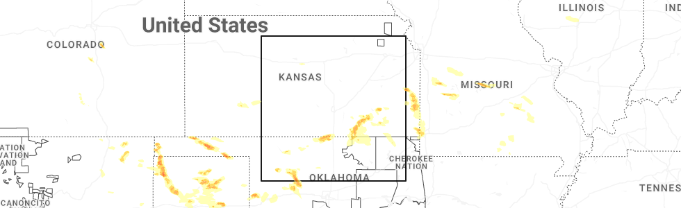
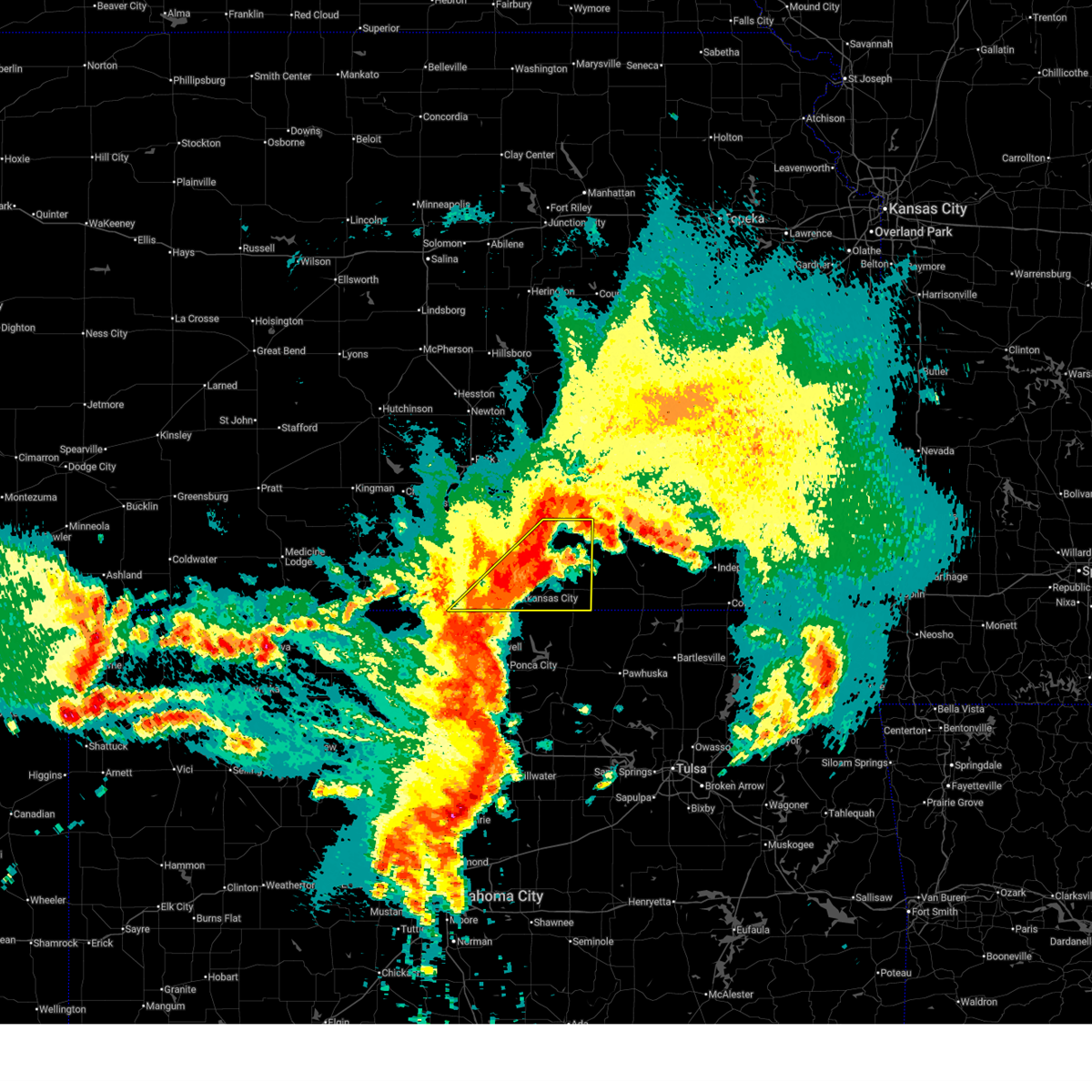
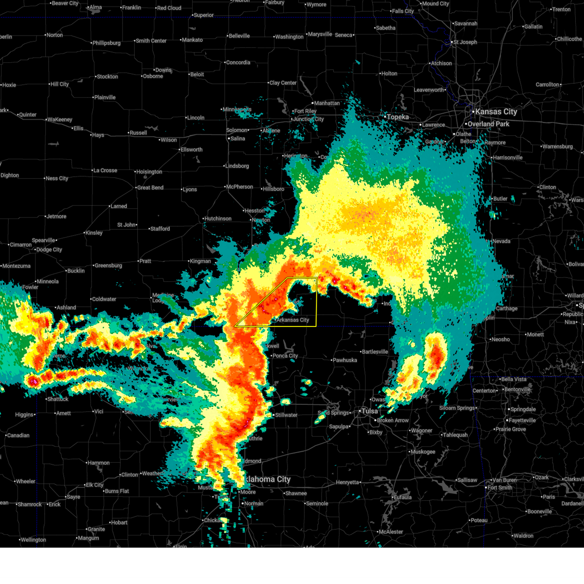
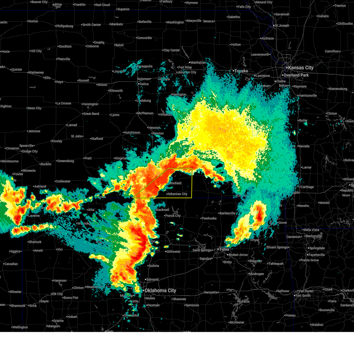
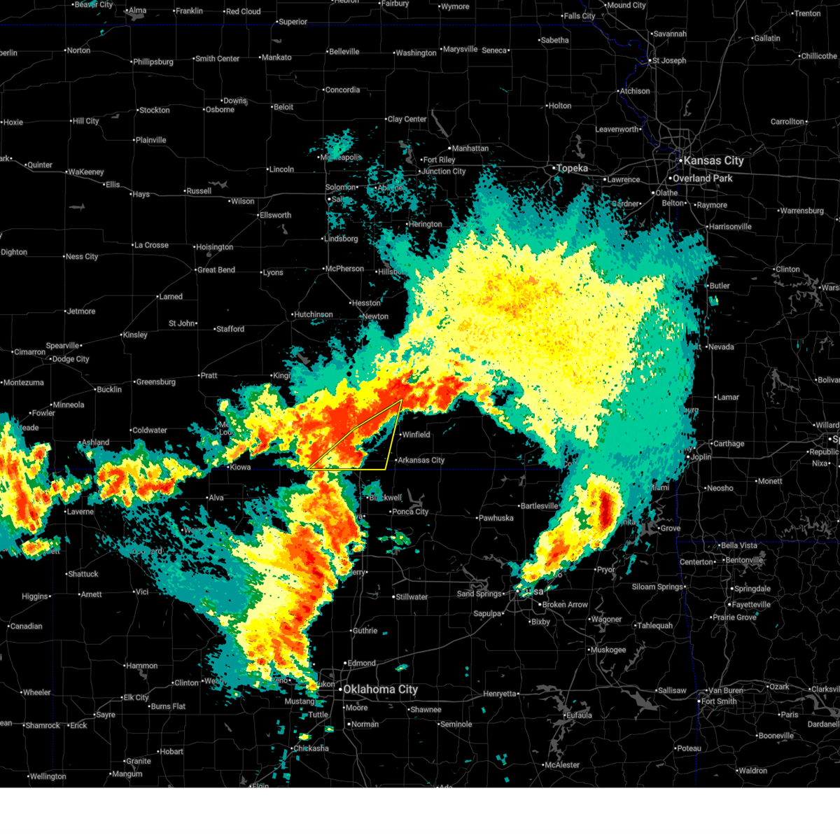
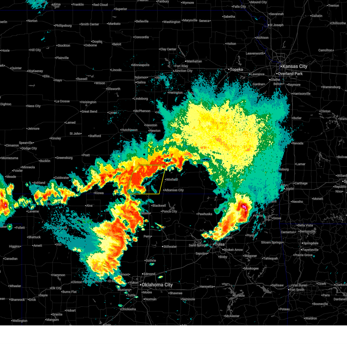
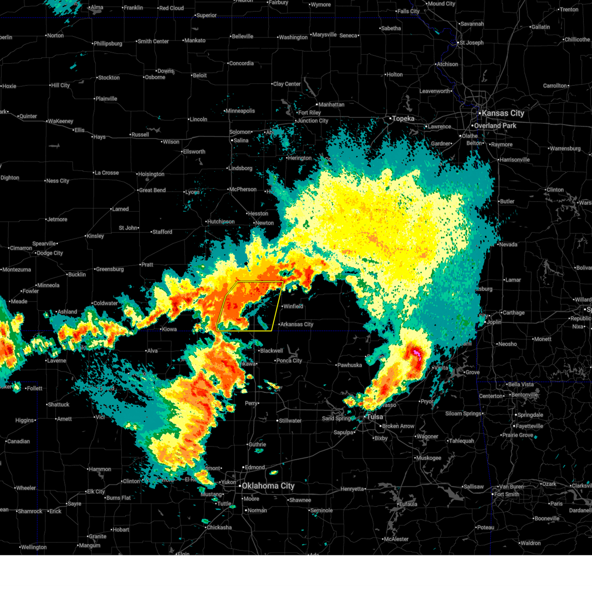
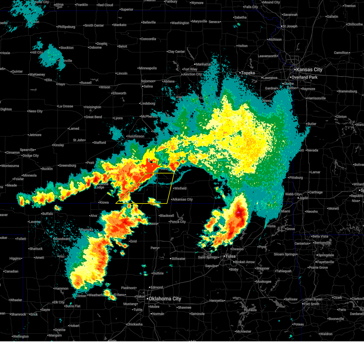
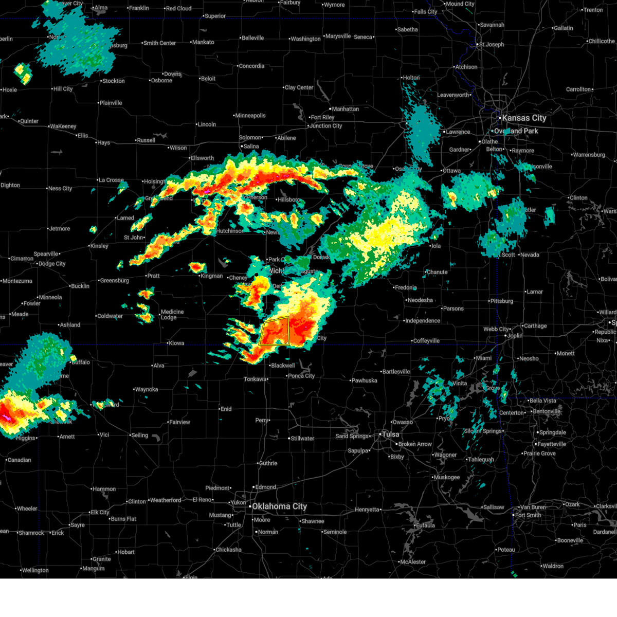
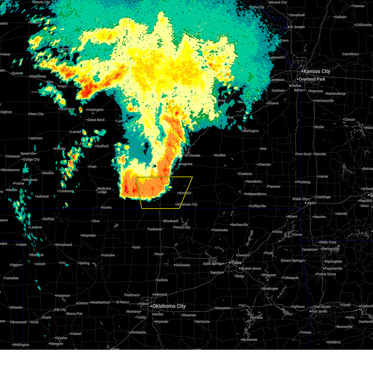
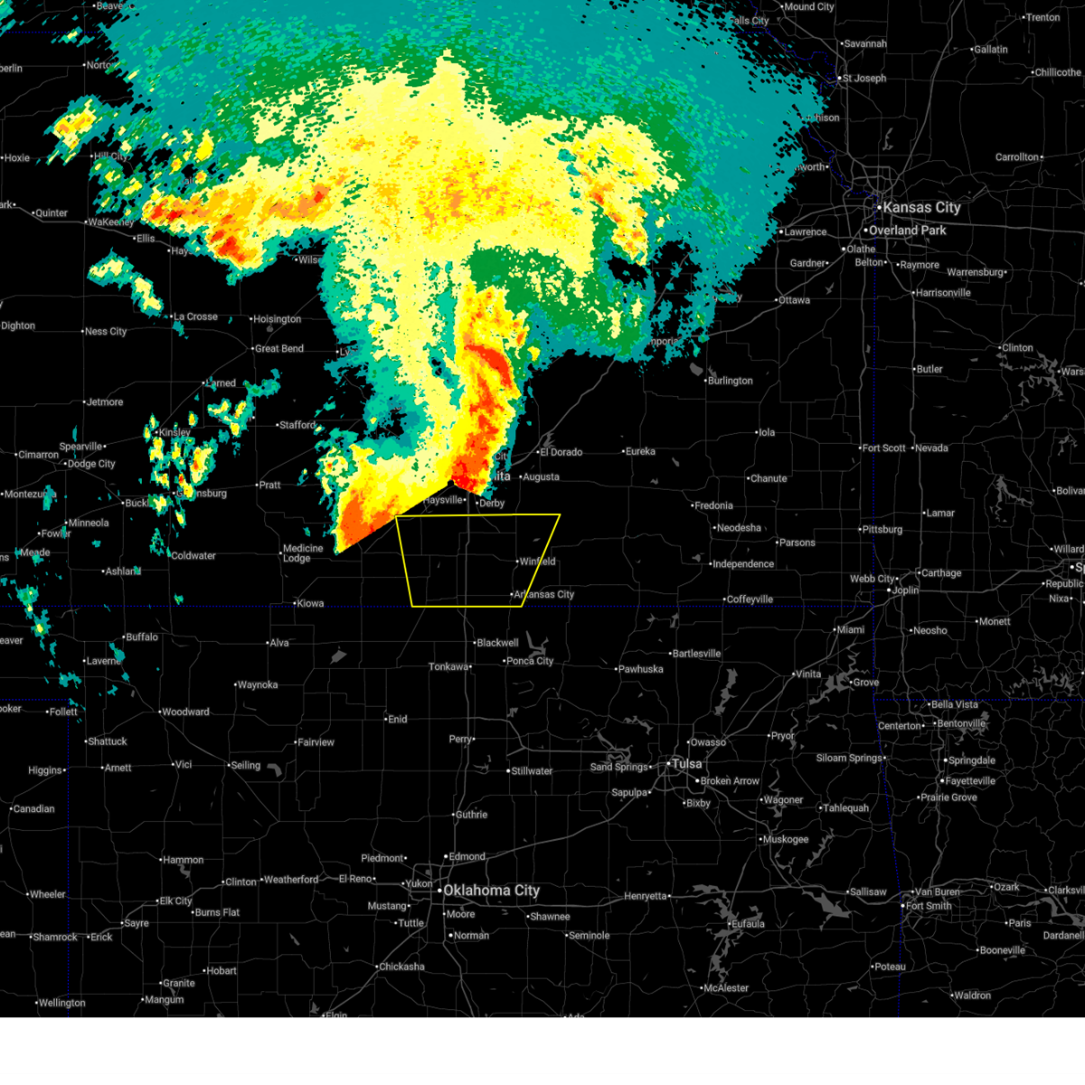
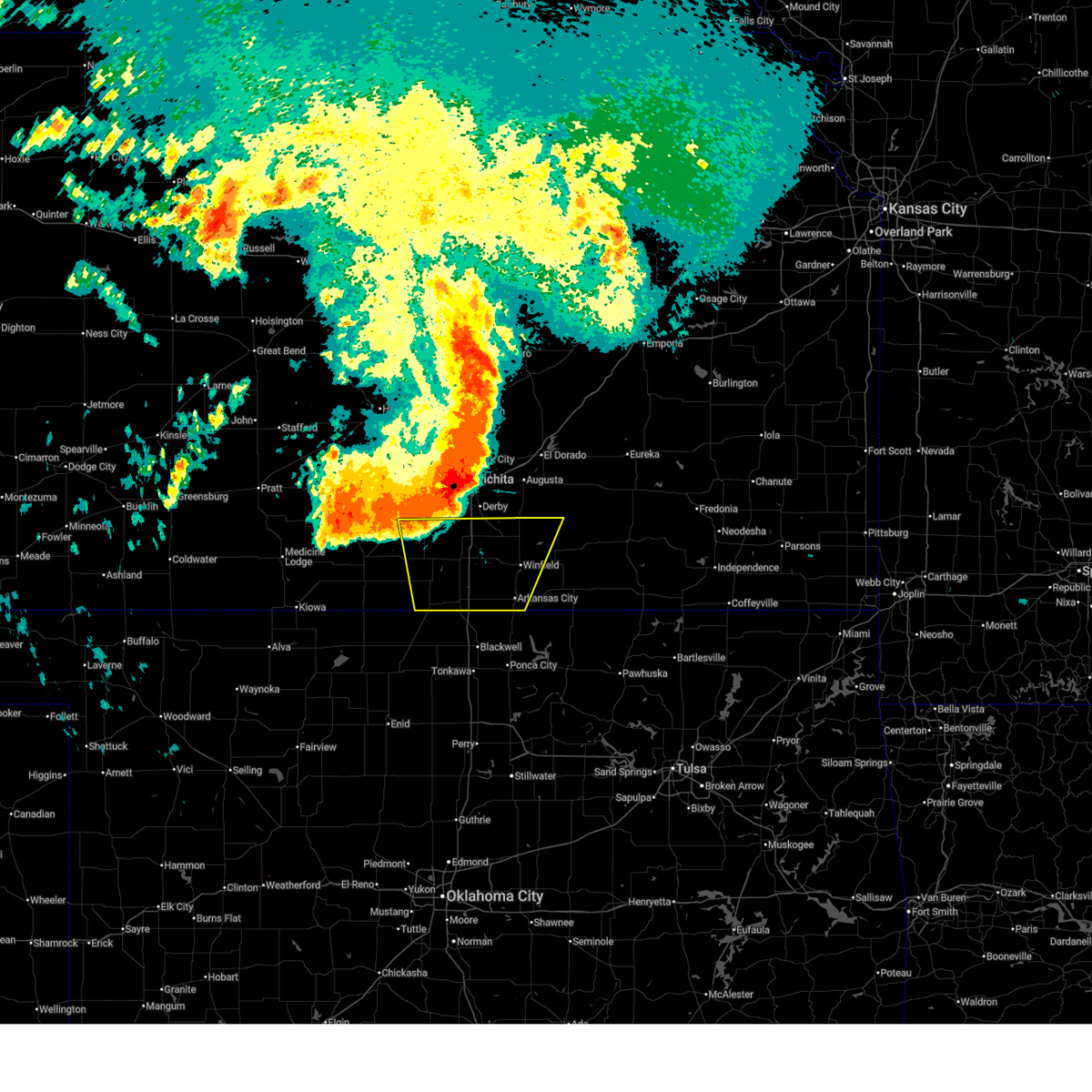
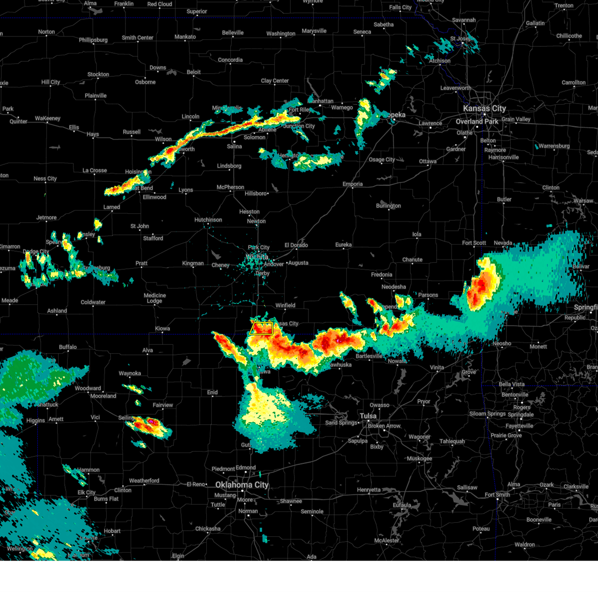
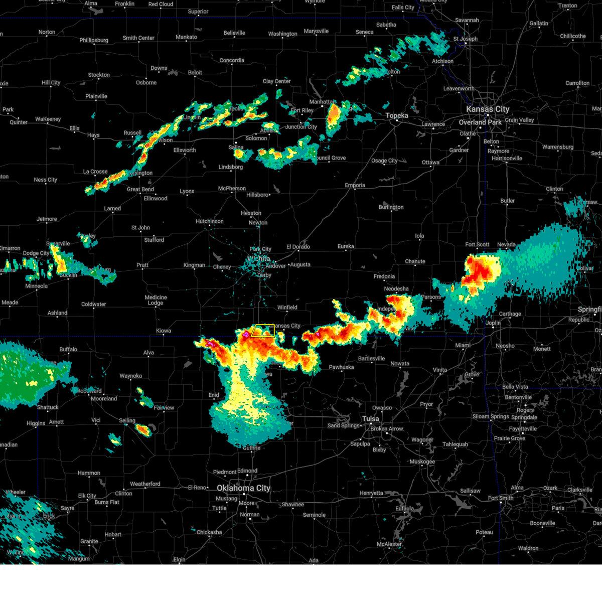
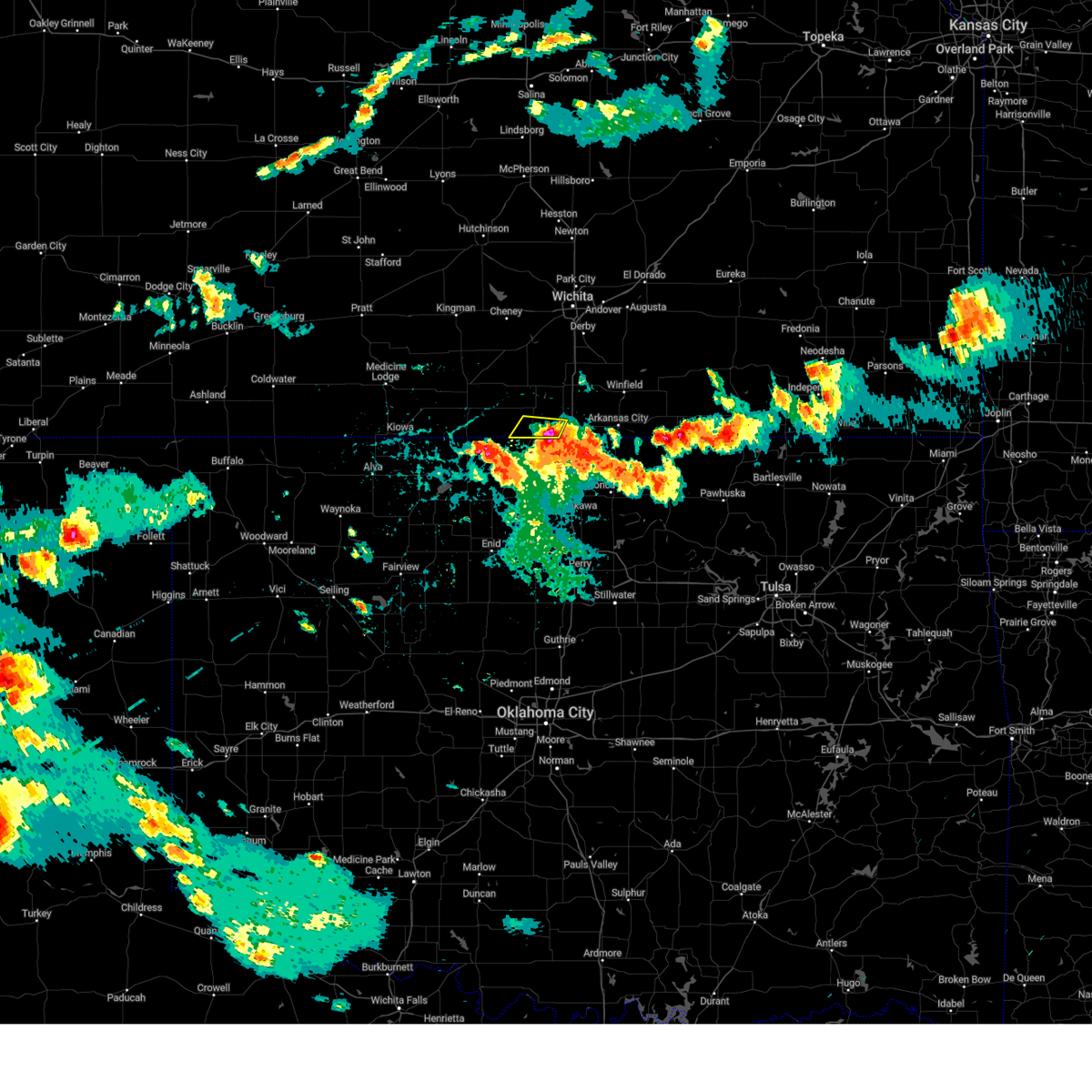
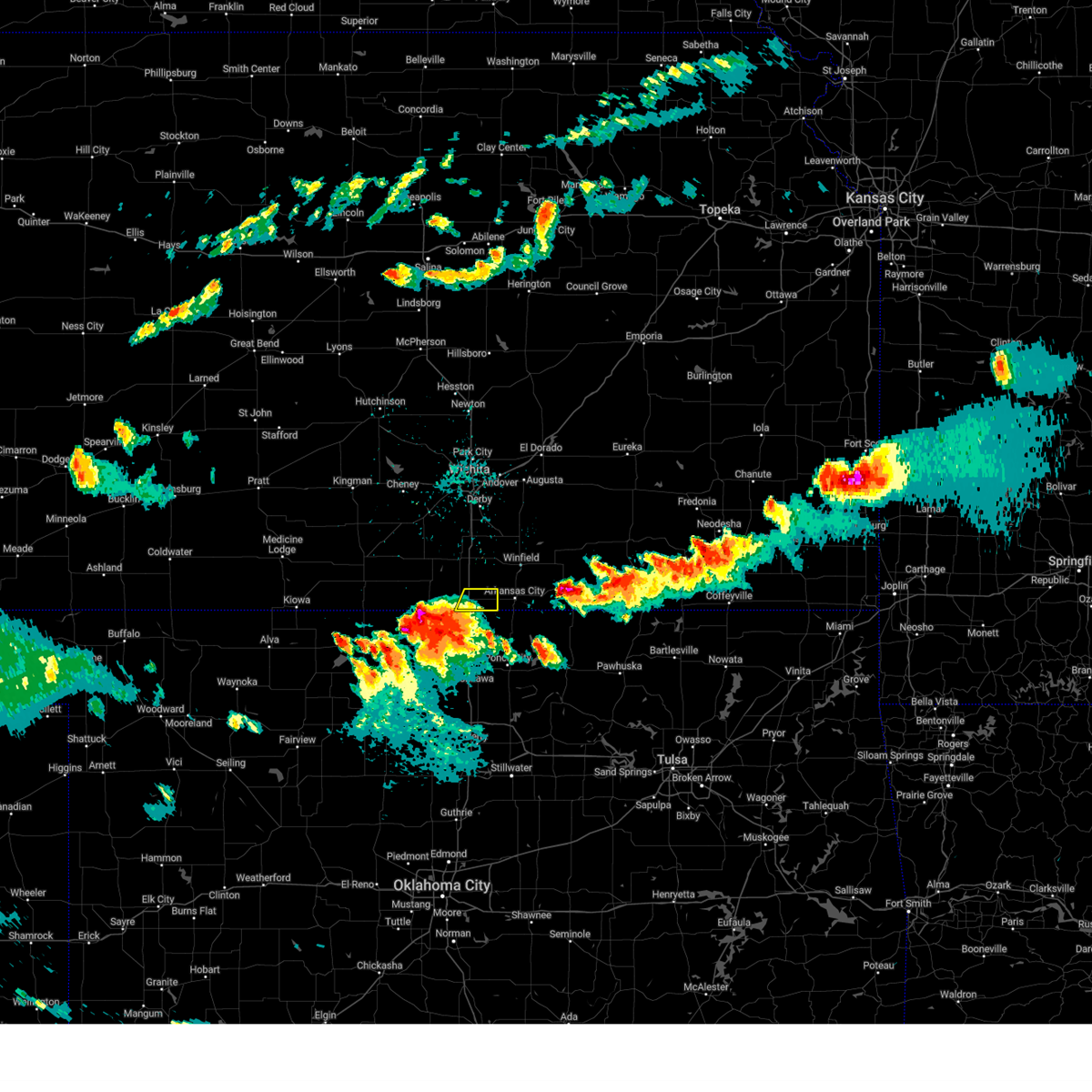
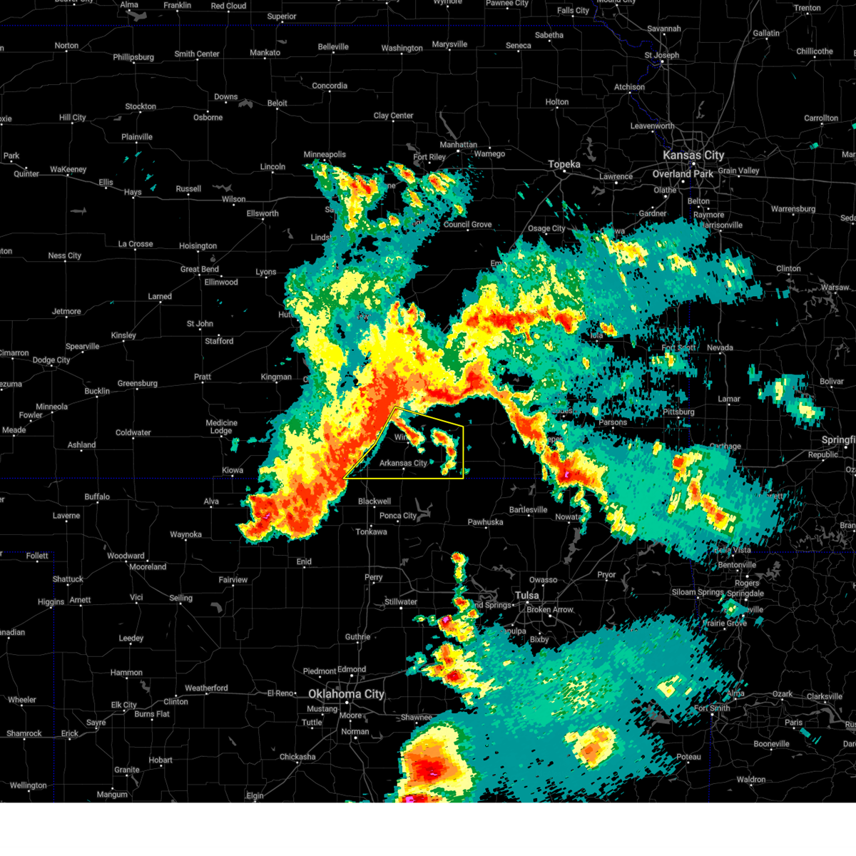
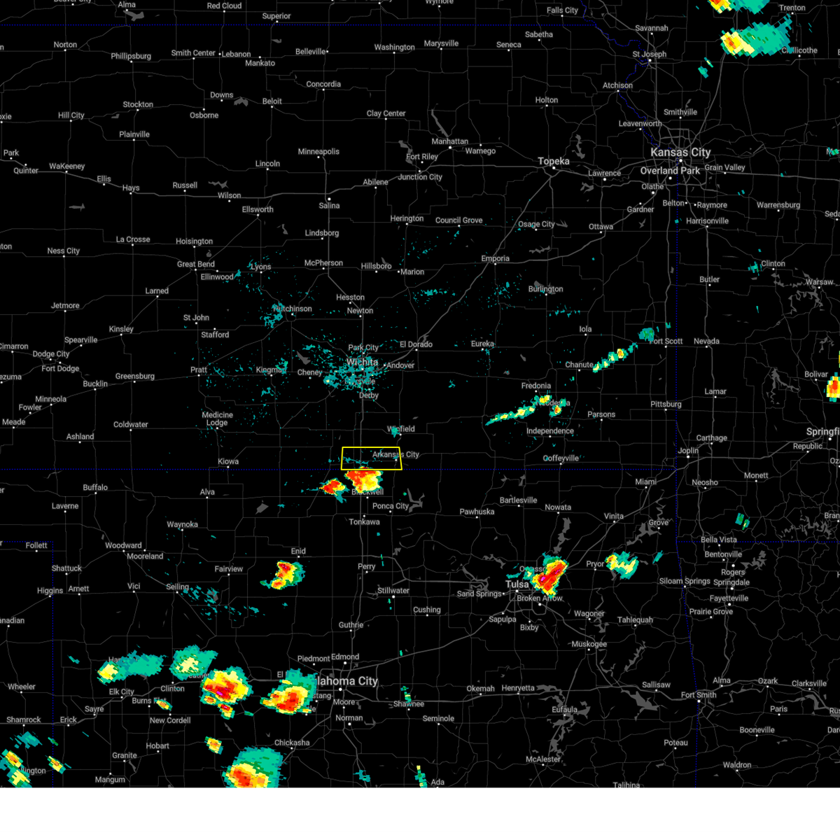
Hail Map for South Haven, KS
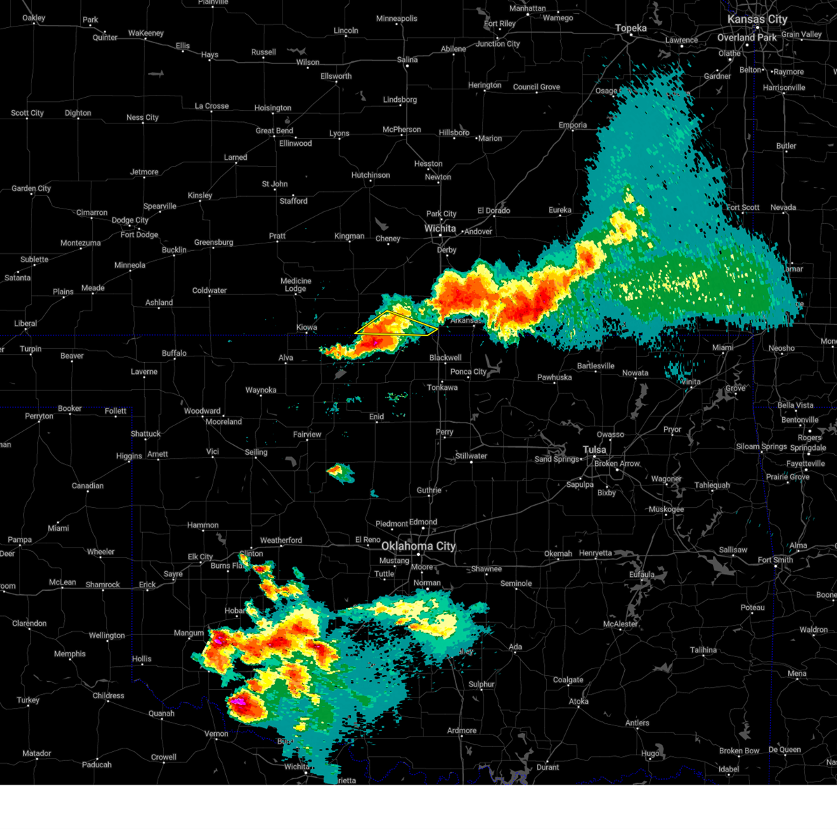
The South Haven, KS area has had 3 reports of on-the-ground hail by trained spotters, and has been under severe weather warnings 38 times during the past 12 months. Doppler radar has detected hail at or near South Haven, KS on 103 occasions, including 8 occasions during the past year.
| Name: | South Haven, KS |
| Where Located: | 43.9 miles S of Wichita, KS |
| Map: | Google Map for South Haven, KS |
| Population: | 363 |
| Housing Units: | 172 |
| More Info: | Search Google for South Haven, KS |
1
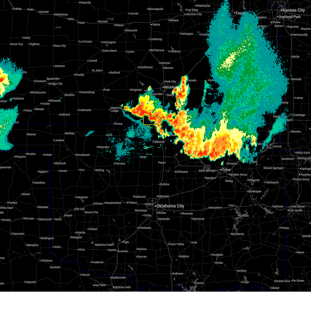
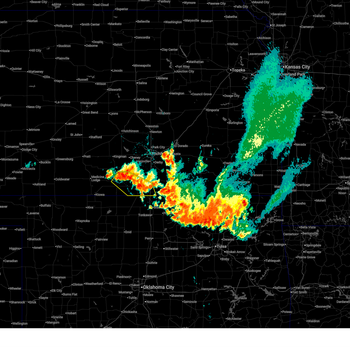
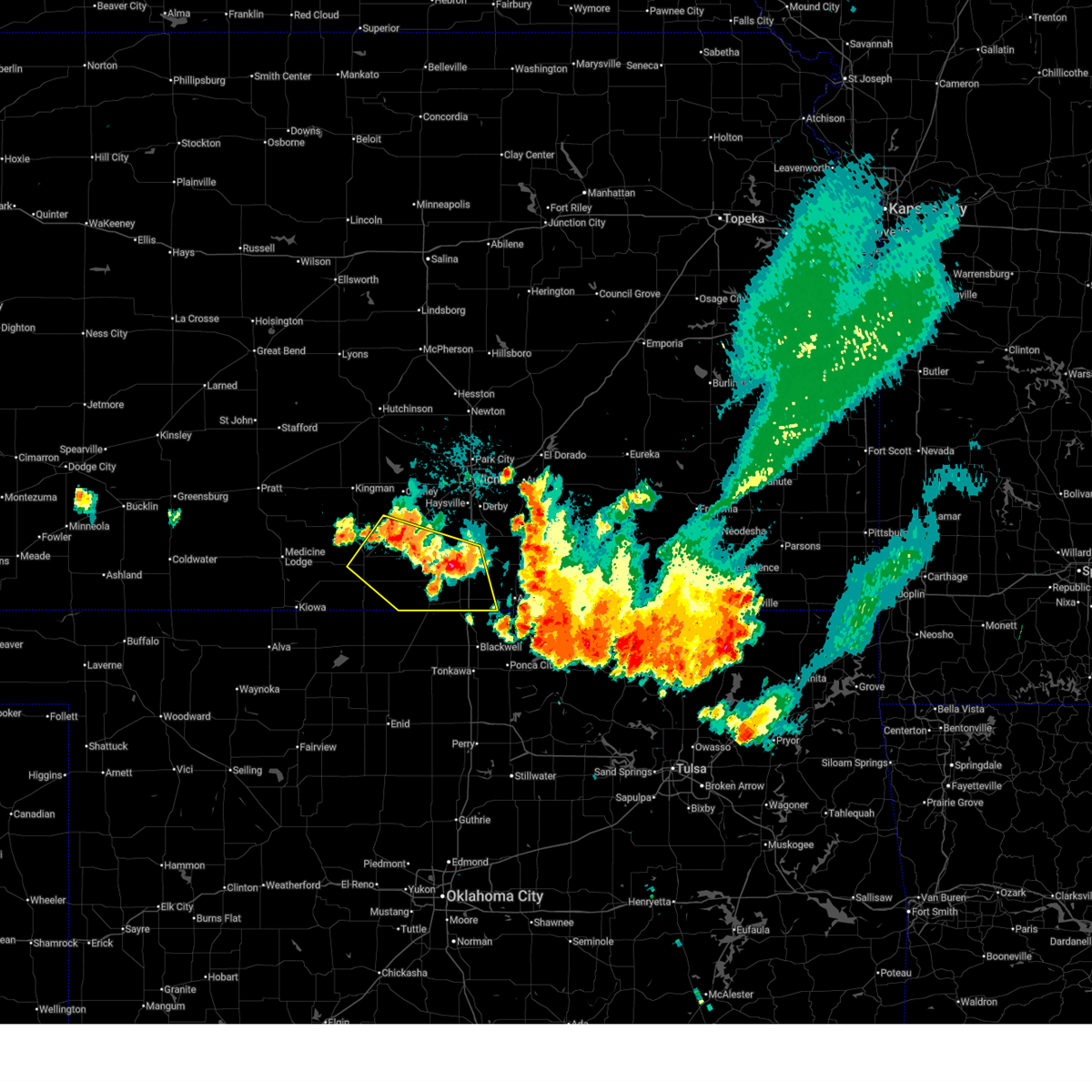
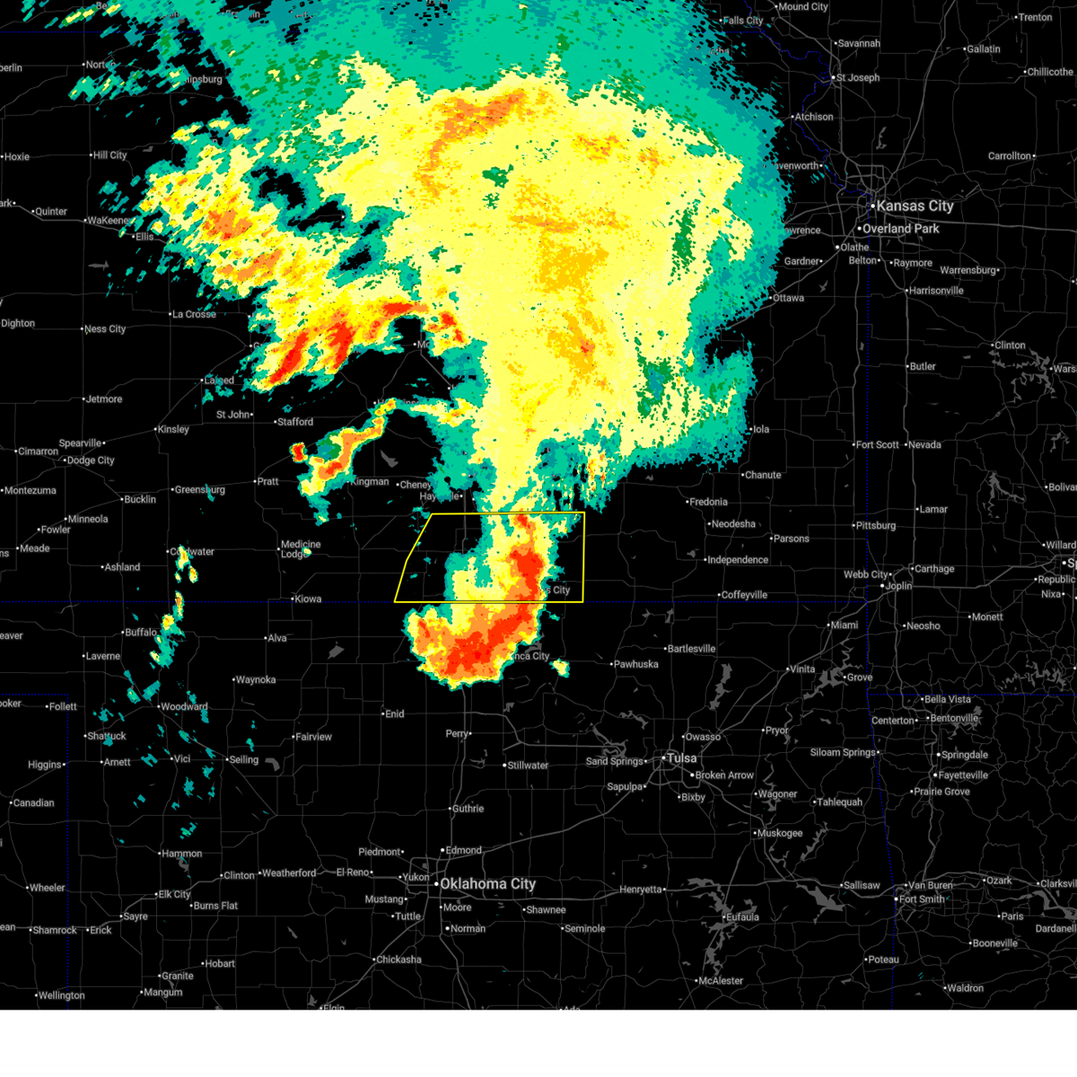
The Top Recent Hail Date for South Haven, KS is Sunday, June 8, 2025 (19th out of 103)
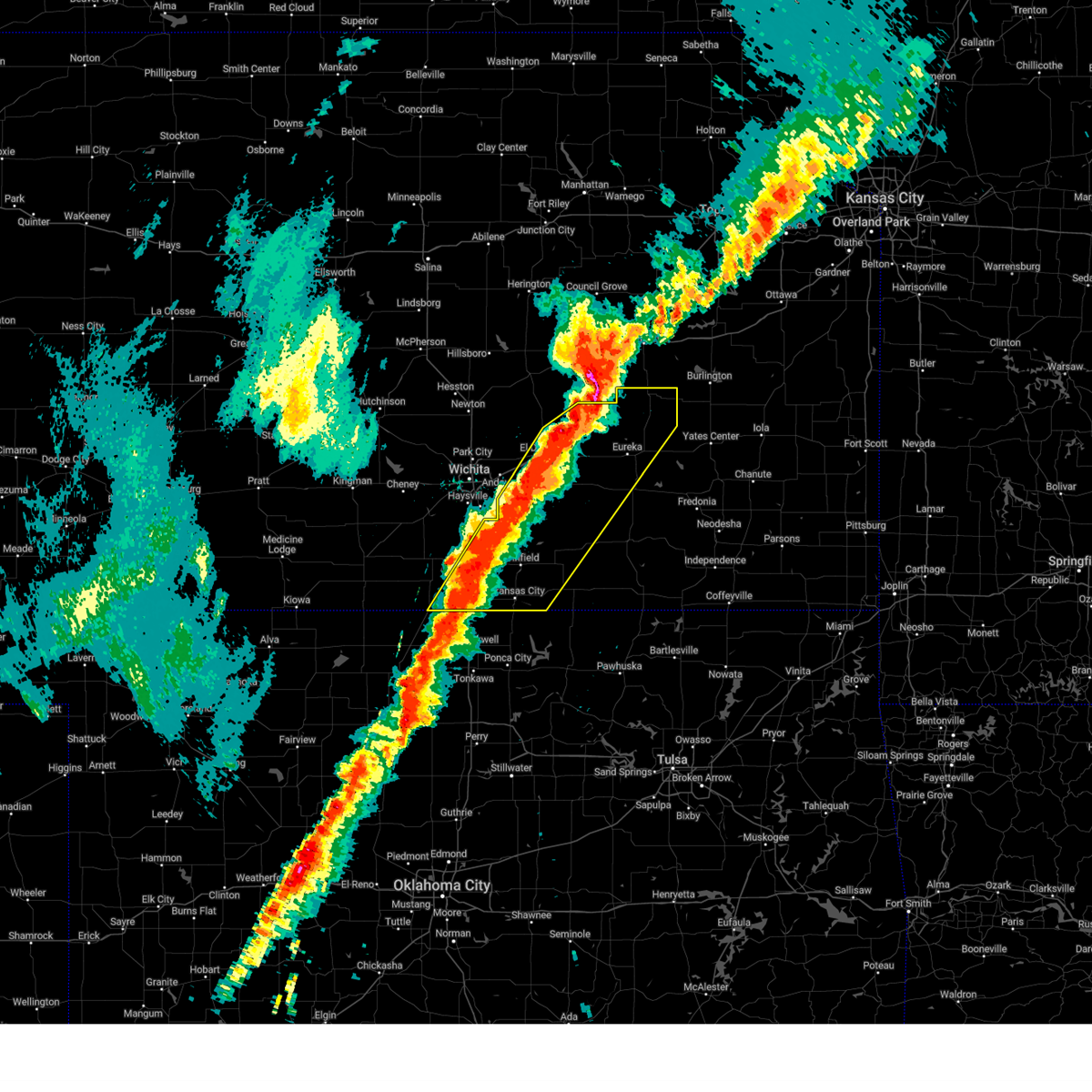
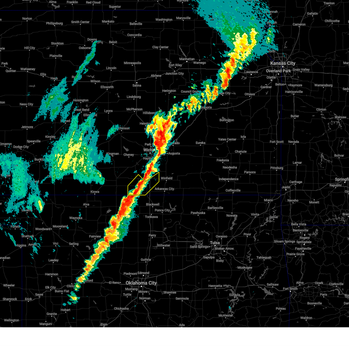
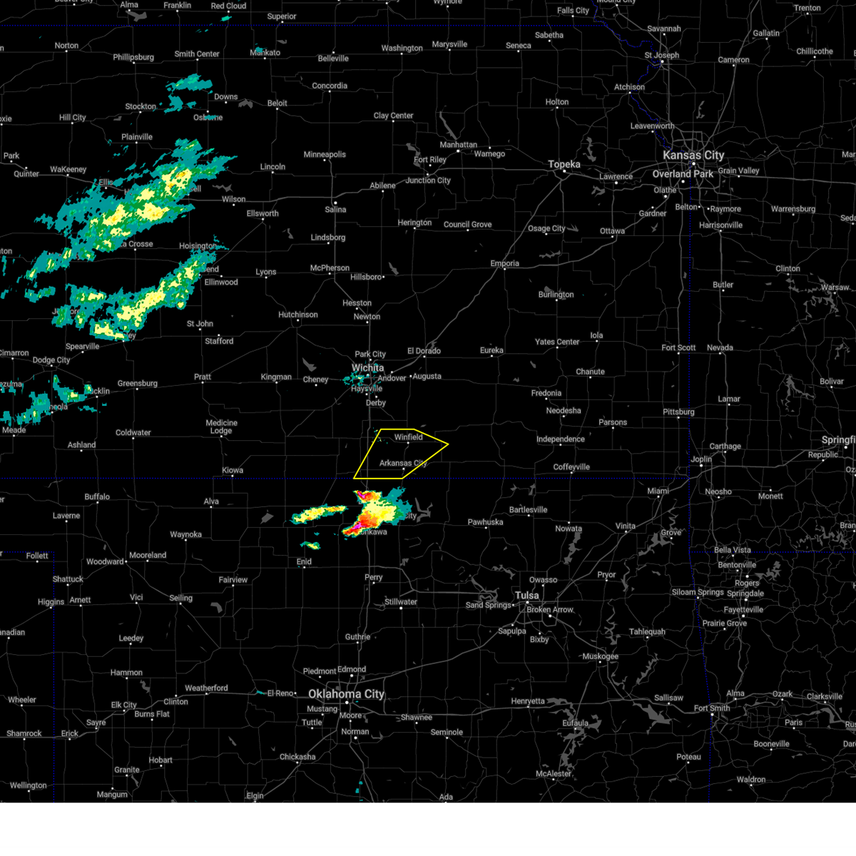
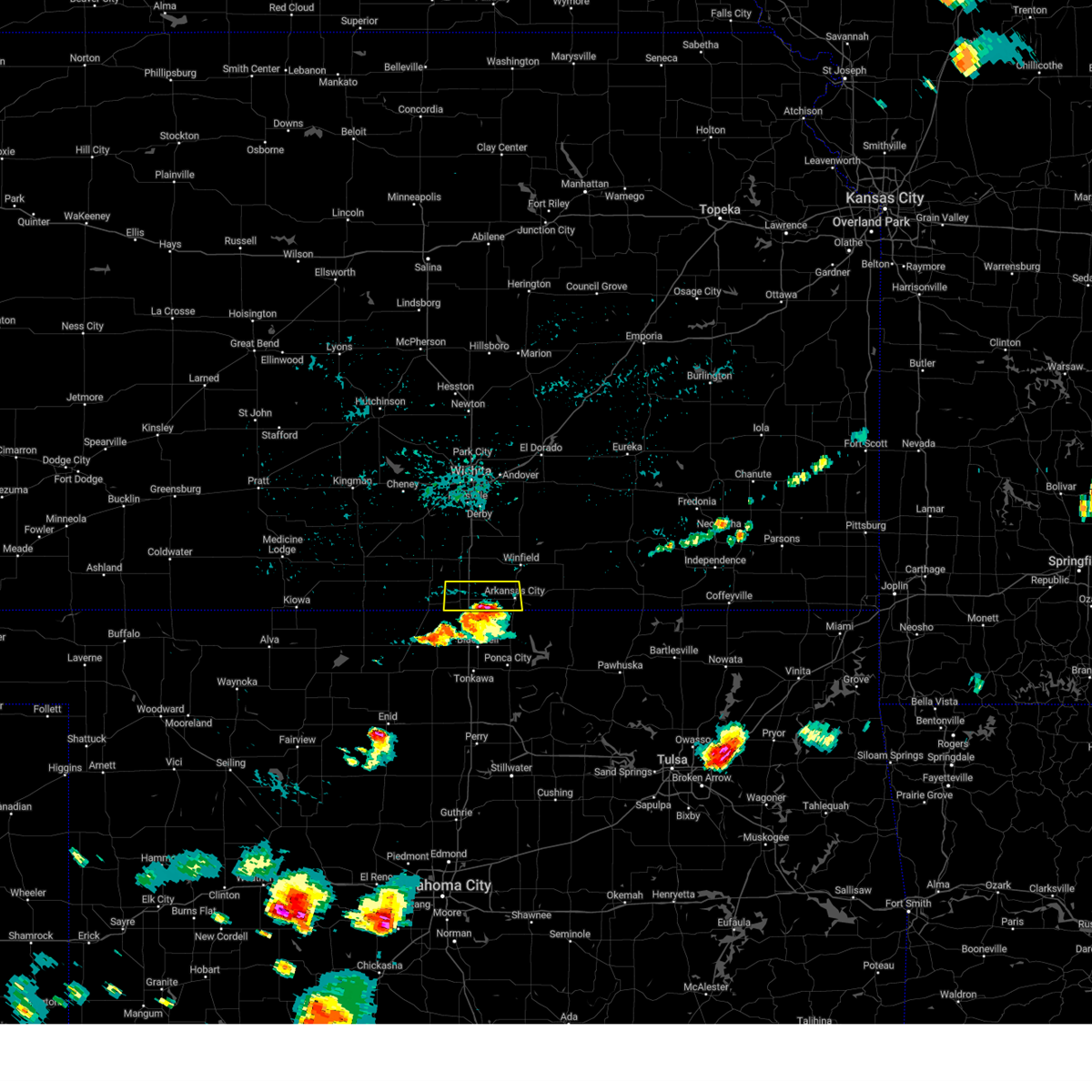
Hail and Wind Damage Spotted near South Haven, KS
| Date / Time | Report Details |
|---|---|
| 6/29/2025 10:59 PM CDT |
 Svrict the national weather service in wichita has issued a * severe thunderstorm warning for, southwestern sumner county in south central kansas, * until 1145 pm cdt. * at 1058 pm cdt, a severe thunderstorm was located near caldwell, moving south at 15 mph (radar indicated). Hazards include 60 mph wind gusts and penny size hail. expect damage to roofs, siding, and trees Svrict the national weather service in wichita has issued a * severe thunderstorm warning for, southwestern sumner county in south central kansas, * until 1145 pm cdt. * at 1058 pm cdt, a severe thunderstorm was located near caldwell, moving south at 15 mph (radar indicated). Hazards include 60 mph wind gusts and penny size hail. expect damage to roofs, siding, and trees
|
| 6/29/2025 10:28 PM CDT |
 At 1027 pm cdt, severe thunderstorms were located along a line extending from near harper to near south haven, moving south at 25 mph (radar indicated). Hazards include 60 mph wind gusts and quarter size hail. Hail damage to vehicles is expected. expect wind damage to roofs, siding, and trees. locations impacted include, anthony, harper, caldwell, argonia, south haven, mayfield, milan, hunnewell, bluff city, danville, freeport, perth, and runnymede. This includes interstate 35 between mile markers 1 and 15. At 1027 pm cdt, severe thunderstorms were located along a line extending from near harper to near south haven, moving south at 25 mph (radar indicated). Hazards include 60 mph wind gusts and quarter size hail. Hail damage to vehicles is expected. expect wind damage to roofs, siding, and trees. locations impacted include, anthony, harper, caldwell, argonia, south haven, mayfield, milan, hunnewell, bluff city, danville, freeport, perth, and runnymede. This includes interstate 35 between mile markers 1 and 15.
|
| 6/29/2025 10:28 PM CDT |
 the severe thunderstorm warning has been cancelled and is no longer in effect the severe thunderstorm warning has been cancelled and is no longer in effect
|
| 6/29/2025 10:02 PM CDT |
 Svrict the national weather service in wichita has issued a * severe thunderstorm warning for, eastern harper county in south central kansas, southeastern kingman county in south central kansas, sumner county in south central kansas, * until 1100 pm cdt. * at 1001 pm cdt, severe thunderstorms were located along a line extending from 5 miles southwest of norwich to 5 miles south of wellington, moving south at 15 mph (radar indicated). Hazards include 60 mph wind gusts and quarter size hail. Hail damage to vehicles is expected. Expect wind damage to roofs, siding, and trees. Svrict the national weather service in wichita has issued a * severe thunderstorm warning for, eastern harper county in south central kansas, southeastern kingman county in south central kansas, sumner county in south central kansas, * until 1100 pm cdt. * at 1001 pm cdt, severe thunderstorms were located along a line extending from 5 miles southwest of norwich to 5 miles south of wellington, moving south at 15 mph (radar indicated). Hazards include 60 mph wind gusts and quarter size hail. Hail damage to vehicles is expected. Expect wind damage to roofs, siding, and trees.
|
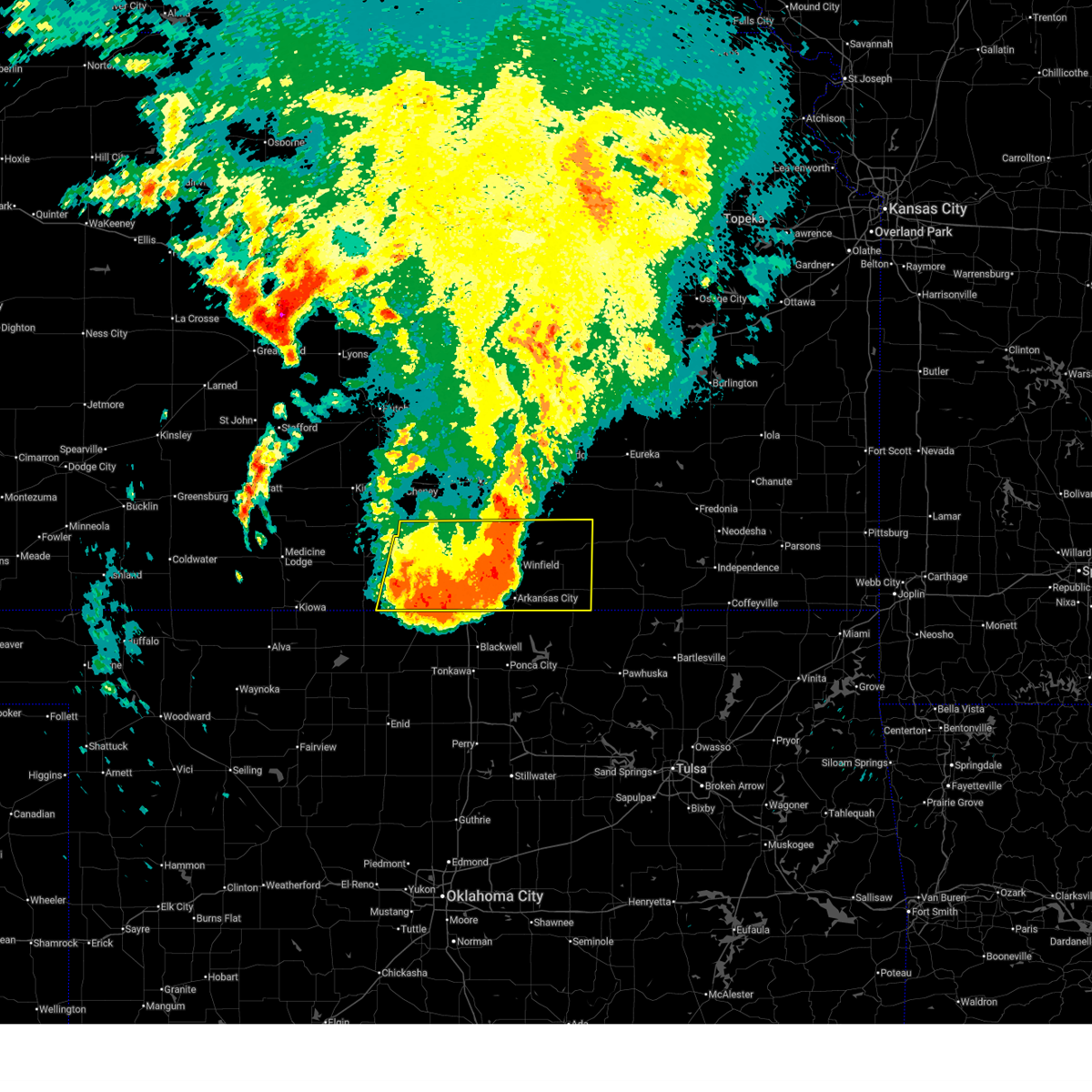
| 6/17/2025 10:55 PM CDT |
 At 1055 pm cdt, severe thunderstorms were located along a line extending from near atlanta to 6 miles southeast of caldwell, moving east at 50 mph (radar indicated. at 1051 pm, a 71 mph wind gust was reported at strother field airport). Hazards include 70 mph wind gusts. Expect considerable tree damage. damage is likely to mobile homes, roofs, and outbuildings. locations impacted include, arkansas city, winfield, burden, south haven, dexter, atlanta, geuda springs, cambridge, hunnewell, maple city, winfield city lake, and strother field airport. This includes interstate 35 between mile markers 1 and 7. At 1055 pm cdt, severe thunderstorms were located along a line extending from near atlanta to 6 miles southeast of caldwell, moving east at 50 mph (radar indicated. at 1051 pm, a 71 mph wind gust was reported at strother field airport). Hazards include 70 mph wind gusts. Expect considerable tree damage. damage is likely to mobile homes, roofs, and outbuildings. locations impacted include, arkansas city, winfield, burden, south haven, dexter, atlanta, geuda springs, cambridge, hunnewell, maple city, winfield city lake, and strother field airport. This includes interstate 35 between mile markers 1 and 7.
|
| 6/17/2025 10:52 PM CDT |
 At 1051 pm cdt, severe thunderstorms were located along a line extending from near atlanta to 6 miles southeast of caldwell, moving east at 50 mph (radar indicated. at 1049 pm, a 62 mph wind gust was reported at strother field airport). Hazards include 60 mph wind gusts. Expect damage to roofs, siding, and trees. locations impacted include, arkansas city, winfield, oxford, burden, south haven, dexter, atlanta, geuda springs, cambridge, hunnewell, maple city, winfield city lake, and strother field airport. This includes interstate 35 between mile markers 1 and 10. At 1051 pm cdt, severe thunderstorms were located along a line extending from near atlanta to 6 miles southeast of caldwell, moving east at 50 mph (radar indicated. at 1049 pm, a 62 mph wind gust was reported at strother field airport). Hazards include 60 mph wind gusts. Expect damage to roofs, siding, and trees. locations impacted include, arkansas city, winfield, oxford, burden, south haven, dexter, atlanta, geuda springs, cambridge, hunnewell, maple city, winfield city lake, and strother field airport. This includes interstate 35 between mile markers 1 and 10.
|
| 6/17/2025 10:43 PM CDT |
 Svrict the national weather service in wichita has issued a * severe thunderstorm warning for, cowley county in south central kansas, southeastern sumner county in south central kansas, * until 1130 pm cdt. * at 1043 pm cdt, severe thunderstorms were located along a line extending from 6 miles southeast of douglass to near caldwell, moving east at 50 mph (radar indicated). Hazards include 60 mph wind gusts. expect damage to roofs, siding, and trees Svrict the national weather service in wichita has issued a * severe thunderstorm warning for, cowley county in south central kansas, southeastern sumner county in south central kansas, * until 1130 pm cdt. * at 1043 pm cdt, severe thunderstorms were located along a line extending from 6 miles southeast of douglass to near caldwell, moving east at 50 mph (radar indicated). Hazards include 60 mph wind gusts. expect damage to roofs, siding, and trees
|
| 6/17/2025 10:33 PM CDT |
 At 1033 pm cdt, severe thunderstorms were located along a line extending from 7 miles east of udall to near oxford to near south haven, moving east at 35 mph (radar indicated). Hazards include 60 mph wind gusts. Expect damage to roofs, siding, and trees. locations impacted include, wellington, caldwell, oxford, udall, south haven, geuda springs, rock, hunnewell, and perth. This includes interstate 35 between mile markers 1 and 21. At 1033 pm cdt, severe thunderstorms were located along a line extending from 7 miles east of udall to near oxford to near south haven, moving east at 35 mph (radar indicated). Hazards include 60 mph wind gusts. Expect damage to roofs, siding, and trees. locations impacted include, wellington, caldwell, oxford, udall, south haven, geuda springs, rock, hunnewell, and perth. This includes interstate 35 between mile markers 1 and 21.
|
| 6/17/2025 10:23 PM CDT |
 At 1022 pm cdt, severe thunderstorms were located along a line extending from near udall to 6 miles southwest of oxford to 5 miles northeast of caldwell, moving east at 40 mph (radar indicated). Hazards include 60 mph wind gusts. Expect damage to roofs, siding, and trees. locations impacted include, wellington, mulvane, belle plaine, conway springs, caldwell, oxford, udall, south haven, geuda springs, rock, mayfield, milan, hunnewell, perth, riverdale, and wellington airport. This includes interstate 35 between mile markers 1 and 33. At 1022 pm cdt, severe thunderstorms were located along a line extending from near udall to 6 miles southwest of oxford to 5 miles northeast of caldwell, moving east at 40 mph (radar indicated). Hazards include 60 mph wind gusts. Expect damage to roofs, siding, and trees. locations impacted include, wellington, mulvane, belle plaine, conway springs, caldwell, oxford, udall, south haven, geuda springs, rock, mayfield, milan, hunnewell, perth, riverdale, and wellington airport. This includes interstate 35 between mile markers 1 and 33.
|
| 6/17/2025 10:23 PM CDT |
 the severe thunderstorm warning has been cancelled and is no longer in effect the severe thunderstorm warning has been cancelled and is no longer in effect
|
| 6/17/2025 9:57 PM CDT |
 Svrict the national weather service in wichita has issued a * severe thunderstorm warning for, western cowley county in south central kansas, southeastern harper county in south central kansas, sumner county in south central kansas, * until 1045 pm cdt. * at 957 pm cdt, severe thunderstorms were located along a line extending from near mulvane to 6 miles west of wellington to 9 miles south of argonia, moving east at 35 mph (public. at 948 pm, 60 mph wind gusts were reported 5 miles ssw of conway springs). Hazards include 60 mph wind gusts. expect damage to roofs, siding, and trees Svrict the national weather service in wichita has issued a * severe thunderstorm warning for, western cowley county in south central kansas, southeastern harper county in south central kansas, sumner county in south central kansas, * until 1045 pm cdt. * at 957 pm cdt, severe thunderstorms were located along a line extending from near mulvane to 6 miles west of wellington to 9 miles south of argonia, moving east at 35 mph (public. at 948 pm, 60 mph wind gusts were reported 5 miles ssw of conway springs). Hazards include 60 mph wind gusts. expect damage to roofs, siding, and trees
|
| 6/17/2025 7:24 PM CDT |
 Svrict the national weather service in wichita has issued a * severe thunderstorm warning for, southwestern cowley county in south central kansas, southeastern sumner county in south central kansas, * until 800 pm cdt. * at 723 pm cdt, a severe thunderstorm was located 7 miles southwest of geuda springs, or 12 miles west of arkansas city, moving east at 30 mph (radar indicated). Hazards include 60 mph wind gusts and half dollar size hail. Hail damage to vehicles is expected. Expect wind damage to roofs, siding, and trees. Svrict the national weather service in wichita has issued a * severe thunderstorm warning for, southwestern cowley county in south central kansas, southeastern sumner county in south central kansas, * until 800 pm cdt. * at 723 pm cdt, a severe thunderstorm was located 7 miles southwest of geuda springs, or 12 miles west of arkansas city, moving east at 30 mph (radar indicated). Hazards include 60 mph wind gusts and half dollar size hail. Hail damage to vehicles is expected. Expect wind damage to roofs, siding, and trees.
|
| 6/17/2025 6:24 PM CDT | Svrict the national weather service in wichita has issued a * severe thunderstorm warning for, western cowley county in south central kansas, eastern sumner county in south central kansas, * until 715 pm cdt. * at 624 pm cdt, a severe thunderstorm was located over oxford, moving east at 35 mph (radar indicated). Hazards include two inch hail and 60 mph wind gusts. People and animals outdoors will be injured. expect hail damage to roofs, siding, windows, and vehicles. Expect wind damage to roofs, siding, and trees. |
| 6/17/2025 6:09 AM CDT |
 The storms which prompted the warning have weakened below severe limits, and no longer pose an immediate threat to life or property. therefore, the warning will be allowed to expire. however, gusty winds are still possible with these thunderstorms. a severe thunderstorm watch remains in effect until 700 am cdt for south central kansas. remember, a severe thunderstorm warning still remains in effect for southern cowley county until 630 am. The storms which prompted the warning have weakened below severe limits, and no longer pose an immediate threat to life or property. therefore, the warning will be allowed to expire. however, gusty winds are still possible with these thunderstorms. a severe thunderstorm watch remains in effect until 700 am cdt for south central kansas. remember, a severe thunderstorm warning still remains in effect for southern cowley county until 630 am.
|
| 6/17/2025 5:49 AM CDT |
 the severe thunderstorm warning has been cancelled and is no longer in effect the severe thunderstorm warning has been cancelled and is no longer in effect
|
| 6/17/2025 5:49 AM CDT |
 At 549 am cdt, severe thunderstorms were located along a line extending from 5 miles east of winfield to newkirk to near renfrow, moving southeast at 45 mph (trained weather spotters). Hazards include 70 mph wind gusts. Expect considerable tree damage. damage is likely to mobile homes, roofs, and outbuildings. locations impacted include, arkansas city, winfield, wellington, mulvane, belle plaine, caldwell, oxford, udall, burden, south haven, dexter, atlanta, geuda springs, rock, mayfield, cambridge, milan, hunnewell, perth, and maple city. This includes interstate 35 between mile markers 1 and 33. At 549 am cdt, severe thunderstorms were located along a line extending from 5 miles east of winfield to newkirk to near renfrow, moving southeast at 45 mph (trained weather spotters). Hazards include 70 mph wind gusts. Expect considerable tree damage. damage is likely to mobile homes, roofs, and outbuildings. locations impacted include, arkansas city, winfield, wellington, mulvane, belle plaine, caldwell, oxford, udall, burden, south haven, dexter, atlanta, geuda springs, rock, mayfield, cambridge, milan, hunnewell, perth, and maple city. This includes interstate 35 between mile markers 1 and 33.
|
| 6/17/2025 5:27 AM CDT |
 Svrict the national weather service in wichita has issued a * severe thunderstorm warning for, cowley county in south central kansas, eastern harper county in south central kansas, sumner county in south central kansas, * until 615 am cdt. * at 526 am cdt, severe thunderstorms were located along a line extending from 5 miles south of douglass to near geuda springs to 11 miles west of caldwell, moving southeast at 40 mph (trained weather spotters). Hazards include 60 mph wind gusts. expect damage to roofs, siding, and trees Svrict the national weather service in wichita has issued a * severe thunderstorm warning for, cowley county in south central kansas, eastern harper county in south central kansas, sumner county in south central kansas, * until 615 am cdt. * at 526 am cdt, severe thunderstorms were located along a line extending from 5 miles south of douglass to near geuda springs to 11 miles west of caldwell, moving southeast at 40 mph (trained weather spotters). Hazards include 60 mph wind gusts. expect damage to roofs, siding, and trees
|
| 6/17/2025 5:05 AM CDT |
 At 505 am cdt, a severe thunderstorm was located 6 miles southeast of wellington, moving southeast at 35 mph (trained weather spotters). Hazards include 70 mph wind gusts. Expect considerable tree damage. damage is likely to mobile homes, roofs, and outbuildings. locations impacted include, arkansas city, winfield, wellington, mulvane, belle plaine, conway springs, caldwell, oxford, udall, argonia, south haven, atlanta, geuda springs, viola, rock, mayfield, milan, hunnewell, perth, and winfield city lake. This includes interstate 35 between mile markers 1 and 33. At 505 am cdt, a severe thunderstorm was located 6 miles southeast of wellington, moving southeast at 35 mph (trained weather spotters). Hazards include 70 mph wind gusts. Expect considerable tree damage. damage is likely to mobile homes, roofs, and outbuildings. locations impacted include, arkansas city, winfield, wellington, mulvane, belle plaine, conway springs, caldwell, oxford, udall, argonia, south haven, atlanta, geuda springs, viola, rock, mayfield, milan, hunnewell, perth, and winfield city lake. This includes interstate 35 between mile markers 1 and 33.
|
| 6/17/2025 4:49 AM CDT |
 At 449 am cdt, a severe thunderstorm was located near wellington, moving south at 40 mph. this is a destructive storm for wellington, winfield, and arkansas city (trained weather spotters). Hazards include 90 mph wind gusts. You are in a life-threatening situation. flying debris may be deadly to those caught without shelter. mobile homes will be heavily damaged or destroyed. homes and businesses will have substantial roof and window damage. expect extensive tree damage and power outages. locations impacted include, arkansas city, winfield, wellington, mulvane, belle plaine, conway springs, caldwell, oxford, udall, argonia, south haven, atlanta, geuda springs, viola, rock, mayfield, milan, hunnewell, perth, and winfield city lake. This includes interstate 35 between mile markers 1 and 33. At 449 am cdt, a severe thunderstorm was located near wellington, moving south at 40 mph. this is a destructive storm for wellington, winfield, and arkansas city (trained weather spotters). Hazards include 90 mph wind gusts. You are in a life-threatening situation. flying debris may be deadly to those caught without shelter. mobile homes will be heavily damaged or destroyed. homes and businesses will have substantial roof and window damage. expect extensive tree damage and power outages. locations impacted include, arkansas city, winfield, wellington, mulvane, belle plaine, conway springs, caldwell, oxford, udall, argonia, south haven, atlanta, geuda springs, viola, rock, mayfield, milan, hunnewell, perth, and winfield city lake. This includes interstate 35 between mile markers 1 and 33.
|
| 6/17/2025 4:31 AM CDT |
 Svrict the national weather service in wichita has issued a * severe thunderstorm warning for, western cowley county in south central kansas, southern sedgwick county in south central kansas, southwestern butler county in south central kansas, sumner county in south central kansas, * until 530 am cdt. * at 431 am cdt, a severe thunderstorm was located near clearwater, moving southeast at 35 mph. this is a destructive storm for winfield, arkansas city, and conway springs (trained weather spotters). Hazards include 90 mph wind gusts. You are in a life-threatening situation. flying debris may be deadly to those caught without shelter. mobile homes will be heavily damaged or destroyed. homes and businesses will have substantial roof and window damage. Expect extensive tree damage and power outages. Svrict the national weather service in wichita has issued a * severe thunderstorm warning for, western cowley county in south central kansas, southern sedgwick county in south central kansas, southwestern butler county in south central kansas, sumner county in south central kansas, * until 530 am cdt. * at 431 am cdt, a severe thunderstorm was located near clearwater, moving southeast at 35 mph. this is a destructive storm for winfield, arkansas city, and conway springs (trained weather spotters). Hazards include 90 mph wind gusts. You are in a life-threatening situation. flying debris may be deadly to those caught without shelter. mobile homes will be heavily damaged or destroyed. homes and businesses will have substantial roof and window damage. Expect extensive tree damage and power outages.
|
| 6/8/2025 4:39 PM CDT |
 the severe thunderstorm warning has been cancelled and is no longer in effect the severe thunderstorm warning has been cancelled and is no longer in effect
|
| 6/8/2025 4:27 PM CDT | The storm which prompted the warning has moved out of the area. therefore, the warning will be allowed to expire. however, small hail, gusty winds and heavy rain are still possible with this thunderstorm. a severe thunderstorm watch remains in effect until 1000 pm cdt for south central kansas. |
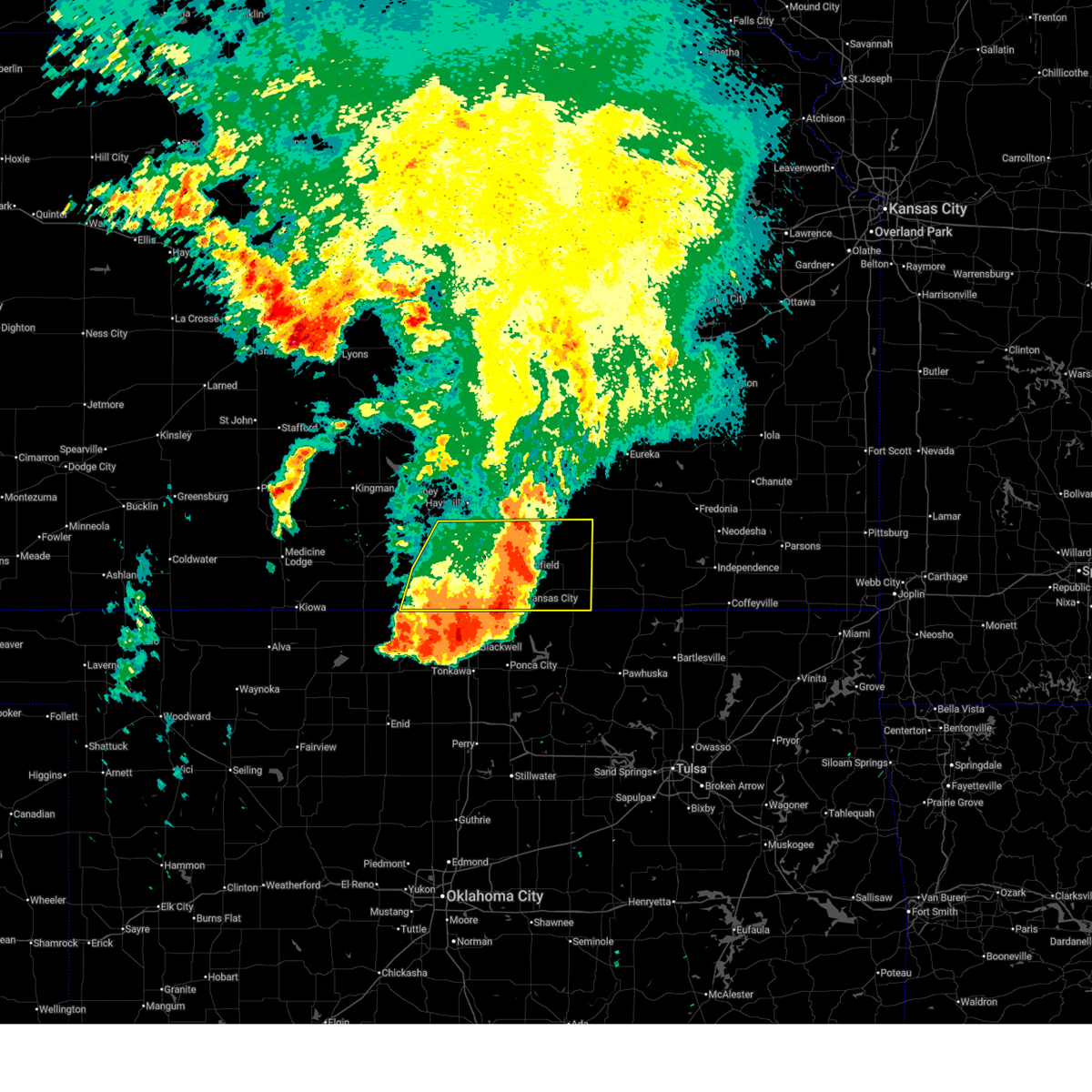
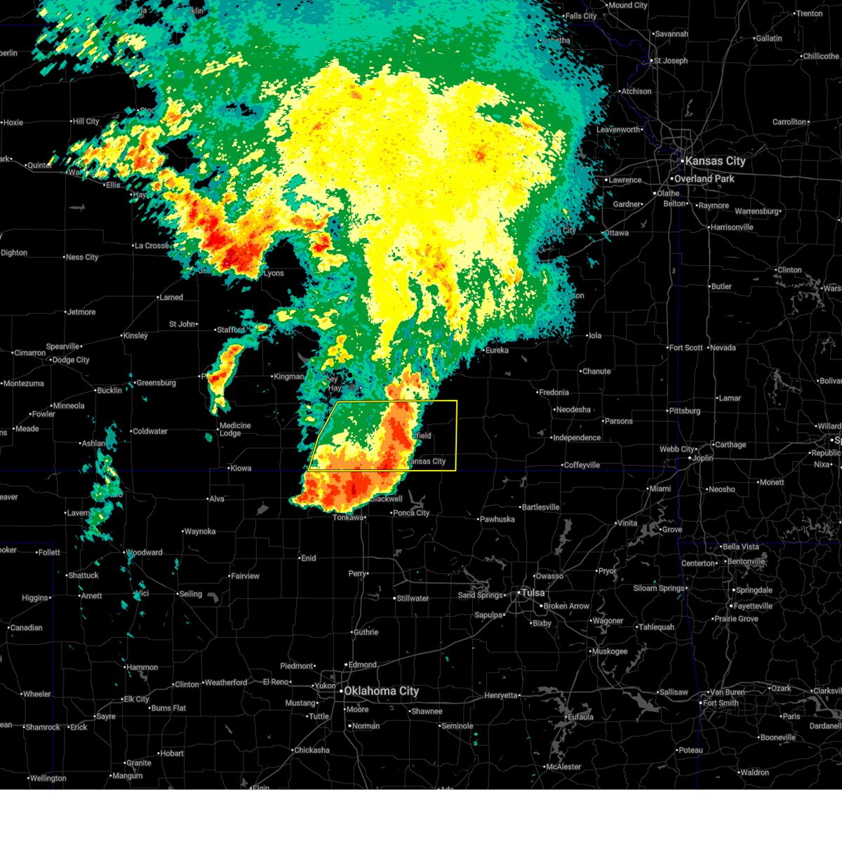
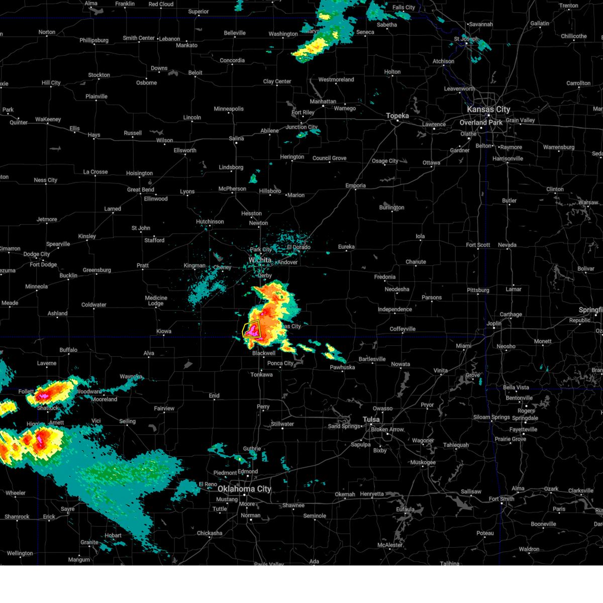
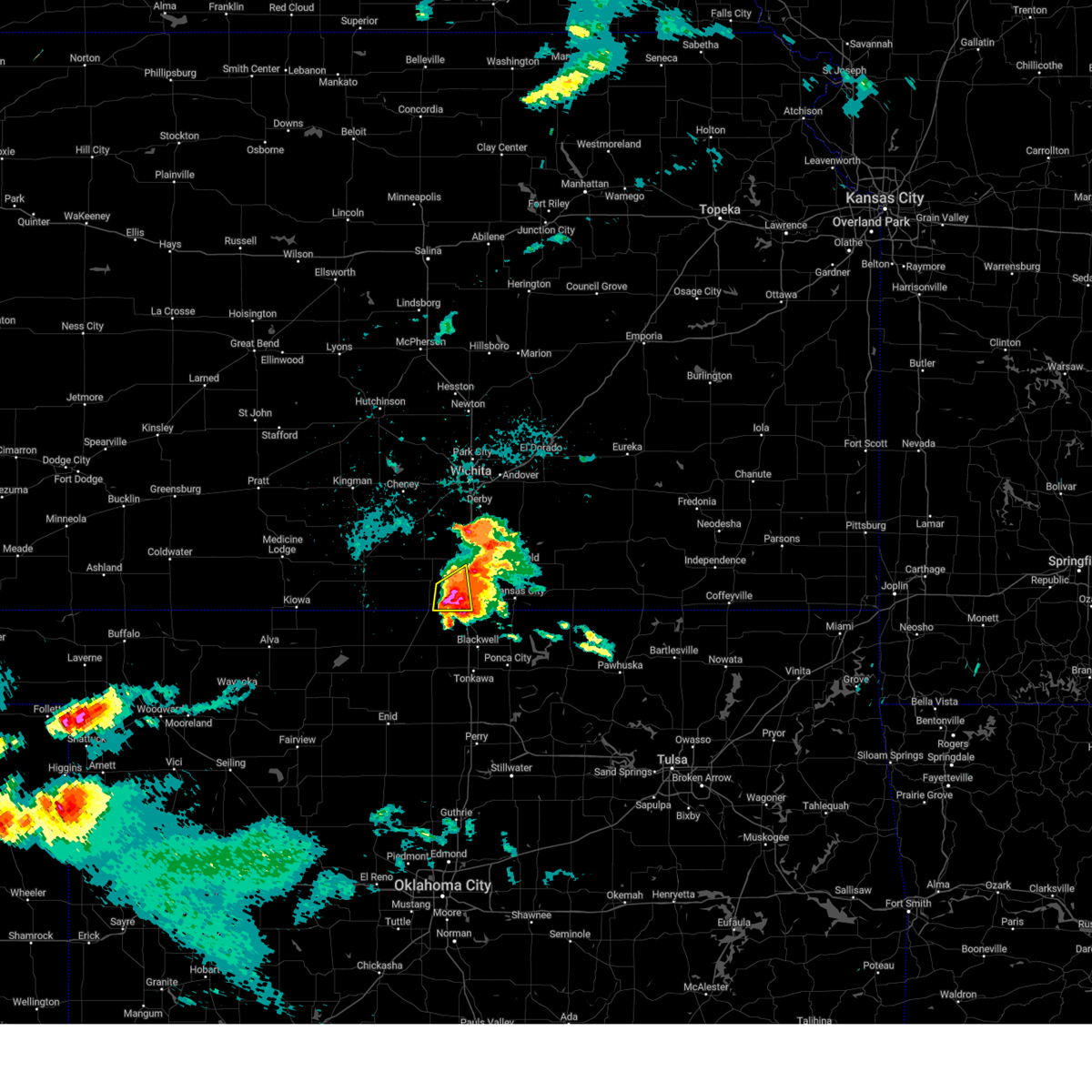
| 6/8/2025 4:16 PM CDT |
 At 416 pm cdt, a severe thunderstorm was located near south haven, or 14 miles west of arkansas city, moving northeast at 20 mph (radar indicated). Hazards include 60 mph wind gusts and quarter size hail. Hail damage to vehicles is expected. expect wind damage to roofs, siding, and trees. locations impacted include, south haven, geuda springs, and hunnewell. This includes interstate 35 between mile markers 1 and 7. At 416 pm cdt, a severe thunderstorm was located near south haven, or 14 miles west of arkansas city, moving northeast at 20 mph (radar indicated). Hazards include 60 mph wind gusts and quarter size hail. Hail damage to vehicles is expected. expect wind damage to roofs, siding, and trees. locations impacted include, south haven, geuda springs, and hunnewell. This includes interstate 35 between mile markers 1 and 7.
|
| 6/8/2025 4:15 PM CDT |
 At 415 pm cdt, a severe thunderstorm was located near south haven, or 8 miles east of caldwell, moving east at 20 mph (radar indicated). Hazards include golf ball size hail and 60 mph wind gusts. People and animals outdoors will be injured. expect hail damage to roofs, siding, windows, and vehicles. expect wind damage to roofs, siding, and trees. Locations impacted include, caldwell and south haven. At 415 pm cdt, a severe thunderstorm was located near south haven, or 8 miles east of caldwell, moving east at 20 mph (radar indicated). Hazards include golf ball size hail and 60 mph wind gusts. People and animals outdoors will be injured. expect hail damage to roofs, siding, windows, and vehicles. expect wind damage to roofs, siding, and trees. Locations impacted include, caldwell and south haven.
|
| 6/8/2025 4:01 PM CDT | Three power poles down. time is radar estimate in sumner county KS, 1 miles E of South Haven, KS |
| 6/8/2025 4:01 PM CDT | At 400 pm cdt, a severe thunderstorm was located 1 mile south of caldwell, moving northeast at 5 mph (radar indicated). Hazards include golf ball size hail and 60 mph wind gusts. People and animals outdoors will be injured. expect hail damage to roofs, siding, windows, and vehicles. expect wind damage to roofs, siding, and trees. Locations impacted include, caldwell and south haven. |
| 6/8/2025 3:55 PM CDT |
 Svrict the national weather service in wichita has issued a * severe thunderstorm warning for, southeastern sumner county in south central kansas, * until 500 pm cdt. * at 354 pm cdt, a severe thunderstorm was located near braman, or 11 miles southeast of caldwell, moving northeast at 30 mph (radar indicated). Hazards include 60 mph wind gusts and quarter size hail. Hail damage to vehicles is expected. Expect wind damage to roofs, siding, and trees. Svrict the national weather service in wichita has issued a * severe thunderstorm warning for, southeastern sumner county in south central kansas, * until 500 pm cdt. * at 354 pm cdt, a severe thunderstorm was located near braman, or 11 miles southeast of caldwell, moving northeast at 30 mph (radar indicated). Hazards include 60 mph wind gusts and quarter size hail. Hail damage to vehicles is expected. Expect wind damage to roofs, siding, and trees.
|
| 6/8/2025 3:32 PM CDT | Svrict the national weather service in wichita has issued a * severe thunderstorm warning for, southwestern sumner county in south central kansas, * until 430 pm cdt. * at 332 pm cdt, a severe thunderstorm was located near caldwell, moving east at 15 mph (radar indicated). Hazards include 60 mph wind gusts and half dollar size hail. Hail damage to vehicles is expected. Expect wind damage to roofs, siding, and trees. |
| 6/7/2025 2:21 AM CDT | Svrict the national weather service in wichita has issued a * severe thunderstorm warning for, southwestern cowley county in south central kansas, southeastern sumner county in south central kansas, * until 300 am cdt. * at 221 am cdt, a severe thunderstorm was located near south haven, moving east at 55 mph (radar indicated). Hazards include 60 mph wind gusts. expect damage to roofs, siding, and trees |
| 6/7/2025 2:14 AM CDT | At 214 am cdt, severe thunderstorms were located along a line extending from 9 miles south of conway springs to near caldwell to 3 miles southwest of renfrow, moving east at 60 mph (radar indicated). Hazards include 60 mph wind gusts. Expect damage to roofs, siding, and trees. Locations impacted include, wellington, caldwell, argonia, and south haven. |
| 6/7/2025 2:14 AM CDT | the severe thunderstorm warning has been cancelled and is no longer in effect |
| 6/7/2025 2:03 AM CDT | At 203 am cdt, severe thunderstorms were located along a line extending from near argonia to 7 miles west of caldwell to 5 miles northeast of wakita, moving east at 55 mph (radar indicated). Hazards include 60 mph wind gusts. Expect damage to roofs, siding, and trees. Locations impacted include, wellington, caldwell, argonia, and south haven. |
| 6/7/2025 1:43 AM CDT | Svrict the national weather service in wichita has issued a * severe thunderstorm warning for, eastern harper county in south central kansas, southwestern sumner county in south central kansas, * until 230 am cdt. * at 142 am cdt, severe thunderstorms were located along a line extending from 4 miles north of harper to near anthony to 4 miles west of manchester, moving east at 60 mph (radar indicated). Hazards include 60 mph wind gusts. expect damage to roofs, siding, and trees |
| 5/24/2025 4:00 AM CDT |
 Svrict the national weather service in wichita has issued a * severe thunderstorm warning for, cowley county in south central kansas, southeastern sumner county in south central kansas, * until 500 am cdt. * at 400 am cdt, severe thunderstorms were located along a line extending from near udall to near oxford to near south haven, moving east at 50 mph (radar indicated). Hazards include 60 mph wind gusts and penny size hail. expect damage to roofs, siding, and trees Svrict the national weather service in wichita has issued a * severe thunderstorm warning for, cowley county in south central kansas, southeastern sumner county in south central kansas, * until 500 am cdt. * at 400 am cdt, severe thunderstorms were located along a line extending from near udall to near oxford to near south haven, moving east at 50 mph (radar indicated). Hazards include 60 mph wind gusts and penny size hail. expect damage to roofs, siding, and trees
|
| 4/2/2025 3:43 AM CDT |
 Svrict the national weather service in wichita has issued a * severe thunderstorm warning for, northwestern elk county in southeastern kansas, cowley county in south central kansas, butler county in south central kansas, eastern sumner county in south central kansas, greenwood county in southeastern kansas, * until 430 am cdt. * at 342 am cdt, severe thunderstorms were located along a line extending from 15 miles east of el dorado to 6 miles southwest of geuda springs, moving northeast at 60 mph (radar indicated). Hazards include 60 mph wind gusts and quarter size hail. Hail damage to vehicles is expected. Expect wind damage to roofs, siding, and trees. Svrict the national weather service in wichita has issued a * severe thunderstorm warning for, northwestern elk county in southeastern kansas, cowley county in south central kansas, butler county in south central kansas, eastern sumner county in south central kansas, greenwood county in southeastern kansas, * until 430 am cdt. * at 342 am cdt, severe thunderstorms were located along a line extending from 15 miles east of el dorado to 6 miles southwest of geuda springs, moving northeast at 60 mph (radar indicated). Hazards include 60 mph wind gusts and quarter size hail. Hail damage to vehicles is expected. Expect wind damage to roofs, siding, and trees.
|
| 4/2/2025 3:13 AM CDT |
 Svrict the national weather service in wichita has issued a * severe thunderstorm warning for, southern sumner county in south central kansas, * until 345 am cdt. * at 312 am cdt, a severe thunderstorm was located 7 miles southwest of wellington, moving northeast at 65 mph (radar indicated). Hazards include quarter size hail. damage to vehicles is expected Svrict the national weather service in wichita has issued a * severe thunderstorm warning for, southern sumner county in south central kansas, * until 345 am cdt. * at 312 am cdt, a severe thunderstorm was located 7 miles southwest of wellington, moving northeast at 65 mph (radar indicated). Hazards include quarter size hail. damage to vehicles is expected
|
| 4/1/2025 6:48 PM CDT |
 Svrict the national weather service in wichita has issued a * severe thunderstorm warning for, southern cowley county in south central kansas, southeastern sumner county in south central kansas, * until 730 pm cdt. * at 648 pm cdt, a severe thunderstorm was located near braman, or 8 miles northwest of blackwell, moving northeast at 55 mph (radar indicated). Hazards include 60 mph wind gusts and half dollar size hail. Hail damage to vehicles is expected. Expect wind damage to roofs, siding, and trees. Svrict the national weather service in wichita has issued a * severe thunderstorm warning for, southern cowley county in south central kansas, southeastern sumner county in south central kansas, * until 730 pm cdt. * at 648 pm cdt, a severe thunderstorm was located near braman, or 8 miles northwest of blackwell, moving northeast at 55 mph (radar indicated). Hazards include 60 mph wind gusts and half dollar size hail. Hail damage to vehicles is expected. Expect wind damage to roofs, siding, and trees.
|
| 8/15/2024 6:20 PM CDT | Quarter sized hail reported 9.2 miles WNW of South Haven, KS |
| 8/15/2024 6:15 PM CDT |
 At 615 pm cdt, a severe thunderstorm was located 7 miles northeast of braman, or 12 miles west of arkansas city, moving east at 15 mph (radar indicated). Hazards include 60 mph wind gusts and half dollar size hail. Hail damage to vehicles is expected. expect wind damage to roofs, siding, and trees. Locations impacted include, arkansas city, south haven, geuda springs, and hunnewell. At 615 pm cdt, a severe thunderstorm was located 7 miles northeast of braman, or 12 miles west of arkansas city, moving east at 15 mph (radar indicated). Hazards include 60 mph wind gusts and half dollar size hail. Hail damage to vehicles is expected. expect wind damage to roofs, siding, and trees. Locations impacted include, arkansas city, south haven, geuda springs, and hunnewell.
|
| 8/15/2024 6:09 PM CDT |
 Svrict the national weather service in wichita has issued a * severe thunderstorm warning for, southwestern cowley county in south central kansas, southeastern sumner county in south central kansas, * until 645 pm cdt. * at 607 pm cdt, a severe thunderstorm was located just north of braman, or 13 miles north of blackwell, moving northeast at 10 mph (radar indicated). Hazards include 60 mph wind gusts and nickel size hail. expect damage to roofs, siding, and trees Svrict the national weather service in wichita has issued a * severe thunderstorm warning for, southwestern cowley county in south central kansas, southeastern sumner county in south central kansas, * until 645 pm cdt. * at 607 pm cdt, a severe thunderstorm was located just north of braman, or 13 miles north of blackwell, moving northeast at 10 mph (radar indicated). Hazards include 60 mph wind gusts and nickel size hail. expect damage to roofs, siding, and trees
|
| 7/2/2024 5:59 PM CDT |
 The storms which prompted the warning have moved out of the area. therefore, the warning will be allowed to expire. however, gusty winds and heavy rain are still possible with these thunderstorms. a severe thunderstorm watch remains in effect until 1000 pm cdt for south central kansas. The storms which prompted the warning have moved out of the area. therefore, the warning will be allowed to expire. however, gusty winds and heavy rain are still possible with these thunderstorms. a severe thunderstorm watch remains in effect until 1000 pm cdt for south central kansas.
|
| 7/2/2024 5:49 PM CDT |
 At 548 pm cdt, severe thunderstorms were located along a line extending from 6 miles east of sedgwick to near northeast wichita to near oxford to 8 miles southeast of wellington, moving east at 45 mph (radar indicated). Hazards include 70 mph wind gusts. Expect considerable tree damage. damage is likely to mobile homes, roofs, and outbuildings. Locations impacted include, wichita, derby, andover, haysville, wellington, park city, valley center, bel aire, mulvane, goddard, rose hill, maize, clearwater, sedgwick, belle plaine, colwich, caldwell, oxford, downtown wichita, and kechi. At 548 pm cdt, severe thunderstorms were located along a line extending from 6 miles east of sedgwick to near northeast wichita to near oxford to 8 miles southeast of wellington, moving east at 45 mph (radar indicated). Hazards include 70 mph wind gusts. Expect considerable tree damage. damage is likely to mobile homes, roofs, and outbuildings. Locations impacted include, wichita, derby, andover, haysville, wellington, park city, valley center, bel aire, mulvane, goddard, rose hill, maize, clearwater, sedgwick, belle plaine, colwich, caldwell, oxford, downtown wichita, and kechi.
|
| 7/2/2024 5:49 PM CDT |
 the severe thunderstorm warning has been cancelled and is no longer in effect the severe thunderstorm warning has been cancelled and is no longer in effect
|
| 7/2/2024 5:30 PM CDT |
 the severe thunderstorm warning has been cancelled and is no longer in effect the severe thunderstorm warning has been cancelled and is no longer in effect
|
| 7/2/2024 5:30 PM CDT |
 At 530 pm cdt, severe thunderstorms were located along a line extending from bentley to eisenhower national airport to near wellington to 5 miles northeast of caldwell, moving east at 45 mph (radar indicated). Hazards include 70 mph wind gusts. Expect considerable tree damage. damage is likely to mobile homes, roofs, and outbuildings. Locations impacted include, wichita, derby, andover, haysville, wellington, park city, valley center, bel aire, mulvane, goddard, rose hill, maize, clearwater, sedgwick, belle plaine, colwich, conway springs, haven, caldwell, and oxford. At 530 pm cdt, severe thunderstorms were located along a line extending from bentley to eisenhower national airport to near wellington to 5 miles northeast of caldwell, moving east at 45 mph (radar indicated). Hazards include 70 mph wind gusts. Expect considerable tree damage. damage is likely to mobile homes, roofs, and outbuildings. Locations impacted include, wichita, derby, andover, haysville, wellington, park city, valley center, bel aire, mulvane, goddard, rose hill, maize, clearwater, sedgwick, belle plaine, colwich, conway springs, haven, caldwell, and oxford.
|
| 7/2/2024 5:01 PM CDT |
 Svrict the national weather service in wichita has issued a * severe thunderstorm warning for, southeastern reno county in south central kansas, sedgwick county in south central kansas, eastern harper county in south central kansas, eastern kingman county in south central kansas, sumner county in south central kansas, * until 600 pm cdt. * at 501 pm cdt, severe thunderstorms were located along a line extending from 5 miles west of cheney to 5 miles southeast of norwich to argonia, moving east at 45 mph (radar indicated). Hazards include 70 mph wind gusts. Expect considerable tree damage. Damage is likely to mobile homes, roofs, and outbuildings. Svrict the national weather service in wichita has issued a * severe thunderstorm warning for, southeastern reno county in south central kansas, sedgwick county in south central kansas, eastern harper county in south central kansas, eastern kingman county in south central kansas, sumner county in south central kansas, * until 600 pm cdt. * at 501 pm cdt, severe thunderstorms were located along a line extending from 5 miles west of cheney to 5 miles southeast of norwich to argonia, moving east at 45 mph (radar indicated). Hazards include 70 mph wind gusts. Expect considerable tree damage. Damage is likely to mobile homes, roofs, and outbuildings.
|
| 6/4/2024 9:04 PM CDT |
 At 904 pm cdt, severe thunderstorms were located along a line extending from 6 miles south of grenola to near dexter to 7 miles northeast of braman, moving east at 35 mph (radar indicated). Hazards include 60 mph wind gusts and nickel size hail. Expect damage to roofs, siding, and trees. Locations impacted include, arkansas city, winfield, burden, south haven, dexter, geuda springs, cambridge, hunnewell, maple city, and strother field airport. At 904 pm cdt, severe thunderstorms were located along a line extending from 6 miles south of grenola to near dexter to 7 miles northeast of braman, moving east at 35 mph (radar indicated). Hazards include 60 mph wind gusts and nickel size hail. Expect damage to roofs, siding, and trees. Locations impacted include, arkansas city, winfield, burden, south haven, dexter, geuda springs, cambridge, hunnewell, maple city, and strother field airport.
|
| 6/4/2024 8:50 PM CDT |
 At 849 pm cdt, severe thunderstorms were located along a line extending from 5 miles southwest of grenola to 6 miles southeast of winfield to near south haven, moving southeast at 30 mph (radar indicated). Hazards include 60 mph wind gusts and nickel size hail. Expect damage to roofs, siding, and trees. Locations impacted include, arkansas city, winfield, wellington, oxford, udall, burden, south haven, dexter, atlanta, geuda springs, rock, cambridge, hunnewell, maple city, winfield city lake, and strother field airport. At 849 pm cdt, severe thunderstorms were located along a line extending from 5 miles southwest of grenola to 6 miles southeast of winfield to near south haven, moving southeast at 30 mph (radar indicated). Hazards include 60 mph wind gusts and nickel size hail. Expect damage to roofs, siding, and trees. Locations impacted include, arkansas city, winfield, wellington, oxford, udall, burden, south haven, dexter, atlanta, geuda springs, rock, cambridge, hunnewell, maple city, winfield city lake, and strother field airport.
|
| 6/4/2024 8:16 PM CDT |
 Svrict the national weather service in wichita has issued a * severe thunderstorm warning for, cowley county in south central kansas, eastern sumner county in south central kansas, * until 915 pm cdt. * at 816 pm cdt, severe thunderstorms were located along a line extending from 5 miles southeast of el dorado to 7 miles east of douglass to near belle plaine, moving southeast at 35 mph (radar indicated). Hazards include 60 mph wind gusts and nickel size hail. expect damage to roofs, siding, and trees Svrict the national weather service in wichita has issued a * severe thunderstorm warning for, cowley county in south central kansas, eastern sumner county in south central kansas, * until 915 pm cdt. * at 816 pm cdt, severe thunderstorms were located along a line extending from 5 miles southeast of el dorado to 7 miles east of douglass to near belle plaine, moving southeast at 35 mph (radar indicated). Hazards include 60 mph wind gusts and nickel size hail. expect damage to roofs, siding, and trees
|
| 5/25/2024 7:30 PM CDT |
 Svrict the national weather service in wichita has issued a * severe thunderstorm warning for, western cowley county in south central kansas, sumner county in south central kansas, * until 815 pm cdt. * at 730 pm cdt, a severe thunderstorm was located 7 miles northwest of south haven, or 10 miles southwest of wellington, moving north at 40 mph (radar indicated). Hazards include 60 mph wind gusts and quarter size hail. Hail damage to vehicles is expected. Expect wind damage to roofs, siding, and trees. Svrict the national weather service in wichita has issued a * severe thunderstorm warning for, western cowley county in south central kansas, sumner county in south central kansas, * until 815 pm cdt. * at 730 pm cdt, a severe thunderstorm was located 7 miles northwest of south haven, or 10 miles southwest of wellington, moving north at 40 mph (radar indicated). Hazards include 60 mph wind gusts and quarter size hail. Hail damage to vehicles is expected. Expect wind damage to roofs, siding, and trees.
|
| 5/15/2024 6:58 PM CDT |
 Svrict the national weather service in wichita has issued a * severe thunderstorm warning for, southwestern cowley county in south central kansas, southeastern sumner county in south central kansas, * until 815 pm cdt. * at 658 pm cdt, a severe thunderstorm was located near south haven, or 8 miles east of caldwell, moving east at 20 mph (radar indicated). Hazards include golf ball size hail and 70 mph wind gusts. People and animals outdoors will be injured. expect hail damage to roofs, siding, windows, and vehicles. expect considerable tree damage. Wind damage is also likely to mobile homes, roofs, and outbuildings. Svrict the national weather service in wichita has issued a * severe thunderstorm warning for, southwestern cowley county in south central kansas, southeastern sumner county in south central kansas, * until 815 pm cdt. * at 658 pm cdt, a severe thunderstorm was located near south haven, or 8 miles east of caldwell, moving east at 20 mph (radar indicated). Hazards include golf ball size hail and 70 mph wind gusts. People and animals outdoors will be injured. expect hail damage to roofs, siding, windows, and vehicles. expect considerable tree damage. Wind damage is also likely to mobile homes, roofs, and outbuildings.
|
| 5/15/2024 6:54 PM CDT |
 At 653 pm cdt, a severe thunderstorm was located near south haven, or 9 miles east of caldwell, moving east at 25 mph (radar indicated). Hazards include golf ball size hail and 70 mph wind gusts. People and animals outdoors will be injured. expect hail damage to roofs, siding, windows, and vehicles. expect considerable tree damage. wind damage is also likely to mobile homes, roofs, and outbuildings. Locations impacted include, south haven and hunnewell. At 653 pm cdt, a severe thunderstorm was located near south haven, or 9 miles east of caldwell, moving east at 25 mph (radar indicated). Hazards include golf ball size hail and 70 mph wind gusts. People and animals outdoors will be injured. expect hail damage to roofs, siding, windows, and vehicles. expect considerable tree damage. wind damage is also likely to mobile homes, roofs, and outbuildings. Locations impacted include, south haven and hunnewell.
|
| 5/15/2024 6:47 PM CDT |
 At 646 pm cdt, a severe thunderstorm was located 6 miles southwest of south haven, or 6 miles east of caldwell, moving east at 25 mph (radar indicated). Hazards include golf ball size hail and 70 mph wind gusts. People and animals outdoors will be injured. expect hail damage to roofs, siding, windows, and vehicles. expect considerable tree damage. wind damage is also likely to mobile homes, roofs, and outbuildings. Locations impacted include, south haven, hunnewell, and perth. At 646 pm cdt, a severe thunderstorm was located 6 miles southwest of south haven, or 6 miles east of caldwell, moving east at 25 mph (radar indicated). Hazards include golf ball size hail and 70 mph wind gusts. People and animals outdoors will be injured. expect hail damage to roofs, siding, windows, and vehicles. expect considerable tree damage. wind damage is also likely to mobile homes, roofs, and outbuildings. Locations impacted include, south haven, hunnewell, and perth.
|
| 5/15/2024 6:43 PM CDT |
 At 642 pm cdt, a severe thunderstorm was located 6 miles east of caldwell, moving east at 25 mph (trained weather spotters reported golf ball size hail 3 miles north of caldwell at 638 pm). Hazards include golf ball size hail and 70 mph wind gusts. People and animals outdoors will be injured. expect hail damage to roofs, siding, windows, and vehicles. expect considerable tree damage. wind damage is also likely to mobile homes, roofs, and outbuildings. Locations impacted include, wellington, south haven, hunnewell, wellington airport, and perth. At 642 pm cdt, a severe thunderstorm was located 6 miles east of caldwell, moving east at 25 mph (trained weather spotters reported golf ball size hail 3 miles north of caldwell at 638 pm). Hazards include golf ball size hail and 70 mph wind gusts. People and animals outdoors will be injured. expect hail damage to roofs, siding, windows, and vehicles. expect considerable tree damage. wind damage is also likely to mobile homes, roofs, and outbuildings. Locations impacted include, wellington, south haven, hunnewell, wellington airport, and perth.
|
| 5/15/2024 6:38 PM CDT |
 At 638 pm cdt, a severe thunderstorm was located near caldwell, moving east at 30 mph (quarter size hail was reported in caldwell at 634 pm). Hazards include golf ball size hail and 70 mph wind gusts. People and animals outdoors will be injured. expect hail damage to roofs, siding, windows, and vehicles. expect considerable tree damage. wind damage is also likely to mobile homes, roofs, and outbuildings. Locations impacted include, wellington, caldwell, south haven, mayfield, hunnewell, perth, and wellington airport. At 638 pm cdt, a severe thunderstorm was located near caldwell, moving east at 30 mph (quarter size hail was reported in caldwell at 634 pm). Hazards include golf ball size hail and 70 mph wind gusts. People and animals outdoors will be injured. expect hail damage to roofs, siding, windows, and vehicles. expect considerable tree damage. wind damage is also likely to mobile homes, roofs, and outbuildings. Locations impacted include, wellington, caldwell, south haven, mayfield, hunnewell, perth, and wellington airport.
|
| 5/15/2024 6:32 PM CDT |
 At 631 pm cdt, a severe thunderstorm was located over caldwell, moving east at 30 mph (radar indicated). Hazards include two inch hail and 70 mph wind gusts. People and animals outdoors will be injured. expect hail damage to roofs, siding, windows, and vehicles. expect considerable tree damage. wind damage is also likely to mobile homes, roofs, and outbuildings. Locations impacted include, wellington, caldwell, south haven, mayfield, hunnewell, perth, and wellington airport. At 631 pm cdt, a severe thunderstorm was located over caldwell, moving east at 30 mph (radar indicated). Hazards include two inch hail and 70 mph wind gusts. People and animals outdoors will be injured. expect hail damage to roofs, siding, windows, and vehicles. expect considerable tree damage. wind damage is also likely to mobile homes, roofs, and outbuildings. Locations impacted include, wellington, caldwell, south haven, mayfield, hunnewell, perth, and wellington airport.
|
| 5/15/2024 6:26 PM CDT |
 At 626 pm cdt, a severe thunderstorm was located over caldwell, moving east at 30 mph (radar indicated). Hazards include two inch hail and 70 mph wind gusts. People and animals outdoors will be injured. expect hail damage to roofs, siding, windows, and vehicles. expect considerable tree damage. wind damage is also likely to mobile homes, roofs, and outbuildings. Locations impacted include, wellington, caldwell, south haven, mayfield, milan, hunnewell, perth, and wellington airport. At 626 pm cdt, a severe thunderstorm was located over caldwell, moving east at 30 mph (radar indicated). Hazards include two inch hail and 70 mph wind gusts. People and animals outdoors will be injured. expect hail damage to roofs, siding, windows, and vehicles. expect considerable tree damage. wind damage is also likely to mobile homes, roofs, and outbuildings. Locations impacted include, wellington, caldwell, south haven, mayfield, milan, hunnewell, perth, and wellington airport.
|
| 5/15/2024 6:21 PM CDT |
 At 621 pm cdt, a severe thunderstorm was located near caldwell, moving east at 25 mph (radar indicated). Hazards include golf ball size hail and 70 mph wind gusts. People and animals outdoors will be injured. expect hail damage to roofs, siding, windows, and vehicles. expect considerable tree damage. wind damage is also likely to mobile homes, roofs, and outbuildings. Locations impacted include, wellington, caldwell, south haven, mayfield, milan, hunnewell, perth, and wellington airport. At 621 pm cdt, a severe thunderstorm was located near caldwell, moving east at 25 mph (radar indicated). Hazards include golf ball size hail and 70 mph wind gusts. People and animals outdoors will be injured. expect hail damage to roofs, siding, windows, and vehicles. expect considerable tree damage. wind damage is also likely to mobile homes, roofs, and outbuildings. Locations impacted include, wellington, caldwell, south haven, mayfield, milan, hunnewell, perth, and wellington airport.
|
| 5/15/2024 6:14 PM CDT |
 At 614 pm cdt, a severe thunderstorm was located near caldwell, moving east at 30 mph (radar indicated). Hazards include golf ball size hail and 60 mph wind gusts. People and animals outdoors will be injured. expect hail damage to roofs, siding, windows, and vehicles. expect wind damage to roofs, siding, and trees. Locations impacted include, wellington, caldwell, south haven, mayfield, milan, hunnewell, perth, and wellington airport. At 614 pm cdt, a severe thunderstorm was located near caldwell, moving east at 30 mph (radar indicated). Hazards include golf ball size hail and 60 mph wind gusts. People and animals outdoors will be injured. expect hail damage to roofs, siding, windows, and vehicles. expect wind damage to roofs, siding, and trees. Locations impacted include, wellington, caldwell, south haven, mayfield, milan, hunnewell, perth, and wellington airport.
|
| 5/15/2024 6:05 PM CDT |
 Svrict the national weather service in wichita has issued a * severe thunderstorm warning for, western sumner county in south central kansas, * until 700 pm cdt. * at 604 pm cdt, a severe thunderstorm was located 9 miles northwest of caldwell, moving east at 25 mph (radar indicated). Hazards include 60 mph wind gusts and half dollar size hail. Hail damage to vehicles is expected. Expect wind damage to roofs, siding, and trees. Svrict the national weather service in wichita has issued a * severe thunderstorm warning for, western sumner county in south central kansas, * until 700 pm cdt. * at 604 pm cdt, a severe thunderstorm was located 9 miles northwest of caldwell, moving east at 25 mph (radar indicated). Hazards include 60 mph wind gusts and half dollar size hail. Hail damage to vehicles is expected. Expect wind damage to roofs, siding, and trees.
|
| 5/6/2024 7:56 PM CDT |
 At 756 pm cdt, a severe thunderstorm was located near winfield, moving northeast at 35 mph (radar indicated). Hazards include 70 mph wind gusts and quarter size hail. Hail damage to vehicles is expected. expect considerable tree damage. wind damage is also likely to mobile homes, roofs, and outbuildings. Locations impacted include, arkansas city, winfield, oxford, udall, burden, south haven, atlanta, geuda springs, rock, hunnewell, winfield city lake, and strother field airport. At 756 pm cdt, a severe thunderstorm was located near winfield, moving northeast at 35 mph (radar indicated). Hazards include 70 mph wind gusts and quarter size hail. Hail damage to vehicles is expected. expect considerable tree damage. wind damage is also likely to mobile homes, roofs, and outbuildings. Locations impacted include, arkansas city, winfield, oxford, udall, burden, south haven, atlanta, geuda springs, rock, hunnewell, winfield city lake, and strother field airport.
|
| 5/6/2024 7:49 PM CDT |
 Svrict the national weather service in wichita has issued a * severe thunderstorm warning for, cowley county in south central kansas, southeastern sumner county in south central kansas, * until 845 pm cdt. * at 749 pm cdt, a severe thunderstorm was located near geuda springs, or 7 miles south of oxford, moving northeast at 30 mph (radar indicated). Hazards include 70 mph wind gusts and quarter size hail. Hail damage to vehicles is expected. expect considerable tree damage. Wind damage is also likely to mobile homes, roofs, and outbuildings. Svrict the national weather service in wichita has issued a * severe thunderstorm warning for, cowley county in south central kansas, southeastern sumner county in south central kansas, * until 845 pm cdt. * at 749 pm cdt, a severe thunderstorm was located near geuda springs, or 7 miles south of oxford, moving northeast at 30 mph (radar indicated). Hazards include 70 mph wind gusts and quarter size hail. Hail damage to vehicles is expected. expect considerable tree damage. Wind damage is also likely to mobile homes, roofs, and outbuildings.
|
| 5/4/2024 1:11 AM CDT |
 The storms which prompted the warning have weakened below severe limits, and no longer pose an immediate threat to life or property. therefore, the warning will be allowed to expire. however, gusty winds are still possible with these thunderstorms. a severe thunderstorm watch remains in effect until 400 am cdt for south central kansas. The storms which prompted the warning have weakened below severe limits, and no longer pose an immediate threat to life or property. therefore, the warning will be allowed to expire. however, gusty winds are still possible with these thunderstorms. a severe thunderstorm watch remains in effect until 400 am cdt for south central kansas.
|
| 5/4/2024 12:56 AM CDT |
 At 1256 am cdt, severe thunderstorms were located along a line extending from near clearwater to 5 miles northwest of wellington to near caldwell, moving northeast at 50 mph (radar indicated). Hazards include 60 mph wind gusts and nickel size hail. Expect damage to roofs, siding, and trees. Locations impacted include, wellington, belle plaine, conway springs, caldwell, oxford, south haven, geuda springs, mayfield, milan, hunnewell, perth, riverdale, and wellington airport. At 1256 am cdt, severe thunderstorms were located along a line extending from near clearwater to 5 miles northwest of wellington to near caldwell, moving northeast at 50 mph (radar indicated). Hazards include 60 mph wind gusts and nickel size hail. Expect damage to roofs, siding, and trees. Locations impacted include, wellington, belle plaine, conway springs, caldwell, oxford, south haven, geuda springs, mayfield, milan, hunnewell, perth, riverdale, and wellington airport.
|
| 5/4/2024 12:42 AM CDT |
 Svrict the national weather service in wichita has issued a * severe thunderstorm warning for, sumner county in south central kansas, * until 115 am cdt. * at 1241 am cdt, severe thunderstorms were located along a line extending from near viola to near argonia to 11 miles west of caldwell, moving east at 45 mph (radar indicated). Hazards include 60 mph wind gusts and quarter size hail. Hail damage to vehicles is expected. Expect wind damage to roofs, siding, and trees. Svrict the national weather service in wichita has issued a * severe thunderstorm warning for, sumner county in south central kansas, * until 115 am cdt. * at 1241 am cdt, severe thunderstorms were located along a line extending from near viola to near argonia to 11 miles west of caldwell, moving east at 45 mph (radar indicated). Hazards include 60 mph wind gusts and quarter size hail. Hail damage to vehicles is expected. Expect wind damage to roofs, siding, and trees.
|
| 4/30/2024 8:36 PM CDT |
 The storms which prompted the warning have weakened below severe limits, and have exited the warned area. therefore, the warning will be allowed to expire. a tornado watch remains in effect until 1100 pm cdt for south central kansas. The storms which prompted the warning have weakened below severe limits, and have exited the warned area. therefore, the warning will be allowed to expire. a tornado watch remains in effect until 1100 pm cdt for south central kansas.
|
| 4/30/2024 8:21 PM CDT |
 At 821 pm cdt, severe thunderstorms were located along a line extending from 9 miles west of caldwell to near wakita, moving east at 30 mph (radar indicated). Hazards include 60 mph wind gusts and quarter size hail. Hail damage to vehicles is expected. expect wind damage to roofs, siding, and trees. Locations impacted include, caldwell, south haven, and bluff city. At 821 pm cdt, severe thunderstorms were located along a line extending from 9 miles west of caldwell to near wakita, moving east at 30 mph (radar indicated). Hazards include 60 mph wind gusts and quarter size hail. Hail damage to vehicles is expected. expect wind damage to roofs, siding, and trees. Locations impacted include, caldwell, south haven, and bluff city.
|
| 4/30/2024 8:00 PM CDT |
 At 800 pm cdt, severe thunderstorms were located along a line extending from 8 miles east of argonia to near manchester, moving east at 20 mph (radar indicated). Hazards include 60 mph wind gusts and quarter size hail. Hail damage to vehicles is expected. expect wind damage to roofs, siding, and trees. Locations impacted include, wellington, caldwell, south haven, mayfield, bluff city, waldron, and perth. At 800 pm cdt, severe thunderstorms were located along a line extending from 8 miles east of argonia to near manchester, moving east at 20 mph (radar indicated). Hazards include 60 mph wind gusts and quarter size hail. Hail damage to vehicles is expected. expect wind damage to roofs, siding, and trees. Locations impacted include, wellington, caldwell, south haven, mayfield, bluff city, waldron, and perth.
|
| 4/30/2024 7:45 PM CDT |
 Svrict the national weather service in wichita has issued a * severe thunderstorm warning for, southeastern harper county in south central kansas, southern sumner county in south central kansas, * until 845 pm cdt. * at 744 pm cdt, severe thunderstorms were located along a line extending from near argonia to 7 miles west of manchester, moving east at 20 mph (radar indicated). Hazards include 60 mph wind gusts and half dollar size hail. Hail damage to vehicles is expected. Expect wind damage to roofs, siding, and trees. Svrict the national weather service in wichita has issued a * severe thunderstorm warning for, southeastern harper county in south central kansas, southern sumner county in south central kansas, * until 845 pm cdt. * at 744 pm cdt, severe thunderstorms were located along a line extending from near argonia to 7 miles west of manchester, moving east at 20 mph (radar indicated). Hazards include 60 mph wind gusts and half dollar size hail. Hail damage to vehicles is expected. Expect wind damage to roofs, siding, and trees.
|
| 4/27/2024 3:55 PM CDT |
 The severe thunderstorm which prompted the warning has weakened. therefore, the warning will be allowed to expire. a tornado watch remains in effect until 700 pm cdt for south central kansas. The severe thunderstorm which prompted the warning has weakened. therefore, the warning will be allowed to expire. a tornado watch remains in effect until 700 pm cdt for south central kansas.
|
| 4/27/2024 3:44 PM CDT |
 At 344 pm cdt, a severe thunderstorm was located near wellington, moving northeast at 60 mph (radar indicated). Hazards include 60 mph wind gusts and quarter size hail. Hail damage to vehicles is expected. expect wind damage to roofs, siding, and trees. Locations impacted include, wellington, belle plaine, south haven, mayfield, hunnewell, perth, riverdale, and wellington airport. At 344 pm cdt, a severe thunderstorm was located near wellington, moving northeast at 60 mph (radar indicated). Hazards include 60 mph wind gusts and quarter size hail. Hail damage to vehicles is expected. expect wind damage to roofs, siding, and trees. Locations impacted include, wellington, belle plaine, south haven, mayfield, hunnewell, perth, riverdale, and wellington airport.
|
| 4/27/2024 3:28 PM CDT |
 At 327 pm cdt, a severe thunderstorm was located 6 miles north of caldwell, moving northeast at 60 mph (radar indicated). Hazards include 60 mph wind gusts and quarter size hail. Hail damage to vehicles is expected. expect wind damage to roofs, siding, and trees. Locations impacted include, wellington, belle plaine, conway springs, caldwell, argonia, south haven, mayfield, milan, hunnewell, perth, riverdale, and wellington airport. At 327 pm cdt, a severe thunderstorm was located 6 miles north of caldwell, moving northeast at 60 mph (radar indicated). Hazards include 60 mph wind gusts and quarter size hail. Hail damage to vehicles is expected. expect wind damage to roofs, siding, and trees. Locations impacted include, wellington, belle plaine, conway springs, caldwell, argonia, south haven, mayfield, milan, hunnewell, perth, riverdale, and wellington airport.
|
| 4/27/2024 3:28 PM CDT |
 the severe thunderstorm warning has been cancelled and is no longer in effect the severe thunderstorm warning has been cancelled and is no longer in effect
|
| 4/27/2024 3:20 PM CDT |
 Svrict the national weather service in wichita has issued a * severe thunderstorm warning for, southeastern harper county in south central kansas, sumner county in south central kansas, * until 400 pm cdt. * at 320 pm cdt, a severe thunderstorm was located 7 miles west of caldwell, moving northeast at 60 mph (radar indicated). Hazards include 60 mph wind gusts and quarter size hail. Hail damage to vehicles is expected. Expect wind damage to roofs, siding, and trees. Svrict the national weather service in wichita has issued a * severe thunderstorm warning for, southeastern harper county in south central kansas, sumner county in south central kansas, * until 400 pm cdt. * at 320 pm cdt, a severe thunderstorm was located 7 miles west of caldwell, moving northeast at 60 mph (radar indicated). Hazards include 60 mph wind gusts and quarter size hail. Hail damage to vehicles is expected. Expect wind damage to roofs, siding, and trees.
|
| 4/27/2024 2:42 PM CDT |
 At 242 pm cdt, a severe thunderstorm was located near udall, moving northeast at 55 mph (radar indicated). Hazards include 60 mph wind gusts. Expect damage to roofs, siding, and trees. Locations impacted include, wellington, mulvane, belle plaine, oxford, south haven, geuda springs, mayfield, hunnewell, riverdale, and wellington airport. At 242 pm cdt, a severe thunderstorm was located near udall, moving northeast at 55 mph (radar indicated). Hazards include 60 mph wind gusts. Expect damage to roofs, siding, and trees. Locations impacted include, wellington, mulvane, belle plaine, oxford, south haven, geuda springs, mayfield, hunnewell, riverdale, and wellington airport.
|
| 4/27/2024 2:24 PM CDT |
 At 224 pm cdt, a severe thunderstorm was located near wellington, moving northeast at 55 mph (radar indicated). Hazards include 60 mph wind gusts and quarter size hail. Hail damage to vehicles is expected. expect wind damage to roofs, siding, and trees. Locations impacted include, wellington, mulvane, belle plaine, caldwell, oxford, south haven, geuda springs, mayfield, hunnewell, perth, riverdale, and wellington airport. At 224 pm cdt, a severe thunderstorm was located near wellington, moving northeast at 55 mph (radar indicated). Hazards include 60 mph wind gusts and quarter size hail. Hail damage to vehicles is expected. expect wind damage to roofs, siding, and trees. Locations impacted include, wellington, mulvane, belle plaine, caldwell, oxford, south haven, geuda springs, mayfield, hunnewell, perth, riverdale, and wellington airport.
|
| 4/27/2024 2:03 PM CDT |
 Svrict the national weather service in wichita has issued a * severe thunderstorm warning for, sumner county in south central kansas, * until 300 pm cdt. * at 202 pm cdt, a severe thunderstorm was located near renfrow, or near caldwell, moving northeast at 55 mph (radar indicated). Hazards include 70 mph wind gusts and half dollar size hail. Hail damage to vehicles is expected. expect considerable tree damage. Wind damage is also likely to mobile homes, roofs, and outbuildings. Svrict the national weather service in wichita has issued a * severe thunderstorm warning for, sumner county in south central kansas, * until 300 pm cdt. * at 202 pm cdt, a severe thunderstorm was located near renfrow, or near caldwell, moving northeast at 55 mph (radar indicated). Hazards include 70 mph wind gusts and half dollar size hail. Hail damage to vehicles is expected. expect considerable tree damage. Wind damage is also likely to mobile homes, roofs, and outbuildings.
|
| 4/27/2024 12:31 PM CDT |
 At 1231 pm cdt, a severe thunderstorm was located near geuda springs, or 9 miles southwest of oxford, moving northeast at 40 mph (radar indicated). Hazards include 60 mph wind gusts and quarter size hail. Hail damage to vehicles is expected. expect wind damage to roofs, siding, and trees. Locations impacted include, winfield, wellington, mulvane, belle plaine, oxford, udall, south haven, geuda springs, hunnewell, perth, riverdale, strother field airport, and wellington airport. At 1231 pm cdt, a severe thunderstorm was located near geuda springs, or 9 miles southwest of oxford, moving northeast at 40 mph (radar indicated). Hazards include 60 mph wind gusts and quarter size hail. Hail damage to vehicles is expected. expect wind damage to roofs, siding, and trees. Locations impacted include, winfield, wellington, mulvane, belle plaine, oxford, udall, south haven, geuda springs, hunnewell, perth, riverdale, strother field airport, and wellington airport.
|
| 4/27/2024 12:20 PM CDT |
 At 1220 pm cdt, a severe thunderstorm was located near oxford, moving northeast at 50 mph (radar indicated). Hazards include 60 mph wind gusts and quarter size hail. Hail damage to vehicles is expected. expect wind damage to roofs, siding, and trees. Locations impacted include, winfield, wellington, mulvane, belle plaine, oxford, udall, burden, south haven, geuda springs, rock, hunnewell, perth, winfield city lake, riverdale, strother field airport, and wellington airport. At 1220 pm cdt, a severe thunderstorm was located near oxford, moving northeast at 50 mph (radar indicated). Hazards include 60 mph wind gusts and quarter size hail. Hail damage to vehicles is expected. expect wind damage to roofs, siding, and trees. Locations impacted include, winfield, wellington, mulvane, belle plaine, oxford, udall, burden, south haven, geuda springs, rock, hunnewell, perth, winfield city lake, riverdale, strother field airport, and wellington airport.
|
| 4/27/2024 12:05 PM CDT |
 At 1205 pm cdt, a severe thunderstorm was located over south haven, or 11 miles east of caldwell, moving northeast at 50 mph (radar indicated). Hazards include 60 mph wind gusts and quarter size hail. Hail damage to vehicles is expected. expect wind damage to roofs, siding, and trees. Locations impacted include, winfield, wellington, mulvane, belle plaine, caldwell, oxford, udall, burden, south haven, geuda springs, rock, mayfield, hunnewell, perth, winfield city lake, riverdale, strother field airport, and wellington airport. At 1205 pm cdt, a severe thunderstorm was located over south haven, or 11 miles east of caldwell, moving northeast at 50 mph (radar indicated). Hazards include 60 mph wind gusts and quarter size hail. Hail damage to vehicles is expected. expect wind damage to roofs, siding, and trees. Locations impacted include, winfield, wellington, mulvane, belle plaine, caldwell, oxford, udall, burden, south haven, geuda springs, rock, mayfield, hunnewell, perth, winfield city lake, riverdale, strother field airport, and wellington airport.
|
| 4/27/2024 11:47 AM CDT |
 Svrict the national weather service in wichita has issued a * severe thunderstorm warning for, northwestern cowley county in south central kansas, sumner county in south central kansas, * until 1245 pm cdt. * at 1147 am cdt, a severe thunderstorm was located near renfrow, or 8 miles south of caldwell, moving northeast at 50 mph (radar indicated). Hazards include 70 mph wind gusts and half dollar size hail. Hail damage to vehicles is expected. expect considerable tree damage. Wind damage is also likely to mobile homes, roofs, and outbuildings. Svrict the national weather service in wichita has issued a * severe thunderstorm warning for, northwestern cowley county in south central kansas, sumner county in south central kansas, * until 1245 pm cdt. * at 1147 am cdt, a severe thunderstorm was located near renfrow, or 8 miles south of caldwell, moving northeast at 50 mph (radar indicated). Hazards include 70 mph wind gusts and half dollar size hail. Hail damage to vehicles is expected. expect considerable tree damage. Wind damage is also likely to mobile homes, roofs, and outbuildings.
|
| 8/13/2023 10:38 PM CDT |
 The severe thunderstorm warning for southeastern sumner county will expire at 1045 pm cdt, the storm which prompted the warning has moved out of the area. therefore, the warning will be allowed to expire. a severe thunderstorm watch remains in effect until 1100 pm cdt for south central kansas. The severe thunderstorm warning for southeastern sumner county will expire at 1045 pm cdt, the storm which prompted the warning has moved out of the area. therefore, the warning will be allowed to expire. a severe thunderstorm watch remains in effect until 1100 pm cdt for south central kansas.
|
| 8/13/2023 10:15 PM CDT | Estimated 50 to 60 mph wind in sumner county KS, 4 miles W of South Haven, KS |
| 8/13/2023 10:04 PM CDT |
 At 1004 pm cdt, a severe thunderstorm was located near south haven, or 10 miles northeast of caldwell, moving east at 35 mph (radar indicated). Hazards include 60 mph wind gusts and quarter size hail. Hail damage to vehicles is expected. expect wind damage to roofs, siding, and trees. locations impacted include, caldwell, south haven, geuda springs, hunnewell, and perth. hail threat, radar indicated max hail size, 1. 00 in wind threat, radar indicated max wind gust, 60 mph. At 1004 pm cdt, a severe thunderstorm was located near south haven, or 10 miles northeast of caldwell, moving east at 35 mph (radar indicated). Hazards include 60 mph wind gusts and quarter size hail. Hail damage to vehicles is expected. expect wind damage to roofs, siding, and trees. locations impacted include, caldwell, south haven, geuda springs, hunnewell, and perth. hail threat, radar indicated max hail size, 1. 00 in wind threat, radar indicated max wind gust, 60 mph.
|
| 8/13/2023 9:47 PM CDT |
 At 946 pm cdt, a severe thunderstorm was located near caldwell, moving east at 30 mph (radar indicated). Hazards include 60 mph wind gusts and quarter size hail. Hail damage to vehicles is expected. Expect wind damage to roofs, siding, and trees. At 946 pm cdt, a severe thunderstorm was located near caldwell, moving east at 30 mph (radar indicated). Hazards include 60 mph wind gusts and quarter size hail. Hail damage to vehicles is expected. Expect wind damage to roofs, siding, and trees.
|
| 8/5/2023 6:09 AM CDT |
 The severe thunderstorm warning for sumner county will expire at 615 am cdt, the storms which prompted the warning have moved out of the area. therefore, the warning will be allowed to expire. however gusty winds are still possible with these thunderstorms. a severe thunderstorm watch remains in effect until 1000 am cdt for south central kansas. The severe thunderstorm warning for sumner county will expire at 615 am cdt, the storms which prompted the warning have moved out of the area. therefore, the warning will be allowed to expire. however gusty winds are still possible with these thunderstorms. a severe thunderstorm watch remains in effect until 1000 am cdt for south central kansas.
|
| 8/5/2023 5:56 AM CDT |
 At 556 am cdt, severe thunderstorms were located along a line extending from near belle plaine to near south haven, moving east at 40 mph (radar indicated). Hazards include 60 mph wind gusts. Expect damage to roofs, siding, and trees. locations impacted include, wellington, mulvane, belle plaine, caldwell, oxford, south haven, geuda springs, mayfield, hunnewell, riverdale, perth and wellington airport. hail threat, radar indicated max hail size, <. 75 in wind threat, radar indicated max wind gust, 60 mph. At 556 am cdt, severe thunderstorms were located along a line extending from near belle plaine to near south haven, moving east at 40 mph (radar indicated). Hazards include 60 mph wind gusts. Expect damage to roofs, siding, and trees. locations impacted include, wellington, mulvane, belle plaine, caldwell, oxford, south haven, geuda springs, mayfield, hunnewell, riverdale, perth and wellington airport. hail threat, radar indicated max hail size, <. 75 in wind threat, radar indicated max wind gust, 60 mph.
|
| 8/5/2023 5:36 AM CDT |
 At 536 am cdt, severe thunderstorms were located along a line extending from viola to near caldwell, moving east at 40 mph (radar indicated). Hazards include 60 mph wind gusts. Expect damage to roofs, siding, and trees. locations impacted include, derby, haysville, wellington, mulvane, clearwater, belle plaine, conway springs, caldwell, oxford, argonia, south haven, geuda springs, viola, mayfield, milan, hunnewell, perth, riverdale and wellington airport. hail threat, radar indicated max hail size, <. 75 in wind threat, radar indicated max wind gust, 60 mph. At 536 am cdt, severe thunderstorms were located along a line extending from viola to near caldwell, moving east at 40 mph (radar indicated). Hazards include 60 mph wind gusts. Expect damage to roofs, siding, and trees. locations impacted include, derby, haysville, wellington, mulvane, clearwater, belle plaine, conway springs, caldwell, oxford, argonia, south haven, geuda springs, viola, mayfield, milan, hunnewell, perth, riverdale and wellington airport. hail threat, radar indicated max hail size, <. 75 in wind threat, radar indicated max wind gust, 60 mph.
|
| 8/5/2023 5:14 AM CDT |
 At 514 am cdt, severe thunderstorms were located along a line extending from 6 miles west of norwich to 9 miles northeast of manchester, moving east at 35 mph (radar indicated). Hazards include 60 to 70 mph wind gusts. Expect considerable tree damage. Damage is likely to mobile homes, roofs, and outbuildings. At 514 am cdt, severe thunderstorms were located along a line extending from 6 miles west of norwich to 9 miles northeast of manchester, moving east at 35 mph (radar indicated). Hazards include 60 to 70 mph wind gusts. Expect considerable tree damage. Damage is likely to mobile homes, roofs, and outbuildings.
|
| 7/14/2023 5:48 PM CDT |
 At 548 pm cdt, severe thunderstorms were located along a line extending from 7 miles west of dexter to 6 miles east of south haven to 5 miles west of caldwell, moving southwest at 25 mph (radar indicated). Hazards include 70 mph wind gusts. Expect considerable tree damage. Damage is likely to mobile homes, roofs, and outbuildings. At 548 pm cdt, severe thunderstorms were located along a line extending from 7 miles west of dexter to 6 miles east of south haven to 5 miles west of caldwell, moving southwest at 25 mph (radar indicated). Hazards include 70 mph wind gusts. Expect considerable tree damage. Damage is likely to mobile homes, roofs, and outbuildings.
|
| 7/14/2023 5:40 PM CDT |
 The severe thunderstorm warning for elk, cowley, harper, sumner, northwestern chautauqua and southeastern greenwood counties will expire at 545 pm cdt, the storms which prompted the warning have weakened below severe limits, and have exited the warned area. therefore, the warning will be allowed to expire. however gusty winds and heavy rain are still possible with these thunderstorms. a severe thunderstorm watch remains in effect until 700 pm cdt for south central and southeastern kansas. The severe thunderstorm warning for elk, cowley, harper, sumner, northwestern chautauqua and southeastern greenwood counties will expire at 545 pm cdt, the storms which prompted the warning have weakened below severe limits, and have exited the warned area. therefore, the warning will be allowed to expire. however gusty winds and heavy rain are still possible with these thunderstorms. a severe thunderstorm watch remains in effect until 700 pm cdt for south central and southeastern kansas.
|
| 7/14/2023 5:28 PM CDT |
 At 528 pm cdt, severe thunderstorms were located along a line extending from 8 miles north of longton to 5 miles east of arkansas city to near amorita, moving south at 30 mph (radar indicated). Hazards include 60 mph wind gusts. Expect damage to roofs, siding, and trees. locations impacted include, arkansas city, winfield, wellington, anthony, belle plaine, harper, caldwell, oxford, udall, howard, attica, burden, argonia, moline, south haven, longton, dexter, severy, grenola and atlanta. hail threat, radar indicated max hail size, <. 75 in wind threat, radar indicated max wind gust, 60 mph. At 528 pm cdt, severe thunderstorms were located along a line extending from 8 miles north of longton to 5 miles east of arkansas city to near amorita, moving south at 30 mph (radar indicated). Hazards include 60 mph wind gusts. Expect damage to roofs, siding, and trees. locations impacted include, arkansas city, winfield, wellington, anthony, belle plaine, harper, caldwell, oxford, udall, howard, attica, burden, argonia, moline, south haven, longton, dexter, severy, grenola and atlanta. hail threat, radar indicated max hail size, <. 75 in wind threat, radar indicated max wind gust, 60 mph.
|
| 7/14/2023 5:12 PM CDT |
 At 512 pm cdt, severe thunderstorms were located along a line extending from near fall river to near winfield to 6 miles north of amorita, moving south at 30 mph (radar indicated). Hazards include 60 mph wind gusts. Expect damage to roofs, siding, and trees. locations impacted include, arkansas city, winfield, wellington, anthony, belle plaine, harper, caldwell, oxford, udall, howard, attica, burden, argonia, moline, south haven, longton, dexter, severy, grenola and atlanta. hail threat, radar indicated max hail size, <. 75 in wind threat, radar indicated max wind gust, 60 mph. At 512 pm cdt, severe thunderstorms were located along a line extending from near fall river to near winfield to 6 miles north of amorita, moving south at 30 mph (radar indicated). Hazards include 60 mph wind gusts. Expect damage to roofs, siding, and trees. locations impacted include, arkansas city, winfield, wellington, anthony, belle plaine, harper, caldwell, oxford, udall, howard, attica, burden, argonia, moline, south haven, longton, dexter, severy, grenola and atlanta. hail threat, radar indicated max hail size, <. 75 in wind threat, radar indicated max wind gust, 60 mph.
|
| 7/14/2023 4:52 PM CDT |
 At 452 pm cdt, severe thunderstorms were located along a line extending from 8 miles northeast of severy to 5 miles north of winfield to 6 miles east of hazelton, moving southeast at 70 mph (radar indicated). Hazards include 60 mph wind gusts. Expect damage to roofs, siding, and trees. locations impacted include, arkansas city, winfield, wellington, anthony, belle plaine, harper, caldwell, oxford, udall, howard, attica, burden, argonia, moline, south haven, longton, dexter, severy, grenola and atlanta. hail threat, radar indicated max hail size, <. 75 in wind threat, radar indicated max wind gust, 60 mph. At 452 pm cdt, severe thunderstorms were located along a line extending from 8 miles northeast of severy to 5 miles north of winfield to 6 miles east of hazelton, moving southeast at 70 mph (radar indicated). Hazards include 60 mph wind gusts. Expect damage to roofs, siding, and trees. locations impacted include, arkansas city, winfield, wellington, anthony, belle plaine, harper, caldwell, oxford, udall, howard, attica, burden, argonia, moline, south haven, longton, dexter, severy, grenola and atlanta. hail threat, radar indicated max hail size, <. 75 in wind threat, radar indicated max wind gust, 60 mph.
|
| 7/14/2023 4:38 PM CDT |
 At 438 pm cdt, severe thunderstorms were located along a line extending from near eureka to near belle plaine to 5 miles east of sharon, moving south at 30 mph (radar indicated). Hazards include 60 mph wind gusts. expect damage to roofs, siding, and trees At 438 pm cdt, severe thunderstorms were located along a line extending from near eureka to near belle plaine to 5 miles east of sharon, moving south at 30 mph (radar indicated). Hazards include 60 mph wind gusts. expect damage to roofs, siding, and trees
|
| 6/27/2023 11:42 PM CDT |
 At 1141 pm cdt, severe thunderstorms were located along a line extending from near mulvane to near udall to near blackwell, moving east at 50 mph (radar indicated). Hazards include 60 mph wind gusts and penny size hail. Expect damage to roofs, siding, and trees. locations impacted include, wellington, mulvane, belle plaine, oxford, south haven, geuda springs, hunnewell, riverdale, perth and wellington airport. hail threat, radar indicated max hail size, 0. 75 in wind threat, radar indicated max wind gust, 60 mph. At 1141 pm cdt, severe thunderstorms were located along a line extending from near mulvane to near udall to near blackwell, moving east at 50 mph (radar indicated). Hazards include 60 mph wind gusts and penny size hail. Expect damage to roofs, siding, and trees. locations impacted include, wellington, mulvane, belle plaine, oxford, south haven, geuda springs, hunnewell, riverdale, perth and wellington airport. hail threat, radar indicated max hail size, 0. 75 in wind threat, radar indicated max wind gust, 60 mph.
|
| 6/27/2023 11:34 PM CDT |
 At 1133 pm cdt, severe thunderstorms were located along a line extending from 5 miles southwest of mulvane to near belle plaine to near blackwell, moving east at 50 mph (radar indicated). Hazards include 60 mph wind gusts and penny size hail. Expect damage to roofs, siding, and trees. locations impacted include, wellington, mulvane, belle plaine, conway springs, caldwell, oxford, south haven, geuda springs, mayfield, milan, hunnewell, perth, riverdale and wellington airport. hail threat, radar indicated max hail size, 0. 75 in wind threat, radar indicated max wind gust, 60 mph. At 1133 pm cdt, severe thunderstorms were located along a line extending from 5 miles southwest of mulvane to near belle plaine to near blackwell, moving east at 50 mph (radar indicated). Hazards include 60 mph wind gusts and penny size hail. Expect damage to roofs, siding, and trees. locations impacted include, wellington, mulvane, belle plaine, conway springs, caldwell, oxford, south haven, geuda springs, mayfield, milan, hunnewell, perth, riverdale and wellington airport. hail threat, radar indicated max hail size, 0. 75 in wind threat, radar indicated max wind gust, 60 mph.
|
| 6/27/2023 11:26 PM CDT |
 At 1125 pm cdt, severe thunderstorms were located along a line extending from 6 miles northwest of belle plaine to 5 miles southwest of oxford to braman, moving east at 55 mph (radar indicated). Hazards include 60 mph wind gusts. expect damage to roofs, siding, and trees At 1125 pm cdt, severe thunderstorms were located along a line extending from 6 miles northwest of belle plaine to 5 miles southwest of oxford to braman, moving east at 55 mph (radar indicated). Hazards include 60 mph wind gusts. expect damage to roofs, siding, and trees
|
| 6/27/2023 10:41 PM CDT |
 At 1040 pm cdt, severe thunderstorms were located along a line extending from harper to near anthony to nash, moving east at 50 mph (radar indicated). Hazards include 60 mph wind gusts and penny size hail. expect damage to roofs, siding, and trees At 1040 pm cdt, severe thunderstorms were located along a line extending from harper to near anthony to nash, moving east at 50 mph (radar indicated). Hazards include 60 mph wind gusts and penny size hail. expect damage to roofs, siding, and trees
|
| 6/17/2023 11:43 PM CDT |
 At 1143 pm cdt, severe thunderstorms were located along a line extending from 5 miles south of marion to near leon to 6 miles southwest of cedar vale, moving northeast at 55 mph (radar indicated). Hazards include 70 mph wind gusts and quarter size hail. Hail damage to vehicles is expected. expect considerable tree damage. wind damage is also likely to mobile homes, roofs, and outbuildings. locations impacted include, wichita, derby, newton, el dorado, arkansas city, winfield, andover, haysville, augusta, wellington, park city, valley center, bel aire, mulvane, rose hill, hesston, maize, hillsboro, clearwater and marion. thunderstorm damage threat, considerable hail threat, radar indicated max hail size, 1. 00 in wind threat, radar indicated max wind gust, 70 mph. At 1143 pm cdt, severe thunderstorms were located along a line extending from 5 miles south of marion to near leon to 6 miles southwest of cedar vale, moving northeast at 55 mph (radar indicated). Hazards include 70 mph wind gusts and quarter size hail. Hail damage to vehicles is expected. expect considerable tree damage. wind damage is also likely to mobile homes, roofs, and outbuildings. locations impacted include, wichita, derby, newton, el dorado, arkansas city, winfield, andover, haysville, augusta, wellington, park city, valley center, bel aire, mulvane, rose hill, hesston, maize, hillsboro, clearwater and marion. thunderstorm damage threat, considerable hail threat, radar indicated max hail size, 1. 00 in wind threat, radar indicated max wind gust, 70 mph.
|
| 6/17/2023 11:26 PM CDT |
 At 1125 pm cdt, severe thunderstorms were located along a line extending from near potwin to 8 miles east of arkansas city, moving east at 40 mph (radar indicated). Hazards include 70 mph wind gusts and quarter size hail. Hail damage to vehicles is expected. expect considerable tree damage. Wind damage is also likely to mobile homes, roofs, and outbuildings. At 1125 pm cdt, severe thunderstorms were located along a line extending from near potwin to 8 miles east of arkansas city, moving east at 40 mph (radar indicated). Hazards include 70 mph wind gusts and quarter size hail. Hail damage to vehicles is expected. expect considerable tree damage. Wind damage is also likely to mobile homes, roofs, and outbuildings.
|
| 6/17/2023 10:50 PM CDT |
 At 1050 pm cdt, severe thunderstorms were located along a line extending from halstead to 6 miles northeast of braman, moving east at 40 mph (radar indicated). Hazards include 70 mph wind gusts and quarter size hail. Hail damage to vehicles is expected. expect considerable tree damage. wind damage is also likely to mobile homes, roofs, and outbuildings. locations impacted include, wichita, derby, newton, arkansas city, winfield, andover, haysville, augusta, wellington, park city, valley center, bel aire, mulvane, goddard, rose hill, hesston, maize, clearwater, cheney and halstead. thunderstorm damage threat, considerable hail threat, radar indicated max hail size, 1. 00 in wind threat, observed max wind gust, 70 mph. At 1050 pm cdt, severe thunderstorms were located along a line extending from halstead to 6 miles northeast of braman, moving east at 40 mph (radar indicated). Hazards include 70 mph wind gusts and quarter size hail. Hail damage to vehicles is expected. expect considerable tree damage. wind damage is also likely to mobile homes, roofs, and outbuildings. locations impacted include, wichita, derby, newton, arkansas city, winfield, andover, haysville, augusta, wellington, park city, valley center, bel aire, mulvane, goddard, rose hill, hesston, maize, clearwater, cheney and halstead. thunderstorm damage threat, considerable hail threat, radar indicated max hail size, 1. 00 in wind threat, observed max wind gust, 70 mph.
|
| 6/17/2023 10:39 PM CDT |
 At 1038 pm cdt, severe thunderstorms were located along a line extending from near burrton to near south haven, moving east at 40 mph. a 62 mph wind gust was measured 2 miles west of clonmel (radar indicated). Hazards include 60 mph wind gusts and quarter size hail. Hail damage to vehicles is expected. expect wind damage to roofs, siding, and trees. locations impacted include, wichita, derby, newton, arkansas city, winfield, andover, haysville, augusta, wellington, park city, valley center, bel aire, mulvane, goddard, rose hill, hesston, maize, clearwater, cheney and halstead. hail threat, radar indicated max hail size, 1. 00 in wind threat, observed max wind gust, 60 mph. At 1038 pm cdt, severe thunderstorms were located along a line extending from near burrton to near south haven, moving east at 40 mph. a 62 mph wind gust was measured 2 miles west of clonmel (radar indicated). Hazards include 60 mph wind gusts and quarter size hail. Hail damage to vehicles is expected. expect wind damage to roofs, siding, and trees. locations impacted include, wichita, derby, newton, arkansas city, winfield, andover, haysville, augusta, wellington, park city, valley center, bel aire, mulvane, goddard, rose hill, hesston, maize, clearwater, cheney and halstead. hail threat, radar indicated max hail size, 1. 00 in wind threat, observed max wind gust, 60 mph.
|
| 6/17/2023 10:32 PM CDT |
 At 1031 pm cdt, severe thunderstorms were located along a line extending from near burrton to near south haven, moving east at 40 mph (radar indicated). Hazards include 60 mph wind gusts and quarter size hail. Hail damage to vehicles is expected. Expect wind damage to roofs, siding, and trees. At 1031 pm cdt, severe thunderstorms were located along a line extending from near burrton to near south haven, moving east at 40 mph (radar indicated). Hazards include 60 mph wind gusts and quarter size hail. Hail damage to vehicles is expected. Expect wind damage to roofs, siding, and trees.
|
| 6/17/2023 9:53 PM CDT |
 At 953 pm cdt, a severe thunderstorm was located near anthony, moving east at 35 mph (radar indicated). Hazards include 70 mph wind gusts and ping pong ball size hail. People and animals outdoors will be injured. expect hail damage to roofs, siding, windows, and vehicles. expect considerable tree damage. wind damage is also likely to mobile homes, roofs, and outbuildings. locations impacted include, wellington, anthony, harper, conway springs, caldwell, attica, argonia, norwich, south haven, mayfield, zenda, milan, spivey, hunnewell, bluff city, danville, waldron, freeport, corwin and rago. thunderstorm damage threat, considerable hail threat, radar indicated max hail size, 1. 50 in wind threat, radar indicated max wind gust, 70 mph. At 953 pm cdt, a severe thunderstorm was located near anthony, moving east at 35 mph (radar indicated). Hazards include 70 mph wind gusts and ping pong ball size hail. People and animals outdoors will be injured. expect hail damage to roofs, siding, windows, and vehicles. expect considerable tree damage. wind damage is also likely to mobile homes, roofs, and outbuildings. locations impacted include, wellington, anthony, harper, conway springs, caldwell, attica, argonia, norwich, south haven, mayfield, zenda, milan, spivey, hunnewell, bluff city, danville, waldron, freeport, corwin and rago. thunderstorm damage threat, considerable hail threat, radar indicated max hail size, 1. 50 in wind threat, radar indicated max wind gust, 70 mph.
|
| 6/17/2023 9:29 PM CDT |
 At 929 pm cdt, a severe thunderstorm was located 7 miles north of amorita, or 7 miles southeast of hazelton, moving east at 30 mph (radar indicated). Hazards include 70 mph wind gusts and ping pong ball size hail. People and animals outdoors will be injured. expect hail damage to roofs, siding, windows, and vehicles. expect considerable tree damage. Wind damage is also likely to mobile homes, roofs, and outbuildings. At 929 pm cdt, a severe thunderstorm was located 7 miles north of amorita, or 7 miles southeast of hazelton, moving east at 30 mph (radar indicated). Hazards include 70 mph wind gusts and ping pong ball size hail. People and animals outdoors will be injured. expect hail damage to roofs, siding, windows, and vehicles. expect considerable tree damage. Wind damage is also likely to mobile homes, roofs, and outbuildings.
|
| 5/9/2023 5:30 PM CDT |
 At 529 pm cdt, severe thunderstorms were located along a line extending from 6 miles southeast of latham to near udall to near viola, moving southeast at 10 mph. damaging winds are possible far beyond the area of precipitation, and along the leading gust front (radar indicated). Hazards include 60 mph wind gusts. Expect damage to roofs, siding, and trees. locations impacted include, arkansas city, winfield, wellington, douglass, belle plaine, conway springs, caldwell, oxford, udall, cedar vale, burden, argonia, south haven, dexter, atlanta, geuda springs, latham, rock, mayfield and cambridge. hail threat, radar indicated max hail size, <. 75 in wind threat, observed max wind gust, 60 mph. At 529 pm cdt, severe thunderstorms were located along a line extending from 6 miles southeast of latham to near udall to near viola, moving southeast at 10 mph. damaging winds are possible far beyond the area of precipitation, and along the leading gust front (radar indicated). Hazards include 60 mph wind gusts. Expect damage to roofs, siding, and trees. locations impacted include, arkansas city, winfield, wellington, douglass, belle plaine, conway springs, caldwell, oxford, udall, cedar vale, burden, argonia, south haven, dexter, atlanta, geuda springs, latham, rock, mayfield and cambridge. hail threat, radar indicated max hail size, <. 75 in wind threat, observed max wind gust, 60 mph.
|
| 5/9/2023 5:15 PM CDT |
 At 514 pm cdt, severe thunderstorms were located along a line extending from near latham to near udall to near viola, moving south at 25 mph. damaging winds are occurring far beyond the area of precipitation, and along the leading gust front (public). Hazards include 60 mph wind gusts and penny size hail. Expect damage to roofs, siding, and trees. locations impacted include, wichita, derby, el dorado, arkansas city, winfield, andover, haysville, augusta, wellington, park city, valley center, bel aire, mulvane, goddard, rose hill, maize, clearwater, cheney, douglass and belle plaine. hail threat, radar indicated max hail size, 0. 75 in wind threat, observed max wind gust, 60 mph. At 514 pm cdt, severe thunderstorms were located along a line extending from near latham to near udall to near viola, moving south at 25 mph. damaging winds are occurring far beyond the area of precipitation, and along the leading gust front (public). Hazards include 60 mph wind gusts and penny size hail. Expect damage to roofs, siding, and trees. locations impacted include, wichita, derby, el dorado, arkansas city, winfield, andover, haysville, augusta, wellington, park city, valley center, bel aire, mulvane, goddard, rose hill, maize, clearwater, cheney, douglass and belle plaine. hail threat, radar indicated max hail size, 0. 75 in wind threat, observed max wind gust, 60 mph.
|
| 5/9/2023 4:51 PM CDT |
 At 451 pm cdt, severe thunderstorms were located along a line extending from 9 miles northeast of leon to andale, moving southeast at 10 mph. 60 mph winds are occurring well ahead of the precipitation area, along the leading gust front (radar indicated). Hazards include 60 mph wind gusts. expect damage to roofs, siding, and trees At 451 pm cdt, severe thunderstorms were located along a line extending from 9 miles northeast of leon to andale, moving southeast at 10 mph. 60 mph winds are occurring well ahead of the precipitation area, along the leading gust front (radar indicated). Hazards include 60 mph wind gusts. expect damage to roofs, siding, and trees
|
| 2/26/2023 9:13 PM CST |
 At 912 pm cst, a severe thunderstorm was located 7 miles south of argonia, or 11 miles northwest of caldwell, moving northeast at 45 mph (radar indicated). Hazards include 70 mph wind gusts. Expect considerable tree damage. Damage is likely to mobile homes, roofs, and outbuildings. At 912 pm cst, a severe thunderstorm was located 7 miles south of argonia, or 11 miles northwest of caldwell, moving northeast at 45 mph (radar indicated). Hazards include 70 mph wind gusts. Expect considerable tree damage. Damage is likely to mobile homes, roofs, and outbuildings.
|
| 6/22/2022 5:25 PM CDT |
 The severe thunderstorm warning for southwestern cowley and southeastern sumner counties will expire at 530 pm cdt, the storm which prompted the warning has weakened below severe limits, and no longer poses an immediate threat to life or property. therefore, the warning will be allowed to expire. however small hail, gusty winds and heavy rain are still possible with this thunderstorm. The severe thunderstorm warning for southwestern cowley and southeastern sumner counties will expire at 530 pm cdt, the storm which prompted the warning has weakened below severe limits, and no longer poses an immediate threat to life or property. therefore, the warning will be allowed to expire. however small hail, gusty winds and heavy rain are still possible with this thunderstorm.
|
| 6/22/2022 5:13 PM CDT |
 At 513 pm cdt, a severe thunderstorm was located near arkansas city, moving east at 15 mph (radar indicated). Hazards include 60 mph wind gusts and quarter size hail. Hail damage to vehicles is expected. expect wind damage to roofs, siding, and trees. locations impacted include, arkansas city, winfield, south haven, geuda springs, hunnewell and strother field airport. hail threat, radar indicated max hail size, 1. 00 in wind threat, radar indicated max wind gust, 60 mph. At 513 pm cdt, a severe thunderstorm was located near arkansas city, moving east at 15 mph (radar indicated). Hazards include 60 mph wind gusts and quarter size hail. Hail damage to vehicles is expected. expect wind damage to roofs, siding, and trees. locations impacted include, arkansas city, winfield, south haven, geuda springs, hunnewell and strother field airport. hail threat, radar indicated max hail size, 1. 00 in wind threat, radar indicated max wind gust, 60 mph.
|
| 6/22/2022 4:59 PM CDT |
 At 459 pm cdt, a severe thunderstorm was located near arkansas city, moving southeast at 15 mph (radar indicated). Hazards include 70 mph wind gusts and quarter size hail. Hail damage to vehicles is expected. expect considerable tree damage. wind damage is also likely to mobile homes, roofs, and outbuildings. locations impacted include, arkansas city, winfield, oxford, udall, south haven, geuda springs, rock, hunnewell, strother field airport and winfield city lake. thunderstorm damage threat, considerable hail threat, radar indicated max hail size, 1. 00 in wind threat, radar indicated max wind gust, 70 mph. At 459 pm cdt, a severe thunderstorm was located near arkansas city, moving southeast at 15 mph (radar indicated). Hazards include 70 mph wind gusts and quarter size hail. Hail damage to vehicles is expected. expect considerable tree damage. wind damage is also likely to mobile homes, roofs, and outbuildings. locations impacted include, arkansas city, winfield, oxford, udall, south haven, geuda springs, rock, hunnewell, strother field airport and winfield city lake. thunderstorm damage threat, considerable hail threat, radar indicated max hail size, 1. 00 in wind threat, radar indicated max wind gust, 70 mph.
|
| 6/22/2022 4:40 PM CDT |
 At 439 pm cdt, a severe thunderstorm was located over geuda springs, or 8 miles northwest of arkansas city, moving southeast at 10 mph (radar indicated. this storm has a history of producing 70 mph winds in wellington). Hazards include 70 mph wind gusts and quarter size hail. Hail damage to vehicles is expected. expect considerable tree damage. wind damage is also likely to mobile homes, roofs, and outbuildings. locations impacted include, arkansas city, winfield, wellington, mulvane, belle plaine, oxford, udall, south haven, geuda springs, rock, hunnewell, perth, riverdale, strother field airport, wellington airport and winfield city lake. thunderstorm damage threat, considerable hail threat, radar indicated max hail size, 1. 00 in wind threat, radar indicated max wind gust, 70 mph. At 439 pm cdt, a severe thunderstorm was located over geuda springs, or 8 miles northwest of arkansas city, moving southeast at 10 mph (radar indicated. this storm has a history of producing 70 mph winds in wellington). Hazards include 70 mph wind gusts and quarter size hail. Hail damage to vehicles is expected. expect considerable tree damage. wind damage is also likely to mobile homes, roofs, and outbuildings. locations impacted include, arkansas city, winfield, wellington, mulvane, belle plaine, oxford, udall, south haven, geuda springs, rock, hunnewell, perth, riverdale, strother field airport, wellington airport and winfield city lake. thunderstorm damage threat, considerable hail threat, radar indicated max hail size, 1. 00 in wind threat, radar indicated max wind gust, 70 mph.
|
| 6/22/2022 4:26 PM CDT |
 At 426 pm cdt, a severe thunderstorm was located near oxford, moving east at 10 mph (radar indicated). Hazards include 60 mph wind gusts and penny size hail. expect damage to roofs, siding, and trees At 426 pm cdt, a severe thunderstorm was located near oxford, moving east at 10 mph (radar indicated). Hazards include 60 mph wind gusts and penny size hail. expect damage to roofs, siding, and trees
|
| 6/10/2022 3:55 AM CDT |
 The severe thunderstorm warning for southwestern cowley and southeastern sumner counties will expire at 400 am cdt, the storms which prompted the warning have weakened below severe limits, and have exited the warned area. therefore, the warning will be allowed to expire. however gusty winds and heavy rain are still possible with these thunderstorms. a severe thunderstorm watch remains in effect until 800 am cdt for south central kansas. The severe thunderstorm warning for southwestern cowley and southeastern sumner counties will expire at 400 am cdt, the storms which prompted the warning have weakened below severe limits, and have exited the warned area. therefore, the warning will be allowed to expire. however gusty winds and heavy rain are still possible with these thunderstorms. a severe thunderstorm watch remains in effect until 800 am cdt for south central kansas.
|
| 6/10/2022 3:49 AM CDT |
 At 349 am cdt, severe thunderstorms were located along a line extending from 5 miles west of chilocco to 6 miles northeast of hardy, moving southeast at 70 mph (radar indicated). Hazards include 70 mph wind gusts and penny size hail. Expect considerable tree damage. damage is likely to mobile homes, roofs, and outbuildings. locations impacted include, arkansas city, caldwell, south haven, hunnewell and maple city. thunderstorm damage threat, considerable hail threat, radar indicated max hail size, 0. 75 in wind threat, observed max wind gust, 70 mph. At 349 am cdt, severe thunderstorms were located along a line extending from 5 miles west of chilocco to 6 miles northeast of hardy, moving southeast at 70 mph (radar indicated). Hazards include 70 mph wind gusts and penny size hail. Expect considerable tree damage. damage is likely to mobile homes, roofs, and outbuildings. locations impacted include, arkansas city, caldwell, south haven, hunnewell and maple city. thunderstorm damage threat, considerable hail threat, radar indicated max hail size, 0. 75 in wind threat, observed max wind gust, 70 mph.
|
| 6/10/2022 3:27 AM CDT |
 At 326 am cdt, severe thunderstorms were located along a line extending from 9 miles southwest of wellington to near winfield, moving southeast at 50 mph (radar indicated). Hazards include 70 mph wind gusts and penny size hail. Expect considerable tree damage. damage is likely to mobile homes, roofs, and outbuildings. locations impacted include, arkansas city, winfield, wellington, caldwell, oxford, argonia, south haven, geuda springs, mayfield, milan, hunnewell, perth, maple city, strother field airport and wellington airport. thunderstorm damage threat, considerable hail threat, radar indicated max hail size, 0. 75 in wind threat, observed max wind gust, 70 mph. At 326 am cdt, severe thunderstorms were located along a line extending from 9 miles southwest of wellington to near winfield, moving southeast at 50 mph (radar indicated). Hazards include 70 mph wind gusts and penny size hail. Expect considerable tree damage. damage is likely to mobile homes, roofs, and outbuildings. locations impacted include, arkansas city, winfield, wellington, caldwell, oxford, argonia, south haven, geuda springs, mayfield, milan, hunnewell, perth, maple city, strother field airport and wellington airport. thunderstorm damage threat, considerable hail threat, radar indicated max hail size, 0. 75 in wind threat, observed max wind gust, 70 mph.
|
| 6/10/2022 3:07 AM CDT |
 At 307 am cdt, severe thunderstorms were located along a line extending from conway springs to near udall, moving southeast at 60 mph (radar indicated). Hazards include 70 mph wind gusts and penny size hail. Expect considerable tree damage. damage is likely to mobile homes, roofs, and outbuildings. locations impacted include, derby, arkansas city, winfield, haysville, wellington, mulvane, rose hill, clearwater, douglass, belle plaine, conway springs, caldwell, oxford, udall, argonia, south haven, geuda springs, viola, rock and mayfield. thunderstorm damage threat, considerable hail threat, radar indicated max hail size, 0. 75 in wind threat, radar indicated max wind gust, 70 mph. At 307 am cdt, severe thunderstorms were located along a line extending from conway springs to near udall, moving southeast at 60 mph (radar indicated). Hazards include 70 mph wind gusts and penny size hail. Expect considerable tree damage. damage is likely to mobile homes, roofs, and outbuildings. locations impacted include, derby, arkansas city, winfield, haysville, wellington, mulvane, rose hill, clearwater, douglass, belle plaine, conway springs, caldwell, oxford, udall, argonia, south haven, geuda springs, viola, rock and mayfield. thunderstorm damage threat, considerable hail threat, radar indicated max hail size, 0. 75 in wind threat, radar indicated max wind gust, 70 mph.
|
| 6/10/2022 2:50 AM CDT |
 At 250 am cdt, severe thunderstorms were located along a line extending from 5 miles southeast of cheney to near rose hill, moving southeast at 45 mph (radar indicated). Hazards include 60 mph wind gusts and penny size hail. expect damage to roofs, siding, and trees At 250 am cdt, severe thunderstorms were located along a line extending from 5 miles southeast of cheney to near rose hill, moving southeast at 45 mph (radar indicated). Hazards include 60 mph wind gusts and penny size hail. expect damage to roofs, siding, and trees
|
| 5/31/2022 7:12 PM CDT |
 At 711 pm cdt, a severe thunderstorm was located 6 miles west of geuda springs, or 12 miles west of arkansas city, moving east at 30 mph (radar indicated). Hazards include two inch hail and 60 mph wind gusts. People and animals outdoors will be injured. expect hail damage to roofs, siding, windows, and vehicles. expect wind damage to roofs, siding, and trees. Locations impacted include, wellington, mulvane, belle plaine, oxford, south haven, geuda springs, hunnewell, riverdale and wellington airport. At 711 pm cdt, a severe thunderstorm was located 6 miles west of geuda springs, or 12 miles west of arkansas city, moving east at 30 mph (radar indicated). Hazards include two inch hail and 60 mph wind gusts. People and animals outdoors will be injured. expect hail damage to roofs, siding, windows, and vehicles. expect wind damage to roofs, siding, and trees. Locations impacted include, wellington, mulvane, belle plaine, oxford, south haven, geuda springs, hunnewell, riverdale and wellington airport.
|
| 5/31/2022 6:34 PM CDT |
 At 634 pm cdt, a severe thunderstorm was located over caldwell, moving east at 15 mph (radar indicated). Hazards include 60 mph wind gusts and half dollar size hail. Hail damage to vehicles is expected. Expect wind damage to roofs, siding, and trees. At 634 pm cdt, a severe thunderstorm was located over caldwell, moving east at 15 mph (radar indicated). Hazards include 60 mph wind gusts and half dollar size hail. Hail damage to vehicles is expected. Expect wind damage to roofs, siding, and trees.
|
| 5/31/2022 5:45 PM CDT |
 At 544 pm cdt, a severe thunderstorm was located 6 miles east of el dorado, moving northeast at 30 mph (radar indicated). Hazards include two inch hail and 60 mph wind gusts. People and animals outdoors will be injured. expect hail damage to roofs, siding, windows, and vehicles. expect wind damage to roofs, siding, and trees. locations impacted include, el dorado, arkansas city, winfield, andover, augusta, wellington, rose hill, douglass, towanda, caldwell, oxford, benton, udall, whitewater, leon, burden, argonia, potwin, south haven and atlanta. thunderstorm damage threat, considerable hail threat, radar indicated max hail size, 2. 00 in wind threat, radar indicated max wind gust, 60 mph. At 544 pm cdt, a severe thunderstorm was located 6 miles east of el dorado, moving northeast at 30 mph (radar indicated). Hazards include two inch hail and 60 mph wind gusts. People and animals outdoors will be injured. expect hail damage to roofs, siding, windows, and vehicles. expect wind damage to roofs, siding, and trees. locations impacted include, el dorado, arkansas city, winfield, andover, augusta, wellington, rose hill, douglass, towanda, caldwell, oxford, benton, udall, whitewater, leon, burden, argonia, potwin, south haven and atlanta. thunderstorm damage threat, considerable hail threat, radar indicated max hail size, 2. 00 in wind threat, radar indicated max wind gust, 60 mph.
|
| 5/31/2022 5:38 PM CDT |
 At 538 pm cdt, a severe thunderstorm was located near el dorado, moving northeast at 40 mph (radar indicated). Hazards include two inch hail and 60 mph wind gusts. People and animals outdoors will be injured. expect hail damage to roofs, siding, windows, and vehicles. expect wind damage to roofs, siding, and trees. locations impacted include, wichita, derby, el dorado, arkansas city, winfield, andover, haysville, augusta, wellington, bel aire, mulvane, rose hill, douglass, belle plaine, towanda, caldwell, oxford, benton, udall and whitewater. thunderstorm damage threat, considerable hail threat, radar indicated max hail size, 2. 00 in wind threat, radar indicated max wind gust, 60 mph. At 538 pm cdt, a severe thunderstorm was located near el dorado, moving northeast at 40 mph (radar indicated). Hazards include two inch hail and 60 mph wind gusts. People and animals outdoors will be injured. expect hail damage to roofs, siding, windows, and vehicles. expect wind damage to roofs, siding, and trees. locations impacted include, wichita, derby, el dorado, arkansas city, winfield, andover, haysville, augusta, wellington, bel aire, mulvane, rose hill, douglass, belle plaine, towanda, caldwell, oxford, benton, udall and whitewater. thunderstorm damage threat, considerable hail threat, radar indicated max hail size, 2. 00 in wind threat, radar indicated max wind gust, 60 mph.
|
| 5/31/2022 5:14 PM CDT |
 At 512 pm cdt, a severe thunderstorm was located near udall, moving northeast at 30 mph. other strong to severe thunderstorms are located north of douglass, and also west of geuda springs. the storm west of geuda springs has some weak rotation that we are monitoring (radar indicated). Hazards include ping pong ball size hail and 60 mph wind gusts. People and animals outdoors will be injured. expect hail damage to roofs, siding, windows, and vehicles. expect wind damage to roofs, siding, and trees. Locations impacted include, wichita, derby, el dorado, arkansas city, winfield, andover, haysville, augusta, wellington, bel aire, mulvane, rose hill, douglass, belle plaine, towanda, caldwell, oxford, benton, udall and whitewater. At 512 pm cdt, a severe thunderstorm was located near udall, moving northeast at 30 mph. other strong to severe thunderstorms are located north of douglass, and also west of geuda springs. the storm west of geuda springs has some weak rotation that we are monitoring (radar indicated). Hazards include ping pong ball size hail and 60 mph wind gusts. People and animals outdoors will be injured. expect hail damage to roofs, siding, windows, and vehicles. expect wind damage to roofs, siding, and trees. Locations impacted include, wichita, derby, el dorado, arkansas city, winfield, andover, haysville, augusta, wellington, bel aire, mulvane, rose hill, douglass, belle plaine, towanda, caldwell, oxford, benton, udall and whitewater.
|
| 5/31/2022 5:05 PM CDT |
 At 505 pm cdt, a severe thunderstorm was located near belle plaine, moving northeast at 30 mph (radar indicated). Hazards include ping pong ball size hail and 60 mph wind gusts. People and animals outdoors will be injured. expect hail damage to roofs, siding, windows, and vehicles. Expect wind damage to roofs, siding, and trees. At 505 pm cdt, a severe thunderstorm was located near belle plaine, moving northeast at 30 mph (radar indicated). Hazards include ping pong ball size hail and 60 mph wind gusts. People and animals outdoors will be injured. expect hail damage to roofs, siding, windows, and vehicles. Expect wind damage to roofs, siding, and trees.
|
| 5/31/2022 4:47 PM CDT |
 At 447 pm cdt, a severe thunderstorm was located 6 miles east of wellington, moving northeast at 30 mph (radar indicated). Hazards include ping pong ball size hail and 60 mph wind gusts. People and animals outdoors will be injured. expect hail damage to roofs, siding, windows, and vehicles. expect wind damage to roofs, siding, and trees. locations impacted include, wellington, belle plaine, oxford, south haven, geuda springs, hunnewell, perth, riverdale and wellington airport. hail threat, radar indicated max hail size, 1. 50 in wind threat, radar indicated max wind gust, 60 mph. At 447 pm cdt, a severe thunderstorm was located 6 miles east of wellington, moving northeast at 30 mph (radar indicated). Hazards include ping pong ball size hail and 60 mph wind gusts. People and animals outdoors will be injured. expect hail damage to roofs, siding, windows, and vehicles. expect wind damage to roofs, siding, and trees. locations impacted include, wellington, belle plaine, oxford, south haven, geuda springs, hunnewell, perth, riverdale and wellington airport. hail threat, radar indicated max hail size, 1. 50 in wind threat, radar indicated max wind gust, 60 mph.
|
| 5/31/2022 4:30 PM CDT |
 At 430 pm cdt, a severe thunderstorm was located 6 miles north of south haven, or 8 miles south of wellington, moving northeast at 30 mph (radar indicated). Hazards include ping pong ball size hail and 60 mph wind gusts. People and animals outdoors will be injured. expect hail damage to roofs, siding, windows, and vehicles. expect wind damage to roofs, siding, and trees. locations impacted include, wellington, belle plaine, oxford, south haven, geuda springs, hunnewell, perth, riverdale and wellington airport. hail threat, radar indicated max hail size, 1. 50 in wind threat, radar indicated max wind gust, 60 mph. At 430 pm cdt, a severe thunderstorm was located 6 miles north of south haven, or 8 miles south of wellington, moving northeast at 30 mph (radar indicated). Hazards include ping pong ball size hail and 60 mph wind gusts. People and animals outdoors will be injured. expect hail damage to roofs, siding, windows, and vehicles. expect wind damage to roofs, siding, and trees. locations impacted include, wellington, belle plaine, oxford, south haven, geuda springs, hunnewell, perth, riverdale and wellington airport. hail threat, radar indicated max hail size, 1. 50 in wind threat, radar indicated max wind gust, 60 mph.
|
| 5/31/2022 4:20 PM CDT |
 At 420 pm cdt, a severe thunderstorm was located near south haven, or 10 miles east of caldwell, moving northeast at 25 mph (radar indicated). Hazards include 60 mph wind gusts and quarter size hail. Hail damage to vehicles is expected. Expect wind damage to roofs, siding, and trees. At 420 pm cdt, a severe thunderstorm was located near south haven, or 10 miles east of caldwell, moving northeast at 25 mph (radar indicated). Hazards include 60 mph wind gusts and quarter size hail. Hail damage to vehicles is expected. Expect wind damage to roofs, siding, and trees.
|
| 5/19/2022 3:51 AM CDT |
 The severe thunderstorm warning for southern sumner county will expire at 400 am cdt, the storms which prompted the warning have weakened below severe limits, and no longer pose an immediate threat to life or property. therefore, the warning will be allowed to expire. however gusty winds are still possible with these thunderstorms. a severe thunderstorm watch remains in effect until 500 am cdt for south central kansas. The severe thunderstorm warning for southern sumner county will expire at 400 am cdt, the storms which prompted the warning have weakened below severe limits, and no longer pose an immediate threat to life or property. therefore, the warning will be allowed to expire. however gusty winds are still possible with these thunderstorms. a severe thunderstorm watch remains in effect until 500 am cdt for south central kansas.
|
| 5/19/2022 3:39 AM CDT |
 At 339 am cdt, severe thunderstorms were located along a line extending from 10 miles southeast of anthony to 11 miles south of argonia to near caldwell to near braman to 6 miles north of blackwell, moving northeast at 20 mph (radar indicated). Hazards include 60 mph wind gusts. Expect damage to roofs, siding, and trees. locations impacted include, wellington, caldwell, oxford, argonia, south haven, geuda springs, mayfield, milan, hunnewell and perth. hail threat, radar indicated max hail size, <. 75 in wind threat, radar indicated max wind gust, 60 mph. At 339 am cdt, severe thunderstorms were located along a line extending from 10 miles southeast of anthony to 11 miles south of argonia to near caldwell to near braman to 6 miles north of blackwell, moving northeast at 20 mph (radar indicated). Hazards include 60 mph wind gusts. Expect damage to roofs, siding, and trees. locations impacted include, wellington, caldwell, oxford, argonia, south haven, geuda springs, mayfield, milan, hunnewell and perth. hail threat, radar indicated max hail size, <. 75 in wind threat, radar indicated max wind gust, 60 mph.
|
| 5/19/2022 3:20 AM CDT |
 At 320 am cdt, severe thunderstorms were located along a line extending from near manchester to 7 miles northeast of wakita to renfrow to near nardin to near blackwell, moving northeast at 40 mph (radar indicated). Hazards include 60 mph wind gusts. expect damage to roofs, siding, and trees At 320 am cdt, severe thunderstorms were located along a line extending from near manchester to 7 miles northeast of wakita to renfrow to near nardin to near blackwell, moving northeast at 40 mph (radar indicated). Hazards include 60 mph wind gusts. expect damage to roofs, siding, and trees
|
| 5/18/2022 12:40 AM CDT |
 At 1240 am cdt, a severe thunderstorm was located near south haven, or 15 miles east of caldwell, moving southeast at 40 mph (radar indicated). Hazards include 60 mph wind gusts. Expect damage to roofs, siding, and trees. locations impacted include, wellington, caldwell, oxford, south haven, geuda springs, mayfield, milan, hunnewell, perth and wellington airport. hail threat, radar indicated max hail size, <. 75 in wind threat, observed max wind gust, 60 mph. At 1240 am cdt, a severe thunderstorm was located near south haven, or 15 miles east of caldwell, moving southeast at 40 mph (radar indicated). Hazards include 60 mph wind gusts. Expect damage to roofs, siding, and trees. locations impacted include, wellington, caldwell, oxford, south haven, geuda springs, mayfield, milan, hunnewell, perth and wellington airport. hail threat, radar indicated max hail size, <. 75 in wind threat, observed max wind gust, 60 mph.
|
| 5/18/2022 12:15 AM CDT |
 At 1215 am cdt, a severe thunderstorm was located over anthony, moving southeast at 20 mph. there will be little or no rain with this wind (radar indicated). Hazards include 60 mph wind gusts. expect damage to roofs, siding, and trees At 1215 am cdt, a severe thunderstorm was located over anthony, moving southeast at 20 mph. there will be little or no rain with this wind (radar indicated). Hazards include 60 mph wind gusts. expect damage to roofs, siding, and trees
|
| 4/29/2022 10:56 PM CDT |
 At 1056 pm cdt, severe thunderstorms were located along a line extending from near atlanta to near blackwell, moving east at 50 mph (radar indicated). Hazards include 60 mph wind gusts and quarter size hail. Hail damage to vehicles is expected. expect wind damage to roofs, siding, and trees. locations impacted include, arkansas city, winfield, oxford, burden, south haven, geuda springs, hunnewell and strother field airport. hail threat, radar indicated max hail size, 1. 00 in wind threat, radar indicated max wind gust, 60 mph. At 1056 pm cdt, severe thunderstorms were located along a line extending from near atlanta to near blackwell, moving east at 50 mph (radar indicated). Hazards include 60 mph wind gusts and quarter size hail. Hail damage to vehicles is expected. expect wind damage to roofs, siding, and trees. locations impacted include, arkansas city, winfield, oxford, burden, south haven, geuda springs, hunnewell and strother field airport. hail threat, radar indicated max hail size, 1. 00 in wind threat, radar indicated max wind gust, 60 mph.
|
| 4/29/2022 10:35 PM CDT |
 At 1035 pm cdt, severe thunderstorms were located along a line extending from near douglass to 5 miles east of medford, moving east at 50 mph (radar indicated). Hazards include 60 mph wind gusts and quarter size hail. Hail damage to vehicles is expected. expect wind damage to roofs, siding, and trees. locations impacted include, arkansas city, winfield, wellington, caldwell, oxford, burden, south haven, geuda springs, hunnewell, perth, strother field airport and wellington airport. hail threat, radar indicated max hail size, 1. 00 in wind threat, radar indicated max wind gust, 60 mph. At 1035 pm cdt, severe thunderstorms were located along a line extending from near douglass to 5 miles east of medford, moving east at 50 mph (radar indicated). Hazards include 60 mph wind gusts and quarter size hail. Hail damage to vehicles is expected. expect wind damage to roofs, siding, and trees. locations impacted include, arkansas city, winfield, wellington, caldwell, oxford, burden, south haven, geuda springs, hunnewell, perth, strother field airport and wellington airport. hail threat, radar indicated max hail size, 1. 00 in wind threat, radar indicated max wind gust, 60 mph.
|
| 4/29/2022 10:16 PM CDT |
 At 1016 pm cdt, severe thunderstorms were located along a line extending from near haysville to 5 miles south of wakita, moving east at 50 mph (radar indicated). Hazards include 60 mph wind gusts and half dollar size hail. Hail damage to vehicles is expected. Expect wind damage to roofs, siding, and trees. At 1016 pm cdt, severe thunderstorms were located along a line extending from near haysville to 5 miles south of wakita, moving east at 50 mph (radar indicated). Hazards include 60 mph wind gusts and half dollar size hail. Hail damage to vehicles is expected. Expect wind damage to roofs, siding, and trees.
|
| 10/13/2021 4:35 AM CDT |
 The severe thunderstorm warning for eastern sumner county will expire at 445 am cdt, the storms which prompted the warning have weakened below severe limits, and no longer pose an immediate threat to life or property. therefore, the warning will be allowed to expire. however gusty winds and heavy rain are still possible with these thunderstorms. The severe thunderstorm warning for eastern sumner county will expire at 445 am cdt, the storms which prompted the warning have weakened below severe limits, and no longer pose an immediate threat to life or property. therefore, the warning will be allowed to expire. however gusty winds and heavy rain are still possible with these thunderstorms.
|
| 10/13/2021 4:06 AM CDT |
 At 406 am cdt, severe thunderstorms were located along a line extending from 5 miles south of rose hill to 6 miles southeast of oxford to 7 miles west of chilocco, moving east at 45 mph (radar indicated). Hazards include 60 mph wind gusts. Expect damage to roofs, siding, and trees. locations impacted include, wellington, mulvane, belle plaine, caldwell, oxford, south haven, geuda springs, hunnewell, perth, riverdale and wellington airport. hail threat, radar indicated max hail size, <. 75 in wind threat, radar indicated max wind gust, 60 mph. At 406 am cdt, severe thunderstorms were located along a line extending from 5 miles south of rose hill to 6 miles southeast of oxford to 7 miles west of chilocco, moving east at 45 mph (radar indicated). Hazards include 60 mph wind gusts. Expect damage to roofs, siding, and trees. locations impacted include, wellington, mulvane, belle plaine, caldwell, oxford, south haven, geuda springs, hunnewell, perth, riverdale and wellington airport. hail threat, radar indicated max hail size, <. 75 in wind threat, radar indicated max wind gust, 60 mph.
|
| 10/13/2021 3:38 AM CDT |
 At 338 am cdt, severe thunderstorms were located along a line extending from near clearwater to 5 miles southwest of wellington to near caldwell, moving east at 45 mph (radar indicated). Hazards include 60 mph wind gusts. expect damage to roofs, siding, and trees At 338 am cdt, severe thunderstorms were located along a line extending from near clearwater to 5 miles southwest of wellington to near caldwell, moving east at 45 mph (radar indicated). Hazards include 60 mph wind gusts. expect damage to roofs, siding, and trees
|
| 9/3/2021 8:21 PM CDT |
 The severe thunderstorm warning for western sumner county will expire at 830 pm cdt, the storms which prompted the warning have weakened. therefore, the warning will be allowed to expire at 830 pm. however gusty winds of 40 to 50 mph and heavy rain are still likely with these thunderstorms. The severe thunderstorm warning for western sumner county will expire at 830 pm cdt, the storms which prompted the warning have weakened. therefore, the warning will be allowed to expire at 830 pm. however gusty winds of 40 to 50 mph and heavy rain are still likely with these thunderstorms.
|
| 9/3/2021 8:12 PM CDT |
 At 811 pm cdt, severe thunderstorms were located along a line extending from 5 miles west of conway springs to near caldwell, moving east-northeast at 30 mph (radar indicated). Hazards include 60 mph wind gusts and penny size hail. Expect damage to roofs, siding, and trees. locations impacted include, conway springs, caldwell, argonia, south haven, mayfield, milan, hunnewell and perth. hail threat, radar indicated max hail size, 0. 75 in wind threat, radar indicated max wind gust, 60 mph. At 811 pm cdt, severe thunderstorms were located along a line extending from 5 miles west of conway springs to near caldwell, moving east-northeast at 30 mph (radar indicated). Hazards include 60 mph wind gusts and penny size hail. Expect damage to roofs, siding, and trees. locations impacted include, conway springs, caldwell, argonia, south haven, mayfield, milan, hunnewell and perth. hail threat, radar indicated max hail size, 0. 75 in wind threat, radar indicated max wind gust, 60 mph.
|
| 9/3/2021 8:01 PM CDT |
 At 743 pm cdt, severe thunderstorms were located along a line extending from 5 miles northeast of harper to 8 miles northwest of renfrow, moving east at 25 mph (radar indicated). Hazards include 60 mph wind gusts and penny size hail. expect damage to roofs, siding, and trees At 743 pm cdt, severe thunderstorms were located along a line extending from 5 miles northeast of harper to 8 miles northwest of renfrow, moving east at 25 mph (radar indicated). Hazards include 60 mph wind gusts and penny size hail. expect damage to roofs, siding, and trees
|
| 9/3/2021 7:44 PM CDT |
 At 743 pm cdt, severe thunderstorms were located along a line extending from 5 miles northeast of harper to 8 miles northwest of renfrow, moving east at 25 mph (radar indicated). Hazards include 60 mph wind gusts and penny size hail. expect damage to roofs, siding, and trees At 743 pm cdt, severe thunderstorms were located along a line extending from 5 miles northeast of harper to 8 miles northwest of renfrow, moving east at 25 mph (radar indicated). Hazards include 60 mph wind gusts and penny size hail. expect damage to roofs, siding, and trees
|
| 7/16/2021 4:52 PM CDT |
 At 452 pm cdt, a severe thunderstorm was located near viola, or near conway springs, moving southeast at 15 mph (radar indicated). Hazards include 60 mph wind gusts and quarter size hail. Hail damage to vehicles is expected. expect wind damage to roofs, siding, and trees. this severe thunderstorm will be near, conway springs around 510 pm cdt. other locations in the path of this severe thunderstorm include wellington. This includes interstate 35 between mile markers 3 and 21. At 452 pm cdt, a severe thunderstorm was located near viola, or near conway springs, moving southeast at 15 mph (radar indicated). Hazards include 60 mph wind gusts and quarter size hail. Hail damage to vehicles is expected. expect wind damage to roofs, siding, and trees. this severe thunderstorm will be near, conway springs around 510 pm cdt. other locations in the path of this severe thunderstorm include wellington. This includes interstate 35 between mile markers 3 and 21.
|
| 6/11/2021 10:51 PM CDT |
 The severe thunderstorm warning for southwestern cowley and southern sumner counties will expire at 1100 pm cdt, the storm which prompted the warning has moved out of the area. therefore, the warning will be allowed to expire. however gusty winds and heavy rain are still possible with this thunderstorm. a severe thunderstorm watch remains in effect until 200 am cdt for south central kansas. The severe thunderstorm warning for southwestern cowley and southern sumner counties will expire at 1100 pm cdt, the storm which prompted the warning has moved out of the area. therefore, the warning will be allowed to expire. however gusty winds and heavy rain are still possible with this thunderstorm. a severe thunderstorm watch remains in effect until 200 am cdt for south central kansas.
|
| 6/11/2021 10:44 PM CDT |
 At 1043 pm cdt, a severe thunderstorm was located near chilocco, or near arkansas city, moving south at 20 mph (radar indicated). Hazards include 70 mph wind gusts and quarter size hail. Hail damage to vehicles is expected. expect considerable tree damage. wind damage is also likely to mobile homes, roofs, and outbuildings. Locations impacted include, arkansas city, winfield, caldwell, oxford, south haven, geuda springs, hunnewell, perth and strother field airport. At 1043 pm cdt, a severe thunderstorm was located near chilocco, or near arkansas city, moving south at 20 mph (radar indicated). Hazards include 70 mph wind gusts and quarter size hail. Hail damage to vehicles is expected. expect considerable tree damage. wind damage is also likely to mobile homes, roofs, and outbuildings. Locations impacted include, arkansas city, winfield, caldwell, oxford, south haven, geuda springs, hunnewell, perth and strother field airport.
|
| 6/11/2021 10:25 PM CDT |
 At 1024 pm cdt, a severe thunderstorm was located over arkansas city, moving southeast at 20 mph (radar indicated). Hazards include 70 mph wind gusts and penny size hail. Expect considerable tree damage. damage is likely to mobile homes, roofs, and outbuildings. This severe thunderstorm will remain over mainly rural areas of southwestern cowley and southern sumner counties, including the following locations, hunnewell, strother field airport and perth. At 1024 pm cdt, a severe thunderstorm was located over arkansas city, moving southeast at 20 mph (radar indicated). Hazards include 70 mph wind gusts and penny size hail. Expect considerable tree damage. damage is likely to mobile homes, roofs, and outbuildings. This severe thunderstorm will remain over mainly rural areas of southwestern cowley and southern sumner counties, including the following locations, hunnewell, strother field airport and perth.
|
| 6/11/2021 10:02 PM CDT |
 At 1002 pm cdt, severe thunderstorms were located along a line extending from near oxford to 7 miles southwest of wellington, moving south at 25 mph (radar indicated). Hazards include 60 mph wind gusts and penny size hail. Expect damage to roofs, siding, and trees. severe thunderstorms will be near, winfield around 1005 pm cdt. geuda springs around 1020 pm cdt. other locations in the path of these severe thunderstorms include south haven and arkansas city. This includes interstate 35 between mile markers 1 and 16. At 1002 pm cdt, severe thunderstorms were located along a line extending from near oxford to 7 miles southwest of wellington, moving south at 25 mph (radar indicated). Hazards include 60 mph wind gusts and penny size hail. Expect damage to roofs, siding, and trees. severe thunderstorms will be near, winfield around 1005 pm cdt. geuda springs around 1020 pm cdt. other locations in the path of these severe thunderstorms include south haven and arkansas city. This includes interstate 35 between mile markers 1 and 16.
|
| 11/24/2020 5:42 PM CST |
 At 542 pm cst, severe thunderstorms were located along a line extending from near conway springs to caldwell, moving east at 50 mph (radar indicated). Hazards include 60 mph wind gusts and penny size hail. Expect damage to roofs, siding, and trees. Locations impacted include, wellington, belle plaine, conway springs, caldwell, oxford, argonia, south haven, geuda springs, mayfield, milan, hunnewell, perth, riverdale and wellington airport. At 542 pm cst, severe thunderstorms were located along a line extending from near conway springs to caldwell, moving east at 50 mph (radar indicated). Hazards include 60 mph wind gusts and penny size hail. Expect damage to roofs, siding, and trees. Locations impacted include, wellington, belle plaine, conway springs, caldwell, oxford, argonia, south haven, geuda springs, mayfield, milan, hunnewell, perth, riverdale and wellington airport.
|
| 11/24/2020 5:27 PM CST |
 At 527 pm cst, severe thunderstorms were located along a line extending from 7 miles southwest of norwich to 9 miles northwest of renfrow, moving east at 50 mph (radar indicated). Hazards include 60 mph wind gusts and penny size hail. expect damage to roofs, siding, and trees At 527 pm cst, severe thunderstorms were located along a line extending from 7 miles southwest of norwich to 9 miles northwest of renfrow, moving east at 50 mph (radar indicated). Hazards include 60 mph wind gusts and penny size hail. expect damage to roofs, siding, and trees
|
| 7/3/2020 2:21 AM CDT |
 The severe thunderstorm warning for cowley, southern butler and sumner counties will expire at 230 am cdt, the storms which prompted the warning have weakened below severe limits, and no longer pose an immediate threat to life or property. therefore, the warning will be allowed to expire. however gusty winds are still possible with these thunderstorms. The severe thunderstorm warning for cowley, southern butler and sumner counties will expire at 230 am cdt, the storms which prompted the warning have weakened below severe limits, and no longer pose an immediate threat to life or property. therefore, the warning will be allowed to expire. however gusty winds are still possible with these thunderstorms.
|
| 7/3/2020 1:54 AM CDT |
 At 154 am cdt, collapsing severe thunderstorms were located along a line extending from burden to 7 miles west of braman, moving southeast at 40 mph (radar indicated). Hazards include 60 mph wind gusts. Expect damage to roofs, siding, and trees. Locations impacted include, arkansas city, winfield, wellington, mulvane, douglass, belle plaine, caldwell, oxford, udall, leon, burden, south haven, dexter, atlanta, geuda springs, latham, rock, mayfield, cambridge and milan. At 154 am cdt, collapsing severe thunderstorms were located along a line extending from burden to 7 miles west of braman, moving southeast at 40 mph (radar indicated). Hazards include 60 mph wind gusts. Expect damage to roofs, siding, and trees. Locations impacted include, arkansas city, winfield, wellington, mulvane, douglass, belle plaine, caldwell, oxford, udall, leon, burden, south haven, dexter, atlanta, geuda springs, latham, rock, mayfield, cambridge and milan.
|
| 7/3/2020 1:32 AM CDT |
 At 131 am cdt, collapsing thunderstorms were located along a line extending from 5 miles southeast of douglass to near caldwell, moving southeast at 40 mph (radar indicated). Hazards include 60 mph wind gusts. expect damage to roofs, siding, and trees At 131 am cdt, collapsing thunderstorms were located along a line extending from 5 miles southeast of douglass to near caldwell, moving southeast at 40 mph (radar indicated). Hazards include 60 mph wind gusts. expect damage to roofs, siding, and trees
|
| 6/21/2020 8:09 PM CDT |
 At 808 pm cdt, severe thunderstorms were located along a line extending from haven to near norwich, moving east at 25 mph (radar indicated). Hazards include 60 mph wind gusts and penny size hail. expect damage to roofs, siding, and trees At 808 pm cdt, severe thunderstorms were located along a line extending from haven to near norwich, moving east at 25 mph (radar indicated). Hazards include 60 mph wind gusts and penny size hail. expect damage to roofs, siding, and trees
|
| 6/21/2020 3:06 AM CDT |
 The severe thunderstorm warning for harper and southern sumner counties will expire at 315 am cdt, the storms which prompted the warning have moved out of the area. therefore, the warning will be allowed to expire. however gusty winds are still possible with these thunderstorms. The severe thunderstorm warning for harper and southern sumner counties will expire at 315 am cdt, the storms which prompted the warning have moved out of the area. therefore, the warning will be allowed to expire. however gusty winds are still possible with these thunderstorms.
|
| 6/21/2020 2:25 AM CDT |
 At 225 am cdt, severe thunderstorms were located along a line extending from near harper to 5 miles southeast of anthony to 7 miles west of manchester, moving southeast at 40 mph (radar indicated). Hazards include 60 mph wind gusts and penny size hail. Expect damage to roofs, siding, and trees. Locations impacted include, anthony, harper, caldwell, attica, argonia, south haven, mayfield, milan, hunnewell, bluff city, danville, waldron, freeport, perth, corwin, runnymede and crystal springs. At 225 am cdt, severe thunderstorms were located along a line extending from near harper to 5 miles southeast of anthony to 7 miles west of manchester, moving southeast at 40 mph (radar indicated). Hazards include 60 mph wind gusts and penny size hail. Expect damage to roofs, siding, and trees. Locations impacted include, anthony, harper, caldwell, attica, argonia, south haven, mayfield, milan, hunnewell, bluff city, danville, waldron, freeport, perth, corwin, runnymede and crystal springs.
|
| 6/21/2020 2:11 AM CDT |
 At 210 am cdt, severe thunderstorms were located along a line extending from near harper to near anthony to 6 miles north of amorita, moving southeast at 40 mph (radar indicated). Hazards include 60 mph wind gusts and penny size hail. expect damage to roofs, siding, and trees At 210 am cdt, severe thunderstorms were located along a line extending from near harper to near anthony to 6 miles north of amorita, moving southeast at 40 mph (radar indicated). Hazards include 60 mph wind gusts and penny size hail. expect damage to roofs, siding, and trees
|
| 10/2/2019 5:23 PM CDT |
 At 523 pm cdt, a severe thunderstorm was located near south haven, or 10 miles south of wellington, moving east at 35 mph (radar indicated). Hazards include 60 mph wind gusts and nickel size hail. Expect damage to roofs, siding, and trees. Locations impacted include, wellington, south haven, hunnewell and perth. At 523 pm cdt, a severe thunderstorm was located near south haven, or 10 miles south of wellington, moving east at 35 mph (radar indicated). Hazards include 60 mph wind gusts and nickel size hail. Expect damage to roofs, siding, and trees. Locations impacted include, wellington, south haven, hunnewell and perth.
|
| 10/2/2019 5:11 PM CDT |
 At 511 pm cdt, a severe thunderstorm was located near caldwell, moving east at 35 mph (radar indicated). Hazards include 60 mph wind gusts and quarter size hail. Hail damage to vehicles is expected. expect wind damage to roofs, siding, and trees. Locations impacted include, wellington, caldwell, south haven, hunnewell and perth. At 511 pm cdt, a severe thunderstorm was located near caldwell, moving east at 35 mph (radar indicated). Hazards include 60 mph wind gusts and quarter size hail. Hail damage to vehicles is expected. expect wind damage to roofs, siding, and trees. Locations impacted include, wellington, caldwell, south haven, hunnewell and perth.
|
| 10/2/2019 5:01 PM CDT |
 The national weather service in wichita has issued a * severe thunderstorm warning for. southern sumner county in south central kansas. until 545 pm cdt. At 501 pm cdt, a severe thunderstorm was located near caldwell, moving east at 35 mph. The national weather service in wichita has issued a * severe thunderstorm warning for. southern sumner county in south central kansas. until 545 pm cdt. At 501 pm cdt, a severe thunderstorm was located near caldwell, moving east at 35 mph.
|
| 7/2/2019 7:58 PM CDT |
 At 758 pm cdt, a severe thunderstorm was located near wellington, moving northeast at 15 mph (trained weather spotters have reported one inch hail in wellington). Hazards include quarter size hail. Damage to vehicles is expected. Locations impacted include, wellington, caldwell, oxford, argonia, south haven, geuda springs, mayfield, milan, hunnewell, perth and wellington airport. At 758 pm cdt, a severe thunderstorm was located near wellington, moving northeast at 15 mph (trained weather spotters have reported one inch hail in wellington). Hazards include quarter size hail. Damage to vehicles is expected. Locations impacted include, wellington, caldwell, oxford, argonia, south haven, geuda springs, mayfield, milan, hunnewell, perth and wellington airport.
|
| 7/2/2019 7:26 PM CDT |
 At 726 pm cdt, a severe thunderstorm was located near caldwell, moving northeast at 25 mph (radar indicated). Hazards include 60 mph wind gusts and quarter size hail. Hail damage to vehicles is expected. Expect wind damage to roofs, siding, and trees. At 726 pm cdt, a severe thunderstorm was located near caldwell, moving northeast at 25 mph (radar indicated). Hazards include 60 mph wind gusts and quarter size hail. Hail damage to vehicles is expected. Expect wind damage to roofs, siding, and trees.
|
| 6/23/2019 5:24 AM CDT |
 At 523 am cdt, severe thunderstorms were located along a line extending from 6 miles east of udall to near south haven, moving northeast at 35 mph (radar indicated). Hazards include 70 mph wind gusts. Expect considerable tree damage. damage is likely to mobile homes, roofs, and outbuildings. Locations impacted include, wellington, mulvane, belle plaine, oxford, udall, south haven, rock, hunnewell and wellington airport. At 523 am cdt, severe thunderstorms were located along a line extending from 6 miles east of udall to near south haven, moving northeast at 35 mph (radar indicated). Hazards include 70 mph wind gusts. Expect considerable tree damage. damage is likely to mobile homes, roofs, and outbuildings. Locations impacted include, wellington, mulvane, belle plaine, oxford, udall, south haven, rock, hunnewell and wellington airport.
|
| 6/23/2019 4:59 AM CDT |
 At 459 am cdt, a severe thunderstorm was located near wellington, moving northeast at 20 mph (radar indicated). Hazards include 70 mph wind gusts and quarter size hail. Hail damage to vehicles is expected. expect considerable tree damage. wind damage is also likely to mobile homes, roofs, and outbuildings. Locations impacted include, wellington, mulvane, clearwater, belle plaine, caldwell, oxford, udall, south haven, rock, mayfield, hunnewell, perth, riverdale and wellington airport. At 459 am cdt, a severe thunderstorm was located near wellington, moving northeast at 20 mph (radar indicated). Hazards include 70 mph wind gusts and quarter size hail. Hail damage to vehicles is expected. expect considerable tree damage. wind damage is also likely to mobile homes, roofs, and outbuildings. Locations impacted include, wellington, mulvane, clearwater, belle plaine, caldwell, oxford, udall, south haven, rock, mayfield, hunnewell, perth, riverdale and wellington airport.
|
| 6/23/2019 4:31 AM CDT |
 At 431 am cdt, a severe thunderstorm was located 7 miles northwest of caldwell, moving northeast at 45 mph (radar indicated). Hazards include 70 mph wind gusts and quarter size hail. Hail damage to vehicles is expected. expect considerable tree damage. Wind damage is also likely to mobile homes, roofs, and outbuildings. At 431 am cdt, a severe thunderstorm was located 7 miles northwest of caldwell, moving northeast at 45 mph (radar indicated). Hazards include 70 mph wind gusts and quarter size hail. Hail damage to vehicles is expected. expect considerable tree damage. Wind damage is also likely to mobile homes, roofs, and outbuildings.
|
| 6/15/2019 1:05 AM CDT |
 At 105 am cdt, severe thunderstorms were located along a line extending from near elbing to near rose hill to near chilocco, moving east at 65 mph (radar indicated). Hazards include 70 mph wind gusts. Expect considerable tree damage. damage is likely to mobile homes, roofs, and outbuildings. Locations impacted include, wichita, derby, newton, el dorado, arkansas city, winfield, andover, haysville, augusta, wellington, park city, valley center, bel aire, mulvane, rose hill, hesston, north newton, douglass, sedgwick and belle plaine. At 105 am cdt, severe thunderstorms were located along a line extending from near elbing to near rose hill to near chilocco, moving east at 65 mph (radar indicated). Hazards include 70 mph wind gusts. Expect considerable tree damage. damage is likely to mobile homes, roofs, and outbuildings. Locations impacted include, wichita, derby, newton, el dorado, arkansas city, winfield, andover, haysville, augusta, wellington, park city, valley center, bel aire, mulvane, rose hill, hesston, north newton, douglass, sedgwick and belle plaine.
|
| 6/15/2019 12:58 AM CDT |
 At 1258 am cdt, severe thunderstorms were located along a line extending from near elbing to rose hill to 6 miles southwest of geuda springs, moving east at 60 mph (radar indicated). Hazards include 70 mph wind gusts and penny size hail. Expect considerable tree damage. damage is likely to mobile homes, roofs, and outbuildings. Locations impacted include, wichita, derby, newton, el dorado, arkansas city, winfield, andover, haysville, augusta, wellington, park city, valley center, bel aire, mulvane, rose hill, hesston, maize, clearwater, halstead and north newton. At 1258 am cdt, severe thunderstorms were located along a line extending from near elbing to rose hill to 6 miles southwest of geuda springs, moving east at 60 mph (radar indicated). Hazards include 70 mph wind gusts and penny size hail. Expect considerable tree damage. damage is likely to mobile homes, roofs, and outbuildings. Locations impacted include, wichita, derby, newton, el dorado, arkansas city, winfield, andover, haysville, augusta, wellington, park city, valley center, bel aire, mulvane, rose hill, hesston, maize, clearwater, halstead and north newton.
|
| 6/15/2019 12:16 AM CDT |
 At 1215 am cdt, severe thunderstorms were located along a line extending from 6 miles southeast of pretty prairie to 7 miles northwest of argonia to manchester, moving east at 65 mph (radar indicated). Hazards include 70 mph wind gusts and penny size hail. Expect considerable tree damage. Damage is likely to mobile homes, roofs, and outbuildings. At 1215 am cdt, severe thunderstorms were located along a line extending from 6 miles southeast of pretty prairie to 7 miles northwest of argonia to manchester, moving east at 65 mph (radar indicated). Hazards include 70 mph wind gusts and penny size hail. Expect considerable tree damage. Damage is likely to mobile homes, roofs, and outbuildings.
|
| 5/27/2019 2:07 AM CDT |
 The severe thunderstorm warning for sedgwick, harvey and sumner counties will expire at 215 am cdt, the storms which prompted the warning have moved out of the area. therefore, the warning will be allowed to expire. however gusty winds are still possible with these thunderstorms. a severe thunderstorm watch remains in effect until 500 am cdt for south central kansas. The severe thunderstorm warning for sedgwick, harvey and sumner counties will expire at 215 am cdt, the storms which prompted the warning have moved out of the area. therefore, the warning will be allowed to expire. however gusty winds are still possible with these thunderstorms. a severe thunderstorm watch remains in effect until 500 am cdt for south central kansas.
|
| 5/27/2019 1:53 AM CDT |
 At 153 am cdt, severe thunderstorms were located along a line extending from near elbing to near mulvane to near south haven, moving east at 55 mph (trained weather spotters). Hazards include 70 mph wind gusts and nickel size hail. Expect considerable tree damage. damage is likely to mobile homes, roofs, and outbuildings. Locations impacted include, wichita, derby, newton, haysville, wellington, park city, valley center, bel aire, mulvane, goddard, hesston, maize, clearwater, cheney, halstead, north newton, sedgwick, belle plaine, colwich and conway springs. At 153 am cdt, severe thunderstorms were located along a line extending from near elbing to near mulvane to near south haven, moving east at 55 mph (trained weather spotters). Hazards include 70 mph wind gusts and nickel size hail. Expect considerable tree damage. damage is likely to mobile homes, roofs, and outbuildings. Locations impacted include, wichita, derby, newton, haysville, wellington, park city, valley center, bel aire, mulvane, goddard, hesston, maize, clearwater, cheney, halstead, north newton, sedgwick, belle plaine, colwich and conway springs.
|
| 5/27/2019 1:39 AM CDT |
 At 139 am cdt, severe thunderstorms were located along a line extending from near north newton to near haysville to near caldwell, moving east at 55 mph (trained weather spotters). Hazards include 70 mph wind gusts and nickel size hail. Expect considerable tree damage. damage is likely to mobile homes, roofs, and outbuildings. Locations impacted include, wichita, hutchinson, derby, newton, haysville, wellington, park city, valley center, bel aire, mulvane, goddard, hesston, maize, kingman, clearwater, south hutchinson, anthony, cheney, halstead and north newton. At 139 am cdt, severe thunderstorms were located along a line extending from near north newton to near haysville to near caldwell, moving east at 55 mph (trained weather spotters). Hazards include 70 mph wind gusts and nickel size hail. Expect considerable tree damage. damage is likely to mobile homes, roofs, and outbuildings. Locations impacted include, wichita, hutchinson, derby, newton, haysville, wellington, park city, valley center, bel aire, mulvane, goddard, hesston, maize, kingman, clearwater, south hutchinson, anthony, cheney, halstead and north newton.
|
| 5/27/2019 1:19 AM CDT |
 At 119 am cdt, severe thunderstorms were located along a line extending from near buhler to 5 miles northwest of viola to 8 miles southeast of anthony, moving east at 50 mph (radar indicated). Hazards include 70 mph wind gusts and nickel size hail. Expect considerable tree damage. damage is likely to mobile homes, roofs, and outbuildings. Locations impacted include, wichita, hutchinson, derby, newton, haysville, wellington, park city, valley center, bel aire, mulvane, goddard, hesston, maize, kingman, clearwater, south hutchinson, anthony, cheney, halstead and north newton. At 119 am cdt, severe thunderstorms were located along a line extending from near buhler to 5 miles northwest of viola to 8 miles southeast of anthony, moving east at 50 mph (radar indicated). Hazards include 70 mph wind gusts and nickel size hail. Expect considerable tree damage. damage is likely to mobile homes, roofs, and outbuildings. Locations impacted include, wichita, hutchinson, derby, newton, haysville, wellington, park city, valley center, bel aire, mulvane, goddard, hesston, maize, kingman, clearwater, south hutchinson, anthony, cheney, halstead and north newton.
|
| 5/27/2019 12:54 AM CDT |
 At 1253 am cdt, severe thunderstorms were located along a line extending from near nickerson to 8 miles south of kingman to 7 miles east of hazelton, moving east at 55 mph (radar indicated). Hazards include 70 mph wind gusts and nickel size hail. Expect considerable tree damage. Damage is likely to mobile homes, roofs, and outbuildings. At 1253 am cdt, severe thunderstorms were located along a line extending from near nickerson to 8 miles south of kingman to 7 miles east of hazelton, moving east at 55 mph (radar indicated). Hazards include 70 mph wind gusts and nickel size hail. Expect considerable tree damage. Damage is likely to mobile homes, roofs, and outbuildings.
|
| 5/7/2019 10:20 PM CDT |
 At 1020 pm cdt, a severe thunderstorm was located near caldwell, moving northeast at 40 mph (radar indicated). Hazards include 60 mph wind gusts. expect damage to roofs, siding, and trees At 1020 pm cdt, a severe thunderstorm was located near caldwell, moving northeast at 40 mph (radar indicated). Hazards include 60 mph wind gusts. expect damage to roofs, siding, and trees
|
| 5/5/2019 10:52 PM CDT |
 At 1051 pm cdt, severe thunderstorms were located along a line extending from near udall to 5 miles southwest of oxford to near wellington, moving southeast at 25 mph. strong winds may occur well before the rain begins (radar indicated). Hazards include 60 mph wind gusts and quarter size hail. Hail damage to vehicles is expected. expect wind damage to roofs, siding, and trees. Locations impacted include, arkansas city, winfield, wellington, oxford, udall, south haven, geuda springs, hunnewell, winfield city lake, strother field airport and wellington airport. At 1051 pm cdt, severe thunderstorms were located along a line extending from near udall to 5 miles southwest of oxford to near wellington, moving southeast at 25 mph. strong winds may occur well before the rain begins (radar indicated). Hazards include 60 mph wind gusts and quarter size hail. Hail damage to vehicles is expected. expect wind damage to roofs, siding, and trees. Locations impacted include, arkansas city, winfield, wellington, oxford, udall, south haven, geuda springs, hunnewell, winfield city lake, strother field airport and wellington airport.
|
| 5/5/2019 10:29 PM CDT |
 At 1028 pm cdt, severe thunderstorms were located along a line extending from near belle plaine to near wellington, moving southeast at 25 mph (radar indicated). Hazards include ping pong ball size hail and 60 mph wind gusts. People and animals outdoors will be injured. expect hail damage to roofs, siding, windows, and vehicles. Expect wind damage to roofs, siding, and trees. At 1028 pm cdt, severe thunderstorms were located along a line extending from near belle plaine to near wellington, moving southeast at 25 mph (radar indicated). Hazards include ping pong ball size hail and 60 mph wind gusts. People and animals outdoors will be injured. expect hail damage to roofs, siding, windows, and vehicles. Expect wind damage to roofs, siding, and trees.
|
| 4/17/2019 10:23 PM CDT |
 The severe thunderstorm warning for southwestern cowley and southeastern sumner counties will expire at 1030 pm cdt, the storm which prompted the warning is no longer severe and has exited the warned area. therefore, the warning will be allowed to expire. however gusty winds are still possible with this thunderstorm. a severe thunderstorm watch number 76 remains in effect until midnight cdt for south central kansas. The severe thunderstorm warning for southwestern cowley and southeastern sumner counties will expire at 1030 pm cdt, the storm which prompted the warning is no longer severe and has exited the warned area. therefore, the warning will be allowed to expire. however gusty winds are still possible with this thunderstorm. a severe thunderstorm watch number 76 remains in effect until midnight cdt for south central kansas.
|
| 4/17/2019 9:49 PM CDT |
 At 949 pm cdt, a severe thunderstorm was located near geuda springs, or 7 miles west of arkansas city, moving east at 45 mph (radar indicated). Hazards include 60 mph wind gusts and quarter size hail. Hail damage to vehicles is expected. expect wind damage to roofs, siding, and trees. Locations impacted include, arkansas city, south haven, geuda springs, hunnewell, strother field airport and perth. At 949 pm cdt, a severe thunderstorm was located near geuda springs, or 7 miles west of arkansas city, moving east at 45 mph (radar indicated). Hazards include 60 mph wind gusts and quarter size hail. Hail damage to vehicles is expected. expect wind damage to roofs, siding, and trees. Locations impacted include, arkansas city, south haven, geuda springs, hunnewell, strother field airport and perth.
|
| 4/17/2019 9:38 PM CDT |
 At 938 pm cdt, a severe thunderstorm was located over south haven, or 13 miles east of caldwell, moving northeast at 40 mph (radar indicated). Hazards include 60 mph wind gusts and quarter size hail. Hail damage to vehicles is expected. Expect wind damage to roofs, siding, and trees. At 938 pm cdt, a severe thunderstorm was located over south haven, or 13 miles east of caldwell, moving northeast at 40 mph (radar indicated). Hazards include 60 mph wind gusts and quarter size hail. Hail damage to vehicles is expected. Expect wind damage to roofs, siding, and trees.
|
| 7/30/2018 1:24 PM CDT |
 At 124 pm cdt, severe thunderstorms were located along a line extending from near oxford to 5 miles south of wellington to near argonia, moving southeast at 30 mph (radar indicated). Hazards include 70 mph wind gusts. Expect considerable tree damage. damage is likely to mobile homes, roofs, and outbuildings. Locations impacted include, wellington, belle plaine, caldwell, oxford, argonia, south haven, mayfield, milan, hunnewell, perth and wellington airport. At 124 pm cdt, severe thunderstorms were located along a line extending from near oxford to 5 miles south of wellington to near argonia, moving southeast at 30 mph (radar indicated). Hazards include 70 mph wind gusts. Expect considerable tree damage. damage is likely to mobile homes, roofs, and outbuildings. Locations impacted include, wellington, belle plaine, caldwell, oxford, argonia, south haven, mayfield, milan, hunnewell, perth and wellington airport.
|
| 7/30/2018 1:12 PM CDT |
 At 112 pm cdt, severe thunderstorms were located along a line extending from belle plaine to argonia, moving south at 30 mph (radar indicated). Hazards include 70 mph wind gusts. Expect considerable tree damage. Damage is likely to mobile homes, roofs, and outbuildings. At 112 pm cdt, severe thunderstorms were located along a line extending from belle plaine to argonia, moving south at 30 mph (radar indicated). Hazards include 70 mph wind gusts. Expect considerable tree damage. Damage is likely to mobile homes, roofs, and outbuildings.
|
| 6/30/2018 6:37 PM CDT |
 At 636 pm cdt, severe thunderstorms were located along a line extending from near norwich to near haysville to 6 miles southwest of winfield, moving northeast at 45 mph (radar indicated). Hazards include 60 mph wind gusts and penny size hail. Expect damage to roofs, siding, and trees. Locations impacted include, wellington, conway springs, caldwell, argonia, south haven, mayfield, milan, hunnewell, perth and wellington airport. At 636 pm cdt, severe thunderstorms were located along a line extending from near norwich to near haysville to 6 miles southwest of winfield, moving northeast at 45 mph (radar indicated). Hazards include 60 mph wind gusts and penny size hail. Expect damage to roofs, siding, and trees. Locations impacted include, wellington, conway springs, caldwell, argonia, south haven, mayfield, milan, hunnewell, perth and wellington airport.
|
| 6/30/2018 6:01 PM CDT |
 At 559 pm cdt, severe thunderstorms were located along a line extending from 5 miles south of attica to 7 miles southeast of argonia to near braman, moving north at 45 mph (radar indicated). Hazards include 70 mph wind gusts and penny size hail. Expect considerable tree damage. damage is likely to mobile homes, roofs, and outbuildings. Locations impacted include, wellington, anthony, harper, conway springs, caldwell, attica, argonia, south haven, mayfield, milan, hunnewell, bluff city, danville, freeport, perth, corwin, runnymede, crystal springs and wellington airport. At 559 pm cdt, severe thunderstorms were located along a line extending from 5 miles south of attica to 7 miles southeast of argonia to near braman, moving north at 45 mph (radar indicated). Hazards include 70 mph wind gusts and penny size hail. Expect considerable tree damage. damage is likely to mobile homes, roofs, and outbuildings. Locations impacted include, wellington, anthony, harper, conway springs, caldwell, attica, argonia, south haven, mayfield, milan, hunnewell, bluff city, danville, freeport, perth, corwin, runnymede, crystal springs and wellington airport.
|
| 6/30/2018 5:52 PM CDT |
 At 552 pm cdt, severe thunderstorms were located along a line extending from 6 miles southwest of attica to 8 miles northwest of caldwell to 5 miles east of renfrow, moving northeast at 45 mph (radar indicated). Hazards include 60 mph wind gusts and penny size hail. Expect damage to roofs, siding, and trees. Locations impacted include, wellington, anthony, harper, conway springs, caldwell, attica, argonia, south haven, mayfield, milan, hunnewell, bluff city, danville, freeport, perth, corwin, runnymede, crystal springs and wellington airport. At 552 pm cdt, severe thunderstorms were located along a line extending from 6 miles southwest of attica to 8 miles northwest of caldwell to 5 miles east of renfrow, moving northeast at 45 mph (radar indicated). Hazards include 60 mph wind gusts and penny size hail. Expect damage to roofs, siding, and trees. Locations impacted include, wellington, anthony, harper, conway springs, caldwell, attica, argonia, south haven, mayfield, milan, hunnewell, bluff city, danville, freeport, perth, corwin, runnymede, crystal springs and wellington airport.
|
| 6/30/2018 5:42 PM CDT |
 The national weather service in wichita has issued a * severe thunderstorm warning for. harper county in south central kansas. southeastern kingman county in south central kansas. sumner county in south central kansas. Until 645 pm cdt. The national weather service in wichita has issued a * severe thunderstorm warning for. harper county in south central kansas. southeastern kingman county in south central kansas. sumner county in south central kansas. Until 645 pm cdt.
|
| 5/31/2018 1:39 AM CDT |
 The severe thunderstorm warning for sumner county will expire at 145 am cdt, the storms which prompted the warning have moved out of the area. therefore the warning will be allowed to expire. a severe thunderstorm watch remains in effect until 500 am cdt for south central kansas. The severe thunderstorm warning for sumner county will expire at 145 am cdt, the storms which prompted the warning have moved out of the area. therefore the warning will be allowed to expire. a severe thunderstorm watch remains in effect until 500 am cdt for south central kansas.
|
| 5/31/2018 1:32 AM CDT |
 At 131 am cdt, severe thunderstorms were located along a line extending from near belle plaine to near oxford to 7 miles southwest of geuda springs, moving east at 35 mph. these are very dangerous storms (radar indicated). Hazards include 80 mph wind gusts and penny size hail. Flying debris will be dangerous to those caught without shelter. mobile homes will be heavily damaged. expect considerable damage to roofs, windows, and vehicles. extensive tree damage and power outages are likely. Locations impacted include, wellington, belle plaine, conway springs, oxford, south haven, mayfield, hunnewell, perth, riverdale and wellington airport. At 131 am cdt, severe thunderstorms were located along a line extending from near belle plaine to near oxford to 7 miles southwest of geuda springs, moving east at 35 mph. these are very dangerous storms (radar indicated). Hazards include 80 mph wind gusts and penny size hail. Flying debris will be dangerous to those caught without shelter. mobile homes will be heavily damaged. expect considerable damage to roofs, windows, and vehicles. extensive tree damage and power outages are likely. Locations impacted include, wellington, belle plaine, conway springs, oxford, south haven, mayfield, hunnewell, perth, riverdale and wellington airport.
|
| 5/31/2018 1:17 AM CDT |
 At 116 am cdt, severe thunderstorms were located along a line extending from 6 miles west of belle plaine to 7 miles southwest of oxford to 5 miles northeast of braman, moving east at 55 mph. these are very dangerous storms (radar indicated). Hazards include 80 mph wind gusts and penny size hail. Flying debris will be dangerous to those caught without shelter. mobile homes will be heavily damaged. expect considerable damage to roofs, windows, and vehicles. extensive tree damage and power outages are likely. Locations impacted include, wellington, belle plaine, conway springs, caldwell, oxford, argonia, south haven, mayfield, milan, hunnewell, perth, riverdale and wellington airport. At 116 am cdt, severe thunderstorms were located along a line extending from 6 miles west of belle plaine to 7 miles southwest of oxford to 5 miles northeast of braman, moving east at 55 mph. these are very dangerous storms (radar indicated). Hazards include 80 mph wind gusts and penny size hail. Flying debris will be dangerous to those caught without shelter. mobile homes will be heavily damaged. expect considerable damage to roofs, windows, and vehicles. extensive tree damage and power outages are likely. Locations impacted include, wellington, belle plaine, conway springs, caldwell, oxford, argonia, south haven, mayfield, milan, hunnewell, perth, riverdale and wellington airport.
|
| 5/31/2018 12:57 AM CDT |
 At 1239 am cdt, severe thunderstorms were located along a line extending from near norwich to near argonia to manchester, moving northeast at 60 mph. these are very dangerous storms (radar indicated). Hazards include 80 mph wind gusts and quarter size hail. Flying debris will be dangerous to those caught without shelter. mobile homes will be heavily damaged. expect considerable damage to roofs, windows, and vehicles. Extensive tree damage and power outages are likely. At 1239 am cdt, severe thunderstorms were located along a line extending from near norwich to near argonia to manchester, moving northeast at 60 mph. these are very dangerous storms (radar indicated). Hazards include 80 mph wind gusts and quarter size hail. Flying debris will be dangerous to those caught without shelter. mobile homes will be heavily damaged. expect considerable damage to roofs, windows, and vehicles. Extensive tree damage and power outages are likely.
|
| 5/31/2018 12:39 AM CDT |
 At 1239 am cdt, severe thunderstorms were located along a line extending from near norwich to near argonia to manchester, moving northeast at 60 mph. these are very dangerous storms (radar indicated). Hazards include 80 mph wind gusts and quarter size hail. Flying debris will be dangerous to those caught without shelter. mobile homes will be heavily damaged. expect considerable damage to roofs, windows, and vehicles. Extensive tree damage and power outages are likely. At 1239 am cdt, severe thunderstorms were located along a line extending from near norwich to near argonia to manchester, moving northeast at 60 mph. these are very dangerous storms (radar indicated). Hazards include 80 mph wind gusts and quarter size hail. Flying debris will be dangerous to those caught without shelter. mobile homes will be heavily damaged. expect considerable damage to roofs, windows, and vehicles. Extensive tree damage and power outages are likely.
|
| 5/19/2018 12:00 AM CDT |
 At 1159 pm cdt, severe thunderstorms were located along a line extending from near belle plaine, to 5 miles south of oxford, to 5 miles west of chilocco, moving northeast at 35 mph (radar indicated). Hazards include 60 mph wind gusts and penny size hail. Expect damage to roofs, siding, and trees. Locations impacted include, arkansas city, winfield, wellington, belle plaine, conway springs, caldwell, oxford, udall, south haven, geuda springs, rock, mayfield, hunnewell, perth, riverdale, strother field airport and wellington airport. At 1159 pm cdt, severe thunderstorms were located along a line extending from near belle plaine, to 5 miles south of oxford, to 5 miles west of chilocco, moving northeast at 35 mph (radar indicated). Hazards include 60 mph wind gusts and penny size hail. Expect damage to roofs, siding, and trees. Locations impacted include, arkansas city, winfield, wellington, belle plaine, conway springs, caldwell, oxford, udall, south haven, geuda springs, rock, mayfield, hunnewell, perth, riverdale, strother field airport and wellington airport.
|
| 5/18/2018 11:39 PM CDT |
 At 1139 pm cdt, a severe thunderstorm was located 6 miles north of south haven, or 9 miles south of wellington, moving east at 30 mph (radar indicated). Hazards include 60 mph wind gusts and quarter size hail. Hail damage to vehicles is expected. Expect wind damage to roofs, siding, and trees. At 1139 pm cdt, a severe thunderstorm was located 6 miles north of south haven, or 9 miles south of wellington, moving east at 30 mph (radar indicated). Hazards include 60 mph wind gusts and quarter size hail. Hail damage to vehicles is expected. Expect wind damage to roofs, siding, and trees.
|
| 5/18/2018 10:54 PM CDT |
 At 1053 pm cdt, a severe thunderstorm was located near conway springs, moving east at 25 mph (radar indicated). Hazards include 60 mph wind gusts. Expect damage to roofs, siding, and trees. Locations impacted include, wellington, mulvane, belle plaine, conway springs, caldwell, oxford, argonia, south haven, geuda springs, mayfield, milan, hunnewell, perth, riverdale and wellington airport. At 1053 pm cdt, a severe thunderstorm was located near conway springs, moving east at 25 mph (radar indicated). Hazards include 60 mph wind gusts. Expect damage to roofs, siding, and trees. Locations impacted include, wellington, mulvane, belle plaine, conway springs, caldwell, oxford, argonia, south haven, geuda springs, mayfield, milan, hunnewell, perth, riverdale and wellington airport.
|
| 5/18/2018 10:37 PM CDT |
 At 1037 pm cdt, a severe thunderstorm was located 8 miles east of argonia, or 11 miles south of conway springs, moving east at 40 mph (radar indicated). Hazards include 60 mph wind gusts. Expect damage to roofs, siding, and trees. Locations impacted include, wellington, mulvane, belle plaine, conway springs, caldwell, oxford, argonia, south haven, geuda springs, mayfield, milan, hunnewell, perth, riverdale and wellington airport. At 1037 pm cdt, a severe thunderstorm was located 8 miles east of argonia, or 11 miles south of conway springs, moving east at 40 mph (radar indicated). Hazards include 60 mph wind gusts. Expect damage to roofs, siding, and trees. Locations impacted include, wellington, mulvane, belle plaine, conway springs, caldwell, oxford, argonia, south haven, geuda springs, mayfield, milan, hunnewell, perth, riverdale and wellington airport.
|
| 5/18/2018 10:07 PM CDT |
 At 1007 pm cdt, a severe thunderstorm was located near anthony, moving east at 40 mph (radar indicated). Hazards include 60 to 70 mph wind gusts. Expect considerable tree damage. Damage is likely to mobile homes, roofs, and outbuildings. At 1007 pm cdt, a severe thunderstorm was located near anthony, moving east at 40 mph (radar indicated). Hazards include 60 to 70 mph wind gusts. Expect considerable tree damage. Damage is likely to mobile homes, roofs, and outbuildings.
|
| 5/14/2018 9:26 PM CDT |
 At 925 pm cdt, severe thunderstorms were located along a line extending from near latham to 6 miles northwest of caldwell, moving east at 35 mph (radar indicated). Hazards include 70 mph wind gusts and ping pong ball size hail. People and animals outdoors will be injured. expect hail damage to roofs, siding, windows, and vehicles. expect considerable tree damage. Wind damage is also likely to mobile homes, roofs, and outbuildings. At 925 pm cdt, severe thunderstorms were located along a line extending from near latham to 6 miles northwest of caldwell, moving east at 35 mph (radar indicated). Hazards include 70 mph wind gusts and ping pong ball size hail. People and animals outdoors will be injured. expect hail damage to roofs, siding, windows, and vehicles. expect considerable tree damage. Wind damage is also likely to mobile homes, roofs, and outbuildings.
|
| 8/10/2017 7:20 PM CDT |
 At 720 pm cdt, a severe thunderstorm was located near geuda springs, or 8 miles south of oxford, moving east at 30 mph (radar indicated). Hazards include 60 mph wind gusts and quarter size hail. Hail damage to vehicles is expected. expect wind damage to roofs, siding, and trees. Locations impacted include, south haven, geuda springs, hunnewell and perth. At 720 pm cdt, a severe thunderstorm was located near geuda springs, or 8 miles south of oxford, moving east at 30 mph (radar indicated). Hazards include 60 mph wind gusts and quarter size hail. Hail damage to vehicles is expected. expect wind damage to roofs, siding, and trees. Locations impacted include, south haven, geuda springs, hunnewell and perth.
|
| 8/10/2017 7:01 PM CDT |
 At 701 pm cdt, a severe thunderstorm was located 7 miles north of south haven, or 8 miles south of wellington, moving east at 30 mph (radar indicated). Hazards include 60 mph wind gusts and quarter size hail. Hail damage to vehicles is expected. Expect wind damage to roofs, siding, and trees. At 701 pm cdt, a severe thunderstorm was located 7 miles north of south haven, or 8 miles south of wellington, moving east at 30 mph (radar indicated). Hazards include 60 mph wind gusts and quarter size hail. Hail damage to vehicles is expected. Expect wind damage to roofs, siding, and trees.
|
| 8/5/2017 7:40 PM CDT |
 The severe thunderstorm warning for southwestern cowley and southeastern sumner counties will expire at 745 pm cdt. the storm which prompted the warning has moved out of the area. therefore the warning will be allowed to expire. A severe thunderstorm watch remains in effect until 1100 pm cdt for south central kansas. The severe thunderstorm warning for southwestern cowley and southeastern sumner counties will expire at 745 pm cdt. the storm which prompted the warning has moved out of the area. therefore the warning will be allowed to expire. A severe thunderstorm watch remains in effect until 1100 pm cdt for south central kansas.
|
| 8/5/2017 7:11 PM CDT |
 At 711 pm cdt, a severe thunderstorm was located over geuda springs, or near arkansas city, moving southeast at 30 mph (radar indicated). Hazards include 60 mph wind gusts and quarter size hail. Hail damage to vehicles is expected. expect wind damage to roofs, siding, and trees. Locations impacted include, arkansas city, south haven, geuda springs, hunnewell and strother field airport. At 711 pm cdt, a severe thunderstorm was located over geuda springs, or near arkansas city, moving southeast at 30 mph (radar indicated). Hazards include 60 mph wind gusts and quarter size hail. Hail damage to vehicles is expected. expect wind damage to roofs, siding, and trees. Locations impacted include, arkansas city, south haven, geuda springs, hunnewell and strother field airport.
|
| 8/5/2017 6:58 PM CDT |
 At 658 pm cdt, a severe thunderstorm was located 7 miles southwest of oxford, moving east at 20 mph (radar indicated). Hazards include 60 mph wind gusts and quarter size hail. Hail damage to vehicles is expected. Expect wind damage to roofs, siding, and trees. At 658 pm cdt, a severe thunderstorm was located 7 miles southwest of oxford, moving east at 20 mph (radar indicated). Hazards include 60 mph wind gusts and quarter size hail. Hail damage to vehicles is expected. Expect wind damage to roofs, siding, and trees.
|
| 8/5/2017 6:13 PM CDT |
 At 613 pm cdt, a severe thunderstorm was located over wellington, moving northeast at 20 mph (radar indicated). Hazards include 60 mph wind gusts and quarter size hail. Hail damage to vehicles is expected. expect wind damage to roofs, siding, and trees. Locations impacted include, wellington, belle plaine, oxford, south haven, wellington airport and perth. At 613 pm cdt, a severe thunderstorm was located over wellington, moving northeast at 20 mph (radar indicated). Hazards include 60 mph wind gusts and quarter size hail. Hail damage to vehicles is expected. expect wind damage to roofs, siding, and trees. Locations impacted include, wellington, belle plaine, oxford, south haven, wellington airport and perth.
|
| 8/5/2017 6:00 PM CDT |
 The national weather service in wichita has issued a * severe thunderstorm warning for. eastern sumner county in south central kansas. Until 700 pm cdt * at 600 pm cdt, a severe thunderstorm was located near south haven, or 9 miles south of wellington, moving northeast at 20 mph. The national weather service in wichita has issued a * severe thunderstorm warning for. eastern sumner county in south central kansas. Until 700 pm cdt * at 600 pm cdt, a severe thunderstorm was located near south haven, or 9 miles south of wellington, moving northeast at 20 mph.
|
| 7/7/2017 5:22 PM CDT |
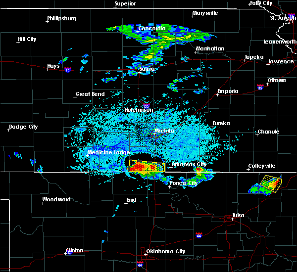 The severe thunderstorm warning for southern sumner county will expire at 530 pm cdt, the severe thunderstorm which prompted the warning has weakened. therefore, the warning will be allowed to expire. however gusty winds and heavy rain are still possible with this thunderstorm. The severe thunderstorm warning for southern sumner county will expire at 530 pm cdt, the severe thunderstorm which prompted the warning has weakened. therefore, the warning will be allowed to expire. however gusty winds and heavy rain are still possible with this thunderstorm.
|
| 7/7/2017 5:11 PM CDT |
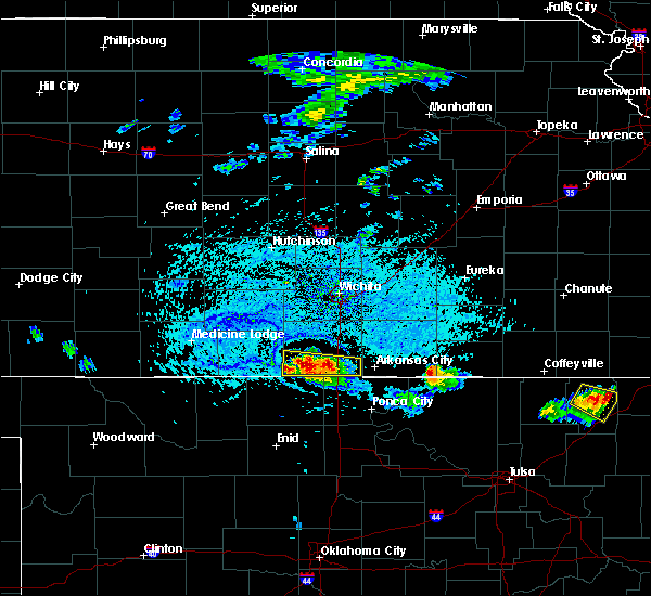 At 511 pm cdt, a severe thunderstorm was located near caldwell, and is nearly stationary (radar indicated). Hazards include 60 mph wind gusts and nickel size hail. Expect damage to roofs, siding, and trees. Locations impacted include, caldwell, south haven, geuda springs, hunnewell and perth. At 511 pm cdt, a severe thunderstorm was located near caldwell, and is nearly stationary (radar indicated). Hazards include 60 mph wind gusts and nickel size hail. Expect damage to roofs, siding, and trees. Locations impacted include, caldwell, south haven, geuda springs, hunnewell and perth.
|
| 7/7/2017 4:49 PM CDT |
 At 435 pm cdt, a severe thunderstorm was located 6 miles northeast of caldwell, and is nearly stationary (radar indicated). Hazards include 60 mph wind gusts and nickel size hail. expect damage to roofs, siding, and trees At 435 pm cdt, a severe thunderstorm was located 6 miles northeast of caldwell, and is nearly stationary (radar indicated). Hazards include 60 mph wind gusts and nickel size hail. expect damage to roofs, siding, and trees
|
| 7/7/2017 4:35 PM CDT |
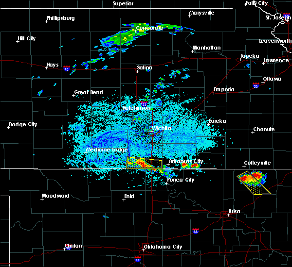 At 435 pm cdt, a severe thunderstorm was located 6 miles northeast of caldwell, and is nearly stationary (radar indicated). Hazards include 60 mph wind gusts and nickel size hail. expect damage to roofs, siding, and trees At 435 pm cdt, a severe thunderstorm was located 6 miles northeast of caldwell, and is nearly stationary (radar indicated). Hazards include 60 mph wind gusts and nickel size hail. expect damage to roofs, siding, and trees
|
| 7/7/2017 4:21 PM CDT |
 The severe thunderstorm warning for southwestern cowley and southeastern sumner counties will expire at 430 pm cdt, the storm which prompted the warning has weakened below severe limits, and no longer poses an immediate threat to life or property. therefore the warning will be allowed to expire. however gusty winds and heavy downpours are still possible with this thunderstorm. The severe thunderstorm warning for southwestern cowley and southeastern sumner counties will expire at 430 pm cdt, the storm which prompted the warning has weakened below severe limits, and no longer poses an immediate threat to life or property. therefore the warning will be allowed to expire. however gusty winds and heavy downpours are still possible with this thunderstorm.
|
| 7/7/2017 4:05 PM CDT |
 At 405 pm cdt, a severe thunderstorm was located 6 miles southwest of geuda springs, or 10 miles west of arkansas city, and is nearly stationary (radar indicated). Hazards include 60 mph wind gusts and quarter size hail. Hail damage to vehicles is expected. expect wind damage to roofs, siding, and trees. Locations impacted include, arkansas city, south haven and hunnewell. At 405 pm cdt, a severe thunderstorm was located 6 miles southwest of geuda springs, or 10 miles west of arkansas city, and is nearly stationary (radar indicated). Hazards include 60 mph wind gusts and quarter size hail. Hail damage to vehicles is expected. expect wind damage to roofs, siding, and trees. Locations impacted include, arkansas city, south haven and hunnewell.
|
| 7/7/2017 3:50 PM CDT |
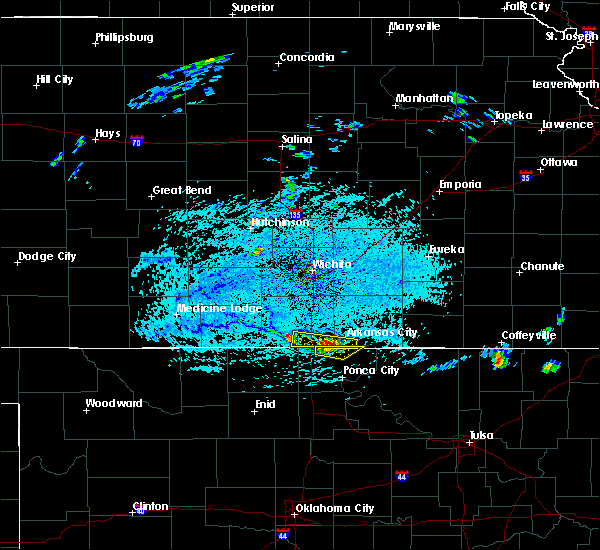 At 350 pm cdt, a severe thunderstorm was located 6 miles south of geuda springs, or 8 miles west of arkansas city, moving southeast at 10 mph (radar indicated). Hazards include 60 mph wind gusts and quarter size hail. Hail damage to vehicles is expected. expect wind damage to roofs, siding, and trees. Locations impacted include, arkansas city, south haven and hunnewell. At 350 pm cdt, a severe thunderstorm was located 6 miles south of geuda springs, or 8 miles west of arkansas city, moving southeast at 10 mph (radar indicated). Hazards include 60 mph wind gusts and quarter size hail. Hail damage to vehicles is expected. expect wind damage to roofs, siding, and trees. Locations impacted include, arkansas city, south haven and hunnewell.
|
| 7/7/2017 3:35 PM CDT |
 At 335 pm cdt, a severe thunderstorm was located 6 miles southwest of geuda springs, or 10 miles west of arkansas city, moving southeast at 10 mph (radar indicated). Hazards include 60 mph wind gusts and quarter size hail. Hail damage to vehicles is expected. Expect wind damage to roofs, siding, and trees. At 335 pm cdt, a severe thunderstorm was located 6 miles southwest of geuda springs, or 10 miles west of arkansas city, moving southeast at 10 mph (radar indicated). Hazards include 60 mph wind gusts and quarter size hail. Hail damage to vehicles is expected. Expect wind damage to roofs, siding, and trees.
|
| 6/29/2017 9:20 PM CDT |
 The severe thunderstorm warning for southern sumner county will expire at 230 am cdt, the storms which prompted the warning have moved out of the area. therefore the warning will be allowed to expire. a severe thunderstorm watch remains in effect until 500 am cdt for south central kansas. The severe thunderstorm warning for southern sumner county will expire at 230 am cdt, the storms which prompted the warning have moved out of the area. therefore the warning will be allowed to expire. a severe thunderstorm watch remains in effect until 500 am cdt for south central kansas.
|
| 6/29/2017 8:49 PM CDT |
 At 149 am cdt, severe thunderstorms were located along a line extending from argonia to near caldwell, moving east at 55 mph (radar indicated). Hazards include 60 mph wind gusts. expect damage to roofs, siding, and trees At 149 am cdt, severe thunderstorms were located along a line extending from argonia to near caldwell, moving east at 55 mph (radar indicated). Hazards include 60 mph wind gusts. expect damage to roofs, siding, and trees
|
| 6/15/2017 8:52 PM CDT |
 At 850 pm cdt, severe thunderstorms were located along a line extending from 8 miles north of cedar vale to arkansas city to 7 miles southeast of argonia, moving southeast at 35 mph (radar indicated). Hazards include 70 mph wind gusts and quarter size hail. Hail damage to vehicles is expected. expect considerable tree damage. wind damage is also likely to mobile homes, roofs, and outbuildings. Locations impacted include, arkansas city, winfield, wellington, belle plaine, conway springs, caldwell, oxford, udall, burden, argonia, south haven, dexter, geuda springs, mayfield, cambridge, milan, hunnewell, perth, maple city and winfield city lake. At 850 pm cdt, severe thunderstorms were located along a line extending from 8 miles north of cedar vale to arkansas city to 7 miles southeast of argonia, moving southeast at 35 mph (radar indicated). Hazards include 70 mph wind gusts and quarter size hail. Hail damage to vehicles is expected. expect considerable tree damage. wind damage is also likely to mobile homes, roofs, and outbuildings. Locations impacted include, arkansas city, winfield, wellington, belle plaine, conway springs, caldwell, oxford, udall, burden, argonia, south haven, dexter, geuda springs, mayfield, cambridge, milan, hunnewell, perth, maple city and winfield city lake.
|
| 6/15/2017 8:27 PM CDT |
 At 826 pm cdt, severe thunderstorms were located along a line extending from 8 miles northwest of grenola to oxford to 6 miles north of argonia, moving southeast at 35 mph (radar indicated). Hazards include 70 mph wind gusts and half dollar size hail. Hail damage to vehicles is expected. expect considerable tree damage. wind damage is also likely to mobile homes, roofs, and outbuildings. Locations impacted include, arkansas city, winfield, wellington, belle plaine, conway springs, caldwell, oxford, udall, burden, argonia, south haven, dexter, geuda springs, mayfield, cambridge, milan, hunnewell, perth, maple city and winfield city lake. At 826 pm cdt, severe thunderstorms were located along a line extending from 8 miles northwest of grenola to oxford to 6 miles north of argonia, moving southeast at 35 mph (radar indicated). Hazards include 70 mph wind gusts and half dollar size hail. Hail damage to vehicles is expected. expect considerable tree damage. wind damage is also likely to mobile homes, roofs, and outbuildings. Locations impacted include, arkansas city, winfield, wellington, belle plaine, conway springs, caldwell, oxford, udall, burden, argonia, south haven, dexter, geuda springs, mayfield, cambridge, milan, hunnewell, perth, maple city and winfield city lake.
|
| 6/15/2017 8:12 PM CDT |
 At 810 pm cdt, severe thunderstorms were located along a line extending from latham to near belle plaine to near norwich, moving southeast at 35 mph (trained weather spotters). Hazards include 70 mph wind gusts and quarter size hail. Hail damage to vehicles is expected. expect considerable tree damage. wind damage is also likely to mobile homes, roofs, and outbuildings. Locations impacted include, arkansas city, winfield, wellington, anthony, belle plaine, harper, conway springs, caldwell, oxford, udall, attica, burden, argonia, south haven, dexter, geuda springs, mayfield, cambridge, milan and hunnewell. At 810 pm cdt, severe thunderstorms were located along a line extending from latham to near belle plaine to near norwich, moving southeast at 35 mph (trained weather spotters). Hazards include 70 mph wind gusts and quarter size hail. Hail damage to vehicles is expected. expect considerable tree damage. wind damage is also likely to mobile homes, roofs, and outbuildings. Locations impacted include, arkansas city, winfield, wellington, anthony, belle plaine, harper, conway springs, caldwell, oxford, udall, attica, burden, argonia, south haven, dexter, geuda springs, mayfield, cambridge, milan and hunnewell.
|
| 6/15/2017 8:03 PM CDT |
 At 802 pm cdt, severe thunderstorms were located along a line extending from near latham to near belle plaine to near norwich, moving southeast at 35 mph (radar indicated). Hazards include 70 mph wind gusts and quarter size hail. Hail damage to vehicles is expected. expect considerable tree damage. wind damage is also likely to mobile homes, roofs, and outbuildings. This warning replaces the severe thunderstorm warning for harper county. At 802 pm cdt, severe thunderstorms were located along a line extending from near latham to near belle plaine to near norwich, moving southeast at 35 mph (radar indicated). Hazards include 70 mph wind gusts and quarter size hail. Hail damage to vehicles is expected. expect considerable tree damage. wind damage is also likely to mobile homes, roofs, and outbuildings. This warning replaces the severe thunderstorm warning for harper county.
|
| 6/14/2017 2:57 AM CDT |
 The severe thunderstorm warning for southeastern harper and sumner counties will expire at 300 am cdt, the storm which prompted the warning has weakened below severe limits, and no longer poses an immediate threat to life or property. therefore the warning will be allowed to expire. however gusty winds around 40 mph are still possible with this thunderstorm. to report severe weather, contact your nearest law enforcement agency. they will relay your report to the national weather service wichita. The severe thunderstorm warning for southeastern harper and sumner counties will expire at 300 am cdt, the storm which prompted the warning has weakened below severe limits, and no longer poses an immediate threat to life or property. therefore the warning will be allowed to expire. however gusty winds around 40 mph are still possible with this thunderstorm. to report severe weather, contact your nearest law enforcement agency. they will relay your report to the national weather service wichita.
|
| 6/14/2017 2:41 AM CDT |
 At 240 am cdt, a severe thunderstorm was located 9 miles northwest of caldwell, moving east at 50 mph (radar indicated). Hazards include 60 mph wind gusts and quarter size hail. Hail damage to vehicles is expected. expect wind damage to roofs, siding, and trees. Locations impacted include, wellington, anthony, caldwell, argonia, south haven, mayfield, milan, hunnewell, bluff city, freeport, perth, riverdale and wellington airport. At 240 am cdt, a severe thunderstorm was located 9 miles northwest of caldwell, moving east at 50 mph (radar indicated). Hazards include 60 mph wind gusts and quarter size hail. Hail damage to vehicles is expected. expect wind damage to roofs, siding, and trees. Locations impacted include, wellington, anthony, caldwell, argonia, south haven, mayfield, milan, hunnewell, bluff city, freeport, perth, riverdale and wellington airport.
|
| 6/14/2017 2:26 AM CDT |
 At 226 am cdt, a severe thunderstorm was located 7 miles northeast of manchester, or 8 miles southeast of anthony, moving east at 45 mph (radar indicated). Hazards include ping pong ball size hail and 60 mph wind gusts. People and animals outdoors will be injured. expect hail damage to roofs, siding, windows, and vehicles. expect wind damage to roofs, siding, and trees. Locations impacted include, wellington, anthony, caldwell, argonia, south haven, mayfield, milan, hunnewell, bluff city, freeport, perth, riverdale and wellington airport. At 226 am cdt, a severe thunderstorm was located 7 miles northeast of manchester, or 8 miles southeast of anthony, moving east at 45 mph (radar indicated). Hazards include ping pong ball size hail and 60 mph wind gusts. People and animals outdoors will be injured. expect hail damage to roofs, siding, windows, and vehicles. expect wind damage to roofs, siding, and trees. Locations impacted include, wellington, anthony, caldwell, argonia, south haven, mayfield, milan, hunnewell, bluff city, freeport, perth, riverdale and wellington airport.
|
| 6/14/2017 2:19 AM CDT |
 At 218 am cdt, a severe thunderstorm was located near manchester, or 7 miles south of anthony, moving east at 50 mph (radar indicated). Hazards include 60 mph wind gusts and half dollar size hail. Hail damage to vehicles is expected. Expect wind damage to roofs, siding, and trees. At 218 am cdt, a severe thunderstorm was located near manchester, or 7 miles south of anthony, moving east at 50 mph (radar indicated). Hazards include 60 mph wind gusts and half dollar size hail. Hail damage to vehicles is expected. Expect wind damage to roofs, siding, and trees.
|
| 5/19/2017 11:02 AM CDT |
 At 1102 am cdt, severe thunderstorms were located along a line extending from near conway springs to 5 miles west of wellington to near south haven, moving northeast at 40 mph (radar indicated). Hazards include 60 mph wind gusts and nickel size hail. Expect damage to roofs, siding, and trees. Locations impacted include, wichita, derby, arkansas city, winfield, andover, haysville, wellington, mulvane, rose hill, clearwater, douglass, belle plaine, conway springs, oxford, udall, burden, argonia, south haven, atlanta and geuda springs. At 1102 am cdt, severe thunderstorms were located along a line extending from near conway springs to 5 miles west of wellington to near south haven, moving northeast at 40 mph (radar indicated). Hazards include 60 mph wind gusts and nickel size hail. Expect damage to roofs, siding, and trees. Locations impacted include, wichita, derby, arkansas city, winfield, andover, haysville, wellington, mulvane, rose hill, clearwater, douglass, belle plaine, conway springs, oxford, udall, burden, argonia, south haven, atlanta and geuda springs.
|
| 5/19/2017 10:53 AM CDT |
 At 1053 am cdt, severe thunderstorms were located along a line extending from near argonia to 10 miles north of caldwell to near south haven, moving north at 50 mph (radar indicated). Hazards include 60 mph wind gusts and nickel size hail. Expect damage to roofs, siding, and trees. Locations impacted include, wichita, derby, arkansas city, winfield, andover, haysville, wellington, mulvane, rose hill, clearwater, douglass, belle plaine, conway springs, caldwell, oxford, udall, burden, argonia, south haven and dexter. At 1053 am cdt, severe thunderstorms were located along a line extending from near argonia to 10 miles north of caldwell to near south haven, moving north at 50 mph (radar indicated). Hazards include 60 mph wind gusts and nickel size hail. Expect damage to roofs, siding, and trees. Locations impacted include, wichita, derby, arkansas city, winfield, andover, haysville, wellington, mulvane, rose hill, clearwater, douglass, belle plaine, conway springs, caldwell, oxford, udall, burden, argonia, south haven and dexter.
|
| 5/19/2017 10:38 AM CDT |
 At 1038 am cdt, severe thunderstorms were located along a line extending from 8 miles northeast of manchester to near caldwell to near nardin, moving northeast at 50 mph (radar indicated). Hazards include 60 mph wind gusts and nickel size hail. expect damage to roofs, siding, and trees At 1038 am cdt, severe thunderstorms were located along a line extending from 8 miles northeast of manchester to near caldwell to near nardin, moving northeast at 50 mph (radar indicated). Hazards include 60 mph wind gusts and nickel size hail. expect damage to roofs, siding, and trees
|
| 3/26/2017 8:56 PM CDT |
 The severe thunderstorm warning for southeastern sumner county will expire at 900 pm cdt, the storm which prompted the warning has moved out of the area. therefore the warning will be allowed to expire. a severe thunderstorm watch remains in effect until 1100 pm cdt for south central kansas. The severe thunderstorm warning for southeastern sumner county will expire at 900 pm cdt, the storm which prompted the warning has moved out of the area. therefore the warning will be allowed to expire. a severe thunderstorm watch remains in effect until 1100 pm cdt for south central kansas.
|
| 3/26/2017 8:18 PM CDT |
 At 818 pm cdt, a severe thunderstorm was located near south haven, or 7 miles east of caldwell, moving east at 40 mph (radar indicated). Hazards include 60 mph wind gusts and half dollar size hail. Hail damage to vehicles is expected. Expect wind damage to roofs, siding, and trees. At 818 pm cdt, a severe thunderstorm was located near south haven, or 7 miles east of caldwell, moving east at 40 mph (radar indicated). Hazards include 60 mph wind gusts and half dollar size hail. Hail damage to vehicles is expected. Expect wind damage to roofs, siding, and trees.
|
| 3/26/2017 7:56 PM CDT |
 The severe thunderstorm warning for western sumner county will expire at 800 pm cdt, the storm which prompted the warning has weakened below severe limits, and no longer pose an immediate threat to life or property. therefore, the warning will be allowed to expire. a severe thunderstorm watch remains in effect until 1100 pm cdt for south central kansas. The severe thunderstorm warning for western sumner county will expire at 800 pm cdt, the storm which prompted the warning has weakened below severe limits, and no longer pose an immediate threat to life or property. therefore, the warning will be allowed to expire. a severe thunderstorm watch remains in effect until 1100 pm cdt for south central kansas.
|
| 3/26/2017 7:27 PM CDT |
 At 726 pm cdt, a severe thunderstorm was located 10 miles east of argonia, or 10 miles west of wellington, moving east at 25 mph (radar indicated). Hazards include 60 mph wind gusts and quarter size hail. Hail damage to vehicles is expected. expect wind damage to roofs, siding, and trees. Locations impacted include, wellington, caldwell, argonia, south haven, mayfield, milan, perth and wellington airport. At 726 pm cdt, a severe thunderstorm was located 10 miles east of argonia, or 10 miles west of wellington, moving east at 25 mph (radar indicated). Hazards include 60 mph wind gusts and quarter size hail. Hail damage to vehicles is expected. expect wind damage to roofs, siding, and trees. Locations impacted include, wellington, caldwell, argonia, south haven, mayfield, milan, perth and wellington airport.
|
| 3/26/2017 7:08 PM CDT |
 At 708 pm cdt, a severe thunderstorm was located near argonia, or 12 miles southwest of conway springs, moving east at 25 mph (radar indicated). Hazards include 60 mph wind gusts and quarter size hail. Hail damage to vehicles is expected. Expect wind damage to roofs, siding, and trees. At 708 pm cdt, a severe thunderstorm was located near argonia, or 12 miles southwest of conway springs, moving east at 25 mph (radar indicated). Hazards include 60 mph wind gusts and quarter size hail. Hail damage to vehicles is expected. Expect wind damage to roofs, siding, and trees.
|
| 10/6/2016 6:19 PM CDT |
 At 619 pm cdt, a severe thunderstorm was located near argonia, or 10 miles east of harper, moving northeast at 25 mph (radar indicated). Hazards include 60 mph wind gusts and half dollar size hail. Hail damage to vehicles is expected. Expect wind damage to roofs, siding, and trees. At 619 pm cdt, a severe thunderstorm was located near argonia, or 10 miles east of harper, moving northeast at 25 mph (radar indicated). Hazards include 60 mph wind gusts and half dollar size hail. Hail damage to vehicles is expected. Expect wind damage to roofs, siding, and trees.
|
| 10/6/2016 5:01 PM CDT |
 At 441 pm cdt, a severe thunderstorm was located 6 miles northwest of geuda springs, or 6 miles southwest of oxford, moving northeast at 55 mph (radar indicated). Hazards include ping pong ball size hail and 60 mph wind gusts. People and animals outdoors will be injured. expect hail damage to roofs, siding, windows, and vehicles. Expect wind damage to roofs, siding, and trees. At 441 pm cdt, a severe thunderstorm was located 6 miles northwest of geuda springs, or 6 miles southwest of oxford, moving northeast at 55 mph (radar indicated). Hazards include ping pong ball size hail and 60 mph wind gusts. People and animals outdoors will be injured. expect hail damage to roofs, siding, windows, and vehicles. Expect wind damage to roofs, siding, and trees.
|
| 10/6/2016 4:41 PM CDT |
 At 441 pm cdt, a severe thunderstorm was located 6 miles northwest of geuda springs, or 6 miles southwest of oxford, moving northeast at 55 mph (radar indicated). Hazards include ping pong ball size hail and 60 mph wind gusts. People and animals outdoors will be injured. expect hail damage to roofs, siding, windows, and vehicles. Expect wind damage to roofs, siding, and trees. At 441 pm cdt, a severe thunderstorm was located 6 miles northwest of geuda springs, or 6 miles southwest of oxford, moving northeast at 55 mph (radar indicated). Hazards include ping pong ball size hail and 60 mph wind gusts. People and animals outdoors will be injured. expect hail damage to roofs, siding, windows, and vehicles. Expect wind damage to roofs, siding, and trees.
|
| 10/6/2016 4:20 PM CDT |
 At 420 pm cdt, a severe thunderstorm was located 7 miles northeast of south haven, or 9 miles south of wellington, moving northeast at 30 mph (radar indicated). Hazards include 60 mph wind gusts and half dollar size hail. Hail damage to vehicles is expected. expect wind damage to roofs, siding, and trees. locations impacted include, wellington, belle plaine, caldwell, oxford, south haven, geuda springs, mayfield, hunnewell, riverdale, perth and wellington airport. A tornado watch remains in effect until 900 pm cdt for south central kansas. At 420 pm cdt, a severe thunderstorm was located 7 miles northeast of south haven, or 9 miles south of wellington, moving northeast at 30 mph (radar indicated). Hazards include 60 mph wind gusts and half dollar size hail. Hail damage to vehicles is expected. expect wind damage to roofs, siding, and trees. locations impacted include, wellington, belle plaine, caldwell, oxford, south haven, geuda springs, mayfield, hunnewell, riverdale, perth and wellington airport. A tornado watch remains in effect until 900 pm cdt for south central kansas.
|
| 10/6/2016 3:46 PM CDT |
 At 346 pm cdt, a severe thunderstorm was located near renfrow, or near caldwell, moving northeast at 25 mph (radar indicated). Hazards include 60 mph wind gusts and half dollar size hail. Hail damage to vehicles is expected. Expect wind damage to roofs, siding, and trees. At 346 pm cdt, a severe thunderstorm was located near renfrow, or near caldwell, moving northeast at 25 mph (radar indicated). Hazards include 60 mph wind gusts and half dollar size hail. Hail damage to vehicles is expected. Expect wind damage to roofs, siding, and trees.
|
| 10/4/2016 8:10 PM CDT | Quarter sized hail reported 3.6 miles N of South Haven, KS |
| 7/28/2016 9:25 PM CDT |
 The severe thunderstorm warning for southwestern butler, harper, western cowley, southeastern kingman and sumner counties will expire at 930 pm cdt, the storms which prompted the warning have weakened below severe limits, and no longer pose an immediate threat to life or property. therefore the warning will be allowed to expire. however gusty winds are still possible with these thunderstorms. a severe thunderstorm watch remains in effect until 1100 pm cdt for south central kansas. The severe thunderstorm warning for southwestern butler, harper, western cowley, southeastern kingman and sumner counties will expire at 930 pm cdt, the storms which prompted the warning have weakened below severe limits, and no longer pose an immediate threat to life or property. therefore the warning will be allowed to expire. however gusty winds are still possible with these thunderstorms. a severe thunderstorm watch remains in effect until 1100 pm cdt for south central kansas.
|
| 7/28/2016 9:07 PM CDT |
 At 907 pm cdt, severe thunderstorms were located along a line extending from 7 miles southwest of atlanta to geuda springs to anthony, moving southeast at 50 mph (radar indicated). Hazards include 60 mph wind gusts and nickel size hail. Expect damage to roofs. siding. and trees. Locations impacted include, arkansas city, winfield, wellington, mulvane, anthony, douglass, belle plaine, harper, conway springs, caldwell, oxford, udall, attica, argonia, south haven, geuda springs, rock, mayfield, milan and hunnewell. At 907 pm cdt, severe thunderstorms were located along a line extending from 7 miles southwest of atlanta to geuda springs to anthony, moving southeast at 50 mph (radar indicated). Hazards include 60 mph wind gusts and nickel size hail. Expect damage to roofs. siding. and trees. Locations impacted include, arkansas city, winfield, wellington, mulvane, anthony, douglass, belle plaine, harper, conway springs, caldwell, oxford, udall, attica, argonia, south haven, geuda springs, rock, mayfield, milan and hunnewell.
|
| 7/28/2016 8:42 PM CDT |
 At 841 pm cdt, severe thunderstorms were located along a line extending from near andover to near belle plaine to 6 miles north of attica, moving southeast at 55 mph. these are very dangerous storms (radar indicated). Hazards include 80 mph wind gusts and ping pong ball size hail. Flying debris will be dangerous to those caught without shelter. mobile homes will be heavily damaged. expect considerable damage to roofs, windows, and vehicles. Extensive tree damage and power outages are likely. At 841 pm cdt, severe thunderstorms were located along a line extending from near andover to near belle plaine to 6 miles north of attica, moving southeast at 55 mph. these are very dangerous storms (radar indicated). Hazards include 80 mph wind gusts and ping pong ball size hail. Flying debris will be dangerous to those caught without shelter. mobile homes will be heavily damaged. expect considerable damage to roofs, windows, and vehicles. Extensive tree damage and power outages are likely.
|
| 7/8/2016 5:49 AM CDT |
 At 549 am cdt, a severe thunderstorm was located over wellington, moving east at 40 mph (radar indicated). Hazards include 60 mph wind gusts and penny size hail. Expect damage to roofs. siding. and trees. Locations impacted include, arkansas city, winfield, wellington, belle plaine, oxford, udall, south haven, geuda springs, rock, riverdale, strother field airport and wellington airport. At 549 am cdt, a severe thunderstorm was located over wellington, moving east at 40 mph (radar indicated). Hazards include 60 mph wind gusts and penny size hail. Expect damage to roofs. siding. and trees. Locations impacted include, arkansas city, winfield, wellington, belle plaine, oxford, udall, south haven, geuda springs, rock, riverdale, strother field airport and wellington airport.
|
| 7/8/2016 5:30 AM CDT |
 At 530 am cdt, a severe thunderstorm was located 7 miles south of conway springs, moving east at 40 mph (radar indicated). Hazards include 60 mph wind gusts and nickel size hail. Expect damage to roofs. siding. And trees. At 530 am cdt, a severe thunderstorm was located 7 miles south of conway springs, moving east at 40 mph (radar indicated). Hazards include 60 mph wind gusts and nickel size hail. Expect damage to roofs. siding. And trees.
|
| 5/27/2016 5:41 PM CDT |
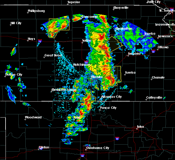 At 541 pm cdt, a severe thunderstorm was located over south haven, or 9 miles east of caldwell, moving northeast at 40 mph (radar indicated). Hazards include 60 mph wind gusts and quarter size hail. Hail damage to vehicles is expected. expect wind damage to roofs, siding, and trees. Locations impacted include, caldwell, south haven, hunnewell and perth. At 541 pm cdt, a severe thunderstorm was located over south haven, or 9 miles east of caldwell, moving northeast at 40 mph (radar indicated). Hazards include 60 mph wind gusts and quarter size hail. Hail damage to vehicles is expected. expect wind damage to roofs, siding, and trees. Locations impacted include, caldwell, south haven, hunnewell and perth.
|
| 5/27/2016 5:32 PM CDT |
 At 531 pm cdt, a severe thunderstorm was located near caldwell, moving northeast at 40 mph (radar indicated). Hazards include 60 mph wind gusts and half dollar size hail. Hail damage to vehicles is expected. Expect wind damage to roofs, siding, and trees. At 531 pm cdt, a severe thunderstorm was located near caldwell, moving northeast at 40 mph (radar indicated). Hazards include 60 mph wind gusts and half dollar size hail. Hail damage to vehicles is expected. Expect wind damage to roofs, siding, and trees.
|
| 5/27/2016 3:25 PM CDT |
 At 325 pm cdt, a severe thunderstorm was located 6 miles north of south haven, or 8 miles south of wellington, moving northeast at 20 mph (radar indicated). Hazards include golf ball size hail and 70 mph wind gusts. People and animals outdoors will be injured. expect hail damage to roofs, siding, windows, and vehicles. expect considerable tree damage. wind damage is also likely to mobile homes, roofs, and outbuildings. This severe thunderstorm will remain over mainly rural areas of southeastern sumner county, including the following locations: hunnewell, mayfield and perth. At 325 pm cdt, a severe thunderstorm was located 6 miles north of south haven, or 8 miles south of wellington, moving northeast at 20 mph (radar indicated). Hazards include golf ball size hail and 70 mph wind gusts. People and animals outdoors will be injured. expect hail damage to roofs, siding, windows, and vehicles. expect considerable tree damage. wind damage is also likely to mobile homes, roofs, and outbuildings. This severe thunderstorm will remain over mainly rural areas of southeastern sumner county, including the following locations: hunnewell, mayfield and perth.
|
| 5/27/2016 3:16 PM CDT |
 At 316 pm cdt, a severe thunderstorm was located 7 miles south of wellington, moving northeast at 25 mph (radar indicated). Hazards include 70 mph wind gusts and half dollar size hail. Hail damage to vehicles is expected. expect considerable tree damage. wind damage is also likely to mobile homes, roofs, and outbuildings. Locations impacted include, wellington, caldwell, south haven, mayfield, hunnewell and perth. At 316 pm cdt, a severe thunderstorm was located 7 miles south of wellington, moving northeast at 25 mph (radar indicated). Hazards include 70 mph wind gusts and half dollar size hail. Hail damage to vehicles is expected. expect considerable tree damage. wind damage is also likely to mobile homes, roofs, and outbuildings. Locations impacted include, wellington, caldwell, south haven, mayfield, hunnewell and perth.
|
| 5/27/2016 3:11 PM CDT |
 At 311 pm cdt, a severe thunderstorm was located 6 miles north of south haven, or 8 miles south of wellington, moving northeast at 25 mph (trained weather spotters). Hazards include golf ball size hail and 70 mph wind gusts. People and animals outdoors will be injured. expect hail damage to roofs, siding, windows, and vehicles. expect considerable tree damage. wind damage is also likely to mobile homes, roofs, and outbuildings. Locations impacted include, wellington, caldwell, south haven, mayfield, hunnewell and perth. At 311 pm cdt, a severe thunderstorm was located 6 miles north of south haven, or 8 miles south of wellington, moving northeast at 25 mph (trained weather spotters). Hazards include golf ball size hail and 70 mph wind gusts. People and animals outdoors will be injured. expect hail damage to roofs, siding, windows, and vehicles. expect considerable tree damage. wind damage is also likely to mobile homes, roofs, and outbuildings. Locations impacted include, wellington, caldwell, south haven, mayfield, hunnewell and perth.
|
| 5/27/2016 2:57 PM CDT |
 At 257 pm cdt, a severe thunderstorm was located 6 miles northwest of south haven, or 7 miles northeast of caldwell, moving northeast at 25 mph. spotters reported ping pong ball 4 miles northwest of caldwell (trained weather spotters). Hazards include golf ball size hail and 60 mph wind gusts. People and animals outdoors will be injured. expect hail damage to roofs, siding, windows, and vehicles. expect wind damage to roofs, siding, and trees. Locations impacted include, wellington, caldwell, south haven, mayfield, hunnewell and perth. At 257 pm cdt, a severe thunderstorm was located 6 miles northwest of south haven, or 7 miles northeast of caldwell, moving northeast at 25 mph. spotters reported ping pong ball 4 miles northwest of caldwell (trained weather spotters). Hazards include golf ball size hail and 60 mph wind gusts. People and animals outdoors will be injured. expect hail damage to roofs, siding, windows, and vehicles. expect wind damage to roofs, siding, and trees. Locations impacted include, wellington, caldwell, south haven, mayfield, hunnewell and perth.
|
| 5/27/2016 2:51 PM CDT |
 At 251 pm cdt, a severe thunderstorm was located near caldwell, moving northeast at 25 mph (radar indicated). Hazards include 60 mph wind gusts and half dollar size hail. Hail damage to vehicles is expected. expect wind damage to roofs, siding, and trees. Locations impacted include, wellington, caldwell, south haven, mayfield, hunnewell and perth. At 251 pm cdt, a severe thunderstorm was located near caldwell, moving northeast at 25 mph (radar indicated). Hazards include 60 mph wind gusts and half dollar size hail. Hail damage to vehicles is expected. expect wind damage to roofs, siding, and trees. Locations impacted include, wellington, caldwell, south haven, mayfield, hunnewell and perth.
|
| 5/27/2016 2:48 PM CDT |
 At 248 pm cdt, a severe thunderstorm was located near caldwell, moving northeast at 25 mph (radar indicated). Hazards include half dollar size hail. damage to vehicles is expected At 248 pm cdt, a severe thunderstorm was located near caldwell, moving northeast at 25 mph (radar indicated). Hazards include half dollar size hail. damage to vehicles is expected
|
| 5/26/2016 1:25 PM CDT |
 The severe thunderstorm warning for southern sumner county will expire at 130 pm cdt, the severe thunderstorm which prompted the warning has weakened. therefore the warning will be allowed to expire. however small. The severe thunderstorm warning for southern sumner county will expire at 130 pm cdt, the severe thunderstorm which prompted the warning has weakened. therefore the warning will be allowed to expire. however small.
|
| 5/26/2016 1:10 PM CDT |
 At 110 pm cdt, a severe thunderstorm was located 6 miles northeast of caldwell, moving northeast at 35 mph (radar indicated). Hazards include 60 mph wind gusts and quarter size hail. Hail damage to vehicles is expected. expect wind damage to roofs, siding, and trees. Locations impacted include, caldwell, south haven and perth. At 110 pm cdt, a severe thunderstorm was located 6 miles northeast of caldwell, moving northeast at 35 mph (radar indicated). Hazards include 60 mph wind gusts and quarter size hail. Hail damage to vehicles is expected. expect wind damage to roofs, siding, and trees. Locations impacted include, caldwell, south haven and perth.
|
| 5/26/2016 12:54 PM CDT |
 At 1254 pm cdt, a severe thunderstorm was located over caldwell, moving northeast at 35 mph (radar indicated). Hazards include 60 mph wind gusts and quarter size hail. Hail damage to vehicles is expected. Expect wind damage to roofs, siding, and trees. At 1254 pm cdt, a severe thunderstorm was located over caldwell, moving northeast at 35 mph (radar indicated). Hazards include 60 mph wind gusts and quarter size hail. Hail damage to vehicles is expected. Expect wind damage to roofs, siding, and trees.
|
| 5/13/2016 6:32 PM CDT |
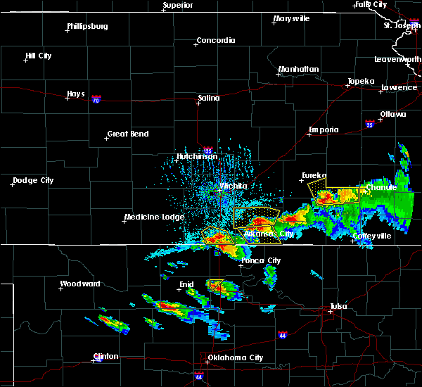 At 632 pm cdt, a severe thunderstorm was located over south haven, or 10 miles east of caldwell, moving southeast at 30 mph (radar indicated). Hazards include 60 mph wind gusts and quarter size hail. Hail damage to vehicles is expected. expect wind damage to roofs, siding, and trees. Locations impacted include, south haven, hunnewell and perth. At 632 pm cdt, a severe thunderstorm was located over south haven, or 10 miles east of caldwell, moving southeast at 30 mph (radar indicated). Hazards include 60 mph wind gusts and quarter size hail. Hail damage to vehicles is expected. expect wind damage to roofs, siding, and trees. Locations impacted include, south haven, hunnewell and perth.
|
| 5/13/2016 6:08 PM CDT |
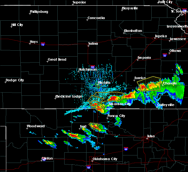 At 607 pm cdt, a severe thunderstorm was located 6 miles northwest of south haven, or 9 miles northeast of caldwell, moving southeast at 30 mph (radar indicated). Hazards include 60 mph wind gusts and half dollar size hail. Hail damage to vehicles is expected. Expect wind damage to roofs, siding, and trees. At 607 pm cdt, a severe thunderstorm was located 6 miles northwest of south haven, or 9 miles northeast of caldwell, moving southeast at 30 mph (radar indicated). Hazards include 60 mph wind gusts and half dollar size hail. Hail damage to vehicles is expected. Expect wind damage to roofs, siding, and trees.
|
| 5/9/2016 7:17 PM CDT |
 At 717 pm cdt, a severe thunderstorm was located 7 miles south of winfield, moving east at 25 mph (radar indicated). Hazards include ping pong ball size hail and 60 mph wind gusts. People and animals outdoors will be injured. expect hail damage to roofs, siding, windows, and vehicles. expect wind damage to roofs, siding, and trees. Locations impacted include, arkansas city, winfield, south haven, geuda springs, hunnewell, strother field airport and winfield city lake. At 717 pm cdt, a severe thunderstorm was located 7 miles south of winfield, moving east at 25 mph (radar indicated). Hazards include ping pong ball size hail and 60 mph wind gusts. People and animals outdoors will be injured. expect hail damage to roofs, siding, windows, and vehicles. expect wind damage to roofs, siding, and trees. Locations impacted include, arkansas city, winfield, south haven, geuda springs, hunnewell, strother field airport and winfield city lake.
|
| 5/9/2016 7:00 PM CDT |
 At 700 pm cdt, a severe thunderstorm was located near south haven, or 8 miles northeast of caldwell, moving northeast at 45 mph (radar indicated). Hazards include ping pong ball size hail and 60 mph wind gusts. People and animals outdoors will be injured. expect hail damage to roofs, siding, windows, and vehicles. Expect wind damage to roofs, siding, and trees. At 700 pm cdt, a severe thunderstorm was located near south haven, or 8 miles northeast of caldwell, moving northeast at 45 mph (radar indicated). Hazards include ping pong ball size hail and 60 mph wind gusts. People and animals outdoors will be injured. expect hail damage to roofs, siding, windows, and vehicles. Expect wind damage to roofs, siding, and trees.
|
| 5/9/2016 6:41 PM CDT |
 At 640 pm cdt, a severe thunderstorm was located near geuda springs, or 11 miles west of arkansas city, moving east at 20 mph (radar indicated). Hazards include ping pong ball size hail and 60 mph wind gusts. People and animals outdoors will be injured. expect hail damage to roofs, siding, windows, and vehicles. expect wind damage to roofs, siding, and trees. Locations impacted include, arkansas city, winfield, wellington, oxford, south haven, geuda springs, hunnewell and strother field airport. At 640 pm cdt, a severe thunderstorm was located near geuda springs, or 11 miles west of arkansas city, moving east at 20 mph (radar indicated). Hazards include ping pong ball size hail and 60 mph wind gusts. People and animals outdoors will be injured. expect hail damage to roofs, siding, windows, and vehicles. expect wind damage to roofs, siding, and trees. Locations impacted include, arkansas city, winfield, wellington, oxford, south haven, geuda springs, hunnewell and strother field airport.
|
| 5/9/2016 6:26 PM CDT |
 At 625 pm cdt, a severe thunderstorm was located 6 miles northeast of south haven, or 10 miles south of wellington, moving east at 25 mph (radar indicated). Hazards include golf ball size hail and 60 mph wind gusts. People and animals outdoors will be injured. expect hail damage to roofs, siding, windows, and vehicles. Expect wind damage to roofs, siding, and trees. At 625 pm cdt, a severe thunderstorm was located 6 miles northeast of south haven, or 10 miles south of wellington, moving east at 25 mph (radar indicated). Hazards include golf ball size hail and 60 mph wind gusts. People and animals outdoors will be injured. expect hail damage to roofs, siding, windows, and vehicles. Expect wind damage to roofs, siding, and trees.
|
| 5/9/2016 6:24 PM CDT |
 At 623 pm cdt, a severe thunderstorm was located 8 miles west of geuda springs, or 10 miles southeast of wellington, moving northeast at 35 mph (radar indicated). Hazards include golf ball size hail and 60 mph wind gusts. People and animals outdoors will be injured. expect hail damage to roofs, siding, windows, and vehicles. expect wind damage to roofs, siding, and trees. Locations impacted include, arkansas city, winfield, wellington, oxford, udall, south haven, atlanta, geuda springs, rock, hunnewell, strother field airport and winfield city lake. At 623 pm cdt, a severe thunderstorm was located 8 miles west of geuda springs, or 10 miles southeast of wellington, moving northeast at 35 mph (radar indicated). Hazards include golf ball size hail and 60 mph wind gusts. People and animals outdoors will be injured. expect hail damage to roofs, siding, windows, and vehicles. expect wind damage to roofs, siding, and trees. Locations impacted include, arkansas city, winfield, wellington, oxford, udall, south haven, atlanta, geuda springs, rock, hunnewell, strother field airport and winfield city lake.
|
| 5/9/2016 5:59 PM CDT |
 At 559 pm cdt, severe thunderstorms were located along a line extending from 5 miles east of mulvane to near oxford to near geuda springs, moving northeast at 25 mph (radar indicated). Hazards include 60 mph wind gusts and nickel size hail. Expect damage to roofs. siding. and trees. Locations impacted include, arkansas city, winfield, wellington, mulvane, belle plaine, oxford, udall, south haven, atlanta, geuda springs, rock, hunnewell, strother field airport, riverdale, wellington airport and winfield city lake. At 559 pm cdt, severe thunderstorms were located along a line extending from 5 miles east of mulvane to near oxford to near geuda springs, moving northeast at 25 mph (radar indicated). Hazards include 60 mph wind gusts and nickel size hail. Expect damage to roofs. siding. and trees. Locations impacted include, arkansas city, winfield, wellington, mulvane, belle plaine, oxford, udall, south haven, atlanta, geuda springs, rock, hunnewell, strother field airport, riverdale, wellington airport and winfield city lake.
|
| 5/9/2016 5:43 PM CDT |
 At 543 pm cdt, a severe thunderstorm was located near belle plaine, moving northeast at 40 mph (radar indicated). Hazards include 60 mph wind gusts and quarter size hail. Hail damage to vehicles is expected. Expect wind damage to roofs, siding, and trees. At 543 pm cdt, a severe thunderstorm was located near belle plaine, moving northeast at 40 mph (radar indicated). Hazards include 60 mph wind gusts and quarter size hail. Hail damage to vehicles is expected. Expect wind damage to roofs, siding, and trees.
|
| 5/16/2015 8:17 PM CDT | At 817 pm cdt, severe thunderstorms were located along a line extending from near belle plaine, to 7 miles southwest of oxford, to 5 miles northeast of braman, moving northeast at 45 mph (radar indicated). Hazards include 50 to 60 mph wind gusts. Expect damage to roofs. siding and trees. locations impacted include, wellington, mulvane, belle plaine, oxford, south haven, geuda springs, mayfield, hunnewell, riverdale, perth and wellington airport. a tornado watch remains in effect until midnight cdt for south central kansas. 75in. |
| 5/16/2015 8:01 PM CDT | At 801 pm cdt, severe thunderstorms were located along a line extending from near viola, to 7 miles southwest of wellington, to 7 miles west of braman, moving northeast at 55 mph (radar indicated). Hazards include 60 mph wind gusts. Expect damage to roofs. siding and trees. locations impacted include, wellington, mulvane, belle plaine, conway springs, caldwell, oxford, argonia, south haven, geuda springs, mayfield, milan, hunnewell, riverdale, perth and wellington airport. a tornado watch remains in effect until midnight cdt for south central kansas. 75in. |
| 5/16/2015 7:45 PM CDT | At 745 pm cdt, severe thunderstorms were located along a line extending from near argonia, to caldwell, to 5 miles west of deer creek, moving northeast at 60 mph (radar indicated). Hazards include 60 mph wind gusts. Expect damage to roofs. siding and trees. locations impacted include, wellington, mulvane, anthony, belle plaine, conway springs, caldwell, oxford, argonia, south haven, geuda springs, mayfield, milan, hunnewell, bluff city, danville, freeport, riverdale, perth and wellington airport. a tornado watch remains in effect until midnight cdt for south central kansas. 75in. |
| 5/16/2015 7:35 PM CDT | At 734 pm cdt, severe thunderstorms were located along a line extending from 5 miles southeast of harper, to 7 miles northeast of wakita, to near jefferson, moving northeast at 60 mph (radar indicated). Hazards include 60 mph wind gusts. Expect damage to roofs. Siding and trees. |
| 4/18/2015 9:25 PM CDT | At 910 pm cdt, a severe thunderstorm was located over udall moving northeast at 20 mph. a 2nd severe thunderstorm was located just south of wellington and was also moving northeast at 20 mph (radar indicated). Hazards include ping pong ball sized hail and 60 mph winds. People and animals outdoors will be injured. expect hail damage to roofs, siding, windows and vehicles. expect wind damage to roofs, siding and trees. locations impacted include, arkansas city, winfield, wellington, mulvane, belle plaine, caldwell, oxford, udall, south haven, geuda springs, rock, mayfield, hunnewell, riverdale, perth, wellington airport and strother field airport. 1. 50in. |
| 4/18/2015 9:15 PM CDT | At 910 pm cdt, a severe thunderstorm was located over udall moving northeast at 20 mph. a 2nd severe thunderstorm was located just south of wellington and was also moving northeast at 20 mph (radar indicated). Hazards include ping pong ball sized hail and 60 mph winds. People and animals outdoors will be injured. expect hail damage to roofs, siding, windows and vehicles. expect wind damage to roofs, siding and trees. locations impacted include, arkansas city, winfield, wellington, mulvane, belle plaine, caldwell, oxford, udall, south haven, geuda springs, rock, mayfield, hunnewell, riverdale, perth, wellington airport and strother field airport. 1. 50in. |
| 4/18/2015 8:59 PM CDT | this alert has expired |
| 7/23/2013 10:44 PM CDT | Damage trhoughout town with power outage in sumner county KS, 0.2 miles NNW of South Haven, KS |
| 7/23/2013 10:00 PM CDT | Power lines down. time estimated from radar in sumner county KS, 0.2 miles NNW of South Haven, KS |
| 6/15/2012 1:04 AM CDT | Large tree limbs downed near highway 81 and highway 166 intersectio in sumner county KS, 0.6 miles S of South Haven, KS |
| 1/1/0001 12:00 AM | Several power poles were knocked dow in sumner county KS, 6.1 miles S of South Haven, KS |
| 1/1/0001 12:00 AM | Several power poles were knocked dow in sumner county KS, 6.1 miles S of South Haven, KS |
| 1/1/0001 12:00 AM | Tennis Ball sized hail reported 0.2 miles NNW of South Haven, KS |
Hail Maps for South Haven, KS


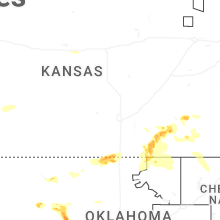


Connect with Interactive Hail Maps