

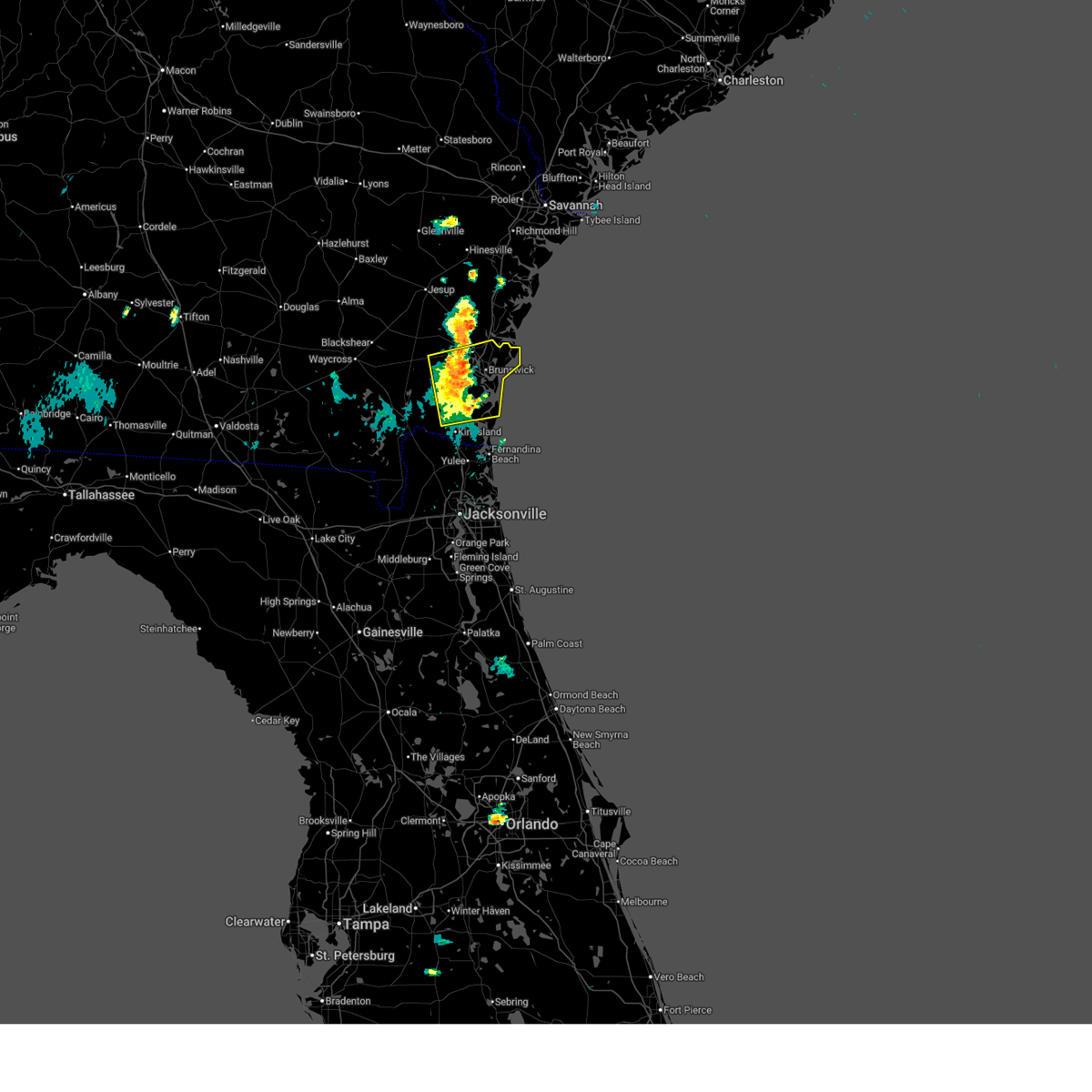
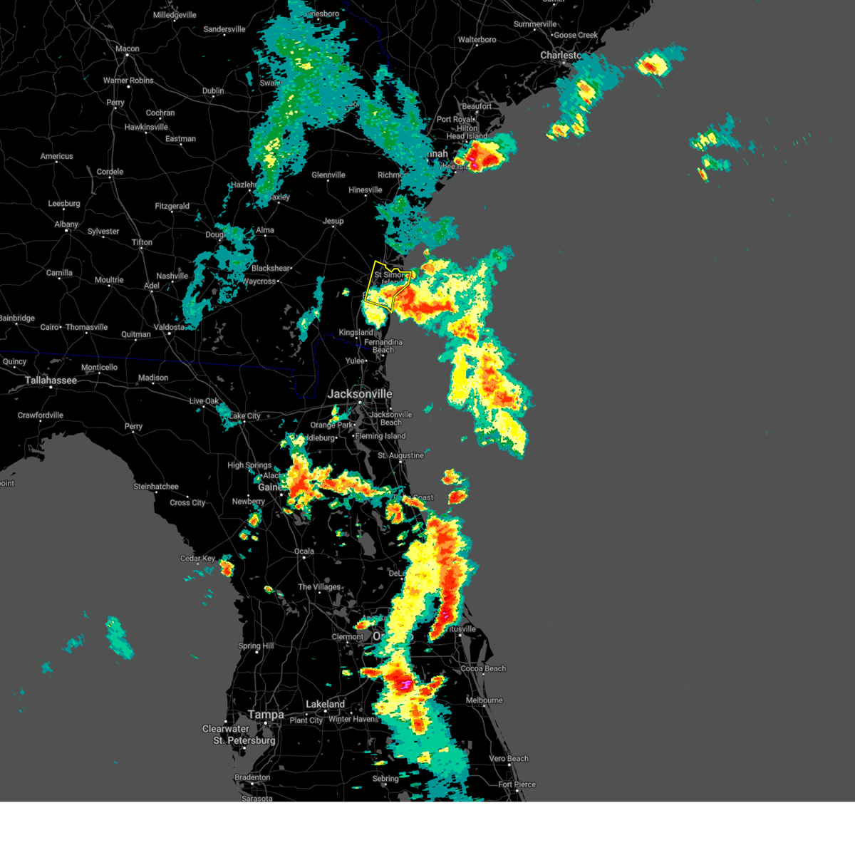
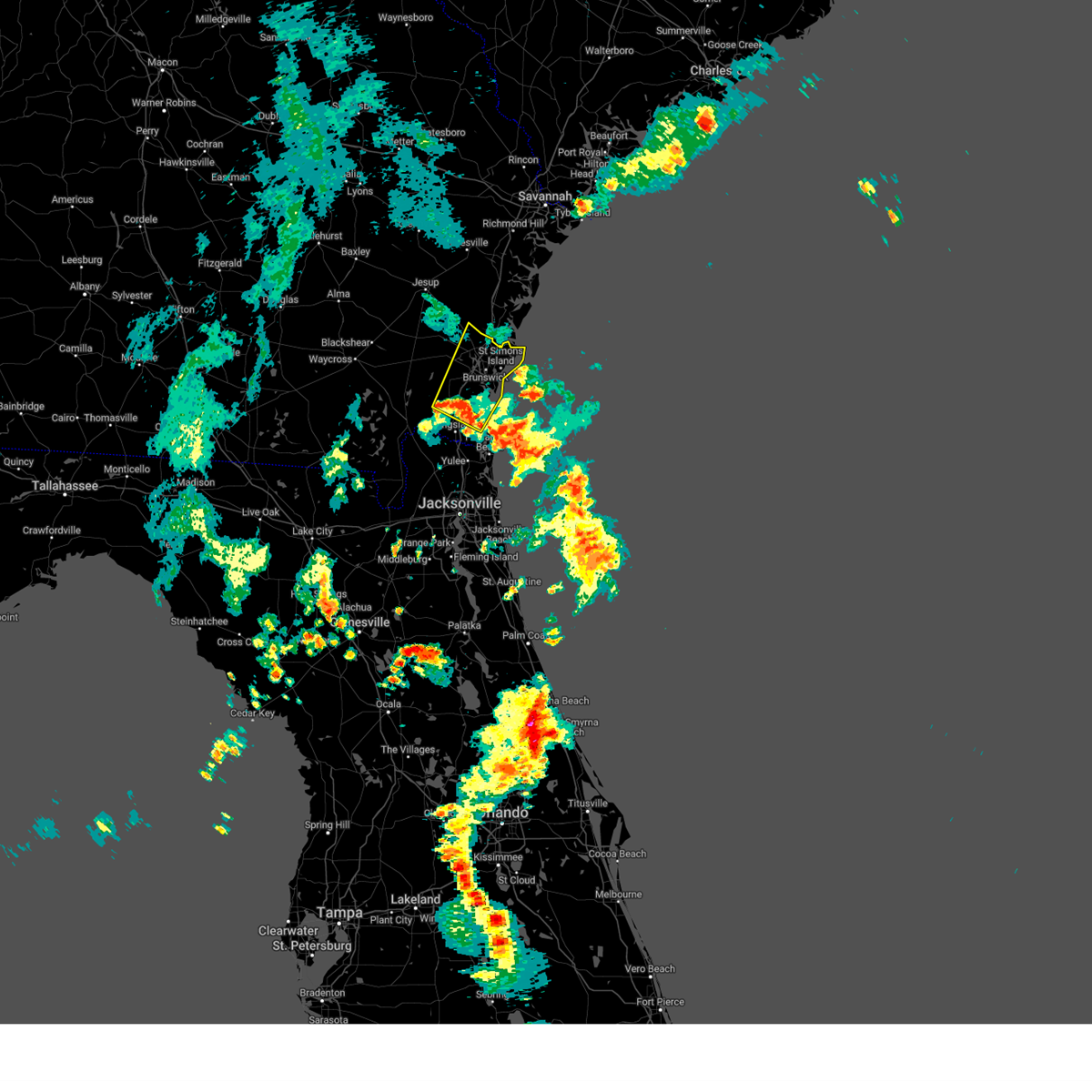
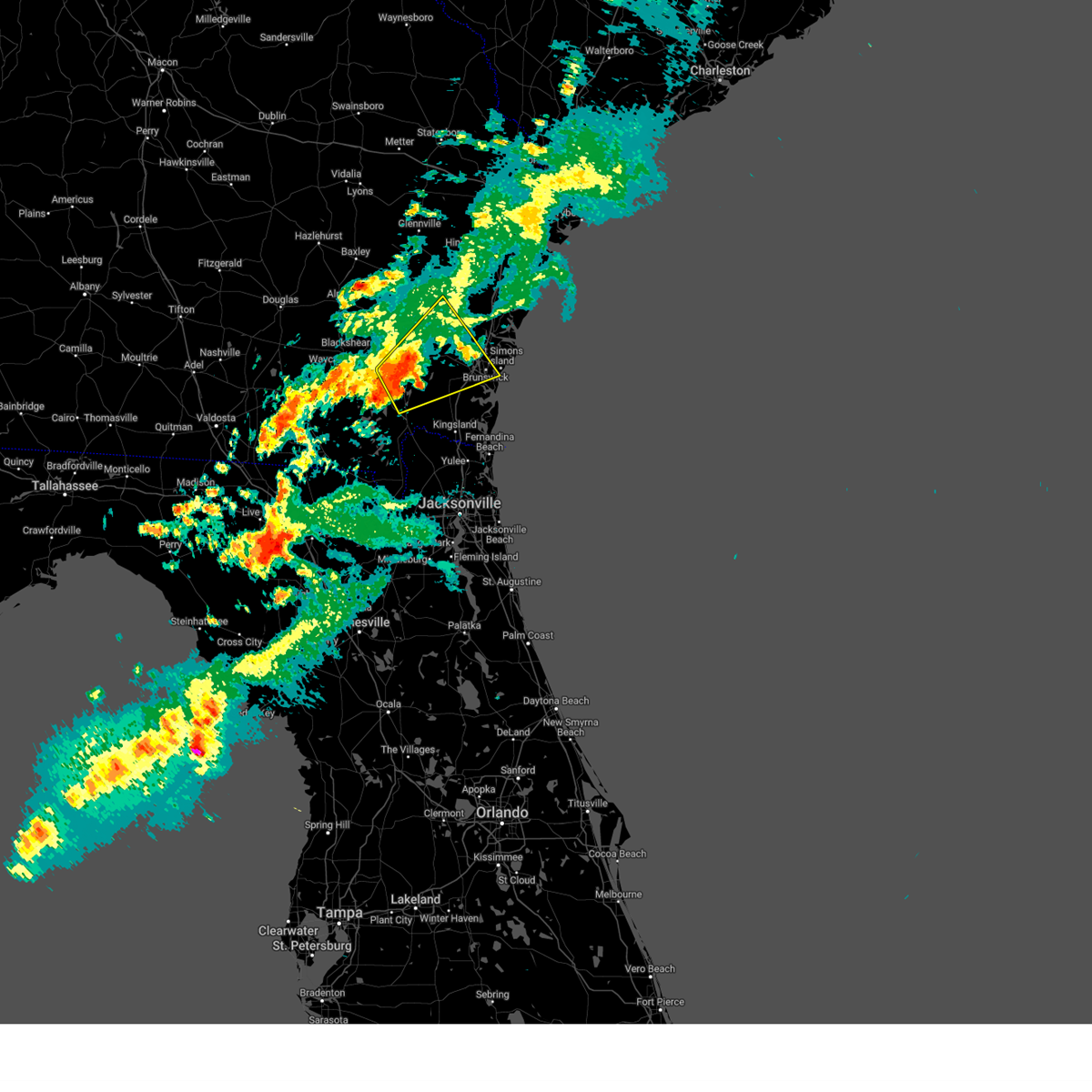
Hail Map for St. Simons, GA
The St. Simons, GA area has had 3 reports of on-the-ground hail by trained spotters, and has been under severe weather warnings 30 times during the past 12 months. Doppler radar has detected hail at or near St. Simons, GA on 42 occasions, including 3 occasions during the past year.
| Name: | St. Simons, GA |
| Where Located: | 59.9 miles NNE of Jacksonville, FL |
| Map: | Google Map for St. Simons, GA |
| Population: | 12743 |
| Housing Units: | 9931 |
| More Info: | Search Google for St. Simons, GA |
1
The Top Recent Hail Date for St. Simons, GA is Thursday, July 18, 2024 (11th out of 42)

Hail and Wind Damage Spotted near St. Simons, GA
| Date / Time | Report Details |
|---|---|
| 6/16/2025 7:51 PM EDT |
 The storm which prompted the warning has weakened below severe limits, and no longer poses an immediate threat to life or property. therefore, the warning will be allowed to expire. however, gusty winds and heavy rain are still possible with this thunderstorm. The storm which prompted the warning has weakened below severe limits, and no longer poses an immediate threat to life or property. therefore, the warning will be allowed to expire. however, gusty winds and heavy rain are still possible with this thunderstorm.
|
| 6/16/2025 7:35 PM EDT |
 Svrjax the national weather service in jacksonville has issued a * severe thunderstorm warning for, central camden county in southeastern georgia, glynn county in southeastern georgia, east central brantley county in southeastern georgia, * until 800 pm edt. * at 734 pm edt, a severe thunderstorm was located near woodbine, moving northeast at 15 mph (radar indicated). Hazards include 60 mph wind gusts and penny size hail. expect damage to roofs, siding, and trees Svrjax the national weather service in jacksonville has issued a * severe thunderstorm warning for, central camden county in southeastern georgia, glynn county in southeastern georgia, east central brantley county in southeastern georgia, * until 800 pm edt. * at 734 pm edt, a severe thunderstorm was located near woodbine, moving northeast at 15 mph (radar indicated). Hazards include 60 mph wind gusts and penny size hail. expect damage to roofs, siding, and trees
|
| 6/16/2025 7:26 PM EDT |
 At 726 pm edt, severe thunderstorms were located along a line extending from near waverly to near kingsland, moving northeast at 15 mph (radar indicated). Hazards include 60 mph wind gusts and penny size hail. Expect damage to roofs, siding, and trees. Locations impacted include, kingsland, woodbine, kings bay base, jekyll island, high point, tarboro, cumberland island, harrietts bluff, dover bluff, and colesburg. At 726 pm edt, severe thunderstorms were located along a line extending from near waverly to near kingsland, moving northeast at 15 mph (radar indicated). Hazards include 60 mph wind gusts and penny size hail. Expect damage to roofs, siding, and trees. Locations impacted include, kingsland, woodbine, kings bay base, jekyll island, high point, tarboro, cumberland island, harrietts bluff, dover bluff, and colesburg.
|
| 6/16/2025 7:26 PM EDT |
 the severe thunderstorm warning has been cancelled and is no longer in effect the severe thunderstorm warning has been cancelled and is no longer in effect
|
| 6/16/2025 7:09 PM EDT |
 Svrjax the national weather service in jacksonville has issued a * severe thunderstorm warning for, northeastern nassau county in northeastern florida, camden county in southeastern georgia, southeastern glynn county in southeastern georgia, * until 745 pm edt. * at 709 pm edt, severe thunderstorms were located along a line extending from 6 miles northwest of woodbine to near kingsland, moving northeast at 15 mph (radar indicated). Hazards include 60 mph wind gusts and penny size hail. expect damage to roofs, siding, and trees Svrjax the national weather service in jacksonville has issued a * severe thunderstorm warning for, northeastern nassau county in northeastern florida, camden county in southeastern georgia, southeastern glynn county in southeastern georgia, * until 745 pm edt. * at 709 pm edt, severe thunderstorms were located along a line extending from 6 miles northwest of woodbine to near kingsland, moving northeast at 15 mph (radar indicated). Hazards include 60 mph wind gusts and penny size hail. expect damage to roofs, siding, and trees
|
| 5/29/2025 7:06 PM EDT |
 The storm which prompted the warning has moved out of the area. therefore, the warning will be allowed to expire. however, gusty winds are still possible with this thunderstorm. The storm which prompted the warning has moved out of the area. therefore, the warning will be allowed to expire. however, gusty winds are still possible with this thunderstorm.
|
| 5/29/2025 6:56 PM EDT |
 At 656 pm edt, a severe thunderstorm was located over brunswick, moving northeast at 35 mph (radar indicated). Hazards include 60 mph wind gusts. Expect damage to roofs, siding, and trees. locations impacted include, brunswick, st. Simons island, dock junction, st simons island village, country club estates, sea island, jekyll island, and boys estate. At 656 pm edt, a severe thunderstorm was located over brunswick, moving northeast at 35 mph (radar indicated). Hazards include 60 mph wind gusts. Expect damage to roofs, siding, and trees. locations impacted include, brunswick, st. Simons island, dock junction, st simons island village, country club estates, sea island, jekyll island, and boys estate.
|
| 5/29/2025 6:46 PM EDT |
 At 646 pm edt, a severe thunderstorm was located near jekyll island, or near brunswick, moving northeast at 30 mph (radar indicated). Hazards include 60 mph wind gusts. Expect damage to roofs, siding, and trees. locations impacted include, brunswick, st. Simons island, dock junction, st simons island village, country club estates, sea island, jekyll island, boys estate, and dover bluff. At 646 pm edt, a severe thunderstorm was located near jekyll island, or near brunswick, moving northeast at 30 mph (radar indicated). Hazards include 60 mph wind gusts. Expect damage to roofs, siding, and trees. locations impacted include, brunswick, st. Simons island, dock junction, st simons island village, country club estates, sea island, jekyll island, boys estate, and dover bluff.
|
| 5/29/2025 6:36 PM EDT |
 At 636 pm edt, a severe thunderstorm was located 9 miles southwest of jekyll island, or 10 miles southwest of brunswick, moving northeast at 35 mph (radar indicated). Hazards include 60 mph wind gusts. Expect damage to roofs, siding, and trees. locations impacted include, brunswick, st. Simons island, woodbine, dock junction, st simons island village, country club estates, waverly, sea island, jekyll island, and boys estate. At 636 pm edt, a severe thunderstorm was located 9 miles southwest of jekyll island, or 10 miles southwest of brunswick, moving northeast at 35 mph (radar indicated). Hazards include 60 mph wind gusts. Expect damage to roofs, siding, and trees. locations impacted include, brunswick, st. Simons island, woodbine, dock junction, st simons island village, country club estates, waverly, sea island, jekyll island, and boys estate.
|
| 5/29/2025 6:28 PM EDT |
 Svrjax the national weather service in jacksonville has issued a * severe thunderstorm warning for, central camden county in southeastern georgia, glynn county in southeastern georgia, * until 715 pm edt. * at 628 pm edt, a severe thunderstorm was located near woodbine, moving northeast at 35 mph (radar indicated). Hazards include 60 mph wind gusts. expect damage to roofs, siding, and trees Svrjax the national weather service in jacksonville has issued a * severe thunderstorm warning for, central camden county in southeastern georgia, glynn county in southeastern georgia, * until 715 pm edt. * at 628 pm edt, a severe thunderstorm was located near woodbine, moving northeast at 35 mph (radar indicated). Hazards include 60 mph wind gusts. expect damage to roofs, siding, and trees
|
| 5/25/2025 3:56 PM EDT |
 Svrjax the national weather service in jacksonville has issued a * severe thunderstorm warning for, northeastern camden county in southeastern georgia, southeastern glynn county in southeastern georgia, * until 430 pm edt. * at 356 pm edt, severe thunderstorms were located along a line extending from near little saint simons island to 6 miles southwest of brunswick, moving southeast at 25 mph (radar indicated). Hazards include 60 mph wind gusts and quarter size hail. Hail damage to vehicles is expected. Expect wind damage to roofs, siding, and trees. Svrjax the national weather service in jacksonville has issued a * severe thunderstorm warning for, northeastern camden county in southeastern georgia, southeastern glynn county in southeastern georgia, * until 430 pm edt. * at 356 pm edt, severe thunderstorms were located along a line extending from near little saint simons island to 6 miles southwest of brunswick, moving southeast at 25 mph (radar indicated). Hazards include 60 mph wind gusts and quarter size hail. Hail damage to vehicles is expected. Expect wind damage to roofs, siding, and trees.
|
| 5/25/2025 3:33 PM EDT |
 Svrjax the national weather service in jacksonville has issued a * severe thunderstorm warning for, central glynn county in southeastern georgia, * until 400 pm edt. * at 333 pm edt, a severe thunderstorm was located near darien, moving southeast at 15 mph (radar indicated). Hazards include 60 mph wind gusts and quarter size hail. Hail damage to vehicles is expected. Expect wind damage to roofs, siding, and trees. Svrjax the national weather service in jacksonville has issued a * severe thunderstorm warning for, central glynn county in southeastern georgia, * until 400 pm edt. * at 333 pm edt, a severe thunderstorm was located near darien, moving southeast at 15 mph (radar indicated). Hazards include 60 mph wind gusts and quarter size hail. Hail damage to vehicles is expected. Expect wind damage to roofs, siding, and trees.
|
| 3/16/2025 11:32 AM EDT |
 the severe thunderstorm warning has been cancelled and is no longer in effect the severe thunderstorm warning has been cancelled and is no longer in effect
|
| 3/16/2025 11:32 AM EDT |
 At 1132 am edt, a severe thunderstorm was located near thalmann, or 9 miles northwest of dock junction, moving northeast at 50 mph (radar indicated). Hazards include 60 mph wind gusts and penny size hail. Expect damage to roofs, siding, and trees. Locations impacted include, brunswick, waverly, atkinson, dock junction, mount pleasant, thalmann, hortense, everett, tarboro, and gardi. At 1132 am edt, a severe thunderstorm was located near thalmann, or 9 miles northwest of dock junction, moving northeast at 50 mph (radar indicated). Hazards include 60 mph wind gusts and penny size hail. Expect damage to roofs, siding, and trees. Locations impacted include, brunswick, waverly, atkinson, dock junction, mount pleasant, thalmann, hortense, everett, tarboro, and gardi.
|
| 3/16/2025 11:30 AM EDT |
 Svrjax the national weather service in jacksonville has issued a * severe thunderstorm warning for, central glynn county in southeastern georgia, southeastern wayne county in southeastern georgia, * until noon edt. * at 1130 am edt, a severe thunderstorm was located near everett, or 8 miles west of darien, moving northeast at 45 mph (radar indicated). Hazards include 60 mph wind gusts and penny size hail. expect damage to roofs, siding, and trees Svrjax the national weather service in jacksonville has issued a * severe thunderstorm warning for, central glynn county in southeastern georgia, southeastern wayne county in southeastern georgia, * until noon edt. * at 1130 am edt, a severe thunderstorm was located near everett, or 8 miles west of darien, moving northeast at 45 mph (radar indicated). Hazards include 60 mph wind gusts and penny size hail. expect damage to roofs, siding, and trees
|
| 3/16/2025 11:04 AM EDT |
 Svrjax the national weather service in jacksonville has issued a * severe thunderstorm warning for, northwestern camden county in southeastern georgia, glynn county in southeastern georgia, east central pierce county in southeastern georgia, brantley county in southeastern georgia, southeastern wayne county in southeastern georgia, northeastern charlton county in southeastern georgia, * until 1145 am edt. * at 1104 am edt, a severe thunderstorm was located near hickox, or 7 miles south of nahunta, moving northeast at 50 mph (radar indicated). Hazards include 60 mph wind gusts and penny size hail. expect damage to roofs, siding, and trees Svrjax the national weather service in jacksonville has issued a * severe thunderstorm warning for, northwestern camden county in southeastern georgia, glynn county in southeastern georgia, east central pierce county in southeastern georgia, brantley county in southeastern georgia, southeastern wayne county in southeastern georgia, northeastern charlton county in southeastern georgia, * until 1145 am edt. * at 1104 am edt, a severe thunderstorm was located near hickox, or 7 miles south of nahunta, moving northeast at 50 mph (radar indicated). Hazards include 60 mph wind gusts and penny size hail. expect damage to roofs, siding, and trees
|
| 9/26/2024 9:22 PM EDT |
 The storm which prompted the warning has moved out of the area. therefore, the warning will be allowed to expire. a tornado watch remains in effect until 600 am edt for southeastern georgia. The storm which prompted the warning has moved out of the area. therefore, the warning will be allowed to expire. a tornado watch remains in effect until 600 am edt for southeastern georgia.
|
| 9/26/2024 9:14 PM EDT |
 The tornado warning that was previously in effect has been reissued for glynn county and is in effect until 930pm. please refer to that bulletin for the latest severe weather information. a tornado watch remains in effect until 600 am edt for southeastern georgia. The tornado warning that was previously in effect has been reissued for glynn county and is in effect until 930pm. please refer to that bulletin for the latest severe weather information. a tornado watch remains in effect until 600 am edt for southeastern georgia.
|
| 9/26/2024 9:13 PM EDT |
 Torjax the national weather service in jacksonville has issued a * tornado warning for, central glynn county in southeastern georgia, * until 930 pm edt. * at 912 pm edt, a severe thunderstorm capable of producing a tornado was located near country club estates, or near dock junction, moving northwest at 55 mph (radar indicated rotation). Hazards include tornado. Flying debris will be dangerous to those caught without shelter. mobile homes will be damaged or destroyed. damage to roofs, windows, and vehicles will occur. tree damage is likely. This tornadic thunderstorm will remain over mainly rural areas of central glynn county, including the following locations, boys estate. Torjax the national weather service in jacksonville has issued a * tornado warning for, central glynn county in southeastern georgia, * until 930 pm edt. * at 912 pm edt, a severe thunderstorm capable of producing a tornado was located near country club estates, or near dock junction, moving northwest at 55 mph (radar indicated rotation). Hazards include tornado. Flying debris will be dangerous to those caught without shelter. mobile homes will be damaged or destroyed. damage to roofs, windows, and vehicles will occur. tree damage is likely. This tornadic thunderstorm will remain over mainly rural areas of central glynn county, including the following locations, boys estate.
|
| 9/26/2024 8:49 PM EDT |
 Torjax the national weather service in jacksonville has issued a * tornado warning for, central glynn county in southeastern georgia, * until 915 pm edt. * at 848 pm edt, a severe thunderstorm capable of producing a tornado was located over st. simons island, moving northwest at 60 mph (radar indicated rotation). Hazards include tornado. Flying debris will be dangerous to those caught without shelter. mobile homes will be damaged or destroyed. damage to roofs, windows, and vehicles will occur. tree damage is likely. this dangerous storm will be near, country club estates around 855 pm edt. Other locations impacted by this tornadic thunderstorm include boys estate. Torjax the national weather service in jacksonville has issued a * tornado warning for, central glynn county in southeastern georgia, * until 915 pm edt. * at 848 pm edt, a severe thunderstorm capable of producing a tornado was located over st. simons island, moving northwest at 60 mph (radar indicated rotation). Hazards include tornado. Flying debris will be dangerous to those caught without shelter. mobile homes will be damaged or destroyed. damage to roofs, windows, and vehicles will occur. tree damage is likely. this dangerous storm will be near, country club estates around 855 pm edt. Other locations impacted by this tornadic thunderstorm include boys estate.
|
| 9/26/2024 8:16 PM EDT |
 Torjax the national weather service in jacksonville has issued a * tornado warning for, east central camden county in southeastern georgia, glynn county in southeastern georgia, * until 845 pm edt. * at 815 pm edt, a severe thunderstorm capable of producing a tornado was located over jekyll island, or 8 miles south of st. simons island, moving northwest at 50 mph (radar indicated rotation). Hazards include tornado. Flying debris will be dangerous to those caught without shelter. mobile homes will be damaged or destroyed. damage to roofs, windows, and vehicles will occur. tree damage is likely. this dangerous storm will be near, brunswick, st. simons island, and st simons island village around 820 pm edt. dock junction and country club estates around 825 pm edt. Other locations impacted by this tornadic thunderstorm include boys estate. Torjax the national weather service in jacksonville has issued a * tornado warning for, east central camden county in southeastern georgia, glynn county in southeastern georgia, * until 845 pm edt. * at 815 pm edt, a severe thunderstorm capable of producing a tornado was located over jekyll island, or 8 miles south of st. simons island, moving northwest at 50 mph (radar indicated rotation). Hazards include tornado. Flying debris will be dangerous to those caught without shelter. mobile homes will be damaged or destroyed. damage to roofs, windows, and vehicles will occur. tree damage is likely. this dangerous storm will be near, brunswick, st. simons island, and st simons island village around 820 pm edt. dock junction and country club estates around 825 pm edt. Other locations impacted by this tornadic thunderstorm include boys estate.
|
| 9/26/2024 11:31 AM EDT |
 the tornado warning has been cancelled and is no longer in effect the tornado warning has been cancelled and is no longer in effect
|
| 9/26/2024 11:23 AM EDT |
 At 1123 am edt, a severe thunderstorm capable of producing a tornado was located over st. simons island, moving north at 30 mph (radar indicated rotation). Hazards include tornado. Flying debris will be dangerous to those caught without shelter. mobile homes will be damaged or destroyed. damage to roofs, windows, and vehicles will occur. tree damage is likely. this dangerous storm will be near, dock junction and country club estates around 1130 am edt. Other locations impacted by this tornadic thunderstorm include boys estate. At 1123 am edt, a severe thunderstorm capable of producing a tornado was located over st. simons island, moving north at 30 mph (radar indicated rotation). Hazards include tornado. Flying debris will be dangerous to those caught without shelter. mobile homes will be damaged or destroyed. damage to roofs, windows, and vehicles will occur. tree damage is likely. this dangerous storm will be near, dock junction and country club estates around 1130 am edt. Other locations impacted by this tornadic thunderstorm include boys estate.
|
| 9/26/2024 11:14 AM EDT |
 Torjax the national weather service in jacksonville has issued a * tornado warning for, southeastern glynn county in southeastern georgia, * until 1145 am edt. * at 1114 am edt, a severe thunderstorm capable of producing a tornado was located over st simons island village, or near st. simons island, moving north near 25 mph (radar indicated rotation). Hazards include tornado. Flying debris will be dangerous to those caught without shelter. mobile homes will be damaged or destroyed. damage to roofs, windows, and vehicles will occur. tree damage is likely. this dangerous storm will be near, brunswick, st. simons island, st simons island village, and country club estates around 1120 am edt. dock junction around 1125 am edt. Other locations impacted by this tornadic thunderstorm include boys estate. Torjax the national weather service in jacksonville has issued a * tornado warning for, southeastern glynn county in southeastern georgia, * until 1145 am edt. * at 1114 am edt, a severe thunderstorm capable of producing a tornado was located over st simons island village, or near st. simons island, moving north near 25 mph (radar indicated rotation). Hazards include tornado. Flying debris will be dangerous to those caught without shelter. mobile homes will be damaged or destroyed. damage to roofs, windows, and vehicles will occur. tree damage is likely. this dangerous storm will be near, brunswick, st. simons island, st simons island village, and country club estates around 1120 am edt. dock junction around 1125 am edt. Other locations impacted by this tornadic thunderstorm include boys estate.
|
| 7/18/2024 5:31 PM EDT |
 The storms which prompted the warning have weakened below severe limits, and no longer pose an immediate threat to life or property. therefore, the warning has been allowed to expire. however, gusty winds are still expected with these thunderstorms. The storms which prompted the warning have weakened below severe limits, and no longer pose an immediate threat to life or property. therefore, the warning has been allowed to expire. however, gusty winds are still expected with these thunderstorms.
|
| 7/18/2024 5:08 PM EDT |
 At 508 pm edt, severe thunderstorms were located along a line extending from near dock junction to near st simons island village, moving northeast at 25 mph (radar indicated). Hazards include 60 mph wind gusts and penny size hail. Expect damage to roofs, siding, and trees. locations impacted include, brunswick, st. Simons island, dock junction, st simons island village, country club estates, sea island, and boys estate. At 508 pm edt, severe thunderstorms were located along a line extending from near dock junction to near st simons island village, moving northeast at 25 mph (radar indicated). Hazards include 60 mph wind gusts and penny size hail. Expect damage to roofs, siding, and trees. locations impacted include, brunswick, st. Simons island, dock junction, st simons island village, country club estates, sea island, and boys estate.
|
| 7/18/2024 4:42 PM EDT |
 Svrjax the national weather service in jacksonville has issued a * severe thunderstorm warning for, central glynn county in southeastern georgia, * until 530 pm edt. * at 441 pm edt, a severe thunderstorm was located over dock junction, moving northeast at 15 mph (radar indicated). Hazards include 60 mph wind gusts and penny size hail. expect damage to roofs, siding, and trees Svrjax the national weather service in jacksonville has issued a * severe thunderstorm warning for, central glynn county in southeastern georgia, * until 530 pm edt. * at 441 pm edt, a severe thunderstorm was located over dock junction, moving northeast at 15 mph (radar indicated). Hazards include 60 mph wind gusts and penny size hail. expect damage to roofs, siding, and trees
|
| 7/15/2024 4:21 PM EDT |
 The storm which prompted the warning has weakened below severe limits, and has exited the warned area. therefore, the warning will be allowed to expire. to report severe weather, contact your nearest law enforcement agency. they will relay your report to the national weather service jacksonville. The storm which prompted the warning has weakened below severe limits, and has exited the warned area. therefore, the warning will be allowed to expire. to report severe weather, contact your nearest law enforcement agency. they will relay your report to the national weather service jacksonville.
|
| 7/15/2024 4:02 PM EDT | At 402 pm edt, a severe thunderstorm was located over dock junction, and is nearly stationary (radar indicated). Hazards include 60 mph wind gusts and penny size hail. Expect damage to roofs, siding, and trees. locations impacted include, brunswick, st. Simons island, dock junction, st simons island village, country club estates, sea island, and jekyll island. |
| 7/15/2024 3:38 PM EDT |
 Svrjax the national weather service in jacksonville has issued a * severe thunderstorm warning for, central glynn county in southeastern georgia, * until 430 pm edt. * at 337 pm edt, a severe thunderstorm was located over dock junction, and is nearly stationary (radar indicated). Hazards include 60 mph wind gusts and penny size hail. expect damage to roofs, siding, and trees Svrjax the national weather service in jacksonville has issued a * severe thunderstorm warning for, central glynn county in southeastern georgia, * until 430 pm edt. * at 337 pm edt, a severe thunderstorm was located over dock junction, and is nearly stationary (radar indicated). Hazards include 60 mph wind gusts and penny size hail. expect damage to roofs, siding, and trees
|
| 6/28/2024 3:56 PM EDT |
 Svrjax the national weather service in jacksonville has issued a * severe thunderstorm warning for, northern camden county in southeastern georgia, glynn county in southeastern georgia, eastern brantley county in southeastern georgia, southeastern wayne county in southeastern georgia, * until 500 pm edt. * at 356 pm edt, a severe thunderstorm was located over waverly, or 9 miles north of woodbine, moving north at 25 mph (radar indicated). Hazards include 60 mph wind gusts and penny size hail. expect damage to roofs, siding, and trees Svrjax the national weather service in jacksonville has issued a * severe thunderstorm warning for, northern camden county in southeastern georgia, glynn county in southeastern georgia, eastern brantley county in southeastern georgia, southeastern wayne county in southeastern georgia, * until 500 pm edt. * at 356 pm edt, a severe thunderstorm was located over waverly, or 9 miles north of woodbine, moving north at 25 mph (radar indicated). Hazards include 60 mph wind gusts and penny size hail. expect damage to roofs, siding, and trees
|
| 5/19/2024 5:29 PM EDT |
 The storm which prompted the warning has weakened below severe limits. therefore, the warning will be allowed to expire. however, gusty winds are still possible with this thunderstorm as it shifts offshore into the atlantic. The storm which prompted the warning has weakened below severe limits. therefore, the warning will be allowed to expire. however, gusty winds are still possible with this thunderstorm as it shifts offshore into the atlantic.
|
| 5/19/2024 5:15 PM EDT |
 Svrjax the national weather service in jacksonville has issued a * severe thunderstorm warning for, east central glynn county in southeastern georgia, * until 530 pm edt. * at 515 pm edt, a severe thunderstorm was located near country club estates, or near st. simons island, moving east at 25 mph (radar indicated). Hazards include 60 mph wind gusts and nickel size hail. expect damage to roofs, siding, and trees Svrjax the national weather service in jacksonville has issued a * severe thunderstorm warning for, east central glynn county in southeastern georgia, * until 530 pm edt. * at 515 pm edt, a severe thunderstorm was located near country club estates, or near st. simons island, moving east at 25 mph (radar indicated). Hazards include 60 mph wind gusts and nickel size hail. expect damage to roofs, siding, and trees
|
| 5/10/2024 9:44 AM EDT |
 The storms which prompted the warning have weakened below severe limits, and have exited the warned area. therefore, the warning will be allowed to expire. a severe thunderstorm watch remains in effect until noon edt for southeastern georgia. to report severe weather, contact your nearest law enforcement agency. they will relay your report to the national weather service jacksonville. The storms which prompted the warning have weakened below severe limits, and have exited the warned area. therefore, the warning will be allowed to expire. a severe thunderstorm watch remains in effect until noon edt for southeastern georgia. to report severe weather, contact your nearest law enforcement agency. they will relay your report to the national weather service jacksonville.
|
| 5/10/2024 9:25 AM EDT |
 Svrjax the national weather service in jacksonville has issued a * severe thunderstorm warning for, northeastern camden county in southeastern georgia, central glynn county in southeastern georgia, * until 945 am edt. * at 925 am edt, severe thunderstorms were located along a line extending from near thalmann to 6 miles northeast of woodbine, moving northeast at 65 mph (radar indicated). Hazards include 60 mph wind gusts and penny size hail. expect damage to roofs, siding, and trees Svrjax the national weather service in jacksonville has issued a * severe thunderstorm warning for, northeastern camden county in southeastern georgia, central glynn county in southeastern georgia, * until 945 am edt. * at 925 am edt, severe thunderstorms were located along a line extending from near thalmann to 6 miles northeast of woodbine, moving northeast at 65 mph (radar indicated). Hazards include 60 mph wind gusts and penny size hail. expect damage to roofs, siding, and trees
|
| 5/10/2024 9:17 AM EDT |
 At 916 am edt, severe thunderstorms were located along a line extending from near thalmann to 6 miles west of jekyll island, moving east at 55 mph (radar indicated). Hazards include 60 mph wind gusts and penny size hail. Expect damage to roofs, siding, and trees. locations impacted include, brunswick, st. Simons island, woodbine, dock junction, country club estates, waverly, jekyll island, st simons island village, tarboro, and dover bluff. At 916 am edt, severe thunderstorms were located along a line extending from near thalmann to 6 miles west of jekyll island, moving east at 55 mph (radar indicated). Hazards include 60 mph wind gusts and penny size hail. Expect damage to roofs, siding, and trees. locations impacted include, brunswick, st. Simons island, woodbine, dock junction, country club estates, waverly, jekyll island, st simons island village, tarboro, and dover bluff.
|
| 5/10/2024 9:17 AM EDT |
 the severe thunderstorm warning has been cancelled and is no longer in effect the severe thunderstorm warning has been cancelled and is no longer in effect
|
| 5/10/2024 8:54 AM EDT |
 Svrjax the national weather service in jacksonville has issued a * severe thunderstorm warning for, northern camden county in southeastern georgia, glynn county in southeastern georgia, southeastern brantley county in southeastern georgia, northeastern charlton county in southeastern georgia, * until 930 am edt. * at 854 am edt, severe thunderstorms were located along a line extending from near nahunta to near woodbine, moving east at 50 mph (radar indicated). Hazards include 60 mph wind gusts and penny size hail. expect damage to roofs, siding, and trees Svrjax the national weather service in jacksonville has issued a * severe thunderstorm warning for, northern camden county in southeastern georgia, glynn county in southeastern georgia, southeastern brantley county in southeastern georgia, northeastern charlton county in southeastern georgia, * until 930 am edt. * at 854 am edt, severe thunderstorms were located along a line extending from near nahunta to near woodbine, moving east at 50 mph (radar indicated). Hazards include 60 mph wind gusts and penny size hail. expect damage to roofs, siding, and trees
|
| 5/9/2024 4:46 PM EDT |
 the severe thunderstorm warning has been cancelled and is no longer in effect the severe thunderstorm warning has been cancelled and is no longer in effect
|
| 5/9/2024 4:39 PM EDT |
 At 439 pm edt, severe thunderstorms were located along a line extending from little saint simons island to near st simons island village to near brunswick, moving east at 40 mph (radar indicated). Hazards include 70 mph wind gusts and quarter size hail. Hail damage to vehicles is expected. expect considerable tree damage. wind damage is also likely to mobile homes, roofs, and outbuildings. locations impacted include, brunswick, st. Simons island, st simons island village, country club estates, sea island, and jekyll island. At 439 pm edt, severe thunderstorms were located along a line extending from little saint simons island to near st simons island village to near brunswick, moving east at 40 mph (radar indicated). Hazards include 70 mph wind gusts and quarter size hail. Hail damage to vehicles is expected. expect considerable tree damage. wind damage is also likely to mobile homes, roofs, and outbuildings. locations impacted include, brunswick, st. Simons island, st simons island village, country club estates, sea island, and jekyll island.
|
| 5/9/2024 4:28 PM EDT |
 At 428 pm edt, severe thunderstorms were located along a line extending from near darien to near brunswick to near waverly, moving southeast at 55 mph (radar indicated). Hazards include 70 mph wind gusts and quarter size hail. Hail damage to vehicles is expected. expect considerable tree damage. wind damage is also likely to mobile homes, roofs, and outbuildings. locations impacted include, brunswick, st. Simons island, dock junction, st simons island village, country club estates, sea island, jekyll island, and boys estate. At 428 pm edt, severe thunderstorms were located along a line extending from near darien to near brunswick to near waverly, moving southeast at 55 mph (radar indicated). Hazards include 70 mph wind gusts and quarter size hail. Hail damage to vehicles is expected. expect considerable tree damage. wind damage is also likely to mobile homes, roofs, and outbuildings. locations impacted include, brunswick, st. Simons island, dock junction, st simons island village, country club estates, sea island, jekyll island, and boys estate.
|
| 5/9/2024 4:14 PM EDT |
 the severe thunderstorm warning has been cancelled and is no longer in effect the severe thunderstorm warning has been cancelled and is no longer in effect
|
| 5/9/2024 4:14 PM EDT |
 At 414 pm edt, severe thunderstorms were located along a line extending from near gardi to near everett to near raybon, moving east at 40 mph (radar indicated). Hazards include 70 mph wind gusts and quarter size hail. Hail damage to vehicles is expected. expect considerable tree damage. wind damage is also likely to mobile homes, roofs, and outbuildings. locations impacted include, brunswick, st. Simons island, dock junction, st simons island village, country club estates, thalmann, sea island, everett, jekyll island, and boys estate. At 414 pm edt, severe thunderstorms were located along a line extending from near gardi to near everett to near raybon, moving east at 40 mph (radar indicated). Hazards include 70 mph wind gusts and quarter size hail. Hail damage to vehicles is expected. expect considerable tree damage. wind damage is also likely to mobile homes, roofs, and outbuildings. locations impacted include, brunswick, st. Simons island, dock junction, st simons island village, country club estates, thalmann, sea island, everett, jekyll island, and boys estate.
|
| 5/9/2024 3:58 PM EDT |
 At 358 pm edt, severe thunderstorms were located along a line extending from near gardi to 9 miles northeast of raybon to near patterson, moving east at 40 mph (radar indicated). Hazards include 70 mph wind gusts and quarter size hail. Hail damage to vehicles is expected. expect considerable tree damage. wind damage is also likely to mobile homes, roofs, and outbuildings. locations impacted include, brunswick, st. Simons island, gardi, dock junction, country club estates, thalmann, sea island, everett, raybon, and waynesville. At 358 pm edt, severe thunderstorms were located along a line extending from near gardi to 9 miles northeast of raybon to near patterson, moving east at 40 mph (radar indicated). Hazards include 70 mph wind gusts and quarter size hail. Hail damage to vehicles is expected. expect considerable tree damage. wind damage is also likely to mobile homes, roofs, and outbuildings. locations impacted include, brunswick, st. Simons island, gardi, dock junction, country club estates, thalmann, sea island, everett, raybon, and waynesville.
|
| 5/9/2024 3:58 PM EDT |
 the severe thunderstorm warning has been cancelled and is no longer in effect the severe thunderstorm warning has been cancelled and is no longer in effect
|
| 5/9/2024 3:54 PM EDT |
 At 354 pm edt, severe thunderstorms were located along a line extending from near jesup to 8 miles north of raybon to near patterson, moving east at 40 mph (radar indicated). Hazards include 70 mph wind gusts and quarter size hail. Hail damage to vehicles is expected. expect considerable tree damage. wind damage is also likely to mobile homes, roofs, and outbuildings. locations impacted include, brunswick, st. Simons island, gardi, dock junction, country club estates, thalmann, sea island, everett, raybon, and waynesville. At 354 pm edt, severe thunderstorms were located along a line extending from near jesup to 8 miles north of raybon to near patterson, moving east at 40 mph (radar indicated). Hazards include 70 mph wind gusts and quarter size hail. Hail damage to vehicles is expected. expect considerable tree damage. wind damage is also likely to mobile homes, roofs, and outbuildings. locations impacted include, brunswick, st. Simons island, gardi, dock junction, country club estates, thalmann, sea island, everett, raybon, and waynesville.
|
| 5/9/2024 3:54 PM EDT |
 the severe thunderstorm warning has been cancelled and is no longer in effect the severe thunderstorm warning has been cancelled and is no longer in effect
|
| 5/9/2024 3:40 PM EDT |
 Svrjax the national weather service in jacksonville has issued a * severe thunderstorm warning for, north central camden county in southeastern georgia, glynn county in southeastern georgia, pierce county in southeastern georgia, northeastern brantley county in southeastern georgia, southern wayne county in southeastern georgia, southeastern appling county in southeastern georgia, * until 500 pm edt. * at 340 pm edt, severe thunderstorms were located along a line extending from near screven to near offerman to near blackshear, moving east at 40 mph (radar indicated). Hazards include 70 mph wind gusts and quarter size hail. Hail damage to vehicles is expected. expect considerable tree damage. Wind damage is also likely to mobile homes, roofs, and outbuildings. Svrjax the national weather service in jacksonville has issued a * severe thunderstorm warning for, north central camden county in southeastern georgia, glynn county in southeastern georgia, pierce county in southeastern georgia, northeastern brantley county in southeastern georgia, southern wayne county in southeastern georgia, southeastern appling county in southeastern georgia, * until 500 pm edt. * at 340 pm edt, severe thunderstorms were located along a line extending from near screven to near offerman to near blackshear, moving east at 40 mph (radar indicated). Hazards include 70 mph wind gusts and quarter size hail. Hail damage to vehicles is expected. expect considerable tree damage. Wind damage is also likely to mobile homes, roofs, and outbuildings.
|
| 3/9/2024 2:42 PM EST |
 The storm which prompted the warning has weakened below severe limits, and has exited the warned area. therefore, the warning will be allowed to expire. a tornado watch remains in effect until 400 pm est for southeastern georgia. The storm which prompted the warning has weakened below severe limits, and has exited the warned area. therefore, the warning will be allowed to expire. a tornado watch remains in effect until 400 pm est for southeastern georgia.
|
| 3/9/2024 2:29 PM EST |
 the severe thunderstorm warning has been cancelled and is no longer in effect the severe thunderstorm warning has been cancelled and is no longer in effect
|
| 3/9/2024 2:29 PM EST |
 At 228 pm est, a severe thunderstorm was located near little saint simons island, or near darien, moving east at 35 mph (radar indicated). Hazards include 60 mph wind gusts and penny size hail. Expect damage to roofs, siding, and trees. Locations impacted include, dock junction, country club estates, and boys estate. At 228 pm est, a severe thunderstorm was located near little saint simons island, or near darien, moving east at 35 mph (radar indicated). Hazards include 60 mph wind gusts and penny size hail. Expect damage to roofs, siding, and trees. Locations impacted include, dock junction, country club estates, and boys estate.
|
| 3/9/2024 2:27 PM EST |
 At 227 pm est, a severe thunderstorm capable of producing a tornado was located near country club estates, or near dock junction, moving east at 35 mph (radar indicated rotation). Hazards include tornado. Flying debris will be dangerous to those caught without shelter. mobile homes will be damaged or destroyed. damage to roofs, windows, and vehicles will occur. tree damage is likely. This tornadic thunderstorm will remain over mainly rural areas of central glynn county, including the following locations, boys estate. At 227 pm est, a severe thunderstorm capable of producing a tornado was located near country club estates, or near dock junction, moving east at 35 mph (radar indicated rotation). Hazards include tornado. Flying debris will be dangerous to those caught without shelter. mobile homes will be damaged or destroyed. damage to roofs, windows, and vehicles will occur. tree damage is likely. This tornadic thunderstorm will remain over mainly rural areas of central glynn county, including the following locations, boys estate.
|
| 3/9/2024 2:10 PM EST |
 Torjax the national weather service in jacksonville has issued a * tornado warning for, central glynn county in southeastern georgia, * until 245 pm est. * at 210 pm est, a severe thunderstorm capable of producing a tornado was located near thalmann, or 8 miles west of dock junction, moving east at 35 mph (radar indicated rotation). Hazards include tornado. Flying debris will be dangerous to those caught without shelter. mobile homes will be damaged or destroyed. damage to roofs, windows, and vehicles will occur. tree damage is likely. this dangerous storm will be near, dock junction around 215 pm est. country club estates around 225 pm est. Other locations impacted by this tornadic thunderstorm include boys estate. Torjax the national weather service in jacksonville has issued a * tornado warning for, central glynn county in southeastern georgia, * until 245 pm est. * at 210 pm est, a severe thunderstorm capable of producing a tornado was located near thalmann, or 8 miles west of dock junction, moving east at 35 mph (radar indicated rotation). Hazards include tornado. Flying debris will be dangerous to those caught without shelter. mobile homes will be damaged or destroyed. damage to roofs, windows, and vehicles will occur. tree damage is likely. this dangerous storm will be near, dock junction around 215 pm est. country club estates around 225 pm est. Other locations impacted by this tornadic thunderstorm include boys estate.
|
| 3/9/2024 1:59 PM EST |
 Svrjax the national weather service in jacksonville has issued a * severe thunderstorm warning for, glynn county in southeastern georgia, northeastern brantley county in southeastern georgia, * until 245 pm est. * at 159 pm est, a severe thunderstorm was located over thalmann, or 10 miles west of dock junction, moving east at 35 mph (radar indicated). Hazards include 60 mph wind gusts and penny size hail. expect damage to roofs, siding, and trees Svrjax the national weather service in jacksonville has issued a * severe thunderstorm warning for, glynn county in southeastern georgia, northeastern brantley county in southeastern georgia, * until 245 pm est. * at 159 pm est, a severe thunderstorm was located over thalmann, or 10 miles west of dock junction, moving east at 35 mph (radar indicated). Hazards include 60 mph wind gusts and penny size hail. expect damage to roofs, siding, and trees
|
| 2/4/2024 5:51 PM EST |
 At 551 pm est, a severe thunderstorm capable of producing a tornado was located over st. simons island, moving north at 30 mph (radar indicated rotation). Hazards include tornado and quarter size hail. Flying debris will be dangerous to those caught without shelter. mobile homes will be damaged or destroyed. damage to roofs, windows, and vehicles will occur. tree damage is likely. this dangerous storm will be near, brunswick, st. simons island, and country club estates around 555 pm est. Other locations impacted by this tornadic thunderstorm include boys estate. At 551 pm est, a severe thunderstorm capable of producing a tornado was located over st. simons island, moving north at 30 mph (radar indicated rotation). Hazards include tornado and quarter size hail. Flying debris will be dangerous to those caught without shelter. mobile homes will be damaged or destroyed. damage to roofs, windows, and vehicles will occur. tree damage is likely. this dangerous storm will be near, brunswick, st. simons island, and country club estates around 555 pm est. Other locations impacted by this tornadic thunderstorm include boys estate.
|
| 2/4/2024 5:49 PM EST |
 At 549 pm est, a severe thunderstorm was located over st. simons island, moving north at 30 mph (radar indicated). Hazards include 60 mph wind gusts and quarter size hail. Hail damage to vehicles is expected. expect wind damage to roofs, siding, and trees. locations impacted include, st. Simons island, country club estates, sea island, and boys estate. At 549 pm est, a severe thunderstorm was located over st. simons island, moving north at 30 mph (radar indicated). Hazards include 60 mph wind gusts and quarter size hail. Hail damage to vehicles is expected. expect wind damage to roofs, siding, and trees. locations impacted include, st. Simons island, country club estates, sea island, and boys estate.
|
| 2/4/2024 5:45 PM EST |
 At 545 pm est, a severe thunderstorm was located over brunswick, moving north at 35 mph (radar indicated). Hazards include 60 mph wind gusts and quarter size hail. Hail damage to vehicles is expected. Expect wind damage to roofs, siding, and trees. At 545 pm est, a severe thunderstorm was located over brunswick, moving north at 35 mph (radar indicated). Hazards include 60 mph wind gusts and quarter size hail. Hail damage to vehicles is expected. Expect wind damage to roofs, siding, and trees.
|
| 2/4/2024 5:43 PM EST |
 At 543 pm est, a severe thunderstorm was located over country club estates, or near st. simons island, moving north at 25 mph (radar indicated). Hazards include 60 mph wind gusts and quarter size hail. Hail damage to vehicles is expected. Expect wind damage to roofs, siding, and trees. At 543 pm est, a severe thunderstorm was located over country club estates, or near st. simons island, moving north at 25 mph (radar indicated). Hazards include 60 mph wind gusts and quarter size hail. Hail damage to vehicles is expected. Expect wind damage to roofs, siding, and trees.
|
| 2/4/2024 5:34 PM EST |
 At 533 pm est, a severe thunderstorm capable of producing a tornado was located over jekyll island, or near brunswick, moving northwest at 25 mph (radar indicated rotation). Hazards include tornado and quarter size hail. Flying debris will be dangerous to those caught without shelter. mobile homes will be damaged or destroyed. damage to roofs, windows, and vehicles will occur. tree damage is likely. this dangerous storm will be near, brunswick and st. simons island around 540 pm est. Dock junction and country club estates around 545 pm est. At 533 pm est, a severe thunderstorm capable of producing a tornado was located over jekyll island, or near brunswick, moving northwest at 25 mph (radar indicated rotation). Hazards include tornado and quarter size hail. Flying debris will be dangerous to those caught without shelter. mobile homes will be damaged or destroyed. damage to roofs, windows, and vehicles will occur. tree damage is likely. this dangerous storm will be near, brunswick and st. simons island around 540 pm est. Dock junction and country club estates around 545 pm est.
|
| 2/4/2024 5:18 PM EST |
 At 518 pm est, a severe thunderstorm capable of producing a tornado was located near jekyll island, or 10 miles southeast of brunswick, moving northwest at 35 mph (radar indicated rotation). Hazards include tornado. Flying debris will be dangerous to those caught without shelter. mobile homes will be damaged or destroyed. damage to roofs, windows, and vehicles will occur. tree damage is likely. this dangerous storm will be near, brunswick and jekyll island around 525 pm est. Dock junction and country club estates around 535 pm est. At 518 pm est, a severe thunderstorm capable of producing a tornado was located near jekyll island, or 10 miles southeast of brunswick, moving northwest at 35 mph (radar indicated rotation). Hazards include tornado. Flying debris will be dangerous to those caught without shelter. mobile homes will be damaged or destroyed. damage to roofs, windows, and vehicles will occur. tree damage is likely. this dangerous storm will be near, brunswick and jekyll island around 525 pm est. Dock junction and country club estates around 535 pm est.
|
| 1/9/2024 3:54 PM EST |
 The severe thunderstorm warning for eastern camden and southeastern glynn counties will expire at 400 pm est, the storms which prompted the warning have moved out of the area. therefore, the warning will be allowed to expire. however, gusty winds are still possible with these thunderstorms. a tornado watch remains in effect until 600 pm est for northeastern florida, and southeastern georgia. The severe thunderstorm warning for eastern camden and southeastern glynn counties will expire at 400 pm est, the storms which prompted the warning have moved out of the area. therefore, the warning will be allowed to expire. however, gusty winds are still possible with these thunderstorms. a tornado watch remains in effect until 600 pm est for northeastern florida, and southeastern georgia.
|
| 1/9/2024 3:24 PM EST |
 The national weather service in jacksonville has issued a * severe thunderstorm warning for. eastern camden county in southeastern georgia. southeastern glynn county in southeastern georgia. until 400 pm est. At 323 pm est, severe thunderstorms were located along a line. The national weather service in jacksonville has issued a * severe thunderstorm warning for. eastern camden county in southeastern georgia. southeastern glynn county in southeastern georgia. until 400 pm est. At 323 pm est, severe thunderstorms were located along a line.
|
| 1/9/2024 3:24 PM EST |
 The severe thunderstorm warning for eastern camden and central glynn counties will expire at 330 pm est. the storms which prompted the warning have moved out of the area. therefore, the warning will be allowed to expire. a tornado watch remains in effect until 600 pm est for northeastern florida. And southeastern georgia. The severe thunderstorm warning for eastern camden and central glynn counties will expire at 330 pm est. the storms which prompted the warning have moved out of the area. therefore, the warning will be allowed to expire. a tornado watch remains in effect until 600 pm est for northeastern florida. And southeastern georgia.
|
| 1/9/2024 3:00 PM EST |
 At 300 pm est, a confirmed waterspout was located just offshore over st simons island village, or over st. simons island, moving northeast at 60 mph (weather spotters confirmed waterspout moving onshore). Hazards include tornado. Flying debris will be dangerous to those caught without shelter. mobile homes will be damaged or destroyed. damage to roofs, windows, and vehicles will occur. tree damage is likely. this tornado will be near, st. Simons island around 305 pm est. At 300 pm est, a confirmed waterspout was located just offshore over st simons island village, or over st. simons island, moving northeast at 60 mph (weather spotters confirmed waterspout moving onshore). Hazards include tornado. Flying debris will be dangerous to those caught without shelter. mobile homes will be damaged or destroyed. damage to roofs, windows, and vehicles will occur. tree damage is likely. this tornado will be near, st. Simons island around 305 pm est.
|
| 1/9/2024 2:42 PM EST |
 At 241 pm est, a severe thunderstorm capable of producing a tornado was located 10 miles southwest of jekyll island, or 10 miles east of woodbine, moving northeast at 55 mph (radar indicated rotation). Hazards include tornado. Flying debris will be dangerous to those caught without shelter. mobile homes will be damaged or destroyed. damage to roofs, windows, and vehicles will occur. tree damage is likely. this dangerous storm will be near, jekyll island around 250 pm est. Other locations impacted by this tornadic thunderstorm include dover bluff. At 241 pm est, a severe thunderstorm capable of producing a tornado was located 10 miles southwest of jekyll island, or 10 miles east of woodbine, moving northeast at 55 mph (radar indicated rotation). Hazards include tornado. Flying debris will be dangerous to those caught without shelter. mobile homes will be damaged or destroyed. damage to roofs, windows, and vehicles will occur. tree damage is likely. this dangerous storm will be near, jekyll island around 250 pm est. Other locations impacted by this tornadic thunderstorm include dover bluff.
|
| 1/9/2024 2:30 PM EST |
 At 229 pm est, severe thunderstorms were located along a line extending from waverly to near woodbine to near hilliard, moving northeast at 45 mph (radar indicated). Hazards include 60 mph wind gusts. expect damage to roofs, siding, and trees At 229 pm est, severe thunderstorms were located along a line extending from waverly to near woodbine to near hilliard, moving northeast at 45 mph (radar indicated). Hazards include 60 mph wind gusts. expect damage to roofs, siding, and trees
|
| 8/30/2023 8:08 AM EDT |
 At 808 am edt, a severe thunderstorm capable of producing a tornado was located over country club estates, or near dock junction, moving north at 45 mph (radar indicated rotation). Hazards include tornado. Flying debris will be dangerous to those caught without shelter. mobile homes will be damaged or destroyed. damage to roofs, windows, and vehicles will occur. tree damage is likely. This tornadic thunderstorm will remain over mainly rural areas of central glynn county. At 808 am edt, a severe thunderstorm capable of producing a tornado was located over country club estates, or near dock junction, moving north at 45 mph (radar indicated rotation). Hazards include tornado. Flying debris will be dangerous to those caught without shelter. mobile homes will be damaged or destroyed. damage to roofs, windows, and vehicles will occur. tree damage is likely. This tornadic thunderstorm will remain over mainly rural areas of central glynn county.
|
| 8/30/2023 7:55 AM EDT |
 At 754 am edt, a severe thunderstorm capable of producing a tornado was located over jekyll island, or near st. simons island, moving north at 45 mph (radar indicated rotation). Hazards include tornado. Flying debris will be dangerous to those caught without shelter. mobile homes will be damaged or destroyed. damage to roofs, windows, and vehicles will occur. tree damage is likely. this dangerous storm will be near, brunswick, st. Simons island, dock junction, st simons island village, and country club estates around 800 am edt. At 754 am edt, a severe thunderstorm capable of producing a tornado was located over jekyll island, or near st. simons island, moving north at 45 mph (radar indicated rotation). Hazards include tornado. Flying debris will be dangerous to those caught without shelter. mobile homes will be damaged or destroyed. damage to roofs, windows, and vehicles will occur. tree damage is likely. this dangerous storm will be near, brunswick, st. Simons island, dock junction, st simons island village, and country club estates around 800 am edt.
|
| 8/11/2023 9:12 PM EDT |
 At 911 pm edt, a severe thunderstorm was located near brunswick, moving east at 20 mph (radar indicated). Hazards include 60 mph wind gusts and penny size hail. Expect damage to roofs, siding, and trees. locations impacted include, brunswick, st. Simons island, dock junction, st simons island village, sea island, jekyll island, country club estates, and dover bluff. At 911 pm edt, a severe thunderstorm was located near brunswick, moving east at 20 mph (radar indicated). Hazards include 60 mph wind gusts and penny size hail. Expect damage to roofs, siding, and trees. locations impacted include, brunswick, st. Simons island, dock junction, st simons island village, sea island, jekyll island, country club estates, and dover bluff.
|
| 8/11/2023 9:05 PM EDT |
 At 905 pm edt, a severe thunderstorm was located near brunswick, moving east at 20 mph (radar indicated). Hazards include 60 mph wind gusts. expect damage to roofs, siding, and trees At 905 pm edt, a severe thunderstorm was located near brunswick, moving east at 20 mph (radar indicated). Hazards include 60 mph wind gusts. expect damage to roofs, siding, and trees
|
| 8/11/2023 8:53 PM EDT |
 At 853 pm edt, a severe thunderstorm was located over country club estates, or over dock junction, moving southeast at 10 mph (radar indicated). Hazards include 60 mph wind gusts. Expect damage to roofs, siding, and trees. locations impacted include, brunswick, st. simons island, dock junction, st simons island village, country club estates, sea island, and boys estate. hail threat, radar indicated max hail size, <. 75 in wind threat, radar indicated max wind gust, 60 mph. At 853 pm edt, a severe thunderstorm was located over country club estates, or over dock junction, moving southeast at 10 mph (radar indicated). Hazards include 60 mph wind gusts. Expect damage to roofs, siding, and trees. locations impacted include, brunswick, st. simons island, dock junction, st simons island village, country club estates, sea island, and boys estate. hail threat, radar indicated max hail size, <. 75 in wind threat, radar indicated max wind gust, 60 mph.
|
| 8/11/2023 8:39 PM EDT |
 At 839 pm edt, a severe thunderstorm was located near dock junction, moving southeast at 10 mph (radar indicated). Hazards include 60 mph wind gusts. Expect damage to roofs, siding, and trees. locations impacted include, brunswick, st. simons island, dock junction, st simons island village, country club estates, sea island, and boys estate. hail threat, radar indicated max hail size, <. 75 in wind threat, radar indicated max wind gust, 60 mph. At 839 pm edt, a severe thunderstorm was located near dock junction, moving southeast at 10 mph (radar indicated). Hazards include 60 mph wind gusts. Expect damage to roofs, siding, and trees. locations impacted include, brunswick, st. simons island, dock junction, st simons island village, country club estates, sea island, and boys estate. hail threat, radar indicated max hail size, <. 75 in wind threat, radar indicated max wind gust, 60 mph.
|
| 8/11/2023 8:27 PM EDT |
 At 827 pm edt, a severe thunderstorm was located near everett, or 8 miles north of dock junction, moving east at 10 mph (radar indicated). Hazards include 60 mph wind gusts. expect damage to roofs, siding, and trees At 827 pm edt, a severe thunderstorm was located near everett, or 8 miles north of dock junction, moving east at 10 mph (radar indicated). Hazards include 60 mph wind gusts. expect damage to roofs, siding, and trees
|
| 8/8/2023 8:50 PM EDT |
 The severe thunderstorm warning for northeastern nassau, camden and glynn counties will expire at 900 pm edt, the storm which prompted the warning has weakened below severe limits, and has exited the warned area. therefore, the warning will be allowed to expire. a severe thunderstorm watch remains in effect until 1100 pm edt for northeastern florida, and southeastern georgia. The severe thunderstorm warning for northeastern nassau, camden and glynn counties will expire at 900 pm edt, the storm which prompted the warning has weakened below severe limits, and has exited the warned area. therefore, the warning will be allowed to expire. a severe thunderstorm watch remains in effect until 1100 pm edt for northeastern florida, and southeastern georgia.
|
| 8/8/2023 8:29 PM EDT |
 At 829 pm edt, a severe thunderstorm was located near jekyll island, or 7 miles south of brunswick, moving east at 40 mph (radar indicated). Hazards include 60 mph wind gusts. expect damage to roofs, siding, and trees At 829 pm edt, a severe thunderstorm was located near jekyll island, or 7 miles south of brunswick, moving east at 40 mph (radar indicated). Hazards include 60 mph wind gusts. expect damage to roofs, siding, and trees
|
| 7/22/2023 2:56 PM EDT |
 The severe thunderstorm warning for central glynn county will expire at 300 pm edt, the storm which prompted the warning has weakened below severe limits, and has exited the warned area. therefore, the warning will be allowed to expire. however small hail, gusty winds and heavy rain are still possible with this thunderstorm. a severe thunderstorm watch remains in effect until 800 pm edt for southeastern georgia. The severe thunderstorm warning for central glynn county will expire at 300 pm edt, the storm which prompted the warning has weakened below severe limits, and has exited the warned area. therefore, the warning will be allowed to expire. however small hail, gusty winds and heavy rain are still possible with this thunderstorm. a severe thunderstorm watch remains in effect until 800 pm edt for southeastern georgia.
|
| 7/22/2023 2:35 PM EDT |
 At 235 pm edt, a severe thunderstorm was located over dock junction, moving east at 20 mph (radar indicated). Hazards include 60 mph wind gusts and quarter size hail. Hail damage to vehicles is expected. Expect wind damage to roofs, siding, and trees. At 235 pm edt, a severe thunderstorm was located over dock junction, moving east at 20 mph (radar indicated). Hazards include 60 mph wind gusts and quarter size hail. Hail damage to vehicles is expected. Expect wind damage to roofs, siding, and trees.
|
| 6/19/2023 12:55 PM EDT |
 The severe thunderstorm warning for northeastern camden and southeastern glynn counties will expire at 100 pm edt, the storms which prompted the warning have moved out of the area. therefore, the warning will be allowed to expire. however gusty winds are still possible with these thunderstorms. a severe thunderstorm watch remains in effect until 200 pm edt for southeastern georgia. The severe thunderstorm warning for northeastern camden and southeastern glynn counties will expire at 100 pm edt, the storms which prompted the warning have moved out of the area. therefore, the warning will be allowed to expire. however gusty winds are still possible with these thunderstorms. a severe thunderstorm watch remains in effect until 200 pm edt for southeastern georgia.
|
| 6/19/2023 12:44 PM EDT |
 At 1244 pm edt, severe thunderstorms were located along a line extending from near country club estates to near jekyll island, moving east at 25 mph (radar indicated). Hazards include 60 mph wind gusts and penny size hail. Expect damage to roofs, siding, and trees. locations impacted include, brunswick, st. simons island, dock junction, st simons island village, country club estates, sea island, jekyll island and dover bluff. hail threat, radar indicated max hail size, 0. 75 in wind threat, radar indicated max wind gust, 60 mph. At 1244 pm edt, severe thunderstorms were located along a line extending from near country club estates to near jekyll island, moving east at 25 mph (radar indicated). Hazards include 60 mph wind gusts and penny size hail. Expect damage to roofs, siding, and trees. locations impacted include, brunswick, st. simons island, dock junction, st simons island village, country club estates, sea island, jekyll island and dover bluff. hail threat, radar indicated max hail size, 0. 75 in wind threat, radar indicated max wind gust, 60 mph.
|
| 6/19/2023 12:27 PM EDT |
 At 1227 pm edt, severe thunderstorms were located along a line extending from near thalmann to 8 miles east of woodbine, moving east at 25 mph (radar indicated). Hazards include 60 mph wind gusts and penny size hail. expect damage to roofs, siding, and trees At 1227 pm edt, severe thunderstorms were located along a line extending from near thalmann to 8 miles east of woodbine, moving east at 25 mph (radar indicated). Hazards include 60 mph wind gusts and penny size hail. expect damage to roofs, siding, and trees
|
| 6/13/2023 7:40 PM EDT | Asos station kssi brunswic in glynn county GA, 1.5 miles NNW of St. Simons, GA |
| 3/25/2023 4:44 PM EDT |
 At 444 pm edt, a severe thunderstorm was located over dock junction, moving east at 45 mph (radar indicated). Hazards include 60 mph wind gusts and quarter size hail. Hail damage to vehicles is expected. Expect wind damage to roofs, siding, and trees. At 444 pm edt, a severe thunderstorm was located over dock junction, moving east at 45 mph (radar indicated). Hazards include 60 mph wind gusts and quarter size hail. Hail damage to vehicles is expected. Expect wind damage to roofs, siding, and trees.
|
| 1/4/2023 2:39 PM EST |
 At 238 pm est, a severe thunderstorm was located near jekyll island, or 8 miles south of brunswick, moving east at 30 mph (radar indicated). Hazards include ping pong ball size hail and 60 mph wind gusts. People and animals outdoors will be injured. expect hail damage to roofs, siding, windows, and vehicles. expect wind damage to roofs, siding, and trees. Locations impacted include, jekyll island and dover bluff. At 238 pm est, a severe thunderstorm was located near jekyll island, or 8 miles south of brunswick, moving east at 30 mph (radar indicated). Hazards include ping pong ball size hail and 60 mph wind gusts. People and animals outdoors will be injured. expect hail damage to roofs, siding, windows, and vehicles. expect wind damage to roofs, siding, and trees. Locations impacted include, jekyll island and dover bluff.
|
| 1/4/2023 2:28 PM EST |
 At 228 pm est, a severe thunderstorm was located 8 miles southwest of jekyll island, or 10 miles southwest of brunswick, moving east at 30 mph (radar indicated). Hazards include ping pong ball size hail and 60 mph wind gusts. People and animals outdoors will be injured. expect hail damage to roofs, siding, windows, and vehicles. Expect wind damage to roofs, siding, and trees. At 228 pm est, a severe thunderstorm was located 8 miles southwest of jekyll island, or 10 miles southwest of brunswick, moving east at 30 mph (radar indicated). Hazards include ping pong ball size hail and 60 mph wind gusts. People and animals outdoors will be injured. expect hail damage to roofs, siding, windows, and vehicles. Expect wind damage to roofs, siding, and trees.
|
| 9/8/2022 2:13 PM EDT |
 At 212 pm edt, a severe thunderstorm was located near little saint simons island, or near darien, moving north at 10 mph (radar indicated). Hazards include 60 mph wind gusts and penny size hail. expect damage to roofs, siding, and trees At 212 pm edt, a severe thunderstorm was located near little saint simons island, or near darien, moving north at 10 mph (radar indicated). Hazards include 60 mph wind gusts and penny size hail. expect damage to roofs, siding, and trees
|
| 8/31/2022 3:05 PM EDT |
 At 305 pm edt, a severe thunderstorm was located near woodbine, moving east at 10 mph (radar indicated). Hazards include 60 mph wind gusts and penny size hail. expect damage to roofs, siding, and trees At 305 pm edt, a severe thunderstorm was located near woodbine, moving east at 10 mph (radar indicated). Hazards include 60 mph wind gusts and penny size hail. expect damage to roofs, siding, and trees
|
| 6/17/2022 11:16 PM EDT |
 At 1116 pm edt, severe thunderstorms were located along a line extending from near jamestown to near nahunta to near thalmann, moving southeast at 30 mph. these storms have a history of producing damage (radar indicated). Hazards include 60 mph wind gusts. expect damage to roofs, siding, and trees At 1116 pm edt, severe thunderstorms were located along a line extending from near jamestown to near nahunta to near thalmann, moving southeast at 30 mph. these storms have a history of producing damage (radar indicated). Hazards include 60 mph wind gusts. expect damage to roofs, siding, and trees
|
| 6/14/2022 3:11 PM EDT |
 At 311 pm edt, a severe thunderstorm was located near country club estates, or near dock junction, moving south at 10 mph (radar indicated). Hazards include 60 mph wind gusts and penny size hail. expect damage to roofs, siding, and trees At 311 pm edt, a severe thunderstorm was located near country club estates, or near dock junction, moving south at 10 mph (radar indicated). Hazards include 60 mph wind gusts and penny size hail. expect damage to roofs, siding, and trees
|
| 6/6/2022 3:42 PM EDT |
 The severe thunderstorm warning for east central camden and southeastern glynn counties will expire at 345 pm edt, the storm which prompted the warning has weakened below severe limits, and no longer poses an immediate threat to life or property. therefore, the warning will be allowed to expire. however gusty winds and heavy rain are still possible with this thunderstorm. The severe thunderstorm warning for east central camden and southeastern glynn counties will expire at 345 pm edt, the storm which prompted the warning has weakened below severe limits, and no longer poses an immediate threat to life or property. therefore, the warning will be allowed to expire. however gusty winds and heavy rain are still possible with this thunderstorm.
|
| 6/6/2022 3:25 PM EDT |
 At 325 pm edt, a severe thunderstorm was located over jekyll island, or near brunswick, moving south at 10 mph (radar indicated). Hazards include 60 mph wind gusts and penny size hail. Expect damage to roofs, siding, and trees. locations impacted include, brunswick, st. simons island and jekyll island. hail threat, radar indicated max hail size, 0. 75 in wind threat, radar indicated max wind gust, 60 mph. At 325 pm edt, a severe thunderstorm was located over jekyll island, or near brunswick, moving south at 10 mph (radar indicated). Hazards include 60 mph wind gusts and penny size hail. Expect damage to roofs, siding, and trees. locations impacted include, brunswick, st. simons island and jekyll island. hail threat, radar indicated max hail size, 0. 75 in wind threat, radar indicated max wind gust, 60 mph.
|
| 6/6/2022 3:13 PM EDT |
 At 312 pm edt, a severe thunderstorm was located over brunswick, moving south at 10 mph (radar indicated). Hazards include 60 mph wind gusts and quarter size hail. Hail damage to vehicles is expected. Expect wind damage to roofs, siding, and trees. At 312 pm edt, a severe thunderstorm was located over brunswick, moving south at 10 mph (radar indicated). Hazards include 60 mph wind gusts and quarter size hail. Hail damage to vehicles is expected. Expect wind damage to roofs, siding, and trees.
|
| 4/7/2022 3:35 AM EDT |
 The severe thunderstorm warning for southeastern glynn county will expire at 345 am edt, the storm which prompted the warning has moved out of the area. therefore, the warning will be allowed to expire. however gusty winds are still possible with this thunderstorm. The severe thunderstorm warning for southeastern glynn county will expire at 345 am edt, the storm which prompted the warning has moved out of the area. therefore, the warning will be allowed to expire. however gusty winds are still possible with this thunderstorm.
|
| 4/7/2022 3:25 AM EDT |
 At 325 am edt, a severe thunderstorm was located near sea island, or near st. simons island, moving east at 35 mph (radar indicated). Hazards include 60 mph wind gusts and quarter size hail. Hail damage to vehicles is expected. expect wind damage to roofs, siding, and trees. locations impacted include, brunswick, st. simons island, dock junction, country club estates and sea island. hail threat, radar indicated max hail size, 1. 00 in wind threat, radar indicated max wind gust, 60 mph. At 325 am edt, a severe thunderstorm was located near sea island, or near st. simons island, moving east at 35 mph (radar indicated). Hazards include 60 mph wind gusts and quarter size hail. Hail damage to vehicles is expected. expect wind damage to roofs, siding, and trees. locations impacted include, brunswick, st. simons island, dock junction, country club estates and sea island. hail threat, radar indicated max hail size, 1. 00 in wind threat, radar indicated max wind gust, 60 mph.
|
| 4/7/2022 3:14 AM EDT |
 At 314 am edt, a severe thunderstorm was located over dock junction, moving east at 30 mph (radar indicated). Hazards include 60 mph wind gusts and quarter size hail. Hail damage to vehicles is expected. Expect wind damage to roofs, siding, and trees. At 314 am edt, a severe thunderstorm was located over dock junction, moving east at 30 mph (radar indicated). Hazards include 60 mph wind gusts and quarter size hail. Hail damage to vehicles is expected. Expect wind damage to roofs, siding, and trees.
|
| 4/7/2022 2:49 AM EDT |
 At 248 am edt, severe thunderstorms were located along a line extending from waverly to 6 miles east of kings ferry to st. george, moving east at 45 mph (radar indicated). Hazards include 70 mph wind gusts. Expect considerable tree damage. Damage is likely to mobile homes, roofs, and outbuildings. At 248 am edt, severe thunderstorms were located along a line extending from waverly to 6 miles east of kings ferry to st. george, moving east at 45 mph (radar indicated). Hazards include 70 mph wind gusts. Expect considerable tree damage. Damage is likely to mobile homes, roofs, and outbuildings.
|
| 4/5/2022 8:20 PM EDT |
 At 819 pm edt, a severe thunderstorm was located 9 miles southwest of jekyll island, or 11 miles northeast of kings bay base, moving east at 55 mph (radar indicated). Hazards include 60 mph wind gusts and penny size hail. Expect damage to roofs, siding, and trees. locations impacted include, kingsland, brunswick, st. simons island, jekyll island, cumberland island, harrietts bluff and dover bluff. hail threat, radar indicated max hail size, 0. 75 in wind threat, radar indicated max wind gust, 60 mph. At 819 pm edt, a severe thunderstorm was located 9 miles southwest of jekyll island, or 11 miles northeast of kings bay base, moving east at 55 mph (radar indicated). Hazards include 60 mph wind gusts and penny size hail. Expect damage to roofs, siding, and trees. locations impacted include, kingsland, brunswick, st. simons island, jekyll island, cumberland island, harrietts bluff and dover bluff. hail threat, radar indicated max hail size, 0. 75 in wind threat, radar indicated max wind gust, 60 mph.
|
| 4/5/2022 8:08 PM EDT |
 At 808 pm edt, a severe thunderstorm was located near woodbine, moving east at 40 mph (radar indicated). Hazards include 60 mph wind gusts and penny size hail. Expect damage to roofs, siding, and trees. locations impacted include, kingsland, brunswick, st. Simons island, woodbine, jekyll island, cumberland island, harrietts bluff, dover bluff and colesburg. At 808 pm edt, a severe thunderstorm was located near woodbine, moving east at 40 mph (radar indicated). Hazards include 60 mph wind gusts and penny size hail. Expect damage to roofs, siding, and trees. locations impacted include, kingsland, brunswick, st. Simons island, woodbine, jekyll island, cumberland island, harrietts bluff, dover bluff and colesburg.
|
| 4/5/2022 8:02 PM EDT |
 At 802 pm edt, a severe thunderstorm was located near kings ferry, or 9 miles southwest of woodbine, moving east at 40 mph (radar indicated). Hazards include 70 mph wind gusts. Expect considerable tree damage. damage is likely to mobile homes, roofs, and outbuildings. locations impacted include, kingsland, brunswick, st. Simons island, woodbine, jekyll island, cumberland island, harrietts bluff, dover bluff and colesburg. At 802 pm edt, a severe thunderstorm was located near kings ferry, or 9 miles southwest of woodbine, moving east at 40 mph (radar indicated). Hazards include 70 mph wind gusts. Expect considerable tree damage. damage is likely to mobile homes, roofs, and outbuildings. locations impacted include, kingsland, brunswick, st. Simons island, woodbine, jekyll island, cumberland island, harrietts bluff, dover bluff and colesburg.
|
| 4/5/2022 7:53 PM EDT |
 At 753 pm edt, a severe thunderstorm was located near folkston, moving east at 35 mph (radar indicated). Hazards include 70 mph wind gusts. Expect considerable tree damage. Damage is likely to mobile homes, roofs, and outbuildings. At 753 pm edt, a severe thunderstorm was located near folkston, moving east at 35 mph (radar indicated). Hazards include 70 mph wind gusts. Expect considerable tree damage. Damage is likely to mobile homes, roofs, and outbuildings.
|
| 3/23/2022 5:24 PM EDT |
 At 524 pm edt, a severe thunderstorm capable of producing a tornado was located over jekyll island, or near brunswick, moving east at 35 mph (radar indicated rotation). Hazards include tornado and quarter size hail. Flying debris will be dangerous to those caught without shelter. mobile homes will be damaged or destroyed. damage to roofs, windows, and vehicles will occur. tree damage is likely. This tornadic thunderstorm will remain over mainly rural areas of southeastern glynn county. At 524 pm edt, a severe thunderstorm capable of producing a tornado was located over jekyll island, or near brunswick, moving east at 35 mph (radar indicated rotation). Hazards include tornado and quarter size hail. Flying debris will be dangerous to those caught without shelter. mobile homes will be damaged or destroyed. damage to roofs, windows, and vehicles will occur. tree damage is likely. This tornadic thunderstorm will remain over mainly rural areas of southeastern glynn county.
|
| 3/23/2022 5:22 PM EDT |
 At 522 pm edt, a severe thunderstorm was located over brunswick, moving northeast at 35 mph (radar indicated). Hazards include 60 mph wind gusts and quarter size hail. Hail damage to vehicles is expected. expect wind damage to roofs, siding, and trees. locations impacted include, brunswick, st. Simons island, dock junction, country club estates and sea island. At 522 pm edt, a severe thunderstorm was located over brunswick, moving northeast at 35 mph (radar indicated). Hazards include 60 mph wind gusts and quarter size hail. Hail damage to vehicles is expected. expect wind damage to roofs, siding, and trees. locations impacted include, brunswick, st. Simons island, dock junction, country club estates and sea island.
|
| 3/23/2022 5:17 PM EDT |
 At 517 pm edt, a severe thunderstorm capable of producing a tornado was located near jekyll island, or near brunswick, moving east at 35 mph (radar indicated rotation). Hazards include tornado and quarter size hail. Flying debris will be dangerous to those caught without shelter. mobile homes will be damaged or destroyed. damage to roofs, windows, and vehicles will occur. tree damage is likely. this dangerous storm will be near, st. Simons island around 530 pm edt. At 517 pm edt, a severe thunderstorm capable of producing a tornado was located near jekyll island, or near brunswick, moving east at 35 mph (radar indicated rotation). Hazards include tornado and quarter size hail. Flying debris will be dangerous to those caught without shelter. mobile homes will be damaged or destroyed. damage to roofs, windows, and vehicles will occur. tree damage is likely. this dangerous storm will be near, st. Simons island around 530 pm edt.
|
| 3/23/2022 5:04 PM EDT |
 At 503 pm edt, a severe thunderstorm capable of producing a tornado was located 8 miles southeast of waverly, or 9 miles northeast of woodbine, moving east at 35 mph (radar indicated rotation). Hazards include tornado and quarter size hail. Flying debris will be dangerous to those caught without shelter. mobile homes will be damaged or destroyed. damage to roofs, windows, and vehicles will occur. tree damage is likely. this dangerous storm will be near, brunswick around 520 pm edt. jekyll island around 525 pm edt. st. simons island around 530 pm edt. Other locations impacted by this tornadic thunderstorm include dover bluff. At 503 pm edt, a severe thunderstorm capable of producing a tornado was located 8 miles southeast of waverly, or 9 miles northeast of woodbine, moving east at 35 mph (radar indicated rotation). Hazards include tornado and quarter size hail. Flying debris will be dangerous to those caught without shelter. mobile homes will be damaged or destroyed. damage to roofs, windows, and vehicles will occur. tree damage is likely. this dangerous storm will be near, brunswick around 520 pm edt. jekyll island around 525 pm edt. st. simons island around 530 pm edt. Other locations impacted by this tornadic thunderstorm include dover bluff.
|
| 3/23/2022 4:57 PM EDT |
 At 457 pm edt, a severe thunderstorm was located near waverly, or 7 miles northeast of woodbine, moving northeast at 35 mph (radar indicated). Hazards include 60 mph wind gusts and quarter size hail. Hail damage to vehicles is expected. Expect wind damage to roofs, siding, and trees. At 457 pm edt, a severe thunderstorm was located near waverly, or 7 miles northeast of woodbine, moving northeast at 35 mph (radar indicated). Hazards include 60 mph wind gusts and quarter size hail. Hail damage to vehicles is expected. Expect wind damage to roofs, siding, and trees.
|
| 3/23/2022 4:53 PM EDT |
 At 453 pm edt, a severe thunderstorm was located 7 miles east of waverly, or 7 miles southwest of dock junction, moving east at 25 mph (radar indicated). Hazards include 60 mph wind gusts and nickel size hail. Expect damage to roofs, siding, and trees. locations impacted include, brunswick, st. Simons island, dock junction, country club estates, waverly, sea island, jekyll island and dover bluff. At 453 pm edt, a severe thunderstorm was located 7 miles east of waverly, or 7 miles southwest of dock junction, moving east at 25 mph (radar indicated). Hazards include 60 mph wind gusts and nickel size hail. Expect damage to roofs, siding, and trees. locations impacted include, brunswick, st. Simons island, dock junction, country club estates, waverly, sea island, jekyll island and dover bluff.
|
| 3/23/2022 4:36 PM EDT |
 At 436 pm edt, a severe thunderstorm was located over waverly, or 9 miles north of woodbine, moving east at 25 mph (radar indicated). Hazards include 60 mph wind gusts and nickel size hail. expect damage to roofs, siding, and trees At 436 pm edt, a severe thunderstorm was located over waverly, or 9 miles north of woodbine, moving east at 25 mph (radar indicated). Hazards include 60 mph wind gusts and nickel size hail. expect damage to roofs, siding, and trees
|
| 3/19/2022 7:21 PM EDT |
 At 721 pm edt, a severe thunderstorm was located near waverly, or 8 miles northeast of woodbine, moving east at 40 mph (radar indicated). Hazards include 60 mph wind gusts and quarter size hail. Hail damage to vehicles is expected. Expect wind damage to roofs, siding, and trees. At 721 pm edt, a severe thunderstorm was located near waverly, or 8 miles northeast of woodbine, moving east at 40 mph (radar indicated). Hazards include 60 mph wind gusts and quarter size hail. Hail damage to vehicles is expected. Expect wind damage to roofs, siding, and trees.
|
| 10/8/2021 11:01 AM EDT |
 At 1101 am edt, severe thunderstorms were located along a line extending from near cox to 6 miles southeast of everett to waverly, moving east at 25 mph (radar indicated). Hazards include 60 mph wind gusts and quarter size hail. Hail damage to vehicles is expected. expect wind damage to roofs, siding, and trees. locations impacted include, brunswick, st. simons island, dock junction, country club estates, thalmann, sea island, everett, jekyll island and boys estate. hail threat, radar indicated max hail size, 1. 00 in wind threat, radar indicated max wind gust, 60 mph. At 1101 am edt, severe thunderstorms were located along a line extending from near cox to 6 miles southeast of everett to waverly, moving east at 25 mph (radar indicated). Hazards include 60 mph wind gusts and quarter size hail. Hail damage to vehicles is expected. expect wind damage to roofs, siding, and trees. locations impacted include, brunswick, st. simons island, dock junction, country club estates, thalmann, sea island, everett, jekyll island and boys estate. hail threat, radar indicated max hail size, 1. 00 in wind threat, radar indicated max wind gust, 60 mph.
|
| 10/8/2021 10:44 AM EDT |
 At 1044 am edt, severe thunderstorms were located along a line extending from near gardi to near everett to 6 miles northwest of waverly, moving east at 25 mph (radar indicated). Hazards include 60 mph wind gusts and quarter size hail. Hail damage to vehicles is expected. Expect wind damage to roofs, siding, and trees. At 1044 am edt, severe thunderstorms were located along a line extending from near gardi to near everett to 6 miles northwest of waverly, moving east at 25 mph (radar indicated). Hazards include 60 mph wind gusts and quarter size hail. Hail damage to vehicles is expected. Expect wind damage to roofs, siding, and trees.
|
| 5/12/2021 3:07 PM EDT |
 At 305 pm edt, a severe thunderstorm was located near thalmann, or near dock junction, moving east at 35 mph (radar indicated. at 245 pm, nickel size hail was reported in northern brantley county). Hazards include 60 mph wind gusts and nickel size hail. Expect damage to roofs, siding, and trees. locations impacted include, brunswick, st. Simons island, dock junction, country club estates, thalmann, sea island, everett and boys estate. At 305 pm edt, a severe thunderstorm was located near thalmann, or near dock junction, moving east at 35 mph (radar indicated. at 245 pm, nickel size hail was reported in northern brantley county). Hazards include 60 mph wind gusts and nickel size hail. Expect damage to roofs, siding, and trees. locations impacted include, brunswick, st. Simons island, dock junction, country club estates, thalmann, sea island, everett and boys estate.
|
| 5/12/2021 2:44 PM EDT |
 At 244 pm edt, a severe thunderstorm was located near waynesville, or 9 miles northeast of nahunta, moving east at 30 mph (radar indicated). Hazards include 60 mph wind gusts and penny size hail. expect damage to roofs, siding, and trees At 244 pm edt, a severe thunderstorm was located near waynesville, or 9 miles northeast of nahunta, moving east at 30 mph (radar indicated). Hazards include 60 mph wind gusts and penny size hail. expect damage to roofs, siding, and trees
|
| 4/25/2021 12:51 AM EDT |
 The severe thunderstorm warning for northeastern camden and central glynn counties will expire at 100 am edt, the storm which prompted the warning has moved out of the area. therefore, the warning will be allowed to expire. however heavy rain is still possible with this thunderstorm. The severe thunderstorm warning for northeastern camden and central glynn counties will expire at 100 am edt, the storm which prompted the warning has moved out of the area. therefore, the warning will be allowed to expire. however heavy rain is still possible with this thunderstorm.
|
| 4/25/2021 12:33 AM EDT |
 At 1233 am edt, a severe thunderstorm was located over brunswick, moving east at 45 mph (radar indicated). Hazards include 60 mph wind gusts and quarter size hail. Hail damage to vehicles is expected. Expect wind damage to roofs, siding, and trees. At 1233 am edt, a severe thunderstorm was located over brunswick, moving east at 45 mph (radar indicated). Hazards include 60 mph wind gusts and quarter size hail. Hail damage to vehicles is expected. Expect wind damage to roofs, siding, and trees.
|
| 4/25/2021 12:23 AM EDT |
 At 1223 am edt, a severe thunderstorm was located near woodbine, moving east at 65 mph (radar indicated). Hazards include 60 mph wind gusts and quarter size hail. possible tornado. Hail damage to vehicles is expected. expect wind damage to roofs, siding, and trees. Locations impacted include, brunswick, woodbine, dock junction, country club estates, waverly, jekyll island, waynesville, tarboro and dover bluff. At 1223 am edt, a severe thunderstorm was located near woodbine, moving east at 65 mph (radar indicated). Hazards include 60 mph wind gusts and quarter size hail. possible tornado. Hail damage to vehicles is expected. expect wind damage to roofs, siding, and trees. Locations impacted include, brunswick, woodbine, dock junction, country club estates, waverly, jekyll island, waynesville, tarboro and dover bluff.
|
| 4/25/2021 12:01 AM EDT |
 At 1201 am edt, a severe thunderstorm was located 7 miles east of hickox, or 7 miles southeast of nahunta, moving east at 40 mph (radar indicated). Hazards include 60 mph wind gusts and quarter size hail. possible tornado. Hail damage to vehicles is expected. Expect wind damage to roofs, siding, and trees. At 1201 am edt, a severe thunderstorm was located 7 miles east of hickox, or 7 miles southeast of nahunta, moving east at 40 mph (radar indicated). Hazards include 60 mph wind gusts and quarter size hail. possible tornado. Hail damage to vehicles is expected. Expect wind damage to roofs, siding, and trees.
|
| 4/24/2021 2:15 PM EDT |
 At 215 pm edt, a severe thunderstorm was located over st. simons island, moving east at 50 mph (radar indicated). Hazards include 60 mph wind gusts and quarter size hail. Hail damage to vehicles is expected. Expect wind damage to roofs, siding, and trees. At 215 pm edt, a severe thunderstorm was located over st. simons island, moving east at 50 mph (radar indicated). Hazards include 60 mph wind gusts and quarter size hail. Hail damage to vehicles is expected. Expect wind damage to roofs, siding, and trees.
|
| 4/10/2021 5:12 PM EDT |
 The tornado warning for northeastern camden and southeastern glynn counties will expire at 515 pm edt, the storm which prompted the warning has weakened below severe limits, and no longer appears capable of producing a tornado. therefore, the warning will be allowed to expire. remember, a severe thunderstorm warning still remains in effect for camden county and south central glynn county. The tornado warning for northeastern camden and southeastern glynn counties will expire at 515 pm edt, the storm which prompted the warning has weakened below severe limits, and no longer appears capable of producing a tornado. therefore, the warning will be allowed to expire. remember, a severe thunderstorm warning still remains in effect for camden county and south central glynn county.
|
| 4/10/2021 5:02 PM EDT |
 At 502 pm edt, a severe thunderstorm capable of producing a tornado was located near brunswick, moving northeast at 45 mph (radar indicated rotation). Hazards include tornado. Flying debris will be dangerous to those caught without shelter. mobile homes will be damaged or destroyed. damage to roofs, windows, and vehicles will occur. tree damage is likely. this dangerous storm will be near, jekyll island around 505 pm edt. brunswick and dock junction around 510 pm edt. country club estates around 515 pm edt. st. simons island around 520 pm edt. Other locations impacted by this tornadic thunderstorm include dover bluff. At 502 pm edt, a severe thunderstorm capable of producing a tornado was located near brunswick, moving northeast at 45 mph (radar indicated rotation). Hazards include tornado. Flying debris will be dangerous to those caught without shelter. mobile homes will be damaged or destroyed. damage to roofs, windows, and vehicles will occur. tree damage is likely. this dangerous storm will be near, jekyll island around 505 pm edt. brunswick and dock junction around 510 pm edt. country club estates around 515 pm edt. st. simons island around 520 pm edt. Other locations impacted by this tornadic thunderstorm include dover bluff.
|
| 4/10/2021 4:49 PM EDT |
 At 448 pm edt, a severe thunderstorm capable of producing a tornado was located near woodbine, moving northeast at 45 mph (radar indicated rotation). Hazards include tornado. Flying debris will be dangerous to those caught without shelter. mobile homes will be damaged or destroyed. damage to roofs, windows, and vehicles will occur. tree damage is likely. this dangerous storm will be near, brunswick and jekyll island around 510 pm edt. st. simons island, dock junction and country club estates around 515 pm edt. Other locations impacted by this tornadic thunderstorm include dover bluff. At 448 pm edt, a severe thunderstorm capable of producing a tornado was located near woodbine, moving northeast at 45 mph (radar indicated rotation). Hazards include tornado. Flying debris will be dangerous to those caught without shelter. mobile homes will be damaged or destroyed. damage to roofs, windows, and vehicles will occur. tree damage is likely. this dangerous storm will be near, brunswick and jekyll island around 510 pm edt. st. simons island, dock junction and country club estates around 515 pm edt. Other locations impacted by this tornadic thunderstorm include dover bluff.
|
| 12/24/2020 7:22 PM EST |
 The severe thunderstorm warning for northeastern nassau, st. johns, north central putnam, northeastern clay, duval, eastern camden and southeastern glynn counties will expire at 730 pm est, the storms which prompted the warning have weakened below severe limits, and have exited the warned area. therefore, the warning will be allowed to expire. however gusty winds and heavy rain are still possible with these thunderstorms. remember, a severe thunderstorm warning still remains in effect for portions of st johns county until 730 pm. The severe thunderstorm warning for northeastern nassau, st. johns, north central putnam, northeastern clay, duval, eastern camden and southeastern glynn counties will expire at 730 pm est, the storms which prompted the warning have weakened below severe limits, and have exited the warned area. therefore, the warning will be allowed to expire. however gusty winds and heavy rain are still possible with these thunderstorms. remember, a severe thunderstorm warning still remains in effect for portions of st johns county until 730 pm.
|
| 12/24/2020 6:56 PM EST |
 At 654 pm est, severe thunderstorms were located along a line extending from near brunswick to jacksonville and green cove springs, moving east at 60 mph (radar indicated). Hazards include 60 mph wind gusts. Expect damage to roofs, siding, and trees. locations impacted include, jacksonville, st. marys, kingsland, brunswick, saint augustine, st. Simons island, fernandina beach, orange park, green cove springs and jacksonville international arpt. At 654 pm est, severe thunderstorms were located along a line extending from near brunswick to jacksonville and green cove springs, moving east at 60 mph (radar indicated). Hazards include 60 mph wind gusts. Expect damage to roofs, siding, and trees. locations impacted include, jacksonville, st. marys, kingsland, brunswick, saint augustine, st. Simons island, fernandina beach, orange park, green cove springs and jacksonville international arpt.
|
| 12/24/2020 6:28 PM EST |
 At 627 pm est, severe thunderstorms were located along a line extending from 10 miles west of woodbine to near orange heights, moving northeast at 55 mph (radar indicated). Hazards include 60 mph wind gusts. expect damage to roofs, siding, and trees At 627 pm est, severe thunderstorms were located along a line extending from 10 miles west of woodbine to near orange heights, moving northeast at 55 mph (radar indicated). Hazards include 60 mph wind gusts. expect damage to roofs, siding, and trees
|
| 12/24/2020 6:15 PM EST |
 At 615 pm est, severe thunderstorms were located along a line extending from cox to 6 miles northeast of waverly to near folkston, moving east at 55 mph (radar indicated). Hazards include 60 mph wind gusts. Expect damage to roofs, siding, and trees. locations impacted include, kingsland, brunswick, st. Simons island, folkston, woodbine, nahunta, dock junction, kings bay base, homeland and country club estates. At 615 pm est, severe thunderstorms were located along a line extending from cox to 6 miles northeast of waverly to near folkston, moving east at 55 mph (radar indicated). Hazards include 60 mph wind gusts. Expect damage to roofs, siding, and trees. locations impacted include, kingsland, brunswick, st. Simons island, folkston, woodbine, nahunta, dock junction, kings bay base, homeland and country club estates.
|
| 12/24/2020 6:00 PM EST |
 At 600 pm est, severe thunderstorms were located along a line extending from near ludowici to near waynesville to 9 miles southeast of stephen foster state park, moving southeast at 50 mph (radar indicated). Hazards include 60 mph wind gusts. Expect damage to roofs, siding, and trees. locations impacted include, kingsland, brunswick, st. Simons island, jesup, folkston, woodbine, nahunta, dock junction, kings bay base and stephen foster state park. At 600 pm est, severe thunderstorms were located along a line extending from near ludowici to near waynesville to 9 miles southeast of stephen foster state park, moving southeast at 50 mph (radar indicated). Hazards include 60 mph wind gusts. Expect damage to roofs, siding, and trees. locations impacted include, kingsland, brunswick, st. Simons island, jesup, folkston, woodbine, nahunta, dock junction, kings bay base and stephen foster state park.
|
| 12/24/2020 5:33 PM EST |
 At 533 pm est, severe thunderstorms were located along a line extending from 8 miles west of donald to near patterson to near stephen foster state park, moving east at 55 mph (radar indicated). Hazards include 60 mph wind gusts. expect damage to roofs, siding, and trees At 533 pm est, severe thunderstorms were located along a line extending from 8 miles west of donald to near patterson to near stephen foster state park, moving east at 55 mph (radar indicated). Hazards include 60 mph wind gusts. expect damage to roofs, siding, and trees
|
| 8/9/2020 6:51 PM EDT |
 At 651 pm edt, a severe thunderstorm was located over darien, moving east at 25 mph (radar indicated). Hazards include 60 mph wind gusts and penny size hail. Expect damage to roofs, siding, and trees. Locations impacted include, country club estates and boys estate. At 651 pm edt, a severe thunderstorm was located over darien, moving east at 25 mph (radar indicated). Hazards include 60 mph wind gusts and penny size hail. Expect damage to roofs, siding, and trees. Locations impacted include, country club estates and boys estate.
|
| 8/9/2020 6:40 PM EDT |
 At 640 pm edt, a severe thunderstorm was located near cox, or near darien, moving east at 25 mph (radar indicated). Hazards include 60 mph wind gusts and quarter size hail. Hail damage to vehicles is expected. expect wind damage to roofs, siding, and trees. Locations impacted include, country club estates and boys estate. At 640 pm edt, a severe thunderstorm was located near cox, or near darien, moving east at 25 mph (radar indicated). Hazards include 60 mph wind gusts and quarter size hail. Hail damage to vehicles is expected. expect wind damage to roofs, siding, and trees. Locations impacted include, country club estates and boys estate.
|
| 8/9/2020 6:35 PM EDT |
 At 635 pm edt, a severe thunderstorm was located over cox, or 9 miles west of darien, moving east at 25 mph (radar indicated). Hazards include 60 mph wind gusts and quarter size hail. Hail damage to vehicles is expected. expect wind damage to roofs, siding, and trees. Locations impacted include, everett, country club estates and boys estate. At 635 pm edt, a severe thunderstorm was located over cox, or 9 miles west of darien, moving east at 25 mph (radar indicated). Hazards include 60 mph wind gusts and quarter size hail. Hail damage to vehicles is expected. expect wind damage to roofs, siding, and trees. Locations impacted include, everett, country club estates and boys estate.
|
| 8/9/2020 6:15 PM EDT |
 At 615 pm edt, a severe thunderstorm was located near everett, or 8 miles southeast of gardi, moving east at 25 mph (radar indicated). Hazards include 60 mph wind gusts and quarter size hail. Hail damage to vehicles is expected. Expect wind damage to roofs, siding, and trees. At 615 pm edt, a severe thunderstorm was located near everett, or 8 miles southeast of gardi, moving east at 25 mph (radar indicated). Hazards include 60 mph wind gusts and quarter size hail. Hail damage to vehicles is expected. Expect wind damage to roofs, siding, and trees.
|
| 4/23/2020 4:10 PM EDT |
 The tornado warning for east central camden and southeastern glynn counties will expire at 415 pm edt, the storms which prompted the warning have moved out of the area. therefore, the warning will be allowed to expire. however gusty winds and heavy rain are still possible with these thunderstorms. a tornado watch remains in effect until 500 pm edt for southeastern georgia. The tornado warning for east central camden and southeastern glynn counties will expire at 415 pm edt, the storms which prompted the warning have moved out of the area. therefore, the warning will be allowed to expire. however gusty winds and heavy rain are still possible with these thunderstorms. a tornado watch remains in effect until 500 pm edt for southeastern georgia.
|
| 4/23/2020 4:02 PM EDT |
 At 402 pm edt, severe thunderstorms capable of producing tornadoes were located along a line extending from little saint simons island to near jekyll island, moving east at 50 mph (radar indicated rotation). Hazards include tornado and golf ball size hail. Flying debris will be dangerous to those caught without shelter. mobile homes will be damaged or destroyed. damage to roofs, windows, and vehicles will occur. tree damage is likely. These tornadic storms will remain over mainly rural areas of east central camden and southeastern glynn counties, including the following locations, dover bluff. At 402 pm edt, severe thunderstorms capable of producing tornadoes were located along a line extending from little saint simons island to near jekyll island, moving east at 50 mph (radar indicated rotation). Hazards include tornado and golf ball size hail. Flying debris will be dangerous to those caught without shelter. mobile homes will be damaged or destroyed. damage to roofs, windows, and vehicles will occur. tree damage is likely. These tornadic storms will remain over mainly rural areas of east central camden and southeastern glynn counties, including the following locations, dover bluff.
|
| 4/23/2020 3:50 PM EDT |
 At 350 pm edt, tornado producing storms were located along a line extending from near country club estates to near jekyll island, moving east at 50 mph (radar confirmed tornado). Hazards include damaging tornado and golf ball size hail. Flying debris will be dangerous to those caught without shelter. mobile homes will be damaged or destroyed. damage to roofs, windows, and vehicles will occur. tree damage is likely. these tornadic storms will be near, st. simons island around 355 pm edt. Other locations impacted by these tornadic storms include dover bluff. At 350 pm edt, tornado producing storms were located along a line extending from near country club estates to near jekyll island, moving east at 50 mph (radar confirmed tornado). Hazards include damaging tornado and golf ball size hail. Flying debris will be dangerous to those caught without shelter. mobile homes will be damaged or destroyed. damage to roofs, windows, and vehicles will occur. tree damage is likely. these tornadic storms will be near, st. simons island around 355 pm edt. Other locations impacted by these tornadic storms include dover bluff.
|
| 4/23/2020 3:38 PM EDT |
 At 337 pm edt, a confirmed large and extremely dangerous tornado was located along a line extending from near thalmann to near woodbine, moving east at 50 mph. this is a particularly dangerous situation. take cover now! (radar confirmed tornado. at 335 pm a tornado was confirmed on the ground in camden county along i-95 near mile marker 22.). Hazards include damaging tornado. You are in a life-threatening situation. flying debris may be deadly to those caught without shelter. mobile homes will be destroyed. considerable damage to homes, businesses, and vehicles is likely and complete destruction is possible. these tornadic storms will be near, brunswick and dock junction around 345 pm edt. st. simons island and country club estates around 350 pm edt. jekyll island around 355 pm edt. Other locations impacted by these tornadic storms include dover bluff and boys estate. At 337 pm edt, a confirmed large and extremely dangerous tornado was located along a line extending from near thalmann to near woodbine, moving east at 50 mph. this is a particularly dangerous situation. take cover now! (radar confirmed tornado. at 335 pm a tornado was confirmed on the ground in camden county along i-95 near mile marker 22.). Hazards include damaging tornado. You are in a life-threatening situation. flying debris may be deadly to those caught without shelter. mobile homes will be destroyed. considerable damage to homes, businesses, and vehicles is likely and complete destruction is possible. these tornadic storms will be near, brunswick and dock junction around 345 pm edt. st. simons island and country club estates around 350 pm edt. jekyll island around 355 pm edt. Other locations impacted by these tornadic storms include dover bluff and boys estate.
|
| 4/23/2020 3:35 PM EDT |
 At 334 pm edt, severe thunderstorms capable of producing tornadoes were located along a line extending from near thalmann to near woodbine, moving east at 55 mph (radar indicated rotation). Hazards include tornado and golf ball size hail. Flying debris will be dangerous to those caught without shelter. mobile homes will be damaged or destroyed. damage to roofs, windows, and vehicles will occur. tree damage is likely. these dangerous storms will be near, dock junction and country club estates around 345 pm edt. st. simons island around 350 pm edt. brunswick and jekyll island around 355 pm edt. sea island around 400 pm edt. Other locations impacted by these tornadic storms include dover bluff and boys estate. At 334 pm edt, severe thunderstorms capable of producing tornadoes were located along a line extending from near thalmann to near woodbine, moving east at 55 mph (radar indicated rotation). Hazards include tornado and golf ball size hail. Flying debris will be dangerous to those caught without shelter. mobile homes will be damaged or destroyed. damage to roofs, windows, and vehicles will occur. tree damage is likely. these dangerous storms will be near, dock junction and country club estates around 345 pm edt. st. simons island around 350 pm edt. brunswick and jekyll island around 355 pm edt. sea island around 400 pm edt. Other locations impacted by these tornadic storms include dover bluff and boys estate.
|
| 4/23/2020 3:21 PM EDT |
 At 321 pm edt, a severe thunderstorm capable of producing a tornado was located near woodbine, moving east at 50 mph (radar indicated rotation). Hazards include tornado and golf ball size hail. Flying debris will be dangerous to those caught without shelter. mobile homes will be damaged or destroyed. damage to roofs, windows, and vehicles will occur. tree damage is likely. this dangerous storm will be near, woodbine around 325 pm edt. waverly around 330 pm edt. jekyll island around 350 pm edt. Other locations impacted by this tornadic thunderstorm include tarboro, boys estate, dover bluff and atkinson. At 321 pm edt, a severe thunderstorm capable of producing a tornado was located near woodbine, moving east at 50 mph (radar indicated rotation). Hazards include tornado and golf ball size hail. Flying debris will be dangerous to those caught without shelter. mobile homes will be damaged or destroyed. damage to roofs, windows, and vehicles will occur. tree damage is likely. this dangerous storm will be near, woodbine around 325 pm edt. waverly around 330 pm edt. jekyll island around 350 pm edt. Other locations impacted by this tornadic thunderstorm include tarboro, boys estate, dover bluff and atkinson.
|
| 4/23/2020 2:45 PM EDT |
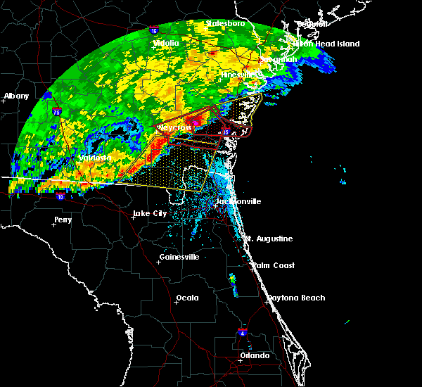 At 245 pm edt, a confirmed large and extremely dangerous tornado was located near waynesville, or 10 miles northeast of nahunta, moving east at 50 mph. this is a particularly dangerous situation. take cover now! (radar confirmed tornado). Hazards include damaging tornado. You are in a life-threatening situation. flying debris may be deadly to those caught without shelter. mobile homes will be destroyed. considerable damage to homes, businesses, and vehicles is likely and complete destruction is possible. the tornado will be near, thalmann around 255 pm edt. everett around 300 pm edt. Other locations impacted by this tornadic thunderstorm include atkinson, mount pleasant and boys estate. At 245 pm edt, a confirmed large and extremely dangerous tornado was located near waynesville, or 10 miles northeast of nahunta, moving east at 50 mph. this is a particularly dangerous situation. take cover now! (radar confirmed tornado). Hazards include damaging tornado. You are in a life-threatening situation. flying debris may be deadly to those caught without shelter. mobile homes will be destroyed. considerable damage to homes, businesses, and vehicles is likely and complete destruction is possible. the tornado will be near, thalmann around 255 pm edt. everett around 300 pm edt. Other locations impacted by this tornadic thunderstorm include atkinson, mount pleasant and boys estate.
|
| 4/20/2020 5:55 AM EDT |
 At 555 am edt, severe thunderstorms were located along a line extending from 7 miles southeast of blackbeard island to near st. simons island to near waverly, moving east at 55 mph (radar indicated). Hazards include 60 mph wind gusts and penny size hail. Expect damage to roofs, siding, and trees. locations impacted include, brunswick, st. Simons island, dock junction, country club estates, jekyll island and sea island. At 555 am edt, severe thunderstorms were located along a line extending from 7 miles southeast of blackbeard island to near st. simons island to near waverly, moving east at 55 mph (radar indicated). Hazards include 60 mph wind gusts and penny size hail. Expect damage to roofs, siding, and trees. locations impacted include, brunswick, st. Simons island, dock junction, country club estates, jekyll island and sea island.
|
| 4/20/2020 5:34 AM EDT |
 At 533 am edt, severe thunderstorms were located along a line extending from near ridgeville to near waverly to 7 miles north of homeland, moving east at 55 mph (radar indicated). Hazards include 60 mph wind gusts and penny size hail. expect damage to roofs, siding, and trees At 533 am edt, severe thunderstorms were located along a line extending from near ridgeville to near waverly to 7 miles north of homeland, moving east at 55 mph (radar indicated). Hazards include 60 mph wind gusts and penny size hail. expect damage to roofs, siding, and trees
|
| 4/13/2020 10:09 AM EDT |
 The severe thunderstorm warning for northern nassau, camden, southeastern glynn, southeastern ware and central charlton counties will expire at 1015 am edt, the storms which prompted the warning have weakened and some have moved out of the warned area. therefore, the warning will be allowed to expire. however gusty winds are still possible with these thunderstorms and a significant weather advisory is in effect. a tornado watch remains in effect until 1100 am edt for northeastern florida, and southeastern georgia. The severe thunderstorm warning for northern nassau, camden, southeastern glynn, southeastern ware and central charlton counties will expire at 1015 am edt, the storms which prompted the warning have weakened and some have moved out of the warned area. therefore, the warning will be allowed to expire. however gusty winds are still possible with these thunderstorms and a significant weather advisory is in effect. a tornado watch remains in effect until 1100 am edt for northeastern florida, and southeastern georgia.
|
| 4/13/2020 9:42 AM EDT |
 At 941 am edt, severe thunderstorms were located along a line extending from 8 miles east of jekyll island to 10 miles southeast of stephen foster state park, moving east at 60 mph (radar indicated). Hazards include 60 mph wind gusts. Expect damage to roofs, siding, and trees. locations impacted include, st. marys, kingsland, brunswick, st. Simons island, hilliard, folkston, woodbine, kings bay base, homeland and kings ferry. At 941 am edt, severe thunderstorms were located along a line extending from 8 miles east of jekyll island to 10 miles southeast of stephen foster state park, moving east at 60 mph (radar indicated). Hazards include 60 mph wind gusts. Expect damage to roofs, siding, and trees. locations impacted include, st. marys, kingsland, brunswick, st. Simons island, hilliard, folkston, woodbine, kings bay base, homeland and kings ferry.
|
| 4/13/2020 9:29 AM EDT |
 At 929 am edt, severe thunderstorms were located along a line extending from near jekyll island to 9 miles east of fargo, moving east at 60 mph (radar indicated). Hazards include 70 mph wind gusts and quarter size hail. Hail damage to vehicles is expected. expect considerable tree damage. wind damage is also likely to mobile homes, roofs, and outbuildings. locations impacted include, st. marys, kingsland, brunswick, st. Simons island, hilliard, folkston, woodbine, fargo, statenville and dock junction. At 929 am edt, severe thunderstorms were located along a line extending from near jekyll island to 9 miles east of fargo, moving east at 60 mph (radar indicated). Hazards include 70 mph wind gusts and quarter size hail. Hail damage to vehicles is expected. expect considerable tree damage. wind damage is also likely to mobile homes, roofs, and outbuildings. locations impacted include, st. marys, kingsland, brunswick, st. Simons island, hilliard, folkston, woodbine, fargo, statenville and dock junction.
|
| 4/13/2020 9:08 AM EDT |
 At 908 am edt, severe thunderstorms were located along a line extending from 6 miles west of woodbine to near needmore, moving east at 60 mph (radar indicated). Hazards include 70 mph wind gusts and quarter size hail. Hail damage to vehicles is expected. expect considerable tree damage. Wind damage is also likely to mobile homes, roofs, and outbuildings. At 908 am edt, severe thunderstorms were located along a line extending from 6 miles west of woodbine to near needmore, moving east at 60 mph (radar indicated). Hazards include 70 mph wind gusts and quarter size hail. Hail damage to vehicles is expected. expect considerable tree damage. Wind damage is also likely to mobile homes, roofs, and outbuildings.
|
| 4/13/2020 8:44 AM EDT |
 At 843 am edt, severe thunderstorms were located along a line extending from 8 miles southeast of hickox to 7 miles northeast of fargo, moving east at 50 mph (radar indicated). Hazards include 60 mph wind gusts. expect damage to roofs, siding, and trees At 843 am edt, severe thunderstorms were located along a line extending from 8 miles southeast of hickox to 7 miles northeast of fargo, moving east at 50 mph (radar indicated). Hazards include 60 mph wind gusts. expect damage to roofs, siding, and trees
|
| 4/13/2020 8:15 AM EDT |
 At 815 am edt, severe thunderstorms were located along a line extending from near cox to near everett to 6 miles northwest of waynesville, moving east at 55 mph (radar indicated). Hazards include 60 mph wind gusts. expect damage to roofs, siding, and trees At 815 am edt, severe thunderstorms were located along a line extending from near cox to near everett to 6 miles northwest of waynesville, moving east at 55 mph (radar indicated). Hazards include 60 mph wind gusts. expect damage to roofs, siding, and trees
|
| 3/5/2020 4:10 PM EST |
 At 410 pm est, a severe thunderstorm was located near waverly, or 11 miles northwest of woodbine, moving east at 55 mph (radar indicated). Hazards include 60 mph wind gusts. expect damage to roofs, siding, and trees At 410 pm est, a severe thunderstorm was located near waverly, or 11 miles northwest of woodbine, moving east at 55 mph (radar indicated). Hazards include 60 mph wind gusts. expect damage to roofs, siding, and trees
|
| 2/6/2020 10:40 PM EST |
 The severe thunderstorm warning for northeastern nassau, southeastern camden and southeastern glynn counties will expire at 1045 pm est, the storms which prompted the warning have moved out of the area. therefore, the warning will be allowed to expire. a tornado watch remains in effect until midnight est for northeastern florida, and southeastern georgia. The severe thunderstorm warning for northeastern nassau, southeastern camden and southeastern glynn counties will expire at 1045 pm est, the storms which prompted the warning have moved out of the area. therefore, the warning will be allowed to expire. a tornado watch remains in effect until midnight est for northeastern florida, and southeastern georgia.
|
| 2/6/2020 10:31 PM EST |
 At 1031 pm est, severe thunderstorms were located along a line extending from st. simons island to kings bay base, moving northeast at 50 mph (radar indicated). Hazards include 70 mph wind gusts. Expect considerable tree damage. damage is likely to mobile homes, roofs, and outbuildings. locations impacted include, st. marys, brunswick, st. Simons island, fernandina beach, kings bay base, yulee, sea island, jekyll island, country club estates and cumberland island. At 1031 pm est, severe thunderstorms were located along a line extending from st. simons island to kings bay base, moving northeast at 50 mph (radar indicated). Hazards include 70 mph wind gusts. Expect considerable tree damage. damage is likely to mobile homes, roofs, and outbuildings. locations impacted include, st. marys, brunswick, st. Simons island, fernandina beach, kings bay base, yulee, sea island, jekyll island, country club estates and cumberland island.
|
| 2/6/2020 10:21 PM EST |
 At 1021 pm est, severe thunderstorms were located along a line extending from near brunswick to near kingsland, moving northeast at 50 mph (radar indicated). Hazards include 70 mph wind gusts. Expect considerable tree damage. damage is likely to mobile homes, roofs, and outbuildings. locations impacted include, st. marys, kingsland, brunswick, st. Simons island, fernandina beach, dock junction, kings bay base, yulee, country club estates and sea island. At 1021 pm est, severe thunderstorms were located along a line extending from near brunswick to near kingsland, moving northeast at 50 mph (radar indicated). Hazards include 70 mph wind gusts. Expect considerable tree damage. damage is likely to mobile homes, roofs, and outbuildings. locations impacted include, st. marys, kingsland, brunswick, st. Simons island, fernandina beach, dock junction, kings bay base, yulee, country club estates and sea island.
|
| 2/6/2020 9:54 PM EST |
 At 954 pm est, severe thunderstorms were located along a line extending from 7 miles southwest of waverly to 6 miles southwest of hilliard, moving northeast at 50 mph (radar indicated). Hazards include 70 mph wind gusts. Expect considerable tree damage. Damage is likely to mobile homes, roofs, and outbuildings. At 954 pm est, severe thunderstorms were located along a line extending from 7 miles southwest of waverly to 6 miles southwest of hilliard, moving northeast at 50 mph (radar indicated). Hazards include 70 mph wind gusts. Expect considerable tree damage. Damage is likely to mobile homes, roofs, and outbuildings.
|
| 12/17/2019 4:38 PM EST |
 The severe thunderstorm warning for northern nassau, eastern camden and southeastern glynn counties will expire at 445 pm est, the storms which prompted the warning have weakened below severe limits, and have exited the warned area. therefore, the warning will be allowed to expire. however heavy rain is still possible with these thunderstorms. a tornado watch remains in effect until 700 pm est for northeastern florida, and southeastern georgia. The severe thunderstorm warning for northern nassau, eastern camden and southeastern glynn counties will expire at 445 pm est, the storms which prompted the warning have weakened below severe limits, and have exited the warned area. therefore, the warning will be allowed to expire. however heavy rain is still possible with these thunderstorms. a tornado watch remains in effect until 700 pm est for northeastern florida, and southeastern georgia.
|
| 12/17/2019 4:20 PM EST |
 At 420 pm est, severe thunderstorms were located along a line extending from 6 miles southwest of brunswick to 6 miles north of kingsland to near callahan, moving east at 40 mph (radar indicated). Hazards include 60 mph wind gusts. expect damage to roofs, siding, and trees At 420 pm est, severe thunderstorms were located along a line extending from 6 miles southwest of brunswick to 6 miles north of kingsland to near callahan, moving east at 40 mph (radar indicated). Hazards include 60 mph wind gusts. expect damage to roofs, siding, and trees
|
| 8/4/2019 4:21 PM EDT |
 The severe thunderstorm warning for southeastern glynn county will expire at 430 pm edt, the storm which prompted the warning has weakened below severe limits, and no longer poses an immediate threat to life or property. therefore, the warning will be allowed to expire. however gusty winds and heavy rain are still possible with this thunderstorm. to report severe weather, contact your nearest law enforcement agency. they will relay your report to the national weather service jacksonville. The severe thunderstorm warning for southeastern glynn county will expire at 430 pm edt, the storm which prompted the warning has weakened below severe limits, and no longer poses an immediate threat to life or property. therefore, the warning will be allowed to expire. however gusty winds and heavy rain are still possible with this thunderstorm. to report severe weather, contact your nearest law enforcement agency. they will relay your report to the national weather service jacksonville.
|
| 8/4/2019 4:01 PM EDT |
 At 401 pm edt, a severe thunderstorm was located over brunswick, moving southeast at 15 mph (radar indicated). Hazards include 60 mph wind gusts. Expect damage to roofs, siding, and trees. locations impacted include, brunswick, st. Simons island, jekyll island, sea island and country club estates. At 401 pm edt, a severe thunderstorm was located over brunswick, moving southeast at 15 mph (radar indicated). Hazards include 60 mph wind gusts. Expect damage to roofs, siding, and trees. locations impacted include, brunswick, st. Simons island, jekyll island, sea island and country club estates.
|
| 8/4/2019 3:49 PM EDT |
 The national weather service in jacksonville has issued a * severe thunderstorm warning for. southeastern glynn county in southeastern georgia. until 430 pm edt. At 349 pm edt, a severe thunderstorm was located over brunswick, moving southeast at 10 mph. The national weather service in jacksonville has issued a * severe thunderstorm warning for. southeastern glynn county in southeastern georgia. until 430 pm edt. At 349 pm edt, a severe thunderstorm was located over brunswick, moving southeast at 10 mph.
|
| 4/19/2019 12:41 PM EDT |
 At 1241 pm edt, severe thunderstorms were located along a line extending from near country club estates to 12 miles east of kings bay base to near hollister, moving northeast at 50 mph (radar indicated). Hazards include 70 mph wind gusts. Expect considerable tree damage. damage is likely to mobile homes, roofs, and outbuildings. locations impacted include, jacksonville, st. marys, brunswick, st. Simons island, fernandina beach, orange park, green cove springs, dock junction, arlington and ponte vedra beach. At 1241 pm edt, severe thunderstorms were located along a line extending from near country club estates to 12 miles east of kings bay base to near hollister, moving northeast at 50 mph (radar indicated). Hazards include 70 mph wind gusts. Expect considerable tree damage. damage is likely to mobile homes, roofs, and outbuildings. locations impacted include, jacksonville, st. marys, brunswick, st. Simons island, fernandina beach, orange park, green cove springs, dock junction, arlington and ponte vedra beach.
|
| 4/19/2019 12:35 PM EDT |
 At 1235 pm edt, a severe thunderstorm capable of producing a tornado was located over jekyll island, or near brunswick, moving northeast at 55 mph (radar indicated rotation). Hazards include tornado. Flying debris will be dangerous to those caught without shelter. mobile homes will be damaged or destroyed. damage to roofs, windows, and vehicles will occur. tree damage is likely. this dangerous storm will be near, st. Simons island and sea island around 1245 pm edt. At 1235 pm edt, a severe thunderstorm capable of producing a tornado was located over jekyll island, or near brunswick, moving northeast at 55 mph (radar indicated rotation). Hazards include tornado. Flying debris will be dangerous to those caught without shelter. mobile homes will be damaged or destroyed. damage to roofs, windows, and vehicles will occur. tree damage is likely. this dangerous storm will be near, st. Simons island and sea island around 1245 pm edt.
|
| 4/19/2019 12:33 PM EDT | Social media photo of a semi tractor trailer flipped on its side along the torras causeway. time of event based on radar dat in glynn county GA, 1.3 miles ENE of St. Simons, GA |
| 4/19/2019 12:28 PM EDT |
 At 1228 pm edt, a severe thunderstorm capable of producing a tornado was located near jekyll island, or 9 miles south of brunswick, moving northeast at 55 mph (radar indicated rotation). Hazards include tornado. Flying debris will be dangerous to those caught without shelter. mobile homes will be damaged or destroyed. damage to roofs, windows, and vehicles will occur. tree damage is likely. this dangerous storm will be near, jekyll island around 1235 pm edt. st. simons island and sea island around 1245 pm edt. Other locations impacted by this tornadic thunderstorm include dover bluff. At 1228 pm edt, a severe thunderstorm capable of producing a tornado was located near jekyll island, or 9 miles south of brunswick, moving northeast at 55 mph (radar indicated rotation). Hazards include tornado. Flying debris will be dangerous to those caught without shelter. mobile homes will be damaged or destroyed. damage to roofs, windows, and vehicles will occur. tree damage is likely. this dangerous storm will be near, jekyll island around 1235 pm edt. st. simons island and sea island around 1245 pm edt. Other locations impacted by this tornadic thunderstorm include dover bluff.
|
| 4/19/2019 12:26 PM EDT |
 At 1226 pm edt, severe thunderstorms were located along a line extending from near everett to 6 miles west of waverly to near keystone heights, moving northeast at 50 mph (radar indicated). Hazards include 70 mph wind gusts. Expect considerable tree damage. Damage is likely to mobile homes, roofs, and outbuildings. At 1226 pm edt, severe thunderstorms were located along a line extending from near everett to 6 miles west of waverly to near keystone heights, moving northeast at 50 mph (radar indicated). Hazards include 70 mph wind gusts. Expect considerable tree damage. Damage is likely to mobile homes, roofs, and outbuildings.
|
| 4/19/2019 12:10 PM EDT |
 At 1209 pm edt, a severe thunderstorm capable of producing a tornado was located near kingsland, moving northeast at 55 mph (radar indicated rotation). Hazards include tornado. Flying debris will be dangerous to those caught without shelter. mobile homes will be damaged or destroyed. damage to roofs, windows, and vehicles will occur. tree damage is likely. this dangerous storm will be near, jekyll island around 1235 pm edt. st. simons island and sea island around 1245 pm edt. Other locations impacted by this tornadic thunderstorm include dover bluff. At 1209 pm edt, a severe thunderstorm capable of producing a tornado was located near kingsland, moving northeast at 55 mph (radar indicated rotation). Hazards include tornado. Flying debris will be dangerous to those caught without shelter. mobile homes will be damaged or destroyed. damage to roofs, windows, and vehicles will occur. tree damage is likely. this dangerous storm will be near, jekyll island around 1235 pm edt. st. simons island and sea island around 1245 pm edt. Other locations impacted by this tornadic thunderstorm include dover bluff.
|
| 4/19/2019 11:33 AM EDT |
 At 1133 am edt, severe thunderstorms were located along a line extending from near fort mudge to near raiford, moving northeast at 55 mph (radar indicated). Hazards include 70 mph wind gusts. Expect considerable tree damage. Damage is likely to mobile homes, roofs, and outbuildings. At 1133 am edt, severe thunderstorms were located along a line extending from near fort mudge to near raiford, moving northeast at 55 mph (radar indicated). Hazards include 70 mph wind gusts. Expect considerable tree damage. Damage is likely to mobile homes, roofs, and outbuildings.
|
| 4/6/2019 5:15 PM EDT |
 At 515 pm edt, a severe thunderstorm was located near brunswick, moving southeast at 20 mph (radar indicated). Hazards include 60 mph wind gusts and quarter size hail. Hail damage to vehicles is expected. Expect wind damage to roofs, siding, and trees. At 515 pm edt, a severe thunderstorm was located near brunswick, moving southeast at 20 mph (radar indicated). Hazards include 60 mph wind gusts and quarter size hail. Hail damage to vehicles is expected. Expect wind damage to roofs, siding, and trees.
|
| 4/6/2019 4:25 PM EDT |
 At 425 pm edt, a severe thunderstorm was located near dock junction, moving southeast at 20 mph (radar indicated). Hazards include 60 mph wind gusts and quarter size hail. Hail damage to vehicles is expected. Expect wind damage to roofs, siding, and trees. At 425 pm edt, a severe thunderstorm was located near dock junction, moving southeast at 20 mph (radar indicated). Hazards include 60 mph wind gusts and quarter size hail. Hail damage to vehicles is expected. Expect wind damage to roofs, siding, and trees.
|
| 12/20/2018 11:42 AM EST |
 At 1140 am est, strong showers and a thunderstorm were located over kings bay base, moving north at 50 mph. this activity is associated with a developing area of low pressure near the coast (radar indicated). Hazards include 60 mph wind gusts. expect damage to roofs, siding, and trees At 1140 am est, strong showers and a thunderstorm were located over kings bay base, moving north at 50 mph. this activity is associated with a developing area of low pressure near the coast (radar indicated). Hazards include 60 mph wind gusts. expect damage to roofs, siding, and trees
|
| 12/3/2018 6:45 AM EST |
 At 645 am est, a severe thunderstorm was located over brunswick, moving east at 50 mph (radar indicated). Hazards include 60 mph wind gusts. expect damage to roofs, siding, and trees At 645 am est, a severe thunderstorm was located over brunswick, moving east at 50 mph (radar indicated). Hazards include 60 mph wind gusts. expect damage to roofs, siding, and trees
|
| 12/3/2018 6:34 AM EST |
 At 633 am est, a severe thunderstorm capable of producing a tornado was located just southwest of brunswick, moving east at 35 mph (radar indicated rotation). Hazards include tornado. Flying debris will be dangerous to those caught without shelter. mobile homes will be damaged or destroyed. damage to roofs, windows, and vehicles will occur. tree damage is likely. this dangerous storm will be near, brunswick, st. Simons island, dock junction, jekyll island, country club estates and sea island around 645 am est. At 633 am est, a severe thunderstorm capable of producing a tornado was located just southwest of brunswick, moving east at 35 mph (radar indicated rotation). Hazards include tornado. Flying debris will be dangerous to those caught without shelter. mobile homes will be damaged or destroyed. damage to roofs, windows, and vehicles will occur. tree damage is likely. this dangerous storm will be near, brunswick, st. Simons island, dock junction, jekyll island, country club estates and sea island around 645 am est.
|
| 12/3/2018 6:24 AM EST |
 At 624 am est, a severe thunderstorm capable of producing a tornado was located near waverly, or 8 miles northeast of woodbine, moving east at 30 mph (radar indicated rotation). Hazards include tornado. Flying debris will be dangerous to those caught without shelter. mobile homes will be damaged or destroyed. damage to roofs, windows, and vehicles will occur. tree damage is likely. this dangerous storm will be near, brunswick and jekyll island around 645 am est. Other locations impacted by this tornadic thunderstorm include dover bluff. At 624 am est, a severe thunderstorm capable of producing a tornado was located near waverly, or 8 miles northeast of woodbine, moving east at 30 mph (radar indicated rotation). Hazards include tornado. Flying debris will be dangerous to those caught without shelter. mobile homes will be damaged or destroyed. damage to roofs, windows, and vehicles will occur. tree damage is likely. this dangerous storm will be near, brunswick and jekyll island around 645 am est. Other locations impacted by this tornadic thunderstorm include dover bluff.
|
| 12/3/2018 6:16 AM EST |
 At 615 am est, a severe thunderstorm capable of producing a tornado was located over waverly, or 7 miles north of woodbine, moving east at 30 mph (radar indicated rotation). Hazards include tornado. Flying debris will be dangerous to those caught without shelter. mobile homes will be damaged or destroyed. damage to roofs, windows, and vehicles will occur. tree damage is likely. this dangerous storm will be near, brunswick, jekyll island and sea island around 645 am est. Other locations impacted by this tornadic thunderstorm include dover bluff. At 615 am est, a severe thunderstorm capable of producing a tornado was located over waverly, or 7 miles north of woodbine, moving east at 30 mph (radar indicated rotation). Hazards include tornado. Flying debris will be dangerous to those caught without shelter. mobile homes will be damaged or destroyed. damage to roofs, windows, and vehicles will occur. tree damage is likely. this dangerous storm will be near, brunswick, jekyll island and sea island around 645 am est. Other locations impacted by this tornadic thunderstorm include dover bluff.
|
| 12/2/2018 3:10 PM EST |
 The severe thunderstorm warning for southeastern glynn county will expire at 315 pm est, the storm which prompted the warning is moving into the atlantic ocean. therefore, the warning will be allowed to expire. however gusty winds and heavy rain are still possible with this thunderstorm. a tornado watch remains in effect until 600 pm est for southeastern georgia. The severe thunderstorm warning for southeastern glynn county will expire at 315 pm est, the storm which prompted the warning is moving into the atlantic ocean. therefore, the warning will be allowed to expire. however gusty winds and heavy rain are still possible with this thunderstorm. a tornado watch remains in effect until 600 pm est for southeastern georgia.
|
| 12/2/2018 3:03 PM EST |
 At 302 pm est, a severe thunderstorm was located over sea island, or over st. simons island, moving east at 35 mph (radar indicated). Hazards include 60 mph wind gusts. Expect damage to roofs, siding, and trees. locations impacted include, st. simons island and sea island. A tornado watch remains in effect until 600 pm est for southeastern georgia. At 302 pm est, a severe thunderstorm was located over sea island, or over st. simons island, moving east at 35 mph (radar indicated). Hazards include 60 mph wind gusts. Expect damage to roofs, siding, and trees. locations impacted include, st. simons island and sea island. A tornado watch remains in effect until 600 pm est for southeastern georgia.
|
| 12/2/2018 2:48 PM EST |
 At 247 pm est, a severe thunderstorm was located over brunswick, moving east at 35 mph (radar indicated). Hazards include 60 mph wind gusts. Expect damage to roofs, siding, and trees. locations impacted include, brunswick, st. simons island, dock junction, country club estates, jekyll island and sea island. A tornado watch remains in effect until 600 pm est for southeastern georgia. At 247 pm est, a severe thunderstorm was located over brunswick, moving east at 35 mph (radar indicated). Hazards include 60 mph wind gusts. Expect damage to roofs, siding, and trees. locations impacted include, brunswick, st. simons island, dock junction, country club estates, jekyll island and sea island. A tornado watch remains in effect until 600 pm est for southeastern georgia.
|
| 12/2/2018 2:36 PM EST |
 At 236 pm est, a severe thunderstorm was located near waverly, or 8 miles southwest of dock junction, moving east at 35 mph (radar indicated). Hazards include 60 mph wind gusts. expect damage to roofs, siding, and trees At 236 pm est, a severe thunderstorm was located near waverly, or 8 miles southwest of dock junction, moving east at 35 mph (radar indicated). Hazards include 60 mph wind gusts. expect damage to roofs, siding, and trees
|
| 12/1/2018 11:31 PM EST |
 At 1131 pm est, severe thunderstorms were located along a line extending from near little saint simons island to near jekyll island to near homeland, moving east at 45 mph (radar indicated). Hazards include 60 mph wind gusts. expect damage to roofs, siding, and trees At 1131 pm est, severe thunderstorms were located along a line extending from near little saint simons island to near jekyll island to near homeland, moving east at 45 mph (radar indicated). Hazards include 60 mph wind gusts. expect damage to roofs, siding, and trees
|
| 12/1/2018 11:24 PM EST |
 At 1124 pm est, severe thunderstorms were located along a line extending from 7 miles east of blackbeard island to 7 miles east of little saint simons island to near brunswick, moving east at 60 mph (radar indicated). Hazards include 60 mph wind gusts. Expect damage to roofs, siding, and trees. locations impacted include, brunswick, st. Simons island, woodbine, dock junction, country club estates, sea island, jekyll island, boys estate and dover bluff. At 1124 pm est, severe thunderstorms were located along a line extending from 7 miles east of blackbeard island to 7 miles east of little saint simons island to near brunswick, moving east at 60 mph (radar indicated). Hazards include 60 mph wind gusts. Expect damage to roofs, siding, and trees. locations impacted include, brunswick, st. Simons island, woodbine, dock junction, country club estates, sea island, jekyll island, boys estate and dover bluff.
|
| 12/1/2018 10:56 PM EST |
 At 1056 pm est, severe thunderstorms were located along a line extending from near darien to 6 miles northeast of waverly to 10 miles northeast of homeland, moving east at 60 mph (radar indicated). Hazards include 60 mph wind gusts. expect damage to roofs, siding, and trees At 1056 pm est, severe thunderstorms were located along a line extending from near darien to 6 miles northeast of waverly to 10 miles northeast of homeland, moving east at 60 mph (radar indicated). Hazards include 60 mph wind gusts. expect damage to roofs, siding, and trees
|
| 9/18/2018 6:53 PM EDT | Saint simons airport reported a 58 mile per hour wind gust in a thunderstor in glynn county GA, 1.5 miles NNW of St. Simons, GA |
| 7/27/2018 5:57 PM EDT |
 At 557 pm edt, a severe thunderstorm was located near dock junction, moving southeast at 15 mph (radar indicated). Hazards include 60 mph wind gusts and penny size hail. Expect damage to roofs, siding, and trees. locations impacted include, brunswick, st. Simons island, dock junction, country club estates, sea island, jekyll island and boys estate. At 557 pm edt, a severe thunderstorm was located near dock junction, moving southeast at 15 mph (radar indicated). Hazards include 60 mph wind gusts and penny size hail. Expect damage to roofs, siding, and trees. locations impacted include, brunswick, st. Simons island, dock junction, country club estates, sea island, jekyll island and boys estate.
|
| 7/27/2018 5:40 PM EDT |
 At 540 pm edt, a severe thunderstorm was located over dock junction, moving southeast at 10 mph (radar indicated). Hazards include 60 mph wind gusts and penny size hail. expect damage to roofs, siding, and trees At 540 pm edt, a severe thunderstorm was located over dock junction, moving southeast at 10 mph (radar indicated). Hazards include 60 mph wind gusts and penny size hail. expect damage to roofs, siding, and trees
|
| 7/16/2018 6:11 PM EDT |
 At 611 pm edt, a severe thunderstorm was located near woodbine, moving northeast at 15 mph (radar indicated). Hazards include 60 mph wind gusts and nickel size hail. expect damage to roofs, siding, and trees At 611 pm edt, a severe thunderstorm was located near woodbine, moving northeast at 15 mph (radar indicated). Hazards include 60 mph wind gusts and nickel size hail. expect damage to roofs, siding, and trees
|
| 6/27/2018 8:26 PM EDT |
 The severe thunderstorm warning for east central camden and southeastern glynn counties will expire at 830 pm edt, the storms which prompted the warning are moving southward out of the warning area. therefore, the warning will be allowed to expire. The severe thunderstorm warning for east central camden and southeastern glynn counties will expire at 830 pm edt, the storms which prompted the warning are moving southward out of the warning area. therefore, the warning will be allowed to expire.
|
| 6/27/2018 8:23 PM EDT |
 At 822 pm edt, severe thunderstorms were located along a line extending from near jekyll island to near woodbine, moving southeast at 15 mph. radar detected damaging winds up to 60 mph with these storms (radar indicated). Hazards include 60 mph wind gusts and penny size hail. expect damage to roofs, siding, and trees At 822 pm edt, severe thunderstorms were located along a line extending from near jekyll island to near woodbine, moving southeast at 15 mph. radar detected damaging winds up to 60 mph with these storms (radar indicated). Hazards include 60 mph wind gusts and penny size hail. expect damage to roofs, siding, and trees
|
| 6/27/2018 8:11 PM EDT |
 At 810 pm edt, severe thunderstorms were located along a line extending from sea island to near brunswick, moving south at 20 mph (radar indicated). Hazards include 60 mph wind gusts and penny size hail. Expect damage to roofs, siding, and trees. locations impacted include, brunswick, st. Simons island, dock junction, country club estates, jekyll island and sea island. At 810 pm edt, severe thunderstorms were located along a line extending from sea island to near brunswick, moving south at 20 mph (radar indicated). Hazards include 60 mph wind gusts and penny size hail. Expect damage to roofs, siding, and trees. locations impacted include, brunswick, st. Simons island, dock junction, country club estates, jekyll island and sea island.
|
| 6/27/2018 7:53 PM EDT |
 At 752 pm edt, severe thunderstorms were located along a line extending from near little saint simons island to dock junction, moving southeast at 20 mph. radar was detecting very strong winds with this line of storms (radar indicated). Hazards include 60 mph wind gusts and penny size hail. expect damage to roofs, siding, and trees At 752 pm edt, severe thunderstorms were located along a line extending from near little saint simons island to dock junction, moving southeast at 20 mph. radar was detecting very strong winds with this line of storms (radar indicated). Hazards include 60 mph wind gusts and penny size hail. expect damage to roofs, siding, and trees
|
| 4/15/2018 3:49 PM EDT |
 At 349 pm edt, a severe thunderstorm was located near country club estates, or near st. simons island, moving northeast at 55 mph (radar indicated). Hazards include 60 mph wind gusts. Expect damage to roofs, siding, and trees. locations impacted include, brunswick, st. simons island, dock junction, country club estates, sea island, jekyll island and boys estate. A tornado watch remains in effect until 600 pm edt for southeastern georgia. At 349 pm edt, a severe thunderstorm was located near country club estates, or near st. simons island, moving northeast at 55 mph (radar indicated). Hazards include 60 mph wind gusts. Expect damage to roofs, siding, and trees. locations impacted include, brunswick, st. simons island, dock junction, country club estates, sea island, jekyll island and boys estate. A tornado watch remains in effect until 600 pm edt for southeastern georgia.
|
| 4/15/2018 3:39 PM EDT |
 At 339 pm edt, a severe thunderstorm was located over brunswick, moving northeast at 50 mph (radar indicated). Hazards include 60 mph wind gusts. Expect damage to roofs, siding, and trees. locations impacted include, brunswick, st. simons island, dock junction, country club estates, sea island, jekyll island and boys estate. A tornado watch remains in effect until 600 pm edt for southeastern georgia. At 339 pm edt, a severe thunderstorm was located over brunswick, moving northeast at 50 mph (radar indicated). Hazards include 60 mph wind gusts. Expect damage to roofs, siding, and trees. locations impacted include, brunswick, st. simons island, dock junction, country club estates, sea island, jekyll island and boys estate. A tornado watch remains in effect until 600 pm edt for southeastern georgia.
|
| 4/15/2018 3:23 PM EDT |
 At 322 pm edt, a severe thunderstorm was located near waverly, or 7 miles southwest of dock junction, moving northeast at 55 mph (radar indicated). Hazards include 60 mph wind gusts and penny size hail. expect damage to roofs, siding, and trees At 322 pm edt, a severe thunderstorm was located near waverly, or 7 miles southwest of dock junction, moving northeast at 55 mph (radar indicated). Hazards include 60 mph wind gusts and penny size hail. expect damage to roofs, siding, and trees
|
| 4/15/2018 3:12 PM EDT |
 At 312 pm edt, a severe thunderstorm capable of producing a tornado was located near jekyll island, or near brunswick, moving northeast at 50 mph (radar indicated rotation). Hazards include tornado. Flying debris will be dangerous to those caught without shelter. mobile homes will be damaged or destroyed. damage to roofs, windows, and vehicles will occur. tree damage is likely. this dangerous storm will be near, jekyll island around 315 pm edt. brunswick, dock junction, sea island and country club estates around 325 pm edt. st. simons island around 330 pm edt. Other locations impacted by this tornadic thunderstorm include dover bluff and boys estate. At 312 pm edt, a severe thunderstorm capable of producing a tornado was located near jekyll island, or near brunswick, moving northeast at 50 mph (radar indicated rotation). Hazards include tornado. Flying debris will be dangerous to those caught without shelter. mobile homes will be damaged or destroyed. damage to roofs, windows, and vehicles will occur. tree damage is likely. this dangerous storm will be near, jekyll island around 315 pm edt. brunswick, dock junction, sea island and country club estates around 325 pm edt. st. simons island around 330 pm edt. Other locations impacted by this tornadic thunderstorm include dover bluff and boys estate.
|
| 4/15/2018 3:02 PM EDT |
 At 301 pm edt, a severe thunderstorm capable of producing a tornado was located 10 miles east of woodbine, moving northeast at 50 mph (radar indicated rotation). Hazards include tornado. Flying debris will be dangerous to those caught without shelter. mobile homes will be damaged or destroyed. damage to roofs, windows, and vehicles will occur. tree damage is likely. this dangerous storm will be near, jekyll island around 310 pm edt. brunswick, dock junction, sea island and country club estates around 320 pm edt. st. simons island around 325 pm edt. Other locations impacted by this tornadic thunderstorm include dover bluff, colesburg and boys estate. At 301 pm edt, a severe thunderstorm capable of producing a tornado was located 10 miles east of woodbine, moving northeast at 50 mph (radar indicated rotation). Hazards include tornado. Flying debris will be dangerous to those caught without shelter. mobile homes will be damaged or destroyed. damage to roofs, windows, and vehicles will occur. tree damage is likely. this dangerous storm will be near, jekyll island around 310 pm edt. brunswick, dock junction, sea island and country club estates around 320 pm edt. st. simons island around 325 pm edt. Other locations impacted by this tornadic thunderstorm include dover bluff, colesburg and boys estate.
|
| 4/15/2018 2:54 PM EDT |
 At 253 pm edt, a severe thunderstorm capable of producing a tornado was located near kingsland, moving northeast at 50 mph (radar indicated rotation). Hazards include tornado. Flying debris will be dangerous to those caught without shelter. mobile homes will be damaged or destroyed. damage to roofs, windows, and vehicles will occur. tree damage is likely. this dangerous storm will be near, jekyll island around 310 pm edt. brunswick, dock junction, sea island and country club estates around 320 pm edt. st. simons island around 325 pm edt. Other locations impacted by this tornadic thunderstorm include dover bluff, boys estate and harrietts bluff. At 253 pm edt, a severe thunderstorm capable of producing a tornado was located near kingsland, moving northeast at 50 mph (radar indicated rotation). Hazards include tornado. Flying debris will be dangerous to those caught without shelter. mobile homes will be damaged or destroyed. damage to roofs, windows, and vehicles will occur. tree damage is likely. this dangerous storm will be near, jekyll island around 310 pm edt. brunswick, dock junction, sea island and country club estates around 320 pm edt. st. simons island around 325 pm edt. Other locations impacted by this tornadic thunderstorm include dover bluff, boys estate and harrietts bluff.
|
| 4/15/2018 2:34 PM EDT |
 At 234 pm edt, a severe thunderstorm was located near woodbine, moving northeast at 35 mph (radar indicated). Hazards include 60 mph wind gusts. expect damage to roofs, siding, and trees At 234 pm edt, a severe thunderstorm was located near woodbine, moving northeast at 35 mph (radar indicated). Hazards include 60 mph wind gusts. expect damage to roofs, siding, and trees
|
| 4/7/2018 2:55 PM EDT |
 At 255 pm edt, a severe thunderstorm was located over st. simons island, moving northeast at 30 mph (radar indicated). Hazards include 60 mph wind gusts and quarter size hail. Hail damage to vehicles is expected. Expect wind damage to roofs, siding, and trees. At 255 pm edt, a severe thunderstorm was located over st. simons island, moving northeast at 30 mph (radar indicated). Hazards include 60 mph wind gusts and quarter size hail. Hail damage to vehicles is expected. Expect wind damage to roofs, siding, and trees.
|
| 7/29/2017 4:07 PM EDT |
 At 406 pm edt, severe thunderstorms were located along a line extending from near country club estates to 6 miles northeast of kingsland, moving east at 20 mph (radar indicated). Hazards include 60 mph wind gusts. Expect damage to roofs, siding, and trees. locations impacted include, st. marys, kingsland, brunswick, st. Simons island, dock junction, kings bay base, country club estates, sea island, jekyll island and harrietts bluff. At 406 pm edt, severe thunderstorms were located along a line extending from near country club estates to 6 miles northeast of kingsland, moving east at 20 mph (radar indicated). Hazards include 60 mph wind gusts. Expect damage to roofs, siding, and trees. locations impacted include, st. marys, kingsland, brunswick, st. Simons island, dock junction, kings bay base, country club estates, sea island, jekyll island and harrietts bluff.
|
| 7/29/2017 3:54 PM EDT |
 At 354 pm edt, severe thunderstorms were located along a line extending from 6 miles north of dock junction to near kingsland, moving east at 30 mph (radar indicated). Hazards include 60 mph wind gusts. Expect damage to roofs, siding, and trees. locations impacted include, st. marys, kingsland, brunswick, st. Simons island, woodbine, dock junction, kings bay base, country club estates, sea island and jekyll island. At 354 pm edt, severe thunderstorms were located along a line extending from 6 miles north of dock junction to near kingsland, moving east at 30 mph (radar indicated). Hazards include 60 mph wind gusts. Expect damage to roofs, siding, and trees. locations impacted include, st. marys, kingsland, brunswick, st. Simons island, woodbine, dock junction, kings bay base, country club estates, sea island and jekyll island.
|
| 7/29/2017 3:34 PM EDT |
 At 334 pm edt, severe thunderstorms were located along a line extending from near cox to near kings ferry, moving east at 20 mph (radar indicated). Hazards include 60 mph wind gusts. expect damage to roofs, siding, and trees At 334 pm edt, severe thunderstorms were located along a line extending from near cox to near kings ferry, moving east at 20 mph (radar indicated). Hazards include 60 mph wind gusts. expect damage to roofs, siding, and trees
|
| 6/30/2017 6:23 PM EDT |
 The severe thunderstorm warning for central glynn county will expire at 630 pm edt, the storm which prompted the warning has weakened below severe limits, and has exited the warned area. therefore, the warning will be allowed to expire. The severe thunderstorm warning for central glynn county will expire at 630 pm edt, the storm which prompted the warning has weakened below severe limits, and has exited the warned area. therefore, the warning will be allowed to expire.
|
| 6/30/2017 6:08 PM EDT |
 At 608 pm edt, a severe thunderstorm was located over country club estates, or over dock junction, moving northeast at 25 mph (radar indicated). Hazards include 60 mph wind gusts. Expect damage to roofs, siding, and trees. locations impacted include, brunswick, st. Simons island, dock junction and country club estates. At 608 pm edt, a severe thunderstorm was located over country club estates, or over dock junction, moving northeast at 25 mph (radar indicated). Hazards include 60 mph wind gusts. Expect damage to roofs, siding, and trees. locations impacted include, brunswick, st. Simons island, dock junction and country club estates.
|
| 6/30/2017 6:01 PM EDT |
 At 600 pm edt, a severe thunderstorm was located over dock junction, moving northeast at 20 mph (radar indicated). Hazards include 60 mph wind gusts and penny size hail. Expect damage to roofs, siding, and trees. locations impacted include, brunswick, st. Simons island, dock junction and country club estates. At 600 pm edt, a severe thunderstorm was located over dock junction, moving northeast at 20 mph (radar indicated). Hazards include 60 mph wind gusts and penny size hail. Expect damage to roofs, siding, and trees. locations impacted include, brunswick, st. Simons island, dock junction and country club estates.
|
| 6/30/2017 5:47 PM EDT |
 A severe thunderstorm warning remains in effect until 630 pm edt for north central camden and central glynn counties. at 546 pm edt, a severe thunderstorm was located near waverly, or 7 miles southwest of dock junction, moving northeast at 15 mph. hazard. 60 mph wind gusts and penny size hail. source. Radar indicated. A severe thunderstorm warning remains in effect until 630 pm edt for north central camden and central glynn counties. at 546 pm edt, a severe thunderstorm was located near waverly, or 7 miles southwest of dock junction, moving northeast at 15 mph. hazard. 60 mph wind gusts and penny size hail. source. Radar indicated.
|
| 6/30/2017 5:39 PM EDT |
 At 538 pm edt, a severe thunderstorm was located near waverly, or 10 miles north of woodbine, moving northeast at 15 mph (radar indicated). Hazards include 60 mph wind gusts and penny size hail. expect damage to roofs, siding, and trees At 538 pm edt, a severe thunderstorm was located near waverly, or 10 miles north of woodbine, moving northeast at 15 mph (radar indicated). Hazards include 60 mph wind gusts and penny size hail. expect damage to roofs, siding, and trees
|
| 6/7/2017 7:04 PM EDT |
 At 703 pm edt, a severe thunderstorm capable of producing a tornado was located near sea island, or near st. simons island, moving south at 10 mph (radar indicated rotation). Hazards include tornado. Flying debris will be dangerous to those caught without shelter. mobile homes will be damaged or destroyed. damage to roofs, windows, and vehicles will occur. tree damage is likely. this dangerous storm will be near, st. simons island around 710 pm edt. Sea island around 715 pm edt. At 703 pm edt, a severe thunderstorm capable of producing a tornado was located near sea island, or near st. simons island, moving south at 10 mph (radar indicated rotation). Hazards include tornado. Flying debris will be dangerous to those caught without shelter. mobile homes will be damaged or destroyed. damage to roofs, windows, and vehicles will occur. tree damage is likely. this dangerous storm will be near, st. simons island around 710 pm edt. Sea island around 715 pm edt.
|
| 6/7/2017 6:50 PM EDT |
 At 650 pm edt, a severe thunderstorm capable of producing a tornado was located near sea island, or near st. simons island, moving south at 15 mph (radar indicated rotation). Hazards include tornado. Flying debris will be dangerous to those caught without shelter. mobile homes will be damaged or destroyed. damage to roofs, windows, and vehicles will occur. tree damage is likely. this dangerous storm will be near, st. simons island around 655 pm edt. Sea island around 705 pm edt. At 650 pm edt, a severe thunderstorm capable of producing a tornado was located near sea island, or near st. simons island, moving south at 15 mph (radar indicated rotation). Hazards include tornado. Flying debris will be dangerous to those caught without shelter. mobile homes will be damaged or destroyed. damage to roofs, windows, and vehicles will occur. tree damage is likely. this dangerous storm will be near, st. simons island around 655 pm edt. Sea island around 705 pm edt.
|
| 5/23/2017 6:06 PM EDT |
 At 550 pm edt, a severe thunderstorm was located over country club estates, or near dock junction, moving northeast at 45 mph (radar indicated). Hazards include 60 mph wind gusts. expect damage to roofs, siding, and trees At 550 pm edt, a severe thunderstorm was located over country club estates, or near dock junction, moving northeast at 45 mph (radar indicated). Hazards include 60 mph wind gusts. expect damage to roofs, siding, and trees
|
| 5/23/2017 5:50 PM EDT |
 At 550 pm edt, a severe thunderstorm was located over country club estates, or near dock junction, moving northeast at 45 mph (radar indicated). Hazards include 60 mph wind gusts. expect damage to roofs, siding, and trees At 550 pm edt, a severe thunderstorm was located over country club estates, or near dock junction, moving northeast at 45 mph (radar indicated). Hazards include 60 mph wind gusts. expect damage to roofs, siding, and trees
|
| 5/22/2017 3:17 PM EDT |
 At 317 pm edt, severe thunderstorms were located along a line extending from near cox to near jekyll island to near kingsland, moving northeast at 30 mph (radar indicated). Hazards include 60 mph wind gusts and penny size hail. expect damage to roofs, siding, and trees At 317 pm edt, severe thunderstorms were located along a line extending from near cox to near jekyll island to near kingsland, moving northeast at 30 mph (radar indicated). Hazards include 60 mph wind gusts and penny size hail. expect damage to roofs, siding, and trees
|
| 5/13/2017 4:28 PM EDT |
 At 428 pm edt, a severe thunderstorm was located near kingsland, moving east at 55 mph (radar indicated). Hazards include 60 mph wind gusts and penny size hail. Expect damage to roofs, siding, and trees. Locations impacted include, woodbine, jekyll island, tarboro, harrietts bluff, dover bluff and colesburg. At 428 pm edt, a severe thunderstorm was located near kingsland, moving east at 55 mph (radar indicated). Hazards include 60 mph wind gusts and penny size hail. Expect damage to roofs, siding, and trees. Locations impacted include, woodbine, jekyll island, tarboro, harrietts bluff, dover bluff and colesburg.
|
| 5/13/2017 4:00 PM EDT |
 At 359 pm edt, a severe thunderstorm was located 8 miles northeast of homeland, or 9 miles northeast of folkston, moving east at 45 mph (radar indicated). Hazards include 60 mph wind gusts and quarter size hail. Hail damage to vehicles is expected. Expect wind damage to roofs, siding, and trees. At 359 pm edt, a severe thunderstorm was located 8 miles northeast of homeland, or 9 miles northeast of folkston, moving east at 45 mph (radar indicated). Hazards include 60 mph wind gusts and quarter size hail. Hail damage to vehicles is expected. Expect wind damage to roofs, siding, and trees.
|
| 4/3/2017 6:20 PM EDT |
 At 619 pm edt, severe thunderstorms were located along a line extending from near darien to near brunswick, moving east at 15 mph (radar indicated). Hazards include 60 mph wind gusts and penny size hail. Expect damage to roofs, siding, and trees. locations impacted include, brunswick, st. Simons island, dock junction, country club estates, sea island and boys estate. At 619 pm edt, severe thunderstorms were located along a line extending from near darien to near brunswick, moving east at 15 mph (radar indicated). Hazards include 60 mph wind gusts and penny size hail. Expect damage to roofs, siding, and trees. locations impacted include, brunswick, st. Simons island, dock junction, country club estates, sea island and boys estate.
|
| 4/3/2017 5:57 PM EDT |
 At 556 pm edt, severe thunderstorms were located along a line extending from cox to waverly, moving east at 30 mph (radar indicated). Hazards include 60 mph wind gusts and penny size hail. expect damage to roofs, siding, and trees At 556 pm edt, severe thunderstorms were located along a line extending from cox to waverly, moving east at 30 mph (radar indicated). Hazards include 60 mph wind gusts and penny size hail. expect damage to roofs, siding, and trees
|
| 4/3/2017 4:27 PM EDT |
 At 427 pm edt, severe thunderstorms were located along a line extending from near everett to near waynesville, moving northeast at 50 mph (radar indicated). Hazards include 60 mph wind gusts and quarter size hail. Hail damage to vehicles is expected. Expect wind damage to roofs, siding, and trees. At 427 pm edt, severe thunderstorms were located along a line extending from near everett to near waynesville, moving northeast at 50 mph (radar indicated). Hazards include 60 mph wind gusts and quarter size hail. Hail damage to vehicles is expected. Expect wind damage to roofs, siding, and trees.
|
| 1/22/2017 7:05 PM EST | Quarter sized hail reported 1 miles NW of St. Simons, GA, emergency manager reported quarter sized hail. |
| 1/22/2017 6:56 PM EST |
 At 654 pm est, a severe thunderstorm capable of producing a tornado was located near jekyll island, or 8 miles south of brunswick, moving east at 40 mph. this tornado had already been confirmed by radar data earlier this evening (radar indicated rotation). Hazards include tornado and quarter size hail. Flying debris will be dangerous to those caught without shelter. mobile homes will be damaged or destroyed. damage to roofs, windows, and vehicles will occur. tree damage is likely. locations impacted include, brunswick, st. Simons island, jekyll island, sea island, country club estates and dover bluff. At 654 pm est, a severe thunderstorm capable of producing a tornado was located near jekyll island, or 8 miles south of brunswick, moving east at 40 mph. this tornado had already been confirmed by radar data earlier this evening (radar indicated rotation). Hazards include tornado and quarter size hail. Flying debris will be dangerous to those caught without shelter. mobile homes will be damaged or destroyed. damage to roofs, windows, and vehicles will occur. tree damage is likely. locations impacted include, brunswick, st. Simons island, jekyll island, sea island, country club estates and dover bluff.
|
| 1/22/2017 6:51 PM EST |
 At 650 pm est, severe thunderstorms were located along a line extending from near darien to 7 miles southeast of woodbine, moving northeast at 70 mph (radar indicated). Hazards include 70 mph wind gusts. Expect considerable tree damage. damage is likely to mobile homes, roofs, and outbuildings. locations impacted include, brunswick, st. simons island, woodbine, dock junction, jekyll island, waverly, sea island, country club estates, little saint simons island and dover bluff. A tornado watch remains in effect until 800 pm est for southeastern georgia. At 650 pm est, severe thunderstorms were located along a line extending from near darien to 7 miles southeast of woodbine, moving northeast at 70 mph (radar indicated). Hazards include 70 mph wind gusts. Expect considerable tree damage. damage is likely to mobile homes, roofs, and outbuildings. locations impacted include, brunswick, st. simons island, woodbine, dock junction, jekyll island, waverly, sea island, country club estates, little saint simons island and dover bluff. A tornado watch remains in effect until 800 pm est for southeastern georgia.
|
| 1/22/2017 6:45 PM EST |
 At 645 pm est, a severe thunderstorm capable of producing a tornado was located 7 miles southeast of waverly, or 7 miles northeast of woodbine, moving east at 40 mph (radar indicated rotation). Hazards include tornado and quarter size hail. Flying debris will be dangerous to those caught without shelter. mobile homes will be damaged or destroyed. damage to roofs, windows, and vehicles will occur. Tree damage is likely. At 645 pm est, a severe thunderstorm capable of producing a tornado was located 7 miles southeast of waverly, or 7 miles northeast of woodbine, moving east at 40 mph (radar indicated rotation). Hazards include tornado and quarter size hail. Flying debris will be dangerous to those caught without shelter. mobile homes will be damaged or destroyed. damage to roofs, windows, and vehicles will occur. Tree damage is likely.
|
| 1/22/2017 6:30 PM EST |
 At 630 pm est, severe thunderstorms were located along a line extending from 8 miles west of waverly to near kings ferry, moving northeast at 70 mph (radar indicated). Hazards include 70 mph wind gusts. Expect considerable tree damage. Damage is likely to mobile homes, roofs, and outbuildings. At 630 pm est, severe thunderstorms were located along a line extending from 8 miles west of waverly to near kings ferry, moving northeast at 70 mph (radar indicated). Hazards include 70 mph wind gusts. Expect considerable tree damage. Damage is likely to mobile homes, roofs, and outbuildings.
|
| 1/22/2017 6:14 PM EST |
 At 614 pm est, severe thunderstorms were located along a line extending from near waynesville to 6 miles north of st. george, moving northeast at 85 mph (radar indicated). Hazards include 60 mph wind gusts and quarter size hail. Hail damage to vehicles is expected. expect wind damage to roofs, siding, and trees. locations impacted include, st. marys, kingsland, brunswick, st. simons island, hilliard, folkston, woodbine, callahan, dock junction and kings bay base. A tornado watch remains in effect until 800 pm est for northern and northeastern florida, and southeastern georgia. At 614 pm est, severe thunderstorms were located along a line extending from near waynesville to 6 miles north of st. george, moving northeast at 85 mph (radar indicated). Hazards include 60 mph wind gusts and quarter size hail. Hail damage to vehicles is expected. expect wind damage to roofs, siding, and trees. locations impacted include, st. marys, kingsland, brunswick, st. simons island, hilliard, folkston, woodbine, callahan, dock junction and kings bay base. A tornado watch remains in effect until 800 pm est for northern and northeastern florida, and southeastern georgia.
|
| 1/22/2017 6:10 PM EST |
 At 609 pm est, severe thunderstorms were located along a line extending from near nahunta to near st. george, moving northeast at 85 mph (radar indicated). Hazards include 60 mph wind gusts and quarter size hail. Hail damage to vehicles is expected. expect wind damage to roofs, siding, and trees. locations impacted include, st. marys, kingsland, brunswick, st. simons island, hilliard, folkston, woodbine, callahan, dock junction and kings bay base. A tornado watch remains in effect until 800 pm est for northern and northeastern florida, and southeastern georgia. At 609 pm est, severe thunderstorms were located along a line extending from near nahunta to near st. george, moving northeast at 85 mph (radar indicated). Hazards include 60 mph wind gusts and quarter size hail. Hail damage to vehicles is expected. expect wind damage to roofs, siding, and trees. locations impacted include, st. marys, kingsland, brunswick, st. simons island, hilliard, folkston, woodbine, callahan, dock junction and kings bay base. A tornado watch remains in effect until 800 pm est for northern and northeastern florida, and southeastern georgia.
|
| 1/22/2017 5:50 PM EST |
 At 550 pm est, severe thunderstorms were located along a line extending from 8 miles west of race pond to 6 miles northwest of olustee, moving northeast at 85 mph (radar indicated). Hazards include 60 mph wind gusts and quarter size hail. Hail damage to vehicles is expected. Expect wind damage to roofs, siding, and trees. At 550 pm est, severe thunderstorms were located along a line extending from 8 miles west of race pond to 6 miles northwest of olustee, moving northeast at 85 mph (radar indicated). Hazards include 60 mph wind gusts and quarter size hail. Hail damage to vehicles is expected. Expect wind damage to roofs, siding, and trees.
|
| 1/22/2017 1:44 PM EST |
 At 144 pm est, a severe thunderstorm capable of producing a tornado was located near darien, moving northeast at 45 mph (radar indicated rotation). Hazards include tornado and quarter size hail. Flying debris will be dangerous to those caught without shelter. mobile homes will be damaged or destroyed. damage to roofs, windows, and vehicles will occur. tree damage is likely. locations impacted include, brunswick, st. Simons island, dock junction, sea island, country club estates, thalmann and boys estate. At 144 pm est, a severe thunderstorm capable of producing a tornado was located near darien, moving northeast at 45 mph (radar indicated rotation). Hazards include tornado and quarter size hail. Flying debris will be dangerous to those caught without shelter. mobile homes will be damaged or destroyed. damage to roofs, windows, and vehicles will occur. tree damage is likely. locations impacted include, brunswick, st. Simons island, dock junction, sea island, country club estates, thalmann and boys estate.
|
| 1/22/2017 1:35 PM EST |
 At 134 pm est, a severe thunderstorm capable of producing a tornado was located near thalmann, or 7 miles northwest of dock junction, moving northeast at 45 mph (radar indicated rotation). Hazards include tornado and quarter size hail. Flying debris will be dangerous to those caught without shelter. mobile homes will be damaged or destroyed. damage to roofs, windows, and vehicles will occur. tree damage is likely. locations impacted include, brunswick, st. Simons island, dock junction, thalmann, sea island, country club estates and boys estate. At 134 pm est, a severe thunderstorm capable of producing a tornado was located near thalmann, or 7 miles northwest of dock junction, moving northeast at 45 mph (radar indicated rotation). Hazards include tornado and quarter size hail. Flying debris will be dangerous to those caught without shelter. mobile homes will be damaged or destroyed. damage to roofs, windows, and vehicles will occur. tree damage is likely. locations impacted include, brunswick, st. Simons island, dock junction, thalmann, sea island, country club estates and boys estate.
|
| 1/22/2017 10:26 AM EST |
 At 1026 am est, severe thunderstorms were located along a line extending from near st. simons island to kingsland to near hilliard, moving east at 70 mph (radar indicated). Hazards include 60 mph wind gusts. Expect damage to roofs, siding, and trees. locations impacted include, st. marys, kingsland, brunswick, st. simons island, fernandina beach, hilliard, folkston, woodbine, dock junction and kings bay base. A tornado watch remains in effect until 1100 am est for northeastern florida, and southeastern georgia. At 1026 am est, severe thunderstorms were located along a line extending from near st. simons island to kingsland to near hilliard, moving east at 70 mph (radar indicated). Hazards include 60 mph wind gusts. Expect damage to roofs, siding, and trees. locations impacted include, st. marys, kingsland, brunswick, st. simons island, fernandina beach, hilliard, folkston, woodbine, dock junction and kings bay base. A tornado watch remains in effect until 1100 am est for northeastern florida, and southeastern georgia.
|
| 1/22/2017 10:02 AM EST |
 At 1002 am est, severe thunderstorms were located along a line extending from near sea island to 12 miles southeast of stephen foster state park, moving east at 70 mph (radar indicated). Hazards include 60 mph wind gusts. expect damage to roofs, siding, and trees At 1002 am est, severe thunderstorms were located along a line extending from near sea island to 12 miles southeast of stephen foster state park, moving east at 70 mph (radar indicated). Hazards include 60 mph wind gusts. expect damage to roofs, siding, and trees
|
| 1/22/2017 9:45 AM EST |
 At 944 am est, severe thunderstorms were located along a line extending from near blackbeard island to near little saint simons island to 8 miles southwest of brunswick, moving northeast at 60 mph (radar indicated). Hazards include 60 mph wind gusts. expect damage to roofs, siding, and trees At 944 am est, severe thunderstorms were located along a line extending from near blackbeard island to near little saint simons island to 8 miles southwest of brunswick, moving northeast at 60 mph (radar indicated). Hazards include 60 mph wind gusts. expect damage to roofs, siding, and trees
|
| 1/22/2017 9:31 AM EST |
 At 931 am est, severe thunderstorms were located along a line extending from 6 miles southeast of everett to near dock junction to near waverly, moving northeast at 50 mph (radar indicated). Hazards include 60 mph wind gusts. expect damage to roofs, siding, and trees At 931 am est, severe thunderstorms were located along a line extending from 6 miles southeast of everett to near dock junction to near waverly, moving northeast at 50 mph (radar indicated). Hazards include 60 mph wind gusts. expect damage to roofs, siding, and trees
|
| 1/22/2017 9:25 AM EST |
 At 925 am est, a severe thunderstorm capable of producing a tornado was located near waverly, or near woodbine, moving east at 50 mph (radar indicated rotation). Hazards include tornado. Flying debris will be dangerous to those caught without shelter. mobile homes will be damaged or destroyed. damage to roofs, windows, and vehicles will occur. tree damage is likely. this dangerous storm will be near, jekyll island around 945 am est. Other locations impacted by this tornadic thunderstorm include dover bluff. At 925 am est, a severe thunderstorm capable of producing a tornado was located near waverly, or near woodbine, moving east at 50 mph (radar indicated rotation). Hazards include tornado. Flying debris will be dangerous to those caught without shelter. mobile homes will be damaged or destroyed. damage to roofs, windows, and vehicles will occur. tree damage is likely. this dangerous storm will be near, jekyll island around 945 am est. Other locations impacted by this tornadic thunderstorm include dover bluff.
|
| 9/2/2016 12:39 AM EDT |
 The tornado warning for northeastern camden and southern glynn counties will expire at 1245 am edt, the storm which prompted the warning has weakened below severe limits, and no longer appears capable of producing a tornado. therefore, the warning will be allowed to expire. however gusty winds and heavy rain are still possible with this thunderstorm. a tornado watch remains in effect until 800 am edt for southeastern georgia. to report severe weather, contact your nearest law enforcement agency. they will relay your report to the national weather service jacksonville. The tornado warning for northeastern camden and southern glynn counties will expire at 1245 am edt, the storm which prompted the warning has weakened below severe limits, and no longer appears capable of producing a tornado. therefore, the warning will be allowed to expire. however gusty winds and heavy rain are still possible with this thunderstorm. a tornado watch remains in effect until 800 am edt for southeastern georgia. to report severe weather, contact your nearest law enforcement agency. they will relay your report to the national weather service jacksonville.
|
| 9/2/2016 12:22 AM EDT |
 At 1222 am edt, a severe thunderstorm capable of producing a tornado was located 7 miles southwest of jekyll island, or 9 miles south of brunswick, moving north at 30 mph (radar indicated rotation). Hazards include tornado. Flying debris will be dangerous to those caught without shelter. mobile homes will be damaged or destroyed. damage to roofs, windows, and vehicles will occur. tree damage is likely. this dangerous storm will be near, jekyll island around 1230 am edt. brunswick, dock junction and country club estates around 1245 am edt. Other locations impacted by this tornadic thunderstorm include dover bluff. At 1222 am edt, a severe thunderstorm capable of producing a tornado was located 7 miles southwest of jekyll island, or 9 miles south of brunswick, moving north at 30 mph (radar indicated rotation). Hazards include tornado. Flying debris will be dangerous to those caught without shelter. mobile homes will be damaged or destroyed. damage to roofs, windows, and vehicles will occur. tree damage is likely. this dangerous storm will be near, jekyll island around 1230 am edt. brunswick, dock junction and country club estates around 1245 am edt. Other locations impacted by this tornadic thunderstorm include dover bluff.
|
| 9/2/2016 12:09 AM EDT |
 At 1209 am edt, a severe thunderstorm capable of producing a tornado was located 7 miles north of kings bay base, moving north at 30 mph (radar indicated rotation). Hazards include tornado. Flying debris will be dangerous to those caught without shelter. mobile homes will be damaged or destroyed. damage to roofs, windows, and vehicles will occur. tree damage is likely. this dangerous storm will be near, jekyll island around 1230 am edt. brunswick, dock junction and country club estates around 1245 am edt. Other locations impacted by this tornadic thunderstorm include cumberland island, dover bluff and harrietts bluff. At 1209 am edt, a severe thunderstorm capable of producing a tornado was located 7 miles north of kings bay base, moving north at 30 mph (radar indicated rotation). Hazards include tornado. Flying debris will be dangerous to those caught without shelter. mobile homes will be damaged or destroyed. damage to roofs, windows, and vehicles will occur. tree damage is likely. this dangerous storm will be near, jekyll island around 1230 am edt. brunswick, dock junction and country club estates around 1245 am edt. Other locations impacted by this tornadic thunderstorm include cumberland island, dover bluff and harrietts bluff.
|
| 6/14/2016 2:59 PM EDT |
 At 259 pm edt, severe thunderstorms were located along a line extending from near everett to near jekyll island, moving east at 10 mph (radar indicated). Hazards include 60 mph wind gusts and nickel size hail. Expect damage to roofs. siding. And trees. At 259 pm edt, severe thunderstorms were located along a line extending from near everett to near jekyll island, moving east at 10 mph (radar indicated). Hazards include 60 mph wind gusts and nickel size hail. Expect damage to roofs. siding. And trees.
|
| 6/14/2016 2:34 PM EDT |
 At 234 pm edt, severe thunderstorms were located along a line extending from near dock junction to thalmann, moving northeast at 15 mph (radar indicated). Hazards include 60 mph wind gusts and nickel size hail. Expect damage to roofs. siding. And trees. At 234 pm edt, severe thunderstorms were located along a line extending from near dock junction to thalmann, moving northeast at 15 mph (radar indicated). Hazards include 60 mph wind gusts and nickel size hail. Expect damage to roofs. siding. And trees.
|
| 6/2/2016 3:27 PM EDT |
 At 326 pm edt, a severe thunderstorm was located over dock junction, and is nearly stationary (radar indicated). Hazards include 60 mph wind gusts and quarter size hail. Hail damage to vehicles is expected. expect wind damage to roofs, siding, and trees. locations impacted include, brunswick, st. Simons island, dock junction and country club estates. At 326 pm edt, a severe thunderstorm was located over dock junction, and is nearly stationary (radar indicated). Hazards include 60 mph wind gusts and quarter size hail. Hail damage to vehicles is expected. expect wind damage to roofs, siding, and trees. locations impacted include, brunswick, st. Simons island, dock junction and country club estates.
|
| 6/2/2016 3:18 PM EDT |
 At 318 pm edt, a severe thunderstorm was located over dock junction, and is nearly stationary (radar indicated). Hazards include 60 mph wind gusts and quarter size hail. Hail damage to vehicles is expected. Expect wind damage to roofs, siding, and trees. At 318 pm edt, a severe thunderstorm was located over dock junction, and is nearly stationary (radar indicated). Hazards include 60 mph wind gusts and quarter size hail. Hail damage to vehicles is expected. Expect wind damage to roofs, siding, and trees.
|
| 5/17/2016 2:28 PM EDT |
 At 228 pm edt, a severe thunderstorm was located 8 miles east of waverly, or 8 miles southwest of brunswick, moving northeast at 25 mph (radar indicated). Hazards include 60 mph wind gusts and quarter size hail. Hail damage to vehicles is expected. Expect wind damage to roofs, siding, and trees. At 228 pm edt, a severe thunderstorm was located 8 miles east of waverly, or 8 miles southwest of brunswick, moving northeast at 25 mph (radar indicated). Hazards include 60 mph wind gusts and quarter size hail. Hail damage to vehicles is expected. Expect wind damage to roofs, siding, and trees.
|
| 3/17/2016 4:06 PM EDT |
 The severe thunderstorm warning for southeastern glynn and northeastern camden counties will expire at 415 pm edt, the storm which prompted the warning has moved out of the area. therefore the warning will be allowed to expire. The severe thunderstorm warning for southeastern glynn and northeastern camden counties will expire at 415 pm edt, the storm which prompted the warning has moved out of the area. therefore the warning will be allowed to expire.
|
| 3/17/2016 3:48 PM EDT |
 At 348 pm edt, a severe thunderstorm was located near jekyll island, or near brunswick, moving east at 20 mph (radar indicated). Hazards include 60 mph wind gusts and quarter size hail. Hail damage to vehicles is expected. Expect wind damage to roofs, siding and trees. At 348 pm edt, a severe thunderstorm was located near jekyll island, or near brunswick, moving east at 20 mph (radar indicated). Hazards include 60 mph wind gusts and quarter size hail. Hail damage to vehicles is expected. Expect wind damage to roofs, siding and trees.
|
| 7/4/2015 4:30 PM EDT |
 At 429 pm edt, doppler radar indicated a severe thunderstorm capable of producing damaging winds in excess of 60 mph. this storm was located near country club estates, or near darien, moving northeast at 30 mph. locations impacted include, brunswick, st. simons island, dock junction, country club estates, sea island and boys estate. At 429 pm edt, doppler radar indicated a severe thunderstorm capable of producing damaging winds in excess of 60 mph. this storm was located near country club estates, or near darien, moving northeast at 30 mph. locations impacted include, brunswick, st. simons island, dock junction, country club estates, sea island and boys estate.
|
| 7/4/2015 4:06 PM EDT |
 At 405 pm edt, doppler radar indicated a severe thunderstorm capable of producing damaging winds in excess of 60 mph. this storm was located 7 miles southwest of dock junction, and moving north at 10 mph. At 405 pm edt, doppler radar indicated a severe thunderstorm capable of producing damaging winds in excess of 60 mph. this storm was located 7 miles southwest of dock junction, and moving north at 10 mph.
|
| 7/2/2015 6:13 PM EDT |
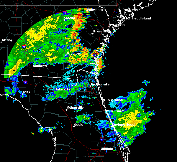 At 613 pm edt, doppler radar indicated a line of severe thunderstorms capable of producing damaging winds in excess of 60 mph. these storms were located along a line extending from near jesup to near nahunta to race pond, and moving northeast at 35 mph. At 613 pm edt, doppler radar indicated a line of severe thunderstorms capable of producing damaging winds in excess of 60 mph. these storms were located along a line extending from near jesup to near nahunta to race pond, and moving northeast at 35 mph.
|
| 7/2/2015 5:37 PM EDT |
 At 537 pm edt, doppler radar indicated a severe thunderstorm capable of producing damaging winds in excess of 60 mph. this storm was located over kings bay base, and moving northeast at 30 mph. At 537 pm edt, doppler radar indicated a severe thunderstorm capable of producing damaging winds in excess of 60 mph. this storm was located over kings bay base, and moving northeast at 30 mph.
|
| 6/19/2015 6:20 PM EDT |
 At 620 pm edt, doppler radar indicated a severe thunderstorm capable of producing damaging winds in excess of 60 mph. this storm was located 7 miles east of woodbine, and moving northeast at 15 mph. penny size hail may also accompany the damaging winds. At 620 pm edt, doppler radar indicated a severe thunderstorm capable of producing damaging winds in excess of 60 mph. this storm was located 7 miles east of woodbine, and moving northeast at 15 mph. penny size hail may also accompany the damaging winds.
|
| 4/25/2015 9:16 PM EDT | At 916 pm edt, doppler radar indicated a line of severe thunderstorms capable of producing quarter size hail and damaging winds in excess of 60 mph. these storms were located along a line extending from near donald to near jesup to 7 miles southeast of homerville, and moving east at 70 mph. |
| 4/19/2015 4:55 PM EDT | At 455 pm edt, doppler radar indicated a line of severe thunderstorms capable of producing damaging winds in excess of 60 mph. these storms were located along a line extending from near race pond to near folkston to bryceville, and moving east at 55 mph. |
| 4/19/2015 4:55 PM EDT | At 455 pm edt, doppler radar indicated a line of severe thunderstorms capable of producing damaging winds in excess of 60 mph. these storms were located along a line extending from near race pond to near folkston to bryceville, and moving east at 55 mph. |
| 6/22/2014 2:18 PM EDT | Storm damage reported in glynn county GA, 1.5 miles NNW of St. Simons, GA |
| 6/22/2014 2:17 PM EDT | Quarter sized hail reported 1 miles SW of St. Simons, GA, social media report of quarter-sized hail. |
| 8/11/2012 3:56 PM EDT | A wind gust of 58 mph was measured at the malcolm mckinnon airport in st. simon in glynn county GA, 1 miles SW of St. Simons, GA |
| 6/4/2012 3:31 PM EDT | Tree reported down at peachtree street and beach driv in glynn county GA, 2.1 miles N of St. Simons, GA |
| 6/4/2012 3:29 PM EDT | Tree reported down on village driv in glynn county GA, 3.9 miles SSW of St. Simons, GA |
| 5/22/2012 10:50 PM EDT | Quarter sized hail reported 3.1 miles WSW of St. Simons, GA, quarter size hail was reported on jekyll island. |
| 1/1/0001 12:00 AM | Numerous areas of tree and limb damage near the intersection of sea island road and frederica road. one pickup truck had a damaged back bed from a 12 inch diameter bran in glynn county GA, 1 miles SW of St. Simons, GA |
Hail Maps for St. Simons, GA


Connect with Interactive Hail Maps