

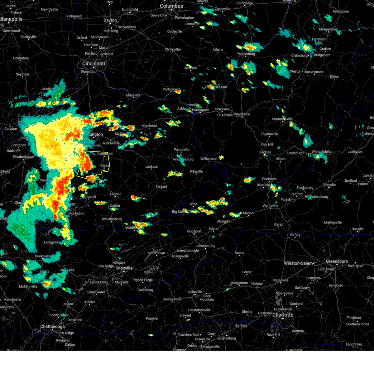
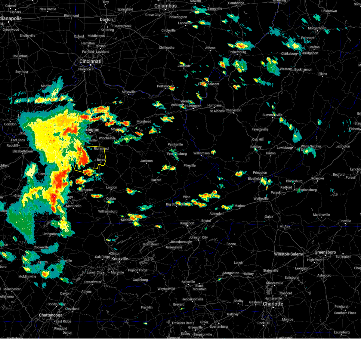
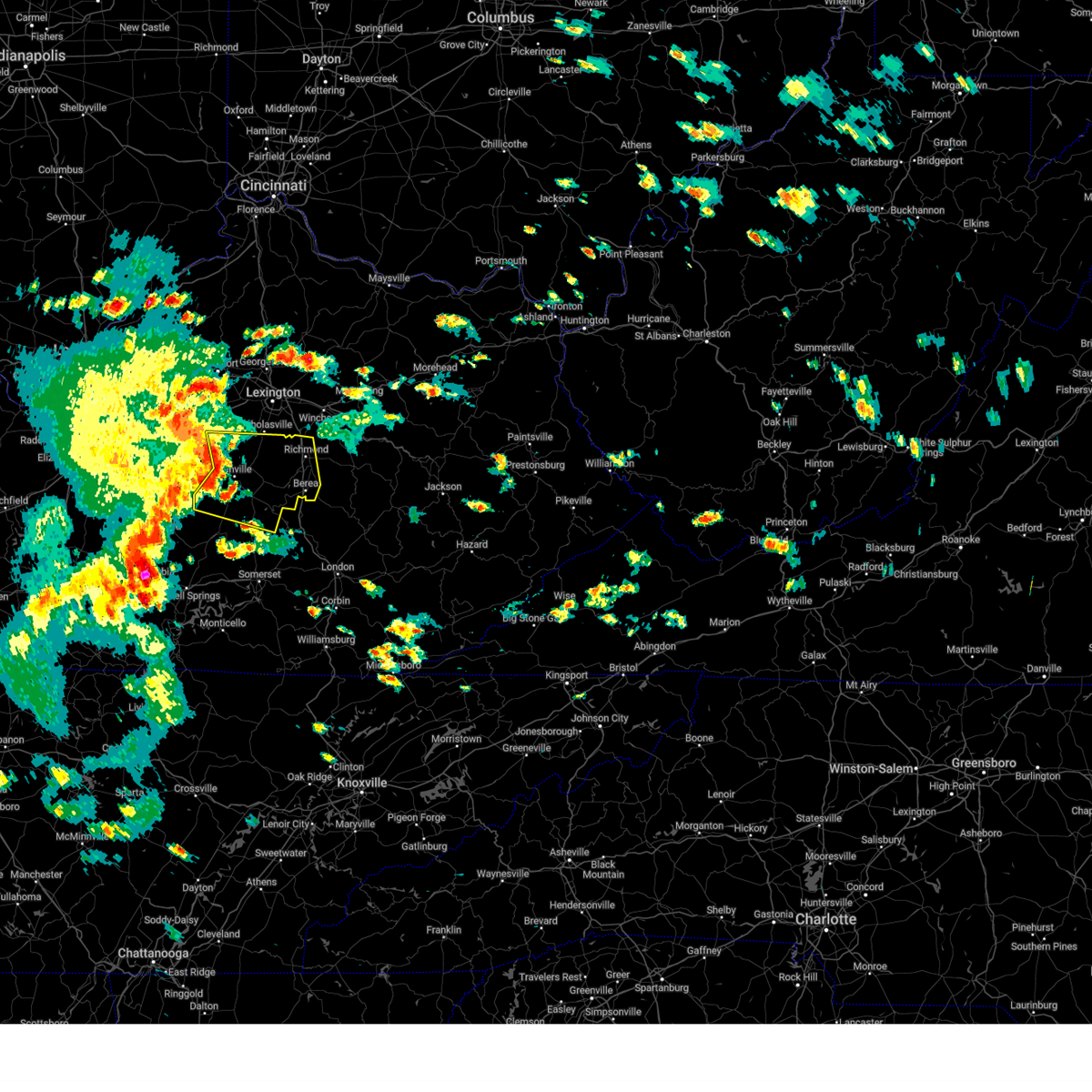
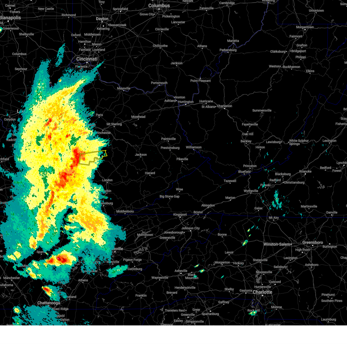
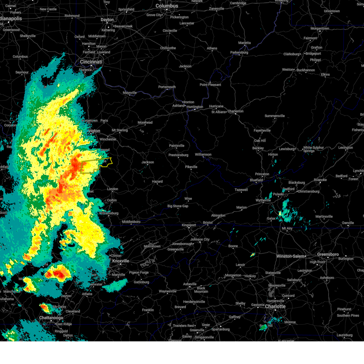
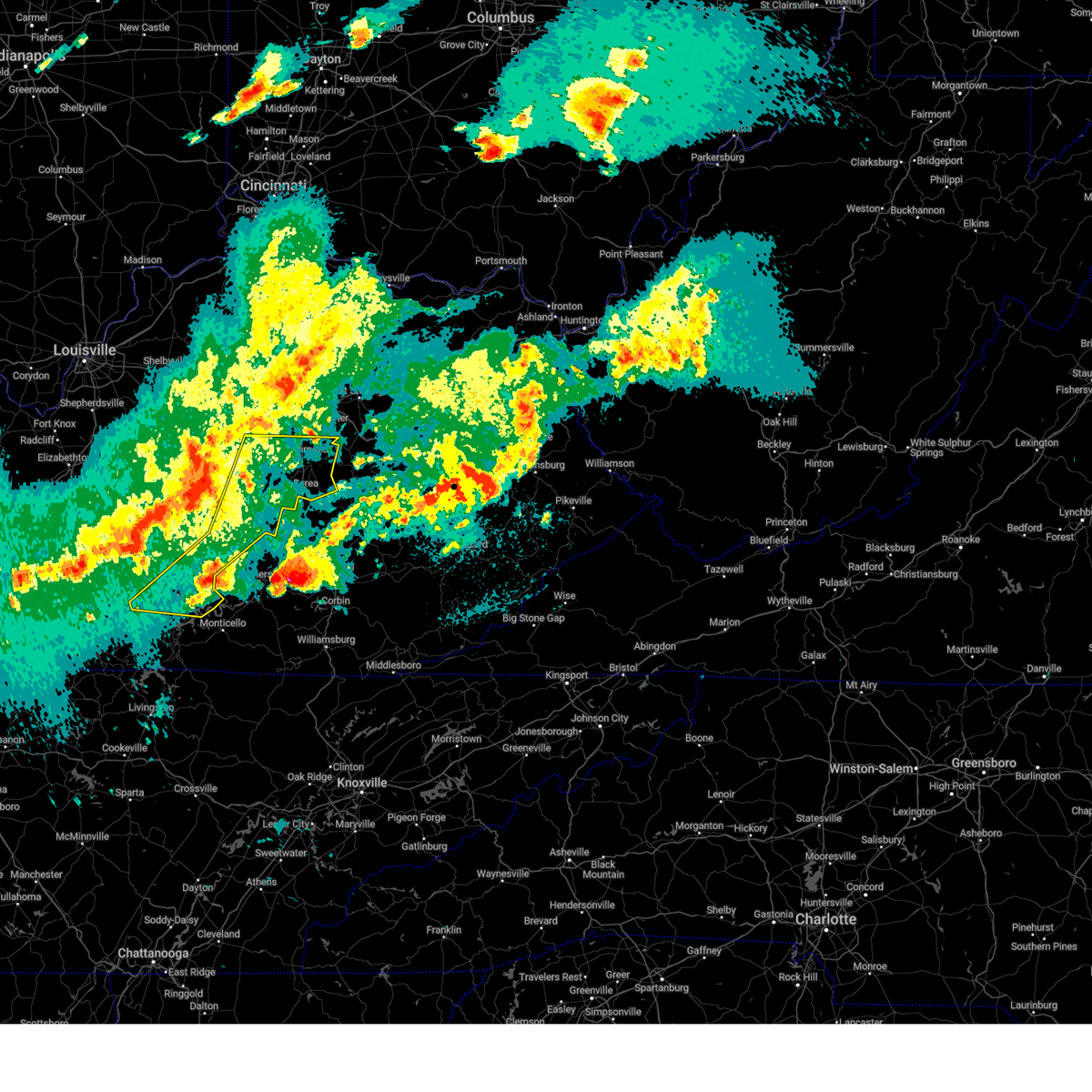
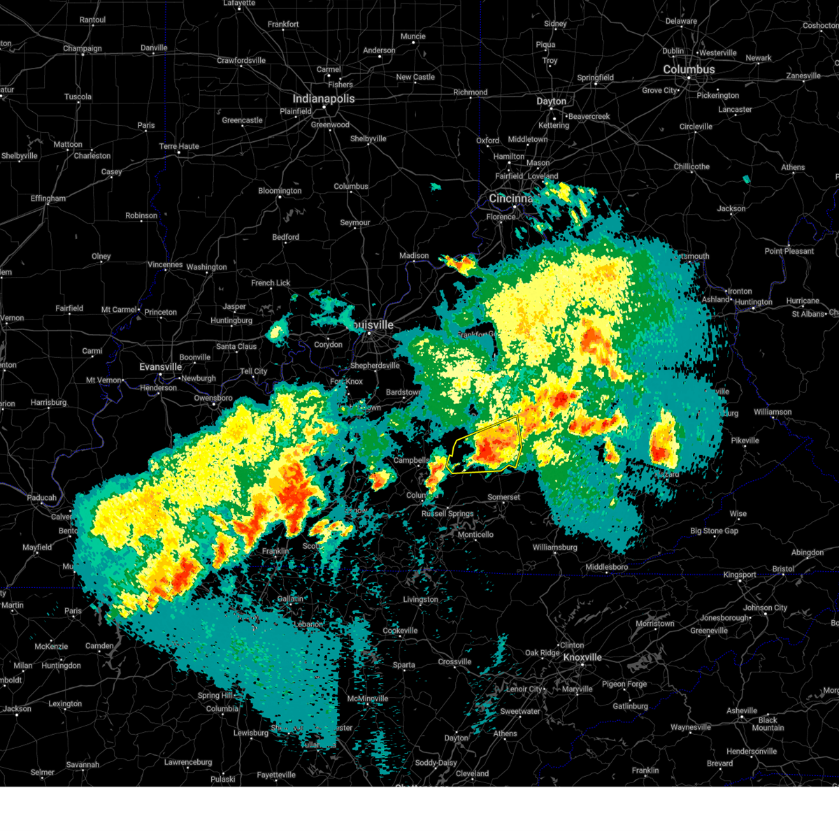
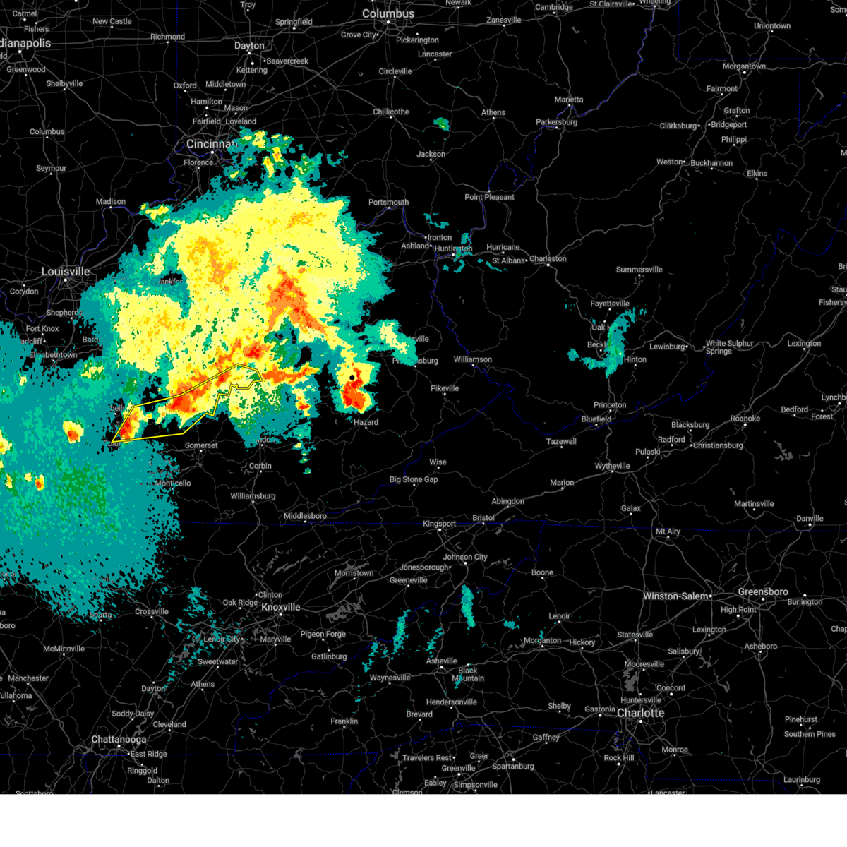
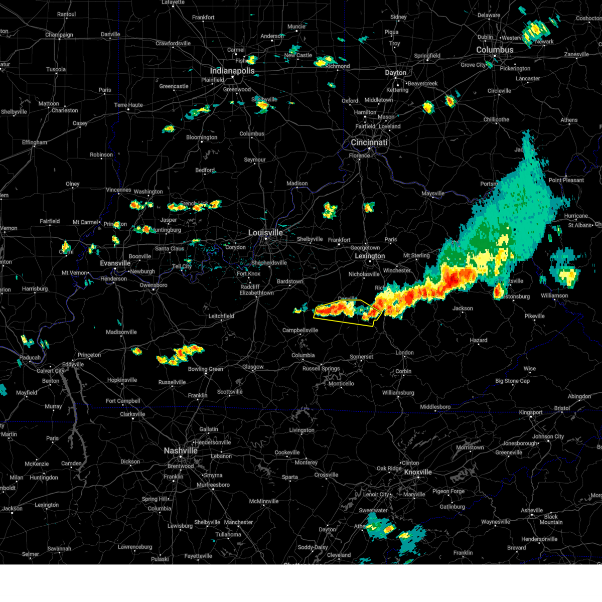
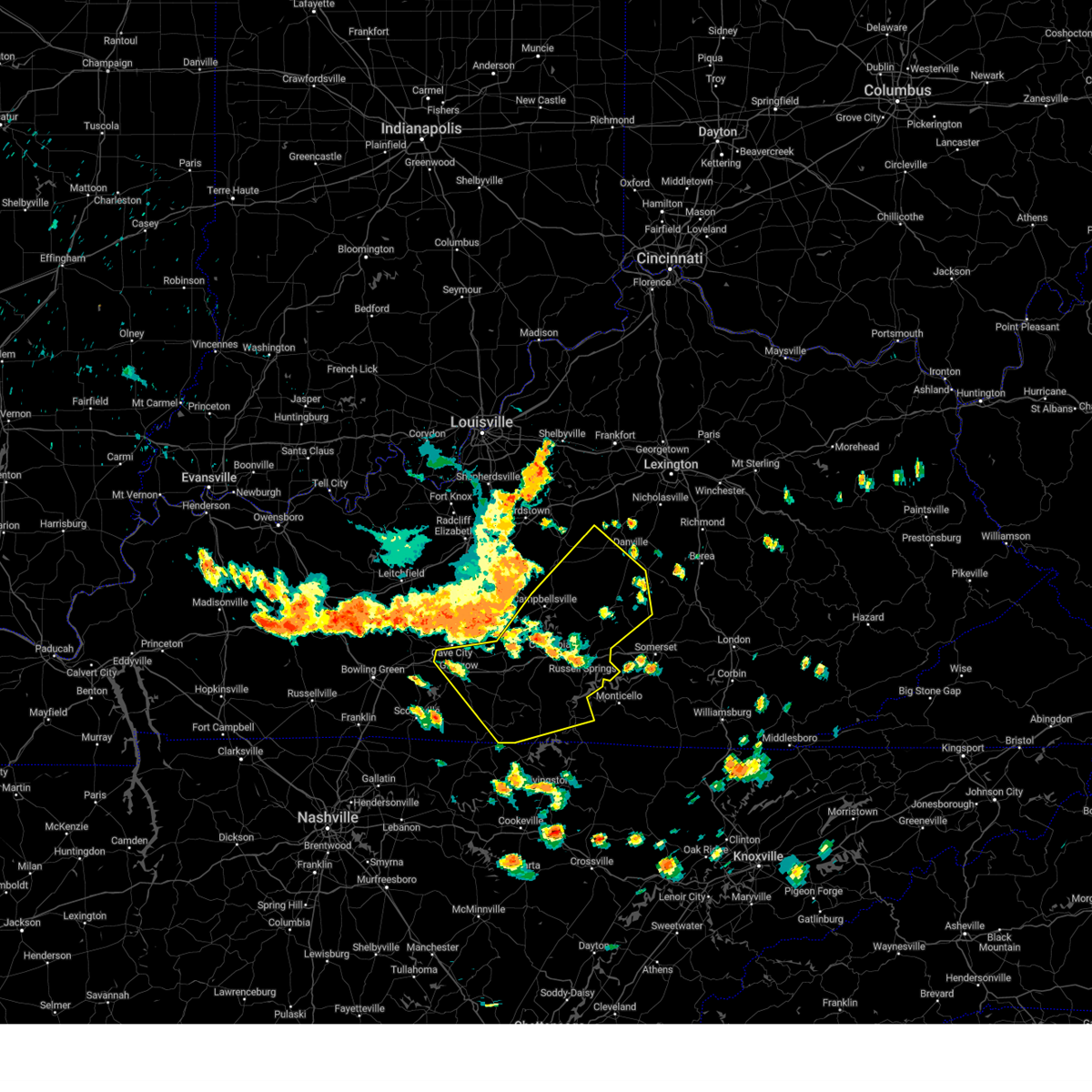
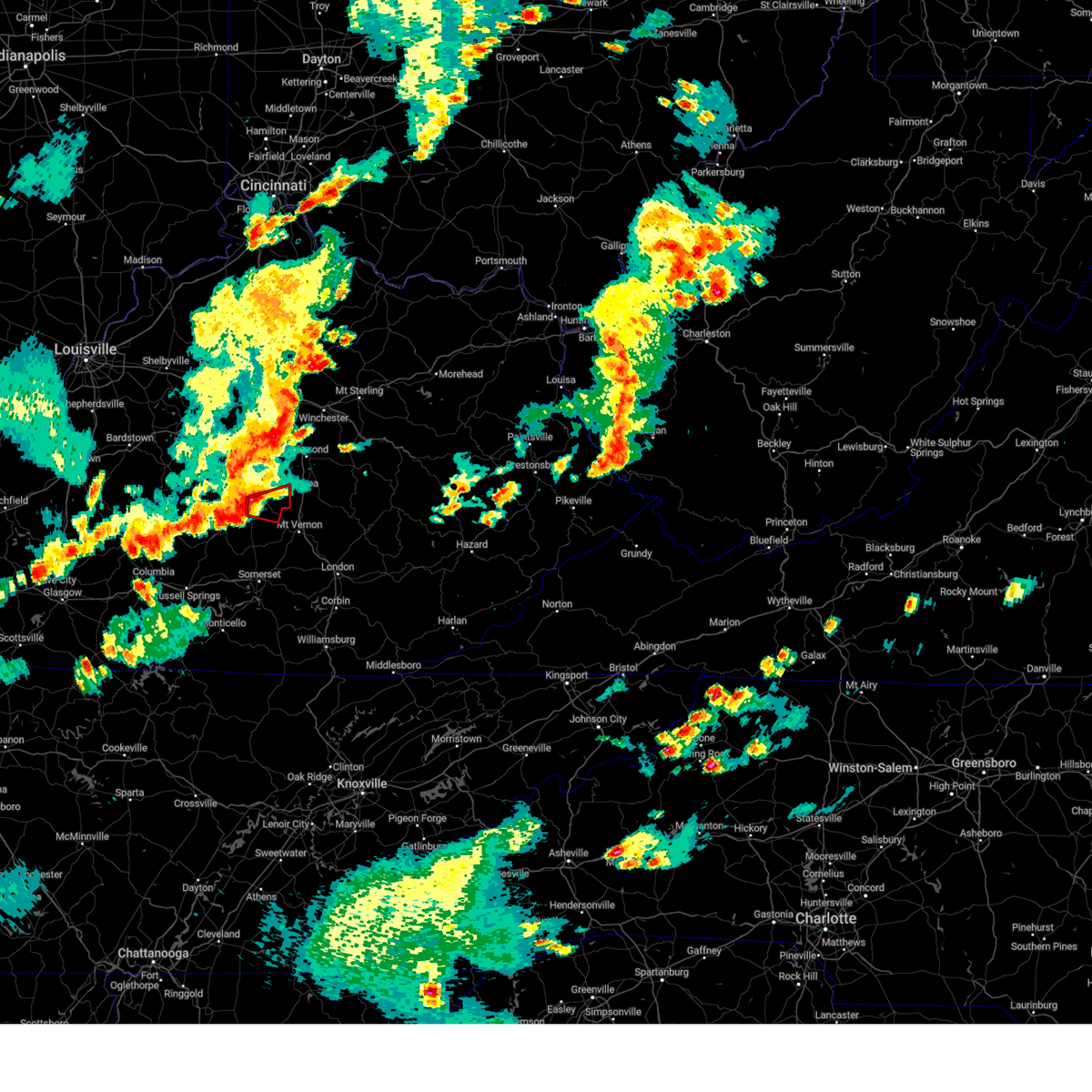
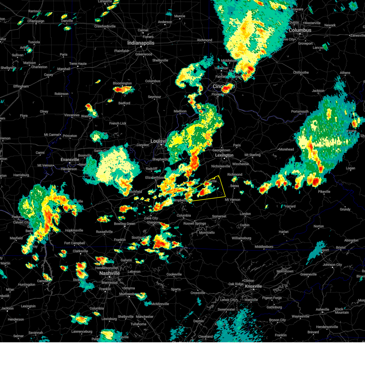
Hail Map for Stanford, KY
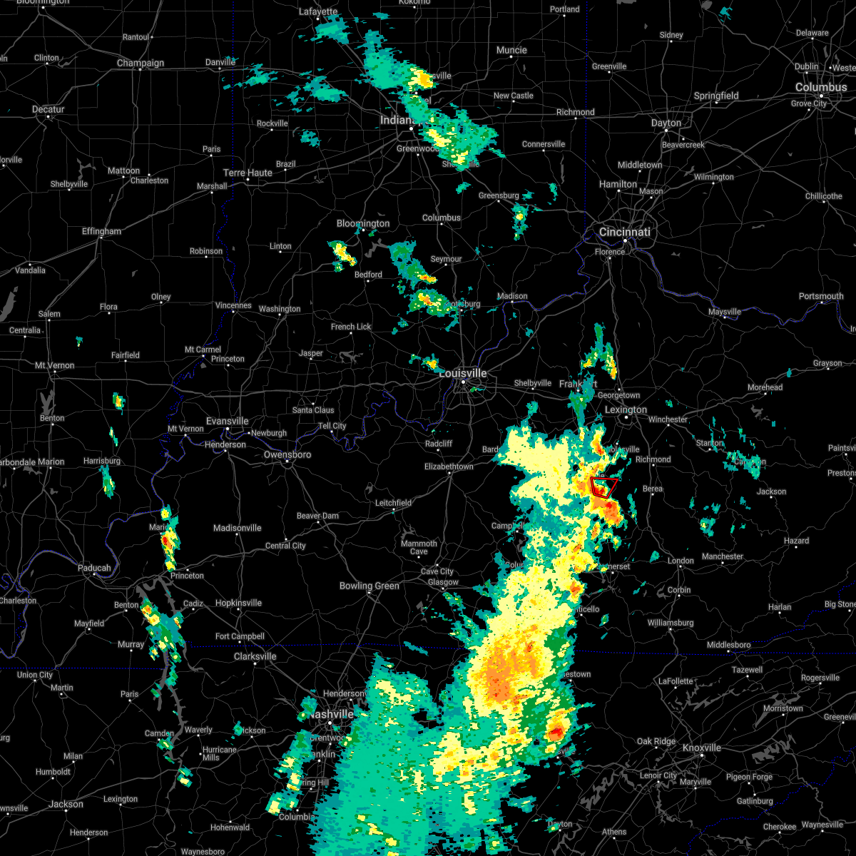
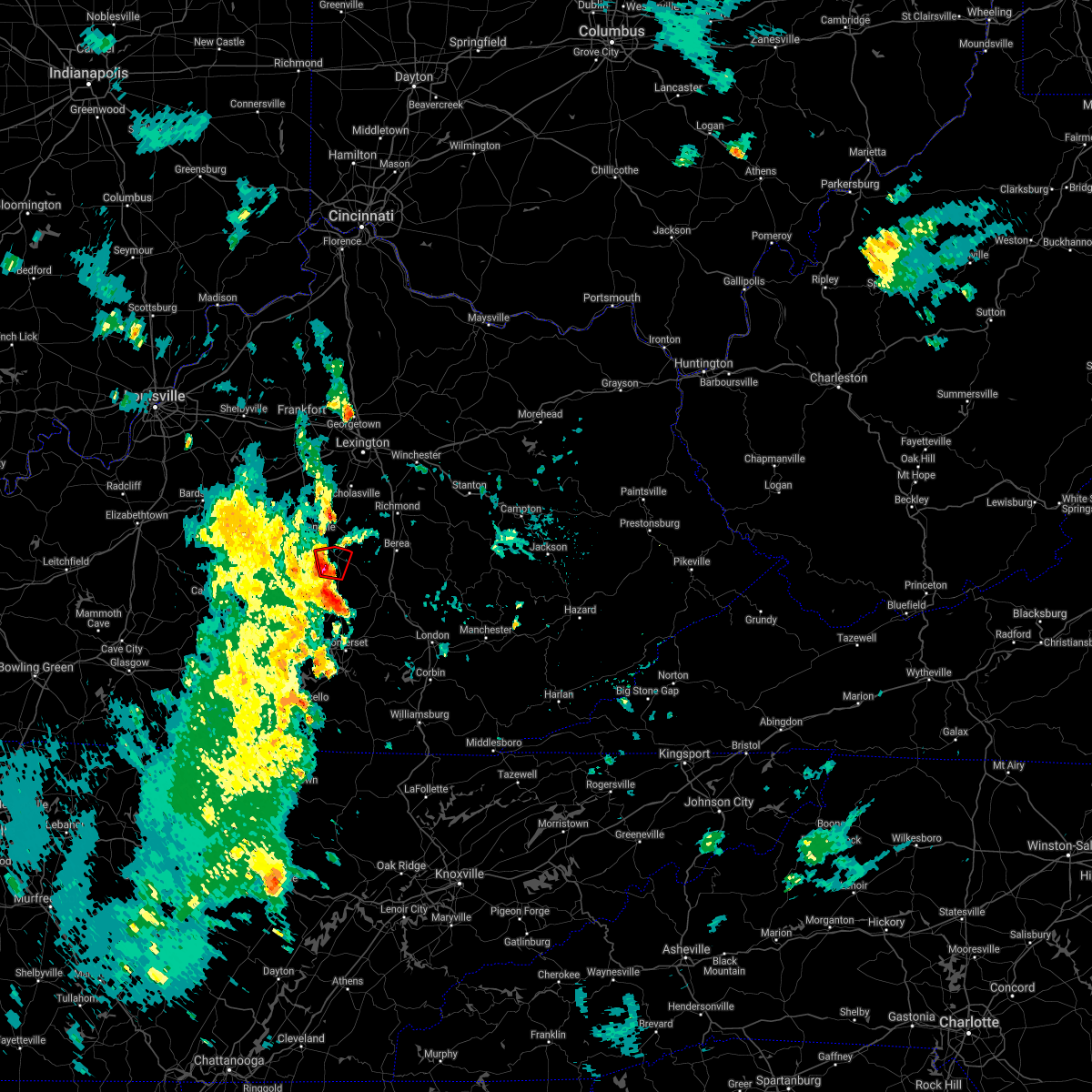
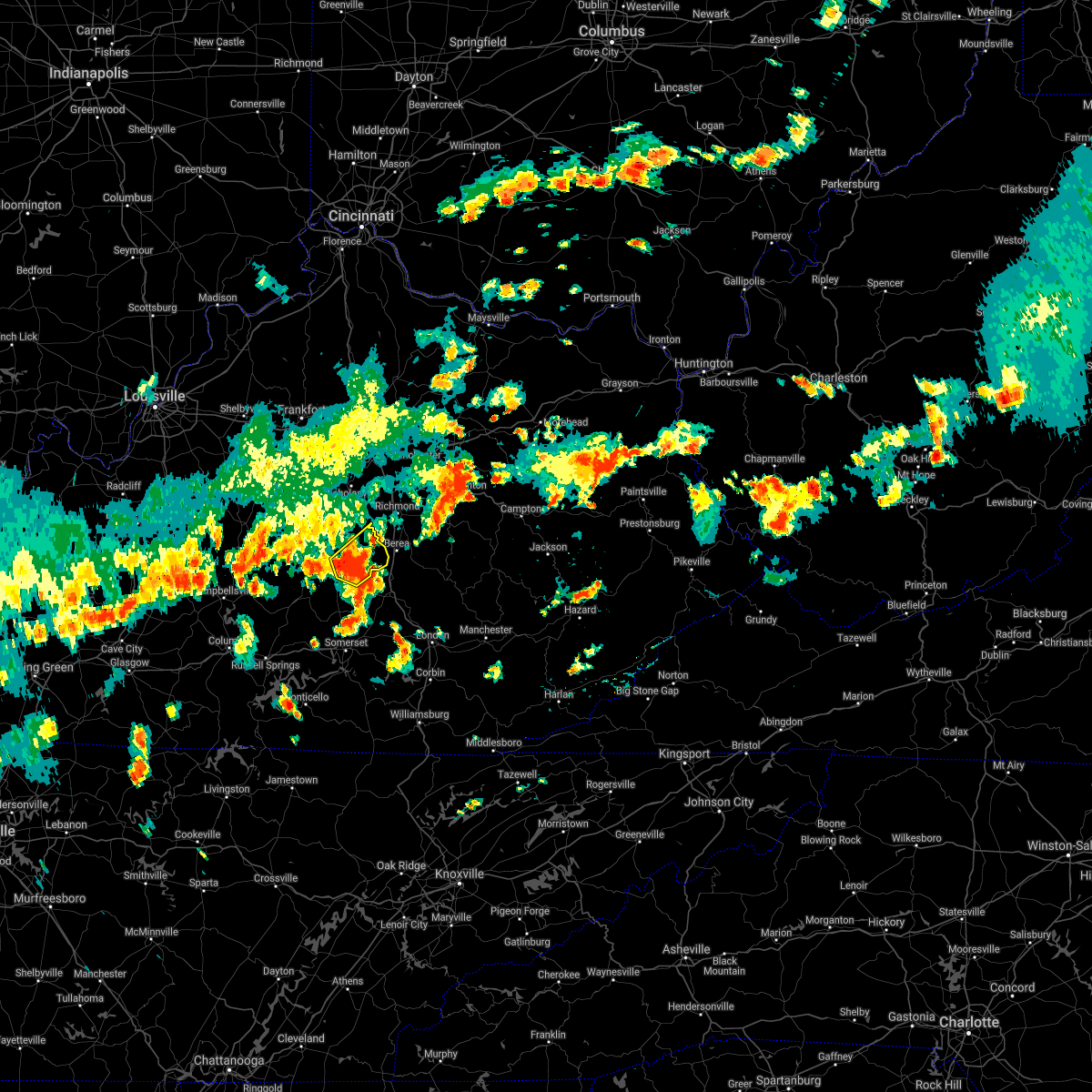
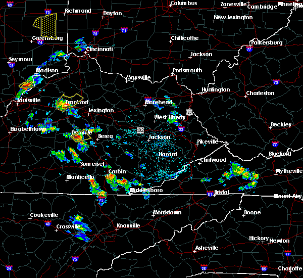
The Stanford, KY area has had 1 report of on-the-ground hail by trained spotters, and has been under severe weather warnings 43 times during the past 12 months. Doppler radar has detected hail at or near Stanford, KY on 38 occasions, including 3 occasions during the past year.
| Name: | Stanford, KY |
| Where Located: | 39.4 miles WSW of Irvine, KY |
| Map: | Google Map for Stanford, KY |
| Population: | 3487 |
| Housing Units: | 1543 |
| More Info: | Search Google for Stanford, KY |
0
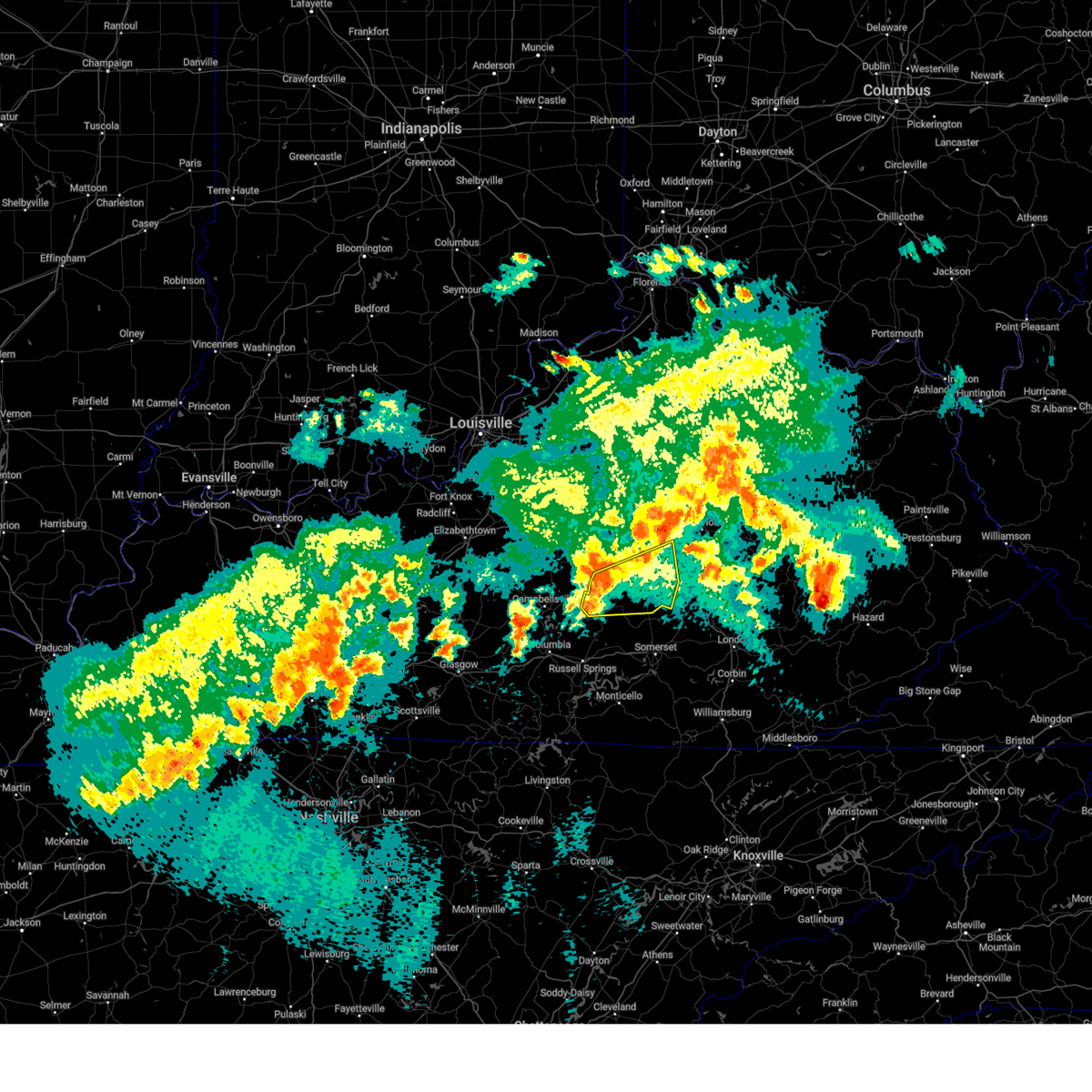
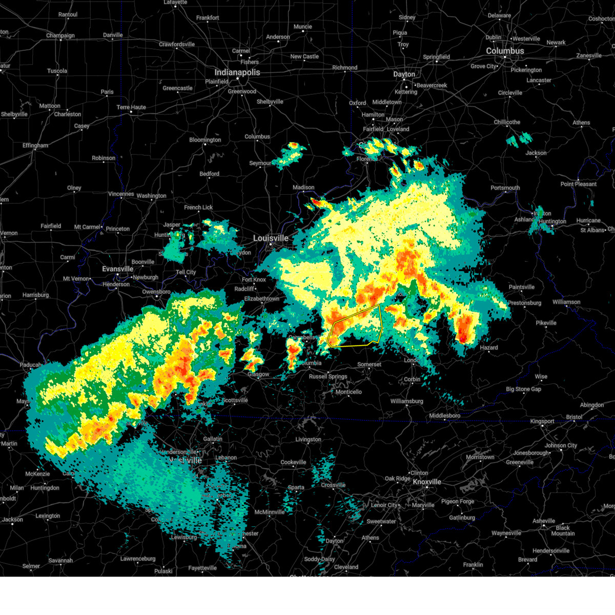
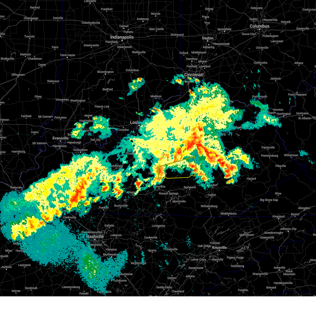
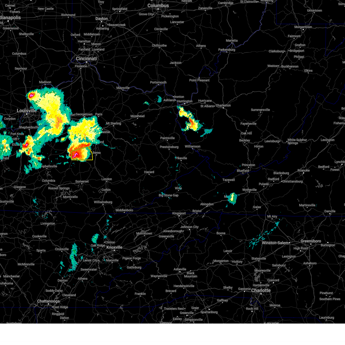
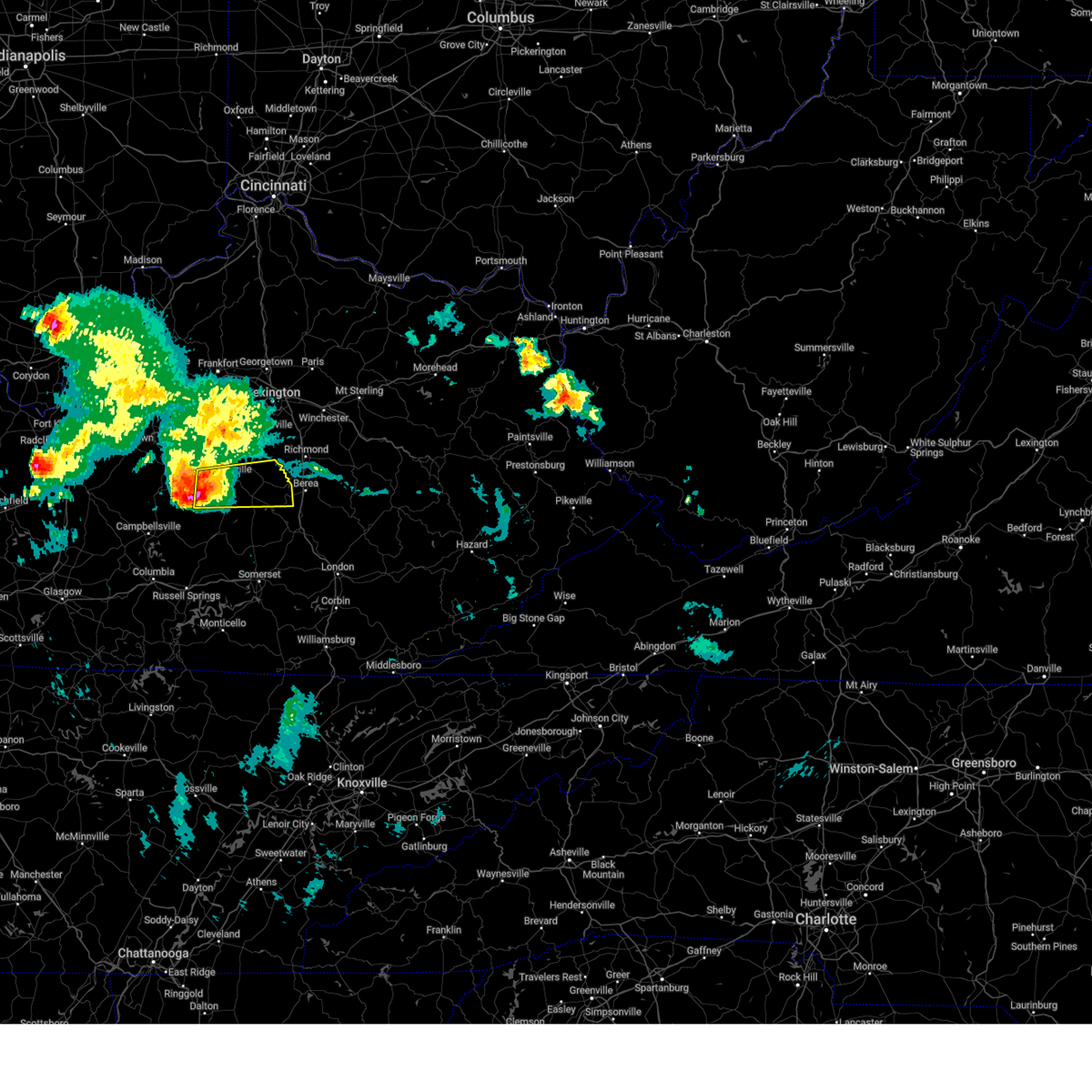
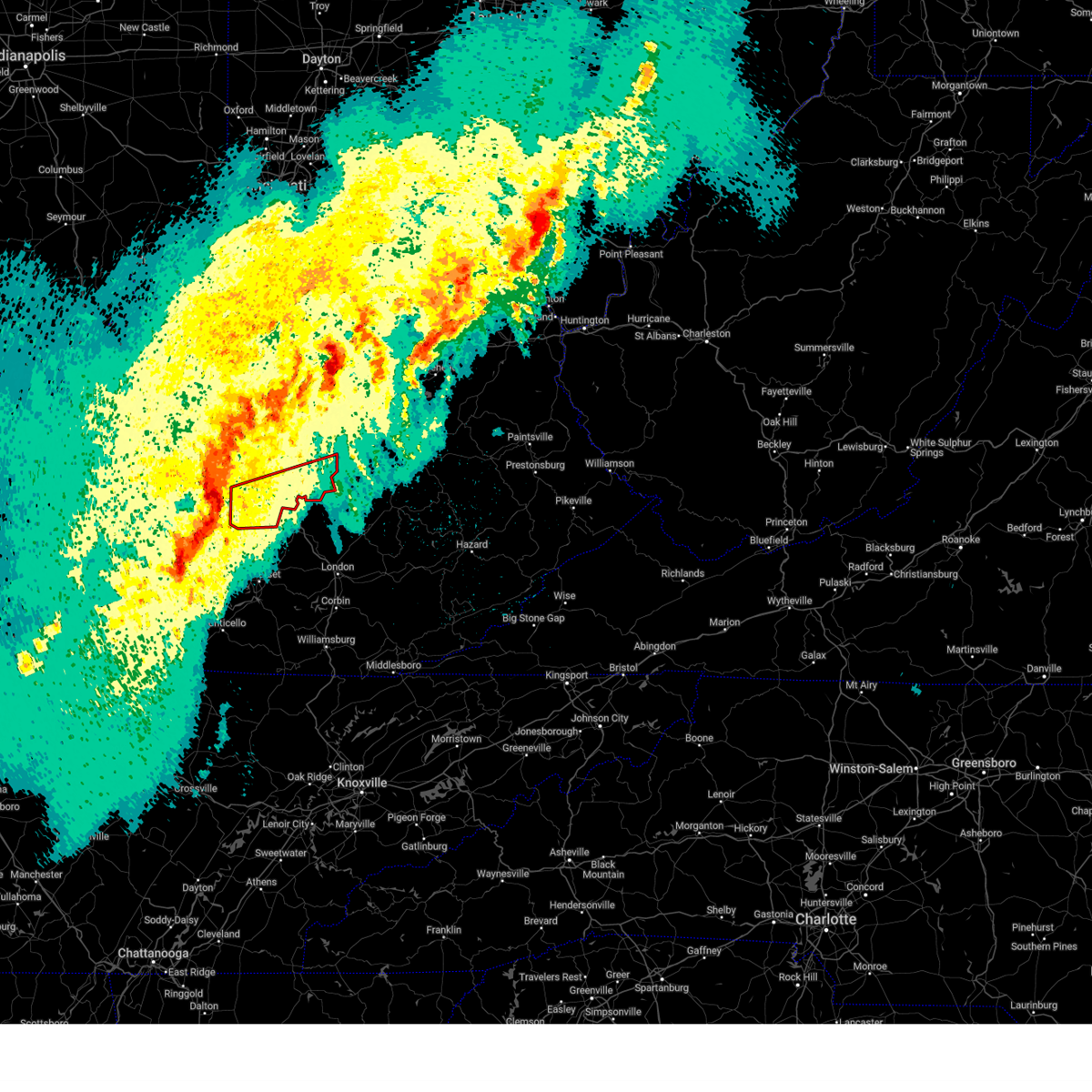
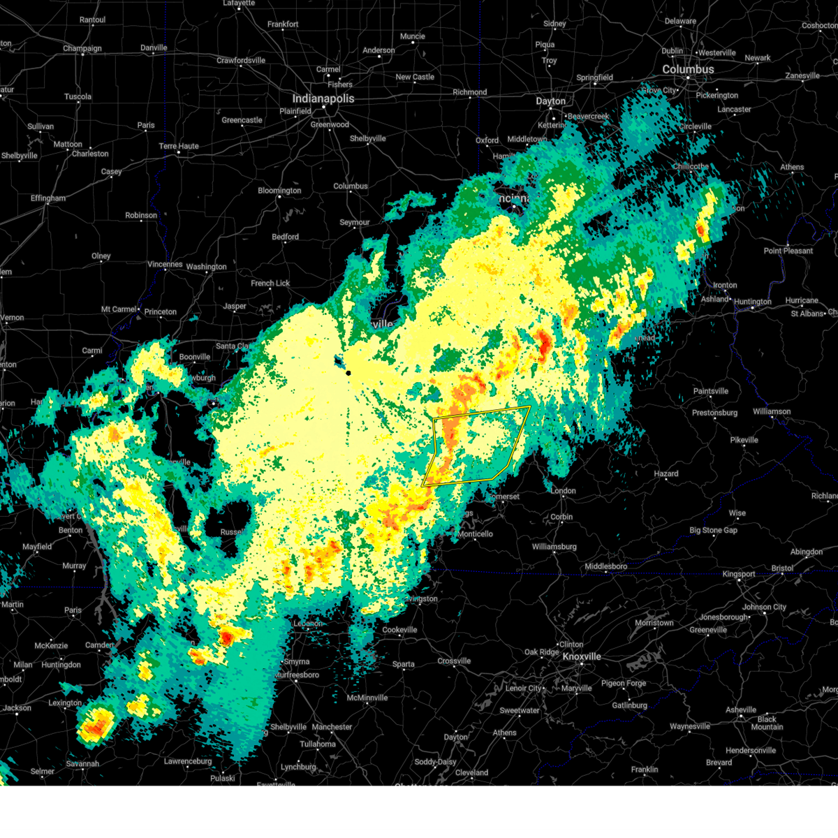
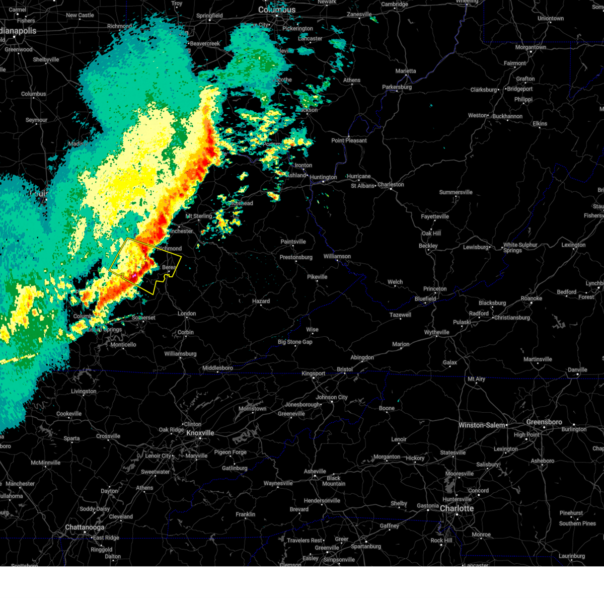
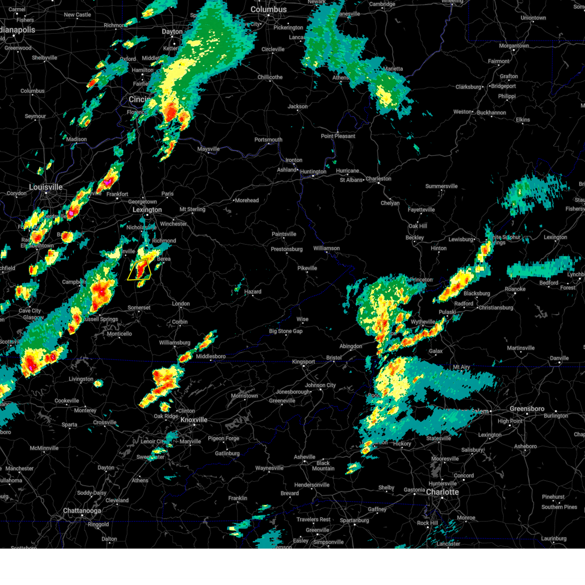
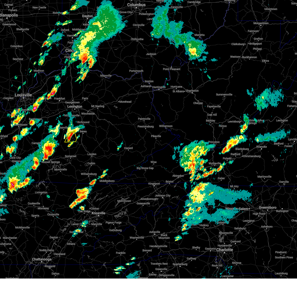
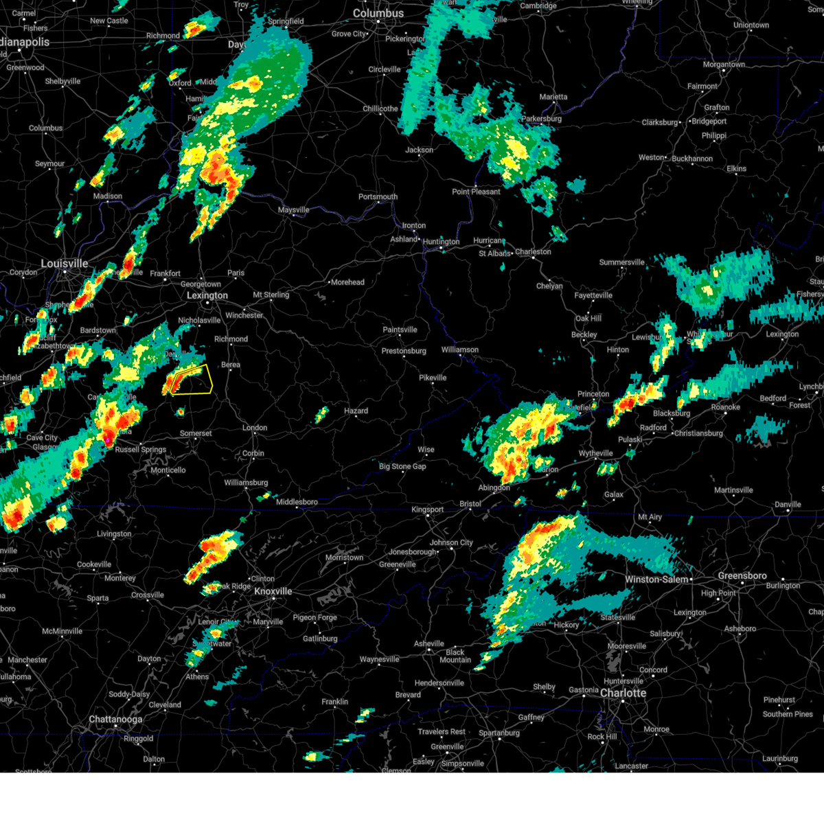
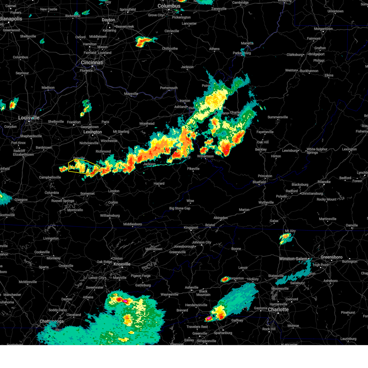
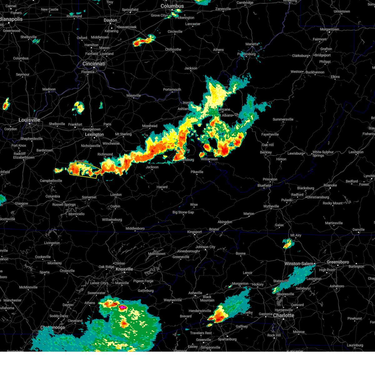
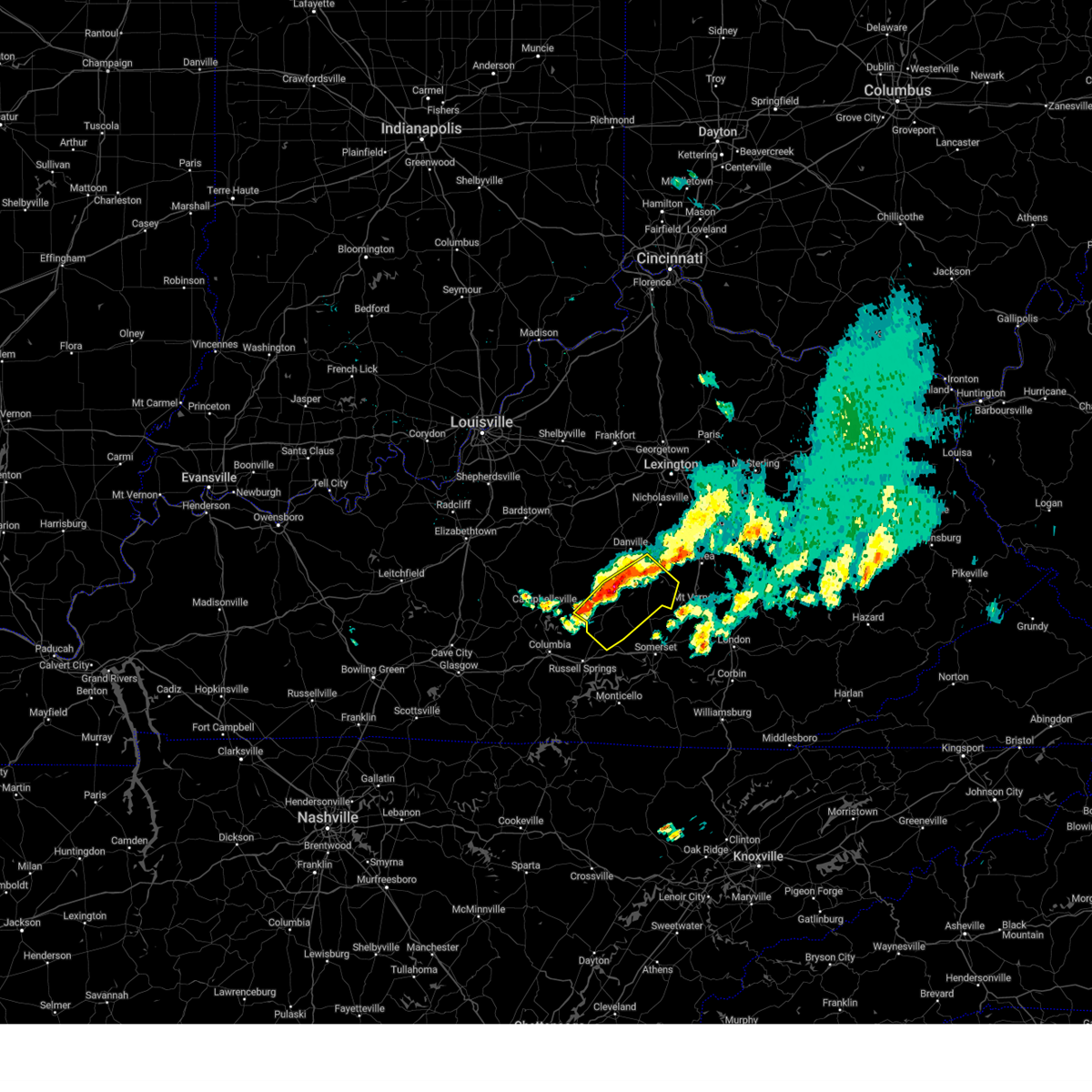
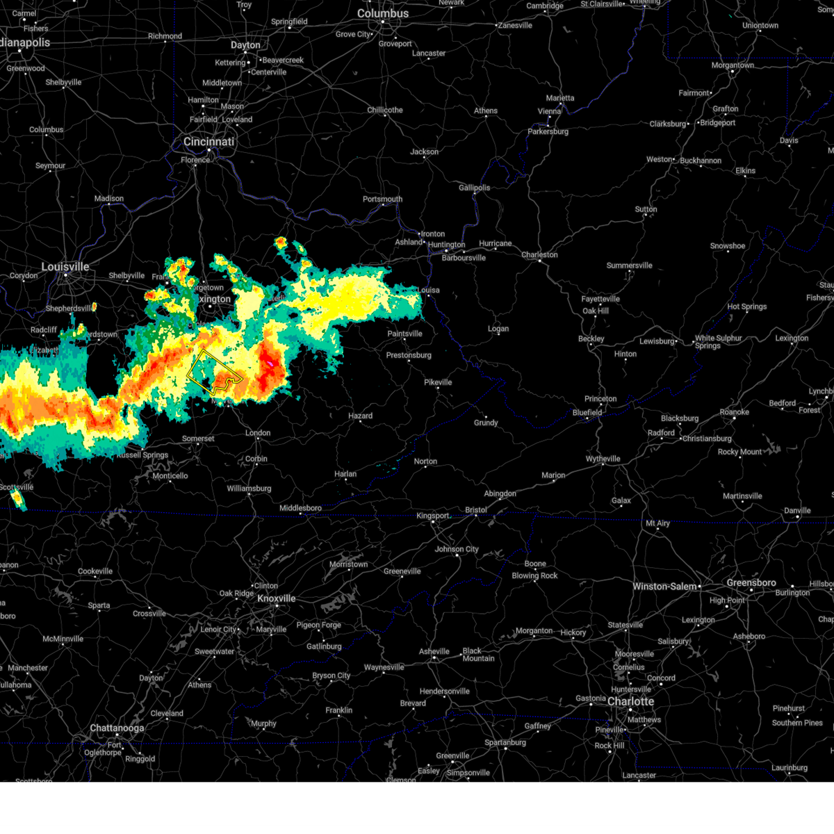
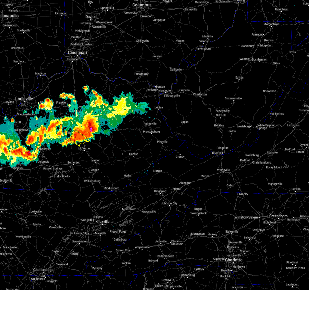
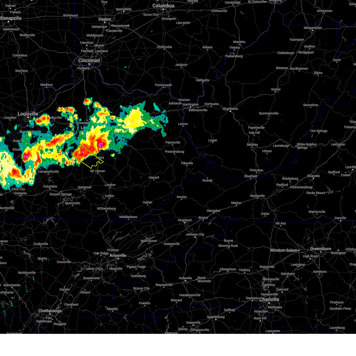
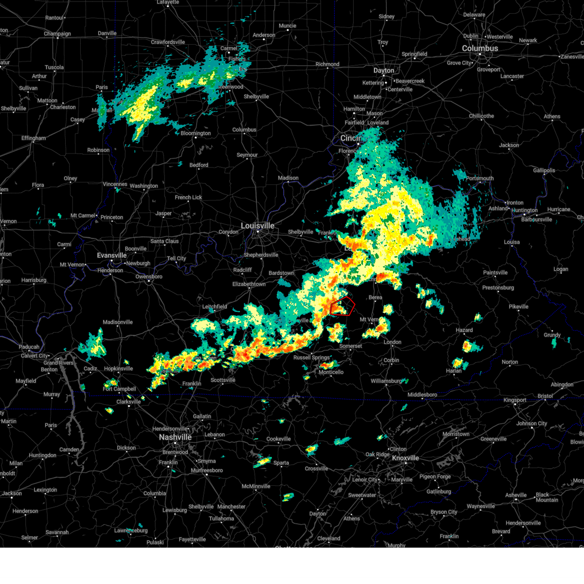
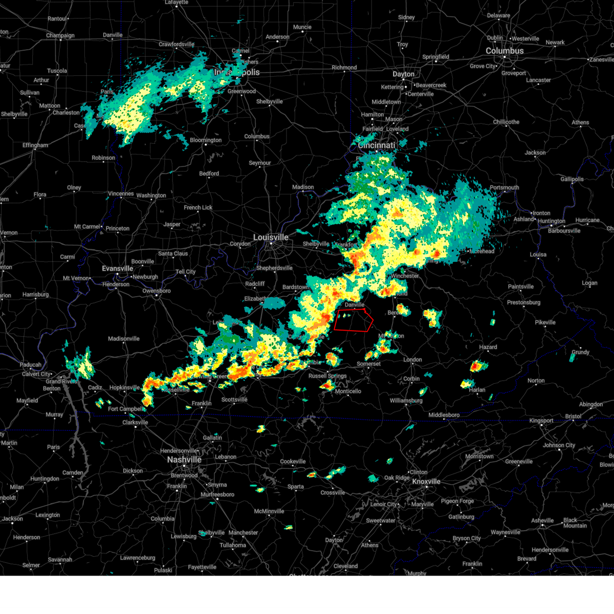
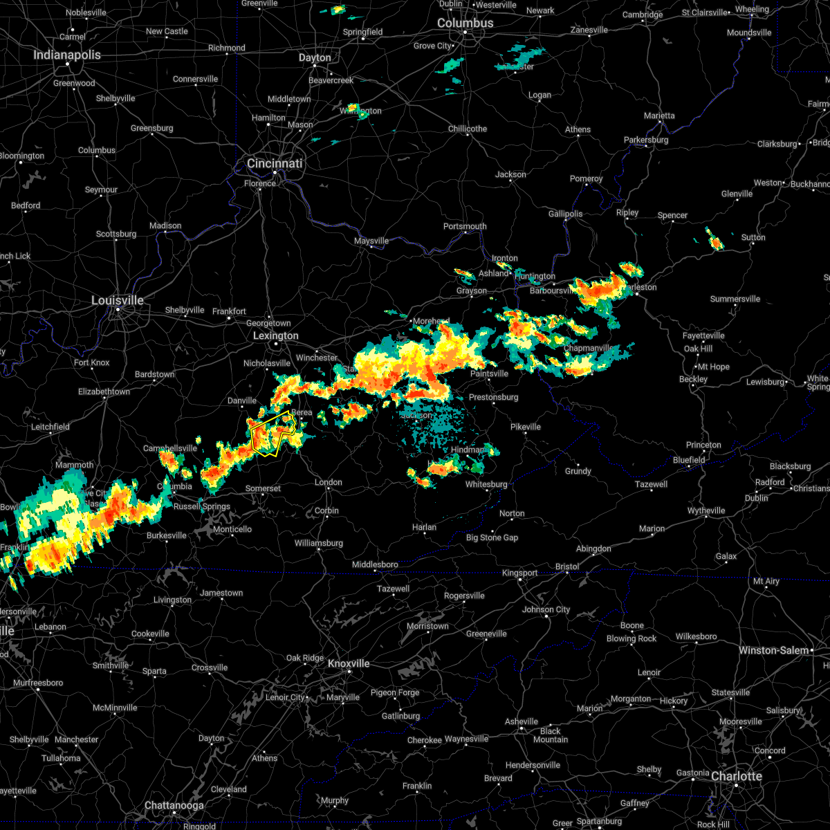
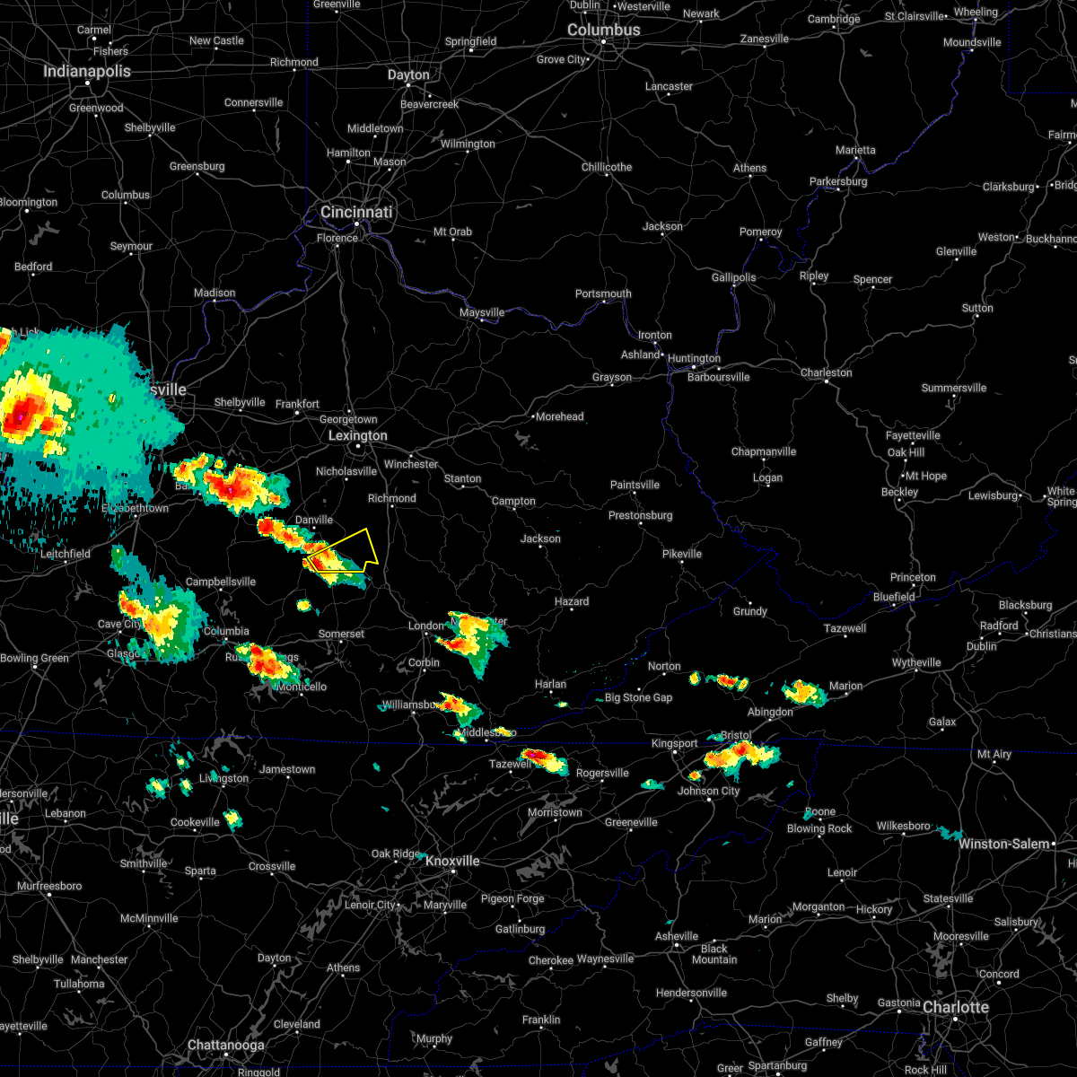
The Top Recent Hail Date for Stanford, KY is Friday, May 16, 2025 (18th out of 38)

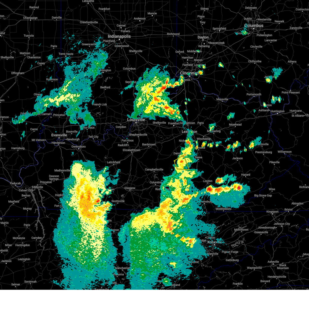
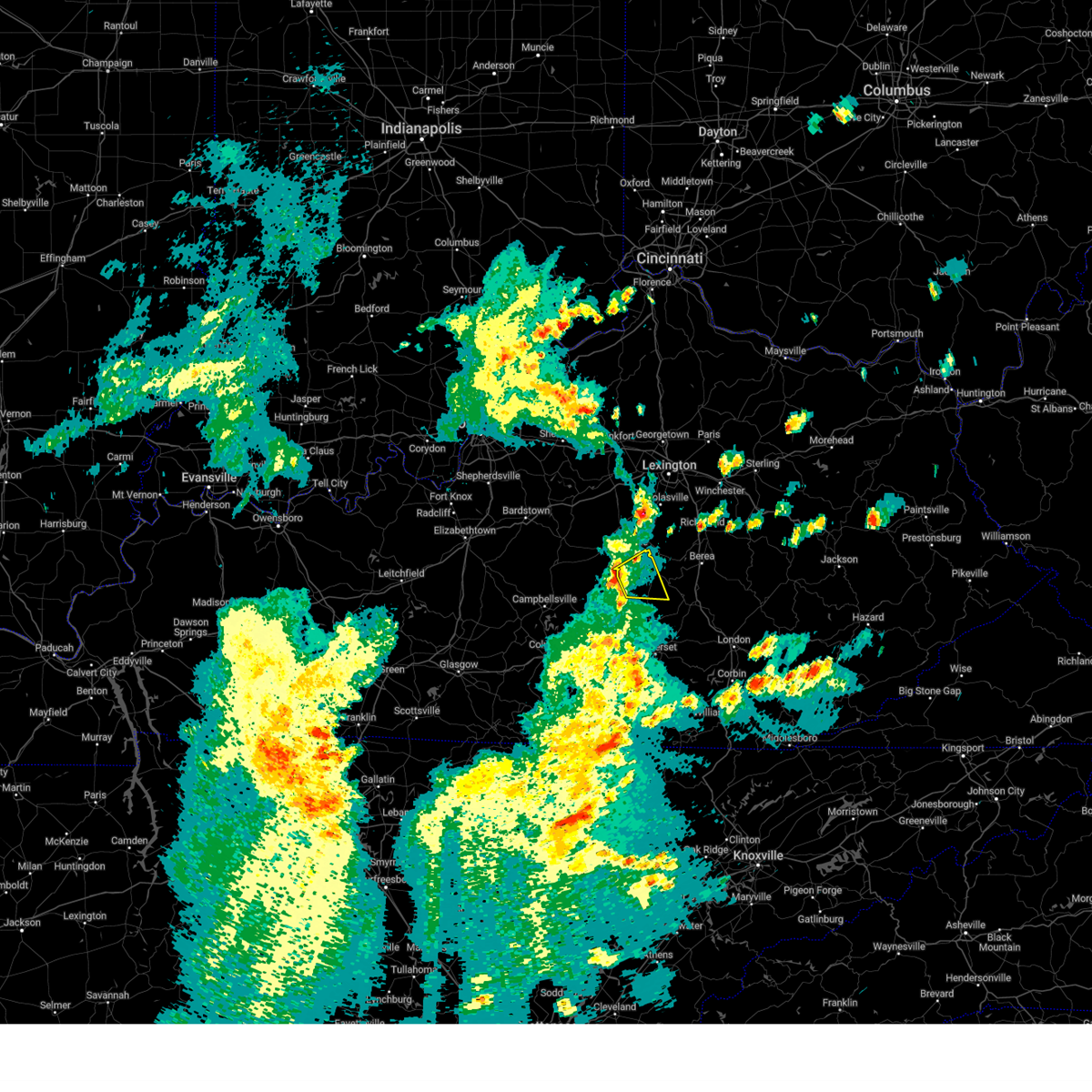
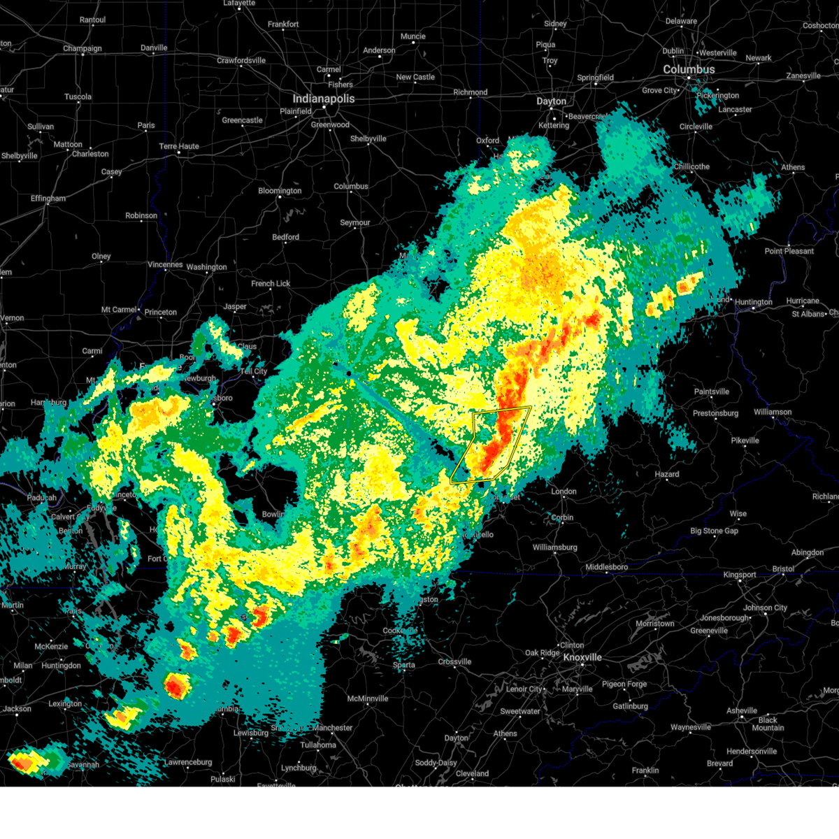
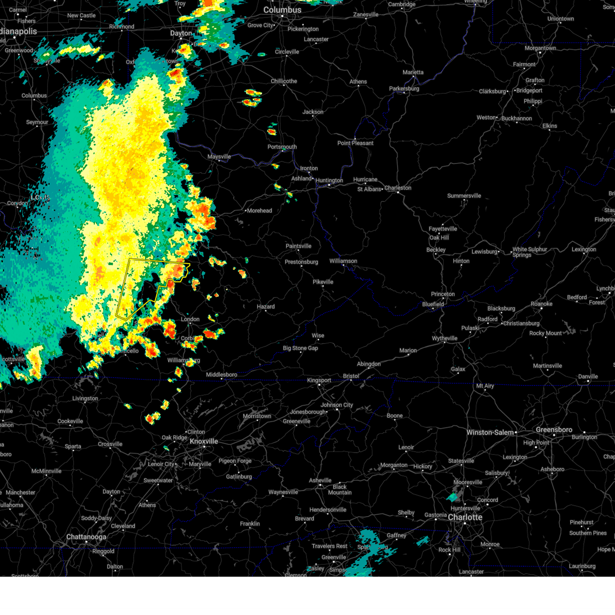
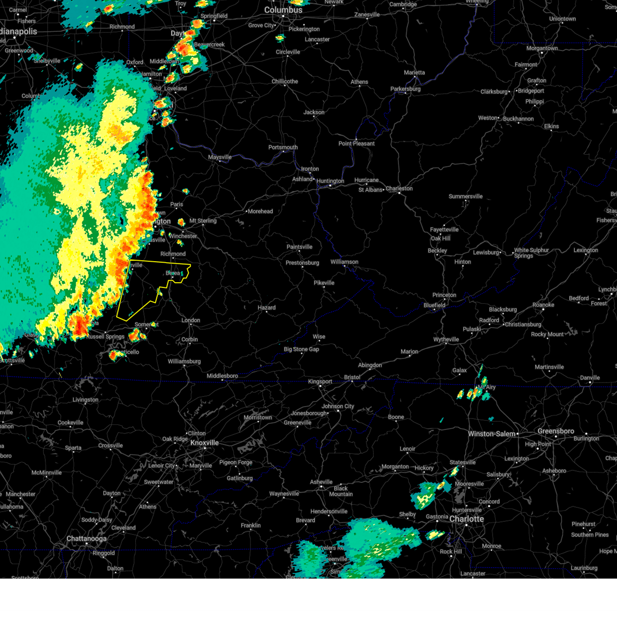
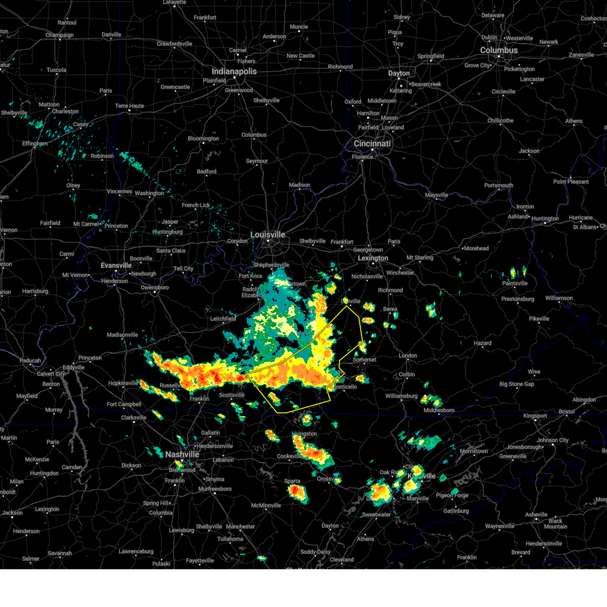
Hail and Wind Damage Spotted near Stanford, KY
| Date / Time | Report Details |
|---|---|
| 6/6/2025 2:40 PM EDT |
 the severe thunderstorm warning has been cancelled and is no longer in effect the severe thunderstorm warning has been cancelled and is no longer in effect
|
| 6/6/2025 2:40 PM EDT |
 At 240 pm edt, severe thunderstorms were located along a line extending from 9 miles southwest of nicholasville to lancaster to near stanford, moving east at 40 mph (radar indicated). Hazards include 60 mph wind gusts. Expect damage to roofs, siding, and trees. Locations impacted include, richmond, danville, stanford, lancaster, mccreary, berea, junction city, crab orchard, hustonville, and boneyville. At 240 pm edt, severe thunderstorms were located along a line extending from 9 miles southwest of nicholasville to lancaster to near stanford, moving east at 40 mph (radar indicated). Hazards include 60 mph wind gusts. Expect damage to roofs, siding, and trees. Locations impacted include, richmond, danville, stanford, lancaster, mccreary, berea, junction city, crab orchard, hustonville, and boneyville.
|
| 6/6/2025 2:37 PM EDT | Report of power lines down around the danville ave and lee d in lincoln county KY, 0.7 miles SE of Stanford, KY |
| 6/6/2025 2:20 PM EDT |
 Svrlmk the national weather service in louisville has issued a * severe thunderstorm warning for, lincoln county in central kentucky, central mercer county in central kentucky, south central woodford county in central kentucky, garrard county in central kentucky, southern jessamine county in central kentucky, boyle county in central kentucky, madison county in central kentucky, north central casey county in central kentucky, * until 300 pm edt. * at 220 pm edt, severe thunderstorms were located along a line extending from near harrodsburg to near danville to 14 miles north of liberty, moving east at 45 mph (radar indicated). Hazards include 60 mph wind gusts. expect damage to roofs, siding, and trees Svrlmk the national weather service in louisville has issued a * severe thunderstorm warning for, lincoln county in central kentucky, central mercer county in central kentucky, south central woodford county in central kentucky, garrard county in central kentucky, southern jessamine county in central kentucky, boyle county in central kentucky, madison county in central kentucky, north central casey county in central kentucky, * until 300 pm edt. * at 220 pm edt, severe thunderstorms were located along a line extending from near harrodsburg to near danville to 14 miles north of liberty, moving east at 45 mph (radar indicated). Hazards include 60 mph wind gusts. expect damage to roofs, siding, and trees
|
| 5/20/2025 8:46 PM EDT | Trees down across highway 39. time estimated from rada in lincoln county KY, 7.2 miles W of Stanford, KY |
| 5/20/2025 8:45 PM EDT | Trees down across crab orchard road near gilberts creek baptist church. time estimated from rada in garrard county KY, 6.6 miles WSW of Stanford, KY |
| 5/20/2025 8:44 PM EDT |
 At 844 pm edt, a severe thunderstorm was located near lancaster, or 16 miles northwest of mount vernon, moving east at 50 mph (radar indicated). Hazards include 60 mph wind gusts. Expect damage to roofs, siding, and trees. Locations impacted include, stanford, lancaster, berea, crab orchard, duluth, paint lick, bighill, manse, gilbert, whites, cartersville, preachersville, rowland, hyattsville, halls gap, walnut flat, maywood, wallaceton, dreyfus, and point leavell. At 844 pm edt, a severe thunderstorm was located near lancaster, or 16 miles northwest of mount vernon, moving east at 50 mph (radar indicated). Hazards include 60 mph wind gusts. Expect damage to roofs, siding, and trees. Locations impacted include, stanford, lancaster, berea, crab orchard, duluth, paint lick, bighill, manse, gilbert, whites, cartersville, preachersville, rowland, hyattsville, halls gap, walnut flat, maywood, wallaceton, dreyfus, and point leavell.
|
| 5/20/2025 8:41 PM EDT | Tree down blocking 1 lane of preachersville road. time estimated from rada in lincoln county KY, 5.1 miles W of Stanford, KY |
| 5/20/2025 8:35 PM EDT |
 Svrlmk the national weather service in louisville has issued a * severe thunderstorm warning for, central lincoln county in central kentucky, southeastern garrard county in central kentucky, southeastern madison county in central kentucky, * until 915 pm edt. * at 835 pm edt, a severe thunderstorm was located over stanford, or 19 miles northwest of mount vernon, moving east at 55 mph (radar indicated). Hazards include 60 mph wind gusts. expect damage to roofs, siding, and trees Svrlmk the national weather service in louisville has issued a * severe thunderstorm warning for, central lincoln county in central kentucky, southeastern garrard county in central kentucky, southeastern madison county in central kentucky, * until 915 pm edt. * at 835 pm edt, a severe thunderstorm was located over stanford, or 19 miles northwest of mount vernon, moving east at 55 mph (radar indicated). Hazards include 60 mph wind gusts. expect damage to roofs, siding, and trees
|
| 5/16/2025 11:40 PM EDT | Tree down over the 4100 block of preachersville road blocking two lane in lincoln county KY, 6.1 miles W of Stanford, KY |
| 5/16/2025 11:14 PM EDT |
 Svrlmk the national weather service in louisville has issued a * severe thunderstorm warning for, lincoln county in central kentucky, southeastern mercer county in central kentucky, garrard county in central kentucky, russell county in south central kentucky, southern jessamine county in central kentucky, eastern boyle county in central kentucky, madison county in central kentucky, casey county in central kentucky, southern adair county in south central kentucky, * until midnight edt/1100 pm cdt/. * at 1113 pm edt/1013 pm cdt/, severe thunderstorms were located along a line extending from 6 miles west of nicholasville to 10 miles southwest of danville to near greensburg, moving east at 75 mph (radar indicated). Hazards include 70 mph wind gusts and quarter size hail. Hail damage to vehicles is expected. expect considerable tree damage. Wind damage is also likely to mobile homes, roofs, and outbuildings. Svrlmk the national weather service in louisville has issued a * severe thunderstorm warning for, lincoln county in central kentucky, southeastern mercer county in central kentucky, garrard county in central kentucky, russell county in south central kentucky, southern jessamine county in central kentucky, eastern boyle county in central kentucky, madison county in central kentucky, casey county in central kentucky, southern adair county in south central kentucky, * until midnight edt/1100 pm cdt/. * at 1113 pm edt/1013 pm cdt/, severe thunderstorms were located along a line extending from 6 miles west of nicholasville to 10 miles southwest of danville to near greensburg, moving east at 75 mph (radar indicated). Hazards include 70 mph wind gusts and quarter size hail. Hail damage to vehicles is expected. expect considerable tree damage. Wind damage is also likely to mobile homes, roofs, and outbuildings.
|
| 5/16/2025 11:01 AM EDT |
 The storm which prompted the warning has moved out of portions of the first warning area. therefore, that warning will be allowed to expire. however, small hail, gusty winds and heavy rain are still possible with this thunderstorm. a severe thunderstorm watch remains in effect until noon edt for central kentucky. to report severe weather, contact your nearest law enforcement agency. they will relay your report to the national weather service louisville. remember, a severe thunderstorm warning still remains in effect for southern casey, lincoln, and garrard counties until 1130 am edt. The storm which prompted the warning has moved out of portions of the first warning area. therefore, that warning will be allowed to expire. however, small hail, gusty winds and heavy rain are still possible with this thunderstorm. a severe thunderstorm watch remains in effect until noon edt for central kentucky. to report severe weather, contact your nearest law enforcement agency. they will relay your report to the national weather service louisville. remember, a severe thunderstorm warning still remains in effect for southern casey, lincoln, and garrard counties until 1130 am edt.
|
| 5/16/2025 10:56 AM EDT |
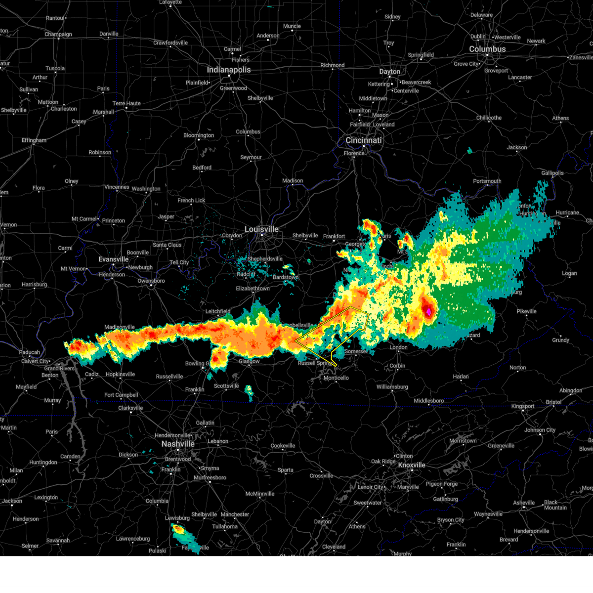
 Svrlmk the national weather service in louisville has issued a * severe thunderstorm warning for, lincoln county in central kentucky, southeastern garrard county in central kentucky, southeastern taylor county in central kentucky, southeastern madison county in central kentucky, casey county in central kentucky, northeastern adair county in south central kentucky, * until 1130 am edt/1030 am cdt/. * at 1056 am edt/956 am cdt/, severe thunderstorms were located along a line extending from 8 miles south of stanford to 10 miles southeast of campbellsville, moving east at 60 mph (radar indicated). Hazards include 60 mph wind gusts and quarter size hail. Hail damage to vehicles is expected. Expect wind damage to roofs, siding, and trees. Svrlmk the national weather service in louisville has issued a * severe thunderstorm warning for, lincoln county in central kentucky, southeastern garrard county in central kentucky, southeastern taylor county in central kentucky, southeastern madison county in central kentucky, casey county in central kentucky, northeastern adair county in south central kentucky, * until 1130 am edt/1030 am cdt/. * at 1056 am edt/956 am cdt/, severe thunderstorms were located along a line extending from 8 miles south of stanford to 10 miles southeast of campbellsville, moving east at 60 mph (radar indicated). Hazards include 60 mph wind gusts and quarter size hail. Hail damage to vehicles is expected. Expect wind damage to roofs, siding, and trees.
|
| 5/16/2025 10:41 AM EDT |
 At 1041 am edt, a severe thunderstorm was located 8 miles northeast of liberty, moving east at 60 mph (radar indicated). Hazards include 60 mph wind gusts and quarter size hail. Hail damage to vehicles is expected. expect wind damage to roofs, siding, and trees. Locations impacted include, liberty, stanford, lancaster, mccreary, junction city, crab orchard, hustonville, peytons store, boneyville, and lawhorn hill. At 1041 am edt, a severe thunderstorm was located 8 miles northeast of liberty, moving east at 60 mph (radar indicated). Hazards include 60 mph wind gusts and quarter size hail. Hail damage to vehicles is expected. expect wind damage to roofs, siding, and trees. Locations impacted include, liberty, stanford, lancaster, mccreary, junction city, crab orchard, hustonville, peytons store, boneyville, and lawhorn hill.
|
| 5/16/2025 10:41 AM EDT |
 the severe thunderstorm warning has been cancelled and is no longer in effect the severe thunderstorm warning has been cancelled and is no longer in effect
|
| 5/16/2025 10:23 AM EDT |
 Svrlmk the national weather service in louisville has issued a * severe thunderstorm warning for, lincoln county in central kentucky, southwestern garrard county in central kentucky, southeastern marion county in central kentucky, northeastern taylor county in central kentucky, southern boyle county in central kentucky, northern casey county in central kentucky, * until 1100 am edt. * at 1023 am edt, a severe thunderstorm was located 9 miles east of campbellsville, moving east at 65 mph (radar indicated). Hazards include 60 mph wind gusts and quarter size hail. Hail damage to vehicles is expected. Expect wind damage to roofs, siding, and trees. Svrlmk the national weather service in louisville has issued a * severe thunderstorm warning for, lincoln county in central kentucky, southwestern garrard county in central kentucky, southeastern marion county in central kentucky, northeastern taylor county in central kentucky, southern boyle county in central kentucky, northern casey county in central kentucky, * until 1100 am edt. * at 1023 am edt, a severe thunderstorm was located 9 miles east of campbellsville, moving east at 65 mph (radar indicated). Hazards include 60 mph wind gusts and quarter size hail. Hail damage to vehicles is expected. Expect wind damage to roofs, siding, and trees.
|
| 5/16/2025 7:40 AM EDT |
 the severe thunderstorm warning has been cancelled and is no longer in effect the severe thunderstorm warning has been cancelled and is no longer in effect
|
| 5/16/2025 7:40 AM EDT |
 At 739 am edt, a severe thunderstorm was located over stanford, moving east at 60 mph (radar indicated). Hazards include quarter size hail. Damage to vehicles is expected. Locations impacted include, danville, stanford, lancaster, mccreary, junction city, boneyville, marksbury, gilbert, cartersville, and rowland. At 739 am edt, a severe thunderstorm was located over stanford, moving east at 60 mph (radar indicated). Hazards include quarter size hail. Damage to vehicles is expected. Locations impacted include, danville, stanford, lancaster, mccreary, junction city, boneyville, marksbury, gilbert, cartersville, and rowland.
|
| 5/16/2025 7:23 AM EDT |
 Svrlmk the national weather service in louisville has issued a * severe thunderstorm warning for, northern lincoln county in central kentucky, garrard county in central kentucky, boyle county in central kentucky, north central casey county in central kentucky, * until 800 am edt. * at 723 am edt, a severe thunderstorm was located 11 miles southwest of danville, moving east at 65 mph (radar indicated). Hazards include quarter size hail. damage to vehicles is expected Svrlmk the national weather service in louisville has issued a * severe thunderstorm warning for, northern lincoln county in central kentucky, garrard county in central kentucky, boyle county in central kentucky, north central casey county in central kentucky, * until 800 am edt. * at 723 am edt, a severe thunderstorm was located 11 miles southwest of danville, moving east at 65 mph (radar indicated). Hazards include quarter size hail. damage to vehicles is expected
|
| 5/2/2025 5:15 PM EDT |
 The storm which prompted the warning has weakened below severe limits, and has exited the warned area. therefore, the warning has been allowed to expire. a severe thunderstorm watch remains in effect until 900 pm edt for central kentucky. to report severe weather, contact your nearest law enforcement agency. they will relay your report to the national weather service louisville. The storm which prompted the warning has weakened below severe limits, and has exited the warned area. therefore, the warning has been allowed to expire. a severe thunderstorm watch remains in effect until 900 pm edt for central kentucky. to report severe weather, contact your nearest law enforcement agency. they will relay your report to the national weather service louisville.
|
| 5/2/2025 5:05 PM EDT |
 At 505 pm edt, a severe thunderstorm was located near stanford, moving east at 35 mph (radar indicated). Hazards include 60 mph wind gusts and quarter size hail. Hail damage to vehicles is expected. expect wind damage to roofs, siding, and trees. Locations impacted include, stanford, junction city, hustonville, boneyville, ottenheim, broughtentown, geneva, rowland, maywood, and new salem. At 505 pm edt, a severe thunderstorm was located near stanford, moving east at 35 mph (radar indicated). Hazards include 60 mph wind gusts and quarter size hail. Hail damage to vehicles is expected. expect wind damage to roofs, siding, and trees. Locations impacted include, stanford, junction city, hustonville, boneyville, ottenheim, broughtentown, geneva, rowland, maywood, and new salem.
|
| 5/2/2025 5:05 PM EDT |
 the severe thunderstorm warning has been cancelled and is no longer in effect the severe thunderstorm warning has been cancelled and is no longer in effect
|
| 5/2/2025 4:45 PM EDT | Svrlmk the national weather service in louisville has issued a * severe thunderstorm warning for, lincoln county in central kentucky, southeastern boyle county in central kentucky, northeastern casey county in central kentucky, * until 515 pm edt. * at 445 pm edt, a severe thunderstorm was located 9 miles north of liberty, moving east at 35 mph (radar indicated). Hazards include 60 mph wind gusts and quarter size hail. Hail damage to vehicles is expected. Expect wind damage to roofs, siding, and trees. |
| 4/3/2025 3:16 AM EDT | The storms which prompted the warning have moved out of the area. therefore, the warning has been allowed to expire. a tornado watch remains in effect until 700 am edt for south central and central kentucky. remember, a tornado warning still remains in effect for casey, garrard, and madison counties. |
| 4/3/2025 3:07 AM EDT |
 At 307 am edt, severe thunderstorms were located along a line extending from near lancaster to 7 miles north of magnum, moving east at 60 mph (radar indicated). Hazards include 70 mph wind gusts. Expect considerable tree damage. damage is likely to mobile homes, roofs, and outbuildings. Locations impacted include, liberty, danville, stanford, lancaster, mccreary, junction city, crab orchard, hustonville, boneyville, and caldwell manor. At 307 am edt, severe thunderstorms were located along a line extending from near lancaster to 7 miles north of magnum, moving east at 60 mph (radar indicated). Hazards include 70 mph wind gusts. Expect considerable tree damage. damage is likely to mobile homes, roofs, and outbuildings. Locations impacted include, liberty, danville, stanford, lancaster, mccreary, junction city, crab orchard, hustonville, boneyville, and caldwell manor.
|
| 4/3/2025 3:07 AM EDT |
 the severe thunderstorm warning has been cancelled and is no longer in effect the severe thunderstorm warning has been cancelled and is no longer in effect
|
| 4/3/2025 3:05 AM EDT |
 At 304 am edt, a severe thunderstorm capable of producing a tornado was located near stanford, moving east at 70 mph (radar indicated rotation). Hazards include tornado. Flying debris will be dangerous to those caught without shelter. mobile homes will be damaged or destroyed. damage to roofs, windows, and vehicles will occur. tree damage is likely. this dangerous storm will be near, stanford around 310 am edt. Other locations impacted by this tornadic thunderstorm include boneyville, peytontown, panola, broughtentown, buggytown, combs, terrill, stuart powell field airport, dreyfus, and berea. At 304 am edt, a severe thunderstorm capable of producing a tornado was located near stanford, moving east at 70 mph (radar indicated rotation). Hazards include tornado. Flying debris will be dangerous to those caught without shelter. mobile homes will be damaged or destroyed. damage to roofs, windows, and vehicles will occur. tree damage is likely. this dangerous storm will be near, stanford around 310 am edt. Other locations impacted by this tornadic thunderstorm include boneyville, peytontown, panola, broughtentown, buggytown, combs, terrill, stuart powell field airport, dreyfus, and berea.
|
| 4/3/2025 3:05 AM EDT |
 the tornado warning has been cancelled and is no longer in effect the tornado warning has been cancelled and is no longer in effect
|
| 4/3/2025 2:58 AM EDT |
 Torlmk the national weather service in louisville has issued a * tornado warning for, lincoln county in central kentucky, southeastern garrard county in central kentucky, southeastern boyle county in central kentucky, southern madison county in central kentucky, northeastern casey county in central kentucky, * until 345 am edt. * at 257 am edt, a severe thunderstorm capable of producing a tornado was located 9 miles north of liberty, moving east at 70 mph (radar indicated rotation). Hazards include tornado. Flying debris will be dangerous to those caught without shelter. mobile homes will be damaged or destroyed. damage to roofs, windows, and vehicles will occur. tree damage is likely. this dangerous storm will be near, stanford around 305 am edt. Other locations impacted by this tornadic thunderstorm include boneyville, peytontown, panola, broughtentown, buggytown, combs, terrill, stuart powell field airport, dreyfus, and berea. Torlmk the national weather service in louisville has issued a * tornado warning for, lincoln county in central kentucky, southeastern garrard county in central kentucky, southeastern boyle county in central kentucky, southern madison county in central kentucky, northeastern casey county in central kentucky, * until 345 am edt. * at 257 am edt, a severe thunderstorm capable of producing a tornado was located 9 miles north of liberty, moving east at 70 mph (radar indicated rotation). Hazards include tornado. Flying debris will be dangerous to those caught without shelter. mobile homes will be damaged or destroyed. damage to roofs, windows, and vehicles will occur. tree damage is likely. this dangerous storm will be near, stanford around 305 am edt. Other locations impacted by this tornadic thunderstorm include boneyville, peytontown, panola, broughtentown, buggytown, combs, terrill, stuart powell field airport, dreyfus, and berea.
|
| 4/3/2025 2:47 AM EDT |
 At 246 am edt/146 am cdt/, severe thunderstorms were located along a line extending from 12 miles west of danville to 12 miles northeast of columbia, moving east at 60 mph (radar indicated). Hazards include 70 mph wind gusts. Expect considerable tree damage. damage is likely to mobile homes, roofs, and outbuildings. Locations impacted include, liberty, danville, stanford, lancaster, mccreary, junction city, crab orchard, perryville, hustonville, and bradfordsville. At 246 am edt/146 am cdt/, severe thunderstorms were located along a line extending from 12 miles west of danville to 12 miles northeast of columbia, moving east at 60 mph (radar indicated). Hazards include 70 mph wind gusts. Expect considerable tree damage. damage is likely to mobile homes, roofs, and outbuildings. Locations impacted include, liberty, danville, stanford, lancaster, mccreary, junction city, crab orchard, perryville, hustonville, and bradfordsville.
|
| 4/3/2025 2:47 AM EDT |
 the severe thunderstorm warning has been cancelled and is no longer in effect the severe thunderstorm warning has been cancelled and is no longer in effect
|
| 4/3/2025 2:31 AM EDT | Svrlmk the national weather service in louisville has issued a * severe thunderstorm warning for, lincoln county in central kentucky, garrard county in central kentucky, southeastern green county in central kentucky, marion county in central kentucky, taylor county in central kentucky, southeastern washington county in central kentucky, boyle county in central kentucky, west central madison county in central kentucky, casey county in central kentucky, northeastern adair county in south central kentucky, * until 315 am edt/215 am cdt/. * at 230 am edt/130 am cdt/, severe thunderstorms were located along a line extending from near lebanon to near greensburg, moving east at 60 mph (radar indicated). Hazards include 70 mph wind gusts. Expect considerable tree damage. Damage is likely to mobile homes, roofs, and outbuildings. |
| 3/30/2025 11:29 PM EDT |
 The storms which prompted the warning have moved out of the area. therefore, the warning will be allowed to expire. another warning has been issued downstream. a tornado watch remains in effect until 100 am edt for central kentucky. a tornado watch also remains in effect until 400 am edt for central kentucky. The storms which prompted the warning have moved out of the area. therefore, the warning will be allowed to expire. another warning has been issued downstream. a tornado watch remains in effect until 100 am edt for central kentucky. a tornado watch also remains in effect until 400 am edt for central kentucky.
|
| 3/30/2025 11:05 PM EDT | Svrlmk the national weather service in louisville has issued a * severe thunderstorm warning for, lincoln county in central kentucky, southeastern mercer county in central kentucky, south central woodford county in central kentucky, garrard county in central kentucky, southern jessamine county in central kentucky, boyle county in central kentucky, central madison county in central kentucky, * until 1130 pm edt. * at 1105 pm edt, severe thunderstorms were located along a line extending from 8 miles west of nicholasville to 10 miles southwest of danville, moving east at 55 mph (radar indicated). Hazards include 60 mph wind gusts. expect damage to roofs, siding, and trees |
| 9/24/2024 4:14 PM EDT |
 The storm which prompted the warning has moved out of the area. therefore, the warning will be allowed to expire. a severe thunderstorm watch remains in effect until 800 pm edt for central kentucky. remember, a severe thunderstorm warning still remains in effect for lincoln and garrard counties. The storm which prompted the warning has moved out of the area. therefore, the warning will be allowed to expire. a severe thunderstorm watch remains in effect until 800 pm edt for central kentucky. remember, a severe thunderstorm warning still remains in effect for lincoln and garrard counties.
|
| 9/24/2024 4:05 PM EDT |
 At 405 pm edt, a severe thunderstorm was located near stanford, moving east at 35 mph (radar indicated). Hazards include 60 mph wind gusts and quarter size hail. Hail damage to vehicles is expected. expect wind damage to roofs, siding, and trees. Locations impacted include, stanford, crab orchard, south fork, jumbo, ottenheim, gilbert, preachersville, rowland, hyattsville, and halls gap. At 405 pm edt, a severe thunderstorm was located near stanford, moving east at 35 mph (radar indicated). Hazards include 60 mph wind gusts and quarter size hail. Hail damage to vehicles is expected. expect wind damage to roofs, siding, and trees. Locations impacted include, stanford, crab orchard, south fork, jumbo, ottenheim, gilbert, preachersville, rowland, hyattsville, and halls gap.
|
| 9/24/2024 4:00 PM EDT | A few large limbs and trees down in stanfor in lincoln county KY, 0.2 miles N of Stanford, KY |
| 9/24/2024 3:50 PM EDT |
 Svrlmk the national weather service in louisville has issued a * severe thunderstorm warning for, central lincoln county in central kentucky, south central garrard county in central kentucky, * until 415 pm edt. * at 350 pm edt, a severe thunderstorm was located near stanford, moving east at 35 mph (radar indicated). Hazards include 60 mph wind gusts and quarter size hail. Hail damage to vehicles is expected. Expect wind damage to roofs, siding, and trees. Svrlmk the national weather service in louisville has issued a * severe thunderstorm warning for, central lincoln county in central kentucky, south central garrard county in central kentucky, * until 415 pm edt. * at 350 pm edt, a severe thunderstorm was located near stanford, moving east at 35 mph (radar indicated). Hazards include 60 mph wind gusts and quarter size hail. Hail damage to vehicles is expected. Expect wind damage to roofs, siding, and trees.
|
| 8/17/2024 5:46 PM EDT |
 The storm which prompted the warning has moved out of the area. therefore, the warning has been allowed to expire. to report severe weather, contact your nearest law enforcement agency. they will relay your report to the national weather service louisville. The storm which prompted the warning has moved out of the area. therefore, the warning has been allowed to expire. to report severe weather, contact your nearest law enforcement agency. they will relay your report to the national weather service louisville.
|
| 8/17/2024 5:45 PM EDT | Trees down on fairground rd. time estimated from rada in lincoln county KY, 3.8 miles NNW of Stanford, KY |
| 8/17/2024 5:32 PM EDT |
 At 531 pm edt, a severe thunderstorm was located near stanford, moving east at 40 mph (radar indicated). Hazards include 60 mph wind gusts and quarter size hail. Hail damage to vehicles is expected. expect wind damage to roofs, siding, and trees. Locations impacted include, danville, stanford, lancaster, junction city, crab orchard, hustonville, boneyville, alum springs, caldwell manor, and parksville. At 531 pm edt, a severe thunderstorm was located near stanford, moving east at 40 mph (radar indicated). Hazards include 60 mph wind gusts and quarter size hail. Hail damage to vehicles is expected. expect wind damage to roofs, siding, and trees. Locations impacted include, danville, stanford, lancaster, junction city, crab orchard, hustonville, boneyville, alum springs, caldwell manor, and parksville.
|
| 8/17/2024 5:32 PM EDT |
 the severe thunderstorm warning has been cancelled and is no longer in effect the severe thunderstorm warning has been cancelled and is no longer in effect
|
| 8/17/2024 5:16 PM EDT |
 At 516 pm edt, a severe thunderstorm was located 8 miles southwest of danville, moving east at 40 mph (radar indicated). Hazards include 60 mph wind gusts and quarter size hail. Hail damage to vehicles is expected. expect wind damage to roofs, siding, and trees. Locations impacted include, danville, stanford, lancaster, junction city, crab orchard, perryville, hustonville, bradfordsville, brumfield, and boneyville. At 516 pm edt, a severe thunderstorm was located 8 miles southwest of danville, moving east at 40 mph (radar indicated). Hazards include 60 mph wind gusts and quarter size hail. Hail damage to vehicles is expected. expect wind damage to roofs, siding, and trees. Locations impacted include, danville, stanford, lancaster, junction city, crab orchard, perryville, hustonville, bradfordsville, brumfield, and boneyville.
|
| 8/17/2024 5:16 PM EDT |
 the severe thunderstorm warning has been cancelled and is no longer in effect the severe thunderstorm warning has been cancelled and is no longer in effect
|
| 8/17/2024 4:52 PM EDT | Svrlmk the national weather service in louisville has issued a * severe thunderstorm warning for, northern lincoln county in central kentucky, southern garrard county in central kentucky, central marion county in central kentucky, southeastern washington county in central kentucky, boyle county in central kentucky, north central casey county in central kentucky, * until 545 pm edt. * at 452 pm edt, a severe thunderstorm was located near lebanon, moving east at 40 mph (radar indicated). Hazards include 60 mph wind gusts and nickel size hail. expect damage to roofs, siding, and trees |
| 8/1/2024 7:30 PM EDT |
 The storms which prompted the warning have weakened below severe limits, and have exited the warned area. therefore, the warning has been allowed to expire. however, heavy rain is still possible with these thunderstorms. a severe thunderstorm watch remains in effect until 800 pm edt for central kentucky. The storms which prompted the warning have weakened below severe limits, and have exited the warned area. therefore, the warning has been allowed to expire. however, heavy rain is still possible with these thunderstorms. a severe thunderstorm watch remains in effect until 800 pm edt for central kentucky.
|
| 8/1/2024 6:43 PM EDT |
 Svrlmk the national weather service in louisville has issued a * severe thunderstorm warning for, lincoln county in central kentucky, southeastern mercer county in central kentucky, garrard county in central kentucky, eastern boyle county in central kentucky, southern madison county in central kentucky, eastern casey county in central kentucky, * until 730 pm edt. * at 643 pm edt, severe thunderstorms were located along a line extending from near danville to near liberty, moving east at 35 mph (radar indicated). Hazards include 60 mph wind gusts. expect damage to roofs, siding, and trees Svrlmk the national weather service in louisville has issued a * severe thunderstorm warning for, lincoln county in central kentucky, southeastern mercer county in central kentucky, garrard county in central kentucky, eastern boyle county in central kentucky, southern madison county in central kentucky, eastern casey county in central kentucky, * until 730 pm edt. * at 643 pm edt, severe thunderstorms were located along a line extending from near danville to near liberty, moving east at 35 mph (radar indicated). Hazards include 60 mph wind gusts. expect damage to roofs, siding, and trees
|
| 8/1/2024 6:42 PM EDT | Trees down along kentucky route 214 in lincoln county KY, 8.2 miles E of Stanford, KY |
| 7/30/2024 2:14 PM CDT |
 At 314 pm edt/214 pm cdt/, a severe thunderstorm was located 11 miles southwest of liberty, moving southeast at 35 mph (radar indicated). Hazards include 60 mph wind gusts and penny size hail. Expect damage to roofs, siding, and trees. Locations impacted include, liberty, danville, glasgow, columbia, stanford, tompkinsville, albany, jamestown, edmonton, and burkesville. At 314 pm edt/214 pm cdt/, a severe thunderstorm was located 11 miles southwest of liberty, moving southeast at 35 mph (radar indicated). Hazards include 60 mph wind gusts and penny size hail. Expect damage to roofs, siding, and trees. Locations impacted include, liberty, danville, glasgow, columbia, stanford, tompkinsville, albany, jamestown, edmonton, and burkesville.
|
| 7/30/2024 2:14 PM CDT |
 the severe thunderstorm warning has been cancelled and is no longer in effect the severe thunderstorm warning has been cancelled and is no longer in effect
|
| 7/30/2024 1:33 PM CDT |
 Svrlmk the national weather service in louisville has issued a * severe thunderstorm warning for, southeastern marion county in central kentucky, russell county in south central kentucky, taylor county in central kentucky, casey county in central kentucky, adair county in south central kentucky, western lincoln county in central kentucky, southwestern mercer county in central kentucky, central clinton county in south central kentucky, southern green county in central kentucky, central monroe county in south central kentucky, southeastern washington county in central kentucky, boyle county in central kentucky, cumberland county in south central kentucky, eastern barren county in south central kentucky, metcalfe county in south central kentucky, * until 330 pm edt/230 pm cdt/. * at 231 pm edt/131 pm cdt/, severe thunderstorms were located along a line extending from near bardstown to 11 miles northwest of campbellsville to 7 miles west of greensburg to 10 miles east of brownsville, moving southeast at 50 mph (radar indicated). Hazards include 60 mph wind gusts and penny size hail. expect damage to roofs, siding, and trees Svrlmk the national weather service in louisville has issued a * severe thunderstorm warning for, southeastern marion county in central kentucky, russell county in south central kentucky, taylor county in central kentucky, casey county in central kentucky, adair county in south central kentucky, western lincoln county in central kentucky, southwestern mercer county in central kentucky, central clinton county in south central kentucky, southern green county in central kentucky, central monroe county in south central kentucky, southeastern washington county in central kentucky, boyle county in central kentucky, cumberland county in south central kentucky, eastern barren county in south central kentucky, metcalfe county in south central kentucky, * until 330 pm edt/230 pm cdt/. * at 231 pm edt/131 pm cdt/, severe thunderstorms were located along a line extending from near bardstown to 11 miles northwest of campbellsville to 7 miles west of greensburg to 10 miles east of brownsville, moving southeast at 50 mph (radar indicated). Hazards include 60 mph wind gusts and penny size hail. expect damage to roofs, siding, and trees
|
| 5/26/2024 1:03 PM EDT |
 At 102 pm edt, a severe thunderstorm was located near thoroughbred acres, moving northeast at 60 mph (radar indicated). Hazards include 70 mph wind gusts. Expect considerable tree damage. damage is likely to mobile homes, roofs, and outbuildings. Locations impacted include, lexington, richmond, georgetown, frankfort, nicholasville, winchester, danville, lawrenceburg, versailles, and paris. At 102 pm edt, a severe thunderstorm was located near thoroughbred acres, moving northeast at 60 mph (radar indicated). Hazards include 70 mph wind gusts. Expect considerable tree damage. damage is likely to mobile homes, roofs, and outbuildings. Locations impacted include, lexington, richmond, georgetown, frankfort, nicholasville, winchester, danville, lawrenceburg, versailles, and paris.
|
| 5/26/2024 1:00 PM EDT | Damaged barns... galvanized steel roof panels removed and chimney destroyed. silo partially destroye in lincoln county KY, 5.2 miles WNW of Stanford, KY |
| 5/26/2024 12:22 PM EDT |
 Svrlmk the national weather service in louisville has issued a * severe thunderstorm warning for, eastern anderson county in central kentucky, garrard county in central kentucky, clark county in central kentucky, jessamine county in central kentucky, nicholas county in central kentucky, harrison county in central kentucky, franklin county in central kentucky, northern lincoln county in central kentucky, mercer county in central kentucky, woodford county in central kentucky, scott county in central kentucky, bourbon county in central kentucky, boyle county in central kentucky, madison county in central kentucky, fayette county in central kentucky, * until 115 pm edt. * at 1222 pm edt, a severe thunderstorm was located 14 miles southwest of lawrenceburg, moving northeast at 60 mph (radar indicated). Hazards include 70 mph wind gusts. Expect considerable tree damage. Damage is likely to mobile homes, roofs, and outbuildings. Svrlmk the national weather service in louisville has issued a * severe thunderstorm warning for, eastern anderson county in central kentucky, garrard county in central kentucky, clark county in central kentucky, jessamine county in central kentucky, nicholas county in central kentucky, harrison county in central kentucky, franklin county in central kentucky, northern lincoln county in central kentucky, mercer county in central kentucky, woodford county in central kentucky, scott county in central kentucky, bourbon county in central kentucky, boyle county in central kentucky, madison county in central kentucky, fayette county in central kentucky, * until 115 pm edt. * at 1222 pm edt, a severe thunderstorm was located 14 miles southwest of lawrenceburg, moving northeast at 60 mph (radar indicated). Hazards include 70 mph wind gusts. Expect considerable tree damage. Damage is likely to mobile homes, roofs, and outbuildings.
|
| 4/2/2024 8:34 PM EDT |
 At 834 pm edt, a severe thunderstorm was located near stanford, moving northeast at 55 mph (radar indicated). Hazards include 60 mph wind gusts and quarter size hail. Hail damage to vehicles is expected. expect wind damage to roofs, siding, and trees. Locations impacted include, stanford, lancaster, crab orchard, hustonville, boneyville, jumbo, mount salem, gilbert, geneva, and preachersville. At 834 pm edt, a severe thunderstorm was located near stanford, moving northeast at 55 mph (radar indicated). Hazards include 60 mph wind gusts and quarter size hail. Hail damage to vehicles is expected. expect wind damage to roofs, siding, and trees. Locations impacted include, stanford, lancaster, crab orchard, hustonville, boneyville, jumbo, mount salem, gilbert, geneva, and preachersville.
|
| 4/2/2024 8:34 PM EDT |
 the severe thunderstorm warning has been cancelled and is no longer in effect the severe thunderstorm warning has been cancelled and is no longer in effect
|
| 4/2/2024 8:14 PM EDT |
 Svrlmk the national weather service in louisville has issued a * severe thunderstorm warning for, lincoln county in central kentucky, south central garrard county in central kentucky, central casey county in central kentucky, * until 845 pm edt. * at 814 pm edt, a severe thunderstorm was located near liberty, moving northeast at 55 mph (radar indicated). Hazards include 60 mph wind gusts and quarter size hail. Hail damage to vehicles is expected. Expect wind damage to roofs, siding, and trees. Svrlmk the national weather service in louisville has issued a * severe thunderstorm warning for, lincoln county in central kentucky, south central garrard county in central kentucky, central casey county in central kentucky, * until 845 pm edt. * at 814 pm edt, a severe thunderstorm was located near liberty, moving northeast at 55 mph (radar indicated). Hazards include 60 mph wind gusts and quarter size hail. Hail damage to vehicles is expected. Expect wind damage to roofs, siding, and trees.
|
| 3/6/2024 10:06 AM EST |
 Torlmk the national weather service in louisville has issued a * this is a test message. tornado warning for, meade county in central kentucky, larue county in central kentucky, jessamine county in central kentucky, nicholas county in central kentucky, adair county in south central kentucky, bourbon county in central kentucky, warren county in south central kentucky, cumberland county in south central kentucky, henry county in central kentucky, russell county in south central kentucky, taylor county in central kentucky, jefferson county in central kentucky, hardin county in central kentucky, spencer county in central kentucky, scott county in central kentucky, hancock county in central kentucky, trimble county in central kentucky, monroe county in south central kentucky, metcalfe county in south central kentucky, shelby county in central kentucky, logan county in south central kentucky, nelson county in central kentucky, anderson county in central kentucky, clark county in central kentucky, marion county in central kentucky, simpson county in south central kentucky, grayson county in central kentucky, casey county in central kentucky, franklin county in central kentucky, edmonson county in south central kentucky, lincoln county in central kentucky, woodford county in central kentucky, butler county in south central kentucky, madison county in central kentucky, barren county in south central kentucky, ohio county in central kentucky, oldham county in central kentucky, garrard county in central kentucky, hart county in central kentucky, bullitt county in central kentucky, harrison county in central kentucky, mercer county in central kentucky, clinton county in south central kentucky, green county in central kentucky, allen county in south central kentucky, washington county in central kentucky, boyle county in central kentucky, breckinridge county in central kentucky, fayette county in central kentucky, * this is a test message. until 1030 am est/930 am cst/. * this is a test message. Torlmk the national weather service in louisville has issued a * this is a test message. tornado warning for, meade county in central kentucky, larue county in central kentucky, jessamine county in central kentucky, nicholas county in central kentucky, adair county in south central kentucky, bourbon county in central kentucky, warren county in south central kentucky, cumberland county in south central kentucky, henry county in central kentucky, russell county in south central kentucky, taylor county in central kentucky, jefferson county in central kentucky, hardin county in central kentucky, spencer county in central kentucky, scott county in central kentucky, hancock county in central kentucky, trimble county in central kentucky, monroe county in south central kentucky, metcalfe county in south central kentucky, shelby county in central kentucky, logan county in south central kentucky, nelson county in central kentucky, anderson county in central kentucky, clark county in central kentucky, marion county in central kentucky, simpson county in south central kentucky, grayson county in central kentucky, casey county in central kentucky, franklin county in central kentucky, edmonson county in south central kentucky, lincoln county in central kentucky, woodford county in central kentucky, butler county in south central kentucky, madison county in central kentucky, barren county in south central kentucky, ohio county in central kentucky, oldham county in central kentucky, garrard county in central kentucky, hart county in central kentucky, bullitt county in central kentucky, harrison county in central kentucky, mercer county in central kentucky, clinton county in south central kentucky, green county in central kentucky, allen county in south central kentucky, washington county in central kentucky, boyle county in central kentucky, breckinridge county in central kentucky, fayette county in central kentucky, * this is a test message. until 1030 am est/930 am cst/. * this is a test message.
|
| 7/18/2023 4:36 AM EDT |
 At 435 am edt, severe thunderstorms were located from near gum sulphur to 7 miles east of liberty to 13 miles northwest of cains store, moving southeast at 20 mph (radar indicated). Hazards include 60 mph wind gusts and quarter size hail. Hail damage to vehicles is expected. expect wind damage to roofs, siding, and trees. locations impacted include, liberty, stanford, crab orchard, boneyville, mintonville, lawhorn hill, windsor, teddy, ottenheim, and gilpin. hail threat, radar indicated max hail size, 1. 00 in wind threat, radar indicated max wind gust, 60 mph. At 435 am edt, severe thunderstorms were located from near gum sulphur to 7 miles east of liberty to 13 miles northwest of cains store, moving southeast at 20 mph (radar indicated). Hazards include 60 mph wind gusts and quarter size hail. Hail damage to vehicles is expected. expect wind damage to roofs, siding, and trees. locations impacted include, liberty, stanford, crab orchard, boneyville, mintonville, lawhorn hill, windsor, teddy, ottenheim, and gilpin. hail threat, radar indicated max hail size, 1. 00 in wind threat, radar indicated max wind gust, 60 mph.
|
| 7/18/2023 4:22 AM EDT |
 At 422 am edt, severe thunderstorms were located from near stanford to 6 miles northeast of liberty to 13 miles east of campbellsville, moving southeast at 30 mph (radar indicated). Hazards include 60 mph wind gusts and quarter size hail. Hail damage to vehicles is expected. Expect wind damage to roofs, siding, and trees. At 422 am edt, severe thunderstorms were located from near stanford to 6 miles northeast of liberty to 13 miles east of campbellsville, moving southeast at 30 mph (radar indicated). Hazards include 60 mph wind gusts and quarter size hail. Hail damage to vehicles is expected. Expect wind damage to roofs, siding, and trees.
|
| 7/2/2023 7:43 PM EDT |
 At 743 pm edt, a severe thunderstorm capable of producing a tornado was located near stanford, moving east at 25 mph (radar indicated rotation). Hazards include tornado and quarter size hail. Flying debris will be dangerous to those caught without shelter. mobile homes will be damaged or destroyed. damage to roofs, windows, and vehicles will occur. Tree damage is likely. At 743 pm edt, a severe thunderstorm capable of producing a tornado was located near stanford, moving east at 25 mph (radar indicated rotation). Hazards include tornado and quarter size hail. Flying debris will be dangerous to those caught without shelter. mobile homes will be damaged or destroyed. damage to roofs, windows, and vehicles will occur. Tree damage is likely.
|
| 7/2/2023 7:05 PM EDT |
 At 704 pm edt, a severe thunderstorm was located 11 miles southwest of danville, moving east at 30 mph (radar indicated). Hazards include 60 mph wind gusts and quarter size hail. Hail damage to vehicles is expected. Expect wind damage to roofs, siding, and trees. At 704 pm edt, a severe thunderstorm was located 11 miles southwest of danville, moving east at 30 mph (radar indicated). Hazards include 60 mph wind gusts and quarter size hail. Hail damage to vehicles is expected. Expect wind damage to roofs, siding, and trees.
|
| 6/25/2023 11:45 PM EDT | Tree limbs and other debris across us 27 near dix river golf cours in lincoln county KY, 2.5 miles SW of Stanford, KY |
| 6/25/2023 11:44 PM EDT |
 At 1144 pm edt/1044 pm cdt/, severe thunderstorms were located along a line extending from near stanford to 11 miles southwest of liberty, moving east at 45 mph (radar indicated). Hazards include 60 mph wind gusts. expect damage to roofs, siding, and trees At 1144 pm edt/1044 pm cdt/, severe thunderstorms were located along a line extending from near stanford to 11 miles southwest of liberty, moving east at 45 mph (radar indicated). Hazards include 60 mph wind gusts. expect damage to roofs, siding, and trees
|
| 6/25/2023 11:25 PM EDT |
 The severe thunderstorm warning for northeastern lincoln, garrard and southwestern madison counties will expire at 1130 pm edt, the storm which prompted the warning has moved out of the area. therefore, the warning will be allowed to expire. a severe thunderstorm watch remains in effect until 400 am edt for central kentucky. The severe thunderstorm warning for northeastern lincoln, garrard and southwestern madison counties will expire at 1130 pm edt, the storm which prompted the warning has moved out of the area. therefore, the warning will be allowed to expire. a severe thunderstorm watch remains in effect until 400 am edt for central kentucky.
|
| 6/25/2023 11:02 PM EDT |
 At 1101 pm edt, a severe thunderstorm was located 7 miles north of gum sulphur, moving southeast at 40 mph (radar indicated). Hazards include 60 mph wind gusts and penny size hail. Expect damage to roofs, siding, and trees. locations impacted include, stanford, lancaster, mccreary, berea, crab orchard, paint lick, manse, gilbert, cartersville and nina. hail threat, radar indicated max hail size, 0. 75 in wind threat, radar indicated max wind gust, 60 mph. At 1101 pm edt, a severe thunderstorm was located 7 miles north of gum sulphur, moving southeast at 40 mph (radar indicated). Hazards include 60 mph wind gusts and penny size hail. Expect damage to roofs, siding, and trees. locations impacted include, stanford, lancaster, mccreary, berea, crab orchard, paint lick, manse, gilbert, cartersville and nina. hail threat, radar indicated max hail size, 0. 75 in wind threat, radar indicated max wind gust, 60 mph.
|
| 6/25/2023 10:43 PM EDT |
 At 1042 pm edt, a severe thunderstorm was located near lancaster, moving southeast at 40 mph (radar indicated). Hazards include 60 mph wind gusts and penny size hail. expect damage to roofs, siding, and trees At 1042 pm edt, a severe thunderstorm was located near lancaster, moving southeast at 40 mph (radar indicated). Hazards include 60 mph wind gusts and penny size hail. expect damage to roofs, siding, and trees
|
| 5/16/2023 3:07 PM EDT | Tree down on the 9000 block of kentucky 124 in lincoln county KY, 7.8 miles N of Stanford, KY |
| 5/16/2023 2:59 PM EDT | Tree down on horton cutoff roa in lincoln county KY, 4.7 miles WNW of Stanford, KY |
| 5/16/2023 2:57 PM EDT |
 The tornado warning for northwestern lincoln county will expire at 300 pm edt, the tornadic thunderstorm which prompted the warning has moved out of the warned area. therefore, the warning will be allowed to expire. however gusty winds and heavy rain are still possible with this thunderstorm. a severe thunderstorm watch remains in effect until 800 pm edt for central kentucky. remember, a severe thunderstorm warning still remains in effect for eastern lincoln county. The tornado warning for northwestern lincoln county will expire at 300 pm edt, the tornadic thunderstorm which prompted the warning has moved out of the warned area. therefore, the warning will be allowed to expire. however gusty winds and heavy rain are still possible with this thunderstorm. a severe thunderstorm watch remains in effect until 800 pm edt for central kentucky. remember, a severe thunderstorm warning still remains in effect for eastern lincoln county.
|
| 5/16/2023 2:55 PM EDT | Tree and power line down on danville avenue between portman avenue and maxwell stree in lincoln county KY, 0.6 miles ENE of Stanford, KY |
| 5/16/2023 2:53 PM EDT | Tree down on highway 69 in lincoln county KY, 3.8 miles NNE of Stanford, KY |
| 5/16/2023 2:47 PM EDT |
 At 246 pm edt, a severe squall line capable of producing both tornadoes and extensive straight line wind damage was located near stanford, moving east at 50 mph (radar indicated rotation). Hazards include tornado. Flying debris will be dangerous to those caught without shelter. mobile homes will be damaged or destroyed. damage to roofs, windows, and vehicles will occur. tree damage is likely. Locations impacted include, stanford, hustonville, boneyville, milledgeville, jumbo, gilbert, geneva, rowland, halls gap and walnut flat. At 246 pm edt, a severe squall line capable of producing both tornadoes and extensive straight line wind damage was located near stanford, moving east at 50 mph (radar indicated rotation). Hazards include tornado. Flying debris will be dangerous to those caught without shelter. mobile homes will be damaged or destroyed. damage to roofs, windows, and vehicles will occur. tree damage is likely. Locations impacted include, stanford, hustonville, boneyville, milledgeville, jumbo, gilbert, geneva, rowland, halls gap and walnut flat.
|
| 5/16/2023 2:44 PM EDT | Tree down on southridge r in lincoln county KY, 8.2 miles E of Stanford, KY |
| 5/16/2023 2:31 PM EDT |
 At 231 pm edt, a severe thunderstorm capable of producing a tornado was located 13 miles southwest of danville, moving east at 50 mph (radar indicated rotation). Hazards include tornado. Flying debris will be dangerous to those caught without shelter. mobile homes will be damaged or destroyed. damage to roofs, windows, and vehicles will occur. Tree damage is likely. At 231 pm edt, a severe thunderstorm capable of producing a tornado was located 13 miles southwest of danville, moving east at 50 mph (radar indicated rotation). Hazards include tornado. Flying debris will be dangerous to those caught without shelter. mobile homes will be damaged or destroyed. damage to roofs, windows, and vehicles will occur. Tree damage is likely.
|
| 7/27/2022 9:03 PM EDT |
 At 902 pm edt, a severe thunderstorm was located near gum sulphur, moving east at 30 mph (radar indicated). Hazards include 60 mph wind gusts. Expect damage to roofs, siding, and trees. this severe thunderstorm will remain over mainly rural areas of northeastern lincoln and southeastern garrard counties, including the following locations, crab orchard, jumbo, manse, ottenheim, broughtentown, cartersville, preachersville, rowland, halls gap and walnut flat. hail threat, radar indicated max hail size, <. 75 in wind threat, radar indicated max wind gust, 60 mph. At 902 pm edt, a severe thunderstorm was located near gum sulphur, moving east at 30 mph (radar indicated). Hazards include 60 mph wind gusts. Expect damage to roofs, siding, and trees. this severe thunderstorm will remain over mainly rural areas of northeastern lincoln and southeastern garrard counties, including the following locations, crab orchard, jumbo, manse, ottenheim, broughtentown, cartersville, preachersville, rowland, halls gap and walnut flat. hail threat, radar indicated max hail size, <. 75 in wind threat, radar indicated max wind gust, 60 mph.
|
| 7/6/2022 6:08 PM EDT | Trees down along goshen road outside of stanford... kentuck in lincoln county KY, 3.8 miles WSW of Stanford, KY |
| 7/6/2022 6:03 PM EDT |
 At 603 pm edt, severe thunderstorms were located along a line extending from near lancaster to 8 miles northeast of liberty, moving southeast at 30 mph (radar indicated). Hazards include 60 mph wind gusts and penny size hail. Expect damage to roofs, siding, and trees. these severe thunderstorms will remain over mainly rural areas of lincoln, southeastern garrard and southern madison counties, including the following locations, crab orchard, boneyville, duluth, bighill, ottenheim, gilbert, broughtentown, geneva, cartersville and rowland. hail threat, radar indicated max hail size, 0. 75 in wind threat, radar indicated max wind gust, 60 mph. At 603 pm edt, severe thunderstorms were located along a line extending from near lancaster to 8 miles northeast of liberty, moving southeast at 30 mph (radar indicated). Hazards include 60 mph wind gusts and penny size hail. Expect damage to roofs, siding, and trees. these severe thunderstorms will remain over mainly rural areas of lincoln, southeastern garrard and southern madison counties, including the following locations, crab orchard, boneyville, duluth, bighill, ottenheim, gilbert, broughtentown, geneva, cartersville and rowland. hail threat, radar indicated max hail size, 0. 75 in wind threat, radar indicated max wind gust, 60 mph.
|
| 5/26/2022 5:01 PM EDT |
 At 500 pm edt, a severe thunderstorm was located near lancaster, moving northeast at 45 mph (radar indicated). Hazards include 60 mph wind gusts. Expect damage to roofs, siding, and trees. this severe thunderstorm will be near, richmond around 520 pm edt. hail threat, radar indicated max hail size, <. 75 in wind threat, radar indicated max wind gust, 60 mph. At 500 pm edt, a severe thunderstorm was located near lancaster, moving northeast at 45 mph (radar indicated). Hazards include 60 mph wind gusts. Expect damage to roofs, siding, and trees. this severe thunderstorm will be near, richmond around 520 pm edt. hail threat, radar indicated max hail size, <. 75 in wind threat, radar indicated max wind gust, 60 mph.
|
| 5/26/2022 4:53 PM EDT | Lincoln county emergency manager reported trees down and shingle damage near us 150 and boone roa in lincoln county KY, 6 miles WNW of Stanford, KY |
| 5/26/2022 4:44 PM EDT |
 At 444 pm edt, a severe thunderstorm was located near stanford, moving northeast at 45 mph (radar indicated). Hazards include 60 mph wind gusts. Expect damage to roofs, siding, and trees. this severe thunderstorm will be near, lancaster around 500 pm edt. other locations in the path of this severe thunderstorm include richmond. hail threat, radar indicated max hail size, <. 75 in wind threat, radar indicated max wind gust, 60 mph. At 444 pm edt, a severe thunderstorm was located near stanford, moving northeast at 45 mph (radar indicated). Hazards include 60 mph wind gusts. Expect damage to roofs, siding, and trees. this severe thunderstorm will be near, lancaster around 500 pm edt. other locations in the path of this severe thunderstorm include richmond. hail threat, radar indicated max hail size, <. 75 in wind threat, radar indicated max wind gust, 60 mph.
|
| 5/19/2022 4:06 PM EDT |
 The severe thunderstorm warning for central lincoln and southeastern garrard counties will expire at 415 pm edt, the storm which prompted the warning has weakened below severe limits, and no longer poses an immediate threat to life or property. therefore, the warning will be allowed to expire. however small hail is still possible with this thunderstorm. a severe thunderstorm watch remains in effect until 800 pm edt for central kentucky. The severe thunderstorm warning for central lincoln and southeastern garrard counties will expire at 415 pm edt, the storm which prompted the warning has weakened below severe limits, and no longer poses an immediate threat to life or property. therefore, the warning will be allowed to expire. however small hail is still possible with this thunderstorm. a severe thunderstorm watch remains in effect until 800 pm edt for central kentucky.
|
| 5/19/2022 3:48 PM EDT |
 At 348 pm edt, a severe thunderstorm was located near stanford, moving east at 30 mph (radar indicated). Hazards include 60 mph wind gusts and quarter size hail. Hail damage to vehicles is expected. expect wind damage to roofs, siding, and trees. this severe thunderstorm will be near, stanford around 400 pm edt. hail threat, radar indicated max hail size, 1. 00 in wind threat, radar indicated max wind gust, 60 mph. At 348 pm edt, a severe thunderstorm was located near stanford, moving east at 30 mph (radar indicated). Hazards include 60 mph wind gusts and quarter size hail. Hail damage to vehicles is expected. expect wind damage to roofs, siding, and trees. this severe thunderstorm will be near, stanford around 400 pm edt. hail threat, radar indicated max hail size, 1. 00 in wind threat, radar indicated max wind gust, 60 mph.
|
| 5/18/2022 5:51 PM EDT |
 At 550 pm edt, a severe thunderstorm was located 11 miles northwest of liberty, moving east at 55 mph. downed trees and power lines were reported along highway 68 south of lebanon (radar indicated). Hazards include 60 mph wind gusts and quarter size hail. Hail damage to vehicles is expected. expect wind damage to roofs, siding, and trees. this severe thunderstorm will remain over mainly rural areas of lincoln and northern casey counties, including the following locations, peytons store, crab orchard, boneyville, ottenheim, broughtentown, walltown, geneva, jacktown, rowland and maywood. hail threat, radar indicated max hail size, 1. 00 in wind threat, observed max wind gust, 60 mph. At 550 pm edt, a severe thunderstorm was located 11 miles northwest of liberty, moving east at 55 mph. downed trees and power lines were reported along highway 68 south of lebanon (radar indicated). Hazards include 60 mph wind gusts and quarter size hail. Hail damage to vehicles is expected. expect wind damage to roofs, siding, and trees. this severe thunderstorm will remain over mainly rural areas of lincoln and northern casey counties, including the following locations, peytons store, crab orchard, boneyville, ottenheim, broughtentown, walltown, geneva, jacktown, rowland and maywood. hail threat, radar indicated max hail size, 1. 00 in wind threat, observed max wind gust, 60 mph.
|
| 4/13/2022 9:42 PM EDT |
 At 941 pm edt/841 pm cdt/, severe thunderstorms were located along a line extending from 9 miles south of nicholasville to near bee lick to nancy, moving east at 55 mph (radar indicated). Hazards include 60 mph wind gusts and penny size hail. Expect damage to roofs, siding, and trees. Locations impacted include, richmond. At 941 pm edt/841 pm cdt/, severe thunderstorms were located along a line extending from 9 miles south of nicholasville to near bee lick to nancy, moving east at 55 mph (radar indicated). Hazards include 60 mph wind gusts and penny size hail. Expect damage to roofs, siding, and trees. Locations impacted include, richmond.
|
| 4/13/2022 9:08 PM EDT |
 At 907 pm edt/807 pm cdt/, severe thunderstorms were located along a line extending from 10 miles east of springfield to 7 miles west of liberty to 7 miles south of columbia, moving east at 55 mph (radar indicated). Hazards include 60 mph wind gusts and penny size hail. Expect damage to roofs, siding, and trees. severe thunderstorms will be near, liberty around 915 pm edt. danville around 920 pm edt. Other locations in the path of these severe thunderstorms include richmond. At 907 pm edt/807 pm cdt/, severe thunderstorms were located along a line extending from 10 miles east of springfield to 7 miles west of liberty to 7 miles south of columbia, moving east at 55 mph (radar indicated). Hazards include 60 mph wind gusts and penny size hail. Expect damage to roofs, siding, and trees. severe thunderstorms will be near, liberty around 915 pm edt. danville around 920 pm edt. Other locations in the path of these severe thunderstorms include richmond.
|
| 12/11/2021 3:35 AM EST |
 At 334 am est, a confirmed tornado was located near lebanon, moving northeast at 60 mph (radar confirmed tornado). Hazards include damaging tornado. Flying debris will be dangerous to those caught without shelter. mobile homes will be damaged or destroyed. damage to roofs, windows, and vehicles will occur. tree damage is likely. this tornado will be near, danville around 400 am est. Other locations impacted by this tornadic thunderstorm include peytons store, brumfield, mackville, caldwell manor, parksville, faulconer, dixville, jenkinsville, calvary and stuart powell field airport. At 334 am est, a confirmed tornado was located near lebanon, moving northeast at 60 mph (radar confirmed tornado). Hazards include damaging tornado. Flying debris will be dangerous to those caught without shelter. mobile homes will be damaged or destroyed. damage to roofs, windows, and vehicles will occur. tree damage is likely. this tornado will be near, danville around 400 am est. Other locations impacted by this tornadic thunderstorm include peytons store, brumfield, mackville, caldwell manor, parksville, faulconer, dixville, jenkinsville, calvary and stuart powell field airport.
|
| 10/6/2021 7:27 PM EDT |
 The tornado warning for north central lincoln, west central garrard and east central boyle counties will expire at 730 pm edt, the storm which prompted the warning has weakened below severe limits, and has exited the warned area. therefore, the warning will be allowed to expire. however gusty winds and heavy rain are still possible with this thunderstorm. to report severe weather, contact your nearest law enforcement agency. they will relay your report to the national weather service louisville. The tornado warning for north central lincoln, west central garrard and east central boyle counties will expire at 730 pm edt, the storm which prompted the warning has weakened below severe limits, and has exited the warned area. therefore, the warning will be allowed to expire. however gusty winds and heavy rain are still possible with this thunderstorm. to report severe weather, contact your nearest law enforcement agency. they will relay your report to the national weather service louisville.
|
| 10/6/2021 7:13 PM EDT |
 At 712 pm edt, a severe thunderstorm capable of producing a tornado was located near danville, moving north at 20 mph (radar indicated rotation). Hazards include tornado. Flying debris will be dangerous to those caught without shelter. mobile homes will be damaged or destroyed. damage to roofs, windows, and vehicles will occur. tree damage is likely. Locations impacted include, danville, hubble, hedgeville and little needmore. At 712 pm edt, a severe thunderstorm capable of producing a tornado was located near danville, moving north at 20 mph (radar indicated rotation). Hazards include tornado. Flying debris will be dangerous to those caught without shelter. mobile homes will be damaged or destroyed. damage to roofs, windows, and vehicles will occur. tree damage is likely. Locations impacted include, danville, hubble, hedgeville and little needmore.
|
| 10/6/2021 6:58 PM EDT |
 At 658 pm edt, a severe thunderstorm capable of producing a tornado was located over stanford, moving north at 20 mph (radar indicated rotation). Hazards include tornado. Flying debris will be dangerous to those caught without shelter. mobile homes will be damaged or destroyed. damage to roofs, windows, and vehicles will occur. Tree damage is likely. At 658 pm edt, a severe thunderstorm capable of producing a tornado was located over stanford, moving north at 20 mph (radar indicated rotation). Hazards include tornado. Flying debris will be dangerous to those caught without shelter. mobile homes will be damaged or destroyed. damage to roofs, windows, and vehicles will occur. Tree damage is likely.
|
| 10/6/2021 6:47 PM EDT |
 At 647 pm edt, a severe thunderstorm capable of producing a tornado was located near stanford, moving north at 15 mph (radar indicated rotation). Hazards include tornado. Flying debris will be dangerous to those caught without shelter. mobile homes will be damaged or destroyed. damage to roofs, windows, and vehicles will occur. tree damage is likely. Locations impacted include, stanford, halls gap, boneyville, maywood, jumbo, blue lick, logantown, rowland, mckinney and turnersville. At 647 pm edt, a severe thunderstorm capable of producing a tornado was located near stanford, moving north at 15 mph (radar indicated rotation). Hazards include tornado. Flying debris will be dangerous to those caught without shelter. mobile homes will be damaged or destroyed. damage to roofs, windows, and vehicles will occur. tree damage is likely. Locations impacted include, stanford, halls gap, boneyville, maywood, jumbo, blue lick, logantown, rowland, mckinney and turnersville.
|
| 10/6/2021 6:40 PM EDT |
 At 639 pm edt, a severe thunderstorm capable of producing a tornado was located near stanford, moving north at 25 mph (radar indicated rotation). Hazards include tornado. Flying debris will be dangerous to those caught without shelter. mobile homes will be damaged or destroyed. damage to roofs, windows, and vehicles will occur. tree damage is likely. Locations impacted include, stanford, south fork, boneyville, kings mountain, jumbo, geneva, rowland, halls gap, maywood and blue lick. At 639 pm edt, a severe thunderstorm capable of producing a tornado was located near stanford, moving north at 25 mph (radar indicated rotation). Hazards include tornado. Flying debris will be dangerous to those caught without shelter. mobile homes will be damaged or destroyed. damage to roofs, windows, and vehicles will occur. tree damage is likely. Locations impacted include, stanford, south fork, boneyville, kings mountain, jumbo, geneva, rowland, halls gap, maywood and blue lick.
|
| 10/6/2021 6:29 PM EDT |
 At 629 pm edt, a severe thunderstorm capable of producing a tornado was located 8 miles south of stanford, moving north at 25 mph (radar indicated rotation). Hazards include tornado. Flying debris will be dangerous to those caught without shelter. mobile homes will be damaged or destroyed. damage to roofs, windows, and vehicles will occur. Tree damage is likely. At 629 pm edt, a severe thunderstorm capable of producing a tornado was located 8 miles south of stanford, moving north at 25 mph (radar indicated rotation). Hazards include tornado. Flying debris will be dangerous to those caught without shelter. mobile homes will be damaged or destroyed. damage to roofs, windows, and vehicles will occur. Tree damage is likely.
|
| 6/21/2021 2:41 PM EDT |
 At 240 pm edt, a severe thunderstorm was located near stanford, moving northeast at 20 mph (radar indicated). Hazards include 60 mph wind gusts. Expect damage to roofs, siding, and trees. This severe thunderstorm will be near, lancaster around 255 pm edt. At 240 pm edt, a severe thunderstorm was located near stanford, moving northeast at 20 mph (radar indicated). Hazards include 60 mph wind gusts. Expect damage to roofs, siding, and trees. This severe thunderstorm will be near, lancaster around 255 pm edt.
|
| 6/12/2021 4:37 PM EDT |
 At 436 pm edt, a severe thunderstorm was located near stanford, moving southwest at 20 mph (radar indicated). Hazards include 60 mph wind gusts and penny size hail. Expect damage to roofs, siding, and trees. This severe thunderstorm will remain over mainly rural areas of northeastern lincoln county, including the following locations, crab orchard, halls gap, walnut flat, maywood, ottenheim, gilbert, turkeytown, broughtentown, preachersville, and logantown. At 436 pm edt, a severe thunderstorm was located near stanford, moving southwest at 20 mph (radar indicated). Hazards include 60 mph wind gusts and penny size hail. Expect damage to roofs, siding, and trees. This severe thunderstorm will remain over mainly rural areas of northeastern lincoln county, including the following locations, crab orchard, halls gap, walnut flat, maywood, ottenheim, gilbert, turkeytown, broughtentown, preachersville, and logantown.
|
| 6/12/2021 4:18 PM EDT | Tree down along route 643 south of sanford. time estimated from rada in lincoln county KY, 5.3 miles NNW of Stanford, KY |
| 6/12/2021 4:17 PM EDT |
 At 417 pm edt, a severe thunderstorm was located near lancaster, moving south at 15 mph (radar indicated). Hazards include 60 mph wind gusts and penny size hail. Expect damage to roofs, siding, and trees. This severe thunderstorm will be near, stanford around 420 pm edt. At 417 pm edt, a severe thunderstorm was located near lancaster, moving south at 15 mph (radar indicated). Hazards include 60 mph wind gusts and penny size hail. Expect damage to roofs, siding, and trees. This severe thunderstorm will be near, stanford around 420 pm edt.
|
| 5/23/2020 4:10 PM EDT |
 At 409 pm edt, a severe thunderstorm was located just west of lancaster, moving northeast at 15 mph (radar indicated). Hazards include 60 mph wind gusts and quarter size hail. Hail damage to vehicles is expected. Expect wind damage to roofs, siding, and trees. At 409 pm edt, a severe thunderstorm was located just west of lancaster, moving northeast at 15 mph (radar indicated). Hazards include 60 mph wind gusts and quarter size hail. Hail damage to vehicles is expected. Expect wind damage to roofs, siding, and trees.
|
| 5/18/2020 4:23 PM EDT |
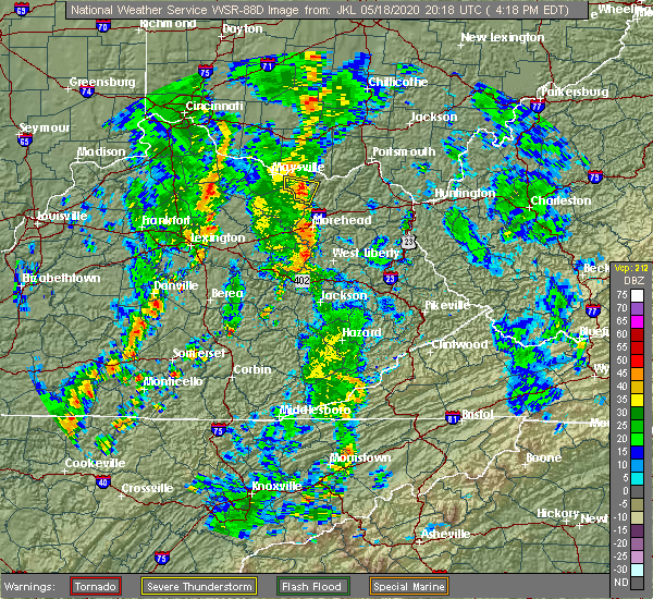 At 423 pm edt, a severe thunderstorm was located near stanford, moving northeast at 35 mph (radar indicated). Hazards include 60 mph wind gusts. expect damage to roofs, siding, and trees At 423 pm edt, a severe thunderstorm was located near stanford, moving northeast at 35 mph (radar indicated). Hazards include 60 mph wind gusts. expect damage to roofs, siding, and trees
|
| 4/8/2020 11:59 PM EDT |
 At 1159 pm edt, severe thunderstorms were located along a line extending from near fayette mall to 12 miles southeast of springfield to 12 miles northwest of campbellsville, moving southeast at 50 mph (radar indicated). Hazards include 60 mph wind gusts. expect damage to roofs, siding, and trees At 1159 pm edt, severe thunderstorms were located along a line extending from near fayette mall to 12 miles southeast of springfield to 12 miles northwest of campbellsville, moving southeast at 50 mph (radar indicated). Hazards include 60 mph wind gusts. expect damage to roofs, siding, and trees
|
| 1/11/2020 1:06 PM EST |
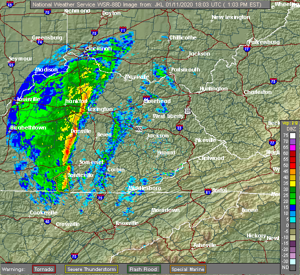 At 106 pm est, severe thunderstorms were located along a line extending from 6 miles south of nicholasville to near stanford, moving northeast at 50 mph (radar indicated). Hazards include 60 mph wind gusts. expect damage to roofs, siding, and trees At 106 pm est, severe thunderstorms were located along a line extending from 6 miles south of nicholasville to near stanford, moving northeast at 50 mph (radar indicated). Hazards include 60 mph wind gusts. expect damage to roofs, siding, and trees
|
| 5/29/2019 1:10 PM EDT |
 At 109 pm edt, severe thunderstorms were located along a line extending from 9 miles east of springfield to 6 miles southeast of lebanon, moving east at 60 mph (radar indicated). Hazards include 60 mph wind gusts and penny size hail. expect damage to roofs, siding, and trees At 109 pm edt, severe thunderstorms were located along a line extending from 9 miles east of springfield to 6 miles southeast of lebanon, moving east at 60 mph (radar indicated). Hazards include 60 mph wind gusts and penny size hail. expect damage to roofs, siding, and trees
|
| 5/26/2019 5:42 PM EDT | Tree down on hwy 1194 near stanfor in lincoln county KY, 2.3 miles ENE of Stanford, KY |
| 5/26/2019 5:40 PM EDT |
 At 540 pm edt, a severe thunderstorm was located near stanford, moving east at 50 mph (radar indicated). Hazards include 60 mph wind gusts. expect damage to roofs, siding, and trees At 540 pm edt, a severe thunderstorm was located near stanford, moving east at 50 mph (radar indicated). Hazards include 60 mph wind gusts. expect damage to roofs, siding, and trees
|
| 11/6/2018 12:22 AM EST |
 At 1222 am est, a severe thunderstorm was located between danville and stanford, moving east at 55 mph (radar indicated). Hazards include 60 mph wind gusts. Expect damage to roofs, siding, and trees. Locations impacted include, stanford, boneyville, logantown, rowland, hubble and hedgeville. At 1222 am est, a severe thunderstorm was located between danville and stanford, moving east at 55 mph (radar indicated). Hazards include 60 mph wind gusts. Expect damage to roofs, siding, and trees. Locations impacted include, stanford, boneyville, logantown, rowland, hubble and hedgeville.
|
| 11/6/2018 12:09 AM EST |
 At 1209 am est, a severe thunderstorm was located near danville, moving east at 55 mph (radar indicated). Hazards include 60 mph wind gusts. Expect damage to roofs, siding, and trees. locations impacted include, danville, stanford, junction city, boneyville, alum springs, caldwell manor, milledgeville, hedgeville, parksville and rowland. A tornado watch remains in effect until 700 am est for central kentucky. At 1209 am est, a severe thunderstorm was located near danville, moving east at 55 mph (radar indicated). Hazards include 60 mph wind gusts. Expect damage to roofs, siding, and trees. locations impacted include, danville, stanford, junction city, boneyville, alum springs, caldwell manor, milledgeville, hedgeville, parksville and rowland. A tornado watch remains in effect until 700 am est for central kentucky.
|
| 11/5/2018 11:58 PM EST |
 At 1158 pm est, a severe thunderstorm was located 13 miles east of lebanon, moving east at 55 mph (radar indicated). Hazards include 60 mph wind gusts. expect damage to roofs, siding, and trees At 1158 pm est, a severe thunderstorm was located 13 miles east of lebanon, moving east at 55 mph (radar indicated). Hazards include 60 mph wind gusts. expect damage to roofs, siding, and trees
|
| 7/20/2018 7:47 PM EDT |
 At 746 pm edt, a severe thunderstorm was located near stanford, moving east at 35 mph (radar indicated). Hazards include 60 mph wind gusts and quarter size hail. Hail damage to vehicles is expected. expect wind damage to roofs, siding, and trees. locations impacted include, stanford, crab orchard, kings mountain, ottenheim, broughtentown, preachersville, rowland, waynesburg, halls gap and walnut flat. A tornado watch remains in effect until 300 am edt for central kentucky. At 746 pm edt, a severe thunderstorm was located near stanford, moving east at 35 mph (radar indicated). Hazards include 60 mph wind gusts and quarter size hail. Hail damage to vehicles is expected. expect wind damage to roofs, siding, and trees. locations impacted include, stanford, crab orchard, kings mountain, ottenheim, broughtentown, preachersville, rowland, waynesburg, halls gap and walnut flat. A tornado watch remains in effect until 300 am edt for central kentucky.
|
| 7/20/2018 7:29 PM EDT |
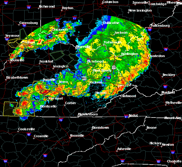 At 729 pm edt, a severe thunderstorm was located 7 miles west of stanford, moving east at 35 mph (radar indicated). Hazards include 60 mph wind gusts and half dollar size hail. Hail damage to vehicles is expected. Expect wind damage to roofs, siding, and trees. At 729 pm edt, a severe thunderstorm was located 7 miles west of stanford, moving east at 35 mph (radar indicated). Hazards include 60 mph wind gusts and half dollar size hail. Hail damage to vehicles is expected. Expect wind damage to roofs, siding, and trees.
|
| 7/20/2018 6:18 PM EDT |
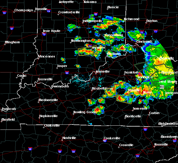 At 618 pm edt, a severe thunderstorm was located 9 miles northwest of liberty, moving east at 30 mph (radar indicated). Hazards include two inch hail and 60 mph wind gusts. People and animals outdoors will be injured. expect hail damage to roofs, siding, windows, and vehicles. Expect wind damage to roofs, siding, and trees. At 618 pm edt, a severe thunderstorm was located 9 miles northwest of liberty, moving east at 30 mph (radar indicated). Hazards include two inch hail and 60 mph wind gusts. People and animals outdoors will be injured. expect hail damage to roofs, siding, windows, and vehicles. Expect wind damage to roofs, siding, and trees.
|
| 6/26/2018 2:49 PM EDT |
 At 249 pm edt, severe thunderstorms were located along a line extending from near nicholasville to 11 miles south of stanford, moving east at 40 mph (radar indicated). Hazards include 60 mph wind gusts. expect damage to roofs, siding, and trees At 249 pm edt, severe thunderstorms were located along a line extending from near nicholasville to 11 miles south of stanford, moving east at 40 mph (radar indicated). Hazards include 60 mph wind gusts. expect damage to roofs, siding, and trees
|
| 6/11/2018 5:18 PM EDT | Tree down on preachersville rd. time estimated using rada in lincoln county KY, 5.1 miles W of Stanford, KY |
| 6/11/2018 5:03 PM EDT |
 At 503 pm edt, severe thunderstorms were located along a line extending from 11 miles south of nicholasville to lancaster to stanford, moving east at 35 mph (radar indicated). Hazards include 60 mph wind gusts and penny size hail. expect damage to roofs, siding, and trees At 503 pm edt, severe thunderstorms were located along a line extending from 11 miles south of nicholasville to lancaster to stanford, moving east at 35 mph (radar indicated). Hazards include 60 mph wind gusts and penny size hail. expect damage to roofs, siding, and trees
|
| 5/31/2018 3:17 PM EDT |
 At 316 pm edt, severe thunderstorms were located along a line extending from near springfield to 10 miles southwest of danville, moving east at 20 mph (radar indicated). Hazards include 60 mph wind gusts. Expect damage to roofs, siding, and trees. Locations impacted include, danville, lebanon, stanford, springfield, junction city, hustonville, peytons store, brumfield, boneyville and caldwell manor. At 316 pm edt, severe thunderstorms were located along a line extending from near springfield to 10 miles southwest of danville, moving east at 20 mph (radar indicated). Hazards include 60 mph wind gusts. Expect damage to roofs, siding, and trees. Locations impacted include, danville, lebanon, stanford, springfield, junction city, hustonville, peytons store, brumfield, boneyville and caldwell manor.
|
| 5/31/2018 2:54 PM EDT |
 At 253 pm edt, severe thunderstorms were located along a line extending from 7 miles west of springfield to 14 miles east of lebanon, moving east at 20 mph (radar indicated). Hazards include 60 mph wind gusts. expect damage to roofs, siding, and trees At 253 pm edt, severe thunderstorms were located along a line extending from 7 miles west of springfield to 14 miles east of lebanon, moving east at 20 mph (radar indicated). Hazards include 60 mph wind gusts. expect damage to roofs, siding, and trees
|
| 4/3/2018 10:15 PM EDT |
 At 1015 pm edt, a severe thunderstorm was located 8 miles southwest of stanford, moving east at 40 mph (radar indicated). Hazards include 60 mph wind gusts and quarter size hail. Hail damage to vehicles is expected. Expect wind damage to roofs, siding, and trees. At 1015 pm edt, a severe thunderstorm was located 8 miles southwest of stanford, moving east at 40 mph (radar indicated). Hazards include 60 mph wind gusts and quarter size hail. Hail damage to vehicles is expected. Expect wind damage to roofs, siding, and trees.
|
| 4/3/2018 10:06 PM EDT |
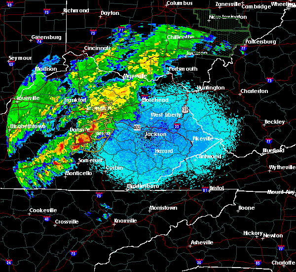 At 1006 pm edt, a severe squall line capable of producing both tornadoes and extensive straight line wind damage was located near stanford, moving east at 40 mph (radar indicated rotation). Hazards include tornado. Flying debris will be dangerous to those caught without shelter. mobile homes will be damaged or destroyed. damage to roofs, windows, and vehicles will occur. tree damage is likely. Locations impacted include, stanford, lancaster, crab orchard, manse, gilbert, cartersville, nina, preachersville, rowland and hyattsville. At 1006 pm edt, a severe squall line capable of producing both tornadoes and extensive straight line wind damage was located near stanford, moving east at 40 mph (radar indicated rotation). Hazards include tornado. Flying debris will be dangerous to those caught without shelter. mobile homes will be damaged or destroyed. damage to roofs, windows, and vehicles will occur. tree damage is likely. Locations impacted include, stanford, lancaster, crab orchard, manse, gilbert, cartersville, nina, preachersville, rowland and hyattsville.
|
| 4/3/2018 9:56 PM EDT |
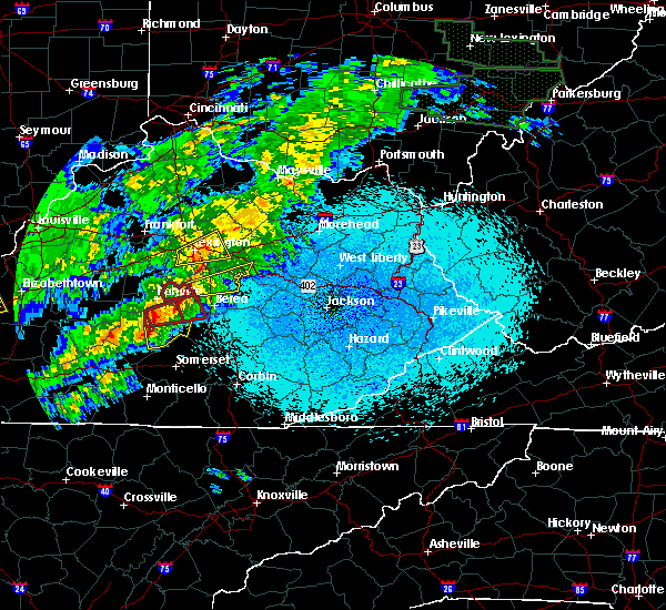 At 956 pm edt, severe thunderstorms capable of producing both tornadoes and extensive straight line wind damage were located near stanford, moving east at 40 mph (radar indicated rotation). Hazards include tornado. Flying debris will be dangerous to those caught without shelter. mobile homes will be damaged or destroyed. damage to roofs, windows, and vehicles will occur. Tree damage is likely. At 956 pm edt, severe thunderstorms capable of producing both tornadoes and extensive straight line wind damage were located near stanford, moving east at 40 mph (radar indicated rotation). Hazards include tornado. Flying debris will be dangerous to those caught without shelter. mobile homes will be damaged or destroyed. damage to roofs, windows, and vehicles will occur. Tree damage is likely.
|
| 4/3/2018 9:51 PM EDT |
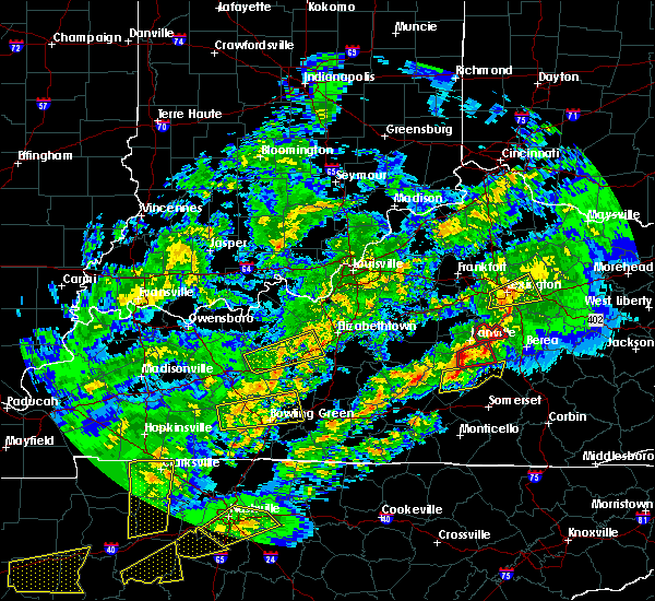 At 951 pm edt, a severe squall line capable of producing both tornadoes and extensive straight line wind damage was located 10 miles west of stanford, moving east at 40 mph (radar indicated rotation). Hazards include tornado and quarter size hail. Flying debris will be dangerous to those caught without shelter. mobile homes will be damaged or destroyed. damage to roofs, windows, and vehicles will occur. tree damage is likely. Locations impacted include, stanford, lancaster, hustonville, boneyville, milledgeville, jumbo, mount salem, gilbert, geneva and rowland. At 951 pm edt, a severe squall line capable of producing both tornadoes and extensive straight line wind damage was located 10 miles west of stanford, moving east at 40 mph (radar indicated rotation). Hazards include tornado and quarter size hail. Flying debris will be dangerous to those caught without shelter. mobile homes will be damaged or destroyed. damage to roofs, windows, and vehicles will occur. tree damage is likely. Locations impacted include, stanford, lancaster, hustonville, boneyville, milledgeville, jumbo, mount salem, gilbert, geneva and rowland.
|
| 4/3/2018 9:41 PM EDT |
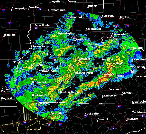 At 941 pm edt, severe thunderstorms capable of producing both tornadoes and extensive straight line wind damage were located 9 miles north of liberty, moving east at 40 mph (radar indicated rotation). Hazards include tornado and quarter size hail. Flying debris will be dangerous to those caught without shelter. mobile homes will be damaged or destroyed. damage to roofs, windows, and vehicles will occur. Tree damage is likely. At 941 pm edt, severe thunderstorms capable of producing both tornadoes and extensive straight line wind damage were located 9 miles north of liberty, moving east at 40 mph (radar indicated rotation). Hazards include tornado and quarter size hail. Flying debris will be dangerous to those caught without shelter. mobile homes will be damaged or destroyed. damage to roofs, windows, and vehicles will occur. Tree damage is likely.
|
| 4/3/2018 9:27 PM EDT |
 At 927 pm edt, a severe thunderstorm was located near danville, moving east at 50 mph (radar indicated). Hazards include 60 mph wind gusts and quarter size hail. Hail damage to vehicles is expected. expect wind damage to roofs, siding, and trees. locations impacted include, danville, harrodsburg, stanford, junction city, burgin, brumfield, boneyville, alum springs, caldwell manor and parksville. A tornado watch remains in effect until 100 am edt for central kentucky. At 927 pm edt, a severe thunderstorm was located near danville, moving east at 50 mph (radar indicated). Hazards include 60 mph wind gusts and quarter size hail. Hail damage to vehicles is expected. expect wind damage to roofs, siding, and trees. locations impacted include, danville, harrodsburg, stanford, junction city, burgin, brumfield, boneyville, alum springs, caldwell manor and parksville. A tornado watch remains in effect until 100 am edt for central kentucky.
|
| 4/3/2018 9:16 PM EDT |
 At 916 pm edt, a severe thunderstorm was located 12 miles southwest of harrodsburg, moving east at 50 mph (radar indicated). Hazards include 60 mph wind gusts and half dollar size hail. Hail damage to vehicles is expected. expect wind damage to roofs, siding, and trees. locations impacted include, danville, harrodsburg, stanford, junction city, burgin, mackville, brumfield, boneyville, alum springs and caldwell manor. A tornado watch remains in effect until 100 am edt for central kentucky. At 916 pm edt, a severe thunderstorm was located 12 miles southwest of harrodsburg, moving east at 50 mph (radar indicated). Hazards include 60 mph wind gusts and half dollar size hail. Hail damage to vehicles is expected. expect wind damage to roofs, siding, and trees. locations impacted include, danville, harrodsburg, stanford, junction city, burgin, mackville, brumfield, boneyville, alum springs and caldwell manor. A tornado watch remains in effect until 100 am edt for central kentucky.
|
| 4/3/2018 8:57 PM EDT |
 The national weather service in louisville has issued a * severe thunderstorm warning for. northwestern lincoln county in central kentucky. southern mercer county in central kentucky. west central garrard county in central kentucky. Central marion county in central kentucky. The national weather service in louisville has issued a * severe thunderstorm warning for. northwestern lincoln county in central kentucky. southern mercer county in central kentucky. west central garrard county in central kentucky. Central marion county in central kentucky.
|
| 3/17/2018 5:22 PM EDT |
 At 522 pm edt, a severe thunderstorm was located 9 miles north of liberty, moving east at 45 mph (radar indicated). Hazards include 60 mph wind gusts and quarter size hail. Hail damage to vehicles is expected. expect wind damage to roofs, siding, and trees. Locations impacted include, stanford, junction city, hustonville, peytons store, boneyville, forkland, geneva, rowland, maywood and new salem. At 522 pm edt, a severe thunderstorm was located 9 miles north of liberty, moving east at 45 mph (radar indicated). Hazards include 60 mph wind gusts and quarter size hail. Hail damage to vehicles is expected. expect wind damage to roofs, siding, and trees. Locations impacted include, stanford, junction city, hustonville, peytons store, boneyville, forkland, geneva, rowland, maywood and new salem.
|
| 3/17/2018 5:12 PM EDT |
 At 511 pm edt, a severe thunderstorm was located 10 miles southeast of lebanon, moving east at 45 mph (radar indicated). Hazards include 60 mph wind gusts and quarter size hail. Hail damage to vehicles is expected. Expect wind damage to roofs, siding, and trees. At 511 pm edt, a severe thunderstorm was located 10 miles southeast of lebanon, moving east at 45 mph (radar indicated). Hazards include 60 mph wind gusts and quarter size hail. Hail damage to vehicles is expected. Expect wind damage to roofs, siding, and trees.
|
| 1/22/2018 9:16 PM EST |
 At 915 pm est, a severe thunderstorm was located over stanford, moving northeast at 45 mph (radar indicated). Hazards include 60 mph wind gusts and quarter size hail. Hail damage to vehicles is expected. Expect wind damage to roofs, siding, and trees. At 915 pm est, a severe thunderstorm was located over stanford, moving northeast at 45 mph (radar indicated). Hazards include 60 mph wind gusts and quarter size hail. Hail damage to vehicles is expected. Expect wind damage to roofs, siding, and trees.
|
| 6/23/2017 7:18 PM EDT |
 At 718 pm edt, severe thunderstorms were located along a line extending from 7 miles southwest of nicholasville to near lancaster to 9 miles south of stanford, moving east at 35 mph (radar indicated). Hazards include 60 mph wind gusts. Expect damage to roofs, siding, and trees. locations impacted include, nicholasville, danville, stanford, lancaster, mccreary, burgin, boneyville, marksbury, gilbert and rowland. A tornado watch remains in effect until 1000 pm edt for central kentucky. At 718 pm edt, severe thunderstorms were located along a line extending from 7 miles southwest of nicholasville to near lancaster to 9 miles south of stanford, moving east at 35 mph (radar indicated). Hazards include 60 mph wind gusts. Expect damage to roofs, siding, and trees. locations impacted include, nicholasville, danville, stanford, lancaster, mccreary, burgin, boneyville, marksbury, gilbert and rowland. A tornado watch remains in effect until 1000 pm edt for central kentucky.
|
| 6/23/2017 6:58 PM EDT |
 At 658 pm edt, severe thunderstorms were located along a line extending from near harrodsburg to near danville to near liberty, moving east at 35 mph (radar indicated). Hazards include 60 mph wind gusts. expect damage to roofs, siding, and trees At 658 pm edt, severe thunderstorms were located along a line extending from near harrodsburg to near danville to near liberty, moving east at 35 mph (radar indicated). Hazards include 60 mph wind gusts. expect damage to roofs, siding, and trees
|
| 5/27/2017 4:21 PM EDT |
 At 420 pm edt, a severe thunderstorm was located near lancaster, moving northeast at 30 mph (radar indicated. spotters reported marble size hail near junction city). Hazards include 60 mph wind gusts and quarter size hail. Hail damage to vehicles is expected. expect wind damage to roofs, siding, and trees. Locations impacted include, danville, stanford, lancaster, junction city, marcellus, boneyville, hedgeville, marksbury, gilbert and rowland. At 420 pm edt, a severe thunderstorm was located near lancaster, moving northeast at 30 mph (radar indicated. spotters reported marble size hail near junction city). Hazards include 60 mph wind gusts and quarter size hail. Hail damage to vehicles is expected. expect wind damage to roofs, siding, and trees. Locations impacted include, danville, stanford, lancaster, junction city, marcellus, boneyville, hedgeville, marksbury, gilbert and rowland.
|
| 5/27/2017 4:04 PM EDT |
 The national weather service in louisville has issued a * severe thunderstorm warning for. northern lincoln county in central kentucky. central garrard county in central kentucky. eastern boyle county in central kentucky. Until 430 pm edt. The national weather service in louisville has issued a * severe thunderstorm warning for. northern lincoln county in central kentucky. central garrard county in central kentucky. eastern boyle county in central kentucky. Until 430 pm edt.
|
| 4/5/2017 8:19 PM EDT |
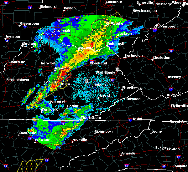 At 819 pm edt/719 pm cdt/, a severe thunderstorm was located 8 miles south of stanford, moving northeast at 95 mph (radar indicated). Hazards include 60 mph wind gusts and penny size hail. Expect damage to roofs, siding, and trees. locations impacted include, liberty, stanford, lancaster, mccreary, russell springs, crab orchard, boneyville, lawhorn hill, teddy and royville. A tornado watch remains in effect until 1000 pm edt/900 pm cdt/ for south central and central kentucky. At 819 pm edt/719 pm cdt/, a severe thunderstorm was located 8 miles south of stanford, moving northeast at 95 mph (radar indicated). Hazards include 60 mph wind gusts and penny size hail. Expect damage to roofs, siding, and trees. locations impacted include, liberty, stanford, lancaster, mccreary, russell springs, crab orchard, boneyville, lawhorn hill, teddy and royville. A tornado watch remains in effect until 1000 pm edt/900 pm cdt/ for south central and central kentucky.
|
| 4/5/2017 8:00 PM EDT |
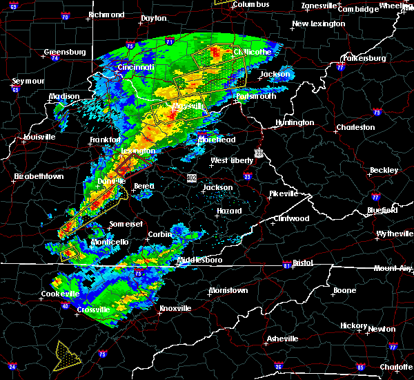 At 759 pm edt/659 pm cdt/, a severe thunderstorm was located 8 miles north of jamestown, moving northeast at 55 mph (radar indicated). Hazards include 60 mph wind gusts and quarter size hail. Hail damage to vehicles is expected. Expect wind damage to roofs, siding, and trees. At 759 pm edt/659 pm cdt/, a severe thunderstorm was located 8 miles north of jamestown, moving northeast at 55 mph (radar indicated). Hazards include 60 mph wind gusts and quarter size hail. Hail damage to vehicles is expected. Expect wind damage to roofs, siding, and trees.
|
| 4/5/2017 7:50 PM EDT |
 At 749 pm edt, a severe thunderstorm was located over liberty, moving northeast at 50 mph (radar indicated). Hazards include 60 mph wind gusts and penny size hail. Expect damage to roofs, siding, and trees. locations impacted include, liberty, stanford, crab orchard, hustonville, boneyville, lawhorn hill, ottenheim, broughtentown, walltown and geneva. A tornado watch remains in effect until 1000 pm edt for central kentucky. At 749 pm edt, a severe thunderstorm was located over liberty, moving northeast at 50 mph (radar indicated). Hazards include 60 mph wind gusts and penny size hail. Expect damage to roofs, siding, and trees. locations impacted include, liberty, stanford, crab orchard, hustonville, boneyville, lawhorn hill, ottenheim, broughtentown, walltown and geneva. A tornado watch remains in effect until 1000 pm edt for central kentucky.
|
| 4/5/2017 7:44 PM EDT |
 At 742 pm edt/642 pm cdt/, a severe thunderstorm was located over liberty, moving northeast at 50 mph (radar indicated). Hazards include 60 mph wind gusts and penny size hail. Expect damage to roofs, siding, and trees. locations impacted include, liberty, stanford, crab orchard, hustonville, boneyville, lawhorn hill, ottenheim, gilpin, broughtentown and walltown. A tornado watch remains in effect until 1000 pm edt/900 pm cdt/ for south central and central kentucky. At 742 pm edt/642 pm cdt/, a severe thunderstorm was located over liberty, moving northeast at 50 mph (radar indicated). Hazards include 60 mph wind gusts and penny size hail. Expect damage to roofs, siding, and trees. locations impacted include, liberty, stanford, crab orchard, hustonville, boneyville, lawhorn hill, ottenheim, gilpin, broughtentown and walltown. A tornado watch remains in effect until 1000 pm edt/900 pm cdt/ for south central and central kentucky.
|
| 4/5/2017 7:31 PM EDT |
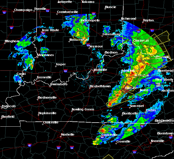 At 731 pm edt/631 pm cdt/, a severe thunderstorm was located 9 miles northeast of columbia, moving northeast at 80 mph (radar indicated). Hazards include 60 mph wind gusts. expect damage to roofs, siding, and trees At 731 pm edt/631 pm cdt/, a severe thunderstorm was located 9 miles northeast of columbia, moving northeast at 80 mph (radar indicated). Hazards include 60 mph wind gusts. expect damage to roofs, siding, and trees
|
| 3/30/2017 11:20 PM EDT |
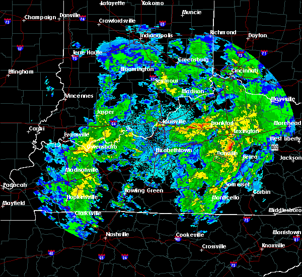 The severe thunderstorm warning for northwestern lincoln, west central garrard and eastern boyle counties will expire at 1130 pm edt, the storm which prompted the warning has moved out of the area. therefore the warning will be allowed to expire. report severe weather to local law enforcement, post your report to the national weather service louisville facebook page, or tweet your report using hashtag l, m, k, spotter. The severe thunderstorm warning for northwestern lincoln, west central garrard and eastern boyle counties will expire at 1130 pm edt, the storm which prompted the warning has moved out of the area. therefore the warning will be allowed to expire. report severe weather to local law enforcement, post your report to the national weather service louisville facebook page, or tweet your report using hashtag l, m, k, spotter.
|
| 3/30/2017 11:15 PM EDT |
 At 1115 pm edt, a severe thunderstorm was located near lancaster, moving northeast at 40 mph (radar indicated). Hazards include 60 mph wind gusts and nickel size hail. Expect damage to roofs, siding, and trees. Locations impacted include, danville, stanford, lancaster, junction city, caldwell manor, hedgeville, gilbert, stuart powell field airport, logantown and rowland. At 1115 pm edt, a severe thunderstorm was located near lancaster, moving northeast at 40 mph (radar indicated). Hazards include 60 mph wind gusts and nickel size hail. Expect damage to roofs, siding, and trees. Locations impacted include, danville, stanford, lancaster, junction city, caldwell manor, hedgeville, gilbert, stuart powell field airport, logantown and rowland.
|
| 3/30/2017 11:05 PM EDT |
 At 1104 pm edt, a severe thunderstorm was located near stanford, moving northeast at 40 mph (radar indicated). Hazards include 60 mph wind gusts and nickel size hail. Expect damage to roofs, siding, and trees. Locations impacted include, danville, stanford, lancaster, junction city, hustonville, south fork, boneyville, caldwell manor, milledgeville and hedgeville. At 1104 pm edt, a severe thunderstorm was located near stanford, moving northeast at 40 mph (radar indicated). Hazards include 60 mph wind gusts and nickel size hail. Expect damage to roofs, siding, and trees. Locations impacted include, danville, stanford, lancaster, junction city, hustonville, south fork, boneyville, caldwell manor, milledgeville and hedgeville.
|
| 3/30/2017 10:56 PM EDT |
 At 1056 pm edt, a severe thunderstorm was located 8 miles northeast of liberty, moving northeast at 40 mph (radar indicated). Hazards include 60 mph wind gusts and nickel size hail. expect damage to roofs, siding, and trees At 1056 pm edt, a severe thunderstorm was located 8 miles northeast of liberty, moving northeast at 40 mph (radar indicated). Hazards include 60 mph wind gusts and nickel size hail. expect damage to roofs, siding, and trees
|
| 3/27/2017 7:40 PM EDT |
 The severe thunderstorm warning for central lincoln, garrard, southern jessamine, western madison and south central fayette counties will expire at 745 pm edt, the storms which prompted the warning have weakened below severe limits, and have exited the warned area. therefore the warning will be allowed to expire. however gusty winds and heavy rain are still possible with these thunderstorms. a severe thunderstorm watch remains in effect until 1100 pm edt for central kentucky. report severe weather to local law enforcement, post your report to the national weather service louisville facebook page, or tweet your report using hashtag l, m, k, spotter. The severe thunderstorm warning for central lincoln, garrard, southern jessamine, western madison and south central fayette counties will expire at 745 pm edt, the storms which prompted the warning have weakened below severe limits, and have exited the warned area. therefore the warning will be allowed to expire. however gusty winds and heavy rain are still possible with these thunderstorms. a severe thunderstorm watch remains in effect until 1100 pm edt for central kentucky. report severe weather to local law enforcement, post your report to the national weather service louisville facebook page, or tweet your report using hashtag l, m, k, spotter.
|
| 3/27/2017 7:31 PM EDT |
 At 730 pm edt, severe thunderstorms were located along a line extending from 8 miles northeast of harrodsburg to 6 miles northeast of danville to near stanford, moving northeast at 60 mph (radar indicated). Hazards include 60 mph wind gusts. Expect damage to roofs, siding, and trees. Locations impacted include, nicholasville, stanford, lancaster, mccreary, wilmore, crab orchard, boneyville, marksbury, valley view and broughtentown. At 730 pm edt, severe thunderstorms were located along a line extending from 8 miles northeast of harrodsburg to 6 miles northeast of danville to near stanford, moving northeast at 60 mph (radar indicated). Hazards include 60 mph wind gusts. Expect damage to roofs, siding, and trees. Locations impacted include, nicholasville, stanford, lancaster, mccreary, wilmore, crab orchard, boneyville, marksbury, valley view and broughtentown.
|
| 3/27/2017 7:01 PM EDT |
 At 701 pm edt, severe thunderstorms were located along a line extending from near springfield to 8 miles east of lebanon to 11 miles northwest of liberty, moving northeast at 60 mph (radar indicated). Hazards include 60 mph wind gusts and quarter size hail. Hail damage to vehicles is expected. Expect wind damage to roofs, siding, and trees. At 701 pm edt, severe thunderstorms were located along a line extending from near springfield to 8 miles east of lebanon to 11 miles northwest of liberty, moving northeast at 60 mph (radar indicated). Hazards include 60 mph wind gusts and quarter size hail. Hail damage to vehicles is expected. Expect wind damage to roofs, siding, and trees.
|
| 3/27/2017 5:16 PM EDT |
 At 515 pm edt, a severe thunderstorm was located near stanford, moving northeast at 40 mph (radar indicated). Hazards include 60 mph wind gusts and quarter size hail. Hail damage to vehicles is expected. expect wind damage to roofs, siding, and trees. Locations impacted include, stanford, lancaster, mccreary, hustonville, boneyville, gilbert, geneva, rowland, hackley and maywood. At 515 pm edt, a severe thunderstorm was located near stanford, moving northeast at 40 mph (radar indicated). Hazards include 60 mph wind gusts and quarter size hail. Hail damage to vehicles is expected. expect wind damage to roofs, siding, and trees. Locations impacted include, stanford, lancaster, mccreary, hustonville, boneyville, gilbert, geneva, rowland, hackley and maywood.
|
| 3/27/2017 5:04 PM EDT |
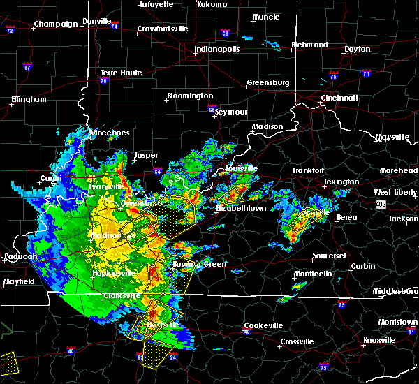 At 503 pm edt, a severe thunderstorm was located near danville, moving northeast at 20 mph (radar indicated). Hazards include 60 mph wind gusts and quarter size hail. Hail damage to vehicles is expected. expect wind damage to roofs, siding, and trees. Locations impacted include, danville, lancaster, mccreary, junction city, hustonville, marcellus, alum springs, milledgeville, hedgeville and marksbury. At 503 pm edt, a severe thunderstorm was located near danville, moving northeast at 20 mph (radar indicated). Hazards include 60 mph wind gusts and quarter size hail. Hail damage to vehicles is expected. expect wind damage to roofs, siding, and trees. Locations impacted include, danville, lancaster, mccreary, junction city, hustonville, marcellus, alum springs, milledgeville, hedgeville and marksbury.
|
| 3/27/2017 5:01 PM EDT |
 At 501 pm edt, a severe thunderstorm was located 8 miles northeast of liberty, moving northeast at 40 mph (radar indicated). Hazards include 60 mph wind gusts and quarter size hail. Hail damage to vehicles is expected. Expect wind damage to roofs, siding, and trees. At 501 pm edt, a severe thunderstorm was located 8 miles northeast of liberty, moving northeast at 40 mph (radar indicated). Hazards include 60 mph wind gusts and quarter size hail. Hail damage to vehicles is expected. Expect wind damage to roofs, siding, and trees.
|
| 3/27/2017 4:43 PM EDT |
 At 443 pm edt, a severe thunderstorm was located near danville, moving northeast at 20 mph (radar indicated). Hazards include 60 mph wind gusts and quarter size hail. Hail damage to vehicles is expected. Expect wind damage to roofs, siding, and trees. At 443 pm edt, a severe thunderstorm was located near danville, moving northeast at 20 mph (radar indicated). Hazards include 60 mph wind gusts and quarter size hail. Hail damage to vehicles is expected. Expect wind damage to roofs, siding, and trees.
|
| 3/1/2017 8:04 AM EST |
 At 804 am est, severe thunderstorms were located along a line extending from near nicholasville to near danville to 8 miles northeast of campbellsville, moving southeast at 50 mph (radar indicated). Hazards include 60 mph wind gusts. expect damage to roofs, siding, and trees At 804 am est, severe thunderstorms were located along a line extending from near nicholasville to near danville to 8 miles northeast of campbellsville, moving southeast at 50 mph (radar indicated). Hazards include 60 mph wind gusts. expect damage to roofs, siding, and trees
|
| 7/7/2016 5:26 PM EDT |
 At 525 pm edt/425 pm cdt/, severe thunderstorms were located along a line extending from 11 miles north of liberty to 6 miles north of magnum to 6 miles east of jamestown, moving east at 55 mph. this line of storms caused structural damage in both taylor and adair counties and downed numerous trees in those counties as well as russell county (emergency management and law enforcement). Hazards include 70 mph wind gusts. Expect considerable tree damage. damage is likely to mobile homes, roofs, and outbuildings. Locations impacted include, liberty, stanford, jamestown, russell springs, junction city, crab orchard, hustonville, eubank, preachersville and peytons store. At 525 pm edt/425 pm cdt/, severe thunderstorms were located along a line extending from 11 miles north of liberty to 6 miles north of magnum to 6 miles east of jamestown, moving east at 55 mph. this line of storms caused structural damage in both taylor and adair counties and downed numerous trees in those counties as well as russell county (emergency management and law enforcement). Hazards include 70 mph wind gusts. Expect considerable tree damage. damage is likely to mobile homes, roofs, and outbuildings. Locations impacted include, liberty, stanford, jamestown, russell springs, junction city, crab orchard, hustonville, eubank, preachersville and peytons store.
|
| 7/7/2016 5:16 PM EDT |
 At 516 pm edt/416 pm cdt/, severe thunderstorms were located along a line extending from 11 miles southeast of lebanon to 7 miles southwest of liberty to jamestown, moving east at 55 mph (radar indicated). Hazards include 70 mph wind gusts. Expect considerable tree damage. Damage is likely to mobile homes, roofs, and outbuildings. At 516 pm edt/416 pm cdt/, severe thunderstorms were located along a line extending from 11 miles southeast of lebanon to 7 miles southwest of liberty to jamestown, moving east at 55 mph (radar indicated). Hazards include 70 mph wind gusts. Expect considerable tree damage. Damage is likely to mobile homes, roofs, and outbuildings.
|
| 7/4/2016 4:19 PM EDT |
 At 419 pm edt, a severe thunderstorm was located near lancaster, moving east at 45 mph (radar indicated). Hazards include 60 mph wind gusts. Expect damage to roofs. siding. and trees. Locations impacted include, danville, stanford, lancaster, junction city, crab orchard, hubble, preachersville, hyattsville, hedgeville and logantown. At 419 pm edt, a severe thunderstorm was located near lancaster, moving east at 45 mph (radar indicated). Hazards include 60 mph wind gusts. Expect damage to roofs. siding. and trees. Locations impacted include, danville, stanford, lancaster, junction city, crab orchard, hubble, preachersville, hyattsville, hedgeville and logantown.
|
| 7/4/2016 3:56 PM EDT |
 At 356 pm edt, a severe thunderstorm was located 11 miles southwest of danville, moving east at 45 mph (radar indicated). Hazards include 60 mph wind gusts. Expect damage to roofs. siding. And trees. At 356 pm edt, a severe thunderstorm was located 11 miles southwest of danville, moving east at 45 mph (radar indicated). Hazards include 60 mph wind gusts. Expect damage to roofs. siding. And trees.
|
| 6/23/2016 6:58 PM EDT |
 At 657 pm edt, severe thunderstorms were located along a line extending from near richmond to 8 miles north of liberty, moving east at 60 mph (radar indicated). Hazards include 60 mph wind gusts. Expect damage to roofs. siding. And trees. At 657 pm edt, severe thunderstorms were located along a line extending from near richmond to 8 miles north of liberty, moving east at 60 mph (radar indicated). Hazards include 60 mph wind gusts. Expect damage to roofs. siding. And trees.
|
| 6/23/2016 6:34 PM EDT |
 At 634 pm edt, severe thunderstorms were located along a line extending from 6 miles west of harrodsburg to near springfield to 9 miles northeast of hodgenville, moving southeast at 35 mph (radar indicated). Hazards include 60 mph wind gusts. Expect damage to roofs. siding. And trees. At 634 pm edt, severe thunderstorms were located along a line extending from 6 miles west of harrodsburg to near springfield to 9 miles northeast of hodgenville, moving southeast at 35 mph (radar indicated). Hazards include 60 mph wind gusts. Expect damage to roofs. siding. And trees.
|
| 6/4/2016 2:12 PM EDT |
 At 210 pm edt, a severe thunderstorm was located near stanford, moving northeast at 20 mph (radar indicated). Hazards include 60 mph wind gusts and penny size hail. Expect damage to roofs. siding. And trees. At 210 pm edt, a severe thunderstorm was located near stanford, moving northeast at 20 mph (radar indicated). Hazards include 60 mph wind gusts and penny size hail. Expect damage to roofs. siding. And trees.
|
| 6/1/2016 8:46 PM EDT |
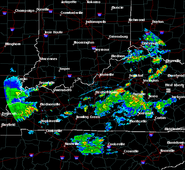 At 845 pm edt, a severe thunderstorm was located near danville, moving north at 20 mph (radar indicated). Hazards include 60 mph wind gusts and quarter size hail. Hail damage to vehicles is expected. expect wind damage to roofs, siding, and trees. Locations impacted include, danville, stanford, lancaster, junction city, little needmore, hubble, gilbert, hedgeville, stuart powell field airport and logantown. At 845 pm edt, a severe thunderstorm was located near danville, moving north at 20 mph (radar indicated). Hazards include 60 mph wind gusts and quarter size hail. Hail damage to vehicles is expected. expect wind damage to roofs, siding, and trees. Locations impacted include, danville, stanford, lancaster, junction city, little needmore, hubble, gilbert, hedgeville, stuart powell field airport and logantown.
|
| 6/1/2016 8:35 PM EDT |
 At 835 pm edt, a severe thunderstorm was located near stanford, moving north at 15 mph (radar indicated). Hazards include 60 mph wind gusts and quarter size hail. Hail damage to vehicles is expected. expect wind damage to roofs, siding, and trees. Locations impacted include, danville, stanford, lancaster, junction city, little needmore, hubble, point leavell, hyattsville, hedgeville and logantown. At 835 pm edt, a severe thunderstorm was located near stanford, moving north at 15 mph (radar indicated). Hazards include 60 mph wind gusts and quarter size hail. Hail damage to vehicles is expected. expect wind damage to roofs, siding, and trees. Locations impacted include, danville, stanford, lancaster, junction city, little needmore, hubble, point leavell, hyattsville, hedgeville and logantown.
|
| 6/1/2016 8:24 PM EDT |
 At 824 pm edt, a severe thunderstorm was located near stanford, moving north at 20 mph (radar indicated). Hazards include 60 mph wind gusts and quarter size hail. Hail damage to vehicles is expected. Expect wind damage to roofs, siding, and trees. At 824 pm edt, a severe thunderstorm was located near stanford, moving north at 20 mph (radar indicated). Hazards include 60 mph wind gusts and quarter size hail. Hail damage to vehicles is expected. Expect wind damage to roofs, siding, and trees.
|
| 5/11/2016 11:13 PM EDT | The severe thunderstorm warning for lincoln county will expire at 1115 pm edt, the storm which prompted the warning has moved out of the area. therefore the warning will be allowed to expire. a severe thunderstorm watch remains in effect until 100 am edt for central kentucky. |
| 5/11/2016 10:45 PM EDT |
 At 1045 pm edt, a severe thunderstorm was located near stanford, moving southeast at 30 mph (radar indicated). Hazards include 60 mph wind gusts and quarter size hail. Hail damage to vehicles is expected. Expect wind damage to roofs, siding, and trees. At 1045 pm edt, a severe thunderstorm was located near stanford, moving southeast at 30 mph (radar indicated). Hazards include 60 mph wind gusts and quarter size hail. Hail damage to vehicles is expected. Expect wind damage to roofs, siding, and trees.
|
| 5/11/2016 10:20 PM EDT |
 At 1019 pm edt, a severe thunderstorm was located near danville, moving east at 40 mph (radar indicated). Hazards include 60 mph wind gusts and quarter size hail. Hail damage to vehicles is expected. Expect wind damage to roofs, siding, and trees. At 1019 pm edt, a severe thunderstorm was located near danville, moving east at 40 mph (radar indicated). Hazards include 60 mph wind gusts and quarter size hail. Hail damage to vehicles is expected. Expect wind damage to roofs, siding, and trees.
|
| 5/10/2016 6:58 PM EDT |
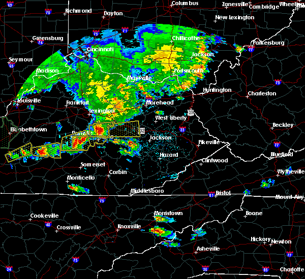 At 658 pm edt, a severe thunderstorm was located near lancaster, moving east at 30 mph (radar indicated). Hazards include 60 mph wind gusts and quarter size hail. Hail damage to vehicles is expected. Expect wind damage to roofs, siding, and trees. At 658 pm edt, a severe thunderstorm was located near lancaster, moving east at 30 mph (radar indicated). Hazards include 60 mph wind gusts and quarter size hail. Hail damage to vehicles is expected. Expect wind damage to roofs, siding, and trees.
|
| 5/10/2016 6:48 PM EDT | Trees reported dow in lincoln county KY, 0.2 miles N of Stanford, KY |
| 5/10/2016 6:44 PM EDT |
 At 644 pm edt, a severe thunderstorm was located over stanford, moving east at 35 mph (radar indicated). Hazards include 60 mph wind gusts and half dollar size hail. Hail damage to vehicles is expected. expect wind damage to roofs, siding, and trees. locations impacted include, danville, stanford, lancaster, mccreary, junction city, crab orchard, hustonville, preachersville, parksville and turnersville. A tornado watch remains in effect until midnight edt for central kentucky. At 644 pm edt, a severe thunderstorm was located over stanford, moving east at 35 mph (radar indicated). Hazards include 60 mph wind gusts and half dollar size hail. Hail damage to vehicles is expected. expect wind damage to roofs, siding, and trees. locations impacted include, danville, stanford, lancaster, mccreary, junction city, crab orchard, hustonville, preachersville, parksville and turnersville. A tornado watch remains in effect until midnight edt for central kentucky.
|
| 5/10/2016 6:24 PM EDT |
 At 624 pm edt, a severe thunderstorm was located 12 miles southwest of danville, moving east at 35 mph (radar indicated). Hazards include 60 mph wind gusts and quarter size hail. Hail damage to vehicles is expected. Expect wind damage to roofs, siding, and trees. At 624 pm edt, a severe thunderstorm was located 12 miles southwest of danville, moving east at 35 mph (radar indicated). Hazards include 60 mph wind gusts and quarter size hail. Hail damage to vehicles is expected. Expect wind damage to roofs, siding, and trees.
|
| 12/23/2015 11:20 PM EST | At 1120 pm est, a severe thunderstorm was located near liberty, moving northeast at 50 mph (radar indicated). Hazards include 60 mph wind gusts. Expect damage to roofs. Siding and trees. |
| 7/14/2015 6:06 AM EDT |
 At 602 am edt, severe thunderstorms were located along a line extending from richmond to 8 miles southeast of lancaster to 8 miles southwest of stanford, and moving southeast at 60 mph (radar indicated). Hazards include 60-70 mph wind gusts. Expect damage to roofs. siding and trees. Locations impacted include, berea, middletown, turkeytown, bobtown, speedwell, waynesburg, brassfield, broughtentown, slate lick, panola, combs, dreyfus, dog walk, bighill and duluth. At 602 am edt, severe thunderstorms were located along a line extending from richmond to 8 miles southeast of lancaster to 8 miles southwest of stanford, and moving southeast at 60 mph (radar indicated). Hazards include 60-70 mph wind gusts. Expect damage to roofs. siding and trees. Locations impacted include, berea, middletown, turkeytown, bobtown, speedwell, waynesburg, brassfield, broughtentown, slate lick, panola, combs, dreyfus, dog walk, bighill and duluth.
|
| 7/14/2015 5:49 AM EDT |
 At 546 am edt, severe thunderstorms were located along a line extending from 5 miles southeast of nicholasville to 8 miles north of lancaster to 12 miles west of danville, and moving southeast at 65 mph (radar indicated). Hazards include 60 mph wind gusts. Expect damage to roofs. Siding and trees. At 546 am edt, severe thunderstorms were located along a line extending from 5 miles southeast of nicholasville to 8 miles north of lancaster to 12 miles west of danville, and moving southeast at 65 mph (radar indicated). Hazards include 60 mph wind gusts. Expect damage to roofs. Siding and trees.
|
| 7/14/2015 3:20 AM EDT |
 At 317 am edt, severe thunderstorms were located along a line extending from 7 miles northeast of harrodsburg to 6 miles north of lancaster to 5 miles northwest of richmond, and moving southeast at 45 mph (radar indicated). Hazards include 60 mph wind gusts. Expect damage to roofs. Siding and trees. At 317 am edt, severe thunderstorms were located along a line extending from 7 miles northeast of harrodsburg to 6 miles north of lancaster to 5 miles northwest of richmond, and moving southeast at 45 mph (radar indicated). Hazards include 60 mph wind gusts. Expect damage to roofs. Siding and trees.
|
| 7/13/2015 4:22 PM EDT | The severe thunderstorm warning for garrard, boyle, washington, southern nelson, mercer, northern marion, madison, northwestern lincoln and southern jessamine counties will expire at 425 pm edt/325 pm cdt/, the line of storms which prompted the warning has weakened below severe limits, and no longer poses an immediate threat to life or property. to report severe weather, contact your nearest law enforcement agency. they will relay your report to the national weather service in louisville. |
| 7/13/2015 4:06 PM EDT |
 At 403 pm edt, severe thunderstorms were located along a line extending from 8 miles east of ravenna to 10 miles northeast of danville to 7 miles southwest of bardstown, and moving southeast at 25 mph (radar indicated). Hazards include 60 mph wind gusts. Expect damage to roofs. siding and trees. Locations impacted include, springfield, danville, lancaster, lebanon, toddville, stone, manton, culvertown, bearwallow, saint catharine, blue gap, buckeye, dixville, faulconer, cisselville, bryantsville, briartown, bourne, nevada and teatersville. At 403 pm edt, severe thunderstorms were located along a line extending from 8 miles east of ravenna to 10 miles northeast of danville to 7 miles southwest of bardstown, and moving southeast at 25 mph (radar indicated). Hazards include 60 mph wind gusts. Expect damage to roofs. siding and trees. Locations impacted include, springfield, danville, lancaster, lebanon, toddville, stone, manton, culvertown, bearwallow, saint catharine, blue gap, buckeye, dixville, faulconer, cisselville, bryantsville, briartown, bourne, nevada and teatersville.
|
| 7/13/2015 3:26 PM EDT |
 At 323 pm edt, severe thunderstorms were located along a line extending from 6 miles southwest of camargo to 7 miles southwest of versailles to shepherdsville, and moving southeast at 25 mph (radar indicated). Hazards include 60 mph wind gusts. Expect damage to roofs. Siding and trees. At 323 pm edt, severe thunderstorms were located along a line extending from 6 miles southwest of camargo to 7 miles southwest of versailles to shepherdsville, and moving southeast at 25 mph (radar indicated). Hazards include 60 mph wind gusts. Expect damage to roofs. Siding and trees.
|
| 7/12/2015 8:13 PM EDT | Trees down in the city and tin was blown off the roof of a hom in lincoln county KY, 0.2 miles N of Stanford, KY |
| 7/12/2015 8:06 PM EDT |
 At 803 pm edt, a severe thunderstorm capable of producing a tornado was located north of stanford near hubble, moving south at 25 mph (radar indicated rotation). Hazards include tornado. Flying debris will be dangerous to those caught without shelter. mobile homes will be damaged or destroyed. damage to roofs, windows and vehicles will occur. this dangerous storm will be near, stanford around 810 pm edt. other locations in the warning include logantown, rowland, boneyville, preachersville, blue lick, walnut flat, maywood, halls gap, sugar grove and jumbo. This storm has a history of blowing down trees. At 803 pm edt, a severe thunderstorm capable of producing a tornado was located north of stanford near hubble, moving south at 25 mph (radar indicated rotation). Hazards include tornado. Flying debris will be dangerous to those caught without shelter. mobile homes will be damaged or destroyed. damage to roofs, windows and vehicles will occur. this dangerous storm will be near, stanford around 810 pm edt. other locations in the warning include logantown, rowland, boneyville, preachersville, blue lick, walnut flat, maywood, halls gap, sugar grove and jumbo. This storm has a history of blowing down trees.
|
| 7/12/2015 7:50 PM EDT |
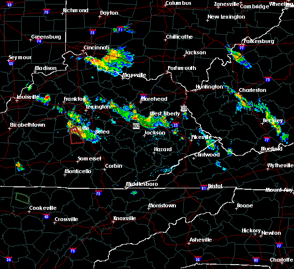 At 746 pm edt, a severe thunderstorm capable of producing a tornado was located 6 miles northeast of danville, and moving south at 35 mph (radar indicated rotation). Hazards include tornado. Flying debris will be dangerous to those caught without shelter. mobile homes will be damaged or destroyed. damage to roofs, windows and vehicles will occur. this dangerous storm will be near, lancaster around 755 pm edt. stanford around 805 pm edt. Other locations in the warning include hubble, logantown, gilbert, rowland, boneyville, preachersville, blue lick, maywood, walnut flat and jumbo. At 746 pm edt, a severe thunderstorm capable of producing a tornado was located 6 miles northeast of danville, and moving south at 35 mph (radar indicated rotation). Hazards include tornado. Flying debris will be dangerous to those caught without shelter. mobile homes will be damaged or destroyed. damage to roofs, windows and vehicles will occur. this dangerous storm will be near, lancaster around 755 pm edt. stanford around 805 pm edt. Other locations in the warning include hubble, logantown, gilbert, rowland, boneyville, preachersville, blue lick, maywood, walnut flat and jumbo.
|
| 7/9/2015 1:59 PM EDT |
 At 157 pm edt, a severe thunderstorm was located near stanford, and moving east at 50 mph (radar indicated). Hazards include 60 mph wind gusts. Expect damage to roofs. siding and trees. Locations impacted include, lancaster, marksbury, gilbert, preachersville, three forks, hyattsville, point leavell, mccreary, teatersville, buckeye, hackley, nina, manse, cartersville and lowell. At 157 pm edt, a severe thunderstorm was located near stanford, and moving east at 50 mph (radar indicated). Hazards include 60 mph wind gusts. Expect damage to roofs. siding and trees. Locations impacted include, lancaster, marksbury, gilbert, preachersville, three forks, hyattsville, point leavell, mccreary, teatersville, buckeye, hackley, nina, manse, cartersville and lowell.
|
| 7/9/2015 1:42 PM EDT |
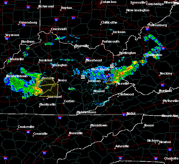 At 139 pm edt, a severe thunderstorm was located 11 miles southwest of danville, and moving east at 50 mph (radar indicated). Hazards include 60 mph wind gusts. Expect damage to roofs. Siding and trees. At 139 pm edt, a severe thunderstorm was located 11 miles southwest of danville, and moving east at 50 mph (radar indicated). Hazards include 60 mph wind gusts. Expect damage to roofs. Siding and trees.
|
| 7/9/2015 1:11 PM EDT |
 At 108 pm edt, a severe thunderstorm was located near greensburg, and moving east at 45 mph (radar indicated). Hazards include 60 mph wind gusts. Expect damage to roofs. Siding and trees. At 108 pm edt, a severe thunderstorm was located near greensburg, and moving east at 45 mph (radar indicated). Hazards include 60 mph wind gusts. Expect damage to roofs. Siding and trees.
|
| 7/7/2015 7:28 PM EDT |
 At 726 pm edt, a severe thunderstorm was located near stanford, and moving east at 40 mph (radar indicated). Hazards include 60 mph wind gusts. Expect damage to roofs. siding and trees. Locations impacted include, rowland, logantown, gilbert and preachersville. At 726 pm edt, a severe thunderstorm was located near stanford, and moving east at 40 mph (radar indicated). Hazards include 60 mph wind gusts. Expect damage to roofs. siding and trees. Locations impacted include, rowland, logantown, gilbert and preachersville.
|
| 7/7/2015 7:04 PM EDT |
 At 701 pm edt, a severe thunderstorm was located 13 miles southwest of danville, and moving east at 45 mph (radar indicated). Hazards include 60 mph wind gusts. Expect damage to roofs. Siding and trees. At 701 pm edt, a severe thunderstorm was located 13 miles southwest of danville, and moving east at 45 mph (radar indicated). Hazards include 60 mph wind gusts. Expect damage to roofs. Siding and trees.
|
| 6/8/2015 5:28 PM EDT | The severe thunderstorm warning for garrard and northeastern lincoln counties will expire at 530 pm edt/430 pm cdt/, to report severe weather, contact your nearest law enforcement agency. they will relay your report to the national weather service in louisville. |
| 6/8/2015 5:18 PM EDT | At 516 pm edt, a severe thunderstorm was located near lancaster, and moving east at 35 mph (radar indicated). Hazards include 60 mph wind gusts. Expect damage to roofs. siding and trees. Locations impacted include, point leavell, nina, hackley, manse, lowell and cartersville. |
| 6/8/2015 5:02 PM EDT | At 500 pm edt, a severe thunderstorm was located 5 miles east of danville, and moving east at 35 mph (radar indicated). Hazards include 60 mph wind gusts. Expect damage to roofs. Siding and trees. |
| 5/26/2015 6:26 PM EDT | At 625 pm edt, a severe thunderstorm was located near lancaster, and moving northeast at 35 mph (radar indicated). Hazards include 60 mph wind gusts and quarter size hail. Hail damage to vehicles is expected. Expect wind damage to roofs, siding and trees. |
| 4/25/2015 8:31 PM EDT | At 829 pm edt, severe thunderstorms were located along a line extending from 10 miles southwest of nicholasville to lancaster to stanford, and moving east at 30 mph (radar indicated). Hazards include 60 mph wind gusts and quarter size hail. Hail damage to vehicles is expected. expect wind damage to roofs, siding and trees. locations impacted include, lancaster, bourne, hubble, logantown, three forks, little hickman, pink, stone, gilbert, mccreary and teatersville. 1. 00in. |
| 4/25/2015 8:17 PM EDT | At 816 pm edt, severe thunderstorms were located along a line extending from harrodsburg to danville, and moving east at 35 mph (radar indicated). Hazards include 60 mph wind gusts and quarter size hail. Hail damage to vehicles is expected. Expect wind damage to roofs, siding and trees. |
| 4/7/2015 7:19 PM EDT | The national weather service in louisville has issued a * severe thunderstorm warning for. east central casey county in south central kentucky. lincoln county in south central kentucky. until 750 pm edt * at 718 pm edt. A severe thunderstorm was located 8 miles southeast. |
| 4/7/2015 7:10 PM EDT | A severe thunderstorm warning remains in effect for northeastern casey and lincoln counties until 720 pm edt. at 708 pm edt. severe thunderstorms were located along a line extending from near junction city to 10 miles south of stanford to 8 miles east of liberty. and moving east at 35 mph. hazard. 60 mph wind gusts. |
| 4/7/2015 6:52 PM EDT | The national weather service in louisville has issued a * severe thunderstorm warning for. southern boyle county in east central kentucky. northern casey county in south central kentucky. lincoln county in south central kentucky. Until 720 pm edt. |
| 10/6/2014 4:22 PM EDT | Quarter sized hail reported 9.3 miles E of Stanford, KY, mping report of quarter size hail outside of stanford |
| 5/21/2014 9:25 PM EDT | Trees down throughout the count in lincoln county KY, 0.2 miles N of Stanford, KY |
| 1/1/0001 12:00 AM | Trees down in lincoln county KY, 2.3 miles N of Stanford, KY |
| 1/1/0001 12:00 AM | Numerous trees dow in lincoln county KY, 0.2 miles N of Stanford, KY |
| 1/1/0001 12:00 AM | County-wide trees down. roof blown off of a traile in lincoln county KY, 0.2 miles N of Stanford, KY |
| 1/1/0001 12:00 AM | Some power lines dow in lincoln county KY, 3 miles N of Stanford, KY |
| 1/1/0001 12:00 AM | Numerous trees down and power lines and also some roofs blown of in lincoln county KY, 0.2 miles N of Stanford, KY |
Hail Maps for Stanford, KY


Connect with Interactive Hail Maps