

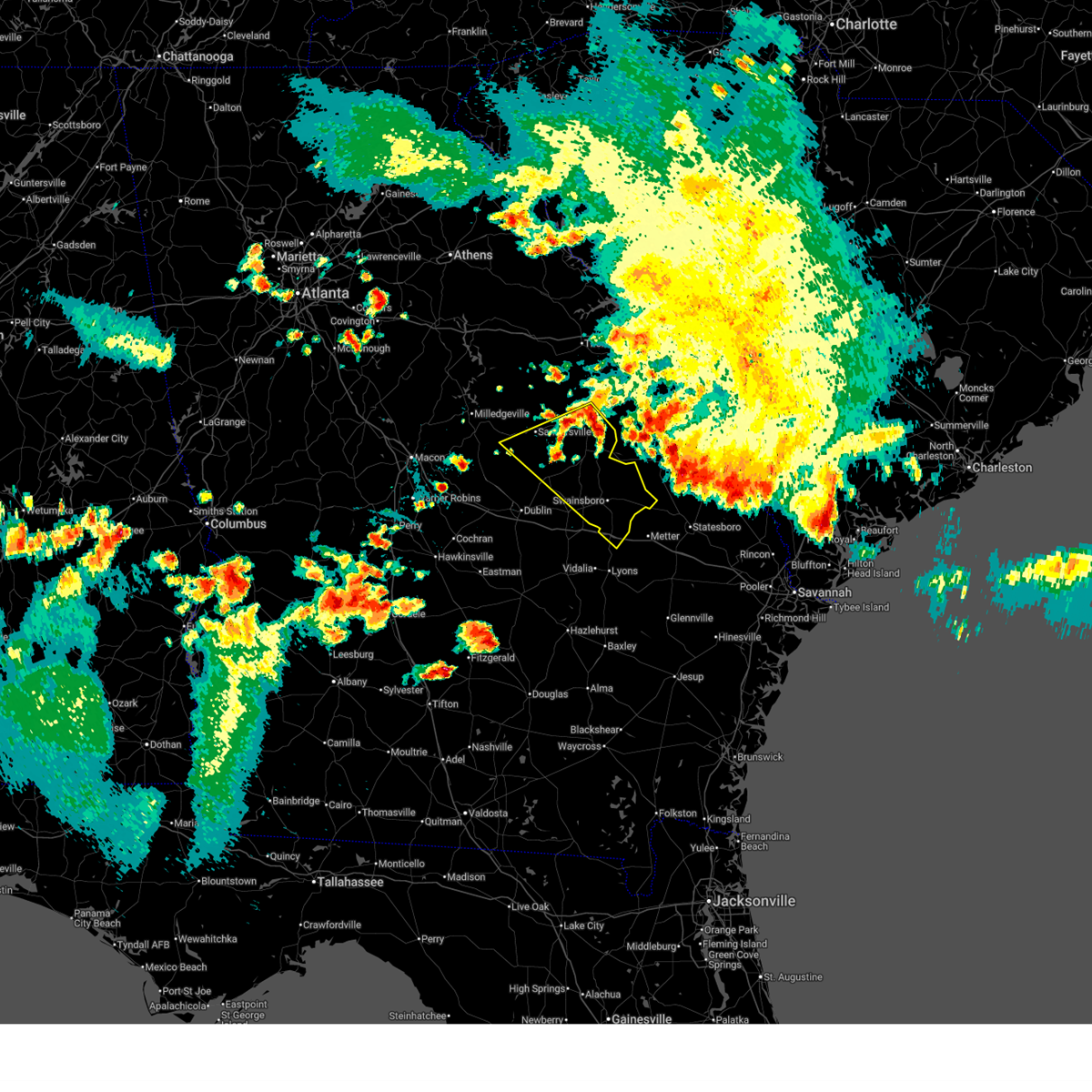
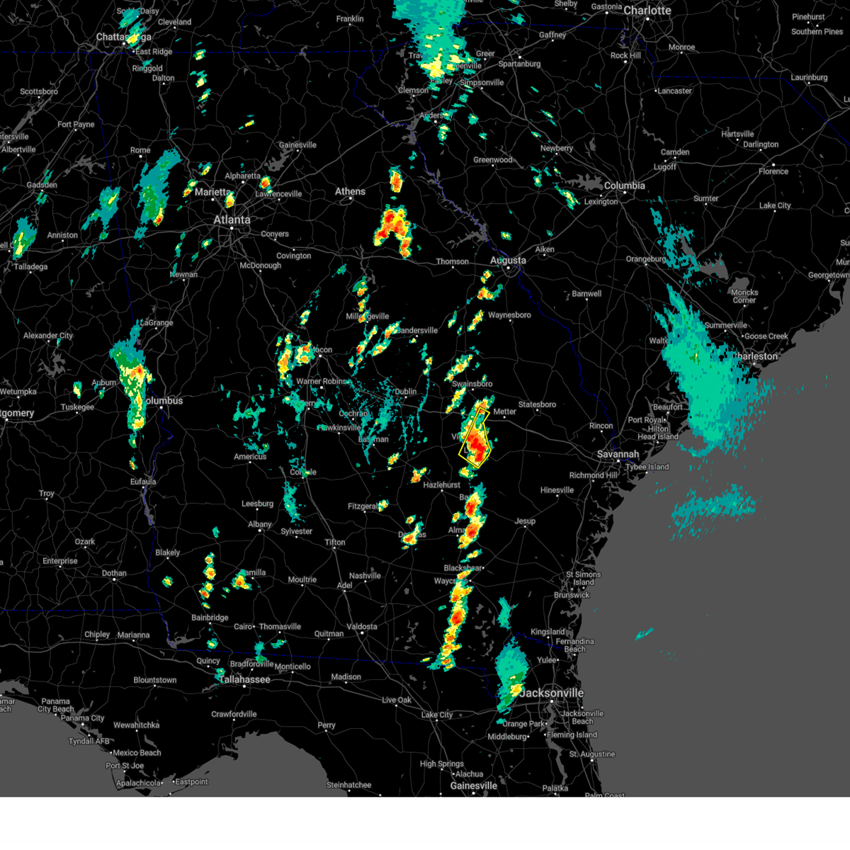
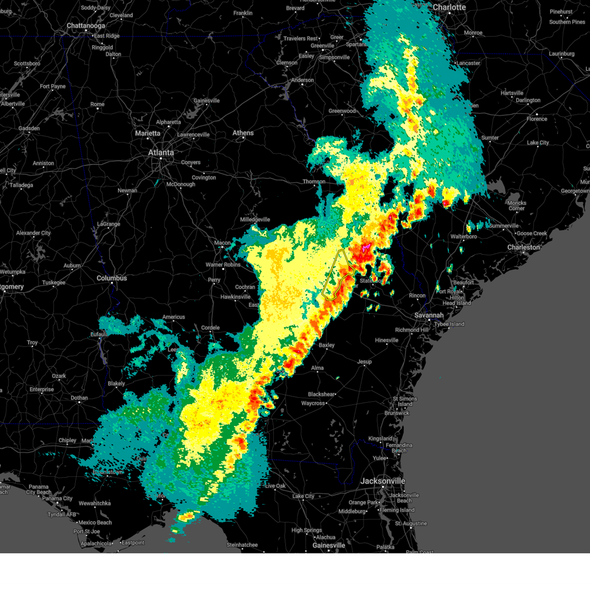
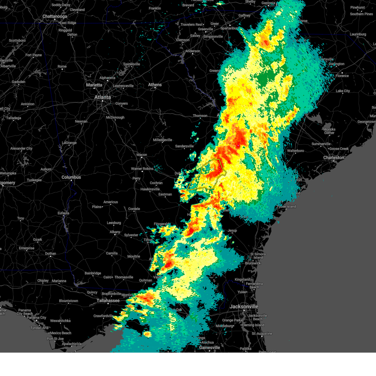
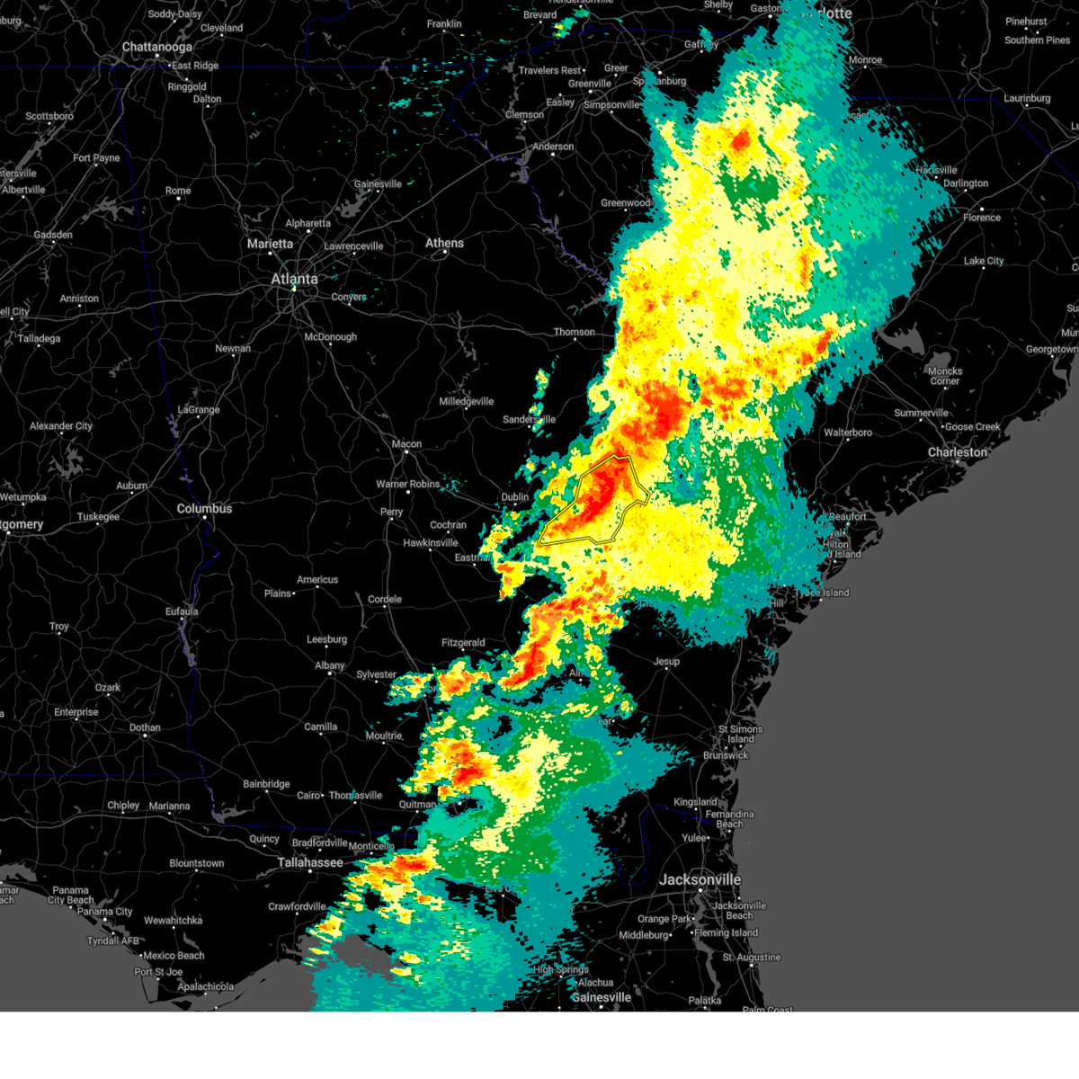
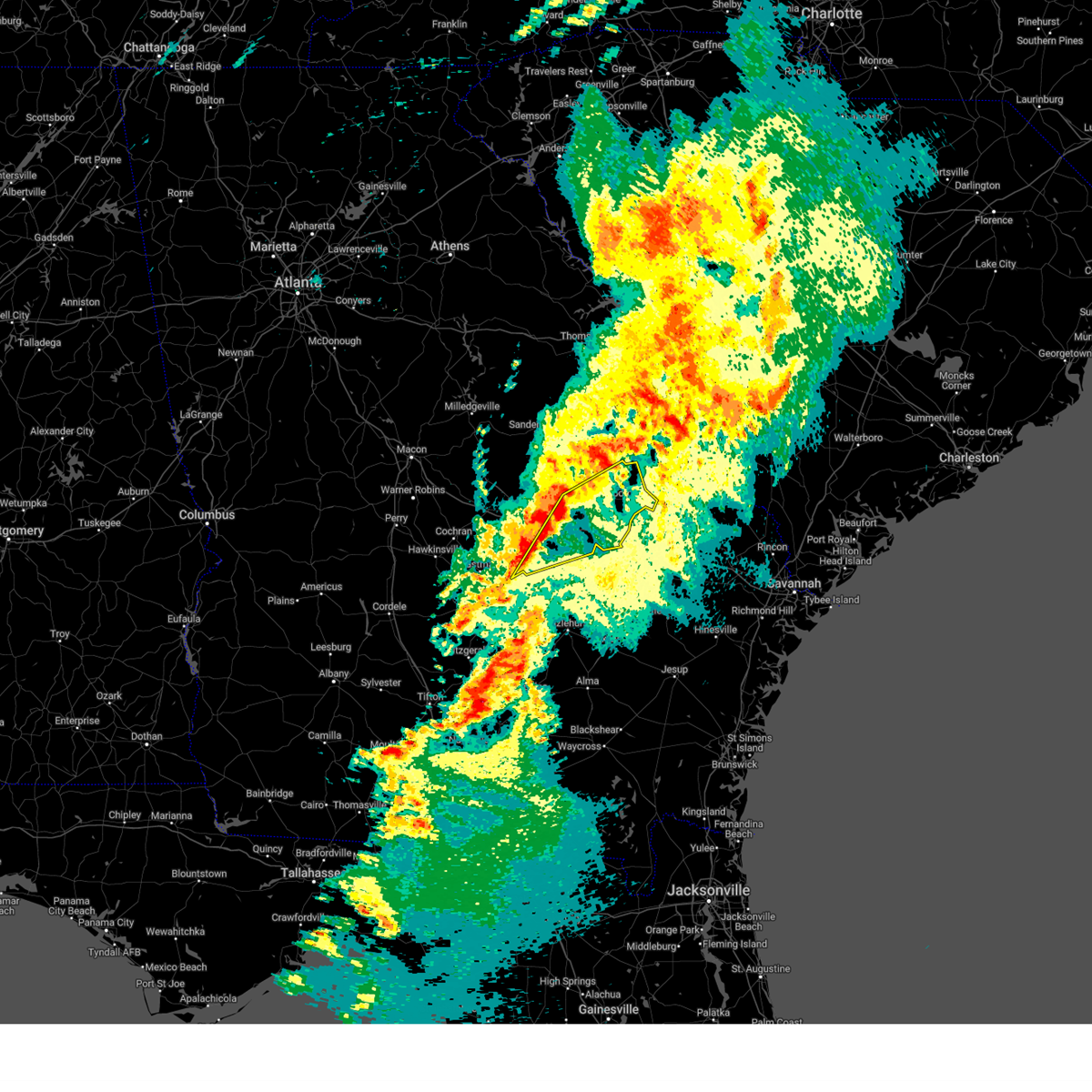
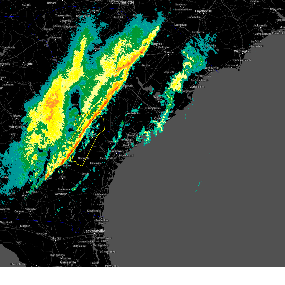
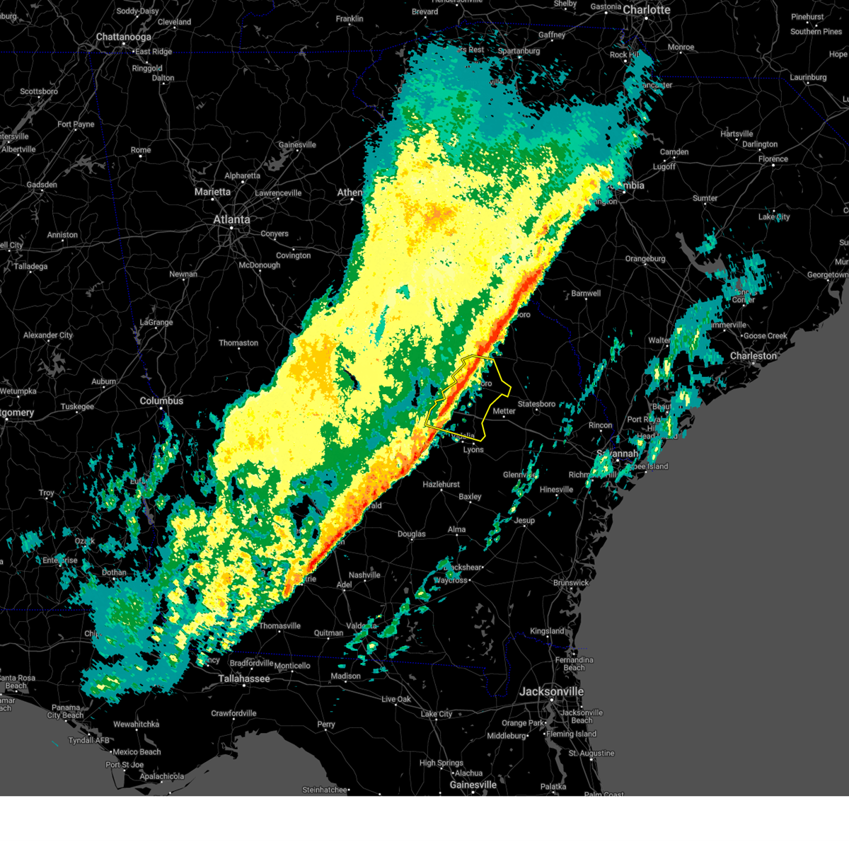
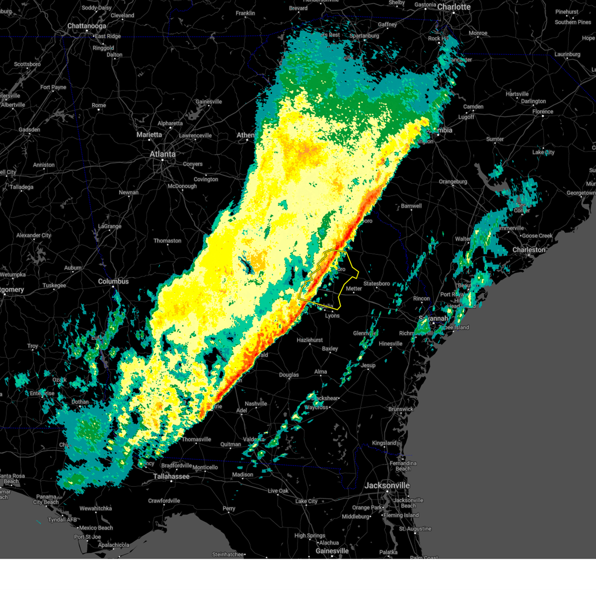
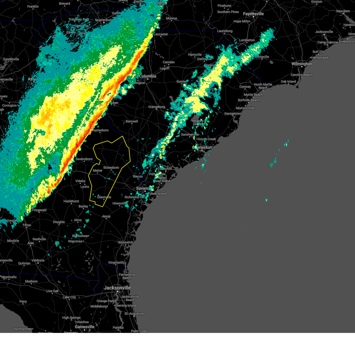
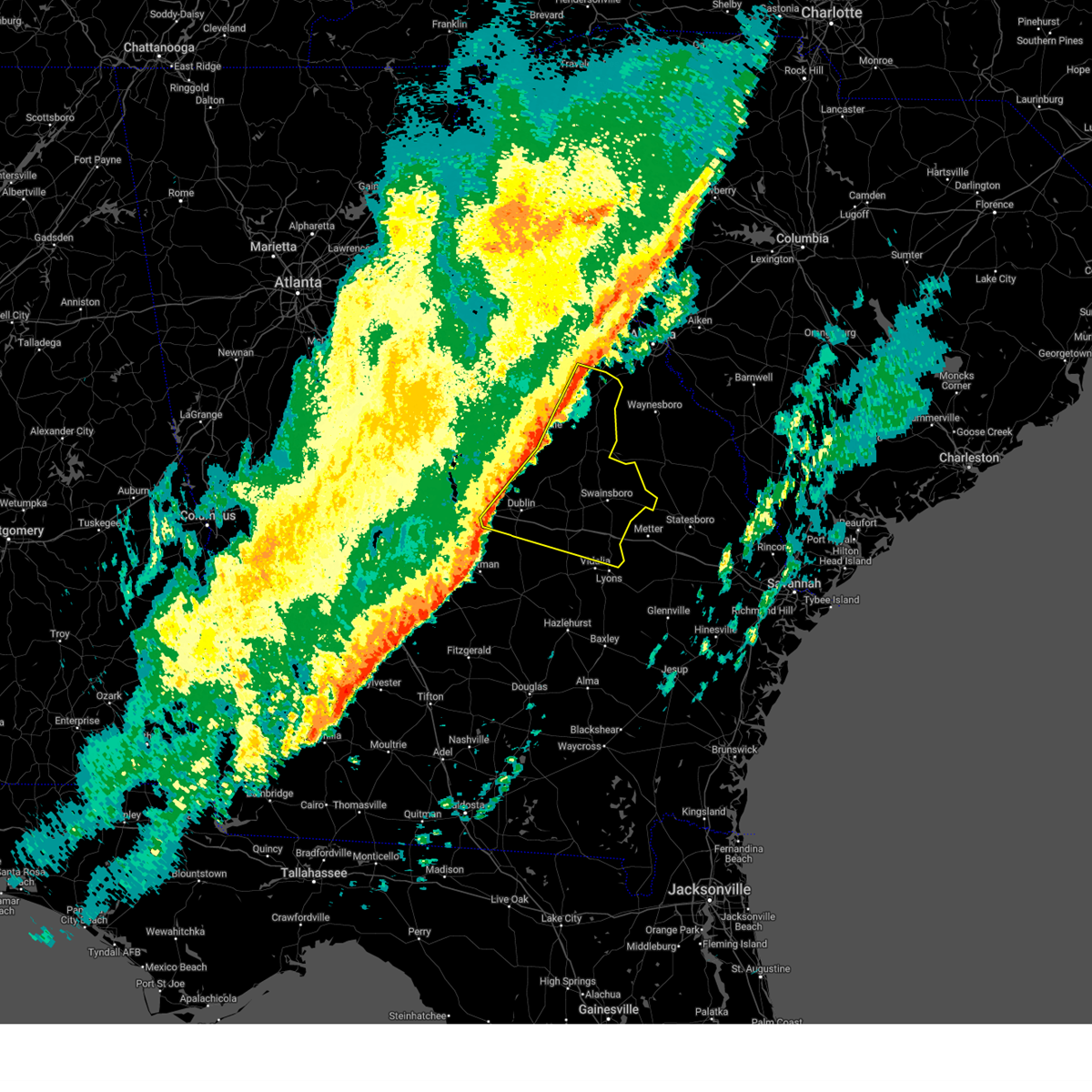
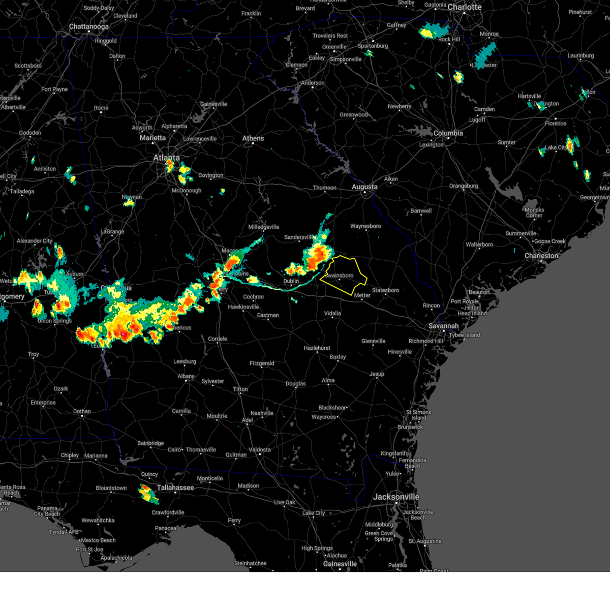
Hail Map for Stillmore, GA
The Stillmore, GA area has had 0 reports of on-the-ground hail by trained spotters, and has been under severe weather warnings 28 times during the past 12 months. Doppler radar has detected hail at or near Stillmore, GA on 72 occasions, including 9 occasions during the past year.
| Name: | Stillmore, GA |
| Where Located: | 70.3 miles WNW of Savannah, GA |
| Map: | Google Map for Stillmore, GA |
| Population: | 532 |
| Housing Units: | 215 |
| More Info: | Search Google for Stillmore, GA |
5
The Top Recent Hail Date for Stillmore, GA is Friday, May 30, 2025 (1st out of 72)

Hail and Wind Damage Spotted near Stillmore, GA
| Date / Time | Report Details |
|---|---|
| 6/25/2025 11:30 PM EDT |
 Svrffc the national weather service in peachtree city has issued a * severe thunderstorm warning for, emanuel county in east central georgia, southern washington county in east central georgia, johnson county in east central georgia, southern jefferson county in east central georgia, * until 1230 am edt. * at 1130 pm edt, severe thunderstorms were located along a line extending from near louisville to near magruder to four points, moving southwest at 25 mph (radar indicated). Hazards include 60 mph wind gusts and quarter size hail. Hail damage to vehicles is expected. Expect wind damage to roofs, siding, and trees. Svrffc the national weather service in peachtree city has issued a * severe thunderstorm warning for, emanuel county in east central georgia, southern washington county in east central georgia, johnson county in east central georgia, southern jefferson county in east central georgia, * until 1230 am edt. * at 1130 pm edt, severe thunderstorms were located along a line extending from near louisville to near magruder to four points, moving southwest at 25 mph (radar indicated). Hazards include 60 mph wind gusts and quarter size hail. Hail damage to vehicles is expected. Expect wind damage to roofs, siding, and trees.
|
| 5/12/2025 8:49 PM EDT |
 the severe thunderstorm warning has been cancelled and is no longer in effect the severe thunderstorm warning has been cancelled and is no longer in effect
|
| 5/12/2025 8:28 PM EDT |
 At 827 pm edt, severe thunderstorms were located along a line extending from lexsy to south thompson, moving northeast at 25 mph (radar indicated). Hazards include 60 mph wind gusts and penny size hail. Expect damage to roofs, siding, and trees. Locations impacted include, swainsboro, lyons, vidalia, twin city, stillmore, oak park, garfield, santa claus, nunez, center, toombs central, ohoopee, new branch, ponderosa, mcnatt falls, south thompson, rock springs, cedar crossing, johnson corner, and lexsy. At 827 pm edt, severe thunderstorms were located along a line extending from lexsy to south thompson, moving northeast at 25 mph (radar indicated). Hazards include 60 mph wind gusts and penny size hail. Expect damage to roofs, siding, and trees. Locations impacted include, swainsboro, lyons, vidalia, twin city, stillmore, oak park, garfield, santa claus, nunez, center, toombs central, ohoopee, new branch, ponderosa, mcnatt falls, south thompson, rock springs, cedar crossing, johnson corner, and lexsy.
|
| 5/12/2025 8:28 PM EDT |
 the severe thunderstorm warning has been cancelled and is no longer in effect the severe thunderstorm warning has been cancelled and is no longer in effect
|
| 5/12/2025 8:12 PM EDT |
 Svrffc the national weather service in peachtree city has issued a * severe thunderstorm warning for, toombs county in southeastern georgia, southeastern emanuel county in east central georgia, east central treutlen county in east central georgia, eastern montgomery county in central georgia, * until 900 pm edt. * at 812 pm edt, severe thunderstorms were located along a line extending from near nunez to rock springs, moving northeast at 25 mph (radar indicated). Hazards include 60 mph wind gusts and penny size hail. expect damage to roofs, siding, and trees Svrffc the national weather service in peachtree city has issued a * severe thunderstorm warning for, toombs county in southeastern georgia, southeastern emanuel county in east central georgia, east central treutlen county in east central georgia, eastern montgomery county in central georgia, * until 900 pm edt. * at 812 pm edt, severe thunderstorms were located along a line extending from near nunez to rock springs, moving northeast at 25 mph (radar indicated). Hazards include 60 mph wind gusts and penny size hail. expect damage to roofs, siding, and trees
|
| 5/12/2025 4:52 PM EDT |
 The storm which prompted the warning has weakened below severe limits, and no longer poses an immediate threat to life or property. therefore, the warning will be allowed to expire. however, gusty winds and heavy rain are still possible with this thunderstorm. to report severe weather, contact your nearest law enforcement agency. they will relay your report to the national weather service peachtree city. The storm which prompted the warning has weakened below severe limits, and no longer poses an immediate threat to life or property. therefore, the warning will be allowed to expire. however, gusty winds and heavy rain are still possible with this thunderstorm. to report severe weather, contact your nearest law enforcement agency. they will relay your report to the national weather service peachtree city.
|
| 5/12/2025 4:44 PM EDT |
 At 443 pm edt, a severe thunderstorm was located over lyons, moving northeast at 30 mph (radar indicated). Hazards include 60 mph wind gusts and penny size hail. Expect damage to roofs, siding, and trees. Locations impacted include, lyons, vidalia, stillmore, oak park, santa claus, south thompson, center, ohoopee, new branch, ponderosa, and johnson corner. At 443 pm edt, a severe thunderstorm was located over lyons, moving northeast at 30 mph (radar indicated). Hazards include 60 mph wind gusts and penny size hail. Expect damage to roofs, siding, and trees. Locations impacted include, lyons, vidalia, stillmore, oak park, santa claus, south thompson, center, ohoopee, new branch, ponderosa, and johnson corner.
|
| 5/12/2025 4:44 PM EDT |
 the severe thunderstorm warning has been cancelled and is no longer in effect the severe thunderstorm warning has been cancelled and is no longer in effect
|
| 5/12/2025 4:22 PM EDT |
 Svrffc the national weather service in peachtree city has issued a * severe thunderstorm warning for, toombs county in southeastern georgia, south central emanuel county in east central georgia, southeastern montgomery county in central georgia, * until 500 pm edt. * at 421 pm edt, a severe thunderstorm was located over rock springs, or 9 miles northwest of plant hatch, moving northeast at 30 mph (radar indicated). Hazards include 60 mph wind gusts and penny size hail. expect damage to roofs, siding, and trees Svrffc the national weather service in peachtree city has issued a * severe thunderstorm warning for, toombs county in southeastern georgia, south central emanuel county in east central georgia, southeastern montgomery county in central georgia, * until 500 pm edt. * at 421 pm edt, a severe thunderstorm was located over rock springs, or 9 miles northwest of plant hatch, moving northeast at 30 mph (radar indicated). Hazards include 60 mph wind gusts and penny size hail. expect damage to roofs, siding, and trees
|
| 3/31/2025 5:01 PM EDT |
 The storms which prompted the warning have weakened below severe limits, and have exited the warned area. therefore, the warning has been allowed to expire. however, gusty winds are still possible with these thunderstorms. a severe thunderstorm watch remains in effect until 900 pm edt for a portion of southeast georgia. The storms which prompted the warning have weakened below severe limits, and have exited the warned area. therefore, the warning has been allowed to expire. however, gusty winds are still possible with these thunderstorms. a severe thunderstorm watch remains in effect until 900 pm edt for a portion of southeast georgia.
|
| 3/31/2025 4:39 PM EDT |
 The storms which prompted the warning have moved out of the area. therefore, the warning will be allowed to expire. a severe thunderstorm watch remains in effect until 700 pm edt for southeastern and east central georgia. The storms which prompted the warning have moved out of the area. therefore, the warning will be allowed to expire. a severe thunderstorm watch remains in effect until 700 pm edt for southeastern and east central georgia.
|
| 3/31/2025 4:25 PM EDT |
 At 425 pm edt, severe thunderstorms were located along a line from 7 miles northeast of perkins to 12 miles west of gordonia altamaha state park, moving east at 45 mph (radar indicated). Hazards include 60 mph wind gusts and small hail. Expect damage to roofs, siding, and trees. locations impacted include, statesboro, metter, millen, sylvania, butts, portal, collins, cobbtown, hiltonia and pulaski. This includes i-16 between mile markers 96 and 118. At 425 pm edt, severe thunderstorms were located along a line from 7 miles northeast of perkins to 12 miles west of gordonia altamaha state park, moving east at 45 mph (radar indicated). Hazards include 60 mph wind gusts and small hail. Expect damage to roofs, siding, and trees. locations impacted include, statesboro, metter, millen, sylvania, butts, portal, collins, cobbtown, hiltonia and pulaski. This includes i-16 between mile markers 96 and 118.
|
| 3/31/2025 4:22 PM EDT |
 At 422 pm edt, severe thunderstorms were located along a line extending from perkins to near oak park, moving east at 45 mph (radar indicated). Hazards include 60 mph wind gusts. Expect damage to roofs, siding, and trees. Locations impacted include, garfield, twin city, canoochee, oak park, stillmore, lexsy, george l smith state park, nunez, and swainsboro. At 422 pm edt, severe thunderstorms were located along a line extending from perkins to near oak park, moving east at 45 mph (radar indicated). Hazards include 60 mph wind gusts. Expect damage to roofs, siding, and trees. Locations impacted include, garfield, twin city, canoochee, oak park, stillmore, lexsy, george l smith state park, nunez, and swainsboro.
|
| 3/31/2025 4:22 PM EDT |
 the severe thunderstorm warning has been cancelled and is no longer in effect the severe thunderstorm warning has been cancelled and is no longer in effect
|
| 3/31/2025 3:59 PM EDT |
 Svrchs the national weather service in charleston has issued a * severe thunderstorm warning for portions of, bulloch county in southeastern georgia, candler county in southeastern georgia, evans county in southeastern georgia, jenkins county in southeastern georgia, screven county in southeastern georgia, tattnall county in southeastern georgia, * until 500 pm edt. * at 359 pm edt, severe thunderstorms were located along a line from 12 miles north of herndon to 30 miles west of gordonia altamaha state park, moving east at 45 mph (radar indicated). Hazards include 60 mph wind gusts. expect damage to roofs, siding, and trees Svrchs the national weather service in charleston has issued a * severe thunderstorm warning for portions of, bulloch county in southeastern georgia, candler county in southeastern georgia, evans county in southeastern georgia, jenkins county in southeastern georgia, screven county in southeastern georgia, tattnall county in southeastern georgia, * until 500 pm edt. * at 359 pm edt, severe thunderstorms were located along a line from 12 miles north of herndon to 30 miles west of gordonia altamaha state park, moving east at 45 mph (radar indicated). Hazards include 60 mph wind gusts. expect damage to roofs, siding, and trees
|
| 3/31/2025 3:54 PM EDT |
 Svrffc the national weather service in peachtree city has issued a * severe thunderstorm warning for, emanuel county in east central georgia, east central treutlen county in east central georgia, * until 445 pm edt. * at 354 pm edt, severe thunderstorms were located along a line extending from near magruder to near soperton, moving east at 40 mph (radar indicated). Hazards include 60 mph wind gusts. expect damage to roofs, siding, and trees Svrffc the national weather service in peachtree city has issued a * severe thunderstorm warning for, emanuel county in east central georgia, east central treutlen county in east central georgia, * until 445 pm edt. * at 354 pm edt, severe thunderstorms were located along a line extending from near magruder to near soperton, moving east at 40 mph (radar indicated). Hazards include 60 mph wind gusts. expect damage to roofs, siding, and trees
|
| 3/16/2025 8:32 AM EDT |
 The storms which prompted the warning have moved out of the area. therefore, the warning has been allowed to expire. a tornado watch remains in effect until 1000 am edt for central, southeastern and east central georgia. The storms which prompted the warning have moved out of the area. therefore, the warning has been allowed to expire. a tornado watch remains in effect until 1000 am edt for central, southeastern and east central georgia.
|
| 3/16/2025 8:14 AM EDT |
 At 814 am edt, severe thunderstorms were located along a line extending from summertown to tarrytown, moving northeast at 45 mph (radar indicated). Hazards include 60 mph wind gusts. Expect damage to roofs, siding, and trees. Locations impacted include, garfield, lothair, twin city, covena, modoc, canoochee, oak park, orland, stillmore, soperton, swainsboro, norristown, barnhill, three points, norristown junction, dellwood, summertown, lexsy, blackville, and zaidee. At 814 am edt, severe thunderstorms were located along a line extending from summertown to tarrytown, moving northeast at 45 mph (radar indicated). Hazards include 60 mph wind gusts. Expect damage to roofs, siding, and trees. Locations impacted include, garfield, lothair, twin city, covena, modoc, canoochee, oak park, orland, stillmore, soperton, swainsboro, norristown, barnhill, three points, norristown junction, dellwood, summertown, lexsy, blackville, and zaidee.
|
| 3/16/2025 8:14 AM EDT |
 the severe thunderstorm warning has been cancelled and is no longer in effect the severe thunderstorm warning has been cancelled and is no longer in effect
|
| 3/16/2025 7:47 AM EDT |
 Svrffc the national weather service in peachtree city has issued a * severe thunderstorm warning for, southeastern laurens county in central georgia, emanuel county in east central georgia, treutlen county in east central georgia, southeastern johnson county in east central georgia, northwestern wheeler county in central georgia, northern montgomery county in central georgia, * until 830 am edt. * at 746 am edt, severe thunderstorms were located along a line extending from near meeks to near cedar grove, moving northeast at 45 mph (radar indicated). Hazards include 60 mph wind gusts. expect damage to roofs, siding, and trees Svrffc the national weather service in peachtree city has issued a * severe thunderstorm warning for, southeastern laurens county in central georgia, emanuel county in east central georgia, treutlen county in east central georgia, southeastern johnson county in east central georgia, northwestern wheeler county in central georgia, northern montgomery county in central georgia, * until 830 am edt. * at 746 am edt, severe thunderstorms were located along a line extending from near meeks to near cedar grove, moving northeast at 45 mph (radar indicated). Hazards include 60 mph wind gusts. expect damage to roofs, siding, and trees
|
| 2/16/2025 8:18 AM EST |
 The severe thunderstorm warning that was previously in effect has been reissued for tattnall, jenkins, evans, bulloch, screven, and candler counties and is in effect until 915 am est. please refer to that bulletin for the latest severe weather information. a severe thunderstorm watch remains in effect until 100 pm est for a portion of southeast georgia. The severe thunderstorm warning that was previously in effect has been reissued for tattnall, jenkins, evans, bulloch, screven, and candler counties and is in effect until 915 am est. please refer to that bulletin for the latest severe weather information. a severe thunderstorm watch remains in effect until 100 pm est for a portion of southeast georgia.
|
| 2/16/2025 7:52 AM EST | At 752 am est, severe thunderstorms were located along a line from 9 miles northeast of perkins to 19 miles west of gordonia altamaha state park, moving east at 45 mph (radar indicated). Hazards include 60 mph wind gusts. Expect damage to roofs, siding, and trees. locations impacted include, statesboro, reidsville, metter, glennville, millen, sylvania, claxton, butts, brooklet and hagan. This includes i-16 between mile markers 96 and 128. |
| 2/16/2025 7:35 AM EST |
 At 735 am est, severe thunderstorms were located along a line extending from near shell bluff landing to rogers to near gillis springs, moving east at 60 mph (radar indicated). Hazards include 60 mph wind gusts. Expect damage to roofs, siding, and trees. Locations impacted include, swainsboro, soperton, twin city, adrian, stillmore, oak park, midville, garfield, summertown, nunez, tarrytown, lothair, covena, modoc, canoochee, norristown, barnhill, dellwood, zaidee, and george l smith state park. At 735 am est, severe thunderstorms were located along a line extending from near shell bluff landing to rogers to near gillis springs, moving east at 60 mph (radar indicated). Hazards include 60 mph wind gusts. Expect damage to roofs, siding, and trees. Locations impacted include, swainsboro, soperton, twin city, adrian, stillmore, oak park, midville, garfield, summertown, nunez, tarrytown, lothair, covena, modoc, canoochee, norristown, barnhill, dellwood, zaidee, and george l smith state park.
|
| 2/16/2025 7:35 AM EST |
 the severe thunderstorm warning has been cancelled and is no longer in effect the severe thunderstorm warning has been cancelled and is no longer in effect
|
| 2/16/2025 7:19 AM EST |
 Svrchs the national weather service in charleston has issued a * severe thunderstorm warning for portions of, bulloch county in southeastern georgia, candler county in southeastern georgia, evans county in southeastern georgia, jenkins county in southeastern georgia, screven county in southeastern georgia, tattnall county in southeastern georgia, * until 815 am est. * at 719 am est, severe thunderstorms were located along a line from 17 miles northwest of perkins to 35 miles west of aline, moving east at 50 mph (radar indicated). Hazards include 60 mph wind gusts. expect damage to roofs, siding, and trees Svrchs the national weather service in charleston has issued a * severe thunderstorm warning for portions of, bulloch county in southeastern georgia, candler county in southeastern georgia, evans county in southeastern georgia, jenkins county in southeastern georgia, screven county in southeastern georgia, tattnall county in southeastern georgia, * until 815 am est. * at 719 am est, severe thunderstorms were located along a line from 17 miles northwest of perkins to 35 miles west of aline, moving east at 50 mph (radar indicated). Hazards include 60 mph wind gusts. expect damage to roofs, siding, and trees
|
| 2/16/2025 6:54 AM EST |
 Svrffc the national weather service in peachtree city has issued a * severe thunderstorm warning for, laurens county in central georgia, northern toombs county in southeastern georgia, emanuel county in east central georgia, southeastern warren county in east central georgia, treutlen county in east central georgia, central glascock county in east central georgia, southeastern washington county in east central georgia, johnson county in east central georgia, jefferson county in east central georgia, northeastern montgomery county in central georgia, * until 800 am est. * at 654 am est, severe thunderstorms were located along a line extending from near autney to near harrison to near rebie, moving east at 60 mph (radar indicated). Hazards include 60 mph wind gusts. expect damage to roofs, siding, and trees Svrffc the national weather service in peachtree city has issued a * severe thunderstorm warning for, laurens county in central georgia, northern toombs county in southeastern georgia, emanuel county in east central georgia, southeastern warren county in east central georgia, treutlen county in east central georgia, central glascock county in east central georgia, southeastern washington county in east central georgia, johnson county in east central georgia, jefferson county in east central georgia, northeastern montgomery county in central georgia, * until 800 am est. * at 654 am est, severe thunderstorms were located along a line extending from near autney to near harrison to near rebie, moving east at 60 mph (radar indicated). Hazards include 60 mph wind gusts. expect damage to roofs, siding, and trees
|
| 8/18/2024 8:17 PM EDT | Svrffc the national weather service in peachtree city has issued a * severe thunderstorm warning for, northern toombs county in southeastern georgia, south central emanuel county in east central georgia, southeastern treutlen county in east central georgia, northeastern montgomery county in central georgia, * until 900 pm edt. * at 816 pm edt, a severe thunderstorm was located over normantown, or near lyons, moving southeast at 30 mph (radar indicated). Hazards include 60 mph wind gusts. expect damage to roofs, siding, and trees |
| 8/18/2024 7:25 PM EDT |
 Svrffc the national weather service in peachtree city has issued a * severe thunderstorm warning for, emanuel county in east central georgia, * until 815 pm edt. * at 724 pm edt, severe thunderstorms were located along a line extending from wadley to near blundale to meeks, moving east at 45 mph (radar indicated). Hazards include 60 mph wind gusts. expect damage to roofs, siding, and trees Svrffc the national weather service in peachtree city has issued a * severe thunderstorm warning for, emanuel county in east central georgia, * until 815 pm edt. * at 724 pm edt, severe thunderstorms were located along a line extending from wadley to near blundale to meeks, moving east at 45 mph (radar indicated). Hazards include 60 mph wind gusts. expect damage to roofs, siding, and trees
|
| 5/25/2024 2:07 PM EDT |
 The storm which prompted the warning has weakened below severe limits, and no longer poses an immediate threat to life or property. therefore, the warning will be allowed to expire. however, heavy rain is still possible with this thunderstorm. a severe thunderstorm watch remains in effect until 800 pm edt for southeastern and east central georgia. to report severe weather, contact your nearest law enforcement agency. they will relay your report to the national weather service peachtree city. The storm which prompted the warning has weakened below severe limits, and no longer poses an immediate threat to life or property. therefore, the warning will be allowed to expire. however, heavy rain is still possible with this thunderstorm. a severe thunderstorm watch remains in effect until 800 pm edt for southeastern and east central georgia. to report severe weather, contact your nearest law enforcement agency. they will relay your report to the national weather service peachtree city.
|
| 5/25/2024 1:50 PM EDT |
 the severe thunderstorm warning has been cancelled and is no longer in effect the severe thunderstorm warning has been cancelled and is no longer in effect
|
| 5/25/2024 1:50 PM EDT |
 At 150 pm edt, a severe thunderstorm was located over lexsy, or 11 miles south of swainsboro, moving east at 20 mph (radar indicated). Hazards include 60 mph wind gusts and penny size hail. Expect damage to roofs, siding, and trees. Locations impacted include, stillmore, oak park, nunez, and lexsy. At 150 pm edt, a severe thunderstorm was located over lexsy, or 11 miles south of swainsboro, moving east at 20 mph (radar indicated). Hazards include 60 mph wind gusts and penny size hail. Expect damage to roofs, siding, and trees. Locations impacted include, stillmore, oak park, nunez, and lexsy.
|
| 5/25/2024 1:24 PM EDT |
 Svrffc the national weather service in peachtree city has issued a * severe thunderstorm warning for, southern emanuel county in east central georgia, eastern treutlen county in east central georgia, * until 215 pm edt. * at 123 pm edt, a severe thunderstorm was located over gillis springs, or 9 miles northeast of soperton, moving east at 20 mph (radar indicated). Hazards include 60 mph wind gusts and quarter size hail. Hail damage to vehicles is expected. Expect wind damage to roofs, siding, and trees. Svrffc the national weather service in peachtree city has issued a * severe thunderstorm warning for, southern emanuel county in east central georgia, eastern treutlen county in east central georgia, * until 215 pm edt. * at 123 pm edt, a severe thunderstorm was located over gillis springs, or 9 miles northeast of soperton, moving east at 20 mph (radar indicated). Hazards include 60 mph wind gusts and quarter size hail. Hail damage to vehicles is expected. Expect wind damage to roofs, siding, and trees.
|
| 1/9/2024 1:14 PM EST |
 At 113 pm est, severe thunderstorms were located along a line extending from near herndon to near plant hatch, moving northeast at 45 mph (radar indicated). Hazards include 70 mph wind gusts. Expect considerable tree damage. damage is likely to mobile homes, roofs, and outbuildings. locations impacted include: statesboro, reidsville, metter, glennville, millen, sylvania, claxton, butts, hagan, portal, collins, cobbtown, hiltonia, pulaski, and register. This warning includes i-16 between mile markers 96 and 124. At 113 pm est, severe thunderstorms were located along a line extending from near herndon to near plant hatch, moving northeast at 45 mph (radar indicated). Hazards include 70 mph wind gusts. Expect considerable tree damage. damage is likely to mobile homes, roofs, and outbuildings. locations impacted include: statesboro, reidsville, metter, glennville, millen, sylvania, claxton, butts, hagan, portal, collins, cobbtown, hiltonia, pulaski, and register. This warning includes i-16 between mile markers 96 and 124.
|
| 1/9/2024 1:08 PM EST |
 At 107 pm est, severe thunderstorms were located along a line extending from near twin city to cedar crossing, moving east at 40 mph (radar indicated). Hazards include 60 mph wind gusts. Expect damage to roofs, siding, and trees. Locations impacted include, swainsboro, lyons, vidalia, twin city, stillmore, oak park, higgston, santa claus, alston, nunez, ohoopee, new branch, mcnatt falls, south thompson, english eddy, cedar crossing, johnson corner, george l smith state park, center, and toombs central. At 107 pm est, severe thunderstorms were located along a line extending from near twin city to cedar crossing, moving east at 40 mph (radar indicated). Hazards include 60 mph wind gusts. Expect damage to roofs, siding, and trees. Locations impacted include, swainsboro, lyons, vidalia, twin city, stillmore, oak park, higgston, santa claus, alston, nunez, ohoopee, new branch, mcnatt falls, south thompson, english eddy, cedar crossing, johnson corner, george l smith state park, center, and toombs central.
|
| 1/9/2024 12:53 PM EST |
 At 1253 pm est, severe thunderstorms were located along a line extending from near midville to uvalda, moving northeast at 55 mph (radar indicated). Hazards include 70 mph wind gusts. Expect considerable tree damage. damage is likely to mobile homes, roofs, and outbuildings. locations impacted include: statesboro, reidsville, metter, glennville, millen, sylvania, claxton, butts, hagan, portal, collins, cobbtown, hiltonia, pulaski, and register. this warning includes i-16 between mile markers 96 and 124. thunderstorm damage threat, considerable hail threat, radar indicated max hail size, <. 75 in wind threat, radar indicated max wind gust, 70 mph. At 1253 pm est, severe thunderstorms were located along a line extending from near midville to uvalda, moving northeast at 55 mph (radar indicated). Hazards include 70 mph wind gusts. Expect considerable tree damage. damage is likely to mobile homes, roofs, and outbuildings. locations impacted include: statesboro, reidsville, metter, glennville, millen, sylvania, claxton, butts, hagan, portal, collins, cobbtown, hiltonia, pulaski, and register. this warning includes i-16 between mile markers 96 and 124. thunderstorm damage threat, considerable hail threat, radar indicated max hail size, <. 75 in wind threat, radar indicated max wind gust, 70 mph.
|
| 1/9/2024 12:38 PM EST |
 At 1237 pm est, severe thunderstorms were located along a line extending from near blackville to 6 miles southwest of lumber city, moving northeast at 45 mph (radar indicated). Hazards include 60 mph wind gusts. expect damage to roofs, siding, and trees At 1237 pm est, severe thunderstorms were located along a line extending from near blackville to 6 miles southwest of lumber city, moving northeast at 45 mph (radar indicated). Hazards include 60 mph wind gusts. expect damage to roofs, siding, and trees
|
| 8/8/2023 7:26 PM EDT |
 The severe thunderstorm warning for toombs, southwestern emanuel and northeastern treutlen counties will expire at 730 pm edt, the storms which prompted the warning have moved out of the area. therefore, the warning will be allowed to expire. a severe thunderstorm watch remains in effect until 1100 pm edt for central, southeastern and east central georgia. to report severe weather, contact your nearest law enforcement agency. they will relay your report to the national weather service peachtree city. The severe thunderstorm warning for toombs, southwestern emanuel and northeastern treutlen counties will expire at 730 pm edt, the storms which prompted the warning have moved out of the area. therefore, the warning will be allowed to expire. a severe thunderstorm watch remains in effect until 1100 pm edt for central, southeastern and east central georgia. to report severe weather, contact your nearest law enforcement agency. they will relay your report to the national weather service peachtree city.
|
| 8/8/2023 7:06 PM EDT |
 At 706 pm edt, severe thunderstorms were located along a line extending from covena to near normantown to toombs central, moving east at 65 mph (radar indicated). Hazards include 70 mph wind gusts and penny size hail. Expect considerable tree damage. damage is likely to mobile homes, roofs, and outbuildings. locations impacted include, swainsboro, lyons, vidalia, stillmore, oak park, santa claus, nunez, center, toombs central, ohoopee, new branch, covena, ponderosa, norristown, south thompson, english eddy, norristown junction, rock springs, cedar crossing, and lexsy. thunderstorm damage threat, considerable hail threat, radar indicated max hail size, 0. 75 in wind threat, radar indicated max wind gust, 70 mph. At 706 pm edt, severe thunderstorms were located along a line extending from covena to near normantown to toombs central, moving east at 65 mph (radar indicated). Hazards include 70 mph wind gusts and penny size hail. Expect considerable tree damage. damage is likely to mobile homes, roofs, and outbuildings. locations impacted include, swainsboro, lyons, vidalia, stillmore, oak park, santa claus, nunez, center, toombs central, ohoopee, new branch, covena, ponderosa, norristown, south thompson, english eddy, norristown junction, rock springs, cedar crossing, and lexsy. thunderstorm damage threat, considerable hail threat, radar indicated max hail size, 0. 75 in wind threat, radar indicated max wind gust, 70 mph.
|
| 8/8/2023 6:44 PM EDT |
 At 644 pm edt, severe thunderstorms were located along a line extending from near scott to near lothair to near landsburg, moving east at 50 mph (radar indicated). Hazards include 60 mph wind gusts and quarter size hail. Hail damage to vehicles is expected. Expect wind damage to roofs, siding, and trees. At 644 pm edt, severe thunderstorms were located along a line extending from near scott to near lothair to near landsburg, moving east at 50 mph (radar indicated). Hazards include 60 mph wind gusts and quarter size hail. Hail damage to vehicles is expected. Expect wind damage to roofs, siding, and trees.
|
| 8/3/2023 8:50 PM EDT |
 At 849 pm edt, severe thunderstorms were located along a line extending from near norristown junction to near gillis springs to near kibbee to near landsburg, moving east at 45 mph (radar indicated). Hazards include 60 mph wind gusts. Expect damage to roofs, siding, and trees. locations impacted include, swainsboro, soperton, twin city, adrian, stillmore, oak park, nunez, tarrytown, lothair, covena, modoc, orland, orianna, norristown, kibbee, norristown junction, dellwood, meeks, lexsy, and blackville. hail threat, radar indicated max hail size, <. 75 in wind threat, radar indicated max wind gust, 60 mph. At 849 pm edt, severe thunderstorms were located along a line extending from near norristown junction to near gillis springs to near kibbee to near landsburg, moving east at 45 mph (radar indicated). Hazards include 60 mph wind gusts. Expect damage to roofs, siding, and trees. locations impacted include, swainsboro, soperton, twin city, adrian, stillmore, oak park, nunez, tarrytown, lothair, covena, modoc, orland, orianna, norristown, kibbee, norristown junction, dellwood, meeks, lexsy, and blackville. hail threat, radar indicated max hail size, <. 75 in wind threat, radar indicated max wind gust, 60 mph.
|
| 8/3/2023 8:25 PM EDT |
 At 825 pm edt, severe thunderstorms were located along a line extending from near spann to orianna to near lowery to near eastman, moving southeast at 40 mph (radar indicated). Hazards include 60 mph wind gusts. expect damage to roofs, siding, and trees At 825 pm edt, severe thunderstorms were located along a line extending from near spann to orianna to near lowery to near eastman, moving southeast at 40 mph (radar indicated). Hazards include 60 mph wind gusts. expect damage to roofs, siding, and trees
|
| 7/30/2023 6:28 PM EDT |
 At 627 pm edt, a severe thunderstorm was located over swainsboro, moving east at 20 mph (radar indicated). Hazards include 60 mph wind gusts and quarter size hail. Hail damage to vehicles is expected. expect wind damage to roofs, siding, and trees. locations impacted include, swainsboro, twin city, stillmore, oak park, nunez, tarrytown, covena, modoc, norristown, norristown junction, dellwood, lexsy, zaidee, george l smith state park, and gillis springs. hail threat, radar indicated max hail size, 1. 00 in wind threat, radar indicated max wind gust, 60 mph. At 627 pm edt, a severe thunderstorm was located over swainsboro, moving east at 20 mph (radar indicated). Hazards include 60 mph wind gusts and quarter size hail. Hail damage to vehicles is expected. expect wind damage to roofs, siding, and trees. locations impacted include, swainsboro, twin city, stillmore, oak park, nunez, tarrytown, covena, modoc, norristown, norristown junction, dellwood, lexsy, zaidee, george l smith state park, and gillis springs. hail threat, radar indicated max hail size, 1. 00 in wind threat, radar indicated max wind gust, 60 mph.
|
| 7/30/2023 5:54 PM EDT |
 At 554 pm edt, a severe thunderstorm was located over meeks, or 11 miles southeast of wrightsville, moving east at 20 mph (radar indicated). Hazards include 60 mph wind gusts and quarter size hail. Hail damage to vehicles is expected. Expect wind damage to roofs, siding, and trees. At 554 pm edt, a severe thunderstorm was located over meeks, or 11 miles southeast of wrightsville, moving east at 20 mph (radar indicated). Hazards include 60 mph wind gusts and quarter size hail. Hail damage to vehicles is expected. Expect wind damage to roofs, siding, and trees.
|
| 7/21/2023 10:51 PM EDT |
 At 1050 pm edt, severe thunderstorms were located along a line extending from lexsy to near oak park to near zaidee, moving southeast at 50 mph (radar indicated). Hazards include 60 mph wind gusts and quarter size hail. Hail damage to vehicles is expected. expect wind damage to roofs, siding, and trees. locations impacted include, swainsboro, soperton, twin city, adrian, stillmore, oak park, nunez, tarrytown, lothair, covena, orianna, norristown, barnhill, kibbee, norristown junction, lexsy, blackville, zaidee and gillis springs. hail threat, radar indicated max hail size, 1. 00 in wind threat, radar indicated max wind gust, 60 mph. At 1050 pm edt, severe thunderstorms were located along a line extending from lexsy to near oak park to near zaidee, moving southeast at 50 mph (radar indicated). Hazards include 60 mph wind gusts and quarter size hail. Hail damage to vehicles is expected. expect wind damage to roofs, siding, and trees. locations impacted include, swainsboro, soperton, twin city, adrian, stillmore, oak park, nunez, tarrytown, lothair, covena, orianna, norristown, barnhill, kibbee, norristown junction, lexsy, blackville, zaidee and gillis springs. hail threat, radar indicated max hail size, 1. 00 in wind threat, radar indicated max wind gust, 60 mph.
|
| 7/21/2023 10:29 PM EDT |
 At 1029 pm edt, severe thunderstorms were located along a line extending from meeks to orianna to near minter, moving southeast at 50 mph (radar indicated). Hazards include 60 mph wind gusts and quarter size hail. Hail damage to vehicles is expected. Expect wind damage to roofs, siding, and trees. At 1029 pm edt, severe thunderstorms were located along a line extending from meeks to orianna to near minter, moving southeast at 50 mph (radar indicated). Hazards include 60 mph wind gusts and quarter size hail. Hail damage to vehicles is expected. Expect wind damage to roofs, siding, and trees.
|
| 7/20/2023 10:24 PM EDT |
 The severe thunderstorm warning for portions of screven, bulloch, candler, tattnall, hampton, colleton and allendale counties will expire at 1030 pm edt, the storms which prompted the warning have moved out of the area. therefore, the warning will be allowed to expire. however, gusty winds are still possible with these thunderstorms. a severe thunderstorm watch remains in effect until 100 am edt for southeastern georgia, and southeastern south carolina. to report severe weather, contact your nearest law enforcement agency. they will relay your report to the national weather service charleston. The severe thunderstorm warning for portions of screven, bulloch, candler, tattnall, hampton, colleton and allendale counties will expire at 1030 pm edt, the storms which prompted the warning have moved out of the area. therefore, the warning will be allowed to expire. however, gusty winds are still possible with these thunderstorms. a severe thunderstorm watch remains in effect until 100 am edt for southeastern georgia, and southeastern south carolina. to report severe weather, contact your nearest law enforcement agency. they will relay your report to the national weather service charleston.
|
| 7/20/2023 9:54 PM EDT |
 At 954 pm edt, severe thunderstorms were located along a line extending from 8 miles north of lodge to 6 miles west of estill to near metter, moving southeast at 35 mph (radar indicated). Hazards include 60 mph wind gusts. Expect damage to trees and powerlines. these severe thunderstorms will remain over mainly rural areas of screven, bulloch, candler, tattnall, hampton, colleton and allendale counties, including the following locations, westchester, collins lake, middleground, milbury, cooperville, hunters pointe, farmdale, huntington, nixville, and cameron. this warning includes i-16 between mile markers 96 and 108. hail threat, radar indicated max hail size, <. 75 in wind threat, radar indicated max wind gust, 60 mph. At 954 pm edt, severe thunderstorms were located along a line extending from 8 miles north of lodge to 6 miles west of estill to near metter, moving southeast at 35 mph (radar indicated). Hazards include 60 mph wind gusts. Expect damage to trees and powerlines. these severe thunderstorms will remain over mainly rural areas of screven, bulloch, candler, tattnall, hampton, colleton and allendale counties, including the following locations, westchester, collins lake, middleground, milbury, cooperville, hunters pointe, farmdale, huntington, nixville, and cameron. this warning includes i-16 between mile markers 96 and 108. hail threat, radar indicated max hail size, <. 75 in wind threat, radar indicated max wind gust, 60 mph.
|
| 7/20/2023 9:22 PM EDT |
 At 922 pm edt, severe thunderstorms were located along a line extending from blackville to near hilltonia to near twin city, moving east at 60 mph (radar indicated). Hazards include 60 mph wind gusts. Expect damage to trees and powerlines. locations impacted include: statesboro, metter, allendale, millen, sylvania, hampton, lake warren state park, colleton, butts, varnville, estill, fairfax, portal, brunson, and hiltonia. this warning includes i-16 between mile markers 96 and 108. hail threat, radar indicated max hail size, <. 75 in wind threat, radar indicated max wind gust, 60 mph. At 922 pm edt, severe thunderstorms were located along a line extending from blackville to near hilltonia to near twin city, moving east at 60 mph (radar indicated). Hazards include 60 mph wind gusts. Expect damage to trees and powerlines. locations impacted include: statesboro, metter, allendale, millen, sylvania, hampton, lake warren state park, colleton, butts, varnville, estill, fairfax, portal, brunson, and hiltonia. this warning includes i-16 between mile markers 96 and 108. hail threat, radar indicated max hail size, <. 75 in wind threat, radar indicated max wind gust, 60 mph.
|
| 3/25/2023 5:38 PM EDT |
 The severe thunderstorm warning for northeastern toombs and south central emanuel counties will expire at 545 pm edt, the storm which prompted the warning has moved out of the area. therefore, the warning will be allowed to expire. a severe thunderstorm watch remains in effect until 700 pm edt for southeastern and east central georgia. to report severe weather, contact your nearest law enforcement agency. they will relay your report to the national weather service peachtree city. The severe thunderstorm warning for northeastern toombs and south central emanuel counties will expire at 545 pm edt, the storm which prompted the warning has moved out of the area. therefore, the warning will be allowed to expire. a severe thunderstorm watch remains in effect until 700 pm edt for southeastern and east central georgia. to report severe weather, contact your nearest law enforcement agency. they will relay your report to the national weather service peachtree city.
|
| 3/25/2023 5:25 PM EDT |
 At 525 pm edt, a severe thunderstorm was located near oak park, or 8 miles north of lyons, moving east at 35 mph (radar indicated). Hazards include golf ball size hail and 60 mph wind gusts. People and animals outdoors will be injured. expect hail damage to roofs, siding, windows, and vehicles. expect wind damage to roofs, siding, and trees. locations impacted include, stillmore and oak park. thunderstorm damage threat, considerable hail threat, radar indicated max hail size, 1. 75 in wind threat, radar indicated max wind gust, 60 mph. At 525 pm edt, a severe thunderstorm was located near oak park, or 8 miles north of lyons, moving east at 35 mph (radar indicated). Hazards include golf ball size hail and 60 mph wind gusts. People and animals outdoors will be injured. expect hail damage to roofs, siding, windows, and vehicles. expect wind damage to roofs, siding, and trees. locations impacted include, stillmore and oak park. thunderstorm damage threat, considerable hail threat, radar indicated max hail size, 1. 75 in wind threat, radar indicated max wind gust, 60 mph.
|
| 3/25/2023 5:15 PM EDT |
 At 515 pm edt, a severe thunderstorm was located near normantown, or 8 miles north of lyons, moving east at 45 mph (radar indicated). Hazards include ping pong ball size hail and 60 mph wind gusts. People and animals outdoors will be injured. expect hail damage to roofs, siding, windows, and vehicles. Expect wind damage to roofs, siding, and trees. At 515 pm edt, a severe thunderstorm was located near normantown, or 8 miles north of lyons, moving east at 45 mph (radar indicated). Hazards include ping pong ball size hail and 60 mph wind gusts. People and animals outdoors will be injured. expect hail damage to roofs, siding, windows, and vehicles. Expect wind damage to roofs, siding, and trees.
|
| 1/12/2023 8:36 PM EST |
 The severe thunderstorm warning for toombs, south central emanuel, southern treutlen, eastern wheeler and montgomery counties will expire at 845 pm est, the storms which prompted the warning have weakened below severe limits, and no longer pose an immediate threat to life or property. therefore, the warning will be allowed to expire. a tornado watch remains in effect until 900 pm est for central, southeastern and east central georgia. The severe thunderstorm warning for toombs, south central emanuel, southern treutlen, eastern wheeler and montgomery counties will expire at 845 pm est, the storms which prompted the warning have weakened below severe limits, and no longer pose an immediate threat to life or property. therefore, the warning will be allowed to expire. a tornado watch remains in effect until 900 pm est for central, southeastern and east central georgia.
|
| 1/12/2023 7:57 PM EST |
 At 757 pm est, severe thunderstorms were located along a line extending from near soperton to near higgston to near alston to spring hill, moving east at 55 mph (radar indicated). Hazards include 60 mph wind gusts. expect damage to roofs, siding, and trees At 757 pm est, severe thunderstorms were located along a line extending from near soperton to near higgston to near alston to spring hill, moving east at 55 mph (radar indicated). Hazards include 60 mph wind gusts. expect damage to roofs, siding, and trees
|
| 7/8/2022 4:01 PM EDT |
 At 401 pm edt, severe thunderstorms were located along a line extending from norristown to covena to near swainsboro, moving east at 5 mph (radar indicated). Hazards include 60 mph wind gusts and penny size hail. expect damage to roofs, siding, and trees At 401 pm edt, severe thunderstorms were located along a line extending from norristown to covena to near swainsboro, moving east at 5 mph (radar indicated). Hazards include 60 mph wind gusts and penny size hail. expect damage to roofs, siding, and trees
|
| 6/17/2022 9:08 PM EDT |
 At 908 pm edt, a severe thunderstorm was located over adrian, or 12 miles north of soperton, moving southeast at 30 mph (radar indicated). Hazards include 60 mph wind gusts. expect damage to roofs, siding, and trees At 908 pm edt, a severe thunderstorm was located over adrian, or 12 miles north of soperton, moving southeast at 30 mph (radar indicated). Hazards include 60 mph wind gusts. expect damage to roofs, siding, and trees
|
| 6/17/2022 8:35 PM EDT |
 At 835 pm edt, a severe thunderstorm was located near stillmore, or 9 miles west of metter, moving southeast at 10 mph (radar indicated). Hazards include 60 mph wind gusts and quarter size hail. Hail damage to vehicles is expected. Expect wind damage to roofs, siding, and trees. At 835 pm edt, a severe thunderstorm was located near stillmore, or 9 miles west of metter, moving southeast at 10 mph (radar indicated). Hazards include 60 mph wind gusts and quarter size hail. Hail damage to vehicles is expected. Expect wind damage to roofs, siding, and trees.
|
| 5/23/2022 4:47 PM EDT |
 At 447 pm edt, severe thunderstorms were located along a line extending from near perkins to near surrency, moving east at 15 mph (radar indicated). Hazards include 60 mph wind gusts and penny size hail. Expect damage to trees and powerlines. locations impacted include: hinesville, statesboro, reidsville, metter, glennville, millen, sylvania, claxton, pembroke, ludowici, fort stewart, butts, brooklet, hagan and portal. this warning includes i-16 between mile markers 96 and 135. hail threat, radar indicated max hail size, 0. 75 in wind threat, radar indicated max wind gust, 60 mph. At 447 pm edt, severe thunderstorms were located along a line extending from near perkins to near surrency, moving east at 15 mph (radar indicated). Hazards include 60 mph wind gusts and penny size hail. Expect damage to trees and powerlines. locations impacted include: hinesville, statesboro, reidsville, metter, glennville, millen, sylvania, claxton, pembroke, ludowici, fort stewart, butts, brooklet, hagan and portal. this warning includes i-16 between mile markers 96 and 135. hail threat, radar indicated max hail size, 0. 75 in wind threat, radar indicated max wind gust, 60 mph.
|
| 5/6/2022 3:30 PM EDT |
 At 330 pm edt, a severe thunderstorm was located over normantown, or 8 miles north of lyons, moving northeast at 40 mph (radar indicated). Hazards include 60 mph wind gusts and quarter size hail. Hail damage to vehicles is expected. Expect wind damage to roofs, siding, and trees. At 330 pm edt, a severe thunderstorm was located over normantown, or 8 miles north of lyons, moving northeast at 40 mph (radar indicated). Hazards include 60 mph wind gusts and quarter size hail. Hail damage to vehicles is expected. Expect wind damage to roofs, siding, and trees.
|
| 4/6/2022 8:58 PM EDT |
 At 857 pm edt, severe thunderstorms were located along a line extending from near perkins to near portal to 6 miles north of metter to near aline to near collins, moving east at 55 mph (radar indicated). Hazards include 60 mph wind gusts. Expect damage to trees and powerlines. locations impacted include: statesboro, reidsville, metter, glennville, millen, sylvania, claxton, pembroke, butts, brooklet, hagan, portal, collins, cobbtown and hiltonia. this warning includes i-16 between mile markers 96 and 135. hail threat, radar indicated max hail size, <. 75 in wind threat, radar indicated max wind gust, 60 mph. At 857 pm edt, severe thunderstorms were located along a line extending from near perkins to near portal to 6 miles north of metter to near aline to near collins, moving east at 55 mph (radar indicated). Hazards include 60 mph wind gusts. Expect damage to trees and powerlines. locations impacted include: statesboro, reidsville, metter, glennville, millen, sylvania, claxton, pembroke, butts, brooklet, hagan, portal, collins, cobbtown and hiltonia. this warning includes i-16 between mile markers 96 and 135. hail threat, radar indicated max hail size, <. 75 in wind threat, radar indicated max wind gust, 60 mph.
|
| 4/6/2022 8:34 PM EDT |
 At 833 pm edt, severe thunderstorms were located along a line extending from near dellwood to near gillis springs to ailey, moving east at 45 mph (radar indicated). Hazards include 60 mph wind gusts. Expect damage to roofs, siding, and trees. Locations impacted include, swainsboro, lyons, mount vernon, vidalia, twin city, stillmore, oak park, ailey, higgston, garfield, santa claus, nunez, ohoopee, new branch, covena, modoc, canoochee, norristown, south thompson and dellwood. At 833 pm edt, severe thunderstorms were located along a line extending from near dellwood to near gillis springs to ailey, moving east at 45 mph (radar indicated). Hazards include 60 mph wind gusts. Expect damage to roofs, siding, and trees. Locations impacted include, swainsboro, lyons, mount vernon, vidalia, twin city, stillmore, oak park, ailey, higgston, garfield, santa claus, nunez, ohoopee, new branch, covena, modoc, canoochee, norristown, south thompson and dellwood.
|
| 4/6/2022 8:32 PM EDT |
 At 831 pm edt, two confirmed tornadoes were detected. one 4 miles east of kite, the other 5 miles northeast of norristown junction, both moving east-northeast at 50 mph (radar confirmed tornado). Hazards include damaging tornado. Flying debris will be dangerous to those caught without shelter. mobile homes will be damaged or destroyed. damage to roofs, windows, and vehicles will occur. tree damage is likely. Locations impacted include, swainsboro, twin city, stillmore, nunez, dellwood, covena, modoc and lexsy. At 831 pm edt, two confirmed tornadoes were detected. one 4 miles east of kite, the other 5 miles northeast of norristown junction, both moving east-northeast at 50 mph (radar confirmed tornado). Hazards include damaging tornado. Flying debris will be dangerous to those caught without shelter. mobile homes will be damaged or destroyed. damage to roofs, windows, and vehicles will occur. tree damage is likely. Locations impacted include, swainsboro, twin city, stillmore, nunez, dellwood, covena, modoc and lexsy.
|
| 4/6/2022 8:26 PM EDT |
 At 826 pm edt, another radar confirmed tornado was located near kite, or 11 miles east of wrightsville, moving east at 45 mph (radar confirmed tornado). Hazards include damaging tornado. Flying debris will be dangerous to those caught without shelter. mobile homes will be damaged or destroyed. damage to roofs, windows, and vehicles will occur. tree damage is likely. Locations impacted include, swainsboro, twin city, adrian, stillmore, nunez, kite, covena, modoc, norristown, norristown junction, dellwood, meeks and lexsy. At 826 pm edt, another radar confirmed tornado was located near kite, or 11 miles east of wrightsville, moving east at 45 mph (radar confirmed tornado). Hazards include damaging tornado. Flying debris will be dangerous to those caught without shelter. mobile homes will be damaged or destroyed. damage to roofs, windows, and vehicles will occur. tree damage is likely. Locations impacted include, swainsboro, twin city, adrian, stillmore, nunez, kite, covena, modoc, norristown, norristown junction, dellwood, meeks and lexsy.
|
| 4/6/2022 8:25 PM EDT |
 At 825 pm edt, a confirmed tornado was located about 3 miles north of adrian or 12 miles west of swainsboro, moving east at 50 mph (radar confirmed tornado). Hazards include damaging tornado. Flying debris will be dangerous to those caught without shelter. mobile homes will be damaged or destroyed. damage to roofs, windows, and vehicles will occur. tree damage is likely. Locations impacted include, swainsboro, twin city, adrian, stillmore, nunez, kite, covena, modoc, norristown, norristown junction, dellwood, meeks and lexsy. At 825 pm edt, a confirmed tornado was located about 3 miles north of adrian or 12 miles west of swainsboro, moving east at 50 mph (radar confirmed tornado). Hazards include damaging tornado. Flying debris will be dangerous to those caught without shelter. mobile homes will be damaged or destroyed. damage to roofs, windows, and vehicles will occur. tree damage is likely. Locations impacted include, swainsboro, twin city, adrian, stillmore, nunez, kite, covena, modoc, norristown, norristown junction, dellwood, meeks and lexsy.
|
| 4/6/2022 8:25 PM EDT |
 At 825 pm edt, severe thunderstorms were located along a line extending from 9 miles southeast of wrightsville to near adrian to 7 miles southwest of soperton to near alamo, moving east at 55 mph (radar indicated). Hazards include 60 mph wind gusts. Expect damage to trees and powerlines. locations impacted include: statesboro, reidsville, metter, glennville, millen, sylvania, claxton, pembroke, butts, brooklet, hagan, portal, collins, cobbtown and hiltonia. this warning includes i-16 between mile markers 96 and 135. hail threat, radar indicated max hail size, <. 75 in wind threat, radar indicated max wind gust, 60 mph. At 825 pm edt, severe thunderstorms were located along a line extending from 9 miles southeast of wrightsville to near adrian to 7 miles southwest of soperton to near alamo, moving east at 55 mph (radar indicated). Hazards include 60 mph wind gusts. Expect damage to trees and powerlines. locations impacted include: statesboro, reidsville, metter, glennville, millen, sylvania, claxton, pembroke, butts, brooklet, hagan, portal, collins, cobbtown and hiltonia. this warning includes i-16 between mile markers 96 and 135. hail threat, radar indicated max hail size, <. 75 in wind threat, radar indicated max wind gust, 60 mph.
|
| 4/6/2022 8:22 PM EDT |
 At 822 pm edt, a severe thunderstorm capable of producing a tornado was located near adrian, or 12 miles southeast of wrightsville, moving east at 50 mph (radar indicated rotation). Hazards include tornado. Flying debris will be dangerous to those caught without shelter. mobile homes will be damaged or destroyed. damage to roofs, windows, and vehicles will occur. Tree damage is likely. At 822 pm edt, a severe thunderstorm capable of producing a tornado was located near adrian, or 12 miles southeast of wrightsville, moving east at 50 mph (radar indicated rotation). Hazards include tornado. Flying debris will be dangerous to those caught without shelter. mobile homes will be damaged or destroyed. damage to roofs, windows, and vehicles will occur. Tree damage is likely.
|
| 4/6/2022 8:12 PM EDT |
 At 811 pm edt, severe thunderstorms were located along a line extending from near spann to near cedar grove to near jay bird springs, moving east at 65 mph (radar indicated). Hazards include 60 mph wind gusts. expect damage to roofs, siding, and trees At 811 pm edt, severe thunderstorms were located along a line extending from near spann to near cedar grove to near jay bird springs, moving east at 65 mph (radar indicated). Hazards include 60 mph wind gusts. expect damage to roofs, siding, and trees
|
| 4/5/2022 5:50 PM EDT |
 At 550 pm edt, severe thunderstorms were located along a line extending from near millen to near reidsville, moving east at 45 mph (radar indicated). Hazards include 60 mph wind gusts and penny size hail. Expect damage to trees and powerlines. locations impacted include: statesboro, reidsville, metter, glennville, millen, claxton, butts, hagan, portal, collins, cobbtown, hiltonia, pulaski, register and rocky ford. this warning includes i-16 between mile markers 96 and 121. hail threat, radar indicated max hail size, 0. 75 in wind threat, radar indicated max wind gust, 60 mph. At 550 pm edt, severe thunderstorms were located along a line extending from near millen to near reidsville, moving east at 45 mph (radar indicated). Hazards include 60 mph wind gusts and penny size hail. Expect damage to trees and powerlines. locations impacted include: statesboro, reidsville, metter, glennville, millen, claxton, butts, hagan, portal, collins, cobbtown, hiltonia, pulaski, register and rocky ford. this warning includes i-16 between mile markers 96 and 121. hail threat, radar indicated max hail size, 0. 75 in wind threat, radar indicated max wind gust, 60 mph.
|
| 4/5/2022 5:47 PM EDT |
 At 547 pm edt, severe thunderstorms were located along a line extending from jenkins county hospital to parish to near reidsville, moving east at 50 mph (radar indicated). Hazards include 60 mph wind gusts and penny size hail. Expect damage to roofs, siding, and trees. locations impacted include, lyons, vidalia, twin city, uvalda, stillmore, oak park, garfield, santa claus, summertown, alston, ohoopee, new branch, canoochee, mcnatt falls, south thompson, english eddy, cedar crossing, johnson corner, george l smith state park and center. hail threat, radar indicated max hail size, 0. 75 in wind threat, radar indicated max wind gust, 60 mph. At 547 pm edt, severe thunderstorms were located along a line extending from jenkins county hospital to parish to near reidsville, moving east at 50 mph (radar indicated). Hazards include 60 mph wind gusts and penny size hail. Expect damage to roofs, siding, and trees. locations impacted include, lyons, vidalia, twin city, uvalda, stillmore, oak park, garfield, santa claus, summertown, alston, ohoopee, new branch, canoochee, mcnatt falls, south thompson, english eddy, cedar crossing, johnson corner, george l smith state park and center. hail threat, radar indicated max hail size, 0. 75 in wind threat, radar indicated max wind gust, 60 mph.
|
| 4/5/2022 5:38 PM EDT |
 At 538 pm edt, severe thunderstorms were located along a line extending from near rogers to metter municiple airport to near new branch, moving east at 50 mph (radar indicated). Hazards include 60 mph wind gusts and penny size hail. Expect damage to roofs, siding, and trees. locations impacted include, swainsboro, lyons, vidalia, twin city, uvalda, stillmore, oak park, garfield, santa claus, summertown, alston, nunez, ohoopee, new branch, modoc, canoochee, mcnatt falls, south thompson, english eddy and cedar crossing. hail threat, radar indicated max hail size, 0. 75 in wind threat, radar indicated max wind gust, 60 mph. At 538 pm edt, severe thunderstorms were located along a line extending from near rogers to metter municiple airport to near new branch, moving east at 50 mph (radar indicated). Hazards include 60 mph wind gusts and penny size hail. Expect damage to roofs, siding, and trees. locations impacted include, swainsboro, lyons, vidalia, twin city, uvalda, stillmore, oak park, garfield, santa claus, summertown, alston, nunez, ohoopee, new branch, modoc, canoochee, mcnatt falls, south thompson, english eddy and cedar crossing. hail threat, radar indicated max hail size, 0. 75 in wind threat, radar indicated max wind gust, 60 mph.
|
| 4/5/2022 5:28 PM EDT |
 At 527 pm edt, severe thunderstorms were located along a line extending from herndon to 6 miles southwest of baxley, moving east at 45 mph (radar indicated). Hazards include 60 mph wind gusts and penny size hail. Expect damage to trees and powerlines. locations impacted include: statesboro, reidsville, metter, glennville, millen, claxton, butts, hagan, portal, collins, cobbtown, hiltonia, pulaski, register and rocky ford. this warning includes i-16 between mile markers 96 and 121. hail threat, radar indicated max hail size, 0. 75 in wind threat, radar indicated max wind gust, 60 mph. At 527 pm edt, severe thunderstorms were located along a line extending from herndon to 6 miles southwest of baxley, moving east at 45 mph (radar indicated). Hazards include 60 mph wind gusts and penny size hail. Expect damage to trees and powerlines. locations impacted include: statesboro, reidsville, metter, glennville, millen, claxton, butts, hagan, portal, collins, cobbtown, hiltonia, pulaski, register and rocky ford. this warning includes i-16 between mile markers 96 and 121. hail threat, radar indicated max hail size, 0. 75 in wind threat, radar indicated max wind gust, 60 mph.
|
| 4/5/2022 5:25 PM EDT |
 At 521 pm edt, severe thunderstorms were located along a line extending from near colemans lake to near lexsy to alston, moving east at 50 mph (radar indicated). Hazards include 60 mph wind gusts and penny size hail. expect damage to roofs, siding, and trees At 521 pm edt, severe thunderstorms were located along a line extending from near colemans lake to near lexsy to alston, moving east at 50 mph (radar indicated). Hazards include 60 mph wind gusts and penny size hail. expect damage to roofs, siding, and trees
|
| 4/5/2022 5:18 PM EDT |
 At 518 pm edt, severe thunderstorms were located along a line extending from near waynesboro to near canoochee to near higgston, moving northeast at 75 mph (radar indicated). Hazards include 60 mph wind gusts and penny size hail. Expect damage to roofs, siding, and trees. locations impacted include, swainsboro, mcrae, lyons, soperton, mount vernon, wrightsville, vidalia, wadley, twin city, glenwood, adrian, stillmore, oak park, ailey, scotland, higgston, garfield, santa claus, summertown and alston. hail threat, radar indicated max hail size, 0. 75 in wind threat, radar indicated max wind gust, 60 mph. At 518 pm edt, severe thunderstorms were located along a line extending from near waynesboro to near canoochee to near higgston, moving northeast at 75 mph (radar indicated). Hazards include 60 mph wind gusts and penny size hail. Expect damage to roofs, siding, and trees. locations impacted include, swainsboro, mcrae, lyons, soperton, mount vernon, wrightsville, vidalia, wadley, twin city, glenwood, adrian, stillmore, oak park, ailey, scotland, higgston, garfield, santa claus, summertown and alston. hail threat, radar indicated max hail size, 0. 75 in wind threat, radar indicated max wind gust, 60 mph.
|
| 4/5/2022 4:47 PM EDT |
 At 446 pm edt, severe thunderstorms were located along a line extending from donovan to lowery to near china hill, moving northeast at 60 mph (radar indicated). Hazards include 60 mph wind gusts and penny size hail. expect damage to roofs, siding, and trees At 446 pm edt, severe thunderstorms were located along a line extending from donovan to lowery to near china hill, moving northeast at 60 mph (radar indicated). Hazards include 60 mph wind gusts and penny size hail. expect damage to roofs, siding, and trees
|
| 3/28/2021 4:38 PM EDT |
 At 438 pm edt, severe thunderstorms were located along a line extending from near vidette to near blundale to blackville, moving east at 65 mph (radar indicated). Hazards include 60 mph wind gusts. Expect damage to roofs, siding, and trees. Locations impacted include, swainsboro, soperton, louisville, wadley, twin city, adrian, stillmore, oak park, bartow, garfield, summertown, nunez, kite, covena, modoc, canoochee, rockledge, norristown, stapletons crossroads and minter. At 438 pm edt, severe thunderstorms were located along a line extending from near vidette to near blundale to blackville, moving east at 65 mph (radar indicated). Hazards include 60 mph wind gusts. Expect damage to roofs, siding, and trees. Locations impacted include, swainsboro, soperton, louisville, wadley, twin city, adrian, stillmore, oak park, bartow, garfield, summertown, nunez, kite, covena, modoc, canoochee, rockledge, norristown, stapletons crossroads and minter.
|
| 3/28/2021 4:11 PM EDT |
 The national weather service in peachtree city has issued a * severe thunderstorm warning for. northeastern laurens county in central georgia. emanuel county in east central georgia. treutlen county in east central georgia. Southeastern washington county in east central georgia. The national weather service in peachtree city has issued a * severe thunderstorm warning for. northeastern laurens county in central georgia. emanuel county in east central georgia. treutlen county in east central georgia. Southeastern washington county in east central georgia.
|
| 8/18/2020 2:46 PM EDT |
 At 245 pm edt, a severe thunderstorm was located near twin city, or 8 miles southeast of swainsboro, moving northeast at 20 mph (radar indicated). Hazards include 60 mph wind gusts and quarter size hail. Hail damage to vehicles is expected. expect wind damage to roofs, siding, and trees. Locations impacted include, twin city, stillmore, oak park, garfield, canoochee, lexsy and george l smith state park. At 245 pm edt, a severe thunderstorm was located near twin city, or 8 miles southeast of swainsboro, moving northeast at 20 mph (radar indicated). Hazards include 60 mph wind gusts and quarter size hail. Hail damage to vehicles is expected. expect wind damage to roofs, siding, and trees. Locations impacted include, twin city, stillmore, oak park, garfield, canoochee, lexsy and george l smith state park.
|
| 8/18/2020 2:30 PM EDT |
 At 230 pm edt, a severe thunderstorm was located over lexsy, or 7 miles south of swainsboro, moving northeast at 20 mph (radar indicated). Hazards include 60 mph wind gusts and quarter size hail. Hail damage to vehicles is expected. Expect wind damage to roofs, siding, and trees. At 230 pm edt, a severe thunderstorm was located over lexsy, or 7 miles south of swainsboro, moving northeast at 20 mph (radar indicated). Hazards include 60 mph wind gusts and quarter size hail. Hail damage to vehicles is expected. Expect wind damage to roofs, siding, and trees.
|
| 4/13/2020 5:14 AM EDT |
 At 514 am edt, severe thunderstorms were located along a line extending from 8 miles south of jackson to olifftown, moving east at 45 mph (radar indicated). Hazards include 60 mph wind gusts. Expect damage to roofs, siding, and trees. Locations impacted include, swainsboro, twin city, stillmore, oak park, midville, garfield, summertown, nunez, covena, modoc, canoochee, three points, lexsy and george l smith state park. At 514 am edt, severe thunderstorms were located along a line extending from 8 miles south of jackson to olifftown, moving east at 45 mph (radar indicated). Hazards include 60 mph wind gusts. Expect damage to roofs, siding, and trees. Locations impacted include, swainsboro, twin city, stillmore, oak park, midville, garfield, summertown, nunez, covena, modoc, canoochee, three points, lexsy and george l smith state park.
|
| 4/13/2020 4:54 AM EDT |
 At 452 am edt, severe thunderstorms were located along a line extending from near hephzibah to covena, moving east at 45 mph (radar indicated). Hazards include 60 mph wind gusts. Expect damage to roofs, siding, and trees. Locations impacted include, swainsboro, twin city, adrian, stillmore, oak park, midville, garfield, summertown, nunez, covena, modoc, canoochee, blundale, norristown, three points, norristown junction, dellwood, lexsy, colemans lake and george l smith state park. At 452 am edt, severe thunderstorms were located along a line extending from near hephzibah to covena, moving east at 45 mph (radar indicated). Hazards include 60 mph wind gusts. Expect damage to roofs, siding, and trees. Locations impacted include, swainsboro, twin city, adrian, stillmore, oak park, midville, garfield, summertown, nunez, covena, modoc, canoochee, blundale, norristown, three points, norristown junction, dellwood, lexsy, colemans lake and george l smith state park.
|
| 4/13/2020 4:32 AM EDT |
 At 432 am edt, severe thunderstorms were located along a line extending from wrens to near scott, moving east at 45 mph (radar indicated). Hazards include 60 mph wind gusts. Expect damage to roofs, siding, and trees. Locations impacted include, dublin, swainsboro, louisville, wrightsville, east dublin, wrens, wadley, davisboro, twin city, adrian, stillmore, harrison, oak park, stapleton, bartow, midville, avera, garfield, summertown and nunez. At 432 am edt, severe thunderstorms were located along a line extending from wrens to near scott, moving east at 45 mph (radar indicated). Hazards include 60 mph wind gusts. Expect damage to roofs, siding, and trees. Locations impacted include, dublin, swainsboro, louisville, wrightsville, east dublin, wrens, wadley, davisboro, twin city, adrian, stillmore, harrison, oak park, stapleton, bartow, midville, avera, garfield, summertown and nunez.
|
| 4/13/2020 4:10 AM EDT |
 At 410 am edt, severe thunderstorms were located along a line extending from mitchell to near harlow, moving east at 45 mph (radar indicated). Hazards include 60 mph wind gusts. expect damage to roofs, siding, and trees At 410 am edt, severe thunderstorms were located along a line extending from mitchell to near harlow, moving east at 45 mph (radar indicated). Hazards include 60 mph wind gusts. expect damage to roofs, siding, and trees
|
| 4/9/2020 7:25 AM EDT |
 At 725 am edt, a severe thunderstorm was located over swainsboro, moving southeast at 50 mph (radar indicated). Hazards include 60 mph wind gusts and quarter size hail. Hail damage to vehicles is expected. expect wind damage to roofs, siding, and trees. Locations impacted include, swainsboro, twin city, stillmore, oak park, garfield, nunez, covena, modoc, canoochee, norristown, norristown junction, dellwood and lexsy. At 725 am edt, a severe thunderstorm was located over swainsboro, moving southeast at 50 mph (radar indicated). Hazards include 60 mph wind gusts and quarter size hail. Hail damage to vehicles is expected. expect wind damage to roofs, siding, and trees. Locations impacted include, swainsboro, twin city, stillmore, oak park, garfield, nunez, covena, modoc, canoochee, norristown, norristown junction, dellwood and lexsy.
|
| 4/9/2020 7:15 AM EDT |
 At 715 am edt, a severe thunderstorm was located over kite, or 10 miles northwest of swainsboro, moving southeast at 50 mph (radar indicated). Hazards include 60 mph wind gusts and quarter size hail. Hail damage to vehicles is expected. expect wind damage to roofs, siding, and trees. Locations impacted include, swainsboro, twin city, adrian, stillmore, oak park, garfield, nunez, kite, covena, modoc, canoochee, norristown, norristown junction, dellwood, new home, meeks and lexsy. At 715 am edt, a severe thunderstorm was located over kite, or 10 miles northwest of swainsboro, moving southeast at 50 mph (radar indicated). Hazards include 60 mph wind gusts and quarter size hail. Hail damage to vehicles is expected. expect wind damage to roofs, siding, and trees. Locations impacted include, swainsboro, twin city, adrian, stillmore, oak park, garfield, nunez, kite, covena, modoc, canoochee, norristown, norristown junction, dellwood, new home, meeks and lexsy.
|
| 4/9/2020 6:54 AM EDT |
 At 653 am edt, a severe thunderstorm was located 4 miles west of wrightsville, moving east-southeast at 50 mph (radar indicated). Hazards include 60 mph wind gusts and quarter size hail. Hail damage to vehicles is expected. Expect wind damage to roofs, siding, and trees. At 653 am edt, a severe thunderstorm was located 4 miles west of wrightsville, moving east-southeast at 50 mph (radar indicated). Hazards include 60 mph wind gusts and quarter size hail. Hail damage to vehicles is expected. Expect wind damage to roofs, siding, and trees.
|
| 8/1/2019 12:49 PM EDT |
 The national weather service in peachtree city has issued a * severe thunderstorm warning for. central emanuel county in east central georgia. until 115 pm edt. At 1248 pm edt, a severe thunderstorm was located near nunez, or near swainsboro, moving north at 5 mph. The national weather service in peachtree city has issued a * severe thunderstorm warning for. central emanuel county in east central georgia. until 115 pm edt. At 1248 pm edt, a severe thunderstorm was located near nunez, or near swainsboro, moving north at 5 mph.
|
| 6/22/2019 2:50 PM EDT |
 At 250 pm edt, a severe thunderstorm was located over norristown, or 10 miles northeast of soperton, moving east at 30 mph (radar indicated). Hazards include 60 mph wind gusts and quarter size hail. Hail damage to vehicles is expected. Expect wind damage to roofs, siding, and trees. At 250 pm edt, a severe thunderstorm was located over norristown, or 10 miles northeast of soperton, moving east at 30 mph (radar indicated). Hazards include 60 mph wind gusts and quarter size hail. Hail damage to vehicles is expected. Expect wind damage to roofs, siding, and trees.
|
| 6/20/2019 6:43 PM EDT |
 At 643 pm edt, a severe thunderstorm was located over alston, or 9 miles southeast of mount vernon, moving east at 45 mph (radar indicated). Hazards include 60 mph wind gusts. Expect damage to roofs, siding, and trees. Locations impacted include, mcrae, lyons, alamo, mount vernon, vidalia, lumber city, glenwood, uvalda, stillmore, oak park, ailey, scotland, higgston, santa claus, alston, jacksonville, tarrytown, towns, ohoopee and horse creek wma. At 643 pm edt, a severe thunderstorm was located over alston, or 9 miles southeast of mount vernon, moving east at 45 mph (radar indicated). Hazards include 60 mph wind gusts. Expect damage to roofs, siding, and trees. Locations impacted include, mcrae, lyons, alamo, mount vernon, vidalia, lumber city, glenwood, uvalda, stillmore, oak park, ailey, scotland, higgston, santa claus, alston, jacksonville, tarrytown, towns, ohoopee and horse creek wma.
|
| 6/20/2019 6:36 PM EDT |
 At 636 pm edt, a severe thunderstorm was located near mount vernon, moving east at 45 mph (radar indicated). Hazards include 60 mph wind gusts. Expect damage to roofs, siding, and trees. Locations impacted include, mcrae, lyons, soperton, alamo, mount vernon, vidalia, helena, lumber city, glenwood, uvalda, stillmore, oak park, ailey, scotland, higgston, santa claus, alston, jacksonville, tarrytown and towns. At 636 pm edt, a severe thunderstorm was located near mount vernon, moving east at 45 mph (radar indicated). Hazards include 60 mph wind gusts. Expect damage to roofs, siding, and trees. Locations impacted include, mcrae, lyons, soperton, alamo, mount vernon, vidalia, helena, lumber city, glenwood, uvalda, stillmore, oak park, ailey, scotland, higgston, santa claus, alston, jacksonville, tarrytown and towns.
|
| 6/20/2019 6:17 PM EDT |
 At 616 pm edt, a severe thunderstorm was located near alamo, moving east at 45 mph (radar indicated). Hazards include 60 mph wind gusts. expect damage to roofs, siding, and trees At 616 pm edt, a severe thunderstorm was located near alamo, moving east at 45 mph (radar indicated). Hazards include 60 mph wind gusts. expect damage to roofs, siding, and trees
|
| 5/5/2019 12:08 AM EDT |
 At 1207 am edt, a severe thunderstorm was located over vidalia, or near lyons, moving east at 35 mph (radar indicated). Hazards include 60 mph wind gusts. expect damage to roofs, siding, and trees At 1207 am edt, a severe thunderstorm was located over vidalia, or near lyons, moving east at 35 mph (radar indicated). Hazards include 60 mph wind gusts. expect damage to roofs, siding, and trees
|
| 4/19/2019 11:48 AM EDT |
 At 1148 am edt, severe thunderstorms were located along a line extending from 8 miles southeast of metter to near gardi, moving northeast at 55 mph (radar indicated). Hazards include 60 mph wind gusts. Expect damage to trees and powerlines. locations impacted include, hinesville, statesboro, reidsville, metter, millen, sylvania, claxton and pembroke. This warning includes i-16 between mile markers 96 and 139. At 1148 am edt, severe thunderstorms were located along a line extending from 8 miles southeast of metter to near gardi, moving northeast at 55 mph (radar indicated). Hazards include 60 mph wind gusts. Expect damage to trees and powerlines. locations impacted include, hinesville, statesboro, reidsville, metter, millen, sylvania, claxton and pembroke. This warning includes i-16 between mile markers 96 and 139.
|
| 4/19/2019 11:32 AM EDT |
 At 1131 am edt, severe thunderstorms were located along a line extending from 8 miles north of reidsville to 7 miles southeast of patterson, moving northeast at 50 mph (radar indicated). Hazards include 60 mph wind gusts. Expect damage to trees and powerlines. locations impacted include, hinesville, statesboro, reidsville, metter, millen, sylvania, claxton and pembroke. This warning includes i-16 between mile markers 96 and 139. At 1131 am edt, severe thunderstorms were located along a line extending from 8 miles north of reidsville to 7 miles southeast of patterson, moving northeast at 50 mph (radar indicated). Hazards include 60 mph wind gusts. Expect damage to trees and powerlines. locations impacted include, hinesville, statesboro, reidsville, metter, millen, sylvania, claxton and pembroke. This warning includes i-16 between mile markers 96 and 139.
|
| 4/19/2019 11:14 AM EDT |
 At 1111 am edt, severe thunderstorms were located along a line extending from 9 miles south of lyons to 6 miles south of blackshear, moving northeast at 55 mph (radar indicated). Hazards include 60 mph wind gusts. expect damage to trees and powerlines At 1111 am edt, severe thunderstorms were located along a line extending from 9 miles south of lyons to 6 miles south of blackshear, moving northeast at 55 mph (radar indicated). Hazards include 60 mph wind gusts. expect damage to trees and powerlines
|
| 3/3/2019 2:38 PM EST |
 At 237 pm est, a severe thunderstorm was located near soperton, moving northeast at 35 mph (radar indicated). Hazards include 60 mph wind gusts and quarter size hail. Hail damage to vehicles is expected. Expect wind damage to roofs, siding, and trees. At 237 pm est, a severe thunderstorm was located near soperton, moving northeast at 35 mph (radar indicated). Hazards include 60 mph wind gusts and quarter size hail. Hail damage to vehicles is expected. Expect wind damage to roofs, siding, and trees.
|
| 7/22/2018 5:39 PM EDT |
 At 539 pm edt, a severe thunderstorm was located near oak park, or 11 miles west of metter, moving east at 20 mph (radar indicated). Hazards include 60 mph wind gusts and quarter size hail. Hail damage to vehicles is expected. Expect wind damage to roofs, siding, and trees. At 539 pm edt, a severe thunderstorm was located near oak park, or 11 miles west of metter, moving east at 20 mph (radar indicated). Hazards include 60 mph wind gusts and quarter size hail. Hail damage to vehicles is expected. Expect wind damage to roofs, siding, and trees.
|
| 7/17/2018 2:11 PM EDT |
 At 211 pm edt, a severe thunderstorm was located near oak park, or 10 miles east of soperton, moving east at 20 mph (radar indicated). Hazards include 60 mph wind gusts and penny size hail. expect damage to roofs, siding, and trees At 211 pm edt, a severe thunderstorm was located near oak park, or 10 miles east of soperton, moving east at 20 mph (radar indicated). Hazards include 60 mph wind gusts and penny size hail. expect damage to roofs, siding, and trees
|
| 7/3/2018 4:27 PM EDT |
 At 427 pm edt, a severe thunderstorm was located over george l smith state park, or 12 miles north of metter, moving west at 15 mph (radar indicated). Hazards include 60 mph wind gusts and quarter size hail. Hail damage to vehicles is expected. Expect wind damage to roofs, siding, and trees. At 427 pm edt, a severe thunderstorm was located over george l smith state park, or 12 miles north of metter, moving west at 15 mph (radar indicated). Hazards include 60 mph wind gusts and quarter size hail. Hail damage to vehicles is expected. Expect wind damage to roofs, siding, and trees.
|
| 6/25/2018 9:40 PM EDT |
 The severe thunderstorm warning for screven, evans, bulloch, jenkins, candler, effingham, tattnall, hampton, colleton and allendale counties will expire at 945 pm edt, the storms which prompted the warning will have weakened below severe limits by 945 pm and will no longer pose an immediate threat to life or property. therefore the warning will be allowed to expire. however gusty winds and heavy rain are still possible with these thunderstorms. to report severe weather, contact your nearest law enforcement agency. they will relay your report to the national weather service charleston. The severe thunderstorm warning for screven, evans, bulloch, jenkins, candler, effingham, tattnall, hampton, colleton and allendale counties will expire at 945 pm edt, the storms which prompted the warning will have weakened below severe limits by 945 pm and will no longer pose an immediate threat to life or property. therefore the warning will be allowed to expire. however gusty winds and heavy rain are still possible with these thunderstorms. to report severe weather, contact your nearest law enforcement agency. they will relay your report to the national weather service charleston.
|
| 6/25/2018 9:18 PM EDT |
 At 917 pm edt, severe thunderstorms were located along a line extending from near denmark to 7 miles south of lyons, moving east at 30 mph (radar indicated). Hazards include 60 mph wind gusts. Expect damage to trees and powerlines. locations impacted include, statesboro, reidsville, metter, allendale, millen, sylvania, hampton and claxton. this warning includes, i-16 between mile markers 96 and 130. I-95 in south carolina near mile marker 68. At 917 pm edt, severe thunderstorms were located along a line extending from near denmark to 7 miles south of lyons, moving east at 30 mph (radar indicated). Hazards include 60 mph wind gusts. Expect damage to trees and powerlines. locations impacted include, statesboro, reidsville, metter, allendale, millen, sylvania, hampton and claxton. this warning includes, i-16 between mile markers 96 and 130. I-95 in south carolina near mile marker 68.
|
| 6/25/2018 8:52 PM EDT |
 At 851 pm edt, severe thunderstorms were located along a line extending from 12 miles northwest of barnwell to near mount vernon, moving east at 45 mph (law enforcement reports. multiple reports of trees blown down). Hazards include 60 mph wind gusts and penny size hail. expect damage to trees and powerlines At 851 pm edt, severe thunderstorms were located along a line extending from 12 miles northwest of barnwell to near mount vernon, moving east at 45 mph (law enforcement reports. multiple reports of trees blown down). Hazards include 60 mph wind gusts and penny size hail. expect damage to trees and powerlines
|
| 4/23/2018 7:32 PM EDT |
 At 732 pm edt, a severe thunderstorm was located over vidalia, or near lyons, moving northeast at 20 mph (radar indicated). Hazards include 60 mph wind gusts and nickel size hail. expect damage to roofs, siding, and trees At 732 pm edt, a severe thunderstorm was located over vidalia, or near lyons, moving northeast at 20 mph (radar indicated). Hazards include 60 mph wind gusts and nickel size hail. expect damage to roofs, siding, and trees
|
| 4/15/2018 12:11 PM EDT |
 At 1211 pm edt, severe thunderstorms were located along a line extending from near covena to near oak park to 6 miles east of normantown to new branch to near baxley, moving northeast at 50 mph (radar indicated). Hazards include 60 mph wind gusts. Expect damage to roofs, siding, and trees. locations impacted include, lyons, vidalia, stillmore, oak park, santa claus, center, toombs central, ohoopee, new branch, ponderosa, south thompson, english eddy, rock springs, cedar crossing, lexsy, johnson corner, normantown and grays landing. A tornado watch remains in effect until 600 pm edt for central, southeastern and east central georgia. At 1211 pm edt, severe thunderstorms were located along a line extending from near covena to near oak park to 6 miles east of normantown to new branch to near baxley, moving northeast at 50 mph (radar indicated). Hazards include 60 mph wind gusts. Expect damage to roofs, siding, and trees. locations impacted include, lyons, vidalia, stillmore, oak park, santa claus, center, toombs central, ohoopee, new branch, ponderosa, south thompson, english eddy, rock springs, cedar crossing, lexsy, johnson corner, normantown and grays landing. A tornado watch remains in effect until 600 pm edt for central, southeastern and east central georgia.
|
| 4/15/2018 12:10 PM EDT |
 At 1210 pm edt, severe thunderstorms were located along a line extending from swainsboro to near aline to near plant hatch, moving northeast at 40 mph (radar indicated). Hazards include 60 mph wind gusts. expect damage to roofs, siding, and trees At 1210 pm edt, severe thunderstorms were located along a line extending from swainsboro to near aline to near plant hatch, moving northeast at 40 mph (radar indicated). Hazards include 60 mph wind gusts. expect damage to roofs, siding, and trees
|
| 4/15/2018 11:51 AM EDT |
 At 1151 am edt, severe thunderstorms were located along a line extending from near kibbee to near vidalia to south thompson to near plant hatch to near new lacy, moving northeast at 50 mph (radar indicated). Hazards include 60 mph wind gusts. expect damage to roofs, siding, and trees At 1151 am edt, severe thunderstorms were located along a line extending from near kibbee to near vidalia to south thompson to near plant hatch to near new lacy, moving northeast at 50 mph (radar indicated). Hazards include 60 mph wind gusts. expect damage to roofs, siding, and trees
|
| 4/5/2017 4:15 PM EDT |
 At 415 pm edt, severe thunderstorms were located along a line extending from near scott to near gillis springs to near mount vernon, moving east at 45 mph (radar indicated). Hazards include 60 mph wind gusts and quarter size hail. Hail damage to vehicles is expected. Expect wind damage to roofs, siding, and trees. At 415 pm edt, severe thunderstorms were located along a line extending from near scott to near gillis springs to near mount vernon, moving east at 45 mph (radar indicated). Hazards include 60 mph wind gusts and quarter size hail. Hail damage to vehicles is expected. Expect wind damage to roofs, siding, and trees.
|
| 4/3/2017 3:49 PM EDT |
 At 349 pm edt, a severe thunderstorm was located over normantown, or 9 miles northwest of lyons, moving northeast at 70 mph (radar indicated). Hazards include 60 mph wind gusts and nickel size hail. expect damage to roofs, siding, and trees At 349 pm edt, a severe thunderstorm was located over normantown, or 9 miles northwest of lyons, moving northeast at 70 mph (radar indicated). Hazards include 60 mph wind gusts and nickel size hail. expect damage to roofs, siding, and trees
|
| 1/21/2017 2:13 PM EST |
 At 212 pm est, severe thunderstorms were located along a line extending from 7 miles west of millen to 10 miles east of swainsboro to 10 miles west of metter to 6 miles north of lyons, moving northeast at 70 mph (radar indicated). Hazards include 60 mph wind gusts and penny size hail. expect damage to roofs, siding, and trees At 212 pm est, severe thunderstorms were located along a line extending from 7 miles west of millen to 10 miles east of swainsboro to 10 miles west of metter to 6 miles north of lyons, moving northeast at 70 mph (radar indicated). Hazards include 60 mph wind gusts and penny size hail. expect damage to roofs, siding, and trees
|
| 1/21/2017 2:12 PM EST |
 At 211 pm est, severe thunderstorms extended from herndon to near garfield to near oak park to near uvalda to near horse creek, moving east at 45 mph (radar indicated). Hazards include 60 mph wind gusts. expect damage to roofs, siding, and trees At 211 pm est, severe thunderstorms extended from herndon to near garfield to near oak park to near uvalda to near horse creek, moving east at 45 mph (radar indicated). Hazards include 60 mph wind gusts. expect damage to roofs, siding, and trees
|
| 1/3/2017 12:30 AM EST |
 At 1229 am est, a severe thunderstorm was located near landsburg, or near mount vernon, moving northeast at 45 mph (radar indicated). Hazards include 70 mph wind gusts. Expect considerable tree damage. Damage is likely to mobile homes, roofs, and outbuildings. At 1229 am est, a severe thunderstorm was located near landsburg, or near mount vernon, moving northeast at 45 mph (radar indicated). Hazards include 70 mph wind gusts. Expect considerable tree damage. Damage is likely to mobile homes, roofs, and outbuildings.
|
| 7/15/2016 7:44 PM EDT |
 At 744 pm edt, a severe thunderstorm was located 9 miles west of bay, moving northeast at 15 mph (radar indicated). Hazards include 60 mph wind gusts and quarter size hail. Hail damage to vehicles is expected. Expect wind damage to roofs, siding, and trees. At 744 pm edt, a severe thunderstorm was located 9 miles west of bay, moving northeast at 15 mph (radar indicated). Hazards include 60 mph wind gusts and quarter size hail. Hail damage to vehicles is expected. Expect wind damage to roofs, siding, and trees.
|
| 6/17/2016 6:01 PM EDT |
 At 600 pm edt, a severe thunderstorm was located over lyons, moving southeast at 45 mph (radar indicated). Hazards include 60 mph wind gusts and quarter size hail. Hail damage to vehicles is expected. expect wind damage to roofs, siding, and trees. Other locations in the warning include but are not limited to lyons, vidalia, stillmore, oak park, higgston, santa claus, tarrytown, ponderosa, ohoopee, normantown, kibbee and new branch. At 600 pm edt, a severe thunderstorm was located over lyons, moving southeast at 45 mph (radar indicated). Hazards include 60 mph wind gusts and quarter size hail. Hail damage to vehicles is expected. expect wind damage to roofs, siding, and trees. Other locations in the warning include but are not limited to lyons, vidalia, stillmore, oak park, higgston, santa claus, tarrytown, ponderosa, ohoopee, normantown, kibbee and new branch.
|
| 6/17/2016 5:29 PM EDT |
 At 529 pm edt, a severe thunderstorm was located 7 miles west of soperton, moving southeast at 45 mph (radar indicated). Hazards include 60 mph wind gusts and quarter size hail. Hail damage to vehicles is expected. expect wind damage to roofs, siding, and trees. Other locations in the warning include but are not limited to lyons, soperton, vidalia, stillmore, oak park, higgston, santa claus, tarrytown, gillis springs, barnhill, ponderosa, normantown, lothair, orland, orianna, zaidee, ohoopee, blackville, kibbee and new branch. At 529 pm edt, a severe thunderstorm was located 7 miles west of soperton, moving southeast at 45 mph (radar indicated). Hazards include 60 mph wind gusts and quarter size hail. Hail damage to vehicles is expected. expect wind damage to roofs, siding, and trees. Other locations in the warning include but are not limited to lyons, soperton, vidalia, stillmore, oak park, higgston, santa claus, tarrytown, gillis springs, barnhill, ponderosa, normantown, lothair, orland, orianna, zaidee, ohoopee, blackville, kibbee and new branch.
|
| 4/1/2016 11:25 AM EDT |
 The tornado warning for east central emanuel county will expire at 1130 am edt, the storm which prompted the warning has moved out of the area. therefore the warning will be allowed to expire. a tornado watch remains in effect until 300 pm edt for east central georgia. to report severe weather, contact your nearest law enforcement agency. they will relay your report to the national weather service peachtree city. The tornado warning for east central emanuel county will expire at 1130 am edt, the storm which prompted the warning has moved out of the area. therefore the warning will be allowed to expire. a tornado watch remains in effect until 300 pm edt for east central georgia. to report severe weather, contact your nearest law enforcement agency. they will relay your report to the national weather service peachtree city.
|
| 4/1/2016 11:15 AM EDT |
 At 1115 am edt, a severe thunderstorm capable of producing a tornado was located near stillmore, or 10 miles northwest of metter, moving east at 25 mph (radar indicated rotation). Hazards include tornado. Flying debris will be dangerous to those caught without shelter. mobile homes will be damaged or destroyed. damage to roofs, windows, and vehicles will occur. Tree damage is likely. At 1115 am edt, a severe thunderstorm capable of producing a tornado was located near stillmore, or 10 miles northwest of metter, moving east at 25 mph (radar indicated rotation). Hazards include tornado. Flying debris will be dangerous to those caught without shelter. mobile homes will be damaged or destroyed. damage to roofs, windows, and vehicles will occur. Tree damage is likely.
|
| 4/1/2016 11:04 AM EDT |
 At 1104 am edt, a severe thunderstorm capable of producing a tornado was located near nunez, or 9 miles south of swainsboro, moving east at 25 mph (radar indicated rotation). Hazards include tornado. Flying debris will be dangerous to those caught without shelter. mobile homes will be damaged or destroyed. damage to roofs, windows, and vehicles will occur. tree damage is likely. Other locations in the warning include but are not limited to stillmore and lexsy. At 1104 am edt, a severe thunderstorm capable of producing a tornado was located near nunez, or 9 miles south of swainsboro, moving east at 25 mph (radar indicated rotation). Hazards include tornado. Flying debris will be dangerous to those caught without shelter. mobile homes will be damaged or destroyed. damage to roofs, windows, and vehicles will occur. tree damage is likely. Other locations in the warning include but are not limited to stillmore and lexsy.
|
| 4/1/2016 10:52 AM EDT |
 At 1051 am edt, a severe thunderstorm capable of producing a tornado was located over nunez, or 8 miles south of swainsboro, moving east at 25 mph (radar indicated rotation). Hazards include tornado. Flying debris will be dangerous to those caught without shelter. mobile homes will be damaged or destroyed. damage to roofs, windows, and vehicles will occur. tree damage is likely. Other locations in the warning include but are not limited to swainsboro, stillmore, oak park, nunez and lexsy. At 1051 am edt, a severe thunderstorm capable of producing a tornado was located over nunez, or 8 miles south of swainsboro, moving east at 25 mph (radar indicated rotation). Hazards include tornado. Flying debris will be dangerous to those caught without shelter. mobile homes will be damaged or destroyed. damage to roofs, windows, and vehicles will occur. tree damage is likely. Other locations in the warning include but are not limited to swainsboro, stillmore, oak park, nunez and lexsy.
|
| 4/1/2016 10:40 AM EDT |
 At 1040 am edt, a severe thunderstorm capable of producing a tornado was located near nunez, or 10 miles southwest of swainsboro, moving east at 25 mph (radar indicated rotation). Hazards include tornado. Flying debris will be dangerous to those caught without shelter. mobile homes will be damaged or destroyed. damage to roofs, windows, and vehicles will occur. Tree damage is likely. At 1040 am edt, a severe thunderstorm capable of producing a tornado was located near nunez, or 10 miles southwest of swainsboro, moving east at 25 mph (radar indicated rotation). Hazards include tornado. Flying debris will be dangerous to those caught without shelter. mobile homes will be damaged or destroyed. damage to roofs, windows, and vehicles will occur. Tree damage is likely.
|
| 7/1/2015 8:56 PM EDT |
 At 856 pm edt, a severe thunderstorm was located 7 miles southwest of adrian, or 9 miles northwest of soperton, moving east at 30 mph (radar indicated). Hazards include 60 mph wind gusts and penny size hail. Expect damage to roofs. siding and trees. Other locations in the warning include but are not limited to swainsboro, soperton, adrian, stillmore, oak park, nunez, gillis springs, covena, norristown junction, orland, orianna, zaidee, blackville, lexsy, scott and norristown. At 856 pm edt, a severe thunderstorm was located 7 miles southwest of adrian, or 9 miles northwest of soperton, moving east at 30 mph (radar indicated). Hazards include 60 mph wind gusts and penny size hail. Expect damage to roofs. siding and trees. Other locations in the warning include but are not limited to swainsboro, soperton, adrian, stillmore, oak park, nunez, gillis springs, covena, norristown junction, orland, orianna, zaidee, blackville, lexsy, scott and norristown.
|
| 6/22/2015 4:01 PM EDT |
 At 401 pm edt, a severe thunderstorm was located over nunez, or near swainsboro, moving southeast at 15 mph (radar indicated). Hazards include 60 mph wind gusts and quarter size hail. Hail damage to vehicles is expected. expect wind damage to roofs, siding and trees. Other locations in the warning include but are not limited to swainsboro, stillmore, oak park, nunez, covena, lexsy and norristown. At 401 pm edt, a severe thunderstorm was located over nunez, or near swainsboro, moving southeast at 15 mph (radar indicated). Hazards include 60 mph wind gusts and quarter size hail. Hail damage to vehicles is expected. expect wind damage to roofs, siding and trees. Other locations in the warning include but are not limited to swainsboro, stillmore, oak park, nunez, covena, lexsy and norristown.
|
| 4/25/2015 7:55 PM EDT | At 755 pm edt, a severe thunderstorm was located near tarrytown, or 7 miles southeast of soperton, moving east at 50 mph (radar indicated). Hazards include 70 mph wind gusts and penny size hail. Expect considerable tree damage. damage is likely to mobile homes, roofs and outbuildings. other locations in the warning include but are not limited to lyons, soperton, vidalia, stillmore, oak park, ailey, higgston, santa claus, nunez, tarrytown, gillis springs, barnhill, ponderosa, normantown, lothair, orland, zaidee, ohoopee, lexsy and kibbee. 0. 75in. |
| 4/25/2015 7:26 PM EDT | At 726 pm edt, a severe thunderstorm was located near nunez, or 9 miles south of swainsboro, moving east at 30 mph (radar indicated). Hazards include 60 mph wind gusts and penny size hail. Expect damage to roofs. siding and trees. other locations in the warning include but are not limited to twin city, stillmore, garfield, george l smith state park and canoochee. 0. 75in. |
| 6/6/2014 6:36 PM EDT | 2 trees down on highway 57 sout in candler county GA, 4 miles NNW of Stillmore, GA |
Hail Maps for Stillmore, GA
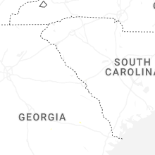
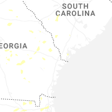
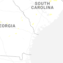
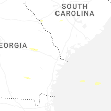
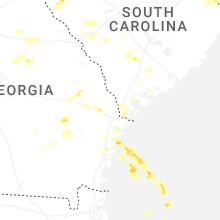
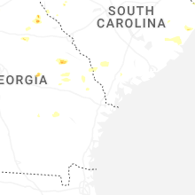
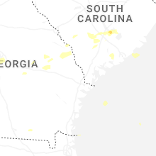


Connect with Interactive Hail Maps