

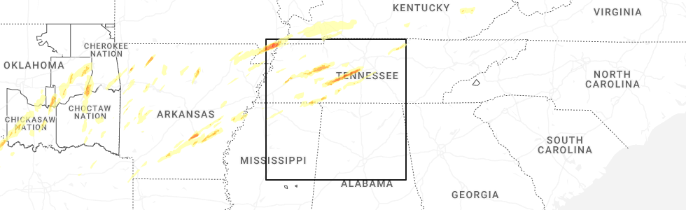
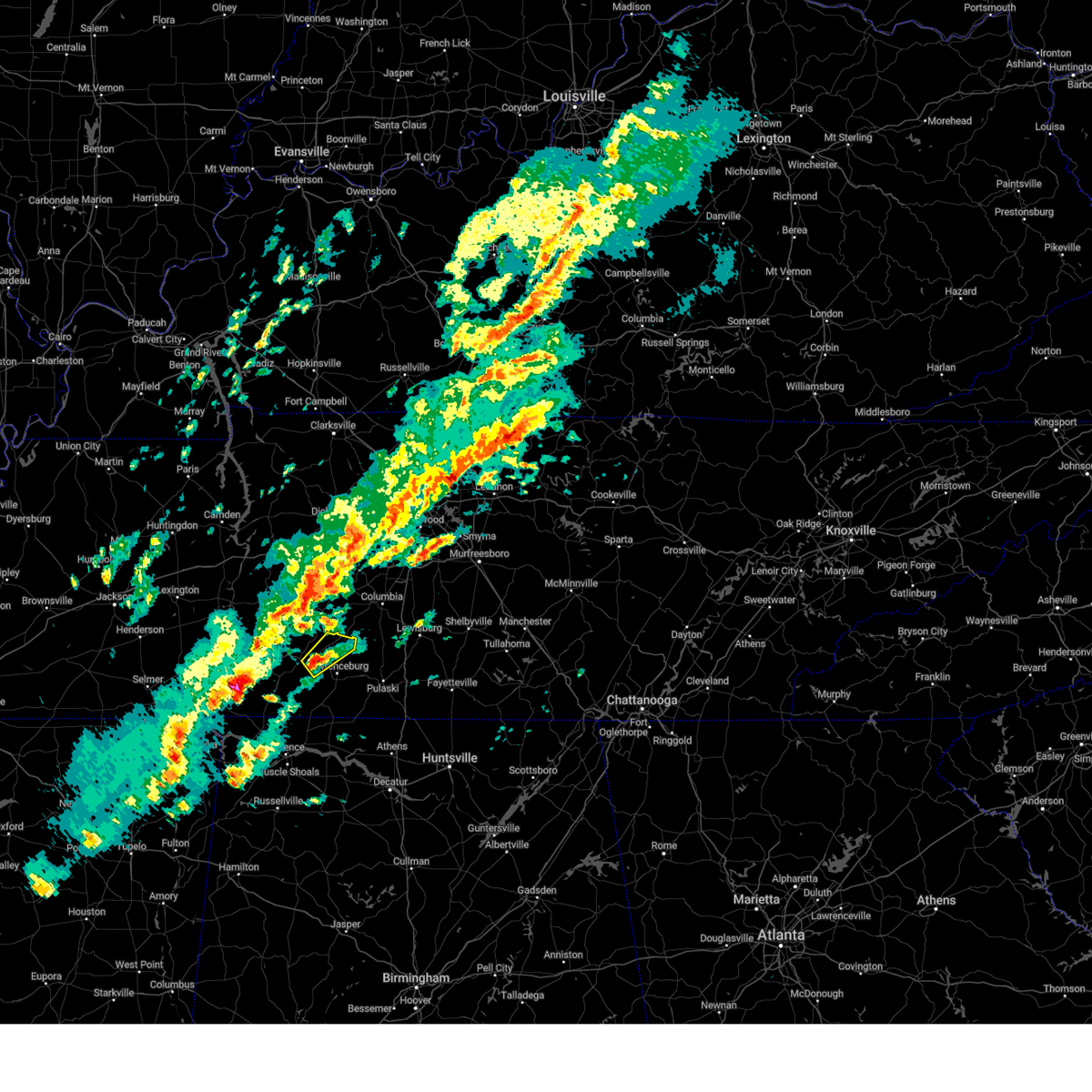
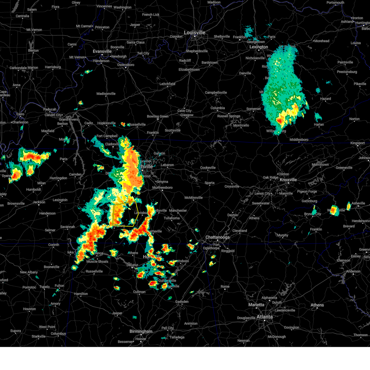
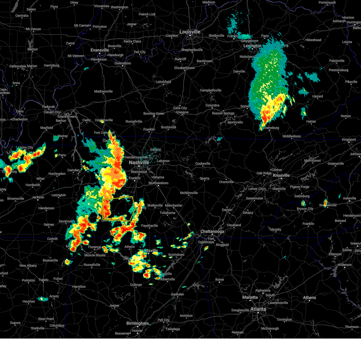
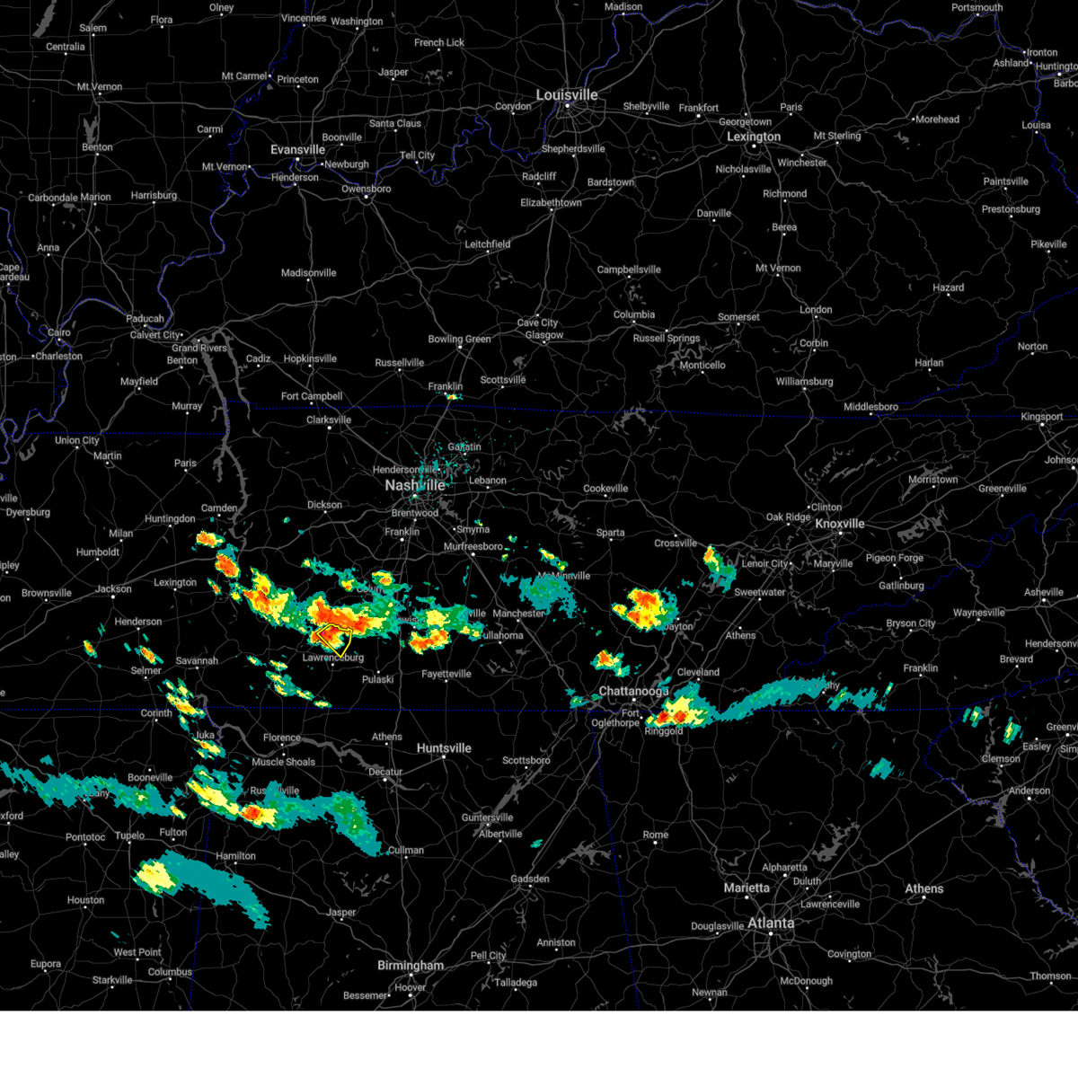
Hail Map for Summertown, TN
The Summertown, TN area has had 5 reports of on-the-ground hail by trained spotters, and has been under severe weather warnings 42 times during the past 12 months. Doppler radar has detected hail at or near Summertown, TN on 49 occasions, including 6 occasions during the past year.
| Name: | Summertown, TN |
| Where Located: | 47.9 miles NNE of Florence, AL |
| Map: | Google Map for Summertown, TN |
| Population: | 866 |
| Housing Units: | 337 |
| More Info: | Search Google for Summertown, TN |
3
The Top Recent Hail Date for Summertown, TN is Thursday, April 3, 2025 (8th out of 49)
Hail and Wind Damage Spotted near Summertown, TN
| Date / Time | Report Details |
|---|---|
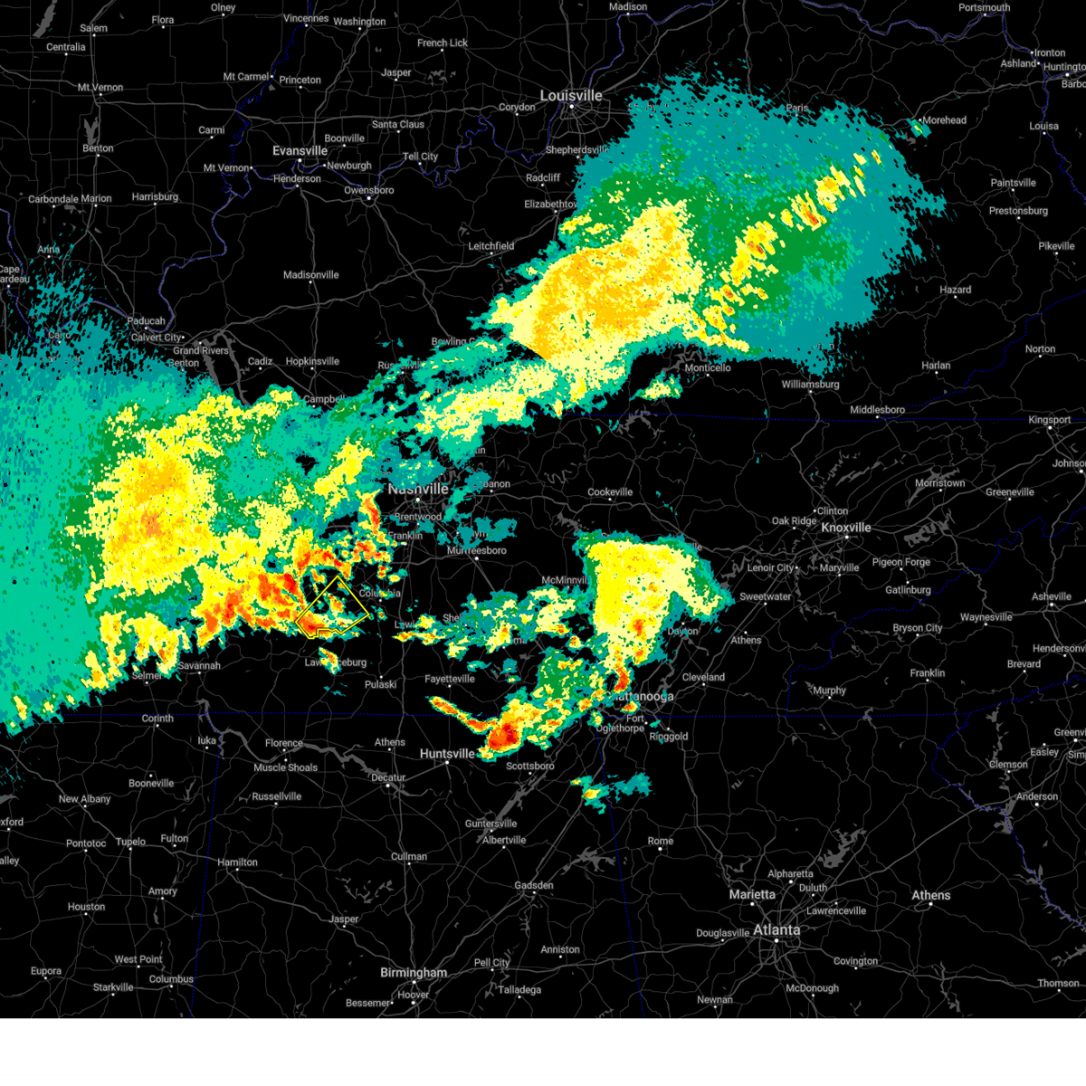
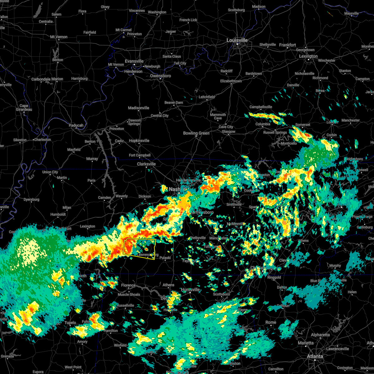
| 6/6/2025 8:08 PM CDT | Svrohx the national weather service in nashville has issued a * severe thunderstorm warning for, northeastern lawrence county in middle tennessee, southwestern maury county in middle tennessee, northwestern giles county in middle tennessee, * until 845 pm cdt. * at 808 pm cdt, a severe thunderstorm was located near summertown, or 7 miles north of lawrenceburg, moving east at 20 mph (radar indicated). Hazards include 60 mph wind gusts and quarter size hail. Hail damage to vehicles is expected. Expect wind damage to roofs, siding, and trees. |
| 6/6/2025 8:01 PM CDT | Large tree down blocking 3900 buffalo roa in lawrence county TN, 1.6 miles NNE of Summertown, TN |
| 6/6/2025 7:51 PM CDT |
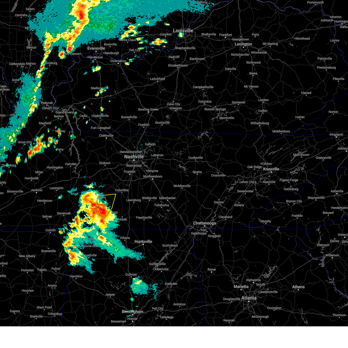
 At 751 pm cdt, a severe thunderstorm was located near summertown, or 10 miles north of lawrenceburg, moving east at 20 mph (radar indicated). Hazards include 60 mph wind gusts and quarter size hail. Hail damage to vehicles is expected. expect wind damage to roofs, siding, and trees. Locations impacted include, summertown, ethridge, and henryville. At 751 pm cdt, a severe thunderstorm was located near summertown, or 10 miles north of lawrenceburg, moving east at 20 mph (radar indicated). Hazards include 60 mph wind gusts and quarter size hail. Hail damage to vehicles is expected. expect wind damage to roofs, siding, and trees. Locations impacted include, summertown, ethridge, and henryville.
|
| 6/6/2025 7:51 PM CDT |
 the severe thunderstorm warning has been cancelled and is no longer in effect the severe thunderstorm warning has been cancelled and is no longer in effect
|
| 6/6/2025 7:39 PM CDT | Svrohx the national weather service in nashville has issued a * severe thunderstorm warning for, southeastern lewis county in middle tennessee, northern lawrence county in middle tennessee, southwestern maury county in middle tennessee, * until 815 pm cdt. * at 739 pm cdt, a severe thunderstorm was located 8 miles southwest of summertown, or 11 miles northwest of lawrenceburg, moving east at 20 mph (radar indicated). Hazards include 60 mph wind gusts and quarter size hail. Hail damage to vehicles is expected. Expect wind damage to roofs, siding, and trees. |
| 5/25/2025 2:57 PM CDT |
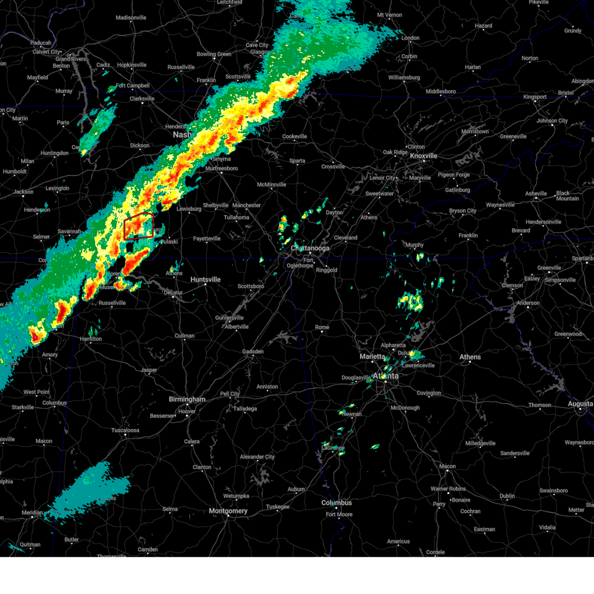
 Svrohx the national weather service in nashville has issued a * severe thunderstorm warning for, southeastern wayne county in middle tennessee, western marshall county in middle tennessee, lawrence county in middle tennessee, southern maury county in middle tennessee, giles county in middle tennessee, * until 345 pm cdt. * at 256 pm cdt, severe thunderstorms were located along a line extending from 6 miles southeast of summertown to near underwood-petersville, moving east at 45 mph (radar indicated). Hazards include 60 mph wind gusts. expect damage to roofs, siding, and trees Svrohx the national weather service in nashville has issued a * severe thunderstorm warning for, southeastern wayne county in middle tennessee, western marshall county in middle tennessee, lawrence county in middle tennessee, southern maury county in middle tennessee, giles county in middle tennessee, * until 345 pm cdt. * at 256 pm cdt, severe thunderstorms were located along a line extending from 6 miles southeast of summertown to near underwood-petersville, moving east at 45 mph (radar indicated). Hazards include 60 mph wind gusts. expect damage to roofs, siding, and trees
|
| 5/25/2025 2:43 PM CDT |
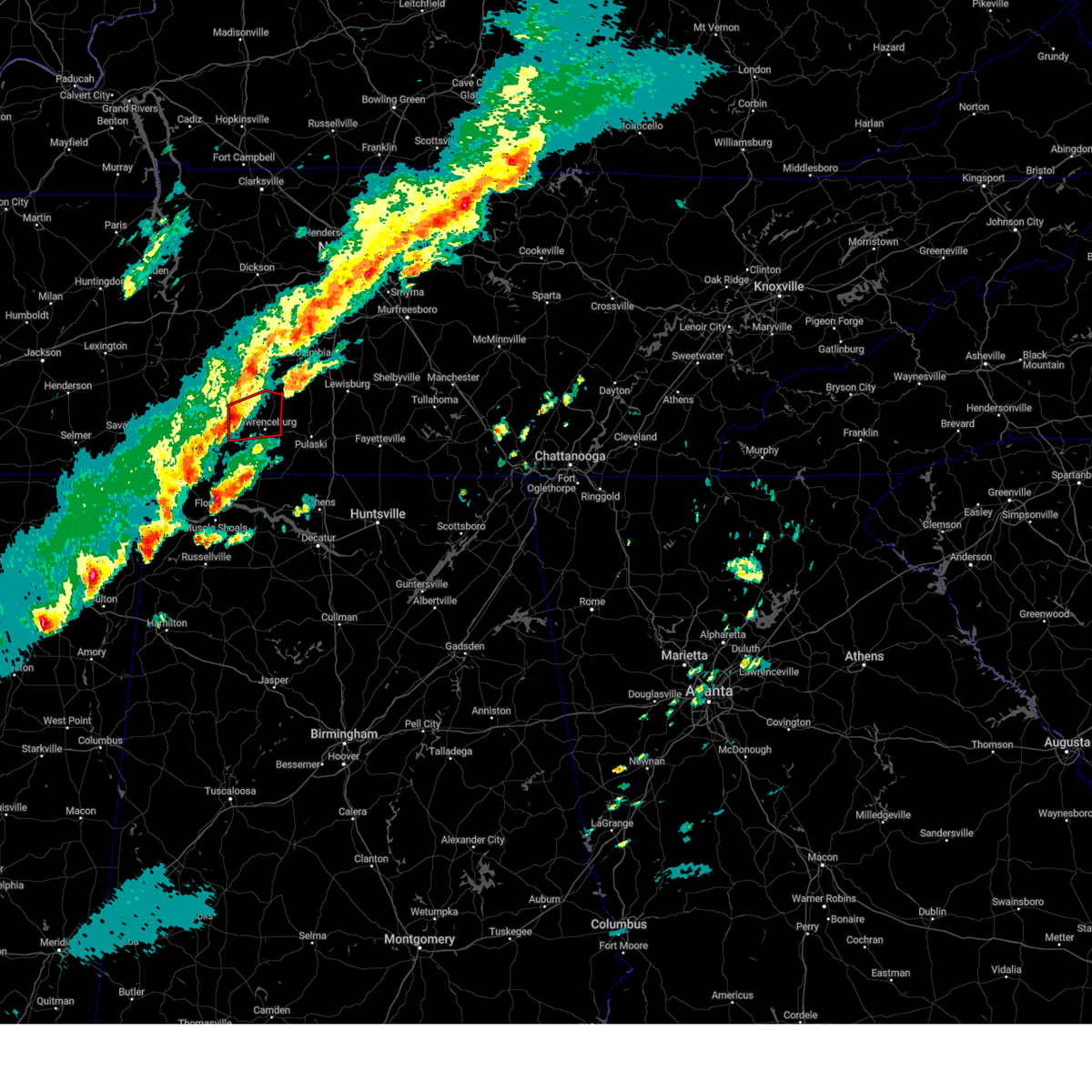
 At 242 pm cdt, severe thunderstorms were located along a line extending from 10 miles southeast of centerville to 8 miles west of lawrenceburg to 7 miles south of walnut grove, moving east at 55 mph (radar indicated). Hazards include 60 mph wind gusts. Expect damage to roofs, siding, and trees. locations impacted include, columbia, lawrenceburg, hohenwald, waynesboro, mount pleasant, loretto, collinwood, summertown, st. Joseph, ethridge, gordonsburg, henryville, kimmins, cypress inn, leoma, westpoint, iron city, hampshire, and williamsport. At 242 pm cdt, severe thunderstorms were located along a line extending from 10 miles southeast of centerville to 8 miles west of lawrenceburg to 7 miles south of walnut grove, moving east at 55 mph (radar indicated). Hazards include 60 mph wind gusts. Expect damage to roofs, siding, and trees. locations impacted include, columbia, lawrenceburg, hohenwald, waynesboro, mount pleasant, loretto, collinwood, summertown, st. Joseph, ethridge, gordonsburg, henryville, kimmins, cypress inn, leoma, westpoint, iron city, hampshire, and williamsport.
|
| 5/25/2025 2:43 PM CDT |
 the severe thunderstorm warning has been cancelled and is no longer in effect the severe thunderstorm warning has been cancelled and is no longer in effect
|
| 5/25/2025 2:21 PM CDT |
 Svrohx the national weather service in nashville has issued a * severe thunderstorm warning for, lewis county in middle tennessee, wayne county in middle tennessee, lawrence county in middle tennessee, southwestern maury county in middle tennessee, northwestern giles county in middle tennessee, southeastern perry county in middle tennessee, southern hickman county in middle tennessee, * until 300 pm cdt. * at 220 pm cdt, severe thunderstorms were located along a line extending from 11 miles west of centerville to near waynesboro to near pineflat, moving east at 55 mph (radar indicated). Hazards include 60 mph wind gusts. expect damage to roofs, siding, and trees Svrohx the national weather service in nashville has issued a * severe thunderstorm warning for, lewis county in middle tennessee, wayne county in middle tennessee, lawrence county in middle tennessee, southwestern maury county in middle tennessee, northwestern giles county in middle tennessee, southeastern perry county in middle tennessee, southern hickman county in middle tennessee, * until 300 pm cdt. * at 220 pm cdt, severe thunderstorms were located along a line extending from 11 miles west of centerville to near waynesboro to near pineflat, moving east at 55 mph (radar indicated). Hazards include 60 mph wind gusts. expect damage to roofs, siding, and trees
|
| 5/20/2025 4:27 PM CDT | Torohx the national weather service in nashville has issued a * tornado warning for, southeastern lewis county in middle tennessee, northeastern lawrence county in middle tennessee, southern maury county in middle tennessee, * until 500 pm cdt. * at 427 pm cdt, a severe thunderstorm capable of producing a tornado was located near summertown, or 12 miles north of lawrenceburg, moving northeast at 45 mph (radar indicated rotation). Hazards include tornado. Flying debris will be dangerous to those caught without shelter. mobile homes will be damaged or destroyed. damage to roofs, windows, and vehicles will occur. Tree damage is likely. |
| 5/8/2025 4:56 PM CDT |
 the severe thunderstorm warning has been cancelled and is no longer in effect the severe thunderstorm warning has been cancelled and is no longer in effect
|
| 5/8/2025 4:28 PM CDT |
 Svrohx the national weather service in nashville has issued a * severe thunderstorm warning for, northeastern lawrence county in middle tennessee, southwestern maury county in middle tennessee, northwestern giles county in middle tennessee, * until 515 pm cdt. * at 428 pm cdt, a severe thunderstorm was located 8 miles northwest of lawrenceburg, moving east at 25 mph (radar indicated). Hazards include 60 mph wind gusts and quarter size hail. Hail damage to vehicles is expected. Expect wind damage to roofs, siding, and trees. Svrohx the national weather service in nashville has issued a * severe thunderstorm warning for, northeastern lawrence county in middle tennessee, southwestern maury county in middle tennessee, northwestern giles county in middle tennessee, * until 515 pm cdt. * at 428 pm cdt, a severe thunderstorm was located 8 miles northwest of lawrenceburg, moving east at 25 mph (radar indicated). Hazards include 60 mph wind gusts and quarter size hail. Hail damage to vehicles is expected. Expect wind damage to roofs, siding, and trees.
|
| 5/8/2025 3:26 PM CDT | Svrohx the national weather service in nashville has issued a * severe thunderstorm warning for, west central marshall county in middle tennessee, northeastern lawrence county in middle tennessee, southern maury county in middle tennessee, northwestern giles county in middle tennessee, * until 415 pm cdt. * at 326 pm cdt, a severe thunderstorm was located near summertown, or 15 miles north of lawrenceburg, moving east at 20 mph (radar indicated). Hazards include 60 mph wind gusts and quarter size hail. Hail damage to vehicles is expected. Expect wind damage to roofs, siding, and trees. |
| 5/8/2025 3:09 PM CDT |
 At 308 pm cdt, a severe thunderstorm was located over summertown, or 13 miles southeast of hohenwald, moving east at 30 mph (radar indicated). Hazards include 60 mph wind gusts and quarter size hail. Hail damage to vehicles is expected. expect wind damage to roofs, siding, and trees. Locations impacted include, henryville, summertown, mount pleasant, and hampshire. At 308 pm cdt, a severe thunderstorm was located over summertown, or 13 miles southeast of hohenwald, moving east at 30 mph (radar indicated). Hazards include 60 mph wind gusts and quarter size hail. Hail damage to vehicles is expected. expect wind damage to roofs, siding, and trees. Locations impacted include, henryville, summertown, mount pleasant, and hampshire.
|
| 5/8/2025 2:45 PM CDT |
 Svrohx the national weather service in nashville has issued a * severe thunderstorm warning for, southern lewis county in middle tennessee, northern lawrence county in middle tennessee, southwestern maury county in middle tennessee, northwestern giles county in middle tennessee, * until 330 pm cdt. * at 244 pm cdt, a severe thunderstorm was located 8 miles south of hohenwald, moving east at 35 mph (radar indicated). Hazards include 60 mph wind gusts and quarter size hail. Hail damage to vehicles is expected. Expect wind damage to roofs, siding, and trees. Svrohx the national weather service in nashville has issued a * severe thunderstorm warning for, southern lewis county in middle tennessee, northern lawrence county in middle tennessee, southwestern maury county in middle tennessee, northwestern giles county in middle tennessee, * until 330 pm cdt. * at 244 pm cdt, a severe thunderstorm was located 8 miles south of hohenwald, moving east at 35 mph (radar indicated). Hazards include 60 mph wind gusts and quarter size hail. Hail damage to vehicles is expected. Expect wind damage to roofs, siding, and trees.
|
| 4/10/2025 5:26 PM CDT |
 the severe thunderstorm warning has been cancelled and is no longer in effect the severe thunderstorm warning has been cancelled and is no longer in effect
|
| 4/10/2025 5:26 PM CDT |
 At 525 pm cdt, severe thunderstorms were located along a line extending from 8 miles northwest of mount pleasant to near lexington, moving southeast at 35 mph (radar indicated). Hazards include 60 mph wind gusts. Expect damage to roofs, siding, and trees. locations impacted include, gordonsburg, henryville, culleoka, st. joseph, pulaski, goodspring, leoma, lynnville, frankewing, hampshire, williamsport, loretto, ethridge, mount pleasant, minor hill, cypress inn, collinwood, i-65 east of columbia, elkton, and lawrenceburg. This includes interstate 65 between mile markers 1 and 52. At 525 pm cdt, severe thunderstorms were located along a line extending from 8 miles northwest of mount pleasant to near lexington, moving southeast at 35 mph (radar indicated). Hazards include 60 mph wind gusts. Expect damage to roofs, siding, and trees. locations impacted include, gordonsburg, henryville, culleoka, st. joseph, pulaski, goodspring, leoma, lynnville, frankewing, hampshire, williamsport, loretto, ethridge, mount pleasant, minor hill, cypress inn, collinwood, i-65 east of columbia, elkton, and lawrenceburg. This includes interstate 65 between mile markers 1 and 52.
|
| 4/10/2025 5:17 PM CDT | Multiple trees down on railroad bed roa in lawrence county TN, 4.3 miles E of Summertown, TN |
| 4/10/2025 5:11 PM CDT |
 Svrohx the national weather service in nashville has issued a * severe thunderstorm warning for, lewis county in middle tennessee, eastern wayne county in middle tennessee, western marshall county in middle tennessee, lawrence county in middle tennessee, maury county in middle tennessee, giles county in middle tennessee, southern hickman county in middle tennessee, * until 600 pm cdt. * at 511 pm cdt, severe thunderstorms were located along a line extending from 6 miles southeast of centerville to 8 miles southwest of loretto, moving southeast at 35 mph (radar indicated). Hazards include 60 mph wind gusts. expect damage to roofs, siding, and trees Svrohx the national weather service in nashville has issued a * severe thunderstorm warning for, lewis county in middle tennessee, eastern wayne county in middle tennessee, western marshall county in middle tennessee, lawrence county in middle tennessee, maury county in middle tennessee, giles county in middle tennessee, southern hickman county in middle tennessee, * until 600 pm cdt. * at 511 pm cdt, severe thunderstorms were located along a line extending from 6 miles southeast of centerville to 8 miles southwest of loretto, moving southeast at 35 mph (radar indicated). Hazards include 60 mph wind gusts. expect damage to roofs, siding, and trees
|
| 4/5/2025 10:12 PM CDT |
 The storm which prompted the warning has exited the warned area. therefore, the warning will be allowed to expire. a tornado watch remains in effect until 300 am cdt for middle tennessee. The storm which prompted the warning has exited the warned area. therefore, the warning will be allowed to expire. a tornado watch remains in effect until 300 am cdt for middle tennessee.
|
| 4/5/2025 10:00 PM CDT |
 At 1000 pm cdt, a severe thunderstorm capable of producing a tornado was located near lawrenceburg, moving northeast at 35 mph (radar indicated rotation). Hazards include tornado. Flying debris will be dangerous to those caught without shelter. mobile homes will be damaged or destroyed. damage to roofs, windows, and vehicles will occur. tree damage is likely. This tornadic thunderstorm will remain over mainly rural areas of northeastern lawrence county, including the following locations, leoma and ethridge. At 1000 pm cdt, a severe thunderstorm capable of producing a tornado was located near lawrenceburg, moving northeast at 35 mph (radar indicated rotation). Hazards include tornado. Flying debris will be dangerous to those caught without shelter. mobile homes will be damaged or destroyed. damage to roofs, windows, and vehicles will occur. tree damage is likely. This tornadic thunderstorm will remain over mainly rural areas of northeastern lawrence county, including the following locations, leoma and ethridge.
|
| 4/5/2025 9:36 PM CDT |
 Svrohx the national weather service in nashville has issued a * severe thunderstorm warning for, southeastern lewis county in middle tennessee, marshall county in middle tennessee, southern maury county in middle tennessee, northern giles county in middle tennessee, * until 1030 pm cdt. * at 935 pm cdt, a severe thunderstorm was located over summertown, or 11 miles north of lawrenceburg, moving east at 55 mph (radar indicated). Hazards include 60 mph wind gusts and penny size hail. expect damage to roofs, siding, and trees Svrohx the national weather service in nashville has issued a * severe thunderstorm warning for, southeastern lewis county in middle tennessee, marshall county in middle tennessee, southern maury county in middle tennessee, northern giles county in middle tennessee, * until 1030 pm cdt. * at 935 pm cdt, a severe thunderstorm was located over summertown, or 11 miles north of lawrenceburg, moving east at 55 mph (radar indicated). Hazards include 60 mph wind gusts and penny size hail. expect damage to roofs, siding, and trees
|
| 4/5/2025 9:34 PM CDT |
 the tornado warning has been cancelled and is no longer in effect the tornado warning has been cancelled and is no longer in effect
|
| 4/5/2025 9:34 PM CDT |
 At 933 pm cdt, a severe thunderstorm capable of producing a tornado was located near lawrenceburg, moving east at 35 mph (radar indicated rotation). Hazards include tornado. Flying debris will be dangerous to those caught without shelter. mobile homes will be damaged or destroyed. damage to roofs, windows, and vehicles will occur. tree damage is likely. this dangerous storm will be near, lawrenceburg around 940 pm cdt. Other locations impacted by this tornadic thunderstorm include ethridge, henryville, leoma, and westpoint. At 933 pm cdt, a severe thunderstorm capable of producing a tornado was located near lawrenceburg, moving east at 35 mph (radar indicated rotation). Hazards include tornado. Flying debris will be dangerous to those caught without shelter. mobile homes will be damaged or destroyed. damage to roofs, windows, and vehicles will occur. tree damage is likely. this dangerous storm will be near, lawrenceburg around 940 pm cdt. Other locations impacted by this tornadic thunderstorm include ethridge, henryville, leoma, and westpoint.
|
| 4/5/2025 9:08 PM CDT |
 Torohx the national weather service in nashville has issued a * tornado warning for, southeastern wayne county in middle tennessee, lawrence county in middle tennessee, * until 1015 pm cdt. * at 907 pm cdt, a severe thunderstorm capable of producing a tornado was located near collinwood, or 9 miles southeast of waynesboro, moving east at 35 mph (radar indicated rotation). Hazards include tornado. Flying debris will be dangerous to those caught without shelter. mobile homes will be damaged or destroyed. damage to roofs, windows, and vehicles will occur. tree damage is likely. this dangerous storm will be near, lawrenceburg around 930 pm cdt. Other locations impacted by this tornadic thunderstorm include ethridge, henryville, leoma, and westpoint. Torohx the national weather service in nashville has issued a * tornado warning for, southeastern wayne county in middle tennessee, lawrence county in middle tennessee, * until 1015 pm cdt. * at 907 pm cdt, a severe thunderstorm capable of producing a tornado was located near collinwood, or 9 miles southeast of waynesboro, moving east at 35 mph (radar indicated rotation). Hazards include tornado. Flying debris will be dangerous to those caught without shelter. mobile homes will be damaged or destroyed. damage to roofs, windows, and vehicles will occur. tree damage is likely. this dangerous storm will be near, lawrenceburg around 930 pm cdt. Other locations impacted by this tornadic thunderstorm include ethridge, henryville, leoma, and westpoint.
|
| 4/3/2025 6:16 PM CDT |
 At 616 pm cdt, a confirmed tornado was located near summertown, or 14 miles north of lawrenceburg, moving northeast at 40 mph (radar confirmed tornado). Hazards include damaging tornado and quarter size hail. Flying debris will be dangerous to those caught without shelter. mobile homes will be damaged or destroyed. damage to roofs, windows, and vehicles will occur. tree damage is likely. this tornado will be near, mount pleasant around 620 pm cdt. Other locations impacted by this tornadic thunderstorm include henryville. At 616 pm cdt, a confirmed tornado was located near summertown, or 14 miles north of lawrenceburg, moving northeast at 40 mph (radar confirmed tornado). Hazards include damaging tornado and quarter size hail. Flying debris will be dangerous to those caught without shelter. mobile homes will be damaged or destroyed. damage to roofs, windows, and vehicles will occur. tree damage is likely. this tornado will be near, mount pleasant around 620 pm cdt. Other locations impacted by this tornadic thunderstorm include henryville.
|
| 4/3/2025 6:15 PM CDT |
 Torohx the national weather service in nashville has issued a * tornado warning for, southeastern lewis county in middle tennessee, northeastern lawrence county in middle tennessee, southeastern maury county in middle tennessee, northwestern giles county in middle tennessee, * until 700 pm cdt. * at 614 pm cdt, a tornado producing storm was located over summertown, or 12 miles north of lawrenceburg, moving northeast at 40 mph (radar confirmed tornado). Hazards include damaging tornado and quarter size hail. Flying debris will be dangerous to those caught without shelter. mobile homes will be damaged or destroyed. damage to roofs, windows, and vehicles will occur. tree damage is likely. this tornadic storm will be near, summertown and mount pleasant around 620 pm cdt. columbia around 635 pm cdt. other locations impacted by this tornadic thunderstorm include culleoka and henryville. This includes interstate 65 between mile markers 35 and 41. Torohx the national weather service in nashville has issued a * tornado warning for, southeastern lewis county in middle tennessee, northeastern lawrence county in middle tennessee, southeastern maury county in middle tennessee, northwestern giles county in middle tennessee, * until 700 pm cdt. * at 614 pm cdt, a tornado producing storm was located over summertown, or 12 miles north of lawrenceburg, moving northeast at 40 mph (radar confirmed tornado). Hazards include damaging tornado and quarter size hail. Flying debris will be dangerous to those caught without shelter. mobile homes will be damaged or destroyed. damage to roofs, windows, and vehicles will occur. tree damage is likely. this tornadic storm will be near, summertown and mount pleasant around 620 pm cdt. columbia around 635 pm cdt. other locations impacted by this tornadic thunderstorm include culleoka and henryville. This includes interstate 65 between mile markers 35 and 41.
|
| 4/3/2025 6:11 PM CDT |
 At 610 pm cdt, a confirmed tornado was located over summertown, or 11 miles north of lawrenceburg, moving northeast at 40 mph (radar confirmed tornado). Hazards include damaging tornado. Flying debris will be dangerous to those caught without shelter. mobile homes will be damaged or destroyed. damage to roofs, windows, and vehicles will occur. tree damage is likely. this tornado will be near, summertown around 615 pm cdt. mount pleasant around 620 pm cdt. Other locations impacted by this tornadic thunderstorm include ethridge, hampshire, and henryville. At 610 pm cdt, a confirmed tornado was located over summertown, or 11 miles north of lawrenceburg, moving northeast at 40 mph (radar confirmed tornado). Hazards include damaging tornado. Flying debris will be dangerous to those caught without shelter. mobile homes will be damaged or destroyed. damage to roofs, windows, and vehicles will occur. tree damage is likely. this tornado will be near, summertown around 615 pm cdt. mount pleasant around 620 pm cdt. Other locations impacted by this tornadic thunderstorm include ethridge, hampshire, and henryville.
|
| 4/3/2025 6:05 PM CDT |
 At 605 pm cdt, a severe thunderstorm capable of producing a tornado was located near summertown, or 10 miles north of lawrenceburg, moving northeast at 40 mph (radar indicated rotation). Hazards include tornado. Flying debris will be dangerous to those caught without shelter. mobile homes will be damaged or destroyed. damage to roofs, windows, and vehicles will occur. tree damage is likely. this dangerous storm will be near, summertown around 610 pm cdt. mount pleasant around 620 pm cdt. Other locations impacted by this tornadic thunderstorm include ethridge, hampshire, and henryville. At 605 pm cdt, a severe thunderstorm capable of producing a tornado was located near summertown, or 10 miles north of lawrenceburg, moving northeast at 40 mph (radar indicated rotation). Hazards include tornado. Flying debris will be dangerous to those caught without shelter. mobile homes will be damaged or destroyed. damage to roofs, windows, and vehicles will occur. tree damage is likely. this dangerous storm will be near, summertown around 610 pm cdt. mount pleasant around 620 pm cdt. Other locations impacted by this tornadic thunderstorm include ethridge, hampshire, and henryville.
|
| 4/3/2025 6:05 PM CDT |
 the tornado warning has been cancelled and is no longer in effect the tornado warning has been cancelled and is no longer in effect
|
| 4/3/2025 5:56 PM CDT |
 Torohx the national weather service in nashville has issued a * tornado warning for, southeastern lewis county in middle tennessee, east central wayne county in middle tennessee, northern lawrence county in middle tennessee, southwestern maury county in middle tennessee, northwestern giles county in middle tennessee, * until 630 pm cdt. * at 555 pm cdt, a severe thunderstorm capable of producing a tornado was located 11 miles northwest of lawrenceburg, moving northeast at 40 mph (radar indicated rotation). Hazards include tornado. Flying debris will be dangerous to those caught without shelter. mobile homes will be damaged or destroyed. damage to roofs, windows, and vehicles will occur. tree damage is likely. this dangerous storm will be near, summertown around 610 pm cdt. mount pleasant around 620 pm cdt. Other locations impacted by this tornadic thunderstorm include ethridge, hampshire, and henryville. Torohx the national weather service in nashville has issued a * tornado warning for, southeastern lewis county in middle tennessee, east central wayne county in middle tennessee, northern lawrence county in middle tennessee, southwestern maury county in middle tennessee, northwestern giles county in middle tennessee, * until 630 pm cdt. * at 555 pm cdt, a severe thunderstorm capable of producing a tornado was located 11 miles northwest of lawrenceburg, moving northeast at 40 mph (radar indicated rotation). Hazards include tornado. Flying debris will be dangerous to those caught without shelter. mobile homes will be damaged or destroyed. damage to roofs, windows, and vehicles will occur. tree damage is likely. this dangerous storm will be near, summertown around 610 pm cdt. mount pleasant around 620 pm cdt. Other locations impacted by this tornadic thunderstorm include ethridge, hampshire, and henryville.
|
| 4/2/2025 6:35 PM CDT | The storm which prompted the warning has weakened below severe limits, and has exited the warned area. therefore, the warning will be allowed to expire. a tornado watch remains in effect until midnight cdt for middle tennessee. |
| 4/2/2025 6:20 PM CDT |
 At 620 pm cdt, a severe thunderstorm was located near waynesboro, moving northeast at 45 mph (radar indicated). Hazards include 60 mph wind gusts and quarter size hail. Hail damage to vehicles is expected. expect wind damage to roofs, siding, and trees. Locations impacted include, waynesboro, summertown, and henryville. At 620 pm cdt, a severe thunderstorm was located near waynesboro, moving northeast at 45 mph (radar indicated). Hazards include 60 mph wind gusts and quarter size hail. Hail damage to vehicles is expected. expect wind damage to roofs, siding, and trees. Locations impacted include, waynesboro, summertown, and henryville.
|
| 4/2/2025 6:02 PM CDT |
 Svrohx the national weather service in nashville has issued a * severe thunderstorm warning for, wayne county in middle tennessee, northern lawrence county in middle tennessee, * until 645 pm cdt. * at 602 pm cdt, a severe thunderstorm was located near collinwood, or 15 miles south of waynesboro, moving northeast at 45 mph (radar indicated). Hazards include 60 mph wind gusts and quarter size hail. Hail damage to vehicles is expected. Expect wind damage to roofs, siding, and trees. Svrohx the national weather service in nashville has issued a * severe thunderstorm warning for, wayne county in middle tennessee, northern lawrence county in middle tennessee, * until 645 pm cdt. * at 602 pm cdt, a severe thunderstorm was located near collinwood, or 15 miles south of waynesboro, moving northeast at 45 mph (radar indicated). Hazards include 60 mph wind gusts and quarter size hail. Hail damage to vehicles is expected. Expect wind damage to roofs, siding, and trees.
|
| 3/31/2025 1:17 AM CDT |
 At 117 am cdt, severe thunderstorms were located along a line extending from 6 miles east of summertown to 9 miles northeast of lawrenceburg to 6 miles northeast of loretto, moving east at 45 mph (radar indicated). Hazards include 60 mph wind gusts and penny size hail. Expect damage to roofs, siding, and trees. locations impacted include, loretto, ethridge, henryville, mount pleasant, culleoka, cypress inn, collinwood, st. joseph, lawrenceburg, leoma, lynnville, westpoint, summertown, iron city, pulaski, and columbia. This includes interstate 65 near mile marker 22. At 117 am cdt, severe thunderstorms were located along a line extending from 6 miles east of summertown to 9 miles northeast of lawrenceburg to 6 miles northeast of loretto, moving east at 45 mph (radar indicated). Hazards include 60 mph wind gusts and penny size hail. Expect damage to roofs, siding, and trees. locations impacted include, loretto, ethridge, henryville, mount pleasant, culleoka, cypress inn, collinwood, st. joseph, lawrenceburg, leoma, lynnville, westpoint, summertown, iron city, pulaski, and columbia. This includes interstate 65 near mile marker 22.
|
| 3/31/2025 1:17 AM CDT |
 the severe thunderstorm warning has been cancelled and is no longer in effect the severe thunderstorm warning has been cancelled and is no longer in effect
|
| 3/31/2025 12:59 AM CDT |
 the tornado warning has been cancelled and is no longer in effect the tornado warning has been cancelled and is no longer in effect
|
| 3/31/2025 12:59 AM CDT |
 At 1259 am cdt, a severe thunderstorm capable of producing a tornado was located near summertown, or 10 miles north of lawrenceburg, moving east at 40 mph (radar indicated rotation). Hazards include tornado and quarter size hail. Flying debris will be dangerous to those caught without shelter. mobile homes will be damaged or destroyed. damage to roofs, windows, and vehicles will occur. tree damage is likely. this dangerous storm will be near, summertown around 105 am cdt. Other locations impacted by this tornadic thunderstorm include henryville. At 1259 am cdt, a severe thunderstorm capable of producing a tornado was located near summertown, or 10 miles north of lawrenceburg, moving east at 40 mph (radar indicated rotation). Hazards include tornado and quarter size hail. Flying debris will be dangerous to those caught without shelter. mobile homes will be damaged or destroyed. damage to roofs, windows, and vehicles will occur. tree damage is likely. this dangerous storm will be near, summertown around 105 am cdt. Other locations impacted by this tornadic thunderstorm include henryville.
|
| 3/31/2025 12:56 AM CDT | Svrohx the national weather service in nashville has issued a * severe thunderstorm warning for, southeastern lewis county in middle tennessee, southern wayne county in middle tennessee, lawrence county in middle tennessee, southwestern maury county in middle tennessee, northern giles county in middle tennessee, * until 145 am cdt. * at 1255 am cdt, severe thunderstorms were located along a line extending from 9 miles west of summertown to 8 miles west of lawrenceburg to 6 miles southeast of collinwood, moving east at 45 mph (radar indicated). Hazards include 60 mph wind gusts and penny size hail. expect damage to roofs, siding, and trees |
| 3/31/2025 12:38 AM CDT |
 At 1238 am cdt, a severe thunderstorm capable of producing a tornado was located near waynesboro, moving east at 40 mph (radar indicated rotation). Hazards include tornado and quarter size hail. Flying debris will be dangerous to those caught without shelter. mobile homes will be damaged or destroyed. damage to roofs, windows, and vehicles will occur. tree damage is likely. this dangerous storm will be near, summertown around 105 am cdt. Other locations impacted by this tornadic thunderstorm include ethridge and henryville. At 1238 am cdt, a severe thunderstorm capable of producing a tornado was located near waynesboro, moving east at 40 mph (radar indicated rotation). Hazards include tornado and quarter size hail. Flying debris will be dangerous to those caught without shelter. mobile homes will be damaged or destroyed. damage to roofs, windows, and vehicles will occur. tree damage is likely. this dangerous storm will be near, summertown around 105 am cdt. Other locations impacted by this tornadic thunderstorm include ethridge and henryville.
|
| 3/31/2025 12:27 AM CDT |
 Torohx the national weather service in nashville has issued a * tornado warning for, southeastern lewis county in middle tennessee, northeastern wayne county in middle tennessee, northern lawrence county in middle tennessee, * until 115 am cdt. * at 1227 am cdt, a severe thunderstorm capable of producing a tornado was located over waynesboro, moving east at 45 mph (radar indicated rotation). Hazards include tornado and quarter size hail. Flying debris will be dangerous to those caught without shelter. mobile homes will be damaged or destroyed. damage to roofs, windows, and vehicles will occur. tree damage is likely. this dangerous storm will be near, waynesboro around 1235 am cdt. Other locations impacted by this tornadic thunderstorm include ethridge and henryville. Torohx the national weather service in nashville has issued a * tornado warning for, southeastern lewis county in middle tennessee, northeastern wayne county in middle tennessee, northern lawrence county in middle tennessee, * until 115 am cdt. * at 1227 am cdt, a severe thunderstorm capable of producing a tornado was located over waynesboro, moving east at 45 mph (radar indicated rotation). Hazards include tornado and quarter size hail. Flying debris will be dangerous to those caught without shelter. mobile homes will be damaged or destroyed. damage to roofs, windows, and vehicles will occur. tree damage is likely. this dangerous storm will be near, waynesboro around 1235 am cdt. Other locations impacted by this tornadic thunderstorm include ethridge and henryville.
|
| 3/31/2025 12:19 AM CDT | the severe thunderstorm warning has been cancelled and is no longer in effect |
| 3/31/2025 12:19 AM CDT | At 1218 am cdt, a severe thunderstorm was located 10 miles southeast of columbia, moving east at 45 mph (radar indicated). Hazards include 60 mph wind gusts and quarter size hail. Hail damage to vehicles is expected. expect wind damage to roofs, siding, and trees. locations impacted include, ethridge, henryville, mount pleasant, culleoka, i-65 east of columbia, lewisburg, chapel hill, belfast, columbia, lynnville, summertown, cornersville, farmington, and spring hill. This includes interstate 65 between mile markers 21 and 52. |
| 3/30/2025 11:50 PM CDT |
 Svrohx the national weather service in nashville has issued a * severe thunderstorm warning for, lewis county in middle tennessee, marshall county in middle tennessee, northern lawrence county in middle tennessee, maury county in middle tennessee, northern giles county in middle tennessee, southeastern hickman county in middle tennessee, * until 1245 am cdt. * at 1150 pm cdt, a severe thunderstorm was located near summertown, or 11 miles east of hohenwald, moving east at 45 mph (radar indicated). Hazards include 60 mph wind gusts and quarter size hail. Hail damage to vehicles is expected. Expect wind damage to roofs, siding, and trees. Svrohx the national weather service in nashville has issued a * severe thunderstorm warning for, lewis county in middle tennessee, marshall county in middle tennessee, northern lawrence county in middle tennessee, maury county in middle tennessee, northern giles county in middle tennessee, southeastern hickman county in middle tennessee, * until 1245 am cdt. * at 1150 pm cdt, a severe thunderstorm was located near summertown, or 11 miles east of hohenwald, moving east at 45 mph (radar indicated). Hazards include 60 mph wind gusts and quarter size hail. Hail damage to vehicles is expected. Expect wind damage to roofs, siding, and trees.
|
| 5/27/2024 2:11 AM CDT |
 At 210 am cdt, severe thunderstorms were located along a line extending from waynesboro to near j p coleman state park, moving east at 50 mph (radar indicated). Hazards include 60 mph wind gusts and penny size hail. Expect damage to roofs, siding, and trees. locations impacted include, lawrenceburg, waynesboro, loretto, collinwood, summertown, clifton, st. Joseph, ethridge, henryville, cypress inn, flatwoods, lutts, leoma, westpoint, and iron city. At 210 am cdt, severe thunderstorms were located along a line extending from waynesboro to near j p coleman state park, moving east at 50 mph (radar indicated). Hazards include 60 mph wind gusts and penny size hail. Expect damage to roofs, siding, and trees. locations impacted include, lawrenceburg, waynesboro, loretto, collinwood, summertown, clifton, st. Joseph, ethridge, henryville, cypress inn, flatwoods, lutts, leoma, westpoint, and iron city.
|
| 5/27/2024 1:59 AM CDT |
 At 159 am cdt, severe thunderstorms were located along a line extending from linden to pickwick dam, moving east at 50 mph (radar indicated). Hazards include 70 mph wind gusts and penny size hail. Expect considerable tree damage. damage is likely to mobile homes, roofs, and outbuildings. locations impacted include, lawrenceburg, waynesboro, loretto, collinwood, summertown, clifton, st. Joseph, ethridge, henryville, cypress inn, flatwoods, lutts, leoma, westpoint, and iron city. At 159 am cdt, severe thunderstorms were located along a line extending from linden to pickwick dam, moving east at 50 mph (radar indicated). Hazards include 70 mph wind gusts and penny size hail. Expect considerable tree damage. damage is likely to mobile homes, roofs, and outbuildings. locations impacted include, lawrenceburg, waynesboro, loretto, collinwood, summertown, clifton, st. Joseph, ethridge, henryville, cypress inn, flatwoods, lutts, leoma, westpoint, and iron city.
|
| 5/27/2024 1:59 AM CDT |
 the severe thunderstorm warning has been cancelled and is no longer in effect the severe thunderstorm warning has been cancelled and is no longer in effect
|
| 5/27/2024 1:36 AM CDT |
 Svrohx the national weather service in nashville has issued a * severe thunderstorm warning for, lewis county in middle tennessee, wayne county in middle tennessee, lawrence county in middle tennessee, southwestern maury county in middle tennessee, perry county in middle tennessee, southwestern hickman county in middle tennessee, * until 245 am cdt. * at 135 am cdt, severe thunderstorms were located along a line extending from near parsons to near corinth, moving east at 50 mph (radar indicated). Hazards include 70 mph wind gusts and penny size hail. Expect considerable tree damage. Damage is likely to mobile homes, roofs, and outbuildings. Svrohx the national weather service in nashville has issued a * severe thunderstorm warning for, lewis county in middle tennessee, wayne county in middle tennessee, lawrence county in middle tennessee, southwestern maury county in middle tennessee, perry county in middle tennessee, southwestern hickman county in middle tennessee, * until 245 am cdt. * at 135 am cdt, severe thunderstorms were located along a line extending from near parsons to near corinth, moving east at 50 mph (radar indicated). Hazards include 70 mph wind gusts and penny size hail. Expect considerable tree damage. Damage is likely to mobile homes, roofs, and outbuildings.
|
| 5/14/2024 4:26 PM CDT |
 Svrohx the national weather service in nashville has issued a * severe thunderstorm warning for, east central lewis county in middle tennessee, southwestern marshall county in middle tennessee, eastern lawrence county in middle tennessee, southern maury county in middle tennessee, giles county in middle tennessee, * until 500 pm cdt. * at 426 pm cdt, severe thunderstorms were located along a line extending from near summertown to near pulaski to 10 miles east of lexington, moving east at 45 mph (radar indicated). Hazards include 60 mph wind gusts and penny size hail. expect damage to roofs, siding, and trees Svrohx the national weather service in nashville has issued a * severe thunderstorm warning for, east central lewis county in middle tennessee, southwestern marshall county in middle tennessee, eastern lawrence county in middle tennessee, southern maury county in middle tennessee, giles county in middle tennessee, * until 500 pm cdt. * at 426 pm cdt, severe thunderstorms were located along a line extending from near summertown to near pulaski to 10 miles east of lexington, moving east at 45 mph (radar indicated). Hazards include 60 mph wind gusts and penny size hail. expect damage to roofs, siding, and trees
|
| 3/15/2024 12:49 AM CDT |
 Svrohx the national weather service in nashville has issued a * severe thunderstorm warning for, lewis county in middle tennessee, southwestern maury county in middle tennessee, southeastern hickman county in middle tennessee, * until 115 am cdt. * at 1249 am cdt, a severe thunderstorm was located 7 miles southeast of hohenwald, moving northeast at 25 mph (radar indicated). Hazards include quarter size hail. damage to vehicles is expected Svrohx the national weather service in nashville has issued a * severe thunderstorm warning for, lewis county in middle tennessee, southwestern maury county in middle tennessee, southeastern hickman county in middle tennessee, * until 115 am cdt. * at 1249 am cdt, a severe thunderstorm was located 7 miles southeast of hohenwald, moving northeast at 25 mph (radar indicated). Hazards include quarter size hail. damage to vehicles is expected
|
| 3/14/2024 8:42 PM CDT |
 Svrohx the national weather service in nashville has issued a * severe thunderstorm warning for, southeastern lewis county in middle tennessee, northern lawrence county in middle tennessee, southwestern maury county in middle tennessee, * until 915 pm cdt. * at 841 pm cdt, a severe thunderstorm was located near lawrenceburg, moving northeast at 40 mph (radar indicated). Hazards include 60 mph wind gusts and nickel size hail. expect damage to roofs, siding, and trees Svrohx the national weather service in nashville has issued a * severe thunderstorm warning for, southeastern lewis county in middle tennessee, northern lawrence county in middle tennessee, southwestern maury county in middle tennessee, * until 915 pm cdt. * at 841 pm cdt, a severe thunderstorm was located near lawrenceburg, moving northeast at 40 mph (radar indicated). Hazards include 60 mph wind gusts and nickel size hail. expect damage to roofs, siding, and trees
|
| 12/9/2023 6:26 PM CST |
 The tornado warning for northern lawrence county will expire at 630 pm cst, the storm which prompted the warning has weakened below severe limits, and no longer appears capable of producing a tornado. therefore, the warning will be allowed to expire. a tornado watch also remains in effect until 1100 pm cst for middle tennessee. The tornado warning for northern lawrence county will expire at 630 pm cst, the storm which prompted the warning has weakened below severe limits, and no longer appears capable of producing a tornado. therefore, the warning will be allowed to expire. a tornado watch also remains in effect until 1100 pm cst for middle tennessee.
|
| 12/9/2023 6:15 PM CST |
 At 615 pm cst, a severe thunderstorm capable of producing a tornado was located 10 miles west of lawrenceburg, moving east at 35 mph (radar indicated rotation). Hazards include tornado. Flying debris will be dangerous to those caught without shelter. mobile homes will be damaged or destroyed. damage to roofs, windows, and vehicles will occur. tree damage is likely. this dangerous storm will be near, lawrenceburg around 630 pm cst. Other locations impacted by this tornadic thunderstorm include ethridge and henryville. At 615 pm cst, a severe thunderstorm capable of producing a tornado was located 10 miles west of lawrenceburg, moving east at 35 mph (radar indicated rotation). Hazards include tornado. Flying debris will be dangerous to those caught without shelter. mobile homes will be damaged or destroyed. damage to roofs, windows, and vehicles will occur. tree damage is likely. this dangerous storm will be near, lawrenceburg around 630 pm cst. Other locations impacted by this tornadic thunderstorm include ethridge and henryville.
|
| 12/9/2023 5:57 PM CST |
 At 557 pm cst, a severe thunderstorm capable of producing a tornado was located near waynesboro, moving east at 45 mph (radar indicated rotation). Hazards include tornado. Flying debris will be dangerous to those caught without shelter. mobile homes will be damaged or destroyed. damage to roofs, windows, and vehicles will occur. tree damage is likely. this dangerous storm will be near, lawrenceburg around 620 pm cst. Other locations impacted by this tornadic thunderstorm include ethridge and henryville. At 557 pm cst, a severe thunderstorm capable of producing a tornado was located near waynesboro, moving east at 45 mph (radar indicated rotation). Hazards include tornado. Flying debris will be dangerous to those caught without shelter. mobile homes will be damaged or destroyed. damage to roofs, windows, and vehicles will occur. tree damage is likely. this dangerous storm will be near, lawrenceburg around 620 pm cst. Other locations impacted by this tornadic thunderstorm include ethridge and henryville.
|
| 12/9/2023 5:35 PM CST |
 At 534 pm cst, a severe thunderstorm was located 8 miles northwest of lawrenceburg, moving northeast at 35 mph (radar indicated). Hazards include 60 mph wind gusts. expect damage to roofs, siding, and trees At 534 pm cst, a severe thunderstorm was located 8 miles northwest of lawrenceburg, moving northeast at 35 mph (radar indicated). Hazards include 60 mph wind gusts. expect damage to roofs, siding, and trees
|
| 8/26/2023 6:12 PM CDT |
 The severe thunderstorm warning for lewis, wayne, northern lawrence, southwestern maury and southern perry counties will expire at 615 pm cdt, the storms which prompted the warning have weakened below severe limits, and no longer pose an immediate threat to life or property. therefore, the warning will be allowed to expire. to report severe weather, contact your nearest law enforcement agency. they will relay your report to the national weather service nashville. The severe thunderstorm warning for lewis, wayne, northern lawrence, southwestern maury and southern perry counties will expire at 615 pm cdt, the storms which prompted the warning have weakened below severe limits, and no longer pose an immediate threat to life or property. therefore, the warning will be allowed to expire. to report severe weather, contact your nearest law enforcement agency. they will relay your report to the national weather service nashville.
|
| 8/26/2023 5:52 PM CDT |
 At 552 pm cdt, severe thunderstorms were located along a line extending from near summertown to 12 miles southwest of linden, moving south at 35 mph (radar indicated). Hazards include 60 mph wind gusts. Expect damage to roofs, siding, and trees. locations impacted include, lawrenceburg, hohenwald, waynesboro, linden, mount pleasant, collinwood, summertown, clifton, ethridge, henryville, flatwoods, and lutts. hail threat, radar indicated max hail size, <. 75 in wind threat, radar indicated max wind gust, 60 mph. At 552 pm cdt, severe thunderstorms were located along a line extending from near summertown to 12 miles southwest of linden, moving south at 35 mph (radar indicated). Hazards include 60 mph wind gusts. Expect damage to roofs, siding, and trees. locations impacted include, lawrenceburg, hohenwald, waynesboro, linden, mount pleasant, collinwood, summertown, clifton, ethridge, henryville, flatwoods, and lutts. hail threat, radar indicated max hail size, <. 75 in wind threat, radar indicated max wind gust, 60 mph.
|
| 8/26/2023 5:19 PM CDT |
 At 519 pm cdt, severe thunderstorms were located along a line extending from 9 miles southeast of centerville to linden, moving south at 30 mph (radar indicated). Hazards include 60 mph wind gusts. expect damage to roofs, siding, and trees At 519 pm cdt, severe thunderstorms were located along a line extending from 9 miles southeast of centerville to linden, moving south at 30 mph (radar indicated). Hazards include 60 mph wind gusts. expect damage to roofs, siding, and trees
|
| 8/10/2023 1:42 AM CDT |
 The severe thunderstorm warning for lewis, northeastern wayne and northern lawrence counties will expire at 145 am cdt, the storms which prompted the warning have weakened below severe limits, and no longer pose an immediate threat to life or property. therefore, the warning will be allowed to expire. however gusty winds and heavy rain are still possible with these thunderstorms. The severe thunderstorm warning for lewis, northeastern wayne and northern lawrence counties will expire at 145 am cdt, the storms which prompted the warning have weakened below severe limits, and no longer pose an immediate threat to life or property. therefore, the warning will be allowed to expire. however gusty winds and heavy rain are still possible with these thunderstorms.
|
| 8/10/2023 1:30 AM CDT |
 At 129 am cdt, severe thunderstorms were located along a line extending from near hohenwald to 6 miles southeast of waynesboro, moving east at 50 mph (radar indicated). Hazards include 60 mph wind gusts and penny size hail. Expect damage to roofs, siding, and trees. locations impacted include, lawrenceburg, hohenwald, waynesboro, collinwood, summertown, ethridge, gordonsburg, kimmins and henryville. hail threat, radar indicated max hail size, 0. 75 in wind threat, radar indicated max wind gust, 60 mph. At 129 am cdt, severe thunderstorms were located along a line extending from near hohenwald to 6 miles southeast of waynesboro, moving east at 50 mph (radar indicated). Hazards include 60 mph wind gusts and penny size hail. Expect damage to roofs, siding, and trees. locations impacted include, lawrenceburg, hohenwald, waynesboro, collinwood, summertown, ethridge, gordonsburg, kimmins and henryville. hail threat, radar indicated max hail size, 0. 75 in wind threat, radar indicated max wind gust, 60 mph.
|
| 8/10/2023 1:19 AM CDT |
 At 118 am cdt, severe thunderstorms were located along a line extending from 7 miles east of linden to 6 miles northwest of collinwood, moving east at 50 mph (radar indicated). Hazards include 60 mph wind gusts and penny size hail. Expect damage to roofs, siding, and trees. locations impacted include, lawrenceburg, hohenwald, waynesboro, collinwood, summertown, ethridge, gordonsburg, kimmins, henryville and flatwoods. hail threat, radar indicated max hail size, 0. 75 in wind threat, radar indicated max wind gust, 60 mph. At 118 am cdt, severe thunderstorms were located along a line extending from 7 miles east of linden to 6 miles northwest of collinwood, moving east at 50 mph (radar indicated). Hazards include 60 mph wind gusts and penny size hail. Expect damage to roofs, siding, and trees. locations impacted include, lawrenceburg, hohenwald, waynesboro, collinwood, summertown, ethridge, gordonsburg, kimmins, henryville and flatwoods. hail threat, radar indicated max hail size, 0. 75 in wind threat, radar indicated max wind gust, 60 mph.
|
| 8/10/2023 12:43 AM CDT |
 At 1243 am cdt, severe thunderstorms were located along a line extending from parsons to near savannah, moving east at 50 mph (radar indicated). Hazards include 60 mph wind gusts and penny size hail. expect damage to roofs, siding, and trees At 1243 am cdt, severe thunderstorms were located along a line extending from parsons to near savannah, moving east at 50 mph (radar indicated). Hazards include 60 mph wind gusts and penny size hail. expect damage to roofs, siding, and trees
|
| 8/7/2023 10:56 AM CDT |
 The severe thunderstorm warning for eastern lewis, eastern lawrence, maury, central williamson and giles counties will expire at 1100 am cdt, the storms which prompted the warning have weakened below severe limits, and no longer pose an immediate threat to life or property. therefore, the warning will be allowed to expire. however gusty winds and heavy rain are still possible with these thunderstorms. a tornado watch remains in effect until 600 pm cdt for middle tennessee. a severe thunderstorm watch remains in effect until 700 pm cdt for middle tennessee. The severe thunderstorm warning for eastern lewis, eastern lawrence, maury, central williamson and giles counties will expire at 1100 am cdt, the storms which prompted the warning have weakened below severe limits, and no longer pose an immediate threat to life or property. therefore, the warning will be allowed to expire. however gusty winds and heavy rain are still possible with these thunderstorms. a tornado watch remains in effect until 600 pm cdt for middle tennessee. a severe thunderstorm watch remains in effect until 700 pm cdt for middle tennessee.
|
| 8/7/2023 10:48 AM CDT |
 At 1048 am cdt, severe thunderstorms were located along a line extending from 7 miles south of fairview to lawrenceburg, moving east at 50 mph (radar indicated). Hazards include 60 mph wind gusts and penny size hail. Expect damage to roofs, siding, and trees. locations impacted include, franklin, columbia, lawrenceburg, pulaski, spring hill, mount pleasant, thompson`s station, loretto, summertown, ethridge, lynnville, gordonsburg, henryville, culleoka, i-65 east of columbia, santa fe, goodspring, leoma, frankewing and hampshire. this includes the following highways, interstate 65 between mile markers 7 and 22, and between mile markers 36 and 66. interstate 840 between mile markers 10 and 37. hail threat, radar indicated max hail size, 0. 75 in wind threat, radar indicated max wind gust, 60 mph. At 1048 am cdt, severe thunderstorms were located along a line extending from 7 miles south of fairview to lawrenceburg, moving east at 50 mph (radar indicated). Hazards include 60 mph wind gusts and penny size hail. Expect damage to roofs, siding, and trees. locations impacted include, franklin, columbia, lawrenceburg, pulaski, spring hill, mount pleasant, thompson`s station, loretto, summertown, ethridge, lynnville, gordonsburg, henryville, culleoka, i-65 east of columbia, santa fe, goodspring, leoma, frankewing and hampshire. this includes the following highways, interstate 65 between mile markers 7 and 22, and between mile markers 36 and 66. interstate 840 between mile markers 10 and 37. hail threat, radar indicated max hail size, 0. 75 in wind threat, radar indicated max wind gust, 60 mph.
|
| 8/7/2023 10:38 AM CDT |
 At 1037 am cdt, severe thunderstorms were located along a line extending from 8 miles east of centerville to 8 miles northwest of loretto, moving east at 50 mph (radar indicated). Hazards include 60 mph wind gusts and penny size hail. Expect damage to roofs, siding, and trees. locations impacted include, franklin, columbia, lawrenceburg, pulaski, hohenwald, centerville, spring hill, mount pleasant, thompson`s station, loretto, summertown, st. joseph, elkton, minor hill, ethridge, lynnville, gordonsburg, kimmins, henryville and culleoka. this includes the following highways, interstate 65 between mile markers 1 and 22, and between mile markers 36 and 66. interstate 840 between mile markers 10 and 37. hail threat, radar indicated max hail size, 0. 75 in wind threat, radar indicated max wind gust, 60 mph. At 1037 am cdt, severe thunderstorms were located along a line extending from 8 miles east of centerville to 8 miles northwest of loretto, moving east at 50 mph (radar indicated). Hazards include 60 mph wind gusts and penny size hail. Expect damage to roofs, siding, and trees. locations impacted include, franklin, columbia, lawrenceburg, pulaski, hohenwald, centerville, spring hill, mount pleasant, thompson`s station, loretto, summertown, st. joseph, elkton, minor hill, ethridge, lynnville, gordonsburg, kimmins, henryville and culleoka. this includes the following highways, interstate 65 between mile markers 1 and 22, and between mile markers 36 and 66. interstate 840 between mile markers 10 and 37. hail threat, radar indicated max hail size, 0. 75 in wind threat, radar indicated max wind gust, 60 mph.
|
| 8/7/2023 10:28 AM CDT |
 At 1027 am cdt, severe thunderstorms were located along a line extending from near centerville to 7 miles south of collinwood, moving east at 50 mph (radar indicated). Hazards include 60 mph wind gusts and penny size hail. expect damage to roofs, siding, and trees At 1027 am cdt, severe thunderstorms were located along a line extending from near centerville to 7 miles south of collinwood, moving east at 50 mph (radar indicated). Hazards include 60 mph wind gusts and penny size hail. expect damage to roofs, siding, and trees
|
| 8/7/2023 9:51 AM CDT |
 At 950 am cdt, severe thunderstorms were located along a line extending from near parsons to 6 miles southwest of shiloh, moving east at 50 mph (radar indicated). Hazards include 60 mph wind gusts and nickel size hail. expect damage to roofs, siding, and trees At 950 am cdt, severe thunderstorms were located along a line extending from near parsons to 6 miles southwest of shiloh, moving east at 50 mph (radar indicated). Hazards include 60 mph wind gusts and nickel size hail. expect damage to roofs, siding, and trees
|
| 7/18/2023 4:26 PM CDT |
 At 426 pm cdt, severe thunderstorms were located along a line extending from 11 miles southeast of mount pleasant to 7 miles east of collinwood, moving southeast at 60 mph (radar indicated). Hazards include 60 mph wind gusts and penny size hail. Expect damage to roofs, siding, and trees. locations impacted include, lawrenceburg, pulaski, waynesboro, mount pleasant, loretto, collinwood, summertown, clifton, ardmore, st. joseph, elkton, minor hill, ethridge, lynnville, henryville, cypress inn, lutts, goodspring, leoma and westpoint. this includes interstate 65 between mile markers 1 and 22. hail threat, radar indicated max hail size, 0. 75 in wind threat, radar indicated max wind gust, 60 mph. At 426 pm cdt, severe thunderstorms were located along a line extending from 11 miles southeast of mount pleasant to 7 miles east of collinwood, moving southeast at 60 mph (radar indicated). Hazards include 60 mph wind gusts and penny size hail. Expect damage to roofs, siding, and trees. locations impacted include, lawrenceburg, pulaski, waynesboro, mount pleasant, loretto, collinwood, summertown, clifton, ardmore, st. joseph, elkton, minor hill, ethridge, lynnville, henryville, cypress inn, lutts, goodspring, leoma and westpoint. this includes interstate 65 between mile markers 1 and 22. hail threat, radar indicated max hail size, 0. 75 in wind threat, radar indicated max wind gust, 60 mph.
|
| 7/18/2023 3:55 PM CDT |
 At 355 pm cdt, severe thunderstorms were located along a line extending from near thompson`s station to 7 miles north of mount pleasant to 9 miles west of hohenwald, moving southeast at 55 mph (radar indicated). Hazards include 60 mph wind gusts and penny size hail. Expect damage to roofs, siding, and trees. locations impacted include, franklin, columbia, dickson, hohenwald, centerville, linden, spring hill, mount pleasant, white bluff, kingston springs, thompson`s station, pegram, burns, fairview, lobelville, gordonsburg, kimmins, bon aqua, primm springs and natchez trace at highway 96. this includes the following highways, interstate 40 between mile markers 166 and 192. interstate 65 between mile markers 50 and 63. interstate 840 between mile markers 1 and 32. hail threat, radar indicated max hail size, 0. 75 in wind threat, radar indicated max wind gust, 60 mph. At 355 pm cdt, severe thunderstorms were located along a line extending from near thompson`s station to 7 miles north of mount pleasant to 9 miles west of hohenwald, moving southeast at 55 mph (radar indicated). Hazards include 60 mph wind gusts and penny size hail. Expect damage to roofs, siding, and trees. locations impacted include, franklin, columbia, dickson, hohenwald, centerville, linden, spring hill, mount pleasant, white bluff, kingston springs, thompson`s station, pegram, burns, fairview, lobelville, gordonsburg, kimmins, bon aqua, primm springs and natchez trace at highway 96. this includes the following highways, interstate 40 between mile markers 166 and 192. interstate 65 between mile markers 50 and 63. interstate 840 between mile markers 1 and 32. hail threat, radar indicated max hail size, 0. 75 in wind threat, radar indicated max wind gust, 60 mph.
|
| 7/18/2023 3:52 PM CDT |
 At 352 pm cdt, severe thunderstorms were located along a line extending from 6 miles east of centerville to 6 miles southwest of linden, moving southeast at 60 mph (radar indicated). Hazards include 60 mph wind gusts and penny size hail. expect damage to roofs, siding, and trees At 352 pm cdt, severe thunderstorms were located along a line extending from 6 miles east of centerville to 6 miles southwest of linden, moving southeast at 60 mph (radar indicated). Hazards include 60 mph wind gusts and penny size hail. expect damage to roofs, siding, and trees
|
| 7/18/2023 3:12 PM CDT |
 At 311 pm cdt, severe thunderstorms were located along a line extending from 14 miles northwest of white bluff to near mcewen to near camden, moving southeast at 55 mph (radar indicated). Hazards include 70 mph wind gusts and penny size hail. Expect considerable tree damage. Damage is likely to mobile homes, roofs, and outbuildings. At 311 pm cdt, severe thunderstorms were located along a line extending from 14 miles northwest of white bluff to near mcewen to near camden, moving southeast at 55 mph (radar indicated). Hazards include 70 mph wind gusts and penny size hail. Expect considerable tree damage. Damage is likely to mobile homes, roofs, and outbuildings.
|
| 7/1/2023 1:15 PM CDT |
 At 114 pm cdt, a severe thunderstorm was located 8 miles southeast of mount pleasant, or 12 miles south of columbia, moving east at 45 mph (radar indicated). Hazards include 60 mph wind gusts and penny size hail. Expect damage to roofs, siding, and trees. locations impacted include, columbia, lawrenceburg, mount pleasant, summertown, ethridge, lynnville, culleoka and hampshire. this includes interstate 65 between mile markers 32 and 43. hail threat, radar indicated max hail size, 0. 75 in wind threat, radar indicated max wind gust, 60 mph. At 114 pm cdt, a severe thunderstorm was located 8 miles southeast of mount pleasant, or 12 miles south of columbia, moving east at 45 mph (radar indicated). Hazards include 60 mph wind gusts and penny size hail. Expect damage to roofs, siding, and trees. locations impacted include, columbia, lawrenceburg, mount pleasant, summertown, ethridge, lynnville, culleoka and hampshire. this includes interstate 65 between mile markers 32 and 43. hail threat, radar indicated max hail size, 0. 75 in wind threat, radar indicated max wind gust, 60 mph.
|
| 7/1/2023 12:58 PM CDT |
 At 1258 pm cdt, a severe thunderstorm was located over summertown, or 13 miles north of lawrenceburg, moving east at 45 mph (radar indicated). Hazards include 60 mph wind gusts and nickel size hail. expect damage to roofs, siding, and trees At 1258 pm cdt, a severe thunderstorm was located over summertown, or 13 miles north of lawrenceburg, moving east at 45 mph (radar indicated). Hazards include 60 mph wind gusts and nickel size hail. expect damage to roofs, siding, and trees
|
| 6/15/2023 3:42 PM CDT |
 At 341 pm cdt, a severe thunderstorm was located over summertown, or 11 miles north of lawrenceburg, moving southeast at 15 mph (radar indicated). Hazards include 60 mph wind gusts and penny size hail. Expect damage to roofs, siding, and trees. locations impacted include, summertown, ethridge and henryville. hail threat, radar indicated max hail size, 0. 75 in wind threat, radar indicated max wind gust, 60 mph. At 341 pm cdt, a severe thunderstorm was located over summertown, or 11 miles north of lawrenceburg, moving southeast at 15 mph (radar indicated). Hazards include 60 mph wind gusts and penny size hail. Expect damage to roofs, siding, and trees. locations impacted include, summertown, ethridge and henryville. hail threat, radar indicated max hail size, 0. 75 in wind threat, radar indicated max wind gust, 60 mph.
|
| 6/15/2023 3:28 PM CDT |
 At 328 pm cdt, a severe thunderstorm was located near summertown, or 10 miles east of hohenwald, moving southeast at 10 mph (radar indicated). Hazards include 60 mph wind gusts and penny size hail. expect damage to roofs, siding, and trees At 328 pm cdt, a severe thunderstorm was located near summertown, or 10 miles east of hohenwald, moving southeast at 10 mph (radar indicated). Hazards include 60 mph wind gusts and penny size hail. expect damage to roofs, siding, and trees
|
| 4/5/2023 4:15 PM CDT | Reports of roof blown off house and several trees down in summertown along sweet gum lan in lawrence county TN, 0.7 miles NNW of Summertown, TN |
| 4/5/2023 4:15 PM CDT | Reports received of roof damage and uprooted trees from severe thunderstorm winds along north old military road in summertow in lawrence county TN, 3.9 miles WNW of Summertown, TN |
| 4/5/2023 4:14 PM CDT |
 At 413 pm cdt, a severe thunderstorm was located near summertown, or 11 miles southeast of hohenwald, moving east at 45 mph (radar indicated). Hazards include 60 mph wind gusts and half dollar size hail. Hail damage to vehicles is expected. Expect wind damage to roofs, siding, and trees. At 413 pm cdt, a severe thunderstorm was located near summertown, or 11 miles southeast of hohenwald, moving east at 45 mph (radar indicated). Hazards include 60 mph wind gusts and half dollar size hail. Hail damage to vehicles is expected. Expect wind damage to roofs, siding, and trees.
|
| 2/16/2023 3:42 PM CST |
 At 342 pm cst, a severe thunderstorm capable of producing a tornado was located 5 miles west of lawrenceburg, moving northeast at 40 mph (radar indicated rotation). Hazards include tornado. Flying debris will be dangerous to those caught without shelter. mobile homes will be damaged or destroyed. damage to roofs, windows, and vehicles will occur. tree damage is likely. This tornadic thunderstorm will remain over mainly rural areas of northern lawrence, south central maury and northwestern giles counties, including the following locations, ethridge. At 342 pm cst, a severe thunderstorm capable of producing a tornado was located 5 miles west of lawrenceburg, moving northeast at 40 mph (radar indicated rotation). Hazards include tornado. Flying debris will be dangerous to those caught without shelter. mobile homes will be damaged or destroyed. damage to roofs, windows, and vehicles will occur. tree damage is likely. This tornadic thunderstorm will remain over mainly rural areas of northern lawrence, south central maury and northwestern giles counties, including the following locations, ethridge.
|
| 7/12/2022 10:10 PM CDT |
 At 1009 pm cdt, a severe thunderstorm was located near summertown, or 11 miles northeast of lawrenceburg, moving east at 20 mph (radar indicated). Hazards include 60 mph wind gusts and quarter size hail. Hail damage to vehicles is expected. Expect wind damage to roofs, siding, and trees. At 1009 pm cdt, a severe thunderstorm was located near summertown, or 11 miles northeast of lawrenceburg, moving east at 20 mph (radar indicated). Hazards include 60 mph wind gusts and quarter size hail. Hail damage to vehicles is expected. Expect wind damage to roofs, siding, and trees.
|
| 5/25/2022 5:17 PM CDT | Facebook report of several trees blown down around summertow in lawrence county TN, 1.1 miles SW of Summertown, TN |
| 5/25/2022 5:16 PM CDT | Several trees down with one falling on a truck just south of shaffers marke in lawrence county TN, 2 miles NW of Summertown, TN |
| 5/25/2022 5:14 PM CDT | Several trees were blown down on three oaks road and brace roa in lawrence county TN, 4 miles NNW of Summertown, TN |
| 5/25/2022 5:11 PM CDT |
 At 511 pm cdt, severe thunderstorms were located along a line extending from near hohenwald to near lawrenceburg to 9 miles northeast of lexington, moving northeast at 50 mph (radar indicated). Hazards include 60 mph wind gusts. expect damage to roofs, siding, and trees At 511 pm cdt, severe thunderstorms were located along a line extending from near hohenwald to near lawrenceburg to 9 miles northeast of lexington, moving northeast at 50 mph (radar indicated). Hazards include 60 mph wind gusts. expect damage to roofs, siding, and trees
|
| 5/25/2022 5:03 PM CDT |
 At 502 pm cdt, severe thunderstorms were located along a line extending from 9 miles south of hohenwald to near loretto, moving northeast at 45 mph (radar indicated). Hazards include 60 mph wind gusts. Expect damage to roofs, siding, and trees. locations impacted include, lawrenceburg, hohenwald, loretto, st. joseph, minor hill, ethridge, henryville, goodspring, leoma and westpoint. hail threat, radar indicated max hail size, <. 75 in wind threat, radar indicated max wind gust, 60 mph. At 502 pm cdt, severe thunderstorms were located along a line extending from 9 miles south of hohenwald to near loretto, moving northeast at 45 mph (radar indicated). Hazards include 60 mph wind gusts. Expect damage to roofs, siding, and trees. locations impacted include, lawrenceburg, hohenwald, loretto, st. joseph, minor hill, ethridge, henryville, goodspring, leoma and westpoint. hail threat, radar indicated max hail size, <. 75 in wind threat, radar indicated max wind gust, 60 mph.
|
| 5/25/2022 4:48 PM CDT |
 At 448 pm cdt, severe thunderstorms were located along a line extending from near waynesboro to near loretto, moving northeast at 45 mph (radar indicated). Hazards include 60 mph wind gusts. expect damage to roofs, siding, and trees At 448 pm cdt, severe thunderstorms were located along a line extending from near waynesboro to near loretto, moving northeast at 45 mph (radar indicated). Hazards include 60 mph wind gusts. expect damage to roofs, siding, and trees
|
| 4/13/2022 7:19 PM CDT |
 At 718 pm cdt, severe thunderstorms were located along a line extending from 9 miles southeast of centerville to 9 miles west of loretto, moving east at 65 mph (radar indicated). Hazards include 70 mph wind gusts. Expect considerable tree damage. Damage is likely to mobile homes, roofs, and outbuildings. At 718 pm cdt, severe thunderstorms were located along a line extending from 9 miles southeast of centerville to 9 miles west of loretto, moving east at 65 mph (radar indicated). Hazards include 70 mph wind gusts. Expect considerable tree damage. Damage is likely to mobile homes, roofs, and outbuildings.
|
| 3/30/2022 8:04 PM CDT |
 At 804 pm cdt, severe thunderstorms were located along a line extending from hohenwald to underwood-petersville, moving northeast at 65 mph (radar indicated). Hazards include 60 mph wind gusts. expect damage to roofs, siding, and trees At 804 pm cdt, severe thunderstorms were located along a line extending from hohenwald to underwood-petersville, moving northeast at 65 mph (radar indicated). Hazards include 60 mph wind gusts. expect damage to roofs, siding, and trees
|
| 3/22/2022 6:01 PM CDT |
 At 601 pm cdt, a severe thunderstorm was located near pulaski, moving north at 60 mph (radar indicated). Hazards include 60 mph wind gusts. Expect damage to roofs, siding, and trees. locations impacted include, lawrenceburg, pulaski, summertown, ardmore, elkton, ethridge, lynnville, goodspring, frankewing and prospect. this includes interstate 65 between mile markers 1 and 22. hail threat, radar indicated max hail size, <. 75 in wind threat, radar indicated max wind gust, 60 mph. At 601 pm cdt, a severe thunderstorm was located near pulaski, moving north at 60 mph (radar indicated). Hazards include 60 mph wind gusts. Expect damage to roofs, siding, and trees. locations impacted include, lawrenceburg, pulaski, summertown, ardmore, elkton, ethridge, lynnville, goodspring, frankewing and prospect. this includes interstate 65 between mile markers 1 and 22. hail threat, radar indicated max hail size, <. 75 in wind threat, radar indicated max wind gust, 60 mph.
|
| 3/22/2022 5:45 PM CDT |
 At 544 pm cdt, a severe thunderstorm was located 10 miles east of lexington, or 16 miles southwest of pulaski, moving north at 60 mph (radar indicated). Hazards include 60 mph wind gusts. expect damage to roofs, siding, and trees At 544 pm cdt, a severe thunderstorm was located 10 miles east of lexington, or 16 miles southwest of pulaski, moving north at 60 mph (radar indicated). Hazards include 60 mph wind gusts. expect damage to roofs, siding, and trees
|
| 12/6/2021 6:32 AM CST |
 At 632 am cst, severe thunderstorms were located along a line extending from near summertown to collinwood, moving east at 50 mph (radar indicated). Hazards include 60 mph wind gusts. expect damage to roofs, siding, and trees At 632 am cst, severe thunderstorms were located along a line extending from near summertown to collinwood, moving east at 50 mph (radar indicated). Hazards include 60 mph wind gusts. expect damage to roofs, siding, and trees
|
| 7/30/2021 4:35 PM CDT | Tree down on power lines at 1518 turnpike in lawrence county TN, 0.3 miles E of Summertown, TN |
| 5/9/2021 7:07 PM CDT |
 At 707 pm cdt, a severe thunderstorm was located 7 miles northeast of lawrenceburg, moving east at 60 mph (radar indicated). Hazards include 60 mph wind gusts. expect damage to roofs, siding, and trees At 707 pm cdt, a severe thunderstorm was located 7 miles northeast of lawrenceburg, moving east at 60 mph (radar indicated). Hazards include 60 mph wind gusts. expect damage to roofs, siding, and trees
|
| 5/9/2021 7:00 PM CDT |
 At 659 pm cdt, a severe thunderstorm was located near summertown, or 7 miles northwest of lawrenceburg, moving east at 60 mph (radar indicated). Hazards include 60 mph wind gusts. Expect damage to roofs, siding, and trees. Locations impacted include, lawrenceburg, summertown, ethridge and henryville. At 659 pm cdt, a severe thunderstorm was located near summertown, or 7 miles northwest of lawrenceburg, moving east at 60 mph (radar indicated). Hazards include 60 mph wind gusts. Expect damage to roofs, siding, and trees. Locations impacted include, lawrenceburg, summertown, ethridge and henryville.
|
| 5/9/2021 6:48 PM CDT |
 At 647 pm cdt, a severe thunderstorm was located 7 miles northeast of waynesboro, moving east at 60 mph (radar indicated). Hazards include 60 mph wind gusts and penny size hail. Expect damage to roofs, siding, and trees. Locations impacted include, lawrenceburg, waynesboro, summertown, ethridge and henryville. At 647 pm cdt, a severe thunderstorm was located 7 miles northeast of waynesboro, moving east at 60 mph (radar indicated). Hazards include 60 mph wind gusts and penny size hail. Expect damage to roofs, siding, and trees. Locations impacted include, lawrenceburg, waynesboro, summertown, ethridge and henryville.
|
| 5/9/2021 6:30 PM CDT |
 At 630 pm cdt, a severe thunderstorm was located 11 miles northeast of olive hill, or 12 miles northwest of waynesboro, moving east at 60 mph (radar indicated). Hazards include 60 mph wind gusts and penny size hail. expect damage to roofs, siding, and trees At 630 pm cdt, a severe thunderstorm was located 11 miles northeast of olive hill, or 12 miles northwest of waynesboro, moving east at 60 mph (radar indicated). Hazards include 60 mph wind gusts and penny size hail. expect damage to roofs, siding, and trees
|
| 5/6/2021 5:32 PM CDT |
 At 531 pm cdt, severe thunderstorms were located along a line extending from near thompson`s station to 6 miles east of mount pleasant to near loretto, moving east at 60 mph (radar indicated). Hazards include 60 mph wind gusts. Expect damage to roofs, siding, and trees. locations impacted include, columbia, lewisburg, lawrenceburg, pulaski, spring hill, mount pleasant, thompson`s station, loretto, summertown, chapel hill, cornersville, st. Joseph, minor hill, ethridge, lynnville, henryville, culleoka, goodspring, leoma and williamsport. At 531 pm cdt, severe thunderstorms were located along a line extending from near thompson`s station to 6 miles east of mount pleasant to near loretto, moving east at 60 mph (radar indicated). Hazards include 60 mph wind gusts. Expect damage to roofs, siding, and trees. locations impacted include, columbia, lewisburg, lawrenceburg, pulaski, spring hill, mount pleasant, thompson`s station, loretto, summertown, chapel hill, cornersville, st. Joseph, minor hill, ethridge, lynnville, henryville, culleoka, goodspring, leoma and williamsport.
|
| 5/6/2021 5:05 PM CDT |
 At 505 pm cdt, severe thunderstorms were located along a line extending from 10 miles northeast of centerville to near hohenwald to 8 miles southwest of collinwood, moving east at 60 mph (radar indicated). Hazards include 60 mph wind gusts. expect damage to roofs, siding, and trees At 505 pm cdt, severe thunderstorms were located along a line extending from 10 miles northeast of centerville to near hohenwald to 8 miles southwest of collinwood, moving east at 60 mph (radar indicated). Hazards include 60 mph wind gusts. expect damage to roofs, siding, and trees
|
| 3/28/2021 12:54 AM CDT |
 At 1253 am cdt, severe thunderstorms were located along a line extending from 11 miles east of centerville to 8 miles northeast of collinwood, moving east at 60 mph (radar indicated). Hazards include 60 mph wind gusts. expect damage to roofs, siding, and trees At 1253 am cdt, severe thunderstorms were located along a line extending from 11 miles east of centerville to 8 miles northeast of collinwood, moving east at 60 mph (radar indicated). Hazards include 60 mph wind gusts. expect damage to roofs, siding, and trees
|
| 3/27/2021 10:33 AM CDT |
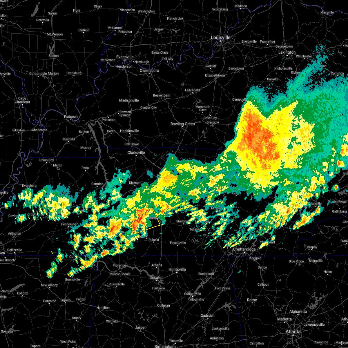 At 1033 am cdt, a severe thunderstorm was located near summertown, or 12 miles north of lawrenceburg, moving northeast at 40 mph (radar indicated). Hazards include 60 mph wind gusts and penny size hail. expect damage to roofs, siding, and trees At 1033 am cdt, a severe thunderstorm was located near summertown, or 12 miles north of lawrenceburg, moving northeast at 40 mph (radar indicated). Hazards include 60 mph wind gusts and penny size hail. expect damage to roofs, siding, and trees
|
| 3/25/2021 7:59 PM CDT |
 At 759 pm cdt, a severe thunderstorm capable of producing a tornado was located near summertown, or 12 miles southeast of hohenwald, moving northeast at 45 mph (radar indicated rotation). Hazards include tornado and quarter size hail. Flying debris will be dangerous to those caught without shelter. mobile homes will be damaged or destroyed. damage to roofs, windows, and vehicles will occur. tree damage is likely. this dangerous storm will be near, mount pleasant around 820 pm cdt. Other locations impacted by this tornadic thunderstorm include hampshire. At 759 pm cdt, a severe thunderstorm capable of producing a tornado was located near summertown, or 12 miles southeast of hohenwald, moving northeast at 45 mph (radar indicated rotation). Hazards include tornado and quarter size hail. Flying debris will be dangerous to those caught without shelter. mobile homes will be damaged or destroyed. damage to roofs, windows, and vehicles will occur. tree damage is likely. this dangerous storm will be near, mount pleasant around 820 pm cdt. Other locations impacted by this tornadic thunderstorm include hampshire.
|
| 3/25/2021 7:49 PM CDT |
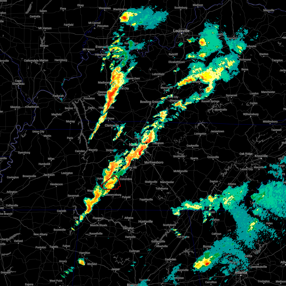 At 748 pm cdt, a severe thunderstorm capable of producing a tornado was located 8 miles west of summertown, or 10 miles southeast of hohenwald, moving east at 50 mph (radar indicated rotation). Hazards include tornado and quarter size hail. Flying debris will be dangerous to those caught without shelter. mobile homes will be damaged or destroyed. damage to roofs, windows, and vehicles will occur. tree damage is likely. this dangerous storm will be near, summertown around 800 pm cdt. mount pleasant around 815 pm cdt. Other locations impacted by this tornadic thunderstorm include gordonsburg, henryville and hampshire. At 748 pm cdt, a severe thunderstorm capable of producing a tornado was located 8 miles west of summertown, or 10 miles southeast of hohenwald, moving east at 50 mph (radar indicated rotation). Hazards include tornado and quarter size hail. Flying debris will be dangerous to those caught without shelter. mobile homes will be damaged or destroyed. damage to roofs, windows, and vehicles will occur. tree damage is likely. this dangerous storm will be near, summertown around 800 pm cdt. mount pleasant around 815 pm cdt. Other locations impacted by this tornadic thunderstorm include gordonsburg, henryville and hampshire.
|
| 3/25/2021 7:39 PM CDT |
 At 739 pm cdt, a confirmed large and extremely dangerous tornado was located 9 miles northeast of waynesboro, moving east at 50 mph. this is a particularly dangerous situation. take cover now! (radar confirmed tornado). Hazards include damaging tornado. You are in a life-threatening situation. flying debris may be deadly to those caught without shelter. mobile homes will be destroyed. considerable damage to homes, businesses, and vehicles is likely and complete destruction is possible. the tornado will be near, summertown around 800 pm cdt. mount pleasant around 815 pm cdt. Other locations impacted by this tornadic thunderstorm include gordonsburg, henryville and hampshire. At 739 pm cdt, a confirmed large and extremely dangerous tornado was located 9 miles northeast of waynesboro, moving east at 50 mph. this is a particularly dangerous situation. take cover now! (radar confirmed tornado). Hazards include damaging tornado. You are in a life-threatening situation. flying debris may be deadly to those caught without shelter. mobile homes will be destroyed. considerable damage to homes, businesses, and vehicles is likely and complete destruction is possible. the tornado will be near, summertown around 800 pm cdt. mount pleasant around 815 pm cdt. Other locations impacted by this tornadic thunderstorm include gordonsburg, henryville and hampshire.
|
| 3/25/2021 7:36 PM CDT |
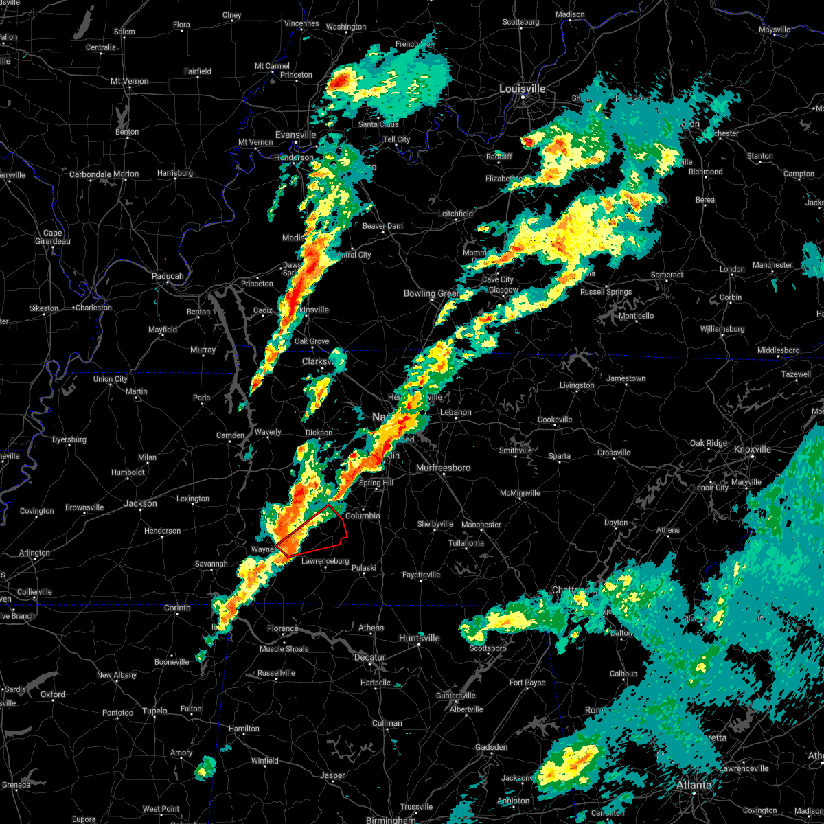 At 736 pm cdt, a severe thunderstorm capable of producing a tornado was located 7 miles northeast of waynesboro, moving east at 50 mph (radar indicated rotation). Hazards include tornado. Flying debris will be dangerous to those caught without shelter. mobile homes will be damaged or destroyed. damage to roofs, windows, and vehicles will occur. tree damage is likely. this dangerous storm will be near, summertown around 800 pm cdt. mount pleasant around 815 pm cdt. Other locations impacted by this tornadic thunderstorm include gordonsburg, henryville and hampshire. At 736 pm cdt, a severe thunderstorm capable of producing a tornado was located 7 miles northeast of waynesboro, moving east at 50 mph (radar indicated rotation). Hazards include tornado. Flying debris will be dangerous to those caught without shelter. mobile homes will be damaged or destroyed. damage to roofs, windows, and vehicles will occur. tree damage is likely. this dangerous storm will be near, summertown around 800 pm cdt. mount pleasant around 815 pm cdt. Other locations impacted by this tornadic thunderstorm include gordonsburg, henryville and hampshire.
|
| 8/27/2020 5:09 PM CDT |
 At 509 pm cdt, a severe thunderstorm was located 7 miles northwest of lawrenceburg, moving north at 40 mph (radar indicated). Hazards include 60 mph wind gusts. expect damage to roofs, siding, and trees At 509 pm cdt, a severe thunderstorm was located 7 miles northwest of lawrenceburg, moving north at 40 mph (radar indicated). Hazards include 60 mph wind gusts. expect damage to roofs, siding, and trees
|
| 6/30/2020 4:16 PM CDT | Multiple trees down... roads impassible. time estimated from rada in lawrence county TN, 2.2 miles NNE of Summertown, TN |
| 6/30/2020 4:07 PM CDT | Multiple trees down in eastern lewis co in lewis county TN, 6.6 miles ESE of Summertown, TN |
| 6/30/2020 4:07 PM CDT |
 The national weather service in nashville has issued a * severe thunderstorm warning for. southeastern lewis county in middle tennessee. southwestern marshall county in middle tennessee. northeastern lawrence county in middle tennessee. Southwestern maury county in middle tennessee. The national weather service in nashville has issued a * severe thunderstorm warning for. southeastern lewis county in middle tennessee. southwestern marshall county in middle tennessee. northeastern lawrence county in middle tennessee. Southwestern maury county in middle tennessee.
|
| 5/4/2020 8:40 PM CDT |
 At 840 pm cdt, severe thunderstorms were located along a line extending from 6 miles east of hohenwald to 11 miles east of waynesboro, moving southeast at 35 mph (radar indicated). Hazards include 60 mph wind gusts and quarter size hail. Hail damage to vehicles is expected. expect wind damage to roofs, siding, and trees. Locations impacted include, lawrenceburg, mount pleasant, summertown, ethridge, gordonsburg and henryville. At 840 pm cdt, severe thunderstorms were located along a line extending from 6 miles east of hohenwald to 11 miles east of waynesboro, moving southeast at 35 mph (radar indicated). Hazards include 60 mph wind gusts and quarter size hail. Hail damage to vehicles is expected. expect wind damage to roofs, siding, and trees. Locations impacted include, lawrenceburg, mount pleasant, summertown, ethridge, gordonsburg and henryville.
|
| 5/4/2020 8:36 PM CDT | Tree down blocking railroad bed road in summertown in lawrence county TN, 0.3 miles W of Summertown, TN |
| 5/4/2020 8:36 PM CDT | Highway 240 blocked by a fallen tree in henryville in lawrence county TN, 5 miles ENE of Summertown, TN |
| 5/4/2020 8:36 PM CDT | Tree down blocking part of highway 20 in lawrence county TN, 1.6 miles SSE of Summertown, TN |
| 5/4/2020 8:35 PM CDT | Tree down across hwy 240 near locker road in summertown in lawrence county TN, 1.1 miles NE of Summertown, TN |
| 5/4/2020 8:34 PM CDT | Tree down across buffalo road near hwy 240. many trees down across north and northwest lawrence count in lawrence county TN, 1.1 miles NE of Summertown, TN |
| 5/4/2020 8:14 PM CDT |
 At 814 pm cdt, severe thunderstorms were located along a line extending from 6 miles northwest of hohenwald to near waynesboro, moving southeast at 35 mph (radar indicated). Hazards include 60 mph wind gusts and quarter size hail. Hail damage to vehicles is expected. Expect wind damage to roofs, siding, and trees. At 814 pm cdt, severe thunderstorms were located along a line extending from 6 miles northwest of hohenwald to near waynesboro, moving southeast at 35 mph (radar indicated). Hazards include 60 mph wind gusts and quarter size hail. Hail damage to vehicles is expected. Expect wind damage to roofs, siding, and trees.
|
| 5/3/2020 4:45 PM CDT |
 At 445 pm cdt, severe thunderstorms were located along a line extending from near columbia to 8 miles southeast of mount pleasant to near lawrenceburg, moving east at 60 mph (radar indicated). Hazards include 70 mph wind gusts and penny size hail. Expect considerable tree damage. damage is likely to mobile homes, roofs, and outbuildings. locations impacted include, columbia, lawrenceburg, mount pleasant, summertown, ethridge, henryville and culleoka. This includes interstate 65 between mile markers 36 and 44. At 445 pm cdt, severe thunderstorms were located along a line extending from near columbia to 8 miles southeast of mount pleasant to near lawrenceburg, moving east at 60 mph (radar indicated). Hazards include 70 mph wind gusts and penny size hail. Expect considerable tree damage. damage is likely to mobile homes, roofs, and outbuildings. locations impacted include, columbia, lawrenceburg, mount pleasant, summertown, ethridge, henryville and culleoka. This includes interstate 65 between mile markers 36 and 44.
|
| 5/3/2020 4:12 PM CDT |
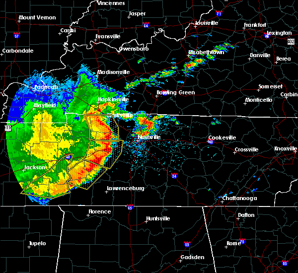 At 412 pm cdt, severe thunderstorms were located along a line extending from 6 miles south of centerville to near hohenwald to 10 miles northeast of olive hill, moving east at 60 mph (radar indicated). Hazards include 70 mph wind gusts and penny size hail. Expect considerable tree damage. Damage is likely to mobile homes, roofs, and outbuildings. At 412 pm cdt, severe thunderstorms were located along a line extending from 6 miles south of centerville to near hohenwald to 10 miles northeast of olive hill, moving east at 60 mph (radar indicated). Hazards include 70 mph wind gusts and penny size hail. Expect considerable tree damage. Damage is likely to mobile homes, roofs, and outbuildings.
|
| 3/29/2020 12:57 AM CDT |
 At 1256 am cdt, a severe thunderstorm was located 8 miles southeast of mount pleasant, or 11 miles south of columbia, moving northeast at 75 mph (radar indicated). Hazards include 60 mph wind gusts and nickel size hail. Expect damage to roofs, siding, and trees. locations impacted include, columbia, lewisburg, mount pleasant, summertown, cornersville, lynnville, culleoka, i-65 east of columbia and farmington. This includes interstate 65 between mile markers 25 and 46. At 1256 am cdt, a severe thunderstorm was located 8 miles southeast of mount pleasant, or 11 miles south of columbia, moving northeast at 75 mph (radar indicated). Hazards include 60 mph wind gusts and nickel size hail. Expect damage to roofs, siding, and trees. locations impacted include, columbia, lewisburg, mount pleasant, summertown, cornersville, lynnville, culleoka, i-65 east of columbia and farmington. This includes interstate 65 between mile markers 25 and 46.
|
| 3/29/2020 12:39 AM CDT |
 At 1238 am cdt, a severe thunderstorm was located near lawrenceburg, moving northeast at 75 mph (radar indicated). Hazards include 70 mph wind gusts and ping pong ball size hail. People and animals outdoors will be injured. expect hail damage to roofs, siding, windows, and vehicles. expect considerable tree damage. Wind damage is also likely to mobile homes, roofs, and outbuildings. At 1238 am cdt, a severe thunderstorm was located near lawrenceburg, moving northeast at 75 mph (radar indicated). Hazards include 70 mph wind gusts and ping pong ball size hail. People and animals outdoors will be injured. expect hail damage to roofs, siding, windows, and vehicles. expect considerable tree damage. Wind damage is also likely to mobile homes, roofs, and outbuildings.
|
| 3/28/2020 11:33 PM CDT |
 At 1133 pm cdt, a severe thunderstorm was located near summertown, or 11 miles southeast of hohenwald, moving northeast at 55 mph (radar indicated). Hazards include 60 mph wind gusts and penny size hail. Expect damage to roofs, siding, and trees. Locations impacted include, mount pleasant, summertown, gordonsburg, henryville and hampshire. At 1133 pm cdt, a severe thunderstorm was located near summertown, or 11 miles southeast of hohenwald, moving northeast at 55 mph (radar indicated). Hazards include 60 mph wind gusts and penny size hail. Expect damage to roofs, siding, and trees. Locations impacted include, mount pleasant, summertown, gordonsburg, henryville and hampshire.
|
| 3/28/2020 11:21 PM CDT |
 At 1121 pm cdt, a severe thunderstorm was located 10 miles south of hohenwald, moving northeast at 55 mph (radar indicated). Hazards include 60 mph wind gusts and penny size hail. expect damage to roofs, siding, and trees At 1121 pm cdt, a severe thunderstorm was located 10 miles south of hohenwald, moving northeast at 55 mph (radar indicated). Hazards include 60 mph wind gusts and penny size hail. expect damage to roofs, siding, and trees
|
| 1/11/2020 9:02 AM CST |
 At 901 am cst, severe thunderstorms were located along a line extending from near mount pleasant to near summertown to 8 miles northeast of lawrenceburg to near loretto, moving northeast at 60 mph (radar indicated). Hazards include 70 mph wind gusts. Expect considerable tree damage. damage is likely to mobile homes, roofs, and outbuildings. locations impacted include, columbia, lawrenceburg, pulaski, spring hill, mount pleasant, loretto, summertown, st. joseph, minor hill, ethridge, lynnville, henryville, culleoka, i-65 east of columbia, goodspring, leoma and hampshire. This includes interstate 65 between mile markers 38 and 47. At 901 am cst, severe thunderstorms were located along a line extending from near mount pleasant to near summertown to 8 miles northeast of lawrenceburg to near loretto, moving northeast at 60 mph (radar indicated). Hazards include 70 mph wind gusts. Expect considerable tree damage. damage is likely to mobile homes, roofs, and outbuildings. locations impacted include, columbia, lawrenceburg, pulaski, spring hill, mount pleasant, loretto, summertown, st. joseph, minor hill, ethridge, lynnville, henryville, culleoka, i-65 east of columbia, goodspring, leoma and hampshire. This includes interstate 65 between mile markers 38 and 47.
|
| 1/11/2020 8:51 AM CST |
 At 851 am cst, severe thunderstorms were located along a line extending from near summertown to 16 miles southwest of mount pleasant to lawrenceburg to near loretto, moving northeast at 70 mph (radar indicated). Hazards include 70 mph wind gusts. Expect considerable tree damage. damage is likely to mobile homes, roofs, and outbuildings. locations impacted include, columbia, lawrenceburg, pulaski, spring hill, mount pleasant, loretto, summertown, st. joseph, minor hill, ethridge, lynnville, henryville, culleoka, i-65 east of columbia, goodspring, leoma, westpoint, iron city and hampshire. This includes interstate 65 between mile markers 38 and 47. At 851 am cst, severe thunderstorms were located along a line extending from near summertown to 16 miles southwest of mount pleasant to lawrenceburg to near loretto, moving northeast at 70 mph (radar indicated). Hazards include 70 mph wind gusts. Expect considerable tree damage. damage is likely to mobile homes, roofs, and outbuildings. locations impacted include, columbia, lawrenceburg, pulaski, spring hill, mount pleasant, loretto, summertown, st. joseph, minor hill, ethridge, lynnville, henryville, culleoka, i-65 east of columbia, goodspring, leoma, westpoint, iron city and hampshire. This includes interstate 65 between mile markers 38 and 47.
|
| 1/11/2020 8:42 AM CST |
 At 840 am cst, severe thunderstorms were located along a line extending from 10 miles northwest of mount pleasant to near summertown to 8 miles southwest of loretto, moving northeast at 60 mph (radar indicated). Hazards include 60 mph wind gusts. expect damage to roofs, siding, and trees At 840 am cst, severe thunderstorms were located along a line extending from 10 miles northwest of mount pleasant to near summertown to 8 miles southwest of loretto, moving northeast at 60 mph (radar indicated). Hazards include 60 mph wind gusts. expect damage to roofs, siding, and trees
|
| 1/11/2020 8:22 AM CST |
 At 822 am cst, severe thunderstorms were located along a line extending from 7 miles northwest of hohenwald to underwood-petersville, moving northeast at 35 mph (radar indicated). Hazards include 70 mph wind gusts. Expect considerable tree damage. damage is likely to mobile homes, roofs, and outbuildings. locations impacted include, lawrenceburg, hohenwald, loretto, collinwood, summertown, st. Joseph, ethridge, gordonsburg, kimmins, henryville, cypress inn, primm springs, leoma, westpoint, iron city and hampshire. At 822 am cst, severe thunderstorms were located along a line extending from 7 miles northwest of hohenwald to underwood-petersville, moving northeast at 35 mph (radar indicated). Hazards include 70 mph wind gusts. Expect considerable tree damage. damage is likely to mobile homes, roofs, and outbuildings. locations impacted include, lawrenceburg, hohenwald, loretto, collinwood, summertown, st. Joseph, ethridge, gordonsburg, kimmins, henryville, cypress inn, primm springs, leoma, westpoint, iron city and hampshire.
|
| 1/11/2020 8:06 AM CST |
 At 805 am cst, severe thunderstorms were located along a line extending from near linden to 7 miles northeast of cherokee, moving northeast at 35 mph (radar indicated). Hazards include 70 mph wind gusts. Expect considerable tree damage. Damage is likely to mobile homes, roofs, and outbuildings. At 805 am cst, severe thunderstorms were located along a line extending from near linden to 7 miles northeast of cherokee, moving northeast at 35 mph (radar indicated). Hazards include 70 mph wind gusts. Expect considerable tree damage. Damage is likely to mobile homes, roofs, and outbuildings.
|
| 12/16/2019 5:15 PM CST |
 At 514 pm cst, severe thunderstorms were located along a line extending from near summertown to 6 miles northeast of lawrenceburg to 11 miles northeast of loretto to near lexington, moving northeast at 40 mph (radar indicated). Hazards include 60 mph wind gusts and penny size hail. expect damage to roofs, siding, and trees At 514 pm cst, severe thunderstorms were located along a line extending from near summertown to 6 miles northeast of lawrenceburg to 11 miles northeast of loretto to near lexington, moving northeast at 40 mph (radar indicated). Hazards include 60 mph wind gusts and penny size hail. expect damage to roofs, siding, and trees
|
| 8/13/2019 5:33 PM CDT |
 At 533 pm cdt, a severe thunderstorm was located over summertown, or 13 miles north of lawrenceburg, moving southeast at 25 mph (radar indicated). Hazards include 60 mph wind gusts and penny size hail. expect damage to roofs, siding, and trees At 533 pm cdt, a severe thunderstorm was located over summertown, or 13 miles north of lawrenceburg, moving southeast at 25 mph (radar indicated). Hazards include 60 mph wind gusts and penny size hail. expect damage to roofs, siding, and trees
|
| 8/13/2019 5:24 PM CDT | Quarter sized hail reported 1.6 miles WSW of Summertown, TN, em report of quarter size hail slightly west of lawrence/maury co. line along tn-20 in summertown. report of car windshield damage associated with hail. |
| 6/21/2019 8:45 PM CDT | 2 36 inch trees blown down on a house trailer. power lines down throughout the count in lawrence county TN, 0.3 miles W of Summertown, TN |
| 6/21/2019 8:30 PM CDT |
 At 830 pm cdt, severe thunderstorms were located along a line extending from columbia to lawrenceburg to collinwood, moving southeast at 50 mph (radar indicated). Hazards include 70 mph wind gusts and nickel size hail. Expect considerable tree damage. damage is likely to mobile homes, roofs, and outbuildings. Locations impacted include, columbia, lawrenceburg, waynesboro, mount pleasant, collinwood, summertown, ethridge, lynnville, henryville, culleoka, lutts, westpoint and hampshire. At 830 pm cdt, severe thunderstorms were located along a line extending from columbia to lawrenceburg to collinwood, moving southeast at 50 mph (radar indicated). Hazards include 70 mph wind gusts and nickel size hail. Expect considerable tree damage. damage is likely to mobile homes, roofs, and outbuildings. Locations impacted include, columbia, lawrenceburg, waynesboro, mount pleasant, collinwood, summertown, ethridge, lynnville, henryville, culleoka, lutts, westpoint and hampshire.
|
| 6/21/2019 8:07 PM CDT |
 At 807 pm cdt, severe thunderstorms were located along a line extending from 7 miles northwest of columbia to near hohenwald to near olive hill, moving southeast at 30 mph (radar indicated). Hazards include 60 mph wind gusts and nickel size hail. expect damage to roofs, siding, and trees At 807 pm cdt, severe thunderstorms were located along a line extending from 7 miles northwest of columbia to near hohenwald to near olive hill, moving southeast at 30 mph (radar indicated). Hazards include 60 mph wind gusts and nickel size hail. expect damage to roofs, siding, and trees
|
| 4/13/2019 8:53 PM CDT |
 At 853 pm cdt, a severe thunderstorm was located just south of summertown, or 7 miles north of lawrenceburg, moving north at 45 mph (emergency management. at 845 pm...quarter size hail was reported west of lawrenceburg with this storm). Hazards include 60 mph wind gusts and quarter size hail. Hail damage to vehicles is expected. expect wind damage to roofs, siding, and trees. Locations impacted include, mount pleasant, summertown, ethridge, gordonsburg, henryville and hampshire. At 853 pm cdt, a severe thunderstorm was located just south of summertown, or 7 miles north of lawrenceburg, moving north at 45 mph (emergency management. at 845 pm...quarter size hail was reported west of lawrenceburg with this storm). Hazards include 60 mph wind gusts and quarter size hail. Hail damage to vehicles is expected. expect wind damage to roofs, siding, and trees. Locations impacted include, mount pleasant, summertown, ethridge, gordonsburg, henryville and hampshire.
|
| 4/13/2019 8:41 PM CDT |
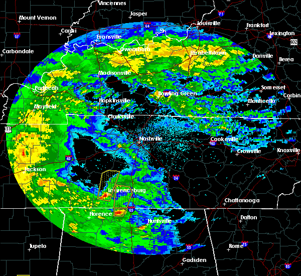 At 841 pm cdt, a severe thunderstorm was located just west of lawrenceburg, moving north at 45 mph (emergency management. at 838 pm...trees were reported down in loretto with this storm). Hazards include 60 mph wind gusts and penny size hail. expect damage to roofs, siding, and trees At 841 pm cdt, a severe thunderstorm was located just west of lawrenceburg, moving north at 45 mph (emergency management. at 838 pm...trees were reported down in loretto with this storm). Hazards include 60 mph wind gusts and penny size hail. expect damage to roofs, siding, and trees
|
| 12/31/2018 2:06 PM CST |
 At 206 pm cst, severe thunderstorms were located along a line extending from 14 miles southwest of fairview to loretto, moving east at 45 mph (radar indicated). Hazards include 60 mph wind gusts. expect damage to roofs, siding, and trees At 206 pm cst, severe thunderstorms were located along a line extending from 14 miles southwest of fairview to loretto, moving east at 45 mph (radar indicated). Hazards include 60 mph wind gusts. expect damage to roofs, siding, and trees
|
| 11/5/2018 11:18 PM CST |
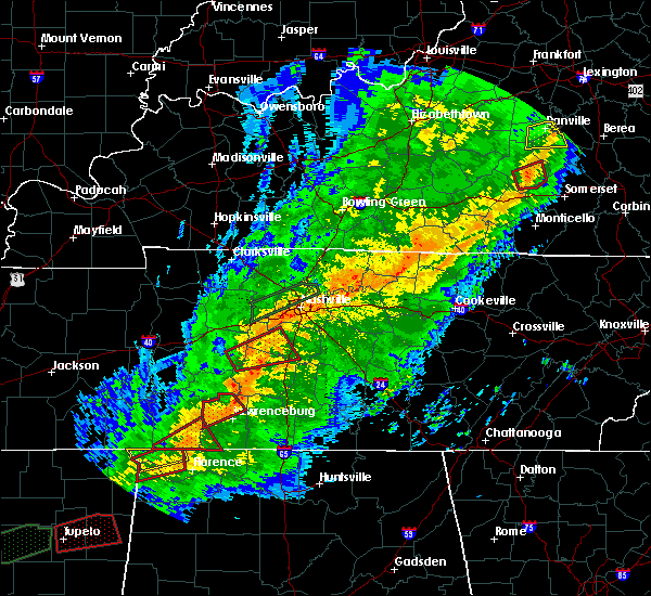 At 1118 pm cst, a severe thunderstorm capable of producing a tornado was located near lawrenceburg, moving east at 45 mph (radar indicated rotation). Hazards include tornado. Flying debris will be dangerous to those caught without shelter. mobile homes will be damaged or destroyed. damage to roofs, windows, and vehicles will occur. tree damage is likely. this dangerous storm will be near, summertown around 1125 pm cst. Other locations impacted by this tornadic thunderstorm include ethridge and henryville. At 1118 pm cst, a severe thunderstorm capable of producing a tornado was located near lawrenceburg, moving east at 45 mph (radar indicated rotation). Hazards include tornado. Flying debris will be dangerous to those caught without shelter. mobile homes will be damaged or destroyed. damage to roofs, windows, and vehicles will occur. tree damage is likely. this dangerous storm will be near, summertown around 1125 pm cst. Other locations impacted by this tornadic thunderstorm include ethridge and henryville.
|
| 11/5/2018 11:10 PM CST |
 At 1110 pm cst, a severe thunderstorm capable of producing a tornado was located 9 miles northwest of lawrenceburg, moving northeast at 35 mph (radar indicated rotation). Hazards include tornado. Flying debris will be dangerous to those caught without shelter. mobile homes will be damaged or destroyed. damage to roofs, windows, and vehicles will occur. tree damage is likely. this dangerous storm will be near, lawrenceburg around 1125 pm cst. summertown around 1130 pm cst. Other locations impacted by this tornadic thunderstorm include ethridge and henryville. At 1110 pm cst, a severe thunderstorm capable of producing a tornado was located 9 miles northwest of lawrenceburg, moving northeast at 35 mph (radar indicated rotation). Hazards include tornado. Flying debris will be dangerous to those caught without shelter. mobile homes will be damaged or destroyed. damage to roofs, windows, and vehicles will occur. tree damage is likely. this dangerous storm will be near, lawrenceburg around 1125 pm cst. summertown around 1130 pm cst. Other locations impacted by this tornadic thunderstorm include ethridge and henryville.
|
| 11/5/2018 10:55 PM CST |
 At 1055 pm cst, a severe thunderstorm capable of producing a tornado was located near waynesboro, moving northeast at 40 mph (radar indicated rotation). Hazards include tornado. Flying debris will be dangerous to those caught without shelter. mobile homes will be damaged or destroyed. damage to roofs, windows, and vehicles will occur. tree damage is likely. this dangerous storm will be near, summertown around 1130 pm cst. Other locations impacted by this tornadic thunderstorm include ethridge and henryville. At 1055 pm cst, a severe thunderstorm capable of producing a tornado was located near waynesboro, moving northeast at 40 mph (radar indicated rotation). Hazards include tornado. Flying debris will be dangerous to those caught without shelter. mobile homes will be damaged or destroyed. damage to roofs, windows, and vehicles will occur. tree damage is likely. this dangerous storm will be near, summertown around 1130 pm cst. Other locations impacted by this tornadic thunderstorm include ethridge and henryville.
|
| 9/22/2018 6:20 PM CDT |
 At 620 pm cdt, a severe thunderstorm was located over summertown, or 13 miles southeast of hohenwald, moving northeast at 30 mph (radar indicated). Hazards include 60 mph wind gusts. Expect damage to roofs, siding, and trees. Locations impacted include, summertown, gordonsburg and henryville. At 620 pm cdt, a severe thunderstorm was located over summertown, or 13 miles southeast of hohenwald, moving northeast at 30 mph (radar indicated). Hazards include 60 mph wind gusts. Expect damage to roofs, siding, and trees. Locations impacted include, summertown, gordonsburg and henryville.
|
| 9/22/2018 6:10 PM CDT |
 At 609 pm cdt, a severe thunderstorm was located 7 miles southwest of summertown, or 10 miles northwest of lawrenceburg, moving northeast at 35 mph (radar indicated). Hazards include 60 mph wind gusts and penny size hail. expect damage to roofs, siding, and trees At 609 pm cdt, a severe thunderstorm was located 7 miles southwest of summertown, or 10 miles northwest of lawrenceburg, moving northeast at 35 mph (radar indicated). Hazards include 60 mph wind gusts and penny size hail. expect damage to roofs, siding, and trees
|
| 6/28/2018 1:24 PM CDT |
 At 123 pm cdt, severe thunderstorms were located along a line extending from near lewisburg to pulaski to lawrenceburg, moving southeast at 55 mph (emergency management. at 120 pm, numerous trees and power lines were blown down across lawrence county with these storms). Hazards include 70 mph wind gusts. Expect considerable tree damage. damage is likely to mobile homes, roofs, and outbuildings. locations impacted include, columbia, lewisburg, lawrenceburg, pulaski, hohenwald, spring hill, mount pleasant, loretto, summertown, ardmore, cornersville, st. joseph, elkton, minor hill, ethridge, lynnville, gordonsburg, henryville, culleoka and belfast. This includes interstate 65 between mile markers 1 and 48. At 123 pm cdt, severe thunderstorms were located along a line extending from near lewisburg to pulaski to lawrenceburg, moving southeast at 55 mph (emergency management. at 120 pm, numerous trees and power lines were blown down across lawrence county with these storms). Hazards include 70 mph wind gusts. Expect considerable tree damage. damage is likely to mobile homes, roofs, and outbuildings. locations impacted include, columbia, lewisburg, lawrenceburg, pulaski, hohenwald, spring hill, mount pleasant, loretto, summertown, ardmore, cornersville, st. joseph, elkton, minor hill, ethridge, lynnville, gordonsburg, henryville, culleoka and belfast. This includes interstate 65 between mile markers 1 and 48.
|
| 6/28/2018 1:09 PM CDT |
 At 107 pm cdt, severe thunderstorms were located along a line extending from culleoka to near ethridge, moving southeast at 50 mph (emergency management. at 105 pm cdt, numerous trees were blown down with these storms across hickman and maury counties). Hazards include 70 mph wind gusts. Expect considerable tree damage. Damage is likely to mobile homes, roofs, and outbuildings. At 107 pm cdt, severe thunderstorms were located along a line extending from culleoka to near ethridge, moving southeast at 50 mph (emergency management. at 105 pm cdt, numerous trees were blown down with these storms across hickman and maury counties). Hazards include 70 mph wind gusts. Expect considerable tree damage. Damage is likely to mobile homes, roofs, and outbuildings.
|
| 6/28/2018 1:04 PM CDT |
 At 103 pm cdt, severe thunderstorms were located along a line extending from spring hill to summertown, moving southeast at 50 mph (emergency management. at 100 pm cdt, trees were blown down and a home was damaged in hickman county with these storms). Hazards include 70 mph wind gusts and quarter size hail. Hail damage to vehicles is expected. expect considerable tree damage. wind damage is also likely to mobile homes, roofs, and outbuildings. locations impacted include, columbia, hohenwald, spring hill, mount pleasant, thompson`s station, summertown, fairview, ethridge, gordonsburg, kimmins, henryville, culleoka, i-65 east of columbia, santa fe, hampshire, williamsport and leipers fork. this includes the following highways, interstate 65 between mile markers 37 and 54. Interstate 840 between mile markers 7 and 27. At 103 pm cdt, severe thunderstorms were located along a line extending from spring hill to summertown, moving southeast at 50 mph (emergency management. at 100 pm cdt, trees were blown down and a home was damaged in hickman county with these storms). Hazards include 70 mph wind gusts and quarter size hail. Hail damage to vehicles is expected. expect considerable tree damage. wind damage is also likely to mobile homes, roofs, and outbuildings. locations impacted include, columbia, hohenwald, spring hill, mount pleasant, thompson`s station, summertown, fairview, ethridge, gordonsburg, kimmins, henryville, culleoka, i-65 east of columbia, santa fe, hampshire, williamsport and leipers fork. this includes the following highways, interstate 65 between mile markers 37 and 54. Interstate 840 between mile markers 7 and 27.
|
| 6/28/2018 12:43 PM CDT |
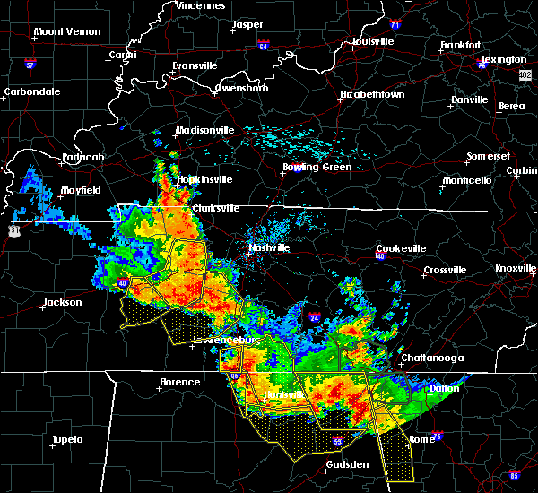 The national weather service in nashville has issued a * severe thunderstorm warning for. lewis county in middle tennessee. maury county in middle tennessee. northern lawrence county in middle tennessee. Western williamson county in middle tennessee. The national weather service in nashville has issued a * severe thunderstorm warning for. lewis county in middle tennessee. maury county in middle tennessee. northern lawrence county in middle tennessee. Western williamson county in middle tennessee.
|
| 6/23/2018 11:10 AM CDT |
 At 1110 am cdt, a severe thunderstorm was located near lawrenceburg, moving east at 50 mph (radar indicated). Hazards include 60 mph wind gusts and penny size hail. expect damage to roofs, siding, and trees At 1110 am cdt, a severe thunderstorm was located near lawrenceburg, moving east at 50 mph (radar indicated). Hazards include 60 mph wind gusts and penny size hail. expect damage to roofs, siding, and trees
|
| 6/23/2018 11:04 AM CDT |
 At 1104 am cdt, a severe thunderstorm was located over lawrenceburg, moving east at 50 mph (radar indicated). Hazards include 60 mph wind gusts and penny size hail. Expect damage to roofs, siding, and trees. locations impacted include, lawrenceburg, loretto, summertown, st. Joseph, ethridge, henryville, leoma, westpoint and iron city. At 1104 am cdt, a severe thunderstorm was located over lawrenceburg, moving east at 50 mph (radar indicated). Hazards include 60 mph wind gusts and penny size hail. Expect damage to roofs, siding, and trees. locations impacted include, lawrenceburg, loretto, summertown, st. Joseph, ethridge, henryville, leoma, westpoint and iron city.
|
| 6/23/2018 10:27 AM CDT |
 At 1027 am cdt, a severe thunderstorm was located 7 miles west of collinwood, or 13 miles southwest of waynesboro, moving east at 50 mph (radar indicated). Hazards include 60 mph wind gusts and penny size hail. expect damage to roofs, siding, and trees At 1027 am cdt, a severe thunderstorm was located 7 miles west of collinwood, or 13 miles southwest of waynesboro, moving east at 50 mph (radar indicated). Hazards include 60 mph wind gusts and penny size hail. expect damage to roofs, siding, and trees
|
| 5/29/2018 4:00 PM CDT | Got a report of trees down and damage to a structure in the neighborhood of dugout road and gulley drive. witnesses reported a trampoline being lifted and moving sout in lawrence county TN, 5 miles WNW of Summertown, TN |
| 2/24/2018 11:42 PM CST |
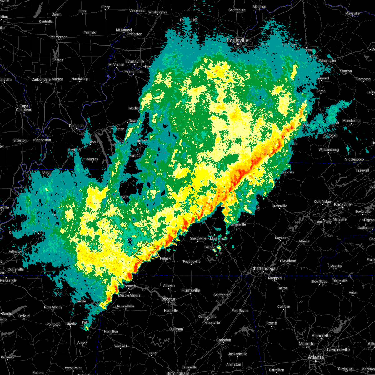 At 1129 pm cst, a severe thunderstorm was located 7 miles west of lawrenceburg, moving northeast at 40 mph (radar indicated). Hazards include 60 mph wind gusts. Expect damage to roofs, siding, and trees. locations impacted include, lawrenceburg, summertown, ethridge and henryville. A tornado watch remains in effect until 200 am cst for middle tennessee. At 1129 pm cst, a severe thunderstorm was located 7 miles west of lawrenceburg, moving northeast at 40 mph (radar indicated). Hazards include 60 mph wind gusts. Expect damage to roofs, siding, and trees. locations impacted include, lawrenceburg, summertown, ethridge and henryville. A tornado watch remains in effect until 200 am cst for middle tennessee.
|
| 2/24/2018 11:29 PM CST |
 At 1129 pm cst, a severe thunderstorm was located 7 miles west of lawrenceburg, moving northeast at 40 mph (radar indicated). Hazards include 60 mph wind gusts. Expect damage to roofs, siding, and trees. locations impacted include, lawrenceburg, summertown, ethridge and henryville. A tornado watch remains in effect until 200 am cst for middle tennessee. At 1129 pm cst, a severe thunderstorm was located 7 miles west of lawrenceburg, moving northeast at 40 mph (radar indicated). Hazards include 60 mph wind gusts. Expect damage to roofs, siding, and trees. locations impacted include, lawrenceburg, summertown, ethridge and henryville. A tornado watch remains in effect until 200 am cst for middle tennessee.
|
| 2/24/2018 11:21 PM CST |
 At 1120 pm cst, a severe thunderstorm was located 10 miles east of collinwood, or 12 miles west of lawrenceburg, moving northeast at 40 mph (radar indicated). Hazards include 60 mph wind gusts. expect damage to roofs, siding, and trees At 1120 pm cst, a severe thunderstorm was located 10 miles east of collinwood, or 12 miles west of lawrenceburg, moving northeast at 40 mph (radar indicated). Hazards include 60 mph wind gusts. expect damage to roofs, siding, and trees
|
| 8/31/2017 4:43 PM CDT |
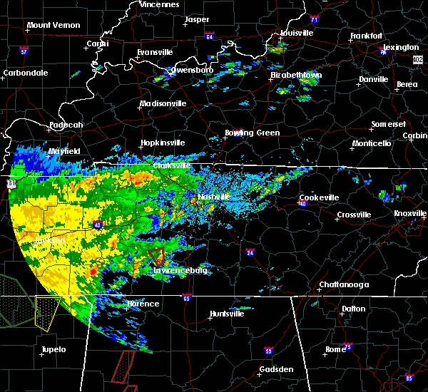 At 442 pm cdt, a severe thunderstorm capable of producing a tornado was located near summertown, or 12 miles northeast of lawrenceburg, moving north at 30 mph (radar indicated rotation). Hazards include tornado. Flying debris will be dangerous to those caught without shelter. mobile homes will be damaged or destroyed. damage to roofs, windows, and vehicles will occur. tree damage is likely. This dangerous storm will be near, mount pleasant around 505 pm cdt. At 442 pm cdt, a severe thunderstorm capable of producing a tornado was located near summertown, or 12 miles northeast of lawrenceburg, moving north at 30 mph (radar indicated rotation). Hazards include tornado. Flying debris will be dangerous to those caught without shelter. mobile homes will be damaged or destroyed. damage to roofs, windows, and vehicles will occur. tree damage is likely. This dangerous storm will be near, mount pleasant around 505 pm cdt.
|
| 3/21/2017 4:24 PM CDT |
 The severe thunderstorm warning for southeastern maury, northeastern lawrence and northern giles counties will expire at 430 pm cdt, the storm which prompted the warning has moved out of the area. therefore the warning will be allowed to expire. a severe thunderstorm watch remains in effect until 1000 pm cdt for middle tennessee. The severe thunderstorm warning for southeastern maury, northeastern lawrence and northern giles counties will expire at 430 pm cdt, the storm which prompted the warning has moved out of the area. therefore the warning will be allowed to expire. a severe thunderstorm watch remains in effect until 1000 pm cdt for middle tennessee.
|
| 3/21/2017 4:18 PM CDT |
 At 418 pm cdt, a severe thunderstorm was located 10 miles west of lewisburg, moving east at 55 mph (radar indicated). Hazards include 60 mph wind gusts and half dollar size hail. Hail damage to vehicles is expected. expect wind damage to roofs, siding, and trees. Locations impacted include, lawrenceburg, pulaski, summertown, ethridge, lynnville and culleoka. At 418 pm cdt, a severe thunderstorm was located 10 miles west of lewisburg, moving east at 55 mph (radar indicated). Hazards include 60 mph wind gusts and half dollar size hail. Hail damage to vehicles is expected. expect wind damage to roofs, siding, and trees. Locations impacted include, lawrenceburg, pulaski, summertown, ethridge, lynnville and culleoka.
|
| 3/21/2017 4:00 PM CDT | Quarter sized hail reported 3.7 miles W of Summertown, TN, us-43 near lawrence/maury co. line at summertown |
| 3/21/2017 3:53 PM CDT |
 At 352 pm cdt, a severe thunderstorm was located near summertown, or 11 miles southeast of hohenwald, moving east at 55 mph (radar indicated). Hazards include 60 mph wind gusts and half dollar size hail. Hail damage to vehicles is expected. Expect wind damage to roofs, siding, and trees. At 352 pm cdt, a severe thunderstorm was located near summertown, or 11 miles southeast of hohenwald, moving east at 55 mph (radar indicated). Hazards include 60 mph wind gusts and half dollar size hail. Hail damage to vehicles is expected. Expect wind damage to roofs, siding, and trees.
|
| 3/21/2017 3:50 PM CDT | Golf Ball sized hail reported 0.3 miles W of Summertown, TN, photos showed hail up to golf ball size fell in and around summertown |
| 3/9/2017 11:01 PM CST |
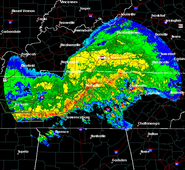 At 1101 pm cst, a severe thunderstorm was located near mount pleasant, or 10 miles west of columbia, moving east at 55 mph (radar indicated). Hazards include 60 mph wind gusts. Expect damage to roofs, siding, and trees. Locations impacted include, columbia, mount pleasant, summertown, santa fe, gordonsburg, henryville, hampshire and williamsport. At 1101 pm cst, a severe thunderstorm was located near mount pleasant, or 10 miles west of columbia, moving east at 55 mph (radar indicated). Hazards include 60 mph wind gusts. Expect damage to roofs, siding, and trees. Locations impacted include, columbia, mount pleasant, summertown, santa fe, gordonsburg, henryville, hampshire and williamsport.
|
| 3/9/2017 10:50 PM CST |
 At 1050 pm cst, a severe thunderstorm was located 9 miles east of hohenwald, moving east at 55 mph (radar indicated). Hazards include 60 mph wind gusts. expect damage to roofs, siding, and trees At 1050 pm cst, a severe thunderstorm was located 9 miles east of hohenwald, moving east at 55 mph (radar indicated). Hazards include 60 mph wind gusts. expect damage to roofs, siding, and trees
|
| 8/26/2016 5:40 PM CDT |
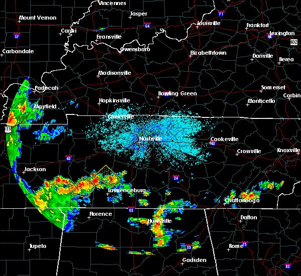 At 540 pm cdt, a severe thunderstorm was located near mount pleasant, or 13 miles southwest of columbia, moving northwest at 20 mph (radar indicated). Hazards include 60 mph wind gusts and quarter size hail. Hail damage to vehicles is expected. Expect wind damage to roofs, siding, and trees. At 540 pm cdt, a severe thunderstorm was located near mount pleasant, or 13 miles southwest of columbia, moving northwest at 20 mph (radar indicated). Hazards include 60 mph wind gusts and quarter size hail. Hail damage to vehicles is expected. Expect wind damage to roofs, siding, and trees.
|
| 3/31/2016 5:42 PM CDT |
 At 541 pm cdt, severe thunderstorms were located along a line extending from 6 miles northwest of lawrenceburg to 7 miles southwest of loretto, moving east at 50 mph (radar indicated). Hazards include 60 mph wind gusts and quarter size hail. Hail damage to vehicles is expected. expect wind damage to roofs, siding, and trees. locations impacted include, lawrenceburg, loretto, summertown, st. Joseph, ethridge, iron city, leoma, westpoint and henryville. At 541 pm cdt, severe thunderstorms were located along a line extending from 6 miles northwest of lawrenceburg to 7 miles southwest of loretto, moving east at 50 mph (radar indicated). Hazards include 60 mph wind gusts and quarter size hail. Hail damage to vehicles is expected. expect wind damage to roofs, siding, and trees. locations impacted include, lawrenceburg, loretto, summertown, st. Joseph, ethridge, iron city, leoma, westpoint and henryville.
|
| 3/31/2016 5:17 PM CDT |
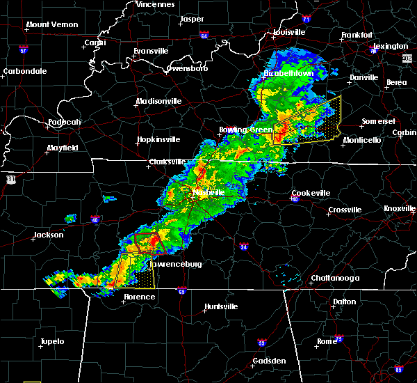 At 517 pm cdt, a severe thunderstorm capable of producing a tornado was located 9 miles west of thompson`s station, or 13 miles north of columbia, moving northeast at 55 mph (radar indicated rotation). Hazards include tornado. Flying debris will be dangerous to those caught without shelter. mobile homes will be damaged or destroyed. damage to roofs, windows, and vehicles will occur. tree damage is likely. Locations impacted include, mount pleasant, hampshire, williamsport and gordonsburg. At 517 pm cdt, a severe thunderstorm capable of producing a tornado was located 9 miles west of thompson`s station, or 13 miles north of columbia, moving northeast at 55 mph (radar indicated rotation). Hazards include tornado. Flying debris will be dangerous to those caught without shelter. mobile homes will be damaged or destroyed. damage to roofs, windows, and vehicles will occur. tree damage is likely. Locations impacted include, mount pleasant, hampshire, williamsport and gordonsburg.
|
| 3/31/2016 5:14 PM CDT |
 At 514 pm cdt, a severe thunderstorm was located near collinwood, or 8 miles southeast of waynesboro, moving northeast at 55 mph (radar indicated). Hazards include 60 mph wind gusts and quarter size hail. Hail damage to vehicles is expected. Expect wind damage to roofs, siding, and trees. At 514 pm cdt, a severe thunderstorm was located near collinwood, or 8 miles southeast of waynesboro, moving northeast at 55 mph (radar indicated). Hazards include 60 mph wind gusts and quarter size hail. Hail damage to vehicles is expected. Expect wind damage to roofs, siding, and trees.
|
| 3/31/2016 5:06 PM CDT |
 At 506 pm cdt, a severe thunderstorm capable of producing a tornado was located 12 miles east of centerville, moving northeast at 55 mph (radar indicated rotation). Hazards include tornado. Flying debris will be dangerous to those caught without shelter. mobile homes will be damaged or destroyed. damage to roofs, windows, and vehicles will occur. tree damage is likely. Locations impacted include, centerville, mount pleasant, hampshire, williamsport and gordonsburg. At 506 pm cdt, a severe thunderstorm capable of producing a tornado was located 12 miles east of centerville, moving northeast at 55 mph (radar indicated rotation). Hazards include tornado. Flying debris will be dangerous to those caught without shelter. mobile homes will be damaged or destroyed. damage to roofs, windows, and vehicles will occur. tree damage is likely. Locations impacted include, centerville, mount pleasant, hampshire, williamsport and gordonsburg.
|
| 3/31/2016 4:48 PM CDT |
 At 447 pm cdt, a severe thunderstorm capable of producing a tornado was located near hohenwald, moving northeast at 55 mph (radar indicated rotation). Hazards include tornado. Flying debris will be dangerous to those caught without shelter. mobile homes will be damaged or destroyed. damage to roofs, windows, and vehicles will occur. tree damage is likely. This tornadic thunderstorm will remain over mainly rural areas of southwestern maury, lewis and southern hickman counties, including the following locations: kimmins, hampshire, williamsport and gordonsburg. At 447 pm cdt, a severe thunderstorm capable of producing a tornado was located near hohenwald, moving northeast at 55 mph (radar indicated rotation). Hazards include tornado. Flying debris will be dangerous to those caught without shelter. mobile homes will be damaged or destroyed. damage to roofs, windows, and vehicles will occur. tree damage is likely. This tornadic thunderstorm will remain over mainly rural areas of southwestern maury, lewis and southern hickman counties, including the following locations: kimmins, hampshire, williamsport and gordonsburg.
|
| 12/23/2015 7:58 PM CST | At 757 pm cst, a severe thunderstorm capable of producing a tornado was located near summertown, or 9 miles north of lawrenceburg, moving northeast at 60 mph (radar indicated rotation). Hazards include tornado. Flying debris will be dangerous to those caught without shelter. mobile homes will be damaged or destroyed. damage to roofs, windows and vehicles will occur. tree damage is likely. this dangerous storm will be near, mount pleasant around 815 pm cst. columbia around 825 pm cst. other locations impacted by this tornadic thunderstorm include ethridge, henryville and culleoka. This storm has a history of producing a tornado so take cover!. |
| 12/23/2015 7:40 PM CST | At 739 pm cst, a confirmed large and extremely dangerous tornado was located over summertown, or 13 miles southeast of hohenwald, moving northeast at 55 mph. this is a particularly dangerous situation (radar confirmed tornado). Hazards include damaging tornado. You are in a life threatening situation. flying debris may be deadly to those caught without shelter. mobile homes will be destroyed. considerable damage to homes, businesses and vehicles is likely and complete destruction is possible. the tornado will be near, mount pleasant around 755 pm cst. other locations impacted by this tornadic thunderstorm include henryville and hampshire. Damage was reported along napier road so take cover!. |
| 12/23/2015 7:38 PM CST | Home received damage on hwy 20 from likely tornad in lawrence county TN, 1.1 miles SW of Summertown, TN |
| 12/23/2015 7:35 PM CST | Mobile home heavy damaged on 175 rice roa in lawrence county TN, 1.4 miles E of Summertown, TN |
| 12/23/2015 7:30 PM CST | At 730 pm cst, a severe thunderstorm capable of producing a tornado was located 9 miles west of summertown, or 12 miles southeast of hohenwald, moving northeast at 55 mph (radar indicated rotation). Hazards include tornado and quarter size hail. Flying debris will be dangerous to those caught without shelter. mobile homes will be damaged or destroyed. damage to roofs, windows and vehicles will occur. tree damage is likely. this dangerous storm will be near, summertown around 740 pm cst. mount pleasant around 755 pm cst. Other locations impacted by this tornadic thunderstorm include henryville and hampshire. |
| 4/20/2015 12:46 AM CDT | At 1244 am cdt, a severe thunderstorm was located 6 miles southeast of hohenwald, and moving northeast at 55 mph (radar indicated). Hazards include 60 mph wind gusts and penny size hail. Expect damage to roofs. siding and trees. the severe thunderstorm will be near, mount pleasant around 100 am cdt. other locations in the warning include hampshire and williamsport. 0. 75in. |
| 4/20/2015 12:34 AM CDT | At 1233 am cdt, a severe thunderstorm was located 8 miles southwest of hohenwald, and moving northeast at 55 mph (radar indicated). Hazards include 60 mph wind gusts and penny size hail. Expect damage to roofs. siding and trees. the severe thunderstorm will be near, hohenwald around 1240 am cdt. mount pleasant around 100 am cdt. other locations in the warning include gordonsburg, hampshire and williamsport. 0. 75in. |
| 3/2/2012 6:00 PM CST | Baseball sized hail reported 6.8 miles WNW of Summertown, TN, emergency manager reports baseball size hail in campbellsville tn. |
| 1/1/0001 12:00 AM | Tree down on house. new prospect communit in lawrence county TN, 1.6 miles NNW of Summertown, TN |
| 1/1/0001 12:00 AM | Tree down on hous in lawrence county TN, 5.2 miles ENE of Summertown, TN |
| 1/1/0001 12:00 AM | On moore road and caldwell in summertown a house destroyed and numerous houses with damage including trees as much as 3 ft in diameter on the in lawrence county TN, 3.1 miles NNE of Summertown, TN |
| 1/1/0001 12:00 AM | *** 1 inj *** approximately 30 houses da in lawrence county TN, 2.5 miles SE of Summertown, TN |
| 1/1/0001 12:00 AM | Half Dollar sized hail reported 1.4 miles E of Summertown, TN, 1.25 inch hail reported just west of summertown between 614 pm and 629 pm |
Hail Maps for Summertown, TN


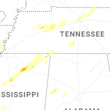
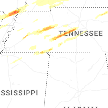


Connect with Interactive Hail Maps