

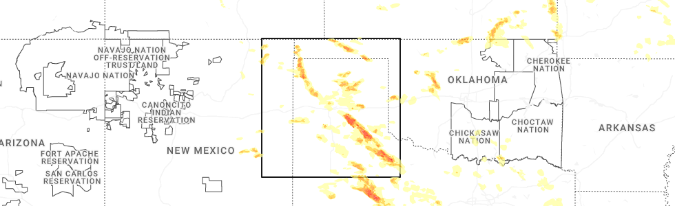
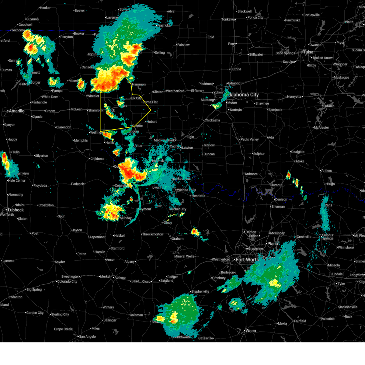
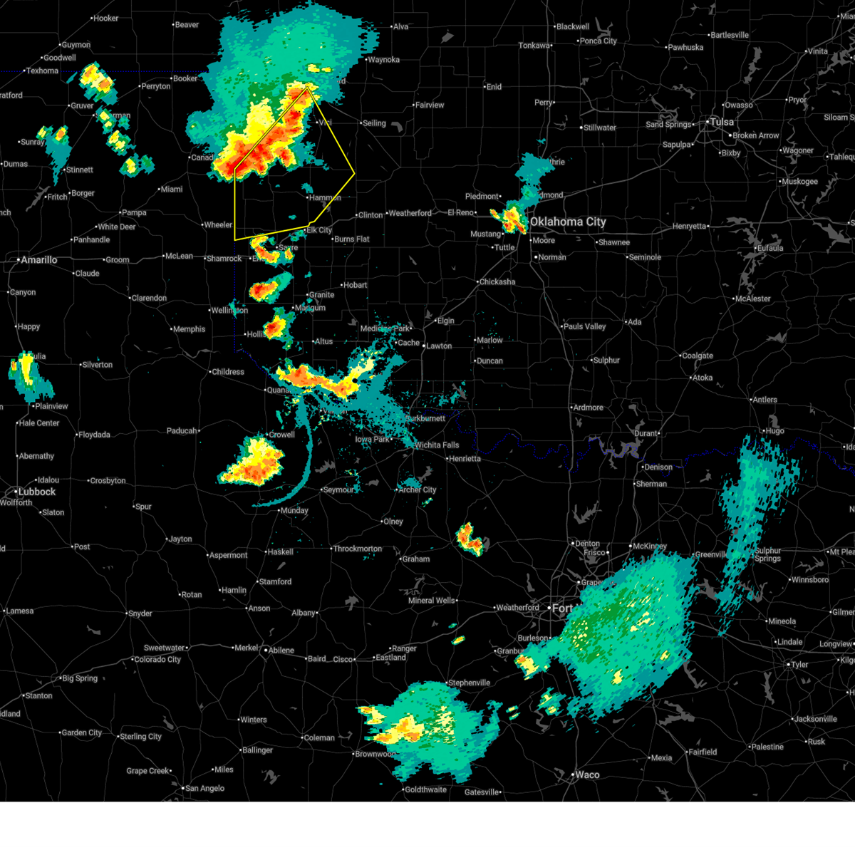
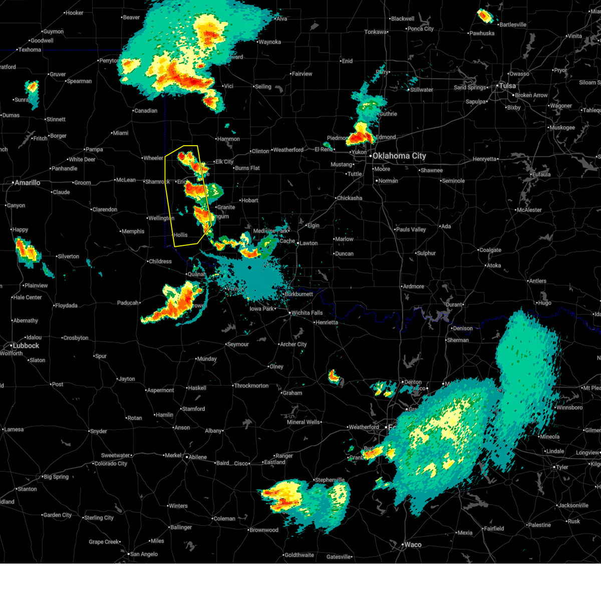
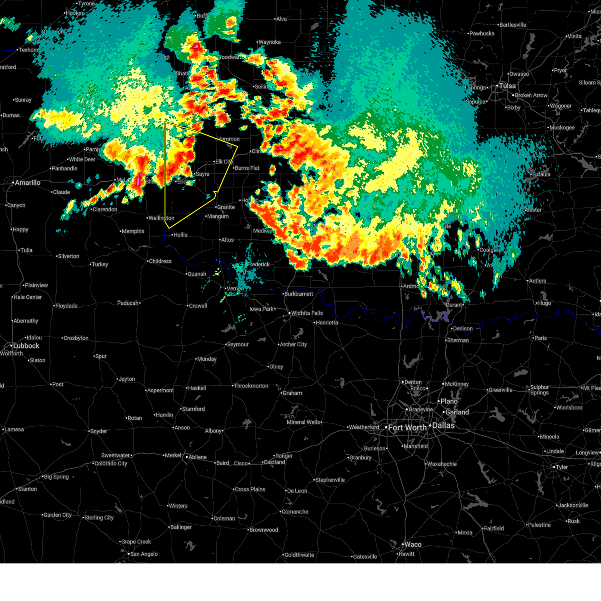
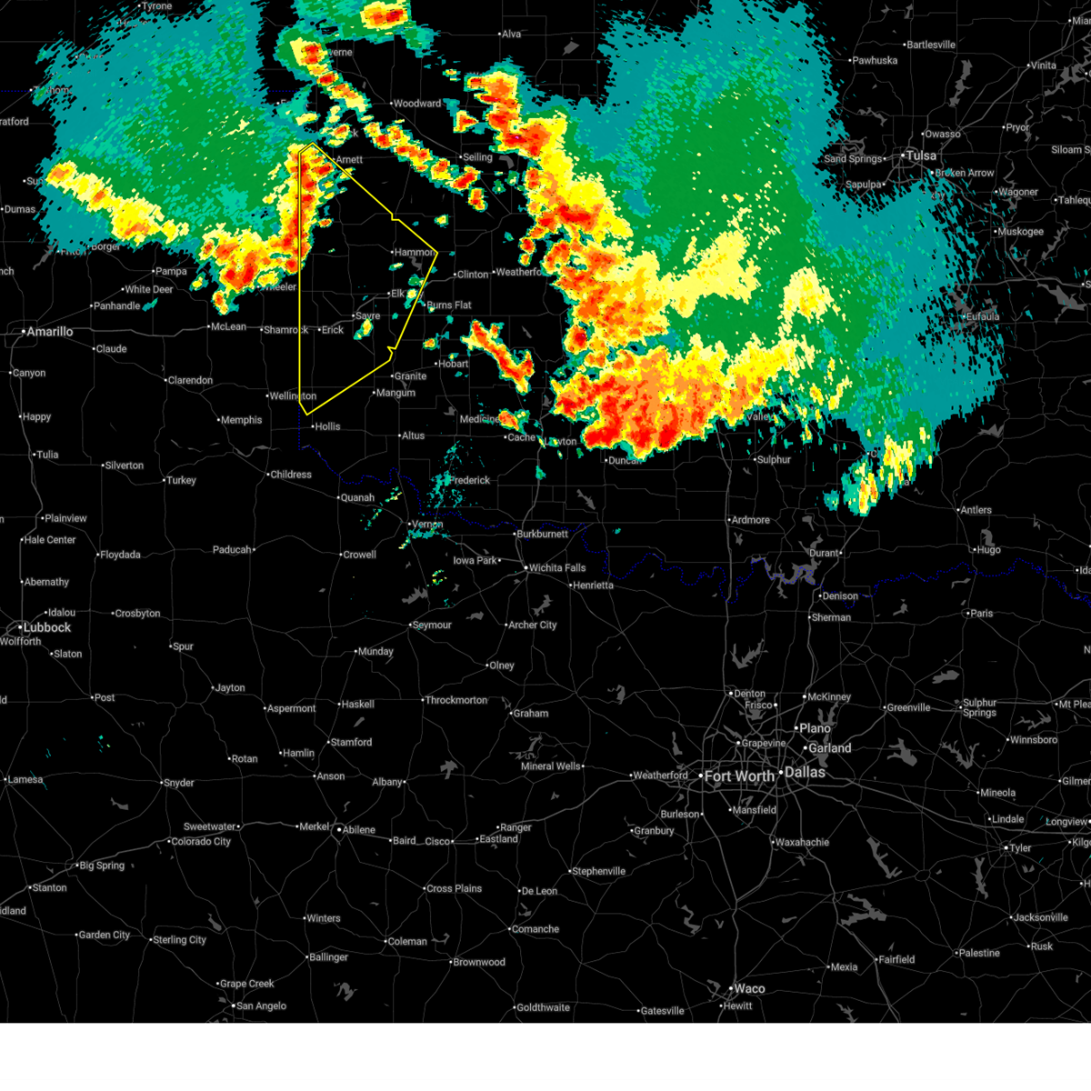
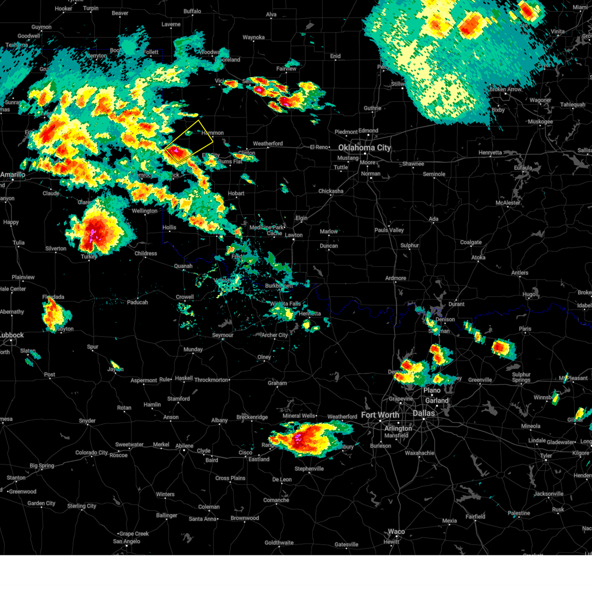
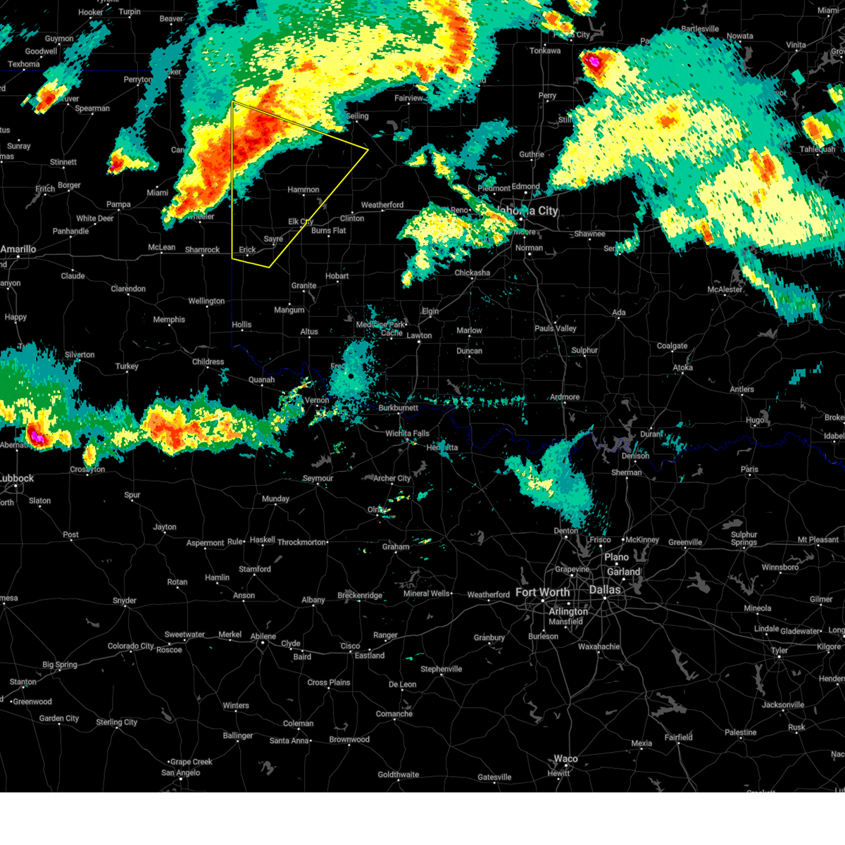
Hail Map for Sweetwater, OK
The Sweetwater, OK area has had 13 reports of on-the-ground hail by trained spotters, and has been under severe weather warnings 22 times during the past 12 months. Doppler radar has detected hail at or near Sweetwater, OK on 109 occasions, including 7 occasions during the past year.
| Name: | Sweetwater, OK |
| Where Located: | 70.6 miles NNE of Childress, TX |
| Map: | Google Map for Sweetwater, OK |
| Population: | 87 |
| Housing Units: | 45 |
| More Info: | Search Google for Sweetwater, OK |
1
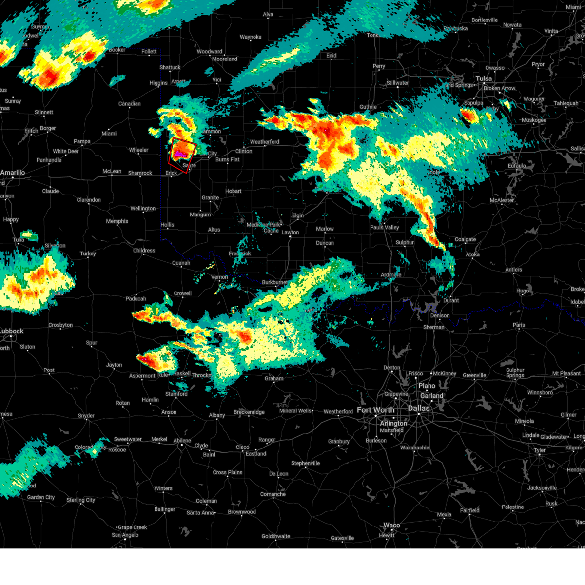
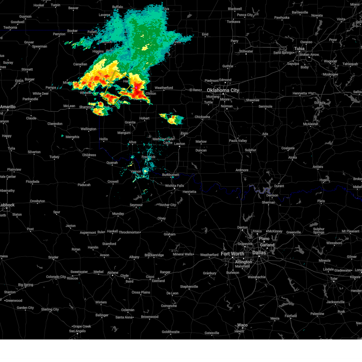
The Top Recent Hail Date for Sweetwater, OK is Sunday, June 8, 2025 (18th out of 109)
Hail and Wind Damage Spotted near Sweetwater, OK
| Date / Time | Report Details |
|---|---|
| 7/8/2025 11:44 PM CDT |
 Svroun the national weather service in norman has issued a * severe thunderstorm warning for, western washita county in western oklahoma, southeastern roger mills county in western oklahoma, custer county in western oklahoma, northwestern kiowa county in southwestern oklahoma, northern harmon county in southwestern oklahoma, greer county in southwestern oklahoma, beckham county in western oklahoma, * until 1230 am cdt. * at 1144 pm cdt, severe thunderstorms were located along a line extending from near foss reservoir to 4 miles east of carter to 8 miles north of vinson, moving southeast at 50 mph (radar indicated). Hazards include 60 mph wind gusts and quarter size hail. Hail damage to vehicles is expected. Expect wind damage to roofs, siding, and trees. Svroun the national weather service in norman has issued a * severe thunderstorm warning for, western washita county in western oklahoma, southeastern roger mills county in western oklahoma, custer county in western oklahoma, northwestern kiowa county in southwestern oklahoma, northern harmon county in southwestern oklahoma, greer county in southwestern oklahoma, beckham county in western oklahoma, * until 1230 am cdt. * at 1144 pm cdt, severe thunderstorms were located along a line extending from near foss reservoir to 4 miles east of carter to 8 miles north of vinson, moving southeast at 50 mph (radar indicated). Hazards include 60 mph wind gusts and quarter size hail. Hail damage to vehicles is expected. Expect wind damage to roofs, siding, and trees.
|
| 7/8/2025 11:33 PM CDT |
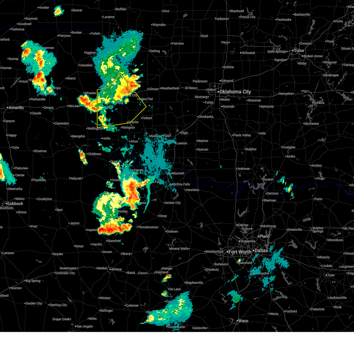 At 1133 pm cdt, severe thunderstorms were located along a line extending from 4 miles southwest of canute to near carter to 5 miles west of delhi, moving southeast at 45 mph (radar indicated). Hazards include 60 mph wind gusts. Expect damage to roofs, siding, and trees. Locations impacted include, elk city, sayre, cheyenne, granite, burns flat, erick, sentinel, hammon, dill city, canute, carter, willow, sweetwater, strong city, texola, retrop, delhi, vinson, madge, and brinkman. At 1133 pm cdt, severe thunderstorms were located along a line extending from 4 miles southwest of canute to near carter to 5 miles west of delhi, moving southeast at 45 mph (radar indicated). Hazards include 60 mph wind gusts. Expect damage to roofs, siding, and trees. Locations impacted include, elk city, sayre, cheyenne, granite, burns flat, erick, sentinel, hammon, dill city, canute, carter, willow, sweetwater, strong city, texola, retrop, delhi, vinson, madge, and brinkman.
|
| 7/8/2025 10:55 PM CDT |
 Svroun the national weather service in norman has issued a * severe thunderstorm warning for, western washita county in western oklahoma, southern roger mills county in western oklahoma, northwestern kiowa county in southwestern oklahoma, northern harmon county in southwestern oklahoma, northern greer county in southwestern oklahoma, beckham county in western oklahoma, * until 1145 pm cdt. * at 1055 pm cdt, severe thunderstorms were located along a line extending from 3 miles north of strong city to 8 miles southwest of cheyenne to 7 miles southeast of allison, moving southeast at 45 mph (radar indicated). Hazards include 70 mph wind gusts. Expect considerable tree damage. Damage is likely to mobile homes, roofs, and outbuildings. Svroun the national weather service in norman has issued a * severe thunderstorm warning for, western washita county in western oklahoma, southern roger mills county in western oklahoma, northwestern kiowa county in southwestern oklahoma, northern harmon county in southwestern oklahoma, northern greer county in southwestern oklahoma, beckham county in western oklahoma, * until 1145 pm cdt. * at 1055 pm cdt, severe thunderstorms were located along a line extending from 3 miles north of strong city to 8 miles southwest of cheyenne to 7 miles southeast of allison, moving southeast at 45 mph (radar indicated). Hazards include 70 mph wind gusts. Expect considerable tree damage. Damage is likely to mobile homes, roofs, and outbuildings.
|
| 7/8/2025 10:28 PM CDT |
 Svroun the national weather service in norman has issued a * severe thunderstorm warning for, southeastern ellis county in northwestern oklahoma, roger mills county in western oklahoma, western custer county in western oklahoma, western dewey county in northwestern oklahoma, northern beckham county in western oklahoma, southwestern woodward county in northwestern oklahoma, * until 1115 pm cdt. * at 1028 pm cdt, severe thunderstorms were located along a line extending from 5 miles southwest of sharon to 5 miles southwest of durham, moving southeast at 35 mph (radar indicated). Hazards include 70 mph wind gusts. Expect considerable tree damage. Damage is likely to mobile homes, roofs, and outbuildings. Svroun the national weather service in norman has issued a * severe thunderstorm warning for, southeastern ellis county in northwestern oklahoma, roger mills county in western oklahoma, western custer county in western oklahoma, western dewey county in northwestern oklahoma, northern beckham county in western oklahoma, southwestern woodward county in northwestern oklahoma, * until 1115 pm cdt. * at 1028 pm cdt, severe thunderstorms were located along a line extending from 5 miles southwest of sharon to 5 miles southwest of durham, moving southeast at 35 mph (radar indicated). Hazards include 70 mph wind gusts. Expect considerable tree damage. Damage is likely to mobile homes, roofs, and outbuildings.
|
| 7/8/2025 9:57 PM CDT |
 Svroun the national weather service in norman has issued a * severe thunderstorm warning for, southwestern roger mills county in western oklahoma, west central jackson county in southwestern oklahoma, harmon county in southwestern oklahoma, greer county in southwestern oklahoma, beckham county in western oklahoma, * until 1045 pm cdt. * at 957 pm cdt, severe thunderstorms were located along a line extending from 8 miles east of sweetwater to 6 miles southwest of mangum, moving southwest at 15 mph (radar indicated). Hazards include 60 mph wind gusts and quarter size hail. Hail damage to vehicles is expected. Expect wind damage to roofs, siding, and trees. Svroun the national weather service in norman has issued a * severe thunderstorm warning for, southwestern roger mills county in western oklahoma, west central jackson county in southwestern oklahoma, harmon county in southwestern oklahoma, greer county in southwestern oklahoma, beckham county in western oklahoma, * until 1045 pm cdt. * at 957 pm cdt, severe thunderstorms were located along a line extending from 8 miles east of sweetwater to 6 miles southwest of mangum, moving southwest at 15 mph (radar indicated). Hazards include 60 mph wind gusts and quarter size hail. Hail damage to vehicles is expected. Expect wind damage to roofs, siding, and trees.
|
| 6/15/2025 6:18 AM CDT |
 the severe thunderstorm warning has been cancelled and is no longer in effect the severe thunderstorm warning has been cancelled and is no longer in effect
|
| 6/15/2025 6:18 AM CDT |
 At 618 am cdt, severe thunderstorms were located along a line extending from 4 miles southwest of angora to 4 miles west of sayre to 4 miles southwest of texola, moving southeast at 40 mph (radar indicated). Hazards include 60 mph wind gusts. Expect damage to roofs, siding, and trees. Locations impacted include, elk city, sayre, cheyenne, erick, hammon, canute, carter, reydon, foss, willow, sweetwater, strong city, texola, retrop, delhi, foss reservoir, vinson, madge, brinkman, and berlin. At 618 am cdt, severe thunderstorms were located along a line extending from 4 miles southwest of angora to 4 miles west of sayre to 4 miles southwest of texola, moving southeast at 40 mph (radar indicated). Hazards include 60 mph wind gusts. Expect damage to roofs, siding, and trees. Locations impacted include, elk city, sayre, cheyenne, erick, hammon, canute, carter, reydon, foss, willow, sweetwater, strong city, texola, retrop, delhi, foss reservoir, vinson, madge, brinkman, and berlin.
|
| 6/15/2025 5:47 AM CDT |
 Svroun the national weather service in norman has issued a * severe thunderstorm warning for, northwestern washita county in western oklahoma, southwestern ellis county in northwestern oklahoma, roger mills county in western oklahoma, western custer county in western oklahoma, northern harmon county in southwestern oklahoma, northwestern greer county in southwestern oklahoma, beckham county in western oklahoma, * until 630 am cdt. * at 546 am cdt, severe thunderstorms were located along a line extending from 9 miles south of arnett to 5 miles northwest of sweetwater to near wheeler, moving southeast at 50 mph (radar indicated). Hazards include 60 mph wind gusts and nickel size hail. expect damage to roofs, siding, and trees Svroun the national weather service in norman has issued a * severe thunderstorm warning for, northwestern washita county in western oklahoma, southwestern ellis county in northwestern oklahoma, roger mills county in western oklahoma, western custer county in western oklahoma, northern harmon county in southwestern oklahoma, northwestern greer county in southwestern oklahoma, beckham county in western oklahoma, * until 630 am cdt. * at 546 am cdt, severe thunderstorms were located along a line extending from 9 miles south of arnett to 5 miles northwest of sweetwater to near wheeler, moving southeast at 50 mph (radar indicated). Hazards include 60 mph wind gusts and nickel size hail. expect damage to roofs, siding, and trees
|
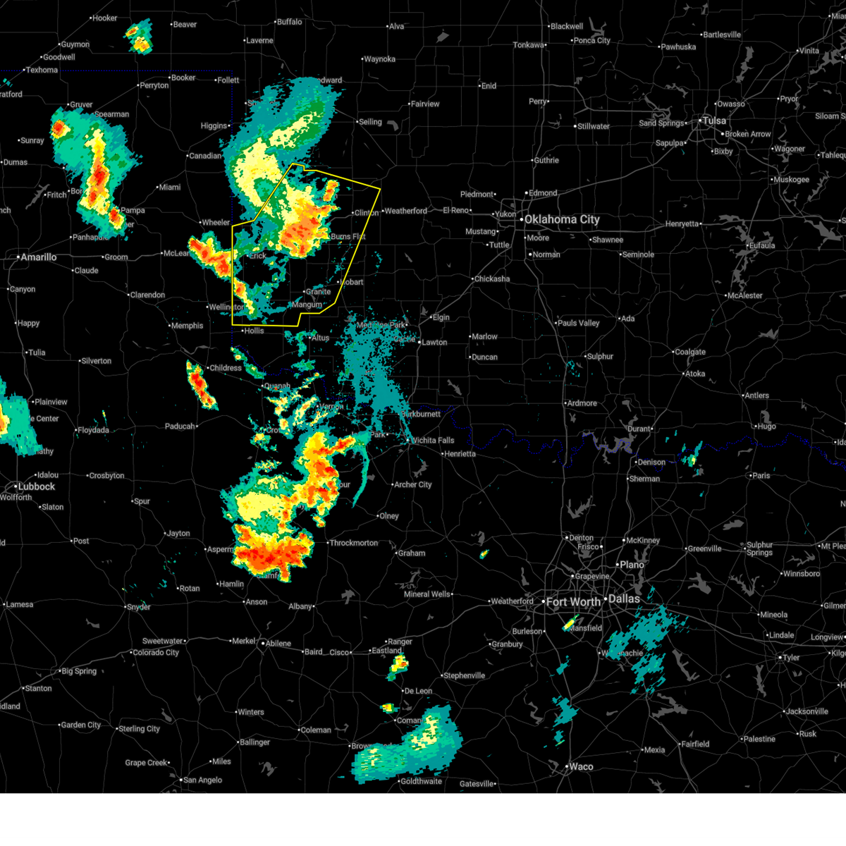
| 6/8/2025 5:19 PM CDT |
 Svroun the national weather service in norman has issued a * severe thunderstorm warning for, southern roger mills county in western oklahoma, north central beckham county in western oklahoma, * until 545 pm cdt. * at 518 pm cdt, a severe thunderstorm was located 8 miles northeast of sweetwater, moving northeast at 35 mph (radar indicated). Hazards include golf ball size hail and 60 mph wind gusts. People and animals outdoors will be injured. expect hail damage to roofs, siding, windows, and vehicles. Expect wind damage to roofs, siding, and trees. Svroun the national weather service in norman has issued a * severe thunderstorm warning for, southern roger mills county in western oklahoma, north central beckham county in western oklahoma, * until 545 pm cdt. * at 518 pm cdt, a severe thunderstorm was located 8 miles northeast of sweetwater, moving northeast at 35 mph (radar indicated). Hazards include golf ball size hail and 60 mph wind gusts. People and animals outdoors will be injured. expect hail damage to roofs, siding, windows, and vehicles. Expect wind damage to roofs, siding, and trees.
|
| 6/8/2025 4:57 PM CDT |
 Svroun the national weather service in norman has issued a * severe thunderstorm warning for, southwestern roger mills county in western oklahoma, northwestern beckham county in western oklahoma, * until 530 pm cdt. * at 456 pm cdt, a severe thunderstorm was located 6 miles west of sweetwater, moving east at 25 mph (radar indicated). Hazards include 60 mph wind gusts and half dollar size hail. Hail damage to vehicles is expected. Expect wind damage to roofs, siding, and trees. Svroun the national weather service in norman has issued a * severe thunderstorm warning for, southwestern roger mills county in western oklahoma, northwestern beckham county in western oklahoma, * until 530 pm cdt. * at 456 pm cdt, a severe thunderstorm was located 6 miles west of sweetwater, moving east at 25 mph (radar indicated). Hazards include 60 mph wind gusts and half dollar size hail. Hail damage to vehicles is expected. Expect wind damage to roofs, siding, and trees.
|
| 6/7/2025 2:11 AM CDT |
 At 211 am cdt, severe thunderstorms were located along a line extending from 3 miles southwest of camargo to 8 miles west of sweetwater, moving east at 60 mph (radar indicated). Hazards include 60 mph wind gusts and penny size hail. Expect damage to roofs, siding, and trees. Locations impacted include, elk city, sayre, cheyenne, erick, hammon, leedey, butler, reydon, camargo, sweetwater, strong city, texola, putnam, delhi, angora, moorewood, crawford, roll, foss reservoir, and berlin. At 211 am cdt, severe thunderstorms were located along a line extending from 3 miles southwest of camargo to 8 miles west of sweetwater, moving east at 60 mph (radar indicated). Hazards include 60 mph wind gusts and penny size hail. Expect damage to roofs, siding, and trees. Locations impacted include, elk city, sayre, cheyenne, erick, hammon, leedey, butler, reydon, camargo, sweetwater, strong city, texola, putnam, delhi, angora, moorewood, crawford, roll, foss reservoir, and berlin.
|
| 6/7/2025 2:00 AM CDT |
 At 159 am cdt, severe thunderstorms were located along a line extending from 8 miles southeast of harmon to 3 miles east of wheeler, moving southeast at 50 mph (radar indicated). Hazards include 60 mph wind gusts and penny size hail. Expect damage to roofs, siding, and trees. Locations impacted include, elk city, sayre, cheyenne, erick, hammon, leedey, butler, reydon, camargo, sweetwater, strong city, texola, putnam, delhi, angora, moorewood, crawford, harmon, roll, and durham. At 159 am cdt, severe thunderstorms were located along a line extending from 8 miles southeast of harmon to 3 miles east of wheeler, moving southeast at 50 mph (radar indicated). Hazards include 60 mph wind gusts and penny size hail. Expect damage to roofs, siding, and trees. Locations impacted include, elk city, sayre, cheyenne, erick, hammon, leedey, butler, reydon, camargo, sweetwater, strong city, texola, putnam, delhi, angora, moorewood, crawford, harmon, roll, and durham.
|
| 6/7/2025 1:50 AM CDT |
 Svroun the national weather service in norman has issued a * severe thunderstorm warning for, southern ellis county in northwestern oklahoma, roger mills county in western oklahoma, western custer county in western oklahoma, southwestern dewey county in northwestern oklahoma, beckham county in western oklahoma, * until 230 am cdt. * at 150 am cdt, severe thunderstorms were located along a line extending from 6 miles southwest of harmon to near allison, moving east at 50 mph (radar indicated). Hazards include 60 mph wind gusts and quarter size hail. Hail damage to vehicles is expected. Expect wind damage to roofs, siding, and trees. Svroun the national weather service in norman has issued a * severe thunderstorm warning for, southern ellis county in northwestern oklahoma, roger mills county in western oklahoma, western custer county in western oklahoma, southwestern dewey county in northwestern oklahoma, beckham county in western oklahoma, * until 230 am cdt. * at 150 am cdt, severe thunderstorms were located along a line extending from 6 miles southwest of harmon to near allison, moving east at 50 mph (radar indicated). Hazards include 60 mph wind gusts and quarter size hail. Hail damage to vehicles is expected. Expect wind damage to roofs, siding, and trees.
|
| 6/6/2025 11:57 PM CDT |
 At 1157 pm cdt, a confirmed tornado was located 7 miles northwest of sayre, moving southeast at 35 mph (broadcast media confirmed tornado). Hazards include damaging tornado and tennis ball size hail. Flying debris will be dangerous to those caught without shelter. mobile homes will be damaged or destroyed. damage to roofs, windows, and vehicles will occur. tree damage is likely. locations impacted include, berlin and dempsey. This includes interstate 40 between mile markers 18 and 19. At 1157 pm cdt, a confirmed tornado was located 7 miles northwest of sayre, moving southeast at 35 mph (broadcast media confirmed tornado). Hazards include damaging tornado and tennis ball size hail. Flying debris will be dangerous to those caught without shelter. mobile homes will be damaged or destroyed. damage to roofs, windows, and vehicles will occur. tree damage is likely. locations impacted include, berlin and dempsey. This includes interstate 40 between mile markers 18 and 19.
|
| 6/6/2025 11:52 PM CDT |
 At 1151 pm cdt, a confirmed tornado was located 3 to 4 miles east of sweetwater, moving southeast at 35 mph (broadcast media confirmed tornado). Hazards include damaging tornado and tennis ball size hail. Flying debris will be dangerous to those caught without shelter. mobile homes will be damaged or destroyed. damage to roofs, windows, and vehicles will occur. tree damage is likely. locations impacted include, sweetwater, berlin, and dempsey. This includes interstate 40 between mile markers 14 and 18. At 1151 pm cdt, a confirmed tornado was located 3 to 4 miles east of sweetwater, moving southeast at 35 mph (broadcast media confirmed tornado). Hazards include damaging tornado and tennis ball size hail. Flying debris will be dangerous to those caught without shelter. mobile homes will be damaged or destroyed. damage to roofs, windows, and vehicles will occur. tree damage is likely. locations impacted include, sweetwater, berlin, and dempsey. This includes interstate 40 between mile markers 14 and 18.
|
| 6/6/2025 11:50 PM CDT |
 At 1149 pm cdt, a severe thunderstorm capable of producing a tornado was located 5 miles east of sweetwater, moving southeast at 35 mph (radar indicated rotation). Hazards include tornado and tennis ball size hail. Flying debris will be dangerous to those caught without shelter. mobile homes will be damaged or destroyed. damage to roofs, windows, and vehicles will occur. tree damage is likely. locations impacted include, sweetwater, berlin, and dempsey. This includes interstate 40 between mile markers 14 and 18. At 1149 pm cdt, a severe thunderstorm capable of producing a tornado was located 5 miles east of sweetwater, moving southeast at 35 mph (radar indicated rotation). Hazards include tornado and tennis ball size hail. Flying debris will be dangerous to those caught without shelter. mobile homes will be damaged or destroyed. damage to roofs, windows, and vehicles will occur. tree damage is likely. locations impacted include, sweetwater, berlin, and dempsey. This includes interstate 40 between mile markers 14 and 18.
|
| 6/6/2025 11:31 PM CDT |
 At 1131 pm cdt, a confirmed tornado was located 5 miles northwest of sweetwater, moving southeast at 35 mph (weather spotters confirmed tornado). Hazards include damaging tornado and tennis ball size hail. Flying debris will be dangerous to those caught without shelter. mobile homes will be damaged or destroyed. damage to roofs, windows, and vehicles will occur. tree damage is likely. locations impacted include, cheyenne, reydon, sweetwater, berlin, and dempsey. This includes interstate 40 between mile markers 9 and 18. At 1131 pm cdt, a confirmed tornado was located 5 miles northwest of sweetwater, moving southeast at 35 mph (weather spotters confirmed tornado). Hazards include damaging tornado and tennis ball size hail. Flying debris will be dangerous to those caught without shelter. mobile homes will be damaged or destroyed. damage to roofs, windows, and vehicles will occur. tree damage is likely. locations impacted include, cheyenne, reydon, sweetwater, berlin, and dempsey. This includes interstate 40 between mile markers 9 and 18.
|
| 6/6/2025 11:24 PM CDT | Toroun the national weather service in norman has issued a * tornado warning for, southern roger mills county in western oklahoma, northwestern beckham county in western oklahoma, * until 1215 am cdt. * at 1124 pm cdt, a severe thunderstorm capable of producing a tornado was located 7 miles southeast of allison, moving southeast at 35 mph (radar indicated rotation). Hazards include tornado and tennis ball size hail. Flying debris will be dangerous to those caught without shelter. mobile homes will be damaged or destroyed. damage to roofs, windows, and vehicles will occur. Tree damage is likely. |
| 6/5/2025 2:17 PM CDT |
 Svroun the national weather service in norman has issued a * severe thunderstorm warning for, southeastern roger mills county in western oklahoma, northwestern beckham county in western oklahoma, * until 300 pm cdt. * at 217 pm cdt, a severe thunderstorm was located 10 miles northwest of sayre, moving northeast at 45 mph (radar indicated). Hazards include 60 mph wind gusts and quarter size hail. Hail damage to vehicles is expected. expect wind damage to roofs, siding, and trees. This severe thunderstorm will remain over mainly rural areas of southeastern roger mills and northwestern beckham counties, including the following locations, berlin and dempsey. Svroun the national weather service in norman has issued a * severe thunderstorm warning for, southeastern roger mills county in western oklahoma, northwestern beckham county in western oklahoma, * until 300 pm cdt. * at 217 pm cdt, a severe thunderstorm was located 10 miles northwest of sayre, moving northeast at 45 mph (radar indicated). Hazards include 60 mph wind gusts and quarter size hail. Hail damage to vehicles is expected. expect wind damage to roofs, siding, and trees. This severe thunderstorm will remain over mainly rural areas of southeastern roger mills and northwestern beckham counties, including the following locations, berlin and dempsey.
|
| 5/26/2025 9:35 PM CDT | Svroun the national weather service in norman has issued a * severe thunderstorm warning for, south central ellis county in northwestern oklahoma, roger mills county in western oklahoma, * until 1015 pm cdt. * at 935 pm cdt, severe thunderstorms were located along a line extending from 3 miles northeast of crawford to near reydon to near allison, moving southeast at 30 mph (radar indicated). Hazards include 60 mph wind gusts and quarter size hail. Hail damage to vehicles is expected. Expect wind damage to roofs, siding, and trees. |
| 5/26/2025 8:42 PM CDT |
 the severe thunderstorm warning has been cancelled and is no longer in effect the severe thunderstorm warning has been cancelled and is no longer in effect
|
| 5/26/2025 8:11 PM CDT |
 Svroun the national weather service in norman has issued a * severe thunderstorm warning for, southwestern roger mills county in western oklahoma, northwestern beckham county in western oklahoma, * until 900 pm cdt. * at 811 pm cdt, a severe thunderstorm was located 6 miles southwest of sweetwater, moving east at 25 mph (radar indicated). Hazards include ping pong ball size hail and 60 mph wind gusts. People and animals outdoors will be injured. expect hail damage to roofs, siding, windows, and vehicles. Expect wind damage to roofs, siding, and trees. Svroun the national weather service in norman has issued a * severe thunderstorm warning for, southwestern roger mills county in western oklahoma, northwestern beckham county in western oklahoma, * until 900 pm cdt. * at 811 pm cdt, a severe thunderstorm was located 6 miles southwest of sweetwater, moving east at 25 mph (radar indicated). Hazards include ping pong ball size hail and 60 mph wind gusts. People and animals outdoors will be injured. expect hail damage to roofs, siding, windows, and vehicles. Expect wind damage to roofs, siding, and trees.
|
| 5/30/2024 9:33 PM CDT |
 At 933 pm cdt, severe thunderstorms were located along a line extending from 6 miles northeast of roll to 8 miles northwest of elk city to 4 miles northeast of delhi, moving east at 30 mph (radar indicated). Hazards include 60 mph wind gusts and nickel size hail. Expect damage to roofs, siding, and trees. Locations impacted include, elk city, sayre, cheyenne, hammon, canute, butler, strong city, foss reservoir, angora, moorewood, crawford, roll, durham, berlin, and dempsey. At 933 pm cdt, severe thunderstorms were located along a line extending from 6 miles northeast of roll to 8 miles northwest of elk city to 4 miles northeast of delhi, moving east at 30 mph (radar indicated). Hazards include 60 mph wind gusts and nickel size hail. Expect damage to roofs, siding, and trees. Locations impacted include, elk city, sayre, cheyenne, hammon, canute, butler, strong city, foss reservoir, angora, moorewood, crawford, roll, durham, berlin, and dempsey.
|
| 5/30/2024 9:12 PM CDT |
 Svroun the national weather service in norman has issued a * severe thunderstorm warning for, northwestern washita county in western oklahoma, roger mills county in western oklahoma, western custer county in western oklahoma, northern beckham county in western oklahoma, * until 1000 pm cdt. * at 911 pm cdt, severe thunderstorms were located along a line extending from near durham to 9 miles southeast of cheyenne to near erick, moving east at 40 mph (radar indicated). Hazards include 60 mph wind gusts and nickel size hail. expect damage to roofs, siding, and trees Svroun the national weather service in norman has issued a * severe thunderstorm warning for, northwestern washita county in western oklahoma, roger mills county in western oklahoma, western custer county in western oklahoma, northern beckham county in western oklahoma, * until 1000 pm cdt. * at 911 pm cdt, severe thunderstorms were located along a line extending from near durham to 9 miles southeast of cheyenne to near erick, moving east at 40 mph (radar indicated). Hazards include 60 mph wind gusts and nickel size hail. expect damage to roofs, siding, and trees
|
| 5/30/2024 8:54 PM CDT |
 At 853 pm cdt, severe thunderstorms were located along a line extending from 4 miles northwest of durham to 9 miles northeast of sweetwater to 7 miles northwest of texola, moving east at 35 mph (radar indicated). Hazards include 60 mph wind gusts and nickel size hail. Expect damage to roofs, siding, and trees. Locations impacted include, sayre, cheyenne, reydon, sweetwater, strong city, crawford, roll, durham, berlin, and dempsey. At 853 pm cdt, severe thunderstorms were located along a line extending from 4 miles northwest of durham to 9 miles northeast of sweetwater to 7 miles northwest of texola, moving east at 35 mph (radar indicated). Hazards include 60 mph wind gusts and nickel size hail. Expect damage to roofs, siding, and trees. Locations impacted include, sayre, cheyenne, reydon, sweetwater, strong city, crawford, roll, durham, berlin, and dempsey.
|
| 5/30/2024 8:34 PM CDT |
 Svroun the national weather service in norman has issued a * severe thunderstorm warning for, roger mills county in western oklahoma, northwestern beckham county in western oklahoma, * until 915 pm cdt. * at 833 pm cdt, severe thunderstorms were located along a line extending from near lake marvin to near reydon to 4 miles northeast of shamrock, moving east at 40 mph (radar indicated). Hazards include 60 mph wind gusts and penny size hail. expect damage to roofs, siding, and trees Svroun the national weather service in norman has issued a * severe thunderstorm warning for, roger mills county in western oklahoma, northwestern beckham county in western oklahoma, * until 915 pm cdt. * at 833 pm cdt, severe thunderstorms were located along a line extending from near lake marvin to near reydon to 4 miles northeast of shamrock, moving east at 40 mph (radar indicated). Hazards include 60 mph wind gusts and penny size hail. expect damage to roofs, siding, and trees
|
| 5/23/2024 5:08 PM CDT |
 At 507 pm cdt, a severe thunderstorm was located near erick, moving northeast at 20 mph (trained weather spotters reported 2 inch hail at 5:03 pm). Hazards include ping pong ball size hail and 60 mph wind gusts. People and animals outdoors will be injured. expect hail damage to roofs, siding, windows, and vehicles. expect wind damage to roofs, siding, and trees. Locations impacted include, erick, sweetwater, texola, and delhi. At 507 pm cdt, a severe thunderstorm was located near erick, moving northeast at 20 mph (trained weather spotters reported 2 inch hail at 5:03 pm). Hazards include ping pong ball size hail and 60 mph wind gusts. People and animals outdoors will be injured. expect hail damage to roofs, siding, windows, and vehicles. expect wind damage to roofs, siding, and trees. Locations impacted include, erick, sweetwater, texola, and delhi.
|
| 5/23/2024 4:51 PM CDT |
 At 451 pm cdt, a severe thunderstorm was located 6 miles southwest of erick, moving northeast at 25 mph (trained weather spotters). Hazards include 60 mph wind gusts and quarter size hail. Hail damage to vehicles is expected. expect wind damage to roofs, siding, and trees. Locations impacted include, erick, sweetwater, texola, and delhi. At 451 pm cdt, a severe thunderstorm was located 6 miles southwest of erick, moving northeast at 25 mph (trained weather spotters). Hazards include 60 mph wind gusts and quarter size hail. Hail damage to vehicles is expected. expect wind damage to roofs, siding, and trees. Locations impacted include, erick, sweetwater, texola, and delhi.
|
| 5/23/2024 4:51 PM CDT |
 the severe thunderstorm warning has been cancelled and is no longer in effect the severe thunderstorm warning has been cancelled and is no longer in effect
|
| 5/23/2024 4:40 PM CDT |
 Svroun the national weather service in norman has issued a * severe thunderstorm warning for, southern roger mills county in western oklahoma, north central greer county in southwestern oklahoma, western beckham county in western oklahoma, * until 530 pm cdt. * at 440 pm cdt, a severe thunderstorm was located 7 miles south of texola, moving northeast at 20 mph (radar indicated). Hazards include 60 mph wind gusts and quarter size hail. Hail damage to vehicles is expected. Expect wind damage to roofs, siding, and trees. Svroun the national weather service in norman has issued a * severe thunderstorm warning for, southern roger mills county in western oklahoma, north central greer county in southwestern oklahoma, western beckham county in western oklahoma, * until 530 pm cdt. * at 440 pm cdt, a severe thunderstorm was located 7 miles south of texola, moving northeast at 20 mph (radar indicated). Hazards include 60 mph wind gusts and quarter size hail. Hail damage to vehicles is expected. Expect wind damage to roofs, siding, and trees.
|
| 4/27/2024 11:28 AM CDT |
 the severe thunderstorm warning has been cancelled and is no longer in effect the severe thunderstorm warning has been cancelled and is no longer in effect
|
| 4/27/2024 11:28 AM CDT |
 At 1128 am cdt, severe thunderstorms were located along a line extending from 5 miles northwest of angora to 9 miles northeast of sweetwater, moving northeast at 45 mph (radar indicated). Hazards include 60 mph wind gusts and quarter size hail. Hail damage to vehicles is expected. expect wind damage to roofs, siding, and trees. Locations impacted include, cheyenne, hammon, leedey, camargo, strong city, moorewood, roll, angora, and dempsey. At 1128 am cdt, severe thunderstorms were located along a line extending from 5 miles northwest of angora to 9 miles northeast of sweetwater, moving northeast at 45 mph (radar indicated). Hazards include 60 mph wind gusts and quarter size hail. Hail damage to vehicles is expected. expect wind damage to roofs, siding, and trees. Locations impacted include, cheyenne, hammon, leedey, camargo, strong city, moorewood, roll, angora, and dempsey.
|
| 4/27/2024 11:16 AM CDT |
 Svroun the national weather service in norman has issued a * severe thunderstorm warning for, southeastern ellis county in northwestern oklahoma, roger mills county in western oklahoma, northwestern custer county in western oklahoma, western dewey county in northwestern oklahoma, northwestern beckham county in western oklahoma, * until noon cdt. * at 1114 am cdt, severe thunderstorms were located along a line extending from 5 miles northwest of angora to near sweetwater, moving northeast at 60 mph (radar indicated). Hazards include 60 mph wind gusts and quarter size hail. Hail damage to vehicles is expected. Expect wind damage to roofs, siding, and trees. Svroun the national weather service in norman has issued a * severe thunderstorm warning for, southeastern ellis county in northwestern oklahoma, roger mills county in western oklahoma, northwestern custer county in western oklahoma, western dewey county in northwestern oklahoma, northwestern beckham county in western oklahoma, * until noon cdt. * at 1114 am cdt, severe thunderstorms were located along a line extending from 5 miles northwest of angora to near sweetwater, moving northeast at 60 mph (radar indicated). Hazards include 60 mph wind gusts and quarter size hail. Hail damage to vehicles is expected. Expect wind damage to roofs, siding, and trees.
|
| 3/24/2024 4:03 PM CDT |
 the severe thunderstorm warning has been cancelled and is no longer in effect the severe thunderstorm warning has been cancelled and is no longer in effect
|
| 3/24/2024 3:45 PM CDT |
 Svroun the national weather service in norman has issued a * severe thunderstorm warning for, southern roger mills county in western oklahoma, northwestern beckham county in western oklahoma, * until 430 pm cdt. * at 344 pm cdt, a severe thunderstorm was located 4 miles northwest of sweetwater, moving northeast at 50 mph (radar indicated). Hazards include 60 mph wind gusts and quarter size hail. Hail damage to vehicles is expected. Expect wind damage to roofs, siding, and trees. Svroun the national weather service in norman has issued a * severe thunderstorm warning for, southern roger mills county in western oklahoma, northwestern beckham county in western oklahoma, * until 430 pm cdt. * at 344 pm cdt, a severe thunderstorm was located 4 miles northwest of sweetwater, moving northeast at 50 mph (radar indicated). Hazards include 60 mph wind gusts and quarter size hail. Hail damage to vehicles is expected. Expect wind damage to roofs, siding, and trees.
|
| 8/13/2023 8:51 PM CDT |
 The severe thunderstorm warning for southeastern roger mills, northwestern custer and northern beckham counties will expire at 900 pm cdt, the storms which prompted the warning have weakened below severe limits, therefore the warning will be allowed to expire. however, gusty winds are still possible with these thunderstorms. The severe thunderstorm warning for southeastern roger mills, northwestern custer and northern beckham counties will expire at 900 pm cdt, the storms which prompted the warning have weakened below severe limits, therefore the warning will be allowed to expire. however, gusty winds are still possible with these thunderstorms.
|
| 8/13/2023 8:18 PM CDT |
 At 818 pm cdt, a severe thunderstorm was located 10 miles south of cheyenne, moving northeast at 25 mph (radar indicated). Hazards include 60 mph wind gusts and quarter size hail. Hail damage to vehicles is expected. Expect wind damage to roofs, siding, and trees. At 818 pm cdt, a severe thunderstorm was located 10 miles south of cheyenne, moving northeast at 25 mph (radar indicated). Hazards include 60 mph wind gusts and quarter size hail. Hail damage to vehicles is expected. Expect wind damage to roofs, siding, and trees.
|
| 8/13/2023 5:46 PM CDT |
 At 546 pm cdt, severe thunderstorms were located along a line extending from 4 miles south of durham to 6 miles north of sweetwater, moving east at 25 mph (radar indicated). Hazards include 60 mph wind gusts and nickel size hail. Expect damage to roofs, siding, and trees. locations impacted include, reydon, sweetwater, crawford, durham, and dempsey. hail threat, radar indicated max hail size, 0. 88 in wind threat, radar indicated max wind gust, 60 mph. At 546 pm cdt, severe thunderstorms were located along a line extending from 4 miles south of durham to 6 miles north of sweetwater, moving east at 25 mph (radar indicated). Hazards include 60 mph wind gusts and nickel size hail. Expect damage to roofs, siding, and trees. locations impacted include, reydon, sweetwater, crawford, durham, and dempsey. hail threat, radar indicated max hail size, 0. 88 in wind threat, radar indicated max wind gust, 60 mph.
|
| 8/13/2023 5:23 PM CDT |
 At 523 pm cdt, severe thunderstorms were located along a line extending from 6 miles north of allison to 7 miles west of sweetwater, moving northeast at 25 mph (radar indicated). Hazards include 60 mph wind gusts and nickel size hail. expect damage to roofs, siding, and trees At 523 pm cdt, severe thunderstorms were located along a line extending from 6 miles north of allison to 7 miles west of sweetwater, moving northeast at 25 mph (radar indicated). Hazards include 60 mph wind gusts and nickel size hail. expect damage to roofs, siding, and trees
|
| 8/8/2023 11:13 PM CDT |
 At 1112 pm cdt, severe thunderstorms were located along a line extending from 5 miles northeast of twitty to near wellington to 3 miles northeast of childress, moving east at 35 mph (radar indicated). Hazards include 70 mph wind gusts. Expect considerable tree damage. Damage is likely to mobile homes, roofs, and outbuildings. At 1112 pm cdt, severe thunderstorms were located along a line extending from 5 miles northeast of twitty to near wellington to 3 miles northeast of childress, moving east at 35 mph (radar indicated). Hazards include 70 mph wind gusts. Expect considerable tree damage. Damage is likely to mobile homes, roofs, and outbuildings.
|
| 7/9/2023 2:34 AM CDT |
 At 233 am cdt, severe thunderstorms were located along a line extending from near concho to 4 miles east of foss reservoir to 3 miles north of delhi, moving southeast at 50 mph (public reported quarter size hail in weatherford). Hazards include 70 mph wind gusts and ping pong ball size hail. People and animals outdoors will be injured. expect hail damage to roofs, siding, windows, and vehicles. expect considerable tree damage. wind damage is also likely to mobile homes, roofs, and outbuildings. locations impacted include, elk city, weatherford, clinton, sayre, cordell, hinton, burns flat, geary, thomas, erick, hydro, sentinel, arapaho, hammon, dill city, canute, calumet, corn, custer city, and eakly. thunderstorm damage threat, considerable hail threat, observed max hail size, 1. 50 in wind threat, radar indicated max wind gust, 70 mph. At 233 am cdt, severe thunderstorms were located along a line extending from near concho to 4 miles east of foss reservoir to 3 miles north of delhi, moving southeast at 50 mph (public reported quarter size hail in weatherford). Hazards include 70 mph wind gusts and ping pong ball size hail. People and animals outdoors will be injured. expect hail damage to roofs, siding, windows, and vehicles. expect considerable tree damage. wind damage is also likely to mobile homes, roofs, and outbuildings. locations impacted include, elk city, weatherford, clinton, sayre, cordell, hinton, burns flat, geary, thomas, erick, hydro, sentinel, arapaho, hammon, dill city, canute, calumet, corn, custer city, and eakly. thunderstorm damage threat, considerable hail threat, observed max hail size, 1. 50 in wind threat, radar indicated max wind gust, 70 mph.
|
| 7/9/2023 2:08 AM CDT |
 At 208 am cdt, severe thunderstorms were located along a line extending from 8 miles east of greenfield to 3 miles north of hammon to 5 miles southwest of sweetwater, moving southeast at 50 mph (radar indicated). Hazards include 70 mph wind gusts and ping pong ball size hail. People and animals outdoors will be injured. expect hail damage to roofs, siding, windows, and vehicles. expect considerable tree damage. Wind damage is also likely to mobile homes, roofs, and outbuildings. At 208 am cdt, severe thunderstorms were located along a line extending from 8 miles east of greenfield to 3 miles north of hammon to 5 miles southwest of sweetwater, moving southeast at 50 mph (radar indicated). Hazards include 70 mph wind gusts and ping pong ball size hail. People and animals outdoors will be injured. expect hail damage to roofs, siding, windows, and vehicles. expect considerable tree damage. Wind damage is also likely to mobile homes, roofs, and outbuildings.
|
| 7/9/2023 1:32 AM CDT |
 At 131 am cdt, severe thunderstorms were located along a line extending from 3 miles southwest of shattuck to 5 miles east of lake marvin to 7 miles east of lora, moving southeast at 45 mph (radar indicated). Hazards include 60 mph wind gusts and penny size hail. expect damage to roofs, siding, and trees At 131 am cdt, severe thunderstorms were located along a line extending from 3 miles southwest of shattuck to 5 miles east of lake marvin to 7 miles east of lora, moving southeast at 45 mph (radar indicated). Hazards include 60 mph wind gusts and penny size hail. expect damage to roofs, siding, and trees
|
| 7/7/2023 7:33 PM CDT |
 At 731 pm cdt, severe thunderstorms were located along a line extending from 3 miles northwest of follett to 3 miles northeast of briscoe to 9 miles southeast of mclean, moving east at 40 mph (west texas mesonet. at 722 pm a 66 mph wind gust was reported east of miami). Hazards include 70 mph wind gusts and penny size hail. Expect considerable tree damage. Damage is likely to mobile homes, roofs, and outbuildings. At 731 pm cdt, severe thunderstorms were located along a line extending from 3 miles northwest of follett to 3 miles northeast of briscoe to 9 miles southeast of mclean, moving east at 40 mph (west texas mesonet. at 722 pm a 66 mph wind gust was reported east of miami). Hazards include 70 mph wind gusts and penny size hail. Expect considerable tree damage. Damage is likely to mobile homes, roofs, and outbuildings.
|
| 7/6/2023 5:20 AM CDT |
 At 520 am cdt, severe thunderstorms were located along a line extending from 4 miles south of angora to 3 miles south of strong city to near sweetwater, moving east at 30 mph (radar indicated). Hazards include 60 mph wind gusts and penny size hail. expect damage to roofs, siding, and trees At 520 am cdt, severe thunderstorms were located along a line extending from 4 miles south of angora to 3 miles south of strong city to near sweetwater, moving east at 30 mph (radar indicated). Hazards include 60 mph wind gusts and penny size hail. expect damage to roofs, siding, and trees
|
| 7/6/2023 4:43 AM CDT |
 At 442 am cdt, severe thunderstorms were located along a line extending from 10 miles southeast of arnett to 6 miles south of crawford to 5 miles northwest of allison, moving southeast at 35 mph (oklahoma mesonet. at 425 am, a 59 mph wind gust was reported near arnett). Hazards include 60 mph wind gusts. expect damage to roofs, siding, and trees At 442 am cdt, severe thunderstorms were located along a line extending from 10 miles southeast of arnett to 6 miles south of crawford to 5 miles northwest of allison, moving southeast at 35 mph (oklahoma mesonet. at 425 am, a 59 mph wind gust was reported near arnett). Hazards include 60 mph wind gusts. expect damage to roofs, siding, and trees
|
| 6/27/2023 4:50 AM CDT |
 The severe thunderstorm warning for southwestern roger mills, northern harmon, northwestern greer and beckham counties will expire at 500 am cdt, the storms which prompted the warning have weakened below severe limits, therefore the warning will be allowed to expire. however, gusty winds and heavy rain are still possible with these thunderstorms. The severe thunderstorm warning for southwestern roger mills, northern harmon, northwestern greer and beckham counties will expire at 500 am cdt, the storms which prompted the warning have weakened below severe limits, therefore the warning will be allowed to expire. however, gusty winds and heavy rain are still possible with these thunderstorms.
|
| 6/27/2023 4:28 AM CDT |
 At 428 am cdt, severe thunderstorms were located along a line extending from 4 miles southeast of allison to near erick to 7 miles southeast of lutie, moving east at 35 mph (radar indicated). Hazards include 70 mph wind gusts and penny size hail. Expect considerable tree damage. damage is likely to mobile homes, roofs, and outbuildings. locations impacted include, sayre, erick, reydon, sweetwater, texola, delhi, vinson, madge, dempsey, and mcknight. thunderstorm damage threat, considerable hail threat, radar indicated max hail size, 0. 75 in wind threat, radar indicated max wind gust, 70 mph. At 428 am cdt, severe thunderstorms were located along a line extending from 4 miles southeast of allison to near erick to 7 miles southeast of lutie, moving east at 35 mph (radar indicated). Hazards include 70 mph wind gusts and penny size hail. Expect considerable tree damage. damage is likely to mobile homes, roofs, and outbuildings. locations impacted include, sayre, erick, reydon, sweetwater, texola, delhi, vinson, madge, dempsey, and mcknight. thunderstorm damage threat, considerable hail threat, radar indicated max hail size, 0. 75 in wind threat, radar indicated max wind gust, 70 mph.
|
| 6/27/2023 4:04 AM CDT |
 At 403 am cdt, severe thunderstorms were located along a line extending from 4 miles northwest of wheeler to 7 miles southeast of shamrock to 5 miles east of quail, moving east at 40 mph (radar indicated). Hazards include 70 mph wind gusts. Expect considerable tree damage. Damage is likely to mobile homes, roofs, and outbuildings. At 403 am cdt, severe thunderstorms were located along a line extending from 4 miles northwest of wheeler to 7 miles southeast of shamrock to 5 miles east of quail, moving east at 40 mph (radar indicated). Hazards include 70 mph wind gusts. Expect considerable tree damage. Damage is likely to mobile homes, roofs, and outbuildings.
|
| 6/22/2023 4:50 PM CDT |
 At 448 pm cdt, a severe thunderstorm was located 8 miles south of cheyenne, moving east at 35 mph (radar indicated. at 540 pm cdt, the cheyenne mesonet station measured a 60 mph wind gust). Hazards include golf ball size hail and 60 mph wind gusts. People and animals outdoors will be injured. expect hail damage to roofs, siding, windows, and vehicles. expect wind damage to roofs, siding, and trees. Locations impacted include, elk city, sayre, cheyenne, hammon, berlin, and dempsey. At 448 pm cdt, a severe thunderstorm was located 8 miles south of cheyenne, moving east at 35 mph (radar indicated. at 540 pm cdt, the cheyenne mesonet station measured a 60 mph wind gust). Hazards include golf ball size hail and 60 mph wind gusts. People and animals outdoors will be injured. expect hail damage to roofs, siding, windows, and vehicles. expect wind damage to roofs, siding, and trees. Locations impacted include, elk city, sayre, cheyenne, hammon, berlin, and dempsey.
|
| 6/22/2023 4:36 PM CDT |
 At 435 pm cdt, a severe thunderstorm was located 8 miles northeast of sweetwater, moving east at 25 mph (radar indicated). Hazards include two inch hail and 60 mph wind gusts. People and animals outdoors will be injured. expect hail damage to roofs, siding, windows, and vehicles. expect wind damage to roofs, siding, and trees. Locations impacted include, elk city, sayre, cheyenne, hammon, sweetwater, berlin, and dempsey. At 435 pm cdt, a severe thunderstorm was located 8 miles northeast of sweetwater, moving east at 25 mph (radar indicated). Hazards include two inch hail and 60 mph wind gusts. People and animals outdoors will be injured. expect hail damage to roofs, siding, windows, and vehicles. expect wind damage to roofs, siding, and trees. Locations impacted include, elk city, sayre, cheyenne, hammon, sweetwater, berlin, and dempsey.
|
| 6/22/2023 4:25 PM CDT |
 At 424 pm cdt, a severe thunderstorm was located 4 miles southeast of reydon, moving east at 35 mph (radar indicated). Hazards include two inch hail and 60 mph wind gusts. People and animals outdoors will be injured. expect hail damage to roofs, siding, windows, and vehicles. Expect wind damage to roofs, siding, and trees. At 424 pm cdt, a severe thunderstorm was located 4 miles southeast of reydon, moving east at 35 mph (radar indicated). Hazards include two inch hail and 60 mph wind gusts. People and animals outdoors will be injured. expect hail damage to roofs, siding, windows, and vehicles. Expect wind damage to roofs, siding, and trees.
|
| 6/22/2023 4:09 PM CDT |
 At 408 pm cdt, severe thunderstorms were located along a line extending from 6 miles southwest of arnett to 6 miles southwest of crawford to 5 miles southeast of allison, moving east at 35 mph (radar indicated). Hazards include two inch hail and 60 mph wind gusts. People and animals outdoors will be injured. expect hail damage to roofs, siding, windows, and vehicles. expect wind damage to roofs, siding, and trees. Locations impacted include, cheyenne, reydon, sweetwater, strong city, crawford, roll, durham, and dempsey. At 408 pm cdt, severe thunderstorms were located along a line extending from 6 miles southwest of arnett to 6 miles southwest of crawford to 5 miles southeast of allison, moving east at 35 mph (radar indicated). Hazards include two inch hail and 60 mph wind gusts. People and animals outdoors will be injured. expect hail damage to roofs, siding, windows, and vehicles. expect wind damage to roofs, siding, and trees. Locations impacted include, cheyenne, reydon, sweetwater, strong city, crawford, roll, durham, and dempsey.
|
| 6/22/2023 3:56 PM CDT |
 At 355 pm cdt, severe thunderstorms were located along a line extending from near higgins to 5 miles southwest of durham to 4 miles southwest of allison, moving east at 35 mph (radar indicated). Hazards include two inch hail and 60 mph wind gusts. People and animals outdoors will be injured. expect hail damage to roofs, siding, windows, and vehicles. expect wind damage to roofs, siding, and trees. Locations impacted include, cheyenne, reydon, sweetwater, strong city, crawford, roll, durham, and dempsey. At 355 pm cdt, severe thunderstorms were located along a line extending from near higgins to 5 miles southwest of durham to 4 miles southwest of allison, moving east at 35 mph (radar indicated). Hazards include two inch hail and 60 mph wind gusts. People and animals outdoors will be injured. expect hail damage to roofs, siding, windows, and vehicles. expect wind damage to roofs, siding, and trees. Locations impacted include, cheyenne, reydon, sweetwater, strong city, crawford, roll, durham, and dempsey.
|
| 6/22/2023 3:53 PM CDT |
 At 352 pm cdt, severe thunderstorms were located along a line extending from near higgins to 6 miles southwest of durham to 5 miles east of briscoe, moving east at 35 mph (radar indicated). Hazards include 60 mph wind gusts and half dollar size hail. Hail damage to vehicles is expected. expect wind damage to roofs, siding, and trees. Locations impacted include, cheyenne, reydon, sweetwater, strong city, crawford, roll, durham, and dempsey. At 352 pm cdt, severe thunderstorms were located along a line extending from near higgins to 6 miles southwest of durham to 5 miles east of briscoe, moving east at 35 mph (radar indicated). Hazards include 60 mph wind gusts and half dollar size hail. Hail damage to vehicles is expected. expect wind damage to roofs, siding, and trees. Locations impacted include, cheyenne, reydon, sweetwater, strong city, crawford, roll, durham, and dempsey.
|
| 6/22/2023 3:48 PM CDT |
 At 347 pm cdt, severe thunderstorms were located along a line extending from near higgins to 7 miles southeast of lake marvin to near briscoe, moving east at 35 mph (radar indicated). Hazards include 60 mph wind gusts and half dollar size hail. Hail damage to vehicles is expected. Expect wind damage to roofs, siding, and trees. At 347 pm cdt, severe thunderstorms were located along a line extending from near higgins to 7 miles southeast of lake marvin to near briscoe, moving east at 35 mph (radar indicated). Hazards include 60 mph wind gusts and half dollar size hail. Hail damage to vehicles is expected. Expect wind damage to roofs, siding, and trees.
|
| 6/17/2023 10:26 PM CDT |
 At 1026 pm cdt, a severe thunderstorm was located 9 miles southeast of reydon, moving east at 50 mph (radar indicated). Hazards include 70 mph wind gusts and quarter size hail. Hail damage to vehicles is expected. expect considerable tree damage. Wind damage is also likely to mobile homes, roofs, and outbuildings. At 1026 pm cdt, a severe thunderstorm was located 9 miles southeast of reydon, moving east at 50 mph (radar indicated). Hazards include 70 mph wind gusts and quarter size hail. Hail damage to vehicles is expected. expect considerable tree damage. Wind damage is also likely to mobile homes, roofs, and outbuildings.
|
| 6/17/2023 9:56 PM CDT |
 At 956 pm cdt, severe thunderstorms were located along a line extending from 8 miles north of durham to 4 miles northwest of wheeler, moving east at 40 mph (radar indicated). Hazards include 60 mph wind gusts and quarter size hail. Hail damage to vehicles is expected. Expect wind damage to roofs, siding, and trees. At 956 pm cdt, severe thunderstorms were located along a line extending from 8 miles north of durham to 4 miles northwest of wheeler, moving east at 40 mph (radar indicated). Hazards include 60 mph wind gusts and quarter size hail. Hail damage to vehicles is expected. Expect wind damage to roofs, siding, and trees.
|
| 6/17/2023 9:11 PM CDT |
 At 911 pm cdt, severe thunderstorms were located along a line extending from 3 miles northeast of vici to 6 miles west of durham, moving east at 70 mph (radar indicated). Hazards include 70 mph wind gusts and quarter size hail. Hail damage to vehicles is expected. expect considerable tree damage. Wind damage is also likely to mobile homes, roofs, and outbuildings. At 911 pm cdt, severe thunderstorms were located along a line extending from 3 miles northeast of vici to 6 miles west of durham, moving east at 70 mph (radar indicated). Hazards include 70 mph wind gusts and quarter size hail. Hail damage to vehicles is expected. expect considerable tree damage. Wind damage is also likely to mobile homes, roofs, and outbuildings.
|
| 6/15/2023 7:27 PM CDT |
 At 726 pm cdt, severe thunderstorms were located along a line extending from 9 miles south of waynoka to 3 miles east of hammon to 6 miles north of erick, moving southeast at 40 mph (radar indicated). Hazards include tennis ball size hail and 70 mph wind gusts. People and animals outdoors will be injured. expect hail damage to roofs, siding, windows, and vehicles. expect considerable tree damage. Wind damage is also likely to mobile homes, roofs, and outbuildings. At 726 pm cdt, severe thunderstorms were located along a line extending from 9 miles south of waynoka to 3 miles east of hammon to 6 miles north of erick, moving southeast at 40 mph (radar indicated). Hazards include tennis ball size hail and 70 mph wind gusts. People and animals outdoors will be injured. expect hail damage to roofs, siding, windows, and vehicles. expect considerable tree damage. Wind damage is also likely to mobile homes, roofs, and outbuildings.
|
| 6/15/2023 7:14 PM CDT |
 At 713 pm cdt, a severe thunderstorm capable of producing a tornado was located 4 miles north of sweetwater, moving southeast at 35 mph (radar indicated rotation). Hazards include tornado and hail up to two inches in diameter. Flying debris will be dangerous to those caught without shelter. mobile homes will be damaged or destroyed. damage to roofs, windows, and vehicles will occur. Tree damage is likely. At 713 pm cdt, a severe thunderstorm capable of producing a tornado was located 4 miles north of sweetwater, moving southeast at 35 mph (radar indicated rotation). Hazards include tornado and hail up to two inches in diameter. Flying debris will be dangerous to those caught without shelter. mobile homes will be damaged or destroyed. damage to roofs, windows, and vehicles will occur. Tree damage is likely.
|
| 6/15/2023 7:06 PM CDT |
 At 706 pm cdt, severe thunderstorms were located along a line extending from 7 miles northwest of angora to 6 miles southeast of allison, moving southeast at 45 mph (radar indicated). Hazards include golf ball size hail and 70 mph wind gusts. People and animals outdoors will be injured. expect hail damage to roofs, siding, windows, and vehicles. expect considerable tree damage. Wind damage is also likely to mobile homes, roofs, and outbuildings. At 706 pm cdt, severe thunderstorms were located along a line extending from 7 miles northwest of angora to 6 miles southeast of allison, moving southeast at 45 mph (radar indicated). Hazards include golf ball size hail and 70 mph wind gusts. People and animals outdoors will be injured. expect hail damage to roofs, siding, windows, and vehicles. expect considerable tree damage. Wind damage is also likely to mobile homes, roofs, and outbuildings.
|
| 6/12/2023 4:20 AM CDT |
 At 420 am cdt, severe thunderstorms were located along a line extending from 3 miles southeast of sweetwater to near erick, moving east at 30 mph (radar indicated). Hazards include ping pong ball size hail and 60 mph wind gusts. People and animals outdoors will be injured. expect hail damage to roofs, siding, windows, and vehicles. Expect wind damage to roofs, siding, and trees. At 420 am cdt, severe thunderstorms were located along a line extending from 3 miles southeast of sweetwater to near erick, moving east at 30 mph (radar indicated). Hazards include ping pong ball size hail and 60 mph wind gusts. People and animals outdoors will be injured. expect hail damage to roofs, siding, windows, and vehicles. Expect wind damage to roofs, siding, and trees.
|
| 6/10/2023 4:30 AM CDT |
 At 429 am cdt, a severe thunderstorm was located 8 miles south of cheyenne, moving east at 20 mph (radar indicated). Hazards include half dollar size hail. damage to vehicles is expected At 429 am cdt, a severe thunderstorm was located 8 miles south of cheyenne, moving east at 20 mph (radar indicated). Hazards include half dollar size hail. damage to vehicles is expected
|
| 2/26/2023 7:03 PM CST |
 At 703 pm cst, a severe thunderstorm capable of producing a tornado was located 6 miles southeast of reydon, moving northeast at 85 mph (radar indicated rotation). Hazards include tornado and ping pong ball size hail. Flying debris will be dangerous to those caught without shelter. mobile homes will be damaged or destroyed. damage to roofs, windows, and vehicles will occur. Tree damage is likely. At 703 pm cst, a severe thunderstorm capable of producing a tornado was located 6 miles southeast of reydon, moving northeast at 85 mph (radar indicated rotation). Hazards include tornado and ping pong ball size hail. Flying debris will be dangerous to those caught without shelter. mobile homes will be damaged or destroyed. damage to roofs, windows, and vehicles will occur. Tree damage is likely.
|
| 2/26/2023 6:56 PM CST |
 At 655 pm cst, a severe thunderstorm capable of producing a tornado was located 6 miles north of sweetwater, moving northeast at 60 mph (radar indicated rotation). Hazards include tornado and quarter size hail. Flying debris will be dangerous to those caught without shelter. mobile homes will be damaged or destroyed. damage to roofs, windows, and vehicles will occur. tree damage is likely. Locations impacted include, cheyenne, hammon, reydon, sweetwater, strong city, roll, angora and dempsey. At 655 pm cst, a severe thunderstorm capable of producing a tornado was located 6 miles north of sweetwater, moving northeast at 60 mph (radar indicated rotation). Hazards include tornado and quarter size hail. Flying debris will be dangerous to those caught without shelter. mobile homes will be damaged or destroyed. damage to roofs, windows, and vehicles will occur. tree damage is likely. Locations impacted include, cheyenne, hammon, reydon, sweetwater, strong city, roll, angora and dempsey.
|
| 2/26/2023 6:37 PM CST |
 At 637 pm cst, a severe thunderstorm capable of producing a tornado was located 4 miles northeast of twitty, moving northeast at 70 mph (radar indicated rotation). Hazards include tornado and ping pong ball size hail. Flying debris will be dangerous to those caught without shelter. mobile homes will be damaged or destroyed. damage to roofs, windows, and vehicles will occur. Tree damage is likely. At 637 pm cst, a severe thunderstorm capable of producing a tornado was located 4 miles northeast of twitty, moving northeast at 70 mph (radar indicated rotation). Hazards include tornado and ping pong ball size hail. Flying debris will be dangerous to those caught without shelter. mobile homes will be damaged or destroyed. damage to roofs, windows, and vehicles will occur. Tree damage is likely.
|
| 6/9/2022 10:14 PM CDT |
 At 1014 pm cdt, severe thunderstorms were located along a line extending from 4 miles east of allison to 3 miles northwest of twitty, moving east at 40 mph (radar indicated). Hazards include 60 mph wind gusts and penny size hail. expect damage to roofs, siding, and trees At 1014 pm cdt, severe thunderstorms were located along a line extending from 4 miles east of allison to 3 miles northwest of twitty, moving east at 40 mph (radar indicated). Hazards include 60 mph wind gusts and penny size hail. expect damage to roofs, siding, and trees
|
| 6/8/2022 7:27 AM CDT |
 At 727 am cdt, severe thunderstorms were located along a line extending from near dill city to 9 miles southwest of erick, moving southeast at 40 mph (radar indicated). Hazards include 60 mph wind gusts and quarter size hail. Hail damage to vehicles is expected. Expect wind damage to roofs, siding, and trees. At 727 am cdt, severe thunderstorms were located along a line extending from near dill city to 9 miles southwest of erick, moving southeast at 40 mph (radar indicated). Hazards include 60 mph wind gusts and quarter size hail. Hail damage to vehicles is expected. Expect wind damage to roofs, siding, and trees.
|
| 6/8/2022 7:06 AM CDT |
 At 705 am cdt, severe thunderstorms were located along a line extending from near corn to 3 miles west of burns flat to 4 miles northeast of elk city to 6 miles northeast of sayre to 4 miles southeast of sweetwater, moving southeast at 25 mph (trained weather spotters reported golf ball size hail and estimated 75 mph winds southwest of clinton). Hazards include golf ball size hail and 70 mph wind gusts. People and animals outdoors will be injured. expect hail damage to roofs, siding, windows, and vehicles. expect considerable tree damage. wind damage is also likely to mobile homes, roofs, and outbuildings. locations impacted include, elk city, weatherford, clinton, sayre, cordell, burns flat, arapaho, dill city, canute, corn, custer city, butler, bessie, foss, colony, sweetwater, foss reservoir, berlin, stafford and dempsey. thunderstorm damage threat, considerable hail threat, observed max hail size, 1. 75 in wind threat, observed max wind gust, 70 mph. At 705 am cdt, severe thunderstorms were located along a line extending from near corn to 3 miles west of burns flat to 4 miles northeast of elk city to 6 miles northeast of sayre to 4 miles southeast of sweetwater, moving southeast at 25 mph (trained weather spotters reported golf ball size hail and estimated 75 mph winds southwest of clinton). Hazards include golf ball size hail and 70 mph wind gusts. People and animals outdoors will be injured. expect hail damage to roofs, siding, windows, and vehicles. expect considerable tree damage. wind damage is also likely to mobile homes, roofs, and outbuildings. locations impacted include, elk city, weatherford, clinton, sayre, cordell, burns flat, arapaho, dill city, canute, corn, custer city, butler, bessie, foss, colony, sweetwater, foss reservoir, berlin, stafford and dempsey. thunderstorm damage threat, considerable hail threat, observed max hail size, 1. 75 in wind threat, observed max wind gust, 70 mph.
|
| 6/8/2022 6:49 AM CDT |
 At 649 am cdt, severe thunderstorms were located along a line extending from 5 miles east of clinton to 3 miles northwest of canute to 7 miles southwest of hammon to 9 miles north of sayre to 3 miles north of sweetwater, moving southeast at 20 mph (radar indicated). Hazards include golf ball size hail and 60 mph wind gusts. People and animals outdoors will be injured. expect hail damage to roofs, siding, windows, and vehicles. Expect wind damage to roofs, siding, and trees. At 649 am cdt, severe thunderstorms were located along a line extending from 5 miles east of clinton to 3 miles northwest of canute to 7 miles southwest of hammon to 9 miles north of sayre to 3 miles north of sweetwater, moving southeast at 20 mph (radar indicated). Hazards include golf ball size hail and 60 mph wind gusts. People and animals outdoors will be injured. expect hail damage to roofs, siding, windows, and vehicles. Expect wind damage to roofs, siding, and trees.
|
| 6/8/2022 6:38 AM CDT |
 At 637 am cdt, severe thunderstorms were located along a line extending from 3 miles west of arapaho to 7 miles northwest of canute to 6 miles southeast of strong city to 8 miles southwest of cheyenne to 6 miles north of sweetwater, moving southeast at 25 mph (emergency management reported golf ball size hail west of cheyenne). Hazards include golf ball size hail and 70 mph wind gusts. People and animals outdoors will be injured. expect hail damage to roofs, siding, windows, and vehicles. expect considerable tree damage. wind damage is also likely to mobile homes, roofs, and outbuildings. locations impacted include, elk city, clinton, cheyenne, arapaho, hammon, canute, butler, reydon, foss, strong city, foss reservoir, berlin, stafford and dempsey. thunderstorm damage threat, considerable hail threat, observed max hail size, 1. 75 in wind threat, radar indicated max wind gust, 70 mph. At 637 am cdt, severe thunderstorms were located along a line extending from 3 miles west of arapaho to 7 miles northwest of canute to 6 miles southeast of strong city to 8 miles southwest of cheyenne to 6 miles north of sweetwater, moving southeast at 25 mph (emergency management reported golf ball size hail west of cheyenne). Hazards include golf ball size hail and 70 mph wind gusts. People and animals outdoors will be injured. expect hail damage to roofs, siding, windows, and vehicles. expect considerable tree damage. wind damage is also likely to mobile homes, roofs, and outbuildings. locations impacted include, elk city, clinton, cheyenne, arapaho, hammon, canute, butler, reydon, foss, strong city, foss reservoir, berlin, stafford and dempsey. thunderstorm damage threat, considerable hail threat, observed max hail size, 1. 75 in wind threat, radar indicated max wind gust, 70 mph.
|
| 6/8/2022 6:22 AM CDT |
 At 622 am cdt, severe thunderstorms were located along a line extending from 4 miles southeast of butler to 5 miles southwest of hammon to near strong city to 6 miles southeast of reydon, moving southeast at 25 mph (radar indicated). Hazards include golf ball size hail and 70 mph wind gusts. People and animals outdoors will be injured. expect hail damage to roofs, siding, windows, and vehicles. expect considerable tree damage. Wind damage is also likely to mobile homes, roofs, and outbuildings. At 622 am cdt, severe thunderstorms were located along a line extending from 4 miles southeast of butler to 5 miles southwest of hammon to near strong city to 6 miles southeast of reydon, moving southeast at 25 mph (radar indicated). Hazards include golf ball size hail and 70 mph wind gusts. People and animals outdoors will be injured. expect hail damage to roofs, siding, windows, and vehicles. expect considerable tree damage. Wind damage is also likely to mobile homes, roofs, and outbuildings.
|
| 5/31/2022 6:01 PM CDT |
 At 601 pm cdt, a severe thunderstorm was located 8 miles southwest of cheyenne, moving northeast at 45 mph (radar indicated). Hazards include 60 mph wind gusts and half dollar size hail. Hail damage to vehicles is expected. expect wind damage to roofs, siding, and trees. locations impacted include, cheyenne, sweetwater, strong city, roll and dempsey. hail threat, radar indicated max hail size, 1. 25 in wind threat, radar indicated max wind gust, 60 mph. At 601 pm cdt, a severe thunderstorm was located 8 miles southwest of cheyenne, moving northeast at 45 mph (radar indicated). Hazards include 60 mph wind gusts and half dollar size hail. Hail damage to vehicles is expected. expect wind damage to roofs, siding, and trees. locations impacted include, cheyenne, sweetwater, strong city, roll and dempsey. hail threat, radar indicated max hail size, 1. 25 in wind threat, radar indicated max wind gust, 60 mph.
|
| 5/31/2022 5:40 PM CDT |
 At 540 pm cdt, a severe thunderstorm was located 4 miles southwest of sweetwater, moving northeast at 45 mph (radar indicated). Hazards include 60 mph wind gusts and half dollar size hail. Hail damage to vehicles is expected. Expect wind damage to roofs, siding, and trees. At 540 pm cdt, a severe thunderstorm was located 4 miles southwest of sweetwater, moving northeast at 45 mph (radar indicated). Hazards include 60 mph wind gusts and half dollar size hail. Hail damage to vehicles is expected. Expect wind damage to roofs, siding, and trees.
|
| 5/19/2022 12:54 AM CDT |
 At 1254 am cdt, a severe thunderstorm was located near sweetwater, moving east at 35 mph (radar indicated). Hazards include 60 mph wind gusts and quarter size hail. Hail damage to vehicles is expected. Expect wind damage to roofs, siding, and trees. At 1254 am cdt, a severe thunderstorm was located near sweetwater, moving east at 35 mph (radar indicated). Hazards include 60 mph wind gusts and quarter size hail. Hail damage to vehicles is expected. Expect wind damage to roofs, siding, and trees.
|
| 5/17/2022 8:29 PM CDT |
 At 829 pm cdt, a cluster of severe thunderstorms were located from 10 miles east of sweetwater to 3 miles west of delhi to 8 miles southwest of gould, moving east at 30 mph (radar indicated). Hazards include 60 mph wind gusts and penny size hail. expect damage to roofs, siding, and trees At 829 pm cdt, a cluster of severe thunderstorms were located from 10 miles east of sweetwater to 3 miles west of delhi to 8 miles southwest of gould, moving east at 30 mph (radar indicated). Hazards include 60 mph wind gusts and penny size hail. expect damage to roofs, siding, and trees
|
| 5/17/2022 8:17 PM CDT |
 At 816 pm cdt, a cluster of severe thunderstorms were located from 6 miles southeast of sweetwater to near erick to 8 miles north of vinson, moving east at 45 mph. additional thunderstorms were located from elk city to sayre to near carter, moving east at 40 mph (radar indicated). Hazards include 60 mph wind gusts and nickel size hail. Expect damage to roofs, siding, and trees. locations impacted include, elk city, sayre, cheyenne, erick, carter, willow, sweetwater, strong city, texola, delhi, brinkman, berlin and dempsey. hail threat, radar indicated max hail size, 0. 88 in wind threat, radar indicated max wind gust, 60 mph. At 816 pm cdt, a cluster of severe thunderstorms were located from 6 miles southeast of sweetwater to near erick to 8 miles north of vinson, moving east at 45 mph. additional thunderstorms were located from elk city to sayre to near carter, moving east at 40 mph (radar indicated). Hazards include 60 mph wind gusts and nickel size hail. Expect damage to roofs, siding, and trees. locations impacted include, elk city, sayre, cheyenne, erick, carter, willow, sweetwater, strong city, texola, delhi, brinkman, berlin and dempsey. hail threat, radar indicated max hail size, 0. 88 in wind threat, radar indicated max wind gust, 60 mph.
|
| 5/17/2022 7:41 PM CDT |
 At 741 pm cdt, a cluster of severe thunderstorms were located from 4 miles southwest of sweetwater to 4 miles northwest of erick to 6 miles north of vinson, moving northeast at 40 mph (radar indicated). Hazards include 60 mph wind gusts. expect damage to roofs, siding, and trees At 741 pm cdt, a cluster of severe thunderstorms were located from 4 miles southwest of sweetwater to 4 miles northwest of erick to 6 miles north of vinson, moving northeast at 40 mph (radar indicated). Hazards include 60 mph wind gusts. expect damage to roofs, siding, and trees
|
| 5/17/2022 7:03 PM CDT |
 At 703 pm cdt, severe thunderstorms were located along a line extending from 4 miles northwest of canute to 8 miles northwest of sayre to 6 miles southwest of sweetwater, moving northeast at 25 mph (radar indicated). Hazards include 60 mph wind gusts. expect damage to roofs, siding, and trees At 703 pm cdt, severe thunderstorms were located along a line extending from 4 miles northwest of canute to 8 miles northwest of sayre to 6 miles southwest of sweetwater, moving northeast at 25 mph (radar indicated). Hazards include 60 mph wind gusts. expect damage to roofs, siding, and trees
|
| 5/12/2022 10:59 PM CDT |
 At 1059 pm cdt, severe thunderstorms were located along a line extending from 5 miles northwest of sayre to near erick, moving northeast at 25 mph (radar indicated). Hazards include ping pong ball size hail and 60 mph wind gusts. People and animals outdoors will be injured. expect hail damage to roofs, siding, windows, and vehicles. expect wind damage to roofs, siding, and trees. locations impacted include, sayre, erick, sweetwater, texola, delhi and berlin. hail threat, radar indicated max hail size, 1. 50 in wind threat, radar indicated max wind gust, 60 mph. At 1059 pm cdt, severe thunderstorms were located along a line extending from 5 miles northwest of sayre to near erick, moving northeast at 25 mph (radar indicated). Hazards include ping pong ball size hail and 60 mph wind gusts. People and animals outdoors will be injured. expect hail damage to roofs, siding, windows, and vehicles. expect wind damage to roofs, siding, and trees. locations impacted include, sayre, erick, sweetwater, texola, delhi and berlin. hail threat, radar indicated max hail size, 1. 50 in wind threat, radar indicated max wind gust, 60 mph.
|
| 5/12/2022 10:29 PM CDT |
 At 1029 pm cdt, severe thunderstorms were located along a line extending from near erick to 10 miles south of texola, moving northeast at 25 mph (radar indicated). Hazards include 60 mph wind gusts and quarter size hail. Hail damage to vehicles is expected. Expect wind damage to roofs, siding, and trees. At 1029 pm cdt, severe thunderstorms were located along a line extending from near erick to 10 miles south of texola, moving northeast at 25 mph (radar indicated). Hazards include 60 mph wind gusts and quarter size hail. Hail damage to vehicles is expected. Expect wind damage to roofs, siding, and trees.
|
| 5/10/2022 10:38 PM CDT |
 The severe thunderstorm warning for western washita, southern ellis, roger mills, western custer, western dewey, northern harmon, northwestern greer and beckham counties will expire at 1045 pm cdt, the storms which prompted the warning have weakened below severe limits, therefore the warning will be allowed to expire. however gusty winds are still possible with these thunderstorms. The severe thunderstorm warning for western washita, southern ellis, roger mills, western custer, western dewey, northern harmon, northwestern greer and beckham counties will expire at 1045 pm cdt, the storms which prompted the warning have weakened below severe limits, therefore the warning will be allowed to expire. however gusty winds are still possible with these thunderstorms.
|
| 5/10/2022 10:13 PM CDT |
 At 1013 pm cdt, severe thunderstorms were located along a line extending from 9 miles north of roll to 9 miles southeast of cheyenne to near delhi to 10 miles west of vinson, moving east at 35 mph (radar indicated). Hazards include 60 mph wind gusts. Expect damage to roofs, siding, and trees. locations impacted include, elk city, sayre, cheyenne, arnett, burns flat, erick, vici, hammon, canute, leedey, butler, carter, reydon, camargo, foss, willow, sweetwater, strong city, texola and retrop. hail threat, radar indicated max hail size, <. 75 in wind threat, radar indicated max wind gust, 60 mph. At 1013 pm cdt, severe thunderstorms were located along a line extending from 9 miles north of roll to 9 miles southeast of cheyenne to near delhi to 10 miles west of vinson, moving east at 35 mph (radar indicated). Hazards include 60 mph wind gusts. Expect damage to roofs, siding, and trees. locations impacted include, elk city, sayre, cheyenne, arnett, burns flat, erick, vici, hammon, canute, leedey, butler, carter, reydon, camargo, foss, willow, sweetwater, strong city, texola and retrop. hail threat, radar indicated max hail size, <. 75 in wind threat, radar indicated max wind gust, 60 mph.
|
| 5/10/2022 9:53 PM CDT |
 At 953 pm cdt, severe thunderstorms were located along a line extending from 6 miles northwest of crawford to 7 miles southwest of cheyenne to 5 miles south of erick to 5 miles north of wellington, moving east at 35 mph (radar indicated). Hazards include 70 mph wind gusts and penny size hail. Expect considerable tree damage. Damage is likely to mobile homes, roofs, and outbuildings. At 953 pm cdt, severe thunderstorms were located along a line extending from 6 miles northwest of crawford to 7 miles southwest of cheyenne to 5 miles south of erick to 5 miles north of wellington, moving east at 35 mph (radar indicated). Hazards include 70 mph wind gusts and penny size hail. Expect considerable tree damage. Damage is likely to mobile homes, roofs, and outbuildings.
|
| 5/10/2022 9:33 PM CDT |
 At 933 pm cdt, severe thunderstorms were located along a line extending from 4 miles north of durham to 5 miles north of sweetwater to near texola to 4 miles southeast of quail, moving east at 40 mph (radar indicated). Hazards include 70 mph wind gusts and penny size hail. Expect considerable tree damage. damage is likely to mobile homes, roofs, and outbuildings. locations impacted include, cheyenne, erick, reydon, sweetwater, strong city, texola, crawford, roll, durham, madge, berlin and dempsey. thunderstorm damage threat, considerable hail threat, radar indicated max hail size, 0. 75 in wind threat, radar indicated max wind gust, 70 mph. At 933 pm cdt, severe thunderstorms were located along a line extending from 4 miles north of durham to 5 miles north of sweetwater to near texola to 4 miles southeast of quail, moving east at 40 mph (radar indicated). Hazards include 70 mph wind gusts and penny size hail. Expect considerable tree damage. damage is likely to mobile homes, roofs, and outbuildings. locations impacted include, cheyenne, erick, reydon, sweetwater, strong city, texola, crawford, roll, durham, madge, berlin and dempsey. thunderstorm damage threat, considerable hail threat, radar indicated max hail size, 0. 75 in wind threat, radar indicated max wind gust, 70 mph.
|
| 5/10/2022 9:05 PM CDT |
 At 904 pm cdt, severe thunderstorms were located along a line extending from 6 miles southeast of lake marvin to near twitty to 6 miles northwest of quail to 5 miles southwest of memphis, moving east at 35 mph (radar indicated). Hazards include 70 mph wind gusts and penny size hail. Expect considerable tree damage. Damage is likely to mobile homes, roofs, and outbuildings. At 904 pm cdt, severe thunderstorms were located along a line extending from 6 miles southeast of lake marvin to near twitty to 6 miles northwest of quail to 5 miles southwest of memphis, moving east at 35 mph (radar indicated). Hazards include 70 mph wind gusts and penny size hail. Expect considerable tree damage. Damage is likely to mobile homes, roofs, and outbuildings.
|
| 10/26/2021 7:55 PM CDT |
 At 754 pm cdt, a severe thunderstorm capable of producing a tornado was located near sweetwater, moving northeast at 55 mph (radar indicated rotation). Hazards include tornado and ping pong ball size hail. Flying debris will be dangerous to those caught without shelter. mobile homes will be damaged or destroyed. damage to roofs, windows, and vehicles will occur. Tree damage is likely. At 754 pm cdt, a severe thunderstorm capable of producing a tornado was located near sweetwater, moving northeast at 55 mph (radar indicated rotation). Hazards include tornado and ping pong ball size hail. Flying debris will be dangerous to those caught without shelter. mobile homes will be damaged or destroyed. damage to roofs, windows, and vehicles will occur. Tree damage is likely.
|
| 10/26/2021 7:42 PM CDT |
 At 742 pm cdt, a severe thunderstorm was located 7 miles southwest of sweetwater, moving northeast at 40 mph (radar indicated). Hazards include ping pong ball size hail and 60 mph wind gusts. People and animals outdoors will be injured. expect hail damage to roofs, siding, windows, and vehicles. Expect wind damage to roofs, siding, and trees. At 742 pm cdt, a severe thunderstorm was located 7 miles southwest of sweetwater, moving northeast at 40 mph (radar indicated). Hazards include ping pong ball size hail and 60 mph wind gusts. People and animals outdoors will be injured. expect hail damage to roofs, siding, windows, and vehicles. Expect wind damage to roofs, siding, and trees.
|
| 10/26/2021 7:34 PM CDT |
 At 733 pm cdt, a severe thunderstorm was located over reydon, moving northeast at 40 mph (radar indicated). Hazards include ping pong ball size hail and 60 mph wind gusts. People and animals outdoors will be injured. expect hail damage to roofs, siding, windows, and vehicles. expect wind damage to roofs, siding, and trees. locations impacted include, reydon, sweetwater, crawford, roll, durham and dempsey. hail threat, radar indicated max hail size, 1. 50 in wind threat, radar indicated max wind gust, 60 mph. At 733 pm cdt, a severe thunderstorm was located over reydon, moving northeast at 40 mph (radar indicated). Hazards include ping pong ball size hail and 60 mph wind gusts. People and animals outdoors will be injured. expect hail damage to roofs, siding, windows, and vehicles. expect wind damage to roofs, siding, and trees. locations impacted include, reydon, sweetwater, crawford, roll, durham and dempsey. hail threat, radar indicated max hail size, 1. 50 in wind threat, radar indicated max wind gust, 60 mph.
|
| 10/26/2021 7:06 PM CDT |
 At 706 pm cdt, a severe thunderstorm was located 9 miles west of sweetwater, moving northeast at 40 mph (radar indicated). Hazards include 60 mph wind gusts and quarter size hail. Hail damage to vehicles is expected. Expect wind damage to roofs, siding, and trees. At 706 pm cdt, a severe thunderstorm was located 9 miles west of sweetwater, moving northeast at 40 mph (radar indicated). Hazards include 60 mph wind gusts and quarter size hail. Hail damage to vehicles is expected. Expect wind damage to roofs, siding, and trees.
|
| 10/26/2021 6:21 PM CDT |
 At 620 pm cdt, a severe thunderstorm was located 4 miles north of erick, moving northeast at 35 mph (radar indicated). Hazards include 60 mph wind gusts and quarter size hail. Hail damage to vehicles is expected. Expect wind damage to roofs, siding, and trees. At 620 pm cdt, a severe thunderstorm was located 4 miles north of erick, moving northeast at 35 mph (radar indicated). Hazards include 60 mph wind gusts and quarter size hail. Hail damage to vehicles is expected. Expect wind damage to roofs, siding, and trees.
|
| 10/13/2021 1:44 AM CDT |
 At 144 am cdt, severe thunderstorms were located along a line extending from 8 miles west of angora to near cheyenne to 4 miles northeast of sweetwater, moving east at 55 mph (radar indicated). Hazards include 60 mph wind gusts and nickel size hail. expect damage to roofs, siding, and trees At 144 am cdt, severe thunderstorms were located along a line extending from 8 miles west of angora to near cheyenne to 4 miles northeast of sweetwater, moving east at 55 mph (radar indicated). Hazards include 60 mph wind gusts and nickel size hail. expect damage to roofs, siding, and trees
|
| 6/26/2021 12:47 AM CDT |
 At 1247 am cdt, severe thunderstorms were located along a line extending from 5 miles northwest of sweetwater to 4 miles northeast of lutie, moving east at 40 mph (radar indicated). Hazards include 60 mph wind gusts. expect damage to roofs, siding, and trees At 1247 am cdt, severe thunderstorms were located along a line extending from 5 miles northwest of sweetwater to 4 miles northeast of lutie, moving east at 40 mph (radar indicated). Hazards include 60 mph wind gusts. expect damage to roofs, siding, and trees
|
| 6/25/2021 8:19 PM CDT |
 At 819 pm cdt, severe thunderstorms were located along a line extending from 3 miles northwest of cheyenne to 9 miles southeast of reydon to 7 miles east of sweetwater to 4 miles north of erick, moving east at 40 mph (radar indicated). Hazards include 70 mph wind gusts and quarter size hail. Hail damage to vehicles is expected. expect considerable tree damage. wind damage is also likely to mobile homes, roofs, and outbuildings. Locations impacted include, sayre, cheyenne, reydon, sweetwater, texola, dempsey and berlin. At 819 pm cdt, severe thunderstorms were located along a line extending from 3 miles northwest of cheyenne to 9 miles southeast of reydon to 7 miles east of sweetwater to 4 miles north of erick, moving east at 40 mph (radar indicated). Hazards include 70 mph wind gusts and quarter size hail. Hail damage to vehicles is expected. expect considerable tree damage. wind damage is also likely to mobile homes, roofs, and outbuildings. Locations impacted include, sayre, cheyenne, reydon, sweetwater, texola, dempsey and berlin.
|
| 6/25/2021 7:59 PM CDT |
 The national weather service in norman has issued a * severe thunderstorm warning for. southwestern roger mills county in western oklahoma. western beckham county in western oklahoma. until 845 pm cdt. At 758 pm cdt, severe thunderstorms were located along a line. The national weather service in norman has issued a * severe thunderstorm warning for. southwestern roger mills county in western oklahoma. western beckham county in western oklahoma. until 845 pm cdt. At 758 pm cdt, severe thunderstorms were located along a line.
|
| 3/16/2021 8:43 PM CDT |
 At 819 pm cdt, a severe thunderstorm was located 9 miles south of texola, moving northeast at 55 mph (radar indicated). Hazards include 60 mph wind gusts and quarter size hail. Hail damage to vehicles is expected. Expect wind damage to roofs, siding, and trees. At 819 pm cdt, a severe thunderstorm was located 9 miles south of texola, moving northeast at 55 mph (radar indicated). Hazards include 60 mph wind gusts and quarter size hail. Hail damage to vehicles is expected. Expect wind damage to roofs, siding, and trees.
|
| 3/16/2021 8:19 PM CDT |
 At 819 pm cdt, a severe thunderstorm was located 9 miles south of texola, moving northeast at 55 mph (radar indicated). Hazards include 60 mph wind gusts and quarter size hail. Hail damage to vehicles is expected. Expect wind damage to roofs, siding, and trees. At 819 pm cdt, a severe thunderstorm was located 9 miles south of texola, moving northeast at 55 mph (radar indicated). Hazards include 60 mph wind gusts and quarter size hail. Hail damage to vehicles is expected. Expect wind damage to roofs, siding, and trees.
|
| 9/2/2020 2:20 PM CDT |
 At 220 pm cdt, severe thunderstorms were located along a line extending from 7 miles north of texola to near sayre, moving southwest at 10 mph (radar indicated). Hazards include 60 mph wind gusts and quarter size hail. Hail damage to vehicles is expected. Expect wind damage to roofs, siding, and trees. At 220 pm cdt, severe thunderstorms were located along a line extending from 7 miles north of texola to near sayre, moving southwest at 10 mph (radar indicated). Hazards include 60 mph wind gusts and quarter size hail. Hail damage to vehicles is expected. Expect wind damage to roofs, siding, and trees.
|
| 6/22/2020 2:59 AM CDT |
 At 259 am cdt, severe thunderstorms were located along a line extending from near dill city to 4 miles southeast of sweetwater, moving southeast at 25 mph (radar indicated). Hazards include 60 mph wind gusts and quarter size hail. Hail damage to vehicles is expected. Expect wind damage to roofs, siding, and trees. At 259 am cdt, severe thunderstorms were located along a line extending from near dill city to 4 miles southeast of sweetwater, moving southeast at 25 mph (radar indicated). Hazards include 60 mph wind gusts and quarter size hail. Hail damage to vehicles is expected. Expect wind damage to roofs, siding, and trees.
|
| 6/22/2020 2:53 AM CDT |
 At 252 am cdt, severe thunderstorms were located along a line extending from near sweetwater to near elk city to near burns flat, moving southeast at 35 mph. the strongest storms are just west of burns flat and near elk city (radar indicated). Hazards include 60 mph wind gusts and quarter size hail. Hail damage to vehicles is expected. expect wind damage to roofs, siding, and trees. Locations impacted include, elk city, sayre, burns flat, dill city, canute, carter, foss, berlin and dempsey. At 252 am cdt, severe thunderstorms were located along a line extending from near sweetwater to near elk city to near burns flat, moving southeast at 35 mph. the strongest storms are just west of burns flat and near elk city (radar indicated). Hazards include 60 mph wind gusts and quarter size hail. Hail damage to vehicles is expected. expect wind damage to roofs, siding, and trees. Locations impacted include, elk city, sayre, burns flat, dill city, canute, carter, foss, berlin and dempsey.
|
| 6/22/2020 2:21 AM CDT |
 At 221 am cdt, severe thunderstorms were located along a line extending from 7 miles north of sweetwater to 10 miles southeast of cheyenne to 3 miles northeast of elk city, moving southeast at 30 mph (radar indicated). Hazards include 60 mph wind gusts and quarter size hail. Hail damage to vehicles is expected. Expect wind damage to roofs, siding, and trees. At 221 am cdt, severe thunderstorms were located along a line extending from 7 miles north of sweetwater to 10 miles southeast of cheyenne to 3 miles northeast of elk city, moving southeast at 30 mph (radar indicated). Hazards include 60 mph wind gusts and quarter size hail. Hail damage to vehicles is expected. Expect wind damage to roofs, siding, and trees.
|
| 6/22/2020 12:38 AM CDT |
 The severe thunderstorm warning for southwestern roger mills and northwestern beckham counties will expire at 1245 am cdt, the storm which prompted the warning has weakened below severe limits, therefore the warning will be allowed to expire. however small hail, gusty winds and heavy rain are still possible with this thunderstorm. The severe thunderstorm warning for southwestern roger mills and northwestern beckham counties will expire at 1245 am cdt, the storm which prompted the warning has weakened below severe limits, therefore the warning will be allowed to expire. however small hail, gusty winds and heavy rain are still possible with this thunderstorm.
|
| 6/21/2020 11:52 PM CDT |
 At 1152 pm cdt, a severe thunderstorm was located 7 miles west of sweetwater, moving southeast at 20 mph (radar indicated). Hazards include 60 mph wind gusts and quarter size hail. Hail damage to vehicles is expected. Expect wind damage to roofs, siding, and trees. At 1152 pm cdt, a severe thunderstorm was located 7 miles west of sweetwater, moving southeast at 20 mph (radar indicated). Hazards include 60 mph wind gusts and quarter size hail. Hail damage to vehicles is expected. Expect wind damage to roofs, siding, and trees.
|
| 6/21/2020 11:10 PM CDT |
 The severe thunderstorm warning for southern roger mills county will expire at 1115 pm cdt, the storm which prompted the warning has weakened below severe limits, therefore the warning will be allowed to expire. however small hail, gusty winds and heavy rain are still possible with this thunderstorm. The severe thunderstorm warning for southern roger mills county will expire at 1115 pm cdt, the storm which prompted the warning has weakened below severe limits, therefore the warning will be allowed to expire. however small hail, gusty winds and heavy rain are still possible with this thunderstorm.
|
| 6/21/2020 10:55 PM CDT |
 At 1055 pm cdt, a severe thunderstorm was located 5 miles east of reydon, moving southeast at 20 mph (radar indicated). Hazards include 60 mph wind gusts and quarter size hail. Hail damage to vehicles is expected. expect wind damage to roofs, siding, and trees. Locations impacted include, cheyenne, reydon, strong city, roll and dempsey. At 1055 pm cdt, a severe thunderstorm was located 5 miles east of reydon, moving southeast at 20 mph (radar indicated). Hazards include 60 mph wind gusts and quarter size hail. Hail damage to vehicles is expected. expect wind damage to roofs, siding, and trees. Locations impacted include, cheyenne, reydon, strong city, roll and dempsey.
|
| 6/21/2020 10:28 PM CDT |
 At 1028 pm cdt, a severe thunderstorm was located 6 miles northeast of reydon, moving southeast at 35 mph (radar indicated). Hazards include 60 mph wind gusts and quarter size hail. Hail damage to vehicles is expected. expect wind damage to roofs, siding, and trees. Locations impacted include, cheyenne, hammon, reydon, strong city, crawford, roll, durham and dempsey. At 1028 pm cdt, a severe thunderstorm was located 6 miles northeast of reydon, moving southeast at 35 mph (radar indicated). Hazards include 60 mph wind gusts and quarter size hail. Hail damage to vehicles is expected. expect wind damage to roofs, siding, and trees. Locations impacted include, cheyenne, hammon, reydon, strong city, crawford, roll, durham and dempsey.
|
| 6/21/2020 10:09 PM CDT |
 At 1008 pm cdt, a severe thunderstorm was located near durham, moving southeast at 30 mph. another severe thunderstorm was located 2 miles north of roll, also moving southeast at 30 mph (radar indicated). Hazards include 60 mph wind gusts and quarter size hail. Hail damage to vehicles is expected. Expect wind damage to roofs, siding, and trees. At 1008 pm cdt, a severe thunderstorm was located near durham, moving southeast at 30 mph. another severe thunderstorm was located 2 miles north of roll, also moving southeast at 30 mph (radar indicated). Hazards include 60 mph wind gusts and quarter size hail. Hail damage to vehicles is expected. Expect wind damage to roofs, siding, and trees.
|
| 6/4/2020 6:57 PM CDT |
 At 657 pm cdt, severe thunderstorms were located along a line extending from near texola to near delhi to 4 miles northeast of elk city, moving southeast at 25 mph (radar indicated). Hazards include 70 mph wind gusts. Expect considerable tree damage. Damage is likely to mobile homes, roofs, and outbuildings. At 657 pm cdt, severe thunderstorms were located along a line extending from near texola to near delhi to 4 miles northeast of elk city, moving southeast at 25 mph (radar indicated). Hazards include 70 mph wind gusts. Expect considerable tree damage. Damage is likely to mobile homes, roofs, and outbuildings.
|
| 6/4/2020 6:20 PM CDT |
 At 618 pm cdt, severe thunderstorms were located along a line extending from near cestos to near leedey to near hammon to near cheyenne, moving southeast at 40 mph. these are very dangerous storms (emergency management reported damage in cheyenne and across other portions of roger mills county. broadcast meteorologists measured an 80 mph wind in cheyenne). Hazards include 80 mph wind gusts. Flying debris will be dangerous to those caught without shelter. mobile homes will be heavily damaged. expect considerable damage to roofs, windows, and vehicles. extensive tree damage and power outages are likely. Locations impacted include, elk city, weatherford, clinton, sayre, cordell, cheyenne, taloga, burns flat, thomas, erick, sentinel, seiling, arapaho, hammon, dill city, canute, corn, leedey, custer city and butler. At 618 pm cdt, severe thunderstorms were located along a line extending from near cestos to near leedey to near hammon to near cheyenne, moving southeast at 40 mph. these are very dangerous storms (emergency management reported damage in cheyenne and across other portions of roger mills county. broadcast meteorologists measured an 80 mph wind in cheyenne). Hazards include 80 mph wind gusts. Flying debris will be dangerous to those caught without shelter. mobile homes will be heavily damaged. expect considerable damage to roofs, windows, and vehicles. extensive tree damage and power outages are likely. Locations impacted include, elk city, weatherford, clinton, sayre, cordell, cheyenne, taloga, burns flat, thomas, erick, sentinel, seiling, arapaho, hammon, dill city, canute, corn, leedey, custer city and butler.
|
| 6/4/2020 6:09 PM CDT |
 At 607 pm cdt, severe thunderstorms were located along a line extending from 5 miles southwest of camargo to near strong city to near reydon, moving southeast at 40 mph. these are very dangerous storms (trained weather spotters measured 80 mph winds in cheyenne. wind damage has been reported in roger mills county). Hazards include 80 mph wind gusts. Flying debris will be dangerous to those caught without shelter. mobile homes will be heavily damaged. expect considerable damage to roofs, windows, and vehicles. extensive tree damage and power outages are likely. Locations impacted include, elk city, weatherford, clinton, sayre, cordell, cheyenne, taloga, burns flat, thomas, erick, sentinel, seiling, arapaho, vici, hammon, dill city, canute, corn, leedey and custer city. At 607 pm cdt, severe thunderstorms were located along a line extending from 5 miles southwest of camargo to near strong city to near reydon, moving southeast at 40 mph. these are very dangerous storms (trained weather spotters measured 80 mph winds in cheyenne. wind damage has been reported in roger mills county). Hazards include 80 mph wind gusts. Flying debris will be dangerous to those caught without shelter. mobile homes will be heavily damaged. expect considerable damage to roofs, windows, and vehicles. extensive tree damage and power outages are likely. Locations impacted include, elk city, weatherford, clinton, sayre, cordell, cheyenne, taloga, burns flat, thomas, erick, sentinel, seiling, arapaho, vici, hammon, dill city, canute, corn, leedey and custer city.
|
| 6/4/2020 6:06 PM CDT |
 At 605 pm cdt, severe thunderstorms were located along a line extending from 5 miles southwest of camargo to near strong city to 3 miles southeast of reydon, moving southeast at 40 mph (emergency management reported 65 mph winds and trees down in roger mills county). Hazards include 70 mph wind gusts and nickel size hail. Expect considerable tree damage. Damage is likely to mobile homes, roofs, and outbuildings. At 605 pm cdt, severe thunderstorms were located along a line extending from 5 miles southwest of camargo to near strong city to 3 miles southeast of reydon, moving southeast at 40 mph (emergency management reported 65 mph winds and trees down in roger mills county). Hazards include 70 mph wind gusts and nickel size hail. Expect considerable tree damage. Damage is likely to mobile homes, roofs, and outbuildings.
|
| 5/7/2020 11:51 PM CDT |
 At 1151 pm cdt, severe thunderstorms were located along a line extending from 3 miles west of moorewood to 8 miles west of elk city with another strong thunderstorm near dempsey. these storms are moving southeast at 45 mph (radar indicated). Hazards include 60 mph wind gusts and quarter size hail. Hail damage to vehicles is expected. expect wind damage to roofs, siding, and trees. Locations impacted include, elk city, sayre, cheyenne, arapaho, hammon, canute, butler, reydon, foss, sweetwater, strong city, delhi, foss reservoir, angora, moorewood, crawford, roll, stafford, berlin and dempsey. At 1151 pm cdt, severe thunderstorms were located along a line extending from 3 miles west of moorewood to 8 miles west of elk city with another strong thunderstorm near dempsey. these storms are moving southeast at 45 mph (radar indicated). Hazards include 60 mph wind gusts and quarter size hail. Hail damage to vehicles is expected. expect wind damage to roofs, siding, and trees. Locations impacted include, elk city, sayre, cheyenne, arapaho, hammon, canute, butler, reydon, foss, sweetwater, strong city, delhi, foss reservoir, angora, moorewood, crawford, roll, stafford, berlin and dempsey.
|
| 5/7/2020 11:25 PM CDT |
 At 1125 pm cdt, severe thunderstorms were located along a line extending from 5 miles northeast of roll to near allison texas, moving southeast at 45 mph (radar indicated). Hazards include 60 mph wind gusts and quarter size hail. Hail damage to vehicles is expected. Expect wind damage to roofs, siding, and trees. At 1125 pm cdt, severe thunderstorms were located along a line extending from 5 miles northeast of roll to near allison texas, moving southeast at 45 mph (radar indicated). Hazards include 60 mph wind gusts and quarter size hail. Hail damage to vehicles is expected. Expect wind damage to roofs, siding, and trees.
|
| 4/21/2020 9:17 PM CDT |
 At 917 pm cdt, a severe thunderstorm was located near sweetwater, moving southeast at 35 mph (radar indicated). Hazards include two inch hail and 70 mph wind gusts. People and animals outdoors will be injured. expect hail damage to roofs, siding, windows, and vehicles. expect considerable tree damage. Wind damage is also likely to mobile homes, roofs, and outbuildings. At 917 pm cdt, a severe thunderstorm was located near sweetwater, moving southeast at 35 mph (radar indicated). Hazards include two inch hail and 70 mph wind gusts. People and animals outdoors will be injured. expect hail damage to roofs, siding, windows, and vehicles. expect considerable tree damage. Wind damage is also likely to mobile homes, roofs, and outbuildings.
|
| 4/21/2020 8:45 PM CDT |
 At 845 pm cdt, a severe thunderstorm was located near allison, moving southeast at 25 mph (radar indicated). Hazards include golf ball size hail and 70 mph wind gusts. People and animals outdoors will be injured. expect hail damage to roofs, siding, windows, and vehicles. expect considerable tree damage. Wind damage is also likely to mobile homes, roofs, and outbuildings. At 845 pm cdt, a severe thunderstorm was located near allison, moving southeast at 25 mph (radar indicated). Hazards include golf ball size hail and 70 mph wind gusts. People and animals outdoors will be injured. expect hail damage to roofs, siding, windows, and vehicles. expect considerable tree damage. Wind damage is also likely to mobile homes, roofs, and outbuildings.
|
| 6/23/2019 9:38 PM CDT |
 At 938 pm cdt, severe thunderstorms were located along a line extending from 5 miles north of roll to 8 miles south of crawford to 4 miles west of reydon, moving southeast at 40 mph (radar indicated). Hazards include 60 mph wind gusts and nickel size hail. expect damage to roofs, siding, and trees At 938 pm cdt, severe thunderstorms were located along a line extending from 5 miles north of roll to 8 miles south of crawford to 4 miles west of reydon, moving southeast at 40 mph (radar indicated). Hazards include 60 mph wind gusts and nickel size hail. expect damage to roofs, siding, and trees
|
| 6/23/2019 2:13 AM CDT |
 At 212 am cdt, a severe thunderstorm was located 8 miles southeast of cheyenne, moving northeast at 50 mph (radar indicated). Hazards include 70 mph wind gusts and ping pong ball size hail. People and animals outdoors will be injured. expect hail damage to roofs, siding, windows, and vehicles. expect considerable tree damage. Wind damage is also likely to mobile homes, roofs, and outbuildings. At 212 am cdt, a severe thunderstorm was located 8 miles southeast of cheyenne, moving northeast at 50 mph (radar indicated). Hazards include 70 mph wind gusts and ping pong ball size hail. People and animals outdoors will be injured. expect hail damage to roofs, siding, windows, and vehicles. expect considerable tree damage. Wind damage is also likely to mobile homes, roofs, and outbuildings.
|
| 6/23/2019 1:41 AM CDT |
 At 141 am cdt, a severe thunderstorm capable of producing a tornado was located near sweetwater, moving northeast at 35 mph (radar indicated rotation). Hazards include tornado and golf ball size hail. Flying debris will be dangerous to those caught without shelter. mobile homes will be damaged or destroyed. damage to roofs, windows, and vehicles will occur. Tree damage is likely. At 141 am cdt, a severe thunderstorm capable of producing a tornado was located near sweetwater, moving northeast at 35 mph (radar indicated rotation). Hazards include tornado and golf ball size hail. Flying debris will be dangerous to those caught without shelter. mobile homes will be damaged or destroyed. damage to roofs, windows, and vehicles will occur. Tree damage is likely.
|
| 6/23/2019 1:28 AM CDT |
 At 128 am cdt, a severe thunderstorm was located 7 miles west of sweetwater, moving northeast at 30 mph (radar indicated). Hazards include two inch hail and 70 mph wind gusts. People and animals outdoors will be injured. expect hail damage to roofs, siding, windows, and vehicles. expect considerable tree damage. Wind damage is also likely to mobile homes, roofs, and outbuildings. At 128 am cdt, a severe thunderstorm was located 7 miles west of sweetwater, moving northeast at 30 mph (radar indicated). Hazards include two inch hail and 70 mph wind gusts. People and animals outdoors will be injured. expect hail damage to roofs, siding, windows, and vehicles. expect considerable tree damage. Wind damage is also likely to mobile homes, roofs, and outbuildings.
|
| 6/18/2019 10:49 PM CDT |
 At 1049 pm cdt, severe thunderstorms were located along a line extending from 4 miles north of texola to 7 miles southwest of hammon, moving southeast at 20 mph (radar indicated). Hazards include 60 mph wind gusts and nickel size hail. expect damage to roofs, siding, and trees At 1049 pm cdt, severe thunderstorms were located along a line extending from 4 miles north of texola to 7 miles southwest of hammon, moving southeast at 20 mph (radar indicated). Hazards include 60 mph wind gusts and nickel size hail. expect damage to roofs, siding, and trees
|
| 6/15/2019 8:37 PM CDT |
 At 837 pm cdt, a severe thunderstorm was located near texola, moving northeast at 30 mph (radar indicated). Hazards include 70 mph wind gusts and ping pong ball size hail. People and animals outdoors will be injured. expect hail damage to roofs, siding, windows, and vehicles. expect considerable tree damage. Wind damage is also likely to mobile homes, roofs, and outbuildings. At 837 pm cdt, a severe thunderstorm was located near texola, moving northeast at 30 mph (radar indicated). Hazards include 70 mph wind gusts and ping pong ball size hail. People and animals outdoors will be injured. expect hail damage to roofs, siding, windows, and vehicles. expect considerable tree damage. Wind damage is also likely to mobile homes, roofs, and outbuildings.
|
| 5/25/2019 6:00 PM CDT |
 At 600 pm cdt, severe thunderstorms were located along a line extending from near reydon to 4 miles southeast of cheyenne to near sayre, moving east at 55 mph (radar indicated). Hazards include 70 mph wind gusts and quarter size hail. Hail damage to vehicles is expected. expect considerable tree damage. wind damage is also likely to mobile homes, roofs, and outbuildings. Locations impacted include, elk city, sayre, cheyenne, erick, hammon, reydon, sweetwater, strong city, texola, delhi, angora, crawford, roll, durham, berlin and dempsey. At 600 pm cdt, severe thunderstorms were located along a line extending from near reydon to 4 miles southeast of cheyenne to near sayre, moving east at 55 mph (radar indicated). Hazards include 70 mph wind gusts and quarter size hail. Hail damage to vehicles is expected. expect considerable tree damage. wind damage is also likely to mobile homes, roofs, and outbuildings. Locations impacted include, elk city, sayre, cheyenne, erick, hammon, reydon, sweetwater, strong city, texola, delhi, angora, crawford, roll, durham, berlin and dempsey.
|
| 5/25/2019 5:34 PM CDT |
 The national weather service in norman has issued a * severe thunderstorm warning for. southern ellis county in northwestern oklahoma. roger mills county in western oklahoma. beckham county in western oklahoma. Until 630 pm cdt. The national weather service in norman has issued a * severe thunderstorm warning for. southern ellis county in northwestern oklahoma. roger mills county in western oklahoma. beckham county in western oklahoma. Until 630 pm cdt.
|
| 5/24/2019 2:59 PM CDT |
 At 259 pm cdt, a severe thunderstorm was located 7 miles north of sweetwater, moving northeast at 40 mph (radar indicated). Hazards include quarter size hail. damage to vehicles is expected At 259 pm cdt, a severe thunderstorm was located 7 miles north of sweetwater, moving northeast at 40 mph (radar indicated). Hazards include quarter size hail. damage to vehicles is expected
|
| 5/20/2019 7:04 PM CDT |
 The national weather service in norman has issued a * severe thunderstorm warning for. northwestern harmon county in southwestern oklahoma. northwestern beckham county in western oklahoma. until 745 pm cdt. At 704 pm cdt, a severe thunderstorm was located 9 miles northwest. The national weather service in norman has issued a * severe thunderstorm warning for. northwestern harmon county in southwestern oklahoma. northwestern beckham county in western oklahoma. until 745 pm cdt. At 704 pm cdt, a severe thunderstorm was located 9 miles northwest.
|
| 5/20/2019 3:21 PM CDT | Quarter sized hail reported 3.2 miles S of Sweetwater, OK |
| 5/20/2019 3:05 PM CDT | Quarter sized hail reported 2.6 miles SSE of Sweetwater, OK |
| 5/20/2019 2:38 PM CDT |
 At 238 pm cdt, a severe thunderstorm was located 6 miles west of texola, moving northeast at 40 mph (radar indicated). Hazards include 60 mph wind gusts and quarter size hail. Hail damage to vehicles is expected. Expect wind damage to roofs, siding, and trees. At 238 pm cdt, a severe thunderstorm was located 6 miles west of texola, moving northeast at 40 mph (radar indicated). Hazards include 60 mph wind gusts and quarter size hail. Hail damage to vehicles is expected. Expect wind damage to roofs, siding, and trees.
|
| 5/20/2019 2:04 PM CDT |
 At 204 pm cdt, a severe thunderstorm was located 7 miles southeast of allison, moving northeast at 40 mph (radar indicated). Hazards include golf ball size hail and 60 mph wind gusts. People and animals outdoors will be injured. expect hail damage to roofs, siding, windows, and vehicles. Expect wind damage to roofs, siding, and trees. At 204 pm cdt, a severe thunderstorm was located 7 miles southeast of allison, moving northeast at 40 mph (radar indicated). Hazards include golf ball size hail and 60 mph wind gusts. People and animals outdoors will be injured. expect hail damage to roofs, siding, windows, and vehicles. Expect wind damage to roofs, siding, and trees.
|
| 5/7/2019 8:06 PM CDT |
 At 806 pm cdt, a severe thunderstorm was located near sweetwater, moving north at 20 mph (radar indicated). Hazards include 60 mph wind gusts and quarter size hail. Hail damage to vehicles is expected. Expect wind damage to roofs, siding, and trees. At 806 pm cdt, a severe thunderstorm was located near sweetwater, moving north at 20 mph (radar indicated). Hazards include 60 mph wind gusts and quarter size hail. Hail damage to vehicles is expected. Expect wind damage to roofs, siding, and trees.
|
| 5/7/2019 7:34 PM CDT |
 At 734 pm cdt, a severe thunderstorm was located near erick, moving northeast at 20 mph (radar indicated). Hazards include 60 mph wind gusts and quarter size hail. Hail damage to vehicles is expected. Expect wind damage to roofs, siding, and trees. At 734 pm cdt, a severe thunderstorm was located near erick, moving northeast at 20 mph (radar indicated). Hazards include 60 mph wind gusts and quarter size hail. Hail damage to vehicles is expected. Expect wind damage to roofs, siding, and trees.
|
| 4/17/2019 6:12 PM CDT |
 At 612 pm cdt, a severe thunderstorm was located 4 miles northwest of sayre, moving northeast at 35 mph (radar indicated). Hazards include 60 mph wind gusts and quarter size hail. Hail damage to vehicles is expected. Expect wind damage to roofs, siding, and trees. At 612 pm cdt, a severe thunderstorm was located 4 miles northwest of sayre, moving northeast at 35 mph (radar indicated). Hazards include 60 mph wind gusts and quarter size hail. Hail damage to vehicles is expected. Expect wind damage to roofs, siding, and trees.
|
| 4/17/2019 5:59 PM CDT |
 At 559 pm cdt, a severe thunderstorm was located near erick, moving east at 25 mph (radar indicated). Hazards include 60 mph wind gusts and quarter size hail. Hail damage to vehicles is expected. expect wind damage to roofs, siding, and trees. Locations impacted include, erick and delhi. At 559 pm cdt, a severe thunderstorm was located near erick, moving east at 25 mph (radar indicated). Hazards include 60 mph wind gusts and quarter size hail. Hail damage to vehicles is expected. expect wind damage to roofs, siding, and trees. Locations impacted include, erick and delhi.
|
| 4/17/2019 5:37 PM CDT |
 At 537 pm cdt, a severe thunderstorm was located near texola, moving east at 30 mph (radar indicated). Hazards include ping pong ball size hail and 60 mph wind gusts. People and animals outdoors will be injured. expect hail damage to roofs, siding, windows, and vehicles. expect wind damage to roofs, siding, and trees. Locations impacted include, erick, texola and delhi. At 537 pm cdt, a severe thunderstorm was located near texola, moving east at 30 mph (radar indicated). Hazards include ping pong ball size hail and 60 mph wind gusts. People and animals outdoors will be injured. expect hail damage to roofs, siding, windows, and vehicles. expect wind damage to roofs, siding, and trees. Locations impacted include, erick, texola and delhi.
|
| 4/17/2019 5:31 PM CDT |
 At 531 pm cdt, a severe thunderstorm was located near texola, moving east at 30 mph (radar indicated). Hazards include ping pong ball size hail and 60 mph wind gusts. People and animals outdoors will be injured. expect hail damage to roofs, siding, windows, and vehicles. Expect wind damage to roofs, siding, and trees. At 531 pm cdt, a severe thunderstorm was located near texola, moving east at 30 mph (radar indicated). Hazards include ping pong ball size hail and 60 mph wind gusts. People and animals outdoors will be injured. expect hail damage to roofs, siding, windows, and vehicles. Expect wind damage to roofs, siding, and trees.
|
| 4/17/2019 5:11 PM CDT |
 At 511 pm cdt, a severe thunderstorm was located near strong city, moving northeast at 25 mph (radar indicated). Hazards include ping pong ball size hail and 60 mph wind gusts. People and animals outdoors will be injured. expect hail damage to roofs, siding, windows, and vehicles. expect wind damage to roofs, siding, and trees. Locations impacted include, cheyenne, strong city, roll and dempsey. At 511 pm cdt, a severe thunderstorm was located near strong city, moving northeast at 25 mph (radar indicated). Hazards include ping pong ball size hail and 60 mph wind gusts. People and animals outdoors will be injured. expect hail damage to roofs, siding, windows, and vehicles. expect wind damage to roofs, siding, and trees. Locations impacted include, cheyenne, strong city, roll and dempsey.
|
| 4/17/2019 4:59 PM CDT |
 At 458 pm cdt, a severe thunderstorm was located between dempsey and cheyenne, moving northeast at 35 mph (radar indicated). Hazards include ping pong ball size hail and 60 mph wind gusts. People and animals outdoors will be injured. expect hail damage to roofs, siding, windows, and vehicles. expect wind damage to roofs, siding, and trees. Locations impacted include, cheyenne, reydon, strong city, roll and dempsey. At 458 pm cdt, a severe thunderstorm was located between dempsey and cheyenne, moving northeast at 35 mph (radar indicated). Hazards include ping pong ball size hail and 60 mph wind gusts. People and animals outdoors will be injured. expect hail damage to roofs, siding, windows, and vehicles. expect wind damage to roofs, siding, and trees. Locations impacted include, cheyenne, reydon, strong city, roll and dempsey.
|
| 4/17/2019 4:39 PM CDT |
 At 439 pm cdt, a severe thunderstorm was located 8 miles northeast of sweetwater, moving northeast at 25 mph (radar indicated). Hazards include ping pong ball size hail and 60 mph wind gusts. People and animals outdoors will be injured. expect hail damage to roofs, siding, windows, and vehicles. Expect wind damage to roofs, siding, and trees. At 439 pm cdt, a severe thunderstorm was located 8 miles northeast of sweetwater, moving northeast at 25 mph (radar indicated). Hazards include ping pong ball size hail and 60 mph wind gusts. People and animals outdoors will be injured. expect hail damage to roofs, siding, windows, and vehicles. Expect wind damage to roofs, siding, and trees.
|
| 4/17/2019 4:21 PM CDT |
 At 420 pm cdt, a severe thunderstorm was located 4 miles northeast of sweetwater, moving northeast at 20 to 25 mph. a 60 mph wind gusts was reported with this storm north of sweetwater (radar indicated). Hazards include golf ball size hail and 60 mph wind gusts. People and animals outdoors will be injured. expect hail damage to roofs, siding, windows, and vehicles. expect wind damage to roofs, siding, and trees. Locations impacted include, cheyenne, reydon, sweetwater, strong city and dempsey. At 420 pm cdt, a severe thunderstorm was located 4 miles northeast of sweetwater, moving northeast at 20 to 25 mph. a 60 mph wind gusts was reported with this storm north of sweetwater (radar indicated). Hazards include golf ball size hail and 60 mph wind gusts. People and animals outdoors will be injured. expect hail damage to roofs, siding, windows, and vehicles. expect wind damage to roofs, siding, and trees. Locations impacted include, cheyenne, reydon, sweetwater, strong city and dempsey.
|
| 4/17/2019 4:13 PM CDT | Pea sized hail measured as wel in roger mills county OK, 2.6 miles SSE of Sweetwater, OK |
| 4/17/2019 4:06 PM CDT |
 At 405 pm cdt, a severe thunderstorm was located near sweetwater, moving northeast at 35 mph (radar indicated). Hazards include golf ball size hail and 60 mph wind gusts. People and animals outdoors will be injured. expect hail damage to roofs, siding, windows, and vehicles. Expect wind damage to roofs, siding, and trees. At 405 pm cdt, a severe thunderstorm was located near sweetwater, moving northeast at 35 mph (radar indicated). Hazards include golf ball size hail and 60 mph wind gusts. People and animals outdoors will be injured. expect hail damage to roofs, siding, windows, and vehicles. Expect wind damage to roofs, siding, and trees.
|
| 4/17/2019 3:58 PM CDT |
 At 357 pm cdt, a severe thunderstorm was located near sweetwater, moving northeast at 35 to 40 mph. another warning will likely be required to roger mills county (radar indicated). Hazards include two inch hail and 60 mph wind gusts. People and animals outdoors will be injured. expect hail damage to roofs, siding, windows, and vehicles. expect wind damage to roofs, siding, and trees. Locations impacted include, reydon, sweetwater and dempsey. At 357 pm cdt, a severe thunderstorm was located near sweetwater, moving northeast at 35 to 40 mph. another warning will likely be required to roger mills county (radar indicated). Hazards include two inch hail and 60 mph wind gusts. People and animals outdoors will be injured. expect hail damage to roofs, siding, windows, and vehicles. expect wind damage to roofs, siding, and trees. Locations impacted include, reydon, sweetwater and dempsey.
|
| 4/17/2019 3:41 PM CDT |
 At 339 pm cdt, a severe thunderstorm was located 8 miles west of sweetwater, moving northeast at 35 to 40 mph. at least golf ball size hail has been reported with this storm in hemphill county texas (radar indicated). Hazards include two inch hail and 60 mph wind gusts. People and animals outdoors will be injured. expect hail damage to roofs, siding, windows, and vehicles. expect wind damage to roofs, siding, and trees. Locations impacted include, reydon, sweetwater and dempsey. At 339 pm cdt, a severe thunderstorm was located 8 miles west of sweetwater, moving northeast at 35 to 40 mph. at least golf ball size hail has been reported with this storm in hemphill county texas (radar indicated). Hazards include two inch hail and 60 mph wind gusts. People and animals outdoors will be injured. expect hail damage to roofs, siding, windows, and vehicles. expect wind damage to roofs, siding, and trees. Locations impacted include, reydon, sweetwater and dempsey.
|
| 4/17/2019 3:25 PM CDT |
 At 325 pm cdt, a severe thunderstorm was located 7 miles northeast of twitty, moving northeast at 30 to 35 mph (radar indicated). Hazards include two inch hail and 60 mph wind gusts. People and animals outdoors will be injured. expect hail damage to roofs, siding, windows, and vehicles. Expect wind damage to roofs, siding, and trees. At 325 pm cdt, a severe thunderstorm was located 7 miles northeast of twitty, moving northeast at 30 to 35 mph (radar indicated). Hazards include two inch hail and 60 mph wind gusts. People and animals outdoors will be injured. expect hail damage to roofs, siding, windows, and vehicles. Expect wind damage to roofs, siding, and trees.
|
| 4/3/2019 9:08 PM CDT |
 At 908 pm cdt, severe thunderstorms were located along a line extending from 4 miles southeast of sweetwater to 6 miles west of texola, moving east at 25 mph (radar indicated). Hazards include golf ball size hail and 60 mph wind gusts. People and animals outdoors will be injured. expect hail damage to roofs, siding, windows, and vehicles. Expect wind damage to roofs, siding, and trees. At 908 pm cdt, severe thunderstorms were located along a line extending from 4 miles southeast of sweetwater to 6 miles west of texola, moving east at 25 mph (radar indicated). Hazards include golf ball size hail and 60 mph wind gusts. People and animals outdoors will be injured. expect hail damage to roofs, siding, windows, and vehicles. Expect wind damage to roofs, siding, and trees.
|
| 4/3/2019 8:26 PM CDT |
 At 825 pm cdt, a severe thunderstorm was located 7 miles north of texola, moving northeast at 25 mph (radar indicated). Hazards include 60 mph wind gusts and quarter size hail. Hail damage to vehicles is expected. Expect wind damage to roofs, siding, and trees. At 825 pm cdt, a severe thunderstorm was located 7 miles north of texola, moving northeast at 25 mph (radar indicated). Hazards include 60 mph wind gusts and quarter size hail. Hail damage to vehicles is expected. Expect wind damage to roofs, siding, and trees.
|
| 6/25/2018 1:56 AM CDT |
 At 156 am cdt, severe thunderstorms were located along a line extending from 6 miles west of lookeba to 9 miles south of hollis, moving southeast at 60 mph. these are very dangerous storms (radar indicated). Hazards include 80 mph wind gusts and quarter size hail. Flying debris will be dangerous to those caught without shelter. mobile homes will be heavily damaged. expect considerable damage to roofs, windows, and vehicles. Extensive tree damage and power outages are likely. At 156 am cdt, severe thunderstorms were located along a line extending from 6 miles west of lookeba to 9 miles south of hollis, moving southeast at 60 mph. these are very dangerous storms (radar indicated). Hazards include 80 mph wind gusts and quarter size hail. Flying debris will be dangerous to those caught without shelter. mobile homes will be heavily damaged. expect considerable damage to roofs, windows, and vehicles. Extensive tree damage and power outages are likely.
|
| 6/25/2018 12:45 AM CDT |
 At 1244 am cdt, a severe thunderstorm was located near reydon, moving east at 45 mph (radar indicated). Hazards include 70 mph wind gusts and ping pong ball size hail. People and animals outdoors will be injured. expect hail damage to roofs, siding, windows, and vehicles. expect considerable tree damage. Wind damage is also likely to mobile homes, roofs, and outbuildings. At 1244 am cdt, a severe thunderstorm was located near reydon, moving east at 45 mph (radar indicated). Hazards include 70 mph wind gusts and ping pong ball size hail. People and animals outdoors will be injured. expect hail damage to roofs, siding, windows, and vehicles. expect considerable tree damage. Wind damage is also likely to mobile homes, roofs, and outbuildings.
|
| 6/22/2018 11:28 PM CDT |
 At 1128 pm cdt, severe thunderstorms were located along a line extending from near carter to 4 miles south of fort cobb, moving southeast at 40 mph (radar indicated). Hazards include 60 mph wind gusts and nickel size hail. expect damage to roofs, siding, and trees At 1128 pm cdt, severe thunderstorms were located along a line extending from near carter to 4 miles south of fort cobb, moving southeast at 40 mph (radar indicated). Hazards include 60 mph wind gusts and nickel size hail. expect damage to roofs, siding, and trees
|
| 6/22/2018 11:00 PM CDT |
 At 1100 pm cdt, a severe thunderstorm was located 8 miles southeast of sweetwater, moving east at 40 mph. this is a very dangerous storm (radar indicated). Hazards include 80 mph wind gusts and quarter size hail. Flying debris will be dangerous to those caught without shelter. mobile homes will be heavily damaged. expect considerable damage to roofs, windows, and vehicles. extensive tree damage and power outages are likely. locations impacted include, elk city, sayre, cheyenne, erick, carter, sweetwater, berlin and dempsey. This includes interstate 40 between mile markers 4 and 41. At 1100 pm cdt, a severe thunderstorm was located 8 miles southeast of sweetwater, moving east at 40 mph. this is a very dangerous storm (radar indicated). Hazards include 80 mph wind gusts and quarter size hail. Flying debris will be dangerous to those caught without shelter. mobile homes will be heavily damaged. expect considerable damage to roofs, windows, and vehicles. extensive tree damage and power outages are likely. locations impacted include, elk city, sayre, cheyenne, erick, carter, sweetwater, berlin and dempsey. This includes interstate 40 between mile markers 4 and 41.
|
| 6/22/2018 10:44 PM CDT |
 At 1044 pm cdt, a severe thunderstorm was located 6 miles west of sweetwater, moving east at 35 mph. this is a very dangerous storm (radar indicated). Hazards include 80 mph wind gusts and ping pong ball size hail. Flying debris will be dangerous to those caught without shelter. mobile homes will be heavily damaged. expect considerable damage to roofs, windows, and vehicles. Extensive tree damage and power outages are likely. At 1044 pm cdt, a severe thunderstorm was located 6 miles west of sweetwater, moving east at 35 mph. this is a very dangerous storm (radar indicated). Hazards include 80 mph wind gusts and ping pong ball size hail. Flying debris will be dangerous to those caught without shelter. mobile homes will be heavily damaged. expect considerable damage to roofs, windows, and vehicles. Extensive tree damage and power outages are likely.
|
| 6/22/2018 10:42 PM CDT |
 At 1041 pm cdt, severe thunderstorms were located along a line extending from 3 miles west of binger to 3 miles south of rocky to 5 miles east of shamrock, moving south at 30 mph (radar indicated). Hazards include 70 mph wind gusts and nickel size hail. Expect considerable tree damage. Damage is likely to mobile homes, roofs, and outbuildings. At 1041 pm cdt, severe thunderstorms were located along a line extending from 3 miles west of binger to 3 miles south of rocky to 5 miles east of shamrock, moving south at 30 mph (radar indicated). Hazards include 70 mph wind gusts and nickel size hail. Expect considerable tree damage. Damage is likely to mobile homes, roofs, and outbuildings.
|
| 6/22/2018 10:13 PM CDT |
 At 1012 pm cdt, severe thunderstorms were located along a line extending from 7 miles west of kingfisher to 5 miles west of corn to 7 miles southwest of delhi, moving south at 40 mph (radar indicated). Hazards include 70 mph wind gusts. Expect considerable tree damage. damage is likely to mobile homes, roofs, and outbuildings. locations impacted include, el reno, elk city, weatherford, clinton, watonga, kingfisher, sayre, hobart, mangum, cordell, piedmont, hinton, granite, burns flat, geary, okarche, thomas, erick, hydro and sentinel. This includes interstate 40 between mile markers 7 and 120. At 1012 pm cdt, severe thunderstorms were located along a line extending from 7 miles west of kingfisher to 5 miles west of corn to 7 miles southwest of delhi, moving south at 40 mph (radar indicated). Hazards include 70 mph wind gusts. Expect considerable tree damage. damage is likely to mobile homes, roofs, and outbuildings. locations impacted include, el reno, elk city, weatherford, clinton, watonga, kingfisher, sayre, hobart, mangum, cordell, piedmont, hinton, granite, burns flat, geary, okarche, thomas, erick, hydro and sentinel. This includes interstate 40 between mile markers 7 and 120.
|
| 6/22/2018 9:53 PM CDT |
 At 953 pm cdt, severe thunderstorms were located along a line extending from near hitchcock to 3 miles southeast of clinton to 7 miles south of erick, moving south at 45 mph (radar indicated). Hazards include 70 mph wind gusts and penny size hail. Expect considerable tree damage. Damage is likely to mobile homes, roofs, and outbuildings. At 953 pm cdt, severe thunderstorms were located along a line extending from near hitchcock to 3 miles southeast of clinton to 7 miles south of erick, moving south at 45 mph (radar indicated). Hazards include 70 mph wind gusts and penny size hail. Expect considerable tree damage. Damage is likely to mobile homes, roofs, and outbuildings.
|
| 6/22/2018 9:44 PM CDT |
 At 942 pm cdt, severe thunderstorms were located along a line extending from 7 miles east of canton to 4 miles north of custer city to near sayre, moving east at 55 mph (radar indicated). Hazards include 70 mph wind gusts and penny size hail. Expect considerable tree damage. damage is likely to mobile homes, roofs, and outbuildings. locations impacted include, elk city, clinton, sayre, cheyenne, taloga, burns flat, thomas, sentinel, seiling, arapaho, canton, hammon, dill city, canute, leedey, custer city, butler, carter, reydon and bessie. This includes interstate 40 between mile markers 15 and 74. At 942 pm cdt, severe thunderstorms were located along a line extending from 7 miles east of canton to 4 miles north of custer city to near sayre, moving east at 55 mph (radar indicated). Hazards include 70 mph wind gusts and penny size hail. Expect considerable tree damage. damage is likely to mobile homes, roofs, and outbuildings. locations impacted include, elk city, clinton, sayre, cheyenne, taloga, burns flat, thomas, sentinel, seiling, arapaho, canton, hammon, dill city, canute, leedey, custer city, butler, carter, reydon and bessie. This includes interstate 40 between mile markers 15 and 74.
|
| 6/22/2018 9:11 PM CDT |
 At 911 pm cdt, severe thunderstorms were located along a line extending from near seiling to 5 miles southwest of sweetwater, moving east at 60 mph (radar indicated). Hazards include 70 mph wind gusts and penny size hail. Expect considerable tree damage. Damage is likely to mobile homes, roofs, and outbuildings. At 911 pm cdt, severe thunderstorms were located along a line extending from near seiling to 5 miles southwest of sweetwater, moving east at 60 mph (radar indicated). Hazards include 70 mph wind gusts and penny size hail. Expect considerable tree damage. Damage is likely to mobile homes, roofs, and outbuildings.
|
| 6/18/2018 6:39 PM CDT |
 The severe thunderstorm warning for southwestern roger mills and northwestern beckham counties will expire at 645 pm cdt, the storm which prompted the warning has weakened below severe limits, and no longer poses an immediate threat to life or property. therefore the warning will be allowed to expire. however gusty winds and heavy rain are still possible with this thunderstorm. The severe thunderstorm warning for southwestern roger mills and northwestern beckham counties will expire at 645 pm cdt, the storm which prompted the warning has weakened below severe limits, and no longer poses an immediate threat to life or property. therefore the warning will be allowed to expire. however gusty winds and heavy rain are still possible with this thunderstorm.
|
| 6/18/2018 5:59 PM CDT |
 At 559 pm cdt, a severe thunderstorm was located near sweetwater, moving northeast at 15 mph (radar indicated). Hazards include 60 mph wind gusts and quarter size hail. Hail damage to vehicles is expected. Expect wind damage to roofs, siding, and trees. At 559 pm cdt, a severe thunderstorm was located near sweetwater, moving northeast at 15 mph (radar indicated). Hazards include 60 mph wind gusts and quarter size hail. Hail damage to vehicles is expected. Expect wind damage to roofs, siding, and trees.
|
| 5/29/2018 9:18 PM CDT |
 At 916 pm cdt, severe thunderstorms were located near burns flat, near retrop, 3 miles north of carter, and near sweetwater. these storms were generally moving east at 25 mph (radar indicated). Hazards include golf ball size hail and 70 mph wind gusts. People and animals outdoors will be injured. expect hail damage to roofs, siding, windows, and vehicles. expect considerable tree damage. wind damage is also likely to mobile homes, roofs, and outbuildings. Locations impacted include, elk city, sayre, hobart, cordell, burns flat, erick, sentinel, dill city, canute, corn, carter, gotebo, bessie, rocky, foss, sweetwater, texola, retrop, delhi and cloud chief. At 916 pm cdt, severe thunderstorms were located near burns flat, near retrop, 3 miles north of carter, and near sweetwater. these storms were generally moving east at 25 mph (radar indicated). Hazards include golf ball size hail and 70 mph wind gusts. People and animals outdoors will be injured. expect hail damage to roofs, siding, windows, and vehicles. expect considerable tree damage. wind damage is also likely to mobile homes, roofs, and outbuildings. Locations impacted include, elk city, sayre, hobart, cordell, burns flat, erick, sentinel, dill city, canute, corn, carter, gotebo, bessie, rocky, foss, sweetwater, texola, retrop, delhi and cloud chief.
|
| 5/29/2018 8:54 PM CDT |
 At 853 pm cdt, severe thunderstorms were located along a line extending from 6 miles southwest of canute to near retrop, moving east-southeast at 30 mph. additional severe storms were located just west of sayre and another near sweetwater (radar indicated). Hazards include golf ball size hail and 70 mph wind gusts. People and animals outdoors will be injured. expect hail damage to roofs, siding, windows, and vehicles. expect considerable tree damage. Wind damage is also likely to mobile homes, roofs, and outbuildings. At 853 pm cdt, severe thunderstorms were located along a line extending from 6 miles southwest of canute to near retrop, moving east-southeast at 30 mph. additional severe storms were located just west of sayre and another near sweetwater (radar indicated). Hazards include golf ball size hail and 70 mph wind gusts. People and animals outdoors will be injured. expect hail damage to roofs, siding, windows, and vehicles. expect considerable tree damage. Wind damage is also likely to mobile homes, roofs, and outbuildings.
|
| 5/29/2018 8:37 PM CDT |
 At 835 pm cdt, the leading edge of a large severe thunderstorms was located along a line extending from 8 miles south of elk city to 4 miles southwest of carter, moving east-southeast at 30 mph. this is a very dangerous storm. other severe storms are developing near sweetwater (radar indicated). Hazards include 80 mph wind gusts and tennis ball size hail. Flying debris will be dangerous to those caught without shelter. mobile homes will be heavily damaged. expect considerable damage to roofs, windows, and vehicles. extensive tree damage and power outages are likely. Locations impacted include, elk city, sayre, burns flat, lone wolf, carter, sweetwater, retrop and delhi. At 835 pm cdt, the leading edge of a large severe thunderstorms was located along a line extending from 8 miles south of elk city to 4 miles southwest of carter, moving east-southeast at 30 mph. this is a very dangerous storm. other severe storms are developing near sweetwater (radar indicated). Hazards include 80 mph wind gusts and tennis ball size hail. Flying debris will be dangerous to those caught without shelter. mobile homes will be heavily damaged. expect considerable damage to roofs, windows, and vehicles. extensive tree damage and power outages are likely. Locations impacted include, elk city, sayre, burns flat, lone wolf, carter, sweetwater, retrop and delhi.
|
| 5/29/2018 8:15 PM CDT |
 At 813 pm cdt, the leading edge of a large severe thunderstorms was located along a line extending from 10 miles west of elk city to 3 miles south of sayre to 5 miles west of delhi, moving southeast at 25 mph. this is a very dangerous storms (radar indicated). Hazards include three inch hail and 70 mph wind gusts. People and animals outdoors will be severely injured. Expect shattered windows, extensive damage to roofs, siding, and vehicles. At 813 pm cdt, the leading edge of a large severe thunderstorms was located along a line extending from 10 miles west of elk city to 3 miles south of sayre to 5 miles west of delhi, moving southeast at 25 mph. this is a very dangerous storms (radar indicated). Hazards include three inch hail and 70 mph wind gusts. People and animals outdoors will be severely injured. Expect shattered windows, extensive damage to roofs, siding, and vehicles.
|
| 5/29/2018 7:46 PM CDT |
 At 745 pm cdt, severe thunderstorms were located 7 miles southeast of sweetwater and 5 miles northeast of texola, moving east at 30 mph. these are very dangerous storms (radar indicated). Hazards include baseball size hail and 70 mph wind gusts. People and animals outdoors will be severely injured. expect shattered windows, extensive damage to roofs, siding, and vehicles. Locations impacted include, sayre, erick, carter, sweetwater, texola, delhi and berlin. At 745 pm cdt, severe thunderstorms were located 7 miles southeast of sweetwater and 5 miles northeast of texola, moving east at 30 mph. these are very dangerous storms (radar indicated). Hazards include baseball size hail and 70 mph wind gusts. People and animals outdoors will be severely injured. expect shattered windows, extensive damage to roofs, siding, and vehicles. Locations impacted include, sayre, erick, carter, sweetwater, texola, delhi and berlin.
|
| 5/29/2018 7:27 PM CDT |
 At 726 pm cdt, a severe thunderstorm was located 7 miles north of erick, moving east at 30 mph. additional severe thunderstorms were located in wheeler county texas that will move into the warned area (radar indicated). Hazards include golf ball size hail and 60 mph wind gusts. People and animals outdoors will be injured. expect hail damage to roofs, siding, windows, and vehicles. Expect wind damage to roofs, siding, and trees. At 726 pm cdt, a severe thunderstorm was located 7 miles north of erick, moving east at 30 mph. additional severe thunderstorms were located in wheeler county texas that will move into the warned area (radar indicated). Hazards include golf ball size hail and 60 mph wind gusts. People and animals outdoors will be injured. expect hail damage to roofs, siding, windows, and vehicles. Expect wind damage to roofs, siding, and trees.
|
| 5/29/2018 7:09 PM CDT |
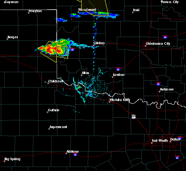 At 708 pm cdt, a severe thunderstorm was located 6 miles southwest of sweetwater, moving east-southeast at 15 mph (radar indicated). Hazards include two inch hail and 70 mph wind gusts. People and animals outdoors will be injured. expect hail damage to roofs, siding, windows, and vehicles. expect considerable tree damage. wind damage is also likely to mobile homes, roofs, and outbuildings. Locations impacted include, erick, sweetwater and texola. At 708 pm cdt, a severe thunderstorm was located 6 miles southwest of sweetwater, moving east-southeast at 15 mph (radar indicated). Hazards include two inch hail and 70 mph wind gusts. People and animals outdoors will be injured. expect hail damage to roofs, siding, windows, and vehicles. expect considerable tree damage. wind damage is also likely to mobile homes, roofs, and outbuildings. Locations impacted include, erick, sweetwater and texola.
|
| 5/29/2018 6:53 PM CDT |
 At 652 pm cdt, a severe thunderstorm was located 8 miles southwest of sweetwater, moving east at 20 mph (radar indicated). Hazards include ping pong ball size hail and 60 mph wind gusts. People and animals outdoors will be injured. expect hail damage to roofs, siding, windows, and vehicles. Expect wind damage to roofs, siding, and trees. At 652 pm cdt, a severe thunderstorm was located 8 miles southwest of sweetwater, moving east at 20 mph (radar indicated). Hazards include ping pong ball size hail and 60 mph wind gusts. People and animals outdoors will be injured. expect hail damage to roofs, siding, windows, and vehicles. Expect wind damage to roofs, siding, and trees.
|
| 5/11/2018 7:57 PM CDT |
 At 756 pm cdt, severe thunderstorms were located along a line extending from 8 miles northwest of sweetwater to 4 miles south of sweetwater, moving northeast at 25 mph (radar indicated). Hazards include 60 mph wind gusts and quarter size hail. Hail damage to vehicles is expected. expect wind damage to roofs, siding, and trees. Locations impacted include, cheyenne, reydon, sweetwater, roll and dempsey. At 756 pm cdt, severe thunderstorms were located along a line extending from 8 miles northwest of sweetwater to 4 miles south of sweetwater, moving northeast at 25 mph (radar indicated). Hazards include 60 mph wind gusts and quarter size hail. Hail damage to vehicles is expected. expect wind damage to roofs, siding, and trees. Locations impacted include, cheyenne, reydon, sweetwater, roll and dempsey.
|
| 5/11/2018 7:36 PM CDT |
 At 735 pm cdt, severe thunderstorms were located along a line extending from 5 miles southeast of allison texas to 8 miles east of twitty texas, moving northeast at 25 mph (radar indicated). Hazards include golf ball size hail and 60 mph wind gusts. People and animals outdoors will be injured. expect hail damage to roofs, siding, windows, and vehicles. Expect wind damage to roofs, siding, and trees. At 735 pm cdt, severe thunderstorms were located along a line extending from 5 miles southeast of allison texas to 8 miles east of twitty texas, moving northeast at 25 mph (radar indicated). Hazards include golf ball size hail and 60 mph wind gusts. People and animals outdoors will be injured. expect hail damage to roofs, siding, windows, and vehicles. Expect wind damage to roofs, siding, and trees.
|
| 5/2/2018 3:40 PM CDT | Baseball sized hail reported 1.6 miles SW of Sweetwater, OK |
| 5/2/2018 3:35 PM CDT | Tennis Ball sized hail reported 5.7 miles WSW of Sweetwater, OK |
| 5/2/2018 3:34 PM CDT |
 At 334 pm cdt, a severe thunderstorm was located 7 miles northeast of sweetwater, moving northeast at 35 mph (radar indicated). Hazards include two inch hail and 60 mph wind gusts. People and animals outdoors will be injured. expect hail damage to roofs, siding, windows, and vehicles. expect wind damage to roofs, siding, and trees. Locations impacted include, dempsey. At 334 pm cdt, a severe thunderstorm was located 7 miles northeast of sweetwater, moving northeast at 35 mph (radar indicated). Hazards include two inch hail and 60 mph wind gusts. People and animals outdoors will be injured. expect hail damage to roofs, siding, windows, and vehicles. expect wind damage to roofs, siding, and trees. Locations impacted include, dempsey.
|
| 5/2/2018 3:24 PM CDT |
 At 308 pm cdt, a severe thunderstorm was located 8 miles southwest of sweetwater, moving northeast at 30 mph (radar indicated). Hazards include 60 mph wind gusts and half dollar size hail. Hail damage to vehicles is expected. Expect wind damage to roofs, siding, and trees. At 308 pm cdt, a severe thunderstorm was located 8 miles southwest of sweetwater, moving northeast at 30 mph (radar indicated). Hazards include 60 mph wind gusts and half dollar size hail. Hail damage to vehicles is expected. Expect wind damage to roofs, siding, and trees.
|
| 5/2/2018 3:08 PM CDT |
 At 308 pm cdt, a severe thunderstorm was located 8 miles southwest of sweetwater, moving northeast at 30 mph (radar indicated). Hazards include 60 mph wind gusts and half dollar size hail. Hail damage to vehicles is expected. Expect wind damage to roofs, siding, and trees. At 308 pm cdt, a severe thunderstorm was located 8 miles southwest of sweetwater, moving northeast at 30 mph (radar indicated). Hazards include 60 mph wind gusts and half dollar size hail. Hail damage to vehicles is expected. Expect wind damage to roofs, siding, and trees.
|
| 10/21/2017 4:56 PM CDT |
 At 456 pm cdt, a severe thunderstorm was located 8 miles southeast of sweetwater, moving northeast at 25 mph (radar indicated). Hazards include two inch hail and 60 mph wind gusts. People and animals outdoors will be injured. expect hail damage to roofs, siding, windows, and vehicles. expect wind damage to roofs, siding, and trees. Locations impacted include, berlin. At 456 pm cdt, a severe thunderstorm was located 8 miles southeast of sweetwater, moving northeast at 25 mph (radar indicated). Hazards include two inch hail and 60 mph wind gusts. People and animals outdoors will be injured. expect hail damage to roofs, siding, windows, and vehicles. expect wind damage to roofs, siding, and trees. Locations impacted include, berlin.
|
| 10/21/2017 4:29 PM CDT |
 The national weather service in norman has issued a * severe thunderstorm warning for. south central roger mills county in western oklahoma. northwestern beckham county in western oklahoma. Until 515 pm cdt * at 429 pm cdt, a severe thunderstorm was located near texola,. The national weather service in norman has issued a * severe thunderstorm warning for. south central roger mills county in western oklahoma. northwestern beckham county in western oklahoma. Until 515 pm cdt * at 429 pm cdt, a severe thunderstorm was located near texola,.
|
| 10/6/2017 11:07 PM CDT |
 At 1106 pm cdt, severe thunderstorms were located along a line extending from near mutual to 4 miles northwest of angora to 5 miles west of sweetwater to 6 miles north of quail, moving east at 40 mph (radar indicated). Hazards include 60 mph wind gusts and penny size hail. expect damage to roofs, siding, and trees At 1106 pm cdt, severe thunderstorms were located along a line extending from near mutual to 4 miles northwest of angora to 5 miles west of sweetwater to 6 miles north of quail, moving east at 40 mph (radar indicated). Hazards include 60 mph wind gusts and penny size hail. expect damage to roofs, siding, and trees
|
| 7/27/2017 7:38 PM CDT |
 At 737 pm cdt, a severe thunderstorm was located 9 miles east of sweetwater, moving south at 15 mph (radar indicated). Hazards include 70 mph wind gusts and quarter size hail. Hail damage to vehicles is expected. expect considerable tree damage. Wind damage is also likely to mobile homes, roofs, and outbuildings. At 737 pm cdt, a severe thunderstorm was located 9 miles east of sweetwater, moving south at 15 mph (radar indicated). Hazards include 70 mph wind gusts and quarter size hail. Hail damage to vehicles is expected. expect considerable tree damage. Wind damage is also likely to mobile homes, roofs, and outbuildings.
|
| 7/27/2017 7:29 PM CDT |
 At 728 pm cdt, a severe thunderstorm was located 5 miles northeast of erick, moving west at 25 mph. another strong storm was just north of texola, and moving slowly toward the east (radar indicated). Hazards include 60 mph wind gusts and penny size hail. Expect damage to roofs, siding, and trees. locations impacted include, sayre, erick, sweetwater, texola and delhi. This includes interstate 40 between mile markers 1 and 24. At 728 pm cdt, a severe thunderstorm was located 5 miles northeast of erick, moving west at 25 mph. another strong storm was just north of texola, and moving slowly toward the east (radar indicated). Hazards include 60 mph wind gusts and penny size hail. Expect damage to roofs, siding, and trees. locations impacted include, sayre, erick, sweetwater, texola and delhi. This includes interstate 40 between mile markers 1 and 24.
|
| 7/27/2017 7:09 PM CDT |
 At 709 pm cdt, a severe thunderstorm was located 4 miles southwest of sayre, moving west at 20 mph. additional storms extended east to just south of elk city (radar indicated). Hazards include 60 mph wind gusts and penny size hail. expect damage to roofs, siding, and trees At 709 pm cdt, a severe thunderstorm was located 4 miles southwest of sayre, moving west at 20 mph. additional storms extended east to just south of elk city (radar indicated). Hazards include 60 mph wind gusts and penny size hail. expect damage to roofs, siding, and trees
|
| 7/3/2017 9:14 PM CDT |
 At 914 pm cdt, severe thunderstorms were located along a line extending from 6 miles south of sweetwater to 5 miles south of erick to 8 miles northwest of vinson, moving southeast at 30 mph (radar indicated). Hazards include 60 mph wind gusts and quarter size hail. Hail damage to vehicles is expected. Expect wind damage to roofs, siding, and trees. At 914 pm cdt, severe thunderstorms were located along a line extending from 6 miles south of sweetwater to 5 miles south of erick to 8 miles northwest of vinson, moving southeast at 30 mph (radar indicated). Hazards include 60 mph wind gusts and quarter size hail. Hail damage to vehicles is expected. Expect wind damage to roofs, siding, and trees.
|
| 6/13/2017 11:27 PM CDT |
 At 1126 pm cdt, a severe thunderstorm was located near texola, moving east at 40 mph (radar indicated). Hazards include 60 mph wind gusts and quarter size hail. Hail damage to vehicles is expected. Expect wind damage to roofs, siding, and trees. At 1126 pm cdt, a severe thunderstorm was located near texola, moving east at 40 mph (radar indicated). Hazards include 60 mph wind gusts and quarter size hail. Hail damage to vehicles is expected. Expect wind damage to roofs, siding, and trees.
|
| 5/16/2017 9:51 PM CDT |
 At 950 pm cdt, severe thunderstorms were located along a line extending from 4 miles north of angora to 3 miles southwest of sweetwater, moving northeast at 35 mph (radar indicated). Hazards include 70 mph wind gusts and quarter size hail. Hail damage to vehicles is expected. expect considerable tree damage. Wind damage is also likely to mobile homes, roofs, and outbuildings. At 950 pm cdt, severe thunderstorms were located along a line extending from 4 miles north of angora to 3 miles southwest of sweetwater, moving northeast at 35 mph (radar indicated). Hazards include 70 mph wind gusts and quarter size hail. Hail damage to vehicles is expected. expect considerable tree damage. Wind damage is also likely to mobile homes, roofs, and outbuildings.
|
| 4/29/2017 2:01 AM CDT |
 At 200 am cdt, one severe thunderstorm was located 6 miles southwest of cheyenne. a new severe thunderstorm was located 7 miles north of erick. the storms were moving north-northeast at 45 mph (radar indicated). Hazards include 60 mph wind gusts and half dollar size hail. Hail damage to vehicles is expected. expect wind damage to roofs, siding, and trees. locations impacted include, cheyenne, sweetwater, strong city, crawford, roll, angora, berlin and dempsey. This includes interstate 40 between mile markers 15 and 17. At 200 am cdt, one severe thunderstorm was located 6 miles southwest of cheyenne. a new severe thunderstorm was located 7 miles north of erick. the storms were moving north-northeast at 45 mph (radar indicated). Hazards include 60 mph wind gusts and half dollar size hail. Hail damage to vehicles is expected. expect wind damage to roofs, siding, and trees. locations impacted include, cheyenne, sweetwater, strong city, crawford, roll, angora, berlin and dempsey. This includes interstate 40 between mile markers 15 and 17.
|
| 4/29/2017 1:38 AM CDT |
 At 138 am cdt, a severe thunderstorm was located 8 miles northeast of erick, moving north-northeast at 55 mph (radar indicated). Hazards include half dollar size hail. damage to vehicles is expected At 138 am cdt, a severe thunderstorm was located 8 miles northeast of erick, moving north-northeast at 55 mph (radar indicated). Hazards include half dollar size hail. damage to vehicles is expected
|
| 9/17/2016 2:00 PM CDT |
 At 200 pm cdt, severe thunderstorms were located along a line extending from 4 miles southwest of wheeler to 6 miles northeast of quail, moving east at 50 mph (radar indicated). Hazards include 70 mph wind gusts and ping pong ball size hail. People and animals outdoors will be injured. expect hail damage to roofs, siding, windows, and vehicles. expect considerable tree damage. Wind damage is also likely to mobile homes, roofs, and outbuildings. At 200 pm cdt, severe thunderstorms were located along a line extending from 4 miles southwest of wheeler to 6 miles northeast of quail, moving east at 50 mph (radar indicated). Hazards include 70 mph wind gusts and ping pong ball size hail. People and animals outdoors will be injured. expect hail damage to roofs, siding, windows, and vehicles. expect considerable tree damage. Wind damage is also likely to mobile homes, roofs, and outbuildings.
|
| 8/23/2016 6:10 PM CDT |
 At 610 pm cdt, severe thunderstorms were located along a line extending from near reydon to 9 miles south of allison, moving northeast at 20 mph (radar indicated). Hazards include 60 mph wind gusts and nickel size hail. Expect damage to roofs. siding. And trees. At 610 pm cdt, severe thunderstorms were located along a line extending from near reydon to 9 miles south of allison, moving northeast at 20 mph (radar indicated). Hazards include 60 mph wind gusts and nickel size hail. Expect damage to roofs. siding. And trees.
|
| 7/15/2016 10:24 PM CDT |
 At 1022 pm cdt, severe thunderstorms were located along a line extending from near taloga to near foss reservoir to near erick, moving southeast at 25 mph (radar indicated). Hazards include 70 mph wind gusts and quarter size hail. Hail damage to vehicles is expected. expect considerable tree damage. wind damage is also likely to mobile homes, roofs, and outbuildings. locations impacted include, elk city, clinton, sayre, cheyenne, taloga, burns flat, okeene, thomas, erick, seiling, arapaho, canton, hammon, dill city, canute, leedey, custer city, butler, longdale and carter. This includes interstate 40 between the texas state line and mile marker 77. At 1022 pm cdt, severe thunderstorms were located along a line extending from near taloga to near foss reservoir to near erick, moving southeast at 25 mph (radar indicated). Hazards include 70 mph wind gusts and quarter size hail. Hail damage to vehicles is expected. expect considerable tree damage. wind damage is also likely to mobile homes, roofs, and outbuildings. locations impacted include, elk city, clinton, sayre, cheyenne, taloga, burns flat, okeene, thomas, erick, seiling, arapaho, canton, hammon, dill city, canute, leedey, custer city, butler, longdale and carter. This includes interstate 40 between the texas state line and mile marker 77.
|
| 7/15/2016 9:58 PM CDT |
 At 957 pm cdt, severe thunderstorms were located along a line extending from 4 miles northeast of cestos to near moorewood to 5 miles south of sweetwater, moving east at 35 mph (radar indicated). Hazards include 70 mph wind gusts and nickel size hail. Expect considerable tree damage. Damage is likely to mobile homes, roofs, and outbuildings. At 957 pm cdt, severe thunderstorms were located along a line extending from 4 miles northeast of cestos to near moorewood to 5 miles south of sweetwater, moving east at 35 mph (radar indicated). Hazards include 70 mph wind gusts and nickel size hail. Expect considerable tree damage. Damage is likely to mobile homes, roofs, and outbuildings.
|
| 7/15/2016 9:19 PM CDT |
 At 918 pm cdt, severe thunderstorms were located along a line extending from 6 miles west of vici to 10 miles west-southwest of reydon, moving southeast at 25 mph (radar indicated). Hazards include 70 mph wind gusts and quarter size hail. Hail damage to vehicles is expected. expect considerable tree damage. Wind damage is also likely to mobile homes, roofs, and outbuildings. At 918 pm cdt, severe thunderstorms were located along a line extending from 6 miles west of vici to 10 miles west-southwest of reydon, moving southeast at 25 mph (radar indicated). Hazards include 70 mph wind gusts and quarter size hail. Hail damage to vehicles is expected. expect considerable tree damage. Wind damage is also likely to mobile homes, roofs, and outbuildings.
|
| 7/14/2016 11:27 PM CDT |
 At 1127 pm cdt, a severe thunderstorm was located 6 miles south of reydon, moving south at 15 mph (radar indicated). Hazards include 60 mph wind gusts and quarter size hail. Hail damage to vehicles is expected. Expect wind damage to roofs, siding, and trees. At 1127 pm cdt, a severe thunderstorm was located 6 miles south of reydon, moving south at 15 mph (radar indicated). Hazards include 60 mph wind gusts and quarter size hail. Hail damage to vehicles is expected. Expect wind damage to roofs, siding, and trees.
|
| 5/29/2016 4:23 PM CDT |
 At 421 pm cdt, a severe thunderstorm was located 8 miles southwest of sweetwater, moving southeast at 20 to 25 mph (radar indicated). Hazards include ping pong ball size hail and 60 mph wind gusts. People and animals outdoors will be injured. expect hail damage to roofs, siding, windows, and vehicles. Expect wind damage to roofs, siding, and trees. At 421 pm cdt, a severe thunderstorm was located 8 miles southwest of sweetwater, moving southeast at 20 to 25 mph (radar indicated). Hazards include ping pong ball size hail and 60 mph wind gusts. People and animals outdoors will be injured. expect hail damage to roofs, siding, windows, and vehicles. Expect wind damage to roofs, siding, and trees.
|
| 5/29/2016 4:23 PM CDT |
 At 422 pm cdt, a severe thunderstorm was located 7 miles southwest of sweetwater, moving southeast at 25 mph (radar indicated). Hazards include ping pong ball size hail and 60 mph wind gusts. People and animals outdoors will be injured. expect hail damage to roofs, siding, windows, and vehicles. Expect wind damage to roofs, siding, and trees. At 422 pm cdt, a severe thunderstorm was located 7 miles southwest of sweetwater, moving southeast at 25 mph (radar indicated). Hazards include ping pong ball size hail and 60 mph wind gusts. People and animals outdoors will be injured. expect hail damage to roofs, siding, windows, and vehicles. Expect wind damage to roofs, siding, and trees.
|
| 5/26/2016 7:32 PM CDT |
 At 731 pm cdt, severe thunderstorms were located along a line extending from 5 miles northwest of cheyenne to 6 miles southeast of sweetwater, moving northeast at 35 mph (radar indicated). Hazards include 60 mph wind gusts and half dollar size hail. Hail damage to vehicles is expected. Expect wind damage to roofs, siding, and trees. At 731 pm cdt, severe thunderstorms were located along a line extending from 5 miles northwest of cheyenne to 6 miles southeast of sweetwater, moving northeast at 35 mph (radar indicated). Hazards include 60 mph wind gusts and half dollar size hail. Hail damage to vehicles is expected. Expect wind damage to roofs, siding, and trees.
|
| 5/16/2016 10:29 PM CDT |
 At 1029 pm cdt, severe thunderstorms were located along a line extending from 3 miles west of moorewood to 5 miles northeast of sayre to 4 miles northwest of delhi, moving southeast at 50 mph (radar indicated). Hazards include golf ball size hail and 70 mph wind gusts. People and animals outdoors will be injured. expect hail damage to roofs, siding, windows, and vehicles. expect considerable tree damage. Wind damage is also likely to mobile homes, roofs, and outbuildings. At 1029 pm cdt, severe thunderstorms were located along a line extending from 3 miles west of moorewood to 5 miles northeast of sayre to 4 miles northwest of delhi, moving southeast at 50 mph (radar indicated). Hazards include golf ball size hail and 70 mph wind gusts. People and animals outdoors will be injured. expect hail damage to roofs, siding, windows, and vehicles. expect considerable tree damage. Wind damage is also likely to mobile homes, roofs, and outbuildings.
|
| 5/16/2016 10:15 PM CDT | Quarter sized hail reported 7 miles SSW of Sweetwater, OK |
| 5/16/2016 10:02 PM CDT |
 At 1002 pm cdt, a severe thunderstorm capable of producing a tornado was located 6 miles north of sweetwater, moving southeast at 30 mph (radar indicated rotation). Hazards include tornado and golf ball size hail. Flying debris will be dangerous to those caught without shelter. mobile homes will be damaged or destroyed. damage to roofs, windows, and vehicles will occur. Tree damage is likely. At 1002 pm cdt, a severe thunderstorm capable of producing a tornado was located 6 miles north of sweetwater, moving southeast at 30 mph (radar indicated rotation). Hazards include tornado and golf ball size hail. Flying debris will be dangerous to those caught without shelter. mobile homes will be damaged or destroyed. damage to roofs, windows, and vehicles will occur. Tree damage is likely.
|
| 5/16/2016 9:57 PM CDT |
 At 956 pm cdt, severe thunderstorms were located along a line extending from near roll to 5 miles northwest of sweetwater to 10 miles southwest of sweetwater, moving southeast at 45 mph (radar indicated). Hazards include golf ball size hail and 70 mph wind gusts. People and animals outdoors will be injured. expect hail damage to roofs, siding, windows, and vehicles. expect considerable tree damage. Wind damage is also likely to mobile homes, roofs, and outbuildings. At 956 pm cdt, severe thunderstorms were located along a line extending from near roll to 5 miles northwest of sweetwater to 10 miles southwest of sweetwater, moving southeast at 45 mph (radar indicated). Hazards include golf ball size hail and 70 mph wind gusts. People and animals outdoors will be injured. expect hail damage to roofs, siding, windows, and vehicles. expect considerable tree damage. Wind damage is also likely to mobile homes, roofs, and outbuildings.
|
| 5/13/2016 4:48 PM CDT |
 At 448 pm cdt, a severe thunderstorm was located 8 miles east of twitty, moving southeast at 30 mph (radar indicated). Hazards include 70 mph wind gusts and ping pong ball size hail. People and animals outdoors will be injured. expect hail damage to roofs, siding, windows, and vehicles. expect considerable tree damage. Wind damage is also likely to mobile homes, roofs, and outbuildings. At 448 pm cdt, a severe thunderstorm was located 8 miles east of twitty, moving southeast at 30 mph (radar indicated). Hazards include 70 mph wind gusts and ping pong ball size hail. People and animals outdoors will be injured. expect hail damage to roofs, siding, windows, and vehicles. expect considerable tree damage. Wind damage is also likely to mobile homes, roofs, and outbuildings.
|
| 4/26/2016 5:13 PM CDT |
 At 512 pm cdt, a severe thunderstorm was located 10 miles north of durham, moving northeast at 55 mph. another severe storm was located near reydon and was also moving northeast at 55 mph (radar indicated). Hazards include 60 mph wind gusts and quarter size hail. Hail damage to vehicles is expected. Expect wind damage to roofs, siding, and trees. At 512 pm cdt, a severe thunderstorm was located 10 miles north of durham, moving northeast at 55 mph. another severe storm was located near reydon and was also moving northeast at 55 mph (radar indicated). Hazards include 60 mph wind gusts and quarter size hail. Hail damage to vehicles is expected. Expect wind damage to roofs, siding, and trees.
|
| 8/19/2015 1:40 AM CDT |
 At 140 am cdt, a severe thunderstorm was located near delhi, moving east at 45 mph (radar indicated). Hazards include 60 mph wind gusts and quarter size hail. Hail damage to vehicles is expected. expect wind damage to roofs, siding and trees. Locations impacted include, sayre, erick, sweetwater, texola and delhi. At 140 am cdt, a severe thunderstorm was located near delhi, moving east at 45 mph (radar indicated). Hazards include 60 mph wind gusts and quarter size hail. Hail damage to vehicles is expected. expect wind damage to roofs, siding and trees. Locations impacted include, sayre, erick, sweetwater, texola and delhi.
|
| 8/19/2015 1:24 AM CDT |
 The severe thunderstorm warning for southwestern roger mills county will expire at 130 am cdt, the storm which prompted the warning has weakened below severe limits and exited the warned area. therefore, the warning will be allowed to expire. however, gusty winds and heavy rain are still possible with this thunderstorm. The severe thunderstorm warning for southwestern roger mills county will expire at 130 am cdt, the storm which prompted the warning has weakened below severe limits and exited the warned area. therefore, the warning will be allowed to expire. however, gusty winds and heavy rain are still possible with this thunderstorm.
|
| 8/19/2015 1:00 AM CDT |
 At 1259 am cdt, two severe thunderstorms were located 5 miles southwest of sweetwater and 3 miles east of texola, moving east southeast at 30 mph (radar indicated). Hazards include 60 mph wind gusts and quarter size hail. Hail damage to vehicles is expected. Expect wind damage to roofs, siding and trees. At 1259 am cdt, two severe thunderstorms were located 5 miles southwest of sweetwater and 3 miles east of texola, moving east southeast at 30 mph (radar indicated). Hazards include 60 mph wind gusts and quarter size hail. Hail damage to vehicles is expected. Expect wind damage to roofs, siding and trees.
|
| 8/19/2015 12:54 AM CDT |
 At 1253 am cdt, a severe thunderstorm was located 4 miles west of cheyenne, moving southeast at 30 mph (radar indicated). Hazards include 60 mph wind gusts and quarter size hail. Hail damage to vehicles is expected. Expect wind damage to roofs, siding and trees. At 1253 am cdt, a severe thunderstorm was located 4 miles west of cheyenne, moving southeast at 30 mph (radar indicated). Hazards include 60 mph wind gusts and quarter size hail. Hail damage to vehicles is expected. Expect wind damage to roofs, siding and trees.
|
| 8/19/2015 12:38 AM CDT |
 At 1237 am cdt, a severe thunderstorm was located near reydon, moving southeast at 40 mph (radar indicated). Hazards include 60 mph wind gusts and quarter size hail. Hail damage to vehicles is expected. expect wind damage to roofs, siding and trees. Locations impacted include, cheyenne, reydon, sweetwater, strong city, roll, durham, crawford, berlin and dempsey. At 1237 am cdt, a severe thunderstorm was located near reydon, moving southeast at 40 mph (radar indicated). Hazards include 60 mph wind gusts and quarter size hail. Hail damage to vehicles is expected. expect wind damage to roofs, siding and trees. Locations impacted include, cheyenne, reydon, sweetwater, strong city, roll, durham, crawford, berlin and dempsey.
|
| 8/19/2015 12:16 AM CDT |
 At 1215 am cdt, a severe thunderstorm was located 9 miles north of allison, or 9 miles southwest of durham, moving southeast at 45 mph (radar indicated). Hazards include 60 mph wind gusts and quarter size hail. Hail damage to vehicles is expected. Expect wind damage to roofs, siding and trees. At 1215 am cdt, a severe thunderstorm was located 9 miles north of allison, or 9 miles southwest of durham, moving southeast at 45 mph (radar indicated). Hazards include 60 mph wind gusts and quarter size hail. Hail damage to vehicles is expected. Expect wind damage to roofs, siding and trees.
|
| 7/20/2015 5:36 PM CDT |
 The severe thunderstorm warning for northwestern beckham county will expire at 545 pm cdt, the storm which prompted the warning has weakened below severe limits, and no longer poses an immediate threat to life or property. therefore, the warning will be allowed to expire. however gusty winds and heavy rain are still possible with this thunderstorm. The severe thunderstorm warning for northwestern beckham county will expire at 545 pm cdt, the storm which prompted the warning has weakened below severe limits, and no longer poses an immediate threat to life or property. therefore, the warning will be allowed to expire. however gusty winds and heavy rain are still possible with this thunderstorm.
|
| 7/20/2015 5:28 PM CDT |
 At 527 pm cdt, a severe thunderstorm was located near erick, moving south at 10 mph (radar indicated). Hazards include 60 mph wind gusts and penny size hail. Expect damage to roofs. siding and trees. Locations impacted include, erick and sweetwater. At 527 pm cdt, a severe thunderstorm was located near erick, moving south at 10 mph (radar indicated). Hazards include 60 mph wind gusts and penny size hail. Expect damage to roofs. siding and trees. Locations impacted include, erick and sweetwater.
|
| 7/20/2015 4:55 PM CDT |
 At 455 pm cdt, a severe thunderstorm was located 5 miles southeast of sweetwater, moving southeast at 5 mph (radar indicated). Hazards include 60 mph wind gusts and quarter size hail. Hail damage to vehicles is expected. Expect wind damage to roofs, siding and trees. At 455 pm cdt, a severe thunderstorm was located 5 miles southeast of sweetwater, moving southeast at 5 mph (radar indicated). Hazards include 60 mph wind gusts and quarter size hail. Hail damage to vehicles is expected. Expect wind damage to roofs, siding and trees.
|
| 5/16/2015 4:58 PM CDT | At 457 pm cdt, severe thunderstorms were located along a line extending from 8 miles west of camargo to 4 miles south of leedey to near erick, moving northeast at 50 mph (radar indicated). Hazards include tennis ball size hail and 70 mph wind gusts. People and animals outdoors will be injured. expect hail damage to roofs, siding, windows and vehicles. expect considerable tree damage. Wind damage is also likely to mobile homes, roofs and outbuildings. |
| 5/16/2015 4:42 PM CDT | At 441 pm cdt, a severe thunderstorm was located 4 miles east of strong city, moving northeast at 55 mph. other strong to severe storms were located just south of harmon and near texola (radar indicated). Hazards include tennis ball size hail and 70 mph wind gusts. People and animals outdoors will be injured. expect hail damage to roofs, siding, windows and vehicles. expect considerable tree damage. wind damage is also likely to mobile homes, roofs and outbuildings. locations impacted include, sayre, cheyenne, erick, vici, hammon, leedey, reydon, camargo, sweetwater, strong city, texola, angora, harmon, roll, moorewood, berlin and dempsey. 2. 50in. |
| 5/16/2015 4:15 PM CDT | At 415 pm cdt, severe thunderstorms were located along a line extending from near crawford to near cheyenne to near texola, moving northeast at 50 mph (radar indicated). Hazards include 70 mph wind gusts and ping pong ball size hail. People and animals outdoors will be injured. expect hail damage to roofs, siding, windows and vehicles. expect considerable tree damage. Wind damage is also likely to mobile homes, roofs and outbuildings. |
| 5/16/2015 3:51 PM CDT | Storm damage reported in roger mills county OK, 0.5 miles S of Sweetwater, OK |
| 5/16/2015 3:51 PM CDT | At 350 pm cdt, severe thunderstorms were located along a line extending from 9 miles southeast of allison texas to 6 miles southwest of sweetwater to near lutie texas, moving northeast at 45 mph. very strong winds will move into the sweetwater area (radar indicated). Hazards include golf ball size hail and 70 mph wind gusts. People and animals outdoors will be injured. expect hail damage to roofs, siding, windows and vehicles. expect considerable tree damage. wind damage is also likely to mobile homes, roofs and outbuildings. locations impacted include, cheyenne, erick, reydon, sweetwater, strong city, texola, roll, angora, dempsey and berlin. 1. 75in. |
| 5/16/2015 3:36 PM CDT | At 336 pm cdt, severe thunderstorms were located along a line extending from 8 miles west of sweetwater to near quail texas, moving northeast at 50 mph (radar indicated). Hazards include tennis ball size hail and 70 mph wind gusts. People and animals outdoors will be injured. expect hail damage to roofs, siding, windows and vehicles. expect considerable tree damage. Wind damage is also likely to mobile homes, roofs and outbuildings. |
| 5/7/2015 11:36 AM CDT | At 1136 am cdt, a severe thunderstorm was located 7 miles west of sayre, moving northeast at 35 mph (radar indicated). Hazards include 60 mph wind gusts and quarter size hail. Hail damage to vehicles is expected. Expect wind damage to roofs, siding and trees. |
| 4/18/2015 7:42 PM CDT | At 742 pm cdt, a severe thunderstorm was located 6 miles northwest of sayre, moving northeast at 30 mph (radar indicated). Hazards include golf ball size hail and 60 mph wind gusts. People and animals outdoors will be injured. expect hail damage to roofs, siding, windows and vehicles. expect wind damage to roofs, siding and trees. locations impacted include, sayre, erick, sweetwater and berlin. a tornado watch remains in effect until 900 pm cdt for western oklahoma. 1. 75in. |
| 4/18/2015 7:36 PM CDT | Golf Ball sized hail reported 8.1 miles WNW of Sweetwater, OK |
| 4/18/2015 7:32 PM CDT | At 731 pm cdt, a severe thunderstorm was located 8 miles southeast of sweetwater, moving northeast at 25 mph (radar indicated). Hazards include 60 mph wind gusts and quarter size hail. Hail damage to vehicles is expected. Expect wind damage to roofs, siding and trees. |
| 4/18/2015 7:10 PM CDT | At 709 pm cdt, severe thunderstorms were located along a line extending from 6 miles northeast of roll to 4 miles northeast of sweetwater, moving northeast at 25 mph. another severe storm was located near vici (radar indicated). Hazards include 60 mph wind gusts and half dollar size hail. Hail damage to vehicles is expected. Expect wind damage to roofs, siding and trees. |
| 4/16/2015 9:58 PM CDT | The tornado warning for northern beckham and southern roger mills counties will expire at 1000 pm cdt. the tornado threat has diminished. therefore the tornado warning will be allowed to expire. however. Large hail and damaging winds remain likely and a severe thunderstorm warning remains in effect for the area. |
| 4/16/2015 9:57 PM CDT | At 956 pm cdt, severe thunderstorms were located along a line extending from near angora to 5 miles southeast of roll to near cheyenne to 10 miles northeast of sweetwater, moving northeast at 20 mph (radar indicated). Hazards include ping pong ball size hail and 60 mph wind gusts. People and animals outdoors will be injured. expect hail damage to roofs, siding, windows and vehicles. Expect wind damage to roofs, siding and trees. |
| 4/16/2015 9:50 PM CDT | A tornado warning remains in effect until 1000 pm cdt for northern beckham and southern roger mills counties. at 949 pm cdt. a severe thunderstorm capable of producing a tornado was located 8 miles northeast of sweetwater. moving northeast at 15 mph. a second severe thunderstorm capable of producing a tornado was located 3 miles west of cheyenne. Moving northeast at 15 mph. |
| 4/16/2015 9:34 PM CDT | A tornado warning remains in effect until 1000 pm cdt for northern beckham and southern roger mills counties. at 932 pm cdt. a severe thunderstorm capable of producing a tornado was located 6 miles southwest of cheyenne. moving northeast at 20 mph. a second severe thunderstorm capable of producing a tornado was located 2 miles north of sweetwater. Moving northeast at 20 mph. |
| 4/16/2015 9:32 PM CDT | Quarter sized hail reported 0.7 miles SE of Sweetwater, OK |
| 4/16/2015 9:20 PM CDT | A tornado warning remains in effect until 1000 pm cdt for northern beckham and southern roger mills counties. at 920 pm cdt. a severe thunderstorm capable of producing a tornado was located 6 miles southwest of cheyenne. moving northeast at 35 mph. a second severe thunderstorm capable of producing a tornado was located 2 miles west of sweetwater. Moving northeast at 35 mph. |
| 4/16/2015 9:11 PM CDT | The national weather service in norman has issued a * tornado warning for. northern beckham county in western oklahoma. southern roger mills county in western oklahoma. until 1000 pm cdt * at 911 pm cdt. A severe thunderstorm capable of producing a. |
| 4/16/2015 9:08 PM CDT | A tornado warning remains in effect until 915 pm cdt for southwestern roger mills county. at 907 pm cdt. a severe thunderstorm capable of producing a tornado was located 5 miles northeast of sweetwater. moving northeast at 15 mph. hazard. Tornado and ping pong ball size hail. |
| 4/16/2015 8:50 PM CDT | A tornado warning remains in effect until 915 pm cdt for southwestern roger mills county. at 850 pm cdt. a severe thunderstorm capable of producing a tornado was located 5 miles north of sweetwater. moving northeast at 25 mph. hazard. tornado and ping pong ball size hail. source. Weather spotters reported a funnel cloud. |
| 4/16/2015 8:39 PM CDT | A tornado warning remains in effect until 915 pm cdt for southwestern roger mills county. at 839 pm cdt. a severe thunderstorm capable of producing a tornado was located 6 miles northwest of sweetwater. moving northeast at 20 mph. hazard. Tornado and quarter size hail. |
| 4/16/2015 8:35 PM CDT | The national weather service in norman has issued a * tornado warning for. southwestern roger mills county in western oklahoma. until 915 pm cdt * at 834 pm cdt. a severe thunderstorm capable of producing a tornado was located 6 miles northwest of sweetwater. Moving. |
| 4/16/2015 8:25 PM CDT | At 825 pm cdt, severe thunderstorms were located along a line extending from near roll to near reydon to 7 miles southeast of allison, moving northeast at 20 mph (radar indicated). Hazards include 70 mph wind gusts and half dollar size hail. Hail damage to vehicles is expected. expect considerable tree damage. wind damage is also likely to mobile homes, roofs and outbuildings. locations impacted include, elk city, cheyenne, hammon, reydon, sweetwater, strong city, roll, angora, durham, crawford, berlin and dempsey. a tornado watch remains in effect until midnight cdt for northwestern oklahoma. Possible. |
| 4/16/2015 8:00 PM CDT | At 759 pm cdt, severe thunderstorms were located along a line extending from near fargo to 7 miles southwest of harmon to 11 miles northeast of crawford to near reydon to 8 miles east of wheeler, moving northeast at 45 mph (trained weather spotters). Hazards include tennis ball size hail and 70 mph wind gusts. People and animals outdoors will be injured. expect hail damage to roofs, siding, windows and vehicles. expect considerable tree damage. wind damage is also likely to mobile homes, roofs and outbuildings. locations impacted include, elk city, shattuck, cheyenne, arnett, hammon, gage, fargo, reydon, sweetwater, strong city, angora, durham, crawford, harmon, roll, berlin, dempsey and tangier. a tornado watch remains in effect until midnight cdt for northwestern oklahoma. Possible. |
| 4/16/2015 7:42 PM CDT | At 741 pm cdt, severe thunderstorms were located along a line extending from 4 miles southeast of gage to 9 miles northeast of durham to near crawford to 8 miles west of elk city, moving north at 20 mph (trained weather spotters). Hazards include tennis ball size hail and 70 mph wind gusts. People and animals outdoors will be injured. expect hail damage to roofs, siding, windows and vehicles. expect considerable tree damage. Wind damage is also likely to mobile homes, roofs and outbuildings. |
| 4/16/2015 6:41 PM CDT | At 641 pm cdt, a severe thunderstorm was located 7 miles west of sayre, moving north at 35 mph (radar indicated). Hazards include 60 mph wind gusts and half dollar size hail. Hail damage to vehicles is expected. expect wind damage to roofs, siding and trees. locations impacted include, elk city, sayre, erick, carter, sweetwater, delhi and berlin. a tornado watch remains in effect until midnight cdt for western oklahoma. Possible. |
| 4/16/2015 6:25 PM CDT | At 625 pm cdt, a severe thunderstorm was located 4 miles west of delhi, moving north at 30 mph (radar indicated). Hazards include 60 mph wind gusts and half dollar size hail. Hail damage to vehicles is expected. Expect wind damage to roofs, siding and trees. |
| 4/12/2015 9:12 PM CDT | A severe thunderstorm warning remains in effect until 930 pm cdt for southern roger mills county. at 912 pm cdt. severe thunderstorms were located along a line extending from 5 miles west of hammon to 8 miles southwest of cheyenne. moving east at 40 mph. hazard. 60 mph wind gusts and quarter size hail. |
| 4/12/2015 8:45 PM CDT | The national weather service in norman has issued a * severe thunderstorm warning for. roger mills county in western oklahoma. until 930 pm cdt * at 845 pm cdt. Severe thunderstorms were located along a line extending from 5 miles northeast of strong city to 4 miles. |
| 4/8/2015 8:44 PM CDT | The national weather service in norman has issued a * severe thunderstorm warning for. northwestern beckham county in western oklahoma. southwestern roger mills county in western oklahoma. until 915 pm cdt * at 844 pm cdt. A severe thunderstorm was located 8 miles east of. |
| 4/8/2015 8:07 PM CDT | 3 n of grimes in roger mills county OK, 7.3 miles SW of Sweetwater, OK |
| 4/8/2015 8:05 PM CDT | Baseball sized hail reported 8.4 miles SW of Sweetwater, OK, reports of broken car windows. |
| 4/8/2015 8:05 PM CDT | Baseball sized hail reported 7.8 miles SW of Sweetwater, OK |
| 4/8/2015 8:03 PM CDT | A severe thunderstorm warning remains in effect until 815 pm cdt for southwestern roger mills county. at 803 pm cdt. a severe thunderstorm was located 8 miles southwest of cheyenne. moving northeast at 50 mph. hazard. tennis ball size hail and 60 mph wind gusts. source. Trained weather spotters. |
| 4/8/2015 7:57 PM CDT | A severe thunderstorm warning remains in effect until 815 pm cdt for southwestern roger mills county. at 757 pm cdt. a severe thunderstorm was located 6 miles north of sweetwater. moving northeast at 40 mph. hazard. two inch hail and 60 mph wind gusts. source. Trained weather spotters. |
| 4/8/2015 7:47 PM CDT | Quarter sized hail reported 1.2 miles S of Sweetwater, OK |
| 4/8/2015 7:47 PM CDT | Hen Egg sized hail reported 6.3 miles NE of Sweetwater, OK |
| 4/8/2015 7:46 PM CDT | A severe thunderstorm warning remains in effect until 815 pm cdt for northwestern beckham and southwestern roger mills counties. at 746 pm cdt. a severe thunderstorm was located near sweetwater. moving northeast at 45 mph. hazard. two inch hail and 60 mph wind gusts. source. Trained weather spotters. |
| 4/8/2015 7:41 PM CDT | The national weather service in norman has issued a * severe thunderstorm warning for. northwestern beckham county in western oklahoma. southwestern roger mills county in western oklahoma. until 815 pm cdt * at 741 pm cdt. A severe thunderstorm was located near. |
| 4/8/2015 7:38 PM CDT | Half Dollar sized hail reported 6.3 miles NE of Sweetwater, OK |
| 6/1/2012 8:35 PM CDT | Quarter sized hail reported 4.4 miles WSW of Sweetwater, OK |
Hail Maps for Sweetwater, OK


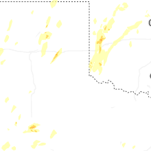
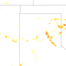
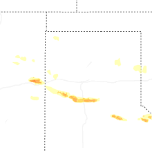


Connect with Interactive Hail Maps