

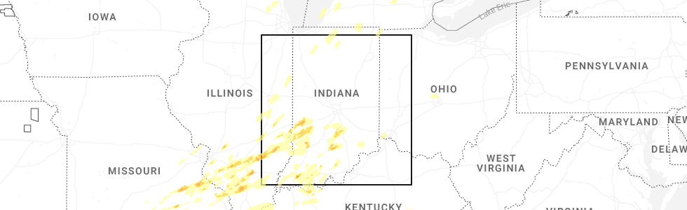
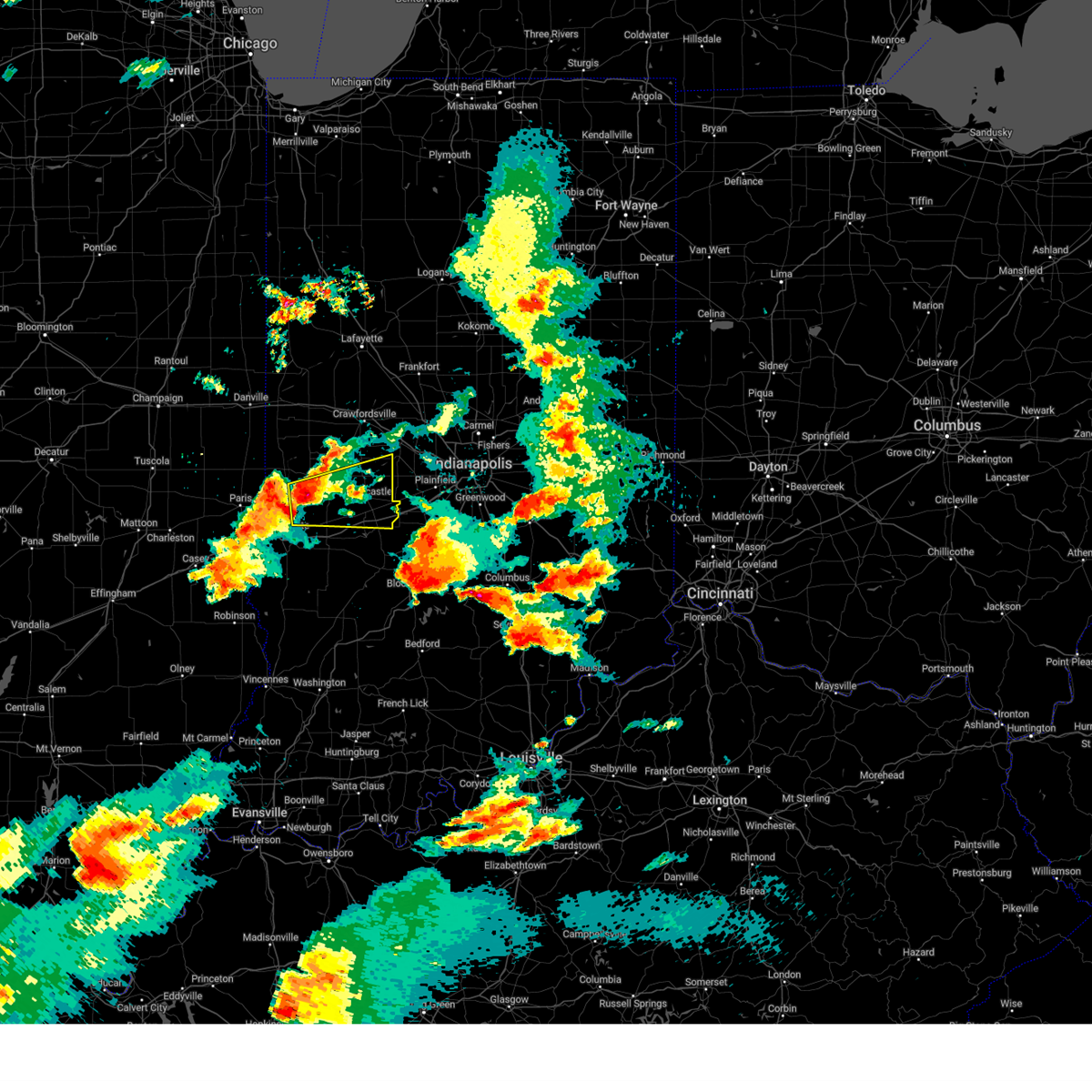
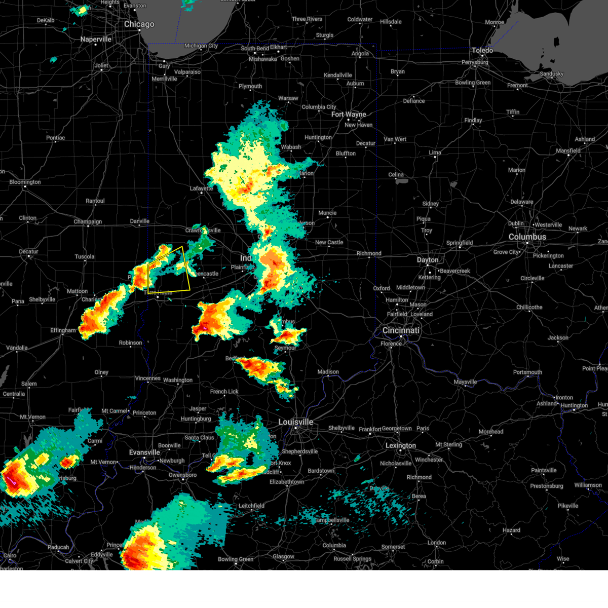
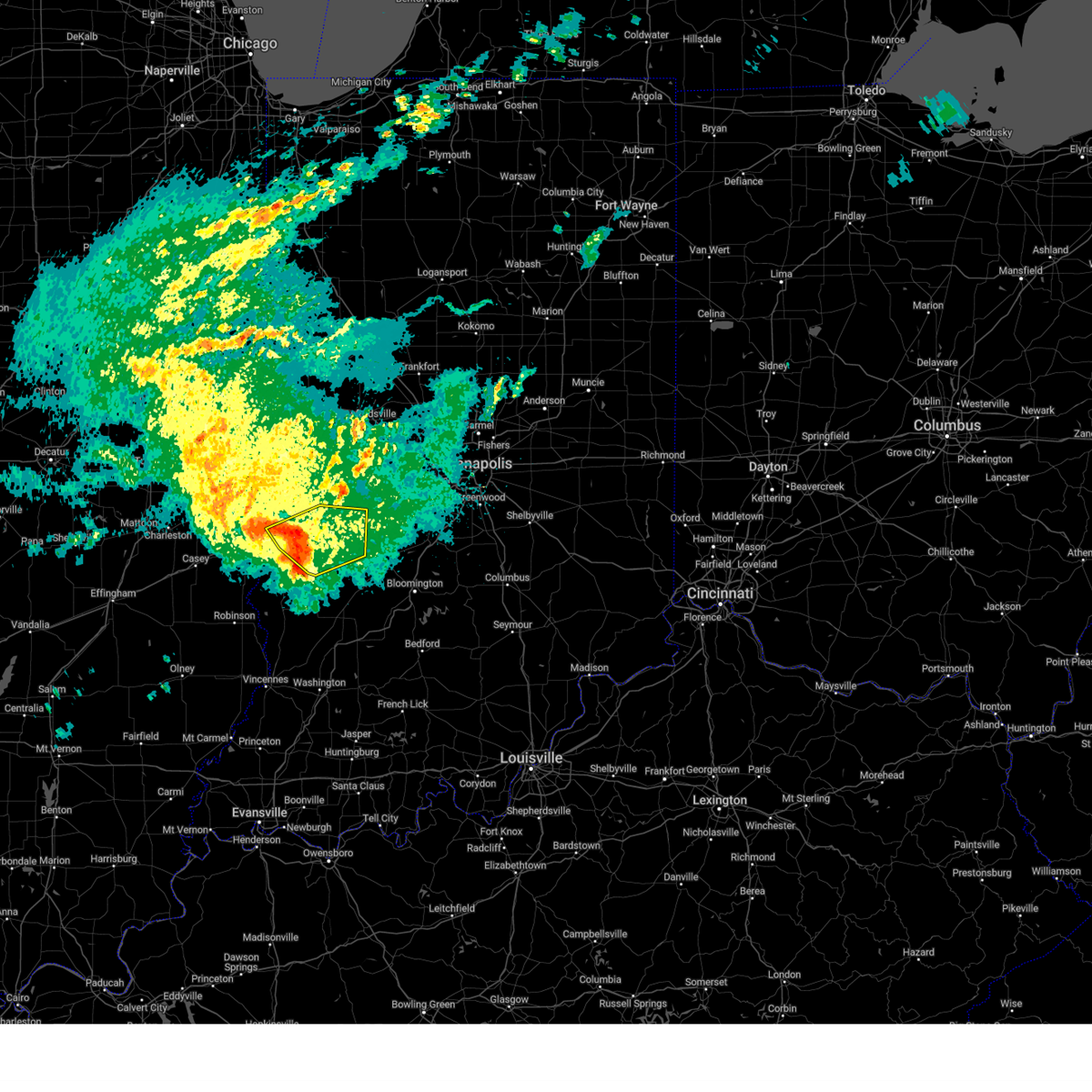
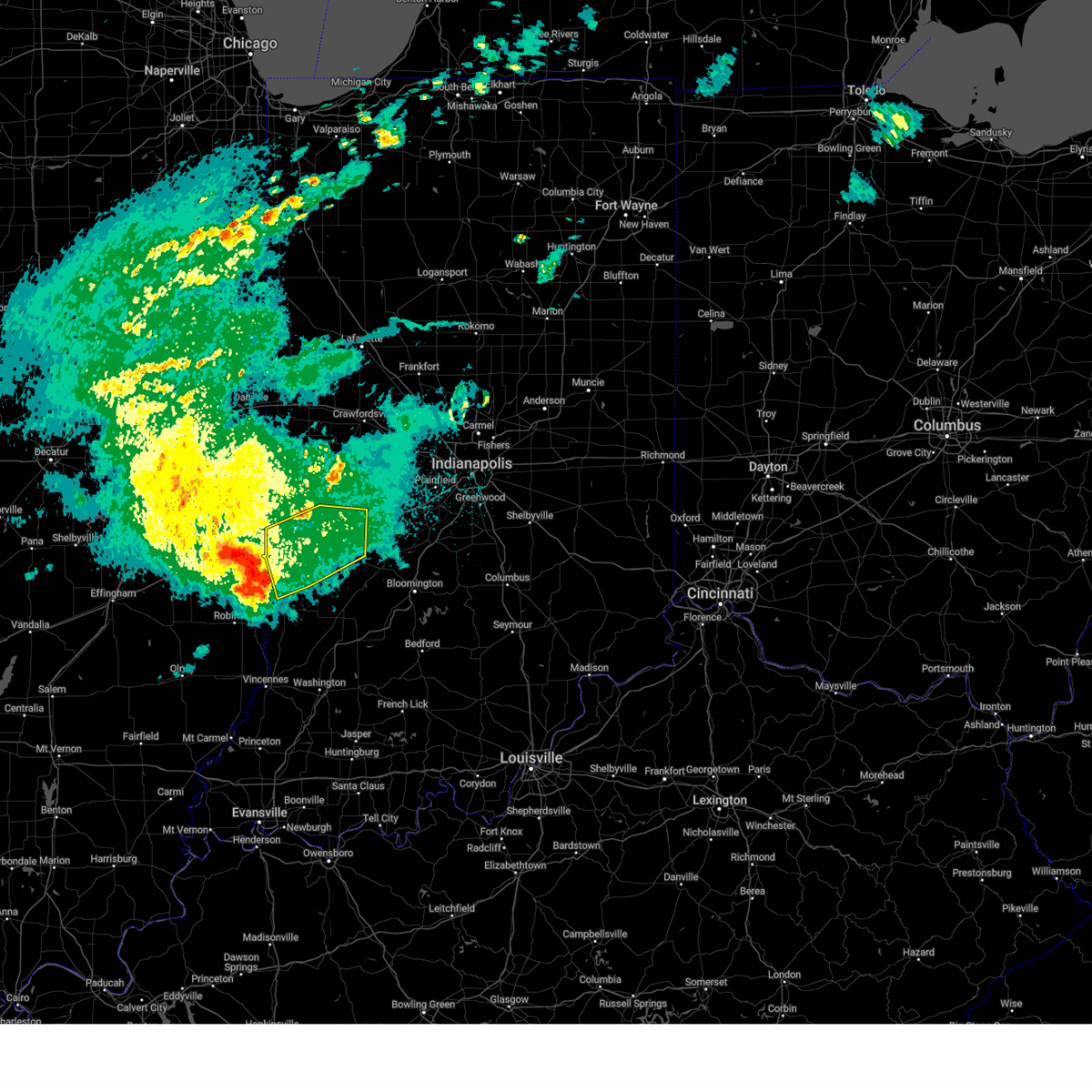
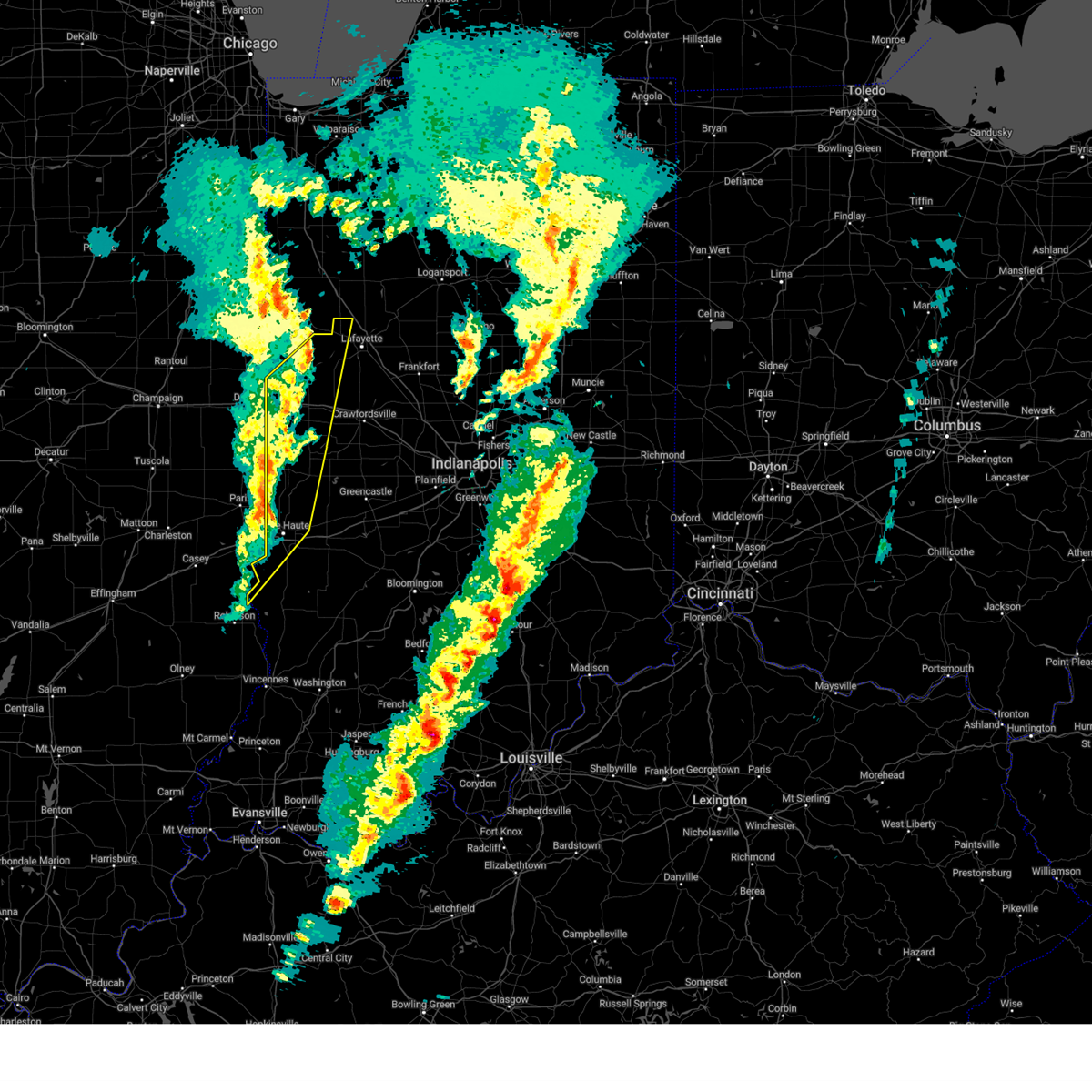
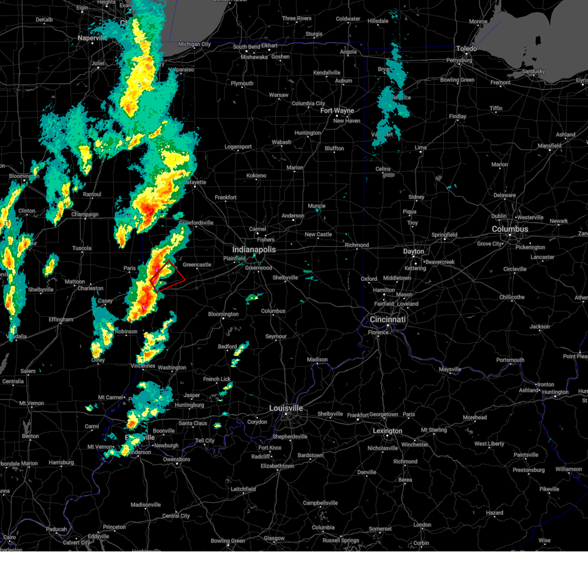
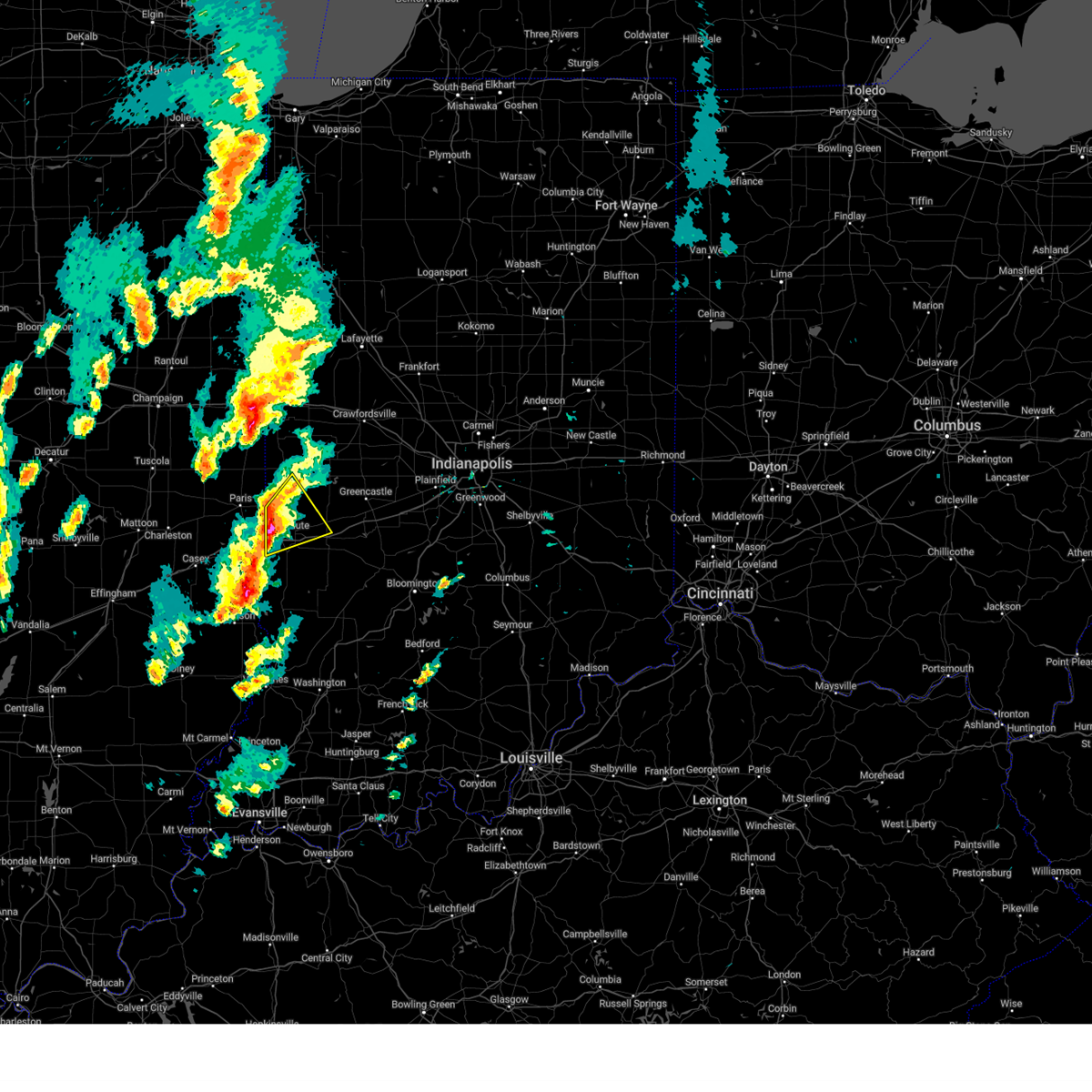
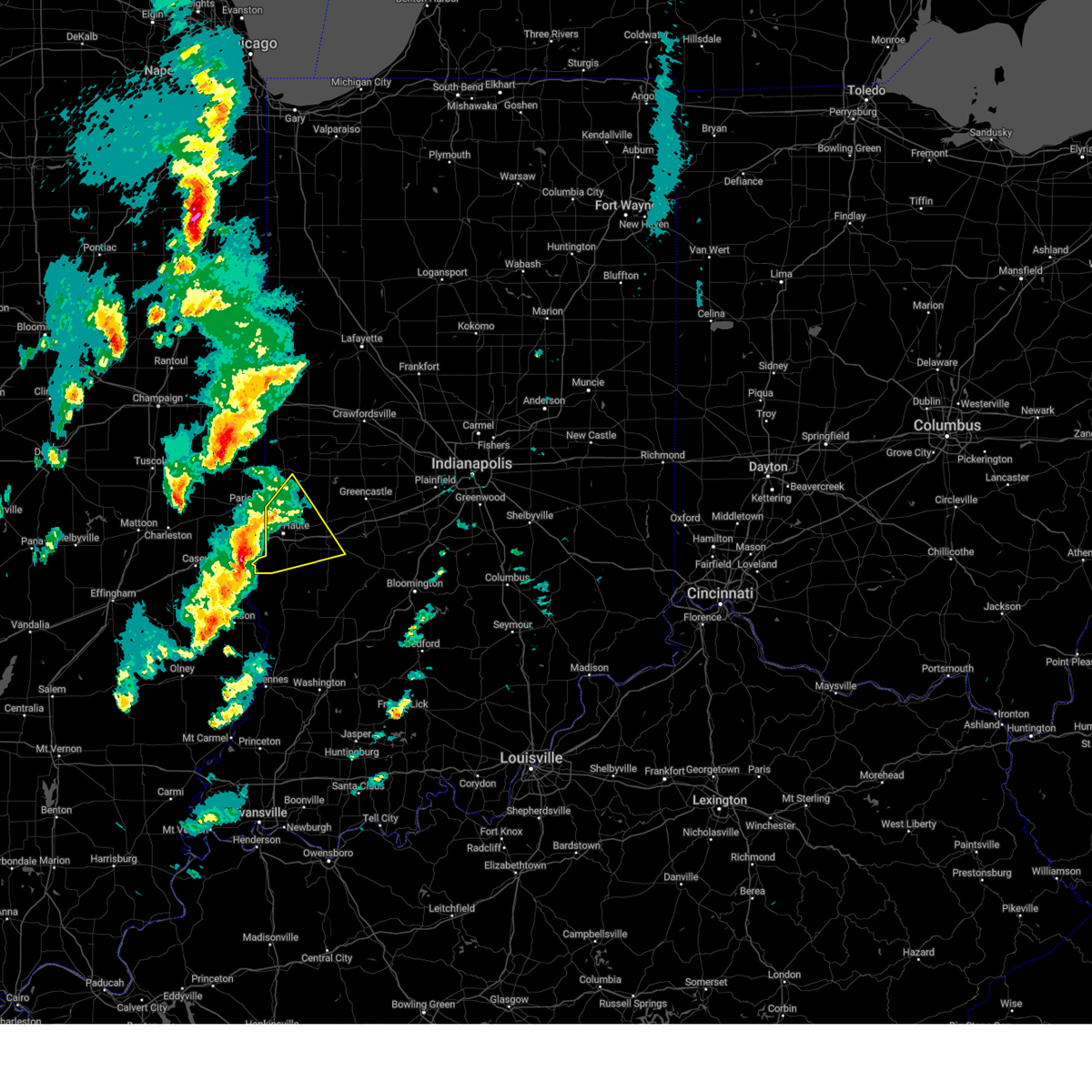
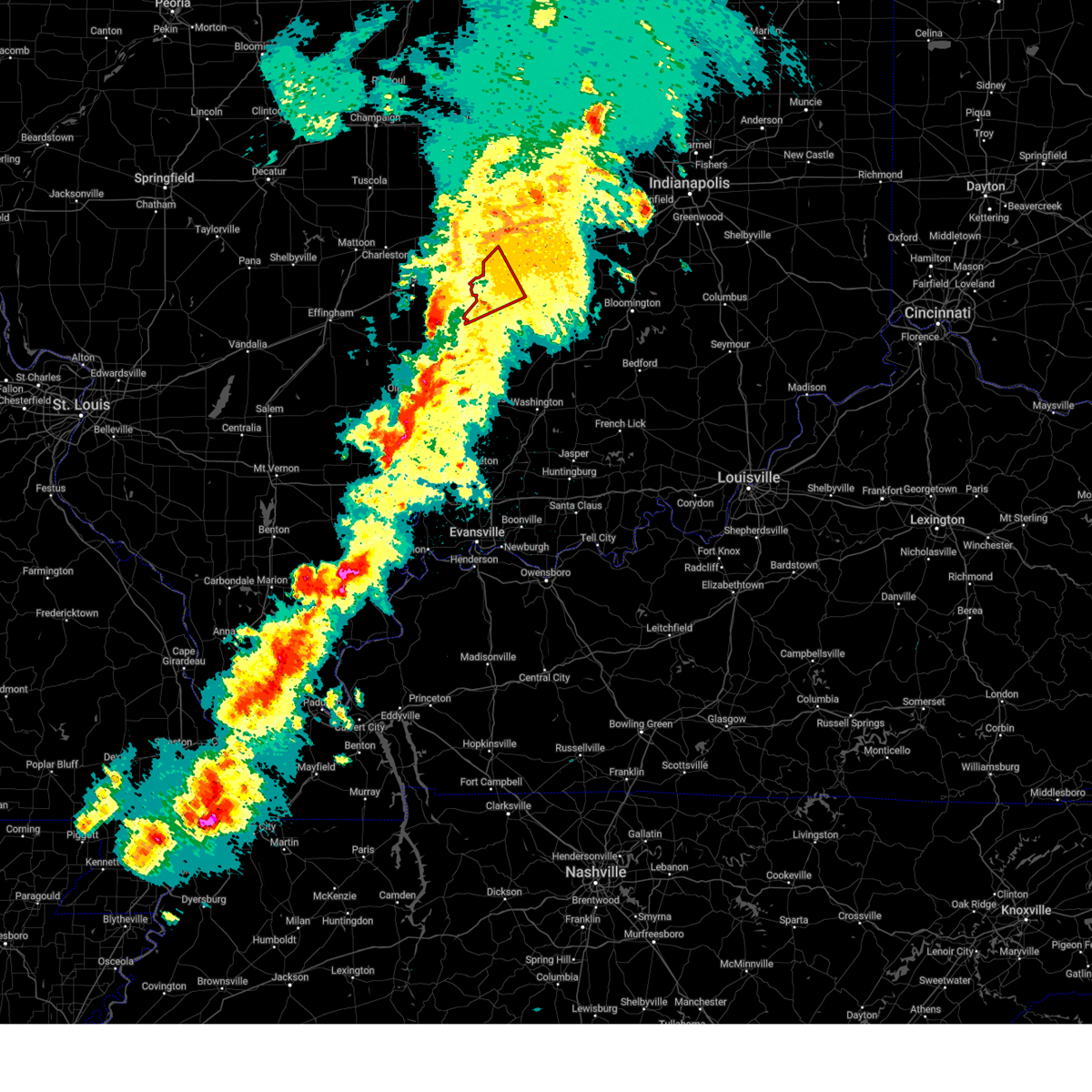
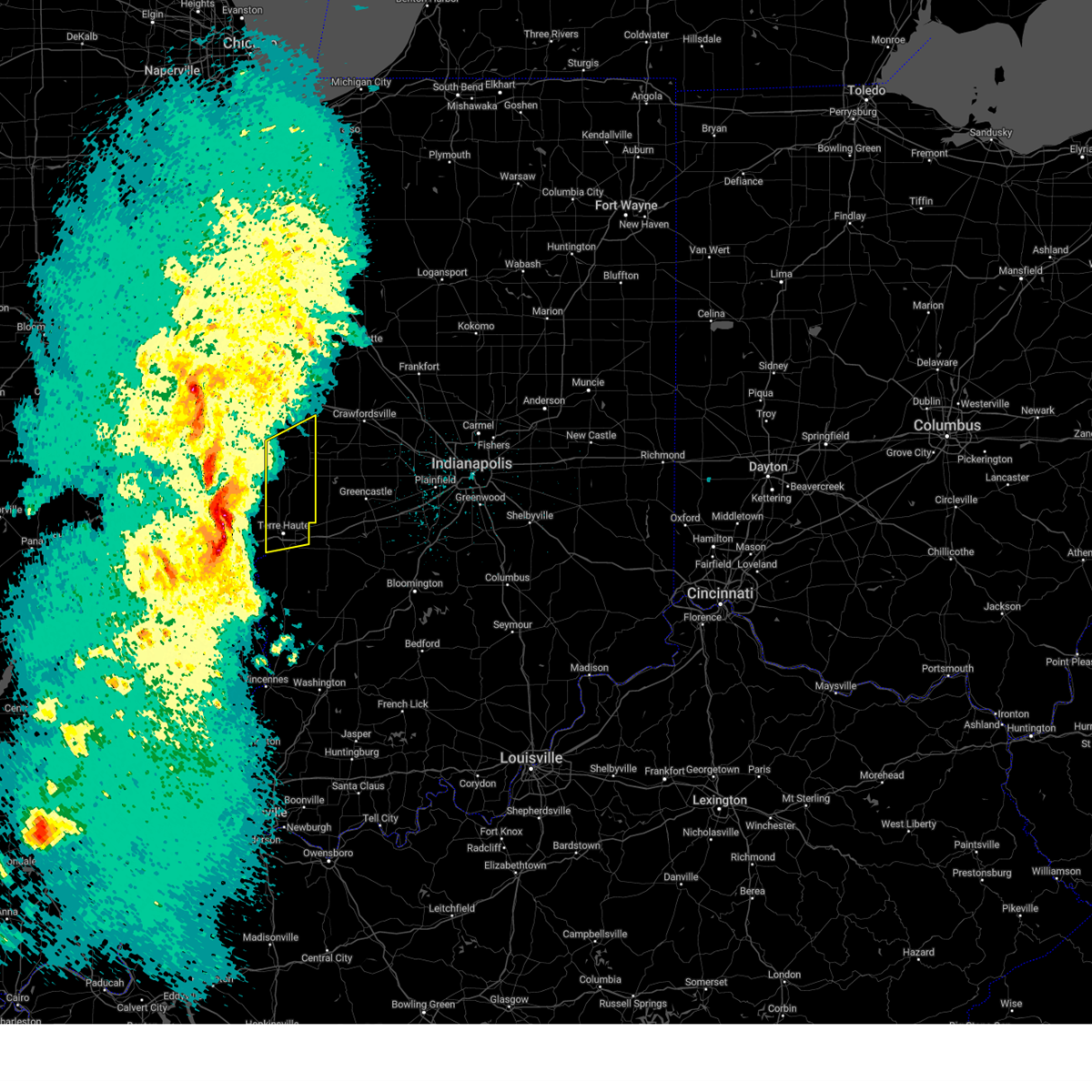
Hail Map for Terre Haute, IN
The Terre Haute, IN area has had 34 reports of on-the-ground hail by trained spotters, and has been under severe weather warnings 36 times during the past 12 months. Doppler radar has detected hail at or near Terre Haute, IN on 87 occasions, including 3 occasions during the past year.
| Name: | Terre Haute, IN |
| Where Located: | 54 miles E of Mattoon, IL |
| Map: | Google Map for Terre Haute, IN |
| Population: | 60785 |
| Housing Units: | 25518 |
| More Info: | Search Google for Terre Haute, IN |
3
The Top Recent Hail Date for Terre Haute, IN is Sunday, March 30, 2025 (3rd out of 87)
Hail and Wind Damage Spotted near Terre Haute, IN
| Date / Time | Report Details |
|---|---|
| 6/18/2025 3:58 PM EDT | Thunderstorm winds blew down a 12-inch tree limb on 9th street between indiana and delaware streets in terre haut in vigo county IN, 3.3 miles SSE of Terre Haute, IN |
| 6/18/2025 3:49 PM EDT | Numerous trees down northern vigo county...no specific locations mentione in vigo county IN, 5.6 miles S of Terre Haute, IN |
| 6/18/2025 3:47 PM EDT | At 347 pm edt, severe thunderstorms were located along a line extending from 12 miles southwest of crawfordsville to 10 miles southeast of brazil, moving northeast at 65 mph (radar indicated). Hazards include 70 mph wind gusts and penny size hail. Expect considerable tree damage. damage is likely to mobile homes, roofs, and outbuildings. locations impacted include, greencastle, brazil, rockville, seelyville, ladoga, roachdale, knightsville, clay city, bainbridge, harmony, staunton, carbon, russellville, center point, riley, carpentersville, bridgeton, reelsville, saline city, and cagles mill lake. This includes interstate 70 between mile markers 13 and 39. |
| 6/18/2025 3:47 PM EDT | the severe thunderstorm warning has been cancelled and is no longer in effect |
| 6/18/2025 3:24 PM EDT | Numerous power outages reporte in vigo county IN, 2.5 miles ESE of Terre Haute, IN |
| 6/18/2025 3:23 PM EDT | Svrind the national weather service in indianapolis has issued a * severe thunderstorm warning for, vigo county in west central indiana, clay county in west central indiana, northwestern owen county in west central indiana, parke county in west central indiana, southeastern vermillion county in west central indiana, south central montgomery county in west central indiana, western putnam county in west central indiana, * until 415 pm edt. * at 322 pm edt, severe thunderstorms were located along a line extending from near rockville to 10 miles south of terre haute, moving northeast at 30 mph (radar indicated). Hazards include 70 mph wind gusts and penny size hail. Expect considerable tree damage. Damage is likely to mobile homes, roofs, and outbuildings. |
| 6/18/2025 3:19 PM EDT | 12-14 inch diameter tree dow in vigo county IN, 4.2 miles S of Terre Haute, IN |
| 6/18/2025 3:18 PM EDT | Storm damage reported in vigo county IN, 4.2 miles SE of Terre Haute, IN |
| 6/18/2025 3:17 PM EDT | 50mph wind gust with several tree limbs down. sizes around 3 inches in diamete in vigo county IN, 3.6 miles SSE of Terre Haute, IN |
| 6/18/2025 3:11 PM EDT |
 Torind the national weather service in indianapolis has issued a * tornado warning for, northeastern vigo county in west central indiana, north central clay county in west central indiana, southwestern parke county in west central indiana, south central vermillion county in west central indiana, * until 345 pm edt. * at 311 pm edt, a severe thunderstorm capable of producing a tornado was located near terre haute, moving northeast at 40 mph (radar indicated rotation). Hazards include tornado. Flying debris will be dangerous to those caught without shelter. mobile homes will be damaged or destroyed. damage to roofs, windows, and vehicles will occur. Tree damage is likely. Torind the national weather service in indianapolis has issued a * tornado warning for, northeastern vigo county in west central indiana, north central clay county in west central indiana, southwestern parke county in west central indiana, south central vermillion county in west central indiana, * until 345 pm edt. * at 311 pm edt, a severe thunderstorm capable of producing a tornado was located near terre haute, moving northeast at 40 mph (radar indicated rotation). Hazards include tornado. Flying debris will be dangerous to those caught without shelter. mobile homes will be damaged or destroyed. damage to roofs, windows, and vehicles will occur. Tree damage is likely.
|
| 6/18/2025 2:31 PM EDT | Svrind the national weather service in indianapolis has issued a * severe thunderstorm warning for, vigo county in west central indiana, southern parke county in west central indiana, southern vermillion county in west central indiana, * until 330 pm edt. * at 231 pm edt, severe thunderstorms were located along a line extending from near edgar county airport to 8 miles southeast of casey, moving northeast at 30 mph (radar indicated). Hazards include 60 mph wind gusts and quarter size hail. Hail damage to vehicles is expected. Expect wind damage to roofs, siding, and trees. |
| 5/16/2025 8:29 PM EDT |
 The storm which prompted the warning has moved out of the area. therefore, the warning will be allowed to expire. a tornado watch remains in effect until 1100 pm edt for central and west central indiana. The storm which prompted the warning has moved out of the area. therefore, the warning will be allowed to expire. a tornado watch remains in effect until 1100 pm edt for central and west central indiana.
|
| 5/16/2025 8:29 PM EDT | The storms which prompted the warning have moved out of the area. therefore, the warning will be allowed to expire. a tornado watch remains in effect until 1100 pm edt for southwestern and west central indiana. |
| 5/16/2025 7:44 PM EDT |
 Svrind the national weather service in indianapolis has issued a * severe thunderstorm warning for, vigo county in west central indiana, northern sullivan county in southwestern indiana, northwestern clay county in west central indiana, * until 830 pm edt. * at 744 pm edt, severe thunderstorms were located along a line extending from 8 miles south of vermilion to near hutsonville, moving east at 50 mph (radar indicated). Hazards include 60 mph wind gusts and quarter size hail. Hail damage to vehicles is expected. Expect wind damage to roofs, siding, and trees. Svrind the national weather service in indianapolis has issued a * severe thunderstorm warning for, vigo county in west central indiana, northern sullivan county in southwestern indiana, northwestern clay county in west central indiana, * until 830 pm edt. * at 744 pm edt, severe thunderstorms were located along a line extending from 8 miles south of vermilion to near hutsonville, moving east at 50 mph (radar indicated). Hazards include 60 mph wind gusts and quarter size hail. Hail damage to vehicles is expected. Expect wind damage to roofs, siding, and trees.
|
| 5/16/2025 7:38 PM EDT |
 Svrind the national weather service in indianapolis has issued a * severe thunderstorm warning for, northeastern vigo county in west central indiana, northwestern clay county in west central indiana, southern parke county in west central indiana, putnam county in west central indiana, * until 830 pm edt. * at 738 pm edt, a severe thunderstorm was located 9 miles northwest of brazil, or 13 miles northeast of terre haute, moving east at 45 mph (radar indicated). Hazards include ping pong ball size hail and 60 mph wind gusts. People and animals outdoors will be injured. expect hail damage to roofs, siding, windows, and vehicles. Expect wind damage to roofs, siding, and trees. Svrind the national weather service in indianapolis has issued a * severe thunderstorm warning for, northeastern vigo county in west central indiana, northwestern clay county in west central indiana, southern parke county in west central indiana, putnam county in west central indiana, * until 830 pm edt. * at 738 pm edt, a severe thunderstorm was located 9 miles northwest of brazil, or 13 miles northeast of terre haute, moving east at 45 mph (radar indicated). Hazards include ping pong ball size hail and 60 mph wind gusts. People and animals outdoors will be injured. expect hail damage to roofs, siding, windows, and vehicles. Expect wind damage to roofs, siding, and trees.
|
| 5/16/2025 7:25 PM EDT | At 725 pm edt, a severe thunderstorm was located over clinton, or 13 miles north of terre haute, moving east at 55 mph (radar indicated). Hazards include golf ball size hail and 60 mph wind gusts. People and animals outdoors will be injured. expect hail damage to roofs, siding, windows, and vehicles. expect wind damage to roofs, siding, and trees. Locations impacted include, terre haute, brazil, clinton, rockville, fairview park, montezuma, knightsville, rosedale, harmony, carbon, universal, mecca, bloomingdale, marshall, fontanet, blanford, shepardsville, bridgeton, turkey run state park, and north terre haute. |
| 5/16/2025 7:07 PM EDT |
 Svrind the national weather service in indianapolis has issued a * severe thunderstorm warning for, northern vigo county in west central indiana, northwestern clay county in west central indiana, parke county in west central indiana, southern vermillion county in west central indiana, * until 745 pm edt. * at 707 pm edt, a severe thunderstorm was located over paris, moving east at 55 mph (radar indicated). Hazards include 60 mph wind gusts and quarter size hail. Hail damage to vehicles is expected. Expect wind damage to roofs, siding, and trees. Svrind the national weather service in indianapolis has issued a * severe thunderstorm warning for, northern vigo county in west central indiana, northwestern clay county in west central indiana, parke county in west central indiana, southern vermillion county in west central indiana, * until 745 pm edt. * at 707 pm edt, a severe thunderstorm was located over paris, moving east at 55 mph (radar indicated). Hazards include 60 mph wind gusts and quarter size hail. Hail damage to vehicles is expected. Expect wind damage to roofs, siding, and trees.
|
| 5/16/2025 6:02 PM EDT | Svrind the national weather service in indianapolis has issued a * severe thunderstorm warning for, vigo county in west central indiana, northern sullivan county in southwestern indiana, clay county in west central indiana, owen county in west central indiana, southern parke county in west central indiana, southwestern boone county in central indiana, southern vermillion county in west central indiana, southeastern montgomery county in west central indiana, putnam county in west central indiana, * until 700 pm edt. * at 602 pm edt, severe thunderstorms were located along a line extending from near clinton to near hutsonville, moving northeast at 70 mph (radar indicated). Hazards include 60 mph wind gusts and quarter size hail. Hail damage to vehicles is expected. Expect wind damage to roofs, siding, and trees. |
| 4/19/2025 4:53 AM EDT |
 At 452 am edt, severe thunderstorms were located along a line extending from 6 miles northwest of terre haute to near brazil to 16 miles north of linton, moving northeast at 70 mph (radar indicated). Hazards include 60 mph wind gusts and penny size hail. Expect damage to roofs, siding, and trees. locations impacted include, fontanet, west terre haute, seelyville, staunton, bowling green, harmony, clay city, carbon, reelsville, cory, saline city, center point, brazil, terre haute, north terre haute, cagles mill lake, riley, knightsville, and indiana state university. This includes interstate 70 between mile markers 3 and 37. At 452 am edt, severe thunderstorms were located along a line extending from 6 miles northwest of terre haute to near brazil to 16 miles north of linton, moving northeast at 70 mph (radar indicated). Hazards include 60 mph wind gusts and penny size hail. Expect damage to roofs, siding, and trees. locations impacted include, fontanet, west terre haute, seelyville, staunton, bowling green, harmony, clay city, carbon, reelsville, cory, saline city, center point, brazil, terre haute, north terre haute, cagles mill lake, riley, knightsville, and indiana state university. This includes interstate 70 between mile markers 3 and 37.
|
| 4/19/2025 4:53 AM EDT |
 the severe thunderstorm warning has been cancelled and is no longer in effect the severe thunderstorm warning has been cancelled and is no longer in effect
|
| 4/19/2025 4:49 AM EDT | Thunderstorm wind gust at khuf terre haut in vigo county IN, 2.8 miles WNW of Terre Haute, IN |
| 4/19/2025 4:47 AM EDT | Thunderstorm winds downed tree branches onto a house in terre haute. time estimated from rada in vigo county IN, 2.4 miles E of Terre Haute, IN |
| 4/19/2025 4:39 AM EDT |
 Svrind the national weather service in indianapolis has issued a * severe thunderstorm warning for, vigo county in west central indiana, northeastern sullivan county in southwestern indiana, clay county in west central indiana, northwestern owen county in west central indiana, southwestern putnam county in west central indiana, * until 515 am edt. * at 439 am edt, severe thunderstorms were located along a line extending from near marshall to near terre haute to 6 miles north of sullivan, moving northeast at 70 mph (radar indicated). Hazards include 60 mph wind gusts and penny size hail. expect damage to roofs, siding, and trees Svrind the national weather service in indianapolis has issued a * severe thunderstorm warning for, vigo county in west central indiana, northeastern sullivan county in southwestern indiana, clay county in west central indiana, northwestern owen county in west central indiana, southwestern putnam county in west central indiana, * until 515 am edt. * at 439 am edt, severe thunderstorms were located along a line extending from near marshall to near terre haute to 6 miles north of sullivan, moving northeast at 70 mph (radar indicated). Hazards include 60 mph wind gusts and penny size hail. expect damage to roofs, siding, and trees
|
| 4/2/2025 8:54 PM EDT | At 854 pm edt, a severe thunderstorm was located 8 miles east of greencastle, or 27 miles southeast of crawfordsville, moving northeast at 75 mph (radar indicated). Hazards include 70 mph wind gusts and quarter size hail. Hail damage to vehicles is expected. expect considerable tree damage. wind damage is also likely to mobile homes, roofs, and outbuildings. locations impacted include, newberry, pittsboro, bicknell, smithville, plainfield, fillmore, crane, carlisle, freedom, farmersburg, reelsville, vincennes university, dugger, elnora, pimento, pleasantville, brazil, worthington, martinsville, and eminence. this includes the following highways, interstate 65 between mile markers 131 and 132. interstate 70 between mile markers 13 and 67. Interstate 74 between mile markers 59 and 68. |
| 4/2/2025 8:43 PM EDT | Svrind the national weather service in indianapolis has issued a * severe thunderstorm warning for, southeastern vigo county in west central indiana, monroe county in south central indiana, morgan county in central indiana, northern knox county in southwestern indiana, owen county in west central indiana, northern martin county in southwestern indiana, south central boone county in central indiana, northwestern lawrence county in south central indiana, southern putnam county in west central indiana, northern daviess county in southwestern indiana, sullivan county in southwestern indiana, hendricks county in central indiana, clay county in west central indiana, greene county in southwestern indiana, * until 930 pm edt. * at 843 pm edt, severe thunderstorms were located along a line extending from 8 miles east of brazil to 14 miles north of linton to 7 miles southeast of russellville, moving east at 70 mph (radar indicated). Hazards include 70 mph wind gusts and half dollar size hail. Hail damage to vehicles is expected. expect considerable tree damage. Wind damage is also likely to mobile homes, roofs, and outbuildings. |
| 4/2/2025 8:19 PM EDT | At 819 pm edt, severe thunderstorms were located along a line extending from 7 miles south of newport to near terre haute to near sullivan, moving northeast at 70 mph (radar indicated). Hazards include 70 mph wind gusts and penny size hail. Expect considerable tree damage. damage is likely to mobile homes, roofs, and outbuildings. locations impacted include, bicknell, carlisle, farmersburg, reelsville, vincennes university, dugger, pimento, pleasantville, brazil, terre haute, knightsville, fontanet, blanford, universal, coal city, seelyville, bowling green, mecca, harmony, and shelburn. This includes interstate 70 between mile markers 1 and 35. |
| 4/2/2025 8:09 PM EDT |
 Torind the national weather service in indianapolis has issued a * tornado warning for, northern vigo county in west central indiana, southwestern parke county in west central indiana, southern vermillion county in west central indiana, * until 830 pm edt. * at 808 pm edt, a severe thunderstorm capable of producing a tornado was located 8 miles west of terre haute, moving northeast at 65 mph (radar indicated rotation). Hazards include tornado. Flying debris will be dangerous to those caught without shelter. mobile homes will be damaged or destroyed. damage to roofs, windows, and vehicles will occur. Tree damage is likely. Torind the national weather service in indianapolis has issued a * tornado warning for, northern vigo county in west central indiana, southwestern parke county in west central indiana, southern vermillion county in west central indiana, * until 830 pm edt. * at 808 pm edt, a severe thunderstorm capable of producing a tornado was located 8 miles west of terre haute, moving northeast at 65 mph (radar indicated rotation). Hazards include tornado. Flying debris will be dangerous to those caught without shelter. mobile homes will be damaged or destroyed. damage to roofs, windows, and vehicles will occur. Tree damage is likely.
|
| 4/2/2025 8:00 PM EDT | Svrind the national weather service in indianapolis has issued a * severe thunderstorm warning for, vigo county in west central indiana, sullivan county in southwestern indiana, northeastern knox county in southwestern indiana, clay county in west central indiana, northwestern owen county in west central indiana, parke county in west central indiana, western greene county in southwestern indiana, southern vermillion county in west central indiana, western putnam county in west central indiana, northwestern daviess county in southwestern indiana, * until 845 pm edt. * at 759 pm edt, severe thunderstorms were located along a line extending from near kansas to near marshall to near olney, moving east at 60 mph (radar indicated). Hazards include 70 mph wind gusts and penny size hail. Expect considerable tree damage. Damage is likely to mobile homes, roofs, and outbuildings. |
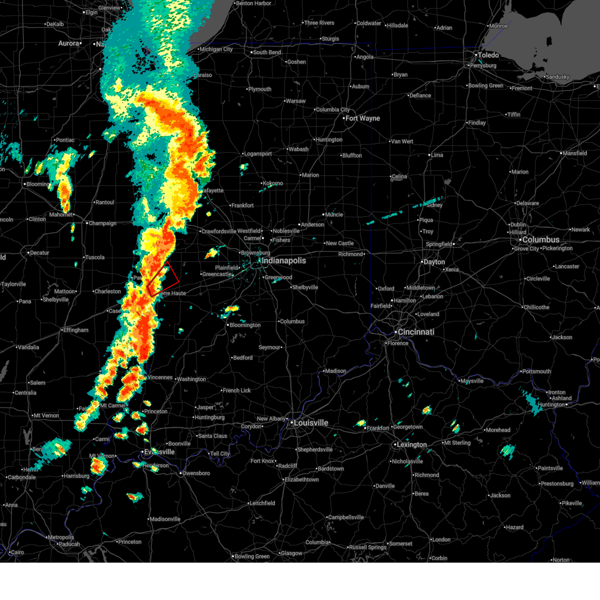
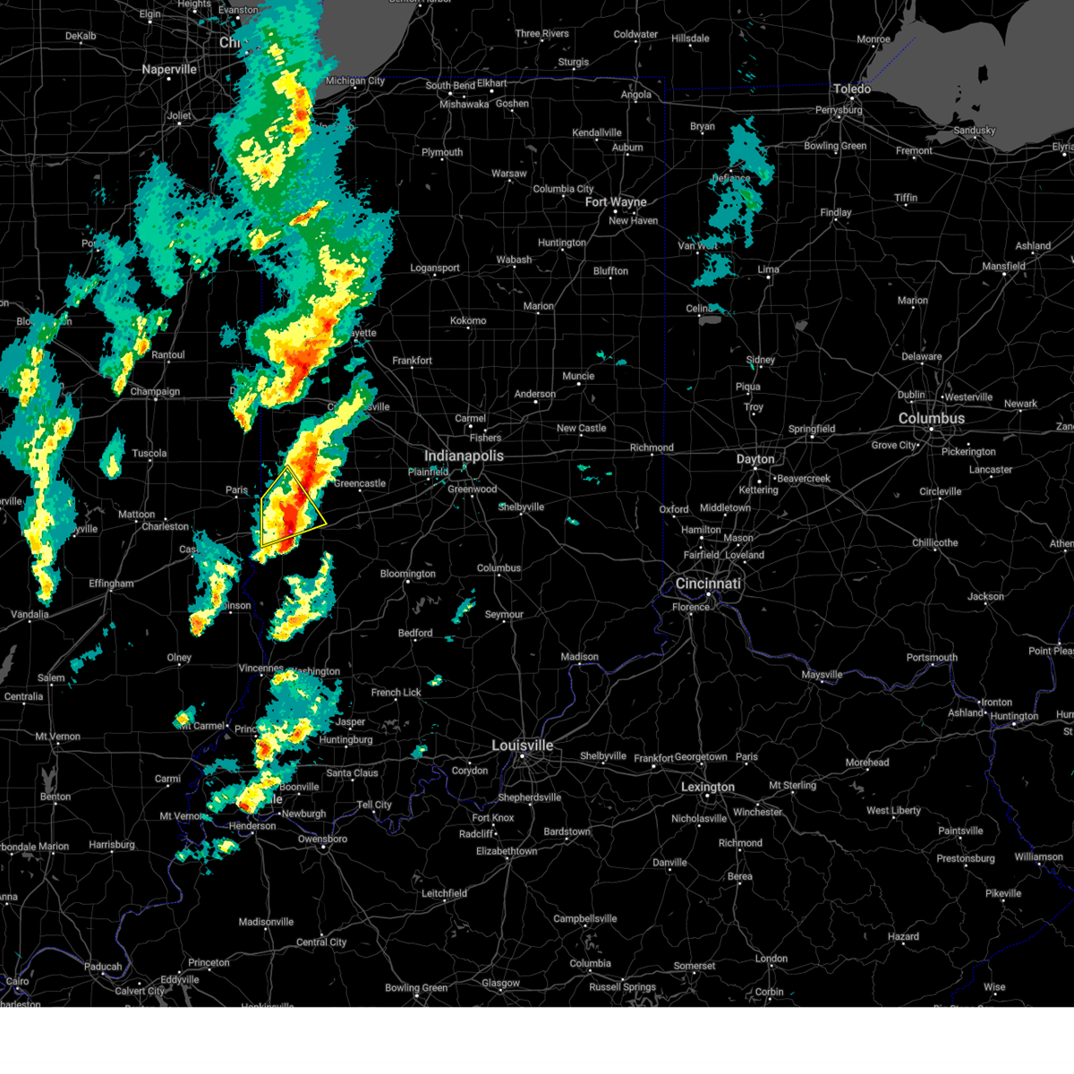
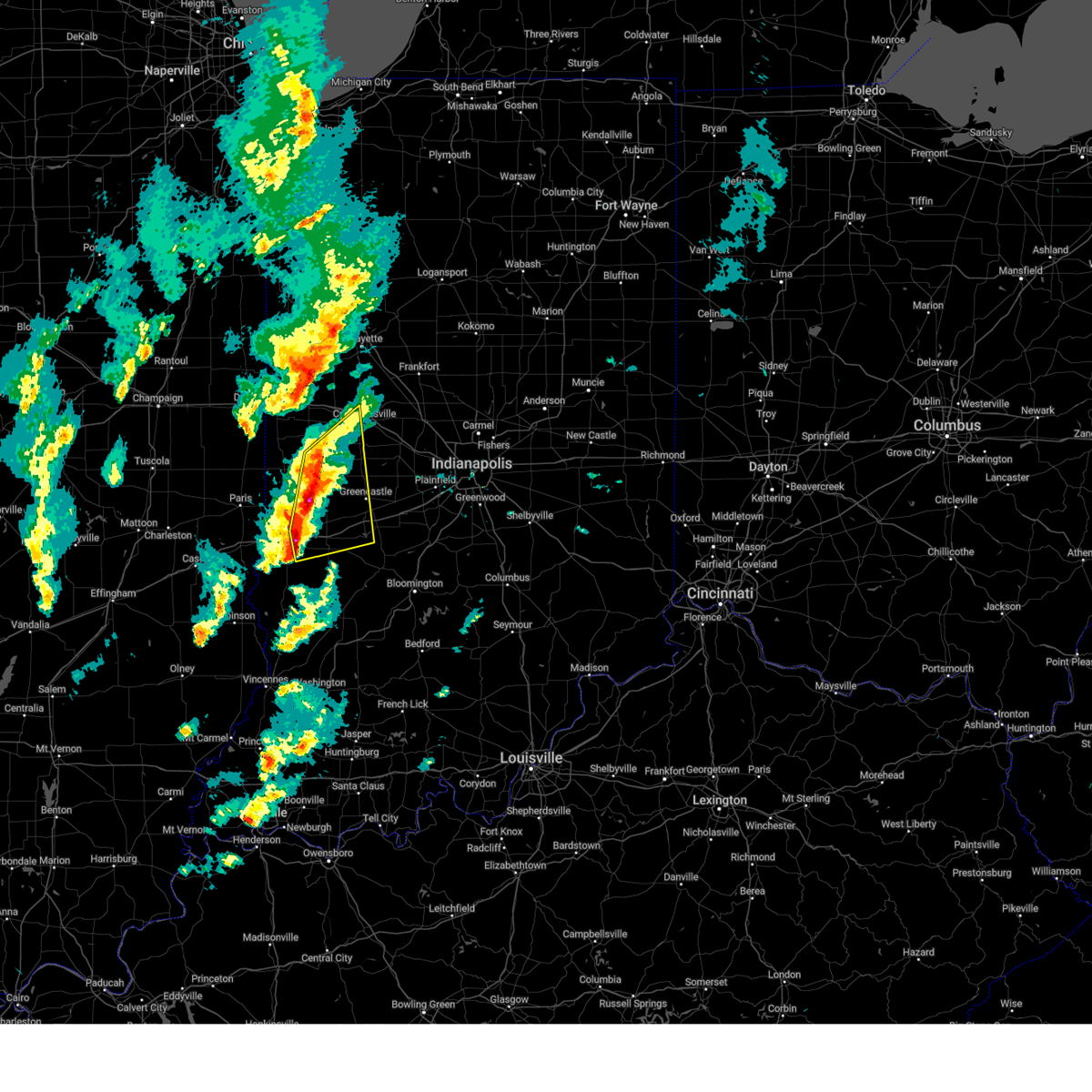
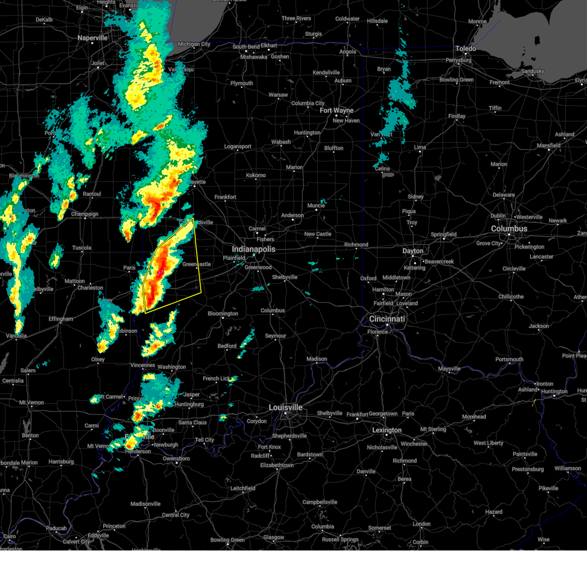
| 3/30/2025 5:45 PM EDT | Quarter sized hail reported 1.1 miles SW of Terre Haute, IN, approximate location. |
| 3/30/2025 5:39 PM EDT | Quarter sized hail reported 1.1 miles SW of Terre Haute, IN, corrects previous hail report from 2 e terre haute. approximate location. |
| 3/30/2025 5:26 PM EDT |
 At 525 pm edt, a severe thunderstorm was located over brazil, or 13 miles east of terre haute, moving northeast at 40 mph (radar indicated). Hazards include 60 mph wind gusts and half dollar size hail. Hail damage to vehicles is expected. expect wind damage to roofs, siding, and trees. locations impacted include, fontanet, west terre haute, fairbanks, prairieton, seelyville, staunton, harmony, lena, clay city, carbon, farmersburg, cory, saline city, pimento, center point, brazil, terre haute, riley, knightsville, and indiana state university. This includes interstate 70 between mile markers 4 and 27. At 525 pm edt, a severe thunderstorm was located over brazil, or 13 miles east of terre haute, moving northeast at 40 mph (radar indicated). Hazards include 60 mph wind gusts and half dollar size hail. Hail damage to vehicles is expected. expect wind damage to roofs, siding, and trees. locations impacted include, fontanet, west terre haute, fairbanks, prairieton, seelyville, staunton, harmony, lena, clay city, carbon, farmersburg, cory, saline city, pimento, center point, brazil, terre haute, riley, knightsville, and indiana state university. This includes interstate 70 between mile markers 4 and 27.
|
| 3/30/2025 5:17 PM EDT | Ping Pong Ball sized hail reported 1.9 miles W of Terre Haute, IN, near intersection of poplar and highway 46. |
| 3/30/2025 5:14 PM EDT | Quarter sized hail reported 1.9 miles W of Terre Haute, IN, report from mping: quarter (1.00 in.). |
| 3/30/2025 5:09 PM EDT | Quarter sized hail reported 1.1 miles SW of Terre Haute, IN |
| 3/30/2025 5:09 PM EDT |
 At 509 pm edt, severe thunderstorms were located along a line extending from 8 miles northwest of brazil to 10 miles northwest of sullivan, moving northeast at 40 mph (radar indicated). Hazards include 60 mph wind gusts and quarter size hail. Hail damage to vehicles is expected. expect wind damage to roofs, siding, and trees. locations impacted include, fontanet, west terre haute, fairbanks, prairieton, seelyville, staunton, harmony, lena, clay city, carbon, farmersburg, cory, saline city, pimento, center point, brazil, terre haute, riley, knightsville, and indiana state university. This includes interstate 70 between mile markers 4 and 27. At 509 pm edt, severe thunderstorms were located along a line extending from 8 miles northwest of brazil to 10 miles northwest of sullivan, moving northeast at 40 mph (radar indicated). Hazards include 60 mph wind gusts and quarter size hail. Hail damage to vehicles is expected. expect wind damage to roofs, siding, and trees. locations impacted include, fontanet, west terre haute, fairbanks, prairieton, seelyville, staunton, harmony, lena, clay city, carbon, farmersburg, cory, saline city, pimento, center point, brazil, terre haute, riley, knightsville, and indiana state university. This includes interstate 70 between mile markers 4 and 27.
|
| 3/30/2025 5:05 PM EDT | Quarter sized hail reported 4.7 miles NNE of Terre Haute, IN, pea to quarter size hail at my location along us 41 near walmart in terre haute....40 mph wind... torrential rain. |
| 3/30/2025 5:02 PM EDT | At 502 pm edt, severe thunderstorms were located along a line extending from 8 miles southeast of clinton to 7 miles northeast of hutsonville, moving northeast at 40 mph (radar indicated). Hazards include 60 mph wind gusts and quarter size hail. Hail damage to vehicles is expected. expect wind damage to roofs, siding, and trees. locations impacted include, fontanet, west terre haute, fairbanks, prairieton, seelyville, staunton, harmony, lena, clay city, carbon, farmersburg, cory, saline city, pimento, center point, brazil, terre haute, riley, knightsville, and indiana state university. This includes interstate 70 between mile markers 4 and 27. |
| 3/30/2025 4:54 PM EDT | Svrind the national weather service in indianapolis has issued a * severe thunderstorm warning for, vigo county in west central indiana, northern sullivan county in southwestern indiana, clay county in west central indiana, southeastern parke county in west central indiana, * until 545 pm edt. * at 453 pm edt, severe thunderstorms were located along a line extending from near terre haute to near hutsonville, moving northeast at 40 mph (radar indicated). Hazards include 60 mph wind gusts and penny size hail. expect damage to roofs, siding, and trees |
| 3/30/2025 4:10 PM EDT | Storm damage reported in vigo county IN, 3.1 miles WNW of Terre Haute, IN |
| 3/30/2025 3:34 PM EDT |
 Svrind the national weather service in indianapolis has issued a * severe thunderstorm warning for, northeastern vigo county in west central indiana, fountain county in west central indiana, southern tippecanoe county in west central indiana, northwestern clay county in west central indiana, parke county in west central indiana, montgomery county in west central indiana, northern putnam county in west central indiana, * until 415 pm edt. * at 333 pm edt, severe thunderstorms were located along a line extending from 6 miles south of veedersburg to 9 miles east of newport to 7 miles northeast of terre haute, moving northeast at 55 mph (radar indicated). Hazards include 70 mph wind gusts. Expect considerable tree damage. Damage is likely to mobile homes, roofs, and outbuildings. Svrind the national weather service in indianapolis has issued a * severe thunderstorm warning for, northeastern vigo county in west central indiana, fountain county in west central indiana, southern tippecanoe county in west central indiana, northwestern clay county in west central indiana, parke county in west central indiana, montgomery county in west central indiana, northern putnam county in west central indiana, * until 415 pm edt. * at 333 pm edt, severe thunderstorms were located along a line extending from 6 miles south of veedersburg to 9 miles east of newport to 7 miles northeast of terre haute, moving northeast at 55 mph (radar indicated). Hazards include 70 mph wind gusts. Expect considerable tree damage. Damage is likely to mobile homes, roofs, and outbuildings.
|
| 3/19/2025 8:50 PM EDT |
 Svrind the national weather service in indianapolis has issued a * severe thunderstorm warning for, vigo county in west central indiana, fountain county in west central indiana, western tippecanoe county in west central indiana, northwestern sullivan county in southwestern indiana, parke county in west central indiana, warren county in west central indiana, vermillion county in west central indiana, northwestern montgomery county in west central indiana, * until 915 pm edt. * at 850 pm edt, severe thunderstorms were located along a line extending from near williamsport to hutsonville, moving northeast at 75 mph (radar indicated). Hazards include 60 mph wind gusts and penny size hail. expect damage to roofs, siding, and trees Svrind the national weather service in indianapolis has issued a * severe thunderstorm warning for, vigo county in west central indiana, fountain county in west central indiana, western tippecanoe county in west central indiana, northwestern sullivan county in southwestern indiana, parke county in west central indiana, warren county in west central indiana, vermillion county in west central indiana, northwestern montgomery county in west central indiana, * until 915 pm edt. * at 850 pm edt, severe thunderstorms were located along a line extending from near williamsport to hutsonville, moving northeast at 75 mph (radar indicated). Hazards include 60 mph wind gusts and penny size hail. expect damage to roofs, siding, and trees
|
| 3/19/2025 7:07 PM EDT |
 The severe thunderstorm which prompted the warning has moved eastward and is covered by a seperate severe thunderstorm warning. therefore, this warning will be allowed to expire. a tornado watch remains in effect until 1000 pm edt for west central indiana. remember, a severe thunderstorm warning still remains in effect for northern clay, southern parke and northeastern vigo until 730 edt. The severe thunderstorm which prompted the warning has moved eastward and is covered by a seperate severe thunderstorm warning. therefore, this warning will be allowed to expire. a tornado watch remains in effect until 1000 pm edt for west central indiana. remember, a severe thunderstorm warning still remains in effect for northern clay, southern parke and northeastern vigo until 730 edt.
|
| 3/19/2025 7:02 PM EDT |
 the severe thunderstorm warning has been cancelled and is no longer in effect the severe thunderstorm warning has been cancelled and is no longer in effect
|
| 3/19/2025 7:02 PM EDT |
 At 701 pm edt, severe thunderstorms were located along a line extending from 8 miles northeast of rockville to 8 miles south of terre haute, moving northeast at 55 mph (radar indicated). Hazards include 70 mph wind gusts and quarter size hail. Hail damage to vehicles is expected. expect considerable tree damage. wind damage is also likely to mobile homes, roofs, and outbuildings. locations impacted include, rosedale, russellville, bridgeton, reelsville, saline city, center point, brazil, shades state park, cagles mill lake, riley, knightsville, alamo, fontanet, seelyville, waveland, staunton, bowling green, harmony, lena, and cecil harden lake. this includes the following highways, interstate 70 between mile markers 10 and 39. Interstate 74 between mile markers 32 and 33. At 701 pm edt, severe thunderstorms were located along a line extending from 8 miles northeast of rockville to 8 miles south of terre haute, moving northeast at 55 mph (radar indicated). Hazards include 70 mph wind gusts and quarter size hail. Hail damage to vehicles is expected. expect considerable tree damage. wind damage is also likely to mobile homes, roofs, and outbuildings. locations impacted include, rosedale, russellville, bridgeton, reelsville, saline city, center point, brazil, shades state park, cagles mill lake, riley, knightsville, alamo, fontanet, seelyville, waveland, staunton, bowling green, harmony, lena, and cecil harden lake. this includes the following highways, interstate 70 between mile markers 10 and 39. Interstate 74 between mile markers 32 and 33.
|
| 3/19/2025 6:59 PM EDT | Thunderstorm wind gust at khuf terre haute regional airpor in vigo county IN, 6.3 miles S of Terre Haute, IN |
| 3/19/2025 6:53 PM EDT |
 Svrind the national weather service in indianapolis has issued a * severe thunderstorm warning for, vigo county in west central indiana, southeastern fountain county in west central indiana, north central sullivan county in southwestern indiana, clay county in west central indiana, northwestern owen county in west central indiana, parke county in west central indiana, southeastern vermillion county in west central indiana, southwestern montgomery county in west central indiana, western putnam county in west central indiana, * until 745 pm edt. * at 652 pm edt, severe thunderstorms were located along a line extending from rockville to 11 miles north of sullivan, moving northeast at 55 mph (radar indicated). Hazards include 70 mph wind gusts and quarter size hail. Hail damage to vehicles is expected. expect considerable tree damage. Wind damage is also likely to mobile homes, roofs, and outbuildings. Svrind the national weather service in indianapolis has issued a * severe thunderstorm warning for, vigo county in west central indiana, southeastern fountain county in west central indiana, north central sullivan county in southwestern indiana, clay county in west central indiana, northwestern owen county in west central indiana, parke county in west central indiana, southeastern vermillion county in west central indiana, southwestern montgomery county in west central indiana, western putnam county in west central indiana, * until 745 pm edt. * at 652 pm edt, severe thunderstorms were located along a line extending from rockville to 11 miles north of sullivan, moving northeast at 55 mph (radar indicated). Hazards include 70 mph wind gusts and quarter size hail. Hail damage to vehicles is expected. expect considerable tree damage. Wind damage is also likely to mobile homes, roofs, and outbuildings.
|
| 3/19/2025 6:47 PM EDT |
 Torind the national weather service in indianapolis has issued a * tornado warning for, northeastern vigo county in west central indiana, northwestern clay county in west central indiana, south central parke county in west central indiana, * until 715 pm edt. * at 647 pm edt, a confirmed tornado was located near terre haute, moving northeast at 40 mph (weather spotters confirmed tornado). Hazards include damaging tornado. Flying debris will be dangerous to those caught without shelter. mobile homes will be damaged or destroyed. damage to roofs, windows, and vehicles will occur. Tree damage is likely. Torind the national weather service in indianapolis has issued a * tornado warning for, northeastern vigo county in west central indiana, northwestern clay county in west central indiana, south central parke county in west central indiana, * until 715 pm edt. * at 647 pm edt, a confirmed tornado was located near terre haute, moving northeast at 40 mph (weather spotters confirmed tornado). Hazards include damaging tornado. Flying debris will be dangerous to those caught without shelter. mobile homes will be damaged or destroyed. damage to roofs, windows, and vehicles will occur. Tree damage is likely.
|
| 3/19/2025 6:45 PM EDT | Thunderstorm winds estimated 60-70 mph at terre haute 6.5 n. torrential rain and pea hai in vigo county IN, 6.9 miles S of Terre Haute, IN |
| 3/19/2025 6:41 PM EDT |
 At 640 pm edt, a severe thunderstorm was located near terre haute, moving northeast at 50 mph (radar indicated). Hazards include 60 mph wind gusts and quarter size hail. Hail damage to vehicles is expected. expect wind damage to roofs, siding, and trees. locations impacted include, fontanet, west terre haute, shepardsville, universal, prairieton, seelyville, staunton, mecca, rosedale, clinton, terre haute, north terre haute, fairview park, indiana state university, sandford, and brazil. This includes interstate 70 between mile markers 1 and 20. At 640 pm edt, a severe thunderstorm was located near terre haute, moving northeast at 50 mph (radar indicated). Hazards include 60 mph wind gusts and quarter size hail. Hail damage to vehicles is expected. expect wind damage to roofs, siding, and trees. locations impacted include, fontanet, west terre haute, shepardsville, universal, prairieton, seelyville, staunton, mecca, rosedale, clinton, terre haute, north terre haute, fairview park, indiana state university, sandford, and brazil. This includes interstate 70 between mile markers 1 and 20.
|
| 3/19/2025 6:25 PM EDT |
 Svrind the national weather service in indianapolis has issued a * severe thunderstorm warning for, vigo county in west central indiana, northern clay county in west central indiana, southwestern parke county in west central indiana, southeastern vermillion county in west central indiana, * until 715 pm edt. * at 624 pm edt, a severe thunderstorm was located near marshall, moving northeast at 45 mph (radar indicated). Hazards include 60 mph wind gusts and quarter size hail. Hail damage to vehicles is expected. Expect wind damage to roofs, siding, and trees. Svrind the national weather service in indianapolis has issued a * severe thunderstorm warning for, vigo county in west central indiana, northern clay county in west central indiana, southwestern parke county in west central indiana, southeastern vermillion county in west central indiana, * until 715 pm edt. * at 624 pm edt, a severe thunderstorm was located near marshall, moving northeast at 45 mph (radar indicated). Hazards include 60 mph wind gusts and quarter size hail. Hail damage to vehicles is expected. Expect wind damage to roofs, siding, and trees.
|
| 3/15/2025 3:25 AM EDT |
 The storm which prompted the warning has weakened below severe limits, and no longer appears capable of producing a tornado. therefore, the warning will be allowed to expire. a tornado watch remains in effect until 400 am edt for southwestern and west central indiana. The storm which prompted the warning has weakened below severe limits, and no longer appears capable of producing a tornado. therefore, the warning will be allowed to expire. a tornado watch remains in effect until 400 am edt for southwestern and west central indiana.
|
| 3/15/2025 3:01 AM EDT |
 Torind the national weather service in indianapolis has issued a * tornado warning for, southwestern vigo county in west central indiana, northern sullivan county in southwestern indiana, * until 330 am edt. * at 301 am edt, a severe thunderstorm capable of producing a tornado was located near hutsonville, or 9 miles north of robinson, moving northeast at 60 mph (radar indicated rotation). Hazards include tornado and quarter size hail. Flying debris will be dangerous to those caught without shelter. mobile homes will be damaged or destroyed. damage to roofs, windows, and vehicles will occur. Tree damage is likely. Torind the national weather service in indianapolis has issued a * tornado warning for, southwestern vigo county in west central indiana, northern sullivan county in southwestern indiana, * until 330 am edt. * at 301 am edt, a severe thunderstorm capable of producing a tornado was located near hutsonville, or 9 miles north of robinson, moving northeast at 60 mph (radar indicated rotation). Hazards include tornado and quarter size hail. Flying debris will be dangerous to those caught without shelter. mobile homes will be damaged or destroyed. damage to roofs, windows, and vehicles will occur. Tree damage is likely.
|
| 3/15/2025 1:47 AM EDT |
 Svrind the national weather service in indianapolis has issued a * severe thunderstorm warning for, northern vigo county in west central indiana, southwestern fountain county in west central indiana, western parke county in west central indiana, vermillion county in west central indiana, * until 230 am edt. * at 147 am edt, a severe thunderstorm was located 8 miles east of kansas, or 8 miles southwest of paris, moving northeast at 65 mph (radar indicated). Hazards include 70 mph wind gusts and nickel size hail. Expect considerable tree damage. Damage is likely to mobile homes, roofs, and outbuildings. Svrind the national weather service in indianapolis has issued a * severe thunderstorm warning for, northern vigo county in west central indiana, southwestern fountain county in west central indiana, western parke county in west central indiana, vermillion county in west central indiana, * until 230 am edt. * at 147 am edt, a severe thunderstorm was located 8 miles east of kansas, or 8 miles southwest of paris, moving northeast at 65 mph (radar indicated). Hazards include 70 mph wind gusts and nickel size hail. Expect considerable tree damage. Damage is likely to mobile homes, roofs, and outbuildings.
|
| 7/31/2024 1:20 PM EDT | Several large trees and tree limbs downed across town. time estimated from rada in vigo county IN, 1 miles SE of Terre Haute, IN |
| 6/25/2024 3:04 PM EDT | Preliminary max gus in vigo county IN, 3.1 miles WNW of Terre Haute, IN |
| 6/25/2024 3:02 PM EDT | Thunderstorm winds have blown off one or more of the following...roof shingles... branches... awnings... fences... and carports onto car in vigo county IN, 4.8 miles NE of Terre Haute, IN |
| 6/25/2024 3:00 PM EDT | Several full grown trees and a flag pole have been blown down by thunderstorm wind in vigo county IN, 7.1 miles NNW of Terre Haute, IN |
| 6/25/2024 3:00 PM EDT | A small tree was uprooted and another tree split by thunderstorm winds. time is approximat in vigo county IN, 4.2 miles NE of Terre Haute, IN |
| 6/25/2024 3:00 PM EDT | Thunderstorm winds blew down a tree that is blocking cherrywood stree in vigo county IN, 3.7 miles NNE of Terre Haute, IN |
| 6/25/2024 3:00 PM EDT | A large branch was sheared off a a large tree and a large sign in a parking lot near the road edge was blown down as a result of thunderstorm winds. time is approximate in vigo county IN, 3.7 miles ENE of Terre Haute, IN |
| 6/25/2024 2:50 PM EDT | Small branches off trees and pea size hai in vigo county IN, 13.6 miles NE of Terre Haute, IN |
| 6/25/2024 2:29 PM EDT |
 Svrind the national weather service in indianapolis has issued a * severe thunderstorm warning for, vigo county in west central indiana, northeastern sullivan county in southwestern indiana, northwestern clay county in west central indiana, * until 315 pm edt. * at 227 pm edt, a severe thunderstorm was located near paris, moving east at 40 mph (radar indicated). Hazards include ping pong ball size hail and 60 mph wind gusts. People and animals outdoors will be injured. expect hail damage to roofs, siding, windows, and vehicles. Expect wind damage to roofs, siding, and trees. Svrind the national weather service in indianapolis has issued a * severe thunderstorm warning for, vigo county in west central indiana, northeastern sullivan county in southwestern indiana, northwestern clay county in west central indiana, * until 315 pm edt. * at 227 pm edt, a severe thunderstorm was located near paris, moving east at 40 mph (radar indicated). Hazards include ping pong ball size hail and 60 mph wind gusts. People and animals outdoors will be injured. expect hail damage to roofs, siding, windows, and vehicles. Expect wind damage to roofs, siding, and trees.
|
| 5/7/2024 6:30 PM EDT | Quarter sized hail reported 11.5 miles NNE of Terre Haute, IN, winds gusting to estimated 45 mph. |
| 5/7/2024 6:26 PM EDT |
 Svrind the national weather service in indianapolis has issued a * severe thunderstorm warning for, southern vigo county in west central indiana, central clay county in west central indiana, west central owen county in west central indiana, * until 700 pm edt. * at 626 pm edt, a severe thunderstorm was located 9 miles south of terre haute, moving east at 45 mph (radar indicated). Hazards include 60 mph wind gusts and quarter size hail. Hail damage to vehicles is expected. Expect wind damage to roofs, siding, and trees. Svrind the national weather service in indianapolis has issued a * severe thunderstorm warning for, southern vigo county in west central indiana, central clay county in west central indiana, west central owen county in west central indiana, * until 700 pm edt. * at 626 pm edt, a severe thunderstorm was located 9 miles south of terre haute, moving east at 45 mph (radar indicated). Hazards include 60 mph wind gusts and quarter size hail. Hail damage to vehicles is expected. Expect wind damage to roofs, siding, and trees.
|
| 5/7/2024 4:50 PM EDT |
 At 450 pm edt, a severe thunderstorm capable of producing a tornado was located near terre haute, moving east at 40 mph (radar indicated rotation). Hazards include tornado and ping pong ball size hail. Flying debris will be dangerous to those caught without shelter. mobile homes will be damaged or destroyed. damage to roofs, windows, and vehicles will occur. tree damage is likely. locations impacted include, terre haute, brazil, seelyville, knightsville, harmony, staunton, carbon, center point, fontanet, and north terre haute. This includes interstate 70 between mile markers 12 and 29. At 450 pm edt, a severe thunderstorm capable of producing a tornado was located near terre haute, moving east at 40 mph (radar indicated rotation). Hazards include tornado and ping pong ball size hail. Flying debris will be dangerous to those caught without shelter. mobile homes will be damaged or destroyed. damage to roofs, windows, and vehicles will occur. tree damage is likely. locations impacted include, terre haute, brazil, seelyville, knightsville, harmony, staunton, carbon, center point, fontanet, and north terre haute. This includes interstate 70 between mile markers 12 and 29.
|
| 5/7/2024 4:43 PM EDT |
 At 443 pm edt, a severe thunderstorm capable of producing a tornado was located over terre haute, moving east at 40 mph (radar indicated rotation). Hazards include tornado and ping pong ball size hail. Flying debris will be dangerous to those caught without shelter. mobile homes will be damaged or destroyed. damage to roofs, windows, and vehicles will occur. tree damage is likely. locations impacted include, terre haute, brazil, west terre haute, seelyville, knightsville, harmony, staunton, carbon, center point, riley, fontanet, north terre haute, and indiana state university. This includes interstate 70 between mile markers 4 and 29. At 443 pm edt, a severe thunderstorm capable of producing a tornado was located over terre haute, moving east at 40 mph (radar indicated rotation). Hazards include tornado and ping pong ball size hail. Flying debris will be dangerous to those caught without shelter. mobile homes will be damaged or destroyed. damage to roofs, windows, and vehicles will occur. tree damage is likely. locations impacted include, terre haute, brazil, west terre haute, seelyville, knightsville, harmony, staunton, carbon, center point, riley, fontanet, north terre haute, and indiana state university. This includes interstate 70 between mile markers 4 and 29.
|
| 5/7/2024 4:40 PM EDT | Quarter sized hail reported 1 miles SE of Terre Haute, IN |
| 5/7/2024 4:35 PM EDT | Quarter sized hail reported 3.7 miles ENE of Terre Haute, IN, report from mping: quarter (1.00 in.). |
| 5/7/2024 4:31 PM EDT |
 Torind the national weather service in indianapolis has issued a * tornado warning for, central vigo county in west central indiana, northern clay county in west central indiana, * until 515 pm edt. * at 431 pm edt, a severe thunderstorm capable of producing a tornado was located 7 miles southwest of terre haute, moving east at 40 mph (radar indicated rotation). Hazards include tornado and ping pong ball size hail. Flying debris will be dangerous to those caught without shelter. mobile homes will be damaged or destroyed. damage to roofs, windows, and vehicles will occur. Tree damage is likely. Torind the national weather service in indianapolis has issued a * tornado warning for, central vigo county in west central indiana, northern clay county in west central indiana, * until 515 pm edt. * at 431 pm edt, a severe thunderstorm capable of producing a tornado was located 7 miles southwest of terre haute, moving east at 40 mph (radar indicated rotation). Hazards include tornado and ping pong ball size hail. Flying debris will be dangerous to those caught without shelter. mobile homes will be damaged or destroyed. damage to roofs, windows, and vehicles will occur. Tree damage is likely.
|
| 5/7/2024 4:27 PM EDT |
 At 427 pm edt, a severe thunderstorm was located 7 miles west of terre haute, moving east at 40 mph (radar indicated). Hazards include 60 mph wind gusts and quarter size hail. Hail damage to vehicles is expected. expect wind damage to roofs, siding, and trees. locations impacted include, terre haute, west terre haute, prairieton, seelyville, riley, fontanet, north terre haute, and indiana state university. This includes interstate 70 between mile markers 1 and 16. At 427 pm edt, a severe thunderstorm was located 7 miles west of terre haute, moving east at 40 mph (radar indicated). Hazards include 60 mph wind gusts and quarter size hail. Hail damage to vehicles is expected. expect wind damage to roofs, siding, and trees. locations impacted include, terre haute, west terre haute, prairieton, seelyville, riley, fontanet, north terre haute, and indiana state university. This includes interstate 70 between mile markers 1 and 16.
|
| 5/7/2024 4:11 PM EDT |
 Svrind the national weather service in indianapolis has issued a * severe thunderstorm warning for, vigo county in west central indiana, * until 500 pm edt. * at 410 pm edt, a severe thunderstorm was located over marshall, moving east at 40 mph (radar indicated). Hazards include 60 mph wind gusts and quarter size hail. Hail damage to vehicles is expected. Expect wind damage to roofs, siding, and trees. Svrind the national weather service in indianapolis has issued a * severe thunderstorm warning for, vigo county in west central indiana, * until 500 pm edt. * at 410 pm edt, a severe thunderstorm was located over marshall, moving east at 40 mph (radar indicated). Hazards include 60 mph wind gusts and quarter size hail. Hail damage to vehicles is expected. Expect wind damage to roofs, siding, and trees.
|
| 4/18/2024 10:15 PM EDT | 11419 sugar lane about 6 miles south of terre haute....several large trees dow in vigo county IN, 9 miles N of Terre Haute, IN |
| 4/18/2024 9:59 PM EDT |
 At 959 pm edt, severe thunderstorms were located along a line extending from 8 miles southwest of terre haute to near palestine to mount carmel, moving east at 60 mph (radar indicated). Hazards include up to 60 mph wind gusts. Expect damage to roofs, siding, and trees. Locations impacted include, terre haute, vincennes, washington, linton, sullivan, bicknell, jasonville, shelburn, prairieton, prairie creek, farmersburg, dugger, clay city, hymera, lyons, fairbanks, carlisle, elnora, oaktown, and monroe city. At 959 pm edt, severe thunderstorms were located along a line extending from 8 miles southwest of terre haute to near palestine to mount carmel, moving east at 60 mph (radar indicated). Hazards include up to 60 mph wind gusts. Expect damage to roofs, siding, and trees. Locations impacted include, terre haute, vincennes, washington, linton, sullivan, bicknell, jasonville, shelburn, prairieton, prairie creek, farmersburg, dugger, clay city, hymera, lyons, fairbanks, carlisle, elnora, oaktown, and monroe city.
|
| 4/18/2024 9:38 PM EDT |
 At 936 pm edt, severe thunderstorms were located along a line extending from martinsville to robinson to parkersburg, moving east at 40 mph (radar indicated). Hazards include up to 60 mph wind gusts and penny size hail. Expect damage to roofs, siding, and trees. Locations impacted include, terre haute, vincennes, washington, linton, sullivan, bicknell, jasonville, shelburn, prairieton, prairie creek, farmersburg, dugger, clay city, hymera, lyons, fairbanks, carlisle, elnora, oaktown, and monroe city. At 936 pm edt, severe thunderstorms were located along a line extending from martinsville to robinson to parkersburg, moving east at 40 mph (radar indicated). Hazards include up to 60 mph wind gusts and penny size hail. Expect damage to roofs, siding, and trees. Locations impacted include, terre haute, vincennes, washington, linton, sullivan, bicknell, jasonville, shelburn, prairieton, prairie creek, farmersburg, dugger, clay city, hymera, lyons, fairbanks, carlisle, elnora, oaktown, and monroe city.
|
| 4/18/2024 9:20 PM EDT |
 Svrind the national weather service in indianapolis has issued a * severe thunderstorm warning for, vigo county in west central indiana, sullivan county in southwestern indiana, knox county in southwestern indiana, southwestern clay county in west central indiana, western greene county in southwestern indiana, northwestern daviess county in southwestern indiana, * until 1015 pm edt. * at 919 pm edt, severe thunderstorms were located along a line extending from charleston to near willow hill to noble, moving east at 50 mph (radar indicated). Hazards include 60 mph wind gusts and penny size hail. expect damage to roofs, siding, and trees Svrind the national weather service in indianapolis has issued a * severe thunderstorm warning for, vigo county in west central indiana, sullivan county in southwestern indiana, knox county in southwestern indiana, southwestern clay county in west central indiana, western greene county in southwestern indiana, northwestern daviess county in southwestern indiana, * until 1015 pm edt. * at 919 pm edt, severe thunderstorms were located along a line extending from charleston to near willow hill to noble, moving east at 50 mph (radar indicated). Hazards include 60 mph wind gusts and penny size hail. expect damage to roofs, siding, and trees
|
| 3/14/2024 9:12 PM EDT |
 the severe thunderstorm warning has been cancelled and is no longer in effect the severe thunderstorm warning has been cancelled and is no longer in effect
|
| 3/14/2024 8:38 PM EDT |
 Svrind the national weather service in indianapolis has issued a * severe thunderstorm warning for, vigo county in west central indiana, * until 930 pm edt. * at 838 pm edt, a severe thunderstorm was located near marshall, moving east at 35 mph (radar indicated). Hazards include 60 mph wind gusts and quarter size hail. Hail damage to vehicles is expected. Expect wind damage to roofs, siding, and trees. Svrind the national weather service in indianapolis has issued a * severe thunderstorm warning for, vigo county in west central indiana, * until 930 pm edt. * at 838 pm edt, a severe thunderstorm was located near marshall, moving east at 35 mph (radar indicated). Hazards include 60 mph wind gusts and quarter size hail. Hail damage to vehicles is expected. Expect wind damage to roofs, siding, and trees.
|
| 3/14/2024 7:54 PM EDT |
 Svrind the national weather service in indianapolis has issued a * severe thunderstorm warning for, vigo county in west central indiana, northern sullivan county in southwestern indiana, southwestern parke county in west central indiana, southern vermillion county in west central indiana, * until 830 pm edt. * at 754 pm edt, severe thunderstorms were located along a line extending from 8 miles southwest of newport to 13 miles southeast of marshall, moving east at 30 mph (radar indicated). Hazards include 60 mph wind gusts and quarter size hail. Hail damage to vehicles is expected. Expect wind damage to roofs, siding, and trees. Svrind the national weather service in indianapolis has issued a * severe thunderstorm warning for, vigo county in west central indiana, northern sullivan county in southwestern indiana, southwestern parke county in west central indiana, southern vermillion county in west central indiana, * until 830 pm edt. * at 754 pm edt, severe thunderstorms were located along a line extending from 8 miles southwest of newport to 13 miles southeast of marshall, moving east at 30 mph (radar indicated). Hazards include 60 mph wind gusts and quarter size hail. Hail damage to vehicles is expected. Expect wind damage to roofs, siding, and trees.
|
| 3/14/2024 11:02 AM EDT | Ping Pong Ball sized hail reported 0.8 miles E of Terre Haute, IN, hail stopped at about 1106 am edt. |
| 3/14/2024 10:48 AM EDT |
 Svrind the national weather service in indianapolis has issued a * severe thunderstorm warning for, southern vigo county in west central indiana, northern sullivan county in southwestern indiana, * until 1115 am edt. * at 1047 am edt, a severe thunderstorm was located 7 miles northwest of hutsonville, or 11 miles north of robinson, moving northeast at 65 mph (radar indicated). Hazards include 60 mph wind gusts and half dollar size hail. Hail damage to vehicles is expected. Expect wind damage to roofs, siding, and trees. Svrind the national weather service in indianapolis has issued a * severe thunderstorm warning for, southern vigo county in west central indiana, northern sullivan county in southwestern indiana, * until 1115 am edt. * at 1047 am edt, a severe thunderstorm was located 7 miles northwest of hutsonville, or 11 miles north of robinson, moving northeast at 65 mph (radar indicated). Hazards include 60 mph wind gusts and half dollar size hail. Hail damage to vehicles is expected. Expect wind damage to roofs, siding, and trees.
|
| 3/13/2024 11:44 PM EDT |
 The storm which prompted the warning has weakened below severe limits, and no longer poses an immediate threat to life or property. therefore, the warning will be allowed to expire. however, nickel hail is still possible with this thunderstorm. The storm which prompted the warning has weakened below severe limits, and no longer poses an immediate threat to life or property. therefore, the warning will be allowed to expire. however, nickel hail is still possible with this thunderstorm.
|
| 3/13/2024 11:19 PM EDT |
 Svrind the national weather service in indianapolis has issued a * severe thunderstorm warning for, northwestern vigo county in west central indiana, south central vermillion county in west central indiana, * until 1145 pm edt. * at 1119 pm edt, a severe thunderstorm was located near vermilion, or 9 miles northwest of terre haute, moving east at 25 mph (radar indicated). Hazards include quarter size hail. damage to vehicles is expected Svrind the national weather service in indianapolis has issued a * severe thunderstorm warning for, northwestern vigo county in west central indiana, south central vermillion county in west central indiana, * until 1145 pm edt. * at 1119 pm edt, a severe thunderstorm was located near vermilion, or 9 miles northwest of terre haute, moving east at 25 mph (radar indicated). Hazards include quarter size hail. damage to vehicles is expected
|
| 2/28/2024 1:27 AM EST |
 Svrind the national weather service in indianapolis has issued a * severe thunderstorm warning for, eastern vigo county in west central indiana, clay county in west central indiana, northwestern owen county in west central indiana, southeastern parke county in west central indiana, southwestern putnam county in west central indiana, * until 200 am est. * at 127 am est, a severe thunderstorm was located 8 miles southwest of brazil, or 8 miles east of terre haute, moving east at 50 mph (radar indicated). Hazards include 70 mph wind gusts and quarter size hail. Hail damage to vehicles is expected. expect considerable tree damage. wind damage is also likely to mobile homes, roofs, and outbuildings. this severe thunderstorm will be near, center point around 135 am est. cagles mill lake around 145 am est. other locations in the path of this severe thunderstorm include cloverdale. This includes interstate 70 between mile markers 13 and 41. Svrind the national weather service in indianapolis has issued a * severe thunderstorm warning for, eastern vigo county in west central indiana, clay county in west central indiana, northwestern owen county in west central indiana, southeastern parke county in west central indiana, southwestern putnam county in west central indiana, * until 200 am est. * at 127 am est, a severe thunderstorm was located 8 miles southwest of brazil, or 8 miles east of terre haute, moving east at 50 mph (radar indicated). Hazards include 70 mph wind gusts and quarter size hail. Hail damage to vehicles is expected. expect considerable tree damage. wind damage is also likely to mobile homes, roofs, and outbuildings. this severe thunderstorm will be near, center point around 135 am est. cagles mill lake around 145 am est. other locations in the path of this severe thunderstorm include cloverdale. This includes interstate 70 between mile markers 13 and 41.
|
| 2/28/2024 1:20 AM EST | Quarter sized hail reported 2.2 miles NNE of Terre Haute, IN, reported through amateur radio. |
| 2/28/2024 1:18 AM EST |
 At 118 am est, a severe thunderstorm was located near brazil, or 11 miles northeast of terre haute, moving east at 70 mph (radar indicated). Hazards include 70 mph wind gusts and quarter size hail. Hail damage to vehicles is expected. expect considerable tree damage. wind damage is also likely to mobile homes, roofs, and outbuildings. locations impacted include, harmony and carbon. This includes interstate 70 between mile markers 1 and 29. At 118 am est, a severe thunderstorm was located near brazil, or 11 miles northeast of terre haute, moving east at 70 mph (radar indicated). Hazards include 70 mph wind gusts and quarter size hail. Hail damage to vehicles is expected. expect considerable tree damage. wind damage is also likely to mobile homes, roofs, and outbuildings. locations impacted include, harmony and carbon. This includes interstate 70 between mile markers 1 and 29.
|
| 2/28/2024 1:01 AM EST |
 Svrind the national weather service in indianapolis has issued a * severe thunderstorm warning for, vigo county in west central indiana, northern clay county in west central indiana, southeastern parke county in west central indiana, * until 130 am est. * at 100 am est, a severe thunderstorm was located near marshall, moving east at 70 mph (radar indicated). Hazards include 70 mph wind gusts and quarter size hail. Hail damage to vehicles is expected. expect considerable tree damage. wind damage is also likely to mobile homes, roofs, and outbuildings. this severe thunderstorm will be near, terre haute, west terre haute, and indiana state university around 105 am est. seelyville and north terre haute around 110 am est. brazil and staunton around 115 am est. knightsville, harmony, and carbon around 120 am est. This includes interstate 70 between mile markers 1 and 29. Svrind the national weather service in indianapolis has issued a * severe thunderstorm warning for, vigo county in west central indiana, northern clay county in west central indiana, southeastern parke county in west central indiana, * until 130 am est. * at 100 am est, a severe thunderstorm was located near marshall, moving east at 70 mph (radar indicated). Hazards include 70 mph wind gusts and quarter size hail. Hail damage to vehicles is expected. expect considerable tree damage. wind damage is also likely to mobile homes, roofs, and outbuildings. this severe thunderstorm will be near, terre haute, west terre haute, and indiana state university around 105 am est. seelyville and north terre haute around 110 am est. brazil and staunton around 115 am est. knightsville, harmony, and carbon around 120 am est. This includes interstate 70 between mile markers 1 and 29.
|
| 8/5/2023 6:31 PM EDT | 8 inch diameter limbs and a tree are down across park ave between 13st and lafayette ave. per ham networ in vigo county IN, 5 miles SSE of Terre Haute, IN |
| 8/5/2023 6:26 PM EDT |
 At 626 pm edt, a severe thunderstorm capable of producing a tornado was located over terre haute, moving east at 20 mph (radar indicated rotation). Hazards include tornado. Flying debris will be dangerous to those caught without shelter. mobile homes will be damaged or destroyed. damage to roofs, windows, and vehicles will occur. tree damage is likely. this dangerous storm will be near, north terre haute around 630 pm edt. seelyville around 645 pm edt. other locations in the path of this tornadic thunderstorm include fontanet. This includes interstate 70 between mile markers 3 and 18. At 626 pm edt, a severe thunderstorm capable of producing a tornado was located over terre haute, moving east at 20 mph (radar indicated rotation). Hazards include tornado. Flying debris will be dangerous to those caught without shelter. mobile homes will be damaged or destroyed. damage to roofs, windows, and vehicles will occur. tree damage is likely. this dangerous storm will be near, north terre haute around 630 pm edt. seelyville around 645 pm edt. other locations in the path of this tornadic thunderstorm include fontanet. This includes interstate 70 between mile markers 3 and 18.
|
| 7/26/2023 12:41 AM EDT |
 The severe thunderstorm warning for northern vigo, southwestern parke and southern vermillion counties will expire at 1245 am edt, the storm which prompted the warning has weakened below severe limits, and no longer poses an immediate threat to life or property. therefore, the warning will be allowed to expire. however gusty winds are still possible with this thunderstorm. The severe thunderstorm warning for northern vigo, southwestern parke and southern vermillion counties will expire at 1245 am edt, the storm which prompted the warning has weakened below severe limits, and no longer poses an immediate threat to life or property. therefore, the warning will be allowed to expire. however gusty winds are still possible with this thunderstorm.
|
| 7/26/2023 12:29 AM EDT |
 At 1228 am edt, a severe thunderstorm was located over clinton, or 15 miles north of terre haute, moving east at 45 mph (radar indicated). Hazards include 60 mph wind gusts and quarter size hail. Hail damage to vehicles is expected. expect wind damage to roofs, siding, and trees. locations impacted include, rosedale. hail threat, radar indicated max hail size, 1. 00 in wind threat, radar indicated max wind gust, 60 mph. At 1228 am edt, a severe thunderstorm was located over clinton, or 15 miles north of terre haute, moving east at 45 mph (radar indicated). Hazards include 60 mph wind gusts and quarter size hail. Hail damage to vehicles is expected. expect wind damage to roofs, siding, and trees. locations impacted include, rosedale. hail threat, radar indicated max hail size, 1. 00 in wind threat, radar indicated max wind gust, 60 mph.
|
| 7/26/2023 12:13 AM EDT |
 At 1213 am edt, a severe thunderstorm was located near paris, moving east at 25 mph (radar indicated). Hazards include 70 mph wind gusts and half dollar size hail. Hail damage to vehicles is expected. expect considerable tree damage. wind damage is also likely to mobile homes, roofs, and outbuildings. this severe thunderstorm will be near, blanford around 1230 am edt. other locations in the path of this severe thunderstorm include universal, clinton, fairview park, rosedale, mecca and shepardsville. thunderstorm damage threat, considerable hail threat, radar indicated max hail size, 1. 25 in wind threat, radar indicated max wind gust, 70 mph. At 1213 am edt, a severe thunderstorm was located near paris, moving east at 25 mph (radar indicated). Hazards include 70 mph wind gusts and half dollar size hail. Hail damage to vehicles is expected. expect considerable tree damage. wind damage is also likely to mobile homes, roofs, and outbuildings. this severe thunderstorm will be near, blanford around 1230 am edt. other locations in the path of this severe thunderstorm include universal, clinton, fairview park, rosedale, mecca and shepardsville. thunderstorm damage threat, considerable hail threat, radar indicated max hail size, 1. 25 in wind threat, radar indicated max wind gust, 70 mph.
|
| 7/1/2023 1:28 AM EDT |
 At 128 am edt, a severe thunderstorm was located near brazil, or 18 miles east of terre haute, moving east at 40 mph (radar indicated). Hazards include 70 mph wind gusts and quarter size hail. Hail damage to vehicles is expected. expect considerable tree damage. wind damage is also likely to mobile homes, roofs, and outbuildings. locations impacted include, brazil, rockville, seelyville, knightsville, harmony, staunton, carbon, center point, fontanet, bridgeton, lena and cecil harden lake. this includes interstate 70 between mile markers 14 and 29. thunderstorm damage threat, considerable hail threat, radar indicated max hail size, 1. 00 in wind threat, radar indicated max wind gust, 70 mph. At 128 am edt, a severe thunderstorm was located near brazil, or 18 miles east of terre haute, moving east at 40 mph (radar indicated). Hazards include 70 mph wind gusts and quarter size hail. Hail damage to vehicles is expected. expect considerable tree damage. wind damage is also likely to mobile homes, roofs, and outbuildings. locations impacted include, brazil, rockville, seelyville, knightsville, harmony, staunton, carbon, center point, fontanet, bridgeton, lena and cecil harden lake. this includes interstate 70 between mile markers 14 and 29. thunderstorm damage threat, considerable hail threat, radar indicated max hail size, 1. 00 in wind threat, radar indicated max wind gust, 70 mph.
|
| 7/1/2023 1:18 AM EDT |
 At 118 am edt, a severe thunderstorm was located near brazil, or 10 miles northeast of terre haute, moving east at 35 mph (radar indicated). Hazards include 70 mph wind gusts and quarter size hail. Hail damage to vehicles is expected. expect considerable tree damage. wind damage is also likely to mobile homes, roofs, and outbuildings. locations impacted include, terre haute, brazil, rockville, seelyville, knightsville, rosedale, harmony, staunton, carbon, mecca, center point, fontanet, lena, cecil harden lake, bridgeton and north terre haute. this includes interstate 70 between mile markers 9 and 29. thunderstorm damage threat, considerable hail threat, radar indicated max hail size, 1. 00 in wind threat, radar indicated max wind gust, 70 mph. At 118 am edt, a severe thunderstorm was located near brazil, or 10 miles northeast of terre haute, moving east at 35 mph (radar indicated). Hazards include 70 mph wind gusts and quarter size hail. Hail damage to vehicles is expected. expect considerable tree damage. wind damage is also likely to mobile homes, roofs, and outbuildings. locations impacted include, terre haute, brazil, rockville, seelyville, knightsville, rosedale, harmony, staunton, carbon, mecca, center point, fontanet, lena, cecil harden lake, bridgeton and north terre haute. this includes interstate 70 between mile markers 9 and 29. thunderstorm damage threat, considerable hail threat, radar indicated max hail size, 1. 00 in wind threat, radar indicated max wind gust, 70 mph.
|
| 7/1/2023 1:07 AM EDT |
 At 106 am edt, a severe thunderstorm was located 8 miles southeast of clinton, or 9 miles northeast of terre haute, moving east at 30 mph (radar indicated). Hazards include 60 mph wind gusts and quarter size hail. Hail damage to vehicles is expected. expect wind damage to roofs, siding, and trees. locations impacted include, terre haute, brazil, clinton, rockville, west terre haute, fairview park, seelyville, knightsville, rosedale, harmony, staunton, carbon, universal, mecca, center point, bridgeton, fontanet, blanford, shepardsville and lena. this includes interstate 70 between mile markers 1 and 29. hail threat, radar indicated max hail size, 1. 00 in wind threat, radar indicated max wind gust, 60 mph. At 106 am edt, a severe thunderstorm was located 8 miles southeast of clinton, or 9 miles northeast of terre haute, moving east at 30 mph (radar indicated). Hazards include 60 mph wind gusts and quarter size hail. Hail damage to vehicles is expected. expect wind damage to roofs, siding, and trees. locations impacted include, terre haute, brazil, clinton, rockville, west terre haute, fairview park, seelyville, knightsville, rosedale, harmony, staunton, carbon, universal, mecca, center point, bridgeton, fontanet, blanford, shepardsville and lena. this includes interstate 70 between mile markers 1 and 29. hail threat, radar indicated max hail size, 1. 00 in wind threat, radar indicated max wind gust, 60 mph.
|
| 7/1/2023 12:56 AM EDT |
 At 1256 am edt, a severe thunderstorm was located near clinton, or 7 miles north of terre haute, moving east at 40 mph (radar indicated). Hazards include 60 mph wind gusts and quarter size hail. Hail damage to vehicles is expected. expect wind damage to roofs, siding, and trees. locations impacted include, seelyville, rosedale, staunton, fontanet, brazil, bridgeton, knightsville, harmony, carbon and lena. this includes interstate 70 between mile markers 1 and 29. hail threat, radar indicated max hail size, 1. 00 in wind threat, radar indicated max wind gust, 60 mph. At 1256 am edt, a severe thunderstorm was located near clinton, or 7 miles north of terre haute, moving east at 40 mph (radar indicated). Hazards include 60 mph wind gusts and quarter size hail. Hail damage to vehicles is expected. expect wind damage to roofs, siding, and trees. locations impacted include, seelyville, rosedale, staunton, fontanet, brazil, bridgeton, knightsville, harmony, carbon and lena. this includes interstate 70 between mile markers 1 and 29. hail threat, radar indicated max hail size, 1. 00 in wind threat, radar indicated max wind gust, 60 mph.
|
| 7/1/2023 12:43 AM EDT |
 At 1243 am edt, a severe thunderstorm was located over paris, moving east at 30 mph (radar indicated). Hazards include 60 mph wind gusts and quarter size hail. Hail damage to vehicles is expected. expect wind damage to roofs, siding, and trees. this severe thunderstorm will be near, sandford around 1255 am edt. blanford around 100 am edt. other locations in the path of this severe thunderstorm include universal, shepardsville, clinton, fairview park, rosedale, mecca, fontanet, rockville, bridgeton, carbon and judson. this includes interstate 70 between mile markers 1 and 29. hail threat, radar indicated max hail size, 1. 00 in wind threat, radar indicated max wind gust, 60 mph. At 1243 am edt, a severe thunderstorm was located over paris, moving east at 30 mph (radar indicated). Hazards include 60 mph wind gusts and quarter size hail. Hail damage to vehicles is expected. expect wind damage to roofs, siding, and trees. this severe thunderstorm will be near, sandford around 1255 am edt. blanford around 100 am edt. other locations in the path of this severe thunderstorm include universal, shepardsville, clinton, fairview park, rosedale, mecca, fontanet, rockville, bridgeton, carbon and judson. this includes interstate 70 between mile markers 1 and 29. hail threat, radar indicated max hail size, 1. 00 in wind threat, radar indicated max wind gust, 60 mph.
|
| 6/29/2023 3:06 PM EDT | Large tree down on ohio blvd blocking all lane in vigo county IN, 0.8 miles SSE of Terre Haute, IN |
| 6/29/2023 3:06 PM EDT | Damage to a metal building reported. photo from social media shows walls collapsed and roof blown back. time estimated via rada in vigo county IN, 7.7 miles N of Terre Haute, IN |
| 6/29/2023 3:05 PM EDT | 65 mph gust estimated at sky king airpor in vigo county IN, 6.3 miles S of Terre Haute, IN |
| 6/29/2023 3:05 PM EDT | Large tree fell onto a house. powerlines also down at 8th and indiana in terre haut in vigo county IN, 3.7 miles SE of Terre Haute, IN |
| 6/29/2023 3:00 PM EDT | Multiple ham radio operators report widespread trees and powerlines down in terre haute. estimated 70-80mph wind in vigo county IN, 1.9 miles NE of Terre Haute, IN |
| 6/29/2023 2:47 PM EDT |
 At 246 pm edt, severe thunderstorms were located along a line extending from near ridge farm to near oliver, moving east at 75 mph (radar indicated). Hazards include 80 mph wind gusts. Flying debris will be dangerous to those caught without shelter. mobile homes will be heavily damaged. expect considerable damage to roofs, windows, and vehicles. extensive tree damage and power outages are likely. severe thunderstorms will be near, dana around 250 pm edt. montezuma, universal and sandford around 255 pm edt. rockville, bloomingdale, marshall, north terre haute, indiana state university and shepardsville around 300 pm edt. terre haute, seelyville, rosedale, judson and fontanet around 305 pm edt. other locations in the path of these severe thunderstorms include brazil, staunton, carbon, cecil harden lake, knightsville, harmony and lena. This includes interstate 70 between mile markers 14 and 26. At 246 pm edt, severe thunderstorms were located along a line extending from near ridge farm to near oliver, moving east at 75 mph (radar indicated). Hazards include 80 mph wind gusts. Flying debris will be dangerous to those caught without shelter. mobile homes will be heavily damaged. expect considerable damage to roofs, windows, and vehicles. extensive tree damage and power outages are likely. severe thunderstorms will be near, dana around 250 pm edt. montezuma, universal and sandford around 255 pm edt. rockville, bloomingdale, marshall, north terre haute, indiana state university and shepardsville around 300 pm edt. terre haute, seelyville, rosedale, judson and fontanet around 305 pm edt. other locations in the path of these severe thunderstorms include brazil, staunton, carbon, cecil harden lake, knightsville, harmony and lena. This includes interstate 70 between mile markers 14 and 26.
|
| 6/29/2023 2:32 PM EDT |
 At 231 pm edt, severe thunderstorms were located along a line extending from near oakwood to casey, moving east at 55 mph (radar indicated). Hazards include 70 mph wind gusts and quarter size hail. Hail damage to vehicles is expected. expect considerable tree damage. wind damage is also likely to mobile homes, roofs, and outbuildings. severe thunderstorms will be near, state line city, foster and gessie around 245 pm edt. covington and perrysville around 250 pm edt. other locations in the path of these severe thunderstorms include veedersburg, prairieton, prairie creek, fairbanks, shelburn, farmersburg, hillsboro, newtown, mellott, pimento, waynetown, hymera, wingate, riley, new richmond and cory. this includes the following highways, interstate 70 between mile markers 1 and 20. interstate 74 between mile markers 1 and 28. thunderstorm damage threat, considerable hail threat, radar indicated max hail size, 1. 00 in wind threat, radar indicated max wind gust, 70 mph. At 231 pm edt, severe thunderstorms were located along a line extending from near oakwood to casey, moving east at 55 mph (radar indicated). Hazards include 70 mph wind gusts and quarter size hail. Hail damage to vehicles is expected. expect considerable tree damage. wind damage is also likely to mobile homes, roofs, and outbuildings. severe thunderstorms will be near, state line city, foster and gessie around 245 pm edt. covington and perrysville around 250 pm edt. other locations in the path of these severe thunderstorms include veedersburg, prairieton, prairie creek, fairbanks, shelburn, farmersburg, hillsboro, newtown, mellott, pimento, waynetown, hymera, wingate, riley, new richmond and cory. this includes the following highways, interstate 70 between mile markers 1 and 20. interstate 74 between mile markers 1 and 28. thunderstorm damage threat, considerable hail threat, radar indicated max hail size, 1. 00 in wind threat, radar indicated max wind gust, 70 mph.
|
| 6/29/2023 11:25 AM EDT | Golf Ball sized hail reported 6.3 miles NNE of Terre Haute, IN, time estimated from radar. |
| 6/29/2023 6:19 AM EDT | Quarter sized hail reported 6.3 miles S of Terre Haute, IN, report from mping: quarter (1.00 in.). |
| 6/29/2023 5:58 AM EDT |
 At 558 am edt, a severe thunderstorm was located near vermilion, or 8 miles northwest of terre haute, moving east at 35 mph (radar indicated). Hazards include half dollar size hail. Damage to vehicles is expected. this severe thunderstorm will be near, west terre haute around 605 am edt. north terre haute, indiana state university and shepardsville around 610 am edt. terre haute around 615 am edt. other locations in the path of this severe thunderstorm include seelyville, rosedale, fontanet, staunton, brazil, carbon, knightsville, harmony and center point. this includes interstate 70 between mile markers 1 and 27. hail threat, radar indicated max hail size, 1. 25 in wind threat, radar indicated max wind gust, <50 mph. At 558 am edt, a severe thunderstorm was located near vermilion, or 8 miles northwest of terre haute, moving east at 35 mph (radar indicated). Hazards include half dollar size hail. Damage to vehicles is expected. this severe thunderstorm will be near, west terre haute around 605 am edt. north terre haute, indiana state university and shepardsville around 610 am edt. terre haute around 615 am edt. other locations in the path of this severe thunderstorm include seelyville, rosedale, fontanet, staunton, brazil, carbon, knightsville, harmony and center point. this includes interstate 70 between mile markers 1 and 27. hail threat, radar indicated max hail size, 1. 25 in wind threat, radar indicated max wind gust, <50 mph.
|
| 6/25/2023 3:07 PM EDT |
 At 307 pm edt, a severe thunderstorm was located 7 miles east of terre haute, moving east at 40 mph (radar indicated). Hazards include 60 mph wind gusts and quarter size hail. Hail damage to vehicles is expected. expect wind damage to roofs, siding, and trees. this severe thunderstorm will be near, staunton around 315 pm edt. brazil and center point around 320 pm edt. knightsville and harmony around 325 pm edt. other locations in the path of this severe thunderstorm include reelsville and cagles mill lake. this includes interstate 70 between mile markers 10 and 37. hail threat, radar indicated max hail size, 1. 00 in wind threat, radar indicated max wind gust, 60 mph. At 307 pm edt, a severe thunderstorm was located 7 miles east of terre haute, moving east at 40 mph (radar indicated). Hazards include 60 mph wind gusts and quarter size hail. Hail damage to vehicles is expected. expect wind damage to roofs, siding, and trees. this severe thunderstorm will be near, staunton around 315 pm edt. brazil and center point around 320 pm edt. knightsville and harmony around 325 pm edt. other locations in the path of this severe thunderstorm include reelsville and cagles mill lake. this includes interstate 70 between mile markers 10 and 37. hail threat, radar indicated max hail size, 1. 00 in wind threat, radar indicated max wind gust, 60 mph.
|
| 2/27/2023 11:21 AM EST |
 At 1121 am est, a severe thunderstorm was located near terre haute, moving northeast at 50 mph (radar indicated). Hazards include 60 mph wind gusts and penny size hail. Expect damage to roofs, siding, and trees. this severe thunderstorm will be near, seelyville around 1125 am est. clinton, rosedale and fontanet around 1130 am est. mecca and bridgeton around 1135 am est. rockville around 1140 am est. Other locations in the path of this severe thunderstorm include marshall and judson. At 1121 am est, a severe thunderstorm was located near terre haute, moving northeast at 50 mph (radar indicated). Hazards include 60 mph wind gusts and penny size hail. Expect damage to roofs, siding, and trees. this severe thunderstorm will be near, seelyville around 1125 am est. clinton, rosedale and fontanet around 1130 am est. mecca and bridgeton around 1135 am est. rockville around 1140 am est. Other locations in the path of this severe thunderstorm include marshall and judson.
|
| 8/1/2022 8:26 AM EDT |
 The severe thunderstorm warning for northeastern vigo, northwestern clay, parke and southeastern vermillion counties will expire at 830 am edt, the storm which prompted the warning has moved out of the area. therefore, the warning will be allowed to expire. however gusty winds are still possible with this thunderstorm. The severe thunderstorm warning for northeastern vigo, northwestern clay, parke and southeastern vermillion counties will expire at 830 am edt, the storm which prompted the warning has moved out of the area. therefore, the warning will be allowed to expire. however gusty winds are still possible with this thunderstorm.
|
| 8/1/2022 8:07 AM EDT |
 At 806 am edt, a severe thunderstorm was located 10 miles east of rockville, or 19 miles south of crawfordsville, moving east at 55 mph (radar indicated). Hazards include 60 mph wind gusts. Expect damage to roofs, siding, and trees. this severe thunderstorm will remain over mainly rural areas of northeastern vigo, northwestern clay, parke and southeastern vermillion counties. this includes interstate 70 between mile markers 20 and 28. hail threat, radar indicated max hail size, <. 75 in wind threat, radar indicated max wind gust, 60 mph. At 806 am edt, a severe thunderstorm was located 10 miles east of rockville, or 19 miles south of crawfordsville, moving east at 55 mph (radar indicated). Hazards include 60 mph wind gusts. Expect damage to roofs, siding, and trees. this severe thunderstorm will remain over mainly rural areas of northeastern vigo, northwestern clay, parke and southeastern vermillion counties. this includes interstate 70 between mile markers 20 and 28. hail threat, radar indicated max hail size, <. 75 in wind threat, radar indicated max wind gust, 60 mph.
|
| 8/1/2022 8:03 AM EDT | Trees reported down between rosedale road and gallagher road in northern vigo county. time estimated via rada in vigo county IN, 9.9 miles SSW of Terre Haute, IN |
| 8/1/2022 7:54 AM EDT |
 At 753 am edt, severe thunderstorms were located along a line extending from 7 miles east of newport to near clinton, moving east at 55 mph (radar indicated). Hazards include 60 mph wind gusts. Expect damage to roofs, siding, and trees. these severe storms will be near, marshall around 800 am edt. staunton, bridgeton and judson around 805 am edt. other locations in the path of these severe thunderstorms include brazil, knightsville, harmony, carbon, lena and cecil harden lake. this includes interstate 70 between mile markers 20 and 28. hail threat, radar indicated max hail size, <. 75 in wind threat, radar indicated max wind gust, 60 mph. At 753 am edt, severe thunderstorms were located along a line extending from 7 miles east of newport to near clinton, moving east at 55 mph (radar indicated). Hazards include 60 mph wind gusts. Expect damage to roofs, siding, and trees. these severe storms will be near, marshall around 800 am edt. staunton, bridgeton and judson around 805 am edt. other locations in the path of these severe thunderstorms include brazil, knightsville, harmony, carbon, lena and cecil harden lake. this includes interstate 70 between mile markers 20 and 28. hail threat, radar indicated max hail size, <. 75 in wind threat, radar indicated max wind gust, 60 mph.
|
| 8/1/2022 7:45 AM EDT |
 At 745 am edt, severe thunderstorms were located along a line extending from near newport to 6 miles northeast of vermilion, moving east at 50 mph (radar indicated). Hazards include 60 mph wind gusts. Expect damage to roofs, siding, and trees. severe thunderstorms will be near, newport and universal around 750 am edt. clinton, fairview park, montezuma, mecca, shepardsville and north terre haute around 755 am edt. rosedale, bloomingdale and turkey run state park around 800 am edt. rockville, marshall and fontanet around 805 am edt. other locations in the path of these severe thunderstorms include staunton, judson, bridgeton, brazil, knightsville, harmony, carbon, cecil harden lake and lena. this includes interstate 70 between mile markers 20 and 28. hail threat, radar indicated max hail size, <. 75 in wind threat, radar indicated max wind gust, 60 mph. At 745 am edt, severe thunderstorms were located along a line extending from near newport to 6 miles northeast of vermilion, moving east at 50 mph (radar indicated). Hazards include 60 mph wind gusts. Expect damage to roofs, siding, and trees. severe thunderstorms will be near, newport and universal around 750 am edt. clinton, fairview park, montezuma, mecca, shepardsville and north terre haute around 755 am edt. rosedale, bloomingdale and turkey run state park around 800 am edt. rockville, marshall and fontanet around 805 am edt. other locations in the path of these severe thunderstorms include staunton, judson, bridgeton, brazil, knightsville, harmony, carbon, cecil harden lake and lena. this includes interstate 70 between mile markers 20 and 28. hail threat, radar indicated max hail size, <. 75 in wind threat, radar indicated max wind gust, 60 mph.
|
| 5/14/2022 5:28 PM EDT |
 At 528 pm edt, a severe thunderstorm was located near clinton, or 10 miles north of terre haute, moving southeast at 5 mph (radar indicated). Hazards include quarter size hail. damage to vehicles is expected At 528 pm edt, a severe thunderstorm was located near clinton, or 10 miles north of terre haute, moving southeast at 5 mph (radar indicated). Hazards include quarter size hail. damage to vehicles is expected
|
| 3/6/2022 2:34 AM EST |
 At 233 am est, a severe thunderstorm was located near lebanon, or 13 miles south of frankfort, moving northeast at 80 mph (radar indicated). Hazards include 70 mph wind gusts. Expect considerable tree damage. damage is likely to mobile homes, roofs, and outbuildings. this severe thunderstorm will remain over mainly rural areas of northern vigo, southwestern clinton, hendricks, northwestern clay, southern parke, boone, southern vermillion, southeastern montgomery and putnam counties. this includes the following highways, interstate 65 between mile markers 134 and 153. interstate 70 between mile markers 1 and 5. interstate 74 between mile markers 42 and 66. thunderstorm damage threat, considerable hail threat, radar indicated max hail size, <. 75 in wind threat, radar indicated max wind gust, 70 mph. At 233 am est, a severe thunderstorm was located near lebanon, or 13 miles south of frankfort, moving northeast at 80 mph (radar indicated). Hazards include 70 mph wind gusts. Expect considerable tree damage. damage is likely to mobile homes, roofs, and outbuildings. this severe thunderstorm will remain over mainly rural areas of northern vigo, southwestern clinton, hendricks, northwestern clay, southern parke, boone, southern vermillion, southeastern montgomery and putnam counties. this includes the following highways, interstate 65 between mile markers 134 and 153. interstate 70 between mile markers 1 and 5. interstate 74 between mile markers 42 and 66. thunderstorm damage threat, considerable hail threat, radar indicated max hail size, <. 75 in wind threat, radar indicated max wind gust, 70 mph.
|
| 3/6/2022 2:11 AM EST |
 At 210 am est, a severe thunderstorm was located 10 miles southwest of crawfordsville, moving east at 80 mph (radar indicated). Hazards include 70 mph wind gusts. Expect considerable tree damage. damage is likely to mobile homes, roofs, and outbuildings. this severe thunderstorm will be near, ladoga and new ross around 220 am est. jamestown and advance around 225 am est. thorntown around 230 am est. other locations in the path of this severe thunderstorm include lebanon and ulen. this includes the following highways, interstate 65 between mile markers 134 and 153. interstate 70 between mile markers 1 and 5. interstate 74 between mile markers 23 and 66. thunderstorm damage threat, considerable hail threat, radar indicated max hail size, <. 75 in wind threat, radar indicated max wind gust, 70 mph. At 210 am est, a severe thunderstorm was located 10 miles southwest of crawfordsville, moving east at 80 mph (radar indicated). Hazards include 70 mph wind gusts. Expect considerable tree damage. damage is likely to mobile homes, roofs, and outbuildings. this severe thunderstorm will be near, ladoga and new ross around 220 am est. jamestown and advance around 225 am est. thorntown around 230 am est. other locations in the path of this severe thunderstorm include lebanon and ulen. this includes the following highways, interstate 65 between mile markers 134 and 153. interstate 70 between mile markers 1 and 5. interstate 74 between mile markers 23 and 66. thunderstorm damage threat, considerable hail threat, radar indicated max hail size, <. 75 in wind threat, radar indicated max wind gust, 70 mph.
|
| 6/19/2021 1:37 AM EDT |
 The severe thunderstorm warning for vigo and clay counties will expire at 145 am edt, the storm which prompted the warning has weakened below severe limits, and has exited the warned area. therefore, the warning will be allowed to expire. however heavy rain is still possible with this thunderstorm. a severe thunderstorm watch remains in effect until 200 am edt for southwestern and west central indiana. The severe thunderstorm warning for vigo and clay counties will expire at 145 am edt, the storm which prompted the warning has weakened below severe limits, and has exited the warned area. therefore, the warning will be allowed to expire. however heavy rain is still possible with this thunderstorm. a severe thunderstorm watch remains in effect until 200 am edt for southwestern and west central indiana.
|
| 6/19/2021 1:24 AM EDT |
 At 124 am edt, a severe thunderstorm was located 11 miles south of brazil, or 12 miles southeast of terre haute, moving east at 40 mph (radar indicated). Hazards include 60 mph wind gusts and quarter size hail. Hail damage to vehicles is expected. expect wind damage to roofs, siding, and trees. locations impacted include, clay city, center point and bowling green. This includes interstate 70 between mile markers 1 and 29. At 124 am edt, a severe thunderstorm was located 11 miles south of brazil, or 12 miles southeast of terre haute, moving east at 40 mph (radar indicated). Hazards include 60 mph wind gusts and quarter size hail. Hail damage to vehicles is expected. expect wind damage to roofs, siding, and trees. locations impacted include, clay city, center point and bowling green. This includes interstate 70 between mile markers 1 and 29.
|
| 6/19/2021 1:02 AM EDT |
 At 102 am edt, a severe thunderstorm was located 8 miles southeast of terre haute, moving east at 45 mph (radar indicated). Hazards include 60 mph wind gusts and quarter size hail. Hail damage to vehicles is expected. expect wind damage to roofs, siding, and trees. this severe thunderstorm will be near, saline city around 110 am edt. clay city and center point around 115 am edt. bowling green around 120 am edt. This includes interstate 70 between mile markers 1 and 29. At 102 am edt, a severe thunderstorm was located 8 miles southeast of terre haute, moving east at 45 mph (radar indicated). Hazards include 60 mph wind gusts and quarter size hail. Hail damage to vehicles is expected. expect wind damage to roofs, siding, and trees. this severe thunderstorm will be near, saline city around 110 am edt. clay city and center point around 115 am edt. bowling green around 120 am edt. This includes interstate 70 between mile markers 1 and 29.
|
| 6/18/2021 10:19 PM EDT |
 At 1019 pm edt, a severe thunderstorm was located near spencer, or 16 miles northwest of bloomington, moving east at 20 mph (radar indicated). Hazards include ping pong ball size hail. People and animals outdoors will be injured. expect damage to roofs, siding, windows, and vehicles. this severe thunderstorm will remain over mainly rural areas of central vigo, central clay and western owen counties. This includes interstate 70 between mile markers 1 and 27. At 1019 pm edt, a severe thunderstorm was located near spencer, or 16 miles northwest of bloomington, moving east at 20 mph (radar indicated). Hazards include ping pong ball size hail. People and animals outdoors will be injured. expect damage to roofs, siding, windows, and vehicles. this severe thunderstorm will remain over mainly rural areas of central vigo, central clay and western owen counties. This includes interstate 70 between mile markers 1 and 27.
|
| 6/18/2021 9:58 PM EDT |
 At 958 pm edt, a severe thunderstorm was located near spencer, or 22 miles northwest of bloomington, moving east at 20 mph (radar indicated). Hazards include ping pong ball size hail. People and animals outdoors will be injured. expect damage to roofs, siding, windows, and vehicles. this severe thunderstorm will be near, devore around 1010 pm edt. This includes interstate 70 between mile markers 1 and 27. At 958 pm edt, a severe thunderstorm was located near spencer, or 22 miles northwest of bloomington, moving east at 20 mph (radar indicated). Hazards include ping pong ball size hail. People and animals outdoors will be injured. expect damage to roofs, siding, windows, and vehicles. this severe thunderstorm will be near, devore around 1010 pm edt. This includes interstate 70 between mile markers 1 and 27.
|
| 8/10/2020 6:58 PM EDT | Several reports of utility lines down in terre haut in vigo county IN, 1 miles SE of Terre Haute, IN |
| 8/10/2020 6:57 PM EDT | Scanner traffic indicates power lines down on south 7th st. in terre haut in vigo county IN, 2.4 miles E of Terre Haute, IN |
| 8/10/2020 6:51 PM EDT | Estimated 60 to 70 mph wind gusts at fruitridge avenue and plum street on the east side of terre haut in vigo county IN, 2.1 miles S of Terre Haute, IN |
| 7/21/2020 8:36 PM EDT |
 At 835 pm edt, severe thunderstorms were located along a line extending from near newport to 7 miles northwest of brazil to terre haute, moving east at 30 mph (radar indicated). Hazards include 60 mph wind gusts and penny size hail. Expect damage to roofs, siding, and trees. locations impacted include, terre haute, brazil, rockville, seelyville, knightsville, rosedale, harmony, staunton, carbon, mecca, fontanet, lena, cecil harden lake, bridgeton and north terre haute. This includes interstate 70 between mile markers 12 and 29. At 835 pm edt, severe thunderstorms were located along a line extending from near newport to 7 miles northwest of brazil to terre haute, moving east at 30 mph (radar indicated). Hazards include 60 mph wind gusts and penny size hail. Expect damage to roofs, siding, and trees. locations impacted include, terre haute, brazil, rockville, seelyville, knightsville, rosedale, harmony, staunton, carbon, mecca, fontanet, lena, cecil harden lake, bridgeton and north terre haute. This includes interstate 70 between mile markers 12 and 29.
|
| 7/21/2020 8:25 PM EDT |
 At 824 pm edt, severe thunderstorms were located along a line extending from near newport to 6 miles southeast of clinton to near terre haute, moving east at 30 mph (radar indicated). Hazards include 60 mph wind gusts and penny size hail. Expect damage to roofs, siding, and trees. locations impacted include, terre haute, brazil, clinton, rockville, west terre haute, fairview park, seelyville, montezuma, knightsville, rosedale, harmony, staunton, carbon, mecca, fontanet, shepardsville, lena, cecil harden lake, bridgeton and north terre haute. This includes interstate 70 between mile markers 3 and 5, and between mile markers 11 and 29. At 824 pm edt, severe thunderstorms were located along a line extending from near newport to 6 miles southeast of clinton to near terre haute, moving east at 30 mph (radar indicated). Hazards include 60 mph wind gusts and penny size hail. Expect damage to roofs, siding, and trees. locations impacted include, terre haute, brazil, clinton, rockville, west terre haute, fairview park, seelyville, montezuma, knightsville, rosedale, harmony, staunton, carbon, mecca, fontanet, shepardsville, lena, cecil harden lake, bridgeton and north terre haute. This includes interstate 70 between mile markers 3 and 5, and between mile markers 11 and 29.
|
| 7/21/2020 8:01 PM EDT |
 The national weather service in indianapolis has issued a * severe thunderstorm warning for. northern vigo county in west central indiana. northwestern clay county in west central indiana. southern parke county in west central indiana. Southern vermillion county in west central indiana. The national weather service in indianapolis has issued a * severe thunderstorm warning for. northern vigo county in west central indiana. northwestern clay county in west central indiana. southern parke county in west central indiana. Southern vermillion county in west central indiana.
|
| 7/12/2020 12:25 AM EDT | Quarter sized hail reported 5.8 miles NNE of Terre Haute, IN, time estimated from radar. |
| 7/12/2020 12:23 AM EDT |
 At 1222 am edt, severe thunderstorms were located along a line extending from 11 miles southwest of lafayette to 9 miles south of crawfordsville to 6 miles southeast of dennison, moving east at 55 mph (radar indicated). Hazards include 60 mph wind gusts and quarter size hail. Hail damage to vehicles is expected. expect wind damage to roofs, siding, and trees. locations impacted include, lafayette, terre haute, crawfordsville, brazil, clinton, west terre haute, shadeland, dayton, fairview park, prairieton, prairie creek, seelyville, ladoga, waynetown, roachdale, knightsville, darlington, linden, bainbridge and rosedale. this includes the following highways, interstate 65 between mile markers 161 and 169. interstate 70 between mile markers 1 and 19. Interstate 74 between mile markers 22 and 47. At 1222 am edt, severe thunderstorms were located along a line extending from 11 miles southwest of lafayette to 9 miles south of crawfordsville to 6 miles southeast of dennison, moving east at 55 mph (radar indicated). Hazards include 60 mph wind gusts and quarter size hail. Hail damage to vehicles is expected. expect wind damage to roofs, siding, and trees. locations impacted include, lafayette, terre haute, crawfordsville, brazil, clinton, west terre haute, shadeland, dayton, fairview park, prairieton, prairie creek, seelyville, ladoga, waynetown, roachdale, knightsville, darlington, linden, bainbridge and rosedale. this includes the following highways, interstate 65 between mile markers 161 and 169. interstate 70 between mile markers 1 and 19. Interstate 74 between mile markers 22 and 47.
|
| 7/12/2020 12:02 AM EDT |
 At 1201 am edt, severe thunderstorms were located along a line extending from 7 miles northeast of williamsport to 11 miles north of rockville to near clarksville, moving east at 55 mph (radar indicated). Hazards include 60 mph wind gusts and quarter size hail. Hail damage to vehicles is expected. Expect wind damage to roofs, siding, and trees. At 1201 am edt, severe thunderstorms were located along a line extending from 7 miles northeast of williamsport to 11 miles north of rockville to near clarksville, moving east at 55 mph (radar indicated). Hazards include 60 mph wind gusts and quarter size hail. Hail damage to vehicles is expected. Expect wind damage to roofs, siding, and trees.
|
| 7/11/2020 8:10 PM EDT |
 At 810 pm edt, a severe thunderstorm was located 13 miles northeast of sullivan, or 16 miles southeast of terre haute, moving southeast at 20 mph (radar indicated). Hazards include 60 mph wind gusts and quarter size hail. Hail damage to vehicles is expected. expect wind damage to roofs, siding, and trees. locations impacted include, terre haute, sullivan, west terre haute, jasonville, shelburn, prairieton, farmersburg, clay city, hymera, riley, coalmont, cory, saline city, pimento, indiana state university and north terre haute. This includes interstate 70 between mile markers 1 and 17. At 810 pm edt, a severe thunderstorm was located 13 miles northeast of sullivan, or 16 miles southeast of terre haute, moving southeast at 20 mph (radar indicated). Hazards include 60 mph wind gusts and quarter size hail. Hail damage to vehicles is expected. expect wind damage to roofs, siding, and trees. locations impacted include, terre haute, sullivan, west terre haute, jasonville, shelburn, prairieton, farmersburg, clay city, hymera, riley, coalmont, cory, saline city, pimento, indiana state university and north terre haute. This includes interstate 70 between mile markers 1 and 17.
|
| 7/11/2020 7:56 PM EDT |
 At 756 pm edt, a severe thunderstorm was located 13 miles southeast of terre haute, moving southeast at 20 mph (radar indicated). Hazards include 60 mph wind gusts and half dollar size hail. Hail damage to vehicles is expected. Expect wind damage to roofs, siding, and trees. At 756 pm edt, a severe thunderstorm was located 13 miles southeast of terre haute, moving southeast at 20 mph (radar indicated). Hazards include 60 mph wind gusts and half dollar size hail. Hail damage to vehicles is expected. Expect wind damage to roofs, siding, and trees.
|
| 7/11/2020 7:53 PM EDT | Tree limbs dow in vigo county IN, 7.1 miles NE of Terre Haute, IN |
| 7/11/2020 7:47 PM EDT | Quarter sized hail reported 4.2 miles SE of Terre Haute, IN |
| 7/11/2020 7:27 PM EDT |
 At 726 pm edt, a severe thunderstorm was located near terre haute, moving southeast at 25 mph (trained weather spotters). Hazards include 70 mph wind gusts and half dollar size hail. Hail damage to vehicles is expected. expect considerable tree damage. Wind damage is also likely to mobile homes, roofs, and outbuildings. At 726 pm edt, a severe thunderstorm was located near terre haute, moving southeast at 25 mph (trained weather spotters). Hazards include 70 mph wind gusts and half dollar size hail. Hail damage to vehicles is expected. expect considerable tree damage. Wind damage is also likely to mobile homes, roofs, and outbuildings.
|
| 7/11/2020 7:18 PM EDT | Half Dollar sized hail reported 3.3 miles SSE of Terre Haute, IN |
| 7/11/2020 7:06 PM EDT |
 At 706 pm edt, a severe thunderstorm was located over terre haute, moving southeast at 40 mph (radar indicated). Hazards include 60 mph wind gusts and quarter size hail. Hail damage to vehicles is expected. Expect wind damage to roofs, siding, and trees. At 706 pm edt, a severe thunderstorm was located over terre haute, moving southeast at 40 mph (radar indicated). Hazards include 60 mph wind gusts and quarter size hail. Hail damage to vehicles is expected. Expect wind damage to roofs, siding, and trees.
|
| 7/11/2020 6:40 PM EDT |
 At 640 pm edt, a severe thunderstorm was located near brazil, or 10 miles northeast of terre haute, moving southeast at 35 mph (radar indicated). Hazards include 70 mph wind gusts and half dollar size hail. Hail damage to vehicles is expected. expect considerable tree damage. Wind damage is also likely to mobile homes, roofs, and outbuildings. At 640 pm edt, a severe thunderstorm was located near brazil, or 10 miles northeast of terre haute, moving southeast at 35 mph (radar indicated). Hazards include 70 mph wind gusts and half dollar size hail. Hail damage to vehicles is expected. expect considerable tree damage. Wind damage is also likely to mobile homes, roofs, and outbuildings.
|
| 7/11/2020 6:11 PM EDT |
 At 611 pm edt, a severe thunderstorm was located near rockville, or 20 miles north of terre haute, moving southeast at 30 mph (radar indicated). Hazards include 60 mph wind gusts and quarter size hail. Hail damage to vehicles is expected. Expect wind damage to roofs, siding, and trees. At 611 pm edt, a severe thunderstorm was located near rockville, or 20 miles north of terre haute, moving southeast at 30 mph (radar indicated). Hazards include 60 mph wind gusts and quarter size hail. Hail damage to vehicles is expected. Expect wind damage to roofs, siding, and trees.
|
| 6/3/2020 10:42 PM EDT |
 The severe thunderstorm warning for northeastern vigo, northwestern clay, parke and southern vermillion counties will expire at 1045 pm edt, the storm which prompted the warning has weakened below severe limits, and no longer poses an immediate threat to life or property. therefore, the warning will be allowed to expire. however gusty winds and heavy rain are still possible with this thunderstorm. The severe thunderstorm warning for northeastern vigo, northwestern clay, parke and southern vermillion counties will expire at 1045 pm edt, the storm which prompted the warning has weakened below severe limits, and no longer poses an immediate threat to life or property. therefore, the warning will be allowed to expire. however gusty winds and heavy rain are still possible with this thunderstorm.
|
| 6/3/2020 10:26 PM EDT |
 At 1025 pm edt, a severe thunderstorm was located over clinton, or 11 miles north of terre haute, moving southeast at 25 mph. gusts nearing 60 mph winds were recorded in edgar, illinois with these storms (radar indicated). Hazards include 60 mph wind gusts and quarter size hail. Hail damage to vehicles is expected. expect wind damage to roofs, siding, and trees. locations impacted include, terre haute, clinton, rockville, newport, fairview park, seelyville, montezuma, rosedale, dana, staunton, universal, mecca, bloomingdale, marshall, fontanet, blanford, shepardsville, bridgeton, north terre haute and judson. This includes interstate 70 between mile markers 15 and 18. At 1025 pm edt, a severe thunderstorm was located over clinton, or 11 miles north of terre haute, moving southeast at 25 mph. gusts nearing 60 mph winds were recorded in edgar, illinois with these storms (radar indicated). Hazards include 60 mph wind gusts and quarter size hail. Hail damage to vehicles is expected. expect wind damage to roofs, siding, and trees. locations impacted include, terre haute, clinton, rockville, newport, fairview park, seelyville, montezuma, rosedale, dana, staunton, universal, mecca, bloomingdale, marshall, fontanet, blanford, shepardsville, bridgeton, north terre haute and judson. This includes interstate 70 between mile markers 15 and 18.
|
| 6/3/2020 10:00 PM EDT |
 At 1000 pm edt, a severe thunderstorm was located 7 miles northeast of paris, moving southeast at 25 mph (radar indicated). Hazards include 60 mph wind gusts and quarter size hail. Hail damage to vehicles is expected. Expect wind damage to roofs, siding, and trees. At 1000 pm edt, a severe thunderstorm was located 7 miles northeast of paris, moving southeast at 25 mph (radar indicated). Hazards include 60 mph wind gusts and quarter size hail. Hail damage to vehicles is expected. Expect wind damage to roofs, siding, and trees.
|
| 4/8/2020 8:33 PM EDT | Storm damage reported in vigo county IN, 6.2 miles S of Terre Haute, IN |
| 4/8/2020 8:25 PM EDT | Report from mping: 3-inch tree limbs broken; power poles broke in vigo county IN, 6.3 miles S of Terre Haute, IN |
| 4/8/2020 8:24 PM EDT |
 At 824 pm edt, a severe thunderstorm was located near sullivan, or 19 miles northeast of robinson, moving southeast at 55 mph (radar indicated). Hazards include 60 mph wind gusts and quarter size hail. Hail damage to vehicles is expected. Expect wind damage to roofs, siding, and trees. At 824 pm edt, a severe thunderstorm was located near sullivan, or 19 miles northeast of robinson, moving southeast at 55 mph (radar indicated). Hazards include 60 mph wind gusts and quarter size hail. Hail damage to vehicles is expected. Expect wind damage to roofs, siding, and trees.
|
| 4/8/2020 8:18 PM EDT |
 At 818 pm edt, a severe thunderstorm was located near terre haute, moving east at 50 mph (radar indicated). Hazards include 60 mph wind gusts and penny size hail. expect damage to roofs, siding, and trees At 818 pm edt, a severe thunderstorm was located near terre haute, moving east at 50 mph (radar indicated). Hazards include 60 mph wind gusts and penny size hail. expect damage to roofs, siding, and trees
|
| 4/8/2020 8:14 PM EDT | Power outage in vigo county IN, 6.2 miles S of Terre Haute, IN |
| 3/28/2020 4:36 PM EDT |
 The severe thunderstorm warning for clay county will expire at 445 pm edt, the storm which prompted the warning has weakened below severe limits, and no longer poses an immediate threat to life or property. therefore, the warning will be allowed to expire. a severe thunderstorm watch remains in effect until 800 pm edt for west central indiana. The severe thunderstorm warning for clay county will expire at 445 pm edt, the storm which prompted the warning has weakened below severe limits, and no longer poses an immediate threat to life or property. therefore, the warning will be allowed to expire. a severe thunderstorm watch remains in effect until 800 pm edt for west central indiana.
|
| 3/28/2020 4:25 PM EDT |
 At 425 pm edt, a severe thunderstorm was located 11 miles south of brazil, or 11 miles southeast of terre haute, moving northeast at 55 mph (radar indicated). Hazards include quarter size hail. Damage to vehicles is expected. locations impacted include, brazil, knightsville, harmony, staunton, center point, riley, cory, saline city and bowling green. This includes interstate 70 between mile markers 12 and 29. At 425 pm edt, a severe thunderstorm was located 11 miles south of brazil, or 11 miles southeast of terre haute, moving northeast at 55 mph (radar indicated). Hazards include quarter size hail. Damage to vehicles is expected. locations impacted include, brazil, knightsville, harmony, staunton, center point, riley, cory, saline city and bowling green. This includes interstate 70 between mile markers 12 and 29.
|
| 3/28/2020 4:09 PM EDT |
 At 409 pm edt, a severe thunderstorm was located 10 miles north of sullivan, or 15 miles south of terre haute, moving northeast at 55 mph (radar indicated). Hazards include quarter size hail. damage to vehicles is expected At 409 pm edt, a severe thunderstorm was located 10 miles north of sullivan, or 15 miles south of terre haute, moving northeast at 55 mph (radar indicated). Hazards include quarter size hail. damage to vehicles is expected
|
| 8/20/2019 1:36 PM EDT | Utility line down in vigo county IN, 1 miles SE of Terre Haute, IN |
| 8/17/2019 11:28 AM EDT |
 The severe thunderstorm warning for northeastern vigo, northern clay and south central parke counties will expire at 1130 am edt, the storm which prompted the warning has weakened below severe limits, and no longer poses an immediate threat to life or property. therefore, the warning will be allowed to expire. The severe thunderstorm warning for northeastern vigo, northern clay and south central parke counties will expire at 1130 am edt, the storm which prompted the warning has weakened below severe limits, and no longer poses an immediate threat to life or property. therefore, the warning will be allowed to expire.
|
| 8/17/2019 11:10 AM EDT |
 At 1108 am edt, a severe thunderstorm was located over brazil, or 12 miles east of terre haute, moving northeast at 45 mph (trained weather spotters. at 1054 am, 60 mph winds and quarter size hail were reported at terre haute). Hazards include 60 mph wind gusts and quarter size hail. Hail damage to vehicles is expected. expect wind damage to roofs, siding, and trees. locations impacted include, terre haute, brazil, seelyville, knightsville, harmony, staunton, carbon, center point, riley, fontanet, bridgeton and cory. This includes interstate 70 between mile markers 12 and 29. At 1108 am edt, a severe thunderstorm was located over brazil, or 12 miles east of terre haute, moving northeast at 45 mph (trained weather spotters. at 1054 am, 60 mph winds and quarter size hail were reported at terre haute). Hazards include 60 mph wind gusts and quarter size hail. Hail damage to vehicles is expected. expect wind damage to roofs, siding, and trees. locations impacted include, terre haute, brazil, seelyville, knightsville, harmony, staunton, carbon, center point, riley, fontanet, bridgeton and cory. This includes interstate 70 between mile markers 12 and 29.
|
| 8/17/2019 11:00 AM EDT | Reported near hulman links golf cours in vigo county IN, 3.8 miles WSW of Terre Haute, IN |
| 8/17/2019 10:56 AM EDT |
 The national weather service in indianapolis has issued a * severe thunderstorm warning for. northeastern vigo county in west central indiana. northern clay county in west central indiana. south central parke county in west central indiana. Until 1130 am edt. The national weather service in indianapolis has issued a * severe thunderstorm warning for. northeastern vigo county in west central indiana. northern clay county in west central indiana. south central parke county in west central indiana. Until 1130 am edt.
|
| 8/17/2019 10:49 AM EDT | Quarter sized hail reported 0.7 miles NNE of Terre Haute, IN, relayed via amateur radio. |
| 8/17/2019 10:46 AM EDT | Relayed via amateur radi in vigo county IN, 4.2 miles NE of Terre Haute, IN |
| 8/13/2019 12:40 AM EDT |
 At 1240 am edt, a severe thunderstorm was located 10 miles north of sullivan, or 15 miles south of terre haute, moving southeast at 30 mph (radar indicated). Hazards include 60 mph wind gusts. Expect damage to roofs, siding, and trees. Locations impacted include, sullivan, shelburn, prairieton, prairie creek, farmersburg, dugger, hymera, fairbanks, merom, graysville, pimento, turtle creek reservoir and paxton. At 1240 am edt, a severe thunderstorm was located 10 miles north of sullivan, or 15 miles south of terre haute, moving southeast at 30 mph (radar indicated). Hazards include 60 mph wind gusts. Expect damage to roofs, siding, and trees. Locations impacted include, sullivan, shelburn, prairieton, prairie creek, farmersburg, dugger, hymera, fairbanks, merom, graysville, pimento, turtle creek reservoir and paxton.
|
| 8/13/2019 12:19 AM EDT |
 At 1219 am edt, a severe thunderstorm was located 11 miles south of terre haute, moving southeast at 40 mph (radar indicated). Hazards include 60 mph wind gusts. expect damage to roofs, siding, and trees At 1219 am edt, a severe thunderstorm was located 11 miles south of terre haute, moving southeast at 40 mph (radar indicated). Hazards include 60 mph wind gusts. expect damage to roofs, siding, and trees
|
| 7/10/2019 7:27 PM EDT |
 The severe thunderstorm warning for southeastern vigo. clay. northwestern owen and southern putnam counties will expire at 730 pm edt. the storms which prompted the warning have weakened below severe limits, and no longer pose an immediate threat to life or property. therefore, the warning will be allowed to expire. However gusty. The severe thunderstorm warning for southeastern vigo. clay. northwestern owen and southern putnam counties will expire at 730 pm edt. the storms which prompted the warning have weakened below severe limits, and no longer pose an immediate threat to life or property. therefore, the warning will be allowed to expire. However gusty.
|
| 7/10/2019 6:59 PM EDT |
 At 658 pm edt, severe thunderstorms were located along a line extending from near greencastle to near brazil to 7 miles southwest of terre haute, moving southeast at 10 mph (radar indicated). Hazards include 60 mph wind gusts and nickel size hail. Expect damage to roofs, siding, and trees. locations impacted include, terre haute, greencastle, brazil, cloverdale, seelyville, knightsville, harmony, staunton, fillmore, carbon, center point, riley, bowling green, lena, reelsville, cory, saline city, cagles mill lake and indiana state university. This includes interstate 70 between mile markers 7 and 44. At 658 pm edt, severe thunderstorms were located along a line extending from near greencastle to near brazil to 7 miles southwest of terre haute, moving southeast at 10 mph (radar indicated). Hazards include 60 mph wind gusts and nickel size hail. Expect damage to roofs, siding, and trees. locations impacted include, terre haute, greencastle, brazil, cloverdale, seelyville, knightsville, harmony, staunton, fillmore, carbon, center point, riley, bowling green, lena, reelsville, cory, saline city, cagles mill lake and indiana state university. This includes interstate 70 between mile markers 7 and 44.
|
| 7/10/2019 6:43 PM EDT |
 At 642 pm edt, severe thunderstorms were located along a line extending from 8 miles northwest of greencastle to near brazil to near dennison, moving southeast at 10 mph (radar indicated). Hazards include 60 mph wind gusts and nickel size hail. expect damage to roofs, siding, and trees At 642 pm edt, severe thunderstorms were located along a line extending from 8 miles northwest of greencastle to near brazil to near dennison, moving southeast at 10 mph (radar indicated). Hazards include 60 mph wind gusts and nickel size hail. expect damage to roofs, siding, and trees
|
| 7/10/2019 6:27 PM EDT |
 At 612 pm edt, a severe thunderstorm was located over clinton, or 11 miles north of terre haute, moving east at 20 mph (radar indicated). Hazards include 60 mph wind gusts and nickel size hail. expect damage to roofs, siding, and trees At 612 pm edt, a severe thunderstorm was located over clinton, or 11 miles north of terre haute, moving east at 20 mph (radar indicated). Hazards include 60 mph wind gusts and nickel size hail. expect damage to roofs, siding, and trees
|
| 7/10/2019 6:12 PM EDT |
 At 612 pm edt, a severe thunderstorm was located over clinton, or 11 miles north of terre haute, moving east at 20 mph (radar indicated). Hazards include 60 mph wind gusts and nickel size hail. expect damage to roofs, siding, and trees At 612 pm edt, a severe thunderstorm was located over clinton, or 11 miles north of terre haute, moving east at 20 mph (radar indicated). Hazards include 60 mph wind gusts and nickel size hail. expect damage to roofs, siding, and trees
|
| 6/16/2019 4:21 AM EDT |
 At 411 am edt, a severe thunderstorm was located 7 miles southwest of brazil, or 11 miles east of terre haute, moving east at 45 mph (radar indicated). Hazards include 60 mph wind gusts. Expect damage to roofs, siding, and trees. locations impacted include, terre haute, brazil, linton, clinton, sullivan, rockville, jasonville, fairview park, shelburn, farmersburg, seelyville, dugger, knightsville, clay city, hymera, lyons, rosedale, carlisle, harmony and staunton. This includes interstate 70 between mile markers 13 and 29. At 411 am edt, a severe thunderstorm was located 7 miles southwest of brazil, or 11 miles east of terre haute, moving east at 45 mph (radar indicated). Hazards include 60 mph wind gusts. Expect damage to roofs, siding, and trees. locations impacted include, terre haute, brazil, linton, clinton, sullivan, rockville, jasonville, fairview park, shelburn, farmersburg, seelyville, dugger, knightsville, clay city, hymera, lyons, rosedale, carlisle, harmony and staunton. This includes interstate 70 between mile markers 13 and 29.
|
| 6/16/2019 4:11 AM EDT |
 At 411 am edt, a severe thunderstorm was located 7 miles southwest of brazil, or 11 miles east of terre haute, moving east at 45 mph (radar indicated). Hazards include 60 mph wind gusts. Expect damage to roofs, siding, and trees. locations impacted include, terre haute, brazil, linton, clinton, sullivan, rockville, jasonville, fairview park, shelburn, farmersburg, seelyville, dugger, knightsville, clay city, hymera, lyons, rosedale, carlisle, harmony and staunton. This includes interstate 70 between mile markers 13 and 29. At 411 am edt, a severe thunderstorm was located 7 miles southwest of brazil, or 11 miles east of terre haute, moving east at 45 mph (radar indicated). Hazards include 60 mph wind gusts. Expect damage to roofs, siding, and trees. locations impacted include, terre haute, brazil, linton, clinton, sullivan, rockville, jasonville, fairview park, shelburn, farmersburg, seelyville, dugger, knightsville, clay city, hymera, lyons, rosedale, carlisle, harmony and staunton. This includes interstate 70 between mile markers 13 and 29.
|
| 6/16/2019 4:00 AM EDT |
 At 359 am edt, a severe thunderstorm was located 7 miles southeast of terre haute, moving east at 60 mph (radar indicated). Hazards include 60 mph wind gusts. Expect damage to roofs, siding, and trees. locations impacted include, terre haute, brazil, linton, clinton, sullivan, rockville, west terre haute, jasonville, fairview park, shelburn, prairieton, prairie creek, farmersburg, seelyville, montezuma, dugger, knightsville, clay city, hymera and lyons. This includes interstate 70 between mile markers 1 and 29. At 359 am edt, a severe thunderstorm was located 7 miles southeast of terre haute, moving east at 60 mph (radar indicated). Hazards include 60 mph wind gusts. Expect damage to roofs, siding, and trees. locations impacted include, terre haute, brazil, linton, clinton, sullivan, rockville, west terre haute, jasonville, fairview park, shelburn, prairieton, prairie creek, farmersburg, seelyville, montezuma, dugger, knightsville, clay city, hymera and lyons. This includes interstate 70 between mile markers 1 and 29.
|
| 6/16/2019 3:40 AM EDT |
 At 340 am edt, a severe thunderstorm was located 7 miles southeast of marshall, moving east at 50 mph (radar indicated). Hazards include 60 mph wind gusts. expect damage to roofs, siding, and trees At 340 am edt, a severe thunderstorm was located 7 miles southeast of marshall, moving east at 50 mph (radar indicated). Hazards include 60 mph wind gusts. expect damage to roofs, siding, and trees
|
| 6/5/2019 5:50 PM EDT | Numerous trees and power lines down across the area. time estimated from rada in vigo county IN, 4.1 miles WNW of Terre Haute, IN |
| 6/5/2019 5:48 PM EDT |
 At 547 pm edt, a severe thunderstorm was located near terre haute, moving east at 30 mph. at 547 pm, a 60 mph gust was measured at hulman field in terre haute (radar indicated). Hazards include 60 mph wind gusts and quarter size hail. Hail damage to vehicles is expected. Expect wind damage to roofs, siding, and trees. At 547 pm edt, a severe thunderstorm was located near terre haute, moving east at 30 mph. at 547 pm, a 60 mph gust was measured at hulman field in terre haute (radar indicated). Hazards include 60 mph wind gusts and quarter size hail. Hail damage to vehicles is expected. Expect wind damage to roofs, siding, and trees.
|
| 6/5/2019 5:44 PM EDT | Asos station khuf terre haut in vigo county IN, 3.6 miles W of Terre Haute, IN |
| 5/27/2019 6:42 PM EDT |
 The severe thunderstorm warning for southeastern vigo county will expire at 645 pm edt, the storm which prompted the warning has weakened below severe limits, and has exited the warned area. therefore, the warning will be allowed to expire. The severe thunderstorm warning for southeastern vigo county will expire at 645 pm edt, the storm which prompted the warning has weakened below severe limits, and has exited the warned area. therefore, the warning will be allowed to expire.
|
| 5/27/2019 6:29 PM EDT |
 At 629 pm edt, a severe thunderstorm was located 11 miles south of terre haute, moving east at 30 mph (radar indicated). Hazards include 60 mph wind gusts and quarter size hail. Hail damage to vehicles is expected. expect wind damage to roofs, siding, and trees. locations impacted include, terre haute, seelyville, riley and pimento. This includes interstate 70 between mile markers 11 and 16. At 629 pm edt, a severe thunderstorm was located 11 miles south of terre haute, moving east at 30 mph (radar indicated). Hazards include 60 mph wind gusts and quarter size hail. Hail damage to vehicles is expected. expect wind damage to roofs, siding, and trees. locations impacted include, terre haute, seelyville, riley and pimento. This includes interstate 70 between mile markers 11 and 16.
|
| 5/27/2019 6:19 PM EDT |
 At 618 pm edt, a severe thunderstorm was located 9 miles northeast of west union, or 11 miles southeast of marshall, moving east at 30 mph (radar indicated). Hazards include 60 mph wind gusts and half dollar size hail. Hail damage to vehicles is expected. expect wind damage to roofs, siding, and trees. spotters in eastern illinois reported golf ball size hail with this storm. locations impacted include, terre haute, prairieton, prairie creek, seelyville, riley, pimento and indiana state university. This includes interstate 70 between mile markers 4 and 16. At 618 pm edt, a severe thunderstorm was located 9 miles northeast of west union, or 11 miles southeast of marshall, moving east at 30 mph (radar indicated). Hazards include 60 mph wind gusts and half dollar size hail. Hail damage to vehicles is expected. expect wind damage to roofs, siding, and trees. spotters in eastern illinois reported golf ball size hail with this storm. locations impacted include, terre haute, prairieton, prairie creek, seelyville, riley, pimento and indiana state university. This includes interstate 70 between mile markers 4 and 16.
|
| 5/27/2019 6:06 PM EDT |
 At 605 pm edt, a severe thunderstorm was located near west union, or near marshall, moving east at 35 mph (radar indicated). Hazards include 60 mph wind gusts and quarter size hail. Hail damage to vehicles is expected. Expect wind damage to roofs, siding, and trees. At 605 pm edt, a severe thunderstorm was located near west union, or near marshall, moving east at 35 mph (radar indicated). Hazards include 60 mph wind gusts and quarter size hail. Hail damage to vehicles is expected. Expect wind damage to roofs, siding, and trees.
|
| 5/23/2019 4:34 AM EDT |
 A severe thunderstorm warning remains in effect until 445 am edt for vigo. northwestern clay. southern parke and northwestern putnam counties. At 434 am edt, severe thunderstorms were located along a line extending from near crawfordsville to 7 miles north of brazil to 6 miles south of martinsville, moving east at 45 mph. A severe thunderstorm warning remains in effect until 445 am edt for vigo. northwestern clay. southern parke and northwestern putnam counties. At 434 am edt, severe thunderstorms were located along a line extending from near crawfordsville to 7 miles north of brazil to 6 miles south of martinsville, moving east at 45 mph.
|
| 5/23/2019 4:07 AM EDT |
 At 407 am edt, severe thunderstorms were located along a line extending from 9 miles south of veedersburg to near vermilion to near jewett, moving east at 45 mph (radar indicated). Hazards include 70 mph wind gusts and penny size hail. Expect considerable tree damage. damage is likely to mobile homes, roofs, and outbuildings. locations impacted include, terre haute, brazil, clinton, rockville, newport, west terre haute, fairview park, prairieton, prairie creek, seelyville, montezuma, knightsville, rosedale, harmony, dana, staunton, waveland, carbon, universal and russellville. This includes interstate 70 between mile markers 1 and 23. At 407 am edt, severe thunderstorms were located along a line extending from 9 miles south of veedersburg to near vermilion to near jewett, moving east at 45 mph (radar indicated). Hazards include 70 mph wind gusts and penny size hail. Expect considerable tree damage. damage is likely to mobile homes, roofs, and outbuildings. locations impacted include, terre haute, brazil, clinton, rockville, newport, west terre haute, fairview park, prairieton, prairie creek, seelyville, montezuma, knightsville, rosedale, harmony, dana, staunton, waveland, carbon, universal and russellville. This includes interstate 70 between mile markers 1 and 23.
|
| 5/23/2019 3:47 AM EDT |
 At 347 am edt, severe thunderstorms were located along a line extending from 7 miles east of georgetown to near montrose, moving east at 45 mph (radar indicated). Hazards include 60 mph wind gusts and penny size hail. expect damage to roofs, siding, and trees At 347 am edt, severe thunderstorms were located along a line extending from 7 miles east of georgetown to near montrose, moving east at 45 mph (radar indicated). Hazards include 60 mph wind gusts and penny size hail. expect damage to roofs, siding, and trees
|
| 5/19/2019 6:06 PM EDT |
 The severe thunderstorm warning for southeastern vigo, clay, southeastern parke, central owen and southern putnam counties will expire at 615 pm edt, the storms which prompted the warning have weakened below severe limits, and no longer pose an immediate threat to life or property. therefore, the warning will be allowed to expire. however gusty winds are still possible with these thunderstorms. a severe thunderstorm watch remains in effect until 1000 pm edt for west central indiana. The severe thunderstorm warning for southeastern vigo, clay, southeastern parke, central owen and southern putnam counties will expire at 615 pm edt, the storms which prompted the warning have weakened below severe limits, and no longer pose an immediate threat to life or property. therefore, the warning will be allowed to expire. however gusty winds are still possible with these thunderstorms. a severe thunderstorm watch remains in effect until 1000 pm edt for west central indiana.
|
| 5/19/2019 5:43 PM EDT |
 At 543 pm edt, severe thunderstorms were located along a line extending from near brazil to 16 miles southeast of terre haute, moving east at 40 mph (radar indicated). Hazards include 60 mph wind gusts and quarter size hail. Hail damage to vehicles is expected. expect wind damage to roofs, siding, and trees. locations impacted include, greencastle, brazil, spencer, cloverdale, seelyville, knightsville, clay city, harmony, staunton, fillmore, carbon, center point, riley, quincy, bridgeton, reelsville, saline city, cagles mill lake, devore and bowling green. This includes interstate 70 between mile markers 14 and 46. At 543 pm edt, severe thunderstorms were located along a line extending from near brazil to 16 miles southeast of terre haute, moving east at 40 mph (radar indicated). Hazards include 60 mph wind gusts and quarter size hail. Hail damage to vehicles is expected. expect wind damage to roofs, siding, and trees. locations impacted include, greencastle, brazil, spencer, cloverdale, seelyville, knightsville, clay city, harmony, staunton, fillmore, carbon, center point, riley, quincy, bridgeton, reelsville, saline city, cagles mill lake, devore and bowling green. This includes interstate 70 between mile markers 14 and 46.
|
| 5/19/2019 5:27 PM EDT |
 At 527 pm edt, severe thunderstorms were located along a line extending from 6 miles southeast of clinton to 11 miles north of sullivan, moving east at 40 mph (radar indicated). Hazards include 60 mph wind gusts and quarter size hail. Hail damage to vehicles is expected. Expect wind damage to roofs, siding, and trees. At 527 pm edt, severe thunderstorms were located along a line extending from 6 miles southeast of clinton to 11 miles north of sullivan, moving east at 40 mph (radar indicated). Hazards include 60 mph wind gusts and quarter size hail. Hail damage to vehicles is expected. Expect wind damage to roofs, siding, and trees.
|
| 5/16/2019 6:37 PM EDT |
 The tornado warning for northeastern vigo, northwestern clay and south central parke counties will expire at 645 pm edt, the storm which prompted the warning has weakened below severe limits, and has exited the warned area. therefore, the warning will be allowed to expire. a severe thunderstorm watch remains in effect until 900 pm edt for west central indiana. The tornado warning for northeastern vigo, northwestern clay and south central parke counties will expire at 645 pm edt, the storm which prompted the warning has weakened below severe limits, and has exited the warned area. therefore, the warning will be allowed to expire. a severe thunderstorm watch remains in effect until 900 pm edt for west central indiana.
|
| 5/16/2019 6:26 PM EDT |
 At 626 pm edt, a severe thunderstorm capable of producing a tornado was located 7 miles southeast of clinton, or 8 miles northeast of terre haute, moving southeast at 20 mph. this storm has a history of producing thin funnels and tennis ball sized hail (weather spotters reported a funnel cloud). Hazards include tornado and tennis ball size hail. Flying debris will be dangerous to those caught without shelter. mobile homes will be damaged or destroyed. damage to roofs, windows, and vehicles will occur. tree damage is likely. this dangerous storm will be near, fontanet around 635 pm edt. Seelyville around 640 pm edt. At 626 pm edt, a severe thunderstorm capable of producing a tornado was located 7 miles southeast of clinton, or 8 miles northeast of terre haute, moving southeast at 20 mph. this storm has a history of producing thin funnels and tennis ball sized hail (weather spotters reported a funnel cloud). Hazards include tornado and tennis ball size hail. Flying debris will be dangerous to those caught without shelter. mobile homes will be damaged or destroyed. damage to roofs, windows, and vehicles will occur. tree damage is likely. this dangerous storm will be near, fontanet around 635 pm edt. Seelyville around 640 pm edt.
|
| 5/16/2019 6:19 PM EDT |
 At 618 pm edt, a severe thunderstorm capable of producing a tornado was located near clinton, or 9 miles north of terre haute, moving southeast at 20 mph. at 611 pm, a thin funnel was reported 2 miles southeast of fairview park. tennis ball sized hail has been frequently reported with this storm (weather spotters reported a funnel cloud). Hazards include tornado and tennis ball size hail. Flying debris will be dangerous to those caught without shelter. mobile homes will be damaged or destroyed. damage to roofs, windows, and vehicles will occur. tree damage is likely. this dangerous storm will be near, north terre haute around 625 pm edt. fontanet around 635 pm edt. Seelyville around 640 pm edt. At 618 pm edt, a severe thunderstorm capable of producing a tornado was located near clinton, or 9 miles north of terre haute, moving southeast at 20 mph. at 611 pm, a thin funnel was reported 2 miles southeast of fairview park. tennis ball sized hail has been frequently reported with this storm (weather spotters reported a funnel cloud). Hazards include tornado and tennis ball size hail. Flying debris will be dangerous to those caught without shelter. mobile homes will be damaged or destroyed. damage to roofs, windows, and vehicles will occur. tree damage is likely. this dangerous storm will be near, north terre haute around 625 pm edt. fontanet around 635 pm edt. Seelyville around 640 pm edt.
|
| 5/16/2019 6:13 PM EDT |
 At 612 pm edt, a severe thunderstorm capable of producing a tornado was located near clinton, or 11 miles north of terre haute, moving southeast at 20 mph. at 611 pm, a thin funnel was reported 2 miles southeast of fairview park (weather spotters reported a funnel cloud). Hazards include tornado and tennis ball size hail. Flying debris will be dangerous to those caught without shelter. mobile homes will be damaged or destroyed. damage to roofs, windows, and vehicles will occur. tree damage is likely. this dangerous storm will be near, rosedale around 620 pm edt. north terre haute around 625 pm edt. fontanet around 635 pm edt. Seelyville around 640 pm edt. At 612 pm edt, a severe thunderstorm capable of producing a tornado was located near clinton, or 11 miles north of terre haute, moving southeast at 20 mph. at 611 pm, a thin funnel was reported 2 miles southeast of fairview park (weather spotters reported a funnel cloud). Hazards include tornado and tennis ball size hail. Flying debris will be dangerous to those caught without shelter. mobile homes will be damaged or destroyed. damage to roofs, windows, and vehicles will occur. tree damage is likely. this dangerous storm will be near, rosedale around 620 pm edt. north terre haute around 625 pm edt. fontanet around 635 pm edt. Seelyville around 640 pm edt.
|
| 5/16/2019 6:06 PM EDT |
 At 605 pm edt, a severe thunderstorm capable of producing a tornado was located over clinton, or 13 miles north of terre haute, moving southeast at 20 mph. this storm has a history of producing tennis ball sized hail and several wall clouds (radar indicated rotation). Hazards include tornado and tennis ball size hail. Flying debris will be dangerous to those caught without shelter. mobile homes will be damaged or destroyed. damage to roofs, windows, and vehicles will occur. tree damage is likely. this dangerous storm will be near, shepardsville around 610 pm edt. rosedale and north terre haute around 625 pm edt. fontanet around 635 pm edt. Seelyville around 645 pm edt. At 605 pm edt, a severe thunderstorm capable of producing a tornado was located over clinton, or 13 miles north of terre haute, moving southeast at 20 mph. this storm has a history of producing tennis ball sized hail and several wall clouds (radar indicated rotation). Hazards include tornado and tennis ball size hail. Flying debris will be dangerous to those caught without shelter. mobile homes will be damaged or destroyed. damage to roofs, windows, and vehicles will occur. tree damage is likely. this dangerous storm will be near, shepardsville around 610 pm edt. rosedale and north terre haute around 625 pm edt. fontanet around 635 pm edt. Seelyville around 645 pm edt.
|
| 8/25/2018 8:22 AM EDT |
 At 822 am edt, a severe thunderstorm was located 10 miles south of terre haute, moving east at 30 mph (radar indicated). Hazards include 60 mph wind gusts. expect damage to roofs, siding, and trees At 822 am edt, a severe thunderstorm was located 10 miles south of terre haute, moving east at 30 mph (radar indicated). Hazards include 60 mph wind gusts. expect damage to roofs, siding, and trees
|
| 6/10/2018 4:40 PM EDT |
 At 439 pm edt, a severe thunderstorm was located 9 miles southeast of terre haute, moving southeast at 60 mph (radar indicated). Hazards include 60 mph wind gusts and quarter size hail. Hail damage to vehicles is expected. expect wind damage to roofs, siding, and trees. locations impacted include, terre haute, brazil, west terre haute, prairieton, prairie creek, seelyville, knightsville, clay city, harmony, staunton, carbon, center point, riley, lena, cory, saline city, pimento and indiana state university. This includes interstate 70 between mile markers 1 and 27. At 439 pm edt, a severe thunderstorm was located 9 miles southeast of terre haute, moving southeast at 60 mph (radar indicated). Hazards include 60 mph wind gusts and quarter size hail. Hail damage to vehicles is expected. expect wind damage to roofs, siding, and trees. locations impacted include, terre haute, brazil, west terre haute, prairieton, prairie creek, seelyville, knightsville, clay city, harmony, staunton, carbon, center point, riley, lena, cory, saline city, pimento and indiana state university. This includes interstate 70 between mile markers 1 and 27.
|
| 6/10/2018 4:32 PM EDT | Approximate locatio in vigo county IN, 3.3 miles SSE of Terre Haute, IN |
| 6/10/2018 4:29 PM EDT |
 At 429 pm edt, a severe thunderstorm was located near terre haute, moving east at 55 mph (radar indicated). Hazards include 60 mph wind gusts and quarter size hail. Hail damage to vehicles is expected. Expect wind damage to roofs, siding, and trees. At 429 pm edt, a severe thunderstorm was located near terre haute, moving east at 55 mph (radar indicated). Hazards include 60 mph wind gusts and quarter size hail. Hail damage to vehicles is expected. Expect wind damage to roofs, siding, and trees.
|
| 5/15/2018 7:51 PM EDT |
 At 750 pm edt, a severe thunderstorm was located 9 miles southeast of marshall, illinois, moving east at 20 mph (trained weather spotters). Hazards include 70 mph wind gusts and half dollar size hail. Hail damage to vehicles is expected. expect considerable tree damage. wind damage is also likely to mobile homes, roofs, and outbuildings. Locations impacted include, shelburn, prairieton, prairie creek, farmersburg, hymera, fairbanks, riley and pimento. At 750 pm edt, a severe thunderstorm was located 9 miles southeast of marshall, illinois, moving east at 20 mph (trained weather spotters). Hazards include 70 mph wind gusts and half dollar size hail. Hail damage to vehicles is expected. expect considerable tree damage. wind damage is also likely to mobile homes, roofs, and outbuildings. Locations impacted include, shelburn, prairieton, prairie creek, farmersburg, hymera, fairbanks, riley and pimento.
|
| 5/15/2018 7:31 PM EDT |
 At 730 pm edt, a severe thunderstorm was located near marshall, illinois, moving east at 25 mph (trained weather spotters). Hazards include ping pong ball size hail and 60 mph wind gusts. People and animals outdoors will be injured. expect hail damage to roofs, siding, windows, and vehicles. Expect wind damage to roofs, siding, and trees. At 730 pm edt, a severe thunderstorm was located near marshall, illinois, moving east at 25 mph (trained weather spotters). Hazards include ping pong ball size hail and 60 mph wind gusts. People and animals outdoors will be injured. expect hail damage to roofs, siding, windows, and vehicles. Expect wind damage to roofs, siding, and trees.
|
| 4/3/2018 12:55 PM EDT |
 The severe thunderstorm warning for vigo, northwestern clay, southeastern parke, southeastern montgomery and northwestern putnam counties will expire at 100 pm edt, the storms which prompted the warning have weakened below severe limits, and no longer pose an immediate threat to life or property. therefore the warning will be allowed to expire. however small hail and heavy rain are still possible with these thunderstorms. The severe thunderstorm warning for vigo, northwestern clay, southeastern parke, southeastern montgomery and northwestern putnam counties will expire at 100 pm edt, the storms which prompted the warning have weakened below severe limits, and no longer pose an immediate threat to life or property. therefore the warning will be allowed to expire. however small hail and heavy rain are still possible with these thunderstorms.
|
| 4/3/2018 12:44 PM EDT |
 At 1244 pm edt, severe thunderstorms were located along a line extending from 13 miles southwest of crawfordsville to 6 miles southeast of dennison, moving east at 30 mph. at 1242 pm edt, penny sized hail was reported in rosedale (radar indicated). Hazards include 60 mph wind gusts and quarter size hail. Hail damage to vehicles is expected. expect wind damage to roofs, siding, and trees. locations impacted include, terre haute, brazil, west terre haute, prairieton, prairie creek, seelyville, ladoga, roachdale, knightsville, bainbridge, rosedale, harmony, new market, staunton, waveland, carbon, russellville, riley, carpentersville and bridgeton. This includes interstate 70 between mile markers 1 and 22. At 1244 pm edt, severe thunderstorms were located along a line extending from 13 miles southwest of crawfordsville to 6 miles southeast of dennison, moving east at 30 mph. at 1242 pm edt, penny sized hail was reported in rosedale (radar indicated). Hazards include 60 mph wind gusts and quarter size hail. Hail damage to vehicles is expected. expect wind damage to roofs, siding, and trees. locations impacted include, terre haute, brazil, west terre haute, prairieton, prairie creek, seelyville, ladoga, roachdale, knightsville, bainbridge, rosedale, harmony, new market, staunton, waveland, carbon, russellville, riley, carpentersville and bridgeton. This includes interstate 70 between mile markers 1 and 22.
|
| 4/3/2018 12:32 PM EDT |
 At 1231 pm edt, severe thunderstorms were located along a line extending from 9 miles northeast of rockville to near marshall, moving east at 30 mph (radar indicated). Hazards include 60 mph wind gusts and quarter size hail. Hail damage to vehicles is expected. Expect wind damage to roofs, siding, and trees. At 1231 pm edt, severe thunderstorms were located along a line extending from 9 miles northeast of rockville to near marshall, moving east at 30 mph (radar indicated). Hazards include 60 mph wind gusts and quarter size hail. Hail damage to vehicles is expected. Expect wind damage to roofs, siding, and trees.
|
| 11/5/2017 7:26 PM EDT |
 The severe thunderstorm warning for eastern vigo, northern clay and southwestern putnam counties will expire at 630 pm est, the storm which prompted the warning has weakened below severe limits, and no longer poses an immediate threat to life or property. therefore the warning will be allowed to expire. however heavy rain is still possible with this thunderstorm. a tornado watch remains in effect until 700 pm est for west central indiana. The severe thunderstorm warning for eastern vigo, northern clay and southwestern putnam counties will expire at 630 pm est, the storm which prompted the warning has weakened below severe limits, and no longer poses an immediate threat to life or property. therefore the warning will be allowed to expire. however heavy rain is still possible with this thunderstorm. a tornado watch remains in effect until 700 pm est for west central indiana.
|
| 11/5/2017 7:13 PM EDT |
 At 612 pm est, a severe thunderstorm was located 7 miles northeast of brazil, or 21 miles northeast of terre haute, moving northeast at 50 mph (radar indicated). Hazards include 60 mph wind gusts and quarter size hail. Hail damage to vehicles is expected. expect wind damage to roofs, siding, and trees. locations impacted include, terre haute, greencastle, brazil, cloverdale, seelyville, knightsville, harmony, staunton, carbon, center point, riley, lena, reelsville, cory, saline city and pimento. this includes interstate 70 between mile markers 8 and 41. A tornado watch remains in effect until 700 pm est for west central indiana. At 612 pm est, a severe thunderstorm was located 7 miles northeast of brazil, or 21 miles northeast of terre haute, moving northeast at 50 mph (radar indicated). Hazards include 60 mph wind gusts and quarter size hail. Hail damage to vehicles is expected. expect wind damage to roofs, siding, and trees. locations impacted include, terre haute, greencastle, brazil, cloverdale, seelyville, knightsville, harmony, staunton, carbon, center point, riley, lena, reelsville, cory, saline city and pimento. this includes interstate 70 between mile markers 8 and 41. A tornado watch remains in effect until 700 pm est for west central indiana.
|
| 11/5/2017 6:49 PM EDT | Several 6-8 inch tree limbs snapped. relayed via twitter. time estimated via rada in vigo county IN, 2.8 miles SE of Terre Haute, IN |
| 11/5/2017 6:43 PM EDT |
 At 543 pm est, a severe thunderstorm was located near terre haute, moving northeast at 50 mph (radar indicated). Hazards include 60 mph wind gusts and quarter size hail. Hail damage to vehicles is expected. Expect wind damage to roofs, siding, and trees. At 543 pm est, a severe thunderstorm was located near terre haute, moving northeast at 50 mph (radar indicated). Hazards include 60 mph wind gusts and quarter size hail. Hail damage to vehicles is expected. Expect wind damage to roofs, siding, and trees.
|
| 7/12/2017 7:27 PM EDT |
 The severe thunderstorm warning for vigo, northeastern sullivan and southwestern clay counties will expire at 730 pm edt, the storm which prompted the warning has weakened below severe limits, and no longer poses an immediate threat to life or property. therefore the warning will be allowed to expire. The severe thunderstorm warning for vigo, northeastern sullivan and southwestern clay counties will expire at 730 pm edt, the storm which prompted the warning has weakened below severe limits, and no longer poses an immediate threat to life or property. therefore the warning will be allowed to expire.
|
| 7/12/2017 7:11 PM EDT |
 At 711 pm edt, a severe thunderstorm was located near terre haute, moving south at 20 mph (radar indicated). Hazards include 60 mph wind gusts and quarter size hail. Hail damage to vehicles is expected. expect wind damage to roofs, siding, and trees. locations impacted include, terre haute, west terre haute, shelburn, prairieton, farmersburg, seelyville, clay city, staunton, riley, fontanet, cory, saline city, pimento, north terre haute and indiana state university. This includes interstate 70 between mile markers 2 and 21. At 711 pm edt, a severe thunderstorm was located near terre haute, moving south at 20 mph (radar indicated). Hazards include 60 mph wind gusts and quarter size hail. Hail damage to vehicles is expected. expect wind damage to roofs, siding, and trees. locations impacted include, terre haute, west terre haute, shelburn, prairieton, farmersburg, seelyville, clay city, staunton, riley, fontanet, cory, saline city, pimento, north terre haute and indiana state university. This includes interstate 70 between mile markers 2 and 21.
|
| 7/12/2017 6:55 PM EDT | Thunderstorm winds blew down two three to four-inch diameter trees... a flag pole... and a section of wood fence. accompanied by 2.50 inches of rain in about 30 minutes in vigo county IN, 7.6 miles S of Terre Haute, IN |
| 7/12/2017 6:54 PM EDT |
 At 654 pm edt, a severe thunderstorm was located over terre haute, moving south at 45 mph (radar indicated). Hazards include 60 mph wind gusts and quarter size hail. Hail damage to vehicles is expected. Expect wind damage to roofs, siding, and trees. At 654 pm edt, a severe thunderstorm was located over terre haute, moving south at 45 mph (radar indicated). Hazards include 60 mph wind gusts and quarter size hail. Hail damage to vehicles is expected. Expect wind damage to roofs, siding, and trees.
|
| 7/12/2017 5:34 PM EDT |
 At 533 pm edt, a severe thunderstorm was located near clinton, or 15 miles north of terre haute, moving southeast at 30 mph (radar indicated). Hazards include 60 mph wind gusts and quarter size hail. Hail damage to vehicles is expected. Expect wind damage to roofs, siding, and trees. At 533 pm edt, a severe thunderstorm was located near clinton, or 15 miles north of terre haute, moving southeast at 30 mph (radar indicated). Hazards include 60 mph wind gusts and quarter size hail. Hail damage to vehicles is expected. Expect wind damage to roofs, siding, and trees.
|
| 5/10/2017 10:57 PM EDT |
 The severe thunderstorm warning for vigo, northern sullivan, clay, parke and vermillion counties will expire at 1100 pm edt, the storms which prompted the warning have moved out of the area. therefore the warning will be allowed to expire. a severe thunderstorm warning remains in effect for clay and eastern parke county. a severe thunderstorm watch remains in effect until 100 am edt for southwestern and west central indiana. The severe thunderstorm warning for vigo, northern sullivan, clay, parke and vermillion counties will expire at 1100 pm edt, the storms which prompted the warning have moved out of the area. therefore the warning will be allowed to expire. a severe thunderstorm warning remains in effect for clay and eastern parke county. a severe thunderstorm watch remains in effect until 100 am edt for southwestern and west central indiana.
|
| 5/10/2017 10:37 PM EDT | Estimated wind 60-70 mp in vigo county IN, 3.5 miles NNE of Terre Haute, IN |
| 5/10/2017 10:34 PM EDT |
 At 1033 pm edt, severe thunderstorms were located along a line extending from 6 miles east of rockville to 10 miles east of west union, moving east at 55 mph (trained weather spotters. at 1030 pm edt...trees were reported down near terre haute, along with 60 mph wind gusts. numerous power outages were also reported). Hazards include 60 mph wind gusts. Expect damage to roofs, siding, and trees. locations impacted include, terre haute, brazil, clinton, rockville, newport, west terre haute, jasonville, fairview park, shelburn, prairieton, prairie creek, farmersburg, seelyville, montezuma, knightsville, clay city, hymera, fairbanks, rosedale and harmony. This includes interstate 70 between mile markers 1 and 27. At 1033 pm edt, severe thunderstorms were located along a line extending from 6 miles east of rockville to 10 miles east of west union, moving east at 55 mph (trained weather spotters. at 1030 pm edt...trees were reported down near terre haute, along with 60 mph wind gusts. numerous power outages were also reported). Hazards include 60 mph wind gusts. Expect damage to roofs, siding, and trees. locations impacted include, terre haute, brazil, clinton, rockville, newport, west terre haute, jasonville, fairview park, shelburn, prairieton, prairie creek, farmersburg, seelyville, montezuma, knightsville, clay city, hymera, fairbanks, rosedale and harmony. This includes interstate 70 between mile markers 1 and 27.
|
| 5/10/2017 10:30 PM EDT | Trees dow in vigo county IN, 3.6 miles NE of Terre Haute, IN |
| 5/10/2017 10:25 PM EDT | Car window busted... possibly by tree. time radar estimate in vigo county IN, 3.1 miles NE of Terre Haute, IN |
| 5/10/2017 10:14 PM EDT |
 At 1014 pm edt, severe thunderstorms were located along a line extending from 6 miles south of newport to near martinsville, moving east at 50 mph (radar indicated). Hazards include 60 mph wind gusts. expect damage to roofs, siding, and trees At 1014 pm edt, severe thunderstorms were located along a line extending from 6 miles south of newport to near martinsville, moving east at 50 mph (radar indicated). Hazards include 60 mph wind gusts. expect damage to roofs, siding, and trees
|
| 4/29/2017 9:16 PM EDT |
 At 915 pm edt, severe thunderstorms were located along a line extending from near templeton to near linton, moving east at 25 mph (radar indicated. at 909 pm, quarter size hail was reported in covington). Hazards include 60 mph wind gusts and quarter size hail. Hail damage to vehicles is expected. expect wind damage to roofs, siding, and trees. locations impacted include, terre haute, crawfordsville, west lafayette, brazil, clinton, sullivan, covington, rockville, veedersburg, williamsport, newport, attica, west terre haute, jasonville, shadeland, fairview park, shelburn, prairieton, prairie creek and cayuga. this includes the following highways, interstate 65 between mile markers 183 and 184. interstate 70 between mile markers 1 and 34. Interstate 74 between mile markers 4 and 32. At 915 pm edt, severe thunderstorms were located along a line extending from near templeton to near linton, moving east at 25 mph (radar indicated. at 909 pm, quarter size hail was reported in covington). Hazards include 60 mph wind gusts and quarter size hail. Hail damage to vehicles is expected. expect wind damage to roofs, siding, and trees. locations impacted include, terre haute, crawfordsville, west lafayette, brazil, clinton, sullivan, covington, rockville, veedersburg, williamsport, newport, attica, west terre haute, jasonville, shadeland, fairview park, shelburn, prairieton, prairie creek and cayuga. this includes the following highways, interstate 65 between mile markers 183 and 184. interstate 70 between mile markers 1 and 34. Interstate 74 between mile markers 4 and 32.
|
| 4/29/2017 8:41 PM EDT |
 At 839 pm edt, severe thunderstorms were located along a line extending from near hoopeston to near hutsonville, moving east at 65 mph (radar indicated). Hazards include 60 mph wind gusts and quarter size hail. Hail damage to vehicles is expected. Expect wind damage to roofs, siding, and trees. At 839 pm edt, severe thunderstorms were located along a line extending from near hoopeston to near hutsonville, moving east at 65 mph (radar indicated). Hazards include 60 mph wind gusts and quarter size hail. Hail damage to vehicles is expected. Expect wind damage to roofs, siding, and trees.
|
| 4/26/2017 6:24 PM EDT |
 The national weather service in indianapolis has issued a * severe thunderstorm warning for. eastern vigo county in west central indiana. clay county in west central indiana. parke county in west central indiana. Northern owen county in west central indiana. The national weather service in indianapolis has issued a * severe thunderstorm warning for. eastern vigo county in west central indiana. clay county in west central indiana. parke county in west central indiana. Northern owen county in west central indiana.
|
| 4/26/2017 6:24 PM EDT |
 At 624 pm edt, severe thunderstorms were located along a line extending from near clinton to 16 miles south of brazil, moving northeast at 45 mph (radar indicated). Hazards include 70 mph wind gusts and penny size hail. Expect considerable tree damage. Damage is likely to mobile homes, roofs, and outbuildings. At 624 pm edt, severe thunderstorms were located along a line extending from near clinton to 16 miles south of brazil, moving northeast at 45 mph (radar indicated). Hazards include 70 mph wind gusts and penny size hail. Expect considerable tree damage. Damage is likely to mobile homes, roofs, and outbuildings.
|
| 4/26/2017 6:19 PM EDT |
 At 619 pm edt, severe thunderstorms were located along a line extending from 7 miles southeast of chrisman to 6 miles southeast of clinton to 8 miles south of terre haute, moving northeast at 60 mph (radar indicated). Hazards include 70 mph wind gusts and penny size hail. Expect considerable tree damage. damage is likely to mobile homes, roofs, and outbuildings. locations impacted include, terre haute, clinton, west terre haute, fairview park, prairieton, prairie creek, seelyville, rosedale, universal, riley, blanford, shepardsville, pimento, north terre haute and indiana state university. This includes interstate 70 between mile markers 1 and 15. At 619 pm edt, severe thunderstorms were located along a line extending from 7 miles southeast of chrisman to 6 miles southeast of clinton to 8 miles south of terre haute, moving northeast at 60 mph (radar indicated). Hazards include 70 mph wind gusts and penny size hail. Expect considerable tree damage. damage is likely to mobile homes, roofs, and outbuildings. locations impacted include, terre haute, clinton, west terre haute, fairview park, prairieton, prairie creek, seelyville, rosedale, universal, riley, blanford, shepardsville, pimento, north terre haute and indiana state university. This includes interstate 70 between mile markers 1 and 15.
|
| 4/26/2017 6:11 PM EDT | Power was knocked out at a gas station. trash cans were sent flying across the lo in vigo county IN, 11 miles N of Terre Haute, IN |
| 4/26/2017 5:55 PM EDT |
 At 554 pm edt, severe thunderstorms were located along a line extending from clarksville to 6 miles northeast of west union to near palestine, moving northeast at 60 mph (radar indicated). Hazards include 70 mph wind gusts. Expect considerable tree damage. Damage is likely to mobile homes, roofs, and outbuildings. At 554 pm edt, severe thunderstorms were located along a line extending from clarksville to 6 miles northeast of west union to near palestine, moving northeast at 60 mph (radar indicated). Hazards include 70 mph wind gusts. Expect considerable tree damage. Damage is likely to mobile homes, roofs, and outbuildings.
|
| 4/26/2017 5:46 PM EDT |
 At 546 pm edt, a severe thunderstorm was located 8 miles southeast of terre haute, moving northeast at 45 mph (radar indicated). Hazards include 60 mph wind gusts. expect damage to roofs, siding, and trees At 546 pm edt, a severe thunderstorm was located 8 miles southeast of terre haute, moving northeast at 45 mph (radar indicated). Hazards include 60 mph wind gusts. expect damage to roofs, siding, and trees
|
| 3/30/2017 5:11 PM EDT |
 At 511 pm edt, a severe thunderstorm was located near terre haute, moving northeast at 50 mph (trained weather spotters). Hazards include 60 mph wind gusts and quarter size hail. Hail damage to vehicles is expected. expect wind damage to roofs, siding, and trees. locations impacted include, terre haute, brazil, west terre haute, seelyville, knightsville, rosedale, harmony, staunton, carbon, center point, riley, fontanet, lena, cecil harden lake, bridgeton, reelsville, cory, saline city, north terre haute and indiana state university. this includes interstate 70 between mile markers 6 and 35. A tornado watch remains in effect until 1000 pm edt for west central indiana. At 511 pm edt, a severe thunderstorm was located near terre haute, moving northeast at 50 mph (trained weather spotters). Hazards include 60 mph wind gusts and quarter size hail. Hail damage to vehicles is expected. expect wind damage to roofs, siding, and trees. locations impacted include, terre haute, brazil, west terre haute, seelyville, knightsville, rosedale, harmony, staunton, carbon, center point, riley, fontanet, lena, cecil harden lake, bridgeton, reelsville, cory, saline city, north terre haute and indiana state university. this includes interstate 70 between mile markers 6 and 35. A tornado watch remains in effect until 1000 pm edt for west central indiana.
|
| 3/30/2017 5:05 PM EDT | Quarter sized hail reported 5 miles NNW of Terre Haute, IN, located at carlisle and curry. |
| 3/30/2017 5:03 PM EDT | Quarter sized hail reported 5.8 miles NNW of Terre Haute, IN, . |
| 3/30/2017 4:57 PM EDT |
 At 457 pm edt, a severe thunderstorm was located 8 miles south of terre haute, moving northeast at 50 mph (radar indicated). Hazards include 60 mph wind gusts and quarter size hail. Hail damage to vehicles is expected. Expect wind damage to roofs, siding, and trees. At 457 pm edt, a severe thunderstorm was located 8 miles south of terre haute, moving northeast at 50 mph (radar indicated). Hazards include 60 mph wind gusts and quarter size hail. Hail damage to vehicles is expected. Expect wind damage to roofs, siding, and trees.
|
| 3/30/2017 2:23 PM EDT | Quarter sized hail reported 1 miles SE of Terre Haute, IN, . |
| 11/18/2016 5:09 PM EST |
 At 508 pm est, severe thunderstorms were located along a line extending from 11 miles northeast of rockville to 8 miles southwest of linton, moving east at 35 mph (radar indicated). Hazards include 70 mph wind gusts. Expect considerable tree damage. damage is likely to mobile homes, roofs, and outbuildings. locations impacted include, terre haute, greencastle, brazil, linton, sullivan, rockville, bloomfield, spencer, jasonville, cloverdale, worthington, shelburn, farmersburg, seelyville, ladoga, roachdale, dugger, knightsville, clay city and hymera. This includes interstate 70 between mile markers 10 and 47. At 508 pm est, severe thunderstorms were located along a line extending from 11 miles northeast of rockville to 8 miles southwest of linton, moving east at 35 mph (radar indicated). Hazards include 70 mph wind gusts. Expect considerable tree damage. damage is likely to mobile homes, roofs, and outbuildings. locations impacted include, terre haute, greencastle, brazil, linton, sullivan, rockville, bloomfield, spencer, jasonville, cloverdale, worthington, shelburn, farmersburg, seelyville, ladoga, roachdale, dugger, knightsville, clay city and hymera. This includes interstate 70 between mile markers 10 and 47.
|
| 11/18/2016 4:48 PM EST |
 At 447 pm est, severe thunderstorms were located along a line extending from 6 miles east of newport to 6 miles southeast of palestine, moving east at 30 mph (radar indicated). Hazards include 70 mph wind gusts. Expect considerable tree damage. Damage is likely to mobile homes, roofs, and outbuildings. At 447 pm est, severe thunderstorms were located along a line extending from 6 miles east of newport to 6 miles southeast of palestine, moving east at 30 mph (radar indicated). Hazards include 70 mph wind gusts. Expect considerable tree damage. Damage is likely to mobile homes, roofs, and outbuildings.
|
| 9/9/2016 9:20 PM EDT |
 The tornado warning for northeastern vigo county will expire at 930 pm edt, the storm which prompted the warning has weakened below severe limits, and has exited the warned area. therefore, the warning will be allowed to expire. a tornado watch remains in effect until 200 am edt for west central indiana. The tornado warning for northeastern vigo county will expire at 930 pm edt, the storm which prompted the warning has weakened below severe limits, and has exited the warned area. therefore, the warning will be allowed to expire. a tornado watch remains in effect until 200 am edt for west central indiana.
|
| 9/9/2016 8:59 PM EDT |
 At 859 pm edt, a severe thunderstorm capable of producing a tornado was located over terre haute, moving northeast at 35 mph (radar indicated rotation). Hazards include tornado. Flying debris will be dangerous to those caught without shelter. mobile homes will be damaged or destroyed. damage to roofs, windows, and vehicles will occur. tree damage is likely. this dangerous storm will be near, seelyville around 910 pm edt. fontanet around 915 pm edt. This includes interstate 70 between mile markers 4 and 5. At 859 pm edt, a severe thunderstorm capable of producing a tornado was located over terre haute, moving northeast at 35 mph (radar indicated rotation). Hazards include tornado. Flying debris will be dangerous to those caught without shelter. mobile homes will be damaged or destroyed. damage to roofs, windows, and vehicles will occur. tree damage is likely. this dangerous storm will be near, seelyville around 910 pm edt. fontanet around 915 pm edt. This includes interstate 70 between mile markers 4 and 5.
|
| 9/9/2016 8:45 PM EDT |
 At 845 pm edt, a severe thunderstorm capable of producing a tornado was located over dennison, or 7 miles west of terre haute, moving northeast at 30 mph (radar indicated rotation). Hazards include tornado. Flying debris will be dangerous to those caught without shelter. mobile homes will be damaged or destroyed. damage to roofs, windows, and vehicles will occur. tree damage is likely. this dangerous storm will be near, west terre haute around 855 pm edt. indiana state university around 900 pm edt. terre haute and north terre haute around 905 pm edt. seelyville around 915 pm edt. fontanet around 925 pm edt. This includes interstate 70 between mile markers 1 and 16. At 845 pm edt, a severe thunderstorm capable of producing a tornado was located over dennison, or 7 miles west of terre haute, moving northeast at 30 mph (radar indicated rotation). Hazards include tornado. Flying debris will be dangerous to those caught without shelter. mobile homes will be damaged or destroyed. damage to roofs, windows, and vehicles will occur. tree damage is likely. this dangerous storm will be near, west terre haute around 855 pm edt. indiana state university around 900 pm edt. terre haute and north terre haute around 905 pm edt. seelyville around 915 pm edt. fontanet around 925 pm edt. This includes interstate 70 between mile markers 1 and 16.
|
| 7/18/2016 12:21 PM EDT |
 At 1221 pm edt, a severe thunderstorm was located near clinton, or 16 miles northeast of paris, moving east at 40 mph (trained weather spotters). Hazards include 60 mph wind gusts. Expect damage to roofs. siding. and trees. locations impacted include, terre haute, clinton, rockville, newport, west terre haute, fairview park, cayuga, seelyville, montezuma, rosedale, dana, kingman, universal, mecca, bloomingdale, marshall, riley, wallace, north terre haute and turkey run state park. This includes interstate 70 between mile markers 3 and 16. At 1221 pm edt, a severe thunderstorm was located near clinton, or 16 miles northeast of paris, moving east at 40 mph (trained weather spotters). Hazards include 60 mph wind gusts. Expect damage to roofs. siding. and trees. locations impacted include, terre haute, clinton, rockville, newport, west terre haute, fairview park, cayuga, seelyville, montezuma, rosedale, dana, kingman, universal, mecca, bloomingdale, marshall, riley, wallace, north terre haute and turkey run state park. This includes interstate 70 between mile markers 3 and 16.
|
| 7/18/2016 12:07 PM EDT |
 At 1207 pm edt, a severe thunderstorm was located 7 miles east of chrisman, or 15 miles northeast of paris, moving east at 45 mph (trained weather spotters). Hazards include 60 mph wind gusts. Expect damage to roofs. siding. And trees. At 1207 pm edt, a severe thunderstorm was located 7 miles east of chrisman, or 15 miles northeast of paris, moving east at 45 mph (trained weather spotters). Hazards include 60 mph wind gusts. Expect damage to roofs. siding. And trees.
|
| 7/13/2016 7:43 PM EDT | Twelve inch diameter tree blown down into road at gardendale and park lane in woodridge subdivisio in vigo county IN, 1 miles SE of Terre Haute, IN |
| 7/13/2016 7:39 PM EDT |
 The severe thunderstorm warning for central knox, west central clay, eastern sullivan, southwestern parke, vigo and southern vermillion counties will expire at 745 pm edt, the storms which prompted the warning have moved out of the area. therefore, the warning will be allowed to expire. a severe thunderstorm watch remains in effect until 100 am edt for west central and southwestern indiana. to report severe weather, contact your nearest law enforcement agency. they will relay your report to the national weather service indianapolis. time, mot, loc 2337z 223deg 134kt 4003 8721 3873 8718. The severe thunderstorm warning for central knox, west central clay, eastern sullivan, southwestern parke, vigo and southern vermillion counties will expire at 745 pm edt, the storms which prompted the warning have moved out of the area. therefore, the warning will be allowed to expire. a severe thunderstorm watch remains in effect until 100 am edt for west central and southwestern indiana. to report severe weather, contact your nearest law enforcement agency. they will relay your report to the national weather service indianapolis. time, mot, loc 2337z 223deg 134kt 4003 8721 3873 8718.
|
| 7/13/2016 7:25 PM EDT | Large tree blown down across road at state road 150 and bolton in vigo county IN, 1 miles SE of Terre Haute, IN |
| 7/13/2016 7:24 PM EDT |
 At 723 pm edt, severe thunderstorms were located along a line extending from 6 miles southeast of veedersburg to near washington, moving northeast at 155 mph (radar indicated). Hazards include 60 mph wind gusts. Expect damage to roofs. siding. and trees. locations impacted include, terre haute, vincennes, clinton, sullivan, rockville, bicknell, west terre haute, fairview park, shelburn, farmersburg, seelyville, montezuma, dugger, hymera, rosedale, carlisle, dana, monroe city, wheatland and universal. this includes interstate 70 between mile markers 5 and 17. Time, mot, loc 2323z 223deg 134kt 4003 8721 3873 8718. At 723 pm edt, severe thunderstorms were located along a line extending from 6 miles southeast of veedersburg to near washington, moving northeast at 155 mph (radar indicated). Hazards include 60 mph wind gusts. Expect damage to roofs. siding. and trees. locations impacted include, terre haute, vincennes, clinton, sullivan, rockville, bicknell, west terre haute, fairview park, shelburn, farmersburg, seelyville, montezuma, dugger, hymera, rosedale, carlisle, dana, monroe city, wheatland and universal. this includes interstate 70 between mile markers 5 and 17. Time, mot, loc 2323z 223deg 134kt 4003 8721 3873 8718.
|
| 7/13/2016 7:16 PM EDT |
 At 716 pm edt, severe thunderstorms were located along a line extending from near newport to 7 miles northwest of petersburg, moving northeast at 55 mph (radar indicated). Hazards include 60 mph wind gusts. Expect damage to roofs. siding. and trees. locations impacted include, terre haute, vincennes, clinton, sullivan, rockville, russellville, bicknell, west terre haute, fairview park, shelburn, prairieton, prairie creek, farmersburg, seelyville, montezuma, dugger, hymera, fairbanks, rosedale and carlisle. This includes interstate 70 between mile markers 1 and 17. At 716 pm edt, severe thunderstorms were located along a line extending from near newport to 7 miles northwest of petersburg, moving northeast at 55 mph (radar indicated). Hazards include 60 mph wind gusts. Expect damage to roofs. siding. and trees. locations impacted include, terre haute, vincennes, clinton, sullivan, rockville, russellville, bicknell, west terre haute, fairview park, shelburn, prairieton, prairie creek, farmersburg, seelyville, montezuma, dugger, hymera, fairbanks, rosedale and carlisle. This includes interstate 70 between mile markers 1 and 17.
|
| 7/13/2016 7:07 PM EDT |
 At 706 pm edt, a severe thunderstorm was located 9 miles east of west union, or 15 miles southeast of marshall, moving northeast at 155 mph (radar indicated). Hazards include 60 mph wind gusts. Expect damage to roofs. siding. And trees. At 706 pm edt, a severe thunderstorm was located 9 miles east of west union, or 15 miles southeast of marshall, moving northeast at 155 mph (radar indicated). Hazards include 60 mph wind gusts. Expect damage to roofs. siding. And trees.
|
| 7/13/2016 4:34 PM EDT |
 At 434 pm edt, a severe thunderstorm was located northeast of terre haute, moving east at 35 mph (radar indicated). Hazards include 60 mph wind gusts and quarter size hail. Hail damage to vehicles is expected. expect wind damage to roofs, siding, and trees. locations impacted include, terre haute, brazil, seelyville, knightsville, harmony, staunton, carbon, north terre haute, lena, reelsville and fontanet. This includes interstate 70 between mile markers 11 and 36. At 434 pm edt, a severe thunderstorm was located northeast of terre haute, moving east at 35 mph (radar indicated). Hazards include 60 mph wind gusts and quarter size hail. Hail damage to vehicles is expected. expect wind damage to roofs, siding, and trees. locations impacted include, terre haute, brazil, seelyville, knightsville, harmony, staunton, carbon, north terre haute, lena, reelsville and fontanet. This includes interstate 70 between mile markers 11 and 36.
|
| 7/13/2016 4:30 PM EDT | Small tree limbs down. no wind estimate availabl in vigo county IN, 1 miles SE of Terre Haute, IN |
| 7/13/2016 4:26 PM EDT |
 At 426 pm edt, a severe thunderstorm was located over terre haute, moving east at 40 mph (radar indicated). Hazards include 60 mph wind gusts and quarter size hail. Hail damage to vehicles is expected. Expect wind damage to roofs, siding, and trees. At 426 pm edt, a severe thunderstorm was located over terre haute, moving east at 40 mph (radar indicated). Hazards include 60 mph wind gusts and quarter size hail. Hail damage to vehicles is expected. Expect wind damage to roofs, siding, and trees.
|
| 7/13/2016 4:08 PM EDT | Half Dollar sized hail reported 1 miles SE of Terre Haute, IN, just north of downtown |
| 7/13/2016 4:05 PM EDT |
 At 405 pm edt, a severe thunderstorm was located over terre haute, moving east at 20 mph (trained weather spotters. at 402 pm...amateur radio operators reported golf ball size hail in terre haute). Hazards include golf ball size hail and 60 mph wind gusts. People and animals outdoors will be injured. expect hail damage to roofs, siding, windows, and vehicles. expect wind damage to roofs, siding, and trees. locations impacted include, terre haute, brazil, west terre haute, seelyville, knightsville, harmony, staunton, carbon, north terre haute, indiana state university and fontanet. This includes interstate 70 between mile markers 5 and 28. At 405 pm edt, a severe thunderstorm was located over terre haute, moving east at 20 mph (trained weather spotters. at 402 pm...amateur radio operators reported golf ball size hail in terre haute). Hazards include golf ball size hail and 60 mph wind gusts. People and animals outdoors will be injured. expect hail damage to roofs, siding, windows, and vehicles. expect wind damage to roofs, siding, and trees. locations impacted include, terre haute, brazil, west terre haute, seelyville, knightsville, harmony, staunton, carbon, north terre haute, indiana state university and fontanet. This includes interstate 70 between mile markers 5 and 28.
|
| 7/13/2016 4:01 PM EDT | Golf Ball sized hail reported 1 miles SE of Terre Haute, IN, located at 12th street and wabash |
| 7/13/2016 3:57 PM EDT |
 At 357 pm edt, a severe thunderstorm was located over terre haute, moving east at 20 mph (radar indicated). Hazards include 60 mph wind gusts and quarter size hail. Hail damage to vehicles is expected. Expect wind damage to roofs, siding, and trees. At 357 pm edt, a severe thunderstorm was located over terre haute, moving east at 20 mph (radar indicated). Hazards include 60 mph wind gusts and quarter size hail. Hail damage to vehicles is expected. Expect wind damage to roofs, siding, and trees.
|
| 7/13/2016 3:54 PM EDT | One 12 to 18 inch tree limb down on several vehicles at public library at 7th street and poplar street. time estimate in vigo county IN, 1 miles SE of Terre Haute, IN |
| 7/13/2016 3:39 PM EDT |
 At 338 pm edt, a severe thunderstorm was located near dennison, or near terre haute, moving northeast at 30 mph (radar indicated). Hazards include 60 mph wind gusts and quarter size hail. Hail damage to vehicles is expected. expect wind damage to roofs, siding, and trees. locations impacted include, terre haute, west terre haute, seelyville, rosedale, staunton, north terre haute, indiana state university, shepardsville and fontanet. This includes interstate 70 between mile markers 1 and 22. At 338 pm edt, a severe thunderstorm was located near dennison, or near terre haute, moving northeast at 30 mph (radar indicated). Hazards include 60 mph wind gusts and quarter size hail. Hail damage to vehicles is expected. expect wind damage to roofs, siding, and trees. locations impacted include, terre haute, west terre haute, seelyville, rosedale, staunton, north terre haute, indiana state university, shepardsville and fontanet. This includes interstate 70 between mile markers 1 and 22.
|
| 7/13/2016 3:30 PM EDT |
 At 329 pm edt, a severe thunderstorm was located over dennison, or 7 miles northeast of marshall, moving northeast at 35 mph (radar indicated). Hazards include 60 mph wind gusts and quarter size hail. Hail damage to vehicles is expected. Expect wind damage to roofs, siding, and trees. At 329 pm edt, a severe thunderstorm was located over dennison, or 7 miles northeast of marshall, moving northeast at 35 mph (radar indicated). Hazards include 60 mph wind gusts and quarter size hail. Hail damage to vehicles is expected. Expect wind damage to roofs, siding, and trees.
|
| 6/15/2016 5:30 PM EDT |
 At 529 pm edt, severe thunderstorms were located along a line extending from 9 miles north of greencastle to palestine, moving east at 45 mph (radar indicated). Hazards include 60 mph wind gusts. Expect damage to roofs. siding. And trees. At 529 pm edt, severe thunderstorms were located along a line extending from 9 miles north of greencastle to palestine, moving east at 45 mph (radar indicated). Hazards include 60 mph wind gusts. Expect damage to roofs. siding. And trees.
|
| 6/15/2016 5:18 PM EDT |
 At 518 pm edt, severe thunderstorms were located along a line extending from 9 miles northwest of greencastle to 7 miles north of sullivan, moving southeast at 40 mph (radar indicated). Hazards include 60 mph wind gusts. Expect damage to roofs. siding. and trees. locations impacted include, terre haute, greencastle, brazil, sullivan, west terre haute, jasonville, cloverdale, shelburn, prairieton, prairie creek, farmersburg, seelyville, knightsville, clay city, hymera, fairbanks, rosedale, carlisle, harmony and staunton. This includes interstate 70 between mile markers 5 and 47. At 518 pm edt, severe thunderstorms were located along a line extending from 9 miles northwest of greencastle to 7 miles north of sullivan, moving southeast at 40 mph (radar indicated). Hazards include 60 mph wind gusts. Expect damage to roofs. siding. and trees. locations impacted include, terre haute, greencastle, brazil, sullivan, west terre haute, jasonville, cloverdale, shelburn, prairieton, prairie creek, farmersburg, seelyville, knightsville, clay city, hymera, fairbanks, rosedale, carlisle, harmony and staunton. This includes interstate 70 between mile markers 5 and 47.
|
| 6/15/2016 5:07 PM EDT | Quarter sized hail reported 1 miles SE of Terre Haute, IN, mostly penny to nickel size hail but a few quarters were mixed in at crawford street and 13th street. |
| 6/15/2016 5:05 PM EDT |
 At 505 pm edt, severe thunderstorms were located along a line extending from 10 miles northeast of rockville to 9 miles northeast of west union, moving southeast at 40 mph (radar indicated). Hazards include 60 mph wind gusts. Expect damage to roofs. siding. And trees. At 505 pm edt, severe thunderstorms were located along a line extending from 10 miles northeast of rockville to 9 miles northeast of west union, moving southeast at 40 mph (radar indicated). Hazards include 60 mph wind gusts. Expect damage to roofs. siding. And trees.
|
| 5/1/2016 8:00 PM EDT |
 At 759 pm edt, a severe thunderstorm was located near brazil, or 12 miles northeast of terre haute, moving east at 25 mph (trained weather spotters). Hazards include golf ball size hail. People and animals outdoors will be injured. expect damage to roofs, siding, windows, and vehicles. Locations impacted include, brazil, seelyville, staunton and fontanet. At 759 pm edt, a severe thunderstorm was located near brazil, or 12 miles northeast of terre haute, moving east at 25 mph (trained weather spotters). Hazards include golf ball size hail. People and animals outdoors will be injured. expect damage to roofs, siding, windows, and vehicles. Locations impacted include, brazil, seelyville, staunton and fontanet.
|
| 5/1/2016 7:55 PM EDT |
 At 755 pm edt, a severe thunderstorm was located near brazil, or 10 miles northeast of terre haute, moving northeast at 30 mph (radar indicated). Hazards include quarter size hail. Damage to vehicles is expected. Locations impacted include, brazil, seelyville, staunton and fontanet. At 755 pm edt, a severe thunderstorm was located near brazil, or 10 miles northeast of terre haute, moving northeast at 30 mph (radar indicated). Hazards include quarter size hail. Damage to vehicles is expected. Locations impacted include, brazil, seelyville, staunton and fontanet.
|
| 5/1/2016 7:39 PM EDT |
 At 739 pm edt, a severe thunderstorm was located over terre haute, moving northeast at 25 mph (radar indicated). Hazards include quarter size hail. damage to vehicles is expected At 739 pm edt, a severe thunderstorm was located over terre haute, moving northeast at 25 mph (radar indicated). Hazards include quarter size hail. damage to vehicles is expected
|
| 4/26/2016 5:40 PM EDT |
 At 540 pm edt, a severe thunderstorm was located near vermilion, or 9 miles east of paris, moving east at 10 mph (radar indicated). Hazards include 60 mph wind gusts and quarter size hail. Hail damage to vehicles is expected. expect wind damage to roofs, siding, and trees. locations impacted include, terre haute, brazil, clinton, rockville, fairview park, seelyville, knightsville, rosedale, harmony, staunton, carbon, universal, mecca, center point, blanford, fontanet, north terre haute, bridgeton, lena and shepardsville. This includes interstate 70 between mile markers 19 and 28. At 540 pm edt, a severe thunderstorm was located near vermilion, or 9 miles east of paris, moving east at 10 mph (radar indicated). Hazards include 60 mph wind gusts and quarter size hail. Hail damage to vehicles is expected. expect wind damage to roofs, siding, and trees. locations impacted include, terre haute, brazil, clinton, rockville, fairview park, seelyville, knightsville, rosedale, harmony, staunton, carbon, universal, mecca, center point, blanford, fontanet, north terre haute, bridgeton, lena and shepardsville. This includes interstate 70 between mile markers 19 and 28.
|
| 4/26/2016 5:15 PM EDT |
 At 515 pm edt, a severe thunderstorm was located near vermilion, or 9 miles east of paris, moving east at 45 mph (radar indicated). Hazards include 60 mph wind gusts and quarter size hail. Hail damage to vehicles is expected. Expect wind damage to roofs, siding, and trees. At 515 pm edt, a severe thunderstorm was located near vermilion, or 9 miles east of paris, moving east at 45 mph (radar indicated). Hazards include 60 mph wind gusts and quarter size hail. Hail damage to vehicles is expected. Expect wind damage to roofs, siding, and trees.
|
| 4/26/2016 5:04 PM EDT |
 At 504 pm edt, a severe thunderstorm was located near vermilion, or 10 miles east of paris, moving east at 15 mph (radar indicated). Hazards include 60 mph wind gusts and quarter size hail. Hail damage to vehicles is expected. expect wind damage to roofs, siding, and trees. Locations impacted include, terre haute, clinton, rockville, fairview park, seelyville, rosedale, staunton, universal, mecca, blanford, fontanet, bridgeton, north terre haute, shepardsville and sandford. At 504 pm edt, a severe thunderstorm was located near vermilion, or 10 miles east of paris, moving east at 15 mph (radar indicated). Hazards include 60 mph wind gusts and quarter size hail. Hail damage to vehicles is expected. expect wind damage to roofs, siding, and trees. Locations impacted include, terre haute, clinton, rockville, fairview park, seelyville, rosedale, staunton, universal, mecca, blanford, fontanet, bridgeton, north terre haute, shepardsville and sandford.
|
| 4/26/2016 4:46 PM EDT |
 At 446 pm edt, a severe thunderstorm was located near vermilion, or 7 miles east of paris, moving east at 25 mph (radar indicated). Hazards include 60 mph wind gusts and quarter size hail. Hail damage to vehicles is expected. Expect wind damage to roofs, siding, and trees. At 446 pm edt, a severe thunderstorm was located near vermilion, or 7 miles east of paris, moving east at 25 mph (radar indicated). Hazards include 60 mph wind gusts and quarter size hail. Hail damage to vehicles is expected. Expect wind damage to roofs, siding, and trees.
|
| 6/8/2015 12:09 AM EDT | At 1206 am edt, severe thunderstorms were located along a line extending from 9 miles northeast of brazil to 12 miles south of terre haute, and moving southeast at 20 mph (radar indicated). Hazards include 60 mph wind gusts. Expect damage to roofs. Siding and trees. |
| 6/8/2015 12:01 AM EDT | At 1158 pm edt, a severe thunderstorm was located near terre haute, and moving east at 35 mph (radar indicated). Hazards include 60 mph wind gusts. Expect damage to roofs. siding and trees. locations impacted include, brazil, riley, staunton, carbon, cory, knightsville and harmony. This includes interstate 70 between mile markers 0 and 26. |
| 6/7/2015 11:52 PM EDT | At 1150 pm edt, a severe thunderstorm was located near terre haute, and moving east at 55 mph (radar indicated). Hazards include 60 mph wind gusts. Expect damage to roofs. Siding and trees. |
| 5/15/2015 8:00 PM EDT | At 757 pm edt, a severe thunderstorm was located near terre haute, and moving north at 35 mph (radar indicated). Hazards include 60 mph wind gusts and quarter size hail. Hail damage to vehicles is expected. Expect wind damage to roofs, siding and trees. |
| 5/15/2015 7:52 PM EDT | At 749 pm edt, a severe thunderstorm was located near terre haute, and moving northeast at 30 mph (trained weather spotters). Hazards include 60 mph wind gusts and penny size hail. Expect damage to roofs. siding and trees. locations impacted include, seelyville. this includes interstate 70 between mile markers 10 and 16. 0. 75in. |
| 5/15/2015 7:46 PM EDT | Storm damage reported in vigo county IN, 3.1 miles WNW of Terre Haute, IN |
| 5/15/2015 7:42 PM EDT | At 741 pm edt, a severe thunderstorm was located 7 miles south of terre haute, and moving northeast at 30 mph (trained weather spotters). Hazards include 60 mph wind gusts. Expect damage to roofs. siding and trees. locations impacted include, riley, cory, saline city and seelyville. this includes interstate 70 between mile markers 10 and 21. 75in. |
| 5/15/2015 7:27 PM EDT | At 725 pm edt, a severe thunderstorm was located 11 miles north of sullivan, and moving northeast at 30 mph (trained weather spotters). Hazards include 60 mph wind gusts. Expect damage to roofs. Siding and trees. |
| 4/9/2015 11:21 PM EDT | Some trees down..estimated wind speed of 60 mph in vigo county IN, 3.1 miles SSW of Terre Haute, IN |
| 4/9/2015 11:19 PM EDT | A severe thunderstorm warning remains in effect for northern clay. southern parke. southwestern putnam. southern vermillion and vigo counties until 1145 pm edt. at 1116 pm edt. a severe thunderstorm was located near terre haute. and moving northeast at 40 mph. hazard. 60 mph wind gusts and half dollar size hail. |
| 4/9/2015 11:01 PM EDT | The national weather service in indianapolis has issued a * severe thunderstorm warning for. northern clay county in west central indiana. southern parke county in west central indiana. southwestern putnam county in west central indiana. Southern vermillion county in west central indiana. |
| 8/26/2014 5:50 PM EDT | Couple of trees downed by high wind. power out between margaret and davis roa in vigo county IN, 1 miles SE of Terre Haute, IN |
| 6/23/2014 2:59 PM EDT | Top of a tree blew down... taking out a power line and damaging a ca in vigo county IN, 1 miles SE of Terre Haute, IN |
| 2/20/2014 7:42 PM EST | Storm damage reported in vigo county IN, 2.9 miles SSE of Terre Haute, IN |
| 7/20/2013 4:01 PM EDT | Tree limbs and power lines down on us 41. reports of high wind. no estimation on velocit in vigo county IN, 1.5 miles NNE of Terre Haute, IN |
| 5/9/2013 8:20 PM EDT | Trees repoerted down near us41 and carlise rd. spotter reports possible tornad in vigo county IN, 2.2 miles NNE of Terre Haute, IN |
| 4/16/2013 10:55 PM EDT | Golf Ball sized hail reported 1 miles SE of Terre Haute, IN |
| 4/10/2013 3:12 PM EDT | Quarter sized hail reported 4.9 miles S of Terre Haute, IN |
| 4/10/2013 3:00 PM EDT | Quarter sized hail reported 1 miles SE of Terre Haute, IN |
| 1/30/2013 12:00 AM EST | Storm damage reported in vigo county IN, 1 miles SE of Terre Haute, IN |
| 8/16/2012 5:22 PM EDT | Quarter sized hail reported 1.6 miles SSE of Terre Haute, IN |
| 8/16/2012 5:16 PM EDT | Golf Ball sized hail reported 5.6 miles S of Terre Haute, IN |
| 3/2/2012 9:52 AM EST | Golf Ball sized hail reported 1 miles SE of Terre Haute, IN |
| 3/2/2012 9:51 AM EST | Golf Ball sized hail reported 1 miles SE of Terre Haute, IN, 13th and wabash streets in terre haute. |
| 3/2/2012 9:50 AM EST | Golf Ball sized hail reported 1 miles SE of Terre Haute, IN, at 13th and delaware streets in terre haute. |
| 1/1/0001 12:00 AM | Several 10 inch diameter pine trees down as well on prarieton rd just south of terre haut in vigo county IN, 1 miles SE of Terre Haute, IN |
| 1/1/0001 12:00 AM | Tree down due to winds als in vigo county IN, 1 miles SE of Terre Haute, IN |
| 1/1/0001 12:00 AM | Several reports of trees down and power outage in vigo county IN, 2.2 miles NNE of Terre Haute, IN |
| 1/1/0001 12:00 AM | Storm damage reported in vigo county IN, 3.6 miles SSE of Terre Haute, IN |
| 1/1/0001 12:00 AM | Numerous reports of trees down and power outages in terre haut in vigo county IN, 1 miles SE of Terre Haute, IN |
| 1/1/0001 12:00 AM | Tree blocking the road in terre haute at 19th and maple. numerous other tree limbs dow in vigo county IN, 1 miles SE of Terre Haute, IN |
| 1/1/0001 12:00 AM | Shingles pulled off several houses in the spring hill area of terre haut in vigo county IN, 2.2 miles NNE of Terre Haute, IN |
| 1/1/0001 12:00 AM | Storm damage reported in vigo county IN, 2.2 miles NNE of Terre Haute, IN |
| 1/1/0001 12:00 AM | Several tree limbs were reported down as wel in vigo county IN, 8.3 miles NE of Terre Haute, IN |
| 1/1/0001 12:00 AM | Ping Pong Ball sized hail reported 2.1 miles N of Terre Haute, IN, at eaton dr. and mcdaniel rd. |
| 1/1/0001 12:00 AM | Half Dollar sized hail reported 1 miles SE of Terre Haute, IN |
| 1/1/0001 12:00 AM | Quarter sized hail reported 1 miles SE of Terre Haute, IN, southern terre haute. |
| 1/1/0001 12:00 AM | Hole in the roof of the community theater in terre haute. time estimated from rada in vigo county IN, 1 miles SE of Terre Haute, IN |
Hail Maps for Terre Haute, IN


Connect with Interactive Hail Maps