

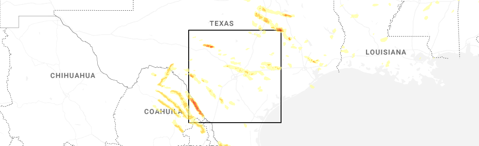
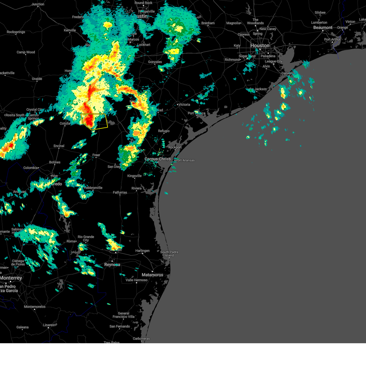
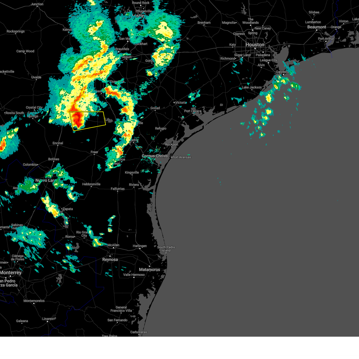
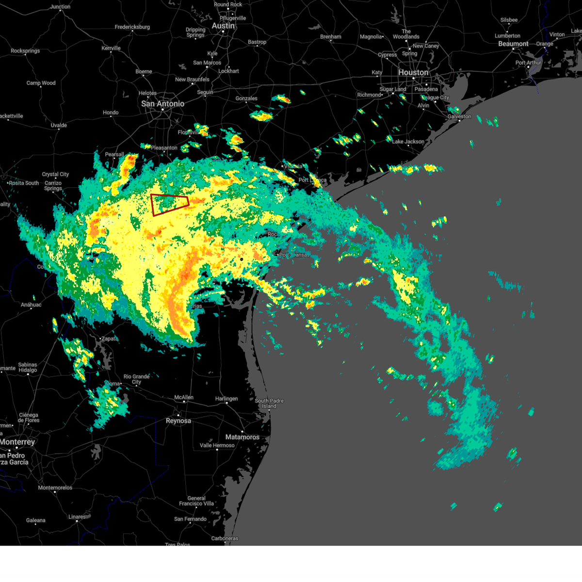
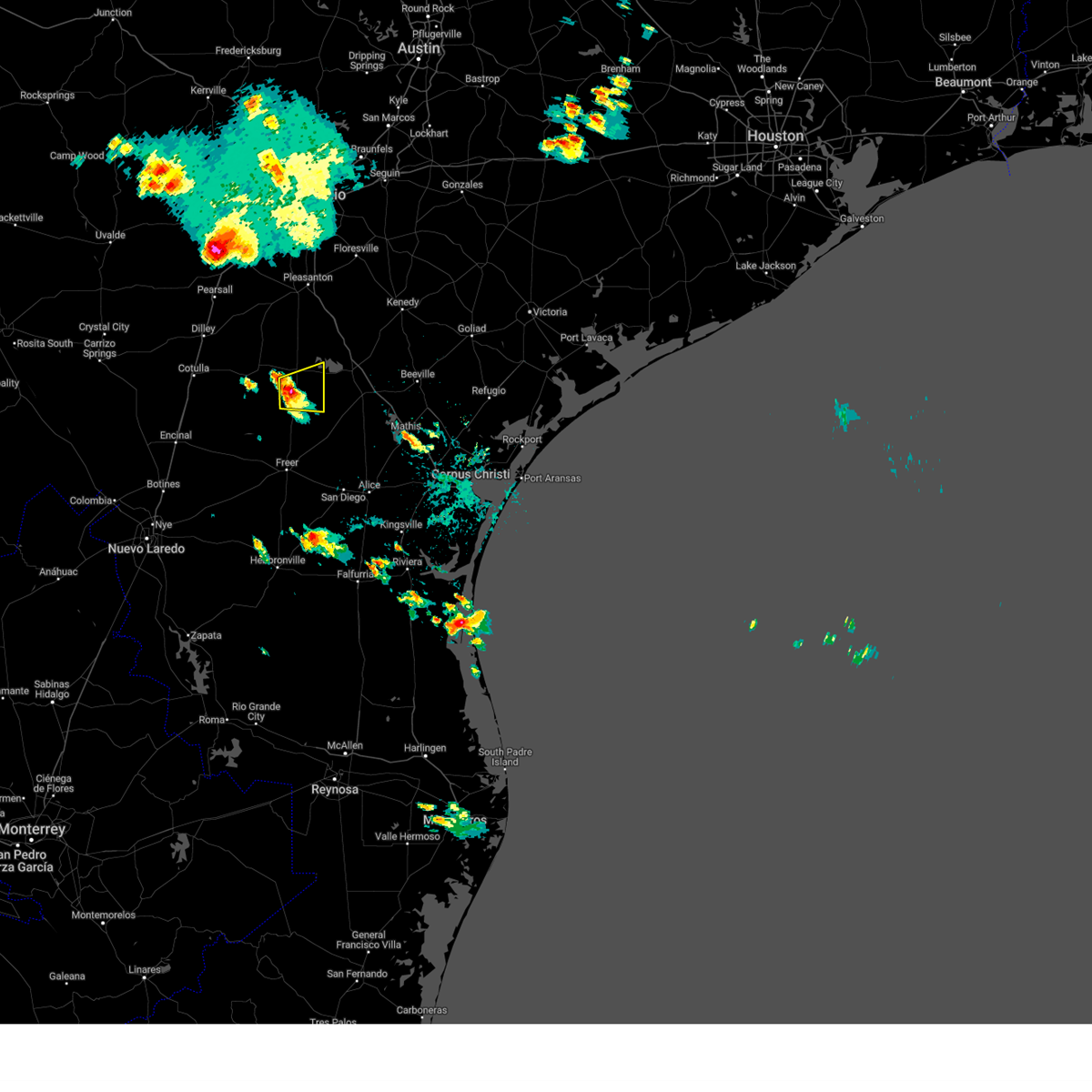
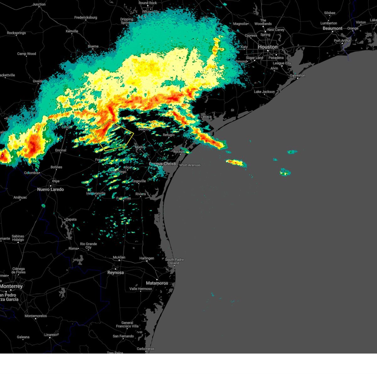
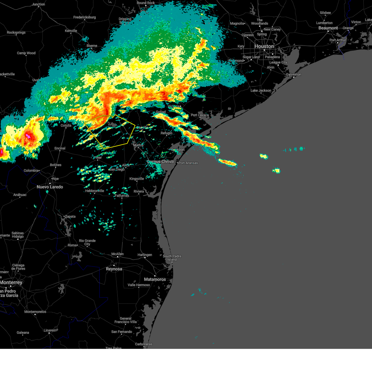
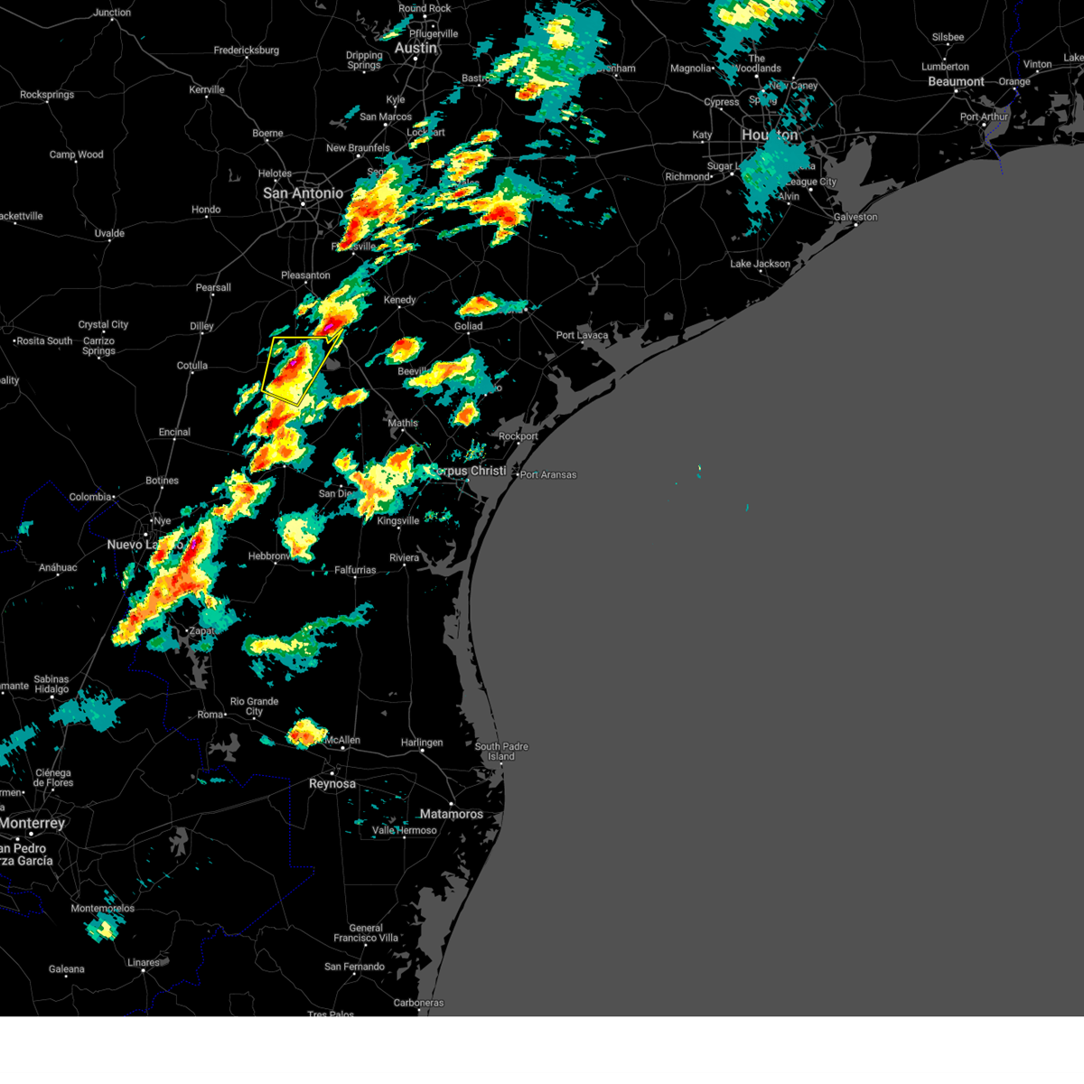
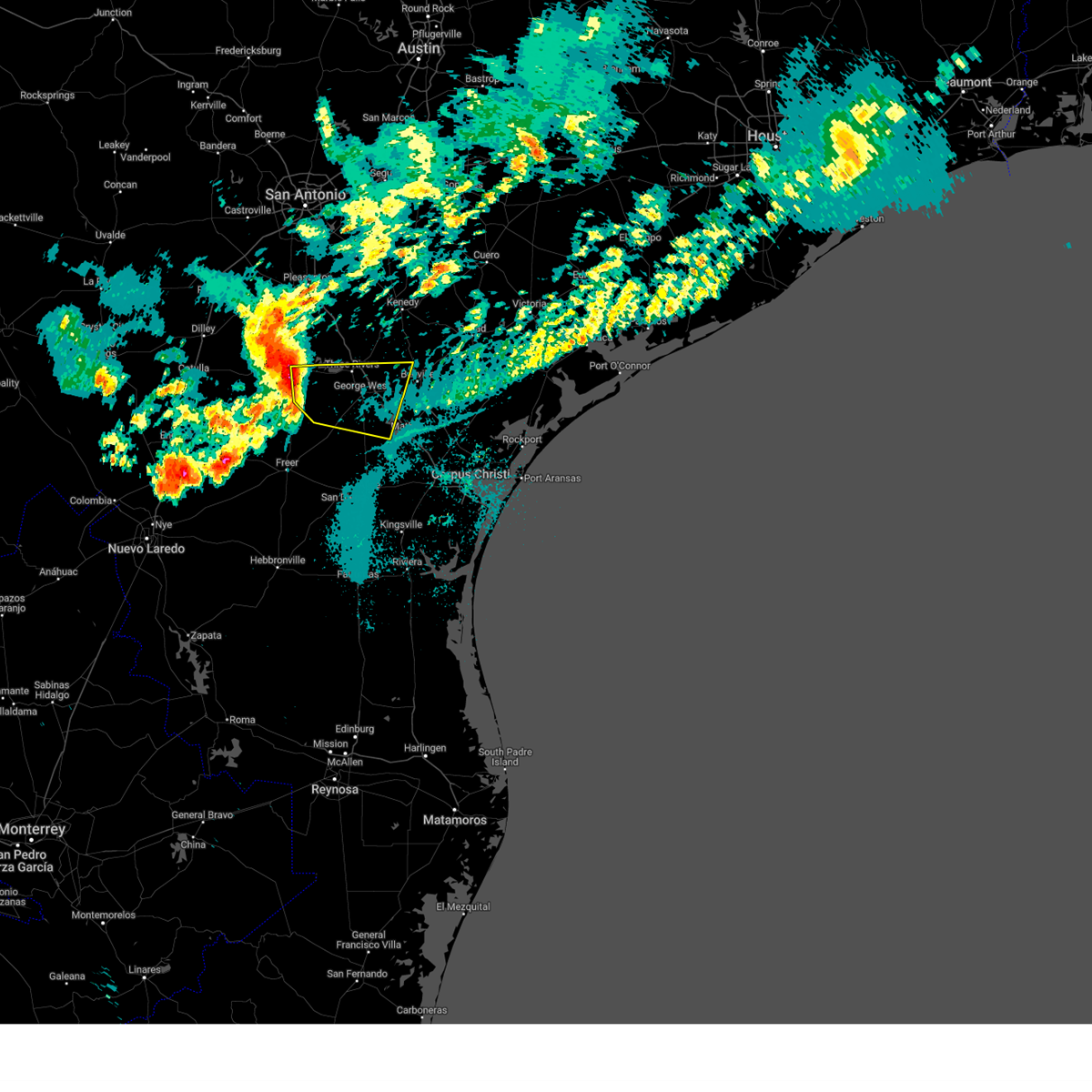
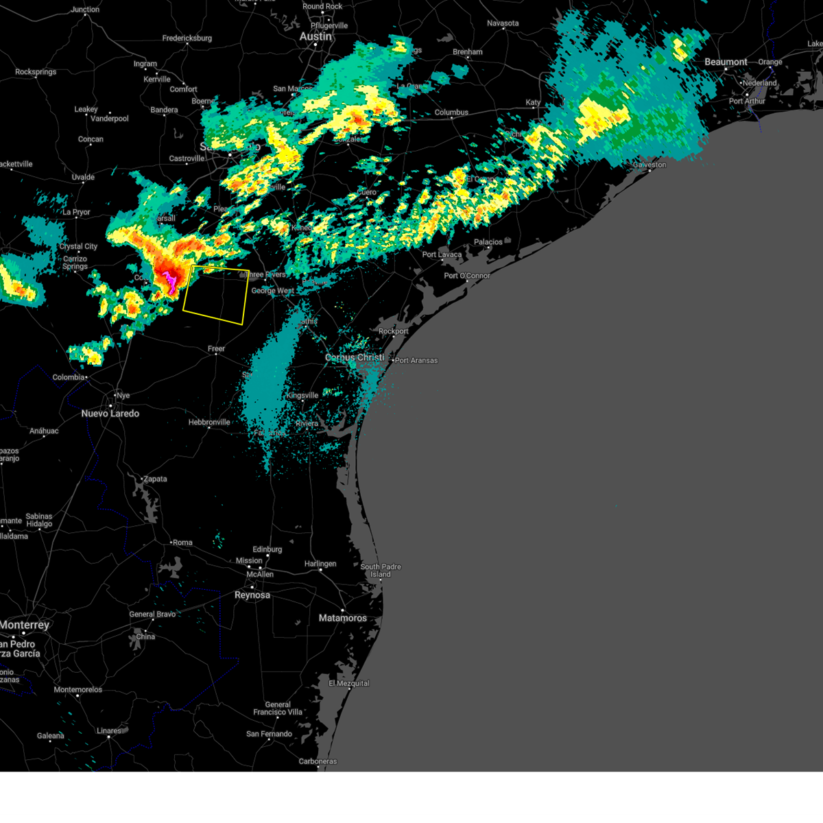
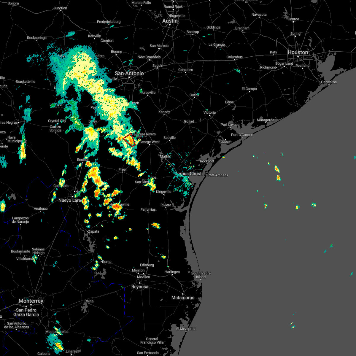
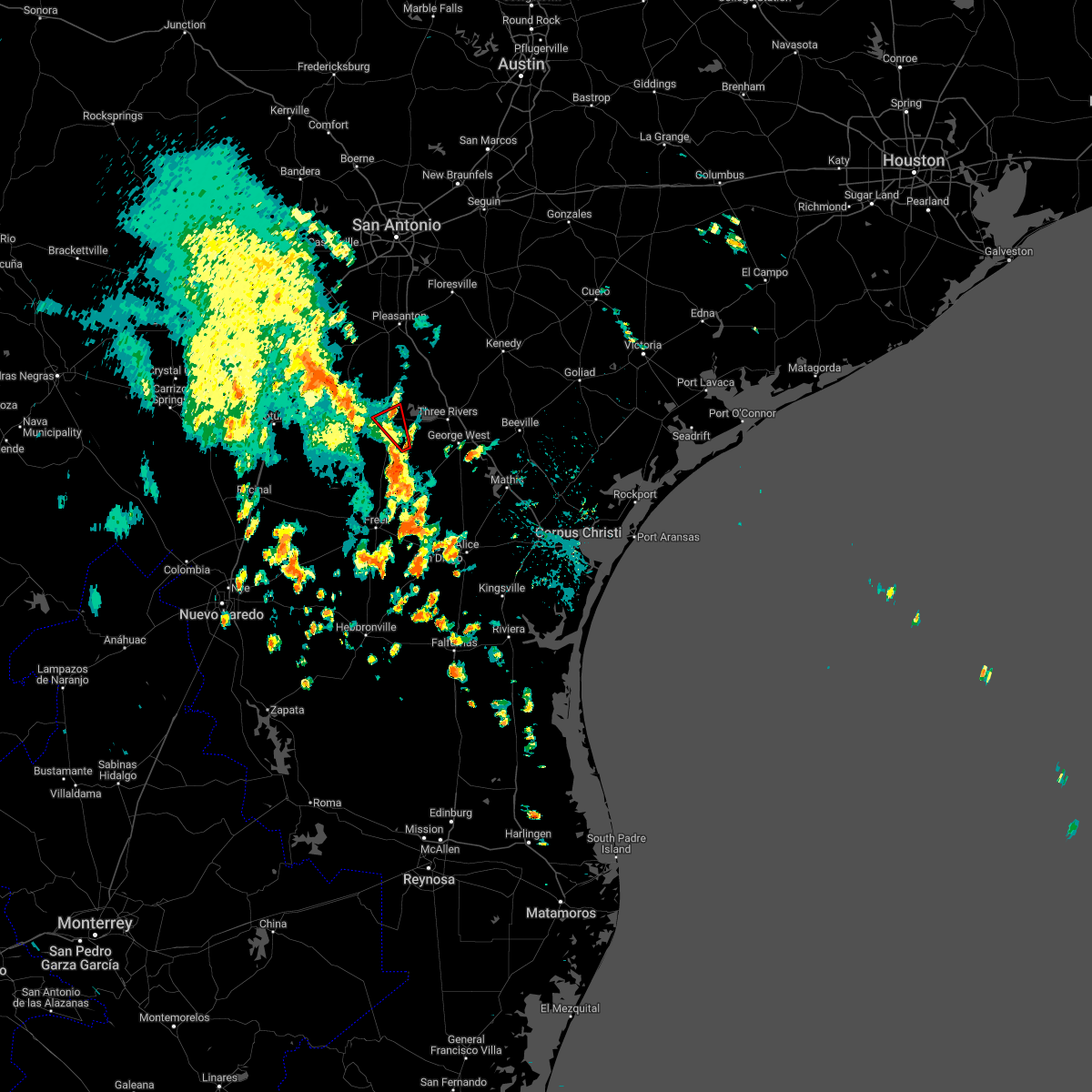
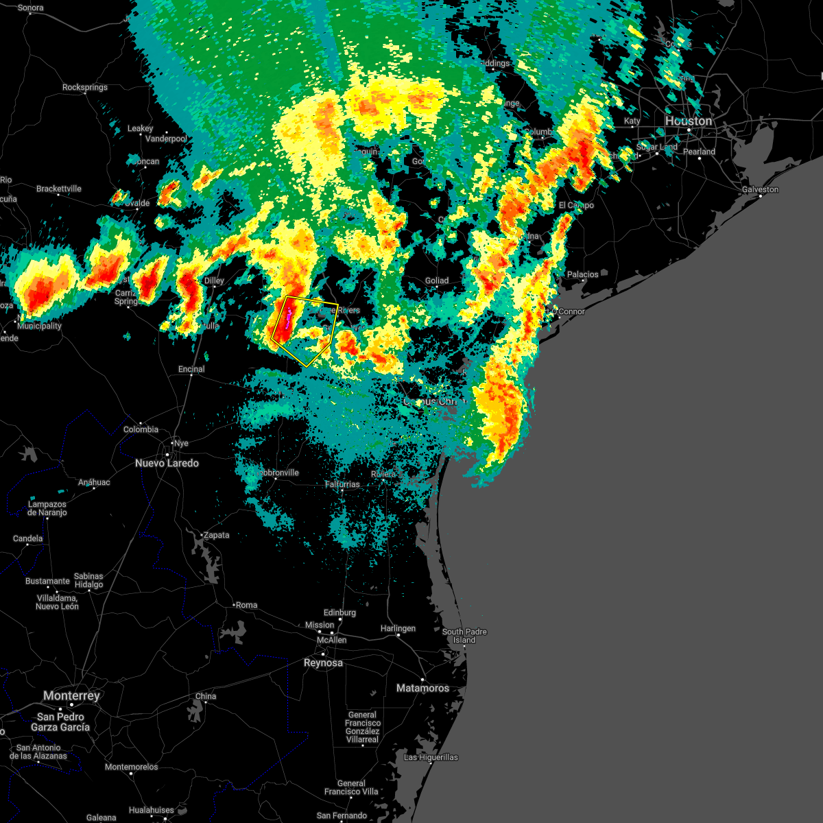
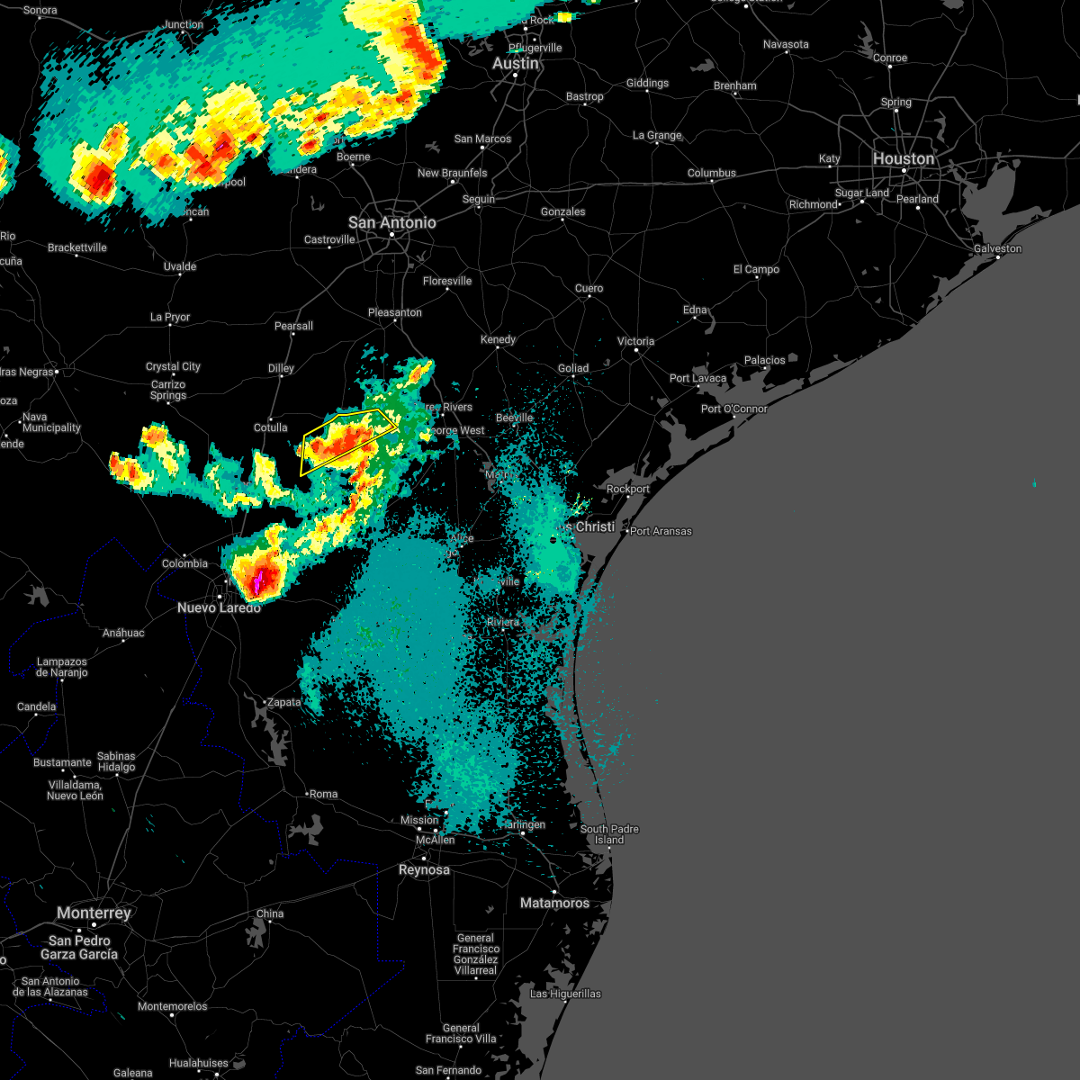
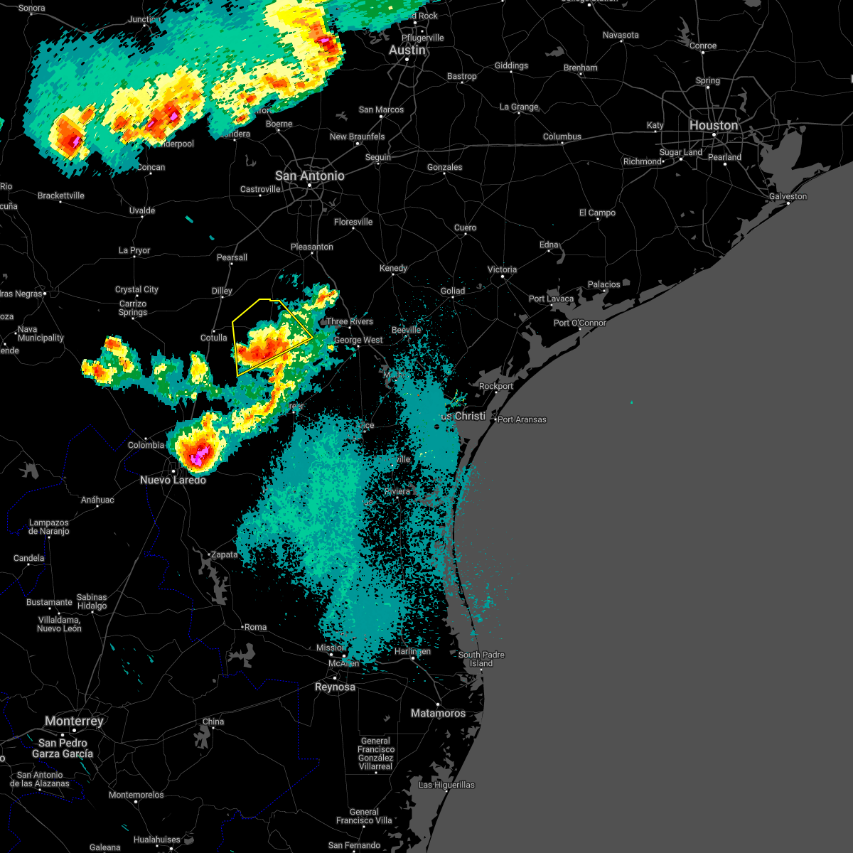
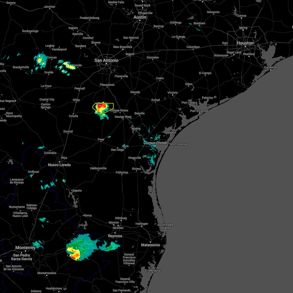
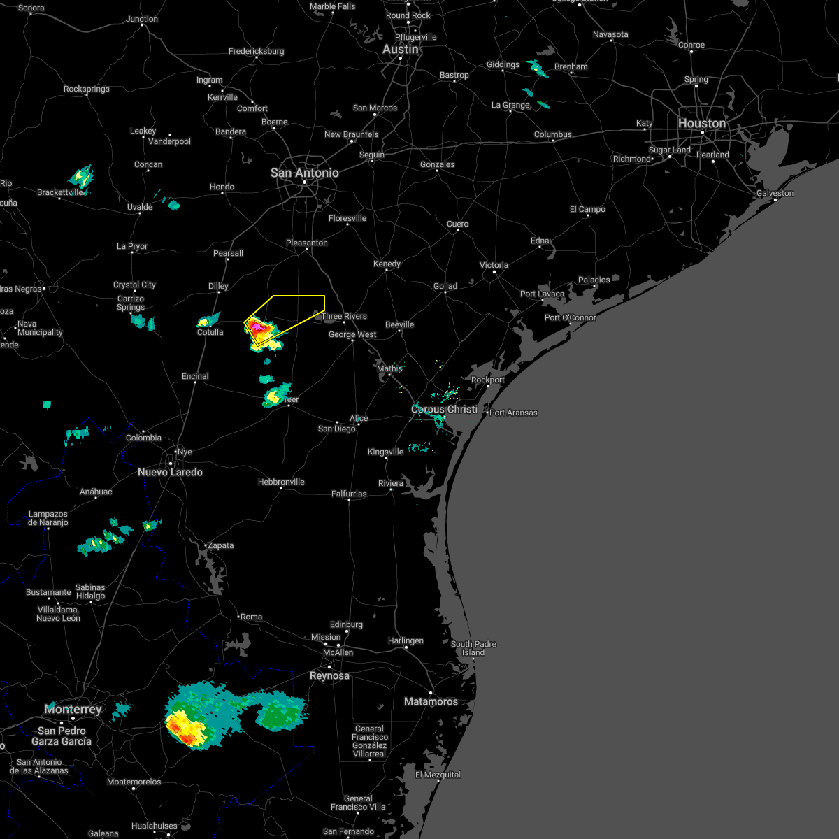
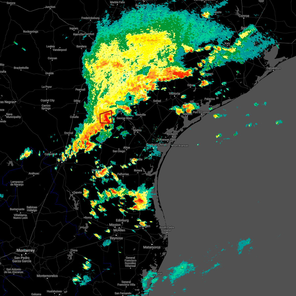
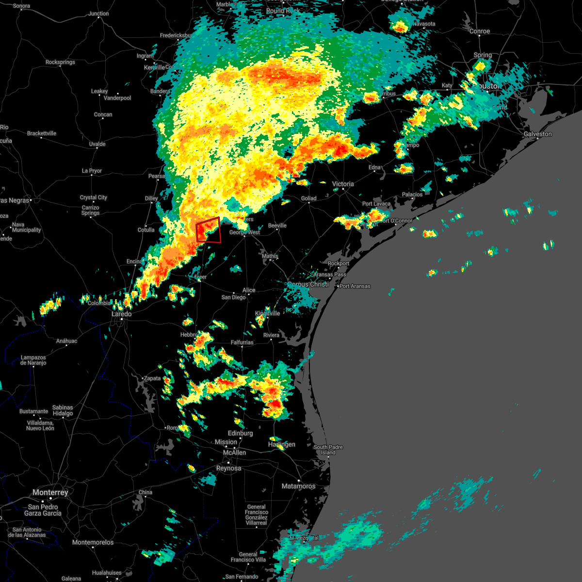
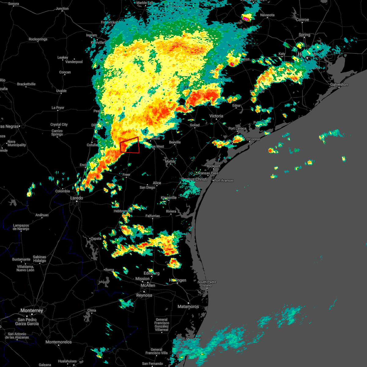
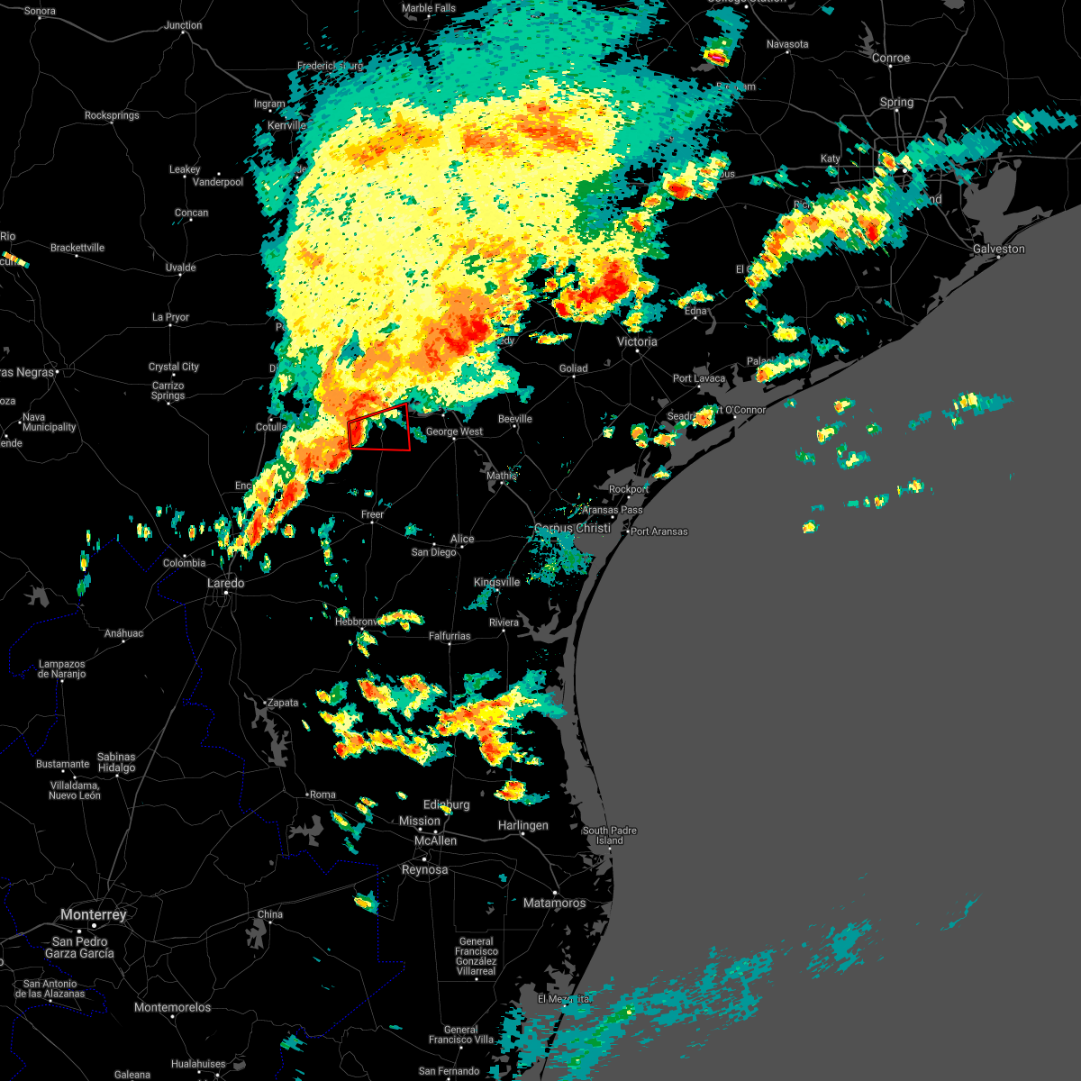
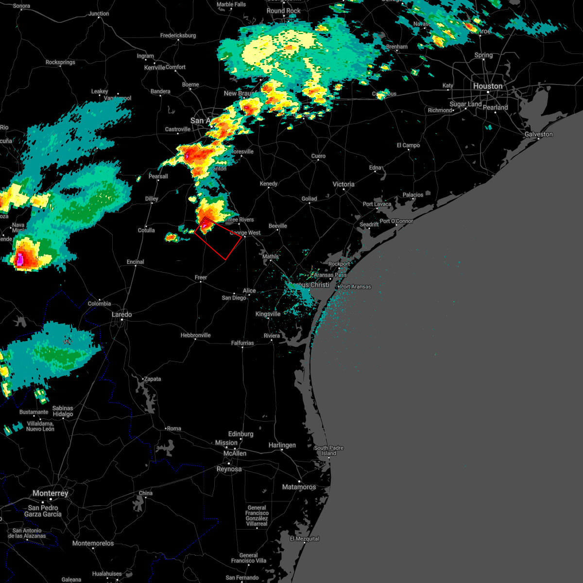
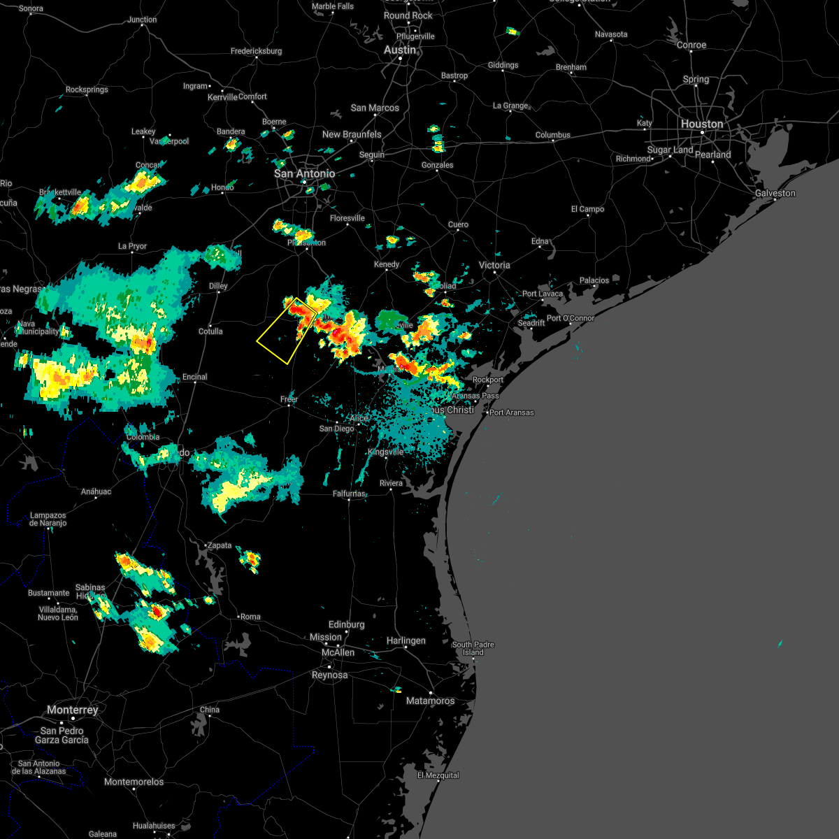
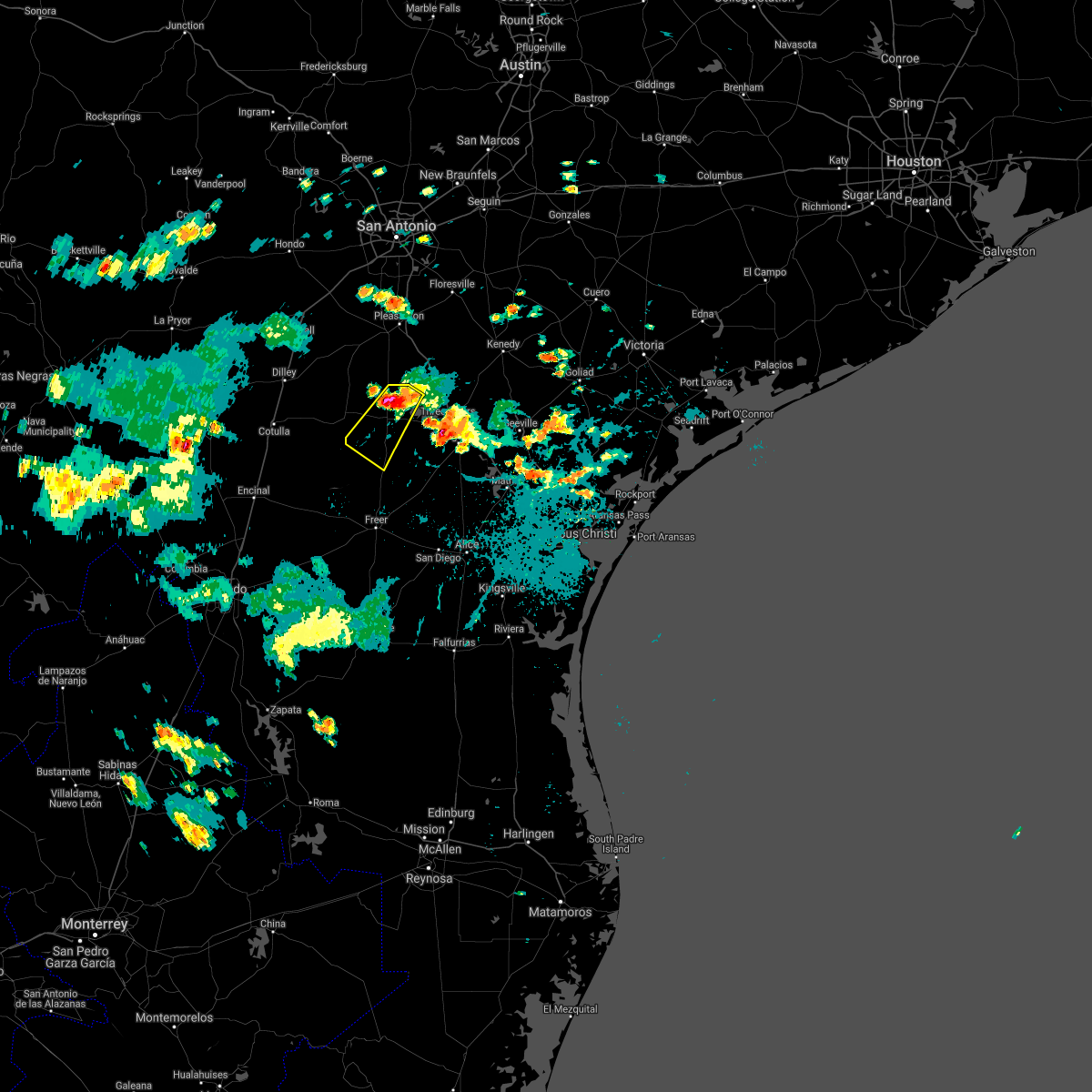
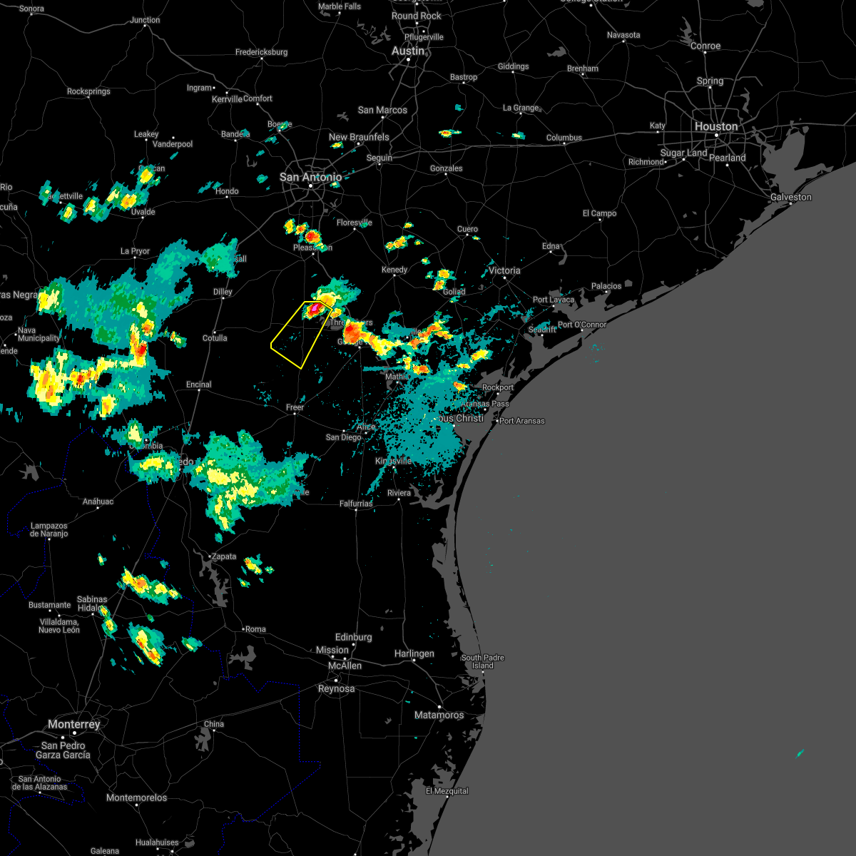
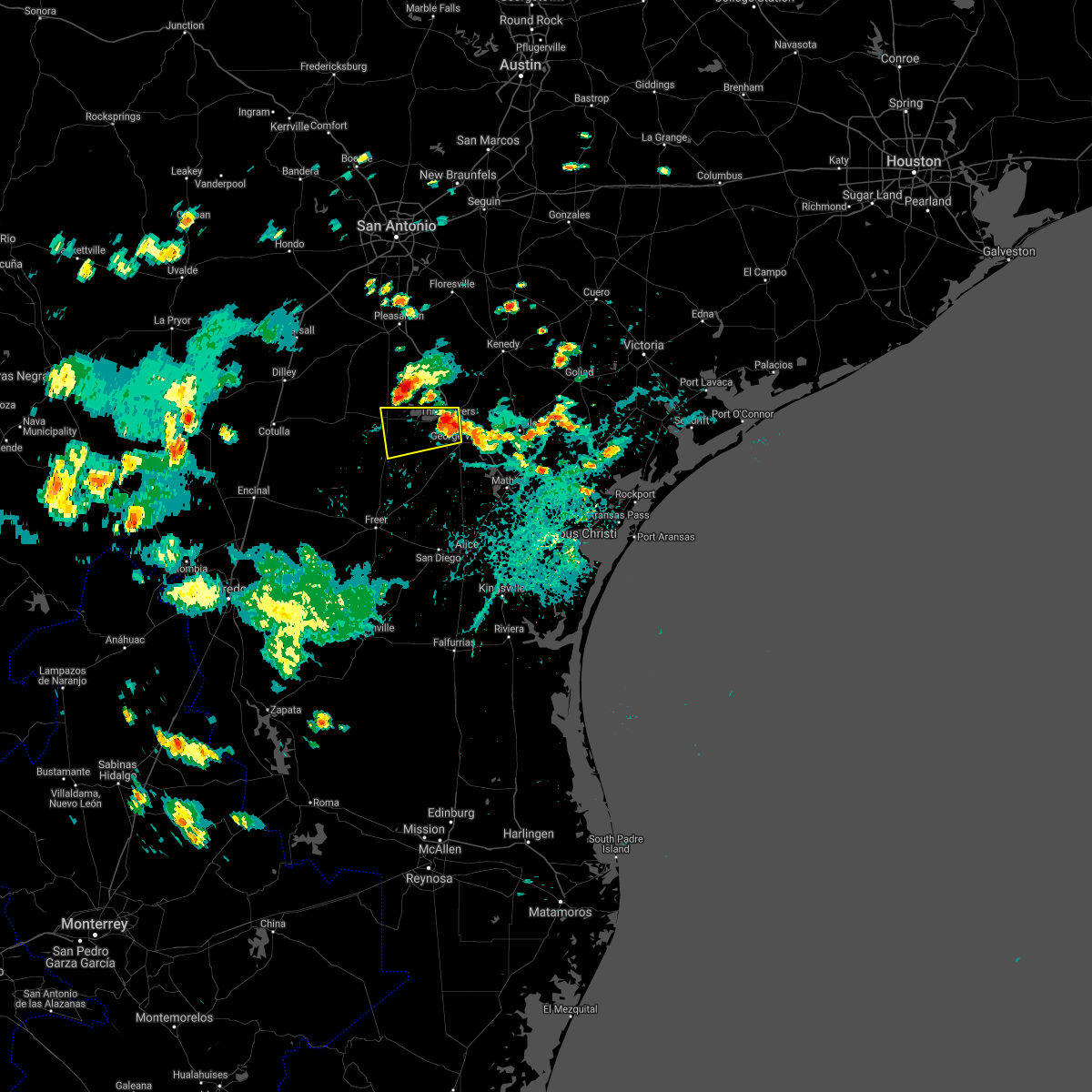
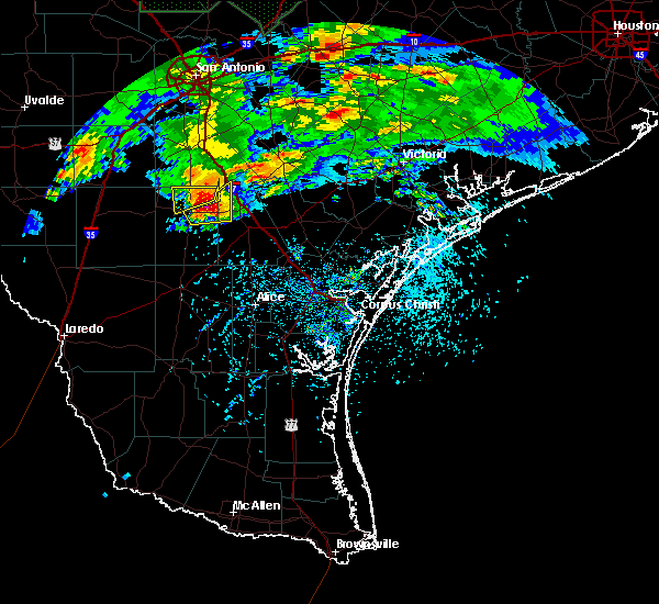
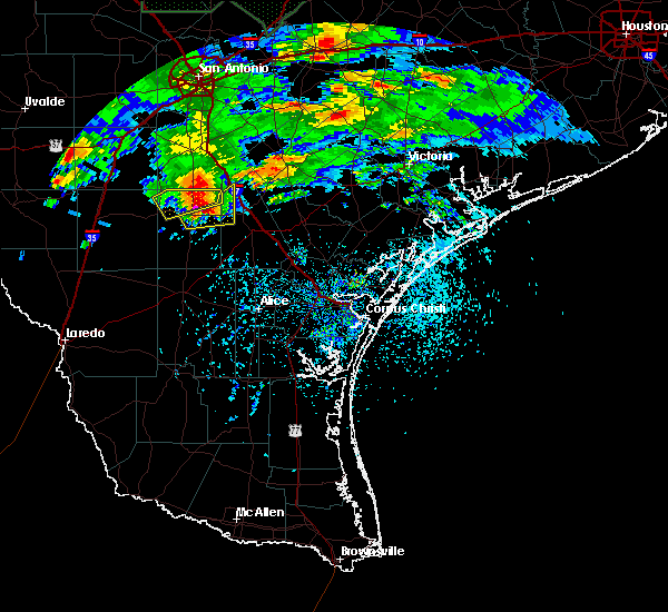
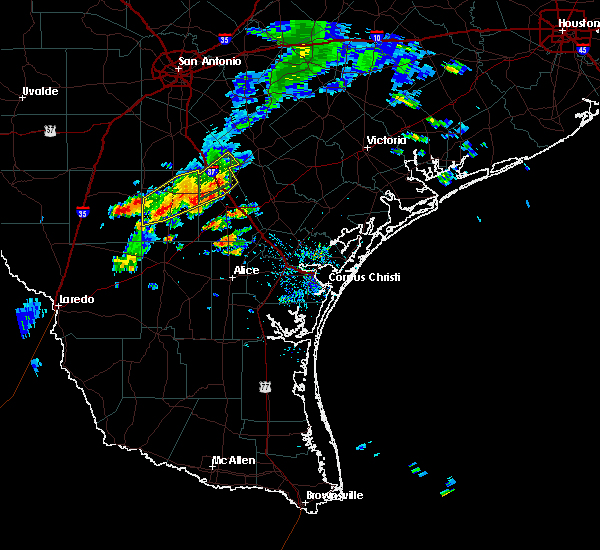
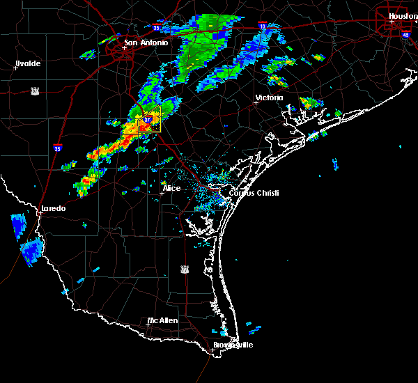
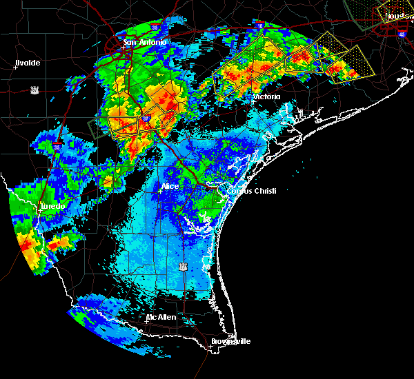
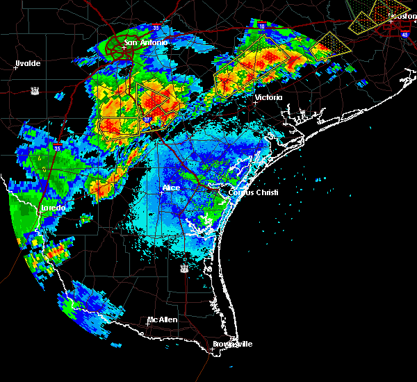
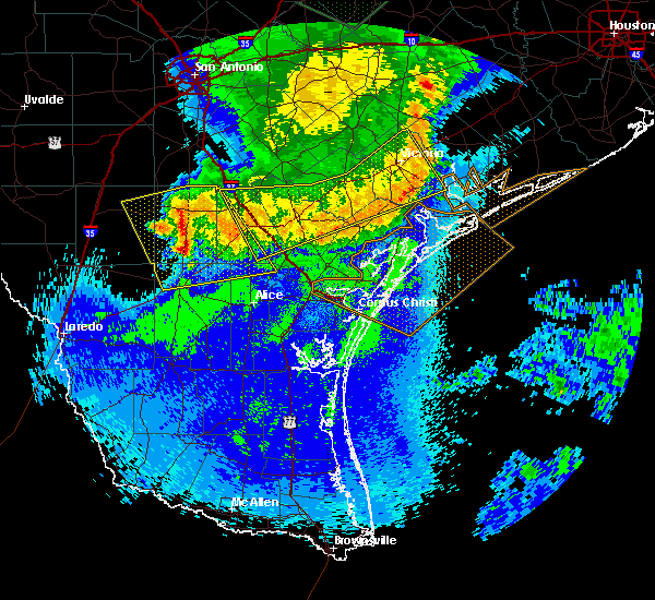
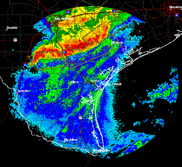
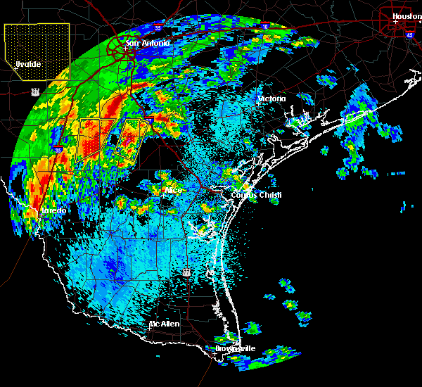
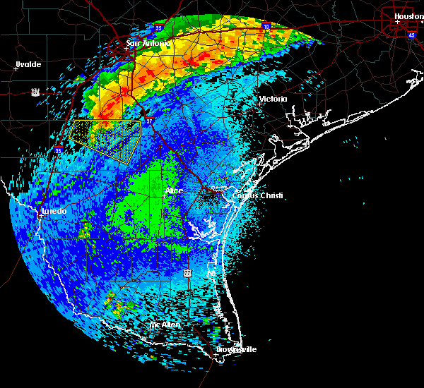
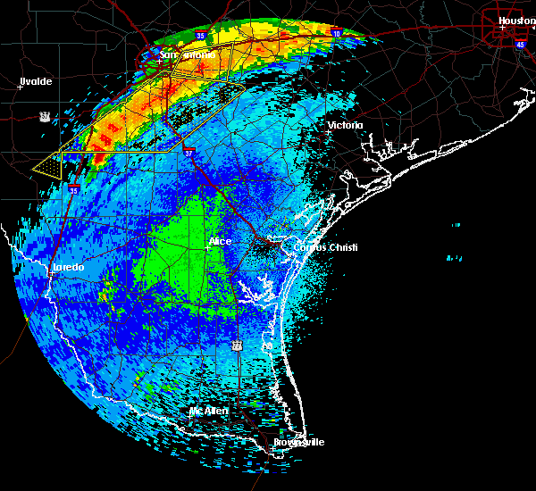
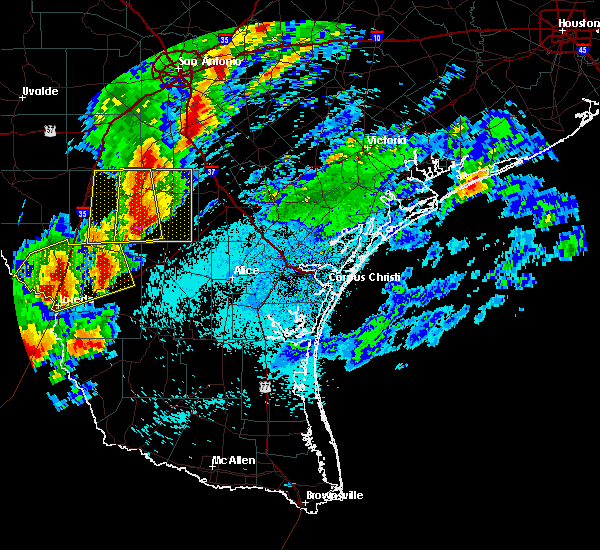
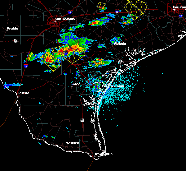
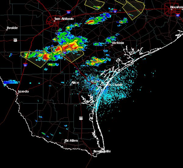
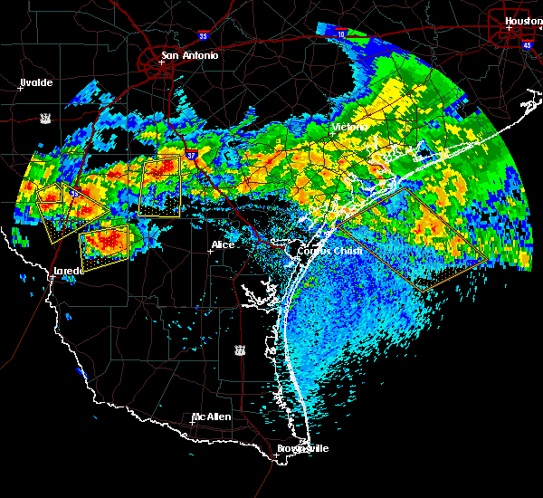
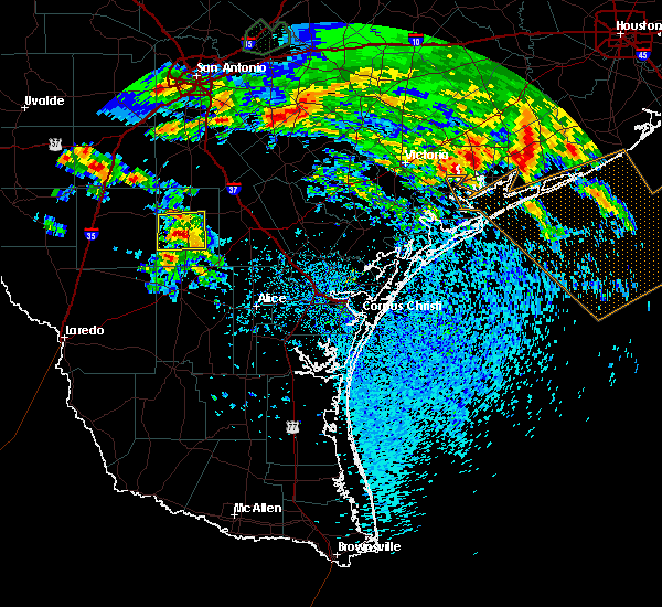
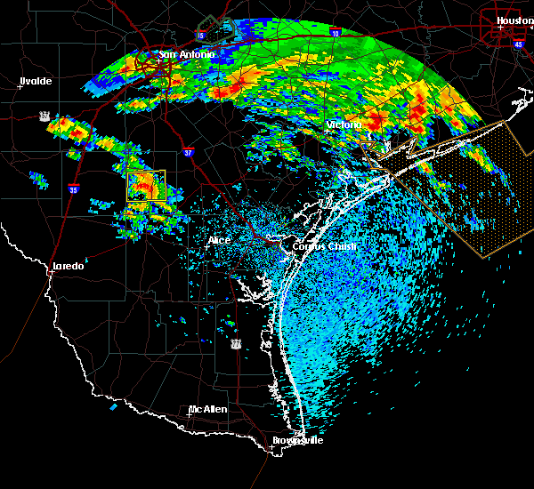
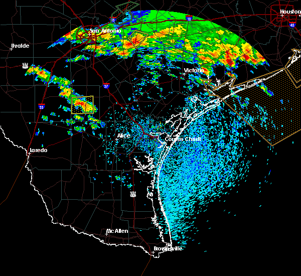
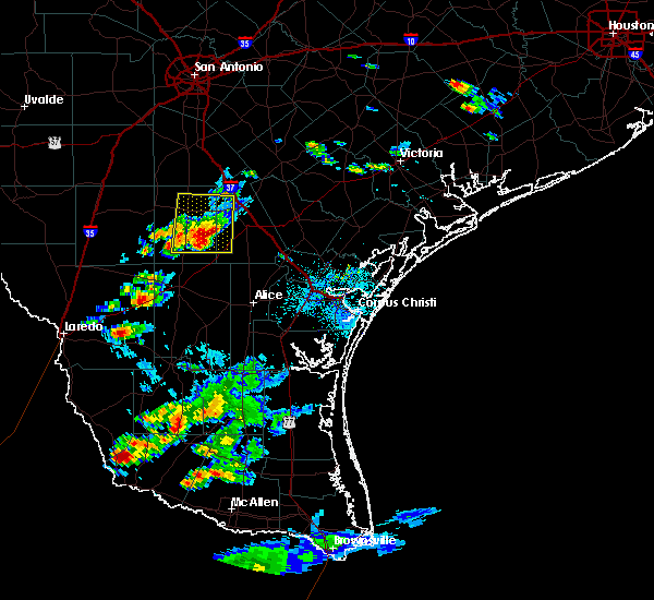
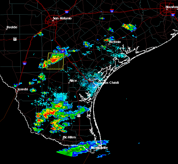
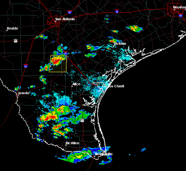
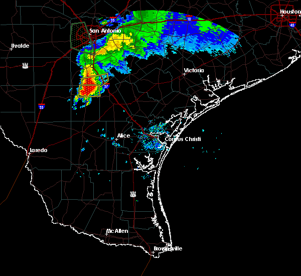
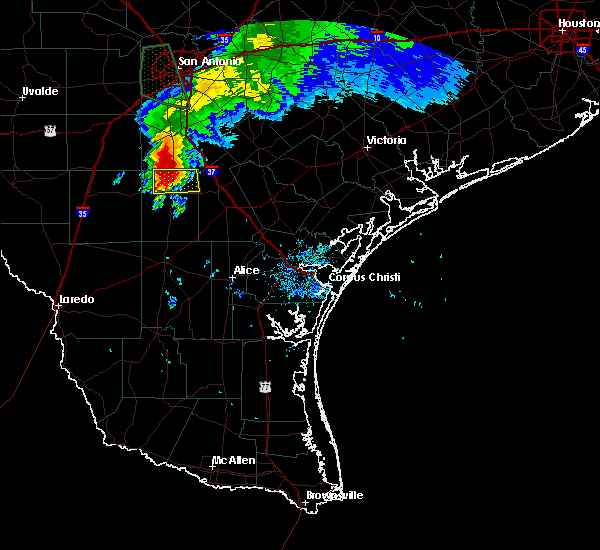
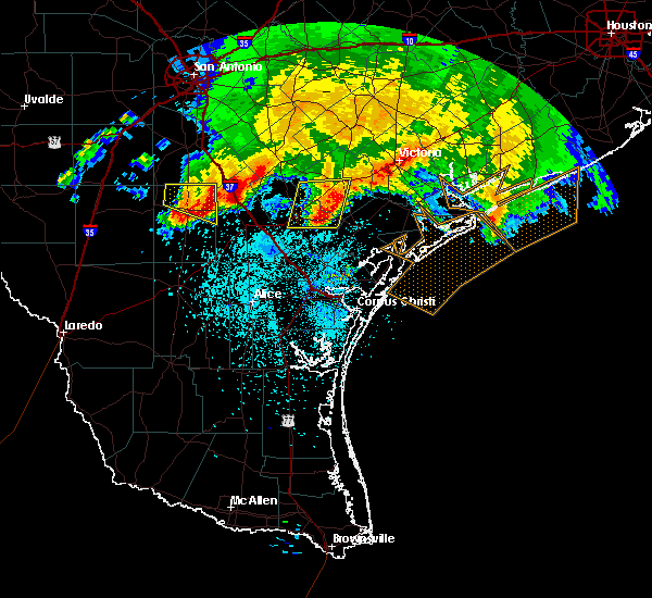
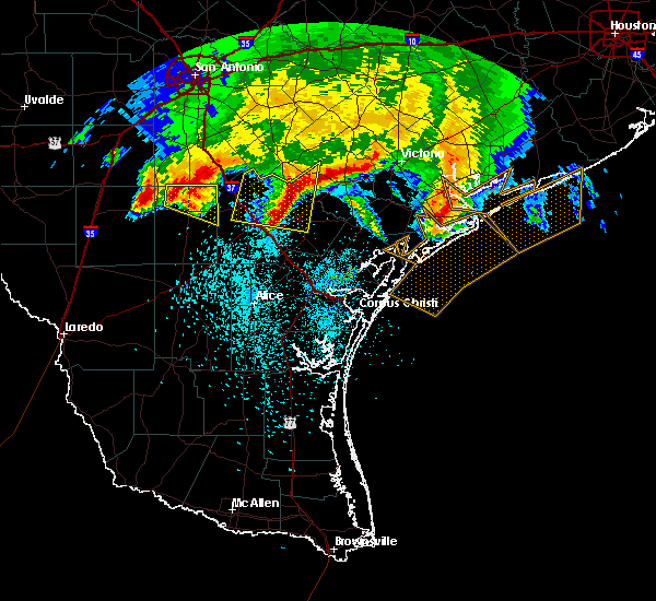
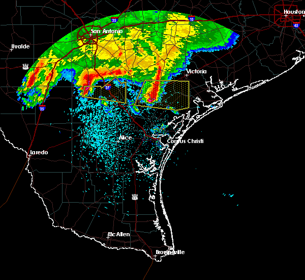
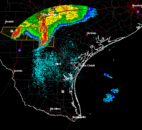
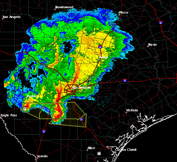
Hail Map for Tilden, TX
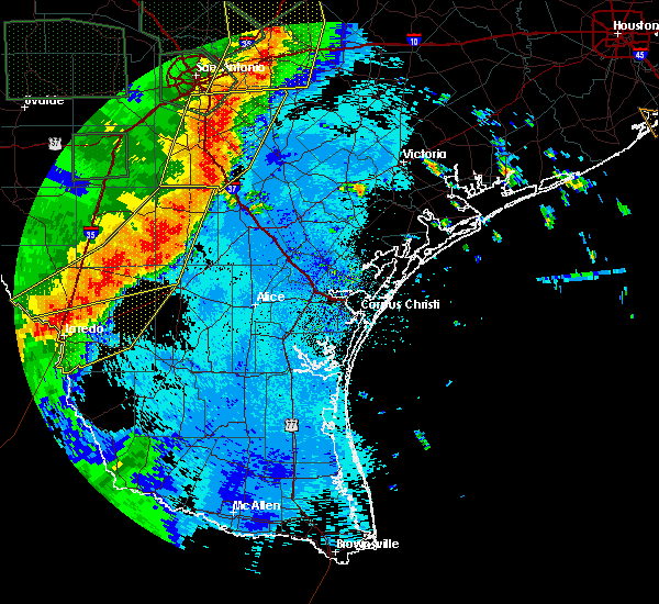
The Tilden, TX area has had 8 reports of on-the-ground hail by trained spotters, and has been under severe weather warnings 0 times during the past 12 months. Doppler radar has detected hail at or near Tilden, TX on 34 occasions, including 1 occasion during the past year.
| Name: | Tilden, TX |
| Where Located: | 66.6 miles S of San Antonio, TX |
| Map: | Google Map for Tilden, TX |
| Population: | 261 |
| Housing Units: | 139 |
| More Info: | Search Google for Tilden, TX |
0
The Top Recent Hail Date for Tilden, TX is Friday, May 2, 2025 (25th out of 34)
Hail and Wind Damage Spotted near Tilden, TX
| Date / Time | Report Details |
|---|---|
| 5/5/2024 3:39 PM CDT |
 At 339 pm cdt, a severe thunderstorm was located 8 miles southwest of tilden, moving southeast at 15 mph (radar indicated). Hazards include 60 mph wind gusts and quarter size hail. Hail damage to vehicles is expected. expect wind damage to roofs, siding, and trees. Locations impacted include, tilden and fowlerton. At 339 pm cdt, a severe thunderstorm was located 8 miles southwest of tilden, moving southeast at 15 mph (radar indicated). Hazards include 60 mph wind gusts and quarter size hail. Hail damage to vehicles is expected. expect wind damage to roofs, siding, and trees. Locations impacted include, tilden and fowlerton.
|
| 5/5/2024 3:14 PM CDT |
 Svrcrp the national weather service in corpus christi has issued a * severe thunderstorm warning for, northeastern la salle county in south central texas, mcmullen county in south central texas, * until 400 pm cdt. * at 313 pm cdt, a severe thunderstorm was located near fowlerton, or 12 miles west of tilden, moving southeast at 15 mph (radar indicated). Hazards include 60 mph wind gusts and quarter size hail. Hail damage to vehicles is expected. Expect wind damage to roofs, siding, and trees. Svrcrp the national weather service in corpus christi has issued a * severe thunderstorm warning for, northeastern la salle county in south central texas, mcmullen county in south central texas, * until 400 pm cdt. * at 313 pm cdt, a severe thunderstorm was located near fowlerton, or 12 miles west of tilden, moving southeast at 15 mph (radar indicated). Hazards include 60 mph wind gusts and quarter size hail. Hail damage to vehicles is expected. Expect wind damage to roofs, siding, and trees.
|
| 4/9/2024 11:06 PM CDT |
 Svrcrp the national weather service in corpus christi has issued a * severe thunderstorm warning for, northeastern la salle county in south central texas, northwestern mcmullen county in south central texas, * until 1130 pm cdt. * at 1105 pm cdt, severe thunderstorms were located along a line extending from 11 miles northwest of zella to near los angeles to 12 miles north of fort ewell site to 9 miles east of artesia wells, moving east at 60 mph (radar indicated). Hazards include 60 mph wind gusts and quarter size hail. Hail damage to vehicles is expected. Expect wind damage to roofs, siding, and trees. Svrcrp the national weather service in corpus christi has issued a * severe thunderstorm warning for, northeastern la salle county in south central texas, northwestern mcmullen county in south central texas, * until 1130 pm cdt. * at 1105 pm cdt, severe thunderstorms were located along a line extending from 11 miles northwest of zella to near los angeles to 12 miles north of fort ewell site to 9 miles east of artesia wells, moving east at 60 mph (radar indicated). Hazards include 60 mph wind gusts and quarter size hail. Hail damage to vehicles is expected. Expect wind damage to roofs, siding, and trees.
|
| 3/17/2024 9:58 AM CDT | Golf Ball sized hail reported 9.7 miles S of Tilden, TX |
| 2/2/2024 9:02 PM CST |
 At 902 pm cst, severe thunderstorms were located along a line extending from near charlotte to 6 miles southwest of christine to 7 miles northwest of crowther to near cross to near tilden, moving east at 55 mph (public). Hazards include 60 mph wind gusts and penny size hail. Expect damage to roofs, siding, and trees. locations impacted include, tilden, cross, zella, and fowlerton. hail threat, radar indicated max hail size, 0. 75 in wind threat, observed max wind gust, 60 mph. At 902 pm cst, severe thunderstorms were located along a line extending from near charlotte to 6 miles southwest of christine to 7 miles northwest of crowther to near cross to near tilden, moving east at 55 mph (public). Hazards include 60 mph wind gusts and penny size hail. Expect damage to roofs, siding, and trees. locations impacted include, tilden, cross, zella, and fowlerton. hail threat, radar indicated max hail size, 0. 75 in wind threat, observed max wind gust, 60 mph.
|
| 2/2/2024 8:42 PM CST |
 At 842 pm cst, severe thunderstorms were located along a line extending from 10 miles southwest of goldfinch to near zella to 12 miles west of cross to fowlerton to 10 miles southeast of los angeles, moving east at 55 mph (public). Hazards include 60 mph wind gusts and quarter size hail. Hail damage to vehicles is expected. expect wind damage to roofs, siding, and trees. locations impacted include, tilden, los angeles, cross, zella, and fowlerton. hail threat, radar indicated max hail size, 1. 00 in wind threat, observed max wind gust, 60 mph. At 842 pm cst, severe thunderstorms were located along a line extending from 10 miles southwest of goldfinch to near zella to 12 miles west of cross to fowlerton to 10 miles southeast of los angeles, moving east at 55 mph (public). Hazards include 60 mph wind gusts and quarter size hail. Hail damage to vehicles is expected. expect wind damage to roofs, siding, and trees. locations impacted include, tilden, los angeles, cross, zella, and fowlerton. hail threat, radar indicated max hail size, 1. 00 in wind threat, observed max wind gust, 60 mph.
|
| 2/2/2024 8:26 PM CST |
 At 826 pm cst, severe thunderstorms were located along a line extending from dilley to 8 miles east of millett to 12 miles west of zella to 10 miles northwest of fowlerton to near los angeles to 12 miles southeast of cotulla, moving east at 55 mph (public). Hazards include 60 mph wind gusts and quarter size hail. Hail damage to vehicles is expected. Expect wind damage to roofs, siding, and trees. At 826 pm cst, severe thunderstorms were located along a line extending from dilley to 8 miles east of millett to 12 miles west of zella to 10 miles northwest of fowlerton to near los angeles to 12 miles southeast of cotulla, moving east at 55 mph (public). Hazards include 60 mph wind gusts and quarter size hail. Hail damage to vehicles is expected. Expect wind damage to roofs, siding, and trees.
|
| 8/22/2023 12:17 PM CDT |
 At 1217 pm cdt, a severe thunderstorm capable of producing a tornado was located over simmons, or near choke canyon, moving west at 45 mph (radar indicated rotation). Hazards include tornado. Flying debris will be dangerous to those caught without shelter. mobile homes will be damaged or destroyed. damage to roofs, windows, and vehicles will occur. tree damage is likely. this dangerous storm will be near, calliham around 1225 pm cdt. Tilden around 1240 pm cdt. At 1217 pm cdt, a severe thunderstorm capable of producing a tornado was located over simmons, or near choke canyon, moving west at 45 mph (radar indicated rotation). Hazards include tornado. Flying debris will be dangerous to those caught without shelter. mobile homes will be damaged or destroyed. damage to roofs, windows, and vehicles will occur. tree damage is likely. this dangerous storm will be near, calliham around 1225 pm cdt. Tilden around 1240 pm cdt.
|
| 6/4/2023 4:33 PM CDT |
 At 432 pm cdt, a severe thunderstorm was located 8 miles south of tilden, moving east at 10 mph (radar indicated). Hazards include 60 mph wind gusts and quarter size hail. Hail damage to vehicles is expected. expect wind damage to roofs, siding, and trees. this severe thunderstorm will remain over mainly rural areas of central mcmullen county. hail threat, radar indicated max hail size, 1. 00 in wind threat, radar indicated max wind gust, 60 mph. At 432 pm cdt, a severe thunderstorm was located 8 miles south of tilden, moving east at 10 mph (radar indicated). Hazards include 60 mph wind gusts and quarter size hail. Hail damage to vehicles is expected. expect wind damage to roofs, siding, and trees. this severe thunderstorm will remain over mainly rural areas of central mcmullen county. hail threat, radar indicated max hail size, 1. 00 in wind threat, radar indicated max wind gust, 60 mph.
|
| 4/23/2023 8:20 AM CDT |
 At 819 am cdt, severe thunderstorms were located along a line extending from 6 miles northeast of choke canyon to near simmons to 7 miles northwest of loma alta, moving southeast at 75 mph (radar indicated). Hazards include 60 mph wind gusts and penny size hail. Expect damage to roofs, siding, and trees. locations impacted include, george west, three rivers, choke canyon, tilden, calliham, loma alta, river creek acres, simmons and clegg. this includes the following highways, interstate 37 between mile markers 54 and 64. us highway 281 between mile markers 622 and 642. Us highway 59 between mile markers 714 and 740. At 819 am cdt, severe thunderstorms were located along a line extending from 6 miles northeast of choke canyon to near simmons to 7 miles northwest of loma alta, moving southeast at 75 mph (radar indicated). Hazards include 60 mph wind gusts and penny size hail. Expect damage to roofs, siding, and trees. locations impacted include, george west, three rivers, choke canyon, tilden, calliham, loma alta, river creek acres, simmons and clegg. this includes the following highways, interstate 37 between mile markers 54 and 64. us highway 281 between mile markers 622 and 642. Us highway 59 between mile markers 714 and 740.
|
| 4/23/2023 8:05 AM CDT |
 At 805 am cdt, severe thunderstorms were located along a line extending from near whitsett to 6 miles southwest of calliham to 10 miles southeast of fowlerton, moving southeast at 30 mph (radar indicated). Hazards include 60 mph wind gusts and penny size hail. expect damage to roofs, siding, and trees At 805 am cdt, severe thunderstorms were located along a line extending from near whitsett to 6 miles southwest of calliham to 10 miles southeast of fowlerton, moving southeast at 30 mph (radar indicated). Hazards include 60 mph wind gusts and penny size hail. expect damage to roofs, siding, and trees
|
| 4/5/2023 10:24 PM CDT |
 At 1024 pm cdt, a severe thunderstorm was located near cross, or near tilden, moving northeast at 45 mph (radar indicated). Hazards include quarter size hail. Damage to vehicles is expected. locations impacted include, tilden, crowther, cross and whitsett. hail threat, radar indicated max hail size, 1. 00 in wind threat, radar indicated max wind gust, <50 mph. At 1024 pm cdt, a severe thunderstorm was located near cross, or near tilden, moving northeast at 45 mph (radar indicated). Hazards include quarter size hail. Damage to vehicles is expected. locations impacted include, tilden, crowther, cross and whitsett. hail threat, radar indicated max hail size, 1. 00 in wind threat, radar indicated max wind gust, <50 mph.
|
| 4/5/2023 10:12 PM CDT |
 At 1011 pm cdt, a severe thunderstorm was located near tilden, moving northeast at 40 mph (radar indicated). Hazards include ping pong ball size hail. People and animals outdoors will be injured. Expect damage to roofs, siding, windows, and vehicles. At 1011 pm cdt, a severe thunderstorm was located near tilden, moving northeast at 40 mph (radar indicated). Hazards include ping pong ball size hail. People and animals outdoors will be injured. Expect damage to roofs, siding, windows, and vehicles.
|
| 3/17/2023 3:10 AM CDT |
 At 310 am cdt, a severe thunderstorm was located near simmons, or 10 miles southwest of choke canyon, moving east at 45 mph (radar indicated). Hazards include 60 mph wind gusts and quarter size hail. Hail damage to vehicles is expected. Expect wind damage to roofs, siding, and trees. At 310 am cdt, a severe thunderstorm was located near simmons, or 10 miles southwest of choke canyon, moving east at 45 mph (radar indicated). Hazards include 60 mph wind gusts and quarter size hail. Hail damage to vehicles is expected. Expect wind damage to roofs, siding, and trees.
|
| 3/17/2023 2:59 AM CDT |
 At 258 am cdt, a severe thunderstorm was located 11 miles south of tilden, moving east at 45 mph (radar indicated). Hazards include 60 mph wind gusts and half dollar size hail. Hail damage to vehicles is expected. expect wind damage to roofs, siding, and trees. locations impacted include, tilden and calliham. hail threat, radar indicated max hail size, 1. 25 in wind threat, radar indicated max wind gust, 60 mph. At 258 am cdt, a severe thunderstorm was located 11 miles south of tilden, moving east at 45 mph (radar indicated). Hazards include 60 mph wind gusts and half dollar size hail. Hail damage to vehicles is expected. expect wind damage to roofs, siding, and trees. locations impacted include, tilden and calliham. hail threat, radar indicated max hail size, 1. 25 in wind threat, radar indicated max wind gust, 60 mph.
|
| 3/17/2023 2:28 AM CDT |
 At 228 am cdt, a severe thunderstorm was located 7 miles southwest of fowlerton, or 20 miles west of tilden, moving east at 45 mph (radar indicated). Hazards include 60 mph wind gusts. expect damage to roofs, siding, and trees At 228 am cdt, a severe thunderstorm was located 7 miles southwest of fowlerton, or 20 miles west of tilden, moving east at 45 mph (radar indicated). Hazards include 60 mph wind gusts. expect damage to roofs, siding, and trees
|
| 8/15/2022 3:48 PM CDT |
 At 348 pm cdt, a severe thunderstorm capable of producing a tornado was located 10 miles southeast of tilden, moving northwest at 20 mph (radar indicated rotation). Hazards include tornado. Flying debris will be dangerous to those caught without shelter. mobile homes will be damaged or destroyed. damage to roofs, windows, and vehicles will occur. tree damage is likely. This dangerous storm will be near, tilden around 415 pm cdt. At 348 pm cdt, a severe thunderstorm capable of producing a tornado was located 10 miles southeast of tilden, moving northwest at 20 mph (radar indicated rotation). Hazards include tornado. Flying debris will be dangerous to those caught without shelter. mobile homes will be damaged or destroyed. damage to roofs, windows, and vehicles will occur. tree damage is likely. This dangerous storm will be near, tilden around 415 pm cdt.
|
| 8/15/2022 2:06 PM CDT |
 At 206 pm cdt, a severe thunderstorm capable of producing a tornado was located 11 miles southeast of tilden, moving northwest at 20 mph (radar indicated rotation). Hazards include tornado. Flying debris will be dangerous to those caught without shelter. mobile homes will be damaged or destroyed. damage to roofs, windows, and vehicles will occur. tree damage is likely. This dangerous storm will be near, tilden around 240 pm cdt. At 206 pm cdt, a severe thunderstorm capable of producing a tornado was located 11 miles southeast of tilden, moving northwest at 20 mph (radar indicated rotation). Hazards include tornado. Flying debris will be dangerous to those caught without shelter. mobile homes will be damaged or destroyed. damage to roofs, windows, and vehicles will occur. tree damage is likely. This dangerous storm will be near, tilden around 240 pm cdt.
|
| 5/25/2022 2:00 AM CDT |
 At 200 am cdt, a severe thunderstorm was located near tilden, moving southeast at 25 mph (radar indicated). Hazards include 60 mph wind gusts and quarter size hail. Hail damage to vehicles is expected. Expect wind damage to roofs, siding, and trees. At 200 am cdt, a severe thunderstorm was located near tilden, moving southeast at 25 mph (radar indicated). Hazards include 60 mph wind gusts and quarter size hail. Hail damage to vehicles is expected. Expect wind damage to roofs, siding, and trees.
|
| 5/24/2022 10:53 PM CDT |
 The severe thunderstorm warning for southeastern la salle and west central mcmullen counties will expire at 1100 pm cdt, the storm which prompted the warning has weakened below severe limits, and no longer poses an immediate threat to life or property. therefore, the warning will be allowed to expire. a severe thunderstorm watch remains in effect until 300 am cdt for south central texas. The severe thunderstorm warning for southeastern la salle and west central mcmullen counties will expire at 1100 pm cdt, the storm which prompted the warning has weakened below severe limits, and no longer poses an immediate threat to life or property. therefore, the warning will be allowed to expire. a severe thunderstorm watch remains in effect until 300 am cdt for south central texas.
|
| 5/24/2022 10:44 PM CDT |
 At 1044 pm cdt, a severe thunderstorm was located 12 miles southeast of fowlerton, or 13 miles southwest of tilden, moving east at 35 mph (radar indicated). Hazards include 60 mph wind gusts and penny size hail. Expect damage to roofs, siding, and trees. locations impacted include, tilden, fort ewell site and fowlerton. hail threat, radar indicated max hail size, 0. 75 in wind threat, radar indicated max wind gust, 60 mph. At 1044 pm cdt, a severe thunderstorm was located 12 miles southeast of fowlerton, or 13 miles southwest of tilden, moving east at 35 mph (radar indicated). Hazards include 60 mph wind gusts and penny size hail. Expect damage to roofs, siding, and trees. locations impacted include, tilden, fort ewell site and fowlerton. hail threat, radar indicated max hail size, 0. 75 in wind threat, radar indicated max wind gust, 60 mph.
|
| 5/24/2022 10:36 PM CDT |
 At 1035 pm cdt, a severe thunderstorm was located 10 miles south of fowlerton, or 16 miles southwest of tilden, moving east at 55 mph (radar indicated). Hazards include 60 mph wind gusts and nickel size hail. Expect damage to roofs, siding, and trees. locations impacted include, tilden, fort ewell site, los angeles, zella and fowlerton. hail threat, radar indicated max hail size, 0. 88 in wind threat, radar indicated max wind gust, 60 mph. At 1035 pm cdt, a severe thunderstorm was located 10 miles south of fowlerton, or 16 miles southwest of tilden, moving east at 55 mph (radar indicated). Hazards include 60 mph wind gusts and nickel size hail. Expect damage to roofs, siding, and trees. locations impacted include, tilden, fort ewell site, los angeles, zella and fowlerton. hail threat, radar indicated max hail size, 0. 88 in wind threat, radar indicated max wind gust, 60 mph.
|
| 5/24/2022 10:10 PM CDT |
 At 1010 pm cdt, a severe thunderstorm was located 9 miles southwest of los angeles, or 11 miles southeast of cotulla, moving east at 40 mph (radar indicated). Hazards include 70 mph wind gusts and quarter size hail. Hail damage to vehicles is expected. expect considerable tree damage. Wind damage is also likely to mobile homes, roofs, and outbuildings. At 1010 pm cdt, a severe thunderstorm was located 9 miles southwest of los angeles, or 11 miles southeast of cotulla, moving east at 40 mph (radar indicated). Hazards include 70 mph wind gusts and quarter size hail. Hail damage to vehicles is expected. expect considerable tree damage. Wind damage is also likely to mobile homes, roofs, and outbuildings.
|
| 4/10/2022 8:29 PM CDT |
 At 827 pm cdt, a severe thunderstorm was located near cross, or 7 miles northwest of tilden, moving northeast at 40 mph (radar indicated). Hazards include 60 mph wind gusts and quarter size hail. Hail damage to vehicles is expected. expect wind damage to roofs, siding, and trees. locations impacted include, tilden, crowther, cross and zella. hail threat, radar indicated max hail size, 1. 00 in wind threat, radar indicated max wind gust, 60 mph. At 827 pm cdt, a severe thunderstorm was located near cross, or 7 miles northwest of tilden, moving northeast at 40 mph (radar indicated). Hazards include 60 mph wind gusts and quarter size hail. Hail damage to vehicles is expected. expect wind damage to roofs, siding, and trees. locations impacted include, tilden, crowther, cross and zella. hail threat, radar indicated max hail size, 1. 00 in wind threat, radar indicated max wind gust, 60 mph.
|
| 4/10/2022 8:06 PM CDT |
 At 806 pm cdt, a severe thunderstorm was located over fowlerton, or 17 miles west of tilden, moving northeast at 40 mph (radar indicated). Hazards include 60 mph wind gusts and quarter size hail. Hail damage to vehicles is expected. Expect wind damage to roofs, siding, and trees. At 806 pm cdt, a severe thunderstorm was located over fowlerton, or 17 miles west of tilden, moving northeast at 40 mph (radar indicated). Hazards include 60 mph wind gusts and quarter size hail. Hail damage to vehicles is expected. Expect wind damage to roofs, siding, and trees.
|
| 6/3/2021 2:57 PM CDT |
 At 239 pm cdt, a severe thunderstorm capable of producing a tornado was located near tilden, moving east at 15 mph (radar indicated rotation). Hazards include tornado. Flying debris will be dangerous to those caught without shelter. mobile homes will be damaged or destroyed. damage to roofs, windows, and vehicles will occur. tree damage is likely. this dangerous storm will be near, tilden around 245 pm cdt. precautionary/preparedness actions, take cover now! move to a basement or an interior room on the lowest floor of a sturdy building. avoid windows. If you are outdoors, in a mobile home, or in a vehicle, move to the closest substantial shelter and protect yourself from flying debris. At 239 pm cdt, a severe thunderstorm capable of producing a tornado was located near tilden, moving east at 15 mph (radar indicated rotation). Hazards include tornado. Flying debris will be dangerous to those caught without shelter. mobile homes will be damaged or destroyed. damage to roofs, windows, and vehicles will occur. tree damage is likely. this dangerous storm will be near, tilden around 245 pm cdt. precautionary/preparedness actions, take cover now! move to a basement or an interior room on the lowest floor of a sturdy building. avoid windows. If you are outdoors, in a mobile home, or in a vehicle, move to the closest substantial shelter and protect yourself from flying debris.
|
| 6/3/2021 2:40 PM CDT |
 At 239 pm cdt, a severe thunderstorm capable of producing a tornado was located near tilden, moving east at 15 mph (radar indicated rotation). Hazards include tornado. Flying debris will be dangerous to those caught without shelter. mobile homes will be damaged or destroyed. damage to roofs, windows, and vehicles will occur. tree damage is likely. this dangerous storm will be near, tilden around 245 pm cdt. precautionary/preparedness actions, take cover now! move to a basement or an interior room on the lowest floor of a sturdy building. avoid windows. If you are outdoors, in a mobile home, or in a vehicle, move to the closest substantial shelter and protect yourself from flying debris. At 239 pm cdt, a severe thunderstorm capable of producing a tornado was located near tilden, moving east at 15 mph (radar indicated rotation). Hazards include tornado. Flying debris will be dangerous to those caught without shelter. mobile homes will be damaged or destroyed. damage to roofs, windows, and vehicles will occur. tree damage is likely. this dangerous storm will be near, tilden around 245 pm cdt. precautionary/preparedness actions, take cover now! move to a basement or an interior room on the lowest floor of a sturdy building. avoid windows. If you are outdoors, in a mobile home, or in a vehicle, move to the closest substantial shelter and protect yourself from flying debris.
|
| 6/3/2021 2:25 PM CDT |
 At 224 pm cdt, a severe thunderstorm capable of producing a tornado was located 8 miles southwest of tilden, moving east at 15 mph (radar indicated rotation). Hazards include tornado. Flying debris will be dangerous to those caught without shelter. mobile homes will be damaged or destroyed. damage to roofs, windows, and vehicles will occur. tree damage is likely. this dangerous storm will be near, tilden around 245 pm cdt. At 224 pm cdt, a severe thunderstorm capable of producing a tornado was located 8 miles southwest of tilden, moving east at 15 mph (radar indicated rotation). Hazards include tornado. Flying debris will be dangerous to those caught without shelter. mobile homes will be damaged or destroyed. damage to roofs, windows, and vehicles will occur. tree damage is likely. this dangerous storm will be near, tilden around 245 pm cdt.
|
| 6/3/2021 2:13 PM CDT |
 At 213 pm cdt, a severe thunderstorm capable of producing a tornado was located 10 miles southeast of fowlerton, or 11 miles southwest of tilden, moving east at 15 mph (radar indicated rotation). Hazards include tornado. Flying debris will be dangerous to those caught without shelter. mobile homes will be damaged or destroyed. damage to roofs, windows, and vehicles will occur. tree damage is likely. this dangerous storm will be near, tilden around 245 pm cdt. At 213 pm cdt, a severe thunderstorm capable of producing a tornado was located 10 miles southeast of fowlerton, or 11 miles southwest of tilden, moving east at 15 mph (radar indicated rotation). Hazards include tornado. Flying debris will be dangerous to those caught without shelter. mobile homes will be damaged or destroyed. damage to roofs, windows, and vehicles will occur. tree damage is likely. this dangerous storm will be near, tilden around 245 pm cdt.
|
| 5/19/2021 1:13 AM CDT |
 At 113 am cdt, severe thunderstorms were located along a line extending from near crowther to near annarose, moving east at 35 mph (radar indicated). Hazards include 60 mph wind gusts and quarter size hail. Hail damage to vehicles is expected. expect wind damage to roofs, siding, and trees. locations impacted include, beeville, mathis, george west, three rivers, tilden, choke canyon, skidmore, lake city, midway, cross, river creek acres, tynan, calliham, annarose, argenta, karon, rancho de la parita, mount lucas, pawnee and simmons. this includes the following highways, interstate 37 between mile markers 36 and 83. us highway 281 between mile markers 618 and 656. Us highway 59 between mile markers 698 and 752. At 113 am cdt, severe thunderstorms were located along a line extending from near crowther to near annarose, moving east at 35 mph (radar indicated). Hazards include 60 mph wind gusts and quarter size hail. Hail damage to vehicles is expected. expect wind damage to roofs, siding, and trees. locations impacted include, beeville, mathis, george west, three rivers, tilden, choke canyon, skidmore, lake city, midway, cross, river creek acres, tynan, calliham, annarose, argenta, karon, rancho de la parita, mount lucas, pawnee and simmons. this includes the following highways, interstate 37 between mile markers 36 and 83. us highway 281 between mile markers 618 and 656. Us highway 59 between mile markers 698 and 752.
|
| 5/19/2021 1:01 AM CDT |
 At 1257 am cdt, severe thunderstorms were located along a line extending from cross to 9 miles east of seven sisters, moving northeast at 70 mph (radar indicated). Hazards include ping pong ball size hail and 60 mph wind gusts. People and animals outdoors will be injured. expect hail damage to roofs, siding, windows, and vehicles. Expect wind damage to roofs, siding, and trees. At 1257 am cdt, severe thunderstorms were located along a line extending from cross to 9 miles east of seven sisters, moving northeast at 70 mph (radar indicated). Hazards include ping pong ball size hail and 60 mph wind gusts. People and animals outdoors will be injured. expect hail damage to roofs, siding, windows, and vehicles. Expect wind damage to roofs, siding, and trees.
|
| 5/19/2021 12:58 AM CDT |
 At 1257 am cdt, severe thunderstorms were located along a line extending from cross to 9 miles east of seven sisters, moving northeast at 70 mph (radar indicated). Hazards include ping pong ball size hail and 60 mph wind gusts. People and animals outdoors will be injured. expect hail damage to roofs, siding, windows, and vehicles. Expect wind damage to roofs, siding, and trees. At 1257 am cdt, severe thunderstorms were located along a line extending from cross to 9 miles east of seven sisters, moving northeast at 70 mph (radar indicated). Hazards include ping pong ball size hail and 60 mph wind gusts. People and animals outdoors will be injured. expect hail damage to roofs, siding, windows, and vehicles. Expect wind damage to roofs, siding, and trees.
|
| 5/19/2021 12:45 AM CDT |
 At 1244 am cdt, severe thunderstorms were located along a line extending from 7 miles southeast of fowlerton to near seven sisters, moving north at 35 mph (radar indicated). Hazards include ping pong ball size hail and 60 mph wind gusts. People and animals outdoors will be injured. expect hail damage to roofs, siding, windows, and vehicles. expect wind damage to roofs, siding, and trees. locations impacted include, freer, tilden, seven sisters, loma alta and cross. This includes us highway 59 between mile markers 746 and 772. At 1244 am cdt, severe thunderstorms were located along a line extending from 7 miles southeast of fowlerton to near seven sisters, moving north at 35 mph (radar indicated). Hazards include ping pong ball size hail and 60 mph wind gusts. People and animals outdoors will be injured. expect hail damage to roofs, siding, windows, and vehicles. expect wind damage to roofs, siding, and trees. locations impacted include, freer, tilden, seven sisters, loma alta and cross. This includes us highway 59 between mile markers 746 and 772.
|
| 5/19/2021 12:29 AM CDT |
 At 1228 am cdt, severe thunderstorms were located along a line extending from 13 miles south of fowlerton to near freer, moving north at 35 mph (radar indicated). Hazards include ping pong ball size hail and 60 mph wind gusts. People and animals outdoors will be injured. expect hail damage to roofs, siding, windows, and vehicles. Expect wind damage to roofs, siding, and trees. At 1228 am cdt, severe thunderstorms were located along a line extending from 13 miles south of fowlerton to near freer, moving north at 35 mph (radar indicated). Hazards include ping pong ball size hail and 60 mph wind gusts. People and animals outdoors will be injured. expect hail damage to roofs, siding, windows, and vehicles. Expect wind damage to roofs, siding, and trees.
|
| 5/11/2021 5:20 PM CDT |
 At 519 pm cdt, a severe thunderstorm capable of producing a tornado was located near tilden, moving southeast at 20 mph (radar indicated rotation). Hazards include tornado and golf ball size hail. Flying debris will be dangerous to those caught without shelter. mobile homes will be damaged or destroyed. damage to roofs, windows, and vehicles will occur. tree damage is likely. This tornadic thunderstorm will remain over mainly rural areas of eastern mcmullen and west central live oak counties. At 519 pm cdt, a severe thunderstorm capable of producing a tornado was located near tilden, moving southeast at 20 mph (radar indicated rotation). Hazards include tornado and golf ball size hail. Flying debris will be dangerous to those caught without shelter. mobile homes will be damaged or destroyed. damage to roofs, windows, and vehicles will occur. tree damage is likely. This tornadic thunderstorm will remain over mainly rural areas of eastern mcmullen and west central live oak counties.
|
| 5/11/2021 5:14 PM CDT |
 At 513 pm cdt, a severe thunderstorm was located near tilden, moving southeast at 20 mph (radar indicated). Hazards include two inch hail. People and animals outdoors will be injured. expect damage to roofs, siding, windows, and vehicles. This severe storm will be near, tilden around 525 pm cdt. At 513 pm cdt, a severe thunderstorm was located near tilden, moving southeast at 20 mph (radar indicated). Hazards include two inch hail. People and animals outdoors will be injured. expect damage to roofs, siding, windows, and vehicles. This severe storm will be near, tilden around 525 pm cdt.
|
| 5/11/2021 5:03 PM CDT |
 At 503 pm cdt, a severe thunderstorm was located 7 miles west of tilden, moving southeast at 20 mph (radar indicated). Hazards include golf ball size hail. People and animals outdoors will be injured. expect damage to roofs, siding, windows, and vehicles. This severe thunderstorm will be near, tilden around 520 pm cdt. At 503 pm cdt, a severe thunderstorm was located 7 miles west of tilden, moving southeast at 20 mph (radar indicated). Hazards include golf ball size hail. People and animals outdoors will be injured. expect damage to roofs, siding, windows, and vehicles. This severe thunderstorm will be near, tilden around 520 pm cdt.
|
| 8/18/2020 5:19 PM CDT |
 At 519 pm cdt, a severe thunderstorm was located 9 miles southwest of tilden, moving southwest at 20 mph (radar indicated). Hazards include 60 mph wind gusts and quarter size hail. Hail damage to vehicles is expected. expect wind damage to roofs, siding, and trees. Locations impacted include, tilden and cross. At 519 pm cdt, a severe thunderstorm was located 9 miles southwest of tilden, moving southwest at 20 mph (radar indicated). Hazards include 60 mph wind gusts and quarter size hail. Hail damage to vehicles is expected. expect wind damage to roofs, siding, and trees. Locations impacted include, tilden and cross.
|
| 8/18/2020 4:41 PM CDT |
 At 441 pm cdt, a severe thunderstorm was located near tilden, moving southwest at 20 mph (radar indicated). Hazards include 60 mph wind gusts and quarter size hail. Hail damage to vehicles is expected. Expect wind damage to roofs, siding, and trees. At 441 pm cdt, a severe thunderstorm was located near tilden, moving southwest at 20 mph (radar indicated). Hazards include 60 mph wind gusts and quarter size hail. Hail damage to vehicles is expected. Expect wind damage to roofs, siding, and trees.
|
| 8/18/2020 4:36 PM CDT |
 At 436 pm cdt, a severe thunderstorm was located over tilden, moving southwest at 25 mph (radar indicated). Hazards include 60 mph wind gusts and quarter size hail. Hail damage to vehicles is expected. expect wind damage to roofs, siding, and trees. Locations impacted include, tilden, cross and crowther. At 436 pm cdt, a severe thunderstorm was located over tilden, moving southwest at 25 mph (radar indicated). Hazards include 60 mph wind gusts and quarter size hail. Hail damage to vehicles is expected. expect wind damage to roofs, siding, and trees. Locations impacted include, tilden, cross and crowther.
|
| 8/18/2020 4:35 PM CDT |
 At 435 pm cdt, a severe thunderstorm was located over simmons, or near choke canyon, moving west at 20 mph (radar indicated). Hazards include 60 mph wind gusts and quarter size hail. Hail damage to vehicles is expected. expect wind damage to roofs, siding, and trees. Locations impacted include, george west, three rivers, choke canyon, tilden, calliham and simmons. At 435 pm cdt, a severe thunderstorm was located over simmons, or near choke canyon, moving west at 20 mph (radar indicated). Hazards include 60 mph wind gusts and quarter size hail. Hail damage to vehicles is expected. expect wind damage to roofs, siding, and trees. Locations impacted include, george west, three rivers, choke canyon, tilden, calliham and simmons.
|
| 8/18/2020 4:20 PM CDT |
 At 420 pm cdt, a severe thunderstorm was located near crowther, or 9 miles northeast of tilden, moving southwest at 25 mph (radar indicated). Hazards include 60 mph wind gusts and quarter size hail. Hail damage to vehicles is expected. Expect wind damage to roofs, siding, and trees. At 420 pm cdt, a severe thunderstorm was located near crowther, or 9 miles northeast of tilden, moving southwest at 25 mph (radar indicated). Hazards include 60 mph wind gusts and quarter size hail. Hail damage to vehicles is expected. Expect wind damage to roofs, siding, and trees.
|
| 8/18/2020 4:16 PM CDT |
 At 416 pm cdt, a severe thunderstorm was located near three rivers, moving west at 20 mph (radar indicated). Hazards include 60 mph wind gusts and quarter size hail. Hail damage to vehicles is expected. Expect wind damage to roofs, siding, and trees. At 416 pm cdt, a severe thunderstorm was located near three rivers, moving west at 20 mph (radar indicated). Hazards include 60 mph wind gusts and quarter size hail. Hail damage to vehicles is expected. Expect wind damage to roofs, siding, and trees.
|
| 5/24/2020 10:00 PM CDT |
 At 1000 pm cdt, severe thunderstorms were located along a line extending from whitsett to near loma alta to 16 miles northeast of ranchitos las lomas, moving east at 50 mph (radar indicated). Hazards include 60 mph wind gusts. expect damage to roofs, siding, and trees At 1000 pm cdt, severe thunderstorms were located along a line extending from whitsett to near loma alta to 16 miles northeast of ranchitos las lomas, moving east at 50 mph (radar indicated). Hazards include 60 mph wind gusts. expect damage to roofs, siding, and trees
|
| 5/24/2020 9:48 PM CDT |
 At 947 pm cdt, severe thunderstorms were located along a line extending from near campbellton to 13 miles southeast of fort ewell site to near ranchos penitas west, moving east at 40 mph (radar indicated). Hazards include 60 mph wind gusts and quarter size hail. Hail damage to vehicles is expected. expect wind damage to roofs, siding, and trees. Locations impacted include, encinal, tilden, las tiendas, botines, cross, zella, fowlerton, columbia bridge, fort ewell site, crowther and callaghan. At 947 pm cdt, severe thunderstorms were located along a line extending from near campbellton to 13 miles southeast of fort ewell site to near ranchos penitas west, moving east at 40 mph (radar indicated). Hazards include 60 mph wind gusts and quarter size hail. Hail damage to vehicles is expected. expect wind damage to roofs, siding, and trees. Locations impacted include, encinal, tilden, las tiendas, botines, cross, zella, fowlerton, columbia bridge, fort ewell site, crowther and callaghan.
|
| 5/24/2020 9:28 PM CDT |
 At 927 pm cdt, severe thunderstorms were located along a line extending from near cross to 13 miles south of fort ewell site to columbia bridge, moving east at 35 mph (radar indicated). Hazards include 60 mph wind gusts and quarter size hail. Hail damage to vehicles is expected. expect wind damage to roofs, siding, and trees. Locations impacted include, cotulla, encinal, tilden, las tiendas, botines, cross, fowlerton, la esperanza ranch airport, columbia bridge, fort ewell site, artesia wells, gardendale, zella, millett, crowther, los angeles and callaghan. At 927 pm cdt, severe thunderstorms were located along a line extending from near cross to 13 miles south of fort ewell site to columbia bridge, moving east at 35 mph (radar indicated). Hazards include 60 mph wind gusts and quarter size hail. Hail damage to vehicles is expected. expect wind damage to roofs, siding, and trees. Locations impacted include, cotulla, encinal, tilden, las tiendas, botines, cross, fowlerton, la esperanza ranch airport, columbia bridge, fort ewell site, artesia wells, gardendale, zella, millett, crowther, los angeles and callaghan.
|
| 5/24/2020 8:53 PM CDT |
 At 853 pm cdt, severe thunderstorms were located along a line extending from 6 miles south of goldfinch to 7 miles west of fort ewell site to 20 miles northwest of columbia bridge, moving east at 30 mph (radar indicated). Hazards include 60 mph wind gusts and quarter size hail. Hail damage to vehicles is expected. Expect wind damage to roofs, siding, and trees. At 853 pm cdt, severe thunderstorms were located along a line extending from 6 miles south of goldfinch to 7 miles west of fort ewell site to 20 miles northwest of columbia bridge, moving east at 30 mph (radar indicated). Hazards include 60 mph wind gusts and quarter size hail. Hail damage to vehicles is expected. Expect wind damage to roofs, siding, and trees.
|
| 5/24/2020 8:21 PM CDT |
 At 820 pm cdt, severe thunderstorms were located along a line extending from near pearsall to near light to 20 miles southwest of chupadera ranch airport, moving southeast at 45 mph (radar indicated). Hazards include 60 mph wind gusts and quarter size hail. Hail damage to vehicles is expected. Expect wind damage to roofs, siding, and trees. At 820 pm cdt, severe thunderstorms were located along a line extending from near pearsall to near light to 20 miles southwest of chupadera ranch airport, moving southeast at 45 mph (radar indicated). Hazards include 60 mph wind gusts and quarter size hail. Hail damage to vehicles is expected. Expect wind damage to roofs, siding, and trees.
|
| 5/15/2020 11:57 PM CDT |
 At 1157 pm cdt, severe thunderstorms were located along a line extending from 7 miles northwest of nell to near whitsett to 12 miles northeast of fort ewell site, moving east at 30 mph (radar indicated). Hazards include 60 mph wind gusts and penny size hail. expect damage to roofs, siding, and trees At 1157 pm cdt, severe thunderstorms were located along a line extending from 7 miles northwest of nell to near whitsett to 12 miles northeast of fort ewell site, moving east at 30 mph (radar indicated). Hazards include 60 mph wind gusts and penny size hail. expect damage to roofs, siding, and trees
|
| 5/15/2020 11:36 PM CDT |
 At 1136 pm cdt, a severe thunderstorm was located near tilden, moving southeast at 40 mph (radar indicated). Hazards include 60 mph wind gusts and penny size hail. Expect damage to roofs, siding, and trees. Locations impacted include, choke canyon, tilden, calliham, loma alta, cross, zella, fowlerton, crowther, los angeles, whitsett, esseville and simmons. At 1136 pm cdt, a severe thunderstorm was located near tilden, moving southeast at 40 mph (radar indicated). Hazards include 60 mph wind gusts and penny size hail. Expect damage to roofs, siding, and trees. Locations impacted include, choke canyon, tilden, calliham, loma alta, cross, zella, fowlerton, crowther, los angeles, whitsett, esseville and simmons.
|
| 5/15/2020 11:12 PM CDT |
 At 1112 pm cdt, a severe thunderstorm was located near zella, or 19 miles southeast of dilley, moving southeast at 40 mph (radar indicated). Hazards include 70 mph wind gusts and penny size hail. Expect considerable tree damage. Damage is likely to mobile homes, roofs, and outbuildings. At 1112 pm cdt, a severe thunderstorm was located near zella, or 19 miles southeast of dilley, moving southeast at 40 mph (radar indicated). Hazards include 70 mph wind gusts and penny size hail. Expect considerable tree damage. Damage is likely to mobile homes, roofs, and outbuildings.
|
| 4/9/2020 8:45 PM CDT |
 At 845 pm cdt, severe thunderstorms were located along a line extending from 6 miles north of cross to near tilden to 12 miles southeast of fort ewell site, moving east at 35 mph (radar indicated). Hazards include 60 mph wind gusts and quarter size hail. Hail damage to vehicles is expected. expect wind damage to roofs, siding, and trees. Locations impacted include, tilden, fort ewell site, cross, zella and fowlerton. At 845 pm cdt, severe thunderstorms were located along a line extending from 6 miles north of cross to near tilden to 12 miles southeast of fort ewell site, moving east at 35 mph (radar indicated). Hazards include 60 mph wind gusts and quarter size hail. Hail damage to vehicles is expected. expect wind damage to roofs, siding, and trees. Locations impacted include, tilden, fort ewell site, cross, zella and fowlerton.
|
| 4/9/2020 8:26 PM CDT |
 At 825 pm cdt, severe thunderstorms were located along a line extending from 9 miles northeast of zella to 8 miles southeast of fowlerton to 8 miles south of fort ewell site, moving east at 35 mph (radar indicated). Hazards include 60 mph wind gusts and quarter size hail. Hail damage to vehicles is expected. Expect wind damage to roofs, siding, and trees. At 825 pm cdt, severe thunderstorms were located along a line extending from 9 miles northeast of zella to 8 miles southeast of fowlerton to 8 miles south of fort ewell site, moving east at 35 mph (radar indicated). Hazards include 60 mph wind gusts and quarter size hail. Hail damage to vehicles is expected. Expect wind damage to roofs, siding, and trees.
|
| 4/9/2020 7:50 PM CDT |
 At 750 pm cdt, severe thunderstorms were located along a line extending from 10 miles southwest of goldfinch to 15 miles south of fort ewell site, moving east at 45 mph (radar indicated). Hazards include 60 mph wind gusts and quarter size hail. Hail damage to vehicles is expected. Expect wind damage to roofs, siding, and trees. At 750 pm cdt, severe thunderstorms were located along a line extending from 10 miles southwest of goldfinch to 15 miles south of fort ewell site, moving east at 45 mph (radar indicated). Hazards include 60 mph wind gusts and quarter size hail. Hail damage to vehicles is expected. Expect wind damage to roofs, siding, and trees.
|
| 4/3/2020 5:27 PM CDT |
 At 527 pm cdt, a severe thunderstorm was located over calliham, or near choke canyon, moving east at 20 mph (radar indicated). Hazards include two inch hail and 60 mph wind gusts. People and animals outdoors will be injured. expect hail damage to roofs, siding, windows, and vehicles. Expect wind damage to roofs, siding, and trees. At 527 pm cdt, a severe thunderstorm was located over calliham, or near choke canyon, moving east at 20 mph (radar indicated). Hazards include two inch hail and 60 mph wind gusts. People and animals outdoors will be injured. expect hail damage to roofs, siding, windows, and vehicles. Expect wind damage to roofs, siding, and trees.
|
| 4/3/2020 5:23 PM CDT |
 At 522 pm cdt, a severe thunderstorm was located over calliham, or near choke canyon, moving east at 20 mph (radar indicated). Hazards include two inch hail and 60 mph wind gusts. People and animals outdoors will be injured. expect hail damage to roofs, siding, windows, and vehicles. expect wind damage to roofs, siding, and trees. Locations impacted include, choke canyon, tilden, calliham, simmons and whitsett. At 522 pm cdt, a severe thunderstorm was located over calliham, or near choke canyon, moving east at 20 mph (radar indicated). Hazards include two inch hail and 60 mph wind gusts. People and animals outdoors will be injured. expect hail damage to roofs, siding, windows, and vehicles. expect wind damage to roofs, siding, and trees. Locations impacted include, choke canyon, tilden, calliham, simmons and whitsett.
|
| 4/3/2020 5:21 PM CDT | Tea Cup sized hail reported 6.9 miles WSW of Tilden, TX, public reported hail sizes 2.0 to 3.0 inches in diameter. photos and video also provided. |
| 4/3/2020 5:14 PM CDT |
 At 513 pm cdt, a severe thunderstorm was located near calliham, or near choke canyon, moving east at 20 mph (radar indicated). Hazards include two inch hail and 60 mph wind gusts. People and animals outdoors will be injured. expect hail damage to roofs, siding, windows, and vehicles. Expect wind damage to roofs, siding, and trees. At 513 pm cdt, a severe thunderstorm was located near calliham, or near choke canyon, moving east at 20 mph (radar indicated). Hazards include two inch hail and 60 mph wind gusts. People and animals outdoors will be injured. expect hail damage to roofs, siding, windows, and vehicles. Expect wind damage to roofs, siding, and trees.
|
| 7/3/2019 6:27 PM CDT |
 At 627 pm cdt, severe thunderstorms were located along a line extending from near los angeles to 10 miles southwest of tilden, moving north at 20 mph (radar indicated). Hazards include 60 mph wind gusts and quarter size hail. Hail damage to vehicles is expected. expect wind damage to roofs, siding, and trees. Locations impacted include, cotulla, tilden, gardendale, loma alta, cross, zella, fowlerton, millett, fort ewell site and los angeles. At 627 pm cdt, severe thunderstorms were located along a line extending from near los angeles to 10 miles southwest of tilden, moving north at 20 mph (radar indicated). Hazards include 60 mph wind gusts and quarter size hail. Hail damage to vehicles is expected. expect wind damage to roofs, siding, and trees. Locations impacted include, cotulla, tilden, gardendale, loma alta, cross, zella, fowlerton, millett, fort ewell site and los angeles.
|
| 7/3/2019 5:55 PM CDT |
 At 554 pm cdt, severe thunderstorms were located along a line extending from 11 miles north of fort ewell site to 6 miles north of loma alta, moving north at 15 mph (radar indicated). Hazards include 60 mph wind gusts and quarter size hail. Hail damage to vehicles is expected. Expect wind damage to roofs, siding, and trees. At 554 pm cdt, severe thunderstorms were located along a line extending from 11 miles north of fort ewell site to 6 miles north of loma alta, moving north at 15 mph (radar indicated). Hazards include 60 mph wind gusts and quarter size hail. Hail damage to vehicles is expected. Expect wind damage to roofs, siding, and trees.
|
| 7/3/2019 5:45 PM CDT |
 At 544 pm cdt, a severe thunderstorm was located near calliham, or near choke canyon, moving northeast at 15 mph (radar indicated). Hazards include 60 mph wind gusts and quarter size hail. Hail damage to vehicles is expected. expect wind damage to roofs, siding, and trees. Locations impacted include, three rivers, choke canyon, tilden, calliham, nell, crowther, simmons, ray point, whitsett and esseville. At 544 pm cdt, a severe thunderstorm was located near calliham, or near choke canyon, moving northeast at 15 mph (radar indicated). Hazards include 60 mph wind gusts and quarter size hail. Hail damage to vehicles is expected. expect wind damage to roofs, siding, and trees. Locations impacted include, three rivers, choke canyon, tilden, calliham, nell, crowther, simmons, ray point, whitsett and esseville.
|
| 7/3/2019 5:14 PM CDT |
 At 513 pm cdt, a severe thunderstorm was located over calliham, or over choke canyon, moving northeast at 10 mph (radar indicated). Hazards include 60 mph wind gusts and quarter size hail. Hail damage to vehicles is expected. Expect wind damage to roofs, siding, and trees. At 513 pm cdt, a severe thunderstorm was located over calliham, or over choke canyon, moving northeast at 10 mph (radar indicated). Hazards include 60 mph wind gusts and quarter size hail. Hail damage to vehicles is expected. Expect wind damage to roofs, siding, and trees.
|
| 5/9/2019 9:11 PM CDT |
 At 910 pm cdt, severe thunderstorms were located along a line extending from near pawnee to near tilden, moving northeast at 35 mph (radar indicated). Hazards include 60 mph wind gusts and quarter size hail. Hail damage to vehicles is expected. Expect wind damage to roofs, siding, and trees. At 910 pm cdt, severe thunderstorms were located along a line extending from near pawnee to near tilden, moving northeast at 35 mph (radar indicated). Hazards include 60 mph wind gusts and quarter size hail. Hail damage to vehicles is expected. Expect wind damage to roofs, siding, and trees.
|
| 5/9/2019 9:06 PM CDT |
 At 906 pm cdt, a severe thunderstorm was located near crowther, or 9 miles northeast of tilden, moving northeast at 30 mph (radar indicated). Hazards include 60 mph wind gusts and quarter size hail. Hail damage to vehicles is expected. expect wind damage to roofs, siding, and trees. Locations impacted include, tilden, calliham, crowther and cross. At 906 pm cdt, a severe thunderstorm was located near crowther, or 9 miles northeast of tilden, moving northeast at 30 mph (radar indicated). Hazards include 60 mph wind gusts and quarter size hail. Hail damage to vehicles is expected. expect wind damage to roofs, siding, and trees. Locations impacted include, tilden, calliham, crowther and cross.
|
| 5/9/2019 8:45 PM CDT |
 At 845 pm cdt, a severe thunderstorm was located near cross, or near tilden, moving northeast at 30 mph (radar indicated). Hazards include 60 mph wind gusts and quarter size hail. Hail damage to vehicles is expected. Expect wind damage to roofs, siding, and trees. At 845 pm cdt, a severe thunderstorm was located near cross, or near tilden, moving northeast at 30 mph (radar indicated). Hazards include 60 mph wind gusts and quarter size hail. Hail damage to vehicles is expected. Expect wind damage to roofs, siding, and trees.
|
| 5/3/2019 11:17 PM CDT |
 At 1116 pm cdt, severe thunderstorms were located along a line extending from near annarose to 15 miles southeast of fort ewell site, moving south at 40 mph (radar indicated). Hazards include 60 mph wind gusts and nickel size hail. Expect damage to roofs, siding, and trees. Locations impacted include, george west, tilden, choke canyon, midway, seven sisters, loma alta, cross, calliham, annarose, zella, rancho de la parita, crowther, simmons and clegg. At 1116 pm cdt, severe thunderstorms were located along a line extending from near annarose to 15 miles southeast of fort ewell site, moving south at 40 mph (radar indicated). Hazards include 60 mph wind gusts and nickel size hail. Expect damage to roofs, siding, and trees. Locations impacted include, george west, tilden, choke canyon, midway, seven sisters, loma alta, cross, calliham, annarose, zella, rancho de la parita, crowther, simmons and clegg.
|
| 5/3/2019 10:57 PM CDT |
 At 1054 pm cdt, severe thunderstorms were located along a line extending from near george west to 8 miles east of fort ewell site, moving south at 40 mph (radar indicated). Hazards include 60 mph wind gusts and quarter size hail. Hail damage to vehicles is expected. Expect wind damage to roofs, siding, and trees. At 1054 pm cdt, severe thunderstorms were located along a line extending from near george west to 8 miles east of fort ewell site, moving south at 40 mph (radar indicated). Hazards include 60 mph wind gusts and quarter size hail. Hail damage to vehicles is expected. Expect wind damage to roofs, siding, and trees.
|
| 5/3/2019 10:33 PM CDT |
 At 1006 pm cdt, severe thunderstorms were located along a line extending from near campbellton to near los angeles, moving southeast at 30 mph (radar indicated). Hazards include 60 mph wind gusts and quarter size hail. Hail damage to vehicles is expected. Expect wind damage to roofs, siding, and trees. At 1006 pm cdt, severe thunderstorms were located along a line extending from near campbellton to near los angeles, moving southeast at 30 mph (radar indicated). Hazards include 60 mph wind gusts and quarter size hail. Hail damage to vehicles is expected. Expect wind damage to roofs, siding, and trees.
|
| 5/3/2019 10:07 PM CDT |
 At 1006 pm cdt, severe thunderstorms were located along a line extending from near campbellton to near los angeles, moving southeast at 30 mph (radar indicated). Hazards include 60 mph wind gusts and quarter size hail. Hail damage to vehicles is expected. Expect wind damage to roofs, siding, and trees. At 1006 pm cdt, severe thunderstorms were located along a line extending from near campbellton to near los angeles, moving southeast at 30 mph (radar indicated). Hazards include 60 mph wind gusts and quarter size hail. Hail damage to vehicles is expected. Expect wind damage to roofs, siding, and trees.
|
| 4/7/2019 5:01 AM CDT |
 At 454 am cdt, a severe thunderstorm was located 8 miles southeast of tilden, moving north at 30 mph (radar indicated). Hazards include ping pong ball size hail and 60 mph wind gusts. People and animals outdoors will be injured. expect hail damage to roofs, siding, windows, and vehicles. expect wind damage to roofs, siding, and trees. Locations impacted include, choke canyon, tilden, calliham and crowther. At 454 am cdt, a severe thunderstorm was located 8 miles southeast of tilden, moving north at 30 mph (radar indicated). Hazards include ping pong ball size hail and 60 mph wind gusts. People and animals outdoors will be injured. expect hail damage to roofs, siding, windows, and vehicles. expect wind damage to roofs, siding, and trees. Locations impacted include, choke canyon, tilden, calliham and crowther.
|
| 4/7/2019 4:55 AM CDT |
 At 454 am cdt, a severe thunderstorm was located 8 miles southeast of tilden, moving north at 30 mph (radar indicated). Hazards include ping pong ball size hail and 60 mph wind gusts. People and animals outdoors will be injured. expect hail damage to roofs, siding, windows, and vehicles. expect wind damage to roofs, siding, and trees. Locations impacted include, choke canyon, tilden, calliham and crowther. At 454 am cdt, a severe thunderstorm was located 8 miles southeast of tilden, moving north at 30 mph (radar indicated). Hazards include ping pong ball size hail and 60 mph wind gusts. People and animals outdoors will be injured. expect hail damage to roofs, siding, windows, and vehicles. expect wind damage to roofs, siding, and trees. Locations impacted include, choke canyon, tilden, calliham and crowther.
|
| 4/7/2019 4:42 AM CDT |
 At 441 am cdt, a severe thunderstorm was located 11 miles north of loma alta, or 12 miles south of tilden, moving north at 30 mph (radar indicated). Hazards include ping pong ball size hail and 60 mph wind gusts. People and animals outdoors will be injured. expect hail damage to roofs, siding, windows, and vehicles. Expect wind damage to roofs, siding, and trees. At 441 am cdt, a severe thunderstorm was located 11 miles north of loma alta, or 12 miles south of tilden, moving north at 30 mph (radar indicated). Hazards include ping pong ball size hail and 60 mph wind gusts. People and animals outdoors will be injured. expect hail damage to roofs, siding, windows, and vehicles. Expect wind damage to roofs, siding, and trees.
|
| 4/14/2018 1:09 AM CDT |
 At 1243 am cdt, a severe thunderstorm was located over zella, or 16 miles west of tilden, moving east at 50 mph (radar indicated). Hazards include 60 mph wind gusts and quarter size hail. Hail damage to vehicles is expected. expect wind damage to roofs, siding, and trees. Locations impacted include, tilden, calliham, zella, cross, fowlerton, crowther and los angeles. At 1243 am cdt, a severe thunderstorm was located over zella, or 16 miles west of tilden, moving east at 50 mph (radar indicated). Hazards include 60 mph wind gusts and quarter size hail. Hail damage to vehicles is expected. expect wind damage to roofs, siding, and trees. Locations impacted include, tilden, calliham, zella, cross, fowlerton, crowther and los angeles.
|
| 4/14/2018 12:44 AM CDT |
 At 1225 am cdt, a severe thunderstorm was located 7 miles north of los angeles, or 10 miles southeast of dilley, moving east at 50 mph (radar indicated). Hazards include 60 mph wind gusts and quarter size hail. Hail damage to vehicles is expected. Expect wind damage to roofs, siding, and trees. At 1225 am cdt, a severe thunderstorm was located 7 miles north of los angeles, or 10 miles southeast of dilley, moving east at 50 mph (radar indicated). Hazards include 60 mph wind gusts and quarter size hail. Hail damage to vehicles is expected. Expect wind damage to roofs, siding, and trees.
|
| 4/14/2018 12:25 AM CDT |
 At 1225 am cdt, a severe thunderstorm was located 7 miles north of los angeles, or 10 miles southeast of dilley, moving east at 50 mph (radar indicated). Hazards include 60 mph wind gusts and quarter size hail. Hail damage to vehicles is expected. Expect wind damage to roofs, siding, and trees. At 1225 am cdt, a severe thunderstorm was located 7 miles north of los angeles, or 10 miles southeast of dilley, moving east at 50 mph (radar indicated). Hazards include 60 mph wind gusts and quarter size hail. Hail damage to vehicles is expected. Expect wind damage to roofs, siding, and trees.
|
| 3/28/2018 11:26 PM CDT | Quarter sized hail reported 20.7 miles N of Tilden, TX, co-op observer reports nickel to quarter size hail. |
| 3/28/2018 11:24 PM CDT |
 At 1122 pm cdt, severe thunderstorms were located along a line extending from near campbellton to near loma alta, moving east at 50 mph. in addition to this severe thunderstorm warning, a tornado warning is also currently in effect for souther mcmullen county (radar indicated). Hazards include ping pong ball size hail and 60 mph wind gusts. People and animals outdoors will be injured. expect hail damage to roofs, siding, windows, and vehicles. Expect wind damage to roofs, siding, and trees. At 1122 pm cdt, severe thunderstorms were located along a line extending from near campbellton to near loma alta, moving east at 50 mph. in addition to this severe thunderstorm warning, a tornado warning is also currently in effect for souther mcmullen county (radar indicated). Hazards include ping pong ball size hail and 60 mph wind gusts. People and animals outdoors will be injured. expect hail damage to roofs, siding, windows, and vehicles. Expect wind damage to roofs, siding, and trees.
|
| 3/28/2018 10:42 PM CDT |
 At 1041 pm cdt, severe thunderstorms were located along a line extending from 8 miles north of zella to 13 miles southeast of fort ewell site, moving east at 45 mph (radar indicated). Hazards include golf ball size hail and 70 mph wind gusts. People and animals outdoors will be injured. expect hail damage to roofs, siding, windows, and vehicles. expect considerable tree damage. Wind damage is also likely to mobile homes, roofs, and outbuildings. At 1041 pm cdt, severe thunderstorms were located along a line extending from 8 miles north of zella to 13 miles southeast of fort ewell site, moving east at 45 mph (radar indicated). Hazards include golf ball size hail and 70 mph wind gusts. People and animals outdoors will be injured. expect hail damage to roofs, siding, windows, and vehicles. expect considerable tree damage. Wind damage is also likely to mobile homes, roofs, and outbuildings.
|
| 5/23/2017 7:18 PM CDT | Tennis Ball sized hail reported 15 miles NNW of Tilden, TX, picture submitted of tennis ball sized hail. |
| 5/23/2017 7:08 PM CDT | Ping Pong Ball sized hail reported 6.8 miles N of Tilden, TX, storm spotter reports 1.5 inch hail. |
| 5/23/2017 6:50 PM CDT |
 At 649 pm cdt, a severe thunderstorm was located 7 miles east of fowlerton, or 8 miles west of tilden, moving southeast at 40 mph (radar indicated). Hazards include tennis ball size hail and 70 mph wind gusts. People and animals outdoors will be injured. expect hail damage to roofs, siding, windows, and vehicles. expect considerable tree damage. wind damage is also likely to mobile homes, roofs, and outbuildings. Locations impacted include, tilden and zella. At 649 pm cdt, a severe thunderstorm was located 7 miles east of fowlerton, or 8 miles west of tilden, moving southeast at 40 mph (radar indicated). Hazards include tennis ball size hail and 70 mph wind gusts. People and animals outdoors will be injured. expect hail damage to roofs, siding, windows, and vehicles. expect considerable tree damage. wind damage is also likely to mobile homes, roofs, and outbuildings. Locations impacted include, tilden and zella.
|
| 5/23/2017 6:44 PM CDT |
 At 643 pm cdt, a severe thunderstorm was located near zella, or 13 miles west of tilden, moving southeast at 35 mph (radar indicated). Hazards include 60 mph wind gusts and quarter size hail. Hail damage to vehicles is expected. Expect wind damage to roofs, siding, and trees. At 643 pm cdt, a severe thunderstorm was located near zella, or 13 miles west of tilden, moving southeast at 35 mph (radar indicated). Hazards include 60 mph wind gusts and quarter size hail. Hail damage to vehicles is expected. Expect wind damage to roofs, siding, and trees.
|
| 4/11/2017 5:31 PM CDT |
 At 531 pm cdt, a severe thunderstorm was located over tilden, moving south at 30 mph (radar indicated). Hazards include 60 mph wind gusts and half dollar size hail. Hail damage to vehicles is expected. Expect wind damage to roofs, siding, and trees. At 531 pm cdt, a severe thunderstorm was located over tilden, moving south at 30 mph (radar indicated). Hazards include 60 mph wind gusts and half dollar size hail. Hail damage to vehicles is expected. Expect wind damage to roofs, siding, and trees.
|
| 4/11/2017 3:23 PM CDT |
 At 321 pm cdt, a severe thunderstorm was located 13 miles southwest of tilden, moving southeast at 10 mph. another storm 6 miles west of tilden could be producing hail to the size of pennies (radar indicated). Hazards include ping pong ball size hail and 60 mph wind gusts. People and animals outdoors will be injured. expect hail damage to roofs, siding, windows, and vehicles. expect wind damage to roofs, siding, and trees. This severe thunderstorm will remain over mainly rural areas of central mcmullen county. At 321 pm cdt, a severe thunderstorm was located 13 miles southwest of tilden, moving southeast at 10 mph. another storm 6 miles west of tilden could be producing hail to the size of pennies (radar indicated). Hazards include ping pong ball size hail and 60 mph wind gusts. People and animals outdoors will be injured. expect hail damage to roofs, siding, windows, and vehicles. expect wind damage to roofs, siding, and trees. This severe thunderstorm will remain over mainly rural areas of central mcmullen county.
|
| 4/11/2017 3:11 PM CDT |
 At 310 pm cdt, a severe thunderstorm was located 10 miles southwest of tilden, moving east at 10 mph (radar indicated). Hazards include 60 mph wind gusts and half dollar size hail. Hail damage to vehicles is expected. expect wind damage to roofs, siding, and trees. This severe thunderstorm will remain over mainly rural areas of central mcmullen county. At 310 pm cdt, a severe thunderstorm was located 10 miles southwest of tilden, moving east at 10 mph (radar indicated). Hazards include 60 mph wind gusts and half dollar size hail. Hail damage to vehicles is expected. expect wind damage to roofs, siding, and trees. This severe thunderstorm will remain over mainly rural areas of central mcmullen county.
|
| 4/11/2017 2:56 PM CDT |
 At 256 pm cdt, a severe thunderstorm was located 11 miles southwest of tilden, moving east at 10 mph (radar indicated). Hazards include 60 mph wind gusts and half dollar size hail. Hail damage to vehicles is expected. expect wind damage to roofs, siding, and trees. This severe thunderstorm will remain over mainly rural areas of central mcmullen county. At 256 pm cdt, a severe thunderstorm was located 11 miles southwest of tilden, moving east at 10 mph (radar indicated). Hazards include 60 mph wind gusts and half dollar size hail. Hail damage to vehicles is expected. expect wind damage to roofs, siding, and trees. This severe thunderstorm will remain over mainly rural areas of central mcmullen county.
|
| 11/7/2016 5:35 PM CST |
 At 535 pm cst, a severe thunderstorm was located 11 miles northeast of loma alta, or 15 miles southeast of tilden, moving southeast at 20 mph. this storm has re-intensified, and another warning may have to be issued when this warning expires (radar indicated). Hazards include half dollar size hail. Damage to vehicles is expected. Locations impacted include, tilden, choke canyon, simmons and calliham. At 535 pm cst, a severe thunderstorm was located 11 miles northeast of loma alta, or 15 miles southeast of tilden, moving southeast at 20 mph. this storm has re-intensified, and another warning may have to be issued when this warning expires (radar indicated). Hazards include half dollar size hail. Damage to vehicles is expected. Locations impacted include, tilden, choke canyon, simmons and calliham.
|
| 11/7/2016 5:08 PM CST |
 At 507 pm cst, a severe thunderstorm was located 8 miles southeast of tilden, moving south around 20 mph. this storm has only weakened slightly, but still could be producing large hail, and could even intensify as it moves into a more unstable area (radar indicated). Hazards include quarter size hail. Damage to vehicles is expected. Locations impacted include, tilden, choke canyon, simmons and calliham. At 507 pm cst, a severe thunderstorm was located 8 miles southeast of tilden, moving south around 20 mph. this storm has only weakened slightly, but still could be producing large hail, and could even intensify as it moves into a more unstable area (radar indicated). Hazards include quarter size hail. Damage to vehicles is expected. Locations impacted include, tilden, choke canyon, simmons and calliham.
|
| 11/7/2016 4:53 PM CST |
 At 452 pm cst, a severe thunderstorm was located near tilden, moving southeast at 20 mph (radar indicated). Hazards include half dollar size hail. damage to vehicles is expected At 452 pm cst, a severe thunderstorm was located near tilden, moving southeast at 20 mph (radar indicated). Hazards include half dollar size hail. damage to vehicles is expected
|
| 5/31/2016 3:55 PM CDT | Quarter sized hail reported 11.8 miles N of Tilden, TX, quarter size hail reported west of hwy 16 near the nueces river |
| 5/29/2016 8:32 AM CDT |
 At 832 am cdt, a severe thunderstorm was located near cross, or 8 miles north of tilden, moving east at 30 mph (radar indicated). Hazards include 60 mph wind gusts and quarter size hail. Hail damage to vehicles is expected. expect wind damage to roofs, siding, and trees. Locations impacted include, tilden, crowther, cross and calliham. At 832 am cdt, a severe thunderstorm was located near cross, or 8 miles north of tilden, moving east at 30 mph (radar indicated). Hazards include 60 mph wind gusts and quarter size hail. Hail damage to vehicles is expected. expect wind damage to roofs, siding, and trees. Locations impacted include, tilden, crowther, cross and calliham.
|
| 5/29/2016 8:14 AM CDT |
 At 813 am cdt, a severe thunderstorm was located over cross, or 8 miles north of tilden, moving east at 35 mph (radar indicated). Hazards include 60 mph wind gusts and quarter size hail. Hail damage to vehicles is expected. Expect wind damage to roofs, siding, and trees. At 813 am cdt, a severe thunderstorm was located over cross, or 8 miles north of tilden, moving east at 35 mph (radar indicated). Hazards include 60 mph wind gusts and quarter size hail. Hail damage to vehicles is expected. Expect wind damage to roofs, siding, and trees.
|
| 4/12/2016 11:36 PM CDT |
 At 1134 pm cdt, a severe thunderstorm was located near fowlerton, or 12 miles west of tilden, moving northeast at 35 mph. this storm has weakened slightly but could produce quarter hail before 115 am (radar indicated). Hazards include 60 mph wind gusts and quarter size hail. Hail damage to vehicles is expected. expect wind damage to roofs, siding, and trees. Locations impacted include, tilden, crowther, cross, zella and calliham. At 1134 pm cdt, a severe thunderstorm was located near fowlerton, or 12 miles west of tilden, moving northeast at 35 mph. this storm has weakened slightly but could produce quarter hail before 115 am (radar indicated). Hazards include 60 mph wind gusts and quarter size hail. Hail damage to vehicles is expected. expect wind damage to roofs, siding, and trees. Locations impacted include, tilden, crowther, cross, zella and calliham.
|
| 4/12/2016 11:14 PM CDT |
 At 1113 pm cdt, a severe thunderstorm was located over los angeles, or 15 miles east of cotulla, moving east at 40 to 50 mph. this storm has a history of producing large hail (radar indicated). Hazards include ping pong ball size hail and 60 mph wind gusts. People and animals outdoors will be injured. expect hail damage to roofs, siding, windows, and vehicles. Expect wind damage to roofs, siding, and trees. At 1113 pm cdt, a severe thunderstorm was located over los angeles, or 15 miles east of cotulla, moving east at 40 to 50 mph. this storm has a history of producing large hail (radar indicated). Hazards include ping pong ball size hail and 60 mph wind gusts. People and animals outdoors will be injured. expect hail damage to roofs, siding, windows, and vehicles. Expect wind damage to roofs, siding, and trees.
|
| 2/23/2016 4:00 AM CST |
 At 400 am cst, strong to severe thunderstorms were located along a line extending from crowther to 6 miles east of tilden, moving east at 30 mph (radar indicated). Hazards include 60 mph wind gusts and half dollar size hail are still possible although the storms have weakened somewhat. Hail damage to vehicles is expected. expect wind damage to roofs, siding, and trees. Locations impacted include, tilden, crowther, cross and calliham. At 400 am cst, strong to severe thunderstorms were located along a line extending from crowther to 6 miles east of tilden, moving east at 30 mph (radar indicated). Hazards include 60 mph wind gusts and half dollar size hail are still possible although the storms have weakened somewhat. Hail damage to vehicles is expected. expect wind damage to roofs, siding, and trees. Locations impacted include, tilden, crowther, cross and calliham.
|
| 2/23/2016 3:34 AM CST |
 At 334 am cst, a severe thunderstorm was located near cross, or 9 miles northwest of tilden, moving east at 45 mph (radar indicated). Hazards include 60 mph wind gusts and half dollar size hail. Hail damage to vehicles is expected. Expect wind damage to roofs, siding, and trees. At 334 am cst, a severe thunderstorm was located near cross, or 9 miles northwest of tilden, moving east at 45 mph (radar indicated). Hazards include 60 mph wind gusts and half dollar size hail. Hail damage to vehicles is expected. Expect wind damage to roofs, siding, and trees.
|
| 2/23/2016 2:38 AM CST |
 At 238 am cst, a severe thunderstorm was located over cross, or 8 miles north of tilden, moving east at 45 mph (radar indicated). Hazards include 60 mph wind gusts and half dollar size hail. Hail damage to vehicles is expected. Expect wind damage to roofs, siding, and trees. At 238 am cst, a severe thunderstorm was located over cross, or 8 miles north of tilden, moving east at 45 mph (radar indicated). Hazards include 60 mph wind gusts and half dollar size hail. Hail damage to vehicles is expected. Expect wind damage to roofs, siding, and trees.
|
| 2/23/2016 1:30 AM CST |
 At 129 am cst, a severe thunderstorm was located near crowther, or near choke canyon, moving east at 55 mph (radar indicated). Hazards include 60 mph wind gusts and quarter size hail. Hail damage to vehicles is expected. expect wind damage to roofs, siding, and trees. Locations impacted include, three rivers, choke canyon, tilden, crowther, cross, calliham, esseville and whitsett. At 129 am cst, a severe thunderstorm was located near crowther, or near choke canyon, moving east at 55 mph (radar indicated). Hazards include 60 mph wind gusts and quarter size hail. Hail damage to vehicles is expected. expect wind damage to roofs, siding, and trees. Locations impacted include, three rivers, choke canyon, tilden, crowther, cross, calliham, esseville and whitsett.
|
| 2/23/2016 1:18 AM CST |
 At 116 am cst, a severe thunderstorm was located over cross, or 10 miles north of tilden, moving east at 55 mph (radar indicated). Hazards include 60 mph wind gusts and quarter size hail. Hail damage to vehicles is expected. expect wind damage to roofs, siding, and trees. Locations impacted include, three rivers, choke canyon, tilden, crowther, cross, zella, calliham, esseville and whitsett. At 116 am cst, a severe thunderstorm was located over cross, or 10 miles north of tilden, moving east at 55 mph (radar indicated). Hazards include 60 mph wind gusts and quarter size hail. Hail damage to vehicles is expected. expect wind damage to roofs, siding, and trees. Locations impacted include, three rivers, choke canyon, tilden, crowther, cross, zella, calliham, esseville and whitsett.
|
| 2/23/2016 12:59 AM CST |
 At 1257 am cst, a severe thunderstorm was located near zella, or 16 miles southwest of charlotte, moving east at 55 mph (radar indicated). Hazards include 70 mph wind gusts and half dollar size hail. Hail damage to vehicles is expected. expect considerable tree damage. Wind damage is also likely to mobile homes, roofs, and outbuildings. At 1257 am cst, a severe thunderstorm was located near zella, or 16 miles southwest of charlotte, moving east at 55 mph (radar indicated). Hazards include 70 mph wind gusts and half dollar size hail. Hail damage to vehicles is expected. expect considerable tree damage. Wind damage is also likely to mobile homes, roofs, and outbuildings.
|
| 5/29/2015 1:59 AM CDT | At 158 am cdt, doppler radar indicated a line of severe thunderstorms capable of producing damaging winds in excess of 60 mph. these storms were located along a line extending from near goldfinch to near gardendale to near las vegas, moving southeast at 35 mph. penny size hail may also accompany the damaging winds. locations impacted include, cotulla, encinal, tilden, gardendale, loma alta, millet, millett, zella, woodward, fort ewell site, crowther, los angeles, cross, fowlerton and artesia wells. |
| 5/29/2015 1:34 AM CDT | At 132 am cdt, doppler radar indicated a line of severe thunderstorms capable of producing damaging winds in excess of 60 mph. these storms were located along a line extending from near schattel to near millett to near las vegas, and moving southeast at 45 mph. penny size hail may also accompany the damaging winds. |
| 5/15/2015 7:48 AM CDT | At 748 am cdt, doppler radar indicated a line of severe thunderstorms capable of producing destructive winds in excess of 70 mph. these storms were located along a line extending from near goldfinch to fowlerton to 15 miles south of los angeles to 8 miles west of fort ewell site, moving east at 30 mph. locations impacted include, tilden, cross, zella, fowlerton and los angeles. |
| 5/15/2015 7:28 AM CDT | At 726 am cdt, doppler radar indicated a line of severe thunderstorms capable of producing damaging winds in excess of 60 mph. these storms were located along a line extending from 6 miles east of pearsall to near los angeles to 8 miles north of fort ewell site to 6 miles north of encinal, and moving east at 30 mph. |
| 5/13/2015 2:32 PM CDT | At 231 pm cdt, doppler radar indicated a severe thunderstorm capable of producing a tornado. this dangerous storm was located just north of tilden. this dangerous storm was nearly stationary. locations impacted include, tilden. |
| 5/13/2015 2:23 PM CDT | At 222 pm cdt, doppler radar indicated a severe thunderstorm capable of producing a tornado. this dangerous storm was located just north of tilden, and moving northeast at 5 to 10 mph. |
| 4/27/2015 2:56 AM CDT | The severe thunderstorm warning for northern mcmullen and northeastern la salle counties will expire at 300 am cdt, the storm which prompted the warning has weakened below severe limits, and no longer poses an immediate threat to life or property. therefore the warning will be allowed to expire. |
| 4/27/2015 2:46 AM CDT | At 245 am cdt, doppler radar indicated a severe thunderstorm capable of producing damaging winds in excess of 60 mph. this storm was located near zella, or 18 miles east of dilley, moving east at 45 mph. penny size hail may also accompany the damaging winds. locations impacted include, tilden, crowther, cross, zella, calliham and fowlerton. a tornado watch remains in effect until 900 am cdt for south central texas. |
| 4/27/2015 2:02 AM CDT | At 201 am cdt, doppler radar indicated a line of severe thunderstorms capable of producing damaging winds in excess of 60 mph. these storms were located along a line extending from near somerset to charlotte to near dilley to near big wells, and moving east at 55 mph. nickel size hail may also accompany the damaging winds. |
| 4/24/2015 9:29 PM CDT | At 929 pm cdt, doppler radar indicated a severe thunderstorm capable of producing large destructive hail up to tennis ball size and destructive winds in excess of 70 mph. this storm was located near tilden, and moving northeast at 45 mph. |
| 4/24/2015 9:20 PM CDT | At 919 pm cdt, doppler radar indicated a severe thunderstorm capable of producing large destructive hail up to baseball size and destructive winds in excess of 70 mph. this storm was located near fowlerton, or 12 miles west of tilden, moving east at 40 mph. locations impacted include, tilden, crowther, cross, zella, calliham and fowlerton. |
| 4/24/2015 9:09 PM CDT | At 909 pm cdt, doppler radar indicated a severe thunderstorm capable of producing large damaging hail up to golf ball size and destructive winds in excess of 70 mph. this storm was located near fowlerton, or 17 miles west of tilden, moving east at 45 mph. locations impacted include, tilden, crowther, cross, zella, calliham and fowlerton. |
| 4/24/2015 8:47 PM CDT | At 847 pm cdt, doppler radar indicated a severe thunderstorm capable of producing damaging winds in excess of 60 mph. this storm was located over fowlerton, or 18 miles west of tilden, and moving east at 45 mph. penny size hail may also accompany the damaging winds. |
| 4/17/2015 3:41 PM CDT | At 340 pm cdt, doppler radar indicated a severe thunderstorm capable of producing quarter size hail and destructive winds in excess of 70 mph. this storm was located near tilden, moving east at 25 mph. another severe thunderstorm was located 5 miles southwest of whitsett, moving to the northeast at 25 mph. locations impacted include, three rivers, choke canyon, tilden, crowther, cross, calliham, esseville and whitsett. |
| 4/17/2015 3:31 PM CDT | At 331 pm cdt, doppler radar indicated a severe thunderstorm capable of producing destructive winds in excess of 70 mph. this storm was located over tilden, and moving east at 25 mph. another severe thunderstorm was located near choke canyon reservoir moving to the northeast at 25 mph. |
| 4/17/2015 3:27 PM CDT | Quarter sized hail reported 3.8 miles E of Tilden, TX, fedex driver reported hail along highway 72 |
| 4/17/2015 3:19 PM CDT | At 317 pm cdt, trained weather spotters reported a severe thunderstorm producing quarter size hail and damaging winds in excess of 60 mph. this storm was located over tilden, moving east at 30 mph. another severe thunderstorm was forming 4 miles east of tilden moving northeast at 25 mph. locations impacted include, tilden, crowther, cross, zella and calliham. |
| 4/17/2015 3:15 PM CDT | Storm damage reported in mcmullen county TX, 10.1 miles NE of Tilden, TX |
| 4/17/2015 3:04 PM CDT | At 303 pm cdt, trained weather spotters reported a line of severe thunderstorms producing quarter size hail and destructive winds around 70 mph. these storms were located along a line extending from near cross to 8 miles southwest of tilden to 11 miles south of fowlerton, moving east at 20 mph. locations impacted include, tilden, crowther, cross, zella, calliham and fowlerton. |
| 4/17/2015 2:34 PM CDT | At 233 pm cdt, trained weather spotters reported a line of severe thunderstorms producing quarter size hail and destructive winds in excess of 70 mph. these storms were located along a line extending from 11 miles southeast of derby to near fowlerton to near fort ewell site, and moving northeast at 20 mph. |
| 5/10/2012 2:23 PM CDT | Golf Ball sized hail reported 0.5 miles W of Tilden, TX, golf ball hail near highway 16. |
Hail Maps for Tilden, TX


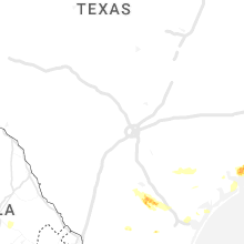


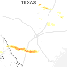


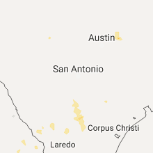
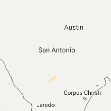


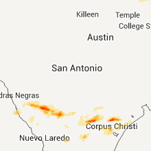


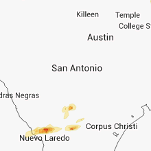


Connect with Interactive Hail Maps