

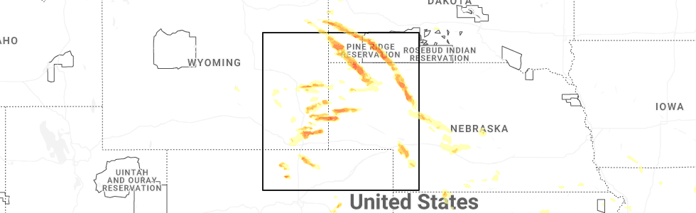
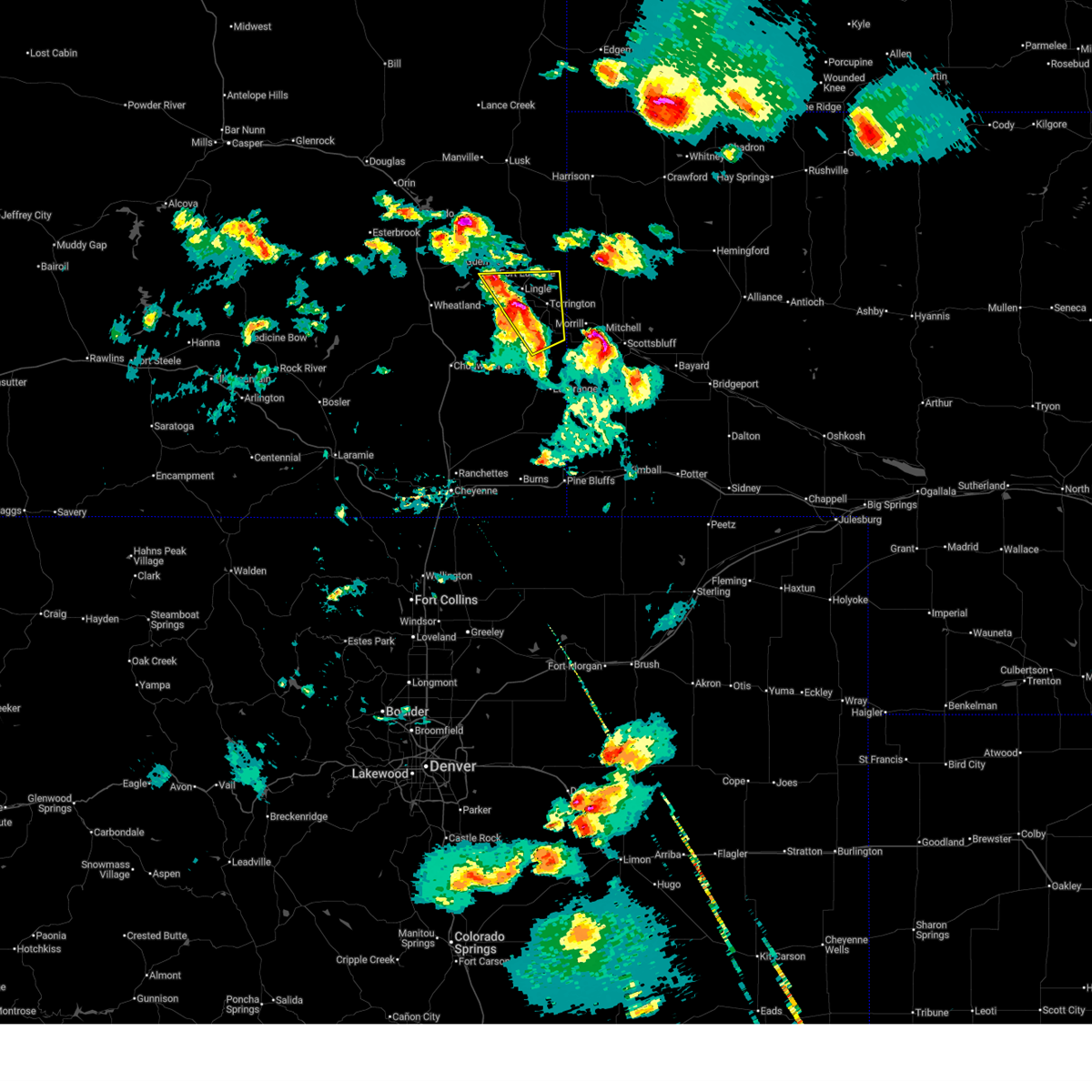
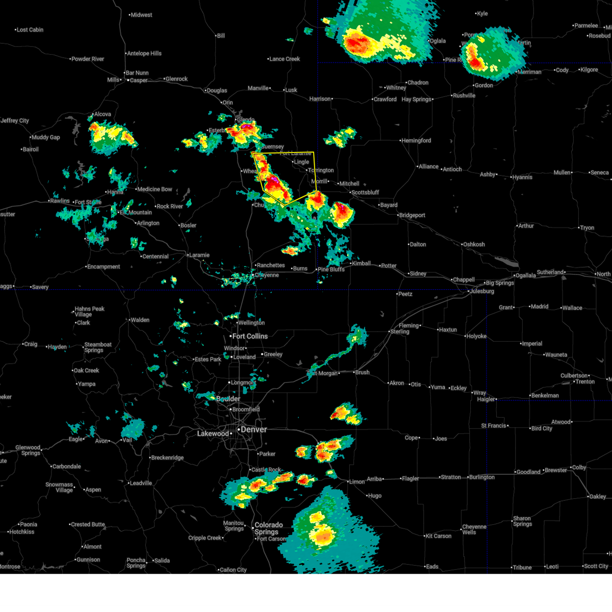
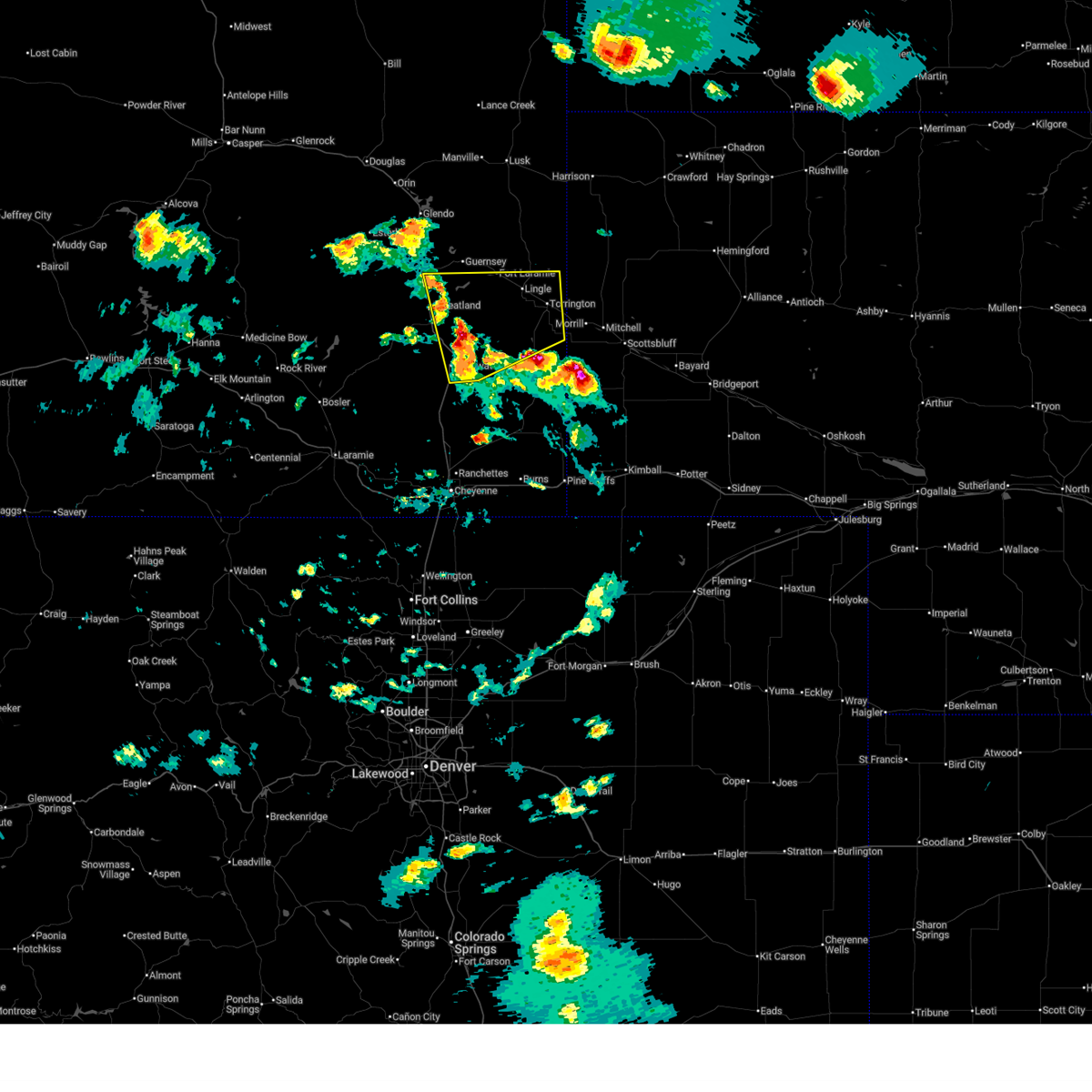
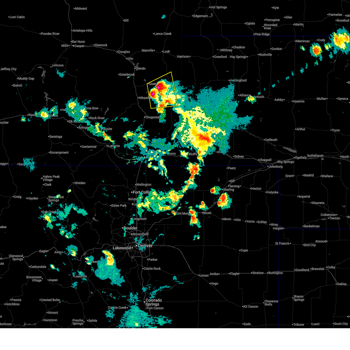
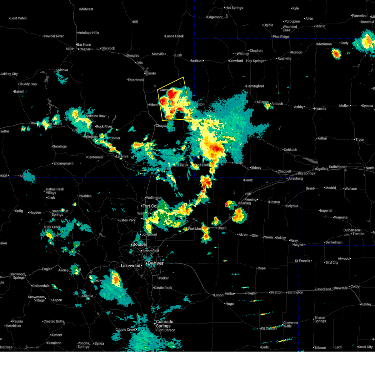
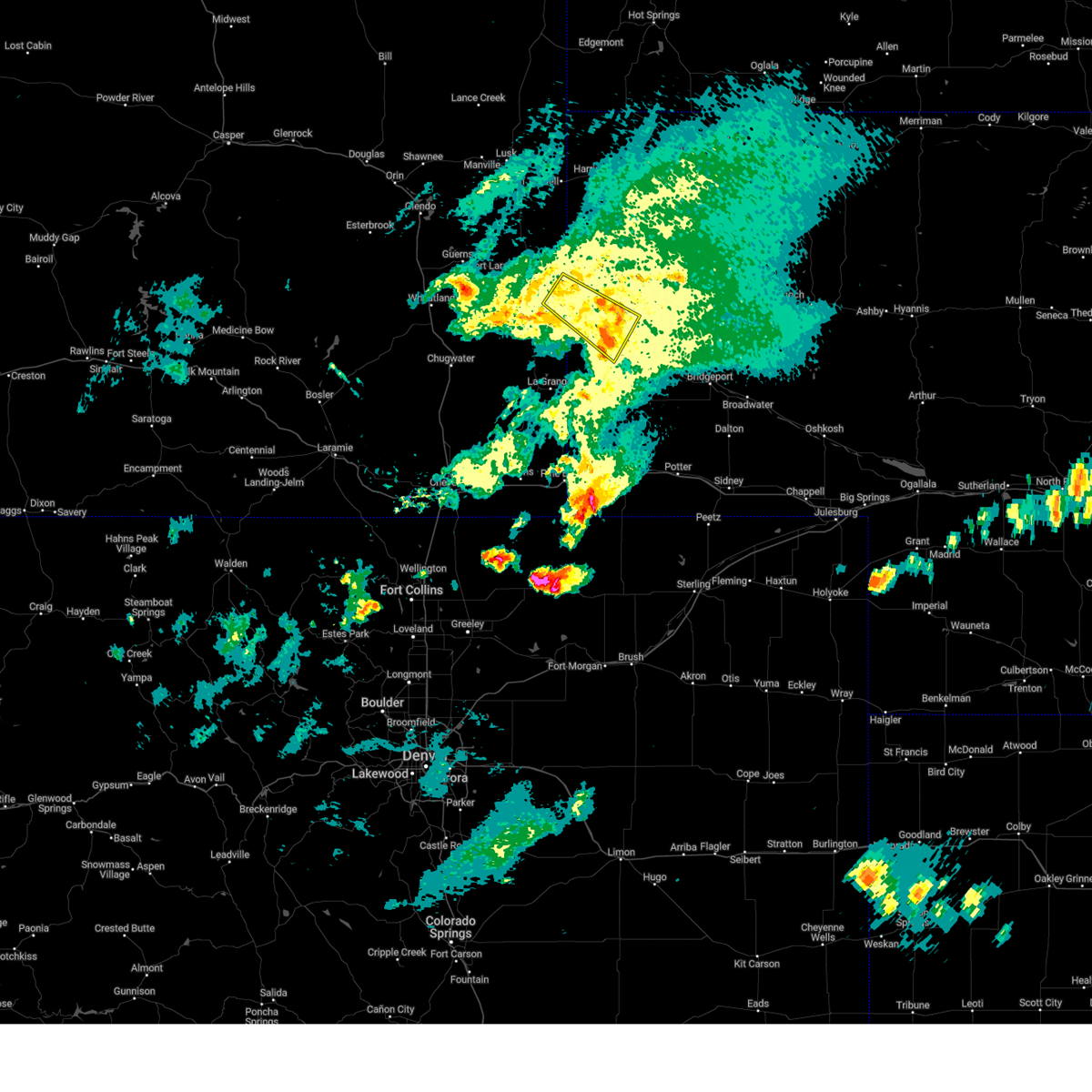
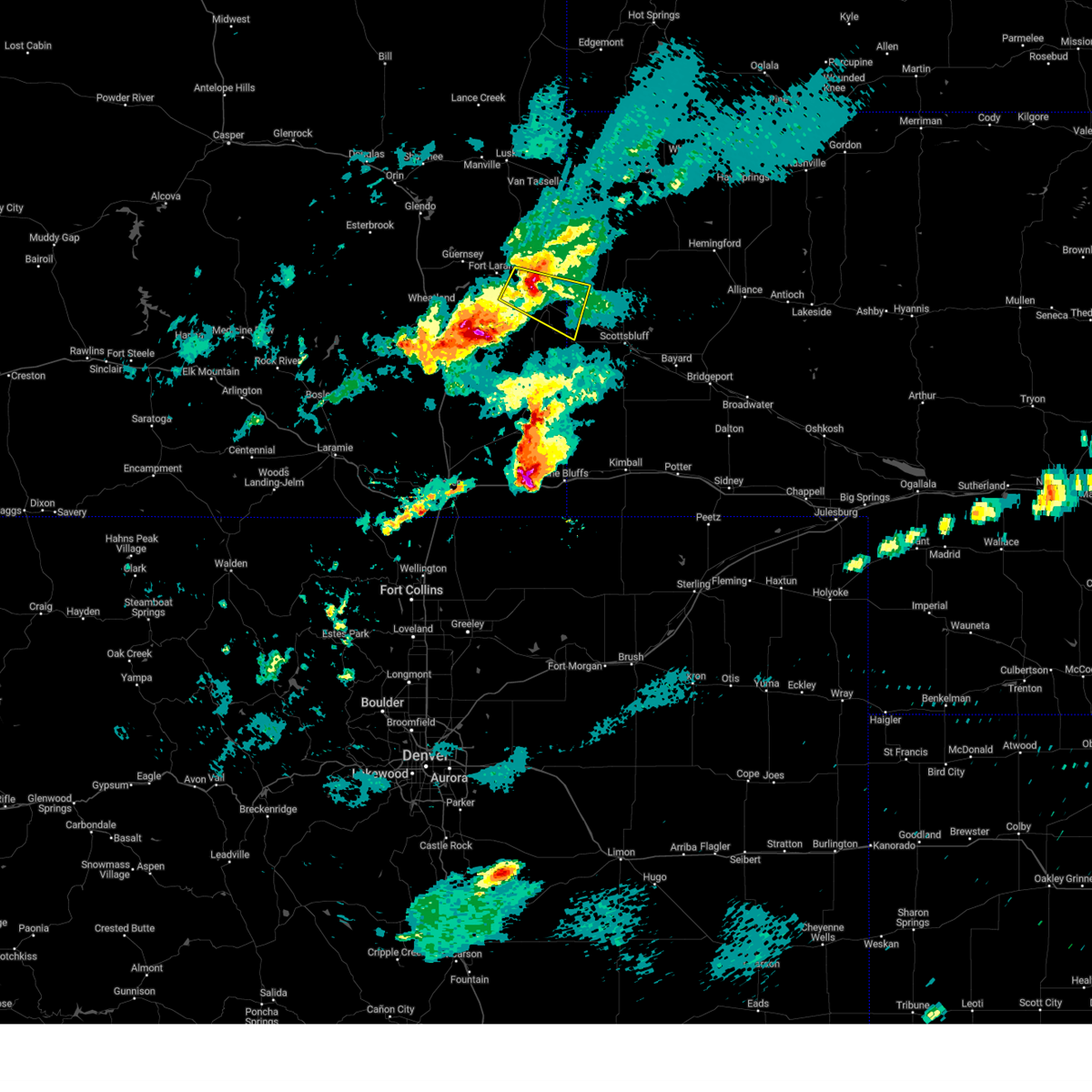
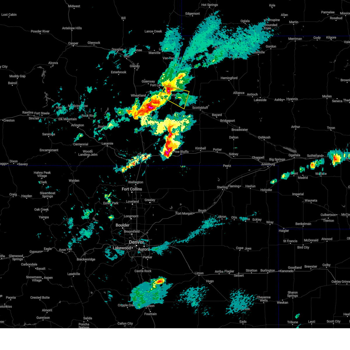
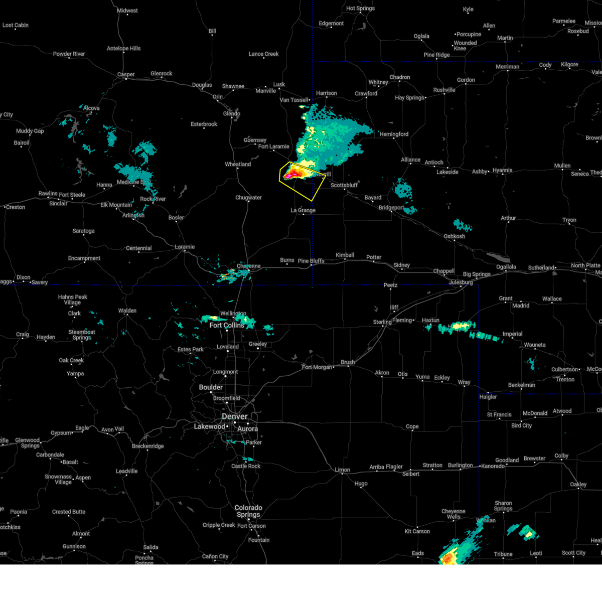
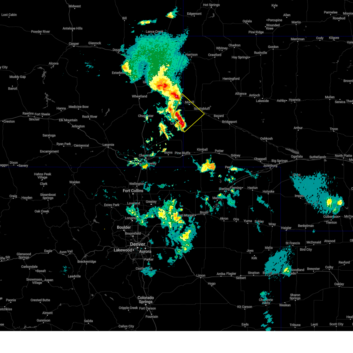
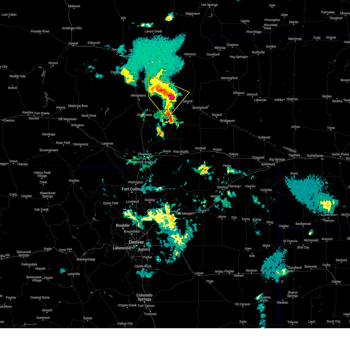
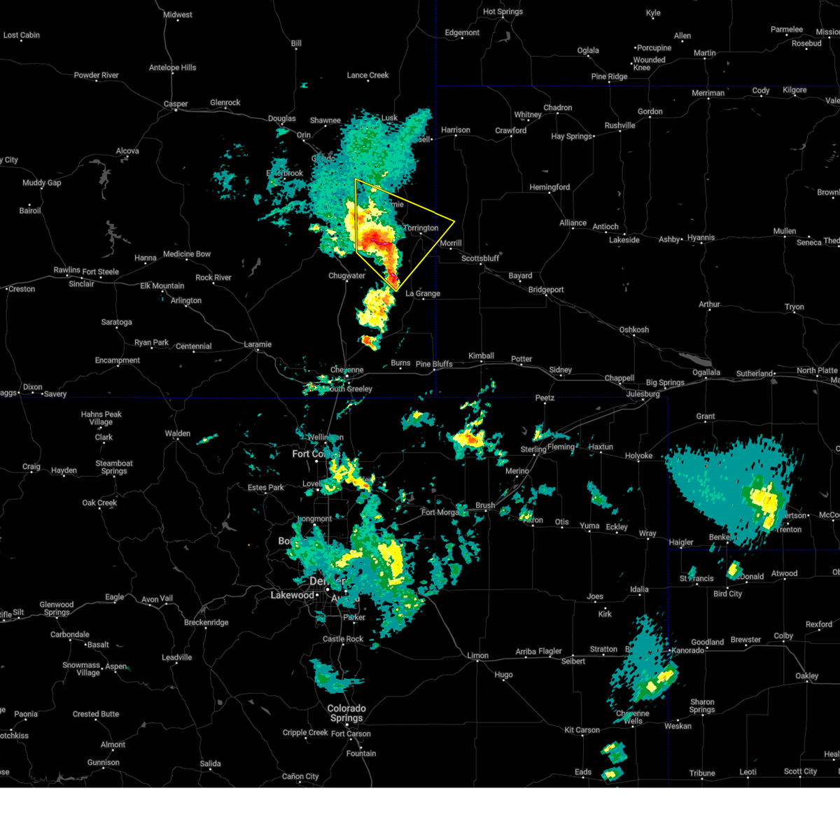
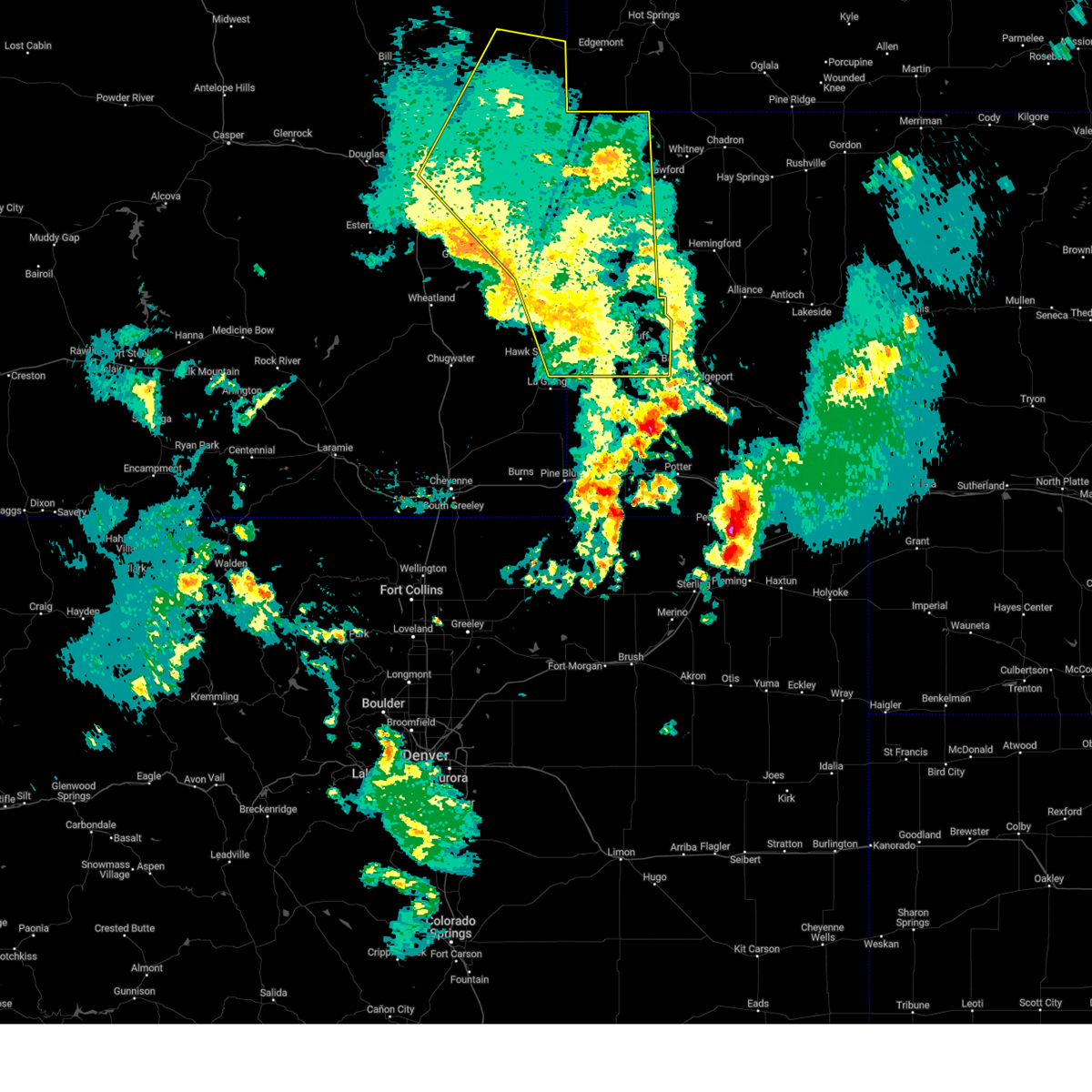
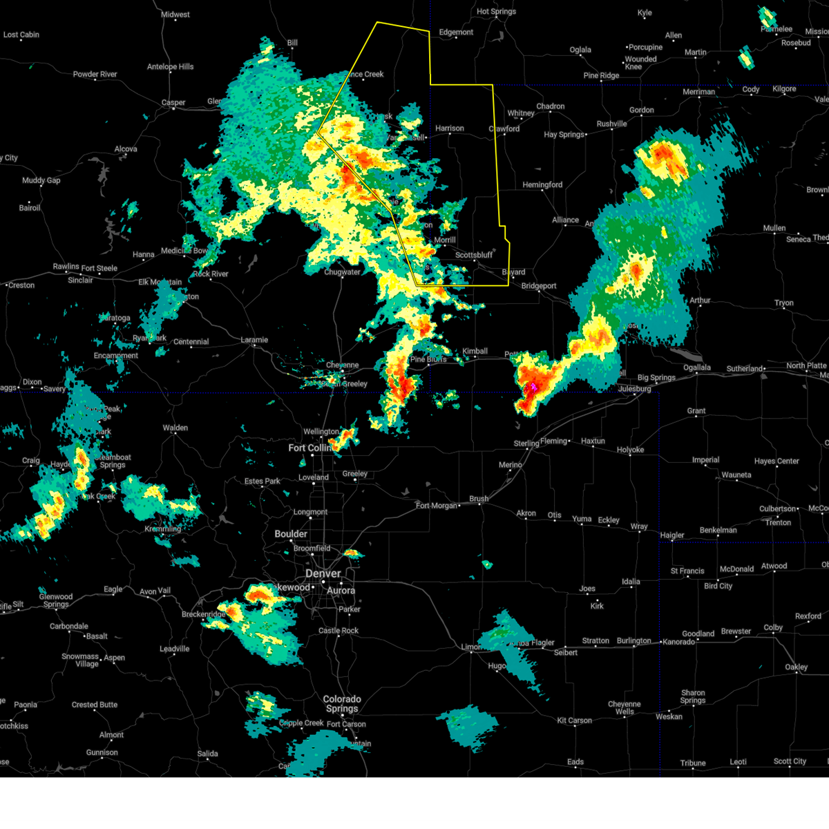
Hail Map for Torrington, WY
The Torrington, WY area has had 92 reports of on-the-ground hail by trained spotters, and has been under severe weather warnings 36 times during the past 12 months. Doppler radar has detected hail at or near Torrington, WY on 79 occasions, including 7 occasions during the past year.
| Name: | Torrington, WY |
| Where Located: | 30 miles WNW of Scottsbluff, NE |
| Map: | Google Map for Torrington, WY |
| Population: | 6501 |
| Housing Units: | 2717 |
| More Info: | Search Google for Torrington, WY |
2
The Top Recent Hail Date for Torrington, WY is Sunday, June 29, 2025 (7th out of 79)
Hail and Wind Damage Spotted near Torrington, WY
| Date / Time | Report Details |
|---|---|
| 6/29/2025 7:11 PM MDT | Golf Ball sized hail reported 28 miles S of Torrington, WY |
| 6/29/2025 6:58 PM MDT | Quarter sized hail reported 30.8 miles SSE of Torrington, WY, emergency manager found hail of quarter sized still on the side of the highway 85 at mp 129 at 8:12pm. time of hail falling was estimated based on radar. |
| 6/29/2025 6:42 PM MDT |
 At 642 pm mdt, a severe thunderstorm was located near torrington municipal airport, or 7 miles east of torrington, moving east at 35 mph (radar indicated). Hazards include 60 mph wind gusts and quarter size hail. Hail damage to vehicles is expected. expect wind damage to roofs, siding, and trees. Locations impacted include, henry. At 642 pm mdt, a severe thunderstorm was located near torrington municipal airport, or 7 miles east of torrington, moving east at 35 mph (radar indicated). Hazards include 60 mph wind gusts and quarter size hail. Hail damage to vehicles is expected. expect wind damage to roofs, siding, and trees. Locations impacted include, henry.
|
| 6/29/2025 6:31 PM MDT | Large trees uproote in goshen county WY, 5.3 miles SE of Torrington, WY |
| 6/29/2025 6:30 PM MDT | Estimated wind gus in goshen county WY, 0.4 miles SSE of Torrington, WY |
| 6/29/2025 6:23 PM MDT |
 Svrcys the national weather service in cheyenne has issued a * severe thunderstorm warning for, southwestern sioux county in the panhandle of nebraska, central goshen county in southeastern wyoming, * until 715 pm mdt. * at 623 pm mdt, a severe thunderstorm was located near torrington, moving east at 40 mph (radar indicated). Hazards include golf ball size hail and 60 mph wind gusts. People and animals outdoors will be injured. expect hail damage to roofs, siding, windows, and vehicles. Expect wind damage to roofs, siding, and trees. Svrcys the national weather service in cheyenne has issued a * severe thunderstorm warning for, southwestern sioux county in the panhandle of nebraska, central goshen county in southeastern wyoming, * until 715 pm mdt. * at 623 pm mdt, a severe thunderstorm was located near torrington, moving east at 40 mph (radar indicated). Hazards include golf ball size hail and 60 mph wind gusts. People and animals outdoors will be injured. expect hail damage to roofs, siding, windows, and vehicles. Expect wind damage to roofs, siding, and trees.
|
| 6/29/2025 6:19 PM MDT |
 the severe thunderstorm warning has been cancelled and is no longer in effect the severe thunderstorm warning has been cancelled and is no longer in effect
|
| 6/29/2025 6:19 PM MDT |
 At 618 pm mdt, severe thunderstorms were located along a line extending from fort laramie national historic site to near hawk springs, moving east at 30 mph (radar indicated). Hazards include golf ball size hail and 60 mph wind gusts. People and animals outdoors will be injured. expect hail damage to roofs, siding, windows, and vehicles. expect wind damage to roofs, siding, and trees. Locations impacted include, torrington, lingle, fort laramie, yoder, huntley, fort laramie national historic site, southern hills estates, torrington municipal airport, veteran, and goshen county fairgrounds. At 618 pm mdt, severe thunderstorms were located along a line extending from fort laramie national historic site to near hawk springs, moving east at 30 mph (radar indicated). Hazards include golf ball size hail and 60 mph wind gusts. People and animals outdoors will be injured. expect hail damage to roofs, siding, windows, and vehicles. expect wind damage to roofs, siding, and trees. Locations impacted include, torrington, lingle, fort laramie, yoder, huntley, fort laramie national historic site, southern hills estates, torrington municipal airport, veteran, and goshen county fairgrounds.
|
| 6/29/2025 5:58 PM MDT |
 At 558 pm mdt, severe thunderstorms were located along a line extending from near grayrocks reservoir to near hawk springs, moving east at 35 mph (radar indicated). Hazards include golf ball size hail and 60 mph wind gusts. People and animals outdoors will be injured. expect hail damage to roofs, siding, windows, and vehicles. expect wind damage to roofs, siding, and trees. Locations impacted include, torrington, lingle, fort laramie, yoder, huntley, fort laramie national historic site, grayrocks reservoir, southern hills estates, torrington municipal airport, veteran, slater, and goshen county fairgrounds. At 558 pm mdt, severe thunderstorms were located along a line extending from near grayrocks reservoir to near hawk springs, moving east at 35 mph (radar indicated). Hazards include golf ball size hail and 60 mph wind gusts. People and animals outdoors will be injured. expect hail damage to roofs, siding, windows, and vehicles. expect wind damage to roofs, siding, and trees. Locations impacted include, torrington, lingle, fort laramie, yoder, huntley, fort laramie national historic site, grayrocks reservoir, southern hills estates, torrington municipal airport, veteran, slater, and goshen county fairgrounds.
|
| 6/29/2025 5:36 PM MDT |
 Svrcys the national weather service in cheyenne has issued a * severe thunderstorm warning for, central goshen county in southeastern wyoming, southeastern platte county in southeastern wyoming, * until 630 pm mdt. * at 536 pm mdt, a severe thunderstorm was located near slater, or 17 miles southeast of wheatland, moving east at 30 mph (radar indicated). Hazards include 60 mph wind gusts and half dollar size hail. Hail damage to vehicles is expected. Expect wind damage to roofs, siding, and trees. Svrcys the national weather service in cheyenne has issued a * severe thunderstorm warning for, central goshen county in southeastern wyoming, southeastern platte county in southeastern wyoming, * until 630 pm mdt. * at 536 pm mdt, a severe thunderstorm was located near slater, or 17 miles southeast of wheatland, moving east at 30 mph (radar indicated). Hazards include 60 mph wind gusts and half dollar size hail. Hail damage to vehicles is expected. Expect wind damage to roofs, siding, and trees.
|
| 6/12/2025 5:14 PM MDT |
 At 514 pm mdt, a severe thunderstorm was located near veteran, or 14 miles west of torrington, moving east at 25 mph (radar indicated). Hazards include ping pong ball size hail. People and animals outdoors will be injured. expect damage to roofs, siding, windows, and vehicles. Locations impacted include, torrington, guernsey, lingle, fort laramie, yoder, huntley, register cliff state historic site, southern hills estates, pine ridge estates, oregon trail ruts state historic site, fort laramie national historic site, grayrocks reservoir, veteran, hwy 85 at dry rawhide creek, and goshen county fairgrounds. At 514 pm mdt, a severe thunderstorm was located near veteran, or 14 miles west of torrington, moving east at 25 mph (radar indicated). Hazards include ping pong ball size hail. People and animals outdoors will be injured. expect damage to roofs, siding, windows, and vehicles. Locations impacted include, torrington, guernsey, lingle, fort laramie, yoder, huntley, register cliff state historic site, southern hills estates, pine ridge estates, oregon trail ruts state historic site, fort laramie national historic site, grayrocks reservoir, veteran, hwy 85 at dry rawhide creek, and goshen county fairgrounds.
|
| 6/12/2025 5:04 PM MDT |
 Svrcys the national weather service in cheyenne has issued a * severe thunderstorm warning for, central goshen county in southeastern wyoming, east central platte county in southeastern wyoming, * until 545 pm mdt. * at 504 pm mdt, a severe thunderstorm was located 8 miles northwest of veteran, or 17 miles west of torrington, moving east at 25 mph (radar indicated). Hazards include half dollar size hail. damage to vehicles is expected Svrcys the national weather service in cheyenne has issued a * severe thunderstorm warning for, central goshen county in southeastern wyoming, east central platte county in southeastern wyoming, * until 545 pm mdt. * at 504 pm mdt, a severe thunderstorm was located 8 miles northwest of veteran, or 17 miles west of torrington, moving east at 25 mph (radar indicated). Hazards include half dollar size hail. damage to vehicles is expected
|
| 6/12/2025 4:12 PM MDT | Mping from storm chaser of measured 64mph wind gust with handheld kestre in goshen county WY, 15.5 miles N of Torrington, WY |
| 6/2/2025 8:37 PM MDT | Em shared picture in slack of a newer-build barn with the roof ripped off and laying on the camper next to i in goshen county WY, 3.2 miles E of Torrington, WY |
| 6/2/2025 6:12 PM MDT |
 The storm which prompted the warning has weakened below severe limits, and no longer poses an immediate threat to life or property. therefore, the warning will be allowed to expire. however, gusty winds and heavy rain are still possible with this thunderstorm. a severe thunderstorm watch remains in effect until 800 pm mdt for the panhandle of nebraska, and southeastern wyoming. The storm which prompted the warning has weakened below severe limits, and no longer poses an immediate threat to life or property. therefore, the warning will be allowed to expire. however, gusty winds and heavy rain are still possible with this thunderstorm. a severe thunderstorm watch remains in effect until 800 pm mdt for the panhandle of nebraska, and southeastern wyoming.
|
| 6/2/2025 5:27 PM MDT | Emergency manager reports down trees and power outages around torringto in goshen county WY, 0.4 miles SSE of Torrington, WY |
| 6/2/2025 5:26 PM MDT | Svrcys the national weather service in cheyenne has issued a * severe thunderstorm warning for, western scotts bluff county in the panhandle of nebraska, southwestern sioux county in the panhandle of nebraska, east central goshen county in southeastern wyoming, * until 615 pm mdt. * at 524 pm mdt, a severe thunderstorm was located near torrington municipal airport, or near torrington, moving southeast at 35 mph (radar indicated). Hazards include 70 mph wind gusts and penny size hail. Expect considerable tree damage. Damage is likely to mobile homes, roofs, and outbuildings. |
| 6/2/2025 4:55 PM MDT |
 At 454 pm mdt, a severe thunderstorm was located over lingle, or 7 miles northwest of torrington, and is nearly stationary (radar indicated). Hazards include 70 mph wind gusts and quarter size hail. Hail damage to vehicles is expected. expect considerable tree damage. wind damage is also likely to mobile homes, roofs, and outbuildings. Locations impacted include, torrington, lingle, lyman, henry, southern hills estates, torrington municipal airport, and goshen county fairgrounds. At 454 pm mdt, a severe thunderstorm was located over lingle, or 7 miles northwest of torrington, and is nearly stationary (radar indicated). Hazards include 70 mph wind gusts and quarter size hail. Hail damage to vehicles is expected. expect considerable tree damage. wind damage is also likely to mobile homes, roofs, and outbuildings. Locations impacted include, torrington, lingle, lyman, henry, southern hills estates, torrington municipal airport, and goshen county fairgrounds.
|
| 6/2/2025 4:47 PM MDT |
 Svrcys the national weather service in cheyenne has issued a * severe thunderstorm warning for, northwestern scotts bluff county in the panhandle of nebraska, southwestern sioux county in the panhandle of nebraska, east central goshen county in southeastern wyoming, * until 530 pm mdt. * at 446 pm mdt, a severe thunderstorm was located over lingle, or 10 miles northwest of torrington, moving southeast at 30 mph (radar indicated). Hazards include 70 mph wind gusts and quarter size hail. Hail damage to vehicles is expected. expect considerable tree damage. Wind damage is also likely to mobile homes, roofs, and outbuildings. Svrcys the national weather service in cheyenne has issued a * severe thunderstorm warning for, northwestern scotts bluff county in the panhandle of nebraska, southwestern sioux county in the panhandle of nebraska, east central goshen county in southeastern wyoming, * until 530 pm mdt. * at 446 pm mdt, a severe thunderstorm was located over lingle, or 10 miles northwest of torrington, moving southeast at 30 mph (radar indicated). Hazards include 70 mph wind gusts and quarter size hail. Hail damage to vehicles is expected. expect considerable tree damage. Wind damage is also likely to mobile homes, roofs, and outbuildings.
|
| 5/23/2025 9:24 PM MDT | Quarter sized hail reported 8.1 miles NNW of Torrington, WY |
| 5/23/2025 8:50 PM MDT |
 At 849 pm mdt, a severe thunderstorm was located near southern hills estates, or near torrington, moving east at 30 mph (emergency management reports golf ball sized hail north of veteran). Hazards include two inch hail and 60 mph wind gusts. People and animals outdoors will be injured. expect hail damage to roofs, siding, windows, and vehicles. expect wind damage to roofs, siding, and trees. Locations impacted include, torrington, morrill, lyman, yoder, henry, huntley, southern hills estates, veteran, torrington municipal airport, and goshen county fairgrounds. At 849 pm mdt, a severe thunderstorm was located near southern hills estates, or near torrington, moving east at 30 mph (emergency management reports golf ball sized hail north of veteran). Hazards include two inch hail and 60 mph wind gusts. People and animals outdoors will be injured. expect hail damage to roofs, siding, windows, and vehicles. expect wind damage to roofs, siding, and trees. Locations impacted include, torrington, morrill, lyman, yoder, henry, huntley, southern hills estates, veteran, torrington municipal airport, and goshen county fairgrounds.
|
| 5/23/2025 8:45 PM MDT | Golf Ball sized hail reported 9.1 miles ENE of Torrington, WY |
| 5/23/2025 8:40 PM MDT |
 Svrcys the national weather service in cheyenne has issued a * severe thunderstorm warning for, northwestern scotts bluff county in the panhandle of nebraska, southwestern sioux county in the panhandle of nebraska, east central goshen county in southeastern wyoming, * until 915 pm mdt. * at 840 pm mdt, a severe thunderstorm was located near veteran, or 10 miles west of torrington, moving east at 30 mph (radar indicated). Hazards include golf ball size hail and 60 mph wind gusts. People and animals outdoors will be injured. expect hail damage to roofs, siding, windows, and vehicles. Expect wind damage to roofs, siding, and trees. Svrcys the national weather service in cheyenne has issued a * severe thunderstorm warning for, northwestern scotts bluff county in the panhandle of nebraska, southwestern sioux county in the panhandle of nebraska, east central goshen county in southeastern wyoming, * until 915 pm mdt. * at 840 pm mdt, a severe thunderstorm was located near veteran, or 10 miles west of torrington, moving east at 30 mph (radar indicated). Hazards include golf ball size hail and 60 mph wind gusts. People and animals outdoors will be injured. expect hail damage to roofs, siding, windows, and vehicles. Expect wind damage to roofs, siding, and trees.
|
| 9/15/2024 7:05 PM MDT |
 the severe thunderstorm warning has been cancelled and is no longer in effect the severe thunderstorm warning has been cancelled and is no longer in effect
|
| 9/15/2024 6:41 PM MDT |
 At 640 pm mdt, a severe thunderstorm was located near stegall, or 18 miles southeast of torrington, moving northeast at 30 mph (radar indicated). Hazards include 60 mph wind gusts and quarter size hail. Hail damage to vehicles is expected. expect wind damage to roofs, siding, and trees. Locations impacted include, scottsbluff, gering, mitchell, terrytown, morrill, lyman, henry, huntley, hubbard hill, stegall, scotts bluff county fairground, and scotts bluff national monument. At 640 pm mdt, a severe thunderstorm was located near stegall, or 18 miles southeast of torrington, moving northeast at 30 mph (radar indicated). Hazards include 60 mph wind gusts and quarter size hail. Hail damage to vehicles is expected. expect wind damage to roofs, siding, and trees. Locations impacted include, scottsbluff, gering, mitchell, terrytown, morrill, lyman, henry, huntley, hubbard hill, stegall, scotts bluff county fairground, and scotts bluff national monument.
|
| 9/15/2024 6:41 PM MDT |
 the severe thunderstorm warning has been cancelled and is no longer in effect the severe thunderstorm warning has been cancelled and is no longer in effect
|
| 9/15/2024 6:32 PM MDT | Quarter sized hail reported 0.4 miles SSE of Torrington, WY, social media report of quarter size hail and gusty winds. |
| 9/15/2024 6:30 PM MDT |
 Svrcys the national weather service in cheyenne has issued a * severe thunderstorm warning for, southwestern sioux county in the panhandle of nebraska, northeastern goshen county in southeastern wyoming, * until 715 pm mdt. * at 630 pm mdt, a severe thunderstorm was located near torrington municipal airport, or near torrington, moving northeast at 30 mph (radar indicated). Hazards include 60 mph wind gusts and quarter size hail. Hail damage to vehicles is expected. Expect wind damage to roofs, siding, and trees. Svrcys the national weather service in cheyenne has issued a * severe thunderstorm warning for, southwestern sioux county in the panhandle of nebraska, northeastern goshen county in southeastern wyoming, * until 715 pm mdt. * at 630 pm mdt, a severe thunderstorm was located near torrington municipal airport, or near torrington, moving northeast at 30 mph (radar indicated). Hazards include 60 mph wind gusts and quarter size hail. Hail damage to vehicles is expected. Expect wind damage to roofs, siding, and trees.
|
| 9/15/2024 6:29 PM MDT |
 Svrcys the national weather service in cheyenne has issued a * severe thunderstorm warning for, western scotts bluff county in the panhandle of nebraska, northwestern banner county in the panhandle of nebraska, southwestern sioux county in the panhandle of nebraska, southeastern goshen county in southeastern wyoming, northeastern laramie county in southeastern wyoming, * until 715 pm mdt. * at 629 pm mdt, a severe thunderstorm was located near hawk springs reservoir, or 21 miles south of torrington, moving northeast at 25 mph (radar indicated). Hazards include 60 mph wind gusts and quarter size hail. Hail damage to vehicles is expected. Expect wind damage to roofs, siding, and trees. Svrcys the national weather service in cheyenne has issued a * severe thunderstorm warning for, western scotts bluff county in the panhandle of nebraska, northwestern banner county in the panhandle of nebraska, southwestern sioux county in the panhandle of nebraska, southeastern goshen county in southeastern wyoming, northeastern laramie county in southeastern wyoming, * until 715 pm mdt. * at 629 pm mdt, a severe thunderstorm was located near hawk springs reservoir, or 21 miles south of torrington, moving northeast at 25 mph (radar indicated). Hazards include 60 mph wind gusts and quarter size hail. Hail damage to vehicles is expected. Expect wind damage to roofs, siding, and trees.
|
| 9/15/2024 6:16 PM MDT | Asos station ktor torrington airport - to in goshen county WY, 1.5 miles WSW of Torrington, WY |
| 9/15/2024 6:15 PM MDT |
 At 615 pm mdt, a severe thunderstorm was located near fort laramie, or 16 miles northwest of torrington, moving north at 25 mph (radar indicated). Hazards include golf ball size hail and 60 mph wind gusts. People and animals outdoors will be injured. expect hail damage to roofs, siding, windows, and vehicles. expect wind damage to roofs, siding, and trees. Locations impacted include, torrington, guernsey, lingle, fort laramie, yoder, henry, hartville, huntley, register cliff state historic site, southern hills estates, torrington municipal airport, pine ridge estates, fort laramie national historic site, grayrocks reservoir, veteran, hawk springs, and goshen county fairgrounds. At 615 pm mdt, a severe thunderstorm was located near fort laramie, or 16 miles northwest of torrington, moving north at 25 mph (radar indicated). Hazards include golf ball size hail and 60 mph wind gusts. People and animals outdoors will be injured. expect hail damage to roofs, siding, windows, and vehicles. expect wind damage to roofs, siding, and trees. Locations impacted include, torrington, guernsey, lingle, fort laramie, yoder, henry, hartville, huntley, register cliff state historic site, southern hills estates, torrington municipal airport, pine ridge estates, fort laramie national historic site, grayrocks reservoir, veteran, hawk springs, and goshen county fairgrounds.
|
| 9/15/2024 5:45 PM MDT |
 Svrcys the national weather service in cheyenne has issued a * severe thunderstorm warning for, northwestern scotts bluff county in the panhandle of nebraska, southwestern sioux county in the panhandle of nebraska, central goshen county in southeastern wyoming, east central platte county in southeastern wyoming, * until 630 pm mdt. * at 545 pm mdt, a severe thunderstorm was located 7 miles northwest of veteran, or 18 miles west of torrington, moving north at 25 mph (radar indicated). Hazards include 60 mph wind gusts and quarter size hail. Hail damage to vehicles is expected. Expect wind damage to roofs, siding, and trees. Svrcys the national weather service in cheyenne has issued a * severe thunderstorm warning for, northwestern scotts bluff county in the panhandle of nebraska, southwestern sioux county in the panhandle of nebraska, central goshen county in southeastern wyoming, east central platte county in southeastern wyoming, * until 630 pm mdt. * at 545 pm mdt, a severe thunderstorm was located 7 miles northwest of veteran, or 18 miles west of torrington, moving north at 25 mph (radar indicated). Hazards include 60 mph wind gusts and quarter size hail. Hail damage to vehicles is expected. Expect wind damage to roofs, siding, and trees.
|
| 7/27/2024 6:45 PM MDT |
 The storms which prompted the warning have weakened below severe limits, and no longer pose an immediate threat to life or property. therefore, the warning has been allowed to expire. however, gusty winds and heavy rain are still possible with these thunderstorms. The storms which prompted the warning have weakened below severe limits, and no longer pose an immediate threat to life or property. therefore, the warning has been allowed to expire. however, gusty winds and heavy rain are still possible with these thunderstorms.
|
| 7/27/2024 6:14 PM MDT |
 The storms which prompted the warning have moved out of the area. therefore, the warning will be allowed to expire. however, gusty winds and heavy rain are still possible with these thunderstorms. remember, a severe thunderstorm warning still remains in effect for converse, niobrara, goshen, sioux, and scotts bluff counties until 645 pm. The storms which prompted the warning have moved out of the area. therefore, the warning will be allowed to expire. however, gusty winds and heavy rain are still possible with these thunderstorms. remember, a severe thunderstorm warning still remains in effect for converse, niobrara, goshen, sioux, and scotts bluff counties until 645 pm.
|
| 7/27/2024 5:59 PM MDT | Asos station ktor torrington airport - to in goshen county WY, 1.5 miles WSW of Torrington, WY |
| 7/27/2024 5:58 PM MDT |
 Svrcys the national weather service in cheyenne has issued a * severe thunderstorm warning for, scotts bluff county in the panhandle of nebraska, sioux county in the panhandle of nebraska, niobrara county in east central wyoming, northeastern goshen county in southeastern wyoming, northeastern platte county in southeastern wyoming, east central converse county in east central wyoming, * until 645 pm mdt. * at 558 pm mdt, severe thunderstorms were located along a line extending from near keeline to near prairie center to stegall, moving northeast at 65 mph (public). Hazards include 60 mph wind gusts. expect damage to roofs, siding, and trees Svrcys the national weather service in cheyenne has issued a * severe thunderstorm warning for, scotts bluff county in the panhandle of nebraska, sioux county in the panhandle of nebraska, niobrara county in east central wyoming, northeastern goshen county in southeastern wyoming, northeastern platte county in southeastern wyoming, east central converse county in east central wyoming, * until 645 pm mdt. * at 558 pm mdt, severe thunderstorms were located along a line extending from near keeline to near prairie center to stegall, moving northeast at 65 mph (public). Hazards include 60 mph wind gusts. expect damage to roofs, siding, and trees
|
| 7/27/2024 5:53 PM MDT | Corrects previous non-tstm wnd gst report from 2 e torrington. asos station ktor torrington airport - to in goshen county WY, 1.5 miles WSW of Torrington, WY |
| 7/27/2024 5:33 PM MDT |
 Svrcys the national weather service in cheyenne has issued a * severe thunderstorm warning for, western scotts bluff county in the panhandle of nebraska, southwestern sioux county in the panhandle of nebraska, southern goshen county in southeastern wyoming, east central platte county in southeastern wyoming, * until 615 pm mdt. * at 532 pm mdt, severe thunderstorms were located along a line extending from chugcreek to 6 miles west of veteran to 6 miles west of wycross, moving northeast at 35 mph (radar indicated). Hazards include 60 mph wind gusts. expect damage to roofs, siding, and trees Svrcys the national weather service in cheyenne has issued a * severe thunderstorm warning for, western scotts bluff county in the panhandle of nebraska, southwestern sioux county in the panhandle of nebraska, southern goshen county in southeastern wyoming, east central platte county in southeastern wyoming, * until 615 pm mdt. * at 532 pm mdt, severe thunderstorms were located along a line extending from chugcreek to 6 miles west of veteran to 6 miles west of wycross, moving northeast at 35 mph (radar indicated). Hazards include 60 mph wind gusts. expect damage to roofs, siding, and trees
|
| 7/26/2024 4:33 PM MDT |
 the severe thunderstorm warning has been cancelled and is no longer in effect the severe thunderstorm warning has been cancelled and is no longer in effect
|
| 7/26/2024 4:26 PM MDT |
 At 426 pm mdt, severe thunderstorms were located along a line extending from 10 miles northeast of lingle to near henry, moving northeast at 20 mph (radar indicated). Hazards include 60 mph wind gusts and penny size hail. Expect damage to roofs, siding, and trees. Locations impacted include, torrington, henry, and torrington municipal airport. At 426 pm mdt, severe thunderstorms were located along a line extending from 10 miles northeast of lingle to near henry, moving northeast at 20 mph (radar indicated). Hazards include 60 mph wind gusts and penny size hail. Expect damage to roofs, siding, and trees. Locations impacted include, torrington, henry, and torrington municipal airport.
|
| 7/26/2024 4:15 PM MDT |
 Svrcys the national weather service in cheyenne has issued a * severe thunderstorm warning for, northwestern scotts bluff county in the panhandle of nebraska, southwestern sioux county in the panhandle of nebraska, east central goshen county in southeastern wyoming, * until 500 pm mdt. * at 415 pm mdt, severe thunderstorms were located along a line extending from lingle to near henry, moving northeast at 15 mph (radar indicated). Hazards include 60 mph wind gusts and penny size hail. expect damage to roofs, siding, and trees Svrcys the national weather service in cheyenne has issued a * severe thunderstorm warning for, northwestern scotts bluff county in the panhandle of nebraska, southwestern sioux county in the panhandle of nebraska, east central goshen county in southeastern wyoming, * until 500 pm mdt. * at 415 pm mdt, severe thunderstorms were located along a line extending from lingle to near henry, moving northeast at 15 mph (radar indicated). Hazards include 60 mph wind gusts and penny size hail. expect damage to roofs, siding, and trees
|
| 7/21/2024 2:11 PM MDT |
 The storm which prompted the warning has weakened below severe limits, and no longer poses an immediate threat to life or property. therefore, the warning will be allowed to expire. however, small hail, gusty winds and heavy rain are still possible with this thunderstorm. The storm which prompted the warning has weakened below severe limits, and no longer poses an immediate threat to life or property. therefore, the warning will be allowed to expire. however, small hail, gusty winds and heavy rain are still possible with this thunderstorm.
|
| 7/21/2024 1:52 PM MDT |
 Svrcys the national weather service in cheyenne has issued a * severe thunderstorm warning for, southwestern sioux county in the panhandle of nebraska, east central goshen county in southeastern wyoming, * until 215 pm mdt. * at 152 pm mdt, a severe thunderstorm was located 8 miles northeast of torrington municipal airport, or 9 miles northeast of torrington, moving south at 15 mph (radar indicated). Hazards include ping pong ball size hail and 60 mph wind gusts. People and animals outdoors will be injured. expect hail damage to roofs, siding, windows, and vehicles. expect wind damage to roofs, siding, and trees. This severe thunderstorm will remain over mainly rural areas of southwestern sioux and east central goshen counties. Svrcys the national weather service in cheyenne has issued a * severe thunderstorm warning for, southwestern sioux county in the panhandle of nebraska, east central goshen county in southeastern wyoming, * until 215 pm mdt. * at 152 pm mdt, a severe thunderstorm was located 8 miles northeast of torrington municipal airport, or 9 miles northeast of torrington, moving south at 15 mph (radar indicated). Hazards include ping pong ball size hail and 60 mph wind gusts. People and animals outdoors will be injured. expect hail damage to roofs, siding, windows, and vehicles. expect wind damage to roofs, siding, and trees. This severe thunderstorm will remain over mainly rural areas of southwestern sioux and east central goshen counties.
|
| 7/17/2024 3:43 PM MDT |
 The storms which prompted the warning have weakened below severe limits, and have exited the warned area. therefore, the warning will be allowed to expire. The storms which prompted the warning have weakened below severe limits, and have exited the warned area. therefore, the warning will be allowed to expire.
|
| 7/17/2024 3:08 PM MDT | The storm which prompted the warning has moved out of the area. therefore, the warning will be allowed to expire. however, gusty winds are still possible with this thunderstorm. remember, a severe thunderstorm warning still remains in effect for far eastern goshen county, southwest sioux county, and western scotts bluff county until 345 pm. |
| 7/17/2024 3:06 PM MDT | At 304 pm mdt, severe thunderstorms were located along a line extending from 6 miles north of torrington to southern hills estates to near stegall to 12 miles east of la grange, moving east at 20 mph (trained weather spotters. at 300 pm, a wind gust of 60 mph was reported 3 miles southwest of lyman). Hazards include 60 mph wind gusts and nickel size hail. Expect damage to roofs, siding, and trees. Locations impacted include, scottsbluff, torrington, gering, mitchell, terrytown, morrill, lyman, yoder, henry, huntley, wildcat hills state recreation area, stegall, southern hills estates, scotts bluff county fairground, torrington municipal airport, scotts bluff national monument, hubbard hill, and goshen county fairgrounds. |
| 7/17/2024 2:59 PM MDT | Trained spotter reports 60 to 65 mph wind gusts with multiple tree branches dow in goshen county WY, 13.5 miles NNW of Torrington, WY |
| 7/17/2024 2:58 PM MDT |
 Svrcys the national weather service in cheyenne has issued a * severe thunderstorm warning for, western scotts bluff county in the panhandle of nebraska, southwestern sioux county in the panhandle of nebraska, east central goshen county in southeastern wyoming, * until 345 pm mdt. * at 258 pm mdt, severe thunderstorms were located along a line extending from 6 miles east of lingle to near southern hills estates to near stegall to 11 miles east of la grange, moving east at 20 mph (radar indicated). Hazards include 60 mph wind gusts and quarter size hail. Hail damage to vehicles is expected. Expect wind damage to roofs, siding, and trees. Svrcys the national weather service in cheyenne has issued a * severe thunderstorm warning for, western scotts bluff county in the panhandle of nebraska, southwestern sioux county in the panhandle of nebraska, east central goshen county in southeastern wyoming, * until 345 pm mdt. * at 258 pm mdt, severe thunderstorms were located along a line extending from 6 miles east of lingle to near southern hills estates to near stegall to 11 miles east of la grange, moving east at 20 mph (radar indicated). Hazards include 60 mph wind gusts and quarter size hail. Hail damage to vehicles is expected. Expect wind damage to roofs, siding, and trees.
|
| 7/17/2024 2:53 PM MDT |
 At 252 pm mdt, a severe thunderstorm was located over southern hills estates, or near torrington, moving northeast at 20 mph (radar indicated). Hazards include 60 mph wind gusts and quarter size hail. Hail damage to vehicles is expected. expect wind damage to roofs, siding, and trees. Locations impacted include, torrington, yoder, henry, huntley, southern hills estates, torrington municipal airport, and goshen county fairgrounds. At 252 pm mdt, a severe thunderstorm was located over southern hills estates, or near torrington, moving northeast at 20 mph (radar indicated). Hazards include 60 mph wind gusts and quarter size hail. Hail damage to vehicles is expected. expect wind damage to roofs, siding, and trees. Locations impacted include, torrington, yoder, henry, huntley, southern hills estates, torrington municipal airport, and goshen county fairgrounds.
|
| 7/17/2024 2:39 PM MDT | Svrcys the national weather service in cheyenne has issued a * severe thunderstorm warning for, northwestern scotts bluff county in the panhandle of nebraska, southwestern sioux county in the panhandle of nebraska, east central goshen county in southeastern wyoming, * until 315 pm mdt. * at 239 pm mdt, a severe thunderstorm was located over yoder, or 9 miles southwest of torrington, moving northeast at 20 mph (radar indicated). Hazards include ping pong ball size hail and 60 mph wind gusts. People and animals outdoors will be injured. expect hail damage to roofs, siding, windows, and vehicles. Expect wind damage to roofs, siding, and trees. |
| 6/20/2024 3:46 PM MDT |
 the severe thunderstorm warning has been cancelled and is no longer in effect the severe thunderstorm warning has been cancelled and is no longer in effect
|
| 6/20/2024 3:16 PM MDT |
 Svrcys the national weather service in cheyenne has issued a * severe thunderstorm warning for, western scotts bluff county in the panhandle of nebraska, southwestern sioux county in the panhandle of nebraska, east central goshen county in southeastern wyoming, * until 400 pm mdt. * at 315 pm mdt, severe thunderstorms were located along a line extending from southern hills estates to near lyman to 6 miles northeast of hawk springs reservoir, moving east at 25 mph. these are destructive storms for east central goshen and northwest scotts bluff counties (trained weather spotters). Hazards include softball size hail and 60 mph wind gusts. People and animals outdoors will be severely injured. Expect shattered windows, extensive damage to roofs, siding, and vehicles. Svrcys the national weather service in cheyenne has issued a * severe thunderstorm warning for, western scotts bluff county in the panhandle of nebraska, southwestern sioux county in the panhandle of nebraska, east central goshen county in southeastern wyoming, * until 400 pm mdt. * at 315 pm mdt, severe thunderstorms were located along a line extending from southern hills estates to near lyman to 6 miles northeast of hawk springs reservoir, moving east at 25 mph. these are destructive storms for east central goshen and northwest scotts bluff counties (trained weather spotters). Hazards include softball size hail and 60 mph wind gusts. People and animals outdoors will be severely injured. Expect shattered windows, extensive damage to roofs, siding, and vehicles.
|
| 6/10/2024 6:30 PM MDT |
 the severe thunderstorm warning has been cancelled and is no longer in effect the severe thunderstorm warning has been cancelled and is no longer in effect
|
| 6/10/2024 6:10 PM MDT |
 Svrcys the national weather service in cheyenne has issued a * severe thunderstorm warning for, southwestern sioux county in the panhandle of nebraska, central goshen county in southeastern wyoming, east central platte county in southeastern wyoming, * until 700 pm mdt. * at 610 pm mdt, a severe thunderstorm was located near register cliff state historic site, or 15 miles northeast of wheatland, moving southeast at 40 mph (radar indicated). Hazards include 60 mph wind gusts and quarter size hail. Hail damage to vehicles is expected. Expect wind damage to roofs, siding, and trees. Svrcys the national weather service in cheyenne has issued a * severe thunderstorm warning for, southwestern sioux county in the panhandle of nebraska, central goshen county in southeastern wyoming, east central platte county in southeastern wyoming, * until 700 pm mdt. * at 610 pm mdt, a severe thunderstorm was located near register cliff state historic site, or 15 miles northeast of wheatland, moving southeast at 40 mph (radar indicated). Hazards include 60 mph wind gusts and quarter size hail. Hail damage to vehicles is expected. Expect wind damage to roofs, siding, and trees.
|
| 6/10/2024 3:22 PM MDT |
 The storm which prompted the warning has weakened below severe limits, and no longer poses an immediate threat to life or property. therefore, the warning will be allowed to expire. a severe thunderstorm watch remains in effect until 800 pm mdt for southeastern wyoming. The storm which prompted the warning has weakened below severe limits, and no longer poses an immediate threat to life or property. therefore, the warning will be allowed to expire. a severe thunderstorm watch remains in effect until 800 pm mdt for southeastern wyoming.
|
| 6/10/2024 3:04 PM MDT |
 At 304 pm mdt, a severe thunderstorm was located over lingle, or 11 miles northwest of torrington, moving east at 25 mph (radar indicated). Hazards include 60 mph wind gusts and quarter size hail. Hail damage to vehicles is expected. expect wind damage to roofs, siding, and trees. Locations impacted include, torrington, lingle, torrington municipal airport, southern hills estates, and goshen county fairgrounds. At 304 pm mdt, a severe thunderstorm was located over lingle, or 11 miles northwest of torrington, moving east at 25 mph (radar indicated). Hazards include 60 mph wind gusts and quarter size hail. Hail damage to vehicles is expected. expect wind damage to roofs, siding, and trees. Locations impacted include, torrington, lingle, torrington municipal airport, southern hills estates, and goshen county fairgrounds.
|
| 6/10/2024 2:49 PM MDT |
 Svrcys the national weather service in cheyenne has issued a * severe thunderstorm warning for, central goshen county in southeastern wyoming, * until 330 pm mdt. * at 248 pm mdt, a severe thunderstorm was located near fort laramie, or 18 miles west of torrington, moving east at 25 mph (radar indicated). Hazards include 60 mph wind gusts and quarter size hail. Hail damage to vehicles is expected. Expect wind damage to roofs, siding, and trees. Svrcys the national weather service in cheyenne has issued a * severe thunderstorm warning for, central goshen county in southeastern wyoming, * until 330 pm mdt. * at 248 pm mdt, a severe thunderstorm was located near fort laramie, or 18 miles west of torrington, moving east at 25 mph (radar indicated). Hazards include 60 mph wind gusts and quarter size hail. Hail damage to vehicles is expected. Expect wind damage to roofs, siding, and trees.
|
| 4/25/2024 3:46 PM MDT |
 The storm which prompted the warning has weakened below severe limits, and no longer appears capable of producing a tornado. therefore, the warning has been allowed to expire. however, heavy rain is still possible with this thunderstorm. The storm which prompted the warning has weakened below severe limits, and no longer appears capable of producing a tornado. therefore, the warning has been allowed to expire. however, heavy rain is still possible with this thunderstorm.
|
| 4/25/2024 3:45 PM MDT | Quarter sized hail reported 8.8 miles NNW of Torrington, WY |
| 4/25/2024 3:33 PM MDT |
 At 331 pm mdt, a severe thunderstorm capable of producing a tornado was located over lyman, or 9 miles southeast of torrington, and is nearly stationary (radar indicated rotation. numerous landspout and funnel reports). Hazards include tornado and quarter size hail. Flying debris will be dangerous to those caught without shelter. mobile homes will be damaged or destroyed. damage to roofs, windows, and vehicles will occur. tree damage is likely. Locations impacted include, morrill, lyman, huntley, and henry. At 331 pm mdt, a severe thunderstorm capable of producing a tornado was located over lyman, or 9 miles southeast of torrington, and is nearly stationary (radar indicated rotation. numerous landspout and funnel reports). Hazards include tornado and quarter size hail. Flying debris will be dangerous to those caught without shelter. mobile homes will be damaged or destroyed. damage to roofs, windows, and vehicles will occur. tree damage is likely. Locations impacted include, morrill, lyman, huntley, and henry.
|
| 4/25/2024 3:19 PM MDT | Golf Ball sized hail reported 9.1 miles NNW of Torrington, WY |
| 4/25/2024 3:11 PM MDT |
 Torcys the national weather service in cheyenne has issued a * tornado warning for, northwestern scotts bluff county in the panhandle of nebraska, southwestern sioux county in the panhandle of nebraska, east central goshen county in southeastern wyoming, * until 345 pm mdt. * at 310 pm mdt, a severe thunderstorm capable of producing a tornado was located over lyman, or 9 miles southeast of torrington, and is nearly stationary (radar indicated rotation. numerous reports of landspout and funnels). Hazards include tornado. Flying debris will be dangerous to those caught without shelter. mobile homes will be damaged or destroyed. damage to roofs, windows, and vehicles will occur. tree damage is likely. This tornadic thunderstorm will remain over mainly rural areas of northwestern scotts bluff, southwestern sioux and east central goshen counties, including the following locations, henry. Torcys the national weather service in cheyenne has issued a * tornado warning for, northwestern scotts bluff county in the panhandle of nebraska, southwestern sioux county in the panhandle of nebraska, east central goshen county in southeastern wyoming, * until 345 pm mdt. * at 310 pm mdt, a severe thunderstorm capable of producing a tornado was located over lyman, or 9 miles southeast of torrington, and is nearly stationary (radar indicated rotation. numerous reports of landspout and funnels). Hazards include tornado. Flying debris will be dangerous to those caught without shelter. mobile homes will be damaged or destroyed. damage to roofs, windows, and vehicles will occur. tree damage is likely. This tornadic thunderstorm will remain over mainly rural areas of northwestern scotts bluff, southwestern sioux and east central goshen counties, including the following locations, henry.
|
| 9/10/2023 12:11 AM MDT |
 At 1210 am mdt, a severe thunderstorm was located near huntley, or 13 miles south of torrington, moving southeast at 30 mph (radar indicated. at 1146 pm, golf ball sized hail was reported in veteran and ping pong ball sized hail was reported near yoder). Hazards include golf ball size hail and 60 mph wind gusts. People and animals outdoors will be injured. expect hail damage to roofs, siding, windows, and vehicles. expect wind damage to roofs, siding, and trees. this severe thunderstorm will remain over mainly rural areas of southeastern goshen county. thunderstorm damage threat, considerable hail threat, radar indicated max hail size, 1. 75 in wind threat, radar indicated max wind gust, 60 mph. At 1210 am mdt, a severe thunderstorm was located near huntley, or 13 miles south of torrington, moving southeast at 30 mph (radar indicated. at 1146 pm, golf ball sized hail was reported in veteran and ping pong ball sized hail was reported near yoder). Hazards include golf ball size hail and 60 mph wind gusts. People and animals outdoors will be injured. expect hail damage to roofs, siding, windows, and vehicles. expect wind damage to roofs, siding, and trees. this severe thunderstorm will remain over mainly rural areas of southeastern goshen county. thunderstorm damage threat, considerable hail threat, radar indicated max hail size, 1. 75 in wind threat, radar indicated max wind gust, 60 mph.
|
| 9/9/2023 9:40 PM MDT |
 At 940 pm mdt, a severe thunderstorm was located near lingle, or 7 miles northwest of torrington, moving east at 25 mph (radar indicated). Hazards include ping pong ball size hail and 60 mph wind gusts. People and animals outdoors will be injured. expect hail damage to roofs, siding, windows, and vehicles. expect wind damage to roofs, siding, and trees. this severe storm will be near, torrington around 945 pm mdt. hail threat, radar indicated max hail size, 1. 50 in wind threat, radar indicated max wind gust, 60 mph. At 940 pm mdt, a severe thunderstorm was located near lingle, or 7 miles northwest of torrington, moving east at 25 mph (radar indicated). Hazards include ping pong ball size hail and 60 mph wind gusts. People and animals outdoors will be injured. expect hail damage to roofs, siding, windows, and vehicles. expect wind damage to roofs, siding, and trees. this severe storm will be near, torrington around 945 pm mdt. hail threat, radar indicated max hail size, 1. 50 in wind threat, radar indicated max wind gust, 60 mph.
|
| 9/9/2023 9:12 PM MDT |
 At 911 pm mdt, a severe thunderstorm was located over fort laramie, or 18 miles northwest of torrington, moving southeast at 20 mph (radar indicated). Hazards include ping pong ball size hail and 60 mph wind gusts. People and animals outdoors will be injured. expect hail damage to roofs, siding, windows, and vehicles. expect wind damage to roofs, siding, and trees. this severe thunderstorm will be near, lingle around 925 pm mdt. torrington around 955 pm mdt. hail threat, radar indicated max hail size, 1. 50 in wind threat, radar indicated max wind gust, 60 mph. At 911 pm mdt, a severe thunderstorm was located over fort laramie, or 18 miles northwest of torrington, moving southeast at 20 mph (radar indicated). Hazards include ping pong ball size hail and 60 mph wind gusts. People and animals outdoors will be injured. expect hail damage to roofs, siding, windows, and vehicles. expect wind damage to roofs, siding, and trees. this severe thunderstorm will be near, lingle around 925 pm mdt. torrington around 955 pm mdt. hail threat, radar indicated max hail size, 1. 50 in wind threat, radar indicated max wind gust, 60 mph.
|
| 8/3/2023 8:41 PM MDT |
 At 841 pm mdt, a severe thunderstorm was located over torrington, moving northeast at 15 mph (radar indicated). Hazards include 60 mph wind gusts and penny size hail. expect damage to roofs, siding, and trees At 841 pm mdt, a severe thunderstorm was located over torrington, moving northeast at 15 mph (radar indicated). Hazards include 60 mph wind gusts and penny size hail. expect damage to roofs, siding, and trees
|
| 7/19/2023 4:44 PM MDT |
 At 443 pm mdt, a severe thunderstorm was located near torrington, moving east at 25 mph (radar indicated). Hazards include two inch hail. People and animals outdoors will be injured. Expect damage to roofs, siding, windows, and vehicles. At 443 pm mdt, a severe thunderstorm was located near torrington, moving east at 25 mph (radar indicated). Hazards include two inch hail. People and animals outdoors will be injured. Expect damage to roofs, siding, windows, and vehicles.
|
| 7/19/2023 4:33 PM MDT |
 At 432 pm mdt, a severe thunderstorm was located near morrill, or 10 miles southeast of torrington, moving east at 30 mph (radar indicated). Hazards include two inch hail. People and animals outdoors will be injured. expect damage to roofs, siding, windows, and vehicles. locations impacted include, torrington and henry. thunderstorm damage threat, considerable hail threat, radar indicated max hail size, 2. 00 in wind threat, radar indicated max wind gust, <50 mph. At 432 pm mdt, a severe thunderstorm was located near morrill, or 10 miles southeast of torrington, moving east at 30 mph (radar indicated). Hazards include two inch hail. People and animals outdoors will be injured. expect damage to roofs, siding, windows, and vehicles. locations impacted include, torrington and henry. thunderstorm damage threat, considerable hail threat, radar indicated max hail size, 2. 00 in wind threat, radar indicated max wind gust, <50 mph.
|
| 7/19/2023 4:30 PM MDT | Baseball sized hail reported 2 miles W of Torrington, WY, lasted about 5 minutes. |
| 7/19/2023 4:27 PM MDT | Hen Egg sized hail reported 2.9 miles NE of Torrington, WY, report from mping of hen egg size hail. |
| 7/19/2023 4:26 PM MDT | Golf Ball sized hail reported 2.9 miles NE of Torrington, WY, report from mping: golf ball (1.75 in.). |
| 7/19/2023 4:25 PM MDT | Golf Ball sized hail reported 3 miles N of Torrington, WY, golf ball sized hail reported at resturant 3s of torrington. car windows broken. |
| 7/19/2023 4:21 PM MDT |
 At 419 pm mdt, a severe thunderstorm was located over huntley, or near torrington, moving east at 30 mph (radar indicated). Hazards include tennis ball size hail. People and animals outdoors will be injured. expect damage to roofs, siding, windows, and vehicles. locations impacted include, torrington, lyman, huntley and henry. thunderstorm damage threat, considerable hail threat, observed max hail size, 2. 50 in wind threat, radar indicated max wind gust, <50 mph. At 419 pm mdt, a severe thunderstorm was located over huntley, or near torrington, moving east at 30 mph (radar indicated). Hazards include tennis ball size hail. People and animals outdoors will be injured. expect damage to roofs, siding, windows, and vehicles. locations impacted include, torrington, lyman, huntley and henry. thunderstorm damage threat, considerable hail threat, observed max hail size, 2. 50 in wind threat, radar indicated max wind gust, <50 mph.
|
| 7/19/2023 4:16 PM MDT | Tennis Ball sized hail reported 7.7 miles NE of Torrington, WY |
| 7/19/2023 4:14 PM MDT | Quarter sized hail reported 7.7 miles NE of Torrington, WY |
| 7/19/2023 4:10 PM MDT | Quarter sized hail reported 11 miles NE of Torrington, WY, received report via facebook. |
| 7/19/2023 4:06 PM MDT |
 At 405 pm mdt, a severe thunderstorm was located over yoder, or 9 miles southwest of torrington, moving east at 30 mph (radar indicated). Hazards include tennis ball size hail. People and animals outdoors will be injured. expect damage to roofs, siding, windows, and vehicles. locations impacted include, torrington, lyman, yoder, huntley, veteran and henry. thunderstorm damage threat, considerable hail threat, radar indicated max hail size, 2. 50 in wind threat, radar indicated max wind gust, <50 mph. At 405 pm mdt, a severe thunderstorm was located over yoder, or 9 miles southwest of torrington, moving east at 30 mph (radar indicated). Hazards include tennis ball size hail. People and animals outdoors will be injured. expect damage to roofs, siding, windows, and vehicles. locations impacted include, torrington, lyman, yoder, huntley, veteran and henry. thunderstorm damage threat, considerable hail threat, radar indicated max hail size, 2. 50 in wind threat, radar indicated max wind gust, <50 mph.
|
| 7/19/2023 3:55 PM MDT |
 At 354 pm mdt, a severe thunderstorm was located over veteran, or 13 miles southwest of torrington, moving east at 30 mph (radar indicated). Hazards include ping pong ball size hail. People and animals outdoors will be injured. Expect damage to roofs, siding, windows, and vehicles. At 354 pm mdt, a severe thunderstorm was located over veteran, or 13 miles southwest of torrington, moving east at 30 mph (radar indicated). Hazards include ping pong ball size hail. People and animals outdoors will be injured. Expect damage to roofs, siding, windows, and vehicles.
|
| 7/15/2023 8:09 PM MDT |
 At 809 pm mdt, a severe thunderstorm was located near torrington, moving east at 40 mph (radar indicated). Hazards include 60 mph wind gusts and quarter size hail. Hail damage to vehicles is expected. expect wind damage to roofs, siding, and trees. this severe thunderstorm will remain over mainly rural areas of southwestern sioux and east central goshen counties. hail threat, radar indicated max hail size, 1. 00 in wind threat, radar indicated max wind gust, 60 mph. At 809 pm mdt, a severe thunderstorm was located near torrington, moving east at 40 mph (radar indicated). Hazards include 60 mph wind gusts and quarter size hail. Hail damage to vehicles is expected. expect wind damage to roofs, siding, and trees. this severe thunderstorm will remain over mainly rural areas of southwestern sioux and east central goshen counties. hail threat, radar indicated max hail size, 1. 00 in wind threat, radar indicated max wind gust, 60 mph.
|
| 7/15/2023 7:53 PM MDT |
 At 752 pm mdt, a severe thunderstorm was located near lingle, or 8 miles northwest of torrington, moving east at 35 mph (radar indicated). Hazards include 60 mph wind gusts and quarter size hail. Hail damage to vehicles is expected. expect wind damage to roofs, siding, and trees. locations impacted include, torrington. hail threat, radar indicated max hail size, 1. 00 in wind threat, radar indicated max wind gust, 60 mph. At 752 pm mdt, a severe thunderstorm was located near lingle, or 8 miles northwest of torrington, moving east at 35 mph (radar indicated). Hazards include 60 mph wind gusts and quarter size hail. Hail damage to vehicles is expected. expect wind damage to roofs, siding, and trees. locations impacted include, torrington. hail threat, radar indicated max hail size, 1. 00 in wind threat, radar indicated max wind gust, 60 mph.
|
| 7/15/2023 7:38 PM MDT |
 At 738 pm mdt, a severe thunderstorm was located over fort laramie, or 17 miles northwest of torrington, moving east at 30 mph (radar indicated). Hazards include 60 mph wind gusts and quarter size hail. Hail damage to vehicles is expected. expect wind damage to roofs, siding, and trees. this severe thunderstorm will be near, lingle around 750 pm mdt. torrington around 810 pm mdt. hail threat, radar indicated max hail size, 1. 00 in wind threat, radar indicated max wind gust, 60 mph. At 738 pm mdt, a severe thunderstorm was located over fort laramie, or 17 miles northwest of torrington, moving east at 30 mph (radar indicated). Hazards include 60 mph wind gusts and quarter size hail. Hail damage to vehicles is expected. expect wind damage to roofs, siding, and trees. this severe thunderstorm will be near, lingle around 750 pm mdt. torrington around 810 pm mdt. hail threat, radar indicated max hail size, 1. 00 in wind threat, radar indicated max wind gust, 60 mph.
|
| 7/6/2023 11:53 PM MDT |
 At 1153 pm mdt, severe thunderstorms were located along a line extending from near agate bed national monument to near torrington, moving southeast at 45 mph (radar indicated). Hazards include 60 mph wind gusts and quarter size hail. Hail damage to vehicles is expected. expect wind damage to roofs, siding, and trees. locations impacted include, torrington, mitchell, morrill and henry. hail threat, radar indicated max hail size, 1. 00 in wind threat, radar indicated max wind gust, 60 mph. At 1153 pm mdt, severe thunderstorms were located along a line extending from near agate bed national monument to near torrington, moving southeast at 45 mph (radar indicated). Hazards include 60 mph wind gusts and quarter size hail. Hail damage to vehicles is expected. expect wind damage to roofs, siding, and trees. locations impacted include, torrington, mitchell, morrill and henry. hail threat, radar indicated max hail size, 1. 00 in wind threat, radar indicated max wind gust, 60 mph.
|
| 7/6/2023 11:43 PM MDT |
 At 1143 pm mdt, severe thunderstorms were located along a line extending from near prairie center to 12 miles west of agate bed national monument to 16 miles east of lingle to near torrington, moving southeast at 45 mph (radar indicated). Hazards include 60 mph wind gusts and quarter size hail. Hail damage to vehicles is expected. expect wind damage to roofs, siding, and trees. locations impacted include, torrington, mitchell, morrill, lingle, agate bed national monument and henry. hail threat, radar indicated max hail size, 1. 00 in wind threat, radar indicated max wind gust, 60 mph. At 1143 pm mdt, severe thunderstorms were located along a line extending from near prairie center to 12 miles west of agate bed national monument to 16 miles east of lingle to near torrington, moving southeast at 45 mph (radar indicated). Hazards include 60 mph wind gusts and quarter size hail. Hail damage to vehicles is expected. expect wind damage to roofs, siding, and trees. locations impacted include, torrington, mitchell, morrill, lingle, agate bed national monument and henry. hail threat, radar indicated max hail size, 1. 00 in wind threat, radar indicated max wind gust, 60 mph.
|
| 7/6/2023 11:33 PM MDT |
 At 1133 pm mdt, severe thunderstorms were located along a line extending from near prairie center to 9 miles east of jay em to 12 miles north of torrington to near lingle, moving southeast at 45 mph (radar indicated). Hazards include 60 mph wind gusts and quarter size hail. Hail damage to vehicles is expected. expect wind damage to roofs, siding, and trees. locations impacted include, torrington, mitchell, morrill, lingle, lyman, prairie center, jay em, agate bed national monument, henry and hwy 85 at dry rawhide creek. hail threat, radar indicated max hail size, 1. 00 in wind threat, radar indicated max wind gust, 60 mph. At 1133 pm mdt, severe thunderstorms were located along a line extending from near prairie center to 9 miles east of jay em to 12 miles north of torrington to near lingle, moving southeast at 45 mph (radar indicated). Hazards include 60 mph wind gusts and quarter size hail. Hail damage to vehicles is expected. expect wind damage to roofs, siding, and trees. locations impacted include, torrington, mitchell, morrill, lingle, lyman, prairie center, jay em, agate bed national monument, henry and hwy 85 at dry rawhide creek. hail threat, radar indicated max hail size, 1. 00 in wind threat, radar indicated max wind gust, 60 mph.
|
| 7/6/2023 11:20 PM MDT |
 At 1119 pm mdt, severe thunderstorms were located along a line extending from near rawhide buttes to near jay em to 10 miles northeast of fort laramie national historic site to near fort laramie, moving southeast at 40 mph (radar indicated). Hazards include 60 mph wind gusts and quarter size hail. Hail damage to vehicles is expected. Expect wind damage to roofs, siding, and trees. At 1119 pm mdt, severe thunderstorms were located along a line extending from near rawhide buttes to near jay em to 10 miles northeast of fort laramie national historic site to near fort laramie, moving southeast at 40 mph (radar indicated). Hazards include 60 mph wind gusts and quarter size hail. Hail damage to vehicles is expected. Expect wind damage to roofs, siding, and trees.
|
| 7/4/2023 3:05 PM MDT | Golf Ball sized hail reported 10.2 miles NNW of Torrington, WY |
| 7/4/2023 2:58 PM MDT | Quarter sized hail reported 8.6 miles NNW of Torrington, WY, emergency manager reports quarter sized hail. |
| 7/4/2023 2:52 PM MDT |
 At 251 pm mdt, a severe thunderstorm was located near huntley, or 7 miles south of torrington, moving southeast at 40 mph. this is a destructive storm for morrill, lyman, yoder, huntley, stegall and henry (radar indicated). Hazards include 80 mph wind gusts and two inch hail. Flying debris will be dangerous to those caught without shelter. mobile homes will be heavily damaged. expect considerable damage to roofs, windows, and vehicles. Extensive tree damage and power outages are likely. At 251 pm mdt, a severe thunderstorm was located near huntley, or 7 miles south of torrington, moving southeast at 40 mph. this is a destructive storm for morrill, lyman, yoder, huntley, stegall and henry (radar indicated). Hazards include 80 mph wind gusts and two inch hail. Flying debris will be dangerous to those caught without shelter. mobile homes will be heavily damaged. expect considerable damage to roofs, windows, and vehicles. Extensive tree damage and power outages are likely.
|
| 7/4/2023 2:43 PM MDT | Emergency managers reports flipped pivot at wy 154 and rd 6 in goshen county WY, 11 miles NE of Torrington, WY |
| 7/4/2023 2:43 PM MDT | Ping Pong Ball sized hail reported 11 miles NE of Torrington, WY, emergency manager reports hail on ground measured 1.25 to 1.5 inches. same location as flipped pivot. |
| 7/4/2023 2:41 PM MDT |
 At 240 pm mdt, a severe thunderstorm was located near veteran, or 8 miles southwest of torrington, moving east at 40 mph. this is a destructive storm for torrington, yoder, and veteran (public). Hazards include 80 mph wind gusts and two inch hail. Flying debris will be dangerous to those caught without shelter. mobile homes will be heavily damaged. expect considerable damage to roofs, windows, and vehicles. extensive tree damage and power outages are likely. locations impacted include, torrington, lingle, yoder and veteran. thunderstorm damage threat, destructive hail threat, radar indicated max hail size, 2. 00 in wind threat, radar indicated max wind gust, 80 mph. At 240 pm mdt, a severe thunderstorm was located near veteran, or 8 miles southwest of torrington, moving east at 40 mph. this is a destructive storm for torrington, yoder, and veteran (public). Hazards include 80 mph wind gusts and two inch hail. Flying debris will be dangerous to those caught without shelter. mobile homes will be heavily damaged. expect considerable damage to roofs, windows, and vehicles. extensive tree damage and power outages are likely. locations impacted include, torrington, lingle, yoder and veteran. thunderstorm damage threat, destructive hail threat, radar indicated max hail size, 2. 00 in wind threat, radar indicated max wind gust, 80 mph.
|
| 7/4/2023 2:40 PM MDT | Emergency manager reports structure and tree damage at road 60 and road 3 in goshen county WY, 5.6 miles ENE of Torrington, WY |
| 7/4/2023 2:28 PM MDT |
 At 227 pm mdt, a severe thunderstorm was located near fort laramie national historic site, or 18 miles west of torrington, moving east at 40 mph. this is a destructive storm for lingle and torrington (radar indicated). Hazards include 80 mph wind gusts and two inch hail. Flying debris will be dangerous to those caught without shelter. mobile homes will be heavily damaged. expect considerable damage to roofs, windows, and vehicles. Extensive tree damage and power outages are likely. At 227 pm mdt, a severe thunderstorm was located near fort laramie national historic site, or 18 miles west of torrington, moving east at 40 mph. this is a destructive storm for lingle and torrington (radar indicated). Hazards include 80 mph wind gusts and two inch hail. Flying debris will be dangerous to those caught without shelter. mobile homes will be heavily damaged. expect considerable damage to roofs, windows, and vehicles. Extensive tree damage and power outages are likely.
|
| 7/4/2023 2:05 PM MDT |
 At 205 pm mdt, a severe thunderstorm was located near grayrocks reservoir, or 10 miles northeast of wheatland, moving east at 40 mph (radar indicated). Hazards include 60 mph wind gusts and half dollar size hail. Hail damage to vehicles is expected. Expect wind damage to roofs, siding, and trees. At 205 pm mdt, a severe thunderstorm was located near grayrocks reservoir, or 10 miles northeast of wheatland, moving east at 40 mph (radar indicated). Hazards include 60 mph wind gusts and half dollar size hail. Hail damage to vehicles is expected. Expect wind damage to roofs, siding, and trees.
|
| 7/3/2023 8:53 PM MDT |
 At 852 pm mdt, severe thunderstorms were located along a line extending from near agate bed national monument to near mitchell to near harrisburg, moving east at 25 mph. a second area of thunderstorm outflow winds was located over western goshen county in wyoming, and will track across areas along and east of highway 85 shortly (radar indicated). Hazards include 60 mph wind gusts. Expect damage to roofs, siding, and trees. locations impacted include, scottsbluff, torrington, gering, mitchell, terrytown, morrill, minatare, lingle, la grange, lyman, wildcat hills state recreation area, stegall, wildcat hills campground, hawk springs campground, hubbard hill, harrisburg, lake minatare, huntley, lake minatare campground and agate bed national monument. hail threat, radar indicated max hail size, <. 75 in wind threat, radar indicated max wind gust, 60 mph. At 852 pm mdt, severe thunderstorms were located along a line extending from near agate bed national monument to near mitchell to near harrisburg, moving east at 25 mph. a second area of thunderstorm outflow winds was located over western goshen county in wyoming, and will track across areas along and east of highway 85 shortly (radar indicated). Hazards include 60 mph wind gusts. Expect damage to roofs, siding, and trees. locations impacted include, scottsbluff, torrington, gering, mitchell, terrytown, morrill, minatare, lingle, la grange, lyman, wildcat hills state recreation area, stegall, wildcat hills campground, hawk springs campground, hubbard hill, harrisburg, lake minatare, huntley, lake minatare campground and agate bed national monument. hail threat, radar indicated max hail size, <. 75 in wind threat, radar indicated max wind gust, 60 mph.
|
| 7/3/2023 8:41 PM MDT |
 At 841 pm mdt, severe thunderstorms were located along a line extending from 6 miles southeast of prairie center to 6 miles northwest of morrill to 9 miles southeast of la grange, moving northeast at 20 mph (radar indicated). Hazards include 60 mph wind gusts. expect damage to roofs, siding, and trees At 841 pm mdt, severe thunderstorms were located along a line extending from 6 miles southeast of prairie center to 6 miles northwest of morrill to 9 miles southeast of la grange, moving northeast at 20 mph (radar indicated). Hazards include 60 mph wind gusts. expect damage to roofs, siding, and trees
|
| 7/3/2023 8:23 PM MDT | Asos station ktor torrington airport - to in goshen county WY, 2 miles WSW of Torrington, WY |
| 7/3/2023 8:10 PM MDT | Caller estimated 60 mph with the front edge of the line of storm in goshen county WY, 0.4 miles SSE of Torrington, WY |
| 7/3/2023 8:10 PM MDT |
 The severe thunderstorm warning for southern niobrara, goshen, northeastern platte and east central converse counties will expire at 815 pm mdt, the storms which prompted the warning have weakened below severe limits, and no longer pose an immediate threat to life or property. therefore, the warning will be allowed to expire. however gusty winds to 55 mph are still possible with these thunderstorms. a severe thunderstorm watch remains in effect until 1100 pm mdt for east central wyoming. to report severe weather, contact your nearest law enforcement agency. they will relay your report to the national weather service cheyenne. remember, a severe thunderstorm warning still remains in effect for niobrara and eastern converse counties. The severe thunderstorm warning for southern niobrara, goshen, northeastern platte and east central converse counties will expire at 815 pm mdt, the storms which prompted the warning have weakened below severe limits, and no longer pose an immediate threat to life or property. therefore, the warning will be allowed to expire. however gusty winds to 55 mph are still possible with these thunderstorms. a severe thunderstorm watch remains in effect until 1100 pm mdt for east central wyoming. to report severe weather, contact your nearest law enforcement agency. they will relay your report to the national weather service cheyenne. remember, a severe thunderstorm warning still remains in effect for niobrara and eastern converse counties.
|
| 7/3/2023 7:49 PM MDT |
 At 749 pm mdt, severe thunderstorms were located along a line extending from 9 miles west of keeline to 8 miles west of rawhide buttes to near fort laramie to 6 miles west of hawk springs, moving northeast at 30 mph (radar indicated). Hazards include 60 mph wind gusts and quarter size hail. Hail damage to vehicles is expected. expect wind damage to roofs, siding, and trees. locations impacted include, torrington, lusk, guernsey, lingle, fort laramie, glendo, yoder, manville, huntley, prairie center, keeline, jay em, fort laramie national historic site, guernsey campground, rawhide buttes, veteran, hawk springs, hartville, van tassell and lost springs. this includes interstate 25 in wyoming between mile markers 112 and 132. hail threat, radar indicated max hail size, 1. 00 in wind threat, radar indicated max wind gust, 60 mph. At 749 pm mdt, severe thunderstorms were located along a line extending from 9 miles west of keeline to 8 miles west of rawhide buttes to near fort laramie to 6 miles west of hawk springs, moving northeast at 30 mph (radar indicated). Hazards include 60 mph wind gusts and quarter size hail. Hail damage to vehicles is expected. expect wind damage to roofs, siding, and trees. locations impacted include, torrington, lusk, guernsey, lingle, fort laramie, glendo, yoder, manville, huntley, prairie center, keeline, jay em, fort laramie national historic site, guernsey campground, rawhide buttes, veteran, hawk springs, hartville, van tassell and lost springs. this includes interstate 25 in wyoming between mile markers 112 and 132. hail threat, radar indicated max hail size, 1. 00 in wind threat, radar indicated max wind gust, 60 mph.
|
| 7/3/2023 7:15 PM MDT |
 At 715 pm mdt, severe thunderstorms were located along a line extending from 11 miles northwest of glendo to near two moon campground to near grayrocks reservoir to 9 miles east of slater, moving northeast at 30 mph (trained weather spotters. these storms have a history of producing 60 to 70 mph wind gusts). Hazards include 70 mph wind gusts and quarter size hail. Hail damage to vehicles is expected. expect considerable tree damage. Wind damage is also likely to mobile homes, roofs, and outbuildings. At 715 pm mdt, severe thunderstorms were located along a line extending from 11 miles northwest of glendo to near two moon campground to near grayrocks reservoir to 9 miles east of slater, moving northeast at 30 mph (trained weather spotters. these storms have a history of producing 60 to 70 mph wind gusts). Hazards include 70 mph wind gusts and quarter size hail. Hail damage to vehicles is expected. expect considerable tree damage. Wind damage is also likely to mobile homes, roofs, and outbuildings.
|
| 6/23/2023 8:41 PM MDT |
 The tornado warning for northwestern scotts bluff, southwestern sioux and east central goshen counties will expire at 845 pm mdt, the tornado warning that was previously in effect has been reissued for northwest scottsbluff and southwest sioux counties and is in effect until 9 pm. please refer to that bulletin for the latest severe weather information. a tornado watch remains in effect until 900 pm mdt for the panhandle of nebraska, and southeastern wyoming. to report severe weather, contact your nearest law enforcement agency. they will relay your report to the national weather service cheyenne. remember, a tornado warning still remains in effect for northwest scottsbluff and southwest sioux counties!. The tornado warning for northwestern scotts bluff, southwestern sioux and east central goshen counties will expire at 845 pm mdt, the tornado warning that was previously in effect has been reissued for northwest scottsbluff and southwest sioux counties and is in effect until 9 pm. please refer to that bulletin for the latest severe weather information. a tornado watch remains in effect until 900 pm mdt for the panhandle of nebraska, and southeastern wyoming. to report severe weather, contact your nearest law enforcement agency. they will relay your report to the national weather service cheyenne. remember, a tornado warning still remains in effect for northwest scottsbluff and southwest sioux counties!.
|
| 6/23/2023 8:33 PM MDT |
 At 833 pm mdt, a severe thunderstorm was located 12 miles northeast of torrington, moving northeast at 35 mph (radar indicated). Hazards include ping pong ball size hail and 60 mph wind gusts. People and animals outdoors will be injured. expect hail damage to roofs, siding, windows, and vehicles. expect wind damage to roofs, siding, and trees. Locations impacted include, torrington, morrill, lyman, stegall, huntley and henry. At 833 pm mdt, a severe thunderstorm was located 12 miles northeast of torrington, moving northeast at 35 mph (radar indicated). Hazards include ping pong ball size hail and 60 mph wind gusts. People and animals outdoors will be injured. expect hail damage to roofs, siding, windows, and vehicles. expect wind damage to roofs, siding, and trees. Locations impacted include, torrington, morrill, lyman, stegall, huntley and henry.
|
| 6/23/2023 8:26 PM MDT |
 At 826 pm mdt, a severe thunderstorm capable of producing a tornado was located over stegall, or 15 miles southeast of torrington, moving east at 35 mph (radar indicated rotation). Hazards include tornado and ping pong ball size hail. Flying debris will be dangerous to those caught without shelter. mobile homes will be damaged or destroyed. damage to roofs, windows, and vehicles will occur. tree damage is likely. this dangerous storm will be near, morrill around 835 pm mdt. Other locations in the path of this tornadic thunderstorm include mitchell. At 826 pm mdt, a severe thunderstorm capable of producing a tornado was located over stegall, or 15 miles southeast of torrington, moving east at 35 mph (radar indicated rotation). Hazards include tornado and ping pong ball size hail. Flying debris will be dangerous to those caught without shelter. mobile homes will be damaged or destroyed. damage to roofs, windows, and vehicles will occur. tree damage is likely. this dangerous storm will be near, morrill around 835 pm mdt. Other locations in the path of this tornadic thunderstorm include mitchell.
|
| 6/23/2023 8:15 PM MDT |
 At 815 pm mdt, a severe thunderstorm capable of producing a tornado was located near huntley, or 12 miles south of torrington, moving east at 30 mph (radar indicated rotation). Hazards include tornado and golf ball size hail. Flying debris will be dangerous to those caught without shelter. mobile homes will be damaged or destroyed. damage to roofs, windows, and vehicles will occur. tree damage is likely. this dangerous storm will be near, lyman around 820 pm mdt. stegall around 825 pm mdt. morrill around 830 pm mdt. Other locations in the path of this tornadic thunderstorm include mitchell. At 815 pm mdt, a severe thunderstorm capable of producing a tornado was located near huntley, or 12 miles south of torrington, moving east at 30 mph (radar indicated rotation). Hazards include tornado and golf ball size hail. Flying debris will be dangerous to those caught without shelter. mobile homes will be damaged or destroyed. damage to roofs, windows, and vehicles will occur. tree damage is likely. this dangerous storm will be near, lyman around 820 pm mdt. stegall around 825 pm mdt. morrill around 830 pm mdt. Other locations in the path of this tornadic thunderstorm include mitchell.
|
| 6/23/2023 8:05 PM MDT |
 At 805 pm mdt, a severe thunderstorm was located near huntley, or 9 miles south of torrington, moving northeast at 30 mph (radar indicated). Hazards include ping pong ball size hail and 60 mph wind gusts. People and animals outdoors will be injured. expect hail damage to roofs, siding, windows, and vehicles. Expect wind damage to roofs, siding, and trees. At 805 pm mdt, a severe thunderstorm was located near huntley, or 9 miles south of torrington, moving northeast at 30 mph (radar indicated). Hazards include ping pong ball size hail and 60 mph wind gusts. People and animals outdoors will be injured. expect hail damage to roofs, siding, windows, and vehicles. Expect wind damage to roofs, siding, and trees.
|
| 6/23/2023 6:38 PM MDT |
 At 638 pm mdt, a severe thunderstorm was located over lyman, or 13 miles southeast of torrington, moving east at 35 mph (radar indicated). Hazards include two inch hail and 60 mph wind gusts. People and animals outdoors will be injured. expect hail damage to roofs, siding, windows, and vehicles. expect wind damage to roofs, siding, and trees. Locations impacted include, torrington, morrill, lyman, yoder, huntley, stegall, veteran and henry. At 638 pm mdt, a severe thunderstorm was located over lyman, or 13 miles southeast of torrington, moving east at 35 mph (radar indicated). Hazards include two inch hail and 60 mph wind gusts. People and animals outdoors will be injured. expect hail damage to roofs, siding, windows, and vehicles. expect wind damage to roofs, siding, and trees. Locations impacted include, torrington, morrill, lyman, yoder, huntley, stegall, veteran and henry.
|
| 6/23/2023 6:25 PM MDT |
 At 624 pm mdt, a severe thunderstorm was located near huntley, or 12 miles south of torrington, moving east at 35 mph (radar indicated). Hazards include two inch hail and 60 mph wind gusts. People and animals outdoors will be injured. expect hail damage to roofs, siding, windows, and vehicles. expect wind damage to roofs, siding, and trees. Locations impacted include, torrington, morrill, lyman, yoder, huntley, stegall, veteran and henry. At 624 pm mdt, a severe thunderstorm was located near huntley, or 12 miles south of torrington, moving east at 35 mph (radar indicated). Hazards include two inch hail and 60 mph wind gusts. People and animals outdoors will be injured. expect hail damage to roofs, siding, windows, and vehicles. expect wind damage to roofs, siding, and trees. Locations impacted include, torrington, morrill, lyman, yoder, huntley, stegall, veteran and henry.
|
| 6/23/2023 6:11 PM MDT |
 At 611 pm mdt, a severe thunderstorm was located near yoder, or 16 miles southwest of torrington, moving east at 35 mph (radar indicated). Hazards include two inch hail and 60 mph wind gusts. People and animals outdoors will be injured. expect hail damage to roofs, siding, windows, and vehicles. Expect wind damage to roofs, siding, and trees. At 611 pm mdt, a severe thunderstorm was located near yoder, or 16 miles southwest of torrington, moving east at 35 mph (radar indicated). Hazards include two inch hail and 60 mph wind gusts. People and animals outdoors will be injured. expect hail damage to roofs, siding, windows, and vehicles. Expect wind damage to roofs, siding, and trees.
|
| 6/23/2023 4:58 PM MDT |
 At 458 pm mdt, a severe thunderstorm was located 8 miles northeast of slater, or 17 miles southeast of wheatland, moving northeast at 55 mph (radar indicated). Hazards include golf ball size hail and 60 mph wind gusts. People and animals outdoors will be injured. expect hail damage to roofs, siding, windows, and vehicles. Expect wind damage to roofs, siding, and trees. At 458 pm mdt, a severe thunderstorm was located 8 miles northeast of slater, or 17 miles southeast of wheatland, moving northeast at 55 mph (radar indicated). Hazards include golf ball size hail and 60 mph wind gusts. People and animals outdoors will be injured. expect hail damage to roofs, siding, windows, and vehicles. Expect wind damage to roofs, siding, and trees.
|
| 6/8/2023 4:43 PM MDT |
 The severe thunderstorm warning for southeastern goshen county will expire at 445 pm mdt, the storm which prompted the warning has weakened below severe limits, and no longer poses an immediate threat to life or property. therefore, the warning will be allowed to expire. however torrential rain is still possible with this thunderstorm. The severe thunderstorm warning for southeastern goshen county will expire at 445 pm mdt, the storm which prompted the warning has weakened below severe limits, and no longer poses an immediate threat to life or property. therefore, the warning will be allowed to expire. however torrential rain is still possible with this thunderstorm.
|
| 6/8/2023 4:30 PM MDT |
 At 430 pm mdt, a severe thunderstorm was located near hawk springs, or 23 miles south of torrington, moving north at 15 mph (radar indicated). Hazards include quarter size hail. Damage to vehicles is expected. locations impacted include, torrington, yoder, huntley, hawk springs campground, hawk springs recreation area, veteran and hawk springs. hail threat, radar indicated max hail size, 1. 00 in wind threat, radar indicated max wind gust, <50 mph. At 430 pm mdt, a severe thunderstorm was located near hawk springs, or 23 miles south of torrington, moving north at 15 mph (radar indicated). Hazards include quarter size hail. Damage to vehicles is expected. locations impacted include, torrington, yoder, huntley, hawk springs campground, hawk springs recreation area, veteran and hawk springs. hail threat, radar indicated max hail size, 1. 00 in wind threat, radar indicated max wind gust, <50 mph.
|
| 6/8/2023 4:02 PM MDT |
 At 402 pm mdt, a severe thunderstorm was located near hawk springs, or 16 miles south of torrington, moving north at 25 mph (radar indicated). Hazards include quarter size hail. damage to vehicles is expected At 402 pm mdt, a severe thunderstorm was located near hawk springs, or 16 miles south of torrington, moving north at 25 mph (radar indicated). Hazards include quarter size hail. damage to vehicles is expected
|
| 5/27/2023 6:15 PM MDT |
 At 615 pm mdt, severe thunderstorms were located along a line extending from 6 miles northeast of veteran to 9 miles east of albin to 8 miles east of panorama point, moving northeast at 35 mph (radar indicated). Hazards include 60 mph wind gusts and half dollar size hail. Hail damage to vehicles is expected. Expect wind damage to roofs, siding, and trees. At 615 pm mdt, severe thunderstorms were located along a line extending from 6 miles northeast of veteran to 9 miles east of albin to 8 miles east of panorama point, moving northeast at 35 mph (radar indicated). Hazards include 60 mph wind gusts and half dollar size hail. Hail damage to vehicles is expected. Expect wind damage to roofs, siding, and trees.
|
| 5/27/2023 5:38 PM MDT |
 At 538 pm mdt, severe thunderstorms were located along a line extending from 10 miles south of jay em to lingle to 9 miles east of slater, moving east at 25 mph (radar indicated). Hazards include 60 mph wind gusts and half dollar size hail. Hail damage to vehicles is expected. expect wind damage to roofs, siding, and trees. locations impacted include, torrington, lingle, fort laramie, yoder, veteran, slater and hwy 85 at dry rawhide creek. hail threat, radar indicated max hail size, 1. 25 in wind threat, radar indicated max wind gust, 60 mph. At 538 pm mdt, severe thunderstorms were located along a line extending from 10 miles south of jay em to lingle to 9 miles east of slater, moving east at 25 mph (radar indicated). Hazards include 60 mph wind gusts and half dollar size hail. Hail damage to vehicles is expected. expect wind damage to roofs, siding, and trees. locations impacted include, torrington, lingle, fort laramie, yoder, veteran, slater and hwy 85 at dry rawhide creek. hail threat, radar indicated max hail size, 1. 25 in wind threat, radar indicated max wind gust, 60 mph.
|
| 5/27/2023 5:21 PM MDT |
 At 521 pm mdt, severe thunderstorms were located along a line extending from 7 miles northeast of fort laramie to 6 miles southwest of lingle to 6 miles east of chugwater, moving northeast at 25 mph (radar indicated). Hazards include half dollar size hail. damage to vehicles is expected At 521 pm mdt, severe thunderstorms were located along a line extending from 7 miles northeast of fort laramie to 6 miles southwest of lingle to 6 miles east of chugwater, moving northeast at 25 mph (radar indicated). Hazards include half dollar size hail. damage to vehicles is expected
|
| 2/20/2023 12:23 PM MST | Peak wind gust from 1923z metar observatio in goshen county WY, 1 miles WNW of Torrington, WY |
| 7/8/2022 5:12 PM MDT |
 The severe thunderstorm warning for southwestern sioux and east central goshen counties will expire at 515 pm mdt, the storm which prompted the warning has weakened below severe limits, and has exited the warned area. therefore, the warning will be allowed to expire. however small hail and heavy rain are still possible with this thunderstorm. The severe thunderstorm warning for southwestern sioux and east central goshen counties will expire at 515 pm mdt, the storm which prompted the warning has weakened below severe limits, and has exited the warned area. therefore, the warning will be allowed to expire. however small hail and heavy rain are still possible with this thunderstorm.
|
| 7/8/2022 4:53 PM MDT |
 At 450 pm mdt, a severe thunderstorm was located east of torrington, moving northeast at 15 mph (emergency management). Hazards include golf ball size hail. People and animals outdoors will be injured. expect damage to roofs, siding, windows, and vehicles. locations impacted include, mainly rural areas east of torrington into southwestern sioux county in nebraska. thunderstorm damage threat, considerable hail threat, observed max hail size, 1. 75 in wind threat, radar indicated max wind gust, <50 mph. At 450 pm mdt, a severe thunderstorm was located east of torrington, moving northeast at 15 mph (emergency management). Hazards include golf ball size hail. People and animals outdoors will be injured. expect damage to roofs, siding, windows, and vehicles. locations impacted include, mainly rural areas east of torrington into southwestern sioux county in nebraska. thunderstorm damage threat, considerable hail threat, observed max hail size, 1. 75 in wind threat, radar indicated max wind gust, <50 mph.
|
| 7/8/2022 4:35 PM MDT | Golf Ball sized hail reported 1.1 miles S of Torrington, WY |
| 7/8/2022 4:29 PM MDT |
 At 428 pm mdt, a severe thunderstorm was located over torrington, moving east at 15 mph (emergency management). Hazards include golf ball size hail. People and animals outdoors will be injured. Expect damage to roofs, siding, windows, and vehicles. At 428 pm mdt, a severe thunderstorm was located over torrington, moving east at 15 mph (emergency management). Hazards include golf ball size hail. People and animals outdoors will be injured. Expect damage to roofs, siding, windows, and vehicles.
|
| 7/8/2022 4:28 PM MDT | Quarter sized hail reported 0.4 miles SSE of Torrington, WY |
| 7/8/2022 4:20 PM MDT | Golf Ball sized hail reported 2.9 miles ESE of Torrington, WY |
| 7/8/2022 4:15 PM MDT |
 At 414 pm mdt, a severe thunderstorm was located near torrington, moving northeast at 15 mph. local emergency managers reported quarter size hail 5 miles west of torrington at 410 pm mdt. this storm has a history of producing golf ball size hail (emergency management). Hazards include golf ball size hail and 60 mph wind gusts. People and animals outdoors will be injured. expect hail damage to roofs, siding, windows, and vehicles. expect wind damage to roofs, siding, and trees. locations impacted include, torrington and lingle. thunderstorm damage threat, considerable hail threat, observed max hail size, 1. 75 in wind threat, radar indicated max wind gust, 60 mph. At 414 pm mdt, a severe thunderstorm was located near torrington, moving northeast at 15 mph. local emergency managers reported quarter size hail 5 miles west of torrington at 410 pm mdt. this storm has a history of producing golf ball size hail (emergency management). Hazards include golf ball size hail and 60 mph wind gusts. People and animals outdoors will be injured. expect hail damage to roofs, siding, windows, and vehicles. expect wind damage to roofs, siding, and trees. locations impacted include, torrington and lingle. thunderstorm damage threat, considerable hail threat, observed max hail size, 1. 75 in wind threat, radar indicated max wind gust, 60 mph.
|
| 7/8/2022 4:10 PM MDT | Quarter sized hail reported 5.9 miles E of Torrington, WY |
| 7/8/2022 4:06 PM MDT |
 At 406 pm mdt, a severe thunderstorm was located near torrington, moving northeast at 20 mph (emergency management). Hazards include golf ball size hail and 60 mph wind gusts. People and animals outdoors will be injured. expect hail damage to roofs, siding, windows, and vehicles. expect wind damage to roofs, siding, and trees. locations impacted include, torrington, lingle and veteran. thunderstorm damage threat, considerable hail threat, observed max hail size, 1. 75 in wind threat, radar indicated max wind gust, 60 mph. At 406 pm mdt, a severe thunderstorm was located near torrington, moving northeast at 20 mph (emergency management). Hazards include golf ball size hail and 60 mph wind gusts. People and animals outdoors will be injured. expect hail damage to roofs, siding, windows, and vehicles. expect wind damage to roofs, siding, and trees. locations impacted include, torrington, lingle and veteran. thunderstorm damage threat, considerable hail threat, observed max hail size, 1. 75 in wind threat, radar indicated max wind gust, 60 mph.
|
| 7/8/2022 3:54 PM MDT |
 At 351 pm mdt, a severe thunderstorm was located 7 miles southwest of lingle, or 16 miles west of torrington, moving northeast at 15 mph. local emergency manager reported golf ball size hail 11 miles northwest of veteran at 345 pm mdt (emergency management). Hazards include golf ball size hail and 60 mph wind gusts. People and animals outdoors will be injured. expect hail damage to roofs, siding, windows, and vehicles. expect wind damage to roofs, siding, and trees. locations impacted include, torrington, lingle, fort laramie, veteran and fort laramie national historic site. thunderstorm damage threat, considerable hail threat, observed max hail size, 1. 75 in wind threat, radar indicated max wind gust, 60 mph. At 351 pm mdt, a severe thunderstorm was located 7 miles southwest of lingle, or 16 miles west of torrington, moving northeast at 15 mph. local emergency manager reported golf ball size hail 11 miles northwest of veteran at 345 pm mdt (emergency management). Hazards include golf ball size hail and 60 mph wind gusts. People and animals outdoors will be injured. expect hail damage to roofs, siding, windows, and vehicles. expect wind damage to roofs, siding, and trees. locations impacted include, torrington, lingle, fort laramie, veteran and fort laramie national historic site. thunderstorm damage threat, considerable hail threat, observed max hail size, 1. 75 in wind threat, radar indicated max wind gust, 60 mph.
|
| 7/8/2022 3:40 PM MDT |
 At 339 pm mdt, a severe thunderstorm was located 9 miles northwest of veteran, or 17 miles west of torrington, moving northeast at 20 mph (radar indicated). Hazards include 60 mph wind gusts and quarter size hail. Hail damage to vehicles is expected. Expect wind damage to roofs, siding, and trees. At 339 pm mdt, a severe thunderstorm was located 9 miles northwest of veteran, or 17 miles west of torrington, moving northeast at 20 mph (radar indicated). Hazards include 60 mph wind gusts and quarter size hail. Hail damage to vehicles is expected. Expect wind damage to roofs, siding, and trees.
|
| 7/5/2022 5:27 PM MDT | Storm damage reported in goshen county WY, 21.9 miles S of Torrington, WY |
| 7/5/2022 5:22 PM MDT | Storm damage reported in goshen county WY, 22.2 miles S of Torrington, WY |
| 7/5/2022 4:36 PM MDT | Tennis Ball sized hail reported 29.5 miles SSE of Torrington, WY, report received via facebook. hail went through wind shield of vehicle. time estimated from radar. |
| 6/30/2022 7:06 PM MDT | Reported at torrington airpor in goshen county WY, 1.5 miles WSW of Torrington, WY |
| 6/20/2022 1:25 PM MDT |
 At 125 pm mdt, a severe thunderstorm was located 7 miles east of torrington, moving northeast at 35 mph (radar indicated). Hazards include 60 mph wind gusts and quarter size hail. Hail damage to vehicles is expected. expect wind damage to roofs, siding, and trees. locations impacted include, torrington, morrill, lyman and henry. hail threat, radar indicated max hail size, 1. 00 in wind threat, radar indicated max wind gust, 60 mph. At 125 pm mdt, a severe thunderstorm was located 7 miles east of torrington, moving northeast at 35 mph (radar indicated). Hazards include 60 mph wind gusts and quarter size hail. Hail damage to vehicles is expected. expect wind damage to roofs, siding, and trees. locations impacted include, torrington, morrill, lyman and henry. hail threat, radar indicated max hail size, 1. 00 in wind threat, radar indicated max wind gust, 60 mph.
|
| 6/20/2022 1:09 PM MDT |
 At 108 pm mdt, a severe thunderstorm was located over huntley, or 7 miles south of torrington, moving northeast at 35 mph (radar indicated). Hazards include ping pong ball size hail and 60 mph wind gusts. People and animals outdoors will be injured. expect hail damage to roofs, siding, windows, and vehicles. Expect wind damage to roofs, siding, and trees. At 108 pm mdt, a severe thunderstorm was located over huntley, or 7 miles south of torrington, moving northeast at 35 mph (radar indicated). Hazards include ping pong ball size hail and 60 mph wind gusts. People and animals outdoors will be injured. expect hail damage to roofs, siding, windows, and vehicles. Expect wind damage to roofs, siding, and trees.
|
| 6/12/2022 3:55 PM MDT | Half Dollar sized hail reported 0.7 miles ENE of Torrington, WY, received photo via facebook. time estimated based on radar. |
| 6/12/2022 3:55 PM MDT |
 At 355 pm mdt, a severe thunderstorm was located near torrington, moving northeast at 25 mph (radar indicated). Hazards include 60 mph wind gusts and half dollar size hail. Hail damage to vehicles is expected. expect wind damage to roofs, siding, and trees. locations impacted include, torrington and henry. hail threat, radar indicated max hail size, 1. 25 in wind threat, radar indicated max wind gust, 60 mph. At 355 pm mdt, a severe thunderstorm was located near torrington, moving northeast at 25 mph (radar indicated). Hazards include 60 mph wind gusts and half dollar size hail. Hail damage to vehicles is expected. expect wind damage to roofs, siding, and trees. locations impacted include, torrington and henry. hail threat, radar indicated max hail size, 1. 25 in wind threat, radar indicated max wind gust, 60 mph.
|
| 6/12/2022 3:38 PM MDT |
 At 337 pm mdt, a severe thunderstorm was located over torrington, moving northeast at 30 mph (radar indicated). Hazards include golf ball size hail and 60 mph wind gusts. People and animals outdoors will be injured. expect hail damage to roofs, siding, windows, and vehicles. Expect wind damage to roofs, siding, and trees. At 337 pm mdt, a severe thunderstorm was located over torrington, moving northeast at 30 mph (radar indicated). Hazards include golf ball size hail and 60 mph wind gusts. People and animals outdoors will be injured. expect hail damage to roofs, siding, windows, and vehicles. Expect wind damage to roofs, siding, and trees.
|
| 6/3/2022 4:34 PM MDT |
 At 433 pm mdt, a severe thunderstorm was located near torrington, moving east at 30 mph (radar indicated). Hazards include 60 mph wind gusts and quarter size hail. Hail damage to vehicles is expected. expect wind damage to roofs, siding, and trees. locations impacted include, torrington. hail threat, radar indicated max hail size, 1. 00 in wind threat, radar indicated max wind gust, 60 mph. At 433 pm mdt, a severe thunderstorm was located near torrington, moving east at 30 mph (radar indicated). Hazards include 60 mph wind gusts and quarter size hail. Hail damage to vehicles is expected. expect wind damage to roofs, siding, and trees. locations impacted include, torrington. hail threat, radar indicated max hail size, 1. 00 in wind threat, radar indicated max wind gust, 60 mph.
|
| 6/3/2022 4:17 PM MDT |
 At 417 pm mdt, a severe thunderstorm was located near lingle, or near torrington, moving east at 30 mph (radar indicated). Hazards include 60 mph wind gusts and quarter size hail. Hail damage to vehicles is expected. Expect wind damage to roofs, siding, and trees. At 417 pm mdt, a severe thunderstorm was located near lingle, or near torrington, moving east at 30 mph (radar indicated). Hazards include 60 mph wind gusts and quarter size hail. Hail damage to vehicles is expected. Expect wind damage to roofs, siding, and trees.
|
| 5/29/2022 3:38 PM MDT |
 At 337 pm mdt, severe thunderstorms were located along a line extending from 11 miles south of redbird to near mitchell to kimball airport, moving northeast at 40 mph (radar indicated). Hazards include 60 mph wind gusts and penny size hail. Expect damage to roofs, siding, and trees. locations impacted include, scottsbluff, torrington, kimball, gering, mitchell, bayard, terrytown, morrill, minatare, lyman, potter, dix, harrison, oliver campground, wildcat hills state recreation area, stegall, montrose, panorama point, wildcat hills campground and prairie center. this includes interstate 80 in nebraska between mile markers 2 and 42. hail threat, radar indicated max hail size, 0. 75 in wind threat, radar indicated max wind gust, 60 mph. At 337 pm mdt, severe thunderstorms were located along a line extending from 11 miles south of redbird to near mitchell to kimball airport, moving northeast at 40 mph (radar indicated). Hazards include 60 mph wind gusts and penny size hail. Expect damage to roofs, siding, and trees. locations impacted include, scottsbluff, torrington, kimball, gering, mitchell, bayard, terrytown, morrill, minatare, lyman, potter, dix, harrison, oliver campground, wildcat hills state recreation area, stegall, montrose, panorama point, wildcat hills campground and prairie center. this includes interstate 80 in nebraska between mile markers 2 and 42. hail threat, radar indicated max hail size, 0. 75 in wind threat, radar indicated max wind gust, 60 mph.
|
| 5/29/2022 3:11 PM MDT |
 At 311 pm mdt, severe thunderstorms were located along a line extending from 10 miles southeast of lance creek to near stegall to 7 miles northeast of panorama point, moving northeast at 40 mph (radar indicated). Hazards include 60 mph wind gusts and penny size hail. expect damage to roofs, siding, and trees At 311 pm mdt, severe thunderstorms were located along a line extending from 10 miles southeast of lance creek to near stegall to 7 miles northeast of panorama point, moving northeast at 40 mph (radar indicated). Hazards include 60 mph wind gusts and penny size hail. expect damage to roofs, siding, and trees
|
| 5/29/2022 3:06 PM MDT | Storm damage reported in goshen county WY, 1 miles WNW of Torrington, WY |
| 5/16/2022 5:15 PM MDT | Asos station ktor torrington airpor in goshen county WY, 1.5 miles WSW of Torrington, WY |
| 8/18/2021 7:53 PM MDT | Center agricultural pivot overturned near south torringto in goshen county WY, 1.7 miles N of Torrington, WY |
| 8/18/2021 7:50 PM MDT | A few trees and powerlines reported down in town of torrington. a few roofs also have light shingle damage. a 64 mph gust was recorded at kto in goshen county WY, 0.4 miles SSE of Torrington, WY |
| 7/7/2021 4:41 PM MDT | Quarter sized hail reported 23.9 miles S of Torrington, WY, delayed report. time estimated from radar. |
| 7/4/2021 3:50 PM MDT |
 The severe thunderstorm warning for northwestern scotts bluff, southwestern sioux and east central goshen counties will expire at 400 pm mdt, the storm which prompted the warning has weakened below severe limits. therefore, the warning will be allowed to expire. The severe thunderstorm warning for northwestern scotts bluff, southwestern sioux and east central goshen counties will expire at 400 pm mdt, the storm which prompted the warning has weakened below severe limits. therefore, the warning will be allowed to expire.
|
| 7/4/2021 3:42 PM MDT |
 At 342 pm mdt, a severe thunderstorm was located near lyman, or 8 miles southeast of torrington, moving southwest at 10 mph (radar indicated). Hazards include 60 mph wind gusts and quarter size hail. Hail damage to vehicles is expected. expect wind damage to roofs, siding, and trees. Locations impacted include, torrington, morrill, lyman, huntley and henry. At 342 pm mdt, a severe thunderstorm was located near lyman, or 8 miles southeast of torrington, moving southwest at 10 mph (radar indicated). Hazards include 60 mph wind gusts and quarter size hail. Hail damage to vehicles is expected. expect wind damage to roofs, siding, and trees. Locations impacted include, torrington, morrill, lyman, huntley and henry.
|
| 7/4/2021 3:22 PM MDT |
 At 321 pm mdt, a severe thunderstorm was located near morrill, or 8 miles southeast of torrington, moving southwest at 15 mph (radar indicated). Hazards include 60 mph wind gusts and quarter size hail. Hail damage to vehicles is expected. Expect wind damage to roofs, siding, and trees. At 321 pm mdt, a severe thunderstorm was located near morrill, or 8 miles southeast of torrington, moving southwest at 15 mph (radar indicated). Hazards include 60 mph wind gusts and quarter size hail. Hail damage to vehicles is expected. Expect wind damage to roofs, siding, and trees.
|
| 7/4/2021 2:26 PM MDT | Quarter sized hail reported 8.6 miles NNW of Torrington, WY |
| 7/3/2021 3:20 PM MDT | Quarter sized hail reported 8.8 miles NNW of Torrington, WY, shredded leaves. |
| 7/3/2021 3:20 PM MDT |
 At 320 pm mdt, a severe thunderstorm was located near huntley, or 8 miles southeast of torrington, moving southeast at 15 mph (radar indicated). Hazards include 60 mph wind gusts and quarter size hail. Hail damage to vehicles is expected. expect wind damage to roofs, siding, and trees. this severe storm will be near, morrill and lyman around 335 pm mdt. stegall around 355 pm mdt. Other locations impacted by this severe thunderstorm include henry. At 320 pm mdt, a severe thunderstorm was located near huntley, or 8 miles southeast of torrington, moving southeast at 15 mph (radar indicated). Hazards include 60 mph wind gusts and quarter size hail. Hail damage to vehicles is expected. expect wind damage to roofs, siding, and trees. this severe storm will be near, morrill and lyman around 335 pm mdt. stegall around 355 pm mdt. Other locations impacted by this severe thunderstorm include henry.
|
| 7/3/2021 3:01 PM MDT |
 At 301 pm mdt, a severe thunderstorm was located near torrington, moving southeast at 20 mph (radar indicated). Hazards include 60 mph wind gusts and quarter size hail. Hail damage to vehicles is expected. expect wind damage to roofs, siding, and trees. this severe thunderstorm will be near, huntley around 320 pm mdt. lyman around 335 pm mdt. morrill around 340 pm mdt. mitchell and stegall around 355 pm mdt. Other locations impacted by this severe thunderstorm include henry. At 301 pm mdt, a severe thunderstorm was located near torrington, moving southeast at 20 mph (radar indicated). Hazards include 60 mph wind gusts and quarter size hail. Hail damage to vehicles is expected. expect wind damage to roofs, siding, and trees. this severe thunderstorm will be near, huntley around 320 pm mdt. lyman around 335 pm mdt. morrill around 340 pm mdt. mitchell and stegall around 355 pm mdt. Other locations impacted by this severe thunderstorm include henry.
|
| 7/2/2021 7:50 PM MDT | Quarter sized hail reported 30.8 miles SSE of Torrington, WY |
| 6/13/2021 5:15 PM MDT |
 At 515 pm mdt, a severe thunderstorm was located over torrington, moving east at 20 mph (radar indicated). Hazards include quarter size hail. Damage to vehicles is expected. Locations impacted include, torrington. At 515 pm mdt, a severe thunderstorm was located over torrington, moving east at 20 mph (radar indicated). Hazards include quarter size hail. Damage to vehicles is expected. Locations impacted include, torrington.
|
| 6/13/2021 4:53 PM MDT |
 At 453 pm mdt, a severe thunderstorm was located near veteran, or 13 miles west of torrington, moving northeast at 10 mph (radar indicated). Hazards include golf ball size hail and 60 mph wind gusts. People and animals outdoors will be injured. expect hail damage to roofs, siding, windows, and vehicles. Expect wind damage to roofs, siding, and trees. At 453 pm mdt, a severe thunderstorm was located near veteran, or 13 miles west of torrington, moving northeast at 10 mph (radar indicated). Hazards include golf ball size hail and 60 mph wind gusts. People and animals outdoors will be injured. expect hail damage to roofs, siding, windows, and vehicles. Expect wind damage to roofs, siding, and trees.
|
| 6/6/2021 8:09 PM MDT |
 The severe thunderstorm warning for southwestern sioux and central goshen counties will expire at 815 pm mdt, the storm which prompted the warning has weakened below severe limits, and no longer poses an immediate threat to life or property. therefore, the warning will be allowed to expire. to report severe weather, contact your nearest law enforcement agency. they will relay your report to the national weather service cheyenne. The severe thunderstorm warning for southwestern sioux and central goshen counties will expire at 815 pm mdt, the storm which prompted the warning has weakened below severe limits, and no longer poses an immediate threat to life or property. therefore, the warning will be allowed to expire. to report severe weather, contact your nearest law enforcement agency. they will relay your report to the national weather service cheyenne.
|
| 6/6/2021 8:06 PM MDT |
 At 805 pm mdt, a severe thunderstorm was located near lingle, or 7 miles northwest of torrington, moving northeast at 30 mph (emergency management. at 803 pm, quarter sized hail was reported 1.5 miles south of lingle). Hazards include 60 mph wind gusts and quarter size hail. Hail damage to vehicles is expected. expect wind damage to roofs, siding, and trees. Locations impacted include, torrington and lingle. At 805 pm mdt, a severe thunderstorm was located near lingle, or 7 miles northwest of torrington, moving northeast at 30 mph (emergency management. at 803 pm, quarter sized hail was reported 1.5 miles south of lingle). Hazards include 60 mph wind gusts and quarter size hail. Hail damage to vehicles is expected. expect wind damage to roofs, siding, and trees. Locations impacted include, torrington and lingle.
|
| 6/6/2021 7:52 PM MDT |
 At 750 pm mdt, a severe thunderstorm was located near lingle, or 8 miles west of torrington, moving northeast at 30 mph (public. at 738 pm, golf ball sized hail was reported 1 mile northwest of veteran). Hazards include ping pong ball size hail and 60 mph wind gusts. People and animals outdoors will be injured. expect hail damage to roofs, siding, windows, and vehicles. expect wind damage to roofs, siding, and trees. Locations impacted include, torrington, lingle and veteran. At 750 pm mdt, a severe thunderstorm was located near lingle, or 8 miles west of torrington, moving northeast at 30 mph (public. at 738 pm, golf ball sized hail was reported 1 mile northwest of veteran). Hazards include ping pong ball size hail and 60 mph wind gusts. People and animals outdoors will be injured. expect hail damage to roofs, siding, windows, and vehicles. expect wind damage to roofs, siding, and trees. Locations impacted include, torrington, lingle and veteran.
|
| 6/6/2021 7:39 PM MDT |
 At 739 pm mdt, a severe thunderstorm was located near veteran, or 12 miles west of torrington, moving northeast at 30 mph (radar indicated). Hazards include ping pong ball size hail and 60 mph wind gusts. People and animals outdoors will be injured. expect hail damage to roofs, siding, windows, and vehicles. Expect wind damage to roofs, siding, and trees. At 739 pm mdt, a severe thunderstorm was located near veteran, or 12 miles west of torrington, moving northeast at 30 mph (radar indicated). Hazards include ping pong ball size hail and 60 mph wind gusts. People and animals outdoors will be injured. expect hail damage to roofs, siding, windows, and vehicles. Expect wind damage to roofs, siding, and trees.
|
| 6/6/2021 7:38 PM MDT | Golf Ball sized hail reported 11.4 miles NE of Torrington, WY |
| 5/23/2021 2:53 PM MDT |
 At 252 pm mdt, a severe thunderstorm was located 9 miles east of torrington, moving north at 50 mph (trained weather spotters reported quarter size hail in torrington). Hazards include 60 mph wind gusts and quarter size hail. Hail damage to vehicles is expected. expect wind damage to roofs, siding, and trees. Locations impacted include, torrington, morrill, lyman, huntley, stegall, agate bed national monument and henry. At 252 pm mdt, a severe thunderstorm was located 9 miles east of torrington, moving north at 50 mph (trained weather spotters reported quarter size hail in torrington). Hazards include 60 mph wind gusts and quarter size hail. Hail damage to vehicles is expected. expect wind damage to roofs, siding, and trees. Locations impacted include, torrington, morrill, lyman, huntley, stegall, agate bed national monument and henry.
|
| 5/23/2021 2:38 PM MDT |
 At 238 pm mdt, a severe thunderstorm was located over huntley, or 9 miles southeast of torrington, moving north at 50 mph (radar indicated). Hazards include 60 mph wind gusts and quarter size hail. Hail damage to vehicles is expected. Expect wind damage to roofs, siding, and trees. At 238 pm mdt, a severe thunderstorm was located over huntley, or 9 miles southeast of torrington, moving north at 50 mph (radar indicated). Hazards include 60 mph wind gusts and quarter size hail. Hail damage to vehicles is expected. Expect wind damage to roofs, siding, and trees.
|
| 5/20/2021 7:39 PM MDT |
 The severe thunderstorm warning for southwestern sioux and northeastern goshen counties will expire at 745 pm mdt, the storm which prompted the warning has weakened below severe limits, and no longer poses an immediate threat to life or property. therefore, the warning will be allowed to expire. another severe thunderstorm warning is in effect northwest of this warning in northern goshen county. to report severe weather, contact your nearest law enforcement agency. they will relay your report to the national weather service cheyenne. The severe thunderstorm warning for southwestern sioux and northeastern goshen counties will expire at 745 pm mdt, the storm which prompted the warning has weakened below severe limits, and no longer poses an immediate threat to life or property. therefore, the warning will be allowed to expire. another severe thunderstorm warning is in effect northwest of this warning in northern goshen county. to report severe weather, contact your nearest law enforcement agency. they will relay your report to the national weather service cheyenne.
|
| 5/20/2021 7:26 PM MDT | Ping Pong Ball sized hail reported 1.1 miles S of Torrington, WY, estimated based on picture. |
| 5/20/2021 7:25 PM MDT | Golf Ball sized hail reported 0.4 miles SSE of Torrington, WY |
| 5/20/2021 7:20 PM MDT |
 At 719 pm mdt, a severe thunderstorm was located 7 miles northeast of torrington, moving north at 40 mph (radar indicated). Hazards include 60 mph wind gusts and quarter size hail. Hail damage to vehicles is expected. expect wind damage to roofs, siding, and trees. Locations impacted include, torrington, agate bed national monument and hwy 85 at dry rawhide creek. At 719 pm mdt, a severe thunderstorm was located 7 miles northeast of torrington, moving north at 40 mph (radar indicated). Hazards include 60 mph wind gusts and quarter size hail. Hail damage to vehicles is expected. expect wind damage to roofs, siding, and trees. Locations impacted include, torrington, agate bed national monument and hwy 85 at dry rawhide creek.
|
| 5/20/2021 7:16 PM MDT | Quarter sized hail reported 5.7 miles SE of Torrington, WY |
| 5/20/2021 7:12 PM MDT | Golf Ball sized hail reported 7.3 miles SE of Torrington, WY, measured ping pong to golf ball sized hail. |
| 5/20/2021 7:12 PM MDT | Golf Ball sized hail reported 7.6 miles SE of Torrington, WY, estimated ping pong to golf ball sized hail on the ground. |
| 5/20/2021 7:07 PM MDT | Ping Pong Ball sized hail reported 0.6 miles SW of Torrington, WY |
| 5/20/2021 7:07 PM MDT |
 At 707 pm mdt, a severe thunderstorm was located near torrington, moving north at 40 mph (radar indicated). Hazards include ping pong ball size hail and 60 mph wind gusts. People and animals outdoors will be injured. expect hail damage to roofs, siding, windows, and vehicles. Expect wind damage to roofs, siding, and trees. At 707 pm mdt, a severe thunderstorm was located near torrington, moving north at 40 mph (radar indicated). Hazards include ping pong ball size hail and 60 mph wind gusts. People and animals outdoors will be injured. expect hail damage to roofs, siding, windows, and vehicles. Expect wind damage to roofs, siding, and trees.
|
| 8/6/2020 5:44 PM MDT | Golf Ball sized hail reported 35.6 miles S of Torrington, WY, up to golf ball hail... hail accumulation on grass. |
| 8/6/2020 5:44 PM MDT | Golf Ball sized hail reported 19.3 miles S of Torrington, WY, hail accumulation on grass... up to golf ball size hail stones. |
| 8/6/2020 5:39 PM MDT | Quarter sized hail reported 35.6 miles S of Torrington, WY, hail up to the size of quarters with slight hail accumulation on the grass. |
| 8/6/2020 5:39 PM MDT | Quarter sized hail reported 19.3 miles S of Torrington, WY, up to quarter size hail stones east of van tassell/hwy 159. |
| 7/19/2020 9:14 PM MDT | Golf Ball sized hail reported 31.4 miles SSE of Torrington, WY, golf ball hail falling on us highway 85. |
| 6/6/2020 6:12 PM MDT |
 The severe thunderstorm warning for southwestern box butte, scotts bluff, northwestern morrill, eastern banner, southwestern dawes, southern sioux and east central goshen counties will expire at 615 pm mdt, the storms which prompted the warning have moved out of the area. therefore, the warning will be allowed to expire. however gusty winds and heavy rain are still possible with these thunderstorms. a severe thunderstorm watch remains in effect until 800 pm mdt for the panhandle of nebraska, and southeastern wyoming. The severe thunderstorm warning for southwestern box butte, scotts bluff, northwestern morrill, eastern banner, southwestern dawes, southern sioux and east central goshen counties will expire at 615 pm mdt, the storms which prompted the warning have moved out of the area. therefore, the warning will be allowed to expire. however gusty winds and heavy rain are still possible with these thunderstorms. a severe thunderstorm watch remains in effect until 800 pm mdt for the panhandle of nebraska, and southeastern wyoming.
|
| 6/6/2020 5:40 PM MDT | Mental dumpster mangle in goshen county WY, 0.7 miles ENE of Torrington, WY |
| 6/6/2020 5:32 PM MDT |
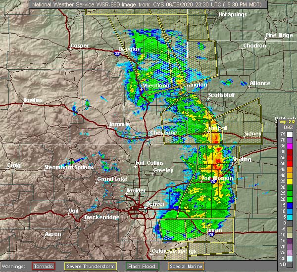 At 531 pm mdt, severe thunderstorms were located along a line extending from near torrington to 6 miles southeast of harrisburg, moving east at 70 mph (radar indicated). Hazards include 70 mph wind gusts. Expect considerable tree damage. Damage is likely to mobile homes, roofs, and outbuildings. At 531 pm mdt, severe thunderstorms were located along a line extending from near torrington to 6 miles southeast of harrisburg, moving east at 70 mph (radar indicated). Hazards include 70 mph wind gusts. Expect considerable tree damage. Damage is likely to mobile homes, roofs, and outbuildings.
|
| 6/6/2020 5:30 PM MDT | Power outage with trees blown down for much of torrington... w in goshen county WY, 0.6 miles SW of Torrington, WY |
| 6/6/2020 5:27 PM MDT | Power outag in goshen county WY, 0.4 miles SSE of Torrington, WY |
| 6/2/2020 7:38 PM MDT |
 At 738 pm mdt, a severe thunderstorm was located near lingle, or near torrington, moving northeast at 25 mph (radar indicated). Hazards include 60 mph wind gusts and half dollar size hail. Hail damage to vehicles is expected. expect wind damage to roofs, siding, and trees. Locations impacted include, torrington. At 738 pm mdt, a severe thunderstorm was located near lingle, or near torrington, moving northeast at 25 mph (radar indicated). Hazards include 60 mph wind gusts and half dollar size hail. Hail damage to vehicles is expected. expect wind damage to roofs, siding, and trees. Locations impacted include, torrington.
|
| 6/2/2020 7:37 PM MDT |
 At 737 pm mdt, a severe thunderstorm was located over huntley, or 10 miles south of torrington, moving northeast at 20 mph (trained weather spotters). Hazards include 60 mph wind gusts and half dollar size hail. Hail damage to vehicles is expected. expect wind damage to roofs, siding, and trees. Locations impacted include, torrington, morrill, lyman, huntley and henry. At 737 pm mdt, a severe thunderstorm was located over huntley, or 10 miles south of torrington, moving northeast at 20 mph (trained weather spotters). Hazards include 60 mph wind gusts and half dollar size hail. Hail damage to vehicles is expected. expect wind damage to roofs, siding, and trees. Locations impacted include, torrington, morrill, lyman, huntley and henry.
|
| 6/2/2020 7:32 PM MDT | Half Dollar sized hail reported 4.3 miles ENE of Torrington, WY |
| 6/2/2020 7:28 PM MDT |
 At 728 pm mdt, a severe thunderstorm was located near lingle, or near torrington, moving northeast at 25 mph (radar indicated). Hazards include 60 mph wind gusts and half dollar size hail. Hail damage to vehicles is expected. Expect wind damage to roofs, siding, and trees. At 728 pm mdt, a severe thunderstorm was located near lingle, or near torrington, moving northeast at 25 mph (radar indicated). Hazards include 60 mph wind gusts and half dollar size hail. Hail damage to vehicles is expected. Expect wind damage to roofs, siding, and trees.
|
| 6/2/2020 7:20 PM MDT |
 At 719 pm mdt, a severe thunderstorm was located near hawk springs, or 14 miles south of torrington, moving northeast at 20 mph (trained weather spotters). Hazards include 60 mph wind gusts and half dollar size hail. Hail damage to vehicles is expected. expect wind damage to roofs, siding, and trees. Locations impacted include, torrington, morrill, lyman, yoder, huntley and henry. At 719 pm mdt, a severe thunderstorm was located near hawk springs, or 14 miles south of torrington, moving northeast at 20 mph (trained weather spotters). Hazards include 60 mph wind gusts and half dollar size hail. Hail damage to vehicles is expected. expect wind damage to roofs, siding, and trees. Locations impacted include, torrington, morrill, lyman, yoder, huntley and henry.
|
| 6/2/2020 7:18 PM MDT | Half Dollar sized hail reported 9.5 miles NNW of Torrington, WY, half dollar sized hail caused shredded leaves to occur in the area. |
| 6/2/2020 6:59 PM MDT |
 At 659 pm mdt, a severe thunderstorm was located over hawk springs, or 21 miles south of torrington, moving northeast at 20 mph (radar indicated). Hazards include 60 mph wind gusts and half dollar size hail. Hail damage to vehicles is expected. Expect wind damage to roofs, siding, and trees. At 659 pm mdt, a severe thunderstorm was located over hawk springs, or 21 miles south of torrington, moving northeast at 20 mph (radar indicated). Hazards include 60 mph wind gusts and half dollar size hail. Hail damage to vehicles is expected. Expect wind damage to roofs, siding, and trees.
|
| 5/23/2020 3:51 PM MDT |
 At 351 pm mdt, a severe thunderstorm was located near lingle, or near torrington, moving northeast at 30 mph (radar indicated). Hazards include 60 mph wind gusts and quarter size hail. Hail damage to vehicles is expected. expect wind damage to roofs, siding, and trees. Locations impacted include, torrington, lingle, fort laramie, jay em, fort laramie national historic site and hwy 85 at dry rawhide creek. At 351 pm mdt, a severe thunderstorm was located near lingle, or near torrington, moving northeast at 30 mph (radar indicated). Hazards include 60 mph wind gusts and quarter size hail. Hail damage to vehicles is expected. expect wind damage to roofs, siding, and trees. Locations impacted include, torrington, lingle, fort laramie, jay em, fort laramie national historic site and hwy 85 at dry rawhide creek.
|
| 5/23/2020 3:35 PM MDT |
 At 335 pm mdt, a severe thunderstorm was located over veteran, or 10 miles southwest of torrington, moving northeast at 25 mph (radar indicated). Hazards include ping pong ball size hail and 60 mph wind gusts. People and animals outdoors will be injured. expect hail damage to roofs, siding, windows, and vehicles. Expect wind damage to roofs, siding, and trees. At 335 pm mdt, a severe thunderstorm was located over veteran, or 10 miles southwest of torrington, moving northeast at 25 mph (radar indicated). Hazards include ping pong ball size hail and 60 mph wind gusts. People and animals outdoors will be injured. expect hail damage to roofs, siding, windows, and vehicles. Expect wind damage to roofs, siding, and trees.
|
| 5/20/2020 6:06 PM MDT |
 At 606 pm mdt, severe thunderstorms were located along a line extending from 10 miles south of prairie center to 9 miles east of torrington, moving northeast at 25 mph (radar indicated). Hazards include 60 mph wind gusts and quarter size hail. Hail damage to vehicles is expected. expect wind damage to roofs, siding, and trees. Locations impacted include, torrington, prairie center and hwy 85 at dry rawhide creek. At 606 pm mdt, severe thunderstorms were located along a line extending from 10 miles south of prairie center to 9 miles east of torrington, moving northeast at 25 mph (radar indicated). Hazards include 60 mph wind gusts and quarter size hail. Hail damage to vehicles is expected. expect wind damage to roofs, siding, and trees. Locations impacted include, torrington, prairie center and hwy 85 at dry rawhide creek.
|
| 5/20/2020 5:45 PM MDT |
 At 545 pm mdt, severe thunderstorms were located along a line extending from 8 miles northeast of fort laramie to near lingle to near torrington, moving northeast at 25 mph (radar indicated). Hazards include 60 mph wind gusts and quarter size hail. Hail damage to vehicles is expected. Expect wind damage to roofs, siding, and trees. At 545 pm mdt, severe thunderstorms were located along a line extending from 8 miles northeast of fort laramie to near lingle to near torrington, moving northeast at 25 mph (radar indicated). Hazards include 60 mph wind gusts and quarter size hail. Hail damage to vehicles is expected. Expect wind damage to roofs, siding, and trees.
|
| 8/20/2019 10:23 PM MDT |
 At 1023 pm mdt, severe thunderstorms were located along a line extending from near chadron campground to near whitaker, moving northeast at 10 mph (radar indicated). Hazards include 70 mph wind gusts and quarter size hail. Hail damage to vehicles is expected. expect considerable tree damage. wind damage is also likely to mobile homes, roofs, and outbuildings. locations impacted include, scottsbluff, torrington, chadron, gering, mitchell, terrytown, morrill, minatare, hemingford, la grange, lyman, yoder, wildcat hills state recreation area, stegall, wildcat hills campground, hawk springs, box butte dam, hawk springs campground, hubbard hill and chadron campground. This includes interstate 25 in wyoming between mile markers 38 and 41. At 1023 pm mdt, severe thunderstorms were located along a line extending from near chadron campground to near whitaker, moving northeast at 10 mph (radar indicated). Hazards include 70 mph wind gusts and quarter size hail. Hail damage to vehicles is expected. expect considerable tree damage. wind damage is also likely to mobile homes, roofs, and outbuildings. locations impacted include, scottsbluff, torrington, chadron, gering, mitchell, terrytown, morrill, minatare, hemingford, la grange, lyman, yoder, wildcat hills state recreation area, stegall, wildcat hills campground, hawk springs, box butte dam, hawk springs campground, hubbard hill and chadron campground. This includes interstate 25 in wyoming between mile markers 38 and 41.
|
| 8/20/2019 10:07 PM MDT |
 At 1006 pm mdt, severe thunderstorms were located along a line extending from near chadron campground to near whitaker, moving northeast at 10 mph (radar indicated). Hazards include 70 mph wind gusts and quarter size hail. Hail damage to vehicles is expected. expect considerable tree damage. Wind damage is also likely to mobile homes, roofs, and outbuildings. At 1006 pm mdt, severe thunderstorms were located along a line extending from near chadron campground to near whitaker, moving northeast at 10 mph (radar indicated). Hazards include 70 mph wind gusts and quarter size hail. Hail damage to vehicles is expected. expect considerable tree damage. Wind damage is also likely to mobile homes, roofs, and outbuildings.
|
| 8/16/2019 1:11 AM MDT |
 The severe thunderstorm warning for southeastern goshen county will expire at 115 am mdt, the storm which prompted the warning has moved out of the area. therefore, the warning will be allowed to expire. a severe thunderstorm watch remains in effect until 500 am mdt for the panhandle of nebraska, and southeastern wyoming. The severe thunderstorm warning for southeastern goshen county will expire at 115 am mdt, the storm which prompted the warning has moved out of the area. therefore, the warning will be allowed to expire. a severe thunderstorm watch remains in effect until 500 am mdt for the panhandle of nebraska, and southeastern wyoming.
|
| 8/16/2019 1:02 AM MDT | Golf Ball sized hail reported 8.7 miles N of Torrington, WY |
| 8/16/2019 12:54 AM MDT | Quarter sized hail reported 7.7 miles NE of Torrington, WY |
| 8/16/2019 12:54 AM MDT | Golf Ball sized hail reported 7.9 miles NNE of Torrington, WY, intersection of hwy 85 and rd 54. |
| 8/16/2019 12:46 AM MDT |
 A severe thunderstorm warning remains in effect until 115 am mdt for southeastern goshen county. at 1245 am mdt, a severe thunderstorm was located near veteran, or near torrington, moving southeast at 45 mph. this storm has a history of producing large destructive hail! move to an interior room away from windows. Prepare now for large and possibly damaging. A severe thunderstorm warning remains in effect until 115 am mdt for southeastern goshen county. at 1245 am mdt, a severe thunderstorm was located near veteran, or near torrington, moving southeast at 45 mph. this storm has a history of producing large destructive hail! move to an interior room away from windows. Prepare now for large and possibly damaging.
|
| 8/16/2019 12:32 AM MDT |
 At 1231 am mdt, a severe thunderstorm was located near lingle, or 10 miles west of torrington, moving east at 45 mph (radar indicated). Hazards include 60 mph wind gusts and half dollar size hail. Hail damage to vehicles is expected. expect wind damage to roofs, siding, and trees. Locations impacted include, torrington, lingle, fort laramie, yoder, huntley, fort laramie national historic site, veteran and henry. At 1231 am mdt, a severe thunderstorm was located near lingle, or 10 miles west of torrington, moving east at 45 mph (radar indicated). Hazards include 60 mph wind gusts and half dollar size hail. Hail damage to vehicles is expected. expect wind damage to roofs, siding, and trees. Locations impacted include, torrington, lingle, fort laramie, yoder, huntley, fort laramie national historic site, veteran and henry.
|
| 8/16/2019 12:13 AM MDT |
 At 1213 am mdt, a severe thunderstorm was located near grayrocks reservoir, or 17 miles northeast of wheatland, moving east at 45 mph (radar indicated). Hazards include golf ball size hail and 60 mph wind gusts. People and animals outdoors will be injured. expect hail damage to roofs, siding, windows, and vehicles. Expect wind damage to roofs, siding, and trees. At 1213 am mdt, a severe thunderstorm was located near grayrocks reservoir, or 17 miles northeast of wheatland, moving east at 45 mph (radar indicated). Hazards include golf ball size hail and 60 mph wind gusts. People and animals outdoors will be injured. expect hail damage to roofs, siding, windows, and vehicles. Expect wind damage to roofs, siding, and trees.
|
| 8/15/2019 11:50 PM MDT | Quarter sized hail reported 29.4 miles S of Torrington, WY |
| 8/15/2019 4:34 PM MDT |
 At 433 pm mdt, a severe thunderstorm was located near veteran, or 14 miles west of torrington, moving southeast at 40 mph (radar indicated). Hazards include 60 mph wind gusts and quarter size hail. Hail damage to vehicles is expected. expect wind damage to roofs, siding, and trees. Locations impacted include, yoder, huntley, veteran, hawk springs and henry. At 433 pm mdt, a severe thunderstorm was located near veteran, or 14 miles west of torrington, moving southeast at 40 mph (radar indicated). Hazards include 60 mph wind gusts and quarter size hail. Hail damage to vehicles is expected. expect wind damage to roofs, siding, and trees. Locations impacted include, yoder, huntley, veteran, hawk springs and henry.
|
| 8/15/2019 4:23 PM MDT |
 At 422 pm mdt, a severe thunderstorm was located 9 miles southeast of grayrocks reservoir, or 19 miles east of wheatland, moving southeast at 40 mph (radar indicated). Hazards include 60 mph wind gusts and quarter size hail. Hail damage to vehicles is expected. Expect wind damage to roofs, siding, and trees. At 422 pm mdt, a severe thunderstorm was located 9 miles southeast of grayrocks reservoir, or 19 miles east of wheatland, moving southeast at 40 mph (radar indicated). Hazards include 60 mph wind gusts and quarter size hail. Hail damage to vehicles is expected. Expect wind damage to roofs, siding, and trees.
|
| 8/15/2019 3:06 PM MDT | Hen Egg sized hail reported 13.8 miles SSW of Torrington, WY, 2 inch hail observed by storm chaser. |
| 8/15/2019 2:34 PM MDT | Quarter sized hail reported 23.2 miles S of Torrington, WY |
| 7/15/2019 6:16 PM MDT | Storm damage reported in goshen county WY, 6.2 miles SE of Torrington, WY |
| 7/15/2019 6:14 PM MDT |
 At 614 pm mdt, severe thunderstorms were located along a line extending from lingle to torrington, moving northeast at 30 mph (radar indicated). Hazards include 60 mph wind gusts and quarter size hail. Hail damage to vehicles is expected. Expect wind damage to roofs, siding, and trees. At 614 pm mdt, severe thunderstorms were located along a line extending from lingle to torrington, moving northeast at 30 mph (radar indicated). Hazards include 60 mph wind gusts and quarter size hail. Hail damage to vehicles is expected. Expect wind damage to roofs, siding, and trees.
|
| 7/5/2019 6:08 PM MDT |
 The severe thunderstorm warning for east central goshen county will expire at 615 pm mdt, the storm which prompted the warning has weakened below severe limits, and no longer poses an immediate threat to life or property. therefore, the warning will be allowed to expire. however small hail and gusty winds are still possible with this thunderstorm. a severe thunderstorm watch remains in effect until 900 pm mdt for the panhandle of nebraska, and southeastern wyoming. to report severe weather, contact your nearest law enforcement agency. they will relay your report to the national weather service cheyenne. The severe thunderstorm warning for east central goshen county will expire at 615 pm mdt, the storm which prompted the warning has weakened below severe limits, and no longer poses an immediate threat to life or property. therefore, the warning will be allowed to expire. however small hail and gusty winds are still possible with this thunderstorm. a severe thunderstorm watch remains in effect until 900 pm mdt for the panhandle of nebraska, and southeastern wyoming. to report severe weather, contact your nearest law enforcement agency. they will relay your report to the national weather service cheyenne.
|
| 7/5/2019 6:02 PM MDT |
 At 602 pm mdt, a severe thunderstorm was located near torrington, moving east at 25 mph (radar indicated). Hazards include 60 mph wind gusts and quarter size hail. Hail damage to vehicles is expected. expect wind damage to roofs, siding, and trees. Locations impacted include, torrington. At 602 pm mdt, a severe thunderstorm was located near torrington, moving east at 25 mph (radar indicated). Hazards include 60 mph wind gusts and quarter size hail. Hail damage to vehicles is expected. expect wind damage to roofs, siding, and trees. Locations impacted include, torrington.
|
| 7/5/2019 5:49 PM MDT |
 At 548 pm mdt, a severe thunderstorm was located over torrington, moving southeast at 30 mph (emergency management. this storm has a history of producing very large destructive hail near lingle). Hazards include two inch hail and 60 mph wind gusts. People and animals outdoors will be injured. expect hail damage to roofs, siding, windows, and vehicles. expect wind damage to roofs, siding, and trees. Locations impacted include, torrington and huntley. At 548 pm mdt, a severe thunderstorm was located over torrington, moving southeast at 30 mph (emergency management. this storm has a history of producing very large destructive hail near lingle). Hazards include two inch hail and 60 mph wind gusts. People and animals outdoors will be injured. expect hail damage to roofs, siding, windows, and vehicles. expect wind damage to roofs, siding, and trees. Locations impacted include, torrington and huntley.
|
| 7/5/2019 5:33 PM MDT |
 At 531 pm mdt, a severe thunderstorm was located over lingle, or 8 miles northwest of torrington, moving east at 25 mph (emergency management. hail larger than two inches in diameter has been confirmed in the lingle area with this storm). Hazards include tennis ball size hail and 60 mph wind gusts. People and animals outdoors will be injured. expect hail damage to roofs, siding, windows, and vehicles. expect wind damage to roofs, siding, and trees. Locations impacted include, torrington, lingle and huntley. At 531 pm mdt, a severe thunderstorm was located over lingle, or 8 miles northwest of torrington, moving east at 25 mph (emergency management. hail larger than two inches in diameter has been confirmed in the lingle area with this storm). Hazards include tennis ball size hail and 60 mph wind gusts. People and animals outdoors will be injured. expect hail damage to roofs, siding, windows, and vehicles. expect wind damage to roofs, siding, and trees. Locations impacted include, torrington, lingle and huntley.
|
| 7/5/2019 5:24 PM MDT |
 At 524 pm mdt, a severe thunderstorm was located over lingle, or 12 miles northwest of torrington, moving southeast at 25 mph (radar indicated). Hazards include two inch hail and 60 mph wind gusts. People and animals outdoors will be injured. expect hail damage to roofs, siding, windows, and vehicles. Expect wind damage to roofs, siding, and trees. At 524 pm mdt, a severe thunderstorm was located over lingle, or 12 miles northwest of torrington, moving southeast at 25 mph (radar indicated). Hazards include two inch hail and 60 mph wind gusts. People and animals outdoors will be injured. expect hail damage to roofs, siding, windows, and vehicles. Expect wind damage to roofs, siding, and trees.
|
| 7/2/2019 6:43 PM MDT |
 At 642 pm mdt, severe thunderstorms were located along a line extending from near veteran to near hawk springs, moving northeast at 20 mph. at 638 pm mdt, emergency manager reported quarter size hail 1 mile southwest of yoder (emergency management). Hazards include 60 mph wind gusts and quarter size hail. Hail damage to vehicles is expected. expect wind damage to roofs, siding, and trees. Locations impacted include, torrington, yoder, huntley, hawk springs campground, hawk springs recreation area, veteran and hawk springs. At 642 pm mdt, severe thunderstorms were located along a line extending from near veteran to near hawk springs, moving northeast at 20 mph. at 638 pm mdt, emergency manager reported quarter size hail 1 mile southwest of yoder (emergency management). Hazards include 60 mph wind gusts and quarter size hail. Hail damage to vehicles is expected. expect wind damage to roofs, siding, and trees. Locations impacted include, torrington, yoder, huntley, hawk springs campground, hawk springs recreation area, veteran and hawk springs.
|
| 7/2/2019 6:33 PM MDT |
 At 633 pm mdt, severe thunderstorms were located along a line extending from near veteran to 7 miles southwest of hawk springs, moving northeast at 20 mph (radar indicated). Hazards include 60 mph wind gusts and quarter size hail. Hail damage to vehicles is expected. Expect wind damage to roofs, siding, and trees. At 633 pm mdt, severe thunderstorms were located along a line extending from near veteran to 7 miles southwest of hawk springs, moving northeast at 20 mph (radar indicated). Hazards include 60 mph wind gusts and quarter size hail. Hail damage to vehicles is expected. Expect wind damage to roofs, siding, and trees.
|
| 7/2/2019 6:25 PM MDT |
 The severe thunderstorm warning for central goshen county will expire at 630 pm mdt, the storm which prompted the warning has weakened below severe limits, and no longer poses an immediate threat to life or property. therefore, the warning will be allowed to expire. however small hail and gusty winds are still possible with this thunderstorm. The severe thunderstorm warning for central goshen county will expire at 630 pm mdt, the storm which prompted the warning has weakened below severe limits, and no longer poses an immediate threat to life or property. therefore, the warning will be allowed to expire. however small hail and gusty winds are still possible with this thunderstorm.
|
| 7/2/2019 6:09 PM MDT |
 At 607 pm mdt, a severe thunderstorm was located near lingle, or 11 miles west of torrington, moving northeast at 25 mph. at 607 pm mdt, emergency manager reported quarter size hail 9 miles southwest of lingle (emergency management). Hazards include 60 mph wind gusts and quarter size hail. Hail damage to vehicles is expected. expect wind damage to roofs, siding, and trees. Locations impacted include, torrington, lingle and veteran. At 607 pm mdt, a severe thunderstorm was located near lingle, or 11 miles west of torrington, moving northeast at 25 mph. at 607 pm mdt, emergency manager reported quarter size hail 9 miles southwest of lingle (emergency management). Hazards include 60 mph wind gusts and quarter size hail. Hail damage to vehicles is expected. expect wind damage to roofs, siding, and trees. Locations impacted include, torrington, lingle and veteran.
|
| 7/2/2019 5:52 PM MDT |
 At 550 pm mdt, severe thunderstorms were located along a line extending from near fort laramie to 7 miles northwest of veteran, moving northeast at 25 mph. at 548 pm mdt, emergency manager reported quarter size hail 10 miles west-northwest of veteran (emergency management). Hazards include 60 mph wind gusts and quarter size hail. Hail damage to vehicles is expected. expect wind damage to roofs, siding, and trees. Locations impacted include, torrington, lingle, fort laramie, veteran, fort laramie national historic site and hwy 85 at dry rawhide creek. At 550 pm mdt, severe thunderstorms were located along a line extending from near fort laramie to 7 miles northwest of veteran, moving northeast at 25 mph. at 548 pm mdt, emergency manager reported quarter size hail 10 miles west-northwest of veteran (emergency management). Hazards include 60 mph wind gusts and quarter size hail. Hail damage to vehicles is expected. expect wind damage to roofs, siding, and trees. Locations impacted include, torrington, lingle, fort laramie, veteran, fort laramie national historic site and hwy 85 at dry rawhide creek.
|
| 7/2/2019 5:44 PM MDT |
 At 543 pm mdt, severe thunderstorms were located along a line extending from fort laramie to 7 miles west of veteran, moving northeast at 25 mph (radar indicated). Hazards include 60 mph wind gusts and quarter size hail. Hail damage to vehicles is expected. Expect wind damage to roofs, siding, and trees. At 543 pm mdt, severe thunderstorms were located along a line extending from fort laramie to 7 miles west of veteran, moving northeast at 25 mph (radar indicated). Hazards include 60 mph wind gusts and quarter size hail. Hail damage to vehicles is expected. Expect wind damage to roofs, siding, and trees.
|
| 7/1/2019 7:03 PM MDT |
 At 703 pm mdt, a severe thunderstorm was located 13 miles northeast of torrington, moving southeast at 30 mph (radar indicated). Hazards include 60 mph wind gusts and half dollar size hail. Hail damage to vehicles is expected. expect wind damage to roofs, siding, and trees. This severe thunderstorm will remain over mainly rural areas of southwestern sioux and east central goshen counties. At 703 pm mdt, a severe thunderstorm was located 13 miles northeast of torrington, moving southeast at 30 mph (radar indicated). Hazards include 60 mph wind gusts and half dollar size hail. Hail damage to vehicles is expected. expect wind damage to roofs, siding, and trees. This severe thunderstorm will remain over mainly rural areas of southwestern sioux and east central goshen counties.
|
| 7/1/2019 7:00 PM MDT | Alsop mesonet sit in goshen county WY, 10.9 miles SSW of Torrington, WY |
| 7/1/2019 6:48 PM MDT |
 At 647 pm mdt, a severe thunderstorm was located 15 miles north of torrington, moving southeast at 30 mph (radar indicated). Hazards include 60 mph wind gusts and quarter size hail. Hail damage to vehicles is expected. expect wind damage to roofs, siding, and trees. This severe thunderstorm will remain over mainly rural areas of southwestern sioux and east central goshen counties. At 647 pm mdt, a severe thunderstorm was located 15 miles north of torrington, moving southeast at 30 mph (radar indicated). Hazards include 60 mph wind gusts and quarter size hail. Hail damage to vehicles is expected. expect wind damage to roofs, siding, and trees. This severe thunderstorm will remain over mainly rural areas of southwestern sioux and east central goshen counties.
|
| 7/1/2019 6:28 PM MDT |
 At 627 pm mdt, a severe thunderstorm was located 9 miles south of prairie center, or 21 miles north of torrington, moving southeast at 30 mph (radar indicated). Hazards include ping pong ball size hail and 60 mph wind gusts. People and animals outdoors will be injured. expect hail damage to roofs, siding, windows, and vehicles. expect wind damage to roofs, siding, and trees. This severe thunderstorm will remain over mainly rural areas of southwestern sioux and northeastern goshen counties. At 627 pm mdt, a severe thunderstorm was located 9 miles south of prairie center, or 21 miles north of torrington, moving southeast at 30 mph (radar indicated). Hazards include ping pong ball size hail and 60 mph wind gusts. People and animals outdoors will be injured. expect hail damage to roofs, siding, windows, and vehicles. expect wind damage to roofs, siding, and trees. This severe thunderstorm will remain over mainly rural areas of southwestern sioux and northeastern goshen counties.
|
| 7/1/2019 6:17 PM MDT | Quarter sized hail reported 29.6 miles S of Torrington, WY |
| 6/30/2019 8:00 PM MDT |
 At 800 pm mdt, severe thunderstorms were located along a line extending from 8 miles northeast of fort laramie to near lingle to yoder, moving northeast at 30 mph (radar indicated). Hazards include 60 mph wind gusts and quarter size hail. Hail damage to vehicles is expected. expect wind damage to roofs, siding, and trees. Locations impacted include, torrington, lingle, yoder, huntley, hawk springs and hwy 85 at dry rawhide creek. At 800 pm mdt, severe thunderstorms were located along a line extending from 8 miles northeast of fort laramie to near lingle to yoder, moving northeast at 30 mph (radar indicated). Hazards include 60 mph wind gusts and quarter size hail. Hail damage to vehicles is expected. expect wind damage to roofs, siding, and trees. Locations impacted include, torrington, lingle, yoder, huntley, hawk springs and hwy 85 at dry rawhide creek.
|
| 6/30/2019 8:00 PM MDT |
 At 746 pm mdt, severe thunderstorms were located along a line extending from near fort laramie to near lingle to near yoder, moving northeast at 25 mph (radar indicated). Hazards include 60 mph wind gusts and nickel size hail. expect damage to roofs, siding, and trees At 746 pm mdt, severe thunderstorms were located along a line extending from near fort laramie to near lingle to near yoder, moving northeast at 25 mph (radar indicated). Hazards include 60 mph wind gusts and nickel size hail. expect damage to roofs, siding, and trees
|
| 6/30/2019 7:46 PM MDT |
 The national weather service in cheyenne has issued a * severe thunderstorm warning for. southwestern sioux county in the panhandle of nebraska. central goshen county in southeastern wyoming. until 815 pm mdt. At 746 pm mdt, severe thunderstorms were located along a line. The national weather service in cheyenne has issued a * severe thunderstorm warning for. southwestern sioux county in the panhandle of nebraska. central goshen county in southeastern wyoming. until 815 pm mdt. At 746 pm mdt, severe thunderstorms were located along a line.
|
| 6/26/2019 4:49 PM MDT |
 At 448 pm mdt, a severe thunderstorm was located near lyman, or 12 miles south of torrington, moving northeast at 25 mph (radar indicated). Hazards include 60 mph wind gusts and quarter size hail. Hail damage to vehicles is expected. expect wind damage to roofs, siding, and trees. Locations impacted include, morrill, lyman, huntley and henry. At 448 pm mdt, a severe thunderstorm was located near lyman, or 12 miles south of torrington, moving northeast at 25 mph (radar indicated). Hazards include 60 mph wind gusts and quarter size hail. Hail damage to vehicles is expected. expect wind damage to roofs, siding, and trees. Locations impacted include, morrill, lyman, huntley and henry.
|
| 6/26/2019 4:28 PM MDT |
 At 428 pm mdt, a severe thunderstorm was located near hawk springs, or 16 miles south of torrington, moving north at 25 mph (radar indicated). Hazards include 60 mph wind gusts and quarter size hail. Hail damage to vehicles is expected. Expect wind damage to roofs, siding, and trees. At 428 pm mdt, a severe thunderstorm was located near hawk springs, or 16 miles south of torrington, moving north at 25 mph (radar indicated). Hazards include 60 mph wind gusts and quarter size hail. Hail damage to vehicles is expected. Expect wind damage to roofs, siding, and trees.
|
| 1/1/0001 12:00 AM | Asos station ktor torrington airpor in goshen county WY, 1.5 miles W of Torrington, WY |
| 6/25/2019 4:09 PM MDT |
 At 352 pm mdt, a severe thunderstorm was located near torrington, moving northeast at 35 mph (radar indicated). Hazards include 60 mph wind gusts and quarter size hail. Hail damage to vehicles is expected. Expect wind damage to roofs, siding, and trees. At 352 pm mdt, a severe thunderstorm was located near torrington, moving northeast at 35 mph (radar indicated). Hazards include 60 mph wind gusts and quarter size hail. Hail damage to vehicles is expected. Expect wind damage to roofs, siding, and trees.
|
| 6/25/2019 4:03 PM MDT | Ping Pong Ball sized hail reported 1 miles WNW of Torrington, WY, torrington airport reported hail between 1.25 and 1.50 inches in diameter. |
| 6/25/2019 3:53 PM MDT |
 At 352 pm mdt, a severe thunderstorm was located near torrington, moving northeast at 35 mph (radar indicated). Hazards include 60 mph wind gusts and quarter size hail. Hail damage to vehicles is expected. Expect wind damage to roofs, siding, and trees. At 352 pm mdt, a severe thunderstorm was located near torrington, moving northeast at 35 mph (radar indicated). Hazards include 60 mph wind gusts and quarter size hail. Hail damage to vehicles is expected. Expect wind damage to roofs, siding, and trees.
|
| 6/7/2019 3:05 PM MDT |
 The severe thunderstorm warning for southeastern goshen county will expire at 315 pm mdt, the storms which prompted the warning have moved out of the area. therefore, the warning will be allowed to expire. The severe thunderstorm warning for southeastern goshen county will expire at 315 pm mdt, the storms which prompted the warning have moved out of the area. therefore, the warning will be allowed to expire.
|
| 6/7/2019 2:47 PM MDT |
 At 246 pm mdt, severe thunderstorms were located along a line extending from yoder to near hawk springs campground, moving northeast at 25 mph (radar indicated). Hazards include 60 mph wind gusts and quarter size hail. Hail damage to vehicles is expected. expect wind damage to roofs, siding, and trees. these severe storms will be near, huntley around 300 pm mdt. Torrington around 310 pm mdt. At 246 pm mdt, severe thunderstorms were located along a line extending from yoder to near hawk springs campground, moving northeast at 25 mph (radar indicated). Hazards include 60 mph wind gusts and quarter size hail. Hail damage to vehicles is expected. expect wind damage to roofs, siding, and trees. these severe storms will be near, huntley around 300 pm mdt. Torrington around 310 pm mdt.
|
| 6/7/2019 2:37 PM MDT |
 At 237 pm mdt, a severe thunderstorm was located over hawk springs, or 17 miles south of torrington, moving northeast at 25 mph (radar indicated). Hazards include 60 mph wind gusts and quarter size hail. Hail damage to vehicles is expected. expect wind damage to roofs, siding, and trees. this severe thunderstorm will be near, yoder around 250 pm mdt. Huntley around 305 pm mdt. At 237 pm mdt, a severe thunderstorm was located over hawk springs, or 17 miles south of torrington, moving northeast at 25 mph (radar indicated). Hazards include 60 mph wind gusts and quarter size hail. Hail damage to vehicles is expected. expect wind damage to roofs, siding, and trees. this severe thunderstorm will be near, yoder around 250 pm mdt. Huntley around 305 pm mdt.
|
| 4/26/2019 3:41 PM MDT |
 The severe thunderstorm warning for northwestern scotts bluff, southwestern sioux and east central goshen counties will expire at 345 pm mdt, the storm which prompted the warning has moved out of the area. therefore, the warning will be allowed to expire. however gusty winds and heavy rain are still possible with this thunderstorm. The severe thunderstorm warning for northwestern scotts bluff, southwestern sioux and east central goshen counties will expire at 345 pm mdt, the storm which prompted the warning has moved out of the area. therefore, the warning will be allowed to expire. however gusty winds and heavy rain are still possible with this thunderstorm.
|
| 4/26/2019 3:15 PM MDT |
 At 313 pm mdt, a severe thunderstorm was located near torrington, moving east at 50 mph. this is a very dangerous storm (trained weather spotters). Hazards include 80 mph wind gusts were reported just north of yoder. Flying debris will be dangerous to those caught without shelter. mobile homes will be heavily damaged. expect considerable damage to roofs, windows, and vehicles. extensive tree damage and power outages are likely. Locations impacted include, torrington, morrill, lyman, yoder, huntley, stegall, veteran and henry. At 313 pm mdt, a severe thunderstorm was located near torrington, moving east at 50 mph. this is a very dangerous storm (trained weather spotters). Hazards include 80 mph wind gusts were reported just north of yoder. Flying debris will be dangerous to those caught without shelter. mobile homes will be heavily damaged. expect considerable damage to roofs, windows, and vehicles. extensive tree damage and power outages are likely. Locations impacted include, torrington, morrill, lyman, yoder, huntley, stegall, veteran and henry.
|
| 4/26/2019 2:54 PM MDT |
 At 253 pm mdt, a severe thunderstorm was located 11 miles northwest of veteran, or 19 miles west of torrington, moving east at 55 mph (radar indicated). Hazards include 60 mph wind gusts and penny size hail. expect damage to roofs, siding, and trees At 253 pm mdt, a severe thunderstorm was located 11 miles northwest of veteran, or 19 miles west of torrington, moving east at 55 mph (radar indicated). Hazards include 60 mph wind gusts and penny size hail. expect damage to roofs, siding, and trees
|
| 7/29/2018 5:21 PM MDT |
 The severe thunderstorm warning for southwestern sioux and east central goshen counties will expire at 530 pm mdt, the severe thunderstorm which prompted the warning has weakened. therefore, the warning will be allowed to expire. however small hail is still possible with this thunderstorm. a tornado watch remains in effect until 900 pm mdt for the panhandle of nebraska, and southeastern wyoming. The severe thunderstorm warning for southwestern sioux and east central goshen counties will expire at 530 pm mdt, the severe thunderstorm which prompted the warning has weakened. therefore, the warning will be allowed to expire. however small hail is still possible with this thunderstorm. a tornado watch remains in effect until 900 pm mdt for the panhandle of nebraska, and southeastern wyoming.
|
| 7/29/2018 5:15 PM MDT |
 At 515 pm mdt, a severe thunderstorm was located 11 miles northeast of torrington, moving southeast at 45 mph (radar indicated). Hazards include 60 mph wind gusts and quarter size hail. Hail damage to vehicles is expected. expect wind damage to roofs, siding, and trees. this severe thunderstorm will remain over mainly rural areas of southwestern sioux and east central goshen counties. A tornado watch remains in effect until 900 pm mdt for the panhandle of nebraska, and southeastern wyoming. At 515 pm mdt, a severe thunderstorm was located 11 miles northeast of torrington, moving southeast at 45 mph (radar indicated). Hazards include 60 mph wind gusts and quarter size hail. Hail damage to vehicles is expected. expect wind damage to roofs, siding, and trees. this severe thunderstorm will remain over mainly rural areas of southwestern sioux and east central goshen counties. A tornado watch remains in effect until 900 pm mdt for the panhandle of nebraska, and southeastern wyoming.
|
| 7/29/2018 4:56 PM MDT |
 At 456 pm mdt, a severe thunderstorm was located 12 miles south of prairie center, or 18 miles north of torrington, moving southeast at 45 mph (radar indicated). Hazards include 60 mph wind gusts and quarter size hail. Hail damage to vehicles is expected. expect wind damage to roofs, siding, and trees. this severe thunderstorm will remain over mainly rural areas of southwestern sioux and east central goshen counties. A tornado watch remains in effect until 900 pm mdt for the panhandle of nebraska, and southeastern wyoming. At 456 pm mdt, a severe thunderstorm was located 12 miles south of prairie center, or 18 miles north of torrington, moving southeast at 45 mph (radar indicated). Hazards include 60 mph wind gusts and quarter size hail. Hail damage to vehicles is expected. expect wind damage to roofs, siding, and trees. this severe thunderstorm will remain over mainly rural areas of southwestern sioux and east central goshen counties. A tornado watch remains in effect until 900 pm mdt for the panhandle of nebraska, and southeastern wyoming.
|
| 7/27/2018 10:46 AM MDT |
 At 1045 am mdt, a severe thunderstorm was located over torrington, moving east at 25 mph (radar indicated). Hazards include quarter size hail. damage to vehicles is expected At 1045 am mdt, a severe thunderstorm was located over torrington, moving east at 25 mph (radar indicated). Hazards include quarter size hail. damage to vehicles is expected
|
| 6/22/2018 5:45 PM MDT |
 At 545 pm mdt, a severe thunderstorm was located near huntley, or 14 miles south of torrington, moving southeast at 25 mph (radar indicated). Hazards include ping pong ball size hail and 60 mph wind gusts. People and animals outdoors will be injured. expect hail damage to roofs, siding, windows, and vehicles. Expect wind damage to roofs, siding, and trees. At 545 pm mdt, a severe thunderstorm was located near huntley, or 14 miles south of torrington, moving southeast at 25 mph (radar indicated). Hazards include ping pong ball size hail and 60 mph wind gusts. People and animals outdoors will be injured. expect hail damage to roofs, siding, windows, and vehicles. Expect wind damage to roofs, siding, and trees.
|
| 6/7/2018 4:54 PM MDT |
 At 453 pm mdt, a severe thunderstorm was located near torrington, moving northeast at 30 mph (radar indicated). Hazards include 60 mph wind gusts and half dollar size hail. Hail damage to vehicles is expected. expect wind damage to roofs, siding, and trees. Locations impacted include, torrington, morrill, lyman, yoder, huntley, veteran and henry. At 453 pm mdt, a severe thunderstorm was located near torrington, moving northeast at 30 mph (radar indicated). Hazards include 60 mph wind gusts and half dollar size hail. Hail damage to vehicles is expected. expect wind damage to roofs, siding, and trees. Locations impacted include, torrington, morrill, lyman, yoder, huntley, veteran and henry.
|
| 6/7/2018 4:36 PM MDT |
 At 435 pm mdt, a severe thunderstorm was located over yoder, or 13 miles southwest of torrington, moving northeast at 30 mph (radar indicated). Hazards include 60 mph wind gusts and half dollar size hail. Hail damage to vehicles is expected. Expect wind damage to roofs, siding, and trees. At 435 pm mdt, a severe thunderstorm was located over yoder, or 13 miles southwest of torrington, moving northeast at 30 mph (radar indicated). Hazards include 60 mph wind gusts and half dollar size hail. Hail damage to vehicles is expected. Expect wind damage to roofs, siding, and trees.
|
| 4/29/2018 7:02 PM MDT | A shed was tossed into a pasture near cr 80 and van tassell rd north of torrington. a wall was blown in at a shop in the 3700 block of buttermilk rd. peak wind gust at in goshen county WY, 6.2 miles SE of Torrington, WY |
| 7/27/2017 10:24 PM MDT |
 At 1023 pm mdt, a severe thunderstorm was located 7 miles east of torrington, moving southeast at 35 mph (emergency management. at 115 pm emergency management reported power lines down in fort laramie). Hazards include 70 mph wind gusts and nickel size hail. Expect considerable tree damage. Damage is likely to mobile homes, roofs, and outbuildings. At 1023 pm mdt, a severe thunderstorm was located 7 miles east of torrington, moving southeast at 35 mph (emergency management. at 115 pm emergency management reported power lines down in fort laramie). Hazards include 70 mph wind gusts and nickel size hail. Expect considerable tree damage. Damage is likely to mobile homes, roofs, and outbuildings.
|
| 7/27/2017 4:47 PM MDT | Reports of roof damage to buildings and overturned pivots south of torrington and east of veteran. estimated gusts between 75 to 90 mph as the thunderstorm moved throug in goshen county WY, 6.5 miles N of Torrington, WY |
| 7/27/2017 4:46 PM MDT |
 At 446 pm mdt, a severe thunderstorm was located near huntley, or near torrington, moving east at 25 mph (radar indicated). Hazards include 70 mph wind gusts and nickel size hail. Expect considerable tree damage. Damage is likely to mobile homes, roofs, and outbuildings. At 446 pm mdt, a severe thunderstorm was located near huntley, or near torrington, moving east at 25 mph (radar indicated). Hazards include 70 mph wind gusts and nickel size hail. Expect considerable tree damage. Damage is likely to mobile homes, roofs, and outbuildings.
|
| 7/2/2017 8:32 PM MDT |
 At 832 pm mdt, a severe thunderstorm was located near veteran, or 7 miles southwest of torrington, moving northeast at 15 mph (radar indicated). Hazards include half dollar size hail. damage to vehicles is expected At 832 pm mdt, a severe thunderstorm was located near veteran, or 7 miles southwest of torrington, moving northeast at 15 mph (radar indicated). Hazards include half dollar size hail. damage to vehicles is expected
|
| 6/12/2017 5:26 PM MDT | Baseball sized hail reported 22.5 miles S of Torrington, WY, golf ball to baseball. |
| 6/7/2017 8:15 PM MDT | Estimated 65 mph winds damaged wind equipment near prairie center school. wind-driven quarter size hail totaled alfalfa cro in goshen county WY, 2.2 miles WSW of Torrington, WY |
| 6/7/2017 7:58 PM MDT |
 At 757 pm mdt, a severe thunderstorm was located 7 miles north of torrington, moving south at 20 mph (radar indicated. at 747 pm mdt...quarter size hail was reported 11 miles north northeast of torrington). Hazards include 60 mph wind gusts and quarter size hail. Hail damage to vehicles is expected. expect wind damage to roofs, siding, and trees. This severe storm will be near, torrington around 815 pm mdt. At 757 pm mdt, a severe thunderstorm was located 7 miles north of torrington, moving south at 20 mph (radar indicated. at 747 pm mdt...quarter size hail was reported 11 miles north northeast of torrington). Hazards include 60 mph wind gusts and quarter size hail. Hail damage to vehicles is expected. expect wind damage to roofs, siding, and trees. This severe storm will be near, torrington around 815 pm mdt.
|
| 6/7/2017 7:47 PM MDT | Quarter sized hail reported 10.8 miles SSW of Torrington, WY |
| 6/7/2017 7:36 PM MDT |
 At 736 pm mdt, a severe thunderstorm was located 13 miles northeast of lingle, or 14 miles north of torrington, moving south at 25 mph (radar indicated). Hazards include ping pong ball size hail and 60 mph wind gusts. People and animals outdoors will be injured. expect hail damage to roofs, siding, windows, and vehicles. expect wind damage to roofs, siding, and trees. this severe storm will be near, lingle around 805 pm mdt. torrington around 805 pm mdt. Other locations impacted by this severe thunderstorm include hwy 85 at dry rawhide creek. At 736 pm mdt, a severe thunderstorm was located 13 miles northeast of lingle, or 14 miles north of torrington, moving south at 25 mph (radar indicated). Hazards include ping pong ball size hail and 60 mph wind gusts. People and animals outdoors will be injured. expect hail damage to roofs, siding, windows, and vehicles. expect wind damage to roofs, siding, and trees. this severe storm will be near, lingle around 805 pm mdt. torrington around 805 pm mdt. Other locations impacted by this severe thunderstorm include hwy 85 at dry rawhide creek.
|
| 6/7/2017 7:17 PM MDT |
 At 717 pm mdt, a severe thunderstorm was located 9 miles south of prairie center, or 21 miles north of torrington, moving south at 25 mph (radar indicated). Hazards include 60 mph wind gusts and half dollar size hail. Hail damage to vehicles is expected. expect wind damage to roofs, siding, and trees. this severe thunderstorm will be near, torrington and lingle around 800 pm mdt. Other locations impacted by this severe thunderstorm include hwy 85 at dry rawhide creek. At 717 pm mdt, a severe thunderstorm was located 9 miles south of prairie center, or 21 miles north of torrington, moving south at 25 mph (radar indicated). Hazards include 60 mph wind gusts and half dollar size hail. Hail damage to vehicles is expected. expect wind damage to roofs, siding, and trees. this severe thunderstorm will be near, torrington and lingle around 800 pm mdt. Other locations impacted by this severe thunderstorm include hwy 85 at dry rawhide creek.
|
| 5/31/2017 6:22 PM MDT |
 The severe thunderstorm warning for northwestern scotts bluff, southwestern sioux and east central goshen counties will expire at 630 pm mdt, the storm which prompted the warning has weakened below severe limits, and no longer poses an immediate threat to life or property. therefore the warning will be allowed to expire. however small hail is still possible with this thunderstorm. The severe thunderstorm warning for northwestern scotts bluff, southwestern sioux and east central goshen counties will expire at 630 pm mdt, the storm which prompted the warning has weakened below severe limits, and no longer poses an immediate threat to life or property. therefore the warning will be allowed to expire. however small hail is still possible with this thunderstorm.
|
| 5/31/2017 6:09 PM MDT |
 At 608 pm mdt, a severe thunderstorm was located east of torrington, moving northeast at 20 mph (radar indicated). Hazards include 60 mph wind gusts and quarter size hail. Hail damage to vehicles is expected. expect wind damage to roofs, siding, and trees. Locations impacted include, morrill and henry. At 608 pm mdt, a severe thunderstorm was located east of torrington, moving northeast at 20 mph (radar indicated). Hazards include 60 mph wind gusts and quarter size hail. Hail damage to vehicles is expected. expect wind damage to roofs, siding, and trees. Locations impacted include, morrill and henry.
|
| 5/31/2017 5:55 PM MDT |
 At 554 pm mdt, a severe thunderstorm was located near torrington, moving northeast at 20 mph (radar indicated). Hazards include 60 mph wind gusts and quarter size hail. Hail damage to vehicles is expected. expect wind damage to roofs, siding, and trees. This severe thunderstorm will remain over mainly rural areas of northwestern scotts bluff, southwestern sioux and east central goshen counties, including the following locations: henry. At 554 pm mdt, a severe thunderstorm was located near torrington, moving northeast at 20 mph (radar indicated). Hazards include 60 mph wind gusts and quarter size hail. Hail damage to vehicles is expected. expect wind damage to roofs, siding, and trees. This severe thunderstorm will remain over mainly rural areas of northwestern scotts bluff, southwestern sioux and east central goshen counties, including the following locations: henry.
|
| 5/15/2017 5:40 PM MDT | Quarter sized hail reported 11.4 miles NE of Torrington, WY, hail up to two inches deep covering the ground. |
| 5/15/2017 5:40 PM MDT | Hen Egg sized hail reported 11.4 miles NE of Torrington, WY |
| 10/3/2016 12:57 PM MDT | Quarter sized hail reported 0.4 miles SSE of Torrington, WY |
| 10/3/2016 12:56 PM MDT |
 At 1256 pm mdt, a severe thunderstorm was located near torrington, moving northeast at 35 mph (radar indicated). Hazards include 60 mph wind gusts and quarter size hail. Hail damage to vehicles is expected. expect wind damage to roofs, siding, and trees. This severe thunderstorm will be near, agate bed national monument around 145 pm mdt. At 1256 pm mdt, a severe thunderstorm was located near torrington, moving northeast at 35 mph (radar indicated). Hazards include 60 mph wind gusts and quarter size hail. Hail damage to vehicles is expected. expect wind damage to roofs, siding, and trees. This severe thunderstorm will be near, agate bed national monument around 145 pm mdt.
|
| 10/3/2016 12:55 PM MDT | Quarter sized hail reported 0.4 miles SSE of Torrington, WY |
| 7/27/2016 9:41 PM MDT | The severe thunderstorm warning for southwestern sioux and central goshen counties will expire at 945 pm mdt, the storm which prompted the warning has moved out of the area. therefore the warning will be allowed to expire. however small hail and gusty winds are still possible with this thunderstorm. remember, a severe thunderstorm warning still remains in effect for the southeast portion and goshen county until 1015 pm. |
| 7/27/2016 9:41 PM MDT | The severe thunderstorm warning for southwestern sioux and central goshen counties will expire at 945 pm mdt, the storm which prompted the warning has moved out of the area. therefore the warning will be allowed to expire. however small hail and gusty winds are still possible with this thunderstorm. remember, a severe thunderstorm warning still remains in effect for the southeast portion and goshen county until 1015 pm. |
| 7/27/2016 9:37 PM MDT |
 At 936 pm mdt, a severe thunderstorm was located near veteran, or 7 miles west of torrington, moving southeast at 30 mph (radar indicated. 4 miles southwest of lingle reported golf ball size hail). Hazards include tennis ball size hail and 70 mph wind gusts. People and animals outdoors will be injured. expect hail damage to roofs, siding, windows, and vehicles. expect considerable tree damage. Wind damage is also likely to mobile homes, roofs, and outbuildings. At 936 pm mdt, a severe thunderstorm was located near veteran, or 7 miles west of torrington, moving southeast at 30 mph (radar indicated. 4 miles southwest of lingle reported golf ball size hail). Hazards include tennis ball size hail and 70 mph wind gusts. People and animals outdoors will be injured. expect hail damage to roofs, siding, windows, and vehicles. expect considerable tree damage. Wind damage is also likely to mobile homes, roofs, and outbuildings.
|
| 7/27/2016 9:28 PM MDT |
 At 925 pm mdt, a severe thunderstorm was located near lingle, or near torrington, moving southeast at 35 mph. this is a very dangerous storm. lingle reported ping pong ball size hail (radar indicated). Hazards include 80 mph wind gusts and tennis ball size hail. the worst part of the storm will be west of torrington. torrington may experience 60 mph winds and quarter size hail. frequent lightning is also expected. Flying debris will be dangerous to those caught without shelter. mobile homes will be heavily damaged. expect considerable damage to roofs, windows, and vehicles. extensive tree damage and power outages are likely. Locations impacted include, torrington, lingle and hwy 85 at dry rawhide creek. At 925 pm mdt, a severe thunderstorm was located near lingle, or near torrington, moving southeast at 35 mph. this is a very dangerous storm. lingle reported ping pong ball size hail (radar indicated). Hazards include 80 mph wind gusts and tennis ball size hail. the worst part of the storm will be west of torrington. torrington may experience 60 mph winds and quarter size hail. frequent lightning is also expected. Flying debris will be dangerous to those caught without shelter. mobile homes will be heavily damaged. expect considerable damage to roofs, windows, and vehicles. extensive tree damage and power outages are likely. Locations impacted include, torrington, lingle and hwy 85 at dry rawhide creek.
|
| 7/27/2016 9:08 PM MDT |
 At 907 pm mdt, a severe thunderstorm was located 7 miles northeast of fort laramie, or 20 miles northwest of torrington, moving southeast at 30 mph. this is a very dangerous storm (radar indicated). Hazards include 80 mph wind gusts and tennis ball size hail. Flying debris will be dangerous to those caught without shelter. mobile homes will be heavily damaged. expect considerable damage to roofs, windows, and vehicles. Extensive tree damage and power outages are likely. At 907 pm mdt, a severe thunderstorm was located 7 miles northeast of fort laramie, or 20 miles northwest of torrington, moving southeast at 30 mph. this is a very dangerous storm (radar indicated). Hazards include 80 mph wind gusts and tennis ball size hail. Flying debris will be dangerous to those caught without shelter. mobile homes will be heavily damaged. expect considerable damage to roofs, windows, and vehicles. Extensive tree damage and power outages are likely.
|
| 7/24/2016 3:32 PM MDT |
 At 332 pm mdt, a severe thunderstorm was located near hawk springs recreation area, or 21 miles south of torrington, moving northeast at 35 mph (radar indicated). Hazards include quarter size hail. Damage to vehicles is expected. this severe storm will be near, lyman around 350 pm mdt. morrill around 400 pm mdt. Other locations impacted by this severe thunderstorm include henry. At 332 pm mdt, a severe thunderstorm was located near hawk springs recreation area, or 21 miles south of torrington, moving northeast at 35 mph (radar indicated). Hazards include quarter size hail. Damage to vehicles is expected. this severe storm will be near, lyman around 350 pm mdt. morrill around 400 pm mdt. Other locations impacted by this severe thunderstorm include henry.
|
| 7/24/2016 3:15 PM MDT |
 At 314 pm mdt, a severe thunderstorm was located near hawk springs recreation area, or 25 miles south of torrington, moving north at 35 mph (radar indicated). Hazards include quarter size hail. Damage to vehicles is expected. this severe thunderstorm will be near, hawk springs around 325 pm mdt. yoder around 340 pm mdt. lyman and huntley around 345 pm mdt. torrington around 405 pm mdt. Other locations impacted by this severe thunderstorm include henry. At 314 pm mdt, a severe thunderstorm was located near hawk springs recreation area, or 25 miles south of torrington, moving north at 35 mph (radar indicated). Hazards include quarter size hail. Damage to vehicles is expected. this severe thunderstorm will be near, hawk springs around 325 pm mdt. yoder around 340 pm mdt. lyman and huntley around 345 pm mdt. torrington around 405 pm mdt. Other locations impacted by this severe thunderstorm include henry.
|
| 7/24/2016 3:06 PM MDT | Ping Pong Ball sized hail reported 10.5 miles NNW of Torrington, WY, report received via twitter along with picture. |
| 6/28/2016 5:27 PM MDT | Storm damage reported in goshen county WY, 0.4 miles SSE of Torrington, WY |
| 6/28/2016 5:15 PM MDT |
 At 515 pm mdt, a severe thunderstorm was located over yoder, or 9 miles southwest of torrington, moving east at 25 mph (radar indicated). Hazards include 60 mph wind gusts and quarter size hail. Hail damage to vehicles is possible. expect wind damage to roofs, siding, and trees. Locations impacted include, torrington, yoder, veteran and huntley. At 515 pm mdt, a severe thunderstorm was located over yoder, or 9 miles southwest of torrington, moving east at 25 mph (radar indicated). Hazards include 60 mph wind gusts and quarter size hail. Hail damage to vehicles is possible. expect wind damage to roofs, siding, and trees. Locations impacted include, torrington, yoder, veteran and huntley.
|
| 6/28/2016 4:59 PM MDT |
 At 459 pm mdt, a severe thunderstorm was located near veteran, or 14 miles southwest of torrington, moving northeast at 30 mph (radar indicated). Hazards include 70 mph wind gusts and half dollar size hail. Hail damage to vehicles is expected. expect considerable tree damage. Wind damage is also likely to mobile homes, roofs, and outbuildings. At 459 pm mdt, a severe thunderstorm was located near veteran, or 14 miles southwest of torrington, moving northeast at 30 mph (radar indicated). Hazards include 70 mph wind gusts and half dollar size hail. Hail damage to vehicles is expected. expect considerable tree damage. Wind damage is also likely to mobile homes, roofs, and outbuildings.
|
| 6/12/2016 6:08 PM MDT |
 The severe thunderstorm warning for southwestern sioux and east central goshen counties will expire at 615 pm mdt, the storm which prompted the warning has weakened below severe limits, and no longer pose an immediate threat to life or property. therefore the warning will be allowed to expire. however heavy rain is still possible with this thunderstorm. to report severe weather, contact your nearest law enforcement agency. they will relay your report to the national weather service cheyenne. The severe thunderstorm warning for southwestern sioux and east central goshen counties will expire at 615 pm mdt, the storm which prompted the warning has weakened below severe limits, and no longer pose an immediate threat to life or property. therefore the warning will be allowed to expire. however heavy rain is still possible with this thunderstorm. to report severe weather, contact your nearest law enforcement agency. they will relay your report to the national weather service cheyenne.
|
| 6/12/2016 5:52 PM MDT |
 At 551 pm mdt, a severe thunderstorm was located near torrington, moving northeast at 10 mph (radar indicated). Hazards include 60 mph wind gusts and nickel size hail. a downburst wind gust of 63mph was reported at the torrington airport. Expect damage to roofs. siding. and trees. Locations impacted include, torrington. At 551 pm mdt, a severe thunderstorm was located near torrington, moving northeast at 10 mph (radar indicated). Hazards include 60 mph wind gusts and nickel size hail. a downburst wind gust of 63mph was reported at the torrington airport. Expect damage to roofs. siding. and trees. Locations impacted include, torrington.
|
| 6/12/2016 5:45 PM MDT | Quarter sized hail reported 2.5 miles S of Torrington, WY, heavy rain and hail nickel to quarter size. |
| 6/12/2016 5:40 PM MDT |
 At 540 pm mdt, a severe thunderstorm was located near torrington, moving northeast at 15 mph (radar indicated). Hazards include 60 mph wind gusts and nickel size hail. Expect damage to roofs. siding. And trees. At 540 pm mdt, a severe thunderstorm was located near torrington, moving northeast at 15 mph (radar indicated). Hazards include 60 mph wind gusts and nickel size hail. Expect damage to roofs. siding. And trees.
|
| 6/12/2016 5:31 PM MDT | Storm damage reported in goshen county WY, 0.4 miles SSE of Torrington, WY |
| 5/6/2016 8:37 PM MDT |
 The severe thunderstorm warning for central goshen county will expire at 845 pm mdt, the storms which prompted the warning have weakened below severe limits, and no longer pose an immediate threat to life or property. therefore the warning will be allowed to expire. The severe thunderstorm warning for central goshen county will expire at 845 pm mdt, the storms which prompted the warning have weakened below severe limits, and no longer pose an immediate threat to life or property. therefore the warning will be allowed to expire.
|
| 5/6/2016 8:27 PM MDT |
 At 826 pm mdt, severe thunderstorms were located along a line extending from near fort laramie national historic site to 6 miles north of lyman, moving north at 25 mph (radar indicated). Hazards include 60 mph wind gusts and quarter size hail. Hail damage to vehicles is expected. expect wind damage to roofs, siding, and trees. these severe storms will be near, fort laramie around 830 pm mdt. Other locations impacted by these severe thunderstorms include hwy 85 at dry rawhide creek. At 826 pm mdt, severe thunderstorms were located along a line extending from near fort laramie national historic site to 6 miles north of lyman, moving north at 25 mph (radar indicated). Hazards include 60 mph wind gusts and quarter size hail. Hail damage to vehicles is expected. expect wind damage to roofs, siding, and trees. these severe storms will be near, fort laramie around 830 pm mdt. Other locations impacted by these severe thunderstorms include hwy 85 at dry rawhide creek.
|
| 5/6/2016 8:00 PM MDT |
 At 800 pm mdt, severe thunderstorms were located along a line extending from 7 miles southeast of grayrocks reservoir to near lyman, moving north at 15 mph (radar indicated). Hazards include 60 mph wind gusts and quarter size hail. Hail damage to vehicles is expected. expect wind damage to roofs, siding, and trees. these severe storms will be near, fort laramie national historic site around 830 pm mdt. fort laramie around 835 pm mdt. torrington around 845 pm mdt. Other locations impacted by these severe thunderstorms include hwy 85 at dry rawhide creek. At 800 pm mdt, severe thunderstorms were located along a line extending from 7 miles southeast of grayrocks reservoir to near lyman, moving north at 15 mph (radar indicated). Hazards include 60 mph wind gusts and quarter size hail. Hail damage to vehicles is expected. expect wind damage to roofs, siding, and trees. these severe storms will be near, fort laramie national historic site around 830 pm mdt. fort laramie around 835 pm mdt. torrington around 845 pm mdt. Other locations impacted by these severe thunderstorms include hwy 85 at dry rawhide creek.
|
| 5/6/2016 7:42 PM MDT |
 At 742 pm mdt, a severe thunderstorm was located over yoder, or 12 miles southwest of torrington, moving north at 30 mph (radar indicated). Hazards include 60 mph wind gusts and quarter size hail. Hail damage to vehicles is expected. Expect wind damage to roofs, siding, and trees. At 742 pm mdt, a severe thunderstorm was located over yoder, or 12 miles southwest of torrington, moving north at 30 mph (radar indicated). Hazards include 60 mph wind gusts and quarter size hail. Hail damage to vehicles is expected. Expect wind damage to roofs, siding, and trees.
|
| 9/29/2015 6:13 PM MDT |
 At 613 pm mdt, a severe thunderstorm was located 7 miles north of torrington, moving east at 35 mph (radar indicated). Hazards include ping pong ball size hail and 60 mph wind gusts. People and animals outdoors will be injured. expect hail damage to roofs, siding, windows and vehicles. expect wind damage to roofs, siding and trees. Locations impacted include, torrington. At 613 pm mdt, a severe thunderstorm was located 7 miles north of torrington, moving east at 35 mph (radar indicated). Hazards include ping pong ball size hail and 60 mph wind gusts. People and animals outdoors will be injured. expect hail damage to roofs, siding, windows and vehicles. expect wind damage to roofs, siding and trees. Locations impacted include, torrington.
|
| 9/29/2015 6:02 PM MDT |
 At 602 pm mdt, a severe thunderstorm was located near lingle, or 7 miles northwest of torrington, moving east at 35 mph (radar indicated). Hazards include 60 mph wind gusts and quarter size hail. Hail damage to vehicles is expected. Expect wind damage to roofs, siding and trees. At 602 pm mdt, a severe thunderstorm was located near lingle, or 7 miles northwest of torrington, moving east at 35 mph (radar indicated). Hazards include 60 mph wind gusts and quarter size hail. Hail damage to vehicles is expected. Expect wind damage to roofs, siding and trees.
|
| 8/17/2015 11:19 PM MDT |
 At 1119 pm mdt, severe thunderstorms were located along a line extending from near agate bed national monument to huntley, moving east at 25 mph (radar indicated). Hazards include quarter size hail. Damage to vehicles is expected. Locations impacted include, torrington, yoder, veteran, agate bed national monument, huntley and henry. At 1119 pm mdt, severe thunderstorms were located along a line extending from near agate bed national monument to huntley, moving east at 25 mph (radar indicated). Hazards include quarter size hail. Damage to vehicles is expected. Locations impacted include, torrington, yoder, veteran, agate bed national monument, huntley and henry.
|
| 8/17/2015 11:01 PM MDT |
 At 1101 pm mdt, severe thunderstorms were located along a line extending from 7 miles west of whitney lake to near veteran, moving east at 35 mph (radar indicated). Hazards include 60 mph wind gusts and quarter size hail. Hail damage to vehicles is expected. expect wind damage to roofs, siding and trees. Locations impacted include, torrington, crawford, yoder, whitney lake, fort robinson campground, veteran, agate bed national monument, huntley, henry, whitney and fort robinson. At 1101 pm mdt, severe thunderstorms were located along a line extending from 7 miles west of whitney lake to near veteran, moving east at 35 mph (radar indicated). Hazards include 60 mph wind gusts and quarter size hail. Hail damage to vehicles is expected. expect wind damage to roofs, siding and trees. Locations impacted include, torrington, crawford, yoder, whitney lake, fort robinson campground, veteran, agate bed national monument, huntley, henry, whitney and fort robinson.
|
| 8/17/2015 10:46 PM MDT |
 At 1046 pm mdt, severe thunderstorms were located along a line extending from montrose to 12 miles west of veteran, moving southeast at 25 mph (radar indicated). Hazards include ping pong ball size hail and 60 mph wind gusts. People and animals outdoors will be injured. expect hail damage to roofs, siding, windows and vehicles. Expect wind damage to roofs, siding and trees. At 1046 pm mdt, severe thunderstorms were located along a line extending from montrose to 12 miles west of veteran, moving southeast at 25 mph (radar indicated). Hazards include ping pong ball size hail and 60 mph wind gusts. People and animals outdoors will be injured. expect hail damage to roofs, siding, windows and vehicles. Expect wind damage to roofs, siding and trees.
|
| 6/17/2015 6:07 PM MDT |
 The severe thunderstorm warning for northwestern scotts bluff and southeastern goshen counties will expire at 615 pm mdt, the storm which prompted the warning has moved out of the area. therefore the warning will be allowed to expire. remember, a severe thunderstorm warning still remains in effect for far eastern goshen county east of torrington. The severe thunderstorm warning for northwestern scotts bluff and southeastern goshen counties will expire at 615 pm mdt, the storm which prompted the warning has moved out of the area. therefore the warning will be allowed to expire. remember, a severe thunderstorm warning still remains in effect for far eastern goshen county east of torrington.
|
| 6/17/2015 5:50 PM MDT | Ping Pong Ball sized hail reported 10.9 miles NNW of Torrington, WY |
| 6/17/2015 5:39 PM MDT |
 At 539 pm mdt, a severe thunderstorm was located over yoder, or 14 miles southwest of torrington, moving northeast at 30 mph (public). Hazards include ping pong size hail and 60 mph wind gusts. People and animals outdoors will be injured. expect hail damage to roofs, siding, windows and vehicles. Expect wind damage to roofs, siding and trees. At 539 pm mdt, a severe thunderstorm was located over yoder, or 14 miles southwest of torrington, moving northeast at 30 mph (public). Hazards include ping pong size hail and 60 mph wind gusts. People and animals outdoors will be injured. expect hail damage to roofs, siding, windows and vehicles. Expect wind damage to roofs, siding and trees.
|
| 6/16/2015 6:09 PM MDT |
 At 608 pm mdt, severe thunderstorms were located along a line extending from near morrill to huntley, moving southeast at 20 mph (trained weather spotters). Hazards include golf ball size hail and 60 mph wind gusts. People and animals outdoors will be injured. expect hail damage to roofs, siding, windows and vehicles. expect wind damage to roofs, siding and trees. Locations impacted include, morrill, lyman, huntley, stegall and henry. At 608 pm mdt, severe thunderstorms were located along a line extending from near morrill to huntley, moving southeast at 20 mph (trained weather spotters). Hazards include golf ball size hail and 60 mph wind gusts. People and animals outdoors will be injured. expect hail damage to roofs, siding, windows and vehicles. expect wind damage to roofs, siding and trees. Locations impacted include, morrill, lyman, huntley, stegall and henry.
|
| 6/16/2015 5:54 PM MDT |
 At 553 pm mdt, severe thunderstorms were located along a line extending from 12 miles north of morrill to near yoder, moving southeast at 25 mph (trained weather spotters. golf ball sized hail was reported in torrington with this storm). Hazards include golf ball size hail and 60 mph wind gusts. People and animals outdoors will be injured. expect hail damage to roofs, siding, windows and vehicles. expect wind damage to roofs, siding and trees. Locations impacted include, torrington, morrill, lyman, huntley, stegall and henry. At 553 pm mdt, severe thunderstorms were located along a line extending from 12 miles north of morrill to near yoder, moving southeast at 25 mph (trained weather spotters. golf ball sized hail was reported in torrington with this storm). Hazards include golf ball size hail and 60 mph wind gusts. People and animals outdoors will be injured. expect hail damage to roofs, siding, windows and vehicles. expect wind damage to roofs, siding and trees. Locations impacted include, torrington, morrill, lyman, huntley, stegall and henry.
|
| 6/16/2015 5:53 PM MDT | Golf Ball sized hail reported 0.4 miles SSE of Torrington, WY |
| 6/16/2015 5:48 PM MDT | Measured at airpor in goshen county WY, 0.4 miles SSE of Torrington, WY |
| 6/16/2015 5:39 PM MDT |
 At 539 pm mdt, a severe thunderstorm was located near torrington, moving southeast at 20 mph (radar indicated). Hazards include golf ball size hail and 60 mph wind gusts. People and animals outdoors will be injured. expect hail damage to roofs, siding, windows and vehicles. Expect wind damage to roofs, siding and trees. At 539 pm mdt, a severe thunderstorm was located near torrington, moving southeast at 20 mph (radar indicated). Hazards include golf ball size hail and 60 mph wind gusts. People and animals outdoors will be injured. expect hail damage to roofs, siding, windows and vehicles. Expect wind damage to roofs, siding and trees.
|
| 6/16/2015 4:56 PM MDT | Golf Ball sized hail reported 0.4 miles SSE of Torrington, WY |
| 6/16/2015 3:59 PM MDT |
 At 358 pm mdt, a severe thunderstorm was located 8 miles northwest of veteran, or 16 miles west of torrington, moving southeast at 25 mph (radar indicated. this storm has a history of producing large destructive hail). Hazards include golf ball size hail and 60 mph wind gusts. People and animals outdoors will be injured. expect hail damage to roofs, siding, windows and vehicles. Expect wind damage to roofs, siding and trees. At 358 pm mdt, a severe thunderstorm was located 8 miles northwest of veteran, or 16 miles west of torrington, moving southeast at 25 mph (radar indicated. this storm has a history of producing large destructive hail). Hazards include golf ball size hail and 60 mph wind gusts. People and animals outdoors will be injured. expect hail damage to roofs, siding, windows and vehicles. Expect wind damage to roofs, siding and trees.
|
| 6/5/2015 8:08 PM MDT | At 806 pm mdt, a severe thunderstorm was located near torrington, moving north at 20 mph (trained weather spotters. at 800 pm mdt...trained weather spotters reported quarter sized hail on the east side of torrington with this storm). Hazards include quarter size hail and 60 mph wind gusts. Hail damage to vehicles is expected. expect wind damage to roofs, siding and trees. Locations impacted include, torrington. |
| 6/5/2015 8:08 PM MDT | At 806 pm mdt, a severe thunderstorm was located near torrington, moving north at 20 mph (trained weather spotters. at 800 pm mdt...trained weather spotters reported quarter sized hail on the east side of torrington with this storm). Hazards include quarter size hail and 60 mph wind gusts. Hail damage to vehicles is expected. expect wind damage to roofs, siding and trees. Locations impacted include, torrington. |
| 6/5/2015 8:00 PM MDT | Quarter sized hail reported 0.6 miles SW of Torrington, WY, nickel to quarter size hail for a few minutes |
| 6/5/2015 7:56 PM MDT | At 756 pm mdt, a severe thunderstorm was located over torrington, moving north at 15 mph (radar indicated). Hazards include quarter size hail. damage to vehicles is expected |
| 6/5/2015 7:56 PM MDT | At 756 pm mdt, a severe thunderstorm was located over torrington, moving north at 15 mph (radar indicated). Hazards include quarter size hail. damage to vehicles is expected |
| 5/15/2015 4:00 PM MDT | At 359 pm mdt, a tornado producing storm was located near torrington, moving northeast at 30 mph (emergency management confirmed tornado). Hazards include damaging tornado and quarter size hail. Flying debris will be dangerous to those caught without shelter. mobile homes will be damaged or destroyed. damage to roofs, windows and vehicles will occur. tree damage is likely. this tornadic thunderstorm will remain over mainly rural areas of southwestern sioux and east central goshen counties. this replaces the previous tornado warning issued for goshen county. Observed. |
| 5/15/2015 4:00 PM MDT | The national weather service in cheyenne has issued a * tornado warning for. southwestern sioux county in the panhandle of nebraska. east central goshen county in southeastern wyoming. until 445 pm mdt * at 359 pm mdt. A tornado producing storm was located near. |
| 5/15/2015 3:48 PM MDT | At 347 pm mdt, a confirmed tornado was located near torrington, moving north at 30 mph (emergency management confirmed tornado). Hazards include damaging tornado and quarter size hail. Flying debris will be dangerous to those caught without shelter. mobile homes will be damaged or destroyed. damage to roofs, windows and vehicles will occur. tree damage is likely. this tornado will be near, torrington around 400 pm mdt. lingle around 405 pm mdt. Observed. |
| 5/15/2015 3:44 PM MDT | At 343 pm mdt, a severe thunderstorm capable of producing a tornado was located near yoder, or near torrington, moving north at 30 mph (radar indicated rotation). Hazards include tornado and quarter size hail. Flying debris will be dangerous to those caught without shelter. mobile homes will be damaged or destroyed. damage to roofs, windows and vehicles will occur. tree damage is likely. this dangerous storm will be near, torrington around 400 pm mdt. Radar indicated. |
| 5/15/2015 3:32 PM MDT | At 332 pm mdt, a severe thunderstorm capable of producing a tornado was located over yoder, or 11 miles south of torrington, moving north at 30 mph (radar indicated rotation). Hazards include tornado and quarter size hail. Flying debris will be dangerous to those caught without shelter. mobile homes will be damaged or destroyed. damage to roofs, windows and vehicles will occur. Tree damage is likely. |
| 5/15/2015 3:18 PM MDT | At 317 pm mdt, a severe thunderstorm was located near yoder, or 15 miles south of torrington, moving north at 45 mph (radar indicated). Hazards include quarter size hail and 60 mph wind gusts. Hail damage to vehicles is expected. expect wind damage to roofs, siding and trees. this severe thunderstorm will be near, huntley around 325 pm mdt. veteran around 330 pm mdt. torrington around 340 pm mdt. lingle around 345 pm mdt. other locations impacted by this severe thunderstorm include hwy 85 at dry rawhide creek. a tornado watch remains in effect until 800 pm mdt for southeastern wyoming. 1. 00in. |
| 6/3/2014 4:53 PM MDT | Tennis Ball sized hail reported 0.4 miles SSE of Torrington, WY, hail ranged from dime size to tennis ball size. |
| 6/3/2014 4:17 PM MDT | Ping Pong Ball sized hail reported 3.2 miles E of Torrington, WY |
| 6/3/2014 4:15 PM MDT | Golf Ball sized hail reported 3.2 miles E of Torrington, WY |
| 6/3/2014 4:15 PM MDT | Hen Egg sized hail reported 0.4 miles SSE of Torrington, WY |
| 6/3/2014 4:15 PM MDT | Golf Ball sized hail reported 0.4 miles SSE of Torrington, WY, many reports of windows knocked out of houses and windshields out of cars in the torrington area. |
| 6/3/2014 4:15 PM MDT | Tennis Ball sized hail reported 0.4 miles SSE of Torrington, WY, hail ranged from dime size to tennis ball size. |
| 6/3/2014 4:12 PM MDT | Quarter sized hail reported 3.2 miles E of Torrington, WY |
| 5/20/2014 4:25 PM MDT | Quarter sized hail reported 0.4 miles SSE of Torrington, WY |
| 4/26/2014 7:34 PM MDT | Quarter sized hail reported 29.4 miles S of Torrington, WY, some of the hail was pea size. most was penny to quarter size. |
| 4/26/2014 7:18 PM MDT | Quarter sized hail reported 29.4 miles S of Torrington, WY, hail ranged from dime size to quarter size. the observer called just after the hail ended. |
| 7/31/2013 5:24 PM MDT | Quarter sized hail reported 8.6 miles NNW of Torrington, WY |
| 6/21/2013 6:34 PM MDT | Quarter sized hail reported 0.4 miles SSE of Torrington, WY |
| 6/21/2013 6:32 PM MDT | Ping Pong Ball sized hail reported 0.4 miles SSE of Torrington, WY, 1 block east of the college. |
| 6/21/2013 6:32 PM MDT | Golf Ball sized hail reported 0.4 miles SSE of Torrington, WY |
| 6/21/2013 6:28 PM MDT | Golf Ball sized hail reported 0.4 miles SSE of Torrington, WY |
| 6/21/2013 6:16 PM MDT | Baseball sized hail reported 4.6 miles S of Torrington, WY, golfball to baseball sized hail reported by spotters north of torrington |
| 6/18/2013 5:37 PM MDT | Quarter sized hail reported 11.4 miles NE of Torrington, WY |
| 6/10/2013 3:11 PM MDT | Storm damage reported in goshen county WY, 1.7 miles NW of Torrington, WY |
| 5/28/2013 4:40 PM MDT | Golf Ball sized hail reported 5.9 miles S of Torrington, WY, peas to golf balls. wind gusts 40 mph. |
| 7/5/2012 8:35 PM MDT | Saw a flagpole that was bent in hal in goshen county WY, 3 miles W of Torrington, WY |
| 7/5/2012 8:10 PM MDT | Storm damage reported in goshen county WY, 0.4 miles SSE of Torrington, WY |
| 7/5/2012 8:10 PM MDT | Reports of some areas of power outag in goshen county WY, 0.4 miles SSE of Torrington, WY |
| 6/19/2012 10:48 PM MDT | Ping Pong Ball sized hail reported 0.4 miles SSE of Torrington, WY |
| 6/19/2012 10:40 PM MDT | Quarter sized hail reported 0.4 miles SSE of Torrington, WY |
| 6/19/2012 10:30 PM MDT | Storm damage reported in goshen county WY, 0.4 miles SSE of Torrington, WY |
| 1/1/0001 12:00 AM | Quarter sized hail reported 7.7 miles NE of Torrington, WY |
| 1/1/0001 12:00 AM | Hen Egg sized hail reported 8.6 miles NNW of Torrington, WY, from cocorahs observer |
| 1/1/0001 12:00 AM | Half Dollar sized hail reported 1 miles N of Torrington, WY |
| 1/1/0001 12:00 AM | Storm damage reported in goshen county WY, 0.4 miles SSE of Torrington, WY |
| 1/1/0001 12:00 AM | Quarter sized hail reported 0.4 miles SSE of Torrington, WY |
| 1/1/0001 12:00 AM | Quarter sized hail reported 0.4 miles SSE of Torrington, WY |
| 1/1/0001 12:00 AM | Hen Egg sized hail reported 0.4 miles SSE of Torrington, WY |
| 1/1/0001 12:00 AM | Golf Ball sized hail reported 0.4 miles SSE of Torrington, WY, near port of entry area |
| 1/1/0001 12:00 AM | Torrington airport measured a wind gust to 60 mph. sustained winds were recorded at 44 mp in goshen county WY, 0.4 miles SSE of Torrington, WY |
| 1/1/0001 12:00 AM | Quarter sized hail reported 2.5 miles S of Torrington, WY |
| 1/1/0001 12:00 AM | Quarter sized hail reported 10.4 miles NNW of Torrington, WY |
| 1/1/0001 12:00 AM | Quarter sized hail reported 7.7 miles NE of Torrington, WY |
| 1/1/0001 12:00 AM | Golf Ball sized hail reported 29.4 miles S of Torrington, WY, hail ranges from pea to golfball. |
Hail Maps for Torrington, WY
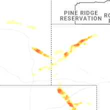


Connect with Interactive Hail Maps