

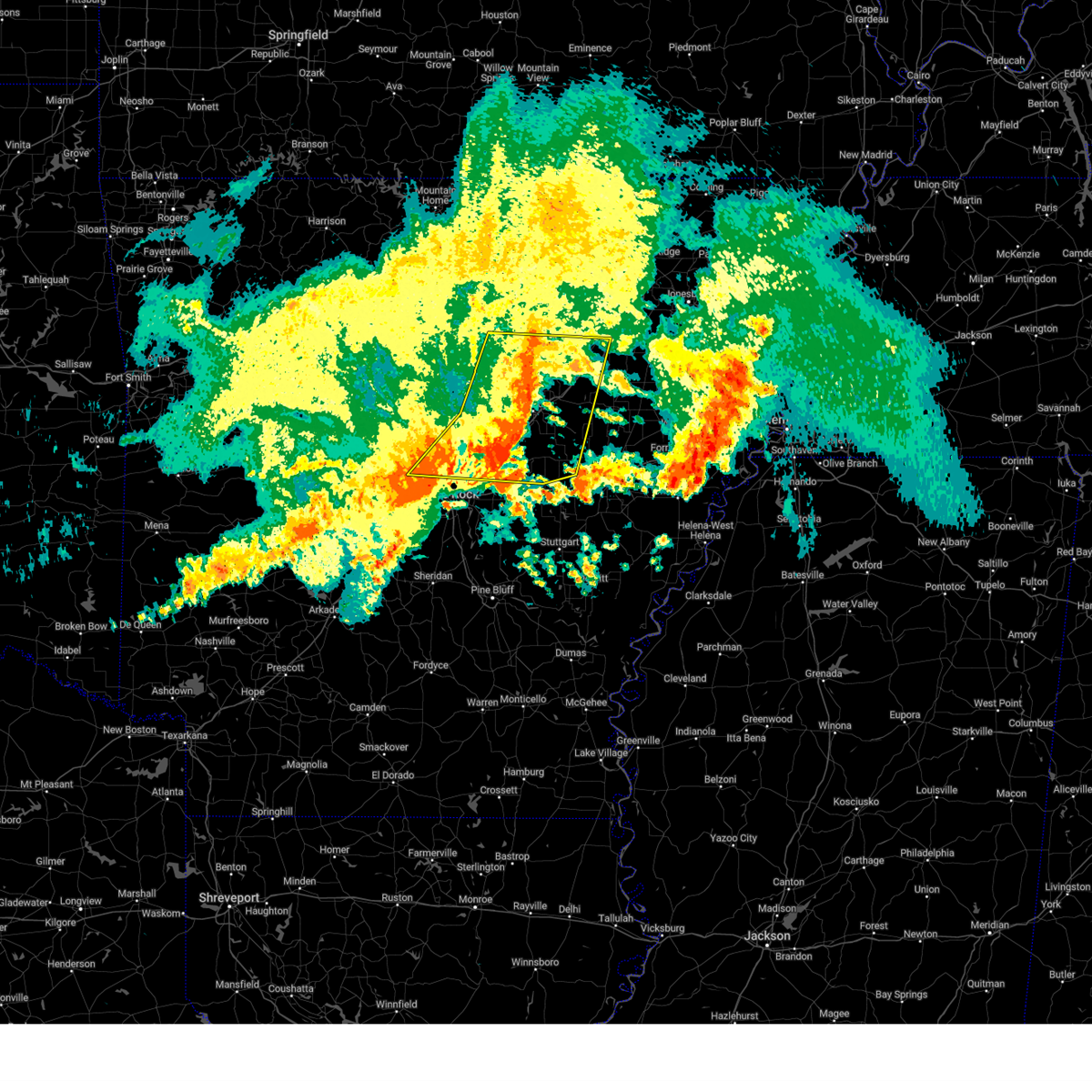
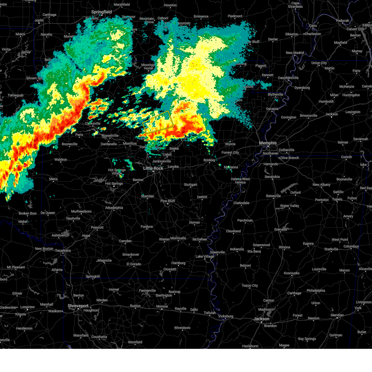
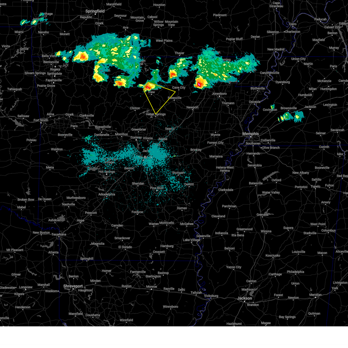
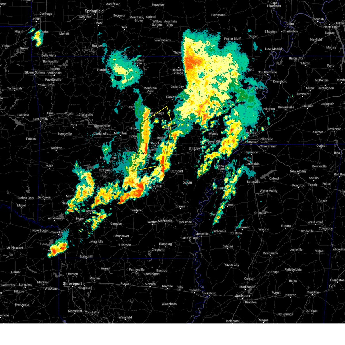
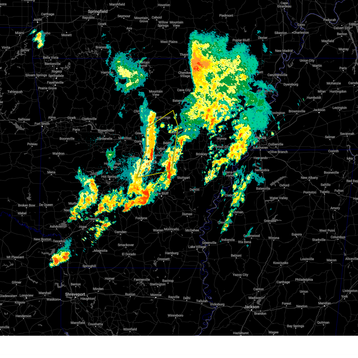
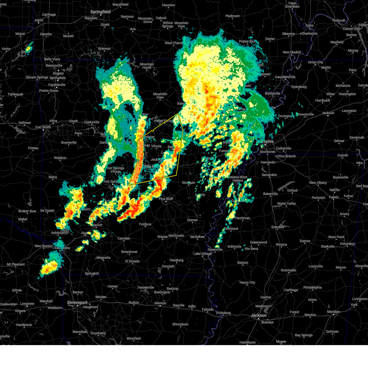
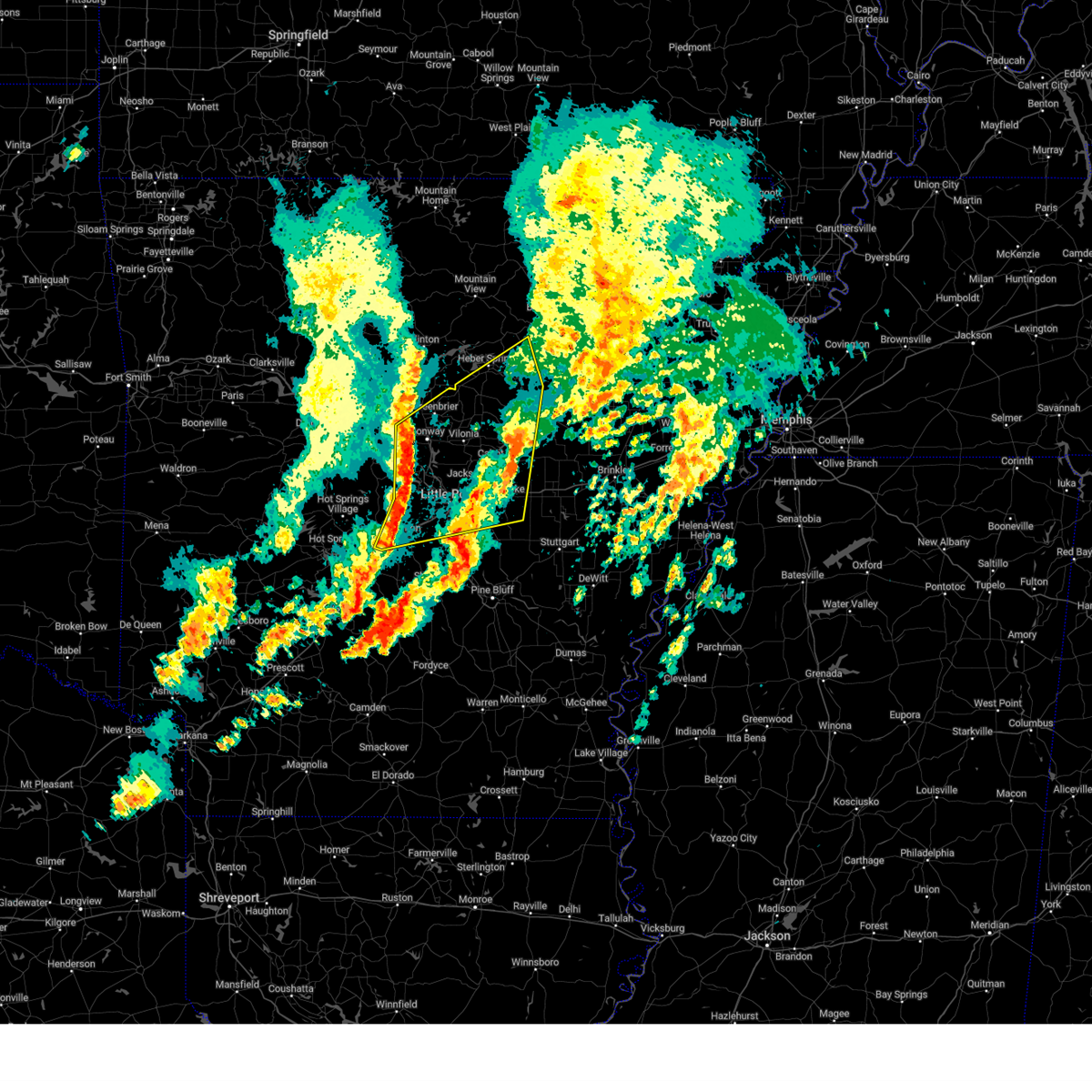
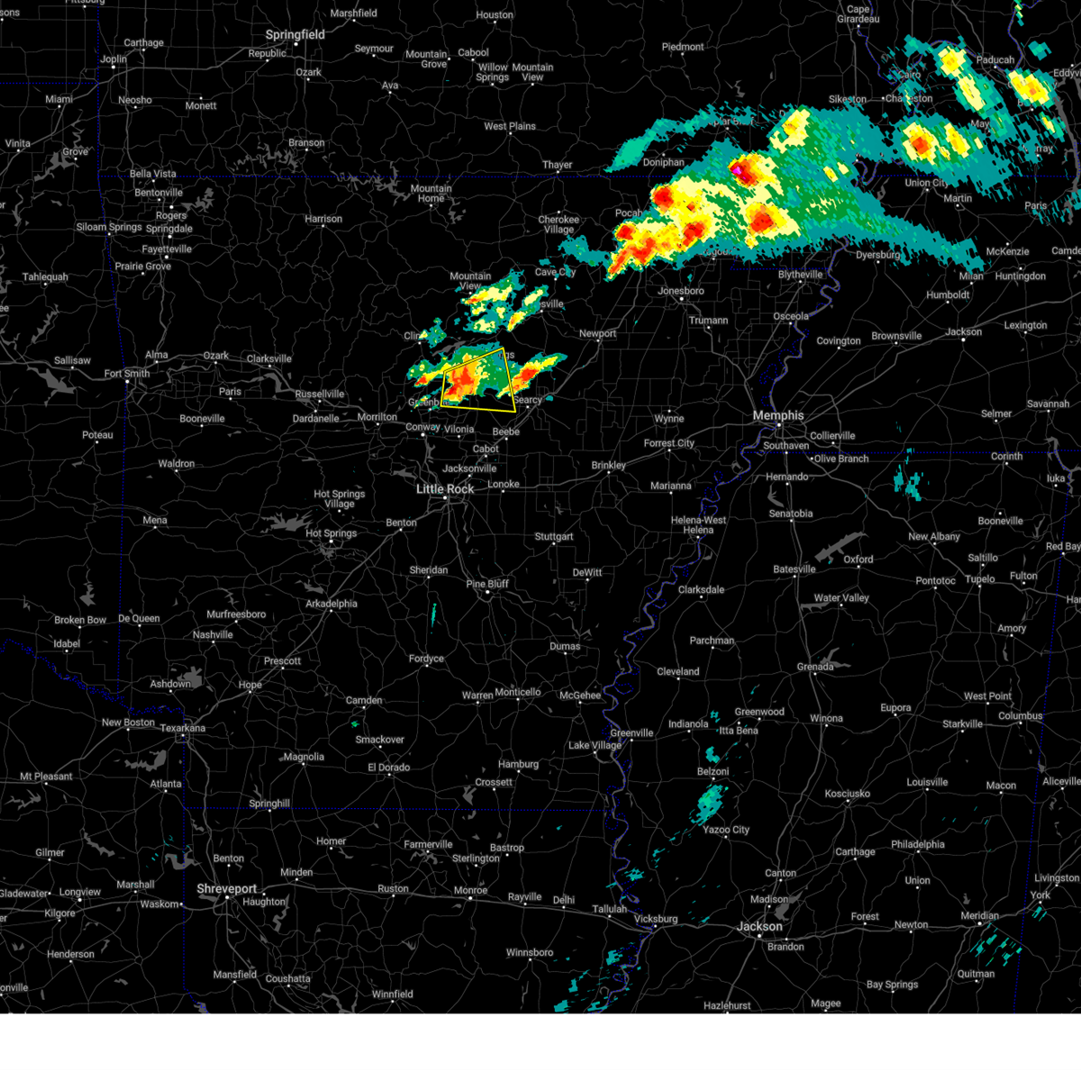
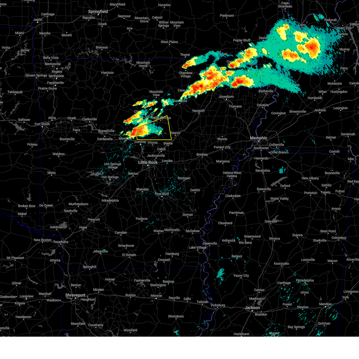
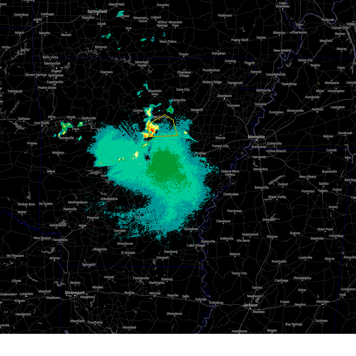
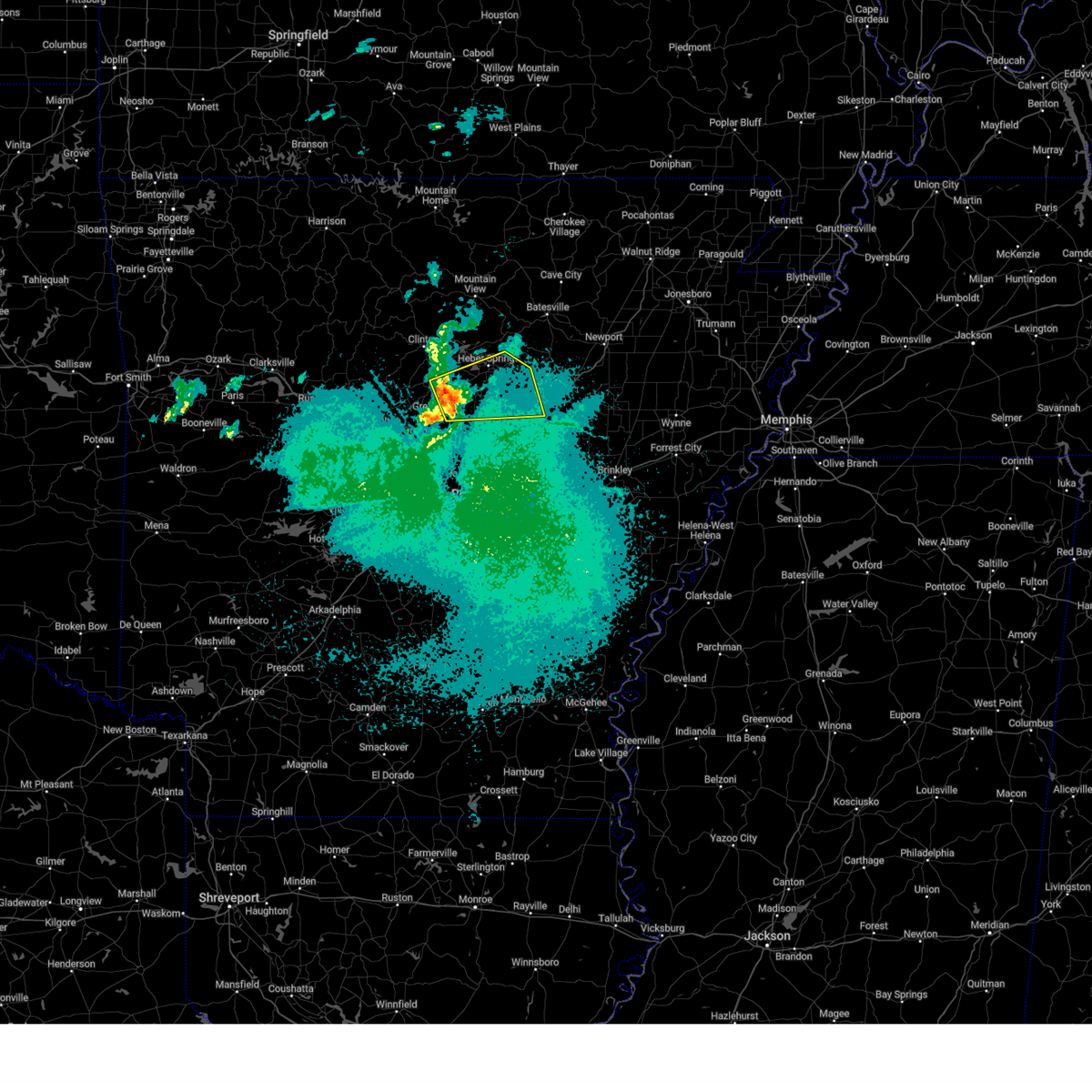
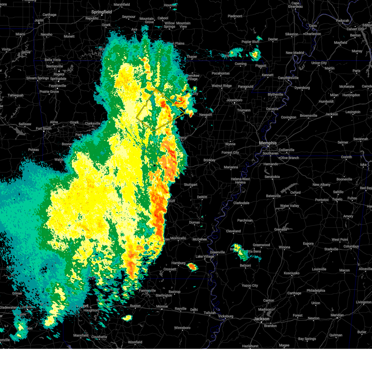
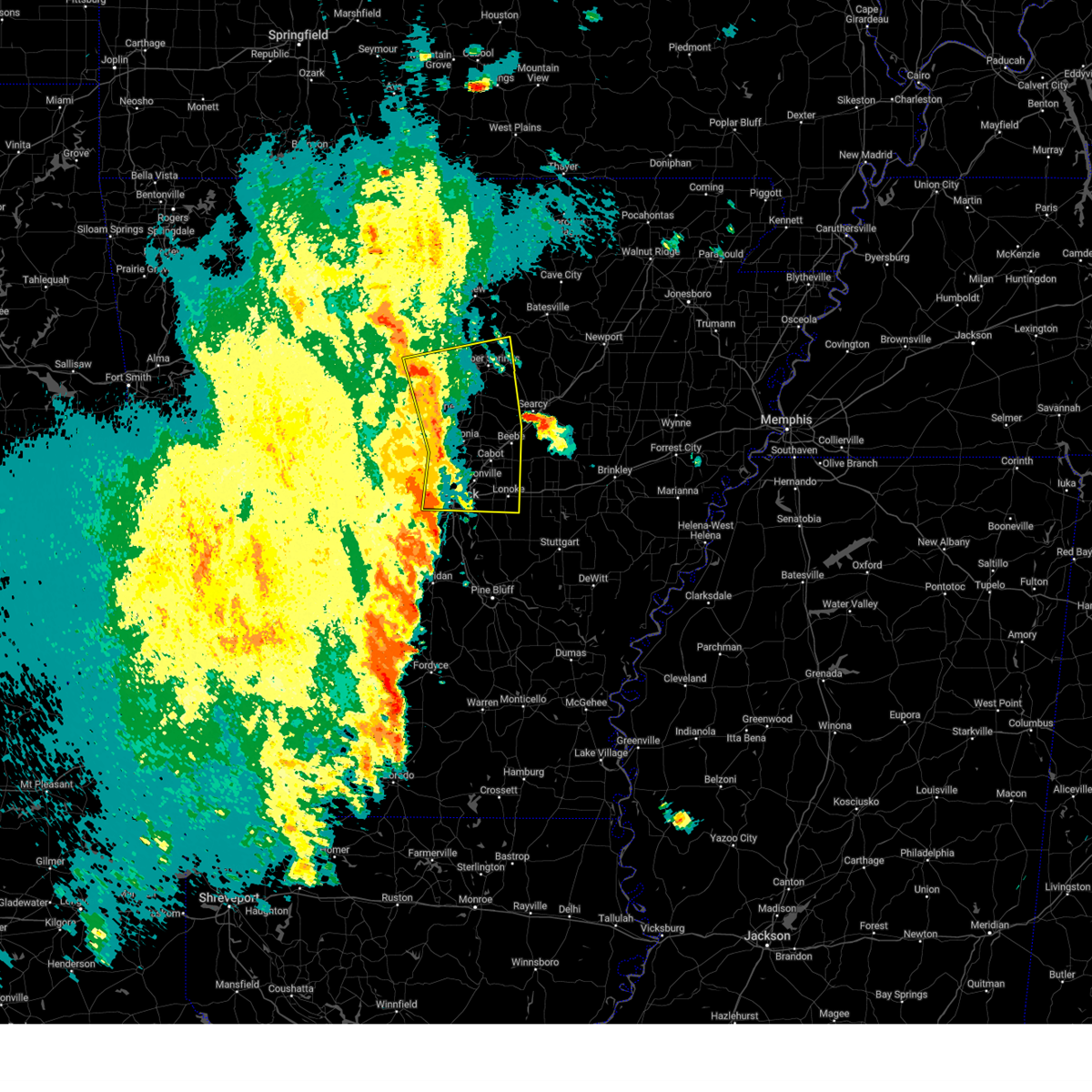
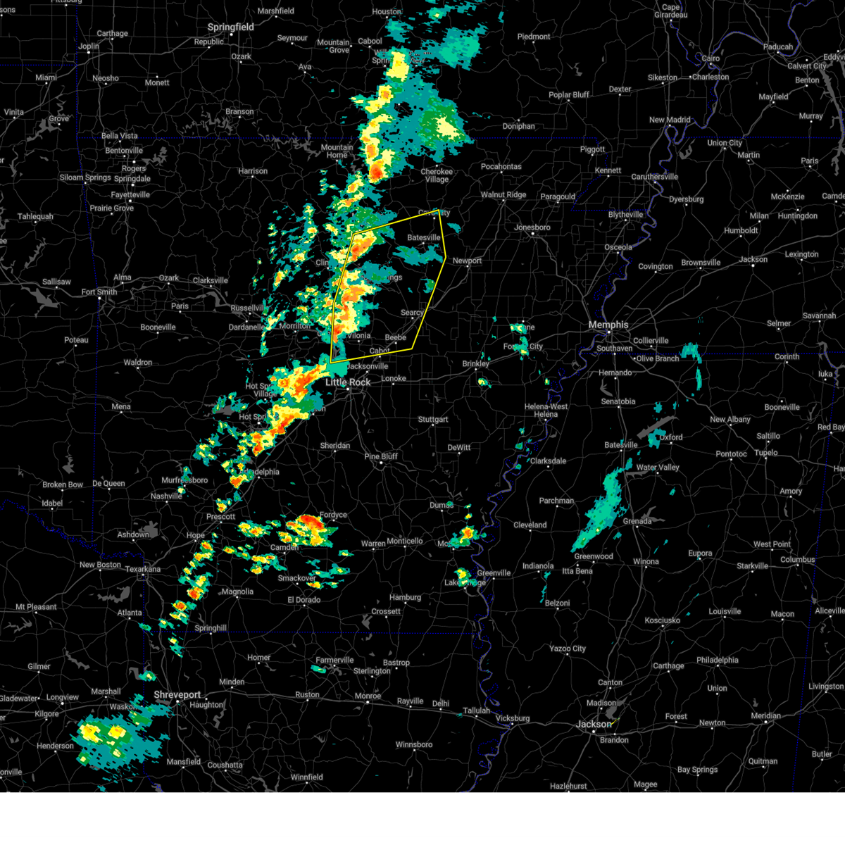
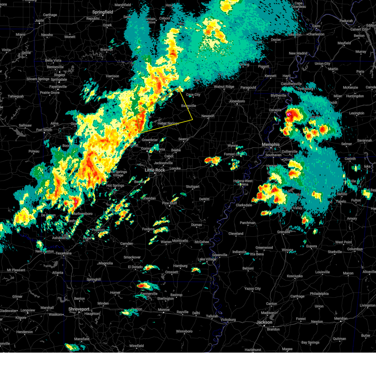
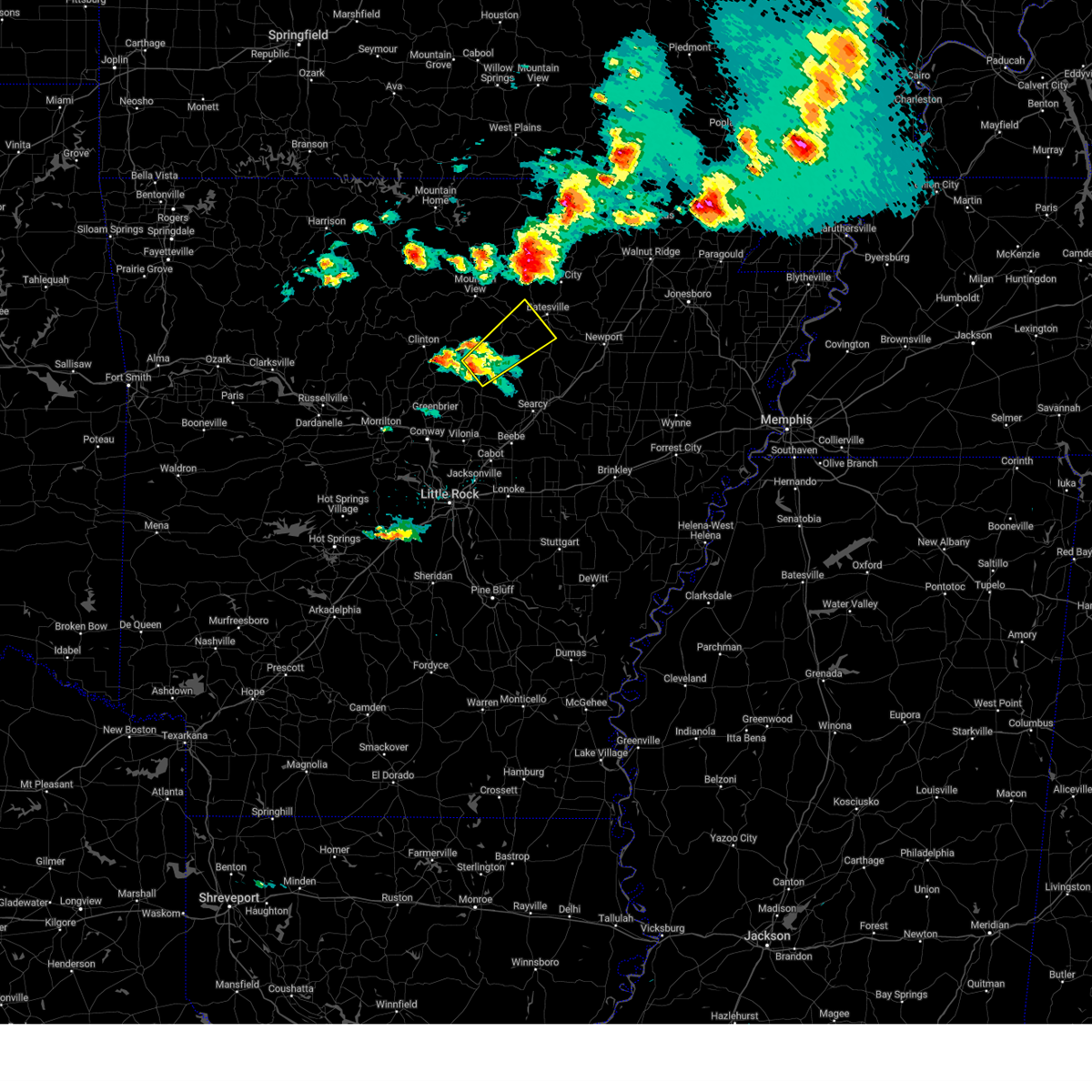
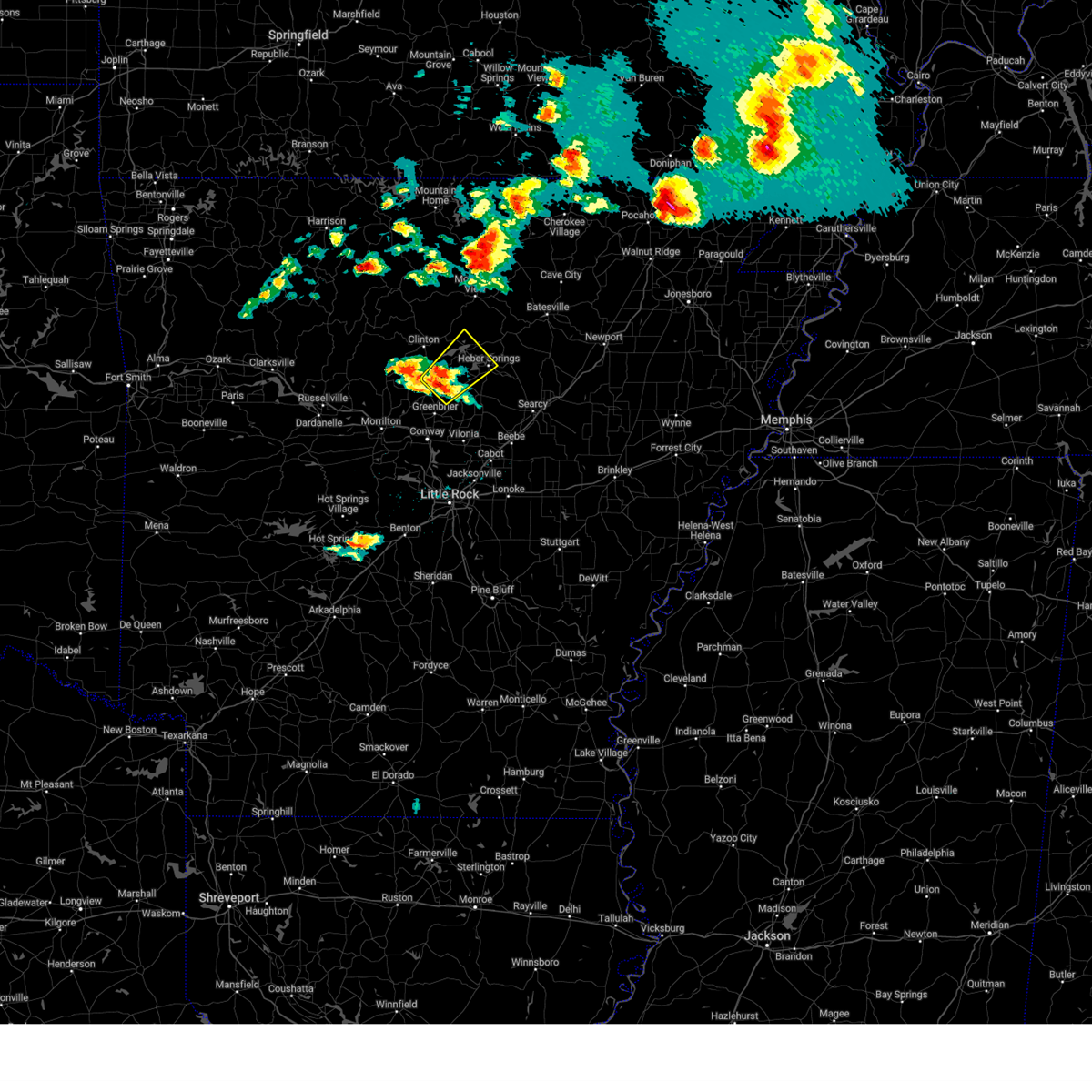
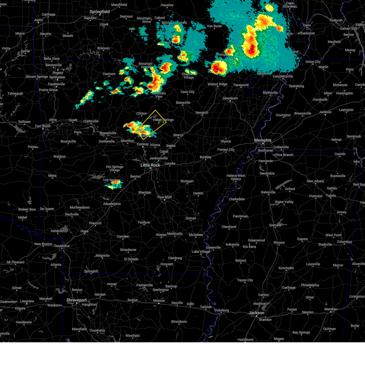
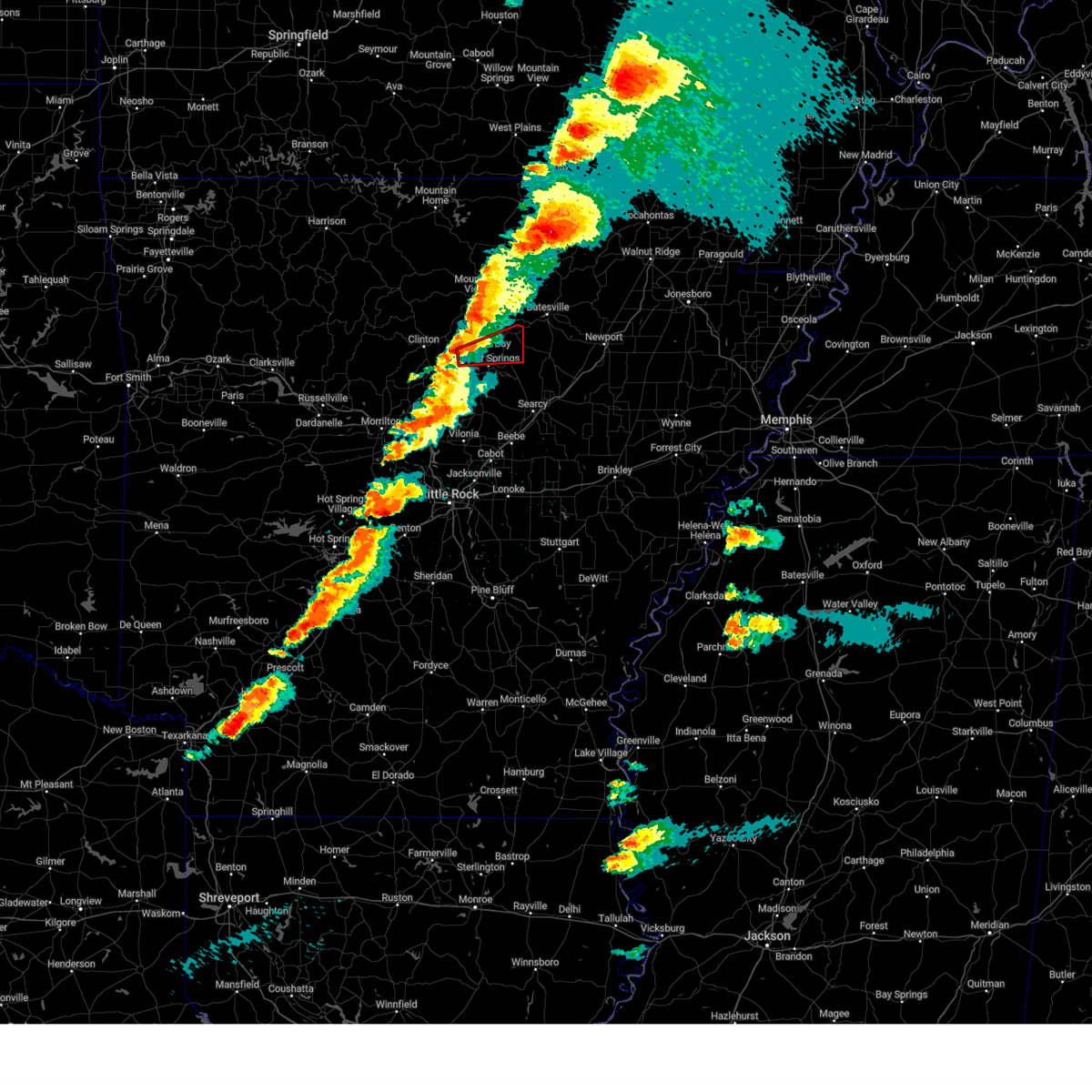
Hail Map for Tumbling Shoals, AR
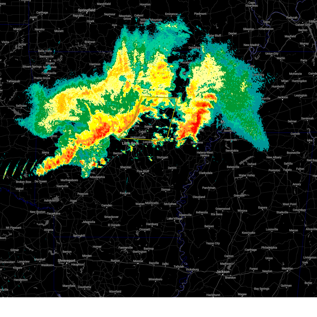
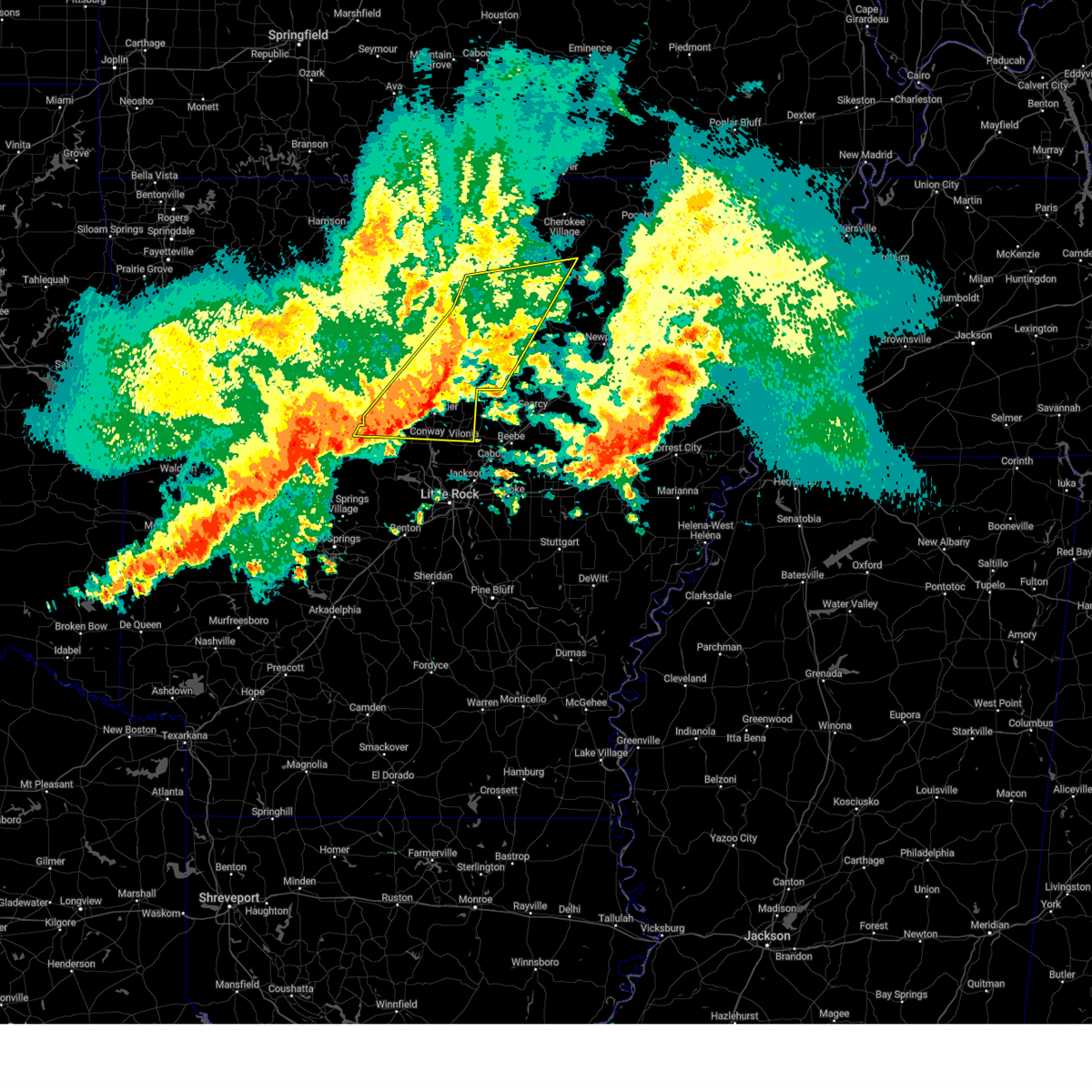
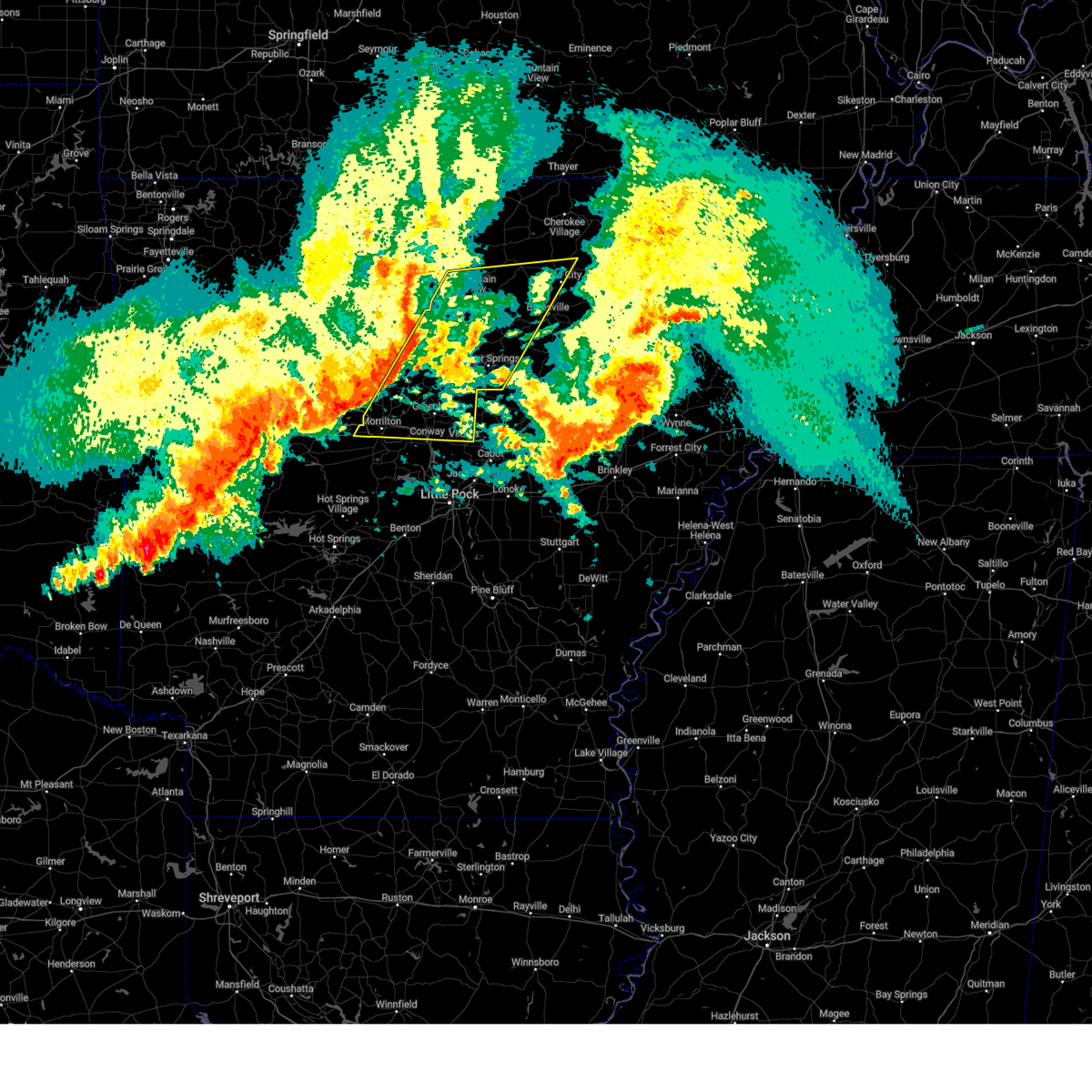
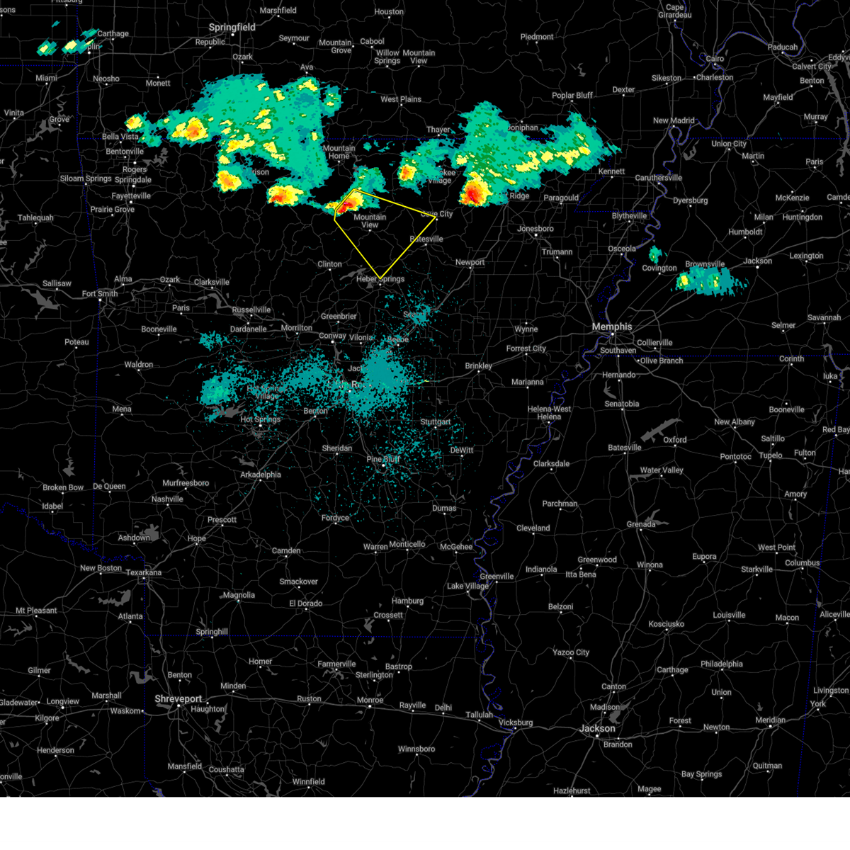
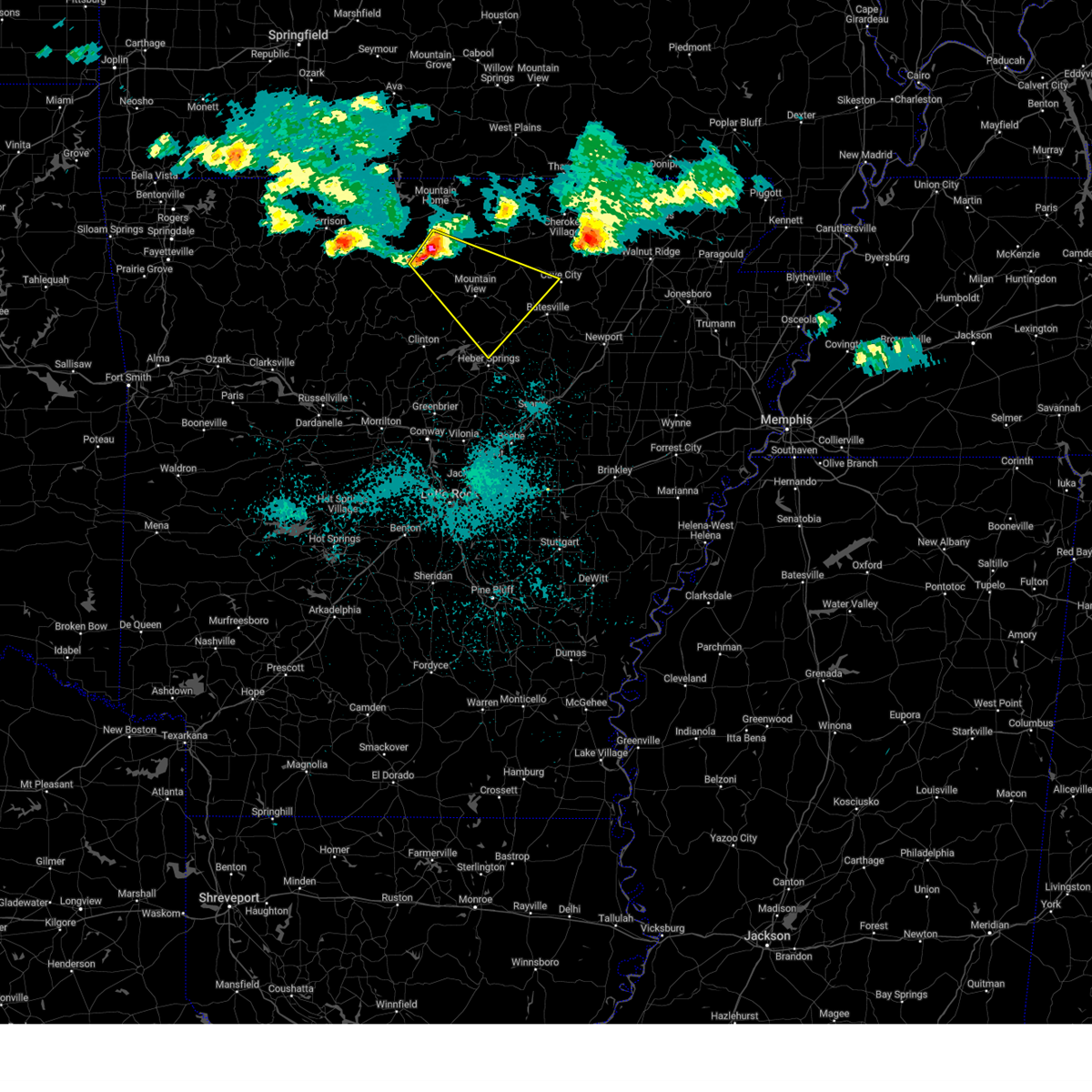
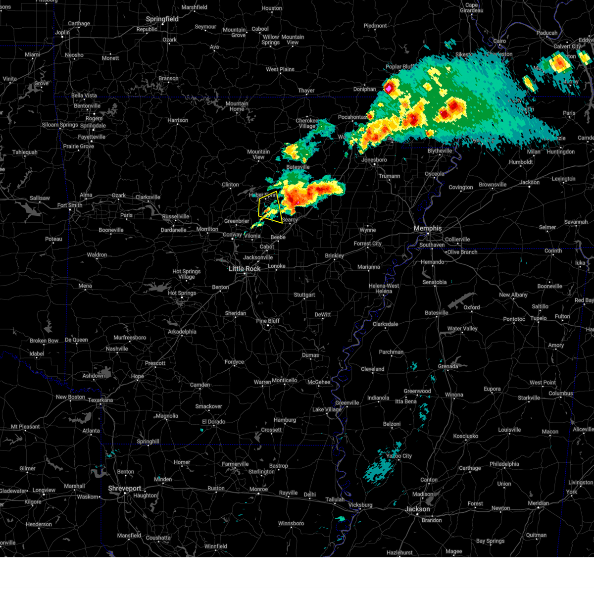
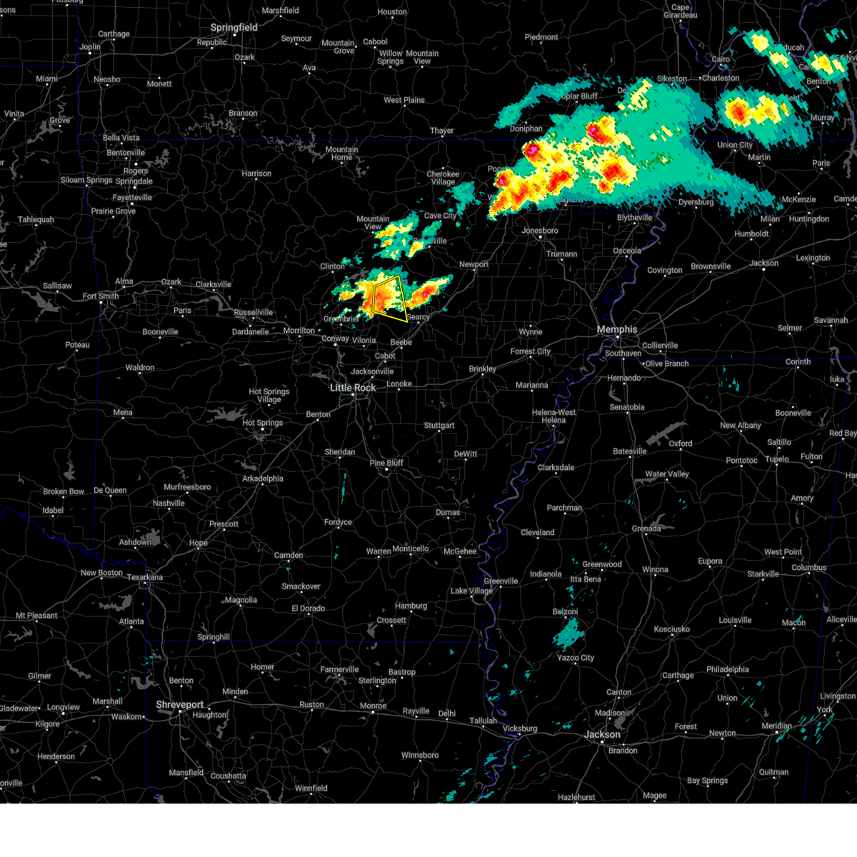
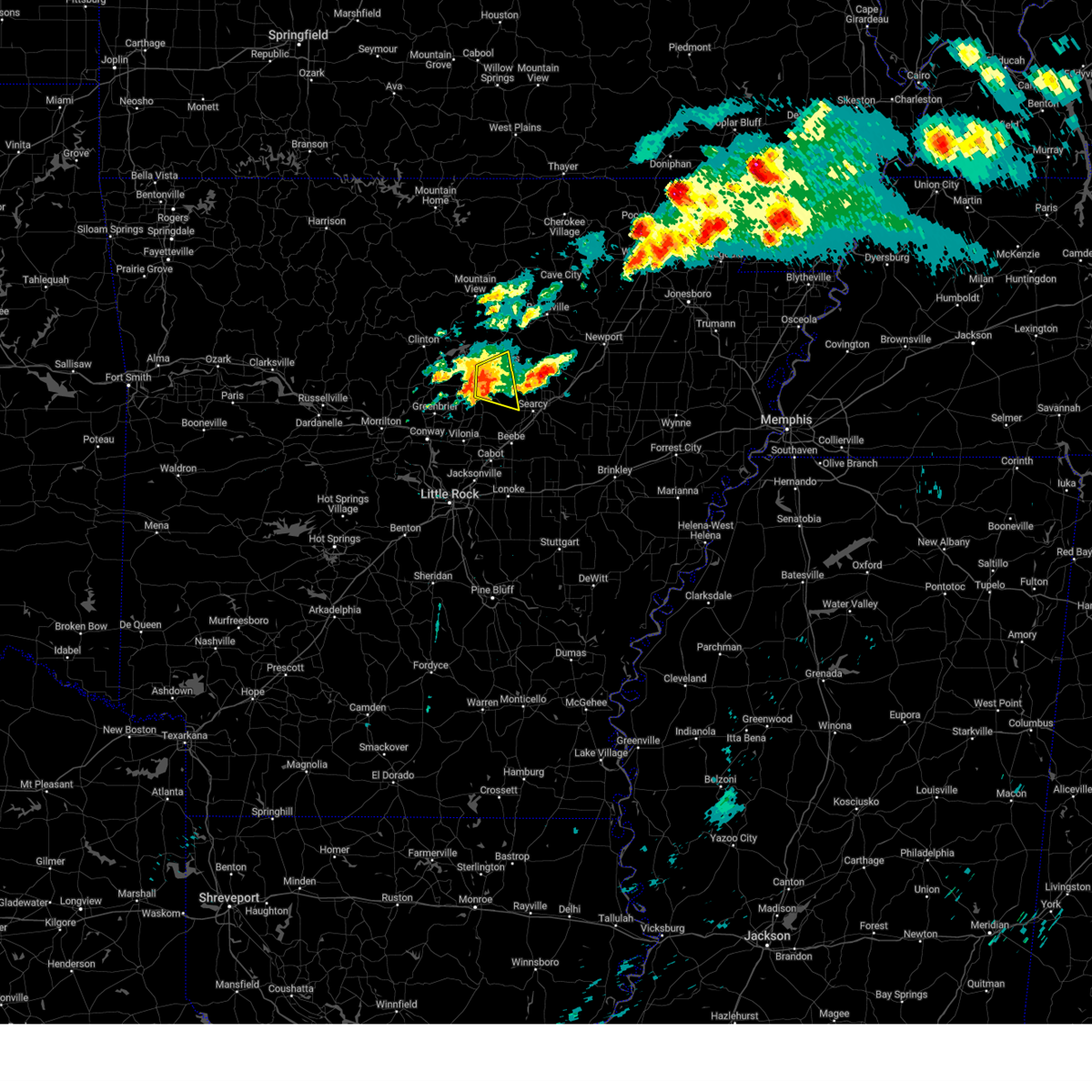
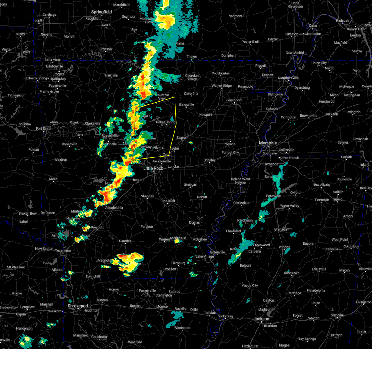
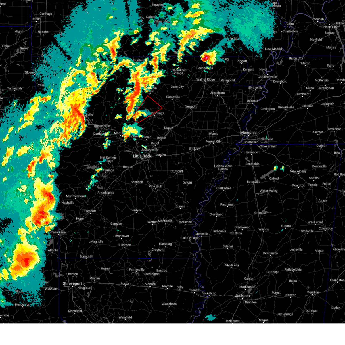
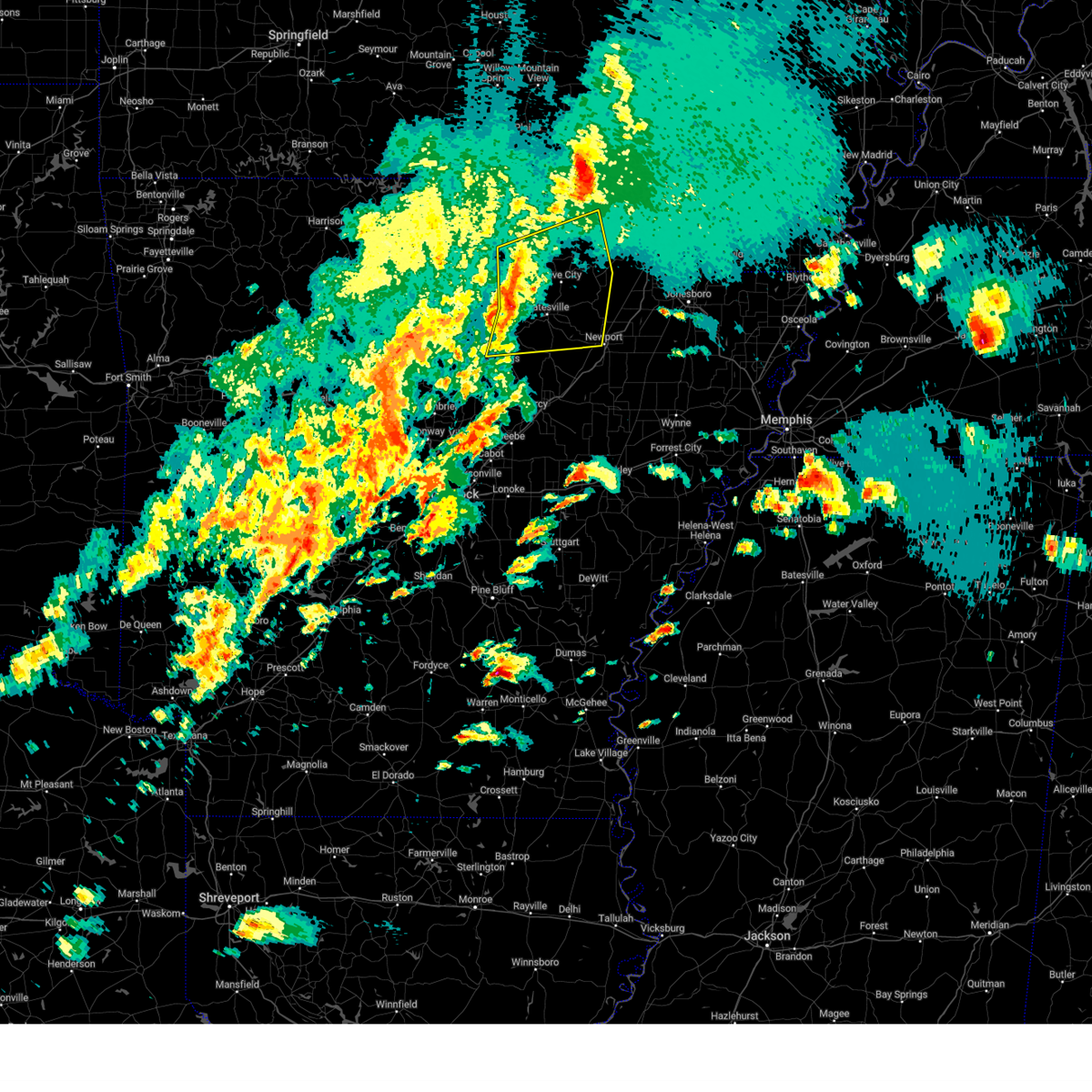
The Tumbling Shoals, AR area has had 0 reports of on-the-ground hail by trained spotters, and has been under severe weather warnings 54 times during the past 12 months. Doppler radar has detected hail at or near Tumbling Shoals, AR on 66 occasions, including 6 occasions during the past year.
| Name: | Tumbling Shoals, AR |
| Where Located: | 57 miles NNE of Little Rock, AR |
| Map: | Google Map for Tumbling Shoals, AR |
| Population: | 978 |
| Housing Units: | 646 |
| More Info: | Search Google for Tumbling Shoals, AR |
1
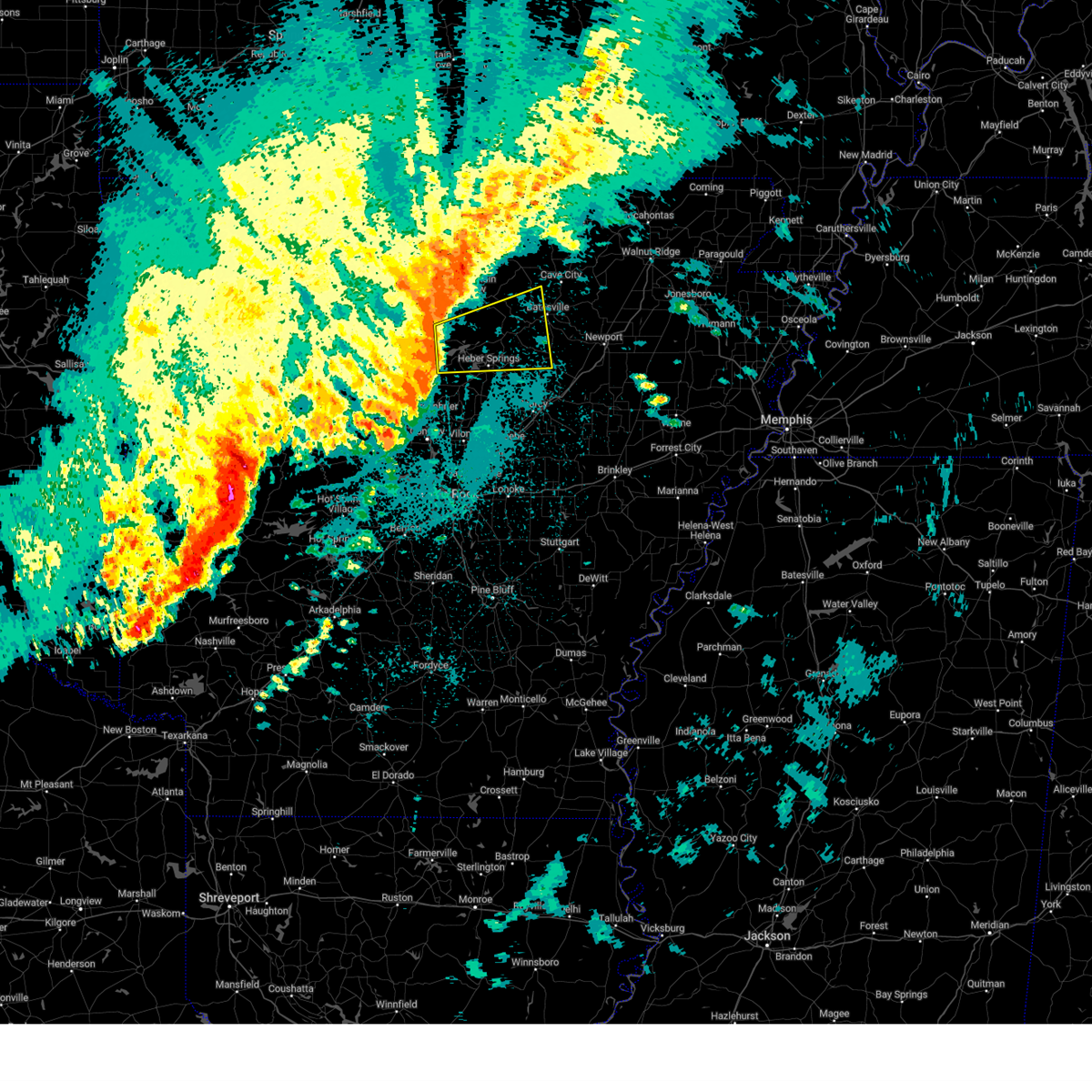
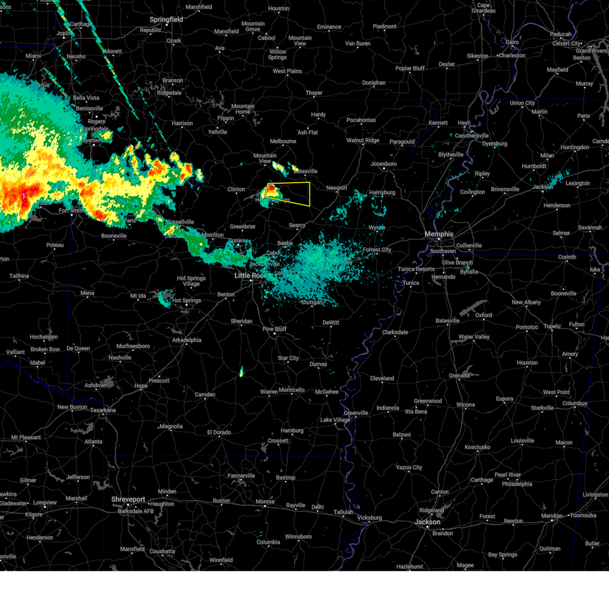
The Top Recent Hail Date for Tumbling Shoals, AR is Sunday, March 30, 2025 (15th out of 66)

Hail and Wind Damage Spotted near Tumbling Shoals, AR
| Date / Time | Report Details |
|---|---|
| 6/7/2025 9:07 AM CDT |
 The storms which prompted the warning have weakened below severe limits, wind gusts up to 45 mph are still possible through 915 am. a tornado watch remains in effect until noon cdt for central, eastern and north central arkansas. The storms which prompted the warning have weakened below severe limits, wind gusts up to 45 mph are still possible through 915 am. a tornado watch remains in effect until noon cdt for central, eastern and north central arkansas.
|
| 6/7/2025 8:34 AM CDT |
 Svrlzk the national weather service in little rock has issued a * severe thunderstorm warning for, northwestern woodruff county in eastern arkansas, southern independence county in north central arkansas, northern prairie county in central arkansas, southwestern jackson county in eastern arkansas, eastern cleburne county in north central arkansas, northern lonoke county in central arkansas, southeastern faulkner county in central arkansas, white county in central arkansas, northeastern pulaski county in central arkansas, * until 915 am cdt. * at 833 am cdt, severe thunderstorms were located along a line extending from 6 miles northeast of heber springs to near mount vernon to mayflower, moving southeast at 45 mph (radar indicated). Hazards include 60 mph wind gusts and quarter size hail. Hail damage to vehicles is expected. Expect wind damage to roofs, siding, and trees. Svrlzk the national weather service in little rock has issued a * severe thunderstorm warning for, northwestern woodruff county in eastern arkansas, southern independence county in north central arkansas, northern prairie county in central arkansas, southwestern jackson county in eastern arkansas, eastern cleburne county in north central arkansas, northern lonoke county in central arkansas, southeastern faulkner county in central arkansas, white county in central arkansas, northeastern pulaski county in central arkansas, * until 915 am cdt. * at 833 am cdt, severe thunderstorms were located along a line extending from 6 miles northeast of heber springs to near mount vernon to mayflower, moving southeast at 45 mph (radar indicated). Hazards include 60 mph wind gusts and quarter size hail. Hail damage to vehicles is expected. Expect wind damage to roofs, siding, and trees.
|
| 6/7/2025 8:19 AM CDT |
 At 819 am cdt, severe thunderstorms were located along a line extending from 9 miles north of greers ferry to near guy to near oppelo, moving east at 50 mph (radar indicated). Hazards include 60 mph wind gusts and quarter size hail. Hail damage to vehicles is expected. expect wind damage to roofs, siding, and trees. Locations impacted include, rushing, wilburn, hill creek, twin groves, pearson, narrows marina, shirley, choctow recreation area, lone star, woodrow, dam site marina, luber, guion, bethlehem, wonderview, guy, greers ferry, enders, higden, plumerville,. At 819 am cdt, severe thunderstorms were located along a line extending from 9 miles north of greers ferry to near guy to near oppelo, moving east at 50 mph (radar indicated). Hazards include 60 mph wind gusts and quarter size hail. Hail damage to vehicles is expected. expect wind damage to roofs, siding, and trees. Locations impacted include, rushing, wilburn, hill creek, twin groves, pearson, narrows marina, shirley, choctow recreation area, lone star, woodrow, dam site marina, luber, guion, bethlehem, wonderview, guy, greers ferry, enders, higden, plumerville,.
|
| 6/7/2025 7:57 AM CDT |
 Svrlzk the national weather service in little rock has issued a * severe thunderstorm warning for, stone county in north central arkansas, western independence county in north central arkansas, southern izard county in north central arkansas, northeastern perry county in central arkansas, van buren county in north central arkansas, cleburne county in north central arkansas, conway county in central arkansas, faulkner county in central arkansas, southwestern sharp county in north central arkansas, * until 845 am cdt. * at 757 am cdt, severe thunderstorms were located along a line extending from 7 miles east of thola to near cleveland to near carden bottoms, moving east at 45 mph (radar indicated). Hazards include 60 mph wind gusts and quarter size hail. Hail damage to vehicles is expected. Expect wind damage to roofs, siding, and trees. Svrlzk the national weather service in little rock has issued a * severe thunderstorm warning for, stone county in north central arkansas, western independence county in north central arkansas, southern izard county in north central arkansas, northeastern perry county in central arkansas, van buren county in north central arkansas, cleburne county in north central arkansas, conway county in central arkansas, faulkner county in central arkansas, southwestern sharp county in north central arkansas, * until 845 am cdt. * at 757 am cdt, severe thunderstorms were located along a line extending from 7 miles east of thola to near cleveland to near carden bottoms, moving east at 45 mph (radar indicated). Hazards include 60 mph wind gusts and quarter size hail. Hail damage to vehicles is expected. Expect wind damage to roofs, siding, and trees.
|
| 6/7/2025 6:48 AM CDT |
 the severe thunderstorm warning has been cancelled and is no longer in effect the severe thunderstorm warning has been cancelled and is no longer in effect
|
| 6/7/2025 6:22 AM CDT |
 Svrlzk the national weather service in little rock has issued a * severe thunderstorm warning for, southeastern van buren county in north central arkansas, cleburne county in north central arkansas, north central faulkner county in central arkansas, * until 700 am cdt. * at 622 am cdt, a severe thunderstorm was located near choctaw, or 9 miles southeast of clinton, moving east at 30 mph (radar indicated). Hazards include 60 mph wind gusts and quarter size hail. Hail damage to vehicles is expected. Expect wind damage to roofs, siding, and trees. Svrlzk the national weather service in little rock has issued a * severe thunderstorm warning for, southeastern van buren county in north central arkansas, cleburne county in north central arkansas, north central faulkner county in central arkansas, * until 700 am cdt. * at 622 am cdt, a severe thunderstorm was located near choctaw, or 9 miles southeast of clinton, moving east at 30 mph (radar indicated). Hazards include 60 mph wind gusts and quarter size hail. Hail damage to vehicles is expected. Expect wind damage to roofs, siding, and trees.
|
| 6/7/2025 6:17 AM CDT |
 Svrlzk the national weather service in little rock has issued a * severe thunderstorm warning for, southwestern independence county in north central arkansas, southeastern cleburne county in north central arkansas, northwestern white county in central arkansas, * until 700 am cdt. * at 617 am cdt, a severe thunderstorm was located near pangburn, or 7 miles southeast of heber springs, moving east at 15 mph (radar indicated). Hazards include 60 mph wind gusts and quarter size hail. Hail damage to vehicles is expected. Expect wind damage to roofs, siding, and trees. Svrlzk the national weather service in little rock has issued a * severe thunderstorm warning for, southwestern independence county in north central arkansas, southeastern cleburne county in north central arkansas, northwestern white county in central arkansas, * until 700 am cdt. * at 617 am cdt, a severe thunderstorm was located near pangburn, or 7 miles southeast of heber springs, moving east at 15 mph (radar indicated). Hazards include 60 mph wind gusts and quarter size hail. Hail damage to vehicles is expected. Expect wind damage to roofs, siding, and trees.
|
| 5/21/2025 11:47 PM CDT |
 the severe thunderstorm warning has been cancelled and is no longer in effect the severe thunderstorm warning has been cancelled and is no longer in effect
|
| 5/21/2025 11:34 PM CDT |
 At 1134 pm cdt, a severe thunderstorm was located over blanchard springs campground, or near mountain view, moving southeast at 40 mph (radar indicated). Hazards include quarter size hail. Damage to vehicles is expected. Locations impacted include, hanover, mt olive in izard county, brownsville, pleasant grove, brandenberg, croker, gunner pool campground, lone star, sandtown, woodrow, newnata, prim, herpel, marcella, luber, fifty-six, guion, allison, ben, optimus,. At 1134 pm cdt, a severe thunderstorm was located over blanchard springs campground, or near mountain view, moving southeast at 40 mph (radar indicated). Hazards include quarter size hail. Damage to vehicles is expected. Locations impacted include, hanover, mt olive in izard county, brownsville, pleasant grove, brandenberg, croker, gunner pool campground, lone star, sandtown, woodrow, newnata, prim, herpel, marcella, luber, fifty-six, guion, allison, ben, optimus,.
|
| 5/21/2025 11:34 PM CDT |
 the severe thunderstorm warning has been cancelled and is no longer in effect the severe thunderstorm warning has been cancelled and is no longer in effect
|
| 5/21/2025 11:21 PM CDT |
 At 1120 pm cdt, a severe thunderstorm was located 8 miles west of blanchard springs campground, or 15 miles northwest of mountain view, moving southeast at 45 mph (radar indicated). Hazards include quarter size hail. Damage to vehicles is expected. Locations impacted include, hanover, parma, turkey creek, mt olive in izard county, brownsville, pleasant grove, timbo, brandenberg, croker, gunner pool campground, barkshed campground, lone star, sandtown, woodrow, newnata, prim, gid, herpel, marcella, luber,. At 1120 pm cdt, a severe thunderstorm was located 8 miles west of blanchard springs campground, or 15 miles northwest of mountain view, moving southeast at 45 mph (radar indicated). Hazards include quarter size hail. Damage to vehicles is expected. Locations impacted include, hanover, parma, turkey creek, mt olive in izard county, brownsville, pleasant grove, timbo, brandenberg, croker, gunner pool campground, barkshed campground, lone star, sandtown, woodrow, newnata, prim, gid, herpel, marcella, luber,.
|
| 5/21/2025 11:21 PM CDT |
 the severe thunderstorm warning has been cancelled and is no longer in effect the severe thunderstorm warning has been cancelled and is no longer in effect
|
| 5/21/2025 11:09 PM CDT |
 Svrlzk the national weather service in little rock has issued a * severe thunderstorm warning for, stone county in north central arkansas, northwestern independence county in north central arkansas, northeastern searcy county in north central arkansas, southern izard county in north central arkansas, southeastern marion county in north central arkansas, north central cleburne county in north central arkansas, southeastern baxter county in north central arkansas, southwestern sharp county in north central arkansas, * until midnight cdt. * at 1109 pm cdt, a severe thunderstorm was located near advance, or 17 miles northeast of marshall, moving southeast at 45 mph (radar indicated). Hazards include quarter size hail. damage to vehicles is expected Svrlzk the national weather service in little rock has issued a * severe thunderstorm warning for, stone county in north central arkansas, northwestern independence county in north central arkansas, northeastern searcy county in north central arkansas, southern izard county in north central arkansas, southeastern marion county in north central arkansas, north central cleburne county in north central arkansas, southeastern baxter county in north central arkansas, southwestern sharp county in north central arkansas, * until midnight cdt. * at 1109 pm cdt, a severe thunderstorm was located near advance, or 17 miles northeast of marshall, moving southeast at 45 mph (radar indicated). Hazards include quarter size hail. damage to vehicles is expected
|
| 5/20/2025 4:28 AM CDT |
 The storms which prompted the warning have weakened below severe limits, and no longer pose an immediate threat to life or property. therefore, the warning will be allowed to expire. however gusty winds and heavy rain are still possible with these thunderstorms. a severe thunderstorm watch remains in effect until 800 am cdt for central and north central arkansas. The storms which prompted the warning have weakened below severe limits, and no longer pose an immediate threat to life or property. therefore, the warning will be allowed to expire. however gusty winds and heavy rain are still possible with these thunderstorms. a severe thunderstorm watch remains in effect until 800 am cdt for central and north central arkansas.
|
| 5/20/2025 4:13 AM CDT |
 the severe thunderstorm warning has been cancelled and is no longer in effect the severe thunderstorm warning has been cancelled and is no longer in effect
|
| 5/20/2025 4:13 AM CDT |
 At 412 am cdt, severe thunderstorms were located along a line extending from near woolly hollow state park to near enola to olmstead to downtown little rock, moving northeast at 60 mph (radar indicated). Hazards include 60 mph wind gusts. Expect damage to roofs, siding, and trees. Locations impacted include, park hill, wilburn, otter creek, old austin, furlow, antioch in white county, pearson, ironton, quapaw quarter, hillcrest neighborhood, meto, kerr, floyd, vilonia, olmstead, thurman, mccreanor, providence, macon, the heights,. At 412 am cdt, severe thunderstorms were located along a line extending from near woolly hollow state park to near enola to olmstead to downtown little rock, moving northeast at 60 mph (radar indicated). Hazards include 60 mph wind gusts. Expect damage to roofs, siding, and trees. Locations impacted include, park hill, wilburn, otter creek, old austin, furlow, antioch in white county, pearson, ironton, quapaw quarter, hillcrest neighborhood, meto, kerr, floyd, vilonia, olmstead, thurman, mccreanor, providence, macon, the heights,.
|
| 5/20/2025 3:58 AM CDT |
 At 357 am cdt, severe thunderstorms were located along a line extending from wooster to near pickles gap to maumelle to near bryant, moving northeast at 55 mph (radar indicated). Hazards include 60 mph wind gusts and penny size hail. Expect damage to roofs, siding, and trees. Locations impacted include, park hill, wilburn, otter creek, old austin, furlow, palarm, antioch in white county, mayflower, pearson, ironton, quapaw quarter, hillcrest neighborhood, meto, haskell, kerr, floyd, vilonia, olmstead, bryant, thurman,. At 357 am cdt, severe thunderstorms were located along a line extending from wooster to near pickles gap to maumelle to near bryant, moving northeast at 55 mph (radar indicated). Hazards include 60 mph wind gusts and penny size hail. Expect damage to roofs, siding, and trees. Locations impacted include, park hill, wilburn, otter creek, old austin, furlow, palarm, antioch in white county, mayflower, pearson, ironton, quapaw quarter, hillcrest neighborhood, meto, haskell, kerr, floyd, vilonia, olmstead, bryant, thurman,.
|
| 5/20/2025 3:48 AM CDT |
 Svrlzk the national weather service in little rock has issued a * severe thunderstorm warning for, southwestern independence county in north central arkansas, northeastern perry county in central arkansas, northwestern prairie county in central arkansas, southern cleburne county in north central arkansas, lonoke county in central arkansas, southeastern conway county in central arkansas, faulkner county in central arkansas, western white county in central arkansas, central saline county in central arkansas, pulaski county in central arkansas, * until 430 am cdt. * at 347 am cdt, severe thunderstorms were located along a line extending from menifee to near toad suck to 6 miles west of chenal valley to near benton, moving northeast at 60 mph (radar indicated). Hazards include 60 mph wind gusts and quarter size hail. Hail damage to vehicles is expected. Expect wind damage to roofs, siding, and trees. Svrlzk the national weather service in little rock has issued a * severe thunderstorm warning for, southwestern independence county in north central arkansas, northeastern perry county in central arkansas, northwestern prairie county in central arkansas, southern cleburne county in north central arkansas, lonoke county in central arkansas, southeastern conway county in central arkansas, faulkner county in central arkansas, western white county in central arkansas, central saline county in central arkansas, pulaski county in central arkansas, * until 430 am cdt. * at 347 am cdt, severe thunderstorms were located along a line extending from menifee to near toad suck to 6 miles west of chenal valley to near benton, moving northeast at 60 mph (radar indicated). Hazards include 60 mph wind gusts and quarter size hail. Hail damage to vehicles is expected. Expect wind damage to roofs, siding, and trees.
|
| 5/19/2025 10:51 PM CDT |
 Svrlzk the national weather service in little rock has issued a * severe thunderstorm warning for, southeastern stone county in north central arkansas, western independence county in north central arkansas, northeastern van buren county in north central arkansas, cleburne county in north central arkansas, north central white county in central arkansas, * until 1145 pm cdt. * at 1051 pm cdt, a severe thunderstorm was located over fairfield bay marina, or near fairfield bay, moving east at 45 mph (radar indicated). Hazards include 60 mph wind gusts and penny size hail. expect damage to roofs, siding, and trees Svrlzk the national weather service in little rock has issued a * severe thunderstorm warning for, southeastern stone county in north central arkansas, western independence county in north central arkansas, northeastern van buren county in north central arkansas, cleburne county in north central arkansas, north central white county in central arkansas, * until 1145 pm cdt. * at 1051 pm cdt, a severe thunderstorm was located over fairfield bay marina, or near fairfield bay, moving east at 45 mph (radar indicated). Hazards include 60 mph wind gusts and penny size hail. expect damage to roofs, siding, and trees
|
| 5/16/2025 6:43 AM CDT |
 The storm which prompted the warning has moved out of the area. therefore, the warning will be allowed to expire. a severe thunderstorm watch remains in effect until 900 am cdt for central and north central arkansas. to report severe weather, contact your nearest law enforcement agency. they will relay your report to the national weather service little rock. The storm which prompted the warning has moved out of the area. therefore, the warning will be allowed to expire. a severe thunderstorm watch remains in effect until 900 am cdt for central and north central arkansas. to report severe weather, contact your nearest law enforcement agency. they will relay your report to the national weather service little rock.
|
| 5/16/2025 6:27 AM CDT |
 At 626 am cdt, a severe thunderstorm was located near pangburn, or 9 miles southeast of heber springs, moving east at 50 mph (radar indicated). Hazards include 60 mph wind gusts and quarter size hail. Hail damage to vehicles is expected. expect wind damage to roofs, siding, and trees. Locations impacted include, rose bud, hopewell in cleburne county, wilburn, joy, pickens in white county, heber springs, center hill, sidon, dam site marina, eden isle,. At 626 am cdt, a severe thunderstorm was located near pangburn, or 9 miles southeast of heber springs, moving east at 50 mph (radar indicated). Hazards include 60 mph wind gusts and quarter size hail. Hail damage to vehicles is expected. expect wind damage to roofs, siding, and trees. Locations impacted include, rose bud, hopewell in cleburne county, wilburn, joy, pickens in white county, heber springs, center hill, sidon, dam site marina, eden isle,.
|
| 5/16/2025 6:27 AM CDT |
 the severe thunderstorm warning has been cancelled and is no longer in effect the severe thunderstorm warning has been cancelled and is no longer in effect
|
| 5/16/2025 6:17 AM CDT |
 At 617 am cdt, a severe thunderstorm was located near quitman, or 15 miles southwest of heber springs, moving east at 45 mph (radar indicated). Hazards include 60 mph wind gusts and quarter size hail. Hail damage to vehicles is expected. expect wind damage to roofs, siding, and trees. Locations impacted include, dam site marina, wilburn, fairbanks, barney, heber springs, romance, center hill, eden isle, sidon, enders, rose bud, hopewell in cleburne county, pearson, joy, quitman, pickens in white county, gravel hill, woolly hollow state park, crosby,. At 617 am cdt, a severe thunderstorm was located near quitman, or 15 miles southwest of heber springs, moving east at 45 mph (radar indicated). Hazards include 60 mph wind gusts and quarter size hail. Hail damage to vehicles is expected. expect wind damage to roofs, siding, and trees. Locations impacted include, dam site marina, wilburn, fairbanks, barney, heber springs, romance, center hill, eden isle, sidon, enders, rose bud, hopewell in cleburne county, pearson, joy, quitman, pickens in white county, gravel hill, woolly hollow state park, crosby,.
|
| 5/16/2025 6:03 AM CDT |
 At 602 am cdt, a severe thunderstorm was located over twin groves, or 13 miles north of conway, moving east at 45 mph (radar indicated). Hazards include 60 mph wind gusts and quarter size hail. Hail damage to vehicles is expected. expect wind damage to roofs, siding, and trees. Locations impacted include, wilburn, damascus, heber springs, sidon, greenbrier, hopewell in cleburne county, twin groves, pearson, mount vernon, pickens in white county, floyd, gravel hill, dam site marina, mallet town, barney, martinville, romance, guy, springhill, center hill,. At 602 am cdt, a severe thunderstorm was located over twin groves, or 13 miles north of conway, moving east at 45 mph (radar indicated). Hazards include 60 mph wind gusts and quarter size hail. Hail damage to vehicles is expected. expect wind damage to roofs, siding, and trees. Locations impacted include, wilburn, damascus, heber springs, sidon, greenbrier, hopewell in cleburne county, twin groves, pearson, mount vernon, pickens in white county, floyd, gravel hill, dam site marina, mallet town, barney, martinville, romance, guy, springhill, center hill,.
|
| 5/16/2025 6:03 AM CDT |
 the severe thunderstorm warning has been cancelled and is no longer in effect the severe thunderstorm warning has been cancelled and is no longer in effect
|
| 5/16/2025 5:54 AM CDT |
 Svrlzk the national weather service in little rock has issued a * severe thunderstorm warning for, southeastern van buren county in north central arkansas, southern cleburne county in north central arkansas, east central conway county in central arkansas, northern faulkner county in central arkansas, west central white county in central arkansas, * until 645 am cdt. * at 554 am cdt, a severe thunderstorm was located over springfield, or 13 miles north of conway, moving east at 45 mph (radar indicated). Hazards include ping pong ball size hail and 60 mph wind gusts. People and animals outdoors will be injured. expect hail damage to roofs, siding, windows, and vehicles. Expect wind damage to roofs, siding, and trees. Svrlzk the national weather service in little rock has issued a * severe thunderstorm warning for, southeastern van buren county in north central arkansas, southern cleburne county in north central arkansas, east central conway county in central arkansas, northern faulkner county in central arkansas, west central white county in central arkansas, * until 645 am cdt. * at 554 am cdt, a severe thunderstorm was located over springfield, or 13 miles north of conway, moving east at 45 mph (radar indicated). Hazards include ping pong ball size hail and 60 mph wind gusts. People and animals outdoors will be injured. expect hail damage to roofs, siding, windows, and vehicles. Expect wind damage to roofs, siding, and trees.
|
| 5/8/2025 1:07 AM CDT |
 the severe thunderstorm warning has been cancelled and is no longer in effect the severe thunderstorm warning has been cancelled and is no longer in effect
|
| 5/8/2025 1:07 AM CDT |
 At 106 am cdt, severe thunderstorms were located along a line extending from near quitman to near rose bud to mount vernon, moving east at 35 mph (radar indicated). Hazards include 60 mph wind gusts and half dollar size hail. Hail damage to vehicles is expected. expect wind damage to roofs, siding, and trees. Locations impacted include, wilburn, crosby, searcy, dewey, heber springs, sidon, hopewell in cleburne county, pearson, mount vernon, kensett, pickens in white county, armstrong springs, gravel hill, clay, barney, romance, center hill, enders, pangburn, rose bud,. At 106 am cdt, severe thunderstorms were located along a line extending from near quitman to near rose bud to mount vernon, moving east at 35 mph (radar indicated). Hazards include 60 mph wind gusts and half dollar size hail. Hail damage to vehicles is expected. expect wind damage to roofs, siding, and trees. Locations impacted include, wilburn, crosby, searcy, dewey, heber springs, sidon, hopewell in cleburne county, pearson, mount vernon, kensett, pickens in white county, armstrong springs, gravel hill, clay, barney, romance, center hill, enders, pangburn, rose bud,.
|
| 5/8/2025 12:54 AM CDT |
 Svrlzk the national weather service in little rock has issued a * severe thunderstorm warning for, southeastern van buren county in north central arkansas, southern cleburne county in north central arkansas, northeastern faulkner county in central arkansas, northwestern white county in central arkansas, * until 145 am cdt. * at 1253 am cdt, severe thunderstorms were located along a line extending from near damascus to near quitman to near woolly hollow state park, moving east at 35 mph (radar indicated). Hazards include 60 mph wind gusts and quarter size hail. Hail damage to vehicles is expected. Expect wind damage to roofs, siding, and trees. Svrlzk the national weather service in little rock has issued a * severe thunderstorm warning for, southeastern van buren county in north central arkansas, southern cleburne county in north central arkansas, northeastern faulkner county in central arkansas, northwestern white county in central arkansas, * until 145 am cdt. * at 1253 am cdt, severe thunderstorms were located along a line extending from near damascus to near quitman to near woolly hollow state park, moving east at 35 mph (radar indicated). Hazards include 60 mph wind gusts and quarter size hail. Hail damage to vehicles is expected. Expect wind damage to roofs, siding, and trees.
|
| 4/30/2025 6:32 PM CDT |
 the severe thunderstorm warning has been cancelled and is no longer in effect the severe thunderstorm warning has been cancelled and is no longer in effect
|
| 4/30/2025 6:25 PM CDT |
 Svrlzk the national weather service in little rock has issued a * severe thunderstorm warning for, northwestern woodruff county in eastern arkansas, southwestern independence county in north central arkansas, prairie county in central arkansas, southwestern jackson county in eastern arkansas, southeastern cleburne county in north central arkansas, central lonoke county in central arkansas, white county in central arkansas, * until 715 pm cdt. * at 625 pm cdt, severe thunderstorms were located along a line extending from near heber springs to beebe to near lonoke, moving northeast at 35 mph (radar indicated). Hazards include 60 mph wind gusts. expect damage to roofs, siding, and trees Svrlzk the national weather service in little rock has issued a * severe thunderstorm warning for, northwestern woodruff county in eastern arkansas, southwestern independence county in north central arkansas, prairie county in central arkansas, southwestern jackson county in eastern arkansas, southeastern cleburne county in north central arkansas, central lonoke county in central arkansas, white county in central arkansas, * until 715 pm cdt. * at 625 pm cdt, severe thunderstorms were located along a line extending from near heber springs to beebe to near lonoke, moving northeast at 35 mph (radar indicated). Hazards include 60 mph wind gusts. expect damage to roofs, siding, and trees
|
| 4/30/2025 6:17 PM CDT | the severe thunderstorm warning has been cancelled and is no longer in effect |
| 4/30/2025 6:17 PM CDT | At 617 pm cdt, severe thunderstorms were located along a line extending from 6 miles south of heber springs to near ward to near meto, moving east at 35 mph (radar indicated). Hazards include 70 mph wind gusts. Expect considerable tree damage. damage is likely to mobile homes, roofs, and outbuildings. Locations impacted include, wilburn, old austin, crosby, furlow, parnell, antioch in white county, gravel ridge, pearson, mount vernon, meto, pickens in white county, kerr, floyd, austin in lonoke county, jacksonville, bevis corner, dam site marina, macon, el paso, baucum,. |
| 4/30/2025 5:53 PM CDT |
 Svrlzk the national weather service in little rock has issued a * severe thunderstorm warning for, stone county in north central arkansas, west central independence county in north central arkansas, eastern van buren county in north central arkansas, northern cleburne county in north central arkansas, * until 645 pm cdt. * at 553 pm cdt, severe thunderstorms were located along a line extending from claude to near damascus, moving northeast at 35 mph (radar indicated). Hazards include 60 mph wind gusts. expect damage to roofs, siding, and trees Svrlzk the national weather service in little rock has issued a * severe thunderstorm warning for, stone county in north central arkansas, west central independence county in north central arkansas, eastern van buren county in north central arkansas, northern cleburne county in north central arkansas, * until 645 pm cdt. * at 553 pm cdt, severe thunderstorms were located along a line extending from claude to near damascus, moving northeast at 35 mph (radar indicated). Hazards include 60 mph wind gusts. expect damage to roofs, siding, and trees
|
| 4/30/2025 5:49 PM CDT |
 At 548 pm cdt, severe thunderstorms were located along a line extending from near fairbanks to near vilonia to downtown little rock, moving east at 30 mph. this line of storms has a history 60 mph winds, most recently in the little rock metro area (radar indicated). Hazards include 70 mph wind gusts. Expect considerable tree damage. damage is likely to mobile homes, roofs, and outbuildings. Locations impacted include, park hill, wilburn, old austin, furlow, antioch in white county, mayflower, twin groves, pearson, quapaw quarter, narrows marina, hillcrest neighborhood, meto, kerr, floyd, vilonia, choctow recreation area, olmstead, dam site marina, macon, the heights,. At 548 pm cdt, severe thunderstorms were located along a line extending from near fairbanks to near vilonia to downtown little rock, moving east at 30 mph. this line of storms has a history 60 mph winds, most recently in the little rock metro area (radar indicated). Hazards include 70 mph wind gusts. Expect considerable tree damage. damage is likely to mobile homes, roofs, and outbuildings. Locations impacted include, park hill, wilburn, old austin, furlow, antioch in white county, mayflower, twin groves, pearson, quapaw quarter, narrows marina, hillcrest neighborhood, meto, kerr, floyd, vilonia, choctow recreation area, olmstead, dam site marina, macon, the heights,.
|
| 4/30/2025 5:41 PM CDT |
 Svrlzk the national weather service in little rock has issued a * severe thunderstorm warning for, southeastern van buren county in north central arkansas, cleburne county in north central arkansas, northwestern lonoke county in central arkansas, northeastern conway county in central arkansas, faulkner county in central arkansas, southwestern white county in central arkansas, northeastern pulaski county in central arkansas, * until 630 pm cdt. * at 540 pm cdt, severe thunderstorms were located along a line extending from near damascus to 6 miles southwest of vilonia to state fairgrounds, moving east at 35 mph (radar indicated). Hazards include 60 mph wind gusts. expect damage to roofs, siding, and trees Svrlzk the national weather service in little rock has issued a * severe thunderstorm warning for, southeastern van buren county in north central arkansas, cleburne county in north central arkansas, northwestern lonoke county in central arkansas, northeastern conway county in central arkansas, faulkner county in central arkansas, southwestern white county in central arkansas, northeastern pulaski county in central arkansas, * until 630 pm cdt. * at 540 pm cdt, severe thunderstorms were located along a line extending from near damascus to 6 miles southwest of vilonia to state fairgrounds, moving east at 35 mph (radar indicated). Hazards include 60 mph wind gusts. expect damage to roofs, siding, and trees
|
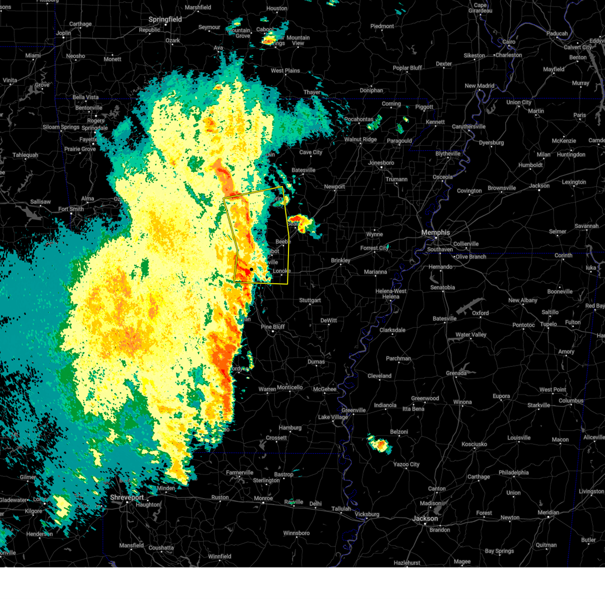
| 4/20/2025 6:11 PM CDT |
 Svrlzk the national weather service in little rock has issued a * severe thunderstorm warning for, southeastern stone county in north central arkansas, independence county in north central arkansas, southeastern izard county in north central arkansas, northwestern prairie county in central arkansas, southwestern jackson county in eastern arkansas, southeastern van buren county in north central arkansas, cleburne county in north central arkansas, northwestern lonoke county in central arkansas, faulkner county in central arkansas, white county in central arkansas, southwestern sharp county in north central arkansas, northeastern pulaski county in central arkansas, * until 700 pm cdt. * at 611 pm cdt, severe thunderstorms were located along a line extending from mountain view to near quitman to near mayflower, moving northeast at 60 mph (radar indicated). Hazards include 60 mph wind gusts and penny size hail. expect damage to roofs, siding, and trees Svrlzk the national weather service in little rock has issued a * severe thunderstorm warning for, southeastern stone county in north central arkansas, independence county in north central arkansas, southeastern izard county in north central arkansas, northwestern prairie county in central arkansas, southwestern jackson county in eastern arkansas, southeastern van buren county in north central arkansas, cleburne county in north central arkansas, northwestern lonoke county in central arkansas, faulkner county in central arkansas, white county in central arkansas, southwestern sharp county in north central arkansas, northeastern pulaski county in central arkansas, * until 700 pm cdt. * at 611 pm cdt, severe thunderstorms were located along a line extending from mountain view to near quitman to near mayflower, moving northeast at 60 mph (radar indicated). Hazards include 60 mph wind gusts and penny size hail. expect damage to roofs, siding, and trees
|
| 4/20/2025 5:30 PM CDT |
 Svrlzk the national weather service in little rock has issued a * severe thunderstorm warning for, southern stone county in north central arkansas, western independence county in north central arkansas, southeastern searcy county in north central arkansas, southern izard county in north central arkansas, northeastern perry county in central arkansas, van buren county in north central arkansas, cleburne county in north central arkansas, northwestern lonoke county in central arkansas, eastern conway county in central arkansas, faulkner county in central arkansas, southwestern white county in central arkansas, northwestern pulaski county in central arkansas, * until 615 pm cdt. * at 529 pm cdt, severe thunderstorms were located along a line extending from near rocky hill to near bethlehem to wye mountain, moving east at 60 mph (radar indicated). Hazards include 60 mph wind gusts and penny size hail. expect damage to roofs, siding, and trees Svrlzk the national weather service in little rock has issued a * severe thunderstorm warning for, southern stone county in north central arkansas, western independence county in north central arkansas, southeastern searcy county in north central arkansas, southern izard county in north central arkansas, northeastern perry county in central arkansas, van buren county in north central arkansas, cleburne county in north central arkansas, northwestern lonoke county in central arkansas, eastern conway county in central arkansas, faulkner county in central arkansas, southwestern white county in central arkansas, northwestern pulaski county in central arkansas, * until 615 pm cdt. * at 529 pm cdt, severe thunderstorms were located along a line extending from near rocky hill to near bethlehem to wye mountain, moving east at 60 mph (radar indicated). Hazards include 60 mph wind gusts and penny size hail. expect damage to roofs, siding, and trees
|
| 4/4/2025 5:33 PM CDT |
 Torlzk the national weather service in little rock has issued a * tornado warning for, south central stone county in north central arkansas, southeastern van buren county in north central arkansas, northern cleburne county in north central arkansas, * until 615 pm cdt. * at 532 pm cdt, a severe thunderstorm capable of producing a tornado was located near whipple, or 10 miles southeast of clinton, moving northeast at 40 mph (radar indicated rotation). Hazards include tornado. Flying debris will be dangerous to those caught without shelter. mobile homes will be damaged or destroyed. damage to roofs, windows, and vehicles will occur. Tree damage is likely. Torlzk the national weather service in little rock has issued a * tornado warning for, south central stone county in north central arkansas, southeastern van buren county in north central arkansas, northern cleburne county in north central arkansas, * until 615 pm cdt. * at 532 pm cdt, a severe thunderstorm capable of producing a tornado was located near whipple, or 10 miles southeast of clinton, moving northeast at 40 mph (radar indicated rotation). Hazards include tornado. Flying debris will be dangerous to those caught without shelter. mobile homes will be damaged or destroyed. damage to roofs, windows, and vehicles will occur. Tree damage is likely.
|
| 4/2/2025 4:55 PM CDT |
 Svrlzk the national weather service in little rock has issued a * severe thunderstorm warning for, southeastern stone county in north central arkansas, independence county in north central arkansas, eastern izard county in north central arkansas, central jackson county in eastern arkansas, northeastern cleburne county in north central arkansas, western lawrence county in eastern arkansas, sharp county in north central arkansas, * until 545 pm cdt. * at 455 pm cdt, severe thunderstorms were located along a line extending from near lunenburg to near croker to near concord, moving east at 45 mph (radar indicated). Hazards include 60 mph wind gusts. expect damage to roofs, siding, and trees Svrlzk the national weather service in little rock has issued a * severe thunderstorm warning for, southeastern stone county in north central arkansas, independence county in north central arkansas, eastern izard county in north central arkansas, central jackson county in eastern arkansas, northeastern cleburne county in north central arkansas, western lawrence county in eastern arkansas, sharp county in north central arkansas, * until 545 pm cdt. * at 455 pm cdt, severe thunderstorms were located along a line extending from near lunenburg to near croker to near concord, moving east at 45 mph (radar indicated). Hazards include 60 mph wind gusts. expect damage to roofs, siding, and trees
|
| 4/2/2025 4:31 PM CDT | the severe thunderstorm warning has been cancelled and is no longer in effect |
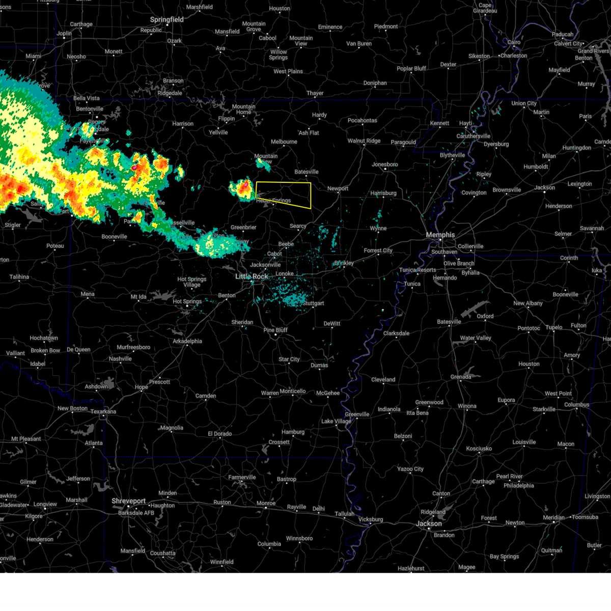
| 4/2/2025 4:31 PM CDT | At 430 pm cdt, severe thunderstorms were located along a line extending from 6 miles southwest of mountain view to 8 miles northeast of fairfield bay to higden, moving northeast at 55 mph (radar indicated). Hazards include 60 mph wind gusts and quarter size hail. Hail damage to vehicles is expected. expect wind damage to roofs, siding, and trees. Locations impacted include, rushing, desha, ida, brownsville, locust grove, melbourne, huff, pleasant grove, narrows marina, shirley, lone star, woodrow, dam site marina, gid, herpel, luber, guion, hill creek recreation area, sugar loaf recreation area, lunenburg,. |
| 4/2/2025 4:08 PM CDT |
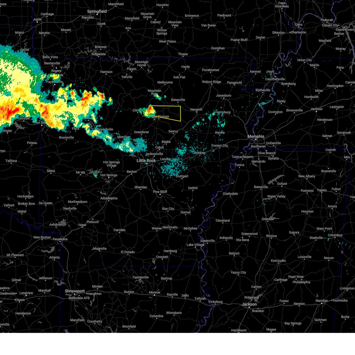
 Svrlzk the national weather service in little rock has issued a * severe thunderstorm warning for, stone county in north central arkansas, western independence county in north central arkansas, southeastern izard county in north central arkansas, eastern van buren county in north central arkansas, cleburne county in north central arkansas, northeastern conway county in central arkansas, * until 500 pm cdt. * at 408 pm cdt, a severe thunderstorm was located over clinton, moving northeast at 60 mph (radar indicated). Hazards include 60 mph wind gusts and quarter size hail. Hail damage to vehicles is expected. Expect wind damage to roofs, siding, and trees. Svrlzk the national weather service in little rock has issued a * severe thunderstorm warning for, stone county in north central arkansas, western independence county in north central arkansas, southeastern izard county in north central arkansas, eastern van buren county in north central arkansas, cleburne county in north central arkansas, northeastern conway county in central arkansas, * until 500 pm cdt. * at 408 pm cdt, a severe thunderstorm was located over clinton, moving northeast at 60 mph (radar indicated). Hazards include 60 mph wind gusts and quarter size hail. Hail damage to vehicles is expected. Expect wind damage to roofs, siding, and trees.
|
| 3/30/2025 6:34 PM CDT |
 the severe thunderstorm warning has been cancelled and is no longer in effect the severe thunderstorm warning has been cancelled and is no longer in effect
|
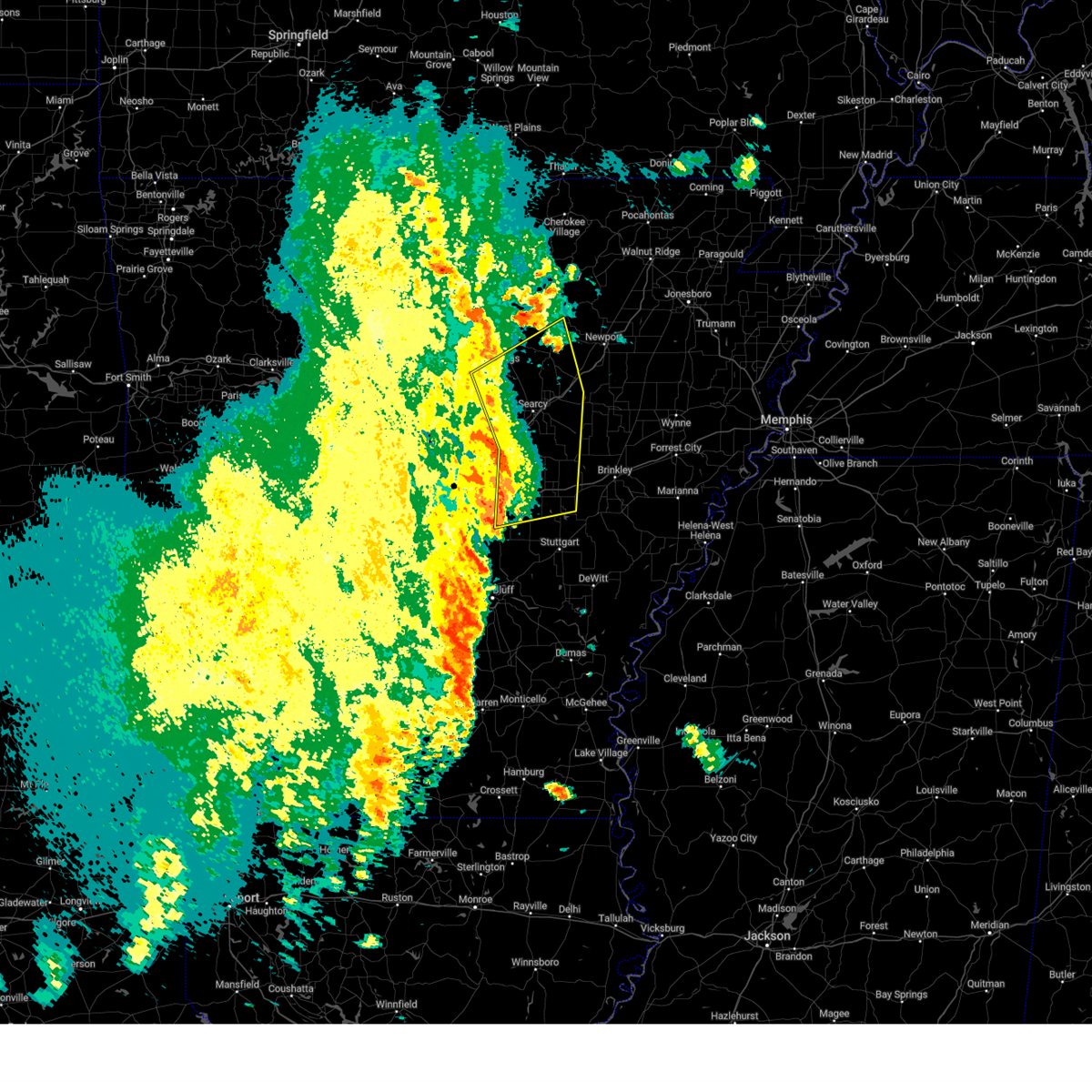
| 3/30/2025 6:18 PM CDT |
 At 618 pm cdt, a severe thunderstorm was located near concord, or 9 miles northeast of heber springs, moving northeast at 30 mph (radar indicated). Hazards include 60 mph wind gusts and quarter size hail. Hail damage to vehicles is expected. expect wind damage to roofs, siding, and trees. Locations impacted include, dam site marina, wilburn, desha, ida, brownsville, concord, ben, locust grove, drasco, hutchinson, almond, wolf bayou, bethesda, southside in independence count,. At 618 pm cdt, a severe thunderstorm was located near concord, or 9 miles northeast of heber springs, moving northeast at 30 mph (radar indicated). Hazards include 60 mph wind gusts and quarter size hail. Hail damage to vehicles is expected. expect wind damage to roofs, siding, and trees. Locations impacted include, dam site marina, wilburn, desha, ida, brownsville, concord, ben, locust grove, drasco, hutchinson, almond, wolf bayou, bethesda, southside in independence count,.
|
| 3/30/2025 6:06 PM CDT |
 At 605 pm cdt, a severe thunderstorm was located over heber springs, moving northeast at 30 mph (radar indicated). Hazards include 60 mph wind gusts and quarter size hail. Hail damage to vehicles is expected. expect wind damage to roofs, siding, and trees. Locations impacted include, dam site marina, wilburn, desha, ida, brownsville, concord, heber springs, ben, eden isle, locust grove, drasco, hutchinson, hopewell in cleburne county, almond, pearson, wolf bayou, bethesda, southside in independence count, greers ferry,. At 605 pm cdt, a severe thunderstorm was located over heber springs, moving northeast at 30 mph (radar indicated). Hazards include 60 mph wind gusts and quarter size hail. Hail damage to vehicles is expected. expect wind damage to roofs, siding, and trees. Locations impacted include, dam site marina, wilburn, desha, ida, brownsville, concord, heber springs, ben, eden isle, locust grove, drasco, hutchinson, hopewell in cleburne county, almond, pearson, wolf bayou, bethesda, southside in independence count, greers ferry,.
|
| 3/30/2025 6:02 PM CDT |
 Svrlzk the national weather service in little rock has issued a * severe thunderstorm warning for, southeastern stone county in north central arkansas, southwestern independence county in north central arkansas, central cleburne county in north central arkansas, * until 645 pm cdt. * at 601 pm cdt, a severe thunderstorm was located over heber springs, moving northeast at 30 mph (radar indicated). Hazards include 60 mph wind gusts. expect damage to roofs, siding, and trees Svrlzk the national weather service in little rock has issued a * severe thunderstorm warning for, southeastern stone county in north central arkansas, southwestern independence county in north central arkansas, central cleburne county in north central arkansas, * until 645 pm cdt. * at 601 pm cdt, a severe thunderstorm was located over heber springs, moving northeast at 30 mph (radar indicated). Hazards include 60 mph wind gusts. expect damage to roofs, siding, and trees
|
| 3/30/2025 5:40 PM CDT |
 At 539 pm cdt, a severe thunderstorm was located near damascus, or 14 miles southeast of clinton, moving northeast at 30 mph (radar indicated). Hazards include 60 mph wind gusts and quarter size hail. Hail damage to vehicles is expected. expect wind damage to roofs, siding, and trees. Locations impacted include, edgemont, southside in van buren county, bee branch, fairbanks, whipple, morganton, fairfield bay marina, hill creek recreation area, damascus, fairfield bay, sugar loaf recreation area, heber springs, guy, greers ferry, eden isle, south fork recreation area, higden, pearson, narrows marina, quitman,. At 539 pm cdt, a severe thunderstorm was located near damascus, or 14 miles southeast of clinton, moving northeast at 30 mph (radar indicated). Hazards include 60 mph wind gusts and quarter size hail. Hail damage to vehicles is expected. expect wind damage to roofs, siding, and trees. Locations impacted include, edgemont, southside in van buren county, bee branch, fairbanks, whipple, morganton, fairfield bay marina, hill creek recreation area, damascus, fairfield bay, sugar loaf recreation area, heber springs, guy, greers ferry, eden isle, south fork recreation area, higden, pearson, narrows marina, quitman,.
|
| 3/30/2025 5:40 PM CDT |
 the severe thunderstorm warning has been cancelled and is no longer in effect the severe thunderstorm warning has been cancelled and is no longer in effect
|
| 3/30/2025 5:28 PM CDT |
 Svrlzk the national weather service in little rock has issued a * severe thunderstorm warning for, southeastern van buren county in north central arkansas, western cleburne county in north central arkansas, east central conway county in central arkansas, north central faulkner county in central arkansas, * until 615 pm cdt. * at 528 pm cdt, a severe thunderstorm was located over twin groves, or 16 miles south of clinton, moving northeast at 25 mph (radar indicated). Hazards include 60 mph wind gusts and quarter size hail. Hail damage to vehicles is expected. Expect wind damage to roofs, siding, and trees. Svrlzk the national weather service in little rock has issued a * severe thunderstorm warning for, southeastern van buren county in north central arkansas, western cleburne county in north central arkansas, east central conway county in central arkansas, north central faulkner county in central arkansas, * until 615 pm cdt. * at 528 pm cdt, a severe thunderstorm was located over twin groves, or 16 miles south of clinton, moving northeast at 25 mph (radar indicated). Hazards include 60 mph wind gusts and quarter size hail. Hail damage to vehicles is expected. Expect wind damage to roofs, siding, and trees.
|
| 3/14/2025 10:03 PM CDT |
 Torlzk the national weather service in little rock has issued a * tornado warning for, central cleburne county in north central arkansas, * until 1045 pm cdt. * at 1003 pm cdt, a severe thunderstorm capable of producing a tornado was located over greers ferry, or near fairfield bay, moving east at 50 mph (radar indicated rotation). Hazards include tornado and quarter size hail. Flying debris will be dangerous to those caught without shelter. mobile homes will be damaged or destroyed. damage to roofs, windows, and vehicles will occur. Tree damage is likely. Torlzk the national weather service in little rock has issued a * tornado warning for, central cleburne county in north central arkansas, * until 1045 pm cdt. * at 1003 pm cdt, a severe thunderstorm capable of producing a tornado was located over greers ferry, or near fairfield bay, moving east at 50 mph (radar indicated rotation). Hazards include tornado and quarter size hail. Flying debris will be dangerous to those caught without shelter. mobile homes will be damaged or destroyed. damage to roofs, windows, and vehicles will occur. Tree damage is likely.
|
| 3/14/2025 9:48 PM CDT | At 948 pm cdt, severe thunderstorms were located along a line extending from near mountain view to near higden to near guy, moving east at 50 mph (radar indicated). Hazards include 60 mph wind gusts and quarter size hail. Hail damage to vehicles is expected. expect wind damage to roofs, siding, and trees. Locations impacted include, rushing, hill creek, brownsville, pleasant grove, twin groves, pearson, mount vernon, narrows marina, shirley, choctow recreation area, woodrow, dam site marina, luber, whipple, hill creek recreation area, bethlehem, sugar loaf recreation area, guy, greers ferry, clinton,. |
| 3/14/2025 9:26 PM CDT | Svrlzk the national weather service in little rock has issued a * severe thunderstorm warning for, southern stone county in north central arkansas, south central izard county in north central arkansas, van buren county in north central arkansas, cleburne county in north central arkansas, northeastern conway county in central arkansas, northern faulkner county in central arkansas, * until 1015 pm cdt. * at 926 pm cdt, severe thunderstorms were located along a line extending from near elba to near solgohachia, moving east at 50 mph (radar indicated). Hazards include 60 mph wind gusts and quarter size hail. Hail damage to vehicles is expected. Expect wind damage to roofs, siding, and trees. |
| 7/16/2024 9:14 PM CDT |
 Svrlzk the national weather service in little rock has issued a * severe thunderstorm warning for, southwestern independence county in north central arkansas, central cleburne county in north central arkansas, north central white county in central arkansas, * until 1000 pm cdt. * at 914 pm cdt, a severe thunderstorm was located near greers ferry, or 7 miles northwest of heber springs, moving east at 20 mph (radar indicated). Hazards include 60 mph wind gusts and quarter size hail. Hail damage to vehicles is expected. Expect wind damage to roofs, siding, and trees. Svrlzk the national weather service in little rock has issued a * severe thunderstorm warning for, southwestern independence county in north central arkansas, central cleburne county in north central arkansas, north central white county in central arkansas, * until 1000 pm cdt. * at 914 pm cdt, a severe thunderstorm was located near greers ferry, or 7 miles northwest of heber springs, moving east at 20 mph (radar indicated). Hazards include 60 mph wind gusts and quarter size hail. Hail damage to vehicles is expected. Expect wind damage to roofs, siding, and trees.
|
| 5/7/2024 5:13 AM CDT |
 the severe thunderstorm warning has been cancelled and is no longer in effect the severe thunderstorm warning has been cancelled and is no longer in effect
|
| 5/7/2024 5:00 AM CDT |
 the severe thunderstorm warning has been cancelled and is no longer in effect the severe thunderstorm warning has been cancelled and is no longer in effect
|
| 5/7/2024 5:00 AM CDT |
 At 459 am cdt, severe thunderstorms were located along a line extending from 8 miles northeast of old lexington to near shirley to bethlehem, moving east at 45 mph (radar indicated). Hazards include 60 mph wind gusts. Expect damage to roofs, siding, and trees. Locations impacted include, heber springs, mountain view, clinton, fairfield bay, melbourne, greenbrier, greers ferry, wooster, quitman, guy, rose bud, cushman, damascus, enola, twin groves, shirley, concord, mount vernon, higden, bethlehem,. At 459 am cdt, severe thunderstorms were located along a line extending from 8 miles northeast of old lexington to near shirley to bethlehem, moving east at 45 mph (radar indicated). Hazards include 60 mph wind gusts. Expect damage to roofs, siding, and trees. Locations impacted include, heber springs, mountain view, clinton, fairfield bay, melbourne, greenbrier, greers ferry, wooster, quitman, guy, rose bud, cushman, damascus, enola, twin groves, shirley, concord, mount vernon, higden, bethlehem,.
|
| 5/7/2024 4:42 AM CDT |
 Svrlzk the national weather service in little rock has issued a * severe thunderstorm warning for, stone county in north central arkansas, western independence county in north central arkansas, southeastern searcy county in north central arkansas, southern izard county in north central arkansas, van buren county in north central arkansas, cleburne county in north central arkansas, conway county in central arkansas, northern faulkner county in central arkansas, west central white county in central arkansas, * until 530 am cdt. * at 442 am cdt, severe thunderstorms were located along a line extending from near elba to near clinton to happy bend, moving east at 45 mph (radar indicated). Hazards include 60 mph wind gusts and penny size hail. expect damage to roofs, siding, and trees Svrlzk the national weather service in little rock has issued a * severe thunderstorm warning for, stone county in north central arkansas, western independence county in north central arkansas, southeastern searcy county in north central arkansas, southern izard county in north central arkansas, van buren county in north central arkansas, cleburne county in north central arkansas, conway county in central arkansas, northern faulkner county in central arkansas, west central white county in central arkansas, * until 530 am cdt. * at 442 am cdt, severe thunderstorms were located along a line extending from near elba to near clinton to happy bend, moving east at 45 mph (radar indicated). Hazards include 60 mph wind gusts and penny size hail. expect damage to roofs, siding, and trees
|
| 4/26/2024 8:03 PM CDT |
 the severe thunderstorm warning has been cancelled and is no longer in effect the severe thunderstorm warning has been cancelled and is no longer in effect
|
| 4/26/2024 8:03 PM CDT |
 At 803 pm cdt, a severe thunderstorm was located near crosby, or 11 miles northwest of searcy, moving northeast at 45 mph (radar indicated). Hazards include 60 mph wind gusts and quarter size hail. Hail damage to vehicles is expected. expect wind damage to roofs, siding, and trees. Locations impacted include, searcy, heber springs, judsonia, kensett, higginson, pangburn, rose bud, crosby, gravel hill, letona, albion, antioch in white county, dam site marina, clay, romance, center hill, sidon, hopewell in cleburne county, joy, pickens in white county,. At 803 pm cdt, a severe thunderstorm was located near crosby, or 11 miles northwest of searcy, moving northeast at 45 mph (radar indicated). Hazards include 60 mph wind gusts and quarter size hail. Hail damage to vehicles is expected. expect wind damage to roofs, siding, and trees. Locations impacted include, searcy, heber springs, judsonia, kensett, higginson, pangburn, rose bud, crosby, gravel hill, letona, albion, antioch in white county, dam site marina, clay, romance, center hill, sidon, hopewell in cleburne county, joy, pickens in white county,.
|
| 4/26/2024 7:52 PM CDT |
 At 752 pm cdt, a severe thunderstorm was located over gravel hill, or 15 miles west of searcy, moving northeast at 50 mph (radar indicated). Hazards include 60 mph wind gusts and quarter size hail. Hail damage to vehicles is expected. expect wind damage to roofs, siding, and trees. Locations impacted include, searcy, heber springs, judsonia, kensett, higginson, pangburn, rose bud, enola, mount vernon, crosby, gravel hill, letona, albion, antioch in white county, barney, sidon, hopewell in cleburne county, pickens in white county, floyd, armstrong springs,. At 752 pm cdt, a severe thunderstorm was located over gravel hill, or 15 miles west of searcy, moving northeast at 50 mph (radar indicated). Hazards include 60 mph wind gusts and quarter size hail. Hail damage to vehicles is expected. expect wind damage to roofs, siding, and trees. Locations impacted include, searcy, heber springs, judsonia, kensett, higginson, pangburn, rose bud, enola, mount vernon, crosby, gravel hill, letona, albion, antioch in white county, barney, sidon, hopewell in cleburne county, pickens in white county, floyd, armstrong springs,.
|
| 4/26/2024 7:46 PM CDT |
 At 746 pm cdt, a severe thunderstorm was located over mount vernon, or 17 miles north of cabot, moving northeast at 50 mph (radar indicated). Hazards include 70 mph wind gusts and quarter size hail. Hail damage to vehicles is expected. expect considerable tree damage. wind damage is also likely to mobile homes, roofs, and outbuildings. Locations impacted include, searcy, heber springs, vilonia, judsonia, kensett, greers ferry, quitman, higginson, pangburn, rose bud, enola, mount vernon, crosby, gravel hill, woolly hollow state park, holland, letona, albion, antioch in white county, barney,. At 746 pm cdt, a severe thunderstorm was located over mount vernon, or 17 miles north of cabot, moving northeast at 50 mph (radar indicated). Hazards include 70 mph wind gusts and quarter size hail. Hail damage to vehicles is expected. expect considerable tree damage. wind damage is also likely to mobile homes, roofs, and outbuildings. Locations impacted include, searcy, heber springs, vilonia, judsonia, kensett, greers ferry, quitman, higginson, pangburn, rose bud, enola, mount vernon, crosby, gravel hill, woolly hollow state park, holland, letona, albion, antioch in white county, barney,.
|
| 4/26/2024 7:46 PM CDT |
 the severe thunderstorm warning has been cancelled and is no longer in effect the severe thunderstorm warning has been cancelled and is no longer in effect
|
| 4/26/2024 7:35 PM CDT |
 Svrlzk the national weather service in little rock has issued a * severe thunderstorm warning for, southeastern van buren county in north central arkansas, southern cleburne county in north central arkansas, northwestern lonoke county in central arkansas, northeastern faulkner county in central arkansas, western white county in central arkansas, * until 815 pm cdt. * at 735 pm cdt, a severe thunderstorm was located near vilonia, or 9 miles east of conway, moving northeast at 50 mph (radar indicated). Hazards include 70 mph wind gusts and quarter size hail. Hail damage to vehicles is expected. expect considerable tree damage. Wind damage is also likely to mobile homes, roofs, and outbuildings. Svrlzk the national weather service in little rock has issued a * severe thunderstorm warning for, southeastern van buren county in north central arkansas, southern cleburne county in north central arkansas, northwestern lonoke county in central arkansas, northeastern faulkner county in central arkansas, western white county in central arkansas, * until 815 pm cdt. * at 735 pm cdt, a severe thunderstorm was located near vilonia, or 9 miles east of conway, moving northeast at 50 mph (radar indicated). Hazards include 70 mph wind gusts and quarter size hail. Hail damage to vehicles is expected. expect considerable tree damage. Wind damage is also likely to mobile homes, roofs, and outbuildings.
|
| 1/11/2024 11:24 PM CST |
 A severe thunderstorm warning remains in effect until midnight cst for southwestern independence. western jackson. southern cleburne. northeastern faulkner and central white counties. at 1124 pm cst, a severe thunderstorm was located over rose bud, or 12 miles south of heber springs, moving east at 50 mph. hazard. 60 mph wind gusts and quarter size hail. A severe thunderstorm warning remains in effect until midnight cst for southwestern independence. western jackson. southern cleburne. northeastern faulkner and central white counties. at 1124 pm cst, a severe thunderstorm was located over rose bud, or 12 miles south of heber springs, moving east at 50 mph. hazard. 60 mph wind gusts and quarter size hail.
|
| 1/11/2024 11:17 PM CST |
 At 1116 pm cst, a severe thunderstorm was located near mount vernon, or 16 miles southwest of heber springs, moving east at 50 mph (radar indicated). Hazards include 60 mph wind gusts and quarter size hail. Hail damage to vehicles is expected. Expect wind damage to roofs, siding, and trees. At 1116 pm cst, a severe thunderstorm was located near mount vernon, or 16 miles southwest of heber springs, moving east at 50 mph (radar indicated). Hazards include 60 mph wind gusts and quarter size hail. Hail damage to vehicles is expected. Expect wind damage to roofs, siding, and trees.
|
| 8/10/2023 2:38 AM CDT |
 The severe thunderstorm warning for southeastern cleburne and northwestern white counties will expire at 245 am cdt, the storm which prompted the warning has weakened below severe limits, and no longer poses an immediate threat to life or property. therefore, the warning will be allowed to expire. however small hail is still possible with this thunderstorm. a tornado watch remains in effect until 300 am cdt for central and north central arkansas. The severe thunderstorm warning for southeastern cleburne and northwestern white counties will expire at 245 am cdt, the storm which prompted the warning has weakened below severe limits, and no longer poses an immediate threat to life or property. therefore, the warning will be allowed to expire. however small hail is still possible with this thunderstorm. a tornado watch remains in effect until 300 am cdt for central and north central arkansas.
|
| 8/10/2023 2:27 AM CDT |
 At 227 am cdt, a severe thunderstorm was located near pangburn, or near heber springs, moving east at 40 mph (radar indicated). Hazards include 60 mph wind gusts and quarter size hail. Hail damage to vehicles is expected. expect wind damage to roofs, siding, and trees. locations impacted include, heber springs, pangburn, rose bud, crosby, letona, dam site marina, wilburn, center hill, sidon, hopewell in cleburne county, joy, pickens in white county, armstrong springs, hail threat, radar indicated max hail size, 1. 00 in wind threat, radar indicated max wind gust, 60 mph. At 227 am cdt, a severe thunderstorm was located near pangburn, or near heber springs, moving east at 40 mph (radar indicated). Hazards include 60 mph wind gusts and quarter size hail. Hail damage to vehicles is expected. expect wind damage to roofs, siding, and trees. locations impacted include, heber springs, pangburn, rose bud, crosby, letona, dam site marina, wilburn, center hill, sidon, hopewell in cleburne county, joy, pickens in white county, armstrong springs, hail threat, radar indicated max hail size, 1. 00 in wind threat, radar indicated max wind gust, 60 mph.
|
| 8/10/2023 2:11 AM CDT |
 At 210 am cdt, a severe thunderstorm was located near quitman, or 8 miles west of heber springs, moving east at 35 mph (radar indicated). Hazards include 60 mph wind gusts and quarter size hail. Hail damage to vehicles is expected. expect wind damage to roofs, siding, and trees. locations impacted include, heber springs, greers ferry, quitman, pangburn, rose bud, higden, crosby, letona, dam site marina, wilburn, center hill, eden isle, sidon, hopewell in cleburne county, pearson, narrows marina, joy, pickens in white county, armstrong springs, hail threat, radar indicated max hail size, 1. 00 in wind threat, radar indicated max wind gust, 60 mph. At 210 am cdt, a severe thunderstorm was located near quitman, or 8 miles west of heber springs, moving east at 35 mph (radar indicated). Hazards include 60 mph wind gusts and quarter size hail. Hail damage to vehicles is expected. expect wind damage to roofs, siding, and trees. locations impacted include, heber springs, greers ferry, quitman, pangburn, rose bud, higden, crosby, letona, dam site marina, wilburn, center hill, eden isle, sidon, hopewell in cleburne county, pearson, narrows marina, joy, pickens in white county, armstrong springs, hail threat, radar indicated max hail size, 1. 00 in wind threat, radar indicated max wind gust, 60 mph.
|
| 8/10/2023 2:01 AM CDT |
 At 200 am cdt, a severe thunderstorm was located over fairbanks, or 10 miles south of fairfield bay, moving east at 35 mph (radar indicated). Hazards include 60 mph wind gusts and quarter size hail. Hail damage to vehicles is expected. Expect wind damage to roofs, siding, and trees. At 200 am cdt, a severe thunderstorm was located over fairbanks, or 10 miles south of fairfield bay, moving east at 35 mph (radar indicated). Hazards include 60 mph wind gusts and quarter size hail. Hail damage to vehicles is expected. Expect wind damage to roofs, siding, and trees.
|
| 8/10/2023 1:26 AM CDT |
 The severe thunderstorm warning for southeastern cleburne and northwestern white counties will expire at 130 am cdt, the storm which prompted the warning has moved out of the area. therefore, the warning will be allowed to expire. however small hail is still possible with this thunderstorm. a tornado watch remains in effect until 300 am cdt for central and north central arkansas. remember, a severe thunderstorm warning still remains in effect for portions of cleburne and white counties until 215 am cdt. The severe thunderstorm warning for southeastern cleburne and northwestern white counties will expire at 130 am cdt, the storm which prompted the warning has moved out of the area. therefore, the warning will be allowed to expire. however small hail is still possible with this thunderstorm. a tornado watch remains in effect until 300 am cdt for central and north central arkansas. remember, a severe thunderstorm warning still remains in effect for portions of cleburne and white counties until 215 am cdt.
|
| 8/10/2023 1:23 AM CDT |
 At 122 am cdt, a severe thunderstorm was located near pangburn, or 8 miles southeast of heber springs, moving east at 35 mph (radar indicated). Hazards include 60 mph wind gusts and quarter size hail. Hail damage to vehicles is expected. Expect wind damage to roofs, siding, and trees. At 122 am cdt, a severe thunderstorm was located near pangburn, or 8 miles southeast of heber springs, moving east at 35 mph (radar indicated). Hazards include 60 mph wind gusts and quarter size hail. Hail damage to vehicles is expected. Expect wind damage to roofs, siding, and trees.
|
| 8/10/2023 1:18 AM CDT |
 At 118 am cdt, a severe thunderstorm was located near heber springs, moving east at 40 mph (radar indicated). Hazards include 60 mph wind gusts and quarter size hail. Hail damage to vehicles is expected. expect wind damage to roofs, siding, and trees. locations impacted include, heber springs, pangburn, crosby, letona, dam site marina, wilburn, hopewell in cleburne county, ida, pickens in white county, sidon, eden isle, hail threat, radar indicated max hail size, 1. 00 in wind threat, radar indicated max wind gust, 60 mph. At 118 am cdt, a severe thunderstorm was located near heber springs, moving east at 40 mph (radar indicated). Hazards include 60 mph wind gusts and quarter size hail. Hail damage to vehicles is expected. expect wind damage to roofs, siding, and trees. locations impacted include, heber springs, pangburn, crosby, letona, dam site marina, wilburn, hopewell in cleburne county, ida, pickens in white county, sidon, eden isle, hail threat, radar indicated max hail size, 1. 00 in wind threat, radar indicated max wind gust, 60 mph.
|
| 8/10/2023 1:09 AM CDT |
 At 109 am cdt, a severe thunderstorm was located near heber springs, moving east at 35 mph (radar indicated). Hazards include 60 mph wind gusts and quarter size hail. Hail damage to vehicles is expected. expect wind damage to roofs, siding, and trees. Locations impacted include, heber springs, greers ferry, quitman, pangburn, higden, crosby, letona, dam site marina, wilburn, hill creek recreation area, ida, brownsville, eden isle, sidon, hopewell in cleburne county, pearson, narrows marina, pickens in white county,. At 109 am cdt, a severe thunderstorm was located near heber springs, moving east at 35 mph (radar indicated). Hazards include 60 mph wind gusts and quarter size hail. Hail damage to vehicles is expected. expect wind damage to roofs, siding, and trees. Locations impacted include, heber springs, greers ferry, quitman, pangburn, higden, crosby, letona, dam site marina, wilburn, hill creek recreation area, ida, brownsville, eden isle, sidon, hopewell in cleburne county, pearson, narrows marina, pickens in white county,.
|
| 8/10/2023 12:51 AM CDT |
 At 1251 am cdt, a severe thunderstorm was located near fairbanks, or 8 miles south of fairfield bay, moving east at 35 mph (radar indicated). Hazards include 60 mph wind gusts and quarter size hail. Hail damage to vehicles is expected. Expect wind damage to roofs, siding, and trees. At 1251 am cdt, a severe thunderstorm was located near fairbanks, or 8 miles south of fairfield bay, moving east at 35 mph (radar indicated). Hazards include 60 mph wind gusts and quarter size hail. Hail damage to vehicles is expected. Expect wind damage to roofs, siding, and trees.
|
| 8/7/2023 6:18 AM CDT |
 At 617 am cdt, a severe thunderstorm was located 7 miles southwest of concord, or 8 miles north of heber springs, moving southeast at 50 mph (radar indicated). Hazards include golf ball size hail and 60 mph wind gusts. People and animals outdoors will be injured. expect hail damage to roofs, siding, windows, and vehicles. expect wind damage to roofs, siding, and trees. locations impacted include, pleasant plains, concord, southside in independence count, salado, drasco, hutchinson, wolf bayou, ida, brownsville, roosevelt, woodrow, huff, thunderstorm damage threat, considerable hail threat, radar indicated max hail size, 1. 75 in wind threat, radar indicated max wind gust, 60 mph. At 617 am cdt, a severe thunderstorm was located 7 miles southwest of concord, or 8 miles north of heber springs, moving southeast at 50 mph (radar indicated). Hazards include golf ball size hail and 60 mph wind gusts. People and animals outdoors will be injured. expect hail damage to roofs, siding, windows, and vehicles. expect wind damage to roofs, siding, and trees. locations impacted include, pleasant plains, concord, southside in independence count, salado, drasco, hutchinson, wolf bayou, ida, brownsville, roosevelt, woodrow, huff, thunderstorm damage threat, considerable hail threat, radar indicated max hail size, 1. 75 in wind threat, radar indicated max wind gust, 60 mph.
|
| 8/7/2023 6:09 AM CDT |
 At 609 am cdt, a severe thunderstorm was located 3 miles north of greers ferry, or 8 miles northeast of fairfield bay, moving east at 50 mph (radar indicated). Hazards include golf ball size hail and 60 mph wind gusts. People and animals outdoors will be injured. expect hail damage to roofs, siding, windows, and vehicles. expect wind damage to roofs, siding, and trees. locations impacted include, heber springs, fairfield bay, greers ferry, pleasant plains, concord, higden, southside in independence count, salado, almond, hickory flat, wilburn, ida, brownsville, huff, narrows marina, brewer, roosevelt, woodrow, edgemont, prim, thunderstorm damage threat, considerable hail threat, radar indicated max hail size, 1. 75 in wind threat, radar indicated max wind gust, 60 mph. At 609 am cdt, a severe thunderstorm was located 3 miles north of greers ferry, or 8 miles northeast of fairfield bay, moving east at 50 mph (radar indicated). Hazards include golf ball size hail and 60 mph wind gusts. People and animals outdoors will be injured. expect hail damage to roofs, siding, windows, and vehicles. expect wind damage to roofs, siding, and trees. locations impacted include, heber springs, fairfield bay, greers ferry, pleasant plains, concord, higden, southside in independence count, salado, almond, hickory flat, wilburn, ida, brownsville, huff, narrows marina, brewer, roosevelt, woodrow, edgemont, prim, thunderstorm damage threat, considerable hail threat, radar indicated max hail size, 1. 75 in wind threat, radar indicated max wind gust, 60 mph.
|
| 8/7/2023 6:06 AM CDT |
 At 606 am cdt, a severe thunderstorm was located 3 miles northwest of greers ferry, moving southeast at 50 mph (radar indicated). Hazards include 60 mph wind gusts and half dollar size hail. Hail damage to vehicles is expected. Expect wind damage to roofs, siding, and trees. At 606 am cdt, a severe thunderstorm was located 3 miles northwest of greers ferry, moving southeast at 50 mph (radar indicated). Hazards include 60 mph wind gusts and half dollar size hail. Hail damage to vehicles is expected. Expect wind damage to roofs, siding, and trees.
|
| 7/14/2023 10:48 PM CDT |
 At 1048 pm cdt, severe thunderstorms were located along a line extending from rose bud to near enola to near hill creek, moving southeast at 45 mph (radar indicated). Hazards include 60 mph wind gusts and penny size hail. Expect damage to roofs, siding, and trees. locations impacted include, heber springs, morrilton, greenbrier, greers ferry, wooster, quitman, guy, damascus, twin groves, bethlehem, hill creek, solgohachia, catholic point, hattieville, middleton, lanty, fairbanks, mallet town, jerusalem, springhill, hail threat, radar indicated max hail size, 0. 75 in wind threat, radar indicated max wind gust, 60 mph. At 1048 pm cdt, severe thunderstorms were located along a line extending from rose bud to near enola to near hill creek, moving southeast at 45 mph (radar indicated). Hazards include 60 mph wind gusts and penny size hail. Expect damage to roofs, siding, and trees. locations impacted include, heber springs, morrilton, greenbrier, greers ferry, wooster, quitman, guy, damascus, twin groves, bethlehem, hill creek, solgohachia, catholic point, hattieville, middleton, lanty, fairbanks, mallet town, jerusalem, springhill, hail threat, radar indicated max hail size, 0. 75 in wind threat, radar indicated max wind gust, 60 mph.
|
| 7/14/2023 10:29 PM CDT |
 At 1029 pm cdt, severe thunderstorms were located along a line extending from near sugar loaf recreation area to twin groves to near jerusalem, moving southeast at 45 mph (radar indicated). Hazards include 60 mph wind gusts and penny size hail. Expect damage to roofs, siding, and trees. locations impacted include, heber springs, morrilton, clinton, fairfield bay, greenbrier, atkins, greers ferry, wooster, quitman, guy, hector, damascus, twin groves, shirley, higden, bethlehem, hill creek, happy bend, hattieville, whipple, hail threat, radar indicated max hail size, 0. 75 in wind threat, radar indicated max wind gust, 60 mph. At 1029 pm cdt, severe thunderstorms were located along a line extending from near sugar loaf recreation area to twin groves to near jerusalem, moving southeast at 45 mph (radar indicated). Hazards include 60 mph wind gusts and penny size hail. Expect damage to roofs, siding, and trees. locations impacted include, heber springs, morrilton, clinton, fairfield bay, greenbrier, atkins, greers ferry, wooster, quitman, guy, hector, damascus, twin groves, shirley, higden, bethlehem, hill creek, happy bend, hattieville, whipple, hail threat, radar indicated max hail size, 0. 75 in wind threat, radar indicated max wind gust, 60 mph.
|
| 7/14/2023 10:10 PM CDT |
 At 1010 pm cdt, severe thunderstorms were located along a line extending from old lexington to near claude to broomfield, moving southeast at 35 mph (radar indicated). Hazards include 60 mph wind gusts and penny size hail. expect damage to roofs, siding, and trees At 1010 pm cdt, severe thunderstorms were located along a line extending from old lexington to near claude to broomfield, moving southeast at 35 mph (radar indicated). Hazards include 60 mph wind gusts and penny size hail. expect damage to roofs, siding, and trees
|
| 6/18/2023 2:56 AM CDT |
 At 256 am cdt, severe thunderstorms were located along a line extending from 10 miles west of concord to near pangburn to near ward, moving east at 55 mph (radar indicated). Hazards include 60 mph wind gusts and penny size hail. Expect damage to roofs, siding, and trees. locations impacted include, searcy, heber springs, beebe, bald knob, judsonia, kensett, greers ferry, higginson, pangburn, rose bud, pleasant plains, concord, russell, west point, crosby, pryor, gravel hill, steprock, mcrae, bradford, hail threat, radar indicated max hail size, 0. 75 in wind threat, radar indicated max wind gust, 60 mph. At 256 am cdt, severe thunderstorms were located along a line extending from 10 miles west of concord to near pangburn to near ward, moving east at 55 mph (radar indicated). Hazards include 60 mph wind gusts and penny size hail. Expect damage to roofs, siding, and trees. locations impacted include, searcy, heber springs, beebe, bald knob, judsonia, kensett, greers ferry, higginson, pangburn, rose bud, pleasant plains, concord, russell, west point, crosby, pryor, gravel hill, steprock, mcrae, bradford, hail threat, radar indicated max hail size, 0. 75 in wind threat, radar indicated max wind gust, 60 mph.
|
| 6/18/2023 2:20 AM CDT |
 At 219 am cdt, severe thunderstorms were located along a line extending from near clinton to near woolly hollow state park to near mayflower, moving east at 55 mph (radar indicated). Hazards include 60 mph wind gusts and penny size hail. expect damage to roofs, siding, and trees At 219 am cdt, severe thunderstorms were located along a line extending from near clinton to near woolly hollow state park to near mayflower, moving east at 55 mph (radar indicated). Hazards include 60 mph wind gusts and penny size hail. expect damage to roofs, siding, and trees
|
| 6/14/2023 10:47 AM CDT |
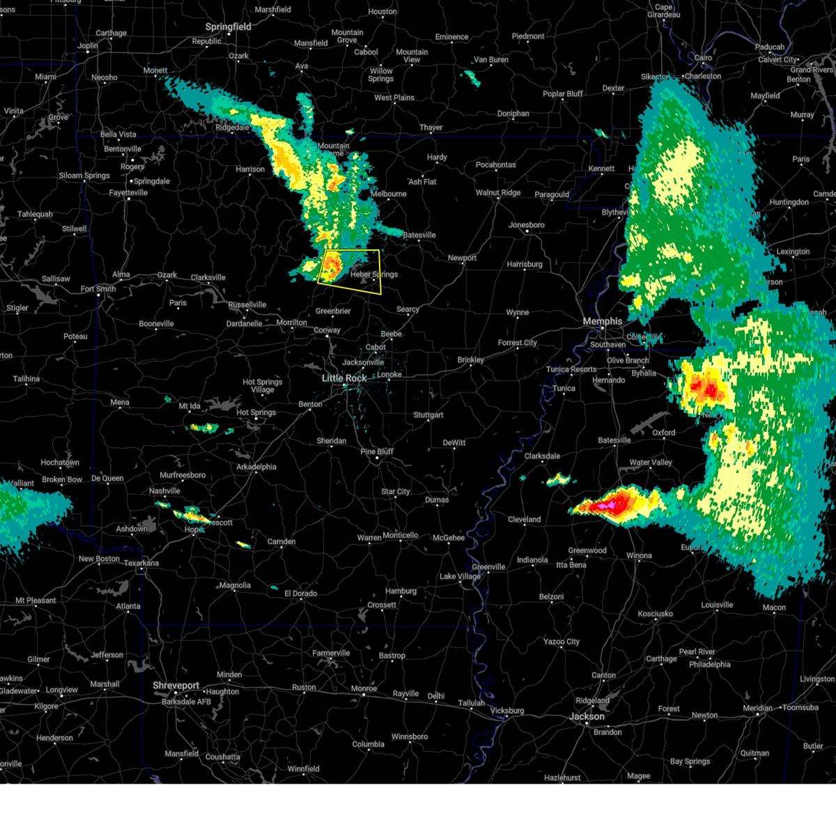 At 1047 am cdt, a severe thunderstorm was located over fairfield bay marina, or near fairfield bay, moving east at 55 mph (radar indicated). Hazards include 60 mph wind gusts and penny size hail. Expect damage to roofs, siding, and trees. locations impacted include, heber springs, clinton, fairfield bay, greers ferry, shirley, higden, fairfield bay marina, fairbanks, sugar loaf recreation area, choctaw, bee branch, brownsville, pearson, narrows marina, brewer, choctow recreation area, woodrow, edgemont, prim, dam site marina, hail threat, radar indicated max hail size, 0. 75 in wind threat, radar indicated max wind gust, 60 mph. At 1047 am cdt, a severe thunderstorm was located over fairfield bay marina, or near fairfield bay, moving east at 55 mph (radar indicated). Hazards include 60 mph wind gusts and penny size hail. Expect damage to roofs, siding, and trees. locations impacted include, heber springs, clinton, fairfield bay, greers ferry, shirley, higden, fairfield bay marina, fairbanks, sugar loaf recreation area, choctaw, bee branch, brownsville, pearson, narrows marina, brewer, choctow recreation area, woodrow, edgemont, prim, dam site marina, hail threat, radar indicated max hail size, 0. 75 in wind threat, radar indicated max wind gust, 60 mph.
|
| 6/14/2023 10:26 AM CDT |
 At 1026 am cdt, a severe thunderstorm was located near dabney, or 13 miles west of clinton, moving east at 55 mph (radar indicated). Hazards include 60 mph wind gusts and penny size hail. expect damage to roofs, siding, and trees At 1026 am cdt, a severe thunderstorm was located near dabney, or 13 miles west of clinton, moving east at 55 mph (radar indicated). Hazards include 60 mph wind gusts and penny size hail. expect damage to roofs, siding, and trees
|
| 6/10/2023 1:00 PM CDT |
 At 1259 pm cdt, a severe thunderstorm was located over concord, or 13 miles northeast of heber springs, moving east at 30 mph (radar indicated). Hazards include 60 mph wind gusts and quarter size hail. Hail damage to vehicles is expected. expect wind damage to roofs, siding, and trees. locations impacted include, batesville, pleasant plains, concord, bethesda, ben, almond, drasco, hutchinson, wolf bayou, desha, ida, locust grove, hail threat, radar indicated max hail size, 1. 00 in wind threat, radar indicated max wind gust, 60 mph. At 1259 pm cdt, a severe thunderstorm was located over concord, or 13 miles northeast of heber springs, moving east at 30 mph (radar indicated). Hazards include 60 mph wind gusts and quarter size hail. Hail damage to vehicles is expected. expect wind damage to roofs, siding, and trees. locations impacted include, batesville, pleasant plains, concord, bethesda, ben, almond, drasco, hutchinson, wolf bayou, desha, ida, locust grove, hail threat, radar indicated max hail size, 1. 00 in wind threat, radar indicated max wind gust, 60 mph.
|
| 6/10/2023 12:39 PM CDT |
 At 1239 pm cdt, a severe thunderstorm was located 7 miles northeast of greers ferry, or 9 miles north of heber springs, moving east at 25 mph (radar indicated). Hazards include 60 mph wind gusts and quarter size hail. Hail damage to vehicles is expected. Expect wind damage to roofs, siding, and trees. At 1239 pm cdt, a severe thunderstorm was located 7 miles northeast of greers ferry, or 9 miles north of heber springs, moving east at 25 mph (radar indicated). Hazards include 60 mph wind gusts and quarter size hail. Hail damage to vehicles is expected. Expect wind damage to roofs, siding, and trees.
|
| 6/10/2023 12:35 PM CDT |
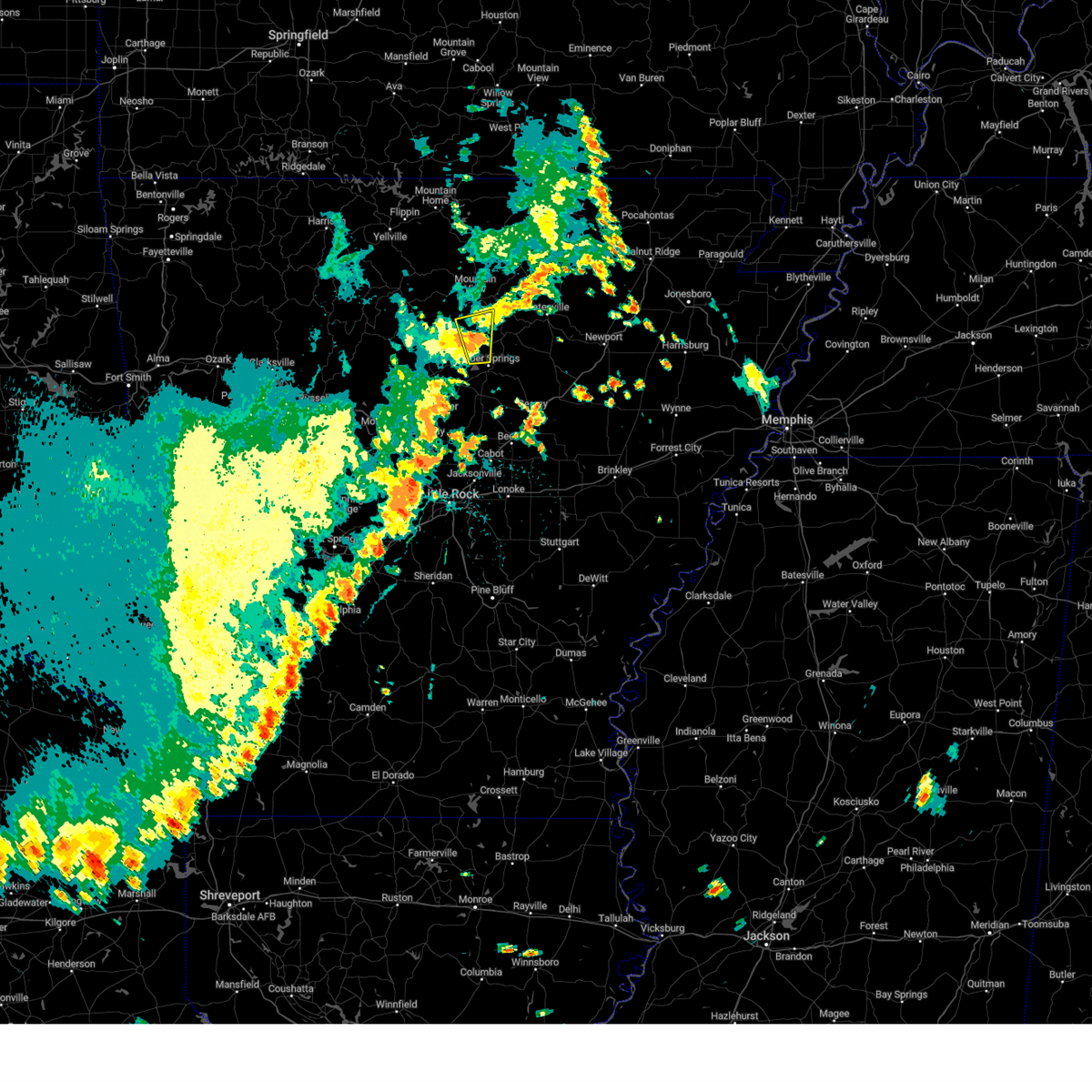 At 1235 pm cdt, a severe thunderstorm was located 7 miles northeast of greers ferry, or 9 miles northeast of fairfield bay, moving east at 30 mph (radar indicated). Hazards include 60 mph wind gusts and quarter size hail. Hail damage to vehicles is expected. expect wind damage to roofs, siding, and trees. locations impacted include, heber springs, greers ferry, edgemont, parma, prim, luber, hill creek recreation area, brownsville, brewer, woodrow, eden isle, hail threat, radar indicated max hail size, 1. 00 in wind threat, radar indicated max wind gust, 60 mph. At 1235 pm cdt, a severe thunderstorm was located 7 miles northeast of greers ferry, or 9 miles northeast of fairfield bay, moving east at 30 mph (radar indicated). Hazards include 60 mph wind gusts and quarter size hail. Hail damage to vehicles is expected. expect wind damage to roofs, siding, and trees. locations impacted include, heber springs, greers ferry, edgemont, parma, prim, luber, hill creek recreation area, brownsville, brewer, woodrow, eden isle, hail threat, radar indicated max hail size, 1. 00 in wind threat, radar indicated max wind gust, 60 mph.
|
| 6/10/2023 12:23 PM CDT | At 1223 pm cdt, a severe thunderstorm was located near fairfield bay, moving east at 30 mph (radar indicated). Hazards include 60 mph wind gusts and quarter size hail. Hail damage to vehicles is expected. expect wind damage to roofs, siding, and trees. locations impacted include, heber springs, clinton, fairfield bay, greers ferry, shirley, higden, fairfield bay marina, sugar loaf recreation area, edgemont, parma, prim, luber, hill creek recreation area, brownsville, south fork recreation area, narrows marina, brewer, choctow recreation area, woodrow, eden isle, hail threat, radar indicated max hail size, 1. 00 in wind threat, radar indicated max wind gust, 60 mph. |
| 6/10/2023 12:10 PM CDT |
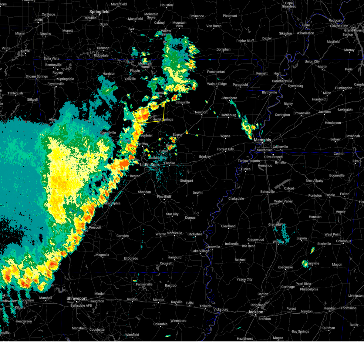 At 1209 pm cdt, a severe thunderstorm was located over fairfield bay marina, or near fairfield bay, moving east at 30 mph (radar indicated). Hazards include 60 mph wind gusts and quarter size hail. Hail damage to vehicles is expected. Expect wind damage to roofs, siding, and trees. At 1209 pm cdt, a severe thunderstorm was located over fairfield bay marina, or near fairfield bay, moving east at 30 mph (radar indicated). Hazards include 60 mph wind gusts and quarter size hail. Hail damage to vehicles is expected. Expect wind damage to roofs, siding, and trees.
|
| 4/15/2023 6:40 PM CDT |
 At 640 pm cdt, severe thunderstorms were located along a line extending from near lake charles state park to near tuckerman to 9 miles north of russell, moving east at 45 mph (radar indicated). Hazards include 60 mph wind gusts. Expect damage to roofs, siding, and trees. locations impacted include, batesville, newport, heber springs, walnut ridge, hoxie, black rock, lake charles state park, cave city, tuckerman, diaz, newark, swifton, pangburn, college city, portia, grubbs, pleasant plains, strawberry, lynn, oil trough, hail threat, radar indicated max hail size, <. 75 in wind threat, radar indicated max wind gust, 60 mph. At 640 pm cdt, severe thunderstorms were located along a line extending from near lake charles state park to near tuckerman to 9 miles north of russell, moving east at 45 mph (radar indicated). Hazards include 60 mph wind gusts. Expect damage to roofs, siding, and trees. locations impacted include, batesville, newport, heber springs, walnut ridge, hoxie, black rock, lake charles state park, cave city, tuckerman, diaz, newark, swifton, pangburn, college city, portia, grubbs, pleasant plains, strawberry, lynn, oil trough, hail threat, radar indicated max hail size, <. 75 in wind threat, radar indicated max wind gust, 60 mph.
|
| 4/15/2023 6:26 PM CDT |
 At 625 pm cdt, severe thunderstorms were located along a line extending from 7 miles northwest of strawberry to near newark to near steprock, moving east at 45 mph (radar indicated). Hazards include 60 mph wind gusts and quarter size hail. Hail damage to vehicles is expected. Expect wind damage to roofs, siding, and trees. At 625 pm cdt, severe thunderstorms were located along a line extending from 7 miles northwest of strawberry to near newark to near steprock, moving east at 45 mph (radar indicated). Hazards include 60 mph wind gusts and quarter size hail. Hail damage to vehicles is expected. Expect wind damage to roofs, siding, and trees.
|
| 4/15/2023 6:14 PM CDT |
 At 614 pm cdt, a severe thunderstorm was located 8 miles south of concord, or 9 miles east of heber springs, moving east at 20 mph (radar indicated). Hazards include quarter size hail. damage to vehicles is expected At 614 pm cdt, a severe thunderstorm was located 8 miles south of concord, or 9 miles east of heber springs, moving east at 20 mph (radar indicated). Hazards include quarter size hail. damage to vehicles is expected
|
| 4/15/2023 6:10 PM CDT |
 At 609 pm cdt, severe thunderstorms were located along a line extending from 6 miles north of greers ferry to near fairbanks to guy, moving east at 40 mph (radar indicated). Hazards include 60 mph wind gusts. Expect damage to roofs, siding, and trees. locations impacted include, heber springs, fairfield bay, greers ferry, quitman, guy, damascus, twin groves, shirley, higden, fairfield bay marina, fairbanks, sugar loaf recreation area, bee branch, ben, parma, brownsville, pearson, narrows marina, brewer, woodrow, hail threat, radar indicated max hail size, <. 75 in wind threat, radar indicated max wind gust, 60 mph. At 609 pm cdt, severe thunderstorms were located along a line extending from 6 miles north of greers ferry to near fairbanks to guy, moving east at 40 mph (radar indicated). Hazards include 60 mph wind gusts. Expect damage to roofs, siding, and trees. locations impacted include, heber springs, fairfield bay, greers ferry, quitman, guy, damascus, twin groves, shirley, higden, fairfield bay marina, fairbanks, sugar loaf recreation area, bee branch, ben, parma, brownsville, pearson, narrows marina, brewer, woodrow, hail threat, radar indicated max hail size, <. 75 in wind threat, radar indicated max wind gust, 60 mph.
|
| 4/15/2023 5:50 PM CDT |
 At 550 pm cdt, severe thunderstorms were located along a line extending from near old lexington to near whipple to middleton, moving east at 40 mph (radar indicated). Hazards include 60 mph wind gusts and quarter size hail. Hail damage to vehicles is expected. expect wind damage to roofs, siding, and trees. locations impacted include, heber springs, clinton, fairfield bay, greers ferry, quitman, guy, damascus, twin groves, shirley, higden, fairfield bay marina, claude, catholic point, middleton, fairbanks, whipple, sugar loaf recreation area, choctaw, bee branch, ben, hail threat, radar indicated max hail size, 1. 00 in wind threat, radar indicated max wind gust, 60 mph. At 550 pm cdt, severe thunderstorms were located along a line extending from near old lexington to near whipple to middleton, moving east at 40 mph (radar indicated). Hazards include 60 mph wind gusts and quarter size hail. Hail damage to vehicles is expected. expect wind damage to roofs, siding, and trees. locations impacted include, heber springs, clinton, fairfield bay, greers ferry, quitman, guy, damascus, twin groves, shirley, higden, fairfield bay marina, claude, catholic point, middleton, fairbanks, whipple, sugar loaf recreation area, choctaw, bee branch, ben, hail threat, radar indicated max hail size, 1. 00 in wind threat, radar indicated max wind gust, 60 mph.
|
| 4/15/2023 5:46 PM CDT |
 At 546 pm cdt, a severe thunderstorm was located over heber springs, moving northeast at 35 mph (radar indicated). Hazards include 60 mph wind gusts and quarter size hail. Hail damage to vehicles is expected. expect wind damage to roofs, siding, and trees. locations impacted include, heber springs, greers ferry, pangburn, concord, steprock, dam site marina, hickory flat, clay, wilburn, ida, dewey, eden isle, hutchinson, hopewell in cleburne county, pearson, sunnydale, roosevelt, drasco, desha, hail threat, radar indicated max hail size, 1. 00 in wind threat, radar indicated max wind gust, 60 mph. At 546 pm cdt, a severe thunderstorm was located over heber springs, moving northeast at 35 mph (radar indicated). Hazards include 60 mph wind gusts and quarter size hail. Hail damage to vehicles is expected. expect wind damage to roofs, siding, and trees. locations impacted include, heber springs, greers ferry, pangburn, concord, steprock, dam site marina, hickory flat, clay, wilburn, ida, dewey, eden isle, hutchinson, hopewell in cleburne county, pearson, sunnydale, roosevelt, drasco, desha, hail threat, radar indicated max hail size, 1. 00 in wind threat, radar indicated max wind gust, 60 mph.
|
| 4/15/2023 5:42 PM CDT |
 At 542 pm cdt, severe thunderstorms were located along a line extending from old lexington to clinton to middleton, moving east at 35 mph (radar indicated). Hazards include 60 mph wind gusts and quarter size hail. Hail damage to vehicles is expected. Expect wind damage to roofs, siding, and trees. At 542 pm cdt, severe thunderstorms were located along a line extending from old lexington to clinton to middleton, moving east at 35 mph (radar indicated). Hazards include 60 mph wind gusts and quarter size hail. Hail damage to vehicles is expected. Expect wind damage to roofs, siding, and trees.
|
| 4/15/2023 5:34 PM CDT |
 At 534 pm cdt, a severe thunderstorm was located near quitman, or 7 miles southwest of heber springs, moving northeast at 35 mph (radar indicated). Hazards include 60 mph wind gusts and quarter size hail. Hail damage to vehicles is expected. Expect wind damage to roofs, siding, and trees. At 534 pm cdt, a severe thunderstorm was located near quitman, or 7 miles southwest of heber springs, moving northeast at 35 mph (radar indicated). Hazards include 60 mph wind gusts and quarter size hail. Hail damage to vehicles is expected. Expect wind damage to roofs, siding, and trees.
|
| 4/15/2023 5:00 PM CDT |
 At 500 pm cdt, a severe thunderstorm was located over old lexington, or 7 miles north of clinton, moving east at 35 mph (radar indicated). Hazards include two inch hail and 60 mph wind gusts. People and animals outdoors will be injured. expect hail damage to roofs, siding, windows, and vehicles. expect wind damage to roofs, siding, and trees. locations impacted include, mountain view, clinton, fairfield bay, greers ferry, shirley, higden, thola, fairfield bay marina, rocky hill, elba, sugar loaf recreation area, old lexington, elberta, blanchard springs campground, leslie, allison, alco, parma, hanover, rushing, thunderstorm damage threat, considerable hail threat, radar indicated max hail size, 2. 00 in wind threat, radar indicated max wind gust, 60 mph. At 500 pm cdt, a severe thunderstorm was located over old lexington, or 7 miles north of clinton, moving east at 35 mph (radar indicated). Hazards include two inch hail and 60 mph wind gusts. People and animals outdoors will be injured. expect hail damage to roofs, siding, windows, and vehicles. expect wind damage to roofs, siding, and trees. locations impacted include, mountain view, clinton, fairfield bay, greers ferry, shirley, higden, thola, fairfield bay marina, rocky hill, elba, sugar loaf recreation area, old lexington, elberta, blanchard springs campground, leslie, allison, alco, parma, hanover, rushing, thunderstorm damage threat, considerable hail threat, radar indicated max hail size, 2. 00 in wind threat, radar indicated max wind gust, 60 mph.
|
| 4/15/2023 4:48 PM CDT |
 At 447 pm cdt, a severe thunderstorm was located near rocky hill, or 8 miles northwest of clinton, moving east at 35 mph (radar indicated). Hazards include two inch hail and 60 mph wind gusts. People and animals outdoors will be injured. expect hail damage to roofs, siding, windows, and vehicles. expect wind damage to roofs, siding, and trees. locations impacted include, mountain view, clinton, fairfield bay, greers ferry, shirley, higden, rocky hill, sugar loaf recreation area, elberta, blanchard springs campground, thola, fairfield bay marina, elba, woolum, old lexington, choctaw, leslie, allison, alread, alco, thunderstorm damage threat, considerable hail threat, radar indicated max hail size, 2. 00 in wind threat, radar indicated max wind gust, 60 mph. At 447 pm cdt, a severe thunderstorm was located near rocky hill, or 8 miles northwest of clinton, moving east at 35 mph (radar indicated). Hazards include two inch hail and 60 mph wind gusts. People and animals outdoors will be injured. expect hail damage to roofs, siding, windows, and vehicles. expect wind damage to roofs, siding, and trees. locations impacted include, mountain view, clinton, fairfield bay, greers ferry, shirley, higden, rocky hill, sugar loaf recreation area, elberta, blanchard springs campground, thola, fairfield bay marina, elba, woolum, old lexington, choctaw, leslie, allison, alread, alco, thunderstorm damage threat, considerable hail threat, radar indicated max hail size, 2. 00 in wind threat, radar indicated max wind gust, 60 mph.
|
| 4/15/2023 4:40 PM CDT |
 At 439 pm cdt, a severe thunderstorm was located near woolum, or 11 miles northwest of clinton, moving east at 35 mph (radar indicated). Hazards include two inch hail and 60 mph wind gusts. People and animals outdoors will be injured. expect hail damage to roofs, siding, windows, and vehicles. Expect wind damage to roofs, siding, and trees. At 439 pm cdt, a severe thunderstorm was located near woolum, or 11 miles northwest of clinton, moving east at 35 mph (radar indicated). Hazards include two inch hail and 60 mph wind gusts. People and animals outdoors will be injured. expect hail damage to roofs, siding, windows, and vehicles. Expect wind damage to roofs, siding, and trees.
|
| 4/5/2023 9:55 AM CDT |
 At 954 am cdt, severe thunderstorms were located along a line extending from 6 miles west of blanchard springs campground to near clinton to near claude, moving east at 50 mph (radar indicated). Hazards include 60 mph wind gusts and quarter size hail. Hail damage to vehicles is expected. expect wind damage to roofs, siding, and trees. locations impacted include, heber springs, mountain view, clinton, fairfield bay, melbourne, greers ferry, quitman, damascus, shirley, higden, lone star, herpel, whipple, sugar loaf recreation area, blick, blanchard springs campground, fairfield bay marina, claude, cleveland, catholic point, hail threat, radar indicated max hail size, 1. 00 in wind threat, radar indicated max wind gust, 60 mph. At 954 am cdt, severe thunderstorms were located along a line extending from 6 miles west of blanchard springs campground to near clinton to near claude, moving east at 50 mph (radar indicated). Hazards include 60 mph wind gusts and quarter size hail. Hail damage to vehicles is expected. expect wind damage to roofs, siding, and trees. locations impacted include, heber springs, mountain view, clinton, fairfield bay, melbourne, greers ferry, quitman, damascus, shirley, higden, lone star, herpel, whipple, sugar loaf recreation area, blick, blanchard springs campground, fairfield bay marina, claude, cleveland, catholic point, hail threat, radar indicated max hail size, 1. 00 in wind threat, radar indicated max wind gust, 60 mph.
|
| 4/5/2023 9:27 AM CDT |
 At 927 am cdt, severe thunderstorms were located along a line extending from near watts to 7 miles south of dabney to near happy bend, moving east at 50 mph (radar indicated). Hazards include 60 mph wind gusts and quarter size hail. Hail damage to vehicles is expected. Expect wind damage to roofs, siding, and trees. At 927 am cdt, severe thunderstorms were located along a line extending from near watts to 7 miles south of dabney to near happy bend, moving east at 50 mph (radar indicated). Hazards include 60 mph wind gusts and quarter size hail. Hail damage to vehicles is expected. Expect wind damage to roofs, siding, and trees.
|
| 4/5/2023 2:30 AM CDT |
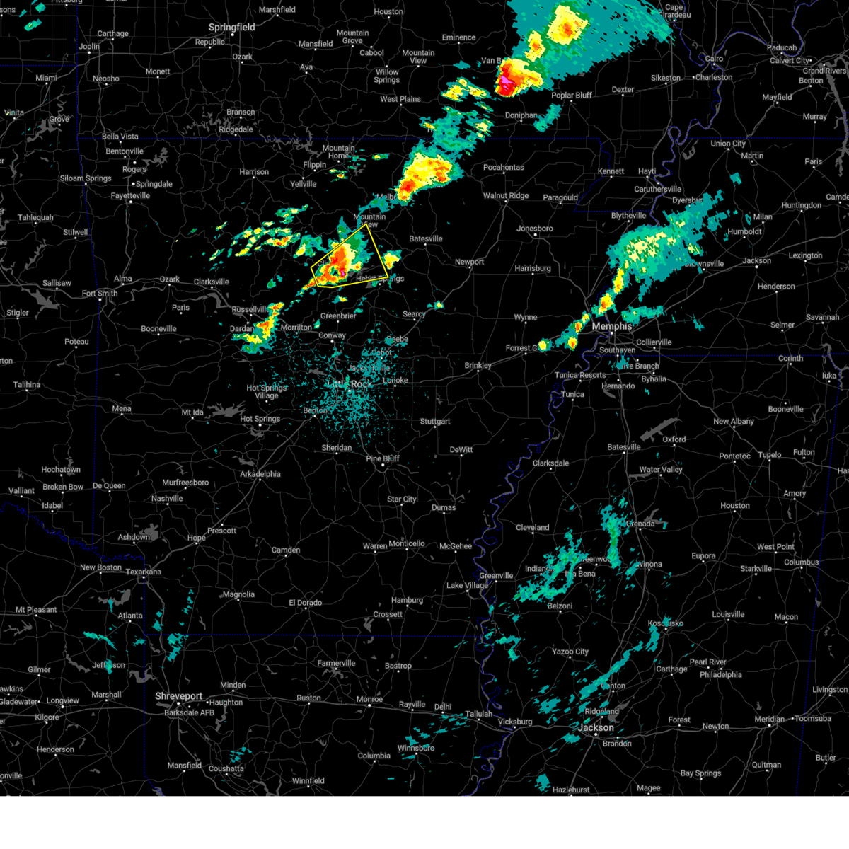 At 229 am cdt, a severe thunderstorm was located over clinton, moving northeast at 40 mph (radar indicated). Hazards include 60 mph wind gusts and quarter size hail. Hail damage to vehicles is expected. expect wind damage to roofs, siding, and trees. locations impacted include, heber springs, mountain view, clinton, fairfield bay, greers ferry, shirley, higden, fairfield bay marina, sugar loaf recreation area, old lexington, choctaw, parma, hanover, rushing, turkey creek, brownsville, narrows marina, crabtree, brewer, choctow recreation area, hail threat, radar indicated max hail size, 1. 00 in wind threat, radar indicated max wind gust, 60 mph. At 229 am cdt, a severe thunderstorm was located over clinton, moving northeast at 40 mph (radar indicated). Hazards include 60 mph wind gusts and quarter size hail. Hail damage to vehicles is expected. expect wind damage to roofs, siding, and trees. locations impacted include, heber springs, mountain view, clinton, fairfield bay, greers ferry, shirley, higden, fairfield bay marina, sugar loaf recreation area, old lexington, choctaw, parma, hanover, rushing, turkey creek, brownsville, narrows marina, crabtree, brewer, choctow recreation area, hail threat, radar indicated max hail size, 1. 00 in wind threat, radar indicated max wind gust, 60 mph.
|
| 4/5/2023 2:12 AM CDT |
 At 211 am cdt, a severe thunderstorm was located over claude, or 10 miles southwest of clinton, moving northeast at 60 mph (radar indicated). Hazards include 60 mph wind gusts and quarter size hail. Hail damage to vehicles is expected. Expect wind damage to roofs, siding, and trees. At 211 am cdt, a severe thunderstorm was located over claude, or 10 miles southwest of clinton, moving northeast at 60 mph (radar indicated). Hazards include 60 mph wind gusts and quarter size hail. Hail damage to vehicles is expected. Expect wind damage to roofs, siding, and trees.
|
| 3/24/2023 4:57 PM CDT |
 The severe thunderstorm warning for south central stone, northeastern perry, southeastern van buren, cleburne, eastern conway, faulkner and west central white counties will expire at 500 pm cdt, the storms which prompted the warning have weakened below severe limits, and no longer pose an immediate threat to life or property. therefore, the warning will be allowed to expire. The severe thunderstorm warning for south central stone, northeastern perry, southeastern van buren, cleburne, eastern conway, faulkner and west central white counties will expire at 500 pm cdt, the storms which prompted the warning have weakened below severe limits, and no longer pose an immediate threat to life or property. therefore, the warning will be allowed to expire.
|
| 3/24/2023 4:22 PM CDT |
 At 421 pm cdt, severe thunderstorms were located along a line extending from catholic point to near mallet town to near toad suck, moving northeast at 60 mph (radar indicated). Hazards include 60 mph wind gusts and quarter size hail. Hail damage to vehicles is expected. Expect wind damage to roofs, siding, and trees. At 421 pm cdt, severe thunderstorms were located along a line extending from catholic point to near mallet town to near toad suck, moving northeast at 60 mph (radar indicated). Hazards include 60 mph wind gusts and quarter size hail. Hail damage to vehicles is expected. Expect wind damage to roofs, siding, and trees.
|
| 1/11/2023 11:00 PM CST |
 At 1100 pm cst, a severe thunderstorm was located over greers ferry, or near fairfield bay, moving northeast at 40 mph (radar indicated). Hazards include 60 mph wind gusts and quarter size hail. Hail damage to vehicles is expected. expect wind damage to roofs, siding, and trees. locations impacted include, heber springs, fairfield bay, greers ferry, concord, higden, bethesda, ben, almond, parma, ida, brownsville, locust grove, narrows marina, brewer, woodrow, edgemont, prim, dam site marina, marcella, luber, hail threat, radar indicated max hail size, 1. 00 in wind threat, radar indicated max wind gust, 60 mph. At 1100 pm cst, a severe thunderstorm was located over greers ferry, or near fairfield bay, moving northeast at 40 mph (radar indicated). Hazards include 60 mph wind gusts and quarter size hail. Hail damage to vehicles is expected. expect wind damage to roofs, siding, and trees. locations impacted include, heber springs, fairfield bay, greers ferry, concord, higden, bethesda, ben, almond, parma, ida, brownsville, locust grove, narrows marina, brewer, woodrow, edgemont, prim, dam site marina, marcella, luber, hail threat, radar indicated max hail size, 1. 00 in wind threat, radar indicated max wind gust, 60 mph.
|
| 1/11/2023 10:49 PM CST |
 At 1048 pm cst, a severe thunderstorm was located over fairfield bay marina, or near fairfield bay, moving east at 40 mph (radar indicated). Hazards include 60 mph wind gusts and quarter size hail. Hail damage to vehicles is expected. Expect wind damage to roofs, siding, and trees. At 1048 pm cst, a severe thunderstorm was located over fairfield bay marina, or near fairfield bay, moving east at 40 mph (radar indicated). Hazards include 60 mph wind gusts and quarter size hail. Hail damage to vehicles is expected. Expect wind damage to roofs, siding, and trees.
|
| 11/4/2022 11:30 PM CDT |
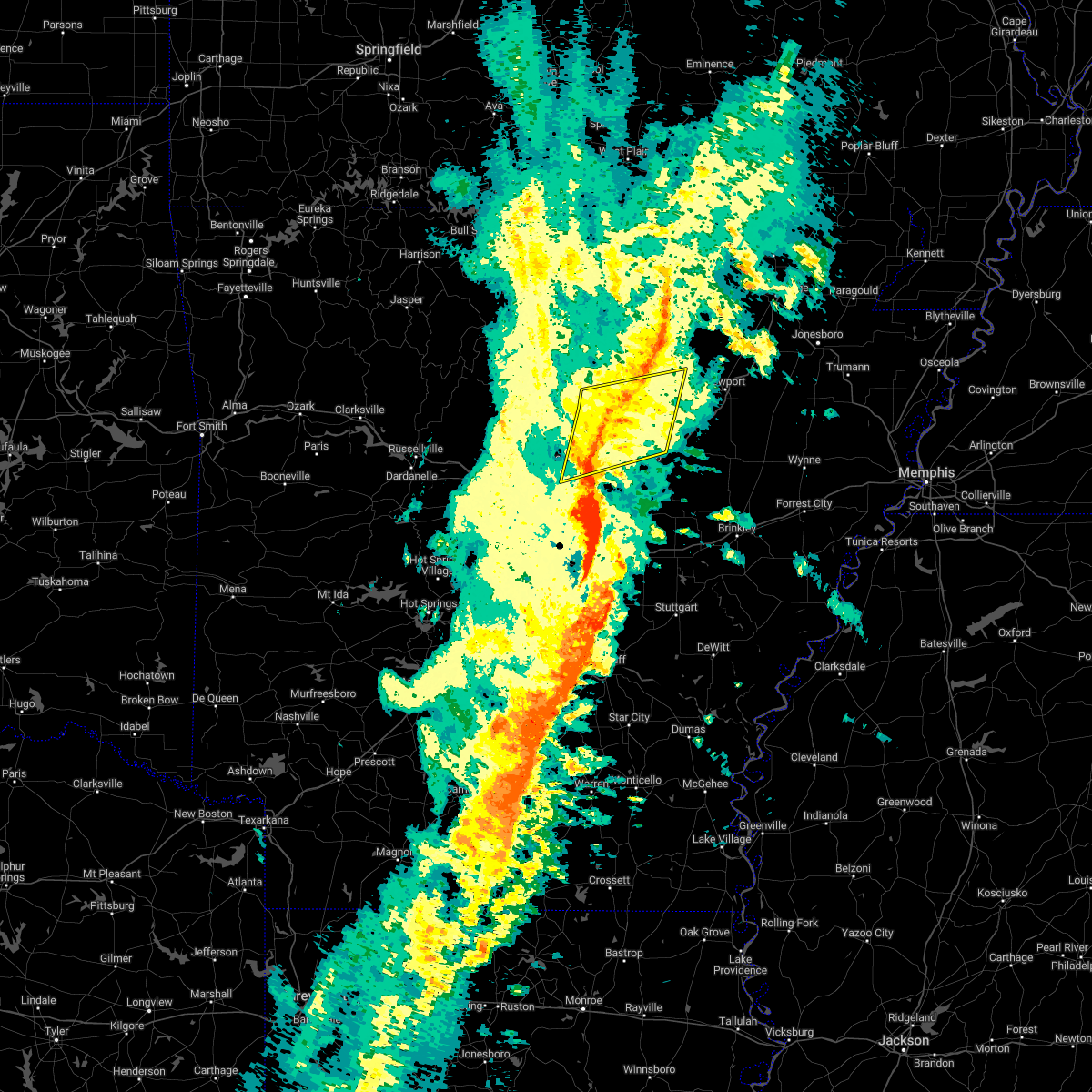 At 1129 pm cdt, severe thunderstorms were located along a line extending from near batesville to 8 miles south of concord to near gravel hill, moving northeast at 40 mph (radar indicated). Hazards include 60 mph wind gusts. Expect damage to roofs, siding, and trees. locations impacted include, heber springs, greers ferry, quitman, pangburn, rose bud, pleasant plains, enola, concord, mount vernon, crosby, gravel hill, steprock, southside in independence count, salado, holland, letona, albion, barney, hickory flat, wilburn, hail threat, radar indicated max hail size, <. 75 in wind threat, radar indicated max wind gust, 60 mph. At 1129 pm cdt, severe thunderstorms were located along a line extending from near batesville to 8 miles south of concord to near gravel hill, moving northeast at 40 mph (radar indicated). Hazards include 60 mph wind gusts. Expect damage to roofs, siding, and trees. locations impacted include, heber springs, greers ferry, quitman, pangburn, rose bud, pleasant plains, enola, concord, mount vernon, crosby, gravel hill, steprock, southside in independence count, salado, holland, letona, albion, barney, hickory flat, wilburn, hail threat, radar indicated max hail size, <. 75 in wind threat, radar indicated max wind gust, 60 mph.
|
| 11/4/2022 11:02 PM CDT |
 At 1102 pm cdt, severe thunderstorms were located along a line extending from near mountain view to near heber springs to near pickles gap, moving east at 65 mph (radar indicated). Hazards include 60 mph wind gusts. expect damage to roofs, siding, and trees At 1102 pm cdt, severe thunderstorms were located along a line extending from near mountain view to near heber springs to near pickles gap, moving east at 65 mph (radar indicated). Hazards include 60 mph wind gusts. expect damage to roofs, siding, and trees
|
| 11/4/2022 10:41 PM CDT |
 At 1041 pm cdt, severe thunderstorms were located along a line extending from near thola to guy, moving northeast at 55 mph (radar indicated). Hazards include 60 mph wind gusts and penny size hail. Expect damage to roofs, siding, and trees. locations impacted include, heber springs, mountain view, clinton, fairfield bay, greenbrier, calico rock, greers ferry, wooster, quitman, guy, rose bud, damascus, twin groves, menifee, shirley, pineville, higden, bethlehem, hill creek, whipple, hail threat, radar indicated max hail size, 0. 75 in wind threat, radar indicated max wind gust, 60 mph. At 1041 pm cdt, severe thunderstorms were located along a line extending from near thola to guy, moving northeast at 55 mph (radar indicated). Hazards include 60 mph wind gusts and penny size hail. Expect damage to roofs, siding, and trees. locations impacted include, heber springs, mountain view, clinton, fairfield bay, greenbrier, calico rock, greers ferry, wooster, quitman, guy, rose bud, damascus, twin groves, menifee, shirley, pineville, higden, bethlehem, hill creek, whipple, hail threat, radar indicated max hail size, 0. 75 in wind threat, radar indicated max wind gust, 60 mph.
|
| 11/4/2022 10:20 PM CDT |
 At 1020 pm cdt, severe thunderstorms were located along a line extending from near watts to hill creek, moving northeast at 55 mph (radar indicated). Hazards include 60 mph wind gusts and penny size hail. expect damage to roofs, siding, and trees At 1020 pm cdt, severe thunderstorms were located along a line extending from near watts to hill creek, moving northeast at 55 mph (radar indicated). Hazards include 60 mph wind gusts and penny size hail. expect damage to roofs, siding, and trees
|
| 10/15/2022 7:47 PM CDT |
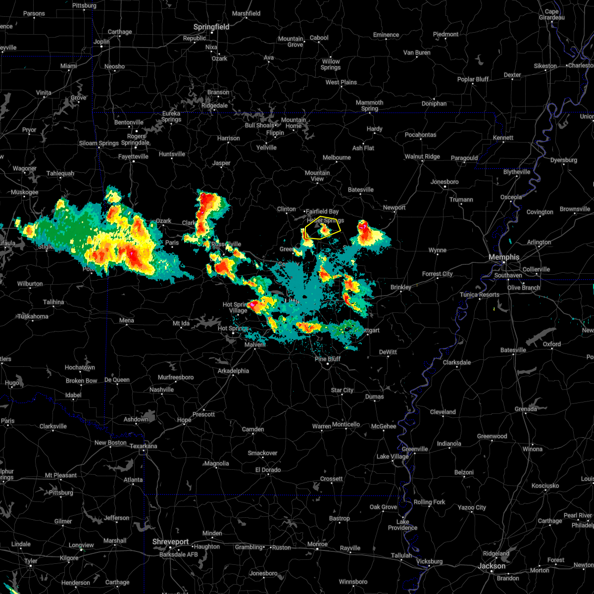 At 747 pm cdt, a severe thunderstorm was located over quitman, or 11 miles southwest of heber springs, moving northeast at 25 mph (radar indicated). Hazards include ping pong ball size hail. People and animals outdoors will be injured. Expect damage to roofs, siding, windows, and vehicles. At 747 pm cdt, a severe thunderstorm was located over quitman, or 11 miles southwest of heber springs, moving northeast at 25 mph (radar indicated). Hazards include ping pong ball size hail. People and animals outdoors will be injured. Expect damage to roofs, siding, windows, and vehicles.
|
| 5/21/2022 6:28 PM CDT |
 At 627 pm cdt, severe thunderstorms were located along a line extending from 8 miles east of greers ferry to near hattieville, moving east at 45 mph (radar indicated). Hazards include 60 mph wind gusts and quarter size hail. Hail damage to vehicles is expected. Expect wind damage to roofs, siding, and trees. At 627 pm cdt, severe thunderstorms were located along a line extending from 8 miles east of greers ferry to near hattieville, moving east at 45 mph (radar indicated). Hazards include 60 mph wind gusts and quarter size hail. Hail damage to vehicles is expected. Expect wind damage to roofs, siding, and trees.
|
| 5/21/2022 6:09 PM CDT |
 At 608 pm cdt, severe thunderstorms were located along a line extending from 8 miles north of newark to 7 miles south of concord, moving east at 45 mph (radar indicated). Hazards include 60 mph wind gusts and quarter size hail. Hail damage to vehicles is expected. Expect wind damage to roofs, siding, and trees. At 608 pm cdt, severe thunderstorms were located along a line extending from 8 miles north of newark to 7 miles south of concord, moving east at 45 mph (radar indicated). Hazards include 60 mph wind gusts and quarter size hail. Hail damage to vehicles is expected. Expect wind damage to roofs, siding, and trees.
|
| 5/21/2022 5:31 PM CDT |
 At 531 pm cdt, severe thunderstorms were located along a line extending from near cushman to 8 miles west of concord, moving east at 65 mph (radar indicated). Hazards include 60 mph wind gusts and quarter size hail. Hail damage to vehicles is expected. Expect wind damage to roofs, siding, and trees. At 531 pm cdt, severe thunderstorms were located along a line extending from near cushman to 8 miles west of concord, moving east at 65 mph (radar indicated). Hazards include 60 mph wind gusts and quarter size hail. Hail damage to vehicles is expected. Expect wind damage to roofs, siding, and trees.
|
| 5/15/2022 3:29 PM CDT |
 At 328 pm cdt, severe thunderstorms were located along a line extending from pineville to near gid to 7 miles northeast of heber springs to near springfield, moving east at 35 mph (trained weather spotters have reported numerous trees down from damaging winds. wind damage is likely!). Hazards include 60 mph wind gusts and quarter size hail. Hail damage to vehicles is expected. Expect wind damage to roofs, siding, and trees. At 328 pm cdt, severe thunderstorms were located along a line extending from pineville to near gid to 7 miles northeast of heber springs to near springfield, moving east at 35 mph (trained weather spotters have reported numerous trees down from damaging winds. wind damage is likely!). Hazards include 60 mph wind gusts and quarter size hail. Hail damage to vehicles is expected. Expect wind damage to roofs, siding, and trees.
|
| 2/22/2022 3:24 AM CST |
 At 324 am cst, severe thunderstorms were located along a line extending from near elberta to near blick to near petit jean state park, moving east at 85 mph (radar indicated). Hazards include 60 mph wind gusts and nickel size hail. expect damage to roofs, siding, and trees At 324 am cst, severe thunderstorms were located along a line extending from near elberta to near blick to near petit jean state park, moving east at 85 mph (radar indicated). Hazards include 60 mph wind gusts and nickel size hail. expect damage to roofs, siding, and trees
|
| 12/10/2021 7:20 PM CST |
 At 720 pm cst, severe thunderstorms were located along a line extending from 7 miles southeast of concord to pangburn to gravel hill, moving northeast at 60 mph (radar indicated). Hazards include 60 mph wind gusts and penny size hail. Expect damage to roofs, siding, and trees. locations impacted include, pangburn, rose bud, enola, mount vernon, crosby, gravel hill, steprock, holland, letona, albion, barney, hickory flat, clay, wilburn, dewey, romance, center hill, sidon, hopewell in cleburne county, joy, hail threat, radar indicated max hail size, 0. 75 in wind threat, radar indicated max wind gust, 60 mph. At 720 pm cst, severe thunderstorms were located along a line extending from 7 miles southeast of concord to pangburn to gravel hill, moving northeast at 60 mph (radar indicated). Hazards include 60 mph wind gusts and penny size hail. Expect damage to roofs, siding, and trees. locations impacted include, pangburn, rose bud, enola, mount vernon, crosby, gravel hill, steprock, holland, letona, albion, barney, hickory flat, clay, wilburn, dewey, romance, center hill, sidon, hopewell in cleburne county, joy, hail threat, radar indicated max hail size, 0. 75 in wind threat, radar indicated max wind gust, 60 mph.
|
| 12/10/2021 6:53 PM CST |
 At 653 pm cst, severe thunderstorms were located along a line extending from near rose bud to near woolly hollow state park to near enola, moving northeast at 55 mph (radar indicated). Hazards include 60 mph wind gusts and penny size hail. expect damage to roofs, siding, and trees At 653 pm cst, severe thunderstorms were located along a line extending from near rose bud to near woolly hollow state park to near enola, moving northeast at 55 mph (radar indicated). Hazards include 60 mph wind gusts and penny size hail. expect damage to roofs, siding, and trees
|
| 11/11/2021 1:14 AM CST | A mobile home was blown off its foundation. roof damage occurred to a neighboring house. location is on richwood mountain roa in cleburne county AR, 5.7 miles WSW of Tumbling Shoals, AR |
| 5/9/2021 2:30 PM CDT |
 At 230 pm cdt, a severe thunderstorm was located near rose bud, or 14 miles south of heber springs, moving east at 55 mph (radar indicated). Hazards include 60 mph wind gusts and quarter size hail. Hail damage to vehicles is expected. expect wind damage to roofs, siding, and trees. Locations impacted include, searcy, heber springs, greenbrier, quitman, guy, pangburn, rose bud, enola, twin groves, mount vernon, crosby, gravel hill, fairbanks, woolly hollow state park, mcrae, garner, letona, albion, antioch in white county, barney, this includes us highway 67 between mile markers 34 and 37. At 230 pm cdt, a severe thunderstorm was located near rose bud, or 14 miles south of heber springs, moving east at 55 mph (radar indicated). Hazards include 60 mph wind gusts and quarter size hail. Hail damage to vehicles is expected. expect wind damage to roofs, siding, and trees. Locations impacted include, searcy, heber springs, greenbrier, quitman, guy, pangburn, rose bud, enola, twin groves, mount vernon, crosby, gravel hill, fairbanks, woolly hollow state park, mcrae, garner, letona, albion, antioch in white county, barney, this includes us highway 67 between mile markers 34 and 37.
|
| 5/9/2021 2:12 PM CDT |
 At 212 pm cdt, a severe thunderstorm was located over guy, or 17 miles northeast of conway, moving east at 50 mph (radar indicated). Hazards include 60 mph wind gusts and quarter size hail. Hail damage to vehicles is expected. Expect wind damage to roofs, siding, and trees. At 212 pm cdt, a severe thunderstorm was located over guy, or 17 miles northeast of conway, moving east at 50 mph (radar indicated). Hazards include 60 mph wind gusts and quarter size hail. Hail damage to vehicles is expected. Expect wind damage to roofs, siding, and trees.
|
| 5/3/2021 11:55 PM CDT |
 At 1155 pm cdt, severe thunderstorms were located along a line extending from near woolum to 7 miles west of clinton to near claude, moving east at 50 mph (radar indicated). Hazards include 60 mph wind gusts and penny size hail. expect damage to roofs, siding, and trees At 1155 pm cdt, severe thunderstorms were located along a line extending from near woolum to 7 miles west of clinton to near claude, moving east at 50 mph (radar indicated). Hazards include 60 mph wind gusts and penny size hail. expect damage to roofs, siding, and trees
|
| 4/7/2021 2:58 PM CDT |
 The severe thunderstorm warning for southeastern stone and northeastern cleburne counties will expire at 300 pm cdt, the storm which prompted the warning has weakened below severe limits, and no longer poses an immediate threat to life or property. therefore, the warning will be allowed to expire. a tornado watch remains in effect until 800 pm cdt for north central arkansas. The severe thunderstorm warning for southeastern stone and northeastern cleburne counties will expire at 300 pm cdt, the storm which prompted the warning has weakened below severe limits, and no longer poses an immediate threat to life or property. therefore, the warning will be allowed to expire. a tornado watch remains in effect until 800 pm cdt for north central arkansas.
|
| 4/7/2021 2:47 PM CDT |
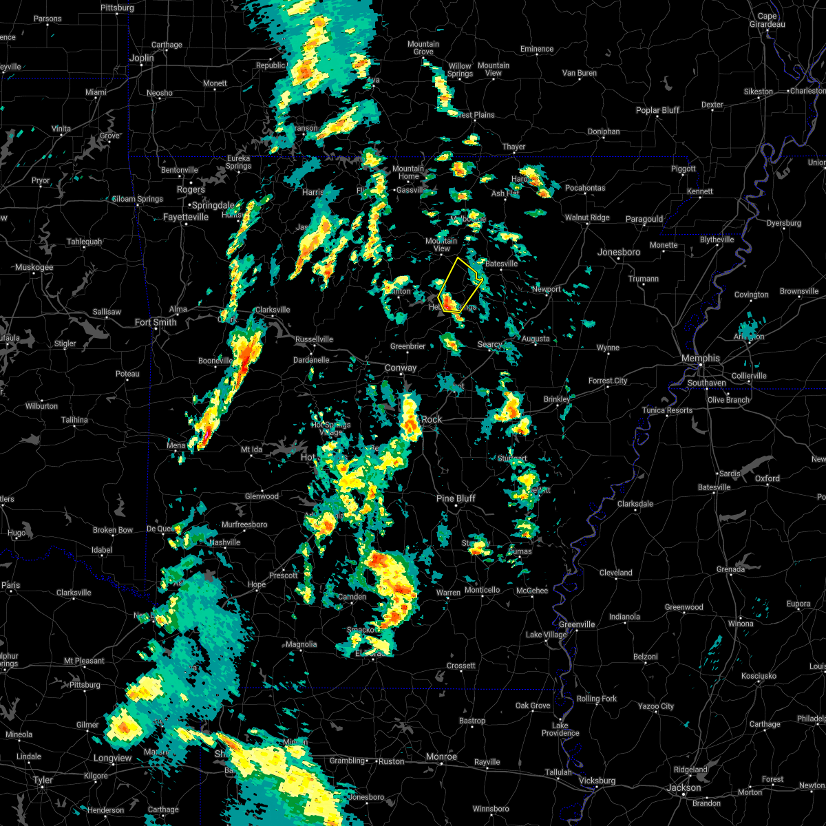 At 247 pm cdt, a severe thunderstorm was located 7 miles north of heber springs, moving northeast at 55 mph (radar indicated). Hazards include 60 mph wind gusts and quarter size hail. Hail damage to vehicles is expected. expect wind damage to roofs, siding, and trees. Locations impacted include, heber springs, greers ferry, concord, ben, almond, dam site marina, drasco, wolf bayou, ida, brownsville, woodrow, eden isle,. At 247 pm cdt, a severe thunderstorm was located 7 miles north of heber springs, moving northeast at 55 mph (radar indicated). Hazards include 60 mph wind gusts and quarter size hail. Hail damage to vehicles is expected. expect wind damage to roofs, siding, and trees. Locations impacted include, heber springs, greers ferry, concord, ben, almond, dam site marina, drasco, wolf bayou, ida, brownsville, woodrow, eden isle,.
|
| 4/7/2021 2:34 PM CDT |
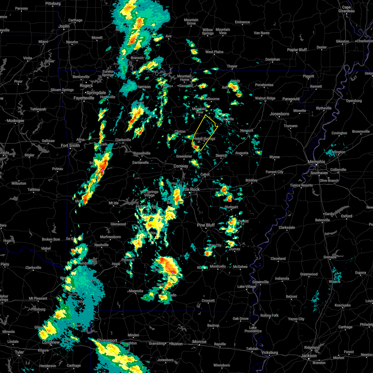 At 234 pm cdt, a severe thunderstorm was located near heber springs, moving northeast at 60 mph (radar indicated). Hazards include 60 mph wind gusts and quarter size hail. Hail damage to vehicles is expected. expect wind damage to roofs, siding, and trees. Locations impacted include, heber springs, greers ferry, quitman, concord, higden, ben, almond, dam site marina, prim, hill creek recreation area, ida, brownsville, eden isle, drasco, hopewell in cleburne county, pearson, wolf bayou, narrows marina, woodrow, edgemont,. At 234 pm cdt, a severe thunderstorm was located near heber springs, moving northeast at 60 mph (radar indicated). Hazards include 60 mph wind gusts and quarter size hail. Hail damage to vehicles is expected. expect wind damage to roofs, siding, and trees. Locations impacted include, heber springs, greers ferry, quitman, concord, higden, ben, almond, dam site marina, prim, hill creek recreation area, ida, brownsville, eden isle, drasco, hopewell in cleburne county, pearson, wolf bayou, narrows marina, woodrow, edgemont,.
|
| 4/7/2021 2:27 PM CDT |
 At 227 pm cdt, a severe thunderstorm was located over quitman, or 14 miles southwest of heber springs, moving northeast at 60 mph (radar indicated). Hazards include 60 mph wind gusts and quarter size hail. Hail damage to vehicles is expected. Expect wind damage to roofs, siding, and trees. At 227 pm cdt, a severe thunderstorm was located over quitman, or 14 miles southwest of heber springs, moving northeast at 60 mph (radar indicated). Hazards include 60 mph wind gusts and quarter size hail. Hail damage to vehicles is expected. Expect wind damage to roofs, siding, and trees.
|
| 3/17/2021 5:14 AM CDT |
 At 514 am cdt, a severe thunderstorm was located near pangburn, or 9 miles southeast of heber springs, moving northeast at 40 mph (radar indicated). Hazards include 60 mph wind gusts and quarter size hail. Hail damage to vehicles is expected. expect wind damage to roofs, siding, and trees. Locations impacted include, heber springs, pangburn, crosby, gravel hill, steprock, letona, albion, clay, wilburn, providence, dewey, center hill, sidon, joy, pickens in white county, sunnydale,. At 514 am cdt, a severe thunderstorm was located near pangburn, or 9 miles southeast of heber springs, moving northeast at 40 mph (radar indicated). Hazards include 60 mph wind gusts and quarter size hail. Hail damage to vehicles is expected. expect wind damage to roofs, siding, and trees. Locations impacted include, heber springs, pangburn, crosby, gravel hill, steprock, letona, albion, clay, wilburn, providence, dewey, center hill, sidon, joy, pickens in white county, sunnydale,.
|
| 3/17/2021 4:53 AM CDT |
 At 452 am cdt, a severe thunderstorm was located near mount vernon, or 17 miles north of cabot, moving northeast at 40 mph (radar indicated). Hazards include 60 mph wind gusts and quarter size hail. Hail damage to vehicles is expected. Expect wind damage to roofs, siding, and trees. At 452 am cdt, a severe thunderstorm was located near mount vernon, or 17 miles north of cabot, moving northeast at 40 mph (radar indicated). Hazards include 60 mph wind gusts and quarter size hail. Hail damage to vehicles is expected. Expect wind damage to roofs, siding, and trees.
|
| 9/1/2020 3:21 PM CDT |
 At 321 pm cdt, a confirmed tornado was located near pangburn, or 7 miles east of heber springs, moving northeast at 25 mph (radar confirmed tornado). Hazards include damaging tornado and quarter size hail. Flying debris will be dangerous to those caught without shelter. mobile homes will be damaged or destroyed. damage to roofs, windows, and vehicles will occur. tree damage is likely. Locations impacted include, heber springs, pangburn, concord, dam site marina, wilburn, ida, dewey,. At 321 pm cdt, a confirmed tornado was located near pangburn, or 7 miles east of heber springs, moving northeast at 25 mph (radar confirmed tornado). Hazards include damaging tornado and quarter size hail. Flying debris will be dangerous to those caught without shelter. mobile homes will be damaged or destroyed. damage to roofs, windows, and vehicles will occur. tree damage is likely. Locations impacted include, heber springs, pangburn, concord, dam site marina, wilburn, ida, dewey,.
|
| 9/1/2020 3:10 PM CDT |
 At 310 pm cdt, a severe thunderstorm capable of producing a tornado was located near heber springs, moving northeast at 35 mph (radar indicated rotation). Hazards include tornado and quarter size hail. Flying debris will be dangerous to those caught without shelter. mobile homes will be damaged or destroyed. damage to roofs, windows, and vehicles will occur. tree damage is likely. Locations impacted include, heber springs, pangburn, concord, dam site marina, wilburn, ida, dewey, eden isle,. At 310 pm cdt, a severe thunderstorm capable of producing a tornado was located near heber springs, moving northeast at 35 mph (radar indicated rotation). Hazards include tornado and quarter size hail. Flying debris will be dangerous to those caught without shelter. mobile homes will be damaged or destroyed. damage to roofs, windows, and vehicles will occur. tree damage is likely. Locations impacted include, heber springs, pangburn, concord, dam site marina, wilburn, ida, dewey, eden isle,.
|
| 9/1/2020 2:55 PM CDT |
 At 255 pm cdt, a severe thunderstorm capable of producing a tornado was located near quitman, or 9 miles southwest of heber springs, moving northeast at 25 mph (radar indicated rotation). Hazards include tornado. Flying debris will be dangerous to those caught without shelter. mobile homes will be damaged or destroyed. damage to roofs, windows, and vehicles will occur. Tree damage is likely. At 255 pm cdt, a severe thunderstorm capable of producing a tornado was located near quitman, or 9 miles southwest of heber springs, moving northeast at 25 mph (radar indicated rotation). Hazards include tornado. Flying debris will be dangerous to those caught without shelter. mobile homes will be damaged or destroyed. damage to roofs, windows, and vehicles will occur. Tree damage is likely.
|
| 9/1/2020 2:49 PM CDT |
 At 248 pm cdt, a severe thunderstorm capable of producing a tornado was located over quitman, or 12 miles southwest of heber springs, moving northeast at 35 mph (radar indicated rotation). Hazards include tornado. Flying debris will be dangerous to those caught without shelter. mobile homes will be damaged or destroyed. damage to roofs, windows, and vehicles will occur. tree damage is likely. Locations impacted include, heber springs, quitman, dam site marina, hopewell in cleburne county, pearson, brownsville, eden isle,. At 248 pm cdt, a severe thunderstorm capable of producing a tornado was located over quitman, or 12 miles southwest of heber springs, moving northeast at 35 mph (radar indicated rotation). Hazards include tornado. Flying debris will be dangerous to those caught without shelter. mobile homes will be damaged or destroyed. damage to roofs, windows, and vehicles will occur. tree damage is likely. Locations impacted include, heber springs, quitman, dam site marina, hopewell in cleburne county, pearson, brownsville, eden isle,.
|
| 9/1/2020 2:42 PM CDT |
 At 242 pm cdt, a severe thunderstorm capable of producing a tornado was located near quitman, or 16 miles southwest of heber springs, moving northeast at 25 mph (radar indicated rotation). Hazards include tornado. Flying debris will be dangerous to those caught without shelter. mobile homes will be damaged or destroyed. damage to roofs, windows, and vehicles will occur. tree damage is likely. Locations impacted include, heber springs, greers ferry, quitman, guy, rose bud, damascus, twin groves, fairbanks, woolly hollow state park, dam site marina, brownsville, eden isle, enders, hopewell in cleburne county, pearson,. At 242 pm cdt, a severe thunderstorm capable of producing a tornado was located near quitman, or 16 miles southwest of heber springs, moving northeast at 25 mph (radar indicated rotation). Hazards include tornado. Flying debris will be dangerous to those caught without shelter. mobile homes will be damaged or destroyed. damage to roofs, windows, and vehicles will occur. tree damage is likely. Locations impacted include, heber springs, greers ferry, quitman, guy, rose bud, damascus, twin groves, fairbanks, woolly hollow state park, dam site marina, brownsville, eden isle, enders, hopewell in cleburne county, pearson,.
|
| 9/1/2020 2:27 PM CDT |
 At 227 pm cdt, a severe thunderstorm capable of producing a tornado was located over guy, or 15 miles north of conway, moving northeast at 35 mph (radar indicated rotation). Hazards include tornado. Flying debris will be dangerous to those caught without shelter. mobile homes will be damaged or destroyed. damage to roofs, windows, and vehicles will occur. Tree damage is likely. At 227 pm cdt, a severe thunderstorm capable of producing a tornado was located over guy, or 15 miles north of conway, moving northeast at 35 mph (radar indicated rotation). Hazards include tornado. Flying debris will be dangerous to those caught without shelter. mobile homes will be damaged or destroyed. damage to roofs, windows, and vehicles will occur. Tree damage is likely.
|
| 5/25/2020 10:04 PM CDT |
 At 1003 pm cdt, a severe thunderstorm was located near fairfield bay, moving north at 50 mph (radar indicated). Hazards include 60 mph wind gusts. expect damage to roofs, siding, and trees At 1003 pm cdt, a severe thunderstorm was located near fairfield bay, moving north at 50 mph (radar indicated). Hazards include 60 mph wind gusts. expect damage to roofs, siding, and trees
|
| 5/25/2020 10:01 PM CDT |
 At 1000 pm cdt, a severe thunderstorm was located 7 miles north of greers ferry, or 7 miles northeast of fairfield bay, moving north at 50 mph (radar indicated). Hazards include 60 mph wind gusts. Expect damage to roofs, siding, and trees. Locations impacted include, heber springs, fairfield bay, greers ferry, shirley, higden, fairfield bay marina, sugar loaf recreation area, dam site marina, edgemont, prim, hill creek recreation area, brownsville, eden isle, south fork recreation area, narrows marina, brewer, choctow recreation area, woodrow,. At 1000 pm cdt, a severe thunderstorm was located 7 miles north of greers ferry, or 7 miles northeast of fairfield bay, moving north at 50 mph (radar indicated). Hazards include 60 mph wind gusts. Expect damage to roofs, siding, and trees. Locations impacted include, heber springs, fairfield bay, greers ferry, shirley, higden, fairfield bay marina, sugar loaf recreation area, dam site marina, edgemont, prim, hill creek recreation area, brownsville, eden isle, south fork recreation area, narrows marina, brewer, choctow recreation area, woodrow,.
|
| 5/25/2020 9:40 PM CDT |
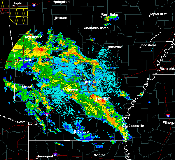 At 940 pm cdt, a severe thunderstorm was located near heber springs, moving north at 50 mph (radar indicated). Hazards include 60 mph wind gusts. expect damage to roofs, siding, and trees At 940 pm cdt, a severe thunderstorm was located near heber springs, moving north at 50 mph (radar indicated). Hazards include 60 mph wind gusts. expect damage to roofs, siding, and trees
|
| 5/22/2020 12:36 PM CDT |
 At 1236 pm cdt, severe thunderstorms were located along a line extending from near blanchard springs campground to fairfield bay marina, moving east at 35 mph (radar indicated). Hazards include 60 mph wind gusts and penny size hail. Expect damage to roofs, siding, and trees. Locations impacted include, heber springs, mountain view, clinton, fairfield bay, melbourne, calico rock, greers ferry, oxford, norfork, salesville, shirley, concord, pineville, higden, lone star, wideman, herron, rodney, herpel, advance,. At 1236 pm cdt, severe thunderstorms were located along a line extending from near blanchard springs campground to fairfield bay marina, moving east at 35 mph (radar indicated). Hazards include 60 mph wind gusts and penny size hail. Expect damage to roofs, siding, and trees. Locations impacted include, heber springs, mountain view, clinton, fairfield bay, melbourne, calico rock, greers ferry, oxford, norfork, salesville, shirley, concord, pineville, higden, lone star, wideman, herron, rodney, herpel, advance,.
|
| 5/22/2020 12:06 PM CDT |
 At 1205 pm cdt, severe thunderstorms were located along a line extending from near duff to dabney, moving east at 40 mph (radar indicated). Hazards include 60 mph wind gusts and penny size hail. expect damage to roofs, siding, and trees At 1205 pm cdt, severe thunderstorms were located along a line extending from near duff to dabney, moving east at 40 mph (radar indicated). Hazards include 60 mph wind gusts and penny size hail. expect damage to roofs, siding, and trees
|
| 4/28/2020 10:33 PM CDT |
 At 1032 pm cdt, severe thunderstorms were located along a line extending from near pangburn to near quitman to greenbrier, moving southeast at 50 mph (radar indicated). Hazards include 60 mph wind gusts and penny size hail. Expect damage to roofs, siding, and trees. Locations impacted include, heber springs, greenbrier, greers ferry, wooster, quitman, guy, pangburn, rose bud, damascus, enola, twin groves, mount vernon, gravel hill, steprock, fairbanks, mallet town, springhill, woolly hollow state park, springfield, holland,. At 1032 pm cdt, severe thunderstorms were located along a line extending from near pangburn to near quitman to greenbrier, moving southeast at 50 mph (radar indicated). Hazards include 60 mph wind gusts and penny size hail. Expect damage to roofs, siding, and trees. Locations impacted include, heber springs, greenbrier, greers ferry, wooster, quitman, guy, pangburn, rose bud, damascus, enola, twin groves, mount vernon, gravel hill, steprock, fairbanks, mallet town, springhill, woolly hollow state park, springfield, holland,.
|
| 4/28/2020 10:28 PM CDT |
 At 1028 pm cdt, severe thunderstorms were located along a line extending from near alicia to near southside in independence county to 8 miles southeast of concord, moving east at 50 mph (radar indicated). Hazards include 60 mph wind gusts. expect damage to roofs, siding, and trees At 1028 pm cdt, severe thunderstorms were located along a line extending from near alicia to near southside in independence county to 8 miles southeast of concord, moving east at 50 mph (radar indicated). Hazards include 60 mph wind gusts. expect damage to roofs, siding, and trees
|
| 4/28/2020 10:19 PM CDT |
 At 1018 pm cdt, severe thunderstorms were located along a line extending from near heber springs to near fairbanks to near mallet town, moving southeast at 50 mph (radar indicated). Hazards include 60 mph wind gusts and penny size hail. Expect damage to roofs, siding, and trees. Locations impacted include, heber springs, clinton, fairfield bay, greenbrier, greers ferry, wooster, quitman, guy, pangburn, rose bud, damascus, enola, twin groves, shirley, mount vernon, higden, bethlehem, whipple, sugar loaf recreation area, blick,. At 1018 pm cdt, severe thunderstorms were located along a line extending from near heber springs to near fairbanks to near mallet town, moving southeast at 50 mph (radar indicated). Hazards include 60 mph wind gusts and penny size hail. Expect damage to roofs, siding, and trees. Locations impacted include, heber springs, clinton, fairfield bay, greenbrier, greers ferry, wooster, quitman, guy, pangburn, rose bud, damascus, enola, twin groves, shirley, mount vernon, higden, bethlehem, whipple, sugar loaf recreation area, blick,.
|
| 4/28/2020 9:58 PM CDT |
 At 956 pm cdt, severe thunderstorms were located along a line extending from fairfield bay to near claude to near jerusalem, moving southeast at 55 mph (radar indicated). Hazards include 60 mph wind gusts and penny size hail. expect damage to roofs, siding, and trees At 956 pm cdt, severe thunderstorms were located along a line extending from fairfield bay to near claude to near jerusalem, moving southeast at 55 mph (radar indicated). Hazards include 60 mph wind gusts and penny size hail. expect damage to roofs, siding, and trees
|
| 4/24/2020 11:09 PM CDT |
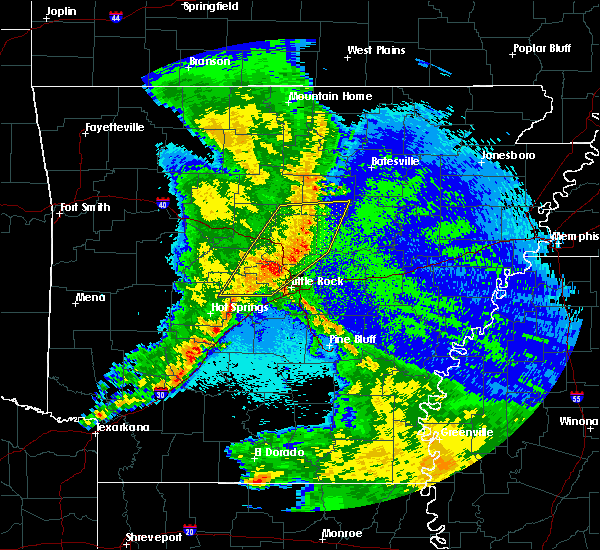 At 1108 pm cdt, severe thunderstorms were located along a line extending from 6 miles north of shirley to near fairbanks, moving east at 40 mph (radar indicated). Hazards include 60 mph wind gusts and nickel size hail. Expect damage to roofs, siding, and trees. Locations impacted include, heber springs, fairfield bay, greers ferry, shirley, higden, fairfield bay marina, fairbanks, sugar loaf recreation area, old lexington, parma, rushing, turkey creek, ida, brownsville, narrows marina, brewer, woodrow, dam site marina, edgemont, prim,. At 1108 pm cdt, severe thunderstorms were located along a line extending from 6 miles north of shirley to near fairbanks, moving east at 40 mph (radar indicated). Hazards include 60 mph wind gusts and nickel size hail. Expect damage to roofs, siding, and trees. Locations impacted include, heber springs, fairfield bay, greers ferry, shirley, higden, fairfield bay marina, fairbanks, sugar loaf recreation area, old lexington, parma, rushing, turkey creek, ida, brownsville, narrows marina, brewer, woodrow, dam site marina, edgemont, prim,.
|
| 4/24/2020 10:54 PM CDT |
 At 1054 pm cdt, severe thunderstorms were located along a line extending from old lexington to near choctaw, moving east at 40 mph (radar indicated). Hazards include 60 mph wind gusts and nickel size hail. expect damage to roofs, siding, and trees At 1054 pm cdt, severe thunderstorms were located along a line extending from old lexington to near choctaw, moving east at 40 mph (radar indicated). Hazards include 60 mph wind gusts and nickel size hail. expect damage to roofs, siding, and trees
|
| 4/12/2020 8:37 PM CDT |
 At 836 pm cdt, severe thunderstorms were located along a line extending from 8 miles south of mountain view to near pangburn to higginson to near thurman to 6 miles east of keo, moving east at 50 mph (radar indicated). Hazards include 60 mph wind gusts and quarter size hail. Hail damage to vehicles is expected. expect wind damage to roofs, siding, and trees. locations impacted include, searcy, heber springs, lonoke, mountain view, des arc, beebe, bald knob, carlisle, judsonia, kensett, higginson, pangburn, cushman, pleasant plains, concord, russell, west point, barrettsville, crosby, meto, this includes the following highways, interstate 40 between mile markers 168 and 191. Us highway 67 between mile markers 28 and 59. At 836 pm cdt, severe thunderstorms were located along a line extending from 8 miles south of mountain view to near pangburn to higginson to near thurman to 6 miles east of keo, moving east at 50 mph (radar indicated). Hazards include 60 mph wind gusts and quarter size hail. Hail damage to vehicles is expected. expect wind damage to roofs, siding, and trees. locations impacted include, searcy, heber springs, lonoke, mountain view, des arc, beebe, bald knob, carlisle, judsonia, kensett, higginson, pangburn, cushman, pleasant plains, concord, russell, west point, barrettsville, crosby, meto, this includes the following highways, interstate 40 between mile markers 168 and 191. Us highway 67 between mile markers 28 and 59.
|
| 4/12/2020 8:19 PM CDT |
 At 819 pm cdt, severe thunderstorms were located along a line extending from near old lexington to 6 miles southwest of heber springs to near gravel hill to cabot to near ironton, moving east at 45 mph (radar indicated). Hazards include 60 mph wind gusts and quarter size hail. Hail damage to vehicles is expected. Expect wind damage to roofs, siding, and trees. At 819 pm cdt, severe thunderstorms were located along a line extending from near old lexington to 6 miles southwest of heber springs to near gravel hill to cabot to near ironton, moving east at 45 mph (radar indicated). Hazards include 60 mph wind gusts and quarter size hail. Hail damage to vehicles is expected. Expect wind damage to roofs, siding, and trees.
|
| 3/19/2020 8:51 PM CDT |
 At 851 pm cdt, a severe thunderstorm was located over clinton, moving east at 50 mph (radar indicated). Hazards include 60 mph wind gusts and quarter size hail. Hail damage to vehicles is expected. Expect wind damage to roofs, siding, and trees. At 851 pm cdt, a severe thunderstorm was located over clinton, moving east at 50 mph (radar indicated). Hazards include 60 mph wind gusts and quarter size hail. Hail damage to vehicles is expected. Expect wind damage to roofs, siding, and trees.
|
| 3/12/2020 7:37 PM CDT |
 At 736 pm cdt, a severe thunderstorm was located over sugar loaf recreation area, or near fairfield bay, moving east at 45 mph (radar indicated). Hazards include 60 mph wind gusts and quarter size hail. Hail damage to vehicles is expected. expect wind damage to roofs, siding, and trees. Locations impacted include, heber springs, clinton, fairfield bay, greers ferry, pangburn, shirley, concord, higden, fairfield bay marina, fairbanks, sugar loaf recreation area, choctaw, letona, wilburn, ida, brownsville, pearson, narrows marina, brewer, choctow recreation area,. At 736 pm cdt, a severe thunderstorm was located over sugar loaf recreation area, or near fairfield bay, moving east at 45 mph (radar indicated). Hazards include 60 mph wind gusts and quarter size hail. Hail damage to vehicles is expected. expect wind damage to roofs, siding, and trees. Locations impacted include, heber springs, clinton, fairfield bay, greers ferry, pangburn, shirley, concord, higden, fairfield bay marina, fairbanks, sugar loaf recreation area, choctaw, letona, wilburn, ida, brownsville, pearson, narrows marina, brewer, choctow recreation area,.
|
| 3/12/2020 7:19 PM CDT |
 At 719 pm cdt, a severe thunderstorm was located over clinton, moving east at 45 mph (radar indicated). Hazards include 60 mph wind gusts and quarter size hail. Hail damage to vehicles is expected. Expect wind damage to roofs, siding, and trees. At 719 pm cdt, a severe thunderstorm was located over clinton, moving east at 45 mph (radar indicated). Hazards include 60 mph wind gusts and quarter size hail. Hail damage to vehicles is expected. Expect wind damage to roofs, siding, and trees.
|
| 1/10/2020 11:35 PM CST |
 At 1135 pm cst, severe thunderstorms were located along a line extending from near heber springs to near mount vernon to near pickles gap to mayflower, moving east at 40 mph (radar indicated). Hazards include 60 mph wind gusts. Expect damage to roofs, siding, and trees. Locations impacted include, conway, sherwood, jacksonville, cabot, heber springs, little rock afb, greenbrier, vilonia, mayflower, greers ferry, wooster, quitman, guy, pangburn, rose bud, enola, mount vernon, higden, olmstead, roland in pulaski county, this includes interstate 40 between mile markers 123 and 142. At 1135 pm cst, severe thunderstorms were located along a line extending from near heber springs to near mount vernon to near pickles gap to mayflower, moving east at 40 mph (radar indicated). Hazards include 60 mph wind gusts. Expect damage to roofs, siding, and trees. Locations impacted include, conway, sherwood, jacksonville, cabot, heber springs, little rock afb, greenbrier, vilonia, mayflower, greers ferry, wooster, quitman, guy, pangburn, rose bud, enola, mount vernon, higden, olmstead, roland in pulaski county, this includes interstate 40 between mile markers 123 and 142.
|
| 1/10/2020 11:05 PM CST |
 At 1105 pm cst, severe thunderstorms were located along a line extending from near sugar loaf recreation area to near greenbrier to toad suck to wye mountain, moving east at 30 mph (radar indicated). Hazards include 70 mph wind gusts. Expect considerable tree damage. Damage is likely to mobile homes, roofs, and outbuildings. At 1105 pm cst, severe thunderstorms were located along a line extending from near sugar loaf recreation area to near greenbrier to toad suck to wye mountain, moving east at 30 mph (radar indicated). Hazards include 70 mph wind gusts. Expect considerable tree damage. Damage is likely to mobile homes, roofs, and outbuildings.
|
| 1/10/2020 10:11 PM CST |
 At 1011 pm cst, severe thunderstorms were located along a line extending from claude to near hattieville to near petit jean state park to 9 miles southeast of ola, moving east at 30 mph (radar indicated). Hazards include 60 mph wind gusts. expect damage to roofs, siding, and trees At 1011 pm cst, severe thunderstorms were located along a line extending from claude to near hattieville to near petit jean state park to 9 miles southeast of ola, moving east at 30 mph (radar indicated). Hazards include 60 mph wind gusts. expect damage to roofs, siding, and trees
|
| 8/27/2019 1:33 AM CDT |
 At 133 am cdt, severe thunderstorms were located along a line extending from near rocky hill to near claude to hattieville to near pottsville, moving southeast at 35 mph (radar indicated). Hazards include 60 mph wind gusts. Expect damage to roofs, siding, and trees. Locations impacted include, conway, russellville, heber springs, morrilton, clinton, fairfield bay, perryville, dardanelle, greenbrier, atkins, pottsville, dover, london, greers ferry, wooster, oppelo, quitman, guy, rose bud, damascus, this includes interstate 40 between mile markers 72 and 129. At 133 am cdt, severe thunderstorms were located along a line extending from near rocky hill to near claude to hattieville to near pottsville, moving southeast at 35 mph (radar indicated). Hazards include 60 mph wind gusts. Expect damage to roofs, siding, and trees. Locations impacted include, conway, russellville, heber springs, morrilton, clinton, fairfield bay, perryville, dardanelle, greenbrier, atkins, pottsville, dover, london, greers ferry, wooster, oppelo, quitman, guy, rose bud, damascus, this includes interstate 40 between mile markers 72 and 129.
|
| 8/27/2019 1:14 AM CDT |
 At 113 am cdt, severe thunderstorms were located along a line extending from woolum to 7 miles southeast of dabney to 7 miles south of hector to near london, moving southeast at 45 mph (radar indicated). Hazards include 60 mph wind gusts. expect damage to roofs, siding, and trees At 113 am cdt, severe thunderstorms were located along a line extending from woolum to 7 miles southeast of dabney to 7 miles south of hector to near london, moving southeast at 45 mph (radar indicated). Hazards include 60 mph wind gusts. expect damage to roofs, siding, and trees
|
| 6/23/2019 1:35 PM CDT |
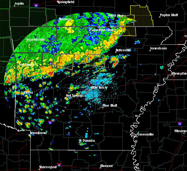 At 135 pm cdt, a severe thunderstorm was located over fairfield bay marina, or near fairfield bay, moving east at 25 mph (radar indicated). Hazards include 60 mph wind gusts and quarter size hail. Hail damage to vehicles is expected. Expect wind damage to roofs, siding, and trees. At 135 pm cdt, a severe thunderstorm was located over fairfield bay marina, or near fairfield bay, moving east at 25 mph (radar indicated). Hazards include 60 mph wind gusts and quarter size hail. Hail damage to vehicles is expected. Expect wind damage to roofs, siding, and trees.
|
| 5/29/2019 5:50 AM CDT |
 At 550 am cdt, severe thunderstorms were located along a line extending from near cave city to 7 miles north of pangburn, moving east at 45 mph (radar indicated). Hazards include 60 mph wind gusts and nickel size hail. Expect damage to roofs, siding, and trees. Locations impacted include, batesville, heber springs, fairfield bay, cave city, greers ferry, quitman, pangburn, cushman, mount pleasant, damascus, pleasant plains, shirley, concord, magness, sidney, moorefield, higden, salado, whipple, sugar loaf recreation area,. At 550 am cdt, severe thunderstorms were located along a line extending from near cave city to 7 miles north of pangburn, moving east at 45 mph (radar indicated). Hazards include 60 mph wind gusts and nickel size hail. Expect damage to roofs, siding, and trees. Locations impacted include, batesville, heber springs, fairfield bay, cave city, greers ferry, quitman, pangburn, cushman, mount pleasant, damascus, pleasant plains, shirley, concord, magness, sidney, moorefield, higden, salado, whipple, sugar loaf recreation area,.
|
| 5/29/2019 5:28 AM CDT |
 At 528 am cdt, severe thunderstorms were located along a line extending from near croker to heber springs, moving east at 45 mph (radar indicated). Hazards include 60 mph wind gusts and nickel size hail. Expect damage to roofs, siding, and trees. Locations impacted include, batesville, heber springs, mountain view, fairfield bay, melbourne, cave city, greers ferry, quitman, pangburn, cushman, mount pleasant, damascus, pleasant plains, shirley, concord, magness, sidney, moorefield, higden, salado,. At 528 am cdt, severe thunderstorms were located along a line extending from near croker to heber springs, moving east at 45 mph (radar indicated). Hazards include 60 mph wind gusts and nickel size hail. Expect damage to roofs, siding, and trees. Locations impacted include, batesville, heber springs, mountain view, fairfield bay, melbourne, cave city, greers ferry, quitman, pangburn, cushman, mount pleasant, damascus, pleasant plains, shirley, concord, magness, sidney, moorefield, higden, salado,.
|
| 5/29/2019 5:13 AM CDT |
 At 513 am cdt, severe thunderstorms were located along a line extending from herpel to near choctaw, moving east at 45 mph (radar indicated). Hazards include 60 mph wind gusts and nickel size hail. expect damage to roofs, siding, and trees At 513 am cdt, severe thunderstorms were located along a line extending from herpel to near choctaw, moving east at 45 mph (radar indicated). Hazards include 60 mph wind gusts and nickel size hail. expect damage to roofs, siding, and trees
|
| 5/29/2019 5:01 AM CDT |
 At 501 am cdt, severe thunderstorms were located along a line extending from near calico rock to near fairfield bay, moving northeast at 50 mph (radar indicated). Hazards include 60 mph wind gusts and nickel size hail. Expect damage to roofs, siding, and trees. Locations impacted include, mountain view, clinton, fairfield bay, melbourne, horseshoe bend, calico rock, greers ferry, oxford, shirley, concord, pineville, franklin, higden, lone star, wideman, herron, gid, herpel, sugar loaf recreation area, lunenburg,. At 501 am cdt, severe thunderstorms were located along a line extending from near calico rock to near fairfield bay, moving northeast at 50 mph (radar indicated). Hazards include 60 mph wind gusts and nickel size hail. Expect damage to roofs, siding, and trees. Locations impacted include, mountain view, clinton, fairfield bay, melbourne, horseshoe bend, calico rock, greers ferry, oxford, shirley, concord, pineville, franklin, higden, lone star, wideman, herron, gid, herpel, sugar loaf recreation area, lunenburg,.
|
| 5/29/2019 4:38 AM CDT |
 At 437 am cdt, severe thunderstorms were located along a line extending from near advance to clinton, moving northeast at 55 mph (radar indicated). Hazards include 60 mph wind gusts and nickel size hail. expect damage to roofs, siding, and trees At 437 am cdt, severe thunderstorms were located along a line extending from near advance to clinton, moving northeast at 55 mph (radar indicated). Hazards include 60 mph wind gusts and nickel size hail. expect damage to roofs, siding, and trees
|
| 5/18/2019 5:37 PM CDT |
 The severe thunderstorm warning for southeastern cleburne, east central faulkner and northwestern white counties will expire at 545 pm cdt, the severe thunderstorms which prompted the warning have weakened. therefore, the warning will be allowed to expire. a tornado watch remains in effect until 800 pm cdt for central and north central arkansas. &&. The severe thunderstorm warning for southeastern cleburne, east central faulkner and northwestern white counties will expire at 545 pm cdt, the severe thunderstorms which prompted the warning have weakened. therefore, the warning will be allowed to expire. a tornado watch remains in effect until 800 pm cdt for central and north central arkansas. &&.
|
| 5/18/2019 5:04 PM CDT |
 At 503 pm cdt, severe thunderstorms were located over mount vernon and 5 miles south of rose bud, moving northeast at 35 mph (radar indicated). Hazards include 60 mph wind gusts and quarter size hail. Hail damage to vehicles is expected. Expect wind damage to roofs, siding, and trees. At 503 pm cdt, severe thunderstorms were located over mount vernon and 5 miles south of rose bud, moving northeast at 35 mph (radar indicated). Hazards include 60 mph wind gusts and quarter size hail. Hail damage to vehicles is expected. Expect wind damage to roofs, siding, and trees.
|
| 3/24/2019 9:12 PM CDT |
 At 911 pm cdt, a severe thunderstorm was located near fairbanks, or 10 miles southeast of clinton, moving east at 35 mph (radar indicated). Hazards include 60 mph wind gusts and half dollar size hail. Hail damage to vehicles is expected. Expect wind damage to roofs, siding, and trees. At 911 pm cdt, a severe thunderstorm was located near fairbanks, or 10 miles southeast of clinton, moving east at 35 mph (radar indicated). Hazards include 60 mph wind gusts and half dollar size hail. Hail damage to vehicles is expected. Expect wind damage to roofs, siding, and trees.
|
| 3/24/2019 8:57 PM CDT |
 At 855 pm cdt, a severe thunderstorm was located near choctaw, or near clinton, moving east at 45 mph (radar indicated). Hazards include 60 mph wind gusts and half dollar size hail. Hail damage to vehicles is expected. expect wind damage to roofs, siding, and trees. Locations impacted include, heber springs, clinton, fairfield bay, greers ferry, quitman, rose bud, damascus, shirley, higden, fairfield bay marina, claude, fairbanks, whipple, woolum, sugar loaf recreation area, choctaw, bee branch, beverage town, alread, austin in conway county,. At 855 pm cdt, a severe thunderstorm was located near choctaw, or near clinton, moving east at 45 mph (radar indicated). Hazards include 60 mph wind gusts and half dollar size hail. Hail damage to vehicles is expected. expect wind damage to roofs, siding, and trees. Locations impacted include, heber springs, clinton, fairfield bay, greers ferry, quitman, rose bud, damascus, shirley, higden, fairfield bay marina, claude, fairbanks, whipple, woolum, sugar loaf recreation area, choctaw, bee branch, beverage town, alread, austin in conway county,.
|
| 3/24/2019 8:39 PM CDT |
 At 838 pm cdt, a severe thunderstorm was located 7 miles north of claude, or 8 miles west of clinton, moving east at 55 mph (radar indicated). Hazards include 60 mph wind gusts and half dollar size hail. Hail damage to vehicles is expected. expect wind damage to roofs, siding, and trees. Locations impacted include, heber springs, clinton, fairfield bay, greers ferry, quitman, rose bud, damascus, shirley, higden, fairfield bay marina, claude, dabney, fairbanks, whipple, woolum, sugar loaf recreation area, choctaw, cleveland, bee branch, beverage town,. At 838 pm cdt, a severe thunderstorm was located 7 miles north of claude, or 8 miles west of clinton, moving east at 55 mph (radar indicated). Hazards include 60 mph wind gusts and half dollar size hail. Hail damage to vehicles is expected. expect wind damage to roofs, siding, and trees. Locations impacted include, heber springs, clinton, fairfield bay, greers ferry, quitman, rose bud, damascus, shirley, higden, fairfield bay marina, claude, dabney, fairbanks, whipple, woolum, sugar loaf recreation area, choctaw, cleveland, bee branch, beverage town,.
|
| 3/24/2019 8:26 PM CDT |
 At 826 pm cdt, a severe thunderstorm was located over dabney, or 19 miles west of clinton, moving east at 55 mph (radar indicated). Hazards include 60 mph wind gusts and half dollar size hail. Hail damage to vehicles is expected. Expect wind damage to roofs, siding, and trees. At 826 pm cdt, a severe thunderstorm was located over dabney, or 19 miles west of clinton, moving east at 55 mph (radar indicated). Hazards include 60 mph wind gusts and half dollar size hail. Hail damage to vehicles is expected. Expect wind damage to roofs, siding, and trees.
|
| 3/9/2019 9:24 AM CST |
 At 923 am cst, a severe thunderstorm was located near pangburn, or 8 miles east of heber springs, moving northeast at 55 mph (radar indicated). Hazards include 60 mph wind gusts and quarter size hail. Hail damage to vehicles is expected. Expect wind damage to roofs, siding, and trees. At 923 am cst, a severe thunderstorm was located near pangburn, or 8 miles east of heber springs, moving northeast at 55 mph (radar indicated). Hazards include 60 mph wind gusts and quarter size hail. Hail damage to vehicles is expected. Expect wind damage to roofs, siding, and trees.
|
| 3/9/2019 8:36 AM CST |
 At 835 am cst, severe thunderstorms were located along a line extending from rocky hill to near claude to solgohachia, moving east at 55 mph (radar indicated). Hazards include 60 mph wind gusts and quarter size hail. Hail damage to vehicles is expected. Expect wind damage to roofs, siding, and trees. At 835 am cst, severe thunderstorms were located along a line extending from rocky hill to near claude to solgohachia, moving east at 55 mph (radar indicated). Hazards include 60 mph wind gusts and quarter size hail. Hail damage to vehicles is expected. Expect wind damage to roofs, siding, and trees.
|
| 12/1/2018 1:23 AM CST |
 At 123 am cst, severe thunderstorms were located along a line extending from damascus to near springfield, moving northeast at 65 mph (radar indicated). Hazards include 60 mph wind gusts and penny size hail. expect damage to roofs, siding, and trees At 123 am cst, severe thunderstorms were located along a line extending from damascus to near springfield, moving northeast at 65 mph (radar indicated). Hazards include 60 mph wind gusts and penny size hail. expect damage to roofs, siding, and trees
|
| 8/19/2018 10:12 PM CDT |
 At 1012 pm cdt, a severe thunderstorm was located near heber springs, moving east at 40 mph (radar indicated). Hazards include 60 mph wind gusts. Expect damage to roofs, siding, and trees. Locations impacted include, heber springs, greers ferry, pangburn, rose bud, pleasant plains, steprock, letona, albion, dam site marina, hickory flat, clay, wilburn, providence, ida, dewey, eden isle, sidon, hopewell in cleburne county, pickens in white county, sunnydale, a tornado watch remains in effect until 1100 pm cdt for north central arkansas. At 1012 pm cdt, a severe thunderstorm was located near heber springs, moving east at 40 mph (radar indicated). Hazards include 60 mph wind gusts. Expect damage to roofs, siding, and trees. Locations impacted include, heber springs, greers ferry, pangburn, rose bud, pleasant plains, steprock, letona, albion, dam site marina, hickory flat, clay, wilburn, providence, ida, dewey, eden isle, sidon, hopewell in cleburne county, pickens in white county, sunnydale, a tornado watch remains in effect until 1100 pm cdt for north central arkansas.
|
| 8/19/2018 9:58 PM CDT |
 The national weather service in little rock has issued a * severe thunderstorm warning for. southwestern independence county in north central arkansas. southeastern van buren county in north central arkansas. cleburne county in north central arkansas. Northeastern faulkner county in central arkansas. The national weather service in little rock has issued a * severe thunderstorm warning for. southwestern independence county in north central arkansas. southeastern van buren county in north central arkansas. cleburne county in north central arkansas. Northeastern faulkner county in central arkansas.
|
| 8/19/2018 9:44 PM CDT |
 At 944 pm cdt, severe thunderstorms were located along a line extending from croker to near cushman to 6 miles west of concord, moving northeast at 30 mph (radar indicated). Hazards include 60 mph wind gusts. Expect damage to roofs, siding, and trees. Locations impacted include, batesville, mountain view, cushman, concord, moorefield, salado, southside in independence count, croker, bethesda, ben, almond, luber, marcella, desha, ida, brownsville, locust grove, drasco, hutchinson, wolf bayou, a tornado watch remains in effect until 1100 pm cdt for north central arkansas. At 944 pm cdt, severe thunderstorms were located along a line extending from croker to near cushman to 6 miles west of concord, moving northeast at 30 mph (radar indicated). Hazards include 60 mph wind gusts. Expect damage to roofs, siding, and trees. Locations impacted include, batesville, mountain view, cushman, concord, moorefield, salado, southside in independence count, croker, bethesda, ben, almond, luber, marcella, desha, ida, brownsville, locust grove, drasco, hutchinson, wolf bayou, a tornado watch remains in effect until 1100 pm cdt for north central arkansas.
|
| 8/19/2018 9:12 PM CDT |
 At 911 pm cdt, severe thunderstorms were located along a line extending from near mountain view to greers ferry, moving east at 30 mph (radar indicated). Hazards include 60 mph wind gusts and penny size hail. expect damage to roofs, siding, and trees At 911 pm cdt, severe thunderstorms were located along a line extending from near mountain view to greers ferry, moving east at 30 mph (radar indicated). Hazards include 60 mph wind gusts and penny size hail. expect damage to roofs, siding, and trees
|
| 7/21/2018 2:01 AM CDT |
 At 200 am cdt, severe thunderstorms were located along a line extending from near greers ferry to claude, moving southeast at 45 mph (radar indicated). Hazards include 60 mph wind gusts and nickel size hail. Expect damage to roofs, siding, and trees. Locations impacted include, heber springs, clinton, fairfield bay, greers ferry, shirley, higden, fairfield bay marina, claude, fairbanks, whipple, sugar loaf recreation area, choctaw, bee branch, beverage town, wilburn, ida, brownsville, scotland, formosa, pearson,. At 200 am cdt, severe thunderstorms were located along a line extending from near greers ferry to claude, moving southeast at 45 mph (radar indicated). Hazards include 60 mph wind gusts and nickel size hail. Expect damage to roofs, siding, and trees. Locations impacted include, heber springs, clinton, fairfield bay, greers ferry, shirley, higden, fairfield bay marina, claude, fairbanks, whipple, sugar loaf recreation area, choctaw, bee branch, beverage town, wilburn, ida, brownsville, scotland, formosa, pearson,.
|
| 7/21/2018 1:41 AM CDT |
 The severe thunderstorm warning for southeastern cleburne and north central white counties will expire at 145 am cdt, the storm which prompted the warning has moved out of the area. therefore, the warning will be allowed to expire. a severe thunderstorm watch remains in effect until 500 am cdt for central and north central arkansas. remember, a severe thunderstorm warning still remains in effect for much of white county until 215 am cdt. The severe thunderstorm warning for southeastern cleburne and north central white counties will expire at 145 am cdt, the storm which prompted the warning has moved out of the area. therefore, the warning will be allowed to expire. a severe thunderstorm watch remains in effect until 500 am cdt for central and north central arkansas. remember, a severe thunderstorm warning still remains in effect for much of white county until 215 am cdt.
|
| 7/21/2018 1:36 AM CDT |
 At 136 am cdt, severe thunderstorms were located along a line extending from near mountain view to near dabney, moving southeast at 45 mph (radar indicated). Hazards include 60 mph wind gusts and nickel size hail. expect damage to roofs, siding, and trees At 136 am cdt, severe thunderstorms were located along a line extending from near mountain view to near dabney, moving southeast at 45 mph (radar indicated). Hazards include 60 mph wind gusts and nickel size hail. expect damage to roofs, siding, and trees
|
| 7/21/2018 1:22 AM CDT |
 At 121 am cdt, a severe thunderstorm was located 7 miles north of heber springs, moving southeast at 40 mph (radar indicated). Hazards include 60 mph wind gusts and half dollar size hail. Hail damage to vehicles is expected. Expect wind damage to roofs, siding, and trees. At 121 am cdt, a severe thunderstorm was located 7 miles north of heber springs, moving southeast at 40 mph (radar indicated). Hazards include 60 mph wind gusts and half dollar size hail. Hail damage to vehicles is expected. Expect wind damage to roofs, siding, and trees.
|
| 7/20/2018 9:44 AM CDT |
 At 943 am cdt, severe thunderstorms were located along a line extending from near newport to near russell to 6 miles north of gravel hill, moving southeast at 50 mph (radar indicated). Hazards include 60 mph wind gusts and penny size hail. Expect damage to roofs, siding, and trees. Locations impacted include, searcy, newport, heber springs, augusta, bald knob, judsonia, tuckerman, kensett, diaz, newark, greers ferry, higginson, pangburn, patterson, grubbs, pleasant plains, oil trough, russell, jacksonport, magness,. At 943 am cdt, severe thunderstorms were located along a line extending from near newport to near russell to 6 miles north of gravel hill, moving southeast at 50 mph (radar indicated). Hazards include 60 mph wind gusts and penny size hail. Expect damage to roofs, siding, and trees. Locations impacted include, searcy, newport, heber springs, augusta, bald knob, judsonia, tuckerman, kensett, diaz, newark, greers ferry, higginson, pangburn, patterson, grubbs, pleasant plains, oil trough, russell, jacksonport, magness,.
|
| 7/20/2018 9:26 AM CDT |
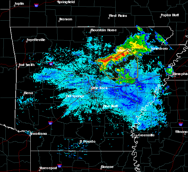 At 925 am cdt, severe thunderstorms were located along a line extending from 6 miles northeast of newark to pleasant plains to near greers ferry, moving southeast at 50 mph (radar indicated). Hazards include 60 mph wind gusts and penny size hail. expect damage to roofs, siding, and trees At 925 am cdt, severe thunderstorms were located along a line extending from 6 miles northeast of newark to pleasant plains to near greers ferry, moving southeast at 50 mph (radar indicated). Hazards include 60 mph wind gusts and penny size hail. expect damage to roofs, siding, and trees
|
| 7/20/2018 8:29 AM CDT |
 At 829 am cdt, a severe thunderstorm was located near heber springs, moving southeast at 35 mph (radar indicated). Hazards include quarter size hail. Damage to vehicles is expected. Locations impacted include, heber springs, pangburn, rose bud, gravel hill, dam site marina, hopewell in cleburne county, pearson, joy, pickens in white county, eden isle, sidon, wilburn,. At 829 am cdt, a severe thunderstorm was located near heber springs, moving southeast at 35 mph (radar indicated). Hazards include quarter size hail. Damage to vehicles is expected. Locations impacted include, heber springs, pangburn, rose bud, gravel hill, dam site marina, hopewell in cleburne county, pearson, joy, pickens in white county, eden isle, sidon, wilburn,.
|
| 7/20/2018 8:17 AM CDT |
 At 816 am cdt, a severe thunderstorm was located near greers ferry, or near heber springs, moving southeast at 35 mph (radar indicated). Hazards include quarter size hail. Damage to vehicles is expected. Locations impacted include, heber springs, greers ferry, pangburn, rose bud, gravel hill, dam site marina, eden isle, sidon, hopewell in cleburne county, pearson, joy, pickens in white county, hill creek recreation area, wilburn,. At 816 am cdt, a severe thunderstorm was located near greers ferry, or near heber springs, moving southeast at 35 mph (radar indicated). Hazards include quarter size hail. Damage to vehicles is expected. Locations impacted include, heber springs, greers ferry, pangburn, rose bud, gravel hill, dam site marina, eden isle, sidon, hopewell in cleburne county, pearson, joy, pickens in white county, hill creek recreation area, wilburn,.
|
| 7/20/2018 8:08 AM CDT |
 At 808 am cdt, a severe thunderstorm was located over higden, or near fairfield bay, moving southeast at 35 mph (radar indicated). Hazards include 60 mph wind gusts and quarter size hail. Hail damage to vehicles is expected. Expect wind damage to roofs, siding, and trees. At 808 am cdt, a severe thunderstorm was located over higden, or near fairfield bay, moving southeast at 35 mph (radar indicated). Hazards include 60 mph wind gusts and quarter size hail. Hail damage to vehicles is expected. Expect wind damage to roofs, siding, and trees.
|
| 7/16/2018 12:06 PM CDT |
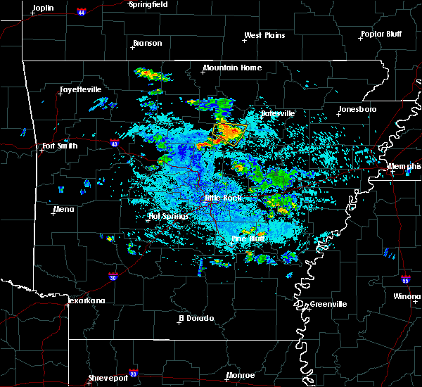 The severe thunderstorm warning for south central stone and cleburne counties will expire at 1215 pm cdt, the storm which prompted the warning has weakened below severe limits, and no longer poses an immediate threat to life or property. therefore, the warning will be allowed to expire. however small hail and gusty winds are still possible with this thunderstorm. The severe thunderstorm warning for south central stone and cleburne counties will expire at 1215 pm cdt, the storm which prompted the warning has weakened below severe limits, and no longer poses an immediate threat to life or property. therefore, the warning will be allowed to expire. however small hail and gusty winds are still possible with this thunderstorm.
|
| 7/16/2018 11:52 AM CDT |
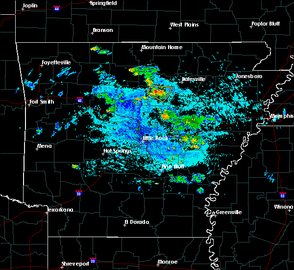 At 1151 am cdt, a severe thunderstorm was located near greers ferry, or 8 miles east of fairfield bay, moving east at 5 mph (radar indicated). Hazards include 60 mph wind gusts and quarter size hail. Hail damage to vehicles is expected. Expect wind damage to roofs, siding, and trees. At 1151 am cdt, a severe thunderstorm was located near greers ferry, or 8 miles east of fairfield bay, moving east at 5 mph (radar indicated). Hazards include 60 mph wind gusts and quarter size hail. Hail damage to vehicles is expected. Expect wind damage to roofs, siding, and trees.
|
| 5/3/2018 3:36 PM CDT |
 At 335 pm cdt, a severe thunderstorm was located 7 miles north of pangburn, or 9 miles east of heber springs, moving northeast at 70 mph (radar indicated). Hazards include 60 mph wind gusts. expect damage to roofs, siding, and trees At 335 pm cdt, a severe thunderstorm was located 7 miles north of pangburn, or 9 miles east of heber springs, moving northeast at 70 mph (radar indicated). Hazards include 60 mph wind gusts. expect damage to roofs, siding, and trees
|
| 4/13/2018 9:32 PM CDT |
 At 932 pm cdt, severe thunderstorms were located along a line extending from near salem in fulton county to near brandenberg to near fairfield bay to fairbanks, moving east at 40 mph (radar indicated). Hazards include 60 mph wind gusts and penny size hail. expect damage to roofs, siding, and trees At 932 pm cdt, severe thunderstorms were located along a line extending from near salem in fulton county to near brandenberg to near fairfield bay to fairbanks, moving east at 40 mph (radar indicated). Hazards include 60 mph wind gusts and penny size hail. expect damage to roofs, siding, and trees
|
| 4/3/2018 5:11 PM CDT |
 At 511 pm cdt, a severe thunderstorm was located near heber springs, moving east at 45 mph (radar indicated). Hazards include 60 mph wind gusts and quarter size hail. Hail damage to vehicles is expected. Expect wind damage to roofs, siding, and trees. At 511 pm cdt, a severe thunderstorm was located near heber springs, moving east at 45 mph (radar indicated). Hazards include 60 mph wind gusts and quarter size hail. Hail damage to vehicles is expected. Expect wind damage to roofs, siding, and trees.
|
| 4/3/2018 4:58 PM CDT |
 At 458 pm cdt, a severe thunderstorm was located over heber springs, moving east at 50 mph (radar indicated). Hazards include 60 mph wind gusts and quarter size hail. Hail damage to vehicles is expected. expect wind damage to roofs, siding, and trees. Locations impacted include, heber springs, greers ferry, quitman, pangburn, rose bud, letona, dam site marina, wilburn, brownsville, eden isle, sidon, hopewell in cleburne county, pearson, pickens in white county, a tornado watch remains in effect until 800 pm cdt for central and north central arkansas. At 458 pm cdt, a severe thunderstorm was located over heber springs, moving east at 50 mph (radar indicated). Hazards include 60 mph wind gusts and quarter size hail. Hail damage to vehicles is expected. expect wind damage to roofs, siding, and trees. Locations impacted include, heber springs, greers ferry, quitman, pangburn, rose bud, letona, dam site marina, wilburn, brownsville, eden isle, sidon, hopewell in cleburne county, pearson, pickens in white county, a tornado watch remains in effect until 800 pm cdt for central and north central arkansas.
|
| 4/3/2018 4:44 PM CDT |
 At 444 pm cdt, a severe thunderstorm was located over fairbanks, or 8 miles south of fairfield bay, moving east at 50 mph (radar indicated). Hazards include 60 mph wind gusts and quarter size hail. Hail damage to vehicles is expected. Expect wind damage to roofs, siding, and trees. At 444 pm cdt, a severe thunderstorm was located over fairbanks, or 8 miles south of fairfield bay, moving east at 50 mph (radar indicated). Hazards include 60 mph wind gusts and quarter size hail. Hail damage to vehicles is expected. Expect wind damage to roofs, siding, and trees.
|
| 10/22/2017 3:36 AM CDT |
 At 336 am cdt, a severe thunderstorm was located over fairfield bay marina, or near fairfield bay, moving northeast at 35 mph (radar indicated). Hazards include 60 mph wind gusts. Expect damage to roofs, siding, and trees. Locations impacted include, heber springs, mountain view, clinton, fairfield bay, greers ferry, shirley, higden, fairfield bay marina, sugar loaf recreation area, old lexington, choctaw, hanover, parma, rushing, turkey creek, brownsville, narrows marina, brewer, choctow recreation area, woodrow,. At 336 am cdt, a severe thunderstorm was located over fairfield bay marina, or near fairfield bay, moving northeast at 35 mph (radar indicated). Hazards include 60 mph wind gusts. Expect damage to roofs, siding, and trees. Locations impacted include, heber springs, mountain view, clinton, fairfield bay, greers ferry, shirley, higden, fairfield bay marina, sugar loaf recreation area, old lexington, choctaw, hanover, parma, rushing, turkey creek, brownsville, narrows marina, brewer, choctow recreation area, woodrow,.
|
| 10/22/2017 3:21 AM CDT |
 At 321 am cdt, a severe thunderstorm was located near clinton, moving northeast at 40 mph (radar indicated). Hazards include 60 mph wind gusts and penny size hail. Expect damage to roofs, siding, and trees. Locations impacted include, heber springs, mountain view, clinton, fairfield bay, greers ferry, shirley, higden, fairfield bay marina, rocky hill, elba, woolum, sugar loaf recreation area, old lexington, choctaw, claude, beverage town, alread, hanover, parma, rushing,. At 321 am cdt, a severe thunderstorm was located near clinton, moving northeast at 40 mph (radar indicated). Hazards include 60 mph wind gusts and penny size hail. Expect damage to roofs, siding, and trees. Locations impacted include, heber springs, mountain view, clinton, fairfield bay, greers ferry, shirley, higden, fairfield bay marina, rocky hill, elba, woolum, sugar loaf recreation area, old lexington, choctaw, claude, beverage town, alread, hanover, parma, rushing,.
|
| 10/22/2017 3:10 AM CDT |
 At 310 am cdt, a severe thunderstorm was located near claude, or 10 miles west of clinton, moving northeast at 40 mph (radar indicated). Hazards include 60 mph wind gusts and penny size hail. expect damage to roofs, siding, and trees At 310 am cdt, a severe thunderstorm was located near claude, or 10 miles west of clinton, moving northeast at 40 mph (radar indicated). Hazards include 60 mph wind gusts and penny size hail. expect damage to roofs, siding, and trees
|
| 7/4/2017 1:17 PM CDT |
 At 116 pm cdt, a severe thunderstorm was located near mount vernon, or 15 miles north of cabot, moving northeast at 30 mph (radar indicated). Hazards include 60 mph wind gusts. Expect damage to roofs, siding, and trees. Locations impacted include, heber springs, vilonia, pangburn, rose bud, enola, mount vernon, gravel hill, barney, dam site marina, el paso, romance, eden isle, sidon, hopewell in cleburne county, pearson, joy,. At 116 pm cdt, a severe thunderstorm was located near mount vernon, or 15 miles north of cabot, moving northeast at 30 mph (radar indicated). Hazards include 60 mph wind gusts. Expect damage to roofs, siding, and trees. Locations impacted include, heber springs, vilonia, pangburn, rose bud, enola, mount vernon, gravel hill, barney, dam site marina, el paso, romance, eden isle, sidon, hopewell in cleburne county, pearson, joy,.
|
| 7/4/2017 12:58 PM CDT |
 At 1257 pm cdt, a severe thunderstorm was located over vilonia, or 12 miles north of little rock afb, moving northeast at 35 mph (radar indicated). Hazards include 60 mph wind gusts. expect damage to roofs, siding, and trees At 1257 pm cdt, a severe thunderstorm was located over vilonia, or 12 miles north of little rock afb, moving northeast at 35 mph (radar indicated). Hazards include 60 mph wind gusts. expect damage to roofs, siding, and trees
|
| 6/23/2017 3:57 PM CDT |
 The severe thunderstorm warning for south central stone, southwestern independence, southwestern jackson, cleburne and white counties will expire at 400 pm cdt, the storm which prompted the warning has weakened below severe limits, and no longer poses an immediate threat to life or property. therefore, the warning will be allowed to expire. however gusty winds and heavy rain are still possible with this thunderstorm. a severe thunderstorm watch remains in effect until 900 pm cdt for central, eastern and north central arkansas. The severe thunderstorm warning for south central stone, southwestern independence, southwestern jackson, cleburne and white counties will expire at 400 pm cdt, the storm which prompted the warning has weakened below severe limits, and no longer poses an immediate threat to life or property. therefore, the warning will be allowed to expire. however gusty winds and heavy rain are still possible with this thunderstorm. a severe thunderstorm watch remains in effect until 900 pm cdt for central, eastern and north central arkansas.
|
| 6/23/2017 3:17 PM CDT |
 At 317 pm cdt, a severe thunderstorm was located over heber springs, moving southeast at 55 mph (radar indicated). Hazards include 60 mph wind gusts and half dollar size hail. Hail damage to vehicles is expected. Expect wind damage to roofs, siding, and trees. At 317 pm cdt, a severe thunderstorm was located over heber springs, moving southeast at 55 mph (radar indicated). Hazards include 60 mph wind gusts and half dollar size hail. Hail damage to vehicles is expected. Expect wind damage to roofs, siding, and trees.
|
| 5/28/2017 1:14 AM CDT |
 At 113 am cdt, severe thunderstorms were located along a line extending from 6 miles south of dabney to middleton to near solgohachia to near petit jean state park, moving east at 75 mph. these are very dangerous storms (radar indicated). Hazards include 80 mph wind gusts. Flying debris will be dangerous to those caught without shelter. mobile homes will be heavily damaged. expect considerable damage to roofs, windows, and vehicles. extensive tree damage and power outages are likely. Locations impacted include, conway, russellville, heber springs, morrilton, clinton, danville, fairfield bay, perryville, dardanelle, greenbrier, vilonia, atkins, pottsville, mayflower, dover, ola, london, greers ferry, wooster, oppelo, this includes interstate 40 between mile markers 73 and 137. At 113 am cdt, severe thunderstorms were located along a line extending from 6 miles south of dabney to middleton to near solgohachia to near petit jean state park, moving east at 75 mph. these are very dangerous storms (radar indicated). Hazards include 80 mph wind gusts. Flying debris will be dangerous to those caught without shelter. mobile homes will be heavily damaged. expect considerable damage to roofs, windows, and vehicles. extensive tree damage and power outages are likely. Locations impacted include, conway, russellville, heber springs, morrilton, clinton, danville, fairfield bay, perryville, dardanelle, greenbrier, vilonia, atkins, pottsville, mayflower, dover, ola, london, greers ferry, wooster, oppelo, this includes interstate 40 between mile markers 73 and 137.
|
| 5/28/2017 1:03 AM CDT |
 At 102 am cdt, severe thunderstorms were located along a line extending from solo to near jerusalem to near happy bend to near galla creek wma to 6 miles northwest of danville, moving east at 80 mph. these are very dangerous storms (radar indicated). Hazards include 80 mph wind gusts. Flying debris will be dangerous to those caught without shelter. mobile homes will be heavily damaged. expect considerable damage to roofs, windows, and vehicles. extensive tree damage and power outages are likely. Locations impacted include, conway, russellville, clarksville, heber springs, morrilton, booneville, paris, clinton, danville, fairfield bay, perryville, dardanelle, greenbrier, vilonia, atkins, pottsville, mayflower, lamar, dover, ola, this includes interstate 40 between mile markers 53 and 137. At 102 am cdt, severe thunderstorms were located along a line extending from solo to near jerusalem to near happy bend to near galla creek wma to 6 miles northwest of danville, moving east at 80 mph. these are very dangerous storms (radar indicated). Hazards include 80 mph wind gusts. Flying debris will be dangerous to those caught without shelter. mobile homes will be heavily damaged. expect considerable damage to roofs, windows, and vehicles. extensive tree damage and power outages are likely. Locations impacted include, conway, russellville, clarksville, heber springs, morrilton, booneville, paris, clinton, danville, fairfield bay, perryville, dardanelle, greenbrier, vilonia, atkins, pottsville, mayflower, lamar, dover, ola, this includes interstate 40 between mile markers 53 and 137.
|
| 5/28/2017 12:49 AM CDT |
 At 1248 am cdt, severe thunderstorms were located along a line extending from near dillen to near broomfield to near dover to 8 miles east of midway in logan county to near magazine, moving east at 80 mph (radar indicated). Hazards include 70 mph wind gusts. Expect considerable tree damage. Damage is likely to mobile homes, roofs, and outbuildings. At 1248 am cdt, severe thunderstorms were located along a line extending from near dillen to near broomfield to near dover to 8 miles east of midway in logan county to near magazine, moving east at 80 mph (radar indicated). Hazards include 70 mph wind gusts. Expect considerable tree damage. Damage is likely to mobile homes, roofs, and outbuildings.
|
| 5/19/2017 4:38 PM CDT |
 At 438 pm cdt, a severe thunderstorm was located over pangburn, or 11 miles southeast of heber springs, moving north at 25 mph (radar indicated). Hazards include 60 mph wind gusts and quarter size hail. Hail damage to vehicles is expected. Expect wind damage to roofs, siding, and trees. At 438 pm cdt, a severe thunderstorm was located over pangburn, or 11 miles southeast of heber springs, moving north at 25 mph (radar indicated). Hazards include 60 mph wind gusts and quarter size hail. Hail damage to vehicles is expected. Expect wind damage to roofs, siding, and trees.
|
| 4/29/2017 11:37 PM CDT |
 At 1136 pm cdt, severe thunderstorms were located along a line extending from near clinton to springhill to 6 miles west of chenal valley, moving northeast at 55 mph (radar indicated). Hazards include 60 mph wind gusts and penny size hail. Expect damage to roofs, siding, and trees. locations impacted include, little rock, north little rock, conway, sherwood, jacksonville, cabot, west little rock, maumelle, bryant, hot springs village, downtown little rock, heber springs, lonoke, clinton, fairfield bay, north little rock airport, little rock afb, southwest little rock, beebe, greenbrier, this includes the following highways, interstate 30 between mile markers 127 and 142. interstate 40 between mile markers 119 and 173. interstate 430 between mile markers 1 and 12. interstate 530 between mile markers 1 and 3. interstate 630 between mile markers 1 and 7. interstate 440 between mile markers 1 and 14. Us highway 67 between mile markers 1 and 27. At 1136 pm cdt, severe thunderstorms were located along a line extending from near clinton to springhill to 6 miles west of chenal valley, moving northeast at 55 mph (radar indicated). Hazards include 60 mph wind gusts and penny size hail. Expect damage to roofs, siding, and trees. locations impacted include, little rock, north little rock, conway, sherwood, jacksonville, cabot, west little rock, maumelle, bryant, hot springs village, downtown little rock, heber springs, lonoke, clinton, fairfield bay, north little rock airport, little rock afb, southwest little rock, beebe, greenbrier, this includes the following highways, interstate 30 between mile markers 127 and 142. interstate 40 between mile markers 119 and 173. interstate 430 between mile markers 1 and 12. interstate 530 between mile markers 1 and 3. interstate 630 between mile markers 1 and 7. interstate 440 between mile markers 1 and 14. Us highway 67 between mile markers 1 and 27.
|
| 4/29/2017 11:13 PM CDT |
 At 1113 pm cdt, severe thunderstorms were located along a line extending from near cleveland to near houston to near lonsdale, moving northeast at 55 mph (radar indicated). Hazards include 60 mph wind gusts and penny size hail. expect damage to roofs, siding, and trees At 1113 pm cdt, severe thunderstorms were located along a line extending from near cleveland to near houston to near lonsdale, moving northeast at 55 mph (radar indicated). Hazards include 60 mph wind gusts and penny size hail. expect damage to roofs, siding, and trees
|
| 4/29/2017 10:37 PM CDT |
 At 1036 pm cdt, severe thunderstorms were located along a line extending from 6 miles northeast of greers ferry to near heber springs to near mount vernon, moving northeast at 45 mph (radar indicated). Hazards include 60 mph wind gusts and penny size hail. Expect damage to roofs, siding, and trees. Locations impacted include, heber springs, fairfield bay, greers ferry, pangburn, rose bud, enola, mount vernon, higden, gravel hill, letona, albion, barney, wilburn, ida, brownsville, sidon, hopewell in cleburne county, narrows marina, pickens in white county, woodrow,. At 1036 pm cdt, severe thunderstorms were located along a line extending from 6 miles northeast of greers ferry to near heber springs to near mount vernon, moving northeast at 45 mph (radar indicated). Hazards include 60 mph wind gusts and penny size hail. Expect damage to roofs, siding, and trees. Locations impacted include, heber springs, fairfield bay, greers ferry, pangburn, rose bud, enola, mount vernon, higden, gravel hill, letona, albion, barney, wilburn, ida, brownsville, sidon, hopewell in cleburne county, narrows marina, pickens in white county, woodrow,.
|
| 4/29/2017 10:10 PM CDT |
 At 1009 pm cdt, severe thunderstorms were located along a line extending from near choctaw to near woolly hollow state park to near vilonia, moving northeast at 50 mph (radar indicated). Hazards include 60 mph wind gusts and penny size hail. expect damage to roofs, siding, and trees At 1009 pm cdt, severe thunderstorms were located along a line extending from near choctaw to near woolly hollow state park to near vilonia, moving northeast at 50 mph (radar indicated). Hazards include 60 mph wind gusts and penny size hail. expect damage to roofs, siding, and trees
|
| 3/29/2017 10:09 PM CDT |
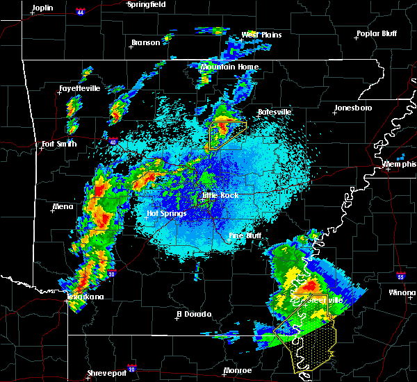 The severe thunderstorm warning for cleburne county will expire at 1015 pm cdt, the storm which prompted the warning has weakened below severe limits, and no longer pose an immediate threat to life or property. therefore, the warning will be allowed to expire. a tornado watch remains in effect until midnight cdt for central and north central arkansas. The severe thunderstorm warning for cleburne county will expire at 1015 pm cdt, the storm which prompted the warning has weakened below severe limits, and no longer pose an immediate threat to life or property. therefore, the warning will be allowed to expire. a tornado watch remains in effect until midnight cdt for central and north central arkansas.
|
| 3/29/2017 9:57 PM CDT |
 At 956 pm cdt, a severe thunderstorm was located over greers ferry, or 7 miles northwest of heber springs, moving northeast at 50 mph (radar indicated). Hazards include 60 mph wind gusts and quarter size hail. Hail damage to vehicles is expected. expect wind damage to roofs, siding, and trees. Locations impacted include, heber springs, fairfield bay, greers ferry, quitman, concord, higden, almond, prim, edgemont, dam site marina, hill creek recreation area, ida, brownsville, eden isle, drasco, pearson, wolf bayou, narrows marina, brewer, woodrow, a tornado watch remains in effect until midnight cdt for central and north central arkansas. At 956 pm cdt, a severe thunderstorm was located over greers ferry, or 7 miles northwest of heber springs, moving northeast at 50 mph (radar indicated). Hazards include 60 mph wind gusts and quarter size hail. Hail damage to vehicles is expected. expect wind damage to roofs, siding, and trees. Locations impacted include, heber springs, fairfield bay, greers ferry, quitman, concord, higden, almond, prim, edgemont, dam site marina, hill creek recreation area, ida, brownsville, eden isle, drasco, pearson, wolf bayou, narrows marina, brewer, woodrow, a tornado watch remains in effect until midnight cdt for central and north central arkansas.
|
| 3/29/2017 9:39 PM CDT |
 At 938 pm cdt, a severe thunderstorm was located near fairbanks, or 14 miles southeast of clinton, moving northeast at 50 mph (radar indicated). Hazards include 60 mph wind gusts and quarter size hail. Hail damage to vehicles is expected. Expect wind damage to roofs, siding, and trees. At 938 pm cdt, a severe thunderstorm was located near fairbanks, or 14 miles southeast of clinton, moving northeast at 50 mph (radar indicated). Hazards include 60 mph wind gusts and quarter size hail. Hail damage to vehicles is expected. Expect wind damage to roofs, siding, and trees.
|
| 3/9/2017 9:35 PM CST |
 At 934 pm cst, a severe thunderstorm was located near mountain view, moving southeast at 50 mph (radar indicated). Hazards include 60 mph wind gusts and half dollar size hail. Hail damage to vehicles is expected. Expect wind damage to roofs, siding, and trees. At 934 pm cst, a severe thunderstorm was located near mountain view, moving southeast at 50 mph (radar indicated). Hazards include 60 mph wind gusts and half dollar size hail. Hail damage to vehicles is expected. Expect wind damage to roofs, siding, and trees.
|
| 3/7/2017 2:19 AM CST |
 At 219 am cst, severe thunderstorms were located along a line extending from 11 miles southeast of ash flat to near cushman to 9 miles south of mountain view, moving southeast at 40 mph (radar indicated). Hazards include 60 mph wind gusts and penny size hail. Expect damage to roofs, siding, and trees. Locations impacted include, batesville, cherokee village, mountain view, fairfield bay, melbourne, ash flat, horseshoe bend, cave city, highland in sharp county, cushman, mount pleasant, shirley, concord, franklin, sidney, moorefield, rocky hill, lone star, gid, herpel, a tornado watch remains in effect until 500 am cst for north central arkansas. At 219 am cst, severe thunderstorms were located along a line extending from 11 miles southeast of ash flat to near cushman to 9 miles south of mountain view, moving southeast at 40 mph (radar indicated). Hazards include 60 mph wind gusts and penny size hail. Expect damage to roofs, siding, and trees. Locations impacted include, batesville, cherokee village, mountain view, fairfield bay, melbourne, ash flat, horseshoe bend, cave city, highland in sharp county, cushman, mount pleasant, shirley, concord, franklin, sidney, moorefield, rocky hill, lone star, gid, herpel, a tornado watch remains in effect until 500 am cst for north central arkansas.
|
| 3/7/2017 1:44 AM CST |
 At 143 am cst, severe thunderstorms were located along a line extending from near oxford to near blanchard springs campground to near elberta, moving east at 45 mph (radar indicated). Hazards include 60 mph wind gusts and nickel size hail. expect damage to roofs, siding, and trees At 143 am cst, severe thunderstorms were located along a line extending from near oxford to near blanchard springs campground to near elberta, moving east at 45 mph (radar indicated). Hazards include 60 mph wind gusts and nickel size hail. expect damage to roofs, siding, and trees
|
| 3/1/2017 2:58 AM CST |
 At 256 am cst, a line of severe thunderstorms were located along a line extending from horseshoe bend to near heber springs, moving east at 65 mph (emergency management). Hazards include 70 mph wind gusts and nickel size hail. Expect considerable tree damage. damage is likely to mobile homes, roofs, and outbuildings. Locations impacted include, batesville, heber springs, cherokee village, melbourne, ash flat, horseshoe bend, cave city, newark, highland in sharp county, greers ferry, hardy, quitman, guy, oxford, pangburn, rose bud, cushman, mount pleasant, pleasant plains, twin groves, a tornado watch remains in effect until 600 am cst for central, eastern and north central arkansas. At 256 am cst, a line of severe thunderstorms were located along a line extending from horseshoe bend to near heber springs, moving east at 65 mph (emergency management). Hazards include 70 mph wind gusts and nickel size hail. Expect considerable tree damage. damage is likely to mobile homes, roofs, and outbuildings. Locations impacted include, batesville, heber springs, cherokee village, melbourne, ash flat, horseshoe bend, cave city, newark, highland in sharp county, greers ferry, hardy, quitman, guy, oxford, pangburn, rose bud, cushman, mount pleasant, pleasant plains, twin groves, a tornado watch remains in effect until 600 am cst for central, eastern and north central arkansas.
|
| 3/1/2017 2:47 AM CST |
 At 246 am cst, severe thunderstorms were located along a line extending from oxford to near heber springs, moving east at 65 mph (emergency management). Hazards include 70 mph wind gusts and nickel size hail. Expect considerable tree damage. damage is likely to mobile homes, roofs, and outbuildings. Locations impacted include, batesville, heber springs, cherokee village, mountain view, clinton, fairfield bay, melbourne, ash flat, horseshoe bend, cave city, calico rock, newark, highland in sharp county, greers ferry, hardy, quitman, guy, oxford, pangburn, rose bud, a tornado watch remains in effect until 600 am cst for central, eastern and north central arkansas. At 246 am cst, severe thunderstorms were located along a line extending from oxford to near heber springs, moving east at 65 mph (emergency management). Hazards include 70 mph wind gusts and nickel size hail. Expect considerable tree damage. damage is likely to mobile homes, roofs, and outbuildings. Locations impacted include, batesville, heber springs, cherokee village, mountain view, clinton, fairfield bay, melbourne, ash flat, horseshoe bend, cave city, calico rock, newark, highland in sharp county, greers ferry, hardy, quitman, guy, oxford, pangburn, rose bud, a tornado watch remains in effect until 600 am cst for central, eastern and north central arkansas.
|
| 3/1/2017 2:27 AM CST |
 At 227 am cst, severe thunderstorms were located along a line extending from herron to near whipple, moving east at 65 mph (radar indicated). Hazards include 70 mph wind gusts and nickel size hail. Expect considerable tree damage. Damage is likely to mobile homes, roofs, and outbuildings. At 227 am cst, severe thunderstorms were located along a line extending from herron to near whipple, moving east at 65 mph (radar indicated). Hazards include 70 mph wind gusts and nickel size hail. Expect considerable tree damage. Damage is likely to mobile homes, roofs, and outbuildings.
|
| 10/12/2016 8:18 PM CDT |
 At 818 pm cdt, a severe thunderstorm capable of producing a tornado was located over heber springs, moving southeast at 25 mph (radar indicated rotation). Hazards include tornado and baseball size hail. Flying debris will be dangerous to those caught without shelter. mobile homes will be damaged or destroyed. damage to roofs, windows, and vehicles will occur. tree damage is likely. Locations impacted include, heber springs, pangburn, letona, dam site marina, wilburn, pickens in white county, eden isle, sidon, hickory flat, center hill, hopewell in cleburne county,. At 818 pm cdt, a severe thunderstorm capable of producing a tornado was located over heber springs, moving southeast at 25 mph (radar indicated rotation). Hazards include tornado and baseball size hail. Flying debris will be dangerous to those caught without shelter. mobile homes will be damaged or destroyed. damage to roofs, windows, and vehicles will occur. tree damage is likely. Locations impacted include, heber springs, pangburn, letona, dam site marina, wilburn, pickens in white county, eden isle, sidon, hickory flat, center hill, hopewell in cleburne county,.
|
| 10/12/2016 8:12 PM CDT |
 At 811 pm cdt, a severe thunderstorm was located near heber springs, moving southeast at 45 mph. this is a very dangerous storm (radar indicated). Hazards include baseball size hail and 70 mph wind gusts. People and animals outdoors will be severely injured. Expect shattered windows, extensive damage to roofs, siding, and vehicles. At 811 pm cdt, a severe thunderstorm was located near heber springs, moving southeast at 45 mph. this is a very dangerous storm (radar indicated). Hazards include baseball size hail and 70 mph wind gusts. People and animals outdoors will be severely injured. Expect shattered windows, extensive damage to roofs, siding, and vehicles.
|
| 10/12/2016 8:00 PM CDT |
 At 800 pm cdt, a severe thunderstorm capable of producing a tornado was located near greers ferry, or 7 miles southeast of fairfield bay, moving southeast at 40 mph (radar indicated rotation). Hazards include tornado and baseball size hail. Flying debris will be dangerous to those caught without shelter. mobile homes will be damaged or destroyed. damage to roofs, windows, and vehicles will occur. Tree damage is likely. At 800 pm cdt, a severe thunderstorm capable of producing a tornado was located near greers ferry, or 7 miles southeast of fairfield bay, moving southeast at 40 mph (radar indicated rotation). Hazards include tornado and baseball size hail. Flying debris will be dangerous to those caught without shelter. mobile homes will be damaged or destroyed. damage to roofs, windows, and vehicles will occur. Tree damage is likely.
|
| 10/12/2016 7:54 PM CDT |
 At 753 pm cdt, a severe thunderstorm was located over heber springs, and is nearly stationary. this is a very dangerous storm. very large hail and strong winds are expected (radar indicated). Hazards include baseball size hail and 60 mph wind gusts. People and animals outdoors will be severely injured. expect shattered windows, extensive damage to roofs, siding, and vehicles. Locations impacted include, searcy, heber springs, clinton, fairfield bay, greers ferry, quitman, pangburn, rose bud, shirley, higden, crosby, fairfield bay marina, steprock, fairbanks, gravel hill, sugar loaf recreation area, letona, albion, antioch in white county, velvet ridge,. At 753 pm cdt, a severe thunderstorm was located over heber springs, and is nearly stationary. this is a very dangerous storm. very large hail and strong winds are expected (radar indicated). Hazards include baseball size hail and 60 mph wind gusts. People and animals outdoors will be severely injured. expect shattered windows, extensive damage to roofs, siding, and vehicles. Locations impacted include, searcy, heber springs, clinton, fairfield bay, greers ferry, quitman, pangburn, rose bud, shirley, higden, crosby, fairfield bay marina, steprock, fairbanks, gravel hill, sugar loaf recreation area, letona, albion, antioch in white county, velvet ridge,.
|
| 10/12/2016 7:35 PM CDT |
 At 734 pm cdt, a severe thunderstorm was located over higden, or near fairfield bay, moving southeast at 60 mph (radar indicated). Hazards include golf ball size hail and 60 mph wind gusts. People and animals outdoors will be injured. expect hail damage to roofs, siding, windows, and vehicles. Expect wind damage to roofs, siding, and trees. At 734 pm cdt, a severe thunderstorm was located over higden, or near fairfield bay, moving southeast at 60 mph (radar indicated). Hazards include golf ball size hail and 60 mph wind gusts. People and animals outdoors will be injured. expect hail damage to roofs, siding, windows, and vehicles. Expect wind damage to roofs, siding, and trees.
|
| 7/25/2016 7:36 PM CDT |
 At 735 pm cdt, a severe thunderstorm was located 10 miles northeast of greers ferry, or 12 miles south of mountain view, moving southwest at 10 mph (radar indicated). Hazards include 60 mph wind gusts and nickel size hail. Expect damage to roofs. siding. And trees. At 735 pm cdt, a severe thunderstorm was located 10 miles northeast of greers ferry, or 12 miles south of mountain view, moving southwest at 10 mph (radar indicated). Hazards include 60 mph wind gusts and nickel size hail. Expect damage to roofs. siding. And trees.
|
| 12/23/2015 8:37 AM CST | At 837 am cst, severe thunderstorms were located along a line extending from near byron to 10 miles west of concord to woolly hollow state park, moving northeast at 50 mph (radar indicated). Hazards include 60 mph wind gusts. Expect damage to roofs. siding. And trees. |
| 12/23/2015 8:10 AM CST | At 810 am cst, severe thunderstorms were located along a line extending from near evening star to springfield, moving northeast at 80 mph (radar indicated). Hazards include 60 mph wind gusts. Expect damage to roofs. siding. And trees. |
| 5/25/2015 9:55 PM CDT | At 952 pm cdt, severe thunderstorms were located along a line extending from 7 miles northeast of heber springs to steprock to higginson, and moving northeast at 45 mph (radar indicated). Hazards include 60 mph wind gusts and penny size hail. Expect damage to roofs. Siding and trees. |
| 5/25/2015 9:51 PM CDT | At 950 pm cdt, severe thunderstorms were located along a line extending from mountain home to norfork dam to pineville to brandenberg to herpel to 10 miles west of concord, and moving northeast at 40 mph (radar indicated). Hazards include 60 mph wind gusts and penny size hail. Expect damage to roofs. Siding and trees. |
| 5/25/2015 9:39 PM CDT | At 935 pm cdt, severe thunderstorms were located along a line extending from 5 miles south of greers ferry lake to gravel hill to mcrae, and moving northeast at 45 mph (radar indicated). Hazards include 60 mph wind gusts and penny size hail. Expect damage to roofs. Siding and trees. |
| 5/25/2015 9:22 PM CDT | At 919 pm cdt, severe thunderstorms were located along a line extending from 7 miles northeast of elba to fairbanks to greystone, and moving northeast at 45 mph (radar indicated). Hazards include 60 mph wind gusts and penny size hail. Expect some damage to roofs. Siding and trees. |
| 5/25/2015 8:57 PM CDT | At 852 pm cdt, severe thunderstorms were located along a line extending from leslie to bee branch to conway, and moving east at 50 mph (radar indicated). Hazards include 60 mph wind gusts and nickel size hail. Expect damage to roofs. Siding and trees. |
| 5/25/2015 8:29 PM CDT | At 825 pm cdt, severe thunderstorms were located along a line extending from rupert to overcup and perryville, and moving east at 50 mph (radar indicated). Hazards include 70 mph wind gusts and nickel size hail. Expect considerable tree damage. Damage is likely to mobile homes, roofs and outbuildings. |
| 5/24/2015 5:19 PM CDT | At 517 pm cdt, severe thunderstorms were located along a line extending from greers ferry to heber springs to pangburn to mcrae, and moving northeast at 45 mph (radar indicated). Hazards include 70 mph wind gusts. Expect considerable tree damage. Damage is likely to mobile homes, roofs and outbuildings. |
| 5/24/2015 5:04 PM CDT | At 502 pm cdt, severe thunderstorms were located along a line extending from quitman to rose bud to 6 miles southeast of gravel hill to 6 miles southeast of sylvania, and moving northeast at 45 mph (radar indicated). Hazards include 70 mph wind gusts. Expect considerable tree damage. Damage is likely to mobile homes, roofs and outbuildings. |
| 5/10/2015 2:50 AM CDT | At 246 am cdt, a severe thunderstorm was located near concord, and moving east at 50 mph (radar indicated). Hazards include 60 mph wind gusts and quarter size hail. Hail damage to vehicles is expected. Expect wind damage to roofs, siding and trees. |
| 5/10/2015 2:36 AM CDT | At 232 am cdt, a severe thunderstorm was located 6 miles north of heber springs, and moving east at 50 mph (radar indicated). Hazards include 60 mph wind gusts and quarter size hail. Hail damage to vehicles is expected. Expect wind damage to roofs, siding and trees. |
| 4/19/2015 6:33 PM CDT | A severe thunderstorm warning remains in effect for northwestern white. northeastern faulkner and southern cleburne counties until 700 pm cdt. at 630 pm cdt. severe thunderstorms were located along a line extending from heber springs to 2 miles east of hopewell to rose bud. And moving east at 45 mph. |
| 4/19/2015 6:17 PM CDT | At 551 pm cdt, severe thunderstorms were located along a line extending from choctaw to twin groves, and moving east at 40 mph (radar indicated). Hazards include golf ball size hail and 60 mph wind gusts. People and animals outdoors will be injured. expect hail damage to roofs, siding, windows and vehicles. Expect wind damage to roofs, siding and trees. |
| 4/19/2015 5:58 PM CDT | The national weather service in little rock has issued a * severe thunderstorm warning for. cleburne county in north central arkansas. northeastern faulkner county in central arkansas. southeastern van buren county in north central arkansas. Western white county in central arkansas. |
| 4/9/2015 7:16 PM CDT | The national weather service in little rock has issued a * severe thunderstorm warning for. northern cleburne county in north central arkansas. western independence county in north central arkansas. until 745 pm cdt * at 714 pm cdt. A severe thunderstorm was located near heber. |
| 4/9/2015 7:08 PM CDT | A severe thunderstorm warning remains in effect for northwestern white. southeastern van buren and cleburne counties until 715 pm cdt. at 705 pm cdt. a severe thunderstorm was located near greers ferry lake. and moving northeast at 50 mph. hazard. 60 mph wind gusts and half dollar size hail. |
| 4/9/2015 7:03 PM CDT | A severe thunderstorm warning remains in effect for northwestern white. southeastern van buren and cleburne counties until 715 pm cdt. at 700 pm cdt. a severe thunderstorm was located near fairbanks. and moving northeast at 45 mph. hazard. 60 mph wind gusts and quarter size hail. |
| 4/9/2015 6:37 PM CDT | The national weather service in little rock has issued a * severe thunderstorm warning for. cleburne county in north central arkansas. northeastern faulkner county in central arkansas. southeastern van buren county in north central arkansas. Northwestern white county in central arkansas. |
| 4/9/2015 6:30 PM CDT | The national weather service in little rock has issued a * severe thunderstorm warning for. east central cleburne county in north central arkansas. south central independence county in north central arkansas. extreme southwestern jackson county in eastern arkansas. North central white county in central arkansas. |
| 4/9/2015 6:14 PM CDT | A severe thunderstorm warning remains in effect for eastern cleburne county until 645 pm cdt. at 611 pm cdt. a severe thunderstorm was located near heber springs. and moving east at 35 mph. hazard. 60 mph wind gusts and quarter size hail. source. Radar indicated. |
| 4/9/2015 5:53 PM CDT | The national weather service in little rock has issued a * severe thunderstorm warning for. cleburne county in north central arkansas. southeastern van buren county in north central arkansas. until 645 pm cdt * at 550 pm cdt. A severe thunderstorm was located near fairbanks. |
| 7/14/2014 3:13 PM CDT | Metal from a chicken house was blown around a power pol in cleburne county AR, 6.4 miles SSW of Tumbling Shoals, AR |
| 1/29/2013 7:57 PM CST | Trees and power lines blown dow in cleburne county AR, 6.4 miles SSW of Tumbling Shoals, AR |
| 9/7/2012 7:41 PM CDT | Tree fell across a traile in cleburne county AR, 6.4 miles SSW of Tumbling Shoals, AR |
| 7/8/2012 1:30 PM CDT | Local coordinator reported roof damage on several houses. also...trees were blown down onto power line in cleburne county AR, 6.9 miles WNW of Tumbling Shoals, AR |
| 7/8/2012 1:30 PM CDT | Several trees down in wilbur in cleburne county AR, 6.9 miles WNW of Tumbling Shoals, AR |
| 1/1/0001 12:00 AM | A hay barn suffered major damage...with parts of the barn blown well out into a fiel in cleburne county AR, 3.9 miles WSW of Tumbling Shoals, AR |
Hail Maps for Tumbling Shoals, AR
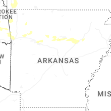
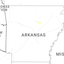
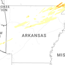


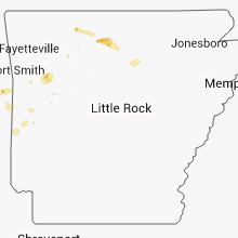


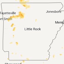


Connect with Interactive Hail Maps