

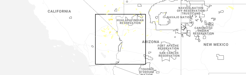
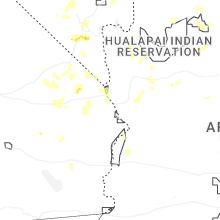
Hail Map for Valle Vista, AZ
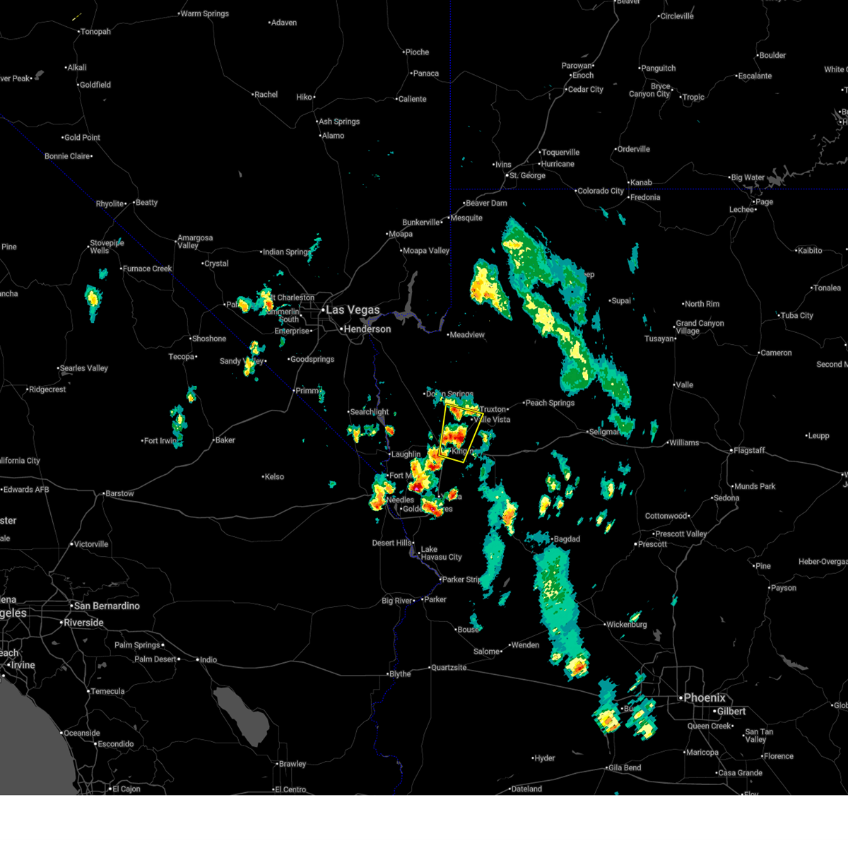
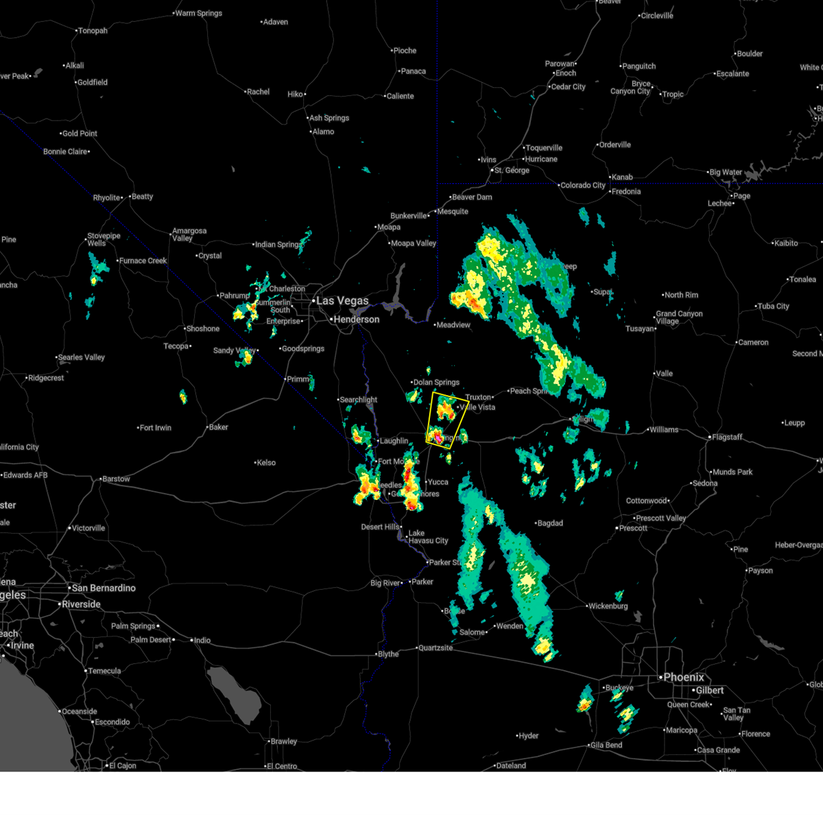
The Valle Vista, AZ area has had 0 reports of on-the-ground hail by trained spotters, and has been under severe weather warnings 2 times during the past 12 months. Doppler radar has detected hail at or near Valle Vista, AZ on 27 occasions, including 1 occasion during the past year.
| Name: | Valle Vista, AZ |
| Where Located: | 69.5 miles NNE of Lake Havasu City, AZ |
| Map: | Google Map for Valle Vista, AZ |
| Population: | 1659 |
| Housing Units: | 936 |
| More Info: | Search Google for Valle Vista, AZ |
1
The Top Recent Hail Date for Valle Vista, AZ is Tuesday, June 3, 2025 (7th out of 27)
Hail and Wind Damage Spotted near Valle Vista, AZ
| Date / Time | Report Details |
|---|---|
| 7/2/2025 7:40 PM MST |
 the severe thunderstorm warning has been cancelled and is no longer in effect the severe thunderstorm warning has been cancelled and is no longer in effect
|
| 7/2/2025 7:22 PM MST |
 Svrvef the national weather service in las vegas has issued a * severe thunderstorm warning for, central mohave county in northwestern arizona, * until 800 pm mst. * at 722 pm mst, a severe thunderstorm was located over kingman, moving north at 20 mph (radar indicated). Hazards include 60 mph wind gusts and quarter size hail. Hail damage to vehicles is expected. Expect wind damage to roofs and trees. Svrvef the national weather service in las vegas has issued a * severe thunderstorm warning for, central mohave county in northwestern arizona, * until 800 pm mst. * at 722 pm mst, a severe thunderstorm was located over kingman, moving north at 20 mph (radar indicated). Hazards include 60 mph wind gusts and quarter size hail. Hail damage to vehicles is expected. Expect wind damage to roofs and trees.
|
| 7/12/2024 5:57 PM MST |
 The storm near kingman which prompted the warning has weakened, and no longer poses an immediate threat to life or property. therefore, the warning will be allowed to expire. The storm near kingman which prompted the warning has weakened, and no longer poses an immediate threat to life or property. therefore, the warning will be allowed to expire.
|
| 7/12/2024 5:48 PM MST |
 At 545 pm mst, a severe thunderstorm was located near new kingman-butler, or near kingman, moving northwest at 10 mph (radar indicated). Hazards include 60 mph wind gusts. Expect damage to roofs and trees. locations impacted include, kingman, new kingman-butler, hualapai mountain park, and golden valley. this includes the following roads, interstate 40 in arizona between mile markers 39 and 66. highway 93 in mohave county between mile markers 64 and 70. Stockton hill road between mile markers 1 and 16. At 545 pm mst, a severe thunderstorm was located near new kingman-butler, or near kingman, moving northwest at 10 mph (radar indicated). Hazards include 60 mph wind gusts. Expect damage to roofs and trees. locations impacted include, kingman, new kingman-butler, hualapai mountain park, and golden valley. this includes the following roads, interstate 40 in arizona between mile markers 39 and 66. highway 93 in mohave county between mile markers 64 and 70. Stockton hill road between mile markers 1 and 16.
|
| 7/12/2024 5:19 PM MST |
 Svrvef the national weather service in las vegas has issued a * severe thunderstorm warning for, central mohave county in northwestern arizona, * until 600 pm mst. * at 517 pm mst, a severe thunderstorm was located near kingman, moving west at 10 mph (radar indicated). Hazards include 60 mph wind gusts. expect damage to roofs and trees Svrvef the national weather service in las vegas has issued a * severe thunderstorm warning for, central mohave county in northwestern arizona, * until 600 pm mst. * at 517 pm mst, a severe thunderstorm was located near kingman, moving west at 10 mph (radar indicated). Hazards include 60 mph wind gusts. expect damage to roofs and trees
|
| 9/1/2023 2:09 AM MST |
 The severe thunderstorm warning for west central mohave county will expire at 215 am mst, the storm which prompted the warning has weakened below severe limits, and no longer poses an immediate threat to life or property. therefore, the warning will be allowed to expire. however gusty winds are still possible with this thunderstorm. The severe thunderstorm warning for west central mohave county will expire at 215 am mst, the storm which prompted the warning has weakened below severe limits, and no longer poses an immediate threat to life or property. therefore, the warning will be allowed to expire. however gusty winds are still possible with this thunderstorm.
|
| 9/1/2023 1:53 AM MST |
 At 153 am mst, a severe thunderstorm was located near new kingman-butler, or 8 miles north of kingman, moving north at 20 mph (radar indicated). Hazards include 60 mph wind gusts. Expect damage to roofs and trees. locations impacted include, kingman, windy point campground, dw ranch road, packsaddle campground, chloride, new kingman-butler, blake ranch road, golden valley and dolan springs. this includes the following roads, interstate 40 in arizona between mile markers 39 and 68. highway 93 in mohave county between mile markers 41 and 70. state route 68 in mohave county between mile markers 13 and 28. hail threat, radar indicated max hail size, <. 75 in wind threat, radar indicated max wind gust, 60 mph. At 153 am mst, a severe thunderstorm was located near new kingman-butler, or 8 miles north of kingman, moving north at 20 mph (radar indicated). Hazards include 60 mph wind gusts. Expect damage to roofs and trees. locations impacted include, kingman, windy point campground, dw ranch road, packsaddle campground, chloride, new kingman-butler, blake ranch road, golden valley and dolan springs. this includes the following roads, interstate 40 in arizona between mile markers 39 and 68. highway 93 in mohave county between mile markers 41 and 70. state route 68 in mohave county between mile markers 13 and 28. hail threat, radar indicated max hail size, <. 75 in wind threat, radar indicated max wind gust, 60 mph.
|
| 9/1/2023 1:18 AM MST |
 At 118 am mst, a severe thunderstorm was located over new kingman-butler, or near kingman, moving north at 20 mph (radar indicated). Hazards include 60 mph wind gusts. expect damage to roofs and trees At 118 am mst, a severe thunderstorm was located over new kingman-butler, or near kingman, moving north at 20 mph (radar indicated). Hazards include 60 mph wind gusts. expect damage to roofs and trees
|
| 9/8/2022 8:42 PM MST |
 The severe thunderstorm warning for west central mohave county will expire at 845 pm mst, the storm which prompted the warning has weakened below severe limits, and no longer poses an immediate threat to life or property. therefore, the warning will be allowed to expire. The severe thunderstorm warning for west central mohave county will expire at 845 pm mst, the storm which prompted the warning has weakened below severe limits, and no longer poses an immediate threat to life or property. therefore, the warning will be allowed to expire.
|
| 9/8/2022 7:50 PM MST |
 At 747 pm mst, a severe thunderstorm was located 15 miles northwest of dolan springs, or 25 miles southeast of boulder city, moving west at 35 mph (radar indicated). Hazards include 60 mph wind gusts across west-central mohave county... 45 mph wind gusts at lake mead recreation area. Expect damage to roofs and trees. locations impacted include, katherine landing, windy point campground, pierce ferry and antares roads, meadview, hoover dam, packsaddle campground, chloride, new kingman-butler, lake mead national recreation area, temple bar campground, dolan springs, south cove, golden valley and temple bar. hail threat, radar indicated max hail size, <. 75 in wind threat, radar indicated max wind gust, 60 mph. At 747 pm mst, a severe thunderstorm was located 15 miles northwest of dolan springs, or 25 miles southeast of boulder city, moving west at 35 mph (radar indicated). Hazards include 60 mph wind gusts across west-central mohave county... 45 mph wind gusts at lake mead recreation area. Expect damage to roofs and trees. locations impacted include, katherine landing, windy point campground, pierce ferry and antares roads, meadview, hoover dam, packsaddle campground, chloride, new kingman-butler, lake mead national recreation area, temple bar campground, dolan springs, south cove, golden valley and temple bar. hail threat, radar indicated max hail size, <. 75 in wind threat, radar indicated max wind gust, 60 mph.
|
| 9/8/2022 7:32 PM MST |
 At 731 pm mst, a severe thunderstorm was located 8 miles northwest of dolan springs, or 32 miles southeast of boulder city, moving west at 35 mph (radar indicated). Hazards include 60 mph wind gusts. expect damage to roofs and trees At 731 pm mst, a severe thunderstorm was located 8 miles northwest of dolan springs, or 32 miles southeast of boulder city, moving west at 35 mph (radar indicated). Hazards include 60 mph wind gusts. expect damage to roofs and trees
|
| 9/4/2022 5:21 PM MST |
 At 520 pm mst, a severe thunderstorm was located over new kingman- butler, or near kingman, moving west at 35 mph. at 506 pm mst, winds gusted to 60 mph at the kingman airport (radar indicated). Hazards include 60 mph wind gusts and quarter size hail. Hail damage to vehicles is expected. expect wind damage to roofs and trees. locations impacted include, kingman, new kingman-butler and golden valley. this includes interstate 40 in arizona between mile markers 44 and 59. hail threat, radar indicated max hail size, 1. 00 in wind threat, radar indicated max wind gust, 60 mph. At 520 pm mst, a severe thunderstorm was located over new kingman- butler, or near kingman, moving west at 35 mph. at 506 pm mst, winds gusted to 60 mph at the kingman airport (radar indicated). Hazards include 60 mph wind gusts and quarter size hail. Hail damage to vehicles is expected. expect wind damage to roofs and trees. locations impacted include, kingman, new kingman-butler and golden valley. this includes interstate 40 in arizona between mile markers 44 and 59. hail threat, radar indicated max hail size, 1. 00 in wind threat, radar indicated max wind gust, 60 mph.
|
| 9/4/2022 5:01 PM MST |
 At 501 pm mst, a severe thunderstorm was located 10 miles north of blake ranch road, or 12 miles northeast of kingman, moving west at 35 mph (radar indicated). Hazards include 60 mph wind gusts and quarter size hail. Hail damage to vehicles is expected. Expect wind damage to roofs and trees. At 501 pm mst, a severe thunderstorm was located 10 miles north of blake ranch road, or 12 miles northeast of kingman, moving west at 35 mph (radar indicated). Hazards include 60 mph wind gusts and quarter size hail. Hail damage to vehicles is expected. Expect wind damage to roofs and trees.
|
| 8/21/2022 9:10 PM MST | At 909 pm mst, a severe thunderstorm was located near new kingman-butler, or near kingman, moving south at 25 mph (radar indicated). Hazards include 60 mph wind gusts and quarter size hail. Hail damage to vehicles is expected. Expect wind damage to roofs and trees. |
| 8/21/2022 8:33 PM MST | At 831 pm mst, severe thunderstorms were located along a line extending from dolan springs to near diamond m ranch, moving south at 30 mph. strong winds and hail will be approaching kingman by 9pm (radar indicated). Hazards include 60 mph wind gusts and quarter size hail. Hail damage to vehicles is expected. expect wind damage to roofs and trees. locations impacted include, kingman, katherine landing, windy point campground, wild cow campground, diamond m ranch, blake ranch road, golden valley, dw ranch road, packsaddle campground, chloride, new kingman-butler, valentine, dolan springs, hualapai mountain park, hualapai peak and peach springs. this includes interstate 40 in arizona between mile markers 40 and 93. hail threat, radar indicated max hail size, 1. 00 in wind threat, radar indicated max wind gust, 60 mph. |
| 8/21/2022 7:54 PM MST | At 754 pm mst, severe thunderstorms were located along a line extending from 12 miles southeast of boulder city to 13 miles south of diamond creek campground, moving south at 25 mph. this storm will impact dolan springs imminently and kingman by 9 pm (radar indicated). Hazards include 60 mph wind gusts and quarter size hail. Hail damage to vehicles is expected. Expect wind damage to roofs and trees. |
| 8/20/2022 5:23 PM MST |
 The severe thunderstorm warning for central mohave county will expire at 530 pm mst, the storm which prompted the warning has weakened below severe limits, and no longer poses an immediate threat to life or property. therefore, the warning will be allowed to expire. The severe thunderstorm warning for central mohave county will expire at 530 pm mst, the storm which prompted the warning has weakened below severe limits, and no longer poses an immediate threat to life or property. therefore, the warning will be allowed to expire.
|
| 8/20/2022 4:57 PM MST |
 At 456 pm mst, a severe thunderstorm was located 10 miles northwest of valentine, or 20 miles northeast of kingman, moving southeast at 5 mph. strong winds and hail will impact valentine shortly (radar indicated). Hazards include 60 mph wind gusts and quarter size hail. Hail damage to vehicles is expected. expect wind damage to roofs and trees. locations impacted include, valentine. hail threat, radar indicated max hail size, 1. 00 in wind threat, radar indicated max wind gust, 60 mph. At 456 pm mst, a severe thunderstorm was located 10 miles northwest of valentine, or 20 miles northeast of kingman, moving southeast at 5 mph. strong winds and hail will impact valentine shortly (radar indicated). Hazards include 60 mph wind gusts and quarter size hail. Hail damage to vehicles is expected. expect wind damage to roofs and trees. locations impacted include, valentine. hail threat, radar indicated max hail size, 1. 00 in wind threat, radar indicated max wind gust, 60 mph.
|
| 8/20/2022 4:39 PM MST |
 At 438 pm mst, a severe thunderstorm was located 12 miles northwest of valentine, or 21 miles northeast of kingman, moving southeast at 5 mph (radar indicated). Hazards include 60 mph wind gusts and quarter size hail. Hail damage to vehicles is expected. Expect wind damage to roofs and trees. At 438 pm mst, a severe thunderstorm was located 12 miles northwest of valentine, or 21 miles northeast of kingman, moving southeast at 5 mph (radar indicated). Hazards include 60 mph wind gusts and quarter size hail. Hail damage to vehicles is expected. Expect wind damage to roofs and trees.
|
| 8/3/2022 4:07 PM MST |
 The severe thunderstorm warning for central mohave county will expire at 415 pm mst, the storm which prompted the warning has weakened below severe limits, and no longer poses an immediate threat to life or property. therefore, the warning will be allowed to expire. The severe thunderstorm warning for central mohave county will expire at 415 pm mst, the storm which prompted the warning has weakened below severe limits, and no longer poses an immediate threat to life or property. therefore, the warning will be allowed to expire.
|
| 8/3/2022 3:28 PM MST |
 At 327 pm mst, a severe thunderstorm was located over blake ranch road, or 11 miles east of kingman, moving west at 10 mph (radar indicated). Hazards include 60 mph wind gusts and quarter size hail. Hail damage to vehicles is expected. Expect wind damage to roofs and trees. At 327 pm mst, a severe thunderstorm was located over blake ranch road, or 11 miles east of kingman, moving west at 10 mph (radar indicated). Hazards include 60 mph wind gusts and quarter size hail. Hail damage to vehicles is expected. Expect wind damage to roofs and trees.
|
| 10/5/2021 11:01 AM MST |
 At 1101 am mst, severe thunderstorms were located along a line extending from near diamond m ranch to 11 miles west of chloride, moving northeast at 30 mph. at 1051 am, 68 mph wind gusts were recorded at kingman airport (radar indicated). Hazards include 70 mph wind gusts. Expect considerable tree damage. damage is likely to mobile homes, roofs, and outbuildings. locations impacted include, kingman, windy point campground, grand canyon skywalk, diamond creek campground, pierce ferry and antares roads, diamond m ranch, blake ranch road, golden valley, dw ranch road, packsaddle campground, chloride, grand canyon ranch, new kingman-butler, valentine, dolan springs, lake mead national recreation area and peach springs. this includes interstate 40 in arizona between mile markers 45 and 93. thunderstorm damage threat, considerable hail threat, radar indicated max hail size, <. 75 in wind threat, radar indicated max wind gust, 70 mph. At 1101 am mst, severe thunderstorms were located along a line extending from near diamond m ranch to 11 miles west of chloride, moving northeast at 30 mph. at 1051 am, 68 mph wind gusts were recorded at kingman airport (radar indicated). Hazards include 70 mph wind gusts. Expect considerable tree damage. damage is likely to mobile homes, roofs, and outbuildings. locations impacted include, kingman, windy point campground, grand canyon skywalk, diamond creek campground, pierce ferry and antares roads, diamond m ranch, blake ranch road, golden valley, dw ranch road, packsaddle campground, chloride, grand canyon ranch, new kingman-butler, valentine, dolan springs, lake mead national recreation area and peach springs. this includes interstate 40 in arizona between mile markers 45 and 93. thunderstorm damage threat, considerable hail threat, radar indicated max hail size, <. 75 in wind threat, radar indicated max wind gust, 70 mph.
|
| 10/5/2021 10:55 AM MST |
 At 1054 am mst, severe thunderstorms were located along a line extending from near diamond m ranch to 12 miles northeast of katherine landing, moving northeast at 30 mph. strong winds exceeding 50 mph have been reported near kingman (radar indicated). Hazards include 60 mph wind gusts. expect damage to roofs and trees At 1054 am mst, severe thunderstorms were located along a line extending from near diamond m ranch to 12 miles northeast of katherine landing, moving northeast at 30 mph. strong winds exceeding 50 mph have been reported near kingman (radar indicated). Hazards include 60 mph wind gusts. expect damage to roofs and trees
|
| 7/25/2021 5:39 PM MST |
 At 537 pm mst, severe thunderstorms were located along a line extending from near dolan springs to 10 miles southeast of golden valley, moving west at 25 mph. several observations have measured wind gusts over 60 mph as well as a wall of dust (radar indicated and surface observations). Hazards include 70 mph wind gusts. Expect considerable tree damage. damage is likely to mobile homes, roofs, and outbuildings. locations impacted include, bullhead city, kingman, laughlin, katherine landing, windy point campground, oatman, golden valley, mesquite creek, dw ranch road, packsaddle campground, chloride, new kingman-butler, dolan springs, and willow valley. This includes interstate 40 in arizona between mile markers 36 and 71. At 537 pm mst, severe thunderstorms were located along a line extending from near dolan springs to 10 miles southeast of golden valley, moving west at 25 mph. several observations have measured wind gusts over 60 mph as well as a wall of dust (radar indicated and surface observations). Hazards include 70 mph wind gusts. Expect considerable tree damage. damage is likely to mobile homes, roofs, and outbuildings. locations impacted include, bullhead city, kingman, laughlin, katherine landing, windy point campground, oatman, golden valley, mesquite creek, dw ranch road, packsaddle campground, chloride, new kingman-butler, dolan springs, and willow valley. This includes interstate 40 in arizona between mile markers 36 and 71.
|
| 7/25/2021 5:06 PM MST |
 At 505 pm mst, severe thunderstorms were located along a line extending from 18 miles west of diamond creek campground to 13 miles east of blake ranch road, moving west at 30 mph (radar indicated). Hazards include 60 mph wind gusts. expect damage to roofs and trees At 505 pm mst, severe thunderstorms were located along a line extending from 18 miles west of diamond creek campground to 13 miles east of blake ranch road, moving west at 30 mph (radar indicated). Hazards include 60 mph wind gusts. expect damage to roofs and trees
|
| 7/23/2021 10:58 PM MST |
 The severe thunderstorm warning for central mohave county will expire at 1100 pm mst, the storms which prompted the warning have weakened below severe limits, and no longer pose an immediate threat to life or property. therefore, the warning will be allowed to expire. however gusty winds up to 50 mph and brief heavy rain are still possible with these thunderstorms. The severe thunderstorm warning for central mohave county will expire at 1100 pm mst, the storms which prompted the warning have weakened below severe limits, and no longer pose an immediate threat to life or property. therefore, the warning will be allowed to expire. however gusty winds up to 50 mph and brief heavy rain are still possible with these thunderstorms.
|
| 7/23/2021 10:18 PM MST |
 At 1017 pm mst, severe thunderstorms were located along a line extending from near meadview to 19 miles north of valentine to 13 miles south of diamond creek campground, moving southwest at 40 mph (radar indicated). Hazards include 60 mph wind gusts. expect damage to roofs and trees At 1017 pm mst, severe thunderstorms were located along a line extending from near meadview to 19 miles north of valentine to 13 miles south of diamond creek campground, moving southwest at 40 mph (radar indicated). Hazards include 60 mph wind gusts. expect damage to roofs and trees
|
| 8/18/2020 4:57 PM MST |
 The severe thunderstorm warning for west central mohave county will expire at 500 pm mst, the storm which prompted the warning has moved out of the area. therefore, the warning will be allowed to expire. however small hail and gusty winds are still possible with this thunderstorm. The severe thunderstorm warning for west central mohave county will expire at 500 pm mst, the storm which prompted the warning has moved out of the area. therefore, the warning will be allowed to expire. however small hail and gusty winds are still possible with this thunderstorm.
|
| 8/18/2020 4:39 PM MST |
 At 438 pm mst, a severe thunderstorm capable of gusty outflow winds was located 10 miles northeast of new kingman-butler, or 13 miles northeast of kingman, moving northeast at 10 mph (radar indicated). Hazards include 60 mph wind gusts and quarter size hail. Hail damage to vehicles is expected. expect wind damage to roofs and trees as well as hazardous crosswinds. locations impacted include, kingman, windy point campground, packsaddle campground, chloride, golden valley and new kingman-butler. This includes interstate 40 in arizona between mile markers 47 and 59. At 438 pm mst, a severe thunderstorm capable of gusty outflow winds was located 10 miles northeast of new kingman-butler, or 13 miles northeast of kingman, moving northeast at 10 mph (radar indicated). Hazards include 60 mph wind gusts and quarter size hail. Hail damage to vehicles is expected. expect wind damage to roofs and trees as well as hazardous crosswinds. locations impacted include, kingman, windy point campground, packsaddle campground, chloride, golden valley and new kingman-butler. This includes interstate 40 in arizona between mile markers 47 and 59.
|
| 8/18/2020 4:25 PM MST |
 The severe thunderstorm warning for central mohave county will expire at 430 pm mst, the storms which prompted the warning have weakened below severe criteria, or have moved out of the area. therefore, the warning will be allowed to expire. gusty winds are still possible with this thunderstorm. to report severe weather, contact your nearest law enforcement agency. they will relay your report to the national weather service las vegas. The severe thunderstorm warning for central mohave county will expire at 430 pm mst, the storms which prompted the warning have weakened below severe criteria, or have moved out of the area. therefore, the warning will be allowed to expire. gusty winds are still possible with this thunderstorm. to report severe weather, contact your nearest law enforcement agency. they will relay your report to the national weather service las vegas.
|
| 8/18/2020 4:10 PM MST |
 At 409 pm mst, a severe thunderstorm was located near new kingman- butler, or 10 miles north of kingman, moving northeast at 10 mph (radar indicated). Hazards include 60 mph wind gusts and quarter size hail. Hail damage to vehicles is expected. Expect wind damage to roofs and trees. At 409 pm mst, a severe thunderstorm was located near new kingman- butler, or 10 miles north of kingman, moving northeast at 10 mph (radar indicated). Hazards include 60 mph wind gusts and quarter size hail. Hail damage to vehicles is expected. Expect wind damage to roofs and trees.
|
| 8/18/2020 4:01 PM MST |
 At 358 pm mst, a cluster of severe thunderstorms capable of damaging outflow winds was located 15 miles east of blake ranch road, or 29 miles east of kingman, extending south of the interstate 40 corridor moving southwest at 20 mph (radar indicated). Hazards include 60 mph wind gusts and small hail. Expect damage to roofs and trees as well as reduced visibility due to blowing dust. strong crosswinds for high profile vehicles, particularly on interstate 40 east of kingman. nearby observations have indicated gusts to 40 mph with locally higher speeds possible. locations impacted include, valentine, dw ranch road, diamond m ranch and blake ranch road. This includes interstate 40 in arizona between mile markers 64 and 93. At 358 pm mst, a cluster of severe thunderstorms capable of damaging outflow winds was located 15 miles east of blake ranch road, or 29 miles east of kingman, extending south of the interstate 40 corridor moving southwest at 20 mph (radar indicated). Hazards include 60 mph wind gusts and small hail. Expect damage to roofs and trees as well as reduced visibility due to blowing dust. strong crosswinds for high profile vehicles, particularly on interstate 40 east of kingman. nearby observations have indicated gusts to 40 mph with locally higher speeds possible. locations impacted include, valentine, dw ranch road, diamond m ranch and blake ranch road. This includes interstate 40 in arizona between mile markers 64 and 93.
|
| 8/18/2020 3:29 PM MST |
 At 324 pm mst, a cluster of severe thunderstorms capable of damaging outflow winds was located near valentine on route 66 extending south of the interstate 40 corridor moving southwest at 20 mph (radar indicated). Hazards include 60 mph wind gusts and small hail. Expect damage to roofs and trees as well as reduced visibility due to blowing dust. Strong crosswinds for high profile vehicles, particularly on interstate 40 east of kingman. At 324 pm mst, a cluster of severe thunderstorms capable of damaging outflow winds was located near valentine on route 66 extending south of the interstate 40 corridor moving southwest at 20 mph (radar indicated). Hazards include 60 mph wind gusts and small hail. Expect damage to roofs and trees as well as reduced visibility due to blowing dust. Strong crosswinds for high profile vehicles, particularly on interstate 40 east of kingman.
|
| 7/24/2020 10:56 AM MST |
 The national weather service in las vegas has issued a * tornado warning for. southern mohave county in northwestern arizona. until 1130 am mst. At 1055 am mst, a confirmed tornado was located near dw ranch road, or 10 miles east of kingman, moving north-northeast at 10. The national weather service in las vegas has issued a * tornado warning for. southern mohave county in northwestern arizona. until 1130 am mst. At 1055 am mst, a confirmed tornado was located near dw ranch road, or 10 miles east of kingman, moving north-northeast at 10.
|
| 8/9/2018 6:54 PM MST |
 The severe thunderstorm warning for central mohave county will expire at 700 pm mst, the storms which prompted the warning have weakened below severe limits, and no longer pose an immediate threat to life or property. therefore, the warning will be allowed to expire. however gusty winds and heavy rain are still possible with these thunderstorms. The severe thunderstorm warning for central mohave county will expire at 700 pm mst, the storms which prompted the warning have weakened below severe limits, and no longer pose an immediate threat to life or property. therefore, the warning will be allowed to expire. however gusty winds and heavy rain are still possible with these thunderstorms.
|
| 8/9/2018 6:21 PM MST |
 At 557 pm mst, severe thunderstorms were located along a line extending from 8 miles south of grand canyon skywalk to 7 miles northeast of diamond m ranch, moving southwest at 15 mph (radar indicated). Hazards include 60 mph wind gusts and quarter size hail. Hail damage to vehicles is expected. expect wind damage to roofs and trees. severe thunderstorms will be near, diamond m ranch and grand canyon ranch around 625 pm mst. pierce ferry and antares roads around 700 pm mst. other locations impacted by these severe thunderstorms include peach springs. This includes interstate 40 in arizona between mile markers 78 and 91. At 557 pm mst, severe thunderstorms were located along a line extending from 8 miles south of grand canyon skywalk to 7 miles northeast of diamond m ranch, moving southwest at 15 mph (radar indicated). Hazards include 60 mph wind gusts and quarter size hail. Hail damage to vehicles is expected. expect wind damage to roofs and trees. severe thunderstorms will be near, diamond m ranch and grand canyon ranch around 625 pm mst. pierce ferry and antares roads around 700 pm mst. other locations impacted by these severe thunderstorms include peach springs. This includes interstate 40 in arizona between mile markers 78 and 91.
|
| 8/9/2018 5:58 PM MST |
 At 557 pm mst, severe thunderstorms were located along a line extending from 8 miles south of grand canyon skywalk to 7 miles northeast of diamond m ranch, moving southwest at 15 mph (radar indicated). Hazards include 60 mph wind gusts and quarter size hail. Hail damage to vehicles is expected. expect wind damage to roofs and trees. severe thunderstorms will be near, diamond m ranch and grand canyon ranch around 625 pm mst. pierce ferry and antares roads around 700 pm mst. other locations impacted by these severe thunderstorms include peach springs. This includes interstate 40 in arizona between mile markers 78 and 91. At 557 pm mst, severe thunderstorms were located along a line extending from 8 miles south of grand canyon skywalk to 7 miles northeast of diamond m ranch, moving southwest at 15 mph (radar indicated). Hazards include 60 mph wind gusts and quarter size hail. Hail damage to vehicles is expected. expect wind damage to roofs and trees. severe thunderstorms will be near, diamond m ranch and grand canyon ranch around 625 pm mst. pierce ferry and antares roads around 700 pm mst. other locations impacted by these severe thunderstorms include peach springs. This includes interstate 40 in arizona between mile markers 78 and 91.
|
| 7/30/2018 5:24 PM MST |
 The severe thunderstorm warning for south central mohave county will expire at 530 pm mst, the storms which prompted the warning have weakened below severe limits, and no longer pose an immediate threat to life or property. therefore, the warning will be allowed to expire. however small hail, gusty winds and heavy rain are still possible with these thunderstorms. The severe thunderstorm warning for south central mohave county will expire at 530 pm mst, the storms which prompted the warning have weakened below severe limits, and no longer pose an immediate threat to life or property. therefore, the warning will be allowed to expire. however small hail, gusty winds and heavy rain are still possible with these thunderstorms.
|
| 7/30/2018 4:57 PM MST |
 At 457 pm mst, severe thunderstorms were located along a line extending from 8 miles north of new kingman-butler to near kingman to 7 miles east of yucca, moving west at 5 mph (radar indicated). Hazards include 60 mph wind gusts. Expect damage to roofs and trees. locations impacted include, kingman, yucca, windy point campground, wild cow campground, packsaddle campground, chloride, new kingman-butler, golden valley, hualapai mountain park and hualapai peak. This includes interstate 40 in arizona between mile markers 24 and 63. At 457 pm mst, severe thunderstorms were located along a line extending from 8 miles north of new kingman-butler to near kingman to 7 miles east of yucca, moving west at 5 mph (radar indicated). Hazards include 60 mph wind gusts. Expect damage to roofs and trees. locations impacted include, kingman, yucca, windy point campground, wild cow campground, packsaddle campground, chloride, new kingman-butler, golden valley, hualapai mountain park and hualapai peak. This includes interstate 40 in arizona between mile markers 24 and 63.
|
| 7/30/2018 4:37 PM MST |
 At 436 pm mst, severe thunderstorms were located along a line extending from 9 miles northeast of new kingman-butler to near kingman to 9 miles east of yucca, moving west at 5 mph (radar indicated). Hazards include 60 mph wind gusts. expect damage to roofs and trees At 436 pm mst, severe thunderstorms were located along a line extending from 9 miles northeast of new kingman-butler to near kingman to 9 miles east of yucca, moving west at 5 mph (radar indicated). Hazards include 60 mph wind gusts. expect damage to roofs and trees
|
| 7/16/2018 2:12 PM MST |
 At 212 pm mst, severe thunderstorms were located along a line extending from near valentine to 14 miles east of blake ranch road, moving west at 20 mph (radar indicated). Hazards include 70 mph wind gusts. Expect considerable tree damage. Damage is likely to mobile homes, roofs, and outbuildings. At 212 pm mst, severe thunderstorms were located along a line extending from near valentine to 14 miles east of blake ranch road, moving west at 20 mph (radar indicated). Hazards include 70 mph wind gusts. Expect considerable tree damage. Damage is likely to mobile homes, roofs, and outbuildings.
|
| 7/9/2018 6:24 PM MST |
 The severe thunderstorm warning for west central mohave county will expire at 630 pm mst, the thunderstorms which prompted the warning have weakened below severe limits, and no longer pose an immediate threat to life or property. therefore, the warning will be allowed to expire. however gusty winds to 50 mph are still possible until 7 pm mst around kingman, chloride, golden valley and dolan springs. The severe thunderstorm warning for west central mohave county will expire at 630 pm mst, the thunderstorms which prompted the warning have weakened below severe limits, and no longer pose an immediate threat to life or property. therefore, the warning will be allowed to expire. however gusty winds to 50 mph are still possible until 7 pm mst around kingman, chloride, golden valley and dolan springs.
|
| 7/9/2018 6:14 PM MST |
 At 612 pm mst, severe thunderstorms were located between chloride and kingman, moving west at 20 mph (radar indicated). Hazards include 60 mph wind gusts. Expect damage to roofs and trees. locations impacted include, bullhead city, kingman, chloride, new kingman-butler, lake mead national recreation area, dolan springs, pierce ferry and antares roads, golden valley and temple bar. This includes interstate 40 in arizona between mile markers 53 and 61 and also highway 93 between kingman and willow beach. At 612 pm mst, severe thunderstorms were located between chloride and kingman, moving west at 20 mph (radar indicated). Hazards include 60 mph wind gusts. Expect damage to roofs and trees. locations impacted include, bullhead city, kingman, chloride, new kingman-butler, lake mead national recreation area, dolan springs, pierce ferry and antares roads, golden valley and temple bar. This includes interstate 40 in arizona between mile markers 53 and 61 and also highway 93 between kingman and willow beach.
|
| 7/9/2018 5:54 PM MST |
 At 551 pm mst, severe thunderstorms were located over the area from kingman airport to near red lake, moving west at 30 mph (radar indicated). Hazards include 60 mph wind gusts. expect damage to roofs and trees At 551 pm mst, severe thunderstorms were located over the area from kingman airport to near red lake, moving west at 30 mph (radar indicated). Hazards include 60 mph wind gusts. expect damage to roofs and trees
|
| 9/3/2017 2:56 PM MST |
 At 255 pm mst, a severe thunderstorm was located 10 miles west of valentine, or 14 miles northeast of kingman, moving west at 10 mph (radar indicated). Hazards include 60 mph wind gusts. Expect damage to roofs, siding, and trees. locations impacted include, kingman, windy point campground, packsaddle campground, chloride, new kingman-butler, sr-66, golden valley and dolan springs. This includes interstate 40 in arizona between mile markers 53 and 58. At 255 pm mst, a severe thunderstorm was located 10 miles west of valentine, or 14 miles northeast of kingman, moving west at 10 mph (radar indicated). Hazards include 60 mph wind gusts. Expect damage to roofs, siding, and trees. locations impacted include, kingman, windy point campground, packsaddle campground, chloride, new kingman-butler, sr-66, golden valley and dolan springs. This includes interstate 40 in arizona between mile markers 53 and 58.
|
| 9/3/2017 2:42 PM MST |
 At 240 pm mst, a severe thunderstorm was located 7 miles west of valentine, or 16 miles northeast of kingman, moving west at 10 mph (radar indicated). Hazards include 60 mph wind gusts and quarter size hail. Hail damage to vehicles is expected. Expect wind damage to roofs, siding, and trees. At 240 pm mst, a severe thunderstorm was located 7 miles west of valentine, or 16 miles northeast of kingman, moving west at 10 mph (radar indicated). Hazards include 60 mph wind gusts and quarter size hail. Hail damage to vehicles is expected. Expect wind damage to roofs, siding, and trees.
|
| 8/12/2017 3:09 PM MST |
 The severe thunderstorm warning for west central mohave and south central clark counties will expire at 315 pm pdt/315 pm mst/, the storm which prompted the warning has weakened below severe limits, and no longer poses an immediate threat to life or property. therefore the warning will be allowed to expire. however heavy rain is still possible with this thunderstorm. a flash flood warning remains in effect for areas near dolan springs. The severe thunderstorm warning for west central mohave and south central clark counties will expire at 315 pm pdt/315 pm mst/, the storm which prompted the warning has weakened below severe limits, and no longer poses an immediate threat to life or property. therefore the warning will be allowed to expire. however heavy rain is still possible with this thunderstorm. a flash flood warning remains in effect for areas near dolan springs.
|
| 8/12/2017 3:03 PM MST |
 At 303 pm pdt/303 pm mst/, a severe thunderstorm was located 10 miles southeast of pierce ferry and antares roads, or 33 miles north of kingman, moving east at 25 mph (radar indicated). Hazards include 60 mph wind gusts and penny size hail. Expect damage to roofs, siding, and trees. Locations impacted include, windy point campground, packsaddle campground, chloride, grand canyon ranch, dolan springs, cottonwood cove, pierce ferry and antares roads, new kingman-butler and lake mead national recreation area. At 303 pm pdt/303 pm mst/, a severe thunderstorm was located 10 miles southeast of pierce ferry and antares roads, or 33 miles north of kingman, moving east at 25 mph (radar indicated). Hazards include 60 mph wind gusts and penny size hail. Expect damage to roofs, siding, and trees. Locations impacted include, windy point campground, packsaddle campground, chloride, grand canyon ranch, dolan springs, cottonwood cove, pierce ferry and antares roads, new kingman-butler and lake mead national recreation area.
|
| 8/12/2017 2:38 PM MST |
 At 237 pm pdt/237 pm mst/, a severe thunderstorm was located 7 miles northeast of dolan springs, or 32 miles north of kingman, and is nearly stationary (radar indicated). Hazards include 60 mph wind gusts and nickel size hail. Expect damage to roofs, siding, and trees. Locations impacted include, windy point campground, pierce ferry and antares roads, meadview, packsaddle campground, chloride, grand canyon ranch, lake mead national recreation area, temple bar campground, dolan springs, cottonwood cove, south cove, new kingman-butler and temple bar. At 237 pm pdt/237 pm mst/, a severe thunderstorm was located 7 miles northeast of dolan springs, or 32 miles north of kingman, and is nearly stationary (radar indicated). Hazards include 60 mph wind gusts and nickel size hail. Expect damage to roofs, siding, and trees. Locations impacted include, windy point campground, pierce ferry and antares roads, meadview, packsaddle campground, chloride, grand canyon ranch, lake mead national recreation area, temple bar campground, dolan springs, cottonwood cove, south cove, new kingman-butler and temple bar.
|
| 8/12/2017 2:27 PM MST |
 At 226 pm pdt/226 pm mst/, a severe thunderstorm was located near dolan springs, or 32 miles north of kingman, moving east at 25 mph (radar indicated). Hazards include golf ball size hail and 60 mph wind gusts. People and animals outdoors will be injured. expect hail damage to roofs, siding, windows, and vehicles. Expect wind damage to roofs, siding, and trees. At 226 pm pdt/226 pm mst/, a severe thunderstorm was located near dolan springs, or 32 miles north of kingman, moving east at 25 mph (radar indicated). Hazards include golf ball size hail and 60 mph wind gusts. People and animals outdoors will be injured. expect hail damage to roofs, siding, windows, and vehicles. Expect wind damage to roofs, siding, and trees.
|
| 8/2/2017 4:59 PM MST |
 At 457 pm mst, severe thunderstorms were located along a line extending from new kingman-butler to 10 miles north of dolan springs, moving west at 20 mph (trained weather spotters estimated gusts to 60 mph in valle vista along with small tree limbs and downed stop signs). Hazards include 60 mph wind gusts. Expect damage to roofs, siding, and trees. locations impacted include, kingman, windy point campground, packsaddle campground, chloride, grand canyon ranch, new kingman-butler, dolan springs, pierce ferry and antares roads and golden valley. This includes interstate 40 in arizona between mile markers 45 and 60. At 457 pm mst, severe thunderstorms were located along a line extending from new kingman-butler to 10 miles north of dolan springs, moving west at 20 mph (trained weather spotters estimated gusts to 60 mph in valle vista along with small tree limbs and downed stop signs). Hazards include 60 mph wind gusts. Expect damage to roofs, siding, and trees. locations impacted include, kingman, windy point campground, packsaddle campground, chloride, grand canyon ranch, new kingman-butler, dolan springs, pierce ferry and antares roads and golden valley. This includes interstate 40 in arizona between mile markers 45 and 60.
|
| 8/2/2017 4:38 PM MST |
 At 437 pm mst, a severe thunderstorm was located 10 miles east of windy point campground, or 15 miles north of kingman, moving southwest at 20 mph (trained weather spotters in valle vista). Hazards include 60 mph wind gusts. expect damage to roofs, siding, and trees At 437 pm mst, a severe thunderstorm was located 10 miles east of windy point campground, or 15 miles north of kingman, moving southwest at 20 mph (trained weather spotters in valle vista). Hazards include 60 mph wind gusts. expect damage to roofs, siding, and trees
|
| 7/30/2016 1:44 AM MST |
 At 141 am pdt/141 am mst/, doppler radar indicated a severe thunderstorm capable of producing quarter size hail and damaging winds in excess of 60 mph. this storm was located near golden valley, moving east at 25 mph. strong thunderstorm winds continue to impact the surrounding areas, especially near bullhead city and laughlin. locations impacted include, bullhead city, kingman, laughlin, katherine landing, yucca, topock, needles, oatman, chloride, cottonwood cove campground, hualapai mountain park, new kingman-butler, and highway 95 and i-40. At 141 am pdt/141 am mst/, doppler radar indicated a severe thunderstorm capable of producing quarter size hail and damaging winds in excess of 60 mph. this storm was located near golden valley, moving east at 25 mph. strong thunderstorm winds continue to impact the surrounding areas, especially near bullhead city and laughlin. locations impacted include, bullhead city, kingman, laughlin, katherine landing, yucca, topock, needles, oatman, chloride, cottonwood cove campground, hualapai mountain park, new kingman-butler, and highway 95 and i-40.
|
| 7/30/2016 12:50 AM MST |
 At 1248 am pdt/1248 am mst/, doppler radar indicated severe thunderstorms capable of producing quarter size hail and damaging winds in excess of 60 mph. these storms were located near golden valley, or 15 miles west of kingman, and moving east at 35 mph. several other storms were developing in the areas nearby and may become severe shortly. At 1248 am pdt/1248 am mst/, doppler radar indicated severe thunderstorms capable of producing quarter size hail and damaging winds in excess of 60 mph. these storms were located near golden valley, or 15 miles west of kingman, and moving east at 35 mph. several other storms were developing in the areas nearby and may become severe shortly.
|
| 7/30/2016 12:26 AM MST |
 At 1225 am mst, doppler radar indicated a line of severe thunderstorms capable of producing quarter size hail and damaging winds in excess of 60 mph. these storms were located along a line extending from 13 miles west of diamond creek campground to 13 miles southeast of blake ranch road, and moving east at 30 mph. At 1225 am mst, doppler radar indicated a line of severe thunderstorms capable of producing quarter size hail and damaging winds in excess of 60 mph. these storms were located along a line extending from 13 miles west of diamond creek campground to 13 miles southeast of blake ranch road, and moving east at 30 mph.
|
| 7/27/2016 4:26 PM MST | The severe thunderstorm warning for west central mohave county will expire at 430 pm mst, the storm which prompted the warning has weakened below severe limits, and no longer poses an immediate threat to life or property. therefore the warning will be allowed to expire. however gusty winds to 50 mph are still possible with this thunderstorm. |
| 7/27/2016 3:59 PM MST |
 At 357 pm mst, doppler radar indicated a severe thunderstorm capable of producing quarter size hail and damaging winds in excess of 60 mph along with significant blowing dust and reduced visibility. this storm was located near new kingman-butler, or near kingman, moving southwest at 15 mph. locations impacted include, kingman, new kingman-butler, chloride, packsaddle campground, golden valley and windy point campground. this includes u.s. highway 93 between chloride and kingman as well as interstate 40 between kingman and yucca. At 357 pm mst, doppler radar indicated a severe thunderstorm capable of producing quarter size hail and damaging winds in excess of 60 mph along with significant blowing dust and reduced visibility. this storm was located near new kingman-butler, or near kingman, moving southwest at 15 mph. locations impacted include, kingman, new kingman-butler, chloride, packsaddle campground, golden valley and windy point campground. this includes u.s. highway 93 between chloride and kingman as well as interstate 40 between kingman and yucca.
|
| 7/27/2016 3:35 PM MST |
 At 334 pm mst, doppler radar indicated a severe thunderstorm capable of producing quarter size hail and damaging winds in excess of 60 mph. this storm will also produce significant blowing dust and low visibility. this storm was located near new kingman- butler, or 9 miles north of kingman, and moving southwest at 25 mph. At 334 pm mst, doppler radar indicated a severe thunderstorm capable of producing quarter size hail and damaging winds in excess of 60 mph. this storm will also produce significant blowing dust and low visibility. this storm was located near new kingman- butler, or 9 miles north of kingman, and moving southwest at 25 mph.
|
| 7/2/2016 2:39 AM MST |
 The severe thunderstorm warning for southwestern mohave county will expire at 245 am mst, the storm which prompted the warning has weakened below severe limits, and no longer poses an immediate threat to life or property. therefore the warning will be allowed to expire. a flash flood warning remains in effect for much of central mohave county through 430 am mst. The severe thunderstorm warning for southwestern mohave county will expire at 245 am mst, the storm which prompted the warning has weakened below severe limits, and no longer poses an immediate threat to life or property. therefore the warning will be allowed to expire. a flash flood warning remains in effect for much of central mohave county through 430 am mst.
|
| 7/2/2016 2:14 AM MST |
 At 214 am mst, doppler radar indicated a severe thunderstorm capable of producing damaging winds in excess of 60 mph. this storm was located 10 miles northeast of new kingman-butler, or 13 miles northeast of kingman, moving northeast at 40 mph. locations impacted include, kingman, yucca, new kingman-butler, wild cow campground, golden valley, hualapai mountain park, blake ranch road, dw ranch road and hualapai peak. At 214 am mst, doppler radar indicated a severe thunderstorm capable of producing damaging winds in excess of 60 mph. this storm was located 10 miles northeast of new kingman-butler, or 13 miles northeast of kingman, moving northeast at 40 mph. locations impacted include, kingman, yucca, new kingman-butler, wild cow campground, golden valley, hualapai mountain park, blake ranch road, dw ranch road and hualapai peak.
|
| 7/2/2016 1:52 AM MST |
 At 152 am mst, doppler radar indicated a severe thunderstorm capable of producing damaging winds in excess of 60 mph. this storm was located near new kingman-butler, or near kingman, and moving east at 30 mph. At 152 am mst, doppler radar indicated a severe thunderstorm capable of producing damaging winds in excess of 60 mph. this storm was located near new kingman-butler, or near kingman, and moving east at 30 mph.
|
| 6/30/2016 3:25 PM MST |
 The severe thunderstorm warning for central mohave county will expire at 330 pm mst, the storm which prompted the warning has weakened slightly to just below severe limits, and no longer poses an immediate threat to life or property. therefore the warning will be allowed to expire. however small hail, gusty winds and heavy rain are still possible with this thunderstorm. The severe thunderstorm warning for central mohave county will expire at 330 pm mst, the storm which prompted the warning has weakened slightly to just below severe limits, and no longer poses an immediate threat to life or property. therefore the warning will be allowed to expire. however small hail, gusty winds and heavy rain are still possible with this thunderstorm.
|
| 6/30/2016 3:13 PM MST |
 At 312 pm mst, doppler radar indicated a severe thunderstorm capable of producing quarter size hail and damaging winds in excess of 60 mph. this storm was located 8 miles west of valentine, or 15 miles northeast of kingman, moving north at 15 mph. locations impacted include, blake ranch road, dw ranch road and valentine. At 312 pm mst, doppler radar indicated a severe thunderstorm capable of producing quarter size hail and damaging winds in excess of 60 mph. this storm was located 8 miles west of valentine, or 15 miles northeast of kingman, moving north at 15 mph. locations impacted include, blake ranch road, dw ranch road and valentine.
|
| 6/30/2016 2:58 PM MST |
 At 257 pm mst, doppler radar indicated a severe thunderstorm capable of producing quarter size hail and damaging winds in excess of 60 mph. this storm was located 7 miles northwest of blake ranch road, or 11 miles northeast of kingman, and moving north at 15 mph. At 257 pm mst, doppler radar indicated a severe thunderstorm capable of producing quarter size hail and damaging winds in excess of 60 mph. this storm was located 7 miles northwest of blake ranch road, or 11 miles northeast of kingman, and moving north at 15 mph.
|
| 10/18/2015 8:59 PM MST |
 At 858 pm mst, doppler radar indicated severe thunderstorms capable of producing quarter size hail and destructive winds in excess of 70 mph. this storm was located 16 miles northwest of valentine, or 28 miles northeast of kingman, and moving northeast at 40 mph. At 858 pm mst, doppler radar indicated severe thunderstorms capable of producing quarter size hail and destructive winds in excess of 70 mph. this storm was located 16 miles northwest of valentine, or 28 miles northeast of kingman, and moving northeast at 40 mph.
|
| 10/18/2015 8:46 PM MST |
 At 844 pm mst, doppler radar continues to indicate severe thunderstorms moving northeastward across central mohave county. earlier, trained weather spotters reported ping pong size hail and destructive winds in excess of 70 mph in the golden valley area. these storms are located 15 miles southwest of diamond creek campground, or 38 miles northeast of kingman, moving northeast at 55 mph. locations impacted include, grand canyon skywalk, grand canyon ranch, pierce ferry and antares roads, dolan springs, valentine and peach springs. At 844 pm mst, doppler radar continues to indicate severe thunderstorms moving northeastward across central mohave county. earlier, trained weather spotters reported ping pong size hail and destructive winds in excess of 70 mph in the golden valley area. these storms are located 15 miles southwest of diamond creek campground, or 38 miles northeast of kingman, moving northeast at 55 mph. locations impacted include, grand canyon skywalk, grand canyon ranch, pierce ferry and antares roads, dolan springs, valentine and peach springs.
|
| 10/18/2015 8:13 PM MST |
 At 812 pm mst, doppler radar indicated a severe thunderstorm capable of producing large damaging hail up to ping pong ball size and destructive winds in excess of 70 mph. this storm was located near chloride, or 11 miles north of kingman, and moving northeast at 55 mph. At 812 pm mst, doppler radar indicated a severe thunderstorm capable of producing large damaging hail up to ping pong ball size and destructive winds in excess of 70 mph. this storm was located near chloride, or 11 miles north of kingman, and moving northeast at 55 mph.
|
| 10/18/2015 8:01 PM MST |
 At 759 pm pdt /759 pm mst/, doppler radar continues to indicate a severe thunderstorm capable of producing quarter size hail and destructive winds in excess of 70 mph. this storm was located over golden valley, or 10 miles west of kingman, moving northeast at 45 mph. locations impacted include, bullhead city, kingman, laughlin, katherine landing, new kingman-butler, oatman, packsaddle campground, golden valley, chloride and windy point campground. this includes interstate 40 in arizona between mile markers 43 and 59. At 759 pm pdt /759 pm mst/, doppler radar continues to indicate a severe thunderstorm capable of producing quarter size hail and destructive winds in excess of 70 mph. this storm was located over golden valley, or 10 miles west of kingman, moving northeast at 45 mph. locations impacted include, bullhead city, kingman, laughlin, katherine landing, new kingman-butler, oatman, packsaddle campground, golden valley, chloride and windy point campground. this includes interstate 40 in arizona between mile markers 43 and 59.
|
| 10/18/2015 7:45 PM MST |
 At 744 pm pdt /744 pm mst/, doppler radar indicated a severe thunderstorm capable of producing quarter size hail and destructive winds in excess of 70 mph. this storm was located 8 miles north of oatman, or 8 miles east of bullhead city, and moving northeast at 40 mph. At 744 pm pdt /744 pm mst/, doppler radar indicated a severe thunderstorm capable of producing quarter size hail and destructive winds in excess of 70 mph. this storm was located 8 miles north of oatman, or 8 miles east of bullhead city, and moving northeast at 40 mph.
|
| 7/18/2015 2:54 PM MST |
 The severe thunderstorm warning for central mohave county will expire at 300 pm mst, the storm which prompted the warning has weakened below severe limits. therefore the severe thunderstorm warning will be allowed to expire. however heavy rain is still possible with this thunderstorm and a flash flood warning remains in effect. The severe thunderstorm warning for central mohave county will expire at 300 pm mst, the storm which prompted the warning has weakened below severe limits. therefore the severe thunderstorm warning will be allowed to expire. however heavy rain is still possible with this thunderstorm and a flash flood warning remains in effect.
|
| 7/18/2015 2:12 PM MST | The severe thunderstorm warning for central mohave county will expire at 215 pm mst, this warning has been replaced with another warning for the same area. |
| 7/18/2015 2:11 PM MST |
 At 209 pm mst, doppler radar indicated a severe thunderstorm capable of producing damaging winds in excess of 60 mph. this storm was located over valentine, or 22 miles northeast of kingman, and moving northeast at 10 mph. At 209 pm mst, doppler radar indicated a severe thunderstorm capable of producing damaging winds in excess of 60 mph. this storm was located over valentine, or 22 miles northeast of kingman, and moving northeast at 10 mph.
|
| 7/18/2015 1:54 PM MST |
 At 153 pm mst, doppler radar indicated a severe thunderstorm capable of producing damaging winds in excess of 60 mph. this storm was located near valentine, or 19 miles northeast of kingman. this storm was nearly stationary. in addition to the wind threat, flash flooding is likely occuring in the area. use extreme caution. locations impacted include, valentine, .route 66 near valentine. At 153 pm mst, doppler radar indicated a severe thunderstorm capable of producing damaging winds in excess of 60 mph. this storm was located near valentine, or 19 miles northeast of kingman. this storm was nearly stationary. in addition to the wind threat, flash flooding is likely occuring in the area. use extreme caution. locations impacted include, valentine, .route 66 near valentine.
|
| 7/18/2015 1:36 PM MST |
 At 135 pm mst, doppler radar indicated a severe thunderstorm capable of producing damaging winds in excess of 60 mph. this storm was located over valentine, or 26 miles northeast of kingman, and moving northeast at 55 mph. At 135 pm mst, doppler radar indicated a severe thunderstorm capable of producing damaging winds in excess of 60 mph. this storm was located over valentine, or 26 miles northeast of kingman, and moving northeast at 55 mph.
|
| 6/28/2015 3:39 PM MST |
 The severe thunderstorm warning for central mohave county will expire at 345 pm mst, the storm which prompted the warning has weakened below severe limits, and no longer poses an immediate threat to life or property. therefore the warning will be allowed to expire. The severe thunderstorm warning for central mohave county will expire at 345 pm mst, the storm which prompted the warning has weakened below severe limits, and no longer poses an immediate threat to life or property. therefore the warning will be allowed to expire.
|
| 6/28/2015 3:34 PM MST |
 At 333 pm mst, doppler radar continued to indicate a severe thunderstorm capable of producing damaging winds in excess of 60 mph. this storm was located 10 miles west of valentine, or 15 miles northeast of kingman, moving west at 20 mph. locations impacted include, valentine and new kingman-butler. At 333 pm mst, doppler radar continued to indicate a severe thunderstorm capable of producing damaging winds in excess of 60 mph. this storm was located 10 miles west of valentine, or 15 miles northeast of kingman, moving west at 20 mph. locations impacted include, valentine and new kingman-butler.
|
| 6/28/2015 3:10 PM MST |
 At 309 pm mst, doppler radar indicated a severe thunderstorm capable of producing damaging winds in excess of 60 mph. this storm was located near valentine, or 19 miles northeast of kingman, and moving west at 20 mph. At 309 pm mst, doppler radar indicated a severe thunderstorm capable of producing damaging winds in excess of 60 mph. this storm was located near valentine, or 19 miles northeast of kingman, and moving west at 20 mph.
|
| 8/20/2012 2:28 PM MST | Wind lasted for about 10 minute in mohave county AZ, 0.7 miles WNW of Valle Vista, AZ |
Hail Maps for Valle Vista, AZ


Connect with Interactive Hail Maps