

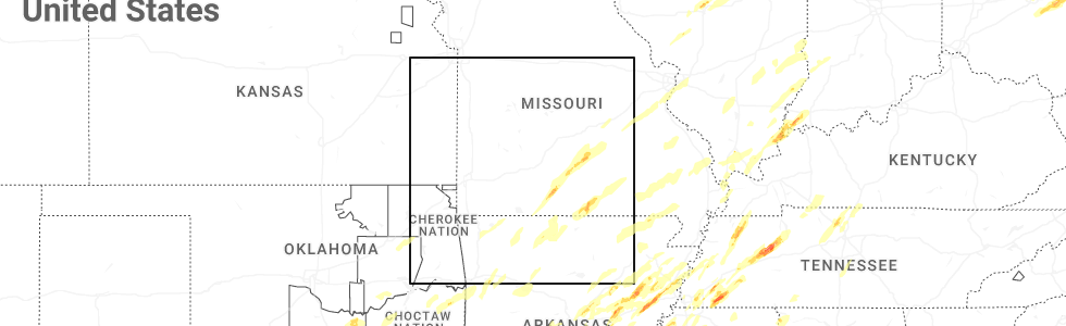
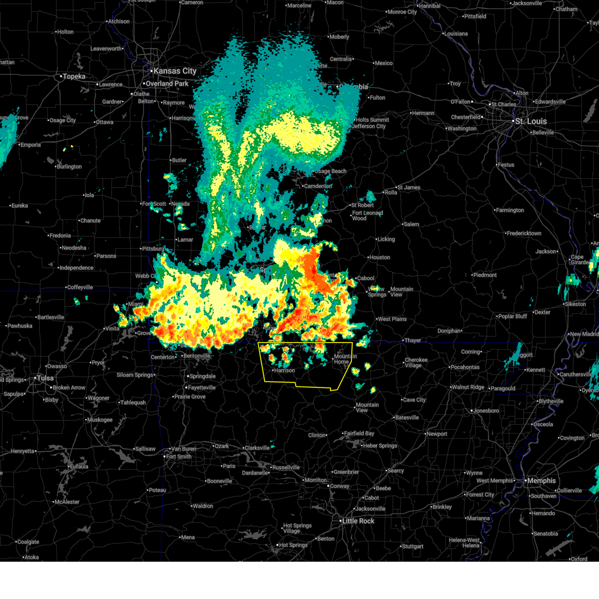
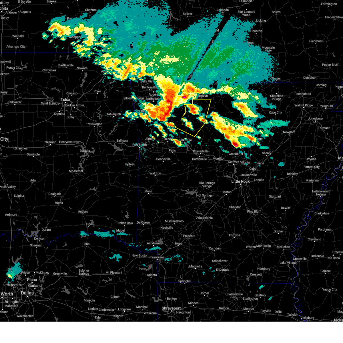
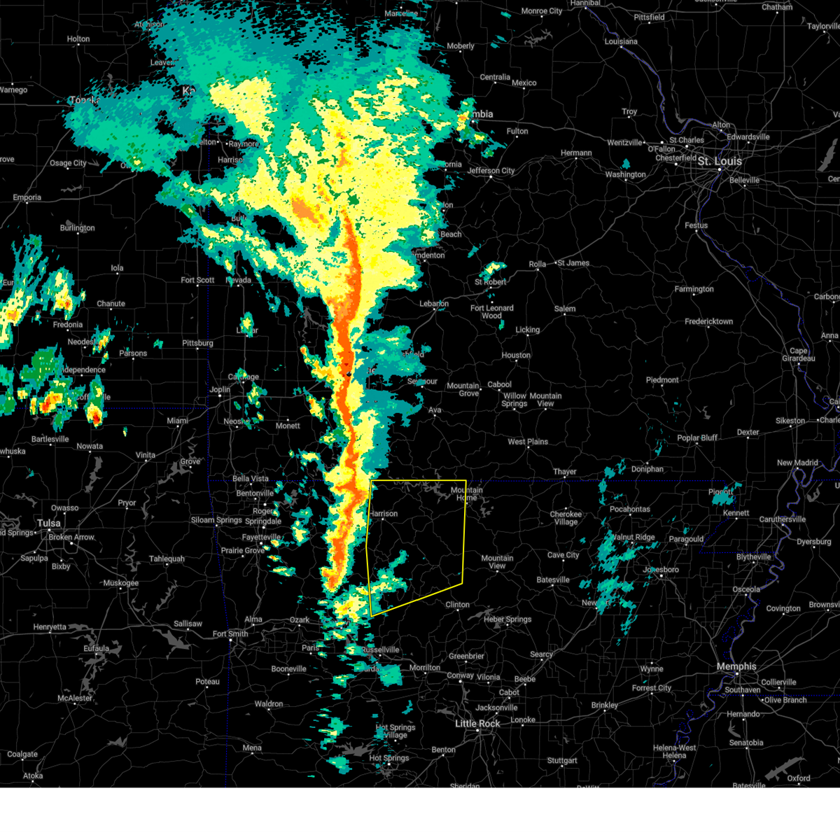
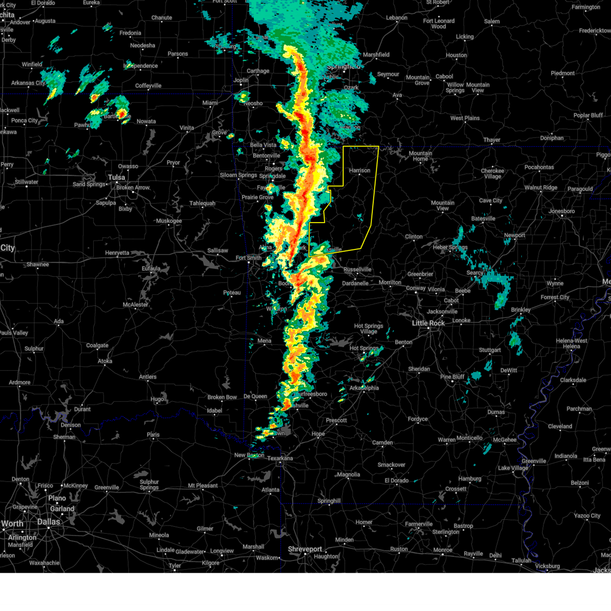
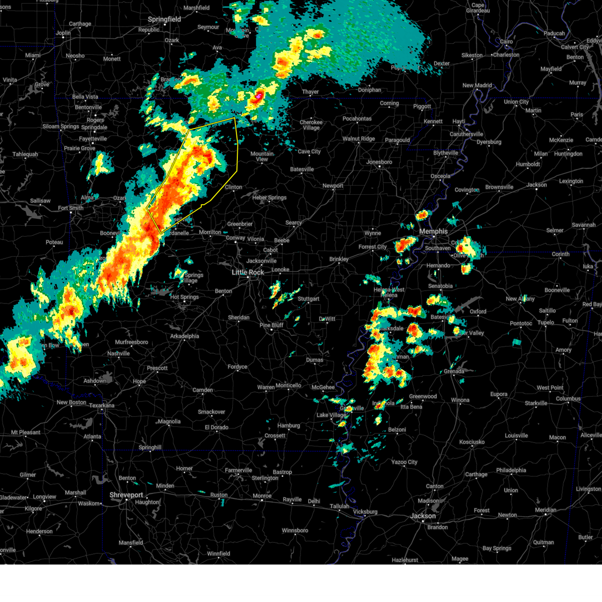
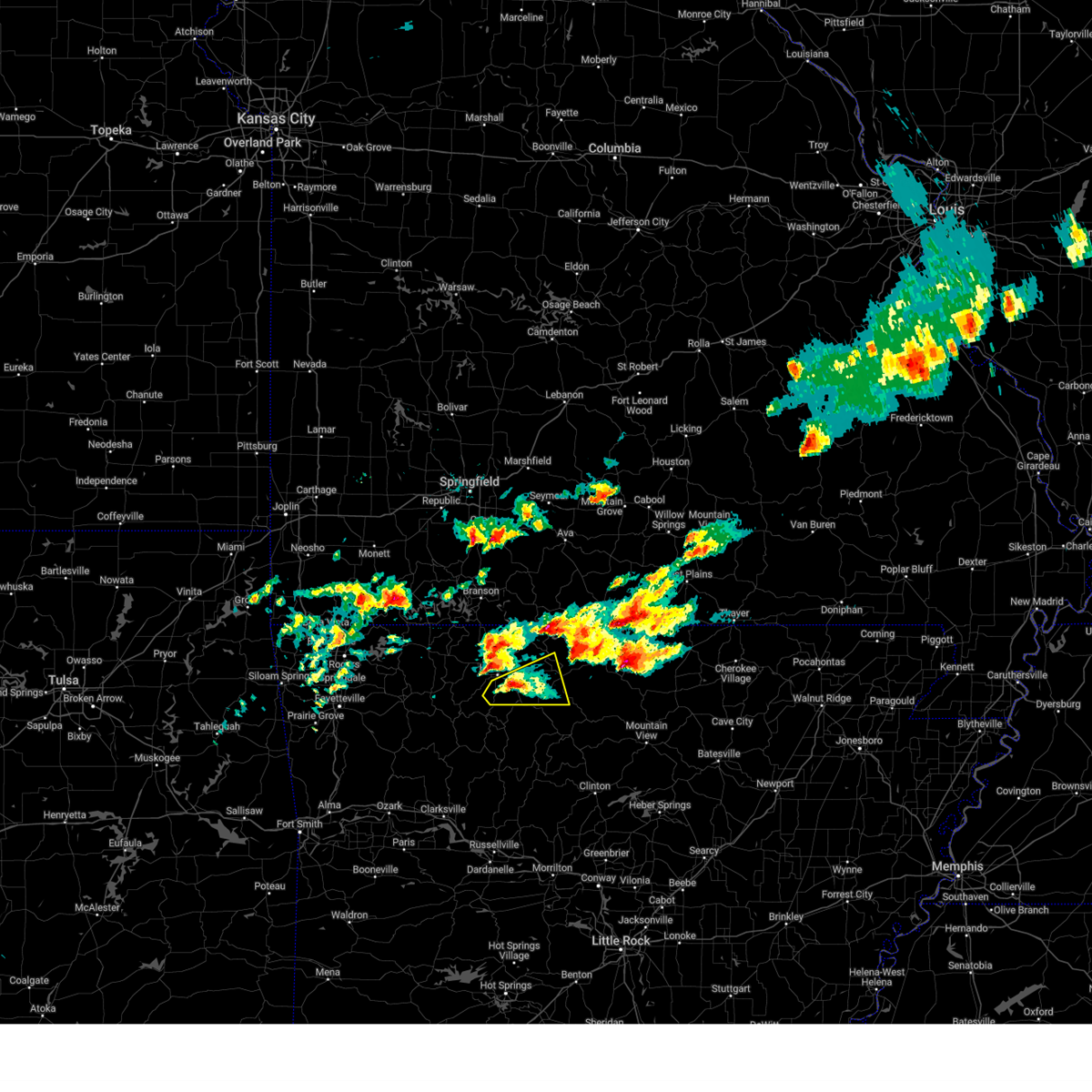
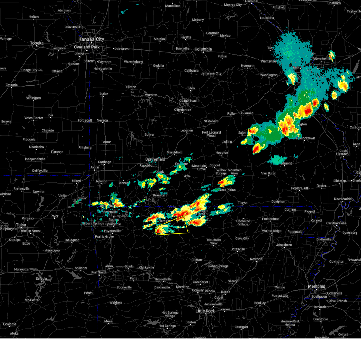
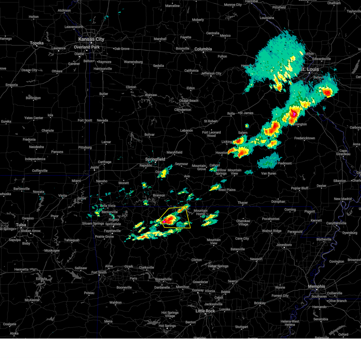
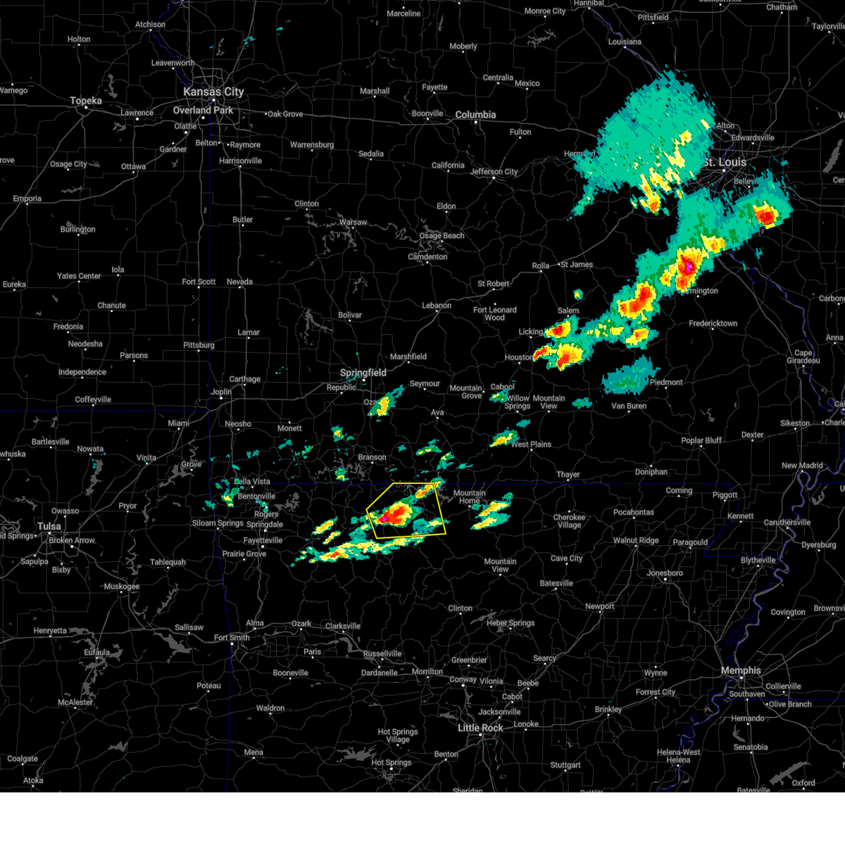
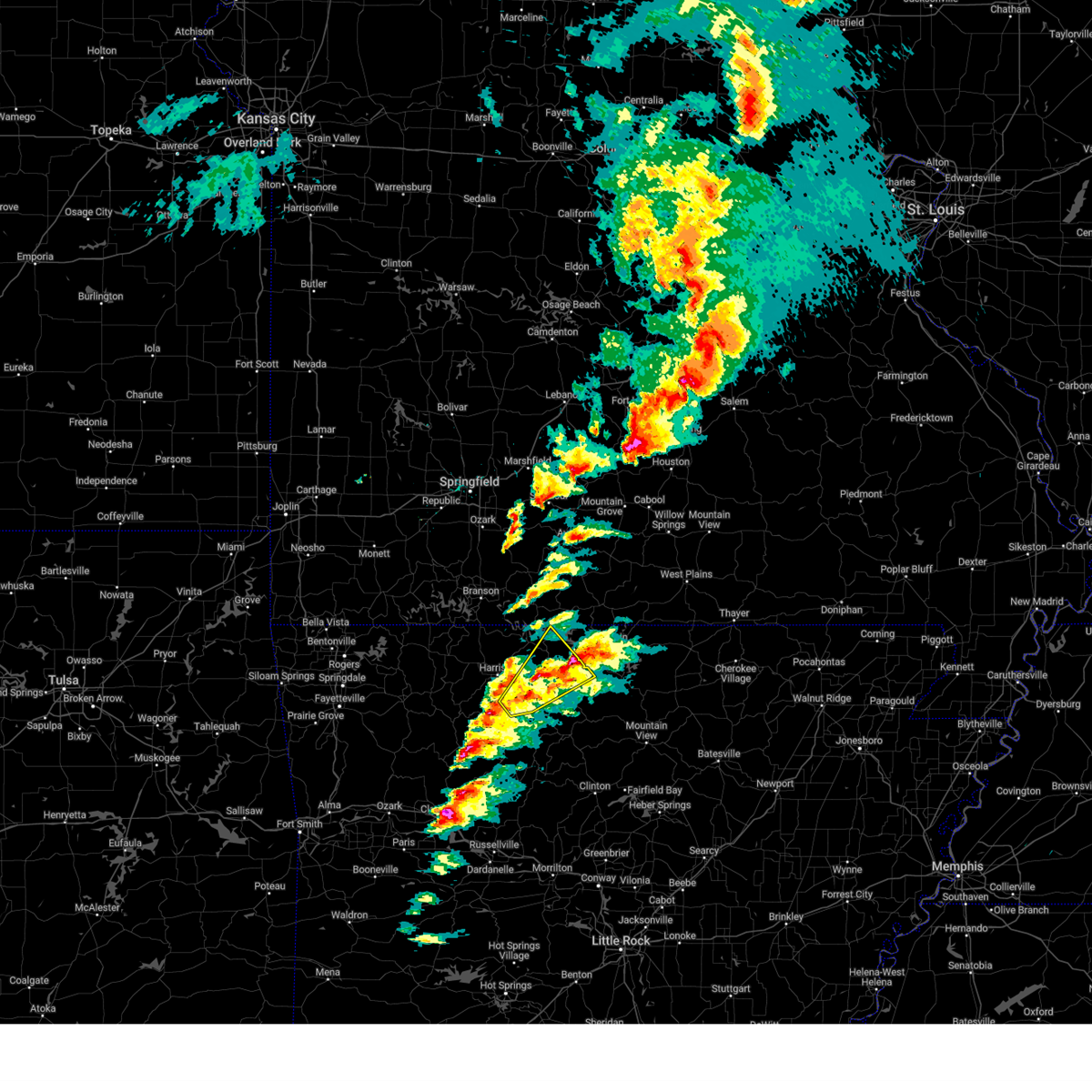
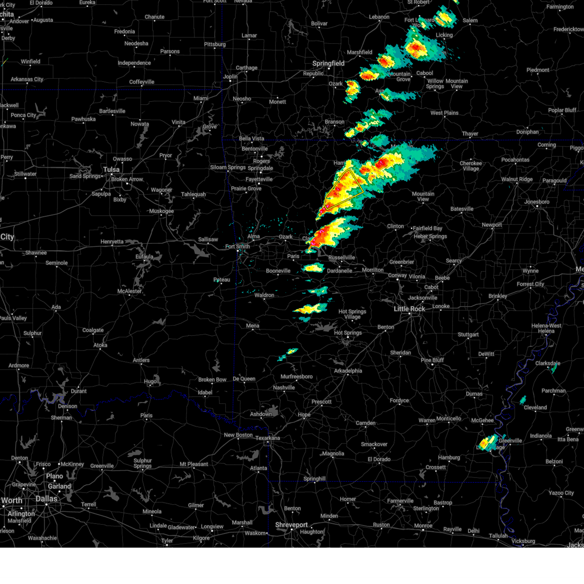
Hail Map for Valley Springs, AR
The Valley Springs, AR area has had 1 report of on-the-ground hail by trained spotters, and has been under severe weather warnings 19 times during the past 12 months. Doppler radar has detected hail at or near Valley Springs, AR on 55 occasions, including 3 occasions during the past year.
| Name: | Valley Springs, AR |
| Where Located: | 74.7 miles SSE of Springfield, MO |
| Map: | Google Map for Valley Springs, AR |
| Population: | 183 |
| Housing Units: | 83 |
| More Info: | Search Google for Valley Springs, AR |
1
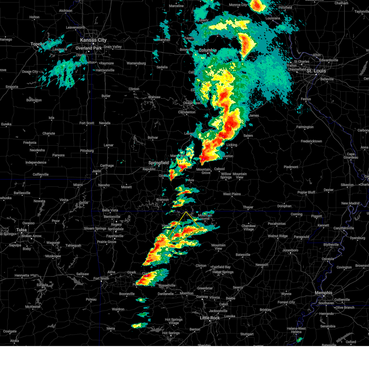
The Top Recent Hail Date for Valley Springs, AR is Wednesday, April 2, 2025 (20th out of 55)
Hail and Wind Damage Spotted near Valley Springs, AR
| Date / Time | Report Details |
|---|---|
| 6/29/2025 5:38 PM CDT |
 Svrlzk the national weather service in little rock has issued a * severe thunderstorm warning for, marion county in north central arkansas, boone county in north central arkansas, baxter county in north central arkansas, * until 630 pm cdt. * at 538 pm cdt, severe thunderstorms were located along a line extending from 15 miles east of taneyville to 6 miles northeast of omaha, moving southeast at 45 mph (radar indicated). Hazards include 60 mph wind gusts. expect damage to roofs, siding, and trees Svrlzk the national weather service in little rock has issued a * severe thunderstorm warning for, marion county in north central arkansas, boone county in north central arkansas, baxter county in north central arkansas, * until 630 pm cdt. * at 538 pm cdt, severe thunderstorms were located along a line extending from 15 miles east of taneyville to 6 miles northeast of omaha, moving southeast at 45 mph (radar indicated). Hazards include 60 mph wind gusts. expect damage to roofs, siding, and trees
|
| 5/19/2025 8:36 PM CDT | the tornado warning has been cancelled and is no longer in effect |
| 5/19/2025 8:19 PM CDT | Torlzk the national weather service in little rock has issued a * tornado warning for, west central marion county in north central arkansas, boone county in north central arkansas, * until 900 pm cdt. * at 819 pm cdt, a severe thunderstorm capable of producing a tornado was located over osage, or 14 miles southeast of berryville, moving east at 55 mph (radar indicated rotation). Hazards include tornado. Flying debris will be dangerous to those caught without shelter. mobile homes will be damaged or destroyed. damage to roofs, windows, and vehicles will occur. Tree damage is likely. |
| 5/18/2025 5:03 PM CDT |
 Svrlzk the national weather service in little rock has issued a * severe thunderstorm warning for, newton county in north central arkansas, northern johnson county in western arkansas, southern boone county in north central arkansas, north central pope county in central arkansas, * until 600 pm cdt. * at 503 pm cdt, severe thunderstorms were located along a line extending from near marble to near st. paul, moving southeast at 45 mph (radar indicated). Hazards include 70 mph wind gusts and quarter size hail. Hail damage to vehicles is expected. expect considerable tree damage. Wind damage is also likely to mobile homes, roofs, and outbuildings. Svrlzk the national weather service in little rock has issued a * severe thunderstorm warning for, newton county in north central arkansas, northern johnson county in western arkansas, southern boone county in north central arkansas, north central pope county in central arkansas, * until 600 pm cdt. * at 503 pm cdt, severe thunderstorms were located along a line extending from near marble to near st. paul, moving southeast at 45 mph (radar indicated). Hazards include 70 mph wind gusts and quarter size hail. Hail damage to vehicles is expected. expect considerable tree damage. Wind damage is also likely to mobile homes, roofs, and outbuildings.
|
| 4/20/2025 4:10 PM CDT |
 Svrlzk the national weather service in little rock has issued a * severe thunderstorm warning for, searcy county in north central arkansas, eastern newton county in north central arkansas, northeastern johnson county in western arkansas, marion county in north central arkansas, northwestern van buren county in north central arkansas, boone county in north central arkansas, western baxter county in north central arkansas, northern pope county in central arkansas, * until 500 pm cdt. * at 410 pm cdt, severe thunderstorms were located along a line extending from 9 miles northeast of omaha to near pruitt to near bertha, moving northeast at 85 mph (radar indicated). Hazards include 60 mph wind gusts and penny size hail. expect damage to roofs, siding, and trees Svrlzk the national weather service in little rock has issued a * severe thunderstorm warning for, searcy county in north central arkansas, eastern newton county in north central arkansas, northeastern johnson county in western arkansas, marion county in north central arkansas, northwestern van buren county in north central arkansas, boone county in north central arkansas, western baxter county in north central arkansas, northern pope county in central arkansas, * until 500 pm cdt. * at 410 pm cdt, severe thunderstorms were located along a line extending from 9 miles northeast of omaha to near pruitt to near bertha, moving northeast at 85 mph (radar indicated). Hazards include 60 mph wind gusts and penny size hail. expect damage to roofs, siding, and trees
|
| 4/20/2025 3:25 PM CDT |
 Svrlzk the national weather service in little rock has issued a * severe thunderstorm warning for, newton county in north central arkansas, johnson county in western arkansas, boone county in north central arkansas, northwestern pope county in central arkansas, * until 415 pm cdt. * at 325 pm cdt, severe thunderstorms were located along a line extending from near huntsville to near cass to near ratcliff, moving northeast at 75 mph (radar indicated). Hazards include 60 mph wind gusts and nickel size hail. expect damage to roofs, siding, and trees Svrlzk the national weather service in little rock has issued a * severe thunderstorm warning for, newton county in north central arkansas, johnson county in western arkansas, boone county in north central arkansas, northwestern pope county in central arkansas, * until 415 pm cdt. * at 325 pm cdt, severe thunderstorms were located along a line extending from near huntsville to near cass to near ratcliff, moving northeast at 75 mph (radar indicated). Hazards include 60 mph wind gusts and nickel size hail. expect damage to roofs, siding, and trees
|
| 4/2/2025 2:56 PM CDT |
 Svrlzk the national weather service in little rock has issued a * severe thunderstorm warning for, northeastern logan county in western arkansas, searcy county in north central arkansas, eastern newton county in north central arkansas, eastern johnson county in western arkansas, southern marion county in north central arkansas, northwestern van buren county in north central arkansas, southeastern boone county in north central arkansas, southwestern baxter county in north central arkansas, north central yell county in central arkansas, pope county in central arkansas, * until 345 pm cdt. * at 256 pm cdt, severe thunderstorms were located along a line extending from near carver to near moore to broomfield to near mt nebo state park, moving northeast at 40 mph (radar indicated). Hazards include 60 mph wind gusts and half dollar size hail. Hail damage to vehicles is expected. Expect wind damage to roofs, siding, and trees. Svrlzk the national weather service in little rock has issued a * severe thunderstorm warning for, northeastern logan county in western arkansas, searcy county in north central arkansas, eastern newton county in north central arkansas, eastern johnson county in western arkansas, southern marion county in north central arkansas, northwestern van buren county in north central arkansas, southeastern boone county in north central arkansas, southwestern baxter county in north central arkansas, north central yell county in central arkansas, pope county in central arkansas, * until 345 pm cdt. * at 256 pm cdt, severe thunderstorms were located along a line extending from near carver to near moore to broomfield to near mt nebo state park, moving northeast at 40 mph (radar indicated). Hazards include 60 mph wind gusts and half dollar size hail. Hail damage to vehicles is expected. Expect wind damage to roofs, siding, and trees.
|
| 3/30/2025 3:16 PM CDT |
 the severe thunderstorm warning has been cancelled and is no longer in effect the severe thunderstorm warning has been cancelled and is no longer in effect
|
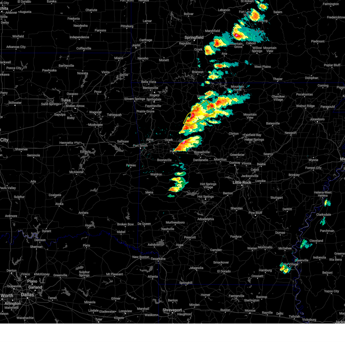
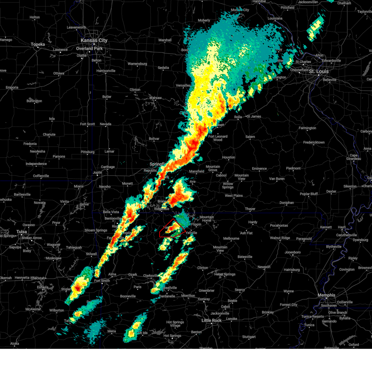
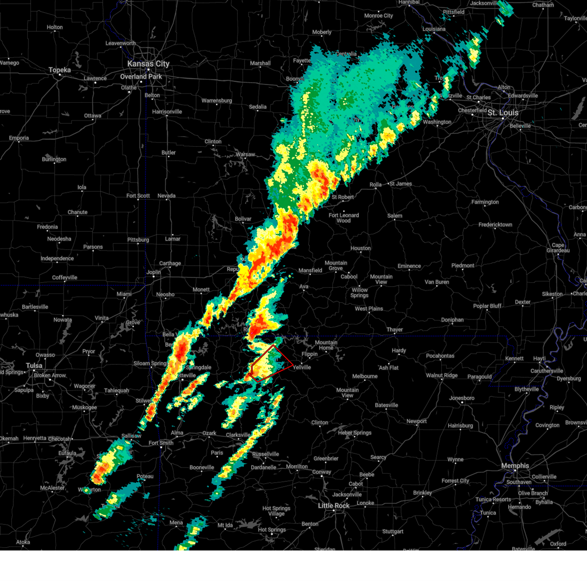
| 3/30/2025 3:09 PM CDT | At 309 pm cdt, a severe thunderstorm was located near valley springs, or 7 miles southeast of harrison, moving east at 40 mph (radar indicated). Hazards include 60 mph wind gusts and quarter size hail. Hail damage to vehicles is expected. expect wind damage to roofs, siding, and trees. Locations impacted include, marble falls, olvey, valley springs, ralph, dodd city, pyatt, western grove, bellefonte, gaither, zinc, eros, bruno, dugger, crawford, harmon, everton, yellville, yardelle, lakeway, summit,. |
| 3/30/2025 3:00 PM CDT |
 Svrlzk the national weather service in little rock has issued a * severe thunderstorm warning for, northwestern searcy county in north central arkansas, northeastern newton county in north central arkansas, southwestern marion county in north central arkansas, southern boone county in north central arkansas, * until 345 pm cdt. * at 259 pm cdt, a severe thunderstorm was located near erbie, or near jasper, moving east at 40 mph (radar indicated). Hazards include 60 mph wind gusts and quarter size hail. Hail damage to vehicles is expected. Expect wind damage to roofs, siding, and trees. Svrlzk the national weather service in little rock has issued a * severe thunderstorm warning for, northwestern searcy county in north central arkansas, northeastern newton county in north central arkansas, southwestern marion county in north central arkansas, southern boone county in north central arkansas, * until 345 pm cdt. * at 259 pm cdt, a severe thunderstorm was located near erbie, or near jasper, moving east at 40 mph (radar indicated). Hazards include 60 mph wind gusts and quarter size hail. Hail damage to vehicles is expected. Expect wind damage to roofs, siding, and trees.
|
| 3/30/2025 2:35 PM CDT |
 At 235 pm cdt, a severe thunderstorm was located near harrison, moving northeast at 40 mph (radar indicated). Hazards include 60 mph wind gusts and quarter size hail. Hail damage to vehicles is expected. expect wind damage to roofs, siding, and trees. Locations impacted include, olvey, myrtle, ralph, pyatt, summit, eros, lakeway, peel, harmon, winington, clark hill, yellville, hopewell in boone county, south lead hill, dodd city, monarch, lead hill, bergman, bellefonte, zinc,. At 235 pm cdt, a severe thunderstorm was located near harrison, moving northeast at 40 mph (radar indicated). Hazards include 60 mph wind gusts and quarter size hail. Hail damage to vehicles is expected. expect wind damage to roofs, siding, and trees. Locations impacted include, olvey, myrtle, ralph, pyatt, summit, eros, lakeway, peel, harmon, winington, clark hill, yellville, hopewell in boone county, south lead hill, dodd city, monarch, lead hill, bergman, bellefonte, zinc,.
|
| 3/30/2025 2:30 PM CDT |
 At 230 pm cdt, a severe thunderstorm was located over harrison, moving east at 40 mph (radar indicated). Hazards include 60 mph wind gusts and half dollar size hail. Hail damage to vehicles is expected. expect wind damage to roofs, siding, and trees. Locations impacted include, olvey, valley springs, myrtle, ralph, pyatt, ridgeway, self, summit, gaither, eros, bruno, lakeway, peel, harmon, winington, clark hill, yellville, hopewell in boone county, south lead hill, dodd city,. At 230 pm cdt, a severe thunderstorm was located over harrison, moving east at 40 mph (radar indicated). Hazards include 60 mph wind gusts and half dollar size hail. Hail damage to vehicles is expected. expect wind damage to roofs, siding, and trees. Locations impacted include, olvey, valley springs, myrtle, ralph, pyatt, ridgeway, self, summit, gaither, eros, bruno, lakeway, peel, harmon, winington, clark hill, yellville, hopewell in boone county, south lead hill, dodd city,.
|
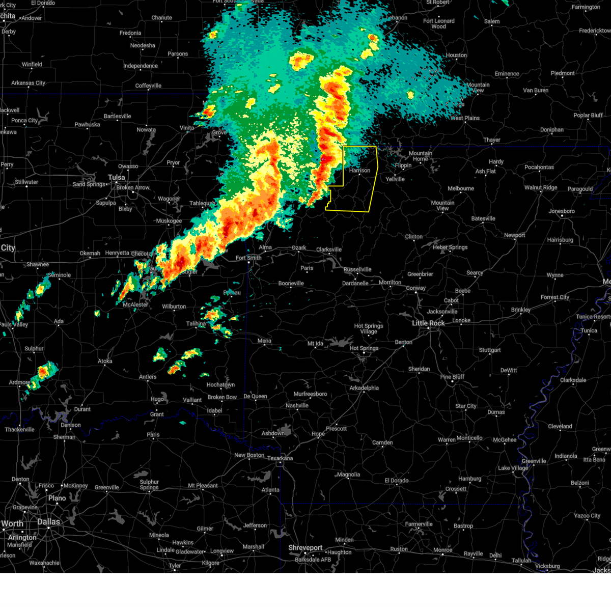
| 3/30/2025 2:18 PM CDT | Svrlzk the national weather service in little rock has issued a * severe thunderstorm warning for, western marion county in north central arkansas, boone county in north central arkansas, * until 300 pm cdt. * at 217 pm cdt, a severe thunderstorm was located over red bank, or 8 miles west of harrison, moving northeast at 40 mph (radar indicated). Hazards include 60 mph wind gusts and quarter size hail. Hail damage to vehicles is expected. Expect wind damage to roofs, siding, and trees. |
| 3/14/2025 8:28 PM CDT | The storm which prompted the warning has moved out of the area. therefore, the warning will be allowed to expire. a tornado watch remains in effect until 1100 pm cdt for north central arkansas. |
| 3/14/2025 8:07 PM CDT |
 At 806 pm cdt, a severe thunderstorm was located near western grove, or 9 miles northeast of jasper, moving northeast at 35 mph (radar indicated). Hazards include 60 mph wind gusts and quarter size hail. Hail damage to vehicles is expected. expect wind damage to roofs, siding, and trees. Locations impacted include, hasty, yardelle, bellefonte, western grove, valley springs,. At 806 pm cdt, a severe thunderstorm was located near western grove, or 9 miles northeast of jasper, moving northeast at 35 mph (radar indicated). Hazards include 60 mph wind gusts and quarter size hail. Hail damage to vehicles is expected. expect wind damage to roofs, siding, and trees. Locations impacted include, hasty, yardelle, bellefonte, western grove, valley springs,.
|
| 3/14/2025 8:03 PM CDT |
 At 803 pm cdt, a severe thunderstorm was located near pyatt, or near yellville, moving northeast at 40 mph (radar indicated). Hazards include 60 mph wind gusts and quarter size hail. Hail damage to vehicles is expected. expect wind damage to roofs, siding, and trees. Locations impacted include, olvey, valley springs, yardelle, ralph, pyatt, western grove, summit, eros, bruno, flippin, lakeway, dugger, rea valley, peel, harmon, clark hill, yellville, fairview in marion county, dodd city, monarch,. At 803 pm cdt, a severe thunderstorm was located near pyatt, or near yellville, moving northeast at 40 mph (radar indicated). Hazards include 60 mph wind gusts and quarter size hail. Hail damage to vehicles is expected. expect wind damage to roofs, siding, and trees. Locations impacted include, olvey, valley springs, yardelle, ralph, pyatt, western grove, summit, eros, bruno, flippin, lakeway, dugger, rea valley, peel, harmon, clark hill, yellville, fairview in marion county, dodd city, monarch,.
|
| 3/14/2025 8:03 PM CDT |
 At 803 pm cdt, a severe thunderstorm was located near pruitt, or 7 miles northeast of jasper, moving northeast at 50 mph (radar indicated). Hazards include 60 mph wind gusts and quarter size hail. Hail damage to vehicles is expected. expect wind damage to roofs, siding, and trees. Locations impacted include, marble falls, wayton, yardelle, western grove, crossroad, vendor, swain, parthenon, gum springs in newton county, bellefonte, piercetown, mt judea, carver, nail, jasper, pruitt, hasty, woolum recreation area, valley springs,. At 803 pm cdt, a severe thunderstorm was located near pruitt, or 7 miles northeast of jasper, moving northeast at 50 mph (radar indicated). Hazards include 60 mph wind gusts and quarter size hail. Hail damage to vehicles is expected. expect wind damage to roofs, siding, and trees. Locations impacted include, marble falls, wayton, yardelle, western grove, crossroad, vendor, swain, parthenon, gum springs in newton county, bellefonte, piercetown, mt judea, carver, nail, jasper, pruitt, hasty, woolum recreation area, valley springs,.
|
| 3/14/2025 7:45 PM CDT |
 Svrlzk the national weather service in little rock has issued a * severe thunderstorm warning for, northwestern searcy county in north central arkansas, northeastern newton county in north central arkansas, marion county in north central arkansas, southeastern boone county in north central arkansas, * until 830 pm cdt. * at 745 pm cdt, a severe thunderstorm was located over western grove, or 13 miles northeast of jasper, moving northeast at 40 mph (radar indicated). Hazards include 60 mph wind gusts and quarter size hail. Hail damage to vehicles is expected. Expect wind damage to roofs, siding, and trees. Svrlzk the national weather service in little rock has issued a * severe thunderstorm warning for, northwestern searcy county in north central arkansas, northeastern newton county in north central arkansas, marion county in north central arkansas, southeastern boone county in north central arkansas, * until 830 pm cdt. * at 745 pm cdt, a severe thunderstorm was located over western grove, or 13 miles northeast of jasper, moving northeast at 40 mph (radar indicated). Hazards include 60 mph wind gusts and quarter size hail. Hail damage to vehicles is expected. Expect wind damage to roofs, siding, and trees.
|
| 3/14/2025 7:45 PM CDT |
 Svrlzk the national weather service in little rock has issued a * severe thunderstorm warning for, west central searcy county in north central arkansas, central newton county in north central arkansas, south central boone county in north central arkansas, * until 830 pm cdt. * at 744 pm cdt, a severe thunderstorm was located near upper buffalo wilderness area, or 11 miles southwest of jasper, moving northeast at 35 mph (radar indicated). Hazards include 60 mph wind gusts and quarter size hail. Hail damage to vehicles is expected. Expect wind damage to roofs, siding, and trees. Svrlzk the national weather service in little rock has issued a * severe thunderstorm warning for, west central searcy county in north central arkansas, central newton county in north central arkansas, south central boone county in north central arkansas, * until 830 pm cdt. * at 744 pm cdt, a severe thunderstorm was located near upper buffalo wilderness area, or 11 miles southwest of jasper, moving northeast at 35 mph (radar indicated). Hazards include 60 mph wind gusts and quarter size hail. Hail damage to vehicles is expected. Expect wind damage to roofs, siding, and trees.
|
| 5/26/2024 7:29 PM CDT |
 The storm which prompted the warning has weakened below severe limits, and no longer poses an immediate threat to life or property. therefore, the warning will be allowed to expire. however small hail is still possible with this thunderstorm. a tornado watch remains in effect until 1100 pm cdt for north central arkansas. The storm which prompted the warning has weakened below severe limits, and no longer poses an immediate threat to life or property. therefore, the warning will be allowed to expire. however small hail is still possible with this thunderstorm. a tornado watch remains in effect until 1100 pm cdt for north central arkansas.
|
| 5/26/2024 7:05 PM CDT |
 At 705 pm cdt, a severe thunderstorm was located over capps, or near harrison, moving east at 30 mph (radar indicated). Hazards include 60 mph wind gusts and quarter size hail. Hail damage to vehicles is expected. expect wind damage to roofs, siding, and trees. Locations impacted include, harrison, bergman, valley springs, dugger, olvey, capps, red bank, crawford, winington, bellefonte, alpena, everton, zinc, batavia, bear creek springs, hopewell in boone county, ridgeway, gaither, harmon,. At 705 pm cdt, a severe thunderstorm was located over capps, or near harrison, moving east at 30 mph (radar indicated). Hazards include 60 mph wind gusts and quarter size hail. Hail damage to vehicles is expected. expect wind damage to roofs, siding, and trees. Locations impacted include, harrison, bergman, valley springs, dugger, olvey, capps, red bank, crawford, winington, bellefonte, alpena, everton, zinc, batavia, bear creek springs, hopewell in boone county, ridgeway, gaither, harmon,.
|
| 5/26/2024 6:52 PM CDT |
 Svrlzk the national weather service in little rock has issued a * severe thunderstorm warning for, boone county in north central arkansas, * until 730 pm cdt. * at 652 pm cdt, a severe thunderstorm was located over carrollton, or 11 miles west of harrison, moving east at 30 mph (radar indicated). Hazards include golf ball size hail and 60 mph wind gusts. People and animals outdoors will be injured. expect hail damage to roofs, siding, windows, and vehicles. Expect wind damage to roofs, siding, and trees. Svrlzk the national weather service in little rock has issued a * severe thunderstorm warning for, boone county in north central arkansas, * until 730 pm cdt. * at 652 pm cdt, a severe thunderstorm was located over carrollton, or 11 miles west of harrison, moving east at 30 mph (radar indicated). Hazards include golf ball size hail and 60 mph wind gusts. People and animals outdoors will be injured. expect hail damage to roofs, siding, windows, and vehicles. Expect wind damage to roofs, siding, and trees.
|
| 5/26/2024 4:16 AM CDT |
 Svrlzk the national weather service in little rock has issued a * severe thunderstorm warning for, northwestern searcy county in north central arkansas, northeastern newton county in north central arkansas, northwestern marion county in north central arkansas, boone county in north central arkansas, * until 445 am cdt. * at 415 am cdt, severe thunderstorms were located along a line extending from branson to roberson hollow to near green forest, moving southeast at 45 mph (radar indicated). Hazards include 60 mph wind gusts and quarter size hail. Hail damage to vehicles is expected. Expect wind damage to roofs, siding, and trees. Svrlzk the national weather service in little rock has issued a * severe thunderstorm warning for, northwestern searcy county in north central arkansas, northeastern newton county in north central arkansas, northwestern marion county in north central arkansas, boone county in north central arkansas, * until 445 am cdt. * at 415 am cdt, severe thunderstorms were located along a line extending from branson to roberson hollow to near green forest, moving southeast at 45 mph (radar indicated). Hazards include 60 mph wind gusts and quarter size hail. Hail damage to vehicles is expected. Expect wind damage to roofs, siding, and trees.
|
| 5/26/2024 3:48 AM CDT |
 At 348 am cdt, a severe thunderstorm was located near dugger, or 9 miles southwest of yellville, moving east at 45 mph (radar indicated). Hazards include 60 mph wind gusts and quarter size hail. Hail damage to vehicles is expected. expect wind damage to roofs, siding, and trees. Locations impacted include, western grove, valley springs, dugger, everton, bruno,. At 348 am cdt, a severe thunderstorm was located near dugger, or 9 miles southwest of yellville, moving east at 45 mph (radar indicated). Hazards include 60 mph wind gusts and quarter size hail. Hail damage to vehicles is expected. expect wind damage to roofs, siding, and trees. Locations impacted include, western grove, valley springs, dugger, everton, bruno,.
|
| 5/26/2024 3:38 AM CDT |
 At 338 am cdt, a confirmed tornado was located over olvey, or 9 miles southeast of harrison, moving east at 30 mph (radar confirmed tornado). Hazards include damaging tornado and quarter size hail. Flying debris will be dangerous to those caught without shelter. mobile homes will be damaged or destroyed. damage to roofs, windows, and vehicles will occur. tree damage is likely. Locations impacted include, harrison, yellville, flippin, western grove, pyatt, valley springs, dugger, olvey, crawford, rush, summit, bellefonte, everton, fairview in marion county, ralph, eros, bruno, harmon,. At 338 am cdt, a confirmed tornado was located over olvey, or 9 miles southeast of harrison, moving east at 30 mph (radar confirmed tornado). Hazards include damaging tornado and quarter size hail. Flying debris will be dangerous to those caught without shelter. mobile homes will be damaged or destroyed. damage to roofs, windows, and vehicles will occur. tree damage is likely. Locations impacted include, harrison, yellville, flippin, western grove, pyatt, valley springs, dugger, olvey, crawford, rush, summit, bellefonte, everton, fairview in marion county, ralph, eros, bruno, harmon,.
|
| 5/26/2024 3:34 AM CDT |
 Torlzk the national weather service in little rock has issued a * tornado warning for, northwestern searcy county in north central arkansas, northeastern newton county in north central arkansas, southwestern marion county in north central arkansas, southeastern boone county in north central arkansas, * until 415 am cdt. * at 333 am cdt, a severe thunderstorm capable of producing a tornado was located over valley springs, or near harrison, moving east at 30 mph (radar indicated rotation). Hazards include tornado and quarter size hail. Flying debris will be dangerous to those caught without shelter. mobile homes will be damaged or destroyed. damage to roofs, windows, and vehicles will occur. Tree damage is likely. Torlzk the national weather service in little rock has issued a * tornado warning for, northwestern searcy county in north central arkansas, northeastern newton county in north central arkansas, southwestern marion county in north central arkansas, southeastern boone county in north central arkansas, * until 415 am cdt. * at 333 am cdt, a severe thunderstorm capable of producing a tornado was located over valley springs, or near harrison, moving east at 30 mph (radar indicated rotation). Hazards include tornado and quarter size hail. Flying debris will be dangerous to those caught without shelter. mobile homes will be damaged or destroyed. damage to roofs, windows, and vehicles will occur. Tree damage is likely.
|
| 5/26/2024 3:31 AM CDT |
 At 331 am cdt, a severe thunderstorm was located near valley springs, or 10 miles northeast of jasper, moving east at 65 mph (radar indicated). Hazards include 60 mph wind gusts and quarter size hail. Hail damage to vehicles is expected. expect wind damage to roofs, siding, and trees. locations impacted include, western grove, valley springs, dugger, red bank, everton, st. Joe, pindall, bruno, marble falls, yardelle, gaither,. At 331 am cdt, a severe thunderstorm was located near valley springs, or 10 miles northeast of jasper, moving east at 65 mph (radar indicated). Hazards include 60 mph wind gusts and quarter size hail. Hail damage to vehicles is expected. expect wind damage to roofs, siding, and trees. locations impacted include, western grove, valley springs, dugger, red bank, everton, st. Joe, pindall, bruno, marble falls, yardelle, gaither,.
|
| 5/26/2024 3:29 AM CDT |
 At 329 am cdt, a severe thunderstorm capable of producing a tornado was located over harrison, moving east at 35 mph (radar indicated rotation). Hazards include tornado and quarter size hail. Flying debris will be dangerous to those caught without shelter. mobile homes will be damaged or destroyed. damage to roofs, windows, and vehicles will occur. tree damage is likely. Locations impacted include, harrison, bergman, valley springs, dugger, olvey, capps, crawford, bellefonte, everton, zinc, batavia, bear creek springs, hopewell in boone county, ridgeway, gaither, harmon,. At 329 am cdt, a severe thunderstorm capable of producing a tornado was located over harrison, moving east at 35 mph (radar indicated rotation). Hazards include tornado and quarter size hail. Flying debris will be dangerous to those caught without shelter. mobile homes will be damaged or destroyed. damage to roofs, windows, and vehicles will occur. tree damage is likely. Locations impacted include, harrison, bergman, valley springs, dugger, olvey, capps, crawford, bellefonte, everton, zinc, batavia, bear creek springs, hopewell in boone county, ridgeway, gaither, harmon,.
|
| 5/26/2024 3:15 AM CDT |
 Svrlzk the national weather service in little rock has issued a * severe thunderstorm warning for, northwestern searcy county in north central arkansas, northern newton county in north central arkansas, southwestern marion county in north central arkansas, southern boone county in north central arkansas, * until 400 am cdt. * at 314 am cdt, severe thunderstorms were located along a line extending from red bank to near osage to near kingston, moving east at 40 mph (radar indicated). Hazards include 60 mph wind gusts and quarter size hail. Hail damage to vehicles is expected. Expect wind damage to roofs, siding, and trees. Svrlzk the national weather service in little rock has issued a * severe thunderstorm warning for, northwestern searcy county in north central arkansas, northern newton county in north central arkansas, southwestern marion county in north central arkansas, southern boone county in north central arkansas, * until 400 am cdt. * at 314 am cdt, severe thunderstorms were located along a line extending from red bank to near osage to near kingston, moving east at 40 mph (radar indicated). Hazards include 60 mph wind gusts and quarter size hail. Hail damage to vehicles is expected. Expect wind damage to roofs, siding, and trees.
|
| 5/26/2024 2:58 AM CDT |
 Torlzk the national weather service in little rock has issued a * tornado warning for, boone county in north central arkansas, * until 345 am cdt. * at 257 am cdt, a severe thunderstorm capable of producing a tornado was located over rule, or 8 miles southeast of berryville, moving east at 35 mph (radar indicated rotation). Hazards include tornado and quarter size hail. Flying debris will be dangerous to those caught without shelter. mobile homes will be damaged or destroyed. damage to roofs, windows, and vehicles will occur. Tree damage is likely. Torlzk the national weather service in little rock has issued a * tornado warning for, boone county in north central arkansas, * until 345 am cdt. * at 257 am cdt, a severe thunderstorm capable of producing a tornado was located over rule, or 8 miles southeast of berryville, moving east at 35 mph (radar indicated rotation). Hazards include tornado and quarter size hail. Flying debris will be dangerous to those caught without shelter. mobile homes will be damaged or destroyed. damage to roofs, windows, and vehicles will occur. Tree damage is likely.
|
| 5/22/2024 10:58 AM CDT |
 The storm which prompted the warning has weakened below severe limits, and no longer poses an immediate threat to life or property. therefore, the warning will be allowed to expire. however gusty winds are still possible with this thunderstorm. a severe thunderstorm watch remains in effect until 500 pm cdt for north central arkansas. The storm which prompted the warning has weakened below severe limits, and no longer poses an immediate threat to life or property. therefore, the warning will be allowed to expire. however gusty winds are still possible with this thunderstorm. a severe thunderstorm watch remains in effect until 500 pm cdt for north central arkansas.
|
| 5/22/2024 10:15 AM CDT |
 Svrlzk the national weather service in little rock has issued a * severe thunderstorm warning for, northwestern searcy county in north central arkansas, northern newton county in north central arkansas, southwestern marion county in north central arkansas, southern boone county in north central arkansas, * until 1100 am cdt. * at 1015 am cdt, a severe thunderstorm was located over lost valley state park, or 10 miles west of jasper, moving east at 40 mph (radar indicated). Hazards include 60 mph wind gusts and quarter size hail. Hail damage to vehicles is expected. Expect wind damage to roofs, siding, and trees. Svrlzk the national weather service in little rock has issued a * severe thunderstorm warning for, northwestern searcy county in north central arkansas, northern newton county in north central arkansas, southwestern marion county in north central arkansas, southern boone county in north central arkansas, * until 1100 am cdt. * at 1015 am cdt, a severe thunderstorm was located over lost valley state park, or 10 miles west of jasper, moving east at 40 mph (radar indicated). Hazards include 60 mph wind gusts and quarter size hail. Hail damage to vehicles is expected. Expect wind damage to roofs, siding, and trees.
|
| 5/4/2024 4:31 PM CDT |
 At 431 pm cdt, a severe thunderstorm was located over crawford, or 11 miles southeast of harrison, moving east at 10 mph (radar indicated). Hazards include 60 mph wind gusts and quarter size hail. Hail damage to vehicles is expected. expect wind damage to roofs, siding, and trees. Locations impacted include, harrison, western grove, pyatt, valley springs, dugger, olvey, crawford, bellefonte, everton, pindall, zinc, ralph, eros, bruno, harmon,. At 431 pm cdt, a severe thunderstorm was located over crawford, or 11 miles southeast of harrison, moving east at 10 mph (radar indicated). Hazards include 60 mph wind gusts and quarter size hail. Hail damage to vehicles is expected. expect wind damage to roofs, siding, and trees. Locations impacted include, harrison, western grove, pyatt, valley springs, dugger, olvey, crawford, bellefonte, everton, pindall, zinc, ralph, eros, bruno, harmon,.
|
| 5/4/2024 4:16 PM CDT |
 Svrlzk the national weather service in little rock has issued a * severe thunderstorm warning for, northwestern searcy county in north central arkansas, northeastern newton county in north central arkansas, southwestern marion county in north central arkansas, southeastern boone county in north central arkansas, * until 445 pm cdt. * at 416 pm cdt, a severe thunderstorm was located over olvey, or 8 miles southeast of harrison, moving southeast at 10 mph (radar indicated). Hazards include 60 mph wind gusts and quarter size hail. Hail damage to vehicles is expected. Expect wind damage to roofs, siding, and trees. Svrlzk the national weather service in little rock has issued a * severe thunderstorm warning for, northwestern searcy county in north central arkansas, northeastern newton county in north central arkansas, southwestern marion county in north central arkansas, southeastern boone county in north central arkansas, * until 445 pm cdt. * at 416 pm cdt, a severe thunderstorm was located over olvey, or 8 miles southeast of harrison, moving southeast at 10 mph (radar indicated). Hazards include 60 mph wind gusts and quarter size hail. Hail damage to vehicles is expected. Expect wind damage to roofs, siding, and trees.
|
| 5/4/2024 4:05 PM CDT |
 At 405 pm cdt, severe thunderstorms were located along a line extending from near diamond city to near olvey, moving east at 15 mph (radar indicated). Hazards include 60 mph wind gusts and quarter size hail. Hail damage to vehicles is expected. expect wind damage to roofs, siding, and trees. Locations impacted include, harrison, yellville, diamond city, bergman, lead hill, pyatt, valley springs, olvey, myrtle, self, ozark isle, lakeway, winington, clark hill, dodd city, price place, willis, crawford, summit, bellefonte,. At 405 pm cdt, severe thunderstorms were located along a line extending from near diamond city to near olvey, moving east at 15 mph (radar indicated). Hazards include 60 mph wind gusts and quarter size hail. Hail damage to vehicles is expected. expect wind damage to roofs, siding, and trees. Locations impacted include, harrison, yellville, diamond city, bergman, lead hill, pyatt, valley springs, olvey, myrtle, self, ozark isle, lakeway, winington, clark hill, dodd city, price place, willis, crawford, summit, bellefonte,.
|
| 5/4/2024 3:46 PM CDT |
 Svrlzk the national weather service in little rock has issued a * severe thunderstorm warning for, western marion county in north central arkansas, eastern boone county in north central arkansas, * until 415 pm cdt. * at 346 pm cdt, severe thunderstorms were located along a line extending from diamond city to near bergman, moving east at 20 mph (radar indicated). Hazards include 60 mph wind gusts and half dollar size hail. Hail damage to vehicles is expected. Expect wind damage to roofs, siding, and trees. Svrlzk the national weather service in little rock has issued a * severe thunderstorm warning for, western marion county in north central arkansas, eastern boone county in north central arkansas, * until 415 pm cdt. * at 346 pm cdt, severe thunderstorms were located along a line extending from diamond city to near bergman, moving east at 20 mph (radar indicated). Hazards include 60 mph wind gusts and half dollar size hail. Hail damage to vehicles is expected. Expect wind damage to roofs, siding, and trees.
|
| 4/2/2024 2:46 AM CDT |
 Torlzk the national weather service in little rock has issued a * tornado warning for, northwestern searcy county in north central arkansas, northeastern newton county in north central arkansas, southern marion county in north central arkansas, southeastern boone county in north central arkansas, * until 330 am cdt. * at 245 am cdt, a severe thunderstorm capable of producing a tornado was located near pruitt, moving east at 50 mph (radar indicated rotation). Hazards include tornado. Flying debris will be dangerous to those caught without shelter. mobile homes will be damaged or destroyed. damage to roofs, windows, and vehicles will occur. tree damage is likely. Locations in or near the path include, yellville, flippin, western grove, pyatt, valley springs, dugger, olvey, crawford, lion hill, rush, cotter, summit, everton, pindall, fairview in marion county, yardelle, ralph, eros, bruno, rea valley,. Torlzk the national weather service in little rock has issued a * tornado warning for, northwestern searcy county in north central arkansas, northeastern newton county in north central arkansas, southern marion county in north central arkansas, southeastern boone county in north central arkansas, * until 330 am cdt. * at 245 am cdt, a severe thunderstorm capable of producing a tornado was located near pruitt, moving east at 50 mph (radar indicated rotation). Hazards include tornado. Flying debris will be dangerous to those caught without shelter. mobile homes will be damaged or destroyed. damage to roofs, windows, and vehicles will occur. tree damage is likely. Locations in or near the path include, yellville, flippin, western grove, pyatt, valley springs, dugger, olvey, crawford, lion hill, rush, cotter, summit, everton, pindall, fairview in marion county, yardelle, ralph, eros, bruno, rea valley,.
|
| 3/14/2024 3:35 PM CDT |
 Svrlzk the national weather service in little rock has issued a * severe thunderstorm warning for, northern newton county in north central arkansas, boone county in north central arkansas, * until 430 pm cdt. * at 334 pm cdt, severe thunderstorms were located along a line extending from near urbanette to near rule to near witter, moving east at 35 mph (radar indicated). Hazards include 60 mph wind gusts and quarter size hail. Hail damage to vehicles is expected. Expect wind damage to roofs, siding, and trees. Svrlzk the national weather service in little rock has issued a * severe thunderstorm warning for, northern newton county in north central arkansas, boone county in north central arkansas, * until 430 pm cdt. * at 334 pm cdt, severe thunderstorms were located along a line extending from near urbanette to near rule to near witter, moving east at 35 mph (radar indicated). Hazards include 60 mph wind gusts and quarter size hail. Hail damage to vehicles is expected. Expect wind damage to roofs, siding, and trees.
|
| 9/6/2023 4:49 AM CDT |
 At 449 am cdt, a severe thunderstorm was located 3 miles northwest of harrison, moving southeast at 20 mph (radar indicated). Hazards include 60 mph wind gusts and penny size hail. expect damage to roofs, siding, and trees At 449 am cdt, a severe thunderstorm was located 3 miles northwest of harrison, moving southeast at 20 mph (radar indicated). Hazards include 60 mph wind gusts and penny size hail. expect damage to roofs, siding, and trees
|
| 9/6/2023 4:44 AM CDT |
 At 444 am cdt, a severe thunderstorm was located over dugger, or 12 miles southeast of harrison, moving southeast at 20 mph (radar indicated). Hazards include 60 mph wind gusts and penny size hail. Expect damage to roofs, siding, and trees. locations impacted include, western grove, valley springs, dugger, crawford, everton, st. joe, pindall, bruno, baker ford, hail threat, radar indicated max hail size, 0. 75 in wind threat, radar indicated max wind gust, 60 mph. At 444 am cdt, a severe thunderstorm was located over dugger, or 12 miles southeast of harrison, moving southeast at 20 mph (radar indicated). Hazards include 60 mph wind gusts and penny size hail. Expect damage to roofs, siding, and trees. locations impacted include, western grove, valley springs, dugger, crawford, everton, st. joe, pindall, bruno, baker ford, hail threat, radar indicated max hail size, 0. 75 in wind threat, radar indicated max wind gust, 60 mph.
|
| 9/6/2023 4:33 AM CDT |
 At 431 am cdt, a severe thunderstorm was located over valley springs, or 8 miles southeast of harrison, moving southeast at 25 mph (radar indicated). Hazards include 60 mph wind gusts and penny size hail. expect damage to roofs, siding, and trees At 431 am cdt, a severe thunderstorm was located over valley springs, or 8 miles southeast of harrison, moving southeast at 25 mph (radar indicated). Hazards include 60 mph wind gusts and penny size hail. expect damage to roofs, siding, and trees
|
| 8/9/2023 10:28 PM CDT |
 At 1028 pm cdt, a severe thunderstorm was located over pruitt, or near jasper, moving east at 25 mph (radar indicated). Hazards include 60 mph wind gusts and quarter size hail. Hail damage to vehicles is expected. Expect wind damage to roofs, siding, and trees. At 1028 pm cdt, a severe thunderstorm was located over pruitt, or near jasper, moving east at 25 mph (radar indicated). Hazards include 60 mph wind gusts and quarter size hail. Hail damage to vehicles is expected. Expect wind damage to roofs, siding, and trees.
|
| 7/31/2023 12:26 AM CDT |
 At 1226 am cdt, severe thunderstorms were located along a line extending from near pyatt to 7 miles east of upper buffalo wilderness area, moving southeast at 55 mph (radar indicated). Hazards include 70 mph wind gusts. Expect considerable tree damage. damage is likely to mobile homes, roofs, and outbuildings. locations impacted include, harrison, mountain home, bull shoals, marshall, yellville, jasper, gassville, flippin, lakeview in baxter county, diamond city, norfork, salesville, bergman, western grove, lead hill, briarcliff, pyatt, valley springs, arkawana, dugger, thunderstorm damage threat, considerable hail threat, radar indicated max hail size, <. 75 in wind threat, radar indicated max wind gust, 70 mph. At 1226 am cdt, severe thunderstorms were located along a line extending from near pyatt to 7 miles east of upper buffalo wilderness area, moving southeast at 55 mph (radar indicated). Hazards include 70 mph wind gusts. Expect considerable tree damage. damage is likely to mobile homes, roofs, and outbuildings. locations impacted include, harrison, mountain home, bull shoals, marshall, yellville, jasper, gassville, flippin, lakeview in baxter county, diamond city, norfork, salesville, bergman, western grove, lead hill, briarcliff, pyatt, valley springs, arkawana, dugger, thunderstorm damage threat, considerable hail threat, radar indicated max hail size, <. 75 in wind threat, radar indicated max wind gust, 70 mph.
|
| 7/31/2023 12:08 AM CDT |
 At 1206 am cdt, severe thunderstorms were located along a line extending from near diamond city to near kingston, moving southeast at 55 mph. these are destructive storms for harrison in boone county and jasper in newton county (radar indicated). Hazards include 80 mph wind gusts. Flying debris will be dangerous to those caught without shelter. mobile homes will be heavily damaged. expect considerable damage to roofs, windows, and vehicles. Extensive tree damage and power outages are likely. At 1206 am cdt, severe thunderstorms were located along a line extending from near diamond city to near kingston, moving southeast at 55 mph. these are destructive storms for harrison in boone county and jasper in newton county (radar indicated). Hazards include 80 mph wind gusts. Flying debris will be dangerous to those caught without shelter. mobile homes will be heavily damaged. expect considerable damage to roofs, windows, and vehicles. Extensive tree damage and power outages are likely.
|
| 7/31/2023 12:02 AM CDT |
 At 1201 am cdt, a severe thunderstorm was located near self, or 9 miles north of harrison, moving southeast at 60 mph. this is a destructive storm for omaha, diamond city, and harrison in boone county (radar indicated). Hazards include 80 mph wind gusts and penny size hail. Flying debris will be dangerous to those caught without shelter. mobile homes will be heavily damaged. expect considerable damage to roofs, windows, and vehicles. extensive tree damage and power outages are likely. locations impacted include, harrison, yellville, flippin, diamond city, bergman, lead hill, pyatt, valley springs, omaha, dugger, olvey, myrtle, roberson hollow, self, lakeway, red bank, winington, clark hill, dodd city, capps, thunderstorm damage threat, destructive hail threat, radar indicated max hail size, 0. 75 in wind threat, radar indicated max wind gust, 80 mph. At 1201 am cdt, a severe thunderstorm was located near self, or 9 miles north of harrison, moving southeast at 60 mph. this is a destructive storm for omaha, diamond city, and harrison in boone county (radar indicated). Hazards include 80 mph wind gusts and penny size hail. Flying debris will be dangerous to those caught without shelter. mobile homes will be heavily damaged. expect considerable damage to roofs, windows, and vehicles. extensive tree damage and power outages are likely. locations impacted include, harrison, yellville, flippin, diamond city, bergman, lead hill, pyatt, valley springs, omaha, dugger, olvey, myrtle, roberson hollow, self, lakeway, red bank, winington, clark hill, dodd city, capps, thunderstorm damage threat, destructive hail threat, radar indicated max hail size, 0. 75 in wind threat, radar indicated max wind gust, 80 mph.
|
| 7/30/2023 11:35 PM CDT |
 At 1134 pm cdt, a severe thunderstorm was located over kimberling city, moving southeast at 70 mph (radar indicated). Hazards include 70 mph wind gusts and penny size hail. Expect considerable tree damage. Damage is likely to mobile homes, roofs, and outbuildings. At 1134 pm cdt, a severe thunderstorm was located over kimberling city, moving southeast at 70 mph (radar indicated). Hazards include 70 mph wind gusts and penny size hail. Expect considerable tree damage. Damage is likely to mobile homes, roofs, and outbuildings.
|
| 7/30/2023 8:06 PM CDT |
 At 806 pm cdt, a severe thunderstorm was located near valley springs, or near harrison, moving southeast at 15 mph (radar indicated). Hazards include 60 mph wind gusts and quarter size hail. Hail damage to vehicles is expected. Expect wind damage to roofs, siding, and trees. At 806 pm cdt, a severe thunderstorm was located near valley springs, or near harrison, moving southeast at 15 mph (radar indicated). Hazards include 60 mph wind gusts and quarter size hail. Hail damage to vehicles is expected. Expect wind damage to roofs, siding, and trees.
|
| 7/14/2023 8:50 PM CDT |
 At 850 pm cdt, severe thunderstorms were located along a line extending from near lead hill to near western grove to near witter, moving southeast at 50 mph (radar indicated). Hazards include 60 mph wind gusts and penny size hail. Expect damage to roofs, siding, and trees. locations impacted include, jasper, western grove, valley springs, dugger, carver, erbie, upper buffalo wilderness area, point peter, eula, lost valley state park, piercetown, pruitt, everton, st. joe, pindall, bass, marble falls, yardelle, crossroad, gum springs in newton county, hail threat, radar indicated max hail size, 0. 75 in wind threat, radar indicated max wind gust, 60 mph. At 850 pm cdt, severe thunderstorms were located along a line extending from near lead hill to near western grove to near witter, moving southeast at 50 mph (radar indicated). Hazards include 60 mph wind gusts and penny size hail. Expect damage to roofs, siding, and trees. locations impacted include, jasper, western grove, valley springs, dugger, carver, erbie, upper buffalo wilderness area, point peter, eula, lost valley state park, piercetown, pruitt, everton, st. joe, pindall, bass, marble falls, yardelle, crossroad, gum springs in newton county, hail threat, radar indicated max hail size, 0. 75 in wind threat, radar indicated max wind gust, 60 mph.
|
| 7/14/2023 8:48 PM CDT |
 At 847 pm cdt, severe thunderstorms were located along a line extending from 6 miles southeast of forsyth to near bergman to near marble, moving southeast at 45 mph (radar indicated). Hazards include 60 mph wind gusts and penny size hail. Expect damage to roofs, siding, and trees. locations impacted include, harrison, diamond city, bergman, lead hill, pyatt, valley springs, omaha, olvey, myrtle, self, red bank, winington, clark hill, dodd city, capps, willis, crawford, bellefonte, alpena, crumpler subdivision, hail threat, radar indicated max hail size, 0. 75 in wind threat, radar indicated max wind gust, 60 mph. At 847 pm cdt, severe thunderstorms were located along a line extending from 6 miles southeast of forsyth to near bergman to near marble, moving southeast at 45 mph (radar indicated). Hazards include 60 mph wind gusts and penny size hail. Expect damage to roofs, siding, and trees. locations impacted include, harrison, diamond city, bergman, lead hill, pyatt, valley springs, omaha, olvey, myrtle, self, red bank, winington, clark hill, dodd city, capps, willis, crawford, bellefonte, alpena, crumpler subdivision, hail threat, radar indicated max hail size, 0. 75 in wind threat, radar indicated max wind gust, 60 mph.
|
| 7/14/2023 8:31 PM CDT |
 At 830 pm cdt, severe thunderstorms were located along a line extending from near myrtle to near valley springs to near elkins, moving southeast at 55 mph (radar indicated). Hazards include 60 mph wind gusts and penny size hail. expect damage to roofs, siding, and trees At 830 pm cdt, severe thunderstorms were located along a line extending from near myrtle to near valley springs to near elkins, moving southeast at 55 mph (radar indicated). Hazards include 60 mph wind gusts and penny size hail. expect damage to roofs, siding, and trees
|
| 7/14/2023 8:24 PM CDT |
 At 824 pm cdt, severe thunderstorms were located along a line extending from near reeds spring to near omaha to near hobbs state park, moving southeast at 45 mph (radar indicated). Hazards include 60 mph wind gusts and penny size hail. expect damage to roofs, siding, and trees At 824 pm cdt, severe thunderstorms were located along a line extending from near reeds spring to near omaha to near hobbs state park, moving southeast at 45 mph (radar indicated). Hazards include 60 mph wind gusts and penny size hail. expect damage to roofs, siding, and trees
|
| 4/5/2023 8:23 AM CDT |
 At 823 am cdt, severe thunderstorms were located along a line extending from near lakeway to 8 miles northeast of walnut, moving east at 50 mph (radar indicated). Hazards include 60 mph wind gusts and quarter size hail. Hail damage to vehicles is expected. Expect wind damage to roofs, siding, and trees. At 823 am cdt, severe thunderstorms were located along a line extending from near lakeway to 8 miles northeast of walnut, moving east at 50 mph (radar indicated). Hazards include 60 mph wind gusts and quarter size hail. Hail damage to vehicles is expected. Expect wind damage to roofs, siding, and trees.
|
| 4/5/2023 6:27 AM CDT |
 At 626 am cdt, a severe thunderstorm capable of producing a tornado was located near harrison, moving northeast at 45 mph (radar indicated rotation). Hazards include tornado and quarter size hail. Flying debris will be dangerous to those caught without shelter. mobile homes will be damaged or destroyed. damage to roofs, windows, and vehicles will occur. tree damage is likely. Locations impacted include, harrison, bergman, pyatt, valley springs, olvey, myrtle, capps, red bank, crawford, bellefonte, zinc, batavia, bear creek springs, hopewell in boone county, gaither,. At 626 am cdt, a severe thunderstorm capable of producing a tornado was located near harrison, moving northeast at 45 mph (radar indicated rotation). Hazards include tornado and quarter size hail. Flying debris will be dangerous to those caught without shelter. mobile homes will be damaged or destroyed. damage to roofs, windows, and vehicles will occur. tree damage is likely. Locations impacted include, harrison, bergman, pyatt, valley springs, olvey, myrtle, capps, red bank, crawford, bellefonte, zinc, batavia, bear creek springs, hopewell in boone county, gaither,.
|
| 4/5/2023 6:09 AM CDT |
 At 609 am cdt, a severe thunderstorm capable of producing a tornado was located over lost valley state park, or 12 miles west of jasper, moving northeast at 55 mph (radar indicated rotation). Hazards include tornado and quarter size hail. Flying debris will be dangerous to those caught without shelter. mobile homes will be damaged or destroyed. damage to roofs, windows, and vehicles will occur. Tree damage is likely. At 609 am cdt, a severe thunderstorm capable of producing a tornado was located over lost valley state park, or 12 miles west of jasper, moving northeast at 55 mph (radar indicated rotation). Hazards include tornado and quarter size hail. Flying debris will be dangerous to those caught without shelter. mobile homes will be damaged or destroyed. damage to roofs, windows, and vehicles will occur. Tree damage is likely.
|
| 2/16/2023 2:10 AM CST | Damage to homes in the area as well as downed powerlines. possible tornad in marion county AR, 12.3 miles W of Valley Springs, AR |
| 2/16/2023 1:54 AM CST |
 At 153 am cst, a severe thunderstorm was located over western grove, or 13 miles east of jasper, moving northeast at 45 mph (radar indicated). Hazards include 60 mph wind gusts and quarter size hail. Hail damage to vehicles is expected. Expect wind damage to roofs, siding, and trees. At 153 am cst, a severe thunderstorm was located over western grove, or 13 miles east of jasper, moving northeast at 45 mph (radar indicated). Hazards include 60 mph wind gusts and quarter size hail. Hail damage to vehicles is expected. Expect wind damage to roofs, siding, and trees.
|
| 11/4/2022 8:44 PM CDT |
 At 844 pm cdt, a severe thunderstorm was located over jasper, moving northeast at 40 mph (radar indicated). Hazards include 60 mph wind gusts and quarter size hail. Hail damage to vehicles is expected. expect wind damage to roofs, siding, and trees. locations impacted include, jasper, western grove, valley springs, dugger, piercetown, carver, erbie, pruitt, crawford, everton, st. joe, pindall, wayton, marble falls, yardelle, parthenon, vendor, gum springs in newton county, eros, bruno, hail threat, radar indicated max hail size, 1. 00 in wind threat, radar indicated max wind gust, 60 mph. At 844 pm cdt, a severe thunderstorm was located over jasper, moving northeast at 40 mph (radar indicated). Hazards include 60 mph wind gusts and quarter size hail. Hail damage to vehicles is expected. expect wind damage to roofs, siding, and trees. locations impacted include, jasper, western grove, valley springs, dugger, piercetown, carver, erbie, pruitt, crawford, everton, st. joe, pindall, wayton, marble falls, yardelle, parthenon, vendor, gum springs in newton county, eros, bruno, hail threat, radar indicated max hail size, 1. 00 in wind threat, radar indicated max wind gust, 60 mph.
|
| 11/4/2022 8:29 PM CDT |
 At 828 pm cdt, a severe thunderstorm was located over upper buffalo wilderness area, or 13 miles southwest of jasper, moving northeast at 40 mph (radar indicated). Hazards include 60 mph wind gusts and quarter size hail. Hail damage to vehicles is expected. Expect wind damage to roofs, siding, and trees. At 828 pm cdt, a severe thunderstorm was located over upper buffalo wilderness area, or 13 miles southwest of jasper, moving northeast at 40 mph (radar indicated). Hazards include 60 mph wind gusts and quarter size hail. Hail damage to vehicles is expected. Expect wind damage to roofs, siding, and trees.
|
| 11/4/2022 8:12 PM CDT |
 The severe thunderstorm warning for northwestern newton and boone counties will expire at 815 pm cdt, the existing warning will expire at 815 pm cdt, however the line of storms is still possible of producing severe wind gusts, and a new warning has been issued for boone and marion counties. a tornado watch remains in effect until midnight cdt for north central arkansas. remember, a severe thunderstorm warning still remains in effect for boone and marion counties until 900 pm cdt. The severe thunderstorm warning for northwestern newton and boone counties will expire at 815 pm cdt, the existing warning will expire at 815 pm cdt, however the line of storms is still possible of producing severe wind gusts, and a new warning has been issued for boone and marion counties. a tornado watch remains in effect until midnight cdt for north central arkansas. remember, a severe thunderstorm warning still remains in effect for boone and marion counties until 900 pm cdt.
|
| 11/4/2022 7:57 PM CDT |
 At 755 pm cdt, severe thunderstorms were located along a line extending from roberson hollow to near capps to near erbie, moving northeast at 55 mph (radar indicated). Hazards include 60 mph wind gusts. Expect damage to roofs, siding, and trees. locations impacted include, harrison, diamond city, bergman, lead hill, valley springs, omaha, olvey, myrtle, roberson hollow, self, erbie, red bank, winington, capps, willis, crawford, lost valley state park, upper buffalo wilderness area, bellefonte, alpena, hail threat, radar indicated max hail size, <. 75 in wind threat, radar indicated max wind gust, 60 mph. At 755 pm cdt, severe thunderstorms were located along a line extending from roberson hollow to near capps to near erbie, moving northeast at 55 mph (radar indicated). Hazards include 60 mph wind gusts. Expect damage to roofs, siding, and trees. locations impacted include, harrison, diamond city, bergman, lead hill, valley springs, omaha, olvey, myrtle, roberson hollow, self, erbie, red bank, winington, capps, willis, crawford, lost valley state park, upper buffalo wilderness area, bellefonte, alpena, hail threat, radar indicated max hail size, <. 75 in wind threat, radar indicated max wind gust, 60 mph.
|
| 11/4/2022 7:35 PM CDT |
 At 735 pm cdt, severe thunderstorms were located along a line extending from near berryville to near kingston to near upper buffalo wilderness area, moving northeast at 60 mph (radar indicated). Hazards include 60 mph wind gusts and quarter size hail. Hail damage to vehicles is expected. Expect wind damage to roofs, siding, and trees. At 735 pm cdt, severe thunderstorms were located along a line extending from near berryville to near kingston to near upper buffalo wilderness area, moving northeast at 60 mph (radar indicated). Hazards include 60 mph wind gusts and quarter size hail. Hail damage to vehicles is expected. Expect wind damage to roofs, siding, and trees.
|
| 5/21/2022 3:25 PM CDT |
 At 325 pm cdt, a severe thunderstorm capable of producing a tornado was located over carver, or 9 miles east of jasper, moving northeast at 30 mph (radar indicated rotation). Hazards include tornado. Flying debris will be dangerous to those caught without shelter. mobile homes will be damaged or destroyed. damage to roofs, windows, and vehicles will occur. Tree damage is likely. At 325 pm cdt, a severe thunderstorm capable of producing a tornado was located over carver, or 9 miles east of jasper, moving northeast at 30 mph (radar indicated rotation). Hazards include tornado. Flying debris will be dangerous to those caught without shelter. mobile homes will be damaged or destroyed. damage to roofs, windows, and vehicles will occur. Tree damage is likely.
|
| 5/15/2022 1:13 PM CDT |
 At 113 pm cdt, severe thunderstorms were located along a line extending from near harrison to 6 miles northeast of walnut to near elkins, moving east at 20 mph (radar indicated). Hazards include ping pong ball size hail and 60 mph wind gusts. People and animals outdoors will be injured. expect hail damage to roofs, siding, windows, and vehicles. Expect wind damage to roofs, siding, and trees. At 113 pm cdt, severe thunderstorms were located along a line extending from near harrison to 6 miles northeast of walnut to near elkins, moving east at 20 mph (radar indicated). Hazards include ping pong ball size hail and 60 mph wind gusts. People and animals outdoors will be injured. expect hail damage to roofs, siding, windows, and vehicles. Expect wind damage to roofs, siding, and trees.
|
| 5/14/2022 7:42 PM CDT |
 At 742 pm cdt, a severe thunderstorm was located near valley springs, or near harrison, moving southeast at 15 mph (radar indicated). Hazards include quarter size hail. damage to vehicles is expected At 742 pm cdt, a severe thunderstorm was located near valley springs, or near harrison, moving southeast at 15 mph (radar indicated). Hazards include quarter size hail. damage to vehicles is expected
|
| 5/14/2022 7:06 PM CDT |
 At 706 pm cdt, a severe thunderstorm was located over bergman, or 8 miles northeast of harrison, moving south at 20 mph (radar indicated). Hazards include 60 mph wind gusts and quarter size hail. Hail damage to vehicles is expected. Expect wind damage to roofs, siding, and trees. At 706 pm cdt, a severe thunderstorm was located over bergman, or 8 miles northeast of harrison, moving south at 20 mph (radar indicated). Hazards include 60 mph wind gusts and quarter size hail. Hail damage to vehicles is expected. Expect wind damage to roofs, siding, and trees.
|
| 5/3/2022 12:08 AM CDT |
 At 1207 am cdt, severe thunderstorms were located along a line extending from near pyatt to near maumee to near woolum, moving east at 55 mph (radar indicated). Hazards include 60 mph wind gusts. Expect damage to roofs, siding, and trees. locations impacted include, bull shoals, marshall, yellville, flippin, bergman, western grove, pyatt, valley springs, dugger, olvey, marsena, witts spring, rocky hill, duff, moore, lakeway, dabney, clark hill, point peter, maumee, hail threat, radar indicated max hail size, <. 75 in wind threat, radar indicated max wind gust, 60 mph. At 1207 am cdt, severe thunderstorms were located along a line extending from near pyatt to near maumee to near woolum, moving east at 55 mph (radar indicated). Hazards include 60 mph wind gusts. Expect damage to roofs, siding, and trees. locations impacted include, bull shoals, marshall, yellville, flippin, bergman, western grove, pyatt, valley springs, dugger, olvey, marsena, witts spring, rocky hill, duff, moore, lakeway, dabney, clark hill, point peter, maumee, hail threat, radar indicated max hail size, <. 75 in wind threat, radar indicated max wind gust, 60 mph.
|
| 5/2/2022 11:59 PM CDT |
 At 1159 pm cdt, severe thunderstorms were located along a line extending from pyatt to near maumee to near witts spring, moving east at 50 mph (radar indicated). Hazards include 60 mph wind gusts. Expect damage to roofs, siding, and trees. locations impacted include, harrison, bull shoals, marshall, yellville, flippin, bergman, western grove, pyatt, valley springs, dugger, olvey, marsena, witts spring, rocky hill, carver, duff, moore, lakeway, dabney, clark hill, hail threat, radar indicated max hail size, <. 75 in wind threat, radar indicated max wind gust, 60 mph. At 1159 pm cdt, severe thunderstorms were located along a line extending from pyatt to near maumee to near witts spring, moving east at 50 mph (radar indicated). Hazards include 60 mph wind gusts. Expect damage to roofs, siding, and trees. locations impacted include, harrison, bull shoals, marshall, yellville, flippin, bergman, western grove, pyatt, valley springs, dugger, olvey, marsena, witts spring, rocky hill, carver, duff, moore, lakeway, dabney, clark hill, hail threat, radar indicated max hail size, <. 75 in wind threat, radar indicated max wind gust, 60 mph.
|
| 5/2/2022 11:43 PM CDT |
 At 1142 pm cdt, severe thunderstorms were located along a line extending from near harrison to near carver to near bertha, moving east at 45 mph (radar indicated). Hazards include 60 mph wind gusts. expect damage to roofs, siding, and trees At 1142 pm cdt, severe thunderstorms were located along a line extending from near harrison to near carver to near bertha, moving east at 45 mph (radar indicated). Hazards include 60 mph wind gusts. expect damage to roofs, siding, and trees
|
| 5/2/2022 11:36 PM CDT |
 At 1136 pm cdt, severe thunderstorms were located along a line extending from near capps to piercetown to 6 miles southwest of dillen, moving east at 45 mph (radar indicated). Hazards include 60 mph wind gusts. Expect damage to roofs, siding, and trees. locations impacted include, jasper, western grove, valley springs, dugger, olvey, carver, erbie, moore, devils knob, pruitt, rosetta, dillen, red bank, piercetown, walnut, crawford, bertha, upper buffalo wilderness area, bellefonte, everton, hail threat, radar indicated max hail size, <. 75 in wind threat, radar indicated max wind gust, 60 mph. At 1136 pm cdt, severe thunderstorms were located along a line extending from near capps to piercetown to 6 miles southwest of dillen, moving east at 45 mph (radar indicated). Hazards include 60 mph wind gusts. Expect damage to roofs, siding, and trees. locations impacted include, jasper, western grove, valley springs, dugger, olvey, carver, erbie, moore, devils knob, pruitt, rosetta, dillen, red bank, piercetown, walnut, crawford, bertha, upper buffalo wilderness area, bellefonte, everton, hail threat, radar indicated max hail size, <. 75 in wind threat, radar indicated max wind gust, 60 mph.
|
| 5/2/2022 11:15 PM CDT |
 At 1114 pm cdt, severe thunderstorms were located along a line extending from near osage to near upper buffalo wilderness area to near hartman, moving east at 45 mph (radar indicated). Hazards include 60 mph wind gusts. Expect damage to roofs, siding, and trees. locations impacted include, clarksville, jasper, lamar, london, knoxville, hartman, western grove, scranton, valley springs, dugger, olvey, carver, erbie, moore, upper buffalo wilderness area, devils knob, hoyt, lost valley state park, pruitt, holman, this includes interstate 40 between mile markers 44 and 74. hail threat, radar indicated max hail size, <. 75 in wind threat, radar indicated max wind gust, 60 mph. At 1114 pm cdt, severe thunderstorms were located along a line extending from near osage to near upper buffalo wilderness area to near hartman, moving east at 45 mph (radar indicated). Hazards include 60 mph wind gusts. Expect damage to roofs, siding, and trees. locations impacted include, clarksville, jasper, lamar, london, knoxville, hartman, western grove, scranton, valley springs, dugger, olvey, carver, erbie, moore, upper buffalo wilderness area, devils knob, hoyt, lost valley state park, pruitt, holman, this includes interstate 40 between mile markers 44 and 74. hail threat, radar indicated max hail size, <. 75 in wind threat, radar indicated max wind gust, 60 mph.
|
| 5/2/2022 10:56 PM CDT |
 At 1056 pm cdt, severe thunderstorms were located along a line extending from near marble to near pettigrew to mulberry, moving east at 40 mph (radar indicated). Hazards include 60 mph wind gusts and quarter size hail. Hail damage to vehicles is expected. Expect wind damage to roofs, siding, and trees. At 1056 pm cdt, severe thunderstorms were located along a line extending from near marble to near pettigrew to mulberry, moving east at 40 mph (radar indicated). Hazards include 60 mph wind gusts and quarter size hail. Hail damage to vehicles is expected. Expect wind damage to roofs, siding, and trees.
|
| 3/30/2022 9:11 AM CDT |
 At 911 am cdt, a severe thunderstorm was located over dugger, or 12 miles southwest of yellville, moving northeast at 65 mph (radar indicated). Hazards include 60 mph wind gusts. expect damage to roofs, siding, and trees At 911 am cdt, a severe thunderstorm was located over dugger, or 12 miles southwest of yellville, moving northeast at 65 mph (radar indicated). Hazards include 60 mph wind gusts. expect damage to roofs, siding, and trees
|
| 3/30/2022 8:31 AM CDT |
 At 831 am cdt, severe thunderstorms were located along a line extending from near pruitt to near piercetown to 6 miles south of carver, moving northeast at 55 mph (radar indicated). Hazards include 60 mph wind gusts and penny size hail. expect damage to roofs, siding, and trees At 831 am cdt, severe thunderstorms were located along a line extending from near pruitt to near piercetown to 6 miles south of carver, moving northeast at 55 mph (radar indicated). Hazards include 60 mph wind gusts and penny size hail. expect damage to roofs, siding, and trees
|
| 3/6/2022 9:29 PM CST |
 At 929 pm cst, a severe thunderstorm capable of producing a tornado was located near jasper, moving east at 35 mph (radar indicated rotation). Hazards include tornado. Flying debris will be dangerous to those caught without shelter. mobile homes will be damaged or destroyed. damage to roofs, windows, and vehicles will occur. Tree damage is likely. At 929 pm cst, a severe thunderstorm capable of producing a tornado was located near jasper, moving east at 35 mph (radar indicated rotation). Hazards include tornado. Flying debris will be dangerous to those caught without shelter. mobile homes will be damaged or destroyed. damage to roofs, windows, and vehicles will occur. Tree damage is likely.
|
| 5/3/2021 11:48 PM CDT |
 At 1123 pm cdt, severe thunderstorms were located along a line extending from near osage to near pruitt to piercetown to near moore to near smyrna, moving northeast at 50 mph (radar indicated). Hazards include 60 mph wind gusts and penny size hail. expect damage to roofs, siding, and trees At 1123 pm cdt, severe thunderstorms were located along a line extending from near osage to near pruitt to piercetown to near moore to near smyrna, moving northeast at 50 mph (radar indicated). Hazards include 60 mph wind gusts and penny size hail. expect damage to roofs, siding, and trees
|
| 5/3/2021 11:24 PM CDT |
 The national weather service in little rock has issued a * severe thunderstorm warning for. stone county in north central arkansas. searcy county in north central arkansas. eastern newton county in north central arkansas. Marion county in north central arkansas. The national weather service in little rock has issued a * severe thunderstorm warning for. stone county in north central arkansas. searcy county in north central arkansas. eastern newton county in north central arkansas. Marion county in north central arkansas.
|
| 5/3/2021 11:17 PM CDT |
 At 1117 pm cdt, severe thunderstorms were located along a line extending from near erbie to jasper, moving northeast at 50 mph (radar indicated). Hazards include 60 mph wind gusts and penny size hail. Expect damage to roofs, siding, and trees. Locations impacted include, harrison, jasper, western grove, valley springs, dugger, olvey, erbie, upper buffalo wilderness area, red bank, lost valley state park, capps, pruitt, crawford, bellefonte, alpena, everton, pindall, batavia, bear creek springs, marble falls,. At 1117 pm cdt, severe thunderstorms were located along a line extending from near erbie to jasper, moving northeast at 50 mph (radar indicated). Hazards include 60 mph wind gusts and penny size hail. Expect damage to roofs, siding, and trees. Locations impacted include, harrison, jasper, western grove, valley springs, dugger, olvey, erbie, upper buffalo wilderness area, red bank, lost valley state park, capps, pruitt, crawford, bellefonte, alpena, everton, pindall, batavia, bear creek springs, marble falls,.
|
| 5/3/2021 11:03 PM CDT |
 At 1103 pm cdt, severe thunderstorms were located along a line extending from near upper buffalo wilderness area to 7 miles north of walnut, moving northeast at 40 mph (radar indicated). Hazards include 60 mph wind gusts and nickel size hail. expect damage to roofs, siding, and trees At 1103 pm cdt, severe thunderstorms were located along a line extending from near upper buffalo wilderness area to 7 miles north of walnut, moving northeast at 40 mph (radar indicated). Hazards include 60 mph wind gusts and nickel size hail. expect damage to roofs, siding, and trees
|
| 4/9/2021 10:18 PM CDT |
 At 1017 pm cdt, severe thunderstorms were located along a line extending from near grandview to marble to near pettigrew, moving east at 50 mph (radar indicated). Hazards include 60 mph wind gusts. expect damage to roofs, siding, and trees At 1017 pm cdt, severe thunderstorms were located along a line extending from near grandview to marble to near pettigrew, moving east at 50 mph (radar indicated). Hazards include 60 mph wind gusts. expect damage to roofs, siding, and trees
|
| 8/29/2020 11:59 AM CDT |
 At 1159 am cdt, a severe thunderstorm was located over crawford, or 12 miles southeast of harrison, moving east at 25 mph (radar indicated). Hazards include 60 mph wind gusts and quarter size hail. Hail damage to vehicles is expected. Expect wind damage to roofs, siding, and trees. At 1159 am cdt, a severe thunderstorm was located over crawford, or 12 miles southeast of harrison, moving east at 25 mph (radar indicated). Hazards include 60 mph wind gusts and quarter size hail. Hail damage to vehicles is expected. Expect wind damage to roofs, siding, and trees.
|
| 8/11/2020 12:03 PM CDT |
 At 1202 pm cdt, a severe thunderstorm was located near harrison, moving northeast at 20 mph (radar indicated). Hazards include 60 mph wind gusts and quarter size hail. Hail damage to vehicles is expected. Expect wind damage to roofs, siding, and trees. At 1202 pm cdt, a severe thunderstorm was located near harrison, moving northeast at 20 mph (radar indicated). Hazards include 60 mph wind gusts and quarter size hail. Hail damage to vehicles is expected. Expect wind damage to roofs, siding, and trees.
|
| 7/1/2020 12:28 PM CDT |
 At 1228 pm cdt, severe thunderstorms were located along a line extending from bexar to near harrison, moving south at 35 mph (radar indicated). Hazards include 60 mph wind gusts and quarter size hail. Hail damage to vehicles is expected. Expect wind damage to roofs, siding, and trees. At 1228 pm cdt, severe thunderstorms were located along a line extending from bexar to near harrison, moving south at 35 mph (radar indicated). Hazards include 60 mph wind gusts and quarter size hail. Hail damage to vehicles is expected. Expect wind damage to roofs, siding, and trees.
|
| 6/4/2020 6:49 AM CDT |
 At 648 am cdt, severe thunderstorms were located along a line extending from rush to near piercetown, moving southeast at 45 mph (radar indicated). Hazards include 60 mph wind gusts. Expect damage to roofs, siding, and trees. Locations impacted include, marshall, yellville, jasper, flippin, western grove, valley springs, dugger, marsena, witts spring, carver, erbie, duff, moore, upper buffalo wilderness area, point peter, maumee, bohannon, lost valley state park, imo, pruitt,. At 648 am cdt, severe thunderstorms were located along a line extending from rush to near piercetown, moving southeast at 45 mph (radar indicated). Hazards include 60 mph wind gusts. Expect damage to roofs, siding, and trees. Locations impacted include, marshall, yellville, jasper, flippin, western grove, valley springs, dugger, marsena, witts spring, carver, erbie, duff, moore, upper buffalo wilderness area, point peter, maumee, bohannon, lost valley state park, imo, pruitt,.
|
| 6/4/2020 6:28 AM CDT |
 At 628 am cdt, severe thunderstorms were located along a line extending from near yellville to erbie, moving southeast at 45 mph (radar indicated). Hazards include 60 mph wind gusts. expect damage to roofs, siding, and trees At 628 am cdt, severe thunderstorms were located along a line extending from near yellville to erbie, moving southeast at 45 mph (radar indicated). Hazards include 60 mph wind gusts. expect damage to roofs, siding, and trees
|
| 6/4/2020 6:25 AM CDT |
 At 625 am cdt, severe thunderstorms were located along a line extending from near dodd city to near erbie, moving east at 40 mph (radar indicated). Hazards include 60 mph wind gusts. Expect damage to roofs, siding, and trees. Locations impacted include, harrison, yellville, flippin, diamond city, bergman, western grove, lead hill, pyatt, valley springs, dugger, olvey, erbie, lakeway, winington, clark hill, lost valley state park, pruitt, myrtle, self, red bank,. At 625 am cdt, severe thunderstorms were located along a line extending from near dodd city to near erbie, moving east at 40 mph (radar indicated). Hazards include 60 mph wind gusts. Expect damage to roofs, siding, and trees. Locations impacted include, harrison, yellville, flippin, diamond city, bergman, western grove, lead hill, pyatt, valley springs, dugger, olvey, erbie, lakeway, winington, clark hill, lost valley state park, pruitt, myrtle, self, red bank,.
|
| 6/4/2020 5:42 AM CDT |
 At 542 am cdt, severe thunderstorms were located along a line extending from taneyville to 6 miles southwest of kimberling city, moving southeast at 45 mph (radar indicated). Hazards include 60 mph wind gusts and penny size hail. expect damage to roofs, siding, and trees At 542 am cdt, severe thunderstorms were located along a line extending from taneyville to 6 miles southwest of kimberling city, moving southeast at 45 mph (radar indicated). Hazards include 60 mph wind gusts and penny size hail. expect damage to roofs, siding, and trees
|
| 5/22/2020 11:29 AM CDT |
 At 1128 am cdt, severe thunderstorms were located along a line extending from near harrison to near moore, moving east at 45 mph (radar indicated). Hazards include 60 mph wind gusts and penny size hail. expect damage to roofs, siding, and trees At 1128 am cdt, severe thunderstorms were located along a line extending from near harrison to near moore, moving east at 45 mph (radar indicated). Hazards include 60 mph wind gusts and penny size hail. expect damage to roofs, siding, and trees
|
| 5/22/2020 11:15 AM CDT |
 At 1115 am cdt, severe thunderstorms were located along a line extending from near omaha to near rosetta, moving east at 40 mph (radar indicated). Hazards include 60 mph wind gusts and penny size hail. Expect damage to roofs, siding, and trees. Locations impacted include, harrison, jasper, diamond city, bergman, western grove, lead hill, valley springs, omaha, dugger, olvey, roberson hollow, carver, erbie, moore, upper buffalo wilderness area, winington, devils knob, lost valley state park, pruitt, rosetta,. At 1115 am cdt, severe thunderstorms were located along a line extending from near omaha to near rosetta, moving east at 40 mph (radar indicated). Hazards include 60 mph wind gusts and penny size hail. Expect damage to roofs, siding, and trees. Locations impacted include, harrison, jasper, diamond city, bergman, western grove, lead hill, valley springs, omaha, dugger, olvey, roberson hollow, carver, erbie, moore, upper buffalo wilderness area, winington, devils knob, lost valley state park, pruitt, rosetta,.
|
| 5/22/2020 10:49 AM CDT |
 At 1048 am cdt, severe thunderstorms were located along a line extending from 7 miles north of urbanette to near pettigrew, moving east at 40 mph (radar indicated). Hazards include 60 mph wind gusts and quarter size hail. Hail damage to vehicles is expected. Expect wind damage to roofs, siding, and trees. At 1048 am cdt, severe thunderstorms were located along a line extending from 7 miles north of urbanette to near pettigrew, moving east at 40 mph (radar indicated). Hazards include 60 mph wind gusts and quarter size hail. Hail damage to vehicles is expected. Expect wind damage to roofs, siding, and trees.
|
| 5/4/2020 11:57 AM CDT |
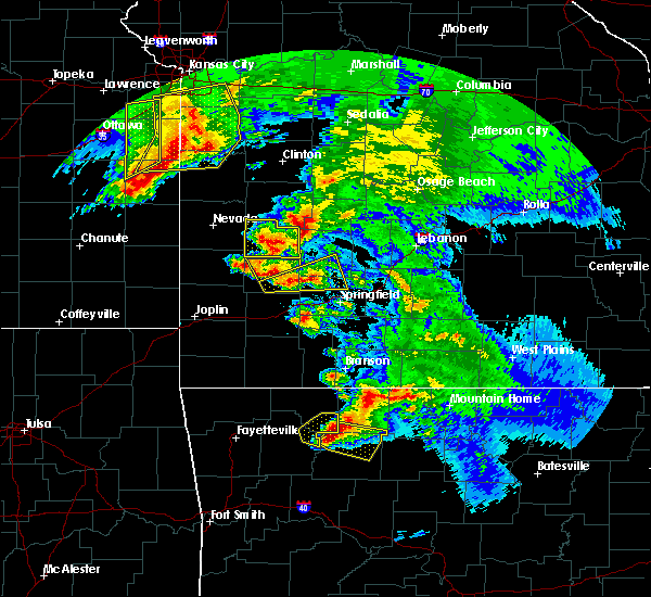 At 1156 am cdt, severe thunderstorms were located along a line extending from near red bank to near lost valley state park, moving southeast at 40 mph. there is a high likelihood this storm is producing very large hail! (radar indicated). Hazards include two inch hail and 60 mph wind gusts. People and animals outdoors will be injured. expect hail damage to roofs, siding, windows, and vehicles. expect wind damage to roofs, siding, and trees. Locations impacted include, jasper, western grove, valley springs, dugger, lost valley state park, piercetown, carver, erbie, pruitt, red bank, upper buffalo wilderness area, marble falls, yardelle, compton, low gap, vendor, parthenon, gum springs in newton county, mt judea, gaither,. At 1156 am cdt, severe thunderstorms were located along a line extending from near red bank to near lost valley state park, moving southeast at 40 mph. there is a high likelihood this storm is producing very large hail! (radar indicated). Hazards include two inch hail and 60 mph wind gusts. People and animals outdoors will be injured. expect hail damage to roofs, siding, windows, and vehicles. expect wind damage to roofs, siding, and trees. Locations impacted include, jasper, western grove, valley springs, dugger, lost valley state park, piercetown, carver, erbie, pruitt, red bank, upper buffalo wilderness area, marble falls, yardelle, compton, low gap, vendor, parthenon, gum springs in newton county, mt judea, gaither,.
|
| 5/4/2020 11:31 AM CDT |
 At 1131 am cdt, severe thunderstorms were located along a line extending from rudd to near marble, moving east at 45 mph (radar indicated). Hazards include two inch hail and 60 mph wind gusts. People and animals outdoors will be injured. expect hail damage to roofs, siding, windows, and vehicles. Expect wind damage to roofs, siding, and trees. At 1131 am cdt, severe thunderstorms were located along a line extending from rudd to near marble, moving east at 45 mph (radar indicated). Hazards include two inch hail and 60 mph wind gusts. People and animals outdoors will be injured. expect hail damage to roofs, siding, windows, and vehicles. Expect wind damage to roofs, siding, and trees.
|
| 4/28/2020 9:27 PM CDT |
 The severe thunderstorm warning for northern searcy, northeastern newton, southeastern marion, baxter and western fulton counties will expire at 930 pm cdt, the storms which prompted the warning have moved out of the area. therefore, the warning will be allowed to expire. however gusty winds and heavy rain are still possible with these thunderstorms. a severe thunderstorm watch remains in effect until 300 am cdt for north central arkansas. The severe thunderstorm warning for northern searcy, northeastern newton, southeastern marion, baxter and western fulton counties will expire at 930 pm cdt, the storms which prompted the warning have moved out of the area. therefore, the warning will be allowed to expire. however gusty winds and heavy rain are still possible with these thunderstorms. a severe thunderstorm watch remains in effect until 300 am cdt for north central arkansas.
|
| 4/28/2020 9:10 PM CDT |
 At 909 pm cdt, severe thunderstorms were located along a line extending from shipp to near rush to duff, moving east at 55 mph (radar indicated). Hazards include 60 mph wind gusts and quarter size hail. Hail damage to vehicles is expected. expect wind damage to roofs, siding, and trees. Locations impacted include, mountain home, bull shoals, yellville, jasper, gassville, flippin, lakeview in baxter county, norfork, salesville, western grove, viola, briarcliff, valley springs, arkawana, dugger, ott, carver, duff, bull shoals state park, herron,. At 909 pm cdt, severe thunderstorms were located along a line extending from shipp to near rush to duff, moving east at 55 mph (radar indicated). Hazards include 60 mph wind gusts and quarter size hail. Hail damage to vehicles is expected. expect wind damage to roofs, siding, and trees. Locations impacted include, mountain home, bull shoals, yellville, jasper, gassville, flippin, lakeview in baxter county, norfork, salesville, western grove, viola, briarcliff, valley springs, arkawana, dugger, ott, carver, duff, bull shoals state park, herron,.
|
| 4/28/2020 8:42 PM CDT |
 At 841 pm cdt, severe thunderstorms were located along a line extending from near clark hill to crawford to jasper, moving east at 50 mph (radar indicated). Hazards include 60 mph wind gusts and quarter size hail. Hail damage to vehicles is expected. Expect wind damage to roofs, siding, and trees. At 841 pm cdt, severe thunderstorms were located along a line extending from near clark hill to crawford to jasper, moving east at 50 mph (radar indicated). Hazards include 60 mph wind gusts and quarter size hail. Hail damage to vehicles is expected. Expect wind damage to roofs, siding, and trees.
|
| 3/19/2020 6:57 PM CDT |
 At 657 pm cdt, a severe thunderstorm was located over crawford, or 11 miles west of yellville, moving northeast at 50 mph (radar indicated). Hazards include 60 mph wind gusts and quarter size hail. Hail damage to vehicles is expected. expect wind damage to roofs, siding, and trees. Locations impacted include, yellville, flippin, pyatt, dugger, olvey, dodd city, lakeway, crawford, clark hill, cotter, summit, everton, zinc, fairview in marion county, ralph, eros, bruno, rea valley, bull shoals lake,. At 657 pm cdt, a severe thunderstorm was located over crawford, or 11 miles west of yellville, moving northeast at 50 mph (radar indicated). Hazards include 60 mph wind gusts and quarter size hail. Hail damage to vehicles is expected. expect wind damage to roofs, siding, and trees. Locations impacted include, yellville, flippin, pyatt, dugger, olvey, dodd city, lakeway, crawford, clark hill, cotter, summit, everton, zinc, fairview in marion county, ralph, eros, bruno, rea valley, bull shoals lake,.
|
| 3/19/2020 6:42 PM CDT |
 At 641 pm cdt, a severe thunderstorm was located near pruitt, or 7 miles northeast of jasper, moving northeast at 50 mph (radar indicated). Hazards include 60 mph wind gusts and quarter size hail. Hail damage to vehicles is expected. Expect wind damage to roofs, siding, and trees. At 641 pm cdt, a severe thunderstorm was located near pruitt, or 7 miles northeast of jasper, moving northeast at 50 mph (radar indicated). Hazards include 60 mph wind gusts and quarter size hail. Hail damage to vehicles is expected. Expect wind damage to roofs, siding, and trees.
|
| 1/10/2020 8:46 PM CST |
 At 846 pm cst, severe thunderstorms were located along a line extending from near pruitt to near piercetown to near bertha to near broomfield to near dover, moving northeast at 45 mph (radar indicated). Hazards include 60 mph wind gusts and quarter size hail. Hail damage to vehicles is expected. Expect wind damage to roofs, siding, and trees. At 846 pm cst, severe thunderstorms were located along a line extending from near pruitt to near piercetown to near bertha to near broomfield to near dover, moving northeast at 45 mph (radar indicated). Hazards include 60 mph wind gusts and quarter size hail. Hail damage to vehicles is expected. Expect wind damage to roofs, siding, and trees.
|
| 10/21/2019 1:47 AM CDT |
 At 147 am cdt, severe thunderstorms were located along a line extending from 8 miles west of price place to near woodland, moving east at 55 mph (radar indicated). Hazards include 60 mph wind gusts and quarter size hail. Hail damage to vehicles is expected. Expect wind damage to roofs, siding, and trees. At 147 am cdt, severe thunderstorms were located along a line extending from 8 miles west of price place to near woodland, moving east at 55 mph (radar indicated). Hazards include 60 mph wind gusts and quarter size hail. Hail damage to vehicles is expected. Expect wind damage to roofs, siding, and trees.
|
| 10/21/2019 1:14 AM CDT |
 At 113 am cdt, severe thunderstorms were located along a line extending from 7 miles south of kimberling city to kingston to near mulberry, moving east at 60 mph (radar indicated). Hazards include 60 mph wind gusts and quarter size hail. Hail damage to vehicles is expected. Expect wind damage to roofs, siding, and trees. At 113 am cdt, severe thunderstorms were located along a line extending from 7 miles south of kimberling city to kingston to near mulberry, moving east at 60 mph (radar indicated). Hazards include 60 mph wind gusts and quarter size hail. Hail damage to vehicles is expected. Expect wind damage to roofs, siding, and trees.
|
| 8/27/2019 12:14 AM CDT |
 At 1213 am cdt, severe thunderstorms were located along a line extending from near red bank to near jasper to 7 miles east of upper buffalo wilderness area to 8 miles southeast of pettigrew, moving east at 55 mph (radar indicated). Hazards include 60 mph wind gusts. Expect damage to roofs, siding, and trees. Locations impacted include, jasper, western grove, valley springs, dugger, olvey, marsena, carver, erbie, duff, upper buffalo wilderness area, point peter, devils knob, lost valley state park, pruitt, rosetta, dillen, red bank, eula, piercetown, walnut,. At 1213 am cdt, severe thunderstorms were located along a line extending from near red bank to near jasper to 7 miles east of upper buffalo wilderness area to 8 miles southeast of pettigrew, moving east at 55 mph (radar indicated). Hazards include 60 mph wind gusts. Expect damage to roofs, siding, and trees. Locations impacted include, jasper, western grove, valley springs, dugger, olvey, marsena, carver, erbie, duff, upper buffalo wilderness area, point peter, devils knob, lost valley state park, pruitt, rosetta, dillen, red bank, eula, piercetown, walnut,.
|
| 8/26/2019 11:59 PM CDT |
 At 1144 pm cdt, severe thunderstorms were located along a line extending from near berryville to marble to near aurora to 7 miles west of saint paul, moving east at 55 mph (radar indicated). Hazards include 60 mph wind gusts. expect damage to roofs, siding, and trees At 1144 pm cdt, severe thunderstorms were located along a line extending from near berryville to marble to near aurora to 7 miles west of saint paul, moving east at 55 mph (radar indicated). Hazards include 60 mph wind gusts. expect damage to roofs, siding, and trees
|
| 8/26/2019 11:45 PM CDT |
 At 1144 pm cdt, severe thunderstorms were located along a line extending from near berryville to marble to near aurora to 7 miles west of saint paul, moving east at 55 mph (radar indicated). Hazards include 60 mph wind gusts. expect damage to roofs, siding, and trees At 1144 pm cdt, severe thunderstorms were located along a line extending from near berryville to marble to near aurora to 7 miles west of saint paul, moving east at 55 mph (radar indicated). Hazards include 60 mph wind gusts. expect damage to roofs, siding, and trees
|
| 8/26/2019 5:25 PM CDT |
 At 524 pm cdt, a severe thunderstorm was located near western grove, or 11 miles northeast of jasper, moving southeast at 25 mph (radar indicated). Hazards include 60 mph wind gusts and quarter size hail. Hail damage to vehicles is expected. Expect wind damage to roofs, siding, and trees. At 524 pm cdt, a severe thunderstorm was located near western grove, or 11 miles northeast of jasper, moving southeast at 25 mph (radar indicated). Hazards include 60 mph wind gusts and quarter size hail. Hail damage to vehicles is expected. Expect wind damage to roofs, siding, and trees.
|
| 8/26/2019 5:16 PM CDT |
 At 515 pm cdt, a severe thunderstorm was located over valley springs, or 9 miles southeast of harrison, moving southeast at 25 mph (radar indicated). Hazards include 60 mph wind gusts and quarter size hail. Hail damage to vehicles is expected. expect wind damage to roofs, siding, and trees. quarter size hail has been reported with this storm in harrison. Locations impacted include, harrison, bergman, western grove, valley springs, dugger, olvey, myrtle, capps, willis, pruitt, crawford, bellefonte, everton, pindall, zinc, batavia, bear creek springs, marble falls, yardelle, ridgeway,. At 515 pm cdt, a severe thunderstorm was located over valley springs, or 9 miles southeast of harrison, moving southeast at 25 mph (radar indicated). Hazards include 60 mph wind gusts and quarter size hail. Hail damage to vehicles is expected. expect wind damage to roofs, siding, and trees. quarter size hail has been reported with this storm in harrison. Locations impacted include, harrison, bergman, western grove, valley springs, dugger, olvey, myrtle, capps, willis, pruitt, crawford, bellefonte, everton, pindall, zinc, batavia, bear creek springs, marble falls, yardelle, ridgeway,.
|
| 8/26/2019 4:56 PM CDT |
 At 455 pm cdt, a severe thunderstorm was located over harrison, moving southeast at 25 mph (radar indicated). Hazards include 60 mph wind gusts and quarter size hail. Hail damage to vehicles is expected. expect wind damage to roofs, siding, and trees. Locations impacted include, harrison, bergman, western grove, valley springs, dugger, olvey, myrtle, capps, willis, pruitt, crawford, bellefonte, everton, pindall, zinc, batavia, bear creek springs, marble falls, yardelle, ridgeway,. At 455 pm cdt, a severe thunderstorm was located over harrison, moving southeast at 25 mph (radar indicated). Hazards include 60 mph wind gusts and quarter size hail. Hail damage to vehicles is expected. expect wind damage to roofs, siding, and trees. Locations impacted include, harrison, bergman, western grove, valley springs, dugger, olvey, myrtle, capps, willis, pruitt, crawford, bellefonte, everton, pindall, zinc, batavia, bear creek springs, marble falls, yardelle, ridgeway,.
|
| 8/26/2019 4:41 PM CDT |
 At 440 pm cdt, a severe thunderstorm was located over myrtle, or 7 miles north of harrison, moving southeast at 25 mph (radar indicated). Hazards include 60 mph wind gusts and quarter size hail. Hail damage to vehicles is expected. Expect wind damage to roofs, siding, and trees. At 440 pm cdt, a severe thunderstorm was located over myrtle, or 7 miles north of harrison, moving southeast at 25 mph (radar indicated). Hazards include 60 mph wind gusts and quarter size hail. Hail damage to vehicles is expected. Expect wind damage to roofs, siding, and trees.
|
| 8/21/2019 2:36 PM CDT |
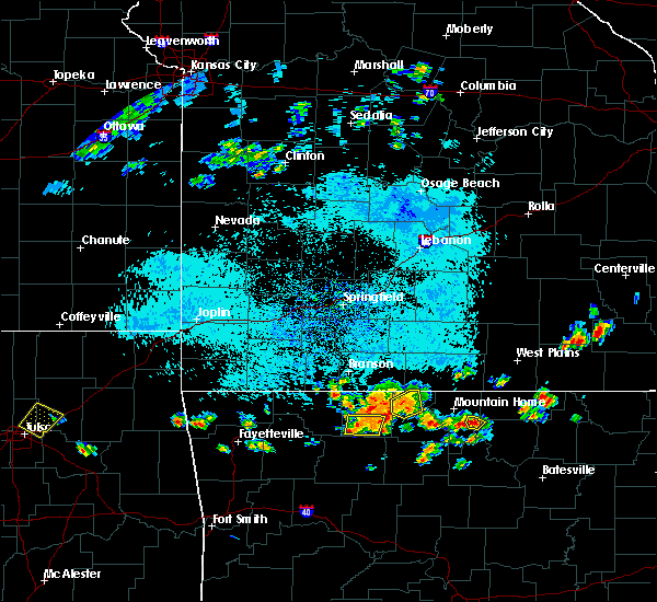 The severe thunderstorm warning for southern boone county will expire at 245 pm cdt, the storm which prompted the warning has weakened below severe limits, and no longer poses an immediate threat to life or property. therefore, the warning will be allowed to expire. however gusty winds are still possible with this thunderstorm. The severe thunderstorm warning for southern boone county will expire at 245 pm cdt, the storm which prompted the warning has weakened below severe limits, and no longer poses an immediate threat to life or property. therefore, the warning will be allowed to expire. however gusty winds are still possible with this thunderstorm.
|
| 8/21/2019 2:13 PM CDT |
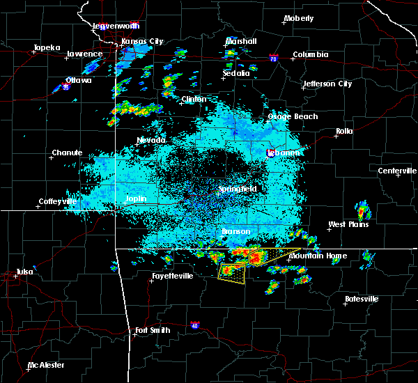 At 213 pm cdt, severe thunderstorms were located near harrison, moving east at 15 mph (radar indicated). Hazards include 60 mph wind gusts and quarter size hail. Hail damage to vehicles is expected. expect wind damage to roofs, siding, and trees. Locations impacted include, harrison, valley springs, capps, bellefonte, batavia, bear creek springs, gaither,. At 213 pm cdt, severe thunderstorms were located near harrison, moving east at 15 mph (radar indicated). Hazards include 60 mph wind gusts and quarter size hail. Hail damage to vehicles is expected. expect wind damage to roofs, siding, and trees. Locations impacted include, harrison, valley springs, capps, bellefonte, batavia, bear creek springs, gaither,.
|
| 8/21/2019 2:02 PM CDT |
 At 202 pm cdt, a severe thunderstorm was located over capps, or near harrison, moving east at 15 mph (radar indicated). Hazards include 60 mph wind gusts and quarter size hail. Hail damage to vehicles is expected. Expect wind damage to roofs, siding, and trees. At 202 pm cdt, a severe thunderstorm was located over capps, or near harrison, moving east at 15 mph (radar indicated). Hazards include 60 mph wind gusts and quarter size hail. Hail damage to vehicles is expected. Expect wind damage to roofs, siding, and trees.
|
| 6/26/2019 1:40 PM CDT |
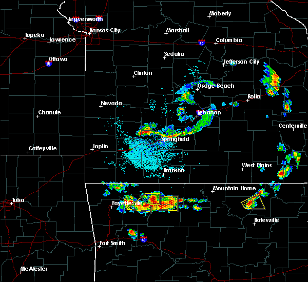 At 139 pm cdt, a severe thunderstorm was located near erbie, or 8 miles north of jasper, moving east at 10 mph (radar indicated). Hazards include 60 mph wind gusts and half dollar size hail. Hail damage to vehicles is expected. expect wind damage to roofs, siding, and trees. Locations impacted include, harrison, jasper, valley springs, capps, erbie, pruitt, red bank, bellefonte, batavia, marble falls, yardelle, compton, gaither, hasty, mt sherman,. At 139 pm cdt, a severe thunderstorm was located near erbie, or 8 miles north of jasper, moving east at 10 mph (radar indicated). Hazards include 60 mph wind gusts and half dollar size hail. Hail damage to vehicles is expected. expect wind damage to roofs, siding, and trees. Locations impacted include, harrison, jasper, valley springs, capps, erbie, pruitt, red bank, bellefonte, batavia, marble falls, yardelle, compton, gaither, hasty, mt sherman,.
|
| 6/26/2019 1:17 PM CDT |
 At 116 pm cdt, a severe thunderstorm was located near erbie, or 9 miles northwest of jasper, moving east at 10 mph (radar indicated). Hazards include 60 mph wind gusts and half dollar size hail. Hail damage to vehicles is expected. Expect wind damage to roofs, siding, and trees. At 116 pm cdt, a severe thunderstorm was located near erbie, or 9 miles northwest of jasper, moving east at 10 mph (radar indicated). Hazards include 60 mph wind gusts and half dollar size hail. Hail damage to vehicles is expected. Expect wind damage to roofs, siding, and trees.
|
| 6/23/2019 11:51 AM CDT |
 The severe thunderstorm warning for northern newton and boone counties will expire at noon cdt, the storm which prompted the warning has weakened below severe limits, and no longer poses an immediate threat to life or property. therefore, the warning will be allowed to expire. however gusty winds and heavy rain are still possible with this thunderstorm. The severe thunderstorm warning for northern newton and boone counties will expire at noon cdt, the storm which prompted the warning has weakened below severe limits, and no longer poses an immediate threat to life or property. therefore, the warning will be allowed to expire. however gusty winds and heavy rain are still possible with this thunderstorm.
|
| 6/23/2019 11:14 AM CDT |
 At 1113 am cdt, a severe thunderstorm was located over rudd, or 13 miles southeast of berryville, moving east at 35 mph (radar indicated). Hazards include 60 mph wind gusts and quarter size hail. Hail damage to vehicles is expected. Expect wind damage to roofs, siding, and trees. At 1113 am cdt, a severe thunderstorm was located over rudd, or 13 miles southeast of berryville, moving east at 35 mph (radar indicated). Hazards include 60 mph wind gusts and quarter size hail. Hail damage to vehicles is expected. Expect wind damage to roofs, siding, and trees.
|
| 5/21/2019 2:40 PM CDT |
 At 240 pm cdt, severe thunderstorms were located along a line extending from bergman to point peter to near smyrna, moving northeast at 60 mph (radar indicated). Hazards include 60 mph wind gusts and quarter size hail. Hail damage to vehicles is expected. Expect wind damage to roofs, siding, and trees. At 240 pm cdt, severe thunderstorms were located along a line extending from bergman to point peter to near smyrna, moving northeast at 60 mph (radar indicated). Hazards include 60 mph wind gusts and quarter size hail. Hail damage to vehicles is expected. Expect wind damage to roofs, siding, and trees.
|
| 5/21/2019 1:54 PM CDT |
 At 153 pm cdt, a severe thunderstorm was located over lost valley state park, or 10 miles west of jasper. another developing storm was centered near fallsville. the storms were moving northeast at 45 mph (radar indicated). Hazards include 60 mph wind gusts and quarter size hail. Hail damage to vehicles is expected. expect wind damage to roofs, siding, and trees. Locations impacted include, harrison, jasper, western grove, valley springs, dugger, olvey, roberson hollow, erbie, upper buffalo wilderness area, red bank, lost valley state park, capps, pruitt, bellefonte, alpena, everton, batavia, bear creek springs, marble falls, ridgeway, a tornado watch remains in effect until 700 pm cdt for north central arkansas. At 153 pm cdt, a severe thunderstorm was located over lost valley state park, or 10 miles west of jasper. another developing storm was centered near fallsville. the storms were moving northeast at 45 mph (radar indicated). Hazards include 60 mph wind gusts and quarter size hail. Hail damage to vehicles is expected. expect wind damage to roofs, siding, and trees. Locations impacted include, harrison, jasper, western grove, valley springs, dugger, olvey, roberson hollow, erbie, upper buffalo wilderness area, red bank, lost valley state park, capps, pruitt, bellefonte, alpena, everton, batavia, bear creek springs, marble falls, ridgeway, a tornado watch remains in effect until 700 pm cdt for north central arkansas.
|
| 5/21/2019 1:37 PM CDT |
 At 137 pm cdt, a severe thunderstorm was located near upper buffalo wilderness area, or 19 miles southwest of jasper, moving northeast at 45 mph (radar indicated). Hazards include 60 mph wind gusts and quarter size hail. Hail damage to vehicles is expected. Expect wind damage to roofs, siding, and trees. At 137 pm cdt, a severe thunderstorm was located near upper buffalo wilderness area, or 19 miles southwest of jasper, moving northeast at 45 mph (radar indicated). Hazards include 60 mph wind gusts and quarter size hail. Hail damage to vehicles is expected. Expect wind damage to roofs, siding, and trees.
|
| 5/18/2019 3:36 PM CDT |
 At 335 pm cdt, severe thunderstorms were located along a line extending from omaha to near bergman to near piercetown, moving east at 50 mph (radar indicated). Hazards include 60 mph wind gusts and quarter size hail. Hail damage to vehicles is expected. Expect wind damage to roofs, siding, and trees. At 335 pm cdt, severe thunderstorms were located along a line extending from omaha to near bergman to near piercetown, moving east at 50 mph (radar indicated). Hazards include 60 mph wind gusts and quarter size hail. Hail damage to vehicles is expected. Expect wind damage to roofs, siding, and trees.
|
| 2/7/2019 4:23 AM CST |
 At 420 am cst, a severe thunderstorm was located 4 miles southwest of yellville, moving northeast at 60 mph (radar indicated). Hazards include 60 mph wind gusts and quarter size hail. Hail damage to vehicles is expected. expect wind damage to roofs, siding, and trees. Locations impacted include, mountain home, bull shoals, yellville, gassville, flippin, lakeview in baxter county, norfork, salesville, briarcliff, pyatt, valley springs, arkawana, dugger, olvey, ozark regional airport, ozark isle, lakeway, bull shoals state park, shipp, colfax,. At 420 am cst, a severe thunderstorm was located 4 miles southwest of yellville, moving northeast at 60 mph (radar indicated). Hazards include 60 mph wind gusts and quarter size hail. Hail damage to vehicles is expected. expect wind damage to roofs, siding, and trees. Locations impacted include, mountain home, bull shoals, yellville, gassville, flippin, lakeview in baxter county, norfork, salesville, briarcliff, pyatt, valley springs, arkawana, dugger, olvey, ozark regional airport, ozark isle, lakeway, bull shoals state park, shipp, colfax,.
|
| 2/7/2019 3:58 AM CST |
 At 357 am cst, a severe thunderstorm was located near pruitt, or 5 miles northeast of jasper, moving northeast at 55 mph (radar indicated). Hazards include 60 mph wind gusts and quarter size hail. Hail damage to vehicles is expected. Expect wind damage to roofs, siding, and trees. At 357 am cst, a severe thunderstorm was located near pruitt, or 5 miles northeast of jasper, moving northeast at 55 mph (radar indicated). Hazards include 60 mph wind gusts and quarter size hail. Hail damage to vehicles is expected. Expect wind damage to roofs, siding, and trees.
|
| 2/7/2019 3:32 AM CST |
 At 330 am cst, severe thunderstorms were located along a line extending from near rudd to near boston and oark, moving northeast at 50 mph (radar indicated). Hazards include 60 mph wind gusts and quarter size hail. Hail damage to vehicles is expected. expect wind damage to roofs, siding, and trees. Locations impacted include, harrison, jasper, valley springs, carver, erbie, upper buffalo wilderness area, devils knob, lost valley state park, pruitt, rosetta, myrtle, self, dillen, red bank, capps, piercetown, walnut, bellefonte, alpena, batavia,. At 330 am cst, severe thunderstorms were located along a line extending from near rudd to near boston and oark, moving northeast at 50 mph (radar indicated). Hazards include 60 mph wind gusts and quarter size hail. Hail damage to vehicles is expected. expect wind damage to roofs, siding, and trees. Locations impacted include, harrison, jasper, valley springs, carver, erbie, upper buffalo wilderness area, devils knob, lost valley state park, pruitt, rosetta, myrtle, self, dillen, red bank, capps, piercetown, walnut, bellefonte, alpena, batavia,.
|
| 2/7/2019 3:07 AM CST |
 At 306 am cst, severe thunderstorms were located along a line extending from near elkins to 9 miles west of saint paul to mulberry, moving northeast at 50 mph (radar indicated). Hazards include 60 mph wind gusts and quarter size hail. Hail damage to vehicles is expected. Expect wind damage to roofs, siding, and trees. At 306 am cst, severe thunderstorms were located along a line extending from near elkins to 9 miles west of saint paul to mulberry, moving northeast at 50 mph (radar indicated). Hazards include 60 mph wind gusts and quarter size hail. Hail damage to vehicles is expected. Expect wind damage to roofs, siding, and trees.
|
| 12/1/2018 12:20 AM CST |
 At 1219 am cst, severe thunderstorms were located along a line extending from 7 miles north of urbanette to carrollton to near lost valley state park, moving northeast at 45 mph (radar indicated). Hazards include 60 mph wind gusts and quarter size hail. Hail damage to vehicles is expected. Expect wind damage to roofs, siding, and trees. At 1219 am cst, severe thunderstorms were located along a line extending from 7 miles north of urbanette to carrollton to near lost valley state park, moving northeast at 45 mph (radar indicated). Hazards include 60 mph wind gusts and quarter size hail. Hail damage to vehicles is expected. Expect wind damage to roofs, siding, and trees.
|
| 7/21/2018 12:32 AM CDT |
 At 1232 am cdt, severe thunderstorms were located along a line extending from bergman to near osage, moving southeast at 55 mph (radar indicated). Hazards include 60 mph wind gusts and quarter size hail. Hail damage to vehicles is expected. expect wind damage to roofs, siding, and trees. locations impacted include, harrison, jasper, bergman, western grove, valley springs, dugger, olvey, myrtle, self, carver, erbie, red bank, capps, piercetown, pruitt, crawford, bellefonte, alpena, everton, st. Joe,. At 1232 am cdt, severe thunderstorms were located along a line extending from bergman to near osage, moving southeast at 55 mph (radar indicated). Hazards include 60 mph wind gusts and quarter size hail. Hail damage to vehicles is expected. expect wind damage to roofs, siding, and trees. locations impacted include, harrison, jasper, bergman, western grove, valley springs, dugger, olvey, myrtle, self, carver, erbie, red bank, capps, piercetown, pruitt, crawford, bellefonte, alpena, everton, st. Joe,.
|
| 7/21/2018 12:19 AM CDT |
 At 1219 am cdt, severe thunderstorms were located along a line extending from omaha to near rule, moving southeast at 50 mph (radar indicated). Hazards include 60 mph wind gusts and quarter size hail. Hail damage to vehicles is expected. Expect wind damage to roofs, siding, and trees. At 1219 am cdt, severe thunderstorms were located along a line extending from omaha to near rule, moving southeast at 50 mph (radar indicated). Hazards include 60 mph wind gusts and quarter size hail. Hail damage to vehicles is expected. Expect wind damage to roofs, siding, and trees.
|
| 7/19/2018 8:15 PM CDT |
 At 815 pm cdt, severe thunderstorms were located along a line extending from near rush to near duff to piercetown to near lost valley state park, moving southeast at 45 mph (radar indicated). Hazards include 60 mph wind gusts. Expect damage to roofs, siding, and trees. Locations impacted include, marshall, yellville, jasper, western grove, valley springs, dugger, marsena, witts spring, carver, erbie, moore, duff, point peter, maumee, bohannon, lost valley state park, imo, pruitt, watts, kay,. At 815 pm cdt, severe thunderstorms were located along a line extending from near rush to near duff to piercetown to near lost valley state park, moving southeast at 45 mph (radar indicated). Hazards include 60 mph wind gusts. Expect damage to roofs, siding, and trees. Locations impacted include, marshall, yellville, jasper, western grove, valley springs, dugger, marsena, witts spring, carver, erbie, moore, duff, point peter, maumee, bohannon, lost valley state park, imo, pruitt, watts, kay,.
|
| 7/19/2018 7:58 PM CDT |
 At 757 pm cdt, severe thunderstorms were located along a line extending from near lakeway to crawford to near pruitt to near osage, moving southeast at 45 mph (radar indicated). Hazards include 60 mph wind gusts. expect damage to roofs, siding, and trees At 757 pm cdt, severe thunderstorms were located along a line extending from near lakeway to crawford to near pruitt to near osage, moving southeast at 45 mph (radar indicated). Hazards include 60 mph wind gusts. expect damage to roofs, siding, and trees
|
| 7/19/2018 7:44 PM CDT |
 At 744 pm cdt, severe thunderstorms were located along a line extending from near lead hill to bergman to capps to osage, moving south at 45 mph (radar indicated). Hazards include 60 mph wind gusts. Expect damage to roofs, siding, and trees. Locations impacted include, harrison, jasper, diamond city, bergman, western grove, lead hill, pyatt, valley springs, dugger, olvey, myrtle, self, erbie, lakeway, red bank, clark hill, winington, dodd city, lost valley state park, capps,. At 744 pm cdt, severe thunderstorms were located along a line extending from near lead hill to bergman to capps to osage, moving south at 45 mph (radar indicated). Hazards include 60 mph wind gusts. Expect damage to roofs, siding, and trees. Locations impacted include, harrison, jasper, diamond city, bergman, western grove, lead hill, pyatt, valley springs, dugger, olvey, myrtle, self, erbie, lakeway, red bank, clark hill, winington, dodd city, lost valley state park, capps,.
|
| 7/19/2018 7:36 PM CDT |
 At 735 pm cdt, severe thunderstorms were located along a line extending from diamond city to self to near carrollton to near green forest, moving south at 45 mph (radar indicated). Hazards include 60 mph wind gusts. Expect damage to roofs, siding, and trees. Locations impacted include, harrison, jasper, diamond city, bergman, western grove, lead hill, pyatt, valley springs, omaha, dugger, olvey, myrtle, roberson hollow, self, erbie, lakeway, red bank, clark hill, winington, dodd city,. At 735 pm cdt, severe thunderstorms were located along a line extending from diamond city to self to near carrollton to near green forest, moving south at 45 mph (radar indicated). Hazards include 60 mph wind gusts. Expect damage to roofs, siding, and trees. Locations impacted include, harrison, jasper, diamond city, bergman, western grove, lead hill, pyatt, valley springs, omaha, dugger, olvey, myrtle, roberson hollow, self, erbie, lakeway, red bank, clark hill, winington, dodd city,.
|
| 7/19/2018 7:19 PM CDT |
 At 718 pm cdt, severe thunderstorms were located along a line extending from near taneyville to 8 miles south of forsyth to near roberson hollow to 7 miles northeast of urbanette, moving south at 45 mph (radar indicated). Hazards include 60 mph wind gusts. expect damage to roofs, siding, and trees At 718 pm cdt, severe thunderstorms were located along a line extending from near taneyville to 8 miles south of forsyth to near roberson hollow to 7 miles northeast of urbanette, moving south at 45 mph (radar indicated). Hazards include 60 mph wind gusts. expect damage to roofs, siding, and trees
|
| 6/24/2018 8:12 AM CDT |
 The severe thunderstorm warning for northeastern johnson, newton, western searcy, southwestern marion, southern boone and north central pope counties will expire at 815 am cdt, the storms which prompted the warning have weakened. therefore, the warning will be allowed to expire. a severe thunderstorm watch remains in effect until 1100 am cdt for western and central arkansas. The severe thunderstorm warning for northeastern johnson, newton, western searcy, southwestern marion, southern boone and north central pope counties will expire at 815 am cdt, the storms which prompted the warning have weakened. therefore, the warning will be allowed to expire. a severe thunderstorm watch remains in effect until 1100 am cdt for western and central arkansas.
|
| 6/24/2018 7:29 AM CDT |
 At 729 am cdt, severe thunderstorms were located along a line extending from near upper buffalo wilderness area to walnut to 7 miles south of rosetta, moving northeast at 45 mph (radar indicated). Hazards include 60 mph wind gusts. expect damage to roofs, siding, and trees At 729 am cdt, severe thunderstorms were located along a line extending from near upper buffalo wilderness area to walnut to 7 miles south of rosetta, moving northeast at 45 mph (radar indicated). Hazards include 60 mph wind gusts. expect damage to roofs, siding, and trees
|
| 6/2/2018 2:14 PM CDT |
 At 213 pm cdt, a severe thunderstorm was located near vallley springs, or 7 miles southeast of harrison, moving southeast at 20 mph (radar indicated). Hazards include 60 mph wind gusts and half dollar size hail. Hail damage to vehicles is expected. expect wind damage to roofs, siding, and trees. Locations impacted include, valley springs, dugger, olvey, crawford, everton, eros, bruno,. At 213 pm cdt, a severe thunderstorm was located near vallley springs, or 7 miles southeast of harrison, moving southeast at 20 mph (radar indicated). Hazards include 60 mph wind gusts and half dollar size hail. Hail damage to vehicles is expected. expect wind damage to roofs, siding, and trees. Locations impacted include, valley springs, dugger, olvey, crawford, everton, eros, bruno,.
|
| 6/2/2018 2:01 PM CDT |
 At 201 pm cdt, a severe thunderstorm was located over valley springs, or just southeast of harrison, moving southeast at 20 mph (radar indicated). Hazards include ping pong ball size hail and 60 mph wind gusts. People and animals outdoors will be injured. expect hail damage to roofs, siding, windows, and vehicles. expect wind damage to roofs, siding, and trees. Locations impacted include, harrison, pyatt, valley springs, dugger, olvey, crawford, bellefonte, everton, eros, bruno,. At 201 pm cdt, a severe thunderstorm was located over valley springs, or just southeast of harrison, moving southeast at 20 mph (radar indicated). Hazards include ping pong ball size hail and 60 mph wind gusts. People and animals outdoors will be injured. expect hail damage to roofs, siding, windows, and vehicles. expect wind damage to roofs, siding, and trees. Locations impacted include, harrison, pyatt, valley springs, dugger, olvey, crawford, bellefonte, everton, eros, bruno,.
|
| 6/2/2018 1:46 PM CDT |
 At 145 pm cdt, a severe thunderstorm was located over harrison, moving east at 30 mph (radar indicated). Hazards include golf ball size hail and 60 mph wind gusts. People and animals outdoors will be injured. expect hail damage to roofs, siding, windows, and vehicles. expect wind damage to roofs, siding, and trees. Locations impacted include, harrison, yellville, flippin, pyatt, valley springs, dugger, olvey, capps, crawford, summit, bellefonte, everton, zinc, batavia, bear creek springs, ralph, eros, bruno,. At 145 pm cdt, a severe thunderstorm was located over harrison, moving east at 30 mph (radar indicated). Hazards include golf ball size hail and 60 mph wind gusts. People and animals outdoors will be injured. expect hail damage to roofs, siding, windows, and vehicles. expect wind damage to roofs, siding, and trees. Locations impacted include, harrison, yellville, flippin, pyatt, valley springs, dugger, olvey, capps, crawford, summit, bellefonte, everton, zinc, batavia, bear creek springs, ralph, eros, bruno,.
|
| 6/2/2018 1:40 PM CDT |
 At 140 pm cdt, a severe thunderstorm was located over harrison, moving east at 30 mph (radar indicated). Hazards include 60 mph wind gusts and nickel size hail. expect damage to roofs, siding, and trees At 140 pm cdt, a severe thunderstorm was located over harrison, moving east at 30 mph (radar indicated). Hazards include 60 mph wind gusts and nickel size hail. expect damage to roofs, siding, and trees
|
| 4/13/2018 7:50 PM CDT |
 At 750 pm cdt, severe thunderstorms were located along a line extending from near crawford to near duff to near eula to 7 miles northwest of broomfield, moving northeast at 40 mph (radar indicated). Hazards include 60 mph wind gusts and penny size hail. Expect damage to roofs, siding, and trees. Locations impacted include, mountain home, bull shoals, marshall, yellville, gassville, flippin, lakeview in baxter county, western grove, pyatt, valley springs, arkawana, dugger, marsena, olvey, witts spring, moore, duff, lakeway, dabney, bull shoals state park, a tornado watch remains in effect until 1000 pm cdt for western, central and north central arkansas. At 750 pm cdt, severe thunderstorms were located along a line extending from near crawford to near duff to near eula to 7 miles northwest of broomfield, moving northeast at 40 mph (radar indicated). Hazards include 60 mph wind gusts and penny size hail. Expect damage to roofs, siding, and trees. Locations impacted include, mountain home, bull shoals, marshall, yellville, gassville, flippin, lakeview in baxter county, western grove, pyatt, valley springs, arkawana, dugger, marsena, olvey, witts spring, moore, duff, lakeway, dabney, bull shoals state park, a tornado watch remains in effect until 1000 pm cdt for western, central and north central arkansas.
|
| 4/13/2018 7:26 PM CDT |
 At 726 pm cdt, severe thunderstorms were located along a line extending from near western grove to near carver to near moore to holman, moving northeast at 50 mph (radar indicated). Hazards include 60 mph wind gusts and nickel size hail. expect damage to roofs, siding, and trees At 726 pm cdt, severe thunderstorms were located along a line extending from near western grove to near carver to near moore to holman, moving northeast at 50 mph (radar indicated). Hazards include 60 mph wind gusts and nickel size hail. expect damage to roofs, siding, and trees
|
| 6/23/2017 2:17 PM CDT |
 At 217 pm cdt, a severe thunderstorm continued to be located over crawford, or 11 miles east of harrison, moving southeast at 25 mph (radar indicated). Hazards include 60 mph wind gusts and quarter size hail. Hail damage to vehicles is expected. expect wind damage to roofs, siding, and trees. Locations impacted include, yellville, western grove, pyatt, valley springs, dugger, olvey, crawford, everton, pindall, ralph, yardelle, eros, bruno,. At 217 pm cdt, a severe thunderstorm continued to be located over crawford, or 11 miles east of harrison, moving southeast at 25 mph (radar indicated). Hazards include 60 mph wind gusts and quarter size hail. Hail damage to vehicles is expected. expect wind damage to roofs, siding, and trees. Locations impacted include, yellville, western grove, pyatt, valley springs, dugger, olvey, crawford, everton, pindall, ralph, yardelle, eros, bruno,.
|
| 6/23/2017 1:55 PM CDT |
 At 155 pm cdt, a severe thunderstorm was located near bergman, or near harrison, moving southeast at 20 mph (radar indicated). Hazards include 60 mph wind gusts and quarter size hail. Hail damage to vehicles is expected. Expect wind damage to roofs, siding, and trees. At 155 pm cdt, a severe thunderstorm was located near bergman, or near harrison, moving southeast at 20 mph (radar indicated). Hazards include 60 mph wind gusts and quarter size hail. Hail damage to vehicles is expected. Expect wind damage to roofs, siding, and trees.
|
| 5/20/2017 12:26 AM CDT |
 At 1225 am cdt, a severe thunderstorm was located near harrison, moving northeast at 40 mph (radar indicated). Hazards include 60 mph wind gusts and quarter size hail. Hail damage to vehicles is expected. Expect wind damage to roofs, siding, and trees. At 1225 am cdt, a severe thunderstorm was located near harrison, moving northeast at 40 mph (radar indicated). Hazards include 60 mph wind gusts and quarter size hail. Hail damage to vehicles is expected. Expect wind damage to roofs, siding, and trees.
|
| 5/19/2017 8:14 PM CDT |
 At 814 pm cdt, a severe thunderstorm was located near valley springs, or near harrison, moving north at 25 mph (radar indicated). Hazards include 60 mph wind gusts and quarter size hail. Hail damage to vehicles is expected. Expect wind damage to roofs, siding, and trees. At 814 pm cdt, a severe thunderstorm was located near valley springs, or near harrison, moving north at 25 mph (radar indicated). Hazards include 60 mph wind gusts and quarter size hail. Hail damage to vehicles is expected. Expect wind damage to roofs, siding, and trees.
|
| 5/19/2017 1:56 AM CDT |
 At 156 am cdt, severe thunderstorms were located along a line extending from near diamond city to near pyatt to near witts spring, moving east at 40 mph (radar indicated). Hazards include 60 mph wind gusts and nickel size hail. Expect damage to roofs, siding, and trees. Locations impacted include, bull shoals, marshall, yellville, flippin, diamond city, bergman, western grove, lead hill, pyatt, valley springs, dugger, olvey, marsena, evening star, witts spring, carver, duff, moore, lakeway, winington, a tornado watch remains in effect until 600 am cdt for north central arkansas. At 156 am cdt, severe thunderstorms were located along a line extending from near diamond city to near pyatt to near witts spring, moving east at 40 mph (radar indicated). Hazards include 60 mph wind gusts and nickel size hail. Expect damage to roofs, siding, and trees. Locations impacted include, bull shoals, marshall, yellville, flippin, diamond city, bergman, western grove, lead hill, pyatt, valley springs, dugger, olvey, marsena, evening star, witts spring, carver, duff, moore, lakeway, winington, a tornado watch remains in effect until 600 am cdt for north central arkansas.
|
| 5/19/2017 1:28 AM CDT |
 At 127 am cdt, severe thunderstorms were located along a line extending from near omaha to near harrison to near bertha, moving east at 45 mph (radar indicated). Hazards include 60 mph wind gusts and nickel size hail. expect damage to roofs, siding, and trees At 127 am cdt, severe thunderstorms were located along a line extending from near omaha to near harrison to near bertha, moving east at 45 mph (radar indicated). Hazards include 60 mph wind gusts and nickel size hail. expect damage to roofs, siding, and trees
|
| 4/29/2017 5:39 PM CDT |
 At 538 pm cdt, severe thunderstorms were located along a line extending from lakeview in baxter county to near lakeway to near crawford, moving northeast at 45 mph (radar indicated). Hazards include 60 mph wind gusts. Expect damage to roofs, siding, and trees. Locations impacted include, mountain home, bull shoals, yellville, gassville, flippin, lakeview in baxter county, western grove, pyatt, valley springs, arkawana, dugger, olvey, ozark regional airport, ozark isle, fawn park, lakeway, bull shoals state park, winington, clark hill, colfax,. At 538 pm cdt, severe thunderstorms were located along a line extending from lakeview in baxter county to near lakeway to near crawford, moving northeast at 45 mph (radar indicated). Hazards include 60 mph wind gusts. Expect damage to roofs, siding, and trees. Locations impacted include, mountain home, bull shoals, yellville, gassville, flippin, lakeview in baxter county, western grove, pyatt, valley springs, arkawana, dugger, olvey, ozark regional airport, ozark isle, fawn park, lakeway, bull shoals state park, winington, clark hill, colfax,.
|
| 4/29/2017 5:13 PM CDT |
 At 513 pm cdt, severe thunderstorms were located along a line extending from near ozark isle to dodd city to western grove, moving northeast at 40 mph (radar indicated). Hazards include 60 mph wind gusts and penny size hail. expect damage to roofs, siding, and trees At 513 pm cdt, severe thunderstorms were located along a line extending from near ozark isle to dodd city to western grove, moving northeast at 40 mph (radar indicated). Hazards include 60 mph wind gusts and penny size hail. expect damage to roofs, siding, and trees
|
| 4/29/2017 5:04 PM CDT |
 At 503 pm cdt, severe thunderstorms were located along a line extending from yellville to valley springs to 6 miles north of dillen, moving northeast at 55 mph (radar indicated). Hazards include 60 mph wind gusts and penny size hail. Expect damage to roofs, siding, and trees. Locations impacted include, yellville, jasper, flippin, western grove, pyatt, valley springs, dugger, carver, erbie, point peter, devils knob, pruitt, rosetta, dillen, piercetown, walnut, crawford, bertha, eula, summit,. At 503 pm cdt, severe thunderstorms were located along a line extending from yellville to valley springs to 6 miles north of dillen, moving northeast at 55 mph (radar indicated). Hazards include 60 mph wind gusts and penny size hail. Expect damage to roofs, siding, and trees. Locations impacted include, yellville, jasper, flippin, western grove, pyatt, valley springs, dugger, carver, erbie, point peter, devils knob, pruitt, rosetta, dillen, piercetown, walnut, crawford, bertha, eula, summit,.
|
| 4/29/2017 5:02 PM CDT |
 At 502 pm cdt, a severe thunderstorm was located near lead hill, or 15 miles west of bull shoals, moving northeast at 55 mph (radar indicated). Hazards include 60 mph wind gusts and penny size hail. Expect damage to roofs, siding, and trees. Locations impacted include, harrison, bergman, lead hill, valley springs, olvey, crawford, winington, clark hill, bellefonte, everton, zinc, south lead hill, gaither, monarch,. At 502 pm cdt, a severe thunderstorm was located near lead hill, or 15 miles west of bull shoals, moving northeast at 55 mph (radar indicated). Hazards include 60 mph wind gusts and penny size hail. Expect damage to roofs, siding, and trees. Locations impacted include, harrison, bergman, lead hill, valley springs, olvey, crawford, winington, clark hill, bellefonte, everton, zinc, south lead hill, gaither, monarch,.
|
| 4/29/2017 4:51 PM CDT |
 At 451 pm cdt, severe thunderstorms were located along a line extending from near duff to near jasper to near rosetta, moving northeast at 55 mph (radar indicated). Hazards include 60 mph wind gusts and nickel size hail. expect damage to roofs, siding, and trees At 451 pm cdt, severe thunderstorms were located along a line extending from near duff to near jasper to near rosetta, moving northeast at 55 mph (radar indicated). Hazards include 60 mph wind gusts and nickel size hail. expect damage to roofs, siding, and trees
|
| 4/29/2017 4:43 PM CDT |
 At 443 pm cdt, a severe thunderstorm was located near harrison, moving northeast at 60 mph (radar indicated). Hazards include 60 mph wind gusts and quarter size hail. Hail damage to vehicles is expected. Expect wind damage to roofs, siding, and trees. At 443 pm cdt, a severe thunderstorm was located near harrison, moving northeast at 60 mph (radar indicated). Hazards include 60 mph wind gusts and quarter size hail. Hail damage to vehicles is expected. Expect wind damage to roofs, siding, and trees.
|
| 4/29/2017 4:37 PM CDT |
 At 437 pm cdt, a severe thunderstorm capable of producing a tornado was located 7 miles south of jasper, moving northeast at 50 mph (radar indicated rotation). Hazards include tornado and quarter size hail. Flying debris will be dangerous to those caught without shelter. mobile homes will be damaged or destroyed. damage to roofs, windows, and vehicles will occur. tree damage is likely. locations impacted include, harrison, jasper, western grove, valley springs, dugger, carver, erbie, duff, red bank, point peter, capps, piercetown, pruitt, upper buffalo wilderness area, bellefonte, st. Joe, pindall, batavia, bass, bear creek springs,. At 437 pm cdt, a severe thunderstorm capable of producing a tornado was located 7 miles south of jasper, moving northeast at 50 mph (radar indicated rotation). Hazards include tornado and quarter size hail. Flying debris will be dangerous to those caught without shelter. mobile homes will be damaged or destroyed. damage to roofs, windows, and vehicles will occur. tree damage is likely. locations impacted include, harrison, jasper, western grove, valley springs, dugger, carver, erbie, duff, red bank, point peter, capps, piercetown, pruitt, upper buffalo wilderness area, bellefonte, st. Joe, pindall, batavia, bass, bear creek springs,.
|
| 4/29/2017 4:27 PM CDT |
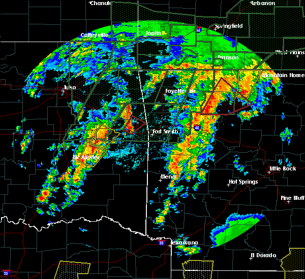 At 427 pm cdt, a severe thunderstorm capable of producing a tornado was located over walnut, or 16 miles southwest of jasper, moving northeast at 50 mph (radar indicated rotation). Hazards include tornado. Flying debris will be dangerous to those caught without shelter. mobile homes will be damaged or destroyed. damage to roofs, windows, and vehicles will occur. tree damage is likely. locations impacted include, harrison, marshall, jasper, western grove, valley springs, dugger, marsena, carver, erbie, duff, point peter, pruitt, red bank, eula, capps, piercetown, walnut, upper buffalo wilderness area, bellefonte, st. Joe,. At 427 pm cdt, a severe thunderstorm capable of producing a tornado was located over walnut, or 16 miles southwest of jasper, moving northeast at 50 mph (radar indicated rotation). Hazards include tornado. Flying debris will be dangerous to those caught without shelter. mobile homes will be damaged or destroyed. damage to roofs, windows, and vehicles will occur. tree damage is likely. locations impacted include, harrison, marshall, jasper, western grove, valley springs, dugger, marsena, carver, erbie, duff, point peter, pruitt, red bank, eula, capps, piercetown, walnut, upper buffalo wilderness area, bellefonte, st. Joe,.
|
| 4/29/2017 4:18 PM CDT |
 At 418 pm cdt, a severe thunderstorm capable of producing a tornado was located over devils knob, or 16 miles north of clarksville, moving northeast at 45 mph (radar indicated rotation). Hazards include tornado and quarter size hail. Flying debris will be dangerous to those caught without shelter. mobile homes will be damaged or destroyed. damage to roofs, windows, and vehicles will occur. Tree damage is likely. At 418 pm cdt, a severe thunderstorm capable of producing a tornado was located over devils knob, or 16 miles north of clarksville, moving northeast at 45 mph (radar indicated rotation). Hazards include tornado and quarter size hail. Flying debris will be dangerous to those caught without shelter. mobile homes will be damaged or destroyed. damage to roofs, windows, and vehicles will occur. Tree damage is likely.
|
| 4/26/2017 1:47 AM CDT |
 At 146 am cdt, severe thunderstorms were located along a line extending from 7 miles northeast of urbanette to rudd to near huntsville, moving east at 50 mph (radar indicated). Hazards include 60 mph wind gusts. expect damage to roofs, siding, and trees At 146 am cdt, severe thunderstorms were located along a line extending from 7 miles northeast of urbanette to rudd to near huntsville, moving east at 50 mph (radar indicated). Hazards include 60 mph wind gusts. expect damage to roofs, siding, and trees
|
| 4/4/2017 10:11 PM CDT |
 At 1010 pm cdt, a severe thunderstorm capable of producing a tornado was located near piercetown, or 11 miles southeast of jasper, moving northeast at 40 mph (radar indicated rotation). Hazards include tornado and quarter size hail. Flying debris will be dangerous to those caught without shelter. mobile homes will be damaged or destroyed. damage to roofs, windows, and vehicles will occur. Tree damage is likely. At 1010 pm cdt, a severe thunderstorm capable of producing a tornado was located near piercetown, or 11 miles southeast of jasper, moving northeast at 40 mph (radar indicated rotation). Hazards include tornado and quarter size hail. Flying debris will be dangerous to those caught without shelter. mobile homes will be damaged or destroyed. damage to roofs, windows, and vehicles will occur. Tree damage is likely.
|
| 3/29/2017 7:43 PM CDT |
 The severe thunderstorm warning for northeastern newton, northwestern searcy, southwestern marion and southeastern boone counties will expire at 745 pm cdt, the storm which prompted the warning has weakened below severe limits, and no longer pose an immediate threat to life or property. therefore, the warning will be allowed to expire. a tornado watch remains in effect until midnight cdt for north central arkansas. The severe thunderstorm warning for northeastern newton, northwestern searcy, southwestern marion and southeastern boone counties will expire at 745 pm cdt, the storm which prompted the warning has weakened below severe limits, and no longer pose an immediate threat to life or property. therefore, the warning will be allowed to expire. a tornado watch remains in effect until midnight cdt for north central arkansas.
|
| 3/29/2017 7:33 PM CDT |
 At 733 pm cdt, a severe thunderstorm was located over olvey, or 10 miles southeast of harrison, moving northeast at 50 mph (radar indicated). Hazards include 60 mph wind gusts and nickel size hail. Expect damage to roofs, siding, and trees. Locations impacted include, harrison, western grove, valley springs, dugger, olvey, piercetown, carver, pruitt, crawford, bellefonte, everton, pindall, marble falls, yardelle, gaither, eros, bruno, hasty, a tornado watch remains in effect until midnight cdt for north central arkansas. At 733 pm cdt, a severe thunderstorm was located over olvey, or 10 miles southeast of harrison, moving northeast at 50 mph (radar indicated). Hazards include 60 mph wind gusts and nickel size hail. Expect damage to roofs, siding, and trees. Locations impacted include, harrison, western grove, valley springs, dugger, olvey, piercetown, carver, pruitt, crawford, bellefonte, everton, pindall, marble falls, yardelle, gaither, eros, bruno, hasty, a tornado watch remains in effect until midnight cdt for north central arkansas.
|
| 3/29/2017 7:14 PM CDT |
 At 713 pm cdt, a severe thunderstorm was located near piercetown, or near jasper, moving northeast at 50 mph (radar indicated). Hazards include 60 mph wind gusts and nickel size hail. Expect damage to roofs, siding, and trees. Locations impacted include, harrison, jasper, western grove, valley springs, dugger, olvey, carver, erbie, piercetown, pruitt, crawford, bellefonte, everton, pindall, marble falls, yardelle, crossroad, gum springs in newton county, gaither, eros, a tornado watch remains in effect until midnight cdt for north central arkansas. At 713 pm cdt, a severe thunderstorm was located near piercetown, or near jasper, moving northeast at 50 mph (radar indicated). Hazards include 60 mph wind gusts and nickel size hail. Expect damage to roofs, siding, and trees. Locations impacted include, harrison, jasper, western grove, valley springs, dugger, olvey, carver, erbie, piercetown, pruitt, crawford, bellefonte, everton, pindall, marble falls, yardelle, crossroad, gum springs in newton county, gaither, eros, a tornado watch remains in effect until midnight cdt for north central arkansas.
|
| 3/29/2017 6:57 PM CDT |
 At 656 pm cdt, a severe thunderstorm was located near walnut, or 15 miles south of jasper, moving northeast at 50 mph (radar indicated). Hazards include 60 mph wind gusts and nickel size hail. expect damage to roofs, siding, and trees At 656 pm cdt, a severe thunderstorm was located near walnut, or 15 miles south of jasper, moving northeast at 50 mph (radar indicated). Hazards include 60 mph wind gusts and nickel size hail. expect damage to roofs, siding, and trees
|
| 3/7/2017 1:02 AM CST |
 At 101 am cst, severe thunderstorms were located along a line extending from 7 miles northwest of gamaliel landing to near maumee, moving east at 60 mph (radar indicated). Hazards include 60 mph wind gusts and penny size hail. Expect damage to roofs, siding, and trees. Locations impacted include, harrison, mountain home, bull shoals, salem in fulton county, yellville, gassville, flippin, lakeview in baxter county, norfork, salesville, bergman, western grove, viola, briarcliff, pyatt, valley springs, arkawana, bexar, dugger, olvey, a tornado watch remains in effect until 500 am cst for north central arkansas. At 101 am cst, severe thunderstorms were located along a line extending from 7 miles northwest of gamaliel landing to near maumee, moving east at 60 mph (radar indicated). Hazards include 60 mph wind gusts and penny size hail. Expect damage to roofs, siding, and trees. Locations impacted include, harrison, mountain home, bull shoals, salem in fulton county, yellville, gassville, flippin, lakeview in baxter county, norfork, salesville, bergman, western grove, viola, briarcliff, pyatt, valley springs, arkawana, bexar, dugger, olvey, a tornado watch remains in effect until 500 am cst for north central arkansas.
|
| 3/7/2017 12:36 AM CST |
 At 1236 am cst, severe thunderstorms were located along a line extending from 7 miles northwest of ozark isle to near pruitt, moving east at 60 mph (radar indicated). Hazards include 60 mph wind gusts and penny size hail. expect damage to roofs, siding, and trees At 1236 am cst, severe thunderstorms were located along a line extending from 7 miles northwest of ozark isle to near pruitt, moving east at 60 mph (radar indicated). Hazards include 60 mph wind gusts and penny size hail. expect damage to roofs, siding, and trees
|
| 3/7/2017 12:18 AM CST |
 At 1217 am cst, severe thunderstorms were located along a line extending from 9 miles north of diamond city to near omaha to near carrollton to near marble, moving east at 30 mph (radar indicated). Hazards include 60 mph wind gusts and nickel size hail. Expect damage to roofs, siding, and trees. Locations impacted include, harrison, bull shoals, yellville, jasper, flippin, lakeview in baxter county, diamond city, bergman, western grove, lead hill, pyatt, valley springs, omaha, arkawana, dugger, olvey, roberson hollow, carver, erbie, lakeway, a tornado watch remains in effect until 500 am cst for north central arkansas. At 1217 am cst, severe thunderstorms were located along a line extending from 9 miles north of diamond city to near omaha to near carrollton to near marble, moving east at 30 mph (radar indicated). Hazards include 60 mph wind gusts and nickel size hail. Expect damage to roofs, siding, and trees. Locations impacted include, harrison, bull shoals, yellville, jasper, flippin, lakeview in baxter county, diamond city, bergman, western grove, lead hill, pyatt, valley springs, omaha, arkawana, dugger, olvey, roberson hollow, carver, erbie, lakeway, a tornado watch remains in effect until 500 am cst for north central arkansas.
|
| 3/7/2017 12:16 AM CST |
 At 1216 am cst, a severe thunderstorm capable of producing a tornado was located near western grove, or 16 miles east of jasper, moving east at 40 mph (radar indicated rotation). Hazards include tornado and golf ball size hail. Flying debris will be dangerous to those caught without shelter. mobile homes will be damaged or destroyed. damage to roofs, windows, and vehicles will occur. tree damage is likely. locations impacted include, marshall, yellville, western grove, valley springs, dugger, duff, point peter, everton, st. Joe, pindall, gilbert, zach, yardelle, silver hill, bruno, woolum recreation area, baker ford, eros, ralph,. At 1216 am cst, a severe thunderstorm capable of producing a tornado was located near western grove, or 16 miles east of jasper, moving east at 40 mph (radar indicated rotation). Hazards include tornado and golf ball size hail. Flying debris will be dangerous to those caught without shelter. mobile homes will be damaged or destroyed. damage to roofs, windows, and vehicles will occur. tree damage is likely. locations impacted include, marshall, yellville, western grove, valley springs, dugger, duff, point peter, everton, st. Joe, pindall, gilbert, zach, yardelle, silver hill, bruno, woolum recreation area, baker ford, eros, ralph,.
|
| 3/7/2017 12:09 AM CST |
 At 1208 am cst, a severe thunderstorm capable of producing a tornado was located over carver, or 10 miles east of jasper, moving east at 40 mph (radar indicated rotation). Hazards include tornado and golf ball size hail. Flying debris will be dangerous to those caught without shelter. mobile homes will be damaged or destroyed. damage to roofs, windows, and vehicles will occur. tree damage is likely. locations impacted include, marshall, yellville, western grove, valley springs, dugger, carver, duff, point peter, piercetown, pruitt, crawford, everton, st. Joe, pindall, gilbert, zach, marble falls, yardelle, silver hill, eros,. At 1208 am cst, a severe thunderstorm capable of producing a tornado was located over carver, or 10 miles east of jasper, moving east at 40 mph (radar indicated rotation). Hazards include tornado and golf ball size hail. Flying debris will be dangerous to those caught without shelter. mobile homes will be damaged or destroyed. damage to roofs, windows, and vehicles will occur. tree damage is likely. locations impacted include, marshall, yellville, western grove, valley springs, dugger, carver, duff, point peter, piercetown, pruitt, crawford, everton, st. Joe, pindall, gilbert, zach, marble falls, yardelle, silver hill, eros,.
|
| 3/7/2017 12:02 AM CST |
 At 1201 am cst, a severe thunderstorm capable of producing a tornado was located over piercetown, or near jasper, moving east at 40 mph (radar indicated rotation). Hazards include tornado and golf ball size hail. Flying debris will be dangerous to those caught without shelter. mobile homes will be damaged or destroyed. damage to roofs, windows, and vehicles will occur. tree damage is likely. locations impacted include, marshall, yellville, jasper, western grove, valley springs, dugger, carver, erbie, duff, point peter, piercetown, pruitt, crawford, everton, st. Joe, pindall, gilbert, zach, marble falls, yardelle,. At 1201 am cst, a severe thunderstorm capable of producing a tornado was located over piercetown, or near jasper, moving east at 40 mph (radar indicated rotation). Hazards include tornado and golf ball size hail. Flying debris will be dangerous to those caught without shelter. mobile homes will be damaged or destroyed. damage to roofs, windows, and vehicles will occur. tree damage is likely. locations impacted include, marshall, yellville, jasper, western grove, valley springs, dugger, carver, erbie, duff, point peter, piercetown, pruitt, crawford, everton, st. Joe, pindall, gilbert, zach, marble falls, yardelle,.
|
| 3/6/2017 11:55 PM CST |
 At 1154 pm cst, severe thunderstorms were located along a line extending from near forsyth to near urbanette to near berryville to hindsville, moving east at 55 mph (radar indicated). Hazards include 60 mph wind gusts and nickel size hail. expect damage to roofs, siding, and trees At 1154 pm cst, severe thunderstorms were located along a line extending from near forsyth to near urbanette to near berryville to hindsville, moving east at 55 mph (radar indicated). Hazards include 60 mph wind gusts and nickel size hail. expect damage to roofs, siding, and trees
|
| 3/6/2017 11:51 PM CST |
 At 1150 pm cst, a severe thunderstorm capable of producing a tornado was located near jasper, moving east at 40 mph (radar indicated rotation). Hazards include tornado and golf ball size hail. Flying debris will be dangerous to those caught without shelter. mobile homes will be damaged or destroyed. damage to roofs, windows, and vehicles will occur. Tree damage is likely. At 1150 pm cst, a severe thunderstorm capable of producing a tornado was located near jasper, moving east at 40 mph (radar indicated rotation). Hazards include tornado and golf ball size hail. Flying debris will be dangerous to those caught without shelter. mobile homes will be damaged or destroyed. damage to roofs, windows, and vehicles will occur. Tree damage is likely.
|
| 2/6/2017 11:47 PM CST |
 At 1145 pm cst, a severe thunderstorm was located over jasper, moving northeast at 45 mph (radar indicated). Hazards include quarter size hail. damage to vehicles is expected At 1145 pm cst, a severe thunderstorm was located over jasper, moving northeast at 45 mph (radar indicated). Hazards include quarter size hail. damage to vehicles is expected
|
| 8/5/2016 8:10 PM CDT |
 At 809 pm cdt, a severe thunderstorm was centered just east of harrison, moving east at 10 mph (radar indicated). Hazards include 60 mph wind gusts and quarter size hail. Hail damage to vehicles is expected. expect wind damage to roofs, siding, and trees. Locations impacted include, harrison, bergman, pyatt, valley springs, dugger, winington, clark hill, crawford, myrtle, olvey, bellefonte, everton, zinc, hopewell in boone county, eros,. At 809 pm cdt, a severe thunderstorm was centered just east of harrison, moving east at 10 mph (radar indicated). Hazards include 60 mph wind gusts and quarter size hail. Hail damage to vehicles is expected. expect wind damage to roofs, siding, and trees. Locations impacted include, harrison, bergman, pyatt, valley springs, dugger, winington, clark hill, crawford, myrtle, olvey, bellefonte, everton, zinc, hopewell in boone county, eros,.
|
| 8/5/2016 7:46 PM CDT |
 At 746 pm cdt, a severe thunderstorm was located over harrison, moving east at 10 mph (radar indicated). Hazards include 60 mph wind gusts and quarter size hail. Hail damage to vehicles is expected. Expect wind damage to roofs, siding, and trees. At 746 pm cdt, a severe thunderstorm was located over harrison, moving east at 10 mph (radar indicated). Hazards include 60 mph wind gusts and quarter size hail. Hail damage to vehicles is expected. Expect wind damage to roofs, siding, and trees.
|
| 6/29/2016 5:49 PM CDT |
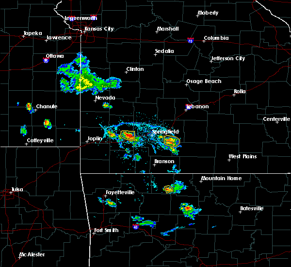 At 549 pm cdt, a severe thunderstorm was located near olvey, or 9 miles east of harrison, moving southeast at 10 mph (radar indicated). Hazards include 60 mph wind gusts and quarter size hail. Hail damage to vehicles is expected. expect wind damage to roofs, siding, and trees. Locations impacted include, valley springs, olvey,. At 549 pm cdt, a severe thunderstorm was located near olvey, or 9 miles east of harrison, moving southeast at 10 mph (radar indicated). Hazards include 60 mph wind gusts and quarter size hail. Hail damage to vehicles is expected. expect wind damage to roofs, siding, and trees. Locations impacted include, valley springs, olvey,.
|
| 6/29/2016 5:42 PM CDT |
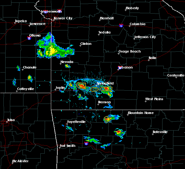 At 542 pm cdt, a severe thunderstorm was located near olvey, or 8 miles east of harrison, moving southeast at 10 mph (radar indicated). Hazards include 60 mph wind gusts and quarter size hail. Hail damage to vehicles is expected. expect wind damage to roofs, siding, and trees. Locations impacted include, valley springs, crawford, olvey,. At 542 pm cdt, a severe thunderstorm was located near olvey, or 8 miles east of harrison, moving southeast at 10 mph (radar indicated). Hazards include 60 mph wind gusts and quarter size hail. Hail damage to vehicles is expected. expect wind damage to roofs, siding, and trees. Locations impacted include, valley springs, crawford, olvey,.
|
| 6/29/2016 5:31 PM CDT |
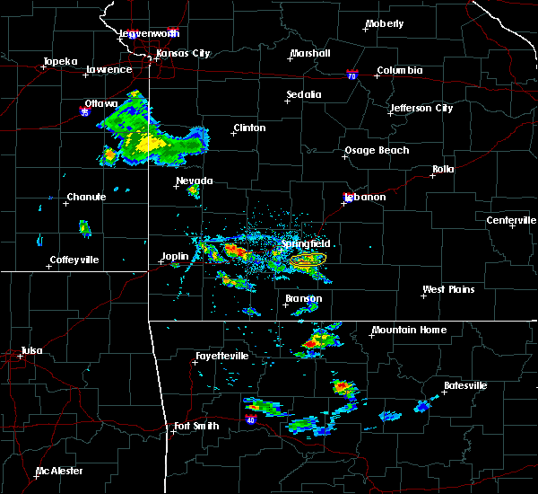 At 530 pm cdt, a severe thunderstorm was located over bergman, or near harrison, moving southeast at 10 mph (radar indicated). Hazards include 60 mph wind gusts and quarter size hail. Hail damage to vehicles is expected. Expect wind damage to roofs, siding, and trees. At 530 pm cdt, a severe thunderstorm was located over bergman, or near harrison, moving southeast at 10 mph (radar indicated). Hazards include 60 mph wind gusts and quarter size hail. Hail damage to vehicles is expected. Expect wind damage to roofs, siding, and trees.
|
| 5/24/2016 9:19 AM CDT | A severe thunderstorm warning remains in effect until 330 pm cdt for west central marion. north central newton and southeastern boone counties. at 319 pm cdt. a severe thunderstorm was located over harrison. moving northeast at 35 mph. hazard. 60 mph wind gusts and penny size hail. |
| 7/9/2015 8:24 PM CDT |
 At 822 pm cdt, severe thunderstorms were located along a line extending from near diamond city to lead hill to winington to olvey, moving east at 30 mph (radar indicated). Hazards include 60 mph wind gusts and quarter size hail. Hail damage to vehicles is expected. expect wind damage to roofs, siding and trees. Locations impacted include, bull shoals, yellville, flippin, diamond city, lead hill, pyatt, valley springs, dugger, winington, crawford, dodd city, ozark isle, olvey, clark hill, lakeway, summit, everton, zinc, south lead hill and fairview in marion county. At 822 pm cdt, severe thunderstorms were located along a line extending from near diamond city to lead hill to winington to olvey, moving east at 30 mph (radar indicated). Hazards include 60 mph wind gusts and quarter size hail. Hail damage to vehicles is expected. expect wind damage to roofs, siding and trees. Locations impacted include, bull shoals, yellville, flippin, diamond city, lead hill, pyatt, valley springs, dugger, winington, crawford, dodd city, ozark isle, olvey, clark hill, lakeway, summit, everton, zinc, south lead hill and fairview in marion county.
|
| 7/9/2015 8:14 PM CDT |
 At 814 pm cdt, severe thunderstorms were located along a line extending from near diamond city to lead hill to willis to near olvey to near valley springs, moving east at 30 mph (radar indicated). Hazards include 60 mph wind gusts and quarter size hail. Hail damage to vehicles is expected. Expect wind damage to roofs, siding and trees. At 814 pm cdt, severe thunderstorms were located along a line extending from near diamond city to lead hill to willis to near olvey to near valley springs, moving east at 30 mph (radar indicated). Hazards include 60 mph wind gusts and quarter size hail. Hail damage to vehicles is expected. Expect wind damage to roofs, siding and trees.
|
| 7/9/2015 7:37 PM CDT |
 At 736 pm cdt, a severe thunderstorm was located over carrollton, or 13 miles west of harrison, moving east at 30 mph (radar indicated). Hazards include 60 mph wind gusts and quarter size hail. Hail damage to vehicles is expected. Expect wind damage to roofs, siding and trees. At 736 pm cdt, a severe thunderstorm was located over carrollton, or 13 miles west of harrison, moving east at 30 mph (radar indicated). Hazards include 60 mph wind gusts and quarter size hail. Hail damage to vehicles is expected. Expect wind damage to roofs, siding and trees.
|
| 7/8/2015 3:23 PM CDT |
 At 322 pm cdt, doppler radar indicated a line of severe thunderstorms capable of producing damaging winds in excess of 60 mph. these storms were located along a line extending from near jasper to clarksville, and moving east at 45 mph. At 322 pm cdt, doppler radar indicated a line of severe thunderstorms capable of producing damaging winds in excess of 60 mph. these storms were located along a line extending from near jasper to clarksville, and moving east at 45 mph.
|
| 6/26/2015 12:57 PM CDT |
 At 1255 pm cdt, a severe thunderstorm was located near red bank, and moving east at 25 mph (radar indicated). Hazards include 60 mph wind gusts and quarter size hail. Hail damage to vehicles is expected. Expect wind damage to roofs, siding and trees. At 1255 pm cdt, a severe thunderstorm was located near red bank, and moving east at 25 mph (radar indicated). Hazards include 60 mph wind gusts and quarter size hail. Hail damage to vehicles is expected. Expect wind damage to roofs, siding and trees.
|
| 6/26/2015 12:42 PM CDT |
 At 1239 pm cdt, a severe thunderstorm was located 5 miles west of red bank, and moving east at 25 mph (radar indicated). Hazards include 60 mph wind gusts and quarter size hail. Hail damage to vehicles is expected. Expect wind damage to roofs, siding and trees. At 1239 pm cdt, a severe thunderstorm was located 5 miles west of red bank, and moving east at 25 mph (radar indicated). Hazards include 60 mph wind gusts and quarter size hail. Hail damage to vehicles is expected. Expect wind damage to roofs, siding and trees.
|
| 5/27/2015 5:03 PM CDT | At 502 pm cdt, a severe thunderstorm was located near valley springs, and moving northeast at 10 mph (radar indicated). Hazards include 60 mph wind gusts and quarter size hail. Hail damage to vehicles is expected. Expect wind damage to roofs, siding and trees. |
| 5/27/2015 4:44 PM CDT | At 443 pm cdt, a severe thunderstorm was located near valley springs, and moving northeast at 20 mph (radar indicated). Hazards include 60 mph wind gusts and quarter size hail. Hail damage to vehicles is expected. Expect wind damage to roofs, siding and trees. |
| 5/25/2015 8:31 PM CDT | At 828 pm cdt, severe thunderstorms were located along a line extending from 5 miles north of moore to dabney, and moving northeast at 45 mph (radar indicated). Hazards include 60 mph wind gusts and nickel size hail. Expect damage to roofs. Siding and trees. |
| 5/25/2015 8:06 PM CDT | At 804 pm cdt, severe thunderstorms were located along a line extending from mineral spgs rec area to hector, and moving northeast at 45 mph (radar indicated). Hazards include 60 mph wind gusts and quarter size hail. Hail damage to vehicles is expected. Expect wind damage to roofs, siding and trees. |
| 5/10/2015 12:50 PM CDT | At 1248 pm cdt, severe thunderstorms were located along a line extending from omaha to harrison to 7 miles south of jasper, and moving northeast at 50 mph (radar indicated). Hazards include 60 mph wind gusts. Expect damage to roofs. Siding and trees. |
| 5/10/2015 12:30 PM CDT | At 1228 pm cdt, severe thunderstorms were located along a line extending from 8 miles northwest of oak grove to 7 miles west of red bank to walnut, and moving northeast at 50 mph (radar indicated). Hazards include 60 mph wind gusts and penny size hail. Expect damage to roofs. Siding and trees. |
| 4/9/2015 5:45 PM CDT | The national weather service in little rock has issued a * severe thunderstorm warning for. southeastern boone county in north central arkansas. southwestern marion county in north central arkansas. northeastern newton county in north central arkansas. Northwestern searcy county in north central arkansas. |
| 3/24/2015 7:56 PM CDT | The national weather service in little rock has issued a * severe thunderstorm warning for. central boone county in north central arkansas. central marion county in north central arkansas. until 830 pm cdt * at 753 pm cdt. National weather service doppler radar indicated a. |
| 3/24/2015 7:56 PM CDT | The severe thunderstorm warning for southeastern boone. northwestern searcy. northeastern newton and southwestern marion counties will expire at 800 pm cdt. the storm which prompted the warning has weakened and moved out of the warned area. additional strong thunderstorms are still possible. And a severe. |
| 3/24/2015 6:35 PM CST | Quarter sized hail reported 1 miles NNW of Valley Springs, AR |
| 3/24/2015 7:34 PM CDT | The national weather service in little rock has issued a * severe thunderstorm warning for. southeastern boone county in north central arkansas. southwestern marion county in north central arkansas. northeastern newton county in north central arkansas. Northwestern searcy county in north central arkansas. |
| 3/24/2015 7:00 PM CDT | The national weather service in little rock has issued a * severe thunderstorm warning for. southern boone county in north central arkansas. southwestern marion county in north central arkansas. northeastern newton county in north central arkansas. Northwestern searcy county in north central arkansas. |
| 8/8/2013 5:10 PM CDT | Trees and power lines blown down along u.s. highway 6 in boone county AR, 0.3 miles NNE of Valley Springs, AR |
Hail Maps for Valley Springs, AR
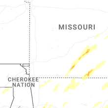
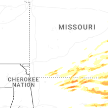


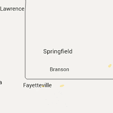


Connect with Interactive Hail Maps