

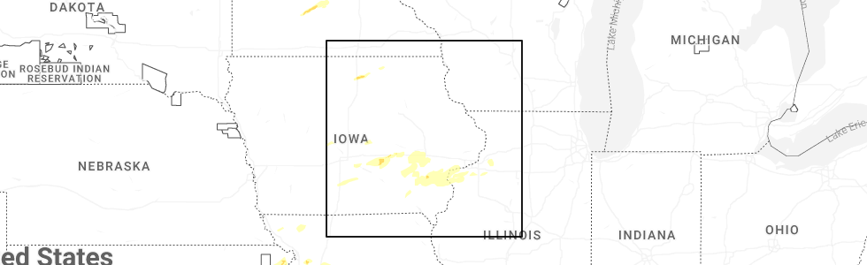
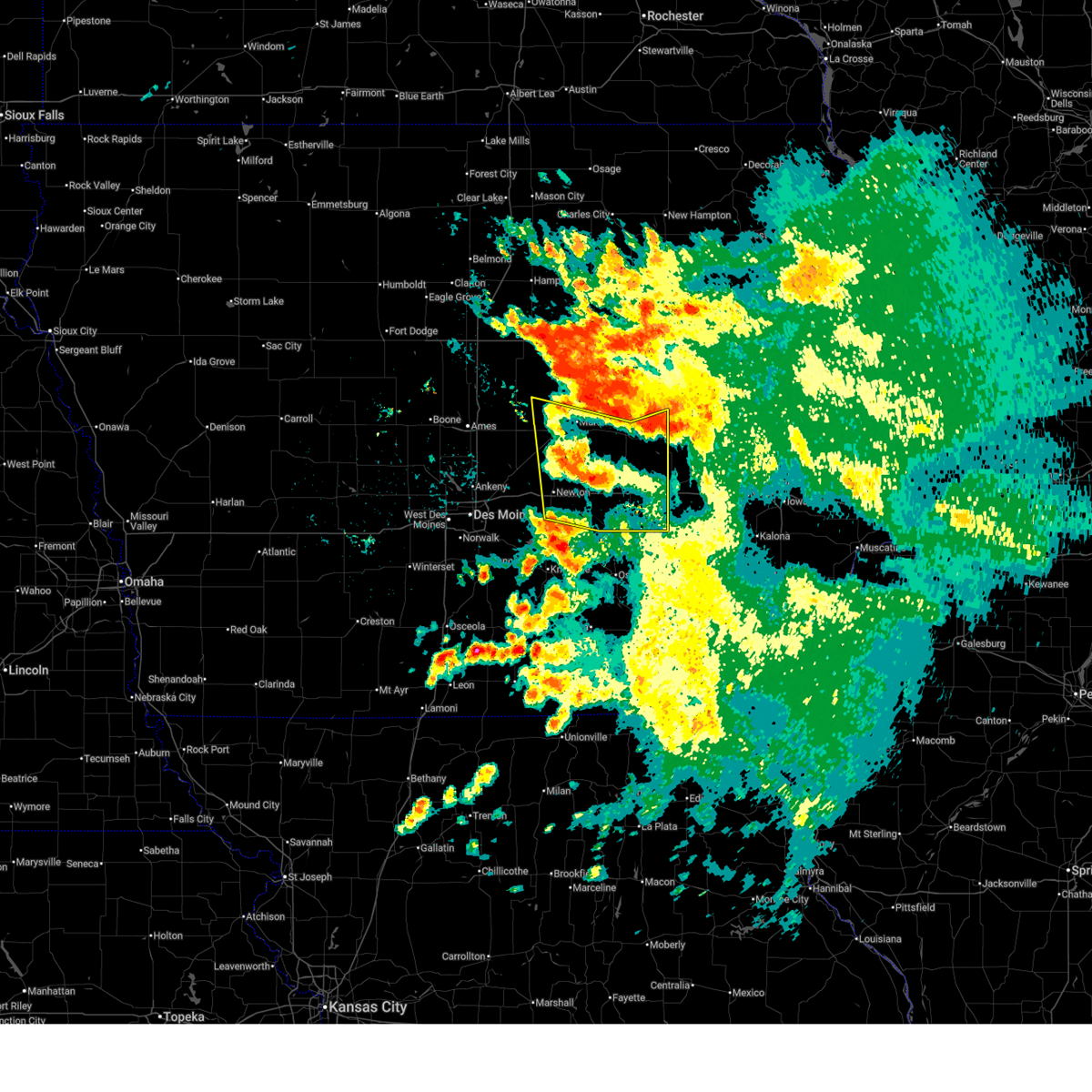
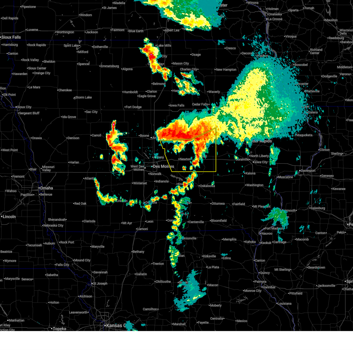
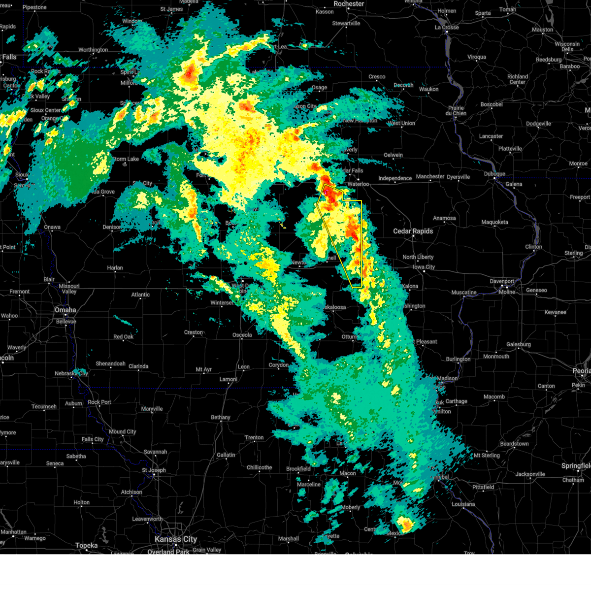
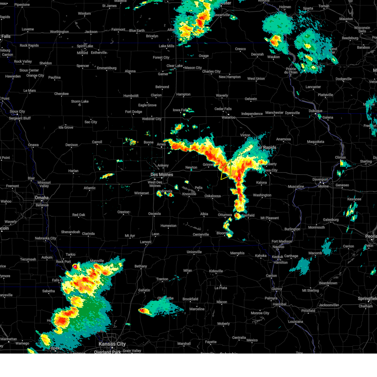
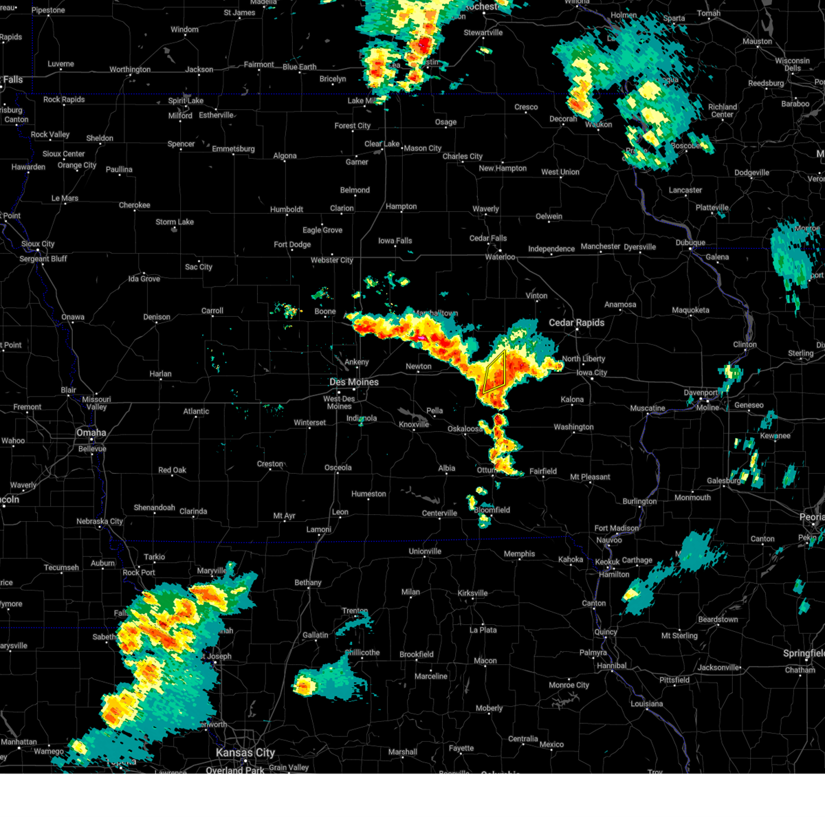
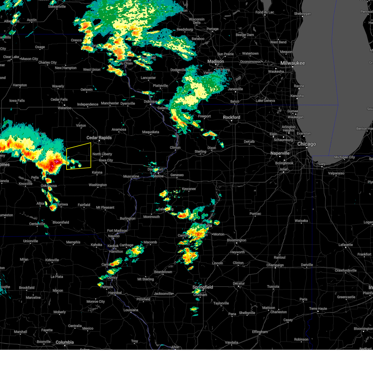
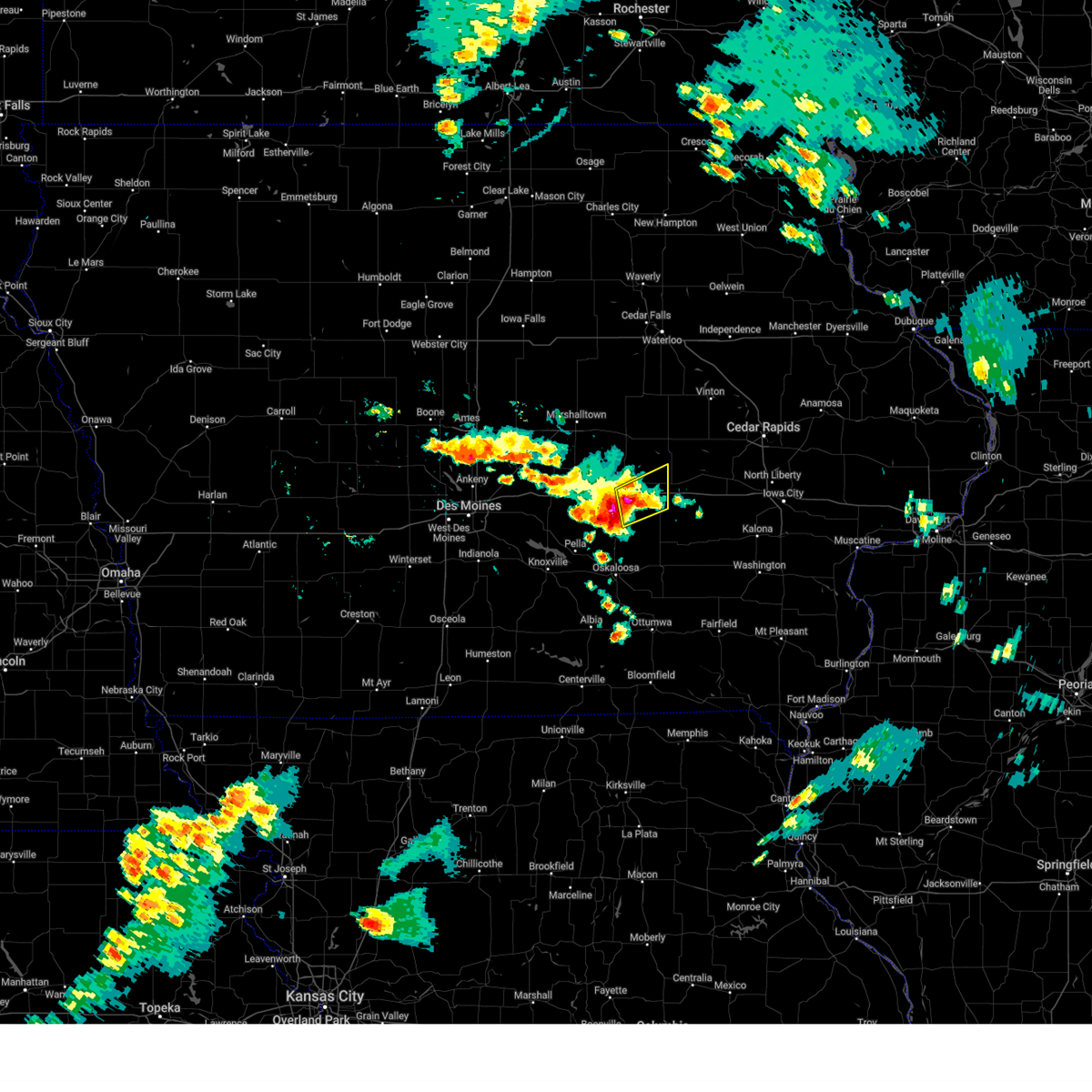
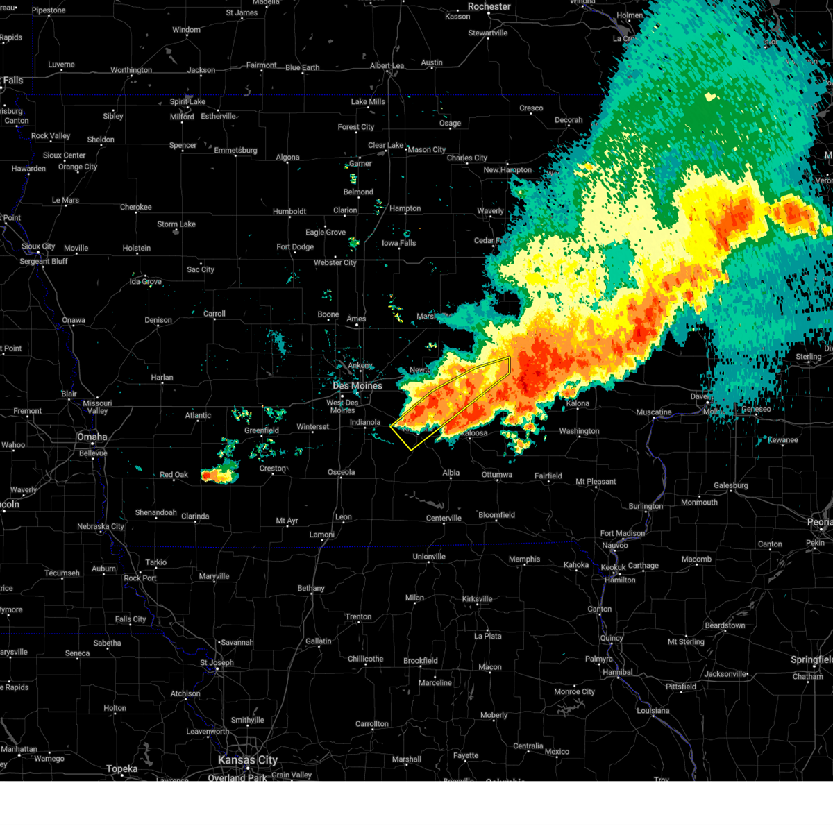
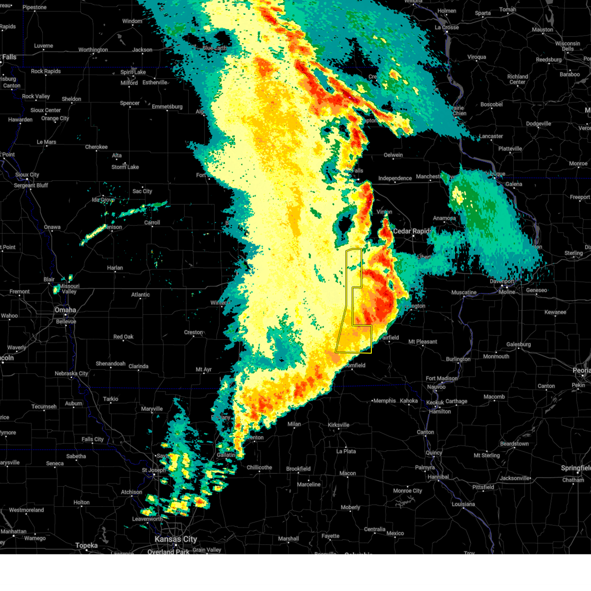
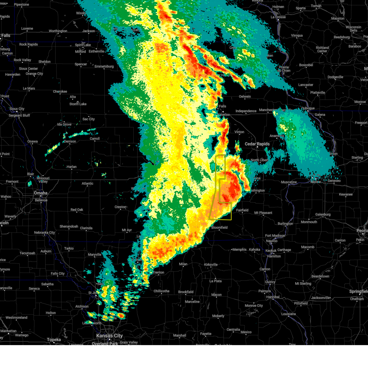
Hail Map for Victor, IA
The Victor, IA area has had 3 reports of on-the-ground hail by trained spotters, and has been under severe weather warnings 39 times during the past 12 months. Doppler radar has detected hail at or near Victor, IA on 55 occasions, including 2 occasions during the past year.
| Name: | Victor, IA |
| Where Located: | 36.3 miles WSW of Cedar Rapids, IA |
| Map: | Google Map for Victor, IA |
| Population: | 893 |
| Housing Units: | 430 |
| More Info: | Search Google for Victor, IA |
2
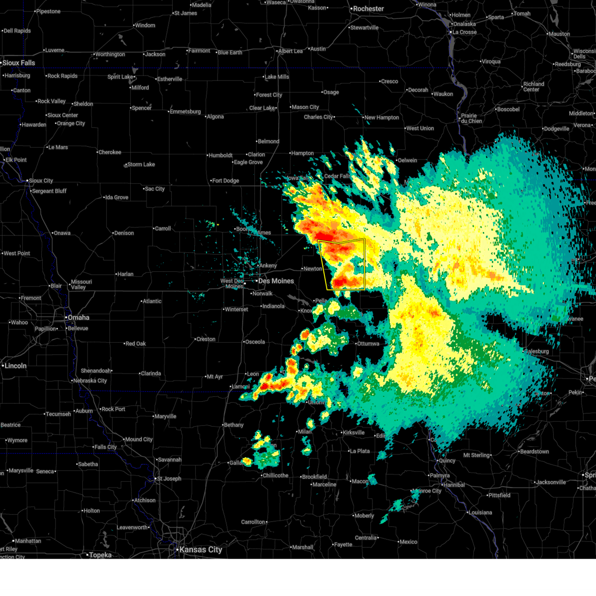
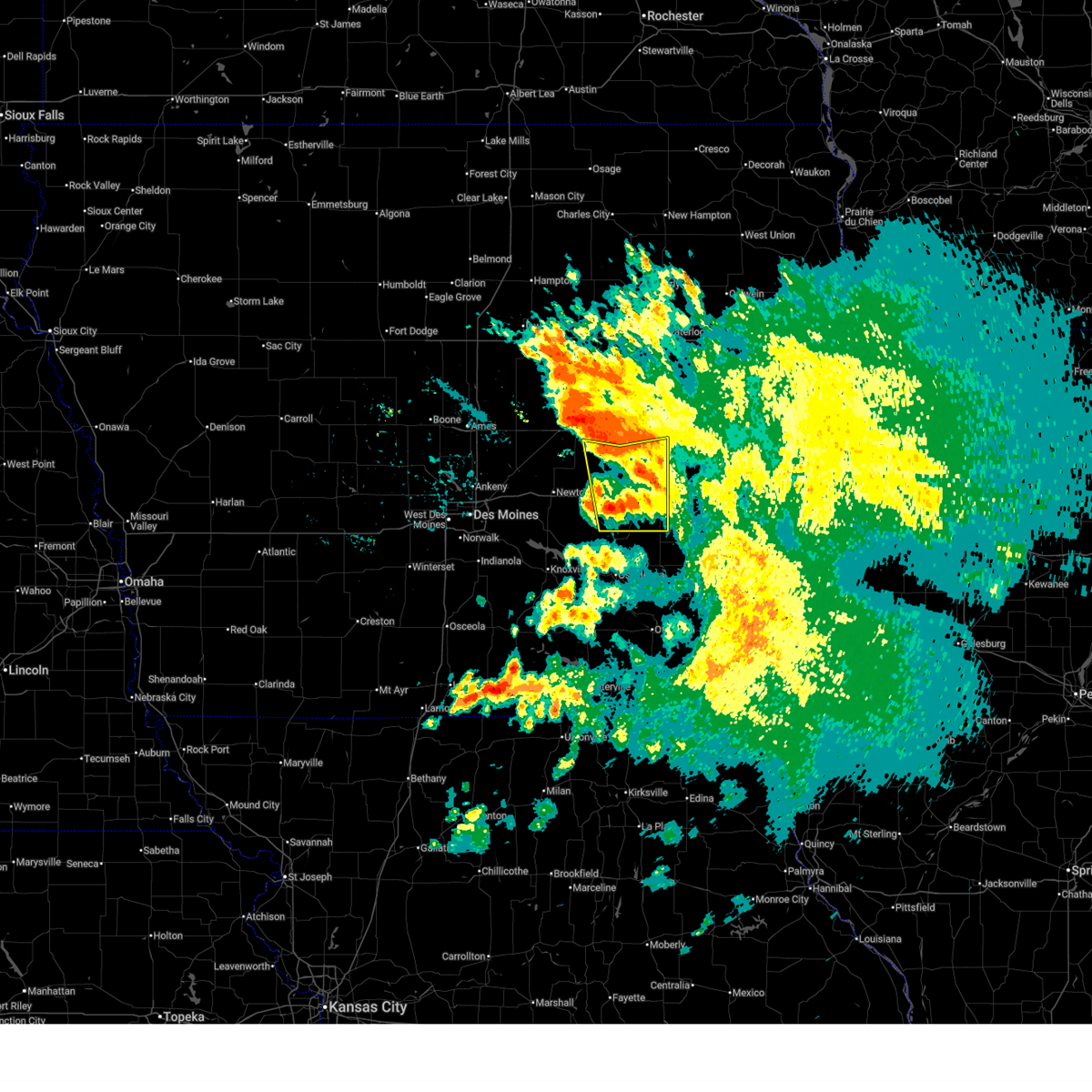
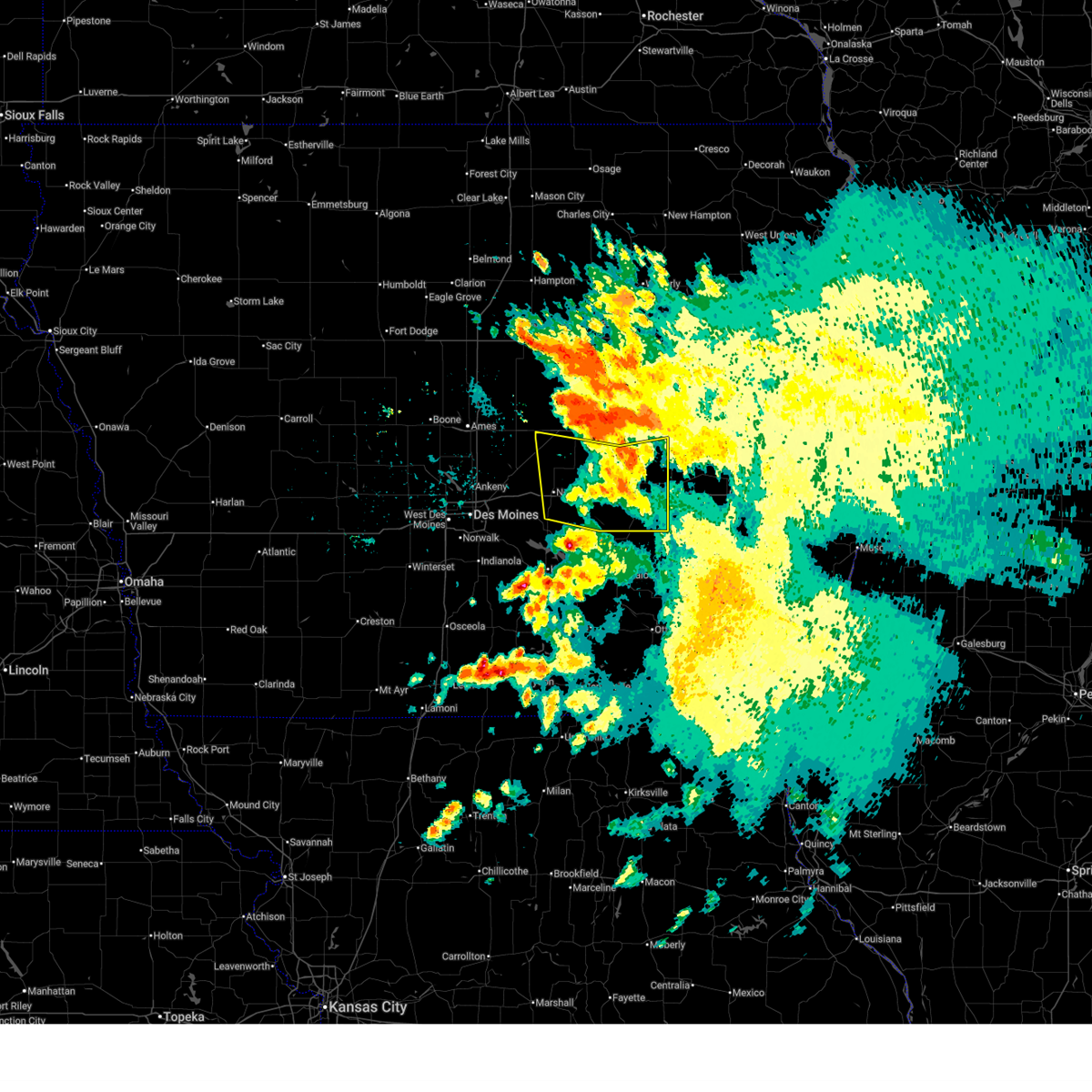
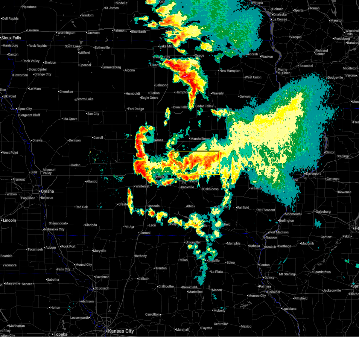
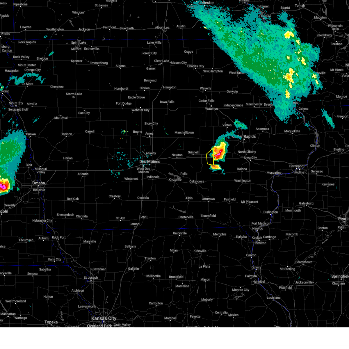
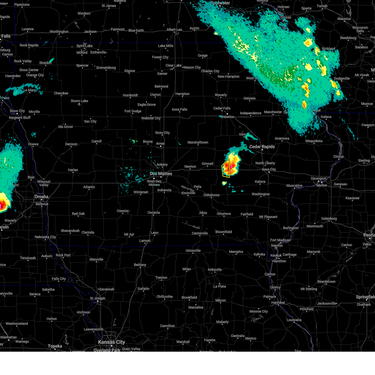
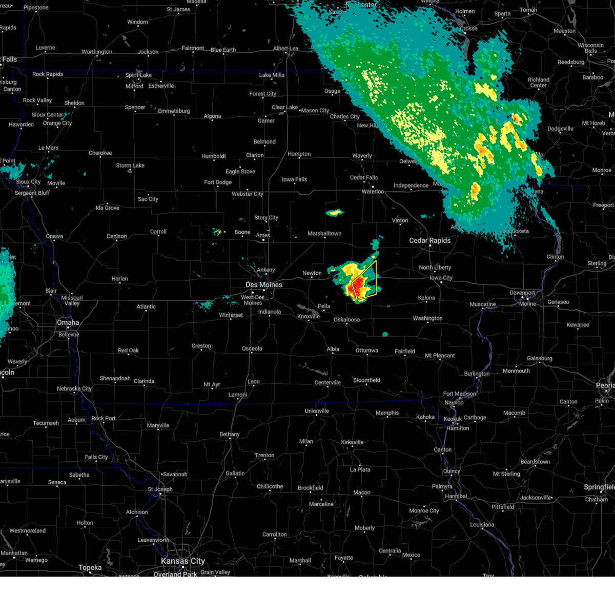
The Top Recent Hail Date for Victor, IA is Thursday, October 24, 2024 (13th out of 55)
Hail and Wind Damage Spotted near Victor, IA
| Date / Time | Report Details |
|---|---|
| 6/20/2025 9:51 AM CDT |
 The storms which prompted the warning have weakened below severe limits, and no longer pose an immediate threat to life or property. therefore, the warning will be allowed to expire. however, gusty winds are still possible with these thunderstorms. The storms which prompted the warning have weakened below severe limits, and no longer pose an immediate threat to life or property. therefore, the warning will be allowed to expire. however, gusty winds are still possible with these thunderstorms.
|
| 6/20/2025 9:40 AM CDT |
 At 940 am cdt, severe thunderstorms were located along a line extending from near koszta to brooklyn to 6 miles east of baxter, moving south at 30 mph (radar indicated). Hazards include 60 mph wind gusts. Expect damage to roofs, siding, and trees. locations impacted include, grinnell, montezuma, brooklyn, victor, gilman, holiday lake, malcom, deep river, chelsea, barnes city, searsboro, ferguson, hartwick, guernsey, and grinnell regional airport. This includes interstate 80 between mile markers 179 and 204. At 940 am cdt, severe thunderstorms were located along a line extending from near koszta to brooklyn to 6 miles east of baxter, moving south at 30 mph (radar indicated). Hazards include 60 mph wind gusts. Expect damage to roofs, siding, and trees. locations impacted include, grinnell, montezuma, brooklyn, victor, gilman, holiday lake, malcom, deep river, chelsea, barnes city, searsboro, ferguson, hartwick, guernsey, and grinnell regional airport. This includes interstate 80 between mile markers 179 and 204.
|
| 6/20/2025 9:22 AM CDT |
 At 922 am cdt, severe thunderstorms were located along a line extending from koszta to near brooklyn to 5 miles east of baxter, moving southeast at 40 mph (radar indicated). Hazards include 60 mph wind gusts. Expect damage to roofs, siding, and trees. locations impacted include, newton, grinnell, montezuma, brooklyn, baxter, iowa speedway, rock creek lake, victor, melbourne, sully, kellogg, gilman, holiday lake, lynnville, malcom, deep river, chelsea, laurel, barnes city, and haverhill. This includes interstate 80 between mile markers 162 and 204. At 922 am cdt, severe thunderstorms were located along a line extending from koszta to near brooklyn to 5 miles east of baxter, moving southeast at 40 mph (radar indicated). Hazards include 60 mph wind gusts. Expect damage to roofs, siding, and trees. locations impacted include, newton, grinnell, montezuma, brooklyn, baxter, iowa speedway, rock creek lake, victor, melbourne, sully, kellogg, gilman, holiday lake, lynnville, malcom, deep river, chelsea, laurel, barnes city, and haverhill. This includes interstate 80 between mile markers 162 and 204.
|
| 6/20/2025 8:58 AM CDT |
 Svrdmx the national weather service in des moines has issued a * severe thunderstorm warning for, poweshiek county in central iowa, marshall county in central iowa, southern tama county in central iowa, eastern jasper county in central iowa, * until 1000 am cdt. * at 857 am cdt, severe thunderstorms were located along a line extending from near elberon to toledo municipal airport to near state center, moving south at 35 mph (radar indicated). Hazards include 60 mph wind gusts. at 851 am, marshalltown airport reported a wind gust to 58 mph. expect damage to roofs, siding, and trees Svrdmx the national weather service in des moines has issued a * severe thunderstorm warning for, poweshiek county in central iowa, marshall county in central iowa, southern tama county in central iowa, eastern jasper county in central iowa, * until 1000 am cdt. * at 857 am cdt, severe thunderstorms were located along a line extending from near elberon to toledo municipal airport to near state center, moving south at 35 mph (radar indicated). Hazards include 60 mph wind gusts. at 851 am, marshalltown airport reported a wind gust to 58 mph. expect damage to roofs, siding, and trees
|
| 6/20/2025 6:51 AM CDT |
 The storms which prompted the warning have weakened below severe limits, and no longer pose an immediate threat to life or property. therefore, the warning will be allowed to expire. however, gusty winds are still possible with these thunderstorms. The storms which prompted the warning have weakened below severe limits, and no longer pose an immediate threat to life or property. therefore, the warning will be allowed to expire. however, gusty winds are still possible with these thunderstorms.
|
| 6/20/2025 6:42 AM CDT |
 the severe thunderstorm warning has been cancelled and is no longer in effect the severe thunderstorm warning has been cancelled and is no longer in effect
|
| 6/20/2025 6:42 AM CDT |
 At 641 am cdt, severe thunderstorms were located along a line extending from near koszta to near malcom to near lambs grove, moving southeast at 35 mph (radar indicated). Hazards include 60 mph wind gusts and penny size hail. Expect damage to roofs, siding, and trees. locations impacted include, newton, grinnell, montezuma, brooklyn, baxter, rock creek lake, iowa speedway, victor, sully, kellogg, holiday lake, lynnville, malcom, deep river, barnes city, lambs grove, oakland acres, reasnor, searsboro, and hartwick. This includes interstate 80 between mile markers 161 and 204. At 641 am cdt, severe thunderstorms were located along a line extending from near koszta to near malcom to near lambs grove, moving southeast at 35 mph (radar indicated). Hazards include 60 mph wind gusts and penny size hail. Expect damage to roofs, siding, and trees. locations impacted include, newton, grinnell, montezuma, brooklyn, baxter, rock creek lake, iowa speedway, victor, sully, kellogg, holiday lake, lynnville, malcom, deep river, barnes city, lambs grove, oakland acres, reasnor, searsboro, and hartwick. This includes interstate 80 between mile markers 161 and 204.
|
| 6/20/2025 6:03 AM CDT |
 Svrdmx the national weather service in des moines has issued a * severe thunderstorm warning for, poweshiek county in central iowa, southeastern story county in central iowa, southern marshall county in central iowa, southern tama county in central iowa, jasper county in central iowa, * until 700 am cdt. * at 602 am cdt, severe thunderstorms were located along a line extending from near clutier to near montour to near maxwell, moving southeast at 35 mph (radar indicated). Hazards include 60 mph wind gusts and penny size hail. expect damage to roofs, siding, and trees Svrdmx the national weather service in des moines has issued a * severe thunderstorm warning for, poweshiek county in central iowa, southeastern story county in central iowa, southern marshall county in central iowa, southern tama county in central iowa, jasper county in central iowa, * until 700 am cdt. * at 602 am cdt, severe thunderstorms were located along a line extending from near clutier to near montour to near maxwell, moving southeast at 35 mph (radar indicated). Hazards include 60 mph wind gusts and penny size hail. expect damage to roofs, siding, and trees
|
| 3/19/2025 5:34 AM CDT |
 The storm which prompted the warning has moved out of the area. therefore, the warning has been allowed to expire. The storm which prompted the warning has moved out of the area. therefore, the warning has been allowed to expire.
|
| 3/19/2025 5:12 AM CDT |
 At 511 am cdt, a severe thunderstorm was located over watkins, or near marengo, moving northeast at 45 mph (radar indicated). Hazards include quarter size hail. Damage to vehicles is expected. locations impacted include, middle amana, south amana, blairstown, newhall, west amana, shellsburg, atkins, upper south amana, amana, east amana, genoa bluff, hannen lake park, luzerne, marengo, watkins, koszta, norway, high amana, iowa county fairgrounds, and ladora. This includes interstate 80 in iowa between mile markers 206 and 216. At 511 am cdt, a severe thunderstorm was located over watkins, or near marengo, moving northeast at 45 mph (radar indicated). Hazards include quarter size hail. Damage to vehicles is expected. locations impacted include, middle amana, south amana, blairstown, newhall, west amana, shellsburg, atkins, upper south amana, amana, east amana, genoa bluff, hannen lake park, luzerne, marengo, watkins, koszta, norway, high amana, iowa county fairgrounds, and ladora. This includes interstate 80 in iowa between mile markers 206 and 216.
|
| 3/19/2025 4:44 AM CDT |
 Svrdvn the national weather service in the quad cities has issued a * severe thunderstorm warning for, southeastern benton county in east central iowa, northern iowa county in east central iowa, * until 530 am cdt. * at 443 am cdt, a severe thunderstorm was located over victor, or 12 miles southwest of marengo, moving northeast at 45 mph (radar indicated). Hazards include quarter size hail. damage to vehicles is expected Svrdvn the national weather service in the quad cities has issued a * severe thunderstorm warning for, southeastern benton county in east central iowa, northern iowa county in east central iowa, * until 530 am cdt. * at 443 am cdt, a severe thunderstorm was located over victor, or 12 miles southwest of marengo, moving northeast at 45 mph (radar indicated). Hazards include quarter size hail. damage to vehicles is expected
|
| 3/14/2025 7:19 PM CDT |
 At 719 pm cdt, severe thunderstorms were located along a line extending from near dike to near elberon to near harper, moving north at 65 mph (radar indicated). Hazards include 60 mph wind gusts. Expect damage to roofs, siding, and trees. locations impacted include, morrison, tf clark state park, tama, brooklyn, garwin, victor, holiday lake, chelsea, lincoln, union grove state park, clutier, beaman, meskwaki casino, traer, gladbrook, hartwick, elberon, dysart, grundy center, and guernsey. This includes interstate 80 between mile markers 193 and 204. At 719 pm cdt, severe thunderstorms were located along a line extending from near dike to near elberon to near harper, moving north at 65 mph (radar indicated). Hazards include 60 mph wind gusts. Expect damage to roofs, siding, and trees. locations impacted include, morrison, tf clark state park, tama, brooklyn, garwin, victor, holiday lake, chelsea, lincoln, union grove state park, clutier, beaman, meskwaki casino, traer, gladbrook, hartwick, elberon, dysart, grundy center, and guernsey. This includes interstate 80 between mile markers 193 and 204.
|
| 3/14/2025 7:19 PM CDT |
 the severe thunderstorm warning has been cancelled and is no longer in effect the severe thunderstorm warning has been cancelled and is no longer in effect
|
| 3/14/2025 7:16 PM CDT |
 At 715 pm cdt, a severe thunderstorm was located near north english, or 13 miles north of sigourney, moving north at 60 mph (radar indicated). Hazards include 70 mph wind gusts. Expect considerable tree damage. damage is likely to mobile homes, roofs, and outbuildings. locations impacted include, newhall, parnell, richland, pekin, jefferson county park, what cheer, high amana, lake darling state park, iowa county fairgrounds, hedrick, abingdon, thornburg, keokuk county fairgrounds, belle plaine, conroy, hayesville, west amana, perlee, lake iowa park, and keswick. This includes interstate 80 in iowa between mile markers 205 and 224. At 715 pm cdt, a severe thunderstorm was located near north english, or 13 miles north of sigourney, moving north at 60 mph (radar indicated). Hazards include 70 mph wind gusts. Expect considerable tree damage. damage is likely to mobile homes, roofs, and outbuildings. locations impacted include, newhall, parnell, richland, pekin, jefferson county park, what cheer, high amana, lake darling state park, iowa county fairgrounds, hedrick, abingdon, thornburg, keokuk county fairgrounds, belle plaine, conroy, hayesville, west amana, perlee, lake iowa park, and keswick. This includes interstate 80 in iowa between mile markers 205 and 224.
|
| 3/14/2025 6:58 PM CDT |
 At 657 pm cdt, severe thunderstorms were located along a line extending from near marshalltown to 4 miles southeast of malcom to near agency, moving north at 60 mph (trained weather spotters. at 644pm, a 71 mph gust reported at the ottumwa airport). Hazards include 70 mph wind gusts. Expect considerable tree damage. damage is likely to mobile homes, roofs, and outbuildings. locations impacted include, ferguson, morrison, tf clark state park, ottumwa industrial airport, green mountain, grinnell, oskaloosa municipal airport, garwin, chelsea, lincoln, union grove state park, meskwaki casino, kellogg, traer, gladbrook, laurel, malcom, elberon, montour, and haverhill. This includes interstate 80 between mile markers 171 and 204. At 657 pm cdt, severe thunderstorms were located along a line extending from near marshalltown to 4 miles southeast of malcom to near agency, moving north at 60 mph (trained weather spotters. at 644pm, a 71 mph gust reported at the ottumwa airport). Hazards include 70 mph wind gusts. Expect considerable tree damage. damage is likely to mobile homes, roofs, and outbuildings. locations impacted include, ferguson, morrison, tf clark state park, ottumwa industrial airport, green mountain, grinnell, oskaloosa municipal airport, garwin, chelsea, lincoln, union grove state park, meskwaki casino, kellogg, traer, gladbrook, laurel, malcom, elberon, montour, and haverhill. This includes interstate 80 between mile markers 171 and 204.
|
| 3/14/2025 6:49 PM CDT |
 Svrdvn the national weather service in the quad cities has issued a * severe thunderstorm warning for, keokuk county in southeastern iowa, western washington county in southeastern iowa, southwestern benton county in east central iowa, jefferson county in southeastern iowa, iowa county in east central iowa, * until 745 pm cdt. * at 648 pm cdt, a severe thunderstorm was located over linby, or 12 miles northwest of fairfield, moving north at 60 mph (radar indicated). Hazards include 70 mph wind gusts. Expect considerable tree damage. Damage is likely to mobile homes, roofs, and outbuildings. Svrdvn the national weather service in the quad cities has issued a * severe thunderstorm warning for, keokuk county in southeastern iowa, western washington county in southeastern iowa, southwestern benton county in east central iowa, jefferson county in southeastern iowa, iowa county in east central iowa, * until 745 pm cdt. * at 648 pm cdt, a severe thunderstorm was located over linby, or 12 miles northwest of fairfield, moving north at 60 mph (radar indicated). Hazards include 70 mph wind gusts. Expect considerable tree damage. Damage is likely to mobile homes, roofs, and outbuildings.
|
| 3/14/2025 6:46 PM CDT |
 Svrdmx the national weather service in des moines has issued a * severe thunderstorm warning for, poweshiek county in central iowa, eastern marshall county in central iowa, wapello county in southeastern iowa, tama county in central iowa, mahaska county in south central iowa, southeastern grundy county in central iowa, eastern jasper county in central iowa, * until 745 pm cdt. * at 645 pm cdt, severe thunderstorms were located along a line extending from laurel to near barnes city to 4 miles northeast of ottumwa, moving north at 60 mph (trained weather spotters. a peak gust of 67 mph was reported in oskaloosa). Hazards include 70 mph wind gusts. Expect considerable tree damage. Damage is likely to mobile homes, roofs, and outbuildings. Svrdmx the national weather service in des moines has issued a * severe thunderstorm warning for, poweshiek county in central iowa, eastern marshall county in central iowa, wapello county in southeastern iowa, tama county in central iowa, mahaska county in south central iowa, southeastern grundy county in central iowa, eastern jasper county in central iowa, * until 745 pm cdt. * at 645 pm cdt, severe thunderstorms were located along a line extending from laurel to near barnes city to 4 miles northeast of ottumwa, moving north at 60 mph (trained weather spotters. a peak gust of 67 mph was reported in oskaloosa). Hazards include 70 mph wind gusts. Expect considerable tree damage. Damage is likely to mobile homes, roofs, and outbuildings.
|
| 10/24/2024 7:31 PM CDT |
 the severe thunderstorm warning has been cancelled and is no longer in effect the severe thunderstorm warning has been cancelled and is no longer in effect
|
| 10/24/2024 7:30 PM CDT |
 the severe thunderstorm warning has been cancelled and is no longer in effect the severe thunderstorm warning has been cancelled and is no longer in effect
|
| 10/24/2024 7:30 PM CDT |
 At 730 pm cdt, a severe thunderstorm was located over south amana, or near marengo, moving east at 45 mph (radar indicated). Hazards include quarter size hail. Damage to vehicles is expected. locations impacted include, marengo, williamsburg, victor, ladora, parnell, millersburg, amana, conroy, middle amana, south amana, homestead, west amana, lake iowa park, upper south amana, east amana, genoa bluff, high amana, and iowa county fairgrounds. This includes interstate 80 in iowa between mile markers 205 and 229. At 730 pm cdt, a severe thunderstorm was located over south amana, or near marengo, moving east at 45 mph (radar indicated). Hazards include quarter size hail. Damage to vehicles is expected. locations impacted include, marengo, williamsburg, victor, ladora, parnell, millersburg, amana, conroy, middle amana, south amana, homestead, west amana, lake iowa park, upper south amana, east amana, genoa bluff, high amana, and iowa county fairgrounds. This includes interstate 80 in iowa between mile markers 205 and 229.
|
| 10/24/2024 7:17 PM CDT |
 At 716 pm cdt, a severe thunderstorm was located near guernsey, or 13 miles northeast of montezuma, moving east at 45 mph (radar indicated). Hazards include quarter size hail. Damage to vehicles is expected. locations impacted include, brooklyn, victor, hartwick, and guernsey. This includes interstate 80 between mile markers 197 and 204. At 716 pm cdt, a severe thunderstorm was located near guernsey, or 13 miles northeast of montezuma, moving east at 45 mph (radar indicated). Hazards include quarter size hail. Damage to vehicles is expected. locations impacted include, brooklyn, victor, hartwick, and guernsey. This includes interstate 80 between mile markers 197 and 204.
|
| 10/24/2024 7:15 PM CDT |
 At 715 pm cdt, a severe thunderstorm was located over ladora, or 4 miles east of victor, moving east at 45 mph (radar indicated). Hazards include quarter size hail. Damage to vehicles is expected. locations impacted include, marengo, williamsburg, walford, victor, blairstown, norway, ladora, parnell, millersburg, amana, conroy, middle amana, south amana, homestead, west amana, lake iowa park, upper south amana, east amana, genoa bluff, and hannen lake park. This includes interstate 80 in iowa between mile markers 205 and 229. At 715 pm cdt, a severe thunderstorm was located over ladora, or 4 miles east of victor, moving east at 45 mph (radar indicated). Hazards include quarter size hail. Damage to vehicles is expected. locations impacted include, marengo, williamsburg, walford, victor, blairstown, norway, ladora, parnell, millersburg, amana, conroy, middle amana, south amana, homestead, west amana, lake iowa park, upper south amana, east amana, genoa bluff, and hannen lake park. This includes interstate 80 in iowa between mile markers 205 and 229.
|
| 10/24/2024 7:01 PM CDT |
 Svrdvn the national weather service in the quad cities has issued a * severe thunderstorm warning for, southeastern benton county in east central iowa, iowa county in east central iowa, * until 800 pm cdt. * at 700 pm cdt, a severe thunderstorm was located near brooklyn, or 10 miles northeast of montezuma, moving east at 45 mph (radar indicated). Hazards include half dollar size hail. damage to vehicles is expected Svrdvn the national weather service in the quad cities has issued a * severe thunderstorm warning for, southeastern benton county in east central iowa, iowa county in east central iowa, * until 800 pm cdt. * at 700 pm cdt, a severe thunderstorm was located near brooklyn, or 10 miles northeast of montezuma, moving east at 45 mph (radar indicated). Hazards include half dollar size hail. damage to vehicles is expected
|
| 10/24/2024 6:55 PM CDT |
 Svrdmx the national weather service in des moines has issued a * severe thunderstorm warning for, eastern poweshiek county in central iowa, * until 745 pm cdt. * at 655 pm cdt, a severe thunderstorm was located near brooklyn, or 7 miles northeast of montezuma, moving east at 50 mph (radar indicated). Hazards include quarter size hail. damage to vehicles is expected Svrdmx the national weather service in des moines has issued a * severe thunderstorm warning for, eastern poweshiek county in central iowa, * until 745 pm cdt. * at 655 pm cdt, a severe thunderstorm was located near brooklyn, or 7 miles northeast of montezuma, moving east at 50 mph (radar indicated). Hazards include quarter size hail. damage to vehicles is expected
|
| 8/15/2024 6:13 PM CDT |
 At 612 pm cdt, a severe thunderstorm was located over brooklyn, or 12 miles north of montezuma, moving east at 35 mph (radar indicated). Hazards include 60 mph wind gusts and quarter size hail. Hail damage to vehicles is expected. expect wind damage to roofs, siding, and trees. locations impacted include, brooklyn, victor, holiday lake, malcom, chelsea, elberon, hartwick, and vining. This includes interstate 80 between mile markers 189 and 201. At 612 pm cdt, a severe thunderstorm was located over brooklyn, or 12 miles north of montezuma, moving east at 35 mph (radar indicated). Hazards include 60 mph wind gusts and quarter size hail. Hail damage to vehicles is expected. expect wind damage to roofs, siding, and trees. locations impacted include, brooklyn, victor, holiday lake, malcom, chelsea, elberon, hartwick, and vining. This includes interstate 80 between mile markers 189 and 201.
|
| 8/15/2024 6:13 PM CDT |
 the severe thunderstorm warning has been cancelled and is no longer in effect the severe thunderstorm warning has been cancelled and is no longer in effect
|
| 8/15/2024 5:55 PM CDT |
 Svrdmx the national weather service in des moines has issued a * severe thunderstorm warning for, northern poweshiek county in central iowa, southeastern tama county in central iowa, east central jasper county in central iowa, * until 645 pm cdt. * at 554 pm cdt, a severe thunderstorm was located over grinnell, moving east at 35 mph (radar indicated). Hazards include 60 mph wind gusts and quarter size hail. Hail damage to vehicles is expected. Expect wind damage to roofs, siding, and trees. Svrdmx the national weather service in des moines has issued a * severe thunderstorm warning for, northern poweshiek county in central iowa, southeastern tama county in central iowa, east central jasper county in central iowa, * until 645 pm cdt. * at 554 pm cdt, a severe thunderstorm was located over grinnell, moving east at 35 mph (radar indicated). Hazards include 60 mph wind gusts and quarter size hail. Hail damage to vehicles is expected. Expect wind damage to roofs, siding, and trees.
|
| 7/15/2024 6:47 PM CDT |
 At 646 pm cdt, severe thunderstorms were located along a line extending from near richmond to near pekin, moving southeast at 65 mph (trained weather spotters. a wind gust was estimated of at least 70 mph in sigourney at 645 pm cdt). Hazards include 70 mph wind gusts and penny size hail. Expect considerable tree damage. damage is likely to mobile homes, roofs, and outbuildings. locations impacted include, iowa city, washington, marengo, sigourney, coralville, north liberty, williamsburg, kalona, solon, tiffin, walford, wellman, lone tree, university heights, north english, riverside, victor, swisher, oxford, and hedrick. this includes the following highways, interstate 80 in iowa between mile markers 206 and 253. Interstate 380 between mile markers 1 and 12. At 646 pm cdt, severe thunderstorms were located along a line extending from near richmond to near pekin, moving southeast at 65 mph (trained weather spotters. a wind gust was estimated of at least 70 mph in sigourney at 645 pm cdt). Hazards include 70 mph wind gusts and penny size hail. Expect considerable tree damage. damage is likely to mobile homes, roofs, and outbuildings. locations impacted include, iowa city, washington, marengo, sigourney, coralville, north liberty, williamsburg, kalona, solon, tiffin, walford, wellman, lone tree, university heights, north english, riverside, victor, swisher, oxford, and hedrick. this includes the following highways, interstate 80 in iowa between mile markers 206 and 253. Interstate 380 between mile markers 1 and 12.
|
| 7/15/2024 6:44 PM CDT |
 At 643 pm cdt, severe thunderstorms were located along a line extending from near amish to near hayesville, moving southeast at 45 mph (trained weather spotters. at 643 pm winds were estimated to 60 mph just north of south english). Hazards include 70 mph wind gusts and penny size hail. Expect considerable tree damage. damage is likely to mobile homes, roofs, and outbuildings. locations impacted include, iowa city, washington, marengo, sigourney, coralville, north liberty, williamsburg, kalona, solon, tiffin, walford, wellman, lone tree, university heights, north english, riverside, victor, swisher, oxford, and hedrick. this includes the following highways, interstate 80 in iowa between mile markers 206 and 253. Interstate 380 between mile markers 1 and 12. At 643 pm cdt, severe thunderstorms were located along a line extending from near amish to near hayesville, moving southeast at 45 mph (trained weather spotters. at 643 pm winds were estimated to 60 mph just north of south english). Hazards include 70 mph wind gusts and penny size hail. Expect considerable tree damage. damage is likely to mobile homes, roofs, and outbuildings. locations impacted include, iowa city, washington, marengo, sigourney, coralville, north liberty, williamsburg, kalona, solon, tiffin, walford, wellman, lone tree, university heights, north english, riverside, victor, swisher, oxford, and hedrick. this includes the following highways, interstate 80 in iowa between mile markers 206 and 253. Interstate 380 between mile markers 1 and 12.
|
| 7/15/2024 6:36 PM CDT | At 636 pm cdt, severe thunderstorms were located along a line extending from near amish to delta, moving southeast at 50 mph (radar indicated). Hazards include 70 mph wind gusts and penny size hail. Expect considerable tree damage. damage is likely to mobile homes, roofs, and outbuildings. locations impacted include, iowa city, washington, marengo, sigourney, coralville, north liberty, williamsburg, kalona, solon, tiffin, walford, wellman, lone tree, university heights, north english, riverside, victor, swisher, oxford, and hedrick. this includes the following highways, interstate 80 in iowa between mile markers 206 and 253. Interstate 380 between mile markers 1 and 12. |
| 7/15/2024 6:34 PM CDT |
 At 634 pm cdt, severe thunderstorms were located along a line extending from near koszta to searsboro to near pleasantville, moving southeast at 30 mph (radar indicated). Hazards include 70 mph wind gusts and quarter size hail. Hail damage to vehicles is expected. expect considerable tree damage. wind damage is also likely to mobile homes, roofs, and outbuildings. locations impacted include, pella, grinnell, knoxville, montezuma, monroe, pleasantville, brooklyn, knoxville raceway, lake red rock, victor, sully, lynnville, malcom, reasnor, searsboro, hartwick, pella municipal airport, knoxville municipal airport, and elk rock state park. This includes interstate 80 between mile markers 181 and 201. At 634 pm cdt, severe thunderstorms were located along a line extending from near koszta to searsboro to near pleasantville, moving southeast at 30 mph (radar indicated). Hazards include 70 mph wind gusts and quarter size hail. Hail damage to vehicles is expected. expect considerable tree damage. wind damage is also likely to mobile homes, roofs, and outbuildings. locations impacted include, pella, grinnell, knoxville, montezuma, monroe, pleasantville, brooklyn, knoxville raceway, lake red rock, victor, sully, lynnville, malcom, reasnor, searsboro, hartwick, pella municipal airport, knoxville municipal airport, and elk rock state park. This includes interstate 80 between mile markers 181 and 201.
|
| 7/15/2024 6:34 PM CDT |
 the severe thunderstorm warning has been cancelled and is no longer in effect the severe thunderstorm warning has been cancelled and is no longer in effect
|
| 7/15/2024 6:24 PM CDT |
 Svrdmx the national weather service in des moines has issued a * severe thunderstorm warning for, northeastern monroe county in south central iowa, southern poweshiek county in central iowa, northeastern marion county in south central iowa, wapello county in southeastern iowa, mahaska county in south central iowa, southeastern jasper county in central iowa, * until 730 pm cdt. * at 624 pm cdt, severe thunderstorms were located along a line extending from near brooklyn to 4 miles west of new sharon to near knoxville municipal airport, moving southeast at 65 mph (public). Hazards include 70 mph wind gusts and quarter size hail. Hail damage to vehicles is expected. expect considerable tree damage. Wind damage is also likely to mobile homes, roofs, and outbuildings. Svrdmx the national weather service in des moines has issued a * severe thunderstorm warning for, northeastern monroe county in south central iowa, southern poweshiek county in central iowa, northeastern marion county in south central iowa, wapello county in southeastern iowa, mahaska county in south central iowa, southeastern jasper county in central iowa, * until 730 pm cdt. * at 624 pm cdt, severe thunderstorms were located along a line extending from near brooklyn to 4 miles west of new sharon to near knoxville municipal airport, moving southeast at 65 mph (public). Hazards include 70 mph wind gusts and quarter size hail. Hail damage to vehicles is expected. expect considerable tree damage. Wind damage is also likely to mobile homes, roofs, and outbuildings.
|
| 7/15/2024 6:20 PM CDT | At 620 pm cdt, severe thunderstorms were located along a line extending from near chelsea to near sully to near sandyville, moving southeast at 45 mph (radar indicated). Hazards include 70 mph wind gusts and quarter size hail. Hail damage to vehicles is expected. expect considerable tree damage. wind damage is also likely to mobile homes, roofs, and outbuildings. locations impacted include, newton, pella, grinnell, knoxville, montezuma, monroe, pleasantville, brooklyn, iowa speedway, knoxville raceway, lake red rock, rock creek lake, victor, sully, hartford, kellogg, holiday lake, lynnville, malcom, and oakland acres. This includes interstate 80 between mile markers 165 and 201. |
| 7/15/2024 6:20 PM CDT | the severe thunderstorm warning has been cancelled and is no longer in effect |
| 7/15/2024 6:19 PM CDT |
 At 618 pm cdt, severe thunderstorms were located along a line extending from upper south amana to barnes city, moving southeast at 45 mph (trained weather spotters. at 610 pm a 70 mph wind gust was estimated in swisher). Hazards include 70 mph wind gusts and penny size hail. Expect considerable tree damage. damage is likely to mobile homes, roofs, and outbuildings. locations impacted include, iowa city, washington, marengo, sigourney, coralville, north liberty, williamsburg, kalona, solon, tiffin, walford, wellman, lone tree, university heights, north english, riverside, victor, swisher, oxford, and hedrick. this includes the following highways, interstate 80 in iowa between mile markers 205 and 253. Interstate 380 between mile markers 1 and 12. At 618 pm cdt, severe thunderstorms were located along a line extending from upper south amana to barnes city, moving southeast at 45 mph (trained weather spotters. at 610 pm a 70 mph wind gust was estimated in swisher). Hazards include 70 mph wind gusts and penny size hail. Expect considerable tree damage. damage is likely to mobile homes, roofs, and outbuildings. locations impacted include, iowa city, washington, marengo, sigourney, coralville, north liberty, williamsburg, kalona, solon, tiffin, walford, wellman, lone tree, university heights, north english, riverside, victor, swisher, oxford, and hedrick. this includes the following highways, interstate 80 in iowa between mile markers 205 and 253. Interstate 380 between mile markers 1 and 12.
|
| 7/15/2024 6:19 PM CDT | At 619 pm cdt, severe thunderstorms were located along a line extending from near chelsea to near sully to near sandyville, moving southeast at 45 mph (radar indicated). Hazards include 70 mph wind gusts and quarter size hail. Hail damage to vehicles is expected. expect considerable tree damage. wind damage is also likely to mobile homes, roofs, and outbuildings. locations impacted include, des moines, ankeny, marshalltown, newton, altoona, pella, grinnell, pleasant hill, knoxville, montezuma, carlisle, bondurant, saylorville, mitchellville, colfax, monroe, pleasantville, prairie city, brooklyn, and baxter. this includes the following highways, interstate 35 between mile markers 87 and 90. interstate 80 between mile markers 135 and 201. Interstate 235 between mile markers 11 and 14. |
| 7/15/2024 6:10 PM CDT | Svrdvn the national weather service in the quad cities has issued a * severe thunderstorm warning for, keokuk county in southeastern iowa, johnson county in east central iowa, washington county in southeastern iowa, southeastern benton county in east central iowa, northwestern jefferson county in southeastern iowa, southwestern linn county in east central iowa, iowa county in east central iowa, * until 715 pm cdt. * at 610 pm cdt, severe thunderstorms were located along a line extending from near iowa county fairgrounds to montezuma, moving southeast at 45 mph (radar indicated). Hazards include 70 mph wind gusts and penny size hail. Expect considerable tree damage. Damage is likely to mobile homes, roofs, and outbuildings. |
| 7/15/2024 6:00 PM CDT | Svrdmx the national weather service in des moines has issued a * severe thunderstorm warning for, poweshiek county in central iowa, southeastern polk county in central iowa, southern marshall county in central iowa, marion county in south central iowa, southern tama county in central iowa, northwestern mahaska county in south central iowa, jasper county in central iowa, northeastern warren county in south central iowa, * until 700 pm cdt. * at 600 pm cdt, a severe thunderstorm was located near lambs grove, or 6 miles northwest of newton, moving southeast at 30 mph (radar indicated). Hazards include 70 mph wind gusts and quarter size hail. Hail damage to vehicles is expected. expect considerable tree damage. Wind damage is also likely to mobile homes, roofs, and outbuildings. |
| 5/27/2024 3:43 PM CDT |
 Svrdvn the national weather service in the quad cities has issued a * severe thunderstorm warning for, northeastern keokuk county in southeastern iowa, west central johnson county in east central iowa, iowa county in east central iowa, * until 430 pm cdt. * at 343 pm cdt, severe thunderstorms were located along a line extending from near hartwick to guernsey, moving southeast at 35 mph (radar indicated). Hazards include 60 mph wind gusts and quarter size hail. Hail damage to vehicles is expected. Expect wind damage to roofs, siding, and trees. Svrdvn the national weather service in the quad cities has issued a * severe thunderstorm warning for, northeastern keokuk county in southeastern iowa, west central johnson county in east central iowa, iowa county in east central iowa, * until 430 pm cdt. * at 343 pm cdt, severe thunderstorms were located along a line extending from near hartwick to guernsey, moving southeast at 35 mph (radar indicated). Hazards include 60 mph wind gusts and quarter size hail. Hail damage to vehicles is expected. Expect wind damage to roofs, siding, and trees.
|
| 5/24/2024 6:33 AM CDT |
 At 633 am cdt, severe thunderstorms were located along a line extending from near watkins to near west chester to near brookville, moving east at 55 mph (radar indicated). Hazards include 70 mph wind gusts and nickel size hail. Expect considerable tree damage. damage is likely to mobile homes, roofs, and outbuildings. locations impacted include, iowa city, fairfield, washington, marengo, sigourney, coralville, north liberty, williamsburg, kalona, tiffin, wellman, university heights, north english, riverside, victor, swisher, oxford, hedrick, hills, and brighton. this includes the following highways, interstate 80 in iowa between mile markers 205 and 242. Interstate 380 between mile markers 1 and 11. At 633 am cdt, severe thunderstorms were located along a line extending from near watkins to near west chester to near brookville, moving east at 55 mph (radar indicated). Hazards include 70 mph wind gusts and nickel size hail. Expect considerable tree damage. damage is likely to mobile homes, roofs, and outbuildings. locations impacted include, iowa city, fairfield, washington, marengo, sigourney, coralville, north liberty, williamsburg, kalona, tiffin, wellman, university heights, north english, riverside, victor, swisher, oxford, hedrick, hills, and brighton. this includes the following highways, interstate 80 in iowa between mile markers 205 and 242. Interstate 380 between mile markers 1 and 11.
|
| 5/24/2024 6:27 AM CDT |
 The storms which prompted the warning have moved out of the area. therefore, the warning will be allowed to expire. however, gusty winds are still possible with these thunderstorms. a severe thunderstorm watch remains in effect until 1000 am cdt for south central, central and southeastern iowa. The storms which prompted the warning have moved out of the area. therefore, the warning will be allowed to expire. however, gusty winds are still possible with these thunderstorms. a severe thunderstorm watch remains in effect until 1000 am cdt for south central, central and southeastern iowa.
|
| 5/24/2024 6:22 AM CDT |
 At 622 am cdt, severe thunderstorms were located along a line extending from near guernsey to 4 miles north of keswick to keokuk county expo to near hedrick, moving east at 45 mph (radar indicated). Hazards include 60 mph wind gusts and penny size hail. Expect damage to roofs, siding, and trees. locations impacted include, ottumwa, brooklyn, ottumwa industrial airport, eldon, victor, fremont, agency, holiday lake, deep river, barnes city, rose hill, kirkville, chillicothe, hartwick, guernsey, and oskaloosa municipal airport. This includes interstate 80 between mile markers 195 and 204. At 622 am cdt, severe thunderstorms were located along a line extending from near guernsey to 4 miles north of keswick to keokuk county expo to near hedrick, moving east at 45 mph (radar indicated). Hazards include 60 mph wind gusts and penny size hail. Expect damage to roofs, siding, and trees. locations impacted include, ottumwa, brooklyn, ottumwa industrial airport, eldon, victor, fremont, agency, holiday lake, deep river, barnes city, rose hill, kirkville, chillicothe, hartwick, guernsey, and oskaloosa municipal airport. This includes interstate 80 between mile markers 195 and 204.
|
| 5/24/2024 6:22 AM CDT |
 the severe thunderstorm warning has been cancelled and is no longer in effect the severe thunderstorm warning has been cancelled and is no longer in effect
|
| 5/24/2024 6:15 AM CDT |
 At 614 am cdt, severe thunderstorms were located along a line extending from near koszta to harper to near ottumwa, moving east at 55 mph (radar indicated). Hazards include 70 mph wind gusts and nickel size hail. Expect considerable tree damage. damage is likely to mobile homes, roofs, and outbuildings. locations impacted include, iowa city, fairfield, washington, marengo, sigourney, coralville, north liberty, williamsburg, kalona, tiffin, wellman, university heights, north english, riverside, victor, swisher, oxford, hedrick, hills, and brighton. this includes the following highways, interstate 80 in iowa between mile markers 205 and 242. Interstate 380 between mile markers 1 and 11. At 614 am cdt, severe thunderstorms were located along a line extending from near koszta to harper to near ottumwa, moving east at 55 mph (radar indicated). Hazards include 70 mph wind gusts and nickel size hail. Expect considerable tree damage. damage is likely to mobile homes, roofs, and outbuildings. locations impacted include, iowa city, fairfield, washington, marengo, sigourney, coralville, north liberty, williamsburg, kalona, tiffin, wellman, university heights, north english, riverside, victor, swisher, oxford, hedrick, hills, and brighton. this includes the following highways, interstate 80 in iowa between mile markers 205 and 242. Interstate 380 between mile markers 1 and 11.
|
| 5/24/2024 6:12 AM CDT |
 the severe thunderstorm warning has been cancelled and is no longer in effect the severe thunderstorm warning has been cancelled and is no longer in effect
|
| 5/24/2024 6:12 AM CDT |
 At 612 am cdt, severe thunderstorms were located along a line extending from 4 miles west of deep river to near thornburg to delta to ottumwa industrial airport, moving east at 45 mph (public). Hazards include 70 mph wind gusts and quarter size hail. Hail damage to vehicles is expected. expect considerable tree damage. wind damage is also likely to mobile homes, roofs, and outbuildings. locations impacted include, ottumwa, oskaloosa, grinnell, albia, montezuma, brooklyn, new sharon, eddyville, ottumwa industrial airport, eldon, victor, fremont, agency, beacon, university park, holiday lake, blakesburg, malcom, deep river, and barnes city. This includes interstate 80 between mile markers 182 and 204. At 612 am cdt, severe thunderstorms were located along a line extending from 4 miles west of deep river to near thornburg to delta to ottumwa industrial airport, moving east at 45 mph (public). Hazards include 70 mph wind gusts and quarter size hail. Hail damage to vehicles is expected. expect considerable tree damage. wind damage is also likely to mobile homes, roofs, and outbuildings. locations impacted include, ottumwa, oskaloosa, grinnell, albia, montezuma, brooklyn, new sharon, eddyville, ottumwa industrial airport, eldon, victor, fremont, agency, beacon, university park, holiday lake, blakesburg, malcom, deep river, and barnes city. This includes interstate 80 between mile markers 182 and 204.
|
| 5/24/2024 6:05 AM CDT |
 Svrdvn the national weather service in the quad cities has issued a * severe thunderstorm warning for, keokuk county in southeastern iowa, western johnson county in east central iowa, washington county in southeastern iowa, jefferson county in southeastern iowa, iowa county in east central iowa, * until 645 am cdt. * at 605 am cdt, severe thunderstorms were located along a line extending from holiday lake to sigourney to near blakesburg, moving east at 55 mph (radar indicated). Hazards include 70 mph wind gusts and nickel size hail. Expect considerable tree damage. Damage is likely to mobile homes, roofs, and outbuildings. Svrdvn the national weather service in the quad cities has issued a * severe thunderstorm warning for, keokuk county in southeastern iowa, western johnson county in east central iowa, washington county in southeastern iowa, jefferson county in southeastern iowa, iowa county in east central iowa, * until 645 am cdt. * at 605 am cdt, severe thunderstorms were located along a line extending from holiday lake to sigourney to near blakesburg, moving east at 55 mph (radar indicated). Hazards include 70 mph wind gusts and nickel size hail. Expect considerable tree damage. Damage is likely to mobile homes, roofs, and outbuildings.
|
| 5/24/2024 6:01 AM CDT |
 At 601 am cdt, severe thunderstorms were located along a line extending from near montezuma to near barnes city to rose hill to near eddyville, moving east at 45 mph (public). Hazards include 70 mph wind gusts and quarter size hail. Hail damage to vehicles is expected. expect considerable tree damage. wind damage is also likely to mobile homes, roofs, and outbuildings. locations impacted include, ottumwa, newton, oskaloosa, pella, grinnell, albia, montezuma, brooklyn, new sharon, eddyville, ottumwa industrial airport, iowa speedway, rock creek lake, eldon, victor, sully, fremont, agency, kellogg, and lovilia. This includes interstate 80 between mile markers 167 and 204. At 601 am cdt, severe thunderstorms were located along a line extending from near montezuma to near barnes city to rose hill to near eddyville, moving east at 45 mph (public). Hazards include 70 mph wind gusts and quarter size hail. Hail damage to vehicles is expected. expect considerable tree damage. wind damage is also likely to mobile homes, roofs, and outbuildings. locations impacted include, ottumwa, newton, oskaloosa, pella, grinnell, albia, montezuma, brooklyn, new sharon, eddyville, ottumwa industrial airport, iowa speedway, rock creek lake, eldon, victor, sully, fremont, agency, kellogg, and lovilia. This includes interstate 80 between mile markers 167 and 204.
|
| 5/24/2024 6:00 AM CDT |
 At 559 am cdt, a severe thunderstorm was located over north english, or 16 miles north of sigourney, moving northeast at 40 mph (radar indicated). Hazards include 70 mph wind gusts and quarter size hail. Hail damage to vehicles is expected. expect considerable tree damage. wind damage is also likely to mobile homes, roofs, and outbuildings. locations impacted include, sigourney, north english, victor, what cheer, delta, keswick, south english, millersburg, harper, kinross, hayesville, webster, thornburg, gibson, lancaster, lake iowa park, coal creek, keokuk county expo, lake belva deer park, and yenruogis county park. This includes interstate 80 in iowa between mile markers 205 and 208. At 559 am cdt, a severe thunderstorm was located over north english, or 16 miles north of sigourney, moving northeast at 40 mph (radar indicated). Hazards include 70 mph wind gusts and quarter size hail. Hail damage to vehicles is expected. expect considerable tree damage. wind damage is also likely to mobile homes, roofs, and outbuildings. locations impacted include, sigourney, north english, victor, what cheer, delta, keswick, south english, millersburg, harper, kinross, hayesville, webster, thornburg, gibson, lancaster, lake iowa park, coal creek, keokuk county expo, lake belva deer park, and yenruogis county park. This includes interstate 80 in iowa between mile markers 205 and 208.
|
| 5/24/2024 5:46 AM CDT |
 At 546 am cdt, a severe thunderstorm was located over keswick, or 8 miles north of sigourney, moving northeast at 40 mph (radar indicated). Hazards include 70 mph wind gusts and quarter size hail. Hail damage to vehicles is expected. expect considerable tree damage. wind damage is also likely to mobile homes, roofs, and outbuildings. locations impacted include, sigourney, north english, victor, what cheer, delta, keswick, south english, millersburg, harper, kinross, hayesville, webster, thornburg, gibson, lancaster, lake iowa park, coal creek, keokuk county expo, lake belva deer park, and yenruogis county park. This includes interstate 80 in iowa between mile markers 205 and 208. At 546 am cdt, a severe thunderstorm was located over keswick, or 8 miles north of sigourney, moving northeast at 40 mph (radar indicated). Hazards include 70 mph wind gusts and quarter size hail. Hail damage to vehicles is expected. expect considerable tree damage. wind damage is also likely to mobile homes, roofs, and outbuildings. locations impacted include, sigourney, north english, victor, what cheer, delta, keswick, south english, millersburg, harper, kinross, hayesville, webster, thornburg, gibson, lancaster, lake iowa park, coal creek, keokuk county expo, lake belva deer park, and yenruogis county park. This includes interstate 80 in iowa between mile markers 205 and 208.
|
| 5/24/2024 5:37 AM CDT |
 At 537 am cdt, a severe thunderstorm was located near what cheer, or near sigourney, moving northeast at 40 mph (radar indicated). Hazards include 60 mph wind gusts and quarter size hail. Hail damage to vehicles is expected. expect wind damage to roofs, siding, and trees. locations impacted include, sigourney, north english, victor, what cheer, delta, keswick, south english, millersburg, harper, kinross, hayesville, webster, thornburg, gibson, lancaster, lake iowa park, coal creek, keokuk county expo, lake belva deer park, and yenruogis county park. This includes interstate 80 in iowa between mile markers 205 and 208. At 537 am cdt, a severe thunderstorm was located near what cheer, or near sigourney, moving northeast at 40 mph (radar indicated). Hazards include 60 mph wind gusts and quarter size hail. Hail damage to vehicles is expected. expect wind damage to roofs, siding, and trees. locations impacted include, sigourney, north english, victor, what cheer, delta, keswick, south english, millersburg, harper, kinross, hayesville, webster, thornburg, gibson, lancaster, lake iowa park, coal creek, keokuk county expo, lake belva deer park, and yenruogis county park. This includes interstate 80 in iowa between mile markers 205 and 208.
|
| 5/24/2024 5:31 AM CDT |
 Svrdmx the national weather service in des moines has issued a * severe thunderstorm warning for, eastern lucas county in south central iowa, poweshiek county in central iowa, monroe county in south central iowa, marion county in south central iowa, wapello county in southeastern iowa, mahaska county in south central iowa, southern jasper county in central iowa, * until 630 am cdt. * at 530 am cdt, severe thunderstorms were located along a line extending from near reasnor to pella to near bussey to 5 miles north of melrose, moving east at 45 mph (radar indicated). Hazards include 70 mph wind gusts and quarter size hail. Hail damage to vehicles is expected. expect considerable tree damage. Wind damage is also likely to mobile homes, roofs, and outbuildings. Svrdmx the national weather service in des moines has issued a * severe thunderstorm warning for, eastern lucas county in south central iowa, poweshiek county in central iowa, monroe county in south central iowa, marion county in south central iowa, wapello county in southeastern iowa, mahaska county in south central iowa, southern jasper county in central iowa, * until 630 am cdt. * at 530 am cdt, severe thunderstorms were located along a line extending from near reasnor to pella to near bussey to 5 miles north of melrose, moving east at 45 mph (radar indicated). Hazards include 70 mph wind gusts and quarter size hail. Hail damage to vehicles is expected. expect considerable tree damage. Wind damage is also likely to mobile homes, roofs, and outbuildings.
|
| 5/24/2024 5:27 AM CDT |
 At 527 am cdt, a severe thunderstorm was located over delta, or 8 miles west of sigourney, moving northeast at 40 mph (radar indicated). Hazards include 60 mph wind gusts and quarter size hail. Hail damage to vehicles is expected. expect wind damage to roofs, siding, and trees. locations impacted include, sigourney, north english, victor, what cheer, delta, keswick, south english, millersburg, harper, kinross, hayesville, webster, thornburg, gibson, lancaster, lake iowa park, coal creek, keokuk county expo, lake belva deer park, and yenruogis county park. This includes interstate 80 in iowa between mile markers 205 and 208. At 527 am cdt, a severe thunderstorm was located over delta, or 8 miles west of sigourney, moving northeast at 40 mph (radar indicated). Hazards include 60 mph wind gusts and quarter size hail. Hail damage to vehicles is expected. expect wind damage to roofs, siding, and trees. locations impacted include, sigourney, north english, victor, what cheer, delta, keswick, south english, millersburg, harper, kinross, hayesville, webster, thornburg, gibson, lancaster, lake iowa park, coal creek, keokuk county expo, lake belva deer park, and yenruogis county park. This includes interstate 80 in iowa between mile markers 205 and 208.
|
| 5/24/2024 5:16 AM CDT |
 Svrdvn the national weather service in the quad cities has issued a * severe thunderstorm warning for, keokuk county in southeastern iowa, southwestern iowa county in east central iowa, * until 615 am cdt. * at 516 am cdt, a severe thunderstorm was located over oskaloosa municipal airport, or 8 miles east of oskaloosa, moving northeast at 40 mph (radar indicated). Hazards include 60 mph wind gusts and quarter size hail. Hail damage to vehicles is expected. Expect wind damage to roofs, siding, and trees. Svrdvn the national weather service in the quad cities has issued a * severe thunderstorm warning for, keokuk county in southeastern iowa, southwestern iowa county in east central iowa, * until 615 am cdt. * at 516 am cdt, a severe thunderstorm was located over oskaloosa municipal airport, or 8 miles east of oskaloosa, moving northeast at 40 mph (radar indicated). Hazards include 60 mph wind gusts and quarter size hail. Hail damage to vehicles is expected. Expect wind damage to roofs, siding, and trees.
|
| 5/21/2024 6:32 PM CDT |
 At 631 pm cdt, a severe thunderstorm was located near lake iowa park, or 10 miles southwest of marengo, moving northeast at 55 mph (radar indicated). Hazards include 60 mph wind gusts and quarter size hail. Hail damage to vehicles is expected. expect wind damage to roofs, siding, and trees. locations impacted include, marengo, belle plaine, victor, newhall, blairstown, van horne, ladora, luzerne, lake iowa park, genoa bluff, hannen lake park, watkins, koszta, and iowa county fairgrounds. This includes interstate 80 in iowa between mile markers 205 and 215. At 631 pm cdt, a severe thunderstorm was located near lake iowa park, or 10 miles southwest of marengo, moving northeast at 55 mph (radar indicated). Hazards include 60 mph wind gusts and quarter size hail. Hail damage to vehicles is expected. expect wind damage to roofs, siding, and trees. locations impacted include, marengo, belle plaine, victor, newhall, blairstown, van horne, ladora, luzerne, lake iowa park, genoa bluff, hannen lake park, watkins, koszta, and iowa county fairgrounds. This includes interstate 80 in iowa between mile markers 205 and 215.
|
| 5/21/2024 6:32 PM CDT |
 the severe thunderstorm warning has been cancelled and is no longer in effect the severe thunderstorm warning has been cancelled and is no longer in effect
|
| 5/21/2024 6:23 PM CDT |
 At 623 pm cdt, a severe thunderstorm was located near deep river, or 11 miles east of montezuma, moving northeast at 60 mph (radar indicated). Hazards include 70 mph wind gusts and half dollar size hail. Hail damage to vehicles is expected. expect considerable tree damage. wind damage is also likely to mobile homes, roofs, and outbuildings. locations impacted include, marengo, williamsburg, belle plaine, victor, blairstown, van horne, norway, ladora, keswick, millersburg, luzerne, amana, conroy, middle amana, upper south amana, east amana, hannen lake park, koszta, high amana, and iowa county fairgrounds. This includes interstate 80 in iowa between mile markers 205 and 226. At 623 pm cdt, a severe thunderstorm was located near deep river, or 11 miles east of montezuma, moving northeast at 60 mph (radar indicated). Hazards include 70 mph wind gusts and half dollar size hail. Hail damage to vehicles is expected. expect considerable tree damage. wind damage is also likely to mobile homes, roofs, and outbuildings. locations impacted include, marengo, williamsburg, belle plaine, victor, blairstown, van horne, norway, ladora, keswick, millersburg, luzerne, amana, conroy, middle amana, upper south amana, east amana, hannen lake park, koszta, high amana, and iowa county fairgrounds. This includes interstate 80 in iowa between mile markers 205 and 226.
|
| 5/21/2024 6:18 PM CDT |
 Svrdvn the national weather service in the quad cities has issued a * severe thunderstorm warning for, northwestern keokuk county in southeastern iowa, northwestern johnson county in east central iowa, southern benton county in east central iowa, iowa county in east central iowa, * until 700 pm cdt. * at 617 pm cdt, a severe thunderstorm was located over gibson, or 9 miles southeast of montezuma, moving northeast at 55 mph (radar indicated). Hazards include 70 mph wind gusts and half dollar size hail. Hail damage to vehicles is expected. expect considerable tree damage. Wind damage is also likely to mobile homes, roofs, and outbuildings. Svrdvn the national weather service in the quad cities has issued a * severe thunderstorm warning for, northwestern keokuk county in southeastern iowa, northwestern johnson county in east central iowa, southern benton county in east central iowa, iowa county in east central iowa, * until 700 pm cdt. * at 617 pm cdt, a severe thunderstorm was located over gibson, or 9 miles southeast of montezuma, moving northeast at 55 mph (radar indicated). Hazards include 70 mph wind gusts and half dollar size hail. Hail damage to vehicles is expected. expect considerable tree damage. Wind damage is also likely to mobile homes, roofs, and outbuildings.
|
| 5/21/2024 12:12 PM CDT |
 The storm which prompted the warning has moved out of the area. therefore, the warning will be allowed to expire. a severe thunderstorm watch remains in effect until 100 pm cdt for central iowa. The storm which prompted the warning has moved out of the area. therefore, the warning will be allowed to expire. a severe thunderstorm watch remains in effect until 100 pm cdt for central iowa.
|
| 5/21/2024 12:10 PM CDT |
 At 1209 pm cdt, a severe thunderstorm was located over ladora, or 7 miles southwest of marengo, moving northeast at 55 mph (radar indicated). Hazards include 60 mph wind gusts and quarter size hail. Hail damage to vehicles is expected. expect wind damage to roofs, siding, and trees. locations impacted include, marengo, williamsburg, conroy, upper south amana, west amana, high amana, koszta, south amana, iowa county fairgrounds, amana, homestead, east amana and middle amana. This includes interstate 80 in iowa between mile markers 205 and 228. At 1209 pm cdt, a severe thunderstorm was located over ladora, or 7 miles southwest of marengo, moving northeast at 55 mph (radar indicated). Hazards include 60 mph wind gusts and quarter size hail. Hail damage to vehicles is expected. expect wind damage to roofs, siding, and trees. locations impacted include, marengo, williamsburg, conroy, upper south amana, west amana, high amana, koszta, south amana, iowa county fairgrounds, amana, homestead, east amana and middle amana. This includes interstate 80 in iowa between mile markers 205 and 228.
|
| 5/21/2024 12:04 PM CDT |
 At 1204 pm cdt, a severe thunderstorm was located over victor, or 10 miles southwest of marengo, moving northeast at 60 mph (radar indicated). Hazards include 60 mph wind gusts and quarter size hail. Hail damage to vehicles is expected. expect wind damage to roofs, siding, and trees. locations impacted include, brooklyn, victor, hartwick, and guernsey. This includes interstate 80 between mile markers 198 and 204. At 1204 pm cdt, a severe thunderstorm was located over victor, or 10 miles southwest of marengo, moving northeast at 60 mph (radar indicated). Hazards include 60 mph wind gusts and quarter size hail. Hail damage to vehicles is expected. expect wind damage to roofs, siding, and trees. locations impacted include, brooklyn, victor, hartwick, and guernsey. This includes interstate 80 between mile markers 198 and 204.
|
| 5/21/2024 11:54 AM CDT |
 Svrdmx the national weather service in des moines has issued a * severe thunderstorm warning for, southeastern poweshiek county in central iowa, * until 1215 pm cdt. * at 1153 am cdt, a severe thunderstorm was located near guernsey, or 6 miles northeast of montezuma, moving northeast at 60 mph (radar indicated). Hazards include golf ball size hail and 60 mph wind gusts. People and animals outdoors will be injured. expect hail damage to roofs, siding, windows, and vehicles. Expect wind damage to roofs, siding, and trees. Svrdmx the national weather service in des moines has issued a * severe thunderstorm warning for, southeastern poweshiek county in central iowa, * until 1215 pm cdt. * at 1153 am cdt, a severe thunderstorm was located near guernsey, or 6 miles northeast of montezuma, moving northeast at 60 mph (radar indicated). Hazards include golf ball size hail and 60 mph wind gusts. People and animals outdoors will be injured. expect hail damage to roofs, siding, windows, and vehicles. Expect wind damage to roofs, siding, and trees.
|
| 5/21/2024 11:51 AM CDT |
 Svrdvn the national weather service in the quad cities has issued a * severe thunderstorm warning for, iowa county in east central iowa, * until 1245 pm cdt. * at 1151 am cdt, a severe thunderstorm was located near montezuma, moving northeast at 55 mph (radar). Hazards include 60 mph wind gusts and quarter size hail. Hail damage to vehicles is expected. expect wind damage to roofs, siding, and trees. this severe thunderstorm will be near, victor and victor around 1155 am cdt. ladora, lake iowa park, and genoa bluff around 1200 pm cdt. koszta around 1205 pm cdt. marengo, williamsburg, conroy, and iowa county fairgrounds around 1210 pm cdt. other locations in the path of this severe thunderstorm include upper south amana, west amana, high amana, south amana, amana, homestead, east amana and middle amana. This includes interstate 80 in iowa between mile markers 205 and 228. Svrdvn the national weather service in the quad cities has issued a * severe thunderstorm warning for, iowa county in east central iowa, * until 1245 pm cdt. * at 1151 am cdt, a severe thunderstorm was located near montezuma, moving northeast at 55 mph (radar). Hazards include 60 mph wind gusts and quarter size hail. Hail damage to vehicles is expected. expect wind damage to roofs, siding, and trees. this severe thunderstorm will be near, victor and victor around 1155 am cdt. ladora, lake iowa park, and genoa bluff around 1200 pm cdt. koszta around 1205 pm cdt. marengo, williamsburg, conroy, and iowa county fairgrounds around 1210 pm cdt. other locations in the path of this severe thunderstorm include upper south amana, west amana, high amana, south amana, amana, homestead, east amana and middle amana. This includes interstate 80 in iowa between mile markers 205 and 228.
|
| 5/21/2024 7:19 AM CDT |
 the severe thunderstorm warning has been cancelled and is no longer in effect the severe thunderstorm warning has been cancelled and is no longer in effect
|
| 5/21/2024 7:09 AM CDT |
 At 709 am cdt, severe thunderstorms were located along a line extending from near garrison to near blairstown to near ladora, moving east at 30 mph (radar indicated). Hazards include 60 mph wind gusts and penny size hail. Expect damage to roofs, siding, and trees. these severe storms will be near, vinton, marengo, newhall, blairstown, norway, ladora, genoa bluff, watkins, hoefle-dulin park, and hannen lake park around 715 am cdt. atkins and west amana around 720 am cdt. walford, shellsburg, conroy, upper south amana, high amana, south amana, and benton city park around 725 am cdt. fairfax, palo, and middle amana around 730 am cdt. other locations impacted by these severe thunderstorms include middle amana, south amana, vinton memorial airport, west amana, rodgers park, upper south amana, benton city park, pleasant creek state recreation area, hoefle-dulin park, and genoa bluff. This includes interstate 380 between mile markers 33 and 48. At 709 am cdt, severe thunderstorms were located along a line extending from near garrison to near blairstown to near ladora, moving east at 30 mph (radar indicated). Hazards include 60 mph wind gusts and penny size hail. Expect damage to roofs, siding, and trees. these severe storms will be near, vinton, marengo, newhall, blairstown, norway, ladora, genoa bluff, watkins, hoefle-dulin park, and hannen lake park around 715 am cdt. atkins and west amana around 720 am cdt. walford, shellsburg, conroy, upper south amana, high amana, south amana, and benton city park around 725 am cdt. fairfax, palo, and middle amana around 730 am cdt. other locations impacted by these severe thunderstorms include middle amana, south amana, vinton memorial airport, west amana, rodgers park, upper south amana, benton city park, pleasant creek state recreation area, hoefle-dulin park, and genoa bluff. This includes interstate 380 between mile markers 33 and 48.
|
| 5/21/2024 6:51 AM CDT |
 Svrdvn the national weather service in the quad cities has issued a * severe thunderstorm warning for, benton county in east central iowa, northwestern linn county in east central iowa, northern iowa county in east central iowa, * until 730 am cdt. * at 650 am cdt, severe thunderstorms were located along a line extending from near keystone to luzerne to near guernsey, moving northeast at 30 mph (radar indicated). Hazards include 60 mph wind gusts and quarter size hail. Hail damage to vehicles is expected. expect wind damage to roofs, siding, and trees. severe thunderstorms will be near, victor, blairstown, van horne, keystone, ladora, luzerne, victor, koszta, and hannen lake park around 655 am cdt. garrison around 700 am cdt. vinton, marengo, newhall, and genoa bluff around 705 am cdt. watkins, benton county fairgrounds, and iowa county fairgrounds around 710 am cdt. norway, vinton memorial airport, and hoefle-dulin park around 715 am cdt. other locations impacted by these severe thunderstorms include middle amana, south amana, vinton memorial airport, west amana, rodgers park, upper south amana, benton city park, pleasant creek state recreation area, hoefle-dulin park, and genoa bluff. This includes interstate 380 between mile markers 33 and 48. Svrdvn the national weather service in the quad cities has issued a * severe thunderstorm warning for, benton county in east central iowa, northwestern linn county in east central iowa, northern iowa county in east central iowa, * until 730 am cdt. * at 650 am cdt, severe thunderstorms were located along a line extending from near keystone to luzerne to near guernsey, moving northeast at 30 mph (radar indicated). Hazards include 60 mph wind gusts and quarter size hail. Hail damage to vehicles is expected. expect wind damage to roofs, siding, and trees. severe thunderstorms will be near, victor, blairstown, van horne, keystone, ladora, luzerne, victor, koszta, and hannen lake park around 655 am cdt. garrison around 700 am cdt. vinton, marengo, newhall, and genoa bluff around 705 am cdt. watkins, benton county fairgrounds, and iowa county fairgrounds around 710 am cdt. norway, vinton memorial airport, and hoefle-dulin park around 715 am cdt. other locations impacted by these severe thunderstorms include middle amana, south amana, vinton memorial airport, west amana, rodgers park, upper south amana, benton city park, pleasant creek state recreation area, hoefle-dulin park, and genoa bluff. This includes interstate 380 between mile markers 33 and 48.
|
| 5/21/2024 6:45 AM CDT |
 At 644 am cdt, severe thunderstorms were located along a line extending from 4 miles north of mount auburn to near luzerne to near barnes city, moving east at 20 mph (radar indicated). Hazards include quarter size hail. Damage to vehicles is expected. locations impacted include, montezuma, brooklyn, dysart, victor, holiday lake, malcom, deep river, chelsea, elberon, barnes city, searsboro, hartwick, and guernsey. This includes interstate 80 between mile markers 189 and 204. At 644 am cdt, severe thunderstorms were located along a line extending from 4 miles north of mount auburn to near luzerne to near barnes city, moving east at 20 mph (radar indicated). Hazards include quarter size hail. Damage to vehicles is expected. locations impacted include, montezuma, brooklyn, dysart, victor, holiday lake, malcom, deep river, chelsea, elberon, barnes city, searsboro, hartwick, and guernsey. This includes interstate 80 between mile markers 189 and 204.
|
| 5/21/2024 6:18 AM CDT |
 Svrdmx the national weather service in des moines has issued a * severe thunderstorm warning for, poweshiek county in central iowa, tama county in central iowa, * until 700 am cdt. * at 618 am cdt, severe thunderstorms were located along a line extending from 4 miles west of la porte city to belle plaine to near new sharon, moving east at 20 mph (radar indicated). Hazards include 60 mph wind gusts and quarter size hail. Hail damage to vehicles is expected. Expect wind damage to roofs, siding, and trees. Svrdmx the national weather service in des moines has issued a * severe thunderstorm warning for, poweshiek county in central iowa, tama county in central iowa, * until 700 am cdt. * at 618 am cdt, severe thunderstorms were located along a line extending from 4 miles west of la porte city to belle plaine to near new sharon, moving east at 20 mph (radar indicated). Hazards include 60 mph wind gusts and quarter size hail. Hail damage to vehicles is expected. Expect wind damage to roofs, siding, and trees.
|
| 5/21/2024 6:06 AM CDT |
 At 606 am cdt, a severe thunderstorm was located near malcom, or 5 miles northwest of montezuma, moving east at 30 mph (radar indicated). Hazards include ping pong ball size hail and 60 mph wind gusts. People and animals outdoors will be injured. expect hail damage to roofs, siding, windows, and vehicles. expect wind damage to roofs, siding, and trees. locations impacted include, grinnell, montezuma, brooklyn, victor, holiday lake, lynnville, malcom, deep river, searsboro, hartwick, guernsey, and grinnell regional airport. This includes interstate 80 between mile markers 179 and 204. At 606 am cdt, a severe thunderstorm was located near malcom, or 5 miles northwest of montezuma, moving east at 30 mph (radar indicated). Hazards include ping pong ball size hail and 60 mph wind gusts. People and animals outdoors will be injured. expect hail damage to roofs, siding, windows, and vehicles. expect wind damage to roofs, siding, and trees. locations impacted include, grinnell, montezuma, brooklyn, victor, holiday lake, lynnville, malcom, deep river, searsboro, hartwick, guernsey, and grinnell regional airport. This includes interstate 80 between mile markers 179 and 204.
|
| 5/21/2024 5:51 AM CDT |
 Svrdmx the national weather service in des moines has issued a * severe thunderstorm warning for, poweshiek county in central iowa, southeastern tama county in central iowa, southeastern jasper county in central iowa, * until 630 am cdt. * at 551 am cdt, a severe thunderstorm was located over searsboro, or 9 miles south of grinnell, moving east at 20 mph (radar indicated). Hazards include 60 mph wind gusts and half dollar size hail. Hail damage to vehicles is expected. Expect wind damage to roofs, siding, and trees. Svrdmx the national weather service in des moines has issued a * severe thunderstorm warning for, poweshiek county in central iowa, southeastern tama county in central iowa, southeastern jasper county in central iowa, * until 630 am cdt. * at 551 am cdt, a severe thunderstorm was located over searsboro, or 9 miles south of grinnell, moving east at 20 mph (radar indicated). Hazards include 60 mph wind gusts and half dollar size hail. Hail damage to vehicles is expected. Expect wind damage to roofs, siding, and trees.
|
| 5/19/2024 4:41 PM CDT |
 At 440 pm cdt, a severe thunderstorm was located near barnes city, or near montezuma, moving east at 30 mph (radar indicated). Hazards include 60 mph wind gusts and nickel size hail. Expect damage to roofs, siding, and trees. locations impacted include, grinnell, montezuma, brooklyn, new sharon, victor, malcom, deep river, barnes city, leighton, searsboro, hartwick, and guernsey. This includes interstate 80 between mile markers 180 and 204. At 440 pm cdt, a severe thunderstorm was located near barnes city, or near montezuma, moving east at 30 mph (radar indicated). Hazards include 60 mph wind gusts and nickel size hail. Expect damage to roofs, siding, and trees. locations impacted include, grinnell, montezuma, brooklyn, new sharon, victor, malcom, deep river, barnes city, leighton, searsboro, hartwick, and guernsey. This includes interstate 80 between mile markers 180 and 204.
|
| 5/19/2024 4:41 PM CDT |
 the severe thunderstorm warning has been cancelled and is no longer in effect the severe thunderstorm warning has been cancelled and is no longer in effect
|
| 5/19/2024 4:14 PM CDT |
 Svrdmx the national weather service in des moines has issued a * severe thunderstorm warning for, poweshiek county in central iowa, northeastern marion county in south central iowa, northern mahaska county in south central iowa, southeastern jasper county in central iowa, * until 515 pm cdt. * at 413 pm cdt, a severe thunderstorm was located 6 miles northeast of pella, moving east at 30 mph (radar indicated). Hazards include 60 mph wind gusts and quarter size hail. pella municipal airport reported a wind gust of 61 mph at 4:11 pm cdt. Hail damage to vehicles is expected. Expect wind damage to roofs, siding, and trees. Svrdmx the national weather service in des moines has issued a * severe thunderstorm warning for, poweshiek county in central iowa, northeastern marion county in south central iowa, northern mahaska county in south central iowa, southeastern jasper county in central iowa, * until 515 pm cdt. * at 413 pm cdt, a severe thunderstorm was located 6 miles northeast of pella, moving east at 30 mph (radar indicated). Hazards include 60 mph wind gusts and quarter size hail. pella municipal airport reported a wind gust of 61 mph at 4:11 pm cdt. Hail damage to vehicles is expected. Expect wind damage to roofs, siding, and trees.
|
| 5/7/2024 3:39 AM CDT |
 The storms which prompted the warning have weakened below severe limits, and no longer pose an immediate threat to life or property. therefore, the warning will be allowed to expire. however, gusty winds are still possible with these thunderstorms. The storms which prompted the warning have weakened below severe limits, and no longer pose an immediate threat to life or property. therefore, the warning will be allowed to expire. however, gusty winds are still possible with these thunderstorms.
|
| 5/7/2024 3:25 AM CDT |
 At 325 am cdt, severe thunderstorms were located along a line extending from 6 miles southwest of washburn to garrison to near williamsburg, moving northeast at 50 mph (radar indicated). Hazards include 60 mph wind gusts and penny size hail. Expect damage to roofs, siding, and trees. locations impacted include, vinton, marengo, williamsburg, belle plaine, atkins, walford, urbana, north english, shellsburg, victor, newhall, blairstown, van horne, keystone, norway, garrison, ladora, parnell, millersburg, and mount auburn. this includes the following highways, interstate 80 in iowa between mile markers 206 and 228. Interstate 380 between mile markers 40 and 48. At 325 am cdt, severe thunderstorms were located along a line extending from 6 miles southwest of washburn to garrison to near williamsburg, moving northeast at 50 mph (radar indicated). Hazards include 60 mph wind gusts and penny size hail. Expect damage to roofs, siding, and trees. locations impacted include, vinton, marengo, williamsburg, belle plaine, atkins, walford, urbana, north english, shellsburg, victor, newhall, blairstown, van horne, keystone, norway, garrison, ladora, parnell, millersburg, and mount auburn. this includes the following highways, interstate 80 in iowa between mile markers 206 and 228. Interstate 380 between mile markers 40 and 48.
|
| 5/7/2024 3:16 AM CDT |
 At 316 am cdt, severe thunderstorms were located along a line extending from near washburn to near keystone to williamsburg, moving north at 45 mph (radar indicated). Hazards include 60 mph wind gusts and penny size hail. Expect damage to roofs, siding, and trees. locations impacted include, vinton, marengo, williamsburg, belle plaine, atkins, walford, urbana, north english, shellsburg, victor, newhall, blairstown, van horne, keystone, norway, garrison, ladora, parnell, millersburg, and mount auburn. this includes the following highways, interstate 80 in iowa between mile markers 206 and 228. Interstate 380 between mile markers 40 and 48. At 316 am cdt, severe thunderstorms were located along a line extending from near washburn to near keystone to williamsburg, moving north at 45 mph (radar indicated). Hazards include 60 mph wind gusts and penny size hail. Expect damage to roofs, siding, and trees. locations impacted include, vinton, marengo, williamsburg, belle plaine, atkins, walford, urbana, north english, shellsburg, victor, newhall, blairstown, van horne, keystone, norway, garrison, ladora, parnell, millersburg, and mount auburn. this includes the following highways, interstate 80 in iowa between mile markers 206 and 228. Interstate 380 between mile markers 40 and 48.
|
| 5/7/2024 3:10 AM CDT |
 The storms which prompted the warning have moved out of the area. therefore, the warning will be allowed to expire. The storms which prompted the warning have moved out of the area. therefore, the warning will be allowed to expire.
|
| 5/7/2024 3:02 AM CDT |
 At 301 am cdt, severe thunderstorms were located along a line extending from near reinbeck to vining to lake iowa park, moving north at 50 mph (radar indicated). Hazards include 60 mph wind gusts and penny size hail. Expect damage to roofs, siding, and trees. locations impacted include, vinton, marengo, williamsburg, belle plaine, atkins, walford, urbana, north english, shellsburg, victor, newhall, blairstown, van horne, keystone, norway, garrison, ladora, parnell, millersburg, and mount auburn. this includes the following highways, interstate 80 in iowa between mile markers 206 and 228. Interstate 380 between mile markers 40 and 48. At 301 am cdt, severe thunderstorms were located along a line extending from near reinbeck to vining to lake iowa park, moving north at 50 mph (radar indicated). Hazards include 60 mph wind gusts and penny size hail. Expect damage to roofs, siding, and trees. locations impacted include, vinton, marengo, williamsburg, belle plaine, atkins, walford, urbana, north english, shellsburg, victor, newhall, blairstown, van horne, keystone, norway, garrison, ladora, parnell, millersburg, and mount auburn. this includes the following highways, interstate 80 in iowa between mile markers 206 and 228. Interstate 380 between mile markers 40 and 48.
|
| 5/7/2024 2:58 AM CDT |
 the severe thunderstorm warning has been cancelled and is no longer in effect the severe thunderstorm warning has been cancelled and is no longer in effect
|
| 5/7/2024 2:58 AM CDT |
 At 258 am cdt, severe thunderstorms were located along a line extending from traer to lake sugema campground, moving east at 40 mph (radar indicated). Hazards include 60 mph wind gusts and penny size hail. Expect damage to roofs, siding, and trees. locations impacted include, toledo, montezuma, tama, traer, brooklyn, dysart, meskwaki casino, gladbrook, victor, garwin, holiday lake, malcom, deep river, chelsea, clutier, elberon, barnes city, hartwick, guernsey, and vining. This includes interstate 80 between mile markers 192 and 204. At 258 am cdt, severe thunderstorms were located along a line extending from traer to lake sugema campground, moving east at 40 mph (radar indicated). Hazards include 60 mph wind gusts and penny size hail. Expect damage to roofs, siding, and trees. locations impacted include, toledo, montezuma, tama, traer, brooklyn, dysart, meskwaki casino, gladbrook, victor, garwin, holiday lake, malcom, deep river, chelsea, clutier, elberon, barnes city, hartwick, guernsey, and vining. This includes interstate 80 between mile markers 192 and 204.
|
| 5/7/2024 2:56 AM CDT |
 Svrdvn the national weather service in the quad cities has issued a * severe thunderstorm warning for, benton county in east central iowa, iowa county in east central iowa, * until 345 am cdt. * at 256 am cdt, severe thunderstorms were located along a line extending from near traer to chelsea to near lake iowa park, moving north at 50 mph (radar indicated). Hazards include 60 mph wind gusts and penny size hail. expect damage to roofs, siding, and trees Svrdvn the national weather service in the quad cities has issued a * severe thunderstorm warning for, benton county in east central iowa, iowa county in east central iowa, * until 345 am cdt. * at 256 am cdt, severe thunderstorms were located along a line extending from near traer to chelsea to near lake iowa park, moving north at 50 mph (radar indicated). Hazards include 60 mph wind gusts and penny size hail. expect damage to roofs, siding, and trees
|
| 5/7/2024 2:26 AM CDT |
 Svrdmx the national weather service in des moines has issued a * severe thunderstorm warning for, poweshiek county in central iowa, northeastern monroe county in south central iowa, eastern marshall county in central iowa, davis county in southeastern iowa, wapello county in southeastern iowa, tama county in central iowa, mahaska county in south central iowa, south central grundy county in central iowa, eastern jasper county in central iowa, * until 315 am cdt. * at 225 am cdt, severe thunderstorms were located along a line extending from near marshalltown municipal airport to 5 miles south of bloomfield municipal airport, moving east at 40 mph (radar indicated). Hazards include 60 mph wind gusts and penny size hail. expect damage to roofs, siding, and trees Svrdmx the national weather service in des moines has issued a * severe thunderstorm warning for, poweshiek county in central iowa, northeastern monroe county in south central iowa, eastern marshall county in central iowa, davis county in southeastern iowa, wapello county in southeastern iowa, tama county in central iowa, mahaska county in south central iowa, south central grundy county in central iowa, eastern jasper county in central iowa, * until 315 am cdt. * at 225 am cdt, severe thunderstorms were located along a line extending from near marshalltown municipal airport to 5 miles south of bloomfield municipal airport, moving east at 40 mph (radar indicated). Hazards include 60 mph wind gusts and penny size hail. expect damage to roofs, siding, and trees
|
| 4/27/2024 5:32 PM CDT |
 At 532 pm cdt, a severe thunderstorm was located over ladora, or 8 miles southwest of marengo, moving northeast at 20 mph (trained weather spotters). Hazards include 60 mph wind gusts and quarter size hail. Hail damage to vehicles is expected. expect wind damage to roofs, siding, and trees. locations impacted include, marengo, victor, ladora, conroy, genoa bluff, koszta, and iowa county fairgrounds. This includes interstate 80 in iowa between mile markers 205 and 213. At 532 pm cdt, a severe thunderstorm was located over ladora, or 8 miles southwest of marengo, moving northeast at 20 mph (trained weather spotters). Hazards include 60 mph wind gusts and quarter size hail. Hail damage to vehicles is expected. expect wind damage to roofs, siding, and trees. locations impacted include, marengo, victor, ladora, conroy, genoa bluff, koszta, and iowa county fairgrounds. This includes interstate 80 in iowa between mile markers 205 and 213.
|
| 4/27/2024 5:24 PM CDT |
 At 523 pm cdt, a severe thunderstorm was located over victor, or 11 miles southwest of marengo, moving northeast at 20 mph (radar indicated). Hazards include ping pong ball size hail and 60 mph wind gusts. People and animals outdoors will be injured. expect hail damage to roofs, siding, windows, and vehicles. expect wind damage to roofs, siding, and trees. locations impacted include, marengo, williamsburg, victor, ladora, conroy, genoa bluff, koszta, and iowa county fairgrounds. this includes interstate 80 in iowa between mile markers 205 and 220. At 521 pm cdt, trained spotters reported quarter sized hail in victor. At 523 pm cdt, a severe thunderstorm was located over victor, or 11 miles southwest of marengo, moving northeast at 20 mph (radar indicated). Hazards include ping pong ball size hail and 60 mph wind gusts. People and animals outdoors will be injured. expect hail damage to roofs, siding, windows, and vehicles. expect wind damage to roofs, siding, and trees. locations impacted include, marengo, williamsburg, victor, ladora, conroy, genoa bluff, koszta, and iowa county fairgrounds. this includes interstate 80 in iowa between mile markers 205 and 220. At 521 pm cdt, trained spotters reported quarter sized hail in victor.
|
| 4/27/2024 5:22 PM CDT | Quarter sized hail reported 0.3 miles W of Victor, IA, dime... nickel... and quarter ground covered. |
| 4/27/2024 5:22 PM CDT |
 At 522 pm cdt, a severe thunderstorm was located over victor, or 12 miles southwest of marengo, moving northeast at 20 mph (radar indicated). Hazards include ping pong ball size hail and 60 mph wind gusts. People and animals outdoors will be injured. expect hail damage to roofs, siding, windows, and vehicles. expect wind damage to roofs, siding, and trees. locations impacted include, marengo, williamsburg, victor, ladora, conroy, genoa bluff, koszta, and iowa county fairgrounds. This includes interstate 80 in iowa between mile markers 205 and 220. At 522 pm cdt, a severe thunderstorm was located over victor, or 12 miles southwest of marengo, moving northeast at 20 mph (radar indicated). Hazards include ping pong ball size hail and 60 mph wind gusts. People and animals outdoors will be injured. expect hail damage to roofs, siding, windows, and vehicles. expect wind damage to roofs, siding, and trees. locations impacted include, marengo, williamsburg, victor, ladora, conroy, genoa bluff, koszta, and iowa county fairgrounds. This includes interstate 80 in iowa between mile markers 205 and 220.
|
| 4/27/2024 5:15 PM CDT |
 Svrdvn the national weather service in the quad cities has issued a * severe thunderstorm warning for, northwestern iowa county in east central iowa, * until 600 pm cdt. * at 515 pm cdt, a severe thunderstorm was located over victor, or 13 miles northeast of montezuma, moving northeast at 20 mph (radar indicated). Hazards include 60 mph wind gusts and quarter size hail. Hail damage to vehicles is expected. Expect wind damage to roofs, siding, and trees. Svrdvn the national weather service in the quad cities has issued a * severe thunderstorm warning for, northwestern iowa county in east central iowa, * until 600 pm cdt. * at 515 pm cdt, a severe thunderstorm was located over victor, or 13 miles northeast of montezuma, moving northeast at 20 mph (radar indicated). Hazards include 60 mph wind gusts and quarter size hail. Hail damage to vehicles is expected. Expect wind damage to roofs, siding, and trees.
|
| 4/27/2024 5:02 PM CDT |
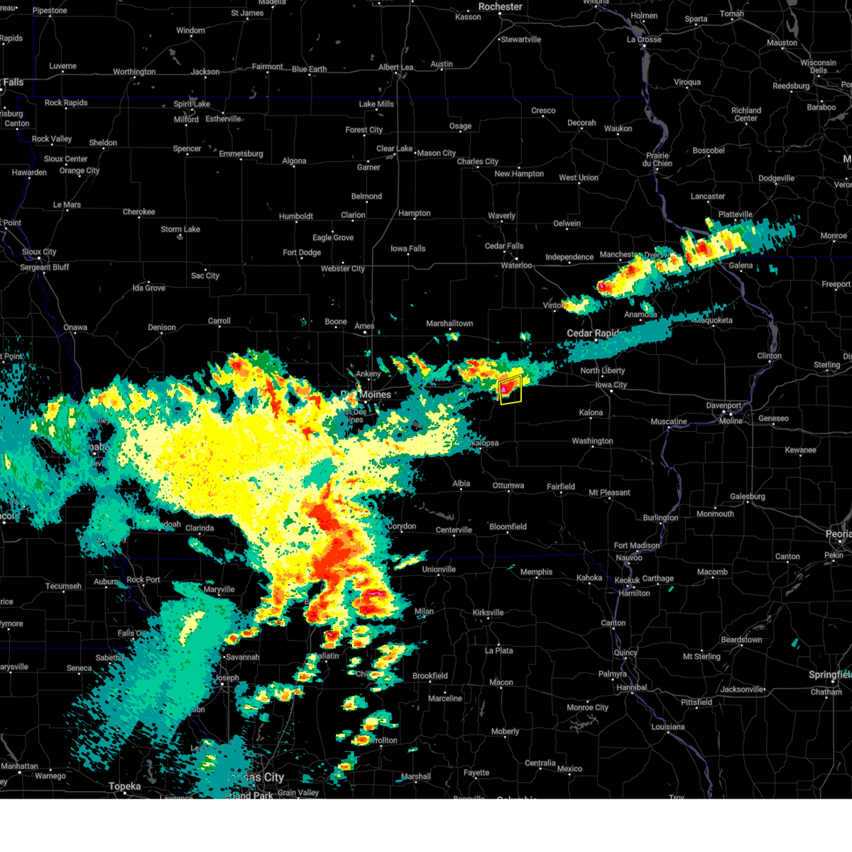 At 502 pm cdt, a severe thunderstorm was located near deep river, or 5 miles northeast of montezuma, moving northeast at 25 mph (radar indicated). Hazards include 60 mph wind gusts and quarter size hail. Hail damage to vehicles is expected. expect wind damage to roofs, siding, and trees. locations impacted include, brooklyn, victor, deep river, and guernsey. This includes interstate 80 between mile markers 195 and 204. At 502 pm cdt, a severe thunderstorm was located near deep river, or 5 miles northeast of montezuma, moving northeast at 25 mph (radar indicated). Hazards include 60 mph wind gusts and quarter size hail. Hail damage to vehicles is expected. expect wind damage to roofs, siding, and trees. locations impacted include, brooklyn, victor, deep river, and guernsey. This includes interstate 80 between mile markers 195 and 204.
|
| 4/27/2024 4:45 PM CDT |
 At 444 pm cdt, a severe thunderstorm was located over montezuma, moving east at 20 mph (radar indicated). Hazards include 60 mph wind gusts and half dollar size hail. Hail damage to vehicles is expected. expect wind damage to roofs, siding, and trees. locations impacted include, montezuma, brooklyn, victor, deep river, and guernsey. This includes interstate 80 between mile markers 191 and 204. At 444 pm cdt, a severe thunderstorm was located over montezuma, moving east at 20 mph (radar indicated). Hazards include 60 mph wind gusts and half dollar size hail. Hail damage to vehicles is expected. expect wind damage to roofs, siding, and trees. locations impacted include, montezuma, brooklyn, victor, deep river, and guernsey. This includes interstate 80 between mile markers 191 and 204.
|
| 4/27/2024 4:45 PM CDT |
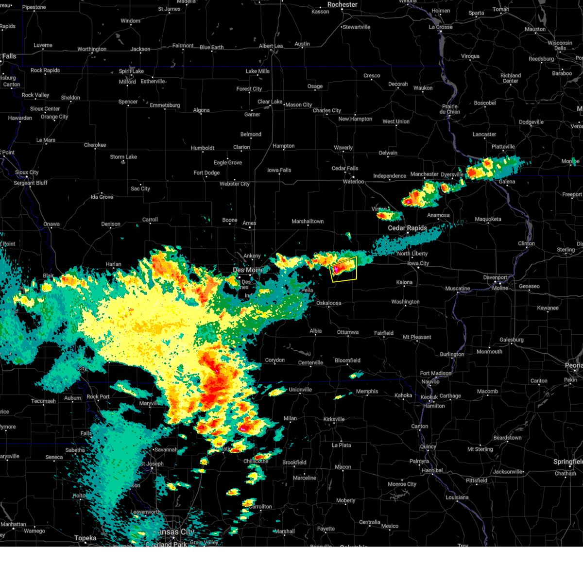 the severe thunderstorm warning has been cancelled and is no longer in effect the severe thunderstorm warning has been cancelled and is no longer in effect
|
| 4/27/2024 4:24 PM CDT |
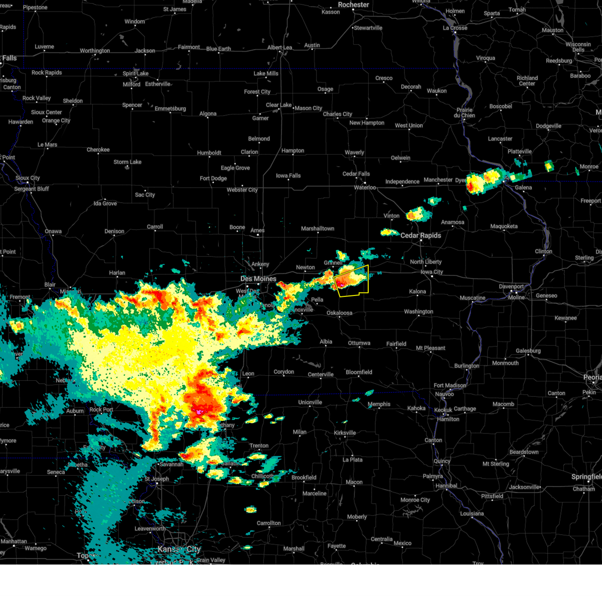 Svrdmx the national weather service in des moines has issued a * severe thunderstorm warning for, southern poweshiek county in central iowa, northeastern mahaska county in south central iowa, * until 515 pm cdt. * at 424 pm cdt, a severe thunderstorm was located near searsboro, or 7 miles southwest of montezuma, moving east at 25 mph (radar indicated). Hazards include 60 mph wind gusts and half dollar size hail. Hail damage to vehicles is expected. Expect wind damage to roofs, siding, and trees. Svrdmx the national weather service in des moines has issued a * severe thunderstorm warning for, southern poweshiek county in central iowa, northeastern mahaska county in south central iowa, * until 515 pm cdt. * at 424 pm cdt, a severe thunderstorm was located near searsboro, or 7 miles southwest of montezuma, moving east at 25 mph (radar indicated). Hazards include 60 mph wind gusts and half dollar size hail. Hail damage to vehicles is expected. Expect wind damage to roofs, siding, and trees.
|
| 7/28/2023 9:02 PM CDT |
 At 901 pm cdt, severe thunderstorms were located along a line extending from koszta to near malcom to lambs grove, moving southeast at 25 mph (radar indicated). Hazards include 60 mph wind gusts and quarter size hail. Hail damage to vehicles is expected. expect wind damage to roofs, siding, and trees. locations impacted include, holiday lake, malcom, brooklyn, kellogg, victor, victor, sully, guernsey, lynnville and searsboro. this includes interstate 80 between mile markers 152 and 204. hail threat, radar indicated max hail size, 1. 00 in wind threat, radar indicated max wind gust, 60 mph. At 901 pm cdt, severe thunderstorms were located along a line extending from koszta to near malcom to lambs grove, moving southeast at 25 mph (radar indicated). Hazards include 60 mph wind gusts and quarter size hail. Hail damage to vehicles is expected. expect wind damage to roofs, siding, and trees. locations impacted include, holiday lake, malcom, brooklyn, kellogg, victor, victor, sully, guernsey, lynnville and searsboro. this includes interstate 80 between mile markers 152 and 204. hail threat, radar indicated max hail size, 1. 00 in wind threat, radar indicated max wind gust, 60 mph.
|
| 7/28/2023 8:24 PM CDT |
 At 823 pm cdt, severe thunderstorms were located along a line extending from near vining to gilman to near mingo, moving southeast at 25 mph (radar indicated). Hazards include 60 mph wind gusts and quarter size hail. Hail damage to vehicles is expected. expect wind damage to roofs, siding, and trees. severe thunderstorms will be near, gilman, chelsea, elberon and vining around 830 pm cdt. rock creek lake and rock creek state park around 835 pm cdt. other locations in the path of these severe thunderstorms include grinnell, hartwick, prairie city krohn airport, grinnell regional airport, newton, lambs grove, iowa speedway, malcom, newton municipal airport, kellogg, brooklyn and reasnor. this includes interstate 80 between mile markers 152 and 204. hail threat, radar indicated max hail size, 1. 00 in wind threat, radar indicated max wind gust, 60 mph. At 823 pm cdt, severe thunderstorms were located along a line extending from near vining to gilman to near mingo, moving southeast at 25 mph (radar indicated). Hazards include 60 mph wind gusts and quarter size hail. Hail damage to vehicles is expected. expect wind damage to roofs, siding, and trees. severe thunderstorms will be near, gilman, chelsea, elberon and vining around 830 pm cdt. rock creek lake and rock creek state park around 835 pm cdt. other locations in the path of these severe thunderstorms include grinnell, hartwick, prairie city krohn airport, grinnell regional airport, newton, lambs grove, iowa speedway, malcom, newton municipal airport, kellogg, brooklyn and reasnor. this includes interstate 80 between mile markers 152 and 204. hail threat, radar indicated max hail size, 1. 00 in wind threat, radar indicated max wind gust, 60 mph.
|
| 7/12/2023 8:17 AM CDT |
 At 817 am cdt, severe thunderstorms were located along a line extending from hannen lake park to near williamsburg to webster, moving east at 50 mph (radar indicated). Hazards include 60 mph wind gusts. Expect damage to roofs, siding, and trees. locations impacted include, cedar rapids, iowa city, marengo, coralville, north liberty, williamsburg, belle plaine, kalona, fairfax, tiffin, ely, walford, wellman, north english, riverside, victor, swisher, oxford, blairstown and what cheer. hail threat, radar indicated max hail size, <. 75 in wind threat, radar indicated max wind gust, 60 mph. At 817 am cdt, severe thunderstorms were located along a line extending from hannen lake park to near williamsburg to webster, moving east at 50 mph (radar indicated). Hazards include 60 mph wind gusts. Expect damage to roofs, siding, and trees. locations impacted include, cedar rapids, iowa city, marengo, coralville, north liberty, williamsburg, belle plaine, kalona, fairfax, tiffin, ely, walford, wellman, north english, riverside, victor, swisher, oxford, blairstown and what cheer. hail threat, radar indicated max hail size, <. 75 in wind threat, radar indicated max wind gust, 60 mph.
|
| 7/12/2023 8:05 AM CDT |
 At 805 am cdt, severe thunderstorms were located along a line extending from koszta to near keswick, moving east at 40 mph (radar indicated). Hazards include 60 mph wind gusts. expect damage to roofs, siding, and trees At 805 am cdt, severe thunderstorms were located along a line extending from koszta to near keswick, moving east at 40 mph (radar indicated). Hazards include 60 mph wind gusts. expect damage to roofs, siding, and trees
|
| 5/7/2023 5:24 PM CDT |
 At 524 pm cdt, severe thunderstorms were located along a line extending from near genoa bluff to millersburg to near keswick, moving east at 35 mph (radar indicated). Hazards include 60 mph wind gusts and quarter size hail. Hail damage to vehicles is expected. expect wind damage to roofs, siding, and trees. locations impacted include, sigourney, williamsburg, wellman, north english, victor, brighton, what cheer, delta, keswick, south english, parnell, millersburg, harper, kinross, keota, west chester, webster, thornburg, gibson and keokuk county fairgrounds. hail threat, radar indicated max hail size, 1. 00 in wind threat, radar indicated max wind gust, 60 mph. At 524 pm cdt, severe thunderstorms were located along a line extending from near genoa bluff to millersburg to near keswick, moving east at 35 mph (radar indicated). Hazards include 60 mph wind gusts and quarter size hail. Hail damage to vehicles is expected. expect wind damage to roofs, siding, and trees. locations impacted include, sigourney, williamsburg, wellman, north english, victor, brighton, what cheer, delta, keswick, south english, parnell, millersburg, harper, kinross, keota, west chester, webster, thornburg, gibson and keokuk county fairgrounds. hail threat, radar indicated max hail size, 1. 00 in wind threat, radar indicated max wind gust, 60 mph.
|
| 5/7/2023 5:14 PM CDT |
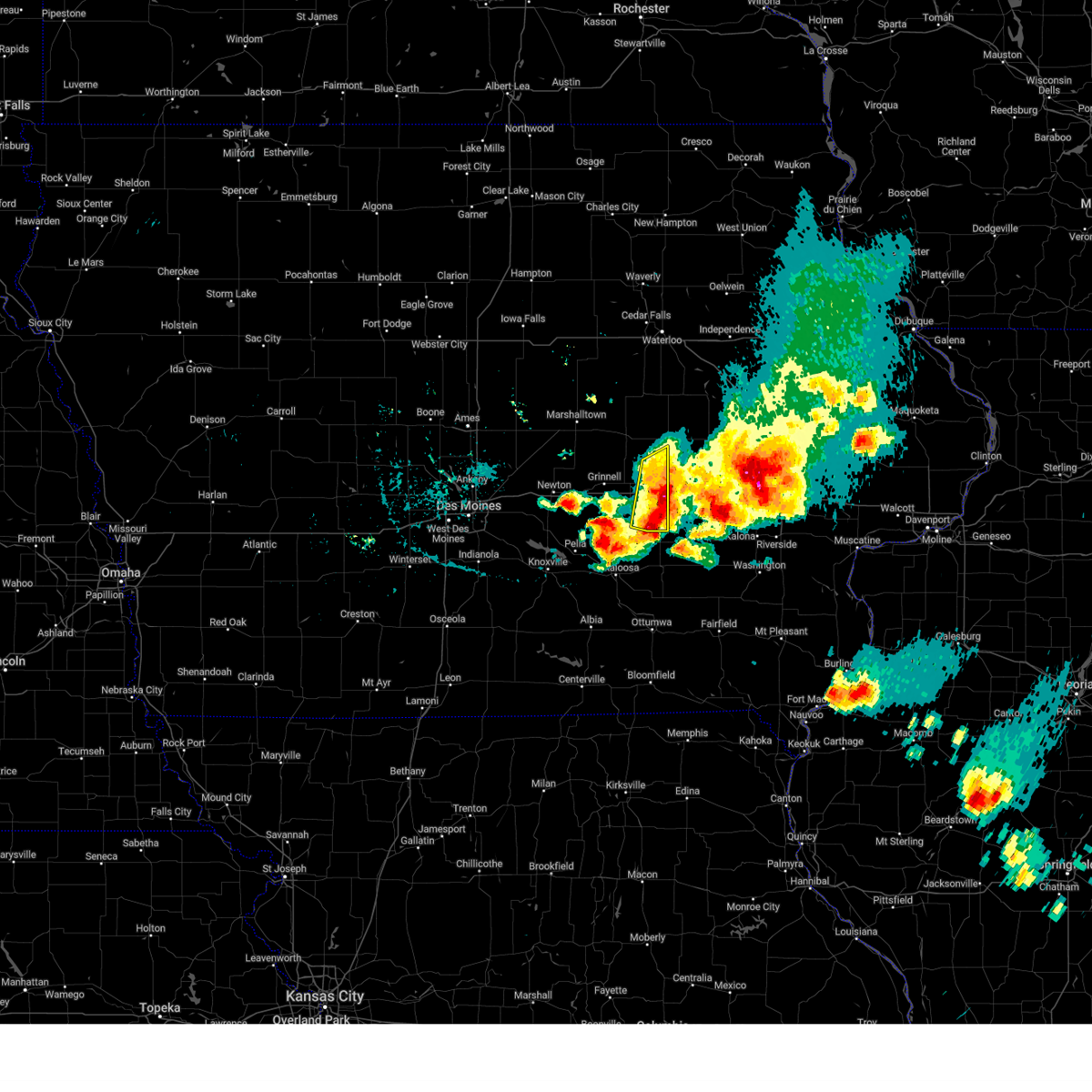 At 514 pm cdt, a severe thunderstorm was located over malcom, or 7 miles southeast of grinnell, moving east at 40 mph. this is a destructive storm for poweshiek county (trained weather spotters). Hazards include baseball size hail and 60 mph wind gusts. People and animals outdoors will be severely injured. expect shattered windows, extensive damage to roofs, siding, and vehicles. this severe storm will be near, montezuma around 520 pm cdt. brooklyn around 525 pm cdt. other locations in the path of this severe thunderstorm include victor, deep river, guernsey and victor. this includes interstate 80 between mile markers 194 and 204. thunderstorm damage threat, destructive hail threat, observed max hail size, 2. 75 in wind threat, radar indicated max wind gust, 60 mph. At 514 pm cdt, a severe thunderstorm was located over malcom, or 7 miles southeast of grinnell, moving east at 40 mph. this is a destructive storm for poweshiek county (trained weather spotters). Hazards include baseball size hail and 60 mph wind gusts. People and animals outdoors will be severely injured. expect shattered windows, extensive damage to roofs, siding, and vehicles. this severe storm will be near, montezuma around 520 pm cdt. brooklyn around 525 pm cdt. other locations in the path of this severe thunderstorm include victor, deep river, guernsey and victor. this includes interstate 80 between mile markers 194 and 204. thunderstorm damage threat, destructive hail threat, observed max hail size, 2. 75 in wind threat, radar indicated max wind gust, 60 mph.
|
| 5/7/2023 5:10 PM CDT |
 At 510 pm cdt, severe thunderstorms were located along a line extending from near guernsey to near deep river to coal creek, moving southeast at 55 mph (radar indicated). Hazards include 70 mph wind gusts and half dollar size hail. Hail damage to vehicles is expected. expect considerable tree damage. wind damage is also likely to mobile homes, roofs, and outbuildings. locations impacted include, delta, keswick, millersburg, lake iowa park, genoa bluff, sigourney, north english, south english, webster, yenruogis county park, keokuk county expo, lake belva deer park, williamsburg, parnell, harper, kinross, lancaster, keota, holbrook, wellman, talleyrand, rubio, west chester and brighton. thunderstorm damage threat, considerable hail threat, radar indicated max hail size, 1. 25 in wind threat, radar indicated max wind gust, 70 mph. At 510 pm cdt, severe thunderstorms were located along a line extending from near guernsey to near deep river to coal creek, moving southeast at 55 mph (radar indicated). Hazards include 70 mph wind gusts and half dollar size hail. Hail damage to vehicles is expected. expect considerable tree damage. wind damage is also likely to mobile homes, roofs, and outbuildings. locations impacted include, delta, keswick, millersburg, lake iowa park, genoa bluff, sigourney, north english, south english, webster, yenruogis county park, keokuk county expo, lake belva deer park, williamsburg, parnell, harper, kinross, lancaster, keota, holbrook, wellman, talleyrand, rubio, west chester and brighton. thunderstorm damage threat, considerable hail threat, radar indicated max hail size, 1. 25 in wind threat, radar indicated max wind gust, 70 mph.
|
| 5/7/2023 5:05 PM CDT |
 At 504 pm cdt, a severe thunderstorm was located over malcom, or 7 miles southeast of grinnell, moving east at 40 mph. this is a destructive storm for poweshiek county (trained weather spotters). Hazards include baseball size hail and 60 mph wind gusts. People and animals outdoors will be severely injured. expect shattered windows, extensive damage to roofs, siding, and vehicles. locations impacted include, montezuma, brooklyn, victor, deep river, guernsey and victor. this includes interstate 80 between mile markers 188 and 204. thunderstorm damage threat, destructive hail threat, observed max hail size, 2. 75 in wind threat, radar indicated max wind gust, 60 mph. At 504 pm cdt, a severe thunderstorm was located over malcom, or 7 miles southeast of grinnell, moving east at 40 mph. this is a destructive storm for poweshiek county (trained weather spotters). Hazards include baseball size hail and 60 mph wind gusts. People and animals outdoors will be severely injured. expect shattered windows, extensive damage to roofs, siding, and vehicles. locations impacted include, montezuma, brooklyn, victor, deep river, guernsey and victor. this includes interstate 80 between mile markers 188 and 204. thunderstorm damage threat, destructive hail threat, observed max hail size, 2. 75 in wind threat, radar indicated max wind gust, 60 mph.
|
| 5/7/2023 4:57 PM CDT |
 At 457 pm cdt, severe thunderstorms were located along a line extending from near malcom to near barnes city, moving southeast at 55 mph (radar indicated). Hazards include ping pong ball size hail and 60 mph wind gusts. People and animals outdoors will be injured. expect hail damage to roofs, siding, windows, and vehicles. expect wind damage to roofs, siding, and trees. severe thunderstorms will be near, gibson and coal creek around 505 pm cdt. victor, what cheer, victor, thornburg and keokuk county fairgrounds around 510 pm cdt. delta and keswick around 515 pm cdt. other locations in the path of these severe thunderstorms include sigourney, south english, webster, yenruogis county park, lake iowa park, keokuk county expo, lake belva deer park, genoa bluff, millersburg, harper, lancaster, north english, parnell, keota, kinross, talleyrand, holbrook, west chester and rubio. hail threat, radar indicated max hail size, 1. 50 in wind threat, radar indicated max wind gust, 60 mph. At 457 pm cdt, severe thunderstorms were located along a line extending from near malcom to near barnes city, moving southeast at 55 mph (radar indicated). Hazards include ping pong ball size hail and 60 mph wind gusts. People and animals outdoors will be injured. expect hail damage to roofs, siding, windows, and vehicles. expect wind damage to roofs, siding, and trees. severe thunderstorms will be near, gibson and coal creek around 505 pm cdt. victor, what cheer, victor, thornburg and keokuk county fairgrounds around 510 pm cdt. delta and keswick around 515 pm cdt. other locations in the path of these severe thunderstorms include sigourney, south english, webster, yenruogis county park, lake iowa park, keokuk county expo, lake belva deer park, genoa bluff, millersburg, harper, lancaster, north english, parnell, keota, kinross, talleyrand, holbrook, west chester and rubio. hail threat, radar indicated max hail size, 1. 50 in wind threat, radar indicated max wind gust, 60 mph.
|
| 5/7/2023 4:46 PM CDT |
 At 445 pm cdt, a severe thunderstorm was located over oakland acres, or 6 miles west of grinnell, moving east at 40 mph. this is a destructive storm for poweshiek county (trained weather spotters). Hazards include baseball size hail and 60 mph wind gusts. People and animals outdoors will be severely injured. expect shattered windows, extensive damage to roofs, siding, and vehicles. this severe thunderstorm will be near, grinnell and grinnell regional airport around 455 pm cdt. searsboro around 500 pm cdt. other locations in the path of this severe thunderstorm include montezuma, malcom, brooklyn, deep river, guernsey, victor and victor. this includes interstate 80 between mile markers 181 and 204. thunderstorm damage threat, destructive hail threat, observed max hail size, 2. 75 in wind threat, radar indicated max wind gust, 60 mph. At 445 pm cdt, a severe thunderstorm was located over oakland acres, or 6 miles west of grinnell, moving east at 40 mph. this is a destructive storm for poweshiek county (trained weather spotters). Hazards include baseball size hail and 60 mph wind gusts. People and animals outdoors will be severely injured. expect shattered windows, extensive damage to roofs, siding, and vehicles. this severe thunderstorm will be near, grinnell and grinnell regional airport around 455 pm cdt. searsboro around 500 pm cdt. other locations in the path of this severe thunderstorm include montezuma, malcom, brooklyn, deep river, guernsey, victor and victor. this includes interstate 80 between mile markers 181 and 204. thunderstorm damage threat, destructive hail threat, observed max hail size, 2. 75 in wind threat, radar indicated max wind gust, 60 mph.
|
| 5/7/2023 4:30 PM CDT |
 At 429 pm cdt, severe thunderstorms were located along a line extending from near keystone to ladora, moving east at 30 mph. these are destructive storms for ladora through van horne (trained weather spotters). Hazards include baseball size hail and 70 mph wind gusts. People and animals outdoors will be severely injured. expect shattered windows, extensive damage to roofs, siding, and vehicles. these severe storms will be near, blairstown and van horne around 435 pm cdt. other locations in the path of these severe thunderstorms include marengo, iowa county fairgrounds, williamsburg, newhall, conroy, norway, upper south amana, south amana, west amana, atkins, amana, homestead, high amana, middle amana and east amana. thunderstorm damage threat, destructive hail threat, radar indicated max hail size, 2. 75 in wind threat, radar indicated max wind gust, 70 mph. At 429 pm cdt, severe thunderstorms were located along a line extending from near keystone to ladora, moving east at 30 mph. these are destructive storms for ladora through van horne (trained weather spotters). Hazards include baseball size hail and 70 mph wind gusts. People and animals outdoors will be severely injured. expect shattered windows, extensive damage to roofs, siding, and vehicles. these severe storms will be near, blairstown and van horne around 435 pm cdt. other locations in the path of these severe thunderstorms include marengo, iowa county fairgrounds, williamsburg, newhall, conroy, norway, upper south amana, south amana, west amana, atkins, amana, homestead, high amana, middle amana and east amana. thunderstorm damage threat, destructive hail threat, radar indicated max hail size, 2. 75 in wind threat, radar indicated max wind gust, 70 mph.
|
| 5/7/2023 4:24 PM CDT |
 At 424 pm cdt, severe thunderstorms were located along a line extending from keystone to near ladora, moving east at 30 mph (trained weather spotters). Hazards include golf ball size hail and 60 mph wind gusts. People and animals outdoors will be injured. expect hail damage to roofs, siding, windows, and vehicles. expect wind damage to roofs, siding, and trees. severe thunderstorms will be near, blairstown and van horne around 435 pm cdt. other locations in the path of these severe thunderstorms include marengo, newhall, iowa county fairgrounds, williamsburg, norway, conroy, upper south amana, south amana, high amana, west amana, atkins, amana, homestead, middle amana and east amana. thunderstorm damage threat, considerable hail threat, radar indicated max hail size, 1. 75 in wind threat, radar indicated max wind gust, 60 mph. At 424 pm cdt, severe thunderstorms were located along a line extending from keystone to near ladora, moving east at 30 mph (trained weather spotters). Hazards include golf ball size hail and 60 mph wind gusts. People and animals outdoors will be injured. expect hail damage to roofs, siding, windows, and vehicles. expect wind damage to roofs, siding, and trees. severe thunderstorms will be near, blairstown and van horne around 435 pm cdt. other locations in the path of these severe thunderstorms include marengo, newhall, iowa county fairgrounds, williamsburg, norway, conroy, upper south amana, south amana, high amana, west amana, atkins, amana, homestead, middle amana and east amana. thunderstorm damage threat, considerable hail threat, radar indicated max hail size, 1. 75 in wind threat, radar indicated max wind gust, 60 mph.
|
| 5/7/2023 4:13 PM CDT |
 At 413 pm cdt, a severe thunderstorm was located over koszta, or 9 miles west of marengo, moving east at 30 mph (trained weather spotters). Hazards include ping pong ball size hail and 60 mph wind gusts. People and animals outdoors will be injured. expect hail damage to roofs, siding, windows, and vehicles. expect wind damage to roofs, siding, and trees. this severe storm will be near, ladora around 420 pm cdt. hannen lake park and genoa bluff around 425 pm cdt. other locations in the path of this severe thunderstorm include marengo, iowa county fairgrounds and williamsburg. hail threat, radar indicated max hail size, 1. 50 in wind threat, radar indicated max wind gust, 60 mph. At 413 pm cdt, a severe thunderstorm was located over koszta, or 9 miles west of marengo, moving east at 30 mph (trained weather spotters). Hazards include ping pong ball size hail and 60 mph wind gusts. People and animals outdoors will be injured. expect hail damage to roofs, siding, windows, and vehicles. expect wind damage to roofs, siding, and trees. this severe storm will be near, ladora around 420 pm cdt. hannen lake park and genoa bluff around 425 pm cdt. other locations in the path of this severe thunderstorm include marengo, iowa county fairgrounds and williamsburg. hail threat, radar indicated max hail size, 1. 50 in wind threat, radar indicated max wind gust, 60 mph.
|
| 5/7/2023 4:08 PM CDT |
 At 407 pm cdt, a severe thunderstorm was located near belle plaine, or 12 miles west of marengo, moving east at 30 mph (trained weather spotters). Hazards include ping pong ball size hail and 60 mph wind gusts. People and animals outdoors will be injured. expect hail damage to roofs, siding, windows, and vehicles. expect wind damage to roofs, siding, and trees. this severe thunderstorm will be near, koszta around 420 pm cdt. ladora and hannen lake park around 425 pm cdt. other locations in the path of this severe thunderstorm include marengo, genoa bluff, iowa county fairgrounds and williamsburg. hail threat, radar indicated max hail size, 1. 50 in wind threat, radar indicated max wind gust, 60 mph. At 407 pm cdt, a severe thunderstorm was located near belle plaine, or 12 miles west of marengo, moving east at 30 mph (trained weather spotters). Hazards include ping pong ball size hail and 60 mph wind gusts. People and animals outdoors will be injured. expect hail damage to roofs, siding, windows, and vehicles. expect wind damage to roofs, siding, and trees. this severe thunderstorm will be near, koszta around 420 pm cdt. ladora and hannen lake park around 425 pm cdt. other locations in the path of this severe thunderstorm include marengo, genoa bluff, iowa county fairgrounds and williamsburg. hail threat, radar indicated max hail size, 1. 50 in wind threat, radar indicated max wind gust, 60 mph.
|
| 4/20/2023 12:29 AM CDT |
 At 1227 am cdt, severe thunderstorms were located along a line extending from 6 miles west of la porte city to near belle plaine to 4 miles southeast of deep river, moving northeast at 30 mph (radar indicated). Hazards include 60 mph wind gusts and quarter size hail. Hail damage to vehicles is expected. expect wind damage to roofs, siding, and trees. locations impacted include, montezuma, tama, traer, brooklyn, dysart, victor, holiday lake, malcom, deep river, chelsea, clutier, elberon, barnes city, searsboro, hartwick, guernsey, vining, tf clark state park and toledo municipal airport. this includes interstate 80 between mile markers 185 and 204. hail threat, radar indicated max hail size, 1. 00 in wind threat, radar indicated max wind gust, 60 mph. At 1227 am cdt, severe thunderstorms were located along a line extending from 6 miles west of la porte city to near belle plaine to 4 miles southeast of deep river, moving northeast at 30 mph (radar indicated). Hazards include 60 mph wind gusts and quarter size hail. Hail damage to vehicles is expected. expect wind damage to roofs, siding, and trees. locations impacted include, montezuma, tama, traer, brooklyn, dysart, victor, holiday lake, malcom, deep river, chelsea, clutier, elberon, barnes city, searsboro, hartwick, guernsey, vining, tf clark state park and toledo municipal airport. this includes interstate 80 between mile markers 185 and 204. hail threat, radar indicated max hail size, 1. 00 in wind threat, radar indicated max wind gust, 60 mph.
|
| 4/20/2023 12:06 AM CDT |
 At 1204 am cdt, severe thunderstorms were located along a line extending from near lincoln to 4 miles northwest of holiday lake to lake keomah state park, moving east at 30 mph (radar indicated). Hazards include 60 mph wind gusts and quarter size hail. Hail damage to vehicles is expected. expect wind damage to roofs, siding, and trees. locations impacted include, holiday lake, traer, chelsea, hartwick, vining, tf clark state park and elberon. this includes interstate 80 between mile markers 178 and 204. hail threat, radar indicated max hail size, 1. 00 in wind threat, radar indicated max wind gust, 60 mph. At 1204 am cdt, severe thunderstorms were located along a line extending from near lincoln to 4 miles northwest of holiday lake to lake keomah state park, moving east at 30 mph (radar indicated). Hazards include 60 mph wind gusts and quarter size hail. Hail damage to vehicles is expected. expect wind damage to roofs, siding, and trees. locations impacted include, holiday lake, traer, chelsea, hartwick, vining, tf clark state park and elberon. this includes interstate 80 between mile markers 178 and 204. hail threat, radar indicated max hail size, 1. 00 in wind threat, radar indicated max wind gust, 60 mph.
|
| 4/19/2023 11:41 PM CDT |
 At 1140 pm cdt, severe thunderstorms were located along a line extending from beaman to 4 miles northwest of grinnell to 5 miles southwest of beacon, moving northeast at 30 mph (radar indicated). Hazards include 60 mph wind gusts and quarter size hail. Hail damage to vehicles is expected. expect wind damage to roofs, siding, and trees. severe thunderstorms will be near, grinnell, gilman and union grove state park around 1145 pm cdt. gladbrook around 1150 pm cdt. other locations in the path of these severe thunderstorms include keomah village, lake keomah state park, oskaloosa municipal airport, toledo, tama, fremont, holiday lake, toledo municipal airport, rose hill, chelsea, vining and elberon. this includes interstate 80 between mile markers 169 and 204. hail threat, radar indicated max hail size, 1. 00 in wind threat, radar indicated max wind gust, 60 mph. At 1140 pm cdt, severe thunderstorms were located along a line extending from beaman to 4 miles northwest of grinnell to 5 miles southwest of beacon, moving northeast at 30 mph (radar indicated). Hazards include 60 mph wind gusts and quarter size hail. Hail damage to vehicles is expected. expect wind damage to roofs, siding, and trees. severe thunderstorms will be near, grinnell, gilman and union grove state park around 1145 pm cdt. gladbrook around 1150 pm cdt. other locations in the path of these severe thunderstorms include keomah village, lake keomah state park, oskaloosa municipal airport, toledo, tama, fremont, holiday lake, toledo municipal airport, rose hill, chelsea, vining and elberon. this includes interstate 80 between mile markers 169 and 204. hail threat, radar indicated max hail size, 1. 00 in wind threat, radar indicated max wind gust, 60 mph.
|
| 4/4/2023 8:13 PM CDT |
 At 812 pm cdt, a severe thunderstorm was located over belle plaine, or 11 miles northwest of marengo, moving northeast at 55 mph (emergency management). Hazards include ping pong ball size hail and 60 mph wind gusts. People and animals outdoors will be injured. expect hail damage to roofs, siding, windows, and vehicles. expect wind damage to roofs, siding, and trees. locations impacted include, brooklyn, victor, holiday lake, chelsea, elberon, hartwick and vining. this includes interstate 80 between mile markers 197 and 200. hail threat, observed max hail size, 1. 50 in wind threat, radar indicated max wind gust, 60 mph. At 812 pm cdt, a severe thunderstorm was located over belle plaine, or 11 miles northwest of marengo, moving northeast at 55 mph (emergency management). Hazards include ping pong ball size hail and 60 mph wind gusts. People and animals outdoors will be injured. expect hail damage to roofs, siding, windows, and vehicles. expect wind damage to roofs, siding, and trees. locations impacted include, brooklyn, victor, holiday lake, chelsea, elberon, hartwick and vining. this includes interstate 80 between mile markers 197 and 200. hail threat, observed max hail size, 1. 50 in wind threat, radar indicated max wind gust, 60 mph.
|
| 4/4/2023 7:57 PM CDT |
 At 756 pm cdt, a severe thunderstorm was located over holiday lake, or 13 miles east of grinnell, moving northeast at 55 mph (radar indicated). Hazards include ping pong ball size hail and 60 mph wind gusts. People and animals outdoors will be injured. expect hail damage to roofs, siding, windows, and vehicles. expect wind damage to roofs, siding, and trees. locations impacted include, chelsea, hartwick and elberon. this includes interstate 80 between mile markers 182 and 199. hail threat, radar indicated max hail size, 1. 50 in wind threat, radar indicated max wind gust, 60 mph. At 756 pm cdt, a severe thunderstorm was located over holiday lake, or 13 miles east of grinnell, moving northeast at 55 mph (radar indicated). Hazards include ping pong ball size hail and 60 mph wind gusts. People and animals outdoors will be injured. expect hail damage to roofs, siding, windows, and vehicles. expect wind damage to roofs, siding, and trees. locations impacted include, chelsea, hartwick and elberon. this includes interstate 80 between mile markers 182 and 199. hail threat, radar indicated max hail size, 1. 50 in wind threat, radar indicated max wind gust, 60 mph.
|
| 4/4/2023 7:37 PM CDT |
 At 736 pm cdt, a severe thunderstorm was located near grinnell regional airport, or 6 miles south of grinnell, moving northeast at 55 mph. this is a destructive storm for jasper and poweshiek (radar indicated). Hazards include baseball size hail and 60 mph wind gusts. People and animals outdoors will be severely injured. expect shattered windows, extensive damage to roofs, siding, and vehicles. this severe storm will be near, grinnell around 740 pm cdt. other locations in the path of this severe thunderstorm include malcom, brooklyn, holiday lake, hartwick and chelsea. this includes interstate 80 between mile markers 173 and 204. thunderstorm damage threat, destructive hail threat, radar indicated max hail size, 2. 75 in wind threat, radar indicated max wind gust, 60 mph. At 736 pm cdt, a severe thunderstorm was located near grinnell regional airport, or 6 miles south of grinnell, moving northeast at 55 mph. this is a destructive storm for jasper and poweshiek (radar indicated). Hazards include baseball size hail and 60 mph wind gusts. People and animals outdoors will be severely injured. expect shattered windows, extensive damage to roofs, siding, and vehicles. this severe storm will be near, grinnell around 740 pm cdt. other locations in the path of this severe thunderstorm include malcom, brooklyn, holiday lake, hartwick and chelsea. this includes interstate 80 between mile markers 173 and 204. thunderstorm damage threat, destructive hail threat, radar indicated max hail size, 2. 75 in wind threat, radar indicated max wind gust, 60 mph.
|
| 4/4/2023 7:24 PM CDT |
 At 723 pm cdt, a severe thunderstorm was located near sully, or 9 miles north of pella, moving northeast at 55 mph (radar indicated). Hazards include 60 mph wind gusts and half dollar size hail. Hail damage to vehicles is expected. expect wind damage to roofs, siding, and trees. this severe thunderstorm will be near, lynnville around 730 pm cdt. oakland acres and searsboro around 735 pm cdt. grinnell regional airport around 740 pm cdt. other locations in the path of this severe thunderstorm include grinnell, malcom, brooklyn, holiday lake, hartwick and chelsea. this includes interstate 80 between mile markers 173 and 204. hail threat, radar indicated max hail size, 1. 25 in wind threat, radar indicated max wind gust, 60 mph. At 723 pm cdt, a severe thunderstorm was located near sully, or 9 miles north of pella, moving northeast at 55 mph (radar indicated). Hazards include 60 mph wind gusts and half dollar size hail. Hail damage to vehicles is expected. expect wind damage to roofs, siding, and trees. this severe thunderstorm will be near, lynnville around 730 pm cdt. oakland acres and searsboro around 735 pm cdt. grinnell regional airport around 740 pm cdt. other locations in the path of this severe thunderstorm include grinnell, malcom, brooklyn, holiday lake, hartwick and chelsea. this includes interstate 80 between mile markers 173 and 204. hail threat, radar indicated max hail size, 1. 25 in wind threat, radar indicated max wind gust, 60 mph.
|
| 8/19/2022 4:36 PM CDT |
 At 436 pm cdt, a severe thunderstorm was located near brooklyn, or 15 miles southeast of toledo, moving east at 35 mph (radar indicated). Hazards include 60 mph wind gusts and nickel size hail. Expect damage to roofs, siding, and trees. this severe thunderstorm will be near, victor, victor and hartwick around 445 pm cdt. this includes interstate 80 between mile markers 195 and 204. hail threat, radar indicated max hail size, 0. 88 in wind threat, radar indicated max wind gust, 60 mph. At 436 pm cdt, a severe thunderstorm was located near brooklyn, or 15 miles southeast of toledo, moving east at 35 mph (radar indicated). Hazards include 60 mph wind gusts and nickel size hail. Expect damage to roofs, siding, and trees. this severe thunderstorm will be near, victor, victor and hartwick around 445 pm cdt. this includes interstate 80 between mile markers 195 and 204. hail threat, radar indicated max hail size, 0. 88 in wind threat, radar indicated max wind gust, 60 mph.
|
| 7/11/2022 6:05 AM CDT |
 At 604 am cdt, the leading edge of severe thunderstorms was located along a line extending from near dike to near dysart to near van horne, moving northeast at 35 mph (radar indicated). Hazards include 60 mph wind gusts. Expect damage to roofs, siding, and trees. locations impacted include, traer, dysart, gladbrook, victor, chelsea, clutier, elberon, lincoln, vining and tf clark state park. hail threat, radar indicated max hail size, <. 75 in wind threat, radar indicated max wind gust, 60 mph. At 604 am cdt, the leading edge of severe thunderstorms was located along a line extending from near dike to near dysart to near van horne, moving northeast at 35 mph (radar indicated). Hazards include 60 mph wind gusts. Expect damage to roofs, siding, and trees. locations impacted include, traer, dysart, gladbrook, victor, chelsea, clutier, elberon, lincoln, vining and tf clark state park. hail threat, radar indicated max hail size, <. 75 in wind threat, radar indicated max wind gust, 60 mph.
|
| 7/11/2022 6:03 AM CDT |
 At 603 am cdt, severe thunderstorms were located along a line extending from garrison to near riverside, moving east at 45 mph (radar indicated). Hazards include 60 mph wind gusts and quarter size hail. Hail damage to vehicles is expected. expect wind damage to roofs, siding, and trees. locations impacted include, cedar rapids, iowa city, vinton, marengo, marion, coralville, north liberty, hiawatha, robins, williamsburg, belle plaine, center point, kalona, fairfax, solon, tiffin, ely, atkins, walford and urbana. hail threat, radar indicated max hail size, 1. 00 in wind threat, radar indicated max wind gust, 60 mph. At 603 am cdt, severe thunderstorms were located along a line extending from garrison to near riverside, moving east at 45 mph (radar indicated). Hazards include 60 mph wind gusts and quarter size hail. Hail damage to vehicles is expected. expect wind damage to roofs, siding, and trees. locations impacted include, cedar rapids, iowa city, vinton, marengo, marion, coralville, north liberty, hiawatha, robins, williamsburg, belle plaine, center point, kalona, fairfax, solon, tiffin, ely, atkins, walford and urbana. hail threat, radar indicated max hail size, 1. 00 in wind threat, radar indicated max wind gust, 60 mph.
|
| 7/11/2022 5:51 AM CDT |
 At 551 am cdt, severe thunderstorms were located along a line extending from near dysart to amish, moving east at 45 mph (radar indicated). Hazards include 60 mph wind gusts and quarter size hail. Hail damage to vehicles is expected. expect wind damage to roofs, siding, and trees. locations impacted include, cedar rapids, iowa city, vinton, marengo, marion, coralville, north liberty, hiawatha, robins, williamsburg, belle plaine, center point, kalona, fairfax, solon, tiffin, ely, atkins, walford and urbana. hail threat, radar indicated max hail size, 1. 00 in wind threat, radar indicated max wind gust, 60 mph. At 551 am cdt, severe thunderstorms were located along a line extending from near dysart to amish, moving east at 45 mph (radar indicated). Hazards include 60 mph wind gusts and quarter size hail. Hail damage to vehicles is expected. expect wind damage to roofs, siding, and trees. locations impacted include, cedar rapids, iowa city, vinton, marengo, marion, coralville, north liberty, hiawatha, robins, williamsburg, belle plaine, center point, kalona, fairfax, solon, tiffin, ely, atkins, walford and urbana. hail threat, radar indicated max hail size, 1. 00 in wind threat, radar indicated max wind gust, 60 mph.
|
| 7/11/2022 5:43 AM CDT |
 At 543 am cdt, severe thunderstorms were located along a line extending from near clutier to near holbrook, moving east at 45 mph (radar indicated). Hazards include 60 mph wind gusts and quarter size hail. Hail damage to vehicles is expected. Expect wind damage to roofs, siding, and trees. At 543 am cdt, severe thunderstorms were located along a line extending from near clutier to near holbrook, moving east at 45 mph (radar indicated). Hazards include 60 mph wind gusts and quarter size hail. Hail damage to vehicles is expected. Expect wind damage to roofs, siding, and trees.
|
| 7/11/2022 5:41 AM CDT |
 At 541 am cdt, severe thunderstorms were located along a line extending from near grundy center to 6 miles south of traer to belle plaine, moving northeast at 40 mph (radar indicated). Hazards include 60 mph wind gusts and quarter size hail. Hail damage to vehicles is expected. Expect wind damage to roofs, siding, and trees. At 541 am cdt, severe thunderstorms were located along a line extending from near grundy center to 6 miles south of traer to belle plaine, moving northeast at 40 mph (radar indicated). Hazards include 60 mph wind gusts and quarter size hail. Hail damage to vehicles is expected. Expect wind damage to roofs, siding, and trees.
|
| 4/23/2022 8:17 PM CDT |
 At 817 pm cdt, severe thunderstorms were located along a line extending from near conrad to 9 miles northwest of rock creek lake to near monroe, moving northeast at 55 mph (broadcast media). Hazards include 60 mph wind gusts. expect damage to roofs, siding, and trees At 817 pm cdt, severe thunderstorms were located along a line extending from near conrad to 9 miles northwest of rock creek lake to near monroe, moving northeast at 55 mph (broadcast media). Hazards include 60 mph wind gusts. expect damage to roofs, siding, and trees
|
| 3/5/2022 7:46 PM CST |
 At 746 pm cst, severe thunderstorms were located along a line extending from near troy mills to near shellsburg to near marengo, moving east at 35 mph (trained weather spotters). Hazards include 60 mph wind gusts and quarter size hail. Hail damage to vehicles is expected. expect wind damage to roofs, siding, and trees. these severe storms will be near, shellsburg around 750 pm cst. Other locations in the path of these severe thunderstorms include central city, palo, paris, conroy, coggon, toddville, hiawatha, robins, prairieburg, alburnett, norway, amana, cedar rapids, marion, fairfax, walford, whittier and waubeek. At 746 pm cst, severe thunderstorms were located along a line extending from near troy mills to near shellsburg to near marengo, moving east at 35 mph (trained weather spotters). Hazards include 60 mph wind gusts and quarter size hail. Hail damage to vehicles is expected. expect wind damage to roofs, siding, and trees. these severe storms will be near, shellsburg around 750 pm cst. Other locations in the path of these severe thunderstorms include central city, palo, paris, conroy, coggon, toddville, hiawatha, robins, prairieburg, alburnett, norway, amana, cedar rapids, marion, fairfax, walford, whittier and waubeek.
|
| 3/5/2022 7:34 PM CST |
 At 734 pm cst, severe thunderstorms were located along a line extending from near center point to near shellsburg to near ladora, moving east at 50 mph (trained weather spotters). Hazards include 60 mph wind gusts and quarter size hail. Hail damage to vehicles is expected. expect wind damage to roofs, siding, and trees. severe thunderstorms will be near, center point, atkins, palo and shellsburg around 740 pm cst. hiawatha, blairstown and toddville around 745 pm cst. robins, central city, alburnett, paris and conroy around 750 pm cst. other locations in the path of these severe thunderstorms include marion, coggon, norway, cedar rapids, fairfax, walford, prairieburg, waubeek, whittier and amana. hail threat, radar indicated max hail size, 1. 00 in wind threat, observed max wind gust, 60 mph. At 734 pm cst, severe thunderstorms were located along a line extending from near center point to near shellsburg to near ladora, moving east at 50 mph (trained weather spotters). Hazards include 60 mph wind gusts and quarter size hail. Hail damage to vehicles is expected. expect wind damage to roofs, siding, and trees. severe thunderstorms will be near, center point, atkins, palo and shellsburg around 740 pm cst. hiawatha, blairstown and toddville around 745 pm cst. robins, central city, alburnett, paris and conroy around 750 pm cst. other locations in the path of these severe thunderstorms include marion, coggon, norway, cedar rapids, fairfax, walford, prairieburg, waubeek, whittier and amana. hail threat, radar indicated max hail size, 1. 00 in wind threat, observed max wind gust, 60 mph.
|
| 12/15/2021 8:02 PM CST |
 At 802 pm cst, severe thunderstorms were located along a line extending from mount auburn to near marengo, moving east at 60 mph (trained weather spotters. a 60 mph wind gust was measured in blairstown). Hazards include 70 mph wind gusts and penny size hail. Expect considerable tree damage. damage is likely to mobile homes, roofs, and outbuildings. Locations impacted include, vinton, marengo, williamsburg, belle plaine, atkins, walford, urbana, dysart, north english, shellsburg, victor, newhall, blairstown, van horne, keystone, norway, garrison, ladora, parnell and millersburg. At 802 pm cst, severe thunderstorms were located along a line extending from mount auburn to near marengo, moving east at 60 mph (trained weather spotters. a 60 mph wind gust was measured in blairstown). Hazards include 70 mph wind gusts and penny size hail. Expect considerable tree damage. damage is likely to mobile homes, roofs, and outbuildings. Locations impacted include, vinton, marengo, williamsburg, belle plaine, atkins, walford, urbana, dysart, north english, shellsburg, victor, newhall, blairstown, van horne, keystone, norway, garrison, ladora, parnell and millersburg.
|
| 12/15/2021 7:50 PM CST |
 At 749 pm cst, severe thunderstorms were located along a line extending from dysart to near victor, moving northeast at 65 mph. these are destructive storms for portions of eastern iowa (radar indicated). Hazards include 80 mph wind gusts and penny size hail. Flying debris will be dangerous to those caught without shelter. mobile homes will be heavily damaged. expect considerable damage to roofs, windows, and vehicles. extensive tree damage and power outages are likely. Locations impacted include, vinton, marengo, williamsburg, belle plaine, atkins, walford, urbana, dysart, north english, shellsburg, victor, newhall, blairstown, van horne, keystone, norway, garrison, ladora, parnell and millersburg. At 749 pm cst, severe thunderstorms were located along a line extending from dysart to near victor, moving northeast at 65 mph. these are destructive storms for portions of eastern iowa (radar indicated). Hazards include 80 mph wind gusts and penny size hail. Flying debris will be dangerous to those caught without shelter. mobile homes will be heavily damaged. expect considerable damage to roofs, windows, and vehicles. extensive tree damage and power outages are likely. Locations impacted include, vinton, marengo, williamsburg, belle plaine, atkins, walford, urbana, dysart, north english, shellsburg, victor, newhall, blairstown, van horne, keystone, norway, garrison, ladora, parnell and millersburg.
|
| 12/15/2021 7:37 PM CST |
 At 736 pm cst, severe thunderstorms were located along a line extending from near ladora to near lancaster, moving east at 65 mph (radar indicated). Hazards include 70 mph wind gusts. Expect considerable tree damage. damage is likely to mobile homes, roofs, and outbuildings. Locations impacted include, ottumwa, oskaloosa, grinnell, centerville, albia, bloomfield, montezuma, brooklyn, new sharon, eddyville, ottumwa industrial airport, lake sundown, rathbun lake, eldon, victor, fremont, moravia, agency, moulton and beacon. At 736 pm cst, severe thunderstorms were located along a line extending from near ladora to near lancaster, moving east at 65 mph (radar indicated). Hazards include 70 mph wind gusts. Expect considerable tree damage. damage is likely to mobile homes, roofs, and outbuildings. Locations impacted include, ottumwa, oskaloosa, grinnell, centerville, albia, bloomfield, montezuma, brooklyn, new sharon, eddyville, ottumwa industrial airport, lake sundown, rathbun lake, eldon, victor, fremont, moravia, agency, moulton and beacon.
|
| 12/15/2021 7:27 PM CST |
 At 726 pm cst, severe thunderstorms were located along a line extending from 6 miles northeast of grinnell to near new sharon, moving northeast at 70 mph. these are destructive storms for portions of eastern iowa (radar indicated). Hazards include 80 mph wind gusts and penny size hail. Flying debris will be dangerous to those caught without shelter. mobile homes will be heavily damaged. expect considerable damage to roofs, windows, and vehicles. extensive tree damage and power outages are likely. Locations impacted include, vinton, marengo, williamsburg, belle plaine, atkins, walford, urbana, dysart, north english, shellsburg, victor, newhall, blairstown, van horne, keystone, norway, garrison, ladora, parnell and millersburg. At 726 pm cst, severe thunderstorms were located along a line extending from 6 miles northeast of grinnell to near new sharon, moving northeast at 70 mph. these are destructive storms for portions of eastern iowa (radar indicated). Hazards include 80 mph wind gusts and penny size hail. Flying debris will be dangerous to those caught without shelter. mobile homes will be heavily damaged. expect considerable damage to roofs, windows, and vehicles. extensive tree damage and power outages are likely. Locations impacted include, vinton, marengo, williamsburg, belle plaine, atkins, walford, urbana, dysart, north english, shellsburg, victor, newhall, blairstown, van horne, keystone, norway, garrison, ladora, parnell and millersburg.
|
| 12/15/2021 7:17 PM CST |
 At 716 pm cst, severe thunderstorms were located along a line extending from 6 miles southeast of marshalltown to 9 miles south of grinnell to near new sharon, moving northeast at 60 mph. these are destructive storms for portions of eastern iowa (radar indicated). Hazards include 80 mph wind gusts and penny size hail. Flying debris will be dangerous to those caught without shelter. mobile homes will be heavily damaged. expect considerable damage to roofs, windows, and vehicles. Extensive tree damage and power outages are likely. At 716 pm cst, severe thunderstorms were located along a line extending from 6 miles southeast of marshalltown to 9 miles south of grinnell to near new sharon, moving northeast at 60 mph. these are destructive storms for portions of eastern iowa (radar indicated). Hazards include 80 mph wind gusts and penny size hail. Flying debris will be dangerous to those caught without shelter. mobile homes will be heavily damaged. expect considerable damage to roofs, windows, and vehicles. Extensive tree damage and power outages are likely.
|
| 12/15/2021 7:09 PM CST |
 At 708 pm cst, severe thunderstorms were located along a line extending from near grinnell to 11 miles west of unionville, moving east at 65 mph (radar indicated). Hazards include 70 mph wind gusts. Expect considerable tree damage. Damage is likely to mobile homes, roofs, and outbuildings. At 708 pm cst, severe thunderstorms were located along a line extending from near grinnell to 11 miles west of unionville, moving east at 65 mph (radar indicated). Hazards include 70 mph wind gusts. Expect considerable tree damage. Damage is likely to mobile homes, roofs, and outbuildings.
|
| 8/24/2021 4:58 PM CDT |
 The severe thunderstorm warning for northeastern poweshiek, marshall, southwestern black hawk, tama and central grundy counties will expire at 500 pm cdt, the storm which prompted the warning has moved out of the area. therefore, the warning will be allowed to expire. however small hail and gusty winds are still possible with this thunderstorm. a severe thunderstorm watch remains in effect until 700 pm cdt for central and northeastern iowa. The severe thunderstorm warning for northeastern poweshiek, marshall, southwestern black hawk, tama and central grundy counties will expire at 500 pm cdt, the storm which prompted the warning has moved out of the area. therefore, the warning will be allowed to expire. however small hail and gusty winds are still possible with this thunderstorm. a severe thunderstorm watch remains in effect until 700 pm cdt for central and northeastern iowa.
|
| 8/24/2021 4:35 PM CDT |
 At 434 pm cdt, a severe thunderstorm was located over traer, or 17 miles northeast of toledo, moving east at 50 mph (radar indicated). Hazards include 60 mph wind gusts and quarter size hail. Hail damage to vehicles is expected. expect wind damage to roofs, siding, and trees. locations impacted include, waterloo, cedar falls, marshalltown, grundy center, toledo, evansdale, tama, hudson, traer, reinbeck, dysart, dike, conrad, meskwaki casino, crossroads mall, gladbrook, le grand, victor, garwin and gilman. hail threat, radar indicated max hail size, 1. 00 in wind threat, radar indicated max wind gust, 60 mph. At 434 pm cdt, a severe thunderstorm was located over traer, or 17 miles northeast of toledo, moving east at 50 mph (radar indicated). Hazards include 60 mph wind gusts and quarter size hail. Hail damage to vehicles is expected. expect wind damage to roofs, siding, and trees. locations impacted include, waterloo, cedar falls, marshalltown, grundy center, toledo, evansdale, tama, hudson, traer, reinbeck, dysart, dike, conrad, meskwaki casino, crossroads mall, gladbrook, le grand, victor, garwin and gilman. hail threat, radar indicated max hail size, 1. 00 in wind threat, radar indicated max wind gust, 60 mph.
|
| 8/24/2021 4:03 PM CDT |
 At 402 pm cdt, a severe thunderstorm was located near conrad, or 9 miles southeast of eldora, moving east at 50 mph (radar indicated). Hazards include 60 mph wind gusts and quarter size hail. Hail damage to vehicles is expected. Expect wind damage to roofs, siding, and trees. At 402 pm cdt, a severe thunderstorm was located near conrad, or 9 miles southeast of eldora, moving east at 50 mph (radar indicated). Hazards include 60 mph wind gusts and quarter size hail. Hail damage to vehicles is expected. Expect wind damage to roofs, siding, and trees.
|
| 7/14/2021 9:30 PM CDT |
 At 930 pm cdt, a severe thunderstorm was located near ladora, or near marengo, moving east at 40 mph (radar indicated). Hazards include 60 mph wind gusts. Expect damage to roofs, siding, and trees. Locations impacted include, marengo, williamsburg, belle plaine, atkins, walford, victor, newhall, blairstown, keystone, norway, ladora, luzerne, amana, conroy, middle amana, upper south amana, east amana, hannen lake park, koszta and high amana. At 930 pm cdt, a severe thunderstorm was located near ladora, or near marengo, moving east at 40 mph (radar indicated). Hazards include 60 mph wind gusts. Expect damage to roofs, siding, and trees. Locations impacted include, marengo, williamsburg, belle plaine, atkins, walford, victor, newhall, blairstown, keystone, norway, ladora, luzerne, amana, conroy, middle amana, upper south amana, east amana, hannen lake park, koszta and high amana.
|
| 7/14/2021 9:26 PM CDT |
 The severe thunderstorm warning for northern poweshiek and southern tama counties will expire at 930 pm cdt, the storm which prompted the warning has moved out of the area. therefore, the warning will be allowed to expire. however gusty winds and heavy rain are still possible with this thunderstorm. a tornado watch remains in effect until 1100 pm cdt for central iowa. The severe thunderstorm warning for northern poweshiek and southern tama counties will expire at 930 pm cdt, the storm which prompted the warning has moved out of the area. therefore, the warning will be allowed to expire. however gusty winds and heavy rain are still possible with this thunderstorm. a tornado watch remains in effect until 1100 pm cdt for central iowa.
|
| 7/14/2021 9:21 PM CDT |
 At 921 pm cdt, a severe thunderstorm was located near belle plaine, or 10 miles west of marengo, moving east at 40 mph (radar indicated). Hazards include 60 mph wind gusts. Expect damage to roofs, siding, and trees. Locations impacted include, ladora, luzerne, blairstown, marengo, williamsburg, conroy, norway, walford and amana. At 921 pm cdt, a severe thunderstorm was located near belle plaine, or 10 miles west of marengo, moving east at 40 mph (radar indicated). Hazards include 60 mph wind gusts. Expect damage to roofs, siding, and trees. Locations impacted include, ladora, luzerne, blairstown, marengo, williamsburg, conroy, norway, walford and amana.
|
| 7/14/2021 9:10 PM CDT |
 At 909 pm cdt, a severe thunderstorm was located near belle plaine, or 14 miles southeast of toledo, moving east at 30 mph (radar indicated). Hazards include 60 mph wind gusts. Expect damage to roofs, siding, and trees. locations impacted include, grinnell, tama, brooklyn, victor, holiday lake, malcom, chelsea, hartwick and grinnell regional airport. This includes interstate 80 between mile markers 193 and 204. At 909 pm cdt, a severe thunderstorm was located near belle plaine, or 14 miles southeast of toledo, moving east at 30 mph (radar indicated). Hazards include 60 mph wind gusts. Expect damage to roofs, siding, and trees. locations impacted include, grinnell, tama, brooklyn, victor, holiday lake, malcom, chelsea, hartwick and grinnell regional airport. This includes interstate 80 between mile markers 193 and 204.
|
| 7/14/2021 9:08 PM CDT |
 At 907 pm cdt, a severe thunderstorm was located 7 miles north of brooklyn, or 12 miles southeast of toledo, moving east at 40 mph (radar indicated). Hazards include 60 mph wind gusts. Expect damage to roofs, siding, and trees. this severe thunderstorm will be near, belle plaine and victor around 920 pm cdt. Other locations in the path of this severe thunderstorm include ladora, luzerne, blairstown, marengo, williamsburg, conroy, walford and amana. At 907 pm cdt, a severe thunderstorm was located 7 miles north of brooklyn, or 12 miles southeast of toledo, moving east at 40 mph (radar indicated). Hazards include 60 mph wind gusts. Expect damage to roofs, siding, and trees. this severe thunderstorm will be near, belle plaine and victor around 920 pm cdt. Other locations in the path of this severe thunderstorm include ladora, luzerne, blairstown, marengo, williamsburg, conroy, walford and amana.
|
| 7/14/2021 9:05 PM CDT |
 At 905 pm cdt, a severe thunderstorm was located 7 miles west of belle plaine, or 12 miles southeast of toledo, moving east at 40 mph (radar indicated). Hazards include 60 mph wind gusts. Expect damage to roofs, siding, and trees. locations impacted include, grinnell, toledo, tama, brooklyn, meskwaki casino, le grand, victor, holiday lake, malcom, chelsea, montour, elberon, hartwick, vining, grinnell regional airport and toledo municipal airport. This includes interstate 80 between mile markers 193 and 204. At 905 pm cdt, a severe thunderstorm was located 7 miles west of belle plaine, or 12 miles southeast of toledo, moving east at 40 mph (radar indicated). Hazards include 60 mph wind gusts. Expect damage to roofs, siding, and trees. locations impacted include, grinnell, toledo, tama, brooklyn, meskwaki casino, le grand, victor, holiday lake, malcom, chelsea, montour, elberon, hartwick, vining, grinnell regional airport and toledo municipal airport. This includes interstate 80 between mile markers 193 and 204.
|
| 7/14/2021 8:45 PM CDT |
 At 844 pm cdt, a severe thunderstorm was located 8 miles north of grinnell, moving east at 30 mph (radar indicated). Hazards include 60 mph wind gusts. expect damage to roofs, siding, and trees At 844 pm cdt, a severe thunderstorm was located 8 miles north of grinnell, moving east at 30 mph (radar indicated). Hazards include 60 mph wind gusts. expect damage to roofs, siding, and trees
|
| 6/20/2021 8:13 PM CDT |
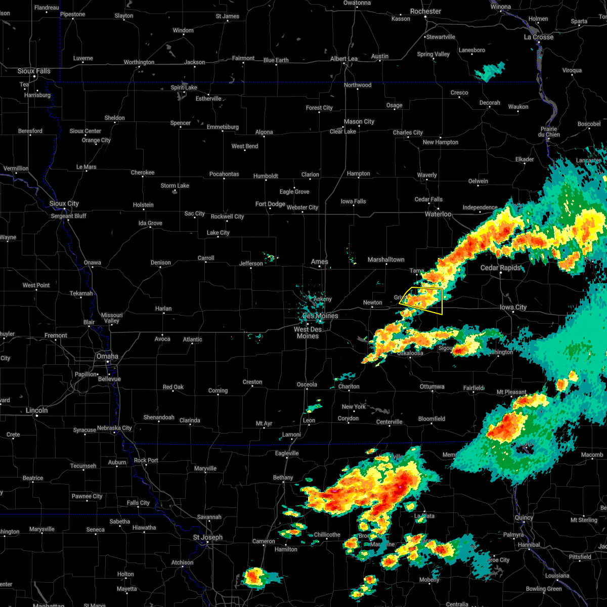 At 813 pm cdt, a severe thunderstorm was located near grinnell, moving east at 20 mph (radar indicated). Hazards include 60 mph wind gusts and nickel size hail. Expect damage to roofs, siding, and trees. locations impacted include, grinnell, brooklyn, victor, holiday lake, malcom, hartwick and guernsey. This includes interstate 80 between mile markers 191 and 204. At 813 pm cdt, a severe thunderstorm was located near grinnell, moving east at 20 mph (radar indicated). Hazards include 60 mph wind gusts and nickel size hail. Expect damage to roofs, siding, and trees. locations impacted include, grinnell, brooklyn, victor, holiday lake, malcom, hartwick and guernsey. This includes interstate 80 between mile markers 191 and 204.
|
| 6/20/2021 7:59 PM CDT |
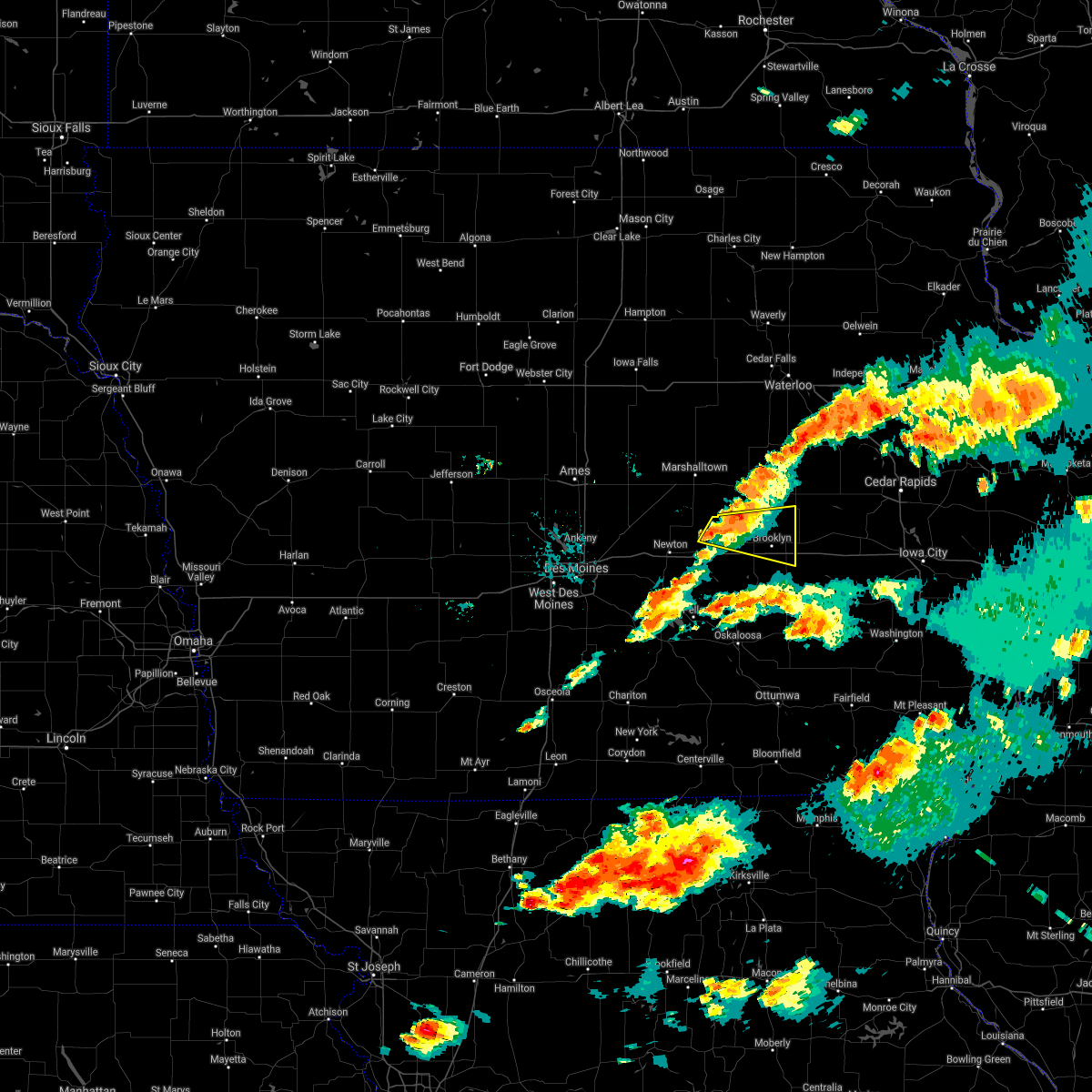 At 759 pm cdt, a severe thunderstorm was located over grinnell, moving east at 20 mph (radar indicated). Hazards include 60 mph wind gusts and nickel size hail. expect damage to roofs, siding, and trees At 759 pm cdt, a severe thunderstorm was located over grinnell, moving east at 20 mph (radar indicated). Hazards include 60 mph wind gusts and nickel size hail. expect damage to roofs, siding, and trees
|
| 8/10/2020 12:28 PM CDT |
 At 1227 pm cdt, severe thunderstorms were located along a line extending from 7 miles south of reinbeck to near brooklyn to 6 miles northeast of eddyville, moving east at 70 mph (trained spotters). Hazards include 60 mph wind gusts still possible as these storms depart. expect damage to roofs, siding, and trees At 1227 pm cdt, severe thunderstorms were located along a line extending from 7 miles south of reinbeck to near brooklyn to 6 miles northeast of eddyville, moving east at 70 mph (trained spotters). Hazards include 60 mph wind gusts still possible as these storms depart. expect damage to roofs, siding, and trees
|
| 8/10/2020 12:09 PM CDT |
 At 1208 pm cdt, severe thunderstorms were located along a line extending from near dysart to 6 miles south of ladora to near what cheer, moving east at 70 mph. these are very dangerous storms (trained weather spotters. this line of storms has a history of producing 80 to 90 mph winds and significant tree damage over parts of central iowa). Hazards include 90 mph wind gusts. You are in a life-threatening situation. flying debris may be deadly to those caught without shelter. mobile homes will be heavily damaged or destroyed. homes and businesses will have substantial roof and window damage. expect extensive tree damage and power outages. locations impacted include, cedar rapids, iowa city, vinton, marengo, west branch, sigourney, marion, coralville, north liberty, hiawatha, mount vernon, robins, williamsburg, belle plaine, center point, kalona, lisbon, fairfax, solon and tiffin. this includes the following highways, interstate 80 in iowa between mile markers 205 and 253. Interstate 380 between mile markers 1 and 40. At 1208 pm cdt, severe thunderstorms were located along a line extending from near dysart to 6 miles south of ladora to near what cheer, moving east at 70 mph. these are very dangerous storms (trained weather spotters. this line of storms has a history of producing 80 to 90 mph winds and significant tree damage over parts of central iowa). Hazards include 90 mph wind gusts. You are in a life-threatening situation. flying debris may be deadly to those caught without shelter. mobile homes will be heavily damaged or destroyed. homes and businesses will have substantial roof and window damage. expect extensive tree damage and power outages. locations impacted include, cedar rapids, iowa city, vinton, marengo, west branch, sigourney, marion, coralville, north liberty, hiawatha, mount vernon, robins, williamsburg, belle plaine, center point, kalona, lisbon, fairfax, solon and tiffin. this includes the following highways, interstate 80 in iowa between mile markers 205 and 253. Interstate 380 between mile markers 1 and 40.
|
| 8/10/2020 12:04 PM CDT |
 At 1203 pm cdt, severe thunderstorms were located along a line extending from near traer to near victor to 6 miles west of delta, moving east at 60 mph. these are very dangerous storms (trained weather spotters reporting widespread wind damage). Hazards include 90 mph wind gusts and quarter size hail. some areas may have winds in excess of 100 mph!. You are in a life-threatening situation. flying debris may be deadly to those caught without shelter. mobile homes will be heavily damaged or destroyed. homes and businesses will have substantial roof and window damage. expect extensive tree damage and power outages. locations impacted include, marshalltown, oskaloosa, pella, grinnell, toledo, montezuma, tama, traer, brooklyn, dysart, new sharon, conrad, meskwaki casino, rock creek lake, gladbrook, le grand, victor, sully, garwin and gilman. This includes interstate 80 between mile markers 175 and 204. At 1203 pm cdt, severe thunderstorms were located along a line extending from near traer to near victor to 6 miles west of delta, moving east at 60 mph. these are very dangerous storms (trained weather spotters reporting widespread wind damage). Hazards include 90 mph wind gusts and quarter size hail. some areas may have winds in excess of 100 mph!. You are in a life-threatening situation. flying debris may be deadly to those caught without shelter. mobile homes will be heavily damaged or destroyed. homes and businesses will have substantial roof and window damage. expect extensive tree damage and power outages. locations impacted include, marshalltown, oskaloosa, pella, grinnell, toledo, montezuma, tama, traer, brooklyn, dysart, new sharon, conrad, meskwaki casino, rock creek lake, gladbrook, le grand, victor, sully, garwin and gilman. This includes interstate 80 between mile markers 175 and 204.
|
| 8/10/2020 11:52 AM CDT |
 At 1152 am cdt, severe thunderstorms were located along a line extending from 8 miles east of conrad to near brooklyn to near oskaloosa, moving east at 60 mph. these are very dangerous storms (trained spotters). Hazards include 90 mph wind gusts and quarter size hail. You are in a life-threatening situation. flying debris may be deadly to those caught without shelter. mobile homes will be heavily damaged or destroyed. homes and businesses will have substantial roof and window damage. Expect extensive tree damage and power outages. At 1152 am cdt, severe thunderstorms were located along a line extending from 8 miles east of conrad to near brooklyn to near oskaloosa, moving east at 60 mph. these are very dangerous storms (trained spotters). Hazards include 90 mph wind gusts and quarter size hail. You are in a life-threatening situation. flying debris may be deadly to those caught without shelter. mobile homes will be heavily damaged or destroyed. homes and businesses will have substantial roof and window damage. Expect extensive tree damage and power outages.
|
| 8/10/2020 11:48 AM CDT |
 At 1148 am cdt, severe thunderstorms were located along a line extending from 7 miles east of conrad to near montezuma to near pella, moving east at 70 mph. these are very dangerous storms! (radar indicated). Hazards include 80 mph wind gusts. Flying debris will be dangerous to those caught without shelter. mobile homes will be heavily damaged. expect considerable damage to roofs, windows, and vehicles. Extensive tree damage and power outages are likely. At 1148 am cdt, severe thunderstorms were located along a line extending from 7 miles east of conrad to near montezuma to near pella, moving east at 70 mph. these are very dangerous storms! (radar indicated). Hazards include 80 mph wind gusts. Flying debris will be dangerous to those caught without shelter. mobile homes will be heavily damaged. expect considerable damage to roofs, windows, and vehicles. Extensive tree damage and power outages are likely.
|
| 8/10/2020 11:44 AM CDT |
 At 1143 am cdt, severe thunderstorms were located along a line extending from 9 miles southwest of reinbeck to near brooklyn to 6 miles northwest of oskaloosa, moving east at 70 mph. these are very dangerous storms (radar indicated). Hazards include 80 mph wind gusts and quarter size hail. Flying debris will be dangerous to those caught without shelter. mobile homes will be heavily damaged. expect considerable damage to roofs, windows, and vehicles. extensive tree damage and power outages are likely. locations impacted include, marshalltown, newton, oskaloosa, pella, grinnell, toledo, montezuma, tama, colfax, monroe, traer, prairie city, state center, brooklyn, dysart, new sharon, baxter, iowa speedway, meskwaki casino and rock creek lake. This includes interstate 80 between mile markers 154 and 204. At 1143 am cdt, severe thunderstorms were located along a line extending from 9 miles southwest of reinbeck to near brooklyn to 6 miles northwest of oskaloosa, moving east at 70 mph. these are very dangerous storms (radar indicated). Hazards include 80 mph wind gusts and quarter size hail. Flying debris will be dangerous to those caught without shelter. mobile homes will be heavily damaged. expect considerable damage to roofs, windows, and vehicles. extensive tree damage and power outages are likely. locations impacted include, marshalltown, newton, oskaloosa, pella, grinnell, toledo, montezuma, tama, colfax, monroe, traer, prairie city, state center, brooklyn, dysart, new sharon, baxter, iowa speedway, meskwaki casino and rock creek lake. This includes interstate 80 between mile markers 154 and 204.
|
| 8/10/2020 11:33 AM CDT |
 At 1133 am cdt, severe thunderstorms were located along a line extending from conrad to near grinnell to pella, moving east at 70 mph. these are very dangerous storms (radar indicated). Hazards include 80 mph wind gusts and quarter size hail. Flying debris will be dangerous to those caught without shelter. mobile homes will be heavily damaged. expect considerable damage to roofs, windows, and vehicles. extensive tree damage and power outages are likely. locations impacted include, marshalltown, newton, altoona, oskaloosa, pella, grinnell, pleasant hill, nevada, toledo, montezuma, carlisle, bondurant, story city, tama, mitchellville, colfax, monroe, traer, prairie city and state center. This includes interstate 80 between mile markers 142 and 204. At 1133 am cdt, severe thunderstorms were located along a line extending from conrad to near grinnell to pella, moving east at 70 mph. these are very dangerous storms (radar indicated). Hazards include 80 mph wind gusts and quarter size hail. Flying debris will be dangerous to those caught without shelter. mobile homes will be heavily damaged. expect considerable damage to roofs, windows, and vehicles. extensive tree damage and power outages are likely. locations impacted include, marshalltown, newton, altoona, oskaloosa, pella, grinnell, pleasant hill, nevada, toledo, montezuma, carlisle, bondurant, story city, tama, mitchellville, colfax, monroe, traer, prairie city and state center. This includes interstate 80 between mile markers 142 and 204.
|
| 8/10/2020 11:19 AM CDT |
 At 1118 am cdt, severe thunderstorms were located along a line extending from 12 miles southwest of eldora to near newton to pleasantville, moving east at 70 mph. these are very dangerous storms (radar indicated). Hazards include 80 mph wind gusts and quarter size hail. Flying debris will be dangerous to those caught without shelter. mobile homes will be heavily damaged. expect considerable damage to roofs, windows, and vehicles. Extensive tree damage and power outages are likely. At 1118 am cdt, severe thunderstorms were located along a line extending from 12 miles southwest of eldora to near newton to pleasantville, moving east at 70 mph. these are very dangerous storms (radar indicated). Hazards include 80 mph wind gusts and quarter size hail. Flying debris will be dangerous to those caught without shelter. mobile homes will be heavily damaged. expect considerable damage to roofs, windows, and vehicles. Extensive tree damage and power outages are likely.
|
| 7/11/2020 6:39 PM CDT |
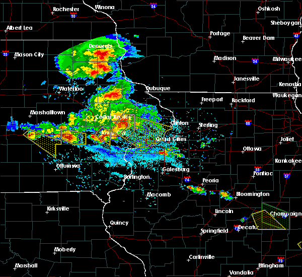 At 639 pm cdt, a severe thunderstorm was located over parnell, or 16 miles south of marengo, moving southeast at 40 mph (radar indicated). Hazards include 60 mph wind gusts and half dollar size hail. Hail damage to vehicles is expected. expect wind damage to roofs, siding, and trees. locations impacted include, williamsburg, north english, victor, parnell, millersburg, holbrook and lake iowa park. This includes interstate 80 in iowa between mile markers 206 and 212. At 639 pm cdt, a severe thunderstorm was located over parnell, or 16 miles south of marengo, moving southeast at 40 mph (radar indicated). Hazards include 60 mph wind gusts and half dollar size hail. Hail damage to vehicles is expected. expect wind damage to roofs, siding, and trees. locations impacted include, williamsburg, north english, victor, parnell, millersburg, holbrook and lake iowa park. This includes interstate 80 in iowa between mile markers 206 and 212.
|
| 7/11/2020 6:21 PM CDT | Quarter sized hail reported 0.3 miles W of Victor, IA |
| 7/11/2020 6:18 PM CDT |
 At 617 pm cdt, a severe thunderstorm was located near victor, or 12 miles southwest of marengo, moving east at 40 mph (radar indicated). Hazards include 60 mph wind gusts and half dollar size hail. Hail damage to vehicles is expected. Expect wind damage to roofs, siding, and trees. At 617 pm cdt, a severe thunderstorm was located near victor, or 12 miles southwest of marengo, moving east at 40 mph (radar indicated). Hazards include 60 mph wind gusts and half dollar size hail. Hail damage to vehicles is expected. Expect wind damage to roofs, siding, and trees.
|
| 8/20/2019 6:53 AM CDT |
 A severe thunderstorm warning remains in effect until 730 am cdt for northwestern henry. northwestern louisa. keokuk. johnson. washington. western muscatine. jefferson and iowa counties. At 653 am cdt, severe thunderstorms were located along a line extending from near ladora to near harper to 7 miles northwest of bloomfield, moving east at 60 mph. A severe thunderstorm warning remains in effect until 730 am cdt for northwestern henry. northwestern louisa. keokuk. johnson. washington. western muscatine. jefferson and iowa counties. At 653 am cdt, severe thunderstorms were located along a line extending from near ladora to near harper to 7 miles northwest of bloomfield, moving east at 60 mph.
|
| 8/20/2019 6:36 AM CDT |
 At 636 am cdt, the leading edge of severe thunderstorms was located along a line extending from near keswick to 7 miles southwest of delta to near albia to 9 miles south of chariton, moving east at 65 mph (radar indicated). Hazards include 60 mph wind gusts. Expect damage to roofs, siding, and trees. locations impacted include, oskaloosa, pella, grinnell, knoxville, osceola, chariton, albia, montezuma, brooklyn, new sharon, melcher-dallas, eddyville, knoxville raceway, rock creek lake, lakeside casino, lake red rock, victor, sully, murray and fremont. this includes the following highways, interstate 35 between mile markers 30 and 42. Interstate 80 between mile markers 172 and 204. At 636 am cdt, the leading edge of severe thunderstorms was located along a line extending from near keswick to 7 miles southwest of delta to near albia to 9 miles south of chariton, moving east at 65 mph (radar indicated). Hazards include 60 mph wind gusts. Expect damage to roofs, siding, and trees. locations impacted include, oskaloosa, pella, grinnell, knoxville, osceola, chariton, albia, montezuma, brooklyn, new sharon, melcher-dallas, eddyville, knoxville raceway, rock creek lake, lakeside casino, lake red rock, victor, sully, murray and fremont. this includes the following highways, interstate 35 between mile markers 30 and 42. Interstate 80 between mile markers 172 and 204.
|
| 8/20/2019 6:28 AM CDT |
 At 627 am cdt, severe thunderstorms were located along a line extending from near brooklyn to near what cheer to near rathbun lake, moving east at 60 mph (radar indicated). Hazards include 60 mph wind gusts. expect damage to roofs, siding, and trees At 627 am cdt, severe thunderstorms were located along a line extending from near brooklyn to near what cheer to near rathbun lake, moving east at 60 mph (radar indicated). Hazards include 60 mph wind gusts. expect damage to roofs, siding, and trees
|
| 8/20/2019 5:55 AM CDT |
 The national weather service in des moines has issued a * severe thunderstorm warning for. monroe county in south central iowa. poweshiek county in central iowa. lucas county in south central iowa. Marion county in south central iowa. The national weather service in des moines has issued a * severe thunderstorm warning for. monroe county in south central iowa. poweshiek county in central iowa. lucas county in south central iowa. Marion county in south central iowa.
|
| 6/15/2019 6:37 PM CDT |
 At 635 pm cdt, severe thunderstorms were located along a line extending from blairstown to north english, moving east at 40 mph (spotters have estimated 60 mph winds with this line of storms but higher gusts are possible). Hazards include 70 mph wind gusts. Expect considerable tree damage. damage is likely to mobile homes, roofs, and outbuildings. locations impacted include, marengo, williamsburg, north english, victor, ladora, parnell, millersburg, amana, conroy, middle amana, south amana, homestead, west amana, lake iowa park, upper south amana, east amana, genoa bluff, koszta, high amana and iowa county fairgrounds. This includes interstate 80 in iowa between mile markers 205 and 229. At 635 pm cdt, severe thunderstorms were located along a line extending from blairstown to north english, moving east at 40 mph (spotters have estimated 60 mph winds with this line of storms but higher gusts are possible). Hazards include 70 mph wind gusts. Expect considerable tree damage. damage is likely to mobile homes, roofs, and outbuildings. locations impacted include, marengo, williamsburg, north english, victor, ladora, parnell, millersburg, amana, conroy, middle amana, south amana, homestead, west amana, lake iowa park, upper south amana, east amana, genoa bluff, koszta, high amana and iowa county fairgrounds. This includes interstate 80 in iowa between mile markers 205 and 229.
|
| 6/15/2019 6:24 PM CDT |
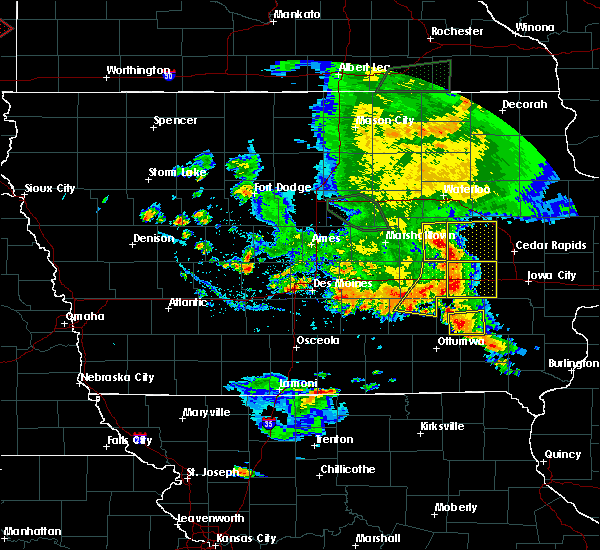 At 624 pm cdt, severe thunderstorms were located along a line extending from near belle plaine to 6 miles southeast of montezuma to near oskaloosa, moving east at 35 mph (radar indicated). Hazards include 60 mph wind gusts and penny size hail. Expect damage to roofs, siding, and trees. locations impacted include, montezuma, brooklyn, new sharon, victor, holiday lake, malcom, deep river, barnes city, hartwick and guernsey. This includes interstate 80 between mile markers 190 and 204. At 624 pm cdt, severe thunderstorms were located along a line extending from near belle plaine to 6 miles southeast of montezuma to near oskaloosa, moving east at 35 mph (radar indicated). Hazards include 60 mph wind gusts and penny size hail. Expect damage to roofs, siding, and trees. locations impacted include, montezuma, brooklyn, new sharon, victor, holiday lake, malcom, deep river, barnes city, hartwick and guernsey. This includes interstate 80 between mile markers 190 and 204.
|
| 6/15/2019 6:20 PM CDT |
 At 619 pm cdt, severe thunderstorms were located along a line extending from near belle plaine to near montezuma to 6 miles northwest of oskaloosa, moving east at 35 mph (radar indicated). Hazards include 60 mph wind gusts and penny size hail. Expect damage to roofs, siding, and trees. locations impacted include, pella, grinnell, montezuma, brooklyn, new sharon, victor, sully, holiday lake, lynnville, malcom, deep river, barnes city, searsboro, hartwick, guernsey and grinnell regional airport. This includes interstate 80 between mile markers 181 and 204. At 619 pm cdt, severe thunderstorms were located along a line extending from near belle plaine to near montezuma to 6 miles northwest of oskaloosa, moving east at 35 mph (radar indicated). Hazards include 60 mph wind gusts and penny size hail. Expect damage to roofs, siding, and trees. locations impacted include, pella, grinnell, montezuma, brooklyn, new sharon, victor, sully, holiday lake, lynnville, malcom, deep river, barnes city, searsboro, hartwick, guernsey and grinnell regional airport. This includes interstate 80 between mile markers 181 and 204.
|
| 6/15/2019 6:19 PM CDT |
 At 619 pm cdt, severe thunderstorms were located along a line extending from belle plaine to near keswick, moving east at 40 mph (radar indicated). Hazards include 70 mph wind gusts. Expect considerable tree damage. damage is likely to mobile homes, roofs, and outbuildings. locations impacted include, marengo, williamsburg, north english, victor, ladora, parnell, millersburg, amana, conroy, middle amana, south amana, homestead, west amana, lake iowa park, upper south amana, east amana, genoa bluff, koszta, high amana and iowa county fairgrounds. This includes interstate 80 in iowa between mile markers 205 and 229. At 619 pm cdt, severe thunderstorms were located along a line extending from belle plaine to near keswick, moving east at 40 mph (radar indicated). Hazards include 70 mph wind gusts. Expect considerable tree damage. damage is likely to mobile homes, roofs, and outbuildings. locations impacted include, marengo, williamsburg, north english, victor, ladora, parnell, millersburg, amana, conroy, middle amana, south amana, homestead, west amana, lake iowa park, upper south amana, east amana, genoa bluff, koszta, high amana and iowa county fairgrounds. This includes interstate 80 in iowa between mile markers 205 and 229.
|
| 6/15/2019 6:17 PM CDT | Time estimated from rada in iowa county IA, 0.3 miles W of Victor, IA |
| 6/15/2019 6:06 PM CDT |
 At 606 pm cdt, severe thunderstorms were located along a line extending from 7 miles west of belle plaine to near montezuma to near pella, moving east at 50 mph (radar indicated). Hazards include 60 mph wind gusts and penny size hail. Expect damage to roofs, siding, and trees. locations impacted include, newton, pella, grinnell, montezuma, monroe, brooklyn, new sharon, iowa speedway, rock creek lake, victor, sully, kellogg, gilman, holiday lake, lynnville, malcom, deep river, barnes city, oakland acres and reasnor. This includes interstate 80 between mile markers 165 and 204. At 606 pm cdt, severe thunderstorms were located along a line extending from 7 miles west of belle plaine to near montezuma to near pella, moving east at 50 mph (radar indicated). Hazards include 60 mph wind gusts and penny size hail. Expect damage to roofs, siding, and trees. locations impacted include, newton, pella, grinnell, montezuma, monroe, brooklyn, new sharon, iowa speedway, rock creek lake, victor, sully, kellogg, gilman, holiday lake, lynnville, malcom, deep river, barnes city, oakland acres and reasnor. This includes interstate 80 between mile markers 165 and 204.
|
| 6/15/2019 6:06 PM CDT |
 At 606 pm cdt, severe thunderstorms were located along a line extending from near belle plaine to 6 miles northwest of what cheer, moving east at 40 mph (radar indicated). Hazards include 70 mph wind gusts. Expect considerable tree damage. Damage is likely to mobile homes, roofs, and outbuildings. At 606 pm cdt, severe thunderstorms were located along a line extending from near belle plaine to 6 miles northwest of what cheer, moving east at 40 mph (radar indicated). Hazards include 70 mph wind gusts. Expect considerable tree damage. Damage is likely to mobile homes, roofs, and outbuildings.
|
| 6/15/2019 5:49 PM CDT |
 The national weather service in des moines has issued a * severe thunderstorm warning for. poweshiek county in central iowa. southeastern marshall county in central iowa. northeastern marion county in south central iowa. Southern tama county in central iowa. The national weather service in des moines has issued a * severe thunderstorm warning for. poweshiek county in central iowa. southeastern marshall county in central iowa. northeastern marion county in south central iowa. Southern tama county in central iowa.
|
| 5/29/2019 7:37 PM CDT |
 At 735 pm cdt, a severe thunderstorm capable of producing a tornado was located near williamsburg, or 11 miles south of marengo, moving east at 20 mph. another tornadic storm was moving out of the deep river area of poweshiek county and into the western part of the warning in iowa county (radar indicated rotation). Hazards include tornado and quarter size hail. Flying debris will be dangerous to those caught without shelter. mobile homes will be damaged or destroyed. damage to roofs, windows, and vehicles will occur. tree damage is likely. this dangerous storm will be near, parnell around 745 pm cdt. williamsburg around 750 pm cdt. conroy around 755 pm cdt. other locations impacted by this tornadic thunderstorm include genoa bluff, lake iowa park, koszta and victor. This includes interstate 80 in iowa between mile markers 205 and 227. At 735 pm cdt, a severe thunderstorm capable of producing a tornado was located near williamsburg, or 11 miles south of marengo, moving east at 20 mph. another tornadic storm was moving out of the deep river area of poweshiek county and into the western part of the warning in iowa county (radar indicated rotation). Hazards include tornado and quarter size hail. Flying debris will be dangerous to those caught without shelter. mobile homes will be damaged or destroyed. damage to roofs, windows, and vehicles will occur. tree damage is likely. this dangerous storm will be near, parnell around 745 pm cdt. williamsburg around 750 pm cdt. conroy around 755 pm cdt. other locations impacted by this tornadic thunderstorm include genoa bluff, lake iowa park, koszta and victor. This includes interstate 80 in iowa between mile markers 205 and 227.
|
| 5/29/2019 7:18 PM CDT |
 At 716 pm cdt, a severe thunderstorm capable of producing a tornado was located near millersburg, or 14 miles southwest of marengo, moving northeast at 15 mph. another potential tornado was moving into the southwestern iowa county areas out of poweshiek county as well (radar indicated rotation). Hazards include tornado and quarter size hail. Flying debris will be dangerous to those caught without shelter. mobile homes will be damaged or destroyed. damage to roofs, windows, and vehicles will occur. tree damage is likely. this dangerous storm will be near, williamsburg, ladora and conroy around 800 pm cdt. other locations impacted by this tornadic thunderstorm include genoa bluff, lake iowa park, koszta and victor. This includes interstate 80 in iowa between mile markers 205 and 227. At 716 pm cdt, a severe thunderstorm capable of producing a tornado was located near millersburg, or 14 miles southwest of marengo, moving northeast at 15 mph. another potential tornado was moving into the southwestern iowa county areas out of poweshiek county as well (radar indicated rotation). Hazards include tornado and quarter size hail. Flying debris will be dangerous to those caught without shelter. mobile homes will be damaged or destroyed. damage to roofs, windows, and vehicles will occur. tree damage is likely. this dangerous storm will be near, williamsburg, ladora and conroy around 800 pm cdt. other locations impacted by this tornadic thunderstorm include genoa bluff, lake iowa park, koszta and victor. This includes interstate 80 in iowa between mile markers 205 and 227.
|
| 5/29/2019 6:41 PM CDT |
 At 641 pm cdt, a severe thunderstorm capable of producing a tornado was located near ladora, or 7 miles west of marengo, moving northeast at 15 mph (radar indicated rotation). Hazards include tornado and quarter size hail. Flying debris will be dangerous to those caught without shelter. mobile homes will be damaged or destroyed. damage to roofs, windows, and vehicles will occur. tree damage is likely. this dangerous storm will be near, marengo, belle plaine, blairstown and luzerne around 700 pm cdt. other locations impacted by this tornadic thunderstorm include hannen lake park, watkins, koszta, iowa county fairgrounds, victor and genoa bluff. This includes interstate 80 in iowa between mile markers 210 and 211. At 641 pm cdt, a severe thunderstorm capable of producing a tornado was located near ladora, or 7 miles west of marengo, moving northeast at 15 mph (radar indicated rotation). Hazards include tornado and quarter size hail. Flying debris will be dangerous to those caught without shelter. mobile homes will be damaged or destroyed. damage to roofs, windows, and vehicles will occur. tree damage is likely. this dangerous storm will be near, marengo, belle plaine, blairstown and luzerne around 700 pm cdt. other locations impacted by this tornadic thunderstorm include hannen lake park, watkins, koszta, iowa county fairgrounds, victor and genoa bluff. This includes interstate 80 in iowa between mile markers 210 and 211.
|
| 5/29/2019 6:20 PM CDT |
 At 618 pm cdt, a severe thunderstorm capable of producing a tornado was located over victor, or 12 miles west of marengo, moving northeast at 15 mph. a rotating wall cloud was reported with this storm at 605 pm in poweshiek county (radar indicated rotation). Hazards include tornado and quarter size hail. Flying debris will be dangerous to those caught without shelter. mobile homes will be damaged or destroyed. damage to roofs, windows, and vehicles will occur. tree damage is likely. this dangerous storm will be near, ladora around 635 pm cdt. marengo, belle plaine, blairstown and luzerne around 700 pm cdt. other locations impacted by this tornadic thunderstorm include hannen lake park, watkins, koszta, iowa county fairgrounds, victor and genoa bluff. This includes interstate 80 in iowa between mile markers 205 and 211. At 618 pm cdt, a severe thunderstorm capable of producing a tornado was located over victor, or 12 miles west of marengo, moving northeast at 15 mph. a rotating wall cloud was reported with this storm at 605 pm in poweshiek county (radar indicated rotation). Hazards include tornado and quarter size hail. Flying debris will be dangerous to those caught without shelter. mobile homes will be damaged or destroyed. damage to roofs, windows, and vehicles will occur. tree damage is likely. this dangerous storm will be near, ladora around 635 pm cdt. marengo, belle plaine, blairstown and luzerne around 700 pm cdt. other locations impacted by this tornadic thunderstorm include hannen lake park, watkins, koszta, iowa county fairgrounds, victor and genoa bluff. This includes interstate 80 in iowa between mile markers 205 and 211.
|
| 5/29/2019 6:09 PM CDT |
 At 608 pm cdt, a thunderstorm capable of producing a tornado was located near victor, or 11 miles northeast of montezuma, moving northeast at 15 mph (storm chaser reported rapidly rotating wall cloud at 605pm). Hazards include tornado. Flying debris will be dangerous to those caught without shelter. mobile homes will be damaged or destroyed. damage to roofs, windows, and vehicles will occur. tree damage is likely. this dangerous storm will be near, victor around 630 pm cdt. other locations impacted by this tornadic thunderstorm include victor and guernsey. This includes interstate 80 between mile markers 201 and 204. At 608 pm cdt, a thunderstorm capable of producing a tornado was located near victor, or 11 miles northeast of montezuma, moving northeast at 15 mph (storm chaser reported rapidly rotating wall cloud at 605pm). Hazards include tornado. Flying debris will be dangerous to those caught without shelter. mobile homes will be damaged or destroyed. damage to roofs, windows, and vehicles will occur. tree damage is likely. this dangerous storm will be near, victor around 630 pm cdt. other locations impacted by this tornadic thunderstorm include victor and guernsey. This includes interstate 80 between mile markers 201 and 204.
|
| 5/29/2019 5:54 PM CDT |
 At 553 pm cdt, a thunderstorm capable of producing a tornado was located 7 miles southwest of victor, or 9 miles northeast of montezuma, moving northeast at 15 mph (radar indicated rotation). Hazards include tornado. Expect damage to mobile homes, roofs, and vehicles. this dangerous storm will be near, victor around 630 pm cdt. other locations impacted by this tornadic thunderstorm include victor and guernsey. This includes interstate 80 between mile markers 199 and 204. At 553 pm cdt, a thunderstorm capable of producing a tornado was located 7 miles southwest of victor, or 9 miles northeast of montezuma, moving northeast at 15 mph (radar indicated rotation). Hazards include tornado. Expect damage to mobile homes, roofs, and vehicles. this dangerous storm will be near, victor around 630 pm cdt. other locations impacted by this tornadic thunderstorm include victor and guernsey. This includes interstate 80 between mile markers 199 and 204.
|
| 5/24/2019 8:05 AM CDT |
 At 805 am cdt, severe thunderstorms were located along a line extending from 7 miles east of tama to near brooklyn, moving northeast at 55 mph (radar indicated). Hazards include 60 mph wind gusts. Expect damage to roofs, siding, and trees. locations impacted include, montezuma, brooklyn, victor, holiday lake, chelsea, hartwick and guernsey. This includes interstate 80 between mile markers 192 and 204. At 805 am cdt, severe thunderstorms were located along a line extending from 7 miles east of tama to near brooklyn, moving northeast at 55 mph (radar indicated). Hazards include 60 mph wind gusts. Expect damage to roofs, siding, and trees. locations impacted include, montezuma, brooklyn, victor, holiday lake, chelsea, hartwick and guernsey. This includes interstate 80 between mile markers 192 and 204.
|
| 5/24/2019 7:54 AM CDT |
 At 754 am cdt, severe thunderstorms were located along a line extending from near tama to near montezuma, moving northeast at 55 mph (radar indicated). Hazards include 60 mph wind gusts. expect damage to roofs, siding, and trees At 754 am cdt, severe thunderstorms were located along a line extending from near tama to near montezuma, moving northeast at 55 mph (radar indicated). Hazards include 60 mph wind gusts. expect damage to roofs, siding, and trees
|
| 5/16/2019 9:26 PM CDT |
 The severe thunderstorm warning for iowa county will expire at 930 pm cdt, the storms which prompted the warning have weakened below severe limits, and no longer pose an immediate threat to life or property. therefore, the warning will be allowed to expire. however gusty winds and heavy rain are still possible with these thunderstorms. a severe thunderstorm watch remains in effect until 300 am cdt for southeastern and east central iowa. The severe thunderstorm warning for iowa county will expire at 930 pm cdt, the storms which prompted the warning have weakened below severe limits, and no longer pose an immediate threat to life or property. therefore, the warning will be allowed to expire. however gusty winds and heavy rain are still possible with these thunderstorms. a severe thunderstorm watch remains in effect until 300 am cdt for southeastern and east central iowa.
|
| 5/16/2019 9:03 PM CDT |
 At 902 pm cdt, severe thunderstorms were located along a line extending from near amana to near kinross, moving east at 55 mph. these are very dangerous storms (trained weather spotters). Hazards include 80 mph wind gusts and quarter size hail. Flying debris will be dangerous to those caught without shelter. mobile homes will be heavily damaged. expect considerable damage to roofs, windows, and vehicles. extensive tree damage and power outages are likely. locations impacted include, williamsburg, north english, victor, ladora, parnell, millersburg, conroy, genoa bluff, holbrook and lake iowa park. This includes interstate 80 in iowa between mile markers 205 and 229. At 902 pm cdt, severe thunderstorms were located along a line extending from near amana to near kinross, moving east at 55 mph. these are very dangerous storms (trained weather spotters). Hazards include 80 mph wind gusts and quarter size hail. Flying debris will be dangerous to those caught without shelter. mobile homes will be heavily damaged. expect considerable damage to roofs, windows, and vehicles. extensive tree damage and power outages are likely. locations impacted include, williamsburg, north english, victor, ladora, parnell, millersburg, conroy, genoa bluff, holbrook and lake iowa park. This includes interstate 80 in iowa between mile markers 205 and 229.
|
| 5/16/2019 8:37 PM CDT |
 At 837 pm cdt, severe thunderstorms were located along a line extending from near ladora to near keswick, moving east at 35 mph (radar indicated). Hazards include 70 mph wind gusts and half dollar size hail. Hail damage to vehicles is expected. expect considerable tree damage. wind damage is also likely to mobile homes, roofs, and outbuildings. locations impacted include, williamsburg, north english, victor, ladora, parnell, millersburg, conroy, genoa bluff, holbrook and lake iowa park. This includes interstate 80 in iowa between mile markers 205 and 229. At 837 pm cdt, severe thunderstorms were located along a line extending from near ladora to near keswick, moving east at 35 mph (radar indicated). Hazards include 70 mph wind gusts and half dollar size hail. Hail damage to vehicles is expected. expect considerable tree damage. wind damage is also likely to mobile homes, roofs, and outbuildings. locations impacted include, williamsburg, north english, victor, ladora, parnell, millersburg, conroy, genoa bluff, holbrook and lake iowa park. This includes interstate 80 in iowa between mile markers 205 and 229.
|
| 5/16/2019 8:27 PM CDT |
 At 827 pm cdt, severe thunderstorms were located along a line extending from near victor to 8 miles north of what cheer, moving east at 30 mph (radar indicated). Hazards include 60 mph wind gusts and half dollar size hail. Hail damage to vehicles is expected. Expect wind damage to roofs, siding, and trees. At 827 pm cdt, severe thunderstorms were located along a line extending from near victor to 8 miles north of what cheer, moving east at 30 mph (radar indicated). Hazards include 60 mph wind gusts and half dollar size hail. Hail damage to vehicles is expected. Expect wind damage to roofs, siding, and trees.
|
| 5/16/2019 8:23 PM CDT |
 At 823 pm cdt, a severe thunderstorm was located near brooklyn, or 7 miles northeast of montezuma, moving east at 20 mph (radar indicated). Hazards include quarter size hail. damage to vehicles is expected At 823 pm cdt, a severe thunderstorm was located near brooklyn, or 7 miles northeast of montezuma, moving east at 20 mph (radar indicated). Hazards include quarter size hail. damage to vehicles is expected
|
| 10/9/2018 3:17 PM CDT |
 At 317 pm cdt, a severe thunderstorm capable of producing a tornado was located near ladora, or 9 miles southwest of marengo, moving north at 30 mph (weather spotters reported a funnel cloud). Hazards include tornado. Flying debris will be dangerous to those caught without shelter. mobile homes will be damaged or destroyed. damage to roofs, windows, and vehicles will occur. tree damage is likely. this dangerous storm will be near, ladora around 325 pm cdt. marengo around 335 pm cdt. blairstown and luzerne around 345 pm cdt. other locations impacted by this tornadic thunderstorm include genoa bluff, hannen lake park, koszta, iowa county fairgrounds and victor. This includes interstate 80 in iowa between mile markers 205 and 214. At 317 pm cdt, a severe thunderstorm capable of producing a tornado was located near ladora, or 9 miles southwest of marengo, moving north at 30 mph (weather spotters reported a funnel cloud). Hazards include tornado. Flying debris will be dangerous to those caught without shelter. mobile homes will be damaged or destroyed. damage to roofs, windows, and vehicles will occur. tree damage is likely. this dangerous storm will be near, ladora around 325 pm cdt. marengo around 335 pm cdt. blairstown and luzerne around 345 pm cdt. other locations impacted by this tornadic thunderstorm include genoa bluff, hannen lake park, koszta, iowa county fairgrounds and victor. This includes interstate 80 in iowa between mile markers 205 and 214.
|
| 10/9/2018 3:10 PM CDT |
 At 310 pm cdt, a severe thunderstorm capable of producing a tornado was located near ladora, or 10 miles southwest of marengo, moving north at 30 mph (weather spotters reported a funnel cloud). Hazards include tornado. Flying debris will be dangerous to those caught without shelter. mobile homes will be damaged or destroyed. damage to roofs, windows, and vehicles will occur. tree damage is likely. this dangerous storm will be near, ladora around 320 pm cdt. marengo around 330 pm cdt. luzerne around 340 pm cdt. newhall, blairstown and van horne around 345 pm cdt. other locations impacted by this tornadic thunderstorm include genoa bluff, hannen lake park, watkins, koszta, iowa county fairgrounds, lake iowa park and victor. This includes interstate 80 in iowa between mile markers 205 and 217. At 310 pm cdt, a severe thunderstorm capable of producing a tornado was located near ladora, or 10 miles southwest of marengo, moving north at 30 mph (weather spotters reported a funnel cloud). Hazards include tornado. Flying debris will be dangerous to those caught without shelter. mobile homes will be damaged or destroyed. damage to roofs, windows, and vehicles will occur. tree damage is likely. this dangerous storm will be near, ladora around 320 pm cdt. marengo around 330 pm cdt. luzerne around 340 pm cdt. newhall, blairstown and van horne around 345 pm cdt. other locations impacted by this tornadic thunderstorm include genoa bluff, hannen lake park, watkins, koszta, iowa county fairgrounds, lake iowa park and victor. This includes interstate 80 in iowa between mile markers 205 and 217.
|
| 10/9/2018 3:06 PM CDT |
 At 305 pm cdt, a severe thunderstorm capable of producing a tornado was located near victor, or 11 miles southwest of marengo, moving north at 35 mph (radar indicated rotation). Hazards include tornado. Flying debris will be dangerous to those caught without shelter. mobile homes will be damaged or destroyed. damage to roofs, windows, and vehicles will occur. tree damage is likely. this dangerous storm will be near, victor and ladora around 315 pm cdt. marengo around 325 pm cdt. belle plaine and luzerne around 335 pm cdt. blairstown around 340 pm cdt. newhall, van horne and keystone around 345 pm cdt. other locations impacted by this tornadic thunderstorm include genoa bluff, hannen lake park, watkins, koszta, iowa county fairgrounds, lake iowa park and victor. This includes interstate 80 in iowa between mile markers 205 and 217. At 305 pm cdt, a severe thunderstorm capable of producing a tornado was located near victor, or 11 miles southwest of marengo, moving north at 35 mph (radar indicated rotation). Hazards include tornado. Flying debris will be dangerous to those caught without shelter. mobile homes will be damaged or destroyed. damage to roofs, windows, and vehicles will occur. tree damage is likely. this dangerous storm will be near, victor and ladora around 315 pm cdt. marengo around 325 pm cdt. belle plaine and luzerne around 335 pm cdt. blairstown around 340 pm cdt. newhall, van horne and keystone around 345 pm cdt. other locations impacted by this tornadic thunderstorm include genoa bluff, hannen lake park, watkins, koszta, iowa county fairgrounds, lake iowa park and victor. This includes interstate 80 in iowa between mile markers 205 and 217.
|
| 10/8/2018 10:46 PM CDT |
 At 1045 pm cdt, a severe thunderstorm was located over luzerne, or 10 miles northwest of marengo, moving northeast at 40 mph. at 1044 pm cdt a trained spotter reported winds of 55 mph in belle plaine (radar indicated). Hazards include 60 mph wind gusts. Expect damage to roofs, siding, and trees. locations impacted include, vinton, marengo, belle plaine, atkins, walford, urbana, shellsburg, victor, newhall, blairstown, van horne, keystone, norway, garrison, ladora, luzerne, amana, middle amana, vinton memorial airport and upper south amana. This includes interstate 380 between mile markers 40 and 44. At 1045 pm cdt, a severe thunderstorm was located over luzerne, or 10 miles northwest of marengo, moving northeast at 40 mph. at 1044 pm cdt a trained spotter reported winds of 55 mph in belle plaine (radar indicated). Hazards include 60 mph wind gusts. Expect damage to roofs, siding, and trees. locations impacted include, vinton, marengo, belle plaine, atkins, walford, urbana, shellsburg, victor, newhall, blairstown, van horne, keystone, norway, garrison, ladora, luzerne, amana, middle amana, vinton memorial airport and upper south amana. This includes interstate 380 between mile markers 40 and 44.
|
| 10/8/2018 10:29 PM CDT |
 At 1029 pm cdt, a severe thunderstorm was located near belle plaine, or 14 miles west of marengo, moving northeast at 40 mph (radar indicated). Hazards include 60 mph wind gusts. expect damage to roofs, siding, and trees At 1029 pm cdt, a severe thunderstorm was located near belle plaine, or 14 miles west of marengo, moving northeast at 40 mph (radar indicated). Hazards include 60 mph wind gusts. expect damage to roofs, siding, and trees
|
| 10/8/2018 10:10 PM CDT |
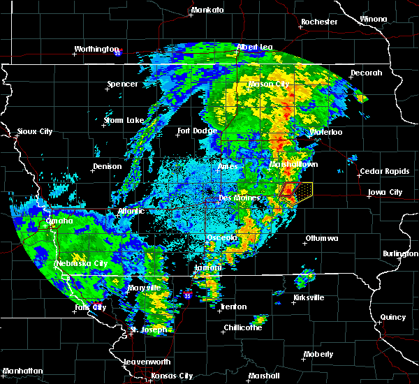 A severe thunderstorm warning remains in effect until 1015 pm cdt for poweshiek county, in addition, a tornado warning is in effect for a small portion of northwest poweshiek county until 1030 pm cdt. at 1008 pm cdt, a severe thunderstorm was located near brooklyn, or 9 miles east of grinnell, moving northeast at 45 mph (radar indicated). Hazards include 60 mph wind gusts. Expect damage to roofs, siding, and trees. locations impacted include, grinnell, montezuma, brooklyn, victor, holiday lake, malcom, hartwick and grinnell regional airport. This includes interstate 80 between mile markers 181 and 204. A severe thunderstorm warning remains in effect until 1015 pm cdt for poweshiek county, in addition, a tornado warning is in effect for a small portion of northwest poweshiek county until 1030 pm cdt. at 1008 pm cdt, a severe thunderstorm was located near brooklyn, or 9 miles east of grinnell, moving northeast at 45 mph (radar indicated). Hazards include 60 mph wind gusts. Expect damage to roofs, siding, and trees. locations impacted include, grinnell, montezuma, brooklyn, victor, holiday lake, malcom, hartwick and grinnell regional airport. This includes interstate 80 between mile markers 181 and 204.
|
| 10/8/2018 9:54 PM CDT |
 At 954 pm cdt, a severe thunderstorm was located near grinnell, moving northeast at 45 mph (radar indicated). Hazards include 60 mph wind gusts. expect damage to roofs, siding, and trees At 954 pm cdt, a severe thunderstorm was located near grinnell, moving northeast at 45 mph (radar indicated). Hazards include 60 mph wind gusts. expect damage to roofs, siding, and trees
|
| 9/25/2018 1:03 PM CDT |
 At 103 pm cdt, severe thunderstorms were located along a line extending from near shellsburg to norway to near ladora, moving east at 50 mph (radar indicated). Hazards include 60 mph wind gusts. Expect damage to roofs, siding, and trees. locations impacted include, cedar rapids, iowa city, vinton, marengo, marion, coralville, north liberty, hiawatha, mount vernon, robins, williamsburg, belle plaine, center point, lisbon, fairfax, solon, tiffin, ely, atkins and walford. this includes the following highways, interstate 80 in iowa between mile markers 205 and 248. Interstate 380 between mile markers 1 and 40. At 103 pm cdt, severe thunderstorms were located along a line extending from near shellsburg to norway to near ladora, moving east at 50 mph (radar indicated). Hazards include 60 mph wind gusts. Expect damage to roofs, siding, and trees. locations impacted include, cedar rapids, iowa city, vinton, marengo, marion, coralville, north liberty, hiawatha, mount vernon, robins, williamsburg, belle plaine, center point, lisbon, fairfax, solon, tiffin, ely, atkins and walford. this includes the following highways, interstate 80 in iowa between mile markers 205 and 248. Interstate 380 between mile markers 1 and 40.
|
| 9/25/2018 12:54 PM CDT |
 At 1254 pm cdt, severe thunderstorms were located along a line extending from near vinton to blairstown to near ladora, moving east at 50 mph (radar indicated). Hazards include 60 mph wind gusts. Expect damage to roofs, siding, and trees. locations impacted include, cedar rapids, iowa city, vinton, marengo, marion, coralville, north liberty, hiawatha, mount vernon, robins, williamsburg, belle plaine, center point, lisbon, fairfax, solon, tiffin, ely, atkins and walford. this includes the following highways, interstate 80 in iowa between mile markers 205 and 248. Interstate 380 between mile markers 1 and 40. At 1254 pm cdt, severe thunderstorms were located along a line extending from near vinton to blairstown to near ladora, moving east at 50 mph (radar indicated). Hazards include 60 mph wind gusts. Expect damage to roofs, siding, and trees. locations impacted include, cedar rapids, iowa city, vinton, marengo, marion, coralville, north liberty, hiawatha, mount vernon, robins, williamsburg, belle plaine, center point, lisbon, fairfax, solon, tiffin, ely, atkins and walford. this includes the following highways, interstate 80 in iowa between mile markers 205 and 248. Interstate 380 between mile markers 1 and 40.
|
| 9/25/2018 12:48 PM CDT |
 At 1248 pm cdt, severe thunderstorms were located along a line extending from near garrison to near luzerne to near victor, moving east at 50 mph (radar indicated). Hazards include 60 mph wind gusts. expect damage to roofs, siding, and trees At 1248 pm cdt, severe thunderstorms were located along a line extending from near garrison to near luzerne to near victor, moving east at 50 mph (radar indicated). Hazards include 60 mph wind gusts. expect damage to roofs, siding, and trees
|
| 8/28/2018 5:25 PM CDT |
 At 525 pm cdt, severe thunderstorms were located along a line extending from near brooklyn to near delta, moving east at 45 mph (radar indicated). Hazards include 60 mph wind gusts and penny size hail. Expect damage to roofs, siding, and trees. locations impacted include, washington, sigourney, williamsburg, kalona, wellman, north english, victor, oxford, what cheer, delta, ladora, keswick, south english, parnell, millersburg, harper, kinross, hayesville, conroy and richmond. This includes interstate 80 in iowa between mile markers 205 and 236. At 525 pm cdt, severe thunderstorms were located along a line extending from near brooklyn to near delta, moving east at 45 mph (radar indicated). Hazards include 60 mph wind gusts and penny size hail. Expect damage to roofs, siding, and trees. locations impacted include, washington, sigourney, williamsburg, kalona, wellman, north english, victor, oxford, what cheer, delta, ladora, keswick, south english, parnell, millersburg, harper, kinross, hayesville, conroy and richmond. This includes interstate 80 in iowa between mile markers 205 and 236.
|
| 8/28/2018 5:14 PM CDT |
 At 514 pm cdt, severe thunderstorms were located along a line extending from near montezuma to 6 miles east of oskaloosa, moving east at 45 mph (radar indicated). Hazards include 60 mph wind gusts and penny size hail. expect damage to roofs, siding, and trees At 514 pm cdt, severe thunderstorms were located along a line extending from near montezuma to 6 miles east of oskaloosa, moving east at 45 mph (radar indicated). Hazards include 60 mph wind gusts and penny size hail. expect damage to roofs, siding, and trees
|
| 8/28/2018 5:03 PM CDT |
 At 503 pm cdt, a severe thunderstorm was located over new sharon, or 11 miles north of oskaloosa, moving east at 40 mph (radar indicated). Hazards include 60 mph wind gusts and penny size hail. expect damage to roofs, siding, and trees At 503 pm cdt, a severe thunderstorm was located over new sharon, or 11 miles north of oskaloosa, moving east at 40 mph (radar indicated). Hazards include 60 mph wind gusts and penny size hail. expect damage to roofs, siding, and trees
|
| 6/9/2018 9:57 PM CDT |
 At 957 pm cdt, a severe thunderstorm was located near marengo, moving east at 30 mph (radar indicated). Hazards include 60 mph wind gusts and half dollar size hail. Hail damage to vehicles is expected. expect wind damage to roofs, siding, and trees. locations impacted include, marengo, williamsburg, victor, ladora, amana, conroy, middle amana, south amana, homestead, west amana, upper south amana, east amana, genoa bluff, high amana and iowa county fairgrounds. This includes interstate 80 in iowa between mile markers 205 and 229. At 957 pm cdt, a severe thunderstorm was located near marengo, moving east at 30 mph (radar indicated). Hazards include 60 mph wind gusts and half dollar size hail. Hail damage to vehicles is expected. expect wind damage to roofs, siding, and trees. locations impacted include, marengo, williamsburg, victor, ladora, amana, conroy, middle amana, south amana, homestead, west amana, upper south amana, east amana, genoa bluff, high amana and iowa county fairgrounds. This includes interstate 80 in iowa between mile markers 205 and 229.
|
| 6/9/2018 9:47 PM CDT |
 A severe thunderstorm warning remains in effect until 1030 pm cdt for northern iowa county. at 947 pm cdt, a severe thunderstorm was located over ladora, or 7 miles southwest of marengo, moving east at 30 mph. hazard. 60 mph wind gusts and quarter size hail. source. Radar indicated. A severe thunderstorm warning remains in effect until 1030 pm cdt for northern iowa county. at 947 pm cdt, a severe thunderstorm was located over ladora, or 7 miles southwest of marengo, moving east at 30 mph. hazard. 60 mph wind gusts and quarter size hail. source. Radar indicated.
|
| 6/6/2018 6:26 PM CDT |
 At 626 pm cdt, a severe thunderstorm was located near grinnell, moving south at 35 mph (radar indicated). Hazards include 60 mph wind gusts and quarter size hail. Hail damage to vehicles is expected. expect wind damage to roofs, siding, and trees. locations impacted include, newton, grinnell, montezuma, brooklyn, iowa speedway, rock creek lake, victor, sully, kellogg, gilman, holiday lake, lynnville, malcom, deep river, barnes city, oakland acres, reasnor, searsboro, hartwick and guernsey. This includes interstate 80 between mile markers 165 and 204. At 626 pm cdt, a severe thunderstorm was located near grinnell, moving south at 35 mph (radar indicated). Hazards include 60 mph wind gusts and quarter size hail. Hail damage to vehicles is expected. expect wind damage to roofs, siding, and trees. locations impacted include, newton, grinnell, montezuma, brooklyn, iowa speedway, rock creek lake, victor, sully, kellogg, gilman, holiday lake, lynnville, malcom, deep river, barnes city, oakland acres, reasnor, searsboro, hartwick and guernsey. This includes interstate 80 between mile markers 165 and 204.
|
| 6/6/2018 6:08 PM CDT |
 At 608 pm cdt, a severe thunderstorm was located near grinnell, moving south at 35 mph (radar indicated). Hazards include 60 mph wind gusts and quarter size hail. Hail damage to vehicles is expected. Expect wind damage to roofs, siding, and trees. At 608 pm cdt, a severe thunderstorm was located near grinnell, moving south at 35 mph (radar indicated). Hazards include 60 mph wind gusts and quarter size hail. Hail damage to vehicles is expected. Expect wind damage to roofs, siding, and trees.
|
| 5/26/2018 1:07 AM CDT |
 The severe thunderstorm warning for central iowa county will expire at 115 am cdt, the storm which prompted the warning has weakened below severe limits, and no longer poses an immediate threat to life or property. therefore, the warning will be allowed to expire. however gusty winds and heavy rain are still possible with this thunderstorm. The severe thunderstorm warning for central iowa county will expire at 115 am cdt, the storm which prompted the warning has weakened below severe limits, and no longer poses an immediate threat to life or property. therefore, the warning will be allowed to expire. however gusty winds and heavy rain are still possible with this thunderstorm.
|
| 5/26/2018 1:01 AM CDT |
 At 100 am cdt, a severe thunderstorm was located near ladora, or near marengo, moving southeast at 20 mph (radar indicated). Hazards include 60 mph wind gusts and quarter size hail. Hail damage to vehicles is expected. expect wind damage to roofs, siding, and trees. locations impacted include, marengo, williamsburg, victor, ladora, conroy, genoa bluff and koszta. This includes interstate 80 in iowa between mile markers 207 and 223. At 100 am cdt, a severe thunderstorm was located near ladora, or near marengo, moving southeast at 20 mph (radar indicated). Hazards include 60 mph wind gusts and quarter size hail. Hail damage to vehicles is expected. expect wind damage to roofs, siding, and trees. locations impacted include, marengo, williamsburg, victor, ladora, conroy, genoa bluff and koszta. This includes interstate 80 in iowa between mile markers 207 and 223.
|
| 5/26/2018 12:52 AM CDT |
 At 1251 am cdt, a severe thunderstorm was located over ladora, or near marengo, moving southeast at 15 mph (radar indicated). Hazards include 60 mph wind gusts and quarter size hail. Hail damage to vehicles is expected. expect wind damage to roofs, siding, and trees. locations impacted include, marengo, williamsburg, victor, ladora, conroy, genoa bluff and koszta. This includes interstate 80 in iowa between mile markers 207 and 223. At 1251 am cdt, a severe thunderstorm was located over ladora, or near marengo, moving southeast at 15 mph (radar indicated). Hazards include 60 mph wind gusts and quarter size hail. Hail damage to vehicles is expected. expect wind damage to roofs, siding, and trees. locations impacted include, marengo, williamsburg, victor, ladora, conroy, genoa bluff and koszta. This includes interstate 80 in iowa between mile markers 207 and 223.
|
| 5/26/2018 12:41 AM CDT |
 At 1240 am cdt, a severe thunderstorm was located over ladora, or 8 miles west of marengo, moving southeast at 15 mph (radar indicated). Hazards include 60 mph wind gusts and quarter size hail. Hail damage to vehicles is expected. expect wind damage to roofs, siding, and trees. locations impacted include, marengo, williamsburg, north english, victor, ladora, parnell, millersburg, conroy, genoa bluff, koszta and lake iowa park. This includes interstate 80 in iowa between mile markers 205 and 223. At 1240 am cdt, a severe thunderstorm was located over ladora, or 8 miles west of marengo, moving southeast at 15 mph (radar indicated). Hazards include 60 mph wind gusts and quarter size hail. Hail damage to vehicles is expected. expect wind damage to roofs, siding, and trees. locations impacted include, marengo, williamsburg, north english, victor, ladora, parnell, millersburg, conroy, genoa bluff, koszta and lake iowa park. This includes interstate 80 in iowa between mile markers 205 and 223.
|
| 5/26/2018 12:35 AM CDT |
 At 1234 am cdt, a severe thunderstorm was located near ladora, or 9 miles west of marengo, moving southeast at 15 mph (radar indicated). Hazards include 60 mph wind gusts and half dollar size hail. Hail damage to vehicles is expected. Expect wind damage to roofs, siding, and trees. At 1234 am cdt, a severe thunderstorm was located near ladora, or 9 miles west of marengo, moving southeast at 15 mph (radar indicated). Hazards include 60 mph wind gusts and half dollar size hail. Hail damage to vehicles is expected. Expect wind damage to roofs, siding, and trees.
|
| 8/10/2017 4:09 PM CDT |
 The severe thunderstorm warning for eastern poweshiek county will expire at 415 pm cdt, the severe thunderstorm which prompted the warning has moved out of the warned area. therefore, the warning will be allowed to expire. The severe thunderstorm warning for eastern poweshiek county will expire at 415 pm cdt, the severe thunderstorm which prompted the warning has moved out of the warned area. therefore, the warning will be allowed to expire.
|
| 8/10/2017 3:57 PM CDT |
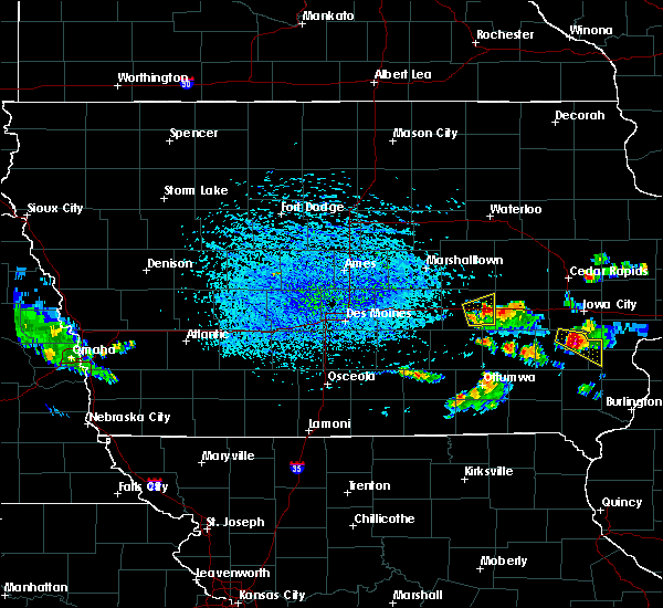 At 357 pm cdt, a severe thunderstorm was located over victor, or 13 miles northeast of montezuma, moving east at 35 mph (radar indicated). Hazards include 60 mph wind gusts and quarter size hail. Hail damage to vehicles is expected. expect wind damage to roofs, siding, and trees. locations impacted include, montezuma, brooklyn, victor, malcom, deep river, hartwick and guernsey. This includes interstate 80 between mile markers 191 and 204. At 357 pm cdt, a severe thunderstorm was located over victor, or 13 miles northeast of montezuma, moving east at 35 mph (radar indicated). Hazards include 60 mph wind gusts and quarter size hail. Hail damage to vehicles is expected. expect wind damage to roofs, siding, and trees. locations impacted include, montezuma, brooklyn, victor, malcom, deep river, hartwick and guernsey. This includes interstate 80 between mile markers 191 and 204.
|
| 8/10/2017 3:44 PM CDT |
 At 343 pm cdt, a severe thunderstorm was located near brooklyn, or near montezuma, moving east at 35 mph (radar indicated). Hazards include quarter size hail. damage to vehicles is expected At 343 pm cdt, a severe thunderstorm was located near brooklyn, or near montezuma, moving east at 35 mph (radar indicated). Hazards include quarter size hail. damage to vehicles is expected
|
| 7/20/2017 11:57 PM CDT |
 At 1148 pm cdt, severe thunderstorms were located along a line extending from 6 miles northwest of keystone to ladora to near what cheer, moving east at 40 mph (radar indicated). Hazards include 60 mph wind gusts. Expect damage to roofs, siding, and trees. locations impacted include, marengo, williamsburg, belle plaine, north english, victor, newhall, blairstown, van horne, what cheer, keystone, norway, ladora, keswick, south english, parnell, millersburg, luzerne, kinross, amana and conroy. This includes interstate 80 in iowa between mile markers 205 and 226. At 1148 pm cdt, severe thunderstorms were located along a line extending from 6 miles northwest of keystone to ladora to near what cheer, moving east at 40 mph (radar indicated). Hazards include 60 mph wind gusts. Expect damage to roofs, siding, and trees. locations impacted include, marengo, williamsburg, belle plaine, north english, victor, newhall, blairstown, van horne, what cheer, keystone, norway, ladora, keswick, south english, parnell, millersburg, luzerne, kinross, amana and conroy. This includes interstate 80 in iowa between mile markers 205 and 226.
|
| 7/20/2017 11:53 PM CDT |
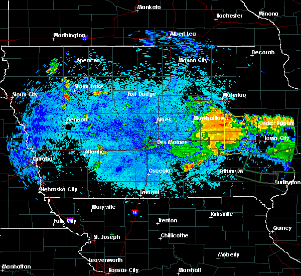 The severe thunderstorm warning for eastern poweshiek county will expire at midnight cdt, the storms which prompted the warning have moved out of the area. therefore the warning will be allowed to expire. to report severe weather, contact your nearest law enforcement agency. they will relay your report to the national weather service des moines. The severe thunderstorm warning for eastern poweshiek county will expire at midnight cdt, the storms which prompted the warning have moved out of the area. therefore the warning will be allowed to expire. to report severe weather, contact your nearest law enforcement agency. they will relay your report to the national weather service des moines.
|
| 7/20/2017 11:48 PM CDT |
 At 1148 pm cdt, severe thunderstorms were located along a line extending from 6 miles northwest of keystone to ladora to near what cheer, moving east at 40 mph (radar indicated). Hazards include 60 mph wind gusts. Expect damage to roofs, siding, and trees. locations impacted include, marengo, williamsburg, belle plaine, north english, victor, newhall, blairstown, van horne, what cheer, keystone, norway, ladora, keswick, south english, parnell, millersburg, luzerne, kinross, amana and conroy. This includes interstate 80 in iowa between mile markers 205 and 226. At 1148 pm cdt, severe thunderstorms were located along a line extending from 6 miles northwest of keystone to ladora to near what cheer, moving east at 40 mph (radar indicated). Hazards include 60 mph wind gusts. Expect damage to roofs, siding, and trees. locations impacted include, marengo, williamsburg, belle plaine, north english, victor, newhall, blairstown, van horne, what cheer, keystone, norway, ladora, keswick, south english, parnell, millersburg, luzerne, kinross, amana and conroy. This includes interstate 80 in iowa between mile markers 205 and 226.
|
| 7/20/2017 11:45 PM CDT |
 At 1145 pm cdt, severe thunderstorms were located along a line extending from near ladora to near millersburg, moving east at 50 mph (radar indicated). Hazards include 60 mph wind gusts. Expect damage to roofs, siding, and trees. locations impacted include, montezuma, brooklyn, victor, holiday lake, malcom, deep river, barnes city, hartwick and guernsey. This includes interstate 80 between mile markers 189 and 204. At 1145 pm cdt, severe thunderstorms were located along a line extending from near ladora to near millersburg, moving east at 50 mph (radar indicated). Hazards include 60 mph wind gusts. Expect damage to roofs, siding, and trees. locations impacted include, montezuma, brooklyn, victor, holiday lake, malcom, deep river, barnes city, hartwick and guernsey. This includes interstate 80 between mile markers 189 and 204.
|
| 7/20/2017 11:39 PM CDT |
 At 1139 pm cdt, severe thunderstorms were located along a line extending from 9 miles west of keystone to near victor to 6 miles northwest of what cheer, moving east at 35 mph (radar indicated). Hazards include 60 mph wind gusts. expect damage to roofs, siding, and trees At 1139 pm cdt, severe thunderstorms were located along a line extending from 9 miles west of keystone to near victor to 6 miles northwest of what cheer, moving east at 35 mph (radar indicated). Hazards include 60 mph wind gusts. expect damage to roofs, siding, and trees
|
| 7/20/2017 11:29 PM CDT |
 At 1127 pm cdt, severe thunderstorms were located along a line extending from 6 miles northwest of brooklyn to near montezuma, moving east at 40 mph (measured wind gust of 58 mph in grinnell at 1120 pm cdt). Hazards include 60 mph wind gusts. expect damage to roofs, siding, and trees At 1127 pm cdt, severe thunderstorms were located along a line extending from 6 miles northwest of brooklyn to near montezuma, moving east at 40 mph (measured wind gust of 58 mph in grinnell at 1120 pm cdt). Hazards include 60 mph wind gusts. expect damage to roofs, siding, and trees
|
| 7/11/2017 5:48 AM CDT |
 At 548 am cdt, severe thunderstorms were located along a line extending from near ladora to near harper to near hedrick, moving east at 55 mph (radar indicated). Hazards include 60 mph wind gusts. Expect damage to roofs, siding, and trees. locations impacted include, iowa city, fairfield, mount pleasant, washington, marengo, sigourney, coralville, north liberty, williamsburg, kalona, solon, tiffin, wellman, lone tree, university heights, north english, riverside, wayland, victor and swisher. this includes the following highways, interstate 80 in iowa between mile markers 205 and 252. Interstate 380 between mile markers 1 and 11. At 548 am cdt, severe thunderstorms were located along a line extending from near ladora to near harper to near hedrick, moving east at 55 mph (radar indicated). Hazards include 60 mph wind gusts. Expect damage to roofs, siding, and trees. locations impacted include, iowa city, fairfield, mount pleasant, washington, marengo, sigourney, coralville, north liberty, williamsburg, kalona, solon, tiffin, wellman, lone tree, university heights, north english, riverside, wayland, victor and swisher. this includes the following highways, interstate 80 in iowa between mile markers 205 and 252. Interstate 380 between mile markers 1 and 11.
|
| 7/11/2017 5:40 AM CDT |
 At 540 am cdt, severe thunderstorms were located along a line extending from victor to near keswick to ottumwa industrial airport, moving east at 55 mph (radar indicated). Hazards include 60 mph wind gusts. expect damage to roofs, siding, and trees At 540 am cdt, severe thunderstorms were located along a line extending from victor to near keswick to ottumwa industrial airport, moving east at 55 mph (radar indicated). Hazards include 60 mph wind gusts. expect damage to roofs, siding, and trees
|
| 6/16/2017 12:27 AM CDT |
 The severe thunderstorm warning for poweshiek county will expire at 1230 am cdt, the storm which prompted the warning has weakened below severe limits, and no longer poses an immediate threat to life or property. therefore the warning will be allowed to expire. however gusty winds are still possible with this thunderstorm. a severe thunderstorm watch remains in effect until 100 am cdt for central iowa. to report severe weather, contact your nearest law enforcement agency. they will relay your report to the national weather service des moines. The severe thunderstorm warning for poweshiek county will expire at 1230 am cdt, the storm which prompted the warning has weakened below severe limits, and no longer poses an immediate threat to life or property. therefore the warning will be allowed to expire. however gusty winds are still possible with this thunderstorm. a severe thunderstorm watch remains in effect until 100 am cdt for central iowa. to report severe weather, contact your nearest law enforcement agency. they will relay your report to the national weather service des moines.
|
| 6/16/2017 12:14 AM CDT |
 At 1214 am cdt, a severe thunderstorm was located 7 miles southwest of brooklyn, or 7 miles north of montezuma, moving east at 40 mph (radar indicated). Hazards include 60 mph wind gusts and quarter size hail. Hail damage to vehicles is expected. expect wind damage to roofs, siding, and trees. locations impacted include, grinnell, montezuma, brooklyn, victor, holiday lake, malcom, deep river, searsboro, hartwick, guernsey and grinnell regional airport. This includes interstate 80 between mile markers 180 and 204. At 1214 am cdt, a severe thunderstorm was located 7 miles southwest of brooklyn, or 7 miles north of montezuma, moving east at 40 mph (radar indicated). Hazards include 60 mph wind gusts and quarter size hail. Hail damage to vehicles is expected. expect wind damage to roofs, siding, and trees. locations impacted include, grinnell, montezuma, brooklyn, victor, holiday lake, malcom, deep river, searsboro, hartwick, guernsey and grinnell regional airport. This includes interstate 80 between mile markers 180 and 204.
|
| 6/15/2017 11:54 PM CDT |
 At 1154 pm cdt, a severe thunderstorm was located near rock creek lake, or near grinnell, moving east at 40 mph (radar indicated). Hazards include ping pong ball size hail and 60 mph wind gusts. People and animals outdoors will be injured. expect hail damage to roofs, siding, windows, and vehicles. Expect wind damage to roofs, siding, and trees. At 1154 pm cdt, a severe thunderstorm was located near rock creek lake, or near grinnell, moving east at 40 mph (radar indicated). Hazards include ping pong ball size hail and 60 mph wind gusts. People and animals outdoors will be injured. expect hail damage to roofs, siding, windows, and vehicles. Expect wind damage to roofs, siding, and trees.
|
| 5/17/2017 5:43 PM CDT |
 At 543 pm cdt, severe thunderstorms were located along a line extending from near traer to near marengo to near harper, moving northeast at 40 mph (trained weather spotters). Hazards include 70 mph wind gusts and quarter size hail. Hail damage to vehicles is expected. expect considerable tree damage. wind damage is also likely to mobile homes, roofs, and outbuildings. locations impacted include, vinton, marengo, sigourney, williamsburg, belle plaine, atkins, urbana, dysart, north english, shellsburg, victor, newhall, hedrick, blairstown, van horne, what cheer, keystone, norway, garrison and delta. this includes the following highways, interstate 80 in iowa between mile markers 205 and 227. interstate 380 between mile markers 42 and 48. A tornado watch remains in effect until 1100 pm cdt for southeastern, northeastern and east central iowa. At 543 pm cdt, severe thunderstorms were located along a line extending from near traer to near marengo to near harper, moving northeast at 40 mph (trained weather spotters). Hazards include 70 mph wind gusts and quarter size hail. Hail damage to vehicles is expected. expect considerable tree damage. wind damage is also likely to mobile homes, roofs, and outbuildings. locations impacted include, vinton, marengo, sigourney, williamsburg, belle plaine, atkins, urbana, dysart, north english, shellsburg, victor, newhall, hedrick, blairstown, van horne, what cheer, keystone, norway, garrison and delta. this includes the following highways, interstate 80 in iowa between mile markers 205 and 227. interstate 380 between mile markers 42 and 48. A tornado watch remains in effect until 1100 pm cdt for southeastern, northeastern and east central iowa.
|
| 5/17/2017 5:31 PM CDT |
 At 531 pm cdt, severe thunderstorms were located along a line extending from near traer to near ladora to hayesville, moving northeast at 45 mph (radar indicated). Hazards include 70 mph wind gusts and quarter size hail. Hail damage to vehicles is expected. expect considerable tree damage. wind damage is also likely to mobile homes, roofs, and outbuildings. locations impacted include, vinton, marengo, sigourney, williamsburg, belle plaine, atkins, urbana, dysart, north english, shellsburg, victor, newhall, hedrick, blairstown, van horne, what cheer, keystone, norway, garrison and delta. this includes the following highways, interstate 80 in iowa between mile markers 205 and 227. interstate 380 between mile markers 42 and 48. A tornado watch remains in effect until 1100 pm cdt for southeastern, northeastern and east central iowa. At 531 pm cdt, severe thunderstorms were located along a line extending from near traer to near ladora to hayesville, moving northeast at 45 mph (radar indicated). Hazards include 70 mph wind gusts and quarter size hail. Hail damage to vehicles is expected. expect considerable tree damage. wind damage is also likely to mobile homes, roofs, and outbuildings. locations impacted include, vinton, marengo, sigourney, williamsburg, belle plaine, atkins, urbana, dysart, north english, shellsburg, victor, newhall, hedrick, blairstown, van horne, what cheer, keystone, norway, garrison and delta. this includes the following highways, interstate 80 in iowa between mile markers 205 and 227. interstate 380 between mile markers 42 and 48. A tornado watch remains in effect until 1100 pm cdt for southeastern, northeastern and east central iowa.
|
| 5/17/2017 5:26 PM CDT |
 At 526 pm cdt, severe thunderstorms were located along a line extending from 6 miles south of traer to near ladora to near hayesville, moving northeast at 50 mph (radar indicated). Hazards include 70 mph wind gusts and quarter size hail. Hail damage to vehicles is expected. expect considerable tree damage. wind damage is also likely to mobile homes, roofs, and outbuildings. locations impacted include, vinton, marengo, sigourney, williamsburg, belle plaine, atkins, urbana, dysart, north english, shellsburg, victor, newhall, hedrick, blairstown, van horne, what cheer, keystone, norway, garrison and delta. this includes the following highways, interstate 80 in iowa between mile markers 205 and 227. interstate 380 between mile markers 42 and 48. A tornado watch remains in effect until 1100 pm cdt for southeastern, northeastern and east central iowa. At 526 pm cdt, severe thunderstorms were located along a line extending from 6 miles south of traer to near ladora to near hayesville, moving northeast at 50 mph (radar indicated). Hazards include 70 mph wind gusts and quarter size hail. Hail damage to vehicles is expected. expect considerable tree damage. wind damage is also likely to mobile homes, roofs, and outbuildings. locations impacted include, vinton, marengo, sigourney, williamsburg, belle plaine, atkins, urbana, dysart, north english, shellsburg, victor, newhall, hedrick, blairstown, van horne, what cheer, keystone, norway, garrison and delta. this includes the following highways, interstate 80 in iowa between mile markers 205 and 227. interstate 380 between mile markers 42 and 48. A tornado watch remains in effect until 1100 pm cdt for southeastern, northeastern and east central iowa.
|
| 5/17/2017 5:20 PM CDT |
 At 520 pm cdt, severe thunderstorms were located along a line extending from 6 miles southeast of tama to 6 miles southeast of victor to delta, moving northeast at 50 mph (radar indicated). Hazards include 70 mph wind gusts and quarter size hail. Hail damage to vehicles is expected. expect considerable tree damage. wind damage is also likely to mobile homes, roofs, and outbuildings. locations impacted include, vinton, marengo, sigourney, williamsburg, belle plaine, atkins, urbana, dysart, north english, shellsburg, victor, newhall, hedrick, blairstown, van horne, what cheer, keystone, norway, garrison and delta. this includes the following highways, interstate 80 in iowa between mile markers 205 and 227. interstate 380 between mile markers 42 and 48. A tornado watch remains in effect until 1100 pm cdt for southeastern, northeastern and east central iowa. At 520 pm cdt, severe thunderstorms were located along a line extending from 6 miles southeast of tama to 6 miles southeast of victor to delta, moving northeast at 50 mph (radar indicated). Hazards include 70 mph wind gusts and quarter size hail. Hail damage to vehicles is expected. expect considerable tree damage. wind damage is also likely to mobile homes, roofs, and outbuildings. locations impacted include, vinton, marengo, sigourney, williamsburg, belle plaine, atkins, urbana, dysart, north english, shellsburg, victor, newhall, hedrick, blairstown, van horne, what cheer, keystone, norway, garrison and delta. this includes the following highways, interstate 80 in iowa between mile markers 205 and 227. interstate 380 between mile markers 42 and 48. A tornado watch remains in effect until 1100 pm cdt for southeastern, northeastern and east central iowa.
|
| 5/17/2017 5:12 PM CDT |
 At 512 pm cdt, severe thunderstorms were located along a line extending from near brooklyn to 7 miles west of millersburg to near hedrick, moving northeast at 50 mph (radar indicated). Hazards include 60 mph wind gusts and quarter size hail. Hail damage to vehicles is expected. expect wind damage to roofs, siding, and trees. locations impacted include, vinton, marengo, sigourney, williamsburg, belle plaine, atkins, urbana, dysart, north english, shellsburg, victor, newhall, hedrick, blairstown, van horne, what cheer, keystone, norway, garrison and delta. this includes the following highways, interstate 80 in iowa between mile markers 205 and 227. interstate 380 between mile markers 42 and 48. A tornado watch remains in effect until 1100 pm cdt for southeastern, northeastern and east central iowa. At 512 pm cdt, severe thunderstorms were located along a line extending from near brooklyn to 7 miles west of millersburg to near hedrick, moving northeast at 50 mph (radar indicated). Hazards include 60 mph wind gusts and quarter size hail. Hail damage to vehicles is expected. expect wind damage to roofs, siding, and trees. locations impacted include, vinton, marengo, sigourney, williamsburg, belle plaine, atkins, urbana, dysart, north english, shellsburg, victor, newhall, hedrick, blairstown, van horne, what cheer, keystone, norway, garrison and delta. this includes the following highways, interstate 80 in iowa between mile markers 205 and 227. interstate 380 between mile markers 42 and 48. A tornado watch remains in effect until 1100 pm cdt for southeastern, northeastern and east central iowa.
|
| 5/17/2017 5:03 PM CDT |
 At 503 pm cdt, severe thunderstorms were located along a line extending from near montezuma to near what cheer to near hedrick, moving northeast at 45 mph (radar indicated). Hazards include 60 mph wind gusts and quarter size hail. Hail damage to vehicles is expected. Expect wind damage to roofs, siding, and trees. At 503 pm cdt, severe thunderstorms were located along a line extending from near montezuma to near what cheer to near hedrick, moving northeast at 45 mph (radar indicated). Hazards include 60 mph wind gusts and quarter size hail. Hail damage to vehicles is expected. Expect wind damage to roofs, siding, and trees.
|
| 4/15/2017 8:19 PM CDT |
 At 819 pm cdt, a severe thunderstorm was located near belle plaine, or 12 miles west of marengo, moving northeast at 40 mph (radar indicated). Hazards include quarter size hail. Damage to vehicles is expected. Locations impacted include, victor, holiday lake, chelsea and hartwick. At 819 pm cdt, a severe thunderstorm was located near belle plaine, or 12 miles west of marengo, moving northeast at 40 mph (radar indicated). Hazards include quarter size hail. Damage to vehicles is expected. Locations impacted include, victor, holiday lake, chelsea and hartwick.
|
| 4/15/2017 8:09 PM CDT |
 At 809 pm cdt, a severe thunderstorm was located near new sharon, or near montezuma, moving northeast at 40 mph (radar indicated). Hazards include half dollar size hail. damage to vehicles is expected At 809 pm cdt, a severe thunderstorm was located near new sharon, or near montezuma, moving northeast at 40 mph (radar indicated). Hazards include half dollar size hail. damage to vehicles is expected
|
| 4/15/2017 7:59 PM CDT |
 At 758 pm cdt, a severe thunderstorm was located near brooklyn, or 8 miles east of grinnell, moving northeast at 40 mph (trained weather spotters). Hazards include quarter size hail. Damage to vehicles is expected. locations impacted include, brooklyn, victor, holiday lake, malcom, chelsea and hartwick. This includes interstate 80 between mile markers 188 and 195. At 758 pm cdt, a severe thunderstorm was located near brooklyn, or 8 miles east of grinnell, moving northeast at 40 mph (trained weather spotters). Hazards include quarter size hail. Damage to vehicles is expected. locations impacted include, brooklyn, victor, holiday lake, malcom, chelsea and hartwick. This includes interstate 80 between mile markers 188 and 195.
|
| 4/15/2017 7:41 PM CDT |
 At 741 pm cdt, a severe thunderstorm was located near grinnell, moving northeast at 45 mph (radar indicated). Hazards include quarter size hail. Damage to vehicles is expected. locations impacted include, grinnell, brooklyn, victor, holiday lake, malcom, chelsea, searsboro, hartwick and grinnell regional airport. This includes interstate 80 between mile markers 181 and 204. At 741 pm cdt, a severe thunderstorm was located near grinnell, moving northeast at 45 mph (radar indicated). Hazards include quarter size hail. Damage to vehicles is expected. locations impacted include, grinnell, brooklyn, victor, holiday lake, malcom, chelsea, searsboro, hartwick and grinnell regional airport. This includes interstate 80 between mile markers 181 and 204.
|
| 4/15/2017 7:26 PM CDT |
 At 725 pm cdt, a severe thunderstorm was located 8 miles southeast of iowa speedway, or 10 miles southeast of newton, moving northeast at 40 mph (radar indicated). Hazards include quarter size hail. damage to vehicles is expected At 725 pm cdt, a severe thunderstorm was located 8 miles southeast of iowa speedway, or 10 miles southeast of newton, moving northeast at 40 mph (radar indicated). Hazards include quarter size hail. damage to vehicles is expected
|
| 4/10/2017 1:02 AM CDT |
 At 101 am cdt, a severe thunderstorm was located near new sharon, or 7 miles south of montezuma, moving northeast at 55 mph (radar indicated). Hazards include quarter size hail. Damage to vehicles is expected. locations impacted include, montezuma, brooklyn, new sharon, victor, deep river, barnes city, searsboro, hartwick and guernsey. This includes interstate 80 between mile markers 193 and 204. At 101 am cdt, a severe thunderstorm was located near new sharon, or 7 miles south of montezuma, moving northeast at 55 mph (radar indicated). Hazards include quarter size hail. Damage to vehicles is expected. locations impacted include, montezuma, brooklyn, new sharon, victor, deep river, barnes city, searsboro, hartwick and guernsey. This includes interstate 80 between mile markers 193 and 204.
|
| 4/10/2017 12:50 AM CDT |
 At 1250 am cdt, a severe thunderstorm was located 7 miles southwest of new sharon, or 7 miles east of pella, moving northeast at 55 mph (radar indicated). Hazards include quarter size hail. Damage to vehicles is expected. locations impacted include, oskaloosa, montezuma, brooklyn, new sharon, victor, deep river, barnes city, leighton, searsboro, hartwick and guernsey. This includes interstate 80 between mile markers 193 and 204. At 1250 am cdt, a severe thunderstorm was located 7 miles southwest of new sharon, or 7 miles east of pella, moving northeast at 55 mph (radar indicated). Hazards include quarter size hail. Damage to vehicles is expected. locations impacted include, oskaloosa, montezuma, brooklyn, new sharon, victor, deep river, barnes city, leighton, searsboro, hartwick and guernsey. This includes interstate 80 between mile markers 193 and 204.
|
| 4/10/2017 12:43 AM CDT |
 At 1243 am cdt, a severe thunderstorm was located near pella, moving northeast at 55 mph (radar indicated). Hazards include quarter size hail. damage to vehicles is expected At 1243 am cdt, a severe thunderstorm was located near pella, moving northeast at 55 mph (radar indicated). Hazards include quarter size hail. damage to vehicles is expected
|
| 3/6/2017 8:31 PM CST |
 At 831 pm cst, severe thunderstorms were located along a line extending from near maynard to near independence to near mount auburn to near belle plaine to near ladora to near keswick to 6 miles east of oskaloosa, moving east at 50 mph. these are very dangerous storms! (trained weather spotters). Hazards include 90 mph wind gusts. You are in a life-threatening situation. flying debris may be deadly to those caught without shelter. mobile homes will be heavily damaged or destroyed. homes and businesses will have substantial roof and window damage. expect extensive tree damage and power outages. locations impacted include, independence, vinton, marengo, williamsburg, belle plaine, jesup, atkins, walford, urbana, dysart, fairbank, north english, shellsburg, victor, newhall, winthrop, hazleton, blairstown, van horne and keystone. this includes the following highways, interstate 80 in iowa between mile markers 205 and 229. interstate 380 between mile markers 40 and 55. A tornado watch remains in effect until 1000 pm cst for southeastern, northeastern and east central iowa. At 831 pm cst, severe thunderstorms were located along a line extending from near maynard to near independence to near mount auburn to near belle plaine to near ladora to near keswick to 6 miles east of oskaloosa, moving east at 50 mph. these are very dangerous storms! (trained weather spotters). Hazards include 90 mph wind gusts. You are in a life-threatening situation. flying debris may be deadly to those caught without shelter. mobile homes will be heavily damaged or destroyed. homes and businesses will have substantial roof and window damage. expect extensive tree damage and power outages. locations impacted include, independence, vinton, marengo, williamsburg, belle plaine, jesup, atkins, walford, urbana, dysart, fairbank, north english, shellsburg, victor, newhall, winthrop, hazleton, blairstown, van horne and keystone. this includes the following highways, interstate 80 in iowa between mile markers 205 and 229. interstate 380 between mile markers 40 and 55. A tornado watch remains in effect until 1000 pm cst for southeastern, northeastern and east central iowa.
|
| 3/6/2017 8:15 PM CST |
 At 814 pm cst, severe thunderstorms were located along a line extending from near fairbank to near jesup to dysart to 8 miles southeast of tama to near brooklyn to near new sharon to 8 miles northwest of eddyville, moving east at 60 mph (radar indicated). Hazards include 70 mph wind gusts. Expect considerable tree damage. damage is likely to mobile homes, roofs, and outbuildings. locations impacted include, independence, vinton, marengo, williamsburg, belle plaine, jesup, atkins, walford, urbana, dysart, fairbank, north english, shellsburg, victor, newhall, winthrop, hazleton, blairstown, van horne and keystone. this includes the following highways, interstate 80 in iowa between mile markers 205 and 229. interstate 380 between mile markers 40 and 55. A tornado watch remains in effect until 1000 pm cst for southeastern, northeastern and east central iowa. At 814 pm cst, severe thunderstorms were located along a line extending from near fairbank to near jesup to dysart to 8 miles southeast of tama to near brooklyn to near new sharon to 8 miles northwest of eddyville, moving east at 60 mph (radar indicated). Hazards include 70 mph wind gusts. Expect considerable tree damage. damage is likely to mobile homes, roofs, and outbuildings. locations impacted include, independence, vinton, marengo, williamsburg, belle plaine, jesup, atkins, walford, urbana, dysart, fairbank, north english, shellsburg, victor, newhall, winthrop, hazleton, blairstown, van horne and keystone. this includes the following highways, interstate 80 in iowa between mile markers 205 and 229. interstate 380 between mile markers 40 and 55. A tornado watch remains in effect until 1000 pm cst for southeastern, northeastern and east central iowa.
|
| 3/6/2017 8:15 PM CST |
 At 814 pm cst, severe thunderstorms were located along a line extending from la porte city to 6 miles west of montezuma, moving east at 45 mph (emergency management. these storms have a history of producing strong winds in excess of 60 mph). Hazards include 60 mph wind gusts and quarter size hail. Hail damage to vehicles is expected. expect wind damage to roofs, siding, and trees. locations impacted include, grinnell, toledo, montezuma, tama, traer, brooklyn, dysart, meskwaki casino, victor, sully, holiday lake, lynnville, malcom, deep river, chelsea, clutier, elberon, barnes city, oakland acres and searsboro. this includes interstate 80 between mile markers 177 and 204. A tornado watch remains in effect until 1000 pm cst for central and northeastern iowa. At 814 pm cst, severe thunderstorms were located along a line extending from la porte city to 6 miles west of montezuma, moving east at 45 mph (emergency management. these storms have a history of producing strong winds in excess of 60 mph). Hazards include 60 mph wind gusts and quarter size hail. Hail damage to vehicles is expected. expect wind damage to roofs, siding, and trees. locations impacted include, grinnell, toledo, montezuma, tama, traer, brooklyn, dysart, meskwaki casino, victor, sully, holiday lake, lynnville, malcom, deep river, chelsea, clutier, elberon, barnes city, oakland acres and searsboro. this includes interstate 80 between mile markers 177 and 204. A tornado watch remains in effect until 1000 pm cst for central and northeastern iowa.
|
| 3/6/2017 8:02 PM CST |
 At 802 pm cst, severe thunderstorms were located along a line extending from 6 miles east of denver to near traer to near tama to near grinnell to 6 miles southwest of new sharon to 12 miles southeast of knoxville, moving east at 50 mph (radar indicated). Hazards include 70 mph wind gusts. Expect considerable tree damage. Damage is likely to mobile homes, roofs, and outbuildings. At 802 pm cst, severe thunderstorms were located along a line extending from 6 miles east of denver to near traer to near tama to near grinnell to 6 miles southwest of new sharon to 12 miles southeast of knoxville, moving east at 50 mph (radar indicated). Hazards include 70 mph wind gusts. Expect considerable tree damage. Damage is likely to mobile homes, roofs, and outbuildings.
|
| 3/6/2017 7:40 PM CST |
 At 740 pm cst, severe thunderstorms were located along a line extending from near reinbeck to monroe, moving east at 45 mph (emergency management. 65 mph winds have been reported with these storms in state center). Hazards include 60 mph wind gusts and quarter size hail. Hail damage to vehicles is expected. Expect wind damage to roofs, siding, and trees. At 740 pm cst, severe thunderstorms were located along a line extending from near reinbeck to monroe, moving east at 45 mph (emergency management. 65 mph winds have been reported with these storms in state center). Hazards include 60 mph wind gusts and quarter size hail. Hail damage to vehicles is expected. Expect wind damage to roofs, siding, and trees.
|
| 11/28/2016 4:56 PM CST |
 The tornado warning for southeastern poweshiek county will expire at 500 pm cst, the storm which prompted the warning has weakened below severe limits, and no longer appears capable of producing a tornado. therefore the warning will be allowed to expire. The tornado warning for southeastern poweshiek county will expire at 500 pm cst, the storm which prompted the warning has weakened below severe limits, and no longer appears capable of producing a tornado. therefore the warning will be allowed to expire.
|
| 11/28/2016 4:35 PM CST |
 At 435 pm cst, a confirmed tornado was located near montezuma, moving northeast at 25 mph (confirmed tornado. a tornado has been confirmed on the ground at 433 pm cdt). Hazards include tornado. Expect damage to mobile homes. roofs. and vehicles. this tornado will be near, brooklyn around 450 pm cst. victor around 500 pm cst. other locations impacted by this tornadic thunderstorm include victor, deep river, guernsey and hartwick. This includes interstate 80 between mile markers 195 and 204. At 435 pm cst, a confirmed tornado was located near montezuma, moving northeast at 25 mph (confirmed tornado. a tornado has been confirmed on the ground at 433 pm cdt). Hazards include tornado. Expect damage to mobile homes. roofs. and vehicles. this tornado will be near, brooklyn around 450 pm cst. victor around 500 pm cst. other locations impacted by this tornadic thunderstorm include victor, deep river, guernsey and hartwick. This includes interstate 80 between mile markers 195 and 204.
|
| 11/28/2016 4:30 PM CST |
 At 429 pm cst, a severe thunderstorm capable of producing a tornado was located over montezuma, moving northeast at 20 mph (radar indicated rotation. a funnel cloud was reported just east of montezuma at 425 pm cdt). Hazards include tornado. Expect damage to mobile homes. roofs. and vehicles. this dangerous storm will be near, victor around 500 pm cst. other locations impacted by this tornadic thunderstorm include victor, deep river, guernsey and hartwick. This includes interstate 80 between mile markers 195 and 204. At 429 pm cst, a severe thunderstorm capable of producing a tornado was located over montezuma, moving northeast at 20 mph (radar indicated rotation. a funnel cloud was reported just east of montezuma at 425 pm cdt). Hazards include tornado. Expect damage to mobile homes. roofs. and vehicles. this dangerous storm will be near, victor around 500 pm cst. other locations impacted by this tornadic thunderstorm include victor, deep river, guernsey and hartwick. This includes interstate 80 between mile markers 195 and 204.
|
| 11/28/2016 4:19 PM CST |
 At 418 pm cst, a tornado producing storm was located near montezuma, moving northeast at 25 mph (radar confirmed tornado). Hazards include tornado. Expect damage to mobile homes. roofs. and vehicles. this tornadic storm will be near, montezuma around 430 pm cst. brooklyn around 450 pm cst. victor around 500 pm cst. other locations impacted by this tornadic thunderstorm include victor, deep river, guernsey and hartwick. This includes interstate 80 between mile markers 195 and 204. At 418 pm cst, a tornado producing storm was located near montezuma, moving northeast at 25 mph (radar confirmed tornado). Hazards include tornado. Expect damage to mobile homes. roofs. and vehicles. this tornadic storm will be near, montezuma around 430 pm cst. brooklyn around 450 pm cst. victor around 500 pm cst. other locations impacted by this tornadic thunderstorm include victor, deep river, guernsey and hartwick. This includes interstate 80 between mile markers 195 and 204.
|
| 8/4/2016 8:41 PM CDT |
 The severe thunderstorm warning for poweshiek and southeastern jasper counties will expire at 845 pm cdt, the storms which prompted the warning have weakened below severe limits, and no longer pose an immediate threat to life or property. therefore the warning will be allowed to expire. however heavy rain is still possible with these thunderstorms. a severe thunderstorm watch remains in effect until midnight cdt for central iowa. The severe thunderstorm warning for poweshiek and southeastern jasper counties will expire at 845 pm cdt, the storms which prompted the warning have weakened below severe limits, and no longer pose an immediate threat to life or property. therefore the warning will be allowed to expire. however heavy rain is still possible with these thunderstorms. a severe thunderstorm watch remains in effect until midnight cdt for central iowa.
|
| 8/4/2016 8:19 PM CDT |
 At 819 pm cdt, severe thunderstorms were located along a line extending from near norway to near montezuma, moving east at 30 mph (radar indicated). Hazards include 60 mph wind gusts. Expect damage to roofs. siding. and trees. Locations impacted include, grinnell, montezuma, brooklyn, victor, sully, lynnville, malcom, deep river, barnes city, searsboro, hartwick, guernsey and grinnell regional airport. At 819 pm cdt, severe thunderstorms were located along a line extending from near norway to near montezuma, moving east at 30 mph (radar indicated). Hazards include 60 mph wind gusts. Expect damage to roofs. siding. and trees. Locations impacted include, grinnell, montezuma, brooklyn, victor, sully, lynnville, malcom, deep river, barnes city, searsboro, hartwick, guernsey and grinnell regional airport.
|
| 8/4/2016 8:19 PM CDT |
 At 819 pm cdt, severe thunderstorms were located along a line extending from near morley to near oxford to 8 miles south of victor, moving east at 55 mph (radar indicated). Hazards include 60 mph wind gusts. Expect damage to roofs. siding. And trees. At 819 pm cdt, severe thunderstorms were located along a line extending from near morley to near oxford to 8 miles south of victor, moving east at 55 mph (radar indicated). Hazards include 60 mph wind gusts. Expect damage to roofs. siding. And trees.
|
| 8/4/2016 7:41 PM CDT |
 At 741 pm cdt, severe thunderstorms were located along a line extending from near keystone to near grinnell, moving southeast at 30 mph (trained weather spotters). Hazards include 60 mph wind gusts. Expect damage to roofs. siding. And trees. At 741 pm cdt, severe thunderstorms were located along a line extending from near keystone to near grinnell, moving southeast at 30 mph (trained weather spotters). Hazards include 60 mph wind gusts. Expect damage to roofs. siding. And trees.
|
| 7/17/2016 5:17 AM CDT |
 At 517 am cdt, severe thunderstorms were located along a line extending from near troy mills to near norway to 7 miles north of new sharon, moving southeast at 60 mph (radar indicated). Hazards include 60 mph wind gusts. Expect damage to roofs. siding. and trees. Locations impacted include, cedar rapids, iowa city, marengo, marion, coralville, north liberty, hiawatha, mount vernon, robins, williamsburg, belle plaine, center point, lisbon, fairfax, solon, tiffin, ely, atkins, walford and central city. At 517 am cdt, severe thunderstorms were located along a line extending from near troy mills to near norway to 7 miles north of new sharon, moving southeast at 60 mph (radar indicated). Hazards include 60 mph wind gusts. Expect damage to roofs. siding. and trees. Locations impacted include, cedar rapids, iowa city, marengo, marion, coralville, north liberty, hiawatha, mount vernon, robins, williamsburg, belle plaine, center point, lisbon, fairfax, solon, tiffin, ely, atkins, walford and central city.
|
| 7/17/2016 5:03 AM CDT |
 At 502 am cdt, severe thunderstorms were located along a line extending from near quasqueton to near van horne to near iowa speedway, moving southeast at 50 mph (radar indicated). Hazards include 60 mph wind gusts. Expect damage to roofs. siding. and trees. Locations impacted include, cedar rapids, iowa city, independence, vinton, marengo, marion, coralville, north liberty, hiawatha, mount vernon, robins, williamsburg, belle plaine, jesup, center point, lisbon, fairfax, solon, tiffin and ely. At 502 am cdt, severe thunderstorms were located along a line extending from near quasqueton to near van horne to near iowa speedway, moving southeast at 50 mph (radar indicated). Hazards include 60 mph wind gusts. Expect damage to roofs. siding. and trees. Locations impacted include, cedar rapids, iowa city, independence, vinton, marengo, marion, coralville, north liberty, hiawatha, mount vernon, robins, williamsburg, belle plaine, jesup, center point, lisbon, fairfax, solon, tiffin and ely.
|
| 7/17/2016 4:37 AM CDT |
 At 436 am cdt, severe thunderstorms were located along a line extending from near waterloo to near toledo to near bondurant, moving southeast at 60 mph (radar indicated). Hazards include 60 mph wind gusts. Expect damage to roofs. siding. And trees. At 436 am cdt, severe thunderstorms were located along a line extending from near waterloo to near toledo to near bondurant, moving southeast at 60 mph (radar indicated). Hazards include 60 mph wind gusts. Expect damage to roofs. siding. And trees.
|
| 11/11/2015 4:57 PM CST | The severe thunderstorm warning for tama and northeastern poweshiek counties will expire at 500 pm cst, the storms which prompted the warning have moved out of the area. therefore the warning will be allowed to expire. however gusty winds are still possible with these thunderstorms. a tornado watch remains in effect until 600 pm cst for central iowa. |
| 11/11/2015 4:56 PM CST | The tornado warning for northeastern mahaska and southeastern poweshiek counties will expire at 500 pm cst. the storm which prompted the warning has moved out of the area. therefore the warning will be allowed to expire. A tornado watch remains in effect until 600 pm cst for south central iowa. |
| 11/11/2015 4:43 PM CST |
 At 443 pm cst, severe thunderstorms were located along a line extending from 4 miles southwest of dike to 6 miles northeast of toledo to 6 miles north of brooklyn, moving northeast at 55 mph (radar indicated). Hazards include 60 mph wind gusts. Expect damage to roofs. siding and trees. locations impacted include, toledo, tama, traer, brooklyn, dysart, meskwaki casino, gladbrook, victor, garwin, holiday lake, chelsea, clutier, elberon, hartwick, guernsey, vining and toledo municipal airport. this includes interstate 80 between mile markers 194 and 204. A tornado watch remains in effect until 600 pm cst for central iowa. At 443 pm cst, severe thunderstorms were located along a line extending from 4 miles southwest of dike to 6 miles northeast of toledo to 6 miles north of brooklyn, moving northeast at 55 mph (radar indicated). Hazards include 60 mph wind gusts. Expect damage to roofs. siding and trees. locations impacted include, toledo, tama, traer, brooklyn, dysart, meskwaki casino, gladbrook, victor, garwin, holiday lake, chelsea, clutier, elberon, hartwick, guernsey, vining and toledo municipal airport. this includes interstate 80 between mile markers 194 and 204. A tornado watch remains in effect until 600 pm cst for central iowa.
|
| 11/11/2015 4:40 PM CST |
 At 440 pm cst, a severe thunderstorm capable of producing a tornado was located near millersburg, or 14 miles north of sigourney, moving northeast at 50 mph (radar indicated rotation). Hazards include tornado. Flying debris will be dangerous to those caught without shelter. mobile homes will be damaged or destroyed. damage to roofs, windows and vehicles will occur. tree damage is likely. this dangerous storm will be near, parnell around 450 pm cst. williamsburg and ladora around 455 pm cst. conroy around 500 pm cst. other locations impacted by this tornadic thunderstorm include genoa bluff, lake iowa park and koszta. This includes interstate 80 in iowa between mile markers 206 and 227. At 440 pm cst, a severe thunderstorm capable of producing a tornado was located near millersburg, or 14 miles north of sigourney, moving northeast at 50 mph (radar indicated rotation). Hazards include tornado. Flying debris will be dangerous to those caught without shelter. mobile homes will be damaged or destroyed. damage to roofs, windows and vehicles will occur. tree damage is likely. this dangerous storm will be near, parnell around 450 pm cst. williamsburg and ladora around 455 pm cst. conroy around 500 pm cst. other locations impacted by this tornadic thunderstorm include genoa bluff, lake iowa park and koszta. This includes interstate 80 in iowa between mile markers 206 and 227.
|
| 11/11/2015 4:28 PM CST |
 At 426 pm cst, severe thunderstorms were located along a line extending from near meskwaki casino to 7 miles west of brooklyn to 7 miles northeast of oskaloosa, moving northeast at 55 mph (radar indicated). Hazards include 60 mph wind gusts and nickel size hail. Expect damage to roofs. siding and trees. locations impacted include, vinton, marengo, williamsburg, belle plaine, atkins, walford, urbana, dysart, north english, shellsburg, victor, newhall, blairstown, van horne, keystone, norway, garrison, ladora, parnell and millersburg. this includes the following highways, interstate 80 in iowa between mile markers 205 and 229. interstate 380 between mile markers 40 and 48. A tornado watch remains in effect until 900 pm cst for northeastern iowa. At 426 pm cst, severe thunderstorms were located along a line extending from near meskwaki casino to 7 miles west of brooklyn to 7 miles northeast of oskaloosa, moving northeast at 55 mph (radar indicated). Hazards include 60 mph wind gusts and nickel size hail. Expect damage to roofs. siding and trees. locations impacted include, vinton, marengo, williamsburg, belle plaine, atkins, walford, urbana, dysart, north english, shellsburg, victor, newhall, blairstown, van horne, keystone, norway, garrison, ladora, parnell and millersburg. this includes the following highways, interstate 80 in iowa between mile markers 205 and 229. interstate 380 between mile markers 40 and 48. A tornado watch remains in effect until 900 pm cst for northeastern iowa.
|
| 11/11/2015 4:25 PM CST |
 At 425 pm cst, a severe thunderstorm capable of producing a tornado was located over what cheer, or 8 miles northwest of sigourney, moving northeast at 50 mph (radar indicated rotation). Hazards include tornado. Flying debris will be dangerous to those caught without shelter. mobile homes will be damaged or destroyed. damage to roofs, windows and vehicles will occur. tree damage is likely. this dangerous storm will be near, keswick around 435 pm cst. north english and millersburg around 445 pm cst. ladora around 455 pm cst. williamsburg and conroy around 500 pm cst. other locations impacted by this tornadic thunderstorm include gibson, thornburg, koszta, keokuk county fairgrounds, coal creek, genoa bluff, lake iowa park and victor. This includes interstate 80 in iowa between mile markers 205 and 227. At 425 pm cst, a severe thunderstorm capable of producing a tornado was located over what cheer, or 8 miles northwest of sigourney, moving northeast at 50 mph (radar indicated rotation). Hazards include tornado. Flying debris will be dangerous to those caught without shelter. mobile homes will be damaged or destroyed. damage to roofs, windows and vehicles will occur. tree damage is likely. this dangerous storm will be near, keswick around 435 pm cst. north english and millersburg around 445 pm cst. ladora around 455 pm cst. williamsburg and conroy around 500 pm cst. other locations impacted by this tornadic thunderstorm include gibson, thornburg, koszta, keokuk county fairgrounds, coal creek, genoa bluff, lake iowa park and victor. This includes interstate 80 in iowa between mile markers 205 and 227.
|
| 11/11/2015 4:23 PM CST |
 At 423 pm cst, a severe thunderstorm capable of producing a tornado was located 5 miles east of new sharon, or 8 miles south of montezuma, moving northeast at 50 mph (radar indicated rotation). Hazards include tornado. Flying debris will be dangerous to those caught without shelter. mobile homes will be damaged or destroyed. damage to roofs, windows and vehicles will occur. tree damage is likely. this dangerous storm will be near, montezuma around 430 pm cst. victor around 450 pm cst. other locations impacted by this tornadic thunderstorm include barnes city, guernsey, victor and deep river. This includes interstate 80 between mile markers 200 and 204. At 423 pm cst, a severe thunderstorm capable of producing a tornado was located 5 miles east of new sharon, or 8 miles south of montezuma, moving northeast at 50 mph (radar indicated rotation). Hazards include tornado. Flying debris will be dangerous to those caught without shelter. mobile homes will be damaged or destroyed. damage to roofs, windows and vehicles will occur. tree damage is likely. this dangerous storm will be near, montezuma around 430 pm cst. victor around 450 pm cst. other locations impacted by this tornadic thunderstorm include barnes city, guernsey, victor and deep river. This includes interstate 80 between mile markers 200 and 204.
|
| 11/11/2015 4:17 PM CST |
 At 417 pm cst, a severe thunderstorm capable of producing a tornado was located near delta, or 11 miles west of sigourney, moving northeast at 55 mph (radar indicated rotation). Hazards include tornado. Flying debris will be dangerous to those caught without shelter. mobile homes will be damaged or destroyed. damage to roofs, windows and vehicles will occur. tree damage is likely. this dangerous storm will be near, delta around 420 pm cst. what cheer around 425 pm cst. keswick around 430 pm cst. north english around 440 pm cst. millersburg around 445 pm cst. parnell around 450 pm cst. williamsburg and ladora around 455 pm cst. conroy around 500 pm cst. other locations impacted by this tornadic thunderstorm include gibson, thornburg, koszta, webster, keokuk county fairgrounds, coal creek, genoa bluff, lake iowa park and victor. This includes interstate 80 in iowa between mile markers 205 and 227. At 417 pm cst, a severe thunderstorm capable of producing a tornado was located near delta, or 11 miles west of sigourney, moving northeast at 55 mph (radar indicated rotation). Hazards include tornado. Flying debris will be dangerous to those caught without shelter. mobile homes will be damaged or destroyed. damage to roofs, windows and vehicles will occur. tree damage is likely. this dangerous storm will be near, delta around 420 pm cst. what cheer around 425 pm cst. keswick around 430 pm cst. north english around 440 pm cst. millersburg around 445 pm cst. parnell around 450 pm cst. williamsburg and ladora around 455 pm cst. conroy around 500 pm cst. other locations impacted by this tornadic thunderstorm include gibson, thornburg, koszta, webster, keokuk county fairgrounds, coal creek, genoa bluff, lake iowa park and victor. This includes interstate 80 in iowa between mile markers 205 and 227.
|
| 11/11/2015 4:16 PM CST |
 At 415 pm cst, severe thunderstorms were located along a line extending from near marshalltown to near grinnell to near oskaloosa, moving northeast at 50 mph (radar indicated). Hazards include 60 mph wind gusts and nickel size hail. Expect damage to roofs. Siding and trees. At 415 pm cst, severe thunderstorms were located along a line extending from near marshalltown to near grinnell to near oskaloosa, moving northeast at 50 mph (radar indicated). Hazards include 60 mph wind gusts and nickel size hail. Expect damage to roofs. Siding and trees.
|
| 11/11/2015 4:03 PM CST |
 At 403 pm cst, severe thunderstorms were located along a line extending from near state center to 7 miles southeast of iowa speedway to 3 miles east of pella, moving northeast at 55 mph (radar indicated). Hazards include 60 mph wind gusts. Expect damage to roofs. Siding and trees. At 403 pm cst, severe thunderstorms were located along a line extending from near state center to 7 miles southeast of iowa speedway to 3 miles east of pella, moving northeast at 55 mph (radar indicated). Hazards include 60 mph wind gusts. Expect damage to roofs. Siding and trees.
|
| 8/10/2015 12:22 AM CDT |
 At 1222 am cdt, a severe thunderstorm was located over toledo, moving southeast at 35 mph (radar indicated). Hazards include 60 mph wind gusts. Expect damage to roofs. siding and trees. This severe thunderstorm will remain over mainly rural areas of southern tama and northeastern poweshiek counties, including the following locations, garwin, elberon, montour, toledo municipal airport, union grove state park, hartwick, vining, chelsea, victor and holiday lake. At 1222 am cdt, a severe thunderstorm was located over toledo, moving southeast at 35 mph (radar indicated). Hazards include 60 mph wind gusts. Expect damage to roofs. siding and trees. This severe thunderstorm will remain over mainly rural areas of southern tama and northeastern poweshiek counties, including the following locations, garwin, elberon, montour, toledo municipal airport, union grove state park, hartwick, vining, chelsea, victor and holiday lake.
|
| 8/10/2015 12:00 AM CDT |
 At 1200 am cdt, a severe thunderstorm was located 5 miles northeast of marshalltown, moving southeast at 45 mph (law enforcement). Hazards include 60 mph wind gusts. Expect damage to roofs. Siding and trees. At 1200 am cdt, a severe thunderstorm was located 5 miles northeast of marshalltown, moving southeast at 45 mph (law enforcement). Hazards include 60 mph wind gusts. Expect damage to roofs. Siding and trees.
|
| 7/28/2015 5:13 PM CDT | The severe thunderstorm warning for southeastern tama and northern poweshiek counties will expire at 515 pm cdt, the storm which prompted the warning has moved out of the area. therefore the warning will be allowed to expire. |
| 7/28/2015 4:53 PM CDT |
 At 452 pm cdt, a severe thunderstorm was located near belle plaine, or 9 miles west of marengo, moving east at 40 mph (radar indicated). Hazards include 60 mph wind gusts. Expect damage to roofs. siding and trees. locations impacted include, marengo, williamsburg, belle plaine, walford, victor, blairstown, norway, ladora, parnell, luzerne, conroy, amana, middle amana, holbrook, east amana, homestead, koszta, south amana, watkins and genoa bluff. This includes interstate 80 in iowa between mile markers 205 and 229. At 452 pm cdt, a severe thunderstorm was located near belle plaine, or 9 miles west of marengo, moving east at 40 mph (radar indicated). Hazards include 60 mph wind gusts. Expect damage to roofs. siding and trees. locations impacted include, marengo, williamsburg, belle plaine, walford, victor, blairstown, norway, ladora, parnell, luzerne, conroy, amana, middle amana, holbrook, east amana, homestead, koszta, south amana, watkins and genoa bluff. This includes interstate 80 in iowa between mile markers 205 and 229.
|
| 7/28/2015 4:49 PM CDT |
 At 449 pm cdt, a severe thunderstorm was located near belle plaine, or 12 miles west of marengo, moving east at 35 mph (radar indicated). Hazards include 60 mph wind gusts. Expect damage to roofs. siding and trees. Locations impacted include, toledo, tama, victor, holiday lake, chelsea, elberon, hartwick, vining and toledo municipal airport. At 449 pm cdt, a severe thunderstorm was located near belle plaine, or 12 miles west of marengo, moving east at 35 mph (radar indicated). Hazards include 60 mph wind gusts. Expect damage to roofs. siding and trees. Locations impacted include, toledo, tama, victor, holiday lake, chelsea, elberon, hartwick, vining and toledo municipal airport.
|
| 7/28/2015 4:45 PM CDT |
 At 444 pm cdt, a severe thunderstorm was located near belle plaine, or 14 miles southeast of toledo, moving east at 45 mph (radar indicated). Hazards include 60 mph wind gusts. Expect damage to roofs. Siding and trees. At 444 pm cdt, a severe thunderstorm was located near belle plaine, or 14 miles southeast of toledo, moving east at 45 mph (radar indicated). Hazards include 60 mph wind gusts. Expect damage to roofs. Siding and trees.
|
| 7/28/2015 4:40 PM CDT |
 At 440 pm cdt, a severe thunderstorm was located 5 miles southwest of belle plaine, or 14 miles southeast of toledo, moving east at 50 mph (radar indicated). Hazards include 60 mph wind gusts. Expect damage to roofs. Siding and trees. At 440 pm cdt, a severe thunderstorm was located 5 miles southwest of belle plaine, or 14 miles southeast of toledo, moving east at 50 mph (radar indicated). Hazards include 60 mph wind gusts. Expect damage to roofs. Siding and trees.
|
| 6/20/2015 6:14 PM CDT |
 At 614 pm cdt, a severe thunderstorm was located near williamsburg, or 9 miles southeast of marengo, moving east at 35 mph (radar indicated). Hazards include 60 mph wind gusts and half dollar size hail. Hail damage to vehicles is expected. expect wind damage to roofs, siding and trees. locations impacted include, marengo, williamsburg, belle plaine, walford, victor, oxford, blairstown, norway, ladora, luzerne, conroy, amana, cosgrove, middle amana, high amana, upper south amana, east amana, homestead, west amana and koszta. this includes interstate 80 in iowa between mile markers 205 and 234. A tornado watch remains in effect until 1100 pm cdt for east central iowa. At 614 pm cdt, a severe thunderstorm was located near williamsburg, or 9 miles southeast of marengo, moving east at 35 mph (radar indicated). Hazards include 60 mph wind gusts and half dollar size hail. Hail damage to vehicles is expected. expect wind damage to roofs, siding and trees. locations impacted include, marengo, williamsburg, belle plaine, walford, victor, oxford, blairstown, norway, ladora, luzerne, conroy, amana, cosgrove, middle amana, high amana, upper south amana, east amana, homestead, west amana and koszta. this includes interstate 80 in iowa between mile markers 205 and 234. A tornado watch remains in effect until 1100 pm cdt for east central iowa.
|
| 6/20/2015 5:53 PM CDT |
 At 552 pm cdt, a severe thunderstorm was located near conroy, or near marengo, moving east at 40 mph (radar indicated). Hazards include 60 mph wind gusts and quarter size hail. Hail damage to vehicles is expected. expect wind damage to roofs, siding and trees. this severe storm will be near, amana around 600 pm cdt. walford around 605 pm cdt. oxford around 610 pm cdt. other locations impacted by this severe thunderstorm include cosgrove, middle amana, high amana, koszta, south amana, upper south amana, east amana, genoa bluff, watkins and homestead. this includes interstate 80 in iowa between mile markers 205 and 234. A tornado watch remains in effect until 1100 pm cdt for east central iowa. At 552 pm cdt, a severe thunderstorm was located near conroy, or near marengo, moving east at 40 mph (radar indicated). Hazards include 60 mph wind gusts and quarter size hail. Hail damage to vehicles is expected. expect wind damage to roofs, siding and trees. this severe storm will be near, amana around 600 pm cdt. walford around 605 pm cdt. oxford around 610 pm cdt. other locations impacted by this severe thunderstorm include cosgrove, middle amana, high amana, koszta, south amana, upper south amana, east amana, genoa bluff, watkins and homestead. this includes interstate 80 in iowa between mile markers 205 and 234. A tornado watch remains in effect until 1100 pm cdt for east central iowa.
|
| 6/20/2015 5:41 PM CDT |
 At 540 pm cdt, a severe thunderstorm was located near ladora, or near marengo, moving east at 40 mph (radar indicated). Hazards include 60 mph wind gusts and half dollar size hail. Hail damage to vehicles is expected. expect wind damage to roofs, siding and trees. this severe thunderstorm will be near, marengo around 545 pm cdt. conroy around 550 pm cdt. williamsburg around 555 pm cdt. amana around 600 pm cdt. walford around 605 pm cdt. oxford around 610 pm cdt. other locations impacted by this severe thunderstorm include cosgrove, middle amana, high amana, koszta, south amana, upper south amana, east amana, genoa bluff, watkins and homestead. this includes interstate 80 in iowa between mile markers 205 and 234. A tornado watch remains in effect until 1100 pm cdt for east central iowa. At 540 pm cdt, a severe thunderstorm was located near ladora, or near marengo, moving east at 40 mph (radar indicated). Hazards include 60 mph wind gusts and half dollar size hail. Hail damage to vehicles is expected. expect wind damage to roofs, siding and trees. this severe thunderstorm will be near, marengo around 545 pm cdt. conroy around 550 pm cdt. williamsburg around 555 pm cdt. amana around 600 pm cdt. walford around 605 pm cdt. oxford around 610 pm cdt. other locations impacted by this severe thunderstorm include cosgrove, middle amana, high amana, koszta, south amana, upper south amana, east amana, genoa bluff, watkins and homestead. this includes interstate 80 in iowa between mile markers 205 and 234. A tornado watch remains in effect until 1100 pm cdt for east central iowa.
|
| 6/20/2015 5:31 PM CDT |
 At 531 pm cdt, a severe thunderstorm was located near ladora, or 9 miles west of marengo, moving east at 35 mph (radar indicated). Hazards include 60 mph wind gusts and quarter size hail. Hail damage to vehicles is expected. expect wind damage to roofs, siding and trees. this severe storm will be near, ladora around 540 pm cdt. marengo and conroy around 545 pm cdt. other locations impacted by this severe thunderstorm include middle amana, lake iowa, high amana, koszta, south amana, upper south amana, east amana, genoa bluff, watkins and homestead. this includes interstate 80 in iowa between mile markers 205 and 229. A tornado watch remains in effect until 1100 pm cdt for east central iowa. At 531 pm cdt, a severe thunderstorm was located near ladora, or 9 miles west of marengo, moving east at 35 mph (radar indicated). Hazards include 60 mph wind gusts and quarter size hail. Hail damage to vehicles is expected. expect wind damage to roofs, siding and trees. this severe storm will be near, ladora around 540 pm cdt. marengo and conroy around 545 pm cdt. other locations impacted by this severe thunderstorm include middle amana, lake iowa, high amana, koszta, south amana, upper south amana, east amana, genoa bluff, watkins and homestead. this includes interstate 80 in iowa between mile markers 205 and 229. A tornado watch remains in effect until 1100 pm cdt for east central iowa.
|
| 6/20/2015 5:18 PM CDT |
 At 517 pm cdt, severe thunderstorms were located along a line extending from near belle plaine to 6 miles northwest of millersburg, moving east at 50 mph (radar indicated). Hazards include 60 mph wind gusts and quarter size hail. Hail damage to vehicles is expected. Expect wind damage to roofs, siding and trees. At 517 pm cdt, severe thunderstorms were located along a line extending from near belle plaine to 6 miles northwest of millersburg, moving east at 50 mph (radar indicated). Hazards include 60 mph wind gusts and quarter size hail. Hail damage to vehicles is expected. Expect wind damage to roofs, siding and trees.
|
| 4/27/2014 4:10 PM CDT | Power lines down. public report relayed by medi in iowa county IA, 0.3 miles W of Victor, IA |
| 5/3/2012 8:08 PM CDT | Golf Ball sized hail reported 4.9 miles W of Victor, IA, golfball sized hail. |
| 1/1/0001 12:00 AM | Storm damage reported in iowa county IA, 0.3 miles W of Victor, IA |
Hail Maps for Victor, IA


Connect with Interactive Hail Maps