

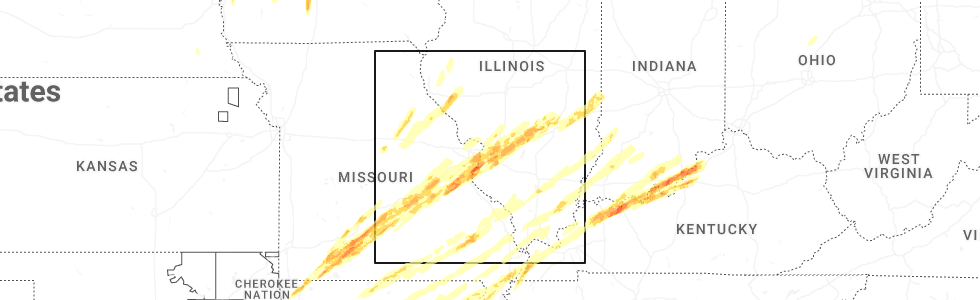
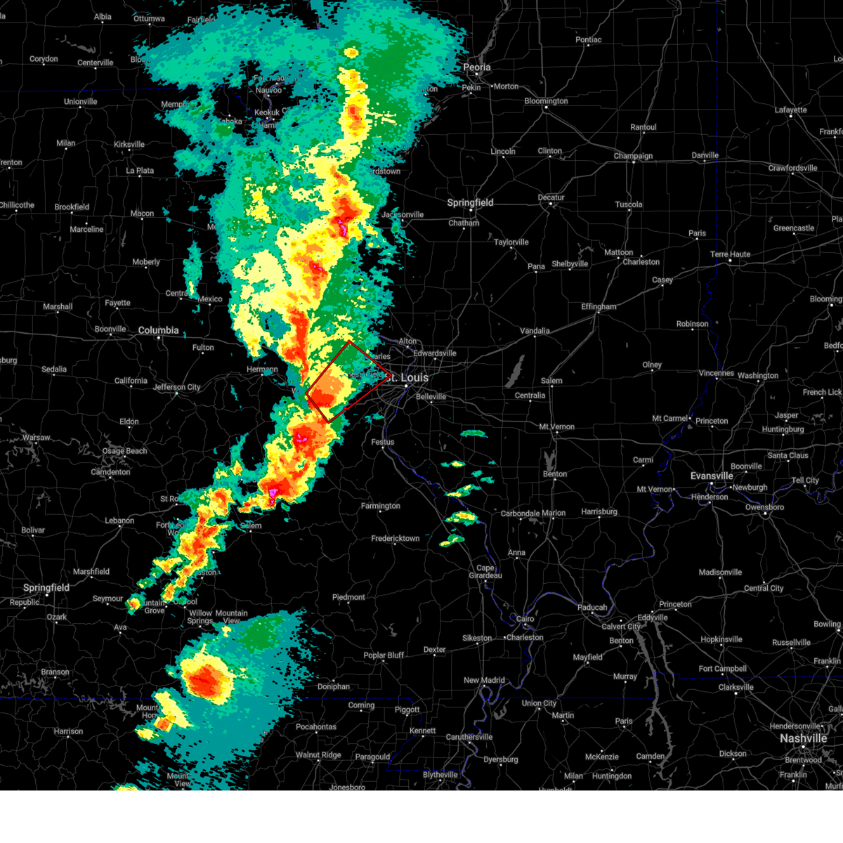
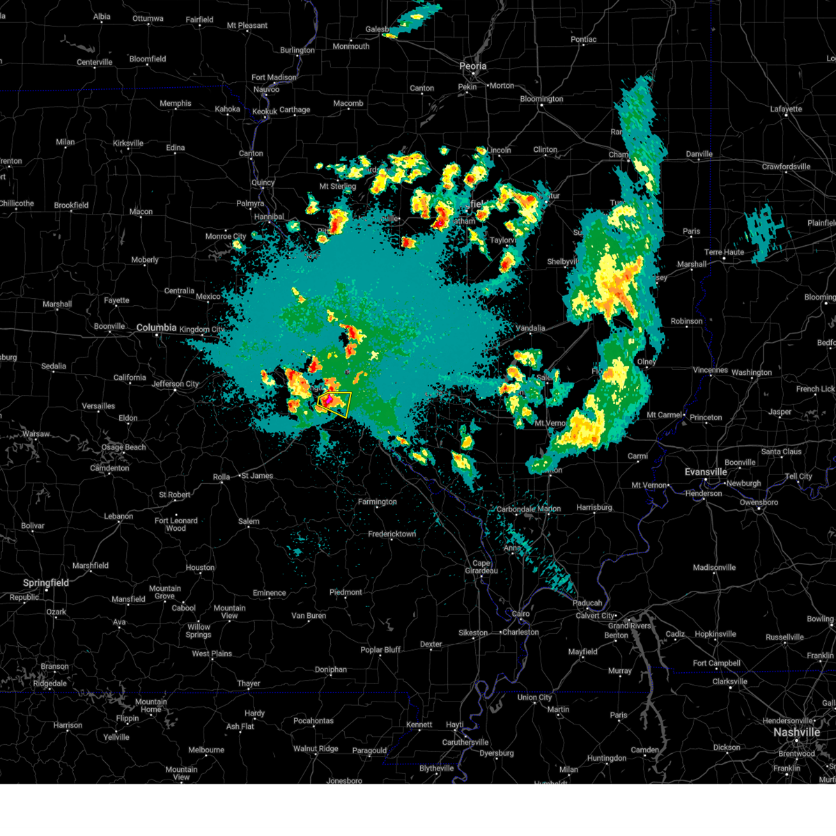
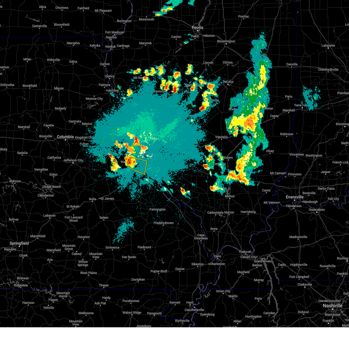
Hail Map for Villa Ridge, MO
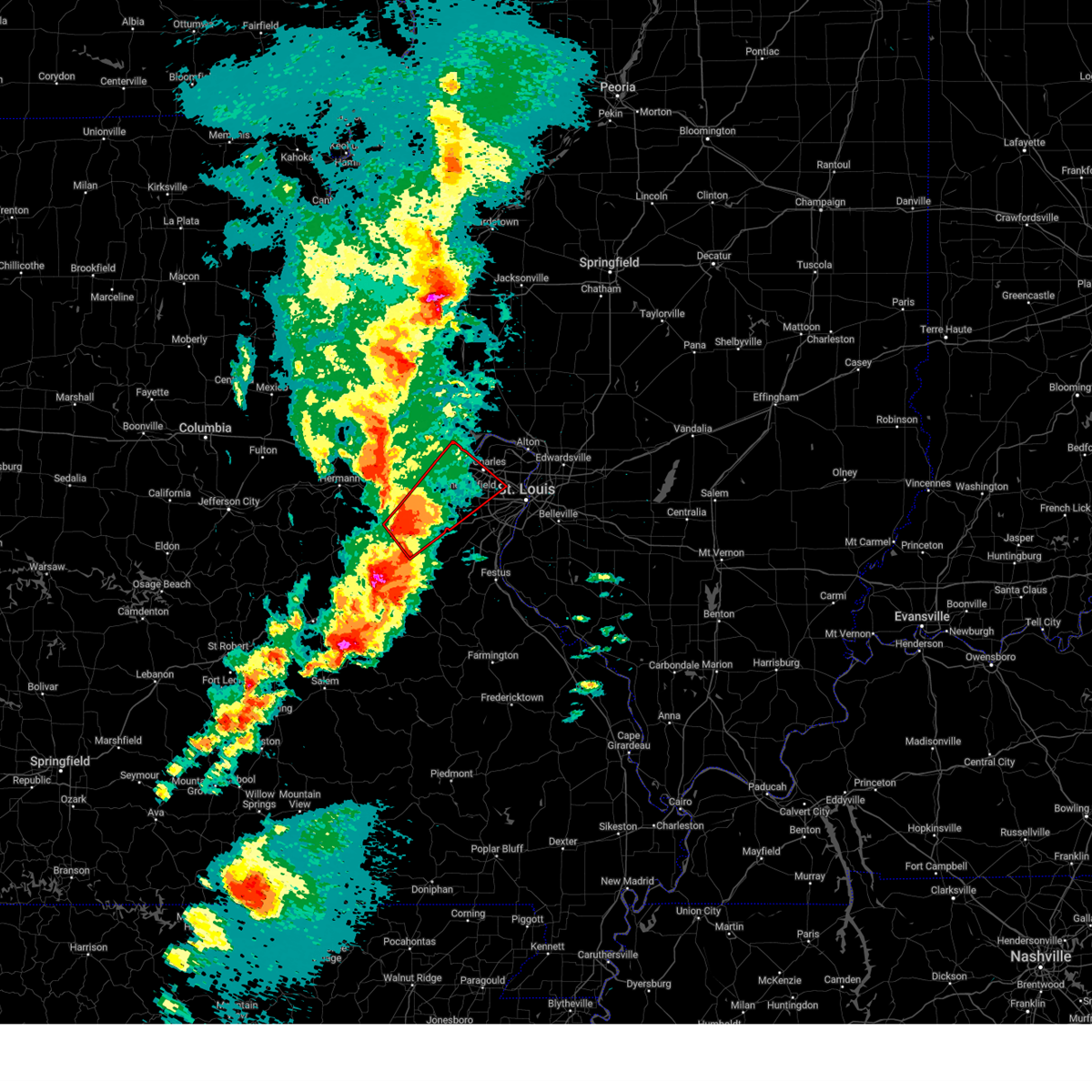
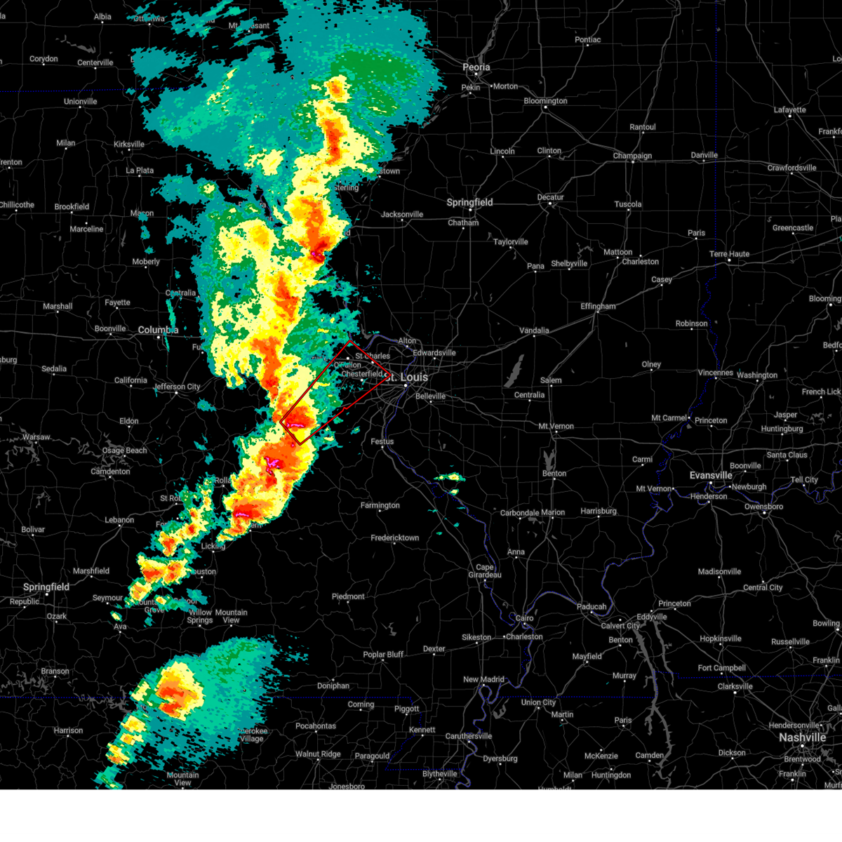
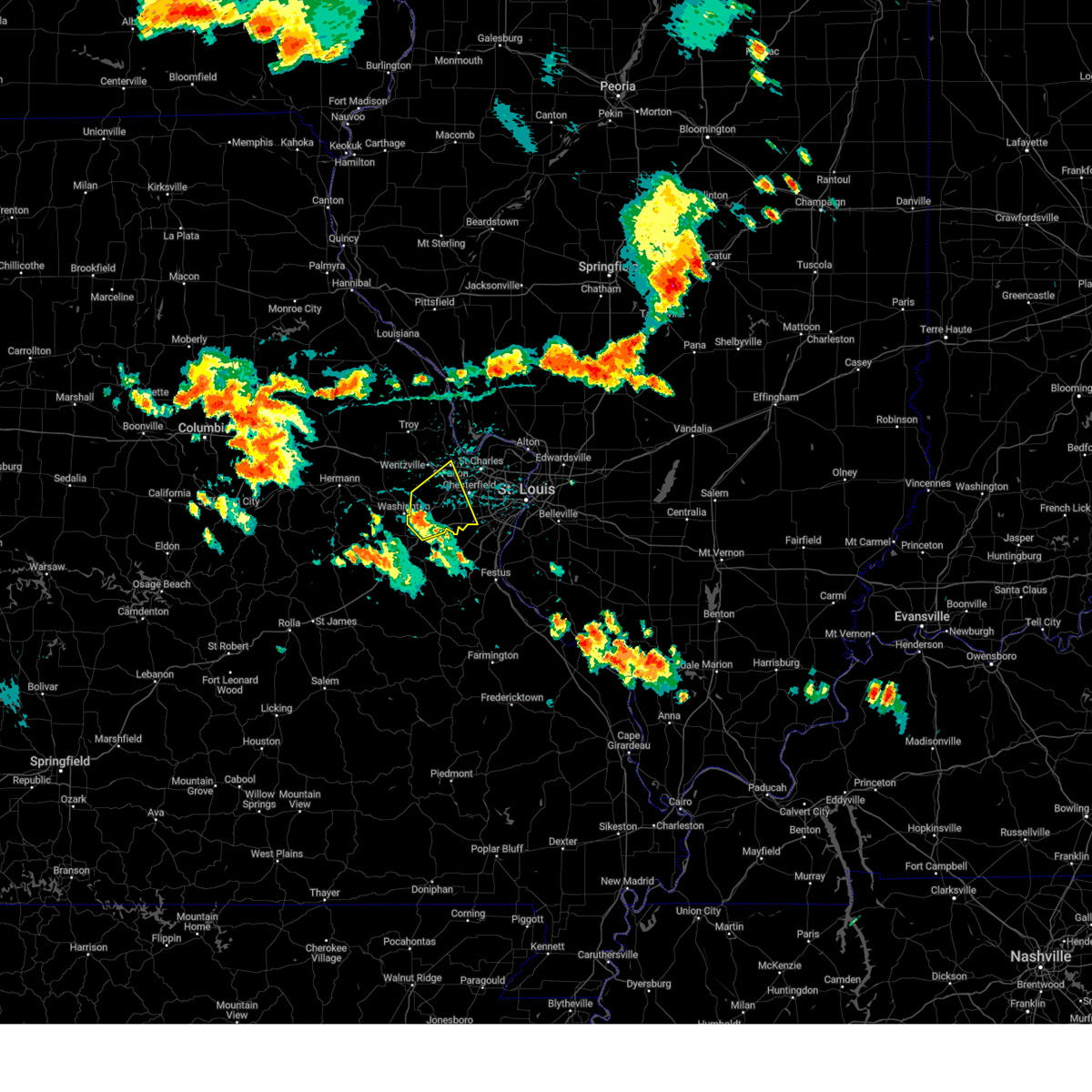
The Villa Ridge, MO area has had 14 reports of on-the-ground hail by trained spotters, and has been under severe weather warnings 17 times during the past 12 months. Doppler radar has detected hail at or near Villa Ridge, MO on 72 occasions, including 5 occasions during the past year.
| Name: | Villa Ridge, MO |
| Where Located: | 39.2 miles WSW of Saint Louis, MO |
| Map: | Google Map for Villa Ridge, MO |
| Population: | 2636 |
| Housing Units: | 1016 |
| More Info: | Search Google for Villa Ridge, MO |
1
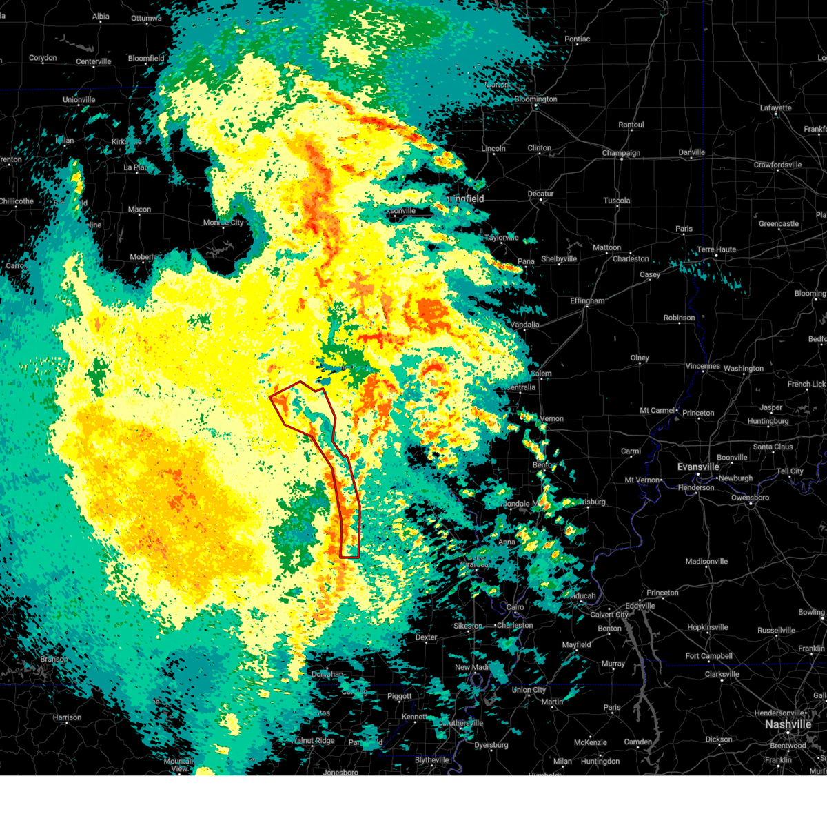
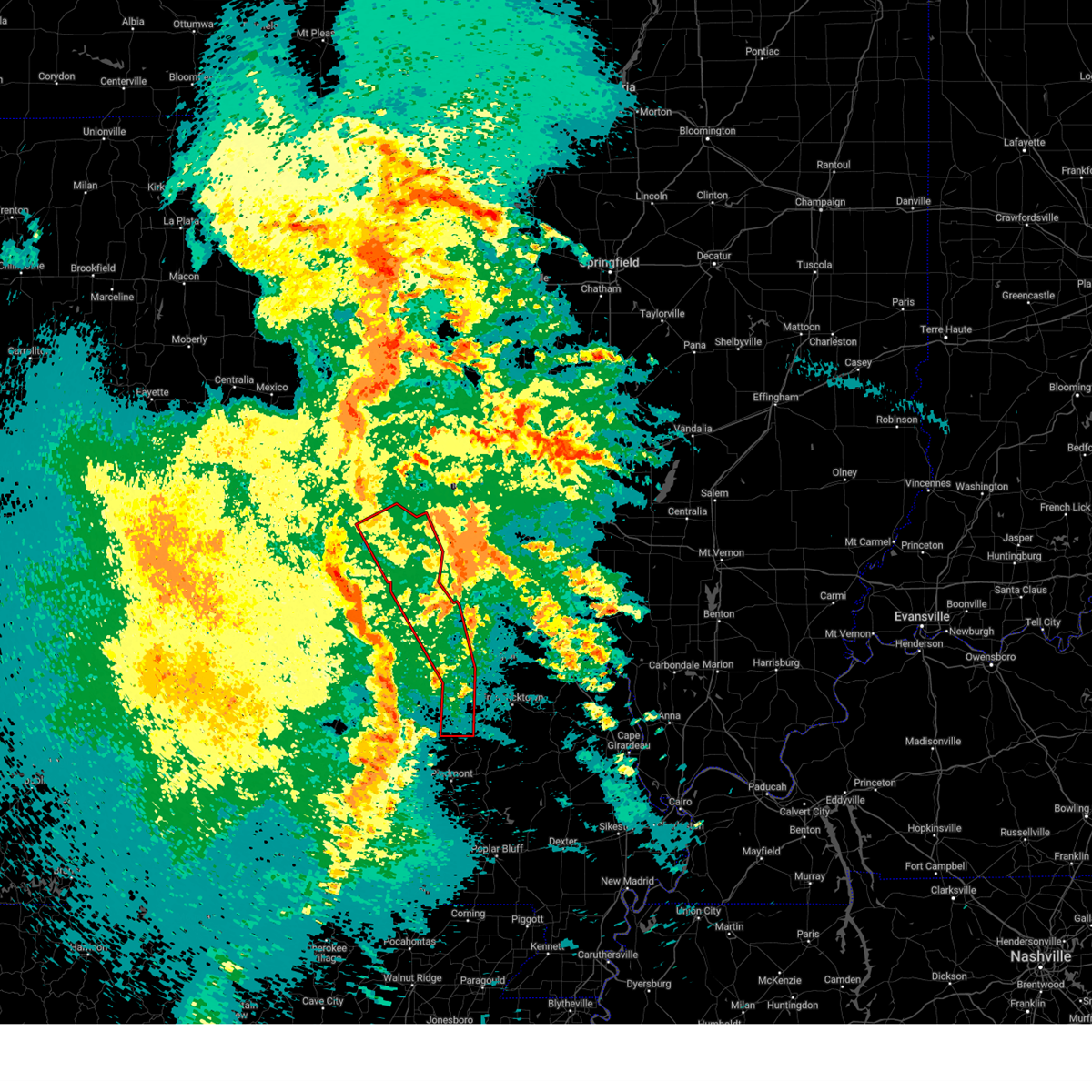
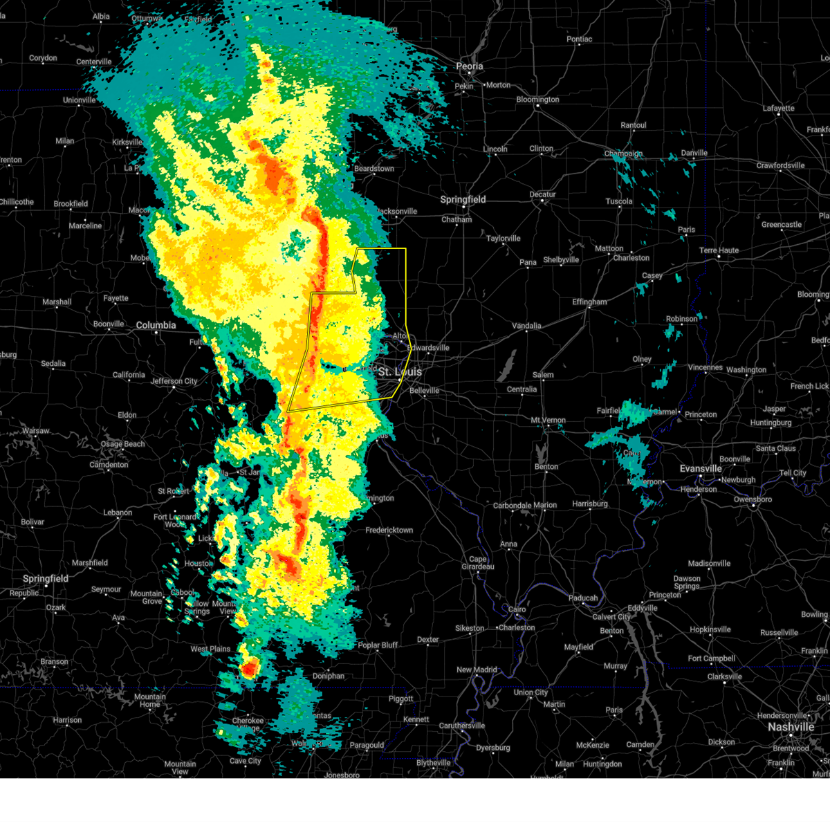
The Top Recent Hail Date for Villa Ridge, MO is Friday, March 14, 2025 (23rd out of 72)
Hail and Wind Damage Spotted near Villa Ridge, MO
| Date / Time | Report Details |
|---|---|
| 5/19/2025 11:37 PM CDT |
 At 1137 pm cdt, severe thunderstorms capable of producing a tornado were located along a line from over marthasville to over glover, or along a line from 7 miles north of washington to 7 miles south of ironton, moving northeast at 40 mph (radar indicated rotation). Hazards include tornado. Flying debris will be dangerous to those caught without shelter. mobile homes will be damaged or destroyed. damage to roofs, windows and vehicles will occur. tree damage is likely. locations impacted include, washington, union, st. clair, potosi, bismarck, ironton, leadwood, villa ridge, gray summit, pilot knob, iron mountain lake, arcadia, irondale, parkway, mineral point, richwoods, old mines, lonedell, beaufort and iron mountain. this includes the following state parks, washington state park, fort davidson historic site, elephant rocks state park and robertsville state park. This includes interstate 44 in missouri between exits 239 and 253. At 1137 pm cdt, severe thunderstorms capable of producing a tornado were located along a line from over marthasville to over glover, or along a line from 7 miles north of washington to 7 miles south of ironton, moving northeast at 40 mph (radar indicated rotation). Hazards include tornado. Flying debris will be dangerous to those caught without shelter. mobile homes will be damaged or destroyed. damage to roofs, windows and vehicles will occur. tree damage is likely. locations impacted include, washington, union, st. clair, potosi, bismarck, ironton, leadwood, villa ridge, gray summit, pilot knob, iron mountain lake, arcadia, irondale, parkway, mineral point, richwoods, old mines, lonedell, beaufort and iron mountain. this includes the following state parks, washington state park, fort davidson historic site, elephant rocks state park and robertsville state park. This includes interstate 44 in missouri between exits 239 and 253.
|
| 5/19/2025 11:07 PM CDT |
 Torlsx the national weather service in st louis has issued a * tornado warning for, franklin county in east central missouri, washington county in east central missouri, northeastern iron county in southeastern missouri, western saint francois county in southeastern missouri, * until 1145 pm cdt. * at 1107 pm cdt, severe thunderstorms capable of producing a tornado were located along a line from 6 miles north of gerald to 7 miles north of ellington, or along a line from 11 miles southwest of new haven to 25 miles southwest of ironton, moving east at 40 mph (radar indicated rotation). Hazards include tornado. Flying debris will be dangerous to those caught without shelter. mobile homes will be damaged or destroyed. damage to roofs, windows and vehicles will occur. Tree damage is likely. Torlsx the national weather service in st louis has issued a * tornado warning for, franklin county in east central missouri, washington county in east central missouri, northeastern iron county in southeastern missouri, western saint francois county in southeastern missouri, * until 1145 pm cdt. * at 1107 pm cdt, severe thunderstorms capable of producing a tornado were located along a line from 6 miles north of gerald to 7 miles north of ellington, or along a line from 11 miles southwest of new haven to 25 miles southwest of ironton, moving east at 40 mph (radar indicated rotation). Hazards include tornado. Flying debris will be dangerous to those caught without shelter. mobile homes will be damaged or destroyed. damage to roofs, windows and vehicles will occur. Tree damage is likely.
|
| 5/16/2025 2:17 PM CDT |
 Svrlsx the national weather service in st louis has issued a * severe thunderstorm warning for, central franklin county in east central missouri, southwestern saint charles county in east central missouri, southeastern warren county in east central missouri, * until 245 pm cdt. * at 217 pm cdt, a severe thunderstorm was located 5 miles north of beaufort, or 9 miles south of new haven, moving northeast at 55 mph (radar indicated). Hazards include 60 mph wind gusts and half dollar size hail. Hail damage to vehicles is expected. Expect wind damage to roofs, siding, and trees. Svrlsx the national weather service in st louis has issued a * severe thunderstorm warning for, central franklin county in east central missouri, southwestern saint charles county in east central missouri, southeastern warren county in east central missouri, * until 245 pm cdt. * at 217 pm cdt, a severe thunderstorm was located 5 miles north of beaufort, or 9 miles south of new haven, moving northeast at 55 mph (radar indicated). Hazards include 60 mph wind gusts and half dollar size hail. Hail damage to vehicles is expected. Expect wind damage to roofs, siding, and trees.
|
| 4/20/2025 8:01 PM CDT | The storms which prompted the warning have weakened below severe limits, and no longer pose an immediate threat to life or property. therefore, the warning has been allowed to expire. however, gusty winds are still possible with these thunderstorms. |
| 4/20/2025 7:23 PM CDT | the severe thunderstorm warning has been cancelled and is no longer in effect |
| 4/20/2025 7:23 PM CDT | At 723 pm cdt, severe thunderstorms were located along a line from 7 miles west of carrollton to near pacific, or along a line from 11 miles southwest of white hall to near pacific, moving east at 40 mph (radar indicated). Hazards include 60 mph wind gusts and small hail. Expect damage to roofs, siding, and trees. locations impacted include, st. louis, o'fallon, st. charles, st. peters, florissant, chesterfield, wildwood, university city, ballwin, granite city, wentzville, alton, kirkwood, maryland heights, east st. louis, hazelwood, webster groves, ferguson, manchester and godfrey. this includes the following state parks, babler memorial state park, scott joplin historic site, route 66 state park, castlewood state park, confluence state park, first missouri state capitol historic site and pere marquette state park. this includes the following highways, interstate 70 in missouri between exits 212 and 231. Interstate 44 in missouri between exits 251 and 277. |
| 4/20/2025 6:56 PM CDT |
 Svrlsx the national weather service in st louis has issued a * severe thunderstorm warning for, eastern calhoun county in southwestern illinois, greene county in southwestern illinois, jersey county in southwestern illinois, western madison county in southwestern illinois, northeastern franklin county in east central missouri, north central jefferson county in east central missouri, eastern lincoln county in east central missouri, saint charles county in east central missouri, saint louis county in east central missouri, southeastern warren county in east central missouri, saint louis city in east central missouri, * until 800 pm cdt. * at 656 pm cdt, severe thunderstorms were located along a line from 5 miles northwest of elsberry to over union, moving east at 40 mph (radar indicated). Hazards include 60 mph wind gusts and small hail. expect damage to roofs, siding, and trees Svrlsx the national weather service in st louis has issued a * severe thunderstorm warning for, eastern calhoun county in southwestern illinois, greene county in southwestern illinois, jersey county in southwestern illinois, western madison county in southwestern illinois, northeastern franklin county in east central missouri, north central jefferson county in east central missouri, eastern lincoln county in east central missouri, saint charles county in east central missouri, saint louis county in east central missouri, southeastern warren county in east central missouri, saint louis city in east central missouri, * until 800 pm cdt. * at 656 pm cdt, severe thunderstorms were located along a line from 5 miles northwest of elsberry to over union, moving east at 40 mph (radar indicated). Hazards include 60 mph wind gusts and small hail. expect damage to roofs, siding, and trees
|
| 4/20/2025 6:46 PM CDT | At 646 pm cdt, severe thunderstorms were located along a line from near eolia to 5 miles east of beaufort, or along a line from 9 miles northwest of elsberry to 6 miles west of union, moving northeast at 50 mph (radar indicated). Hazards include 60 mph wind gusts and small hail. Expect damage to roofs, siding, and trees. locations impacted include, o'fallon, st. charles, st. peters, chesterfield, wildwood, ballwin, wentzville, maryland heights, manchester, lake st. louis, washington, dardenne prairie, town and country, troy, union, eureka, ellisville, warrenton, pacific and valley park. this includes the following state parks, babler memorial state park, route 66 state park, cuivre river state park and castlewood state park. this includes the following highways, interstate 70 in missouri between exits 193 and 224. Interstate 44 in missouri between exits 251 and 274. |
| 4/20/2025 6:46 PM CDT | the severe thunderstorm warning has been cancelled and is no longer in effect |
| 4/20/2025 6:20 PM CDT |
 Svrlsx the national weather service in st louis has issued a * severe thunderstorm warning for, central franklin county in east central missouri, lincoln county in east central missouri, southeastern montgomery county in east central missouri, saint charles county in east central missouri, southwestern saint louis county in east central missouri, warren county in east central missouri, * until 700 pm cdt. * at 620 pm cdt, severe thunderstorms were located along a line from over new hartford to over jonesburg, or along a line from 8 miles southwest of bowling green to 9 miles northwest of warrenton, moving northeast at 50 mph (radar indicated). Hazards include 70 mph wind gusts and small hail. Expect considerable tree damage. Damage is likely to mobile homes, roofs, and outbuildings. Svrlsx the national weather service in st louis has issued a * severe thunderstorm warning for, central franklin county in east central missouri, lincoln county in east central missouri, southeastern montgomery county in east central missouri, saint charles county in east central missouri, southwestern saint louis county in east central missouri, warren county in east central missouri, * until 700 pm cdt. * at 620 pm cdt, severe thunderstorms were located along a line from over new hartford to over jonesburg, or along a line from 8 miles southwest of bowling green to 9 miles northwest of warrenton, moving northeast at 50 mph (radar indicated). Hazards include 70 mph wind gusts and small hail. Expect considerable tree damage. Damage is likely to mobile homes, roofs, and outbuildings.
|
| 4/10/2025 2:17 PM CDT |
 Svrlsx the national weather service in st louis has issued a * severe thunderstorm warning for, east central franklin county in east central missouri, northwestern jefferson county in east central missouri, * until 300 pm cdt. * at 217 pm cdt, a severe thunderstorm was located over pacific, moving southeast at 40 mph (trained spotters reported. trained spotters reported golf ball sized hail in pacific). Hazards include golf ball size hail and 60 mph wind gusts. People and animals outdoors will be injured. expect hail damage to roofs, siding, windows, and vehicles. expect wind damage to roofs, siding, and trees. this severe thunderstorm will be near, pacific, gray summit and villa ridge around 220 pm cdt. other locations impacted by the severe thunderstorm include catawissa, robertsville, oermann, scotsdale, morse mill, mapaville and hematite. this includes the following state parks, sandy creek covered bridge historic site and robertsville state park. this includes the following highways, interstate 44 in missouri between exits 247 and 257. Interstate 55 in missouri near exit 180. Svrlsx the national weather service in st louis has issued a * severe thunderstorm warning for, east central franklin county in east central missouri, northwestern jefferson county in east central missouri, * until 300 pm cdt. * at 217 pm cdt, a severe thunderstorm was located over pacific, moving southeast at 40 mph (trained spotters reported. trained spotters reported golf ball sized hail in pacific). Hazards include golf ball size hail and 60 mph wind gusts. People and animals outdoors will be injured. expect hail damage to roofs, siding, windows, and vehicles. expect wind damage to roofs, siding, and trees. this severe thunderstorm will be near, pacific, gray summit and villa ridge around 220 pm cdt. other locations impacted by the severe thunderstorm include catawissa, robertsville, oermann, scotsdale, morse mill, mapaville and hematite. this includes the following state parks, sandy creek covered bridge historic site and robertsville state park. this includes the following highways, interstate 44 in missouri between exits 247 and 257. Interstate 55 in missouri near exit 180.
|
| 3/14/2025 9:02 PM CDT |
 At 902 pm cdt, a confirmed and extremely dangerous tornado was located over gray summit, moving northeast at 55 mph. this is a particularly dangerous situation. take cover now! (weather spotters confirmed tornado near gray summit, multiple power flashes). Hazards include damaging tornado and quarter size hail. You are in a life-threatening situation. flying debris may be deadly to those caught without shelter. mobile homes will be destroyed. considerable damage to homes, businesses, and vehicles is likely and complete destruction is possible. locations impacted include, o'fallon, st. charles, st. peters, chesterfield, wildwood, ballwin, wentzville, maryland heights, manchester, creve coeur, overland, lake st. louis, washington, st. ann, bridgeton, dardenne prairie, town and country, eureka, ellisville and ladue. this includes the following state parks, babler memorial state park, first missouri state capitol historic site and robertsville state park. this includes the following highways, interstate 70 in missouri between exits 212 and 231. Interstate 44 in missouri between exits 247 and 261. At 902 pm cdt, a confirmed and extremely dangerous tornado was located over gray summit, moving northeast at 55 mph. this is a particularly dangerous situation. take cover now! (weather spotters confirmed tornado near gray summit, multiple power flashes). Hazards include damaging tornado and quarter size hail. You are in a life-threatening situation. flying debris may be deadly to those caught without shelter. mobile homes will be destroyed. considerable damage to homes, businesses, and vehicles is likely and complete destruction is possible. locations impacted include, o'fallon, st. charles, st. peters, chesterfield, wildwood, ballwin, wentzville, maryland heights, manchester, creve coeur, overland, lake st. louis, washington, st. ann, bridgeton, dardenne prairie, town and country, eureka, ellisville and ladue. this includes the following state parks, babler memorial state park, first missouri state capitol historic site and robertsville state park. this includes the following highways, interstate 70 in missouri between exits 212 and 231. Interstate 44 in missouri between exits 247 and 261.
|
| 3/14/2025 8:58 PM CDT |
 At 858 pm cdt, a confirmed and extremely dangerous tornado was located over gray summit, moving northeast at 55 mph. this is a particularly dangerous situation. take cover now! (radar confirmed tornado). Hazards include damaging tornado and quarter size hail. You are in a life-threatening situation. flying debris may be deadly to those caught without shelter. mobile homes will be destroyed. considerable damage to homes, businesses, and vehicles is likely and complete destruction is possible. locations impacted include, o'fallon, st. charles, st. peters, chesterfield, wildwood, ballwin, wentzville, maryland heights, manchester, creve coeur, overland, lake st. louis, washington, st. ann, bridgeton, dardenne prairie, town and country, eureka, ellisville and ladue. this includes the following state parks, babler memorial state park, first missouri state capitol historic site and robertsville state park. this includes the following highways, interstate 70 in missouri between exits 212 and 231. Interstate 44 in missouri between exits 247 and 261. At 858 pm cdt, a confirmed and extremely dangerous tornado was located over gray summit, moving northeast at 55 mph. this is a particularly dangerous situation. take cover now! (radar confirmed tornado). Hazards include damaging tornado and quarter size hail. You are in a life-threatening situation. flying debris may be deadly to those caught without shelter. mobile homes will be destroyed. considerable damage to homes, businesses, and vehicles is likely and complete destruction is possible. locations impacted include, o'fallon, st. charles, st. peters, chesterfield, wildwood, ballwin, wentzville, maryland heights, manchester, creve coeur, overland, lake st. louis, washington, st. ann, bridgeton, dardenne prairie, town and country, eureka, ellisville and ladue. this includes the following state parks, babler memorial state park, first missouri state capitol historic site and robertsville state park. this includes the following highways, interstate 70 in missouri between exits 212 and 231. Interstate 44 in missouri between exits 247 and 261.
|
| 3/14/2025 8:53 PM CDT |
 At 853 pm cdt, a confirmed tornado was located over union, moving northeast at 55 mph (weather spotters confirmed tornado southwest of union). Hazards include damaging tornado and quarter size hail. Flying debris will be dangerous to those caught without shelter. mobile homes will be damaged or destroyed. damage to roofs, windows and vehicles will occur. tree damage is likely. locations impacted include, o'fallon, st. charles, st. peters, chesterfield, wildwood, ballwin, wentzville, maryland heights, manchester, creve coeur, overland, lake st. louis, washington, st. ann, bridgeton, dardenne prairie, town and country, union, eureka and ellisville. this includes the following state parks, babler memorial state park, first missouri state capitol historic site and robertsville state park. this includes the following highways, interstate 70 in missouri between exits 212 and 231. Interstate 44 in missouri between exits 239 and 261. At 853 pm cdt, a confirmed tornado was located over union, moving northeast at 55 mph (weather spotters confirmed tornado southwest of union). Hazards include damaging tornado and quarter size hail. Flying debris will be dangerous to those caught without shelter. mobile homes will be damaged or destroyed. damage to roofs, windows and vehicles will occur. tree damage is likely. locations impacted include, o'fallon, st. charles, st. peters, chesterfield, wildwood, ballwin, wentzville, maryland heights, manchester, creve coeur, overland, lake st. louis, washington, st. ann, bridgeton, dardenne prairie, town and country, union, eureka and ellisville. this includes the following state parks, babler memorial state park, first missouri state capitol historic site and robertsville state park. this includes the following highways, interstate 70 in missouri between exits 212 and 231. Interstate 44 in missouri between exits 239 and 261.
|
| 3/14/2025 8:43 PM CDT |
 At 843 pm cdt, a tornado producing storm was located 6 miles southeast of beaufort, or 6 miles west of st. clair, moving northeast at 55 mph (radar confirmed tornado). Hazards include damaging tornado and quarter size hail. Flying debris will be dangerous to those caught without shelter. mobile homes will be damaged or destroyed. damage to roofs, windows and vehicles will occur. tree damage is likely. locations impacted include, o'fallon, st. charles, st. peters, chesterfield, wildwood, ballwin, wentzville, maryland heights, manchester, creve coeur, overland, lake st. louis, washington, st. ann, bridgeton, dardenne prairie, town and country, union, eureka and ellisville. this includes the following state parks, babler memorial state park, first missouri state capitol historic site and robertsville state park. this includes the following highways, interstate 70 in missouri between exits 212 and 231. Interstate 44 in missouri between exits 230 and 261. At 843 pm cdt, a tornado producing storm was located 6 miles southeast of beaufort, or 6 miles west of st. clair, moving northeast at 55 mph (radar confirmed tornado). Hazards include damaging tornado and quarter size hail. Flying debris will be dangerous to those caught without shelter. mobile homes will be damaged or destroyed. damage to roofs, windows and vehicles will occur. tree damage is likely. locations impacted include, o'fallon, st. charles, st. peters, chesterfield, wildwood, ballwin, wentzville, maryland heights, manchester, creve coeur, overland, lake st. louis, washington, st. ann, bridgeton, dardenne prairie, town and country, union, eureka and ellisville. this includes the following state parks, babler memorial state park, first missouri state capitol historic site and robertsville state park. this includes the following highways, interstate 70 in missouri between exits 212 and 231. Interstate 44 in missouri between exits 230 and 261.
|
| 3/14/2025 8:40 PM CDT |
 Torlsx the national weather service in st louis has issued a * tornado warning for, central franklin county in east central missouri, western saint charles county in east central missouri, northwestern saint louis county in east central missouri, southeastern warren county in east central missouri, * until 930 pm cdt. * at 840 pm cdt, a severe thunderstorm capable of producing a tornado was located 6 miles southeast of beaufort, or 8 miles west of st. clair, moving northeast at 55 mph (radar indicated rotation). Hazards include tornado and quarter size hail. Flying debris will be dangerous to those caught without shelter. mobile homes will be damaged or destroyed. damage to roofs, windows and vehicles will occur. Tree damage is likely. Torlsx the national weather service in st louis has issued a * tornado warning for, central franklin county in east central missouri, western saint charles county in east central missouri, northwestern saint louis county in east central missouri, southeastern warren county in east central missouri, * until 930 pm cdt. * at 840 pm cdt, a severe thunderstorm capable of producing a tornado was located 6 miles southeast of beaufort, or 8 miles west of st. clair, moving northeast at 55 mph (radar indicated rotation). Hazards include tornado and quarter size hail. Flying debris will be dangerous to those caught without shelter. mobile homes will be damaged or destroyed. damage to roofs, windows and vehicles will occur. Tree damage is likely.
|
| 7/30/2024 3:35 PM CDT |
 Svrlsx the national weather service in st louis has issued a * severe thunderstorm warning for, southwestern st. charles county in east central missouri, east central franklin county in east central missouri, southwestern st. louis county in east central missouri, * until 415 pm cdt. * at 335 pm cdt, a severe thunderstorm was located over augusta, moving northeast at 20 mph (radar indicated). Hazards include 60 mph wind gusts and quarter size hail. Hail damage to vehicles is expected. Expect wind damage to roofs, siding, and trees. Svrlsx the national weather service in st louis has issued a * severe thunderstorm warning for, southwestern st. charles county in east central missouri, east central franklin county in east central missouri, southwestern st. louis county in east central missouri, * until 415 pm cdt. * at 335 pm cdt, a severe thunderstorm was located over augusta, moving northeast at 20 mph (radar indicated). Hazards include 60 mph wind gusts and quarter size hail. Hail damage to vehicles is expected. Expect wind damage to roofs, siding, and trees.
|
| 7/16/2024 11:52 AM CDT |
 Svrlsx the national weather service in st louis has issued a * severe thunderstorm warning for, jefferson county in east central missouri, southeastern franklin county in east central missouri, southwestern st. louis county in east central missouri, * until 1230 pm cdt. * at 1152 am cdt, a severe thunderstorm was located over pacific, moving southeast at 35 mph (radar indicated). Hazards include 60 mph wind gusts. expect damage to roofs, siding, and trees Svrlsx the national weather service in st louis has issued a * severe thunderstorm warning for, jefferson county in east central missouri, southeastern franklin county in east central missouri, southwestern st. louis county in east central missouri, * until 1230 pm cdt. * at 1152 am cdt, a severe thunderstorm was located over pacific, moving southeast at 35 mph (radar indicated). Hazards include 60 mph wind gusts. expect damage to roofs, siding, and trees
|
| 5/26/2024 5:09 PM CDT |
 Torlsx the national weather service in st louis has issued a * tornado warning for, northwestern jefferson county in east central missouri, east central franklin county in east central missouri, southwestern st. louis county in east central missouri, * until 600 pm cdt. * at 509 pm cdt, a severe thunderstorm capable of producing a tornado was located over gray summit, moving east at 35 mph (radar indicated rotation). Hazards include tornado. Flying debris will be dangerous to those caught without shelter. mobile homes will be damaged or destroyed. damage to roofs, windows, and vehicles will occur. tree damage is likely. this dangerous storm will be near, wildwood, eureka, and pacific around 515 pm cdt. ellisville around 520 pm cdt. ballwin around 525 pm cdt. other locations in the path of this tornadic thunderstorm include manchester, valley park, murphy, high ridge, winchester, twin oaks, kirkwood, sunset hills, des peres, fenton, sappington and huntleigh. this also includes route 66 state park and castlewood state park. This includes interstate 44 in missouri between exits 251 and 276. Torlsx the national weather service in st louis has issued a * tornado warning for, northwestern jefferson county in east central missouri, east central franklin county in east central missouri, southwestern st. louis county in east central missouri, * until 600 pm cdt. * at 509 pm cdt, a severe thunderstorm capable of producing a tornado was located over gray summit, moving east at 35 mph (radar indicated rotation). Hazards include tornado. Flying debris will be dangerous to those caught without shelter. mobile homes will be damaged or destroyed. damage to roofs, windows, and vehicles will occur. tree damage is likely. this dangerous storm will be near, wildwood, eureka, and pacific around 515 pm cdt. ellisville around 520 pm cdt. ballwin around 525 pm cdt. other locations in the path of this tornadic thunderstorm include manchester, valley park, murphy, high ridge, winchester, twin oaks, kirkwood, sunset hills, des peres, fenton, sappington and huntleigh. this also includes route 66 state park and castlewood state park. This includes interstate 44 in missouri between exits 251 and 276.
|
| 5/26/2024 5:07 PM CDT |
 At 507 pm cdt, a severe thunderstorm was located over gray summit, moving east at 35 mph (public reported two inch hail just east of washington). Hazards include two inch hail and 60 mph wind gusts. People and animals outdoors will be injured. expect hail damage to roofs, siding, windows, and vehicles. expect wind damage to roofs, siding, and trees. locations impacted include, chesterfield, wildwood, ballwin, washington, union, eureka, ellisville, pacific, weldon spring, byrnes mill, clarkson valley, gray summit, villa ridge, spirit of st. louis airport, augusta, weldon spring heights, dutzow, defiance, scotsdale, and matson. this also includes babler memorial state park, route 66 state park, and robertsville state park. This includes interstate 44 in missouri between exits 247 and 266. At 507 pm cdt, a severe thunderstorm was located over gray summit, moving east at 35 mph (public reported two inch hail just east of washington). Hazards include two inch hail and 60 mph wind gusts. People and animals outdoors will be injured. expect hail damage to roofs, siding, windows, and vehicles. expect wind damage to roofs, siding, and trees. locations impacted include, chesterfield, wildwood, ballwin, washington, union, eureka, ellisville, pacific, weldon spring, byrnes mill, clarkson valley, gray summit, villa ridge, spirit of st. louis airport, augusta, weldon spring heights, dutzow, defiance, scotsdale, and matson. this also includes babler memorial state park, route 66 state park, and robertsville state park. This includes interstate 44 in missouri between exits 247 and 266.
|
| 5/26/2024 4:59 PM CDT |
 At 459 pm cdt, a severe thunderstorm was located over augusta, moving east at 30 mph (public reported ping pong hail southeast of washington). Hazards include ping pong ball size hail and 60 mph wind gusts. People and animals outdoors will be injured. expect hail damage to roofs, siding, windows, and vehicles. expect wind damage to roofs, siding, and trees. locations impacted include, chesterfield, wildwood, ballwin, washington, union, eureka, ellisville, pacific, weldon spring, byrnes mill, clarkson valley, gray summit, villa ridge, spirit of st. louis airport, augusta, weldon spring heights, dutzow, defiance, scotsdale, and matson. this also includes babler memorial state park, route 66 state park, and robertsville state park. This includes interstate 44 in missouri between exits 247 and 266. At 459 pm cdt, a severe thunderstorm was located over augusta, moving east at 30 mph (public reported ping pong hail southeast of washington). Hazards include ping pong ball size hail and 60 mph wind gusts. People and animals outdoors will be injured. expect hail damage to roofs, siding, windows, and vehicles. expect wind damage to roofs, siding, and trees. locations impacted include, chesterfield, wildwood, ballwin, washington, union, eureka, ellisville, pacific, weldon spring, byrnes mill, clarkson valley, gray summit, villa ridge, spirit of st. louis airport, augusta, weldon spring heights, dutzow, defiance, scotsdale, and matson. this also includes babler memorial state park, route 66 state park, and robertsville state park. This includes interstate 44 in missouri between exits 247 and 266.
|
| 5/26/2024 4:47 PM CDT |
 Svrlsx the national weather service in st louis has issued a * severe thunderstorm warning for, southwestern st. charles county in east central missouri, northwestern jefferson county in east central missouri, east central franklin county in east central missouri, southwestern st. louis county in east central missouri, southeastern warren county in east central missouri, * until 530 pm cdt. * at 446 pm cdt, a severe thunderstorm was located over dutzow, moving east at 30 mph (public reported quarter size hail with this storm). Hazards include ping pong ball size hail and 60 mph wind gusts. People and animals outdoors will be injured. expect hail damage to roofs, siding, windows, and vehicles. Expect wind damage to roofs, siding, and trees. Svrlsx the national weather service in st louis has issued a * severe thunderstorm warning for, southwestern st. charles county in east central missouri, northwestern jefferson county in east central missouri, east central franklin county in east central missouri, southwestern st. louis county in east central missouri, southeastern warren county in east central missouri, * until 530 pm cdt. * at 446 pm cdt, a severe thunderstorm was located over dutzow, moving east at 30 mph (public reported quarter size hail with this storm). Hazards include ping pong ball size hail and 60 mph wind gusts. People and animals outdoors will be injured. expect hail damage to roofs, siding, windows, and vehicles. Expect wind damage to roofs, siding, and trees.
|
| 5/24/2024 9:12 PM CDT |
 At 912 pm cdt, a severe thunderstorm was located near lonedell, moving southeast at 25 mph (radar indicated). Hazards include 60 mph wind gusts and quarter size hail. Hail damage to vehicles is expected. expect wind damage to roofs, siding, and trees. locations impacted include, union, eureka, pacific, st. clair, byrnes mill, villa ridge, cedar hill, gray summit, parkway, cedar hill lakes, dittmer, lonedell, morse mill, oermann, robertsville, catawissa, moselle, grubville, and piney park. this also includes robertsville state park. This includes interstate 44 in missouri between exits 240 and 253. At 912 pm cdt, a severe thunderstorm was located near lonedell, moving southeast at 25 mph (radar indicated). Hazards include 60 mph wind gusts and quarter size hail. Hail damage to vehicles is expected. expect wind damage to roofs, siding, and trees. locations impacted include, union, eureka, pacific, st. clair, byrnes mill, villa ridge, cedar hill, gray summit, parkway, cedar hill lakes, dittmer, lonedell, morse mill, oermann, robertsville, catawissa, moselle, grubville, and piney park. this also includes robertsville state park. This includes interstate 44 in missouri between exits 240 and 253.
|
| 5/24/2024 8:52 PM CDT |
 Svrlsx the national weather service in st louis has issued a * severe thunderstorm warning for, northwestern jefferson county in east central missouri, southeastern franklin county in east central missouri, * until 930 pm cdt. * at 852 pm cdt, a severe thunderstorm was located over villa ridge, moving southeast at 25 mph (radar indicated). Hazards include 60 mph wind gusts and quarter size hail. Hail damage to vehicles is expected. Expect wind damage to roofs, siding, and trees. Svrlsx the national weather service in st louis has issued a * severe thunderstorm warning for, northwestern jefferson county in east central missouri, southeastern franklin county in east central missouri, * until 930 pm cdt. * at 852 pm cdt, a severe thunderstorm was located over villa ridge, moving southeast at 25 mph (radar indicated). Hazards include 60 mph wind gusts and quarter size hail. Hail damage to vehicles is expected. Expect wind damage to roofs, siding, and trees.
|
| 5/21/2024 9:23 PM CDT |
 the severe thunderstorm warning has been cancelled and is no longer in effect the severe thunderstorm warning has been cancelled and is no longer in effect
|
| 5/21/2024 9:14 PM CDT |
 At 914 pm cdt, a severe thunderstorm was located near villa ridge, moving east at 45 mph (radar indicated). Hazards include 60 mph wind gusts and quarter size hail. Hail damage to vehicles is expected. expect wind damage to roofs, siding, and trees. locations impacted include, o'fallon, washington, dardenne prairie, union, pacific, gray summit, villa ridge, new melle, augusta, defiance, dutzow, and matson. This includes interstate 44 in missouri between exits 247 and 257. At 914 pm cdt, a severe thunderstorm was located near villa ridge, moving east at 45 mph (radar indicated). Hazards include 60 mph wind gusts and quarter size hail. Hail damage to vehicles is expected. expect wind damage to roofs, siding, and trees. locations impacted include, o'fallon, washington, dardenne prairie, union, pacific, gray summit, villa ridge, new melle, augusta, defiance, dutzow, and matson. This includes interstate 44 in missouri between exits 247 and 257.
|
| 5/21/2024 9:03 PM CDT |
 At 903 pm cdt, a severe thunderstorm was located near washington, moving east at 40 mph (radar indicated). Hazards include 60 mph wind gusts and quarter size hail. Hail damage to vehicles is expected. expect wind damage to roofs, siding, and trees. locations impacted include, o'fallon, lake st. louis, washington, dardenne prairie, union, pacific, new haven, gray summit, villa ridge, marthasville, new melle, augusta, dutzow, defiance, matson, and lyon. this includes the following highways, interstate 44 in missouri between exits 247 and 257. Interstate 70 in missouri near exit 216. At 903 pm cdt, a severe thunderstorm was located near washington, moving east at 40 mph (radar indicated). Hazards include 60 mph wind gusts and quarter size hail. Hail damage to vehicles is expected. expect wind damage to roofs, siding, and trees. locations impacted include, o'fallon, lake st. louis, washington, dardenne prairie, union, pacific, new haven, gray summit, villa ridge, marthasville, new melle, augusta, dutzow, defiance, matson, and lyon. this includes the following highways, interstate 44 in missouri between exits 247 and 257. Interstate 70 in missouri near exit 216.
|
| 5/21/2024 8:53 PM CDT |
 Svrlsx the national weather service in st louis has issued a * severe thunderstorm warning for, southwestern st. charles county in east central missouri, central franklin county in east central missouri, southeastern warren county in east central missouri, * until 945 pm cdt. * at 853 pm cdt, a severe thunderstorm was located near new haven, moving east at 45 mph (radar indicated). Hazards include 60 mph wind gusts and quarter size hail. Hail damage to vehicles is expected. Expect wind damage to roofs, siding, and trees. Svrlsx the national weather service in st louis has issued a * severe thunderstorm warning for, southwestern st. charles county in east central missouri, central franklin county in east central missouri, southeastern warren county in east central missouri, * until 945 pm cdt. * at 853 pm cdt, a severe thunderstorm was located near new haven, moving east at 45 mph (radar indicated). Hazards include 60 mph wind gusts and quarter size hail. Hail damage to vehicles is expected. Expect wind damage to roofs, siding, and trees.
|
| 5/7/2024 4:18 AM CDT |
 At 418 am cdt, severe thunderstorms were located along a line extending from near augusta to dittmer to near mineral point, moving east at 50 mph (radar indicated). Hazards include 60 mph wind gusts. Expect damage to roofs, siding, and trees. these severe thunderstorms will remain over mainly rural areas of eastern franklin county, including the following locations, moselle, catawissa, and robertsville. this also includes robertsville state park. This includes interstate 44 in missouri between exits 240 and 257. At 418 am cdt, severe thunderstorms were located along a line extending from near augusta to dittmer to near mineral point, moving east at 50 mph (radar indicated). Hazards include 60 mph wind gusts. Expect damage to roofs, siding, and trees. these severe thunderstorms will remain over mainly rural areas of eastern franklin county, including the following locations, moselle, catawissa, and robertsville. this also includes robertsville state park. This includes interstate 44 in missouri between exits 240 and 257.
|
| 5/7/2024 3:41 AM CDT |
 Svrlsx the national weather service in st louis has issued a * severe thunderstorm warning for, franklin county in east central missouri, * until 430 am cdt. * at 340 am cdt, severe thunderstorms were located along a line extending from near gerald to near bourbon to near courtois, moving east at 50 mph (radar indicated). Hazards include 60 mph wind gusts. Expect damage to roofs, siding, and trees. severe thunderstorms will be near, oak grove, sullivan, miramiguoa park, and beaufort around 345 am cdt. st. clair around 350 am cdt. union and parkway around 355 am cdt. washington around 400 am cdt. other locations in the path of these severe thunderstorms include villa ridge, gray summit, lonedell and pacific. this includes interstate 44 in missouri between exits 225 and 257. This also includes robertsville state park and meramec state park. Svrlsx the national weather service in st louis has issued a * severe thunderstorm warning for, franklin county in east central missouri, * until 430 am cdt. * at 340 am cdt, severe thunderstorms were located along a line extending from near gerald to near bourbon to near courtois, moving east at 50 mph (radar indicated). Hazards include 60 mph wind gusts. Expect damage to roofs, siding, and trees. severe thunderstorms will be near, oak grove, sullivan, miramiguoa park, and beaufort around 345 am cdt. st. clair around 350 am cdt. union and parkway around 355 am cdt. washington around 400 am cdt. other locations in the path of these severe thunderstorms include villa ridge, gray summit, lonedell and pacific. this includes interstate 44 in missouri between exits 225 and 257. This also includes robertsville state park and meramec state park.
|
| 4/18/2024 5:12 PM CDT |
 Svrlsx the national weather service in st louis has issued a * severe thunderstorm warning for, southwestern st. charles county in east central missouri, northwestern jefferson county in east central missouri, southeastern franklin county in east central missouri, southwestern st. louis county in east central missouri, * until 600 pm cdt. * at 512 pm cdt, severe thunderstorms were located along a line extending from near augusta to near bourbon, moving east at 30 mph (radar indicated). Hazards include 60 mph wind gusts and quarter size hail. Hail damage to vehicles is expected. Expect wind damage to roofs, siding, and trees. Svrlsx the national weather service in st louis has issued a * severe thunderstorm warning for, southwestern st. charles county in east central missouri, northwestern jefferson county in east central missouri, southeastern franklin county in east central missouri, southwestern st. louis county in east central missouri, * until 600 pm cdt. * at 512 pm cdt, severe thunderstorms were located along a line extending from near augusta to near bourbon, moving east at 30 mph (radar indicated). Hazards include 60 mph wind gusts and quarter size hail. Hail damage to vehicles is expected. Expect wind damage to roofs, siding, and trees.
|
| 4/2/2024 2:00 AM CDT |
 The storms which prompted the warning have moved out of the area. therefore, the warning has been allowed to expire. however, small hail and gusty winds are still possible with these thunderstorms. a tornado watch remains in effect until 300 am cdt for southwestern illinois, and east central missouri. The storms which prompted the warning have moved out of the area. therefore, the warning has been allowed to expire. however, small hail and gusty winds are still possible with these thunderstorms. a tornado watch remains in effect until 300 am cdt for southwestern illinois, and east central missouri.
|
| 4/2/2024 1:12 AM CDT |
 Svrlsx the national weather service in st louis has issued a * severe thunderstorm warning for, northwestern monroe county in southwestern illinois, jefferson county in east central missouri, southeastern franklin county in east central missouri, southwestern st. louis county in east central missouri, * until 200 am cdt. * at 112 am cdt, severe thunderstorms were located along a line extending from near union to near lonedell to 7 miles east of richwoods, moving northeast at 45 mph (radar indicated). Hazards include 60 mph wind gusts and quarter size hail. Hail damage to vehicles is expected. Expect wind damage to roofs, siding, and trees. Svrlsx the national weather service in st louis has issued a * severe thunderstorm warning for, northwestern monroe county in southwestern illinois, jefferson county in east central missouri, southeastern franklin county in east central missouri, southwestern st. louis county in east central missouri, * until 200 am cdt. * at 112 am cdt, severe thunderstorms were located along a line extending from near union to near lonedell to 7 miles east of richwoods, moving northeast at 45 mph (radar indicated). Hazards include 60 mph wind gusts and quarter size hail. Hail damage to vehicles is expected. Expect wind damage to roofs, siding, and trees.
|
| 4/2/2024 12:48 AM CDT |
 Torlsx the national weather service in st louis has issued a * tornado warning for, eastern crawford county in east central missouri, northern washington county in east central missouri, franklin county in east central missouri, southeastern gasconade county in east central missouri, * until 130 am cdt. * at 1248 am cdt, severe thunderstorms capable of producing both tornadoes and extensive straight line wind damage were located along a line extending from 6 miles south of gerald to sullivan to 7 miles southwest of anthonies mill, moving northeast at 50 mph (radar indicated rotation). Hazards include tornado and quarter size hail. Flying debris will be dangerous to those caught without shelter. mobile homes will be damaged or destroyed. damage to roofs, windows, and vehicles will occur. tree damage is likely. these dangerous storms will be near, st. clair, anthonies mill, miramiguoa park, and beaufort around 1255 am cdt. parkway around 100 am cdt. union, lonedell, and richwoods around 105 am cdt. other locations in the path of these tornadic storms include villa ridge. this also includes washington state park, onondaga cave state park, robertsville state park, and meramec state park. This includes interstate 44 in missouri between exits 225 and 247. Torlsx the national weather service in st louis has issued a * tornado warning for, eastern crawford county in east central missouri, northern washington county in east central missouri, franklin county in east central missouri, southeastern gasconade county in east central missouri, * until 130 am cdt. * at 1248 am cdt, severe thunderstorms capable of producing both tornadoes and extensive straight line wind damage were located along a line extending from 6 miles south of gerald to sullivan to 7 miles southwest of anthonies mill, moving northeast at 50 mph (radar indicated rotation). Hazards include tornado and quarter size hail. Flying debris will be dangerous to those caught without shelter. mobile homes will be damaged or destroyed. damage to roofs, windows, and vehicles will occur. tree damage is likely. these dangerous storms will be near, st. clair, anthonies mill, miramiguoa park, and beaufort around 1255 am cdt. parkway around 100 am cdt. union, lonedell, and richwoods around 105 am cdt. other locations in the path of these tornadic storms include villa ridge. this also includes washington state park, onondaga cave state park, robertsville state park, and meramec state park. This includes interstate 44 in missouri between exits 225 and 247.
|
| 4/2/2024 12:43 AM CDT |
 Torlsx the national weather service in st louis has issued a * tornado warning for, eastern crawford county in east central missouri, northern washington county in east central missouri, franklin county in east central missouri, southeastern gasconade county in east central missouri, * until 130 am cdt. * at 1242 am cdt, severe thunderstorms capable of producing both tornadoes and extensive straight line wind damage were located along a line extending from 6 miles southeast of owensville to near bourbon to 6 miles east of steelville, moving northeast at 50 mph (radar indicated rotation). Hazards include tornado and quarter size hail. Flying debris will be dangerous to those caught without shelter. mobile homes will be damaged or destroyed. damage to roofs, windows, and vehicles will occur. tree damage is likely. these dangerous storms will be near, oak grove, sullivan, anthonies mill, and miramiguoa park around 1250 am cdt. st. clair and beaufort around 1255 am cdt. parkway around 100 am cdt. other locations in the path of these tornadic storms include union, lonedell, richwoods and villa ridge. this also includes washington state park, onondaga cave state park, robertsville state park, and meramec state park. This includes interstate 44 in missouri between exits 225 and 247. Torlsx the national weather service in st louis has issued a * tornado warning for, eastern crawford county in east central missouri, northern washington county in east central missouri, franklin county in east central missouri, southeastern gasconade county in east central missouri, * until 130 am cdt. * at 1242 am cdt, severe thunderstorms capable of producing both tornadoes and extensive straight line wind damage were located along a line extending from 6 miles southeast of owensville to near bourbon to 6 miles east of steelville, moving northeast at 50 mph (radar indicated rotation). Hazards include tornado and quarter size hail. Flying debris will be dangerous to those caught without shelter. mobile homes will be damaged or destroyed. damage to roofs, windows, and vehicles will occur. tree damage is likely. these dangerous storms will be near, oak grove, sullivan, anthonies mill, and miramiguoa park around 1250 am cdt. st. clair and beaufort around 1255 am cdt. parkway around 100 am cdt. other locations in the path of these tornadic storms include union, lonedell, richwoods and villa ridge. this also includes washington state park, onondaga cave state park, robertsville state park, and meramec state park. This includes interstate 44 in missouri between exits 225 and 247.
|
| 4/1/2024 11:42 PM CDT |
 the severe thunderstorm warning has been cancelled and is no longer in effect the severe thunderstorm warning has been cancelled and is no longer in effect
|
| 4/1/2024 11:38 PM CDT | Quarter sized hail reported 2.4 miles SW of Villa Ridge, MO, mping report of quarter sized hail just east of villa ridge. |
| 4/1/2024 11:28 PM CDT |
 At 1128 pm cdt, a severe thunderstorm was located near villa ridge, moving northeast at 45 mph (radar indicated). Hazards include 60 mph wind gusts and quarter size hail. Hail damage to vehicles is expected. expect wind damage to roofs, siding, and trees. locations impacted include, washington, union, st. clair, villa ridge, gray summit, and moselle. This includes interstate 44 in missouri between exits 239 and 251. At 1128 pm cdt, a severe thunderstorm was located near villa ridge, moving northeast at 45 mph (radar indicated). Hazards include 60 mph wind gusts and quarter size hail. Hail damage to vehicles is expected. expect wind damage to roofs, siding, and trees. locations impacted include, washington, union, st. clair, villa ridge, gray summit, and moselle. This includes interstate 44 in missouri between exits 239 and 251.
|
| 4/1/2024 11:16 PM CDT |
 At 1116 pm cdt, a severe thunderstorm was located near union, moving east at 35 mph (radar indicated). Hazards include 60 mph wind gusts and quarter size hail. Hail damage to vehicles is expected. expect wind damage to roofs, siding, and trees. locations impacted include, washington, union, sullivan, st. clair, villa ridge, gray summit, parkway, miramiguoa park, lonedell, stanton, moselle, and piney park. This includes interstate 44 in missouri between exits 228 and 251. At 1116 pm cdt, a severe thunderstorm was located near union, moving east at 35 mph (radar indicated). Hazards include 60 mph wind gusts and quarter size hail. Hail damage to vehicles is expected. expect wind damage to roofs, siding, and trees. locations impacted include, washington, union, sullivan, st. clair, villa ridge, gray summit, parkway, miramiguoa park, lonedell, stanton, moselle, and piney park. This includes interstate 44 in missouri between exits 228 and 251.
|
| 4/1/2024 10:53 PM CDT |
 Svrlsx the national weather service in st louis has issued a * severe thunderstorm warning for, southern franklin county in east central missouri, * until midnight cdt. * at 1053 pm cdt, a severe thunderstorm was located near gerald, moving east at 45 mph (radar indicated). Hazards include 60 mph wind gusts and quarter size hail. Hail damage to vehicles is expected. Expect wind damage to roofs, siding, and trees. Svrlsx the national weather service in st louis has issued a * severe thunderstorm warning for, southern franklin county in east central missouri, * until midnight cdt. * at 1053 pm cdt, a severe thunderstorm was located near gerald, moving east at 45 mph (radar indicated). Hazards include 60 mph wind gusts and quarter size hail. Hail damage to vehicles is expected. Expect wind damage to roofs, siding, and trees.
|
| 4/1/2024 10:36 PM CDT |
 At 1036 pm cdt, a severe thunderstorm was located over union, moving east at 45 mph (radar indicated). Hazards include 60 mph wind gusts and quarter size hail. Hail damage to vehicles is expected. expect wind damage to roofs, siding, and trees. locations impacted include, washington, union, pacific, st. clair, gray summit, villa ridge, parkway, beaufort, lonedell, leslie, noser mill, stanton, robertsville, catawissa, moselle, and piney park. this also includes robertsville state park. This includes interstate 44 in missouri between exits 230 and 257. At 1036 pm cdt, a severe thunderstorm was located over union, moving east at 45 mph (radar indicated). Hazards include 60 mph wind gusts and quarter size hail. Hail damage to vehicles is expected. expect wind damage to roofs, siding, and trees. locations impacted include, washington, union, pacific, st. clair, gray summit, villa ridge, parkway, beaufort, lonedell, leslie, noser mill, stanton, robertsville, catawissa, moselle, and piney park. this also includes robertsville state park. This includes interstate 44 in missouri between exits 230 and 257.
|
| 4/1/2024 10:26 PM CDT |
 At 1026 pm cdt, a severe thunderstorm was located near beaufort, moving east at 45 mph (radar indicated). Hazards include 60 mph wind gusts and quarter size hail. Hail damage to vehicles is expected. expect wind damage to roofs, siding, and trees. locations impacted include, washington, union, pacific, st. clair, gray summit, villa ridge, parkway, beaufort, lonedell, leslie, noser mill, stanton, lyon, robertsville, catawissa, moselle, and piney park. this also includes robertsville state park. This includes interstate 44 in missouri between exits 230 and 257. At 1026 pm cdt, a severe thunderstorm was located near beaufort, moving east at 45 mph (radar indicated). Hazards include 60 mph wind gusts and quarter size hail. Hail damage to vehicles is expected. expect wind damage to roofs, siding, and trees. locations impacted include, washington, union, pacific, st. clair, gray summit, villa ridge, parkway, beaufort, lonedell, leslie, noser mill, stanton, lyon, robertsville, catawissa, moselle, and piney park. this also includes robertsville state park. This includes interstate 44 in missouri between exits 230 and 257.
|
| 4/1/2024 10:19 PM CDT |
 Svrlsx the national weather service in st louis has issued a * severe thunderstorm warning for, franklin county in east central missouri, * until 1100 pm cdt. * at 1019 pm cdt, a severe thunderstorm was located near beaufort, moving east at 45 mph (radar indicated). Hazards include 60 mph wind gusts and quarter size hail. Hail damage to vehicles is expected. Expect wind damage to roofs, siding, and trees. Svrlsx the national weather service in st louis has issued a * severe thunderstorm warning for, franklin county in east central missouri, * until 1100 pm cdt. * at 1019 pm cdt, a severe thunderstorm was located near beaufort, moving east at 45 mph (radar indicated). Hazards include 60 mph wind gusts and quarter size hail. Hail damage to vehicles is expected. Expect wind damage to roofs, siding, and trees.
|
| 9/26/2023 9:35 PM CDT |
 At 935 pm cdt, a severe thunderstorm was located over union, moving east at 30 mph (radar indicated). Hazards include 60 mph wind gusts and quarter size hail. Hail damage to vehicles is expected. Expect wind damage to roofs, siding, and trees. At 935 pm cdt, a severe thunderstorm was located over union, moving east at 30 mph (radar indicated). Hazards include 60 mph wind gusts and quarter size hail. Hail damage to vehicles is expected. Expect wind damage to roofs, siding, and trees.
|
| 9/26/2023 9:23 PM CDT |
 At 923 pm cdt, a severe thunderstorm was located over gray summit, moving east at 35 mph (radar indicated). Hazards include 60 mph wind gusts and quarter size hail. Hail damage to vehicles is expected. expect wind damage to roofs, siding, and trees. locations impacted include, wildwood, eureka, pacific, gray summit, villa ridge, and catawissa. this includes interstate 44 in missouri between exits 251 and 261. hail threat, radar indicated max hail size, 1. 00 in wind threat, radar indicated max wind gust, 60 mph. At 923 pm cdt, a severe thunderstorm was located over gray summit, moving east at 35 mph (radar indicated). Hazards include 60 mph wind gusts and quarter size hail. Hail damage to vehicles is expected. expect wind damage to roofs, siding, and trees. locations impacted include, wildwood, eureka, pacific, gray summit, villa ridge, and catawissa. this includes interstate 44 in missouri between exits 251 and 261. hail threat, radar indicated max hail size, 1. 00 in wind threat, radar indicated max wind gust, 60 mph.
|
| 9/26/2023 9:07 PM CDT |
 At 906 pm cdt, a severe thunderstorm was located over augusta, moving east at 25 mph (radar indicated). Hazards include 60 mph wind gusts and quarter size hail. Hail damage to vehicles is expected. Expect wind damage to roofs, siding, and trees. At 906 pm cdt, a severe thunderstorm was located over augusta, moving east at 25 mph (radar indicated). Hazards include 60 mph wind gusts and quarter size hail. Hail damage to vehicles is expected. Expect wind damage to roofs, siding, and trees.
|
| 8/12/2023 5:18 AM CDT |
 At 517 am cdt, severe thunderstorms were located along a line extending from near lebanon to smithton to valmeyer to near lonedell, moving southeast at 50 mph (radar indicated). Hazards include 60 mph wind gusts. Expect damage to roofs, siding, and trees. locations impacted include, belleville, o`fallon, east st. louis, collinsville, arnold, fairview heights, cahokia, swansea, shiloh, festus, eureka, waterloo, columbia, mascoutah, pacific, de soto, pevely, centreville, crystal city, and lebanon. this also includes mastodon historic site, sandy creek covered bridge historic site, gov. dunklin`s grave historic site, and robertsville state park. this includes the following highways, interstate 64 in illinois between exits 9 and 27. interstate 44 in missouri between exits 251 and 253. interstate 55 in missouri between exits 170 and 191. hail threat, radar indicated max hail size, <. 75 in wind threat, radar indicated max wind gust, 60 mph. At 517 am cdt, severe thunderstorms were located along a line extending from near lebanon to smithton to valmeyer to near lonedell, moving southeast at 50 mph (radar indicated). Hazards include 60 mph wind gusts. Expect damage to roofs, siding, and trees. locations impacted include, belleville, o`fallon, east st. louis, collinsville, arnold, fairview heights, cahokia, swansea, shiloh, festus, eureka, waterloo, columbia, mascoutah, pacific, de soto, pevely, centreville, crystal city, and lebanon. this also includes mastodon historic site, sandy creek covered bridge historic site, gov. dunklin`s grave historic site, and robertsville state park. this includes the following highways, interstate 64 in illinois between exits 9 and 27. interstate 44 in missouri between exits 251 and 253. interstate 55 in missouri between exits 170 and 191. hail threat, radar indicated max hail size, <. 75 in wind threat, radar indicated max wind gust, 60 mph.
|
| 8/12/2023 4:46 AM CDT |
 At 446 am cdt, severe thunderstorms were located along a line extending from glasgow village to fenton to villa ridge, moving southeast at 60 mph (trained weather spotters). Hazards include 60 mph wind gusts. expect damage to roofs, siding, and trees At 446 am cdt, severe thunderstorms were located along a line extending from glasgow village to fenton to villa ridge, moving southeast at 60 mph (trained weather spotters). Hazards include 60 mph wind gusts. expect damage to roofs, siding, and trees
|
| 8/4/2023 11:58 PM CDT |
 The severe thunderstorm warning for southwestern st. charles, northwestern jefferson, southeastern franklin and southwestern st. louis counties will expire at midnight cdt, the storms which prompted the warning have weakened below severe limits, and no longer pose an immediate threat to life or property. therefore, the warning will be allowed to expire. however, gusty winds are still possible with these thunderstorms. a severe thunderstorm watch remains in effect until 100 am cdt for east central missouri. The severe thunderstorm warning for southwestern st. charles, northwestern jefferson, southeastern franklin and southwestern st. louis counties will expire at midnight cdt, the storms which prompted the warning have weakened below severe limits, and no longer pose an immediate threat to life or property. therefore, the warning will be allowed to expire. however, gusty winds are still possible with these thunderstorms. a severe thunderstorm watch remains in effect until 100 am cdt for east central missouri.
|
| 8/4/2023 11:47 PM CDT |
 At 1146 pm cdt, severe thunderstorms were located along a line extending from near new melle to near defiance to 6 miles north of lonedell to near miramiguoa park, moving east at 45 mph (radar indicated). Hazards include 60 mph wind gusts and quarter size hail. Hail damage to vehicles is expected. expect wind damage to roofs, siding, and trees. locations impacted include, chesterfield, wildwood, eureka, pacific, gray summit, spirit of st. louis airport, lonedell, defiance, ballwin, ellisville, weldon spring, byrnes mill, clarkson valley, cedar hill, weldon spring heights, dittmer, maryland heights, manchester, town and country, high ridge, winchester, cedar hill lakes and house springs. this also includes babler memorial state park, route 66 state park, castlewood state park, robertsville state park, and meramec state park. This includes interstate 44 in missouri between exits 225 and 269. At 1146 pm cdt, severe thunderstorms were located along a line extending from near new melle to near defiance to 6 miles north of lonedell to near miramiguoa park, moving east at 45 mph (radar indicated). Hazards include 60 mph wind gusts and quarter size hail. Hail damage to vehicles is expected. expect wind damage to roofs, siding, and trees. locations impacted include, chesterfield, wildwood, eureka, pacific, gray summit, spirit of st. louis airport, lonedell, defiance, ballwin, ellisville, weldon spring, byrnes mill, clarkson valley, cedar hill, weldon spring heights, dittmer, maryland heights, manchester, town and country, high ridge, winchester, cedar hill lakes and house springs. this also includes babler memorial state park, route 66 state park, castlewood state park, robertsville state park, and meramec state park. This includes interstate 44 in missouri between exits 225 and 269.
|
| 8/4/2023 11:22 PM CDT |
 At 1122 pm cdt, severe thunderstorms were located along a line extending from near treloar to near beaufort to 7 miles south of rosebud, moving east at 45 mph (radar indicated). Hazards include 60 mph wind gusts and quarter size hail. Hail damage to vehicles is expected. Expect wind damage to roofs, siding, and trees. At 1122 pm cdt, severe thunderstorms were located along a line extending from near treloar to near beaufort to 7 miles south of rosebud, moving east at 45 mph (radar indicated). Hazards include 60 mph wind gusts and quarter size hail. Hail damage to vehicles is expected. Expect wind damage to roofs, siding, and trees.
|
| 7/29/2023 3:37 PM CDT |
 At 335 pm cdt, severe thunderstorms were located along a line extending from 8 miles southeast of belleview to near orchard farms to ellisville to lonedell, moving east at 40 mph (trained weather spotters. at 335 pm a wind gust of 72 mph was reported in new town, st. charles, missouri). Hazards include 70 mph wind gusts and quarter size hail. Hail damage to vehicles is expected. expect considerable tree damage. wind damage is also likely to mobile homes, roofs, and outbuildings. these severe storms will be near, florissant, chesterfield, wildwood, ballwin, kirkwood, maryland heights, hazelwood, ferguson, manchester, and creve coeur around 340 pm cdt. other locations in the path of these severe thunderstorms include university city, webster groves, godfrey, clayton, jennings, crestwood, bellefontaine neighbors, richmond heights, sunset hills, jerseyville, st. louis, alton, arnold, shrewsbury, riverview, hillsboro, lakeshire, affton, mehlville, antonia, granite city, cahokia, madison, venice, lemay, oakville, barnhart, east alton, hartford, brooklyn, east st. louis, edwardsville, festus, wood river, columbia, pontoon beach, pevely, dupo, herculaneum, cahokia parks airport, collinsville, glen carbon, bethalto, maryville, centreville, crystal city, caseyville, washington park, alorton and valmeyer. this also includes babler memorial state park, scott joplin historic site, route 66 state park, castlewood state park, confluence state park, mastodon historic site, sandy creek covered bridge historic site, gov. dunklin`s grave historic site, first missouri state capitol historic site, robertsville state park, pere marquette state park, and horseshoe lake state park. this includes the following highways, interstate 55 in illinois near exit 23. interstate 64 in illinois between exits 9 and 19. interstate 44 in missouri between exits 247 and 277. interstate 55 in missouri between exits 170 and 191. interstate 70 in missouri between exits 216 and 231. thunderstorm damage threat, considerable hail threat, radar indicated max hail size, 1. 00 in wind threat, observed max wind gust, 70 mph. At 335 pm cdt, severe thunderstorms were located along a line extending from 8 miles southeast of belleview to near orchard farms to ellisville to lonedell, moving east at 40 mph (trained weather spotters. at 335 pm a wind gust of 72 mph was reported in new town, st. charles, missouri). Hazards include 70 mph wind gusts and quarter size hail. Hail damage to vehicles is expected. expect considerable tree damage. wind damage is also likely to mobile homes, roofs, and outbuildings. these severe storms will be near, florissant, chesterfield, wildwood, ballwin, kirkwood, maryland heights, hazelwood, ferguson, manchester, and creve coeur around 340 pm cdt. other locations in the path of these severe thunderstorms include university city, webster groves, godfrey, clayton, jennings, crestwood, bellefontaine neighbors, richmond heights, sunset hills, jerseyville, st. louis, alton, arnold, shrewsbury, riverview, hillsboro, lakeshire, affton, mehlville, antonia, granite city, cahokia, madison, venice, lemay, oakville, barnhart, east alton, hartford, brooklyn, east st. louis, edwardsville, festus, wood river, columbia, pontoon beach, pevely, dupo, herculaneum, cahokia parks airport, collinsville, glen carbon, bethalto, maryville, centreville, crystal city, caseyville, washington park, alorton and valmeyer. this also includes babler memorial state park, scott joplin historic site, route 66 state park, castlewood state park, confluence state park, mastodon historic site, sandy creek covered bridge historic site, gov. dunklin`s grave historic site, first missouri state capitol historic site, robertsville state park, pere marquette state park, and horseshoe lake state park. this includes the following highways, interstate 55 in illinois near exit 23. interstate 64 in illinois between exits 9 and 19. interstate 44 in missouri between exits 247 and 277. interstate 55 in missouri between exits 170 and 191. interstate 70 in missouri between exits 216 and 231. thunderstorm damage threat, considerable hail threat, radar indicated max hail size, 1. 00 in wind threat, observed max wind gust, 70 mph.
|
| 7/29/2023 3:24 PM CDT |
 At 321 pm cdt, severe thunderstorms were located along a line extending from near belleview to near st. peters to near defiance to parkway, moving east at 40 mph (trained weather spotters. at 315 pm tree damage was reported in saint paul, missouri). Hazards include 70 mph wind gusts and quarter size hail. Hail damage to vehicles is expected. expect considerable tree damage. wind damage is also likely to mobile homes, roofs, and outbuildings. severe thunderstorms will be near, st. charles, st. peters, chesterfield, wildwood, ballwin, maryland heights, bridgeton, eureka, ellisville, and pacific around 325 pm cdt. florissant, hazelwood, manchester, creve coeur, town and country, lambert-st. louis international airport, winchester, grafton, and champ around 330 pm cdt. overland, st. ann, berkeley, des peres, valley park, woodson terrace, frontenac, byrnes mill, cedar hill, and high ridge around 335 pm cdt. university city, kirkwood, ferguson, clayton, richmond heights, ladue, sunset hills, brentwood, olivette, and black jack around 340 pm cdt. other locations in the path of these severe thunderstorms include st. louis, webster groves, godfrey, jennings, crestwood, bellefontaine neighbors, jerseyville, maplewood, shrewsbury, northwoods, alton, arnold, madison, hillsboro, lakeshire, mehlville, antonia, lemay, oakville and green park. this includes the following highways, interstate 55 in illinois near exit 23. interstate 64 in illinois between exits 9 and 19. interstate 44 in missouri between exits 247 and 277. interstate 55 in missouri between exits 170 and 191. interstate 70 in missouri between exits 216 and 231. this also includes babler memorial state park, scott joplin historic site, route 66 state park, castlewood state park, confluence state park, mastodon historic site, sandy creek covered bridge historic site, gov. dunklin`s grave historic site, first missouri state capitol historic site, robertsville state park, pere marquette state park, and horseshoe lake state park. thunderstorm damage threat, considerable hail threat, radar indicated max hail size, 1. 00 in wind threat, observed max wind gust, 70 mph. At 321 pm cdt, severe thunderstorms were located along a line extending from near belleview to near st. peters to near defiance to parkway, moving east at 40 mph (trained weather spotters. at 315 pm tree damage was reported in saint paul, missouri). Hazards include 70 mph wind gusts and quarter size hail. Hail damage to vehicles is expected. expect considerable tree damage. wind damage is also likely to mobile homes, roofs, and outbuildings. severe thunderstorms will be near, st. charles, st. peters, chesterfield, wildwood, ballwin, maryland heights, bridgeton, eureka, ellisville, and pacific around 325 pm cdt. florissant, hazelwood, manchester, creve coeur, town and country, lambert-st. louis international airport, winchester, grafton, and champ around 330 pm cdt. overland, st. ann, berkeley, des peres, valley park, woodson terrace, frontenac, byrnes mill, cedar hill, and high ridge around 335 pm cdt. university city, kirkwood, ferguson, clayton, richmond heights, ladue, sunset hills, brentwood, olivette, and black jack around 340 pm cdt. other locations in the path of these severe thunderstorms include st. louis, webster groves, godfrey, jennings, crestwood, bellefontaine neighbors, jerseyville, maplewood, shrewsbury, northwoods, alton, arnold, madison, hillsboro, lakeshire, mehlville, antonia, lemay, oakville and green park. this includes the following highways, interstate 55 in illinois near exit 23. interstate 64 in illinois between exits 9 and 19. interstate 44 in missouri between exits 247 and 277. interstate 55 in missouri between exits 170 and 191. interstate 70 in missouri between exits 216 and 231. this also includes babler memorial state park, scott joplin historic site, route 66 state park, castlewood state park, confluence state park, mastodon historic site, sandy creek covered bridge historic site, gov. dunklin`s grave historic site, first missouri state capitol historic site, robertsville state park, pere marquette state park, and horseshoe lake state park. thunderstorm damage threat, considerable hail threat, radar indicated max hail size, 1. 00 in wind threat, observed max wind gust, 70 mph.
|
| 7/29/2023 3:02 PM CDT |
 At 302 pm cdt, severe thunderstorms were located along a line extending from near louisiana to 7 miles east of davis to near chain of rocks to wentzville to near marthasville to near gerald, moving southeast at 45 mph (trained weather spotters). Hazards include 70 mph wind gusts and quarter size hail. Hail damage to vehicles is expected. expect considerable tree damage. wind damage is also likely to mobile homes, roofs, and outbuildings. locations impacted include, o`fallon, st. peters, wentzville, lake st. louis, washington, dardenne prairie, union, weldon spring, cottleville, elsberry, chesterfield, wildwood, st. clair, villa ridge, gray summit, spirit of st. louis airport, weldon spring heights, st. charles, pacific, clarkson valley, parkway, harvester, ballwin, maryland heights, creve coeur, bridgeton, town and country, eureka, ellisville, hardin, champ, hazelwood, manchester and orchard farms. this also includes babler memorial state park, route 66 state park, cuivre river state park, first missouri state capitol historic site, and robertsville state park. this includes the following highways, interstate 44 in missouri between exits 230 and 265. interstate 70 in missouri between exits 193 and 231. thunderstorm damage threat, considerable hail threat, radar indicated max hail size, 1. 00 in wind threat, observed max wind gust, 70 mph. At 302 pm cdt, severe thunderstorms were located along a line extending from near louisiana to 7 miles east of davis to near chain of rocks to wentzville to near marthasville to near gerald, moving southeast at 45 mph (trained weather spotters). Hazards include 70 mph wind gusts and quarter size hail. Hail damage to vehicles is expected. expect considerable tree damage. wind damage is also likely to mobile homes, roofs, and outbuildings. locations impacted include, o`fallon, st. peters, wentzville, lake st. louis, washington, dardenne prairie, union, weldon spring, cottleville, elsberry, chesterfield, wildwood, st. clair, villa ridge, gray summit, spirit of st. louis airport, weldon spring heights, st. charles, pacific, clarkson valley, parkway, harvester, ballwin, maryland heights, creve coeur, bridgeton, town and country, eureka, ellisville, hardin, champ, hazelwood, manchester and orchard farms. this also includes babler memorial state park, route 66 state park, cuivre river state park, first missouri state capitol historic site, and robertsville state park. this includes the following highways, interstate 44 in missouri between exits 230 and 265. interstate 70 in missouri between exits 193 and 231. thunderstorm damage threat, considerable hail threat, radar indicated max hail size, 1. 00 in wind threat, observed max wind gust, 70 mph.
|
| 7/29/2023 2:47 PM CDT |
 At 246 pm cdt, severe thunderstorms were located along a line extending from near tarrants to 6 miles southwest of eolia to near wright city to near treloar to near owensville, moving east at 45 mph (trained weather spotters. at 240 pm, a wind gust of 68 mph was measured in warrenton). Hazards include 70 mph wind gusts and quarter size hail. Hail damage to vehicles is expected. expect considerable tree damage. wind damage is also likely to mobile homes, roofs, and outbuildings. severe thunderstorms will be near, wentzville, troy, warrenton, bowling green, wright city, owensville, new haven, moscow mills, gerald, and davis around 250 pm cdt. washington, fountain n` lakes, and beaufort around 255 pm cdt. lake st. louis, st. paul, new melle, josephville, chain of rocks, and dutzow around 300 pm cdt. o`fallon, dardenne prairie, union, elsberry, winfield, clarksville, and augusta around 305 pm cdt. other locations in the path of these severe thunderstorms include st. peters, weldon spring, cottleville, villa ridge, gray summit, defiance, st. charles, chesterfield, wildwood, pacific, st. clair, spirit of st. louis airport, hardin, parkway, weldon spring heights, belleview, maryland heights, eureka, clarkson valley, miramiguoa park and harvester. this includes the following highways, interstate 44 in missouri between exits 230 and 265. interstate 70 in missouri between exits 193 and 231. this also includes babler memorial state park, route 66 state park, cuivre river state park, first missouri state capitol historic site, and robertsville state park. thunderstorm damage threat, considerable hail threat, radar indicated max hail size, 1. 00 in wind threat, observed max wind gust, 70 mph. At 246 pm cdt, severe thunderstorms were located along a line extending from near tarrants to 6 miles southwest of eolia to near wright city to near treloar to near owensville, moving east at 45 mph (trained weather spotters. at 240 pm, a wind gust of 68 mph was measured in warrenton). Hazards include 70 mph wind gusts and quarter size hail. Hail damage to vehicles is expected. expect considerable tree damage. wind damage is also likely to mobile homes, roofs, and outbuildings. severe thunderstorms will be near, wentzville, troy, warrenton, bowling green, wright city, owensville, new haven, moscow mills, gerald, and davis around 250 pm cdt. washington, fountain n` lakes, and beaufort around 255 pm cdt. lake st. louis, st. paul, new melle, josephville, chain of rocks, and dutzow around 300 pm cdt. o`fallon, dardenne prairie, union, elsberry, winfield, clarksville, and augusta around 305 pm cdt. other locations in the path of these severe thunderstorms include st. peters, weldon spring, cottleville, villa ridge, gray summit, defiance, st. charles, chesterfield, wildwood, pacific, st. clair, spirit of st. louis airport, hardin, parkway, weldon spring heights, belleview, maryland heights, eureka, clarkson valley, miramiguoa park and harvester. this includes the following highways, interstate 44 in missouri between exits 230 and 265. interstate 70 in missouri between exits 193 and 231. this also includes babler memorial state park, route 66 state park, cuivre river state park, first missouri state capitol historic site, and robertsville state park. thunderstorm damage threat, considerable hail threat, radar indicated max hail size, 1. 00 in wind threat, observed max wind gust, 70 mph.
|
| 7/16/2023 3:10 PM CDT | Several large tree limbs blown dow in franklin county MO, 0.7 miles WSW of Villa Ridge, MO |
| 7/16/2023 2:50 PM CDT |
 At 249 pm cdt, severe thunderstorms were located along a line extending from near marthasville to near sullivan, moving east at 40 mph (trained weather spotters). Hazards include 70 mph wind gusts and nickel size hail. Expect considerable tree damage. damage is likely to mobile homes, roofs, and outbuildings. locations impacted include, washington, union, warrenton, sullivan, pacific, st. clair, wright city, gray summit, villa ridge, marthasville, truesdale, innsbrook, parkway, miramiguoa park, beaufort, treloar, dutzow, lonedell, foristell, and leslie. this also includes robertsville state park and meramec state park. this includes the following highways, interstate 44 in missouri between exits 225 and 257. interstate 70 in missouri between exits 193 and 200. thunderstorm damage threat, considerable hail threat, radar indicated max hail size, 0. 88 in wind threat, radar indicated max wind gust, 70 mph. At 249 pm cdt, severe thunderstorms were located along a line extending from near marthasville to near sullivan, moving east at 40 mph (trained weather spotters). Hazards include 70 mph wind gusts and nickel size hail. Expect considerable tree damage. damage is likely to mobile homes, roofs, and outbuildings. locations impacted include, washington, union, warrenton, sullivan, pacific, st. clair, wright city, gray summit, villa ridge, marthasville, truesdale, innsbrook, parkway, miramiguoa park, beaufort, treloar, dutzow, lonedell, foristell, and leslie. this also includes robertsville state park and meramec state park. this includes the following highways, interstate 44 in missouri between exits 225 and 257. interstate 70 in missouri between exits 193 and 200. thunderstorm damage threat, considerable hail threat, radar indicated max hail size, 0. 88 in wind threat, radar indicated max wind gust, 70 mph.
|
| 7/16/2023 2:28 PM CDT |
 At 228 pm cdt, severe thunderstorms were located along a line extending from near treloar to near owensville, moving east at 35 mph (radar indicated). Hazards include 60 mph wind gusts and nickel size hail. expect damage to roofs, siding, and trees At 228 pm cdt, severe thunderstorms were located along a line extending from near treloar to near owensville, moving east at 35 mph (radar indicated). Hazards include 60 mph wind gusts and nickel size hail. expect damage to roofs, siding, and trees
|
| 7/1/2023 11:48 PM CDT |
 At 1148 pm cdt, a severe thunderstorm was located over washington, moving east at 45 mph (radar indicated). Hazards include 60 mph wind gusts and quarter size hail. Hail damage to vehicles is expected. expect wind damage to roofs, siding, and trees. locations impacted include, washington, union, pacific, gray summit, villa ridge, marthasville, augusta, dutzow, defiance, and matson. this includes interstate 44 in missouri between exits 251 and 257. hail threat, radar indicated max hail size, 1. 00 in wind threat, radar indicated max wind gust, 60 mph. At 1148 pm cdt, a severe thunderstorm was located over washington, moving east at 45 mph (radar indicated). Hazards include 60 mph wind gusts and quarter size hail. Hail damage to vehicles is expected. expect wind damage to roofs, siding, and trees. locations impacted include, washington, union, pacific, gray summit, villa ridge, marthasville, augusta, dutzow, defiance, and matson. this includes interstate 44 in missouri between exits 251 and 257. hail threat, radar indicated max hail size, 1. 00 in wind threat, radar indicated max wind gust, 60 mph.
|
| 7/1/2023 11:38 PM CDT |
 At 1138 pm cdt, a severe thunderstorm was located near washington, moving east at 40 mph (trained weather spotters reported ping pong sized hail ssw of new haven). Hazards include ping pong ball size hail and 60 mph wind gusts. People and animals outdoors will be injured. expect hail damage to roofs, siding, windows, and vehicles. expect wind damage to roofs, siding, and trees. locations impacted include, washington, union, pacific, new haven, gray summit, villa ridge, marthasville, augusta, beaufort, treloar, dutzow, defiance, leslie, matson, lyon, robertsville, and catawissa. this also includes robertsville state park. this includes interstate 44 in missouri between exits 247 and 257. hail threat, radar indicated max hail size, 1. 50 in wind threat, radar indicated max wind gust, 60 mph. At 1138 pm cdt, a severe thunderstorm was located near washington, moving east at 40 mph (trained weather spotters reported ping pong sized hail ssw of new haven). Hazards include ping pong ball size hail and 60 mph wind gusts. People and animals outdoors will be injured. expect hail damage to roofs, siding, windows, and vehicles. expect wind damage to roofs, siding, and trees. locations impacted include, washington, union, pacific, new haven, gray summit, villa ridge, marthasville, augusta, beaufort, treloar, dutzow, defiance, leslie, matson, lyon, robertsville, and catawissa. this also includes robertsville state park. this includes interstate 44 in missouri between exits 247 and 257. hail threat, radar indicated max hail size, 1. 50 in wind threat, radar indicated max wind gust, 60 mph.
|
| 7/1/2023 11:31 PM CDT |
 At 1131 pm cdt, a severe thunderstorm was located near new haven, moving east at 45 mph (radar indicated). Hazards include 60 mph wind gusts and quarter size hail. Hail damage to vehicles is expected. Expect wind damage to roofs, siding, and trees. At 1131 pm cdt, a severe thunderstorm was located near new haven, moving east at 45 mph (radar indicated). Hazards include 60 mph wind gusts and quarter size hail. Hail damage to vehicles is expected. Expect wind damage to roofs, siding, and trees.
|
| 7/1/2023 3:34 PM CDT |
 At 334 pm cdt, severe thunderstorms were located along a line extending from near villa ridge to near dittmer to 6 miles east of richwoods, moving northeast at 55 mph (radar indicated). Hazards include 60 mph wind gusts and nickel size hail. Expect damage to roofs, siding, and trees. locations impacted include, union, pacific, st. clair, villa ridge, cedar hill, cedar hill lakes, dittmer, scotsdale, morse mill, oermann, robertsville, catawissa, moselle, and grubville. this also includes robertsville state park. This includes interstate 44 in missouri between exits 242 and 247. At 334 pm cdt, severe thunderstorms were located along a line extending from near villa ridge to near dittmer to 6 miles east of richwoods, moving northeast at 55 mph (radar indicated). Hazards include 60 mph wind gusts and nickel size hail. Expect damage to roofs, siding, and trees. locations impacted include, union, pacific, st. clair, villa ridge, cedar hill, cedar hill lakes, dittmer, scotsdale, morse mill, oermann, robertsville, catawissa, moselle, and grubville. this also includes robertsville state park. This includes interstate 44 in missouri between exits 242 and 247.
|
| 7/1/2023 3:18 PM CDT |
 At 318 pm cdt, severe thunderstorms were located along a line extending from near miramiguoa park to 6 miles southwest of lonedell to 7 miles west of old mines, moving northeast at 60 mph (radar indicated). Hazards include 70 mph wind gusts and nickel size hail. Expect considerable tree damage. damage is likely to mobile homes, roofs, and outbuildings. locations impacted include, union, sullivan, pacific, st. clair, hillsboro, villa ridge, cedar hill, parkway, cedar hill lakes, miramiguoa park, richwoods, dittmer, lonedell, scotsdale, stanton, morse mill, oermann, robertsville, catawissa, and fletcher. this also includes sandy creek covered bridge historic site and robertsville state park. This includes interstate 44 in missouri between exits 230 and 251. At 318 pm cdt, severe thunderstorms were located along a line extending from near miramiguoa park to 6 miles southwest of lonedell to 7 miles west of old mines, moving northeast at 60 mph (radar indicated). Hazards include 70 mph wind gusts and nickel size hail. Expect considerable tree damage. damage is likely to mobile homes, roofs, and outbuildings. locations impacted include, union, sullivan, pacific, st. clair, hillsboro, villa ridge, cedar hill, parkway, cedar hill lakes, miramiguoa park, richwoods, dittmer, lonedell, scotsdale, stanton, morse mill, oermann, robertsville, catawissa, and fletcher. this also includes sandy creek covered bridge historic site and robertsville state park. This includes interstate 44 in missouri between exits 230 and 251.
|
| 7/1/2023 3:06 PM CDT |
 At 306 pm cdt, severe thunderstorms were located along a line extending from near bourbon to anthonies mill to 12 miles north of courtois, moving northeast at 70 mph (radar indicated). Hazards include 70 mph wind gusts and nickel size hail. Expect considerable tree damage. damage is likely to mobile homes, roofs, and outbuildings. locations impacted include, union, sullivan, pacific, st. clair, hillsboro, villa ridge, cedar hill, anthonies mill, parkway, cedar hill lakes, miramiguoa park, richwoods, dittmer, lonedell, scotsdale, stanton, morse mill, oermann, robertsville, and catawissa. this also includes sandy creek covered bridge historic site, robertsville state park, and meramec state park. this includes interstate 44 in missouri between exits 225 and 251. thunderstorm damage threat, considerable hail threat, radar indicated max hail size, 0. 88 in wind threat, radar indicated max wind gust, 70 mph. At 306 pm cdt, severe thunderstorms were located along a line extending from near bourbon to anthonies mill to 12 miles north of courtois, moving northeast at 70 mph (radar indicated). Hazards include 70 mph wind gusts and nickel size hail. Expect considerable tree damage. damage is likely to mobile homes, roofs, and outbuildings. locations impacted include, union, sullivan, pacific, st. clair, hillsboro, villa ridge, cedar hill, anthonies mill, parkway, cedar hill lakes, miramiguoa park, richwoods, dittmer, lonedell, scotsdale, stanton, morse mill, oermann, robertsville, and catawissa. this also includes sandy creek covered bridge historic site, robertsville state park, and meramec state park. this includes interstate 44 in missouri between exits 225 and 251. thunderstorm damage threat, considerable hail threat, radar indicated max hail size, 0. 88 in wind threat, radar indicated max wind gust, 70 mph.
|
| 7/1/2023 2:59 PM CDT |
 At 259 pm cdt, severe thunderstorms were located along a line extending from leasburg to near anthonies mill to 6 miles north of courtois, moving northeast at 65 mph (radar indicated). Hazards include 60 mph wind gusts and nickel size hail. expect damage to roofs, siding, and trees At 259 pm cdt, severe thunderstorms were located along a line extending from leasburg to near anthonies mill to 6 miles north of courtois, moving northeast at 65 mph (radar indicated). Hazards include 60 mph wind gusts and nickel size hail. expect damage to roofs, siding, and trees
|
| 5/14/2023 5:44 PM CDT |
 At 544 pm cdt, a severe thunderstorm was located over weldon spring heights, moving east at 25 mph (radar indicated). Hazards include 60 mph wind gusts and quarter size hail. Hail damage to vehicles is expected. expect wind damage to roofs, siding, and trees. locations impacted include, o`fallon, st. charles, st. peters, chesterfield, wildwood, ballwin, wentzville, lake st. louis, washington, dardenne prairie, eureka, ellisville, pacific, weldon spring, cottleville, clarkson valley, gray summit, villa ridge, spirit of st. louis airport, and new melle. this also includes babler memorial state park and route 66 state park. this includes the following highways, interstate 44 in missouri between exits 251 and 266. interstate 70 in missouri between exits 208 and 227. hail threat, radar indicated max hail size, 1. 00 in wind threat, radar indicated max wind gust, 60 mph. At 544 pm cdt, a severe thunderstorm was located over weldon spring heights, moving east at 25 mph (radar indicated). Hazards include 60 mph wind gusts and quarter size hail. Hail damage to vehicles is expected. expect wind damage to roofs, siding, and trees. locations impacted include, o`fallon, st. charles, st. peters, chesterfield, wildwood, ballwin, wentzville, lake st. louis, washington, dardenne prairie, eureka, ellisville, pacific, weldon spring, cottleville, clarkson valley, gray summit, villa ridge, spirit of st. louis airport, and new melle. this also includes babler memorial state park and route 66 state park. this includes the following highways, interstate 44 in missouri between exits 251 and 266. interstate 70 in missouri between exits 208 and 227. hail threat, radar indicated max hail size, 1. 00 in wind threat, radar indicated max wind gust, 60 mph.
|
| 5/14/2023 5:26 PM CDT |
 At 526 pm cdt, a severe thunderstorm was located over new melle, moving east at 25 mph (radar indicated). Hazards include 60 mph wind gusts and quarter size hail. Hail damage to vehicles is expected. Expect wind damage to roofs, siding, and trees. At 526 pm cdt, a severe thunderstorm was located over new melle, moving east at 25 mph (radar indicated). Hazards include 60 mph wind gusts and quarter size hail. Hail damage to vehicles is expected. Expect wind damage to roofs, siding, and trees.
|
| 5/8/2023 4:55 AM CDT |
 At 455 am cdt, a severe thunderstorm was located over villa ridge, moving east at 45 mph (radar indicated). Hazards include 60 mph wind gusts. expect damage to roofs, siding, and trees At 455 am cdt, a severe thunderstorm was located over villa ridge, moving east at 45 mph (radar indicated). Hazards include 60 mph wind gusts. expect damage to roofs, siding, and trees
|
| 4/15/2023 5:52 PM CDT |
 At 552 pm cdt, severe thunderstorms were located along a line extending from near union to near lonedell to 7 miles southeast of anthonies mill, moving east at 35 mph (radar indicated). Hazards include 60 mph wind gusts and quarter size hail. Hail damage to vehicles is expected. Expect wind damage to roofs, siding, and trees. At 552 pm cdt, severe thunderstorms were located along a line extending from near union to near lonedell to 7 miles southeast of anthonies mill, moving east at 35 mph (radar indicated). Hazards include 60 mph wind gusts and quarter size hail. Hail damage to vehicles is expected. Expect wind damage to roofs, siding, and trees.
|
| 4/15/2023 5:43 PM CDT |
 At 541 pm cdt, a severe thunderstorm was located near wildwood, moving northeast at 40 mph (at 542 pm, a member of the public reported multiple golf ball sized hailstones in 1 mile southwest of villa ridge). Hazards include golf ball size hail and 60 mph wind gusts. People and animals outdoors will be injured. expect hail damage to roofs, siding, windows, and vehicles. expect wind damage to roofs, siding, and trees. this severe storm will be near, wildwood, ballwin, eureka, ellisville, and clarkson valley around 545 pm cdt. chesterfield, manchester, and winchester around 550 pm cdt. town and country, des peres, valley park, and twin oaks around 555 pm cdt. kirkwood, creve coeur, frontenac, crystal lake park, westwood, and country life acres around 600 pm cdt. maryland heights and huntleigh around 605 pm cdt. other locations impacted by this severe thunderstorm include peerless park. this also includes babler memorial state park, route 66 state park, and castlewood state park. this includes interstate 44 in missouri between exits 251 and 277. thunderstorm damage threat, considerable hail threat, observed max hail size, 1. 75 in wind threat, radar indicated max wind gust, 60 mph. At 541 pm cdt, a severe thunderstorm was located near wildwood, moving northeast at 40 mph (at 542 pm, a member of the public reported multiple golf ball sized hailstones in 1 mile southwest of villa ridge). Hazards include golf ball size hail and 60 mph wind gusts. People and animals outdoors will be injured. expect hail damage to roofs, siding, windows, and vehicles. expect wind damage to roofs, siding, and trees. this severe storm will be near, wildwood, ballwin, eureka, ellisville, and clarkson valley around 545 pm cdt. chesterfield, manchester, and winchester around 550 pm cdt. town and country, des peres, valley park, and twin oaks around 555 pm cdt. kirkwood, creve coeur, frontenac, crystal lake park, westwood, and country life acres around 600 pm cdt. maryland heights and huntleigh around 605 pm cdt. other locations impacted by this severe thunderstorm include peerless park. this also includes babler memorial state park, route 66 state park, and castlewood state park. this includes interstate 44 in missouri between exits 251 and 277. thunderstorm damage threat, considerable hail threat, observed max hail size, 1. 75 in wind threat, radar indicated max wind gust, 60 mph.
|
| 4/15/2023 5:42 PM CDT | Ping Pong Ball sized hail reported 1.2 miles WSW of Villa Ridge, MO, report from mping: ping pong ball (1.50 in.). |
| 4/15/2023 5:41 PM CDT | Ping Pong Ball sized hail reported 1.2 miles WSW of Villa Ridge, MO, report from mping: ping pong ball (1.50 in.). |
| 4/15/2023 5:37 PM CDT | Golf Ball sized hail reported 0.6 miles NE of Villa Ridge, MO, via twitter with pictures. |
| 4/15/2023 5:36 PM CDT |
 At 535 pm cdt, a severe thunderstorm was located over gray summit, moving northeast at 40 mph (at 533 pm, trained weather spotters reported ping pong sized hail north of gray summit). Hazards include ping pong ball size hail and 60 mph wind gusts. People and animals outdoors will be injured. expect hail damage to roofs, siding, windows, and vehicles. expect wind damage to roofs, siding, and trees. this severe storm will be near, wildwood, eureka, and pacific around 540 pm cdt. ellisville around 545 pm cdt. chesterfield, ballwin, clarkson valley, and winchester around 550 pm cdt. manchester, town and country, valley park, and twin oaks around 555 pm cdt. kirkwood, creve coeur, des peres, frontenac, crystal lake park, westwood, and country life acres around 600 pm cdt. maryland heights and huntleigh around 605 pm cdt. other locations impacted by this severe thunderstorm include peerless park. this also includes babler memorial state park, route 66 state park, and castlewood state park. this includes interstate 44 in missouri between exits 251 and 277. hail threat, observed max hail size, 1. 50 in wind threat, radar indicated max wind gust, 60 mph. At 535 pm cdt, a severe thunderstorm was located over gray summit, moving northeast at 40 mph (at 533 pm, trained weather spotters reported ping pong sized hail north of gray summit). Hazards include ping pong ball size hail and 60 mph wind gusts. People and animals outdoors will be injured. expect hail damage to roofs, siding, windows, and vehicles. expect wind damage to roofs, siding, and trees. this severe storm will be near, wildwood, eureka, and pacific around 540 pm cdt. ellisville around 545 pm cdt. chesterfield, ballwin, clarkson valley, and winchester around 550 pm cdt. manchester, town and country, valley park, and twin oaks around 555 pm cdt. kirkwood, creve coeur, des peres, frontenac, crystal lake park, westwood, and country life acres around 600 pm cdt. maryland heights and huntleigh around 605 pm cdt. other locations impacted by this severe thunderstorm include peerless park. this also includes babler memorial state park, route 66 state park, and castlewood state park. this includes interstate 44 in missouri between exits 251 and 277. hail threat, observed max hail size, 1. 50 in wind threat, radar indicated max wind gust, 60 mph.
|
| 4/15/2023 5:31 PM CDT |
 At 531 pm cdt, a severe thunderstorm was located over gray summit, moving northeast at 40 mph (radar indicated). Hazards include ping pong ball size hail and 60 mph wind gusts. People and animals outdoors will be injured. expect hail damage to roofs, siding, windows, and vehicles. Expect wind damage to roofs, siding, and trees. At 531 pm cdt, a severe thunderstorm was located over gray summit, moving northeast at 40 mph (radar indicated). Hazards include ping pong ball size hail and 60 mph wind gusts. People and animals outdoors will be injured. expect hail damage to roofs, siding, windows, and vehicles. Expect wind damage to roofs, siding, and trees.
|
| 4/15/2023 5:24 PM CDT |
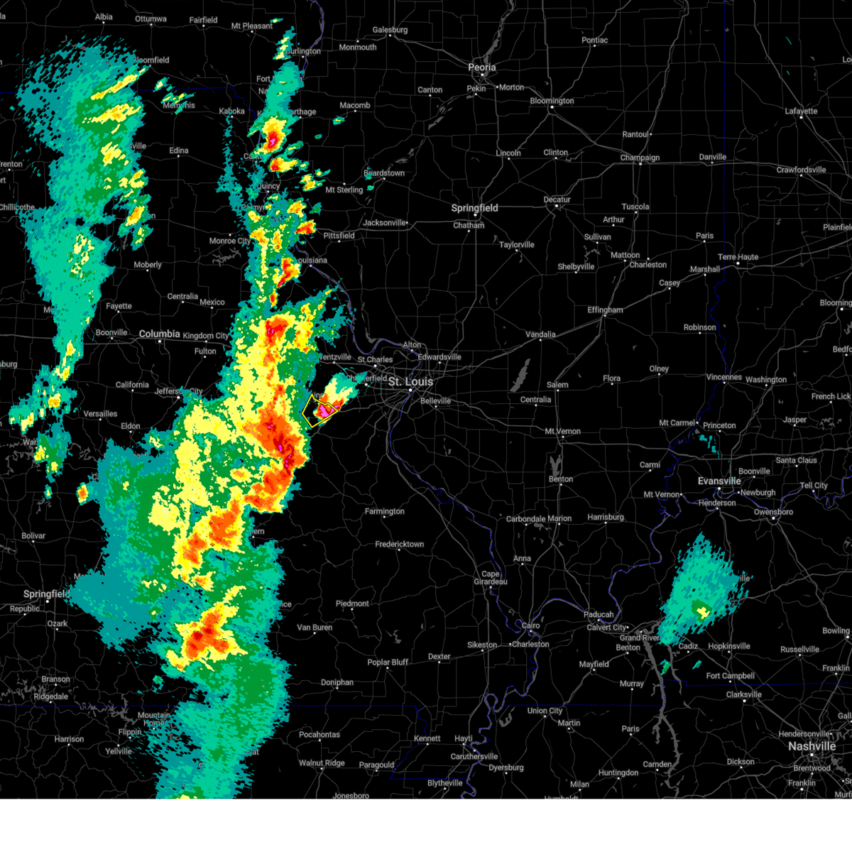 At 523 pm cdt, a severe thunderstorm was located over union, missouri, moving northeast at 25 mph (at 521 pm, law enforcement reported two inch hail in union, missouri). Hazards include two inch hail and 60 mph wind gusts. People and animals outdoors will be injured. expect hail damage to roofs, siding, windows, and vehicles. expect wind damage to roofs, siding, and trees. this severe thunderstorm will remain over mainly rural areas of central franklin county. this includes interstate 44 in missouri near exit 251. thunderstorm damage threat, considerable hail threat, observed max hail size, 2. 00 in wind threat, radar indicated max wind gust, 60 mph. At 523 pm cdt, a severe thunderstorm was located over union, missouri, moving northeast at 25 mph (at 521 pm, law enforcement reported two inch hail in union, missouri). Hazards include two inch hail and 60 mph wind gusts. People and animals outdoors will be injured. expect hail damage to roofs, siding, windows, and vehicles. expect wind damage to roofs, siding, and trees. this severe thunderstorm will remain over mainly rural areas of central franklin county. this includes interstate 44 in missouri near exit 251. thunderstorm damage threat, considerable hail threat, observed max hail size, 2. 00 in wind threat, radar indicated max wind gust, 60 mph.
|
| 4/15/2023 5:23 PM CDT | Half Dollar sized hail reported 1.7 miles S of Villa Ridge, MO |
| 4/15/2023 5:15 PM CDT |
 At 514 pm cdt, a severe thunderstorm was located over mainly rural areas of franklin county, missouri, moving northeast at 25 mph (at 512 pm, trained weather spotters reported quarter sized hail in union, missouri). Hazards include 60 mph wind gusts and half dollar size hail. Hail damage to vehicles is expected. expect wind damage to roofs, siding, and trees. locations impacted include, washington, union, villa ridge, and gray summit. this includes interstate 44 in missouri near exit 251. hail threat, radar indicated max hail size, 1. 25 in wind threat, radar indicated max wind gust, 60 mph. At 514 pm cdt, a severe thunderstorm was located over mainly rural areas of franklin county, missouri, moving northeast at 25 mph (at 512 pm, trained weather spotters reported quarter sized hail in union, missouri). Hazards include 60 mph wind gusts and half dollar size hail. Hail damage to vehicles is expected. expect wind damage to roofs, siding, and trees. locations impacted include, washington, union, villa ridge, and gray summit. this includes interstate 44 in missouri near exit 251. hail threat, radar indicated max hail size, 1. 25 in wind threat, radar indicated max wind gust, 60 mph.
|
| 4/15/2023 5:07 PM CDT |
 At 507 pm cdt, a severe thunderstorm was located over mainly rural areas of franklin county, moving northeast at 25 mph (radar indicated). Hazards include 60 mph wind gusts and half dollar size hail. Hail damage to vehicles is expected. expect wind damage to roofs, siding, and trees. locations impacted include, washington, union, villa ridge, and gray summit. this includes interstate 44 in missouri near exit 251. hail threat, radar indicated max hail size, 1. 25 in wind threat, radar indicated max wind gust, 60 mph. At 507 pm cdt, a severe thunderstorm was located over mainly rural areas of franklin county, moving northeast at 25 mph (radar indicated). Hazards include 60 mph wind gusts and half dollar size hail. Hail damage to vehicles is expected. expect wind damage to roofs, siding, and trees. locations impacted include, washington, union, villa ridge, and gray summit. this includes interstate 44 in missouri near exit 251. hail threat, radar indicated max hail size, 1. 25 in wind threat, radar indicated max wind gust, 60 mph.
|
| 4/15/2023 4:55 PM CDT |
 At 454 pm cdt, a severe thunderstorm was located near union, moving northeast at 15 mph (radar indicated). Hazards include 60 mph wind gusts and half dollar size hail. Hail damage to vehicles is expected. Expect wind damage to roofs, siding, and trees. At 454 pm cdt, a severe thunderstorm was located near union, moving northeast at 15 mph (radar indicated). Hazards include 60 mph wind gusts and half dollar size hail. Hail damage to vehicles is expected. Expect wind damage to roofs, siding, and trees.
|
| 8/3/2022 3:57 PM CDT |
 At 357 pm cdt, a severe thunderstorm was located over villa ridge, moving east at 30 mph (radar indicated). Hazards include 60 mph wind gusts and quarter size hail. Hail damage to vehicles is expected. expect wind damage to roofs, siding, and trees. locations impacted include, pacific and gray summit. this also includes robertsville state park. this includes interstate 44 in missouri between exits 239 and 257. hail threat, radar indicated max hail size, 1. 00 in wind threat, radar indicated max wind gust, 60 mph. At 357 pm cdt, a severe thunderstorm was located over villa ridge, moving east at 30 mph (radar indicated). Hazards include 60 mph wind gusts and quarter size hail. Hail damage to vehicles is expected. expect wind damage to roofs, siding, and trees. locations impacted include, pacific and gray summit. this also includes robertsville state park. this includes interstate 44 in missouri between exits 239 and 257. hail threat, radar indicated max hail size, 1. 00 in wind threat, radar indicated max wind gust, 60 mph.
|
| 8/3/2022 3:36 PM CDT |
 At 336 pm cdt, a severe thunderstorm was located near union, moving east at 30 mph (radar indicated). Hazards include 60 mph wind gusts and quarter size hail. Hail damage to vehicles is expected. expect wind damage to roofs, siding, and trees. this severe thunderstorm will be near, union, st. clair and parkway around 345 pm cdt. other locations in the path of this severe thunderstorm include villa ridge, gray summit and pacific. this includes interstate 44 in missouri between exits 230 and 257. this also includes robertsville state park. hail threat, radar indicated max hail size, 1. 00 in wind threat, radar indicated max wind gust, 60 mph. At 336 pm cdt, a severe thunderstorm was located near union, moving east at 30 mph (radar indicated). Hazards include 60 mph wind gusts and quarter size hail. Hail damage to vehicles is expected. expect wind damage to roofs, siding, and trees. this severe thunderstorm will be near, union, st. clair and parkway around 345 pm cdt. other locations in the path of this severe thunderstorm include villa ridge, gray summit and pacific. this includes interstate 44 in missouri between exits 230 and 257. this also includes robertsville state park. hail threat, radar indicated max hail size, 1. 00 in wind threat, radar indicated max wind gust, 60 mph.
|
| 6/17/2022 5:07 AM CDT |
 At 507 am cdt, severe thunderstorms were located along a line extending from near south roxana to st. louis to pacific, moving east at 35 mph (trained weather spotters). Hazards include 60 mph wind gusts and penny size hail. Expect damage to roofs, siding, and trees. severe thunderstorms will be near, granite city, cahokia, pontoon beach, dupo, madison, venice, cahokia parks airport, lemay, brooklyn and east carondelet around 515 am cdt. edwardsville, maryville, centreville, fairmont city and alorton around 520 am cdt. east st. louis, glen carbon, troy and washington park around 525 am cdt. other locations in the path of these severe thunderstorms include collinsville, fairview heights, caseyville, high ridge, belleville, swansea, shiloh, fenton, murphy, antonia, st. jacob, marine, o`fallon, arnold, barnhart, highland, lebanon, lakeshire, scott afb, green park, imperial, sappington, concord, oakville, mehlville, st. george, valmeyer, bella villa and fountain. this includes the following highways, interstate 70 in illinois between exits 21 and 30. interstate 55 in illinois near exit 23. interstate 64 in illinois between exits 9 and 27. interstate 44 in missouri between exits 251 and 277. interstate 55 in missouri between exits 178 and 191. this also includes route 66 state park, castlewood state park, mastodon historic site, sandy creek covered bridge historic site, gov. dunklin`s grave historic site, robertsville state park, and horseshoe lake state park. hail threat, radar indicated max hail size, 0. 75 in wind threat, radar indicated max wind gust, 60 mph. At 507 am cdt, severe thunderstorms were located along a line extending from near south roxana to st. louis to pacific, moving east at 35 mph (trained weather spotters). Hazards include 60 mph wind gusts and penny size hail. Expect damage to roofs, siding, and trees. severe thunderstorms will be near, granite city, cahokia, pontoon beach, dupo, madison, venice, cahokia parks airport, lemay, brooklyn and east carondelet around 515 am cdt. edwardsville, maryville, centreville, fairmont city and alorton around 520 am cdt. east st. louis, glen carbon, troy and washington park around 525 am cdt. other locations in the path of these severe thunderstorms include collinsville, fairview heights, caseyville, high ridge, belleville, swansea, shiloh, fenton, murphy, antonia, st. jacob, marine, o`fallon, arnold, barnhart, highland, lebanon, lakeshire, scott afb, green park, imperial, sappington, concord, oakville, mehlville, st. george, valmeyer, bella villa and fountain. this includes the following highways, interstate 70 in illinois between exits 21 and 30. interstate 55 in illinois near exit 23. interstate 64 in illinois between exits 9 and 27. interstate 44 in missouri between exits 251 and 277. interstate 55 in missouri between exits 178 and 191. this also includes route 66 state park, castlewood state park, mastodon historic site, sandy creek covered bridge historic site, gov. dunklin`s grave historic site, robertsville state park, and horseshoe lake state park. hail threat, radar indicated max hail size, 0. 75 in wind threat, radar indicated max wind gust, 60 mph.
|
| 6/8/2022 5:36 AM CDT |
 The severe thunderstorm warning for northwestern washington and southeastern franklin counties will expire at 545 am cdt, the storm which prompted the warning has weakened below severe limits, and no longer poses an immediate threat to life or property. therefore, the warning will be allowed to expire. The severe thunderstorm warning for northwestern washington and southeastern franklin counties will expire at 545 am cdt, the storm which prompted the warning has weakened below severe limits, and no longer poses an immediate threat to life or property. therefore, the warning will be allowed to expire.
|
| 6/8/2022 5:25 AM CDT |
 At 525 am cdt, a severe thunderstorm was located near richwoods, moving east at 40 mph (radar indicated). Hazards include 60 mph wind gusts and quarter size hail. Hail damage to vehicles is expected. expect wind damage to roofs, siding, and trees. locations impacted include, union, st. clair, villa ridge, parkway, richwoods, lonedell, moselle and piney park. this includes interstate 44 in missouri between exits 239 and 247. hail threat, radar indicated max hail size, 1. 00 in wind threat, radar indicated max wind gust, 60 mph. At 525 am cdt, a severe thunderstorm was located near richwoods, moving east at 40 mph (radar indicated). Hazards include 60 mph wind gusts and quarter size hail. Hail damage to vehicles is expected. expect wind damage to roofs, siding, and trees. locations impacted include, union, st. clair, villa ridge, parkway, richwoods, lonedell, moselle and piney park. this includes interstate 44 in missouri between exits 239 and 247. hail threat, radar indicated max hail size, 1. 00 in wind threat, radar indicated max wind gust, 60 mph.
|
| 6/8/2022 5:17 AM CDT |
 At 517 am cdt, a severe thunderstorm was located near miramiguoa park, moving east at 35 mph (radar indicated). Hazards include ping pong ball size hail and 60 mph wind gusts. People and animals outdoors will be injured. expect hail damage to roofs, siding, windows, and vehicles. expect wind damage to roofs, siding, and trees. locations impacted include, lonedell and richwoods. this includes interstate 44 in missouri between exits 230 and 247. hail threat, radar indicated max hail size, 1. 50 in wind threat, radar indicated max wind gust, 60 mph. At 517 am cdt, a severe thunderstorm was located near miramiguoa park, moving east at 35 mph (radar indicated). Hazards include ping pong ball size hail and 60 mph wind gusts. People and animals outdoors will be injured. expect hail damage to roofs, siding, windows, and vehicles. expect wind damage to roofs, siding, and trees. locations impacted include, lonedell and richwoods. this includes interstate 44 in missouri between exits 230 and 247. hail threat, radar indicated max hail size, 1. 50 in wind threat, radar indicated max wind gust, 60 mph.
|
| 6/8/2022 5:01 AM CDT |
 At 500 am cdt, a severe thunderstorm was located 7 miles northwest of sullivan, moving northeast at 40 mph (radar indicated). Hazards include 60 mph wind gusts and quarter size hail. Hail damage to vehicles is expected. expect wind damage to roofs, siding, and trees. this severe thunderstorm will be near, beaufort around 510 am cdt. st. clair and parkway around 520 am cdt. other locations in the path of this severe thunderstorm include union and villa ridge. this includes interstate 44 in missouri between exits 218 and 247. this also includes meramec state park. hail threat, radar indicated max hail size, 1. 00 in wind threat, radar indicated max wind gust, 60 mph. At 500 am cdt, a severe thunderstorm was located 7 miles northwest of sullivan, moving northeast at 40 mph (radar indicated). Hazards include 60 mph wind gusts and quarter size hail. Hail damage to vehicles is expected. expect wind damage to roofs, siding, and trees. this severe thunderstorm will be near, beaufort around 510 am cdt. st. clair and parkway around 520 am cdt. other locations in the path of this severe thunderstorm include union and villa ridge. this includes interstate 44 in missouri between exits 218 and 247. this also includes meramec state park. hail threat, radar indicated max hail size, 1. 00 in wind threat, radar indicated max wind gust, 60 mph.
|
| 5/19/2022 4:38 PM CDT |
 At 437 pm cdt, severe thunderstorms were located along a line extending from near washington to pacific to hillsboro, moving northeast at 50 mph (radar indicated). Hazards include 60 mph wind gusts and penny size hail. Expect damage to roofs, siding, and trees. severe thunderstorms will be near, festus, crystal city and horine around 445 pm cdt. eureka, pevely, herculaneum, antonia and barnhart around 450 pm cdt. wildwood, ballwin, ellisville, clarkson valley, spirit of st. louis airport, valmeyer, new melle, imperial and defiance around 455 pm cdt. other locations in the path of these severe thunderstorms include arnold, manchester, valley park, fenton, winchester, twin oaks, fountain, chesterfield, wentzville, kirkwood, lake st. louis, crestwood, town and country, sunset hills, des peres, glendale, warson woods, o`fallon, st. peters, maryland heights, webster groves, creve coeur, clayton, dardenne prairie, columbia, richmond heights, ladue, university city, overland, cahokia, st. ann, bridgeton, st. john, dupo, woodson terrace, millstadt, bel-ridge, st. charles, hazelwood, ferguson, jennings, berkeley, centreville, normandy, northwoods, cool valley and kinloch. this includes the following highways, interstate 44 in missouri between exits 247 and 277. interstate 55 in missouri between exits 178 and 191. interstate 70 in missouri between exits 199 and 231. this also includes babler memorial state park, scott joplin historic site, route 66 state park, castlewood state park, mastodon historic site, sandy creek covered bridge historic site, gov. Dunklin`s grave historic site, first missouri state capitol historic site, and robertsville state park. At 437 pm cdt, severe thunderstorms were located along a line extending from near washington to pacific to hillsboro, moving northeast at 50 mph (radar indicated). Hazards include 60 mph wind gusts and penny size hail. Expect damage to roofs, siding, and trees. severe thunderstorms will be near, festus, crystal city and horine around 445 pm cdt. eureka, pevely, herculaneum, antonia and barnhart around 450 pm cdt. wildwood, ballwin, ellisville, clarkson valley, spirit of st. louis airport, valmeyer, new melle, imperial and defiance around 455 pm cdt. other locations in the path of these severe thunderstorms include arnold, manchester, valley park, fenton, winchester, twin oaks, fountain, chesterfield, wentzville, kirkwood, lake st. louis, crestwood, town and country, sunset hills, des peres, glendale, warson woods, o`fallon, st. peters, maryland heights, webster groves, creve coeur, clayton, dardenne prairie, columbia, richmond heights, ladue, university city, overland, cahokia, st. ann, bridgeton, st. john, dupo, woodson terrace, millstadt, bel-ridge, st. charles, hazelwood, ferguson, jennings, berkeley, centreville, normandy, northwoods, cool valley and kinloch. this includes the following highways, interstate 44 in missouri between exits 247 and 277. interstate 55 in missouri between exits 178 and 191. interstate 70 in missouri between exits 199 and 231. this also includes babler memorial state park, scott joplin historic site, route 66 state park, castlewood state park, mastodon historic site, sandy creek covered bridge historic site, gov. Dunklin`s grave historic site, first missouri state capitol historic site, and robertsville state park.
|
| 5/19/2022 4:04 PM CDT |
 At 403 pm cdt, severe thunderstorms were located along a line extending from near sullivan to 9 miles southeast of anthonies mill, moving northeast at 60 mph. this storm is associated with a bowing line, in addition to other individual cells running ahead of the main line (radar indicated). Hazards include 70 mph wind gusts. Expect considerable tree damage. damage is likely to mobile homes, roofs, and outbuildings. severe thunderstorms will be near, richwoods around 415 pm cdt. st. clair and parkway around 420 pm cdt. other locations in the path of these severe thunderstorms include lonedell, villa ridge, pacific and gray summit. this includes interstate 44 in missouri between exits 218 and 257. This also includes robertsville state park and meramec state park. At 403 pm cdt, severe thunderstorms were located along a line extending from near sullivan to 9 miles southeast of anthonies mill, moving northeast at 60 mph. this storm is associated with a bowing line, in addition to other individual cells running ahead of the main line (radar indicated). Hazards include 70 mph wind gusts. Expect considerable tree damage. damage is likely to mobile homes, roofs, and outbuildings. severe thunderstorms will be near, richwoods around 415 pm cdt. st. clair and parkway around 420 pm cdt. other locations in the path of these severe thunderstorms include lonedell, villa ridge, pacific and gray summit. this includes interstate 44 in missouri between exits 218 and 257. This also includes robertsville state park and meramec state park.
|
| 5/19/2022 11:00 AM CDT |
 At 1100 am cdt, a severe thunderstorm was located over union, moving northeast at 45 mph (radar indicated). Hazards include 60 mph wind gusts and nickel size hail. Expect damage to roofs, siding, and trees. this severe thunderstorm will be near, villa ridge and augusta around 1110 am cdt. gray summit around 1115 am cdt. pacific and defiance around 1120 am cdt. other locations in the path of this severe thunderstorm include eureka, wildwood, ellisville, clarkson valley, spirit of st. louis airport, high ridge, ballwin, murphy, chesterfield and valley park. this includes the following highways, interstate 44 in missouri between exits 247 and 269. interstate 70 in missouri between exits 209 and 214. this also includes babler memorial state park, route 66 state park, castlewood state park, and robertsville state park. hail threat, radar indicated max hail size, 0. 88 in wind threat, radar indicated max wind gust, 60 mph. At 1100 am cdt, a severe thunderstorm was located over union, moving northeast at 45 mph (radar indicated). Hazards include 60 mph wind gusts and nickel size hail. Expect damage to roofs, siding, and trees. this severe thunderstorm will be near, villa ridge and augusta around 1110 am cdt. gray summit around 1115 am cdt. pacific and defiance around 1120 am cdt. other locations in the path of this severe thunderstorm include eureka, wildwood, ellisville, clarkson valley, spirit of st. louis airport, high ridge, ballwin, murphy, chesterfield and valley park. this includes the following highways, interstate 44 in missouri between exits 247 and 269. interstate 70 in missouri between exits 209 and 214. this also includes babler memorial state park, route 66 state park, castlewood state park, and robertsville state park. hail threat, radar indicated max hail size, 0. 88 in wind threat, radar indicated max wind gust, 60 mph.
|
| 3/5/2022 11:02 PM CST |
 At 1102 pm cst, a severe thunderstorm was located over washington, moving east at 60 mph (radar indicated). Hazards include 60 mph wind gusts and quarter size hail. Hail damage to vehicles is expected. expect wind damage to roofs, siding, and trees. this severe thunderstorm will be near, augusta around 1110 pm cst. pacific, gray summit and defiance around 1115 pm cst. other locations in the path of this severe thunderstorm include wildwood, ballwin, ellisville, clarkson valley, spirit of st. louis airport, weldon spring heights, st. peters, manchester, valley park, weldon spring, winchester, twin oaks, harvester, chesterfield, kirkwood, maryland heights, town and country, ladue, des peres, glendale, frontenac, warson woods, crystal lake park, creve coeur and bridgeton. this includes the following highways, interstate 44 in missouri near exit 261, and between exits 272 and 277. interstate 70 in missouri between exits 227 and 231. This also includes babler memorial state park, castlewood state park, and first missouri state capitol historic site. At 1102 pm cst, a severe thunderstorm was located over washington, moving east at 60 mph (radar indicated). Hazards include 60 mph wind gusts and quarter size hail. Hail damage to vehicles is expected. expect wind damage to roofs, siding, and trees. this severe thunderstorm will be near, augusta around 1110 pm cst. pacific, gray summit and defiance around 1115 pm cst. other locations in the path of this severe thunderstorm include wildwood, ballwin, ellisville, clarkson valley, spirit of st. louis airport, weldon spring heights, st. peters, manchester, valley park, weldon spring, winchester, twin oaks, harvester, chesterfield, kirkwood, maryland heights, town and country, ladue, des peres, glendale, frontenac, warson woods, crystal lake park, creve coeur and bridgeton. this includes the following highways, interstate 44 in missouri near exit 261, and between exits 272 and 277. interstate 70 in missouri between exits 227 and 231. This also includes babler memorial state park, castlewood state park, and first missouri state capitol historic site.
|
| 12/10/2021 9:30 PM CST | Franklin county dispatch reported a tree over the roadway at state hwy o and route mm. time estimated from rada in franklin county MO, 2.8 miles NNW of Villa Ridge, MO |
| 8/12/2021 6:37 PM CDT |
 At 636 pm cdt, severe thunderstorms were located along a line extending from east alton to near valley park to near st. clair, moving southeast at 40 mph (this line of storms has a history of damaging wind gusts). Hazards include 60 mph wind gusts and penny size hail. Expect damage to roofs, siding, and trees. severe thunderstorms will be near, st. louis, kirkwood, sunset hills, des peres, valley park, fenton, byrnes mill, oakland, murphy and high ridge around 640 pm cdt. granite city, crestwood, madison, affton, south roxana, grantwood village, sappington and concord around 645 pm cdt. edwardsville, arnold, pontoon beach, lakeshire, mehlville, antonia, green park and st. george around 650 pm cdt. collinsville, maryville, oakville, barnhart, imperial and dittmer around 655 pm cdt. other locations in the path of these severe thunderstorms include glen carbon, troy, columbia, caseyville, cedar hill lakes, fountain, o`fallon, valmeyer, waterloo, hillsboro, st. jacob, de soto, lebanon and scott afb. this includes the following highways, interstate 64 in illinois between exits 9 and 41. interstate 44 in missouri between exits 239 and 247, and between exits 257 and 277. interstate 55 in missouri between exits 170 and 191. this also includes scott joplin historic site, route 66 state park, castlewood state park, confluence state park, mastodon historic site, sandy creek covered bridge historic site, gov. dunklin`s grave historic site, robertsville state park, and horseshoe lake state park. hail threat, radar indicated max hail size, 0. 75 in wind threat, radar indicated max wind gust, 60 mph. At 636 pm cdt, severe thunderstorms were located along a line extending from east alton to near valley park to near st. clair, moving southeast at 40 mph (this line of storms has a history of damaging wind gusts). Hazards include 60 mph wind gusts and penny size hail. Expect damage to roofs, siding, and trees. severe thunderstorms will be near, st. louis, kirkwood, sunset hills, des peres, valley park, fenton, byrnes mill, oakland, murphy and high ridge around 640 pm cdt. granite city, crestwood, madison, affton, south roxana, grantwood village, sappington and concord around 645 pm cdt. edwardsville, arnold, pontoon beach, lakeshire, mehlville, antonia, green park and st. george around 650 pm cdt. collinsville, maryville, oakville, barnhart, imperial and dittmer around 655 pm cdt. other locations in the path of these severe thunderstorms include glen carbon, troy, columbia, caseyville, cedar hill lakes, fountain, o`fallon, valmeyer, waterloo, hillsboro, st. jacob, de soto, lebanon and scott afb. this includes the following highways, interstate 64 in illinois between exits 9 and 41. interstate 44 in missouri between exits 239 and 247, and between exits 257 and 277. interstate 55 in missouri between exits 170 and 191. this also includes scott joplin historic site, route 66 state park, castlewood state park, confluence state park, mastodon historic site, sandy creek covered bridge historic site, gov. dunklin`s grave historic site, robertsville state park, and horseshoe lake state park. hail threat, radar indicated max hail size, 0. 75 in wind threat, radar indicated max wind gust, 60 mph.
|
| 8/12/2021 6:15 PM CDT |
 At 615 pm cdt, severe thunderstorms were located along a line extending from near winfield to near augusta to near gerald, moving east at 40 mph (this line of storms has a history of producing wind damage). Hazards include 60 mph wind gusts and penny size hail. Expect damage to roofs, siding, and trees. locations impacted include, winfield, new melle, augusta, pacific, defiance, wildwood, sullivan, weldon spring heights, orchard farms, eureka, spirit of st. louis airport, ballwin, union, ellisville, st. clair, clarkson valley, parkway, portage des sioux, chesterfield, manchester, town and country, winchester, west alton, twin oaks, kirkwood, des peres, valley park, fenton, murphy, crystal lake park, westwood, country life acres, webster groves, creve coeur, overland, crestwood, ladue, sunset hills, brentwood, olivette, glendale and frontenac. this also includes babler memorial state park, route 66 state park, castlewood state park, first missouri state capitol historic site, and robertsville state park. this includes the following highways, interstate 44 in missouri between exits 228 and 277. interstate 70 in missouri between exits 200 and 231. hail threat, radar indicated max hail size, 0. 75 in wind threat, radar indicated max wind gust, 60 mph. At 615 pm cdt, severe thunderstorms were located along a line extending from near winfield to near augusta to near gerald, moving east at 40 mph (this line of storms has a history of producing wind damage). Hazards include 60 mph wind gusts and penny size hail. Expect damage to roofs, siding, and trees. locations impacted include, winfield, new melle, augusta, pacific, defiance, wildwood, sullivan, weldon spring heights, orchard farms, eureka, spirit of st. louis airport, ballwin, union, ellisville, st. clair, clarkson valley, parkway, portage des sioux, chesterfield, manchester, town and country, winchester, west alton, twin oaks, kirkwood, des peres, valley park, fenton, murphy, crystal lake park, westwood, country life acres, webster groves, creve coeur, overland, crestwood, ladue, sunset hills, brentwood, olivette, glendale and frontenac. this also includes babler memorial state park, route 66 state park, castlewood state park, first missouri state capitol historic site, and robertsville state park. this includes the following highways, interstate 44 in missouri between exits 228 and 277. interstate 70 in missouri between exits 200 and 231. hail threat, radar indicated max hail size, 0. 75 in wind threat, radar indicated max wind gust, 60 mph.
|
| 8/12/2021 5:58 PM CDT |
 At 557 pm cdt, severe thunderstorms were located along a line extending from near fountain n` lakes to near marthasville to near drake, moving east at 40 mph (this line of storms has downed trees and snapped power poles). Hazards include 70 mph wind gusts and penny size hail. Expect considerable tree damage. damage is likely to mobile homes, roofs, and outbuildings. these severe storms will be near, washington, marthasville and fountain n` lakes around 600 pm cdt. winfield, innsbrook and dutzow around 605 pm cdt. gerald around 610 pm cdt. other locations in the path of these severe thunderstorms include new melle, augusta, defiance, dardenne prairie, beaufort, o`fallon, wildwood, spirit of st. louis airport, weldon spring heights, st. peters, union, weldon spring, cottleville and clarkson valley. this also includes babler memorial state park, route 66 state park, deutschheim historic site, castlewood state park, first missouri state capitol historic site, and robertsville state park. this includes the following highways, interstate 44 in missouri between exits 228 and 277. interstate 70 in missouri between exits 188 and 231. thunderstorm damage threat, considerable hail threat, radar indicated max hail size, 0. 75 in wind threat, radar indicated max wind gust, 70 mph. At 557 pm cdt, severe thunderstorms were located along a line extending from near fountain n` lakes to near marthasville to near drake, moving east at 40 mph (this line of storms has downed trees and snapped power poles). Hazards include 70 mph wind gusts and penny size hail. Expect considerable tree damage. damage is likely to mobile homes, roofs, and outbuildings. these severe storms will be near, washington, marthasville and fountain n` lakes around 600 pm cdt. winfield, innsbrook and dutzow around 605 pm cdt. gerald around 610 pm cdt. other locations in the path of these severe thunderstorms include new melle, augusta, defiance, dardenne prairie, beaufort, o`fallon, wildwood, spirit of st. louis airport, weldon spring heights, st. peters, union, weldon spring, cottleville and clarkson valley. this also includes babler memorial state park, route 66 state park, deutschheim historic site, castlewood state park, first missouri state capitol historic site, and robertsville state park. this includes the following highways, interstate 44 in missouri between exits 228 and 277. interstate 70 in missouri between exits 188 and 231. thunderstorm damage threat, considerable hail threat, radar indicated max hail size, 0. 75 in wind threat, radar indicated max wind gust, 70 mph.
|
| 8/12/2021 5:51 PM CDT |
 At 551 pm cdt, severe thunderstorms were located along a line extending from near davis to near treloar to near mount sterling, moving southeast at 40 mph (this line of storms has a history of wind damage). Hazards include 60 mph wind gusts and penny size hail. Expect damage to roofs, siding, and trees. severe thunderstorms will be near, marthasville and fountain n` lakes around 600 pm cdt. washington, winfield, chain of rocks and dutzow around 605 pm cdt. gerald around 610 pm cdt. other locations in the path of these severe thunderstorms include augusta, villa ridge, defiance, beaufort, gray summit, st. charles, oak grove, sullivan, pacific, orchard farms, maryland heights, eureka, portage des sioux and miramiguoa park. this includes the following highways, interstate 44 in missouri between exits 228 and 277. interstate 70 in missouri between exits 188 and 231. this also includes babler memorial state park, route 66 state park, deutschheim historic site, castlewood state park, first missouri state capitol historic site, and robertsville state park. hail threat, radar indicated max hail size, 0. 75 in wind threat, radar indicated max wind gust, 60 mph. At 551 pm cdt, severe thunderstorms were located along a line extending from near davis to near treloar to near mount sterling, moving southeast at 40 mph (this line of storms has a history of wind damage). Hazards include 60 mph wind gusts and penny size hail. Expect damage to roofs, siding, and trees. severe thunderstorms will be near, marthasville and fountain n` lakes around 600 pm cdt. washington, winfield, chain of rocks and dutzow around 605 pm cdt. gerald around 610 pm cdt. other locations in the path of these severe thunderstorms include augusta, villa ridge, defiance, beaufort, gray summit, st. charles, oak grove, sullivan, pacific, orchard farms, maryland heights, eureka, portage des sioux and miramiguoa park. this includes the following highways, interstate 44 in missouri between exits 228 and 277. interstate 70 in missouri between exits 188 and 231. this also includes babler memorial state park, route 66 state park, deutschheim historic site, castlewood state park, first missouri state capitol historic site, and robertsville state park. hail threat, radar indicated max hail size, 0. 75 in wind threat, radar indicated max wind gust, 60 mph.
|
| 8/8/2021 3:19 PM CDT |
 At 318 pm cdt, severe thunderstorms were located along a line extending from treloar to near beaufort, moving northeast at 35 mph (radar indicated). Hazards include 60 mph wind gusts and penny size hail. Expect damage to roofs, siding, and trees. severe thunderstorms will be near, marthasville around 325 pm cdt. washington, warrenton, truesdale and innsbrook around 335 pm cdt. other locations in the path of these severe thunderstorms include dutzow, wright city, new melle, augusta, wentzville, defiance, lake st. louis, st. paul, josephville, fountain n` lakes, chain of rocks and weldon spring heights. this includes interstate 70 in missouri between exits 193 and 222. hail threat, radar indicated max hail size, 0. 75 in wind threat, radar indicated max wind gust, 60 mph. At 318 pm cdt, severe thunderstorms were located along a line extending from treloar to near beaufort, moving northeast at 35 mph (radar indicated). Hazards include 60 mph wind gusts and penny size hail. Expect damage to roofs, siding, and trees. severe thunderstorms will be near, marthasville around 325 pm cdt. washington, warrenton, truesdale and innsbrook around 335 pm cdt. other locations in the path of these severe thunderstorms include dutzow, wright city, new melle, augusta, wentzville, defiance, lake st. louis, st. paul, josephville, fountain n` lakes, chain of rocks and weldon spring heights. this includes interstate 70 in missouri between exits 193 and 222. hail threat, radar indicated max hail size, 0. 75 in wind threat, radar indicated max wind gust, 60 mph.
|
| 7/10/2021 12:31 AM CDT |
 At 1231 am cdt, severe thunderstorms were located along a line extending from near orchard farms to clarkson valley to near union to near beaufort, moving south at 30 mph (trained weather spotters). Hazards include 70 mph wind gusts. Expect considerable tree damage. damage is likely to mobile homes, roofs, and outbuildings. locations impacted include, st. louis, o`fallon, st. charles, st. peters, florissant, chesterfield, wildwood, university city, ballwin, granite city, alton, kirkwood, maryland heights, hazelwood, collinsville, edwardsville, webster groves, ferguson, arnold and manchester. this also includes babler memorial state park, scott joplin historic site, route 66 state park, castlewood state park, confluence state park, mastodon historic site, first missouri state capitol historic site, robertsville state park, and horseshoe lake state park. this includes the following highways, interstate 44 in missouri between exits 230 and 277. interstate 55 in missouri between exits 187 and 191. Interstate 70 in missouri between exits 220 and 231. At 1231 am cdt, severe thunderstorms were located along a line extending from near orchard farms to clarkson valley to near union to near beaufort, moving south at 30 mph (trained weather spotters). Hazards include 70 mph wind gusts. Expect considerable tree damage. damage is likely to mobile homes, roofs, and outbuildings. locations impacted include, st. louis, o`fallon, st. charles, st. peters, florissant, chesterfield, wildwood, university city, ballwin, granite city, alton, kirkwood, maryland heights, hazelwood, collinsville, edwardsville, webster groves, ferguson, arnold and manchester. this also includes babler memorial state park, scott joplin historic site, route 66 state park, castlewood state park, confluence state park, mastodon historic site, first missouri state capitol historic site, robertsville state park, and horseshoe lake state park. this includes the following highways, interstate 44 in missouri between exits 230 and 277. interstate 55 in missouri between exits 187 and 191. Interstate 70 in missouri between exits 220 and 231.
|
| 7/10/2021 12:19 AM CDT |
 At 1219 am cdt, severe thunderstorms were located along a line extending from orchard farms to weldon spring to near washington to near beaufort, moving southeast at 50 mph (trained weather spotters). Hazards include 70 mph wind gusts and penny size hail. Expect considerable tree damage. damage is likely to mobile homes, roofs, and outbuildings. locations impacted include, wildwood, ballwin, town and country, ellisville, clarkson valley, villa ridge, kirkwood, ferguson, manchester, st. ann, eureka, berkeley, des peres, valley park, black jack, st. clair, university city, creve coeur, overland, jennings, bellefontaine neighbors, ladue, sunset hills, olivette, sullivan, st. john, webster groves, clayton, richmond heights, brentwood, maplewood, glendale, frontenac, byrnes mill, warson woods, venice, arnold, crestwood, shrewsbury, oakland, affton, marlborough, grantwood village, brooklyn, wilbur park, mackenzie, cahokia, lakeshire, barnhart, antonia, lemay, mehlville, green park, st. george, bella villa, east carondelet and oakville. this also includes babler memorial state park, scott joplin historic site, route 66 state park, castlewood state park, confluence state park, mastodon historic site, first missouri state capitol historic site, robertsville state park, and horseshoe lake state park. this includes the following highways, interstate 44 in missouri between exits 230 and 277. interstate 55 in missouri between exits 187 and 191. Interstate 70 in missouri between exits 216 and 231. At 1219 am cdt, severe thunderstorms were located along a line extending from orchard farms to weldon spring to near washington to near beaufort, moving southeast at 50 mph (trained weather spotters). Hazards include 70 mph wind gusts and penny size hail. Expect considerable tree damage. damage is likely to mobile homes, roofs, and outbuildings. locations impacted include, wildwood, ballwin, town and country, ellisville, clarkson valley, villa ridge, kirkwood, ferguson, manchester, st. ann, eureka, berkeley, des peres, valley park, black jack, st. clair, university city, creve coeur, overland, jennings, bellefontaine neighbors, ladue, sunset hills, olivette, sullivan, st. john, webster groves, clayton, richmond heights, brentwood, maplewood, glendale, frontenac, byrnes mill, warson woods, venice, arnold, crestwood, shrewsbury, oakland, affton, marlborough, grantwood village, brooklyn, wilbur park, mackenzie, cahokia, lakeshire, barnhart, antonia, lemay, mehlville, green park, st. george, bella villa, east carondelet and oakville. this also includes babler memorial state park, scott joplin historic site, route 66 state park, castlewood state park, confluence state park, mastodon historic site, first missouri state capitol historic site, robertsville state park, and horseshoe lake state park. this includes the following highways, interstate 44 in missouri between exits 230 and 277. interstate 55 in missouri between exits 187 and 191. Interstate 70 in missouri between exits 216 and 231.
|
| 7/9/2021 11:59 PM CDT |
 At 1158 pm cdt, severe thunderstorms were located along a line extending from near grafton to near chain of rocks to innsbrook to near treloar, moving south at 30 mph (trained weather spotters). Hazards include 70 mph wind gusts and penny size hail. Expect considerable tree damage. damage is likely to mobile homes, roofs, and outbuildings. severe thunderstorms will be near, innsbrook and treloar around 1205 am cdt. new haven and josephville around 1210 am cdt. wentzville, lake st. louis and marthasville around 1215 am cdt. other locations in the path of these severe thunderstorms include dardenne prairie, dutzow, st. charles, florissant, washington, new melle, hazelwood, maryland heights, ferguson, bridgeton, berkeley, lambert-st. louis international airport, calverton park, st. ann, union, st. john, normandy, woodson terrace, bel-ridge, cool valley, kinloch, breckenridge hills and edmundson. this includes the following highways, interstate 44 in missouri between exits 230 and 277. interstate 55 in missouri between exits 187 and 191. interstate 70 in missouri between exits 199 and 231. This also includes babler memorial state park, scott joplin historic site, route 66 state park, castlewood state park, confluence state park, mastodon historic site, first missouri state capitol historic site, robertsville state park, pere marquette state park, and horseshoe lake state park. At 1158 pm cdt, severe thunderstorms were located along a line extending from near grafton to near chain of rocks to innsbrook to near treloar, moving south at 30 mph (trained weather spotters). Hazards include 70 mph wind gusts and penny size hail. Expect considerable tree damage. damage is likely to mobile homes, roofs, and outbuildings. severe thunderstorms will be near, innsbrook and treloar around 1205 am cdt. new haven and josephville around 1210 am cdt. wentzville, lake st. louis and marthasville around 1215 am cdt. other locations in the path of these severe thunderstorms include dardenne prairie, dutzow, st. charles, florissant, washington, new melle, hazelwood, maryland heights, ferguson, bridgeton, berkeley, lambert-st. louis international airport, calverton park, st. ann, union, st. john, normandy, woodson terrace, bel-ridge, cool valley, kinloch, breckenridge hills and edmundson. this includes the following highways, interstate 44 in missouri between exits 230 and 277. interstate 55 in missouri between exits 187 and 191. interstate 70 in missouri between exits 199 and 231. This also includes babler memorial state park, scott joplin historic site, route 66 state park, castlewood state park, confluence state park, mastodon historic site, first missouri state capitol historic site, robertsville state park, pere marquette state park, and horseshoe lake state park.
|
| 4/7/2021 5:58 PM CDT |
 At 558 pm cdt, a severe thunderstorm was located near old mines, moving northeast at 50 mph (radar indicated). Hazards include 60 mph wind gusts and nickel size hail. Expect damage to roofs, siding, and trees. locations impacted include, arnold, festus, pacific, bonne terre, de soto, pevely, desloge, crystal city, herculaneum, hillsboro, byrnes mill, potosi, bismarck, leadwood, high ridge, murphy, antonia, barnhart, cedar hill and gray summit. this also includes washington state park, st. francois state park, mastodon historic site, sandy creek covered bridge historic site, gov. dunklin`s grave historic site, and robertsville state park. this includes the following highways, interstate 44 in missouri exit 247 and near exit 257. Interstate 55 in missouri between exits 170 and 191. At 558 pm cdt, a severe thunderstorm was located near old mines, moving northeast at 50 mph (radar indicated). Hazards include 60 mph wind gusts and nickel size hail. Expect damage to roofs, siding, and trees. locations impacted include, arnold, festus, pacific, bonne terre, de soto, pevely, desloge, crystal city, herculaneum, hillsboro, byrnes mill, potosi, bismarck, leadwood, high ridge, murphy, antonia, barnhart, cedar hill and gray summit. this also includes washington state park, st. francois state park, mastodon historic site, sandy creek covered bridge historic site, gov. dunklin`s grave historic site, and robertsville state park. this includes the following highways, interstate 44 in missouri exit 247 and near exit 257. Interstate 55 in missouri between exits 170 and 191.
|
| 4/7/2021 5:37 PM CDT |
 The national weather service in st louis has issued a * severe thunderstorm warning for. jefferson county in east central missouri. washington county in east central missouri. southeastern franklin county in east central missouri. northwestern st. Francois county in southeastern missouri. The national weather service in st louis has issued a * severe thunderstorm warning for. jefferson county in east central missouri. washington county in east central missouri. southeastern franklin county in east central missouri. northwestern st. Francois county in southeastern missouri.
|
| 3/27/2021 5:32 PM CDT |
 At 532 pm cdt, severe thunderstorms were located along a line extending from near swiss to near owensville, moving northeast at 65 mph (radar indicated). Hazards include 60 mph wind gusts and quarter size hail. Hail damage to vehicles is expected. expect wind damage to roofs, siding, and trees. locations impacted include, washington, union, pacific, st. clair, owensville, new haven, gray summit, villa ridge, gerald, rosebud, beaufort, swiss, drake, leslie, noser mill, lyon, robertsville, catawissa and moselle. this also includes robertsville state park. This includes interstate 44 in missouri between exits 242 and 257. At 532 pm cdt, severe thunderstorms were located along a line extending from near swiss to near owensville, moving northeast at 65 mph (radar indicated). Hazards include 60 mph wind gusts and quarter size hail. Hail damage to vehicles is expected. expect wind damage to roofs, siding, and trees. locations impacted include, washington, union, pacific, st. clair, owensville, new haven, gray summit, villa ridge, gerald, rosebud, beaufort, swiss, drake, leslie, noser mill, lyon, robertsville, catawissa and moselle. this also includes robertsville state park. This includes interstate 44 in missouri between exits 242 and 257.
|
| 3/27/2021 5:24 PM CDT |
 At 523 pm cdt, a severe thunderstorm was located near bland, moving east at 45 mph (radar indicated). Hazards include 60 mph wind gusts and quarter size hail. Hail damage to vehicles is expected. Expect wind damage to roofs, siding, and trees. At 523 pm cdt, a severe thunderstorm was located near bland, moving east at 45 mph (radar indicated). Hazards include 60 mph wind gusts and quarter size hail. Hail damage to vehicles is expected. Expect wind damage to roofs, siding, and trees.
|
| 8/10/2020 5:35 PM CDT |
 At 535 pm cdt, severe thunderstorms were located along a line extending from worden to chesterfield to near miramiguoa park, moving southeast at 45 mph (trained weather spotters reported power outages and roof damge in st. charles county). Hazards include 60 mph wind gusts. Expect damage to roofs, siding, and trees. locations impacted include, st. louis, st. charles, st. peters, florissant, chesterfield, belleville, wildwood, university city, ballwin, granite city, wentzville, o`fallon, alton, kirkwood, maryland heights, east st. louis, hazelwood, collinsville, edwardsville and webster groves. this also includes babler memorial state park, scott joplin historic site, route 66 state park, castlewood state park, confluence state park, mastodon historic site, sandy creek covered bridge historic site, gov. dunklin`s grave historic site, first missouri state capitol historic site, robertsville state park, and horseshoe lake state park. this includes the following highways, interstate 70 in illinois between exits 21 and 30. interstate 55 in illinois between exits 23 and 44. interstate 64 in illinois between exits 9 and 27. interstate 44 in missouri between exits 230 and 277. interstate 55 in missouri between exits 175 and 191. Interstate 70 in missouri between exits 212 and 231. At 535 pm cdt, severe thunderstorms were located along a line extending from worden to chesterfield to near miramiguoa park, moving southeast at 45 mph (trained weather spotters reported power outages and roof damge in st. charles county). Hazards include 60 mph wind gusts. Expect damage to roofs, siding, and trees. locations impacted include, st. louis, st. charles, st. peters, florissant, chesterfield, belleville, wildwood, university city, ballwin, granite city, wentzville, o`fallon, alton, kirkwood, maryland heights, east st. louis, hazelwood, collinsville, edwardsville and webster groves. this also includes babler memorial state park, scott joplin historic site, route 66 state park, castlewood state park, confluence state park, mastodon historic site, sandy creek covered bridge historic site, gov. dunklin`s grave historic site, first missouri state capitol historic site, robertsville state park, and horseshoe lake state park. this includes the following highways, interstate 70 in illinois between exits 21 and 30. interstate 55 in illinois between exits 23 and 44. interstate 64 in illinois between exits 9 and 27. interstate 44 in missouri between exits 230 and 277. interstate 55 in missouri between exits 175 and 191. Interstate 70 in missouri between exits 212 and 231.
|
| 8/10/2020 5:22 PM CDT |
 At 522 pm cdt, severe thunderstorms were located along a line extending from near moscow mills to treloar to near owensville, moving east at 45 mph (radar indicated). Hazards include 60 mph wind gusts. Expect damage to roofs, siding, and trees. locations impacted include, o`fallon, st. peters, wentzville, lake st. louis, washington, dardenne prairie, union, warrenton, weldon spring, wright city, cottleville, owensville, new haven, st. paul, villa ridge, gerald, marthasville, truesdale, innsbrook and new melle. This includes interstate 70 in missouri between exits 188 and 220. At 522 pm cdt, severe thunderstorms were located along a line extending from near moscow mills to treloar to near owensville, moving east at 45 mph (radar indicated). Hazards include 60 mph wind gusts. Expect damage to roofs, siding, and trees. locations impacted include, o`fallon, st. peters, wentzville, lake st. louis, washington, dardenne prairie, union, warrenton, weldon spring, wright city, cottleville, owensville, new haven, st. paul, villa ridge, gerald, marthasville, truesdale, innsbrook and new melle. This includes interstate 70 in missouri between exits 188 and 220.
|
| 8/10/2020 5:16 PM CDT |
 At 514 pm cdt, severe thunderstorms were located along a line extending from near bunker hill to near st. paul to beaufort, moving southeast at 45 mph (law enforcement). Hazards include 60 mph wind gusts. expect damage to roofs, siding, and trees At 514 pm cdt, severe thunderstorms were located along a line extending from near bunker hill to near st. paul to beaufort, moving southeast at 45 mph (law enforcement). Hazards include 60 mph wind gusts. expect damage to roofs, siding, and trees
|
| 8/10/2020 4:58 PM CDT |
 At 458 pm cdt, severe thunderstorms were located along a line extending from near jonesburg to near hermann to near linn, moving east at 45 mph (radar indicated). Hazards include 60 mph wind gusts and penny size hail. Expect damage to roofs, siding, and trees. locations impacted include, o`fallon, st. peters, wentzville, lake st. louis, washington, dardenne prairie, union, warrenton, weldon spring, wright city, cottleville, owensville, hermann, new haven, st. paul, linn, villa ridge, gerald, marthasville and jonesburg. this also includes deutschheim historic site. This includes interstate 70 in missouri between exits 183 and 220. At 458 pm cdt, severe thunderstorms were located along a line extending from near jonesburg to near hermann to near linn, moving east at 45 mph (radar indicated). Hazards include 60 mph wind gusts and penny size hail. Expect damage to roofs, siding, and trees. locations impacted include, o`fallon, st. peters, wentzville, lake st. louis, washington, dardenne prairie, union, warrenton, weldon spring, wright city, cottleville, owensville, hermann, new haven, st. paul, linn, villa ridge, gerald, marthasville and jonesburg. this also includes deutschheim historic site. This includes interstate 70 in missouri between exits 183 and 220.
|
| 8/10/2020 4:39 PM CDT |
 At 438 pm cdt, severe thunderstorms were located along a line extending from montgomery city to near chamois to near taos, moving east at 45 mph (automated weather station in jefferson city reported a wind gust of 60 miles per hour). Hazards include 60 mph wind gusts and penny size hail. expect damage to roofs, siding, and trees At 438 pm cdt, severe thunderstorms were located along a line extending from montgomery city to near chamois to near taos, moving east at 45 mph (automated weather station in jefferson city reported a wind gust of 60 miles per hour). Hazards include 60 mph wind gusts and penny size hail. expect damage to roofs, siding, and trees
|
| 7/21/2020 2:12 AM CDT |
 At 212 am cdt, a severe thunderstorm was located over pacific, moving east at 10 mph (radar indicated). Hazards include 60 mph wind gusts and nickel size hail. expect damage to roofs, siding, and trees At 212 am cdt, a severe thunderstorm was located over pacific, moving east at 10 mph (radar indicated). Hazards include 60 mph wind gusts and nickel size hail. expect damage to roofs, siding, and trees
|
| 4/8/2020 7:13 PM CDT |
 At 713 pm cdt, a severe thunderstorm was located over augusta, moving east at 35 mph (radar indicated). Hazards include 60 mph wind gusts and quarter size hail. Hail damage to vehicles is expected. Expect wind damage to roofs, siding, and trees. At 713 pm cdt, a severe thunderstorm was located over augusta, moving east at 35 mph (radar indicated). Hazards include 60 mph wind gusts and quarter size hail. Hail damage to vehicles is expected. Expect wind damage to roofs, siding, and trees.
|
| 11/29/2019 9:24 PM CST |
 At 924 pm cst, a severe thunderstorm was located over lonedell, moving east at 60 mph (radar indicated). Hazards include quarter size hail. damage to vehicles is expected At 924 pm cst, a severe thunderstorm was located over lonedell, moving east at 60 mph (radar indicated). Hazards include quarter size hail. damage to vehicles is expected
|
| 8/30/2019 4:44 PM CDT |
 At 444 pm cdt, a severe thunderstorm was located near byrnes mill, moving east at 25 mph (radar indicated). Hazards include 60 mph wind gusts and quarter size hail. Hail damage to vehicles is expected. expect wind damage to roofs, siding, and trees. locations impacted include, chesterfield, wildwood, ballwin, manchester, creve coeur, town and country, union, eureka, ellisville, des peres, pacific, valley park, pevely, st. clair, fenton, byrnes mill, clarkson valley, gray summit, villa ridge and high ridge. this also includes route 66 state park, castlewood state park, sandy creek covered bridge historic site, and robertsville state park. this includes the following highways, interstate 44 in missouri between exits 240 and 274. Interstate 55 in missouri near exit 180. At 444 pm cdt, a severe thunderstorm was located near byrnes mill, moving east at 25 mph (radar indicated). Hazards include 60 mph wind gusts and quarter size hail. Hail damage to vehicles is expected. expect wind damage to roofs, siding, and trees. locations impacted include, chesterfield, wildwood, ballwin, manchester, creve coeur, town and country, union, eureka, ellisville, des peres, pacific, valley park, pevely, st. clair, fenton, byrnes mill, clarkson valley, gray summit, villa ridge and high ridge. this also includes route 66 state park, castlewood state park, sandy creek covered bridge historic site, and robertsville state park. this includes the following highways, interstate 44 in missouri between exits 240 and 274. Interstate 55 in missouri near exit 180.
|
| 8/30/2019 4:27 PM CDT |
 At 426 pm cdt, a severe thunderstorm was located near dittmer, moving east at 30 mph (radar indicated). Hazards include 60 mph wind gusts and quarter size hail. Hail damage to vehicles is expected. expect wind damage to roofs, siding, and trees. locations impacted include, chesterfield, wildwood, ballwin, manchester, creve coeur, town and country, union, eureka, ellisville, des peres, pacific, valley park, pevely, st. clair, fenton, byrnes mill, clarkson valley, gray summit, villa ridge and high ridge. this also includes route 66 state park, castlewood state park, sandy creek covered bridge historic site, and robertsville state park. this includes the following highways, interstate 44 in missouri between exits 240 and 274. Interstate 55 in missouri near exit 180. At 426 pm cdt, a severe thunderstorm was located near dittmer, moving east at 30 mph (radar indicated). Hazards include 60 mph wind gusts and quarter size hail. Hail damage to vehicles is expected. expect wind damage to roofs, siding, and trees. locations impacted include, chesterfield, wildwood, ballwin, manchester, creve coeur, town and country, union, eureka, ellisville, des peres, pacific, valley park, pevely, st. clair, fenton, byrnes mill, clarkson valley, gray summit, villa ridge and high ridge. this also includes route 66 state park, castlewood state park, sandy creek covered bridge historic site, and robertsville state park. this includes the following highways, interstate 44 in missouri between exits 240 and 274. Interstate 55 in missouri near exit 180.
|
| 8/30/2019 4:08 PM CDT |
 At 408 pm cdt, a severe thunderstorm was located over parkway, moving east at 30 mph (radar indicated). Hazards include 60 mph wind gusts and quarter size hail. Hail damage to vehicles is expected. Expect wind damage to roofs, siding, and trees. At 408 pm cdt, a severe thunderstorm was located over parkway, moving east at 30 mph (radar indicated). Hazards include 60 mph wind gusts and quarter size hail. Hail damage to vehicles is expected. Expect wind damage to roofs, siding, and trees.
|
| 8/30/2019 3:58 PM CDT |
 At 356 pm cdt, a severe thunderstorm was located near parkway, moving east at 30 mph (trained weather spotters. up to 2 inch diameter hail was reported in sullivan with this storm). Hazards include ping pong ball size hail and 60 mph wind gusts. People and animals outdoors will be injured. expect hail damage to roofs, siding, windows, and vehicles. expect wind damage to roofs, siding, and trees. locations impacted include, washington, union, sullivan, st. clair, gray summit, villa ridge, gerald, new melle, parkway, augusta, miramiguoa park, beaufort, dutzow, lonedell, leslie, noser mill, japan, stanton, lyon and robertsville. this also includes robertsville state park and meramec state park. This includes interstate 44 in missouri between exits 225 and 253. At 356 pm cdt, a severe thunderstorm was located near parkway, moving east at 30 mph (trained weather spotters. up to 2 inch diameter hail was reported in sullivan with this storm). Hazards include ping pong ball size hail and 60 mph wind gusts. People and animals outdoors will be injured. expect hail damage to roofs, siding, windows, and vehicles. expect wind damage to roofs, siding, and trees. locations impacted include, washington, union, sullivan, st. clair, gray summit, villa ridge, gerald, new melle, parkway, augusta, miramiguoa park, beaufort, dutzow, lonedell, leslie, noser mill, japan, stanton, lyon and robertsville. this also includes robertsville state park and meramec state park. This includes interstate 44 in missouri between exits 225 and 253.
|
| 8/30/2019 3:42 PM CDT |
 At 340 pm cdt, a severe thunderstorm was located near miramiguoa park, moving northeast at 25 mph (trained weather spotters. ping pong sized hail and 60 mph winds were reported in sullivan at 331 pm). Hazards include golf ball size hail and 60 mph wind gusts. People and animals outdoors will be injured. expect hail damage to roofs, siding, windows, and vehicles. expect wind damage to roofs, siding, and trees. locations impacted include, washington, union, sullivan, st. clair, gray summit, villa ridge, gerald, new melle, parkway, augusta, miramiguoa park, beaufort, dutzow, lonedell, leslie, noser mill, japan, stanton, lyon and robertsville. this also includes robertsville state park and meramec state park. This includes interstate 44 in missouri between exits 225 and 253. At 340 pm cdt, a severe thunderstorm was located near miramiguoa park, moving northeast at 25 mph (trained weather spotters. ping pong sized hail and 60 mph winds were reported in sullivan at 331 pm). Hazards include golf ball size hail and 60 mph wind gusts. People and animals outdoors will be injured. expect hail damage to roofs, siding, windows, and vehicles. expect wind damage to roofs, siding, and trees. locations impacted include, washington, union, sullivan, st. clair, gray summit, villa ridge, gerald, new melle, parkway, augusta, miramiguoa park, beaufort, dutzow, lonedell, leslie, noser mill, japan, stanton, lyon and robertsville. this also includes robertsville state park and meramec state park. This includes interstate 44 in missouri between exits 225 and 253.
|
| 8/30/2019 3:26 PM CDT |
 At 326 pm cdt, severe thunderstorms were located along a line extending from near gerald to sullivan, moving northeast at 30 mph (radar indicated). Hazards include golf ball size hail and 60 mph wind gusts. People and animals outdoors will be injured. expect hail damage to roofs, siding, windows, and vehicles. Expect wind damage to roofs, siding, and trees. At 326 pm cdt, severe thunderstorms were located along a line extending from near gerald to sullivan, moving northeast at 30 mph (radar indicated). Hazards include golf ball size hail and 60 mph wind gusts. People and animals outdoors will be injured. expect hail damage to roofs, siding, windows, and vehicles. Expect wind damage to roofs, siding, and trees.
|
| 8/6/2019 2:46 PM CDT | Half Dollar sized hail reported 3.9 miles W of Villa Ridge, MO, mping report. |
| 8/6/2019 2:36 PM CDT |
 At 235 pm cdt, a severe thunderstorm was located over pacific, moving southeast at 25 mph (radar indicated). Hazards include 60 mph wind gusts and quarter size hail. Hail damage to vehicles is expected. Expect wind damage to roofs, siding, and trees. At 235 pm cdt, a severe thunderstorm was located over pacific, moving southeast at 25 mph (radar indicated). Hazards include 60 mph wind gusts and quarter size hail. Hail damage to vehicles is expected. Expect wind damage to roofs, siding, and trees.
|
| 7/17/2019 6:41 PM CDT |
 The severe thunderstorm warning for monroe, southwestern st. clair, jefferson, northeastern washington, eastern franklin and st. louis counties and southwestern st. louis city will expire at 645 pm cdt, the storms which prompted the warning have moved out of most of the area. a new warning has replaced southern portions of this warning. a severe thunderstorm watch remains in effect until 900 pm cdt for southwestern illinois, and southeastern and east central missouri. The severe thunderstorm warning for monroe, southwestern st. clair, jefferson, northeastern washington, eastern franklin and st. louis counties and southwestern st. louis city will expire at 645 pm cdt, the storms which prompted the warning have moved out of most of the area. a new warning has replaced southern portions of this warning. a severe thunderstorm watch remains in effect until 900 pm cdt for southwestern illinois, and southeastern and east central missouri.
|
| 7/17/2019 6:18 PM CDT |
 At 618 pm cdt, severe thunderstorms were located along a line extending from cahokia parks airport to near parkway, moving southeast at 65 mph (radar indicated). Hazards include 60 mph wind gusts. Expect damage to roofs, siding, and trees. locations impacted include, st. louis, st. charles, chesterfield, wildwood, university city, ballwin, kirkwood, maryland heights, webster groves, arnold, manchester, creve coeur, overland, clayton, washington, crestwood, festus, town and country, union and eureka. this also includes babler memorial state park, washington state park, route 66 state park, castlewood state park, mastodon historic site, sandy creek covered bridge historic site, gov. dunklin`s grave historic site, and robertsville state park. this includes the following highways, interstate 44 in missouri between exits 247 and 277. interstate 55 in missouri between exits 170 and 191. Interstate 70 in missouri near exit 231. At 618 pm cdt, severe thunderstorms were located along a line extending from cahokia parks airport to near parkway, moving southeast at 65 mph (radar indicated). Hazards include 60 mph wind gusts. Expect damage to roofs, siding, and trees. locations impacted include, st. louis, st. charles, chesterfield, wildwood, university city, ballwin, kirkwood, maryland heights, webster groves, arnold, manchester, creve coeur, overland, clayton, washington, crestwood, festus, town and country, union and eureka. this also includes babler memorial state park, washington state park, route 66 state park, castlewood state park, mastodon historic site, sandy creek covered bridge historic site, gov. dunklin`s grave historic site, and robertsville state park. this includes the following highways, interstate 44 in missouri between exits 247 and 277. interstate 55 in missouri between exits 170 and 191. Interstate 70 in missouri near exit 231.
|
| 7/17/2019 6:01 PM CDT |
 The national weather service in st louis has issued a * severe thunderstorm warning for. monroe county in southwestern illinois. southwestern st. clair county in southwestern illinois. southwestern st. louis city in east central missouri. southwestern st. Charles county in east central missouri. The national weather service in st louis has issued a * severe thunderstorm warning for. monroe county in southwestern illinois. southwestern st. clair county in southwestern illinois. southwestern st. louis city in east central missouri. southwestern st. Charles county in east central missouri.
|
| 7/17/2019 6:01 PM CDT |
 At 601 pm cdt, severe thunderstorms were located along a line extending from overland to near beaufort, moving southeast at 65 mph (radar indicated). Hazards include 60 mph wind gusts. expect damage to roofs, siding, and trees At 601 pm cdt, severe thunderstorms were located along a line extending from overland to near beaufort, moving southeast at 65 mph (radar indicated). Hazards include 60 mph wind gusts. expect damage to roofs, siding, and trees
|
| 6/5/2019 7:23 PM CDT |
 At 722 pm cdt, severe thunderstorms were located along a line extending from near freeburg to near sunset hills to near new melle, moving south at 35 mph (radar indicated). Hazards include 60 mph wind gusts. Expect damage to roofs, siding, and trees. locations impacted include, st. louis, chesterfield, belleville, wildwood, university city, ballwin, o`fallon, kirkwood, east st. louis, collinsville, webster groves, arnold, manchester, creve coeur, fairview heights, clayton, cahokia, swansea, shiloh and crestwood. this also includes babler memorial state park, scott joplin historic site, route 66 state park, castlewood state park, mastodon historic site, sandy creek covered bridge historic site, gov. dunklin`s grave historic site, and robertsville state park. this includes the following highways, interstate 64 in illinois between exits 9 and 27. interstate 44 in missouri between exits 242 and 277. Interstate 55 in missouri between exits 178 and 191. At 722 pm cdt, severe thunderstorms were located along a line extending from near freeburg to near sunset hills to near new melle, moving south at 35 mph (radar indicated). Hazards include 60 mph wind gusts. Expect damage to roofs, siding, and trees. locations impacted include, st. louis, chesterfield, belleville, wildwood, university city, ballwin, o`fallon, kirkwood, east st. louis, collinsville, webster groves, arnold, manchester, creve coeur, fairview heights, clayton, cahokia, swansea, shiloh and crestwood. this also includes babler memorial state park, scott joplin historic site, route 66 state park, castlewood state park, mastodon historic site, sandy creek covered bridge historic site, gov. dunklin`s grave historic site, and robertsville state park. this includes the following highways, interstate 64 in illinois between exits 9 and 27. interstate 44 in missouri between exits 242 and 277. Interstate 55 in missouri between exits 178 and 191.
|
| 6/5/2019 7:03 PM CDT |
 At 703 pm cdt, severe thunderstorms were located along a line extending from o`fallon to clayton, moving south at 40 mph (radar indicated). Hazards include 60 mph wind gusts. expect damage to roofs, siding, and trees At 703 pm cdt, severe thunderstorms were located along a line extending from o`fallon to clayton, moving south at 40 mph (radar indicated). Hazards include 60 mph wind gusts. expect damage to roofs, siding, and trees
|
| 6/4/2019 6:26 PM CDT |
 The severe thunderstorm warning for southwestern st. charles, northwestern jefferson, east central franklin and southwestern st. louis counties will expire at 630 pm cdt, the storm which prompted the warning has weakened below severe limits, and no longer poses an immediate threat to life or property. therefore, the warning will be allowed to expire. however small hail and gusty winds are still possible with this thunderstorm. a severe thunderstorm watch remains in effect until 900 pm cdt for east central missouri. to report severe weather, contact your nearest law enforcement agency. they will relay your report to the national weather service st louis. The severe thunderstorm warning for southwestern st. charles, northwestern jefferson, east central franklin and southwestern st. louis counties will expire at 630 pm cdt, the storm which prompted the warning has weakened below severe limits, and no longer poses an immediate threat to life or property. therefore, the warning will be allowed to expire. however small hail and gusty winds are still possible with this thunderstorm. a severe thunderstorm watch remains in effect until 900 pm cdt for east central missouri. to report severe weather, contact your nearest law enforcement agency. they will relay your report to the national weather service st louis.
|
| 6/4/2019 6:08 PM CDT |
 At 549 pm cdt, a severe thunderstorm was located near union, moving northeast at 35 mph (radar indicated). Hazards include 60 mph wind gusts. Expect damage to roofs, siding, and trees. locations impacted include, chesterfield, wildwood, ballwin, maryland heights, manchester, creve coeur, washington, town and country, union, eureka, ellisville, des peres, pacific, valley park, weldon spring, st. clair, fenton, byrnes mill, clarkson valley and gray summit. this also includes babler memorial state park, route 66 state park, castlewood state park, and robertsville state park. this includes the following highways, interstate 44 in missouri between exits 239 and 274. Interstate 70 in missouri near exit 231. At 549 pm cdt, a severe thunderstorm was located near union, moving northeast at 35 mph (radar indicated). Hazards include 60 mph wind gusts. Expect damage to roofs, siding, and trees. locations impacted include, chesterfield, wildwood, ballwin, maryland heights, manchester, creve coeur, washington, town and country, union, eureka, ellisville, des peres, pacific, valley park, weldon spring, st. clair, fenton, byrnes mill, clarkson valley and gray summit. this also includes babler memorial state park, route 66 state park, castlewood state park, and robertsville state park. this includes the following highways, interstate 44 in missouri between exits 239 and 274. Interstate 70 in missouri near exit 231.
|
| 6/4/2019 5:50 PM CDT |
 At 549 pm cdt, a severe thunderstorm was located near union, moving northeast at 35 mph (radar indicated). Hazards include 60 mph wind gusts. Expect damage to roofs, siding, and trees. locations impacted include, chesterfield, wildwood, ballwin, maryland heights, manchester, creve coeur, washington, town and country, union, eureka, ellisville, des peres, pacific, valley park, weldon spring, st. clair, fenton, byrnes mill, clarkson valley and gray summit. this also includes babler memorial state park, route 66 state park, castlewood state park, and robertsville state park. this includes the following highways, interstate 44 in missouri between exits 239 and 274. Interstate 70 in missouri near exit 231. At 549 pm cdt, a severe thunderstorm was located near union, moving northeast at 35 mph (radar indicated). Hazards include 60 mph wind gusts. Expect damage to roofs, siding, and trees. locations impacted include, chesterfield, wildwood, ballwin, maryland heights, manchester, creve coeur, washington, town and country, union, eureka, ellisville, des peres, pacific, valley park, weldon spring, st. clair, fenton, byrnes mill, clarkson valley and gray summit. this also includes babler memorial state park, route 66 state park, castlewood state park, and robertsville state park. this includes the following highways, interstate 44 in missouri between exits 239 and 274. Interstate 70 in missouri near exit 231.
|
| 6/4/2019 5:42 PM CDT |
 At 541 pm cdt, a severe thunderstorm was located over union, moving east at 40 mph (radar indicated). Hazards include 60 mph wind gusts. expect damage to roofs, siding, and trees At 541 pm cdt, a severe thunderstorm was located over union, moving east at 40 mph (radar indicated). Hazards include 60 mph wind gusts. expect damage to roofs, siding, and trees
|
| 6/1/2019 10:38 PM CDT |
 At 1038 pm cdt, severe thunderstorms were located along a line extending from near dittmer to 7 miles northwest of richwoods to 7 miles south of gerald, moving southeast at 35 mph (radar indicated). Hazards include 60 mph wind gusts and quarter size hail. Hail damage to vehicles is expected. expect wind damage to roofs, siding, and trees. locations impacted include, union, sullivan, pacific, de soto, st. clair, hillsboro, bourbon, gray summit, villa ridge, cedar hill, anthonies mill, gerald, olympian village, parkway, leasburg, cedar hill lakes, miramiguoa park, old mines, richwoods and beaufort. this also includes washington state park, onondaga cave state park, robertsville state park, and meramec state park. This includes interstate 44 in missouri between exits 214 and 253. At 1038 pm cdt, severe thunderstorms were located along a line extending from near dittmer to 7 miles northwest of richwoods to 7 miles south of gerald, moving southeast at 35 mph (radar indicated). Hazards include 60 mph wind gusts and quarter size hail. Hail damage to vehicles is expected. expect wind damage to roofs, siding, and trees. locations impacted include, union, sullivan, pacific, de soto, st. clair, hillsboro, bourbon, gray summit, villa ridge, cedar hill, anthonies mill, gerald, olympian village, parkway, leasburg, cedar hill lakes, miramiguoa park, old mines, richwoods and beaufort. this also includes washington state park, onondaga cave state park, robertsville state park, and meramec state park. This includes interstate 44 in missouri between exits 214 and 253.
|
| 6/1/2019 10:24 PM CDT |
 At 1024 pm cdt, a line of severe thunderstorms were located along a line extending from near lonedell to near parkway to rosebud, moving southeast at 25 mph (radar indicated). Hazards include 60 mph wind gusts and quarter size hail. Hail damage to vehicles is expected. Expect wind damage to roofs, siding, and trees. At 1024 pm cdt, a line of severe thunderstorms were located along a line extending from near lonedell to near parkway to rosebud, moving southeast at 25 mph (radar indicated). Hazards include 60 mph wind gusts and quarter size hail. Hail damage to vehicles is expected. Expect wind damage to roofs, siding, and trees.
|
| 5/23/2019 3:19 AM CDT |
 At 319 am cdt, a severe thunderstorm was located over pacific, moving east at 45 mph (radar indicated). Hazards include 60 mph wind gusts and quarter size hail. Hail damage to vehicles is expected. expect wind damage to roofs, siding, and trees. locations impacted include, st. louis, chesterfield, wildwood, university city, ballwin, kirkwood, maryland heights, webster groves, ferguson, manchester, creve coeur, overland, clayton, cahokia, jennings, st. ann, crestwood, bridgeton, bellefontaine neighbors and town and country. this also includes babler memorial state park, scott joplin historic site, route 66 state park, castlewood state park, and robertsville state park. This includes interstate 44 in missouri between exits 251 and 277. At 319 am cdt, a severe thunderstorm was located over pacific, moving east at 45 mph (radar indicated). Hazards include 60 mph wind gusts and quarter size hail. Hail damage to vehicles is expected. expect wind damage to roofs, siding, and trees. locations impacted include, st. louis, chesterfield, wildwood, university city, ballwin, kirkwood, maryland heights, webster groves, ferguson, manchester, creve coeur, overland, clayton, cahokia, jennings, st. ann, crestwood, bridgeton, bellefontaine neighbors and town and country. this also includes babler memorial state park, scott joplin historic site, route 66 state park, castlewood state park, and robertsville state park. This includes interstate 44 in missouri between exits 251 and 277.
|
| 5/23/2019 2:54 AM CDT |
 At 254 am cdt, a severe thunderstorm was located near gray summit, moving east at 45 mph (radar indicated). Hazards include 60 mph wind gusts and quarter size hail. Hail damage to vehicles is expected. Expect wind damage to roofs, siding, and trees. At 254 am cdt, a severe thunderstorm was located near gray summit, moving east at 45 mph (radar indicated). Hazards include 60 mph wind gusts and quarter size hail. Hail damage to vehicles is expected. Expect wind damage to roofs, siding, and trees.
|
| 5/21/2019 5:22 PM CDT |
 The national weather service in st louis has issued a * severe thunderstorm warning for. southwestern st. charles county in east central missouri. northeastern crawford county in east central missouri. northwestern washington county in east central missouri. Franklin county in east central missouri. The national weather service in st louis has issued a * severe thunderstorm warning for. southwestern st. charles county in east central missouri. northeastern crawford county in east central missouri. northwestern washington county in east central missouri. Franklin county in east central missouri.
|
| 5/21/2019 1:04 PM CDT |
 A tornado warning remains in effect until 630 pm cdt for southwestern st. charles. northeastern franklin. west central st. louis and southeastern warren counties. at 604 pm cdt, a confirmed large and extremely dangerous tornado was located over defiance, moving northeast at 45 mph. this is a particularly dangerous situation. Take cover now!. A tornado warning remains in effect until 630 pm cdt for southwestern st. charles. northeastern franklin. west central st. louis and southeastern warren counties. at 604 pm cdt, a confirmed large and extremely dangerous tornado was located over defiance, moving northeast at 45 mph. this is a particularly dangerous situation. Take cover now!.
|
| 5/21/2019 12:51 PM CDT |
 A tornado warning remains in effect until 630 pm cdt for southwestern st. charles. northeastern franklin. southwestern st. louis and southeastern warren counties. at 551 pm cdt, a severe thunderstorm capable of producing a tornado was located near villa ridge, moving northeast at 45 mph. hazard. Tornado and two inch hail. A tornado warning remains in effect until 630 pm cdt for southwestern st. charles. northeastern franklin. southwestern st. louis and southeastern warren counties. at 551 pm cdt, a severe thunderstorm capable of producing a tornado was located near villa ridge, moving northeast at 45 mph. hazard. Tornado and two inch hail.
|
| 5/21/2019 12:22 PM CDT |
 At 521 pm cdt, severe thunderstorms were located along a line extending from near hermann to near bourbon, moving northeast at 45 mph (radar indicated). Hazards include 60 mph wind gusts and quarter size hail. Hail damage to vehicles is expected. Expect wind damage to roofs, siding, and trees. At 521 pm cdt, severe thunderstorms were located along a line extending from near hermann to near bourbon, moving northeast at 45 mph (radar indicated). Hazards include 60 mph wind gusts and quarter size hail. Hail damage to vehicles is expected. Expect wind damage to roofs, siding, and trees.
|
| 5/15/2019 12:14 AM CDT |
 At 1213 am cdt, a severe thunderstorm was located near pacific, moving east at 40 mph (radar indicated). Hazards include 60 mph wind gusts and quarter size hail. Hail damage to vehicles is expected. Expect wind damage to roofs, siding, and trees. At 1213 am cdt, a severe thunderstorm was located near pacific, moving east at 40 mph (radar indicated). Hazards include 60 mph wind gusts and quarter size hail. Hail damage to vehicles is expected. Expect wind damage to roofs, siding, and trees.
|
| 6/26/2018 5:02 PM CDT |
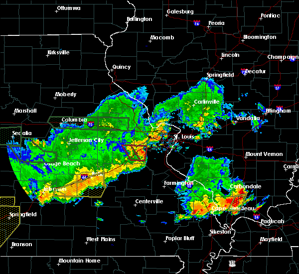 At 501 pm cdt, a severe thunderstorm capable of producing a tornado was located near catawissa, moving east at 35 mph (radar indicated rotation). Hazards include tornado. Flying debris will be dangerous to those caught without shelter. mobile homes will be damaged or destroyed. damage to roofs, windows, and vehicles will occur. tree damage is likely. this tornadic thunderstorm will remain over mainly rural areas of southeastern franklin county, including the following locations, moselle, catawissa and robertsville. this also includes robertsville state park. This includes interstate 44 in missouri between exits 247 and 257. At 501 pm cdt, a severe thunderstorm capable of producing a tornado was located near catawissa, moving east at 35 mph (radar indicated rotation). Hazards include tornado. Flying debris will be dangerous to those caught without shelter. mobile homes will be damaged or destroyed. damage to roofs, windows, and vehicles will occur. tree damage is likely. this tornadic thunderstorm will remain over mainly rural areas of southeastern franklin county, including the following locations, moselle, catawissa and robertsville. this also includes robertsville state park. This includes interstate 44 in missouri between exits 247 and 257.
|
| 6/26/2018 4:46 PM CDT |
 At 446 pm cdt, a severe thunderstorm capable of producing a tornado was located over union, moving east at 35 mph (radar indicated rotation). Hazards include tornado. Flying debris will be dangerous to those caught without shelter. mobile homes will be damaged or destroyed. damage to roofs, windows, and vehicles will occur. tree damage is likely. this dangerous storm will be near, villa ridge around 455 pm cdt. gray summit around 500 pm cdt. pacific around 505 pm cdt. other locations impacted by this tornadic thunderstorm include robertsville, moselle, catawissa and piney park. this also includes robertsville state park. This includes interstate 44 in missouri between exits 239 and 257. At 446 pm cdt, a severe thunderstorm capable of producing a tornado was located over union, moving east at 35 mph (radar indicated rotation). Hazards include tornado. Flying debris will be dangerous to those caught without shelter. mobile homes will be damaged or destroyed. damage to roofs, windows, and vehicles will occur. tree damage is likely. this dangerous storm will be near, villa ridge around 455 pm cdt. gray summit around 500 pm cdt. pacific around 505 pm cdt. other locations impacted by this tornadic thunderstorm include robertsville, moselle, catawissa and piney park. this also includes robertsville state park. This includes interstate 44 in missouri between exits 239 and 257.
|
| 6/26/2018 4:35 PM CDT |
 At 434 pm cdt, a severe thunderstorm capable of producing a tornado was located near union, moving east at 35 mph (radar indicated rotation). Hazards include tornado. Flying debris will be dangerous to those caught without shelter. mobile homes will be damaged or destroyed. damage to roofs, windows, and vehicles will occur. tree damage is likely. this dangerous storm will be near, union and st. clair around 445 pm cdt. villa ridge around 455 pm cdt. pacific and gray summit around 505 pm cdt. other locations impacted by this tornadic thunderstorm include lyon, robertsville, moselle, catawissa and piney park. this also includes robertsville state park. This includes interstate 44 in missouri between exits 239 and 257. At 434 pm cdt, a severe thunderstorm capable of producing a tornado was located near union, moving east at 35 mph (radar indicated rotation). Hazards include tornado. Flying debris will be dangerous to those caught without shelter. mobile homes will be damaged or destroyed. damage to roofs, windows, and vehicles will occur. tree damage is likely. this dangerous storm will be near, union and st. clair around 445 pm cdt. villa ridge around 455 pm cdt. pacific and gray summit around 505 pm cdt. other locations impacted by this tornadic thunderstorm include lyon, robertsville, moselle, catawissa and piney park. this also includes robertsville state park. This includes interstate 44 in missouri between exits 239 and 257.
|
| 6/14/2018 5:40 PM CDT | Tree damage in robertsvill in franklin county MO, 5.5 miles NW of Villa Ridge, MO |
| 6/14/2018 5:40 PM CDT | 9-13 inch diameter tree down across highway o in villa ridg in franklin county MO, 0.7 miles WSW of Villa Ridge, MO |
| 6/14/2018 5:25 PM CDT | Corrects previous tstm wnd dmg report from villa ridge. 9-13 inch diameter tree down across highway o in villa ridg in franklin county MO, 0.7 miles WSW of Villa Ridge, MO |
| 6/14/2018 5:14 PM CDT |
 At 513 pm cdt, a severe thunderstorm was located near drake, moving southeast at 10 mph. another severe thunderstorm was just northwest of washington (radar indicated). Hazards include 60 mph wind gusts and quarter size hail. Hail damage to vehicles is expected. Expect wind damage to roofs, siding, and trees. At 513 pm cdt, a severe thunderstorm was located near drake, moving southeast at 10 mph. another severe thunderstorm was just northwest of washington (radar indicated). Hazards include 60 mph wind gusts and quarter size hail. Hail damage to vehicles is expected. Expect wind damage to roofs, siding, and trees.
|
| 5/14/2018 6:04 PM CDT |
 At 603 pm cdt, a severe thunderstorm was located near beaufort, moving east at 45 mph (radar indicated). Hazards include 60 mph wind gusts and quarter size hail. Hail damage to vehicles is expected. expect wind damage to roofs, siding, and trees. locations impacted include, washington, union, owensville, new haven, villa ridge, gerald, rosebud, beaufort, drake, leslie, noser mill and lyon. This includes interstate 44 in missouri near exit 247. At 603 pm cdt, a severe thunderstorm was located near beaufort, moving east at 45 mph (radar indicated). Hazards include 60 mph wind gusts and quarter size hail. Hail damage to vehicles is expected. expect wind damage to roofs, siding, and trees. locations impacted include, washington, union, owensville, new haven, villa ridge, gerald, rosebud, beaufort, drake, leslie, noser mill and lyon. This includes interstate 44 in missouri near exit 247.
|
| 5/14/2018 5:47 PM CDT |
 At 547 pm cdt, a severe thunderstorm was located over drake, moving east at 30 mph (radar indicated). Hazards include 60 mph wind gusts and quarter size hail. Hail damage to vehicles is expected. expect wind damage to roofs, siding, and trees. locations impacted include, washington, union, owensville, new haven, villa ridge, gerald, rosebud, beaufort, drake, leslie, noser mill and lyon. This includes interstate 44 in missouri near exit 247. At 547 pm cdt, a severe thunderstorm was located over drake, moving east at 30 mph (radar indicated). Hazards include 60 mph wind gusts and quarter size hail. Hail damage to vehicles is expected. expect wind damage to roofs, siding, and trees. locations impacted include, washington, union, owensville, new haven, villa ridge, gerald, rosebud, beaufort, drake, leslie, noser mill and lyon. This includes interstate 44 in missouri near exit 247.
|
| 5/14/2018 5:30 PM CDT |
 At 529 pm cdt, a severe thunderstorm was located near mount sterling, moving east at 45 mph (radar indicated). Hazards include 60 mph wind gusts and quarter size hail. Hail damage to vehicles is expected. Expect wind damage to roofs, siding, and trees. At 529 pm cdt, a severe thunderstorm was located near mount sterling, moving east at 45 mph (radar indicated). Hazards include 60 mph wind gusts and quarter size hail. Hail damage to vehicles is expected. Expect wind damage to roofs, siding, and trees.
|
| 4/13/2018 10:13 PM CDT |
 At 1013 pm cdt, severe thunderstorms were located along a line extending from near marthasville to gray summit to near cedar hill lakes to near de soto to desloge, moving northeast at 50 mph (radar indicated). Hazards include 60 mph wind gusts. Expect damage to roofs, siding, and trees. locations impacted include, st. louis, o`fallon, st. charles, st. peters, florissant, chesterfield, belleville, wildwood, university city, ballwin, granite city, wentzville, kirkwood, maryland heights, east st. louis, hazelwood, webster groves, ferguson, arnold and manchester. this also includes babler memorial state park, scott joplin historic site, route 66 state park, castlewood state park, mastodon historic site, sandy creek covered bridge historic site, gov. dunklin`s grave historic site, first missouri state capitol historic site, and robertsville state park. this includes the following highways, interstate 44 in missouri between exits 251 and 277. interstate 55 in missouri between exits 170 and 191. interstate 70 in missouri between exits 203 and 231. A tornado watch remains in effect until 100 am cdt for southwestern illinois, and southeastern and east central missouri. At 1013 pm cdt, severe thunderstorms were located along a line extending from near marthasville to gray summit to near cedar hill lakes to near de soto to desloge, moving northeast at 50 mph (radar indicated). Hazards include 60 mph wind gusts. Expect damage to roofs, siding, and trees. locations impacted include, st. louis, o`fallon, st. charles, st. peters, florissant, chesterfield, belleville, wildwood, university city, ballwin, granite city, wentzville, kirkwood, maryland heights, east st. louis, hazelwood, webster groves, ferguson, arnold and manchester. this also includes babler memorial state park, scott joplin historic site, route 66 state park, castlewood state park, mastodon historic site, sandy creek covered bridge historic site, gov. dunklin`s grave historic site, first missouri state capitol historic site, and robertsville state park. this includes the following highways, interstate 44 in missouri between exits 251 and 277. interstate 55 in missouri between exits 170 and 191. interstate 70 in missouri between exits 203 and 231. A tornado watch remains in effect until 100 am cdt for southwestern illinois, and southeastern and east central missouri.
|
| 4/13/2018 9:53 PM CDT |
 At 953 pm cdt, severe thunderstorms were located along a line extending from near washington to near lonedell to old mines to near belleview, moving northeast at 50 mph (radar indicated). Hazards include 60 mph wind gusts. expect damage to roofs, siding, and trees At 953 pm cdt, severe thunderstorms were located along a line extending from near washington to near lonedell to old mines to near belleview, moving northeast at 50 mph (radar indicated). Hazards include 60 mph wind gusts. expect damage to roofs, siding, and trees
|
| 11/5/2017 3:24 PM CDT |
 At 224 pm cst, a severe thunderstorm was located near villa ridge, moving east at 40 mph (radar indicated). Hazards include 60 mph wind gusts and quarter size hail. Hail damage to vehicles is expected. Expect wind damage to roofs, siding, and trees. At 224 pm cst, a severe thunderstorm was located near villa ridge, moving east at 40 mph (radar indicated). Hazards include 60 mph wind gusts and quarter size hail. Hail damage to vehicles is expected. Expect wind damage to roofs, siding, and trees.
|
| 9/4/2017 7:57 PM CDT |
 The severe thunderstorm warning for northwestern jefferson, east central franklin and southwestern st. louis counties will expire at 800 pm cdt, the storms which prompted the warning have moved out of part of the area. therefore the warning will be allowed to expire. however, a new severe thunderstorm warning was issued for some of the area and remains in effect until 830 pm cdt. a severe thunderstorm watch remains in effect until 1000 pm cdt for east central missouri. to report severe weather, contact your nearest law enforcement agency. they will relay your report to the national weather service st louis. The severe thunderstorm warning for northwestern jefferson, east central franklin and southwestern st. louis counties will expire at 800 pm cdt, the storms which prompted the warning have moved out of part of the area. therefore the warning will be allowed to expire. however, a new severe thunderstorm warning was issued for some of the area and remains in effect until 830 pm cdt. a severe thunderstorm watch remains in effect until 1000 pm cdt for east central missouri. to report severe weather, contact your nearest law enforcement agency. they will relay your report to the national weather service st louis.
|
| 9/4/2017 7:47 PM CDT |
 At 746 pm cdt, severe thunderstorms were located along a line extending from fenton to villa ridge, moving southeast at 25 mph (radar indicated). Hazards include 60 mph wind gusts and penny size hail. expect damage to roofs, siding, and trees At 746 pm cdt, severe thunderstorms were located along a line extending from fenton to villa ridge, moving southeast at 25 mph (radar indicated). Hazards include 60 mph wind gusts and penny size hail. expect damage to roofs, siding, and trees
|
| 9/4/2017 7:39 PM CDT |
 At 739 pm cdt, severe thunderstorms were located along a line extending from twin oaks to near villa ridge, moving south at 25 mph (radar indicated). Hazards include 60 mph wind gusts and penny size hail. Expect damage to roofs, siding, and trees. locations impacted include, chesterfield, wildwood, ballwin, kirkwood, manchester, washington, town and country, union, eureka, ellisville, sunset hills, pacific, valley park, fenton, clarkson valley, gray summit, villa ridge, murphy, high ridge and winchester. this also includes route 66 state park and castlewood state park. This includes interstate 44 in missouri between exits 247 and 274. At 739 pm cdt, severe thunderstorms were located along a line extending from twin oaks to near villa ridge, moving south at 25 mph (radar indicated). Hazards include 60 mph wind gusts and penny size hail. Expect damage to roofs, siding, and trees. locations impacted include, chesterfield, wildwood, ballwin, kirkwood, manchester, washington, town and country, union, eureka, ellisville, sunset hills, pacific, valley park, fenton, clarkson valley, gray summit, villa ridge, murphy, high ridge and winchester. this also includes route 66 state park and castlewood state park. This includes interstate 44 in missouri between exits 247 and 274.
|
| 9/4/2017 7:08 PM CDT |
 At 708 pm cdt, severe thunderstorms were located along a line extending from near harvester to near dutzow, moving southeast at 25 mph (radar indicated). Hazards include 60 mph wind gusts and penny size hail. expect damage to roofs, siding, and trees At 708 pm cdt, severe thunderstorms were located along a line extending from near harvester to near dutzow, moving southeast at 25 mph (radar indicated). Hazards include 60 mph wind gusts and penny size hail. expect damage to roofs, siding, and trees
|
| 7/23/2017 1:46 AM CDT |
 At 145 am cdt, a severe thunderstorm was located over marthasville, moving east at 25 mph (radar indicated). Hazards include 60 mph wind gusts and quarter size hail. Hail damage to vehicles is expected. Expect wind damage to roofs, siding, and trees. At 145 am cdt, a severe thunderstorm was located over marthasville, moving east at 25 mph (radar indicated). Hazards include 60 mph wind gusts and quarter size hail. Hail damage to vehicles is expected. Expect wind damage to roofs, siding, and trees.
|
| 6/29/2017 10:22 AM CDT |
 At 322 pm cdt, severe thunderstorms were located along a line extending from near marthasville to near washington, moving east at 40 mph (radar indicated). Hazards include 60 mph wind gusts and quarter size hail. Hail damage to vehicles is expected. Expect wind damage to roofs, siding, and trees. At 322 pm cdt, severe thunderstorms were located along a line extending from near marthasville to near washington, moving east at 40 mph (radar indicated). Hazards include 60 mph wind gusts and quarter size hail. Hail damage to vehicles is expected. Expect wind damage to roofs, siding, and trees.
|
| 5/27/2017 4:36 PM CDT |
 At 436 pm cdt, severe thunderstorms were located along a line extending from near chain of rocks to dardenne prairie to pacific, moving east at 55 mph (radar indicated). Hazards include 60 mph wind gusts. Expect damage to roofs, siding, and trees. locations impacted include, o`fallon, st. charles, st. peters, florissant, chesterfield, wildwood, university city, ballwin, wentzville, kirkwood, maryland heights, hazelwood, webster groves, manchester, creve coeur, overland, clayton, lake st. louis, st. ann and crestwood. this also includes babler memorial state park, route 66 state park, castlewood state park, and first missouri state capitol historic site. this includes the following highways, interstate 44 in missouri between exits 247 and 277. interstate 70 in missouri between exits 203 and 231. A tornado watch remains in effect until 700 pm cdt for east central missouri. At 436 pm cdt, severe thunderstorms were located along a line extending from near chain of rocks to dardenne prairie to pacific, moving east at 55 mph (radar indicated). Hazards include 60 mph wind gusts. Expect damage to roofs, siding, and trees. locations impacted include, o`fallon, st. charles, st. peters, florissant, chesterfield, wildwood, university city, ballwin, wentzville, kirkwood, maryland heights, hazelwood, webster groves, manchester, creve coeur, overland, clayton, lake st. louis, st. ann and crestwood. this also includes babler memorial state park, route 66 state park, castlewood state park, and first missouri state capitol historic site. this includes the following highways, interstate 44 in missouri between exits 247 and 277. interstate 70 in missouri between exits 203 and 231. A tornado watch remains in effect until 700 pm cdt for east central missouri.
|
| 5/27/2017 4:12 PM CDT |
 At 411 pm cdt, severe thunderstorms were located along a line extending from near jonesburg to near truesdale to near beaufort, moving east at 55 mph (radar indicated). Hazards include 60 mph wind gusts. expect damage to roofs, siding, and trees At 411 pm cdt, severe thunderstorms were located along a line extending from near jonesburg to near truesdale to near beaufort, moving east at 55 mph (radar indicated). Hazards include 60 mph wind gusts. expect damage to roofs, siding, and trees
|
| 5/19/2017 5:02 AM CDT |
 At 502 am cdt, severe thunderstorms were located along a line extending from near st. paul to 9 miles southeast of crystal city, moving east at 55 mph (radar indicated). Hazards include 70 mph wind gusts. Expect considerable tree damage. damage is likely to mobile homes, roofs, and outbuildings. locations impacted include, st. louis, o`fallon, st. charles, st. peters, florissant, chesterfield, wildwood, university city, ballwin, wentzville, kirkwood, maryland heights, hazelwood, webster groves, ferguson, arnold, manchester, creve coeur, overland and clayton. this also includes babler memorial state park, scott joplin historic site, route 66 state park, castlewood state park, confluence state park, mastodon historic site, sandy creek covered bridge historic site, gov. dunklin`s grave historic site, first missouri state capitol historic site, and robertsville state park. this includes the following highways, interstate 44 in missouri between exits 251 and 277. interstate 55 in missouri between exits 170 and 191. Interstate 70 in missouri between exits 203 and 231. At 502 am cdt, severe thunderstorms were located along a line extending from near st. paul to 9 miles southeast of crystal city, moving east at 55 mph (radar indicated). Hazards include 70 mph wind gusts. Expect considerable tree damage. damage is likely to mobile homes, roofs, and outbuildings. locations impacted include, st. louis, o`fallon, st. charles, st. peters, florissant, chesterfield, wildwood, university city, ballwin, wentzville, kirkwood, maryland heights, hazelwood, webster groves, ferguson, arnold, manchester, creve coeur, overland and clayton. this also includes babler memorial state park, scott joplin historic site, route 66 state park, castlewood state park, confluence state park, mastodon historic site, sandy creek covered bridge historic site, gov. dunklin`s grave historic site, first missouri state capitol historic site, and robertsville state park. this includes the following highways, interstate 44 in missouri between exits 251 and 277. interstate 55 in missouri between exits 170 and 191. Interstate 70 in missouri between exits 203 and 231.
|
| 5/19/2017 4:39 AM CDT |
 At 439 am cdt, severe thunderstorms were located along a line extending from near truesdale to near de soto, moving east at 55 mph (radar indicated). Hazards include 70 mph wind gusts. Expect considerable tree damage. Damage is likely to mobile homes, roofs, and outbuildings. At 439 am cdt, severe thunderstorms were located along a line extending from near truesdale to near de soto, moving east at 55 mph (radar indicated). Hazards include 70 mph wind gusts. Expect considerable tree damage. Damage is likely to mobile homes, roofs, and outbuildings.
|
| 4/29/2017 2:53 PM CDT |
 At 252 pm cdt, severe thunderstorms were located along a line extending from wright city to near union, moving northeast at 55 mph (radar indicated). Hazards include 60 mph wind gusts and quarter size hail. Hail damage to vehicles is expected. Expect wind damage to roofs, siding, and trees. At 252 pm cdt, severe thunderstorms were located along a line extending from wright city to near union, moving northeast at 55 mph (radar indicated). Hazards include 60 mph wind gusts and quarter size hail. Hail damage to vehicles is expected. Expect wind damage to roofs, siding, and trees.
|
| 4/5/2017 12:20 AM CDT |
 At 1220 am cdt, severe thunderstorms were located along a line extending from near pacific to near hillsboro to near bonne terre, moving northeast at 45 mph (radar indicated). Hazards include 60 mph wind gusts and nickel size hail. expect damage to roofs, siding, and trees At 1220 am cdt, severe thunderstorms were located along a line extending from near pacific to near hillsboro to near bonne terre, moving northeast at 45 mph (radar indicated). Hazards include 60 mph wind gusts and nickel size hail. expect damage to roofs, siding, and trees
|
| 7/13/2016 3:15 PM CDT |
 At 314 pm cdt, severe thunderstorms were located along a line extending from near chapin to near richwoods, moving east at 55 mph (trained weather spotters. numeruus reports of trees down and winds in excess of 60 mph). Hazards include 70 mph wind gusts. Expect considerable tree damage. damage is likely to mobile homes, roofs, and outbuildings. locations impacted include, st. louis, o`fallon, st. charles, st. peters, florissant, belleville, wildwood, university city, ballwin, granite city, wentzville, alton, kirkwood, maryland heights, east st. louis, hazelwood, collinsville, edwardsville, webster groves and ferguson. this also includes babler memorial state park, scott joplin historic site, route 66 state park, castlewood state park, confluence state park, mastodon historic site, sandy creek covered bridge historic site, gov. dunklin`s grave historic site, first missouri state capitol historic site, robertsville state park, meramec state park, pere marquette state park, beaver dam state park, and horseshoe lake state park. this includes the following highways, interstate 64 in illinois between exits 9 and 12. interstate 44 in missouri between exits 230 and 277. interstate 55 in missouri between exits 174 and 191. Interstate 70 in missouri between exits 208 and 231. At 314 pm cdt, severe thunderstorms were located along a line extending from near chapin to near richwoods, moving east at 55 mph (trained weather spotters. numeruus reports of trees down and winds in excess of 60 mph). Hazards include 70 mph wind gusts. Expect considerable tree damage. damage is likely to mobile homes, roofs, and outbuildings. locations impacted include, st. louis, o`fallon, st. charles, st. peters, florissant, belleville, wildwood, university city, ballwin, granite city, wentzville, alton, kirkwood, maryland heights, east st. louis, hazelwood, collinsville, edwardsville, webster groves and ferguson. this also includes babler memorial state park, scott joplin historic site, route 66 state park, castlewood state park, confluence state park, mastodon historic site, sandy creek covered bridge historic site, gov. dunklin`s grave historic site, first missouri state capitol historic site, robertsville state park, meramec state park, pere marquette state park, beaver dam state park, and horseshoe lake state park. this includes the following highways, interstate 64 in illinois between exits 9 and 12. interstate 44 in missouri between exits 230 and 277. interstate 55 in missouri between exits 174 and 191. Interstate 70 in missouri between exits 208 and 231.
|
| 7/13/2016 2:58 PM CDT |
 At 258 pm cdt, severe thunderstorms were located along a line extending from naples to near miramiguoa park, moving east at 55 mph (trained weather spotters). Hazards include 70 mph wind gusts. Expect considerable tree damage. Damage is likely to mobile homes, roofs, and outbuildings. At 258 pm cdt, severe thunderstorms were located along a line extending from naples to near miramiguoa park, moving east at 55 mph (trained weather spotters). Hazards include 70 mph wind gusts. Expect considerable tree damage. Damage is likely to mobile homes, roofs, and outbuildings.
|
| 7/13/2016 2:38 PM CDT |
 At 237 pm cdt, severe thunderstorms were located along a line extending from near barry to troy to 8 miles northwest of bourbon, moving east at 40 mph (trained weather spotters). Hazards include 70 mph wind gusts and penny size hail. Expect considerable tree damage. damage is likely to mobile homes, roofs, and outbuildings. locations impacted include, st. louis, o`fallon, st. charles, st. peters, florissant, chesterfield, wildwood, university city, ballwin, granite city, wentzville, alton, kirkwood, maryland heights, east st. louis, hazelwood, webster groves, ferguson, arnold and manchester. this also includes babler memorial state park, scott joplin historic site, route 66 state park, cuivre river state park, castlewood state park, mastodon historic site, sandy creek covered bridge historic site, gov. dunklin`s grave historic site, first missouri state capitol historic site, robertsville state park, meramec state park, and pere marquette state park. this includes the following highways, interstate 72 between exits 20 and 35. interstate 44 in missouri between exits 225 and 277. interstate 55 in missouri between exits 170 and 191. Interstate 70 in missouri between exits 188 and 231. At 237 pm cdt, severe thunderstorms were located along a line extending from near barry to troy to 8 miles northwest of bourbon, moving east at 40 mph (trained weather spotters). Hazards include 70 mph wind gusts and penny size hail. Expect considerable tree damage. damage is likely to mobile homes, roofs, and outbuildings. locations impacted include, st. louis, o`fallon, st. charles, st. peters, florissant, chesterfield, wildwood, university city, ballwin, granite city, wentzville, alton, kirkwood, maryland heights, east st. louis, hazelwood, webster groves, ferguson, arnold and manchester. this also includes babler memorial state park, scott joplin historic site, route 66 state park, cuivre river state park, castlewood state park, mastodon historic site, sandy creek covered bridge historic site, gov. dunklin`s grave historic site, first missouri state capitol historic site, robertsville state park, meramec state park, and pere marquette state park. this includes the following highways, interstate 72 between exits 20 and 35. interstate 44 in missouri between exits 225 and 277. interstate 55 in missouri between exits 170 and 191. Interstate 70 in missouri between exits 188 and 231.
|
| 7/13/2016 2:06 PM CDT |
 At 206 pm cdt, severe thunderstorms were located along a line extending from near hannibal to bellflower to near belle, moving east at 50 mph (trained weather spotters). Hazards include 70 mph wind gusts and penny size hail. Expect considerable tree damage. Damage is likely to mobile homes, roofs, and outbuildings. At 206 pm cdt, severe thunderstorms were located along a line extending from near hannibal to bellflower to near belle, moving east at 50 mph (trained weather spotters). Hazards include 70 mph wind gusts and penny size hail. Expect considerable tree damage. Damage is likely to mobile homes, roofs, and outbuildings.
|
| 7/7/2016 8:54 AM CDT |
 At 853 am cdt, severe thunderstorms were located along a line extending from 6 miles west of alsey to st. peters to near anthonies mill, moving east at 50 mph (radar indicated). Hazards include 60 mph wind gusts. Expect damage to roofs. siding. and trees. locations impacted include, o`fallon, st. charles, st. peters, florissant, chesterfield, wildwood, university city, ballwin, wentzville, kirkwood, maryland heights, hazelwood, webster groves, ferguson, arnold, manchester, godfrey, creve coeur, overland and clayton. this also includes babler memorial state park, washington state park, route 66 state park, onondaga cave state park, cuivre river state park, castlewood state park, mastodon historic site, sandy creek covered bridge historic site, first missouri state capitol historic site, robertsville state park, meramec state park, and pere marquette state park. this includes the following highways, interstate 44 in missouri between exits 203 and 277. interstate 55 in missouri between exits 175 and 191. Interstate 70 in missouri between exits 203 and 231. At 853 am cdt, severe thunderstorms were located along a line extending from 6 miles west of alsey to st. peters to near anthonies mill, moving east at 50 mph (radar indicated). Hazards include 60 mph wind gusts. Expect damage to roofs. siding. and trees. locations impacted include, o`fallon, st. charles, st. peters, florissant, chesterfield, wildwood, university city, ballwin, wentzville, kirkwood, maryland heights, hazelwood, webster groves, ferguson, arnold, manchester, godfrey, creve coeur, overland and clayton. this also includes babler memorial state park, washington state park, route 66 state park, onondaga cave state park, cuivre river state park, castlewood state park, mastodon historic site, sandy creek covered bridge historic site, first missouri state capitol historic site, robertsville state park, meramec state park, and pere marquette state park. this includes the following highways, interstate 44 in missouri between exits 203 and 277. interstate 55 in missouri between exits 175 and 191. Interstate 70 in missouri between exits 203 and 231.
|
| 7/7/2016 8:36 AM CDT |
 At 835 am cdt, severe thunderstorms were located along a line extending from near pittsfield to wentzville to cuba, moving east at 30 mph (radar indicated). Hazards include 60 mph wind gusts. Expect damage to roofs. siding. and trees. locations impacted include, o`fallon, st. charles, st. peters, florissant, chesterfield, wildwood, university city, ballwin, wentzville, kirkwood, maryland heights, hazelwood, webster groves, ferguson, arnold, manchester, godfrey, creve coeur, overland and clayton. this also includes babler memorial state park, washington state park, route 66 state park, onondaga cave state park, cuivre river state park, castlewood state park, mastodon historic site, sandy creek covered bridge historic site, first missouri state capitol historic site, robertsville state park, meramec state park, and pere marquette state park. this includes the following highways, interstate 44 in missouri between exits 203 and 277. interstate 55 in missouri between exits 175 and 191. Interstate 70 in missouri between exits 188 and 231. At 835 am cdt, severe thunderstorms were located along a line extending from near pittsfield to wentzville to cuba, moving east at 30 mph (radar indicated). Hazards include 60 mph wind gusts. Expect damage to roofs. siding. and trees. locations impacted include, o`fallon, st. charles, st. peters, florissant, chesterfield, wildwood, university city, ballwin, wentzville, kirkwood, maryland heights, hazelwood, webster groves, ferguson, arnold, manchester, godfrey, creve coeur, overland and clayton. this also includes babler memorial state park, washington state park, route 66 state park, onondaga cave state park, cuivre river state park, castlewood state park, mastodon historic site, sandy creek covered bridge historic site, first missouri state capitol historic site, robertsville state park, meramec state park, and pere marquette state park. this includes the following highways, interstate 44 in missouri between exits 203 and 277. interstate 55 in missouri between exits 175 and 191. Interstate 70 in missouri between exits 188 and 231.
|
| 7/7/2016 8:11 AM CDT |
 At 811 am cdt, severe thunderstorms were located along a line extending from 6 miles southwest of barry to warrenton to 8 miles southeast of owensville, moving east at 40 mph (radar indicated). Hazards include 70 mph wind gusts. Expect considerable tree damage. damage is likely to mobile homes, roofs, and outbuildings. locations impacted include, o`fallon, st. charles, st. peters, florissant, chesterfield, wildwood, university city, ballwin, wentzville, kirkwood, maryland heights, hazelwood, webster groves, ferguson, arnold, manchester, godfrey, creve coeur, overland and clayton. this also includes babler memorial state park, washington state park, route 66 state park, onondaga cave state park, deutschheim historic site, cuivre river state park, castlewood state park, mastodon historic site, sandy creek covered bridge historic site, first missouri state capitol historic site, robertsville state park, meramec state park, and pere marquette state park. this includes the following highways, interstate 44 in missouri between exits 203 and 277. interstate 55 in missouri between exits 175 and 191. Interstate 70 in missouri between exits 175 and 231. At 811 am cdt, severe thunderstorms were located along a line extending from 6 miles southwest of barry to warrenton to 8 miles southeast of owensville, moving east at 40 mph (radar indicated). Hazards include 70 mph wind gusts. Expect considerable tree damage. damage is likely to mobile homes, roofs, and outbuildings. locations impacted include, o`fallon, st. charles, st. peters, florissant, chesterfield, wildwood, university city, ballwin, wentzville, kirkwood, maryland heights, hazelwood, webster groves, ferguson, arnold, manchester, godfrey, creve coeur, overland and clayton. this also includes babler memorial state park, washington state park, route 66 state park, onondaga cave state park, deutschheim historic site, cuivre river state park, castlewood state park, mastodon historic site, sandy creek covered bridge historic site, first missouri state capitol historic site, robertsville state park, meramec state park, and pere marquette state park. this includes the following highways, interstate 44 in missouri between exits 203 and 277. interstate 55 in missouri between exits 175 and 191. Interstate 70 in missouri between exits 175 and 231.
|
| 7/7/2016 7:59 AM CDT |
 At 758 am cdt, severe thunderstorms were located along a line extending from 9 miles southeast of hannibal to jonesburg to near bland, moving east at 65 mph (radar indicated). Hazards include 70 mph wind gusts. Expect considerable tree damage. Damage is likely to mobile homes, roofs, and outbuildings. At 758 am cdt, severe thunderstorms were located along a line extending from 9 miles southeast of hannibal to jonesburg to near bland, moving east at 65 mph (radar indicated). Hazards include 70 mph wind gusts. Expect considerable tree damage. Damage is likely to mobile homes, roofs, and outbuildings.
|
| 5/11/2016 7:19 PM CDT |
 At 719 pm cdt, a severe thunderstorm was located near new haven, moving east at 35 mph (radar indicated). Hazards include 60 mph wind gusts and half dollar size hail. Hail damage to vehicles is expected. Expect wind damage to roofs, siding, and trees. At 719 pm cdt, a severe thunderstorm was located near new haven, moving east at 35 mph (radar indicated). Hazards include 60 mph wind gusts and half dollar size hail. Hail damage to vehicles is expected. Expect wind damage to roofs, siding, and trees.
|
| 4/30/2016 7:20 PM CDT |
 At 720 pm cdt, a severe thunderstorm was located near cedar hill, moving east at 25 mph (radar indicated). Hazards include half dollar size hail. Damage to vehicles is expected. locations impacted include, chesterfield, wildwood, ballwin, arnold, manchester, eureka, ellisville, pacific, valley park, fenton, byrnes mill, clarkson valley, antonia, high ridge, villa ridge, murphy, cedar hill, gray summit, winchester and twin oaks. this also includes babler memorial state park, route 66 state park, castlewood state park, mastodon historic site, and robertsville state park. this includes the following highways, interstate 44 in missouri between exits 247 and 272. Interstate 55 in missouri between exits 187 and 190. At 720 pm cdt, a severe thunderstorm was located near cedar hill, moving east at 25 mph (radar indicated). Hazards include half dollar size hail. Damage to vehicles is expected. locations impacted include, chesterfield, wildwood, ballwin, arnold, manchester, eureka, ellisville, pacific, valley park, fenton, byrnes mill, clarkson valley, antonia, high ridge, villa ridge, murphy, cedar hill, gray summit, winchester and twin oaks. this also includes babler memorial state park, route 66 state park, castlewood state park, mastodon historic site, and robertsville state park. this includes the following highways, interstate 44 in missouri between exits 247 and 272. Interstate 55 in missouri between exits 187 and 190.
|
| 4/30/2016 7:02 PM CDT |
 At 701 pm cdt, a severe thunderstorm was located near villa ridge, moving east at 25 mph (radar indicated). Hazards include quarter size hail. damage to vehicles is expected At 701 pm cdt, a severe thunderstorm was located near villa ridge, moving east at 25 mph (radar indicated). Hazards include quarter size hail. damage to vehicles is expected
|
| 4/26/2016 1:34 PM CDT |
 At 133 pm cdt, severe thunderstorms were located along a line extending from near new melle to near parkway to near st. james, moving east at 40 mph (trained spotters reported quarter size hail in villa ridge). Hazards include 60 mph wind gusts and quarter size hail. Hail damage to vehicles is expected. expect wind damage to roofs, siding, and trees. locations impacted include, o`fallon, wentzville, lake st. louis, washington, dardenne prairie, union, warrenton, st. clair, wright city, st. paul, gray summit, villa ridge, marthasville, innsbrook, new melle, parkway, josephville, augusta, dutzow and defiance. this also includes robertsville state park. this includes the following highways, interstate 44 in missouri between exits 239 and 253. Interstate 70 in missouri between exits 199 and 214. At 133 pm cdt, severe thunderstorms were located along a line extending from near new melle to near parkway to near st. james, moving east at 40 mph (trained spotters reported quarter size hail in villa ridge). Hazards include 60 mph wind gusts and quarter size hail. Hail damage to vehicles is expected. expect wind damage to roofs, siding, and trees. locations impacted include, o`fallon, wentzville, lake st. louis, washington, dardenne prairie, union, warrenton, st. clair, wright city, st. paul, gray summit, villa ridge, marthasville, innsbrook, new melle, parkway, josephville, augusta, dutzow and defiance. this also includes robertsville state park. this includes the following highways, interstate 44 in missouri between exits 239 and 253. Interstate 70 in missouri between exits 199 and 214.
|
| 4/26/2016 1:30 PM CDT | Quarter sized hail reported 0.7 miles WSW of Villa Ridge, MO |
| 4/26/2016 1:01 PM CDT |
 At 101 pm cdt, severe thunderstorms were located along a line extending from jonesburg to near gerald to 7 miles south of vienna, moving east at 40 mph (radar indicated). Hazards include 60 mph wind gusts and quarter size hail. Hail damage to vehicles is expected. Expect wind damage to roofs, siding, and trees. At 101 pm cdt, severe thunderstorms were located along a line extending from jonesburg to near gerald to 7 miles south of vienna, moving east at 40 mph (radar indicated). Hazards include 60 mph wind gusts and quarter size hail. Hail damage to vehicles is expected. Expect wind damage to roofs, siding, and trees.
|
| 2/20/2016 7:18 PM CST |
 At 718 pm cst, a severe thunderstorm was located near beaufort, moving east at 25 mph (radar indicated). Hazards include quarter size hail. damage to vehicles is expected At 718 pm cst, a severe thunderstorm was located near beaufort, moving east at 25 mph (radar indicated). Hazards include quarter size hail. damage to vehicles is expected
|
| 8/9/2015 7:20 PM CDT |
 At 719 pm cdt, severe thunderstorms were located along a line extending from house springs to near de soto to 6 miles southwest of potosi, moving east at 50 mph (radar indicated). Hazards include 60 mph wind gusts. Expect damage to roofs. siding and trees. locations impacted include, festus, pacific, bonne terre, de soto, pevely, hillsboro, byrnes mill, potosi, bismarck, leadwood, cedar hill, antonia, high ridge, villa ridge, barnhart, olympian village, irondale, mineral point, cedar hill lakes and lonedell. this warning also includes , washington state park, st. Francois state park, sandy creek covered bridge historic site, and robertsville state park. At 719 pm cdt, severe thunderstorms were located along a line extending from house springs to near de soto to 6 miles southwest of potosi, moving east at 50 mph (radar indicated). Hazards include 60 mph wind gusts. Expect damage to roofs. siding and trees. locations impacted include, festus, pacific, bonne terre, de soto, pevely, hillsboro, byrnes mill, potosi, bismarck, leadwood, cedar hill, antonia, high ridge, villa ridge, barnhart, olympian village, irondale, mineral point, cedar hill lakes and lonedell. this warning also includes , washington state park, st. Francois state park, sandy creek covered bridge historic site, and robertsville state park.
|
| 8/9/2015 7:06 PM CDT |
 At 706 pm cdt, severe thunderstorms were located along a line extending from gray summit to near richwoods, moving east at 45 mph (radar indicated). Hazards include 60 mph wind gusts and penny size hail. Expect damage to roofs. siding and trees. locations impacted include, washington, union, pacific, st. clair, gray summit, villa ridge, parkway, miramiguoa park, lonedell, moselle, stanton, robertsville, catawissa and piney park. this warning also includes robertsville state park. This includes interstate 44 in missouri between exits 230 and 257. At 706 pm cdt, severe thunderstorms were located along a line extending from gray summit to near richwoods, moving east at 45 mph (radar indicated). Hazards include 60 mph wind gusts and penny size hail. Expect damage to roofs. siding and trees. locations impacted include, washington, union, pacific, st. clair, gray summit, villa ridge, parkway, miramiguoa park, lonedell, moselle, stanton, robertsville, catawissa and piney park. this warning also includes robertsville state park. This includes interstate 44 in missouri between exits 230 and 257.
|
| 8/9/2015 7:02 PM CDT |
 At 702 pm cdt, severe thunderstorms were located along a line extending from villa ridge to near richwoods to 9 miles northeast of cherryville, moving east at 45 mph (radar indicated). Hazards include 60 mph wind gusts. Expect damage to roofs. Siding and trees. At 702 pm cdt, severe thunderstorms were located along a line extending from villa ridge to near richwoods to 9 miles northeast of cherryville, moving east at 45 mph (radar indicated). Hazards include 60 mph wind gusts. Expect damage to roofs. Siding and trees.
|
| 8/9/2015 6:53 PM CDT |
 At 652 pm cdt, severe thunderstorms were located along a line extending from near washington to near miramiguoa park, moving east at 40 mph (radar indicated). Hazards include 60 mph wind gusts and penny size hail. 60 mph winds have been reported in the union area. Expect damage to roofs. siding and trees. locations impacted include, washington, union, sullivan, pacific, st. clair, gray summit, villa ridge, gerald, parkway, miramiguoa park, lonedell, beaufort, leslie, moselle, noser mill, stanton, japan, robertsville, catawissa and piney park. this warning also includes robertsville state park. This includes interstate 44 in missouri between exits 225 and 257. At 652 pm cdt, severe thunderstorms were located along a line extending from near washington to near miramiguoa park, moving east at 40 mph (radar indicated). Hazards include 60 mph wind gusts and penny size hail. 60 mph winds have been reported in the union area. Expect damage to roofs. siding and trees. locations impacted include, washington, union, sullivan, pacific, st. clair, gray summit, villa ridge, gerald, parkway, miramiguoa park, lonedell, beaufort, leslie, moselle, noser mill, stanton, japan, robertsville, catawissa and piney park. this warning also includes robertsville state park. This includes interstate 44 in missouri between exits 225 and 257.
|
| 8/9/2015 6:27 PM CDT |
 At 627 pm cdt, a severe thunderstorm was located near gerald, moving east at 45 mph (radar indicated). Hazards include 60 mph wind gusts and penny size hail. Expect damage to roofs. Siding and trees. At 627 pm cdt, a severe thunderstorm was located near gerald, moving east at 45 mph (radar indicated). Hazards include 60 mph wind gusts and penny size hail. Expect damage to roofs. Siding and trees.
|
| 6/28/2015 6:59 PM CDT |
 At 659 pm cdt, a severe thunderstorm was located near beaufort, and moving southeast at 25 mph (radar indicated). Hazards include 60 mph wind gusts and quarter size hail. Hail damage to vehicles is expected. expect wind damage to roofs, siding and trees. locations impacted include, union, sullivan, st. clair, beaufort, parkway, leslie, noser mill, stanton and moselle. This warning also includes, interstate 44 from exit 225 to exit 247. At 659 pm cdt, a severe thunderstorm was located near beaufort, and moving southeast at 25 mph (radar indicated). Hazards include 60 mph wind gusts and quarter size hail. Hail damage to vehicles is expected. expect wind damage to roofs, siding and trees. locations impacted include, union, sullivan, st. clair, beaufort, parkway, leslie, noser mill, stanton and moselle. This warning also includes, interstate 44 from exit 225 to exit 247.
|
| 6/28/2015 6:45 PM CDT |
 At 644 pm cdt, a severe thunderstorm was located 7 miles north of gerald, and moving southeast at 25 mph (radar indicated). Hazards include 60 mph wind gusts and quarter size hail. Hail damage to vehicles is expected. Expect wind damage to roofs, siding and trees. At 644 pm cdt, a severe thunderstorm was located 7 miles north of gerald, and moving southeast at 25 mph (radar indicated). Hazards include 60 mph wind gusts and quarter size hail. Hail damage to vehicles is expected. Expect wind damage to roofs, siding and trees.
|
| 6/12/2015 4:29 PM CDT |
 A severe thunderstorm warning remains in effect for southwestern st. louis. southwestern st. charles and northeastern franklin counties until 500 pm cdt. at 428 pm cdt. a severe thunderstorm was located near gray summit. and moving northeast at 20 mph. hazard. 60 mph wind gusts and penny size hail. A severe thunderstorm warning remains in effect for southwestern st. louis. southwestern st. charles and northeastern franklin counties until 500 pm cdt. at 428 pm cdt. a severe thunderstorm was located near gray summit. and moving northeast at 20 mph. hazard. 60 mph wind gusts and penny size hail.
|
| 6/12/2015 4:15 PM CDT |
 At 413 pm cdt, a severe thunderstorm was located near union, and moving northeast at 25 mph (radar indicated). Hazards include 60 mph wind gusts and penny size hail. Expect damage to roofs. Siding and trees. At 413 pm cdt, a severe thunderstorm was located near union, and moving northeast at 25 mph (radar indicated). Hazards include 60 mph wind gusts and penny size hail. Expect damage to roofs. Siding and trees.
|
| 4/8/2015 8:02 PM CDT | The national weather service in st louis has issued a * severe thunderstorm warning for. southeastern franklin county in east central missouri. northwestern jefferson county in east central missouri. until 845 pm cdt * at 800 pm cdt. A severe thunderstorm was located near lonedell. |
| 4/7/2015 9:48 AM CDT | A severe thunderstorm warning remains in effect for northwestern jefferson and east central franklin counties until 1000 am cdt. at 946 am cdt. a severe thunderstorm was located near lonedell. and moving east at 40 mph. hazard. ping pong ball size hail. source. trained weather spotters. Quarter size hail was reported. |
| 4/7/2015 9:39 AM CDT | A severe thunderstorm warning remains in effect for northwestern jefferson and east central franklin counties until 1000 am cdt. at 937 am cdt. a severe thunderstorm was located near st. clair. and moving east at 40 mph. hazard. ping pong ball size hail. source. Radar indicated. |
| 4/7/2015 9:18 AM CDT | The national weather service in st louis has issued a * severe thunderstorm warning for. central franklin county in east central missouri. northwestern jefferson county in east central missouri. until 1000 am cdt * at 915 am cdt. a severe thunderstorm was located near st. Clair. |
| 4/2/2015 10:58 PM CDT | A severe thunderstorm warning remains in effect for central franklin county until 1115 pm cdt. at 1055 pm cdt. a severe thunderstorm was located near beaufort. and moving east at 30 mph. hazard. 60 mph wind gusts and quarter size hail. source. Trained weather spotters reported wind damage 8 miles south. |
| 4/2/2015 10:30 PM CDT | The national weather service in st louis has issued a * severe thunderstorm warning for. southern franklin county in east central missouri. until 1115 pm cdt * at 1028 pm cdt. a severe thunderstorm was located near rosebud. And moving east at 30 mph. |
| 4/2/2015 10:14 PM CDT | A severe thunderstorm warning remains in effect for east central franklin county until 1045 pm cdt. at 1011 pm cdt. a severe thunderstorm was located 5 miles south of villa ridge. and moving east at 45 mph. hazard. 60 mph wind gusts and quarter size hail. source. Trained weather spotters reported quarter size hail in. |
| 4/2/2015 9:59 PM CDT | The national weather service in st louis has issued a * severe thunderstorm warning for. eastern franklin county in east central missouri. until 1045 pm cdt * at 957 pm cdt. a severe thunderstorm was located near union. And moving east at 45 mph. |
| 4/2/2015 3:48 PM CDT | The national weather service in st louis has issued a * severe thunderstorm warning for. northeastern franklin county in east central missouri. southwestern st. louis county in east central missouri. until 415 pm cdt * at 345 pm cdt. A severe thunderstorm was located near augusta. |
| 8/6/2014 5:57 PM CDT | Half Dollar sized hail reported 2.4 miles SW of Villa Ridge, MO, also tree damage in the local area |
| 8/6/2014 5:50 PM CDT | Trees and power lines down across town in franklin county MO, 0.7 miles WSW of Villa Ridge, MO |
| 4/3/2014 7:35 PM CDT | Quarter sized hail reported 3.4 miles W of Villa Ridge, MO, relayed by missouri troop c |
| 4/3/2014 1:31 PM CDT | Half Dollar sized hail reported 2.4 miles SSW of Villa Ridge, MO, golf ball size hail 1 to 2 miles north of villa eidge |
| 4/3/2014 1:31 PM CDT | Golf Ball sized hail reported 2.4 miles SSW of Villa Ridge, MO, golf ball size hail 1 to 2 miles north of villa eidge |
| 8/31/2013 7:30 PM CDT | Tree approx 8 inch in diameter downed across road. winds estimated 50-60 mp in franklin county MO, 0.7 miles WSW of Villa Ridge, MO |
| 5/20/2013 3:07 AM CDT | Three or four power poles have been snapped off along old highway 100 and highway t. time approximate from rada in franklin county MO, 0.7 miles WSW of Villa Ridge, MO |
| 4/10/2013 7:30 PM CDT | Numerous trees and power poles snapped near the bas in franklin county MO, 0.7 miles WSW of Villa Ridge, MO |
| 4/10/2013 7:30 PM CDT | Several large trees snapped at the base at the wolf hollow golf club off highway 10 in franklin county MO, 3.4 miles SSE of Villa Ridge, MO |
| 4/10/2013 7:24 PM CDT | Multiple large trees blocking coleman road. time estimated from rada in franklin county MO, 0.7 miles WSW of Villa Ridge, MO |
| 9/6/2012 3:56 PM CDT | Twelve inch diamter tree limb dow in franklin county MO, 0.7 miles WSW of Villa Ridge, MO |
| 8/4/2012 10:10 PM CDT | Trees down in franklin county MO, 0.7 miles WSW of Villa Ridge, MO |
| 8/4/2012 10:00 PM CDT | Heavy rain fell over the past hou in franklin county MO, 0.7 miles WSW of Villa Ridge, MO |
| 7/8/2012 4:12 PM CDT | Trees down in villa ridge with around 2500 without power in franklin count in franklin county MO, 0.7 miles WSW of Villa Ridge, MO |
| 7/8/2012 4:12 PM CDT | Trees down in villa ridge with around 2500 without power in franklin county. time estimated from rada in franklin county MO, 0.7 miles WSW of Villa Ridge, MO |
| 1/1/0001 12:00 AM | Golf Ball sized hail reported 0.7 miles WSW of Villa Ridge, MO |
| 1/1/0001 12:00 AM | Quarter sized hail reported 0.7 miles WSW of Villa Ridge, MO |
| 1/1/0001 12:00 AM | Golf Ball sized hail reported 0.7 miles WSW of Villa Ridge, MO |
Hail Maps for Villa Ridge, MO


Connect with Interactive Hail Maps